

Hail Map for Poplar, MT
The Poplar, MT area has had 11 reports of on-the-ground hail by trained spotters, and has been under severe weather warnings 23 times during the past 12 months. Doppler radar has detected hail at or near Poplar, MT on 32 occasions, including 2 occasions during the past year.
| Name: | Poplar, MT |
| Where Located: | 66.9 miles E of Glasgow, MT |
| Map: | Google Map for Poplar, MT |
| Population: | 810 |
| Housing Units: | 352 |
| More Info: | Search Google for Poplar, MT |
1
The Top Recent Hail Date for Poplar, MT is Tuesday, September 17, 2024 (7th out of 32)

Hail and Wind Damage Spotted near Poplar, MT
| Date / Time | Report Details |
|---|---|
| 6/15/2025 9:45 PM MDT | Badger creek (aprswxnet/cwop) statio in richland county MT, 16.2 miles NW of Poplar, MT |
| 6/15/2025 9:10 PM MDT |
 the severe thunderstorm warning has been cancelled and is no longer in effect the severe thunderstorm warning has been cancelled and is no longer in effect
|
| 6/15/2025 9:10 PM MDT |
 At 910 pm mdt, severe thunderstorms were located along a line extending from 17 miles south of scobey to 11 miles south of bredette to 7 miles southwest of poplar, moving east at 40 mph (radar indicated). Hazards include 70 mph wind gusts. Expect considerable tree damage. damage is likely to mobile homes, roofs, and outbuildings. Locations impacted include, poplar, sprole, and brockton. At 910 pm mdt, severe thunderstorms were located along a line extending from 17 miles south of scobey to 11 miles south of bredette to 7 miles southwest of poplar, moving east at 40 mph (radar indicated). Hazards include 70 mph wind gusts. Expect considerable tree damage. damage is likely to mobile homes, roofs, and outbuildings. Locations impacted include, poplar, sprole, and brockton.
|
| 6/15/2025 8:50 PM MDT | Bredette ne (hydromet) statio in roosevelt county MT, 30.5 miles S of Poplar, MT |
| 6/15/2025 8:37 PM MDT |
 Svrggw the national weather service in glasgow has issued a * severe thunderstorm warning for, western roosevelt county in northeastern montana, east central valley county in northeastern montana, northeastern mccone county in northeastern montana, northwestern richland county in northeastern montana, * until 945 pm mdt. * at 837 pm mdt, severe thunderstorms were located along a line extending from near lustre to 9 miles north of wolf point to 13 miles southeast of frazer, moving east at 40 mph (radar indicated). Hazards include 70 mph wind gusts. Expect considerable tree damage. Damage is likely to mobile homes, roofs, and outbuildings. Svrggw the national weather service in glasgow has issued a * severe thunderstorm warning for, western roosevelt county in northeastern montana, east central valley county in northeastern montana, northeastern mccone county in northeastern montana, northwestern richland county in northeastern montana, * until 945 pm mdt. * at 837 pm mdt, severe thunderstorms were located along a line extending from near lustre to 9 miles north of wolf point to 13 miles southeast of frazer, moving east at 40 mph (radar indicated). Hazards include 70 mph wind gusts. Expect considerable tree damage. Damage is likely to mobile homes, roofs, and outbuildings.
|
| 6/15/2025 8:20 PM MDT |
 the severe thunderstorm warning has been cancelled and is no longer in effect the severe thunderstorm warning has been cancelled and is no longer in effect
|
| 6/15/2025 8:20 PM MDT |
 At 818 pm mdt, severe thunderstorms were located along a line extending from 6 miles soutt of lustre to the nelson creek recreation area, moving southeast at 45 mph (trained weather spotters). Hazards include 70 mph wind gusts and half dollar size hail. Hail damage to vehicles is expected. expect considerable tree damage. wind damage is also likely to mobile homes, roofs, and outbuildings. Locations impacted include, wolf point, sprole, circle, oswego, weldon, richey, frazer, poplar, vida, and rock creek rec area. At 818 pm mdt, severe thunderstorms were located along a line extending from 6 miles soutt of lustre to the nelson creek recreation area, moving southeast at 45 mph (trained weather spotters). Hazards include 70 mph wind gusts and half dollar size hail. Hail damage to vehicles is expected. expect considerable tree damage. wind damage is also likely to mobile homes, roofs, and outbuildings. Locations impacted include, wolf point, sprole, circle, oswego, weldon, richey, frazer, poplar, vida, and rock creek rec area.
|
| 6/15/2025 7:48 PM MDT |
 Svrggw the national weather service in glasgow has issued a * severe thunderstorm warning for, northeastern garfield county in northeastern montana, southwestern roosevelt county in northeastern montana, eastern valley county in northeastern montana, mccone county in northeastern montana, northwestern dawson county in northeastern montana, northwestern richland county in northeastern montana, * until 845 pm mdt. * at 747 pm mdt, severe thunderstorms were located along a line extending from 15 miles north of st. marie to near nashua to 6 miles south of fort peck, moving southeast at 85 mph (trained weather spotters). Hazards include 70 mph wind gusts and half dollar size hail. Hail damage to vehicles is expected. expect considerable tree damage. Wind damage is also likely to mobile homes, roofs, and outbuildings. Svrggw the national weather service in glasgow has issued a * severe thunderstorm warning for, northeastern garfield county in northeastern montana, southwestern roosevelt county in northeastern montana, eastern valley county in northeastern montana, mccone county in northeastern montana, northwestern dawson county in northeastern montana, northwestern richland county in northeastern montana, * until 845 pm mdt. * at 747 pm mdt, severe thunderstorms were located along a line extending from 15 miles north of st. marie to near nashua to 6 miles south of fort peck, moving southeast at 85 mph (trained weather spotters). Hazards include 70 mph wind gusts and half dollar size hail. Hail damage to vehicles is expected. expect considerable tree damage. Wind damage is also likely to mobile homes, roofs, and outbuildings.
|
| 5/12/2025 9:30 PM MDT |
 The storms which prompted the warning have weakened below severe limits, and no longer pose an immediate threat to life or property. therefore, the warning will be allowed to expire. however, gusty winds are still possible with these thunderstorms. The storms which prompted the warning have weakened below severe limits, and no longer pose an immediate threat to life or property. therefore, the warning will be allowed to expire. however, gusty winds are still possible with these thunderstorms.
|
| 5/12/2025 9:18 PM MDT | Poplar raw in roosevelt county MT, 5.8 miles W of Poplar, MT |
| 5/12/2025 8:52 PM MDT |
 At 850 pm mdt, severe thunderstorms were located along a line extending from 9 miles southwest of bredette to 12 miles west of circle, moving northeast at 25 mph (at 837 pm, the wolf point airport reported a gust to 59 mph). Hazards include 60 mph wind gusts. Expect damage to roofs, siding, and trees. Locations impacted include, wolf point, sprole, oswego, nashua, haxby, weldon, frazer, poplar, vida, nelson creek rec area, rock creek rec area, and circle. At 850 pm mdt, severe thunderstorms were located along a line extending from 9 miles southwest of bredette to 12 miles west of circle, moving northeast at 25 mph (at 837 pm, the wolf point airport reported a gust to 59 mph). Hazards include 60 mph wind gusts. Expect damage to roofs, siding, and trees. Locations impacted include, wolf point, sprole, oswego, nashua, haxby, weldon, frazer, poplar, vida, nelson creek rec area, rock creek rec area, and circle.
|
| 5/12/2025 8:24 PM MDT |
 Svrggw the national weather service in glasgow has issued a * severe thunderstorm warning for, northeastern garfield county in northeastern montana, western roosevelt county in northeastern montana, southeastern valley county in northeastern montana, mccone county in northeastern montana, northwestern dawson county in northeastern montana, northwestern richland county in northeastern montana, * until 930 pm mdt. * at 824 pm mdt, severe thunderstorms were located along a line extending from 7 miles northwest of wolf point to 6 miles north of flowing wells rest area, moving east at 30 mph (public). Hazards include 60 mph wind gusts. expect damage to roofs, siding, and trees Svrggw the national weather service in glasgow has issued a * severe thunderstorm warning for, northeastern garfield county in northeastern montana, western roosevelt county in northeastern montana, southeastern valley county in northeastern montana, mccone county in northeastern montana, northwestern dawson county in northeastern montana, northwestern richland county in northeastern montana, * until 930 pm mdt. * at 824 pm mdt, severe thunderstorms were located along a line extending from 7 miles northwest of wolf point to 6 miles north of flowing wells rest area, moving east at 30 mph (public). Hazards include 60 mph wind gusts. expect damage to roofs, siding, and trees
|
| 9/20/2024 8:45 PM MDT |
 The storm which prompted the warning has weakened below severe limits, and has exited the warned area. therefore, the warning will be allowed to expire. however, gusty winds are still possible behind this thunderstorm. The storm which prompted the warning has weakened below severe limits, and has exited the warned area. therefore, the warning will be allowed to expire. however, gusty winds are still possible behind this thunderstorm.
|
| 9/20/2024 8:15 PM MDT |
 At 815 pm mdt, a severe thunderstorm was located 14 miles south of brockton, or 18 miles southeast of poplar, moving east at 50 mph (radar indicated). Hazards include 60 mph wind gusts. Expect damage to roofs, siding, and trees. Locations impacted include, poplar, culbertson, brockton, richey, lambert, sprole, mccabe, fort kipp, and enid. At 815 pm mdt, a severe thunderstorm was located 14 miles south of brockton, or 18 miles southeast of poplar, moving east at 50 mph (radar indicated). Hazards include 60 mph wind gusts. Expect damage to roofs, siding, and trees. Locations impacted include, poplar, culbertson, brockton, richey, lambert, sprole, mccabe, fort kipp, and enid.
|
| 9/20/2024 7:44 PM MDT |
 Svrggw the national weather service in glasgow has issued a * severe thunderstorm warning for, southern roosevelt county in northeastern montana, northeastern mccone county in northeastern montana, richland county in northeastern montana, northern dawson county in northeastern montana, * until 845 pm mdt. * at 743 pm mdt, a severe thunderstorm was located 11 miles northeast of vida, or 12 miles southwest of poplar, moving east at 50 mph (trained weather spotters). Hazards include 70 mph wind gusts. Expect considerable tree damage. Damage is likely to mobile homes, roofs, and outbuildings. Svrggw the national weather service in glasgow has issued a * severe thunderstorm warning for, southern roosevelt county in northeastern montana, northeastern mccone county in northeastern montana, richland county in northeastern montana, northern dawson county in northeastern montana, * until 845 pm mdt. * at 743 pm mdt, a severe thunderstorm was located 11 miles northeast of vida, or 12 miles southwest of poplar, moving east at 50 mph (trained weather spotters). Hazards include 70 mph wind gusts. Expect considerable tree damage. Damage is likely to mobile homes, roofs, and outbuildings.
|
| 9/17/2024 6:41 PM MDT |
 Svrggw the national weather service in glasgow has issued a * severe thunderstorm warning for, southern daniels county in northeastern montana, western roosevelt county in northeastern montana, eastern valley county in northeastern montana, west central sheridan county in northeastern montana, northeastern mccone county in northeastern montana, northwestern richland county in northeastern montana, * until 745 pm mdt. * at 641 pm mdt, a severe thunderstorm was located over bredette, or 19 miles south of scobey, moving northwest at 20 mph (radar indicated). Hazards include 60 mph wind gusts and quarter size hail. Hail damage to vehicles is expected. Expect wind damage to roofs, siding, and trees. Svrggw the national weather service in glasgow has issued a * severe thunderstorm warning for, southern daniels county in northeastern montana, western roosevelt county in northeastern montana, eastern valley county in northeastern montana, west central sheridan county in northeastern montana, northeastern mccone county in northeastern montana, northwestern richland county in northeastern montana, * until 745 pm mdt. * at 641 pm mdt, a severe thunderstorm was located over bredette, or 19 miles south of scobey, moving northwest at 20 mph (radar indicated). Hazards include 60 mph wind gusts and quarter size hail. Hail damage to vehicles is expected. Expect wind damage to roofs, siding, and trees.
|
| 9/17/2024 6:18 PM MDT |
 At 617 pm mdt, severe thunderstorms were located along a line extending from 6 miles west of whitetail to 8 miles southeast of vida, moving northwest at 25 mph (radar indicated). Hazards include 60 mph wind gusts and nickel size hail. Expect damage to roofs, siding, and trees. Locations impacted include, poplar and sprole. At 617 pm mdt, severe thunderstorms were located along a line extending from 6 miles west of whitetail to 8 miles southeast of vida, moving northwest at 25 mph (radar indicated). Hazards include 60 mph wind gusts and nickel size hail. Expect damage to roofs, siding, and trees. Locations impacted include, poplar and sprole.
|
| 9/17/2024 6:10 PM MDT | Half Dollar sized hail reported 0.2 miles E of Poplar, MT, relayed via public facebook photo report. |
| 9/17/2024 6:10 PM MDT | Relayed via public facebook image report of a tree falling on a car and fenc in roosevelt county MT, 0.2 miles E of Poplar, MT |
| 9/17/2024 5:44 PM MDT |
 Svrggw the national weather service in glasgow has issued a * severe thunderstorm warning for, central roosevelt county in northeastern montana, northeastern mccone county in northeastern montana, northwestern richland county in northeastern montana, northwestern dawson county in northeastern montana, * until 645 pm mdt. * at 544 pm mdt, severe thunderstorms were located along a line extending from near flaxville to near richey, moving northwest at 25 mph (radar indicated). Hazards include 60 mph wind gusts and nickel size hail. expect damage to roofs, siding, and trees Svrggw the national weather service in glasgow has issued a * severe thunderstorm warning for, central roosevelt county in northeastern montana, northeastern mccone county in northeastern montana, northwestern richland county in northeastern montana, northwestern dawson county in northeastern montana, * until 645 pm mdt. * at 544 pm mdt, severe thunderstorms were located along a line extending from near flaxville to near richey, moving northwest at 25 mph (radar indicated). Hazards include 60 mph wind gusts and nickel size hail. expect damage to roofs, siding, and trees
|
| 8/25/2024 12:52 AM MDT |
 Svrggw the national weather service in glasgow has issued a * severe thunderstorm warning for, eastern daniels county in northeastern montana, roosevelt county in northeastern montana, sheridan county in northeastern montana, northeastern mccone county in northeastern montana, northwestern richland county in northeastern montana, * until 145 am mdt. * at 1251 am mdt, severe thunderstorms were located along a line extending from 13 miles southwest of scobey to bredette to 16 miles north of brockton to near poplar, moving northeast at 45 mph (radar indicated). Hazards include 70 mph wind gusts and quarter size hail. Hail damage to vehicles is expected. expect considerable tree damage. Wind damage is also likely to mobile homes, roofs, and outbuildings. Svrggw the national weather service in glasgow has issued a * severe thunderstorm warning for, eastern daniels county in northeastern montana, roosevelt county in northeastern montana, sheridan county in northeastern montana, northeastern mccone county in northeastern montana, northwestern richland county in northeastern montana, * until 145 am mdt. * at 1251 am mdt, severe thunderstorms were located along a line extending from 13 miles southwest of scobey to bredette to 16 miles north of brockton to near poplar, moving northeast at 45 mph (radar indicated). Hazards include 70 mph wind gusts and quarter size hail. Hail damage to vehicles is expected. expect considerable tree damage. Wind damage is also likely to mobile homes, roofs, and outbuildings.
|
| 8/25/2024 12:33 AM MDT |
 At 1232 am mdt, severe thunderstorms were located along a line extending from near peerless to 12 miles east of lustre to 15 miles south of bredette to 10 miles south of poplar, moving northeast at 45 mph (radar indicated). Hazards include 70 mph wind gusts and ping pong ball size hail. People and animals outdoors will be injured. expect hail damage to roofs, siding, windows, and vehicles. expect considerable tree damage. wind damage is also likely to mobile homes, roofs, and outbuildings. Locations impacted include, wolf point, plentywood, scobey, poplar, culbertson, brockton, medicine lake, froid, flaxville, archer, port of whitetail, lustre, madoc, bredette, redstone, frazer, whitetail, rock creek rec area, outlook, and reserve. At 1232 am mdt, severe thunderstorms were located along a line extending from near peerless to 12 miles east of lustre to 15 miles south of bredette to 10 miles south of poplar, moving northeast at 45 mph (radar indicated). Hazards include 70 mph wind gusts and ping pong ball size hail. People and animals outdoors will be injured. expect hail damage to roofs, siding, windows, and vehicles. expect considerable tree damage. wind damage is also likely to mobile homes, roofs, and outbuildings. Locations impacted include, wolf point, plentywood, scobey, poplar, culbertson, brockton, medicine lake, froid, flaxville, archer, port of whitetail, lustre, madoc, bredette, redstone, frazer, whitetail, rock creek rec area, outlook, and reserve.
|
| 8/25/2024 12:33 AM MDT |
 the severe thunderstorm warning has been cancelled and is no longer in effect the severe thunderstorm warning has been cancelled and is no longer in effect
|
| 8/24/2024 11:51 PM MDT |
 Svrggw the national weather service in glasgow has issued a * severe thunderstorm warning for, northeastern garfield county in northeastern montana, daniels county in northeastern montana, roosevelt county in northeastern montana, east central valley county in northeastern montana, western sheridan county in northeastern montana, northern mccone county in northeastern montana, northwestern richland county in northeastern montana, northwestern dawson county in northeastern montana, * until 100 am mdt. * at 1150 pm mdt, severe thunderstorms were located along a line extending from 10 miles northwest of lustre to 7 miles northeast of frazer to near wolf point to 7 miles southeast of vida, moving northeast at 45 mph (radar indicated). Hazards include 70 mph wind gusts and quarter size hail. Hail damage to vehicles is expected. expect considerable tree damage. Wind damage is also likely to mobile homes, roofs, and outbuildings. Svrggw the national weather service in glasgow has issued a * severe thunderstorm warning for, northeastern garfield county in northeastern montana, daniels county in northeastern montana, roosevelt county in northeastern montana, east central valley county in northeastern montana, western sheridan county in northeastern montana, northern mccone county in northeastern montana, northwestern richland county in northeastern montana, northwestern dawson county in northeastern montana, * until 100 am mdt. * at 1150 pm mdt, severe thunderstorms were located along a line extending from 10 miles northwest of lustre to 7 miles northeast of frazer to near wolf point to 7 miles southeast of vida, moving northeast at 45 mph (radar indicated). Hazards include 70 mph wind gusts and quarter size hail. Hail damage to vehicles is expected. expect considerable tree damage. Wind damage is also likely to mobile homes, roofs, and outbuildings.
|
| 8/21/2024 8:18 PM MDT | Storm damage reported in roosevelt county MT, 5.8 miles W of Poplar, MT |
| 8/21/2024 8:17 PM MDT |
 At 816 pm mdt, severe thunderstorms were located along a line extending from 7 miles northeast of bredette to 6 miles southwest of brockton, moving east at 25 mph (radar indicated). Hazards include 70 mph wind gusts and half dollar size hail. Hail damage to vehicles is expected. expect considerable tree damage. wind damage is also likely to mobile homes, roofs, and outbuildings. Locations impacted include, poplar, brockton, bredette, sprole, and fort kipp. At 816 pm mdt, severe thunderstorms were located along a line extending from 7 miles northeast of bredette to 6 miles southwest of brockton, moving east at 25 mph (radar indicated). Hazards include 70 mph wind gusts and half dollar size hail. Hail damage to vehicles is expected. expect considerable tree damage. wind damage is also likely to mobile homes, roofs, and outbuildings. Locations impacted include, poplar, brockton, bredette, sprole, and fort kipp.
|
| 8/21/2024 7:49 PM MDT |
 Svrggw the national weather service in glasgow has issued a * severe thunderstorm warning for, roosevelt county in northeastern montana, northeastern mccone county in northeastern montana, northwestern richland county in northeastern montana, * until 845 pm mdt. * at 748 pm mdt, severe thunderstorms were located along a line extending from 6 miles west of bredette to 11 miles south of poplar, moving northeast at 40 mph (radar indicated). Hazards include 60 mph wind gusts and quarter size hail. Hail damage to vehicles is expected. Expect wind damage to roofs, siding, and trees. Svrggw the national weather service in glasgow has issued a * severe thunderstorm warning for, roosevelt county in northeastern montana, northeastern mccone county in northeastern montana, northwestern richland county in northeastern montana, * until 845 pm mdt. * at 748 pm mdt, severe thunderstorms were located along a line extending from 6 miles west of bredette to 11 miles south of poplar, moving northeast at 40 mph (radar indicated). Hazards include 60 mph wind gusts and quarter size hail. Hail damage to vehicles is expected. Expect wind damage to roofs, siding, and trees.
|
| 8/21/2024 7:34 PM MDT |
 At 733 pm mdt, severe thunderstorms were located along a line extending from 9 miles southeast of wolf point to 7 miles southwest of richey, moving east at 25 mph (radar indicated). Hazards include 70 mph wind gusts and half dollar size hail. Hail damage to vehicles is expected. expect considerable tree damage. wind damage is also likely to mobile homes, roofs, and outbuildings. Locations impacted include, poplar, richey, vida, bloomfield, and sprole. At 733 pm mdt, severe thunderstorms were located along a line extending from 9 miles southeast of wolf point to 7 miles southwest of richey, moving east at 25 mph (radar indicated). Hazards include 70 mph wind gusts and half dollar size hail. Hail damage to vehicles is expected. expect considerable tree damage. wind damage is also likely to mobile homes, roofs, and outbuildings. Locations impacted include, poplar, richey, vida, bloomfield, and sprole.
|
| 8/21/2024 7:20 PM MDT |
 Svrggw the national weather service in glasgow has issued a * severe thunderstorm warning for, southwestern roosevelt county in northeastern montana, northeastern mccone county in northeastern montana, northwestern dawson county in northeastern montana, northwestern richland county in northeastern montana, * until 815 pm mdt. * at 719 pm mdt, severe thunderstorms were located along a line extending from 7 miles southeast of wolf point to 12 miles southwest of richey, moving northeast at 25 mph (radar indicated). Hazards include 60 mph wind gusts and quarter size hail. Hail damage to vehicles is expected. Expect wind damage to roofs, siding, and trees. Svrggw the national weather service in glasgow has issued a * severe thunderstorm warning for, southwestern roosevelt county in northeastern montana, northeastern mccone county in northeastern montana, northwestern dawson county in northeastern montana, northwestern richland county in northeastern montana, * until 815 pm mdt. * at 719 pm mdt, severe thunderstorms were located along a line extending from 7 miles southeast of wolf point to 12 miles southwest of richey, moving northeast at 25 mph (radar indicated). Hazards include 60 mph wind gusts and quarter size hail. Hail damage to vehicles is expected. Expect wind damage to roofs, siding, and trees.
|
| 7/5/2024 4:35 PM MDT | Awos station kpo1 popla in roosevelt county MT, 1.8 miles SW of Poplar, MT |
| 6/24/2024 1:06 AM MDT |
 The storm which prompted the warning has weakened below severe limits, and no longer poses an immediate threat to life or property. therefore, the warning will be allowed to expire. to report severe weather, contact your nearest law enforcement agency. they will relay your report to the national weather service glasgow. The storm which prompted the warning has weakened below severe limits, and no longer poses an immediate threat to life or property. therefore, the warning will be allowed to expire. to report severe weather, contact your nearest law enforcement agency. they will relay your report to the national weather service glasgow.
|
| 6/24/2024 12:36 AM MDT |
 At 1235 am mdt, a severe thunderstorm was located over poplar, moving east at 35 mph (radar indicated). Hazards include ping pong ball size hail. People and animals outdoors will be injured. expect damage to roofs, siding, windows, and vehicles. Locations impacted include, poplar, culbertson, brockton, sprole, and fort kipp. At 1235 am mdt, a severe thunderstorm was located over poplar, moving east at 35 mph (radar indicated). Hazards include ping pong ball size hail. People and animals outdoors will be injured. expect damage to roofs, siding, windows, and vehicles. Locations impacted include, poplar, culbertson, brockton, sprole, and fort kipp.
|
| 6/24/2024 12:26 AM MDT |
 Svrggw the national weather service in glasgow has issued a * severe thunderstorm warning for, central roosevelt county in northeastern montana, northeastern mccone county in northeastern montana, northwestern richland county in northeastern montana, * until 115 am mdt. * at 1225 am mdt, a severe thunderstorm was located near poplar, moving east at 35 mph (radar indicated). Hazards include quarter size hail. damage to vehicles is expected Svrggw the national weather service in glasgow has issued a * severe thunderstorm warning for, central roosevelt county in northeastern montana, northeastern mccone county in northeastern montana, northwestern richland county in northeastern montana, * until 115 am mdt. * at 1225 am mdt, a severe thunderstorm was located near poplar, moving east at 35 mph (radar indicated). Hazards include quarter size hail. damage to vehicles is expected
|
| 6/24/2024 12:17 AM MDT |
 the severe thunderstorm warning has been cancelled and is no longer in effect the severe thunderstorm warning has been cancelled and is no longer in effect
|
| 6/24/2024 12:17 AM MDT |
 At 1216 am mdt, a severe thunderstorm was located 10 miles northeast of wolf point, moving east at 45 mph (radar indicated). Hazards include 60 mph wind gusts and quarter size hail. Hail damage to vehicles is expected. expect wind damage to roofs, siding, and trees. Locations impacted include, poplar, brockton, and sprole. At 1216 am mdt, a severe thunderstorm was located 10 miles northeast of wolf point, moving east at 45 mph (radar indicated). Hazards include 60 mph wind gusts and quarter size hail. Hail damage to vehicles is expected. expect wind damage to roofs, siding, and trees. Locations impacted include, poplar, brockton, and sprole.
|
| 6/23/2024 11:57 PM MDT |
 Svrggw the national weather service in glasgow has issued a * severe thunderstorm warning for, western roosevelt county in northeastern montana, east central valley county in northeastern montana, northeastern mccone county in northeastern montana, northwestern richland county in northeastern montana, * until 1230 am mdt. * at 1157 pm mdt, a severe thunderstorm was located near wolf point, moving east at 45 mph (radar indicated). Hazards include 60 mph wind gusts and quarter size hail. Hail damage to vehicles is expected. Expect wind damage to roofs, siding, and trees. Svrggw the national weather service in glasgow has issued a * severe thunderstorm warning for, western roosevelt county in northeastern montana, east central valley county in northeastern montana, northeastern mccone county in northeastern montana, northwestern richland county in northeastern montana, * until 1230 am mdt. * at 1157 pm mdt, a severe thunderstorm was located near wolf point, moving east at 45 mph (radar indicated). Hazards include 60 mph wind gusts and quarter size hail. Hail damage to vehicles is expected. Expect wind damage to roofs, siding, and trees.
|
| 6/15/2024 8:13 PM MDT |
 At 812 pm mdt, severe thunderstorms were located along a line extending from 6 miles southwest of redstone to 7 miles northwest of culbertson to 11 miles east of bloomfield, moving east at 40 mph (radar indicated). Hazards include 70 mph wind gusts and quarter size hail. Hail damage to vehicles is expected. expect considerable tree damage. wind damage is also likely to mobile homes, roofs, and outbuildings. Locations impacted include, poplar, culbertson, brockton, medicine lake, bainville, froid, richey, archer, lambert, bredette, redstone, reserve, fort kipp, homestead, enid, navajo, sprole, and mccabe. At 812 pm mdt, severe thunderstorms were located along a line extending from 6 miles southwest of redstone to 7 miles northwest of culbertson to 11 miles east of bloomfield, moving east at 40 mph (radar indicated). Hazards include 70 mph wind gusts and quarter size hail. Hail damage to vehicles is expected. expect considerable tree damage. wind damage is also likely to mobile homes, roofs, and outbuildings. Locations impacted include, poplar, culbertson, brockton, medicine lake, bainville, froid, richey, archer, lambert, bredette, redstone, reserve, fort kipp, homestead, enid, navajo, sprole, and mccabe.
|
| 6/15/2024 8:13 PM MDT |
 the severe thunderstorm warning has been cancelled and is no longer in effect the severe thunderstorm warning has been cancelled and is no longer in effect
|
| 6/15/2024 7:57 PM MDT |
 The tornado threat has diminished and the tornado warning has been cancelled. however, large hail and damaging winds remain likely and a severe thunderstorm warning remains in effect for the area. however, gusty winds and heavy rain are still possible with this thunderstorm. a severe thunderstorm watch remains in effect until 900 pm mdt for northeastern montana. remember, a severe thunderstorm warning still remains in effect for sheridan, daniels and mccone counties until 830 pm!. The tornado threat has diminished and the tornado warning has been cancelled. however, large hail and damaging winds remain likely and a severe thunderstorm warning remains in effect for the area. however, gusty winds and heavy rain are still possible with this thunderstorm. a severe thunderstorm watch remains in effect until 900 pm mdt for northeastern montana. remember, a severe thunderstorm warning still remains in effect for sheridan, daniels and mccone counties until 830 pm!.
|
| 6/15/2024 7:38 PM MDT |
 At 738 pm mdt, a confirmed tornado was located 13 miles north of poplar, moving east at 45 mph (law enforcement confirmed tornado). Hazards include damaging tornado and quarter size hail. Flying debris will be dangerous to those caught without shelter. mobile homes will be damaged or destroyed. damage to roofs, windows, and vehicles will occur. tree damage is likely. Locations impacted include, poplar. At 738 pm mdt, a confirmed tornado was located 13 miles north of poplar, moving east at 45 mph (law enforcement confirmed tornado). Hazards include damaging tornado and quarter size hail. Flying debris will be dangerous to those caught without shelter. mobile homes will be damaged or destroyed. damage to roofs, windows, and vehicles will occur. tree damage is likely. Locations impacted include, poplar.
|
| 6/15/2024 7:38 PM MDT |
 the tornado warning has been cancelled and is no longer in effect the tornado warning has been cancelled and is no longer in effect
|
| 6/15/2024 7:27 PM MDT |
 Svrggw the national weather service in glasgow has issued a * severe thunderstorm warning for, southern daniels county in northeastern montana, roosevelt county in northeastern montana, east central valley county in northeastern montana, western sheridan county in northeastern montana, northeastern mccone county in northeastern montana, richland county in northeastern montana, northern dawson county in northeastern montana, * until 830 pm mdt. * at 726 pm mdt, severe thunderstorms were located along a line extending from 12 miles south of peerless to 6 miles west of poplar to 6 miles south of circle, moving east at 45 mph (radar indicated). Hazards include 70 mph wind gusts and quarter size hail. Hail damage to vehicles is expected. expect considerable tree damage. Wind damage is also likely to mobile homes, roofs, and outbuildings. Svrggw the national weather service in glasgow has issued a * severe thunderstorm warning for, southern daniels county in northeastern montana, roosevelt county in northeastern montana, east central valley county in northeastern montana, western sheridan county in northeastern montana, northeastern mccone county in northeastern montana, richland county in northeastern montana, northern dawson county in northeastern montana, * until 830 pm mdt. * at 726 pm mdt, severe thunderstorms were located along a line extending from 12 miles south of peerless to 6 miles west of poplar to 6 miles south of circle, moving east at 45 mph (radar indicated). Hazards include 70 mph wind gusts and quarter size hail. Hail damage to vehicles is expected. expect considerable tree damage. Wind damage is also likely to mobile homes, roofs, and outbuildings.
|
| 6/15/2024 7:22 PM MDT |
 Torggw the national weather service in glasgow has issued a * tornado warning for, southeastern daniels county in northeastern montana, western roosevelt county in northeastern montana, west central sheridan county in northeastern montana, northern mccone county in northeastern montana, northwestern richland county in northeastern montana, * until 800 pm mdt. * at 721 pm mdt, a funnel cloud was located 11 miles northeast of wolf point, moving northeast at 45 mph (law enforcement reported a funnel cloud at 722 pm). Hazards include damaging tornado and quarter size hail. Flying debris will be dangerous to those caught without shelter. mobile homes will be damaged or destroyed. damage to roofs, windows, and vehicles will occur. tree damage is likely. This tornadic thunderstorm will remain over mainly rural areas of southeastern daniels, western roosevelt, west central sheridan, northern mccone and northwestern richland counties. Torggw the national weather service in glasgow has issued a * tornado warning for, southeastern daniels county in northeastern montana, western roosevelt county in northeastern montana, west central sheridan county in northeastern montana, northern mccone county in northeastern montana, northwestern richland county in northeastern montana, * until 800 pm mdt. * at 721 pm mdt, a funnel cloud was located 11 miles northeast of wolf point, moving northeast at 45 mph (law enforcement reported a funnel cloud at 722 pm). Hazards include damaging tornado and quarter size hail. Flying debris will be dangerous to those caught without shelter. mobile homes will be damaged or destroyed. damage to roofs, windows, and vehicles will occur. tree damage is likely. This tornadic thunderstorm will remain over mainly rural areas of southeastern daniels, western roosevelt, west central sheridan, northern mccone and northwestern richland counties.
|
| 6/15/2024 7:03 PM MDT |
 the severe thunderstorm warning has been cancelled and is no longer in effect the severe thunderstorm warning has been cancelled and is no longer in effect
|
| 6/15/2024 7:03 PM MDT |
 At 702 pm mdt, a severe thunderstorm was located 7 miles southeast of lustre, or 17 miles north of wolf point, moving northeast at 45 mph. this is a destructive storm for oswego, wolf point, poplar, and lustre (public). Hazards include 80 mph wind gusts and quarter size hail. Flying debris will be dangerous to those caught without shelter. mobile homes will be heavily damaged. expect considerable damage to roofs, windows, and vehicles. extensive tree damage and power outages are likely. Locations impacted include, wolf point, poplar, frazer, lustre, sprole, oswego, and volt. At 702 pm mdt, a severe thunderstorm was located 7 miles southeast of lustre, or 17 miles north of wolf point, moving northeast at 45 mph. this is a destructive storm for oswego, wolf point, poplar, and lustre (public). Hazards include 80 mph wind gusts and quarter size hail. Flying debris will be dangerous to those caught without shelter. mobile homes will be heavily damaged. expect considerable damage to roofs, windows, and vehicles. extensive tree damage and power outages are likely. Locations impacted include, wolf point, poplar, frazer, lustre, sprole, oswego, and volt.
|
| 6/15/2024 6:28 PM MDT |
 Svrggw the national weather service in glasgow has issued a * severe thunderstorm warning for, northeastern garfield county in northeastern montana, southwestern daniels county in northeastern montana, western roosevelt county in northeastern montana, southeastern valley county in northeastern montana, northern mccone county in northeastern montana, northwestern richland county in northeastern montana, * until 730 pm mdt. * at 627 pm mdt, a severe thunderstorm was located near nashua, or 17 miles east of glasgow, moving northeast at 45 mph. this is a destructive storm for fort peck, nashua, frazer, oswego, wolf point and lustre (public). Hazards include 80 mph wind gusts and quarter size hail. Flying debris will be dangerous to those caught without shelter. mobile homes will be heavily damaged. expect considerable damage to roofs, windows, and vehicles. Extensive tree damage and power outages are likely. Svrggw the national weather service in glasgow has issued a * severe thunderstorm warning for, northeastern garfield county in northeastern montana, southwestern daniels county in northeastern montana, western roosevelt county in northeastern montana, southeastern valley county in northeastern montana, northern mccone county in northeastern montana, northwestern richland county in northeastern montana, * until 730 pm mdt. * at 627 pm mdt, a severe thunderstorm was located near nashua, or 17 miles east of glasgow, moving northeast at 45 mph. this is a destructive storm for fort peck, nashua, frazer, oswego, wolf point and lustre (public). Hazards include 80 mph wind gusts and quarter size hail. Flying debris will be dangerous to those caught without shelter. mobile homes will be heavily damaged. expect considerable damage to roofs, windows, and vehicles. Extensive tree damage and power outages are likely.
|
| 4/22/2024 4:47 PM MDT |
 The storms which prompted the warning have weakened below severe limits, and no longer pose an immediate threat to life or property. therefore, the warning has been allowed to expire. however, gusty winds are still possible with these thunderstorms. The storms which prompted the warning have weakened below severe limits, and no longer pose an immediate threat to life or property. therefore, the warning has been allowed to expire. however, gusty winds are still possible with these thunderstorms.
|
| 4/22/2024 3:42 PM MDT |
 Svrggw the national weather service in glasgow has issued a * severe thunderstorm warning for, southwestern roosevelt county in northeastern montana, east central valley county in northeastern montana, northeastern mccone county in northeastern montana, northwestern richland county in northeastern montana, northwestern dawson county in northeastern montana, * until 445 pm mdt. * at 341 pm mdt, showers with damaging gusts were located along a line extending from 13 miles southwest of bredette to 8 miles southeast of st. marie, moving southeast at 60 mph (radar indicated). Hazards include 60 mph wind gusts. expect damage to roofs, siding, and trees Svrggw the national weather service in glasgow has issued a * severe thunderstorm warning for, southwestern roosevelt county in northeastern montana, east central valley county in northeastern montana, northeastern mccone county in northeastern montana, northwestern richland county in northeastern montana, northwestern dawson county in northeastern montana, * until 445 pm mdt. * at 341 pm mdt, showers with damaging gusts were located along a line extending from 13 miles southwest of bredette to 8 miles southeast of st. marie, moving southeast at 60 mph (radar indicated). Hazards include 60 mph wind gusts. expect damage to roofs, siding, and trees
|
| 4/22/2024 1:54 PM MDT |
 The severe winds with showers which prompted the warning has weakened. therefore, the warning will be allowed to expire. however, gusty winds will continue for the remainder of the afternoon. The severe winds with showers which prompted the warning has weakened. therefore, the warning will be allowed to expire. however, gusty winds will continue for the remainder of the afternoon.
|
| 4/22/2024 12:59 PM MDT |
 Svrggw the national weather service in glasgow has issued a * severe thunderstorm warning for, southern roosevelt county in northeastern montana, northeastern mccone county in northeastern montana, richland county in northeastern montana, northwestern dawson county in northeastern montana, * until 200 pm mdt. * at 1258 pm mdt, severe winds with showers were located 9 miles east of wolf point, moving east at 55 mph (radar indicated). Hazards include 60 mph wind gusts. Expect damage to roofs, siding, and trees. Also expect blowing dust and dirt. Svrggw the national weather service in glasgow has issued a * severe thunderstorm warning for, southern roosevelt county in northeastern montana, northeastern mccone county in northeastern montana, richland county in northeastern montana, northwestern dawson county in northeastern montana, * until 200 pm mdt. * at 1258 pm mdt, severe winds with showers were located 9 miles east of wolf point, moving east at 55 mph (radar indicated). Hazards include 60 mph wind gusts. Expect damage to roofs, siding, and trees. Also expect blowing dust and dirt.
|
| 8/18/2023 9:45 PM MDT | Storm damage reported in richland county MT, 16.2 miles NW of Poplar, MT |
| 7/30/2023 5:43 PM MDT |
 At 541 pm mdt, a severe thunderstorm was located 8 miles south of poplar, moving southeast at 45 mph. this is a destructive storm for areas near wolf point (at 510 pm an nws employee reported an estimated wind gust of 80 mph). Hazards include 80 mph wind gusts and half dollar size hail. Flying debris will be dangerous to those caught without shelter. mobile homes will be heavily damaged. expect considerable damage to roofs, windows, and vehicles. Extensive tree damage and power outages are likely. At 541 pm mdt, a severe thunderstorm was located 8 miles south of poplar, moving southeast at 45 mph. this is a destructive storm for areas near wolf point (at 510 pm an nws employee reported an estimated wind gust of 80 mph). Hazards include 80 mph wind gusts and half dollar size hail. Flying debris will be dangerous to those caught without shelter. mobile homes will be heavily damaged. expect considerable damage to roofs, windows, and vehicles. Extensive tree damage and power outages are likely.
|
| 7/22/2023 10:58 PM MDT |
 At 1058 pm mdt, severe thunderstorms were located along a line extending from 11 miles west of medicine lake to 17 miles north of brockton to 10 miles southwest of bredette to 11 miles northwest of lustre, moving southeast at 45 mph (radar indicated). Hazards include 60 mph wind gusts and quarter size hail. Hail damage to vehicles is expected. expect wind damage to roofs, siding, and trees. locations impacted include, scobey, poplar, brockton, medicine lake, froid, flaxville, archer, lustre, madoc, bredette, redstone, fort kipp, homestead, daleview, west fork, volt, navajo and sprole. hail threat, radar indicated max hail size, 1. 00 in wind threat, radar indicated max wind gust, 60 mph. At 1058 pm mdt, severe thunderstorms were located along a line extending from 11 miles west of medicine lake to 17 miles north of brockton to 10 miles southwest of bredette to 11 miles northwest of lustre, moving southeast at 45 mph (radar indicated). Hazards include 60 mph wind gusts and quarter size hail. Hail damage to vehicles is expected. expect wind damage to roofs, siding, and trees. locations impacted include, scobey, poplar, brockton, medicine lake, froid, flaxville, archer, lustre, madoc, bredette, redstone, fort kipp, homestead, daleview, west fork, volt, navajo and sprole. hail threat, radar indicated max hail size, 1. 00 in wind threat, radar indicated max wind gust, 60 mph.
|
| 7/22/2023 10:25 PM MDT |
 At 1025 pm mdt, severe thunderstorms were located along a line extending from near redstone to 7 miles southeast of scobey to 9 miles southeast of peerless to near opheim, moving southeast at 45 mph (radar indicated). Hazards include 60 mph wind gusts and quarter size hail. Hail damage to vehicles is expected. Expect wind damage to roofs, siding, and trees. At 1025 pm mdt, severe thunderstorms were located along a line extending from near redstone to 7 miles southeast of scobey to 9 miles southeast of peerless to near opheim, moving southeast at 45 mph (radar indicated). Hazards include 60 mph wind gusts and quarter size hail. Hail damage to vehicles is expected. Expect wind damage to roofs, siding, and trees.
|
| 7/18/2022 6:03 PM MDT |
 At 603 pm mdt, severe thunderstorms were located along a line extending from 9 miles north of peerless to 15 miles northeast of lustre to 8 miles northwest of wolf point, moving east at 65 mph (radar indicated). Hazards include 60 mph wind gusts and penny size hail. Expect damage to roofs, siding, and trees. Locations impacted include, wolf point, scobey, poplar, opheim, richland, flaxville, port of whitetail, lustre, madoc, bredette, port of scobey, redstone, whitetail, peerless, frazer, oswego, daleview, four buttes, west fork and volt. At 603 pm mdt, severe thunderstorms were located along a line extending from 9 miles north of peerless to 15 miles northeast of lustre to 8 miles northwest of wolf point, moving east at 65 mph (radar indicated). Hazards include 60 mph wind gusts and penny size hail. Expect damage to roofs, siding, and trees. Locations impacted include, wolf point, scobey, poplar, opheim, richland, flaxville, port of whitetail, lustre, madoc, bredette, port of scobey, redstone, whitetail, peerless, frazer, oswego, daleview, four buttes, west fork and volt.
|
| 7/18/2022 5:48 PM MDT |
 At 548 pm mdt, severe thunderstorms were located along a line extending from near richland to 8 miles northwest of lustre to near frazer, moving east at 65 mph (radar indicated). Hazards include 60 mph wind gusts and penny size hail. Expect damage to roofs, siding, and trees. Locations impacted include, wolf point, scobey, poplar, opheim, richland, flaxville, peerless, port of whitetail, lustre, madoc, bredette, port of scobey, redstone, frazer, whitetail, four buttes, west fork, volt, larslan and oswego. At 548 pm mdt, severe thunderstorms were located along a line extending from near richland to 8 miles northwest of lustre to near frazer, moving east at 65 mph (radar indicated). Hazards include 60 mph wind gusts and penny size hail. Expect damage to roofs, siding, and trees. Locations impacted include, wolf point, scobey, poplar, opheim, richland, flaxville, peerless, port of whitetail, lustre, madoc, bredette, port of scobey, redstone, frazer, whitetail, four buttes, west fork, volt, larslan and oswego.
|
| 7/18/2022 5:29 PM MDT |
 At 528 pm mdt, severe thunderstorms were located along a line extending from 8 miles southwest of opheim to near st. marie to near fort peck, moving east at 65 mph (radar indicated). Hazards include 60 mph wind gusts and penny size hail. expect damage to roofs, siding, and trees At 528 pm mdt, severe thunderstorms were located along a line extending from 8 miles southwest of opheim to near st. marie to near fort peck, moving east at 65 mph (radar indicated). Hazards include 60 mph wind gusts and penny size hail. expect damage to roofs, siding, and trees
|
| 7/13/2022 9:56 PM MDT |
 The severe thunderstorm warning for eastern garfield, southwestern roosevelt, southeastern valley, mccone, northwestern prairie, northwestern dawson and northwestern richland counties will expire at 1000 pm mdt, the storms which prompted the warning have weakened below severe limits, and no longer pose an immediate threat to life or property. therefore, the warning will be allowed to expire. however gusty winds are still possible with these thunderstorms. a severe thunderstorm watch remains in effect until 1100 pm mdt for northeastern montana. The severe thunderstorm warning for eastern garfield, southwestern roosevelt, southeastern valley, mccone, northwestern prairie, northwestern dawson and northwestern richland counties will expire at 1000 pm mdt, the storms which prompted the warning have weakened below severe limits, and no longer pose an immediate threat to life or property. therefore, the warning will be allowed to expire. however gusty winds are still possible with these thunderstorms. a severe thunderstorm watch remains in effect until 1100 pm mdt for northeastern montana.
|
| 7/13/2022 9:42 PM MDT |
 At 941 pm mdt, severe thunderstorms were located along a line extending from near nashua to 10 miles northwest of vida to 15 miles south of brockway, moving northeast at 45 mph (trained weather spotters). Hazards include 70 mph wind gusts and penny size hail. Expect considerable tree damage. damage is likely to mobile homes, roofs, and outbuildings. locations impacted include, glasgow, wolf point, poplar, circle, nashua, brockton, fort peck, richey, duck creek rec area, brockway, flowing wells rest area, lustre, fort peck marina, frazer, vida, nelson creek rec area, lindsay, rock creek rec area, park grove and volt. thunderstorm damage threat, considerable hail threat, radar indicated max hail size, 0. 75 in wind threat, radar indicated max wind gust, 70 mph. At 941 pm mdt, severe thunderstorms were located along a line extending from near nashua to 10 miles northwest of vida to 15 miles south of brockway, moving northeast at 45 mph (trained weather spotters). Hazards include 70 mph wind gusts and penny size hail. Expect considerable tree damage. damage is likely to mobile homes, roofs, and outbuildings. locations impacted include, glasgow, wolf point, poplar, circle, nashua, brockton, fort peck, richey, duck creek rec area, brockway, flowing wells rest area, lustre, fort peck marina, frazer, vida, nelson creek rec area, lindsay, rock creek rec area, park grove and volt. thunderstorm damage threat, considerable hail threat, radar indicated max hail size, 0. 75 in wind threat, radar indicated max wind gust, 70 mph.
|
| 7/13/2022 9:07 PM MDT |
 At 905 pm mdt, severe thunderstorms were located along a line extending from 13 miles west of duck creek rec area to 8 miles east of rock creek rec area to 11 miles east of hillside, moving northeast at 40 mph (trained weather spotters). Hazards include 70 mph wind gusts and penny size hail. Expect considerable tree damage. Damage is likely to mobile homes, roofs, and outbuildings. At 905 pm mdt, severe thunderstorms were located along a line extending from 13 miles west of duck creek rec area to 8 miles east of rock creek rec area to 11 miles east of hillside, moving northeast at 40 mph (trained weather spotters). Hazards include 70 mph wind gusts and penny size hail. Expect considerable tree damage. Damage is likely to mobile homes, roofs, and outbuildings.
|
| 7/9/2022 11:53 PM MDT |
 At 1153 pm mdt, severe thunderstorms were located along a line extending from 9 miles west of westby to 7 miles south of bainville, moving east at 25 mph (radar indicated). Hazards include 60 mph wind gusts and nickel size hail. Expect damage to roofs, siding, and trees. locations impacted include, plentywood, scobey, poplar, culbertson, brockton, medicine lake, bainville, froid, westby, flaxville, archer, port of raymond, port of whitetail, fort union trading post, madoc, bredette, port of scobey, redstone, whitetail and outlook. hail threat, radar indicated max hail size, 0. 88 in wind threat, observed max wind gust, 60 mph. At 1153 pm mdt, severe thunderstorms were located along a line extending from 9 miles west of westby to 7 miles south of bainville, moving east at 25 mph (radar indicated). Hazards include 60 mph wind gusts and nickel size hail. Expect damage to roofs, siding, and trees. locations impacted include, plentywood, scobey, poplar, culbertson, brockton, medicine lake, bainville, froid, westby, flaxville, archer, port of raymond, port of whitetail, fort union trading post, madoc, bredette, port of scobey, redstone, whitetail and outlook. hail threat, radar indicated max hail size, 0. 88 in wind threat, observed max wind gust, 60 mph.
|
| 7/9/2022 11:23 PM MDT |
 At 1123 pm mdt, severe thunderstorms were located along a line extending from 6 miles north of redstone to 8 miles south of brockton, moving east at 85 mph (radar indicated). Hazards include 60 mph wind gusts and nickel size hail. expect damage to roofs, siding, and trees At 1123 pm mdt, severe thunderstorms were located along a line extending from 6 miles north of redstone to 8 miles south of brockton, moving east at 85 mph (radar indicated). Hazards include 60 mph wind gusts and nickel size hail. expect damage to roofs, siding, and trees
|
| 7/9/2022 11:18 PM MDT | Picture of weather station relayed via faceboo in roosevelt county MT, 31 miles SSW of Poplar, MT |
| 7/9/2022 10:36 PM MDT |
 At 1036 pm mdt, severe thunderstorms were located along a line extending from near richland to 6 miles east of frazer, moving east at 75 mph (radar indicated). Hazards include 70 mph wind gusts and nickel size hail. Expect considerable tree damage. Damage is likely to mobile homes, roofs, and outbuildings. At 1036 pm mdt, severe thunderstorms were located along a line extending from near richland to 6 miles east of frazer, moving east at 75 mph (radar indicated). Hazards include 70 mph wind gusts and nickel size hail. Expect considerable tree damage. Damage is likely to mobile homes, roofs, and outbuildings.
|
| 7/9/2022 12:53 AM MDT | At 1252 am mdt, severe thunderstorms were located along a line extending from 6 miles north of redstone to near richey, moving east at 60 mph (radar indicated). Hazards include 60 mph wind gusts and nickel size hail. Expect considerable tree damage. damage is likely to mobile homes, roofs, and outbuildings. locations impacted include, sidney, glendive, plentywood, poplar, culbertson, wibaux, fairview, brockton, medicine lake, bainville, froid, richey, westby, archer, port of raymond, savage, west glendive, intake, bloomfield and lambert. thunderstorm damage threat, considerable hail threat, radar indicated max hail size, 0. 88 in wind threat, observed max wind gust, 70 mph. |
| 7/9/2022 12:38 AM MDT | At 1237 am mdt, severe thunderstorms were located along a line extending from 6 miles north of redstone to richey, moving east at 70 mph (radar indicated). Hazards include 60 mph wind gusts and nickel size hail. expect damage to roofs, siding, and trees |
| 7/9/2022 12:07 AM MDT | At 1206 am mdt, severe thunderstorms were located along a line extending from 6 miles southeast of port of scobey to 11 miles southeast of vida, moving east at 60 mph (radar indicated). Hazards include 60 mph wind gusts and penny size hail. Expect damage to roofs, siding, and trees. locations impacted include, sidney, wolf point, plentywood, scobey, poplar, culbertson, fairview, brockton, medicine lake, bainville, froid, richey, westby, flaxville, archer, port of raymond, madoc, lambert, bredette and redstone. hail threat, radar indicated max hail size, 0. 75 in wind threat, observed max wind gust, 60 mph. |
| 7/8/2022 11:41 PM MDT | At 1140 pm mdt, severe thunderstorms were located along a line extending from 11 miles north of peerless to 12 miles west of vida, moving east at 60 mph (radar indicated). Hazards include 70 mph wind gusts and penny size hail. Expect considerable tree damage. Damage is likely to mobile homes, roofs, and outbuildings. |
| 7/8/2022 11:28 PM MDT | At 1127 pm mdt, severe thunderstorms were located along a line extending from near peerless to 13 miles west of vida, moving east at 40 mph (radar indicated). Hazards include 70 mph wind gusts and penny size hail. Expect considerable tree damage. damage is likely to mobile homes, roofs, and outbuildings. locations impacted include, wolf point, scobey, poplar, opheim, richland, nashua, fort peck, flaxville, peerless, port of whitetail, lustre, madoc, fort peck marina, bredette, port of scobey, frazer, whitetail, vida, port of opheim and duck creek rec area. thunderstorm damage threat, considerable hail threat, radar indicated max hail size, 0. 75 in wind threat, observed max wind gust, 70 mph. |
| 7/8/2022 10:48 PM MDT | At 1047 pm mdt, severe thunderstorms were located along a line extending from near opheim to 10 miles northwest of rock creek rec area, moving east at 40 mph (radar indicated). Hazards include 70 mph wind gusts and penny size hail. expect damage to roofs, siding, and trees |
| 7/2/2022 5:00 PM MDT | Gw2498 badger creek site reported a wind of ne42g60 at 170 in richland county MT, 16.2 miles NW of Poplar, MT |
| 2/19/2022 9:28 PM MST |
 At 928 pm mst, severe thunderstorms were located along a line extending from 15 miles southeast of lustre to near wolf point to 13 miles east of rock creek rec area, moving east at 55 mph (radar indicated). Hazards include 60 mph wind gusts. expect damage to roofs, siding, and trees At 928 pm mst, severe thunderstorms were located along a line extending from 15 miles southeast of lustre to near wolf point to 13 miles east of rock creek rec area, moving east at 55 mph (radar indicated). Hazards include 60 mph wind gusts. expect damage to roofs, siding, and trees
|
| 7/22/2021 8:07 PM MDT |
 The severe thunderstorm warning for western roosevelt, south central sheridan, northeastern mccone, northwestern dawson and northwestern richland counties will expire at 815 pm mdt, the storms which prompted the warning have weakened below severe limits, and no longer pose an immediate threat to life or property. therefore, the warning will be allowed to expire. however gusty winds are still possible with these thunderstorms. a severe thunderstorm watch remains in effect until 1100 pm mdt for northeastern montana. The severe thunderstorm warning for western roosevelt, south central sheridan, northeastern mccone, northwestern dawson and northwestern richland counties will expire at 815 pm mdt, the storms which prompted the warning have weakened below severe limits, and no longer pose an immediate threat to life or property. therefore, the warning will be allowed to expire. however gusty winds are still possible with these thunderstorms. a severe thunderstorm watch remains in effect until 1100 pm mdt for northeastern montana.
|
| 7/22/2021 8:00 PM MDT | Awos station kpo1 popla in roosevelt county MT, 1.8 miles SW of Poplar, MT |
| 7/22/2021 7:51 PM MDT |
 At 751 pm mdt, severe thunderstorms were located along a line extending from near bredette to 13 miles southwest of richey, moving east at 45 mph (radar indicated). Hazards include 60 mph wind gusts. Expect damage to roofs, siding, and trees. Locations impacted include, wolf point, poplar, brockton, richey, vida, sprole and fort kipp. At 751 pm mdt, severe thunderstorms were located along a line extending from near bredette to 13 miles southwest of richey, moving east at 45 mph (radar indicated). Hazards include 60 mph wind gusts. Expect damage to roofs, siding, and trees. Locations impacted include, wolf point, poplar, brockton, richey, vida, sprole and fort kipp.
|
| 7/22/2021 7:28 PM MDT |
 At 727 pm mdt, severe thunderstorms were located along a line extending from 7 miles east of lustre to 9 miles northwest of circle, moving east at 45 mph (radar indicated). Hazards include 60 mph wind gusts. Expect damage to roofs, siding, and trees. Locations impacted include, wolf point, poplar, brockton, medicine lake, richey, lustre, frazer, vida, oswego, fort kipp, volt, sprole and homestead. At 727 pm mdt, severe thunderstorms were located along a line extending from 7 miles east of lustre to 9 miles northwest of circle, moving east at 45 mph (radar indicated). Hazards include 60 mph wind gusts. Expect damage to roofs, siding, and trees. Locations impacted include, wolf point, poplar, brockton, medicine lake, richey, lustre, frazer, vida, oswego, fort kipp, volt, sprole and homestead.
|
| 7/22/2021 7:11 PM MDT |
 At 710 pm mdt, severe thunderstorms were located along a line extending from near lustre to 13 miles east of nelson creek rec area, moving east at 45 mph (radar indicated). Hazards include 70 mph wind gusts. Expect considerable tree damage. Damage is likely to mobile homes, roofs, and outbuildings. At 710 pm mdt, severe thunderstorms were located along a line extending from near lustre to 13 miles east of nelson creek rec area, moving east at 45 mph (radar indicated). Hazards include 70 mph wind gusts. Expect considerable tree damage. Damage is likely to mobile homes, roofs, and outbuildings.
|
| 7/8/2021 4:36 PM MDT |
 At 436 pm mdt, severe thunderstorms were located along a line extending from 9 miles southwest of bredette to 9 miles southwest of poplar, moving east at 40 mph (trained weather spotters). Hazards include 70 mph wind gusts. Expect considerable tree damage. damage is likely to mobile homes, roofs, and outbuildings. Locations impacted include, poplar, brockton and sprole. At 436 pm mdt, severe thunderstorms were located along a line extending from 9 miles southwest of bredette to 9 miles southwest of poplar, moving east at 40 mph (trained weather spotters). Hazards include 70 mph wind gusts. Expect considerable tree damage. damage is likely to mobile homes, roofs, and outbuildings. Locations impacted include, poplar, brockton and sprole.
|
| 7/8/2021 4:27 PM MDT |
 At 427 pm mdt, severe thunderstorms were located along a line extending from 12 miles southwest of bredette to 7 miles east of wolf point, moving east at 40 mph (trained weather spotters). Hazards include 70 mph wind gusts. Expect considerable tree damage. damage is likely to mobile homes, roofs, and outbuildings. Locations impacted include, wolf point, poplar, brockton, lustre, sprole and volt. At 427 pm mdt, severe thunderstorms were located along a line extending from 12 miles southwest of bredette to 7 miles east of wolf point, moving east at 40 mph (trained weather spotters). Hazards include 70 mph wind gusts. Expect considerable tree damage. damage is likely to mobile homes, roofs, and outbuildings. Locations impacted include, wolf point, poplar, brockton, lustre, sprole and volt.
|
| 7/8/2021 4:02 PM MDT |
 At 402 pm mdt, severe thunderstorms were located along a line extending from near lustre to 9 miles southwest of wolf point, moving east at 40 mph (radar indicated). Hazards include 60 mph wind gusts and penny size hail. expect damage to roofs, siding, and trees At 402 pm mdt, severe thunderstorms were located along a line extending from near lustre to 9 miles southwest of wolf point, moving east at 40 mph (radar indicated). Hazards include 60 mph wind gusts and penny size hail. expect damage to roofs, siding, and trees
|
| 6/10/2021 9:33 PM MDT |
 At 933 pm mdt, severe thunderstorms were located along a line extending from 12 miles northwest of poplar to 14 miles southeast of brockton, moving northeast at 55 mph (radar indicated). Hazards include 60 mph wind gusts and quarter size hail. Hail damage to vehicles is expected. expect wind damage to roofs, siding, and trees. Locations impacted include, wolf point, poplar, culbertson, brockton, sprole and fort kipp. At 933 pm mdt, severe thunderstorms were located along a line extending from 12 miles northwest of poplar to 14 miles southeast of brockton, moving northeast at 55 mph (radar indicated). Hazards include 60 mph wind gusts and quarter size hail. Hail damage to vehicles is expected. expect wind damage to roofs, siding, and trees. Locations impacted include, wolf point, poplar, culbertson, brockton, sprole and fort kipp.
|
| 6/10/2021 9:03 PM MDT |
 At 903 pm mdt, severe thunderstorms were located along a line extending from wolf point to 7 miles north of richey, moving northeast at 35 mph (radar indicated). Hazards include 60 mph wind gusts. expect damage to roofs, siding, and trees At 903 pm mdt, severe thunderstorms were located along a line extending from wolf point to 7 miles north of richey, moving northeast at 35 mph (radar indicated). Hazards include 60 mph wind gusts. expect damage to roofs, siding, and trees
|
| 6/10/2021 9:00 PM MDT | Corrects previous tstm wnd gst report from 12 sse sprole. mesonet station fw2498 badger cree in richland county MT, 16.2 miles NW of Poplar, MT |
| 6/8/2021 8:03 PM MDT | 1.39" of rainfall with small hai in roosevelt county MT, 11.9 miles E of Poplar, MT |
| 10/30/2020 7:56 PM MDT |
 At 756 pm mdt, showers were located along a line extending from 7 miles southeast of port of whitetail to 11 miles southeast of bredette to 6 miles west of poplar, moving east at 45 mph. these showers have a history of mixing down wind gusts to around 60 mph (radar indicated). Hazards include 60 mph wind gusts. expect damage to roofs, siding, and trees At 756 pm mdt, showers were located along a line extending from 7 miles southeast of port of whitetail to 11 miles southeast of bredette to 6 miles west of poplar, moving east at 45 mph. these showers have a history of mixing down wind gusts to around 60 mph (radar indicated). Hazards include 60 mph wind gusts. expect damage to roofs, siding, and trees
|
| 8/20/2020 11:35 PM MDT |
 The severe thunderstorm warning for western wibaux, southeastern daniels, roosevelt, southwestern sheridan, prairie, dawson and richland counties will expire at 1145 pm mdt, the storms which prompted the warning have weakened below severe limits, and no longer pose an immediate threat to life or property. therefore, the warning will be allowed to expire. however gusty winds are still possible with these thunderstorms. The severe thunderstorm warning for western wibaux, southeastern daniels, roosevelt, southwestern sheridan, prairie, dawson and richland counties will expire at 1145 pm mdt, the storms which prompted the warning have weakened below severe limits, and no longer pose an immediate threat to life or property. therefore, the warning will be allowed to expire. however gusty winds are still possible with these thunderstorms.
|
| 8/20/2020 11:23 PM MDT |
 At 1122 pm mdt, severe thunderstorms were located along a line extending from 12 miles south of redstone to 10 miles northwest of culbertson to 9 miles south of lambert to 24 miles south of fallon, moving east at 45 mph (radar indicated). Hazards include 60 mph wind gusts. Expect damage to roofs, siding, and trees. Locations impacted include, glendive, poplar, culbertson, terry, fallon, brockton, medicine lake, froid, richey, savage, west glendive, intake, bloomfield, lambert, bredette, lindsay, enid, crane, mildred and mccabe. At 1122 pm mdt, severe thunderstorms were located along a line extending from 12 miles south of redstone to 10 miles northwest of culbertson to 9 miles south of lambert to 24 miles south of fallon, moving east at 45 mph (radar indicated). Hazards include 60 mph wind gusts. Expect damage to roofs, siding, and trees. Locations impacted include, glendive, poplar, culbertson, terry, fallon, brockton, medicine lake, froid, richey, savage, west glendive, intake, bloomfield, lambert, bredette, lindsay, enid, crane, mildred and mccabe.
|
| 8/20/2020 11:05 PM MDT |
 At 1104 pm mdt, severe thunderstorms were located along a line extending from 9 miles north of bredette to 6 miles north of brockton to 10 miles north of bloomfield to 20 miles south of terry, moving east at 45 mph (radar indicated). Hazards include 60 mph wind gusts. Expect damage to roofs, siding, and trees. Locations impacted include, glendive, wolf point, poplar, culbertson, circle, terry, fallon, brockton, medicine lake, froid, richey, savage, west glendive, brockway, intake, bloomfield, lambert, bredette, vida and lindsay. At 1104 pm mdt, severe thunderstorms were located along a line extending from 9 miles north of bredette to 6 miles north of brockton to 10 miles north of bloomfield to 20 miles south of terry, moving east at 45 mph (radar indicated). Hazards include 60 mph wind gusts. Expect damage to roofs, siding, and trees. Locations impacted include, glendive, wolf point, poplar, culbertson, circle, terry, fallon, brockton, medicine lake, froid, richey, savage, west glendive, brockway, intake, bloomfield, lambert, bredette, vida and lindsay.
|
| 8/20/2020 10:43 PM MDT |
 At 1039 pm mdt, severe thunderstorms were located along a line extending from 11 miles southeast of peerless to 11 miles northwest of poplar to 8 miles southwest of richey to 15 miles northeast of miles city, moving east at 45 mph (radar indicated). Hazards include 60 mph wind gusts. expect damage to roofs, siding, and trees At 1039 pm mdt, severe thunderstorms were located along a line extending from 11 miles southeast of peerless to 11 miles northwest of poplar to 8 miles southwest of richey to 15 miles northeast of miles city, moving east at 45 mph (radar indicated). Hazards include 60 mph wind gusts. expect damage to roofs, siding, and trees
|
| 8/20/2020 10:23 PM MDT |
 At 1022 pm mdt, severe thunderstorms were located along a line extending from 11 miles southwest of peerless to 11 miles north of wolf point to 11 miles northeast of circle to 14 miles north of miles city, moving east at 40 mph (radar indicated). Hazards include 60 mph wind gusts. Expect damage to roofs, siding, and trees. locations impacted include, wolf point, poplar, circle, terry, nashua, fort peck, richey, brockway, hillside, flowing wells rest area, st. Marie, lustre, frazer, vida, nelson creek rec area, lindsay, rock creek rec area, park grove, van norman and volt. At 1022 pm mdt, severe thunderstorms were located along a line extending from 11 miles southwest of peerless to 11 miles north of wolf point to 11 miles northeast of circle to 14 miles north of miles city, moving east at 40 mph (radar indicated). Hazards include 60 mph wind gusts. Expect damage to roofs, siding, and trees. locations impacted include, wolf point, poplar, circle, terry, nashua, fort peck, richey, brockway, hillside, flowing wells rest area, st. Marie, lustre, frazer, vida, nelson creek rec area, lindsay, rock creek rec area, park grove, van norman and volt.
|
| 8/20/2020 9:43 PM MDT |
 At 942 pm mdt, severe thunderstorms were located along a line extending from 14 miles north of st. marie to 13 miles northeast of nashua to 8 miles east of nelson creek rec area to 13 miles south of hillside, moving east at 50 mph (radar indicated). Hazards include 70 mph wind gusts. Expect considerable tree damage. Damage is likely to mobile homes, roofs, and outbuildings. At 942 pm mdt, severe thunderstorms were located along a line extending from 14 miles north of st. marie to 13 miles northeast of nashua to 8 miles east of nelson creek rec area to 13 miles south of hillside, moving east at 50 mph (radar indicated). Hazards include 70 mph wind gusts. Expect considerable tree damage. Damage is likely to mobile homes, roofs, and outbuildings.
|
| 7/10/2020 2:30 PM MDT | Mesonet station fw2498 badger cree in richland county MT, 16.2 miles NW of Poplar, MT |
| 7/7/2020 7:24 PM MDT |
 At 724 pm mdt, severe thunderstorms were located along a line extending from 9 miles southwest of froid to 12 miles northwest of lambert to 14 miles northwest of terry, moving east at 55 mph (radar indicated). Hazards include 70 mph wind gusts. Expect considerable tree damage. Damage is likely to mobile homes, roofs, and outbuildings. At 724 pm mdt, severe thunderstorms were located along a line extending from 9 miles southwest of froid to 12 miles northwest of lambert to 14 miles northwest of terry, moving east at 55 mph (radar indicated). Hazards include 70 mph wind gusts. Expect considerable tree damage. Damage is likely to mobile homes, roofs, and outbuildings.
|
| 7/7/2020 7:11 PM MDT |
 At 710 pm mdt, severe thunderstorms were located along a line extending from 6 miles east of froid to 10 miles northeast of lambert to 11 miles south of lindsay, moving east at 90 mph (radar indicated). Hazards include 60 mph wind gusts. Expect damage to roofs, siding, and trees. Locations impacted include, sidney, glendive, wolf point, poplar, culbertson, circle, fairview, brockton, bainville, froid, richey, savage, west glendive, brockway, skaar, intake, bloomfield, lambert, vida and lindsay. At 710 pm mdt, severe thunderstorms were located along a line extending from 6 miles east of froid to 10 miles northeast of lambert to 11 miles south of lindsay, moving east at 90 mph (radar indicated). Hazards include 60 mph wind gusts. Expect damage to roofs, siding, and trees. Locations impacted include, sidney, glendive, wolf point, poplar, culbertson, circle, fairview, brockton, bainville, froid, richey, savage, west glendive, brockway, skaar, intake, bloomfield, lambert, vida and lindsay.
|
| 7/7/2020 6:27 PM MDT |
 At 627 pm mdt, severe thunderstorms were located along a line extending from 12 miles north of wolf point to 14 miles southwest of vida to near hillside, moving east at 70 mph (radar indicated). Hazards include 70 mph wind gusts and quarter size hail. Hail damage to vehicles is expected. expect considerable tree damage. Wind damage is also likely to mobile homes, roofs, and outbuildings. At 627 pm mdt, severe thunderstorms were located along a line extending from 12 miles north of wolf point to 14 miles southwest of vida to near hillside, moving east at 70 mph (radar indicated). Hazards include 70 mph wind gusts and quarter size hail. Hail damage to vehicles is expected. expect considerable tree damage. Wind damage is also likely to mobile homes, roofs, and outbuildings.
|
| 7/6/2020 3:49 PM MDT |
 At 348 pm mdt, a severe thunderstorm was located 11 miles south of poplar, moving northeast at 25 mph (radar indicated). Hazards include 60 mph wind gusts and quarter size hail. Hail damage to vehicles is expected. expect wind damage to roofs, siding, and trees. Locations impacted include, poplar and sprole. At 348 pm mdt, a severe thunderstorm was located 11 miles south of poplar, moving northeast at 25 mph (radar indicated). Hazards include 60 mph wind gusts and quarter size hail. Hail damage to vehicles is expected. expect wind damage to roofs, siding, and trees. Locations impacted include, poplar and sprole.
|
| 7/6/2020 3:32 PM MDT | Half Dollar sized hail reported 16.7 miles N of Poplar, MT, quarter and half dollar sized hail and over an inch of rainfall. time estimated from radar. |
| 7/6/2020 3:32 PM MDT |
 At 331 pm mdt, a severe thunderstorm was located 14 miles east of vida, or 16 miles south of poplar, moving northeast at 25 mph (radar indicated). Hazards include 60 mph wind gusts and quarter size hail. Hail damage to vehicles is expected. Expect wind damage to roofs, siding, and trees. At 331 pm mdt, a severe thunderstorm was located 14 miles east of vida, or 16 miles south of poplar, moving northeast at 25 mph (radar indicated). Hazards include 60 mph wind gusts and quarter size hail. Hail damage to vehicles is expected. Expect wind damage to roofs, siding, and trees.
|
| 7/4/2020 10:30 PM MDT | Badger creek mesonet station fw2498. sustained winds to 55 mp in richland county MT, 16.2 miles NW of Poplar, MT |
| 5/20/2020 9:07 PM MDT | Time estimated. mesonet station fw2498 badger cree in richland county MT, 16.2 miles NW of Poplar, MT |
| 5/20/2020 9:05 PM MDT |
 At 905 pm mdt, severe thunderstorms were located along a line extending from 7 miles northeast of vida to 9 miles northwest of sidney, moving north at 65 mph (radar indicated). Hazards include 60 mph wind gusts. Expect damage to roofs, siding, and trees. Locations impacted include, sidney, poplar, culbertson, brockton, richey, lambert, sprole, mccabe, fort kipp, enid and crane. At 905 pm mdt, severe thunderstorms were located along a line extending from 7 miles northeast of vida to 9 miles northwest of sidney, moving north at 65 mph (radar indicated). Hazards include 60 mph wind gusts. Expect damage to roofs, siding, and trees. Locations impacted include, sidney, poplar, culbertson, brockton, richey, lambert, sprole, mccabe, fort kipp, enid and crane.
|
| 5/20/2020 8:36 PM MDT |
 At 835 pm mdt, severe thunderstorms were located along a line extending from 10 miles northeast of circle to near savage, moving north at 65 mph (radar indicated). Hazards include 70 mph wind gusts. Expect considerable tree damage. Damage is likely to mobile homes, roofs, and outbuildings. At 835 pm mdt, severe thunderstorms were located along a line extending from 10 miles northeast of circle to near savage, moving north at 65 mph (radar indicated). Hazards include 70 mph wind gusts. Expect considerable tree damage. Damage is likely to mobile homes, roofs, and outbuildings.
|
| 7/16/2019 6:51 PM MDT | Quarter sized hail reported 14.5 miles NNW of Poplar, MT, high wall cloud with a little rotation also observed. |
| 7/16/2019 6:21 PM MDT |
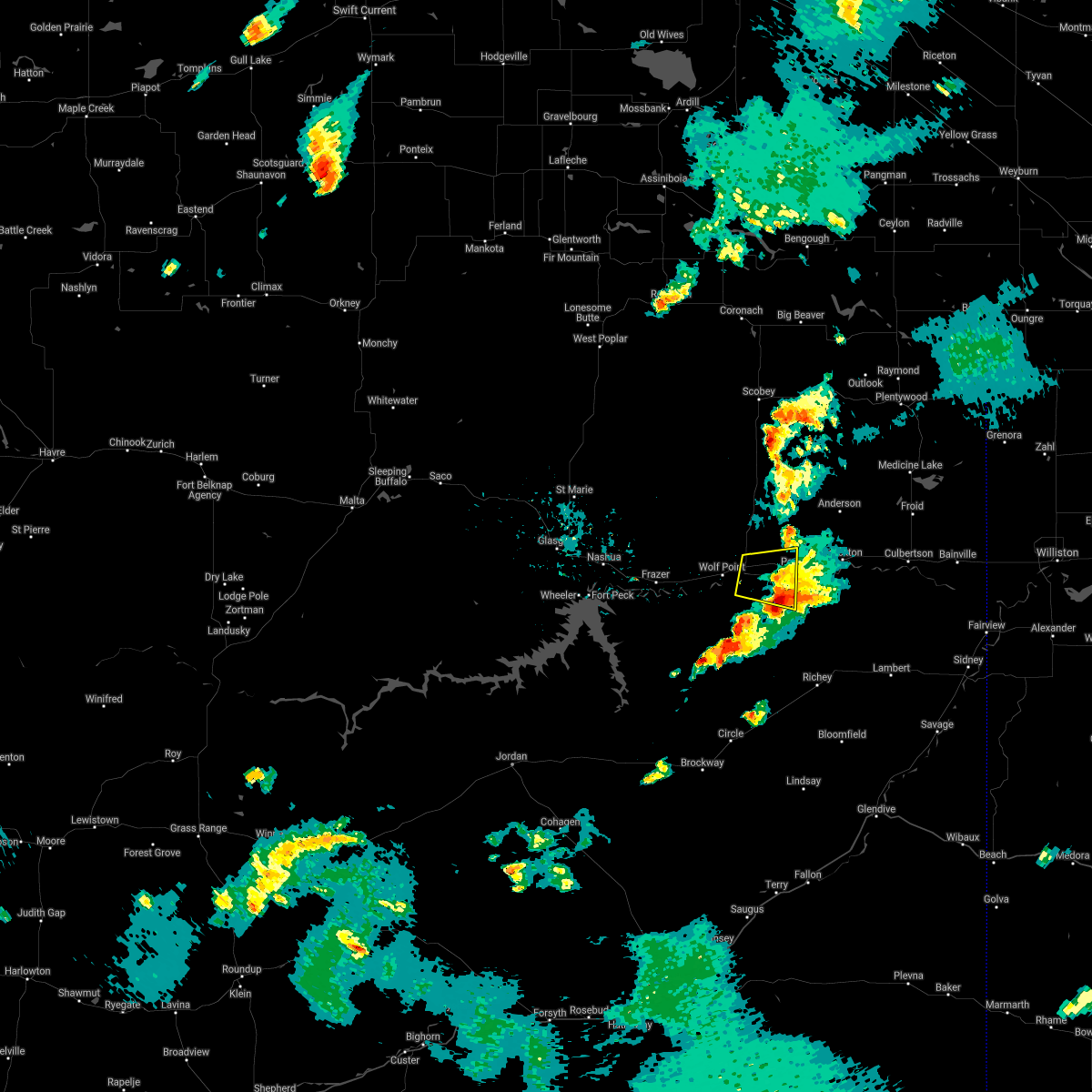 The severe thunderstorm warning for southwestern roosevelt and northeastern mccone counties will expire at 630 pm mdt, the storm which prompted the warning has weakened below severe limits, and has exited the warned area. therefore, the warning will be allowed to expire. however small hail, gusty winds and heavy rain are still possible with this thunderstorm. to report severe weather, contact your nearest law enforcement agency. they will relay your report to the national weather service glasgow. The severe thunderstorm warning for southwestern roosevelt and northeastern mccone counties will expire at 630 pm mdt, the storm which prompted the warning has weakened below severe limits, and has exited the warned area. therefore, the warning will be allowed to expire. however small hail, gusty winds and heavy rain are still possible with this thunderstorm. to report severe weather, contact your nearest law enforcement agency. they will relay your report to the national weather service glasgow.
|
| 7/16/2019 5:55 PM MDT |
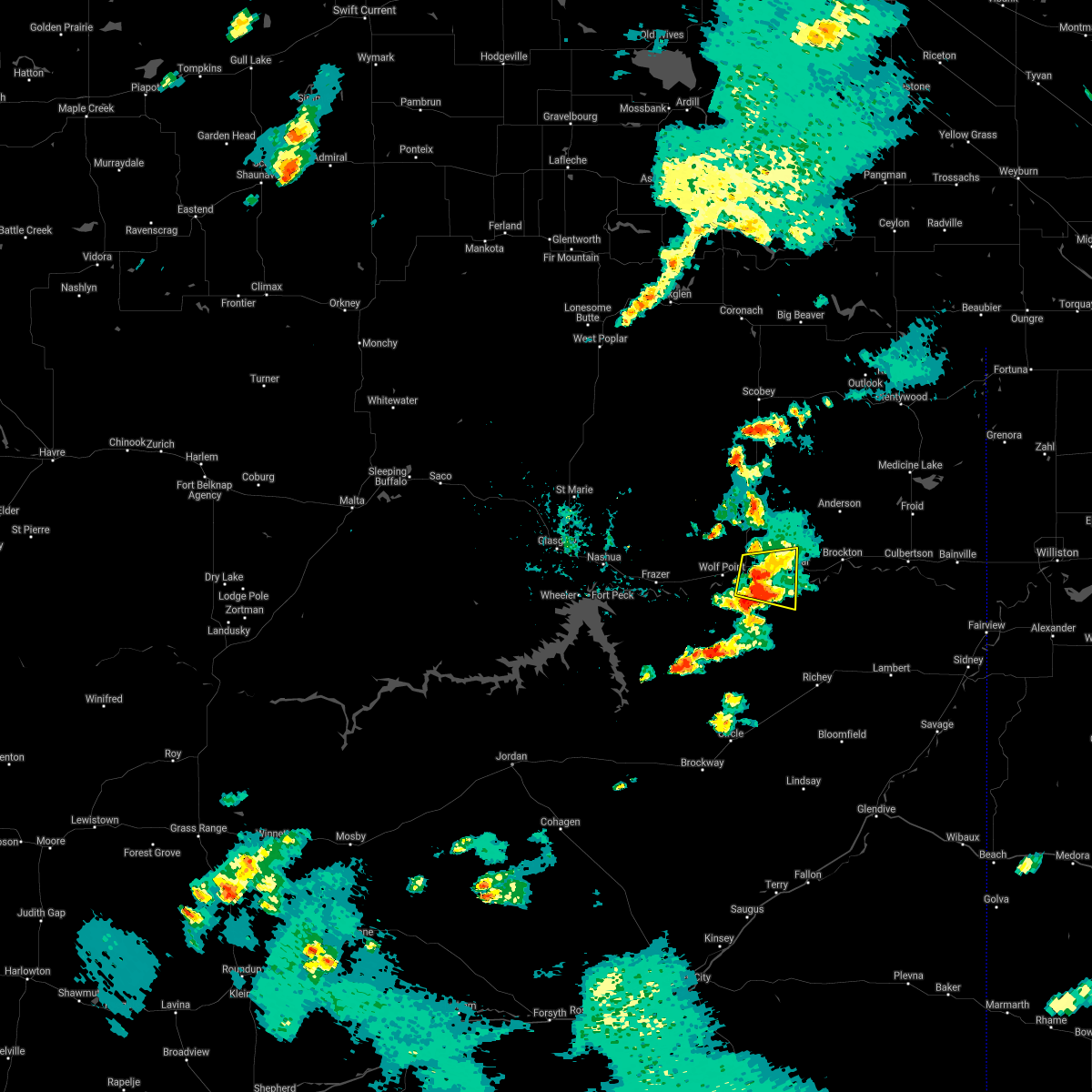 At 554 pm mdt, a severe thunderstorm was located 9 miles west of poplar, moving east at 25 mph (radar indicated). Hazards include 60 mph wind gusts and penny size hail. Expect damage to roofs, siding, and trees. Locations impacted include, poplar. At 554 pm mdt, a severe thunderstorm was located 9 miles west of poplar, moving east at 25 mph (radar indicated). Hazards include 60 mph wind gusts and penny size hail. Expect damage to roofs, siding, and trees. Locations impacted include, poplar.
|
| 7/16/2019 5:25 PM MDT |
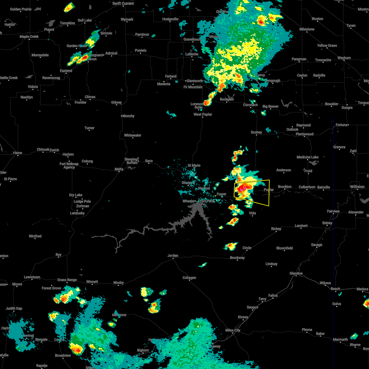 At 523 pm mdt, a severe thunderstorm was located over wolf point, moving east at 25 mph (radar indicated). Hazards include 60 mph wind gusts and quarter size hail. Hail damage to vehicles is expected. Expect wind damage to roofs, siding, and trees. At 523 pm mdt, a severe thunderstorm was located over wolf point, moving east at 25 mph (radar indicated). Hazards include 60 mph wind gusts and quarter size hail. Hail damage to vehicles is expected. Expect wind damage to roofs, siding, and trees.
|
| 7/7/2019 8:58 PM MDT |
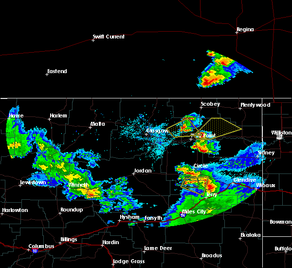 At 857 pm mdt, a severe thunderstorm was located 8 miles east of wolf point, moving northeast at 35 mph (radar indicated). Hazards include 60 mph wind gusts and quarter size hail. Hail damage to vehicles is expected. Expect wind damage to roofs, siding, and trees. At 857 pm mdt, a severe thunderstorm was located 8 miles east of wolf point, moving northeast at 35 mph (radar indicated). Hazards include 60 mph wind gusts and quarter size hail. Hail damage to vehicles is expected. Expect wind damage to roofs, siding, and trees.
|
| 7/1/2019 8:09 PM MDT |
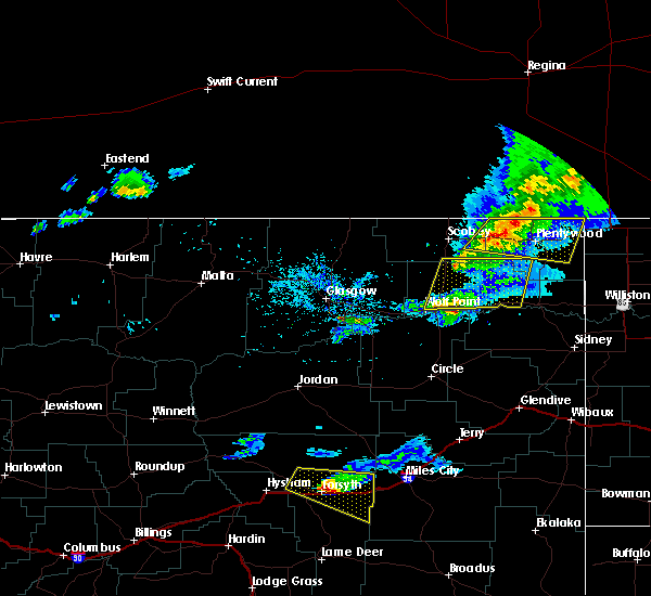 At 809 pm mdt, a severe thunderstorm was located near poplar, moving east at 40 mph (radar indicated). Hazards include 60 mph wind gusts and penny size hail. expect damage to roofs, siding, and trees At 809 pm mdt, a severe thunderstorm was located near poplar, moving east at 40 mph (radar indicated). Hazards include 60 mph wind gusts and penny size hail. expect damage to roofs, siding, and trees
|
| 7/1/2019 7:57 PM MDT |
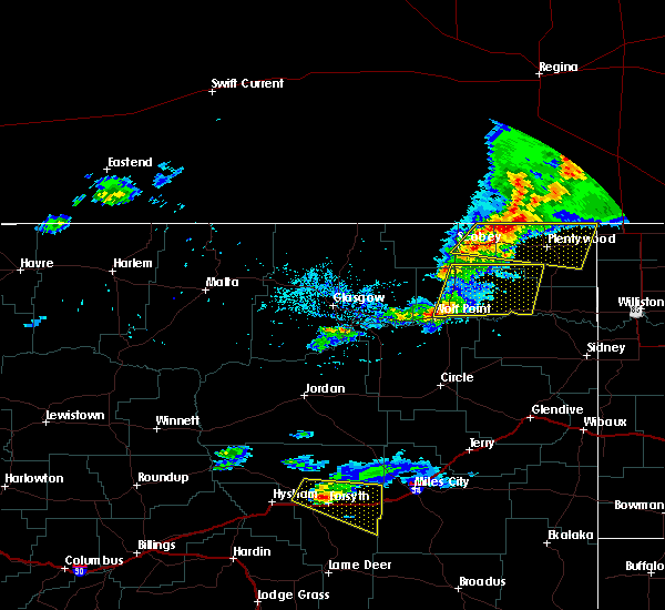 At 757 pm mdt, severe thunderstorms were located along a line extending from 6 miles northwest of bredette to 7 miles northeast of wolf point, moving east at 45 mph (radar indicated). Hazards include 60 mph wind gusts and penny size hail. Expect damage to roofs, siding, and trees. Locations impacted include, wolf point, poplar, brockton, bredette and fort kipp. At 757 pm mdt, severe thunderstorms were located along a line extending from 6 miles northwest of bredette to 7 miles northeast of wolf point, moving east at 45 mph (radar indicated). Hazards include 60 mph wind gusts and penny size hail. Expect damage to roofs, siding, and trees. Locations impacted include, wolf point, poplar, brockton, bredette and fort kipp.
|
| 7/1/2019 7:31 PM MDT |
 At 730 pm mdt, severe thunderstorms were located along a line extending from 8 miles north of lustre to 6 miles northeast of frazer, moving east at 45 mph (radar indicated). Hazards include 60 mph wind gusts and quarter size hail. Hail damage to vehicles is expected. Expect wind damage to roofs, siding, and trees. At 730 pm mdt, severe thunderstorms were located along a line extending from 8 miles north of lustre to 6 miles northeast of frazer, moving east at 45 mph (radar indicated). Hazards include 60 mph wind gusts and quarter size hail. Hail damage to vehicles is expected. Expect wind damage to roofs, siding, and trees.
|
| 6/28/2019 11:43 PM MDT |
 At 1143 pm mdt, a severe thunderstorm was located near poplar, moving east at 45 mph (radar indicated). Hazards include 60 mph wind gusts and nickel size hail. Expect damage to roofs, siding, and trees. Locations impacted include, poplar and brockton. At 1143 pm mdt, a severe thunderstorm was located near poplar, moving east at 45 mph (radar indicated). Hazards include 60 mph wind gusts and nickel size hail. Expect damage to roofs, siding, and trees. Locations impacted include, poplar and brockton.
|
| 6/28/2019 11:42 PM MDT |
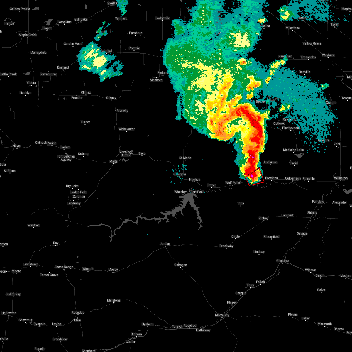 The tornado warning for south central roosevelt and northeastern mccone counties will expire at 1145 pm mdt, the storm which prompted the warning has weakened below severe limits, and no longer appears capable of producing a tornado. therefore, the warning will be allowed to expire. a severe thunderstorm watch remains in effect until 500 am mdt for northeastern montana. remember, a severe thunderstorm warning still remains in effect for this area. The tornado warning for south central roosevelt and northeastern mccone counties will expire at 1145 pm mdt, the storm which prompted the warning has weakened below severe limits, and no longer appears capable of producing a tornado. therefore, the warning will be allowed to expire. a severe thunderstorm watch remains in effect until 500 am mdt for northeastern montana. remember, a severe thunderstorm warning still remains in effect for this area.
|
| 6/28/2019 11:34 PM MDT |
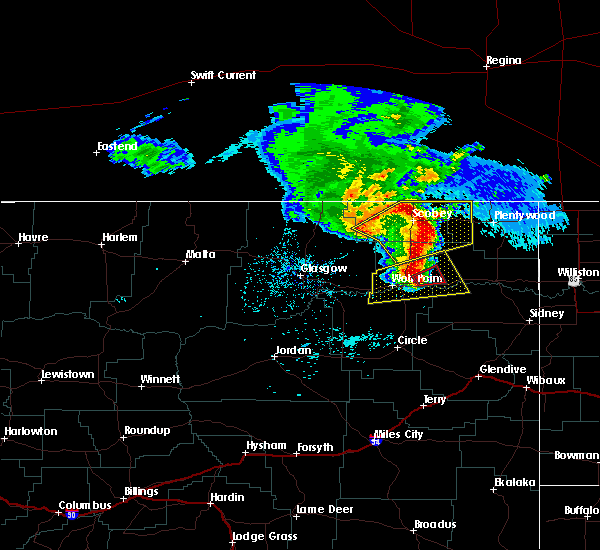 At 1134 pm mdt, a severe squall line capable of producing both tornadoes and extensive straight line wind damage was located near poplar, moving east at 40 mph (radar indicated rotation). Hazards include tornado. Flying debris will be dangerous to those caught without shelter. mobile homes will be damaged or destroyed. damage to roofs, windows, and vehicles will occur. tree damage is likely. This tornadic thunderstorm will remain over mainly rural areas of south central roosevelt and northeastern mccone counties. At 1134 pm mdt, a severe squall line capable of producing both tornadoes and extensive straight line wind damage was located near poplar, moving east at 40 mph (radar indicated rotation). Hazards include tornado. Flying debris will be dangerous to those caught without shelter. mobile homes will be damaged or destroyed. damage to roofs, windows, and vehicles will occur. tree damage is likely. This tornadic thunderstorm will remain over mainly rural areas of south central roosevelt and northeastern mccone counties.
|
| 6/28/2019 11:26 PM MDT |
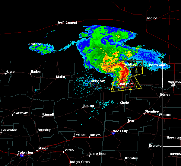 At 1125 pm mdt, a severe thunderstorm capable of producing a tornado was located 10 miles west of poplar, moving east at 40 mph (the public previously reported funnel clouds). Hazards include tornado and half dollar size hail. Flying debris will be dangerous to those caught without shelter. mobile homes will be damaged or destroyed. damage to roofs, windows, and vehicles will occur. tree damage is likely. this dangerous storm will be near, poplar around 1140 pm mdt. Other locations impacted by this tornadic thunderstorm include sprole. At 1125 pm mdt, a severe thunderstorm capable of producing a tornado was located 10 miles west of poplar, moving east at 40 mph (the public previously reported funnel clouds). Hazards include tornado and half dollar size hail. Flying debris will be dangerous to those caught without shelter. mobile homes will be damaged or destroyed. damage to roofs, windows, and vehicles will occur. tree damage is likely. this dangerous storm will be near, poplar around 1140 pm mdt. Other locations impacted by this tornadic thunderstorm include sprole.
|
| 6/28/2019 11:09 PM MDT |
 At 1109 pm mdt, a severe thunderstorm capable of producing a tornado was located over wolf point, moving east at 40 mph (radar indicated rotation). Hazards include tornado and ping pong ball size hail. Flying debris will be dangerous to those caught without shelter. mobile homes will be damaged or destroyed. damage to roofs, windows, and vehicles will occur. tree damage is likely. this dangerous storm will be near, poplar around 1140 pm mdt. Other locations impacted by this tornadic thunderstorm include sprole. At 1109 pm mdt, a severe thunderstorm capable of producing a tornado was located over wolf point, moving east at 40 mph (radar indicated rotation). Hazards include tornado and ping pong ball size hail. Flying debris will be dangerous to those caught without shelter. mobile homes will be damaged or destroyed. damage to roofs, windows, and vehicles will occur. tree damage is likely. this dangerous storm will be near, poplar around 1140 pm mdt. Other locations impacted by this tornadic thunderstorm include sprole.
|
| 6/28/2019 11:06 PM MDT |
 At 1106 pm mdt, a severe thunderstorm was located 7 miles southwest of wolf point, moving east at 45 mph (radar indicated). Hazards include 70 mph wind gusts and ping pong ball size hail. People and animals outdoors will be injured. expect hail damage to roofs, siding, windows, and vehicles. expect considerable tree damage. Wind damage is also likely to mobile homes, roofs, and outbuildings. At 1106 pm mdt, a severe thunderstorm was located 7 miles southwest of wolf point, moving east at 45 mph (radar indicated). Hazards include 70 mph wind gusts and ping pong ball size hail. People and animals outdoors will be injured. expect hail damage to roofs, siding, windows, and vehicles. expect considerable tree damage. Wind damage is also likely to mobile homes, roofs, and outbuildings.
|
| 7/10/2018 7:48 PM MDT |
 At 748 pm mdt, severe thunderstorms were located along a line extending from 11 miles east of port of whitetail to near poplar, moving east at 35 mph (radar indicated). Hazards include 60 mph wind gusts. expect damage to roofs, siding, and trees At 748 pm mdt, severe thunderstorms were located along a line extending from 11 miles east of port of whitetail to near poplar, moving east at 35 mph (radar indicated). Hazards include 60 mph wind gusts. expect damage to roofs, siding, and trees
|
| 7/10/2018 7:11 PM MDT |
 At 710 pm mdt, severe thunderstorms were located along a line extending from 7 miles west of port of scobey to 9 miles south of scobey to 11 miles southwest of lustre to 7 miles southeast of fort peck, moving east at 40 mph (radar indicated). Hazards include 70 mph wind gusts. Expect considerable tree damage. Damage is likely to mobile homes, roofs, and outbuildings. At 710 pm mdt, severe thunderstorms were located along a line extending from 7 miles west of port of scobey to 9 miles south of scobey to 11 miles southwest of lustre to 7 miles southeast of fort peck, moving east at 40 mph (radar indicated). Hazards include 70 mph wind gusts. Expect considerable tree damage. Damage is likely to mobile homes, roofs, and outbuildings.
|
| 6/28/2018 7:34 PM MDT |
 At 734 pm mdt, severe thunderstorms were located along a line extending from 8 miles north of poplar to 12 miles northeast of richey, moving east at 50 mph. a 64 mph wind gust was measured at the poplar airport at 725 pm (trained weather spotters). Hazards include 70 mph wind gusts and nickel size hail. Expect considerable tree damage. damage is likely to mobile homes, roofs, and outbuildings. locations impacted include, poplar, culbertson, brockton, froid, sprole and fort kipp. A tornado watch remains in effect until 1100 pm mdt for northeastern montana. At 734 pm mdt, severe thunderstorms were located along a line extending from 8 miles north of poplar to 12 miles northeast of richey, moving east at 50 mph. a 64 mph wind gust was measured at the poplar airport at 725 pm (trained weather spotters). Hazards include 70 mph wind gusts and nickel size hail. Expect considerable tree damage. damage is likely to mobile homes, roofs, and outbuildings. locations impacted include, poplar, culbertson, brockton, froid, sprole and fort kipp. A tornado watch remains in effect until 1100 pm mdt for northeastern montana.
|
| 6/28/2018 7:25 PM MDT | Storm damage reported in roosevelt county MT, 0.2 miles E of Poplar, MT |
| 6/28/2018 7:25 PM MDT | Mesonet station po19... poplar 2 en in roosevelt county MT, 2.1 miles SW of Poplar, MT |
| 6/28/2018 7:05 PM MDT |
 At 704 pm mdt, severe thunderstorms were located along a line extending from 12 miles north of wolf point to near vida, moving east at 50 mph (radar indicated). Hazards include 60 mph wind gusts and nickel size hail. expect damage to roofs, siding, and trees At 704 pm mdt, severe thunderstorms were located along a line extending from 12 miles north of wolf point to near vida, moving east at 50 mph (radar indicated). Hazards include 60 mph wind gusts and nickel size hail. expect damage to roofs, siding, and trees
|
| 6/28/2018 6:54 PM MDT | Winds gusting to over 60 mp in richland county MT, 16.2 miles NW of Poplar, MT |
| 6/7/2018 9:05 PM MDT | Quarter sized hail reported 0.2 miles E of Poplar, MT, reported via social media. |
| 6/7/2018 8:57 PM MDT |
 At 857 pm mdt, a severe thunderstorm was located 8 miles southwest of poplar, moving northeast at 15 mph (radar indicated). Hazards include 60 mph wind gusts and quarter size hail. Hail damage to vehicles is expected. Expect wind damage to roofs, siding, and trees. At 857 pm mdt, a severe thunderstorm was located 8 miles southwest of poplar, moving northeast at 15 mph (radar indicated). Hazards include 60 mph wind gusts and quarter size hail. Hail damage to vehicles is expected. Expect wind damage to roofs, siding, and trees.
|
| 6/7/2018 8:21 PM MDT | Davis pro wx station measured 87 mph wind gust. barn on property was completely leveled from the wind. also had half dollar sized hai in richland county MT, 16.2 miles NW of Poplar, MT |
| 6/7/2018 8:13 PM MDT | Storm damage reported in richland county MT, 16.2 miles NW of Poplar, MT |
| 6/7/2018 8:13 PM MDT | Half Dollar sized hail reported 16.2 miles NW of Poplar, MT |
| 7/10/2017 5:56 PM MDT |
 At 554 pm mdt, a gust front was located along a line extending from 13 miles southeast of opheim to 10 miles south of lustre to 6 miles southeast of wolf point to near vida to 16 miles north of circle, moving northeast at 40 mph (radar indicated). Hazards include 60 mph wind gusts. Expect damage to roofs, siding, and trees. Visibility may be reduced to down to a half of a mile due to blowing dust with the strongest winds. At 554 pm mdt, a gust front was located along a line extending from 13 miles southeast of opheim to 10 miles south of lustre to 6 miles southeast of wolf point to near vida to 16 miles north of circle, moving northeast at 40 mph (radar indicated). Hazards include 60 mph wind gusts. Expect damage to roofs, siding, and trees. Visibility may be reduced to down to a half of a mile due to blowing dust with the strongest winds.
|
| 7/19/2016 1:03 AM MDT |
 At 102 am mdt, severe thunderstorms were located along a line extending from 10 miles north of richland to near bredette to near poplar to 11 miles northeast of circle, moving east at 50 mph (radar indicated). Hazards include 60 mph wind gusts. Expect damage to roofs. siding. and trees. Locations impacted include, wolf point, scobey, poplar, opheim, richland, richey, flaxville, vida, bredette, peerless, madoc, frazer, lustre, whitetail, oswego, west fork, glentana, volt, weldon and four buttes. At 102 am mdt, severe thunderstorms were located along a line extending from 10 miles north of richland to near bredette to near poplar to 11 miles northeast of circle, moving east at 50 mph (radar indicated). Hazards include 60 mph wind gusts. Expect damage to roofs. siding. and trees. Locations impacted include, wolf point, scobey, poplar, opheim, richland, richey, flaxville, vida, bredette, peerless, madoc, frazer, lustre, whitetail, oswego, west fork, glentana, volt, weldon and four buttes.
|
| 7/19/2016 12:27 AM MDT |
 At 1226 am mdt, severe thunderstorms were located along a line extending from 11 miles northwest of opheim to 9 miles northwest of lustre to 8 miles east of frazer to 6 miles east of nelson creek rec area, moving northeast at 50 mph (trained weather spotters). Hazards include 70 mph wind gusts. Expect considerable tree damage. Damage is likely to mobile homes, roofs, and outbuildings. At 1226 am mdt, severe thunderstorms were located along a line extending from 11 miles northwest of opheim to 9 miles northwest of lustre to 8 miles east of frazer to 6 miles east of nelson creek rec area, moving northeast at 50 mph (trained weather spotters). Hazards include 70 mph wind gusts. Expect considerable tree damage. Damage is likely to mobile homes, roofs, and outbuildings.
|
| 6/24/2016 8:20 PM MDT | Numerous trees uprooted and roofs blown off in roosevelt county MT, 0.2 miles E of Poplar, MT |
| 6/24/2016 8:19 PM MDT |
 At 819 pm mdt, severe thunderstorms were located along a line extending from 13 miles west of medicine lake to 11 miles northwest of sidney, moving east at 55 mph (radar indicated). Hazards include 70 mph wind gusts and nickel size hail. Expect considerable tree damage. damage is likely to mobile homes, roofs, and outbuildings. Locations impacted include, poplar, culbertson, fairview, brockton, medicine lake, bainville, froid, bredette, east fairview, mccabe, reserve, homestead, fort kipp, nohly, snowden, sprole, fort union and dagmar. At 819 pm mdt, severe thunderstorms were located along a line extending from 13 miles west of medicine lake to 11 miles northwest of sidney, moving east at 55 mph (radar indicated). Hazards include 70 mph wind gusts and nickel size hail. Expect considerable tree damage. damage is likely to mobile homes, roofs, and outbuildings. Locations impacted include, poplar, culbertson, fairview, brockton, medicine lake, bainville, froid, bredette, east fairview, mccabe, reserve, homestead, fort kipp, nohly, snowden, sprole, fort union and dagmar.
|
| 6/24/2016 8:18 PM MDT | Storm damage reported in roosevelt county MT, 7.7 miles WNW of Poplar, MT |
| 6/24/2016 7:59 PM MDT | Storm damage reported in richland county MT, 16.2 miles NW of Poplar, MT |
| 6/24/2016 7:55 PM MDT | Trees ripped up on property... windows broken... and doors knocked out of jam in roosevelt county MT, 0.2 miles E of Poplar, MT |
| 6/24/2016 7:50 PM MDT |
 At 750 pm mdt, severe thunderstorms were located along a line extending from 8 miles northwest of bredette to near richey, moving east at 65 mph (radar indicated). Hazards include 70 mph wind gusts and nickel size hail. Expect considerable tree damage. Damage is likely to mobile homes, roofs, and outbuildings. At 750 pm mdt, severe thunderstorms were located along a line extending from 8 miles northwest of bredette to near richey, moving east at 65 mph (radar indicated). Hazards include 70 mph wind gusts and nickel size hail. Expect considerable tree damage. Damage is likely to mobile homes, roofs, and outbuildings.
|
| 6/21/2016 7:34 PM MDT | Quarter sized hail reported 16.2 miles NW of Poplar, MT |
| 6/21/2016 7:13 PM MDT |
 At 711 pm mdt, a severe thunderstorm was located over poplar, moving east at 60 mph (trained weather spotters reported quarter size hail 7 ne of wolf point at 658 pm mdt). Hazards include 60 mph wind gusts and quarter size hail. Hail damage to vehicles is expected. Expect wind damage to roofs, siding, and trees. At 711 pm mdt, a severe thunderstorm was located over poplar, moving east at 60 mph (trained weather spotters reported quarter size hail 7 ne of wolf point at 658 pm mdt). Hazards include 60 mph wind gusts and quarter size hail. Hail damage to vehicles is expected. Expect wind damage to roofs, siding, and trees.
|
| 6/21/2016 6:48 PM MDT |
 At 647 pm mdt, a severe thunderstorm was located 11 miles northwest of poplar, moving east at 65 mph (radar indicated). Hazards include 60 mph wind gusts and quarter size hail. Hail damage to vehicles is expected. expect wind damage to roofs, siding, and trees. Locations impacted include, wolf point, poplar, brockton, sprole and volt. At 647 pm mdt, a severe thunderstorm was located 11 miles northwest of poplar, moving east at 65 mph (radar indicated). Hazards include 60 mph wind gusts and quarter size hail. Hail damage to vehicles is expected. expect wind damage to roofs, siding, and trees. Locations impacted include, wolf point, poplar, brockton, sprole and volt.
|
| 6/21/2016 6:13 PM MDT |
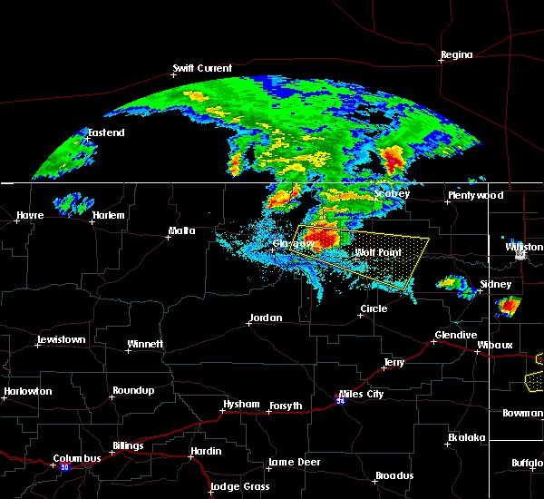 At 613 pm mdt, a severe thunderstorm was located 13 miles southwest of lustre, or 24 miles east of glasgow, moving east at 65 mph (radar indicated). Hazards include 60 mph wind gusts and quarter size hail. Hail damage to vehicles is expected. Expect wind damage to roofs, siding, and trees. At 613 pm mdt, a severe thunderstorm was located 13 miles southwest of lustre, or 24 miles east of glasgow, moving east at 65 mph (radar indicated). Hazards include 60 mph wind gusts and quarter size hail. Hail damage to vehicles is expected. Expect wind damage to roofs, siding, and trees.
|
| 6/18/2016 10:05 PM MDT | Golf Ball sized hail reported 16.2 miles NW of Poplar, MT, also 40 to 50 mph winds |
| 6/18/2016 9:54 PM MDT |
 At 952 pm mdt, severe thunderstorms were located along a line extending from 7 miles south of port of raymond to 15 miles south of brockton, moving east at 45 mph (trained weather spotters). Hazards include two inch hail and 70 mph wind gusts. People and animals outdoors will be injured. expect hail damage to roofs, siding, windows, and vehicles. expect considerable tree damage. Wind damage is also likely to mobile homes, roofs, and outbuildings. At 952 pm mdt, severe thunderstorms were located along a line extending from 7 miles south of port of raymond to 15 miles south of brockton, moving east at 45 mph (trained weather spotters). Hazards include two inch hail and 70 mph wind gusts. People and animals outdoors will be injured. expect hail damage to roofs, siding, windows, and vehicles. expect considerable tree damage. Wind damage is also likely to mobile homes, roofs, and outbuildings.
|
| 6/18/2016 9:27 PM MDT |
 At 926 pm mdt, severe thunderstorms were located along a line extending from near port of whitetail to 7 miles south of vida, moving east at 50 mph (trained weather spotters). Hazards include golf ball size hail and 70 mph wind gusts. People and animals outdoors will be injured. expect hail damage to roofs, siding, windows, and vehicles. expect considerable tree damage. wind damage is also likely to mobile homes, roofs, and outbuildings. Locations impacted include, wolf point, scobey, poplar, brockton, flaxville, vida, bredette, madoc, redstone, archer, whitetail, outlook, enid, volt, four buttes, fort kipp, sprole, navajo and daleview. At 926 pm mdt, severe thunderstorms were located along a line extending from near port of whitetail to 7 miles south of vida, moving east at 50 mph (trained weather spotters). Hazards include golf ball size hail and 70 mph wind gusts. People and animals outdoors will be injured. expect hail damage to roofs, siding, windows, and vehicles. expect considerable tree damage. wind damage is also likely to mobile homes, roofs, and outbuildings. Locations impacted include, wolf point, scobey, poplar, brockton, flaxville, vida, bredette, madoc, redstone, archer, whitetail, outlook, enid, volt, four buttes, fort kipp, sprole, navajo and daleview.
|
| 6/18/2016 9:02 PM MDT |
 At 902 pm mdt, severe thunderstorms were located along a line extending from 6 miles southwest of port of scobey to 15 miles east of rock creek rec area, moving east at 60 mph. these are very dangerous storms (trained weather spotters). Hazards include 80 mph wind gusts and two inch hail. Flying debris will be dangerous to those caught without shelter. mobile homes will be heavily damaged. expect considerable damage to roofs, windows, and vehicles. Extensive tree damage and power outages are likely. At 902 pm mdt, severe thunderstorms were located along a line extending from 6 miles southwest of port of scobey to 15 miles east of rock creek rec area, moving east at 60 mph. these are very dangerous storms (trained weather spotters). Hazards include 80 mph wind gusts and two inch hail. Flying debris will be dangerous to those caught without shelter. mobile homes will be heavily damaged. expect considerable damage to roofs, windows, and vehicles. Extensive tree damage and power outages are likely.
|
| 6/16/2016 1:40 AM MDT | Gust measured at the poplar raws in roosevelt county MT, 0.2 miles E of Poplar, MT |
| 6/11/2016 2:39 AM MDT |
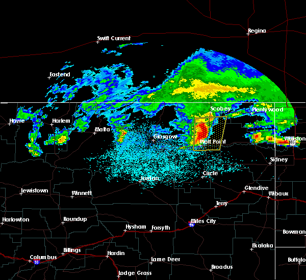 At 238 am mdt, severe thunderstorms were located along a line extending from 17 miles southwest of scobey to 14 miles southwest of bredette to near wolf point, moving east at 55 mph (radar indicated). Hazards include quarter size hail. Damage to vehicles is expected. Locations impacted include, wolf point, poplar, bredette and volt. At 238 am mdt, severe thunderstorms were located along a line extending from 17 miles southwest of scobey to 14 miles southwest of bredette to near wolf point, moving east at 55 mph (radar indicated). Hazards include quarter size hail. Damage to vehicles is expected. Locations impacted include, wolf point, poplar, bredette and volt.
|
| 6/11/2016 2:12 AM MDT |
 At 212 am mdt, severe thunderstorms were located along a line extending from 18 miles northeast of st. marie to 9 miles southwest of lustre to 6 miles west of frazer, moving east at 55 mph (radar indicated). Hazards include quarter size hail. damage to vehicles is expected At 212 am mdt, severe thunderstorms were located along a line extending from 18 miles northeast of st. marie to 9 miles southwest of lustre to 6 miles west of frazer, moving east at 55 mph (radar indicated). Hazards include quarter size hail. damage to vehicles is expected
|
| 7/27/2015 8:20 PM MDT |
 At 815 pm mdt, severe thunderstorms were located along a line extending from flaxville to 12 miles south of westby, and moving north at 85 mph (radar indicated. up to 65 mph wind gusts were reported in sidney with this storm). Hazards include 60 mph wind gusts and quarter size hail. Hail damage to crops and plants is expected. some damage to vehicles is possible. expect wind damage to roofs, siding and trees. Locations impacted include, whitetail, westby, raymond, dooley, daleview, outlook and comertown. At 815 pm mdt, severe thunderstorms were located along a line extending from flaxville to 12 miles south of westby, and moving north at 85 mph (radar indicated. up to 65 mph wind gusts were reported in sidney with this storm). Hazards include 60 mph wind gusts and quarter size hail. Hail damage to crops and plants is expected. some damage to vehicles is possible. expect wind damage to roofs, siding and trees. Locations impacted include, whitetail, westby, raymond, dooley, daleview, outlook and comertown.
|
| 7/27/2015 7:40 PM MDT |
 At 738 pm mdt, severe thunderstorms were located along a line extending from 9 miles south of poplar to 6 miles north of fairview, and moving north at 85 mph. these are very dangerous storms (trained weather spotters). Hazards include 80 mph wind gusts and quarter size hail. Flying debris will be dangerous to those caught without shelter. mobile homes will be heavily damaged. expect considerable damage to roofs, windows and vehicles. extensive tree damage and power outages are likely. severe thunderstorms will be near, poplar and culbertson around 745 pm mdt. bainville around 750 pm mdt. froid around 755 pm mdt. bredette and medicine lake around 805 pm mdt. flaxville and plentywood around 815 pm mdt. madoc and whitetail around 820 pm mdt. Other locations in the warning include sprole, snowden, fort kipp, mccabe, homestead, reserve, dagmar, navajo, coalridge and antelope. At 738 pm mdt, severe thunderstorms were located along a line extending from 9 miles south of poplar to 6 miles north of fairview, and moving north at 85 mph. these are very dangerous storms (trained weather spotters). Hazards include 80 mph wind gusts and quarter size hail. Flying debris will be dangerous to those caught without shelter. mobile homes will be heavily damaged. expect considerable damage to roofs, windows and vehicles. extensive tree damage and power outages are likely. severe thunderstorms will be near, poplar and culbertson around 745 pm mdt. bainville around 750 pm mdt. froid around 755 pm mdt. bredette and medicine lake around 805 pm mdt. flaxville and plentywood around 815 pm mdt. madoc and whitetail around 820 pm mdt. Other locations in the warning include sprole, snowden, fort kipp, mccabe, homestead, reserve, dagmar, navajo, coalridge and antelope.
|
| 6/30/2015 6:19 PM MDT |
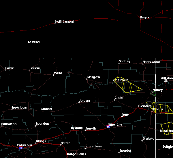 At 616 pm mdt, a severe thunderstorm was located 11 miles northeast of wolf point, and moving southeast at 45 mph (radar indicated). Hazards include 60 mph wind gusts and penny size hail. Expect damage to roofs. siding and trees. The severe thunderstorm will be near, poplar around 630 pm mdt. At 616 pm mdt, a severe thunderstorm was located 11 miles northeast of wolf point, and moving southeast at 45 mph (radar indicated). Hazards include 60 mph wind gusts and penny size hail. Expect damage to roofs. siding and trees. The severe thunderstorm will be near, poplar around 630 pm mdt.
|
| 6/19/2015 3:44 PM MDT |
 At 341 pm mdt, a severe thunderstorm was located 7 miles south of poplar, and moving east at 30 mph (radar indicated). Hazards include 60 mph wind gusts and quarter size hail. Hail damage to crops and plants is expected. some damage to vehicles is possible. expect wind damage to roofs, siding and trees. The severe thunderstorm will affect mainly rural areas of northern richland and southeastern roosevelt counties. At 341 pm mdt, a severe thunderstorm was located 7 miles south of poplar, and moving east at 30 mph (radar indicated). Hazards include 60 mph wind gusts and quarter size hail. Hail damage to crops and plants is expected. some damage to vehicles is possible. expect wind damage to roofs, siding and trees. The severe thunderstorm will affect mainly rural areas of northern richland and southeastern roosevelt counties.
|
| 6/19/2015 3:15 PM MDT |
 At 312 pm mdt, a severe thunderstorm was located 8 miles east of wolf point, and moving east at 30 mph (radar indicated). Hazards include 60 mph wind gusts and quarter size hail. Hail damage to crops and plants is expected. some damage to vehicles is possible. expect wind damage to roofs, siding and trees. The severe thunderstorm will be near, poplar around 335 pm mdt. At 312 pm mdt, a severe thunderstorm was located 8 miles east of wolf point, and moving east at 30 mph (radar indicated). Hazards include 60 mph wind gusts and quarter size hail. Hail damage to crops and plants is expected. some damage to vehicles is possible. expect wind damage to roofs, siding and trees. The severe thunderstorm will be near, poplar around 335 pm mdt.
|
| 6/19/2015 3:11 PM MDT | Awos at poplar airport in roosevelt county MT, 2.1 miles S of Poplar, MT |
| 9/3/2014 6:30 PM MDT | Quarter sized hail reported 30 miles SSW of Poplar, MT |
| 8/5/2013 6:14 PM MDT | Tree branches in roosevelt county MT, 0.7 miles SSW of Poplar, MT |
| 8/5/2013 5:43 PM MDT | Tree branches in roosevelt county MT, 0.7 miles SSW of Poplar, MT |
| 8/5/2013 5:35 PM MDT | Part of a roof on a home torn of in roosevelt county MT, 4.1 miles S of Poplar, MT |
| 7/15/2013 4:55 PM MDT | Quarter sized hail reported 25.1 miles S of Poplar, MT |
| 1/1/0001 12:00 AM | Estimated 70 to 80 mph wind gust with slushy dime hai in mccone county MT, 10.2 miles ENE of Poplar, MT |
| 1/1/0001 12:00 AM | Quarter sized hail reported 18.3 miles NNE of Poplar, MT, estimated 1 inch hail. |
| 1/1/0001 12:00 AM | Quarter sized hail reported 18.3 miles NNE of Poplar, MT, estimated 1 inch hail. |
Hail Maps for Poplar, MT


Connect with Interactive Hail Maps