

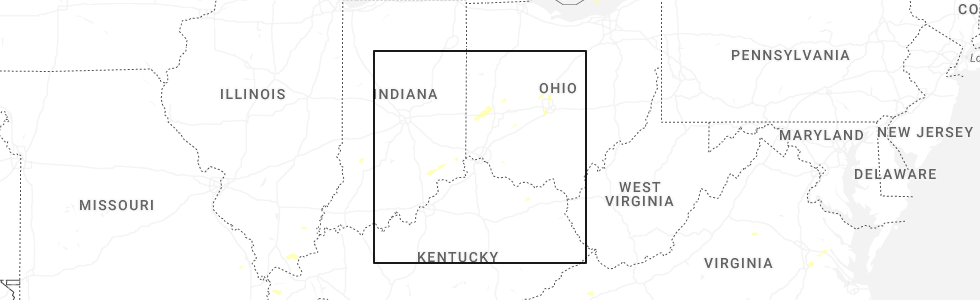
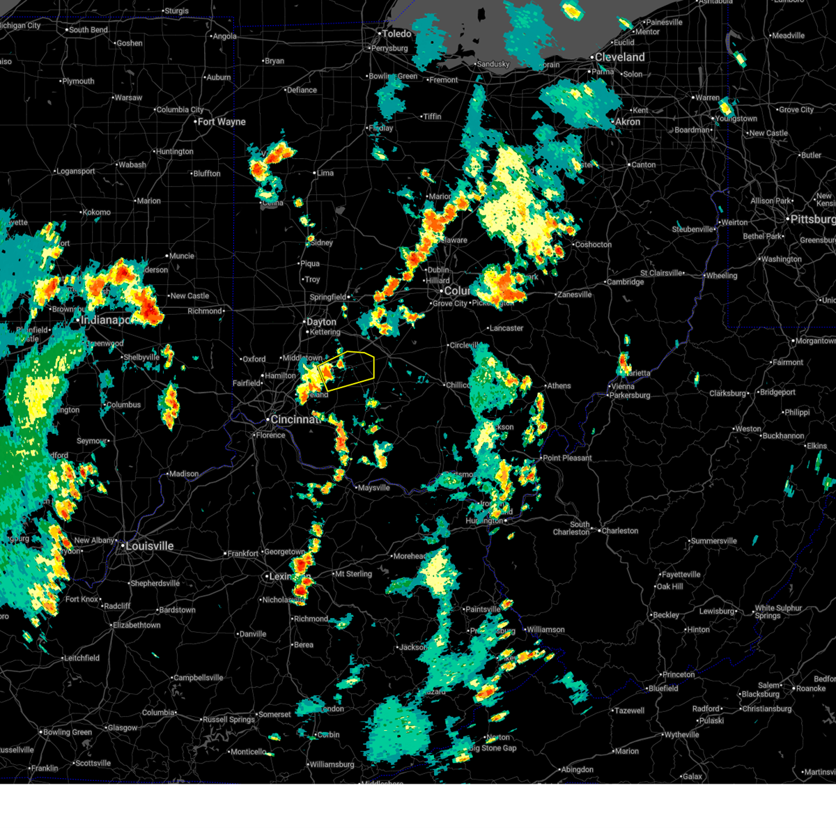
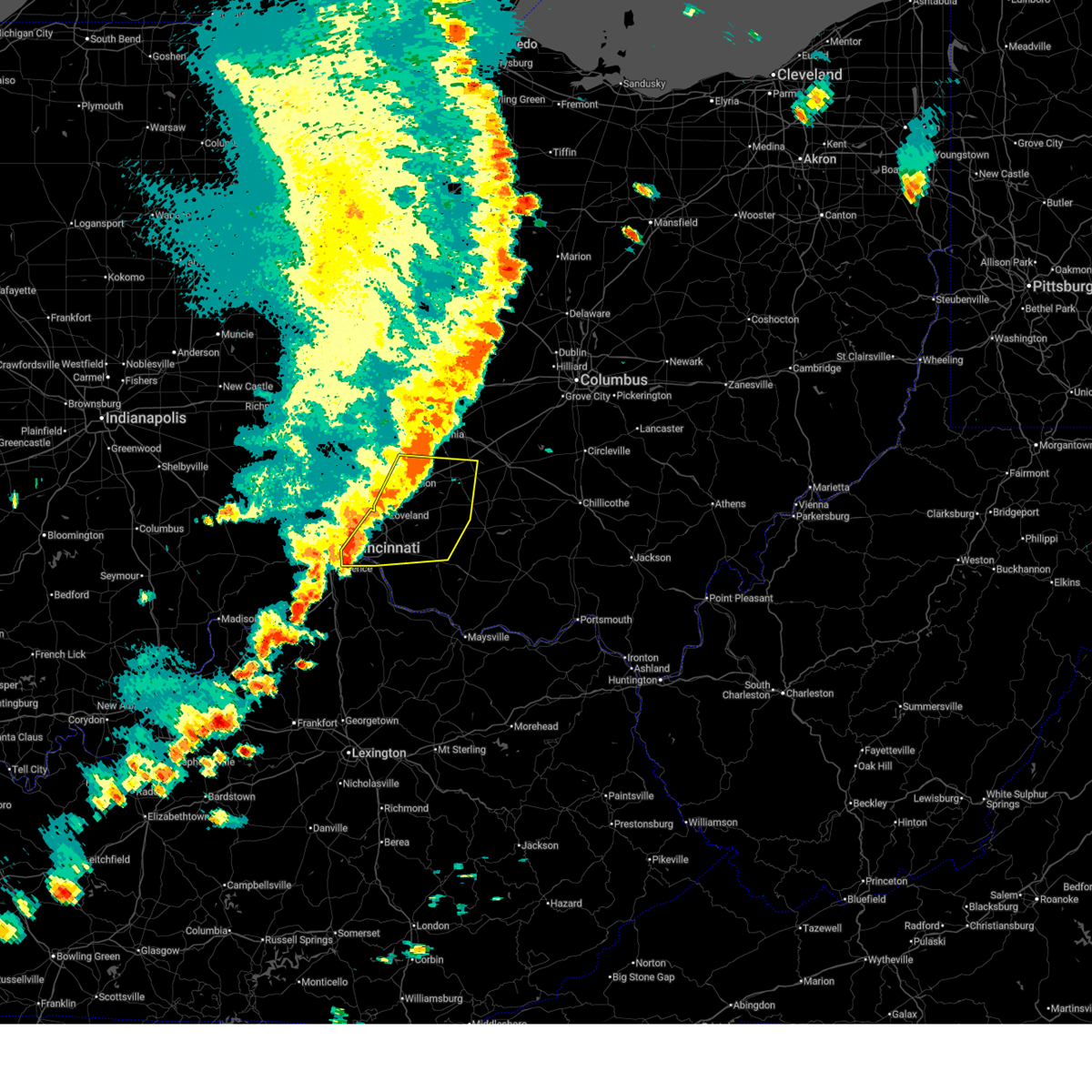
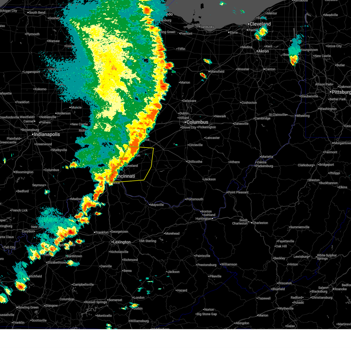
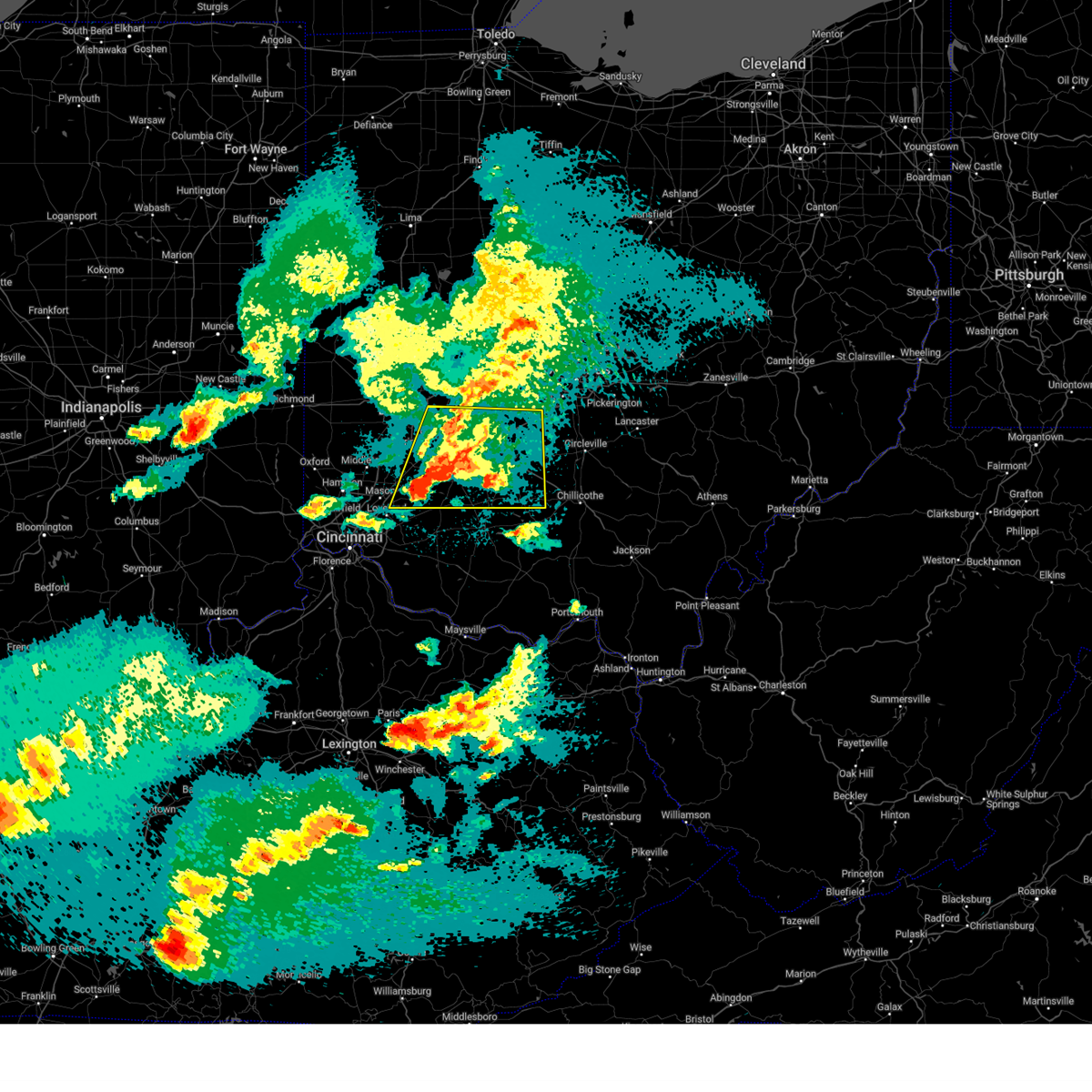
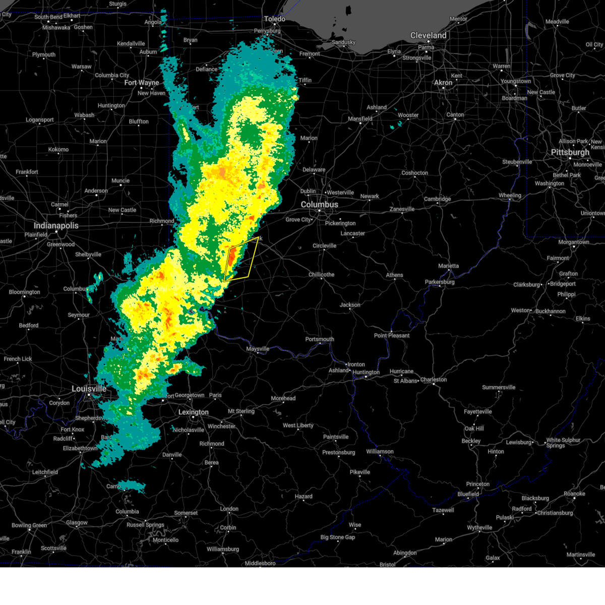
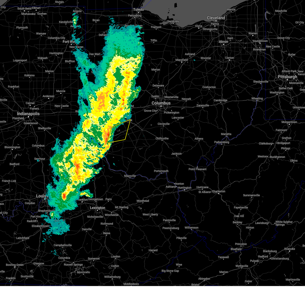
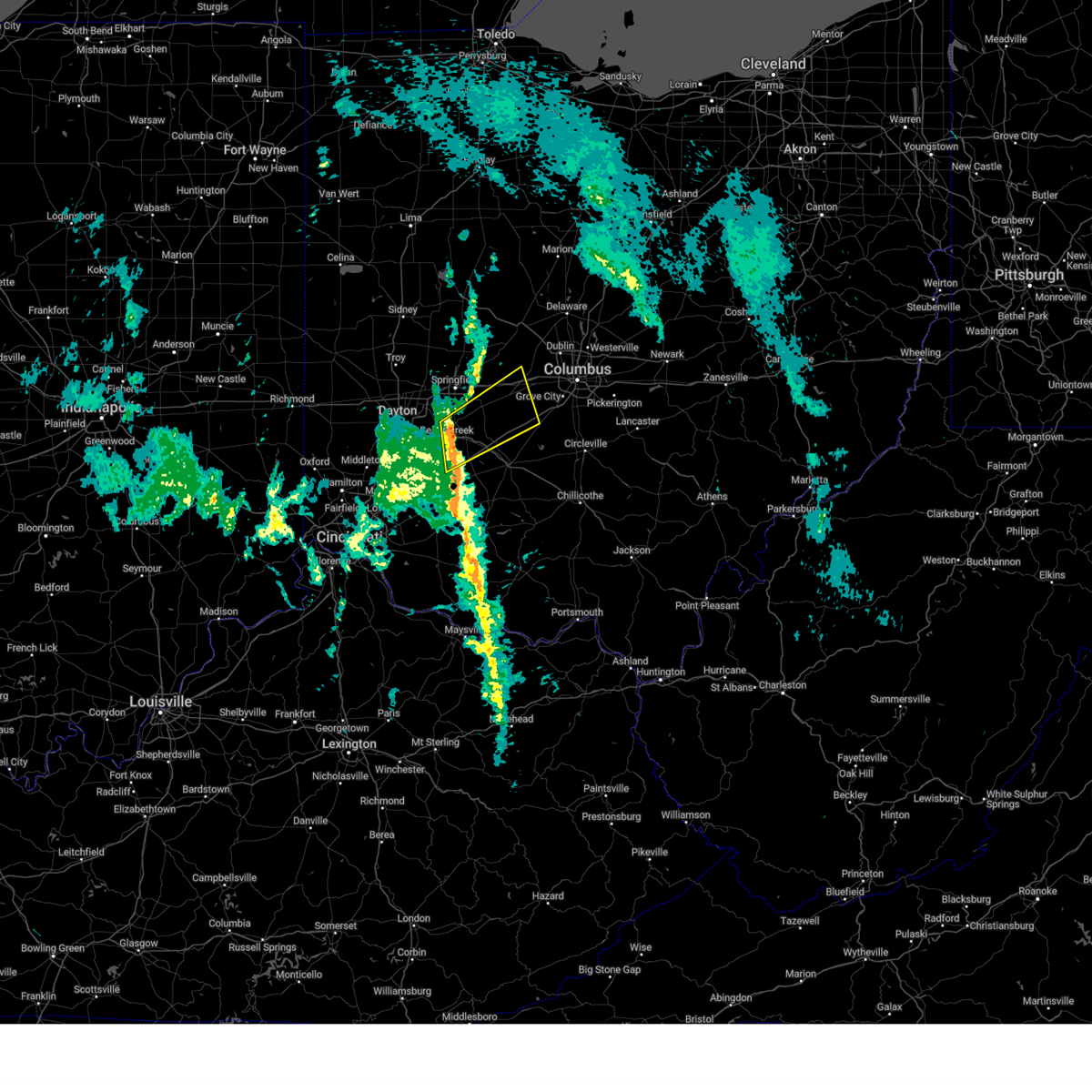
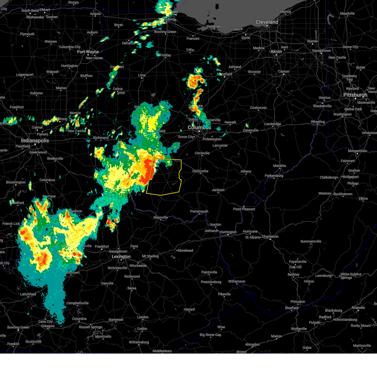
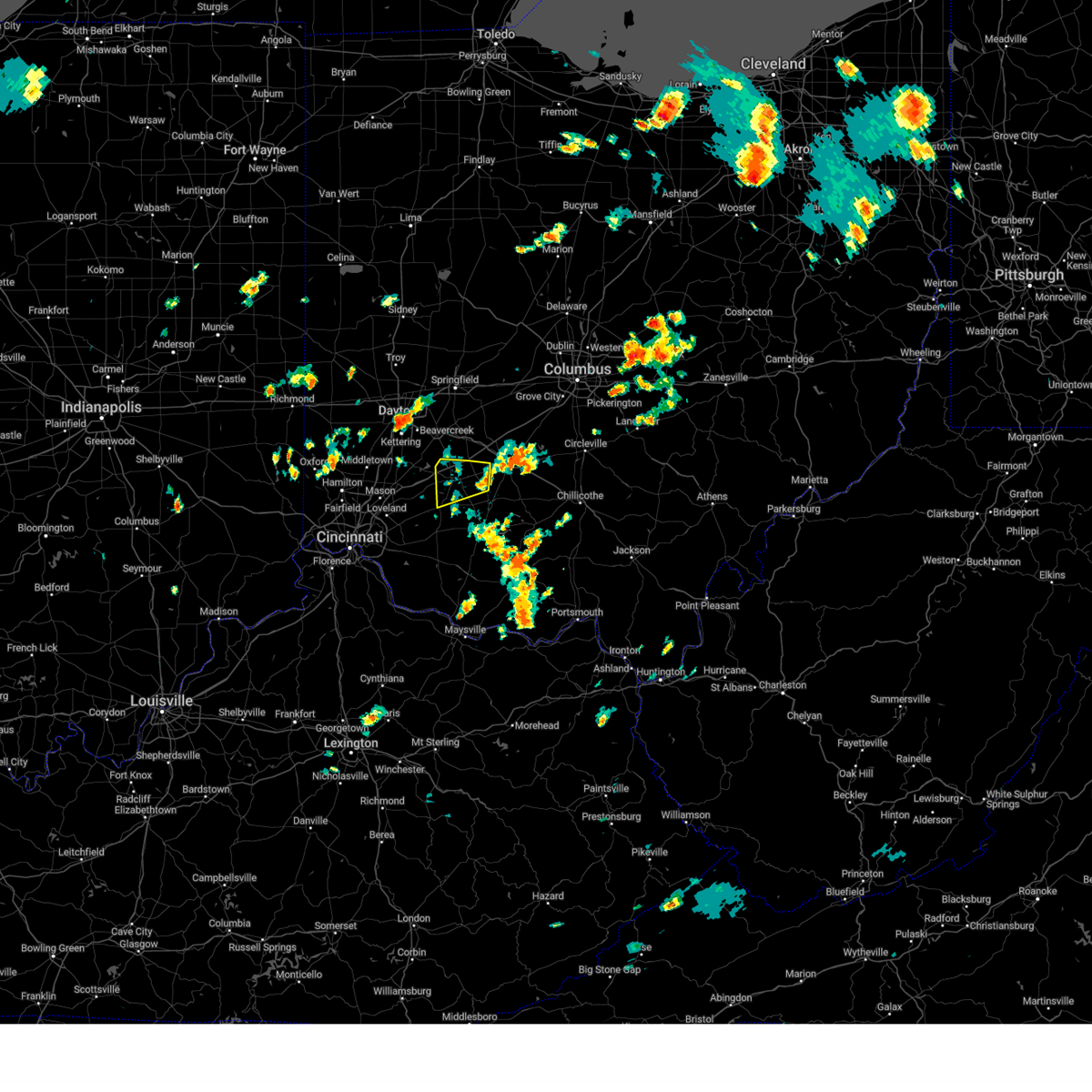
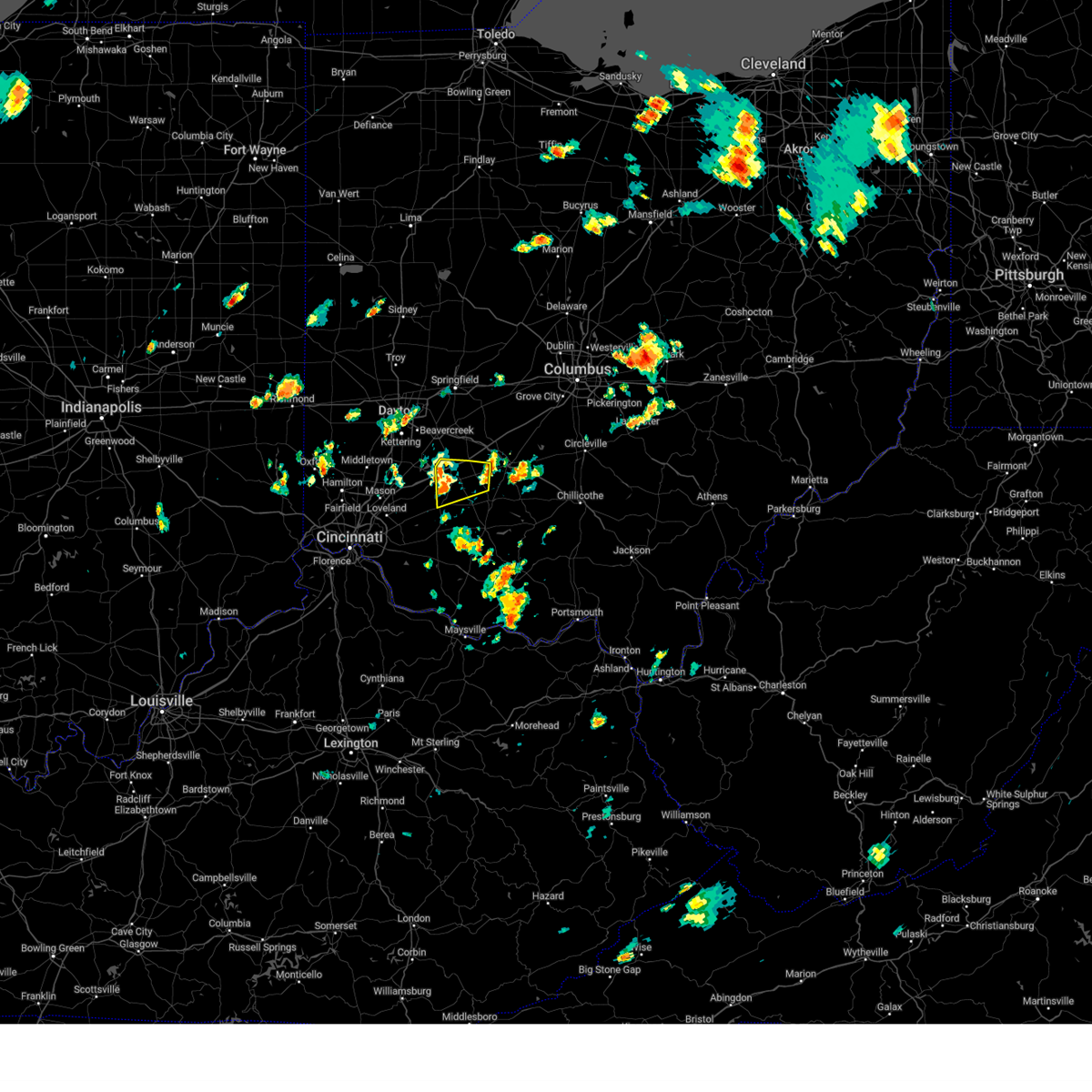
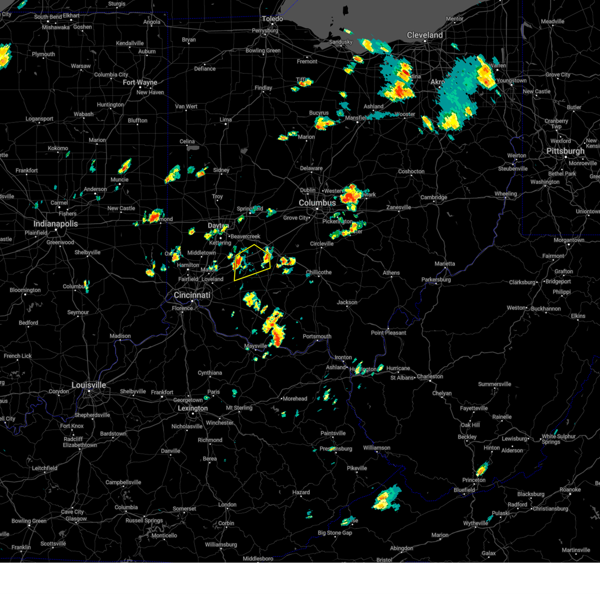
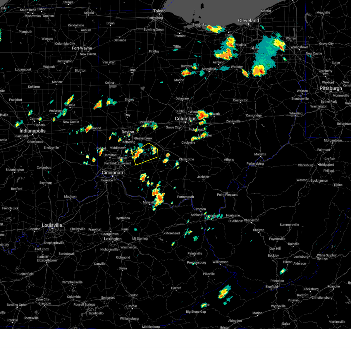
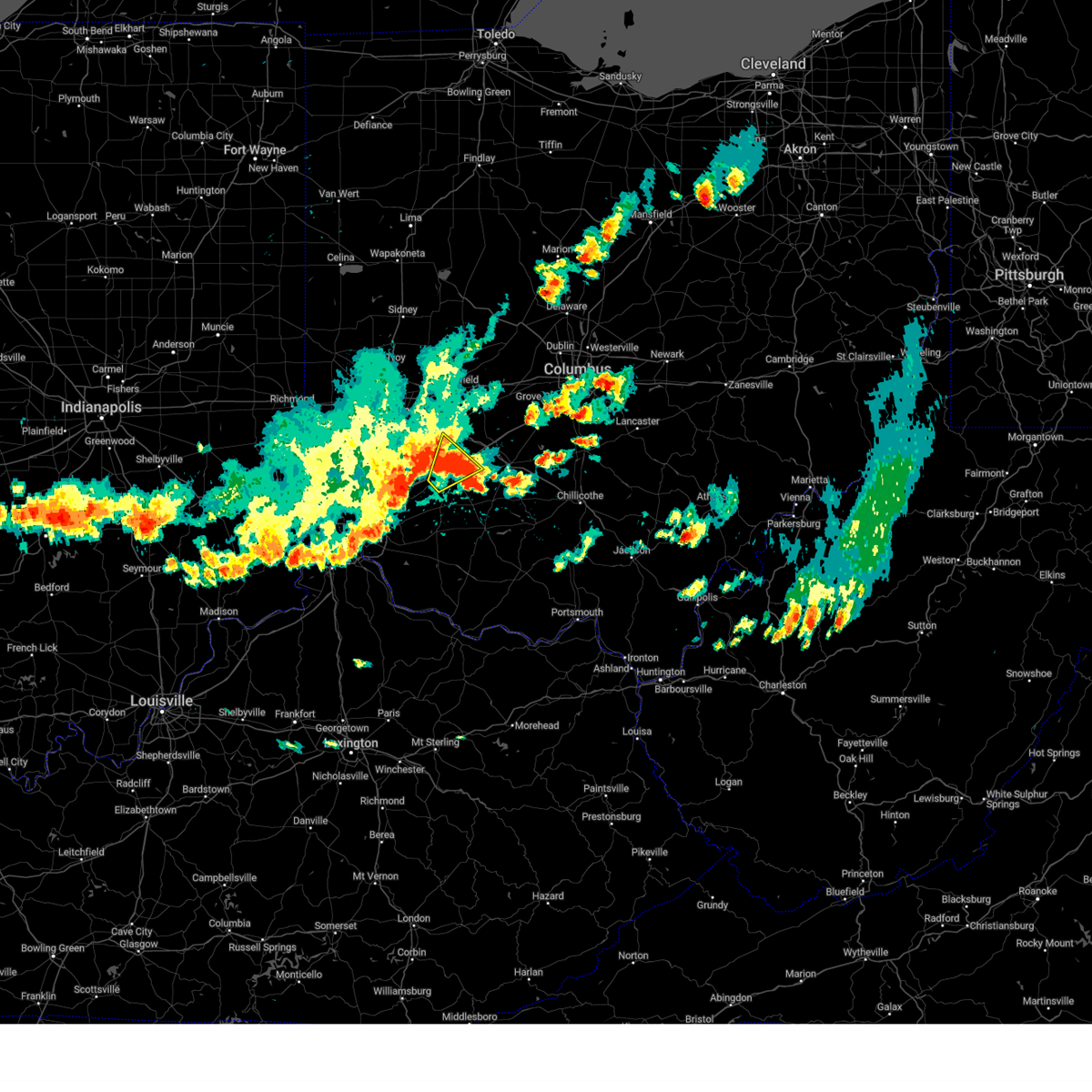
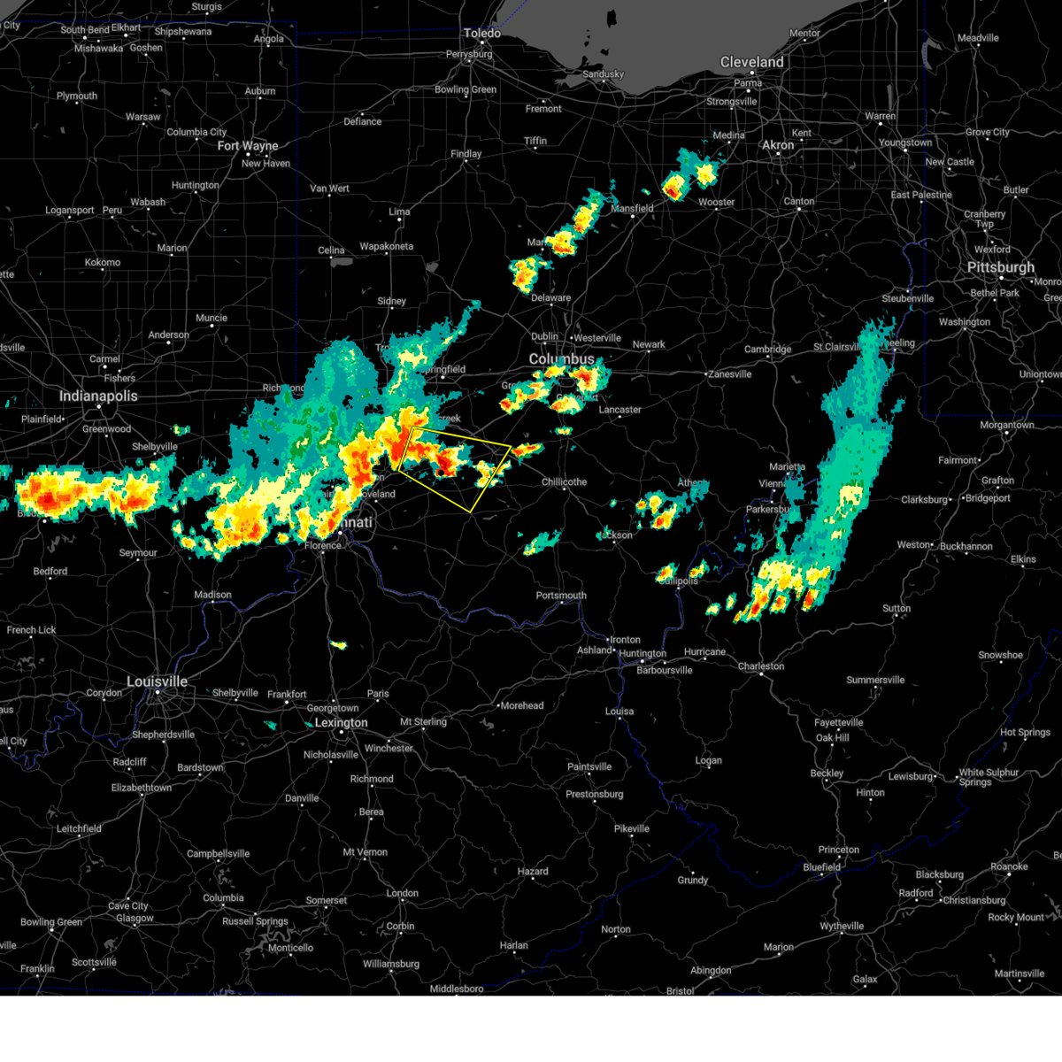
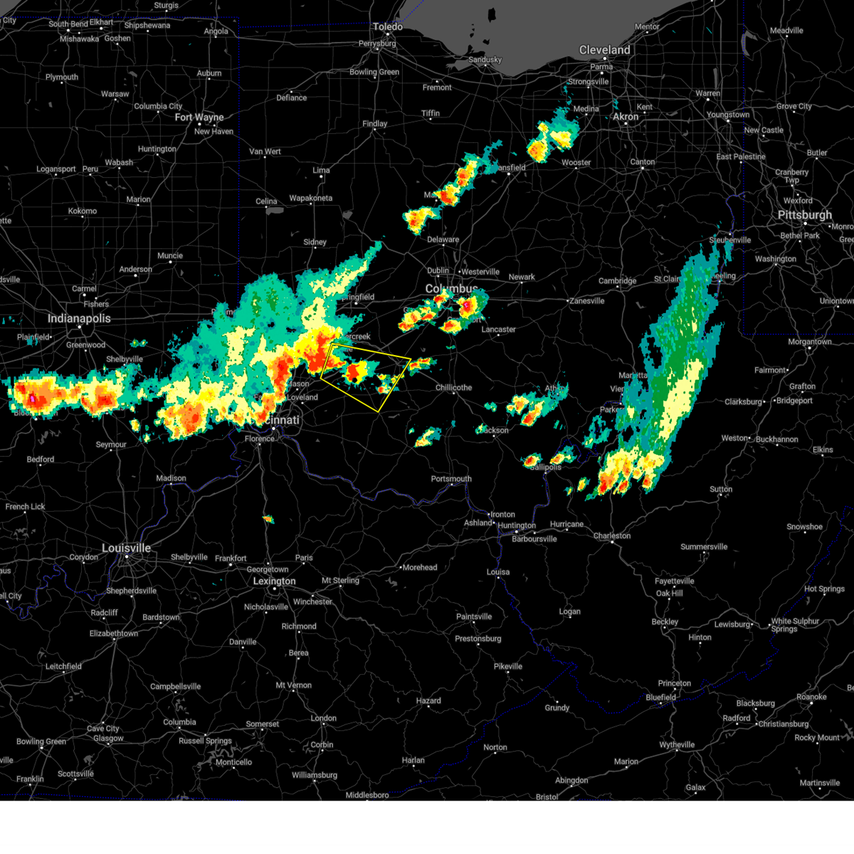
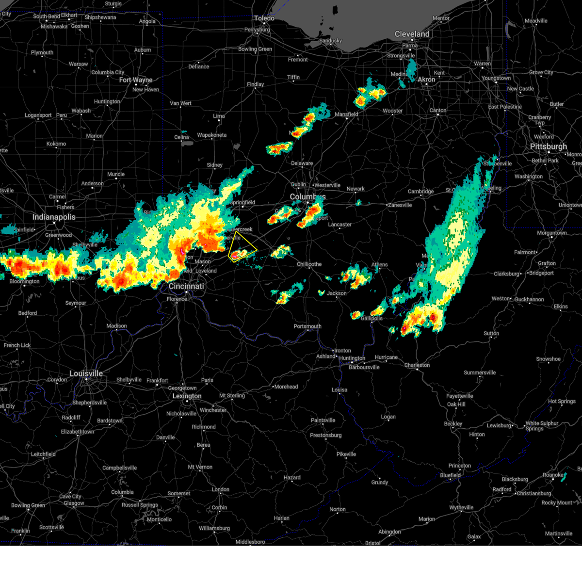
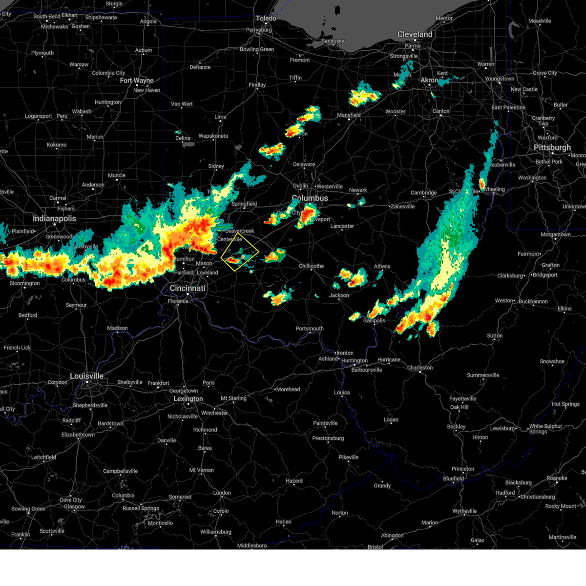
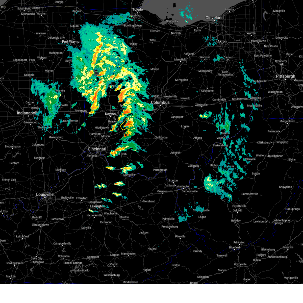
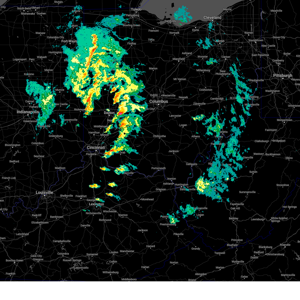
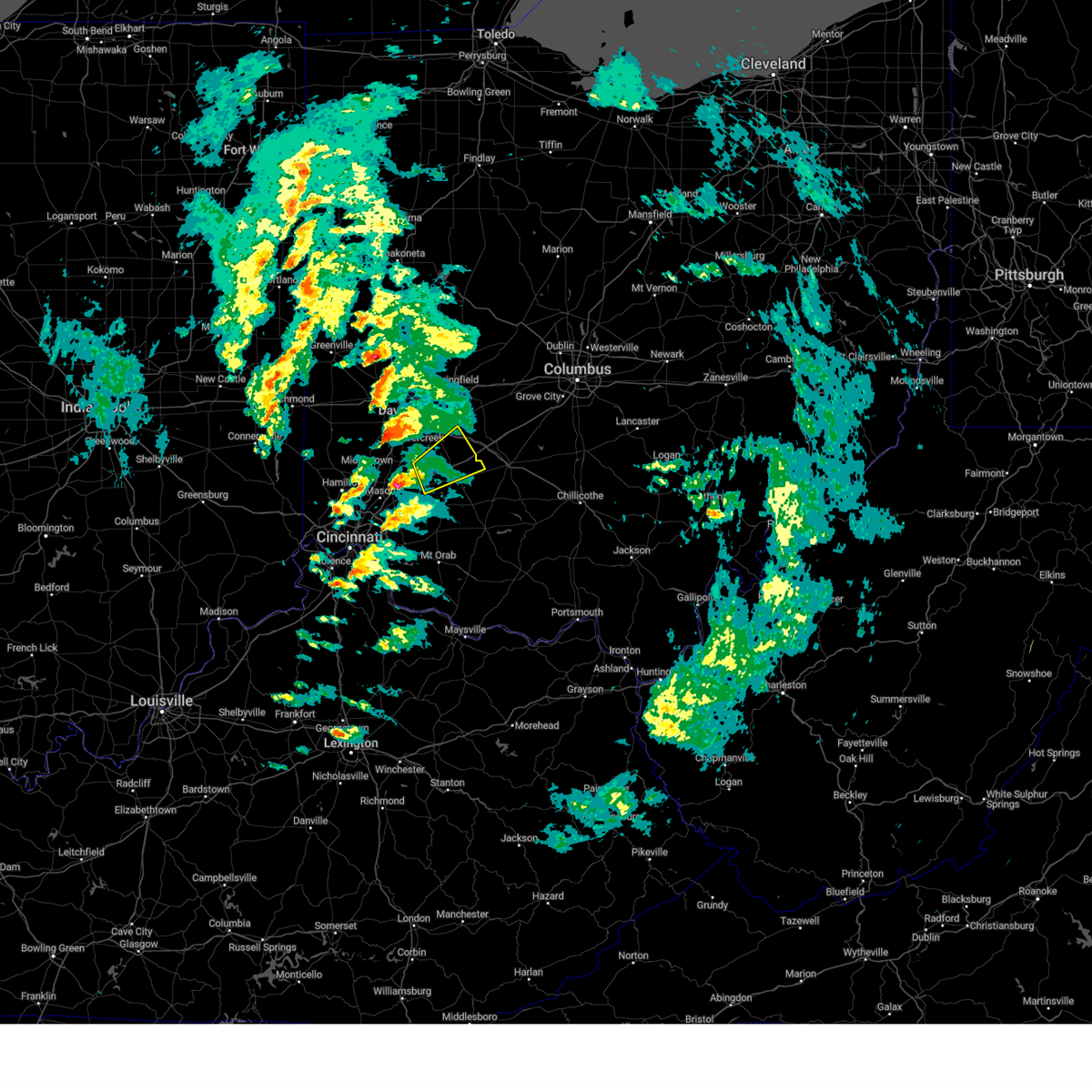
Hail Map for Port William, OH
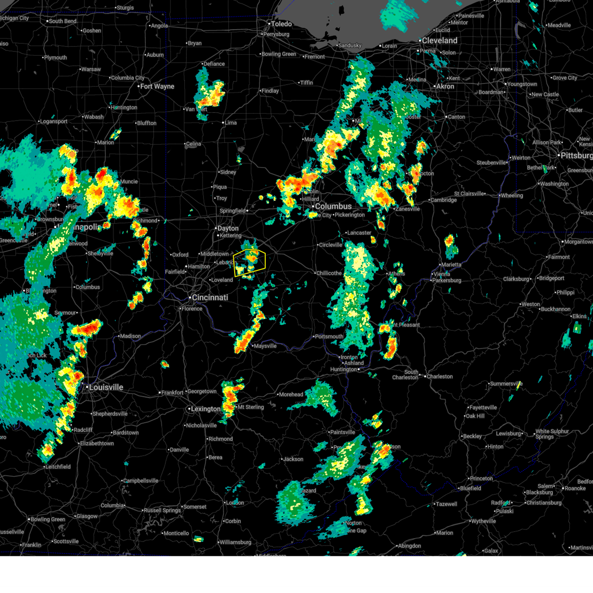
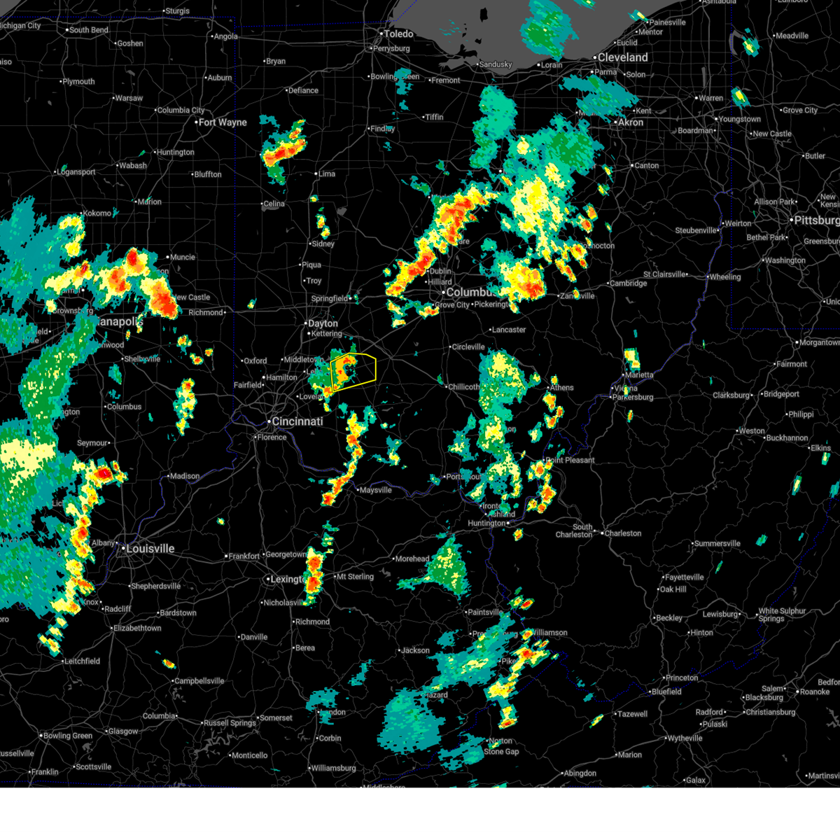
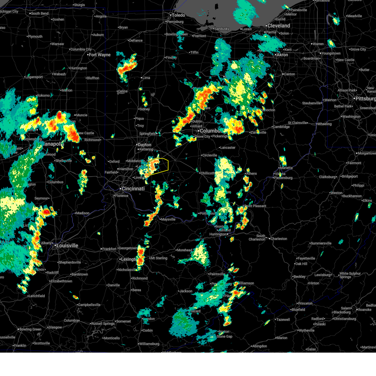
The Port William, OH area has had 0 reports of on-the-ground hail by trained spotters, and has been under severe weather warnings 52 times during the past 12 months. Doppler radar has detected hail at or near Port William, OH on 38 occasions, including 2 occasions during the past year.
| Name: | Port William, OH |
| Where Located: | 49.3 miles NE of Cincinnati, OH |
| Map: | Google Map for Port William, OH |
| Population: | 254 |
| Housing Units: | 113 |
| More Info: | Search Google for Port William, OH |
0
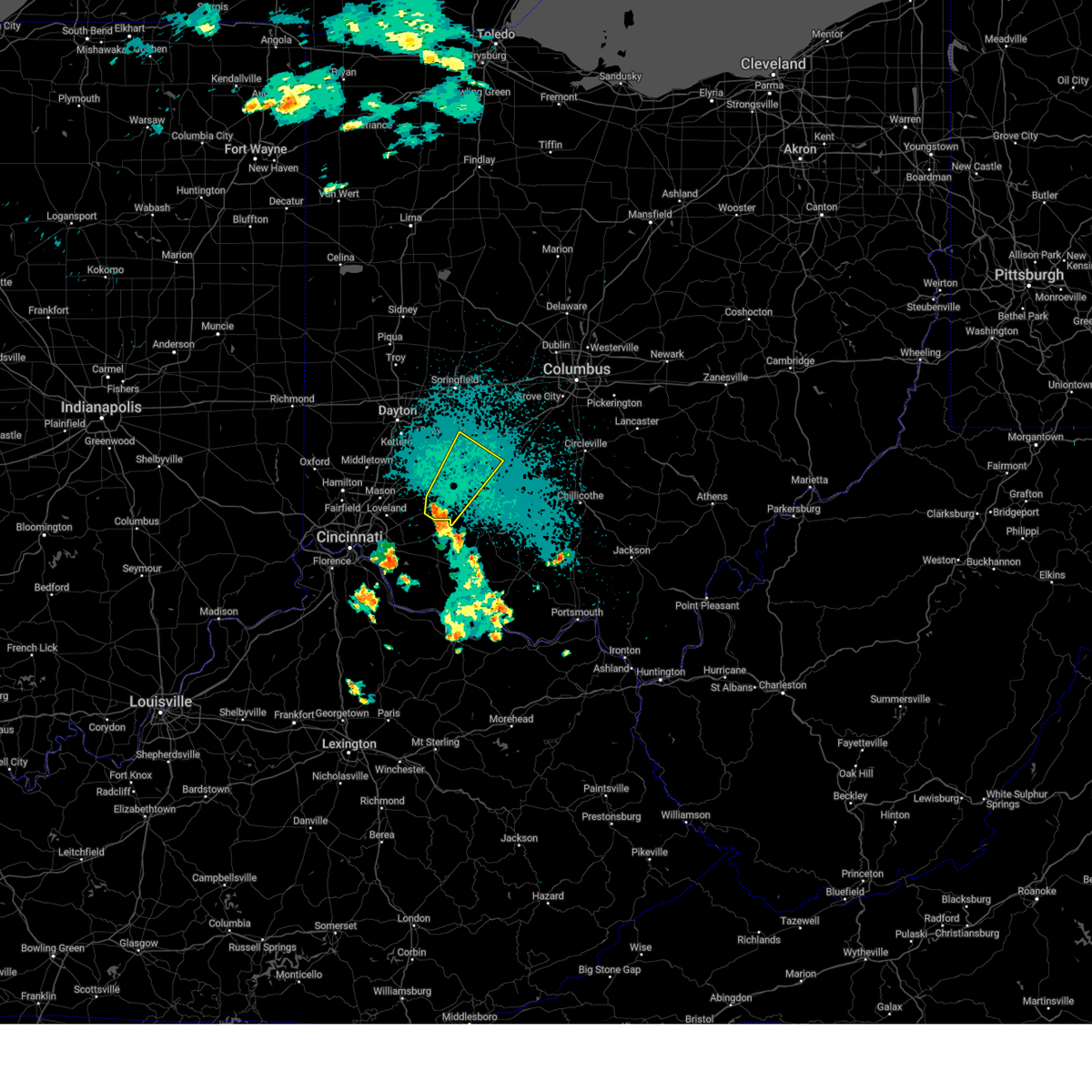
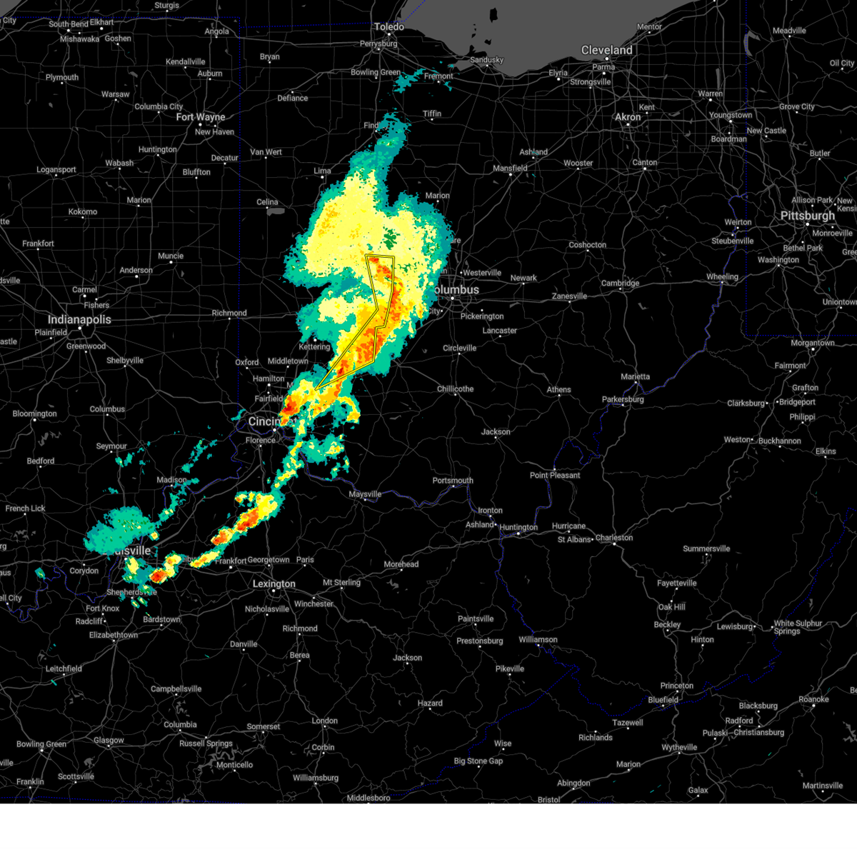
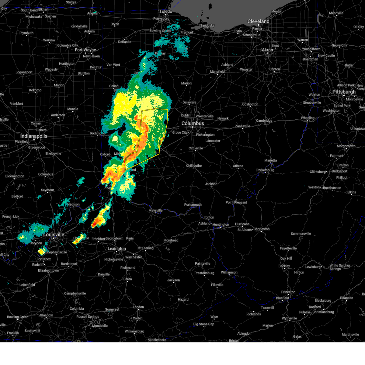
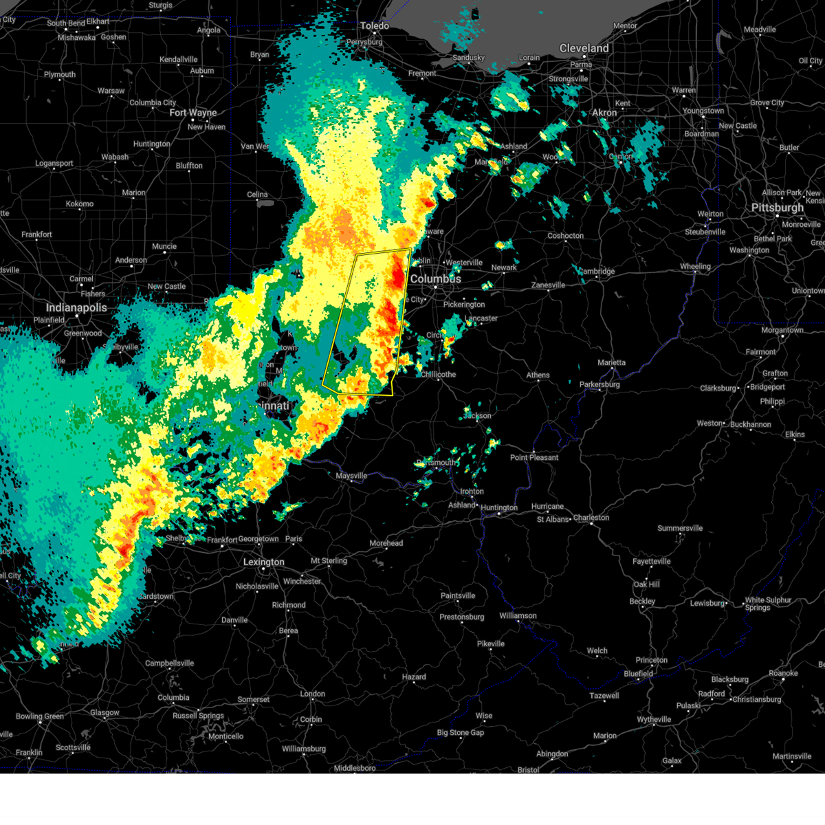
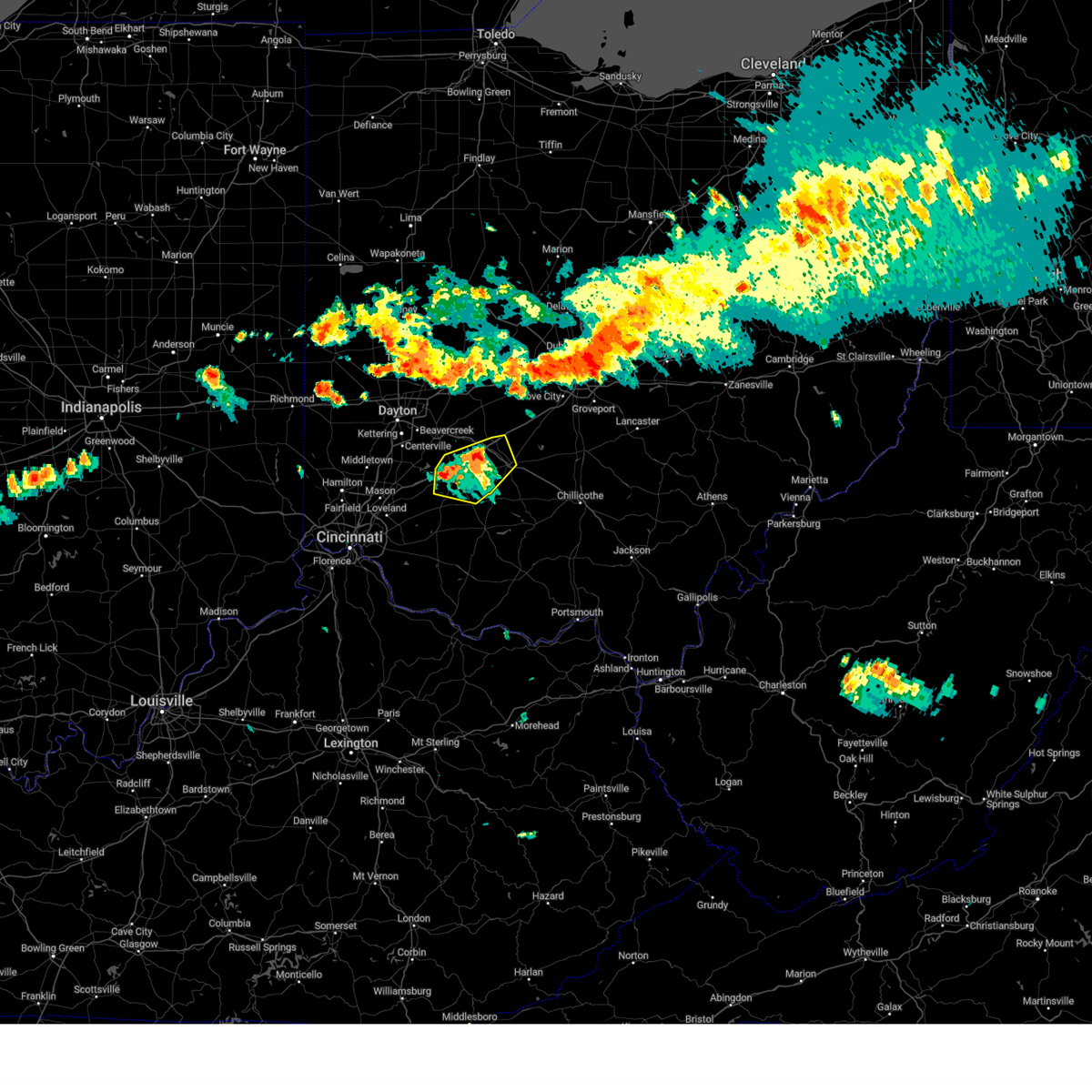
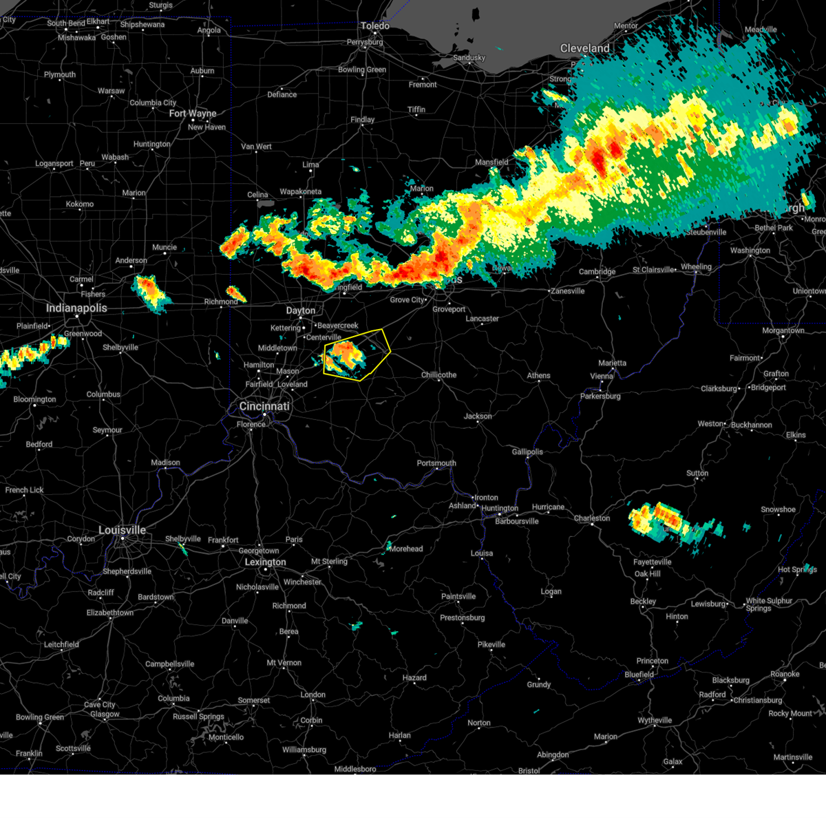
The Top Recent Hail Date for Port William, OH is Saturday, July 12, 2025 (26th out of 38)
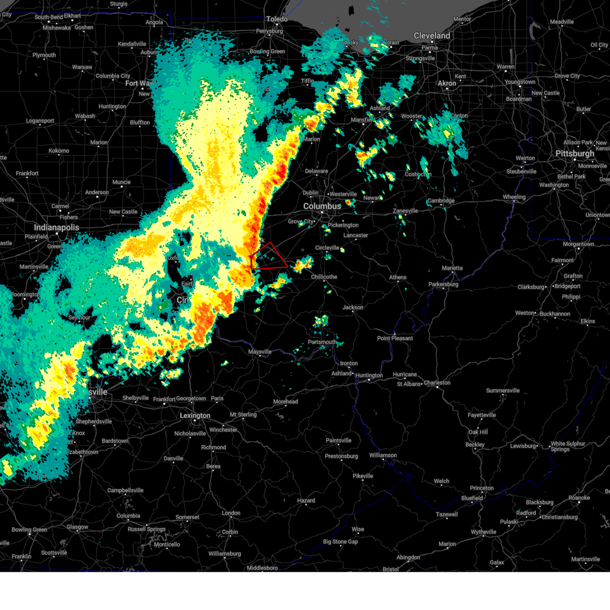
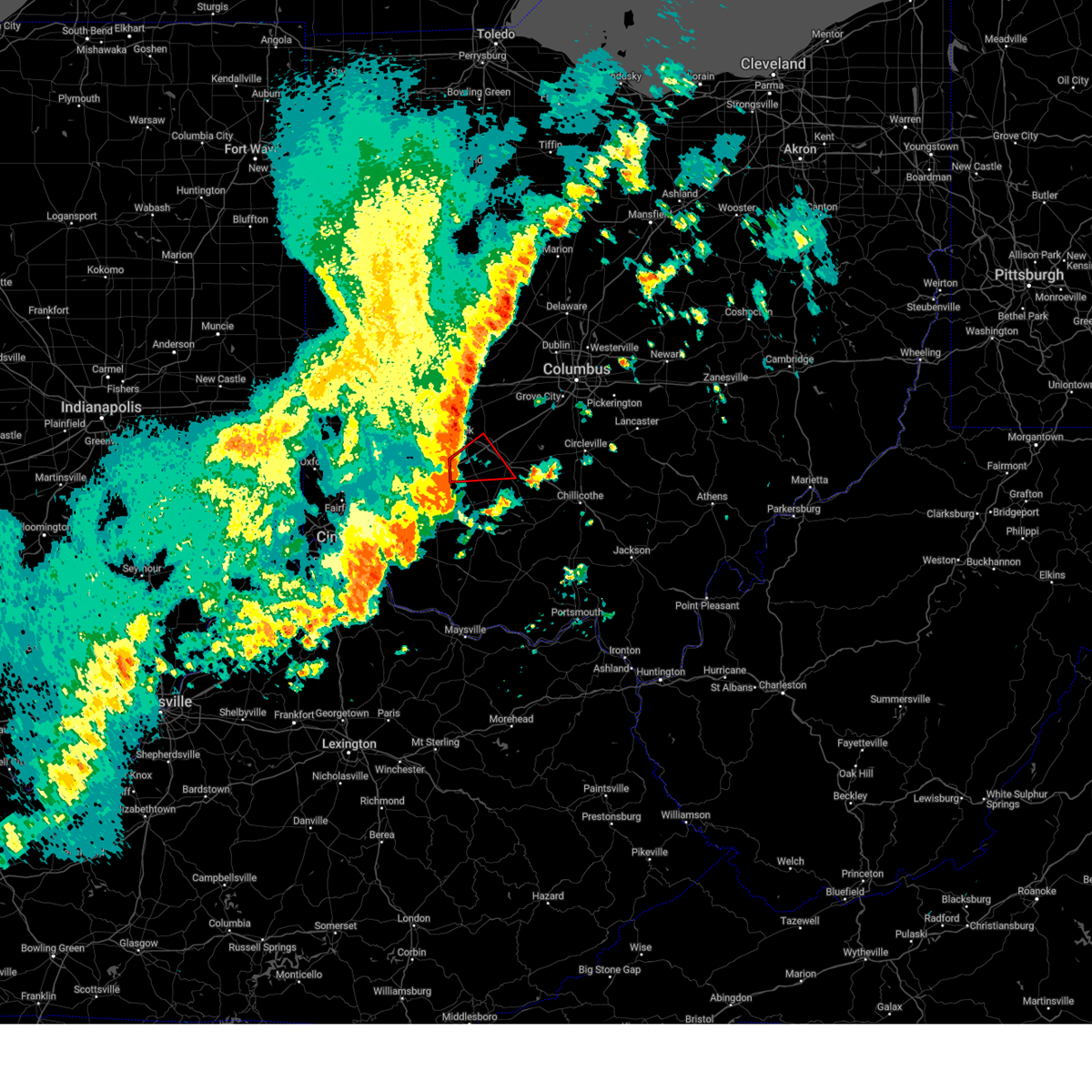
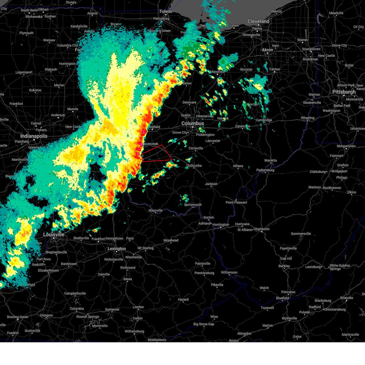
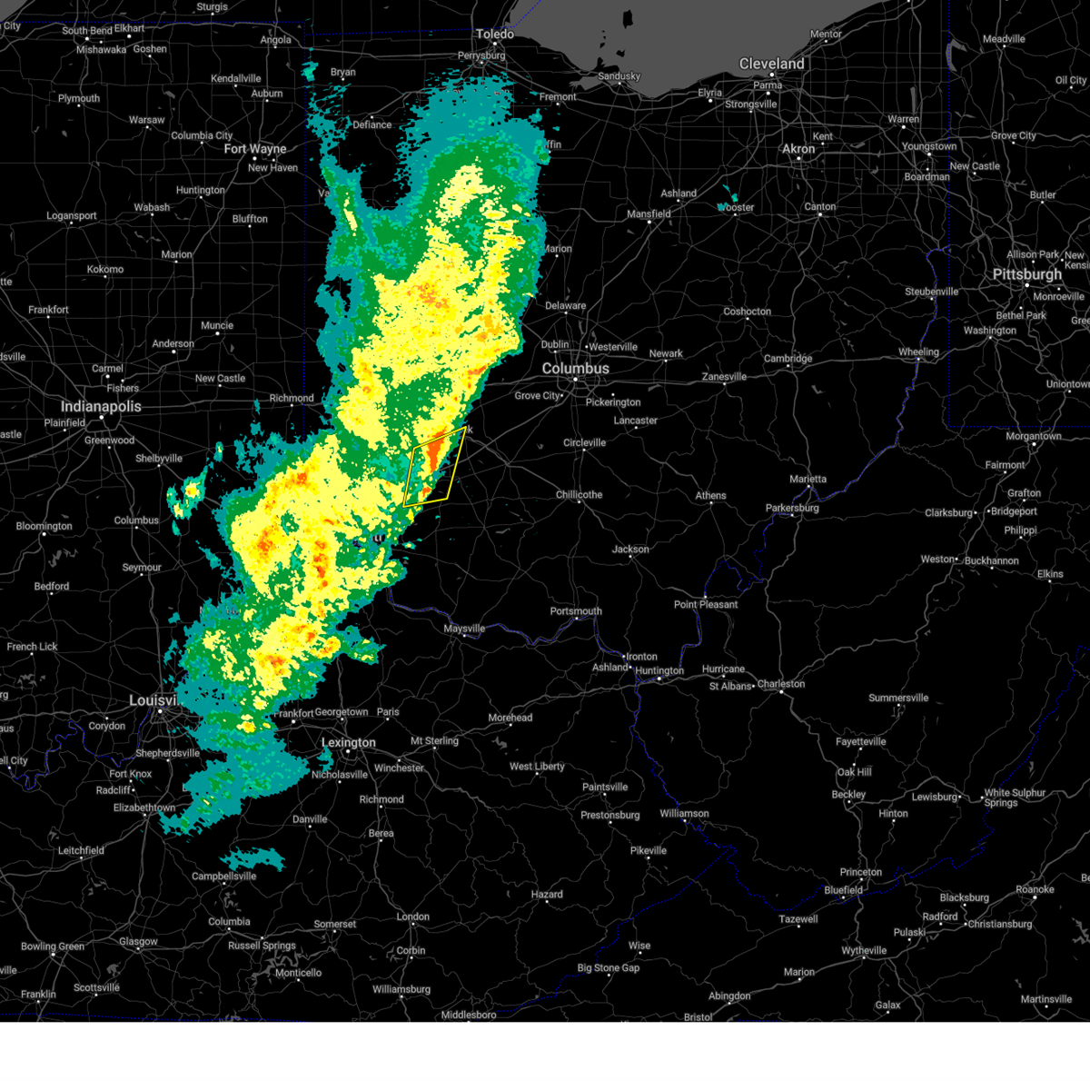
Hail and Wind Damage Spotted near Port William, OH
| Date / Time | Report Details |
|---|---|
| 7/12/2025 5:13 PM EDT |
 The storm which prompted the warning has weakened below severe limits and no longer poses an immediate threat to life or property. therefore, the warning will be allowed to expire. please report previous wind damage or hail to the national weather service by going to our website at weather.gov/iln and submitting your report via social media. The storm which prompted the warning has weakened below severe limits and no longer poses an immediate threat to life or property. therefore, the warning will be allowed to expire. please report previous wind damage or hail to the national weather service by going to our website at weather.gov/iln and submitting your report via social media.
|
| 7/12/2025 4:56 PM EDT |
 At 455 pm edt, a severe thunderstorm was located near wilmington, moving east at 20 mph (radar indicated). Hazards include 60 mph wind gusts. Expect damage to trees and power lines. locations impacted include, wilmington, blanchester, sabina, midland, port william, melvin, bloomington, new antioch, oakland, cuba, lees creek, reesville, morrisville, ogden, kingman, interstate 71 at us route 68, cowan lake state park, and burtonville. This includes i-71 in ohio between mile markers 43 and 57. At 455 pm edt, a severe thunderstorm was located near wilmington, moving east at 20 mph (radar indicated). Hazards include 60 mph wind gusts. Expect damage to trees and power lines. locations impacted include, wilmington, blanchester, sabina, midland, port william, melvin, bloomington, new antioch, oakland, cuba, lees creek, reesville, morrisville, ogden, kingman, interstate 71 at us route 68, cowan lake state park, and burtonville. This includes i-71 in ohio between mile markers 43 and 57.
|
| 7/12/2025 4:56 PM EDT |
 the severe thunderstorm warning has been cancelled and is no longer in effect the severe thunderstorm warning has been cancelled and is no longer in effect
|
| 7/12/2025 4:42 PM EDT |
 Svriln the national weather service in wilmington has issued a * severe thunderstorm warning for, east central warren county in southwestern ohio, clinton county in southwestern ohio, * until 515 pm edt. * at 441 pm edt, a severe thunderstorm was located 7 miles west of wilmington, moving east at 25 mph (radar indicated). Hazards include 60 mph wind gusts. expect damage to trees and power lines Svriln the national weather service in wilmington has issued a * severe thunderstorm warning for, east central warren county in southwestern ohio, clinton county in southwestern ohio, * until 515 pm edt. * at 441 pm edt, a severe thunderstorm was located 7 miles west of wilmington, moving east at 25 mph (radar indicated). Hazards include 60 mph wind gusts. expect damage to trees and power lines
|
| 6/18/2025 7:30 PM EDT |
 the severe thunderstorm warning has been cancelled and is no longer in effect the severe thunderstorm warning has been cancelled and is no longer in effect
|
| 6/18/2025 7:30 PM EDT |
 At 730 pm edt, severe thunderstorms were located along a line extending from waynesville to newport, moving east at 50 mph (radar indicated). Hazards include 60 mph wind gusts and penny size hail. Expect damage to trees and power lines. locations impacted include, cincinnati, covington, mason, lebanon, norwood, fort thomas, newport, sharonville, wilmington, blue ash, loveland, reading, montgomery, madeira, edgewood, fort mitchell, villa hills, highland heights, milford, and taylor mill. this includes the following interstates, i-71 in ohio between mile markers 0 and 57. i-75 in kentucky between mile markers 187 and 191. I-75 in ohio between mile markers 0 and 2, and near mile marker 8. At 730 pm edt, severe thunderstorms were located along a line extending from waynesville to newport, moving east at 50 mph (radar indicated). Hazards include 60 mph wind gusts and penny size hail. Expect damage to trees and power lines. locations impacted include, cincinnati, covington, mason, lebanon, norwood, fort thomas, newport, sharonville, wilmington, blue ash, loveland, reading, montgomery, madeira, edgewood, fort mitchell, villa hills, highland heights, milford, and taylor mill. this includes the following interstates, i-71 in ohio between mile markers 0 and 57. i-75 in kentucky between mile markers 187 and 191. I-75 in ohio between mile markers 0 and 2, and near mile marker 8.
|
| 6/18/2025 7:04 PM EDT | Svriln the national weather service in wilmington has issued a * severe thunderstorm warning for, north central kenton county in northern kentucky, northern campbell county in northern kentucky, eastern hamilton county in southwestern ohio, eastern butler county in southwestern ohio, northern clermont county in southwestern ohio, northwestern brown county in southwestern ohio, warren county in southwestern ohio, clinton county in southwestern ohio, northwestern highland county in south central ohio, * until 800 pm edt. * at 704 pm edt, severe thunderstorms were located along a line extending from middletown to burlington, moving northeast at 30 mph (radar indicated). Hazards include 60 mph wind gusts and penny size hail. expect damage to trees and power lines |
| 5/16/2025 9:52 PM EDT | At 950 pm edt, a severe thunderstorm was located over washington court house, moving east at 50 mph (radar indicated). Hazards include 70 mph wind gusts and half dollar size hail. Minor hail damage to vehicles is possible. expect considerable tree damage. wind damage is also likely to mobile homes, roofs, and outbuildings. locations impacted include, clarksville, interstate 71 at state route 38, new vienna, east monroe, lumberton, austin, oakland, sabina, lees creek, madison mills, martinsville, midway, morrisville, south salem, new holland, wilmington, ogden, kingman, cowan lake state park, and milledgeville. This includes i-71 in ohio between mile markers 43 and 57, and between mile markers 62 and 88. |
| 5/16/2025 9:52 PM EDT | the severe thunderstorm warning has been cancelled and is no longer in effect |
| 5/16/2025 9:49 PM EDT | At 949 pm edt, a severe thunderstorm was located near wilmington, moving east at 45 mph (radar indicated). Hazards include 70 mph wind gusts and half dollar size hail. Minor hail damage to vehicles is possible. expect considerable tree damage. wind damage is also likely to mobile homes, roofs, and outbuildings. locations impacted include, melvin, staunton, east monroe, bloomington, new antioch, jasper mills, sabina, cuba, lees creek, reesville, morrisville, wilmington, washington court house, new martinsburg, interstate 71 at us route 68, cowan lake state park, burtonville, highland, port william, and leesburg. This includes i-71 in ohio between mile markers 51 and 58. |
| 5/16/2025 9:32 PM EDT |
 At 932 pm edt, a severe thunderstorm was located near sabina, moving east at 50 mph (radar indicated). Hazards include 70 mph wind gusts and half dollar size hail. Minor hail damage to vehicles is possible. expect considerable tree damage. wind damage is also likely to mobile homes, roofs, and outbuildings. locations impacted include, paintersville, clarksville, interstate 71 at state route 38, new vienna, fort ancient, east monroe, rosemoor, lumberton, austin, oakland, selma, sabina, corwin, genntown, lees creek, madison mills, oldtown, gladstone, caesar creek state park, and yellow springs. This includes i-71 in ohio between mile markers 29 and 88. At 932 pm edt, a severe thunderstorm was located near sabina, moving east at 50 mph (radar indicated). Hazards include 70 mph wind gusts and half dollar size hail. Minor hail damage to vehicles is possible. expect considerable tree damage. wind damage is also likely to mobile homes, roofs, and outbuildings. locations impacted include, paintersville, clarksville, interstate 71 at state route 38, new vienna, fort ancient, east monroe, rosemoor, lumberton, austin, oakland, selma, sabina, corwin, genntown, lees creek, madison mills, oldtown, gladstone, caesar creek state park, and yellow springs. This includes i-71 in ohio between mile markers 29 and 88.
|
| 5/16/2025 9:22 PM EDT |
 The severe thunderstorm which prompted the warning has been replaced with a new severe thunderstorm warning. a tornado watch remains in effect until 300 am edt for southwestern and west central ohio. please report previous wind damage or hail to the national weather service by going to our website at weather.gov/iln and submitting your report via social media. remember, a severe thunderstorm warning still remains in effect. The severe thunderstorm which prompted the warning has been replaced with a new severe thunderstorm warning. a tornado watch remains in effect until 300 am edt for southwestern and west central ohio. please report previous wind damage or hail to the national weather service by going to our website at weather.gov/iln and submitting your report via social media. remember, a severe thunderstorm warning still remains in effect.
|
| 5/16/2025 9:19 PM EDT |
 Svriln the national weather service in wilmington has issued a * severe thunderstorm warning for, eastern warren county in southwestern ohio, fayette county in central ohio, clinton county in southwestern ohio, northwestern pickaway county in central ohio, greene county in west central ohio, southeastern clark county in west central ohio, northeastern highland county in south central ohio, southern madison county in central ohio, northwestern ross county in south central ohio, * until 1000 pm edt. * at 919 pm edt, a severe thunderstorm was located near wilmington, moving east at 50 mph (radar indicated). Hazards include 60 mph wind gusts and quarter size hail. Minor hail damage to vehicles is possible. Expect wind damage to trees and power lines. Svriln the national weather service in wilmington has issued a * severe thunderstorm warning for, eastern warren county in southwestern ohio, fayette county in central ohio, clinton county in southwestern ohio, northwestern pickaway county in central ohio, greene county in west central ohio, southeastern clark county in west central ohio, northeastern highland county in south central ohio, southern madison county in central ohio, northwestern ross county in south central ohio, * until 1000 pm edt. * at 919 pm edt, a severe thunderstorm was located near wilmington, moving east at 50 mph (radar indicated). Hazards include 60 mph wind gusts and quarter size hail. Minor hail damage to vehicles is possible. Expect wind damage to trees and power lines.
|
| 5/16/2025 9:11 PM EDT | At 911 pm edt, a severe thunderstorm was located near springboro, moving northeast at 60 mph (radar indicated). Hazards include 60 mph wind gusts and half dollar size hail. Minor hail damage to vehicles is possible. expect wind damage to trees and power lines. locations impacted include, paintersville, vandalia, hughes, clarksville, englewood, state route 63 at state route 741, fort ancient, beckett ridge, lumberton, oakland, pekin, corwin, genntown, pisgah, wright-patterson afb, oldtown, gladstone, caesar creek state park, yellow springs, and dayton international airport. this includes the following interstates, i-70 in ohio between mile markers 25 and 41. i-71 in ohio between mile markers 22 and 56. I-75 in ohio between mile markers 18 and 33, between mile markers 37 and 44, and between mile markers 46 and 64. |
| 5/16/2025 9:04 PM EDT | At 903 pm edt, a severe thunderstorm was located over hunter, moving east at 40 mph (radar indicated). Hazards include 60 mph wind gusts and half dollar size hail. Minor hail damage to vehicles is possible. expect wind damage to trees and power lines. locations impacted include, paintersville, franklin, clarksville, englewood, state route 63 at state route 741, fort ancient, beckett ridge, lumberton, pekin, corwin, south middletown, wright-patterson afb, oldtown, gladstone, caesar creek state park, yellow springs, cowan lake state park, hunter, roxanna, and brookville. this includes the following interstates, i-70 in ohio between mile markers 25 and 41. i-71 in ohio between mile markers 22 and 56. I-75 in ohio between mile markers 18 and 64. |
| 5/16/2025 8:58 PM EDT | At 858 pm edt, a severe thunderstorm was located over hunter, moving northeast at 60 mph (radar indicated). Hazards include 60 mph wind gusts and half dollar size hail. Minor hail damage to vehicles is possible. expect wind damage to trees and power lines. locations impacted include, paintersville, franklin, clarksville, englewood, state route 63 at state route 741, fort ancient, beckett ridge, lumberton, pekin, corwin, south middletown, wright-patterson afb, oldtown, gladstone, caesar creek state park, yellow springs, cowan lake state park, hunter, roxanna, and brookville. this includes the following interstates, i-70 in ohio between mile markers 25 and 41. i-71 in ohio between mile markers 22 and 56. I-75 in ohio between mile markers 18 and 64. |
| 5/16/2025 8:46 PM EDT | Svriln the national weather service in wilmington has issued a * severe thunderstorm warning for, eastern butler county in southwestern ohio, warren county in southwestern ohio, northwestern clinton county in southwestern ohio, greene county in west central ohio, montgomery county in west central ohio, * until 930 pm edt. * at 846 pm edt, a severe thunderstorm was located over williamsdale, moving northeast at 60 mph (radar indicated). Hazards include 60 mph wind gusts and quarter size hail. Minor hail damage to vehicles is possible. Expect wind damage to trees and power lines. |
| 5/1/2025 4:45 AM EDT |
 the severe thunderstorm warning has been cancelled and is no longer in effect the severe thunderstorm warning has been cancelled and is no longer in effect
|
| 5/1/2025 4:41 AM EDT |
 At 440 am edt, a severe thunderstorm was located over wilmington, moving northeast at 40 mph (radar indicated). Hazards include 60 mph wind gusts and quarter size hail. Minor hail damage to vehicles is possible. expect wind damage to trees and power lines. locations impacted include, paintersville, melvin, milledgeville, rosemoor, bloomington, new antioch, lumberton, oakland, sabina, lees creek, jamestown, reesville, morrisville, wilmington, port william, bowersville, interstate 71 at us route 68, burtonville, middleton corner, and octa. This includes i-71 in ohio between mile markers 47 and 64. At 440 am edt, a severe thunderstorm was located over wilmington, moving northeast at 40 mph (radar indicated). Hazards include 60 mph wind gusts and quarter size hail. Minor hail damage to vehicles is possible. expect wind damage to trees and power lines. locations impacted include, paintersville, melvin, milledgeville, rosemoor, bloomington, new antioch, lumberton, oakland, sabina, lees creek, jamestown, reesville, morrisville, wilmington, port william, bowersville, interstate 71 at us route 68, burtonville, middleton corner, and octa. This includes i-71 in ohio between mile markers 47 and 64.
|
| 5/1/2025 4:23 AM EDT |
 Svriln the national weather service in wilmington has issued a * severe thunderstorm warning for, west central fayette county in central ohio, clinton county in southwestern ohio, southeastern greene county in west central ohio, * until 500 am edt. * at 423 am edt, a severe thunderstorm was located near blanchester, moving northeast at 40 mph (radar indicated). Hazards include 60 mph wind gusts and quarter size hail. Minor hail damage to vehicles is possible. Expect wind damage to trees and power lines. Svriln the national weather service in wilmington has issued a * severe thunderstorm warning for, west central fayette county in central ohio, clinton county in southwestern ohio, southeastern greene county in west central ohio, * until 500 am edt. * at 423 am edt, a severe thunderstorm was located near blanchester, moving northeast at 40 mph (radar indicated). Hazards include 60 mph wind gusts and quarter size hail. Minor hail damage to vehicles is possible. Expect wind damage to trees and power lines.
|
| 4/29/2025 2:28 PM EDT |
 The storm which prompted the warning has moved out of the area. therefore, the warning will be allowed to expire. a severe thunderstorm watch remains in effect until 700 pm edt for central, southwestern and west central ohio. please report previous wind damage or hail to the national weather service by going to our website at weather.gov/iln and submitting your report via social media. remember, a severe thunderstorm warning still remains in effect for parts of clinton and warren counties. The storm which prompted the warning has moved out of the area. therefore, the warning will be allowed to expire. a severe thunderstorm watch remains in effect until 700 pm edt for central, southwestern and west central ohio. please report previous wind damage or hail to the national weather service by going to our website at weather.gov/iln and submitting your report via social media. remember, a severe thunderstorm warning still remains in effect for parts of clinton and warren counties.
|
| 4/29/2025 2:22 PM EDT |
 At 222 pm edt, a severe thunderstorm was located near west jefferson, moving east at 45 mph (radar indicated). Hazards include 60 mph wind gusts and penny size hail. Expect damage to trees and power lines. locations impacted include, paintersville, cable, mechanicsburg, fort ancient, rosemoor, lumberton, south vienna, oakland, woodstock, selma, catawba station, kennard, gladstone, south charleston, kingman, interstate 71 at us route 68, brighton, north lewisburg, new jasper, and lisbon. this includes the following interstates, i-70 in ohio between mile markers 65 and 70. I-71 in ohio between mile markers 35 and 61. At 222 pm edt, a severe thunderstorm was located near west jefferson, moving east at 45 mph (radar indicated). Hazards include 60 mph wind gusts and penny size hail. Expect damage to trees and power lines. locations impacted include, paintersville, cable, mechanicsburg, fort ancient, rosemoor, lumberton, south vienna, oakland, woodstock, selma, catawba station, kennard, gladstone, south charleston, kingman, interstate 71 at us route 68, brighton, north lewisburg, new jasper, and lisbon. this includes the following interstates, i-70 in ohio between mile markers 65 and 70. I-71 in ohio between mile markers 35 and 61.
|
| 4/29/2025 2:17 PM EDT |
 At 216 pm edt, a severe thunderstorm was located over choctaw lake, moving east at 60 mph (radar indicated). Hazards include 60 mph wind gusts and penny size hail. Expect damage to trees and power lines. locations impacted include, port columbus airport, paintersville, east ringgold, interstate 71 at state route 38, rosemoor, gahanna, lumberton, center village, madison mills, worthington, kilbourne, hilliard, new california, grandview heights, whitehall, orient, amity, ostrander, south solon, and delaware. this includes the following interstates, i-70 in ohio between mile markers 71 and 111. I-71 in ohio between mile markers 47 and 138. At 216 pm edt, a severe thunderstorm was located over choctaw lake, moving east at 60 mph (radar indicated). Hazards include 60 mph wind gusts and penny size hail. Expect damage to trees and power lines. locations impacted include, port columbus airport, paintersville, east ringgold, interstate 71 at state route 38, rosemoor, gahanna, lumberton, center village, madison mills, worthington, kilbourne, hilliard, new california, grandview heights, whitehall, orient, amity, ostrander, south solon, and delaware. this includes the following interstates, i-70 in ohio between mile markers 71 and 111. I-71 in ohio between mile markers 47 and 138.
|
| 4/29/2025 2:13 PM EDT |
 At 213 pm edt, a severe thunderstorm was located near choctaw lake, moving east at 60 mph (radar indicated). Hazards include 60 mph wind gusts and penny size hail. Expect damage to trees and power lines. locations impacted include, paintersville, fort ancient, rosemoor, lumberton, south vienna, oakland, woodstock, selma, corwin, genntown, oldtown, gladstone, caesar creek state park, yellow springs, south charleston, greene county airport, kingman, oregonia, buck creek state park, and kings mills. this includes the following interstates, i-70 in ohio between mile markers 54 and 70. I-71 in ohio between mile markers 23 and 61. At 213 pm edt, a severe thunderstorm was located near choctaw lake, moving east at 60 mph (radar indicated). Hazards include 60 mph wind gusts and penny size hail. Expect damage to trees and power lines. locations impacted include, paintersville, fort ancient, rosemoor, lumberton, south vienna, oakland, woodstock, selma, corwin, genntown, oldtown, gladstone, caesar creek state park, yellow springs, south charleston, greene county airport, kingman, oregonia, buck creek state park, and kings mills. this includes the following interstates, i-70 in ohio between mile markers 54 and 70. I-71 in ohio between mile markers 23 and 61.
|
| 4/29/2025 2:03 PM EDT |
 Svriln the national weather service in wilmington has issued a * severe thunderstorm warning for, franklin county in central ohio, northern fayette county in central ohio, northwestern clinton county in southwestern ohio, northern pickaway county in central ohio, delaware county in central ohio, southeastern greene county in west central ohio, southern union county in central ohio, madison county in central ohio, * until 300 pm edt. * at 202 pm edt, a severe thunderstorm was located near springfield, moving east at 55 mph (radar indicated). Hazards include 60 mph wind gusts and penny size hail. expect damage to trees and power lines Svriln the national weather service in wilmington has issued a * severe thunderstorm warning for, franklin county in central ohio, northern fayette county in central ohio, northwestern clinton county in southwestern ohio, northern pickaway county in central ohio, delaware county in central ohio, southeastern greene county in west central ohio, southern union county in central ohio, madison county in central ohio, * until 300 pm edt. * at 202 pm edt, a severe thunderstorm was located near springfield, moving east at 55 mph (radar indicated). Hazards include 60 mph wind gusts and penny size hail. expect damage to trees and power lines
|
| 4/29/2025 2:03 PM EDT |
 At 202 pm edt, a severe thunderstorm was located near choctaw lake, moving east at 60 mph (radar indicated). Hazards include 60 mph wind gusts and penny size hail. Expect damage to trees and power lines. locations impacted include, paintersville, state route 63 at state route 741, fort ancient, rosemoor, lumberton, south vienna, pekin, corwin, kiser lake state park, wright-patterson afb, oldtown, gladstone, caesar creek state park, yellow springs, new carlisle, dialton, hunter, north lewisburg, harmony, and lisbon. this includes the following interstates, i-70 in ohio between mile markers 42 and 70. i-71 in ohio between mile markers 23 and 61. I-75 in ohio between mile markers 30 and 32. At 202 pm edt, a severe thunderstorm was located near choctaw lake, moving east at 60 mph (radar indicated). Hazards include 60 mph wind gusts and penny size hail. Expect damage to trees and power lines. locations impacted include, paintersville, state route 63 at state route 741, fort ancient, rosemoor, lumberton, south vienna, pekin, corwin, kiser lake state park, wright-patterson afb, oldtown, gladstone, caesar creek state park, yellow springs, new carlisle, dialton, hunter, north lewisburg, harmony, and lisbon. this includes the following interstates, i-70 in ohio between mile markers 42 and 70. i-71 in ohio between mile markers 23 and 61. I-75 in ohio between mile markers 30 and 32.
|
| 4/29/2025 2:03 PM EDT |
 the severe thunderstorm warning has been cancelled and is no longer in effect the severe thunderstorm warning has been cancelled and is no longer in effect
|
| 4/29/2025 1:56 PM EDT |
 At 156 pm edt, a severe thunderstorm was located over springfield, moving east at 60 mph (radar indicated). Hazards include 60 mph wind gusts and penny size hail. Expect damage to trees and power lines. locations impacted include, paintersville, franklin, casstown, state route 63 at state route 741, fort ancient, rosemoor, beckett ridge, lumberton, south vienna, pekin, corwin, kiser lake state park, wright-patterson afb, oldtown, gladstone, caesar creek state park, yellow springs, new carlisle, dialton, and hunter. this includes the following interstates, i-70 in ohio between mile markers 41 and 70. i-71 in ohio between mile markers 22 and 61. I-75 in ohio between mile markers 17 and 45. At 156 pm edt, a severe thunderstorm was located over springfield, moving east at 60 mph (radar indicated). Hazards include 60 mph wind gusts and penny size hail. Expect damage to trees and power lines. locations impacted include, paintersville, franklin, casstown, state route 63 at state route 741, fort ancient, rosemoor, beckett ridge, lumberton, south vienna, pekin, corwin, kiser lake state park, wright-patterson afb, oldtown, gladstone, caesar creek state park, yellow springs, new carlisle, dialton, and hunter. this includes the following interstates, i-70 in ohio between mile markers 41 and 70. i-71 in ohio between mile markers 22 and 61. I-75 in ohio between mile markers 17 and 45.
|
| 4/29/2025 1:33 PM EDT |
 Svriln the national weather service in wilmington has issued a * severe thunderstorm warning for, north central hamilton county in southwestern ohio, champaign county in west central ohio, eastern butler county in southwestern ohio, warren county in southwestern ohio, northwestern clinton county in southwestern ohio, greene county in west central ohio, clark county in west central ohio, eastern montgomery county in west central ohio, eastern miami county in west central ohio, * until 230 pm edt. * at 133 pm edt, a severe thunderstorm was located near trotwood, moving east at 60 mph (radar indicated). Hazards include 60 mph wind gusts and nickel size hail. expect damage to trees and power lines Svriln the national weather service in wilmington has issued a * severe thunderstorm warning for, north central hamilton county in southwestern ohio, champaign county in west central ohio, eastern butler county in southwestern ohio, warren county in southwestern ohio, northwestern clinton county in southwestern ohio, greene county in west central ohio, clark county in west central ohio, eastern montgomery county in west central ohio, eastern miami county in west central ohio, * until 230 pm edt. * at 133 pm edt, a severe thunderstorm was located near trotwood, moving east at 60 mph (radar indicated). Hazards include 60 mph wind gusts and nickel size hail. expect damage to trees and power lines
|
| 4/3/2025 1:22 AM EDT |
 At 121 am edt, a severe thunderstorm was located over lynchburg, moving east at 75 mph (radar indicated). Hazards include 70 mph wind gusts and penny size hail. Expect considerable tree damage. damage is likely to mobile homes, roofs, and outbuildings. locations impacted include, new richmond, atwood, bradford, lumberton, new palestine, bracht, morrisville, cowan lake state park, mulberry, woolcutt, clermont county airport, harmony, long ridge, california, lenoxburg, knoxville, russell, keefer, midland, and reesville. this includes the following interstates, i-71 in kentucky near mile marker 65. i-71 in ohio between mile markers 35 and 65. I-75 in kentucky between mile markers 143 and 167. At 121 am edt, a severe thunderstorm was located over lynchburg, moving east at 75 mph (radar indicated). Hazards include 70 mph wind gusts and penny size hail. Expect considerable tree damage. damage is likely to mobile homes, roofs, and outbuildings. locations impacted include, new richmond, atwood, bradford, lumberton, new palestine, bracht, morrisville, cowan lake state park, mulberry, woolcutt, clermont county airport, harmony, long ridge, california, lenoxburg, knoxville, russell, keefer, midland, and reesville. this includes the following interstates, i-71 in kentucky near mile marker 65. i-71 in ohio between mile markers 35 and 65. I-75 in kentucky between mile markers 143 and 167.
|
| 4/3/2025 1:22 AM EDT |
 the severe thunderstorm warning has been cancelled and is no longer in effect the severe thunderstorm warning has been cancelled and is no longer in effect
|
| 4/3/2025 1:14 AM EDT | Svriln the national weather service in wilmington has issued a * severe thunderstorm warning for, western franklin county in central ohio, northwestern brown county in southwestern ohio, fayette county in central ohio, clinton county in southwestern ohio, northwestern pickaway county in central ohio, southeastern greene county in west central ohio, highland county in south central ohio, madison county in central ohio, northwestern ross county in south central ohio, * until 200 am edt. * at 114 am edt, a severe thunderstorm was located near wilmington, moving northeast at 65 mph (radar indicated). Hazards include 70 mph wind gusts and penny size hail. Expect considerable tree damage. Damage is likely to mobile homes, roofs, and outbuildings. |
| 4/3/2025 1:09 AM EDT |
 At 108 am edt, a severe thunderstorm was located 7 miles north of williamsburg, moving northeast at 70 mph (radar indicated). Hazards include 70 mph wind gusts and penny size hail. Expect considerable tree damage. damage is likely to mobile homes, roofs, and outbuildings. locations impacted include, new richmond, atwood, bradford, lumberton, new palestine, bracht, pekin, corwin, morrisville, cowan lake state park, mulberry, woolcutt, clermont county airport, harmony, long ridge, california, lenoxburg, knoxville, russell, and keefer. this includes the following interstates, i-71 in kentucky near mile marker 65. i-71 in ohio between mile markers 27 and 65. i-75 in kentucky between mile markers 143 and 167. I-75 in ohio between mile markers 40 and 43. At 108 am edt, a severe thunderstorm was located 7 miles north of williamsburg, moving northeast at 70 mph (radar indicated). Hazards include 70 mph wind gusts and penny size hail. Expect considerable tree damage. damage is likely to mobile homes, roofs, and outbuildings. locations impacted include, new richmond, atwood, bradford, lumberton, new palestine, bracht, pekin, corwin, morrisville, cowan lake state park, mulberry, woolcutt, clermont county airport, harmony, long ridge, california, lenoxburg, knoxville, russell, and keefer. this includes the following interstates, i-71 in kentucky near mile marker 65. i-71 in ohio between mile markers 27 and 65. i-75 in kentucky between mile markers 143 and 167. I-75 in ohio between mile markers 40 and 43.
|
| 4/3/2025 1:09 AM EDT |
 the severe thunderstorm warning has been cancelled and is no longer in effect the severe thunderstorm warning has been cancelled and is no longer in effect
|
| 4/3/2025 12:53 AM EDT | At 1253 am edt, a severe thunderstorm was located over coldstream, moving northeast at 75 mph (radar indicated). Hazards include 70 mph wind gusts and penny size hail. Expect considerable tree damage. damage is likely to mobile homes, roofs, and outbuildings. locations impacted include, franklin, new richmond, atwood, bradford, lumberton, new palestine, bracht, pekin, corwin, morrisville, cowan lake state park, mulberry, hunter, woolcutt, clermont county airport, harmony, long ridge, california, lenoxburg, and knoxville. this includes the following interstates, i-71 in kentucky near mile marker 65. i-71 in ohio between mile markers 20 and 65. i-75 in kentucky between mile markers 143 and 167. I-75 in ohio between mile markers 27 and 44. |
| 4/3/2025 12:47 AM EDT | Svriln the national weather service in wilmington has issued a * severe thunderstorm warning for, southern kenton county in northern kentucky, western bracken county in northern kentucky, campbell county in northern kentucky, grant county in northern kentucky, owen county in northern kentucky, pendleton county in northern kentucky, eastern gallatin county in northern kentucky, northeastern butler county in southwestern ohio, clermont county in southwestern ohio, western fayette county in central ohio, eastern hamilton county in southwestern ohio, northern brown county in southwestern ohio, warren county in southwestern ohio, clinton county in southwestern ohio, greene county in west central ohio, western highland county in south central ohio, southeastern montgomery county in west central ohio, * until 130 am edt. * at 1247 am edt, a severe thunderstorm was located over mariemont, moving east at 75 mph (radar indicated). Hazards include 60 mph wind gusts and penny size hail. expect damage to trees and power lines |
| 3/30/2025 9:52 PM EDT |
 The storms which prompted the warning have moved out of the area. therefore, the warning will be allowed to expire. a tornado watch remains in effect until 100 am edt for central, south central, southwestern and west central ohio. please report previous wind damage or hail to the national weather service by going to our website at weather.gov/iln and submitting your report via social media. remember, a severe thunderstorm warning still remains in effect for southeastern union county, eastern madison county, eastern fayette county, and eastern highland county! remember, a tornado warning still remains in effect for eastern fayette county, northern highland county, and southeast madison county!. The storms which prompted the warning have moved out of the area. therefore, the warning will be allowed to expire. a tornado watch remains in effect until 100 am edt for central, south central, southwestern and west central ohio. please report previous wind damage or hail to the national weather service by going to our website at weather.gov/iln and submitting your report via social media. remember, a severe thunderstorm warning still remains in effect for southeastern union county, eastern madison county, eastern fayette county, and eastern highland county! remember, a tornado warning still remains in effect for eastern fayette county, northern highland county, and southeast madison county!.
|
| 3/30/2025 9:31 PM EDT |
 the severe thunderstorm warning has been cancelled and is no longer in effect the severe thunderstorm warning has been cancelled and is no longer in effect
|
| 3/30/2025 9:31 PM EDT |
 At 930 pm edt, severe thunderstorms were located along a line extending from near north lewisburg to near lynchburg, moving east at 45 mph (radar indicated). Hazards include 60 mph wind gusts and quarter size hail. Minor hail damage to vehicles is possible. expect wind damage to trees and power lines. locations impacted include, paintersville, interstate 71 at state route 38, east monroe, rosemoor, samantha, lumberton, south vienna, lees creek, madison mills, gladstone, martinsville, new california, morrisville, cowan lake state park, amity, harmony, lisbon, south solon, jasper mills, and midland. this includes the following interstates, i-70 in ohio between mile markers 56 and 85. I-71 in ohio between mile markers 46 and 84. At 930 pm edt, severe thunderstorms were located along a line extending from near north lewisburg to near lynchburg, moving east at 45 mph (radar indicated). Hazards include 60 mph wind gusts and quarter size hail. Minor hail damage to vehicles is possible. expect wind damage to trees and power lines. locations impacted include, paintersville, interstate 71 at state route 38, east monroe, rosemoor, samantha, lumberton, south vienna, lees creek, madison mills, gladstone, martinsville, new california, morrisville, cowan lake state park, amity, harmony, lisbon, south solon, jasper mills, and midland. this includes the following interstates, i-70 in ohio between mile markers 56 and 85. I-71 in ohio between mile markers 46 and 84.
|
| 3/30/2025 9:29 PM EDT |
 the tornado warning has been cancelled and is no longer in effect the tornado warning has been cancelled and is no longer in effect
|
| 3/30/2025 9:29 PM EDT |
 At 928 pm edt, a severe thunderstorm capable of producing a tornado was located near sabina, moving east at 55 mph (radar indicated rotation). Hazards include tornado and quarter size hail. Flying debris will be dangerous to those caught without shelter. mobile homes will be damaged or destroyed. damage to roofs, windows, and vehicles will occur. tree damage is likely. locations impacted include, melvin, staunton, milledgeville, octa, rosemoor, bloomington, lumberton, jasper mills, sabina, reesville, port william, bowersville, interstate 71 at us route 35, interstate 71 at us route 68, wilmington, and washington court house. This includes i-71 in ohio between mile markers 51 and 67. At 928 pm edt, a severe thunderstorm capable of producing a tornado was located near sabina, moving east at 55 mph (radar indicated rotation). Hazards include tornado and quarter size hail. Flying debris will be dangerous to those caught without shelter. mobile homes will be damaged or destroyed. damage to roofs, windows, and vehicles will occur. tree damage is likely. locations impacted include, melvin, staunton, milledgeville, octa, rosemoor, bloomington, lumberton, jasper mills, sabina, reesville, port william, bowersville, interstate 71 at us route 35, interstate 71 at us route 68, wilmington, and washington court house. This includes i-71 in ohio between mile markers 51 and 67.
|
| 3/30/2025 9:16 PM EDT |
 At 916 pm edt, a severe thunderstorm capable of producing a tornado was located 8 miles northwest of wilmington, moving east at 55 mph (radar indicated rotation). Hazards include tornado and quarter size hail. Flying debris will be dangerous to those caught without shelter. mobile homes will be damaged or destroyed. damage to roofs, windows, and vehicles will occur. tree damage is likely. locations impacted include, paintersville, melvin, staunton, milledgeville, octa, rosemoor, bloomington, middleton corner, lumberton, oakland, jasper mills, sabina, reesville, harveysburg, port william, kingman, bowersville, interstate 71 at us route 35, interstate 71 at us route 68, and wilmington. This includes i-71 in ohio between mile markers 42 and 67. At 916 pm edt, a severe thunderstorm capable of producing a tornado was located 8 miles northwest of wilmington, moving east at 55 mph (radar indicated rotation). Hazards include tornado and quarter size hail. Flying debris will be dangerous to those caught without shelter. mobile homes will be damaged or destroyed. damage to roofs, windows, and vehicles will occur. tree damage is likely. locations impacted include, paintersville, melvin, staunton, milledgeville, octa, rosemoor, bloomington, middleton corner, lumberton, oakland, jasper mills, sabina, reesville, harveysburg, port william, kingman, bowersville, interstate 71 at us route 35, interstate 71 at us route 68, and wilmington. This includes i-71 in ohio between mile markers 42 and 67.
|
| 3/30/2025 9:11 PM EDT |
 Toriln the national weather service in wilmington has issued a * tornado warning for, northeastern warren county in southwestern ohio, western fayette county in central ohio, northern clinton county in southwestern ohio, southeastern greene county in west central ohio, * until 945 pm edt. * at 910 pm edt, a severe thunderstorm capable of producing a tornado was located near waynesville, moving east at 55 mph (radar indicated rotation). Hazards include tornado and quarter size hail. Flying debris will be dangerous to those caught without shelter. mobile homes will be damaged or destroyed. damage to roofs, windows, and vehicles will occur. Tree damage is likely. Toriln the national weather service in wilmington has issued a * tornado warning for, northeastern warren county in southwestern ohio, western fayette county in central ohio, northern clinton county in southwestern ohio, southeastern greene county in west central ohio, * until 945 pm edt. * at 910 pm edt, a severe thunderstorm capable of producing a tornado was located near waynesville, moving east at 55 mph (radar indicated rotation). Hazards include tornado and quarter size hail. Flying debris will be dangerous to those caught without shelter. mobile homes will be damaged or destroyed. damage to roofs, windows, and vehicles will occur. Tree damage is likely.
|
| 3/30/2025 9:07 PM EDT |
 Svriln the national weather service in wilmington has issued a * severe thunderstorm warning for, southern champaign county in west central ohio, north central brown county in southwestern ohio, eastern warren county in southwestern ohio, fayette county in central ohio, clinton county in southwestern ohio, greene county in west central ohio, clark county in west central ohio, northern highland county in south central ohio, southern union county in central ohio, madison county in central ohio, * until 1000 pm edt. * at 906 pm edt, severe thunderstorms were located along a line extending from near urbana to near morrow, moving east at 50 mph (radar indicated). Hazards include 60 mph wind gusts and quarter size hail. Minor hail damage to vehicles is possible. Expect wind damage to trees and power lines. Svriln the national weather service in wilmington has issued a * severe thunderstorm warning for, southern champaign county in west central ohio, north central brown county in southwestern ohio, eastern warren county in southwestern ohio, fayette county in central ohio, clinton county in southwestern ohio, greene county in west central ohio, clark county in west central ohio, northern highland county in south central ohio, southern union county in central ohio, madison county in central ohio, * until 1000 pm edt. * at 906 pm edt, severe thunderstorms were located along a line extending from near urbana to near morrow, moving east at 50 mph (radar indicated). Hazards include 60 mph wind gusts and quarter size hail. Minor hail damage to vehicles is possible. Expect wind damage to trees and power lines.
|
| 3/19/2025 11:42 PM EDT |
 The storms which prompted the warning have weakened below severe limits and no longer pose an immediate threat to life or property. therefore, the warning will be allowed to expire. however, gusty winds are still possible with these thunderstorms. a severe thunderstorm watch remains in effect until 100 am edt for southwestern ohio. please report previous wind damage or hail to the national weather service by going to our website at weather.gov/iln and submitting your report via social media. The storms which prompted the warning have weakened below severe limits and no longer pose an immediate threat to life or property. therefore, the warning will be allowed to expire. however, gusty winds are still possible with these thunderstorms. a severe thunderstorm watch remains in effect until 100 am edt for southwestern ohio. please report previous wind damage or hail to the national weather service by going to our website at weather.gov/iln and submitting your report via social media.
|
| 3/19/2025 11:33 PM EDT |
 At 1132 pm edt, severe thunderstorms were located along a line extending from near springboro to loveland, moving east at 50 mph (radar indicated). Hazards include 60 mph wind gusts. Expect damage to trees and power lines. locations impacted include, paintersville, clarksville, state route 123 at state route 132, fort ancient, mount holly, lumberton, oakland, corwin, caesar creek state park, morrow, ogden, kingman, interstate 71 at us route 68, cowan lake state park, oregonia, new jasper, middleton corner, middleboro, roxanna, and waynesville. This includes i-71 in ohio between mile markers 35 and 53. At 1132 pm edt, severe thunderstorms were located along a line extending from near springboro to loveland, moving east at 50 mph (radar indicated). Hazards include 60 mph wind gusts. Expect damage to trees and power lines. locations impacted include, paintersville, clarksville, state route 123 at state route 132, fort ancient, mount holly, lumberton, oakland, corwin, caesar creek state park, morrow, ogden, kingman, interstate 71 at us route 68, cowan lake state park, oregonia, new jasper, middleton corner, middleboro, roxanna, and waynesville. This includes i-71 in ohio between mile markers 35 and 53.
|
| 3/19/2025 11:20 PM EDT |
 Svriln the national weather service in wilmington has issued a * severe thunderstorm warning for, central warren county in southwestern ohio, northwestern clinton county in southwestern ohio, southern greene county in west central ohio, * until 1145 pm edt. * at 1120 pm edt, severe thunderstorms were located along a line extending from south middletown to finneytown, moving northeast at 65 mph (radar indicated). Hazards include 60 mph wind gusts. expect damage to trees and power lines Svriln the national weather service in wilmington has issued a * severe thunderstorm warning for, central warren county in southwestern ohio, northwestern clinton county in southwestern ohio, southern greene county in west central ohio, * until 1145 pm edt. * at 1120 pm edt, severe thunderstorms were located along a line extending from south middletown to finneytown, moving northeast at 65 mph (radar indicated). Hazards include 60 mph wind gusts. expect damage to trees and power lines
|
| 12/29/2024 1:46 PM EST |
 Svriln the national weather service in wilmington has issued a * severe thunderstorm warning for, northwestern fayette county in central ohio, north central clinton county in southwestern ohio, southeastern clark county in west central ohio, eastern greene county in west central ohio, madison county in central ohio, * until 215 pm est. * at 145 pm est, a severe thunderstorm was located over jamestown, moving northeast at 55 mph (radar indicated). Hazards include 60 mph wind gusts. expect damage to trees and power lines Svriln the national weather service in wilmington has issued a * severe thunderstorm warning for, northwestern fayette county in central ohio, north central clinton county in southwestern ohio, southeastern clark county in west central ohio, eastern greene county in west central ohio, madison county in central ohio, * until 215 pm est. * at 145 pm est, a severe thunderstorm was located over jamestown, moving northeast at 55 mph (radar indicated). Hazards include 60 mph wind gusts. expect damage to trees and power lines
|
| 7/30/2024 2:09 AM EDT |
 Svriln the national weather service in wilmington has issued a * severe thunderstorm warning for, northern brown county in southwestern ohio, southwestern fayette county in central ohio, clinton county in southwestern ohio, highland county in south central ohio, * until 300 am edt. * at 209 am edt, a severe thunderstorm was located over new vienna, moving east at 50 mph (radar indicated). Hazards include 60 mph wind gusts. expect damage to trees and power lines Svriln the national weather service in wilmington has issued a * severe thunderstorm warning for, northern brown county in southwestern ohio, southwestern fayette county in central ohio, clinton county in southwestern ohio, highland county in south central ohio, * until 300 am edt. * at 209 am edt, a severe thunderstorm was located over new vienna, moving east at 50 mph (radar indicated). Hazards include 60 mph wind gusts. expect damage to trees and power lines
|
| 7/14/2024 3:47 PM EDT |
 At 347 pm edt, severe thunderstorms were located along a line extending from 7 miles northwest of mount sterling to 6 miles southwest of wilmington, moving east at 65 mph (radar indicated). Hazards include 60 mph wind gusts. Expect damage to trees and power lines. locations impacted include, washington court house, wilmington, hillsboro, blanchester, sabina, jamestown, mount sterling, lynchburg, leesburg, new vienna, jeffersonville, morrow, bloomingburg, russell, staunton, good hope, clarksville, martinsville, south solon, and midway. This includes i-71 in ohio between mile markers 47 and 81. At 347 pm edt, severe thunderstorms were located along a line extending from 7 miles northwest of mount sterling to 6 miles southwest of wilmington, moving east at 65 mph (radar indicated). Hazards include 60 mph wind gusts. Expect damage to trees and power lines. locations impacted include, washington court house, wilmington, hillsboro, blanchester, sabina, jamestown, mount sterling, lynchburg, leesburg, new vienna, jeffersonville, morrow, bloomingburg, russell, staunton, good hope, clarksville, martinsville, south solon, and midway. This includes i-71 in ohio between mile markers 47 and 81.
|
| 7/14/2024 3:47 PM EDT |
 the severe thunderstorm warning has been cancelled and is no longer in effect the severe thunderstorm warning has been cancelled and is no longer in effect
|
| 7/14/2024 3:38 PM EDT |
 Svriln the national weather service in wilmington has issued a * severe thunderstorm warning for, east central warren county in southwestern ohio, fayette county in central ohio, clinton county in southwestern ohio, south central clark county in west central ohio, southeastern greene county in west central ohio, northwestern highland county in south central ohio, southwestern madison county in central ohio, * until 415 pm edt. * at 338 pm edt, severe thunderstorms were located along a line extending from near south charleston to near morrow, moving east at 65 mph (radar indicated). Hazards include 60 mph wind gusts. expect damage to trees and power lines Svriln the national weather service in wilmington has issued a * severe thunderstorm warning for, east central warren county in southwestern ohio, fayette county in central ohio, clinton county in southwestern ohio, south central clark county in west central ohio, southeastern greene county in west central ohio, northwestern highland county in south central ohio, southwestern madison county in central ohio, * until 415 pm edt. * at 338 pm edt, severe thunderstorms were located along a line extending from near south charleston to near morrow, moving east at 65 mph (radar indicated). Hazards include 60 mph wind gusts. expect damage to trees and power lines
|
| 6/17/2024 3:07 PM EDT |
 The storm which prompted the warning has weakened below severe limits and no longer poses an immediate threat to life or property. therefore, the warning will be allowed to expire. please report previous wind damage or hail to the national weather service by going to our website at weather.gov/iln and submitting your report via social media. The storm which prompted the warning has weakened below severe limits and no longer poses an immediate threat to life or property. therefore, the warning will be allowed to expire. please report previous wind damage or hail to the national weather service by going to our website at weather.gov/iln and submitting your report via social media.
|
| 6/17/2024 2:55 PM EDT |
 the severe thunderstorm warning has been cancelled and is no longer in effect the severe thunderstorm warning has been cancelled and is no longer in effect
|
| 6/17/2024 2:55 PM EDT |
 At 255 pm edt, a severe thunderstorm was located over wilmington, moving northeast at 15 mph (radar indicated). Hazards include 60 mph wind gusts. Expect damage to trees and power lines. locations impacted include, wilmington, sabina, midland, port william, melvin, bloomington, new antioch, oakland, cuba, lees creek, reesville, morrisville, ogden, interstate 71 at us route 68, cowan lake state park, burtonville, lumberton, and kingman. This includes i-71 in ohio between mile markers 46 and 56. At 255 pm edt, a severe thunderstorm was located over wilmington, moving northeast at 15 mph (radar indicated). Hazards include 60 mph wind gusts. Expect damage to trees and power lines. locations impacted include, wilmington, sabina, midland, port william, melvin, bloomington, new antioch, oakland, cuba, lees creek, reesville, morrisville, ogden, interstate 71 at us route 68, cowan lake state park, burtonville, lumberton, and kingman. This includes i-71 in ohio between mile markers 46 and 56.
|
| 6/17/2024 2:45 PM EDT |
 At 245 pm edt, a severe thunderstorm was located near wilmington, moving northeast at 15 mph (radar indicated). Hazards include 60 mph wind gusts. Expect damage to trees and power lines. locations impacted include, wilmington, blanchester, sabina, clarksville, midland, bowersville, port william, paintersville, melvin, bloomington, middleton corner, new antioch, lumberton, oakland, cuba, lees creek, reesville, morrisville, ogden, and kingman. This includes i-71 in ohio between mile markers 43 and 61. At 245 pm edt, a severe thunderstorm was located near wilmington, moving northeast at 15 mph (radar indicated). Hazards include 60 mph wind gusts. Expect damage to trees and power lines. locations impacted include, wilmington, blanchester, sabina, clarksville, midland, bowersville, port william, paintersville, melvin, bloomington, middleton corner, new antioch, lumberton, oakland, cuba, lees creek, reesville, morrisville, ogden, and kingman. This includes i-71 in ohio between mile markers 43 and 61.
|
| 6/17/2024 2:45 PM EDT |
 the severe thunderstorm warning has been cancelled and is no longer in effect the severe thunderstorm warning has been cancelled and is no longer in effect
|
| 6/17/2024 2:30 PM EDT |
 Svriln the national weather service in wilmington has issued a * severe thunderstorm warning for, southeastern warren county in southwestern ohio, southwestern fayette county in central ohio, clinton county in southwestern ohio, southeastern greene county in west central ohio, * until 315 pm edt. * at 230 pm edt, a severe thunderstorm was located 7 miles west of wilmington, moving northeast at 15 mph (radar indicated). Hazards include 60 mph wind gusts. expect damage to trees and power lines Svriln the national weather service in wilmington has issued a * severe thunderstorm warning for, southeastern warren county in southwestern ohio, southwestern fayette county in central ohio, clinton county in southwestern ohio, southeastern greene county in west central ohio, * until 315 pm edt. * at 230 pm edt, a severe thunderstorm was located 7 miles west of wilmington, moving northeast at 15 mph (radar indicated). Hazards include 60 mph wind gusts. expect damage to trees and power lines
|
| 5/26/2024 3:24 PM EDT |
 The storms which prompted the warning have moved out of the area. therefore, the warning will be allowed to expire. a severe thunderstorm watch remains in effect until 800 pm edt for central, south central, southwestern and west central ohio. please report previous wind damage or hail to the national weather service by going to our website at weather.gov/iln and submitting your report via social media. remember, a severe thunderstorm warning still remains in effect for northeast ross county!. The storms which prompted the warning have moved out of the area. therefore, the warning will be allowed to expire. a severe thunderstorm watch remains in effect until 800 pm edt for central, south central, southwestern and west central ohio. please report previous wind damage or hail to the national weather service by going to our website at weather.gov/iln and submitting your report via social media. remember, a severe thunderstorm warning still remains in effect for northeast ross county!.
|
| 5/26/2024 2:45 PM EDT |
 Svriln the national weather service in wilmington has issued a * severe thunderstorm warning for, fayette county in central ohio, northeastern clinton county in southwestern ohio, northwestern pike county in south central ohio, southeastern greene county in west central ohio, northeastern highland county in south central ohio, ross county in south central ohio, * until 330 pm edt. * at 244 pm edt, severe thunderstorms were located along a line extending from 7 miles northeast of morrow to near kincaid springs, moving north at 40 mph (radar indicated). Hazards include 60 mph wind gusts. expect damage to trees and power lines Svriln the national weather service in wilmington has issued a * severe thunderstorm warning for, fayette county in central ohio, northeastern clinton county in southwestern ohio, northwestern pike county in south central ohio, southeastern greene county in west central ohio, northeastern highland county in south central ohio, ross county in south central ohio, * until 330 pm edt. * at 244 pm edt, severe thunderstorms were located along a line extending from 7 miles northeast of morrow to near kincaid springs, moving north at 40 mph (radar indicated). Hazards include 60 mph wind gusts. expect damage to trees and power lines
|
| 5/7/2024 9:59 PM EDT |
 Svriln the national weather service in wilmington has issued a * severe thunderstorm warning for, southeastern butler county in southwestern ohio, warren county in southwestern ohio, clinton county in southwestern ohio, * until 1100 pm edt. * at 958 pm edt, a severe thunderstorm was located over monroe, moving east at 30 mph (radar indicated). Hazards include 60 mph wind gusts and penny size hail. expect damage to trees and power lines Svriln the national weather service in wilmington has issued a * severe thunderstorm warning for, southeastern butler county in southwestern ohio, warren county in southwestern ohio, clinton county in southwestern ohio, * until 1100 pm edt. * at 958 pm edt, a severe thunderstorm was located over monroe, moving east at 30 mph (radar indicated). Hazards include 60 mph wind gusts and penny size hail. expect damage to trees and power lines
|
| 4/2/2024 6:42 PM EDT |
 The storm which prompted the warning has weakened below severe limits and no longer poses an immediate threat to life or property. therefore, the warning will be allowed to expire. however, gusty winds are still possible with this thunderstorm. a tornado watch remains in effect until 1000 pm edt for central, southwestern and west central ohio. please report previous wind damage or hail to the national weather service by going to our website at weather.gov/iln and submitting your report via social media. The storm which prompted the warning has weakened below severe limits and no longer poses an immediate threat to life or property. therefore, the warning will be allowed to expire. however, gusty winds are still possible with this thunderstorm. a tornado watch remains in effect until 1000 pm edt for central, southwestern and west central ohio. please report previous wind damage or hail to the national weather service by going to our website at weather.gov/iln and submitting your report via social media.
|
| 4/2/2024 6:27 PM EDT |
 At 627 pm edt, a severe thunderstorm was located over lebanon, moving east at 60 mph (radar indicated). Hazards include 70 mph wind gusts and quarter size hail. Minor hail damage to vehicles is possible. expect considerable tree damage. wind damage is also likely to mobile homes, roofs, and outbuildings. locations impacted include, middletown, mason, xenia, lebanon, springboro, wilmington, monroe, franklin, waynesville, sabina, jamestown, morrow, hunter, kings island, highpoint, south lebanon, new jasper, maineville, clarksville, and harveysburg. this includes the following interstates, i-71 in ohio between mile markers 20 and 62. I-75 in ohio between mile markers 29 and 38. At 627 pm edt, a severe thunderstorm was located over lebanon, moving east at 60 mph (radar indicated). Hazards include 70 mph wind gusts and quarter size hail. Minor hail damage to vehicles is possible. expect considerable tree damage. wind damage is also likely to mobile homes, roofs, and outbuildings. locations impacted include, middletown, mason, xenia, lebanon, springboro, wilmington, monroe, franklin, waynesville, sabina, jamestown, morrow, hunter, kings island, highpoint, south lebanon, new jasper, maineville, clarksville, and harveysburg. this includes the following interstates, i-71 in ohio between mile markers 20 and 62. I-75 in ohio between mile markers 29 and 38.
|
| 4/2/2024 6:03 PM EDT |
 Svriln the national weather service in wilmington has issued a * severe thunderstorm warning for, warren county in southwestern ohio, western fayette county in central ohio, northern clinton county in southwestern ohio, southern greene county in west central ohio, southern montgomery county in west central ohio, * until 645 pm edt. * at 602 pm edt, a severe thunderstorm was located near lebanon, moving northeast at 50 mph (radar indicated). Hazards include 60 mph wind gusts and quarter size hail. Minor hail damage to vehicles is possible. Expect wind damage to trees and power lines. Svriln the national weather service in wilmington has issued a * severe thunderstorm warning for, warren county in southwestern ohio, western fayette county in central ohio, northern clinton county in southwestern ohio, southern greene county in west central ohio, southern montgomery county in west central ohio, * until 645 pm edt. * at 602 pm edt, a severe thunderstorm was located near lebanon, moving northeast at 50 mph (radar indicated). Hazards include 60 mph wind gusts and quarter size hail. Minor hail damage to vehicles is possible. Expect wind damage to trees and power lines.
|
| 3/14/2024 10:34 PM EDT |
 At 1033 pm edt, a severe thunderstorm was located 7 miles northwest of wilmington, moving east at 35 mph (radar indicated). Hazards include 60 mph wind gusts and penny size hail. Expect damage to trees and power lines. locations impacted include, lebanon, springboro, wilmington, waynesville, sabina, clarksville, harveysburg, corwin, port william, melvin, fort ancient, lytle, oakland, pekin, genntown, lees creek, caesar creek state park, morrisville, ogden, and kingman. This includes i-71 in ohio between mile markers 32 and 56. At 1033 pm edt, a severe thunderstorm was located 7 miles northwest of wilmington, moving east at 35 mph (radar indicated). Hazards include 60 mph wind gusts and penny size hail. Expect damage to trees and power lines. locations impacted include, lebanon, springboro, wilmington, waynesville, sabina, clarksville, harveysburg, corwin, port william, melvin, fort ancient, lytle, oakland, pekin, genntown, lees creek, caesar creek state park, morrisville, ogden, and kingman. This includes i-71 in ohio between mile markers 32 and 56.
|
| 3/14/2024 10:20 PM EDT |
 Svriln the national weather service in wilmington has issued a * severe thunderstorm warning for, northern warren county in southwestern ohio, clinton county in southwestern ohio, * until 1045 pm edt. * at 1020 pm edt, a severe thunderstorm was located over waynesville, moving east at 45 mph (radar indicated). Hazards include 60 mph wind gusts and penny size hail. expect damage to trees and power lines Svriln the national weather service in wilmington has issued a * severe thunderstorm warning for, northern warren county in southwestern ohio, clinton county in southwestern ohio, * until 1045 pm edt. * at 1020 pm edt, a severe thunderstorm was located over waynesville, moving east at 45 mph (radar indicated). Hazards include 60 mph wind gusts and penny size hail. expect damage to trees and power lines
|
| 7/20/2023 9:09 PM EDT |
 At 909 pm edt, a severe thunderstorm was located over wilmington, moving east at 20 mph (radar indicated). Hazards include 60 mph wind gusts and quarter size hail. Minor hail damage to vehicles is possible. expect wind damage to trees and power lines. locations impacted include, washington court house, wilmington, sabina, new vienna, jeffersonville, staunton, bowersville, port william, milledgeville, octa, paintersville, melvin, rosemoor, lumberton, oakland, lees creek, morrisville, ogden, kingman and interstate 71 at us route 68. this includes i-71 in ohio between mile markers 46 and 72. hail threat, radar indicated max hail size, 1. 00 in wind threat, radar indicated max wind gust, 60 mph. At 909 pm edt, a severe thunderstorm was located over wilmington, moving east at 20 mph (radar indicated). Hazards include 60 mph wind gusts and quarter size hail. Minor hail damage to vehicles is possible. expect wind damage to trees and power lines. locations impacted include, washington court house, wilmington, sabina, new vienna, jeffersonville, staunton, bowersville, port william, milledgeville, octa, paintersville, melvin, rosemoor, lumberton, oakland, lees creek, morrisville, ogden, kingman and interstate 71 at us route 68. this includes i-71 in ohio between mile markers 46 and 72. hail threat, radar indicated max hail size, 1. 00 in wind threat, radar indicated max wind gust, 60 mph.
|
| 7/20/2023 8:58 PM EDT |
 At 858 pm edt, a severe thunderstorm was located near wilmington, moving east at 20 mph (radar indicated). Hazards include 60 mph wind gusts and quarter size hail. Minor hail damage to vehicles is possible. Expect wind damage to trees and power lines. At 858 pm edt, a severe thunderstorm was located near wilmington, moving east at 20 mph (radar indicated). Hazards include 60 mph wind gusts and quarter size hail. Minor hail damage to vehicles is possible. Expect wind damage to trees and power lines.
|
| 7/17/2023 9:30 PM EDT |
 At 929 pm edt, a severe thunderstorm was located near sabina, moving east at 40 mph (radar indicated). Hazards include 60 mph wind gusts and penny size hail. Expect damage to trees and power lines. locations impacted include, washington court house, wilmington, hillsboro, sabina, leesburg, new vienna, staunton, port william, highland, melvin, bloomington, new antioch, samantha, jasper mills, lees creek, reesville, morrisville, ogden, burtonville and interstate 71 at us route 68. this includes i-71 in ohio between mile markers 50 and 57. hail threat, radar indicated max hail size, 0. 75 in wind threat, radar indicated max wind gust, 60 mph. At 929 pm edt, a severe thunderstorm was located near sabina, moving east at 40 mph (radar indicated). Hazards include 60 mph wind gusts and penny size hail. Expect damage to trees and power lines. locations impacted include, washington court house, wilmington, hillsboro, sabina, leesburg, new vienna, staunton, port william, highland, melvin, bloomington, new antioch, samantha, jasper mills, lees creek, reesville, morrisville, ogden, burtonville and interstate 71 at us route 68. this includes i-71 in ohio between mile markers 50 and 57. hail threat, radar indicated max hail size, 0. 75 in wind threat, radar indicated max wind gust, 60 mph.
|
| 7/17/2023 9:19 PM EDT |
 At 919 pm edt, a severe thunderstorm was located over sabina, moving east at 40 mph (radar indicated). Hazards include 60 mph wind gusts and penny size hail. Expect damage to trees and power lines. locations impacted include, washington court house, wilmington, hillsboro, sabina, leesburg, new vienna, staunton, clarksville, harveysburg, martinsville, bowersville, highland, port william, milledgeville, paintersville, melvin, lumberton, samantha, oakland and lees creek. this includes i-71 in ohio between mile markers 37 and 63. hail threat, radar indicated max hail size, 0. 75 in wind threat, radar indicated max wind gust, 60 mph. At 919 pm edt, a severe thunderstorm was located over sabina, moving east at 40 mph (radar indicated). Hazards include 60 mph wind gusts and penny size hail. Expect damage to trees and power lines. locations impacted include, washington court house, wilmington, hillsboro, sabina, leesburg, new vienna, staunton, clarksville, harveysburg, martinsville, bowersville, highland, port william, milledgeville, paintersville, melvin, lumberton, samantha, oakland and lees creek. this includes i-71 in ohio between mile markers 37 and 63. hail threat, radar indicated max hail size, 0. 75 in wind threat, radar indicated max wind gust, 60 mph.
|
| 7/17/2023 9:09 PM EDT |
 The severe thunderstorm warning for northern clinton and south central greene counties will expire at 915 pm edt, a new severe thunderstorm warning still remains in effect for northern clinton and south central greene counties. a severe thunderstorm watch remains in effect until midnight edt for southwestern and west central ohio. please report previous wind damage or hail to the national weather service by going to our website at weather.gov/iln and submitting your report via social media. The severe thunderstorm warning for northern clinton and south central greene counties will expire at 915 pm edt, a new severe thunderstorm warning still remains in effect for northern clinton and south central greene counties. a severe thunderstorm watch remains in effect until midnight edt for southwestern and west central ohio. please report previous wind damage or hail to the national weather service by going to our website at weather.gov/iln and submitting your report via social media.
|
| 7/17/2023 9:07 PM EDT |
 At 907 pm edt, a severe thunderstorm was located near wilmington, moving east at 40 mph (radar indicated). Hazards include 70 mph wind gusts and penny size hail. Expect considerable tree damage. damage is likely to mobile homes, roofs, and outbuildings. locations impacted include, xenia, washington court house, wilmington, hillsboro, sabina, leesburg, new vienna, staunton, clarksville, harveysburg, spring valley, martinsville, corwin, bowersville, highland, port william, milledgeville, paintersville, melvin and lumberton. this includes i-71 in ohio between mile markers 36 and 63. thunderstorm damage threat, considerable hail threat, radar indicated max hail size, 0. 75 in wind threat, radar indicated max wind gust, 70 mph. At 907 pm edt, a severe thunderstorm was located near wilmington, moving east at 40 mph (radar indicated). Hazards include 70 mph wind gusts and penny size hail. Expect considerable tree damage. damage is likely to mobile homes, roofs, and outbuildings. locations impacted include, xenia, washington court house, wilmington, hillsboro, sabina, leesburg, new vienna, staunton, clarksville, harveysburg, spring valley, martinsville, corwin, bowersville, highland, port william, milledgeville, paintersville, melvin and lumberton. this includes i-71 in ohio between mile markers 36 and 63. thunderstorm damage threat, considerable hail threat, radar indicated max hail size, 0. 75 in wind threat, radar indicated max wind gust, 70 mph.
|
| 7/17/2023 8:59 PM EDT |
 At 858 pm edt, a severe thunderstorm was located 7 miles east of waynesville, moving east at 40 mph (radar indicated). Hazards include 70 mph wind gusts. Expect considerable tree damage. Damage is likely to mobile homes, roofs, and outbuildings. At 858 pm edt, a severe thunderstorm was located 7 miles east of waynesville, moving east at 40 mph (radar indicated). Hazards include 70 mph wind gusts. Expect considerable tree damage. Damage is likely to mobile homes, roofs, and outbuildings.
|
| 7/17/2023 8:45 PM EDT |
 At 844 pm edt, a severe thunderstorm was located near wilmington, moving northeast at 10 mph (radar indicated). Hazards include 60 mph wind gusts and quarter size hail. Minor hail damage to vehicles is possible. expect wind damage to trees and power lines. locations impacted include, wilmington, port william, paintersville, bloomington, lumberton, middleton corner, ogden, oakland, kingman, interstate 71 at us route 68 and melvin. this includes i-71 in ohio between mile markers 43 and 58. hail threat, radar indicated max hail size, 1. 00 in wind threat, radar indicated max wind gust, 60 mph. At 844 pm edt, a severe thunderstorm was located near wilmington, moving northeast at 10 mph (radar indicated). Hazards include 60 mph wind gusts and quarter size hail. Minor hail damage to vehicles is possible. expect wind damage to trees and power lines. locations impacted include, wilmington, port william, paintersville, bloomington, lumberton, middleton corner, ogden, oakland, kingman, interstate 71 at us route 68 and melvin. this includes i-71 in ohio between mile markers 43 and 58. hail threat, radar indicated max hail size, 1. 00 in wind threat, radar indicated max wind gust, 60 mph.
|
| 7/17/2023 8:35 PM EDT |
 At 835 pm edt, a severe thunderstorm was located near wilmington, moving northeast at 10 mph (radar indicated). Hazards include 60 mph wind gusts and quarter size hail. Minor hail damage to vehicles is possible. Expect wind damage to trees and power lines. At 835 pm edt, a severe thunderstorm was located near wilmington, moving northeast at 10 mph (radar indicated). Hazards include 60 mph wind gusts and quarter size hail. Minor hail damage to vehicles is possible. Expect wind damage to trees and power lines.
|
| 3/25/2023 12:20 PM EDT |
 At 1219 pm edt, severe thunderstorms were located along a line extending from near jeffersonville to near blanchester, moving east at 35 mph (radar indicated). Hazards include 60 mph wind gusts. expect damage to trees and power lines At 1219 pm edt, severe thunderstorms were located along a line extending from near jeffersonville to near blanchester, moving east at 35 mph (radar indicated). Hazards include 60 mph wind gusts. expect damage to trees and power lines
|
| 2/27/2023 3:25 PM EST |
 The severe thunderstorm warning for north central clinton and southeastern greene counties will expire at 330 pm est, the storm which prompted the warning has moved out of the area. therefore, the warning will be allowed to expire. a tornado watch remains in effect until 600 pm est for southwestern and west central ohio. please report previous wind damage or hail to the national weather service by going to our website at weather.gov/iln and submitting your report via social media. remember, a severe thunderstorm warning still remains in effect for greene county in ohio. The severe thunderstorm warning for north central clinton and southeastern greene counties will expire at 330 pm est, the storm which prompted the warning has moved out of the area. therefore, the warning will be allowed to expire. a tornado watch remains in effect until 600 pm est for southwestern and west central ohio. please report previous wind damage or hail to the national weather service by going to our website at weather.gov/iln and submitting your report via social media. remember, a severe thunderstorm warning still remains in effect for greene county in ohio.
|
| 2/27/2023 3:15 PM EST |
 At 315 pm est, a severe thunderstorm was located 8 miles north of wilmington, moving northeast at 55 mph (radar indicated). Hazards include 60 mph wind gusts and quarter size hail. Minor hail damage to vehicles is possible. expect wind damage to trees and power lines. locations impacted include, jamestown, new jasper, bowersville, port william, paintersville, lumberton and middleton corner. This includes i-71 in ohio between mile markers 60 and 61. At 315 pm est, a severe thunderstorm was located 8 miles north of wilmington, moving northeast at 55 mph (radar indicated). Hazards include 60 mph wind gusts and quarter size hail. Minor hail damage to vehicles is possible. expect wind damage to trees and power lines. locations impacted include, jamestown, new jasper, bowersville, port william, paintersville, lumberton and middleton corner. This includes i-71 in ohio between mile markers 60 and 61.
|
| 2/27/2023 3:06 PM EST |
 At 306 pm est, a severe thunderstorm was located near waynesville, moving northeast at 55 mph (radar indicated). Hazards include 60 mph wind gusts and quarter size hail. Minor hail damage to vehicles is possible. expect wind damage to trees and power lines. locations impacted include, wilmington, waynesville, jamestown, new jasper, clarksville, harveysburg, corwin, bowersville, port william, paintersville, bloomington, lumberton, middleton corner, mount holly, roxanna, oakland, state route 350 at us route 22, caesar creek state park, ogden and kingman. This includes i-71 in ohio between mile markers 39 and 61. At 306 pm est, a severe thunderstorm was located near waynesville, moving northeast at 55 mph (radar indicated). Hazards include 60 mph wind gusts and quarter size hail. Minor hail damage to vehicles is possible. expect wind damage to trees and power lines. locations impacted include, wilmington, waynesville, jamestown, new jasper, clarksville, harveysburg, corwin, bowersville, port william, paintersville, bloomington, lumberton, middleton corner, mount holly, roxanna, oakland, state route 350 at us route 22, caesar creek state park, ogden and kingman. This includes i-71 in ohio between mile markers 39 and 61.
|
| 2/27/2023 2:54 PM EST |
 At 254 pm est, a severe thunderstorm was located over lebanon, moving northeast at 55 mph (radar indicated). Hazards include 60 mph wind gusts and quarter size hail. Minor hail damage to vehicles is possible. Expect wind damage to trees and power lines. At 254 pm est, a severe thunderstorm was located over lebanon, moving northeast at 55 mph (radar indicated). Hazards include 60 mph wind gusts and quarter size hail. Minor hail damage to vehicles is possible. Expect wind damage to trees and power lines.
|
| 1/19/2023 5:05 PM EST |
 The severe thunderstorm warning for northwestern fayette, northern clinton, southeastern clark, eastern greene and southwestern madison counties will expire at 515 pm est, the storm which prompted the warning has weakened below severe limits, and has exited the warned area. therefore, the warning will be allowed to expire. a severe thunderstorm watch remains in effect until 700 pm est for central, southwestern and west central ohio. please report previous wind damage or hail to the national weather service by going to our website at weather.gov/iln and submitting your report via social media. The severe thunderstorm warning for northwestern fayette, northern clinton, southeastern clark, eastern greene and southwestern madison counties will expire at 515 pm est, the storm which prompted the warning has weakened below severe limits, and has exited the warned area. therefore, the warning will be allowed to expire. a severe thunderstorm watch remains in effect until 700 pm est for central, southwestern and west central ohio. please report previous wind damage or hail to the national weather service by going to our website at weather.gov/iln and submitting your report via social media.
|
| 1/19/2023 4:52 PM EST |
 At 451 pm est, a severe thunderstorm was located near wilmington, moving east at 35 mph (radar indicated). Hazards include 60 mph wind gusts. Expect damage to trees and power lines. locations impacted include, springfield, xenia, wilmington, yellow springs, cedarville, sabina, jamestown, south charleston, jeffersonville, wilberforce, lisbon, new jasper, brighton, south vienna, south solon, bowersville, port william, clifton, milledgeville and octa. hail threat, radar indicated max hail size, <. 75 in wind threat, radar indicated max wind gust, 60 mph. At 451 pm est, a severe thunderstorm was located near wilmington, moving east at 35 mph (radar indicated). Hazards include 60 mph wind gusts. Expect damage to trees and power lines. locations impacted include, springfield, xenia, wilmington, yellow springs, cedarville, sabina, jamestown, south charleston, jeffersonville, wilberforce, lisbon, new jasper, brighton, south vienna, south solon, bowersville, port william, clifton, milledgeville and octa. hail threat, radar indicated max hail size, <. 75 in wind threat, radar indicated max wind gust, 60 mph.
|
| 1/19/2023 4:39 PM EST |
 At 439 pm est, a severe thunderstorm was located near xenia, moving northeast at 45 mph (radar indicated). Hazards include 60 mph wind gusts. Expect damage to trees and power lines. locations impacted include, beavercreek, fairborn, xenia, wilmington, bellbrook, yellow springs, cedarville, waynesville, sabina, jamestown, south charleston, jeffersonville, wilberforce, lisbon, new jasper, brighton, clarksville, harveysburg, spring valley and corwin. hail threat, radar indicated max hail size, <. 75 in wind threat, radar indicated max wind gust, 60 mph. At 439 pm est, a severe thunderstorm was located near xenia, moving northeast at 45 mph (radar indicated). Hazards include 60 mph wind gusts. Expect damage to trees and power lines. locations impacted include, beavercreek, fairborn, xenia, wilmington, bellbrook, yellow springs, cedarville, waynesville, sabina, jamestown, south charleston, jeffersonville, wilberforce, lisbon, new jasper, brighton, clarksville, harveysburg, spring valley and corwin. hail threat, radar indicated max hail size, <. 75 in wind threat, radar indicated max wind gust, 60 mph.
|
| 1/19/2023 4:33 PM EST |
 At 432 pm est, a severe thunderstorm was located near waynesville, moving northeast at 40 mph (radar indicated). Hazards include 60 mph wind gusts. expect damage to trees and power lines At 432 pm est, a severe thunderstorm was located near waynesville, moving northeast at 40 mph (radar indicated). Hazards include 60 mph wind gusts. expect damage to trees and power lines
|
| 7/6/2022 3:11 PM EDT |
 At 311 pm edt, a severe thunderstorm was located over morrow, moving east at 30 mph (radar indicated). Hazards include 60 mph wind gusts. Expect damage to trees and power lines. locations impacted include, mason, lebanon, springboro, wilmington, loveland, blanchester, waynesville, sabina, morrow, kings island, south lebanon, woodville, maineville, clarksville, harveysburg, goshen, martinsville, corwin, midland and port william. this includes i-71 in ohio between mile markers 20 and 56. hail threat, radar indicated max hail size, <. 75 in wind threat, radar indicated max wind gust, 60 mph. At 311 pm edt, a severe thunderstorm was located over morrow, moving east at 30 mph (radar indicated). Hazards include 60 mph wind gusts. Expect damage to trees and power lines. locations impacted include, mason, lebanon, springboro, wilmington, loveland, blanchester, waynesville, sabina, morrow, kings island, south lebanon, woodville, maineville, clarksville, harveysburg, goshen, martinsville, corwin, midland and port william. this includes i-71 in ohio between mile markers 20 and 56. hail threat, radar indicated max hail size, <. 75 in wind threat, radar indicated max wind gust, 60 mph.
|
| 7/6/2022 2:44 PM EDT |
 At 244 pm edt, a severe thunderstorm was located over four bridges, moving east at 30 mph (radar indicated). Hazards include 60 mph wind gusts. expect damage to trees and power lines At 244 pm edt, a severe thunderstorm was located over four bridges, moving east at 30 mph (radar indicated). Hazards include 60 mph wind gusts. expect damage to trees and power lines
|
| 6/22/2022 4:26 PM EDT |
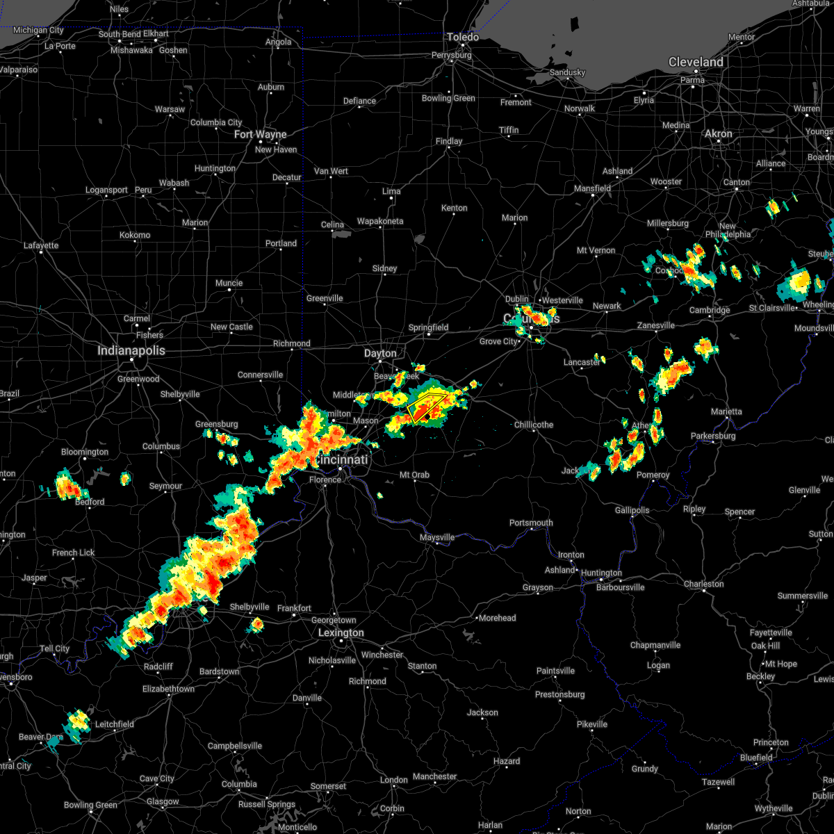 The severe thunderstorm warning for northwestern clinton county will expire at 430 pm edt, the storm which prompted the warning has weakened below severe limits, and has exited the warned area. therefore, the warning will be allowed to expire. however gusty winds and heavy rain are still possible with this thunderstorm. a severe thunderstorm watch remains in effect until 800 pm edt for southwestern ohio. please report previous wind damage or hail to the national weather service by going to our website at weather.gov/iln and submitting your report via social media. remember, a severe thunderstorm warning still remains in effect for portions of clinton county. The severe thunderstorm warning for northwestern clinton county will expire at 430 pm edt, the storm which prompted the warning has weakened below severe limits, and has exited the warned area. therefore, the warning will be allowed to expire. however gusty winds and heavy rain are still possible with this thunderstorm. a severe thunderstorm watch remains in effect until 800 pm edt for southwestern ohio. please report previous wind damage or hail to the national weather service by going to our website at weather.gov/iln and submitting your report via social media. remember, a severe thunderstorm warning still remains in effect for portions of clinton county.
|
| 6/22/2022 4:17 PM EDT |
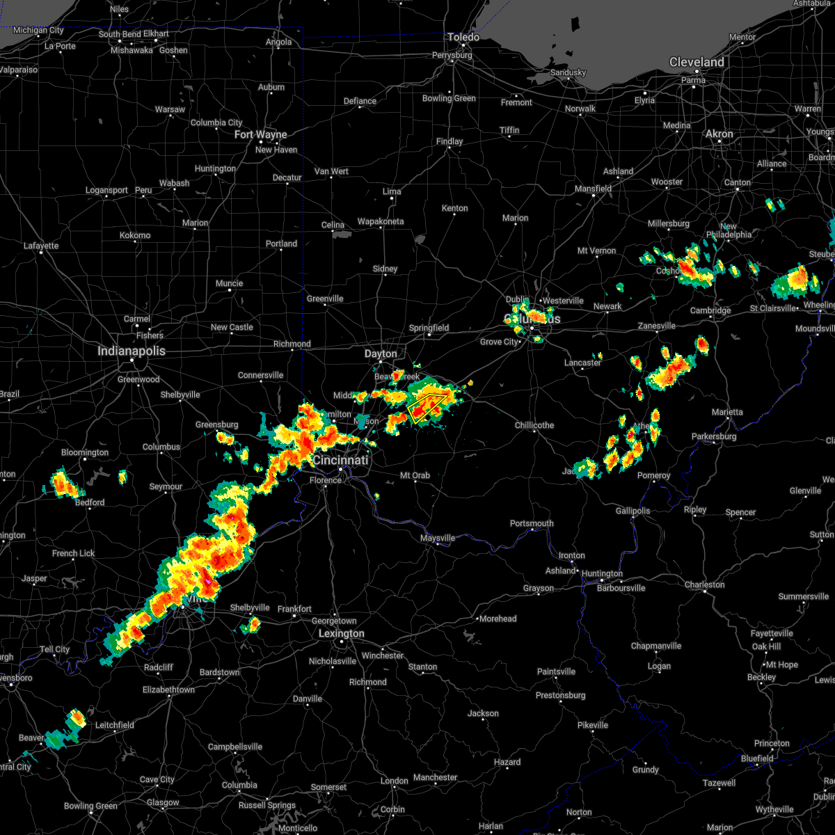 At 416 pm edt, a severe thunderstorm was located over wilmington, moving southeast at 20 mph (radar indicated). Hazards include 60 mph wind gusts and quarter size hail. Minor hail damage to vehicles is possible. expect wind damage to trees and power lines. locations impacted include, wilmington, port william, ogden, oakland, interstate 71 at us route 68 and bloomington. this includes i-71 in ohio between mile markers 44 and 57. hail threat, radar indicated max hail size, 1. 00 in wind threat, radar indicated max wind gust, 60 mph. At 416 pm edt, a severe thunderstorm was located over wilmington, moving southeast at 20 mph (radar indicated). Hazards include 60 mph wind gusts and quarter size hail. Minor hail damage to vehicles is possible. expect wind damage to trees and power lines. locations impacted include, wilmington, port william, ogden, oakland, interstate 71 at us route 68 and bloomington. this includes i-71 in ohio between mile markers 44 and 57. hail threat, radar indicated max hail size, 1. 00 in wind threat, radar indicated max wind gust, 60 mph.
|
| 6/22/2022 4:05 PM EDT |
 At 405 pm edt, a severe thunderstorm was located near wilmington, moving southeast at 25 mph (radar indicated). Hazards include 60 mph wind gusts and quarter size hail. Minor hail damage to vehicles is possible. expect wind damage to trees and power lines. locations impacted include, wilmington, harveysburg, bowersville, port william, paintersville, bloomington, lumberton, middleton corner, ogden, oakland, kingman and interstate 71 at us route 68. this includes i-71 in ohio between mile markers 43 and 59. hail threat, radar indicated max hail size, 1. 00 in wind threat, radar indicated max wind gust, 60 mph. At 405 pm edt, a severe thunderstorm was located near wilmington, moving southeast at 25 mph (radar indicated). Hazards include 60 mph wind gusts and quarter size hail. Minor hail damage to vehicles is possible. expect wind damage to trees and power lines. locations impacted include, wilmington, harveysburg, bowersville, port william, paintersville, bloomington, lumberton, middleton corner, ogden, oakland, kingman and interstate 71 at us route 68. this includes i-71 in ohio between mile markers 43 and 59. hail threat, radar indicated max hail size, 1. 00 in wind threat, radar indicated max wind gust, 60 mph.
|
| 6/22/2022 3:54 PM EDT |
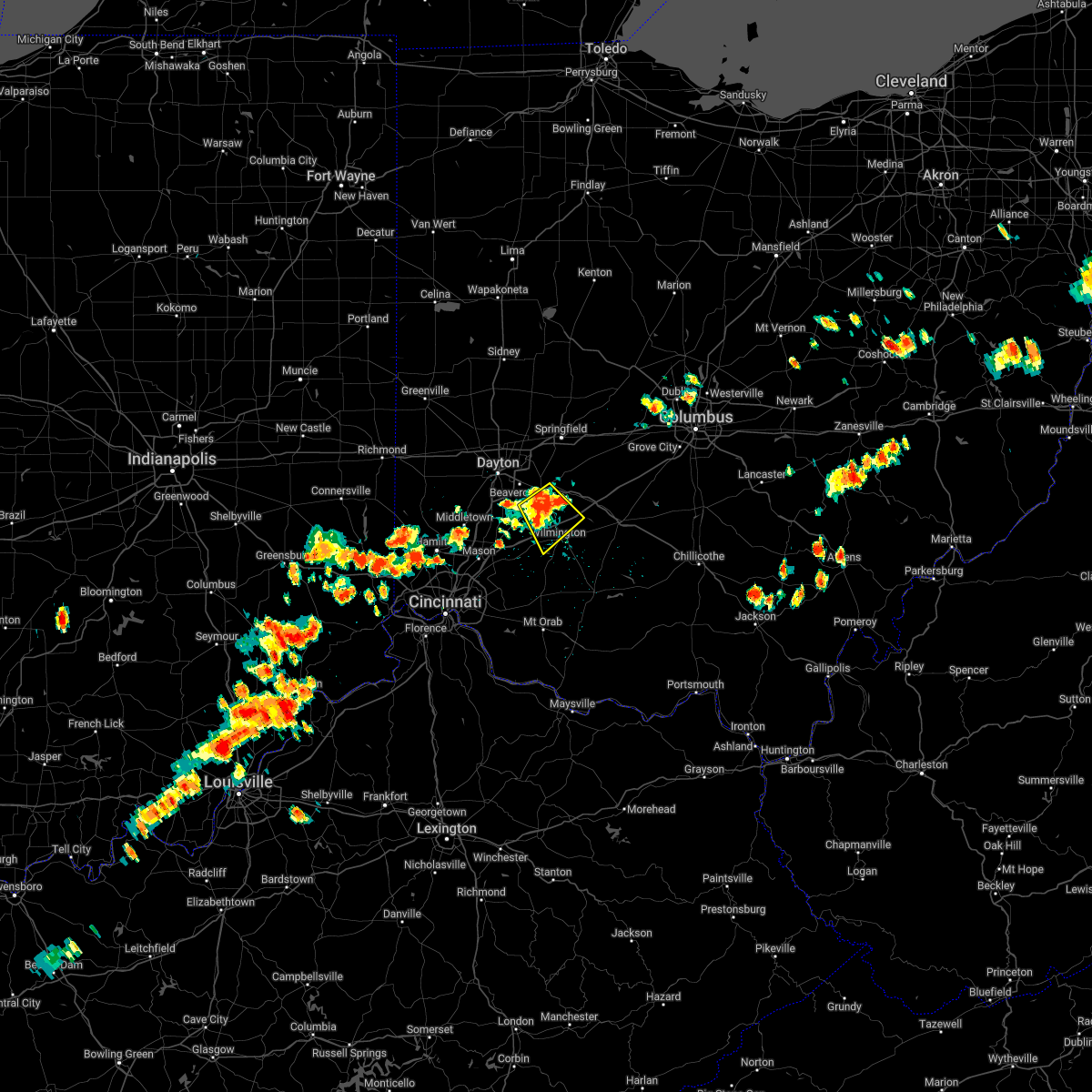 At 353 pm edt, a severe thunderstorm was located 7 miles south of xenia, moving southeast at 20 mph (radar indicated). Hazards include 60 mph wind gusts and quarter size hail. Minor hail damage to vehicles is possible. expect wind damage to trees and power lines. locations impacted include, xenia, wilmington, wilberforce, new jasper, harveysburg, spring valley, bowersville, port william, paintersville, bloomington, lumberton, middleton corner, mount holly, roxanna, oakland, ogden, kingman and interstate 71 at us route 68. this includes i-71 in ohio between mile markers 43 and 59. hail threat, radar indicated max hail size, 1. 00 in wind threat, radar indicated max wind gust, 60 mph. At 353 pm edt, a severe thunderstorm was located 7 miles south of xenia, moving southeast at 20 mph (radar indicated). Hazards include 60 mph wind gusts and quarter size hail. Minor hail damage to vehicles is possible. expect wind damage to trees and power lines. locations impacted include, xenia, wilmington, wilberforce, new jasper, harveysburg, spring valley, bowersville, port william, paintersville, bloomington, lumberton, middleton corner, mount holly, roxanna, oakland, ogden, kingman and interstate 71 at us route 68. this includes i-71 in ohio between mile markers 43 and 59. hail threat, radar indicated max hail size, 1. 00 in wind threat, radar indicated max wind gust, 60 mph.
|
| 6/22/2022 3:38 PM EDT |
 At 337 pm edt, a severe thunderstorm was located near xenia, moving southeast at 25 mph (radar indicated). Hazards include 60 mph wind gusts and quarter size hail. Minor hail damage to vehicles is possible. Expect wind damage to trees and power lines. At 337 pm edt, a severe thunderstorm was located near xenia, moving southeast at 25 mph (radar indicated). Hazards include 60 mph wind gusts and quarter size hail. Minor hail damage to vehicles is possible. Expect wind damage to trees and power lines.
|
| 6/13/2022 6:21 PM EDT |
 At 621 pm edt, severe thunderstorms were located along a line extending from near yellow springs to near blanchester, moving east at 45 mph (radar indicated). Hazards include 70 mph wind gusts and penny size hail. Expect considerable tree damage. damage is likely to mobile homes, roofs, and outbuildings. locations impacted include, beavercreek, huber heights, fairborn, xenia, wilmington, bellbrook, blanchester, yellow springs, wright-patterson afb, cedarville, waynesville, jamestown, lynchburg, new vienna, morrow, wilberforce, new jasper, woodville, clarksville and harveysburg. this includes i-71 in ohio between mile markers 35 and 61. thunderstorm damage threat, considerable hail threat, radar indicated max hail size, 0. 75 in wind threat, radar indicated max wind gust, 70 mph. At 621 pm edt, severe thunderstorms were located along a line extending from near yellow springs to near blanchester, moving east at 45 mph (radar indicated). Hazards include 70 mph wind gusts and penny size hail. Expect considerable tree damage. damage is likely to mobile homes, roofs, and outbuildings. locations impacted include, beavercreek, huber heights, fairborn, xenia, wilmington, bellbrook, blanchester, yellow springs, wright-patterson afb, cedarville, waynesville, jamestown, lynchburg, new vienna, morrow, wilberforce, new jasper, woodville, clarksville and harveysburg. this includes i-71 in ohio between mile markers 35 and 61. thunderstorm damage threat, considerable hail threat, radar indicated max hail size, 0. 75 in wind threat, radar indicated max wind gust, 70 mph.
|
| 6/13/2022 6:06 PM EDT |
 At 605 pm edt, severe thunderstorms were located along a line extending from near wright-patterson afb to near morrow, moving east at 45 mph (radar indicated). Hazards include 70 mph wind gusts and penny size hail. Expect considerable tree damage. damage is likely to mobile homes, roofs, and outbuildings. locations impacted include, beavercreek, huber heights, fairborn, xenia, wilmington, bellbrook, blanchester, yellow springs, wright-patterson afb, cedarville, waynesville, jamestown, lynchburg, new vienna, morrow, wilberforce, new jasper, woodville, clarksville and harveysburg. this includes i-71 in ohio between mile markers 35 and 61. thunderstorm damage threat, considerable hail threat, radar indicated max hail size, 0. 75 in wind threat, radar indicated max wind gust, 70 mph. At 605 pm edt, severe thunderstorms were located along a line extending from near wright-patterson afb to near morrow, moving east at 45 mph (radar indicated). Hazards include 70 mph wind gusts and penny size hail. Expect considerable tree damage. damage is likely to mobile homes, roofs, and outbuildings. locations impacted include, beavercreek, huber heights, fairborn, xenia, wilmington, bellbrook, blanchester, yellow springs, wright-patterson afb, cedarville, waynesville, jamestown, lynchburg, new vienna, morrow, wilberforce, new jasper, woodville, clarksville and harveysburg. this includes i-71 in ohio between mile markers 35 and 61. thunderstorm damage threat, considerable hail threat, radar indicated max hail size, 0. 75 in wind threat, radar indicated max wind gust, 70 mph.
|
| 6/13/2022 5:45 PM EDT |
 At 545 pm edt, severe thunderstorms were located along a line extending from near englewood to sharonville, moving east at 40 mph (radar indicated). Hazards include 70 mph wind gusts and penny size hail. Expect considerable tree damage. Damage is likely to mobile homes, roofs, and outbuildings. At 545 pm edt, severe thunderstorms were located along a line extending from near englewood to sharonville, moving east at 40 mph (radar indicated). Hazards include 70 mph wind gusts and penny size hail. Expect considerable tree damage. Damage is likely to mobile homes, roofs, and outbuildings.
|
| 6/6/2022 1:55 PM EDT |
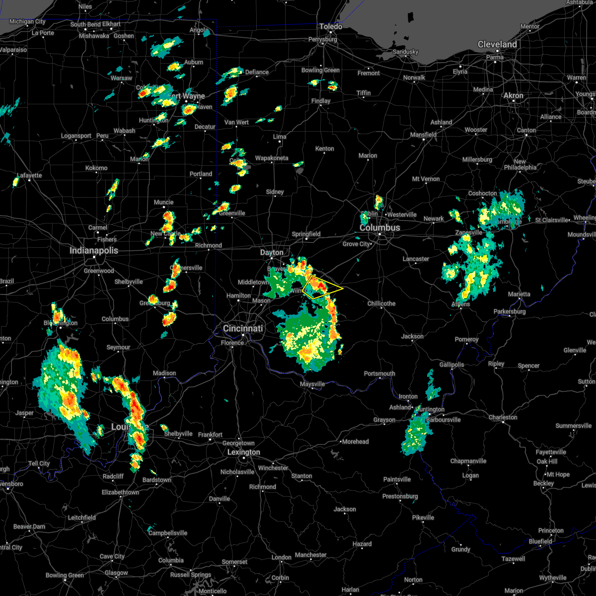 The severe thunderstorm warning for west central fayette, northeastern clinton and southeastern greene counties will expire at 200 pm edt, the storm which prompted the warning has moved out of the area. therefore, the warning will be allowed to expire. a new warning has been issued just to the northeast, which still includes portions of northeastern clinton and southeastern greene counties. please report previous wind damage or hail to the national weather service by going to our website at weather.gov/iln and submitting your report via social media. The severe thunderstorm warning for west central fayette, northeastern clinton and southeastern greene counties will expire at 200 pm edt, the storm which prompted the warning has moved out of the area. therefore, the warning will be allowed to expire. a new warning has been issued just to the northeast, which still includes portions of northeastern clinton and southeastern greene counties. please report previous wind damage or hail to the national weather service by going to our website at weather.gov/iln and submitting your report via social media.
|
| 6/6/2022 1:39 PM EDT |
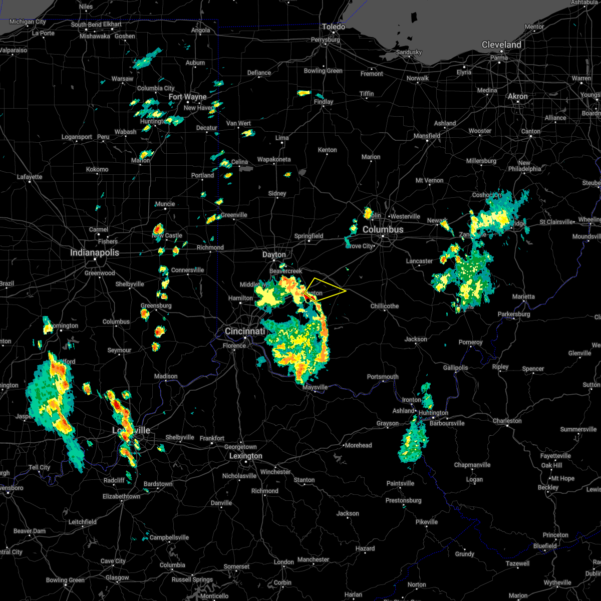 At 138 pm edt, a severe thunderstorm was located near wilmington, moving northeast at 35 mph (64 mph wind gust recorded at wilmington, oh office). Hazards include 60 mph wind gusts. Expect damage to trees and power lines. locations impacted include, washington court house, wilmington, sabina, bowersville, port william, melvin, reesville, bloomington and jasper mills. this includes i-71 in ohio between mile markers 53 and 61. hail threat, radar indicated max hail size, <. 75 in wind threat, radar indicated max wind gust, 60 mph. At 138 pm edt, a severe thunderstorm was located near wilmington, moving northeast at 35 mph (64 mph wind gust recorded at wilmington, oh office). Hazards include 60 mph wind gusts. Expect damage to trees and power lines. locations impacted include, washington court house, wilmington, sabina, bowersville, port william, melvin, reesville, bloomington and jasper mills. this includes i-71 in ohio between mile markers 53 and 61. hail threat, radar indicated max hail size, <. 75 in wind threat, radar indicated max wind gust, 60 mph.
|
| 6/6/2022 1:32 PM EDT |
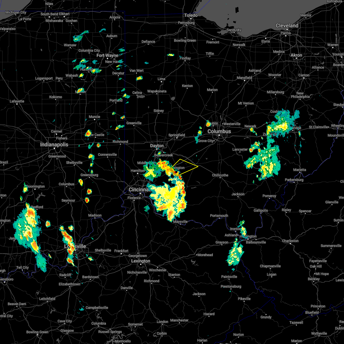 At 131 pm edt, a severe thunderstorm was located over wilmington, moving northeast at 35 mph (radar indicated). Hazards include 60 mph wind gusts. expect damage to trees and power lines At 131 pm edt, a severe thunderstorm was located over wilmington, moving northeast at 35 mph (radar indicated). Hazards include 60 mph wind gusts. expect damage to trees and power lines
|
| 5/25/2022 9:43 PM EDT |
 At 943 pm edt, a severe thunderstorm was located near jamestown, moving north at 40 mph (radar indicated). Hazards include 60 mph wind gusts and penny size hail. Expect damage to trees and power lines. locations impacted include, springfield, xenia, wilmington, yellow springs, cedarville, enon, jamestown, south charleston, wilberforce, new jasper, bowersville, port william, clifton, paintersville, hustead, lumberton, selma, gladstone, interstate 71 at us route 68 and springfield municipal airport. this includes the following interstates, i-70 in ohio between mile markers 49 and 60. i-71 in ohio between mile markers 50 and 56. hail threat, radar indicated max hail size, 0. 75 in wind threat, radar indicated max wind gust, 60 mph. At 943 pm edt, a severe thunderstorm was located near jamestown, moving north at 40 mph (radar indicated). Hazards include 60 mph wind gusts and penny size hail. Expect damage to trees and power lines. locations impacted include, springfield, xenia, wilmington, yellow springs, cedarville, enon, jamestown, south charleston, wilberforce, new jasper, bowersville, port william, clifton, paintersville, hustead, lumberton, selma, gladstone, interstate 71 at us route 68 and springfield municipal airport. this includes the following interstates, i-70 in ohio between mile markers 49 and 60. i-71 in ohio between mile markers 50 and 56. hail threat, radar indicated max hail size, 0. 75 in wind threat, radar indicated max wind gust, 60 mph.
|
| 5/25/2022 9:27 PM EDT |
 At 927 pm edt, a severe thunderstorm was located near wilmington, moving north at 50 mph (radar indicated). Hazards include 60 mph wind gusts and penny size hail. expect damage to trees and power lines At 927 pm edt, a severe thunderstorm was located near wilmington, moving north at 50 mph (radar indicated). Hazards include 60 mph wind gusts and penny size hail. expect damage to trees and power lines
|
| 5/3/2022 4:10 PM EDT |
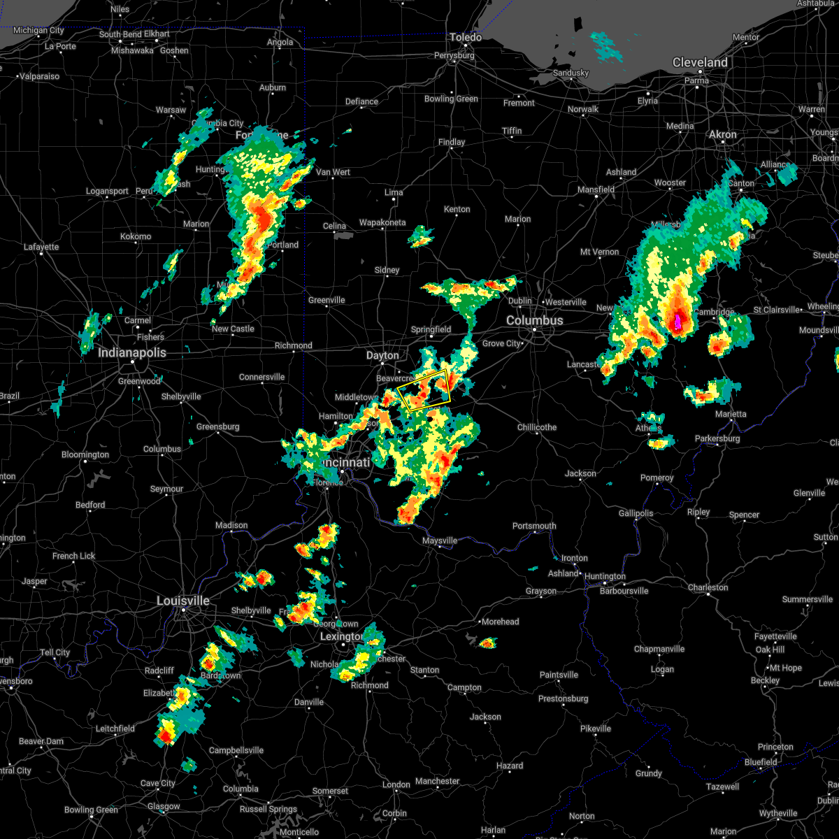 The severe thunderstorm warning for northeastern warren, northwestern clinton and southern greene counties will expire at 415 pm edt, the storm which prompted the warning has moved out of the area. therefore, the warning will be allowed to expire. a tornado watch remains in effect until 900 pm edt for central, southwestern and west central ohio. please report previous wind damage or hail to the national weather service by going to our website at weather.gov/iln and submitting your report via social media. remember, a severe thunderstorm warning still remains in effect for greene, fayette and madison counties!. The severe thunderstorm warning for northeastern warren, northwestern clinton and southern greene counties will expire at 415 pm edt, the storm which prompted the warning has moved out of the area. therefore, the warning will be allowed to expire. a tornado watch remains in effect until 900 pm edt for central, southwestern and west central ohio. please report previous wind damage or hail to the national weather service by going to our website at weather.gov/iln and submitting your report via social media. remember, a severe thunderstorm warning still remains in effect for greene, fayette and madison counties!.
|
| 5/3/2022 4:01 PM EDT |
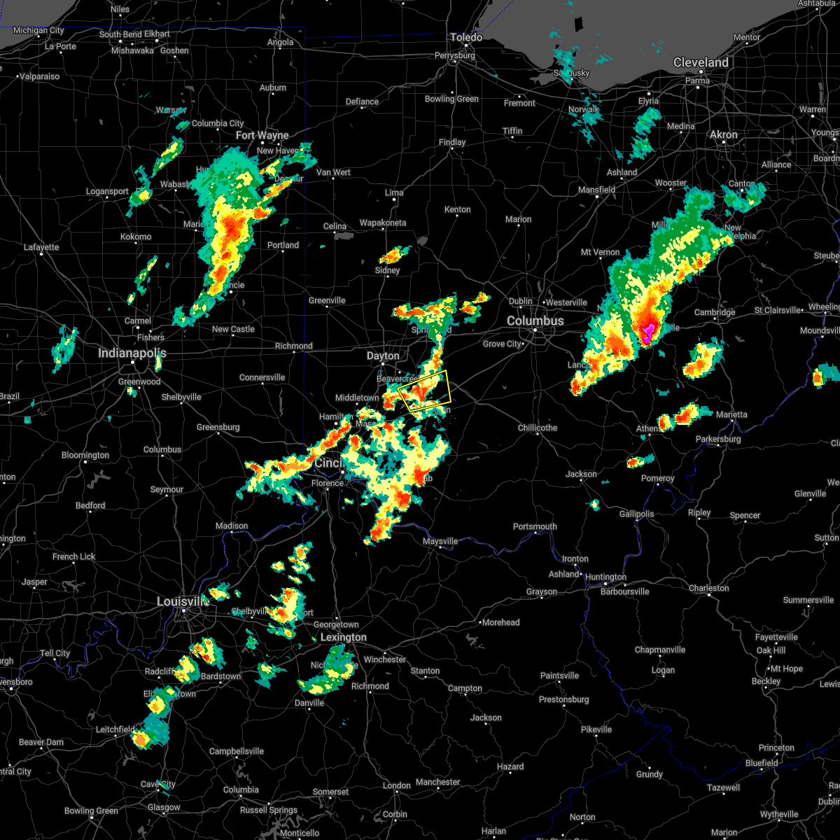 At 401 pm edt, a severe thunderstorm was located near jamestown, moving east at 40 mph (radar indicated). Hazards include 60 mph wind gusts and quarter size hail. Minor hail damage to vehicles is possible. expect wind damage to trees and power lines. locations impacted include, jamestown, new jasper, harveysburg, spring valley, bowersville, port william, paintersville, bloomington, lumberton, middleton corner, mount holly, roxanna, oakland, kingman, bell center and interstate 71 at us route 68. this includes i-71 in ohio between mile markers 44 and 61. hail threat, radar indicated max hail size, 1. 00 in wind threat, radar indicated max wind gust, 60 mph. At 401 pm edt, a severe thunderstorm was located near jamestown, moving east at 40 mph (radar indicated). Hazards include 60 mph wind gusts and quarter size hail. Minor hail damage to vehicles is possible. expect wind damage to trees and power lines. locations impacted include, jamestown, new jasper, harveysburg, spring valley, bowersville, port william, paintersville, bloomington, lumberton, middleton corner, mount holly, roxanna, oakland, kingman, bell center and interstate 71 at us route 68. this includes i-71 in ohio between mile markers 44 and 61. hail threat, radar indicated max hail size, 1. 00 in wind threat, radar indicated max wind gust, 60 mph.
|
| 5/3/2022 3:48 PM EDT |
 At 348 pm edt, a severe thunderstorm was located 8 miles east of waynesville, moving northeast at 40 mph (radar indicated). Hazards include 60 mph wind gusts and quarter size hail. Minor hail damage to vehicles is possible. expect wind damage to trees and power lines. locations impacted include, lebanon, springboro, franklin, waynesville, jamestown, new jasper, harveysburg, spring valley, corwin, bowersville, port william, paintersville, lytle, lumberton, mount holly, pekin, genntown, caesar creek state park, kingman and interstate 71 at us route 68. this includes i-71 in ohio between mile markers 44 and 61. hail threat, radar indicated max hail size, 1. 00 in wind threat, radar indicated max wind gust, 60 mph. At 348 pm edt, a severe thunderstorm was located 8 miles east of waynesville, moving northeast at 40 mph (radar indicated). Hazards include 60 mph wind gusts and quarter size hail. Minor hail damage to vehicles is possible. expect wind damage to trees and power lines. locations impacted include, lebanon, springboro, franklin, waynesville, jamestown, new jasper, harveysburg, spring valley, corwin, bowersville, port william, paintersville, lytle, lumberton, mount holly, pekin, genntown, caesar creek state park, kingman and interstate 71 at us route 68. this includes i-71 in ohio between mile markers 44 and 61. hail threat, radar indicated max hail size, 1. 00 in wind threat, radar indicated max wind gust, 60 mph.
|
| 5/3/2022 3:30 PM EDT |
 At 330 pm edt, a severe thunderstorm was located near lebanon, moving east at 40 mph (radar indicated). Hazards include 60 mph wind gusts and quarter size hail. Minor hail damage to vehicles is possible. Expect wind damage to trees and power lines. At 330 pm edt, a severe thunderstorm was located near lebanon, moving east at 40 mph (radar indicated). Hazards include 60 mph wind gusts and quarter size hail. Minor hail damage to vehicles is possible. Expect wind damage to trees and power lines.
|
| 3/23/2022 4:02 PM EDT |
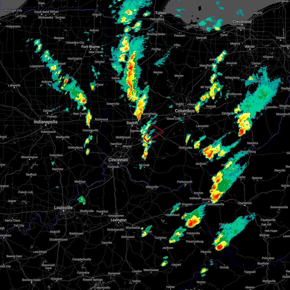 At 402 pm edt, a severe thunderstorm capable of producing a tornado was located near wilmington, moving northeast at 40 mph (radar indicated rotation). Hazards include tornado. Flying debris will be dangerous to those caught without shelter. mobile homes will be damaged or destroyed. damage to roofs, windows, and vehicles will occur. Tree damage is likely. At 402 pm edt, a severe thunderstorm capable of producing a tornado was located near wilmington, moving northeast at 40 mph (radar indicated rotation). Hazards include tornado. Flying debris will be dangerous to those caught without shelter. mobile homes will be damaged or destroyed. damage to roofs, windows, and vehicles will occur. Tree damage is likely.
|
| 3/23/2022 3:53 PM EDT |
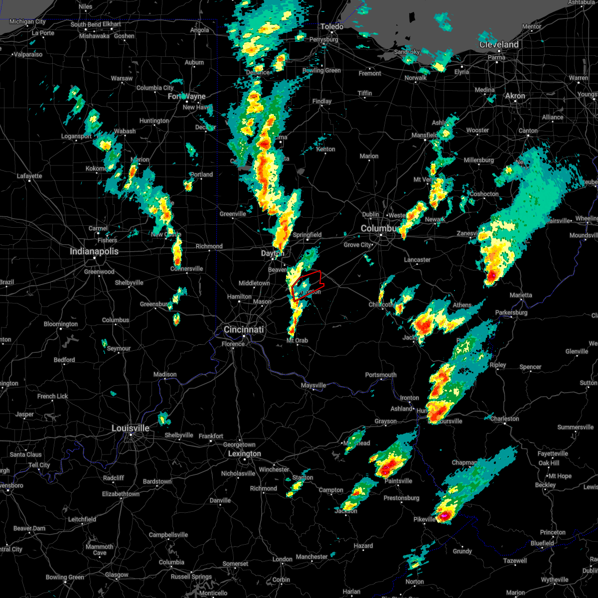 At 352 pm edt, a severe thunderstorm capable of producing a tornado was located near wilmington, moving northeast at 30 mph (radar indicated rotation). Hazards include tornado. Flying debris will be dangerous to those caught without shelter. mobile homes will be damaged or destroyed. damage to roofs, windows, and vehicles will occur. tree damage is likely. locations impacted include, wilmington, bowersville, port william, paintersville, rosemoor, bloomington, lumberton, middleton corner, ogden, oakland, kingman and interstate 71 at us route 68. This includes i-71 in ohio between mile markers 44 and 61. At 352 pm edt, a severe thunderstorm capable of producing a tornado was located near wilmington, moving northeast at 30 mph (radar indicated rotation). Hazards include tornado. Flying debris will be dangerous to those caught without shelter. mobile homes will be damaged or destroyed. damage to roofs, windows, and vehicles will occur. tree damage is likely. locations impacted include, wilmington, bowersville, port william, paintersville, rosemoor, bloomington, lumberton, middleton corner, ogden, oakland, kingman and interstate 71 at us route 68. This includes i-71 in ohio between mile markers 44 and 61.
|
| 3/23/2022 3:46 PM EDT |
 At 345 pm edt, a severe thunderstorm capable of producing a tornado was located 7 miles west of wilmington, moving northeast at 30 mph (radar indicated rotation). Hazards include tornado. Flying debris will be dangerous to those caught without shelter. mobile homes will be damaged or destroyed. damage to roofs, windows, and vehicles will occur. tree damage is likely. locations impacted include, wilmington, sabina, clarksville, bowersville, port william, paintersville, melvin, rosemoor, bloomington, lumberton, middleton corner, oakland, reesville, ogden, kingman, burtonville, interstate 71 at us route 68 and cowan lake state park. This includes i-71 in ohio between mile markers 43 and 61. At 345 pm edt, a severe thunderstorm capable of producing a tornado was located 7 miles west of wilmington, moving northeast at 30 mph (radar indicated rotation). Hazards include tornado. Flying debris will be dangerous to those caught without shelter. mobile homes will be damaged or destroyed. damage to roofs, windows, and vehicles will occur. tree damage is likely. locations impacted include, wilmington, sabina, clarksville, bowersville, port william, paintersville, melvin, rosemoor, bloomington, lumberton, middleton corner, oakland, reesville, ogden, kingman, burtonville, interstate 71 at us route 68 and cowan lake state park. This includes i-71 in ohio between mile markers 43 and 61.
|
| 3/23/2022 3:38 PM EDT |
 At 338 pm edt, a severe thunderstorm capable of producing a tornado was located near morrow, moving northeast at 30 mph (radar indicated rotation). Hazards include tornado. Flying debris will be dangerous to those caught without shelter. mobile homes will be damaged or destroyed. damage to roofs, windows, and vehicles will occur. Tree damage is likely. At 338 pm edt, a severe thunderstorm capable of producing a tornado was located near morrow, moving northeast at 30 mph (radar indicated rotation). Hazards include tornado. Flying debris will be dangerous to those caught without shelter. mobile homes will be damaged or destroyed. damage to roofs, windows, and vehicles will occur. Tree damage is likely.
|
| 7/29/2021 6:51 PM EDT |
 The severe thunderstorm warning for southwestern fayette, northeastern clinton and southeastern greene counties will expire at 700 pm edt, the storm which prompted the warning has weakened below severe limits, and no longer poses an immediate threat to life or property. therefore, the warning will be allowed to expire. however gusty winds are still possible with this thunderstorm. a severe thunderstorm watch remains in effect until 1000 pm edt for central, southwestern and west central ohio. The severe thunderstorm warning for southwestern fayette, northeastern clinton and southeastern greene counties will expire at 700 pm edt, the storm which prompted the warning has weakened below severe limits, and no longer poses an immediate threat to life or property. therefore, the warning will be allowed to expire. however gusty winds are still possible with this thunderstorm. a severe thunderstorm watch remains in effect until 1000 pm edt for central, southwestern and west central ohio.
|
| 7/29/2021 6:39 PM EDT |
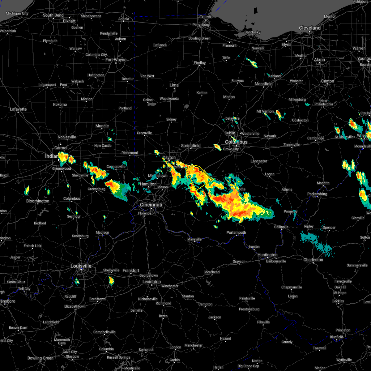 At 638 pm edt, a severe thunderstorm was located over sabina, moving southeast at 25 mph (radar indicated). Hazards include 60 mph wind gusts. Expect damage to trees and power lines. locations impacted include, washington court house, wilmington, sabina, jamestown, new jasper, staunton, bowersville, port william, milledgeville, octa, paintersville, melvin, rosemoor, bloomington, jasper mills, lees creek, reesville, interstate 71 at us route 35 and new antioch. This includes i-71 in ohio between mile markers 53 and 66. At 638 pm edt, a severe thunderstorm was located over sabina, moving southeast at 25 mph (radar indicated). Hazards include 60 mph wind gusts. Expect damage to trees and power lines. locations impacted include, washington court house, wilmington, sabina, jamestown, new jasper, staunton, bowersville, port william, milledgeville, octa, paintersville, melvin, rosemoor, bloomington, jasper mills, lees creek, reesville, interstate 71 at us route 35 and new antioch. This includes i-71 in ohio between mile markers 53 and 66.
|
| 7/29/2021 6:13 PM EDT |
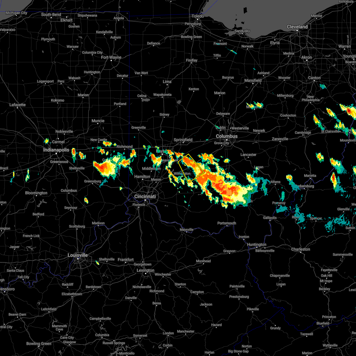 At 613 pm edt, a severe thunderstorm was located over jamestown, moving southeast at 25 mph (radar indicated). Hazards include 60 mph wind gusts and quarter size hail. Minor hail damage to vehicles is possible. Expect wind damage to trees and power lines. At 613 pm edt, a severe thunderstorm was located over jamestown, moving southeast at 25 mph (radar indicated). Hazards include 60 mph wind gusts and quarter size hail. Minor hail damage to vehicles is possible. Expect wind damage to trees and power lines.
|
| 7/16/2021 3:19 PM EDT |
 At 318 pm edt, a severe thunderstorm was located over jeffersonville, moving northeast at 45 mph (radar indicated). Hazards include 60 mph wind gusts. Expect damage to trees and power lines. locations impacted include, washington court house, wilmington, london, sabina, jamestown, mount sterling, jeffersonville, bloomingburg, new holland, new jasper, south solon, midway, bowersville, port william, milledgeville, octa, paintersville, newport, melvin and chenoweth. This includes i-71 in ohio between mile markers 52 and 88. At 318 pm edt, a severe thunderstorm was located over jeffersonville, moving northeast at 45 mph (radar indicated). Hazards include 60 mph wind gusts. Expect damage to trees and power lines. locations impacted include, washington court house, wilmington, london, sabina, jamestown, mount sterling, jeffersonville, bloomingburg, new holland, new jasper, south solon, midway, bowersville, port william, milledgeville, octa, paintersville, newport, melvin and chenoweth. This includes i-71 in ohio between mile markers 52 and 88.
|
| 7/16/2021 3:08 PM EDT |
 At 308 pm edt, a severe thunderstorm was located near jamestown, moving northeast at 45 mph (radar indicated). Hazards include 60 mph wind gusts. expect damage to trees and power lines At 308 pm edt, a severe thunderstorm was located near jamestown, moving northeast at 45 mph (radar indicated). Hazards include 60 mph wind gusts. expect damage to trees and power lines
|
| 7/16/2021 2:59 PM EDT |
 At 259 pm edt, a severe thunderstorm was located 7 miles southeast of xenia, moving east at 40 mph (radar indicated). Hazards include 60 mph wind gusts. Expect damage to trees and power lines. locations impacted include, xenia, jamestown, wilberforce, new jasper, harveysburg, spring valley, port william, paintersville, lumberton, middleton corner, mount holly, roxanna, oakland, caesar creek state park, kingman and interstate 71 at us route 68. This includes i-71 in ohio between mile markers 40 and 57. At 259 pm edt, a severe thunderstorm was located 7 miles southeast of xenia, moving east at 40 mph (radar indicated). Hazards include 60 mph wind gusts. Expect damage to trees and power lines. locations impacted include, xenia, jamestown, wilberforce, new jasper, harveysburg, spring valley, port william, paintersville, lumberton, middleton corner, mount holly, roxanna, oakland, caesar creek state park, kingman and interstate 71 at us route 68. This includes i-71 in ohio between mile markers 40 and 57.
|
| 7/16/2021 2:52 PM EDT |
 At 251 pm edt, a severe thunderstorm was located near bellbrook, moving northeast at 35 mph (radar indicated). Hazards include 60 mph wind gusts. Expect damage to trees and power lines. locations impacted include, xenia, bellbrook, waynesville, jamestown, wilberforce, new jasper, harveysburg, spring valley, corwin, port william, paintersville, oregonia, lumberton, middleton corner, mount holly, roxanna, oakland, caesar creek state park, kingman and interstate 71 at us route 68. This includes i-71 in ohio between mile markers 36 and 57. At 251 pm edt, a severe thunderstorm was located near bellbrook, moving northeast at 35 mph (radar indicated). Hazards include 60 mph wind gusts. Expect damage to trees and power lines. locations impacted include, xenia, bellbrook, waynesville, jamestown, wilberforce, new jasper, harveysburg, spring valley, corwin, port william, paintersville, oregonia, lumberton, middleton corner, mount holly, roxanna, oakland, caesar creek state park, kingman and interstate 71 at us route 68. This includes i-71 in ohio between mile markers 36 and 57.
|
| 7/16/2021 2:43 PM EDT |
 At 243 pm edt, a severe thunderstorm was located over waynesville, moving northeast at 35 mph (radar indicated). Hazards include 60 mph wind gusts. Expect damage to trees and power lines. locations impacted include, xenia, lebanon, springboro, bellbrook, waynesville, jamestown, wilberforce, new jasper, harveysburg, spring valley, corwin, port william, centerville, paintersville, lytle, lumberton, mount holly, oakland, pekin and genntown. This includes i-71 in ohio between mile markers 32 and 57. At 243 pm edt, a severe thunderstorm was located over waynesville, moving northeast at 35 mph (radar indicated). Hazards include 60 mph wind gusts. Expect damage to trees and power lines. locations impacted include, xenia, lebanon, springboro, bellbrook, waynesville, jamestown, wilberforce, new jasper, harveysburg, spring valley, corwin, port william, centerville, paintersville, lytle, lumberton, mount holly, oakland, pekin and genntown. This includes i-71 in ohio between mile markers 32 and 57.
|
| 7/16/2021 2:30 PM EDT |
 At 230 pm edt, a severe thunderstorm was located over hunter, moving northeast at 35 mph (radar indicated). Hazards include 60 mph wind gusts. expect damage to trees and power lines At 230 pm edt, a severe thunderstorm was located over hunter, moving northeast at 35 mph (radar indicated). Hazards include 60 mph wind gusts. expect damage to trees and power lines
|
| 6/18/2021 8:48 PM EDT |
 At 847 pm edt, a severe thunderstorm was located near wilmington, moving southeast at 15 mph (radar indicated). Hazards include two inch hail and 70 mph wind gusts. People and animals outdoors will be injured. expect hail damage to roofs, siding, windows, and vehicles. expect considerable tree damage. wind damage is also likely to mobile homes, roofs, and outbuildings. locations impacted include, wilmington, sabina, new vienna, port william, melvin, bloomington, lumberton, new antioch, oakland, cuba, lees creek, reesville, morrisville, ogden, kingman, burtonville, interstate 71 at us route 68 and cowan lake state park. this includes i-71 in ohio between mile markers 43 and 58. A tornado watch remains in effect until 1100 pm edt for central, southwestern and west central ohio. At 847 pm edt, a severe thunderstorm was located near wilmington, moving southeast at 15 mph (radar indicated). Hazards include two inch hail and 70 mph wind gusts. People and animals outdoors will be injured. expect hail damage to roofs, siding, windows, and vehicles. expect considerable tree damage. wind damage is also likely to mobile homes, roofs, and outbuildings. locations impacted include, wilmington, sabina, new vienna, port william, melvin, bloomington, lumberton, new antioch, oakland, cuba, lees creek, reesville, morrisville, ogden, kingman, burtonville, interstate 71 at us route 68 and cowan lake state park. this includes i-71 in ohio between mile markers 43 and 58. A tornado watch remains in effect until 1100 pm edt for central, southwestern and west central ohio.
|
| 6/18/2021 8:18 PM EDT |
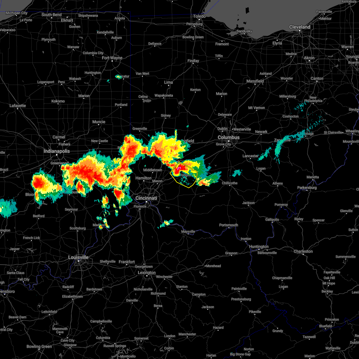 At 817 pm edt, a severe thunderstorm was located 8 miles northwest of wilmington, moving southeast at 15 mph (radar indicated). Hazards include two inch hail and 70 mph wind gusts. People and animals outdoors will be injured. expect hail damage to roofs, siding, windows, and vehicles. expect considerable tree damage. Wind damage is also likely to mobile homes, roofs, and outbuildings. At 817 pm edt, a severe thunderstorm was located 8 miles northwest of wilmington, moving southeast at 15 mph (radar indicated). Hazards include two inch hail and 70 mph wind gusts. People and animals outdoors will be injured. expect hail damage to roofs, siding, windows, and vehicles. expect considerable tree damage. Wind damage is also likely to mobile homes, roofs, and outbuildings.
|
| 6/18/2021 8:09 PM EDT |
 At 809 pm edt, a severe thunderstorm was located near jamestown, moving southeast at 20 mph (radar indicated). Hazards include golf ball size hail and 60 mph wind gusts. People and animals outdoors will be injured. expect hail damage to roofs, siding, windows, and vehicles. expect wind damage to trees and power lines. locations impacted include, xenia, wilmington, cedarville, sabina, jamestown, jeffersonville, wilberforce, new jasper, spring valley, bowersville, port william, milledgeville, octa, paintersville, melvin, rosemoor, lumberton, mount holly, shady grove and interstate 71 at us route 68. this includes i-71 in ohio between mile markers 48 and 69. A tornado watch remains in effect until 1100 pm edt for central, southwestern and west central ohio. At 809 pm edt, a severe thunderstorm was located near jamestown, moving southeast at 20 mph (radar indicated). Hazards include golf ball size hail and 60 mph wind gusts. People and animals outdoors will be injured. expect hail damage to roofs, siding, windows, and vehicles. expect wind damage to trees and power lines. locations impacted include, xenia, wilmington, cedarville, sabina, jamestown, jeffersonville, wilberforce, new jasper, spring valley, bowersville, port william, milledgeville, octa, paintersville, melvin, rosemoor, lumberton, mount holly, shady grove and interstate 71 at us route 68. this includes i-71 in ohio between mile markers 48 and 69. A tornado watch remains in effect until 1100 pm edt for central, southwestern and west central ohio.
|
| 6/18/2021 7:53 PM EDT |
 At 753 pm edt, a severe thunderstorm was located over xenia, moving southeast at 20 mph (radar indicated). Hazards include golf ball size hail and 60 mph wind gusts. People and animals outdoors will be injured. expect hail damage to roofs, siding, windows, and vehicles. Expect wind damage to trees and power lines. At 753 pm edt, a severe thunderstorm was located over xenia, moving southeast at 20 mph (radar indicated). Hazards include golf ball size hail and 60 mph wind gusts. People and animals outdoors will be injured. expect hail damage to roofs, siding, windows, and vehicles. Expect wind damage to trees and power lines.
|
| 11/15/2020 11:38 AM EST |
 At 1138 am est, severe thunderstorms were located along a line extending from jeffersonville to near wilmington, moving northeast at 65 mph (radar indicated). Hazards include 60 mph wind gusts. Expect damage to trees and power lines. locations impacted include, washington court house, wilmington, sabina, leesburg, new vienna, jeffersonville, staunton, martinsville, midland, bowersville, highland, port william, milledgeville, octa, melvin, rosemoor, samantha, lees creek, morrisville and bloomington. This includes i-71 in ohio between mile markers 54 and 74. At 1138 am est, severe thunderstorms were located along a line extending from jeffersonville to near wilmington, moving northeast at 65 mph (radar indicated). Hazards include 60 mph wind gusts. Expect damage to trees and power lines. locations impacted include, washington court house, wilmington, sabina, leesburg, new vienna, jeffersonville, staunton, martinsville, midland, bowersville, highland, port william, milledgeville, octa, melvin, rosemoor, samantha, lees creek, morrisville and bloomington. This includes i-71 in ohio between mile markers 54 and 74.
|
| 11/15/2020 11:22 AM EST |
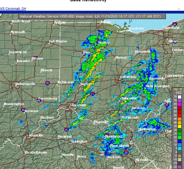 At 1122 am est, severe thunderstorms were located along a line extending from 8 miles north of wilmington to near blanchester, moving northeast at 65 mph (radar indicated). Hazards include 60 mph wind gusts. expect damage to trees and power lines At 1122 am est, severe thunderstorms were located along a line extending from 8 miles north of wilmington to near blanchester, moving northeast at 65 mph (radar indicated). Hazards include 60 mph wind gusts. expect damage to trees and power lines
|
| 7/19/2020 5:52 PM EDT |
 The severe thunderstorm warning for northwestern fayette, clinton, southeastern greene and southeastern madison counties will expire at 600 pm edt, the storm which prompted the warning has moved out of the area. therefore, the warning will be allowed to expire. however gusty winds are still possible with this thunderstorm. a severe thunderstorm watch remains in effect until 1100 pm edt for central ohio. please report previous wind damage or hail to the national weather service by going to our website at weather.gov/iln and submitting your report via social media. The severe thunderstorm warning for northwestern fayette, clinton, southeastern greene and southeastern madison counties will expire at 600 pm edt, the storm which prompted the warning has moved out of the area. therefore, the warning will be allowed to expire. however gusty winds are still possible with this thunderstorm. a severe thunderstorm watch remains in effect until 1100 pm edt for central ohio. please report previous wind damage or hail to the national weather service by going to our website at weather.gov/iln and submitting your report via social media.
|
| 7/19/2020 5:46 PM EDT |
 At 546 pm edt, a severe thunderstorm was located near jeffersonville, moving east at 30 mph (radar indicated). Hazards include 60 mph wind gusts. Expect damage to trees and power lines. locations impacted include, washington court house, wilmington, sabina, mount sterling, jeffersonville, bloomingburg, clarksville, bowersville, port william, milledgeville, octa, paintersville, melvin, chenoweth, interstate 71 at state route 38, rosemoor, lumberton, oakland, lees creek and madison mills. This includes i-71 in ohio between mile markers 43 and 87. At 546 pm edt, a severe thunderstorm was located near jeffersonville, moving east at 30 mph (radar indicated). Hazards include 60 mph wind gusts. Expect damage to trees and power lines. locations impacted include, washington court house, wilmington, sabina, mount sterling, jeffersonville, bloomingburg, clarksville, bowersville, port william, milledgeville, octa, paintersville, melvin, chenoweth, interstate 71 at state route 38, rosemoor, lumberton, oakland, lees creek and madison mills. This includes i-71 in ohio between mile markers 43 and 87.
|
| 7/19/2020 5:36 PM EDT |
 At 536 pm edt, a severe thunderstorm was located near jamestown, moving east at 30 mph (radar indicated). Hazards include 60 mph wind gusts. Expect damage to trees and power lines. locations impacted include, xenia, washington court house, wilmington, sabina, jamestown, mount sterling, jeffersonville, bloomingburg, new jasper, clarksville, harveysburg, spring valley, south solon, midway, bowersville, port william, milledgeville, octa, paintersville and newport. This includes i-71 in ohio between mile markers 40 and 87. At 536 pm edt, a severe thunderstorm was located near jamestown, moving east at 30 mph (radar indicated). Hazards include 60 mph wind gusts. Expect damage to trees and power lines. locations impacted include, xenia, washington court house, wilmington, sabina, jamestown, mount sterling, jeffersonville, bloomingburg, new jasper, clarksville, harveysburg, spring valley, south solon, midway, bowersville, port william, milledgeville, octa, paintersville and newport. This includes i-71 in ohio between mile markers 40 and 87.
|
| 7/19/2020 5:15 PM EDT |
 At 514 pm edt, a severe thunderstorm was located near wilberforce, moving east at 30 mph (radar indicated). Hazards include 60 mph wind gusts. expect damage to trees and power lines At 514 pm edt, a severe thunderstorm was located near wilberforce, moving east at 30 mph (radar indicated). Hazards include 60 mph wind gusts. expect damage to trees and power lines
|
| 7/19/2020 5:03 PM EDT |
 At 503 pm edt, a severe thunderstorm was located over wilberforce, moving east at 20 mph (radar indicated). Hazards include 60 mph wind gusts. Expect damage to trees and power lines. locations impacted include, dayton, kettering, beavercreek, huber heights, fairborn, xenia, vandalia, bellbrook, moraine, oakwood, yellow springs, wright-patterson afb, cedarville, jamestown, wilberforce, riverside, new jasper, spring valley, bowersville and port william. this includes the following interstates, i-71 in ohio between mile markers 50 and 64. I-75 in ohio between mile markers 52 and 59. At 503 pm edt, a severe thunderstorm was located over wilberforce, moving east at 20 mph (radar indicated). Hazards include 60 mph wind gusts. Expect damage to trees and power lines. locations impacted include, dayton, kettering, beavercreek, huber heights, fairborn, xenia, vandalia, bellbrook, moraine, oakwood, yellow springs, wright-patterson afb, cedarville, jamestown, wilberforce, riverside, new jasper, spring valley, bowersville and port william. this includes the following interstates, i-71 in ohio between mile markers 50 and 64. I-75 in ohio between mile markers 52 and 59.
|
| 7/19/2020 4:48 PM EDT |
 At 447 pm edt, a severe thunderstorm was located over xenia, moving east at 20 mph (radar indicated). Hazards include 60 mph wind gusts. expect damage to trees and power lines At 447 pm edt, a severe thunderstorm was located over xenia, moving east at 20 mph (radar indicated). Hazards include 60 mph wind gusts. expect damage to trees and power lines
|
| 6/10/2020 5:21 PM EDT |
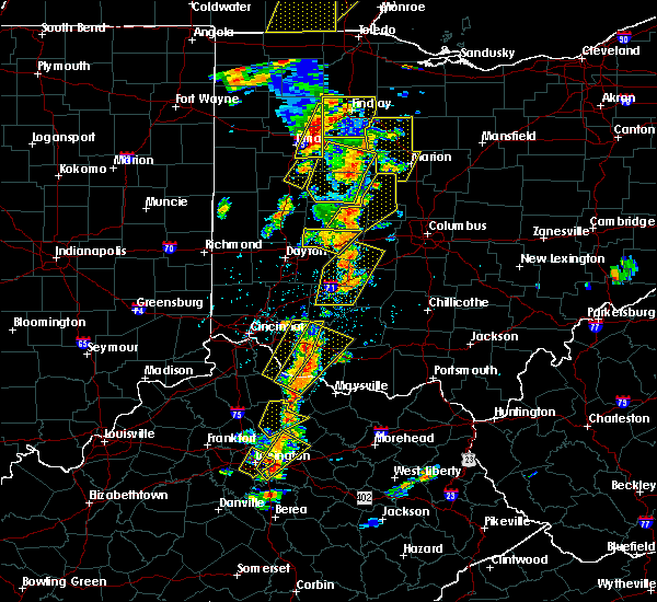 At 521 pm edt, a severe thunderstorm was located near wilmington, moving northeast at 35 mph (radar indicated). Hazards include 70 mph wind gusts. Expect considerable tree damage. damage is likely to mobile homes, roofs, and outbuildings. locations impacted include, london, sabina, jamestown, south charleston, jeffersonville, lisbon, south vienna, south solon, midway, bowersville, port william, milledgeville, octa, newport, interstate 71 at state route 38, rosemoor, selma, gladstone, bookwalter and shady grove. this includes the following interstates, i-70 in ohio near mile marker 66. I-71 in ohio between mile markers 52 and 76. At 521 pm edt, a severe thunderstorm was located near wilmington, moving northeast at 35 mph (radar indicated). Hazards include 70 mph wind gusts. Expect considerable tree damage. damage is likely to mobile homes, roofs, and outbuildings. locations impacted include, london, sabina, jamestown, south charleston, jeffersonville, lisbon, south vienna, south solon, midway, bowersville, port william, milledgeville, octa, newport, interstate 71 at state route 38, rosemoor, selma, gladstone, bookwalter and shady grove. this includes the following interstates, i-70 in ohio near mile marker 66. I-71 in ohio between mile markers 52 and 76.
|
| 6/10/2020 5:19 PM EDT |
 At 519 pm edt, a severe thunderstorm was located near wilmington, moving northeast at 35 mph (radar indicated). Hazards include 60 mph wind gusts. Expect damage to trees and power lines. locations impacted include, london, cedarville, sabina, jamestown, south charleston, jeffersonville, wilberforce, lisbon, new jasper, south vienna, south solon, midway, bowersville, port william, milledgeville, octa, paintersville, newport, melvin and interstate 71 at state route 38. this includes the following interstates, i-70 in ohio near mile marker 66. I-71 in ohio between mile markers 47 and 76. At 519 pm edt, a severe thunderstorm was located near wilmington, moving northeast at 35 mph (radar indicated). Hazards include 60 mph wind gusts. Expect damage to trees and power lines. locations impacted include, london, cedarville, sabina, jamestown, south charleston, jeffersonville, wilberforce, lisbon, new jasper, south vienna, south solon, midway, bowersville, port william, milledgeville, octa, paintersville, newport, melvin and interstate 71 at state route 38. this includes the following interstates, i-70 in ohio near mile marker 66. I-71 in ohio between mile markers 47 and 76.
|
| 6/10/2020 5:10 PM EDT |
 At 510 pm edt, a severe thunderstorm was located over wilmington, moving northeast at 35 mph (radar indicated). Hazards include 60 mph wind gusts and penny size hail. expect damage to trees and power lines At 510 pm edt, a severe thunderstorm was located over wilmington, moving northeast at 35 mph (radar indicated). Hazards include 60 mph wind gusts and penny size hail. expect damage to trees and power lines
|
| 6/10/2020 5:02 PM EDT |
 At 502 pm edt, a severe thunderstorm was located near wilmington, moving northeast at 55 mph (radar indicated). Hazards include 60 mph wind gusts. Expect damage to trees and power lines. locations impacted include, wilmington, blanchester, clarksville, martinsville, midland, bowersville, port william, paintersville, melvin, bloomington, lumberton, middleton corner, new antioch, oakland, westboro, cuba, reesville, morrisville, ogden and burtonville. This includes i-71 in ohio between mile markers 45 and 62. At 502 pm edt, a severe thunderstorm was located near wilmington, moving northeast at 55 mph (radar indicated). Hazards include 60 mph wind gusts. Expect damage to trees and power lines. locations impacted include, wilmington, blanchester, clarksville, martinsville, midland, bowersville, port william, paintersville, melvin, bloomington, lumberton, middleton corner, new antioch, oakland, westboro, cuba, reesville, morrisville, ogden and burtonville. This includes i-71 in ohio between mile markers 45 and 62.
|
| 6/10/2020 4:52 PM EDT |
 At 452 pm edt, a severe thunderstorm was located over blanchester, moving northeast at 55 mph (radar indicated). Hazards include 60 mph wind gusts. expect damage to trees and power lines At 452 pm edt, a severe thunderstorm was located over blanchester, moving northeast at 55 mph (radar indicated). Hazards include 60 mph wind gusts. expect damage to trees and power lines
|
| 6/3/2020 8:26 PM EDT |
 The severe thunderstorm warning for north central clinton and southeastern greene counties will expire at 830 pm edt, the storm which prompted the warning has weakened below severe limits, and is exiting the warned area. therefore, the warning will be allowed to expire. however heavy rain remains possible with this thunderstorm. please report previous wind damage or hail to the national weather service by going to our website at weather.gov/iln and submitting your report via social media. The severe thunderstorm warning for north central clinton and southeastern greene counties will expire at 830 pm edt, the storm which prompted the warning has weakened below severe limits, and is exiting the warned area. therefore, the warning will be allowed to expire. however heavy rain remains possible with this thunderstorm. please report previous wind damage or hail to the national weather service by going to our website at weather.gov/iln and submitting your report via social media.
|
| 6/3/2020 8:08 PM EDT |
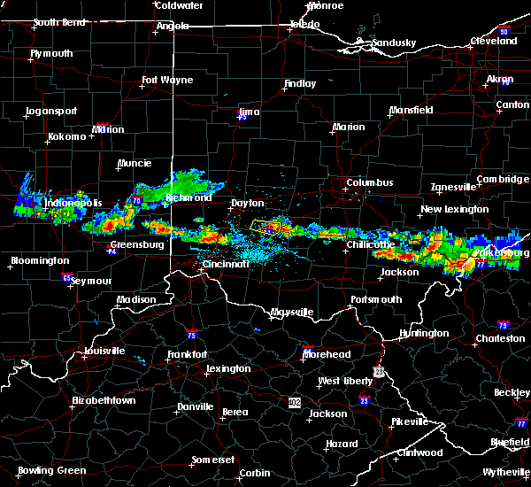 At 807 pm edt, a severe thunderstorm was located near jamestown, moving east at 20 mph (radar indicated). Hazards include 60 mph wind gusts and quarter size hail. Minor hail damage to vehicles is possible. expect wind damage to trees and power lines. locations impacted include, jamestown, new jasper, bowersville, port william, paintersville, bloomington, lumberton and middleton corner. This includes i-71 in ohio between mile markers 53 and 60. At 807 pm edt, a severe thunderstorm was located near jamestown, moving east at 20 mph (radar indicated). Hazards include 60 mph wind gusts and quarter size hail. Minor hail damage to vehicles is possible. expect wind damage to trees and power lines. locations impacted include, jamestown, new jasper, bowersville, port william, paintersville, bloomington, lumberton and middleton corner. This includes i-71 in ohio between mile markers 53 and 60.
|
| 6/3/2020 7:51 PM EDT |
 At 751 pm edt, a severe thunderstorm was located near xenia, moving east at 20 mph (radar indicated). Hazards include 60 mph wind gusts and quarter size hail. Minor hail damage to vehicles is possible. Expect wind damage to trees and power lines. At 751 pm edt, a severe thunderstorm was located near xenia, moving east at 20 mph (radar indicated). Hazards include 60 mph wind gusts and quarter size hail. Minor hail damage to vehicles is possible. Expect wind damage to trees and power lines.
|
| 5/10/2020 4:16 PM EDT |
 At 416 pm edt, severe thunderstorms were located along a line extending from near springfield to near blanchester, moving northeast at 50 mph (radar indicated). Hazards include 60 mph wind gusts. Expect damage to trees and power lines. locations impacted include, xenia, wilmington, blanchester, yellow springs, cedarville, sabina, jamestown, new vienna, jeffersonville, wilberforce, new jasper, clarksville, martinsville, south solon, midway, midland, bowersville, port william, st. martin and milledgeville. This includes i-71 in ohio between mile markers 43 and 72. At 416 pm edt, severe thunderstorms were located along a line extending from near springfield to near blanchester, moving northeast at 50 mph (radar indicated). Hazards include 60 mph wind gusts. Expect damage to trees and power lines. locations impacted include, xenia, wilmington, blanchester, yellow springs, cedarville, sabina, jamestown, new vienna, jeffersonville, wilberforce, new jasper, clarksville, martinsville, south solon, midway, midland, bowersville, port william, st. martin and milledgeville. This includes i-71 in ohio between mile markers 43 and 72.
|
| 5/10/2020 3:57 PM EDT |
 At 357 pm edt, severe thunderstorms were located along a line extending from near fairborn to near batavia, moving northeast at 45 mph (radar indicated). Hazards include 60 mph wind gusts. expect damage to trees and power lines At 357 pm edt, severe thunderstorms were located along a line extending from near fairborn to near batavia, moving northeast at 45 mph (radar indicated). Hazards include 60 mph wind gusts. expect damage to trees and power lines
|
| 4/8/2020 11:26 PM EDT |
 The severe thunderstorm warning for western fayette, clinton and southeastern greene counties will expire at 1130 pm edt, an additional severe thunderstorm warning remains in effect for portions of fayette and clinton counties. a tornado watch remains in effect until 200 am edt for central, southwestern and west central ohio. please report previous wind damage or hail to the national weather service by going to our website at weather.gov/iln and submitting your report via social media. The severe thunderstorm warning for western fayette, clinton and southeastern greene counties will expire at 1130 pm edt, an additional severe thunderstorm warning remains in effect for portions of fayette and clinton counties. a tornado watch remains in effect until 200 am edt for central, southwestern and west central ohio. please report previous wind damage or hail to the national weather service by going to our website at weather.gov/iln and submitting your report via social media.
|
| 4/8/2020 11:10 PM EDT |
 At 1110 pm edt, a severe thunderstorm was located near wilmington, moving east at 45 mph. a tornado warning is also in effect for southern clinton county (radar indicated). Hazards include 60 mph wind gusts and penny size hail. Expect damage to trees and power lines. locations impacted include, wilmington, blanchester, sabina, jamestown, lynchburg, new vienna, jeffersonville, new jasper, clarksville, martinsville, midland, bowersville, port william, milledgeville, octa, paintersville, melvin, rosemoor, lumberton and oakland. this includes i-71 in ohio between mile markers 43 and 67. A tornado watch remains in effect until 200 am edt for central, southwestern and west central ohio. At 1110 pm edt, a severe thunderstorm was located near wilmington, moving east at 45 mph. a tornado warning is also in effect for southern clinton county (radar indicated). Hazards include 60 mph wind gusts and penny size hail. Expect damage to trees and power lines. locations impacted include, wilmington, blanchester, sabina, jamestown, lynchburg, new vienna, jeffersonville, new jasper, clarksville, martinsville, midland, bowersville, port william, milledgeville, octa, paintersville, melvin, rosemoor, lumberton and oakland. this includes i-71 in ohio between mile markers 43 and 67. A tornado watch remains in effect until 200 am edt for central, southwestern and west central ohio.
|
| 4/8/2020 10:40 PM EDT |
 At 1040 pm edt, a severe thunderstorm was located 7 miles north of blanchester, moving east at 30 mph (radar indicated). Hazards include 60 mph wind gusts and half dollar size hail. Minor hail damage to vehicles is possible. expect wind damage to trees and power lines. locations impacted include, wilmington, blanchester, cedarville, waynesville, sabina, jamestown, lynchburg, new vienna, jeffersonville, morrow, wilberforce, new jasper, clarksville, harveysburg, spring valley, martinsville, corwin and midland. this includes i-71 in ohio between mile markers 34 and 67. A tornado watch remains in effect until 200 am edt for central, southwestern and west central ohio. At 1040 pm edt, a severe thunderstorm was located 7 miles north of blanchester, moving east at 30 mph (radar indicated). Hazards include 60 mph wind gusts and half dollar size hail. Minor hail damage to vehicles is possible. expect wind damage to trees and power lines. locations impacted include, wilmington, blanchester, cedarville, waynesville, sabina, jamestown, lynchburg, new vienna, jeffersonville, morrow, wilberforce, new jasper, clarksville, harveysburg, spring valley, martinsville, corwin and midland. this includes i-71 in ohio between mile markers 34 and 67. A tornado watch remains in effect until 200 am edt for central, southwestern and west central ohio.
|
| 4/8/2020 10:30 PM EDT |
 At 1030 pm edt, a severe thunderstorm was located over morrow, moving east at 40 mph (radar indicated). Hazards include ping pong ball size hail and 60 mph wind gusts. People and animals outdoors will be injured. expect hail damage to roofs, siding, windows, and vehicles. Expect wind damage to trees and power lines. At 1030 pm edt, a severe thunderstorm was located over morrow, moving east at 40 mph (radar indicated). Hazards include ping pong ball size hail and 60 mph wind gusts. People and animals outdoors will be injured. expect hail damage to roofs, siding, windows, and vehicles. Expect wind damage to trees and power lines.
|
| 9/1/2019 5:22 PM EDT |
 The severe thunderstorm warning for northwestern clinton county will expire at 530 pm edt, the storm which prompted the warning has weakened below severe limits, and no longer poses an immediate threat to life or property. therefore, the warning will be allowed to expire. gusty winds and small hail are still possible with this thunderstorm. please report previous wind damage or hail to the national weather service by going to our website at weather.gov/iln and submitting your report via social media. The severe thunderstorm warning for northwestern clinton county will expire at 530 pm edt, the storm which prompted the warning has weakened below severe limits, and no longer poses an immediate threat to life or property. therefore, the warning will be allowed to expire. gusty winds and small hail are still possible with this thunderstorm. please report previous wind damage or hail to the national weather service by going to our website at weather.gov/iln and submitting your report via social media.
|
| 9/1/2019 5:06 PM EDT |
 At 506 pm edt, a severe thunderstorm was located near wilmington, moving east at 20 mph (radar indicated). Hazards include 60 mph wind gusts and quarter size hail. Minor hail damage to vehicles is possible. expect wind damage to trees and power lines. locations impacted include, wilmington, clarksville, port william, melvin, bloomington, lumberton, new antioch, ogden, oakland, kingman, burtonville and interstate 71 at us route 68. This includes i-71 in ohio between mile markers 43 and 57. At 506 pm edt, a severe thunderstorm was located near wilmington, moving east at 20 mph (radar indicated). Hazards include 60 mph wind gusts and quarter size hail. Minor hail damage to vehicles is possible. expect wind damage to trees and power lines. locations impacted include, wilmington, clarksville, port william, melvin, bloomington, lumberton, new antioch, ogden, oakland, kingman, burtonville and interstate 71 at us route 68. This includes i-71 in ohio between mile markers 43 and 57.
|
| 9/1/2019 4:56 PM EDT |
 At 455 pm edt, a severe thunderstorm was located 8 miles southeast of waynesville, moving east at 25 mph (radar indicated). Hazards include 60 mph wind gusts and quarter size hail. Minor hail damage to vehicles is possible. expect wind damage to trees and power lines. locations impacted include, wilmington, clarksville, harveysburg, port william, paintersville, melvin, bloomington, lumberton, middleton corner, new antioch, oakland, caesar creek state park, ogden, kingman and burtonville. This includes i-71 in ohio between mile markers 38 and 58. At 455 pm edt, a severe thunderstorm was located 8 miles southeast of waynesville, moving east at 25 mph (radar indicated). Hazards include 60 mph wind gusts and quarter size hail. Minor hail damage to vehicles is possible. expect wind damage to trees and power lines. locations impacted include, wilmington, clarksville, harveysburg, port william, paintersville, melvin, bloomington, lumberton, middleton corner, new antioch, oakland, caesar creek state park, ogden, kingman and burtonville. This includes i-71 in ohio between mile markers 38 and 58.
|
| 9/1/2019 4:44 PM EDT |
 At 444 pm edt, a severe thunderstorm was located near waynesville, moving east at 20 mph (radar indicated). Hazards include 60 mph wind gusts and quarter size hail. Minor hail damage to vehicles is possible. Expect wind damage to trees and power lines. At 444 pm edt, a severe thunderstorm was located near waynesville, moving east at 20 mph (radar indicated). Hazards include 60 mph wind gusts and quarter size hail. Minor hail damage to vehicles is possible. Expect wind damage to trees and power lines.
|
| 7/15/2019 6:12 PM EDT |
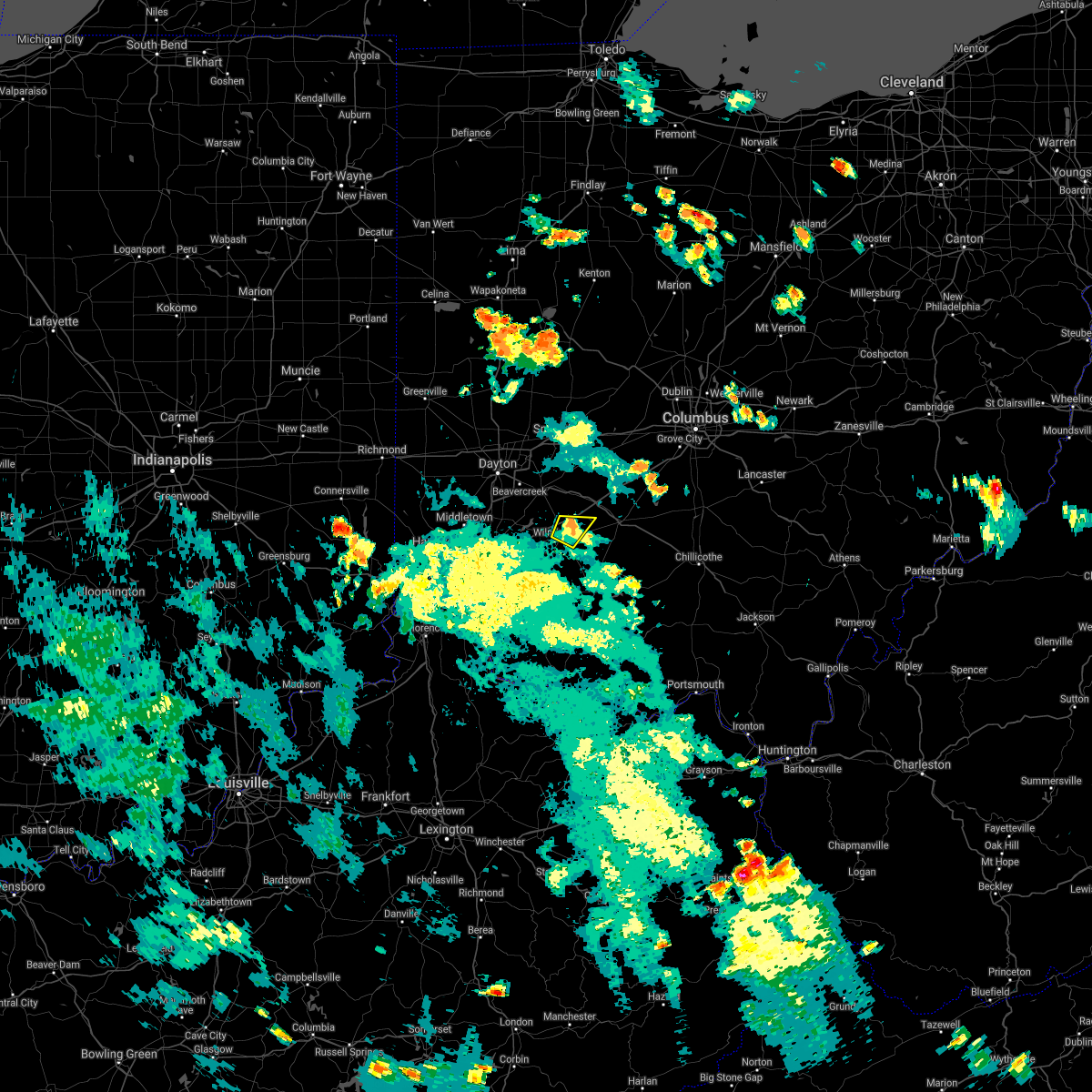 The severe thunderstorm warning for northeastern clinton county will expire at 615 pm edt, the storm which prompted the warning has weakened below severe limits, and no longer poses an immediate threat to life or property. therefore, the warning will be allowed to expire. however gusty winds and heavy rain are still possible with this thunderstorm. please report previous wind damage or hail to the national weather service by going to our website at weather.gov/iln and submitting your report via social media. The severe thunderstorm warning for northeastern clinton county will expire at 615 pm edt, the storm which prompted the warning has weakened below severe limits, and no longer poses an immediate threat to life or property. therefore, the warning will be allowed to expire. however gusty winds and heavy rain are still possible with this thunderstorm. please report previous wind damage or hail to the national weather service by going to our website at weather.gov/iln and submitting your report via social media.
|
| 7/15/2019 6:00 PM EDT |
 At 600 pm edt, a severe thunderstorm was located near wilmington, moving northeast at 20 mph (radar indicated). Hazards include 60 mph wind gusts. Expect damage to trees and power lines. locations impacted include, wilmington, port william, melvin, reesville and bloomington. This includes i-71 in ohio between mile markers 52 and 57. At 600 pm edt, a severe thunderstorm was located near wilmington, moving northeast at 20 mph (radar indicated). Hazards include 60 mph wind gusts. Expect damage to trees and power lines. locations impacted include, wilmington, port william, melvin, reesville and bloomington. This includes i-71 in ohio between mile markers 52 and 57.
|
| 7/15/2019 5:46 PM EDT |
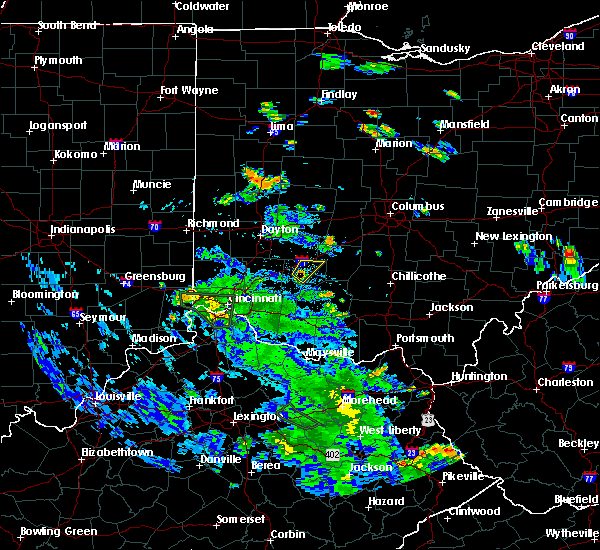 At 546 pm edt, a severe thunderstorm was located over wilmington, moving northeast at 20 mph (radar indicated). Hazards include 60 mph wind gusts. expect damage to trees and power lines At 546 pm edt, a severe thunderstorm was located over wilmington, moving northeast at 20 mph (radar indicated). Hazards include 60 mph wind gusts. expect damage to trees and power lines
|
| 7/2/2019 5:10 PM EDT |
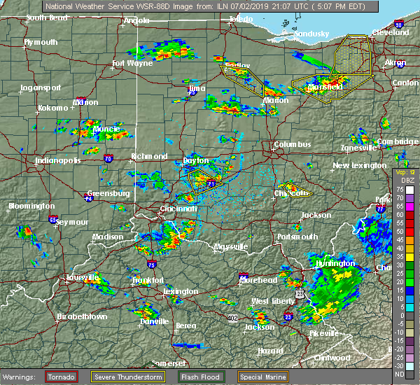 At 510 pm edt, a severe thunderstorm was located 7 miles south of xenia, moving southeast at 20 mph (radar indicated). Hazards include 60 mph wind gusts and penny size hail. Expect damage to trees and power lines. locations impacted include, xenia, harveysburg, spring valley, bowersville, port william, paintersville, bloomington, lumberton, middleton corner, mount holly, roxanna, oakland, caesar creek state park, kingman and interstate 71 at us route 68. This includes i-71 in ohio between mile markers 42 and 59. At 510 pm edt, a severe thunderstorm was located 7 miles south of xenia, moving southeast at 20 mph (radar indicated). Hazards include 60 mph wind gusts and penny size hail. Expect damage to trees and power lines. locations impacted include, xenia, harveysburg, spring valley, bowersville, port william, paintersville, bloomington, lumberton, middleton corner, mount holly, roxanna, oakland, caesar creek state park, kingman and interstate 71 at us route 68. This includes i-71 in ohio between mile markers 42 and 59.
|
| 7/2/2019 4:57 PM EDT |
 At 457 pm edt, a severe thunderstorm was located near xenia, moving southeast at 20 mph (radar indicated). Hazards include 60 mph wind gusts and penny size hail. expect damage to trees and power lines At 457 pm edt, a severe thunderstorm was located near xenia, moving southeast at 20 mph (radar indicated). Hazards include 60 mph wind gusts and penny size hail. expect damage to trees and power lines
|
| 6/27/2019 12:40 PM EDT |
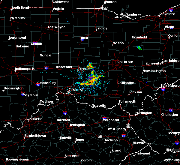 At 1224 pm edt, a severe thunderstorm was located over wilmington, moving east at 15 mph (radar indicated). Hazards include 60 mph wind gusts and penny size hail. Expect damage to trees and power lines. locations impacted include, wilmington, sabina, port william, melvin, lees creek, reesville, bloomington, new antioch, burtonville and interstate 71 at us route 68. This includes i-71 in ohio between mile markers 51 and 57. At 1224 pm edt, a severe thunderstorm was located over wilmington, moving east at 15 mph (radar indicated). Hazards include 60 mph wind gusts and penny size hail. Expect damage to trees and power lines. locations impacted include, wilmington, sabina, port william, melvin, lees creek, reesville, bloomington, new antioch, burtonville and interstate 71 at us route 68. This includes i-71 in ohio between mile markers 51 and 57.
|
| 6/27/2019 12:24 PM EDT |
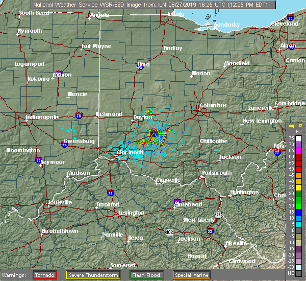 At 1224 pm edt, a severe thunderstorm was located over wilmington, moving east at 15 mph (radar indicated). Hazards include 60 mph wind gusts and penny size hail. Expect damage to trees and power lines. locations impacted include, wilmington, sabina, port william, melvin, lees creek, reesville, bloomington, new antioch, burtonville and interstate 71 at us route 68. This includes i-71 in ohio between mile markers 51 and 57. At 1224 pm edt, a severe thunderstorm was located over wilmington, moving east at 15 mph (radar indicated). Hazards include 60 mph wind gusts and penny size hail. Expect damage to trees and power lines. locations impacted include, wilmington, sabina, port william, melvin, lees creek, reesville, bloomington, new antioch, burtonville and interstate 71 at us route 68. This includes i-71 in ohio between mile markers 51 and 57.
|
| 6/27/2019 12:11 PM EDT |
 At 1210 pm edt, a severe thunderstorm was located near wilmington, moving east at 15 mph (radar indicated). Hazards include 60 mph wind gusts and penny size hail. Expect damage to trees and power lines. locations impacted include, wilmington, sabina, port william, melvin, bloomington, lumberton, new antioch, oakland, lees creek, reesville, ogden, burtonville and interstate 71 at us route 68. This includes i-71 in ohio between mile markers 48 and 57. At 1210 pm edt, a severe thunderstorm was located near wilmington, moving east at 15 mph (radar indicated). Hazards include 60 mph wind gusts and penny size hail. Expect damage to trees and power lines. locations impacted include, wilmington, sabina, port william, melvin, bloomington, lumberton, new antioch, oakland, lees creek, reesville, ogden, burtonville and interstate 71 at us route 68. This includes i-71 in ohio between mile markers 48 and 57.
|
| 6/27/2019 11:55 AM EDT |
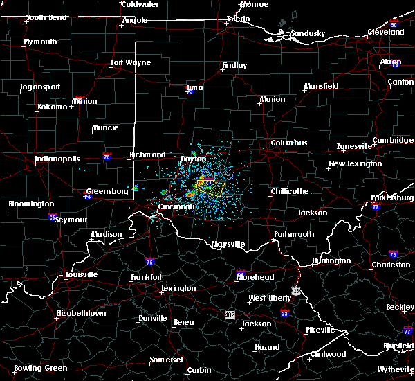 At 1155 am edt, a severe thunderstorm was located near wilmington, moving east at 15 mph (radar indicated). Hazards include 60 mph wind gusts and penny size hail. expect damage to trees and power lines At 1155 am edt, a severe thunderstorm was located near wilmington, moving east at 15 mph (radar indicated). Hazards include 60 mph wind gusts and penny size hail. expect damage to trees and power lines
|
| 5/27/2019 5:55 PM EDT |
 The severe thunderstorm warning for northeastern warren, northwestern clinton and southwestern greene counties will expire at 600 pm edt, the storm which prompted the warning has weakened below severe limits, and no longer poses an immediate threat to life or property. therefore, the warning will be allowed to expire. however gusty winds are still possible with this thunderstorm. please report previous wind damage or hail to the national weather service by going to our website at weather.gov/iln and submitting your report via social media. The severe thunderstorm warning for northeastern warren, northwestern clinton and southwestern greene counties will expire at 600 pm edt, the storm which prompted the warning has weakened below severe limits, and no longer poses an immediate threat to life or property. therefore, the warning will be allowed to expire. however gusty winds are still possible with this thunderstorm. please report previous wind damage or hail to the national weather service by going to our website at weather.gov/iln and submitting your report via social media.
|
| 5/27/2019 5:41 PM EDT |
 At 541 pm edt, a severe thunderstorm was located near waynesville, moving east at 25 mph (radar indicated). Hazards include 60 mph wind gusts and quarter size hail. Minor hail damage to vehicles is possible. expect wind damage to trees and power lines. locations impacted include, wilmington, waynesville, harveysburg, spring valley, corwin, port william, paintersville, oregonia, lytle, lumberton, middleton corner, mount holly, roxanna, oakland, state route 48 at state route 73, caesar creek state park, ogden, kingman and interstate 71 at us route 68. This includes i-71 in ohio between mile markers 33 and 56. At 541 pm edt, a severe thunderstorm was located near waynesville, moving east at 25 mph (radar indicated). Hazards include 60 mph wind gusts and quarter size hail. Minor hail damage to vehicles is possible. expect wind damage to trees and power lines. locations impacted include, wilmington, waynesville, harveysburg, spring valley, corwin, port william, paintersville, oregonia, lytle, lumberton, middleton corner, mount holly, roxanna, oakland, state route 48 at state route 73, caesar creek state park, ogden, kingman and interstate 71 at us route 68. This includes i-71 in ohio between mile markers 33 and 56.
|
| 5/27/2019 5:28 PM EDT |
 At 527 pm edt, a severe thunderstorm was located near waynesville, moving east at 25 mph (radar indicated). Hazards include 70 mph wind gusts and quarter size hail. Minor hail damage to vehicles is possible. expect considerable tree damage. wind damage is also likely to mobile homes, roofs, and outbuildings. locations impacted include, lebanon, springboro, wilmington, franklin, waynesville, hunter, harveysburg, spring valley, corwin, port william, paintersville, state route 63 at state route 741, lytle, lumberton, mount holly, oakland, pekin, genntown, caesar creek state park and ogden. this includes the following interstates, i-71 in ohio between mile markers 32 and 56. I-75 in ohio near mile marker 38. At 527 pm edt, a severe thunderstorm was located near waynesville, moving east at 25 mph (radar indicated). Hazards include 70 mph wind gusts and quarter size hail. Minor hail damage to vehicles is possible. expect considerable tree damage. wind damage is also likely to mobile homes, roofs, and outbuildings. locations impacted include, lebanon, springboro, wilmington, franklin, waynesville, hunter, harveysburg, spring valley, corwin, port william, paintersville, state route 63 at state route 741, lytle, lumberton, mount holly, oakland, pekin, genntown, caesar creek state park and ogden. this includes the following interstates, i-71 in ohio between mile markers 32 and 56. I-75 in ohio near mile marker 38.
|
| 5/27/2019 5:18 PM EDT |
 At 518 pm edt, a severe thunderstorm was located near lebanon, moving east at 25 mph (radar indicated). Hazards include 70 mph wind gusts and quarter size hail. Minor hail damage to vehicles is possible. expect considerable tree damage. Wind damage is also likely to mobile homes, roofs, and outbuildings. At 518 pm edt, a severe thunderstorm was located near lebanon, moving east at 25 mph (radar indicated). Hazards include 70 mph wind gusts and quarter size hail. Minor hail damage to vehicles is possible. expect considerable tree damage. Wind damage is also likely to mobile homes, roofs, and outbuildings.
|
| 3/14/2019 7:06 PM EDT |
 The severe thunderstorm warning for northeastern clermont, north central brown, eastern warren and clinton counties will expire at 715 pm edt, the severe thunderstorm warning has been replaced by another severe thunderstorm warning for warren, brown, clermont, and clinton counties. a severe thunderstorm watch remains in effect until 1000 pm edt for central, southwestern and west central ohio. please report previous wind damage or hail to the national weather service by going to our website at weather.gov/iln and submitting your report via social media. The severe thunderstorm warning for northeastern clermont, north central brown, eastern warren and clinton counties will expire at 715 pm edt, the severe thunderstorm warning has been replaced by another severe thunderstorm warning for warren, brown, clermont, and clinton counties. a severe thunderstorm watch remains in effect until 1000 pm edt for central, southwestern and west central ohio. please report previous wind damage or hail to the national weather service by going to our website at weather.gov/iln and submitting your report via social media.
|
| 3/14/2019 6:47 PM EDT |
 At 647 pm edt, a severe thunderstorm was located over wilmington, moving northeast at 55 mph (radar indicated). Hazards include 70 mph wind gusts and half dollar size hail. Minor hail damage to vehicles is possible. expect considerable tree damage. wind damage is also likely to mobile homes, roofs, and outbuildings. locations impacted include, wilmington, blanchester, sabina, lynchburg, new vienna, woodville, clarksville, harveysburg, martinsville, newtonsville, midland, port william, st. martin, melvin, state route 123 at state route 132, lumberton, oakland, lees creek, caesar creek state park and morrisville. This includes i-71 in ohio between mile markers 39 and 57. At 647 pm edt, a severe thunderstorm was located over wilmington, moving northeast at 55 mph (radar indicated). Hazards include 70 mph wind gusts and half dollar size hail. Minor hail damage to vehicles is possible. expect considerable tree damage. wind damage is also likely to mobile homes, roofs, and outbuildings. locations impacted include, wilmington, blanchester, sabina, lynchburg, new vienna, woodville, clarksville, harveysburg, martinsville, newtonsville, midland, port william, st. martin, melvin, state route 123 at state route 132, lumberton, oakland, lees creek, caesar creek state park and morrisville. This includes i-71 in ohio between mile markers 39 and 57.
|
| 3/14/2019 6:36 PM EDT |
 At 636 pm edt, a severe thunderstorm was located near blanchester, moving northeast at 55 mph (radar indicated). Hazards include 60 mph wind gusts and half dollar size hail. Minor hail damage to vehicles is possible. expect wind damage to trees and power lines. locations impacted include, wilmington, blanchester, sabina, lynchburg, new vienna, woodville, clarksville, harveysburg, martinsville, newtonsville, midland, port william, st. martin, melvin, state route 123 at state route 132, lumberton, oakland, lees creek, caesar creek state park and morrisville. This includes i-71 in ohio between mile markers 39 and 57. At 636 pm edt, a severe thunderstorm was located near blanchester, moving northeast at 55 mph (radar indicated). Hazards include 60 mph wind gusts and half dollar size hail. Minor hail damage to vehicles is possible. expect wind damage to trees and power lines. locations impacted include, wilmington, blanchester, sabina, lynchburg, new vienna, woodville, clarksville, harveysburg, martinsville, newtonsville, midland, port william, st. martin, melvin, state route 123 at state route 132, lumberton, oakland, lees creek, caesar creek state park and morrisville. This includes i-71 in ohio between mile markers 39 and 57.
|
| 3/14/2019 6:27 PM EDT |
 At 627 pm edt, a severe thunderstorm was located near morrow, moving northeast at 55 mph (radar indicated). Hazards include 60 mph wind gusts and quarter size hail. Minor hail damage to vehicles is possible. Expect wind damage to trees and power lines. At 627 pm edt, a severe thunderstorm was located near morrow, moving northeast at 55 mph (radar indicated). Hazards include 60 mph wind gusts and quarter size hail. Minor hail damage to vehicles is possible. Expect wind damage to trees and power lines.
|
| 3/14/2019 5:54 PM EDT |
 At 554 pm edt, a severe thunderstorm was located near sabina, moving northeast at 55 mph (radar indicated). Hazards include 60 mph wind gusts and nickel size hail. Expect damage to trees and power lines. locations impacted include, wilmington, sabina, staunton, bowersville, port william, milledgeville, octa, melvin, bloomington, new antioch, jasper mills, cuba, lees creek, reesville, morrisville, burtonville, interstate 71 at us route 35, interstate 71 at us route 68 and cowan lake state park. This includes i-71 in ohio between mile markers 50 and 66. At 554 pm edt, a severe thunderstorm was located near sabina, moving northeast at 55 mph (radar indicated). Hazards include 60 mph wind gusts and nickel size hail. Expect damage to trees and power lines. locations impacted include, wilmington, sabina, staunton, bowersville, port william, milledgeville, octa, melvin, bloomington, new antioch, jasper mills, cuba, lees creek, reesville, morrisville, burtonville, interstate 71 at us route 35, interstate 71 at us route 68 and cowan lake state park. This includes i-71 in ohio between mile markers 50 and 66.
|
| 3/14/2019 5:42 PM EDT |
 At 542 pm edt, a severe thunderstorm was located near wilmington, moving northeast at 55 mph (radar indicated). Hazards include 60 mph wind gusts and nickel size hail. expect damage to trees and power lines At 542 pm edt, a severe thunderstorm was located near wilmington, moving northeast at 55 mph (radar indicated). Hazards include 60 mph wind gusts and nickel size hail. expect damage to trees and power lines
|
| 6/9/2018 6:53 PM EDT |
 The severe thunderstorm warning for clinton, southern greene and northern highland counties will expire at 700 pm edt, the storm which prompted the warning has weakened below severe limits, and no longer poses an immediate threat to life or property. therefore, the warning will be allowed to expire. however gusty winds and heavy rain are still possible with this thunderstorm. please report previous wind damage or hail to the national weather service by going to our website at weather.gov/iln and submitting your report via social media. The severe thunderstorm warning for clinton, southern greene and northern highland counties will expire at 700 pm edt, the storm which prompted the warning has weakened below severe limits, and no longer poses an immediate threat to life or property. therefore, the warning will be allowed to expire. however gusty winds and heavy rain are still possible with this thunderstorm. please report previous wind damage or hail to the national weather service by going to our website at weather.gov/iln and submitting your report via social media.
|
| 6/9/2018 6:37 PM EDT |
 At 637 pm edt, a severe thunderstorm was located over wilmington, moving east at 25 mph (radar indicated). Hazards include 60 mph wind gusts. Expect damage to trees and power lines. locations impacted include, xenia, wilmington, sabina, jamestown, new vienna, new jasper, clarksville, spring valley, bowersville, port william, paintersville, melvin, rosemoor, lumberton, oakland, lees creek, morrisville, ogden, kingman and interstate 71 at us route 68. This includes i-71 in ohio between mile markers 44 and 61. At 637 pm edt, a severe thunderstorm was located over wilmington, moving east at 25 mph (radar indicated). Hazards include 60 mph wind gusts. Expect damage to trees and power lines. locations impacted include, xenia, wilmington, sabina, jamestown, new vienna, new jasper, clarksville, spring valley, bowersville, port william, paintersville, melvin, rosemoor, lumberton, oakland, lees creek, morrisville, ogden, kingman and interstate 71 at us route 68. This includes i-71 in ohio between mile markers 44 and 61.
|
| 6/9/2018 6:32 PM EDT |
 At 632 pm edt, a severe thunderstorm was located near wilmington, moving east at 25 mph (radar indicated). Hazards include 60 mph wind gusts. expect damage to trees and power lines At 632 pm edt, a severe thunderstorm was located near wilmington, moving east at 25 mph (radar indicated). Hazards include 60 mph wind gusts. expect damage to trees and power lines
|
| 11/5/2017 8:21 PM EST |
 The severe thunderstorm warning for northwestern clinton and southeastern greene counties will expire at 830 pm est, the storm which prompted the warning has weakened below severe limits, and no longer poses an immediate threat to life or property. therefore, the warning will be allowed to expire. however heavy rain is still possible with this thunderstorm. a severe thunderstorm watch remains in effect until 100 am est for southwestern and west central ohio. please report previous wind damage or hail to the national weather service by going to our website at weather.gov/iln and submitting your report via social media. The severe thunderstorm warning for northwestern clinton and southeastern greene counties will expire at 830 pm est, the storm which prompted the warning has weakened below severe limits, and no longer poses an immediate threat to life or property. therefore, the warning will be allowed to expire. however heavy rain is still possible with this thunderstorm. a severe thunderstorm watch remains in effect until 100 am est for southwestern and west central ohio. please report previous wind damage or hail to the national weather service by going to our website at weather.gov/iln and submitting your report via social media.
|
| 11/5/2017 8:10 PM EST |
 At 809 pm est, a severe thunderstorm was located near jamestown, moving east at 40 mph (radar indicated). Hazards include 60 mph wind gusts. Expect damage to trees and power lines. locations impacted include, xenia, jamestown, new jasper, harveysburg, bowersville, port william, paintersville, bloomington, middleton corner, lumberton, oakland, kingman, bell center and interstate 71 at us route 68. This includes i-71 in ohio between mile markers 45 and 61. At 809 pm est, a severe thunderstorm was located near jamestown, moving east at 40 mph (radar indicated). Hazards include 60 mph wind gusts. Expect damage to trees and power lines. locations impacted include, xenia, jamestown, new jasper, harveysburg, bowersville, port william, paintersville, bloomington, middleton corner, lumberton, oakland, kingman, bell center and interstate 71 at us route 68. This includes i-71 in ohio between mile markers 45 and 61.
|
| 11/5/2017 8:04 PM EST |
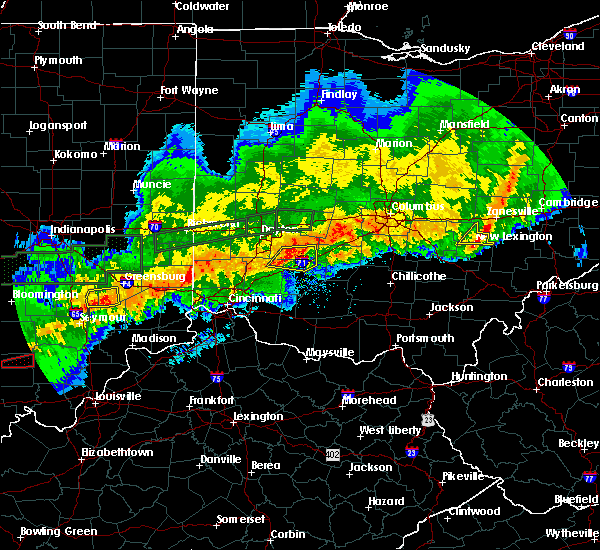 At 804 pm est, a severe thunderstorm was located near xenia, moving east at 40 mph (radar indicated). Hazards include 60 mph wind gusts. expect damage to trees and power lines At 804 pm est, a severe thunderstorm was located near xenia, moving east at 40 mph (radar indicated). Hazards include 60 mph wind gusts. expect damage to trees and power lines
|
| 8/22/2017 12:56 PM EDT |
 At 1256 pm edt, a severe thunderstorm was located near morrow, moving east at 25 mph (radar indicated). Hazards include 60 mph wind gusts and half dollar size hail. Minor hail damage to vehicles is possible. Expect wind damage to trees and power lines. At 1256 pm edt, a severe thunderstorm was located near morrow, moving east at 25 mph (radar indicated). Hazards include 60 mph wind gusts and half dollar size hail. Minor hail damage to vehicles is possible. Expect wind damage to trees and power lines.
|
| 7/21/2017 8:40 AM EDT |
 The severe thunderstorm warning for southern shelby, champaign, southern logan, northern fayette, northeastern clinton, clark, eastern greene, madison and northeastern miami counties will expire at 845 am edt, the storms which prompted the warning have weakened below severe limits, and no longer pose an immediate threat to life or property. therefore, the warning will be allowed to expire. however gusty winds are still possible with these thunderstorms. please report previous wind damage or hail to the national weather service by going to our website at weather.gov/iln and submitting your report via social media. The severe thunderstorm warning for southern shelby, champaign, southern logan, northern fayette, northeastern clinton, clark, eastern greene, madison and northeastern miami counties will expire at 845 am edt, the storms which prompted the warning have weakened below severe limits, and no longer pose an immediate threat to life or property. therefore, the warning will be allowed to expire. however gusty winds are still possible with these thunderstorms. please report previous wind damage or hail to the national weather service by going to our website at weather.gov/iln and submitting your report via social media.
|
| 7/21/2017 8:22 AM EDT |
 At 821 am edt, severe thunderstorms were located along a line extending from sidney to near jeffersonville, moving east at 65 mph (radar indicated). Hazards include 60 mph wind gusts. Expect damage to trees and power lines. locations impacted include, springfield, sidney, piqua, washington court house, urbana, london, new carlisle, yellow springs, west jefferson, cedarville, enon, st. paris, jamestown, west liberty, south charleston, mechanicsburg, north lewisburg, fort loramie, de graff and jeffersonville. this includes the following interstates, i-70 in ohio between mile markers 47 and 81. i-71 in ohio between mile markers 53 and 81. I-75 in ohio between mile markers 84 and 99. At 821 am edt, severe thunderstorms were located along a line extending from sidney to near jeffersonville, moving east at 65 mph (radar indicated). Hazards include 60 mph wind gusts. Expect damage to trees and power lines. locations impacted include, springfield, sidney, piqua, washington court house, urbana, london, new carlisle, yellow springs, west jefferson, cedarville, enon, st. paris, jamestown, west liberty, south charleston, mechanicsburg, north lewisburg, fort loramie, de graff and jeffersonville. this includes the following interstates, i-70 in ohio between mile markers 47 and 81. i-71 in ohio between mile markers 53 and 81. I-75 in ohio between mile markers 84 and 99.
|
| 7/21/2017 8:08 AM EDT |
 At 808 am edt, severe thunderstorms were located along a line extending from near newport to 7 miles south of xenia, moving east at 65 mph (radar indicated). Hazards include 60 mph wind gusts. expect damage to trees and power lines At 808 am edt, severe thunderstorms were located along a line extending from near newport to 7 miles south of xenia, moving east at 65 mph (radar indicated). Hazards include 60 mph wind gusts. expect damage to trees and power lines
|
| 7/11/2017 2:41 PM EDT |
 At 240 pm edt, severe thunderstorms were located along a line extending from near trotwood to near trenton, moving east at 40 mph (trained weather spotters). Hazards include 70 mph wind gusts. Expect considerable tree damage. Damage is likely to mobile homes, roofs, and outbuildings. At 240 pm edt, severe thunderstorms were located along a line extending from near trotwood to near trenton, moving east at 40 mph (trained weather spotters). Hazards include 70 mph wind gusts. Expect considerable tree damage. Damage is likely to mobile homes, roofs, and outbuildings.
|
| 5/19/2017 5:11 PM EDT |
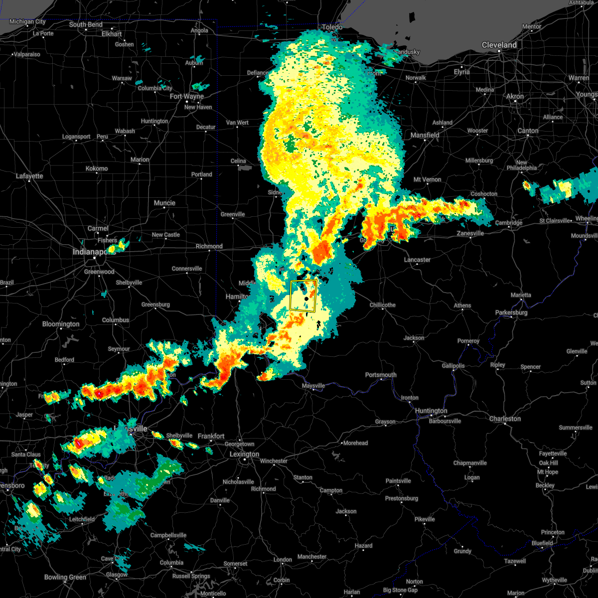 The severe thunderstorm warning for east central warren. northwestern clinton and south central greene counties will expire at 515 pm edt. the storm which prompted the warning has moved out of the area. therefore, the warning will be allowed to expire. A severe thunderstorm watch remains in effect until 1100 pm edt for. The severe thunderstorm warning for east central warren. northwestern clinton and south central greene counties will expire at 515 pm edt. the storm which prompted the warning has moved out of the area. therefore, the warning will be allowed to expire. A severe thunderstorm watch remains in effect until 1100 pm edt for.
|
| 5/19/2017 5:01 PM EDT |
 At 501 pm edt, a severe thunderstorm was located near waynesville, moving east at 30 mph (radar indicated). Hazards include 60 mph wind gusts. Expect damage to roofs, siding, and trees. locations impacted include, wilmington, clarksville, harveysburg, martinsville, bowersville, port william, new antioch, lumberton, oakland, cuba, morrisville, ogden, kingman, interstate 71 at us route 68, cowan lake state park, burtonville and melvin. This includes i-71 in ohio between mile markers 42 and 58. At 501 pm edt, a severe thunderstorm was located near waynesville, moving east at 30 mph (radar indicated). Hazards include 60 mph wind gusts. Expect damage to roofs, siding, and trees. locations impacted include, wilmington, clarksville, harveysburg, martinsville, bowersville, port william, new antioch, lumberton, oakland, cuba, morrisville, ogden, kingman, interstate 71 at us route 68, cowan lake state park, burtonville and melvin. This includes i-71 in ohio between mile markers 42 and 58.
|
| 5/19/2017 4:49 PM EDT |
 At 449 pm edt, a severe thunderstorm was located near lebanon, moving east at 35 mph (radar indicated). Hazards include 60 mph wind gusts. expect damage to roofs, siding, and trees At 449 pm edt, a severe thunderstorm was located near lebanon, moving east at 35 mph (radar indicated). Hazards include 60 mph wind gusts. expect damage to roofs, siding, and trees
|
| 3/1/2017 7:26 AM EST |
 The severe thunderstorm warning for east central hamilton, northern clermont, northwestern brown, eastern warren, western clinton and southern greene counties will expire at 730 am est, the storms which prompted the warning have moved out of the area. therefore, the warning will be allowed to expire. a tornado watch remains in effect until 1100 am est for southwestern ohio. please report previous wind damage or hail to the national weather service by going to our website at weather.gov/iln and submitting your report via social media. The severe thunderstorm warning for east central hamilton, northern clermont, northwestern brown, eastern warren, western clinton and southern greene counties will expire at 730 am est, the storms which prompted the warning have moved out of the area. therefore, the warning will be allowed to expire. a tornado watch remains in effect until 1100 am est for southwestern ohio. please report previous wind damage or hail to the national weather service by going to our website at weather.gov/iln and submitting your report via social media.
|
| 3/1/2017 7:10 AM EST |
 At 710 am est, severe thunderstorms were located along a line extending from near bellbrook to near morrow to near forestville, moving east at 50 mph (radar indicated). Hazards include 60 mph wind gusts and quarter size hail. Hail damage to vehicles is expected. expect wind damage to roofs, siding, and trees. locations impacted include, cincinnati, wilmington, loveland, milford, blanchester, mariemont, waynesville, terrace park, jamestown, batavia, new vienna, morrow, camp dennison, plainville, the village of indian hill, newtown, new jasper, woodville, maineville and owensville. this includes i-71 in ohio between mile markers 33 and 60. A tornado watch remains in effect until 1100 am est for southwestern ohio. At 710 am est, severe thunderstorms were located along a line extending from near bellbrook to near morrow to near forestville, moving east at 50 mph (radar indicated). Hazards include 60 mph wind gusts and quarter size hail. Hail damage to vehicles is expected. expect wind damage to roofs, siding, and trees. locations impacted include, cincinnati, wilmington, loveland, milford, blanchester, mariemont, waynesville, terrace park, jamestown, batavia, new vienna, morrow, camp dennison, plainville, the village of indian hill, newtown, new jasper, woodville, maineville and owensville. this includes i-71 in ohio between mile markers 33 and 60. A tornado watch remains in effect until 1100 am est for southwestern ohio.
|
| 3/1/2017 6:48 AM EST |
 At 647 am est, severe thunderstorms were located along a line extending from near middletown to olde west chester to near mack, moving east at 55 mph (radar indicated). Hazards include 60 mph wind gusts and half dollar size hail. Hail damage to vehicles is expected. Expect wind damage to roofs, siding, and trees. At 647 am est, severe thunderstorms were located along a line extending from near middletown to olde west chester to near mack, moving east at 55 mph (radar indicated). Hazards include 60 mph wind gusts and half dollar size hail. Hail damage to vehicles is expected. Expect wind damage to roofs, siding, and trees.
|
| 1/10/2017 10:25 PM EST |
 The severe thunderstorm warning for northwestern ross, fayette, southwestern pickaway, clinton, southeastern greene and northern highland counties will expire at 1030 pm est, the storms which prompted the warning have weakened below severe limits, and no longer pose an immediate threat to life or property. therefore, the warning will be allowed to expire. please report previous wind damage or hail to the national weather service by going to our website at weather.gov/iln and submitting your report via social media. The severe thunderstorm warning for northwestern ross, fayette, southwestern pickaway, clinton, southeastern greene and northern highland counties will expire at 1030 pm est, the storms which prompted the warning have weakened below severe limits, and no longer pose an immediate threat to life or property. therefore, the warning will be allowed to expire. please report previous wind damage or hail to the national weather service by going to our website at weather.gov/iln and submitting your report via social media.
|
| 1/10/2017 10:14 PM EST |
 At 1013 pm est, severe thunderstorms were located along a line extending from washington court house to near wilmington, moving east at 75 mph (radar indicated). Hazards include 60 mph wind gusts. Expect damage to roofs, siding, and trees. locations impacted include, washington court house, wilmington, hillsboro, greenfield, blanchester, sabina, mount sterling, leesburg, new vienna, jeffersonville, bloomingburg, new holland, staunton, good hope, frankfort, clarksville, martinsville, midland, bowersville and highland. This includes i-71 in ohio between mile markers 47 and 76. At 1013 pm est, severe thunderstorms were located along a line extending from washington court house to near wilmington, moving east at 75 mph (radar indicated). Hazards include 60 mph wind gusts. Expect damage to roofs, siding, and trees. locations impacted include, washington court house, wilmington, hillsboro, greenfield, blanchester, sabina, mount sterling, leesburg, new vienna, jeffersonville, bloomingburg, new holland, staunton, good hope, frankfort, clarksville, martinsville, midland, bowersville and highland. This includes i-71 in ohio between mile markers 47 and 76.
|
| 1/10/2017 9:57 PM EST |
 At 957 pm est, severe thunderstorms were located along a line extending from wilmington to morrow, moving east at 75 mph (radar indicated). Hazards include 60 mph wind gusts. expect damage to roofs, siding, and trees At 957 pm est, severe thunderstorms were located along a line extending from wilmington to morrow, moving east at 75 mph (radar indicated). Hazards include 60 mph wind gusts. expect damage to roofs, siding, and trees
|
| 1/10/2017 9:34 PM EST |
 At 933 pm est, severe thunderstorms were located along a line extending from xenia to wetherington, moving east at 60 mph (radar indicated). Hazards include 60 mph wind gusts. Expect damage to roofs, siding, and trees. locations impacted include, dayton, hamilton, kettering, middletown, beavercreek, fairfield, huber heights, fairborn, mason, xenia, miamisburg, lebanon, forest park, springboro, sharonville, wilmington, monroe, loveland, trenton and franklin. this includes the following interstates, i-71 in ohio between mile markers 19 and 60. I-75 in ohio between mile markers 17 and 55. At 933 pm est, severe thunderstorms were located along a line extending from xenia to wetherington, moving east at 60 mph (radar indicated). Hazards include 60 mph wind gusts. Expect damage to roofs, siding, and trees. locations impacted include, dayton, hamilton, kettering, middletown, beavercreek, fairfield, huber heights, fairborn, mason, xenia, miamisburg, lebanon, forest park, springboro, sharonville, wilmington, monroe, loveland, trenton and franklin. this includes the following interstates, i-71 in ohio between mile markers 19 and 60. I-75 in ohio between mile markers 17 and 55.
|
| 1/10/2017 9:18 PM EST |
 At 918 pm est, severe thunderstorms were located along a line extending from near dayton to near hamilton, moving east at 65 mph (radar indicated). Hazards include 60 mph wind gusts. expect damage to roofs, siding, and trees At 918 pm est, severe thunderstorms were located along a line extending from near dayton to near hamilton, moving east at 65 mph (radar indicated). Hazards include 60 mph wind gusts. expect damage to roofs, siding, and trees
|
| 8/28/2016 9:15 PM EDT |
 At 915 pm edt, a severe thunderstorm was located near jamestown, moving southeast at 15 mph (radar indicated). Hazards include 60 mph wind gusts. Expect damage to roofs. siding. and trees. Locations impacted include, xenia, washington court house, cedarville, sabina, jamestown, south charleston, jeffersonville, bloomingburg, wilberforce, new jasper, south solon, midway, bowersville, port william, milledgeville, octa, gladstone, jasper mills, paintersville and bell center. At 915 pm edt, a severe thunderstorm was located near jamestown, moving southeast at 15 mph (radar indicated). Hazards include 60 mph wind gusts. Expect damage to roofs. siding. and trees. Locations impacted include, xenia, washington court house, cedarville, sabina, jamestown, south charleston, jeffersonville, bloomingburg, wilberforce, new jasper, south solon, midway, bowersville, port william, milledgeville, octa, gladstone, jasper mills, paintersville and bell center.
|
| 8/28/2016 8:58 PM EDT |
 At 858 pm edt, a severe thunderstorm was located near jamestown, moving southeast at 15 mph (radar indicated). Hazards include 60 mph wind gusts. Expect damage to roofs. siding. And trees. At 858 pm edt, a severe thunderstorm was located near jamestown, moving southeast at 15 mph (radar indicated). Hazards include 60 mph wind gusts. Expect damage to roofs. siding. And trees.
|
| 8/27/2016 2:45 PM EDT |
 At 245 pm edt, severe thunderstorms were located along a line extending from lewisburg to miamisburg to near kings island, moving northeast at 40 mph (radar indicated). Hazards include 60 mph wind gusts and penny size hail. Expect damage to roofs. siding. And trees. At 245 pm edt, severe thunderstorms were located along a line extending from lewisburg to miamisburg to near kings island, moving northeast at 40 mph (radar indicated). Hazards include 60 mph wind gusts and penny size hail. Expect damage to roofs. siding. And trees.
|
| 8/16/2016 4:22 PM EDT |
 The severe thunderstorm warning for northwestern clinton county will expire at 430 pm edt, the storm which prompted the warning has weakened below severe limits, and no longer poses an immediate threat to life or property. therefore the warning will be allowed to expire. please report previous wind damage or hail to the national weather service by going to our website at weather.gov/iln and submitting your report via social media. The severe thunderstorm warning for northwestern clinton county will expire at 430 pm edt, the storm which prompted the warning has weakened below severe limits, and no longer poses an immediate threat to life or property. therefore the warning will be allowed to expire. please report previous wind damage or hail to the national weather service by going to our website at weather.gov/iln and submitting your report via social media.
|
| 8/16/2016 4:17 PM EDT |
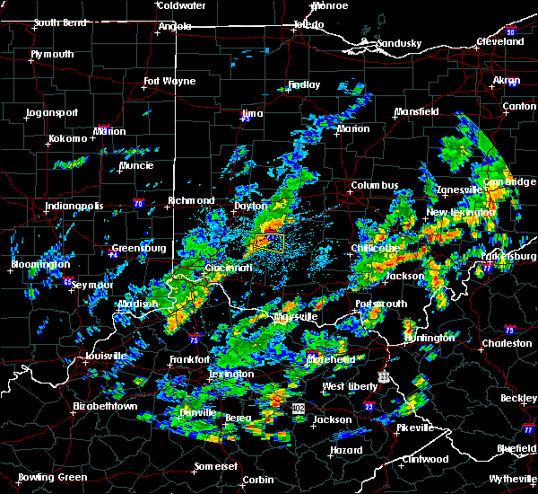 At 417 pm edt, a severe thunderstorm was located near wilmington, moving east at 35 mph (radar indicated). Hazards include 60 mph wind gusts. Expect damage to roofs. siding. and trees. Locations impacted include, wilmington, port william, new antioch, ogden, reesville, burtonville, bloomington, interstate 71 at us route 68 and melvin. At 417 pm edt, a severe thunderstorm was located near wilmington, moving east at 35 mph (radar indicated). Hazards include 60 mph wind gusts. Expect damage to roofs. siding. and trees. Locations impacted include, wilmington, port william, new antioch, ogden, reesville, burtonville, bloomington, interstate 71 at us route 68 and melvin.
|
| 8/16/2016 4:06 PM EDT |
 At 406 pm edt, a severe thunderstorm was located near wilmington, moving east at 35 mph (radar indicated). Hazards include 60 mph wind gusts. Expect damage to roofs. siding. and trees. Locations impacted include, wilmington, port william, kingman, new antioch, ogden, oakland, reesville, burtonville, bloomington, interstate 71 at us route 68, melvin and lumberton. At 406 pm edt, a severe thunderstorm was located near wilmington, moving east at 35 mph (radar indicated). Hazards include 60 mph wind gusts. Expect damage to roofs. siding. and trees. Locations impacted include, wilmington, port william, kingman, new antioch, ogden, oakland, reesville, burtonville, bloomington, interstate 71 at us route 68, melvin and lumberton.
|
| 8/16/2016 3:57 PM EDT |
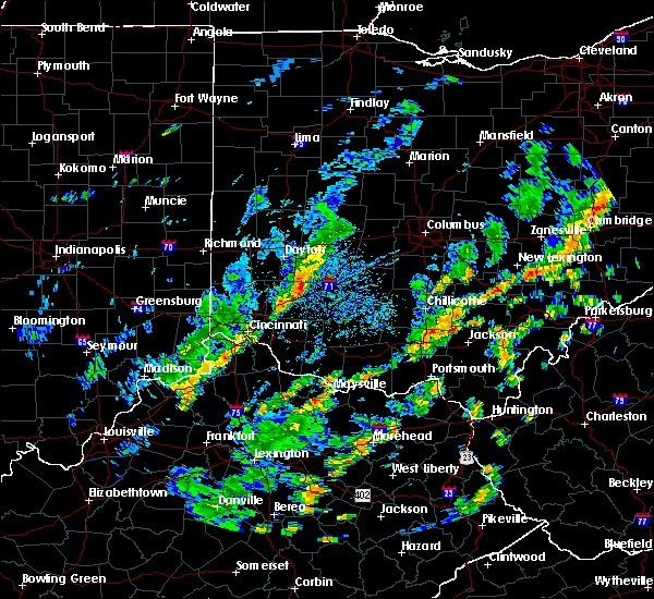 At 356 pm edt, a severe thunderstorm was located near waynesville, moving east at 35 mph (radar indicated). Hazards include 60 mph wind gusts. Expect damage to roofs. siding. And trees. At 356 pm edt, a severe thunderstorm was located near waynesville, moving east at 35 mph (radar indicated). Hazards include 60 mph wind gusts. Expect damage to roofs. siding. And trees.
|
| 8/15/2016 6:33 AM EDT |
 At 633 am edt, a severe thunderstorm was located near morrow, moving northeast at 40 mph (radar indicated). Hazards include 60 mph wind gusts. Expect damage to roofs. siding. and trees. Locations impacted include, mason, xenia, lebanon, wilmington, monroe, waynesville, morrow, kings island, south lebanon, maineville, clarksville, harveysburg, spring valley, corwin, port william, butlerville, roxanna, paintersville, hageman and ogden. At 633 am edt, a severe thunderstorm was located near morrow, moving northeast at 40 mph (radar indicated). Hazards include 60 mph wind gusts. Expect damage to roofs. siding. and trees. Locations impacted include, mason, xenia, lebanon, wilmington, monroe, waynesville, morrow, kings island, south lebanon, maineville, clarksville, harveysburg, spring valley, corwin, port william, butlerville, roxanna, paintersville, hageman and ogden.
|
| 8/15/2016 6:22 AM EDT |
 At 622 am edt, a severe thunderstorm was located over kings island, moving northeast at 45 mph (radar indicated). Hazards include 60 mph wind gusts. Expect damage to roofs. siding. And trees. At 622 am edt, a severe thunderstorm was located over kings island, moving northeast at 45 mph (radar indicated). Hazards include 60 mph wind gusts. Expect damage to roofs. siding. And trees.
|
| 6/23/2016 3:40 AM EDT |
 The severe thunderstorm warning for northwestern ross, southern montgomery, fayette, warren, southwestern pickaway, clinton, southeastern butler, northern clermont, northeastern hamilton, southern greene, northwestern brown, northwestern highland and southwestern madison counties will expire at 345 am edt, the storms which prompted the warning have moved out of the area. therefore the warning will be allowed to expire. a tornado watch remains in effect until 500 am edt for west central, central and southwestern ohio. please report previous wind damage or hail to the national weather service by going to our website at weather.gov/iln and submitting your report via social media. The severe thunderstorm warning for northwestern ross, southern montgomery, fayette, warren, southwestern pickaway, clinton, southeastern butler, northern clermont, northeastern hamilton, southern greene, northwestern brown, northwestern highland and southwestern madison counties will expire at 345 am edt, the storms which prompted the warning have moved out of the area. therefore the warning will be allowed to expire. a tornado watch remains in effect until 500 am edt for west central, central and southwestern ohio. please report previous wind damage or hail to the national weather service by going to our website at weather.gov/iln and submitting your report via social media.
|
| 6/23/2016 2:55 AM EDT |
 At 255 am edt, severe thunderstorms were located along a line extending from near cedarville to near hamilton, moving southeast at 55 mph (radar indicated). Hazards include 70 mph wind gusts. Expect considerable tree damage. Damage is likely to mobile homes, roofs, and outbuildings. At 255 am edt, severe thunderstorms were located along a line extending from near cedarville to near hamilton, moving southeast at 55 mph (radar indicated). Hazards include 70 mph wind gusts. Expect considerable tree damage. Damage is likely to mobile homes, roofs, and outbuildings.
|
| 6/15/2016 8:42 PM EDT | The severe thunderstorm warning for fayette, northeastern clinton and southeastern greene counties will expire at 845 pm edt, the storms which prompted the warning have weakened below severe limits, and no longer pose an immediate threat to life or property. therefore the warning will be allowed to expire. however gusty winds are still possible with these thunderstorms. please report previous wind damage or hail to the national weather service by going to our website at weather.gov/iln and submitting your report via social media. |
| 6/15/2016 8:23 PM EDT |
 At 823 pm edt, severe thunderstorms were located along a line extending from near bloomingburg to near sabina, moving southeast at 30 mph (radar indicated). Hazards include 60 mph wind gusts. Expect damage to roofs. siding. and trees. Locations impacted include, washington court house, sabina, washington, jeffersonville, bloomingburg, bowersville, port william, milledgeville, octa, jasper mills, bookwalter, interstate 71 at us route 35, bloomington, rosemoor, reesville, madison mills, interstate 71 at state route 38 and melvin. At 823 pm edt, severe thunderstorms were located along a line extending from near bloomingburg to near sabina, moving southeast at 30 mph (radar indicated). Hazards include 60 mph wind gusts. Expect damage to roofs. siding. and trees. Locations impacted include, washington court house, sabina, washington, jeffersonville, bloomingburg, bowersville, port william, milledgeville, octa, jasper mills, bookwalter, interstate 71 at us route 35, bloomington, rosemoor, reesville, madison mills, interstate 71 at state route 38 and melvin.
|
| 6/15/2016 8:11 PM EDT |
 At 811 pm edt, severe thunderstorms were located along a line extending from 8 miles south of london to 6 miles south of jamestown, moving southeast at 30 mph (radar indicated). Hazards include 60 mph wind gusts. Expect damage to roofs. siding. and trees. Locations impacted include, washington court house, sabina, jamestown, washington, mount sterling, jeffersonville, bloomingburg, new jasper, south solon, midway, bowersville, port william, milledgeville, octa, jasper mills, bell center, bookwalter, interstate 71 at us route 35, shady grove and rosemoor. At 811 pm edt, severe thunderstorms were located along a line extending from 8 miles south of london to 6 miles south of jamestown, moving southeast at 30 mph (radar indicated). Hazards include 60 mph wind gusts. Expect damage to roofs. siding. and trees. Locations impacted include, washington court house, sabina, jamestown, washington, mount sterling, jeffersonville, bloomingburg, new jasper, south solon, midway, bowersville, port william, milledgeville, octa, jasper mills, bell center, bookwalter, interstate 71 at us route 35, shady grove and rosemoor.
|
| 6/15/2016 7:58 PM EDT |
 At 757 pm edt, severe thunderstorms were located along a line extending from near london to near jamestown, moving southeast at 30 mph (radar indicated). Hazards include 60 mph wind gusts. Expect damage to roofs. siding. And trees. At 757 pm edt, severe thunderstorms were located along a line extending from near london to near jamestown, moving southeast at 30 mph (radar indicated). Hazards include 60 mph wind gusts. Expect damage to roofs. siding. And trees.
|
| 5/10/2016 5:02 PM EDT |
 At 502 pm edt, a severe thunderstorm was located over wilmington, moving northeast at 45 mph (radar indicated). Hazards include 60 mph wind gusts. Expect damage to roofs. siding. and trees. Locations impacted include, wilmington, sabina, new jasper, clarksville, bowersville, port william, new antioch, cuba, paintersville, ogden, burtonville, bloomington, lees creek, interstate 71 at us route 68, kingman, cowan lake state park, oakland, reesville, middleton corner and melvin. At 502 pm edt, a severe thunderstorm was located over wilmington, moving northeast at 45 mph (radar indicated). Hazards include 60 mph wind gusts. Expect damage to roofs. siding. and trees. Locations impacted include, wilmington, sabina, new jasper, clarksville, bowersville, port william, new antioch, cuba, paintersville, ogden, burtonville, bloomington, lees creek, interstate 71 at us route 68, kingman, cowan lake state park, oakland, reesville, middleton corner and melvin.
|
| 5/10/2016 4:48 PM EDT |
 At 448 pm edt, a severe thunderstorm was located near blanchester, moving northeast at 45 mph (radar indicated). Hazards include 60 mph wind gusts. Expect damage to roofs. siding. And trees. At 448 pm edt, a severe thunderstorm was located near blanchester, moving northeast at 45 mph (radar indicated). Hazards include 60 mph wind gusts. Expect damage to roofs. siding. And trees.
|
| 5/1/2016 8:32 PM EDT |
 At 832 pm edt, a severe thunderstorm was located near jamestown, moving northeast at 35 mph (radar indicated). Hazards include 60 mph wind gusts and quarter size hail. Hail damage to vehicles is expected. Expect wind damage to roofs, siding, and trees. At 832 pm edt, a severe thunderstorm was located near jamestown, moving northeast at 35 mph (radar indicated). Hazards include 60 mph wind gusts and quarter size hail. Hail damage to vehicles is expected. Expect wind damage to roofs, siding, and trees.
|
| 4/28/2016 7:10 PM EDT |
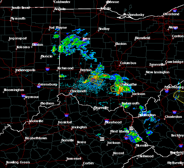 The severe thunderstorm warning for north central clinton and southeastern greene counties will expire at 715 pm edt, another severe thunderstorm warning still remains in effect for portions of greene and clinton counties until 730 pm edt. please report previous wind damage or hail to the national weather service by going to our website at weather.gov/iln and submitting your report via social media. The severe thunderstorm warning for north central clinton and southeastern greene counties will expire at 715 pm edt, another severe thunderstorm warning still remains in effect for portions of greene and clinton counties until 730 pm edt. please report previous wind damage or hail to the national weather service by going to our website at weather.gov/iln and submitting your report via social media.
|
| 4/28/2016 7:06 PM EDT |
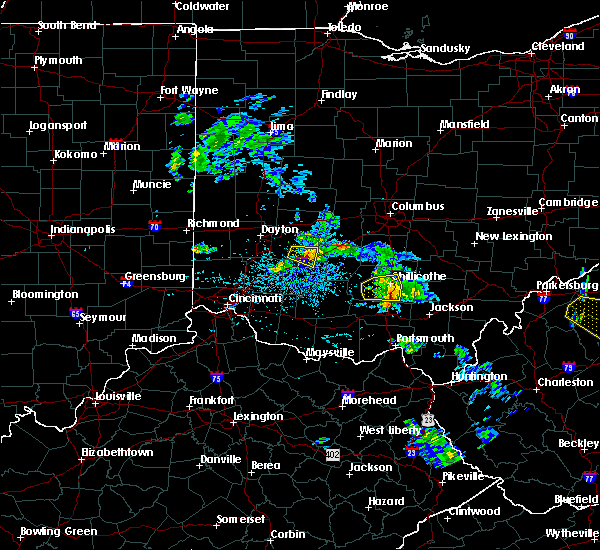 At 706 pm edt, a severe thunderstorm was located 7 miles northwest of sabina, moving east at 35 mph (radar indicated). Hazards include 60 mph wind gusts and quarter size hail. Hail damage to vehicles is expected. Expect wind damage to roofs, siding, and trees. At 706 pm edt, a severe thunderstorm was located 7 miles northwest of sabina, moving east at 35 mph (radar indicated). Hazards include 60 mph wind gusts and quarter size hail. Hail damage to vehicles is expected. Expect wind damage to roofs, siding, and trees.
|
| 4/28/2016 6:49 PM EDT |
 At 647 pm edt, a severe thunderstorm was located near xenia, moving east at 25 mph. at 637 pm, trained spotters reported quarter size hail near xenia ohio (trained weather spotters). Hazards include 60 mph wind gusts and quarter size hail. Hail damage to vehicles is expected. expect wind damage to roofs, siding, and trees. Locations impacted include, xenia, jamestown, new jasper, bowersville, port william, paintersville, rosemoor, bloomington, middleton corner and lumberton. At 647 pm edt, a severe thunderstorm was located near xenia, moving east at 25 mph. at 637 pm, trained spotters reported quarter size hail near xenia ohio (trained weather spotters). Hazards include 60 mph wind gusts and quarter size hail. Hail damage to vehicles is expected. expect wind damage to roofs, siding, and trees. Locations impacted include, xenia, jamestown, new jasper, bowersville, port william, paintersville, rosemoor, bloomington, middleton corner and lumberton.
|
| 4/28/2016 6:34 PM EDT |
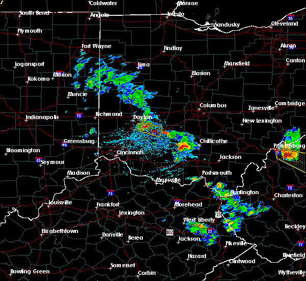 At 634 pm edt, a severe thunderstorm was located over xenia, moving east at 25 mph (radar indicated). Hazards include 60 mph wind gusts and half dollar size hail. Hail damage to vehicles is expected. Expect wind damage to roofs, siding, and trees. At 634 pm edt, a severe thunderstorm was located over xenia, moving east at 25 mph (radar indicated). Hazards include 60 mph wind gusts and half dollar size hail. Hail damage to vehicles is expected. Expect wind damage to roofs, siding, and trees.
|
| 2/24/2016 3:28 PM EST |
 At 328 pm est, radar indicated severe thunderstorms located along a line extending from near jamestown to 6 miles southwest of washington court house, moving northeast at 45 mph. storm hazards include, winds to 60 mph, locations impacted include, washington court house, sabina, jamestown, washington, jeffersonville, bloomingburg, south solon, midway, bowersville, port william, milledgeville, octa, gladstone, jasper mills, bell center, paintersville, bookwalter, interstate 71 at us route 35, shady grove and rosemoor. this includes i-71 in ohio between mile markers 54 and 81. At 328 pm est, radar indicated severe thunderstorms located along a line extending from near jamestown to 6 miles southwest of washington court house, moving northeast at 45 mph. storm hazards include, winds to 60 mph, locations impacted include, washington court house, sabina, jamestown, washington, jeffersonville, bloomingburg, south solon, midway, bowersville, port william, milledgeville, octa, gladstone, jasper mills, bell center, paintersville, bookwalter, interstate 71 at us route 35, shady grove and rosemoor. this includes i-71 in ohio between mile markers 54 and 81.
|
| 2/24/2016 3:17 PM EST |
 At 317 pm est, radar indicated severe thunderstorms located along a line extending from 6 miles southwest of jamestown to near leesburg, moving northeast at 50 mph. storm hazards include, winds to 60 mph, penny size hail,. At 317 pm est, radar indicated severe thunderstorms located along a line extending from 6 miles southwest of jamestown to near leesburg, moving northeast at 50 mph. storm hazards include, winds to 60 mph, penny size hail,.
|
| 12/23/2015 5:56 PM EST | At 556 pm est, radar indicated that the severe thunderstorms had weakened. these storms were located along a line extending from near enon to near waynesville, moving east at 50 mph. storm hazards include, winds to 60 mph, very heavy rain which may cause minor flooding, locations impacted include, springfield, beavercreek, fairborn, xenia, bellbrook, yellow springs, cedarville, waynesville, enon, jamestown, south charleston, wilberforce, harmony, lisbon, new jasper, harveysburg, spring valley, corwin, south vienna and bowersville. this includes the following interstates, i-70 in ohio between mile markers 45 and 66. i-71 in ohio between mile markers 43 and 60. |
| 12/23/2015 5:48 PM EST | Severe thunderstorm warning remains in effect for southeastern montgomery. northeastern warren. northwestern clinton. central clark and greene counties until 615 pm est. at 547 pm est. radar indicated severe thunderstorms located along a line extending from near new carlisle to near morrow. Moving east at 50 mph. |
| 12/23/2015 5:31 PM EST | At 531 pm est, radar indicated severe thunderstorms located along a line extending from near vandalia to near west chester, moving east at 50 mph. storm hazards include, winds to 60 mph, very heavy rain which may cause minor flooding,. |
| 8/3/2015 4:15 AM EDT | Tree down across portions of us-68. time estimated from rada in greene county OH, 4.8 miles ESE of Port William, OH |
| 7/26/2015 4:23 PM EDT |
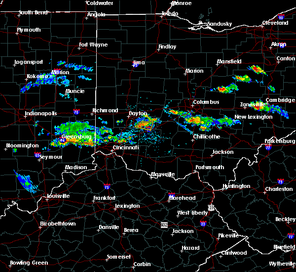 At 422 pm edt, radar indicated that the severe thunderstorm had weakened. this storm was located near xenia, moving southeast at 15 mph. storm hazards include, winds to 60 mph, penny size hail, very heavy rain which may cause minor flooding, locations impacted include, xenia, jamestown, new jasper, spring valley, port william, roxanna, paintersville, middleton corner and lumberton. At 422 pm edt, radar indicated that the severe thunderstorm had weakened. this storm was located near xenia, moving southeast at 15 mph. storm hazards include, winds to 60 mph, penny size hail, very heavy rain which may cause minor flooding, locations impacted include, xenia, jamestown, new jasper, spring valley, port william, roxanna, paintersville, middleton corner and lumberton.
|
| 7/26/2015 4:13 PM EDT |
 At 412 pm edt, radar indicated a severe thunderstorm located near xenia, moving east at 15 mph. storm hazards include, winds to 60 mph, penny size hail,. At 412 pm edt, radar indicated a severe thunderstorm located near xenia, moving east at 15 mph. storm hazards include, winds to 60 mph, penny size hail,.
|
| 7/14/2015 3:20 PM EDT |
 The severe thunderstorm warning for northeastern warren, northern clinton, southeastern montgomery, southern greene and west central fayette counties will expire at 330 pm edt, this warning has been replaced by another severe thunderstorm warning for portions of clinton, warren, fayette and greene counties. please report previous wind damage or hail to the national weather service by going to our website at weather.gov/iln and submit your report via social media. The severe thunderstorm warning for northeastern warren, northern clinton, southeastern montgomery, southern greene and west central fayette counties will expire at 330 pm edt, this warning has been replaced by another severe thunderstorm warning for portions of clinton, warren, fayette and greene counties. please report previous wind damage or hail to the national weather service by going to our website at weather.gov/iln and submit your report via social media.
|
| 7/14/2015 3:10 PM EDT |
 At 310 pm edt, radar indicated severe thunderstorms located along a line extending from 6 miles north of sabina to near waynesville, moving southeast at 45 mph. storm hazards include, winds to 60 mph, penny size hail,. At 310 pm edt, radar indicated severe thunderstorms located along a line extending from 6 miles north of sabina to near waynesville, moving southeast at 45 mph. storm hazards include, winds to 60 mph, penny size hail,.
|
| 7/14/2015 3:04 PM EDT |
 At 304 pm edt, radar indicated severe thunderstorms located along a line extending from jeffersonville to waynesville, moving southeast at 40 mph. storm hazards include, winds to 60 mph, penny size hail, locations impacted include, xenia, springboro, wilmington, bellbrook, waynesville, sabina, jamestown, new jasper, harveysburg, spring valley, corwin, bowersville, port william, centerville, octa, roxanna, bell center, paintersville, lytle and interstate 71 at us route 35. At 304 pm edt, radar indicated severe thunderstorms located along a line extending from jeffersonville to waynesville, moving southeast at 40 mph. storm hazards include, winds to 60 mph, penny size hail, locations impacted include, xenia, springboro, wilmington, bellbrook, waynesville, sabina, jamestown, new jasper, harveysburg, spring valley, corwin, bowersville, port william, centerville, octa, roxanna, bell center, paintersville, lytle and interstate 71 at us route 35.
|
| 7/14/2015 2:51 PM EDT |
 At 251 pm edt, radar indicated severe thunderstorms located along a line extending from near cedarville to near west carrollton, moving east at 40 mph. storm hazards include, winds to 60 mph, penny size hail,. At 251 pm edt, radar indicated severe thunderstorms located along a line extending from near cedarville to near west carrollton, moving east at 40 mph. storm hazards include, winds to 60 mph, penny size hail,.
|
| 7/14/2015 12:28 AM EDT | The severe thunderstorm warning for northeastern warren. northern clinton. southern greene and west central fayette counties will expire at 1230 am edt. the storm which prompted the warning has moved out of the area. therefore the warning will be allowed to expire. however. Another severe thunderstorm warning has been issued downstream for warren. |
| 7/14/2015 12:18 AM EDT |
 At 1217 am edt, the public reported quarter size hail. radar indicated that this storm was located near xenia, moving southeast at 40 mph. storm hazards include, winds to 60 mph, quarter size hail, locations impacted include, beavercreek, xenia, wilmington, bellbrook, sabina, jamestown, wilberforce, new jasper, spring valley, bowersville, port william, milledgeville, octa, new antioch, roxanna, paintersville, new burlington, rosemoor, reesville and oldtown. At 1217 am edt, the public reported quarter size hail. radar indicated that this storm was located near xenia, moving southeast at 40 mph. storm hazards include, winds to 60 mph, quarter size hail, locations impacted include, beavercreek, xenia, wilmington, bellbrook, sabina, jamestown, wilberforce, new jasper, spring valley, bowersville, port william, milledgeville, octa, new antioch, roxanna, paintersville, new burlington, rosemoor, reesville and oldtown.
|
| 7/14/2015 12:07 AM EDT |
 At 1206 am edt, the public reported quarter size hail. radar indicated that this storm was located near bellbrook, moving southeast at 40 mph. storm hazards include, winds to 60 mph, quarter size hail, locations impacted include, dayton, kettering, beavercreek, fairborn, xenia, wilmington, bellbrook, oakwood, wright-patterson afb, sabina, jamestown, wilberforce, riverside, new jasper, spring valley, bowersville, port william, milledgeville, centerville and octa. At 1206 am edt, the public reported quarter size hail. radar indicated that this storm was located near bellbrook, moving southeast at 40 mph. storm hazards include, winds to 60 mph, quarter size hail, locations impacted include, dayton, kettering, beavercreek, fairborn, xenia, wilmington, bellbrook, oakwood, wright-patterson afb, sabina, jamestown, wilberforce, riverside, new jasper, spring valley, bowersville, port william, milledgeville, centerville and octa.
|
| 7/14/2015 12:01 AM EDT |
 At 1200 am edt, the public reported quarter size hail. radar indicated that this storm was located over beavercreek, moving southeast at 40 mph. storm hazards include, winds to 60 mph, quarter size hail, locations impacted include, dayton, kettering, beavercreek, huber heights, fairborn, xenia, wilmington, bellbrook, moraine, oakwood, wright-patterson afb, northridge, west carrollton, sabina, jamestown, wilberforce, west carrollton city, riverside, new jasper and spring valley. At 1200 am edt, the public reported quarter size hail. radar indicated that this storm was located over beavercreek, moving southeast at 40 mph. storm hazards include, winds to 60 mph, quarter size hail, locations impacted include, dayton, kettering, beavercreek, huber heights, fairborn, xenia, wilmington, bellbrook, moraine, oakwood, wright-patterson afb, northridge, west carrollton, sabina, jamestown, wilberforce, west carrollton city, riverside, new jasper and spring valley.
|
| 7/13/2015 11:49 PM EDT |
 At 1148 pm edt, radar indicated a severe thunderstorm located over dayton, moving southeast at 40 mph. storm hazards include, winds to 60 mph, quarter size hail,. At 1148 pm edt, radar indicated a severe thunderstorm located over dayton, moving southeast at 40 mph. storm hazards include, winds to 60 mph, quarter size hail,.
|
| 7/13/2015 1:22 PM EDT |
 At 122 pm edt, radar indicated severe thunderstorms located along a line extending from near kings island to near washington court house, moving southeast at 40 mph. storm hazards include, winds to 60 mph, penny size hail, frequent cloud to ground lightning, very heavy rain which may cause minor flooding, locations impacted include, middletown, mason, lebanon, wilmington, monroe, loveland, blanchester, waynesville, sabina, jamestown, washington, morrow, wetherington, kings island, hunter, south lebanon, woodville, staunton, good hope and maineville. At 122 pm edt, radar indicated severe thunderstorms located along a line extending from near kings island to near washington court house, moving southeast at 40 mph. storm hazards include, winds to 60 mph, penny size hail, frequent cloud to ground lightning, very heavy rain which may cause minor flooding, locations impacted include, middletown, mason, lebanon, wilmington, monroe, loveland, blanchester, waynesville, sabina, jamestown, washington, morrow, wetherington, kings island, hunter, south lebanon, woodville, staunton, good hope and maineville.
|
| 7/13/2015 12:52 PM EDT |
 At 1252 pm edt, radar indicated severe thunderstorms located along a line extending from near trenton to near cedarville, moving southeast at 45 mph. storm hazards include, winds to 60 mph, frequent cloud to ground lightning, very heavy rain which may cause minor flooding,. At 1252 pm edt, radar indicated severe thunderstorms located along a line extending from near trenton to near cedarville, moving southeast at 45 mph. storm hazards include, winds to 60 mph, frequent cloud to ground lightning, very heavy rain which may cause minor flooding,.
|
| 6/18/2015 5:51 PM EDT | The severe thunderstorm warning for northeastern warren, southern greene and northern clinton counties will expire at 600 pm edt, the storm has moved out of the warned area, therefore this severe thunderstorm warning will be allowed to expire. however, another severe thunderstorm warning has been issued downstream for northeast highland, eastern warren, southeast greene, fayette and clinton counties until 630 pm edt. please report previous wind damage or hail to the national weather service by going to our website at weather.gov/iln and submitting your report via social media. |
| 6/18/2015 5:48 PM EDT | At 546 pm edt, radar indicated a severe thunderstorm located near interstate 71 at us route 68, moving east at 40 mph. storm hazards include, winds to 60 mph, quarter size hail,. |
| 6/18/2015 5:34 PM EDT | At 532 pm edt, radar continued to indicate a severe thunderstorm located near roxanna, moving east at 40 mph. storm hazards include, winds to 60 mph, quarter size hail, locations impacted include, xenia. in addition, new burlington, kingman, oakland, middleton corner, lumberton, new jasper, paintersville and port william are near the path of this storm. this includes the following interstate, i-71 between mile markers 46 and 61,. |
| 6/18/2015 5:15 PM EDT | At 514 pm edt, radar indicated a severe thunderstorm located near miamisburg, moving east at 40 mph. storm hazards include, winds to 60 mph, quarter size hail,. |
| 6/12/2015 4:14 PM EDT |
 At 412 pm edt, radar continued to indicate severe thunderstorms located along a line extending from cedarville to harveysburg, moving east at 40 mph. storm hazards include, winds to 60 mph, quarter size hail, locations impacted include, cedarville and wilmington. in addition, kingman, new jasper, middleton corner, ogden, oakland, lumberton, gladstone and paintersville are near the path of these storms. this includes the following interstate, i-71 between mile markers 31 and 61,. At 412 pm edt, radar continued to indicate severe thunderstorms located along a line extending from cedarville to harveysburg, moving east at 40 mph. storm hazards include, winds to 60 mph, quarter size hail, locations impacted include, cedarville and wilmington. in addition, kingman, new jasper, middleton corner, ogden, oakland, lumberton, gladstone and paintersville are near the path of these storms. this includes the following interstate, i-71 between mile markers 31 and 61,.
|
| 6/12/2015 4:00 PM EDT |
 At 358 pm edt, radar continued to indicate severe thunderstorms located along a line extending from 4 miles west of xenia to oregonia, moving east at 40 mph. storm hazards include, winds to 60 mph, quarter size hail, locations impacted include, xenia, cedarville and wilmington. in addition, greene county airport, trebein, roxanna, spring valley, mount holly, state route 350 at us route 22, clarksville and caesar creek state park are near the path of these storms. this includes the following interstate, i-71 between mile markers 31 and 61,. At 358 pm edt, radar continued to indicate severe thunderstorms located along a line extending from 4 miles west of xenia to oregonia, moving east at 40 mph. storm hazards include, winds to 60 mph, quarter size hail, locations impacted include, xenia, cedarville and wilmington. in addition, greene county airport, trebein, roxanna, spring valley, mount holly, state route 350 at us route 22, clarksville and caesar creek state park are near the path of these storms. this includes the following interstate, i-71 between mile markers 31 and 61,.
|
| 6/12/2015 3:55 PM EDT |
 At 353 pm edt, radar indicated a severe thunderstorm located near lytle, moving east at 35 mph. storm hazards include, winds to 60 mph, penny size hail,. At 353 pm edt, radar indicated a severe thunderstorm located near lytle, moving east at 35 mph. storm hazards include, winds to 60 mph, penny size hail,.
|
| 5/26/2015 5:51 PM EDT | The severe thunderstorm warning for northeastern warren, southern greene and northwestern clinton counties will expire at 600 pm edt, the storm has weakened below severe limits, therefore the severe thunderstorm warning will be allowed to expire. wind gusts up to 40 mph are still possible with this storm. please report previous wind damage or hail to the national weather service by going to our website at weather.gov/iln and submitting your report via social media. |
| 5/26/2015 5:35 PM EDT | At 532 pm edt, radar continued to indicate a severe thunderstorm located near clarksville, moving northeast at 50 mph. storm hazards include, winds to 60 mph, penny size hail, this storm will affect mainly rural areas of northeastern warren, northwestern clinton and southern greene counties, including kingman, oakland, roxanna, new burlington, spring valley, lumberton, middleton corner and port william. this includes the following interstate, i-71 between mile markers 39 and 56,. |
| 5/26/2015 5:14 PM EDT | At 512 pm edt, radar indicated a severe thunderstorm located near mulberry, moving northeast at 40 mph. storm hazards include, winds to 60 mph, quarter size hail,. |
| 5/11/2015 4:10 PM EDT | The severe thunderstorm warning for western fayette county in central ohio, and northeastern clinton county in southwest ohio, and southeastern greene county in west central ohio will expire at 415 pm edt, the storm has weakened below severe limits, therefore the severe thunderstorm warning will be allowed to expire. small hail and gusty winds are still possible with this storm. a tornado watch remains in effect for the area until 8 pm edt. please report previous wind damage or hail to the national weather service by going to our website at weather.gov/iln and submitting your report via social media. |
| 5/11/2015 3:59 PM EDT | At 358 pm edt, radar continued to indicate a severe thunderstorm located near bloomington, moving northeast at 50 mph. storm hazards include, winds to 60 mph, locations impacted include, jeffersonville. in addition, jamestown, rosemoor, jasper mills, octa and milledgeville are near the path of this storm. this includes the following interstate, i-71 between mile markers 51 and 75, , <0.75in. |
| 5/11/2015 3:45 PM EDT | At 343 pm edt, radar continued to indicate a severe thunderstorm located near ogden, moving northeast at 50 mph. storm hazards include, winds to 60 mph, locations impacted include, wilmington, sabina and jeffersonville. in addition, new burlington, new antioch, lumberton, middleton corner, melvin, lees creek, port william and paintersville are near the path of this storm. this includes the following interstate, i-71 between mile markers 43 and 75, , <0.75in. |
| 5/11/2015 3:35 PM EDT | At 334 pm edt, radar indicated a severe thunderstorm located near blanchester, moving northeast at 40 mph. storm hazards include, winds to 60 mph, penny size hail,. |
| 4/10/2015 3:46 AM EDT | A severe thunderstorm warning remains in effect until 415 am edt for western highland. southeastern clermont. eastern greene. clinton and northern brown counties. at 344 am edt. radar continued to indicate severe thunderstorms located along a line extending from paintersville to williamsburg. Moving northeast at 60 mph. |
| 4/10/2015 3:25 AM EDT | The national weather service in wilmington has issued a * severe thunderstorm warning for. western highland county in southwest ohio. clermont county in southwest ohio. warren county in southwest ohio. Southeastern greene county in west central ohio. |
| 4/10/2015 3:25 AM EDT | The national weather service in wilmington has issued a * severe thunderstorm warning for. western highland county in southwest ohio. clermont county in southwest ohio. warren county in southwest ohio. Southeastern greene county in west central ohio. |
| 4/8/2015 10:47 AM EDT | The national weather service in wilmington has issued a * severe thunderstorm warning for. northeastern highland county in southwest ohio. northeastern warren county in southwest ohio. southeastern greene county in west central ohio. Southern fayette county in central ohio. |
| 6/29/2012 4:54 PM EDT | Trees down. 56 mph measured gus in clinton county OH, 2.8 miles ENE of Port William, OH |
| 1/1/0001 12:00 AM | A barn was damaged with pieces blown into nearby field in clinton county OH, 4.3 miles ENE of Port William, OH |
Hail Maps for Port William, OH
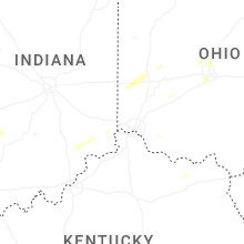


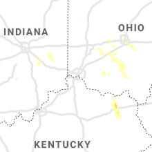


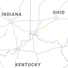


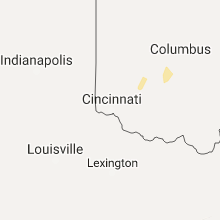


Connect with Interactive Hail Maps