

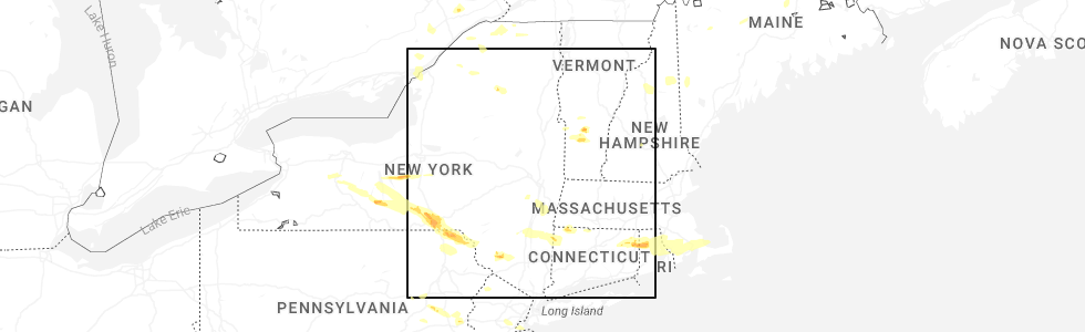
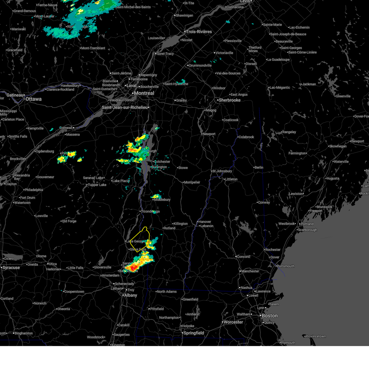
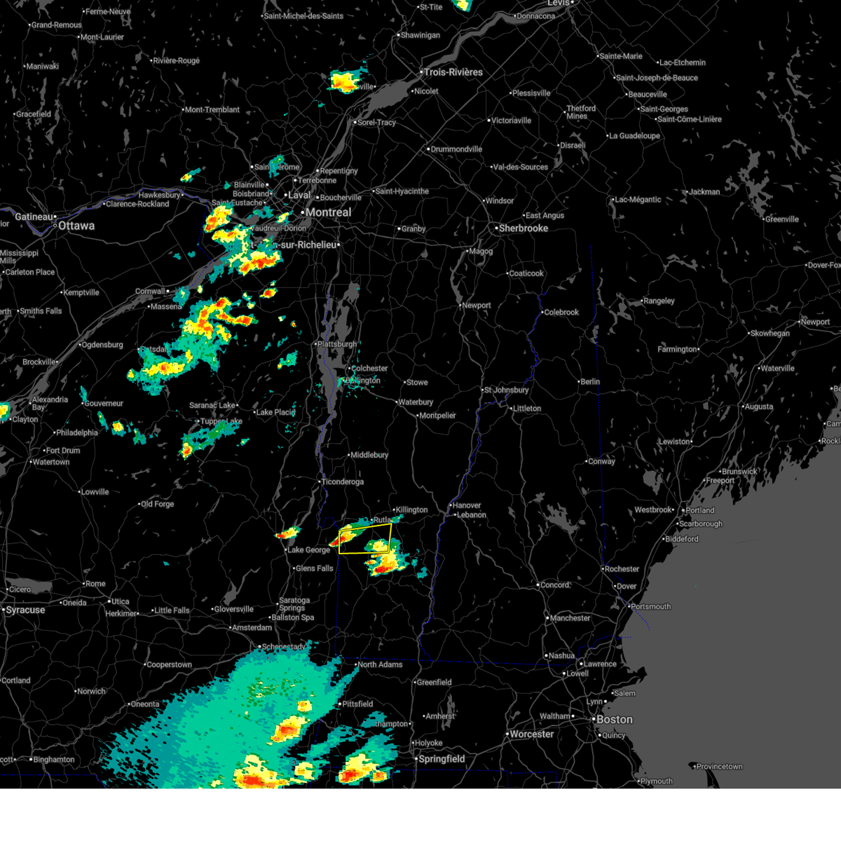
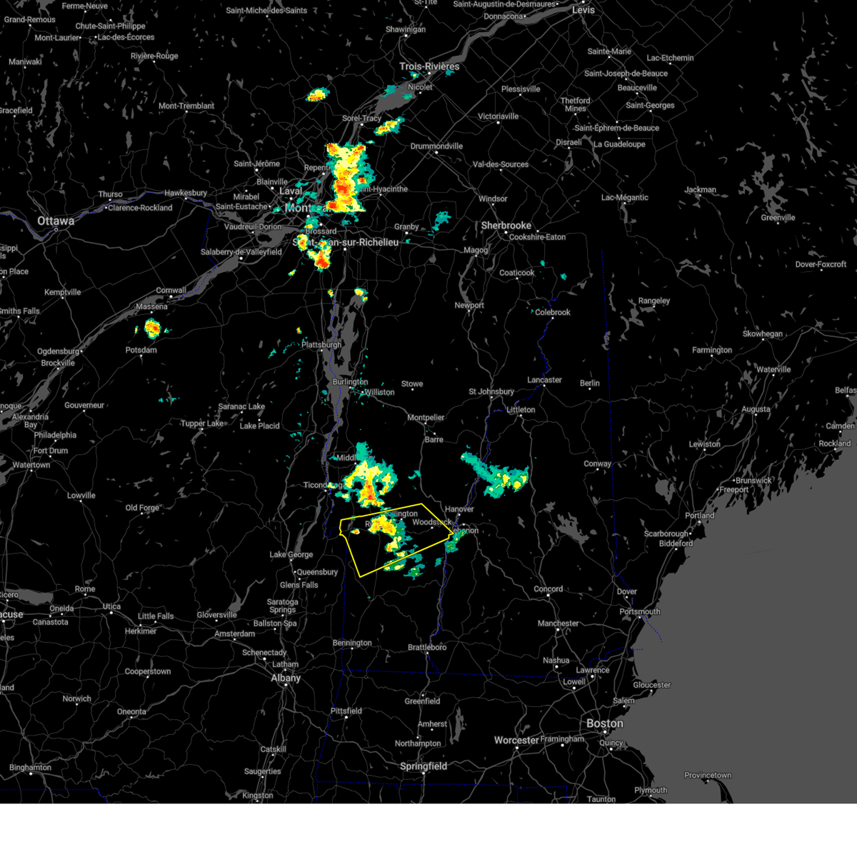
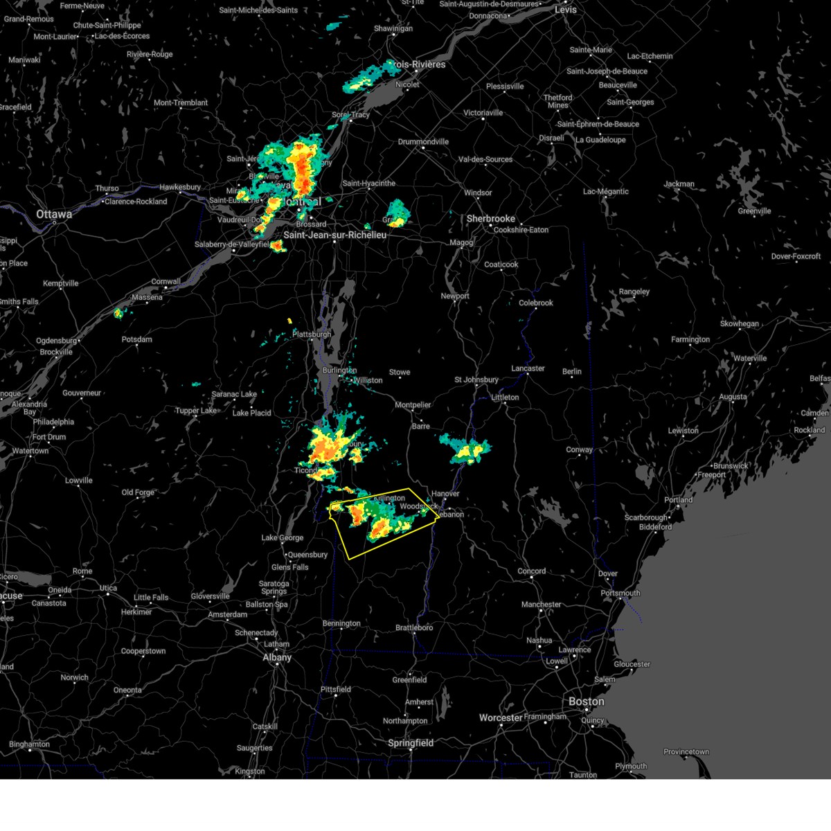
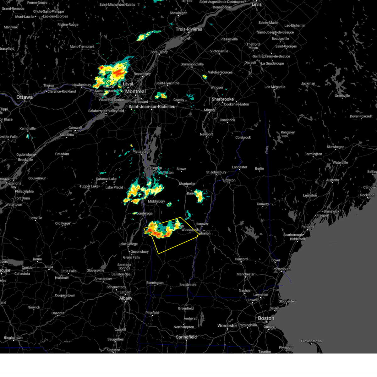
Hail Map for Poultney, VT
The Poultney, VT area has had 1 report of on-the-ground hail by trained spotters, and has been under severe weather warnings 7 times during the past 12 months. Doppler radar has detected hail at or near Poultney, VT on 20 occasions, including 2 occasions during the past year.
| Name: | Poultney, VT |
| Where Located: | 60.3 miles NE of Schenectady, NY |
| Map: | Google Map for Poultney, VT |
| Population: | 1612 |
| Housing Units: | 553 |
| More Info: | Search Google for Poultney, VT |
0
The Top Recent Hail Date for Poultney, VT is Thursday, July 3, 2025 (20th out of 20)
Hail and Wind Damage Spotted near Poultney, VT
| Date / Time | Report Details |
|---|---|
| 7/10/2025 7:51 PM EDT |
 the severe thunderstorm warning has been cancelled and is no longer in effect the severe thunderstorm warning has been cancelled and is no longer in effect
|
| 7/10/2025 7:17 PM EDT | Svraly the national weather service in albany has issued a * severe thunderstorm warning for, central washington county in east central new york, * until 815 pm edt. * at 717 pm edt, a severe thunderstorm was located near hartford, or 7 miles northeast of hudson falls, moving northeast at 20 mph (radar indicated. at the glens falls airport the wind gusted to 62 mph). Hazards include 60 mph wind gusts and quarter size hail. Hail damage to vehicles is expected. Expect wind damage to roofs, siding, and trees. |
| 7/3/2025 4:54 PM EDT |
 Svrbtv the national weather service in burlington has issued a * severe thunderstorm warning for, southeastern rutland county in southern vermont, * until 600 pm edt. * at 454 pm edt, a severe thunderstorm was located over south poultney, moving east at 20 mph (radar indicated). Hazards include 60 mph wind gusts and quarter size hail. Minor hail damage to vehicles is possible. Expect wind damage to trees and powerlines. Svrbtv the national weather service in burlington has issued a * severe thunderstorm warning for, southeastern rutland county in southern vermont, * until 600 pm edt. * at 454 pm edt, a severe thunderstorm was located over south poultney, moving east at 20 mph (radar indicated). Hazards include 60 mph wind gusts and quarter size hail. Minor hail damage to vehicles is possible. Expect wind damage to trees and powerlines.
|
| 8/4/2024 7:57 PM EDT |
 The storm which prompted the warning has weakened below severe limits, and no longer poses an immediate threat to life or property. therefore, the warning will be allowed to expire. however, gusty winds and heavy rain are still possible with this thunderstorm. to report severe weather, contact your nearest law enforcement agency. they will relay your report to the national weather service burlington. The storm which prompted the warning has weakened below severe limits, and no longer poses an immediate threat to life or property. therefore, the warning will be allowed to expire. however, gusty winds and heavy rain are still possible with this thunderstorm. to report severe weather, contact your nearest law enforcement agency. they will relay your report to the national weather service burlington.
|
| 8/4/2024 7:33 PM EDT |
 At 733 pm edt, a severe thunderstorm was located over plymouth, moving east at 20 mph (radar indicated). Hazards include 60 mph wind gusts and quarter size hail. Minor hail damage to vehicles is possible. expect wind damage to trees and powerlines. locations impacted include, woodstock, rutland, castleton, hartland four corners, killington, rutland city, middletown springs, wallingford, mt. Holly, rutland - southern vermont airport, pomfret, poultney, plymouth, hartland, fair haven, clarendon, west rutland, ira, west castleton, and barnard. At 733 pm edt, a severe thunderstorm was located over plymouth, moving east at 20 mph (radar indicated). Hazards include 60 mph wind gusts and quarter size hail. Minor hail damage to vehicles is possible. expect wind damage to trees and powerlines. locations impacted include, woodstock, rutland, castleton, hartland four corners, killington, rutland city, middletown springs, wallingford, mt. Holly, rutland - southern vermont airport, pomfret, poultney, plymouth, hartland, fair haven, clarendon, west rutland, ira, west castleton, and barnard.
|
| 8/4/2024 6:59 PM EDT |
 Svrbtv the national weather service in burlington has issued a * severe thunderstorm warning for, rutland county in southern vermont, central windsor county in southern vermont, * until 800 pm edt. * at 659 pm edt, a severe thunderstorm was located over north clarendon, moving east at 20 mph (radar indicated). Hazards include 60 mph wind gusts and quarter size hail. Minor hail damage to vehicles is possible. Expect wind damage to trees and powerlines. Svrbtv the national weather service in burlington has issued a * severe thunderstorm warning for, rutland county in southern vermont, central windsor county in southern vermont, * until 800 pm edt. * at 659 pm edt, a severe thunderstorm was located over north clarendon, moving east at 20 mph (radar indicated). Hazards include 60 mph wind gusts and quarter size hail. Minor hail damage to vehicles is possible. Expect wind damage to trees and powerlines.
|
| 7/16/2024 5:39 PM EDT |
 Svrbtv the national weather service in burlington has issued a * severe thunderstorm warning for, southeastern essex county in northern new york, west central orange county in central vermont, southern addison county in central vermont, rutland county in southern vermont, western windsor county in southern vermont, * until 630 pm edt. * at 539 pm edt, severe thunderstorms were located along a line extending from chipmans point to 8 miles south of west pawlet, moving east at 45 mph (radar indicated). Hazards include 70 mph wind gusts. Expect considerable tree damage. Damage is likely to mobile homes, roofs, and outbuildings. Svrbtv the national weather service in burlington has issued a * severe thunderstorm warning for, southeastern essex county in northern new york, west central orange county in central vermont, southern addison county in central vermont, rutland county in southern vermont, western windsor county in southern vermont, * until 630 pm edt. * at 539 pm edt, severe thunderstorms were located along a line extending from chipmans point to 8 miles south of west pawlet, moving east at 45 mph (radar indicated). Hazards include 70 mph wind gusts. Expect considerable tree damage. Damage is likely to mobile homes, roofs, and outbuildings.
|
| 6/20/2024 3:37 PM EDT |
 the severe thunderstorm warning has been cancelled and is no longer in effect the severe thunderstorm warning has been cancelled and is no longer in effect
|
| 6/20/2024 3:25 PM EDT |
 At 325 pm edt, a severe thunderstorm was located over west castleton, moving northeast at 25 mph (radar indicated). Hazards include 60 mph wind gusts and penny size hail. Expect damage to trees and powerlines. Locations impacted include, rutland, castleton, west castleton, hubbardton, poultney village, shrewsbury, rutland city, middletown springs, proctor, rutland - southern vermont airport, benson, poultney, chittenden, mendon, fair haven, clarendon, west rutland, pittsford, ira, and west haven. At 325 pm edt, a severe thunderstorm was located over west castleton, moving northeast at 25 mph (radar indicated). Hazards include 60 mph wind gusts and penny size hail. Expect damage to trees and powerlines. Locations impacted include, rutland, castleton, west castleton, hubbardton, poultney village, shrewsbury, rutland city, middletown springs, proctor, rutland - southern vermont airport, benson, poultney, chittenden, mendon, fair haven, clarendon, west rutland, pittsford, ira, and west haven.
|
| 6/20/2024 2:56 PM EDT |
 Svrbtv the national weather service in burlington has issued a * severe thunderstorm warning for, central rutland county in southern vermont, * until 400 pm edt. * at 255 pm edt, a severe thunderstorm was located near west haven, moving east at 25 mph (radar indicated). Hazards include 60 mph wind gusts and penny size hail. expect damage to trees and powerlines Svrbtv the national weather service in burlington has issued a * severe thunderstorm warning for, central rutland county in southern vermont, * until 400 pm edt. * at 255 pm edt, a severe thunderstorm was located near west haven, moving east at 25 mph (radar indicated). Hazards include 60 mph wind gusts and penny size hail. expect damage to trees and powerlines
|
| 9/7/2023 8:32 PM EDT |
 At 832 pm edt, a severe thunderstorm was located near glens falls north, or near lake george village, moving northeast at 25 mph (radar indicated). Hazards include 60 mph wind gusts and quarter size hail. Hail damage to vehicles is expected. Expect wind damage to roofs, siding, and trees. At 832 pm edt, a severe thunderstorm was located near glens falls north, or near lake george village, moving northeast at 25 mph (radar indicated). Hazards include 60 mph wind gusts and quarter size hail. Hail damage to vehicles is expected. Expect wind damage to roofs, siding, and trees.
|
| 8/12/2023 11:24 PM EDT |
 At 1124 pm edt, a severe thunderstorm was located over hubbardton, moving northeast at 35 mph (radar indicated). Hazards include 60 mph wind gusts and penny size hail. Expect damage to trees and powerlines. locations impacted include, rutland, castleton, sudbury, salisbury, rutland city, orwell, benson, chittenden, fair haven, west rutland, whiting, goshen, west castleton, hubbardton, shoreham, proctor, brandon, leicester, pittsford, and west haven. hail threat, radar indicated max hail size, 0. 75 in wind threat, radar indicated max wind gust, 60 mph. At 1124 pm edt, a severe thunderstorm was located over hubbardton, moving northeast at 35 mph (radar indicated). Hazards include 60 mph wind gusts and penny size hail. Expect damage to trees and powerlines. locations impacted include, rutland, castleton, sudbury, salisbury, rutland city, orwell, benson, chittenden, fair haven, west rutland, whiting, goshen, west castleton, hubbardton, shoreham, proctor, brandon, leicester, pittsford, and west haven. hail threat, radar indicated max hail size, 0. 75 in wind threat, radar indicated max wind gust, 60 mph.
|
| 8/12/2023 11:01 PM EDT |
 At 1101 pm edt, a severe thunderstorm was located over west haven, moving northeast at 40 mph (radar indicated). Hazards include 60 mph wind gusts and penny size hail. expect damage to trees and powerlines At 1101 pm edt, a severe thunderstorm was located over west haven, moving northeast at 40 mph (radar indicated). Hazards include 60 mph wind gusts and penny size hail. expect damage to trees and powerlines
|
| 8/4/2023 4:43 PM EDT |
 At 443 pm edt, a severe thunderstorm was located over east clarendon, moving east at 25 mph (radar indicated). Hazards include 60 mph wind gusts and quarter size hail. Minor hail damage to vehicles is possible. Expect wind damage to trees and powerlines. At 443 pm edt, a severe thunderstorm was located over east clarendon, moving east at 25 mph (radar indicated). Hazards include 60 mph wind gusts and quarter size hail. Minor hail damage to vehicles is possible. Expect wind damage to trees and powerlines.
|
| 7/13/2023 7:22 PM EDT |
 At 722 pm edt, severe thunderstorms were located along a line extending from whiting to 13 miles south of west pawlet, moving east at 35 mph (radar indicated). Hazards include 60 mph wind gusts and quarter size hail. Minor hail damage to vehicles is possible. Expect wind damage to trees and powerlines. At 722 pm edt, severe thunderstorms were located along a line extending from whiting to 13 miles south of west pawlet, moving east at 35 mph (radar indicated). Hazards include 60 mph wind gusts and quarter size hail. Minor hail damage to vehicles is possible. Expect wind damage to trees and powerlines.
|
| 7/13/2023 7:03 PM EDT |
 At 703 pm edt, a severe thunderstorm was located near west rutland, moving east at 20 mph (radar indicated). Hazards include 60 mph wind gusts and quarter size hail. Minor hail damage to vehicles is possible. expect wind damage to trees and powerlines. locations impacted include, rutland, castleton, killington, rutland city, middletown springs, wallingford, mt. holly, mt. Tabor, rutland - southern vermont airport, poultney, chittenden, clarendon, west rutland, ira, wells, west castleton, pawlet, mount holly, hubbardton, and poultney village. At 703 pm edt, a severe thunderstorm was located near west rutland, moving east at 20 mph (radar indicated). Hazards include 60 mph wind gusts and quarter size hail. Minor hail damage to vehicles is possible. expect wind damage to trees and powerlines. locations impacted include, rutland, castleton, killington, rutland city, middletown springs, wallingford, mt. holly, mt. Tabor, rutland - southern vermont airport, poultney, chittenden, clarendon, west rutland, ira, wells, west castleton, pawlet, mount holly, hubbardton, and poultney village.
|
| 7/13/2023 6:35 PM EDT |
 At 634 pm edt, a severe thunderstorm was located over fair haven, moving east at 20 mph (radar indicated). Hazards include 60 mph wind gusts and quarter size hail. Minor hail damage to vehicles is possible. Expect wind damage to trees and powerlines. At 634 pm edt, a severe thunderstorm was located over fair haven, moving east at 20 mph (radar indicated). Hazards include 60 mph wind gusts and quarter size hail. Minor hail damage to vehicles is possible. Expect wind damage to trees and powerlines.
|
| 7/13/2023 6:34 PM EDT |
 At 633 pm edt, severe thunderstorms were located along a line extending from near whitehall to near ballston spa, moving east at 30 mph (radar indicated). Hazards include 60 mph wind gusts and quarter size hail. Hail damage to vehicles is expected. Expect wind damage to roofs, siding, and trees. At 633 pm edt, severe thunderstorms were located along a line extending from near whitehall to near ballston spa, moving east at 30 mph (radar indicated). Hazards include 60 mph wind gusts and quarter size hail. Hail damage to vehicles is expected. Expect wind damage to roofs, siding, and trees.
|
| 7/7/2023 3:20 PM EDT |
 At 320 pm edt, a severe thunderstorm was located near lake george village, moving east at 20 mph (radar indicated). Hazards include 60 mph wind gusts and quarter size hail. Hail damage to vehicles is expected. expect wind damage to roofs, siding, and trees. this severe thunderstorm will be near, hartford and comstock around 345 pm edt. whitehall around 350 pm edt. granville, poultney village and wells around 400 pm edt. other locations impacted by this severe thunderstorm include thurman station, cleverdale, beartown, dunham basin, smiths basin, lake luzerne, adamsville, north granville, south bay village and south granville. please report hail size, damaging winds and reports of trees down to the national weather service by email at alb. stormreport@noaa. gov, on facebook at www. facebook. com/nwsalbany or twitter @nwsalbany hail threat, radar indicated max hail size, 1. 00 in wind threat, radar indicated max wind gust, 60 mph. At 320 pm edt, a severe thunderstorm was located near lake george village, moving east at 20 mph (radar indicated). Hazards include 60 mph wind gusts and quarter size hail. Hail damage to vehicles is expected. expect wind damage to roofs, siding, and trees. this severe thunderstorm will be near, hartford and comstock around 345 pm edt. whitehall around 350 pm edt. granville, poultney village and wells around 400 pm edt. other locations impacted by this severe thunderstorm include thurman station, cleverdale, beartown, dunham basin, smiths basin, lake luzerne, adamsville, north granville, south bay village and south granville. please report hail size, damaging winds and reports of trees down to the national weather service by email at alb. stormreport@noaa. gov, on facebook at www. facebook. com/nwsalbany or twitter @nwsalbany hail threat, radar indicated max hail size, 1. 00 in wind threat, radar indicated max wind gust, 60 mph.
|
| 8/30/2022 4:09 PM EDT |
 At 407 pm edt, a severe thunderstorm was located near fair haven, moving northeast at 35 mph (radar indicated). Hazards include 60 mph wind gusts and penny size hail. expect damage to trees and powerlines At 407 pm edt, a severe thunderstorm was located near fair haven, moving northeast at 35 mph (radar indicated). Hazards include 60 mph wind gusts and penny size hail. expect damage to trees and powerlines
|
| 8/8/2022 7:24 PM EDT | Trees and powerlines down in rutland county VT, 0.5 miles SE of Poultney, VT |
| 8/4/2022 5:23 PM EDT |
 At 523 pm edt, a severe thunderstorm was located over west pawlet, moving northeast at 30 mph (radar indicated). Hazards include 60 mph wind gusts and quarter size hail. Minor hail damage to vehicles is possible. Expect wind damage to trees and powerlines. At 523 pm edt, a severe thunderstorm was located over west pawlet, moving northeast at 30 mph (radar indicated). Hazards include 60 mph wind gusts and quarter size hail. Minor hail damage to vehicles is possible. Expect wind damage to trees and powerlines.
|
| 7/12/2022 2:55 PM EDT |
 At 255 pm edt, a severe thunderstorm was located over middletown springs, moving east at 45 mph (radar indicated). Hazards include 60 mph wind gusts and penny size hail. expect damage to trees and powerlines At 255 pm edt, a severe thunderstorm was located over middletown springs, moving east at 45 mph (radar indicated). Hazards include 60 mph wind gusts and penny size hail. expect damage to trees and powerlines
|
| 7/12/2022 2:42 PM EDT |
 At 241 pm edt, a severe thunderstorm was located near corinth, or 13 miles west of glens falls, moving east at 50 mph. another severe storm is located within the warning area over eastern washington county east of hudson falls, moving east at 50 mph (radar indicated). Hazards include 60 mph wind gusts and quarter size hail. Hail damage to vehicles is expected. Expect wind damage to roofs, siding, and trees. At 241 pm edt, a severe thunderstorm was located near corinth, or 13 miles west of glens falls, moving east at 50 mph. another severe storm is located within the warning area over eastern washington county east of hudson falls, moving east at 50 mph (radar indicated). Hazards include 60 mph wind gusts and quarter size hail. Hail damage to vehicles is expected. Expect wind damage to roofs, siding, and trees.
|
| 7/12/2022 2:27 PM EDT |
 At 226 pm edt, severe thunderstorms were located along a line extending from near huletts landing to near lake george village to northville, moving east at 50 mph (radar indicated). Hazards include 60 mph wind gusts and quarter size hail. Hail damage to vehicles is expected. Expect wind damage to roofs, siding, and trees. At 226 pm edt, severe thunderstorms were located along a line extending from near huletts landing to near lake george village to northville, moving east at 50 mph (radar indicated). Hazards include 60 mph wind gusts and quarter size hail. Hail damage to vehicles is expected. Expect wind damage to roofs, siding, and trees.
|
| 9/15/2021 2:08 PM EDT |
 The severe thunderstorm warning for central rutland and central windsor counties will expire at 215 pm edt, the storm which prompted the warning has moved out of the area. therefore, the warning will be allowed to expire. a severe thunderstorm watch remains in effect until 800 pm edt for southern vermont. The severe thunderstorm warning for central rutland and central windsor counties will expire at 215 pm edt, the storm which prompted the warning has moved out of the area. therefore, the warning will be allowed to expire. a severe thunderstorm watch remains in effect until 800 pm edt for southern vermont.
|
| 9/15/2021 1:40 PM EDT |
 At 140 pm edt, a severe thunderstorm was located over east clarendon, moving east at 30 mph (radar indicated). Hazards include 60 mph wind gusts and quarter size hail. Minor hail damage to vehicles is possible. expect wind damage to trees and powerlines. locations impacted include, rutland, woodstock, killington, poultney village, tinmouth, shrewsbury, rutland city, middletown springs, lake st. catherine, rutland - southern vermont airport, poultney, plymouth, mendon, clarendon, ira, wells, reading, west rutland, wallingford and bridgewater. hail threat, radar indicated max hail size, 1. 00 in wind threat, radar indicated max wind gust, 60 mph. At 140 pm edt, a severe thunderstorm was located over east clarendon, moving east at 30 mph (radar indicated). Hazards include 60 mph wind gusts and quarter size hail. Minor hail damage to vehicles is possible. expect wind damage to trees and powerlines. locations impacted include, rutland, woodstock, killington, poultney village, tinmouth, shrewsbury, rutland city, middletown springs, lake st. catherine, rutland - southern vermont airport, poultney, plymouth, mendon, clarendon, ira, wells, reading, west rutland, wallingford and bridgewater. hail threat, radar indicated max hail size, 1. 00 in wind threat, radar indicated max wind gust, 60 mph.
|
| 9/15/2021 1:15 PM EDT |
 At 115 pm edt, a severe thunderstorm was located over middletown springs, moving northeast at 25 mph (radar indicated). Hazards include 60 mph wind gusts and quarter size hail. Minor hail damage to vehicles is possible. Expect wind damage to trees and powerlines. At 115 pm edt, a severe thunderstorm was located over middletown springs, moving northeast at 25 mph (radar indicated). Hazards include 60 mph wind gusts and quarter size hail. Minor hail damage to vehicles is possible. Expect wind damage to trees and powerlines.
|
| 6/21/2021 6:18 PM EDT |
 At 618 pm edt, a severe thunderstorm was located over tinmouth, moving east at 20 mph (radar indicated). Hazards include 60 mph wind gusts and quarter size hail. Minor hail damage to vehicles is possible. Expect wind damage to trees and powerlines. At 618 pm edt, a severe thunderstorm was located over tinmouth, moving east at 20 mph (radar indicated). Hazards include 60 mph wind gusts and quarter size hail. Minor hail damage to vehicles is possible. Expect wind damage to trees and powerlines.
|
| 6/21/2021 6:06 PM EDT | Trees down and a phone line knocked down in poultney. trained spotter also reports trees down in castleton and fair have in rutland county VT, 0.5 miles SE of Poultney, VT |
| 6/21/2021 5:51 PM EDT |
 At 550 pm edt, a severe thunderstorm was located over east pittsford, moving east at 40 mph (radar indicated). Hazards include 60 mph wind gusts and quarter size hail. Minor hail damage to vehicles is possible. expect wind damage to trees and powerlines. Locations impacted include, rutland, woodstock, sudbury, killington, ludlow village, rutland city, wallingford, orwell, rutland - southern vermont airport, benson, plymouth, chittenden, west rutland, whiting, ira, west castleton, mount holly, poultney village, mount tabor and shrewsbury. At 550 pm edt, a severe thunderstorm was located over east pittsford, moving east at 40 mph (radar indicated). Hazards include 60 mph wind gusts and quarter size hail. Minor hail damage to vehicles is possible. expect wind damage to trees and powerlines. Locations impacted include, rutland, woodstock, sudbury, killington, ludlow village, rutland city, wallingford, orwell, rutland - southern vermont airport, benson, plymouth, chittenden, west rutland, whiting, ira, west castleton, mount holly, poultney village, mount tabor and shrewsbury.
|
| 6/21/2021 5:25 PM EDT | Trees and wires down in hampton near route 22 in washington county NY, 1 miles ESE of Poultney, VT |
| 6/21/2021 5:12 PM EDT |
 At 512 pm edt, a severe thunderstorm was located over west haven, moving east at 40 mph (radar indicated). Hazards include 60 mph wind gusts and quarter size hail. Minor hail damage to vehicles is possible. Expect wind damage to trees and powerlines. At 512 pm edt, a severe thunderstorm was located over west haven, moving east at 40 mph (radar indicated). Hazards include 60 mph wind gusts and quarter size hail. Minor hail damage to vehicles is possible. Expect wind damage to trees and powerlines.
|
| 8/24/2020 7:35 PM EDT |
 The severe thunderstorm warning for northern washington county will expire at 745 pm edt, the storm which prompted the warning has weakened below severe limits, and no longer poses an immediate threat to life or property. therefore, the warning will be allowed to expire. however gusty winds and heavy rain are still possible with this thunderstorm. The severe thunderstorm warning for northern washington county will expire at 745 pm edt, the storm which prompted the warning has weakened below severe limits, and no longer poses an immediate threat to life or property. therefore, the warning will be allowed to expire. however gusty winds and heavy rain are still possible with this thunderstorm.
|
| 8/24/2020 7:10 PM EDT |
 At 710 pm edt, a severe thunderstorm was located near whitehall, moving southeast at 10 mph (radar indicated). Hazards include 60 mph wind gusts and penny size hail. Expect damage to roofs, siding, and trees. Locations impacted include, whitehall, poultney village, mount hope, hampton, lock twelve marina, south bay, middle granville, low hampton, north granville, south bay village, snody dock, truthville, raceville, hampton flats, grays corner, west granville, east whitehall and iron furnace. At 710 pm edt, a severe thunderstorm was located near whitehall, moving southeast at 10 mph (radar indicated). Hazards include 60 mph wind gusts and penny size hail. Expect damage to roofs, siding, and trees. Locations impacted include, whitehall, poultney village, mount hope, hampton, lock twelve marina, south bay, middle granville, low hampton, north granville, south bay village, snody dock, truthville, raceville, hampton flats, grays corner, west granville, east whitehall and iron furnace.
|
| 8/24/2020 6:45 PM EDT |
 At 645 pm edt, a severe thunderstorm was located over whitehall, moving east at 10 mph (radar indicated). Hazards include 60 mph wind gusts and nickel size hail. expect damage to roofs, siding, and trees At 645 pm edt, a severe thunderstorm was located over whitehall, moving east at 10 mph (radar indicated). Hazards include 60 mph wind gusts and nickel size hail. expect damage to roofs, siding, and trees
|
| 8/24/2020 5:54 PM EDT |
 The severe thunderstorm warning for southwestern rutland county will expire at 600 pm edt, the storm which prompted the warning has weakened below severe limits, and no longer poses an immediate threat to life or property. therefore, the warning will be allowed to expire. however gusty winds and heavy rain are still possible with this thunderstorm. to report severe weather, contact your nearest law enforcement agency. they will relay your report to the national weather service burlington. The severe thunderstorm warning for southwestern rutland county will expire at 600 pm edt, the storm which prompted the warning has weakened below severe limits, and no longer poses an immediate threat to life or property. therefore, the warning will be allowed to expire. however gusty winds and heavy rain are still possible with this thunderstorm. to report severe weather, contact your nearest law enforcement agency. they will relay your report to the national weather service burlington.
|
| 8/24/2020 5:35 PM EDT |
 At 535 pm edt, a severe thunderstorm was located over middletown springs, moving southeast at 25 mph (radar indicated). Hazards include 60 mph wind gusts and quarter size hail. Minor hail damage to vehicles is possible. expect wind damage to trees and powerlines. locations impacted include, rutland, pawlet, poultney village, tinmouth, middletown springs, danby, lake st. Catherine, rutland - southern vermont airport, poultney, fair haven, clarendon, ira, west haven, wells, castleton, west rutland, wallingford, shrewsbury, east clarendon and hydeville. At 535 pm edt, a severe thunderstorm was located over middletown springs, moving southeast at 25 mph (radar indicated). Hazards include 60 mph wind gusts and quarter size hail. Minor hail damage to vehicles is possible. expect wind damage to trees and powerlines. locations impacted include, rutland, pawlet, poultney village, tinmouth, middletown springs, danby, lake st. Catherine, rutland - southern vermont airport, poultney, fair haven, clarendon, ira, west haven, wells, castleton, west rutland, wallingford, shrewsbury, east clarendon and hydeville.
|
| 8/24/2020 5:12 PM EDT |
 The severe thunderstorm warning for west central rutland county will expire at 515 pm edt, the storm which prompted the warning has moved out of the area. therefore, the warning will be allowed to expire. however small hail, gusty winds and heavy rain are still possible with this thunderstorm. to report severe weather, contact your nearest law enforcement agency. they will relay your report to the national weather service burlington. The severe thunderstorm warning for west central rutland county will expire at 515 pm edt, the storm which prompted the warning has moved out of the area. therefore, the warning will be allowed to expire. however small hail, gusty winds and heavy rain are still possible with this thunderstorm. to report severe weather, contact your nearest law enforcement agency. they will relay your report to the national weather service burlington.
|
| 8/24/2020 5:11 PM EDT | Multiple trees down along state route 30 and blissville r in rutland county VT, 4.5 miles S of Poultney, VT |
| 8/24/2020 5:11 PM EDT |
 At 511 pm edt, a severe thunderstorm was located near poultney village, moving southeast at 25 mph (radar indicated). Hazards include 60 mph wind gusts and quarter size hail. Minor hail damage to vehicles is possible. Expect wind damage to trees and powerlines. At 511 pm edt, a severe thunderstorm was located near poultney village, moving southeast at 25 mph (radar indicated). Hazards include 60 mph wind gusts and quarter size hail. Minor hail damage to vehicles is possible. Expect wind damage to trees and powerlines.
|
| 8/24/2020 4:51 PM EDT |
 At 451 pm edt, a severe thunderstorm was located over hydeville, moving southeast at 20 mph (radar indicated). Hazards include 60 mph wind gusts and half dollar size hail. Minor hail damage to vehicles is possible. expect wind damage to trees and powerlines. locations impacted include, castleton, west castleton, lake st. catherine, poultney, fair haven, poultney village, west haven, benson, middletown springs, wells, hubbardton, ira, west rutland, hydeville, bomoseen state park, castleton corners, lake st. Catherine state park, east poultney and bomoseen. At 451 pm edt, a severe thunderstorm was located over hydeville, moving southeast at 20 mph (radar indicated). Hazards include 60 mph wind gusts and half dollar size hail. Minor hail damage to vehicles is possible. expect wind damage to trees and powerlines. locations impacted include, castleton, west castleton, lake st. catherine, poultney, fair haven, poultney village, west haven, benson, middletown springs, wells, hubbardton, ira, west rutland, hydeville, bomoseen state park, castleton corners, lake st. Catherine state park, east poultney and bomoseen.
|
| 8/24/2020 4:11 PM EDT |
 At 411 pm edt, a severe thunderstorm was located 7 miles west of benson landing, moving east at 15 mph (radar indicated). Hazards include 60 mph wind gusts and quarter size hail. Minor hail damage to vehicles is possible. Expect wind damage to trees and powerlines. At 411 pm edt, a severe thunderstorm was located 7 miles west of benson landing, moving east at 15 mph (radar indicated). Hazards include 60 mph wind gusts and quarter size hail. Minor hail damage to vehicles is possible. Expect wind damage to trees and powerlines.
|
| 8/23/2020 5:26 PM EDT |
 The severe thunderstorm warning for southeastern essex, southwestern addison and northwestern rutland counties will expire at 530 pm edt, the storm which prompted the warning has weakened below severe limits, and no longer poses an immediate threat to life or property. therefore, the warning will be allowed to expire. however heavy rain is still possible with this thunderstorm. The severe thunderstorm warning for southeastern essex, southwestern addison and northwestern rutland counties will expire at 530 pm edt, the storm which prompted the warning has weakened below severe limits, and no longer poses an immediate threat to life or property. therefore, the warning will be allowed to expire. however heavy rain is still possible with this thunderstorm.
|
| 8/23/2020 4:38 PM EDT |
 At 437 pm edt, a severe thunderstorm was located over benson landing, moving southeast at 15 mph (radar indicated). Hazards include 60 mph wind gusts and quarter size hail. Minor hail damage to vehicles is possible. Expect wind damage to trees and powerlines. At 437 pm edt, a severe thunderstorm was located over benson landing, moving southeast at 15 mph (radar indicated). Hazards include 60 mph wind gusts and quarter size hail. Minor hail damage to vehicles is possible. Expect wind damage to trees and powerlines.
|
| 8/21/2020 4:04 PM EDT | Trees down on route 30 near lake saint catherine golf course in rutland county VT, 2.9 miles NNW of Poultney, VT |
| 8/21/2020 4:01 PM EDT |
 At 401 pm edt, a severe thunderstorm was located over east wells, moving east at 45 mph (radar indicated). Hazards include 60 mph wind gusts and quarter size hail. Minor hail damage to vehicles is possible. Expect wind damage to trees and powerlines. At 401 pm edt, a severe thunderstorm was located over east wells, moving east at 45 mph (radar indicated). Hazards include 60 mph wind gusts and quarter size hail. Minor hail damage to vehicles is possible. Expect wind damage to trees and powerlines.
|
| 7/8/2020 3:50 PM EDT |
 The severe thunderstorm warning for west central rutland county will expire at 400 pm edt, the storm which prompted the warning has weakened below severe limits, and no longer poses an immediate threat to life or property. therefore, the warning will be allowed to expire. however gusty winds and heavy rain are still possible with this thunderstorm. a severe thunderstorm watch remains in effect until 1000 pm edt for southern vermont. The severe thunderstorm warning for west central rutland county will expire at 400 pm edt, the storm which prompted the warning has weakened below severe limits, and no longer poses an immediate threat to life or property. therefore, the warning will be allowed to expire. however gusty winds and heavy rain are still possible with this thunderstorm. a severe thunderstorm watch remains in effect until 1000 pm edt for southern vermont.
|
| 7/8/2020 3:39 PM EDT |
 At 338 pm edt, a severe thunderstorm was located over poultney, moving southeast at 20 mph (law enforcement reported trees and powerlines down in poultney and 1.5 inch hail in fair haven). Hazards include 60 mph wind gusts and half dollar size hail. Minor hail damage to vehicles is possible. expect wind damage to trees and powerlines. locations impacted include, rutland, poultney village, tinmouth, rutland city, middletown springs, danby, lake st. Catherine, rutland - southern vermont airport, poultney, clarendon, west rutland, ira, wells, castleton, wallingford, shrewsbury, proctor, mendon, pawlet and east clarendon. At 338 pm edt, a severe thunderstorm was located over poultney, moving southeast at 20 mph (law enforcement reported trees and powerlines down in poultney and 1.5 inch hail in fair haven). Hazards include 60 mph wind gusts and half dollar size hail. Minor hail damage to vehicles is possible. expect wind damage to trees and powerlines. locations impacted include, rutland, poultney village, tinmouth, rutland city, middletown springs, danby, lake st. Catherine, rutland - southern vermont airport, poultney, clarendon, west rutland, ira, wells, castleton, wallingford, shrewsbury, proctor, mendon, pawlet and east clarendon.
|
| 7/8/2020 3:37 PM EDT |
 At 337 pm edt, a severe thunderstorm was located near west haven, moving southeast at 15 mph (law enforcement reported trees and powerlines down in poultney with 1.5 inch hail reported in fairhaven). Hazards include 60 mph wind gusts and half dollar size hail. Minor hail damage to vehicles is possible. expect wind damage to trees and powerlines. Locations impacted include, castleton, poultney village, poultney, fair haven, west rutland, ira, east poultney, hydeville, bomoseen and castleton corners. At 337 pm edt, a severe thunderstorm was located near west haven, moving southeast at 15 mph (law enforcement reported trees and powerlines down in poultney with 1.5 inch hail reported in fairhaven). Hazards include 60 mph wind gusts and half dollar size hail. Minor hail damage to vehicles is possible. expect wind damage to trees and powerlines. Locations impacted include, castleton, poultney village, poultney, fair haven, west rutland, ira, east poultney, hydeville, bomoseen and castleton corners.
|
| 7/8/2020 3:30 PM EDT | Trees and powerlines dow in rutland county VT, 0.5 miles SE of Poultney, VT |
| 7/8/2020 3:27 PM EDT |
 At 327 pm edt, a severe thunderstorm was located over hydeville, moving southeast at 20 mph (radar indicated). Hazards include 60 mph wind gusts and half dollar size hail. Minor hail damage to vehicles is possible. Expect wind damage to trees and powerlines. At 327 pm edt, a severe thunderstorm was located over hydeville, moving southeast at 20 mph (radar indicated). Hazards include 60 mph wind gusts and half dollar size hail. Minor hail damage to vehicles is possible. Expect wind damage to trees and powerlines.
|
| 7/8/2020 2:59 PM EDT |
 The national weather service in burlington has issued a * severe thunderstorm warning for. west central rutland county in southern vermont. until 400 pm edt. At 259 pm edt, a severe thunderstorm was located 8 miles west of west haven, moving southeast at 15 mph. The national weather service in burlington has issued a * severe thunderstorm warning for. west central rutland county in southern vermont. until 400 pm edt. At 259 pm edt, a severe thunderstorm was located 8 miles west of west haven, moving southeast at 15 mph.
|
| 6/28/2020 1:18 PM EDT |
 At 117 pm edt, a severe thunderstorm was located just west of poultney village, moving east at 15 mph (radar indicated). Hazards include 60 mph wind gusts. Expect damage to trees and powerlines. locations impacted include, castleton, lake st. catherine, poultney, fair haven, poultney village, west rutland, middletown springs, ira, tinmouth, wells, hydeville, castleton corners, lake st. Catherine state park, east poultney and south poultney. At 117 pm edt, a severe thunderstorm was located just west of poultney village, moving east at 15 mph (radar indicated). Hazards include 60 mph wind gusts. Expect damage to trees and powerlines. locations impacted include, castleton, lake st. catherine, poultney, fair haven, poultney village, west rutland, middletown springs, ira, tinmouth, wells, hydeville, castleton corners, lake st. Catherine state park, east poultney and south poultney.
|
| 6/28/2020 12:54 PM EDT |
 At 1254 pm edt, a severe thunderstorm was located near west haven vermont and whitehall new york moving east at 20 mph (radar indicated). Hazards include 60 mph wind gusts and quarter size hail. Minor hail damage to vehicles is possible. expect wind damage to trees and powerlines. locations impacted include, castleton, west castleton, hubbardton, poultney village, middletown springs, lake st. Catherine, poultney, fair haven, west rutland, ira, west haven, wells, pittsford, tinmouth, danby, proctor, benson, pawlet, hydeville and bomoseen state park. At 1254 pm edt, a severe thunderstorm was located near west haven vermont and whitehall new york moving east at 20 mph (radar indicated). Hazards include 60 mph wind gusts and quarter size hail. Minor hail damage to vehicles is possible. expect wind damage to trees and powerlines. locations impacted include, castleton, west castleton, hubbardton, poultney village, middletown springs, lake st. Catherine, poultney, fair haven, west rutland, ira, west haven, wells, pittsford, tinmouth, danby, proctor, benson, pawlet, hydeville and bomoseen state park.
|
| 6/28/2020 12:32 PM EDT |
 At 1231 pm edt, a severe thunderstorm was located 10 miles southwest of west haven vermont, moving east at 20 mph (radar indicated). Hazards include 60 mph wind gusts and quarter size hail. Minor hail damage to vehicles is possible. Expect wind damage to trees and powerlines. At 1231 pm edt, a severe thunderstorm was located 10 miles southwest of west haven vermont, moving east at 20 mph (radar indicated). Hazards include 60 mph wind gusts and quarter size hail. Minor hail damage to vehicles is possible. Expect wind damage to trees and powerlines.
|
| 5/29/2020 6:37 PM EDT | Reports of multiple trees down in the poultney area. power outages also being reporte in rutland county VT, 0.5 miles SE of Poultney, VT |
| 5/29/2020 6:35 PM EDT |
 At 634 pm edt, a severe thunderstorm was located near poultney village, moving northeast at 45 mph (radar indicated). Hazards include 70 mph wind gusts. Expect considerable tree damage. Damage is likely to mobile homes, roofs, and outbuildings. At 634 pm edt, a severe thunderstorm was located near poultney village, moving northeast at 45 mph (radar indicated). Hazards include 70 mph wind gusts. Expect considerable tree damage. Damage is likely to mobile homes, roofs, and outbuildings.
|
| 5/29/2020 6:28 PM EDT |
 At 628 pm edt, severe thunderstorms were located along a line extending from near poultney village to 7 miles north of mechanicville, moving northeast at 50 mph (radar indicated). Hazards include 70 mph wind gusts and quarter size hail. Hail damage to vehicles is expected. expect considerable tree damage. wind damage is also likely to mobile homes, roofs, and outbuildings. these severe storms will be near, granville, poultney village and wells around 635 pm edt. Other locations impacted by these severe thunderstorms include deans corners, glenridge, grangerville, harding crossing, west milton, willow glen, northumberland, garrison manor, wayville and greenfield center. At 628 pm edt, severe thunderstorms were located along a line extending from near poultney village to 7 miles north of mechanicville, moving northeast at 50 mph (radar indicated). Hazards include 70 mph wind gusts and quarter size hail. Hail damage to vehicles is expected. expect considerable tree damage. wind damage is also likely to mobile homes, roofs, and outbuildings. these severe storms will be near, granville, poultney village and wells around 635 pm edt. Other locations impacted by these severe thunderstorms include deans corners, glenridge, grangerville, harding crossing, west milton, willow glen, northumberland, garrison manor, wayville and greenfield center.
|
| 5/29/2020 5:57 PM EDT |
 At 556 pm edt, severe thunderstorms were located along a line extending from near corinth to rotterdam junction, moving northeast at 45 mph (radar indicated). Hazards include 60 mph wind gusts and quarter size hail. Hail damage to vehicles is expected. expect wind damage to roofs, siding, and trees. severe thunderstorms will be near, corinth around 600 pm edt. glens falls, hudson falls, glens falls north, west glens falls and country knolls around 610 pm edt. ballston spa, round lake, north ballston spa and rock city falls around 615 pm edt. milton around 620 pm edt. saratoga springs and comstock around 625 pm edt. poultney village around 640 pm edt. fort edward around 645 pm edt. granville and hartford around 700 pm edt. Other locations impacted by these severe thunderstorms include deans corners, glenridge, grangerville, harding crossing, west milton, willow glen, northumberland, garrison manor, wayville and greenfield center. At 556 pm edt, severe thunderstorms were located along a line extending from near corinth to rotterdam junction, moving northeast at 45 mph (radar indicated). Hazards include 60 mph wind gusts and quarter size hail. Hail damage to vehicles is expected. expect wind damage to roofs, siding, and trees. severe thunderstorms will be near, corinth around 600 pm edt. glens falls, hudson falls, glens falls north, west glens falls and country knolls around 610 pm edt. ballston spa, round lake, north ballston spa and rock city falls around 615 pm edt. milton around 620 pm edt. saratoga springs and comstock around 625 pm edt. poultney village around 640 pm edt. fort edward around 645 pm edt. granville and hartford around 700 pm edt. Other locations impacted by these severe thunderstorms include deans corners, glenridge, grangerville, harding crossing, west milton, willow glen, northumberland, garrison manor, wayville and greenfield center.
|
| 5/29/2020 3:38 PM EDT | Many trees down near south poultney with power outages being reporte in rutland county VT, 3.2 miles N of Poultney, VT |
| 5/29/2020 3:21 PM EDT |
 At 320 pm edt, a severe thunderstorm was located near west pawlet, moving northeast at 35 mph (radar indicated). Hazards include 60 mph wind gusts and quarter size hail. Minor hail damage to vehicles is possible. Expect wind damage to trees and powerlines. At 320 pm edt, a severe thunderstorm was located near west pawlet, moving northeast at 35 mph (radar indicated). Hazards include 60 mph wind gusts and quarter size hail. Minor hail damage to vehicles is possible. Expect wind damage to trees and powerlines.
|
| 8/17/2019 6:19 PM EDT | Multiple trees down reported by law enforcement at lake st. catherin in rutland county VT, 2.7 miles NNW of Poultney, VT |
| 8/17/2019 6:14 PM EDT |
 At 550 pm edt, a severe thunderstorm was located 8 miles west of west pawlet, moving east at 35 mph (radar indicated). Hazards include 60 mph wind gusts. expect damage to trees and powerlines At 550 pm edt, a severe thunderstorm was located 8 miles west of west pawlet, moving east at 35 mph (radar indicated). Hazards include 60 mph wind gusts. expect damage to trees and powerlines
|
| 8/17/2019 5:51 PM EDT |
 At 550 pm edt, a severe thunderstorm was located 8 miles west of west pawlet, moving east at 35 mph (radar indicated). Hazards include 60 mph wind gusts. expect damage to trees and powerlines At 550 pm edt, a severe thunderstorm was located 8 miles west of west pawlet, moving east at 35 mph (radar indicated). Hazards include 60 mph wind gusts. expect damage to trees and powerlines
|
| 7/30/2019 6:29 PM EDT |
 At 629 pm edt, severe thunderstorms were located along a line extending from near poultney village to near saratoga springs, moving northeast at 30 mph (radar indicated). Hazards include 60 mph wind gusts and penny size hail. expect damage to roofs, siding, and trees At 629 pm edt, severe thunderstorms were located along a line extending from near poultney village to near saratoga springs, moving northeast at 30 mph (radar indicated). Hazards include 60 mph wind gusts and penny size hail. expect damage to roofs, siding, and trees
|
| 7/6/2019 3:11 PM EDT |
 The severe thunderstorm warning for south central rutland and southwestern windsor counties will expire at 315 pm edt, the storm which prompted the warning has weakened below severe limits, and no longer poses an immediate threat to life or property. therefore, the warning will be allowed to expire. however gusty winds are still possible with this thunderstorm. The severe thunderstorm warning for south central rutland and southwestern windsor counties will expire at 315 pm edt, the storm which prompted the warning has weakened below severe limits, and no longer poses an immediate threat to life or property. therefore, the warning will be allowed to expire. however gusty winds are still possible with this thunderstorm.
|
| 7/6/2019 3:01 PM EDT |
 At 301 pm edt, a severe thunderstorm was located over danby, moving southeast at 30 mph (radar indicated). Hazards include 60 mph wind gusts. Expect damage to trees and powerlines. locations impacted include, danby, lake st. catherine, pawlet, poultney village, mount tabor, tinmouth, middletown springs, mt. tabor, wells, wallingford, poultney, mount holly, north pawlet, east wells, danby four corners, south wallingford, lake st. Catherine state park, west tinmouth and south poultney. At 301 pm edt, a severe thunderstorm was located over danby, moving southeast at 30 mph (radar indicated). Hazards include 60 mph wind gusts. Expect damage to trees and powerlines. locations impacted include, danby, lake st. catherine, pawlet, poultney village, mount tabor, tinmouth, middletown springs, mt. tabor, wells, wallingford, poultney, mount holly, north pawlet, east wells, danby four corners, south wallingford, lake st. Catherine state park, west tinmouth and south poultney.
|
| 7/6/2019 2:41 PM EDT |
 At 240 pm edt, a severe thunderstorm was located over wells, moving southeast at 30 mph (radar indicated). Hazards include 60 mph wind gusts. expect damage to trees and powerlines At 240 pm edt, a severe thunderstorm was located over wells, moving southeast at 30 mph (radar indicated). Hazards include 60 mph wind gusts. expect damage to trees and powerlines
|
| 8/4/2018 5:24 PM EDT |
 The severe thunderstorm warning for central washington county will expire at 530 pm edt, the storm which prompted the warning has weakened below severe limits, and no longer poses an immediate threat to life or property. therefore, the warning will be allowed to expire. however heavy rain is still possible with this thunderstorm. The severe thunderstorm warning for central washington county will expire at 530 pm edt, the storm which prompted the warning has weakened below severe limits, and no longer poses an immediate threat to life or property. therefore, the warning will be allowed to expire. however heavy rain is still possible with this thunderstorm.
|
| 8/4/2018 5:08 PM EDT |
 The severe thunderstorm warning for central rutland county will expire at 515 pm edt, the storm which prompted the warning has weakened below severe limits, and has exited the warned area. therefore, the warning will be allowed to expire. The severe thunderstorm warning for central rutland county will expire at 515 pm edt, the storm which prompted the warning has weakened below severe limits, and has exited the warned area. therefore, the warning will be allowed to expire.
|
| 8/4/2018 4:57 PM EDT |
 At 457 pm edt, a severe thunderstorm was located over castleton corners, moving southeast at 20 mph (radar indicated). Hazards include 60 mph wind gusts and quarter size hail. Minor hail damage to vehicles is possible. expect wind damage to trees and powerlines. locations impacted include, rutland, castleton, west castleton, poultney village, tinmouth, rutland city, middletown springs, lake st. Catherine, poultney, fair haven, clarendon, west rutland, ira, west haven, wells, proctor, mendon, pawlet, benson and hydeville. At 457 pm edt, a severe thunderstorm was located over castleton corners, moving southeast at 20 mph (radar indicated). Hazards include 60 mph wind gusts and quarter size hail. Minor hail damage to vehicles is possible. expect wind damage to trees and powerlines. locations impacted include, rutland, castleton, west castleton, poultney village, tinmouth, rutland city, middletown springs, lake st. Catherine, poultney, fair haven, clarendon, west rutland, ira, west haven, wells, proctor, mendon, pawlet, benson and hydeville.
|
| 8/4/2018 4:56 PM EDT |
 At 456 pm edt, a severe thunderstorm was located near bolton landing, or 7 miles northeast of lake george village, moving southeast at 25 mph (radar indicated). Hazards include 60 mph wind gusts and quarter size hail. Hail damage to vehicles is expected. expect wind damage to roofs, siding, and trees. this severe storm will be near, hartford and comstock around 530 pm edt. Other locations impacted by this severe thunderstorm include south bay, middle granville, braymer school, dunham basin, smiths basin, goose island, adamsville, north granville, south bay village and snody dock. At 456 pm edt, a severe thunderstorm was located near bolton landing, or 7 miles northeast of lake george village, moving southeast at 25 mph (radar indicated). Hazards include 60 mph wind gusts and quarter size hail. Hail damage to vehicles is expected. expect wind damage to roofs, siding, and trees. this severe storm will be near, hartford and comstock around 530 pm edt. Other locations impacted by this severe thunderstorm include south bay, middle granville, braymer school, dunham basin, smiths basin, goose island, adamsville, north granville, south bay village and snody dock.
|
| 8/4/2018 4:36 PM EDT |
 At 435 pm edt, a severe thunderstorm was located over fair haven, moving southeast at 30 mph (radar indicated). Hazards include 60 mph wind gusts and quarter size hail. Minor hail damage to vehicles is possible. expect wind damage to trees and powerlines. locations impacted include, rutland, castleton, west castleton, poultney village, tinmouth, rutland city, middletown springs, lake st. Catherine, poultney, fair haven, clarendon, west rutland, ira, west haven, wells, benson, proctor, hubbardton, mendon and pawlet. At 435 pm edt, a severe thunderstorm was located over fair haven, moving southeast at 30 mph (radar indicated). Hazards include 60 mph wind gusts and quarter size hail. Minor hail damage to vehicles is possible. expect wind damage to trees and powerlines. locations impacted include, rutland, castleton, west castleton, poultney village, tinmouth, rutland city, middletown springs, lake st. Catherine, poultney, fair haven, clarendon, west rutland, ira, west haven, wells, benson, proctor, hubbardton, mendon and pawlet.
|
| 8/4/2018 4:28 PM EDT |
 At 427 pm edt, a severe thunderstorm was located near huletts landing, or near whitehall, moving south at 25 mph (radar indicated). Hazards include 60 mph wind gusts and quarter size hail. Hail damage to vehicles is expected. expect wind damage to roofs, siding, and trees. this severe thunderstorm will be near, whitehall around 435 pm edt. comstock around 450 pm edt. hudson falls and hartford around 505 pm edt. Other locations impacted by this severe thunderstorm include south bay, middle granville, braymer school, dunham basin, smiths basin, goose island, adamsville, north granville, south bay village and snody dock. At 427 pm edt, a severe thunderstorm was located near huletts landing, or near whitehall, moving south at 25 mph (radar indicated). Hazards include 60 mph wind gusts and quarter size hail. Hail damage to vehicles is expected. expect wind damage to roofs, siding, and trees. this severe thunderstorm will be near, whitehall around 435 pm edt. comstock around 450 pm edt. hudson falls and hartford around 505 pm edt. Other locations impacted by this severe thunderstorm include south bay, middle granville, braymer school, dunham basin, smiths basin, goose island, adamsville, north granville, south bay village and snody dock.
|
| 8/4/2018 4:11 PM EDT |
 At 410 pm edt, a severe thunderstorm was located over benson landing, moving southeast at 20 mph (radar indicated). Hazards include 60 mph wind gusts and quarter size hail. Minor hail damage to vehicles is possible. Expect wind damage to trees and powerlines. At 410 pm edt, a severe thunderstorm was located over benson landing, moving southeast at 20 mph (radar indicated). Hazards include 60 mph wind gusts and quarter size hail. Minor hail damage to vehicles is possible. Expect wind damage to trees and powerlines.
|
| 7/10/2018 3:43 PM EDT |
 The national weather service in albany has issued a * severe thunderstorm warning for. east central warren county in east central new york. central washington county in east central new york. until 430 pm edt. At 343 pm edt, a severe thunderstorm was located over bolton. The national weather service in albany has issued a * severe thunderstorm warning for. east central warren county in east central new york. central washington county in east central new york. until 430 pm edt. At 343 pm edt, a severe thunderstorm was located over bolton.
|
| 6/13/2018 10:23 PM EDT |
 At 1023 pm edt, a severe thunderstorm was located over north chittenden, moving east at 40 mph (radar indicated). Hazards include 60 mph wind gusts and quarter size hail. Minor hail damage to vehicles is possible. expect wind damage to trees and powerlines. Locations impacted include, rutland, castleton, killington, rutland city, rutland - southern vermont airport, poultney, plymouth, chittenden, fair haven, clarendon, west rutland, ira, west castleton, hubbardton, poultney village, shrewsbury, stockbridge, proctor, brandon and mendon. At 1023 pm edt, a severe thunderstorm was located over north chittenden, moving east at 40 mph (radar indicated). Hazards include 60 mph wind gusts and quarter size hail. Minor hail damage to vehicles is possible. expect wind damage to trees and powerlines. Locations impacted include, rutland, castleton, killington, rutland city, rutland - southern vermont airport, poultney, plymouth, chittenden, fair haven, clarendon, west rutland, ira, west castleton, hubbardton, poultney village, shrewsbury, stockbridge, proctor, brandon and mendon.
|
| 6/13/2018 9:55 PM EDT |
 At 954 pm edt, a severe thunderstorm was located over benson landing, moving east at 35 mph (radar indicated). Hazards include 60 mph wind gusts and quarter size hail. Minor hail damage to vehicles is possible. Expect wind damage to trees and powerlines. At 954 pm edt, a severe thunderstorm was located over benson landing, moving east at 35 mph (radar indicated). Hazards include 60 mph wind gusts and quarter size hail. Minor hail damage to vehicles is possible. Expect wind damage to trees and powerlines.
|
| 5/4/2018 8:36 PM EDT |
 At 836 pm edt, a severe thunderstorm was located over tinmouth, moving east at 50 mph (radar indicated). Hazards include 60 mph wind gusts and quarter size hail. Minor hail damage to vehicles is possible. Expect wind damage to trees and powerlines. At 836 pm edt, a severe thunderstorm was located over tinmouth, moving east at 50 mph (radar indicated). Hazards include 60 mph wind gusts and quarter size hail. Minor hail damage to vehicles is possible. Expect wind damage to trees and powerlines.
|
| 5/4/2018 8:14 PM EDT |
 At 813 pm edt, severe thunderstorms were located along a line extending from near hague to near fort edward to near mechanicville, moving east at 70 mph (radar indicated). Hazards include 60 mph wind gusts. Expect damage to roofs, siding, and trees. these severe storms will be near, salem and west haven around 820 pm edt. cambridge around 830 pm edt. A tornado watch remains in effect until 1000 pm edt for east central new york. At 813 pm edt, severe thunderstorms were located along a line extending from near hague to near fort edward to near mechanicville, moving east at 70 mph (radar indicated). Hazards include 60 mph wind gusts. Expect damage to roofs, siding, and trees. these severe storms will be near, salem and west haven around 820 pm edt. cambridge around 830 pm edt. A tornado watch remains in effect until 1000 pm edt for east central new york.
|
| 5/4/2018 7:50 PM EDT |
 At 749 pm edt, severe thunderstorms were located along a line extending from near eagle point campground to 7 miles north of rock city falls to fort johnson, moving east at 55 mph (radar indicated). Hazards include 60 mph wind gusts. Expect damage to roofs, siding, and trees. severe thunderstorms will be near, eagle point campground around 755 pm edt. saratoga springs and corinth around 800 pm edt. hague and huletts landing around 805 pm edt. milton, ballston spa, country knolls and north ballston spa around 810 pm edt. greenwich, round lake and west haven around 815 pm edt. salem around 825 pm edt. A tornado watch remains in effect until 1000 pm edt for eastern and east central new york. At 749 pm edt, severe thunderstorms were located along a line extending from near eagle point campground to 7 miles north of rock city falls to fort johnson, moving east at 55 mph (radar indicated). Hazards include 60 mph wind gusts. Expect damage to roofs, siding, and trees. severe thunderstorms will be near, eagle point campground around 755 pm edt. saratoga springs and corinth around 800 pm edt. hague and huletts landing around 805 pm edt. milton, ballston spa, country knolls and north ballston spa around 810 pm edt. greenwich, round lake and west haven around 815 pm edt. salem around 825 pm edt. A tornado watch remains in effect until 1000 pm edt for eastern and east central new york.
|
| 9/5/2017 5:50 PM EDT |
 At 550 pm edt, severe thunderstorms were located along a line extending from near mount cushman state park to north sherburne to rutland - southern vermont airport, moving east at 45 mph (radar indicated). Hazards include 60 mph wind gusts and quarter size hail. Minor hail damage to vehicles is possible. expect wind damage to trees and powerlines. locations impacted include, rutland, castleton, braintree hill, killington, rutland city, middletown springs, mt. Holly, bethel, randolph, rutland - southern vermont airport, rochester, poultney, plymouth, chittenden, clarendon, west rutland, ira, goshen, barnard and hancock. At 550 pm edt, severe thunderstorms were located along a line extending from near mount cushman state park to north sherburne to rutland - southern vermont airport, moving east at 45 mph (radar indicated). Hazards include 60 mph wind gusts and quarter size hail. Minor hail damage to vehicles is possible. expect wind damage to trees and powerlines. locations impacted include, rutland, castleton, braintree hill, killington, rutland city, middletown springs, mt. Holly, bethel, randolph, rutland - southern vermont airport, rochester, poultney, plymouth, chittenden, clarendon, west rutland, ira, goshen, barnard and hancock.
|
| 9/5/2017 5:33 PM EDT |
 At 533 pm edt, severe thunderstorms were located along a line extending from goshen to proctor to lake st. catherine, moving east at 45 mph (radar indicated). Hazards include 60 mph wind gusts and quarter size hail. Minor hail damage to vehicles is possible. expect wind damage to trees and powerlines. locations impacted include, rutland, braintree hill, sudbury, killington, rutland city, orwell, rutland - southern vermont airport, benson, plymouth, chittenden, west rutland, whiting, ira, west castleton, hancock, poultney village, shrewsbury, lake st. Catherine, bridgewater and leicester. At 533 pm edt, severe thunderstorms were located along a line extending from goshen to proctor to lake st. catherine, moving east at 45 mph (radar indicated). Hazards include 60 mph wind gusts and quarter size hail. Minor hail damage to vehicles is possible. expect wind damage to trees and powerlines. locations impacted include, rutland, braintree hill, sudbury, killington, rutland city, orwell, rutland - southern vermont airport, benson, plymouth, chittenden, west rutland, whiting, ira, west castleton, hancock, poultney village, shrewsbury, lake st. Catherine, bridgewater and leicester.
|
| 9/5/2017 5:08 PM EDT |
 At 507 pm edt, severe thunderstorms were located along a line extending from chipman point to near west haven to 19 miles west of west pawlet, moving east at 25 mph (radar indicated). Hazards include 60 mph wind gusts and quarter size hail. Minor hail damage to vehicles is possible. Expect wind damage to trees and powerlines. At 507 pm edt, severe thunderstorms were located along a line extending from chipman point to near west haven to 19 miles west of west pawlet, moving east at 25 mph (radar indicated). Hazards include 60 mph wind gusts and quarter size hail. Minor hail damage to vehicles is possible. Expect wind damage to trees and powerlines.
|
| 8/22/2017 6:00 PM EDT |
 At 558 pm edt, a severe thunderstorm was located near benson, or 8 miles northwest of fair haven, moving east at 40 mph (radar indicated). Hazards include 60 mph wind gusts. Expect damage to trees, and power lines. this severe thunderstorm will remain over mainly rural areas of northeastern warren and northern washington counties, including the following locations: lock twelve marina, putnam, dresden center, south bay, wright, putnam station, silver bay, south bay village, snody dock and hampton. A tornado watch remains in effect until 900 pm edt for east central new york. At 558 pm edt, a severe thunderstorm was located near benson, or 8 miles northwest of fair haven, moving east at 40 mph (radar indicated). Hazards include 60 mph wind gusts. Expect damage to trees, and power lines. this severe thunderstorm will remain over mainly rural areas of northeastern warren and northern washington counties, including the following locations: lock twelve marina, putnam, dresden center, south bay, wright, putnam station, silver bay, south bay village, snody dock and hampton. A tornado watch remains in effect until 900 pm edt for east central new york.
|
| 8/22/2017 5:35 PM EDT |
 At 535 pm edt, a severe thunderstorm was located near chestertown, or 12 miles north of warrensburg, moving east at 55 mph (radar indicated). Hazards include 60 mph wind gusts. Expect damage to trees, and power lines. this severe thunderstorm will be near, hague, huletts landing and rogers rock campground around 550 pm edt. A tornado watch remains in effect until 900 pm edt for east central new york. At 535 pm edt, a severe thunderstorm was located near chestertown, or 12 miles north of warrensburg, moving east at 55 mph (radar indicated). Hazards include 60 mph wind gusts. Expect damage to trees, and power lines. this severe thunderstorm will be near, hague, huletts landing and rogers rock campground around 550 pm edt. A tornado watch remains in effect until 900 pm edt for east central new york.
|
| 7/1/2017 2:58 PM EDT |
 At 258 pm edt, a severe thunderstorm was located over pawlet, moving northeast at 25 mph (radar indicated). Hazards include 60 mph wind gusts and nickel size hail. expect damage to trees and powerlines At 258 pm edt, a severe thunderstorm was located over pawlet, moving northeast at 25 mph (radar indicated). Hazards include 60 mph wind gusts and nickel size hail. expect damage to trees and powerlines
|
| 5/18/2017 7:45 PM EDT |
 At 745 pm edt, a severe thunderstorm was located 7 miles west of west pawlet, moving east at 35 mph (radar indicated). Hazards include 60 mph wind gusts and quarter size hail. Minor hail damage to vehicles is possible. Expect wind damage to trees and powerlines. At 745 pm edt, a severe thunderstorm was located 7 miles west of west pawlet, moving east at 35 mph (radar indicated). Hazards include 60 mph wind gusts and quarter size hail. Minor hail damage to vehicles is possible. Expect wind damage to trees and powerlines.
|
| 8/13/2016 7:51 PM EDT |
 At 750 pm edt, severe thunderstorms were located along a line extending from new haven mills to east poultney, moving east at 35 mph (radar indicated). Hazards include 60 mph wind gusts and quarter size hail. Hail damage to vehicles is expected. Expect wind damage to roofs, siding, and trees. At 750 pm edt, severe thunderstorms were located along a line extending from new haven mills to east poultney, moving east at 35 mph (radar indicated). Hazards include 60 mph wind gusts and quarter size hail. Hail damage to vehicles is expected. Expect wind damage to roofs, siding, and trees.
|
| 6/9/2015 3:09 PM EDT |
 At 308 pm edt, severe thunderstorms were located along a line extending from near bolton landing to near greenwich, moving east at 35 mph (radar indicated). Hazards include 60 mph wind gusts and quarter size hail. Hail damage to vehicles is expected. expect wind damage to roofs, siding and trees. severe thunderstorms will be near, huletts landing around 320 pm edt. salem around 335 pm edt. manchester, dorset and manchester center around 355 pm edt. Other locations impacted by these severe thunderstorms include schuylerville, east whitehall, goose island, peru town center, west sandgate, dresden center, north bolton, manchester depot, kingsbury and northumberland. At 308 pm edt, severe thunderstorms were located along a line extending from near bolton landing to near greenwich, moving east at 35 mph (radar indicated). Hazards include 60 mph wind gusts and quarter size hail. Hail damage to vehicles is expected. expect wind damage to roofs, siding and trees. severe thunderstorms will be near, huletts landing around 320 pm edt. salem around 335 pm edt. manchester, dorset and manchester center around 355 pm edt. Other locations impacted by these severe thunderstorms include schuylerville, east whitehall, goose island, peru town center, west sandgate, dresden center, north bolton, manchester depot, kingsbury and northumberland.
|
| 5/11/2015 6:59 PM EDT | At 658 pm edt, a severe thunderstorm was located 21 miles east of lake eaton campground, or 23 miles northeast of indian lake, moving east at 45 mph (radar indicated). Hazards include 60 mph wind gusts and quarter size hail. Hail damage to vehicles is expected. expect wind damage to roofs, siding and trees. locations impacted include, whitehall, granville, hartford, comstock, kingsbury, mount hope, hampton, fort ann, north granville, vaughns corners, hogtown, baldwin corner, south bay, middle granville, west granville, smiths basin, grays corner, slyboro, truthville and south granville. 1. 00in. |
| 5/11/2015 6:27 PM EDT | At 625 pm edt, a severe thunderstorm was located near lake eaton campground, or 21 miles northwest of indian lake, and is nearly stationary (radar indicated). Hazards include 60 mph wind gusts and quarter size hail. Hail damage to vehicles is expected. expect wind damage to roofs, siding and trees. this severe thunderstorm will remain over mainly rural areas of central washington and southeastern warren counties, including the following locations, north granville, oneida corners, kingsbury, big hollow, queensbury, vaughns corners, cleverdale, hogtown, mount hope and baldwin corner. 1. 00in. |
| 5/11/2015 6:11 PM EDT | At 611 pm edt, a severe thunderstorm was located near lake luzerne campground, or near lake george village, moving east at 45 mph (radar indicated). Hazards include 60 mph wind gusts and quarter size hail. Hail damage to vehicles is expected. expect wind damage to roofs, siding and trees. this severe thunderstorm will be near, glens falls, lake george village, glens falls north and west glens falls around 620 pm edt. whitehall, hartford and comstock around 640 pm edt. granville around 645 pm edt. other locations impacted by this severe thunderstorm include oneida corners, big hollow, fenimore, cleverdale, hogtown, bolton, mount hope, baldwin corner, thurman station and grays corner. 1. 00in. |
| 8/5/2014 4:00 PM EDT | 8 inch diameter tree limb down in rutland county VT, 0.5 miles SE of Poultney, VT |
| 8/5/2014 3:36 PM EDT | Tree down on route 133 in rutland county VT, 6.4 miles WNW of Poultney, VT |
| 7/3/2014 6:15 PM EDT | Widespread trees and wires down in poultney in rutland county VT, 0.5 miles SE of Poultney, VT |
| 7/3/2014 6:14 PM EDT | Ping Pong Ball sized hail reported 1.4 miles SE of Poultney, VT |
| 7/3/2014 6:10 PM EDT | Trees down and uprooted in washington county NY, 1.4 miles SE of Poultney, VT |
| 6/17/2014 11:54 PM EDT | 1 tree down in rutland county VT, 0.5 miles SE of Poultney, VT |
Hail Maps for Poultney, VT


Connect with Interactive Hail Maps