

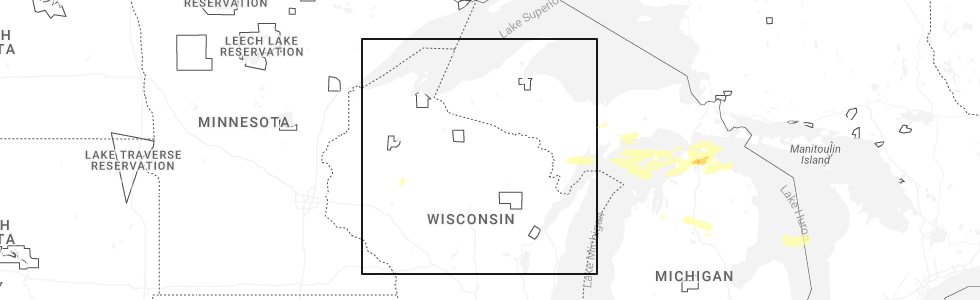
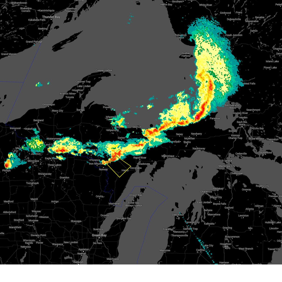
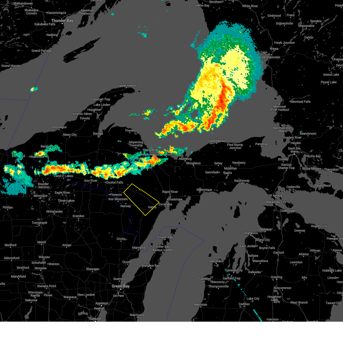
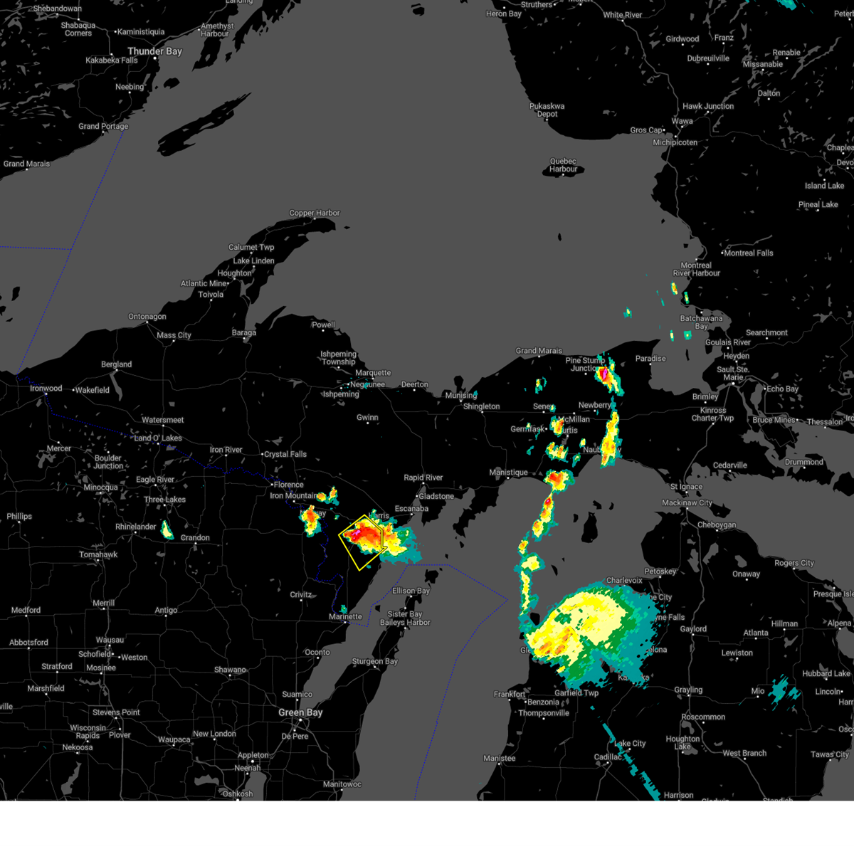
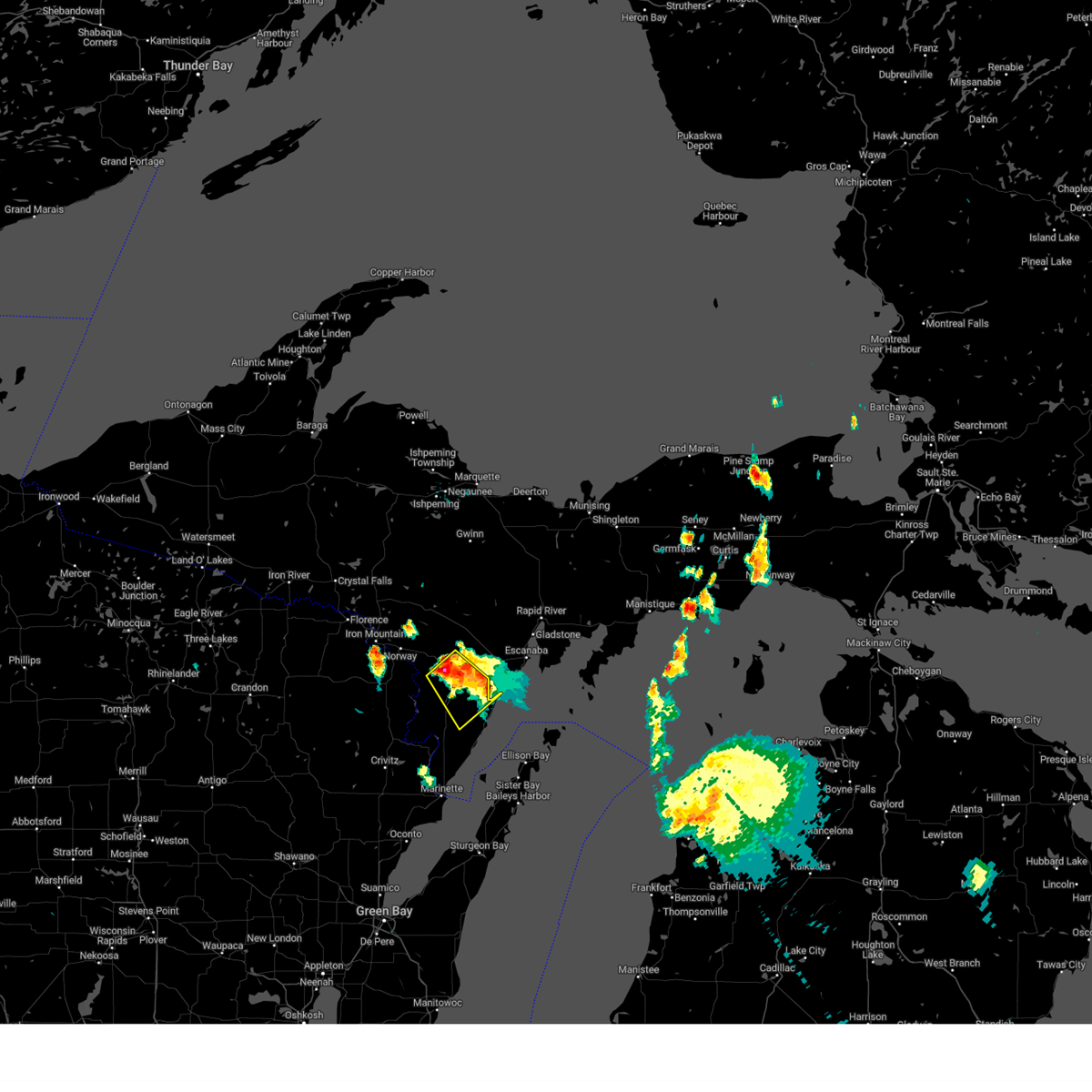
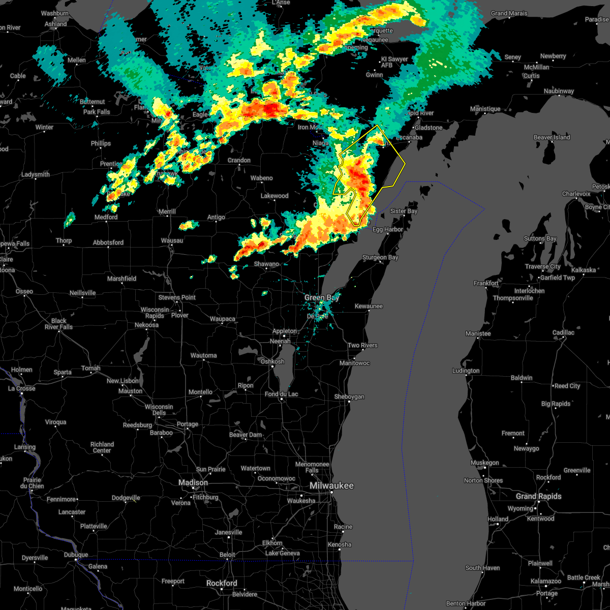
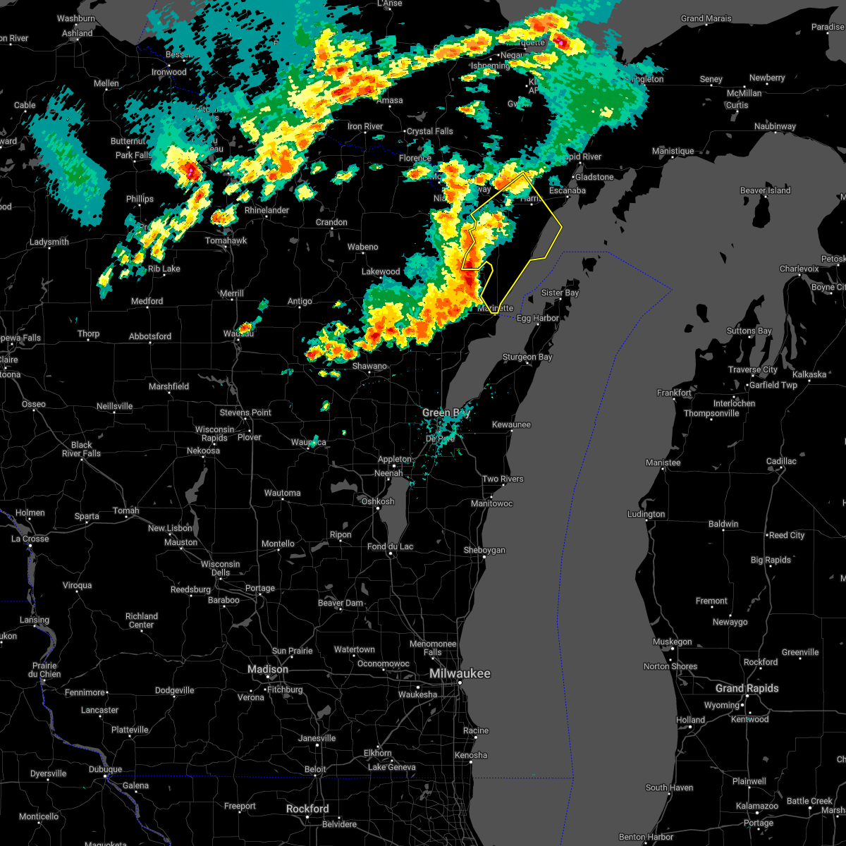
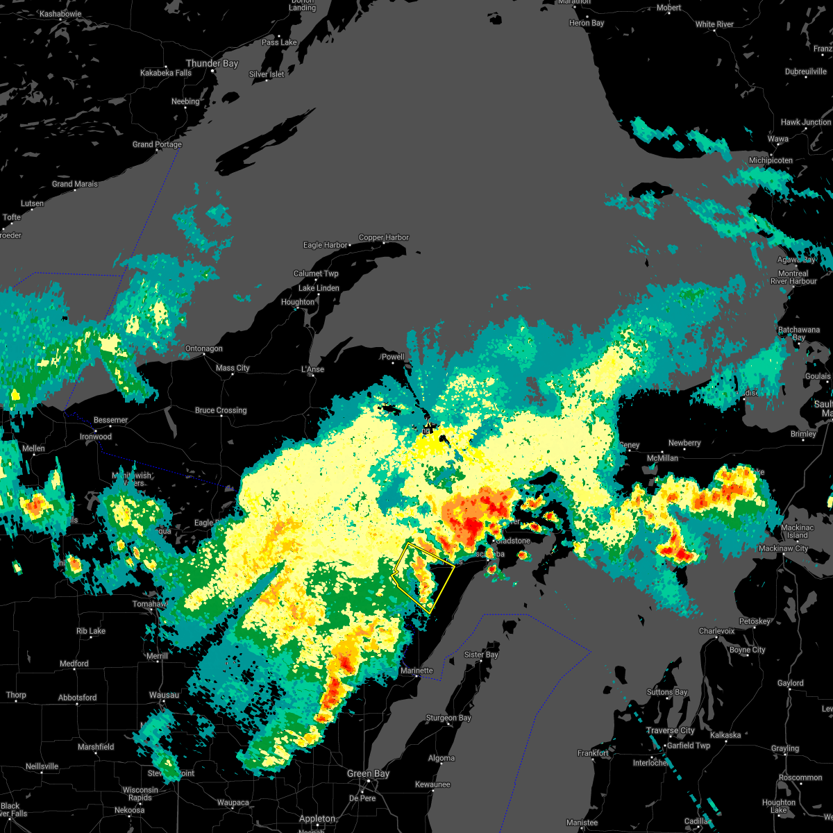
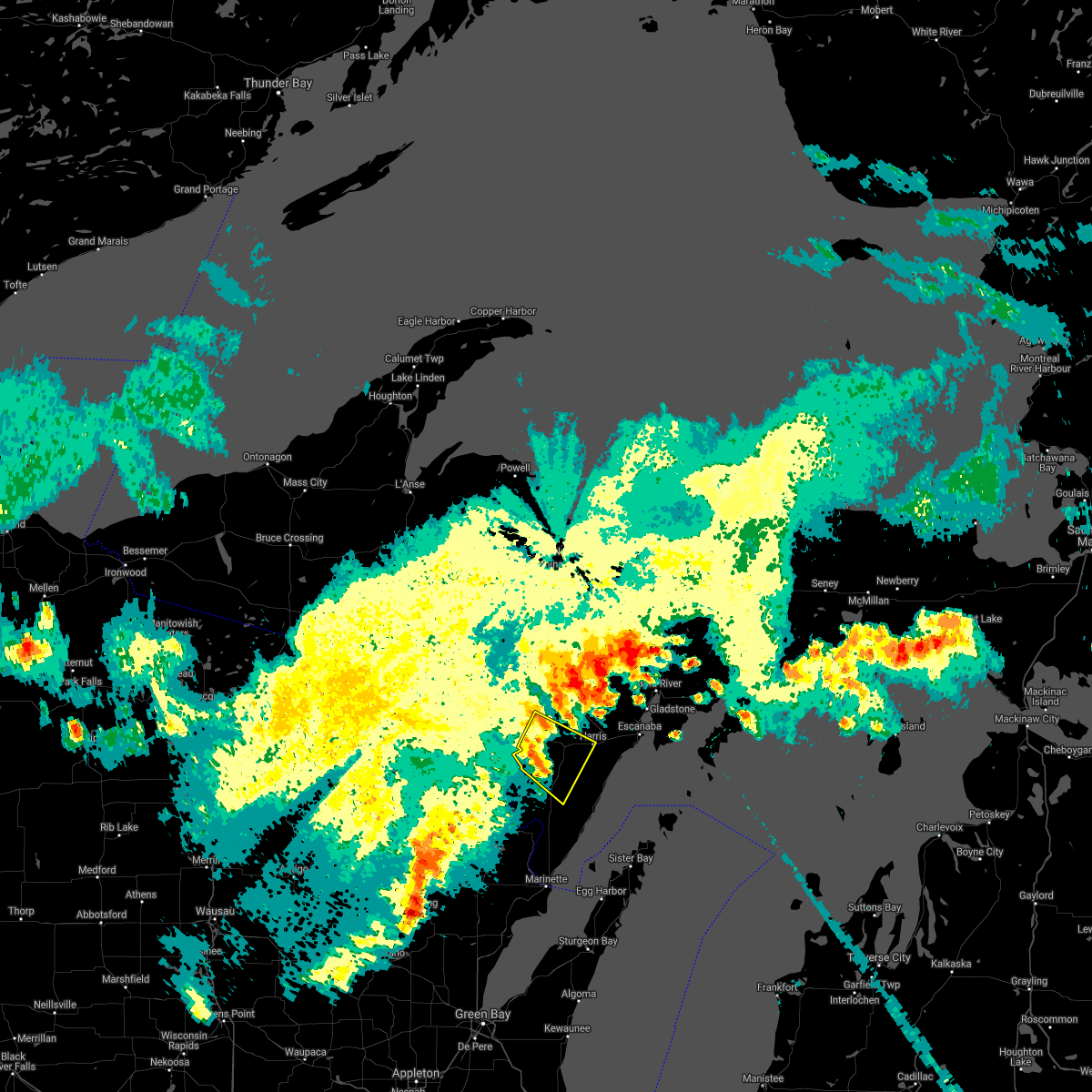
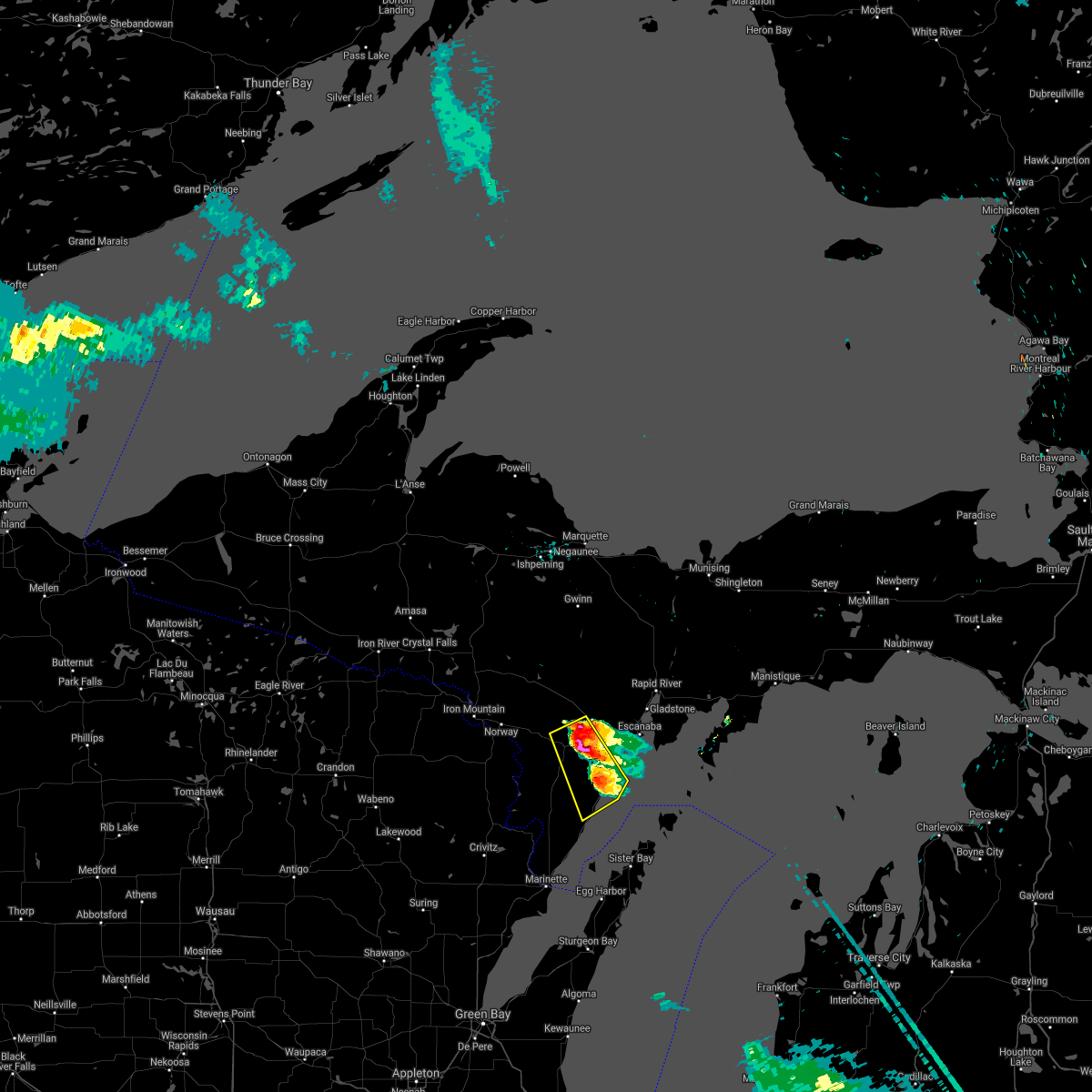
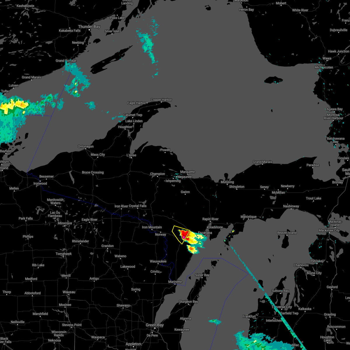
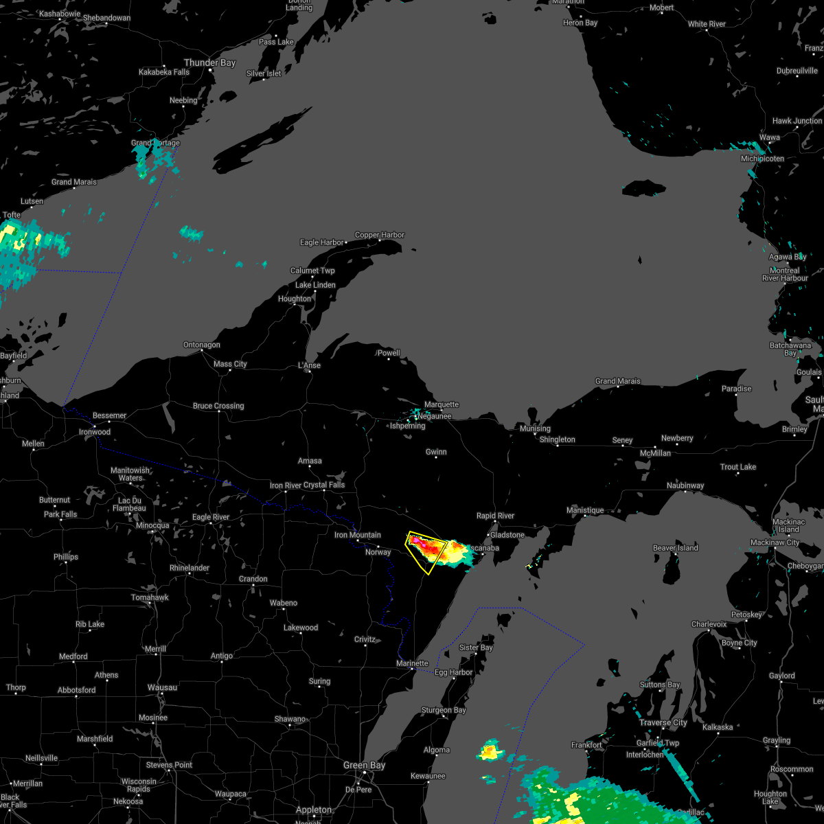
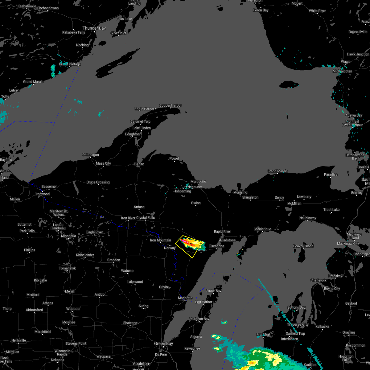
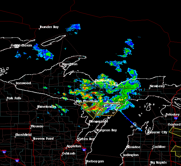
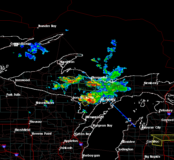
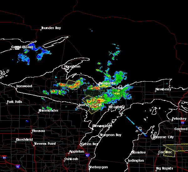
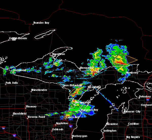
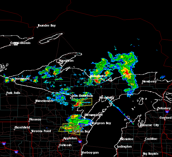
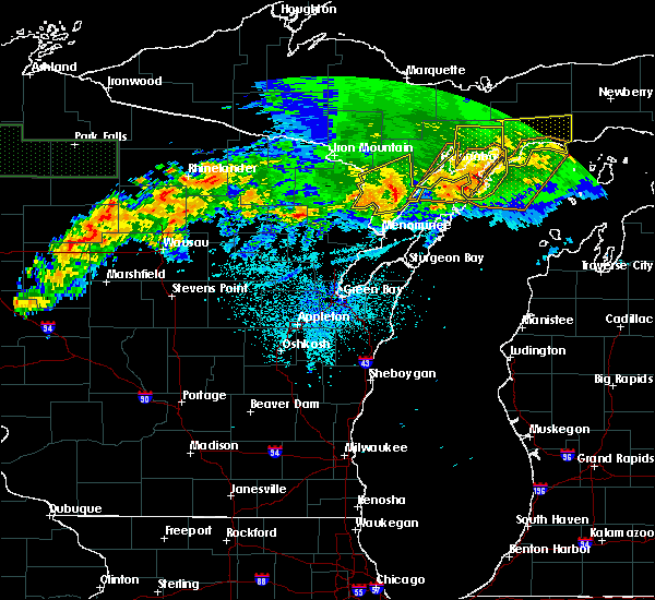
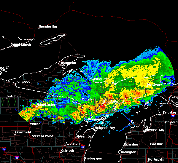
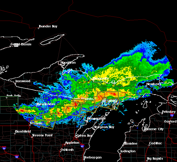
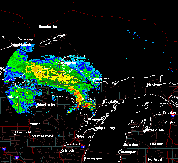
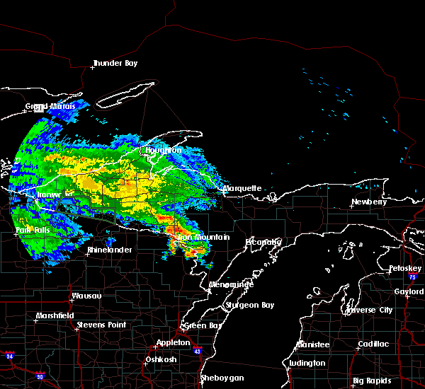
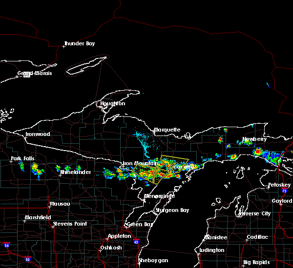
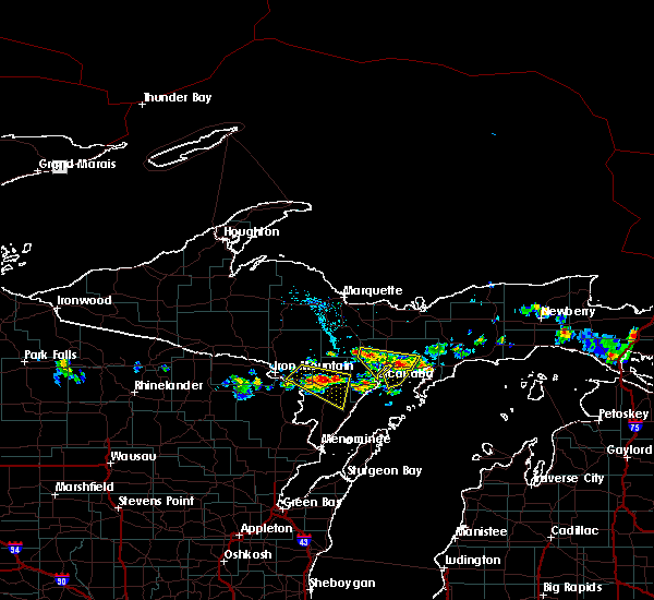
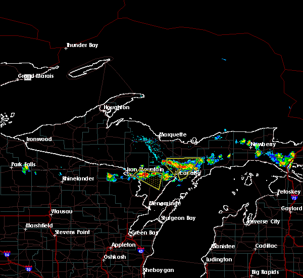
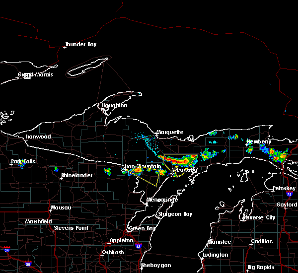
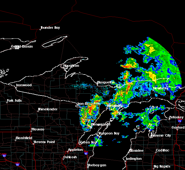
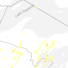
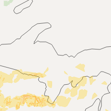
Hail Map for Powers, MI
The Powers, MI area has had 5 reports of on-the-ground hail by trained spotters, and has been under severe weather warnings 4 times during the past 12 months. Doppler radar has detected hail at or near Powers, MI on 27 occasions, including 2 occasions during the past year.
| Name: | Powers, MI |
| Where Located: | 59.4 miles S of Marquette, MI |
| Map: | Google Map for Powers, MI |
| Population: | 422 |
| Housing Units: | 141 |
| More Info: | Search Google for Powers, MI |
0
The Top Recent Hail Date for Powers, MI is Saturday, June 21, 2025 (27th out of 27)
Hail and Wind Damage Spotted near Powers, MI
| Date / Time | Report Details |
|---|---|
| 7/8/2025 2:55 PM CDT |
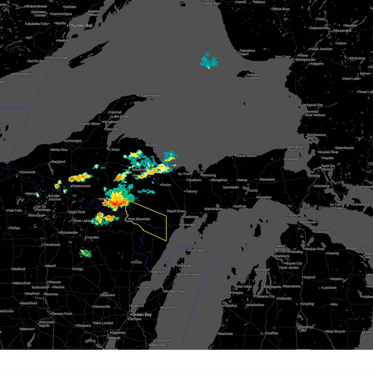 Svrmqt the national weather service in marquette has issued a * severe thunderstorm warning for, southern dickinson county in south central upper michigan, northern menominee county in south central upper michigan, * until 400 pm cdt. * at 254 pm cdt, a severe thunderstorm was located near florence, or 10 miles north of iron mountain, moving southeast at 50 mph (radar indicated). Hazards include 60 mph wind gusts and quarter size hail. Hail damage to vehicles is expected. Expect wind damage to roofs, siding, and trees. Svrmqt the national weather service in marquette has issued a * severe thunderstorm warning for, southern dickinson county in south central upper michigan, northern menominee county in south central upper michigan, * until 400 pm cdt. * at 254 pm cdt, a severe thunderstorm was located near florence, or 10 miles north of iron mountain, moving southeast at 50 mph (radar indicated). Hazards include 60 mph wind gusts and quarter size hail. Hail damage to vehicles is expected. Expect wind damage to roofs, siding, and trees.
|
| 5/16/2025 7:12 PM CDT | the severe thunderstorm warning has been cancelled and is no longer in effect |
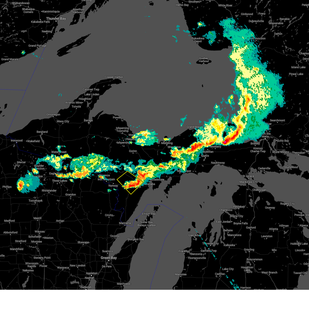
| 5/16/2025 6:32 PM CDT | Svrmqt the national weather service in marquette has issued a * severe thunderstorm warning for, menominee county in south central upper michigan, * until 730 pm cdt. * at 632 pm cdt, a severe thunderstorm was located over marinette, moving northeast at 45 mph (radar indicated). Hazards include 60 mph wind gusts. expect damage to roofs, siding, and trees |
| 3/28/2025 7:57 PM CDT |
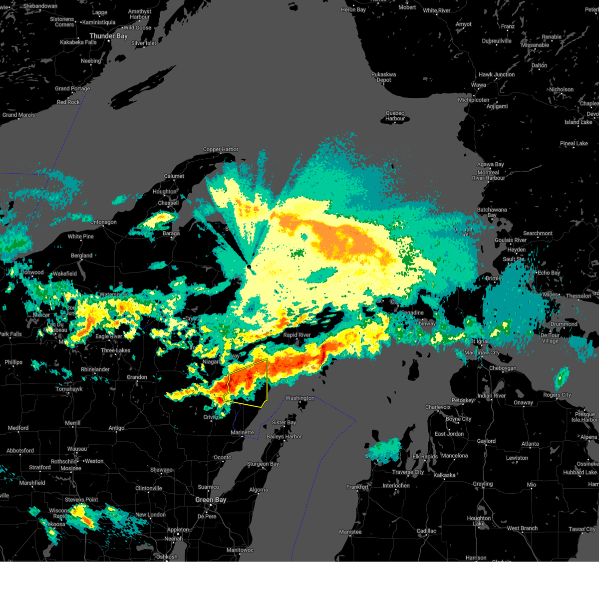 Svrmqt the national weather service in marquette has issued a * severe thunderstorm warning for, central menominee county in south central upper michigan, * until 830 pm cdt. * at 757 pm cdt, a severe thunderstorm was located 9 miles south of powers, or 27 miles southwest of escanaba, moving southeast at 35 mph (radar indicated). Hazards include quarter size hail. damage to vehicles is expected Svrmqt the national weather service in marquette has issued a * severe thunderstorm warning for, central menominee county in south central upper michigan, * until 830 pm cdt. * at 757 pm cdt, a severe thunderstorm was located 9 miles south of powers, or 27 miles southwest of escanaba, moving southeast at 35 mph (radar indicated). Hazards include quarter size hail. damage to vehicles is expected
|
| 5/21/2024 11:31 PM EDT |
 At 1131 pm edt/1031 pm cdt/, severe thunderstorms were located along a line extending from near la branche to near newport state park, moving northeast at 60 mph (radar indicated). Hazards include 60 mph wind gusts. Expect damage to roofs, siding, and trees. these severe storms will be near, escanaba around 1135 pm edt. Other locations impacted by these severe thunderstorms include hyde, gourley, ford river, whitney, spalding, wilson, schaeffer, and bark river. At 1131 pm edt/1031 pm cdt/, severe thunderstorms were located along a line extending from near la branche to near newport state park, moving northeast at 60 mph (radar indicated). Hazards include 60 mph wind gusts. Expect damage to roofs, siding, and trees. these severe storms will be near, escanaba around 1135 pm edt. Other locations impacted by these severe thunderstorms include hyde, gourley, ford river, whitney, spalding, wilson, schaeffer, and bark river.
|
| 5/21/2024 11:19 PM EDT |
 At 1119 pm edt/1019 pm cdt/, severe thunderstorms were located along a line extending from near hermansville to 8 miles northeast of jacksonport, moving northeast at 70 mph (radar indicated). Hazards include 60 mph wind gusts. Expect damage to roofs, siding, and trees. these severe storms will be near, escanaba around 1135 pm edt. Other locations impacted by these severe thunderstorms include hyde, gourley, ford river, whitney, spalding, nadeau, wilson, and schaeffer. At 1119 pm edt/1019 pm cdt/, severe thunderstorms were located along a line extending from near hermansville to 8 miles northeast of jacksonport, moving northeast at 70 mph (radar indicated). Hazards include 60 mph wind gusts. Expect damage to roofs, siding, and trees. these severe storms will be near, escanaba around 1135 pm edt. Other locations impacted by these severe thunderstorms include hyde, gourley, ford river, whitney, spalding, nadeau, wilson, and schaeffer.
|
| 5/21/2024 10:08 PM CDT |
 Svrmqt the national weather service in marquette has issued a * severe thunderstorm warning for, southwestern delta county in south central upper michigan, menominee county in south central upper michigan, * until 1145 pm edt/1045 pm cdt/. * at 1108 pm edt/1008 pm cdt/, severe thunderstorms were located along a line extending from 10 miles east of pembine to 6 miles south of jacksonport, moving northeast at 60 mph (trained weather spotters in marinette estimated 70 mph winds at 953 cdt). Hazards include 70 mph wind gusts. Expect considerable tree damage. Damage is likely to mobile homes, roofs, and outbuildings. Svrmqt the national weather service in marquette has issued a * severe thunderstorm warning for, southwestern delta county in south central upper michigan, menominee county in south central upper michigan, * until 1145 pm edt/1045 pm cdt/. * at 1108 pm edt/1008 pm cdt/, severe thunderstorms were located along a line extending from 10 miles east of pembine to 6 miles south of jacksonport, moving northeast at 60 mph (trained weather spotters in marinette estimated 70 mph winds at 953 cdt). Hazards include 70 mph wind gusts. Expect considerable tree damage. Damage is likely to mobile homes, roofs, and outbuildings.
|
| 8/25/2023 3:57 PM CDT |
 The severe thunderstorm warning for southeastern dickinson, west central delta and northeastern menominee counties will expire at 500 pm edt/400 pm cdt/, the storm which prompted the warning has moved out of the area. therefore, the warning will be allowed to expire. remember, a severe thunderstorm warning still remains in effect for southwestern delta and northeastern menominee counties until 600 pm edt/500 pm cdt. The severe thunderstorm warning for southeastern dickinson, west central delta and northeastern menominee counties will expire at 500 pm edt/400 pm cdt/, the storm which prompted the warning has moved out of the area. therefore, the warning will be allowed to expire. remember, a severe thunderstorm warning still remains in effect for southwestern delta and northeastern menominee counties until 600 pm edt/500 pm cdt.
|
| 8/25/2023 4:54 PM EDT |
 At 454 pm edt/354 pm cdt/, a severe thunderstorm was located 11 miles east of powers, or 11 miles west of escanaba, moving southeast at 40 mph (radar indicated). Hazards include 60 mph wind gusts and quarter size hail. Hail damage to vehicles is expected. Expect wind damage to roofs, siding, and trees. At 454 pm edt/354 pm cdt/, a severe thunderstorm was located 11 miles east of powers, or 11 miles west of escanaba, moving southeast at 40 mph (radar indicated). Hazards include 60 mph wind gusts and quarter size hail. Hail damage to vehicles is expected. Expect wind damage to roofs, siding, and trees.
|
| 8/25/2023 3:36 PM CDT |
 At 436 pm edt/336 pm cdt/, a severe thunderstorm was located near la branche, or 23 miles west of escanaba, moving southeast at 35 mph (radar indicated). Hazards include 60 mph wind gusts and quarter size hail. Hail damage to vehicles is expected. expect wind damage to roofs, siding, and trees. locations impacted include, powers, hermansville, la branche, wilson, spalding, whitney, schaeffer, and cunard. hail threat, radar indicated max hail size, 1. 00 in wind threat, radar indicated max wind gust, 60 mph. At 436 pm edt/336 pm cdt/, a severe thunderstorm was located near la branche, or 23 miles west of escanaba, moving southeast at 35 mph (radar indicated). Hazards include 60 mph wind gusts and quarter size hail. Hail damage to vehicles is expected. expect wind damage to roofs, siding, and trees. locations impacted include, powers, hermansville, la branche, wilson, spalding, whitney, schaeffer, and cunard. hail threat, radar indicated max hail size, 1. 00 in wind threat, radar indicated max wind gust, 60 mph.
|
| 8/25/2023 3:16 PM CDT |
 At 415 pm edt/315 pm cdt/, a severe thunderstorm was located over foster city, or 16 miles northeast of iron mountain, moving southeast at 35 mph (radar indicated). Hazards include 60 mph wind gusts and quarter size hail. Hail damage to vehicles is expected. Expect wind damage to roofs, siding, and trees. At 415 pm edt/315 pm cdt/, a severe thunderstorm was located over foster city, or 16 miles northeast of iron mountain, moving southeast at 35 mph (radar indicated). Hazards include 60 mph wind gusts and quarter size hail. Hail damage to vehicles is expected. Expect wind damage to roofs, siding, and trees.
|
| 8/2/2023 1:21 PM CDT |
 At 120 pm cdt, a severe thunderstorm was located near powers, or 22 miles west of escanaba, moving southeast at 15 mph (radar indicated). Hazards include half dollar size hail. Damage to vehicles is expected. locations impacted include, powers, bagley, wilson, spalding, nadeau, gourley, and carney. hail threat, radar indicated max hail size, 1. 25 in wind threat, radar indicated max wind gust, <50 mph. At 120 pm cdt, a severe thunderstorm was located near powers, or 22 miles west of escanaba, moving southeast at 15 mph (radar indicated). Hazards include half dollar size hail. Damage to vehicles is expected. locations impacted include, powers, bagley, wilson, spalding, nadeau, gourley, and carney. hail threat, radar indicated max hail size, 1. 25 in wind threat, radar indicated max wind gust, <50 mph.
|
| 8/2/2023 1:08 PM CDT |
 At 108 pm cdt, a severe thunderstorm was located over powers, or 24 miles west of escanaba, moving southeast at 15 mph (radar indicated). Hazards include quarter size hail. damage to vehicles is expected At 108 pm cdt, a severe thunderstorm was located over powers, or 24 miles west of escanaba, moving southeast at 15 mph (radar indicated). Hazards include quarter size hail. damage to vehicles is expected
|
| 7/22/2023 3:21 PM CDT |
 At 421 pm edt/321 pm cdt/, a severe thunderstorm was located over hermansville, or 21 miles east of iron mountain, moving east at 30 mph (radar indicated). Hazards include half dollar size hail. Damage to vehicles is expected. this severe storm will be near, powers around 330 pm cdt. other locations in the path of this severe thunderstorm include la branche. hail threat, radar indicated max hail size, 1. 25 in wind threat, radar indicated max wind gust, <50 mph. At 421 pm edt/321 pm cdt/, a severe thunderstorm was located over hermansville, or 21 miles east of iron mountain, moving east at 30 mph (radar indicated). Hazards include half dollar size hail. Damage to vehicles is expected. this severe storm will be near, powers around 330 pm cdt. other locations in the path of this severe thunderstorm include la branche. hail threat, radar indicated max hail size, 1. 25 in wind threat, radar indicated max wind gust, <50 mph.
|
| 7/22/2023 3:10 PM CDT |
 At 410 pm edt/310 pm cdt/, a severe thunderstorm was located near hermansville, or 18 miles southeast of iron mountain, moving east at 30 mph (radar indicated). Hazards include quarter size hail. Damage to vehicles is expected. this severe thunderstorm will be near, hermansville around 320 pm cdt. powers around 325 pm cdt. other locations in the path of this severe thunderstorm include la branche. hail threat, radar indicated max hail size, 1. 00 in wind threat, radar indicated max wind gust, <50 mph. At 410 pm edt/310 pm cdt/, a severe thunderstorm was located near hermansville, or 18 miles southeast of iron mountain, moving east at 30 mph (radar indicated). Hazards include quarter size hail. Damage to vehicles is expected. this severe thunderstorm will be near, hermansville around 320 pm cdt. powers around 325 pm cdt. other locations in the path of this severe thunderstorm include la branche. hail threat, radar indicated max hail size, 1. 00 in wind threat, radar indicated max wind gust, <50 mph.
|
| 6/15/2022 7:20 PM CDT |
 At 720 pm cdt, a severe thunderstorm was located 8 miles south of foster city, or 16 miles east of iron mountain, moving northeast at 35 mph (radar indicated). Hazards include 60 mph wind gusts and quarter size hail. Hail damage to vehicles is expected. expect wind damage to roofs, siding, and trees. this severe thunderstorm will remain over mainly rural areas of southern dickinson and northwestern menominee counties, including the following locations, quinnesec, loretto, waucedah, cunard, vulcan and niagara. hail threat, radar indicated max hail size, 1. 00 in wind threat, radar indicated max wind gust, 60 mph. At 720 pm cdt, a severe thunderstorm was located 8 miles south of foster city, or 16 miles east of iron mountain, moving northeast at 35 mph (radar indicated). Hazards include 60 mph wind gusts and quarter size hail. Hail damage to vehicles is expected. expect wind damage to roofs, siding, and trees. this severe thunderstorm will remain over mainly rural areas of southern dickinson and northwestern menominee counties, including the following locations, quinnesec, loretto, waucedah, cunard, vulcan and niagara. hail threat, radar indicated max hail size, 1. 00 in wind threat, radar indicated max wind gust, 60 mph.
|
| 6/15/2022 7:10 PM CDT | Trees down. report via social media with pictur in menominee county MI, 7.8 miles ESE of Powers, MI |
| 6/15/2022 7:06 PM CDT |
 At 706 pm cdt, a severe thunderstorm was located near pembine, or 10 miles southeast of iron mountain, moving northeast at 25 mph (radar indicated). Hazards include 60 mph wind gusts and quarter size hail. Hail damage to vehicles is expected. expect wind damage to roofs, siding, and trees. this severe thunderstorm will be near, norway around 725 pm cdt. hail threat, radar indicated max hail size, 1. 00 in wind threat, radar indicated max wind gust, 60 mph. At 706 pm cdt, a severe thunderstorm was located near pembine, or 10 miles southeast of iron mountain, moving northeast at 25 mph (radar indicated). Hazards include 60 mph wind gusts and quarter size hail. Hail damage to vehicles is expected. expect wind damage to roofs, siding, and trees. this severe thunderstorm will be near, norway around 725 pm cdt. hail threat, radar indicated max hail size, 1. 00 in wind threat, radar indicated max wind gust, 60 mph.
|
| 6/15/2022 10:07 AM EDT |
 At 1006 am edt/906 am cdt/, a severe thunderstorm was located 10 miles west of escanaba, moving northeast at 35 mph (radar indicated). Hazards include 60 mph wind gusts and quarter size hail. Hail damage to vehicles is expected. expect wind damage to roofs, siding, and trees. locations impacted include, escanaba, ford river, wilson, bark river, gourley, hyde and schaeffer. hail threat, radar indicated max hail size, 1. 00 in wind threat, radar indicated max wind gust, 60 mph. At 1006 am edt/906 am cdt/, a severe thunderstorm was located 10 miles west of escanaba, moving northeast at 35 mph (radar indicated). Hazards include 60 mph wind gusts and quarter size hail. Hail damage to vehicles is expected. expect wind damage to roofs, siding, and trees. locations impacted include, escanaba, ford river, wilson, bark river, gourley, hyde and schaeffer. hail threat, radar indicated max hail size, 1. 00 in wind threat, radar indicated max wind gust, 60 mph.
|
| 6/15/2022 9:43 AM EDT |
 At 942 am edt/842 am cdt/, a severe thunderstorm was located 8 miles north of stephenson, or 27 miles southwest of escanaba, moving northeast at 35 mph (radar indicated). Hazards include 60 mph wind gusts and quarter size hail. Hail damage to vehicles is expected. Expect wind damage to roofs, siding, and trees. At 942 am edt/842 am cdt/, a severe thunderstorm was located 8 miles north of stephenson, or 27 miles southwest of escanaba, moving northeast at 35 mph (radar indicated). Hazards include 60 mph wind gusts and quarter size hail. Hail damage to vehicles is expected. Expect wind damage to roofs, siding, and trees.
|
| 5/12/2022 4:33 PM CDT |
 At 532 pm edt/432 pm cdt/, a severe thunderstorm was located near stephenson, or 26 miles north of menominee, moving northeast at 15 mph (radar indicated). Hazards include 60 mph wind gusts and quarter size hail. Hail damage to vehicles is expected. expect wind damage to roofs, siding, and trees. locations impacted include, powers. hail threat, radar indicated max hail size, 1. 00 in wind threat, radar indicated max wind gust, 60 mph. At 532 pm edt/432 pm cdt/, a severe thunderstorm was located near stephenson, or 26 miles north of menominee, moving northeast at 15 mph (radar indicated). Hazards include 60 mph wind gusts and quarter size hail. Hail damage to vehicles is expected. expect wind damage to roofs, siding, and trees. locations impacted include, powers. hail threat, radar indicated max hail size, 1. 00 in wind threat, radar indicated max wind gust, 60 mph.
|
| 5/12/2022 4:07 PM CDT |
 At 506 pm edt/406 pm cdt/, a severe thunderstorm was located near stephenson, or 24 miles north of menominee, moving northeast at 20 mph (radar indicated). Hazards include 60 mph wind gusts and quarter size hail. Hail damage to vehicles is expected. expect wind damage to roofs, siding, and trees. this severe thunderstorm will be near, stephenson around 415 pm cdt. other locations in the path of this severe thunderstorm include powers. hail threat, radar indicated max hail size, 1. 00 in wind threat, radar indicated max wind gust, 60 mph. At 506 pm edt/406 pm cdt/, a severe thunderstorm was located near stephenson, or 24 miles north of menominee, moving northeast at 20 mph (radar indicated). Hazards include 60 mph wind gusts and quarter size hail. Hail damage to vehicles is expected. expect wind damage to roofs, siding, and trees. this severe thunderstorm will be near, stephenson around 415 pm cdt. other locations in the path of this severe thunderstorm include powers. hail threat, radar indicated max hail size, 1. 00 in wind threat, radar indicated max wind gust, 60 mph.
|
| 7/27/2021 12:22 AM CDT |
 The severe thunderstorm warning for southeastern dickinson and central menominee counties will expire at 1230 am cdt, the storm which prompted the warning has weakened below severe limits, and no longer poses an immediate threat to life or property. therefore, the warning will be allowed to expire. however gusty winds and heavy rain are still possible with this thunderstorm. The severe thunderstorm warning for southeastern dickinson and central menominee counties will expire at 1230 am cdt, the storm which prompted the warning has weakened below severe limits, and no longer poses an immediate threat to life or property. therefore, the warning will be allowed to expire. however gusty winds and heavy rain are still possible with this thunderstorm.
|
| 7/27/2021 12:13 AM CDT |
 At 1213 am cdt, a severe thunderstorm was located over powers, or 22 miles west of escanaba, moving southeast at 45 mph (radar indicated). Hazards include 60 mph wind gusts and penny size hail. Expect damage to roofs, siding, and trees. Locations impacted include, powers, hermansville, bagley, wilson, spalding, nadeau, waucedah, gourley, faithorn, carney, nathan and cunard. At 1213 am cdt, a severe thunderstorm was located over powers, or 22 miles west of escanaba, moving southeast at 45 mph (radar indicated). Hazards include 60 mph wind gusts and penny size hail. Expect damage to roofs, siding, and trees. Locations impacted include, powers, hermansville, bagley, wilson, spalding, nadeau, waucedah, gourley, faithorn, carney, nathan and cunard.
|
| 7/26/2021 11:47 PM CDT |
 At 1146 pm cdt, a severe thunderstorm was located over norway, or near iron mountain, moving southeast at 45 mph (radar indicated). Hazards include 60 mph wind gusts and penny size hail. expect damage to roofs, siding, and trees At 1146 pm cdt, a severe thunderstorm was located over norway, or near iron mountain, moving southeast at 45 mph (radar indicated). Hazards include 60 mph wind gusts and penny size hail. expect damage to roofs, siding, and trees
|
| 7/26/2021 7:42 PM CDT |
 At 842 pm edt/742 pm cdt/, a severe thunderstorm was located near powers, or 17 miles west of escanaba, moving southeast at 25 mph (radar indicated). Hazards include quarter size hail. Damage to vehicles is expected. This severe thunderstorm will remain over mainly rural areas of southwestern delta and northeastern menominee counties, including the following locations, wilson, gourley, bark river and spalding. At 842 pm edt/742 pm cdt/, a severe thunderstorm was located near powers, or 17 miles west of escanaba, moving southeast at 25 mph (radar indicated). Hazards include quarter size hail. Damage to vehicles is expected. This severe thunderstorm will remain over mainly rural areas of southwestern delta and northeastern menominee counties, including the following locations, wilson, gourley, bark river and spalding.
|
| 7/26/2021 7:36 PM CDT |
 At 736 pm cdt, a severe thunderstorm was located near powers, or 20 miles west of escanaba, moving southeast at 20 mph (radar indicated). Hazards include quarter size hail. Damage to vehicles is expected. Locations impacted include, powers, hermansville, wilson and spalding. At 736 pm cdt, a severe thunderstorm was located near powers, or 20 miles west of escanaba, moving southeast at 20 mph (radar indicated). Hazards include quarter size hail. Damage to vehicles is expected. Locations impacted include, powers, hermansville, wilson and spalding.
|
| 7/26/2021 7:22 PM CDT |
 At 721 pm cdt, a severe thunderstorm was located near hermansville, or 22 miles east of iron mountain, moving southeast at 20 mph (radar indicated). Hazards include quarter size hail. Damage to vehicles is expected. Locations impacted include, powers, hermansville, wilson and spalding. At 721 pm cdt, a severe thunderstorm was located near hermansville, or 22 miles east of iron mountain, moving southeast at 20 mph (radar indicated). Hazards include quarter size hail. Damage to vehicles is expected. Locations impacted include, powers, hermansville, wilson and spalding.
|
| 7/26/2021 7:12 PM CDT |
 At 712 pm cdt, a severe thunderstorm was located 9 miles west of la branche, or 19 miles east of iron mountain, moving southeast at 20 mph (radar indicated). Hazards include quarter size hail. damage to vehicles is expected At 712 pm cdt, a severe thunderstorm was located 9 miles west of la branche, or 19 miles east of iron mountain, moving southeast at 20 mph (radar indicated). Hazards include quarter size hail. damage to vehicles is expected
|
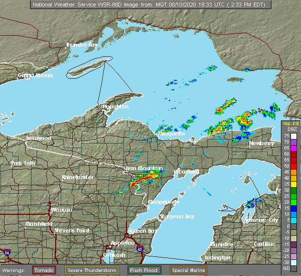
| 8/10/2020 2:13 PM CDT |
 At 313 pm edt/213 pm cdt/, severe thunderstorms were located along a line extending from 8 miles west of escanaba to 8 miles northwest of stephenson, moving east at 20 mph (radar indicated). Hazards include 60 mph wind gusts and quarter size hail. Hail damage to vehicles is expected. expect wind damage to roofs, siding, and trees. Locations impacted include, escanaba, stephenson, powers, bagley, ford river, wilson, bark river, nadeau, gourley, daggett, carney and swanson. At 313 pm edt/213 pm cdt/, severe thunderstorms were located along a line extending from 8 miles west of escanaba to 8 miles northwest of stephenson, moving east at 20 mph (radar indicated). Hazards include 60 mph wind gusts and quarter size hail. Hail damage to vehicles is expected. expect wind damage to roofs, siding, and trees. Locations impacted include, escanaba, stephenson, powers, bagley, ford river, wilson, bark river, nadeau, gourley, daggett, carney and swanson.
|
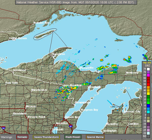
| 8/10/2020 1:52 PM CDT |
 At 252 pm edt/152 pm cdt/, severe thunderstorms were located along a line extending from 8 miles northeast of powers to 10 miles southeast of pembine, moving east at 20 mph (radar indicated). Hazards include 60 mph wind gusts and quarter size hail. Hail damage to vehicles is expected. Expect wind damage to roofs, siding, and trees. At 252 pm edt/152 pm cdt/, severe thunderstorms were located along a line extending from 8 miles northeast of powers to 10 miles southeast of pembine, moving east at 20 mph (radar indicated). Hazards include 60 mph wind gusts and quarter size hail. Hail damage to vehicles is expected. Expect wind damage to roofs, siding, and trees.
|
| 8/10/2020 1:35 PM CDT |
 At 134 pm cdt, severe thunderstorms were located along a line extending from 6 miles northeast of powers to 6 miles southeast of pembine, moving east at 20 mph (radar indicated). Hazards include 60 mph wind gusts and quarter size hail. Hail damage to vehicles is expected. expect wind damage to roofs, siding, and trees. Locations impacted include, powers, hermansville, bagley, wilson, spalding, nadeau, gourley, faithorn, carney and cunard. At 134 pm cdt, severe thunderstorms were located along a line extending from 6 miles northeast of powers to 6 miles southeast of pembine, moving east at 20 mph (radar indicated). Hazards include 60 mph wind gusts and quarter size hail. Hail damage to vehicles is expected. expect wind damage to roofs, siding, and trees. Locations impacted include, powers, hermansville, bagley, wilson, spalding, nadeau, gourley, faithorn, carney and cunard.
|
| 8/10/2020 1:09 PM CDT |
 At 109 pm cdt, a severe thunderstorm was located 8 miles southeast of norway, or 16 miles southeast of iron mountain, moving east at 15 mph (radar indicated). Hazards include 60 mph wind gusts and quarter size hail. Hail damage to vehicles is expected. Expect wind damage to roofs, siding, and trees. At 109 pm cdt, a severe thunderstorm was located 8 miles southeast of norway, or 16 miles southeast of iron mountain, moving east at 15 mph (radar indicated). Hazards include 60 mph wind gusts and quarter size hail. Hail damage to vehicles is expected. Expect wind damage to roofs, siding, and trees.
|
| 7/19/2020 4:23 AM EDT |
 The severe thunderstorm warning for central delta, central menominee and central schoolcraft counties will expire at 430 am edt/330 am cdt/, the storms which prompted the warning have moved out of the area. therefore, the warning will be allowed to expire. a severe thunderstorm watch remains in effect until 600 am edt/500 am cdt/ for east central upper and south central upper michigan. to report severe weather, contact your nearest law enforcement agency. they will relay your report to the national weather service marquette. remember, a severe thunderstorm warning still remains in effect for southern menominee county until 445 am edt. The severe thunderstorm warning for central delta, central menominee and central schoolcraft counties will expire at 430 am edt/330 am cdt/, the storms which prompted the warning have moved out of the area. therefore, the warning will be allowed to expire. a severe thunderstorm watch remains in effect until 600 am edt/500 am cdt/ for east central upper and south central upper michigan. to report severe weather, contact your nearest law enforcement agency. they will relay your report to the national weather service marquette. remember, a severe thunderstorm warning still remains in effect for southern menominee county until 445 am edt.
|
| 7/19/2020 3:42 AM EDT |
 At 342 am edt/242 am cdt/, severe thunderstorms were located along a line extending from 10 miles southwest of steuben to near escanaba to 9 miles south of pembine, moving east at 55 mph (radar indicated). Hazards include 60 mph wind gusts and nickel size hail. expect damage to roofs, siding, and trees At 342 am edt/242 am cdt/, severe thunderstorms were located along a line extending from 10 miles southwest of steuben to near escanaba to 9 miles south of pembine, moving east at 55 mph (radar indicated). Hazards include 60 mph wind gusts and nickel size hail. expect damage to roofs, siding, and trees
|
| 7/6/2020 3:45 PM CDT | Corrects previous tstm wnd dmg report from 1 se wilson. 10x20ft. horse shelter blown down and away 50 ft. from facebook. pictures included in message. also power out an in menominee county MI, 5.1 miles W of Powers, MI |
| 7/6/2020 3:45 PM CDT | Time radar estimated. car window smashed through with tree. silo leaning sideways. from facebook. pictures included in messag in menominee county MI, 4.2 miles W of Powers, MI |
| 7/6/2020 3:26 PM CDT |
 At 326 pm cdt, a severe thunderstorm was located near stephenson, or 23 miles north of menominee, moving northeast at 10 mph (radar indicated). Hazards include 60 mph wind gusts and quarter size hail. Hail damage to vehicles is expected. Expect wind damage to roofs, siding, and trees. At 326 pm cdt, a severe thunderstorm was located near stephenson, or 23 miles north of menominee, moving northeast at 10 mph (radar indicated). Hazards include 60 mph wind gusts and quarter size hail. Hail damage to vehicles is expected. Expect wind damage to roofs, siding, and trees.
|
| 7/6/2020 3:15 PM CDT | 10x20ft. horse shelter blown down and away 50 ft. from facebook. pictures included in message. also power out and fire department out in area for trees in power line in menominee county MI, 5.1 miles W of Powers, MI |
| 7/5/2020 3:24 PM CDT | Multiple trees down. report from faceboo in menominee county MI, 4.2 miles W of Powers, MI |
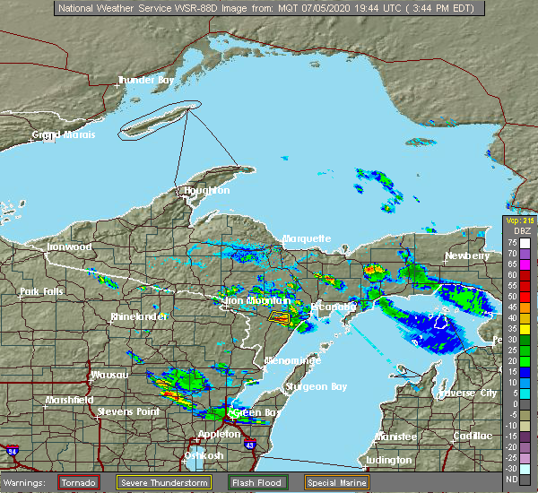
| 7/5/2020 2:50 PM CDT |
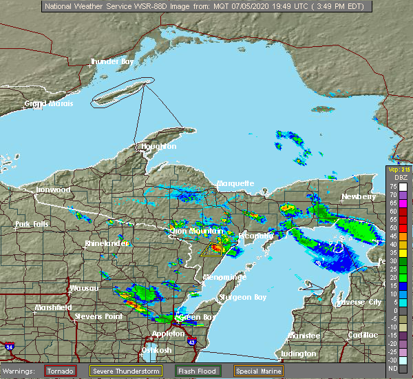 At 249 pm cdt, a severe thunderstorm was located near powers, or 19 miles southwest of escanaba, moving south at 20 mph (law enforcement reported tree down over county road 400 previously with this storm). Hazards include quarter size hail. Damage to vehicles is expected. Locations impacted include, powers, bagley, wilson, spalding, nadeau, gourley and carney. At 249 pm cdt, a severe thunderstorm was located near powers, or 19 miles southwest of escanaba, moving south at 20 mph (law enforcement reported tree down over county road 400 previously with this storm). Hazards include quarter size hail. Damage to vehicles is expected. Locations impacted include, powers, bagley, wilson, spalding, nadeau, gourley and carney.
|
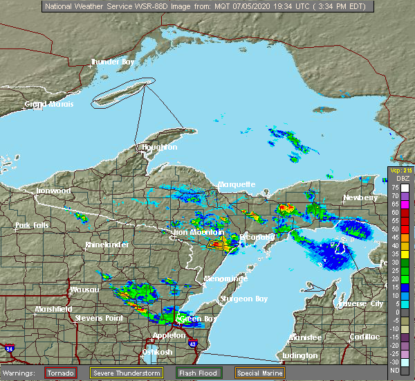
| 7/5/2020 2:43 PM CDT |
 At 242 pm cdt, a severe thunderstorm was located near powers, or 18 miles west of escanaba, moving south at 15 mph (radar indicated). Hazards include quarter size hail. damage to vehicles is expected At 242 pm cdt, a severe thunderstorm was located near powers, or 18 miles west of escanaba, moving south at 15 mph (radar indicated). Hazards include quarter size hail. damage to vehicles is expected
|
| 7/5/2020 2:34 PM CDT | Road blocked by a downed tree. time estimated by rada in menominee county MI, 3.9 miles WSW of Powers, MI |
| 7/5/2020 2:34 PM CDT | Corrects previous tstm wnd dmg report from wilson for time. multiple trees down. report from facebook. time of tstm wnd dmg estimated by rada in menominee county MI, 4.2 miles W of Powers, MI |
| 7/5/2020 2:33 PM CDT |
 At 233 pm cdt, a severe thunderstorm was located near powers, or 17 miles west of escanaba, moving south at 20 mph (radar indicated). Hazards include quarter size hail. Damage to vehicles is expected. Locations impacted include, powers, wilson and spalding. At 233 pm cdt, a severe thunderstorm was located near powers, or 17 miles west of escanaba, moving south at 20 mph (radar indicated). Hazards include quarter size hail. Damage to vehicles is expected. Locations impacted include, powers, wilson and spalding.
|
| 7/5/2020 2:30 PM CDT | About 1/4 mile of road blocked by tree debris on county road 400 near wilson creek. time estimated by rada in menominee county MI, 4.2 miles SW of Powers, MI |
| 7/5/2020 2:13 PM CDT |
 At 213 pm cdt, a severe thunderstorm was located 8 miles northeast of powers, or 15 miles west of escanaba, moving south at 15 mph (radar indicated). Hazards include quarter size hail. damage to vehicles is expected At 213 pm cdt, a severe thunderstorm was located 8 miles northeast of powers, or 15 miles west of escanaba, moving south at 15 mph (radar indicated). Hazards include quarter size hail. damage to vehicles is expected
|
| 7/5/2020 2:10 PM CDT | Tree down across the road near sage run golf course. time estimated by rada in menominee county MI, 7.9 miles SW of Powers, MI |
| 7/2/2020 2:52 PM CDT |
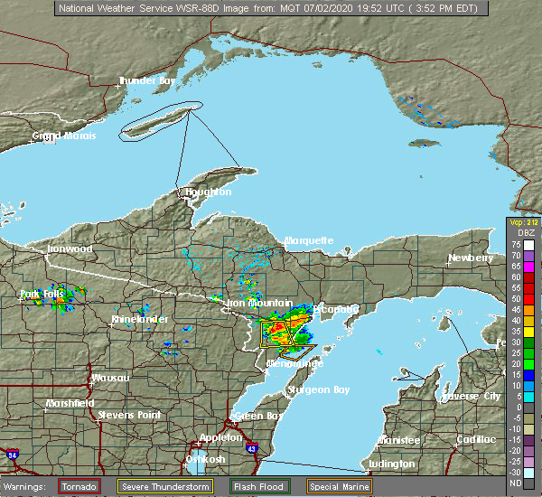 At 252 pm cdt, a severe thunderstorm was located 8 miles south of powers, or 24 miles southwest of escanaba, moving south at 15 mph (radar indicated). Hazards include 60 mph wind gusts and nickel size hail. Expect damage to roofs, siding, and trees. Locations impacted include, stephenson, powers, bagley, nadeau, gourley, daggett and carney. At 252 pm cdt, a severe thunderstorm was located 8 miles south of powers, or 24 miles southwest of escanaba, moving south at 15 mph (radar indicated). Hazards include 60 mph wind gusts and nickel size hail. Expect damage to roofs, siding, and trees. Locations impacted include, stephenson, powers, bagley, nadeau, gourley, daggett and carney.
|
| 7/2/2020 2:39 PM CDT |
 At 239 pm cdt, a severe thunderstorm was located near powers, or 23 miles southwest of escanaba, moving south at 15 mph (radar indicated). Hazards include 60 mph wind gusts and nickel size hail. expect damage to roofs, siding, and trees At 239 pm cdt, a severe thunderstorm was located near powers, or 23 miles southwest of escanaba, moving south at 15 mph (radar indicated). Hazards include 60 mph wind gusts and nickel size hail. expect damage to roofs, siding, and trees
|
| 10/3/2018 6:34 PM CDT |
 At 733 pm edt/633 pm cdt/, a severe thunderstorm was located over la branche, or 20 miles northwest of escanaba, moving east at 65 mph (radar indicated). Hazards include 70 mph wind gusts. Expect considerable tree damage. damage is likely to mobile homes, roofs, and outbuildings. locations impacted include, escanaba, gladstone, rapid river, powers, hermansville, la branche, ford river, wilson, spalding, bark river, brampton and whitney. A tornado watch remains in effect until midnight edt/1100 pm cdt/ for north central upper and south central upper michigan. At 733 pm edt/633 pm cdt/, a severe thunderstorm was located over la branche, or 20 miles northwest of escanaba, moving east at 65 mph (radar indicated). Hazards include 70 mph wind gusts. Expect considerable tree damage. damage is likely to mobile homes, roofs, and outbuildings. locations impacted include, escanaba, gladstone, rapid river, powers, hermansville, la branche, ford river, wilson, spalding, bark river, brampton and whitney. A tornado watch remains in effect until midnight edt/1100 pm cdt/ for north central upper and south central upper michigan.
|
| 10/3/2018 6:19 PM CDT |
 At 718 pm edt/618 pm cdt/, a severe thunderstorm was located 7 miles west of la branche, or 21 miles east of iron mountain, moving east at 70 mph (radar indicated). Hazards include 70 mph wind gusts. Expect considerable tree damage. Damage is likely to mobile homes, roofs, and outbuildings. At 718 pm edt/618 pm cdt/, a severe thunderstorm was located 7 miles west of la branche, or 21 miles east of iron mountain, moving east at 70 mph (radar indicated). Hazards include 70 mph wind gusts. Expect considerable tree damage. Damage is likely to mobile homes, roofs, and outbuildings.
|
| 10/3/2018 6:06 PM CDT |
 At 605 pm cdt, a severe thunderstorm was located over norway, or near iron mountain, moving east at 65 mph (radar indicated). Hazards include 70 mph wind gusts. Expect considerable tree damage. damage is likely to mobile homes, roofs, and outbuildings. locations impacted include, iron mountain, kingsford, norway, felch, powers, hermansville, foster city, la branche, wilson, spalding, niagara and aurora. A tornado watch remains in effect until 1100 pm cdt for north central upper and south central upper michigan. At 605 pm cdt, a severe thunderstorm was located over norway, or near iron mountain, moving east at 65 mph (radar indicated). Hazards include 70 mph wind gusts. Expect considerable tree damage. damage is likely to mobile homes, roofs, and outbuildings. locations impacted include, iron mountain, kingsford, norway, felch, powers, hermansville, foster city, la branche, wilson, spalding, niagara and aurora. A tornado watch remains in effect until 1100 pm cdt for north central upper and south central upper michigan.
|
| 10/3/2018 5:47 PM CDT |
 At 546 pm cdt, a severe thunderstorm was located near iron mountain, moving east at 70 mph (radar indicated). Hazards include 70 mph wind gusts. Expect considerable tree damage. Damage is likely to mobile homes, roofs, and outbuildings. At 546 pm cdt, a severe thunderstorm was located near iron mountain, moving east at 70 mph (radar indicated). Hazards include 70 mph wind gusts. Expect considerable tree damage. Damage is likely to mobile homes, roofs, and outbuildings.
|
| 7/4/2018 4:27 PM CDT |
 At 427 pm cdt, a severe thunderstorm was located near powers, or 25 miles southwest of escanaba, moving northeast at 25 mph (radar indicated). Hazards include 60 mph wind gusts. Expect damage to roofs, siding, and trees. Locations impacted include, powers, hermansville, bagley, wilson, spalding, nadeau, gourley, daggett, carney and cunard. At 427 pm cdt, a severe thunderstorm was located near powers, or 25 miles southwest of escanaba, moving northeast at 25 mph (radar indicated). Hazards include 60 mph wind gusts. Expect damage to roofs, siding, and trees. Locations impacted include, powers, hermansville, bagley, wilson, spalding, nadeau, gourley, daggett, carney and cunard.
|
| 7/4/2018 4:10 PM CDT |
 At 410 pm cdt, a severe thunderstorm was located near stephenson, or 26 miles north of menominee, moving north at 30 mph (radar indicated). Hazards include 60 mph wind gusts. expect damage to roofs, siding, and trees At 410 pm cdt, a severe thunderstorm was located near stephenson, or 26 miles north of menominee, moving north at 30 mph (radar indicated). Hazards include 60 mph wind gusts. expect damage to roofs, siding, and trees
|
| 7/1/2018 1:37 PM CDT |
 At 135 pm cdt, severe thunderstorms were located along a line extending from near pembine to 6 miles east of wausaukee to near crivitz, moving northeast at 40 mph (radar indicated. 1 inch hail and damaging winds have been reported in marinette county with this storm). Hazards include 60 mph wind gusts and half dollar size hail. Hail damage to vehicles is expected. expect wind damage to roofs, siding, and trees. locations impacted include, stephenson, powers, cedar river, hermansville, la branche, bagley, wilson, spalding, nadeau, whitney, gourley and daggett. A tornado watch remains in effect until 700 pm cdt for south central upper michigan. At 135 pm cdt, severe thunderstorms were located along a line extending from near pembine to 6 miles east of wausaukee to near crivitz, moving northeast at 40 mph (radar indicated. 1 inch hail and damaging winds have been reported in marinette county with this storm). Hazards include 60 mph wind gusts and half dollar size hail. Hail damage to vehicles is expected. expect wind damage to roofs, siding, and trees. locations impacted include, stephenson, powers, cedar river, hermansville, la branche, bagley, wilson, spalding, nadeau, whitney, gourley and daggett. A tornado watch remains in effect until 700 pm cdt for south central upper michigan.
|
| 7/1/2018 1:26 PM CDT |
 At 124 pm cdt, severe thunderstorms were located along a line extending from 8 miles southeast of pembine to near pound, moving northeast at 35 mph (radar indicated. at 115 pm cdt, 1 inch hail was reported in marinette county). Hazards include 60 mph wind gusts and half dollar size hail. Hail damage to vehicles is expected. Expect wind damage to roofs, siding, and trees. At 124 pm cdt, severe thunderstorms were located along a line extending from 8 miles southeast of pembine to near pound, moving northeast at 35 mph (radar indicated. at 115 pm cdt, 1 inch hail was reported in marinette county). Hazards include 60 mph wind gusts and half dollar size hail. Hail damage to vehicles is expected. Expect wind damage to roofs, siding, and trees.
|
| 5/26/2018 4:28 PM CDT |
 At 527 pm edt/427 pm cdt/, a severe thunderstorm was located near powers, or 20 miles southwest of escanaba, moving southeast at 30 mph (radar indicated). Hazards include quarter size hail. damage to vehicles is expected At 527 pm edt/427 pm cdt/, a severe thunderstorm was located near powers, or 20 miles southwest of escanaba, moving southeast at 30 mph (radar indicated). Hazards include quarter size hail. damage to vehicles is expected
|
| 5/26/2018 4:21 PM CDT | Quarter sized hail reported 1.1 miles SW of Powers, MI |
| 5/26/2018 4:19 PM CDT |
 At 419 pm cdt, a severe thunderstorm was located near norway, or 13 miles east of iron mountain, moving east at 35 mph (radar indicated). Hazards include quarter size hail. damage to vehicles is expected At 419 pm cdt, a severe thunderstorm was located near norway, or 13 miles east of iron mountain, moving east at 35 mph (radar indicated). Hazards include quarter size hail. damage to vehicles is expected
|
| 5/26/2018 4:13 PM CDT | Quarter sized hail reported 3.9 miles ESE of Powers, MI, one inch diameter hail reported by public. |
| 5/26/2018 3:55 PM CDT | Golf Ball sized hail reported 4.4 miles WSW of Powers, MI, hail fell for 8 minutes... ranging in size from 1" to 1.75" in diameter. |
| 5/26/2018 3:36 PM CDT |
 At 335 pm cdt, a severe thunderstorm was located near hermansville, or 22 miles west of escanaba, moving southeast at 20 mph (radar indicated). Hazards include 60 mph wind gusts and quarter size hail. Hail damage to vehicles is expected. expect wind damage to roofs, siding, and trees. Locations impacted include, powers, hermansville, la branche, spalding, whitney and cunard. At 335 pm cdt, a severe thunderstorm was located near hermansville, or 22 miles west of escanaba, moving southeast at 20 mph (radar indicated). Hazards include 60 mph wind gusts and quarter size hail. Hail damage to vehicles is expected. expect wind damage to roofs, siding, and trees. Locations impacted include, powers, hermansville, la branche, spalding, whitney and cunard.
|
| 5/26/2018 3:13 PM CDT |
 At 312 pm cdt, a severe thunderstorm was located 8 miles southeast of foster city, or 19 miles east of iron mountain, moving southeast at 20 mph (radar indicated). Hazards include 60 mph wind gusts and quarter size hail. Hail damage to vehicles is expected. Expect wind damage to roofs, siding, and trees. At 312 pm cdt, a severe thunderstorm was located 8 miles southeast of foster city, or 19 miles east of iron mountain, moving southeast at 20 mph (radar indicated). Hazards include 60 mph wind gusts and quarter size hail. Hail damage to vehicles is expected. Expect wind damage to roofs, siding, and trees.
|
| 7/6/2017 8:55 PM CDT |
 At 955 pm edt/855 pm cdt/, severe thunderstorms were located along a line extending from near escanaba to 16 miles south of gladstone to 9 miles northeast of cedar river to 11 miles southeast of powers, moving southeast at 45 mph (radar indicated). Hazards include 70 mph wind gusts and nickel size hail. Expect considerable tree damage. damage is likely to mobile homes, roofs, and outbuildings. Locations impacted include, escanaba, gladstone, rapid river, powers, rock, cedar river, hermansville, bagley, ford river, wilson, spalding and bark river. At 955 pm edt/855 pm cdt/, severe thunderstorms were located along a line extending from near escanaba to 16 miles south of gladstone to 9 miles northeast of cedar river to 11 miles southeast of powers, moving southeast at 45 mph (radar indicated). Hazards include 70 mph wind gusts and nickel size hail. Expect considerable tree damage. damage is likely to mobile homes, roofs, and outbuildings. Locations impacted include, escanaba, gladstone, rapid river, powers, rock, cedar river, hermansville, bagley, ford river, wilson, spalding and bark river.
|
| 7/6/2017 8:50 PM CDT | Delta county dispatch reports that a tree has fallen on a van on french town r in menominee county MI, 3.1 miles E of Powers, MI |
| 7/6/2017 8:44 PM CDT |
 At 944 pm edt/844 pm cdt/, severe thunderstorms were located along a line extending from 9 miles east of la branche to 6 miles west of escanaba to 10 miles north of cedar river to near powers, moving southeast at 45 mph (radar indicated). Hazards include 70 mph wind gusts and nickel size hail. Expect considerable tree damage. damage is likely to mobile homes, roofs, and outbuildings. Locations impacted include, escanaba, gladstone, rapid river, powers, rock, cedar river, hermansville, bagley, ford river, wilson, spalding and bark river. At 944 pm edt/844 pm cdt/, severe thunderstorms were located along a line extending from 9 miles east of la branche to 6 miles west of escanaba to 10 miles north of cedar river to near powers, moving southeast at 45 mph (radar indicated). Hazards include 70 mph wind gusts and nickel size hail. Expect considerable tree damage. damage is likely to mobile homes, roofs, and outbuildings. Locations impacted include, escanaba, gladstone, rapid river, powers, rock, cedar river, hermansville, bagley, ford river, wilson, spalding and bark river.
|
| 7/6/2017 8:25 PM CDT |
 At 925 pm edt/825 pm cdt/, severe thunderstorms were located along a line extending from near watson to 6 miles east of la branche to 8 miles northeast of powers to hermansville, moving southeast at 45 mph (radar indicated). Hazards include 70 mph wind gusts and nickel size hail. Expect considerable tree damage. Damage is likely to mobile homes, roofs, and outbuildings. At 925 pm edt/825 pm cdt/, severe thunderstorms were located along a line extending from near watson to 6 miles east of la branche to 8 miles northeast of powers to hermansville, moving southeast at 45 mph (radar indicated). Hazards include 70 mph wind gusts and nickel size hail. Expect considerable tree damage. Damage is likely to mobile homes, roofs, and outbuildings.
|
| 6/16/2017 3:48 PM CDT |
 At 348 pm cdt, a severe thunderstorm was located near powers, or 18 miles west of escanaba, moving east at 40 mph (radar indicated). Hazards include 60 mph wind gusts and quarter size hail. Hail damage to vehicles is expected. expect wind damage to roofs, siding, and trees. Locations impacted include, powers, hermansville, bagley, wilson, spalding, nadeau, gourley, carney, nathan and banat. At 348 pm cdt, a severe thunderstorm was located near powers, or 18 miles west of escanaba, moving east at 40 mph (radar indicated). Hazards include 60 mph wind gusts and quarter size hail. Hail damage to vehicles is expected. expect wind damage to roofs, siding, and trees. Locations impacted include, powers, hermansville, bagley, wilson, spalding, nadeau, gourley, carney, nathan and banat.
|
| 6/16/2017 3:22 PM CDT |
 At 321 pm cdt, a severe thunderstorm was located 10 miles east of pembine, or 19 miles southeast of iron mountain, and is moving east at 45 mph (radar indicated). Hazards include 60 mph wind gusts and quarter size hail. Hail damage to vehicles is expected. expect wind damage to roofs, siding, and trees. Locations impacted include, powers, hermansville, bagley, wilson, spalding, nadeau, gourley, faithorn, carney, nathan, cunard and banat. At 321 pm cdt, a severe thunderstorm was located 10 miles east of pembine, or 19 miles southeast of iron mountain, and is moving east at 45 mph (radar indicated). Hazards include 60 mph wind gusts and quarter size hail. Hail damage to vehicles is expected. expect wind damage to roofs, siding, and trees. Locations impacted include, powers, hermansville, bagley, wilson, spalding, nadeau, gourley, faithorn, carney, nathan, cunard and banat.
|
| 6/16/2017 3:18 PM CDT |
 At 318 pm cdt, a severe thunderstorm was located 7 miles east of pembine, or 18 miles southeast of iron mountain, moving east at 45 mph (radar indicated). Hazards include 60 mph wind gusts and quarter size hail. Hail damage to vehicles is expected. Expect wind damage to roofs, siding, and trees. At 318 pm cdt, a severe thunderstorm was located 7 miles east of pembine, or 18 miles southeast of iron mountain, moving east at 45 mph (radar indicated). Hazards include 60 mph wind gusts and quarter size hail. Hail damage to vehicles is expected. Expect wind damage to roofs, siding, and trees.
|
| 6/11/2017 10:46 PM CDT |
 At 1046 pm cdt, severe thunderstorms were located along a line extending from 7 miles south of hermansville to near stephenson, moving east at 50 mph (radar indicated). Hazards include 60 mph wind gusts and penny size hail. Expect damage to roofs, siding, and trees. Locations impacted include, stephenson, powers, cedar river, hermansville, bagley, wilson, spalding, nadeau, whitney, gourley, daggett, carney, swanson, ingalls, banat, wallace and nathan. At 1046 pm cdt, severe thunderstorms were located along a line extending from 7 miles south of hermansville to near stephenson, moving east at 50 mph (radar indicated). Hazards include 60 mph wind gusts and penny size hail. Expect damage to roofs, siding, and trees. Locations impacted include, stephenson, powers, cedar river, hermansville, bagley, wilson, spalding, nadeau, whitney, gourley, daggett, carney, swanson, ingalls, banat, wallace and nathan.
|
| 6/11/2017 10:29 PM CDT |
 At 1029 pm cdt, severe thunderstorms were located along a line extending from near pembine to 7 miles northeast of wausaukee, moving northeast at 55 mph (radar indicated). Hazards include 60 mph wind gusts and penny size hail. expect damage to roofs, siding, and trees At 1029 pm cdt, severe thunderstorms were located along a line extending from near pembine to 7 miles northeast of wausaukee, moving northeast at 55 mph (radar indicated). Hazards include 60 mph wind gusts and penny size hail. expect damage to roofs, siding, and trees
|
| 6/11/2017 10:00 PM CDT | Two trees uprooted. trees were 12-15 inches in diameter. source is social medi in menominee county MI, 7.4 miles ESE of Powers, MI |
| 6/11/2017 9:44 PM CDT |
 At 944 pm cdt, severe thunderstorms were located along a line extending from near norway to near pembine, moving east at 40 mph (radar indicated). Hazards include 60 mph wind gusts and penny size hail. expect damage to roofs, siding, and trees At 944 pm cdt, severe thunderstorms were located along a line extending from near norway to near pembine, moving east at 40 mph (radar indicated). Hazards include 60 mph wind gusts and penny size hail. expect damage to roofs, siding, and trees
|
| 6/1/2016 8:07 PM EDT |
 At 807 pm edt/707 pm cdt/, a severe thunderstorm was located near powers, or 16 miles west of escanaba, moving northeast at 25 mph (radar indicated). Hazards include quarter size hail. damage to vehicles is expected At 807 pm edt/707 pm cdt/, a severe thunderstorm was located near powers, or 16 miles west of escanaba, moving northeast at 25 mph (radar indicated). Hazards include quarter size hail. damage to vehicles is expected
|
| 9/2/2015 11:51 AM CDT |
 At 1250 pm edt /1150 am cdt/, a severe thunderstorm was located over ford river, or 8 miles southwest of escanaba, moving east at 20 mph. additional severe storms were located over gourley and near carney (trained weather spotters. quarter size hail was reported near sweetgrass golf course). Hazards include golf ball size hail and 60 mph wind gusts. People and animals outdoors will be injured. expect hail damage to roofs, siding, windows and vehicles. expect wind damage to roofs, siding and trees. locations impacted include, ford river, powers, wilson, spalding, bark river, nadeau, whitney, gourley, carney, hyde, schaeffer and o. b. Fuller county park. At 1250 pm edt /1150 am cdt/, a severe thunderstorm was located over ford river, or 8 miles southwest of escanaba, moving east at 20 mph. additional severe storms were located over gourley and near carney (trained weather spotters. quarter size hail was reported near sweetgrass golf course). Hazards include golf ball size hail and 60 mph wind gusts. People and animals outdoors will be injured. expect hail damage to roofs, siding, windows and vehicles. expect wind damage to roofs, siding and trees. locations impacted include, ford river, powers, wilson, spalding, bark river, nadeau, whitney, gourley, carney, hyde, schaeffer and o. b. Fuller county park.
|
| 9/2/2015 11:24 AM CDT |
 At 1223 pm edt /1123 am cdt/, a severe thunderstorm was located 9 miles west of ford river, or 12 miles west of escanaba, moving east at 25 mph (law enforcement. at 1118 am cdt...golf ball size hail was reported between powers and harris). Hazards include golf ball size hail and 60 mph wind gusts. People and animals outdoors will be injured. expect hail damage to roofs, siding, windows and vehicles. expect wind damage to roofs, siding and trees. locations impacted include, ford river, powers, hermansville, wilson, spalding, bark river, nadeau, whitney, gourley, faithorn, carney, hyde, schaeffer, nathan, cunard and o. b. Fuller county park. At 1223 pm edt /1123 am cdt/, a severe thunderstorm was located 9 miles west of ford river, or 12 miles west of escanaba, moving east at 25 mph (law enforcement. at 1118 am cdt...golf ball size hail was reported between powers and harris). Hazards include golf ball size hail and 60 mph wind gusts. People and animals outdoors will be injured. expect hail damage to roofs, siding, windows and vehicles. expect wind damage to roofs, siding and trees. locations impacted include, ford river, powers, hermansville, wilson, spalding, bark river, nadeau, whitney, gourley, faithorn, carney, hyde, schaeffer, nathan, cunard and o. b. Fuller county park.
|
| 9/2/2015 11:22 AM CDT | Quarter sized hail reported 6.3 miles WSW of Powers, MI |
| 9/2/2015 11:18 AM CDT | Golf Ball sized hail reported 0.8 miles W of Powers, MI |
| 9/2/2015 11:18 AM CDT |
 At 1217 pm edt /1117 am cdt/, a severe thunderstorm was located near powers, or 15 miles west of escanaba, moving east at 25 mph. additional severe thunderstorms were located near faithorn moving east at 25 mph (radar indicated). Hazards include ping pong ball size hail and 60 mph wind gusts. People and animals outdoors will be injured. expect hail damage to roofs, siding, windows and vehicles. expect wind damage to roofs, siding and trees. locations impacted include, ford river, powers, hermansville, wilson, spalding, bark river, nadeau, whitney, gourley, faithorn, carney, hyde, schaeffer, nathan, cunard and o. b. Fuller county park. At 1217 pm edt /1117 am cdt/, a severe thunderstorm was located near powers, or 15 miles west of escanaba, moving east at 25 mph. additional severe thunderstorms were located near faithorn moving east at 25 mph (radar indicated). Hazards include ping pong ball size hail and 60 mph wind gusts. People and animals outdoors will be injured. expect hail damage to roofs, siding, windows and vehicles. expect wind damage to roofs, siding and trees. locations impacted include, ford river, powers, hermansville, wilson, spalding, bark river, nadeau, whitney, gourley, faithorn, carney, hyde, schaeffer, nathan, cunard and o. b. Fuller county park.
|
| 9/2/2015 10:57 AM CDT |
 At 1156 am edt /1056 am cdt/, a severe thunderstorm was located over powers, or 21 miles west of escanaba, moving east at 30 mph. additional strong to severe thunderstorms were also located just west of faithorn (radar indicated). Hazards include ping pong size hail and 60 mph wind gusts. People and animals outdoors will be injured. expect hail damage to roofs, siding, windows and vehicles. Expect wind damage to roofs, siding and trees. At 1156 am edt /1056 am cdt/, a severe thunderstorm was located over powers, or 21 miles west of escanaba, moving east at 30 mph. additional strong to severe thunderstorms were also located just west of faithorn (radar indicated). Hazards include ping pong size hail and 60 mph wind gusts. People and animals outdoors will be injured. expect hail damage to roofs, siding, windows and vehicles. Expect wind damage to roofs, siding and trees.
|
| 9/2/2015 10:46 AM CDT |
 At 1045 am cdt, a severe thunderstorm was located over hermansville, or 21 miles east of iron mountain, moving east at 20 mph. additional strong storms over northern marinette county will also move into the warning area by 1100 am cdt (radar indicated). Hazards include 60 mph wind gusts and quarter size hail. Hail damage to vehicles is expected. expect wind damage to roofs, siding and trees. Locations impacted include, powers, hermansville, wilson, spalding, waucedah, faithorn, loretto, vulcan and cunard. At 1045 am cdt, a severe thunderstorm was located over hermansville, or 21 miles east of iron mountain, moving east at 20 mph. additional strong storms over northern marinette county will also move into the warning area by 1100 am cdt (radar indicated). Hazards include 60 mph wind gusts and quarter size hail. Hail damage to vehicles is expected. expect wind damage to roofs, siding and trees. Locations impacted include, powers, hermansville, wilson, spalding, waucedah, faithorn, loretto, vulcan and cunard.
|
| 9/2/2015 10:18 AM CDT |
 At 1018 am cdt, a severe thunderstorm was located 8 miles southeast of norway, or 15 miles southeast of iron mountain, moving east at 20 mph (radar indicated). Hazards include quarter size hail and 60 mph wind gusts. Hail damage to vehicles is expected. Expect wind damage to roofs, siding and trees. At 1018 am cdt, a severe thunderstorm was located 8 miles southeast of norway, or 15 miles southeast of iron mountain, moving east at 20 mph (radar indicated). Hazards include quarter size hail and 60 mph wind gusts. Hail damage to vehicles is expected. Expect wind damage to roofs, siding and trees.
|
| 8/14/2015 1:15 PM CDT |
 At 114 pm cdt, severe thunderstorms were located along a line extending from 9 miles west of ford river to near powers, moving southeast at 20 mph (radar indicated). Hazards include 60 mph wind gusts and quarter size hail. Hail damage to vehicles is expected. expect wind damage to roofs, siding and trees. These severe thunderstorms will remain over mainly rural areas of northeastern menominee county, including the following locations, nadeau, cunard, spalding, gourley, wilson and carney. At 114 pm cdt, severe thunderstorms were located along a line extending from 9 miles west of ford river to near powers, moving southeast at 20 mph (radar indicated). Hazards include 60 mph wind gusts and quarter size hail. Hail damage to vehicles is expected. expect wind damage to roofs, siding and trees. These severe thunderstorms will remain over mainly rural areas of northeastern menominee county, including the following locations, nadeau, cunard, spalding, gourley, wilson and carney.
|
| 8/14/2015 12:59 PM CDT |
 At 1258 pm cdt, severe thunderstorms were located along a line extending from 6 miles south of la branche to 6 miles northwest of hermansville, moving southeast at 15 mph (radar indicated). Hazards include 60 mph wind gusts and quarter size hail. Hail damage to vehicles is expected. expect wind damage to roofs, siding and trees. these severe storms will be near, powers around 130 pm cdt. Other locations impacted by these severe thunderstorms include waucedah, faithorn, nadeau, loretto, spalding, gourley, carney, cunard and wilson. At 1258 pm cdt, severe thunderstorms were located along a line extending from 6 miles south of la branche to 6 miles northwest of hermansville, moving southeast at 15 mph (radar indicated). Hazards include 60 mph wind gusts and quarter size hail. Hail damage to vehicles is expected. expect wind damage to roofs, siding and trees. these severe storms will be near, powers around 130 pm cdt. Other locations impacted by these severe thunderstorms include waucedah, faithorn, nadeau, loretto, spalding, gourley, carney, cunard and wilson.
|
| 8/14/2015 12:47 PM CDT |
 At 1246 pm cdt, a severe thunderstorm was located near hermansville, or 19 miles east of iron mountain, moving east at 35 mph (radar indicated). Hazards include 60 mph wind gusts and quarter size hail. Hail damage to vehicles is expected. expect wind damage to roofs, siding and trees. this severe storm will be near, hermansville around 1255 pm cdt. powers around 100 pm cdt. Other locations impacted by this severe thunderstorm include waucedah, faithorn, nadeau, spalding, loretto, gourley, carney, vulcan, whitney and cunard. At 1246 pm cdt, a severe thunderstorm was located near hermansville, or 19 miles east of iron mountain, moving east at 35 mph (radar indicated). Hazards include 60 mph wind gusts and quarter size hail. Hail damage to vehicles is expected. expect wind damage to roofs, siding and trees. this severe storm will be near, hermansville around 1255 pm cdt. powers around 100 pm cdt. Other locations impacted by this severe thunderstorm include waucedah, faithorn, nadeau, spalding, loretto, gourley, carney, vulcan, whitney and cunard.
|
| 8/14/2015 12:37 PM CDT |
 At 1237 pm cdt, a severe thunderstorm was located near norway, or 13 miles east of iron mountain, moving southeast at 25 mph (radar indicated). Hazards include quarter size hail and 60 mph wind gusts. Hail damage to vehicles is expected. expect wind damage to roofs, siding and trees. this severe thunderstorm will be near, hermansville around 105 pm cdt. powers around 115 pm cdt. Other locations impacted by this severe thunderstorm include waucedah, faithorn, nadeau, spalding, loretto, gourley, carney, vulcan, whitney and cunard. At 1237 pm cdt, a severe thunderstorm was located near norway, or 13 miles east of iron mountain, moving southeast at 25 mph (radar indicated). Hazards include quarter size hail and 60 mph wind gusts. Hail damage to vehicles is expected. expect wind damage to roofs, siding and trees. this severe thunderstorm will be near, hermansville around 105 pm cdt. powers around 115 pm cdt. Other locations impacted by this severe thunderstorm include waucedah, faithorn, nadeau, spalding, loretto, gourley, carney, vulcan, whitney and cunard.
|
| 8/2/2015 8:49 AM EDT |
 At 849 am edt /749 am cdt/, a severe thunderstorm was located near powers, or 17 miles west of escanaba, moving east at 35 mph (radar indicated). Hazards include 60 mph wind gusts and quarter size hail. Hail damage to vehicles is expected. expect wind damage to roofs, siding and trees. locations impacted include, escanaba, ford river, powers, wilson, spalding, bark river, nadeau, whitney, gourley, carney, hyde, o. b. Fuller county park and schaeffer. At 849 am edt /749 am cdt/, a severe thunderstorm was located near powers, or 17 miles west of escanaba, moving east at 35 mph (radar indicated). Hazards include 60 mph wind gusts and quarter size hail. Hail damage to vehicles is expected. expect wind damage to roofs, siding and trees. locations impacted include, escanaba, ford river, powers, wilson, spalding, bark river, nadeau, whitney, gourley, carney, hyde, o. b. Fuller county park and schaeffer.
|
| 8/2/2015 7:35 AM CDT |
 At 834 am edt /734 am cdt/, a severe thunderstorm was located over hermansville, or 24 miles southeast of iron mountain, moving east at 35 mph (radar indicated). Hazards include quarter size hail and 60 mph wind gusts. Hail damage to vehicles is expected. Expect wind damage to roofs, siding and trees. At 834 am edt /734 am cdt/, a severe thunderstorm was located over hermansville, or 24 miles southeast of iron mountain, moving east at 35 mph (radar indicated). Hazards include quarter size hail and 60 mph wind gusts. Hail damage to vehicles is expected. Expect wind damage to roofs, siding and trees.
|
| 6/22/2015 7:31 PM CDT |
 At 831 pm edt /731 pm cdt/, a severe thunderstorm was located near la branche, or 17 miles west of escanaba, moving east at 45 mph (radar indicated). Hazards include quarter size hail. Damage to vehicles is expected. Locations impacted include, escanaba, gladstone, la branche, wilson, spalding, bark river, whitney, hyde and schaeffer. At 831 pm edt /731 pm cdt/, a severe thunderstorm was located near la branche, or 17 miles west of escanaba, moving east at 45 mph (radar indicated). Hazards include quarter size hail. Damage to vehicles is expected. Locations impacted include, escanaba, gladstone, la branche, wilson, spalding, bark river, whitney, hyde and schaeffer.
|
| 6/10/2015 2:26 AM CDT |
 At 225 am cdt, severe thunderstorms were located along a line extending from 6 miles north of hermansville to 12 miles east of pembine, moving east at 55 mph (radar indicated). Hazards include 60 mph wind gusts and quarter size hail. Hail damage to vehicles is expected. expect wind damage to roofs, siding and trees. these severe storms will be near, powers and la branche around 230 am cdt. Other locations impacted by these severe thunderstorms include bagley, nadeau, ingalls, spalding, carney, daggett, faithorn, swanson, gourley and nathan. At 225 am cdt, severe thunderstorms were located along a line extending from 6 miles north of hermansville to 12 miles east of pembine, moving east at 55 mph (radar indicated). Hazards include 60 mph wind gusts and quarter size hail. Hail damage to vehicles is expected. expect wind damage to roofs, siding and trees. these severe storms will be near, powers and la branche around 230 am cdt. Other locations impacted by these severe thunderstorms include bagley, nadeau, ingalls, spalding, carney, daggett, faithorn, swanson, gourley and nathan.
|
| 6/10/2015 1:59 AM CDT |
 At 158 am cdt, severe thunderstorms were located along a line extending from near iron mountain to 7 miles east of goodman, moving east at 55 mph (radar indicated). Hazards include quarter size hail and 60 mph wind gusts. Hail damage to vehicles is expected. expect wind damage to roofs, siding and trees. severe thunderstorms will be near, norway around 205 am cdt. hermansville around 225 am cdt. powers and la branche around 230 am cdt. stephenson around 235 am cdt. Other locations impacted by these severe thunderstorms include bagley, waucedah, quinnesec, nadeau, ingalls, spalding, loretto, carney, daggett and vulcan. At 158 am cdt, severe thunderstorms were located along a line extending from near iron mountain to 7 miles east of goodman, moving east at 55 mph (radar indicated). Hazards include quarter size hail and 60 mph wind gusts. Hail damage to vehicles is expected. expect wind damage to roofs, siding and trees. severe thunderstorms will be near, norway around 205 am cdt. hermansville around 225 am cdt. powers and la branche around 230 am cdt. stephenson around 235 am cdt. Other locations impacted by these severe thunderstorms include bagley, waucedah, quinnesec, nadeau, ingalls, spalding, loretto, carney, daggett and vulcan.
|
| 1/1/0001 12:00 AM | Sheriffs office reported numerous trees and power lines down across northern menominee count in menominee county MI, 0.2 miles ESE of Powers, MI |
Hail Maps for Powers, MI


Connect with Interactive Hail Maps