

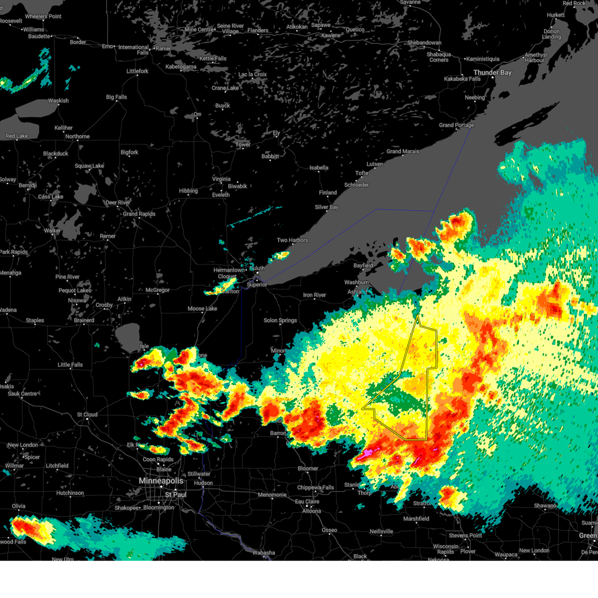
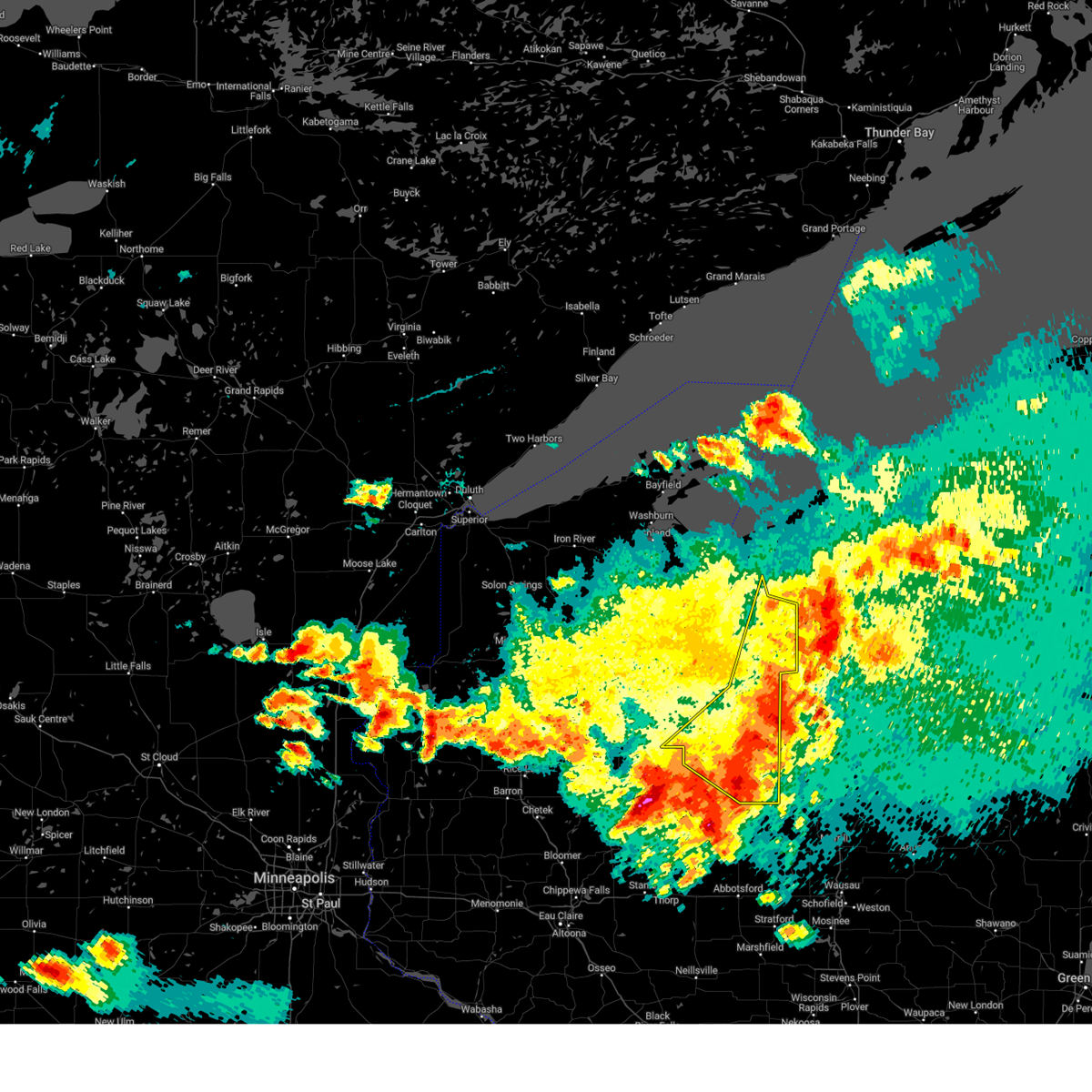
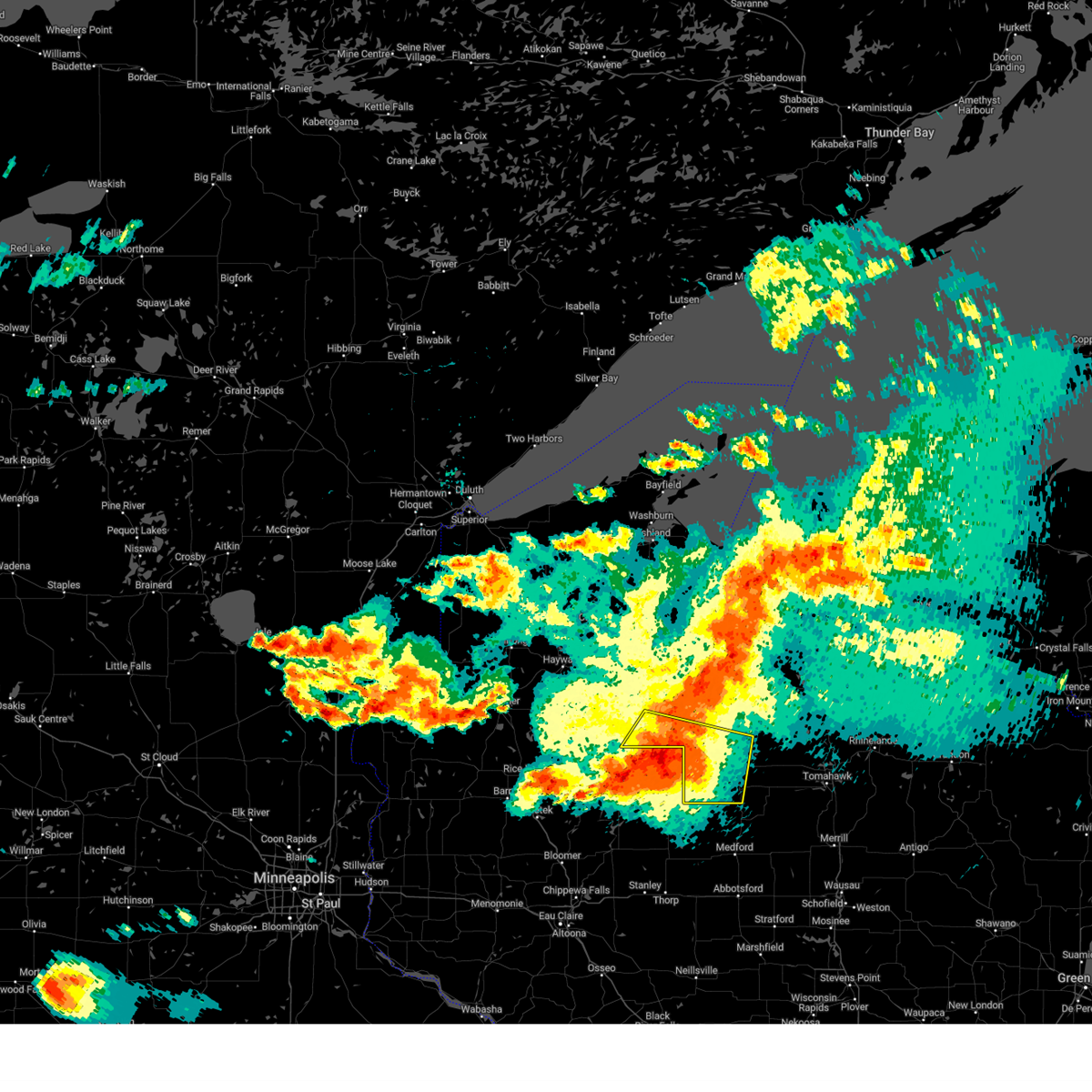
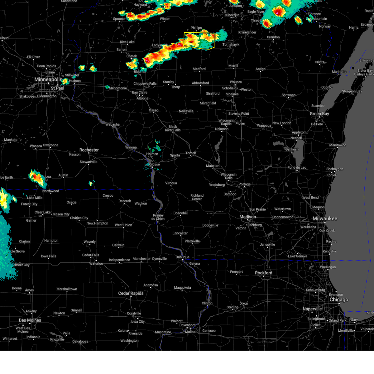
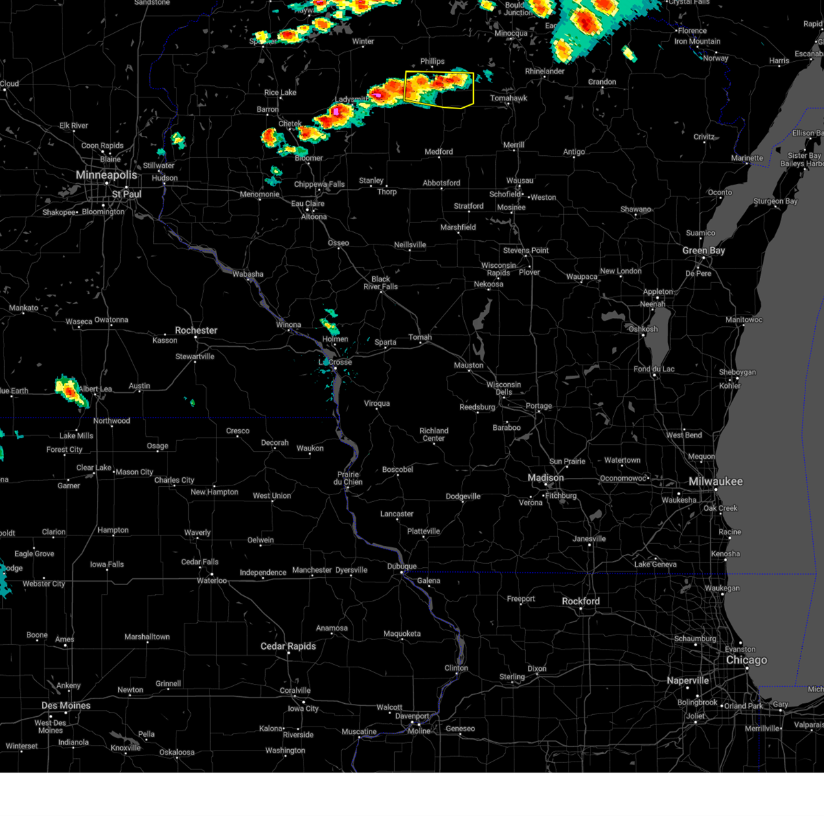
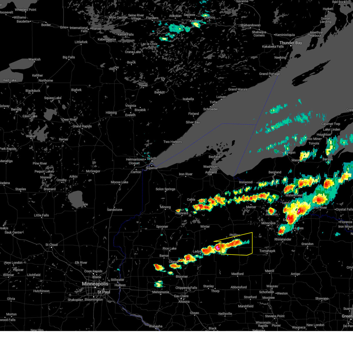
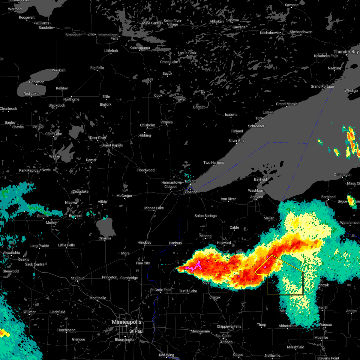
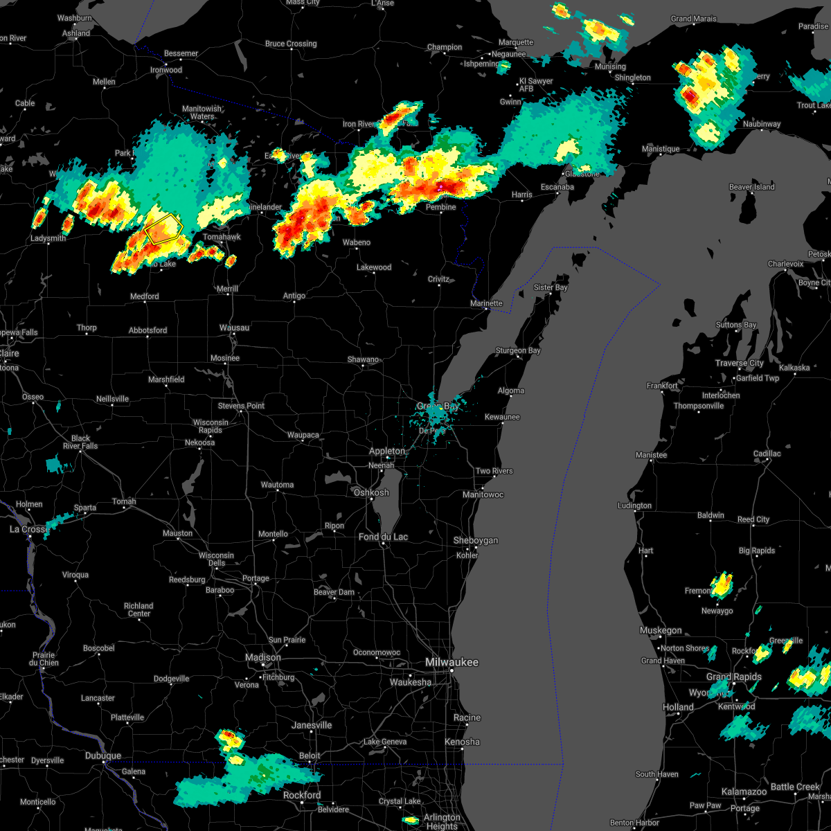
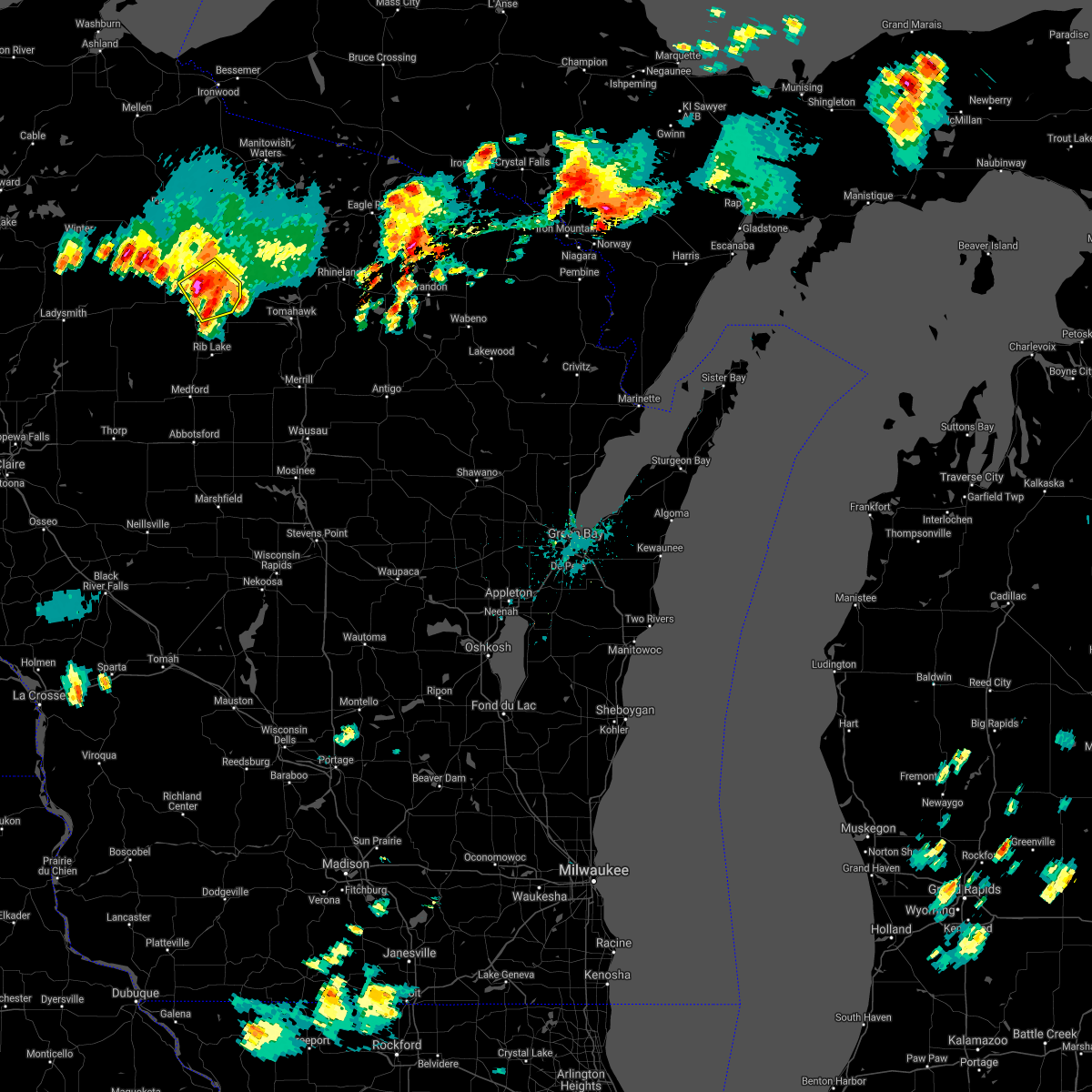
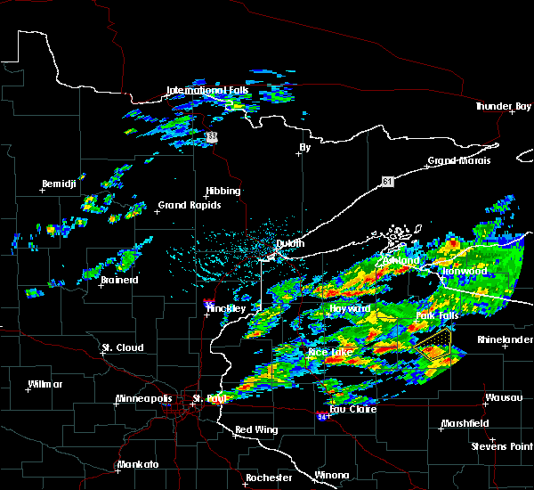
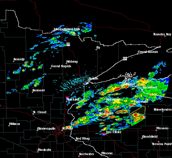
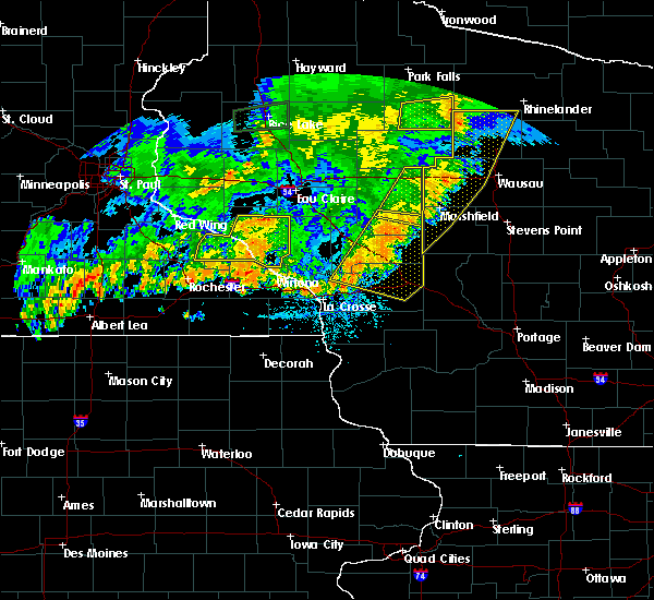
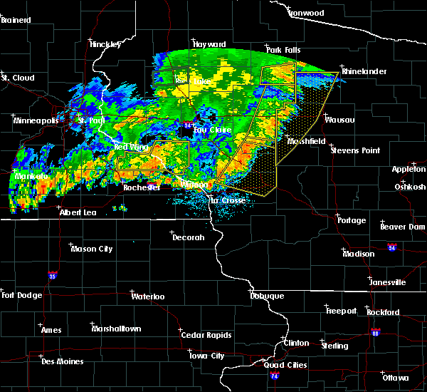
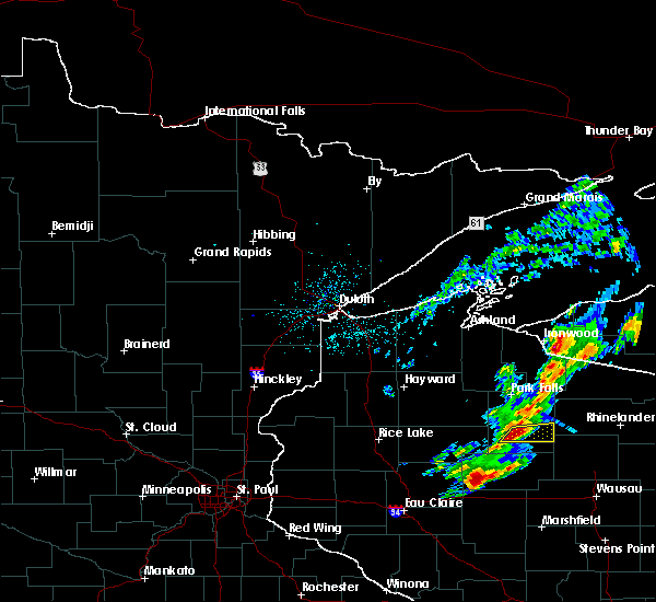
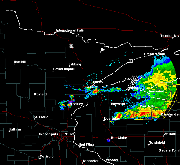
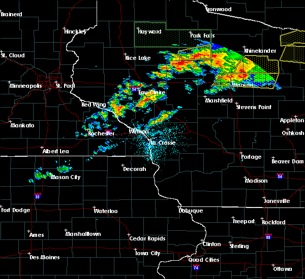
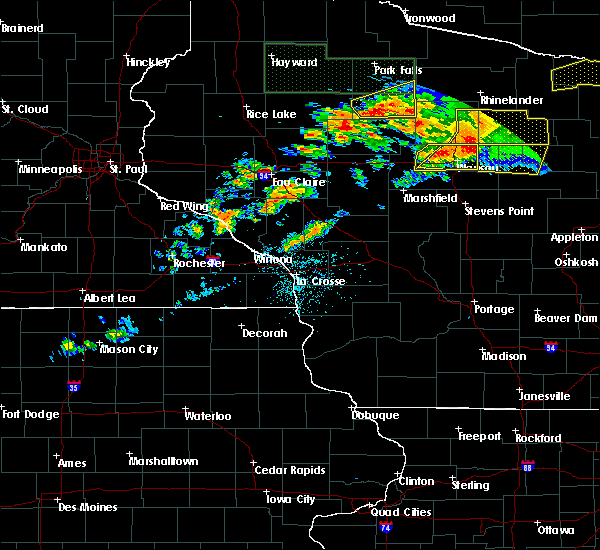
Hail Map for Prentice, WI
The Prentice, WI area has had 5 reports of on-the-ground hail by trained spotters, and has been under severe weather warnings 17 times during the past 12 months. Doppler radar has detected hail at or near Prentice, WI on 45 occasions, including 1 occasion during the past year.
| Name: | Prentice, WI |
| Where Located: | 43.3 miles W of Rhinelander, WI |
| Map: | Google Map for Prentice, WI |
| Population: | 660 |
| Housing Units: | 340 |
| More Info: | Search Google for Prentice, WI |
0
The Top Recent Hail Date for Prentice, WI is Saturday, October 5, 2024 (45th out of 45)

Hail and Wind Damage Spotted near Prentice, WI
| Date / Time | Report Details |
|---|---|
| 6/21/2025 5:57 AM CDT |
 The storms which prompted the warning have weakened below severe limits, and no longer pose an immediate threat to life or property. therefore, the warning will be allowed to expire. however, gusty winds and heavy rain are still possible with these thunderstorms. a severe thunderstorm watch remains in effect until 700 am cdt for north central and northwestern wisconsin. The storms which prompted the warning have weakened below severe limits, and no longer pose an immediate threat to life or property. therefore, the warning will be allowed to expire. however, gusty winds and heavy rain are still possible with these thunderstorms. a severe thunderstorm watch remains in effect until 700 am cdt for north central and northwestern wisconsin.
|
| 6/21/2025 5:44 AM CDT |
 At 543 am cdt, severe thunderstorms were located along a line extending from near willow reservoir to near prentice to 10 miles west of hawkins, moving east at 35 mph (law enforcement dispatch for iron county reported multiple trees down in the county). Hazards include 60 mph wind gusts. Expect damage to roofs, siding, and trees. Locations impacted include, park falls, phillips, fifield, ogema, prentice, spirit, catawba, connors lake, pike lake, wilson lake near phillips, loretta, brantwood, butternut lake, cranberry lake, and musser lake. At 543 am cdt, severe thunderstorms were located along a line extending from near willow reservoir to near prentice to 10 miles west of hawkins, moving east at 35 mph (law enforcement dispatch for iron county reported multiple trees down in the county). Hazards include 60 mph wind gusts. Expect damage to roofs, siding, and trees. Locations impacted include, park falls, phillips, fifield, ogema, prentice, spirit, catawba, connors lake, pike lake, wilson lake near phillips, loretta, brantwood, butternut lake, cranberry lake, and musser lake.
|
| 6/21/2025 5:44 AM CDT |
 the severe thunderstorm warning has been cancelled and is no longer in effect the severe thunderstorm warning has been cancelled and is no longer in effect
|
| 6/21/2025 5:26 AM CDT |
 At 525 am cdt, severe thunderstorms were located along a line extending from 10 miles northwest of paulding to near boulder junction to near phillips, moving east at 55 mph (law enforcement dispatch in iron county reports multiple trees down in iron county). Hazards include 60 mph wind gusts. Expect damage to roofs, siding, and trees. These severe thunderstorms will remain over mainly rural areas of iron, southern ashland, price and northeastern sawyer counties, including the following locations, connors lake, pike lake, manitowish, island lake iron county, wilson lake near phillips, fisher lake, loretta, brantwood, butternut lake, and cranberry lake. At 525 am cdt, severe thunderstorms were located along a line extending from 10 miles northwest of paulding to near boulder junction to near phillips, moving east at 55 mph (law enforcement dispatch in iron county reports multiple trees down in iron county). Hazards include 60 mph wind gusts. Expect damage to roofs, siding, and trees. These severe thunderstorms will remain over mainly rural areas of iron, southern ashland, price and northeastern sawyer counties, including the following locations, connors lake, pike lake, manitowish, island lake iron county, wilson lake near phillips, fisher lake, loretta, brantwood, butternut lake, and cranberry lake.
|
| 6/21/2025 5:09 AM CDT |
 the severe thunderstorm warning has been cancelled and is no longer in effect the severe thunderstorm warning has been cancelled and is no longer in effect
|
| 6/21/2025 5:09 AM CDT |
 At 508 am cdt, severe thunderstorms were located along a line extending from near northern lake gogebic to 7 miles southeast of mercer to 8 miles northwest of phillips, moving east at 50 mph (radar indicated). Hazards include 60 mph wind gusts. Expect damage to roofs, siding, and trees. these severe storms will be near, phillips around 515 am cdt. Other locations impacted by these severe thunderstorms include connors lake, pike lake, manitowish, island lake iron county, wilson lake near phillips, fisher lake, loretta, brantwood, butternut lake, and cranberry lake. At 508 am cdt, severe thunderstorms were located along a line extending from near northern lake gogebic to 7 miles southeast of mercer to 8 miles northwest of phillips, moving east at 50 mph (radar indicated). Hazards include 60 mph wind gusts. Expect damage to roofs, siding, and trees. these severe storms will be near, phillips around 515 am cdt. Other locations impacted by these severe thunderstorms include connors lake, pike lake, manitowish, island lake iron county, wilson lake near phillips, fisher lake, loretta, brantwood, butternut lake, and cranberry lake.
|
| 6/21/2025 4:59 AM CDT |
 At 459 am cdt, severe thunderstorms were located along a line extending from 9 miles northeast of wakefield to near mercer to 12 miles southwest of fifield, moving east at 55 mph (radar indicated). Hazards include 60 mph wind gusts. Expect damage to roofs, siding, and trees. these severe storms will be near, turtle flambeau flowage around 505 am cdt. phillips around 510 am cdt. Other locations impacted by these severe thunderstorms include connors lake, bad river reservation, pike lake, saxon harbor, gile flowage, cedar, pence, brantwood, ghost lake, and high bridge. At 459 am cdt, severe thunderstorms were located along a line extending from 9 miles northeast of wakefield to near mercer to 12 miles southwest of fifield, moving east at 55 mph (radar indicated). Hazards include 60 mph wind gusts. Expect damage to roofs, siding, and trees. these severe storms will be near, turtle flambeau flowage around 505 am cdt. phillips around 510 am cdt. Other locations impacted by these severe thunderstorms include connors lake, bad river reservation, pike lake, saxon harbor, gile flowage, cedar, pence, brantwood, ghost lake, and high bridge.
|
| 6/21/2025 4:40 AM CDT |
 Svrdlh the national weather service in duluth mn has issued a * severe thunderstorm warning for, southeastern bayfield county in northwestern wisconsin, iron county in northwestern wisconsin, ashland county in northwestern wisconsin, price county in north central wisconsin, northeastern sawyer county in northwestern wisconsin, * until 600 am cdt. * at 440 am cdt, severe thunderstorms were located along a line extending from 13 miles north of bessemer to 10 miles northeast of glidden to 7 miles northeast of winter, moving east at 55 mph (radar indicated). Hazards include 60 mph wind gusts. Expect damage to roofs, siding, and trees. severe thunderstorms will be near, park falls, turtle flambeau flowage, hurley, and butternut around 445 am cdt. mercer around 450 am cdt. fifield around 455 am cdt. Other locations in the path of these severe thunderstorms include phillips. Svrdlh the national weather service in duluth mn has issued a * severe thunderstorm warning for, southeastern bayfield county in northwestern wisconsin, iron county in northwestern wisconsin, ashland county in northwestern wisconsin, price county in north central wisconsin, northeastern sawyer county in northwestern wisconsin, * until 600 am cdt. * at 440 am cdt, severe thunderstorms were located along a line extending from 13 miles north of bessemer to 10 miles northeast of glidden to 7 miles northeast of winter, moving east at 55 mph (radar indicated). Hazards include 60 mph wind gusts. Expect damage to roofs, siding, and trees. severe thunderstorms will be near, park falls, turtle flambeau flowage, hurley, and butternut around 445 am cdt. mercer around 450 am cdt. fifield around 455 am cdt. Other locations in the path of these severe thunderstorms include phillips.
|
| 5/15/2025 6:09 PM CDT | The storms which prompted the warning have weakened below severe limits, and no longer pose an immediate threat to life or property. therefore, the warning will be allowed to expire. a tornado watch remains in effect until 800 pm cdt for north central and northwestern wisconsin. |
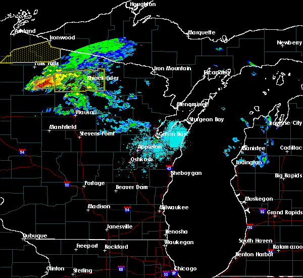
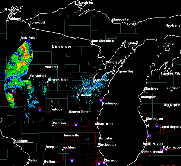
| 5/15/2025 5:52 PM CDT | Svrdlh the national weather service in duluth mn has issued a * severe thunderstorm warning for, southeastern iron county in northwestern wisconsin, price county in north central wisconsin, * until 615 pm cdt. * at 552 pm cdt, severe thunderstorms were located along a line extending from catawba to near ogema, moving northeast at 40 mph (radar indicated). Hazards include 70 mph wind gusts and nickel size hail. Expect considerable tree damage. damage is likely to mobile homes, roofs, and outbuildings. severe thunderstorms will be near, ogema and catawba around 555 pm cdt. prentice around 600 pm cdt. Phillips around 605 pm cdt. |
| 4/28/2025 8:56 PM CDT |
 The storms which prompted the warning have moved out of the area. therefore, the warning will be allowed to expire. however, gusty winds are still possible with these thunderstorms. The storms which prompted the warning have moved out of the area. therefore, the warning will be allowed to expire. however, gusty winds are still possible with these thunderstorms.
|
| 4/28/2025 8:50 PM CDT |
 At 850 pm cdt, severe thunderstorms were located along a line extending from 8 miles southwest of turtle flambeau flowage to near phillips, moving northeast at 40 mph (radar indicated). Hazards include 60 mph wind gusts and penny size hail. Expect damage to roofs, siding, and trees. Locations impacted include, prentice, pike lake, ogema, clifford, spirit, phillips, wilson lake near phillips, brantwood, catawba, cranberry lake, fifield, kennan, musser lake, and park falls. At 850 pm cdt, severe thunderstorms were located along a line extending from 8 miles southwest of turtle flambeau flowage to near phillips, moving northeast at 40 mph (radar indicated). Hazards include 60 mph wind gusts and penny size hail. Expect damage to roofs, siding, and trees. Locations impacted include, prentice, pike lake, ogema, clifford, spirit, phillips, wilson lake near phillips, brantwood, catawba, cranberry lake, fifield, kennan, musser lake, and park falls.
|
| 4/28/2025 8:31 PM CDT |
 the severe thunderstorm warning has been cancelled and is no longer in effect the severe thunderstorm warning has been cancelled and is no longer in effect
|
| 4/28/2025 8:31 PM CDT |
 At 831 pm cdt, severe thunderstorms were located along a line extending from near fifield to catawba, moving east at 40 mph (radar indicated). Hazards include 60 mph wind gusts and penny size hail. Expect damage to roofs, siding, and trees. Locations impacted include, catawba, phillips and prentice. At 831 pm cdt, severe thunderstorms were located along a line extending from near fifield to catawba, moving east at 40 mph (radar indicated). Hazards include 60 mph wind gusts and penny size hail. Expect damage to roofs, siding, and trees. Locations impacted include, catawba, phillips and prentice.
|
| 4/28/2025 8:11 PM CDT |
 Svrdlh the national weather service in duluth mn has issued a * severe thunderstorm warning for, price county in north central wisconsin, southeastern sawyer county in northwestern wisconsin, * until 900 pm cdt. * at 811 pm cdt, severe thunderstorms were located along a line extending from 11 miles west of phillips to near hawkins, moving northeast at 40 mph (radar indicated). Hazards include 60 mph wind gusts and nickel size hail. Expect damage to roofs, siding, and trees. severe thunderstorms will be near, catawba around 820 pm cdt. fifield and park falls around 825 pm cdt. Phillips around 830 pm cdt. Svrdlh the national weather service in duluth mn has issued a * severe thunderstorm warning for, price county in north central wisconsin, southeastern sawyer county in northwestern wisconsin, * until 900 pm cdt. * at 811 pm cdt, severe thunderstorms were located along a line extending from 11 miles west of phillips to near hawkins, moving northeast at 40 mph (radar indicated). Hazards include 60 mph wind gusts and nickel size hail. Expect damage to roofs, siding, and trees. severe thunderstorms will be near, catawba around 820 pm cdt. fifield and park falls around 825 pm cdt. Phillips around 830 pm cdt.
|
| 8/26/2024 10:37 PM CDT |
 Svrdlh the national weather service in duluth mn has issued a * severe thunderstorm warning for, iron county in northwestern wisconsin, southern ashland county in northwestern wisconsin, price county in north central wisconsin, * until 1100 pm cdt. * at 1037 pm cdt, severe thunderstorms were located along a line extending from 6 miles south of mellen to 10 miles south of turtle flambeau flowage to near spirit, moving east at 55 mph (radar indicated). Hazards include 60 mph wind gusts and penny size hail. Expect damage to roofs, siding, and trees. Severe thunderstorms will be near, turtle flambeau flowage around 1045 pm cdt. Svrdlh the national weather service in duluth mn has issued a * severe thunderstorm warning for, iron county in northwestern wisconsin, southern ashland county in northwestern wisconsin, price county in north central wisconsin, * until 1100 pm cdt. * at 1037 pm cdt, severe thunderstorms were located along a line extending from 6 miles south of mellen to 10 miles south of turtle flambeau flowage to near spirit, moving east at 55 mph (radar indicated). Hazards include 60 mph wind gusts and penny size hail. Expect damage to roofs, siding, and trees. Severe thunderstorms will be near, turtle flambeau flowage around 1045 pm cdt.
|
| 8/26/2024 10:06 PM CDT |
 Svrdlh the national weather service in duluth mn has issued a * severe thunderstorm warning for, south central bayfield county in northwestern wisconsin, southern iron county in northwestern wisconsin, southern ashland county in northwestern wisconsin, price county in north central wisconsin, eastern sawyer county in northwestern wisconsin, * until 1045 pm cdt. * at 1005 pm cdt, severe thunderstorms were located along a line extending from near cable to 14 miles east of winter to 11 miles southeast of jump river, moving east at 40 mph (radar indicated). Hazards include 60 mph wind gusts and penny size hail. Expect damage to roofs, siding, and trees. severe thunderstorms will be near, catawba, namekagon lake, and namekagon around 1010 pm cdt. clam lake around 1015 pm cdt. phillips around 1020 pm cdt. park falls, fifield, ogema, and prentice around 1025 pm cdt. Other locations in the path of these severe thunderstorms include butternut and glidden. Svrdlh the national weather service in duluth mn has issued a * severe thunderstorm warning for, south central bayfield county in northwestern wisconsin, southern iron county in northwestern wisconsin, southern ashland county in northwestern wisconsin, price county in north central wisconsin, eastern sawyer county in northwestern wisconsin, * until 1045 pm cdt. * at 1005 pm cdt, severe thunderstorms were located along a line extending from near cable to 14 miles east of winter to 11 miles southeast of jump river, moving east at 40 mph (radar indicated). Hazards include 60 mph wind gusts and penny size hail. Expect damage to roofs, siding, and trees. severe thunderstorms will be near, catawba, namekagon lake, and namekagon around 1010 pm cdt. clam lake around 1015 pm cdt. phillips around 1020 pm cdt. park falls, fifield, ogema, and prentice around 1025 pm cdt. Other locations in the path of these severe thunderstorms include butternut and glidden.
|
| 7/27/2023 6:57 PM CDT |
 The severe thunderstorm warning for southeastern iron, southeastern ashland, price and southeastern sawyer counties will expire at 700 pm cdt, the storms which prompted the warning have weakened below severe limits, and no longer pose an immediate threat to life or property. therefore, the warning will be allowed to expire. a severe thunderstorm watch remains in effect until 900 pm cdt for north central and northwestern wisconsin. to report severe weather, contact your nearest law enforcement agency. they will relay your report to the national weather service duluth mn. The severe thunderstorm warning for southeastern iron, southeastern ashland, price and southeastern sawyer counties will expire at 700 pm cdt, the storms which prompted the warning have weakened below severe limits, and no longer pose an immediate threat to life or property. therefore, the warning will be allowed to expire. a severe thunderstorm watch remains in effect until 900 pm cdt for north central and northwestern wisconsin. to report severe weather, contact your nearest law enforcement agency. they will relay your report to the national weather service duluth mn.
|
| 7/27/2023 6:27 PM CDT |
 At 627 pm cdt, severe thunderstorms were located along a line extending from near rice creek natural area, to willow lake, to near ogema, moving east at 45 mph (radar indicated). Hazards include 70 mph wind gusts and quarter size hail. Hail damage to vehicles is expected. expect considerable tree damage. wind damage is also likely to mobile homes, roofs, and outbuildings. Locations impacted include, turtle flambeau flowage, phillips, mercer, fifield, ogema, prentice, spirit, catawba, long lake, kennan, van buskirk, pike lake, manitowish, wilson lake near phillips, fisher lake, brantwood, cranberry lake, and musser lake. At 627 pm cdt, severe thunderstorms were located along a line extending from near rice creek natural area, to willow lake, to near ogema, moving east at 45 mph (radar indicated). Hazards include 70 mph wind gusts and quarter size hail. Hail damage to vehicles is expected. expect considerable tree damage. wind damage is also likely to mobile homes, roofs, and outbuildings. Locations impacted include, turtle flambeau flowage, phillips, mercer, fifield, ogema, prentice, spirit, catawba, long lake, kennan, van buskirk, pike lake, manitowish, wilson lake near phillips, fisher lake, brantwood, cranberry lake, and musser lake.
|
| 7/27/2023 6:14 PM CDT |
 At 614 pm cdt, severe thunderstorms were located along a line extending from near winchester, to 9 miles northwest of willow lake, to near catawba, moving southeast at 40 mph (radar indicated). Hazards include 70 mph wind gusts and quarter size hail. Hail damage to vehicles is expected. expect considerable tree damage. wind damage is also likely to mobile homes, roofs, and outbuildings. Locations impacted include, park falls, turtle flambeau flowage, ironwood, hurley, phillips, mercer, fifield, ogema, prentice, butternut, spirit, catawba, upson, gile, montreal, kimball, pence, long lake, kennan, and connors lake. At 614 pm cdt, severe thunderstorms were located along a line extending from near winchester, to 9 miles northwest of willow lake, to near catawba, moving southeast at 40 mph (radar indicated). Hazards include 70 mph wind gusts and quarter size hail. Hail damage to vehicles is expected. expect considerable tree damage. wind damage is also likely to mobile homes, roofs, and outbuildings. Locations impacted include, park falls, turtle flambeau flowage, ironwood, hurley, phillips, mercer, fifield, ogema, prentice, butternut, spirit, catawba, upson, gile, montreal, kimball, pence, long lake, kennan, and connors lake.
|
| 7/27/2023 5:52 PM CDT |
 At 552 pm cdt, severe thunderstorms were located along a line extending from 9 miles northwest of catawba, to hawkins, to 8 miles northeast of ladysmith, moving east at 60 mph (radar indicated). Hazards include 60 mph wind gusts and quarter size hail. Hail damage to vehicles is expected. expect wind damage to roofs, siding, and trees. Locations impacted include, phillips, catawba, ogema and prentice. At 552 pm cdt, severe thunderstorms were located along a line extending from 9 miles northwest of catawba, to hawkins, to 8 miles northeast of ladysmith, moving east at 60 mph (radar indicated). Hazards include 60 mph wind gusts and quarter size hail. Hail damage to vehicles is expected. expect wind damage to roofs, siding, and trees. Locations impacted include, phillips, catawba, ogema and prentice.
|
| 7/27/2023 5:52 PM CDT |
 At 551 pm cdt, severe thunderstorms were located along a line extending from near bessemer, to near park falls, to 11 miles north of hawkins, moving east at 45 mph (radar indicated). Hazards include 70 mph wind gusts and quarter size hail. Hail damage to vehicles is expected. expect considerable tree damage. wind damage is also likely to mobile homes, roofs, and outbuildings. Locations impacted include, ironwood, phillips, catawba, prentice and spirit. At 551 pm cdt, severe thunderstorms were located along a line extending from near bessemer, to near park falls, to 11 miles north of hawkins, moving east at 45 mph (radar indicated). Hazards include 70 mph wind gusts and quarter size hail. Hail damage to vehicles is expected. expect considerable tree damage. wind damage is also likely to mobile homes, roofs, and outbuildings. Locations impacted include, ironwood, phillips, catawba, prentice and spirit.
|
| 7/27/2023 5:28 PM CDT |
 At 528 pm cdt, severe thunderstorms were located along a line extending from near saxon, to near butternut, to near winter, moving east at 45 mph (radar indicated). Hazards include 70 mph wind gusts and quarter size hail. Hail damage to vehicles is expected. expect considerable tree damage. wind damage is also likely to mobile homes, roofs, and outbuildings. severe thunderstorms will be near, butternut around 535 pm cdt. park falls, hurley and gile around 540 pm cdt. ironwood and fifield around 545 pm cdt. Other locations in the path of these severe thunderstorms include phillips, catawba, prentice and spirit. At 528 pm cdt, severe thunderstorms were located along a line extending from near saxon, to near butternut, to near winter, moving east at 45 mph (radar indicated). Hazards include 70 mph wind gusts and quarter size hail. Hail damage to vehicles is expected. expect considerable tree damage. wind damage is also likely to mobile homes, roofs, and outbuildings. severe thunderstorms will be near, butternut around 535 pm cdt. park falls, hurley and gile around 540 pm cdt. ironwood and fifield around 545 pm cdt. Other locations in the path of these severe thunderstorms include phillips, catawba, prentice and spirit.
|
| 7/27/2023 5:24 PM CDT |
 At 523 pm cdt, severe thunderstorms were located along a line extending from near radisson, to near exeland, to near birchwood, moving southeast at 60 mph (radar indicated). Hazards include 60 mph wind gusts and quarter size hail. Hail damage to vehicles is expected. expect wind damage to roofs, siding, and trees. severe thunderstorms will be near, winter around 530 pm cdt. Other locations in the path of these severe thunderstorms include catawba, ogema and prentice. At 523 pm cdt, severe thunderstorms were located along a line extending from near radisson, to near exeland, to near birchwood, moving southeast at 60 mph (radar indicated). Hazards include 60 mph wind gusts and quarter size hail. Hail damage to vehicles is expected. expect wind damage to roofs, siding, and trees. severe thunderstorms will be near, winter around 530 pm cdt. Other locations in the path of these severe thunderstorms include catawba, ogema and prentice.
|
| 7/10/2023 6:24 PM CDT |
 At 624 pm cdt, a new severe thunderstorm was located over hawkins, or 21 miles east of ladysmith, moving east at 25 mph (radar indicated). Hazards include 60 mph wind gusts and half dollar size hail. Hail damage to vehicles is expected. expect wind damage to roofs, siding, and trees. this severe storm will be near, catawba around 640 pm cdt. ogema and prentice around 705 pm cdt. spirit around 725 pm cdt. other locations impacted by this severe thunderstorm include kennan, brantwood, clifford, cranberry lake and wilson lake near phillips. hail threat, observed max hail size, 1. 25 in wind threat, radar indicated max wind gust, 60 mph. At 624 pm cdt, a new severe thunderstorm was located over hawkins, or 21 miles east of ladysmith, moving east at 25 mph (radar indicated). Hazards include 60 mph wind gusts and half dollar size hail. Hail damage to vehicles is expected. expect wind damage to roofs, siding, and trees. this severe storm will be near, catawba around 640 pm cdt. ogema and prentice around 705 pm cdt. spirit around 725 pm cdt. other locations impacted by this severe thunderstorm include kennan, brantwood, clifford, cranberry lake and wilson lake near phillips. hail threat, observed max hail size, 1. 25 in wind threat, radar indicated max wind gust, 60 mph.
|
| 7/10/2023 6:11 PM CDT |
 At 609 pm cdt, a severe thunderstorm was located over catawba, or 27 miles south of park falls, moving east at 30 mph (trained weather spotters reported quarter-size hail near kennan at 603 pm). Hazards include 60 mph wind gusts and half dollar size hail. Hail damage to vehicles is expected. expect wind damage to roofs, siding, and trees. this severe storm will be near, ogema and prentice around 635 pm cdt. spirit around 650 pm cdt. other locations impacted by this severe thunderstorm include kennan, brantwood, clifford, cranberry lake and wilson lake near phillips. hail threat, observed max hail size, 1. 25 in wind threat, radar indicated max wind gust, 60 mph. At 609 pm cdt, a severe thunderstorm was located over catawba, or 27 miles south of park falls, moving east at 30 mph (trained weather spotters reported quarter-size hail near kennan at 603 pm). Hazards include 60 mph wind gusts and half dollar size hail. Hail damage to vehicles is expected. expect wind damage to roofs, siding, and trees. this severe storm will be near, ogema and prentice around 635 pm cdt. spirit around 650 pm cdt. other locations impacted by this severe thunderstorm include kennan, brantwood, clifford, cranberry lake and wilson lake near phillips. hail threat, observed max hail size, 1. 25 in wind threat, radar indicated max wind gust, 60 mph.
|
| 7/10/2023 5:55 PM CDT |
 At 555 pm cdt, a severe thunderstorm was located near hawkins, or 20 miles east of ladysmith, moving east at 30 mph (radar indicated). Hazards include 60 mph wind gusts and half dollar size hail. Hail damage to vehicles is expected. expect wind damage to roofs, siding, and trees. this severe thunderstorm will be near, catawba around 615 pm cdt. phillips around 625 pm cdt. prentice around 635 pm cdt. other locations impacted by this severe thunderstorm include kennan, brantwood, clifford, wilson lake near phillips and cranberry lake. hail threat, radar indicated max hail size, 1. 25 in wind threat, radar indicated max wind gust, 60 mph. At 555 pm cdt, a severe thunderstorm was located near hawkins, or 20 miles east of ladysmith, moving east at 30 mph (radar indicated). Hazards include 60 mph wind gusts and half dollar size hail. Hail damage to vehicles is expected. expect wind damage to roofs, siding, and trees. this severe thunderstorm will be near, catawba around 615 pm cdt. phillips around 625 pm cdt. prentice around 635 pm cdt. other locations impacted by this severe thunderstorm include kennan, brantwood, clifford, wilson lake near phillips and cranberry lake. hail threat, radar indicated max hail size, 1. 25 in wind threat, radar indicated max wind gust, 60 mph.
|
| 8/3/2022 2:45 AM CDT |
 At 244 am cdt, severe thunderstorms were located along a line extending from near sheldon, to 12 miles northwest of medford, to abbotsford, moving east at 60 mph (radar indicated). Hazards include 60 mph wind gusts. Expect damage to roofs, siding, and trees. these severe storms will be near, catawba around 310 am cdt. ogema and spirit around 315 am cdt. prentice around 320 am cdt. other locations impacted by these severe thunderstorms include brantwood, clifford and kennan. hail threat, radar indicated max hail size, <. 75 in wind threat, radar indicated max wind gust, 60 mph. At 244 am cdt, severe thunderstorms were located along a line extending from near sheldon, to 12 miles northwest of medford, to abbotsford, moving east at 60 mph (radar indicated). Hazards include 60 mph wind gusts. Expect damage to roofs, siding, and trees. these severe storms will be near, catawba around 310 am cdt. ogema and spirit around 315 am cdt. prentice around 320 am cdt. other locations impacted by these severe thunderstorms include brantwood, clifford and kennan. hail threat, radar indicated max hail size, <. 75 in wind threat, radar indicated max wind gust, 60 mph.
|
| 8/3/2022 2:15 AM CDT |
 At 214 am cdt, severe thunderstorms were located along a line extending from 8 miles west of sheldon, to near cadott, to 7 miles northeast of augusta, moving east at 55 mph (radar indicated). Hazards include 60 mph wind gusts. Expect damage to roofs, siding, and trees. severe thunderstorms will be near, ogema around 300 am cdt. prentice around 305 am cdt. spirit around 310 am cdt. Other locations impacted by these severe thunderstorms include brantwood, clifford and kennan. At 214 am cdt, severe thunderstorms were located along a line extending from 8 miles west of sheldon, to near cadott, to 7 miles northeast of augusta, moving east at 55 mph (radar indicated). Hazards include 60 mph wind gusts. Expect damage to roofs, siding, and trees. severe thunderstorms will be near, ogema around 300 am cdt. prentice around 305 am cdt. spirit around 310 am cdt. Other locations impacted by these severe thunderstorms include brantwood, clifford and kennan.
|
| 8/2/2022 10:46 PM CDT |
 At 1046 pm cdt, a severe thunderstorm was located near ogema, or 23 miles north of medford, moving southeast at 40 mph (radar indicated). Hazards include 60 mph wind gusts and penny size hail. Expect damage to roofs, siding, and trees. Locations impacted include, phillips, ogema, prentice, spirit, catawba, kennan, brantwood, cranberry lake, clifford, wilson lake near phillips, and musser lake. At 1046 pm cdt, a severe thunderstorm was located near ogema, or 23 miles north of medford, moving southeast at 40 mph (radar indicated). Hazards include 60 mph wind gusts and penny size hail. Expect damage to roofs, siding, and trees. Locations impacted include, phillips, ogema, prentice, spirit, catawba, kennan, brantwood, cranberry lake, clifford, wilson lake near phillips, and musser lake.
|
| 8/2/2022 10:21 PM CDT |
 At 1021 pm cdt, a severe thunderstorm was located near catawba, or 22 miles south of park falls, moving southeast at 40 mph (radar indicated). Hazards include 60 mph wind gusts and penny size hail. Expect damage to roofs, siding, and trees. Locations impacted include, prentice, ogema and spirit. At 1021 pm cdt, a severe thunderstorm was located near catawba, or 22 miles south of park falls, moving southeast at 40 mph (radar indicated). Hazards include 60 mph wind gusts and penny size hail. Expect damage to roofs, siding, and trees. Locations impacted include, prentice, ogema and spirit.
|
| 8/2/2022 10:11 PM CDT |
 At 1011 pm cdt, a severe thunderstorm was located 8 miles north of catawba, or 20 miles south of park falls, moving southeast at 40 mph (radar indicated). Hazards include 60 mph wind gusts and penny size hail. Expect damage to roofs, siding, and trees. this severe thunderstorm will be near, phillips around 1020 pm cdt. catawba around 1025 pm cdt. Other locations in the path of this severe thunderstorm include prentice, ogema and spirit. At 1011 pm cdt, a severe thunderstorm was located 8 miles north of catawba, or 20 miles south of park falls, moving southeast at 40 mph (radar indicated). Hazards include 60 mph wind gusts and penny size hail. Expect damage to roofs, siding, and trees. this severe thunderstorm will be near, phillips around 1020 pm cdt. catawba around 1025 pm cdt. Other locations in the path of this severe thunderstorm include prentice, ogema and spirit.
|
| 6/8/2021 6:26 PM CDT |
 The severe thunderstorm warning for southeastern price county will expire at 630 pm cdt, the storm which prompted the warning has weakened below severe limits, and no longer poses an immediate threat to life or property. therefore, the warning will be allowed to expire. however heavy rain and frequent cloud-to-ground lightning is still possible with this thunderstorm. The severe thunderstorm warning for southeastern price county will expire at 630 pm cdt, the storm which prompted the warning has weakened below severe limits, and no longer poses an immediate threat to life or property. therefore, the warning will be allowed to expire. however heavy rain and frequent cloud-to-ground lightning is still possible with this thunderstorm.
|
| 6/8/2021 6:16 PM CDT |
 At 616 pm cdt, a severe thunderstorm was located near prentice, or 27 miles southeast of park falls, moving southeast at 5 mph (radar indicated). Hazards include quarter size hail. Damage to vehicles is expected. Locations impacted include, prentice, brantwood, and clifford. At 616 pm cdt, a severe thunderstorm was located near prentice, or 27 miles southeast of park falls, moving southeast at 5 mph (radar indicated). Hazards include quarter size hail. Damage to vehicles is expected. Locations impacted include, prentice, brantwood, and clifford.
|
| 6/8/2021 6:00 PM CDT |
 At 559 pm cdt, a severe thunderstorm was located near prentice, or 25 miles southeast of park falls, moving southeast at 5 mph (radar indicated). Hazards include quarter size hail. Damage to vehicles is expected. This severe thunderstorm will remain over mainly rural areas of southeastern price county, including the following locations, brantwood, cranberry lake and clifford. At 559 pm cdt, a severe thunderstorm was located near prentice, or 25 miles southeast of park falls, moving southeast at 5 mph (radar indicated). Hazards include quarter size hail. Damage to vehicles is expected. This severe thunderstorm will remain over mainly rural areas of southeastern price county, including the following locations, brantwood, cranberry lake and clifford.
|
| 6/8/2021 5:47 PM CDT |
 At 546 pm cdt, a severe thunderstorm was located near prentice, or 24 miles southeast of park falls, moving southeast at 5 mph (radar indicated). Hazards include quarter size hail. Damage to vehicles is expected. This severe thunderstorm will be near, prentice around 605 pm cdt. At 546 pm cdt, a severe thunderstorm was located near prentice, or 24 miles southeast of park falls, moving southeast at 5 mph (radar indicated). Hazards include quarter size hail. Damage to vehicles is expected. This severe thunderstorm will be near, prentice around 605 pm cdt.
|
| 7/19/2020 12:24 AM CDT |
 At 1222 am cdt, a severe thunderstorm was located 7 miles southwest of willow lake, or 23 miles southeast of park falls, moving east at 50 mph (radar indicated). Hazards include 60 mph wind gusts and penny size hail. Expect damage to roofs, siding, and trees. Locations impacted include, phillips, prentice, brantwood, clifford, cranberry lake, and musser lake. At 1222 am cdt, a severe thunderstorm was located 7 miles southwest of willow lake, or 23 miles southeast of park falls, moving east at 50 mph (radar indicated). Hazards include 60 mph wind gusts and penny size hail. Expect damage to roofs, siding, and trees. Locations impacted include, phillips, prentice, brantwood, clifford, cranberry lake, and musser lake.
|
| 7/19/2020 12:12 AM CDT |
 At 1212 am cdt, a severe thunderstorm was located near phillips, or 20 miles south of park falls, moving east at 50 mph (radar indicated). Hazards include 60 mph wind gusts and nickel size hail. expect damage to roofs, siding, and trees At 1212 am cdt, a severe thunderstorm was located near phillips, or 20 miles south of park falls, moving east at 50 mph (radar indicated). Hazards include 60 mph wind gusts and nickel size hail. expect damage to roofs, siding, and trees
|
| 4/7/2020 9:39 AM CDT |
 At 939 am cdt, a severe thunderstorm was located 8 miles west of hawkins, or 12 miles northeast of ladysmith, moving east at 50 mph (radar indicated). Hazards include golf ball size hail and 60 mph wind gusts. People and animals outdoors will be injured. expect hail damage to roofs, siding, windows, and vehicles. Expect wind damage to roofs, siding, and trees. At 939 am cdt, a severe thunderstorm was located 8 miles west of hawkins, or 12 miles northeast of ladysmith, moving east at 50 mph (radar indicated). Hazards include golf ball size hail and 60 mph wind gusts. People and animals outdoors will be injured. expect hail damage to roofs, siding, windows, and vehicles. Expect wind damage to roofs, siding, and trees.
|
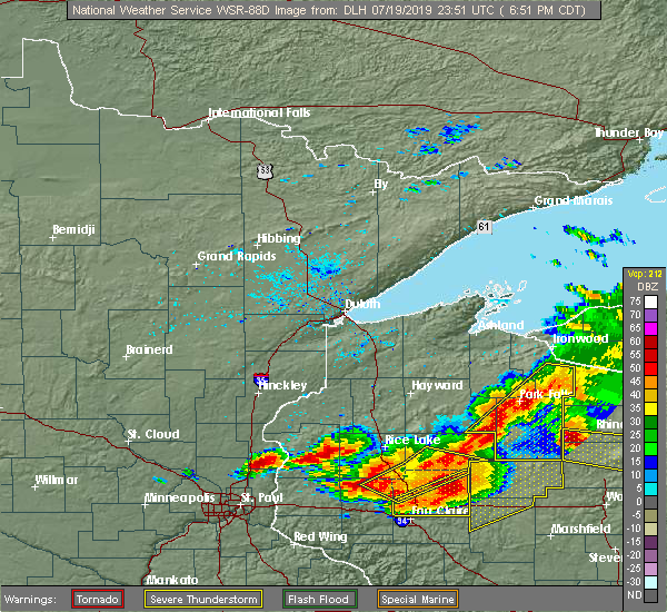
| 7/19/2019 7:30 PM CDT |
 At 729 pm cdt, severe thunderstorms were located along a line extending from near willow lake, to near spirit, to westboro, moving east at 50 mph. these are very dangerous storms (radar indicated). Hazards include 80 mph wind gusts and quarter size hail. Flying debris will be dangerous to those caught without shelter. mobile homes will be heavily damaged. expect considerable damage to roofs, windows, and vehicles. Extensive tree damage and power outages are likely. At 729 pm cdt, severe thunderstorms were located along a line extending from near willow lake, to near spirit, to westboro, moving east at 50 mph. these are very dangerous storms (radar indicated). Hazards include 80 mph wind gusts and quarter size hail. Flying debris will be dangerous to those caught without shelter. mobile homes will be heavily damaged. expect considerable damage to roofs, windows, and vehicles. Extensive tree damage and power outages are likely.
|
| 7/19/2019 7:10 PM CDT |
 At 709 pm cdt, severe thunderstorms were located along a line extending from boulder junction, to near catawba, moving east at 55 mph. these are very dangerous storms (radar indicated). Hazards include 80 mph wind gusts and quarter size hail. Flying debris will be dangerous to those caught without shelter. mobile homes will be heavily damaged. expect considerable damage to roofs, windows, and vehicles. extensive tree damage and power outages are likely. Locations impacted include, phillips, fifield, ogema, prentice, spirit, catawba, kennan, brantwood, pike lake, cranberry lake, wilson lake near phillips, and musser lake. At 709 pm cdt, severe thunderstorms were located along a line extending from boulder junction, to near catawba, moving east at 55 mph. these are very dangerous storms (radar indicated). Hazards include 80 mph wind gusts and quarter size hail. Flying debris will be dangerous to those caught without shelter. mobile homes will be heavily damaged. expect considerable damage to roofs, windows, and vehicles. extensive tree damage and power outages are likely. Locations impacted include, phillips, fifield, ogema, prentice, spirit, catawba, kennan, brantwood, pike lake, cranberry lake, wilson lake near phillips, and musser lake.
|
| 7/19/2019 6:54 PM CDT |
 At 653 pm cdt, severe thunderstorms were located along a line extending from winchester, to near hawkins, moving east at 50 mph. these are very dangerous storms (radar indicated). Hazards include 80 mph wind gusts and quarter size hail. Flying debris will be dangerous to those caught without shelter. mobile homes will be heavily damaged. expect considerable damage to roofs, windows, and vehicles. extensive tree damage and power outages are likely. Locations impacted include, park falls, turtle flambeau flowage, phillips, mercer, fifield, ogema, prentice, butternut, spirit, catawba, long lake, kennan, connors lake, pike lake, manitowish, wilson lake near phillips, fisher lake, brantwood, butternut lake, and cranberry lake. At 653 pm cdt, severe thunderstorms were located along a line extending from winchester, to near hawkins, moving east at 50 mph. these are very dangerous storms (radar indicated). Hazards include 80 mph wind gusts and quarter size hail. Flying debris will be dangerous to those caught without shelter. mobile homes will be heavily damaged. expect considerable damage to roofs, windows, and vehicles. extensive tree damage and power outages are likely. Locations impacted include, park falls, turtle flambeau flowage, phillips, mercer, fifield, ogema, prentice, butternut, spirit, catawba, long lake, kennan, connors lake, pike lake, manitowish, wilson lake near phillips, fisher lake, brantwood, butternut lake, and cranberry lake.
|
| 7/19/2019 6:33 PM CDT |
 At 633 pm cdt, severe thunderstorms were located along a line extending from 10 miles southeast of upson, to 10 miles east of exeland, moving east at 55 mph. these are very dangerous storms (radar indicated). Hazards include 80 mph wind gusts and quarter size hail. Flying debris will be dangerous to those caught without shelter. mobile homes will be heavily damaged. expect considerable damage to roofs, windows, and vehicles. Extensive tree damage and power outages are likely. At 633 pm cdt, severe thunderstorms were located along a line extending from 10 miles southeast of upson, to 10 miles east of exeland, moving east at 55 mph. these are very dangerous storms (radar indicated). Hazards include 80 mph wind gusts and quarter size hail. Flying debris will be dangerous to those caught without shelter. mobile homes will be heavily damaged. expect considerable damage to roofs, windows, and vehicles. Extensive tree damage and power outages are likely.
|
| 7/19/2019 6:22 PM CDT |
 At 621 pm cdt, a severe thunderstorm was located near ogema, or 24 miles north of medford, moving southeast at 40 mph. this is a very dangerous storm (radar indicated). Hazards include 80 mph wind gusts and ping pong ball size hail. Flying debris will be dangerous to those caught without shelter. mobile homes will be heavily damaged. expect considerable damage to roofs, windows, and vehicles. extensive tree damage and power outages are likely. Locations impacted include, phillips, ogema, prentice, spirit, brantwood, cranberry lake, and clifford. At 621 pm cdt, a severe thunderstorm was located near ogema, or 24 miles north of medford, moving southeast at 40 mph. this is a very dangerous storm (radar indicated). Hazards include 80 mph wind gusts and ping pong ball size hail. Flying debris will be dangerous to those caught without shelter. mobile homes will be heavily damaged. expect considerable damage to roofs, windows, and vehicles. extensive tree damage and power outages are likely. Locations impacted include, phillips, ogema, prentice, spirit, brantwood, cranberry lake, and clifford.
|
| 7/19/2019 6:08 PM CDT |
 At 607 pm cdt, a severe thunderstorm was located near prentice, or 27 miles south of park falls, moving southeast at 40 mph. this is a very dangerous storm (radar indicated). Hazards include 80 mph wind gusts and two inch hail. Flying debris will be dangerous to those caught without shelter. mobile homes will be heavily damaged. expect considerable damage to roofs, windows, and vehicles. extensive tree damage and power outages are likely. Locations impacted include, phillips, ogema, prentice, spirit, catawba, kennan, brantwood, cranberry lake, clifford, and wilson lake near phillips. At 607 pm cdt, a severe thunderstorm was located near prentice, or 27 miles south of park falls, moving southeast at 40 mph. this is a very dangerous storm (radar indicated). Hazards include 80 mph wind gusts and two inch hail. Flying debris will be dangerous to those caught without shelter. mobile homes will be heavily damaged. expect considerable damage to roofs, windows, and vehicles. extensive tree damage and power outages are likely. Locations impacted include, phillips, ogema, prentice, spirit, catawba, kennan, brantwood, cranberry lake, clifford, and wilson lake near phillips.
|
| 7/19/2019 5:57 PM CDT |
 At 557 pm cdt, a severe thunderstorm was located over catawba, or 24 miles south of park falls, moving southeast at 40 mph. this is a very dangerous storm (radar indicated). Hazards include 80 mph wind gusts and two inch hail. Flying debris will be dangerous to those caught without shelter. mobile homes will be heavily damaged. expect considerable damage to roofs, windows, and vehicles. extensive tree damage and power outages are likely. Locations impacted include, phillips, ogema, prentice, spirit, catawba, kennan, brantwood, cranberry lake, clifford, and wilson lake near phillips. At 557 pm cdt, a severe thunderstorm was located over catawba, or 24 miles south of park falls, moving southeast at 40 mph. this is a very dangerous storm (radar indicated). Hazards include 80 mph wind gusts and two inch hail. Flying debris will be dangerous to those caught without shelter. mobile homes will be heavily damaged. expect considerable damage to roofs, windows, and vehicles. extensive tree damage and power outages are likely. Locations impacted include, phillips, ogema, prentice, spirit, catawba, kennan, brantwood, cranberry lake, clifford, and wilson lake near phillips.
|
| 7/19/2019 5:43 PM CDT |
 At 543 pm cdt, a severe thunderstorm was located 9 miles north of hawkins, or 21 miles northeast of ladysmith, moving southeast at 40 mph. this is a very dangerous storm (radar indicated). Hazards include 80 mph wind gusts and two inch hail. Flying debris will be dangerous to those caught without shelter. mobile homes will be heavily damaged. expect considerable damage to roofs, windows, and vehicles. extensive tree damage and power outages are likely. Locations impacted include, phillips, ogema, prentice, spirit, catawba, kennan, connors lake, brantwood, cranberry lake, clifford, and wilson lake near phillips. At 543 pm cdt, a severe thunderstorm was located 9 miles north of hawkins, or 21 miles northeast of ladysmith, moving southeast at 40 mph. this is a very dangerous storm (radar indicated). Hazards include 80 mph wind gusts and two inch hail. Flying debris will be dangerous to those caught without shelter. mobile homes will be heavily damaged. expect considerable damage to roofs, windows, and vehicles. extensive tree damage and power outages are likely. Locations impacted include, phillips, ogema, prentice, spirit, catawba, kennan, connors lake, brantwood, cranberry lake, clifford, and wilson lake near phillips.
|
| 7/19/2019 5:29 PM CDT |
 The national weather service in duluth mn has issued a * severe thunderstorm warning for. southern price county in north central wisconsin. southeastern sawyer county in northwestern wisconsin. until 630 pm cdt. At 529 pm cdt, a severe thunderstorm was located 10 miles southeast. The national weather service in duluth mn has issued a * severe thunderstorm warning for. southern price county in north central wisconsin. southeastern sawyer county in northwestern wisconsin. until 630 pm cdt. At 529 pm cdt, a severe thunderstorm was located 10 miles southeast.
|
| 7/15/2019 8:00 PM CDT |
 At 759 pm cdt, severe thunderstorms were located along a line extending from 6 miles northwest of catawba, to 10 miles southeast of hawkins, to 10 miles southeast of jump river, moving east at 45 mph (radar indicated). Hazards include 70 mph wind gusts and quarter size hail. Hail damage to vehicles is expected. expect considerable tree damage. Wind damage is also likely to mobile homes, roofs, and outbuildings. At 759 pm cdt, severe thunderstorms were located along a line extending from 6 miles northwest of catawba, to 10 miles southeast of hawkins, to 10 miles southeast of jump river, moving east at 45 mph (radar indicated). Hazards include 70 mph wind gusts and quarter size hail. Hail damage to vehicles is expected. expect considerable tree damage. Wind damage is also likely to mobile homes, roofs, and outbuildings.
|
| 7/15/2019 3:30 PM CDT | Small branches and leaves striped off trees. estimated 40 mph wind in price county WI, 0.7 miles SSW of Prentice, WI |
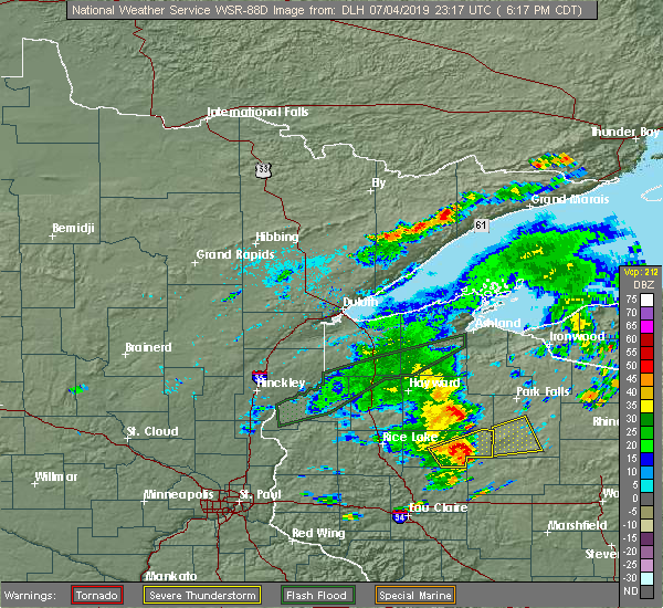
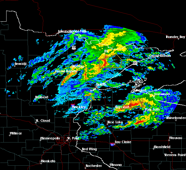
| 7/4/2019 7:01 PM CDT |
 At 701 pm cdt, severe thunderstorms were located along a line extending from 13 miles north of hawkins, to 7 miles west of phillips, to near ogema, moving northeast at 30 mph (radar indicated). Hazards include 60 mph wind gusts and quarter size hail. Hail damage to vehicles is expected. expect wind damage to roofs, siding, and trees. Locations impacted include, phillips, ogema, prentice, catawba, kennan, connors lake, cranberry lake, and wilson lake near phillips. At 701 pm cdt, severe thunderstorms were located along a line extending from 13 miles north of hawkins, to 7 miles west of phillips, to near ogema, moving northeast at 30 mph (radar indicated). Hazards include 60 mph wind gusts and quarter size hail. Hail damage to vehicles is expected. expect wind damage to roofs, siding, and trees. Locations impacted include, phillips, ogema, prentice, catawba, kennan, connors lake, cranberry lake, and wilson lake near phillips.
|
| 7/4/2019 6:50 PM CDT |
 At 649 pm cdt, a severe thunderstorm was located 9 miles northwest of catawba, or 21 miles southwest of park falls, moving northeast at 35 mph (radar indicated). Hazards include 60 mph wind gusts and quarter size hail. Hail damage to vehicles is expected. Expect wind damage to roofs, siding, and trees. At 649 pm cdt, a severe thunderstorm was located 9 miles northwest of catawba, or 21 miles southwest of park falls, moving northeast at 35 mph (radar indicated). Hazards include 60 mph wind gusts and quarter size hail. Hail damage to vehicles is expected. Expect wind damage to roofs, siding, and trees.
|
| 7/4/2019 6:29 PM CDT |
 At 629 pm cdt, a severe thunderstorm was located over hawkins, or 15 miles east of ladysmith, moving east at 35 mph (radar indicated). Hazards include 60 mph wind gusts and quarter size hail. Hail damage to vehicles is expected. expect wind damage to roofs, siding, and trees. Locations impacted include, phillips, ogema, prentice, catawba, kennan, cranberry lake, and wilson lake near phillips. At 629 pm cdt, a severe thunderstorm was located over hawkins, or 15 miles east of ladysmith, moving east at 35 mph (radar indicated). Hazards include 60 mph wind gusts and quarter size hail. Hail damage to vehicles is expected. expect wind damage to roofs, siding, and trees. Locations impacted include, phillips, ogema, prentice, catawba, kennan, cranberry lake, and wilson lake near phillips.
|
| 7/4/2019 6:19 PM CDT |
 The national weather service in duluth mn has issued a * severe thunderstorm warning for. southwestern price county in north central wisconsin. until 700 pm cdt. At 618 pm cdt, a severe thunderstorm was located 9 miles west of hawkins, or 9 miles east of ladysmith, moving east at 35 mph. The national weather service in duluth mn has issued a * severe thunderstorm warning for. southwestern price county in north central wisconsin. until 700 pm cdt. At 618 pm cdt, a severe thunderstorm was located 9 miles west of hawkins, or 9 miles east of ladysmith, moving east at 35 mph.
|
| 10/3/2018 3:26 PM CDT |
 At 326 pm cdt, a severe thunderstorm was located near prentice, or 25 miles southeast of park falls, moving east at 60 mph (trained weather spotters). Hazards include golf ball size hail and 70 mph wind gusts. People and animals outdoors will be injured. expect hail damage to roofs, siding, windows, and vehicles. expect considerable tree damage. wind damage is also likely to mobile homes, roofs, and outbuildings. Locations impacted include, prentice, brantwood, clifford, and cranberry lake. At 326 pm cdt, a severe thunderstorm was located near prentice, or 25 miles southeast of park falls, moving east at 60 mph (trained weather spotters). Hazards include golf ball size hail and 70 mph wind gusts. People and animals outdoors will be injured. expect hail damage to roofs, siding, windows, and vehicles. expect considerable tree damage. wind damage is also likely to mobile homes, roofs, and outbuildings. Locations impacted include, prentice, brantwood, clifford, and cranberry lake.
|
| 10/3/2018 3:16 PM CDT |
 At 316 pm cdt, a severe thunderstorm was located near phillips, or 21 miles south of park falls, moving east at 65 mph (trained weather spotters reported quarter-size hail 5 miles north of catawba with this storm). Hazards include 70 mph wind gusts and half dollar size hail. Hail damage to vehicles is expected. expect considerable tree damage. wind damage is also likely to mobile homes, roofs, and outbuildings. Locations impacted include, phillips, prentice, catawba, brantwood, cranberry lake, clifford, wilson lake near phillips, and musser lake. At 316 pm cdt, a severe thunderstorm was located near phillips, or 21 miles south of park falls, moving east at 65 mph (trained weather spotters reported quarter-size hail 5 miles north of catawba with this storm). Hazards include 70 mph wind gusts and half dollar size hail. Hail damage to vehicles is expected. expect considerable tree damage. wind damage is also likely to mobile homes, roofs, and outbuildings. Locations impacted include, phillips, prentice, catawba, brantwood, cranberry lake, clifford, wilson lake near phillips, and musser lake.
|
| 10/3/2018 3:03 PM CDT |
 At 303 pm cdt, a severe thunderstorm was located near hawkins, or 20 miles east of ladysmith, moving east at 60 mph (radar indicated). Hazards include 70 mph wind gusts and quarter size hail. Hail damage to vehicles is expected. expect considerable tree damage. Wind damage is also likely to mobile homes, roofs, and outbuildings. At 303 pm cdt, a severe thunderstorm was located near hawkins, or 20 miles east of ladysmith, moving east at 60 mph (radar indicated). Hazards include 70 mph wind gusts and quarter size hail. Hail damage to vehicles is expected. expect considerable tree damage. Wind damage is also likely to mobile homes, roofs, and outbuildings.
|
| 8/3/2018 1:23 PM CDT |
 At 105 pm cdt, a severe thunderstorm was located near prentice, or 26 miles north of medford, moving east at 25 mph (radar indicated). Hazards include 60 mph wind gusts and quarter size hail. Hail damage to vehicles is expected. expect wind damage to roofs, siding, and trees. Locations impacted include, ogema, prentice, spirit, brantwood, and clifford. At 105 pm cdt, a severe thunderstorm was located near prentice, or 26 miles north of medford, moving east at 25 mph (radar indicated). Hazards include 60 mph wind gusts and quarter size hail. Hail damage to vehicles is expected. expect wind damage to roofs, siding, and trees. Locations impacted include, ogema, prentice, spirit, brantwood, and clifford.
|
| 8/3/2018 1:20 PM CDT | Ping Pong Ball sized hail reported 0.7 miles SSW of Prentice, WI |
| 8/3/2018 1:19 PM CDT | Quarter sized hail reported 0.2 miles W of Prentice, WI |
| 8/3/2018 1:05 PM CDT |
 At 105 pm cdt, a severe thunderstorm was located near prentice, or 26 miles north of medford, moving east at 25 mph (radar indicated). Hazards include 60 mph wind gusts and quarter size hail. Hail damage to vehicles is expected. expect wind damage to roofs, siding, and trees. Locations impacted include, ogema, prentice, spirit, brantwood, and clifford. At 105 pm cdt, a severe thunderstorm was located near prentice, or 26 miles north of medford, moving east at 25 mph (radar indicated). Hazards include 60 mph wind gusts and quarter size hail. Hail damage to vehicles is expected. expect wind damage to roofs, siding, and trees. Locations impacted include, ogema, prentice, spirit, brantwood, and clifford.
|
| 8/3/2018 12:52 PM CDT |
 At 1252 pm cdt, a severe thunderstorm was located over catawba, or 27 miles south of park falls, moving east at 25 mph (radar indicated). Hazards include 60 mph wind gusts and quarter size hail. Hail damage to vehicles is expected. Expect wind damage to roofs, siding, and trees. At 1252 pm cdt, a severe thunderstorm was located over catawba, or 27 miles south of park falls, moving east at 25 mph (radar indicated). Hazards include 60 mph wind gusts and quarter size hail. Hail damage to vehicles is expected. Expect wind damage to roofs, siding, and trees.
|
| 7/25/2018 5:42 PM CDT |
 At 542 pm cdt, a severe thunderstorm was located near prentice, or 22 miles south of park falls, moving northeast at 40 mph (radar indicated). Hazards include 60 mph wind gusts and quarter size hail. Hail damage to vehicles is expected. expect wind damage to roofs, siding, and trees. Locations impacted include, phillips, prentice, brantwood, cranberry lake, and musser lake. At 542 pm cdt, a severe thunderstorm was located near prentice, or 22 miles south of park falls, moving northeast at 40 mph (radar indicated). Hazards include 60 mph wind gusts and quarter size hail. Hail damage to vehicles is expected. expect wind damage to roofs, siding, and trees. Locations impacted include, phillips, prentice, brantwood, cranberry lake, and musser lake.
|
| 7/25/2018 5:41 PM CDT | Large tree uprooted. debris scattered across road. radar estimated tim in price county WI, 3.4 miles S of Prentice, WI |
| 7/25/2018 5:28 PM CDT |
 At 527 pm cdt, a severe thunderstorm was located near catawba, or 27 miles north of medford, moving northeast at 40 mph (radar indicated). Hazards include 60 mph wind gusts and quarter size hail. Hail damage to vehicles is expected. Expect wind damage to roofs, siding, and trees. At 527 pm cdt, a severe thunderstorm was located near catawba, or 27 miles north of medford, moving northeast at 40 mph (radar indicated). Hazards include 60 mph wind gusts and quarter size hail. Hail damage to vehicles is expected. Expect wind damage to roofs, siding, and trees.
|
| 7/12/2018 9:10 PM CDT |
 The severe thunderstorm warning for southeastern price county will expire at 915 pm cdt, the storm which prompted the warning has weakened below severe limits, and has exited the warned area. therefore, the warning will be allowed to expire. however gusty winds and heavy rain are still possible with this thunderstorm. The severe thunderstorm warning for southeastern price county will expire at 915 pm cdt, the storm which prompted the warning has weakened below severe limits, and has exited the warned area. therefore, the warning will be allowed to expire. however gusty winds and heavy rain are still possible with this thunderstorm.
|
| 7/12/2018 8:51 PM CDT |
 At 851 pm cdt, a severe thunderstorm was located near ogema, or 24 miles north of medford, moving east at 25 mph (radar indicated). Hazards include 60 mph wind gusts and quarter size hail. Hail damage to vehicles is expected. expect wind damage to roofs, siding, and trees. Locations impacted include, ogema, prentice, spirit, catawba, brantwood, and cranberry lake. At 851 pm cdt, a severe thunderstorm was located near ogema, or 24 miles north of medford, moving east at 25 mph (radar indicated). Hazards include 60 mph wind gusts and quarter size hail. Hail damage to vehicles is expected. expect wind damage to roofs, siding, and trees. Locations impacted include, ogema, prentice, spirit, catawba, brantwood, and cranberry lake.
|
| 7/12/2018 8:42 PM CDT |
 At 842 pm cdt, a severe thunderstorm was located near ogema, or 24 miles north of medford, moving east at 25 mph (radar indicated). Hazards include 60 mph wind gusts and quarter size hail. Hail damage to vehicles is expected. expect wind damage to roofs, siding, and trees. Locations impacted include, ogema, prentice, spirit, catawba, kennan, brantwood, and cranberry lake. At 842 pm cdt, a severe thunderstorm was located near ogema, or 24 miles north of medford, moving east at 25 mph (radar indicated). Hazards include 60 mph wind gusts and quarter size hail. Hail damage to vehicles is expected. expect wind damage to roofs, siding, and trees. Locations impacted include, ogema, prentice, spirit, catawba, kennan, brantwood, and cranberry lake.
|
| 7/12/2018 8:29 PM CDT |
 At 828 pm cdt, a severe thunderstorm was located near catawba, or 24 miles north of medford, moving east at 25 mph (radar indicated). Hazards include 60 mph wind gusts and quarter size hail. Hail damage to vehicles is expected. Expect wind damage to roofs, siding, and trees. At 828 pm cdt, a severe thunderstorm was located near catawba, or 24 miles north of medford, moving east at 25 mph (radar indicated). Hazards include 60 mph wind gusts and quarter size hail. Hail damage to vehicles is expected. Expect wind damage to roofs, siding, and trees.
|
| 7/12/2018 8:10 PM CDT |
 At 810 pm cdt, a severe thunderstorm was located near hawkins, or 22 miles east of ladysmith, moving east at 25 mph (radar indicated). Hazards include 60 mph wind gusts and quarter size hail. Hail damage to vehicles is expected. expect wind damage to roofs, siding, and trees. Locations impacted include, ogema, prentice, spirit, catawba, kennan, brantwood, cranberry lake, and wilson lake near phillips. At 810 pm cdt, a severe thunderstorm was located near hawkins, or 22 miles east of ladysmith, moving east at 25 mph (radar indicated). Hazards include 60 mph wind gusts and quarter size hail. Hail damage to vehicles is expected. expect wind damage to roofs, siding, and trees. Locations impacted include, ogema, prentice, spirit, catawba, kennan, brantwood, cranberry lake, and wilson lake near phillips.
|
| 7/12/2018 7:54 PM CDT |
 At 754 pm cdt, a severe thunderstorm was located over hawkins, or 18 miles east of ladysmith, moving east at 35 mph (radar indicated). Hazards include 60 mph wind gusts and quarter size hail. Hail damage to vehicles is expected. expect wind damage to roofs, siding, and trees. Locations impacted include, ogema, prentice, spirit, catawba, kennan, brantwood, cranberry lake, and wilson lake near phillips. At 754 pm cdt, a severe thunderstorm was located over hawkins, or 18 miles east of ladysmith, moving east at 35 mph (radar indicated). Hazards include 60 mph wind gusts and quarter size hail. Hail damage to vehicles is expected. expect wind damage to roofs, siding, and trees. Locations impacted include, ogema, prentice, spirit, catawba, kennan, brantwood, cranberry lake, and wilson lake near phillips.
|
| 7/12/2018 7:41 PM CDT |
 At 740 pm cdt, a severe thunderstorm was located 8 miles west of hawkins, or 10 miles east of ladysmith, moving east at 35 mph (radar indicated). Hazards include 60 mph wind gusts and quarter size hail. Hail damage to vehicles is expected. expect wind damage to roofs, siding, and trees. this severe thunderstorm will be near, catawba around 810 pm cdt. ogema, prentice and spirit around 830 pm cdt. Other locations impacted by this severe thunderstorm include kennan, brantwood, cranberry lake, and wilson lake near phillips. At 740 pm cdt, a severe thunderstorm was located 8 miles west of hawkins, or 10 miles east of ladysmith, moving east at 35 mph (radar indicated). Hazards include 60 mph wind gusts and quarter size hail. Hail damage to vehicles is expected. expect wind damage to roofs, siding, and trees. this severe thunderstorm will be near, catawba around 810 pm cdt. ogema, prentice and spirit around 830 pm cdt. Other locations impacted by this severe thunderstorm include kennan, brantwood, cranberry lake, and wilson lake near phillips.
|
| 6/13/2018 12:36 AM CDT |
 At 1236 am cdt, a severe thunderstorm was located near prentice, or 28 miles south of park falls, moving east at 45 mph (radar indicated). Hazards include 60 mph wind gusts and quarter size hail. Hail damage to vehicles is expected. expect wind damage to roofs, siding, and trees. This severe thunderstorm will remain over mainly rural areas of southeastern price county, including the following locations: brantwood and clifford. At 1236 am cdt, a severe thunderstorm was located near prentice, or 28 miles south of park falls, moving east at 45 mph (radar indicated). Hazards include 60 mph wind gusts and quarter size hail. Hail damage to vehicles is expected. expect wind damage to roofs, siding, and trees. This severe thunderstorm will remain over mainly rural areas of southeastern price county, including the following locations: brantwood and clifford.
|
| 6/13/2018 12:23 AM CDT |
 At 1223 am cdt, a severe thunderstorm was located near prentice, or 26 miles south of park falls, moving east at 45 mph (radar indicated). Hazards include 60 mph wind gusts and quarter size hail. Hail damage to vehicles is expected. expect wind damage to roofs, siding, and trees. this severe storm will be near, prentice around 1230 am cdt. Other locations impacted by this severe thunderstorm include brantwood, cranberry lake, and clifford. At 1223 am cdt, a severe thunderstorm was located near prentice, or 26 miles south of park falls, moving east at 45 mph (radar indicated). Hazards include 60 mph wind gusts and quarter size hail. Hail damage to vehicles is expected. expect wind damage to roofs, siding, and trees. this severe storm will be near, prentice around 1230 am cdt. Other locations impacted by this severe thunderstorm include brantwood, cranberry lake, and clifford.
|
| 6/13/2018 12:12 AM CDT |
 At 1212 am cdt, a severe thunderstorm was located over catawba, or 26 miles east of ladysmith, moving east at 40 mph (radar indicated). Hazards include 60 mph wind gusts and half dollar size hail. Hail damage to vehicles is expected. expect wind damage to roofs, siding, and trees. this severe storm will be near, catawba around 1215 am cdt. prentice around 1235 am cdt. Other locations impacted by this severe thunderstorm include kennan, brantwood, clifford, and cranberry lake. At 1212 am cdt, a severe thunderstorm was located over catawba, or 26 miles east of ladysmith, moving east at 40 mph (radar indicated). Hazards include 60 mph wind gusts and half dollar size hail. Hail damage to vehicles is expected. expect wind damage to roofs, siding, and trees. this severe storm will be near, catawba around 1215 am cdt. prentice around 1235 am cdt. Other locations impacted by this severe thunderstorm include kennan, brantwood, clifford, and cranberry lake.
|
| 6/13/2018 12:02 AM CDT |
 At 1201 am cdt, a severe thunderstorm was located over hawkins, or 19 miles east of ladysmith, moving east at 45 mph (radar indicated). Hazards include tennis ball size hail and 60 mph wind gusts. People and animals outdoors will be injured. expect hail damage to roofs, siding, windows, and vehicles. expect wind damage to roofs, siding, and trees. this severe thunderstorm will be near, catawba around 1215 am cdt. prentice around 1230 am cdt. Other locations impacted by this severe thunderstorm include kennan, brantwood, clifford, and cranberry lake. At 1201 am cdt, a severe thunderstorm was located over hawkins, or 19 miles east of ladysmith, moving east at 45 mph (radar indicated). Hazards include tennis ball size hail and 60 mph wind gusts. People and animals outdoors will be injured. expect hail damage to roofs, siding, windows, and vehicles. expect wind damage to roofs, siding, and trees. this severe thunderstorm will be near, catawba around 1215 am cdt. prentice around 1230 am cdt. Other locations impacted by this severe thunderstorm include kennan, brantwood, clifford, and cranberry lake.
|
| 9/22/2017 11:52 AM CDT |
 The severe thunderstorm warning for central price county will expire at noon cdt, the storm which prompted the warning has weakened below severe limits, and no longer poses an immediate threat to life or property. therefore, the warning will be allowed to expire. however heavy rain is still possible with this thunderstorm. The severe thunderstorm warning for central price county will expire at noon cdt, the storm which prompted the warning has weakened below severe limits, and no longer poses an immediate threat to life or property. therefore, the warning will be allowed to expire. however heavy rain is still possible with this thunderstorm.
|
| 9/22/2017 11:22 AM CDT |
 At 1121 am cdt, a severe thunderstorm was located 7 miles north of catawba, or 20 miles south of park falls, moving east at 35 mph (radar indicated). Hazards include quarter size hail...and 40 mph wind gusts. Damage to vehicles is expected. Locations impacted include, phillips, prentice, catawba, brantwood, cranberry lake, wilson lake near phillips, and musser lake. At 1121 am cdt, a severe thunderstorm was located 7 miles north of catawba, or 20 miles south of park falls, moving east at 35 mph (radar indicated). Hazards include quarter size hail...and 40 mph wind gusts. Damage to vehicles is expected. Locations impacted include, phillips, prentice, catawba, brantwood, cranberry lake, wilson lake near phillips, and musser lake.
|
| 9/22/2017 10:57 AM CDT |
 At 1057 am cdt, a severe thunderstorm was located near phillips, or 18 miles south of park falls, moving east at 40 mph (radar indicated). Hazards include half dollar size hail...and gusts to 45 mph. damage to vehicles is expected At 1057 am cdt, a severe thunderstorm was located near phillips, or 18 miles south of park falls, moving east at 40 mph (radar indicated). Hazards include half dollar size hail...and gusts to 45 mph. damage to vehicles is expected
|
| 6/11/2017 9:25 PM CDT |
 The severe thunderstorm warning for southern price county will expire at 930 pm cdt, the storm which prompted the warning has weakened below severe limits, and no longer poses an immediate threat to life or property. therefore, the warning will be allowed to expire. however small hail and heavy rain are still possible with this thunderstorm. The severe thunderstorm warning for southern price county will expire at 930 pm cdt, the storm which prompted the warning has weakened below severe limits, and no longer poses an immediate threat to life or property. therefore, the warning will be allowed to expire. however small hail and heavy rain are still possible with this thunderstorm.
|
| 6/11/2017 9:18 PM CDT |
 At 918 pm cdt, a severe thunderstorm was located near ogema, or 24 miles north of medford, moving east at 45 mph (radar indicated). Hazards include 60 mph wind gusts and nickel size hail. Expect damage to roofs, siding, and trees. Locations impacted include, ogema, prentice, spirit, catawba, kennan, brantwood, and cranberry lake. At 918 pm cdt, a severe thunderstorm was located near ogema, or 24 miles north of medford, moving east at 45 mph (radar indicated). Hazards include 60 mph wind gusts and nickel size hail. Expect damage to roofs, siding, and trees. Locations impacted include, ogema, prentice, spirit, catawba, kennan, brantwood, and cranberry lake.
|
| 6/11/2017 9:09 PM CDT |
 At 857 pm cdt, a severe thunderstorm was located over catawba, or 26 miles east of ladysmith, moving northeast at 55 mph (radar indicated). Hazards include 60 mph wind gusts and nickel size hail. expect damage to roofs, siding, and trees At 857 pm cdt, a severe thunderstorm was located over catawba, or 26 miles east of ladysmith, moving northeast at 55 mph (radar indicated). Hazards include 60 mph wind gusts and nickel size hail. expect damage to roofs, siding, and trees
|
| 6/11/2017 8:57 PM CDT |
 At 857 pm cdt, a severe thunderstorm was located over catawba, or 26 miles east of ladysmith, moving northeast at 55 mph (radar indicated). Hazards include 60 mph wind gusts and nickel size hail. expect damage to roofs, siding, and trees At 857 pm cdt, a severe thunderstorm was located over catawba, or 26 miles east of ladysmith, moving northeast at 55 mph (radar indicated). Hazards include 60 mph wind gusts and nickel size hail. expect damage to roofs, siding, and trees
|
| 6/11/2017 7:21 PM CDT |
 At 720 pm cdt, a severe thunderstorm was located near phillips, or 19 miles south of park falls, moving east at 40 mph (radar indicated). Hazards include 60 mph wind gusts and half dollar size hail. Hail damage to vehicles is expected. expect wind damage to roofs, siding, and trees. This severe thunderstorm will remain over mainly rural areas of east central price county, including the following locations: brantwood, clifford, wilson lake near phillips, musser lake and cranberry lake. At 720 pm cdt, a severe thunderstorm was located near phillips, or 19 miles south of park falls, moving east at 40 mph (radar indicated). Hazards include 60 mph wind gusts and half dollar size hail. Hail damage to vehicles is expected. expect wind damage to roofs, siding, and trees. This severe thunderstorm will remain over mainly rural areas of east central price county, including the following locations: brantwood, clifford, wilson lake near phillips, musser lake and cranberry lake.
|
| 6/11/2017 7:06 PM CDT |
 At 706 pm cdt, a severe thunderstorm was located near catawba, or 20 miles south of park falls, moving east at 40 mph (radar indicated). Hazards include 60 mph wind gusts and nickel size hail. Expect damage to roofs, siding, and trees. this severe thunderstorm will be near, phillips around 715 pm cdt. prentice around 720 pm cdt. Other locations impacted by this severe thunderstorm include kennan, brantwood, clifford, wilson lake near phillips, musser lake, and cranberry lake. At 706 pm cdt, a severe thunderstorm was located near catawba, or 20 miles south of park falls, moving east at 40 mph (radar indicated). Hazards include 60 mph wind gusts and nickel size hail. Expect damage to roofs, siding, and trees. this severe thunderstorm will be near, phillips around 715 pm cdt. prentice around 720 pm cdt. Other locations impacted by this severe thunderstorm include kennan, brantwood, clifford, wilson lake near phillips, musser lake, and cranberry lake.
|
| 6/11/2017 11:52 AM CDT |
 The severe thunderstorm warning for southern price county will expire at noon cdt, the storms which prompted the warning have moved out of the area. therefore, the warning will be allowed to expire. however gusty winds and heavy rain are still possible with these thunderstorms. a severe thunderstorm watch remains in effect until noon cdt for north central wisconsin. The severe thunderstorm warning for southern price county will expire at noon cdt, the storms which prompted the warning have moved out of the area. therefore, the warning will be allowed to expire. however gusty winds and heavy rain are still possible with these thunderstorms. a severe thunderstorm watch remains in effect until noon cdt for north central wisconsin.
|
| 6/11/2017 11:30 AM CDT | Multiple trees down with the largest being 8 to 10 inches in diamete in price county WI, 0.7 miles SSW of Prentice, WI |
| 6/11/2017 11:26 AM CDT |
 At 1126 am cdt, severe thunderstorms were located along a line extending from near phillips, to westboro, moving east at 55 mph (radar indicated). Hazards include 60 mph wind gusts and nickel size hail. expect damage to roofs, siding, and trees At 1126 am cdt, severe thunderstorms were located along a line extending from near phillips, to westboro, moving east at 55 mph (radar indicated). Hazards include 60 mph wind gusts and nickel size hail. expect damage to roofs, siding, and trees
|
| 6/11/2017 11:06 AM CDT |
 At 1106 am cdt, severe thunderstorms were located along a line extending from 10 miles north of hawkins, to 12 miles west of medford, moving east at 50 mph (radar indicated). Hazards include 70 mph wind gusts and penny size hail. Expect considerable tree damage. damage is likely to mobile homes, roofs, and outbuildings. these severe storms will be near, catawba around 1115 am cdt. prentice around 1130 am cdt. Other locations impacted by these severe thunderstorms include kennan, brantwood, clifford, cranberry lake, and wilson lake near phillips. At 1106 am cdt, severe thunderstorms were located along a line extending from 10 miles north of hawkins, to 12 miles west of medford, moving east at 50 mph (radar indicated). Hazards include 70 mph wind gusts and penny size hail. Expect considerable tree damage. damage is likely to mobile homes, roofs, and outbuildings. these severe storms will be near, catawba around 1115 am cdt. prentice around 1130 am cdt. Other locations impacted by these severe thunderstorms include kennan, brantwood, clifford, cranberry lake, and wilson lake near phillips.
|
| 6/11/2017 10:48 AM CDT |
 At 1048 am cdt, severe thunderstorms were located along a line extending from 11 miles east of exeland, to 12 miles north of stanley, moving east at 50 mph (radar indicated). Hazards include 70 mph wind gusts and penny size hail. Expect considerable tree damage. damage is likely to mobile homes, roofs, and outbuildings. severe thunderstorms will be near, catawba around 1115 am cdt. prentice around 1130 am cdt. Other locations impacted by these severe thunderstorms include kennan, brantwood, clifford, cranberry lake, and wilson lake near phillips. At 1048 am cdt, severe thunderstorms were located along a line extending from 11 miles east of exeland, to 12 miles north of stanley, moving east at 50 mph (radar indicated). Hazards include 70 mph wind gusts and penny size hail. Expect considerable tree damage. damage is likely to mobile homes, roofs, and outbuildings. severe thunderstorms will be near, catawba around 1115 am cdt. prentice around 1130 am cdt. Other locations impacted by these severe thunderstorms include kennan, brantwood, clifford, cranberry lake, and wilson lake near phillips.
|
| 5/16/2017 7:30 PM CDT |
 At 730 pm cdt, a severe thunderstorm capable of producing a tornado was located near ogema, or 21 miles north of medford, moving east at 40 mph. golf ball size hail was reported in ogema at 726 pm cdt (radar indicated rotation). Hazards include tornado and hail up to two inches in diameter. Flying debris will be dangerous to those caught without shelter. mobile homes will be damaged or destroyed. damage to roofs, windows, and vehicles will occur. Tree damage is likely. At 730 pm cdt, a severe thunderstorm capable of producing a tornado was located near ogema, or 21 miles north of medford, moving east at 40 mph. golf ball size hail was reported in ogema at 726 pm cdt (radar indicated rotation). Hazards include tornado and hail up to two inches in diameter. Flying debris will be dangerous to those caught without shelter. mobile homes will be damaged or destroyed. damage to roofs, windows, and vehicles will occur. Tree damage is likely.
|
| 5/16/2017 7:22 PM CDT |
 At 721 pm cdt, a severe thunderstorm capable of producing a tornado was located near ogema, or 20 miles north of medford, moving east at 35 mph (radar indicated rotation). Hazards include tornado and tennis ball size hail. Flying debris will be dangerous to those caught without shelter. mobile homes will be damaged or destroyed. damage to roofs, windows, and vehicles will occur. tree damage is likely. locations impacted include, ogema, prentice, and spirit. This also affects highway 13 between prentice and westboro. At 721 pm cdt, a severe thunderstorm capable of producing a tornado was located near ogema, or 20 miles north of medford, moving east at 35 mph (radar indicated rotation). Hazards include tornado and tennis ball size hail. Flying debris will be dangerous to those caught without shelter. mobile homes will be damaged or destroyed. damage to roofs, windows, and vehicles will occur. tree damage is likely. locations impacted include, ogema, prentice, and spirit. This also affects highway 13 between prentice and westboro.
|
| 5/16/2017 7:13 PM CDT |
 At 713 pm cdt, a severe thunderstorm capable of producing a tornado was located 7 miles west of ogema, or 21 miles north of medford, moving east at 40 mph (radar indicated rotation). Hazards include tornado and tennis ball size hail. Flying debris will be dangerous to those caught without shelter. mobile homes will be damaged or destroyed. damage to roofs, windows, and vehicles will occur. tree damage is likely. locations impacted include, ogema, prentice, and spirit. This also includes highway 13 between prentice and westboro. At 713 pm cdt, a severe thunderstorm capable of producing a tornado was located 7 miles west of ogema, or 21 miles north of medford, moving east at 40 mph (radar indicated rotation). Hazards include tornado and tennis ball size hail. Flying debris will be dangerous to those caught without shelter. mobile homes will be damaged or destroyed. damage to roofs, windows, and vehicles will occur. tree damage is likely. locations impacted include, ogema, prentice, and spirit. This also includes highway 13 between prentice and westboro.
|
| 5/16/2017 7:02 PM CDT |
 At 702 pm cdt, a severe thunderstorm capable of producing a tornado was located 7 miles south of catawba, or 22 miles northwest of medford, moving east at 45 mph (radar indicated rotation). Hazards include tornado and tennis ball size hail. Flying debris will be dangerous to those caught without shelter. mobile homes will be damaged or destroyed. damage to roofs, windows, and vehicles will occur. tree damage is likely. Locations impacted include, ogema, prentice, spirit, catawba, kennan, and all rural areas across southern price county south of highway 8. At 702 pm cdt, a severe thunderstorm capable of producing a tornado was located 7 miles south of catawba, or 22 miles northwest of medford, moving east at 45 mph (radar indicated rotation). Hazards include tornado and tennis ball size hail. Flying debris will be dangerous to those caught without shelter. mobile homes will be damaged or destroyed. damage to roofs, windows, and vehicles will occur. tree damage is likely. Locations impacted include, ogema, prentice, spirit, catawba, kennan, and all rural areas across southern price county south of highway 8.
|
| 5/16/2017 6:48 PM CDT |
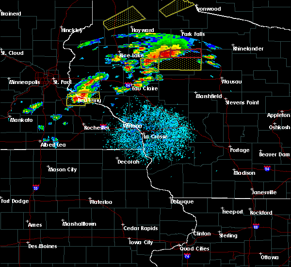 At 648 pm cdt, a tornado producing storm was located near jump river, or 17 miles east of ladysmith, moving east at 40 mph. this storm has a history of producing tornadoes and damage across rusk county over the past hour (confirmed tornado). Hazards include damaging tornado and tennis ball size hail. Flying debris will be dangerous to those caught without shelter. mobile homes will be damaged or destroyed. damage to roofs, windows, and vehicles will occur. Tree damage is likely. At 648 pm cdt, a tornado producing storm was located near jump river, or 17 miles east of ladysmith, moving east at 40 mph. this storm has a history of producing tornadoes and damage across rusk county over the past hour (confirmed tornado). Hazards include damaging tornado and tennis ball size hail. Flying debris will be dangerous to those caught without shelter. mobile homes will be damaged or destroyed. damage to roofs, windows, and vehicles will occur. Tree damage is likely.
|
| 4/9/2017 6:10 PM CDT |
 The severe thunderstorm warning for southeastern price county will expire at 615 pm cdt, the storm which prompted the warning has moved out of the area. therefore, the warning will be allowed to expire. The severe thunderstorm warning for southeastern price county will expire at 615 pm cdt, the storm which prompted the warning has moved out of the area. therefore, the warning will be allowed to expire.
|
| 4/9/2017 5:54 PM CDT |
 At 553 pm cdt, a severe thunderstorm was located near spirit, or 26 miles north of medford, moving east at 45 mph (trained weather spotters in prentice reported quarter sized hail covering the ground between 545 pm and 550 pm). Hazards include quarter size hail. Damage to vehicles is expected. Locations impacted include, ogema, prentice, spirit, brantwood, and clifford. At 553 pm cdt, a severe thunderstorm was located near spirit, or 26 miles north of medford, moving east at 45 mph (trained weather spotters in prentice reported quarter sized hail covering the ground between 545 pm and 550 pm). Hazards include quarter size hail. Damage to vehicles is expected. Locations impacted include, ogema, prentice, spirit, brantwood, and clifford.
|
| 4/9/2017 5:52 PM CDT | Quarter sized hail reported 0.8 miles E of Prentice, WI, quarter size hail covering the ground in less than 2 minutes. |
| 4/9/2017 5:40 PM CDT |
 At 540 pm cdt, a severe thunderstorm was located near ogema, or 23 miles north of medford, moving east at 40 mph (radar indicated). Hazards include quarter size hail. Damage to vehicles is expected. this severe thunderstorm will be near, ogema around 545 pm cdt. prentice around 550 pm cdt. spirit around 600 pm cdt. Other locations impacted by this severe thunderstorm include brantwood and clifford. At 540 pm cdt, a severe thunderstorm was located near ogema, or 23 miles north of medford, moving east at 40 mph (radar indicated). Hazards include quarter size hail. Damage to vehicles is expected. this severe thunderstorm will be near, ogema around 545 pm cdt. prentice around 550 pm cdt. spirit around 600 pm cdt. Other locations impacted by this severe thunderstorm include brantwood and clifford.
|
| 7/21/2016 5:56 AM CDT |
 The severe thunderstorm warning for southeastern sawyer, southeastern iron and price counties will expire at 600 am cdt, the storms which prompted the warning have weakened below severe limits, and no longer pose an immediate threat to life or property. therefore the warning will be allowed to expire. however gusty winds are still possible with these thunderstorms. a severe thunderstorm watch remains in effect until 700 am cdt for north central and northwestern wisconsin. to report severe weather, contact your nearest law enforcement agency. they will relay your report to the national weather service duluth mn. The severe thunderstorm warning for southeastern sawyer, southeastern iron and price counties will expire at 600 am cdt, the storms which prompted the warning have weakened below severe limits, and no longer pose an immediate threat to life or property. therefore the warning will be allowed to expire. however gusty winds are still possible with these thunderstorms. a severe thunderstorm watch remains in effect until 700 am cdt for north central and northwestern wisconsin. to report severe weather, contact your nearest law enforcement agency. they will relay your report to the national weather service duluth mn.
|
| 7/21/2016 5:47 AM CDT |
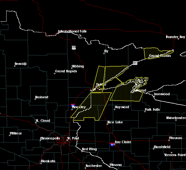 At 547 am cdt, severe thunderstorms were located along a line extending from near boulder junction, to near catawba, moving east at 55 mph (radar indicated). Hazards include 60 mph wind gusts and nickel size hail. Expect damage to roofs. siding. and trees. these severe storms will be near, ogema around 600 am cdt. Other locations impacted by these severe thunderstorms include cranberry lake, wilson lake near phillips, brantwood, connors lake, musser lake, kennan and pike lake. At 547 am cdt, severe thunderstorms were located along a line extending from near boulder junction, to near catawba, moving east at 55 mph (radar indicated). Hazards include 60 mph wind gusts and nickel size hail. Expect damage to roofs. siding. and trees. these severe storms will be near, ogema around 600 am cdt. Other locations impacted by these severe thunderstorms include cranberry lake, wilson lake near phillips, brantwood, connors lake, musser lake, kennan and pike lake.
|
| 7/21/2016 5:31 AM CDT |
 At 531 am cdt, severe thunderstorms were located along a line extending from near mercer, to 6 miles northwest of hawkins, moving east at 55 mph (radar indicated). Hazards include 60 mph wind gusts and nickel size hail. Expect damage to roofs. siding. and trees. these severe storms will be near, mercer around 535 am cdt. catawba around 550 am cdt. ogema, prentice and spirit around 600 am cdt. Other locations impacted by these severe thunderstorms include cranberry lake, fisher lake, wilson lake near phillips, brantwood, loretta, connors lake, musser lake, butternut lake, kennan and manitowish. At 531 am cdt, severe thunderstorms were located along a line extending from near mercer, to 6 miles northwest of hawkins, moving east at 55 mph (radar indicated). Hazards include 60 mph wind gusts and nickel size hail. Expect damage to roofs. siding. and trees. these severe storms will be near, mercer around 535 am cdt. catawba around 550 am cdt. ogema, prentice and spirit around 600 am cdt. Other locations impacted by these severe thunderstorms include cranberry lake, fisher lake, wilson lake near phillips, brantwood, loretta, connors lake, musser lake, butternut lake, kennan and manitowish.
|
| 7/21/2016 5:23 AM CDT |
 At 523 am cdt, severe thunderstorms were located along a line extending from near mercer, to 11 miles northwest of hawkins, moving east at 55 mph (radar indicated). Hazards include 70 mph wind gusts and half dollar size hail. Hail damage to vehicles is expected. expect considerable tree damage. wind damage is also likely to mobile homes, roofs, and outbuildings. these severe storms will be near, mercer around 530 am cdt. catawba around 545 am cdt. ogema, prentice and spirit around 600 am cdt. Other locations impacted by these severe thunderstorms include ojibwa, cranberry lake, fisher lake, wilson lake near phillips, island lake iron county, loretta, connors lake, musser lake, kennan and manitowish. At 523 am cdt, severe thunderstorms were located along a line extending from near mercer, to 11 miles northwest of hawkins, moving east at 55 mph (radar indicated). Hazards include 70 mph wind gusts and half dollar size hail. Hail damage to vehicles is expected. expect considerable tree damage. wind damage is also likely to mobile homes, roofs, and outbuildings. these severe storms will be near, mercer around 530 am cdt. catawba around 545 am cdt. ogema, prentice and spirit around 600 am cdt. Other locations impacted by these severe thunderstorms include ojibwa, cranberry lake, fisher lake, wilson lake near phillips, island lake iron county, loretta, connors lake, musser lake, kennan and manitowish.
|
| 7/21/2016 4:57 AM CDT |
 At 456 am cdt, severe thunderstorms were located along a line extending from near glidden, to 7 miles west of exeland, moving east at 55 mph (radar indicated). Hazards include 70 mph wind gusts and nickel size hail. Expect considerable tree damage. damage is likely to mobile homes, roofs, and outbuildings. severe thunderstorms will be near, glidden around 500 am cdt. turtle flambeau flowage around 520 am cdt. mercer around 525 am cdt. catawba around 545 am cdt. prentice around 555 am cdt. ogema and spirit around 600 am cdt. Other locations impacted by these severe thunderstorms include ojibwa, cranberry lake, fisher lake, wilson lake near phillips, island lake iron county, loretta, connors lake, musser lake, kennan and manitowish. At 456 am cdt, severe thunderstorms were located along a line extending from near glidden, to 7 miles west of exeland, moving east at 55 mph (radar indicated). Hazards include 70 mph wind gusts and nickel size hail. Expect considerable tree damage. damage is likely to mobile homes, roofs, and outbuildings. severe thunderstorms will be near, glidden around 500 am cdt. turtle flambeau flowage around 520 am cdt. mercer around 525 am cdt. catawba around 545 am cdt. prentice around 555 am cdt. ogema and spirit around 600 am cdt. Other locations impacted by these severe thunderstorms include ojibwa, cranberry lake, fisher lake, wilson lake near phillips, island lake iron county, loretta, connors lake, musser lake, kennan and manitowish.
|
| 6/25/2016 8:43 PM CDT |
 The severe thunderstorm warning for price county will expire at 845 pm cdt. the storms which prompted the warning have weakened below severe limits. and are moving out of the warned area. therefore the warning will be allowed to expire. However gusty winds of 30 to 40 mph are still possible with these thunderstorms. The severe thunderstorm warning for price county will expire at 845 pm cdt. the storms which prompted the warning have weakened below severe limits. and are moving out of the warned area. therefore the warning will be allowed to expire. However gusty winds of 30 to 40 mph are still possible with these thunderstorms.
|
| 6/25/2016 8:26 PM CDT |
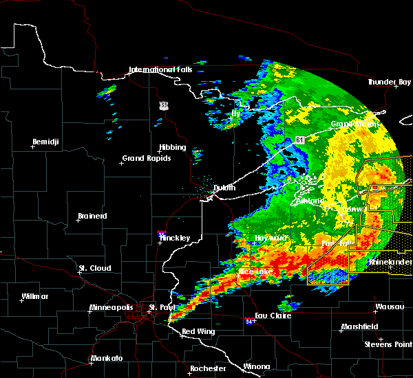 At 826 pm cdt, severe thunderstorms were located along a line extending from near boulder junction to 7 miles north of tripoli to near hawkins, moving east at 40 mph (radar indicated). Hazards include 60 mph wind gusts. Expect damage to roofs. siding. and trees. Locations impacted include, phillips, ogema, prentice, spirit, catawba, kennan, cranberry lake, wilson lake near phillips, brantwood, clifford, musser lake and pike lake. At 826 pm cdt, severe thunderstorms were located along a line extending from near boulder junction to 7 miles north of tripoli to near hawkins, moving east at 40 mph (radar indicated). Hazards include 60 mph wind gusts. Expect damage to roofs. siding. and trees. Locations impacted include, phillips, ogema, prentice, spirit, catawba, kennan, cranberry lake, wilson lake near phillips, brantwood, clifford, musser lake and pike lake.
|
| 6/25/2016 8:12 PM CDT |
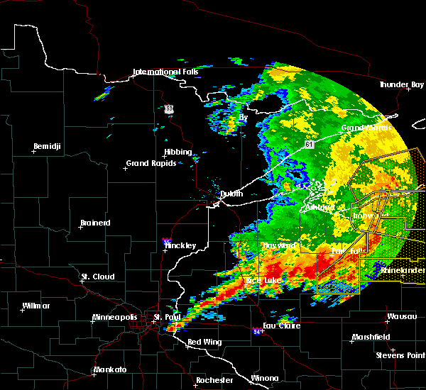 At 811 pm cdt, severe thunderstorms were located along a line extending from winchester to 10 miles west of squirrel lake to near catawba, moving east at 45 mph (radar indicated). Hazards include 60 mph wind gusts. Expect damage to roofs. siding. and trees. Locations impacted include, turtle flambeau flowage, phillips, mercer, ogema, prentice, spirit, catawba, kennan, cranberry lake, fisher lake, wilson lake near phillips, clifford, musser lake, manitowish, brantwood and pike lake. At 811 pm cdt, severe thunderstorms were located along a line extending from winchester to 10 miles west of squirrel lake to near catawba, moving east at 45 mph (radar indicated). Hazards include 60 mph wind gusts. Expect damage to roofs. siding. and trees. Locations impacted include, turtle flambeau flowage, phillips, mercer, ogema, prentice, spirit, catawba, kennan, cranberry lake, fisher lake, wilson lake near phillips, clifford, musser lake, manitowish, brantwood and pike lake.
|
| 6/25/2016 7:59 PM CDT |
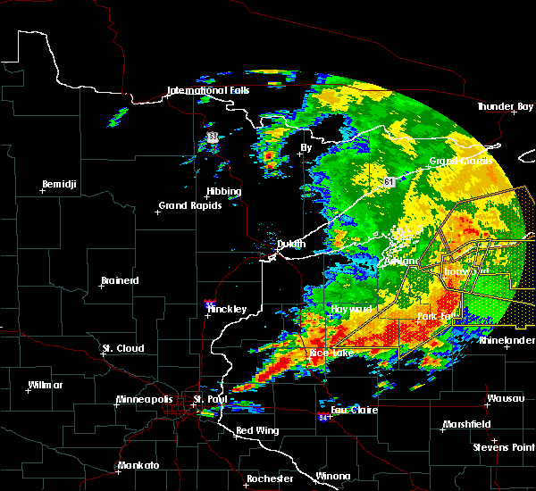 At 758 pm cdt, severe thunderstorms were located along a line extending from 7 miles northwest of winchester to 9 miles east of fifield to near catawba, moving southeast at 45 mph (radar indicated). Hazards include 60 mph wind gusts. Expect damage to roofs. siding. And trees. At 758 pm cdt, severe thunderstorms were located along a line extending from 7 miles northwest of winchester to 9 miles east of fifield to near catawba, moving southeast at 45 mph (radar indicated). Hazards include 60 mph wind gusts. Expect damage to roofs. siding. And trees.
|
| 6/25/2016 3:53 PM CDT |
 The severe thunderstorm warning for southern price county will expire at 400 pm cdt, the storm which prompted the warning has weakened below severe limits, and no longer pose an immediate threat to life or property. therefore the warning will be allowed to expire. however small hail and gusty winds are still possible with this thunderstorm. a severe thunderstorm watch remains in effect until 1100 pm cdt for north central wisconsin. The severe thunderstorm warning for southern price county will expire at 400 pm cdt, the storm which prompted the warning has weakened below severe limits, and no longer pose an immediate threat to life or property. therefore the warning will be allowed to expire. however small hail and gusty winds are still possible with this thunderstorm. a severe thunderstorm watch remains in effect until 1100 pm cdt for north central wisconsin.
|
| 6/25/2016 3:43 PM CDT | 8 inch diameter pine tree downed. tree fell on a power line. power outages reported in the prentice area. in price county WI, 0.2 miles W of Prentice, WI |
| 6/25/2016 3:37 PM CDT |
 At 337 pm cdt, a severe thunderstorm was located near prentice, or 25 miles south of park falls, moving northeast at 30 mph (radar indicated). Hazards include 60 mph wind gusts and quarter size hail. Hail damage to vehicles is expected. expect wind damage to roofs, siding, and trees. Locations impacted include, ogema, prentice, catawba, cranberry lake, brantwood and clifford. At 337 pm cdt, a severe thunderstorm was located near prentice, or 25 miles south of park falls, moving northeast at 30 mph (radar indicated). Hazards include 60 mph wind gusts and quarter size hail. Hail damage to vehicles is expected. expect wind damage to roofs, siding, and trees. Locations impacted include, ogema, prentice, catawba, cranberry lake, brantwood and clifford.
|
| 6/25/2016 3:28 PM CDT |
 At 328 pm cdt, a severe thunderstorm was located over prentice, or 27 miles north of medford, moving northeast at 30 mph (radar indicated). Hazards include 60 mph wind gusts and quarter size hail. Hail damage to vehicles is expected. expect wind damage to roofs, siding, and trees. This severe thunderstorm will remain over mainly rural areas of southern price county, including the following locations: brantwood, cranberry lake and clifford. At 328 pm cdt, a severe thunderstorm was located over prentice, or 27 miles north of medford, moving northeast at 30 mph (radar indicated). Hazards include 60 mph wind gusts and quarter size hail. Hail damage to vehicles is expected. expect wind damage to roofs, siding, and trees. This severe thunderstorm will remain over mainly rural areas of southern price county, including the following locations: brantwood, cranberry lake and clifford.
|
| 6/25/2016 3:17 PM CDT |
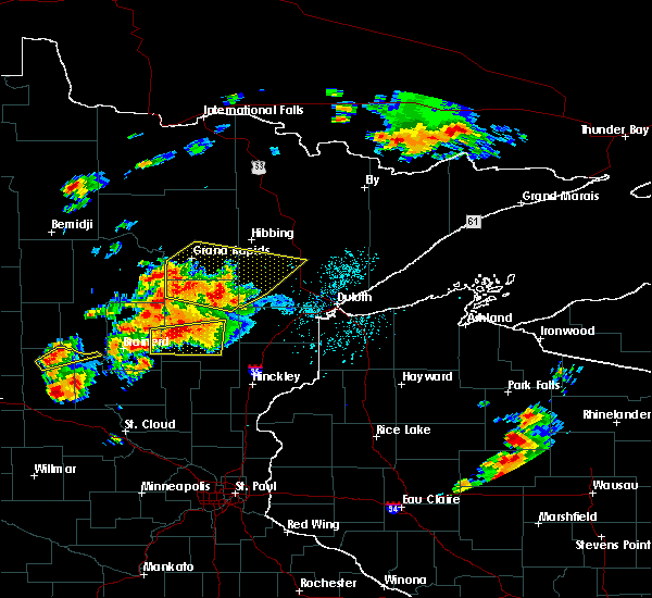 At 317 pm cdt, a severe thunderstorm was located near ogema, or 23 miles north of medford, moving northeast at 30 mph (radar indicated). Hazards include 60 mph wind gusts and quarter size hail. Hail damage to vehicles is expected. expect wind damage to roofs, siding, and trees. this severe thunderstorm will be near, ogema around 320 pm cdt. prentice around 330 pm cdt. Other locations impacted by this severe thunderstorm include brantwood, cranberry lake and clifford. At 317 pm cdt, a severe thunderstorm was located near ogema, or 23 miles north of medford, moving northeast at 30 mph (radar indicated). Hazards include 60 mph wind gusts and quarter size hail. Hail damage to vehicles is expected. expect wind damage to roofs, siding, and trees. this severe thunderstorm will be near, ogema around 320 pm cdt. prentice around 330 pm cdt. Other locations impacted by this severe thunderstorm include brantwood, cranberry lake and clifford.
|
| 6/10/2016 4:14 PM CDT |
 At 413 pm cdt, severe thunderstorms were located along a line extending from near lac du flambeau to near westboro, moving east at 40 mph (radar indicated). Hazards include 60 mph wind gusts. Expect damage to roofs. siding. and trees. locations impacted include, ogema, prentice, spirit, cranberry lake, brantwood and clifford. A tornado watch remains in effect until 900 pm cdt for parts of north central wisconsin. At 413 pm cdt, severe thunderstorms were located along a line extending from near lac du flambeau to near westboro, moving east at 40 mph (radar indicated). Hazards include 60 mph wind gusts. Expect damage to roofs. siding. and trees. locations impacted include, ogema, prentice, spirit, cranberry lake, brantwood and clifford. A tornado watch remains in effect until 900 pm cdt for parts of north central wisconsin.
|
| 6/10/2016 3:58 PM CDT |
 At 357 pm cdt, severe thunderstorms were located along a line extending from 10 miles south of turtle flambeau flowage to 9 miles south of catawba, moving east at 45 mph (radar indicated). Hazards include 60 mph wind gusts. Expect damage to roofs. siding. And trees. At 357 pm cdt, severe thunderstorms were located along a line extending from 10 miles south of turtle flambeau flowage to 9 miles south of catawba, moving east at 45 mph (radar indicated). Hazards include 60 mph wind gusts. Expect damage to roofs. siding. And trees.
|
| 8/2/2015 10:26 AM CDT |
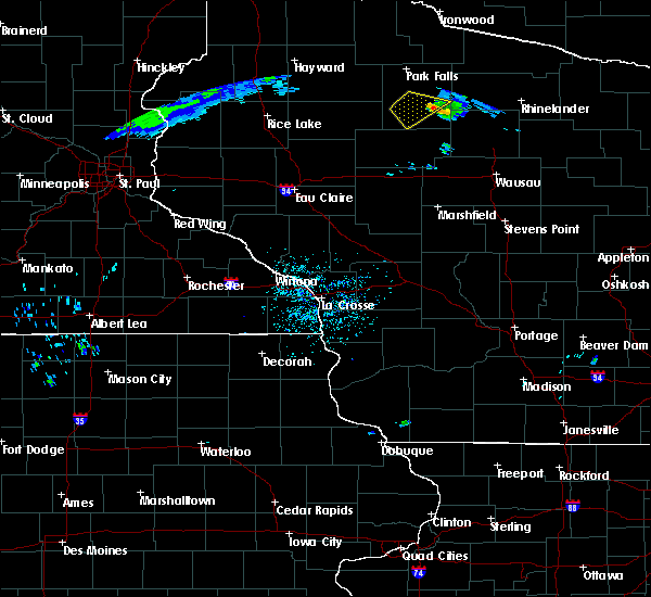 The severe thunderstorm warning for southern price county will expire at 1030 am cdt, the storm which prompted the warning has weakened below severe limits, and no longer pose an immediate threat to life or property. therefore the warning will be allowed to expire. The severe thunderstorm warning for southern price county will expire at 1030 am cdt, the storm which prompted the warning has weakened below severe limits, and no longer pose an immediate threat to life or property. therefore the warning will be allowed to expire.
|
| 8/2/2015 10:10 AM CDT |
 At 1008 am cdt, a severe thunderstorm was located near prentice, or 23 miles south of park falls, moving southeast at 50 mph. multiple spotters have reported hail of golf ball size to two inches (trained weather spotters). Hazards include two inch hail and 60 mph wind gusts. People and animals outdoors will be injured. expect hail damage to roofs, siding, windows and vehicles. expect wind damage to roofs, siding and trees. Locations impacted include, phillips, prentice, catawba, kennan, cranberry lake and wilson lake near phillips. At 1008 am cdt, a severe thunderstorm was located near prentice, or 23 miles south of park falls, moving southeast at 50 mph. multiple spotters have reported hail of golf ball size to two inches (trained weather spotters). Hazards include two inch hail and 60 mph wind gusts. People and animals outdoors will be injured. expect hail damage to roofs, siding, windows and vehicles. expect wind damage to roofs, siding and trees. Locations impacted include, phillips, prentice, catawba, kennan, cranberry lake and wilson lake near phillips.
|
| 8/2/2015 9:54 AM CDT |
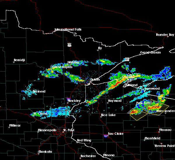 At 953 am cdt, a severe thunderstorm was located 9 miles west of phillips, or 18 miles southwest of park falls, moving southeast at 50 mph. this storm has a history of producing large hail (trained weather spotters). Hazards include 60 mph wind gusts and half dollar size hail. Hail damage to vehicles is expected. expect wind damage to roofs, siding and trees. Locations impacted include, phillips, prentice, catawba, kennan, cranberry lake and wilson lake near phillips. At 953 am cdt, a severe thunderstorm was located 9 miles west of phillips, or 18 miles southwest of park falls, moving southeast at 50 mph. this storm has a history of producing large hail (trained weather spotters). Hazards include 60 mph wind gusts and half dollar size hail. Hail damage to vehicles is expected. expect wind damage to roofs, siding and trees. Locations impacted include, phillips, prentice, catawba, kennan, cranberry lake and wilson lake near phillips.
|
| 8/2/2015 9:42 AM CDT |
 At 941 am cdt, a severe thunderstorm was located 12 miles east of winter, or 19 miles southwest of park falls, moving southeast at 50 mph. this storm has a history of producing large hail (trained weather spotters). Hazards include 60 mph wind gusts and half dollar size hail. Hail damage to vehicles is expected. Expect wind damage to roofs, siding and trees. At 941 am cdt, a severe thunderstorm was located 12 miles east of winter, or 19 miles southwest of park falls, moving southeast at 50 mph. this storm has a history of producing large hail (trained weather spotters). Hazards include 60 mph wind gusts and half dollar size hail. Hail damage to vehicles is expected. Expect wind damage to roofs, siding and trees.
|
| 9/3/2014 9:45 PM CDT | Quarter sized hail reported 0.3 miles E of Prentice, WI, also very heavy rain and strong winds. |
| 6/20/2012 6:05 PM CDT | Spotter estimated 50-60 mph winds knocked down 6 inch diameter branche in price county WI, 2.1 miles W of Prentice, WI |
| 5/24/2012 5:45 PM CDT | Two 10 inch diameter trees down on highway 8 in price county WI, 2.7 miles E of Prentice, WI |
| 5/20/2012 1:16 PM CDT | Quarter sized hail reported 14.8 miles SW of Prentice, WI |
Hail Maps for Prentice, WI


Connect with Interactive Hail Maps