

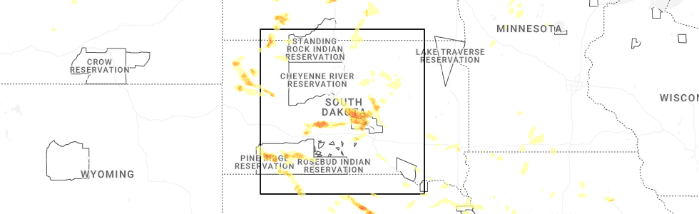
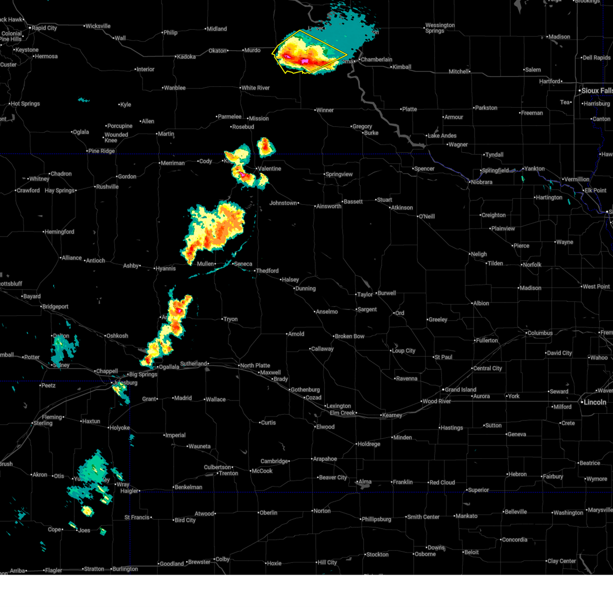
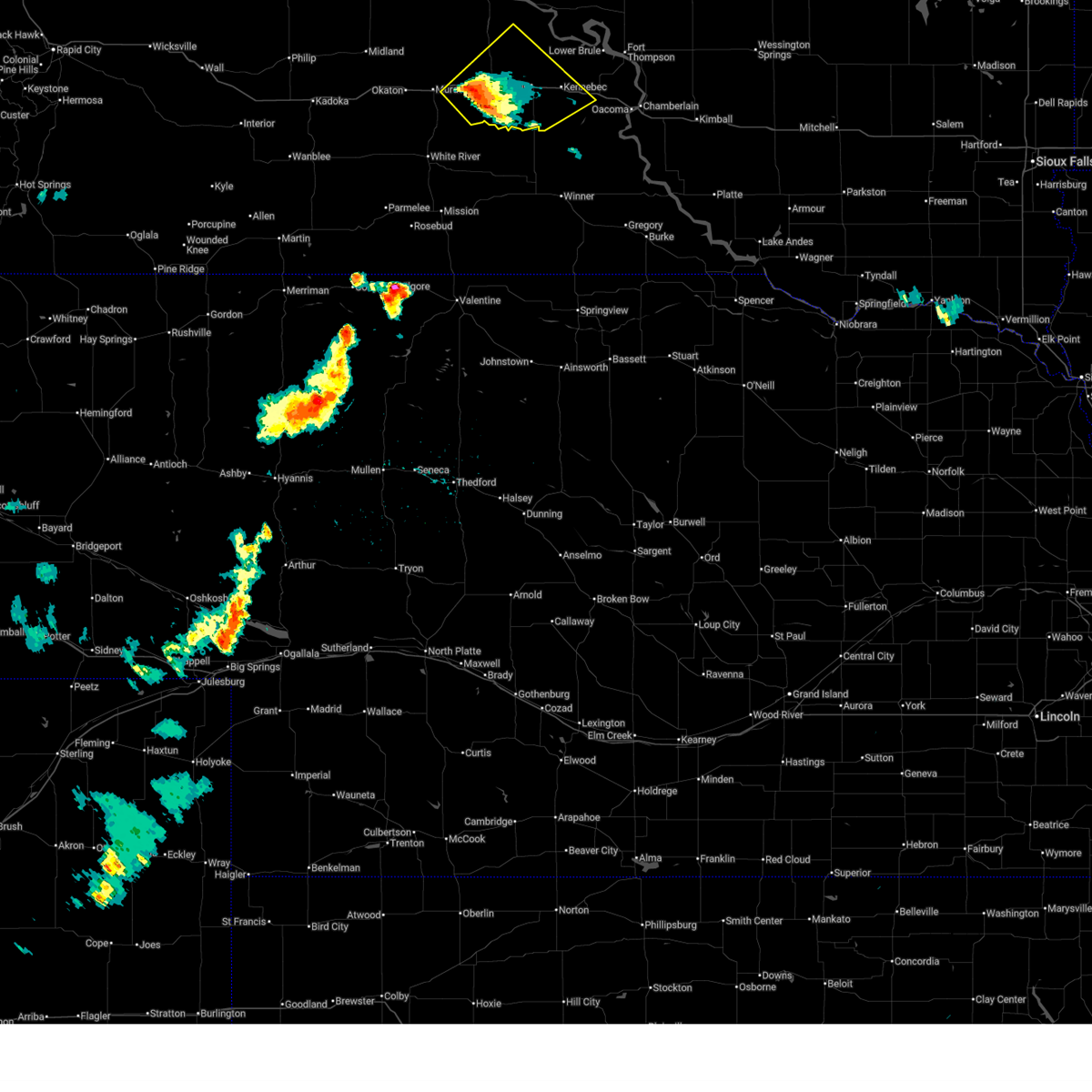
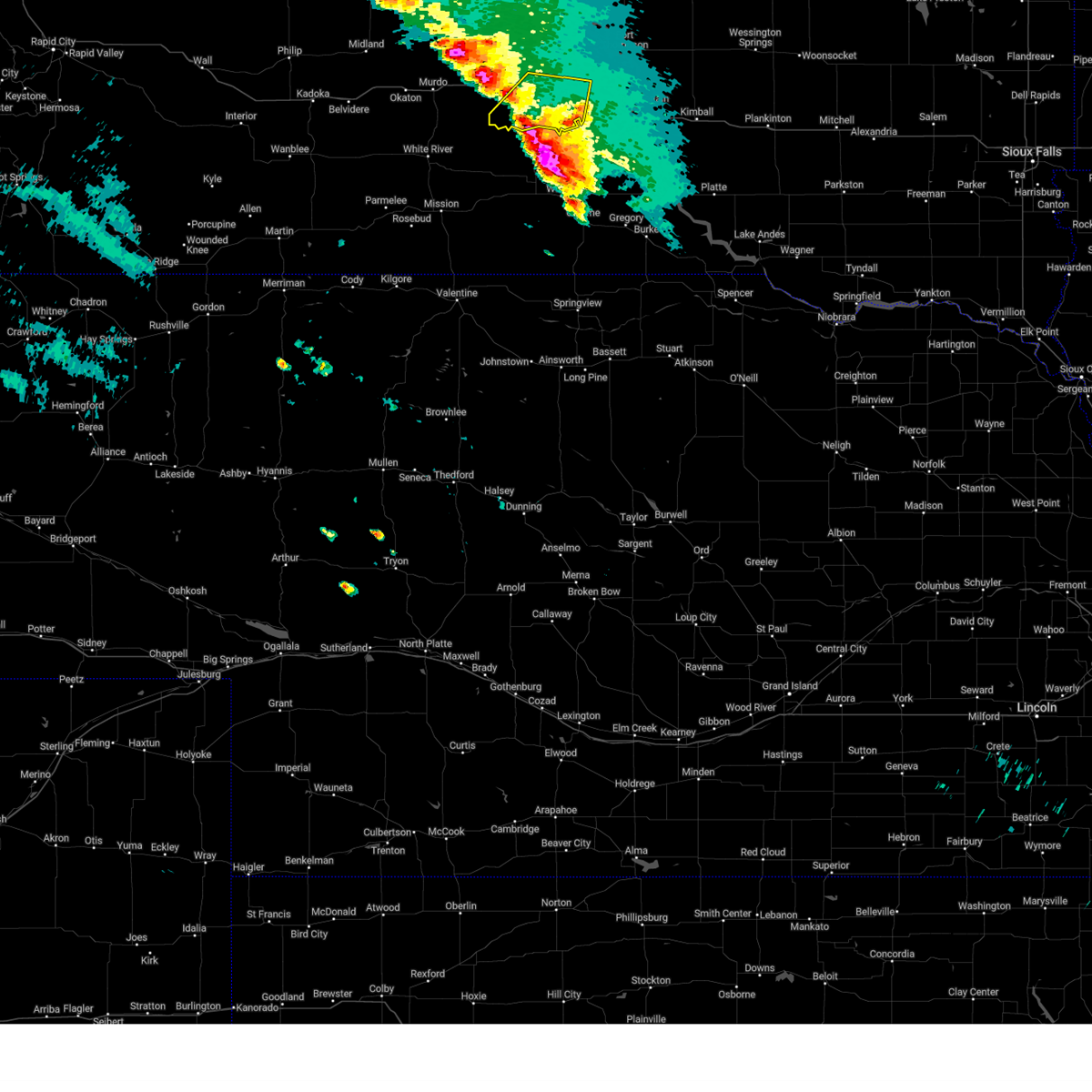
Hail Map for Presho, SD
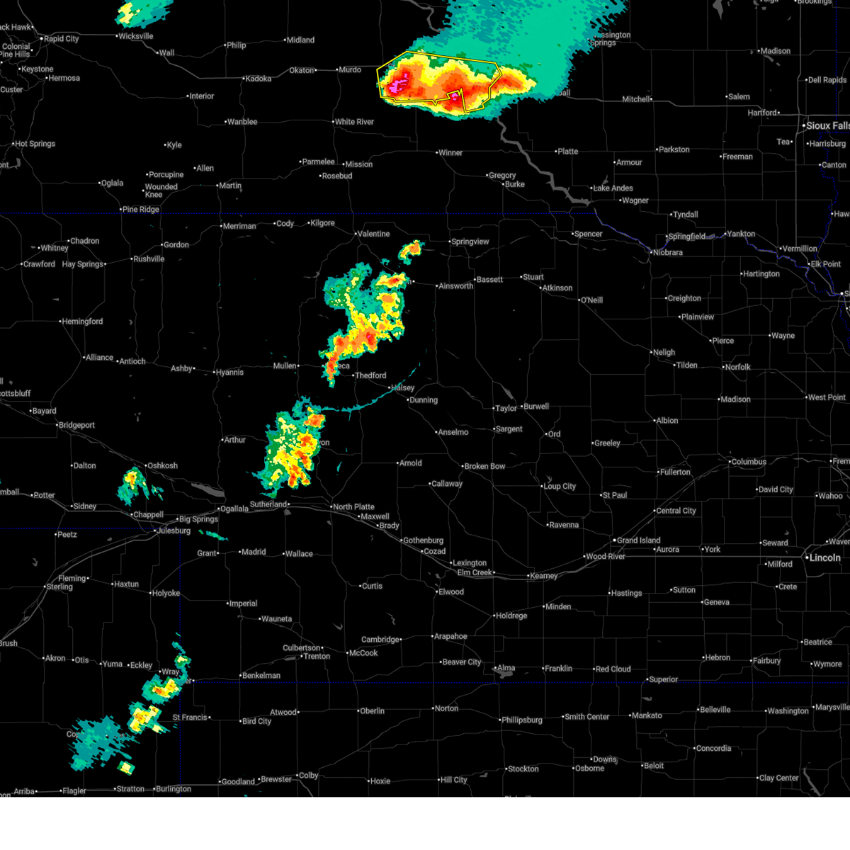
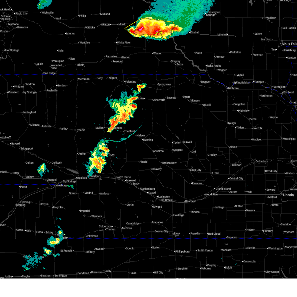
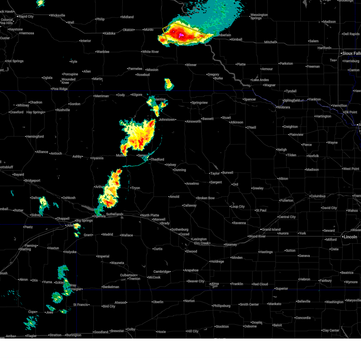
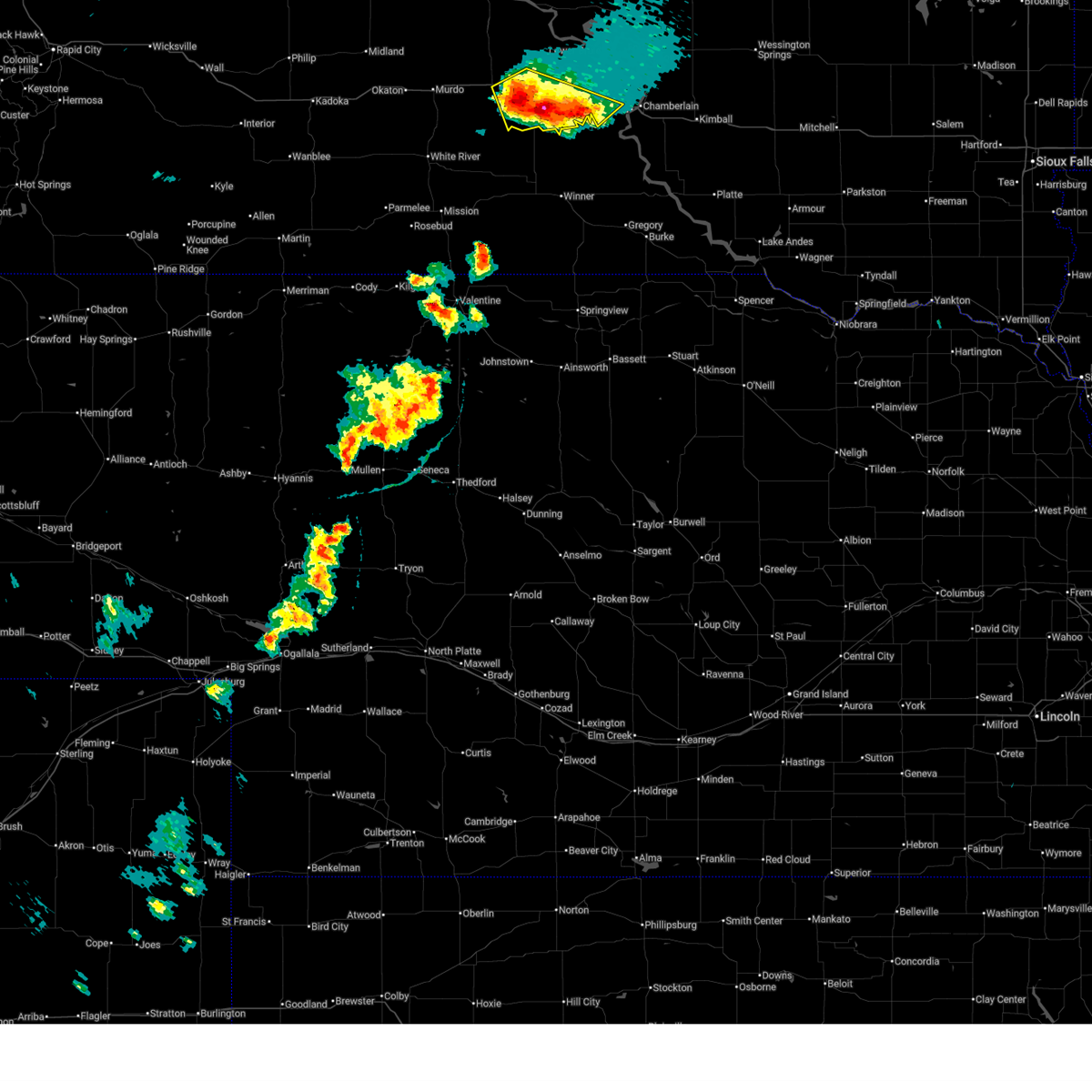
The Presho, SD area has had 13 reports of on-the-ground hail by trained spotters, and has been under severe weather warnings 20 times during the past 12 months. Doppler radar has detected hail at or near Presho, SD on 77 occasions, including 5 occasions during the past year.
| Name: | Presho, SD |
| Where Located: | 34.7 miles SSE of Pierre, SD |
| Map: | Google Map for Presho, SD |
| Population: | 497 |
| Housing Units: | 285 |
| More Info: | Search Google for Presho, SD |
0
The Top Recent Hail Date for Presho, SD is Wednesday, July 9, 2025 (77th out of 77)
Hail and Wind Damage Spotted near Presho, SD
| Date / Time | Report Details |
|---|---|
| 7/9/2025 8:53 PM CDT |
 the severe thunderstorm warning has been cancelled and is no longer in effect the severe thunderstorm warning has been cancelled and is no longer in effect
|
| 7/9/2025 8:53 PM CDT |
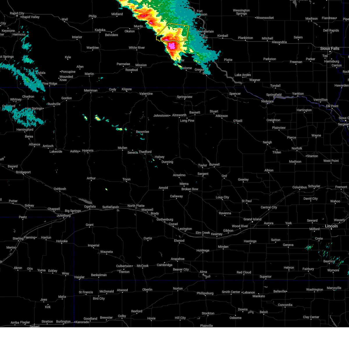
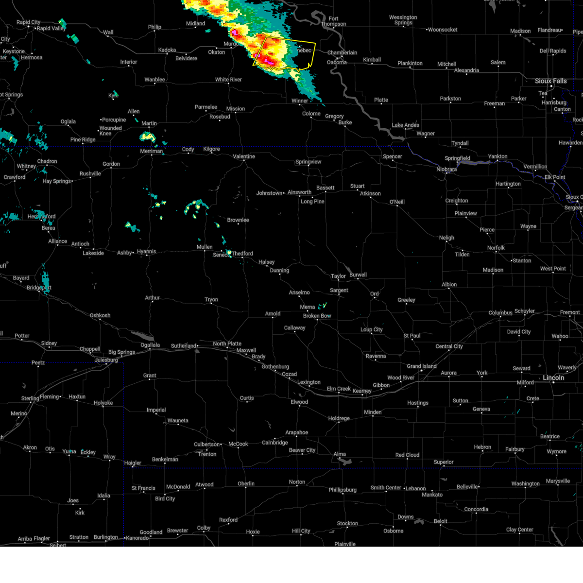
 At 852 pm cdt, a severe thunderstorm was located over joe creek rec area, or 10 miles northwest of lower brule, moving east at 70 mph (radar indicated). Hazards include 70 mph wind gusts and half dollar size hail. Hail damage to vehicles is expected. expect considerable tree damage. wind damage is also likely to mobile homes, roofs, and outbuildings. Locations impacted include, presho, kennebec, vivian, cedar creek rec area, fate dam, 5 mile corner, lake sharpe, earling hill, joe creek rec area, byre lake, west bend rec area, and western lower brule reservation. At 852 pm cdt, a severe thunderstorm was located over joe creek rec area, or 10 miles northwest of lower brule, moving east at 70 mph (radar indicated). Hazards include 70 mph wind gusts and half dollar size hail. Hail damage to vehicles is expected. expect considerable tree damage. wind damage is also likely to mobile homes, roofs, and outbuildings. Locations impacted include, presho, kennebec, vivian, cedar creek rec area, fate dam, 5 mile corner, lake sharpe, earling hill, joe creek rec area, byre lake, west bend rec area, and western lower brule reservation.
|
| 7/9/2025 8:24 PM CDT |
 Svrabr the national weather service in aberdeen has issued a * severe thunderstorm warning for, northern jones county in central south dakota, southeastern stanley county in central south dakota, southeastern hughes county in central south dakota, northwestern lyman county in central south dakota, * until 915 pm cdt. * at 823 pm cdt, a severe thunderstorm was located 13 miles north of draper, or 17 miles south of fort pierre, moving east at 45 mph. another strong storm located near kennebec may produce quarter size hail (radar indicated). Hazards include 60 mph wind gusts and half dollar size hail. Hail damage to vehicles is expected. Expect wind damage to roofs, siding, and trees. Svrabr the national weather service in aberdeen has issued a * severe thunderstorm warning for, northern jones county in central south dakota, southeastern stanley county in central south dakota, southeastern hughes county in central south dakota, northwestern lyman county in central south dakota, * until 915 pm cdt. * at 823 pm cdt, a severe thunderstorm was located 13 miles north of draper, or 17 miles south of fort pierre, moving east at 45 mph. another strong storm located near kennebec may produce quarter size hail (radar indicated). Hazards include 60 mph wind gusts and half dollar size hail. Hail damage to vehicles is expected. Expect wind damage to roofs, siding, and trees.
|
| 6/27/2025 8:04 PM CDT |
 At 804 pm cdt, a severe thunderstorm was located 7 miles southwest of earling hill, or 9 miles southwest of presho, moving east at 20 mph (radar indicated). Hazards include tennis ball size hail and 60 mph wind gusts. People and animals outdoors will be injured. expect hail damage to roofs, siding, windows, and vehicles. expect wind damage to roofs, siding, and trees. Locations impacted include, presho, oacoma, kennebec, reliance, vivian, fate dam, lyman, 5 mile corner, dude ranch, earling hill, byre lake, lake francis case, and southeastern lower brule reservation. At 804 pm cdt, a severe thunderstorm was located 7 miles southwest of earling hill, or 9 miles southwest of presho, moving east at 20 mph (radar indicated). Hazards include tennis ball size hail and 60 mph wind gusts. People and animals outdoors will be injured. expect hail damage to roofs, siding, windows, and vehicles. expect wind damage to roofs, siding, and trees. Locations impacted include, presho, oacoma, kennebec, reliance, vivian, fate dam, lyman, 5 mile corner, dude ranch, earling hill, byre lake, lake francis case, and southeastern lower brule reservation.
|
| 6/27/2025 8:04 PM CDT |
 the severe thunderstorm warning has been cancelled and is no longer in effect the severe thunderstorm warning has been cancelled and is no longer in effect
|
| 6/27/2025 7:50 PM CDT | Storms lasted from 6:20 to 8:00 pm. nickel size hail on and off. 60 mph wind gusts with the last storm that occurred at 7:50 p in lyman county SD, 8.7 miles NE of Presho, SD |
| 6/27/2025 7:41 PM CDT |
 Svrabr the national weather service in aberdeen has issued a * severe thunderstorm warning for, southeastern jones county in central south dakota, central lyman county in central south dakota, * until 830 pm cdt. * at 741 pm cdt, a severe thunderstorm was located 8 miles southwest of lyman, or 16 miles southeast of presho, moving east at 15 mph (radar indicated). Hazards include two inch hail and 60 mph wind gusts. People and animals outdoors will be injured. expect hail damage to roofs, siding, windows, and vehicles. expect wind damage to roofs, siding, and trees. This severe thunderstorm will remain over mainly rural areas of southeastern jones and central lyman counties, including the following locations, southeastern lower brule reservation. Svrabr the national weather service in aberdeen has issued a * severe thunderstorm warning for, southeastern jones county in central south dakota, central lyman county in central south dakota, * until 830 pm cdt. * at 741 pm cdt, a severe thunderstorm was located 8 miles southwest of lyman, or 16 miles southeast of presho, moving east at 15 mph (radar indicated). Hazards include two inch hail and 60 mph wind gusts. People and animals outdoors will be injured. expect hail damage to roofs, siding, windows, and vehicles. expect wind damage to roofs, siding, and trees. This severe thunderstorm will remain over mainly rural areas of southeastern jones and central lyman counties, including the following locations, southeastern lower brule reservation.
|
| 6/27/2025 7:19 PM CDT |
 At 719 pm cdt, a severe thunderstorm was located near earling hill, or 9 miles southeast of presho, and is nearly stationary (radar indicated). Hazards include two inch hail and 60 mph wind gusts. People and animals outdoors will be injured. expect hail damage to roofs, siding, windows, and vehicles. expect wind damage to roofs, siding, and trees. Locations impacted include, presho, kennebec, earling hill, lyman, fate dam, and 5 mile corner. At 719 pm cdt, a severe thunderstorm was located near earling hill, or 9 miles southeast of presho, and is nearly stationary (radar indicated). Hazards include two inch hail and 60 mph wind gusts. People and animals outdoors will be injured. expect hail damage to roofs, siding, windows, and vehicles. expect wind damage to roofs, siding, and trees. Locations impacted include, presho, kennebec, earling hill, lyman, fate dam, and 5 mile corner.
|
| 6/27/2025 7:01 PM CDT |
 Svrabr the national weather service in aberdeen has issued a * severe thunderstorm warning for, central lyman county in central south dakota, * until 745 pm cdt. * at 700 pm cdt, a severe thunderstorm was located near earling hill, or 8 miles southeast of presho, and is nearly stationary. this is a destructive storm for southern lyman county (radar indicated). Hazards include baseball size hail and 60 mph wind gusts. People and animals outdoors will be severely injured. expect shattered windows, extensive damage to roofs, siding, and vehicles. This severe thunderstorm will remain over mainly rural areas of central lyman county. Svrabr the national weather service in aberdeen has issued a * severe thunderstorm warning for, central lyman county in central south dakota, * until 745 pm cdt. * at 700 pm cdt, a severe thunderstorm was located near earling hill, or 8 miles southeast of presho, and is nearly stationary. this is a destructive storm for southern lyman county (radar indicated). Hazards include baseball size hail and 60 mph wind gusts. People and animals outdoors will be severely injured. expect shattered windows, extensive damage to roofs, siding, and vehicles. This severe thunderstorm will remain over mainly rural areas of central lyman county.
|
| 6/27/2025 6:49 PM CDT |
 At 649 pm cdt, a severe thunderstorm was located near earling hill, or 9 miles southeast of presho, moving east at 5 mph (radar indicated). Hazards include golf ball size hail and 60 mph wind gusts. People and animals outdoors will be injured. expect hail damage to roofs, siding, windows, and vehicles. expect wind damage to roofs, siding, and trees. Locations impacted include, presho, kennebec, reliance, vivian, fate dam, 5 mile corner, earling hill, lyman, byre lake, and western lower brule reservation. At 649 pm cdt, a severe thunderstorm was located near earling hill, or 9 miles southeast of presho, moving east at 5 mph (radar indicated). Hazards include golf ball size hail and 60 mph wind gusts. People and animals outdoors will be injured. expect hail damage to roofs, siding, windows, and vehicles. expect wind damage to roofs, siding, and trees. Locations impacted include, presho, kennebec, reliance, vivian, fate dam, 5 mile corner, earling hill, lyman, byre lake, and western lower brule reservation.
|
| 6/27/2025 6:39 PM CDT |
 At 638 pm cdt, a severe thunderstorm was located near earling hill, or 8 miles southeast of presho, moving northeast at 10 mph (radar indicated). Hazards include 60 mph wind gusts and half dollar size hail. Hail damage to vehicles is expected. expect wind damage to roofs, siding, and trees. Locations impacted include, kennebec and byre lake. At 638 pm cdt, a severe thunderstorm was located near earling hill, or 8 miles southeast of presho, moving northeast at 10 mph (radar indicated). Hazards include 60 mph wind gusts and half dollar size hail. Hail damage to vehicles is expected. expect wind damage to roofs, siding, and trees. Locations impacted include, kennebec and byre lake.
|
| 6/27/2025 6:39 PM CDT |
 the severe thunderstorm warning has been cancelled and is no longer in effect the severe thunderstorm warning has been cancelled and is no longer in effect
|
| 6/27/2025 6:27 PM CDT |
 Svrabr the national weather service in aberdeen has issued a * severe thunderstorm warning for, east central jones county in central south dakota, northern lyman county in central south dakota, * until 715 pm cdt. * at 627 pm cdt, a severe thunderstorm was located near earling hill, or 8 miles southeast of presho, moving northeast at 20 mph (radar indicated). Hazards include 60 mph wind gusts and quarter size hail. Hail damage to vehicles is expected. expect wind damage to roofs, siding, and trees. this severe thunderstorm will be near, kennebec and byre lake around 635 pm cdt. Lyman around 645 pm cdt. Svrabr the national weather service in aberdeen has issued a * severe thunderstorm warning for, east central jones county in central south dakota, northern lyman county in central south dakota, * until 715 pm cdt. * at 627 pm cdt, a severe thunderstorm was located near earling hill, or 8 miles southeast of presho, moving northeast at 20 mph (radar indicated). Hazards include 60 mph wind gusts and quarter size hail. Hail damage to vehicles is expected. expect wind damage to roofs, siding, and trees. this severe thunderstorm will be near, kennebec and byre lake around 635 pm cdt. Lyman around 645 pm cdt.
|
| 6/27/2025 6:14 PM CDT |
 At 613 pm cdt, a severe thunderstorm was located over vivian, or 12 miles west of presho, moving northeast at 25 mph (radar indicated). Hazards include 60 mph wind gusts and quarter size hail. Hail damage to vehicles is expected. expect wind damage to roofs, siding, and trees. Locations impacted include, vivian, 5 mile corner and presho. At 613 pm cdt, a severe thunderstorm was located over vivian, or 12 miles west of presho, moving northeast at 25 mph (radar indicated). Hazards include 60 mph wind gusts and quarter size hail. Hail damage to vehicles is expected. expect wind damage to roofs, siding, and trees. Locations impacted include, vivian, 5 mile corner and presho.
|
| 6/27/2025 5:52 PM CDT |
 Svrabr the national weather service in aberdeen has issued a * severe thunderstorm warning for, southeastern jones county in central south dakota, northwestern lyman county in central south dakota, * until 630 pm cdt. * at 551 pm cdt, a severe thunderstorm was located near draper, or 14 miles east of murdo, moving northeast at 25 mph (radar indicated). Hazards include 60 mph wind gusts and quarter size hail. Hail damage to vehicles is expected. expect wind damage to roofs, siding, and trees. This severe thunderstorm will be near, vivian around 555 pm cdt. Svrabr the national weather service in aberdeen has issued a * severe thunderstorm warning for, southeastern jones county in central south dakota, northwestern lyman county in central south dakota, * until 630 pm cdt. * at 551 pm cdt, a severe thunderstorm was located near draper, or 14 miles east of murdo, moving northeast at 25 mph (radar indicated). Hazards include 60 mph wind gusts and quarter size hail. Hail damage to vehicles is expected. expect wind damage to roofs, siding, and trees. This severe thunderstorm will be near, vivian around 555 pm cdt.
|
| 4/28/2025 12:17 AM CDT |
 At 1216 am cdt, a severe thunderstorm was located near byre lake, or 12 miles southwest of lower brule, moving northeast at 50 mph (radar indicated). Hazards include 60 mph wind gusts and quarter size hail. Hail damage to vehicles is expected. expect wind damage to roofs, siding, and trees. Locations impacted include, lake sharpe. At 1216 am cdt, a severe thunderstorm was located near byre lake, or 12 miles southwest of lower brule, moving northeast at 50 mph (radar indicated). Hazards include 60 mph wind gusts and quarter size hail. Hail damage to vehicles is expected. expect wind damage to roofs, siding, and trees. Locations impacted include, lake sharpe.
|
| 4/27/2025 11:58 PM CDT |
 Svrabr the national weather service in aberdeen has issued a * severe thunderstorm warning for, lyman county in central south dakota, * until 1245 am cdt. * at 1158 pm cdt, a severe thunderstorm was located near earling hill, or 9 miles southeast of presho, moving northeast at 50 mph (radar indicated). Hazards include 60 mph wind gusts and quarter size hail. Hail damage to vehicles is expected. expect wind damage to roofs, siding, and trees. this severe thunderstorm will be near, kennebec and byre lake around 1205 am cdt. Other locations in the path of this severe thunderstorm include lake sharpe. Svrabr the national weather service in aberdeen has issued a * severe thunderstorm warning for, lyman county in central south dakota, * until 1245 am cdt. * at 1158 pm cdt, a severe thunderstorm was located near earling hill, or 9 miles southeast of presho, moving northeast at 50 mph (radar indicated). Hazards include 60 mph wind gusts and quarter size hail. Hail damage to vehicles is expected. expect wind damage to roofs, siding, and trees. this severe thunderstorm will be near, kennebec and byre lake around 1205 am cdt. Other locations in the path of this severe thunderstorm include lake sharpe.
|
| 8/18/2024 3:43 AM CDT |
 the severe thunderstorm warning has been cancelled and is no longer in effect the severe thunderstorm warning has been cancelled and is no longer in effect
|
| 8/18/2024 3:30 AM CDT |
 the severe thunderstorm warning has been cancelled and is no longer in effect the severe thunderstorm warning has been cancelled and is no longer in effect
|
| 8/18/2024 3:30 AM CDT |
 At 329 am cdt, a severe thunderstorm was located 9 miles southwest of earling hill, or 13 miles south of presho, moving southeast at 30 mph (radar indicated). Hazards include 60 mph wind gusts and quarter size hail. Hail damage to vehicles is expected. expect wind damage to roofs, siding, and trees. Locations impacted include, presho, kennebec, fate dam, earling hill, lyman, byre lake, and 5 mile corner. At 329 am cdt, a severe thunderstorm was located 9 miles southwest of earling hill, or 13 miles south of presho, moving southeast at 30 mph (radar indicated). Hazards include 60 mph wind gusts and quarter size hail. Hail damage to vehicles is expected. expect wind damage to roofs, siding, and trees. Locations impacted include, presho, kennebec, fate dam, earling hill, lyman, byre lake, and 5 mile corner.
|
| 8/18/2024 3:03 AM CDT |
 Svrabr the national weather service in aberdeen has issued a * severe thunderstorm warning for, southeastern jones county in central south dakota, west central lyman county in central south dakota, * until 400 am cdt. * at 303 am cdt, a severe thunderstorm was located 10 miles southwest of earling hill, or 12 miles southwest of presho, moving east at 20 mph (radar indicated). Hazards include ping pong ball size hail and 60 mph wind gusts. People and animals outdoors will be injured. expect hail damage to roofs, siding, windows, and vehicles. expect wind damage to roofs, siding, and trees. This severe thunderstorm will remain over mainly rural areas of southeastern jones and west central lyman counties. Svrabr the national weather service in aberdeen has issued a * severe thunderstorm warning for, southeastern jones county in central south dakota, west central lyman county in central south dakota, * until 400 am cdt. * at 303 am cdt, a severe thunderstorm was located 10 miles southwest of earling hill, or 12 miles southwest of presho, moving east at 20 mph (radar indicated). Hazards include ping pong ball size hail and 60 mph wind gusts. People and animals outdoors will be injured. expect hail damage to roofs, siding, windows, and vehicles. expect wind damage to roofs, siding, and trees. This severe thunderstorm will remain over mainly rural areas of southeastern jones and west central lyman counties.
|
| 7/14/2024 2:20 AM CDT |
 Svrabr the national weather service in aberdeen has issued a * severe thunderstorm warning for, eastern jones county in central south dakota, hand county in central south dakota, sully county in central south dakota, hyde county in central south dakota, southern faulk county in north central south dakota, southern potter county in north central south dakota, southeastern stanley county in central south dakota, hughes county in central south dakota, southern spink county in northeastern south dakota, lyman county in central south dakota, buffalo county in central south dakota, * until 315 am cdt. * at 220 am cdt, severe thunderstorms were located along a line extending from near burkmere to 8 miles east of iona, moving east at 55 mph (radar indicated). Hazards include 70 mph wind gusts. Expect considerable tree damage. damage is likely to mobile homes, roofs, and outbuildings. severe thunderstorms will be near, miller, faulkton, miller dale colony, shelby, orient, ree heights, gann valley, polo, etbauer hill, and sunshine bible academy around 225 am cdt. st. lawrence, miranda, and pleasant valley country church around 230 am cdt. burdette, rockham, devoe, and danforth around 235 am cdt. zell, vayland, and rosehill dam around 240 am cdt. Other locations in the path of these severe thunderstorms include cottonwood lake, redfield, athol, twin lakes, tulare, ashton, spottswood and hitchcock. Svrabr the national weather service in aberdeen has issued a * severe thunderstorm warning for, eastern jones county in central south dakota, hand county in central south dakota, sully county in central south dakota, hyde county in central south dakota, southern faulk county in north central south dakota, southern potter county in north central south dakota, southeastern stanley county in central south dakota, hughes county in central south dakota, southern spink county in northeastern south dakota, lyman county in central south dakota, buffalo county in central south dakota, * until 315 am cdt. * at 220 am cdt, severe thunderstorms were located along a line extending from near burkmere to 8 miles east of iona, moving east at 55 mph (radar indicated). Hazards include 70 mph wind gusts. Expect considerable tree damage. damage is likely to mobile homes, roofs, and outbuildings. severe thunderstorms will be near, miller, faulkton, miller dale colony, shelby, orient, ree heights, gann valley, polo, etbauer hill, and sunshine bible academy around 225 am cdt. st. lawrence, miranda, and pleasant valley country church around 230 am cdt. burdette, rockham, devoe, and danforth around 235 am cdt. zell, vayland, and rosehill dam around 240 am cdt. Other locations in the path of these severe thunderstorms include cottonwood lake, redfield, athol, twin lakes, tulare, ashton, spottswood and hitchcock.
|
| 7/14/2024 1:55 AM CDT | Mesonet station dvi01081 presh in lyman county SD, 1 miles W of Presho, SD |
| 7/14/2024 1:50 AM CDT |
 At 148 am cdt/1248 am mdt/, severe thunderstorms were located along a line extending from 8 miles south of lowry to 9 miles south of earling hill, moving east at 50 mph (radar indicated). Hazards include 70 mph wind gusts. Expect considerable tree damage. damage is likely to mobile homes, roofs, and outbuildings. Locations impacted include, kennebec, harrold, lebanon, lake sharpe, joe creek rec area, lyman, west bend rec area, stone lake, byre lake, holabird, lower brule, reliance, seneca, medicine butte, fort thompson, highmore, stephan, onaka, lake francis case, counselor creek boat access area, tailrace rec area, oacoma, dude ranch, brentwood colony, thunderbird colony, burkmere, lees corner, shelby, ree heights, norbeck, crow creek housing and etbauer hill. At 148 am cdt/1248 am mdt/, severe thunderstorms were located along a line extending from 8 miles south of lowry to 9 miles south of earling hill, moving east at 50 mph (radar indicated). Hazards include 70 mph wind gusts. Expect considerable tree damage. damage is likely to mobile homes, roofs, and outbuildings. Locations impacted include, kennebec, harrold, lebanon, lake sharpe, joe creek rec area, lyman, west bend rec area, stone lake, byre lake, holabird, lower brule, reliance, seneca, medicine butte, fort thompson, highmore, stephan, onaka, lake francis case, counselor creek boat access area, tailrace rec area, oacoma, dude ranch, brentwood colony, thunderbird colony, burkmere, lees corner, shelby, ree heights, norbeck, crow creek housing and etbauer hill.
|
| 7/14/2024 1:27 AM CDT |
 Svrabr the national weather service in aberdeen has issued a * severe thunderstorm warning for, jones county in central south dakota, western hand county in central south dakota, sully county in central south dakota, hyde county in central south dakota, western faulk county in north central south dakota, potter county in north central south dakota, stanley county in central south dakota, southeastern dewey county in north central south dakota, hughes county in central south dakota, lyman county in central south dakota, western buffalo county in central south dakota, * until 230 am cdt/130 am mdt/. * at 126 am cdt/1226 am mdt/, severe thunderstorms were located along a line extending from 6 miles south of swan creek rec area to 12 miles south of 5 mile corner, moving east at 50 mph. these are destructive storms (radar indicated). Hazards include 80 mph wind gusts. Flying debris will be dangerous to those caught without shelter. mobile homes will be heavily damaged. expect considerable damage to roofs, windows, and vehicles. extensive tree damage and power outages are likely. severe thunderstorms will be near, onida, presho, agar, lake sharpe, rousseau, gorman, canning, earling hill, sully lake, and 5 mile corner around 130 am cdt. gettysburg, blunt, cedar creek rec area, cottonwood lake near agar, degrey rec area, and fate dam around 135 am cdt. kennebec and byre lake around 140 am cdt. harrold, lebanon, joe creek rec area, and stone lake around 145 am cdt. Other locations in the path of these severe thunderstorms include lyman, west bend rec area, lower brule, reliance, holabird, medicine butte, seneca, onaka, lake francis case, counselor creek boat access area, fort thompson, highmore, stephan, tailrace rec area and dude ranch. Svrabr the national weather service in aberdeen has issued a * severe thunderstorm warning for, jones county in central south dakota, western hand county in central south dakota, sully county in central south dakota, hyde county in central south dakota, western faulk county in north central south dakota, potter county in north central south dakota, stanley county in central south dakota, southeastern dewey county in north central south dakota, hughes county in central south dakota, lyman county in central south dakota, western buffalo county in central south dakota, * until 230 am cdt/130 am mdt/. * at 126 am cdt/1226 am mdt/, severe thunderstorms were located along a line extending from 6 miles south of swan creek rec area to 12 miles south of 5 mile corner, moving east at 50 mph. these are destructive storms (radar indicated). Hazards include 80 mph wind gusts. Flying debris will be dangerous to those caught without shelter. mobile homes will be heavily damaged. expect considerable damage to roofs, windows, and vehicles. extensive tree damage and power outages are likely. severe thunderstorms will be near, onida, presho, agar, lake sharpe, rousseau, gorman, canning, earling hill, sully lake, and 5 mile corner around 130 am cdt. gettysburg, blunt, cedar creek rec area, cottonwood lake near agar, degrey rec area, and fate dam around 135 am cdt. kennebec and byre lake around 140 am cdt. harrold, lebanon, joe creek rec area, and stone lake around 145 am cdt. Other locations in the path of these severe thunderstorms include lyman, west bend rec area, lower brule, reliance, holabird, medicine butte, seneca, onaka, lake francis case, counselor creek boat access area, fort thompson, highmore, stephan, tailrace rec area and dude ranch.
|
| 7/18/2023 8:26 PM CDT |
 At 825 pm cdt, severe thunderstorms were located along a line extending from near shelby to near lake francis case to 10 miles southwest of lyman, moving south at 40 mph. these are destructive storms for wind and hail (radar indicated). Hazards include 80 mph wind gusts and two inch hail. Flying debris will be dangerous to those caught without shelter. mobile homes will be heavily damaged. expect considerable damage to roofs, windows, and vehicles. extensive tree damage and power outages are likely. locations impacted include, fort thompson, presho, oacoma, kennebec, reliance, shelby, iona, gann valley, fate dam, crow creek housing, tailrace rec area, lyman, medicine butte, counselor creek boat access area, dude ranch, etbauer hill, earling hill, byre lake, lees corner and lake francis case. thunderstorm damage threat, destructive hail threat, radar indicated max hail size, 2. 00 in wind threat, radar indicated max wind gust, 80 mph. At 825 pm cdt, severe thunderstorms were located along a line extending from near shelby to near lake francis case to 10 miles southwest of lyman, moving south at 40 mph. these are destructive storms for wind and hail (radar indicated). Hazards include 80 mph wind gusts and two inch hail. Flying debris will be dangerous to those caught without shelter. mobile homes will be heavily damaged. expect considerable damage to roofs, windows, and vehicles. extensive tree damage and power outages are likely. locations impacted include, fort thompson, presho, oacoma, kennebec, reliance, shelby, iona, gann valley, fate dam, crow creek housing, tailrace rec area, lyman, medicine butte, counselor creek boat access area, dude ranch, etbauer hill, earling hill, byre lake, lees corner and lake francis case. thunderstorm damage threat, destructive hail threat, radar indicated max hail size, 2. 00 in wind threat, radar indicated max wind gust, 80 mph.
|
| 7/18/2023 8:04 PM CDT |
 At 803 pm cdt, severe thunderstorms were located along a line extending from near lees corner to near oacoma to near fate dam, moving southeast at 40 mph (radar indicated). Hazards include golf ball size hail and 60 mph wind gusts. People and animals outdoors will be injured. expect hail damage to roofs, siding, windows, and vehicles. expect wind damage to roofs, siding, and trees. locations impacted include, oacoma, etbauer hill, dude ranch, crow creek housing, shelby, lyman and iona. thunderstorm damage threat, considerable hail threat, radar indicated max hail size, 1. 75 in wind threat, radar indicated max wind gust, 60 mph. At 803 pm cdt, severe thunderstorms were located along a line extending from near lees corner to near oacoma to near fate dam, moving southeast at 40 mph (radar indicated). Hazards include golf ball size hail and 60 mph wind gusts. People and animals outdoors will be injured. expect hail damage to roofs, siding, windows, and vehicles. expect wind damage to roofs, siding, and trees. locations impacted include, oacoma, etbauer hill, dude ranch, crow creek housing, shelby, lyman and iona. thunderstorm damage threat, considerable hail threat, radar indicated max hail size, 1. 75 in wind threat, radar indicated max wind gust, 60 mph.
|
| 7/18/2023 7:45 PM CDT |
 At 745 pm cdt, severe thunderstorms were located along a line extending from near stephan to near medicine butte to near presho, moving southeast at 40 mph (radar indicated). Hazards include 60 mph wind gusts and half dollar size hail. Hail damage to vehicles is expected. expect wind damage to roofs, siding, and trees. severe thunderstorms will be near, medicine butte, counselor creek boat access area and tailrace rec area around 750 pm cdt. reliance around 755 pm cdt. lees corner around 800 pm cdt. other locations in the path of these severe thunderstorms include oacoma, etbauer hill, dude ranch, crow creek housing, shelby, gann valley and iona. hail threat, radar indicated max hail size, 1. 25 in wind threat, radar indicated max wind gust, 60 mph. At 745 pm cdt, severe thunderstorms were located along a line extending from near stephan to near medicine butte to near presho, moving southeast at 40 mph (radar indicated). Hazards include 60 mph wind gusts and half dollar size hail. Hail damage to vehicles is expected. expect wind damage to roofs, siding, and trees. severe thunderstorms will be near, medicine butte, counselor creek boat access area and tailrace rec area around 750 pm cdt. reliance around 755 pm cdt. lees corner around 800 pm cdt. other locations in the path of these severe thunderstorms include oacoma, etbauer hill, dude ranch, crow creek housing, shelby, gann valley and iona. hail threat, radar indicated max hail size, 1. 25 in wind threat, radar indicated max wind gust, 60 mph.
|
| 6/24/2023 12:46 AM CDT |
 At 1246 am cdt, severe thunderstorms were located along a line extending from near degrey rec area to near fate dam to 10 miles north of ideal, moving east at 30 mph (radar indicated). Hazards include 60 mph wind gusts and quarter size hail. Hail damage to vehicles is expected. expect wind damage to roofs, siding, and trees. severe thunderstorms will be near, kennebec, byre lake and cedar creek rec area around 1250 am cdt. other locations in the path of these severe thunderstorms include medicine butte, lower brule, reliance and lake sharpe. hail threat, radar indicated max hail size, 1. 00 in wind threat, radar indicated max wind gust, 60 mph. At 1246 am cdt, severe thunderstorms were located along a line extending from near degrey rec area to near fate dam to 10 miles north of ideal, moving east at 30 mph (radar indicated). Hazards include 60 mph wind gusts and quarter size hail. Hail damage to vehicles is expected. expect wind damage to roofs, siding, and trees. severe thunderstorms will be near, kennebec, byre lake and cedar creek rec area around 1250 am cdt. other locations in the path of these severe thunderstorms include medicine butte, lower brule, reliance and lake sharpe. hail threat, radar indicated max hail size, 1. 00 in wind threat, radar indicated max wind gust, 60 mph.
|
| 8/5/2022 6:54 PM CDT |
 At 653 pm cdt, a severe thunderstorm was located over vivian, or 10 miles west of presho, moving northeast at 25 mph (radar indicated). Hazards include ping pong ball size hail and 60 mph wind gusts. People and animals outdoors will be injured. expect hail damage to roofs, siding, windows, and vehicles. Expect wind damage to roofs, siding, and trees. At 653 pm cdt, a severe thunderstorm was located over vivian, or 10 miles west of presho, moving northeast at 25 mph (radar indicated). Hazards include ping pong ball size hail and 60 mph wind gusts. People and animals outdoors will be injured. expect hail damage to roofs, siding, windows, and vehicles. Expect wind damage to roofs, siding, and trees.
|
| 8/5/2022 6:41 PM CDT |
 At 640 pm cdt, a severe thunderstorm was located over 5 mile corner, or near presho, moving east at 35 mph (radar indicated). Hazards include 60 mph wind gusts and quarter size hail. Hail damage to vehicles is expected. expect wind damage to roofs, siding, and trees. locations impacted include, lower brule, presho, kennebec, vivian, cedar creek rec area, fate dam, tailrace rec area, medicine butte, counselor creek boat access area, 5 mile corner, earling hill, byre lake, lake sharpe and lower brule reservation. hail threat, radar indicated max hail size, 1. 00 in wind threat, radar indicated max wind gust, 60 mph. At 640 pm cdt, a severe thunderstorm was located over 5 mile corner, or near presho, moving east at 35 mph (radar indicated). Hazards include 60 mph wind gusts and quarter size hail. Hail damage to vehicles is expected. expect wind damage to roofs, siding, and trees. locations impacted include, lower brule, presho, kennebec, vivian, cedar creek rec area, fate dam, tailrace rec area, medicine butte, counselor creek boat access area, 5 mile corner, earling hill, byre lake, lake sharpe and lower brule reservation. hail threat, radar indicated max hail size, 1. 00 in wind threat, radar indicated max wind gust, 60 mph.
|
| 8/5/2022 6:19 PM CDT |
 At 619 pm cdt, a severe thunderstorm was located 15 miles north of highmore, and is nearly stationary (radar indicated). Hazards include 70 mph wind gusts and half dollar size hail. Hail damage to vehicles is expected. expect considerable tree damage. wind damage is also likely to mobile homes, roofs, and outbuildings. locations impacted include, lower brule, presho, kennebec, vivian, cedar creek rec area, fate dam, tailrace rec area, joe creek rec area, medicine butte, counselor creek boat access area, 5 mile corner, lake sharpe, earling hill, byre lake, west bend rec area, lower brule reservation and northwestern crow creek reservation. thunderstorm damage threat, considerable hail threat, radar indicated max hail size, 1. 25 in wind threat, radar indicated max wind gust, 70 mph. At 619 pm cdt, a severe thunderstorm was located 15 miles north of highmore, and is nearly stationary (radar indicated). Hazards include 70 mph wind gusts and half dollar size hail. Hail damage to vehicles is expected. expect considerable tree damage. wind damage is also likely to mobile homes, roofs, and outbuildings. locations impacted include, lower brule, presho, kennebec, vivian, cedar creek rec area, fate dam, tailrace rec area, joe creek rec area, medicine butte, counselor creek boat access area, 5 mile corner, lake sharpe, earling hill, byre lake, west bend rec area, lower brule reservation and northwestern crow creek reservation. thunderstorm damage threat, considerable hail threat, radar indicated max hail size, 1. 25 in wind threat, radar indicated max wind gust, 70 mph.
|
| 8/5/2022 6:13 PM CDT |
 At 613 pm cdt, a severe thunderstorm was located near vivian, or 11 miles northwest of presho, moving east at 45 mph (radar indicated). Hazards include 70 mph wind gusts and half dollar size hail. Hail damage to vehicles is expected. expect considerable tree damage. Wind damage is also likely to mobile homes, roofs, and outbuildings. At 613 pm cdt, a severe thunderstorm was located near vivian, or 11 miles northwest of presho, moving east at 45 mph (radar indicated). Hazards include 70 mph wind gusts and half dollar size hail. Hail damage to vehicles is expected. expect considerable tree damage. Wind damage is also likely to mobile homes, roofs, and outbuildings.
|
| 7/5/2022 12:51 PM CDT |
 At 1251 pm cdt, severe thunderstorms were located along a line extending from 6 miles northeast of gann valley to 9 miles north of ideal, moving southeast at 40 mph (trained weather spotters). Hazards include 70 mph wind gusts and nickel size hail. Expect considerable tree damage. damage is likely to mobile homes, roofs, and outbuildings. locations impacted include, gann valley. thunderstorm damage threat, considerable hail threat, radar indicated max hail size, 0. 88 in wind threat, radar indicated max wind gust, 70 mph. At 1251 pm cdt, severe thunderstorms were located along a line extending from 6 miles northeast of gann valley to 9 miles north of ideal, moving southeast at 40 mph (trained weather spotters). Hazards include 70 mph wind gusts and nickel size hail. Expect considerable tree damage. damage is likely to mobile homes, roofs, and outbuildings. locations impacted include, gann valley. thunderstorm damage threat, considerable hail threat, radar indicated max hail size, 0. 88 in wind threat, radar indicated max wind gust, 70 mph.
|
| 7/5/2022 12:21 PM CDT |
 At 1221 pm cdt, severe thunderstorms were located along a line extending from 7 miles south of miller dale colony to near 5 mile corner, moving southeast at 45 mph (trained weather spotters). Hazards include 70 mph wind gusts and nickel size hail. Expect considerable tree damage. damage is likely to mobile homes, roofs, and outbuildings. severe thunderstorms will be near, sunshine bible academy around 1225 pm cdt. pleasant valley country church around 1230 pm cdt. other locations in the path of these severe thunderstorms include gann valley. thunderstorm damage threat, considerable hail threat, radar indicated max hail size, 0. 88 in wind threat, radar indicated max wind gust, 70 mph. At 1221 pm cdt, severe thunderstorms were located along a line extending from 7 miles south of miller dale colony to near 5 mile corner, moving southeast at 45 mph (trained weather spotters). Hazards include 70 mph wind gusts and nickel size hail. Expect considerable tree damage. damage is likely to mobile homes, roofs, and outbuildings. severe thunderstorms will be near, sunshine bible academy around 1225 pm cdt. pleasant valley country church around 1230 pm cdt. other locations in the path of these severe thunderstorms include gann valley. thunderstorm damage threat, considerable hail threat, radar indicated max hail size, 0. 88 in wind threat, radar indicated max wind gust, 70 mph.
|
| 7/5/2022 12:06 PM CDT |
 At 1205 pm cdt/1105 am mdt/, severe thunderstorms were located along a line extending from 7 miles south of highmore to 7 miles south of rousseau, moving southeast at 45 mph (trained weather spotters. at 1157 pm cdt, a 69 mph wind gust was reported north of vivian). Hazards include 70 mph wind gusts and quarter size hail. Hail damage to vehicles is expected. expect considerable tree damage. wind damage is also likely to mobile homes, roofs, and outbuildings. locations impacted include, joe creek rec area, west bend rec area, lower brule, pleasant valley country church and counselor creek boat access area. thunderstorm damage threat, considerable hail threat, radar indicated max hail size, 1. 00 in wind threat, observed max wind gust, 70 mph. At 1205 pm cdt/1105 am mdt/, severe thunderstorms were located along a line extending from 7 miles south of highmore to 7 miles south of rousseau, moving southeast at 45 mph (trained weather spotters. at 1157 pm cdt, a 69 mph wind gust was reported north of vivian). Hazards include 70 mph wind gusts and quarter size hail. Hail damage to vehicles is expected. expect considerable tree damage. wind damage is also likely to mobile homes, roofs, and outbuildings. locations impacted include, joe creek rec area, west bend rec area, lower brule, pleasant valley country church and counselor creek boat access area. thunderstorm damage threat, considerable hail threat, radar indicated max hail size, 1. 00 in wind threat, observed max wind gust, 70 mph.
|
| 7/5/2022 11:47 AM CDT |
 At 1145 am cdt/1045 am mdt/, severe thunderstorms were located along a line extending from harrold to near pierre, moving southeast at 50 mph (trained weather spotters. this storm has a history of producing 60 to 70 mph winds in the pierre area). Hazards include 70 mph wind gusts and quarter size hail. Hail damage to vehicles is expected. expect considerable tree damage. wind damage is also likely to mobile homes, roofs, and outbuildings. severe thunderstorms will be near, harrold around 1150 am cdt. holabird around 1155 am cdt. highmore and rousseau around 1200 pm cdt. other locations in the path of these severe thunderstorms include cedar creek rec area and joe creek rec area. thunderstorm damage threat, considerable hail threat, radar indicated max hail size, 1. 00 in wind threat, observed max wind gust, 70 mph. At 1145 am cdt/1045 am mdt/, severe thunderstorms were located along a line extending from harrold to near pierre, moving southeast at 50 mph (trained weather spotters. this storm has a history of producing 60 to 70 mph winds in the pierre area). Hazards include 70 mph wind gusts and quarter size hail. Hail damage to vehicles is expected. expect considerable tree damage. wind damage is also likely to mobile homes, roofs, and outbuildings. severe thunderstorms will be near, harrold around 1150 am cdt. holabird around 1155 am cdt. highmore and rousseau around 1200 pm cdt. other locations in the path of these severe thunderstorms include cedar creek rec area and joe creek rec area. thunderstorm damage threat, considerable hail threat, radar indicated max hail size, 1. 00 in wind threat, observed max wind gust, 70 mph.
|
| 7/4/2022 12:42 AM CDT |
 At 1242 am cdt, a severe thunderstorm was located near joe creek rec area, or 9 miles west of lower brule, moving east at 35 mph (radar indicated). Hazards include 60 mph wind gusts. Expect damage to roofs, siding, and trees. this severe thunderstorm will be near, lower brule and medicine butte around 100 am cdt. other locations in the path of this severe thunderstorm include counselor creek boat access area, tailrace rec area, lake sharpe, fort thompson, lees corner, crow creek housing, shelby and etbauer hill. hail threat, radar indicated max hail size, <. 75 in wind threat, radar indicated max wind gust, 60 mph. At 1242 am cdt, a severe thunderstorm was located near joe creek rec area, or 9 miles west of lower brule, moving east at 35 mph (radar indicated). Hazards include 60 mph wind gusts. Expect damage to roofs, siding, and trees. this severe thunderstorm will be near, lower brule and medicine butte around 100 am cdt. other locations in the path of this severe thunderstorm include counselor creek boat access area, tailrace rec area, lake sharpe, fort thompson, lees corner, crow creek housing, shelby and etbauer hill. hail threat, radar indicated max hail size, <. 75 in wind threat, radar indicated max wind gust, 60 mph.
|
| 7/3/2022 11:57 PM CDT |
 At 1157 pm cdt/1057 pm mdt/, a severe thunderstorm was located 10 miles north of 5 mile corner, or 11 miles northwest of presho, moving east at 35 mph (radar indicated). Hazards include 60 mph wind gusts. Expect damage to roofs, siding, and trees. this severe thunderstorm will be near, fate dam around 1210 am cdt. cedar creek rec area around 1215 am cdt. other locations in the path of this severe thunderstorm include byre lake and joe creek rec area. hail threat, radar indicated max hail size, <. 75 in wind threat, radar indicated max wind gust, 60 mph. At 1157 pm cdt/1057 pm mdt/, a severe thunderstorm was located 10 miles north of 5 mile corner, or 11 miles northwest of presho, moving east at 35 mph (radar indicated). Hazards include 60 mph wind gusts. Expect damage to roofs, siding, and trees. this severe thunderstorm will be near, fate dam around 1210 am cdt. cedar creek rec area around 1215 am cdt. other locations in the path of this severe thunderstorm include byre lake and joe creek rec area. hail threat, radar indicated max hail size, <. 75 in wind threat, radar indicated max wind gust, 60 mph.
|
| 7/3/2022 10:27 PM CDT |
 At 1027 pm cdt, a severe thunderstorm was located near cedar creek rec area, or 15 miles northwest of lower brule, moving east at 25 mph (radar indicated). Hazards include 60 mph wind gusts. Expect damage to roofs, siding, and trees. this severe thunderstorm will be near, joe creek rec area around 1035 pm cdt. west bend rec area around 1045 pm cdt. other locations in the path of this severe thunderstorm include lower brule. hail threat, radar indicated max hail size, <. 75 in wind threat, radar indicated max wind gust, 60 mph. At 1027 pm cdt, a severe thunderstorm was located near cedar creek rec area, or 15 miles northwest of lower brule, moving east at 25 mph (radar indicated). Hazards include 60 mph wind gusts. Expect damage to roofs, siding, and trees. this severe thunderstorm will be near, joe creek rec area around 1035 pm cdt. west bend rec area around 1045 pm cdt. other locations in the path of this severe thunderstorm include lower brule. hail threat, radar indicated max hail size, <. 75 in wind threat, radar indicated max wind gust, 60 mph.
|
| 7/3/2022 1:39 AM CDT |
 At 138 am cdt, a severe thunderstorm was located near earling hill, or 7 miles southeast of presho, moving east at 30 mph (radar indicated). Hazards include 60 mph wind gusts and penny size hail. Expect damage to roofs, siding, and trees. this severe thunderstorm will be near, kennebec and byre lake around 150 am cdt. other locations in the path of this severe thunderstorm include lyman, reliance and medicine butte. hail threat, radar indicated max hail size, 0. 75 in wind threat, radar indicated max wind gust, 60 mph. At 138 am cdt, a severe thunderstorm was located near earling hill, or 7 miles southeast of presho, moving east at 30 mph (radar indicated). Hazards include 60 mph wind gusts and penny size hail. Expect damage to roofs, siding, and trees. this severe thunderstorm will be near, kennebec and byre lake around 150 am cdt. other locations in the path of this severe thunderstorm include lyman, reliance and medicine butte. hail threat, radar indicated max hail size, 0. 75 in wind threat, radar indicated max wind gust, 60 mph.
|
| 7/3/2022 1:13 AM CDT | Personal weather statio in lyman county SD, 1 miles W of Presho, SD |
| 6/20/2022 7:26 PM CDT |
 At 726 pm cdt, a severe thunderstorm was located 7 miles north of vivian, or 13 miles northwest of presho, moving east at 50 mph (trained weather spotters). Hazards include 70 mph wind gusts and quarter size hail. Hail damage to vehicles is expected. expect considerable tree damage. wind damage is also likely to mobile homes, roofs, and outbuildings. Locations impacted include, cedar creek rec area. At 726 pm cdt, a severe thunderstorm was located 7 miles north of vivian, or 13 miles northwest of presho, moving east at 50 mph (trained weather spotters). Hazards include 70 mph wind gusts and quarter size hail. Hail damage to vehicles is expected. expect considerable tree damage. wind damage is also likely to mobile homes, roofs, and outbuildings. Locations impacted include, cedar creek rec area.
|
| 6/20/2022 7:11 PM CDT |
 At 711 pm cdt, a severe thunderstorm was located near draper, or 12 miles northeast of murdo, moving east at 50 mph (trained weather spotters). Hazards include 70 mph wind gusts and quarter size hail. Hail damage to vehicles is expected. expect considerable tree damage. wind damage is also likely to mobile homes, roofs, and outbuildings. this severe thunderstorm will be near, vivian around 720 pm cdt. Other locations in the path of this severe thunderstorm include cedar creek rec area. At 711 pm cdt, a severe thunderstorm was located near draper, or 12 miles northeast of murdo, moving east at 50 mph (trained weather spotters). Hazards include 70 mph wind gusts and quarter size hail. Hail damage to vehicles is expected. expect considerable tree damage. wind damage is also likely to mobile homes, roofs, and outbuildings. this severe thunderstorm will be near, vivian around 720 pm cdt. Other locations in the path of this severe thunderstorm include cedar creek rec area.
|
| 6/14/2022 1:38 AM CDT |
 At 137 am cdt, a severe thunderstorm was located 8 miles east of westover, or 15 miles southeast of murdo, moving northeast at 45 mph (radar indicated). Hazards include tennis ball size hail and 70 mph wind gusts. People and animals outdoors will be injured. expect hail damage to roofs, siding, windows, and vehicles. expect considerable tree damage. Wind damage is also likely to mobile homes, roofs, and outbuildings. At 137 am cdt, a severe thunderstorm was located 8 miles east of westover, or 15 miles southeast of murdo, moving northeast at 45 mph (radar indicated). Hazards include tennis ball size hail and 70 mph wind gusts. People and animals outdoors will be injured. expect hail damage to roofs, siding, windows, and vehicles. expect considerable tree damage. Wind damage is also likely to mobile homes, roofs, and outbuildings.
|
| 6/12/2022 11:23 PM CDT |
 At 1122 pm cdt/1022 pm mdt/, severe thunderstorms were located along a line extending from near degrey rec area to near ideal, moving east at 40 mph (radar indicated). Hazards include two inch hail and 70 mph wind gusts. People and animals outdoors will be injured. expect hail damage to roofs, siding, windows, and vehicles. expect considerable tree damage. wind damage is also likely to mobile homes, roofs, and outbuildings. Locations impacted include, joe creek rec area and west bend rec area. At 1122 pm cdt/1022 pm mdt/, severe thunderstorms were located along a line extending from near degrey rec area to near ideal, moving east at 40 mph (radar indicated). Hazards include two inch hail and 70 mph wind gusts. People and animals outdoors will be injured. expect hail damage to roofs, siding, windows, and vehicles. expect considerable tree damage. wind damage is also likely to mobile homes, roofs, and outbuildings. Locations impacted include, joe creek rec area and west bend rec area.
|
| 6/12/2022 10:52 PM CDT |
 At 1052 pm cdt/952 pm mdt/, severe thunderstorms were located along a line extending from 12 miles south of pierre to mosher, moving east at 40 mph. these are destructive storms (radar indicated). Hazards include 80 mph wind gusts and tennis ball size hail. Flying debris will be dangerous to those caught without shelter. mobile homes will be heavily damaged. expect considerable damage to roofs, windows, and vehicles. extensive tree damage and power outages are likely. severe thunderstorms will be near, rousseau around 1110 pm cdt. Other locations in the path of these severe thunderstorms include cedar creek rec area, degrey rec area, joe creek rec area and west bend rec area. At 1052 pm cdt/952 pm mdt/, severe thunderstorms were located along a line extending from 12 miles south of pierre to mosher, moving east at 40 mph. these are destructive storms (radar indicated). Hazards include 80 mph wind gusts and tennis ball size hail. Flying debris will be dangerous to those caught without shelter. mobile homes will be heavily damaged. expect considerable damage to roofs, windows, and vehicles. extensive tree damage and power outages are likely. severe thunderstorms will be near, rousseau around 1110 pm cdt. Other locations in the path of these severe thunderstorms include cedar creek rec area, degrey rec area, joe creek rec area and west bend rec area.
|
| 6/12/2022 3:50 AM CDT |
 The severe thunderstorm warning for southeastern jones and west central lyman counties will expire at 400 am cdt, the storm which prompted the warning has weakened below severe limits, and no longer poses an immediate threat to life or property. therefore, the warning will be allowed to expire. however gusty winds are still possible with this thunderstorm. a severe thunderstorm watch remains in effect until 400 am cdt for central south dakota. The severe thunderstorm warning for southeastern jones and west central lyman counties will expire at 400 am cdt, the storm which prompted the warning has weakened below severe limits, and no longer poses an immediate threat to life or property. therefore, the warning will be allowed to expire. however gusty winds are still possible with this thunderstorm. a severe thunderstorm watch remains in effect until 400 am cdt for central south dakota.
|
| 6/12/2022 3:25 AM CDT |
 At 325 am cdt, a severe thunderstorm was located 8 miles east of westover, or 15 miles southeast of murdo, moving east at 55 mph (radar indicated). Hazards include 60 mph wind gusts and half dollar size hail. Hail damage to vehicles is expected. expect wind damage to roofs, siding, and trees. this severe thunderstorm will remain over mainly rural areas of southeastern jones and west central lyman counties. hail threat, radar indicated max hail size, 1. 25 in wind threat, radar indicated max wind gust, 60 mph. At 325 am cdt, a severe thunderstorm was located 8 miles east of westover, or 15 miles southeast of murdo, moving east at 55 mph (radar indicated). Hazards include 60 mph wind gusts and half dollar size hail. Hail damage to vehicles is expected. expect wind damage to roofs, siding, and trees. this severe thunderstorm will remain over mainly rural areas of southeastern jones and west central lyman counties. hail threat, radar indicated max hail size, 1. 25 in wind threat, radar indicated max wind gust, 60 mph.
|
| 6/12/2022 3:10 AM CDT |
 At 310 am cdt, a severe thunderstorm was located near westover, or 7 miles southwest of murdo, moving east at 55 mph (radar indicated). Hazards include 60 mph wind gusts and quarter size hail. Hail damage to vehicles is expected. expect wind damage to roofs, siding, and trees. this severe thunderstorm will be near, westover and intersection of highway 83 and white river around 315 am cdt. hail threat, radar indicated max hail size, 1. 00 in wind threat, radar indicated max wind gust, 60 mph. At 310 am cdt, a severe thunderstorm was located near westover, or 7 miles southwest of murdo, moving east at 55 mph (radar indicated). Hazards include 60 mph wind gusts and quarter size hail. Hail damage to vehicles is expected. expect wind damage to roofs, siding, and trees. this severe thunderstorm will be near, westover and intersection of highway 83 and white river around 315 am cdt. hail threat, radar indicated max hail size, 1. 00 in wind threat, radar indicated max wind gust, 60 mph.
|
| 6/12/2022 12:45 AM CDT |
 At 1245 am cdt, severe thunderstorms were located along a line extending from 5 mile corner to near earling hill to 10 miles northwest of ideal, moving east at 55 mph (radar indicated). Hazards include 60 mph wind gusts. expect damage to roofs, siding, and trees At 1245 am cdt, severe thunderstorms were located along a line extending from 5 mile corner to near earling hill to 10 miles northwest of ideal, moving east at 55 mph (radar indicated). Hazards include 60 mph wind gusts. expect damage to roofs, siding, and trees
|
| 6/12/2022 12:34 AM CDT |
 At 1232 am cdt, severe thunderstorms were located along a line extending from 8 miles northeast of draper to 6 miles south of vivian to 12 miles north of mosher, moving east at 65 mph (radar indicated). Hazards include 70 mph wind gusts. Expect considerable tree damage. damage is likely to mobile homes, roofs, and outbuildings. locations impacted include, earling hill, presho and fate dam. thunderstorm damage threat, considerable hail threat, radar indicated max hail size, <. 75 in wind threat, radar indicated max wind gust, 70 mph. At 1232 am cdt, severe thunderstorms were located along a line extending from 8 miles northeast of draper to 6 miles south of vivian to 12 miles north of mosher, moving east at 65 mph (radar indicated). Hazards include 70 mph wind gusts. Expect considerable tree damage. damage is likely to mobile homes, roofs, and outbuildings. locations impacted include, earling hill, presho and fate dam. thunderstorm damage threat, considerable hail threat, radar indicated max hail size, <. 75 in wind threat, radar indicated max wind gust, 70 mph.
|
| 6/12/2022 12:21 AM CDT |
 At 1219 am cdt, severe thunderstorms were located along a line extending from 9 miles southeast of van metre to near draper to 7 miles east of intersection of highway 83 and white river, moving east at 65 mph (radar indicated). Hazards include 70 mph wind gusts and nickel size hail. Expect considerable tree damage. damage is likely to mobile homes, roofs, and outbuildings. locations impacted include, vivian, earling hill, 5 mile corner, presho and fate dam. thunderstorm damage threat, considerable hail threat, radar indicated max hail size, 0. 88 in wind threat, radar indicated max wind gust, 70 mph. At 1219 am cdt, severe thunderstorms were located along a line extending from 9 miles southeast of van metre to near draper to 7 miles east of intersection of highway 83 and white river, moving east at 65 mph (radar indicated). Hazards include 70 mph wind gusts and nickel size hail. Expect considerable tree damage. damage is likely to mobile homes, roofs, and outbuildings. locations impacted include, vivian, earling hill, 5 mile corner, presho and fate dam. thunderstorm damage threat, considerable hail threat, radar indicated max hail size, 0. 88 in wind threat, radar indicated max wind gust, 70 mph.
|
| 6/11/2022 11:52 PM CDT |
 At 1151 pm cdt/1051 pm mdt/, a severe thunderstorm was located near midland, or 20 miles northeast of kadoka, moving east at 65 mph (trained weather spotters). Hazards include golf ball size hail and 70 mph wind gusts. People and animals outdoors will be injured. expect hail damage to roofs, siding, windows, and vehicles. expect considerable tree damage. wind damage is also likely to mobile homes, roofs, and outbuildings. this severe thunderstorm will be near, okaton around 1205 am cdt. other locations in the path of this severe thunderstorm include murdo, draper and westover. thunderstorm damage threat, considerable hail threat, radar indicated max hail size, 1. 75 in wind threat, observed max wind gust, 70 mph. At 1151 pm cdt/1051 pm mdt/, a severe thunderstorm was located near midland, or 20 miles northeast of kadoka, moving east at 65 mph (trained weather spotters). Hazards include golf ball size hail and 70 mph wind gusts. People and animals outdoors will be injured. expect hail damage to roofs, siding, windows, and vehicles. expect considerable tree damage. wind damage is also likely to mobile homes, roofs, and outbuildings. this severe thunderstorm will be near, okaton around 1205 am cdt. other locations in the path of this severe thunderstorm include murdo, draper and westover. thunderstorm damage threat, considerable hail threat, radar indicated max hail size, 1. 75 in wind threat, observed max wind gust, 70 mph.
|
| 5/23/2021 10:04 PM CDT |
 At 1002 pm cdt, severe thunderstorms were located along a line extending from 7 miles south of rousseau to 6 miles northeast of fate dam to 6 miles northwest of ideal, moving east at 65 mph (trained weather spotters. at 940 pm cdt, a 78 mph wind gust was reported 3 miles west of presho and multiple vehicles blown over on interstate 90). Hazards include 70 mph wind gusts. Expect considerable tree damage. damage is likely to mobile homes, roofs, and outbuildings. severe thunderstorms will be near, kennebec and byre lake around 1005 pm cdt. cedar creek rec area around 1010 pm cdt. lower brule, medicine butte and joe creek rec area around 1015 pm cdt. counselor creek boat access area and west bend rec area around 1020 pm cdt. Other locations in the path of these severe thunderstorms include fort thompson, lake sharpe, tailrace rec area, lake francis case, lees corner and etbauer hill. At 1002 pm cdt, severe thunderstorms were located along a line extending from 7 miles south of rousseau to 6 miles northeast of fate dam to 6 miles northwest of ideal, moving east at 65 mph (trained weather spotters. at 940 pm cdt, a 78 mph wind gust was reported 3 miles west of presho and multiple vehicles blown over on interstate 90). Hazards include 70 mph wind gusts. Expect considerable tree damage. damage is likely to mobile homes, roofs, and outbuildings. severe thunderstorms will be near, kennebec and byre lake around 1005 pm cdt. cedar creek rec area around 1010 pm cdt. lower brule, medicine butte and joe creek rec area around 1015 pm cdt. counselor creek boat access area and west bend rec area around 1020 pm cdt. Other locations in the path of these severe thunderstorms include fort thompson, lake sharpe, tailrace rec area, lake francis case, lees corner and etbauer hill.
|
| 5/23/2021 9:40 PM CDT | Measured winds. multiple vehicles reported blown over on i9 in lyman county SD, 3.1 miles ENE of Presho, SD |
| 8/27/2020 10:31 PM MDT |
 At 1129 pm cdt/1029 pm mdt/, a severe thunderstorm was located over pierre, moving east at 70 mph. this is a very dangerous storm (public. at 1100 pm cdt, 97 mph winds were reported 2 miles east northeast of bunker. additional winds greater than 70 mph were reported near hayes). Hazards include 80 mph wind gusts and penny size hail. Flying debris will be dangerous to those caught without shelter. mobile homes will be heavily damaged. expect considerable damage to roofs, windows, and vehicles. extensive tree damage and power outages are likely. Locations impacted include, pierre, fort pierre, onida, presho, blunt, kennebec, vivian, harrold, draper, cedar creek rec area, fate dam, spring creek rec area, van metre, lake sharpe, west shore rec area, degrey rec area, west bend rec area, grey goose, rousseau and mission ridge. At 1129 pm cdt/1029 pm mdt/, a severe thunderstorm was located over pierre, moving east at 70 mph. this is a very dangerous storm (public. at 1100 pm cdt, 97 mph winds were reported 2 miles east northeast of bunker. additional winds greater than 70 mph were reported near hayes). Hazards include 80 mph wind gusts and penny size hail. Flying debris will be dangerous to those caught without shelter. mobile homes will be heavily damaged. expect considerable damage to roofs, windows, and vehicles. extensive tree damage and power outages are likely. Locations impacted include, pierre, fort pierre, onida, presho, blunt, kennebec, vivian, harrold, draper, cedar creek rec area, fate dam, spring creek rec area, van metre, lake sharpe, west shore rec area, degrey rec area, west bend rec area, grey goose, rousseau and mission ridge.
|
| 8/27/2020 10:12 PM MDT |
 At 1112 pm cdt/1012 pm mdt/, a severe thunderstorm was located 7 miles southwest of chantier creek recreation area, or 15 miles west of fort pierre, moving east at 70 mph. this is a very dangerous storm (radar indicated). Hazards include 80 mph wind gusts and quarter size hail. Flying debris will be dangerous to those caught without shelter. mobile homes will be heavily damaged. expect considerable damage to roofs, windows, and vehicles. Extensive tree damage and power outages are likely. At 1112 pm cdt/1012 pm mdt/, a severe thunderstorm was located 7 miles southwest of chantier creek recreation area, or 15 miles west of fort pierre, moving east at 70 mph. this is a very dangerous storm (radar indicated). Hazards include 80 mph wind gusts and quarter size hail. Flying debris will be dangerous to those caught without shelter. mobile homes will be heavily damaged. expect considerable damage to roofs, windows, and vehicles. Extensive tree damage and power outages are likely.
|
| 7/31/2020 8:06 PM CDT |
 At 805 pm cdt, severe thunderstorms were located along a line extending from near stephan to 6 miles southeast of intersection of highway 83 and white river, moving southeast at 40 mph (radar indicated). Hazards include 70 mph wind gusts. Expect considerable tree damage. damage is likely to mobile homes, roofs, and outbuildings. Locations impacted include, lower brule, presho, fort thompson, lyman, kennebec, reliance, vivian, cedar creek rec area, fate dam, tailrace rec area, joe creek rec area, medicine butte, counselor creek boat access area, stephan, 5 mile corner, earling hills, etbauer hill, lake sharpe, byre lake and lees corner. At 805 pm cdt, severe thunderstorms were located along a line extending from near stephan to 6 miles southeast of intersection of highway 83 and white river, moving southeast at 40 mph (radar indicated). Hazards include 70 mph wind gusts. Expect considerable tree damage. damage is likely to mobile homes, roofs, and outbuildings. Locations impacted include, lower brule, presho, fort thompson, lyman, kennebec, reliance, vivian, cedar creek rec area, fate dam, tailrace rec area, joe creek rec area, medicine butte, counselor creek boat access area, stephan, 5 mile corner, earling hills, etbauer hill, lake sharpe, byre lake and lees corner.
|
| 7/31/2020 7:25 PM CDT |
 At 724 pm cdt/624 pm mdt/, severe thunderstorms were located along a line extending from 8 miles east of canning to near okaton, moving southeast at 40 mph (trained weather spotters. at 7 pm cdt a 68 mph wind gust was reported at the pierre airport). Hazards include 70 mph wind gusts. Expect considerable tree damage. Damage is likely to mobile homes, roofs, and outbuildings. At 724 pm cdt/624 pm mdt/, severe thunderstorms were located along a line extending from 8 miles east of canning to near okaton, moving southeast at 40 mph (trained weather spotters. at 7 pm cdt a 68 mph wind gust was reported at the pierre airport). Hazards include 70 mph wind gusts. Expect considerable tree damage. Damage is likely to mobile homes, roofs, and outbuildings.
|
| 7/24/2020 7:40 PM CDT |
 At 738 pm cdt, a severe thunderstorm was located over medicine butte, or 8 miles south of lower brule, moving east at 35 mph (radar indicated). Hazards include 60 mph wind gusts and nickel size hail. Expect damage to roofs, siding, and trees. Locations impacted include, lower brule, presho, fort thompson, lyman, oacoma, kennebec, reliance, fate dam, tailrace rec area, medicine butte, counselor creek boat access area, earling hills, dude ranch, byre lake, lees corner, lake francis case and lake sharpe. At 738 pm cdt, a severe thunderstorm was located over medicine butte, or 8 miles south of lower brule, moving east at 35 mph (radar indicated). Hazards include 60 mph wind gusts and nickel size hail. Expect damage to roofs, siding, and trees. Locations impacted include, lower brule, presho, fort thompson, lyman, oacoma, kennebec, reliance, fate dam, tailrace rec area, medicine butte, counselor creek boat access area, earling hills, dude ranch, byre lake, lees corner, lake francis case and lake sharpe.
|
| 7/24/2020 7:19 PM CDT |
 At 718 pm cdt, a severe thunderstorm was located over byre lake, or 11 miles east of presho, moving east at 30 mph (radar indicated). Hazards include 60 mph wind gusts and quarter size hail. Hail damage to vehicles is expected. expect wind damage to roofs, siding, and trees. Locations impacted include, lower brule, presho, fort thompson, lyman, oacoma, kennebec, reliance, fate dam, tailrace rec area, medicine butte, counselor creek boat access area, 5 mile corner, earling hills, dude ranch, byre lake, lees corner, lake francis case and lake sharpe. At 718 pm cdt, a severe thunderstorm was located over byre lake, or 11 miles east of presho, moving east at 30 mph (radar indicated). Hazards include 60 mph wind gusts and quarter size hail. Hail damage to vehicles is expected. expect wind damage to roofs, siding, and trees. Locations impacted include, lower brule, presho, fort thompson, lyman, oacoma, kennebec, reliance, fate dam, tailrace rec area, medicine butte, counselor creek boat access area, 5 mile corner, earling hills, dude ranch, byre lake, lees corner, lake francis case and lake sharpe.
|
| 7/24/2020 6:53 PM CDT |
 At 652 pm cdt, a severe thunderstorm was located over presho, moving east at 35 mph (radar indicated). Hazards include 60 mph wind gusts. expect damage to roofs, siding, and trees At 652 pm cdt, a severe thunderstorm was located over presho, moving east at 35 mph (radar indicated). Hazards include 60 mph wind gusts. expect damage to roofs, siding, and trees
|
| 7/7/2020 12:09 AM CDT | Storm damage reported in lyman county SD, 10.2 miles NNW of Presho, SD |
| 7/6/2020 11:56 PM CDT |
 At 1156 pm cdt, severe thunderstorms were located along a line extending from 6 miles south of cedar creek rec area to 11 miles southwest of earling hills, moving east at 40 mph (radar indicated). Hazards include 60 mph wind gusts and quarter size hail. Hail damage to vehicles is expected. expect wind damage to roofs, siding, and trees. these severe storms will be near, reliance and medicine butte around 1220 am cdt. counselor creek boat access area around 1225 am cdt. Shelby, iona and crow creek housing around 1245 am cdt. At 1156 pm cdt, severe thunderstorms were located along a line extending from 6 miles south of cedar creek rec area to 11 miles southwest of earling hills, moving east at 40 mph (radar indicated). Hazards include 60 mph wind gusts and quarter size hail. Hail damage to vehicles is expected. expect wind damage to roofs, siding, and trees. these severe storms will be near, reliance and medicine butte around 1220 am cdt. counselor creek boat access area around 1225 am cdt. Shelby, iona and crow creek housing around 1245 am cdt.
|
| 7/6/2020 11:51 PM CDT | Storm damage reported in lyman county SD, 1 miles W of Presho, SD |
| 7/6/2020 11:46 PM CDT |
 At 1146 pm cdt, severe thunderstorms were located along a line extending from near cedar creek rec area to 13 miles south of 5 mile corner, moving east at 40 mph (radar indicated). Hazards include 60 mph wind gusts and nickel size hail. Expect damage to roofs, siding, and trees. severe thunderstorms will be near, byre lake around 1200 am cdt. medicine butte around 1215 am cdt. Reliance and counselor creek boat access area around 1220 am cdt. At 1146 pm cdt, severe thunderstorms were located along a line extending from near cedar creek rec area to 13 miles south of 5 mile corner, moving east at 40 mph (radar indicated). Hazards include 60 mph wind gusts and nickel size hail. Expect damage to roofs, siding, and trees. severe thunderstorms will be near, byre lake around 1200 am cdt. medicine butte around 1215 am cdt. Reliance and counselor creek boat access area around 1220 am cdt.
|
| 7/6/2020 11:01 PM CDT |
 At 1100 pm cdt/1000 pm mdt/, severe thunderstorms were located along a line extending from near west shore rec area to 10 miles southeast of belvidere, moving east at 50 mph (radar indicated). Hazards include 60 mph wind gusts and nickel size hail. Expect damage to roofs, siding, and trees. Severe thunderstorms will be near, westover and intersection of highway 83 and white river around 1125 pm cdt. At 1100 pm cdt/1000 pm mdt/, severe thunderstorms were located along a line extending from near west shore rec area to 10 miles southeast of belvidere, moving east at 50 mph (radar indicated). Hazards include 60 mph wind gusts and nickel size hail. Expect damage to roofs, siding, and trees. Severe thunderstorms will be near, westover and intersection of highway 83 and white river around 1125 pm cdt.
|
| 7/5/2020 6:32 PM CDT |
 At 632 pm cdt, severe thunderstorms were located along a line extending from kennebec to 10 miles southeast of earling hills to 10 miles northwest of ideal to 11 miles northeast of wood, moving east at 30 mph (radar indicated). Hazards include 60 mph wind gusts and nickel size hail. Expect damage to roofs, siding, and trees. These severe storms will be near, kennebec and byre lake around 635 pm cdt. At 632 pm cdt, severe thunderstorms were located along a line extending from kennebec to 10 miles southeast of earling hills to 10 miles northwest of ideal to 11 miles northeast of wood, moving east at 30 mph (radar indicated). Hazards include 60 mph wind gusts and nickel size hail. Expect damage to roofs, siding, and trees. These severe storms will be near, kennebec and byre lake around 635 pm cdt.
|
| 7/5/2020 6:14 PM CDT |
 At 613 pm cdt, severe thunderstorms were located along a line extending from presho to 7 miles southwest of earling hills to 14 miles north of mosher to 7 miles east of intersection of highway 83 and white river, moving east at 30 mph (radar indicated). Hazards include 70 mph wind gusts and quarter size hail. Hail damage to vehicles is expected. expect considerable tree damage. wind damage is also likely to mobile homes, roofs, and outbuildings. these severe storms will be near, presho, fate dam and earling hills around 620 pm cdt. Kennebec and byre lake around 635 pm cdt. At 613 pm cdt, severe thunderstorms were located along a line extending from presho to 7 miles southwest of earling hills to 14 miles north of mosher to 7 miles east of intersection of highway 83 and white river, moving east at 30 mph (radar indicated). Hazards include 70 mph wind gusts and quarter size hail. Hail damage to vehicles is expected. expect considerable tree damage. wind damage is also likely to mobile homes, roofs, and outbuildings. these severe storms will be near, presho, fate dam and earling hills around 620 pm cdt. Kennebec and byre lake around 635 pm cdt.
|
| 7/5/2020 5:53 PM CDT |
 At 553 pm cdt, severe thunderstorms were located along a line extending from near vivian to 11 miles southwest of 5 mile corner to 10 miles east of westover to near intersection of highway 83 and white river, moving east at 30 mph (radar indicated). Hazards include 70 mph wind gusts and quarter size hail. Hail damage to vehicles is expected. expect considerable tree damage. wind damage is also likely to mobile homes, roofs, and outbuildings. severe thunderstorms will be near, vivian around 600 pm cdt. 5 mile corner around 605 pm cdt. presho around 615 pm cdt. fate dam and earling hills around 620 pm cdt. Kennebec and byre lake around 635 pm cdt. At 553 pm cdt, severe thunderstorms were located along a line extending from near vivian to 11 miles southwest of 5 mile corner to 10 miles east of westover to near intersection of highway 83 and white river, moving east at 30 mph (radar indicated). Hazards include 70 mph wind gusts and quarter size hail. Hail damage to vehicles is expected. expect considerable tree damage. wind damage is also likely to mobile homes, roofs, and outbuildings. severe thunderstorms will be near, vivian around 600 pm cdt. 5 mile corner around 605 pm cdt. presho around 615 pm cdt. fate dam and earling hills around 620 pm cdt. Kennebec and byre lake around 635 pm cdt.
|
| 7/2/2020 9:59 PM CDT |
 At 929 pm cdt/829 pm mdt/, severe thunderstorms were located along a line extending from 14 miles south of fort pierre to 6 miles south of okaton, moving southeast at 60 mph (radar indicated). Hazards include 60 mph wind gusts and quarter size hail. Hail damage to vehicles is expected. expect wind damage to roofs, siding, and trees. severe thunderstorms will be near, westover around 945 pm cdt. presho around 950 pm cdt. fate dam around 955 pm cdt. Kennebec around 1000 pm cdt. At 929 pm cdt/829 pm mdt/, severe thunderstorms were located along a line extending from 14 miles south of fort pierre to 6 miles south of okaton, moving southeast at 60 mph (radar indicated). Hazards include 60 mph wind gusts and quarter size hail. Hail damage to vehicles is expected. expect wind damage to roofs, siding, and trees. severe thunderstorms will be near, westover around 945 pm cdt. presho around 950 pm cdt. fate dam around 955 pm cdt. Kennebec around 1000 pm cdt.
|
| 7/2/2020 9:29 PM CDT |
 At 929 pm cdt/829 pm mdt/, severe thunderstorms were located along a line extending from 14 miles south of fort pierre to 6 miles south of okaton, moving southeast at 60 mph (radar indicated). Hazards include 60 mph wind gusts and quarter size hail. Hail damage to vehicles is expected. expect wind damage to roofs, siding, and trees. severe thunderstorms will be near, westover around 945 pm cdt. presho around 950 pm cdt. fate dam around 955 pm cdt. Kennebec around 1000 pm cdt. At 929 pm cdt/829 pm mdt/, severe thunderstorms were located along a line extending from 14 miles south of fort pierre to 6 miles south of okaton, moving southeast at 60 mph (radar indicated). Hazards include 60 mph wind gusts and quarter size hail. Hail damage to vehicles is expected. expect wind damage to roofs, siding, and trees. severe thunderstorms will be near, westover around 945 pm cdt. presho around 950 pm cdt. fate dam around 955 pm cdt. Kennebec around 1000 pm cdt.
|
| 6/17/2020 8:45 PM CDT |
 At 844 pm cdt, a severe thunderstorm was located over fate dam, or near presho, moving northeast at 25 mph (radar indicated). Hazards include ping pong ball size hail and 60 mph wind gusts. People and animals outdoors will be injured. expect hail damage to roofs, siding, windows, and vehicles. Expect wind damage to roofs, siding, and trees. At 844 pm cdt, a severe thunderstorm was located over fate dam, or near presho, moving northeast at 25 mph (radar indicated). Hazards include ping pong ball size hail and 60 mph wind gusts. People and animals outdoors will be injured. expect hail damage to roofs, siding, windows, and vehicles. Expect wind damage to roofs, siding, and trees.
|
| 6/7/2020 10:25 PM CDT |
 The severe thunderstorm warning for west central lyman county will expire at 1030 pm cdt, the storm which prompted the warning has weakened below severe limits, and no longer poses an immediate threat to life or property. therefore, the warning will be allowed to expire. a severe thunderstorm watch remains in effect until midnight cdt for central south dakota. The severe thunderstorm warning for west central lyman county will expire at 1030 pm cdt, the storm which prompted the warning has weakened below severe limits, and no longer poses an immediate threat to life or property. therefore, the warning will be allowed to expire. a severe thunderstorm watch remains in effect until midnight cdt for central south dakota.
|
| 6/7/2020 10:15 PM CDT |
 At 1014 pm cdt, a severe thunderstorm was located over 5 mile corner, or 7 miles west of presho, moving northeast at 50 mph (radar indicated). Hazards include 60 mph wind gusts and half dollar size hail. Hail damage to vehicles is expected. expect wind damage to roofs, siding, and trees. Locations impacted include, presho, vivian, fate dam and 5 mile corner. At 1014 pm cdt, a severe thunderstorm was located over 5 mile corner, or 7 miles west of presho, moving northeast at 50 mph (radar indicated). Hazards include 60 mph wind gusts and half dollar size hail. Hail damage to vehicles is expected. expect wind damage to roofs, siding, and trees. Locations impacted include, presho, vivian, fate dam and 5 mile corner.
|
| 6/7/2020 10:05 PM CDT |
 At 1005 pm cdt, a severe thunderstorm was located 7 miles south of vivian, or 14 miles southwest of presho, moving northeast at 50 mph (radar indicated). Hazards include ping pong ball size hail and 60 mph wind gusts. People and animals outdoors will be injured. expect hail damage to roofs, siding, windows, and vehicles. expect wind damage to roofs, siding, and trees. Locations impacted include, presho, vivian, fate dam and 5 mile corner. At 1005 pm cdt, a severe thunderstorm was located 7 miles south of vivian, or 14 miles southwest of presho, moving northeast at 50 mph (radar indicated). Hazards include ping pong ball size hail and 60 mph wind gusts. People and animals outdoors will be injured. expect hail damage to roofs, siding, windows, and vehicles. expect wind damage to roofs, siding, and trees. Locations impacted include, presho, vivian, fate dam and 5 mile corner.
|
| 6/7/2020 9:50 PM CDT |
 At 949 pm cdt, a severe thunderstorm was located 8 miles east of intersection of highway 83 and white river, or 13 miles northeast of white river, moving northeast at 50 mph (radar indicated). Hazards include ping pong ball size hail and 60 mph wind gusts. People and animals outdoors will be injured. expect hail damage to roofs, siding, windows, and vehicles. Expect wind damage to roofs, siding, and trees. At 949 pm cdt, a severe thunderstorm was located 8 miles east of intersection of highway 83 and white river, or 13 miles northeast of white river, moving northeast at 50 mph (radar indicated). Hazards include ping pong ball size hail and 60 mph wind gusts. People and animals outdoors will be injured. expect hail damage to roofs, siding, windows, and vehicles. Expect wind damage to roofs, siding, and trees.
|
| 6/7/2020 7:28 PM CDT |
 At 728 pm cdt, a severe thunderstorm was located 7 miles southeast of draper, or 14 miles east of murdo, moving northeast at 40 mph (radar indicated). Hazards include 60 mph wind gusts and half dollar size hail. Hail damage to vehicles is expected. Expect wind damage to roofs, siding, and trees. At 728 pm cdt, a severe thunderstorm was located 7 miles southeast of draper, or 14 miles east of murdo, moving northeast at 40 mph (radar indicated). Hazards include 60 mph wind gusts and half dollar size hail. Hail damage to vehicles is expected. Expect wind damage to roofs, siding, and trees.
|
| 6/6/2020 10:38 PM CDT |
 The severe thunderstorm warning for sully, southwestern hyde, southwestern potter, central stanley, hughes, lyman and western buffalo counties will expire at 1045 pm cdt/945 pm mdt/, the storms which prompted the warning have weakened below severe limits, and no longer pose an immediate threat to life or property. therefore, the warning will be allowed to expire. however gusty winds are still possible with these thunderstorms. a severe thunderstorm watch remains in effect until 100 am cdt/midnight mdt/ for central and north central south dakota. a severe thunderstorm watch also remains in effect until 400 am cdt/300 am mdt/ for central south dakota. The severe thunderstorm warning for sully, southwestern hyde, southwestern potter, central stanley, hughes, lyman and western buffalo counties will expire at 1045 pm cdt/945 pm mdt/, the storms which prompted the warning have weakened below severe limits, and no longer pose an immediate threat to life or property. therefore, the warning will be allowed to expire. however gusty winds are still possible with these thunderstorms. a severe thunderstorm watch remains in effect until 100 am cdt/midnight mdt/ for central and north central south dakota. a severe thunderstorm watch also remains in effect until 400 am cdt/300 am mdt/ for central south dakota.
|
| 6/6/2020 10:23 PM CDT |
 At 1022 pm cdt/922 pm mdt/, severe thunderstorms were located along a line extending from 7 miles southwest of sully lake to near degrey rec area to near joe creek rec area to 8 miles southeast of earling hills, moving northeast at 70 mph (radar indicated). Hazards include 60 mph wind gusts and penny size hail. Expect damage to roofs, siding, and trees. Locations impacted include, pierre, fort pierre, lower brule, onida, presho, fort thompson, lyman, oacoma, blunt, kennebec, reliance, vivian, harrold, iona, agar, cedar creek rec area, fate dam, bush`s landing, spring creek rec area and little bend rec area. At 1022 pm cdt/922 pm mdt/, severe thunderstorms were located along a line extending from 7 miles southwest of sully lake to near degrey rec area to near joe creek rec area to 8 miles southeast of earling hills, moving northeast at 70 mph (radar indicated). Hazards include 60 mph wind gusts and penny size hail. Expect damage to roofs, siding, and trees. Locations impacted include, pierre, fort pierre, lower brule, onida, presho, fort thompson, lyman, oacoma, blunt, kennebec, reliance, vivian, harrold, iona, agar, cedar creek rec area, fate dam, bush`s landing, spring creek rec area and little bend rec area.
|
| 6/6/2020 9:59 PM CDT |
 The national weather service in aberdeen has issued a * severe thunderstorm warning for. northeastern jones county in central south dakota. sully county in central south dakota. southwestern hyde county in central south dakota. Southwestern potter county in north central south dakota. The national weather service in aberdeen has issued a * severe thunderstorm warning for. northeastern jones county in central south dakota. sully county in central south dakota. southwestern hyde county in central south dakota. Southwestern potter county in north central south dakota.
|
| 8/25/2019 7:43 PM CDT |
 At 743 pm cdt, a severe thunderstorm was located near draper, or 13 miles east of murdo, moving east at 30 mph (radar indicated). Hazards include 60 mph wind gusts and quarter size hail. Hail damage to vehicles is expected. Expect wind damage to roofs, siding, and trees. At 743 pm cdt, a severe thunderstorm was located near draper, or 13 miles east of murdo, moving east at 30 mph (radar indicated). Hazards include 60 mph wind gusts and quarter size hail. Hail damage to vehicles is expected. Expect wind damage to roofs, siding, and trees.
|
| 8/17/2019 8:41 PM CDT |
 The severe thunderstorm warning for east central jones and west central lyman counties will expire at 845 pm cdt, the severe thunderstorm which prompted the warning has weakened. therefore, the warning will be allowed to expire. however small hail is still possible with this thunderstorm. a severe thunderstorm watch remains in effect until 900 pm cdt for central south dakota. The severe thunderstorm warning for east central jones and west central lyman counties will expire at 845 pm cdt, the severe thunderstorm which prompted the warning has weakened. therefore, the warning will be allowed to expire. however small hail is still possible with this thunderstorm. a severe thunderstorm watch remains in effect until 900 pm cdt for central south dakota.
|
| 8/17/2019 8:25 PM CDT |
 At 825 pm cdt, a severe thunderstorm was located near 5 mile corner, or 10 miles southwest of presho, moving east at 45 mph (radar indicated). Hazards include 60 mph wind gusts and quarter size hail. Hail damage to vehicles is expected. expect wind damage to roofs, siding, and trees. Locations impacted include, presho, vivian and 5 mile corner. At 825 pm cdt, a severe thunderstorm was located near 5 mile corner, or 10 miles southwest of presho, moving east at 45 mph (radar indicated). Hazards include 60 mph wind gusts and quarter size hail. Hail damage to vehicles is expected. expect wind damage to roofs, siding, and trees. Locations impacted include, presho, vivian and 5 mile corner.
|
| 8/17/2019 8:12 PM CDT |
 The national weather service in aberdeen has issued a * severe thunderstorm warning for. southeastern jones county in central south dakota. west central lyman county in central south dakota. until 845 pm cdt. At 811 pm cdt, a severe thunderstorm was located near draper, or 13. The national weather service in aberdeen has issued a * severe thunderstorm warning for. southeastern jones county in central south dakota. west central lyman county in central south dakota. until 845 pm cdt. At 811 pm cdt, a severe thunderstorm was located near draper, or 13.
|
| 8/17/2019 6:21 PM CDT |
 At 621 pm cdt, a severe thunderstorm was located near kennebec, or 7 miles east of presho, moving northeast at 25 mph (radar indicated). Hazards include 60 mph wind gusts and quarter size hail. Hail damage to vehicles is expected. expect wind damage to roofs, siding, and trees. Locations impacted include, presho, lyman, kennebec, reliance, cedar creek rec area, fate dam, 5 mile corner, earling hills and byre lake. At 621 pm cdt, a severe thunderstorm was located near kennebec, or 7 miles east of presho, moving northeast at 25 mph (radar indicated). Hazards include 60 mph wind gusts and quarter size hail. Hail damage to vehicles is expected. expect wind damage to roofs, siding, and trees. Locations impacted include, presho, lyman, kennebec, reliance, cedar creek rec area, fate dam, 5 mile corner, earling hills and byre lake.
|
| 8/17/2019 6:10 PM CDT |
 A severe thunderstorm warning remains in effect until 645 pm cdt for central lyman county. at 610 pm cdt, a severe thunderstorm was located over fate dam, or near presho, moving northeast at 25 mph. hazard. ping pong ball size hail. source. Radar indicated. A severe thunderstorm warning remains in effect until 645 pm cdt for central lyman county. at 610 pm cdt, a severe thunderstorm was located over fate dam, or near presho, moving northeast at 25 mph. hazard. ping pong ball size hail. source. Radar indicated.
|
| 8/17/2019 5:57 PM CDT | Golf Ball sized hail reported 0.1 miles N of Presho, SD |
| 8/17/2019 5:57 PM CDT |
 The national weather service in aberdeen has issued a * severe thunderstorm warning for. northwestern lyman county in central south dakota. until 645 pm cdt. At 557 pm cdt, a severe thunderstorm was located near earling hills, or near presho, moving northeast at 25 mph. The national weather service in aberdeen has issued a * severe thunderstorm warning for. northwestern lyman county in central south dakota. until 645 pm cdt. At 557 pm cdt, a severe thunderstorm was located near earling hills, or near presho, moving northeast at 25 mph.
|
| 8/17/2019 5:34 PM CDT |
 At 534 pm cdt, a severe thunderstorm was located near 5 mile corner, or 8 miles northwest of presho, moving northeast at 25 mph (radar indicated). Hazards include 60 mph wind gusts and quarter size hail. Hail damage to vehicles is expected. expect wind damage to roofs, siding, and trees. Locations impacted include, presho, kennebec, vivian, fate dam, 5 mile corner, byre lake and earling hills. At 534 pm cdt, a severe thunderstorm was located near 5 mile corner, or 8 miles northwest of presho, moving northeast at 25 mph (radar indicated). Hazards include 60 mph wind gusts and quarter size hail. Hail damage to vehicles is expected. expect wind damage to roofs, siding, and trees. Locations impacted include, presho, kennebec, vivian, fate dam, 5 mile corner, byre lake and earling hills.
|
| 8/17/2019 5:21 PM CDT |
 At 521 pm cdt, a severe thunderstorm was located near vivian, or 10 miles northwest of presho, moving northeast at 25 mph (radar indicated). Hazards include golf ball size hail and 60 mph wind gusts. People and animals outdoors will be injured. expect hail damage to roofs, siding, windows, and vehicles. expect wind damage to roofs, siding, and trees. Locations impacted include, presho, kennebec, vivian, fate dam, 5 mile corner, byre lake and earling hills. At 521 pm cdt, a severe thunderstorm was located near vivian, or 10 miles northwest of presho, moving northeast at 25 mph (radar indicated). Hazards include golf ball size hail and 60 mph wind gusts. People and animals outdoors will be injured. expect hail damage to roofs, siding, windows, and vehicles. expect wind damage to roofs, siding, and trees. Locations impacted include, presho, kennebec, vivian, fate dam, 5 mile corner, byre lake and earling hills.
|
| 8/17/2019 5:13 PM CDT |
 The national weather service in aberdeen has issued a * severe thunderstorm warning for. east central jones county in central south dakota. southeastern stanley county in central south dakota. southwestern hughes county in central south dakota. Northwestern lyman county in central south dakota. The national weather service in aberdeen has issued a * severe thunderstorm warning for. east central jones county in central south dakota. southeastern stanley county in central south dakota. southwestern hughes county in central south dakota. Northwestern lyman county in central south dakota.
|
| 7/20/2019 5:32 AM CDT |
 At 531 am cdt, severe thunderstorms were located along a line extending from near lake sharpe to 11 miles southwest of 5 mile corner, moving east at 40 mph (radar indicated). Hazards include 60 mph wind gusts. expect damage to roofs, siding, and trees At 531 am cdt, severe thunderstorms were located along a line extending from near lake sharpe to 11 miles southwest of 5 mile corner, moving east at 40 mph (radar indicated). Hazards include 60 mph wind gusts. expect damage to roofs, siding, and trees
|
| 7/20/2019 5:17 AM CDT | Storm damage reported in lyman county SD, 1 miles W of Presho, SD |
| 7/20/2019 4:34 AM CDT |
 At 433 am cdt/333 am mdt/, severe thunderstorms were located along a line extending from 7 miles northeast of holabird to near harrold to near degrey rec area to 9 miles north of vivian to near okaton, moving east at 30 mph (radar indicated). Hazards include 60 mph wind gusts and penny size hail. expect damage to roofs, siding, and trees At 433 am cdt/333 am mdt/, severe thunderstorms were located along a line extending from 7 miles northeast of holabird to near harrold to near degrey rec area to 9 miles north of vivian to near okaton, moving east at 30 mph (radar indicated). Hazards include 60 mph wind gusts and penny size hail. expect damage to roofs, siding, and trees
|
| 7/16/2019 11:15 PM CDT |
 At 1114 pm cdt, severe thunderstorms were located along a line extending from 13 miles southeast of wendte to 6 miles northeast of wood, moving east at 40 mph (radar indicated). Hazards include 60 mph wind gusts and penny size hail. expect damage to roofs, siding, and trees At 1114 pm cdt, severe thunderstorms were located along a line extending from 13 miles southeast of wendte to 6 miles northeast of wood, moving east at 40 mph (radar indicated). Hazards include 60 mph wind gusts and penny size hail. expect damage to roofs, siding, and trees
|
| 7/5/2019 12:44 AM CDT |
 The national weather service in aberdeen has issued a * severe thunderstorm warning for. jones county in central south dakota. southwestern sully county in central south dakota. stanley county in central south dakota. Northwestern hughes county in central south dakota. The national weather service in aberdeen has issued a * severe thunderstorm warning for. jones county in central south dakota. southwestern sully county in central south dakota. stanley county in central south dakota. Northwestern hughes county in central south dakota.
|
| 7/3/2019 7:44 PM CDT |
 At 744 pm cdt, a severe thunderstorm was located 11 miles southwest of 5 mile corner, or 14 miles southwest of presho, moving northeast at 25 mph (radar indicated). Hazards include 60 mph wind gusts and quarter size hail. Hail damage to vehicles is expected. Expect wind damage to roofs, siding, and trees. At 744 pm cdt, a severe thunderstorm was located 11 miles southwest of 5 mile corner, or 14 miles southwest of presho, moving northeast at 25 mph (radar indicated). Hazards include 60 mph wind gusts and quarter size hail. Hail damage to vehicles is expected. Expect wind damage to roofs, siding, and trees.
|
| 7/3/2019 7:25 PM CDT |
 At 725 pm cdt, a severe thunderstorm was located over earling hills, or near presho, moving north at 25 mph (radar indicated). Hazards include 60 mph wind gusts and quarter size hail. Hail damage to vehicles is expected. expect wind damage to roofs, siding, and trees. Locations impacted include, presho, lyman, kennebec, fate dam, byre lake and earling hills. At 725 pm cdt, a severe thunderstorm was located over earling hills, or near presho, moving north at 25 mph (radar indicated). Hazards include 60 mph wind gusts and quarter size hail. Hail damage to vehicles is expected. expect wind damage to roofs, siding, and trees. Locations impacted include, presho, lyman, kennebec, fate dam, byre lake and earling hills.
|
| 7/3/2019 7:03 PM CDT |
 At 702 pm cdt, a severe thunderstorm was located 11 miles south of earling hills, or 15 miles south of presho, moving north at 25 mph (radar indicated). Hazards include 60 mph wind gusts and quarter size hail. Hail damage to vehicles is expected. Expect wind damage to roofs, siding, and trees. At 702 pm cdt, a severe thunderstorm was located 11 miles south of earling hills, or 15 miles south of presho, moving north at 25 mph (radar indicated). Hazards include 60 mph wind gusts and quarter size hail. Hail damage to vehicles is expected. Expect wind damage to roofs, siding, and trees.
|
| 6/19/2019 4:52 PM CDT |
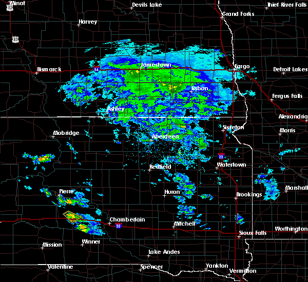 The severe thunderstorm warning for northwestern lyman county will expire at 500 pm cdt, the storm which prompted the warning has weakened below severe limits, and no longer poses an immediate threat to life or property. therefore, the warning will be allowed to expire. however small hail is still possible with this thunderstorm. The severe thunderstorm warning for northwestern lyman county will expire at 500 pm cdt, the storm which prompted the warning has weakened below severe limits, and no longer poses an immediate threat to life or property. therefore, the warning will be allowed to expire. however small hail is still possible with this thunderstorm.
|
| 6/19/2019 4:39 PM CDT |
 At 438 pm cdt, a severe thunderstorm was located near presho, moving southeast at 15 mph (radar indicated). Hazards include quarter size hail. Damage to vehicles is expected. Locations impacted include, presho, fate dam and earling hills. At 438 pm cdt, a severe thunderstorm was located near presho, moving southeast at 15 mph (radar indicated). Hazards include quarter size hail. Damage to vehicles is expected. Locations impacted include, presho, fate dam and earling hills.
|
| 6/19/2019 4:26 PM CDT |
 At 426 pm cdt, a severe thunderstorm was located 7 miles north of 5 mile corner, or 8 miles northwest of presho, moving southeast at 20 mph (radar indicated). Hazards include quarter size hail. damage to vehicles is expected At 426 pm cdt, a severe thunderstorm was located 7 miles north of 5 mile corner, or 8 miles northwest of presho, moving southeast at 20 mph (radar indicated). Hazards include quarter size hail. damage to vehicles is expected
|
| 8/27/2018 7:56 PM CDT | Golf Ball sized hail reported 2.9 miles ENE of Presho, SD, a few golf balls and lots of quarters. radar estimated time. |
| 8/27/2018 7:55 PM CDT | Tea Cup sized hail reported 0.1 miles N of Presho, SD, many large stones golf ball size or bigger. largest being 3.5 inches. |
| 8/27/2018 7:54 PM CDT |
 At 754 pm cdt, a severe thunderstorm was located over earling hills, or near presho, moving east at 55 mph (radar indicated). Hazards include 60 mph wind gusts and quarter size hail. Hail damage to vehicles is expected. Expect wind damage to roofs, siding, and trees. At 754 pm cdt, a severe thunderstorm was located over earling hills, or near presho, moving east at 55 mph (radar indicated). Hazards include 60 mph wind gusts and quarter size hail. Hail damage to vehicles is expected. Expect wind damage to roofs, siding, and trees.
|
| 8/25/2018 9:24 PM CDT | Storm damage reported in lyman county SD, 0.1 miles N of Presho, SD |
| 8/23/2018 7:50 PM CDT |
 At 750 pm cdt, severe thunderstorms were located along a line extending from 7 miles southwest of cedar creek rec area to 11 miles south of earling hills, moving east at 35 mph (radar indicated). Hazards include 60 mph wind gusts. Expect damage to roofs, siding, and trees. Locations impacted include, lower brule, presho, lyman, kennebec, reliance, medicine butte, fate dam, earling hills, byre lake and lake sharpe. At 750 pm cdt, severe thunderstorms were located along a line extending from 7 miles southwest of cedar creek rec area to 11 miles south of earling hills, moving east at 35 mph (radar indicated). Hazards include 60 mph wind gusts. Expect damage to roofs, siding, and trees. Locations impacted include, lower brule, presho, lyman, kennebec, reliance, medicine butte, fate dam, earling hills, byre lake and lake sharpe.
|
| 8/23/2018 7:25 PM CDT |
 At 725 pm cdt, severe thunderstorms were located along a line extending from 8 miles north of vivian to 13 miles northeast of wood, moving east at 40 mph (radar indicated). Hazards include 60 mph wind gusts. expect damage to roofs, siding, and trees At 725 pm cdt, severe thunderstorms were located along a line extending from 8 miles north of vivian to 13 miles northeast of wood, moving east at 40 mph (radar indicated). Hazards include 60 mph wind gusts. expect damage to roofs, siding, and trees
|
| 8/6/2018 6:44 PM CDT | Storm damage reported in lyman county SD, 0.1 miles N of Presho, SD |
| 8/6/2018 6:44 PM CDT |
 At 644 pm cdt, a severe thunderstorm was located near kennebec, or near presho, moving east at 30 mph (radar indicated). Hazards include ping pong ball size hail and 60 mph wind gusts. People and animals outdoors will be injured. expect hail damage to roofs, siding, windows, and vehicles. expect wind damage to roofs, siding, and trees. Locations impacted include, presho, lyman, kennebec, reliance, fate dam, earling hills, byre lake and 5 mile corner. At 644 pm cdt, a severe thunderstorm was located near kennebec, or near presho, moving east at 30 mph (radar indicated). Hazards include ping pong ball size hail and 60 mph wind gusts. People and animals outdoors will be injured. expect hail damage to roofs, siding, windows, and vehicles. expect wind damage to roofs, siding, and trees. Locations impacted include, presho, lyman, kennebec, reliance, fate dam, earling hills, byre lake and 5 mile corner.
|
| 8/6/2018 6:38 PM CDT |
 At 638 pm cdt, a severe thunderstorm was located over fate dam, or near presho, moving east at 30 mph (radar indicated). Hazards include 60 mph wind gusts and quarter size hail. Hail damage to vehicles is expected. Expect wind damage to roofs, siding, and trees. At 638 pm cdt, a severe thunderstorm was located over fate dam, or near presho, moving east at 30 mph (radar indicated). Hazards include 60 mph wind gusts and quarter size hail. Hail damage to vehicles is expected. Expect wind damage to roofs, siding, and trees.
|
| 6/11/2018 3:50 AM CDT |
 At 349 am cdt, a severe thunderstorm was located near kennebec, or 12 miles east of presho, moving northeast at 55 mph (radar indicated). Hazards include 60 mph wind gusts and quarter size hail. Hail damage to vehicles is expected. expect wind damage to roofs, siding, and trees. Locations impacted include, presho, lyman, kennebec, reliance, medicine butte, fate dam, earling hills, byre lake and lake sharpe. At 349 am cdt, a severe thunderstorm was located near kennebec, or 12 miles east of presho, moving northeast at 55 mph (radar indicated). Hazards include 60 mph wind gusts and quarter size hail. Hail damage to vehicles is expected. expect wind damage to roofs, siding, and trees. Locations impacted include, presho, lyman, kennebec, reliance, medicine butte, fate dam, earling hills, byre lake and lake sharpe.
|
| 6/11/2018 3:39 AM CDT |
 At 339 am cdt, a severe thunderstorm was located near earling hills, or 10 miles southeast of presho, moving northeast at 55 mph (radar indicated). Hazards include 60 mph wind gusts and quarter size hail. Hail damage to vehicles is expected. Expect wind damage to roofs, siding, and trees. At 339 am cdt, a severe thunderstorm was located near earling hills, or 10 miles southeast of presho, moving northeast at 55 mph (radar indicated). Hazards include 60 mph wind gusts and quarter size hail. Hail damage to vehicles is expected. Expect wind damage to roofs, siding, and trees.
|
| 6/8/2018 8:53 PM CDT | Mobile mesonet-measured wind gus in lyman county SD, 12.5 miles N of Presho, SD |
| 6/8/2018 8:44 PM CDT | Storm damage reported in lyman county SD, 14.1 miles NNE of Presho, SD |
| 5/17/2018 11:41 PM CDT |
 The severe thunderstorm warning for hand, eastern sully, hyde, southeastern stanley, hughes, lyman and buffalo counties will expire at 1145 pm cdt, the storms which prompted the warning have weakened below severe limits, and no longer pose an immediate threat to life or property. therefore the warning will be allowed to expire. a severe thunderstorm watch remains in effect until midnight cdt for central south dakota. The severe thunderstorm warning for hand, eastern sully, hyde, southeastern stanley, hughes, lyman and buffalo counties will expire at 1145 pm cdt, the storms which prompted the warning have weakened below severe limits, and no longer pose an immediate threat to life or property. therefore the warning will be allowed to expire. a severe thunderstorm watch remains in effect until midnight cdt for central south dakota.
|
| 5/17/2018 10:42 PM CDT |
 At 1040 pm cdt, severe thunderstorms were located along a line extending from near blunt to near earling hills, moving east at 40 mph (trained weather spotters). Hazards include 60 mph wind gusts and nickel size hail. expect damage to roofs, siding, and trees At 1040 pm cdt, severe thunderstorms were located along a line extending from near blunt to near earling hills, moving east at 40 mph (trained weather spotters). Hazards include 60 mph wind gusts and nickel size hail. expect damage to roofs, siding, and trees
|
| 5/17/2018 9:55 PM CDT |
 At 955 pm cdt/855 pm mdt/, severe thunderstorms were located along a line extending from oahe mission rec area to 6 miles east of draper, moving east at 35 mph (radar indicated. at 920 pm cdt, winds of 61 mph were reported in pierre). Hazards include 60 mph wind gusts and nickel size hail. expect damage to roofs, siding, and trees At 955 pm cdt/855 pm mdt/, severe thunderstorms were located along a line extending from oahe mission rec area to 6 miles east of draper, moving east at 35 mph (radar indicated. at 920 pm cdt, winds of 61 mph were reported in pierre). Hazards include 60 mph wind gusts and nickel size hail. expect damage to roofs, siding, and trees
|
| 8/21/2017 10:09 AM CDT |
 At 1009 am cdt, a severe thunderstorm was located near earling hills, or 8 miles southeast of presho, moving southeast at 35 mph (radar indicated). Hazards include golf ball size hail. People and animals outdoors will be injured. expect damage to roofs, siding, windows, and vehicles. Locations impacted include, presho, lyman, kennebec and earling hills. At 1009 am cdt, a severe thunderstorm was located near earling hills, or 8 miles southeast of presho, moving southeast at 35 mph (radar indicated). Hazards include golf ball size hail. People and animals outdoors will be injured. expect damage to roofs, siding, windows, and vehicles. Locations impacted include, presho, lyman, kennebec and earling hills.
|
| 8/21/2017 9:50 AM CDT |
 At 950 am cdt, a severe thunderstorm was located near 5 mile corner, or near presho, moving southeast at 35 mph (radar indicated). Hazards include ping pong ball size hail. People and animals outdoors will be injured. Expect damage to roofs, siding, windows, and vehicles. At 950 am cdt, a severe thunderstorm was located near 5 mile corner, or near presho, moving southeast at 35 mph (radar indicated). Hazards include ping pong ball size hail. People and animals outdoors will be injured. Expect damage to roofs, siding, windows, and vehicles.
|
| 7/25/2017 7:59 PM CDT |
 At 758 pm cdt, a severe thunderstorm was located over fate dam, or near presho, moving northeast at 30 mph (trained weather spotters). Hazards include 60 to 70 mph wind gusts. Expect considerable tree damage. Damage is likely to mobile homes, roofs, and outbuildings. At 758 pm cdt, a severe thunderstorm was located over fate dam, or near presho, moving northeast at 30 mph (trained weather spotters). Hazards include 60 to 70 mph wind gusts. Expect considerable tree damage. Damage is likely to mobile homes, roofs, and outbuildings.
|
| 7/25/2017 7:50 PM CDT | Estimated wind gusts between 60-70 mp in lyman county SD, 0.8 miles N of Presho, SD |
| 7/25/2017 7:13 PM CDT |
 At 713 pm cdt, severe thunderstorms were located along a line extending from 11 miles southwest of earling hills to 9 miles north of hamill, moving northeast at 30 mph (radar indicated). Hazards include 60 mph wind gusts and nickel size hail. expect damage to roofs, siding, and trees At 713 pm cdt, severe thunderstorms were located along a line extending from 11 miles southwest of earling hills to 9 miles north of hamill, moving northeast at 30 mph (radar indicated). Hazards include 60 mph wind gusts and nickel size hail. expect damage to roofs, siding, and trees
|
| 7/17/2017 6:47 PM CDT | Storm damage reported in lyman county SD, 0.1 miles N of Presho, SD |
| 7/17/2017 6:19 PM CDT |
 At 619 pm cdt, severe thunderstorms were located along a line extending from near joe creek rec area to near 5 mile corner, moving east at 40 mph (radar indicated). Hazards include 60 mph wind gusts and quarter size hail. Hail damage to vehicles is expected. Expect wind damage to roofs, siding, and trees. At 619 pm cdt, severe thunderstorms were located along a line extending from near joe creek rec area to near 5 mile corner, moving east at 40 mph (radar indicated). Hazards include 60 mph wind gusts and quarter size hail. Hail damage to vehicles is expected. Expect wind damage to roofs, siding, and trees.
|
| 7/5/2017 9:53 PM CDT |
 At 952 pm cdt, severe thunderstorms were located along a line extending from near stephan to 11 miles east of westover, moving southeast at 30 mph (trained weather spotters. at 936 pm, cdt, 74 mph winds was reported in presho). Hazards include 70 mph wind gusts. Expect considerable tree damage. damage is likely to mobile homes, roofs, and outbuildings. Locations impacted include, lower brule, presho, fort thompson, lyman, oacoma, kennebec, reliance, vivian, shelby, iona, fate dam, medicine butte, earling hills, dude ranch, lake sharpe, etbauer hill, lees corner, west bend rec area, crow creek housing and tailrace rec area. At 952 pm cdt, severe thunderstorms were located along a line extending from near stephan to 11 miles east of westover, moving southeast at 30 mph (trained weather spotters. at 936 pm, cdt, 74 mph winds was reported in presho). Hazards include 70 mph wind gusts. Expect considerable tree damage. damage is likely to mobile homes, roofs, and outbuildings. Locations impacted include, lower brule, presho, fort thompson, lyman, oacoma, kennebec, reliance, vivian, shelby, iona, fate dam, medicine butte, earling hills, dude ranch, lake sharpe, etbauer hill, lees corner, west bend rec area, crow creek housing and tailrace rec area.
|
| 7/5/2017 9:36 PM CDT | Storm damage reported in lyman county SD, 1 miles W of Presho, SD |
| 7/5/2017 9:35 PM CDT | Storm damage reported in lyman county SD, 0.1 miles N of Presho, SD |
| 7/5/2017 9:28 PM CDT | Storm damage reported in lyman county SD, 0.1 miles N of Presho, SD |
| 7/5/2017 9:27 PM CDT |
 At 926 pm cdt, severe thunderstorms were located along a line extending from 8 miles northwest of stephan to near murdo, moving southeast at 35 mph (radar indicated). Hazards include 60 mph wind gusts. expect damage to roofs, siding, and trees At 926 pm cdt, severe thunderstorms were located along a line extending from 8 miles northwest of stephan to near murdo, moving southeast at 35 mph (radar indicated). Hazards include 60 mph wind gusts. expect damage to roofs, siding, and trees
|
| 6/21/2017 2:16 AM CDT | Storm damage reported in lyman county SD, 1 miles W of Presho, SD |
| 6/11/2017 1:30 AM CDT |
 At 130 am cdt, a severe thunderstorm was located over vivian, or 11 miles west of presho, moving northeast at 45 mph (radar indicated). Hazards include ping pong ball size hail and 60 mph wind gusts. People and animals outdoors will be injured. expect hail damage to roofs, siding, windows, and vehicles. Expect wind damage to roofs, siding, and trees. At 130 am cdt, a severe thunderstorm was located over vivian, or 11 miles west of presho, moving northeast at 45 mph (radar indicated). Hazards include ping pong ball size hail and 60 mph wind gusts. People and animals outdoors will be injured. expect hail damage to roofs, siding, windows, and vehicles. Expect wind damage to roofs, siding, and trees.
|
| 9/4/2016 10:12 PM CDT |
 The severe thunderstorm warning for southeastern stanley, southeastern hughes, northeastern jones, buffalo, lyman, southern hyde and southwestern hand counties will expire at 1015 pm cdt, the storm which prompted the warning has weakened below severe limits, and no longer pose an immediate threat to life or property. therefore, the warning will be allowed to expire. a severe thunderstorm watch remains in effect until midnight cdt for central south dakota. The severe thunderstorm warning for southeastern stanley, southeastern hughes, northeastern jones, buffalo, lyman, southern hyde and southwestern hand counties will expire at 1015 pm cdt, the storm which prompted the warning has weakened below severe limits, and no longer pose an immediate threat to life or property. therefore, the warning will be allowed to expire. a severe thunderstorm watch remains in effect until midnight cdt for central south dakota.
|
| 9/4/2016 9:22 PM CDT |
 At 921 pm cdt, a severe thunderstorm was located near kennebec, or near presho, moving east at 55 mph (radar indicated). Hazards include 60 mph wind gusts and penny size hail. Expect damage to roofs. siding. and trees. this severe thunderstorm will be near, kennebec and byre lake around 925 pm cdt. lyman around 930 pm cdt. reliance and medicine butte around 940 pm cdt. lower brule and counselor creek boat access area around 945 pm cdt. fort thompson, tailrace rec area and lake sharpe around 950 pm cdt. lees corner around 955 pm cdt. etbauer hill around 1005 pm cdt. Pleasant valley country church around 1015 pm cdt. At 921 pm cdt, a severe thunderstorm was located near kennebec, or near presho, moving east at 55 mph (radar indicated). Hazards include 60 mph wind gusts and penny size hail. Expect damage to roofs. siding. and trees. this severe thunderstorm will be near, kennebec and byre lake around 925 pm cdt. lyman around 930 pm cdt. reliance and medicine butte around 940 pm cdt. lower brule and counselor creek boat access area around 945 pm cdt. fort thompson, tailrace rec area and lake sharpe around 950 pm cdt. lees corner around 955 pm cdt. etbauer hill around 1005 pm cdt. Pleasant valley country church around 1015 pm cdt.
|
| 9/4/2016 8:56 PM CDT |
 At 856 pm cdt/756 pm mdt/, a severe thunderstorm was located near okaton, or 9 miles northwest of murdo, moving east at 35 mph (radar indicated). Hazards include 60 mph wind gusts. Expect damage to roofs. siding. and trees. this severe storm will be near, murdo around 910 pm cdt. Draper around 920 pm cdt. At 856 pm cdt/756 pm mdt/, a severe thunderstorm was located near okaton, or 9 miles northwest of murdo, moving east at 35 mph (radar indicated). Hazards include 60 mph wind gusts. Expect damage to roofs. siding. and trees. this severe storm will be near, murdo around 910 pm cdt. Draper around 920 pm cdt.
|
| 9/4/2016 8:29 PM CDT |
 At 828 pm cdt/728 pm mdt/, a severe thunderstorm was located near okaton, or near murdo, moving northeast at 40 mph (radar indicated). Hazards include 60 mph wind gusts and penny size hail. Expect damage to roofs. siding. and trees. This severe thunderstorm will be near, draper around 845 pm cdt. At 828 pm cdt/728 pm mdt/, a severe thunderstorm was located near okaton, or near murdo, moving northeast at 40 mph (radar indicated). Hazards include 60 mph wind gusts and penny size hail. Expect damage to roofs. siding. and trees. This severe thunderstorm will be near, draper around 845 pm cdt.
|
| 9/4/2016 7:24 PM CDT |
 The severe thunderstorm warning for west central lyman county will expire at 730 pm cdt, the storm which prompted the warning has moved out of the area. therefore, the warning will be allowed to expire. a severe thunderstorm watch remains in effect until midnight cdt for central south dakota. The severe thunderstorm warning for west central lyman county will expire at 730 pm cdt, the storm which prompted the warning has moved out of the area. therefore, the warning will be allowed to expire. a severe thunderstorm watch remains in effect until midnight cdt for central south dakota.
|
| 9/4/2016 6:48 PM CDT |
 At 647 pm cdt, a severe thunderstorm was located 8 miles southwest of 5 mile corner, or 12 miles southwest of presho, moving east at 30 mph (radar indicated). Hazards include ping pong ball size hail and 60 mph wind gusts. People and animals outdoors will be injured. expect hail damage to roofs, siding, windows, and vehicles. expect wind damage to roofs, siding, and trees. this severe storm will be near, 5 mile corner around 700 pm cdt. presho and earling hills around 710 pm cdt. Fate dam around 715 pm cdt. At 647 pm cdt, a severe thunderstorm was located 8 miles southwest of 5 mile corner, or 12 miles southwest of presho, moving east at 30 mph (radar indicated). Hazards include ping pong ball size hail and 60 mph wind gusts. People and animals outdoors will be injured. expect hail damage to roofs, siding, windows, and vehicles. expect wind damage to roofs, siding, and trees. this severe storm will be near, 5 mile corner around 700 pm cdt. presho and earling hills around 710 pm cdt. Fate dam around 715 pm cdt.
|
| 9/4/2016 6:38 PM CDT |
 At 638 pm cdt, a severe thunderstorm was located 10 miles south of vivian, or 17 miles southwest of presho, moving east at 30 mph (radar indicated). Hazards include ping pong ball size hail and 60 mph wind gusts. People and animals outdoors will be injured. expect hail damage to roofs, siding, windows, and vehicles. expect wind damage to roofs, siding, and trees. this severe thunderstorm will be near, 5 mile corner around 700 pm cdt. presho and earling hills around 710 pm cdt. Fate dam around 715 pm cdt. At 638 pm cdt, a severe thunderstorm was located 10 miles south of vivian, or 17 miles southwest of presho, moving east at 30 mph (radar indicated). Hazards include ping pong ball size hail and 60 mph wind gusts. People and animals outdoors will be injured. expect hail damage to roofs, siding, windows, and vehicles. expect wind damage to roofs, siding, and trees. this severe thunderstorm will be near, 5 mile corner around 700 pm cdt. presho and earling hills around 710 pm cdt. Fate dam around 715 pm cdt.
|
| 8/14/2016 10:40 PM CDT |
 At 1039 pm cdt, a severe thunderstorm was located over byre lake, or 10 miles east of presho, moving east at 30 mph (radar indicated). Hazards include 60 mph wind gusts. Expect damage to roofs. siding. and trees. this severe storm will be near, lyman around 1050 pm cdt. Reliance and medicine butte around 1105 pm cdt. At 1039 pm cdt, a severe thunderstorm was located over byre lake, or 10 miles east of presho, moving east at 30 mph (radar indicated). Hazards include 60 mph wind gusts. Expect damage to roofs. siding. and trees. this severe storm will be near, lyman around 1050 pm cdt. Reliance and medicine butte around 1105 pm cdt.
|
| 8/14/2016 10:16 PM CDT |
 At 1015 pm cdt, a severe thunderstorm was located over presho, moving east at 30 mph (radar indicated). Hazards include 60 mph wind gusts. Expect damage to roofs. siding. and trees. this severe thunderstorm will be near, earling hills around 1020 pm cdt. fate dam around 1025 pm cdt. kennebec and byre lake around 1040 pm cdt. lyman around 1055 pm cdt. Reliance and medicine butte around 1105 pm cdt. At 1015 pm cdt, a severe thunderstorm was located over presho, moving east at 30 mph (radar indicated). Hazards include 60 mph wind gusts. Expect damage to roofs. siding. and trees. this severe thunderstorm will be near, earling hills around 1020 pm cdt. fate dam around 1025 pm cdt. kennebec and byre lake around 1040 pm cdt. lyman around 1055 pm cdt. Reliance and medicine butte around 1105 pm cdt.
|
| 8/14/2016 9:47 PM CDT |
 At 946 pm cdt, a severe thunderstorm was located over vivian, or 13 miles west of presho, moving east at 35 mph (radar indicated). Hazards include 60 mph wind gusts. Expect damage to roofs. siding. and trees. this severe storm will be near, vivian around 950 pm cdt. 5 mile corner around 1000 pm cdt. presho around 1010 pm cdt. Fate dam and earling hills around 1015 pm cdt. At 946 pm cdt, a severe thunderstorm was located over vivian, or 13 miles west of presho, moving east at 35 mph (radar indicated). Hazards include 60 mph wind gusts. Expect damage to roofs. siding. and trees. this severe storm will be near, vivian around 950 pm cdt. 5 mile corner around 1000 pm cdt. presho around 1010 pm cdt. Fate dam and earling hills around 1015 pm cdt.
|
| 8/14/2016 9:20 PM CDT |
 At 919 pm cdt, a severe thunderstorm was located near murdo, moving east at 35 mph (radar indicated). Hazards include 60 mph wind gusts. Expect damage to roofs. siding. and trees. this severe thunderstorm will be near, draper around 930 pm cdt. vivian around 950 pm cdt. 5 mile corner around 1000 pm cdt. presho around 1010 pm cdt. Fate dam and earling hills around 1015 pm cdt. At 919 pm cdt, a severe thunderstorm was located near murdo, moving east at 35 mph (radar indicated). Hazards include 60 mph wind gusts. Expect damage to roofs. siding. and trees. this severe thunderstorm will be near, draper around 930 pm cdt. vivian around 950 pm cdt. 5 mile corner around 1000 pm cdt. presho around 1010 pm cdt. Fate dam and earling hills around 1015 pm cdt.
|
| 8/3/2016 9:36 PM CDT |
 At 935 pm cdt, a severe thunderstorm was located near joe creek rec area, or 12 miles west of lower brule, moving east at 40 mph (radar indicated). Hazards include 60 mph wind gusts. Expect damage to roofs. siding. and trees. This severe thunderstorm will remain over mainly rural areas of southeastern stanley, central hughes and northwestern lyman counties. At 935 pm cdt, a severe thunderstorm was located near joe creek rec area, or 12 miles west of lower brule, moving east at 40 mph (radar indicated). Hazards include 60 mph wind gusts. Expect damage to roofs. siding. and trees. This severe thunderstorm will remain over mainly rural areas of southeastern stanley, central hughes and northwestern lyman counties.
|
| 8/3/2016 8:59 PM CDT |
 At 858 pm cdt/758 pm mdt/, a severe thunderstorm was located near vivian, or 15 miles northwest of presho, moving east at 40 mph (radar indicated). Hazards include 60 mph wind gusts. Expect damage to roofs. siding. and trees. this severe thunderstorm will be near, fate dam around 920 pm cdt. cedar creek rec area around 930 pm cdt. Joe creek rec area around 940 pm cdt. At 858 pm cdt/758 pm mdt/, a severe thunderstorm was located near vivian, or 15 miles northwest of presho, moving east at 40 mph (radar indicated). Hazards include 60 mph wind gusts. Expect damage to roofs. siding. and trees. this severe thunderstorm will be near, fate dam around 920 pm cdt. cedar creek rec area around 930 pm cdt. Joe creek rec area around 940 pm cdt.
|
| 8/1/2016 3:41 AM CDT |
 At 340 am cdt, a severe thunderstorm was located 9 miles southwest of earling hills, or 11 miles southwest of presho, moving east at 40 mph (radar indicated). Hazards include 60 mph wind gusts and half dollar size hail. Hail damage to vehicles is expected. expect wind damage to roofs, siding, and trees. Locations impacted include, presho, vivian, draper, westover, 5 mile corner, fate dam and earling hills. At 340 am cdt, a severe thunderstorm was located 9 miles southwest of earling hills, or 11 miles southwest of presho, moving east at 40 mph (radar indicated). Hazards include 60 mph wind gusts and half dollar size hail. Hail damage to vehicles is expected. expect wind damage to roofs, siding, and trees. Locations impacted include, presho, vivian, draper, westover, 5 mile corner, fate dam and earling hills.
|
| 8/1/2016 3:15 AM CDT |
 At 315 am cdt, a severe thunderstorm was located near draper, or 9 miles east of murdo, moving southeast at 45 mph (radar indicated). Hazards include 60 mph wind gusts and half dollar size hail. Hail damage to vehicles is expected. expect wind damage to roofs, siding, and trees. This severe thunderstorm will remain over mainly rural areas of jones and northwestern lyman counties. At 315 am cdt, a severe thunderstorm was located near draper, or 9 miles east of murdo, moving southeast at 45 mph (radar indicated). Hazards include 60 mph wind gusts and half dollar size hail. Hail damage to vehicles is expected. expect wind damage to roofs, siding, and trees. This severe thunderstorm will remain over mainly rural areas of jones and northwestern lyman counties.
|
| 7/26/2016 6:29 PM CDT | Quarter sized hail reported 4.9 miles SSW of Presho, SD, . |
| 7/26/2016 6:27 PM CDT |
 At 626 pm cdt, a severe thunderstorm was located 9 miles south of kennebec, or 13 miles southeast of presho, moving east at 15 mph (trained weather spotters). Hazards include ping pong ball size hail and 60 mph wind gusts. People and animals outdoors will be injured. expect hail damage to roofs, siding, windows, and vehicles. expect wind damage to roofs, siding, and trees. This severe thunderstorm will remain over mainly rural areas of central lyman county. At 626 pm cdt, a severe thunderstorm was located 9 miles south of kennebec, or 13 miles southeast of presho, moving east at 15 mph (trained weather spotters). Hazards include ping pong ball size hail and 60 mph wind gusts. People and animals outdoors will be injured. expect hail damage to roofs, siding, windows, and vehicles. expect wind damage to roofs, siding, and trees. This severe thunderstorm will remain over mainly rural areas of central lyman county.
|
| 7/26/2016 6:11 PM CDT |
 At 610 pm cdt, a severe thunderstorm was located near kennebec, or near presho, moving east at 15 mph (trained weather spotters. at 535 pm cdt...golf ball sized hail was reported 3 miles north of presho). Hazards include ping pong ball size hail and 60 mph wind gusts. People and animals outdoors will be injured. expect hail damage to roofs, siding, windows, and vehicles. expect wind damage to roofs, siding, and trees. this severe thunderstorm will be near, byre lake around 620 pm cdt. kennebec around 625 pm cdt. lyman around 650 pm cdt. Reliance around 700 pm cdt. At 610 pm cdt, a severe thunderstorm was located near kennebec, or near presho, moving east at 15 mph (trained weather spotters. at 535 pm cdt...golf ball sized hail was reported 3 miles north of presho). Hazards include ping pong ball size hail and 60 mph wind gusts. People and animals outdoors will be injured. expect hail damage to roofs, siding, windows, and vehicles. expect wind damage to roofs, siding, and trees. this severe thunderstorm will be near, byre lake around 620 pm cdt. kennebec around 625 pm cdt. lyman around 650 pm cdt. Reliance around 700 pm cdt.
|
| 7/26/2016 5:59 PM CDT |
 At 558 pm cdt, a severe thunderstorm was located near fate dam, or near presho, moving east at 15 mph (trained weather spotters. at 535 pm cdt...golf ball sized hail was reported 3 miles north of presho). Hazards include two inch hail and 70 mph wind gusts. People and animals outdoors will be injured. expect hail damage to roofs, siding, windows, and vehicles. expect considerable tree damage. wind damage is also likely to mobile homes, roofs, and outbuildings. This severe storm will be near, lyman, kennebec and byre lake around 615 pm cdt. At 558 pm cdt, a severe thunderstorm was located near fate dam, or near presho, moving east at 15 mph (trained weather spotters. at 535 pm cdt...golf ball sized hail was reported 3 miles north of presho). Hazards include two inch hail and 70 mph wind gusts. People and animals outdoors will be injured. expect hail damage to roofs, siding, windows, and vehicles. expect considerable tree damage. wind damage is also likely to mobile homes, roofs, and outbuildings. This severe storm will be near, lyman, kennebec and byre lake around 615 pm cdt.
|
| 7/26/2016 5:43 PM CDT |
 At 543 pm cdt, a severe thunderstorm was located over fate dam, or near presho, moving southeast at 10 mph (radar indicated). Hazards include two inch hail and 70 mph wind gusts. People and animals outdoors will be injured. expect hail damage to roofs, siding, windows, and vehicles. expect considerable tree damage. wind damage is also likely to mobile homes, roofs, and outbuildings. this severe storm will be near, earling hills around 555 pm cdt. Kennebec and byre lake around 615 pm cdt. At 543 pm cdt, a severe thunderstorm was located over fate dam, or near presho, moving southeast at 10 mph (radar indicated). Hazards include two inch hail and 70 mph wind gusts. People and animals outdoors will be injured. expect hail damage to roofs, siding, windows, and vehicles. expect considerable tree damage. wind damage is also likely to mobile homes, roofs, and outbuildings. this severe storm will be near, earling hills around 555 pm cdt. Kennebec and byre lake around 615 pm cdt.
|
| 7/26/2016 5:38 PM CDT |
 At 538 pm cdt, a severe thunderstorm was located over fate dam, or near presho, moving southeast at 10 mph (radar indicated). Hazards include 70 mph wind gusts and ping pong ball size hail. People and animals outdoors will be injured. expect hail damage to roofs, siding, windows, and vehicles. expect considerable tree damage. wind damage is also likely to mobile homes, roofs, and outbuildings. this severe storm will be near, fate dam around 545 pm cdt. earling hills around 555 pm cdt. Kennebec and byre lake around 615 pm cdt. At 538 pm cdt, a severe thunderstorm was located over fate dam, or near presho, moving southeast at 10 mph (radar indicated). Hazards include 70 mph wind gusts and ping pong ball size hail. People and animals outdoors will be injured. expect hail damage to roofs, siding, windows, and vehicles. expect considerable tree damage. wind damage is also likely to mobile homes, roofs, and outbuildings. this severe storm will be near, fate dam around 545 pm cdt. earling hills around 555 pm cdt. Kennebec and byre lake around 615 pm cdt.
|
| 7/26/2016 5:35 PM CDT | Golf Ball sized hail reported 2.7 miles S of Presho, SD, . |
| 7/26/2016 5:19 PM CDT |
 At 519 pm cdt, a severe thunderstorm was located near presho, moving east at 15 mph (radar indicated). Hazards include 70 mph wind gusts and ping pong ball size hail. People and animals outdoors will be injured. expect hail damage to roofs, siding, windows, and vehicles. expect considerable tree damage. wind damage is also likely to mobile homes, roofs, and outbuildings. this severe thunderstorm will be near, presho around 535 pm cdt. fate dam and earling hills around 540 pm cdt. kennebec and byre lake around 610 pm cdt. Lyman around 615 pm cdt. At 519 pm cdt, a severe thunderstorm was located near presho, moving east at 15 mph (radar indicated). Hazards include 70 mph wind gusts and ping pong ball size hail. People and animals outdoors will be injured. expect hail damage to roofs, siding, windows, and vehicles. expect considerable tree damage. wind damage is also likely to mobile homes, roofs, and outbuildings. this severe thunderstorm will be near, presho around 535 pm cdt. fate dam and earling hills around 540 pm cdt. kennebec and byre lake around 610 pm cdt. Lyman around 615 pm cdt.
|
| 7/6/2016 8:55 PM CDT | The severe thunderstorm warning for southeastern jones and northern lyman counties will expire at 900 pm cdt, the storm which prompted the warning have weakened below severe limits, and no longer poses an immediate threat to life or property. therefore the warning will be allowed to expire. however gusty winds are still possible with these thunderstorms. a tornado watch remains in effect until 1000 pm cdt for central south dakota. |
| 7/6/2016 8:37 PM CDT |
 At 837 pm cdt, severe thunderstorms were located along a line extending from near lower brule to near lyman to presho to 6 miles southeast of westover, moving east at 45 mph (radar indicated). Hazards include 60 mph wind gusts. Expect damage to roofs. siding. and trees. these severe storms will be near, medicine butte around 840 pm cdt. kennebec and byre lake around 850 pm cdt. lyman around 900 pm cdt. A tornado watch remains in effect until 1000 pm cdt for central south dakota. At 837 pm cdt, severe thunderstorms were located along a line extending from near lower brule to near lyman to presho to 6 miles southeast of westover, moving east at 45 mph (radar indicated). Hazards include 60 mph wind gusts. Expect damage to roofs. siding. and trees. these severe storms will be near, medicine butte around 840 pm cdt. kennebec and byre lake around 850 pm cdt. lyman around 900 pm cdt. A tornado watch remains in effect until 1000 pm cdt for central south dakota.
|
| 7/6/2016 8:12 PM CDT |
 At 812 pm cdt, severe thunderstorms were located along a line extending from 9 miles southwest of rousseau to near draper to 9 miles northeast of cedar butte, moving east at 50 mph (radar indicated). Hazards include 60 mph wind gusts. Expect damage to roofs. siding. and trees. severe thunderstorms will be near, vivian around 820 pm cdt. 5 mile corner around 830 pm cdt. presho around 835 pm cdt. earling hills and fate dam around 840 pm cdt. kennebec around 845 pm cdt. medicine butte around 850 pm cdt. lyman around 855 pm cdt. A tornado watch remains in effect until 1000 pm cdt for central south dakota. At 812 pm cdt, severe thunderstorms were located along a line extending from 9 miles southwest of rousseau to near draper to 9 miles northeast of cedar butte, moving east at 50 mph (radar indicated). Hazards include 60 mph wind gusts. Expect damage to roofs. siding. and trees. severe thunderstorms will be near, vivian around 820 pm cdt. 5 mile corner around 830 pm cdt. presho around 835 pm cdt. earling hills and fate dam around 840 pm cdt. kennebec around 845 pm cdt. medicine butte around 850 pm cdt. lyman around 855 pm cdt. A tornado watch remains in effect until 1000 pm cdt for central south dakota.
|
| 9/16/2015 11:41 PM CDT | Storm damage reported in lyman county SD, 1 miles W of Presho, SD |
| 9/7/2015 7:22 PM CDT |
 At 721 pm cdt, a severe thunderstorm was located near fate dam, or near presho, moving east at 35 mph (radar indicated). Hazards include 60 mph wind gusts and half dollar size hail. Hail damage to vehicles is expected. expect wind damage to roofs, siding and trees. This severe storm will be near, kennebec and byre lake around 740 pm cdt. At 721 pm cdt, a severe thunderstorm was located near fate dam, or near presho, moving east at 35 mph (radar indicated). Hazards include 60 mph wind gusts and half dollar size hail. Hail damage to vehicles is expected. expect wind damage to roofs, siding and trees. This severe storm will be near, kennebec and byre lake around 740 pm cdt.
|
| 9/7/2015 6:57 PM CDT |
 At 656 pm cdt, a severe thunderstorm was located 9 miles north of vivian, or 15 miles northwest of presho, moving east at 35 mph (radar indicated). Hazards include golf ball size hail and 60 mph wind gusts. People and animals outdoors will be injured. expect hail damage to roofs, siding, windows and vehicles. expect wind damage to roofs, siding and trees. this severe thunderstorm will be near, fate dam around 720 pm cdt. cedar creek rec area around 725 pm cdt. Byre lake and joe creek rec area around 735 pm cdt. At 656 pm cdt, a severe thunderstorm was located 9 miles north of vivian, or 15 miles northwest of presho, moving east at 35 mph (radar indicated). Hazards include golf ball size hail and 60 mph wind gusts. People and animals outdoors will be injured. expect hail damage to roofs, siding, windows and vehicles. expect wind damage to roofs, siding and trees. this severe thunderstorm will be near, fate dam around 720 pm cdt. cedar creek rec area around 725 pm cdt. Byre lake and joe creek rec area around 735 pm cdt.
|
| 8/27/2015 2:31 AM CDT |
 At 230 am cdt, a severe thunderstorm was located near earling hills, or 8 miles south of presho, moving northeast at 25 mph (radar indicated). Hazards include 60 mph wind gusts. Expect damage to roofs. siding and trees. this severe storm will be near, presho and earling hills around 245 am cdt. fate dam around 255 am cdt. kennebec around 310 am cdt. Lyman and byre lake around 315 am cdt. At 230 am cdt, a severe thunderstorm was located near earling hills, or 8 miles south of presho, moving northeast at 25 mph (radar indicated). Hazards include 60 mph wind gusts. Expect damage to roofs. siding and trees. this severe storm will be near, presho and earling hills around 245 am cdt. fate dam around 255 am cdt. kennebec around 310 am cdt. Lyman and byre lake around 315 am cdt.
|
| 8/27/2015 2:08 AM CDT |
 At 207 am cdt, a severe thunderstorm was located 8 miles south of vivian, or 14 miles southwest of presho, moving east at 30 mph (radar indicated). Hazards include 60 mph wind gusts. Expect damage to roofs. siding and trees. this severe thunderstorm will be near, 5 mile corner around 225 am cdt. presho and earling hills around 235 am cdt. fate dam around 240 am cdt. kennebec and byre lake around 300 am cdt. lyman around 310 am cdt. 60 mph winds were recorded recently near murdo. At 207 am cdt, a severe thunderstorm was located 8 miles south of vivian, or 14 miles southwest of presho, moving east at 30 mph (radar indicated). Hazards include 60 mph wind gusts. Expect damage to roofs. siding and trees. this severe thunderstorm will be near, 5 mile corner around 225 am cdt. presho and earling hills around 235 am cdt. fate dam around 240 am cdt. kennebec and byre lake around 300 am cdt. lyman around 310 am cdt. 60 mph winds were recorded recently near murdo.
|
| 8/7/2015 5:31 PM CDT |
 At 531 pm cdt, a severe thunderstorm was located near 5 mile corner, or near presho, moving east at 20 mph (radar indicated). Hazards include 60 mph wind gusts and quarter size hail. Hail damage to vehicles is expected. expect wind damage to roofs, siding and trees. this severe thunderstorm will be near, presho around 540 pm cdt. fate dam around 550 pm cdt. Byre lake around 610 pm cdt. At 531 pm cdt, a severe thunderstorm was located near 5 mile corner, or near presho, moving east at 20 mph (radar indicated). Hazards include 60 mph wind gusts and quarter size hail. Hail damage to vehicles is expected. expect wind damage to roofs, siding and trees. this severe thunderstorm will be near, presho around 540 pm cdt. fate dam around 550 pm cdt. Byre lake around 610 pm cdt.
|
| 7/27/2015 11:17 PM CDT |
 At 1117 pm cdt, a severe thunderstorm was located over presho, moving east at 50 mph (radar indicated). Hazards include 70 mph wind gusts. Expect considerable tree damage. damage is likely to mobile homes, roofs and outbuildings. this severe thunderstorm will be near, fate dam around 1120 pm cdt. kennebec and byre lake around 1130 pm cdt. lyman around 1140 pm cdt. reliance and medicine butte around 1145 pm cdt. lower brule around 1150 pm cdt. Lake sharpe around 1155 pm cdt. At 1117 pm cdt, a severe thunderstorm was located over presho, moving east at 50 mph (radar indicated). Hazards include 70 mph wind gusts. Expect considerable tree damage. damage is likely to mobile homes, roofs and outbuildings. this severe thunderstorm will be near, fate dam around 1120 pm cdt. kennebec and byre lake around 1130 pm cdt. lyman around 1140 pm cdt. reliance and medicine butte around 1145 pm cdt. lower brule around 1150 pm cdt. Lake sharpe around 1155 pm cdt.
|
| 7/27/2015 10:15 PM CDT |
 At 1014 pm cdt /914 pm mdt/, severe thunderstorms were located along a line extending from lake oahe to westover, moving east at 50 mph (radar indicated). Hazards include 70 mph wind gusts. Expect considerable tree damage. damage is likely to mobile homes, roofs and outbuildings. severe thunderstorms will be near, westover around 920 pm mdt. mission ridge around 925 pm mdt. little bend rec area around 935 pm mdt. bush`s landing around 1045 pm cdt. Earling hills around 1050 pm cdt. At 1014 pm cdt /914 pm mdt/, severe thunderstorms were located along a line extending from lake oahe to westover, moving east at 50 mph (radar indicated). Hazards include 70 mph wind gusts. Expect considerable tree damage. damage is likely to mobile homes, roofs and outbuildings. severe thunderstorms will be near, westover around 920 pm mdt. mission ridge around 925 pm mdt. little bend rec area around 935 pm mdt. bush`s landing around 1045 pm cdt. Earling hills around 1050 pm cdt.
|
| 7/25/2015 8:14 AM CDT |
 At 814 am cdt, a severe thunderstorm was located 8 miles south of draper, or 13 miles southeast of murdo, moving east at 55 mph (radar indicated). Hazards include 60 mph wind gusts and quarter size hail. Hail damage to vehicles is expected. expect wind damage to roofs, siding and trees. this severe thunderstorm will be near, 5 mile corner around 830 am cdt. presho around 835 am cdt. earling hills around 840 am cdt. Kennebec around 850 am cdt. At 814 am cdt, a severe thunderstorm was located 8 miles south of draper, or 13 miles southeast of murdo, moving east at 55 mph (radar indicated). Hazards include 60 mph wind gusts and quarter size hail. Hail damage to vehicles is expected. expect wind damage to roofs, siding and trees. this severe thunderstorm will be near, 5 mile corner around 830 am cdt. presho around 835 am cdt. earling hills around 840 am cdt. Kennebec around 850 am cdt.
|
| 7/12/2015 11:57 PM CDT |
 At 1157 pm cdt, a severe thunderstorm was located near byre lake, or 11 miles northeast of presho, moving east at 55 mph (radar indicated). Hazards include 60 mph wind gusts. Expect damage to roofs. siding and trees. this severe thunderstorm will be near, lyman around 1205 am cdt. lower brule and medicine butte around 1210 am cdt. reliance and counselor creek boat access area around 1215 am cdt. tailrace rec area and lake sharpe around 1220 am cdt. fort thompson and lees corner around 1225 am cdt. shelby and crow creek housing around 1235 am cdt. Gann valley around 1245 am cdt. At 1157 pm cdt, a severe thunderstorm was located near byre lake, or 11 miles northeast of presho, moving east at 55 mph (radar indicated). Hazards include 60 mph wind gusts. Expect damage to roofs. siding and trees. this severe thunderstorm will be near, lyman around 1205 am cdt. lower brule and medicine butte around 1210 am cdt. reliance and counselor creek boat access area around 1215 am cdt. tailrace rec area and lake sharpe around 1220 am cdt. fort thompson and lees corner around 1225 am cdt. shelby and crow creek housing around 1235 am cdt. Gann valley around 1245 am cdt.
|
| 7/12/2015 11:40 PM CDT |
 At 1139 pm cdt /1039 pm mdt/, a severe thunderstorm was located near vivian, or 12 miles northwest of presho, moving southeast at 65 mph (radar indicated). Hazards include 60 mph wind gusts. Expect damage to roofs. siding and trees. this severe storm will be near, 5 mile corner around 1145 pm cdt. presho around 1150 pm cdt. fate dam and earling hills around 1155 pm cdt. Lyman, kennebec and byre lake around 1200 am cdt. At 1139 pm cdt /1039 pm mdt/, a severe thunderstorm was located near vivian, or 12 miles northwest of presho, moving southeast at 65 mph (radar indicated). Hazards include 60 mph wind gusts. Expect damage to roofs. siding and trees. this severe storm will be near, 5 mile corner around 1145 pm cdt. presho around 1150 pm cdt. fate dam and earling hills around 1155 pm cdt. Lyman, kennebec and byre lake around 1200 am cdt.
|
| 7/12/2015 11:21 PM CDT |
 At 1119 pm cdt /1019 pm mdt/, a severe thunderstorm was located 11 miles north of draper, or 15 miles northeast of murdo, moving east at 35 mph (law enforcement. 60 mph winds were reported at okaton at 1100 pm cdt). Hazards include 60 mph wind gusts. Expect damage to roofs. siding and trees. this severe thunderstorm will be near, vivian around 1150 pm cdt. 5 mile corner around 1200 am cdt. At 1119 pm cdt /1019 pm mdt/, a severe thunderstorm was located 11 miles north of draper, or 15 miles northeast of murdo, moving east at 35 mph (law enforcement. 60 mph winds were reported at okaton at 1100 pm cdt). Hazards include 60 mph wind gusts. Expect damage to roofs. siding and trees. this severe thunderstorm will be near, vivian around 1150 pm cdt. 5 mile corner around 1200 am cdt.
|
| 6/22/2015 3:51 AM CDT |
 The severe thunderstorm warning for northwestern lyman and jones counties will expire at 400 am cdt, the storm which prompted the warning has moved out of the area. therefore the warning will be allowed to expire. however gusty winds are still possible with this thunderstorm. a severe thunderstorm watch remains in effect until 500 am cdt for central south dakota. The severe thunderstorm warning for northwestern lyman and jones counties will expire at 400 am cdt, the storm which prompted the warning has moved out of the area. therefore the warning will be allowed to expire. however gusty winds are still possible with this thunderstorm. a severe thunderstorm watch remains in effect until 500 am cdt for central south dakota.
|
| 6/22/2015 2:54 AM CDT |
 At 253 am cdt, a severe thunderstorm was located over murdo, moving east at 60 mph (radar indicated). Hazards include 60 mph wind gusts. Expect damage to roofs. siding and trees. this severe thunderstorm will be near, draper around 305 am cdt. vivian around 315 am cdt. 5 mile corner around 320 am cdt. presho around 325 am cdt. Fate dam and earling hills around 330 am cdt. At 253 am cdt, a severe thunderstorm was located over murdo, moving east at 60 mph (radar indicated). Hazards include 60 mph wind gusts. Expect damage to roofs. siding and trees. this severe thunderstorm will be near, draper around 305 am cdt. vivian around 315 am cdt. 5 mile corner around 320 am cdt. presho around 325 am cdt. Fate dam and earling hills around 330 am cdt.
|
| 6/22/2015 2:05 AM CDT |
 At 205 am cdt, a severe thunderstorm was located near kennebec, or 10 miles southeast of presho, moving east at 55 mph (radar indicated). Hazards include 60 mph wind gusts and half dollar size hail. Hail damage to vehicles is expected. expect wind damage to roofs, siding and trees. this severe thunderstorm will be near, lyman around 215 am cdt. reliance around 225 am cdt. dude ranch and lake francis case around 230 am cdt. Oacoma around 235 am cdt. At 205 am cdt, a severe thunderstorm was located near kennebec, or 10 miles southeast of presho, moving east at 55 mph (radar indicated). Hazards include 60 mph wind gusts and half dollar size hail. Hail damage to vehicles is expected. expect wind damage to roofs, siding and trees. this severe thunderstorm will be near, lyman around 215 am cdt. reliance around 225 am cdt. dude ranch and lake francis case around 230 am cdt. Oacoma around 235 am cdt.
|
| 6/20/2015 12:54 AM CDT |
 At 1254 am cdt, severe thunderstorms were located along a line extending from 8 miles north of grey goose to 10 miles south of earling hills, moving east at 50 mph (radar indicated). Hazards include 70 mph wind gusts and penny size hail. Expect considerable tree damage. damage is likely to mobile homes, roofs and outbuildings. severe thunderstorms will be near, onida around 110 am cdt. lyman around 120 am cdt. reliance around 125 am cdt. lake francis case around 130 am cdt. oacoma and dude ranch around 135 am cdt. Shelby and crow creek housing around 150 am cdt. At 1254 am cdt, severe thunderstorms were located along a line extending from 8 miles north of grey goose to 10 miles south of earling hills, moving east at 50 mph (radar indicated). Hazards include 70 mph wind gusts and penny size hail. Expect considerable tree damage. damage is likely to mobile homes, roofs and outbuildings. severe thunderstorms will be near, onida around 110 am cdt. lyman around 120 am cdt. reliance around 125 am cdt. lake francis case around 130 am cdt. oacoma and dude ranch around 135 am cdt. Shelby and crow creek housing around 150 am cdt.
|
| 6/16/2014 7:40 AM CDT | Quarter sized hail reported 6 miles E of Presho, SD, mostly pea but some quarter size. |
| 8/7/2013 8:15 PM CDT | Quarter sized hail reported 5.9 miles WNW of Presho, SD, along with the hail were estimated 40-50 mph winds that knocked down small branches and 1 inch of rain in 20 minutes causing minor flooding |
| 8/7/2013 8:05 PM CDT | Top of a 7.5 foot ash tree was blown off along with grass and ground foliage flattened in lyman county SD, 3.6 miles N of Presho, SD |
| 8/7/2013 7:50 PM CDT | Half Dollar sized hail reported 8.7 miles NE of Presho, SD |
| 5/27/2013 10:57 PM CDT | Wind system at presho airport in lyman county SD, 0.1 miles N of Presho, SD |
| 5/27/2013 10:57 PM CDT | Camper blown over and heating unit at school blown ove in lyman county SD, 0.1 miles N of Presho, SD |
| 5/5/2012 8:55 AM CDT | Ping Pong Ball sized hail reported 9.5 miles NE of Presho, SD, pea sized hail began at 645 by 715 it was 1.5 inches. hail covered the ground. |
| 1/1/0001 12:00 AM | Grain bins blown over. trucks blown off of highwa in lyman county SD, 0.1 miles N of Presho, SD |
| 1/1/0001 12:00 AM | Storm damage reported in lyman county SD, 0.1 miles N of Presho, SD |
| 1/1/0001 12:00 AM | Winds of 70 to 80 mph in lyman county SD, 9.2 miles N of Presho, SD |
| 1/1/0001 12:00 AM | Golf Ball sized hail reported 8.4 miles N of Presho, SD |
| 1/1/0001 12:00 AM | Ping Pong Ball sized hail reported 10.4 miles N of Presho, SD |
| 1/1/0001 12:00 AM | Quarter sized hail reported 0.1 miles N of Presho, SD |
| 1/1/0001 12:00 AM | Quarter sized hail reported 7 miles N of Presho, SD |
Hail Maps for Presho, SD
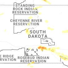
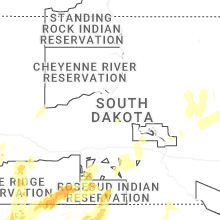


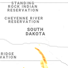


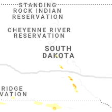


Connect with Interactive Hail Maps