

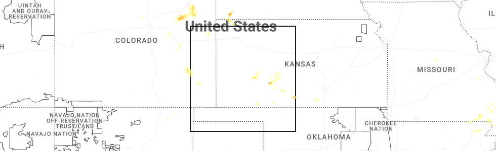
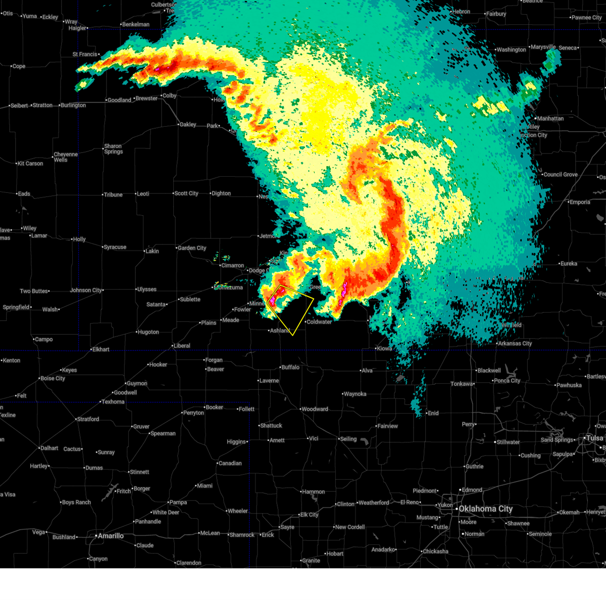
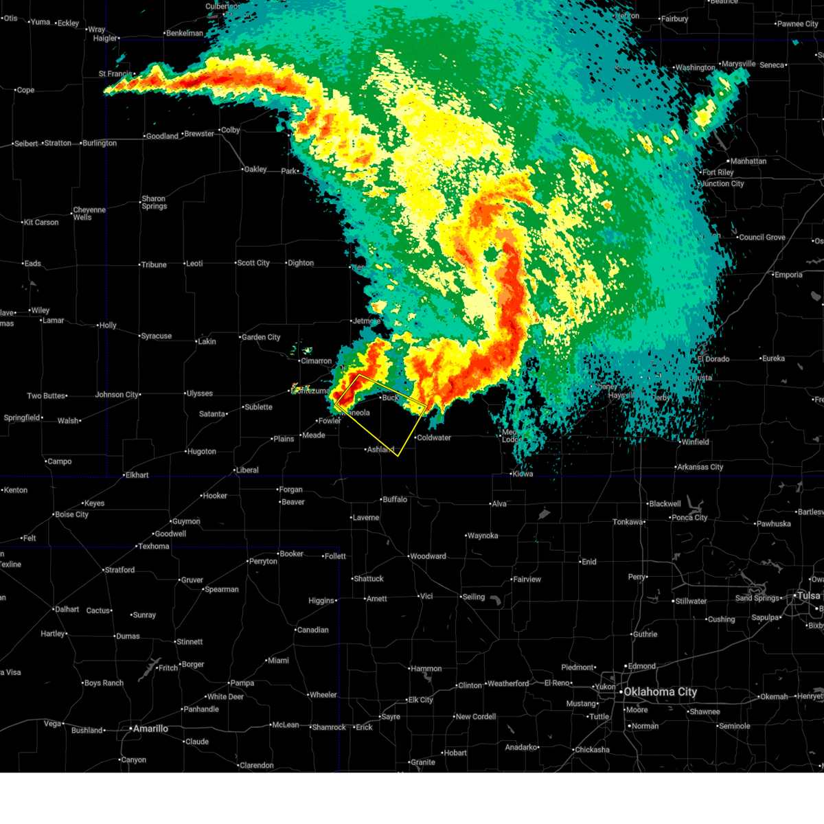
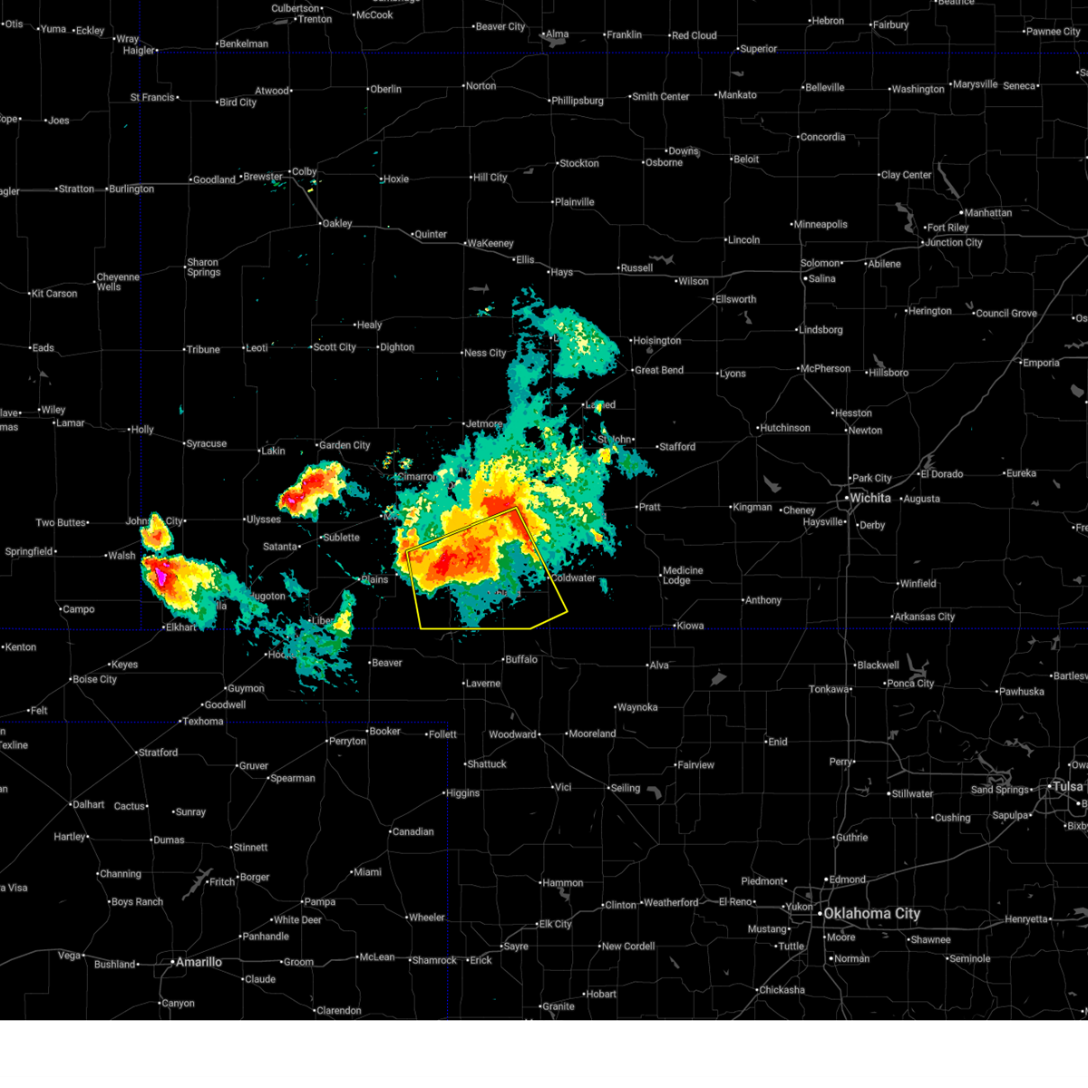
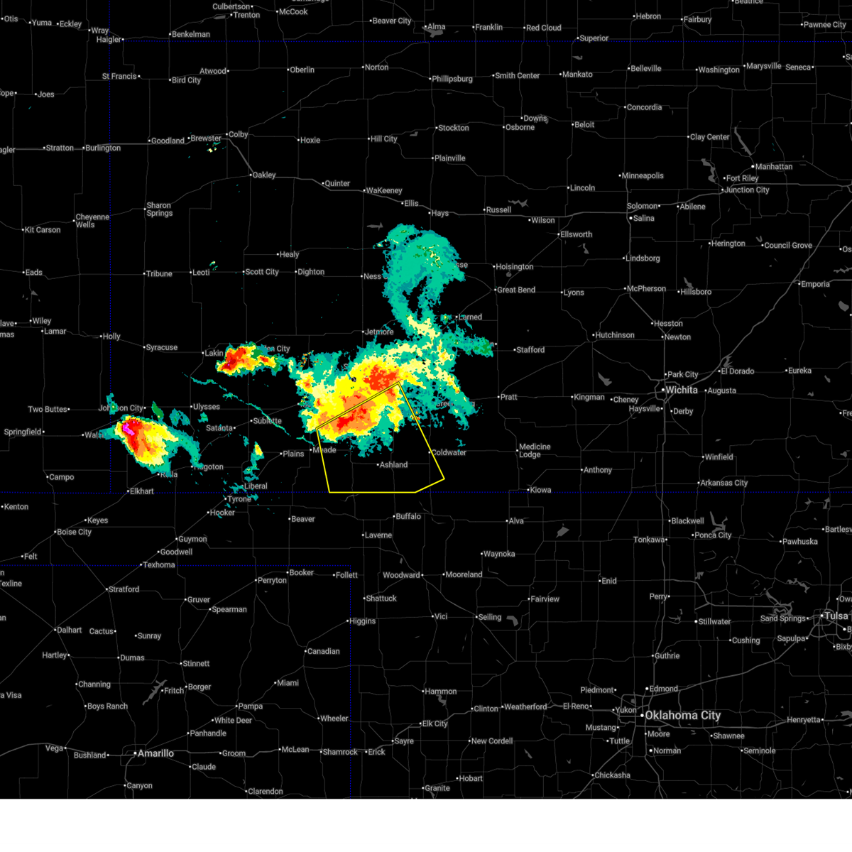
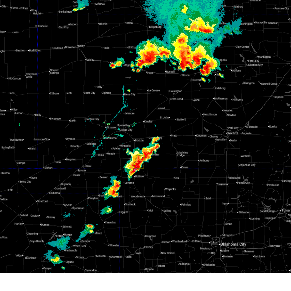
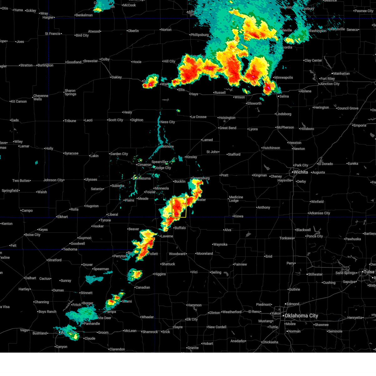
Hail Map for Protection, KS
The Protection, KS area has had 18 reports of on-the-ground hail by trained spotters, and has been under severe weather warnings 32 times during the past 12 months. Doppler radar has detected hail at or near Protection, KS on 104 occasions, including 6 occasions during the past year.
| Name: | Protection, KS |
| Where Located: | 53.2 miles N of Woodward, OK |
| Map: | Google Map for Protection, KS |
| Population: | 514 |
| Housing Units: | 277 |
| More Info: | Search Google for Protection, KS |
3
The Top Recent Hail Date for Protection, KS is Thursday, July 9, 2026 (4th out of 104)
Hail and Wind Damage Spotted near Protection, KS
| Date / Time | Report Details |
|---|---|
| 7/23/2026 9:51 PM CDT |
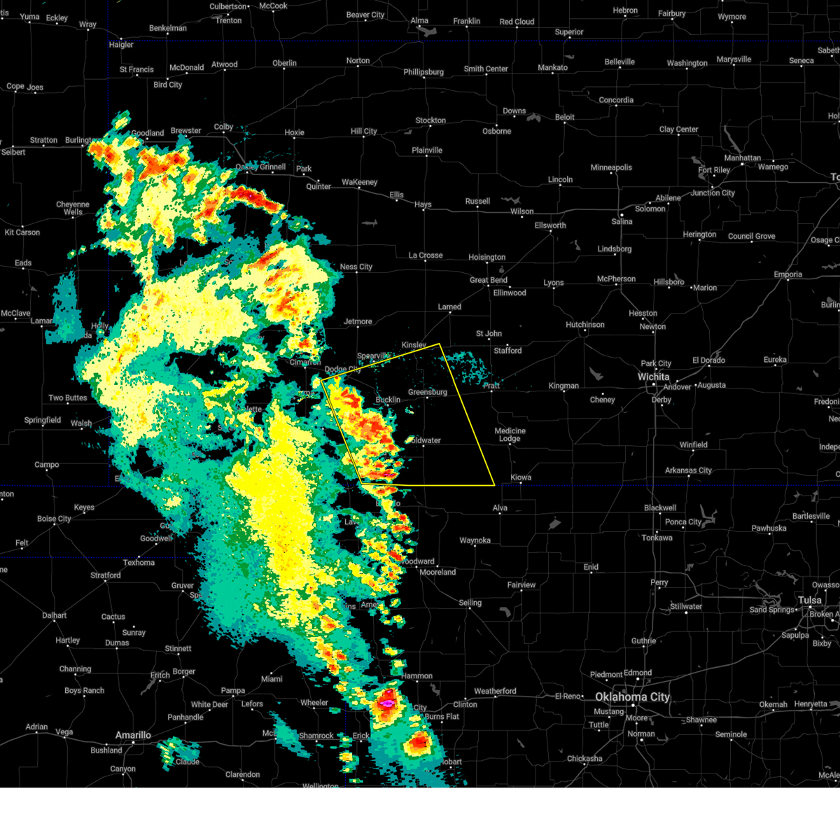
 The storms which prompted the warning have weakened below severe limits, and no longer pose an immediate threat to life or property. therefore, the warning will be allowed to expire. however, gusty winds are still possible with these thunderstorms. The storms which prompted the warning have weakened below severe limits, and no longer pose an immediate threat to life or property. therefore, the warning will be allowed to expire. however, gusty winds are still possible with these thunderstorms.
|
| 7/23/2026 9:34 PM CDT |
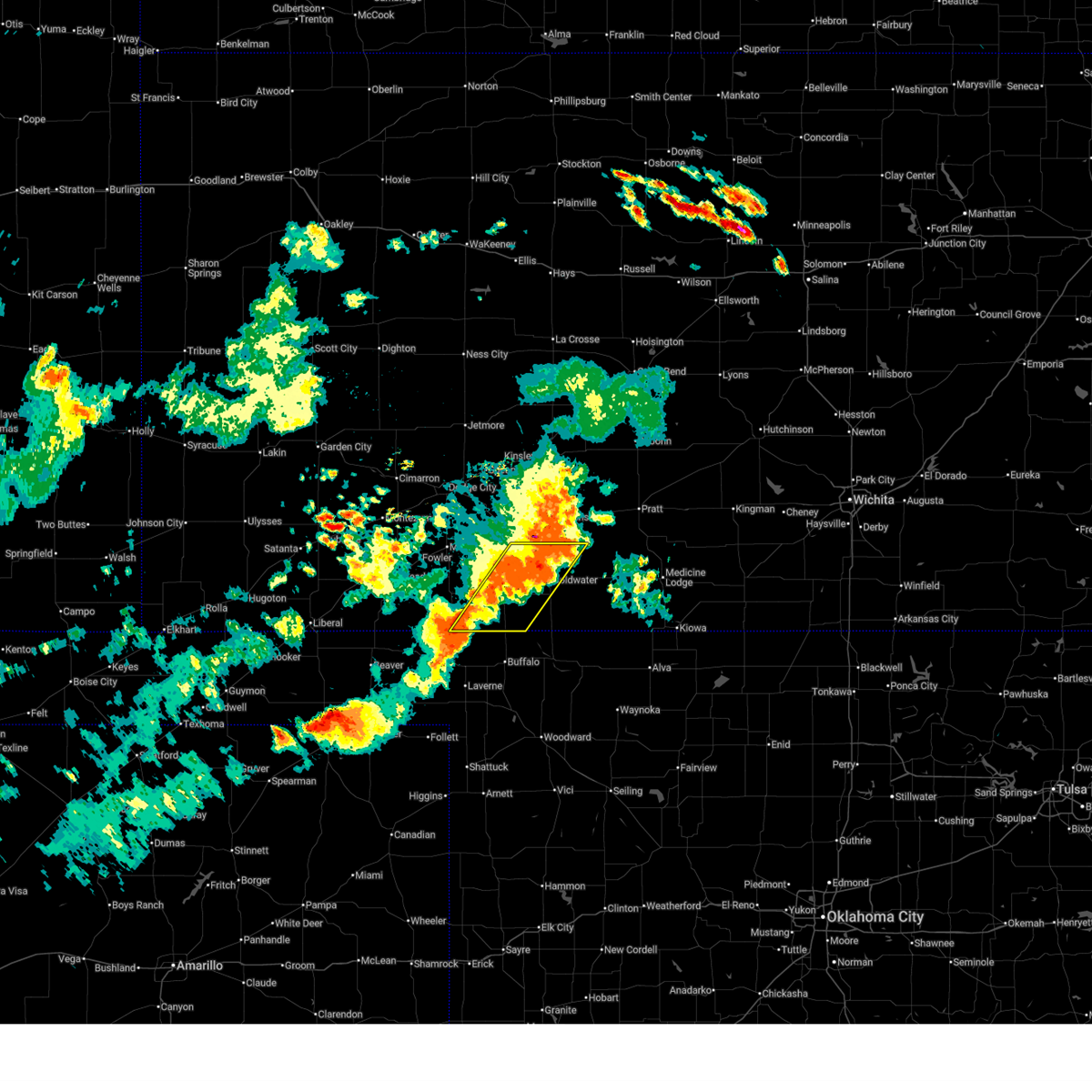
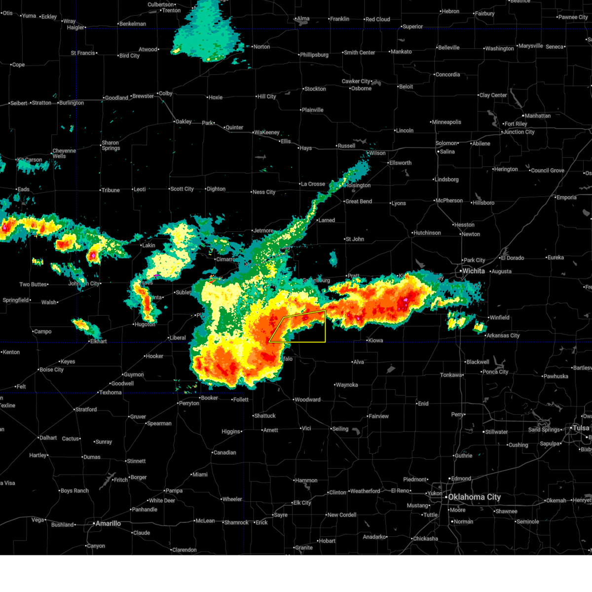
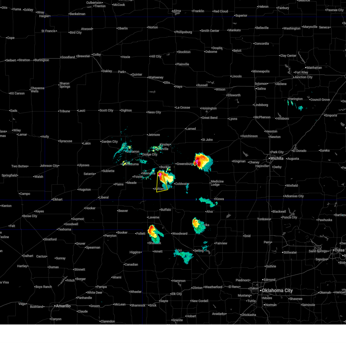
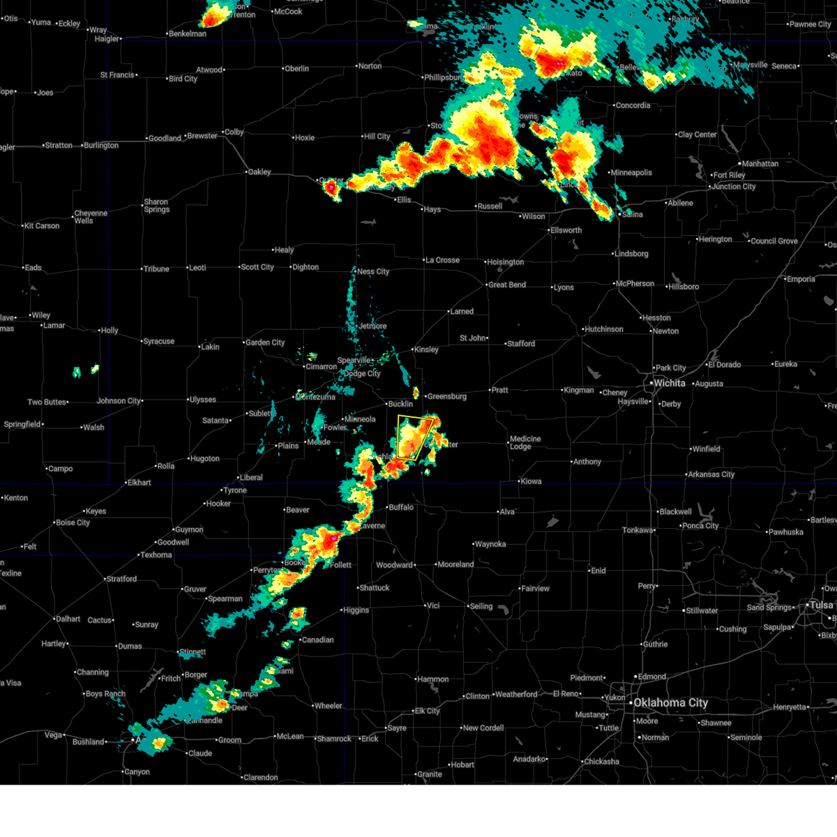
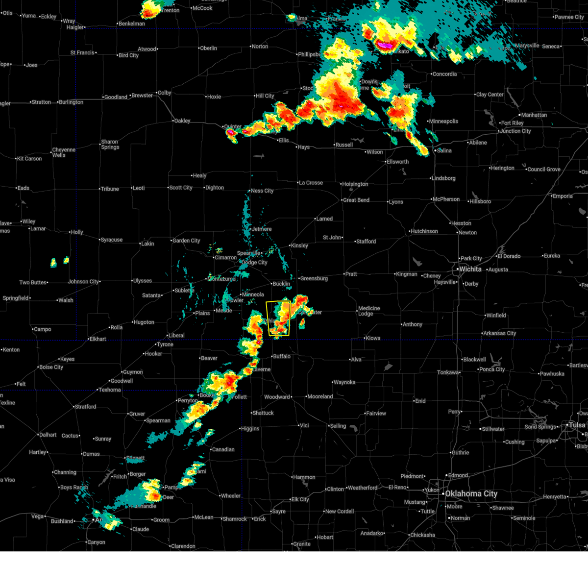
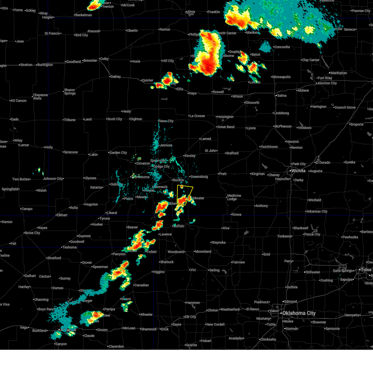
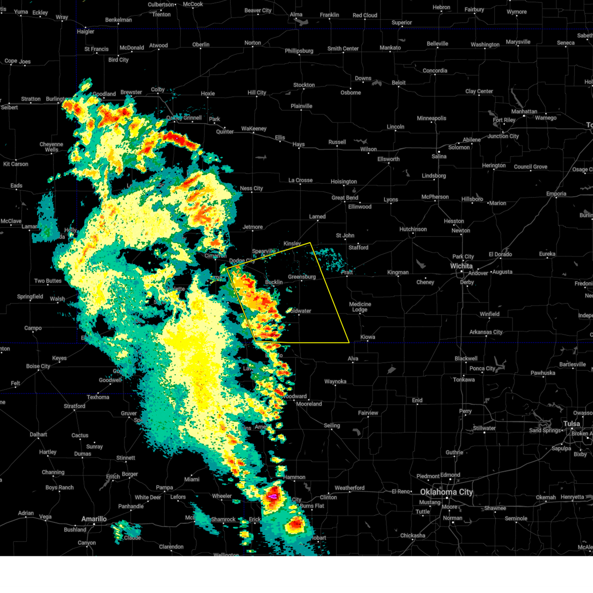
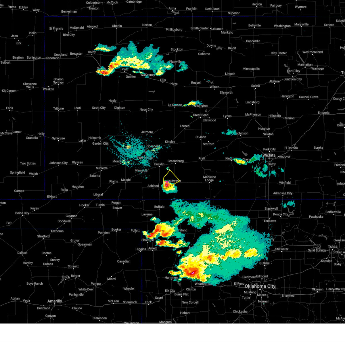
 At 934 pm cdt, severe thunderstorms were located along a line extending from 9 miles southeast of mullinville to near sitka, moving east at 35 mph (radar indicated). Hazards include 60 mph wind gusts. Expect damage to roofs, siding, and trees. Locations impacted include, protection, coldwater, lake coldwater and wilmore. At 934 pm cdt, severe thunderstorms were located along a line extending from 9 miles southeast of mullinville to near sitka, moving east at 35 mph (radar indicated). Hazards include 60 mph wind gusts. Expect damage to roofs, siding, and trees. Locations impacted include, protection, coldwater, lake coldwater and wilmore.
|
| 7/23/2026 9:09 PM CDT |
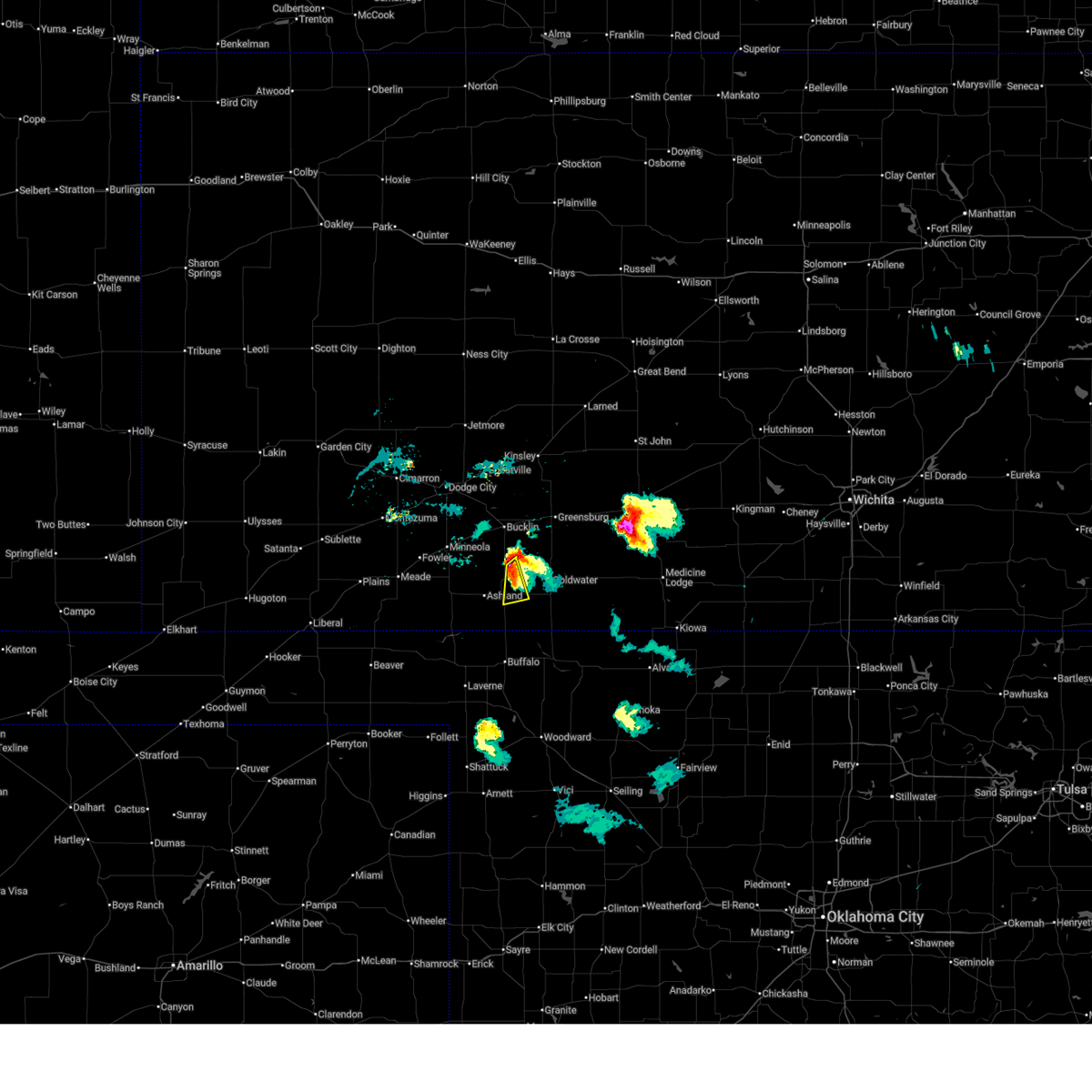
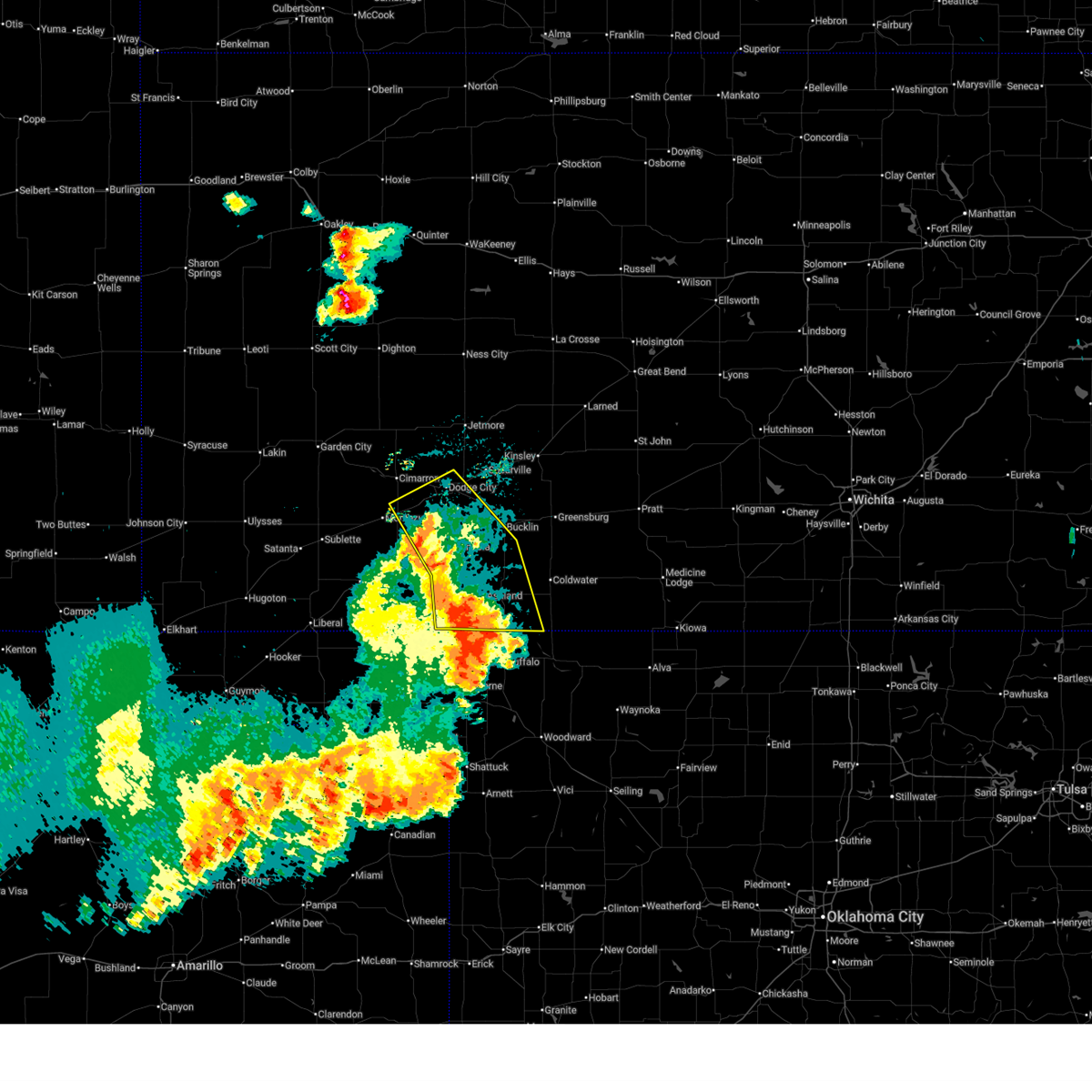
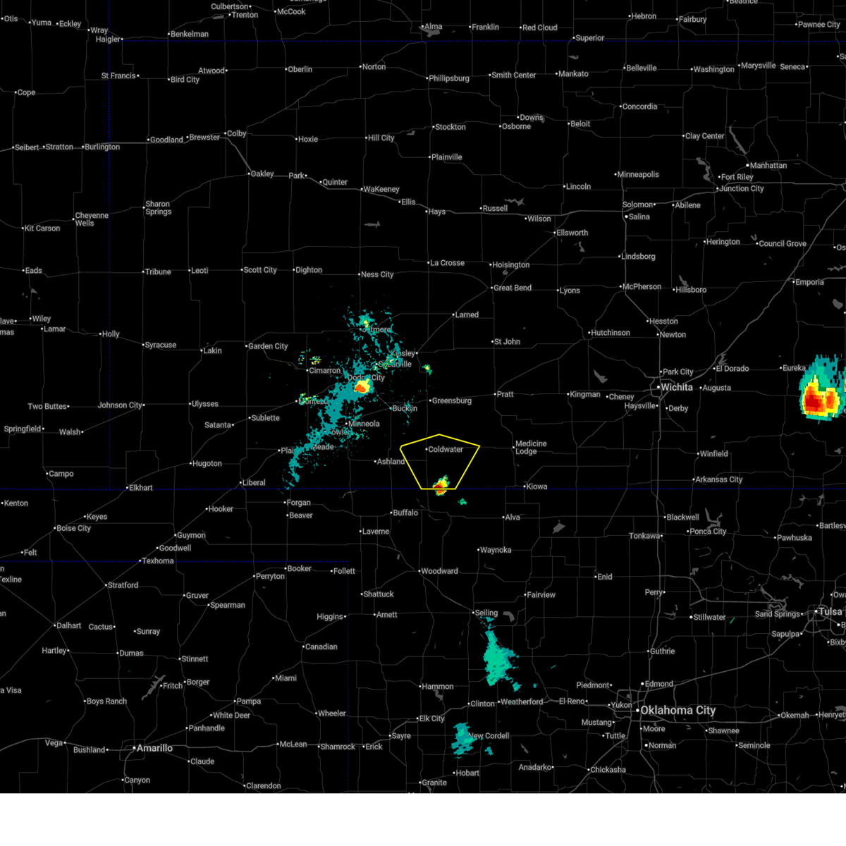
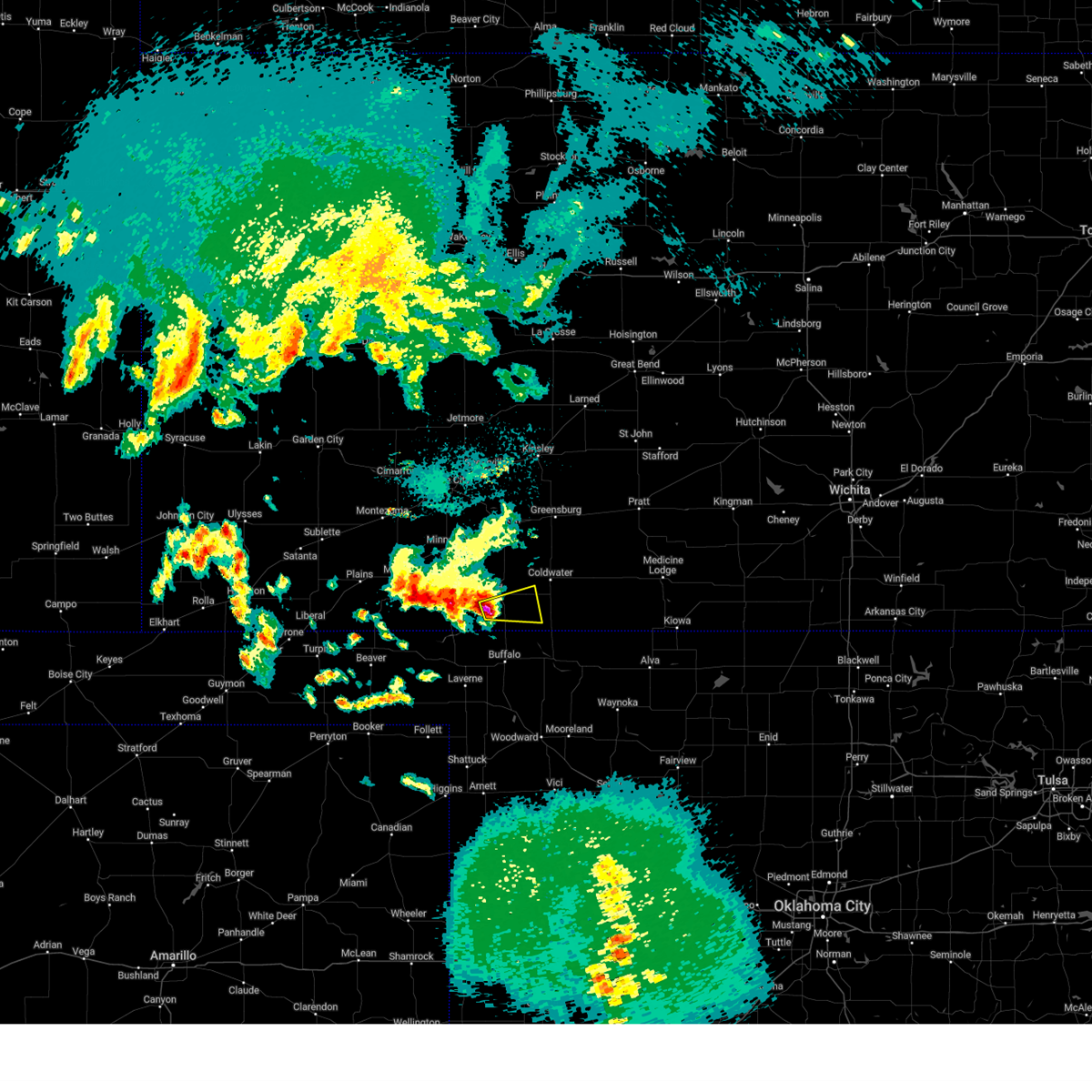
 Svrddc the national weather service in dodge city has issued a * severe thunderstorm warning for, southern kiowa county in south central kansas, western comanche county in south central kansas, clark county in southwestern kansas, * until 1000 pm cdt. * at 909 pm cdt, severe thunderstorms were located along a line extending from 8 miles south of mullinville to 6 miles southeast of englewood, moving east at 30 mph (radar indicated). Hazards include 60 mph wind gusts and quarter size hail. Hail damage to vehicles is expected. expect wind damage to roofs, siding, and trees. severe thunderstorms will be near, sitka around 915 pm cdt. protection around 920 pm cdt. Other locations in the path of these severe thunderstorms include coldwater, lake coldwater and wilmore. Svrddc the national weather service in dodge city has issued a * severe thunderstorm warning for, southern kiowa county in south central kansas, western comanche county in south central kansas, clark county in southwestern kansas, * until 1000 pm cdt. * at 909 pm cdt, severe thunderstorms were located along a line extending from 8 miles south of mullinville to 6 miles southeast of englewood, moving east at 30 mph (radar indicated). Hazards include 60 mph wind gusts and quarter size hail. Hail damage to vehicles is expected. expect wind damage to roofs, siding, and trees. severe thunderstorms will be near, sitka around 915 pm cdt. protection around 920 pm cdt. Other locations in the path of these severe thunderstorms include coldwater, lake coldwater and wilmore.
|
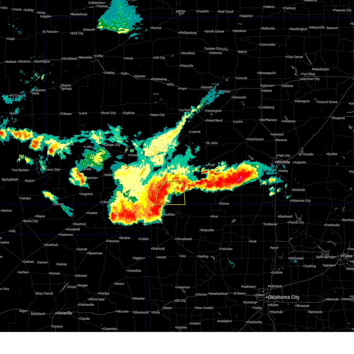
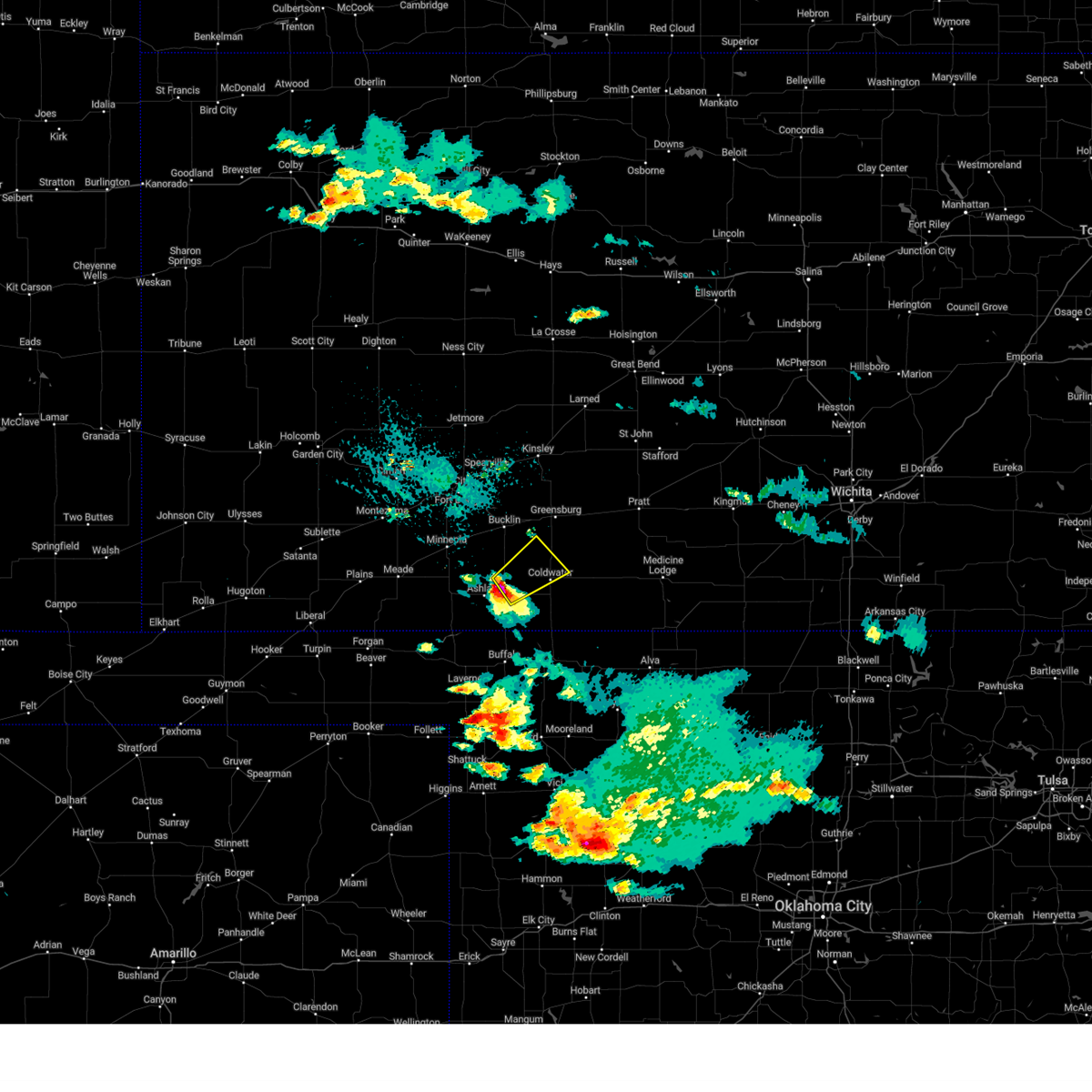
| 7/9/2026 7:54 PM CDT | Power lines down. time estimated by rada in comanche county KS, 0.1 miles NNW of Protection, KS |
| 6/21/2026 10:59 PM CDT |
 Svrddc the national weather service in dodge city has issued a * severe thunderstorm warning for, comanche county in south central kansas, southeastern clark county in southwestern kansas, * until 1130 pm cdt. * at 1058 pm cdt, severe thunderstorms were located along a line extending from 8 miles southeast of wilmore to near protection to 10 miles southeast of sitka, moving southeast at 10 mph (radar indicated. at 1045 pm cdt, a kansas state mesonet station measured a 71 mph wind gust 8 miles south of ashland). Hazards include 70 mph wind gusts and nickel size hail. Expect considerable tree damage. damage is likely to mobile homes, roofs, and outbuildings. severe thunderstorms will be near, coldwater, protection, and lake coldwater around 1105 pm cdt. Other locations in the path of these severe thunderstorms include buttermilk. Svrddc the national weather service in dodge city has issued a * severe thunderstorm warning for, comanche county in south central kansas, southeastern clark county in southwestern kansas, * until 1130 pm cdt. * at 1058 pm cdt, severe thunderstorms were located along a line extending from 8 miles southeast of wilmore to near protection to 10 miles southeast of sitka, moving southeast at 10 mph (radar indicated. at 1045 pm cdt, a kansas state mesonet station measured a 71 mph wind gust 8 miles south of ashland). Hazards include 70 mph wind gusts and nickel size hail. Expect considerable tree damage. damage is likely to mobile homes, roofs, and outbuildings. severe thunderstorms will be near, coldwater, protection, and lake coldwater around 1105 pm cdt. Other locations in the path of these severe thunderstorms include buttermilk.
|
| 6/21/2026 10:46 PM CDT |
 At 1045 pm cdt, severe thunderstorms were located along a line extending from 6 miles north of protection to 11 miles north of buffalo, moving east southeast at 35 mph (radar indicated). Hazards include 70 mph wind gusts. Expect considerable tree damage. damage is likely to mobile homes, roofs, and outbuildings. Locations impacted include, ashland, coldwater, protection, sitka, lake coldwater, and buttermilk. At 1045 pm cdt, severe thunderstorms were located along a line extending from 6 miles north of protection to 11 miles north of buffalo, moving east southeast at 35 mph (radar indicated). Hazards include 70 mph wind gusts. Expect considerable tree damage. damage is likely to mobile homes, roofs, and outbuildings. Locations impacted include, ashland, coldwater, protection, sitka, lake coldwater, and buttermilk.
|
| 6/21/2026 10:34 PM CDT |
 At 1034 pm cdt, severe thunderstorms were located along a line extending from 9 miles northwest of protection to 11 miles southeast of acres, moving east at 45 mph (radar indicated). Hazards include 70 mph wind gusts. Expect considerable tree damage. damage is likely to mobile homes, roofs, and outbuildings. Locations impacted include, protection, coldwater, lake coldwater and buttermilk. At 1034 pm cdt, severe thunderstorms were located along a line extending from 9 miles northwest of protection to 11 miles southeast of acres, moving east at 45 mph (radar indicated). Hazards include 70 mph wind gusts. Expect considerable tree damage. damage is likely to mobile homes, roofs, and outbuildings. Locations impacted include, protection, coldwater, lake coldwater and buttermilk.
|
| 6/21/2026 10:13 PM CDT |
 Svrddc the national weather service in dodge city has issued a * severe thunderstorm warning for, comanche county in south central kansas, clark county in southwestern kansas, * until 1100 pm cdt. * at 1012 pm cdt, severe thunderstorms were located along a line extending from near clark state lake to 6 miles south of englewood, moving southeast at 45 mph (radar indicated). Hazards include 70 mph wind gusts and ping pong ball size hail. People and animals outdoors will be injured. expect hail damage to roofs, siding, windows, and vehicles. expect considerable tree damage. wind damage is also likely to mobile homes, roofs, and outbuildings. severe thunderstorms will be near, ashland, englewood, clark state lake, and acres around 1015 pm cdt. sitka around 1030 pm cdt. Other locations in the path of these severe thunderstorms include protection. Svrddc the national weather service in dodge city has issued a * severe thunderstorm warning for, comanche county in south central kansas, clark county in southwestern kansas, * until 1100 pm cdt. * at 1012 pm cdt, severe thunderstorms were located along a line extending from near clark state lake to 6 miles south of englewood, moving southeast at 45 mph (radar indicated). Hazards include 70 mph wind gusts and ping pong ball size hail. People and animals outdoors will be injured. expect hail damage to roofs, siding, windows, and vehicles. expect considerable tree damage. wind damage is also likely to mobile homes, roofs, and outbuildings. severe thunderstorms will be near, ashland, englewood, clark state lake, and acres around 1015 pm cdt. sitka around 1030 pm cdt. Other locations in the path of these severe thunderstorms include protection.
|
| 6/21/2026 12:10 AM CDT |
 At 1210 am cdt, a severe thunderstorm was located near bucklin, moving east at 35 mph (radar indicated). Hazards include 60 mph wind gusts and quarter size hail. Hail damage to vehicles is expected. expect wind damage to roofs, siding, and trees. This severe thunderstorm will remain over mainly rural areas of southeastern ford, southwestern kiowa, northwestern comanche and northeastern clark counties. At 1210 am cdt, a severe thunderstorm was located near bucklin, moving east at 35 mph (radar indicated). Hazards include 60 mph wind gusts and quarter size hail. Hail damage to vehicles is expected. expect wind damage to roofs, siding, and trees. This severe thunderstorm will remain over mainly rural areas of southeastern ford, southwestern kiowa, northwestern comanche and northeastern clark counties.
|
| 6/20/2026 11:54 PM CDT |
 Svrddc the national weather service in dodge city has issued a * severe thunderstorm warning for, southeastern ford county in southwestern kansas, southwestern kiowa county in south central kansas, northwestern comanche county in south central kansas, northeastern clark county in southwestern kansas, * until 1245 am cdt. * at 1153 pm cdt, a severe thunderstorm was located near kingsdown, moving southeast at 45 mph (radar indicated). Hazards include 60 mph wind gusts and quarter size hail. Hail damage to vehicles is expected. expect wind damage to roofs, siding, and trees. This severe thunderstorm will be near, kingsdown around 1200 am cdt. Svrddc the national weather service in dodge city has issued a * severe thunderstorm warning for, southeastern ford county in southwestern kansas, southwestern kiowa county in south central kansas, northwestern comanche county in south central kansas, northeastern clark county in southwestern kansas, * until 1245 am cdt. * at 1153 pm cdt, a severe thunderstorm was located near kingsdown, moving southeast at 45 mph (radar indicated). Hazards include 60 mph wind gusts and quarter size hail. Hail damage to vehicles is expected. expect wind damage to roofs, siding, and trees. This severe thunderstorm will be near, kingsdown around 1200 am cdt.
|
| 6/16/2026 9:25 PM CDT |
 The storm which prompted the warning has weakened below severe limits, and has exited the warned area. therefore, the warning will be allowed to expire. The storm which prompted the warning has weakened below severe limits, and has exited the warned area. therefore, the warning will be allowed to expire.
|
| 6/16/2026 9:09 PM CDT |
 At 908 pm cdt, a severe thunderstorm was located near protection, moving south at 25 mph (off duty national weather service employee. ping pong ball size hail was reported 10 miles northwest of protection at 906 pm cdt). Hazards include ping pong ball size hail. People and animals outdoors will be injured. expect damage to roofs, siding, windows, and vehicles. Locations impacted include, protection. At 908 pm cdt, a severe thunderstorm was located near protection, moving south at 25 mph (off duty national weather service employee. ping pong ball size hail was reported 10 miles northwest of protection at 906 pm cdt). Hazards include ping pong ball size hail. People and animals outdoors will be injured. expect damage to roofs, siding, windows, and vehicles. Locations impacted include, protection.
|
| 6/16/2026 8:57 PM CDT |
 At 857 pm cdt, a severe thunderstorm was located 9 miles northwest of protection, moving southeast at 20 mph (radar indicated). Hazards include half dollar size hail. Damage to vehicles is expected. Locations impacted include, protection. At 857 pm cdt, a severe thunderstorm was located 9 miles northwest of protection, moving southeast at 20 mph (radar indicated). Hazards include half dollar size hail. Damage to vehicles is expected. Locations impacted include, protection.
|
| 6/16/2026 8:42 PM CDT |
 Svrddc the national weather service in dodge city has issued a * severe thunderstorm warning for, west central comanche county in south central kansas, northeastern clark county in southwestern kansas, * until 930 pm cdt. * at 842 pm cdt, a severe thunderstorm was located 8 miles east of clark state lake, moving south at 20 mph (radar indicated). Hazards include golf ball size hail. People and animals outdoors will be injured. expect damage to roofs, siding, windows, and vehicles. this severe thunderstorm will remain over mainly rural areas of west central comanche and northeastern clark counties. This new warning replaces the previous warning for northeastern clark county. Svrddc the national weather service in dodge city has issued a * severe thunderstorm warning for, west central comanche county in south central kansas, northeastern clark county in southwestern kansas, * until 930 pm cdt. * at 842 pm cdt, a severe thunderstorm was located 8 miles east of clark state lake, moving south at 20 mph (radar indicated). Hazards include golf ball size hail. People and animals outdoors will be injured. expect damage to roofs, siding, windows, and vehicles. this severe thunderstorm will remain over mainly rural areas of west central comanche and northeastern clark counties. This new warning replaces the previous warning for northeastern clark county.
|
| 6/13/2026 12:21 AM CDT |
 At 1220 am cdt, severe thunderstorms were located along a line extending from near ford to 10 miles south of mullinville to near buttermilk, moving east at 35 mph (radar indicated). Hazards include 70 mph wind gusts. Expect considerable tree damage. damage is likely to mobile homes, roofs, and outbuildings. these severe storms will be near, coldwater, mullinville, and lake coldwater around 1225 am cdt. Other locations in the path of these severe thunderstorms include wilmore, windhorst, greensburg and belvidere. At 1220 am cdt, severe thunderstorms were located along a line extending from near ford to 10 miles south of mullinville to near buttermilk, moving east at 35 mph (radar indicated). Hazards include 70 mph wind gusts. Expect considerable tree damage. damage is likely to mobile homes, roofs, and outbuildings. these severe storms will be near, coldwater, mullinville, and lake coldwater around 1225 am cdt. Other locations in the path of these severe thunderstorms include wilmore, windhorst, greensburg and belvidere.
|
| 6/13/2026 12:11 AM CDT |
 Svrddc the national weather service in dodge city has issued a * severe thunderstorm warning for, eastern ford county in southwestern kansas, kiowa county in south central kansas, southeastern hodgeman county in southwestern kansas, comanche county in south central kansas, southwestern edwards county in south central kansas, northeastern clark county in southwestern kansas, * until 100 am cdt. * at 1210 am cdt, severe thunderstorms were located along a line extending from near ft. dodge to 9 miles south of bucklin to 7 miles southwest of buttermilk, moving east at 35 mph (radar indicated). Hazards include 70 mph wind gusts and penny size hail. Expect considerable tree damage. damage is likely to mobile homes, roofs, and outbuildings. severe thunderstorms will be near, bucklin, protection, ford, wright, and buttermilk around 1215 am cdt. coldwater and lake coldwater around 1220 am cdt. mullinville around 1225 am cdt. windhorst around 1230 am cdt. Other locations in the path of these severe thunderstorms include wilmore and greensburg. Svrddc the national weather service in dodge city has issued a * severe thunderstorm warning for, eastern ford county in southwestern kansas, kiowa county in south central kansas, southeastern hodgeman county in southwestern kansas, comanche county in south central kansas, southwestern edwards county in south central kansas, northeastern clark county in southwestern kansas, * until 100 am cdt. * at 1210 am cdt, severe thunderstorms were located along a line extending from near ft. dodge to 9 miles south of bucklin to 7 miles southwest of buttermilk, moving east at 35 mph (radar indicated). Hazards include 70 mph wind gusts and penny size hail. Expect considerable tree damage. damage is likely to mobile homes, roofs, and outbuildings. severe thunderstorms will be near, bucklin, protection, ford, wright, and buttermilk around 1215 am cdt. coldwater and lake coldwater around 1220 am cdt. mullinville around 1225 am cdt. windhorst around 1230 am cdt. Other locations in the path of these severe thunderstorms include wilmore and greensburg.
|
| 6/13/2026 12:02 AM CDT |
 At 1201 am cdt, severe thunderstorms were located along a line extending from near ensign to near clark state lake to 11 miles south of sitka, moving east at 30 mph (radar indicated). Hazards include 70 mph wind gusts and penny size hail. Expect considerable tree damage. damage is likely to mobile homes, roofs, and outbuildings. these severe storms will be near, bloom, sitka, and clark state lake around 1205 am cdt. Other locations in the path of these severe thunderstorms include protection and kingsdown. At 1201 am cdt, severe thunderstorms were located along a line extending from near ensign to near clark state lake to 11 miles south of sitka, moving east at 30 mph (radar indicated). Hazards include 70 mph wind gusts and penny size hail. Expect considerable tree damage. damage is likely to mobile homes, roofs, and outbuildings. these severe storms will be near, bloom, sitka, and clark state lake around 1205 am cdt. Other locations in the path of these severe thunderstorms include protection and kingsdown.
|
| 6/12/2026 11:57 PM CDT |
 Svrddc the national weather service in dodge city has issued a * severe thunderstorm warning for, southwestern ford county in southwestern kansas, southwestern kiowa county in south central kansas, northeastern meade county in southwestern kansas, western comanche county in south central kansas, southeastern gray county in southwestern kansas, clark county in southwestern kansas, * until 1245 am cdt. * at 1157 pm cdt, severe thunderstorms were located along a line extending from near ensign to near clark state lake to 11 miles south of sitka, moving east at 30 mph (radar indicated). Hazards include 70 mph wind gusts and penny size hail. Expect considerable tree damage. damage is likely to mobile homes, roofs, and outbuildings. severe thunderstorms will be near, ashland, minneola, bloom, sitka, and clark state lake around 1200 am cdt. Other locations in the path of these severe thunderstorms include protection, kingsdown and bucklin. Svrddc the national weather service in dodge city has issued a * severe thunderstorm warning for, southwestern ford county in southwestern kansas, southwestern kiowa county in south central kansas, northeastern meade county in southwestern kansas, western comanche county in south central kansas, southeastern gray county in southwestern kansas, clark county in southwestern kansas, * until 1245 am cdt. * at 1157 pm cdt, severe thunderstorms were located along a line extending from near ensign to near clark state lake to 11 miles south of sitka, moving east at 30 mph (radar indicated). Hazards include 70 mph wind gusts and penny size hail. Expect considerable tree damage. damage is likely to mobile homes, roofs, and outbuildings. severe thunderstorms will be near, ashland, minneola, bloom, sitka, and clark state lake around 1200 am cdt. Other locations in the path of these severe thunderstorms include protection, kingsdown and bucklin.
|
| 6/1/2026 10:26 PM CDT |
 At 1025 pm cdt, severe thunderstorms were located along a line extending from fellsburg to near wilmore to near englewood, moving east at 25 mph (public. at 1022 pm cdt, the public reported 64 mph winds in greensburg ). Hazards include 70 mph wind gusts. Expect considerable tree damage. damage is likely to mobile homes, roofs, and outbuildings. Locations impacted include, coldwater, haviland, protection, sitka, wilmore, trousdale, lake coldwater and belvidere. At 1025 pm cdt, severe thunderstorms were located along a line extending from fellsburg to near wilmore to near englewood, moving east at 25 mph (public. at 1022 pm cdt, the public reported 64 mph winds in greensburg ). Hazards include 70 mph wind gusts. Expect considerable tree damage. damage is likely to mobile homes, roofs, and outbuildings. Locations impacted include, coldwater, haviland, protection, sitka, wilmore, trousdale, lake coldwater and belvidere.
|
| 6/1/2026 10:07 PM CDT |
 At 1005 pm cdt, severe thunderstorms were located along a line extending from near centerview to 10 miles northwest of wilmore to near englewood, moving east at 35 mph (public. at 1000 pm cdt, the public reported 67 mph 4 miles north of minneola). Hazards include 70 mph wind gusts. Expect considerable tree damage. damage is likely to mobile homes, roofs, and outbuildings. these severe storms will be near, ashland, greensburg, englewood, sitka, fellsburg, acres, and centerview around 1010 pm cdt. Other locations in the path of these severe thunderstorms include coldwater, haviland, protection, wilmore, trousdale, belvidere and lake coldwater. At 1005 pm cdt, severe thunderstorms were located along a line extending from near centerview to 10 miles northwest of wilmore to near englewood, moving east at 35 mph (public. at 1000 pm cdt, the public reported 67 mph 4 miles north of minneola). Hazards include 70 mph wind gusts. Expect considerable tree damage. damage is likely to mobile homes, roofs, and outbuildings. these severe storms will be near, ashland, greensburg, englewood, sitka, fellsburg, acres, and centerview around 1010 pm cdt. Other locations in the path of these severe thunderstorms include coldwater, haviland, protection, wilmore, trousdale, belvidere and lake coldwater.
|
| 6/1/2026 9:51 PM CDT |
 Svrddc the national weather service in dodge city has issued a * severe thunderstorm warning for, eastern ford county in southwestern kansas, kiowa county in south central kansas, southeastern meade county in southwestern kansas, comanche county in south central kansas, southern edwards county in south central kansas, clark county in southwestern kansas, * until 1045 pm cdt. * at 949 pm cdt, severe thunderstorms were located along a line extending from near offerle to 7 miles south of sitka, moving east at 25 mph (radar indicated). Hazards include 70 mph wind gusts. Expect considerable tree damage. damage is likely to mobile homes, roofs, and outbuildings. severe thunderstorms will be near, protection and mullinville around 955 pm cdt. Other locations in the path of these severe thunderstorms include coldwater, lake coldwater, greensburg, centerview, buttermilk, wilmore and fellsburg. Svrddc the national weather service in dodge city has issued a * severe thunderstorm warning for, eastern ford county in southwestern kansas, kiowa county in south central kansas, southeastern meade county in southwestern kansas, comanche county in south central kansas, southern edwards county in south central kansas, clark county in southwestern kansas, * until 1045 pm cdt. * at 949 pm cdt, severe thunderstorms were located along a line extending from near offerle to 7 miles south of sitka, moving east at 25 mph (radar indicated). Hazards include 70 mph wind gusts. Expect considerable tree damage. damage is likely to mobile homes, roofs, and outbuildings. severe thunderstorms will be near, protection and mullinville around 955 pm cdt. Other locations in the path of these severe thunderstorms include coldwater, lake coldwater, greensburg, centerview, buttermilk, wilmore and fellsburg.
|
| 5/30/2026 3:10 PM CDT |
 Svrddc the national weather service in dodge city has issued a * severe thunderstorm warning for, west central barber county in south central kansas, comanche county in south central kansas, * until 415 pm cdt. * at 310 pm cdt, a severe thunderstorm was located 8 miles southeast of buttermilk, moving north at 30 mph (radar indicated). Hazards include ping pong ball size hail and 60 mph wind gusts. People and animals outdoors will be injured. expect hail damage to roofs, siding, windows, and vehicles. Expect wind damage to roofs, siding, and trees. Svrddc the national weather service in dodge city has issued a * severe thunderstorm warning for, west central barber county in south central kansas, comanche county in south central kansas, * until 415 pm cdt. * at 310 pm cdt, a severe thunderstorm was located 8 miles southeast of buttermilk, moving north at 30 mph (radar indicated). Hazards include ping pong ball size hail and 60 mph wind gusts. People and animals outdoors will be injured. expect hail damage to roofs, siding, windows, and vehicles. Expect wind damage to roofs, siding, and trees.
|
| 9/17/2025 6:52 PM CDT | At 651 pm cdt, a severe thunderstorm was located near protection, moving northeast at 20 mph (radar indicated). Hazards include ping pong ball size hail and 60 mph wind gusts. People and animals outdoors will be injured. expect hail damage to roofs, siding, windows, and vehicles. expect wind damage to roofs, siding, and trees. this severe storm will be near, coldwater and lake coldwater around 655 pm cdt. Other locations in the path of this severe thunderstorm include wilmore. |
| 9/17/2025 6:52 PM CDT | the severe thunderstorm warning has been cancelled and is no longer in effect |
| 9/17/2025 6:35 PM CDT | Svrddc the national weather service in dodge city has issued a * severe thunderstorm warning for, comanche county in south central kansas, southeastern clark county in southwestern kansas, * until 715 pm cdt. * at 635 pm cdt, a severe thunderstorm was located 7 miles south of protection, moving northeast at 20 mph (radar indicated). Hazards include ping pong ball size hail and 60 mph wind gusts. People and animals outdoors will be injured. expect hail damage to roofs, siding, windows, and vehicles. expect wind damage to roofs, siding, and trees. this severe thunderstorm will be near, protection around 645 pm cdt. Other locations in the path of this severe thunderstorm include coldwater and lake coldwater. |
| 9/17/2025 6:08 PM CDT | Golf Ball sized hail reported 13.9 miles N of Protection, KS, comanche county kansas emergency management reported golf ball size hail along the state line. relayed by nws dodge city. |
| 9/17/2025 6:08 PM CDT | Golf Ball sized hail reported 12.6 miles N of Protection, KS |
| 9/8/2025 4:47 PM CDT | At 447 pm cdt, a severe thunderstorm was located near ashland, moving east at 25 mph (radar indicated). Hazards include two inch hail and 60 mph wind gusts. People and animals outdoors will be injured. expect hail damage to roofs, siding, windows, and vehicles. expect wind damage to roofs, siding, and trees. this severe storm will be near, sitka around 455 pm cdt. Other locations in the path of this severe thunderstorm include protection. |
| 9/8/2025 4:43 PM CDT | Svrddc the national weather service in dodge city has issued a * severe thunderstorm warning for, southwestern comanche county in south central kansas, southeastern clark county in southwestern kansas, * until 530 pm cdt. * at 442 pm cdt, a severe thunderstorm was located very near ashland, moving east at 25 mph (radar indicated). Hazards include 60 mph wind gusts and half dollar size hail. Hail damage to vehicles is expected. expect wind damage to roofs, siding, and trees. this severe thunderstorm will be near, sitka around 450 pm cdt. Other locations in the path of this severe thunderstorm include protection. |
| 8/11/2025 1:02 AM CDT |
 Svrddc the national weather service in dodge city has issued a * severe thunderstorm warning for, kiowa county in south central kansas, comanche county in south central kansas, * until 145 am cdt. * at 102 am cdt, severe thunderstorms were located along a line extending from 6 miles west of ford to 9 miles southeast of clark state lake to 9 miles northeast of buffalo, moving east at 50 mph (radar indicated). Hazards include 60 mph wind gusts and penny size hail. Expect damage to roofs, siding, and trees. severe thunderstorms will be near, protection around 105 am cdt. coldwater, lake coldwater, and buttermilk around 115 am cdt. Other locations in the path of these severe thunderstorms include wilmore. Svrddc the national weather service in dodge city has issued a * severe thunderstorm warning for, kiowa county in south central kansas, comanche county in south central kansas, * until 145 am cdt. * at 102 am cdt, severe thunderstorms were located along a line extending from 6 miles west of ford to 9 miles southeast of clark state lake to 9 miles northeast of buffalo, moving east at 50 mph (radar indicated). Hazards include 60 mph wind gusts and penny size hail. Expect damage to roofs, siding, and trees. severe thunderstorms will be near, protection around 105 am cdt. coldwater, lake coldwater, and buttermilk around 115 am cdt. Other locations in the path of these severe thunderstorms include wilmore.
|
| 8/3/2025 8:46 PM CDT |
 The storm which prompted the warning has moved out of the area. therefore, the warning has been allowed to expire. however, gusty winds are still possible with this thunderstorm. a severe thunderstorm watch remains in effect until midnight cdt for southwestern kansas. The storm which prompted the warning has moved out of the area. therefore, the warning has been allowed to expire. however, gusty winds are still possible with this thunderstorm. a severe thunderstorm watch remains in effect until midnight cdt for southwestern kansas.
|
| 8/3/2025 8:32 PM CDT |
 At 830 pm cdt, a severe thunderstorm was located very near acres, moving south at 35 mph. this is a destructive storm for southern clark, eastern meade and comnanche counties (radar indicated). Hazards include 80 mph wind gusts and penny size hail. Flying debris will be dangerous to those caught without shelter. mobile homes will be heavily damaged. expect considerable damage to roofs, windows, and vehicles. extensive tree damage and power outages are likely. Locations impacted include, ashland, coldwater, protection, englewood, sitka, lake coldwater, acres, and buttermilk. At 830 pm cdt, a severe thunderstorm was located very near acres, moving south at 35 mph. this is a destructive storm for southern clark, eastern meade and comnanche counties (radar indicated). Hazards include 80 mph wind gusts and penny size hail. Flying debris will be dangerous to those caught without shelter. mobile homes will be heavily damaged. expect considerable damage to roofs, windows, and vehicles. extensive tree damage and power outages are likely. Locations impacted include, ashland, coldwater, protection, englewood, sitka, lake coldwater, acres, and buttermilk.
|
| 8/3/2025 8:32 PM CDT |
 the severe thunderstorm warning has been cancelled and is no longer in effect the severe thunderstorm warning has been cancelled and is no longer in effect
|
| 8/3/2025 8:08 PM CDT |
 At 806 pm cdt, a severe thunderstorm was located 9 miles south of minneola, moving south at 35 mph. this is a destructive storm for ashland, englewood and protection (radar indicated). Hazards include 80 mph wind gusts and penny size hail. Flying debris will be dangerous to those caught without shelter. mobile homes will be heavily damaged. expect considerable damage to roofs, windows, and vehicles. extensive tree damage and power outages are likely. Locations impacted include, ashland, coldwater, bucklin, minneola, fowler, protection, bloom, englewood, sitka, clark state lake, kingsdown, lake coldwater, acres, and buttermilk. At 806 pm cdt, a severe thunderstorm was located 9 miles south of minneola, moving south at 35 mph. this is a destructive storm for ashland, englewood and protection (radar indicated). Hazards include 80 mph wind gusts and penny size hail. Flying debris will be dangerous to those caught without shelter. mobile homes will be heavily damaged. expect considerable damage to roofs, windows, and vehicles. extensive tree damage and power outages are likely. Locations impacted include, ashland, coldwater, bucklin, minneola, fowler, protection, bloom, englewood, sitka, clark state lake, kingsdown, lake coldwater, acres, and buttermilk.
|
| 8/3/2025 7:49 PM CDT |
 Svrddc the national weather service in dodge city has issued a * severe thunderstorm warning for, southeastern ford county in southwestern kansas, southwestern kiowa county in south central kansas, eastern meade county in southwestern kansas, western comanche county in south central kansas, clark county in southwestern kansas, * until 845 pm cdt. * at 748 pm cdt, a severe thunderstorm was located near minneola, moving south at 35 mph. this is a destructive storm for ford, kingsdown, clark state lake (radar indicated). Hazards include 90 mph wind gusts and quarter size hail. You are in a life-threatening situation. flying debris may be deadly to those caught without shelter. mobile homes will be heavily damaged or destroyed. homes and businesses will have substantial roof and window damage. Expect extensive tree damage and power outages. Svrddc the national weather service in dodge city has issued a * severe thunderstorm warning for, southeastern ford county in southwestern kansas, southwestern kiowa county in south central kansas, eastern meade county in southwestern kansas, western comanche county in south central kansas, clark county in southwestern kansas, * until 845 pm cdt. * at 748 pm cdt, a severe thunderstorm was located near minneola, moving south at 35 mph. this is a destructive storm for ford, kingsdown, clark state lake (radar indicated). Hazards include 90 mph wind gusts and quarter size hail. You are in a life-threatening situation. flying debris may be deadly to those caught without shelter. mobile homes will be heavily damaged or destroyed. homes and businesses will have substantial roof and window damage. Expect extensive tree damage and power outages.
|
| 7/21/2025 6:41 PM CDT |
 At 641 pm cdt, a severe thunderstorm was located near protection, moving northeast at 10 mph (radar indicated). Hazards include 70 mph wind gusts and quarter size hail. Hail damage to vehicles is expected. expect considerable tree damage. wind damage is also likely to mobile homes, roofs, and outbuildings. Locations impacted include, protection. At 641 pm cdt, a severe thunderstorm was located near protection, moving northeast at 10 mph (radar indicated). Hazards include 70 mph wind gusts and quarter size hail. Hail damage to vehicles is expected. expect considerable tree damage. wind damage is also likely to mobile homes, roofs, and outbuildings. Locations impacted include, protection.
|
| 7/21/2025 6:23 PM CDT |
 Svrddc the national weather service in dodge city has issued a * severe thunderstorm warning for, western comanche county in south central kansas, southeastern clark county in southwestern kansas, * until 715 pm cdt. * at 622 pm cdt, a severe thunderstorm was located near sitka, moving north at 10 mph (radar indicated). Hazards include 60 mph wind gusts and quarter size hail. Hail damage to vehicles is expected. Expect wind damage to roofs, siding, and trees. Svrddc the national weather service in dodge city has issued a * severe thunderstorm warning for, western comanche county in south central kansas, southeastern clark county in southwestern kansas, * until 715 pm cdt. * at 622 pm cdt, a severe thunderstorm was located near sitka, moving north at 10 mph (radar indicated). Hazards include 60 mph wind gusts and quarter size hail. Hail damage to vehicles is expected. Expect wind damage to roofs, siding, and trees.
|
| 7/21/2025 5:54 PM CDT |
 The storm which prompted the warning has moved out of the area. therefore, the warning will be allowed to expire. remember, a severe thunderstorm warning still remains in effect for portions of western clark county. until 630 pm cdt. The storm which prompted the warning has moved out of the area. therefore, the warning will be allowed to expire. remember, a severe thunderstorm warning still remains in effect for portions of western clark county. until 630 pm cdt.
|
| 7/21/2025 5:52 PM CDT |
 Svrddc the national weather service in dodge city has issued a * severe thunderstorm warning for, western comanche county in south central kansas, eastern clark county in southwestern kansas, * until 630 pm cdt. * at 552 pm cdt, a severe thunderstorm was located near protection, moving north at 20 mph (radar indicated). Hazards include 60 mph wind gusts and quarter size hail. Hail damage to vehicles is expected. expect wind damage to roofs, siding, and trees. This severe thunderstorm will be near, protection around 555 pm cdt. Svrddc the national weather service in dodge city has issued a * severe thunderstorm warning for, western comanche county in south central kansas, eastern clark county in southwestern kansas, * until 630 pm cdt. * at 552 pm cdt, a severe thunderstorm was located near protection, moving north at 20 mph (radar indicated). Hazards include 60 mph wind gusts and quarter size hail. Hail damage to vehicles is expected. expect wind damage to roofs, siding, and trees. This severe thunderstorm will be near, protection around 555 pm cdt.
|
| 7/21/2025 5:47 PM CDT |
 At 546 pm cdt, a severe thunderstorm was located near lake coldwater, moving north at 10 mph (emergency management. a 542 pm cdt, emergency management reported tree damage north of protection). Hazards include 60 mph wind gusts and quarter size hail. Hail damage to vehicles is expected. expect wind damage to roofs, siding, and trees. Locations impacted include, coldwater, protection, and lake coldwater. At 546 pm cdt, a severe thunderstorm was located near lake coldwater, moving north at 10 mph (emergency management. a 542 pm cdt, emergency management reported tree damage north of protection). Hazards include 60 mph wind gusts and quarter size hail. Hail damage to vehicles is expected. expect wind damage to roofs, siding, and trees. Locations impacted include, coldwater, protection, and lake coldwater.
|
| 7/21/2025 5:42 PM CDT | Emergency management report tree damage just north of protectio in comanche county KS, 0.1 miles NNW of Protection, KS |
| 7/21/2025 5:20 PM CDT |
 Svrddc the national weather service in dodge city has issued a * severe thunderstorm warning for, southwestern kiowa county in south central kansas, northwestern comanche county in south central kansas, * until 600 pm cdt. * at 520 pm cdt, a severe thunderstorm was located near protection, moving north at 10 mph (radar indicated). Hazards include 60 mph wind gusts and quarter size hail. Hail damage to vehicles is expected. expect wind damage to roofs, siding, and trees. This severe thunderstorm will remain over mainly rural areas of southwestern kiowa and northwestern comanche counties. Svrddc the national weather service in dodge city has issued a * severe thunderstorm warning for, southwestern kiowa county in south central kansas, northwestern comanche county in south central kansas, * until 600 pm cdt. * at 520 pm cdt, a severe thunderstorm was located near protection, moving north at 10 mph (radar indicated). Hazards include 60 mph wind gusts and quarter size hail. Hail damage to vehicles is expected. expect wind damage to roofs, siding, and trees. This severe thunderstorm will remain over mainly rural areas of southwestern kiowa and northwestern comanche counties.
|
| 6/2/2025 7:41 PM CDT |
 At 740 pm cdt, severe thunderstorms were located along a line extending from 7 miles south of kinsley to near aetna, moving east at 50 mph (radar indicated). Hazards include 60 mph wind gusts. Expect damage to roofs, siding, and trees. Locations impacted include, haviland, sun city, belvidere, centerview, fellsburg, croft and wellsford. At 740 pm cdt, severe thunderstorms were located along a line extending from 7 miles south of kinsley to near aetna, moving east at 50 mph (radar indicated). Hazards include 60 mph wind gusts. Expect damage to roofs, siding, and trees. Locations impacted include, haviland, sun city, belvidere, centerview, fellsburg, croft and wellsford.
|
| 6/2/2025 7:22 PM CDT |
 At 722 pm cdt, severe thunderstorms were located along a line extending from near wright to near buttermilk, moving east at 50 mph (radar indicated). Hazards include 60 mph wind gusts. Expect damage to roofs, siding, and trees. these severe storms will be near, coldwater, mullinville, windhorst, and lake coldwater around 725 pm cdt. wilmore around 730 pm cdt. Other locations in the path of these severe thunderstorms include greensburg, aetna, belvidere, haviland, sun city, centerview, fellsburg, croft and wellsford. At 722 pm cdt, severe thunderstorms were located along a line extending from near wright to near buttermilk, moving east at 50 mph (radar indicated). Hazards include 60 mph wind gusts. Expect damage to roofs, siding, and trees. these severe storms will be near, coldwater, mullinville, windhorst, and lake coldwater around 725 pm cdt. wilmore around 730 pm cdt. Other locations in the path of these severe thunderstorms include greensburg, aetna, belvidere, haviland, sun city, centerview, fellsburg, croft and wellsford.
|
| 6/2/2025 7:22 PM CDT |
 the severe thunderstorm warning has been cancelled and is no longer in effect the severe thunderstorm warning has been cancelled and is no longer in effect
|
| 6/2/2025 7:12 PM CDT |
 Svrddc the national weather service in dodge city has issued a * severe thunderstorm warning for, ford county in southwestern kansas, kiowa county in south central kansas, northeastern meade county in southwestern kansas, western barber county in south central kansas, comanche county in south central kansas, southeastern gray county in southwestern kansas, southern edwards county in south central kansas, southwestern pratt county in south central kansas, clark county in southwestern kansas, * until 800 pm cdt. * at 712 pm cdt, severe thunderstorms were located along a line extending from near ft. dodge to near buttermilk, moving east at 50 mph (radar indicated). Hazards include 60 mph wind gusts. Expect damage to roofs, siding, and trees. severe thunderstorms will be near, coldwater, bucklin, protection, ford, wright, and buttermilk around 715 pm cdt. lake coldwater around 720 pm cdt. mullinville and windhorst around 725 pm cdt. wilmore around 730 pm cdt. Other locations in the path of these severe thunderstorms include greensburg, aetna, belvidere, haviland, sun city, centerview and croft. Svrddc the national weather service in dodge city has issued a * severe thunderstorm warning for, ford county in southwestern kansas, kiowa county in south central kansas, northeastern meade county in southwestern kansas, western barber county in south central kansas, comanche county in south central kansas, southeastern gray county in southwestern kansas, southern edwards county in south central kansas, southwestern pratt county in south central kansas, clark county in southwestern kansas, * until 800 pm cdt. * at 712 pm cdt, severe thunderstorms were located along a line extending from near ft. dodge to near buttermilk, moving east at 50 mph (radar indicated). Hazards include 60 mph wind gusts. Expect damage to roofs, siding, and trees. severe thunderstorms will be near, coldwater, bucklin, protection, ford, wright, and buttermilk around 715 pm cdt. lake coldwater around 720 pm cdt. mullinville and windhorst around 725 pm cdt. wilmore around 730 pm cdt. Other locations in the path of these severe thunderstorms include greensburg, aetna, belvidere, haviland, sun city, centerview and croft.
|
| 4/24/2025 3:21 AM CDT |
 The storm which prompted the warning has weakened below severe limits, and no longer poses an immediate threat to life or property. therefore, the warning will be allowed to expire. The storm which prompted the warning has weakened below severe limits, and no longer poses an immediate threat to life or property. therefore, the warning will be allowed to expire.
|
| 4/24/2025 2:38 AM CDT |
 Svrddc the national weather service in dodge city has issued a * severe thunderstorm warning for, southwestern comanche county in south central kansas, southeastern clark county in southwestern kansas, * until 330 am cdt. * at 238 am cdt, a severe thunderstorm was located near ashland, moving east at 15 mph (radar indicated). Hazards include quarter size hail. Damage to vehicles is expected. This severe thunderstorm will be near, sitka around 250 am cdt. Svrddc the national weather service in dodge city has issued a * severe thunderstorm warning for, southwestern comanche county in south central kansas, southeastern clark county in southwestern kansas, * until 330 am cdt. * at 238 am cdt, a severe thunderstorm was located near ashland, moving east at 15 mph (radar indicated). Hazards include quarter size hail. Damage to vehicles is expected. This severe thunderstorm will be near, sitka around 250 am cdt.
|
| 7/16/2024 10:31 PM CDT |
 The storm which prompted the warning has weakened below severe limits, and no longer poses an immediate threat to life or property. therefore, the warning has been allowed to expire. however, small hail and gusty winds are still possible with this thunderstorm. a severe thunderstorm watch remains in effect until 100 am cdt for south central and southwestern kansas. The storm which prompted the warning has weakened below severe limits, and no longer poses an immediate threat to life or property. therefore, the warning has been allowed to expire. however, small hail and gusty winds are still possible with this thunderstorm. a severe thunderstorm watch remains in effect until 100 am cdt for south central and southwestern kansas.
|
| 7/16/2024 10:15 PM CDT |
 the severe thunderstorm warning has been cancelled and is no longer in effect the severe thunderstorm warning has been cancelled and is no longer in effect
|
| 7/16/2024 10:15 PM CDT |
 At 1015 pm cdt, a severe thunderstorm was located 8 miles east of clark state lake, moving south at 20 mph (radar indicated). Hazards include 60 mph wind gusts and quarter size hail. Hail damage to vehicles is expected. expect wind damage to roofs, siding, and trees. Locations impacted include, protection and sitka. At 1015 pm cdt, a severe thunderstorm was located 8 miles east of clark state lake, moving south at 20 mph (radar indicated). Hazards include 60 mph wind gusts and quarter size hail. Hail damage to vehicles is expected. expect wind damage to roofs, siding, and trees. Locations impacted include, protection and sitka.
|
| 7/16/2024 9:55 PM CDT |
 Svrddc the national weather service in dodge city has issued a * severe thunderstorm warning for, southeastern ford county in southwestern kansas, northwestern comanche county in south central kansas, northeastern clark county in southwestern kansas, * until 1030 pm cdt. * at 955 pm cdt, a severe thunderstorm was located near bucklin, moving southeast at 25 mph (radar indicated). Hazards include two inch hail and 70 mph wind gusts. People and animals outdoors will be injured. expect hail damage to roofs, siding, windows, and vehicles. expect considerable tree damage. wind damage is also likely to mobile homes, roofs, and outbuildings. This severe thunderstorm will remain over mainly rural areas of southeastern ford, northwestern comanche and northeastern clark counties. Svrddc the national weather service in dodge city has issued a * severe thunderstorm warning for, southeastern ford county in southwestern kansas, northwestern comanche county in south central kansas, northeastern clark county in southwestern kansas, * until 1030 pm cdt. * at 955 pm cdt, a severe thunderstorm was located near bucklin, moving southeast at 25 mph (radar indicated). Hazards include two inch hail and 70 mph wind gusts. People and animals outdoors will be injured. expect hail damage to roofs, siding, windows, and vehicles. expect considerable tree damage. wind damage is also likely to mobile homes, roofs, and outbuildings. This severe thunderstorm will remain over mainly rural areas of southeastern ford, northwestern comanche and northeastern clark counties.
|
| 7/6/2024 8:38 PM CDT |
 Svrddc the national weather service in dodge city has issued a * severe thunderstorm warning for, kiowa county in south central kansas, meade county in southwestern kansas, northwestern barber county in south central kansas, northern comanche county in south central kansas, southern stafford county in south central kansas, pratt county in south central kansas, clark county in southwestern kansas, * until 945 pm cdt. * at 838 pm cdt, severe thunderstorms were located along a line extending from near macksville to 8 miles northwest of bloom, moving southeast at 45 mph (radar indicated). Hazards include 60 mph wind gusts. Expect damage to roofs, siding, and trees. severe thunderstorms will be near, mullinville, byers, and hopewell around 845 pm cdt. greensburg around 850 pm cdt. haviland, cullison, clark state lake, and wellsford around 855 pm cdt. Other locations in the path of these severe thunderstorms include pratt, coats, belvidere, croft, ashland, sawyer, wilmore, coldwater, protection, sitka, sun city and lake coldwater. Svrddc the national weather service in dodge city has issued a * severe thunderstorm warning for, kiowa county in south central kansas, meade county in southwestern kansas, northwestern barber county in south central kansas, northern comanche county in south central kansas, southern stafford county in south central kansas, pratt county in south central kansas, clark county in southwestern kansas, * until 945 pm cdt. * at 838 pm cdt, severe thunderstorms were located along a line extending from near macksville to 8 miles northwest of bloom, moving southeast at 45 mph (radar indicated). Hazards include 60 mph wind gusts. Expect damage to roofs, siding, and trees. severe thunderstorms will be near, mullinville, byers, and hopewell around 845 pm cdt. greensburg around 850 pm cdt. haviland, cullison, clark state lake, and wellsford around 855 pm cdt. Other locations in the path of these severe thunderstorms include pratt, coats, belvidere, croft, ashland, sawyer, wilmore, coldwater, protection, sitka, sun city and lake coldwater.
|
| 6/13/2024 9:24 PM CDT |
 the severe thunderstorm warning has been cancelled and is no longer in effect the severe thunderstorm warning has been cancelled and is no longer in effect
|
| 6/13/2024 9:13 PM CDT |
 At 913 pm cdt, severe thunderstorms were located along a line extending from near sharon to near buffalo, moving southeast at 35 mph (radar indicated). Hazards include 60 mph wind gusts. Expect damage to roofs, siding, and trees. Locations impacted include, medicine lodge, kiowa, coldwater, protection, hardtner, sharon, hazelton, isabel, lake city, aetna, and buttermilk. At 913 pm cdt, severe thunderstorms were located along a line extending from near sharon to near buffalo, moving southeast at 35 mph (radar indicated). Hazards include 60 mph wind gusts. Expect damage to roofs, siding, and trees. Locations impacted include, medicine lodge, kiowa, coldwater, protection, hardtner, sharon, hazelton, isabel, lake city, aetna, and buttermilk.
|
| 6/13/2024 8:43 PM CDT |
 The storms which prompted the warning have moved out of the area. therefore, the warning will be allowed to expire. however, small hail, gusty winds and heavy rain are still possible with these thunderstorms. a severe thunderstorm watch remains in effect until 1100 pm cdt for south central and southwestern kansas. to report severe weather, contact your nearest law enforcement agency. they will relay your report to the national weather service dodge city. The storms which prompted the warning have moved out of the area. therefore, the warning will be allowed to expire. however, small hail, gusty winds and heavy rain are still possible with these thunderstorms. a severe thunderstorm watch remains in effect until 1100 pm cdt for south central and southwestern kansas. to report severe weather, contact your nearest law enforcement agency. they will relay your report to the national weather service dodge city.
|
| 6/13/2024 8:43 PM CDT |
 Svrddc the national weather service in dodge city has issued a * severe thunderstorm warning for, barber county in south central kansas, comanche county in south central kansas, southeastern clark county in southwestern kansas, * until 945 pm cdt. * at 843 pm cdt, severe thunderstorms were located along a line extending from near isabel to 6 miles southwest of sitka, moving southeast at 35 mph (radar indicated). Hazards include 60 mph wind gusts. expect damage to roofs, siding, and trees Svrddc the national weather service in dodge city has issued a * severe thunderstorm warning for, barber county in south central kansas, comanche county in south central kansas, southeastern clark county in southwestern kansas, * until 945 pm cdt. * at 843 pm cdt, severe thunderstorms were located along a line extending from near isabel to 6 miles southwest of sitka, moving southeast at 35 mph (radar indicated). Hazards include 60 mph wind gusts. expect damage to roofs, siding, and trees
|
| 6/13/2024 8:31 PM CDT |
 At 830 pm cdt, severe thunderstorms were located along a line extending from near lake city to near rosston, moving southeast at 40 mph (radar indicated). Hazards include 60 mph wind gusts. Expect damage to roofs, siding, and trees. Locations impacted include, medicine lodge, kiowa, ashland, coldwater, protection, hardtner, hazelton, englewood, sitka, lake city, sun city, wilmore, aetna, lake coldwater, acres, and buttermilk. At 830 pm cdt, severe thunderstorms were located along a line extending from near lake city to near rosston, moving southeast at 40 mph (radar indicated). Hazards include 60 mph wind gusts. Expect damage to roofs, siding, and trees. Locations impacted include, medicine lodge, kiowa, ashland, coldwater, protection, hardtner, hazelton, englewood, sitka, lake city, sun city, wilmore, aetna, lake coldwater, acres, and buttermilk.
|
| 6/13/2024 8:31 PM CDT |
 the severe thunderstorm warning has been cancelled and is no longer in effect the severe thunderstorm warning has been cancelled and is no longer in effect
|
| 6/13/2024 8:15 PM CDT | Peak wind gust measured by personal weather statio in comanche county KS, 8.9 miles NNW of Protection, KS |
| 6/13/2024 8:10 PM CDT |
 At 810 pm cdt, severe thunderstorms were located along a line extending from near coats to near englewood, moving southeast at 40 mph (radar indicated). Hazards include 60 mph wind gusts and quarter size hail. Hail damage to vehicles is expected. expect wind damage to roofs, siding, and trees. Locations impacted include, medicine lodge, kiowa, ashland, coldwater, haviland, protection, hardtner, cullison, hazelton, coats, englewood, sitka, lake city, sun city, wilmore, aetna, wellsford, croft, lake coldwater, and acres. At 810 pm cdt, severe thunderstorms were located along a line extending from near coats to near englewood, moving southeast at 40 mph (radar indicated). Hazards include 60 mph wind gusts and quarter size hail. Hail damage to vehicles is expected. expect wind damage to roofs, siding, and trees. Locations impacted include, medicine lodge, kiowa, ashland, coldwater, haviland, protection, hardtner, cullison, hazelton, coats, englewood, sitka, lake city, sun city, wilmore, aetna, wellsford, croft, lake coldwater, and acres.
|
| 6/13/2024 8:10 PM CDT |
 the severe thunderstorm warning has been cancelled and is no longer in effect the severe thunderstorm warning has been cancelled and is no longer in effect
|
| 6/13/2024 7:57 PM CDT |
 the severe thunderstorm warning has been cancelled and is no longer in effect the severe thunderstorm warning has been cancelled and is no longer in effect
|
| 6/13/2024 7:57 PM CDT |
 At 757 pm cdt, severe thunderstorms were located along a line extending from near cullison to 11 miles southeast of meade state park, moving southeast at 40 mph (radar indicated). Hazards include 60 mph wind gusts and quarter size hail. Hail damage to vehicles is expected. expect wind damage to roofs, siding, and trees. Locations impacted include, medicine lodge, kiowa, ashland, coldwater, haviland, protection, hardtner, cullison, hazelton, coats, englewood, sitka, lake city, sun city, wilmore, aetna, clark state lake, wellsford, croft, and lake coldwater. At 757 pm cdt, severe thunderstorms were located along a line extending from near cullison to 11 miles southeast of meade state park, moving southeast at 40 mph (radar indicated). Hazards include 60 mph wind gusts and quarter size hail. Hail damage to vehicles is expected. expect wind damage to roofs, siding, and trees. Locations impacted include, medicine lodge, kiowa, ashland, coldwater, haviland, protection, hardtner, cullison, hazelton, coats, englewood, sitka, lake city, sun city, wilmore, aetna, clark state lake, wellsford, croft, and lake coldwater.
|
| 6/13/2024 7:37 PM CDT |
 The storms which prompted the warning have moved out of the area. therefore, the warning will be allowed to expire. however, small hail, gusty winds and heavy rain are still possible with these thunderstorms. a severe thunderstorm watch remains in effect until 1100 pm cdt for south central and southwestern kansas. The storms which prompted the warning have moved out of the area. therefore, the warning will be allowed to expire. however, small hail, gusty winds and heavy rain are still possible with these thunderstorms. a severe thunderstorm watch remains in effect until 1100 pm cdt for south central and southwestern kansas.
|
| 6/13/2024 7:35 PM CDT |
 Svrddc the national weather service in dodge city has issued a * severe thunderstorm warning for, southeastern ford county in southwestern kansas, kiowa county in south central kansas, southern meade county in southwestern kansas, barber county in south central kansas, comanche county in south central kansas, western pratt county in south central kansas, southeastern edwards county in south central kansas, clark county in southwestern kansas, * until 845 pm cdt. * at 735 pm cdt, severe thunderstorms were located along a line extending from near trousdale to near meade state park, moving southeast at 40 mph (radar indicated). Hazards include 60 mph wind gusts and quarter size hail. Hail damage to vehicles is expected. Expect wind damage to roofs, siding, and trees. Svrddc the national weather service in dodge city has issued a * severe thunderstorm warning for, southeastern ford county in southwestern kansas, kiowa county in south central kansas, southern meade county in southwestern kansas, barber county in south central kansas, comanche county in south central kansas, western pratt county in south central kansas, southeastern edwards county in south central kansas, clark county in southwestern kansas, * until 845 pm cdt. * at 735 pm cdt, severe thunderstorms were located along a line extending from near trousdale to near meade state park, moving southeast at 40 mph (radar indicated). Hazards include 60 mph wind gusts and quarter size hail. Hail damage to vehicles is expected. Expect wind damage to roofs, siding, and trees.
|
| 6/13/2024 7:30 PM CDT |
 At 730 pm cdt, severe thunderstorms were located along a line extending from near trousdale to 7 miles east of clark state lake, moving east at 30 mph (radar indicated). Hazards include 60 mph wind gusts. Expect damage to roofs, siding, and trees. Locations impacted include, coldwater, bucklin, greensburg, haviland, protection, mullinville, wilmore, clark state lake, fellsburg, kingsdown, lake coldwater, centerview, trousdale, and belvidere. At 730 pm cdt, severe thunderstorms were located along a line extending from near trousdale to 7 miles east of clark state lake, moving east at 30 mph (radar indicated). Hazards include 60 mph wind gusts. Expect damage to roofs, siding, and trees. Locations impacted include, coldwater, bucklin, greensburg, haviland, protection, mullinville, wilmore, clark state lake, fellsburg, kingsdown, lake coldwater, centerview, trousdale, and belvidere.
|
| 6/13/2024 7:09 PM CDT |
 At 709 pm cdt, severe thunderstorms were located along a line extending from near centerview to near clark state lake, moving east at 20 mph (radar indicated). Hazards include 60 mph wind gusts. Expect damage to roofs, siding, and trees. Locations impacted include, coldwater, bucklin, greensburg, haviland, protection, mullinville, ford, bloom, wilmore, clark state lake, fellsburg, kingsdown, lake coldwater, centerview, trousdale, and belvidere. At 709 pm cdt, severe thunderstorms were located along a line extending from near centerview to near clark state lake, moving east at 20 mph (radar indicated). Hazards include 60 mph wind gusts. Expect damage to roofs, siding, and trees. Locations impacted include, coldwater, bucklin, greensburg, haviland, protection, mullinville, ford, bloom, wilmore, clark state lake, fellsburg, kingsdown, lake coldwater, centerview, trousdale, and belvidere.
|
| 6/13/2024 6:40 PM CDT |
 Svrddc the national weather service in dodge city has issued a * severe thunderstorm warning for, eastern ford county in southwestern kansas, kiowa county in south central kansas, northern comanche county in south central kansas, southern edwards county in south central kansas, northern clark county in southwestern kansas, * until 745 pm cdt. * at 640 pm cdt, severe thunderstorms were located along a line extending from 7 miles southeast of offerle to near minneola, moving east at 40 mph (radar indicated). Hazards include 60 mph wind gusts. expect damage to roofs, siding, and trees Svrddc the national weather service in dodge city has issued a * severe thunderstorm warning for, eastern ford county in southwestern kansas, kiowa county in south central kansas, northern comanche county in south central kansas, southern edwards county in south central kansas, northern clark county in southwestern kansas, * until 745 pm cdt. * at 640 pm cdt, severe thunderstorms were located along a line extending from 7 miles southeast of offerle to near minneola, moving east at 40 mph (radar indicated). Hazards include 60 mph wind gusts. expect damage to roofs, siding, and trees
|
| 6/9/2024 12:35 AM CDT |
 At 1235 am cdt, severe thunderstorms were located along a line extending from near belpre to near wellsford to 7 miles east of wilmore to 6 miles east of buttermilk, moving east at 40 mph (radar indicated). Hazards include 60 mph wind gusts and penny size hail. Expect damage to roofs, siding, and trees. Locations impacted include, macksville, cullison, sun city, hopewell, croft, wellsford, byers, pratt, coats, lake city, aetna, iuka, sawyer, medicine lodge, preston, isabel, cairo and neola. At 1235 am cdt, severe thunderstorms were located along a line extending from near belpre to near wellsford to 7 miles east of wilmore to 6 miles east of buttermilk, moving east at 40 mph (radar indicated). Hazards include 60 mph wind gusts and penny size hail. Expect damage to roofs, siding, and trees. Locations impacted include, macksville, cullison, sun city, hopewell, croft, wellsford, byers, pratt, coats, lake city, aetna, iuka, sawyer, medicine lodge, preston, isabel, cairo and neola.
|
| 6/9/2024 12:20 AM CDT |
 The storms which prompted the warning have moved out of the area. therefore, the warning will be allowed to expire. however, gusty winds are still possible with these thunderstorms. a severe thunderstorm watch remains in effect until 300 am cdt for south central and southwestern kansas. The storms which prompted the warning have moved out of the area. therefore, the warning will be allowed to expire. however, gusty winds are still possible with these thunderstorms. a severe thunderstorm watch remains in effect until 300 am cdt for south central and southwestern kansas.
|
| 6/9/2024 12:11 AM CDT |
 Svrddc the national weather service in dodge city has issued a * severe thunderstorm warning for, kiowa county in south central kansas, northwestern barber county in south central kansas, comanche county in south central kansas, southern stafford county in south central kansas, pratt county in south central kansas, edwards county in south central kansas, * until 130 am cdt. * at 1211 am cdt, severe thunderstorms were located along a line extending from near lewis to near greensburg to near coldwater to 7 miles south of protection, moving east at 45 mph (radar indicated). Hazards include 70 mph wind gusts and penny size hail. Expect considerable tree damage. damage is likely to mobile homes, roofs, and outbuildings. severe thunderstorms will be near, coldwater, greensburg, lewis, wilmore, fellsburg, lake coldwater, and centerview around 1215 am cdt. belpre and buttermilk around 1220 am cdt. haviland, trousdale, and belvidere around 1225 am cdt. macksville, hopewell, and wellsford around 1230 am cdt. other locations in the path of these severe thunderstorms include croft, cullison, sun city, byers, dillwyn, st. John, coats, pratt, iuka and lake city. Svrddc the national weather service in dodge city has issued a * severe thunderstorm warning for, kiowa county in south central kansas, northwestern barber county in south central kansas, comanche county in south central kansas, southern stafford county in south central kansas, pratt county in south central kansas, edwards county in south central kansas, * until 130 am cdt. * at 1211 am cdt, severe thunderstorms were located along a line extending from near lewis to near greensburg to near coldwater to 7 miles south of protection, moving east at 45 mph (radar indicated). Hazards include 70 mph wind gusts and penny size hail. Expect considerable tree damage. damage is likely to mobile homes, roofs, and outbuildings. severe thunderstorms will be near, coldwater, greensburg, lewis, wilmore, fellsburg, lake coldwater, and centerview around 1215 am cdt. belpre and buttermilk around 1220 am cdt. haviland, trousdale, and belvidere around 1225 am cdt. macksville, hopewell, and wellsford around 1230 am cdt. other locations in the path of these severe thunderstorms include croft, cullison, sun city, byers, dillwyn, st. John, coats, pratt, iuka and lake city.
|
| 6/8/2024 11:47 PM CDT |
 Svrddc the national weather service in dodge city has issued a * severe thunderstorm warning for, eastern ford county in southwestern kansas, kiowa county in south central kansas, southeastern hodgeman county in southwestern kansas, western comanche county in south central kansas, south central pawnee county in south central kansas, edwards county in south central kansas, clark county in southwestern kansas, * until 1230 am cdt. * at 1147 pm cdt, severe thunderstorms were located along a line extending from near gray to 6 miles south of windhorst to near ashland, moving southeast at 15 mph (radar indicated). Hazards include 70 mph wind gusts and penny size hail. Expect considerable tree damage. damage is likely to mobile homes, roofs, and outbuildings. Severe thunderstorms will be near, ashland, bucklin, offerle, clark state lake, and windhorst around 1150 pm cdt. Svrddc the national weather service in dodge city has issued a * severe thunderstorm warning for, eastern ford county in southwestern kansas, kiowa county in south central kansas, southeastern hodgeman county in southwestern kansas, western comanche county in south central kansas, south central pawnee county in south central kansas, edwards county in south central kansas, clark county in southwestern kansas, * until 1230 am cdt. * at 1147 pm cdt, severe thunderstorms were located along a line extending from near gray to 6 miles south of windhorst to near ashland, moving southeast at 15 mph (radar indicated). Hazards include 70 mph wind gusts and penny size hail. Expect considerable tree damage. damage is likely to mobile homes, roofs, and outbuildings. Severe thunderstorms will be near, ashland, bucklin, offerle, clark state lake, and windhorst around 1150 pm cdt.
|
| 6/3/2024 4:43 AM CDT |
 Svrddc the national weather service in dodge city has issued a * severe thunderstorm warning for, southeastern ford county in southwestern kansas, kiowa county in south central kansas, northwestern barber county in south central kansas, comanche county in south central kansas, western pratt county in south central kansas, southern edwards county in south central kansas, clark county in southwestern kansas, * until 530 am cdt. * at 441 am cdt, severe thunderstorms were located along a line extending from 6 miles east of windhorst to near englewood, moving east at 45 mph (automated equipment. a wind gust of 67 mph was measured at the dodge city airport at 420 am cdt. these storms have a history of producing wind damage). Hazards include 70 mph wind gusts and nickel size hail. Expect considerable tree damage. damage is likely to mobile homes, roofs, and outbuildings. severe thunderstorms will be near, ashland, bucklin, mullinville, and acres around 445 am cdt. sitka around 450 am cdt. greensburg and centerview around 455 am cdt. protection around 500 am cdt. Other locations in the path of these severe thunderstorms include coldwater, lake coldwater, haviland, wilmore, wellsford, buttermilk, cullison, belvidere and croft. Svrddc the national weather service in dodge city has issued a * severe thunderstorm warning for, southeastern ford county in southwestern kansas, kiowa county in south central kansas, northwestern barber county in south central kansas, comanche county in south central kansas, western pratt county in south central kansas, southern edwards county in south central kansas, clark county in southwestern kansas, * until 530 am cdt. * at 441 am cdt, severe thunderstorms were located along a line extending from 6 miles east of windhorst to near englewood, moving east at 45 mph (automated equipment. a wind gust of 67 mph was measured at the dodge city airport at 420 am cdt. these storms have a history of producing wind damage). Hazards include 70 mph wind gusts and nickel size hail. Expect considerable tree damage. damage is likely to mobile homes, roofs, and outbuildings. severe thunderstorms will be near, ashland, bucklin, mullinville, and acres around 445 am cdt. sitka around 450 am cdt. greensburg and centerview around 455 am cdt. protection around 500 am cdt. Other locations in the path of these severe thunderstorms include coldwater, lake coldwater, haviland, wilmore, wellsford, buttermilk, cullison, belvidere and croft.
|
| 5/28/2024 11:54 AM CDT |
 At 1154 am cdt, a severe thunderstorm was located 7 miles north of protection, moving northeast at 30 mph (radar indicated). Hazards include golf ball size hail. People and animals outdoors will be injured. expect damage to roofs, siding, windows, and vehicles. Locations impacted include, coldwater, protection, and lake coldwater. At 1154 am cdt, a severe thunderstorm was located 7 miles north of protection, moving northeast at 30 mph (radar indicated). Hazards include golf ball size hail. People and animals outdoors will be injured. expect damage to roofs, siding, windows, and vehicles. Locations impacted include, coldwater, protection, and lake coldwater.
|
| 5/28/2024 11:54 AM CDT |
 the severe thunderstorm warning has been cancelled and is no longer in effect the severe thunderstorm warning has been cancelled and is no longer in effect
|
| 5/28/2024 11:35 AM CDT |
 Svrddc the national weather service in dodge city has issued a * severe thunderstorm warning for, southwestern kiowa county in south central kansas, northwestern comanche county in south central kansas, east central clark county in southwestern kansas, * until 1215 pm cdt. * at 1135 am cdt, a severe thunderstorm was located near sitka, moving northeast at 30 mph (radar indicated). Hazards include tennis ball size hail. People and animals outdoors will be injured. expect damage to roofs, siding, windows, and vehicles. This severe thunderstorm will remain over mainly rural areas of southwestern kiowa, northwestern comanche and east central clark counties. Svrddc the national weather service in dodge city has issued a * severe thunderstorm warning for, southwestern kiowa county in south central kansas, northwestern comanche county in south central kansas, east central clark county in southwestern kansas, * until 1215 pm cdt. * at 1135 am cdt, a severe thunderstorm was located near sitka, moving northeast at 30 mph (radar indicated). Hazards include tennis ball size hail. People and animals outdoors will be injured. expect damage to roofs, siding, windows, and vehicles. This severe thunderstorm will remain over mainly rural areas of southwestern kiowa, northwestern comanche and east central clark counties.
|
| 5/25/2024 6:10 PM CDT |
 The storm which prompted the warning has moved out of the area. therefore, the warning will be allowed to expire. a tornado watch remains in effect until 1100 pm cdt for south central and southwestern kansas. remember, a severe thunderstorm warning still remains in effect for comanche and barber counties. The storm which prompted the warning has moved out of the area. therefore, the warning will be allowed to expire. a tornado watch remains in effect until 1100 pm cdt for south central and southwestern kansas. remember, a severe thunderstorm warning still remains in effect for comanche and barber counties.
|
| 5/25/2024 5:57 PM CDT |
 At 557 pm cdt, a severe thunderstorm was located near protection, moving northeast at 40 mph (radar indicated). Hazards include tennis ball size hail and 60 mph wind gusts. People and animals outdoors will be injured. expect hail damage to roofs, siding, windows, and vehicles. expect wind damage to roofs, siding, and trees. This severe storm will be near, coldwater and lake coldwater around 605 pm cdt. At 557 pm cdt, a severe thunderstorm was located near protection, moving northeast at 40 mph (radar indicated). Hazards include tennis ball size hail and 60 mph wind gusts. People and animals outdoors will be injured. expect hail damage to roofs, siding, windows, and vehicles. expect wind damage to roofs, siding, and trees. This severe storm will be near, coldwater and lake coldwater around 605 pm cdt.
|
| 5/25/2024 5:54 PM CDT |
 At 553 pm cdt, a severe thunderstorm was located near protection, moving northeast at 40 mph (radar indicated. at 545 pm golf ball sized hail was reported 14 miles south of coldwater). Hazards include two inch hail and 60 mph wind gusts. People and animals outdoors will be injured. expect hail damage to roofs, siding, windows, and vehicles. expect wind damage to roofs, siding, and trees. This severe storm will be near, coldwater and lake coldwater around 600 pm cdt. At 553 pm cdt, a severe thunderstorm was located near protection, moving northeast at 40 mph (radar indicated. at 545 pm golf ball sized hail was reported 14 miles south of coldwater). Hazards include two inch hail and 60 mph wind gusts. People and animals outdoors will be injured. expect hail damage to roofs, siding, windows, and vehicles. expect wind damage to roofs, siding, and trees. This severe storm will be near, coldwater and lake coldwater around 600 pm cdt.
|
| 5/25/2024 5:48 PM CDT |
 At 548 pm cdt, a severe thunderstorm was located near protection, moving northeast at 40 mph (radar indicated). Hazards include two inch hail and 60 mph wind gusts. People and animals outdoors will be injured. expect hail damage to roofs, siding, windows, and vehicles. expect wind damage to roofs, siding, and trees. this severe storm will be near, protection around 555 pm cdt. Other locations in the path of this severe thunderstorm include coldwater and lake coldwater. At 548 pm cdt, a severe thunderstorm was located near protection, moving northeast at 40 mph (radar indicated). Hazards include two inch hail and 60 mph wind gusts. People and animals outdoors will be injured. expect hail damage to roofs, siding, windows, and vehicles. expect wind damage to roofs, siding, and trees. this severe storm will be near, protection around 555 pm cdt. Other locations in the path of this severe thunderstorm include coldwater and lake coldwater.
|
| 5/25/2024 5:48 PM CDT |
 the severe thunderstorm warning has been cancelled and is no longer in effect the severe thunderstorm warning has been cancelled and is no longer in effect
|
| 5/25/2024 5:43 PM CDT |
 The storm which prompted the warning has moved out of the area. therefore, the warning will be allowed to expire. a tornado watch remains in effect until 1100 pm cdt for south central and southwestern kansas. remember, a severe thunderstorm warning still remains in effect for western comanche and eastern clark until 615 pm cdt. The storm which prompted the warning has moved out of the area. therefore, the warning will be allowed to expire. a tornado watch remains in effect until 1100 pm cdt for south central and southwestern kansas. remember, a severe thunderstorm warning still remains in effect for western comanche and eastern clark until 615 pm cdt.
|
| 5/25/2024 5:37 PM CDT |
 Svrddc the national weather service in dodge city has issued a * severe thunderstorm warning for, south central kiowa county in south central kansas, west central barber county in south central kansas, comanche county in south central kansas, southeastern clark county in southwestern kansas, * until 615 pm cdt. * at 537 pm cdt, a severe thunderstorm was located near sitka, moving northeast at 40 mph (radar indicated). Hazards include tennis ball size hail and 60 mph wind gusts. People and animals outdoors will be injured. expect hail damage to roofs, siding, windows, and vehicles. expect wind damage to roofs, siding, and trees. this severe thunderstorm will be near, protection around 550 pm cdt. Other locations in the path of this severe thunderstorm include coldwater and lake coldwater. Svrddc the national weather service in dodge city has issued a * severe thunderstorm warning for, south central kiowa county in south central kansas, west central barber county in south central kansas, comanche county in south central kansas, southeastern clark county in southwestern kansas, * until 615 pm cdt. * at 537 pm cdt, a severe thunderstorm was located near sitka, moving northeast at 40 mph (radar indicated). Hazards include tennis ball size hail and 60 mph wind gusts. People and animals outdoors will be injured. expect hail damage to roofs, siding, windows, and vehicles. expect wind damage to roofs, siding, and trees. this severe thunderstorm will be near, protection around 550 pm cdt. Other locations in the path of this severe thunderstorm include coldwater and lake coldwater.
|
| 5/25/2024 5:32 PM CDT |
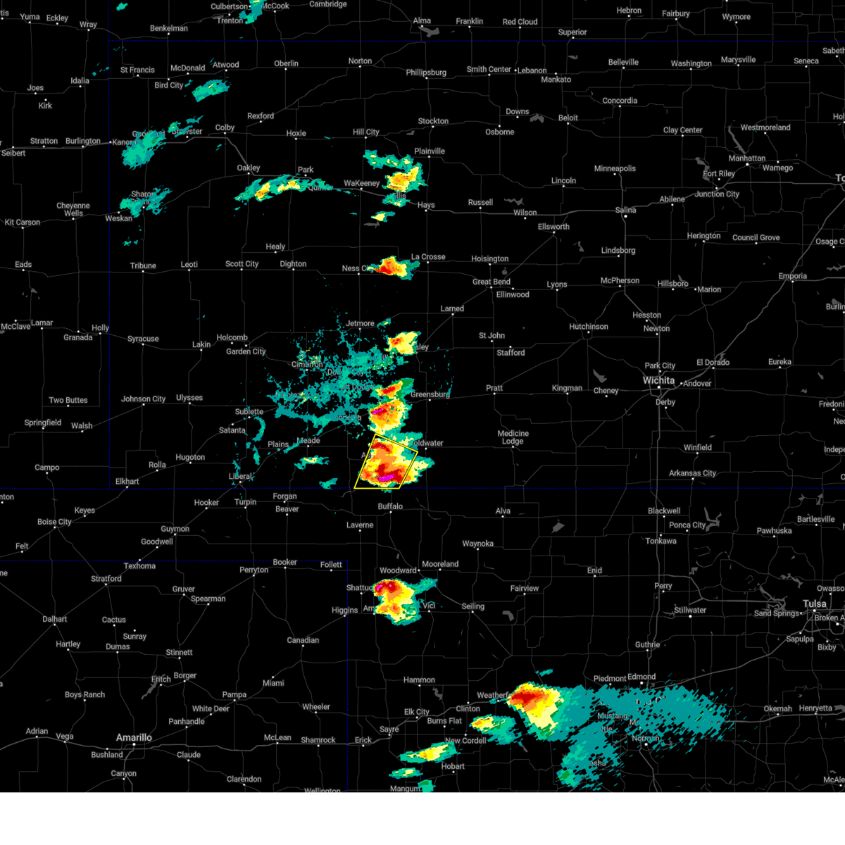 At 532 pm cdt, a severe thunderstorm was located 7 miles north of protection, moving northeast at 55 mph (radar indicated). Hazards include tennis ball size hail and 60 mph wind gusts. People and animals outdoors will be injured. expect hail damage to roofs, siding, windows, and vehicles. expect wind damage to roofs, siding, and trees. Locations impacted include, ashland, protection, sitka, and acres. At 532 pm cdt, a severe thunderstorm was located 7 miles north of protection, moving northeast at 55 mph (radar indicated). Hazards include tennis ball size hail and 60 mph wind gusts. People and animals outdoors will be injured. expect hail damage to roofs, siding, windows, and vehicles. expect wind damage to roofs, siding, and trees. Locations impacted include, ashland, protection, sitka, and acres.
|
| 5/25/2024 5:24 PM CDT |
 At 524 pm cdt, a severe thunderstorm was located near sitka, moving northeast at 55 mph (radar indicated). Hazards include two inch hail and 60 mph wind gusts. People and animals outdoors will be injured. expect hail damage to roofs, siding, windows, and vehicles. expect wind damage to roofs, siding, and trees. This severe thunderstorm will remain over mainly rural areas of west central comanche and southeastern clark counties. At 524 pm cdt, a severe thunderstorm was located near sitka, moving northeast at 55 mph (radar indicated). Hazards include two inch hail and 60 mph wind gusts. People and animals outdoors will be injured. expect hail damage to roofs, siding, windows, and vehicles. expect wind damage to roofs, siding, and trees. This severe thunderstorm will remain over mainly rural areas of west central comanche and southeastern clark counties.
|
| 5/25/2024 5:24 PM CDT |
 the severe thunderstorm warning has been cancelled and is no longer in effect the severe thunderstorm warning has been cancelled and is no longer in effect
|
| 5/25/2024 4:54 PM CDT |
 Svrddc the national weather service in dodge city has issued a * severe thunderstorm warning for, southeastern meade county in southwestern kansas, west central comanche county in south central kansas, clark county in southwestern kansas, * until 545 pm cdt. * at 453 pm cdt, a severe thunderstorm was located near englewood, moving northeast at 55 mph (radar indicated). Hazards include two inch hail and 60 mph wind gusts. People and animals outdoors will be injured. expect hail damage to roofs, siding, windows, and vehicles. expect wind damage to roofs, siding, and trees. this severe thunderstorm will be near, englewood around 500 pm cdt. acres around 505 pm cdt. ashland around 510 pm cdt. Other locations in the path of this severe thunderstorm include sitka. Svrddc the national weather service in dodge city has issued a * severe thunderstorm warning for, southeastern meade county in southwestern kansas, west central comanche county in south central kansas, clark county in southwestern kansas, * until 545 pm cdt. * at 453 pm cdt, a severe thunderstorm was located near englewood, moving northeast at 55 mph (radar indicated). Hazards include two inch hail and 60 mph wind gusts. People and animals outdoors will be injured. expect hail damage to roofs, siding, windows, and vehicles. expect wind damage to roofs, siding, and trees. this severe thunderstorm will be near, englewood around 500 pm cdt. acres around 505 pm cdt. ashland around 510 pm cdt. Other locations in the path of this severe thunderstorm include sitka.
|
| 5/19/2024 6:59 PM CDT |
 At 658 pm cdt, severe thunderstorms were located along a line extending from near hoisington to zenith to near cullison, moving northeast at 55 mph (radar indicated). Hazards include 60 mph wind gusts and penny size hail. Expect damage to roofs, siding, and trees. Locations impacted include, pratt, iuka, preston, zenith and neola. At 658 pm cdt, severe thunderstorms were located along a line extending from near hoisington to zenith to near cullison, moving northeast at 55 mph (radar indicated). Hazards include 60 mph wind gusts and penny size hail. Expect damage to roofs, siding, and trees. Locations impacted include, pratt, iuka, preston, zenith and neola.
|
| 5/19/2024 6:44 PM CDT |
 Svrddc the national weather service in dodge city has issued a * severe thunderstorm warning for, kiowa county in south central kansas, barber county in south central kansas, comanche county in south central kansas, southeastern pawnee county in south central kansas, stafford county in south central kansas, pratt county in south central kansas, southeastern edwards county in south central kansas, * until 745 pm cdt. * at 644 pm cdt, severe thunderstorms were located along a line extending from 6 miles west of great bend to 8 miles southwest of stafford to near croft, moving northeast at 55 mph. these are destructive storms for stafford and pratt counties (radar indicated). Hazards include 80 mph wind gusts and quarter size hail. Flying debris will be dangerous to those caught without shelter. mobile homes will be heavily damaged. expect considerable damage to roofs, windows, and vehicles. extensive tree damage and power outages are likely. severe thunderstorms will be near, pratt, stafford, iuka, hudson, and cullison around 650 pm cdt. zenith and neola around 655 pm cdt. Preston around 700 pm cdt. Svrddc the national weather service in dodge city has issued a * severe thunderstorm warning for, kiowa county in south central kansas, barber county in south central kansas, comanche county in south central kansas, southeastern pawnee county in south central kansas, stafford county in south central kansas, pratt county in south central kansas, southeastern edwards county in south central kansas, * until 745 pm cdt. * at 644 pm cdt, severe thunderstorms were located along a line extending from 6 miles west of great bend to 8 miles southwest of stafford to near croft, moving northeast at 55 mph. these are destructive storms for stafford and pratt counties (radar indicated). Hazards include 80 mph wind gusts and quarter size hail. Flying debris will be dangerous to those caught without shelter. mobile homes will be heavily damaged. expect considerable damage to roofs, windows, and vehicles. extensive tree damage and power outages are likely. severe thunderstorms will be near, pratt, stafford, iuka, hudson, and cullison around 650 pm cdt. zenith and neola around 655 pm cdt. Preston around 700 pm cdt.
|
| 5/19/2024 6:27 PM CDT |
 the severe thunderstorm warning has been cancelled and is no longer in effect the severe thunderstorm warning has been cancelled and is no longer in effect
|
| 5/19/2024 6:27 PM CDT |
 At 626 pm cdt, severe thunderstorms were located along a line extending from 9 miles northwest of wilmore to near englewood, moving east at 35 mph (radar indicated). Hazards include 70 mph wind gusts and quarter size hail. Hail damage to vehicles is expected. expect considerable tree damage. wind damage is also likely to mobile homes, roofs, and outbuildings. these severe storms will be near, ashland, englewood, sitka, and acres around 630 pm cdt. Protection around 635 pm cdt. At 626 pm cdt, severe thunderstorms were located along a line extending from 9 miles northwest of wilmore to near englewood, moving east at 35 mph (radar indicated). Hazards include 70 mph wind gusts and quarter size hail. Hail damage to vehicles is expected. expect considerable tree damage. wind damage is also likely to mobile homes, roofs, and outbuildings. these severe storms will be near, ashland, englewood, sitka, and acres around 630 pm cdt. Protection around 635 pm cdt.
|
| 5/19/2024 6:21 PM CDT |
 the severe thunderstorm warning has been cancelled and is no longer in effect the severe thunderstorm warning has been cancelled and is no longer in effect
|
| 5/19/2024 6:20 PM CDT |
 Svrddc the national weather service in dodge city has issued a * severe thunderstorm warning for, southeastern ford county in southwestern kansas, southern kiowa county in south central kansas, southeastern meade county in southwestern kansas, northwestern barber county in south central kansas, comanche county in south central kansas, clark county in southwestern kansas, * until 645 pm cdt. * at 619 pm cdt, severe thunderstorms were located along a line extending from 10 miles south of greensburg to near englewood, moving east at 35 mph (radar indicated). Hazards include 70 mph wind gusts and quarter size hail. Hail damage to vehicles is expected. expect considerable tree damage. wind damage is also likely to mobile homes, roofs, and outbuildings. severe thunderstorms will be near, ashland, englewood, sitka, and acres around 625 pm cdt. Protection around 635 pm cdt. Svrddc the national weather service in dodge city has issued a * severe thunderstorm warning for, southeastern ford county in southwestern kansas, southern kiowa county in south central kansas, southeastern meade county in southwestern kansas, northwestern barber county in south central kansas, comanche county in south central kansas, clark county in southwestern kansas, * until 645 pm cdt. * at 619 pm cdt, severe thunderstorms were located along a line extending from 10 miles south of greensburg to near englewood, moving east at 35 mph (radar indicated). Hazards include 70 mph wind gusts and quarter size hail. Hail damage to vehicles is expected. expect considerable tree damage. wind damage is also likely to mobile homes, roofs, and outbuildings. severe thunderstorms will be near, ashland, englewood, sitka, and acres around 625 pm cdt. Protection around 635 pm cdt.
|
| 5/19/2024 6:11 PM CDT |
 At 610 pm cdt, severe thunderstorms were located along a line extending from kingsdown to 7 miles northwest of acres, moving east at 25 mph (radar indicated). Hazards include 70 mph wind gusts and half dollar size hail. Hail damage to vehicles is expected. expect considerable tree damage. wind damage is also likely to mobile homes, roofs, and outbuildings. Locations impacted include, clark state lake, ashland and sitka. At 610 pm cdt, severe thunderstorms were located along a line extending from kingsdown to 7 miles northwest of acres, moving east at 25 mph (radar indicated). Hazards include 70 mph wind gusts and half dollar size hail. Hail damage to vehicles is expected. expect considerable tree damage. wind damage is also likely to mobile homes, roofs, and outbuildings. Locations impacted include, clark state lake, ashland and sitka.
|
| 5/19/2024 5:54 PM CDT |
 Svrddc the national weather service in dodge city has issued a * severe thunderstorm warning for, southeastern ford county in southwestern kansas, southern kiowa county in south central kansas, eastern meade county in southwestern kansas, western comanche county in south central kansas, clark county in southwestern kansas, * until 645 pm cdt. * at 554 pm cdt, severe thunderstorms were located along a line extending from near bloom to 9 miles northwest of englewood, moving east at 25 mph (radar indicated). Hazards include 70 mph wind gusts and nickel size hail. Expect considerable tree damage. damage is likely to mobile homes, roofs, and outbuildings. severe thunderstorms will be near, kingsdown around 600 pm cdt. clark state lake around 605 pm cdt. Other locations in the path of these severe thunderstorms include ashland and acres. Svrddc the national weather service in dodge city has issued a * severe thunderstorm warning for, southeastern ford county in southwestern kansas, southern kiowa county in south central kansas, eastern meade county in southwestern kansas, western comanche county in south central kansas, clark county in southwestern kansas, * until 645 pm cdt. * at 554 pm cdt, severe thunderstorms were located along a line extending from near bloom to 9 miles northwest of englewood, moving east at 25 mph (radar indicated). Hazards include 70 mph wind gusts and nickel size hail. Expect considerable tree damage. damage is likely to mobile homes, roofs, and outbuildings. severe thunderstorms will be near, kingsdown around 600 pm cdt. clark state lake around 605 pm cdt. Other locations in the path of these severe thunderstorms include ashland and acres.
|
| 5/19/2024 5:10 PM CDT |
 Svrddc the national weather service in dodge city has issued a * severe thunderstorm warning for, ford county in southwestern kansas, western kiowa county in south central kansas, northeastern meade county in southwestern kansas, northwestern comanche county in south central kansas, southwestern edwards county in south central kansas, northern clark county in southwestern kansas, * until 600 pm cdt. * at 510 pm cdt, severe thunderstorms were located along a line extending from howell to near fowler, moving east at 50 mph (radar indicated). Hazards include 70 mph wind gusts. Expect considerable tree damage. damage is likely to mobile homes, roofs, and outbuildings. severe thunderstorms will be near, dodge city and minneola around 515 pm cdt. ft. dodge around 520 pm cdt. bloom and wright around 525 pm cdt. kingsdown and clark state lake around 530 pm cdt. Other locations in the path of these severe thunderstorms include spearville, ford, bucklin, windhorst and mullinville. Svrddc the national weather service in dodge city has issued a * severe thunderstorm warning for, ford county in southwestern kansas, western kiowa county in south central kansas, northeastern meade county in southwestern kansas, northwestern comanche county in south central kansas, southwestern edwards county in south central kansas, northern clark county in southwestern kansas, * until 600 pm cdt. * at 510 pm cdt, severe thunderstorms were located along a line extending from howell to near fowler, moving east at 50 mph (radar indicated). Hazards include 70 mph wind gusts. Expect considerable tree damage. damage is likely to mobile homes, roofs, and outbuildings. severe thunderstorms will be near, dodge city and minneola around 515 pm cdt. ft. dodge around 520 pm cdt. bloom and wright around 525 pm cdt. kingsdown and clark state lake around 530 pm cdt. Other locations in the path of these severe thunderstorms include spearville, ford, bucklin, windhorst and mullinville.
|
| 10/3/2023 9:45 PM CDT |
 At 944 pm cdt, severe thunderstorms were located along a line extending from near haviland to near protection, moving east at 30 mph (radar indicated). Hazards include 60 mph wind gusts and penny size hail. Expect damage to roofs, siding, and trees. locations impacted include, coldwater, wilmore, lake coldwater, wellsford, cullison, belvidere, croft, pratt, coats and sun city. hail threat, radar indicated max hail size, 0. 75 in wind threat, radar indicated max wind gust, 60 mph. At 944 pm cdt, severe thunderstorms were located along a line extending from near haviland to near protection, moving east at 30 mph (radar indicated). Hazards include 60 mph wind gusts and penny size hail. Expect damage to roofs, siding, and trees. locations impacted include, coldwater, wilmore, lake coldwater, wellsford, cullison, belvidere, croft, pratt, coats and sun city. hail threat, radar indicated max hail size, 0. 75 in wind threat, radar indicated max wind gust, 60 mph.
|
| 10/3/2023 9:25 PM CDT |
 At 925 pm cdt, severe thunderstorms were located along a line extending from greensburg to near protection, moving east at 45 mph (radar indicated). Hazards include 60 mph wind gusts and penny size hail. Expect damage to roofs, siding, and trees. severe thunderstorms will be near, coldwater, haviland, and lake coldwater around 935 pm cdt. wellsford around 940 pm cdt. wilmore and belvidere around 945 pm cdt. other locations in the path of these severe thunderstorms include cullison, croft, pratt, coats and sun city. hail threat, radar indicated max hail size, 0. 75 in wind threat, radar indicated max wind gust, 60 mph. At 925 pm cdt, severe thunderstorms were located along a line extending from greensburg to near protection, moving east at 45 mph (radar indicated). Hazards include 60 mph wind gusts and penny size hail. Expect damage to roofs, siding, and trees. severe thunderstorms will be near, coldwater, haviland, and lake coldwater around 935 pm cdt. wellsford around 940 pm cdt. wilmore and belvidere around 945 pm cdt. other locations in the path of these severe thunderstorms include cullison, croft, pratt, coats and sun city. hail threat, radar indicated max hail size, 0. 75 in wind threat, radar indicated max wind gust, 60 mph.
|
| 8/13/2023 9:01 PM CDT |
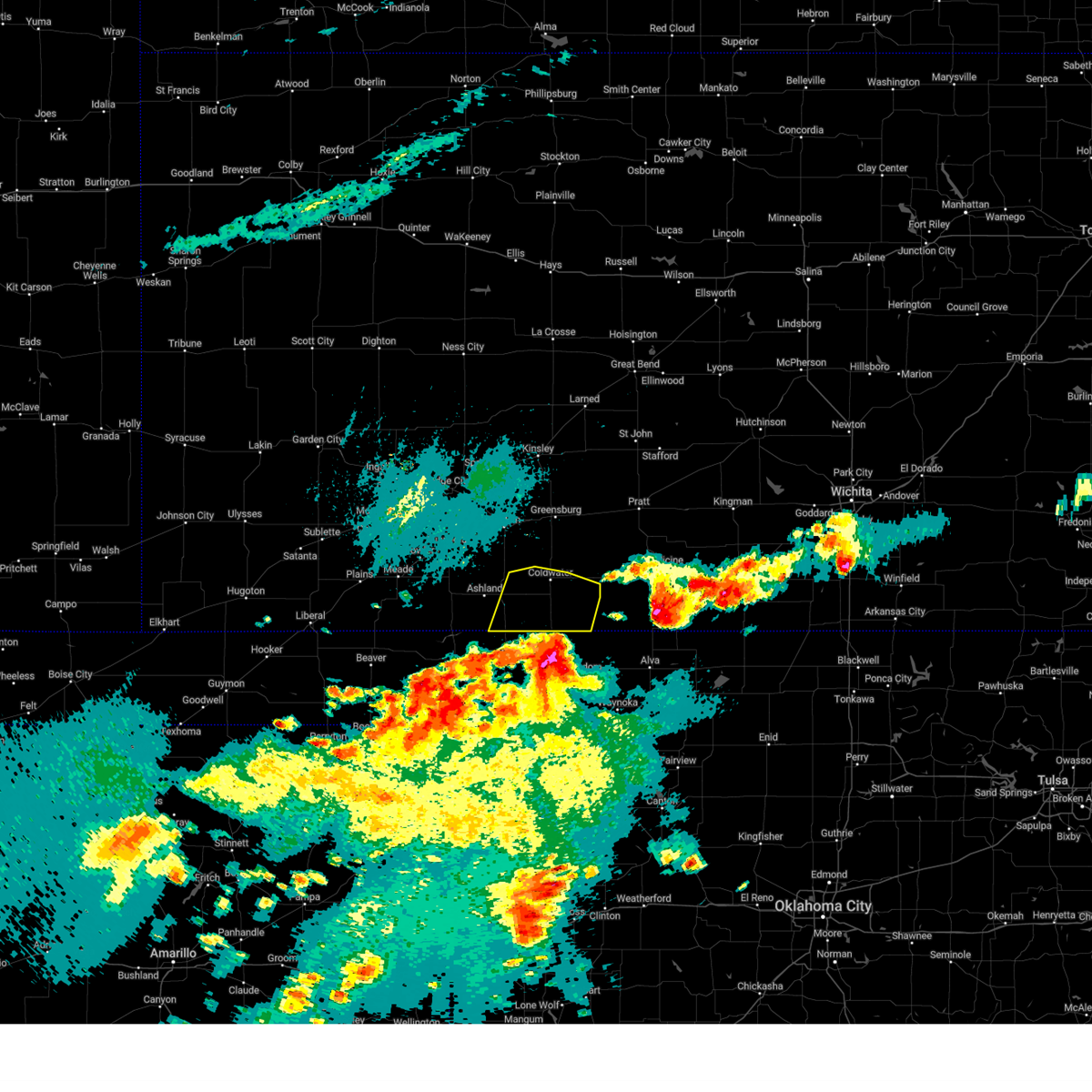 At 901 pm cdt, severe thunderstorms were located along a line extending from near sitka to near protection to near lake coldwater to 8 miles west of aetna, moving north at 30 mph (radar indicated). Hazards include 60 mph wind gusts. Expect damage to roofs, siding, and trees. locations impacted include, protection, coldwater and lake coldwater. hail threat, radar indicated max hail size, <. 75 in wind threat, radar indicated max wind gust, 60 mph. At 901 pm cdt, severe thunderstorms were located along a line extending from near sitka to near protection to near lake coldwater to 8 miles west of aetna, moving north at 30 mph (radar indicated). Hazards include 60 mph wind gusts. Expect damage to roofs, siding, and trees. locations impacted include, protection, coldwater and lake coldwater. hail threat, radar indicated max hail size, <. 75 in wind threat, radar indicated max wind gust, 60 mph.
|
| 8/13/2023 8:42 PM CDT |
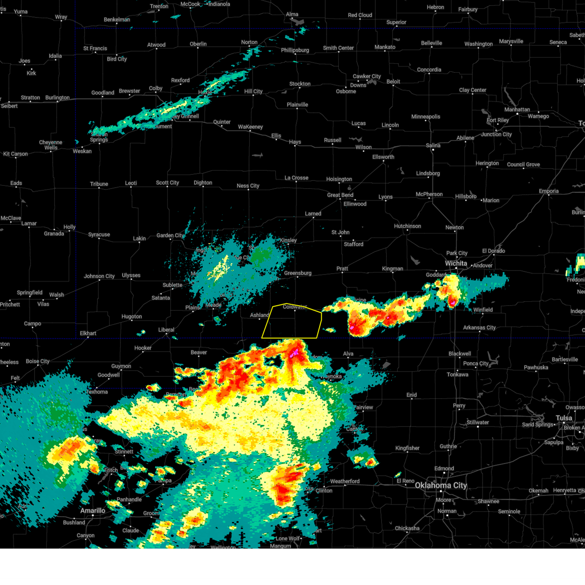 At 841 pm cdt, severe thunderstorms were located along a line extending from 12 miles southeast of acres to 9 miles southeast of sitka to near buttermilk to 12 miles southwest of aetna, moving northeast at 25 mph (radar indicated). Hazards include 60 mph wind gusts and quarter size hail. Hail damage to vehicles is expected. expect wind damage to roofs, siding, and trees. these severe storms will be near, buttermilk around 850 pm cdt. other locations in the path of these severe thunderstorms include sitka, protection, coldwater and lake coldwater. hail threat, radar indicated max hail size, 1. 00 in wind threat, radar indicated max wind gust, 60 mph. At 841 pm cdt, severe thunderstorms were located along a line extending from 12 miles southeast of acres to 9 miles southeast of sitka to near buttermilk to 12 miles southwest of aetna, moving northeast at 25 mph (radar indicated). Hazards include 60 mph wind gusts and quarter size hail. Hail damage to vehicles is expected. expect wind damage to roofs, siding, and trees. these severe storms will be near, buttermilk around 850 pm cdt. other locations in the path of these severe thunderstorms include sitka, protection, coldwater and lake coldwater. hail threat, radar indicated max hail size, 1. 00 in wind threat, radar indicated max wind gust, 60 mph.
|
| 8/13/2023 8:35 PM CDT |
 At 835 pm cdt, severe thunderstorms were located along a line extending from near knowles to 7 miles northeast of rosston to 12 miles northeast of buffalo to 10 miles south of buttermilk to 10 miles north of freedom, moving north at 30 mph (radar indicated). Hazards include 60 mph wind gusts and quarter size hail. Hail damage to vehicles is expected. expect wind damage to roofs, siding, and trees. severe thunderstorms will be near, buttermilk around 855 pm cdt. other locations in the path of these severe thunderstorms include acres, protection, englewood, ashland, coldwater and lake coldwater. hail threat, radar indicated max hail size, 1. 00 in wind threat, radar indicated max wind gust, 60 mph. At 835 pm cdt, severe thunderstorms were located along a line extending from near knowles to 7 miles northeast of rosston to 12 miles northeast of buffalo to 10 miles south of buttermilk to 10 miles north of freedom, moving north at 30 mph (radar indicated). Hazards include 60 mph wind gusts and quarter size hail. Hail damage to vehicles is expected. expect wind damage to roofs, siding, and trees. severe thunderstorms will be near, buttermilk around 855 pm cdt. other locations in the path of these severe thunderstorms include acres, protection, englewood, ashland, coldwater and lake coldwater. hail threat, radar indicated max hail size, 1. 00 in wind threat, radar indicated max wind gust, 60 mph.
|
| 7/21/2023 1:46 AM CDT |
 At 146 am cdt, severe thunderstorms were located along a line extending from 7 miles northwest of wilmore to near coldwater to buttermilk to 9 miles north of selman, moving east at 25 mph (radar indicated). Hazards include 60 mph wind gusts. Expect damage to roofs, siding, and trees. Locations impacted include, coldwater, protection, lake city, sun city, wilmore, aetna, lake coldwater and buttermilk. At 146 am cdt, severe thunderstorms were located along a line extending from 7 miles northwest of wilmore to near coldwater to buttermilk to 9 miles north of selman, moving east at 25 mph (radar indicated). Hazards include 60 mph wind gusts. Expect damage to roofs, siding, and trees. Locations impacted include, coldwater, protection, lake city, sun city, wilmore, aetna, lake coldwater and buttermilk.
|
| 7/21/2023 1:35 AM CDT |
 At 135 am cdt, severe thunderstorms were located along a line extending from 10 miles northwest of wilmore to near lake coldwater to near buttermilk to 6 miles north of buffalo, moving east at 25 mph (radar indicated). Hazards include 60 mph wind gusts. Expect damage to roofs, siding, and trees. Locations impacted include, coldwater, protection, sitka, lake city, sun city, wilmore, aetna, lake coldwater, belvidere and buttermilk. At 135 am cdt, severe thunderstorms were located along a line extending from 10 miles northwest of wilmore to near lake coldwater to near buttermilk to 6 miles north of buffalo, moving east at 25 mph (radar indicated). Hazards include 60 mph wind gusts. Expect damage to roofs, siding, and trees. Locations impacted include, coldwater, protection, sitka, lake city, sun city, wilmore, aetna, lake coldwater, belvidere and buttermilk.
|
| 7/21/2023 1:26 AM CDT |
 At 126 am cdt, severe thunderstorms were located along a line extending from 11 miles northwest of coldwater to near protection to 8 miles west of buttermilk to 6 miles north of buffalo, moving east at 25 mph (radar indicated). Hazards include 60 mph wind gusts. Expect damage to roofs, siding, and trees. locations impacted include, coldwater, protection, sitka, lake city, sun city, wilmore, aetna, lake coldwater, belvidere and buttermilk. hail threat, radar indicated max hail size, <. 75 in wind threat, radar indicated max wind gust, 60 mph. At 126 am cdt, severe thunderstorms were located along a line extending from 11 miles northwest of coldwater to near protection to 8 miles west of buttermilk to 6 miles north of buffalo, moving east at 25 mph (radar indicated). Hazards include 60 mph wind gusts. Expect damage to roofs, siding, and trees. locations impacted include, coldwater, protection, sitka, lake city, sun city, wilmore, aetna, lake coldwater, belvidere and buttermilk. hail threat, radar indicated max hail size, <. 75 in wind threat, radar indicated max wind gust, 60 mph.
|
| 7/21/2023 1:03 AM CDT |
 At 103 am cdt, severe thunderstorms were located along a line extending from near bucklin to 7 miles northwest of protection to near sitka to 8 miles southeast of acres, moving east at 35 mph (radar indicated). Hazards include 60 mph wind gusts. expect damage to roofs, siding, and trees At 103 am cdt, severe thunderstorms were located along a line extending from near bucklin to 7 miles northwest of protection to near sitka to 8 miles southeast of acres, moving east at 35 mph (radar indicated). Hazards include 60 mph wind gusts. expect damage to roofs, siding, and trees
|
| 7/17/2023 7:40 PM CDT |
 At 740 pm cdt, a severe thunderstorm was located near buttermilk, moving south at 25 mph (radar indicated). Hazards include ping pong ball size hail and 60 mph wind gusts. People and animals outdoors will be injured. expect hail damage to roofs, siding, windows, and vehicles. expect wind damage to roofs, siding, and trees. locations impacted include, ashland, protection and sitka. hail threat, radar indicated max hail size, 1. 50 in wind threat, radar indicated max wind gust, 60 mph. At 740 pm cdt, a severe thunderstorm was located near buttermilk, moving south at 25 mph (radar indicated). Hazards include ping pong ball size hail and 60 mph wind gusts. People and animals outdoors will be injured. expect hail damage to roofs, siding, windows, and vehicles. expect wind damage to roofs, siding, and trees. locations impacted include, ashland, protection and sitka. hail threat, radar indicated max hail size, 1. 50 in wind threat, radar indicated max wind gust, 60 mph.
|
| 7/17/2023 7:30 PM CDT |
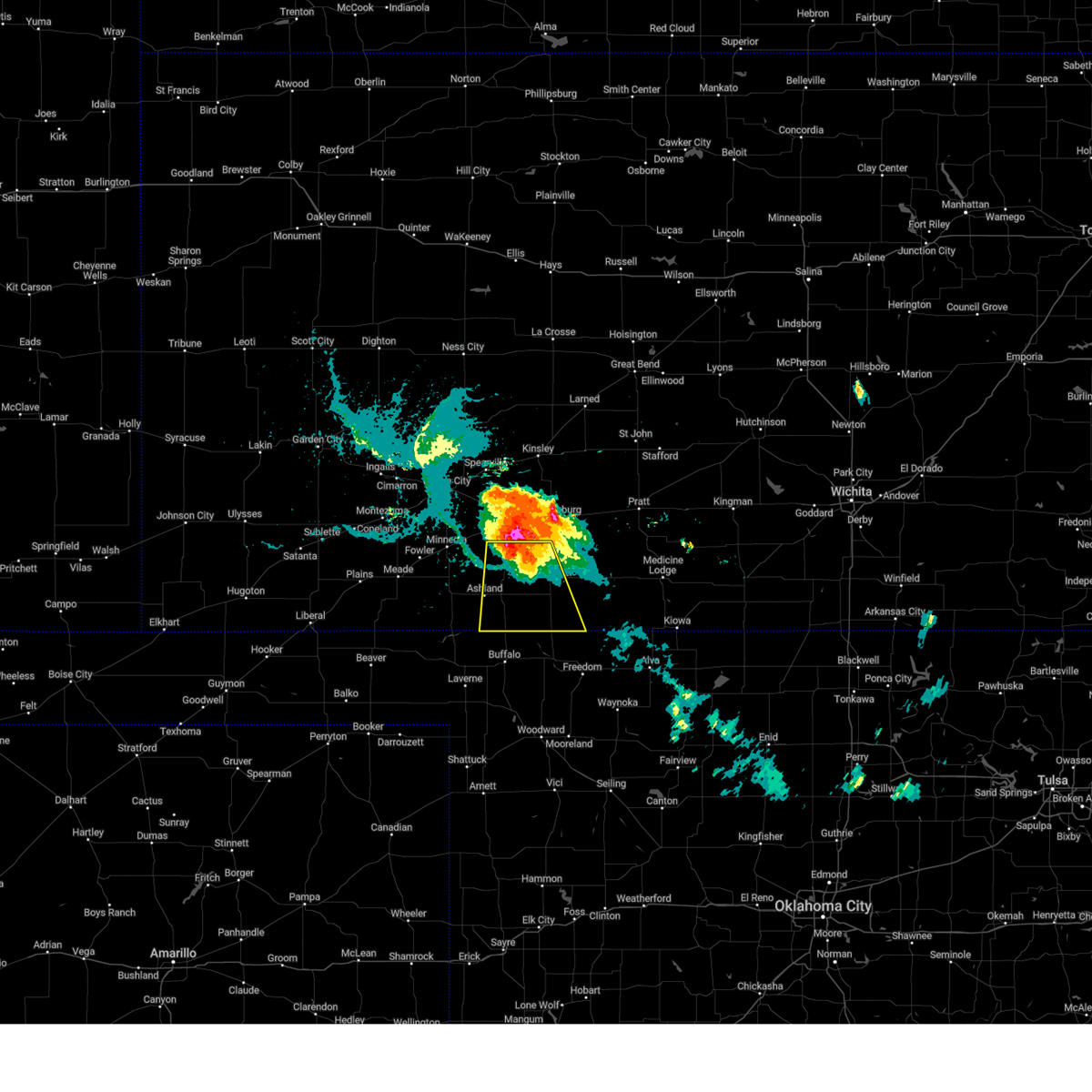 At 729 pm cdt, a severe thunderstorm was located near protection, moving south at 25 mph (radar indicated). Hazards include ping pong ball size hail and 60 mph wind gusts. People and animals outdoors will be injured. expect hail damage to roofs, siding, windows, and vehicles. expect wind damage to roofs, siding, and trees. Locations impacted include, ashland, coldwater, protection, sitka, lake coldwater and buttermilk. At 729 pm cdt, a severe thunderstorm was located near protection, moving south at 25 mph (radar indicated). Hazards include ping pong ball size hail and 60 mph wind gusts. People and animals outdoors will be injured. expect hail damage to roofs, siding, windows, and vehicles. expect wind damage to roofs, siding, and trees. Locations impacted include, ashland, coldwater, protection, sitka, lake coldwater and buttermilk.
|
| 7/17/2023 6:54 PM CDT |
 At 654 pm cdt, a severe thunderstorm was located 11 miles north of protection, moving south at 25 mph (radar indicated). Hazards include two inch hail and 70 mph wind gusts. People and animals outdoors will be injured. expect hail damage to roofs, siding, windows, and vehicles. expect considerable tree damage. Wind damage is also likely to mobile homes, roofs, and outbuildings. At 654 pm cdt, a severe thunderstorm was located 11 miles north of protection, moving south at 25 mph (radar indicated). Hazards include two inch hail and 70 mph wind gusts. People and animals outdoors will be injured. expect hail damage to roofs, siding, windows, and vehicles. expect considerable tree damage. Wind damage is also likely to mobile homes, roofs, and outbuildings.
|
| 7/16/2023 10:12 PM CDT |
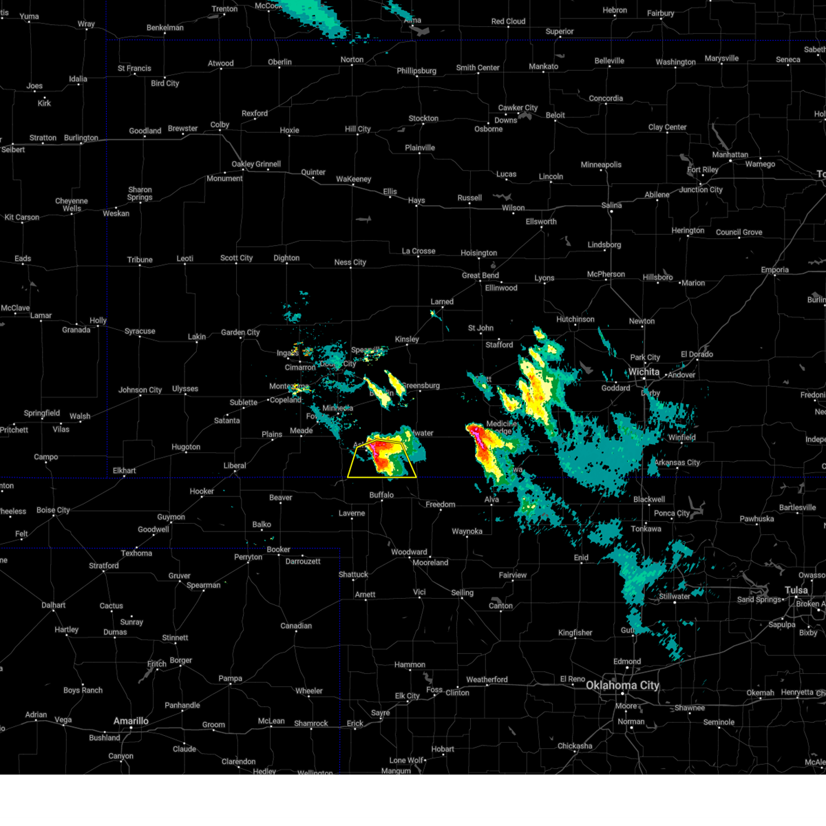 At 1012 pm cdt, a severe thunderstorm was located near sitka, moving south at 30 mph (radar indicated). Hazards include 70 mph wind gusts and ping pong ball size hail. People and animals outdoors will be injured. expect hail damage to roofs, siding, windows, and vehicles. expect considerable tree damage. wind damage is also likely to mobile homes, roofs, and outbuildings. locations impacted include, ashland, protection, sitka and acres. thunderstorm damage threat, considerable hail threat, radar indicated max hail size, 1. 50 in wind threat, radar indicated max wind gust, 70 mph. At 1012 pm cdt, a severe thunderstorm was located near sitka, moving south at 30 mph (radar indicated). Hazards include 70 mph wind gusts and ping pong ball size hail. People and animals outdoors will be injured. expect hail damage to roofs, siding, windows, and vehicles. expect considerable tree damage. wind damage is also likely to mobile homes, roofs, and outbuildings. locations impacted include, ashland, protection, sitka and acres. thunderstorm damage threat, considerable hail threat, radar indicated max hail size, 1. 50 in wind threat, radar indicated max wind gust, 70 mph.
|
| 7/16/2023 10:06 PM CDT |
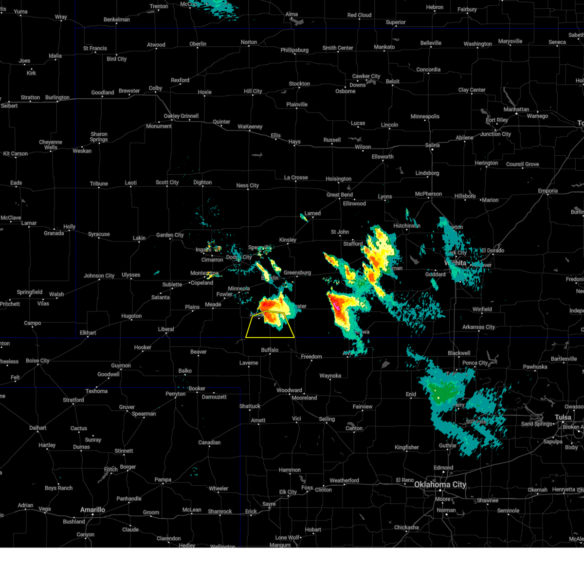 At 1006 pm cdt, a severe thunderstorm was located near sitka, moving south at 35 mph (radar indicated). Hazards include 70 mph wind gusts and ping pong ball size hail. People and animals outdoors will be injured. expect hail damage to roofs, siding, windows, and vehicles. expect considerable tree damage. wind damage is also likely to mobile homes, roofs, and outbuildings. This severe thunderstorm will remain over mainly rural areas of southwestern comanche and southeastern clark counties. At 1006 pm cdt, a severe thunderstorm was located near sitka, moving south at 35 mph (radar indicated). Hazards include 70 mph wind gusts and ping pong ball size hail. People and animals outdoors will be injured. expect hail damage to roofs, siding, windows, and vehicles. expect considerable tree damage. wind damage is also likely to mobile homes, roofs, and outbuildings. This severe thunderstorm will remain over mainly rural areas of southwestern comanche and southeastern clark counties.
|
| 7/16/2023 9:56 PM CDT |
 At 955 pm cdt, a severe thunderstorm was located near ashland, moving south at 30 mph (radar indicated). Hazards include ping pong ball size hail and 60 mph wind gusts. People and animals outdoors will be injured. expect hail damage to roofs, siding, windows, and vehicles. expect wind damage to roofs, siding, and trees. this severe storm will be near, ashland around 1005 pm cdt. Sitka around 1010 pm cdt. At 955 pm cdt, a severe thunderstorm was located near ashland, moving south at 30 mph (radar indicated). Hazards include ping pong ball size hail and 60 mph wind gusts. People and animals outdoors will be injured. expect hail damage to roofs, siding, windows, and vehicles. expect wind damage to roofs, siding, and trees. this severe storm will be near, ashland around 1005 pm cdt. Sitka around 1010 pm cdt.
|
| 7/16/2023 9:50 PM CDT |
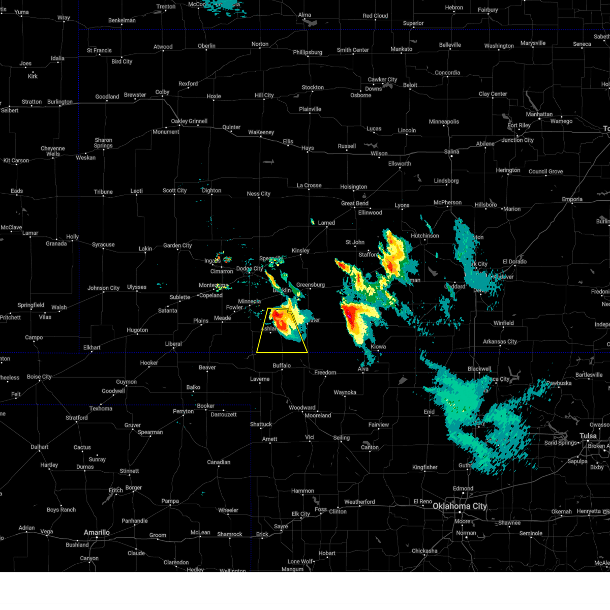 At 950 pm cdt, a severe thunderstorm was located near clark state lake, moving south at 30 mph (radar indicated). Hazards include ping pong ball size hail. People and animals outdoors will be injured. expect damage to roofs, siding, windows, and vehicles. this severe thunderstorm will be near, ashland around 1005 pm cdt. sitka around 1010 pm cdt. hail threat, radar indicated max hail size, 1. 50 in wind threat, radar indicated max wind gust, <50 mph. At 950 pm cdt, a severe thunderstorm was located near clark state lake, moving south at 30 mph (radar indicated). Hazards include ping pong ball size hail. People and animals outdoors will be injured. expect damage to roofs, siding, windows, and vehicles. this severe thunderstorm will be near, ashland around 1005 pm cdt. sitka around 1010 pm cdt. hail threat, radar indicated max hail size, 1. 50 in wind threat, radar indicated max wind gust, <50 mph.
|
| 6/27/2023 9:17 PM CDT |
 At 917 pm cdt, a severe thunderstorm was located near protection, moving east at 50 mph (radar indicated). Hazards include 60 mph wind gusts and penny size hail. Expect damage to roofs, siding, and trees. hail threat, radar indicated max hail size, 0. 75 in wind threat, radar indicated max wind gust, 60 mph. At 917 pm cdt, a severe thunderstorm was located near protection, moving east at 50 mph (radar indicated). Hazards include 60 mph wind gusts and penny size hail. Expect damage to roofs, siding, and trees. hail threat, radar indicated max hail size, 0. 75 in wind threat, radar indicated max wind gust, 60 mph.
|
| 6/27/2023 9:03 PM CDT |
 At 903 pm cdt, severe thunderstorms were located along a line extending from near wright to 6 miles south of sitka, moving northeast at 35 mph (radar indicated). Hazards include 70 mph wind gusts. Expect considerable tree damage. damage is likely to mobile homes, roofs, and outbuildings. locations impacted include, dodge city, ashland, coldwater, bucklin, spearville, minneola, protection, mullinville, ford, offerle, bloom, englewood, sitka, clark state lake, kingsdown, howell, wright, lake coldwater, bellefont and windhorst. thunderstorm damage threat, considerable hail threat, radar indicated max hail size, <. 75 in wind threat, radar indicated max wind gust, 70 mph. At 903 pm cdt, severe thunderstorms were located along a line extending from near wright to 6 miles south of sitka, moving northeast at 35 mph (radar indicated). Hazards include 70 mph wind gusts. Expect considerable tree damage. damage is likely to mobile homes, roofs, and outbuildings. locations impacted include, dodge city, ashland, coldwater, bucklin, spearville, minneola, protection, mullinville, ford, offerle, bloom, englewood, sitka, clark state lake, kingsdown, howell, wright, lake coldwater, bellefont and windhorst. thunderstorm damage threat, considerable hail threat, radar indicated max hail size, <. 75 in wind threat, radar indicated max wind gust, 70 mph.
|
| 6/27/2023 9:00 PM CDT | Report received through social medi in comanche county KS, 0.1 miles NNW of Protection, KS |
| 6/27/2023 8:38 PM CDT |
 At 838 pm cdt, severe thunderstorms were located along a line extending from 6 miles east of ensign to near englewood, moving northeast at 35 mph (radar indicated). Hazards include 70 mph wind gusts. Expect considerable tree damage. Damage is likely to mobile homes, roofs, and outbuildings. At 838 pm cdt, severe thunderstorms were located along a line extending from 6 miles east of ensign to near englewood, moving northeast at 35 mph (radar indicated). Hazards include 70 mph wind gusts. Expect considerable tree damage. Damage is likely to mobile homes, roofs, and outbuildings.
|
| 6/17/2023 8:36 PM CDT |
 At 836 pm cdt, severe thunderstorms were located along a line extending from 8 miles southeast of mullinville to 8 miles south of buttermilk, moving east at 40 mph (radar indicated). Hazards include 60 mph wind gusts. Expect damage to roofs, siding, and trees. Locations impacted include, coldwater, protection, wilmore, lake coldwater, belvidere and buttermilk. At 836 pm cdt, severe thunderstorms were located along a line extending from 8 miles southeast of mullinville to 8 miles south of buttermilk, moving east at 40 mph (radar indicated). Hazards include 60 mph wind gusts. Expect damage to roofs, siding, and trees. Locations impacted include, coldwater, protection, wilmore, lake coldwater, belvidere and buttermilk.
|
| 6/15/2023 6:23 PM CDT |
 At 623 pm cdt, severe thunderstorms were located along a line extending from 6 miles north of greensburg to 6 miles southeast of buttermilk, moving east at 10 mph (radar indicated). Hazards include 70 mph wind gusts and penny size hail. Expect considerable tree damage. damage is likely to mobile homes, roofs, and outbuildings. locations impacted include, haviland. thunderstorm damage threat, considerable hail threat, radar indicated max hail size, 0. 75 in wind threat, radar indicated max wind gust, 70 mph. At 623 pm cdt, severe thunderstorms were located along a line extending from 6 miles north of greensburg to 6 miles southeast of buttermilk, moving east at 10 mph (radar indicated). Hazards include 70 mph wind gusts and penny size hail. Expect considerable tree damage. damage is likely to mobile homes, roofs, and outbuildings. locations impacted include, haviland. thunderstorm damage threat, considerable hail threat, radar indicated max hail size, 0. 75 in wind threat, radar indicated max wind gust, 70 mph.
|
| 6/15/2023 5:53 PM CDT |
 At 553 pm cdt, severe thunderstorms were located along a line extending from near ford to 11 miles north of buffalo, moving east at 25 mph (radar indicated). Hazards include 70 mph wind gusts and half dollar size hail. Hail damage to vehicles is expected. expect considerable tree damage. wind damage is also likely to mobile homes, roofs, and outbuildings. severe thunderstorms will be near, bucklin around 600 pm cdt. other locations in the path of these severe thunderstorms include mullinville, buttermilk and greensburg. thunderstorm damage threat, considerable hail threat, radar indicated max hail size, 1. 25 in wind threat, radar indicated max wind gust, 70 mph. At 553 pm cdt, severe thunderstorms were located along a line extending from near ford to 11 miles north of buffalo, moving east at 25 mph (radar indicated). Hazards include 70 mph wind gusts and half dollar size hail. Hail damage to vehicles is expected. expect considerable tree damage. wind damage is also likely to mobile homes, roofs, and outbuildings. severe thunderstorms will be near, bucklin around 600 pm cdt. other locations in the path of these severe thunderstorms include mullinville, buttermilk and greensburg. thunderstorm damage threat, considerable hail threat, radar indicated max hail size, 1. 25 in wind threat, radar indicated max wind gust, 70 mph.
|
| 2/26/2023 6:19 PM CST |
 At 618 pm cst, severe thunderstorms were located along a line extending from near hanston to 8 miles west of ashland, moving east at 45 mph (radar indicated). Hazards include 70 mph wind gusts and half dollar size hail. Hail damage to vehicles is expected. expect considerable tree damage. wind damage is also likely to mobile homes, roofs, and outbuildings. Locations impacted include, gray, hanston, rozel, sanford, coldwater, frizell and lake coldwater. At 618 pm cst, severe thunderstorms were located along a line extending from near hanston to 8 miles west of ashland, moving east at 45 mph (radar indicated). Hazards include 70 mph wind gusts and half dollar size hail. Hail damage to vehicles is expected. expect considerable tree damage. wind damage is also likely to mobile homes, roofs, and outbuildings. Locations impacted include, gray, hanston, rozel, sanford, coldwater, frizell and lake coldwater.
|
| 2/26/2023 5:57 PM CST |
 At 555 pm cst, severe thunderstorms were located along a line extending from 6 miles west of jetmore to 12 miles southeast of meade, moving east at 45 mph (radar indicated). Hazards include 70 mph wind gusts and half dollar size hail. Hail damage to vehicles is expected. expect considerable tree damage. wind damage is also likely to mobile homes, roofs, and outbuildings. severe thunderstorms will be near, jetmore around 605 pm cst. Other locations in the path of these severe thunderstorms include hanston, gray, ashland, sitka, rozel, protection and sanford. At 555 pm cst, severe thunderstorms were located along a line extending from 6 miles west of jetmore to 12 miles southeast of meade, moving east at 45 mph (radar indicated). Hazards include 70 mph wind gusts and half dollar size hail. Hail damage to vehicles is expected. expect considerable tree damage. wind damage is also likely to mobile homes, roofs, and outbuildings. severe thunderstorms will be near, jetmore around 605 pm cst. Other locations in the path of these severe thunderstorms include hanston, gray, ashland, sitka, rozel, protection and sanford.
|
| 12/12/2022 10:35 PM CST |
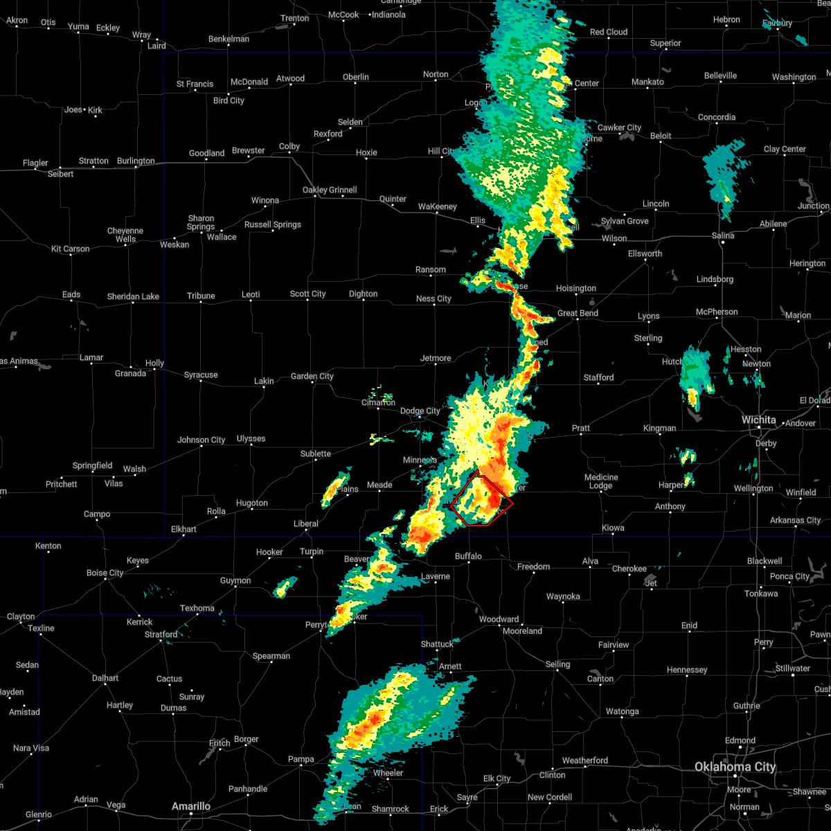 The tornado warning for northwestern comanche and southeastern clark counties will expire at 1045 pm cst, the storm which prompted the warning has weakened below severe limits, and no longer appears capable of producing a tornado. therefore, the warning will be allowed to expire. however gusty winds are still possible with this thunderstorm. a tornado watch remains in effect until 200 am cst for south central and southwestern kansas. The tornado warning for northwestern comanche and southeastern clark counties will expire at 1045 pm cst, the storm which prompted the warning has weakened below severe limits, and no longer appears capable of producing a tornado. therefore, the warning will be allowed to expire. however gusty winds are still possible with this thunderstorm. a tornado watch remains in effect until 200 am cst for south central and southwestern kansas.
|
| 12/12/2022 10:09 PM CST |
 At 1009 pm cst, a severe thunderstorm capable of producing a tornado was located very near sitka, moving northeast at 35 mph (radar indicated rotation). Hazards include tornado and ping pong ball size hail. Flying debris will be dangerous to those caught without shelter. mobile homes will be damaged or destroyed. damage to roofs, windows, and vehicles will occur. tree damage is likely. Locations impacted include, ashland, coldwater, protection, sitka and lake coldwater. At 1009 pm cst, a severe thunderstorm capable of producing a tornado was located very near sitka, moving northeast at 35 mph (radar indicated rotation). Hazards include tornado and ping pong ball size hail. Flying debris will be dangerous to those caught without shelter. mobile homes will be damaged or destroyed. damage to roofs, windows, and vehicles will occur. tree damage is likely. Locations impacted include, ashland, coldwater, protection, sitka and lake coldwater.
|
| 12/12/2022 10:04 PM CST |
 At 1004 pm cst, a severe thunderstorm capable of producing a tornado was located near sitka, moving northeast at 35 mph (radar indicated rotation). Hazards include tornado and ping pong ball size hail. Flying debris will be dangerous to those caught without shelter. mobile homes will be damaged or destroyed. damage to roofs, windows, and vehicles will occur. tree damage is likely. Locations impacted include, protection, coldwater and lake coldwater. At 1004 pm cst, a severe thunderstorm capable of producing a tornado was located near sitka, moving northeast at 35 mph (radar indicated rotation). Hazards include tornado and ping pong ball size hail. Flying debris will be dangerous to those caught without shelter. mobile homes will be damaged or destroyed. damage to roofs, windows, and vehicles will occur. tree damage is likely. Locations impacted include, protection, coldwater and lake coldwater.
|
| 12/12/2022 9:57 PM CST |
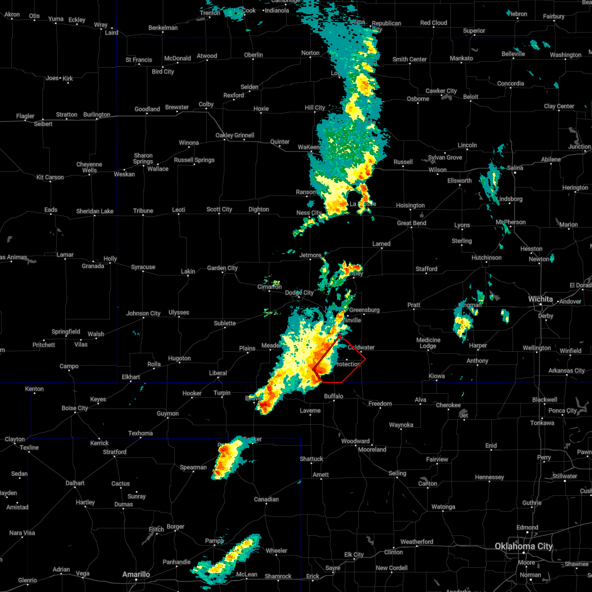 At 957 pm cst, a severe thunderstorm capable of producing a tornado was located near ashland, moving northeast at 35 mph (radar indicated rotation). Hazards include tornado and ping pong ball size hail. Flying debris will be dangerous to those caught without shelter. mobile homes will be damaged or destroyed. damage to roofs, windows, and vehicles will occur. tree damage is likely. this dangerous storm will be near, sitka around 1010 pm cst. Other locations in the path of this tornadic thunderstorm include protection, coldwater and lake coldwater. At 957 pm cst, a severe thunderstorm capable of producing a tornado was located near ashland, moving northeast at 35 mph (radar indicated rotation). Hazards include tornado and ping pong ball size hail. Flying debris will be dangerous to those caught without shelter. mobile homes will be damaged or destroyed. damage to roofs, windows, and vehicles will occur. tree damage is likely. this dangerous storm will be near, sitka around 1010 pm cst. Other locations in the path of this tornadic thunderstorm include protection, coldwater and lake coldwater.
|
| 11/4/2022 3:38 AM CDT |
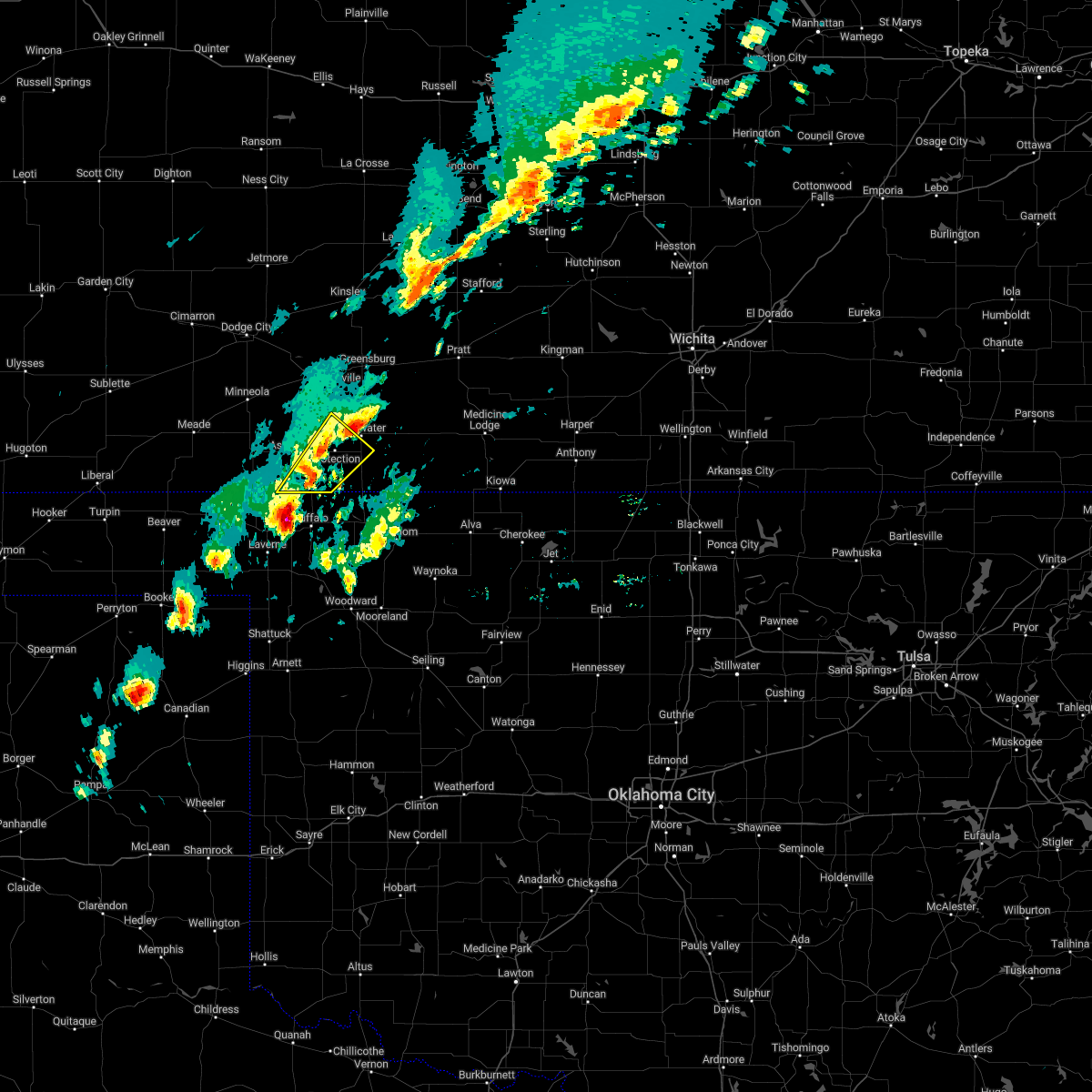 At 338 am cdt, a severe thunderstorm was located 10 miles northwest of buffalo, moving northeast at 35 mph (radar indicated). Hazards include 60 mph wind gusts and quarter size hail. Hail damage to vehicles is expected. Expect wind damage to roofs, siding, and trees. At 338 am cdt, a severe thunderstorm was located 10 miles northwest of buffalo, moving northeast at 35 mph (radar indicated). Hazards include 60 mph wind gusts and quarter size hail. Hail damage to vehicles is expected. Expect wind damage to roofs, siding, and trees.
|
| 6/5/2022 11:39 PM CDT |
 At 1139 pm cdt, a severe thunderstorm was located near lake coldwater, moving southeast at 25 mph (public reported quarter to half dollar sized hail in coldwater at 1137 pm). Hazards include half dollar size hail. Damage to vehicles is expected. this severe thunderstorm will be near, buttermilk around 1150 pm cdt. hail threat, observed max hail size, 1. 25 in wind threat, radar indicated max wind gust, <50 mph. At 1139 pm cdt, a severe thunderstorm was located near lake coldwater, moving southeast at 25 mph (public reported quarter to half dollar sized hail in coldwater at 1137 pm). Hazards include half dollar size hail. Damage to vehicles is expected. this severe thunderstorm will be near, buttermilk around 1150 pm cdt. hail threat, observed max hail size, 1. 25 in wind threat, radar indicated max wind gust, <50 mph.
|
| 5/18/2022 11:53 PM CDT |
 At 1153 pm cdt, severe thunderstorms were located along a line extending from 10 miles south of greensburg to 11 miles northeast of buffalo, moving east at 30 mph (radar indicated). Hazards include 60 mph wind gusts. Expect damage to roofs, siding, and trees. locations impacted include, ashland, coldwater, protection, bloom, englewood, sitka, wilmore, clark state lake, lake coldwater, acres, belvidere and buttermilk. hail threat, radar indicated max hail size, <. 75 in wind threat, radar indicated max wind gust, 60 mph. At 1153 pm cdt, severe thunderstorms were located along a line extending from 10 miles south of greensburg to 11 miles northeast of buffalo, moving east at 30 mph (radar indicated). Hazards include 60 mph wind gusts. Expect damage to roofs, siding, and trees. locations impacted include, ashland, coldwater, protection, bloom, englewood, sitka, wilmore, clark state lake, lake coldwater, acres, belvidere and buttermilk. hail threat, radar indicated max hail size, <. 75 in wind threat, radar indicated max wind gust, 60 mph.
|
| 5/18/2022 11:26 PM CDT |
 At 1126 pm cdt, severe thunderstorms were located along a line extending from 6 miles south of bucklin to 11 miles southeast of acres, moving east at 30 mph (radar indicated). Hazards include 60 mph wind gusts. expect damage to roofs, siding, and trees At 1126 pm cdt, severe thunderstorms were located along a line extending from 6 miles south of bucklin to 11 miles southeast of acres, moving east at 30 mph (radar indicated). Hazards include 60 mph wind gusts. expect damage to roofs, siding, and trees
|
| 4/23/2022 3:32 AM CDT |
 At 332 am cdt, severe thunderstorms were located along a line extending from near windhorst to near englewood, moving east at 45 mph (radar indicated). Hazards include 60 mph wind gusts. Expect damage to roofs, siding, and trees. locations impacted include, ashland, sitka and protection. hail threat, radar indicated max hail size, <. 75 in wind threat, radar indicated max wind gust, 60 mph. At 332 am cdt, severe thunderstorms were located along a line extending from near windhorst to near englewood, moving east at 45 mph (radar indicated). Hazards include 60 mph wind gusts. Expect damage to roofs, siding, and trees. locations impacted include, ashland, sitka and protection. hail threat, radar indicated max hail size, <. 75 in wind threat, radar indicated max wind gust, 60 mph.
|
| 4/23/2022 2:42 AM CDT |
 At 241 am cdt, severe thunderstorms were located along a line extending from near the haggard elev to 9 miles southeast of hayne, moving east at 45 mph (radar indicated). Hazards include 60 mph wind gusts. Expect damage to roofs, siding, and trees. severe thunderstorms will be near, the haggard elev around 245 am cdt. ensign around 250 am cdt. meade state park around 300 am cdt. other locations in the path of these severe thunderstorms include ford, englewood, acres, ashland and sitka. hail threat, radar indicated max hail size, <. 75 in wind threat, radar indicated max wind gust, 60 mph. At 241 am cdt, severe thunderstorms were located along a line extending from near the haggard elev to 9 miles southeast of hayne, moving east at 45 mph (radar indicated). Hazards include 60 mph wind gusts. Expect damage to roofs, siding, and trees. severe thunderstorms will be near, the haggard elev around 245 am cdt. ensign around 250 am cdt. meade state park around 300 am cdt. other locations in the path of these severe thunderstorms include ford, englewood, acres, ashland and sitka. hail threat, radar indicated max hail size, <. 75 in wind threat, radar indicated max wind gust, 60 mph.
|
| 10/13/2021 12:17 AM CDT |
 At 1216 am cdt, severe thunderstorms were located along a line extending from near radium to near wellsford to near buttermilk, moving northeast at 55 mph. these are destructive storms for pratt, medicine lodge, st. john, and stafford (radar indicated). Hazards include 80 mph wind gusts and penny size hail. Flying debris will be dangerous to those caught without shelter. mobile homes will be heavily damaged. expect considerable damage to roofs, windows, and vehicles. extensive tree damage and power outages are likely. severe thunderstorms will be near, seward and radium around 1220 am cdt. cullison around 1225 am cdt. pratt and iuka around 1235 am cdt. Other locations in the path of these severe thunderstorms include preston, sun city, neola, lake city, zenith, sawyer and isabel. At 1216 am cdt, severe thunderstorms were located along a line extending from near radium to near wellsford to near buttermilk, moving northeast at 55 mph. these are destructive storms for pratt, medicine lodge, st. john, and stafford (radar indicated). Hazards include 80 mph wind gusts and penny size hail. Flying debris will be dangerous to those caught without shelter. mobile homes will be heavily damaged. expect considerable damage to roofs, windows, and vehicles. extensive tree damage and power outages are likely. severe thunderstorms will be near, seward and radium around 1220 am cdt. cullison around 1225 am cdt. pratt and iuka around 1235 am cdt. Other locations in the path of these severe thunderstorms include preston, sun city, neola, lake city, zenith, sawyer and isabel.
|
| 10/13/2021 12:10 AM CDT |
 At 1210 am cdt, severe thunderstorms were located along a line extending from near belvidere to 8 miles northwest of aetna to 9 miles southeast of buttermilk, moving east at 55 mph (radar indicated). Hazards include 70 mph wind gusts. Expect considerable tree damage. damage is likely to mobile homes, roofs, and outbuildings. These severe thunderstorms will remain over mainly rural areas of southeastern kiowa, comanche and southeastern clark counties. At 1210 am cdt, severe thunderstorms were located along a line extending from near belvidere to 8 miles northwest of aetna to 9 miles southeast of buttermilk, moving east at 55 mph (radar indicated). Hazards include 70 mph wind gusts. Expect considerable tree damage. damage is likely to mobile homes, roofs, and outbuildings. These severe thunderstorms will remain over mainly rural areas of southeastern kiowa, comanche and southeastern clark counties.
|
| 10/12/2021 11:44 PM CDT |
 At 1144 pm cdt, severe thunderstorms were located along a line extending from 10 miles northwest of coldwater to near protection to 11 miles north of buffalo, moving east at 55 mph (radar indicated). Hazards include 60 mph wind gusts. Expect damage to roofs, siding, and trees. severe thunderstorms will be near, coldwater, buttermilk and lake coldwater around 1150 pm cdt. wilmore around 1155 pm cdt. Other locations in the path of these severe thunderstorms include belvidere. At 1144 pm cdt, severe thunderstorms were located along a line extending from 10 miles northwest of coldwater to near protection to 11 miles north of buffalo, moving east at 55 mph (radar indicated). Hazards include 60 mph wind gusts. Expect damage to roofs, siding, and trees. severe thunderstorms will be near, coldwater, buttermilk and lake coldwater around 1150 pm cdt. wilmore around 1155 pm cdt. Other locations in the path of these severe thunderstorms include belvidere.
|
| 10/12/2021 11:35 PM CDT |
 At 1134 pm cdt, severe thunderstorms were located along a line extending from 9 miles southeast of bucklin to near sitka to near buffalo, moving east at 45 mph (radar indicated). Hazards include 60 mph wind gusts and penny size hail. Expect damage to roofs, siding, and trees. Locations impacted include, ashland, coldwater, protection, sitka, wilmore, lake coldwater and buttermilk. At 1134 pm cdt, severe thunderstorms were located along a line extending from 9 miles southeast of bucklin to near sitka to near buffalo, moving east at 45 mph (radar indicated). Hazards include 60 mph wind gusts and penny size hail. Expect damage to roofs, siding, and trees. Locations impacted include, ashland, coldwater, protection, sitka, wilmore, lake coldwater and buttermilk.
|
| 10/12/2021 11:14 PM CDT |
 At 1114 pm cdt, severe thunderstorms were located along a line extending from near bloom to near ashland to 7 miles north of rosston, moving east at 50 mph (radar indicated). Hazards include 70 mph wind gusts and penny size hail. Expect considerable tree damage. damage is likely to mobile homes, roofs, and outbuildings. Locations impacted include, sitka, protection, coldwater, buttermilk, lake coldwater and wilmore. At 1114 pm cdt, severe thunderstorms were located along a line extending from near bloom to near ashland to 7 miles north of rosston, moving east at 50 mph (radar indicated). Hazards include 70 mph wind gusts and penny size hail. Expect considerable tree damage. damage is likely to mobile homes, roofs, and outbuildings. Locations impacted include, sitka, protection, coldwater, buttermilk, lake coldwater and wilmore.
|
| 10/12/2021 10:53 PM CDT |
 At 1053 pm cdt, severe thunderstorms were located along a line extending from near bloom to near knowles, moving east at 55 mph (radar indicated). Hazards include 70 mph wind gusts and penny size hail. Expect considerable tree damage. damage is likely to mobile homes, roofs, and outbuildings. severe thunderstorms will be near, bloom around 1100 pm cdt. clark state lake around 1105 pm cdt. Other locations in the path of these severe thunderstorms include wilmore. At 1053 pm cdt, severe thunderstorms were located along a line extending from near bloom to near knowles, moving east at 55 mph (radar indicated). Hazards include 70 mph wind gusts and penny size hail. Expect considerable tree damage. damage is likely to mobile homes, roofs, and outbuildings. severe thunderstorms will be near, bloom around 1100 pm cdt. clark state lake around 1105 pm cdt. Other locations in the path of these severe thunderstorms include wilmore.
|
| 9/29/2021 11:55 PM CDT |
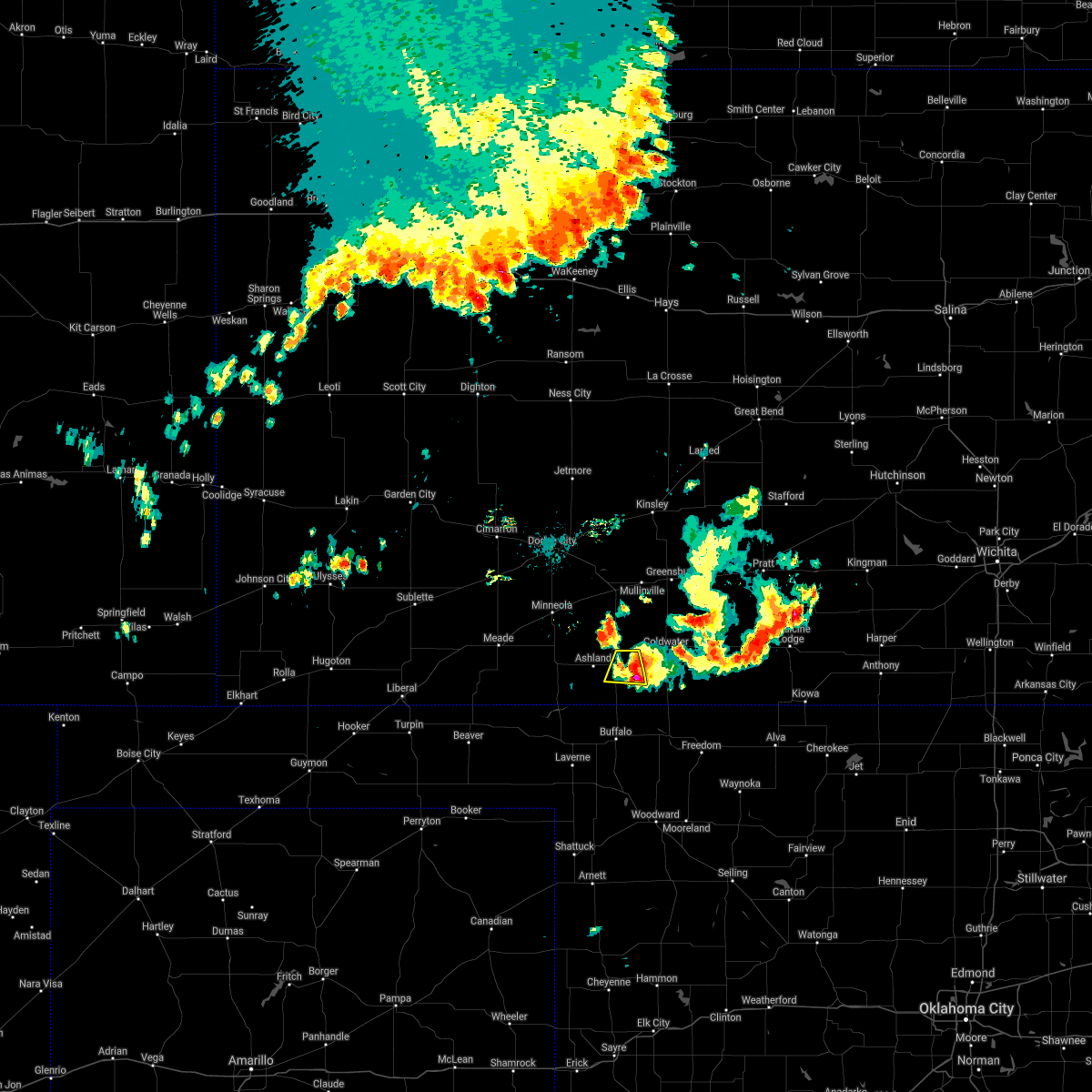 At 1155 pm cdt, a severe thunderstorm was located near protection, and is nearly stationary (radar indicated). Hazards include 60 mph wind gusts and quarter size hail. Hail damage to vehicles is expected. expect wind damage to roofs, siding, and trees. locations impacted include, protection and sitka. hail threat, radar indicated max hail size, 1. 00 in wind threat, radar indicated max wind gust, 60 mph. At 1155 pm cdt, a severe thunderstorm was located near protection, and is nearly stationary (radar indicated). Hazards include 60 mph wind gusts and quarter size hail. Hail damage to vehicles is expected. expect wind damage to roofs, siding, and trees. locations impacted include, protection and sitka. hail threat, radar indicated max hail size, 1. 00 in wind threat, radar indicated max wind gust, 60 mph.
|
| 9/29/2021 11:31 PM CDT |
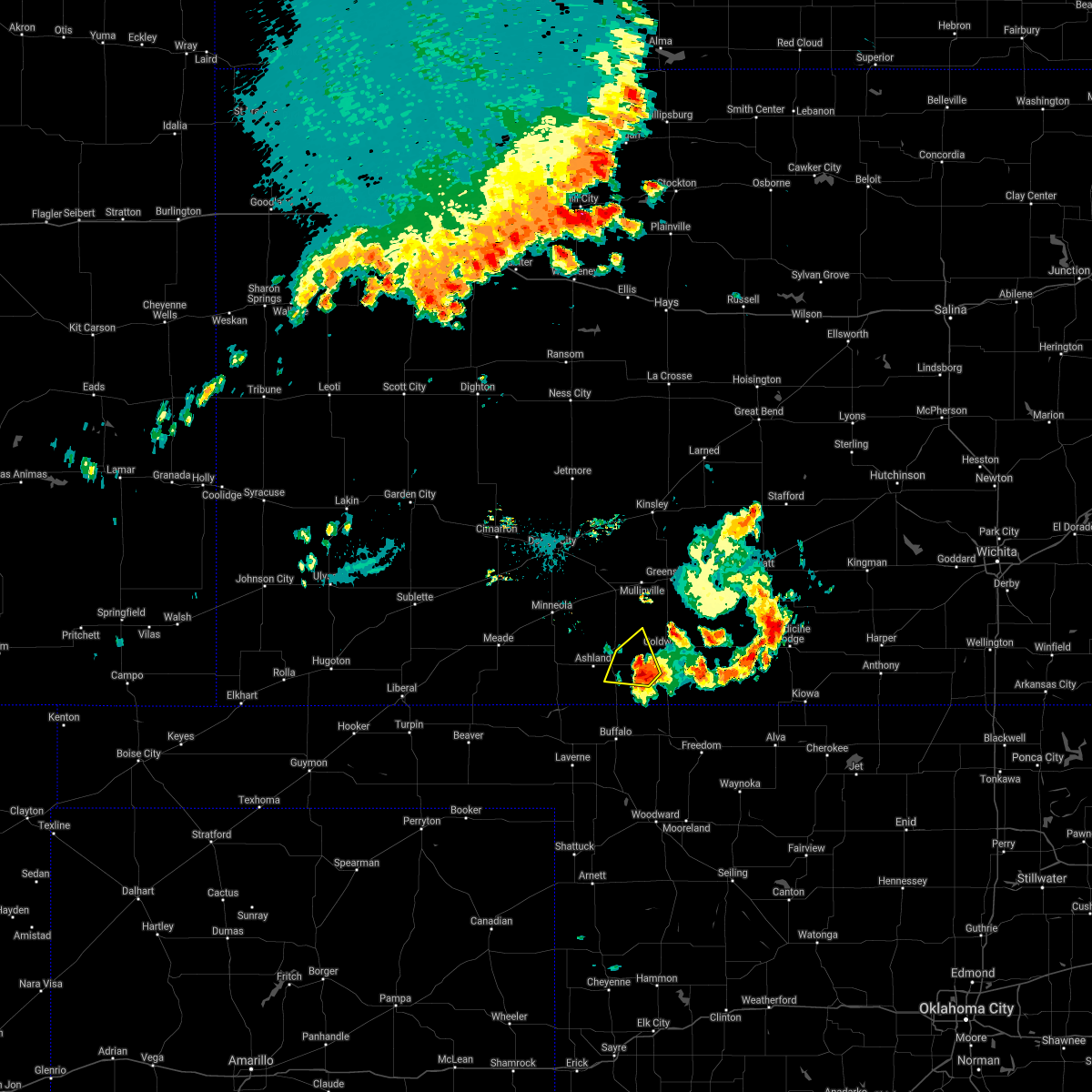 At 1131 pm cdt, a severe thunderstorm was located near protection, moving northwest at 15 mph (radar indicated). Hazards include 60 mph wind gusts and quarter size hail. Hail damage to vehicles is expected. expect wind damage to roofs, siding, and trees. locations impacted include, protection and sitka. hail threat, radar indicated max hail size, 1. 00 in wind threat, radar indicated max wind gust, 60 mph. At 1131 pm cdt, a severe thunderstorm was located near protection, moving northwest at 15 mph (radar indicated). Hazards include 60 mph wind gusts and quarter size hail. Hail damage to vehicles is expected. expect wind damage to roofs, siding, and trees. locations impacted include, protection and sitka. hail threat, radar indicated max hail size, 1. 00 in wind threat, radar indicated max wind gust, 60 mph.
|
| 9/29/2021 11:09 PM CDT |
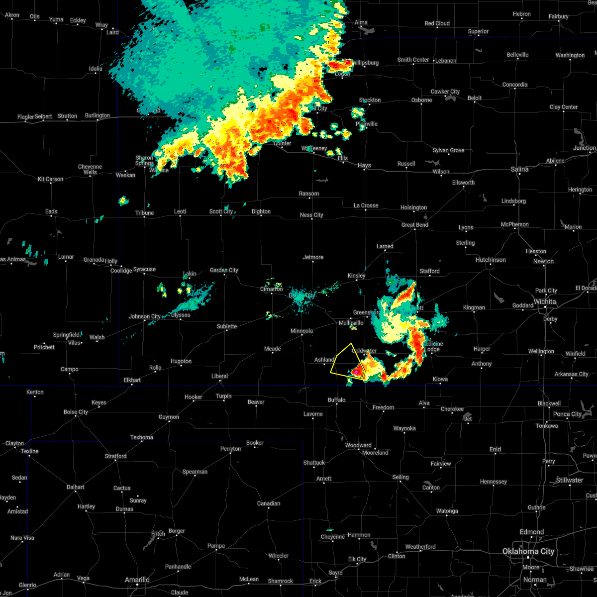 At 1109 pm cdt, a severe thunderstorm was located near buttermilk, moving northwest at 15 mph (radar indicated). Hazards include 60 mph wind gusts and half dollar size hail. Hail damage to vehicles is expected. Expect wind damage to roofs, siding, and trees. At 1109 pm cdt, a severe thunderstorm was located near buttermilk, moving northwest at 15 mph (radar indicated). Hazards include 60 mph wind gusts and half dollar size hail. Hail damage to vehicles is expected. Expect wind damage to roofs, siding, and trees.
|
| 5/5/2021 6:49 PM CDT |
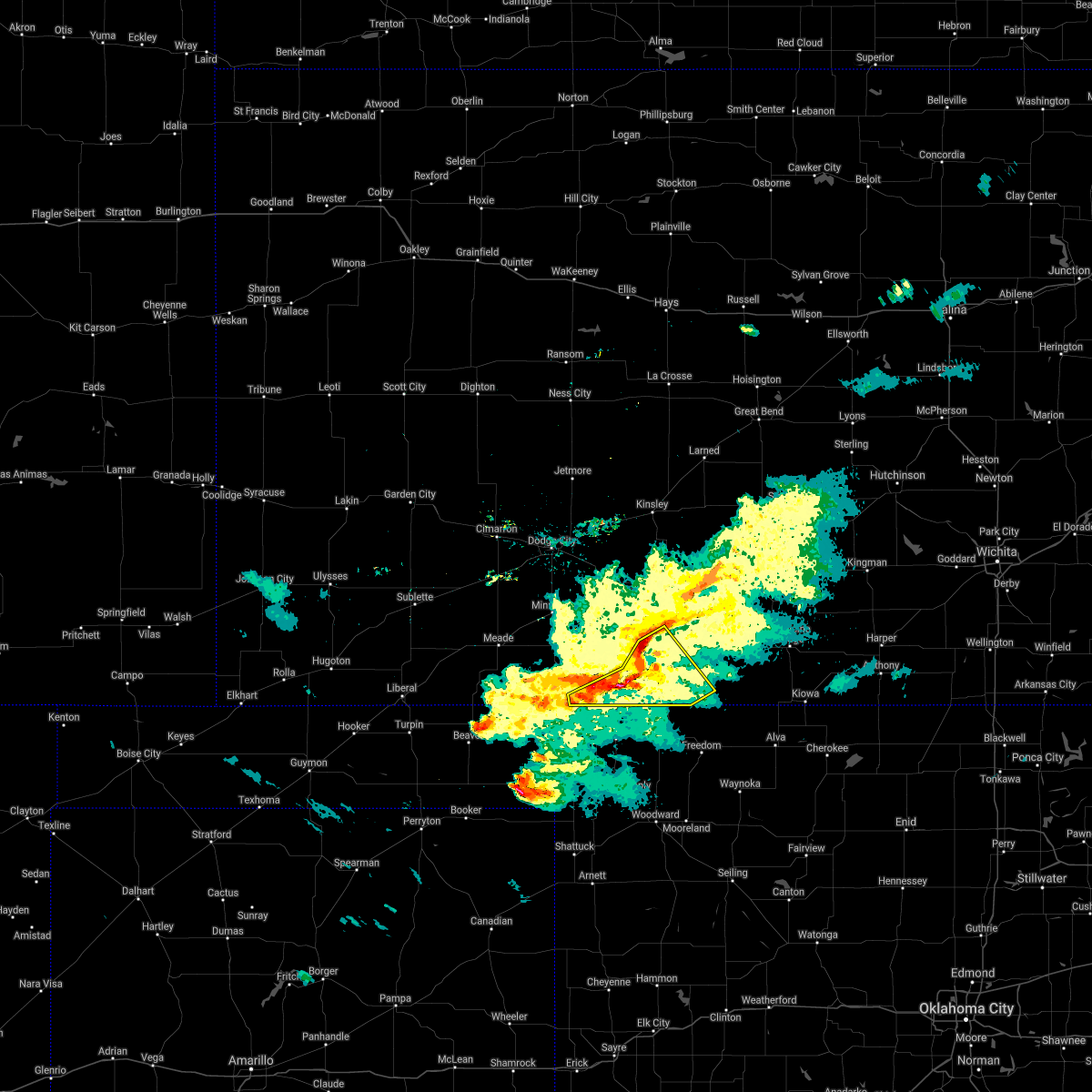 At 649 pm cdt, severe thunderstorms were located along a line extending from near protection to 10 miles southeast of acres, moving southeast at 45 mph (radar indicated). Hazards include 60 mph wind gusts. Expect damage to roofs, siding, and trees. Locations impacted include, coldwater, protection, lake coldwater and buttermilk. At 649 pm cdt, severe thunderstorms were located along a line extending from near protection to 10 miles southeast of acres, moving southeast at 45 mph (radar indicated). Hazards include 60 mph wind gusts. Expect damage to roofs, siding, and trees. Locations impacted include, coldwater, protection, lake coldwater and buttermilk.
|
| 5/5/2021 6:24 PM CDT |
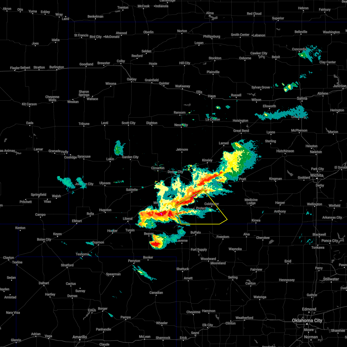 At 624 pm cdt, severe thunderstorms were located along a line extending from 10 miles southeast of bucklin to 8 miles northwest of acres, moving southeast at 35 mph (radar indicated). Hazards include 60 mph wind gusts and quarter size hail. Hail damage to vehicles is expected. Expect wind damage to roofs, siding, and trees. At 624 pm cdt, severe thunderstorms were located along a line extending from 10 miles southeast of bucklin to 8 miles northwest of acres, moving southeast at 35 mph (radar indicated). Hazards include 60 mph wind gusts and quarter size hail. Hail damage to vehicles is expected. Expect wind damage to roofs, siding, and trees.
|
| 8/29/2020 2:40 AM CDT |
 At 239 am cdt, an outflow boundary from thunderstorms were located along a line extending from near lewis to 7 miles southeast of greensburg to near buttermilk, moving east at 40 mph (radar indicated). Hazards include 60 mph wind gusts. Expect damage to roofs, siding, and trees. Locations impacted include, coldwater, greensburg, haviland, macksville, protection, lewis, cullison, belpre, sun city, wilmore, fellsburg, hopewell, wellsford, croft, lake coldwater, centerview, trousdale, belvidere and buttermilk. At 239 am cdt, an outflow boundary from thunderstorms were located along a line extending from near lewis to 7 miles southeast of greensburg to near buttermilk, moving east at 40 mph (radar indicated). Hazards include 60 mph wind gusts. Expect damage to roofs, siding, and trees. Locations impacted include, coldwater, greensburg, haviland, macksville, protection, lewis, cullison, belpre, sun city, wilmore, fellsburg, hopewell, wellsford, croft, lake coldwater, centerview, trousdale, belvidere and buttermilk.
|
| 8/29/2020 2:35 AM CDT |
 The severe thunderstorm warning for southeastern ford, western kiowa, northwestern comanche and northeastern clark counties will expire at 245 am cdt, the storm which prompted the warning has moved out of the area. therefore, the warning will be allowed to expire. however gusty winds are still possible with this thunderstorm. The severe thunderstorm warning for southeastern ford, western kiowa, northwestern comanche and northeastern clark counties will expire at 245 am cdt, the storm which prompted the warning has moved out of the area. therefore, the warning will be allowed to expire. however gusty winds are still possible with this thunderstorm.
|
| 8/29/2020 2:24 AM CDT |
 At 224 am cdt, an outflow boundary from thunderstorms was located very near mullinville, moving east at 30 mph (radar indicated). Hazards include 60 mph wind gusts. Expect damage to roofs, siding, and trees. Locations impacted include, ashland, bucklin, greensburg, protection, mullinville, sitka and clark state lake. At 224 am cdt, an outflow boundary from thunderstorms was located very near mullinville, moving east at 30 mph (radar indicated). Hazards include 60 mph wind gusts. Expect damage to roofs, siding, and trees. Locations impacted include, ashland, bucklin, greensburg, protection, mullinville, sitka and clark state lake.
|
| 8/29/2020 2:16 AM CDT |
 At 215 am cdt, an outflow boundary from thunderstorms were located along a line extending from 9 miles northwest of kinsley to mullinville to near sitka, moving east at 40 mph (radar indicated). Hazards include 60 mph wind gusts. expect damage to roofs, siding, and trees At 215 am cdt, an outflow boundary from thunderstorms were located along a line extending from 9 miles northwest of kinsley to mullinville to near sitka, moving east at 40 mph (radar indicated). Hazards include 60 mph wind gusts. expect damage to roofs, siding, and trees
|
| 8/29/2020 1:54 AM CDT |
 At 153 am cdt, a severe thunderstorm was located near kingsdown, moving east at 30 mph (radar indicated). Hazards include an outflow boundary with 60 mph wind gusts. expect damage to roofs, siding, and trees At 153 am cdt, a severe thunderstorm was located near kingsdown, moving east at 30 mph (radar indicated). Hazards include an outflow boundary with 60 mph wind gusts. expect damage to roofs, siding, and trees
|
| 8/16/2020 6:58 AM CDT |
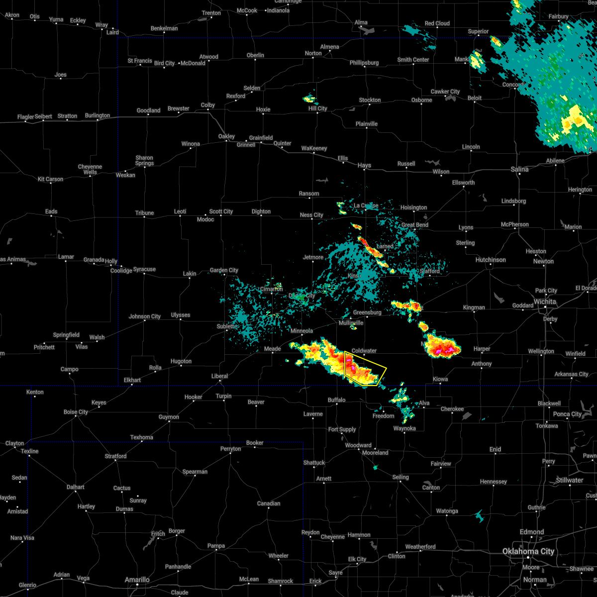 At 657 am cdt, a severe thunderstorm was located near buttermilk, moving southeast at 30 mph (radar indicated). Hazards include quarter size hail. Damage to vehicles is expected. Locations impacted include, coldwater, protection and buttermilk. At 657 am cdt, a severe thunderstorm was located near buttermilk, moving southeast at 30 mph (radar indicated). Hazards include quarter size hail. Damage to vehicles is expected. Locations impacted include, coldwater, protection and buttermilk.
|
| 8/16/2020 6:43 AM CDT |
 At 643 am cdt, a severe thunderstorm was located near protection, moving southeast at 30 mph (radar indicated). Hazards include quarter size hail. damage to vehicles is expected At 643 am cdt, a severe thunderstorm was located near protection, moving southeast at 30 mph (radar indicated). Hazards include quarter size hail. damage to vehicles is expected
|
| 7/13/2020 1:32 AM CDT |
 At 132 am cdt, a severe thunderstorm was located 9 miles northwest of lake coldwater, moving east at 20 mph (radar indicated). Hazards include 60 mph wind gusts and quarter size hail. Hail damage to vehicles is expected. Expect wind damage to roofs, siding, and trees. At 132 am cdt, a severe thunderstorm was located 9 miles northwest of lake coldwater, moving east at 20 mph (radar indicated). Hazards include 60 mph wind gusts and quarter size hail. Hail damage to vehicles is expected. Expect wind damage to roofs, siding, and trees.
|
| 7/13/2020 12:43 AM CDT |
 The severe thunderstorm warning for southern ford, meade, southwestern comanche, southeastern gray and clark counties will expire at 1245 am cdt, the storms which prompted the warning have weakened below severe limits. therefore, the warning will be allowed to expire. a severe thunderstorm watch remains in effect until 300 am cdt for southwestern kansas. The severe thunderstorm warning for southern ford, meade, southwestern comanche, southeastern gray and clark counties will expire at 1245 am cdt, the storms which prompted the warning have weakened below severe limits. therefore, the warning will be allowed to expire. a severe thunderstorm watch remains in effect until 300 am cdt for southwestern kansas.
|
| 7/13/2020 12:26 AM CDT |
 At 1225 am cdt, severe thunderstorms were located along a line extending from 9 miles southeast of bucklin to near plains, moving southwest at 10 mph (public). Hazards include 60 mph wind gusts and nickel size hail. Expect damage to roofs, siding, and trees. Locations impacted include, meade, ashland, bucklin, minneola, fowler, protection, bloom, englewood, sitka, clark state lake, meade state park, kingsdown, missler and acres. At 1225 am cdt, severe thunderstorms were located along a line extending from 9 miles southeast of bucklin to near plains, moving southwest at 10 mph (public). Hazards include 60 mph wind gusts and nickel size hail. Expect damage to roofs, siding, and trees. Locations impacted include, meade, ashland, bucklin, minneola, fowler, protection, bloom, englewood, sitka, clark state lake, meade state park, kingsdown, missler and acres.
|
| 7/12/2020 11:56 PM CDT |
 At 1155 pm cdt, severe thunderstorms were located along a line extending from near bucklin to near copeland, moving southeast at 35 mph (public. these storms have a history of producing wind gusts to near 60 mph). Hazards include 60 mph wind gusts and nickel size hail. expect damage to roofs, siding, and trees At 1155 pm cdt, severe thunderstorms were located along a line extending from near bucklin to near copeland, moving southeast at 35 mph (public. these storms have a history of producing wind gusts to near 60 mph). Hazards include 60 mph wind gusts and nickel size hail. expect damage to roofs, siding, and trees
|
| 6/24/2020 9:29 PM CDT |
 At 929 pm cdt, a severe thunderstorm was located near clark state lake, moving south at 20 mph (radar indicated). Hazards include 60 mph wind gusts and quarter size hail. Hail damage to vehicles is expected. expect wind damage to roofs, siding, and trees. Locations impacted include, protection, clark state lake and kingsdown. At 929 pm cdt, a severe thunderstorm was located near clark state lake, moving south at 20 mph (radar indicated). Hazards include 60 mph wind gusts and quarter size hail. Hail damage to vehicles is expected. expect wind damage to roofs, siding, and trees. Locations impacted include, protection, clark state lake and kingsdown.
|
| 6/24/2020 9:09 PM CDT |
 At 909 pm cdt, a severe thunderstorm was located very near kingsdown, moving south at 20 mph (radar indicated). Hazards include 60 mph wind gusts and quarter size hail. Hail damage to vehicles is expected. Expect wind damage to roofs, siding, and trees. At 909 pm cdt, a severe thunderstorm was located very near kingsdown, moving south at 20 mph (radar indicated). Hazards include 60 mph wind gusts and quarter size hail. Hail damage to vehicles is expected. Expect wind damage to roofs, siding, and trees.
|
| 6/21/2020 7:45 PM CDT |
 At 745 pm cdt, a severe thunderstorm was located 8 miles south of sun city, moving southeast at 30 mph (radar indicated). Hazards include 60 mph wind gusts and quarter size hail. Hail damage to vehicles is expected. Expect wind damage to roofs, siding, and trees. At 745 pm cdt, a severe thunderstorm was located 8 miles south of sun city, moving southeast at 30 mph (radar indicated). Hazards include 60 mph wind gusts and quarter size hail. Hail damage to vehicles is expected. Expect wind damage to roofs, siding, and trees.
|
| 6/21/2020 6:56 PM CDT |
 At 656 pm cdt, severe thunderstorms were located along a line extending from near turon to near coats to near lake coldwater, moving southeast at 35 mph. these are very dangerous storms (radar indicated). Hazards include 80 mph wind gusts and quarter size hail. Flying debris will be dangerous to those caught without shelter. mobile homes will be heavily damaged. expect considerable damage to roofs, windows, and vehicles. Extensive tree damage and power outages are likely. At 656 pm cdt, severe thunderstorms were located along a line extending from near turon to near coats to near lake coldwater, moving southeast at 35 mph. these are very dangerous storms (radar indicated). Hazards include 80 mph wind gusts and quarter size hail. Flying debris will be dangerous to those caught without shelter. mobile homes will be heavily damaged. expect considerable damage to roofs, windows, and vehicles. Extensive tree damage and power outages are likely.
|
| 6/21/2020 6:53 PM CDT |
 At 652 pm cdt, severe thunderstorms were located along a line extending from 8 miles northwest of wilmore to 9 miles east of meade state park, moving south at 20 mph. these are very dangerous storms (radar indicated). Hazards include 80 mph wind gusts and quarter size hail. Flying debris will be dangerous to those caught without shelter. mobile homes will be heavily damaged. expect considerable damage to roofs, windows, and vehicles. extensive tree damage and power outages are likely. Locations impacted include, ashland, coldwater, protection, englewood, sitka, wilmore, lake coldwater, acres and buttermilk. At 652 pm cdt, severe thunderstorms were located along a line extending from 8 miles northwest of wilmore to 9 miles east of meade state park, moving south at 20 mph. these are very dangerous storms (radar indicated). Hazards include 80 mph wind gusts and quarter size hail. Flying debris will be dangerous to those caught without shelter. mobile homes will be heavily damaged. expect considerable damage to roofs, windows, and vehicles. extensive tree damage and power outages are likely. Locations impacted include, ashland, coldwater, protection, englewood, sitka, wilmore, lake coldwater, acres and buttermilk.
|
| 6/21/2020 6:08 PM CDT |
 At 607 pm cdt, severe thunderstorms were located along a line extending from 6 miles northwest of mullinville to near missler, moving southeast at 25 mph. these are very dangerous storms (radar indicated). Hazards include 80 mph wind gusts and quarter size hail. Flying debris will be dangerous to those caught without shelter. mobile homes will be heavily damaged. expect considerable damage to roofs, windows, and vehicles. Extensive tree damage and power outages are likely. At 607 pm cdt, severe thunderstorms were located along a line extending from 6 miles northwest of mullinville to near missler, moving southeast at 25 mph. these are very dangerous storms (radar indicated). Hazards include 80 mph wind gusts and quarter size hail. Flying debris will be dangerous to those caught without shelter. mobile homes will be heavily damaged. expect considerable damage to roofs, windows, and vehicles. Extensive tree damage and power outages are likely.
|
| 5/7/2020 9:31 PM CDT |
 At 931 pm cdt, a severe thunderstorm was located 8 miles southwest of buttermilk, moving southeast at 40 mph (radar indicated). Hazards include 60 mph wind gusts and half dollar size hail. Hail damage to vehicles is expected. expect wind damage to roofs, siding, and trees. Locations impacted include, coldwater, protection, lake coldwater and buttermilk. At 931 pm cdt, a severe thunderstorm was located 8 miles southwest of buttermilk, moving southeast at 40 mph (radar indicated). Hazards include 60 mph wind gusts and half dollar size hail. Hail damage to vehicles is expected. expect wind damage to roofs, siding, and trees. Locations impacted include, coldwater, protection, lake coldwater and buttermilk.
|
| 5/7/2020 9:22 PM CDT |
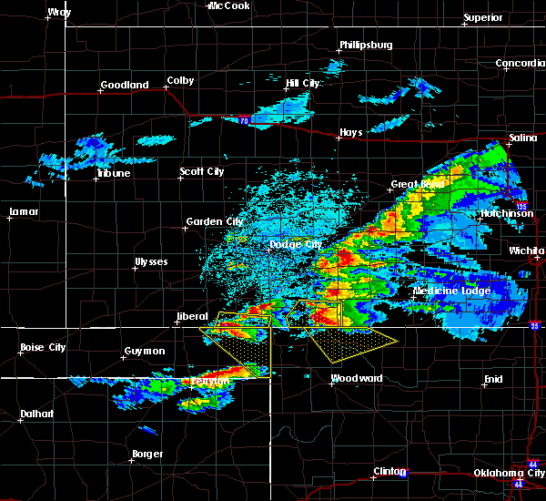 At 922 pm cdt, a severe thunderstorm was located 9 miles southeast of sitka, moving southeast at 35 mph (radar indicated). Hazards include ping pong ball size hail and 60 mph wind gusts. People and animals outdoors will be injured. expect hail damage to roofs, siding, windows, and vehicles. expect wind damage to roofs, siding, and trees. Locations impacted include, coldwater, protection, sitka, lake coldwater and buttermilk. At 922 pm cdt, a severe thunderstorm was located 9 miles southeast of sitka, moving southeast at 35 mph (radar indicated). Hazards include ping pong ball size hail and 60 mph wind gusts. People and animals outdoors will be injured. expect hail damage to roofs, siding, windows, and vehicles. expect wind damage to roofs, siding, and trees. Locations impacted include, coldwater, protection, sitka, lake coldwater and buttermilk.
|
| 5/7/2020 9:08 PM CDT |
 At 907 pm cdt, a severe thunderstorm was located near sitka, moving southeast at 40 mph. this replaces the previous warning for clark county (public). Hazards include two inch hail and 60 mph wind gusts. People and animals outdoors will be injured. expect hail damage to roofs, siding, windows, and vehicles. Expect wind damage to roofs, siding, and trees. At 907 pm cdt, a severe thunderstorm was located near sitka, moving southeast at 40 mph. this replaces the previous warning for clark county (public). Hazards include two inch hail and 60 mph wind gusts. People and animals outdoors will be injured. expect hail damage to roofs, siding, windows, and vehicles. Expect wind damage to roofs, siding, and trees.
|
| 9/8/2019 4:45 PM CDT |
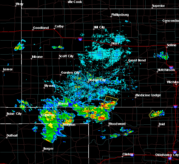 At 445 pm cdt, a severe thunderstorm was located near protection, moving northeast at 15 mph (radar indicated). Hazards include 60 mph wind gusts. Expect damage to roofs, siding, and trees. Locations impacted include, coldwater, protection, lake coldwater and buttermilk. At 445 pm cdt, a severe thunderstorm was located near protection, moving northeast at 15 mph (radar indicated). Hazards include 60 mph wind gusts. Expect damage to roofs, siding, and trees. Locations impacted include, coldwater, protection, lake coldwater and buttermilk.
|
| 9/8/2019 4:20 PM CDT |
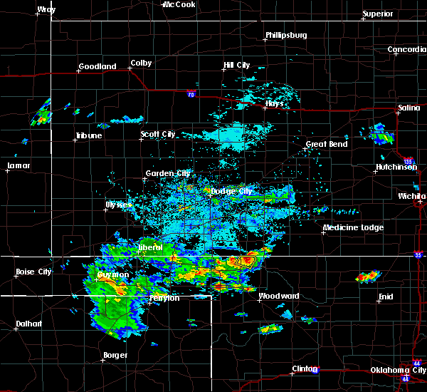 At 420 pm cdt, a severe thunderstorm was located 9 miles southwest of buttermilk, moving northeast at 15 mph (radar indicated). Hazards include 60 mph wind gusts and half dollar size hail. Hail damage to vehicles is expected. Expect wind damage to roofs, siding, and trees. At 420 pm cdt, a severe thunderstorm was located 9 miles southwest of buttermilk, moving northeast at 15 mph (radar indicated). Hazards include 60 mph wind gusts and half dollar size hail. Hail damage to vehicles is expected. Expect wind damage to roofs, siding, and trees.
|
| 8/29/2019 11:22 PM CDT |
 At 1122 pm cdt, severe thunderstorms were located along a line extending from near belvidere to 6 miles southeast of sitka, moving southeast at 25 mph (radar indicated). Hazards include 60 mph wind gusts and quarter size hail. Hail damage to vehicles is expected. expect wind damage to roofs, siding, and trees. Locations impacted include, coldwater, haviland, protection, sitka, lake city, sun city, wilmore, lake coldwater, croft, belvidere and buttermilk. At 1122 pm cdt, severe thunderstorms were located along a line extending from near belvidere to 6 miles southeast of sitka, moving southeast at 25 mph (radar indicated). Hazards include 60 mph wind gusts and quarter size hail. Hail damage to vehicles is expected. expect wind damage to roofs, siding, and trees. Locations impacted include, coldwater, haviland, protection, sitka, lake city, sun city, wilmore, lake coldwater, croft, belvidere and buttermilk.
|
| 8/29/2019 11:10 PM CDT |
 At 1110 pm cdt, severe thunderstorms were located along a line extending from near haviland to near sitka, moving southeast at 15 mph (radar indicated). Hazards include 60 mph wind gusts and quarter size hail. Hail damage to vehicles is expected. expect wind damage to roofs, siding, and trees. Locations impacted include, coldwater, greensburg, haviland, protection, sitka, lake city, sun city, wilmore, lake coldwater, croft, belvidere and buttermilk. At 1110 pm cdt, severe thunderstorms were located along a line extending from near haviland to near sitka, moving southeast at 15 mph (radar indicated). Hazards include 60 mph wind gusts and quarter size hail. Hail damage to vehicles is expected. expect wind damage to roofs, siding, and trees. Locations impacted include, coldwater, greensburg, haviland, protection, sitka, lake city, sun city, wilmore, lake coldwater, croft, belvidere and buttermilk.
|
| 8/29/2019 10:58 PM CDT |
 At 1057 pm cdt, severe thunderstorms were located along a line extending from near haviland to near sitka, moving southeast at 20 mph (radar indicated). Hazards include 60 mph wind gusts and quarter size hail. Hail damage to vehicles is expected. Expect wind damage to roofs, siding, and trees. At 1057 pm cdt, severe thunderstorms were located along a line extending from near haviland to near sitka, moving southeast at 20 mph (radar indicated). Hazards include 60 mph wind gusts and quarter size hail. Hail damage to vehicles is expected. Expect wind damage to roofs, siding, and trees.
|
| 8/16/2019 8:51 PM CDT |
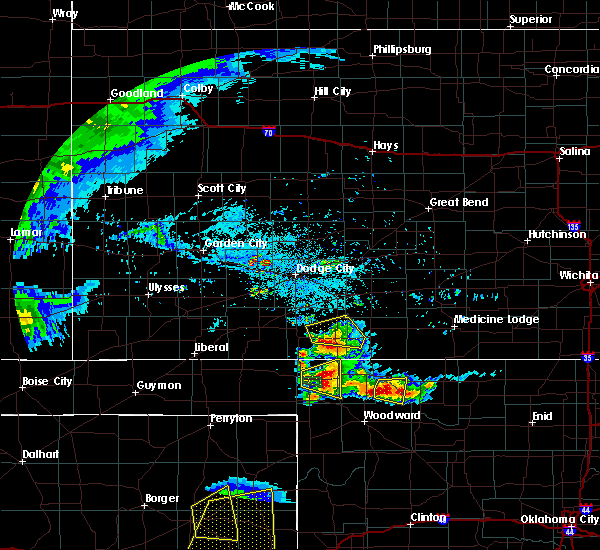 The severe thunderstorm warning for northwestern comanche and northeastern clark counties will expire at 900 pm cdt, the storm which prompted the warning has weakened below severe limits, and no longer poses an immediate threat to life or property. therefore, the warning will be allowed to expire. however gusty winds and heavy rain are still possible with this thunderstorm. The severe thunderstorm warning for northwestern comanche and northeastern clark counties will expire at 900 pm cdt, the storm which prompted the warning has weakened below severe limits, and no longer poses an immediate threat to life or property. therefore, the warning will be allowed to expire. however gusty winds and heavy rain are still possible with this thunderstorm.
|
| 8/16/2019 8:18 PM CDT |
 At 757 pm cdt, a severe thunderstorm was located near ashland, moving northeast at 15 mph (radar indicated). Hazards include 60 mph wind gusts and half dollar size hail. Hail damage to vehicles is expected. Expect wind damage to roofs, siding, and trees. At 757 pm cdt, a severe thunderstorm was located near ashland, moving northeast at 15 mph (radar indicated). Hazards include 60 mph wind gusts and half dollar size hail. Hail damage to vehicles is expected. Expect wind damage to roofs, siding, and trees.
|
| 8/16/2019 7:57 PM CDT |
 The national weather service in dodge city has issued a * severe thunderstorm warning for. western comanche county in south central kansas. clark county in southwestern kansas. until 900 pm cdt. At 757 pm cdt, a severe thunderstorm was located near ashland,. The national weather service in dodge city has issued a * severe thunderstorm warning for. western comanche county in south central kansas. clark county in southwestern kansas. until 900 pm cdt. At 757 pm cdt, a severe thunderstorm was located near ashland,.
|
| 8/13/2019 9:37 PM CDT |
 At 937 pm cdt, severe thunderstorms were located along a line extending from near sawyer to 6 miles northeast of aetna to 9 miles south of buttermilk, moving east at 50 mph (radar indicated). Hazards include 60 mph wind gusts and penny size hail. Expect damage to roofs, siding, and trees. Locations impacted include, medicine lodge, kiowa, coldwater, protection, hardtner, sharon, hazelton, lake city, sun city, wilmore, aetna, croft, lake coldwater, belvidere and buttermilk. At 937 pm cdt, severe thunderstorms were located along a line extending from near sawyer to 6 miles northeast of aetna to 9 miles south of buttermilk, moving east at 50 mph (radar indicated). Hazards include 60 mph wind gusts and penny size hail. Expect damage to roofs, siding, and trees. Locations impacted include, medicine lodge, kiowa, coldwater, protection, hardtner, sharon, hazelton, lake city, sun city, wilmore, aetna, croft, lake coldwater, belvidere and buttermilk.
|
| 8/13/2019 9:05 PM CDT |
 At 905 pm cdt, severe thunderstorms were located along a line extending from croft to near protection to near englewood, moving southeast at 45 mph (radar indicated). Hazards include 60 mph wind gusts. expect damage to roofs, siding, and trees At 905 pm cdt, severe thunderstorms were located along a line extending from croft to near protection to near englewood, moving southeast at 45 mph (radar indicated). Hazards include 60 mph wind gusts. expect damage to roofs, siding, and trees
|
| 8/13/2019 8:43 PM CDT |
 At 842 pm cdt, severe thunderstorms were located along a line extending from near belpre to 12 miles northwest of coldwater to near fowler, moving southeast at 55 mph (radar indicated). Hazards include 70 mph wind gusts. Expect considerable tree damage. damage is likely to mobile homes, roofs, and outbuildings. Locations impacted include, dodge city, kinsley, ashland, coldwater, bucklin, greensburg, minneola, haviland, fowler, protection, mullinville, ford, offerle, bloom, englewood, sitka, wilmore, fellsburg, wright and wellsford. At 842 pm cdt, severe thunderstorms were located along a line extending from near belpre to 12 miles northwest of coldwater to near fowler, moving southeast at 55 mph (radar indicated). Hazards include 70 mph wind gusts. Expect considerable tree damage. damage is likely to mobile homes, roofs, and outbuildings. Locations impacted include, dodge city, kinsley, ashland, coldwater, bucklin, greensburg, minneola, haviland, fowler, protection, mullinville, ford, offerle, bloom, englewood, sitka, wilmore, fellsburg, wright and wellsford.
|
| 8/13/2019 8:16 PM CDT |
 At 815 pm cdt, severe thunderstorms were located along a line extending from near kinsley to near ford to near ensign, moving southeast at 50 mph (radar indicated). Hazards include 70 mph wind gusts and half dollar size hail. Hail damage to vehicles is expected. expect considerable tree damage. Wind damage is also likely to mobile homes, roofs, and outbuildings. At 815 pm cdt, severe thunderstorms were located along a line extending from near kinsley to near ford to near ensign, moving southeast at 50 mph (radar indicated). Hazards include 70 mph wind gusts and half dollar size hail. Hail damage to vehicles is expected. expect considerable tree damage. Wind damage is also likely to mobile homes, roofs, and outbuildings.
|
| 8/7/2019 7:57 PM CDT |
 The national weather service in dodge city has issued a * severe thunderstorm warning for. western comanche county in south central kansas. until 900 pm cdt. At 756 pm cdt, a severe thunderstorm was located near lake coldwater, and is nearly stationary. The national weather service in dodge city has issued a * severe thunderstorm warning for. western comanche county in south central kansas. until 900 pm cdt. At 756 pm cdt, a severe thunderstorm was located near lake coldwater, and is nearly stationary.
|
| 7/5/2019 11:29 PM CDT |
 At 1128 pm cdt, severe thunderstorms were located along a line extending from near cunningham to 10 miles southeast of acres, moving southeast at 25 mph (radar indicated). Hazards include 60 mph wind gusts and quarter size hail. Hail damage to vehicles is expected. Expect wind damage to roofs, siding, and trees. At 1128 pm cdt, severe thunderstorms were located along a line extending from near cunningham to 10 miles southeast of acres, moving southeast at 25 mph (radar indicated). Hazards include 60 mph wind gusts and quarter size hail. Hail damage to vehicles is expected. Expect wind damage to roofs, siding, and trees.
|
| 5/26/2019 11:33 PM CDT |
 At 1133 pm cdt, severe thunderstorms were located along a line extending from 7 miles southwest of sanford to 7 miles south of greensburg to 8 miles south of buttermilk, moving northeast at 70 mph (radar indicated). Hazards include 70 mph wind gusts and penny size hail. Expect considerable tree damage. damage is likely to mobile homes, roofs, and outbuildings. locations impacted include, pratt, larned, kinsley, st. John, coldwater, greensburg, haviland, macksville, protection, lewis, mullinville, burdett, garfield, iuka, rozel, sawyer, cullison, belpre, coats and lake city. At 1133 pm cdt, severe thunderstorms were located along a line extending from 7 miles southwest of sanford to 7 miles south of greensburg to 8 miles south of buttermilk, moving northeast at 70 mph (radar indicated). Hazards include 70 mph wind gusts and penny size hail. Expect considerable tree damage. damage is likely to mobile homes, roofs, and outbuildings. locations impacted include, pratt, larned, kinsley, st. John, coldwater, greensburg, haviland, macksville, protection, lewis, mullinville, burdett, garfield, iuka, rozel, sawyer, cullison, belpre, coats and lake city.
|
| 5/26/2019 11:10 PM CDT |
 The severe thunderstorm warning for southern ford, southwestern kiowa, meade, western comanche, southern gray and clark counties will expire at 1115 pm cdt, the storms which prompted the warning have moved out of the area. therefore, the warning will be allowed to expire. however gusty winds are still possible with these thunderstorms. a severe thunderstorm watch remains in effect until 200 am cdt for south central and southwestern kansas. remember, a severe thunderstorm warning still remains in effect for comanche, kiowa, eastern clark and eastern ford counties until midnight. The severe thunderstorm warning for southern ford, southwestern kiowa, meade, western comanche, southern gray and clark counties will expire at 1115 pm cdt, the storms which prompted the warning have moved out of the area. therefore, the warning will be allowed to expire. however gusty winds are still possible with these thunderstorms. a severe thunderstorm watch remains in effect until 200 am cdt for south central and southwestern kansas. remember, a severe thunderstorm warning still remains in effect for comanche, kiowa, eastern clark and eastern ford counties until midnight.
|
| 5/26/2019 11:07 PM CDT |
 At 1106 pm cdt, severe thunderstorms were located along a line extending from 6 miles northwest of spearville to 9 miles east of clark state lake to 7 miles north of buffalo, moving northeast at 70 mph (radar indicated). Hazards include 70 mph wind gusts and penny size hail. Expect considerable tree damage. Damage is likely to mobile homes, roofs, and outbuildings. At 1106 pm cdt, severe thunderstorms were located along a line extending from 6 miles northwest of spearville to 9 miles east of clark state lake to 7 miles north of buffalo, moving northeast at 70 mph (radar indicated). Hazards include 70 mph wind gusts and penny size hail. Expect considerable tree damage. Damage is likely to mobile homes, roofs, and outbuildings.
|
| 5/26/2019 10:50 PM CDT |
 At 1050 pm cdt, severe thunderstorms were located along a line extending from 7 miles east of ensign to 7 miles southwest of clark state lake to near laverne, moving east at 55 mph (radar indicated). Hazards include 70 mph wind gusts and nickel size hail. Expect considerable tree damage. damage is likely to mobile homes, roofs, and outbuildings. Locations impacted include, meade, ashland, coldwater, bucklin, minneola, fowler, protection, mullinville, ford, bloom, englewood, sitka, clark state lake, kingsdown, missler, lake coldwater, acres and buttermilk. At 1050 pm cdt, severe thunderstorms were located along a line extending from 7 miles east of ensign to 7 miles southwest of clark state lake to near laverne, moving east at 55 mph (radar indicated). Hazards include 70 mph wind gusts and nickel size hail. Expect considerable tree damage. damage is likely to mobile homes, roofs, and outbuildings. Locations impacted include, meade, ashland, coldwater, bucklin, minneola, fowler, protection, mullinville, ford, bloom, englewood, sitka, clark state lake, kingsdown, missler, lake coldwater, acres and buttermilk.
|
| 5/26/2019 10:22 PM CDT |
 At 1022 pm cdt, severe thunderstorms were located along a line extending from near montezuma to near meade to 9 miles west of slapout, moving east at 50 mph (radar indicated). Hazards include 70 mph wind gusts and nickel size hail. Expect considerable tree damage. Damage is likely to mobile homes, roofs, and outbuildings. At 1022 pm cdt, severe thunderstorms were located along a line extending from near montezuma to near meade to 9 miles west of slapout, moving east at 50 mph (radar indicated). Hazards include 70 mph wind gusts and nickel size hail. Expect considerable tree damage. Damage is likely to mobile homes, roofs, and outbuildings.
|
| 5/23/2019 10:15 PM CDT |
 At 1014 pm cdt, a severe thunderstorm capable of producing a tornado was located near protection, moving northeast at 45 mph (radar indicated rotation). Hazards include tornado and quarter size hail. Flying debris will be dangerous to those caught without shelter. mobile homes will be damaged or destroyed. damage to roofs, windows, and vehicles will occur. tree damage is likely. this dangerous storm will be near, coldwater around 1020 pm cdt. Lake coldwater around 1025 pm cdt. At 1014 pm cdt, a severe thunderstorm capable of producing a tornado was located near protection, moving northeast at 45 mph (radar indicated rotation). Hazards include tornado and quarter size hail. Flying debris will be dangerous to those caught without shelter. mobile homes will be damaged or destroyed. damage to roofs, windows, and vehicles will occur. tree damage is likely. this dangerous storm will be near, coldwater around 1020 pm cdt. Lake coldwater around 1025 pm cdt.
|
| 5/23/2019 10:02 PM CDT |
 At 1002 pm cdt, a severe thunderstorm capable of producing a tornado was located 8 miles south of protection, moving northeast at 45 mph (radar indicated rotation). Hazards include tornado and quarter size hail. Flying debris will be dangerous to those caught without shelter. mobile homes will be damaged or destroyed. damage to roofs, windows, and vehicles will occur. tree damage is likely. this dangerous storm will be near, protection around 1015 pm cdt. Coldwater and lake coldwater around 1025 pm cdt. At 1002 pm cdt, a severe thunderstorm capable of producing a tornado was located 8 miles south of protection, moving northeast at 45 mph (radar indicated rotation). Hazards include tornado and quarter size hail. Flying debris will be dangerous to those caught without shelter. mobile homes will be damaged or destroyed. damage to roofs, windows, and vehicles will occur. tree damage is likely. this dangerous storm will be near, protection around 1015 pm cdt. Coldwater and lake coldwater around 1025 pm cdt.
|
| 5/23/2019 9:48 PM CDT |
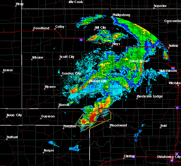 At 947 pm cdt, a severe thunderstorm capable of producing a tornado was located 8 miles north of buffalo, moving northeast at 45 mph. this storm has had a history of producing tornadoes in oklahoma (radar indicated rotation). Hazards include tornado and quarter size hail. Flying debris will be dangerous to those caught without shelter. mobile homes will be damaged or destroyed. damage to roofs, windows, and vehicles will occur. tree damage is likely. this dangerous storm will be near, protection and buttermilk around 1015 pm cdt. Coldwater and lake coldwater around 1025 pm cdt. At 947 pm cdt, a severe thunderstorm capable of producing a tornado was located 8 miles north of buffalo, moving northeast at 45 mph. this storm has had a history of producing tornadoes in oklahoma (radar indicated rotation). Hazards include tornado and quarter size hail. Flying debris will be dangerous to those caught without shelter. mobile homes will be damaged or destroyed. damage to roofs, windows, and vehicles will occur. tree damage is likely. this dangerous storm will be near, protection and buttermilk around 1015 pm cdt. Coldwater and lake coldwater around 1025 pm cdt.
|
| 5/5/2019 9:07 PM CDT |
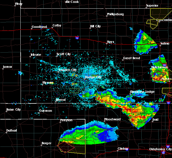 At 906 pm cdt, a severe thunderstorm was located 8 miles southwest of buttermilk, moving southeast at 10 mph (radar indicated). Hazards include 60 mph wind gusts and half dollar size hail. Hail damage to vehicles is expected. Expect wind damage to roofs, siding, and trees. At 906 pm cdt, a severe thunderstorm was located 8 miles southwest of buttermilk, moving southeast at 10 mph (radar indicated). Hazards include 60 mph wind gusts and half dollar size hail. Hail damage to vehicles is expected. Expect wind damage to roofs, siding, and trees.
|
| 5/5/2019 8:47 PM CDT |
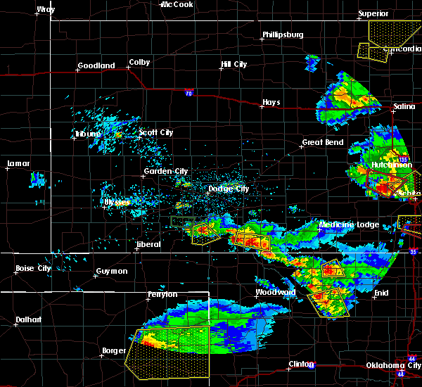 At 847 pm cdt, a severe thunderstorm was located near protection, moving east at 10 mph (radar indicated). Hazards include ping pong ball size hail and 60 mph wind gusts. People and animals outdoors will be injured. expect hail damage to roofs, siding, windows, and vehicles. expect wind damage to roofs, siding, and trees. Locations impacted include, protection, sitka and buttermilk. At 847 pm cdt, a severe thunderstorm was located near protection, moving east at 10 mph (radar indicated). Hazards include ping pong ball size hail and 60 mph wind gusts. People and animals outdoors will be injured. expect hail damage to roofs, siding, windows, and vehicles. expect wind damage to roofs, siding, and trees. Locations impacted include, protection, sitka and buttermilk.
|
| 5/5/2019 8:22 PM CDT |
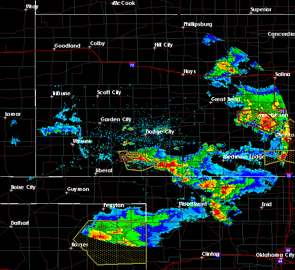 At 822 pm cdt, a severe thunderstorm was located very near protection, moving east at 20 mph (radar indicated). Hazards include 60 mph wind gusts and half dollar size hail. Hail damage to vehicles is expected. Expect wind damage to roofs, siding, and trees. At 822 pm cdt, a severe thunderstorm was located very near protection, moving east at 20 mph (radar indicated). Hazards include 60 mph wind gusts and half dollar size hail. Hail damage to vehicles is expected. Expect wind damage to roofs, siding, and trees.
|
| 7/27/2018 10:08 PM CDT |
 At 1008 pm cdt, a severe thunderstorm was located 12 miles southeast of bucklin, moving southeast at 15 mph (radar indicated). Hazards include ping pong ball size hail and 60 mph wind gusts. People and animals outdoors will be injured. expect hail damage to roofs, siding, windows, and vehicles. expect wind damage to roofs, siding, and trees. Locations impacted include, coldwater, protection and lake coldwater. At 1008 pm cdt, a severe thunderstorm was located 12 miles southeast of bucklin, moving southeast at 15 mph (radar indicated). Hazards include ping pong ball size hail and 60 mph wind gusts. People and animals outdoors will be injured. expect hail damage to roofs, siding, windows, and vehicles. expect wind damage to roofs, siding, and trees. Locations impacted include, coldwater, protection and lake coldwater.
|
| 7/27/2018 9:50 PM CDT |
 At 950 pm cdt, a severe thunderstorm was located 7 miles southeast of bucklin, moving southeast at 15 mph (radar indicated). Hazards include golf ball size hail and 70 mph wind gusts. People and animals outdoors will be injured. expect hail damage to roofs, siding, windows, and vehicles. expect considerable tree damage. wind damage is also likely to mobile homes, roofs, and outbuildings. Locations impacted include, coldwater, protection and lake coldwater. At 950 pm cdt, a severe thunderstorm was located 7 miles southeast of bucklin, moving southeast at 15 mph (radar indicated). Hazards include golf ball size hail and 70 mph wind gusts. People and animals outdoors will be injured. expect hail damage to roofs, siding, windows, and vehicles. expect considerable tree damage. wind damage is also likely to mobile homes, roofs, and outbuildings. Locations impacted include, coldwater, protection and lake coldwater.
|
| 7/27/2018 9:28 PM CDT |
 At 927 pm cdt, a severe thunderstorm was located very near bucklin, moving south at 20 mph. this is a very dangerous storm (radar indicated). Hazards include 80 mph wind gusts and two inch hail. Flying debris will be dangerous to those caught without shelter. mobile homes will be heavily damaged. expect considerable damage to roofs, windows, and vehicles. Extensive tree damage and power outages are likely. At 927 pm cdt, a severe thunderstorm was located very near bucklin, moving south at 20 mph. this is a very dangerous storm (radar indicated). Hazards include 80 mph wind gusts and two inch hail. Flying debris will be dangerous to those caught without shelter. mobile homes will be heavily damaged. expect considerable damage to roofs, windows, and vehicles. Extensive tree damage and power outages are likely.
|
| 7/25/2018 10:07 PM CDT |
 The severe thunderstorm warning for ford, kiowa, eastern meade, comanche, southwestern edwards and clark counties will expire at 1015 pm cdt, the storms which prompted the warning have weakened below severe limits, and no longer pose an immediate threat to life or property. therefore, the warning will be allowed to expire. however gusty winds and heavy rain are still possible with these thunderstorms. a severe thunderstorm watch remains in effect until 100 am cdt for south central and southwestern kansas. The severe thunderstorm warning for ford, kiowa, eastern meade, comanche, southwestern edwards and clark counties will expire at 1015 pm cdt, the storms which prompted the warning have weakened below severe limits, and no longer pose an immediate threat to life or property. therefore, the warning will be allowed to expire. however gusty winds and heavy rain are still possible with these thunderstorms. a severe thunderstorm watch remains in effect until 100 am cdt for south central and southwestern kansas.
|
| 7/25/2018 9:39 PM CDT |
 At 938 pm cdt, severe thunderstorms were located along a line extending from 6 miles southwest of centerview to 3 miles northwest of bucklin to 4 miles west of dodge city, moving south at 45 mph (radar indicated). Hazards include 70 mph wind gusts and penny size hail. Expect considerable tree damage. damage is likely to mobile homes, roofs, and outbuildings. Locations impacted include, dodge city, ashland, coldwater, bucklin, greensburg, minneola, fowler, protection, mullinville, ford, bloom, englewood, sitka, wilmore, clark state lake, kingsdown, wright, lake coldwater, windhorst and acres. At 938 pm cdt, severe thunderstorms were located along a line extending from 6 miles southwest of centerview to 3 miles northwest of bucklin to 4 miles west of dodge city, moving south at 45 mph (radar indicated). Hazards include 70 mph wind gusts and penny size hail. Expect considerable tree damage. damage is likely to mobile homes, roofs, and outbuildings. Locations impacted include, dodge city, ashland, coldwater, bucklin, greensburg, minneola, fowler, protection, mullinville, ford, bloom, englewood, sitka, wilmore, clark state lake, kingsdown, wright, lake coldwater, windhorst and acres.
|
| 7/25/2018 9:09 PM CDT |
 The national weather service in dodge city has issued a * severe thunderstorm warning for. ford county in southwestern kansas. kiowa county in south central kansas. eastern meade county in southwestern kansas. Comanche county in south central kansas. The national weather service in dodge city has issued a * severe thunderstorm warning for. ford county in southwestern kansas. kiowa county in south central kansas. eastern meade county in southwestern kansas. Comanche county in south central kansas.
|
| 6/24/2018 11:07 PM CDT |
 At 1107 pm cdt, severe thunderstorms were located along a line extending from 6 miles south of cunningham to 9 miles southwest of buttermilk, moving east at 60 mph (radar indicated). Hazards include 70 mph wind gusts and quarter size hail. Hail damage to vehicles is expected. expect considerable tree damage. wind damage is also likely to mobile homes, roofs, and outbuildings. Locations impacted include, pratt, medicine lodge, kiowa, coldwater, protection, hardtner, sharon, sawyer, cullison, hazelton, isabel, coats, sitka, lake city, sun city, wilmore, aetna, croft, lake coldwater and cairo. At 1107 pm cdt, severe thunderstorms were located along a line extending from 6 miles south of cunningham to 9 miles southwest of buttermilk, moving east at 60 mph (radar indicated). Hazards include 70 mph wind gusts and quarter size hail. Hail damage to vehicles is expected. expect considerable tree damage. wind damage is also likely to mobile homes, roofs, and outbuildings. Locations impacted include, pratt, medicine lodge, kiowa, coldwater, protection, hardtner, sharon, sawyer, cullison, hazelton, isabel, coats, sitka, lake city, sun city, wilmore, aetna, croft, lake coldwater and cairo.
|
| 6/24/2018 10:37 PM CDT |
 At 1037 pm cdt, severe thunderstorms were located along a line extending from 2 miles northeast of belvidere to 6 miles southwest of englewood, moving east at 50 mph (radar indicated). Hazards include 70 mph wind gusts and quarter size hail. Hail damage to vehicles is expected. expect considerable tree damage. Wind damage is also likely to mobile homes, roofs, and outbuildings. At 1037 pm cdt, severe thunderstorms were located along a line extending from 2 miles northeast of belvidere to 6 miles southwest of englewood, moving east at 50 mph (radar indicated). Hazards include 70 mph wind gusts and quarter size hail. Hail damage to vehicles is expected. expect considerable tree damage. Wind damage is also likely to mobile homes, roofs, and outbuildings.
|
| 6/24/2018 12:35 AM CDT |
 At 1234 am cdt, severe thunderstorms were located along a line extending from near hopewell to 8 miles southwest of sun city to 6 miles south of buttermilk, moving southeast at 40 mph (radar indicated). Hazards include 60 mph wind gusts and penny size hail. Expect damage to roofs, siding, and trees. Locations impacted include, pratt, medicine lodge, kiowa, coldwater, haviland, hardtner, iuka, preston, sharon, sawyer, cullison, hazelton, isabel, belpre, coats, lake city, wilmore, sun city, byers and aetna. At 1234 am cdt, severe thunderstorms were located along a line extending from near hopewell to 8 miles southwest of sun city to 6 miles south of buttermilk, moving southeast at 40 mph (radar indicated). Hazards include 60 mph wind gusts and penny size hail. Expect damage to roofs, siding, and trees. Locations impacted include, pratt, medicine lodge, kiowa, coldwater, haviland, hardtner, iuka, preston, sharon, sawyer, cullison, hazelton, isabel, belpre, coats, lake city, wilmore, sun city, byers and aetna.
|
| 6/24/2018 12:14 AM CDT |
 At 1214 am cdt, severe thunderstorms were located along a line extending from 3 miles northwest of trousdale to 2 miles northeast of wilmore to 10 miles southeast of acres, moving southeast at 40 mph (radar indicated). Hazards include 60 mph wind gusts and penny size hail. expect damage to roofs, siding, and trees At 1214 am cdt, severe thunderstorms were located along a line extending from 3 miles northwest of trousdale to 2 miles northeast of wilmore to 10 miles southeast of acres, moving southeast at 40 mph (radar indicated). Hazards include 60 mph wind gusts and penny size hail. expect damage to roofs, siding, and trees
|
| 6/23/2018 11:50 PM CDT |
 At 1150 pm cdt, severe thunderstorms were located along a line extending from 4 miles southwest of garfield to 6 miles southwest of greensburg to 5 miles northwest of acres, moving east at 40 mph (radar indicated). Hazards include 70 mph wind gusts and penny size hail. Expect considerable tree damage. damage is likely to mobile homes, roofs, and outbuildings. Locations impacted include, kinsley, ashland, coldwater, bucklin, greensburg, spearville, haviland, macksville, protection, lewis, mullinville, ford, offerle, bloom, belpre, englewood, sitka, wilmore, fellsburg and wellsford. At 1150 pm cdt, severe thunderstorms were located along a line extending from 4 miles southwest of garfield to 6 miles southwest of greensburg to 5 miles northwest of acres, moving east at 40 mph (radar indicated). Hazards include 70 mph wind gusts and penny size hail. Expect considerable tree damage. damage is likely to mobile homes, roofs, and outbuildings. Locations impacted include, kinsley, ashland, coldwater, bucklin, greensburg, spearville, haviland, macksville, protection, lewis, mullinville, ford, offerle, bloom, belpre, englewood, sitka, wilmore, fellsburg and wellsford.
|
| 6/23/2018 11:37 PM CDT |
 At 1137 pm cdt, severe thunderstorms were located along a line extending from 8 miles south of rozel to near mullinville to 11 miles south of minneola, moving east at 40 mph (radar indicated). Hazards include 70 mph wind gusts and penny size hail. Expect considerable tree damage. damage is likely to mobile homes, roofs, and outbuildings. Locations impacted include, gray, larned, kinsley, ashland, coldwater, bucklin, greensburg, spearville, haviland, macksville, protection, lewis, mullinville, burdett, ford, hanston, offerle, garfield, rozel and bloom. At 1137 pm cdt, severe thunderstorms were located along a line extending from 8 miles south of rozel to near mullinville to 11 miles south of minneola, moving east at 40 mph (radar indicated). Hazards include 70 mph wind gusts and penny size hail. Expect considerable tree damage. damage is likely to mobile homes, roofs, and outbuildings. Locations impacted include, gray, larned, kinsley, ashland, coldwater, bucklin, greensburg, spearville, haviland, macksville, protection, lewis, mullinville, burdett, ford, hanston, offerle, garfield, rozel and bloom.
|
| 6/23/2018 11:16 PM CDT |
 At 1116 pm cdt, severe thunderstorms were located along a line extending from near hanston to 2 miles southeast of ford to near minneola, moving east at 40 mph (radar indicated). Hazards include 70 mph wind gusts and penny size hail. Expect considerable tree damage. Damage is likely to mobile homes, roofs, and outbuildings. At 1116 pm cdt, severe thunderstorms were located along a line extending from near hanston to 2 miles southeast of ford to near minneola, moving east at 40 mph (radar indicated). Hazards include 70 mph wind gusts and penny size hail. Expect considerable tree damage. Damage is likely to mobile homes, roofs, and outbuildings.
|
| 6/22/2018 7:55 PM CDT |
 At 755 pm cdt, severe thunderstorms were located along a line extending from 2 miles east of byers to 6 miles southeast of wilmore to 7 miles southeast of acres, moving southeast at 55 mph (radar indicated). Hazards include 70 mph wind gusts and penny size hail. Expect considerable tree damage. Damage is likely to mobile homes, roofs, and outbuildings. At 755 pm cdt, severe thunderstorms were located along a line extending from 2 miles east of byers to 6 miles southeast of wilmore to 7 miles southeast of acres, moving southeast at 55 mph (radar indicated). Hazards include 70 mph wind gusts and penny size hail. Expect considerable tree damage. Damage is likely to mobile homes, roofs, and outbuildings.
|
| 6/22/2018 7:47 PM CDT |
 At 747 pm cdt, severe thunderstorms were located along a line extending from near hopewell to 6 miles northwest of wilmore to 4 miles north of acres, moving southeast at 50 mph (radar indicated). Hazards include 70 mph wind gusts and penny size hail. Expect considerable tree damage. damage is likely to mobile homes, roofs, and outbuildings. Locations impacted include, pratt, ashland, coldwater, greensburg, haviland, protection, sawyer, cullison, isabel, coats, sitka, lake city, sun city, wilmore, hopewell, wellsford, croft, lake coldwater, acres and trousdale. At 747 pm cdt, severe thunderstorms were located along a line extending from near hopewell to 6 miles northwest of wilmore to 4 miles north of acres, moving southeast at 50 mph (radar indicated). Hazards include 70 mph wind gusts and penny size hail. Expect considerable tree damage. damage is likely to mobile homes, roofs, and outbuildings. Locations impacted include, pratt, ashland, coldwater, greensburg, haviland, protection, sawyer, cullison, isabel, coats, sitka, lake city, sun city, wilmore, hopewell, wellsford, croft, lake coldwater, acres and trousdale.
|
| 6/22/2018 7:32 PM CDT |
 At 732 pm cdt, severe thunderstorms were located along a line extending from 4 miles south of belpre to 9 miles south of minneola, moving southeast at 20 mph (radar indicated). Hazards include 70 mph wind gusts and nickel size hail. Expect considerable tree damage. damage is likely to mobile homes, roofs, and outbuildings. Locations impacted include, pratt, ashland, coldwater, bucklin, greensburg, minneola, haviland, protection, mullinville, ford, sawyer, bloom, cullison, isabel, coats, sitka, lake city, wilmore, sun city and fellsburg. At 732 pm cdt, severe thunderstorms were located along a line extending from 4 miles south of belpre to 9 miles south of minneola, moving southeast at 20 mph (radar indicated). Hazards include 70 mph wind gusts and nickel size hail. Expect considerable tree damage. damage is likely to mobile homes, roofs, and outbuildings. Locations impacted include, pratt, ashland, coldwater, bucklin, greensburg, minneola, haviland, protection, mullinville, ford, sawyer, bloom, cullison, isabel, coats, sitka, lake city, wilmore, sun city and fellsburg.
|
| 6/22/2018 7:06 PM CDT |
 At 705 pm cdt, severe thunderstorms were located along a line extending from belpre to 7 miles north of fowler, moving southeast at 45 mph. these are very dangerous storms (radar indicated). Hazards include 80 mph wind gusts and nickel size hail. Flying debris will be dangerous to those caught without shelter. mobile homes will be heavily damaged. expect considerable damage to roofs, windows, and vehicles. Extensive tree damage and power outages are likely. At 705 pm cdt, severe thunderstorms were located along a line extending from belpre to 7 miles north of fowler, moving southeast at 45 mph. these are very dangerous storms (radar indicated). Hazards include 80 mph wind gusts and nickel size hail. Flying debris will be dangerous to those caught without shelter. mobile homes will be heavily damaged. expect considerable damage to roofs, windows, and vehicles. Extensive tree damage and power outages are likely.
|
| 6/20/2018 12:18 AM CDT |
 At 1218 am cdt, the leading edge of severe thunderstorm high winds were located along a line extending from 5 miles north of zenith to 4 miles southwest of sun city to 8 miles southeast of sitka to 5 miles east of rosston, moving south at 40 mph (radar indicated). Hazards include 60 mph wind gusts. Expect damage to roofs, siding, and trees. locations impacted include, pratt, medicine lodge, st. John, stafford, ashland, coldwater, greensburg, haviland, protection, iuka, preston, hudson, sawyer, cullison, isabel, coats, sitka, lake city, wilmore and sun city. At 1218 am cdt, the leading edge of severe thunderstorm high winds were located along a line extending from 5 miles north of zenith to 4 miles southwest of sun city to 8 miles southeast of sitka to 5 miles east of rosston, moving south at 40 mph (radar indicated). Hazards include 60 mph wind gusts. Expect damage to roofs, siding, and trees. locations impacted include, pratt, medicine lodge, st. John, stafford, ashland, coldwater, greensburg, haviland, protection, iuka, preston, hudson, sawyer, cullison, isabel, coats, sitka, lake city, wilmore and sun city.
|
| 6/19/2018 11:58 PM CDT |
 At 1158 pm cdt, severe thunderstorms were located along a line extending from 7 miles southwest of raymond to 3 miles west of croft to 4 miles north of sitka to 7 miles southeast of englewood, moving south at 40 mph (radar indicated). Hazards include two inch hail and 60 mph wind gusts. People and animals outdoors will be injured. expect hail damage to roofs, siding, windows, and vehicles. Expect wind damage to roofs, siding, and trees. At 1158 pm cdt, severe thunderstorms were located along a line extending from 7 miles southwest of raymond to 3 miles west of croft to 4 miles north of sitka to 7 miles southeast of englewood, moving south at 40 mph (radar indicated). Hazards include two inch hail and 60 mph wind gusts. People and animals outdoors will be injured. expect hail damage to roofs, siding, windows, and vehicles. Expect wind damage to roofs, siding, and trees.
|
| 6/19/2018 11:43 PM CDT |
 At 1122 pm cdt, severe thunderstorms were located along a line extending from 4 miles east of pawnee rock to 6 miles north of greensburg to 6 miles southwest of minneola, moving southeast at 35 mph (radar indicated). Hazards include 70 mph wind gusts. Expect considerable tree damage. damage is likely to mobile homes, roofs, and outbuildings. locations impacted include, pratt, larned, kinsley, st. john, ashland, coldwater, bucklin, greensburg, minneola, haviland, macksville, protection, lewis, mullinville, ford, garfield, rozel, hudson, bloom and cullison. At 1104 pm, a 65 mph wind gust was reported 3 miles west of larned. At 1122 pm cdt, severe thunderstorms were located along a line extending from 4 miles east of pawnee rock to 6 miles north of greensburg to 6 miles southwest of minneola, moving southeast at 35 mph (radar indicated). Hazards include 70 mph wind gusts. Expect considerable tree damage. damage is likely to mobile homes, roofs, and outbuildings. locations impacted include, pratt, larned, kinsley, st. john, ashland, coldwater, bucklin, greensburg, minneola, haviland, macksville, protection, lewis, mullinville, ford, garfield, rozel, hudson, bloom and cullison. At 1104 pm, a 65 mph wind gust was reported 3 miles west of larned.
|
| 6/19/2018 11:23 PM CDT |
 At 1122 pm cdt, severe thunderstorms were located along a line extending from 4 miles east of pawnee rock to 6 miles north of greensburg to 6 miles southwest of minneola, moving southeast at 35 mph (radar indicated). Hazards include 70 mph wind gusts. Expect considerable tree damage. damage is likely to mobile homes, roofs, and outbuildings. locations impacted include, pratt, larned, kinsley, st. john, ashland, coldwater, bucklin, greensburg, minneola, haviland, macksville, protection, lewis, mullinville, ford, garfield, rozel, hudson, bloom and cullison. At 1104 pm, a 65 mph wind gust was reported 3 miles west of larned. At 1122 pm cdt, severe thunderstorms were located along a line extending from 4 miles east of pawnee rock to 6 miles north of greensburg to 6 miles southwest of minneola, moving southeast at 35 mph (radar indicated). Hazards include 70 mph wind gusts. Expect considerable tree damage. damage is likely to mobile homes, roofs, and outbuildings. locations impacted include, pratt, larned, kinsley, st. john, ashland, coldwater, bucklin, greensburg, minneola, haviland, macksville, protection, lewis, mullinville, ford, garfield, rozel, hudson, bloom and cullison. At 1104 pm, a 65 mph wind gust was reported 3 miles west of larned.
|
| 6/19/2018 10:53 PM CDT |
 At 1053 pm cdt, severe thunderstorms were located along a line extending from near la crosse to 2 miles south of offerle to 3 miles northwest of minneola, moving east at 40 mph (radar indicated). Hazards include 70 mph wind gusts. Expect considerable tree damage. Damage is likely to mobile homes, roofs, and outbuildings. At 1053 pm cdt, severe thunderstorms were located along a line extending from near la crosse to 2 miles south of offerle to 3 miles northwest of minneola, moving east at 40 mph (radar indicated). Hazards include 70 mph wind gusts. Expect considerable tree damage. Damage is likely to mobile homes, roofs, and outbuildings.
|
| 6/19/2018 10:39 PM CDT |
 At 1038 pm cdt, the leading edge of severe thunderstorm high winds were located along a line extending from 2 miles southeast of nekoma to 8 miles northwest of offerle to 5 miles south of ensign, moving east at 60 mph (radar indicated). Hazards include 70 mph wind gusts. Expect considerable tree damage. damage is likely to mobile homes, roofs, and outbuildings. Locations impacted include, gray, larned, kinsley, ashland, jetmore, coldwater, bucklin, greensburg, spearville, minneola, haviland, protection, lewis, bazine, mullinville, burdett, ford, hanston, offerle and garfield. At 1038 pm cdt, the leading edge of severe thunderstorm high winds were located along a line extending from 2 miles southeast of nekoma to 8 miles northwest of offerle to 5 miles south of ensign, moving east at 60 mph (radar indicated). Hazards include 70 mph wind gusts. Expect considerable tree damage. damage is likely to mobile homes, roofs, and outbuildings. Locations impacted include, gray, larned, kinsley, ashland, jetmore, coldwater, bucklin, greensburg, spearville, minneola, haviland, protection, lewis, bazine, mullinville, burdett, ford, hanston, offerle and garfield.
|
| 6/19/2018 10:03 PM CDT |
 At 1002 pm cdt, severe thunderstorms were located along a line extending from 5 miles northeast of ransom to 5 miles southeast of kalvesta to 9 miles northwest of tice, moving southeast at 60 mph (radar indicated). Hazards include 70 mph wind gusts and penny size hail. Expect considerable tree damage. Damage is likely to mobile homes, roofs, and outbuildings. At 1002 pm cdt, severe thunderstorms were located along a line extending from 5 miles northeast of ransom to 5 miles southeast of kalvesta to 9 miles northwest of tice, moving southeast at 60 mph (radar indicated). Hazards include 70 mph wind gusts and penny size hail. Expect considerable tree damage. Damage is likely to mobile homes, roofs, and outbuildings.
|
| 6/12/2018 7:11 PM CDT |
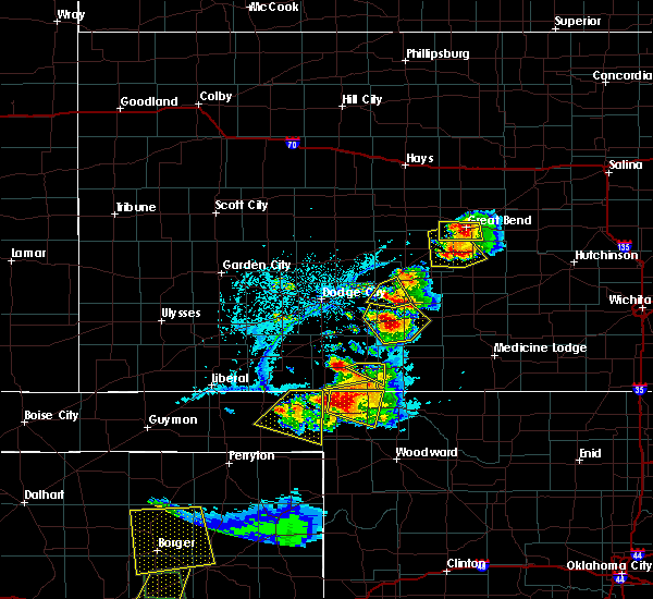 The severe thunderstorm warning for west central comanche and east central clark counties will expire at 715 pm cdt, the storm which prompted the warning has weakened below severe limits, and no longer poses an immediate threat to life or property. therefore, the warning will be allowed to expire. however small hail is still possible with this thunderstorm. The severe thunderstorm warning for west central comanche and east central clark counties will expire at 715 pm cdt, the storm which prompted the warning has weakened below severe limits, and no longer poses an immediate threat to life or property. therefore, the warning will be allowed to expire. however small hail is still possible with this thunderstorm.
|
| 6/12/2018 6:55 PM CDT |
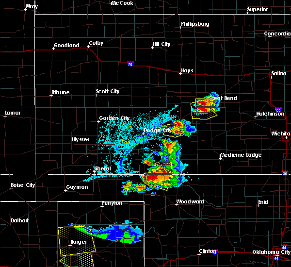 At 655 pm cdt, a severe thunderstorm was located 9 miles northwest of protection, moving east at 5 mph (radar indicated). Hazards include 60 mph wind gusts and quarter size hail. Hail damage to vehicles is expected. expect wind damage to roofs, siding, and trees. Locations impacted include, ashland, protection and sitka. At 655 pm cdt, a severe thunderstorm was located 9 miles northwest of protection, moving east at 5 mph (radar indicated). Hazards include 60 mph wind gusts and quarter size hail. Hail damage to vehicles is expected. expect wind damage to roofs, siding, and trees. Locations impacted include, ashland, protection and sitka.
|
| 6/12/2018 6:22 PM CDT |
 At 621 pm cdt, a severe thunderstorm was located 8 miles north of sitka, moving east at 5 mph (radar indicated). Hazards include 60 mph wind gusts and quarter size hail. Hail damage to vehicles is expected. Expect wind damage to roofs, siding, and trees. At 621 pm cdt, a severe thunderstorm was located 8 miles north of sitka, moving east at 5 mph (radar indicated). Hazards include 60 mph wind gusts and quarter size hail. Hail damage to vehicles is expected. Expect wind damage to roofs, siding, and trees.
|
| 6/7/2018 2:54 AM CDT |
 At 254 am cdt, severe thunderstorms were located along a line extending from 6 miles northwest of greensburg to 9 miles southwest of buttermilk, moving east at 15 mph (radar indicated). Hazards include 70 mph wind gusts and quarter size hail. Hail damage to vehicles is expected. expect considerable tree damage. wind damage is also likely to mobile homes, roofs, and outbuildings. Locations impacted include, ashland, coldwater, bucklin, protection, mullinville, ford, sitka, clark state lake, kingsdown, lake coldwater and buttermilk. At 254 am cdt, severe thunderstorms were located along a line extending from 6 miles northwest of greensburg to 9 miles southwest of buttermilk, moving east at 15 mph (radar indicated). Hazards include 70 mph wind gusts and quarter size hail. Hail damage to vehicles is expected. expect considerable tree damage. wind damage is also likely to mobile homes, roofs, and outbuildings. Locations impacted include, ashland, coldwater, bucklin, protection, mullinville, ford, sitka, clark state lake, kingsdown, lake coldwater and buttermilk.
|
| 6/7/2018 2:26 AM CDT |
 At 225 am cdt, severe thunderstorms were located along a line extending from 6 miles north of mullinville to 11 miles south of sitka, moving east at 15 mph (radar indicated). Hazards include 70 mph wind gusts and quarter size hail. Hail damage to vehicles is expected. expect considerable tree damage. Wind damage is also likely to mobile homes, roofs, and outbuildings. At 225 am cdt, severe thunderstorms were located along a line extending from 6 miles north of mullinville to 11 miles south of sitka, moving east at 15 mph (radar indicated). Hazards include 70 mph wind gusts and quarter size hail. Hail damage to vehicles is expected. expect considerable tree damage. Wind damage is also likely to mobile homes, roofs, and outbuildings.
|
| 5/29/2018 7:21 PM CDT |
 At 720 pm cdt, severe thunderstorms were located along a line extending from 3 miles southwest of byers to 8 miles southwest of aetna, moving northeast at 30 mph (radar indicated). Hazards include ping pong ball size hail and 60 mph wind gusts. People and animals outdoors will be injured. expect hail damage to roofs, siding, windows, and vehicles. expect wind damage to roofs, siding, and trees. locations impacted include, pratt, coldwater, haviland, protection, iuka, preston, cullison, coats, sun city, wilmore, wellsford, croft, lake coldwater, belvidere and buttermilk. A tornado watch remains in effect until 1000 pm cdt for south central and southwestern kansas. At 720 pm cdt, severe thunderstorms were located along a line extending from 3 miles southwest of byers to 8 miles southwest of aetna, moving northeast at 30 mph (radar indicated). Hazards include ping pong ball size hail and 60 mph wind gusts. People and animals outdoors will be injured. expect hail damage to roofs, siding, windows, and vehicles. expect wind damage to roofs, siding, and trees. locations impacted include, pratt, coldwater, haviland, protection, iuka, preston, cullison, coats, sun city, wilmore, wellsford, croft, lake coldwater, belvidere and buttermilk. A tornado watch remains in effect until 1000 pm cdt for south central and southwestern kansas.
|
| 5/29/2018 7:20 PM CDT | Baseball sized hail reported 10.5 miles N of Protection, KS, baseball size hail. |
| 5/29/2018 7:18 PM CDT |
 At 718 pm cdt, a severe thunderstorm was located 9 miles south of protection, moving northeast at 30 mph (radar indicated). Hazards include two inch hail and 60 mph wind gusts. People and animals outdoors will be injured. expect hail damage to roofs, siding, windows, and vehicles. Expect wind damage to roofs, siding, and trees. At 718 pm cdt, a severe thunderstorm was located 9 miles south of protection, moving northeast at 30 mph (radar indicated). Hazards include two inch hail and 60 mph wind gusts. People and animals outdoors will be injured. expect hail damage to roofs, siding, windows, and vehicles. Expect wind damage to roofs, siding, and trees.
|
| 5/29/2018 6:43 PM CDT |
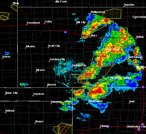 At 643 pm cdt, a severe thunderstorm was located 9 miles east of clark state lake, moving southeast at 15 mph (radar indicated). Hazards include two inch hail and 60 mph wind gusts. People and animals outdoors will be injured. expect hail damage to roofs, siding, windows, and vehicles. expect wind damage to roofs, siding, and trees. locations impacted include, protection. A tornado watch remains in effect until 1000 pm cdt for south central and southwestern kansas. At 643 pm cdt, a severe thunderstorm was located 9 miles east of clark state lake, moving southeast at 15 mph (radar indicated). Hazards include two inch hail and 60 mph wind gusts. People and animals outdoors will be injured. expect hail damage to roofs, siding, windows, and vehicles. expect wind damage to roofs, siding, and trees. locations impacted include, protection. A tornado watch remains in effect until 1000 pm cdt for south central and southwestern kansas.
|
| 5/29/2018 6:42 PM CDT |
 At 641 pm cdt, a severe thunderstorm was located 7 miles south of greensburg, moving east at 30 mph (radar indicated). Hazards include two inch hail and 60 mph wind gusts. People and animals outdoors will be injured. expect hail damage to roofs, siding, windows, and vehicles. Expect wind damage to roofs, siding, and trees. At 641 pm cdt, a severe thunderstorm was located 7 miles south of greensburg, moving east at 30 mph (radar indicated). Hazards include two inch hail and 60 mph wind gusts. People and animals outdoors will be injured. expect hail damage to roofs, siding, windows, and vehicles. Expect wind damage to roofs, siding, and trees.
|
| 5/29/2018 6:05 PM CDT |
 At 604 pm cdt, a severe thunderstorm was located 4 miles north of clark state lake, moving southeast at 15 mph (radar indicated). Hazards include golf ball size hail and 60 mph wind gusts. People and animals outdoors will be injured. expect hail damage to roofs, siding, windows, and vehicles. Expect wind damage to roofs, siding, and trees. At 604 pm cdt, a severe thunderstorm was located 4 miles north of clark state lake, moving southeast at 15 mph (radar indicated). Hazards include golf ball size hail and 60 mph wind gusts. People and animals outdoors will be injured. expect hail damage to roofs, siding, windows, and vehicles. Expect wind damage to roofs, siding, and trees.
|
| 5/29/2018 5:44 PM CDT |
 At 544 pm cdt, a severe thunderstorm was located 3 miles southeast of buttermilk, moving northeast at 35 mph (radar indicated). Hazards include two inch hail and 60 mph wind gusts. People and animals outdoors will be injured. expect hail damage to roofs, siding, windows, and vehicles. Expect wind damage to roofs, siding, and trees. At 544 pm cdt, a severe thunderstorm was located 3 miles southeast of buttermilk, moving northeast at 35 mph (radar indicated). Hazards include two inch hail and 60 mph wind gusts. People and animals outdoors will be injured. expect hail damage to roofs, siding, windows, and vehicles. Expect wind damage to roofs, siding, and trees.
|
| 5/29/2018 5:26 PM CDT |
 At 525 pm cdt, a severe thunderstorm was located 4 miles north of buttermilk, moving northeast at 25 mph (radar indicated). Hazards include two inch hail and 60 mph wind gusts. People and animals outdoors will be injured. expect hail damage to roofs, siding, windows, and vehicles. expect wind damage to roofs, siding, and trees. locations impacted include, coldwater, protection, wilmore, lake coldwater and buttermilk. A tornado watch remains in effect until 1000 pm cdt for south central and southwestern kansas. At 525 pm cdt, a severe thunderstorm was located 4 miles north of buttermilk, moving northeast at 25 mph (radar indicated). Hazards include two inch hail and 60 mph wind gusts. People and animals outdoors will be injured. expect hail damage to roofs, siding, windows, and vehicles. expect wind damage to roofs, siding, and trees. locations impacted include, coldwater, protection, wilmore, lake coldwater and buttermilk. A tornado watch remains in effect until 1000 pm cdt for south central and southwestern kansas.
|
| 5/29/2018 4:54 PM CDT |
 At 453 pm cdt, a severe thunderstorm was located 9 miles southwest of buttermilk, moving northeast at 25 mph (radar indicated). Hazards include two inch hail and 60 mph wind gusts. People and animals outdoors will be injured. expect hail damage to roofs, siding, windows, and vehicles. Expect wind damage to roofs, siding, and trees. At 453 pm cdt, a severe thunderstorm was located 9 miles southwest of buttermilk, moving northeast at 25 mph (radar indicated). Hazards include two inch hail and 60 mph wind gusts. People and animals outdoors will be injured. expect hail damage to roofs, siding, windows, and vehicles. Expect wind damage to roofs, siding, and trees.
|
| 5/29/2018 4:33 PM CDT |
 At 432 pm cdt, a severe thunderstorm was located 6 miles south of protection, moving northeast at 25 mph (radar indicated). Hazards include two inch hail and 60 mph wind gusts. People and animals outdoors will be injured. expect hail damage to roofs, siding, windows, and vehicles. expect wind damage to roofs, siding, and trees. locations impacted include, coldwater, protection, sitka, lake coldwater and buttermilk. A tornado watch remains in effect until 900 pm cdt for south central and southwestern kansas. At 432 pm cdt, a severe thunderstorm was located 6 miles south of protection, moving northeast at 25 mph (radar indicated). Hazards include two inch hail and 60 mph wind gusts. People and animals outdoors will be injured. expect hail damage to roofs, siding, windows, and vehicles. expect wind damage to roofs, siding, and trees. locations impacted include, coldwater, protection, sitka, lake coldwater and buttermilk. A tornado watch remains in effect until 900 pm cdt for south central and southwestern kansas.
|
| 5/29/2018 4:07 PM CDT |
 At 406 pm cdt, a severe thunderstorm was located 9 miles south of sitka, moving northeast at 20 mph (radar indicated). Hazards include two inch hail and 60 mph wind gusts. People and animals outdoors will be injured. expect hail damage to roofs, siding, windows, and vehicles. Expect wind damage to roofs, siding, and trees. At 406 pm cdt, a severe thunderstorm was located 9 miles south of sitka, moving northeast at 20 mph (radar indicated). Hazards include two inch hail and 60 mph wind gusts. People and animals outdoors will be injured. expect hail damage to roofs, siding, windows, and vehicles. Expect wind damage to roofs, siding, and trees.
|
| 5/25/2018 12:50 AM CDT |
 At 1250 am cdt, a severe thunderstorm was located very near sitka, moving southeast at 25 mph (radar indicated). Hazards include 60 mph wind gusts and quarter size hail. Hail damage to vehicles is expected. expect wind damage to roofs, siding, and trees. Locations impacted include, protection and sitka. At 1250 am cdt, a severe thunderstorm was located very near sitka, moving southeast at 25 mph (radar indicated). Hazards include 60 mph wind gusts and quarter size hail. Hail damage to vehicles is expected. expect wind damage to roofs, siding, and trees. Locations impacted include, protection and sitka.
|
| 5/25/2018 12:28 AM CDT |
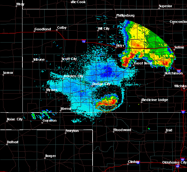 At 1227 am cdt, a severe thunderstorm was located near ashland, moving southeast at 25 mph (radar indicated). Hazards include 60 mph wind gusts and quarter size hail. Hail damage to vehicles is expected. Expect wind damage to roofs, siding, and trees. At 1227 am cdt, a severe thunderstorm was located near ashland, moving southeast at 25 mph (radar indicated). Hazards include 60 mph wind gusts and quarter size hail. Hail damage to vehicles is expected. Expect wind damage to roofs, siding, and trees.
|
| 5/18/2018 10:59 PM CDT |
 At 1059 pm cdt, a severe thunderstorm was located 4 miles northeast of protection, moving northeast at 40 mph (radar indicated). Hazards include 60 mph wind gusts and half dollar size hail. Hail damage to vehicles is expected. expect wind damage to roofs, siding, and trees. Locations impacted include, coldwater, greensburg, haviland, protection, mullinville, wilmore, lake coldwater and belvidere. At 1059 pm cdt, a severe thunderstorm was located 4 miles northeast of protection, moving northeast at 40 mph (radar indicated). Hazards include 60 mph wind gusts and half dollar size hail. Hail damage to vehicles is expected. expect wind damage to roofs, siding, and trees. Locations impacted include, coldwater, greensburg, haviland, protection, mullinville, wilmore, lake coldwater and belvidere.
|
| 5/18/2018 10:24 PM CDT |
 The national weather service in dodge city has issued a * severe thunderstorm warning for. kiowa county in south central kansas. northern comanche county in south central kansas. eastern clark county in southwestern kansas. Until 1130 pm cdt. The national weather service in dodge city has issued a * severe thunderstorm warning for. kiowa county in south central kansas. northern comanche county in south central kansas. eastern clark county in southwestern kansas. Until 1130 pm cdt.
|
| 5/18/2018 8:00 PM CDT |
 The national weather service in dodge city has issued a * severe thunderstorm warning for. kiowa county in south central kansas. barber county in south central kansas. comanche county in south central kansas. Southern stafford county in south central kansas. The national weather service in dodge city has issued a * severe thunderstorm warning for. kiowa county in south central kansas. barber county in south central kansas. comanche county in south central kansas. Southern stafford county in south central kansas.
|
| 5/18/2018 7:52 PM CDT |
 The severe thunderstorm warning for southeastern ford, western kiowa, western comanche and eastern clark counties will expire at 800 pm cdt, the storms which prompted the warning have weakened below severe limits, and no longer poses an immediate threat to life or property. therefore the warning will be allowed to expire. however small hail, gusty winds and heavy rain are still possible with this thunderstorm. a severe thunderstorm watch remains in effect until 1100 pm cdt for south central and southwestern kansas. The severe thunderstorm warning for southeastern ford, western kiowa, western comanche and eastern clark counties will expire at 800 pm cdt, the storms which prompted the warning have weakened below severe limits, and no longer poses an immediate threat to life or property. therefore the warning will be allowed to expire. however small hail, gusty winds and heavy rain are still possible with this thunderstorm. a severe thunderstorm watch remains in effect until 1100 pm cdt for south central and southwestern kansas.
|
| 5/18/2018 7:41 PM CDT |
 At 701 pm cdt, a severe thunderstorm was located 7 miles south of sitka, moving north at 25 mph (radar indicated). Hazards include golf ball size hail and 60 mph wind gusts. People and animals outdoors will be injured. expect hail damage to roofs, siding, windows, and vehicles. Expect wind damage to roofs, siding, and trees. At 701 pm cdt, a severe thunderstorm was located 7 miles south of sitka, moving north at 25 mph (radar indicated). Hazards include golf ball size hail and 60 mph wind gusts. People and animals outdoors will be injured. expect hail damage to roofs, siding, windows, and vehicles. Expect wind damage to roofs, siding, and trees.
|
| 5/18/2018 7:01 PM CDT |
 At 701 pm cdt, a severe thunderstorm was located 7 miles south of sitka, moving north at 25 mph (radar indicated). Hazards include golf ball size hail and 60 mph wind gusts. People and animals outdoors will be injured. expect hail damage to roofs, siding, windows, and vehicles. Expect wind damage to roofs, siding, and trees. At 701 pm cdt, a severe thunderstorm was located 7 miles south of sitka, moving north at 25 mph (radar indicated). Hazards include golf ball size hail and 60 mph wind gusts. People and animals outdoors will be injured. expect hail damage to roofs, siding, windows, and vehicles. Expect wind damage to roofs, siding, and trees.
|
| 5/13/2018 8:18 PM CDT | Quarter sized hail reported 6.1 miles S of Protection, KS, quarter size. |
| 5/13/2018 8:16 PM CDT |
 At 816 pm cdt, a severe thunderstorm was located near lake coldwater, moving east at 35 mph (radar indicated). Hazards include 70 mph wind gusts and quarter size hail. Hail damage to vehicles is expected. expect considerable tree damage. wind damage is also likely to mobile homes, roofs, and outbuildings. Locations impacted include, coldwater, protection, wilmore, lake coldwater and buttermilk. At 816 pm cdt, a severe thunderstorm was located near lake coldwater, moving east at 35 mph (radar indicated). Hazards include 70 mph wind gusts and quarter size hail. Hail damage to vehicles is expected. expect considerable tree damage. wind damage is also likely to mobile homes, roofs, and outbuildings. Locations impacted include, coldwater, protection, wilmore, lake coldwater and buttermilk.
|
| 5/13/2018 8:15 PM CDT | Quarter sized hail reported 7.3 miles SSE of Protection, KS, quarter size. |
| 5/13/2018 8:05 PM CDT |
 At 804 pm cdt, a severe thunderstorm was located very near protection, moving east at 35 mph (radar indicated). Hazards include 70 mph wind gusts and quarter size hail. Hail damage to vehicles is expected. expect considerable tree damage. Wind damage is also likely to mobile homes, roofs, and outbuildings. At 804 pm cdt, a severe thunderstorm was located very near protection, moving east at 35 mph (radar indicated). Hazards include 70 mph wind gusts and quarter size hail. Hail damage to vehicles is expected. expect considerable tree damage. Wind damage is also likely to mobile homes, roofs, and outbuildings.
|
| 5/13/2018 5:25 PM CDT |
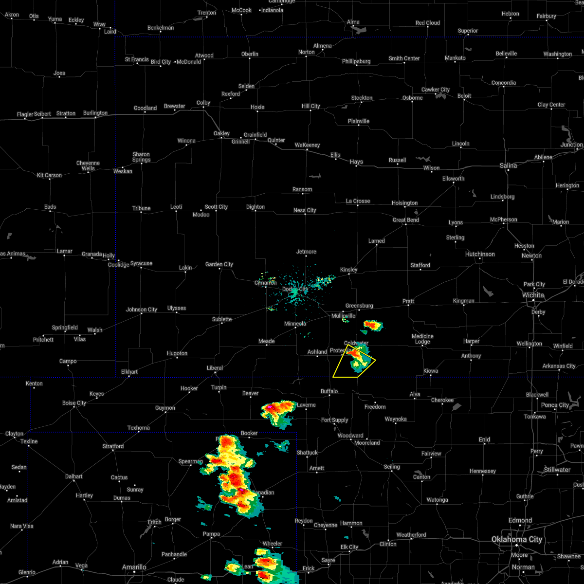 The severe thunderstorm warning for southern comanche and southeastern clark counties will expire at 530 pm cdt, the storm which prompted the warning has weakened below severe limits, and no longer poses an immediate threat to life or property. therefore the warning will be allowed to expire. a severe thunderstorm watch remains in effect until 1100 pm cdt for south central and southwestern kansas. The severe thunderstorm warning for southern comanche and southeastern clark counties will expire at 530 pm cdt, the storm which prompted the warning has weakened below severe limits, and no longer poses an immediate threat to life or property. therefore the warning will be allowed to expire. a severe thunderstorm watch remains in effect until 1100 pm cdt for south central and southwestern kansas.
|
| 5/13/2018 5:17 PM CDT |
 At 517 pm cdt, a severe thunderstorm was located 4 miles southeast of protection, moving northeast at 25 mph (radar indicated). Hazards include two inch hail and 70 mph wind gusts. People and animals outdoors will be injured. expect hail damage to roofs, siding, windows, and vehicles. expect considerable tree damage. Wind damage is also likely to mobile homes, roofs, and outbuildings. At 517 pm cdt, a severe thunderstorm was located 4 miles southeast of protection, moving northeast at 25 mph (radar indicated). Hazards include two inch hail and 70 mph wind gusts. People and animals outdoors will be injured. expect hail damage to roofs, siding, windows, and vehicles. expect considerable tree damage. Wind damage is also likely to mobile homes, roofs, and outbuildings.
|
| 5/13/2018 5:01 PM CDT |
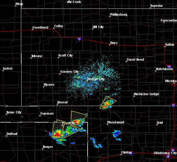 At 459 pm cdt, a severe thunderstorm was located near buttermilk, moving northeast at 25 mph. a second severe thunderstorm is crossing into kansas from oklahoma, and entering the warning (radar indicated). Hazards include two inch hail and 70 mph wind gusts. People and animals outdoors will be injured. expect hail damage to roofs, siding, windows, and vehicles. expect considerable tree damage. wind damage is also likely to mobile homes, roofs, and outbuildings. Locations impacted include, coldwater, protection, lake coldwater and buttermilk. At 459 pm cdt, a severe thunderstorm was located near buttermilk, moving northeast at 25 mph. a second severe thunderstorm is crossing into kansas from oklahoma, and entering the warning (radar indicated). Hazards include two inch hail and 70 mph wind gusts. People and animals outdoors will be injured. expect hail damage to roofs, siding, windows, and vehicles. expect considerable tree damage. wind damage is also likely to mobile homes, roofs, and outbuildings. Locations impacted include, coldwater, protection, lake coldwater and buttermilk.
|
| 5/13/2018 4:38 PM CDT |
 At 437 pm cdt, a severe thunderstorm was located 10 miles southwest of buttermilk, moving northeast at 25 mph (radar indicated). Hazards include two inch hail and 70 mph wind gusts. People and animals outdoors will be injured. expect hail damage to roofs, siding, windows, and vehicles. expect considerable tree damage. Wind damage is also likely to mobile homes, roofs, and outbuildings. At 437 pm cdt, a severe thunderstorm was located 10 miles southwest of buttermilk, moving northeast at 25 mph (radar indicated). Hazards include two inch hail and 70 mph wind gusts. People and animals outdoors will be injured. expect hail damage to roofs, siding, windows, and vehicles. expect considerable tree damage. Wind damage is also likely to mobile homes, roofs, and outbuildings.
|
| 5/1/2018 6:57 PM CDT |
 The severe thunderstorm warning for southeastern kiowa and western comanche counties will expire at 700 pm cdt, the storm which prompted the warning has weakened below severe limits, and no longer poses an immediate threat to life or property. therefore the warning will be allowed to expire. a tornado watch remains in effect until 1000 pm cdt for south central kansas. The severe thunderstorm warning for southeastern kiowa and western comanche counties will expire at 700 pm cdt, the storm which prompted the warning has weakened below severe limits, and no longer poses an immediate threat to life or property. therefore the warning will be allowed to expire. a tornado watch remains in effect until 1000 pm cdt for south central kansas.
|
| 5/1/2018 6:34 PM CDT |
 At 634 pm cdt, a severe thunderstorm was located 5 miles northwest of buttermilk, moving northeast at 45 mph (radar indicated). Hazards include tennis ball size hail and 60 mph wind gusts. People and animals outdoors will be injured. expect hail damage to roofs, siding, windows, and vehicles. expect wind damage to roofs, siding, and trees. locations impacted include, coldwater, protection, wilmore, lake coldwater and buttermilk. A tornado watch remains in effect until 1000 pm cdt for south central kansas. At 634 pm cdt, a severe thunderstorm was located 5 miles northwest of buttermilk, moving northeast at 45 mph (radar indicated). Hazards include tennis ball size hail and 60 mph wind gusts. People and animals outdoors will be injured. expect hail damage to roofs, siding, windows, and vehicles. expect wind damage to roofs, siding, and trees. locations impacted include, coldwater, protection, wilmore, lake coldwater and buttermilk. A tornado watch remains in effect until 1000 pm cdt for south central kansas.
|
| 5/1/2018 6:11 PM CDT |
 At 610 pm cdt, a severe thunderstorm was located 11 miles south of sitka, moving northeast at 50 mph (radar indicated). Hazards include tennis ball size hail and 60 mph wind gusts. People and animals outdoors will be injured. expect hail damage to roofs, siding, windows, and vehicles. Expect wind damage to roofs, siding, and trees. At 610 pm cdt, a severe thunderstorm was located 11 miles south of sitka, moving northeast at 50 mph (radar indicated). Hazards include tennis ball size hail and 60 mph wind gusts. People and animals outdoors will be injured. expect hail damage to roofs, siding, windows, and vehicles. Expect wind damage to roofs, siding, and trees.
|
| 7/7/2017 6:14 PM CDT |
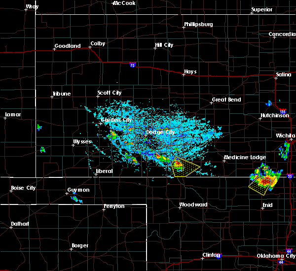 At 614 pm cdt, a severe thunderstorm was located 3 miles east of protection, moving southeast at 20 mph (radar indicated). Hazards include 60 mph wind gusts and half dollar size hail. Hail damage to vehicles is expected. Expect wind damage to roofs, siding, and trees. At 614 pm cdt, a severe thunderstorm was located 3 miles east of protection, moving southeast at 20 mph (radar indicated). Hazards include 60 mph wind gusts and half dollar size hail. Hail damage to vehicles is expected. Expect wind damage to roofs, siding, and trees.
|
| 6/29/2017 7:12 PM CDT |
 At 1211 am cdt, a severe thunderstorm was located 4 miles west of aetna, or 20 miles southeast of coldwater, moving east at 60 mph. this is a very dangerous storm (radar indicated). Hazards include 80 mph wind gusts and two inch hail. Flying debris will be dangerous to those caught without shelter. mobile homes will be heavily damaged. expect considerable damage to roofs, windows, and vehicles. Extensive tree damage and power outages are likely. At 1211 am cdt, a severe thunderstorm was located 4 miles west of aetna, or 20 miles southeast of coldwater, moving east at 60 mph. this is a very dangerous storm (radar indicated). Hazards include 80 mph wind gusts and two inch hail. Flying debris will be dangerous to those caught without shelter. mobile homes will be heavily damaged. expect considerable damage to roofs, windows, and vehicles. Extensive tree damage and power outages are likely.
|
| 6/29/2017 7:09 PM CDT |
 At 1208 am cdt, severe thunderstorms were located along a line extending from 4 miles southwest of buttermilk to 5 miles southwest of sharon, moving east at 45 mph. these are very dangerous storms (radar indicated). Hazards include baseball size hail and 70 mph wind gusts. People and animals outdoors will be severely injured. expect shattered windows, extensive damage to roofs, siding, and vehicles. Locations impacted include, medicine lodge, kiowa, coldwater, protection, hardtner, lake city, wilmore, deerhead, aetna, buttermilk and lake coldwater. At 1208 am cdt, severe thunderstorms were located along a line extending from 4 miles southwest of buttermilk to 5 miles southwest of sharon, moving east at 45 mph. these are very dangerous storms (radar indicated). Hazards include baseball size hail and 70 mph wind gusts. People and animals outdoors will be severely injured. expect shattered windows, extensive damage to roofs, siding, and vehicles. Locations impacted include, medicine lodge, kiowa, coldwater, protection, hardtner, lake city, wilmore, deerhead, aetna, buttermilk and lake coldwater.
|
| 6/29/2017 6:47 PM CDT |
 At 1147 pm cdt, severe thunderstorms were located along a line extending from 6 miles south of ashland to 9 miles southwest of medicine lodge, moving east at 35 mph. these are very dangerous storms (radar indicated). Hazards include baseball size hail and 70 mph wind gusts. People and animals outdoors will be severely injured. expect shattered windows, extensive damage to roofs, siding, and vehicles. Locations impacted include, medicine lodge, kiowa, ashland, coldwater, protection, hardtner, englewood, sitka, lake city, wilmore, deerhead, acres, aetna, buttermilk, lexington, big basin preserve and lake coldwater. At 1147 pm cdt, severe thunderstorms were located along a line extending from 6 miles south of ashland to 9 miles southwest of medicine lodge, moving east at 35 mph. these are very dangerous storms (radar indicated). Hazards include baseball size hail and 70 mph wind gusts. People and animals outdoors will be severely injured. expect shattered windows, extensive damage to roofs, siding, and vehicles. Locations impacted include, medicine lodge, kiowa, ashland, coldwater, protection, hardtner, englewood, sitka, lake city, wilmore, deerhead, acres, aetna, buttermilk, lexington, big basin preserve and lake coldwater.
|
| 6/29/2017 6:29 PM CDT |
 At 1129 pm cdt, severe thunderstorms were located along a line extending from 3 miles northwest of acres to 5 miles southeast of deerhead, moving east at 35 mph (radar indicated). Hazards include two inch hail and 60 mph wind gusts. People and animals outdoors will be injured. expect hail damage to roofs, siding, windows, and vehicles. Expect wind damage to roofs, siding, and trees. At 1129 pm cdt, severe thunderstorms were located along a line extending from 3 miles northwest of acres to 5 miles southeast of deerhead, moving east at 35 mph (radar indicated). Hazards include two inch hail and 60 mph wind gusts. People and animals outdoors will be injured. expect hail damage to roofs, siding, windows, and vehicles. Expect wind damage to roofs, siding, and trees.
|
| 6/29/2017 6:19 PM CDT |
 At 1119 pm cdt, a severe thunderstorm was located 8 miles southeast of wilmore, or 10 miles east of coldwater, moving east at 15 mph (radar indicated). Hazards include two inch hail and 60 mph wind gusts. People and animals outdoors will be injured. expect hail damage to roofs, siding, windows, and vehicles. Expect wind damage to roofs, siding, and trees. At 1119 pm cdt, a severe thunderstorm was located 8 miles southeast of wilmore, or 10 miles east of coldwater, moving east at 15 mph (radar indicated). Hazards include two inch hail and 60 mph wind gusts. People and animals outdoors will be injured. expect hail damage to roofs, siding, windows, and vehicles. Expect wind damage to roofs, siding, and trees.
|
| 6/18/2017 12:02 AM CDT |
 At 1202 am cdt, a severe thunderstorm was located 3 miles north of protection, moving southeast at 25 mph (radar indicated). Hazards include 60 mph wind gusts and quarter size hail. Hail damage to vehicles is expected. expect wind damage to roofs, siding, and trees. Locations impacted include, coldwater, protection, wilmore and lake coldwater. At 1202 am cdt, a severe thunderstorm was located 3 miles north of protection, moving southeast at 25 mph (radar indicated). Hazards include 60 mph wind gusts and quarter size hail. Hail damage to vehicles is expected. expect wind damage to roofs, siding, and trees. Locations impacted include, coldwater, protection, wilmore and lake coldwater.
|
| 6/17/2017 11:53 PM CDT |
 At 1153 pm cdt, a severe thunderstorm was located 4 miles north of protection, moving east at 30 mph (radar indicated). Hazards include ping pong ball size hail and 60 mph wind gusts. People and animals outdoors will be injured. expect hail damage to roofs, siding, windows, and vehicles. expect wind damage to roofs, siding, and trees. Locations impacted include, coldwater, protection, wilmore, lexington and lake coldwater. At 1153 pm cdt, a severe thunderstorm was located 4 miles north of protection, moving east at 30 mph (radar indicated). Hazards include ping pong ball size hail and 60 mph wind gusts. People and animals outdoors will be injured. expect hail damage to roofs, siding, windows, and vehicles. expect wind damage to roofs, siding, and trees. Locations impacted include, coldwater, protection, wilmore, lexington and lake coldwater.
|
| 6/17/2017 11:49 PM CDT |
 At 1149 pm cdt, a severe thunderstorm was located 5 miles northwest of protection, moving east at 30 mph (radar indicated). Hazards include quarter size hail. damage to vehicles is expected At 1149 pm cdt, a severe thunderstorm was located 5 miles northwest of protection, moving east at 30 mph (radar indicated). Hazards include quarter size hail. damage to vehicles is expected
|
| 6/17/2017 11:09 PM CDT |
 At 1109 pm cdt, a severe thunderstorm was located near protection, moving southeast at 15 mph (radar indicated). Hazards include quarter size hail. Damage to vehicles is expected. Locations impacted include, protection, sitka and buttermilk. At 1109 pm cdt, a severe thunderstorm was located near protection, moving southeast at 15 mph (radar indicated). Hazards include quarter size hail. Damage to vehicles is expected. Locations impacted include, protection, sitka and buttermilk.
|
| 6/17/2017 11:01 PM CDT |
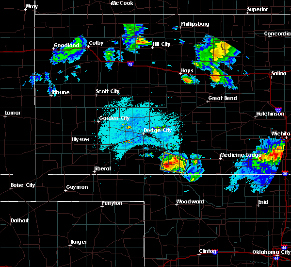 At 1101 pm cdt, a severe thunderstorm was located near protection, moving southeast at 25 mph (radar indicated). Hazards include 60 mph wind gusts and half dollar size hail. Hail damage to vehicles is expected. expect wind damage to roofs, siding, and trees. Locations impacted include, coldwater, protection, sitka, buttermilk, lexington and lake coldwater. At 1101 pm cdt, a severe thunderstorm was located near protection, moving southeast at 25 mph (radar indicated). Hazards include 60 mph wind gusts and half dollar size hail. Hail damage to vehicles is expected. expect wind damage to roofs, siding, and trees. Locations impacted include, coldwater, protection, sitka, buttermilk, lexington and lake coldwater.
|
| 6/17/2017 10:54 PM CDT |
 At 1054 pm cdt, a severe thunderstorm was located 5 miles north of protection, moving east at 25 mph (radar indicated). Hazards include 60 mph wind gusts and half dollar size hail. Hail damage to vehicles is expected. expect wind damage to roofs, siding, and trees. Locations impacted include, coldwater, protection, sitka, wilmore, buttermilk, lexington and lake coldwater. At 1054 pm cdt, a severe thunderstorm was located 5 miles north of protection, moving east at 25 mph (radar indicated). Hazards include 60 mph wind gusts and half dollar size hail. Hail damage to vehicles is expected. expect wind damage to roofs, siding, and trees. Locations impacted include, coldwater, protection, sitka, wilmore, buttermilk, lexington and lake coldwater.
|
| 6/17/2017 10:46 PM CDT |
 At 1046 pm cdt, a severe thunderstorm was located 6 miles north of protection, moving east at 25 mph (radar indicated). Hazards include ping pong ball size hail and 60 mph wind gusts. People and animals outdoors will be injured. expect hail damage to roofs, siding, windows, and vehicles. Expect wind damage to roofs, siding, and trees. At 1046 pm cdt, a severe thunderstorm was located 6 miles north of protection, moving east at 25 mph (radar indicated). Hazards include ping pong ball size hail and 60 mph wind gusts. People and animals outdoors will be injured. expect hail damage to roofs, siding, windows, and vehicles. Expect wind damage to roofs, siding, and trees.
|
| 6/17/2017 10:38 PM CDT |
 At 1037 pm cdt, radar indicated a weakening thunderstorm near buttermilk, and a severe thunderstorm 5 miles west of coldwater. both storms were moving southeast at 30 mph (radar indicated). Hazards include ping pong ball size hail and 60 mph wind gusts. People and animals outdoors will be injured. expect hail damage to roofs, siding, windows, and vehicles. expect wind damage to roofs, siding, and trees. Locations impacted include, coldwater, protection, wilmore, aetna, buttermilk and lake coldwater. At 1037 pm cdt, radar indicated a weakening thunderstorm near buttermilk, and a severe thunderstorm 5 miles west of coldwater. both storms were moving southeast at 30 mph (radar indicated). Hazards include ping pong ball size hail and 60 mph wind gusts. People and animals outdoors will be injured. expect hail damage to roofs, siding, windows, and vehicles. expect wind damage to roofs, siding, and trees. Locations impacted include, coldwater, protection, wilmore, aetna, buttermilk and lake coldwater.
|
| 6/17/2017 10:01 PM CDT |
 At 1000 pm cdt, a severe thunderstorm was located near coldwater, moving southeast at 25 mph (radar indicated). Hazards include two inch hail and 60 mph wind gusts. People and animals outdoors will be injured. expect hail damage to roofs, siding, windows, and vehicles. Expect wind damage to roofs, siding, and trees. At 1000 pm cdt, a severe thunderstorm was located near coldwater, moving southeast at 25 mph (radar indicated). Hazards include two inch hail and 60 mph wind gusts. People and animals outdoors will be injured. expect hail damage to roofs, siding, windows, and vehicles. Expect wind damage to roofs, siding, and trees.
|
| 6/17/2017 9:53 PM CDT |
 At 951 pm cdt, a severe thunderstorm was located 8 miles southwest of protection, moving southeast at 35 mph. this is a very dangerous storm (radar indicated). Hazards include three inch hail and 70 mph wind gusts. damaging hail is likely. a tornado remains possible, south of protection. People and animals outdoors will be severely injured. expect shattered windows, extensive damage to roofs, siding, and vehicles. Locations impacted include, protection, sitka and buttermilk. At 951 pm cdt, a severe thunderstorm was located 8 miles southwest of protection, moving southeast at 35 mph. this is a very dangerous storm (radar indicated). Hazards include three inch hail and 70 mph wind gusts. damaging hail is likely. a tornado remains possible, south of protection. People and animals outdoors will be severely injured. expect shattered windows, extensive damage to roofs, siding, and vehicles. Locations impacted include, protection, sitka and buttermilk.
|
| 6/17/2017 9:41 PM CDT |
 At 940 pm cdt, a severe thunderstorm was located near sitka, or 8 miles southwest of protection, moving southeast at 35 mph. this is a very dangerous storm (radar indicated). Hazards include three inch hail and 70 mph wind gusts. damaging hail is likely. a tornado is possible. People and animals outdoors will be severely injured. Expect shattered windows, extensive damage to roofs, siding, and vehicles. At 940 pm cdt, a severe thunderstorm was located near sitka, or 8 miles southwest of protection, moving southeast at 35 mph. this is a very dangerous storm (radar indicated). Hazards include three inch hail and 70 mph wind gusts. damaging hail is likely. a tornado is possible. People and animals outdoors will be severely injured. Expect shattered windows, extensive damage to roofs, siding, and vehicles.
|
| 6/17/2017 9:37 PM CDT |
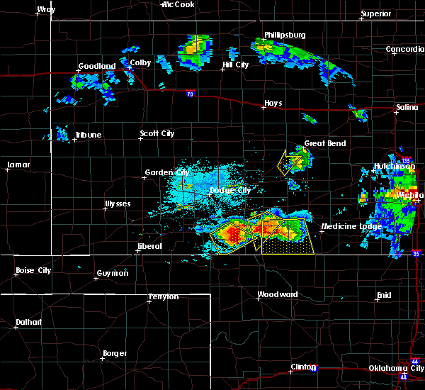 At 936 pm cdt, a severe thunderstorm was located near sitka, or 5 miles east of ashland, moving southeast at 30 mph. this is a very dangerous storm (radar indicated). Hazards include baseball size hail and 70 mph wind gusts. People and animals outdoors will be severely injured. expect shattered windows, extensive damage to roofs, siding, and vehicles. Locations impacted include, ashland, protection, sitka, acres, clark state lake, lexington and big basin preserve. At 936 pm cdt, a severe thunderstorm was located near sitka, or 5 miles east of ashland, moving southeast at 30 mph. this is a very dangerous storm (radar indicated). Hazards include baseball size hail and 70 mph wind gusts. People and animals outdoors will be severely injured. expect shattered windows, extensive damage to roofs, siding, and vehicles. Locations impacted include, ashland, protection, sitka, acres, clark state lake, lexington and big basin preserve.
|
| 6/17/2017 9:29 PM CDT |
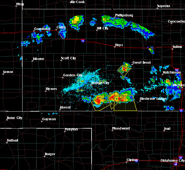 At 928 pm cdt, a severe thunderstorm was located near ashland, moving southeast at 30 mph (radar indicated). Hazards include two inch hail and 70 mph wind gusts. People and animals outdoors will be injured. expect hail damage to roofs, siding, windows, and vehicles. expect considerable tree damage. wind damage is also likely to mobile homes, roofs, and outbuildings. Locations impacted include, ashland, protection, sitka, acres, clark state lake, lexington and big basin preserve. At 928 pm cdt, a severe thunderstorm was located near ashland, moving southeast at 30 mph (radar indicated). Hazards include two inch hail and 70 mph wind gusts. People and animals outdoors will be injured. expect hail damage to roofs, siding, windows, and vehicles. expect considerable tree damage. wind damage is also likely to mobile homes, roofs, and outbuildings. Locations impacted include, ashland, protection, sitka, acres, clark state lake, lexington and big basin preserve.
|
| 6/17/2017 9:19 PM CDT |
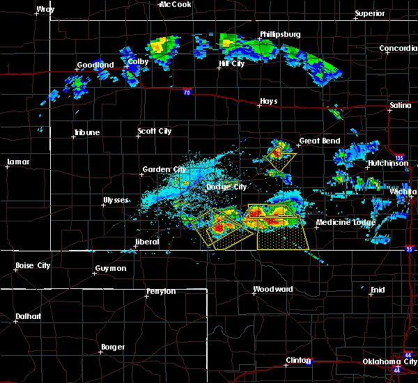 At 919 pm cdt, a severe thunderstorm was located 5 miles north of ashland, moving southeast at 30 mph (radar indicated). Hazards include ping pong ball size hail and 60 mph wind gusts. People and animals outdoors will be injured. expect hail damage to roofs, siding, windows, and vehicles. Expect wind damage to roofs, siding, and trees. At 919 pm cdt, a severe thunderstorm was located 5 miles north of ashland, moving southeast at 30 mph (radar indicated). Hazards include ping pong ball size hail and 60 mph wind gusts. People and animals outdoors will be injured. expect hail damage to roofs, siding, windows, and vehicles. Expect wind damage to roofs, siding, and trees.
|
| 6/13/2017 8:53 PM CDT |
 At 853 pm cdt, a severe thunderstorm was located 4 miles north of protection, moving east at 30 mph (radar indicated). Hazards include ping pong ball size hail and 60 mph wind gusts. People and animals outdoors will be injured. expect hail damage to roofs, siding, windows, and vehicles. expect wind damage to roofs, siding, and trees. Locations impacted include, coldwater, protection, wilmore, lexington and lake coldwater. At 853 pm cdt, a severe thunderstorm was located 4 miles north of protection, moving east at 30 mph (radar indicated). Hazards include ping pong ball size hail and 60 mph wind gusts. People and animals outdoors will be injured. expect hail damage to roofs, siding, windows, and vehicles. expect wind damage to roofs, siding, and trees. Locations impacted include, coldwater, protection, wilmore, lexington and lake coldwater.
|
| 6/13/2017 8:48 PM CDT |
 At 848 pm cdt, a severe thunderstorm was located 4 miles northwest of protection, moving east at 30 mph (radar indicated). Hazards include 60 mph wind gusts and quarter size hail. Hail damage to vehicles is expected. Expect wind damage to roofs, siding, and trees. At 848 pm cdt, a severe thunderstorm was located 4 miles northwest of protection, moving east at 30 mph (radar indicated). Hazards include 60 mph wind gusts and quarter size hail. Hail damage to vehicles is expected. Expect wind damage to roofs, siding, and trees.
|
| 5/18/2017 5:26 PM CDT |
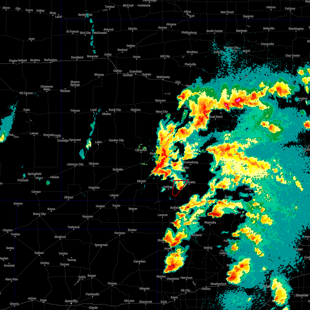 The tornado warning for northwestern comanche and southeastern clark counties will expire at 530 pm cdt. the storm which prompted the warning has weakened below severe limits, and no longer appears capable of producing a tornado. therefore the warning will be allowed to expire. A tornado watch remains in effect until 1100 pm cdt for south central. The tornado warning for northwestern comanche and southeastern clark counties will expire at 530 pm cdt. the storm which prompted the warning has weakened below severe limits, and no longer appears capable of producing a tornado. therefore the warning will be allowed to expire. A tornado watch remains in effect until 1100 pm cdt for south central.
|
| 5/18/2017 5:12 PM CDT |
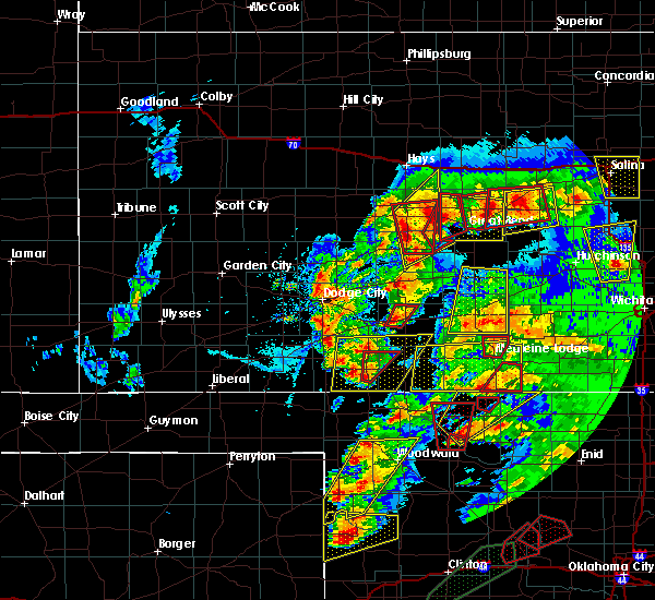 At 511 pm cdt, a severe thunderstorm capable of producing a tornado was located 3 miles southeast of sitka, or 8 miles southwest of protection, moving northeast at 45 mph (radar indicated rotation). Hazards include tornado and tennis ball size hail. Flying debris will be dangerous to those caught without shelter. mobile homes will be damaged or destroyed. damage to roofs, windows, and vehicles will occur. tree damage is likely. this dangerous storm will be near, protection around 525 pm cdt. Other locations impacted by this tornadic thunderstorm include lexington. At 511 pm cdt, a severe thunderstorm capable of producing a tornado was located 3 miles southeast of sitka, or 8 miles southwest of protection, moving northeast at 45 mph (radar indicated rotation). Hazards include tornado and tennis ball size hail. Flying debris will be dangerous to those caught without shelter. mobile homes will be damaged or destroyed. damage to roofs, windows, and vehicles will occur. tree damage is likely. this dangerous storm will be near, protection around 525 pm cdt. Other locations impacted by this tornadic thunderstorm include lexington.
|
| 5/18/2017 4:57 PM CDT |
 At 457 pm cdt, a severe thunderstorm capable of producing a tornado was located 10 miles southeast of acres, or 11 miles south of ashland, moving northeast at 45 mph (radar indicated rotation). Hazards include tornado and tennis ball size hail. Flying debris will be dangerous to those caught without shelter. mobile homes will be damaged or destroyed. damage to roofs, windows, and vehicles will occur. tree damage is likely. this dangerous storm will be near, sitka around 515 pm cdt. protection around 525 pm cdt. coldwater around 530 pm cdt. Other locations impacted by this tornadic thunderstorm include lexington and lake coldwater. At 457 pm cdt, a severe thunderstorm capable of producing a tornado was located 10 miles southeast of acres, or 11 miles south of ashland, moving northeast at 45 mph (radar indicated rotation). Hazards include tornado and tennis ball size hail. Flying debris will be dangerous to those caught without shelter. mobile homes will be damaged or destroyed. damage to roofs, windows, and vehicles will occur. tree damage is likely. this dangerous storm will be near, sitka around 515 pm cdt. protection around 525 pm cdt. coldwater around 530 pm cdt. Other locations impacted by this tornadic thunderstorm include lexington and lake coldwater.
|
| 5/18/2017 4:48 PM CDT |
 At 448 pm cdt, a severe thunderstorm was located 9 miles southeast of acres, or 12 miles south of ashland, moving northeast at 45 mph (radar indicated). Hazards include golf ball size hail and 60 mph wind gusts. People and animals outdoors will be injured. expect hail damage to roofs, siding, windows, and vehicles. Expect wind damage to roofs, siding, and trees. At 448 pm cdt, a severe thunderstorm was located 9 miles southeast of acres, or 12 miles south of ashland, moving northeast at 45 mph (radar indicated). Hazards include golf ball size hail and 60 mph wind gusts. People and animals outdoors will be injured. expect hail damage to roofs, siding, windows, and vehicles. Expect wind damage to roofs, siding, and trees.
|
| 5/18/2017 4:16 PM CDT | Storm damage reported in comanche county KS, 5 miles SSE of Protection, KS |
| 5/18/2017 4:13 PM CDT |
 At 413 pm cdt, a severe thunderstorm was located near protection, moving north at 45 mph (radar indicated). Hazards include ping pong ball size hail and 60 mph wind gusts. People and animals outdoors will be injured. expect hail damage to roofs, siding, windows, and vehicles. Expect wind damage to roofs, siding, and trees. At 413 pm cdt, a severe thunderstorm was located near protection, moving north at 45 mph (radar indicated). Hazards include ping pong ball size hail and 60 mph wind gusts. People and animals outdoors will be injured. expect hail damage to roofs, siding, windows, and vehicles. Expect wind damage to roofs, siding, and trees.
|
| 4/15/2017 8:01 PM CDT |
 At 800 pm cdt, a severe thunderstorm capable of producing a tornado was located 5 miles west of buttermilk, or 6 miles southeast of protection, moving east at 20 mph (radar indicated rotation). Hazards include tornado and tennis ball size hail. Flying debris will be dangerous to those caught without shelter. mobile homes will be damaged or destroyed. damage to roofs, windows, and vehicles will occur. tree damage is likely. This dangerous storm will be near, buttermilk around 815 pm cdt. At 800 pm cdt, a severe thunderstorm capable of producing a tornado was located 5 miles west of buttermilk, or 6 miles southeast of protection, moving east at 20 mph (radar indicated rotation). Hazards include tornado and tennis ball size hail. Flying debris will be dangerous to those caught without shelter. mobile homes will be damaged or destroyed. damage to roofs, windows, and vehicles will occur. tree damage is likely. This dangerous storm will be near, buttermilk around 815 pm cdt.
|
| 4/15/2017 7:45 PM CDT | Baseball sized hail reported 2.9 miles N of Protection, KS, report of golf ball to baseball size hail. |
| 4/15/2017 7:37 PM CDT |
 At 737 pm cdt, a severe thunderstorm was located near protection, moving east at 20 mph (radar indicated). Hazards include two inch hail and 60 mph wind gusts. People and animals outdoors will be injured. expect hail damage to roofs, siding, windows, and vehicles. Expect wind damage to roofs, siding, and trees. At 737 pm cdt, a severe thunderstorm was located near protection, moving east at 20 mph (radar indicated). Hazards include two inch hail and 60 mph wind gusts. People and animals outdoors will be injured. expect hail damage to roofs, siding, windows, and vehicles. Expect wind damage to roofs, siding, and trees.
|
| 4/15/2017 7:31 PM CDT |
 At 730 pm cdt, a severe thunderstorm was located near wilmore, or 7 miles northeast of coldwater, moving east at 20 mph (radar indicated). Hazards include golf ball size hail and 60 mph wind gusts. People and animals outdoors will be injured. expect hail damage to roofs, siding, windows, and vehicles. expect wind damage to roofs, siding, and trees. Locations impacted include, coldwater, protection, wilmore, belvidere and lake coldwater. At 730 pm cdt, a severe thunderstorm was located near wilmore, or 7 miles northeast of coldwater, moving east at 20 mph (radar indicated). Hazards include golf ball size hail and 60 mph wind gusts. People and animals outdoors will be injured. expect hail damage to roofs, siding, windows, and vehicles. expect wind damage to roofs, siding, and trees. Locations impacted include, coldwater, protection, wilmore, belvidere and lake coldwater.
|
| 4/15/2017 7:02 PM CDT |
 At 701 pm cdt, a severe thunderstorm was located 3 miles west of coldwater, moving northeast at 30 mph (radar indicated). Hazards include golf ball size hail and 60 mph wind gusts. People and animals outdoors will be injured. expect hail damage to roofs, siding, windows, and vehicles. Expect wind damage to roofs, siding, and trees. At 701 pm cdt, a severe thunderstorm was located 3 miles west of coldwater, moving northeast at 30 mph (radar indicated). Hazards include golf ball size hail and 60 mph wind gusts. People and animals outdoors will be injured. expect hail damage to roofs, siding, windows, and vehicles. Expect wind damage to roofs, siding, and trees.
|
| 9/16/2016 5:56 PM CDT |
 At 555 pm cdt, a severe thunderstorm was located near protection, moving southeast at 10 mph (radar indicated). Hazards include ping pong ball size hail and 60 mph wind gusts. People and animals outdoors will be injured. expect hail damage to roofs, siding, windows, and vehicles. expect wind damage to roofs, siding, and trees. Locations impacted include, coldwater, protection, wilmore, buttermilk and lake coldwater. At 555 pm cdt, a severe thunderstorm was located near protection, moving southeast at 10 mph (radar indicated). Hazards include ping pong ball size hail and 60 mph wind gusts. People and animals outdoors will be injured. expect hail damage to roofs, siding, windows, and vehicles. expect wind damage to roofs, siding, and trees. Locations impacted include, coldwater, protection, wilmore, buttermilk and lake coldwater.
|
| 9/16/2016 5:55 PM CDT | Quarter sized hail reported 3.6 miles WSW of Protection, KS, . |
| 9/16/2016 5:47 PM CDT |
 At 547 pm cdt, a severe thunderstorm was located 4 miles northeast of protection, moving east at 10 mph (radar indicated). Hazards include ping pong ball size hail and 60 mph wind gusts. People and animals outdoors will be injured. expect hail damage to roofs, siding, windows, and vehicles. expect wind damage to roofs, siding, and trees. Locations impacted include, coldwater, protection, wilmore, buttermilk and lake coldwater. At 547 pm cdt, a severe thunderstorm was located 4 miles northeast of protection, moving east at 10 mph (radar indicated). Hazards include ping pong ball size hail and 60 mph wind gusts. People and animals outdoors will be injured. expect hail damage to roofs, siding, windows, and vehicles. expect wind damage to roofs, siding, and trees. Locations impacted include, coldwater, protection, wilmore, buttermilk and lake coldwater.
|
| 9/16/2016 5:34 PM CDT |
 At 534 pm cdt, a severe thunderstorm was located 3 miles north of protection, moving southeast at 10 mph (radar indicated). Hazards include ping pong ball size hail and 60 mph wind gusts. People and animals outdoors will be injured. expect hail damage to roofs, siding, windows, and vehicles. expect wind damage to roofs, siding, and trees. Locations impacted include, coldwater, protection, wilmore, buttermilk and lake coldwater. At 534 pm cdt, a severe thunderstorm was located 3 miles north of protection, moving southeast at 10 mph (radar indicated). Hazards include ping pong ball size hail and 60 mph wind gusts. People and animals outdoors will be injured. expect hail damage to roofs, siding, windows, and vehicles. expect wind damage to roofs, siding, and trees. Locations impacted include, coldwater, protection, wilmore, buttermilk and lake coldwater.
|
| 9/16/2016 5:24 PM CDT |
 At 523 pm cdt, a severe thunderstorm was located 4 miles north of protection, moving east at 15 mph (radar indicated). Hazards include ping pong ball size hail and 60 mph wind gusts. People and animals outdoors will be injured. expect hail damage to roofs, siding, windows, and vehicles. Expect wind damage to roofs, siding, and trees. At 523 pm cdt, a severe thunderstorm was located 4 miles north of protection, moving east at 15 mph (radar indicated). Hazards include ping pong ball size hail and 60 mph wind gusts. People and animals outdoors will be injured. expect hail damage to roofs, siding, windows, and vehicles. Expect wind damage to roofs, siding, and trees.
|
| 7/15/2016 7:54 PM CDT |
 The severe thunderstorm warning for southwestern comanche, southeastern clark, southeastern meade, southwestern barber and southwestern kiowa counties will expire at 800 pm cdt, the storms which prompted the warning are slowly weakening below severe limits. wind gusts to 50 mph, heavy rain, small hail and frequent lightning will continue through 830 pm. the severe thunderstorm warning will be allowed to expire at 8 pm. a severe thunderstorm watch remains in effect until 900 pm cdt for southwestern kansas. The severe thunderstorm warning for southwestern comanche, southeastern clark, southeastern meade, southwestern barber and southwestern kiowa counties will expire at 800 pm cdt, the storms which prompted the warning are slowly weakening below severe limits. wind gusts to 50 mph, heavy rain, small hail and frequent lightning will continue through 830 pm. the severe thunderstorm warning will be allowed to expire at 8 pm. a severe thunderstorm watch remains in effect until 900 pm cdt for southwestern kansas.
|
| 7/15/2016 7:37 PM CDT |
 At 737 pm cdt, severe thunderstorms were located along a line extending from 6 miles northwest of protection to 5 miles north of slapout, moving southeast at 40 mph (radar indicated). Hazards include 70 mph wind gusts and nickel size hail. Expect considerable tree damage. damage is likely to mobile homes, roofs, and outbuildings. Locations impacted include, ashland, coldwater, protection, englewood, sitka, acres, buttermilk and lake coldwater. At 737 pm cdt, severe thunderstorms were located along a line extending from 6 miles northwest of protection to 5 miles north of slapout, moving southeast at 40 mph (radar indicated). Hazards include 70 mph wind gusts and nickel size hail. Expect considerable tree damage. damage is likely to mobile homes, roofs, and outbuildings. Locations impacted include, ashland, coldwater, protection, englewood, sitka, acres, buttermilk and lake coldwater.
|
| 7/15/2016 7:16 PM CDT |
 At 716 pm cdt, severe thunderstorms were located along a line extending from 3 miles east of clark state lake to 9 miles southwest of knowles, moving southeast at 40 mph (radar indicated). Hazards include 70 mph wind gusts and penny size hail. Expect considerable tree damage. Damage is likely to mobile homes, roofs, and outbuildings. At 716 pm cdt, severe thunderstorms were located along a line extending from 3 miles east of clark state lake to 9 miles southwest of knowles, moving southeast at 40 mph (radar indicated). Hazards include 70 mph wind gusts and penny size hail. Expect considerable tree damage. Damage is likely to mobile homes, roofs, and outbuildings.
|
| 6/28/2016 3:28 PM CDT |
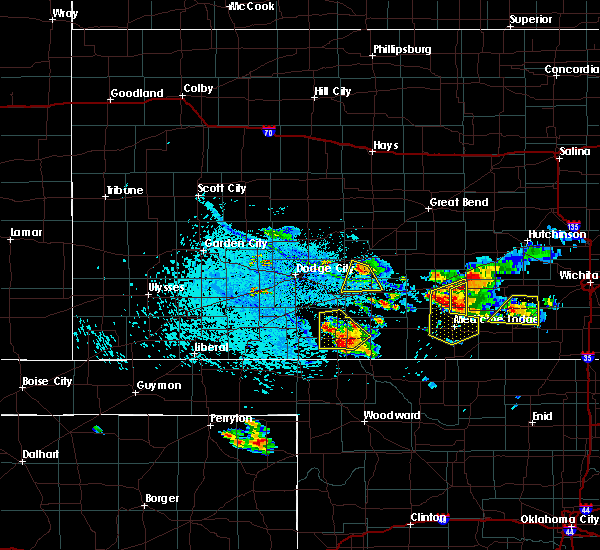 At 327 pm cdt, a severe thunderstorm was located 4 miles southeast of sitka, moving south at 25 mph (radar indicated). Hazards include tennis ball size hail and 70 mph wind gusts. People and animals outdoors will be injured. expect hail damage to roofs, siding, windows and vehicles. expect considerable tree damage. Wind damage is also likely to mobile homes, roofs and outbuildings. At 327 pm cdt, a severe thunderstorm was located 4 miles southeast of sitka, moving south at 25 mph (radar indicated). Hazards include tennis ball size hail and 70 mph wind gusts. People and animals outdoors will be injured. expect hail damage to roofs, siding, windows and vehicles. expect considerable tree damage. Wind damage is also likely to mobile homes, roofs and outbuildings.
|
| 6/28/2016 3:07 PM CDT |
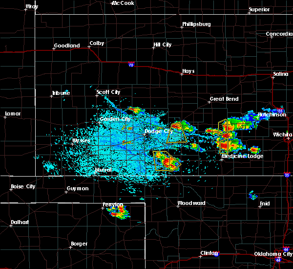 At 307 pm cdt, a severe thunderstorm was located 5 miles north of sitka, moving south at 5 mph (radar indicated). Hazards include ping pong ball size hail and 60 mph wind gusts. People and animals outdoors will be injured. expect hail damage to roofs, siding, windows and vehicles. expect wind damage to roofs, siding and trees. Locations impacted include, ashland, protection, sitka and clark state lake. At 307 pm cdt, a severe thunderstorm was located 5 miles north of sitka, moving south at 5 mph (radar indicated). Hazards include ping pong ball size hail and 60 mph wind gusts. People and animals outdoors will be injured. expect hail damage to roofs, siding, windows and vehicles. expect wind damage to roofs, siding and trees. Locations impacted include, ashland, protection, sitka and clark state lake.
|
| 6/28/2016 2:50 PM CDT |
 At 250 pm cdt, a severe thunderstorm was located very near clark state lake, moving southeast at 5 mph (radar indicated). Hazards include ping pong ball size hail and 60 mph wind gusts. People and animals outdoors will be injured. expect hail damage to roofs, siding, windows and vehicles. Expect wind damage to roofs, siding and trees. At 250 pm cdt, a severe thunderstorm was located very near clark state lake, moving southeast at 5 mph (radar indicated). Hazards include ping pong ball size hail and 60 mph wind gusts. People and animals outdoors will be injured. expect hail damage to roofs, siding, windows and vehicles. Expect wind damage to roofs, siding and trees.
|
| 5/26/2016 2:46 PM CDT |
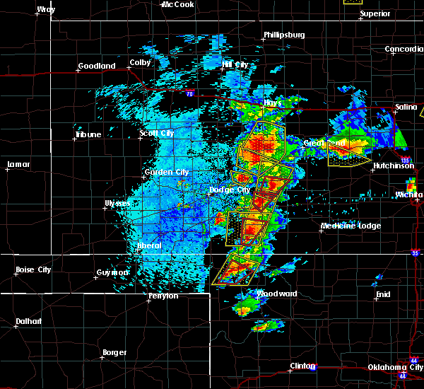 At 246 pm cdt, a severe thunderstorm capable of producing a tornado was located 4 miles north of protection, moving north at 50 mph (radar indicated rotation). Hazards include tornado and tennis ball size hail. Flying debris will be dangerous to those caught without shelter. mobile homes will be damaged or destroyed. damage to roofs, windows and vehicles will occur. tree damage is likely. Locations impacted include, protection. At 246 pm cdt, a severe thunderstorm capable of producing a tornado was located 4 miles north of protection, moving north at 50 mph (radar indicated rotation). Hazards include tornado and tennis ball size hail. Flying debris will be dangerous to those caught without shelter. mobile homes will be damaged or destroyed. damage to roofs, windows and vehicles will occur. tree damage is likely. Locations impacted include, protection.
|
| 5/26/2016 2:35 PM CDT |
 At 234 pm cdt, a severe thunderstorm capable of producing a tornado was located near protection, moving northeast at 45 mph (radar indicated rotation). Hazards include tornado and tennis ball size hail. Flying debris will be dangerous to those caught without shelter. mobile homes will be damaged or destroyed. damage to roofs, windows and vehicles will occur. tree damage is likely. This tornadic thunderstorm will remain over mainly rural areas of northwestern comanche, northeastern clark and southwestern kiowa counties. At 234 pm cdt, a severe thunderstorm capable of producing a tornado was located near protection, moving northeast at 45 mph (radar indicated rotation). Hazards include tornado and tennis ball size hail. Flying debris will be dangerous to those caught without shelter. mobile homes will be damaged or destroyed. damage to roofs, windows and vehicles will occur. tree damage is likely. This tornadic thunderstorm will remain over mainly rural areas of northwestern comanche, northeastern clark and southwestern kiowa counties.
|
| 5/26/2016 2:29 PM CDT |
 At 229 pm cdt, a severe thunderstorm was located 3 miles west of protection, moving north at 40 mph (radar indicated). Hazards include golf ball size hail. People and animals outdoors will be injured. Expect damage to roofs, siding, windows and vehicles. At 229 pm cdt, a severe thunderstorm was located 3 miles west of protection, moving north at 40 mph (radar indicated). Hazards include golf ball size hail. People and animals outdoors will be injured. Expect damage to roofs, siding, windows and vehicles.
|
| 5/26/2016 2:14 PM CDT |
 At 214 pm cdt, a severe thunderstorm was located 8 miles southeast of sitka, moving north at 15 mph (radar indicated). Hazards include golf ball size hail. People and animals outdoors will be injured. expect damage to roofs, siding, windows and vehicles. locations impacted include, ashland, coldwater, protection, sitka and lake coldwater. A tornado watch remains in effect until 1000 pm cdt for southwestern kansas. At 214 pm cdt, a severe thunderstorm was located 8 miles southeast of sitka, moving north at 15 mph (radar indicated). Hazards include golf ball size hail. People and animals outdoors will be injured. expect damage to roofs, siding, windows and vehicles. locations impacted include, ashland, coldwater, protection, sitka and lake coldwater. A tornado watch remains in effect until 1000 pm cdt for southwestern kansas.
|
| 5/26/2016 2:04 PM CDT |
 At 204 pm cdt, a severe thunderstorm was located very near sitka, moving northeast at 35 mph (radar indicated). Hazards include golf ball size hail. People and animals outdoors will be injured. expect damage to roofs, siding, windows and vehicles. locations impacted include, ashland, coldwater, protection, sitka, acres and lake coldwater. A tornado watch remains in effect until 1000 pm cdt for southwestern kansas. At 204 pm cdt, a severe thunderstorm was located very near sitka, moving northeast at 35 mph (radar indicated). Hazards include golf ball size hail. People and animals outdoors will be injured. expect damage to roofs, siding, windows and vehicles. locations impacted include, ashland, coldwater, protection, sitka, acres and lake coldwater. A tornado watch remains in effect until 1000 pm cdt for southwestern kansas.
|
| 5/26/2016 1:43 PM CDT |
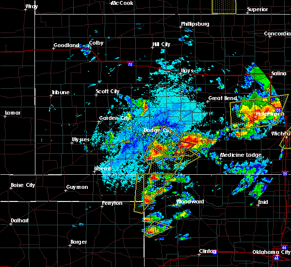 At 142 pm cdt, a severe thunderstorm was located 9 miles southeast of acres, moving northeast at 35 mph (radar indicated). Hazards include two inch hail. People and animals outdoors will be injured. Expect damage to roofs, siding, windows and vehicles. At 142 pm cdt, a severe thunderstorm was located 9 miles southeast of acres, moving northeast at 35 mph (radar indicated). Hazards include two inch hail. People and animals outdoors will be injured. Expect damage to roofs, siding, windows and vehicles.
|
| 11/16/2015 11:07 PM CST |
 At 1106 pm cst, a severe thunderstorm was located 5 miles southeast of lake coldwater, moving northeast at 45 mph (radar indicated). Hazards include 60 mph wind gusts and quarter size hail. Hail damage to vehicles is expected. expect wind damage to roofs, siding and trees. locations impacted include, coldwater, protection, wilmore, lake coldwater, buttermilk and belvidere. A tornado watch remains in effect until 300 am cst for south central kansas. At 1106 pm cst, a severe thunderstorm was located 5 miles southeast of lake coldwater, moving northeast at 45 mph (radar indicated). Hazards include 60 mph wind gusts and quarter size hail. Hail damage to vehicles is expected. expect wind damage to roofs, siding and trees. locations impacted include, coldwater, protection, wilmore, lake coldwater, buttermilk and belvidere. A tornado watch remains in effect until 300 am cst for south central kansas.
|
| 11/16/2015 10:49 PM CST |
 At 1049 pm cst, a severe thunderstorm was located 7 miles west of buttermilk, moving northeast at 45 mph (radar indicated). Hazards include 60 mph wind gusts and half dollar size hail. Hail damage to vehicles is expected. Expect wind damage to roofs, siding and trees. At 1049 pm cst, a severe thunderstorm was located 7 miles west of buttermilk, moving northeast at 45 mph (radar indicated). Hazards include 60 mph wind gusts and half dollar size hail. Hail damage to vehicles is expected. Expect wind damage to roofs, siding and trees.
|
| 11/16/2015 10:39 PM CST |
 At 1038 pm cst, a severe thunderstorm was located 6 miles south of sitka, moving northeast at 45 mph (radar indicated). Hazards include 70 mph wind gusts and half dollar size hail. Hail damage to vehicles is expected. expect considerable tree damage. wind damage is also likely to mobile homes, roofs and outbuildings. locations impacted include, ashland, protection, sitka and acres. A tornado watch remains in effect until 300 am cst for southwestern kansas. At 1038 pm cst, a severe thunderstorm was located 6 miles south of sitka, moving northeast at 45 mph (radar indicated). Hazards include 70 mph wind gusts and half dollar size hail. Hail damage to vehicles is expected. expect considerable tree damage. wind damage is also likely to mobile homes, roofs and outbuildings. locations impacted include, ashland, protection, sitka and acres. A tornado watch remains in effect until 300 am cst for southwestern kansas.
|
| 11/16/2015 10:10 PM CST |
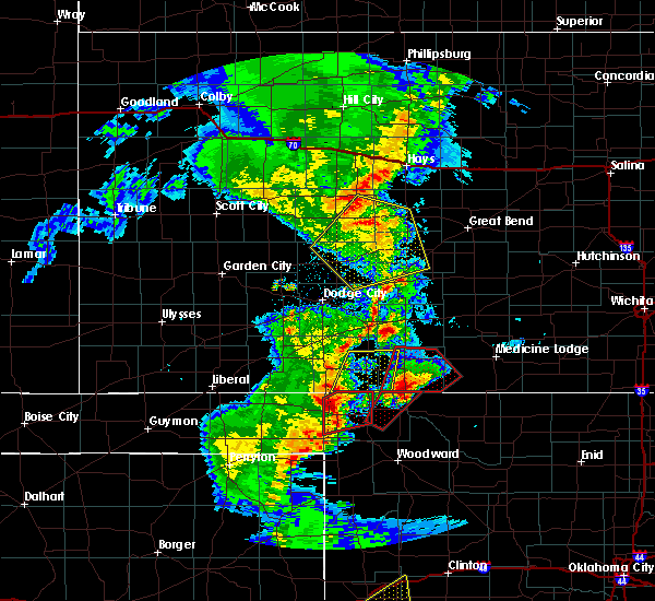 At 1010 pm cst, a severe thunderstorm was located near rosston, or 8 miles north of laverne, moving northeast at 45 mph (radar indicated). Hazards include 60 mph wind gusts and quarter size hail. Hail damage to vehicles is expected. Expect wind damage to roofs, siding and trees. At 1010 pm cst, a severe thunderstorm was located near rosston, or 8 miles north of laverne, moving northeast at 45 mph (radar indicated). Hazards include 60 mph wind gusts and quarter size hail. Hail damage to vehicles is expected. Expect wind damage to roofs, siding and trees.
|
| 6/11/2015 9:51 PM CDT |
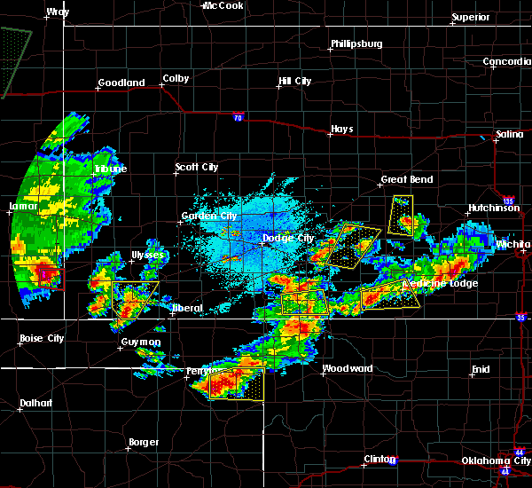 The severe thunderstorm warning for southeastern clark and southwestern comanche counties will expire at 1000 pm cdt, the storm which prompted the warning has weakened below severe limits, and no longer pose an immediate threat to life or property. therefore the warning will be allowed to expire. The severe thunderstorm warning for southeastern clark and southwestern comanche counties will expire at 1000 pm cdt, the storm which prompted the warning has weakened below severe limits, and no longer pose an immediate threat to life or property. therefore the warning will be allowed to expire.
|
| 6/11/2015 9:16 PM CDT |
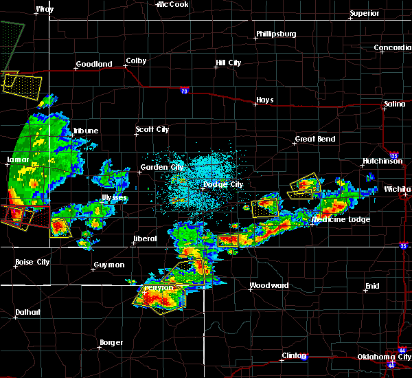 At 916 pm cdt, a severe thunderstorm was located 6 miles south of sitka, moving east at 15 mph (radar indicated). Hazards include quarter size hail. damage to vehicles is expected At 916 pm cdt, a severe thunderstorm was located 6 miles south of sitka, moving east at 15 mph (radar indicated). Hazards include quarter size hail. damage to vehicles is expected
|
| 6/11/2015 7:52 PM CDT |
 At 752 pm cdt, a severe thunderstorm was located near wilmore, moving east at 10 mph (radar indicated). Hazards include 60 mph wind gusts and quarter size hail. Hail damage to vehicles is expected. expect wind damage to roofs, siding and trees. Locations impacted include, coldwater, protection, wilmore, lake coldwater and belvidere. At 752 pm cdt, a severe thunderstorm was located near wilmore, moving east at 10 mph (radar indicated). Hazards include 60 mph wind gusts and quarter size hail. Hail damage to vehicles is expected. expect wind damage to roofs, siding and trees. Locations impacted include, coldwater, protection, wilmore, lake coldwater and belvidere.
|
| 6/11/2015 7:26 PM CDT |
 At 725 pm cdt, a severe thunderstorm was located 3 miles northeast of coldwater, moving east at 15 mph (radar indicated). Hazards include 60 mph wind gusts and half dollar size hail. Hail damage to vehicles is expected. Expect wind damage to roofs, siding and trees. At 725 pm cdt, a severe thunderstorm was located 3 miles northeast of coldwater, moving east at 15 mph (radar indicated). Hazards include 60 mph wind gusts and half dollar size hail. Hail damage to vehicles is expected. Expect wind damage to roofs, siding and trees.
|
| 4/18/2015 3:05 PM CDT | At 304 pm cdt, a severe thunderstorm was located near buttermilk, moving northeast at 25 mph (radar indicated). Hazards include golf ball size hail and 60 mph wind gusts. People and animals outdoors will be injured. expect hail damage to roofs, siding, windows and vehicles. expect wind damage to roofs, siding and trees. locations impacted include, coldwater, protection, wilmore, lake coldwater and buttermilk. quarter size hail was reported 3 miles north of buttermilk. 1. 75in. |
| 4/18/2015 2:53 PM CDT | At 252 pm cdt, a severe thunderstorm was located 10 miles southwest of buttermilk, moving north at 30 mph (radar indicated). Hazards include golf ball size hail and 60 mph wind gusts. People and animals outdoors will be injured. expect hail damage to roofs, siding, windows and vehicles. Expect wind damage to roofs, siding and trees. |
| 7/14/2014 5:11 PM CDT | Storm damage reported in comanche county KS, 6.9 miles SSE of Protection, KS |
| 6/1/2014 9:35 PM CDT | Golf Ball sized hail reported 10.5 miles N of Protection, KS |
| 7/23/2013 8:01 PM CDT | Tree limbs up to 2 inches in diameter were knocked dow in clark county KS, 10.6 miles SE of Protection, KS |
| 5/29/2013 2:15 PM CDT | Storm damage reported in comanche county KS, 6.8 miles S of Protection, KS |
| 5/18/2013 7:40 PM CDT | Quarter sized hail reported 1.1 miles E of Protection, KS, the dispatch said there were numerous reports from around the county of heavy rain and nickel to quarter size hail. |
| 5/8/2013 8:48 PM CDT | Quarter sized hail reported 5.7 miles NNW of Protection, KS |
| 5/8/2013 6:40 PM CDT | Hen Egg sized hail reported 5 miles WNW of Protection, KS |
| 5/8/2013 6:35 PM CDT | Hen Egg sized hail reported 2.9 miles N of Protection, KS |
| 5/8/2013 6:27 PM CDT | Golf Ball sized hail reported 0.1 miles NNW of Protection, KS |
| 5/8/2013 6:20 PM CDT | Baseball sized hail reported 4.8 miles NE of Protection, KS |
| 5/8/2013 6:07 PM CDT | Golf Ball sized hail reported 5 miles E of Protection, KS |
| 5/8/2013 5:43 PM CDT | Quarter sized hail reported 3.4 miles ENE of Protection, KS |
| 9/25/2012 6:42 PM CDT | Quarter sized hail reported 4.6 miles SE of Protection, KS, rain was coming straight down. |
| 8/18/2012 8:30 AM CDT | Storm damage reported in clark county KS, 5 miles E of Protection, KS |
| 4/29/2012 9:14 PM CDT | Storm damage reported in comanche county KS, 12 miles SSE of Protection, KS |
| 1/1/0001 12:00 AM | A six-inch tree limb was dow in comanche county KS, 5 miles N of Protection, KS |
| 1/1/0001 12:00 AM | Storm damage reported in comanche county KS, 9.8 miles N of Protection, KS |
| 1/1/0001 12:00 AM | Quarter sized hail reported 9.8 miles N of Protection, KS |
Hail Maps for Protection, KS
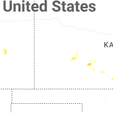
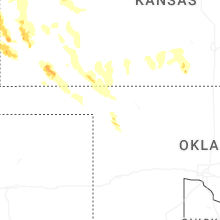
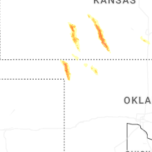
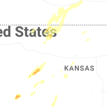
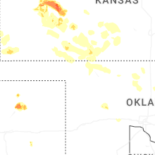
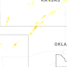
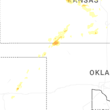

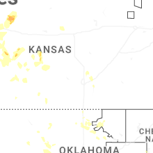
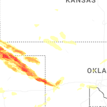
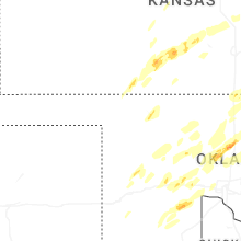


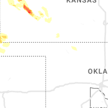


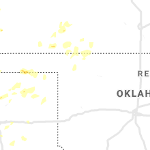


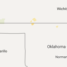


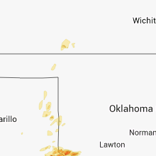


Connect with Interactive Hail Maps