

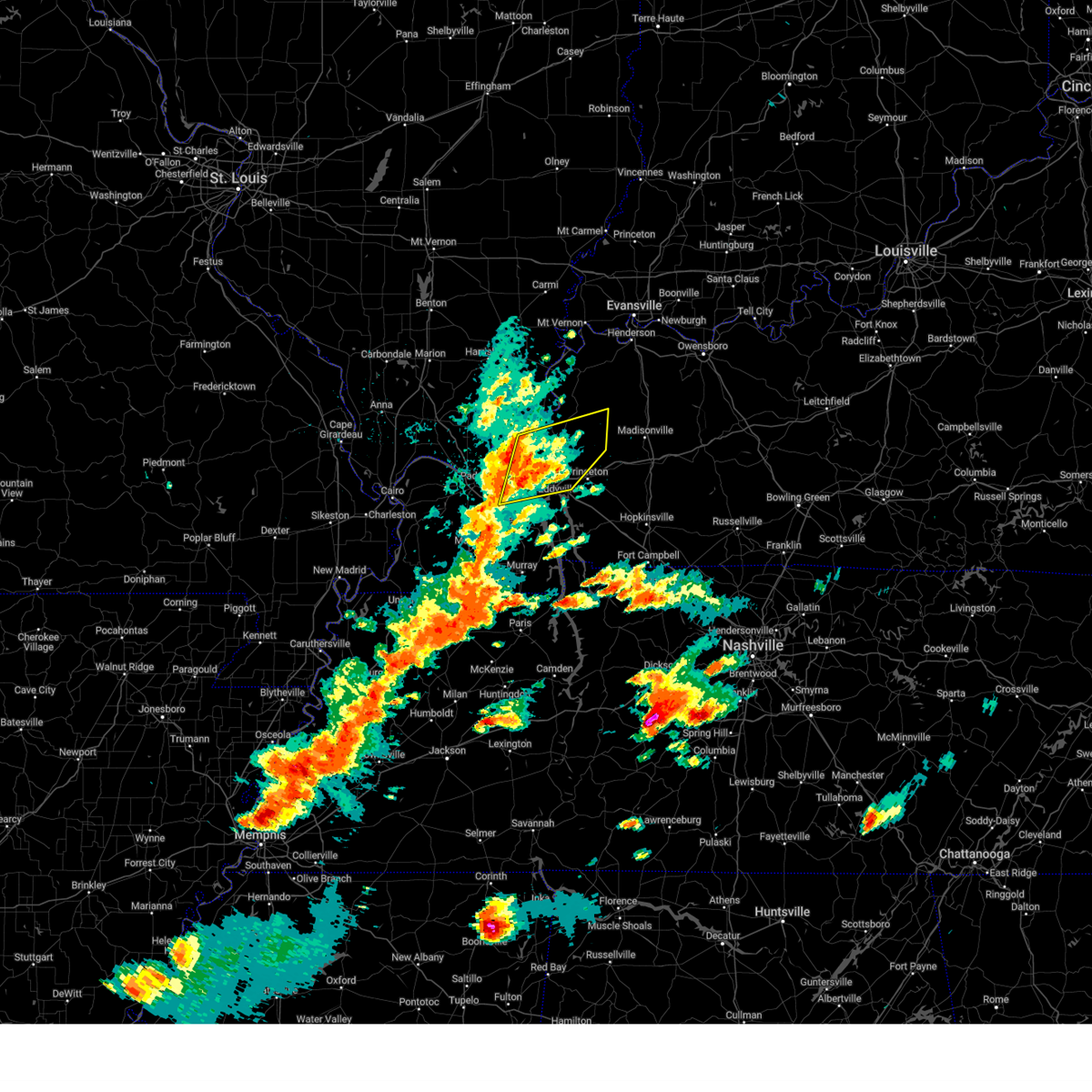
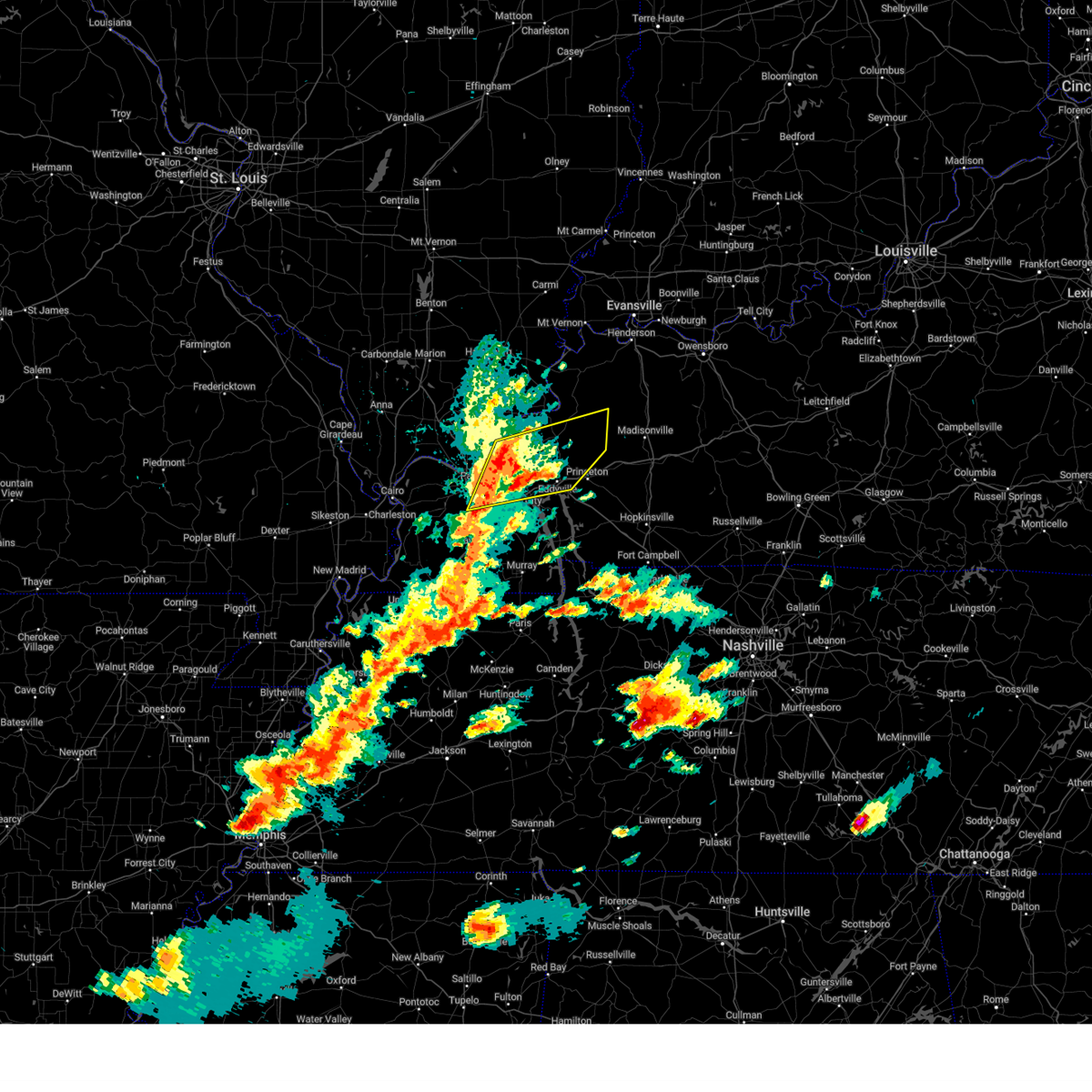
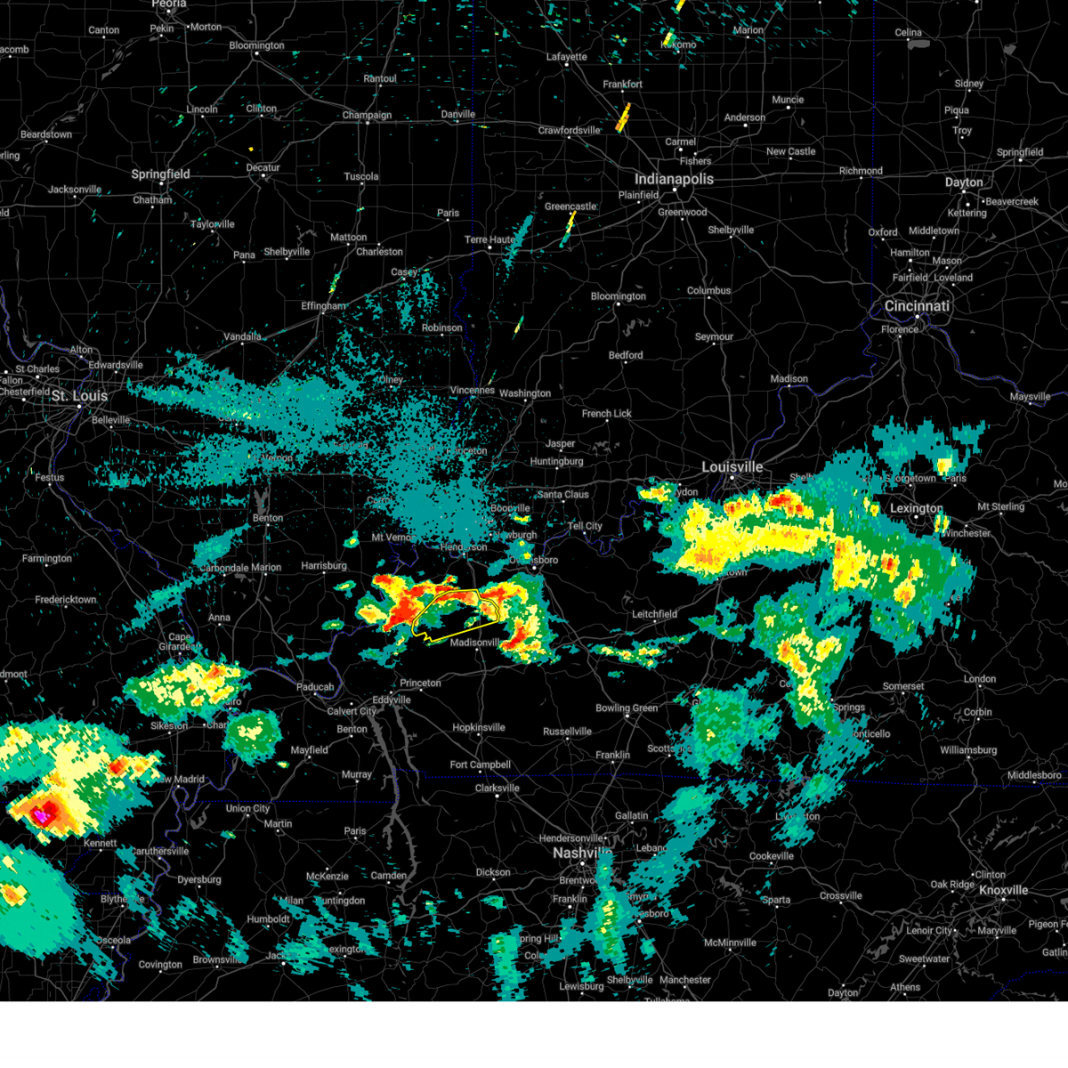
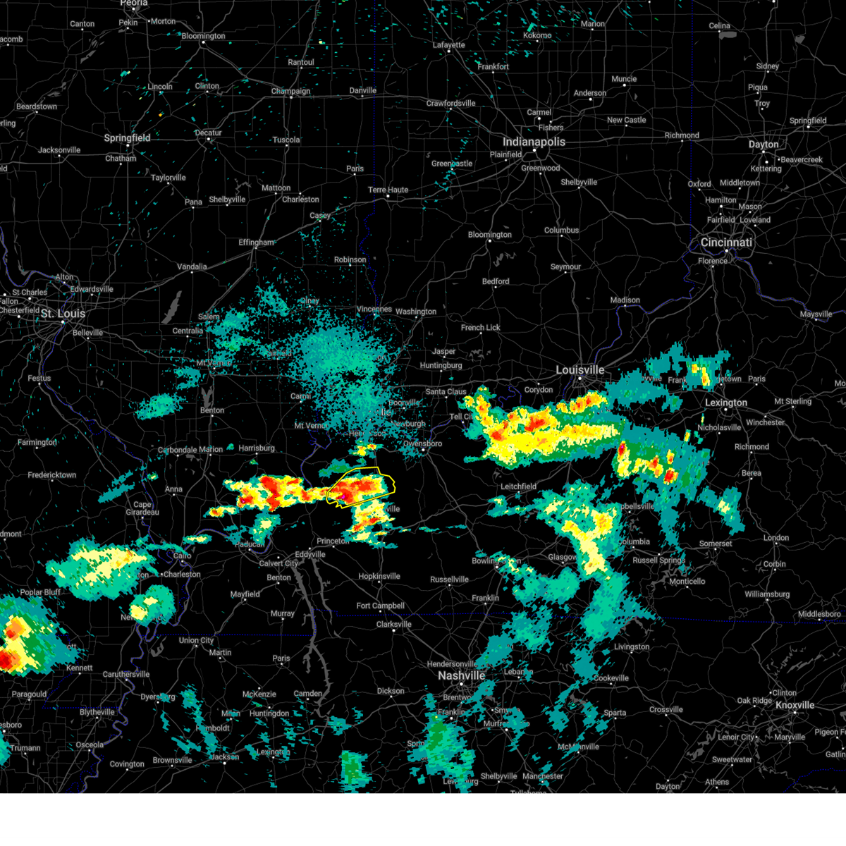
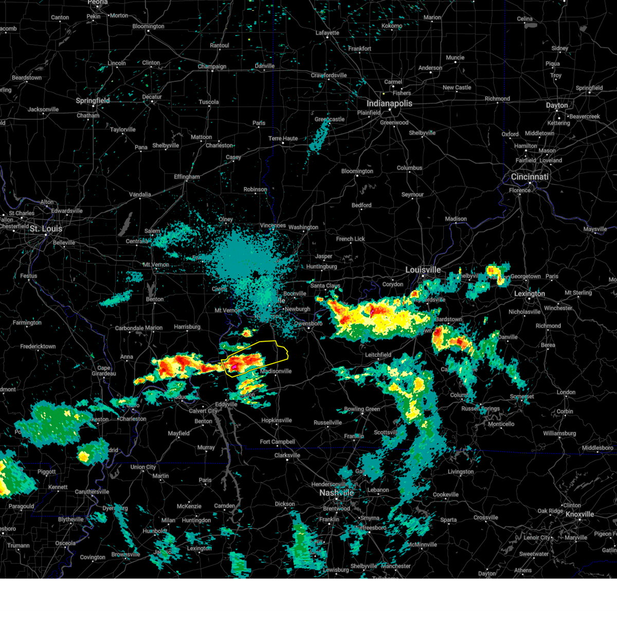
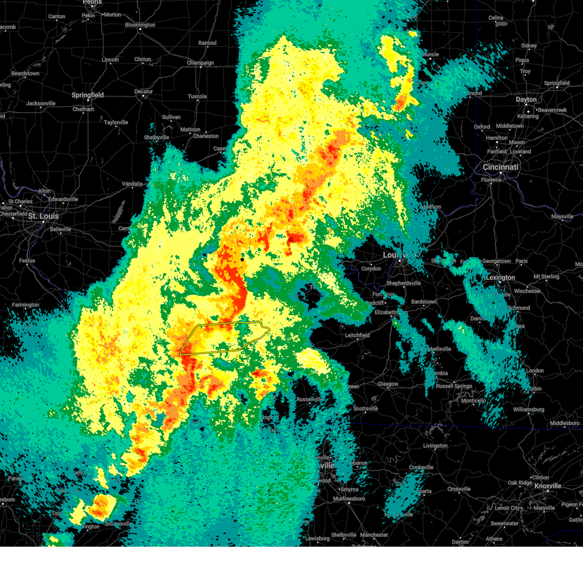
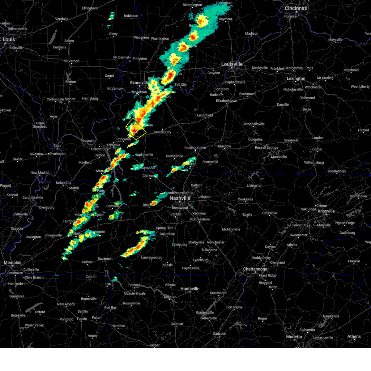
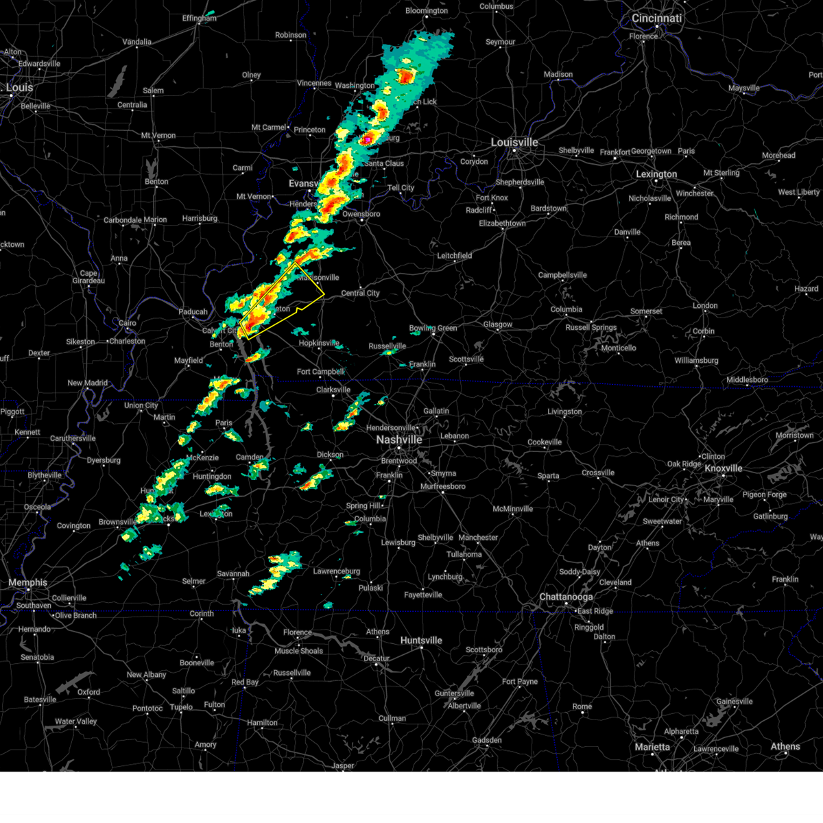
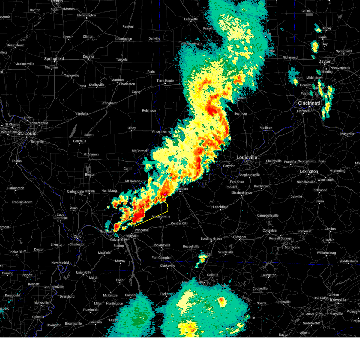
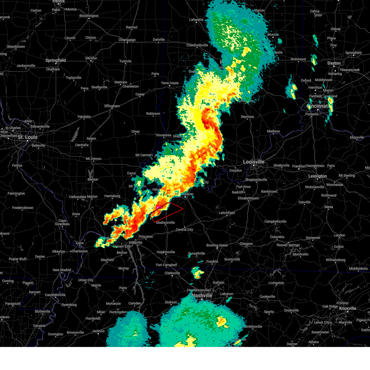
Hail Map for Providence, KY
The Providence, KY area has had 3 reports of on-the-ground hail by trained spotters, and has been under severe weather warnings 53 times during the past 12 months. Doppler radar has detected hail at or near Providence, KY on 71 occasions, including 5 occasions during the past year.
| Name: | Providence, KY |
| Where Located: | 41.3 miles SSW of Evansville, IN |
| Map: | Google Map for Providence, KY |
| Population: | 3193 |
| Housing Units: | 1592 |
| More Info: | Search Google for Providence, KY |
0
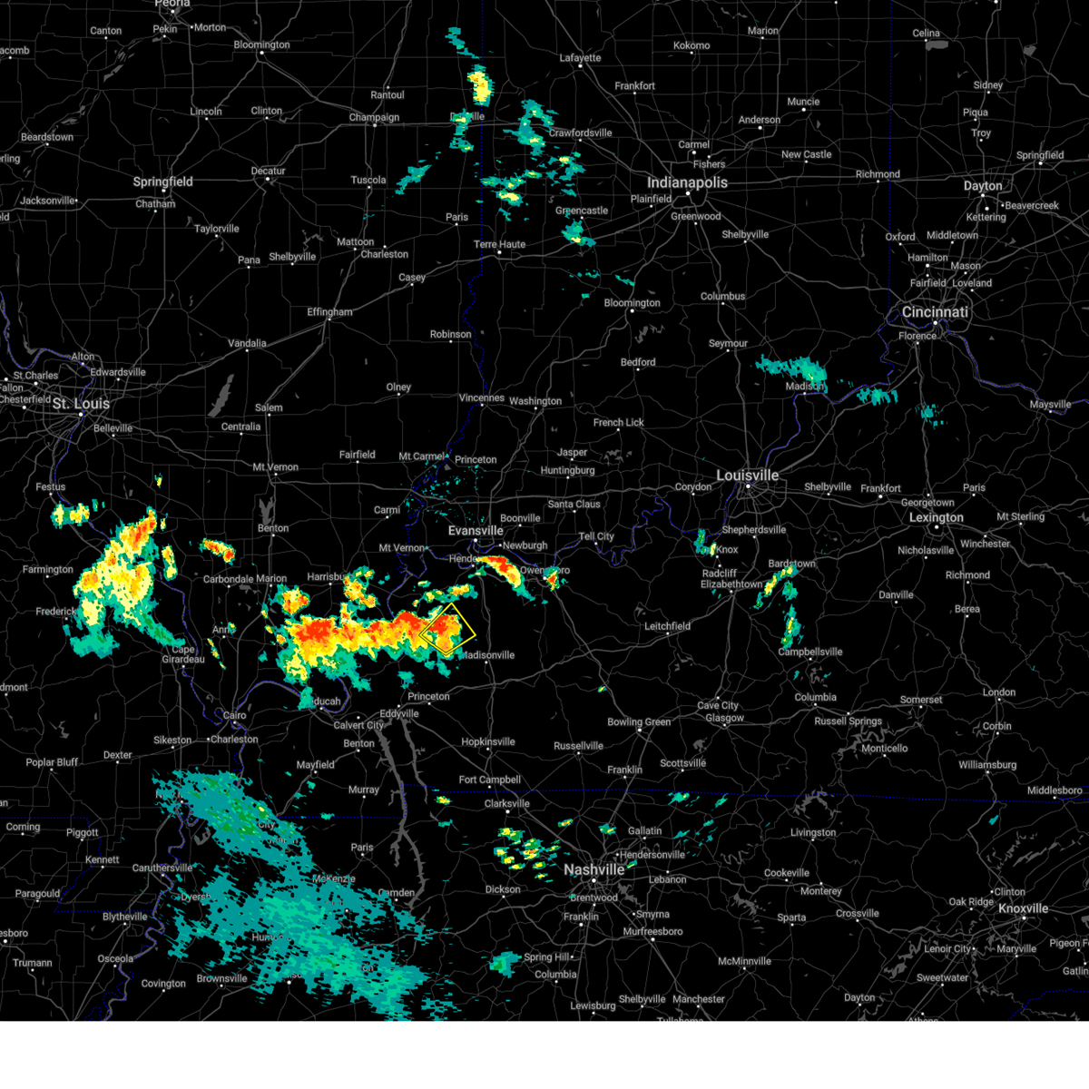
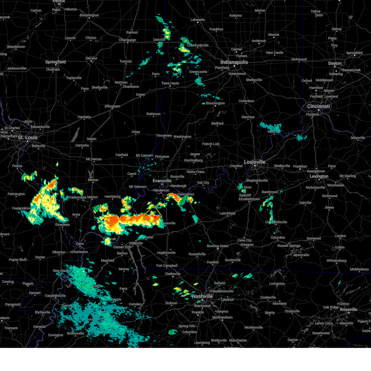
The Top Recent Hail Date for Providence, KY is Friday, June 27, 2025 (34th out of 71)
Hail and Wind Damage Spotted near Providence, KY
| Date / Time | Report Details |
|---|---|
| 6/6/2025 3:18 PM CDT |
 At 318 pm cdt, a severe thunderstorm was located near clay, or 7 miles east of sturgis, moving northeast at 30 mph (radar indicated). Hazards include 60 mph wind gusts and quarter size hail. Hail damage to vehicles is expected. expect wind damage to roofs, siding, and trees. Locations impacted include, providence, sturgis, clay, dixon, and wheatcroft. At 318 pm cdt, a severe thunderstorm was located near clay, or 7 miles east of sturgis, moving northeast at 30 mph (radar indicated). Hazards include 60 mph wind gusts and quarter size hail. Hail damage to vehicles is expected. expect wind damage to roofs, siding, and trees. Locations impacted include, providence, sturgis, clay, dixon, and wheatcroft.
|
| 6/6/2025 3:18 PM CDT |
 the severe thunderstorm warning has been cancelled and is no longer in effect the severe thunderstorm warning has been cancelled and is no longer in effect
|
| 6/6/2025 3:06 PM CDT | Svrpah the national weather service in paducah has issued a * severe thunderstorm warning for, northeastern crittenden county in western kentucky, southeastern union county in northwestern kentucky, western webster county in northwestern kentucky, * until 345 pm cdt. * at 306 pm cdt, a severe thunderstorm was located near sturgis, moving northeast at 30 mph (radar indicated). Hazards include 60 mph wind gusts and quarter size hail. Hail damage to vehicles is expected. Expect wind damage to roofs, siding, and trees. |
| 5/20/2025 3:59 PM CDT |
 the severe thunderstorm warning has been cancelled and is no longer in effect the severe thunderstorm warning has been cancelled and is no longer in effect
|
| 5/20/2025 3:59 PM CDT |
 At 359 pm cdt, severe thunderstorms were located along a line extending from near marion to 7 miles north of eddyville to near calvert city, moving east at 60 mph (radar indicated). Hazards include 60 mph wind gusts. Expect damage to roofs, siding, and trees. locations impacted include, providence, marion, calvert city, eddyville, salem, creswell, farmersville, kuttawa, fredonia, grand rivers, smithland, fryer, and dycusburg. this includes the following highways, interstate 24 in kentucky between mile markers 19 and 45. Interstate 69 in kentucky between mile markers 68 and 78. At 359 pm cdt, severe thunderstorms were located along a line extending from near marion to 7 miles north of eddyville to near calvert city, moving east at 60 mph (radar indicated). Hazards include 60 mph wind gusts. Expect damage to roofs, siding, and trees. locations impacted include, providence, marion, calvert city, eddyville, salem, creswell, farmersville, kuttawa, fredonia, grand rivers, smithland, fryer, and dycusburg. this includes the following highways, interstate 24 in kentucky between mile markers 19 and 45. Interstate 69 in kentucky between mile markers 68 and 78.
|
| 5/20/2025 3:46 PM CDT |
 At 346 pm cdt, severe thunderstorms were located along a line extending from near joy to 8 miles southeast of burna to reidland, moving east at 60 mph (radar indicated). Hazards include 60 mph wind gusts. Expect damage to roofs, siding, and trees. locations impacted include, paducah, providence, marion, calvert city, eddyville, reidland, salem, burna, ledbetter, creswell, farmersville, kuttawa, fredonia, grand rivers, smithland, hamletsburg, fryer, and dycusburg. this includes the following highways, interstate 24 in kentucky between mile markers 9 and 23, and between mile markers 26 and 45. Interstate 69 in kentucky between mile markers 68 and 78. At 346 pm cdt, severe thunderstorms were located along a line extending from near joy to 8 miles southeast of burna to reidland, moving east at 60 mph (radar indicated). Hazards include 60 mph wind gusts. Expect damage to roofs, siding, and trees. locations impacted include, paducah, providence, marion, calvert city, eddyville, reidland, salem, burna, ledbetter, creswell, farmersville, kuttawa, fredonia, grand rivers, smithland, hamletsburg, fryer, and dycusburg. this includes the following highways, interstate 24 in kentucky between mile markers 9 and 23, and between mile markers 26 and 45. Interstate 69 in kentucky between mile markers 68 and 78.
|
| 5/20/2025 3:46 PM CDT |
 the severe thunderstorm warning has been cancelled and is no longer in effect the severe thunderstorm warning has been cancelled and is no longer in effect
|
| 5/20/2025 3:34 PM CDT | Svrpah the national weather service in paducah has issued a * severe thunderstorm warning for, eastern massac county in southern illinois, southeastern pope county in southern illinois, crittenden county in western kentucky, livingston county in western kentucky, central caldwell county in western kentucky, northwestern marshall county in western kentucky, northeastern carlisle county in western kentucky, mccracken county in western kentucky, west central hopkins county in northwestern kentucky, southwestern webster county in northwestern kentucky, northwestern graves county in western kentucky, northwestern lyon county in western kentucky, * until 415 pm cdt. * at 334 pm cdt, severe thunderstorms were located along a line extending from near golconda to near ledbetter to near lovelaceville, moving east at 60 mph (radar indicated). Hazards include 60 mph wind gusts. expect damage to roofs, siding, and trees |
| 5/16/2025 4:31 AM CDT |
 the severe thunderstorm warning has been cancelled and is no longer in effect the severe thunderstorm warning has been cancelled and is no longer in effect
|
| 5/16/2025 4:15 AM CDT |
 the severe thunderstorm warning has been cancelled and is no longer in effect the severe thunderstorm warning has been cancelled and is no longer in effect
|
| 5/16/2025 4:15 AM CDT |
 At 415 am cdt, a severe thunderstorm was located near clay, or near providence, moving northeast at 60 mph (radar indicated). Hazards include 60 mph wind gusts and half dollar size hail. Hail damage to vehicles is expected. expect wind damage to roofs, siding, and trees. locations impacted include, providence, sebree, clay, dixon, slaughters, and wheatcroft. This includes interstate 69 in kentucky between mile markers 124 and 137. At 415 am cdt, a severe thunderstorm was located near clay, or near providence, moving northeast at 60 mph (radar indicated). Hazards include 60 mph wind gusts and half dollar size hail. Hail damage to vehicles is expected. expect wind damage to roofs, siding, and trees. locations impacted include, providence, sebree, clay, dixon, slaughters, and wheatcroft. This includes interstate 69 in kentucky between mile markers 124 and 137.
|
| 5/16/2025 4:06 AM CDT |
 At 406 am cdt, a severe thunderstorm was located 7 miles southwest of clay, or 9 miles west of providence, moving east at 65 mph (radar indicated). Hazards include 60 mph wind gusts and half dollar size hail. Hail damage to vehicles is expected. expect wind damage to roofs, siding, and trees. locations impacted include, providence, marion, sebree, clay, dixon, slaughters, and wheatcroft. This includes interstate 69 in kentucky between mile markers 124 and 137. At 406 am cdt, a severe thunderstorm was located 7 miles southwest of clay, or 9 miles west of providence, moving east at 65 mph (radar indicated). Hazards include 60 mph wind gusts and half dollar size hail. Hail damage to vehicles is expected. expect wind damage to roofs, siding, and trees. locations impacted include, providence, marion, sebree, clay, dixon, slaughters, and wheatcroft. This includes interstate 69 in kentucky between mile markers 124 and 137.
|
| 5/16/2025 3:56 AM CDT |
 Svrpah the national weather service in paducah has issued a * severe thunderstorm warning for, crittenden county in western kentucky, northern hopkins county in northwestern kentucky, southeastern union county in northwestern kentucky, webster county in northwestern kentucky, * until 445 am cdt. * at 356 am cdt, a severe thunderstorm was located near marion, moving northeast at 60 mph (radar indicated). Hazards include 60 mph wind gusts and quarter size hail. Hail damage to vehicles is expected. Expect wind damage to roofs, siding, and trees. Svrpah the national weather service in paducah has issued a * severe thunderstorm warning for, crittenden county in western kentucky, northern hopkins county in northwestern kentucky, southeastern union county in northwestern kentucky, webster county in northwestern kentucky, * until 445 am cdt. * at 356 am cdt, a severe thunderstorm was located near marion, moving northeast at 60 mph (radar indicated). Hazards include 60 mph wind gusts and quarter size hail. Hail damage to vehicles is expected. Expect wind damage to roofs, siding, and trees.
|
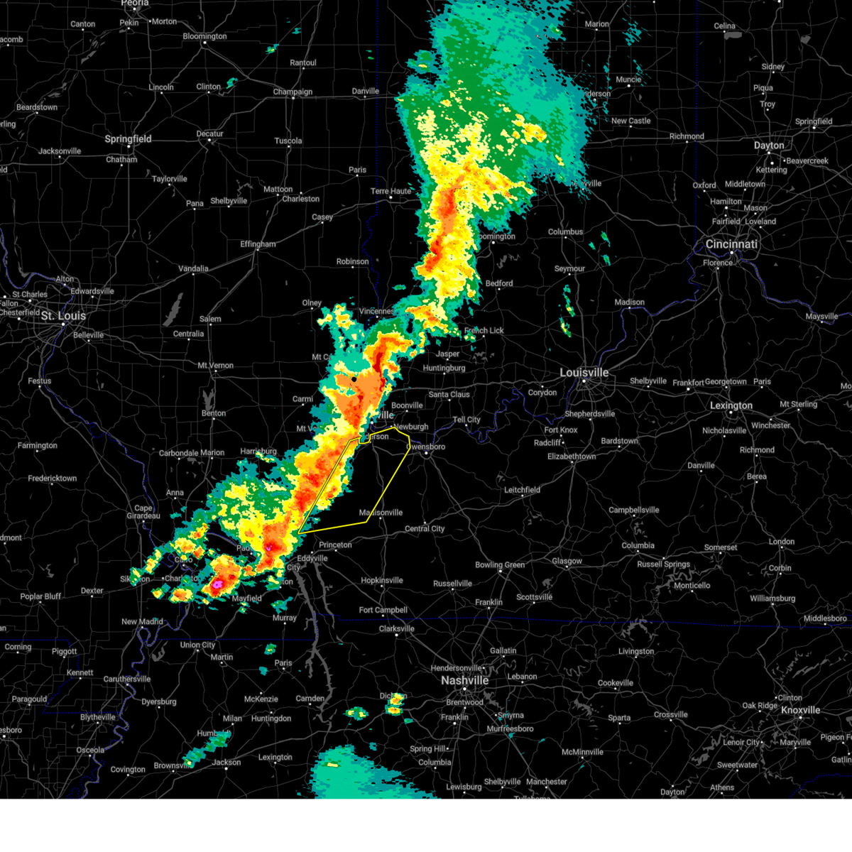
| 5/2/2025 12:23 PM CDT | Svrpah the national weather service in paducah has issued a * severe thunderstorm warning for, western daviess county in northwestern kentucky, northwestern muhlenberg county in south central kentucky, mclean county in northwestern kentucky, hopkins county in northwestern kentucky, eastern webster county in northwestern kentucky, * until 115 pm cdt. * at 1223 pm cdt, severe thunderstorms were located along a line extending from near providence to near earlington to nortonville, moving northeast at 35 mph (radar indicated). Hazards include 60 mph wind gusts and nickel size hail. expect damage to roofs, siding, and trees |
| 4/10/2025 4:05 PM CDT | the severe thunderstorm warning has been cancelled and is no longer in effect |
| 4/10/2025 3:36 PM CDT |
 Svrpah the national weather service in paducah has issued a * severe thunderstorm warning for, southwestern vanderburgh county in southwestern indiana, southeastern posey county in southwestern indiana, henderson county in northwestern kentucky, northeastern crittenden county in western kentucky, northwestern mclean county in northwestern kentucky, northern hopkins county in northwestern kentucky, eastern union county in northwestern kentucky, webster county in northwestern kentucky, * until 415 pm cdt. * at 336 pm cdt, severe thunderstorms were located along a line extending from near blairsville to near corydon to near providence, moving east at 20 mph (radar indicated). Hazards include 60 mph wind gusts and quarter size hail. Hail damage to vehicles is expected. Expect wind damage to roofs, siding, and trees. Svrpah the national weather service in paducah has issued a * severe thunderstorm warning for, southwestern vanderburgh county in southwestern indiana, southeastern posey county in southwestern indiana, henderson county in northwestern kentucky, northeastern crittenden county in western kentucky, northwestern mclean county in northwestern kentucky, northern hopkins county in northwestern kentucky, eastern union county in northwestern kentucky, webster county in northwestern kentucky, * until 415 pm cdt. * at 336 pm cdt, severe thunderstorms were located along a line extending from near blairsville to near corydon to near providence, moving east at 20 mph (radar indicated). Hazards include 60 mph wind gusts and quarter size hail. Hail damage to vehicles is expected. Expect wind damage to roofs, siding, and trees.
|
| 4/2/2025 9:50 PM CDT | The storm which prompted the warning has weakened below severe limits, and no longer appears capable of producing a tornado. therefore, the warning will be allowed to expire. a tornado watch remains in effect until midnight cdt for northwestern kentucky. |
| 4/2/2025 9:37 PM CDT | the tornado warning has been cancelled and is no longer in effect |
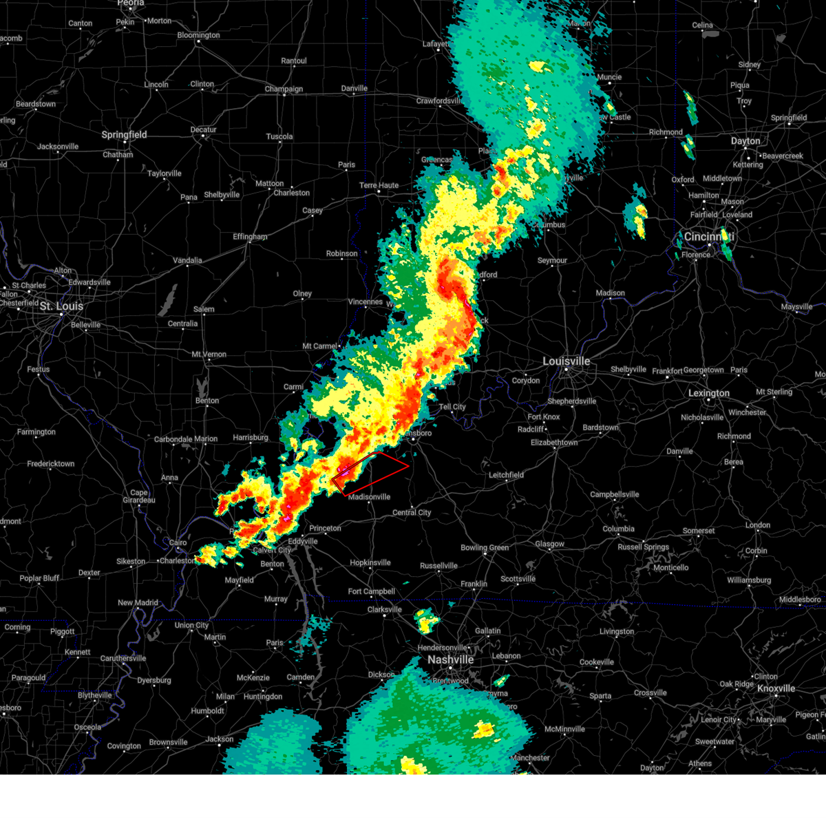
| 4/2/2025 9:37 PM CDT | At 936 pm cdt, a severe thunderstorm capable of producing a tornado was located near madisonville, moving northeast at 60 mph (radar indicated rotation). Hazards include tornado. Flying debris will be dangerous to those caught without shelter. mobile homes will be damaged or destroyed. damage to roofs, windows, and vehicles will occur. tree damage is likely. this dangerous storm will be near, madisonville around 940 pm cdt. other locations impacted by this tornadic thunderstorm include nebo, slaughters, and hanson. This includes interstate 69 in kentucky between mile markers 112 and 125. |
| 4/2/2025 9:36 PM CDT | Torpah the national weather service in paducah has issued a * tornado warning for, southern daviess county in northwestern kentucky, northwestern muhlenberg county in south central kentucky, mclean county in northwestern kentucky, northeastern hopkins county in northwestern kentucky, central webster county in northwestern kentucky, * until 1015 pm cdt. * at 936 pm cdt, severe thunderstorms capable of producing a tornado were located along a line extending from near providence to near madisonville, moving northeast at 55 mph (radar indicated rotation). Hazards include tornado. Flying debris will be dangerous to those caught without shelter. mobile homes will be damaged or destroyed. damage to roofs, windows, and vehicles will occur. tree damage is likely. these dangerous storms will be near, madisonville around 940 pm cdt. calhoun and beech grove around 955 pm cdt. livermore around 1000 pm cdt. other locations impacted by these tornadic storms include nebo, moseleyville, sacramento, pleasant ridge, hanson, slaughters, island, and bremen. this includes the following highways, interstate 165 between mile markers 60 and 70. Interstate 69 in kentucky between mile markers 111 and 132. |
| 4/2/2025 9:21 PM CDT | At 921 pm cdt, a severe thunderstorm capable of producing a tornado was located over olney, or 9 miles northwest of dawson springs, moving northeast at 60 mph (radar indicated rotation). Hazards include tornado. Flying debris will be dangerous to those caught without shelter. mobile homes will be damaged or destroyed. damage to roofs, windows, and vehicles will occur. tree damage is likely. this dangerous storm will be near, providence around 925 pm cdt. madisonville and earlington around 930 pm cdt. other locations impacted by this tornadic thunderstorm include nebo, hanson, fryer, and slaughters. This includes interstate 69 in kentucky between mile markers 78 and 83, near mile marker 92, and between mile markers 112 and 125. |
| 4/2/2025 9:12 PM CDT | Torpah the national weather service in paducah has issued a * tornado warning for, east central crittenden county in western kentucky, central caldwell county in western kentucky, central hopkins county in northwestern kentucky, southern webster county in northwestern kentucky, * until 1000 pm cdt. * at 912 pm cdt, a severe thunderstorm capable of producing a tornado was located over farmersville, or 7 miles northwest of princeton, moving northeast at 60 mph (radar indicated rotation). Hazards include tornado. Flying debris will be dangerous to those caught without shelter. mobile homes will be damaged or destroyed. damage to roofs, windows, and vehicles will occur. tree damage is likely. this dangerous storm will be near, creswell, olney, princeton, and farmersville around 915 pm cdt. providence around 920 pm cdt. madisonville and earlington around 930 pm cdt. other locations impacted by this tornadic thunderstorm include nebo, hanson, fryer, and slaughters. This includes interstate 69 in kentucky between mile markers 74 and 83, and between mile markers 113 and 125. |
| 4/2/2025 9:12 PM CDT |
 At 911 pm cdt, severe thunderstorms were located along a line extending from 6 miles south of corydon to 6 miles north of creswell, moving east at 55 mph (radar indicated). Hazards include 60 mph wind gusts. Expect damage to roofs, siding, and trees. locations impacted include, clay, providence, wheatcroft, slaughters, dixon, sebree, and sturgis. This includes interstate 69 in kentucky between mile markers 128 and 137. At 911 pm cdt, severe thunderstorms were located along a line extending from 6 miles south of corydon to 6 miles north of creswell, moving east at 55 mph (radar indicated). Hazards include 60 mph wind gusts. Expect damage to roofs, siding, and trees. locations impacted include, clay, providence, wheatcroft, slaughters, dixon, sebree, and sturgis. This includes interstate 69 in kentucky between mile markers 128 and 137.
|
| 4/2/2025 9:12 PM CDT |
 the severe thunderstorm warning has been cancelled and is no longer in effect the severe thunderstorm warning has been cancelled and is no longer in effect
|
| 4/2/2025 8:52 PM CDT |
 At 852 pm cdt, severe thunderstorms were located along a line extending from near breckinridge center to near marion, moving east at 45 mph (radar indicated). Hazards include 70 mph wind gusts. Expect considerable tree damage. damage is likely to mobile homes, roofs, and outbuildings. locations impacted include, clay, providence, slaughters, sturgis, cave-in-rock, rosiclare, joy, wheatcroft, gross, elizabethtown, carrsville, dixon, sebree, and golconda. This includes interstate 69 in kentucky between mile markers 128 and 137. At 852 pm cdt, severe thunderstorms were located along a line extending from near breckinridge center to near marion, moving east at 45 mph (radar indicated). Hazards include 70 mph wind gusts. Expect considerable tree damage. damage is likely to mobile homes, roofs, and outbuildings. locations impacted include, clay, providence, slaughters, sturgis, cave-in-rock, rosiclare, joy, wheatcroft, gross, elizabethtown, carrsville, dixon, sebree, and golconda. This includes interstate 69 in kentucky between mile markers 128 and 137.
|
| 4/2/2025 8:28 PM CDT | Svrpah the national weather service in paducah has issued a * severe thunderstorm warning for, hardin county in southern illinois, south central gallatin county in southern illinois, northern crittenden county in western kentucky, northwestern livingston county in western kentucky, southern union county in northwestern kentucky, webster county in northwestern kentucky, * until 930 pm cdt. * at 826 pm cdt, severe thunderstorms were located along a line extending from 6 miles southwest of old shawneetown to joy, moving east at 45 mph (radar indicated). Hazards include 70 mph wind gusts and quarter size hail. Hail damage to vehicles is expected. expect considerable tree damage. Wind damage is also likely to mobile homes, roofs, and outbuildings. |
| 3/30/2025 8:14 PM CDT | The storms which prompted the warning have weakened below severe limits, and no longer pose an immediate threat to life or property. therefore, the warning will be allowed to expire. a tornado watch remains in effect until 1100 pm cdt for western, south central and northwestern kentucky. |
| 3/30/2025 7:46 PM CDT | the severe thunderstorm warning has been cancelled and is no longer in effect |
| 3/30/2025 7:46 PM CDT | At 746 pm cdt, severe thunderstorms were located along a line extending from clay to near creswell, moving east at 50 mph (law enforcement). Hazards include 60 mph wind gusts. Expect damage to roofs, siding, and trees. Locations impacted include, clay, wheatcroft, and providence. |
| 3/30/2025 7:35 PM CDT | the severe thunderstorm warning has been cancelled and is no longer in effect |
| 3/30/2025 7:35 PM CDT | At 735 pm cdt, severe thunderstorms were located along a line extending from near sturgis to 7 miles northeast of marion, moving east at 55 mph (law enforcement). Hazards include 60 mph wind gusts. Expect damage to roofs, siding, and trees. Locations impacted include, clay, morganfield, providence, wheatcroft, salem, marion, sturgis, breckinridge center, and dixon. |
| 3/30/2025 7:33 PM CDT | Svrpah the national weather service in paducah has issued a * severe thunderstorm warning for, central crittenden county in western kentucky, caldwell county in western kentucky, central hopkins county in northwestern kentucky, southwestern webster county in northwestern kentucky, northwestern lyon county in western kentucky, * until 815 pm cdt. * at 733 pm cdt, severe thunderstorms were located along a line extending from 8 miles southwest of clay to near eddyville, moving east at 55 mph (radar indicated). Hazards include 60 mph wind gusts. expect damage to roofs, siding, and trees |
| 3/30/2025 7:23 PM CDT | At 723 pm cdt, severe thunderstorms were located along a line extending from 9 miles northeast of rosiclare to near marion, moving east at 55 mph (radar indicated). Hazards include 60 mph wind gusts. Expect damage to roofs, siding, and trees. Locations impacted include, clay, karbers ridge, morganfield, providence, sturgis, cave-in-rock, wheatcroft, salem, gross, elizabethtown, marion, rosiclare, breckinridge center, and dixon. |
| 3/30/2025 7:12 PM CDT | Svrpah the national weather service in paducah has issued a * severe thunderstorm warning for, hardin county in southern illinois, southwestern gallatin county in southern illinois, crittenden county in western kentucky, northeastern livingston county in western kentucky, southern union county in northwestern kentucky, western webster county in northwestern kentucky, * until 800 pm cdt. * at 712 pm cdt, severe thunderstorms were located along a line extending from near rosiclare to near joy, moving east at 50 mph (radar indicated). Hazards include 60 mph wind gusts. expect damage to roofs, siding, and trees |
| 3/23/2025 6:25 PM CDT |
 At 625 pm cdt, a severe thunderstorm was located near providence, moving east at 50 mph (radar indicated). Hazards include 60 mph wind gusts and quarter size hail. Hail damage to vehicles is expected. expect wind damage to roofs, siding, and trees. Locations impacted include, nebo, creswell, providence, olney, fryer, farmersville, and dixon. At 625 pm cdt, a severe thunderstorm was located near providence, moving east at 50 mph (radar indicated). Hazards include 60 mph wind gusts and quarter size hail. Hail damage to vehicles is expected. expect wind damage to roofs, siding, and trees. Locations impacted include, nebo, creswell, providence, olney, fryer, farmersville, and dixon.
|
| 3/23/2025 6:25 PM CDT |
 the severe thunderstorm warning has been cancelled and is no longer in effect the severe thunderstorm warning has been cancelled and is no longer in effect
|
| 3/23/2025 6:14 PM CDT |
 Svrpah the national weather service in paducah has issued a * severe thunderstorm warning for, east central crittenden county in western kentucky, northern caldwell county in western kentucky, southwestern hopkins county in northwestern kentucky, southwestern webster county in northwestern kentucky, * until 645 pm cdt. * at 614 pm cdt, a severe thunderstorm was located over creswell, or 8 miles east of marion, moving east at 50 mph (radar indicated). Hazards include 60 mph wind gusts and quarter size hail. Hail damage to vehicles is expected. Expect wind damage to roofs, siding, and trees. Svrpah the national weather service in paducah has issued a * severe thunderstorm warning for, east central crittenden county in western kentucky, northern caldwell county in western kentucky, southwestern hopkins county in northwestern kentucky, southwestern webster county in northwestern kentucky, * until 645 pm cdt. * at 614 pm cdt, a severe thunderstorm was located over creswell, or 8 miles east of marion, moving east at 50 mph (radar indicated). Hazards include 60 mph wind gusts and quarter size hail. Hail damage to vehicles is expected. Expect wind damage to roofs, siding, and trees.
|
| 3/19/2025 7:22 PM CDT |
 The storm which prompted the warning has moved out of the area. therefore, the warning will be allowed to expire. a tornado watch remains in effect until 1100 pm cdt for western, south central and northwestern kentucky. The storm which prompted the warning has moved out of the area. therefore, the warning will be allowed to expire. a tornado watch remains in effect until 1100 pm cdt for western, south central and northwestern kentucky.
|
| 3/19/2025 7:10 PM CDT |
 the severe thunderstorm warning has been cancelled and is no longer in effect the severe thunderstorm warning has been cancelled and is no longer in effect
|
| 3/19/2025 7:10 PM CDT |
 At 710 pm cdt, a severe thunderstorm was located near dawson springs, moving northeast at 55 mph (radar indicated). Hazards include 60 mph wind gusts and quarter size hail. Hail damage to vehicles is expected. expect wind damage to roofs, siding, and trees. locations impacted include, nebo, providence, mortons gap, earlington, dawson springs, st. charles, and madisonville. This includes interstate 69 in kentucky between mile markers 92 and 101, and near mile marker 109. At 710 pm cdt, a severe thunderstorm was located near dawson springs, moving northeast at 55 mph (radar indicated). Hazards include 60 mph wind gusts and quarter size hail. Hail damage to vehicles is expected. expect wind damage to roofs, siding, and trees. locations impacted include, nebo, providence, mortons gap, earlington, dawson springs, st. charles, and madisonville. This includes interstate 69 in kentucky between mile markers 92 and 101, and near mile marker 109.
|
| 3/19/2025 7:00 PM CDT | At 700 pm cdt, a severe thunderstorm was located near farmersville, or near princeton, moving northeast at 55 mph (radar indicated). Hazards include 60 mph wind gusts and quarter size hail. Hail damage to vehicles is expected. expect wind damage to roofs, siding, and trees. locations impacted include, nebo, creswell, providence, princeton, mortons gap, olney, fryer, earlington, dawson springs, farmersville, st. charles, and madisonville. This includes interstate 69 in kentucky between mile markers 79 and 101, and near mile marker 109. |
| 3/19/2025 7:00 PM CDT | the severe thunderstorm warning has been cancelled and is no longer in effect |
| 3/19/2025 6:46 PM CDT |
 Svrpah the national weather service in paducah has issued a * severe thunderstorm warning for, caldwell county in western kentucky, southwestern hopkins county in northwestern kentucky, south central webster county in northwestern kentucky, central lyon county in western kentucky, * until 730 pm cdt. * at 646 pm cdt, a severe thunderstorm was located over eddyville, moving northeast at 50 mph (radar indicated). Hazards include 60 mph wind gusts and quarter size hail. Hail damage to vehicles is expected. Expect wind damage to roofs, siding, and trees. Svrpah the national weather service in paducah has issued a * severe thunderstorm warning for, caldwell county in western kentucky, southwestern hopkins county in northwestern kentucky, south central webster county in northwestern kentucky, central lyon county in western kentucky, * until 730 pm cdt. * at 646 pm cdt, a severe thunderstorm was located over eddyville, moving northeast at 50 mph (radar indicated). Hazards include 60 mph wind gusts and quarter size hail. Hail damage to vehicles is expected. Expect wind damage to roofs, siding, and trees.
|
| 3/15/2025 4:14 AM CDT | At 414 am cdt, a severe thunderstorm was located near dixon, or near providence, moving northeast at 80 mph (radar indicated). Hazards include golf ball size hail and 60 mph wind gusts. People and animals outdoors will be injured. expect hail damage to roofs, siding, windows, and vehicles. expect wind damage to roofs, siding, and trees. locations impacted include, clay, providence, slaughters, dixon, sebree, wheatcroft, hanson, and nebo. This includes interstate 69 in kentucky between mile markers 122 and 139. |
| 3/15/2025 4:14 AM CDT | the severe thunderstorm warning has been cancelled and is no longer in effect |
| 3/15/2025 4:07 AM CDT |
 Svrpah the national weather service in paducah has issued a * severe thunderstorm warning for, south central henderson county in northwestern kentucky, northeastern crittenden county in western kentucky, northwestern caldwell county in western kentucky, northern hopkins county in northwestern kentucky, webster county in northwestern kentucky, * until 445 am cdt. * at 407 am cdt, a severe thunderstorm was located near creswell, or near marion, moving northeast at 60 mph (radar indicated). Hazards include 60 mph wind gusts and quarter size hail. Hail damage to vehicles is expected. Expect wind damage to roofs, siding, and trees. Svrpah the national weather service in paducah has issued a * severe thunderstorm warning for, south central henderson county in northwestern kentucky, northeastern crittenden county in western kentucky, northwestern caldwell county in western kentucky, northern hopkins county in northwestern kentucky, webster county in northwestern kentucky, * until 445 am cdt. * at 407 am cdt, a severe thunderstorm was located near creswell, or near marion, moving northeast at 60 mph (radar indicated). Hazards include 60 mph wind gusts and quarter size hail. Hail damage to vehicles is expected. Expect wind damage to roofs, siding, and trees.
|
| 3/15/2025 4:05 AM CDT |
 The tornado threat has diminished and the tornado warning has been cancelled. however, large hail and damaging winds remain likely and a severe thunderstorm warning remains in effect for the area. a tornado watch remains in effect until 600 am cdt for northwestern kentucky. The tornado threat has diminished and the tornado warning has been cancelled. however, large hail and damaging winds remain likely and a severe thunderstorm warning remains in effect for the area. a tornado watch remains in effect until 600 am cdt for northwestern kentucky.
|
| 3/15/2025 3:48 AM CDT |
 Torpah the national weather service in paducah has issued a * tornado warning for, northwestern mclean county in northwestern kentucky, northeastern hopkins county in northwestern kentucky, central webster county in northwestern kentucky, * until 415 am cdt. * at 348 am cdt, a severe thunderstorm capable of producing a tornado was located near dixon, or 7 miles northeast of providence, moving northeast at 70 mph (radar indicated rotation). Hazards include tornado. Flying debris will be dangerous to those caught without shelter. mobile homes will be damaged or destroyed. damage to roofs, windows, and vehicles will occur. tree damage is likely. this dangerous storm will be near, beech grove and sebree around 355 am cdt. calhoun around 400 am cdt. other locations impacted by this tornadic thunderstorm include slaughters. This includes interstate 69 in kentucky between mile markers 124 and 136. Torpah the national weather service in paducah has issued a * tornado warning for, northwestern mclean county in northwestern kentucky, northeastern hopkins county in northwestern kentucky, central webster county in northwestern kentucky, * until 415 am cdt. * at 348 am cdt, a severe thunderstorm capable of producing a tornado was located near dixon, or 7 miles northeast of providence, moving northeast at 70 mph (radar indicated rotation). Hazards include tornado. Flying debris will be dangerous to those caught without shelter. mobile homes will be damaged or destroyed. damage to roofs, windows, and vehicles will occur. tree damage is likely. this dangerous storm will be near, beech grove and sebree around 355 am cdt. calhoun around 400 am cdt. other locations impacted by this tornadic thunderstorm include slaughters. This includes interstate 69 in kentucky between mile markers 124 and 136.
|
| 3/15/2025 3:13 AM CDT |
 Svrpah the national weather service in paducah has issued a * severe thunderstorm warning for, northwestern daviess county in northwestern kentucky, henderson county in northwestern kentucky, central crittenden county in western kentucky, northwestern caldwell county in western kentucky, northwestern mclean county in northwestern kentucky, northwestern hopkins county in northwestern kentucky, southeastern union county in northwestern kentucky, webster county in northwestern kentucky, * until 400 am cdt. * at 313 am cdt, severe thunderstorms were located along a line extending from near corydon to near salem, moving northeast at 40 mph (trained weather spotters). Hazards include 70 mph wind gusts. Expect considerable tree damage. Damage is likely to mobile homes, roofs, and outbuildings. Svrpah the national weather service in paducah has issued a * severe thunderstorm warning for, northwestern daviess county in northwestern kentucky, henderson county in northwestern kentucky, central crittenden county in western kentucky, northwestern caldwell county in western kentucky, northwestern mclean county in northwestern kentucky, northwestern hopkins county in northwestern kentucky, southeastern union county in northwestern kentucky, webster county in northwestern kentucky, * until 400 am cdt. * at 313 am cdt, severe thunderstorms were located along a line extending from near corydon to near salem, moving northeast at 40 mph (trained weather spotters). Hazards include 70 mph wind gusts. Expect considerable tree damage. Damage is likely to mobile homes, roofs, and outbuildings.
|
| 9/13/2024 6:47 PM CDT |
 the severe thunderstorm warning has been cancelled and is no longer in effect the severe thunderstorm warning has been cancelled and is no longer in effect
|
| 9/13/2024 6:36 PM CDT |
 the severe thunderstorm warning has been cancelled and is no longer in effect the severe thunderstorm warning has been cancelled and is no longer in effect
|
| 9/13/2024 6:36 PM CDT |
 At 636 pm cdt, a severe thunderstorm was located near dixon, or near providence, moving northwest at 30 mph (radar indicated). Hazards include 60 mph wind gusts. Expect damage to roofs, siding, and trees. Locations impacted include, providence, clay, dixon, and wheatcroft. At 636 pm cdt, a severe thunderstorm was located near dixon, or near providence, moving northwest at 30 mph (radar indicated). Hazards include 60 mph wind gusts. Expect damage to roofs, siding, and trees. Locations impacted include, providence, clay, dixon, and wheatcroft.
|
| 9/13/2024 6:23 PM CDT |
 Svrpah the national weather service in paducah has issued a * severe thunderstorm warning for, central hopkins county in northwestern kentucky, western webster county in northwestern kentucky, * until 700 pm cdt. * at 623 pm cdt, a severe thunderstorm was located near providence, moving northwest at 30 mph (radar indicated). Hazards include 60 mph wind gusts. expect damage to roofs, siding, and trees Svrpah the national weather service in paducah has issued a * severe thunderstorm warning for, central hopkins county in northwestern kentucky, western webster county in northwestern kentucky, * until 700 pm cdt. * at 623 pm cdt, a severe thunderstorm was located near providence, moving northwest at 30 mph (radar indicated). Hazards include 60 mph wind gusts. expect damage to roofs, siding, and trees
|
| 5/26/2024 9:59 PM CDT |
 The storms which prompted the warning have moved out of the area. therefore, the warning will be allowed to expire. The storms which prompted the warning have moved out of the area. therefore, the warning will be allowed to expire.
|
| 5/26/2024 9:27 PM CDT |
 the severe thunderstorm warning has been cancelled and is no longer in effect the severe thunderstorm warning has been cancelled and is no longer in effect
|
| 5/26/2024 9:16 PM CDT |
 Svrpah the national weather service in paducah has issued a * severe thunderstorm warning for, southeastern crittenden county in western kentucky, southeastern livingston county in western kentucky, caldwell county in western kentucky, central hopkins county in northwestern kentucky, southwestern webster county in northwestern kentucky, lyon county in western kentucky, * until 1000 pm cdt. * at 916 pm cdt, severe thunderstorms were located along a line extending from near providence to near marion to near calvert city, moving east at 50 mph (radar indicated). Hazards include 60 mph wind gusts and quarter size hail. Hail damage to vehicles is expected. Expect wind damage to roofs, siding, and trees. Svrpah the national weather service in paducah has issued a * severe thunderstorm warning for, southeastern crittenden county in western kentucky, southeastern livingston county in western kentucky, caldwell county in western kentucky, central hopkins county in northwestern kentucky, southwestern webster county in northwestern kentucky, lyon county in western kentucky, * until 1000 pm cdt. * at 916 pm cdt, severe thunderstorms were located along a line extending from near providence to near marion to near calvert city, moving east at 50 mph (radar indicated). Hazards include 60 mph wind gusts and quarter size hail. Hail damage to vehicles is expected. Expect wind damage to roofs, siding, and trees.
|
| 5/26/2024 8:54 PM CDT |
 Svrpah the national weather service in paducah has issued a * severe thunderstorm warning for, spencer county in southwestern indiana, daviess county in northwestern kentucky, southeastern henderson county in northwestern kentucky, mclean county in northwestern kentucky, northeastern hopkins county in northwestern kentucky, central webster county in northwestern kentucky, * until 945 pm cdt. * at 854 pm cdt, severe thunderstorms were located along a line extending from near boonville to near stanley to near clay, moving east at 65 mph (radar indicated). Hazards include 60 mph wind gusts and quarter size hail. Hail damage to vehicles is expected. Expect wind damage to roofs, siding, and trees. Svrpah the national weather service in paducah has issued a * severe thunderstorm warning for, spencer county in southwestern indiana, daviess county in northwestern kentucky, southeastern henderson county in northwestern kentucky, mclean county in northwestern kentucky, northeastern hopkins county in northwestern kentucky, central webster county in northwestern kentucky, * until 945 pm cdt. * at 854 pm cdt, severe thunderstorms were located along a line extending from near boonville to near stanley to near clay, moving east at 65 mph (radar indicated). Hazards include 60 mph wind gusts and quarter size hail. Hail damage to vehicles is expected. Expect wind damage to roofs, siding, and trees.
|
| 5/26/2024 8:52 PM CDT |
 Svrpah the national weather service in paducah has issued a * severe thunderstorm warning for, northeastern hardin county in southern illinois, southern posey county in southwestern indiana, northwestern daviess county in northwestern kentucky, henderson county in northwestern kentucky, northern crittenden county in western kentucky, union county in northwestern kentucky, webster county in northwestern kentucky, * until 945 pm cdt. * at 852 pm cdt, severe thunderstorms were located along a line extending from near ridgway to 10 miles west of sturgis to rosiclare, moving east at 65 mph (radar indicated). Hazards include 60 mph wind gusts and quarter size hail. Hail damage to vehicles is expected. Expect wind damage to roofs, siding, and trees. Svrpah the national weather service in paducah has issued a * severe thunderstorm warning for, northeastern hardin county in southern illinois, southern posey county in southwestern indiana, northwestern daviess county in northwestern kentucky, henderson county in northwestern kentucky, northern crittenden county in western kentucky, union county in northwestern kentucky, webster county in northwestern kentucky, * until 945 pm cdt. * at 852 pm cdt, severe thunderstorms were located along a line extending from near ridgway to 10 miles west of sturgis to rosiclare, moving east at 65 mph (radar indicated). Hazards include 60 mph wind gusts and quarter size hail. Hail damage to vehicles is expected. Expect wind damage to roofs, siding, and trees.
|
| 5/26/2024 8:59 AM CDT |
 At 856 am cdt, severe thunderstorms were located along a line extending from clay to near olney to 7 miles north of big rock, moving east at 70 mph. these are destructive storms for all of caldwell, trigg, hopkins, and christian counties (trained weather spotters). Hazards include 80 mph wind gusts. Flying debris will be dangerous to those caught without shelter. mobile homes will be heavily damaged. expect considerable damage to roofs, windows, and vehicles. extensive tree damage and power outages are likely. locations impacted include, owensboro, hopkinsville, madisonville, oak grove, princeton, central city, providence, dawson springs, cadiz, elkton, calhoun, fort campbell, wranglers campground, land between the lakes area, sebree, guthrie, earlington, livermore, nortonville, and clay. this includes the following highways, interstate 24 in kentucky between mile markers 50 and 92. interstate 165 between mile markers 60 and 70. interstate 69 in kentucky between mile markers 76 and 137. western kentucky parkway between mile markers 39 and 65. pennyrile parkway between mile markers 1 and 34. Audubon parkway near mile marker 23. At 856 am cdt, severe thunderstorms were located along a line extending from clay to near olney to 7 miles north of big rock, moving east at 70 mph. these are destructive storms for all of caldwell, trigg, hopkins, and christian counties (trained weather spotters). Hazards include 80 mph wind gusts. Flying debris will be dangerous to those caught without shelter. mobile homes will be heavily damaged. expect considerable damage to roofs, windows, and vehicles. extensive tree damage and power outages are likely. locations impacted include, owensboro, hopkinsville, madisonville, oak grove, princeton, central city, providence, dawson springs, cadiz, elkton, calhoun, fort campbell, wranglers campground, land between the lakes area, sebree, guthrie, earlington, livermore, nortonville, and clay. this includes the following highways, interstate 24 in kentucky between mile markers 50 and 92. interstate 165 between mile markers 60 and 70. interstate 69 in kentucky between mile markers 76 and 137. western kentucky parkway between mile markers 39 and 65. pennyrile parkway between mile markers 1 and 34. Audubon parkway near mile marker 23.
|
| 5/26/2024 8:59 AM CDT |
 the severe thunderstorm warning has been cancelled and is no longer in effect the severe thunderstorm warning has been cancelled and is no longer in effect
|
| 5/26/2024 8:51 AM CDT |
 Svrpah the national weather service in paducah has issued a * severe thunderstorm warning for, southeastern henderson county in northwestern kentucky, caldwell county in western kentucky, trigg county in western kentucky, hopkins county in northwestern kentucky, southeastern lyon county in western kentucky, daviess county in northwestern kentucky, muhlenberg county in south central kentucky, northeastern crittenden county in western kentucky, christian county in south central kentucky, mclean county in northwestern kentucky, todd county in south central kentucky, south central union county in northwestern kentucky, webster county in northwestern kentucky, * until 930 am cdt. * at 850 am cdt, severe thunderstorms were located along a line extending from 6 miles northeast of marion to farmersville to 7 miles south of wranglers campground, moving east at 65 mph (radar indicated). Hazards include 70 mph wind gusts. Expect considerable tree damage. Damage is likely to mobile homes, roofs, and outbuildings. Svrpah the national weather service in paducah has issued a * severe thunderstorm warning for, southeastern henderson county in northwestern kentucky, caldwell county in western kentucky, trigg county in western kentucky, hopkins county in northwestern kentucky, southeastern lyon county in western kentucky, daviess county in northwestern kentucky, muhlenberg county in south central kentucky, northeastern crittenden county in western kentucky, christian county in south central kentucky, mclean county in northwestern kentucky, todd county in south central kentucky, south central union county in northwestern kentucky, webster county in northwestern kentucky, * until 930 am cdt. * at 850 am cdt, severe thunderstorms were located along a line extending from 6 miles northeast of marion to farmersville to 7 miles south of wranglers campground, moving east at 65 mph (radar indicated). Hazards include 70 mph wind gusts. Expect considerable tree damage. Damage is likely to mobile homes, roofs, and outbuildings.
|
| 5/8/2024 6:53 PM CDT |
 The storms which prompted the warning have moved out of the area. therefore, the warning will be allowed to expire. a tornado watch remains in effect until midnight cdt for western and northwestern kentucky. The storms which prompted the warning have moved out of the area. therefore, the warning will be allowed to expire. a tornado watch remains in effect until midnight cdt for western and northwestern kentucky.
|
| 5/8/2024 6:30 PM CDT |
 the severe thunderstorm warning has been cancelled and is no longer in effect the severe thunderstorm warning has been cancelled and is no longer in effect
|
| 5/8/2024 6:30 PM CDT |
 At 630 pm cdt, severe thunderstorms were located along a line extending from providence to near olney to near farmersville, moving east at 35 mph (radar indicated). Hazards include 60 mph wind gusts and quarter size hail. Hail damage to vehicles is expected. expect wind damage to roofs, siding, and trees. locations impacted include, princeton, providence, creswell, olney, farmersville, hanson, nebo, slaughters, and fryer. This includes interstate 69 in kentucky between mile markers 76 and 88, and between mile markers 123 and 125. At 630 pm cdt, severe thunderstorms were located along a line extending from providence to near olney to near farmersville, moving east at 35 mph (radar indicated). Hazards include 60 mph wind gusts and quarter size hail. Hail damage to vehicles is expected. expect wind damage to roofs, siding, and trees. locations impacted include, princeton, providence, creswell, olney, farmersville, hanson, nebo, slaughters, and fryer. This includes interstate 69 in kentucky between mile markers 76 and 88, and between mile markers 123 and 125.
|
| 5/8/2024 6:09 PM CDT |
 Svrpah the national weather service in paducah has issued a * severe thunderstorm warning for, central crittenden county in western kentucky, east central livingston county in western kentucky, central caldwell county in western kentucky, central hopkins county in northwestern kentucky, south central union county in northwestern kentucky, webster county in northwestern kentucky, northwestern lyon county in western kentucky, * until 700 pm cdt. * at 609 pm cdt, severe thunderstorms were located along a line extending from near sturgis to 6 miles south of salem, moving east at 25 mph (radar indicated). Hazards include 60 mph wind gusts and quarter size hail. Hail damage to vehicles is expected. Expect wind damage to roofs, siding, and trees. Svrpah the national weather service in paducah has issued a * severe thunderstorm warning for, central crittenden county in western kentucky, east central livingston county in western kentucky, central caldwell county in western kentucky, central hopkins county in northwestern kentucky, south central union county in northwestern kentucky, webster county in northwestern kentucky, northwestern lyon county in western kentucky, * until 700 pm cdt. * at 609 pm cdt, severe thunderstorms were located along a line extending from near sturgis to 6 miles south of salem, moving east at 25 mph (radar indicated). Hazards include 60 mph wind gusts and quarter size hail. Hail damage to vehicles is expected. Expect wind damage to roofs, siding, and trees.
|
| 5/8/2024 5:35 PM CDT |
 the severe thunderstorm warning has been cancelled and is no longer in effect the severe thunderstorm warning has been cancelled and is no longer in effect
|
| 5/8/2024 5:35 PM CDT |
 At 535 pm cdt, a severe thunderstorm was located near dixon, or 10 miles northeast of providence, moving east at 30 mph (radar indicated). Hazards include 60 mph wind gusts and quarter size hail. Hail damage to vehicles is expected. expect wind damage to roofs, siding, and trees. locations impacted include, sebree and dixon. This includes interstate 69 in kentucky between mile markers 134 and 135. At 535 pm cdt, a severe thunderstorm was located near dixon, or 10 miles northeast of providence, moving east at 30 mph (radar indicated). Hazards include 60 mph wind gusts and quarter size hail. Hail damage to vehicles is expected. expect wind damage to roofs, siding, and trees. locations impacted include, sebree and dixon. This includes interstate 69 in kentucky between mile markers 134 and 135.
|
| 5/8/2024 5:10 PM CDT |
 Svrpah the national weather service in paducah has issued a * severe thunderstorm warning for, north central hopkins county in northwestern kentucky, southeastern union county in northwestern kentucky, webster county in northwestern kentucky, * until 600 pm cdt. * at 510 pm cdt, a severe thunderstorm was located near clay, or near sturgis, moving east at 30 mph (radar indicated). Hazards include 60 mph wind gusts and quarter size hail. Hail damage to vehicles is expected. Expect wind damage to roofs, siding, and trees. Svrpah the national weather service in paducah has issued a * severe thunderstorm warning for, north central hopkins county in northwestern kentucky, southeastern union county in northwestern kentucky, webster county in northwestern kentucky, * until 600 pm cdt. * at 510 pm cdt, a severe thunderstorm was located near clay, or near sturgis, moving east at 30 mph (radar indicated). Hazards include 60 mph wind gusts and quarter size hail. Hail damage to vehicles is expected. Expect wind damage to roofs, siding, and trees.
|
| 5/8/2024 2:04 PM CDT |
 At 204 pm cdt, a severe thunderstorm was located 8 miles southwest of clay, or 8 miles northeast of marion, moving northeast at 35 mph (radar indicated). Hazards include 60 mph wind gusts and quarter size hail. Hail damage to vehicles is expected. expect wind damage to roofs, siding, and trees. Locations impacted include, providence, marion, sturgis, clay, dixon, and wheatcroft. At 204 pm cdt, a severe thunderstorm was located 8 miles southwest of clay, or 8 miles northeast of marion, moving northeast at 35 mph (radar indicated). Hazards include 60 mph wind gusts and quarter size hail. Hail damage to vehicles is expected. expect wind damage to roofs, siding, and trees. Locations impacted include, providence, marion, sturgis, clay, dixon, and wheatcroft.
|
| 5/8/2024 1:47 PM CDT |
 Svrpah the national weather service in paducah has issued a * severe thunderstorm warning for, crittenden county in western kentucky, northwestern caldwell county in western kentucky, southeastern union county in northwestern kentucky, webster county in northwestern kentucky, * until 230 pm cdt. * at 146 pm cdt, a severe thunderstorm was located over marion, moving northeast at 35 mph (radar indicated). Hazards include 60 mph wind gusts and quarter size hail. Hail damage to vehicles is expected. Expect wind damage to roofs, siding, and trees. Svrpah the national weather service in paducah has issued a * severe thunderstorm warning for, crittenden county in western kentucky, northwestern caldwell county in western kentucky, southeastern union county in northwestern kentucky, webster county in northwestern kentucky, * until 230 pm cdt. * at 146 pm cdt, a severe thunderstorm was located over marion, moving northeast at 35 mph (radar indicated). Hazards include 60 mph wind gusts and quarter size hail. Hail damage to vehicles is expected. Expect wind damage to roofs, siding, and trees.
|
| 4/2/2024 6:07 AM CDT |
 Rotation has weakened. therefore, the warning will be allowed to expire. a tornado watch remains in effect until 800 am cdt for western and northwestern kentucky. Rotation has weakened. therefore, the warning will be allowed to expire. a tornado watch remains in effect until 800 am cdt for western and northwestern kentucky.
|
| 4/2/2024 5:56 AM CDT |
 the severe thunderstorm warning has been cancelled and is no longer in effect the severe thunderstorm warning has been cancelled and is no longer in effect
|
| 4/2/2024 5:56 AM CDT |
 At 556 am cdt, severe thunderstorms were located along a line extending from 7 miles southwest of kasson to near creswell, moving east at 65 mph (radar indicated). Hazards include 60 mph wind gusts. Expect damage to roofs, siding, and trees. locations impacted include, evansville, henderson, princeton, morganfield, providence, marion, dawson springs, eddyville, sturgis, breckinridge center, sebree, clay, dixon, corydon, robards, olney, creswell, farmersville, kuttawa, and fredonia. this includes the following highways, interstate 24 in kentucky between mile markers 30 and 46. interstate 69 in kentucky between mile markers 68 and 95, and between mile markers 129 and 148. Audubon parkway between mile markers 1 and 11. At 556 am cdt, severe thunderstorms were located along a line extending from 7 miles southwest of kasson to near creswell, moving east at 65 mph (radar indicated). Hazards include 60 mph wind gusts. Expect damage to roofs, siding, and trees. locations impacted include, evansville, henderson, princeton, morganfield, providence, marion, dawson springs, eddyville, sturgis, breckinridge center, sebree, clay, dixon, corydon, robards, olney, creswell, farmersville, kuttawa, and fredonia. this includes the following highways, interstate 24 in kentucky between mile markers 30 and 46. interstate 69 in kentucky between mile markers 68 and 95, and between mile markers 129 and 148. Audubon parkway between mile markers 1 and 11.
|
| 4/2/2024 5:47 AM CDT |
 Torpah the national weather service in paducah has issued a * tornado warning for, southeastern union county in northwestern kentucky, western webster county in northwestern kentucky, * until 615 am cdt. * at 547 am cdt, a severe thunderstorm capable of producing a tornado was located near sturgis, moving east at 45 mph (radar indicated rotation). Hazards include tornado. Flying debris will be dangerous to those caught without shelter. mobile homes will be damaged or destroyed. damage to roofs, windows, and vehicles will occur. tree damage is likely. this dangerous storm will be near, providence, clay, and dixon around 550 am cdt. Other locations impacted by this tornadic thunderstorm include wheatcroft. Torpah the national weather service in paducah has issued a * tornado warning for, southeastern union county in northwestern kentucky, western webster county in northwestern kentucky, * until 615 am cdt. * at 547 am cdt, a severe thunderstorm capable of producing a tornado was located near sturgis, moving east at 45 mph (radar indicated rotation). Hazards include tornado. Flying debris will be dangerous to those caught without shelter. mobile homes will be damaged or destroyed. damage to roofs, windows, and vehicles will occur. tree damage is likely. this dangerous storm will be near, providence, clay, and dixon around 550 am cdt. Other locations impacted by this tornadic thunderstorm include wheatcroft.
|
| 4/2/2024 5:46 AM CDT |
 the severe thunderstorm warning has been cancelled and is no longer in effect the severe thunderstorm warning has been cancelled and is no longer in effect
|
| 4/2/2024 5:46 AM CDT |
 At 546 am cdt, severe thunderstorms were located along a line extending from near mount vernon to 7 miles southeast of salem, moving east at 65 mph (radar indicated). Hazards include 60 mph wind gusts. Expect damage to roofs, siding, and trees. locations impacted include, evansville, henderson, mount vernon, princeton, morganfield, providence, marion, dawson springs, calvert city, eddyville, sturgis, breckinridge center, sebree, clay, uniontown, dixon, salem, corydon, robards, and olney. this includes the following highways, interstate 24 in kentucky between mile markers 28 and 46. interstate 69 in kentucky between mile markers 68 and 95, and between mile markers 129 and 148. Audubon parkway between mile markers 1 and 11. At 546 am cdt, severe thunderstorms were located along a line extending from near mount vernon to 7 miles southeast of salem, moving east at 65 mph (radar indicated). Hazards include 60 mph wind gusts. Expect damage to roofs, siding, and trees. locations impacted include, evansville, henderson, mount vernon, princeton, morganfield, providence, marion, dawson springs, calvert city, eddyville, sturgis, breckinridge center, sebree, clay, uniontown, dixon, salem, corydon, robards, and olney. this includes the following highways, interstate 24 in kentucky between mile markers 28 and 46. interstate 69 in kentucky between mile markers 68 and 95, and between mile markers 129 and 148. Audubon parkway between mile markers 1 and 11.
|
| 4/2/2024 5:28 AM CDT |
 the severe thunderstorm warning has been cancelled and is no longer in effect the severe thunderstorm warning has been cancelled and is no longer in effect
|
| 4/2/2024 5:28 AM CDT |
 At 528 am cdt, severe thunderstorms were located along a line extending from near ridgway to 7 miles north of ledbetter, moving east at 65 mph (radar indicated). Hazards include 70 mph wind gusts. Expect considerable tree damage. damage is likely to mobile homes, roofs, and outbuildings. locations impacted include, evansville, henderson, paducah, mount vernon, princeton, morganfield, providence, marion, dawson springs, calvert city, eddyville, sturgis, shawneetown, breckinridge center, reidland, sebree, clay, rosiclare, uniontown, and ridgway. this includes the following highways, interstate 24 in kentucky between mile markers 10 and 46. interstate 69 in kentucky between mile markers 68 and 95, and between mile markers 129 and 148. Audubon parkway between mile markers 1 and 11. At 528 am cdt, severe thunderstorms were located along a line extending from near ridgway to 7 miles north of ledbetter, moving east at 65 mph (radar indicated). Hazards include 70 mph wind gusts. Expect considerable tree damage. damage is likely to mobile homes, roofs, and outbuildings. locations impacted include, evansville, henderson, paducah, mount vernon, princeton, morganfield, providence, marion, dawson springs, calvert city, eddyville, sturgis, shawneetown, breckinridge center, reidland, sebree, clay, rosiclare, uniontown, and ridgway. this includes the following highways, interstate 24 in kentucky between mile markers 10 and 46. interstate 69 in kentucky between mile markers 68 and 95, and between mile markers 129 and 148. Audubon parkway between mile markers 1 and 11.
|
| 4/2/2024 5:11 AM CDT |
 Svrpah the national weather service in paducah has issued a * severe thunderstorm warning for, east central johnson county in southern illinois, southwestern white county in southeastern illinois, massac county in southern illinois, southeastern hamilton county in south central illinois, gallatin county in southern illinois, pope county in southern illinois, saline county in southern illinois, hardin county in southern illinois, southern vanderburgh county in southwestern indiana, southwestern posey county in southwestern indiana, henderson county in northwestern kentucky, western hopkins county in northwestern kentucky, northern lyon county in western kentucky, livingston county in western kentucky, northwestern christian county in south central kentucky, northwestern mclean county in northwestern kentucky, northwestern graves county in western kentucky, caldwell county in western kentucky, northwestern marshall county in western kentucky, southeastern ballard county in western kentucky, mccracken county in western kentucky, crittenden county in western kentucky, northeastern carlisle county in western kentucky, union county in northwestern kentucky, webster county in northwestern kentucky, * until 615 am cdt. * at 511 am cdt, severe thunderstorms were located along a line extending from near harrisburg to near west paducah, moving east at 65 mph (radar indicated). Hazards include 70 mph wind gusts. Expect considerable tree damage. Damage is likely to mobile homes, roofs, and outbuildings. Svrpah the national weather service in paducah has issued a * severe thunderstorm warning for, east central johnson county in southern illinois, southwestern white county in southeastern illinois, massac county in southern illinois, southeastern hamilton county in south central illinois, gallatin county in southern illinois, pope county in southern illinois, saline county in southern illinois, hardin county in southern illinois, southern vanderburgh county in southwestern indiana, southwestern posey county in southwestern indiana, henderson county in northwestern kentucky, western hopkins county in northwestern kentucky, northern lyon county in western kentucky, livingston county in western kentucky, northwestern christian county in south central kentucky, northwestern mclean county in northwestern kentucky, northwestern graves county in western kentucky, caldwell county in western kentucky, northwestern marshall county in western kentucky, southeastern ballard county in western kentucky, mccracken county in western kentucky, crittenden county in western kentucky, northeastern carlisle county in western kentucky, union county in northwestern kentucky, webster county in northwestern kentucky, * until 615 am cdt. * at 511 am cdt, severe thunderstorms were located along a line extending from near harrisburg to near west paducah, moving east at 65 mph (radar indicated). Hazards include 70 mph wind gusts. Expect considerable tree damage. Damage is likely to mobile homes, roofs, and outbuildings.
|
| 3/6/2024 9:05 AM CST |
 Torpah the national weather service in paducah has issued a * this is a test message. tornado warning for, henderson county in northwestern kentucky, caldwell county in western kentucky, marshall county in western kentucky, trigg county in western kentucky, ballard county in western kentucky, mccracken county in western kentucky, hopkins county in northwestern kentucky, lyon county in western kentucky, fulton county in western kentucky, calloway county in western kentucky, daviess county in northwestern kentucky, muhlenberg county in south central kentucky, crittenden county in western kentucky, livingston county in western kentucky, christian county in south central kentucky, carlisle county in western kentucky, hickman county in western kentucky, mclean county in northwestern kentucky, todd county in south central kentucky, union county in northwestern kentucky, webster county in northwestern kentucky, graves county in western kentucky, * this is a test message. until 915 am cst. * this is a test message. this is a test tornado warning message. there is no severe weather occurring at this time. this test warning message is part of the annual kentucky tornado drill. if this were an actual severe weather event, you would be given information about the hazard. the national weather service, kentucky emergency management agency and the kentucky weather preparedness committee encourages the use of this time to activate and review your severe weather safety plans. repeating, this has been a test tornado warning message for the 2024 kentucky tornado drill. this concludes the test (test radar indicated rotation). Hazards include test tornado. There are no impacts. this is a test tornado warning. this is a test message. Locations include, all counties in western kentucky. Torpah the national weather service in paducah has issued a * this is a test message. tornado warning for, henderson county in northwestern kentucky, caldwell county in western kentucky, marshall county in western kentucky, trigg county in western kentucky, ballard county in western kentucky, mccracken county in western kentucky, hopkins county in northwestern kentucky, lyon county in western kentucky, fulton county in western kentucky, calloway county in western kentucky, daviess county in northwestern kentucky, muhlenberg county in south central kentucky, crittenden county in western kentucky, livingston county in western kentucky, christian county in south central kentucky, carlisle county in western kentucky, hickman county in western kentucky, mclean county in northwestern kentucky, todd county in south central kentucky, union county in northwestern kentucky, webster county in northwestern kentucky, graves county in western kentucky, * this is a test message. until 915 am cst. * this is a test message. this is a test tornado warning message. there is no severe weather occurring at this time. this test warning message is part of the annual kentucky tornado drill. if this were an actual severe weather event, you would be given information about the hazard. the national weather service, kentucky emergency management agency and the kentucky weather preparedness committee encourages the use of this time to activate and review your severe weather safety plans. repeating, this has been a test tornado warning message for the 2024 kentucky tornado drill. this concludes the test (test radar indicated rotation). Hazards include test tornado. There are no impacts. this is a test tornado warning. this is a test message. Locations include, all counties in western kentucky.
|
| 12/9/2023 12:21 PM CST |
 At 1221 pm cst, a severe thunderstorm was located near creswell, or near marion, moving northeast at 55 mph (radar indicated). Hazards include quarter size hail. damage to vehicles is expected At 1221 pm cst, a severe thunderstorm was located near creswell, or near marion, moving northeast at 55 mph (radar indicated). Hazards include quarter size hail. damage to vehicles is expected
|
| 9/27/2023 9:37 PM CDT |
 At 937 pm cdt, severe thunderstorms were located along a line extending from near dixon to near marion, moving east at 35 mph (radar indicated). Hazards include ping pong ball size hail. People and animals outdoors will be injured. expect damage to roofs, siding, windows, and vehicles. locations impacted include, madisonville, providence, marion, sturgis, clay, dixon, creswell, hanson, nebo, slaughters, wheatcroft, and fryer. this includes interstate 69 in kentucky between mile markers 121 and 133. hail threat, radar indicated max hail size, 1. 50 in wind threat, radar indicated max wind gust, <50 mph. At 937 pm cdt, severe thunderstorms were located along a line extending from near dixon to near marion, moving east at 35 mph (radar indicated). Hazards include ping pong ball size hail. People and animals outdoors will be injured. expect damage to roofs, siding, windows, and vehicles. locations impacted include, madisonville, providence, marion, sturgis, clay, dixon, creswell, hanson, nebo, slaughters, wheatcroft, and fryer. this includes interstate 69 in kentucky between mile markers 121 and 133. hail threat, radar indicated max hail size, 1. 50 in wind threat, radar indicated max wind gust, <50 mph.
|
| 9/27/2023 9:31 PM CDT |
 At 930 pm cdt, severe thunderstorms were located along a line extending from near sturgis to near marion, moving east at 30 mph (radar indicated). Hazards include quarter size hail. damage to vehicles is expected At 930 pm cdt, severe thunderstorms were located along a line extending from near sturgis to near marion, moving east at 30 mph (radar indicated). Hazards include quarter size hail. damage to vehicles is expected
|
| 7/18/2023 2:33 PM CDT |
 At 232 pm cdt, severe thunderstorms were located along a line extending from 7 miles northeast of olney to near crofton to near fort campbell to 6 miles northwest of tennessee ridge, moving east at 55 mph (trained weather spotters). Hazards include 70 mph wind gusts. Expect considerable tree damage. damage is likely to mobile homes, roofs, and outbuildings. locations impacted include, hopkinsville, oak grove, dawson springs, fort campbell, earlington, nortonville, pembroke, mortons gap, crofton, olney, st. charles, lafayette, hawkins and herndon. this includes the following highways, interstate 24 in kentucky between mile markers 70 and 92. interstate 69 in kentucky between mile markers 90 and 105. pennyrile parkway between mile markers 1 and 32. thunderstorm damage threat, considerable hail threat, radar indicated max hail size, <. 75 in wind threat, radar indicated max wind gust, 70 mph. At 232 pm cdt, severe thunderstorms were located along a line extending from 7 miles northeast of olney to near crofton to near fort campbell to 6 miles northwest of tennessee ridge, moving east at 55 mph (trained weather spotters). Hazards include 70 mph wind gusts. Expect considerable tree damage. damage is likely to mobile homes, roofs, and outbuildings. locations impacted include, hopkinsville, oak grove, dawson springs, fort campbell, earlington, nortonville, pembroke, mortons gap, crofton, olney, st. charles, lafayette, hawkins and herndon. this includes the following highways, interstate 24 in kentucky between mile markers 70 and 92. interstate 69 in kentucky between mile markers 90 and 105. pennyrile parkway between mile markers 1 and 32. thunderstorm damage threat, considerable hail threat, radar indicated max hail size, <. 75 in wind threat, radar indicated max wind gust, 70 mph.
|
| 7/18/2023 2:19 PM CDT |
 At 219 pm cdt, severe thunderstorms were located along a line extending from near creswell to near cobb to 6 miles north of big rock to near paris landing state park, moving east at 55 mph (radar indicated). Hazards include 60 mph wind gusts. Expect damage to roofs, siding, and trees. locations impacted include, hopkinsville, oak grove, princeton, dawson springs, cadiz, wranglers campground, fort campbell, land between the lakes area, clarksville, earlington, nortonville, pembroke, mortons gap, crofton, olney, creswell, farmersville, cobb, canton and fredonia. this includes the following highways, interstate 24 in kentucky between mile markers 48 and 92. interstate 69 in kentucky between mile markers 74 and 105. pennyrile parkway between mile markers 1 and 32. hail threat, radar indicated max hail size, <. 75 in wind threat, radar indicated max wind gust, 60 mph. At 219 pm cdt, severe thunderstorms were located along a line extending from near creswell to near cobb to 6 miles north of big rock to near paris landing state park, moving east at 55 mph (radar indicated). Hazards include 60 mph wind gusts. Expect damage to roofs, siding, and trees. locations impacted include, hopkinsville, oak grove, princeton, dawson springs, cadiz, wranglers campground, fort campbell, land between the lakes area, clarksville, earlington, nortonville, pembroke, mortons gap, crofton, olney, creswell, farmersville, cobb, canton and fredonia. this includes the following highways, interstate 24 in kentucky between mile markers 48 and 92. interstate 69 in kentucky between mile markers 74 and 105. pennyrile parkway between mile markers 1 and 32. hail threat, radar indicated max hail size, <. 75 in wind threat, radar indicated max wind gust, 60 mph.
|
| 7/18/2023 2:07 PM CDT |
 At 207 pm cdt, severe thunderstorms were located along a line extending from near marion to near cobb to 8 miles southeast of wranglers campground to near paris landing state park, moving east at 45 mph (radar indicated). Hazards include 60 mph wind gusts. Expect damage to roofs, siding, and trees. locations impacted include, hopkinsville, madisonville, oak grove, princeton, providence, dawson springs, cadiz, wranglers campground, fort campbell, land between the lakes area, clarksville, earlington, nortonville, clay, pembroke, mortons gap, crofton, olney, creswell and farmersville. this includes the following highways, interstate 24 in kentucky between mile markers 48 and 92. interstate 69 in kentucky between mile markers 74 and 110. western kentucky parkway near mile marker 39. pennyrile parkway between mile markers 1 and 34. hail threat, radar indicated max hail size, <. 75 in wind threat, radar indicated max wind gust, 60 mph. At 207 pm cdt, severe thunderstorms were located along a line extending from near marion to near cobb to 8 miles southeast of wranglers campground to near paris landing state park, moving east at 45 mph (radar indicated). Hazards include 60 mph wind gusts. Expect damage to roofs, siding, and trees. locations impacted include, hopkinsville, madisonville, oak grove, princeton, providence, dawson springs, cadiz, wranglers campground, fort campbell, land between the lakes area, clarksville, earlington, nortonville, clay, pembroke, mortons gap, crofton, olney, creswell and farmersville. this includes the following highways, interstate 24 in kentucky between mile markers 48 and 92. interstate 69 in kentucky between mile markers 74 and 110. western kentucky parkway near mile marker 39. pennyrile parkway between mile markers 1 and 34. hail threat, radar indicated max hail size, <. 75 in wind threat, radar indicated max wind gust, 60 mph.
|
| 7/18/2023 1:45 PM CDT |
 At 144 pm cdt, severe thunderstorms were located along a line extending from near rosiclare to eddyville to near turkey bay to 6 miles north of cottage grove, moving east at 55 mph (radar indicated). Hazards include 60 mph wind gusts. expect damage to roofs, siding, and trees At 144 pm cdt, severe thunderstorms were located along a line extending from near rosiclare to eddyville to near turkey bay to 6 miles north of cottage grove, moving east at 55 mph (radar indicated). Hazards include 60 mph wind gusts. expect damage to roofs, siding, and trees
|
| 7/1/2023 10:33 PM CDT |
 At 1033 pm cdt, a severe thunderstorm was located near olney, or near dawson springs, moving east at 70 mph (radar indicated). Hazards include 60 mph wind gusts. Expect damage to roofs, siding, and trees. locations impacted include, madisonville, princeton, providence, dawson springs, earlington, nortonville, mortons gap, olney, creswell, farmersville, white plains, hanson, st. charles, nebo and fryer. this includes the following highways, interstate 69 in kentucky between mile markers 78 and 124. western kentucky parkway between mile markers 39 and 43. pennyrile parkway between mile markers 29 and 34. hail threat, radar indicated max hail size, <. 75 in wind threat, radar indicated max wind gust, 60 mph. At 1033 pm cdt, a severe thunderstorm was located near olney, or near dawson springs, moving east at 70 mph (radar indicated). Hazards include 60 mph wind gusts. Expect damage to roofs, siding, and trees. locations impacted include, madisonville, princeton, providence, dawson springs, earlington, nortonville, mortons gap, olney, creswell, farmersville, white plains, hanson, st. charles, nebo and fryer. this includes the following highways, interstate 69 in kentucky between mile markers 78 and 124. western kentucky parkway between mile markers 39 and 43. pennyrile parkway between mile markers 29 and 34. hail threat, radar indicated max hail size, <. 75 in wind threat, radar indicated max wind gust, 60 mph.
|
| 7/1/2023 10:22 PM CDT |
 At 1022 pm cdt, a severe thunderstorm was located over farmersville, or 7 miles northwest of princeton, moving east at 70 mph (radar indicated). Hazards include 60 mph wind gusts. expect damage to roofs, siding, and trees At 1022 pm cdt, a severe thunderstorm was located over farmersville, or 7 miles northwest of princeton, moving east at 70 mph (radar indicated). Hazards include 60 mph wind gusts. expect damage to roofs, siding, and trees
|
| 6/30/2023 6:19 PM CDT |
 At 618 pm cdt, severe thunderstorms were located along a line extending from 6 miles south of sturgis to 7 miles southeast of providence, and are nearly stationary. a stronger storm is near dawson springs and nortonville (radar indicated). Hazards include 60 mph wind gusts and quarter size hail. Hail damage to vehicles is expected. expect wind damage to roofs, siding, and trees. locations impacted include, madisonville, providence, earlington, nortonville, clay, mortons gap and nebo. this includes the following highways, interstate 69 in kentucky between mile markers 101 and 118. western kentucky parkway near mile marker 39. pennyrile parkway near mile marker 34. hail threat, radar indicated max hail size, 1. 00 in wind threat, radar indicated max wind gust, 60 mph. At 618 pm cdt, severe thunderstorms were located along a line extending from 6 miles south of sturgis to 7 miles southeast of providence, and are nearly stationary. a stronger storm is near dawson springs and nortonville (radar indicated). Hazards include 60 mph wind gusts and quarter size hail. Hail damage to vehicles is expected. expect wind damage to roofs, siding, and trees. locations impacted include, madisonville, providence, earlington, nortonville, clay, mortons gap and nebo. this includes the following highways, interstate 69 in kentucky between mile markers 101 and 118. western kentucky parkway near mile marker 39. pennyrile parkway near mile marker 34. hail threat, radar indicated max hail size, 1. 00 in wind threat, radar indicated max wind gust, 60 mph.
|
| 6/30/2023 5:45 PM CDT | Ping Pong Ball sized hail reported 0.5 miles W of Providence, KY |
| 6/30/2023 5:40 PM CDT |
 At 539 pm cdt, severe thunderstorms were located along a line extending from near sturgis to near madisonville, moving east at 15 mph (radar indicated). Hazards include 70 mph wind gusts and quarter size hail. Hail damage to vehicles is expected. expect considerable tree damage. Wind damage is also likely to mobile homes, roofs, and outbuildings. At 539 pm cdt, severe thunderstorms were located along a line extending from near sturgis to near madisonville, moving east at 15 mph (radar indicated). Hazards include 70 mph wind gusts and quarter size hail. Hail damage to vehicles is expected. expect considerable tree damage. Wind damage is also likely to mobile homes, roofs, and outbuildings.
|
| 6/25/2023 4:46 PM CDT |
 At 445 pm cdt, a severe thunderstorm was located 7 miles east of providence, moving southeast at 35 mph (trained weather spotters. at 424 pm...hail of at least 2 inches in diameter was observed near clay). Hazards include two inch hail and 60 mph wind gusts. People and animals outdoors will be injured. expect hail damage to roofs, siding, windows, and vehicles. expect wind damage to roofs, siding, and trees. locations impacted include, madisonville, providence, earlington, nortonville, mortons gap, hanson and nebo. this includes the following highways, interstate 69 in kentucky between mile markers 104 and 123. western kentucky parkway near mile marker 39. pennyrile parkway between mile markers 32 and 34. thunderstorm damage threat, considerable hail threat, observed max hail size, 2. 00 in wind threat, radar indicated max wind gust, 60 mph. At 445 pm cdt, a severe thunderstorm was located 7 miles east of providence, moving southeast at 35 mph (trained weather spotters. at 424 pm...hail of at least 2 inches in diameter was observed near clay). Hazards include two inch hail and 60 mph wind gusts. People and animals outdoors will be injured. expect hail damage to roofs, siding, windows, and vehicles. expect wind damage to roofs, siding, and trees. locations impacted include, madisonville, providence, earlington, nortonville, mortons gap, hanson and nebo. this includes the following highways, interstate 69 in kentucky between mile markers 104 and 123. western kentucky parkway near mile marker 39. pennyrile parkway between mile markers 32 and 34. thunderstorm damage threat, considerable hail threat, observed max hail size, 2. 00 in wind threat, radar indicated max wind gust, 60 mph.
|
| 6/25/2023 4:29 PM CDT |
 At 429 pm cdt, a severe thunderstorm was located over clay, or near providence, moving southeast at 35 mph (radar indicated). Hazards include golf ball size hail and 60 mph wind gusts. People and animals outdoors will be injured. expect hail damage to roofs, siding, windows, and vehicles. Expect wind damage to roofs, siding, and trees. At 429 pm cdt, a severe thunderstorm was located over clay, or near providence, moving southeast at 35 mph (radar indicated). Hazards include golf ball size hail and 60 mph wind gusts. People and animals outdoors will be injured. expect hail damage to roofs, siding, windows, and vehicles. Expect wind damage to roofs, siding, and trees.
|
| 6/25/2023 4:17 PM CDT |
 At 416 pm cdt, a severe thunderstorm was located near sturgis, moving southeast at 30 mph (trained weather spotters. at 414 pm cdt...trained spotters reported half dollar size hail near sturgis). Hazards include golf ball size hail and 60 mph wind gusts. People and animals outdoors will be injured. expect hail damage to roofs, siding, windows, and vehicles. expect wind damage to roofs, siding, and trees. locations impacted include, providence, sturgis, clay, dixon and wheatcroft. thunderstorm damage threat, considerable hail threat, radar indicated max hail size, 1. 75 in wind threat, radar indicated max wind gust, 60 mph. At 416 pm cdt, a severe thunderstorm was located near sturgis, moving southeast at 30 mph (trained weather spotters. at 414 pm cdt...trained spotters reported half dollar size hail near sturgis). Hazards include golf ball size hail and 60 mph wind gusts. People and animals outdoors will be injured. expect hail damage to roofs, siding, windows, and vehicles. expect wind damage to roofs, siding, and trees. locations impacted include, providence, sturgis, clay, dixon and wheatcroft. thunderstorm damage threat, considerable hail threat, radar indicated max hail size, 1. 75 in wind threat, radar indicated max wind gust, 60 mph.
|
| 6/25/2023 4:04 PM CDT |
 At 403 pm cdt, a severe thunderstorm was located over sturgis, moving southeast at 45 mph (radar indicated). Hazards include golf ball size hail and 60 mph wind gusts. People and animals outdoors will be injured. expect hail damage to roofs, siding, windows, and vehicles. Expect wind damage to roofs, siding, and trees. At 403 pm cdt, a severe thunderstorm was located over sturgis, moving southeast at 45 mph (radar indicated). Hazards include golf ball size hail and 60 mph wind gusts. People and animals outdoors will be injured. expect hail damage to roofs, siding, windows, and vehicles. Expect wind damage to roofs, siding, and trees.
|
| 4/5/2023 2:43 PM CDT |
 At 242 pm cdt, severe thunderstorms were located along a line extending from 7 miles northwest of madisonville to 8 miles southwest of crofton to 6 miles north of big rock, moving east at 60 mph (radar indicated). Hazards include 60 mph wind gusts. Expect damage to roofs, siding, and trees. locations impacted include, hopkinsville, madisonville, oak grove, central city, dawson springs, cadiz, elkton, calhoun, fort campbell, sebree, earlington, livermore, nortonville, pembroke, mortons gap, crofton, powderly, graham, beech grove and greenville. this includes the following highways, interstate 24 in kentucky between mile markers 61 and 92. interstate 69 in kentucky between mile markers 89 and 136. western kentucky parkway between mile markers 39 and 59. Pennyrile parkway between mile markers 1 and 34. At 242 pm cdt, severe thunderstorms were located along a line extending from 7 miles northwest of madisonville to 8 miles southwest of crofton to 6 miles north of big rock, moving east at 60 mph (radar indicated). Hazards include 60 mph wind gusts. Expect damage to roofs, siding, and trees. locations impacted include, hopkinsville, madisonville, oak grove, central city, dawson springs, cadiz, elkton, calhoun, fort campbell, sebree, earlington, livermore, nortonville, pembroke, mortons gap, crofton, powderly, graham, beech grove and greenville. this includes the following highways, interstate 24 in kentucky between mile markers 61 and 92. interstate 69 in kentucky between mile markers 89 and 136. western kentucky parkway between mile markers 39 and 59. Pennyrile parkway between mile markers 1 and 34.
|
| 4/5/2023 2:27 PM CDT |
 At 226 pm cdt, severe thunderstorms were located along a line extending from near providence to near cobb to near wranglers campground, moving east at 60 mph (radar indicated). Hazards include 60 mph wind gusts. expect damage to roofs, siding, and trees At 226 pm cdt, severe thunderstorms were located along a line extending from near providence to near cobb to near wranglers campground, moving east at 60 mph (radar indicated). Hazards include 60 mph wind gusts. expect damage to roofs, siding, and trees
|
| 3/3/2023 12:23 PM CST |
 At 1222 pm cst, severe thunderstorms were located along a line extending from beech grove to 7 miles north of elkton, moving northeast at 70 mph (trained weather spotters). Hazards include 70 mph wind gusts. Expect considerable tree damage. damage is likely to mobile homes, roofs, and outbuildings. locations impacted include, hopkinsville, madisonville, oak grove, providence, dawson springs, fort campbell, sebree, earlington, nortonville, clay, pembroke, mortons gap, dixon, crofton, white plains, hanson, st. charles, nebo, slaughters and lafayette. this includes the following highways, interstate 24 in kentucky between mile markers 70 and 92. interstate 69 in kentucky between mile markers 90 and 137. western kentucky parkway between mile markers 39 and 42. pennyrile parkway between mile markers 1 and 34. thunderstorm damage threat, considerable hail threat, radar indicated max hail size, <. 75 in wind threat, radar indicated max wind gust, 70 mph. At 1222 pm cst, severe thunderstorms were located along a line extending from beech grove to 7 miles north of elkton, moving northeast at 70 mph (trained weather spotters). Hazards include 70 mph wind gusts. Expect considerable tree damage. damage is likely to mobile homes, roofs, and outbuildings. locations impacted include, hopkinsville, madisonville, oak grove, providence, dawson springs, fort campbell, sebree, earlington, nortonville, clay, pembroke, mortons gap, dixon, crofton, white plains, hanson, st. charles, nebo, slaughters and lafayette. this includes the following highways, interstate 24 in kentucky between mile markers 70 and 92. interstate 69 in kentucky between mile markers 90 and 137. western kentucky parkway between mile markers 39 and 42. pennyrile parkway between mile markers 1 and 34. thunderstorm damage threat, considerable hail threat, radar indicated max hail size, <. 75 in wind threat, radar indicated max wind gust, 70 mph.
|
| 3/3/2023 11:55 AM CST |
 At 1154 am cst, severe thunderstorms were located along a line extending from near eldorado to near sturgis, moving northeast at 75 mph (trained weather spotters. these storms havea history of wind damage). Hazards include 70 mph wind gusts. Expect considerable tree damage. Damage is likely to mobile homes, roofs, and outbuildings. At 1154 am cst, severe thunderstorms were located along a line extending from near eldorado to near sturgis, moving northeast at 75 mph (trained weather spotters. these storms havea history of wind damage). Hazards include 70 mph wind gusts. Expect considerable tree damage. Damage is likely to mobile homes, roofs, and outbuildings.
|
| 3/3/2023 11:42 AM CST |
 At 1141 am cst, severe thunderstorms were located along a line from about 10 miles southwest of cadiz to near marion. moving northeast at 70 mph. these are dangerous storms with a history of high winds and wind damage (radar indicated). Hazards include 70 mph wind gusts. Expect considerable tree damage. Damage is likely to mobile homes, roofs, and outbuildings. At 1141 am cst, severe thunderstorms were located along a line from about 10 miles southwest of cadiz to near marion. moving northeast at 70 mph. these are dangerous storms with a history of high winds and wind damage (radar indicated). Hazards include 70 mph wind gusts. Expect considerable tree damage. Damage is likely to mobile homes, roofs, and outbuildings.
|
| 2/9/2023 4:49 AM CST |
 At 448 am cst, severe thunderstorms were located along a line extending from near corydon to 6 miles north of dixon to near providence, moving northeast at 50 mph (radar indicated). Hazards include 60 mph wind gusts. Expect damage to roofs, siding, and trees. these severe storms will be near, sebree and corydon around 455 am cst. robards around 500 am cst. other locations in the path of these severe thunderstorms include henderson. this includes the following highways, interstate 69 in kentucky between mile markers 121 and 148. audubon parkway between mile markers 1 and 3. hail threat, radar indicated max hail size, <. 75 in wind threat, radar indicated max wind gust, 60 mph. At 448 am cst, severe thunderstorms were located along a line extending from near corydon to 6 miles north of dixon to near providence, moving northeast at 50 mph (radar indicated). Hazards include 60 mph wind gusts. Expect damage to roofs, siding, and trees. these severe storms will be near, sebree and corydon around 455 am cst. robards around 500 am cst. other locations in the path of these severe thunderstorms include henderson. this includes the following highways, interstate 69 in kentucky between mile markers 121 and 148. audubon parkway between mile markers 1 and 3. hail threat, radar indicated max hail size, <. 75 in wind threat, radar indicated max wind gust, 60 mph.
|
| 2/9/2023 4:40 AM CST |
 At 439 am cst, severe thunderstorms were located along a line extending from morganfield to near clay to near creswell, moving northeast at 55 mph (radar indicated). Hazards include 60 mph wind gusts. Expect damage to roofs, siding, and trees. these severe storms will be near, dixon around 445 am cst. other locations in the path of these severe thunderstorms include corydon, sebree, robards and henderson. this includes the following highways, interstate 69 in kentucky between mile markers 121 and 148. audubon parkway between mile markers 1 and 3. hail threat, radar indicated max hail size, <. 75 in wind threat, radar indicated max wind gust, 60 mph. At 439 am cst, severe thunderstorms were located along a line extending from morganfield to near clay to near creswell, moving northeast at 55 mph (radar indicated). Hazards include 60 mph wind gusts. Expect damage to roofs, siding, and trees. these severe storms will be near, dixon around 445 am cst. other locations in the path of these severe thunderstorms include corydon, sebree, robards and henderson. this includes the following highways, interstate 69 in kentucky between mile markers 121 and 148. audubon parkway between mile markers 1 and 3. hail threat, radar indicated max hail size, <. 75 in wind threat, radar indicated max wind gust, 60 mph.
|
| 2/9/2023 4:27 AM CST |
 At 427 am cst, severe thunderstorms were located along a line extending from 6 miles northwest of sturgis to near creswell, moving northeast at 55 mph (radar indicated). Hazards include 60 mph wind gusts. Expect damage to roofs, siding, and trees. severe thunderstorms will be near, morganfield and breckinridge center around 440 am cst. other locations in the path of these severe thunderstorms include providence, corydon, dixon, henderson and sebree. this includes the following highways, interstate 69 in kentucky between mile markers 121 and 148. audubon parkway between mile markers 1 and 3. hail threat, radar indicated max hail size, <. 75 in wind threat, radar indicated max wind gust, 60 mph. At 427 am cst, severe thunderstorms were located along a line extending from 6 miles northwest of sturgis to near creswell, moving northeast at 55 mph (radar indicated). Hazards include 60 mph wind gusts. Expect damage to roofs, siding, and trees. severe thunderstorms will be near, morganfield and breckinridge center around 440 am cst. other locations in the path of these severe thunderstorms include providence, corydon, dixon, henderson and sebree. this includes the following highways, interstate 69 in kentucky between mile markers 121 and 148. audubon parkway between mile markers 1 and 3. hail threat, radar indicated max hail size, <. 75 in wind threat, radar indicated max wind gust, 60 mph.
|
| 1/12/2023 4:23 AM CST |
 At 423 am cst, severe thunderstorms were located along a line extending from near dixon to 6 miles west of earlington, moving east at 60 mph. spotters reported goflball sized hail west of sebree at 419 am (trained weather spotters). Hazards include golf ball size hail and 60 mph wind gusts. People and animals outdoors will be injured. expect hail damage to roofs, siding, windows, and vehicles. expect wind damage to roofs, siding, and trees. locations impacted include, madisonville, providence, calhoun, sebree, earlington, dixon, beech grove, hanson, nebo, slaughters and fryer. this includes interstate 69 in kentucky between mile markers 113 and 135. thunderstorm damage threat, considerable hail threat, radar indicated max hail size, 1. 75 in wind threat, radar indicated max wind gust, 60 mph. At 423 am cst, severe thunderstorms were located along a line extending from near dixon to 6 miles west of earlington, moving east at 60 mph. spotters reported goflball sized hail west of sebree at 419 am (trained weather spotters). Hazards include golf ball size hail and 60 mph wind gusts. People and animals outdoors will be injured. expect hail damage to roofs, siding, windows, and vehicles. expect wind damage to roofs, siding, and trees. locations impacted include, madisonville, providence, calhoun, sebree, earlington, dixon, beech grove, hanson, nebo, slaughters and fryer. this includes interstate 69 in kentucky between mile markers 113 and 135. thunderstorm damage threat, considerable hail threat, radar indicated max hail size, 1. 75 in wind threat, radar indicated max wind gust, 60 mph.
|
| 1/12/2023 4:21 AM CST |
 At 421 am cst, severe thunderstorms were located along a line extending from dixon to 7 miles northeast of olney, moving east at 55 mph (radar indicated). Hazards include 60 mph wind gusts and quarter size hail. Hail damage to vehicles is expected. expect wind damage to roofs, siding, and trees. locations impacted include, madisonville, sebree, earlington, beech grove and calhoun. this includes interstate 69 in kentucky between mile markers 113 and 135. hail threat, radar indicated max hail size, 1. 00 in wind threat, radar indicated max wind gust, 60 mph. At 421 am cst, severe thunderstorms were located along a line extending from dixon to 7 miles northeast of olney, moving east at 55 mph (radar indicated). Hazards include 60 mph wind gusts and quarter size hail. Hail damage to vehicles is expected. expect wind damage to roofs, siding, and trees. locations impacted include, madisonville, sebree, earlington, beech grove and calhoun. this includes interstate 69 in kentucky between mile markers 113 and 135. hail threat, radar indicated max hail size, 1. 00 in wind threat, radar indicated max wind gust, 60 mph.
|
| 1/12/2023 4:01 AM CST |
 At 401 am cst, a line of severe thunderstorms were located from near dixon to near marion , moving east at 60 mph (radar indicated). Hazards include 60 mph wind gusts and quarter size hail. Hail damage to vehicles is expected. expect wind damage to roofs, siding, and trees. severe thunderstorms will be near, clay and dixon around 405 am cst. providence and sebree around 415 am cst. beech grove around 420 am cst. other locations in the path of these severe thunderstorms include madisonville, calhoun and earlington. this includes interstate 69 in kentucky between mile markers 113 and 135. hail threat, radar indicated max hail size, 1. 00 in wind threat, radar indicated max wind gust, 60 mph. At 401 am cst, a line of severe thunderstorms were located from near dixon to near marion , moving east at 60 mph (radar indicated). Hazards include 60 mph wind gusts and quarter size hail. Hail damage to vehicles is expected. expect wind damage to roofs, siding, and trees. severe thunderstorms will be near, clay and dixon around 405 am cst. providence and sebree around 415 am cst. beech grove around 420 am cst. other locations in the path of these severe thunderstorms include madisonville, calhoun and earlington. this includes interstate 69 in kentucky between mile markers 113 and 135. hail threat, radar indicated max hail size, 1. 00 in wind threat, radar indicated max wind gust, 60 mph.
|
| 8/1/2022 11:12 PM CDT |
 At 1112 pm cdt, a severe thunderstorm was located near providence, moving southeast at 20 mph (radar indicated). Hazards include two inch hail and 60 mph wind gusts. People and animals outdoors will be injured. expect hail damage to roofs, siding, windows, and vehicles. expect wind damage to roofs, siding, and trees. locations impacted include, providence, olney and fryer. thunderstorm damage threat, considerable hail threat, radar indicated max hail size, 2. 00 in wind threat, radar indicated max wind gust, 60 mph. At 1112 pm cdt, a severe thunderstorm was located near providence, moving southeast at 20 mph (radar indicated). Hazards include two inch hail and 60 mph wind gusts. People and animals outdoors will be injured. expect hail damage to roofs, siding, windows, and vehicles. expect wind damage to roofs, siding, and trees. locations impacted include, providence, olney and fryer. thunderstorm damage threat, considerable hail threat, radar indicated max hail size, 2. 00 in wind threat, radar indicated max wind gust, 60 mph.
|
| 8/1/2022 10:55 PM CDT |
 At 1055 pm cdt, a severe thunderstorm was located near providence, moving southeast at 20 mph (radar indicated). Hazards include ping pong ball size hail and 60 mph wind gusts. People and animals outdoors will be injured. expect hail damage to roofs, siding, windows, and vehicles. Expect wind damage to roofs, siding, and trees. At 1055 pm cdt, a severe thunderstorm was located near providence, moving southeast at 20 mph (radar indicated). Hazards include ping pong ball size hail and 60 mph wind gusts. People and animals outdoors will be injured. expect hail damage to roofs, siding, windows, and vehicles. Expect wind damage to roofs, siding, and trees.
|
| 8/1/2022 10:33 PM CDT |
 At 1033 pm cdt, a severe thunderstorm was located over clay, or 7 miles northwest of providence, moving southeast at 20 mph (radar indicated). Hazards include 60 mph wind gusts and half dollar size hail. Hail damage to vehicles is expected. expect wind damage to roofs, siding, and trees. locations impacted include, providence. hail threat, radar indicated max hail size, 1. 25 in wind threat, radar indicated max wind gust, 60 mph. At 1033 pm cdt, a severe thunderstorm was located over clay, or 7 miles northwest of providence, moving southeast at 20 mph (radar indicated). Hazards include 60 mph wind gusts and half dollar size hail. Hail damage to vehicles is expected. expect wind damage to roofs, siding, and trees. locations impacted include, providence. hail threat, radar indicated max hail size, 1. 25 in wind threat, radar indicated max wind gust, 60 mph.
|
| 8/1/2022 10:22 PM CDT |
 At 1022 pm cdt, a severe thunderstorm was located near sturgis, moving southeast at 20 mph (radar indicated). Hazards include 60 mph wind gusts and quarter size hail. Hail damage to vehicles is expected. expect wind damage to roofs, siding, and trees. this severe thunderstorm will be near, clay around 1035 pm cdt. other locations in the path of this severe thunderstorm include providence. hail threat, radar indicated max hail size, 1. 00 in wind threat, radar indicated max wind gust, 60 mph. At 1022 pm cdt, a severe thunderstorm was located near sturgis, moving southeast at 20 mph (radar indicated). Hazards include 60 mph wind gusts and quarter size hail. Hail damage to vehicles is expected. expect wind damage to roofs, siding, and trees. this severe thunderstorm will be near, clay around 1035 pm cdt. other locations in the path of this severe thunderstorm include providence. hail threat, radar indicated max hail size, 1. 00 in wind threat, radar indicated max wind gust, 60 mph.
|
| 7/8/2022 9:35 PM CDT |
 At 934 pm cdt, a severe thunderstorm was located near clay, or near providence, moving southeast at 15 mph (radar indicated). Hazards include 60 mph wind gusts and quarter size hail. Hail damage to vehicles is expected. Expect wind damage to roofs, siding, and trees. At 934 pm cdt, a severe thunderstorm was located near clay, or near providence, moving southeast at 15 mph (radar indicated). Hazards include 60 mph wind gusts and quarter size hail. Hail damage to vehicles is expected. Expect wind damage to roofs, siding, and trees.
|
| 7/2/2022 3:02 PM CDT |
 At 301 pm cdt, a severe thunderstorm was located near clay, or 7 miles west of providence, moving northeast at 10 mph (radar indicated). Hazards include 60 mph wind gusts and penny size hail. Expect damage to roofs, siding, and trees. this severe thunderstorm will be near, providence around 310 pm cdt. clay around 320 pm cdt. hail threat, radar indicated max hail size, 0. 75 in wind threat, radar indicated max wind gust, 60 mph. At 301 pm cdt, a severe thunderstorm was located near clay, or 7 miles west of providence, moving northeast at 10 mph (radar indicated). Hazards include 60 mph wind gusts and penny size hail. Expect damage to roofs, siding, and trees. this severe thunderstorm will be near, providence around 310 pm cdt. clay around 320 pm cdt. hail threat, radar indicated max hail size, 0. 75 in wind threat, radar indicated max wind gust, 60 mph.
|
| 6/17/2022 8:16 AM CDT |
 At 816 am cdt, severe thunderstorms were located along a line extending from near rockport to near beech grove to near creswell, moving southeast at 40 mph (radar indicated). Hazards include 60 mph wind gusts. Expect damage to roofs, siding, and trees. locations impacted include, rockport, grandview, beech grove, calhoun, knottsville, livermore and dawson springs. this includes the following highways, interstate 165 between mile markers 60 and 70. interstate 69 in kentucky between mile markers 91 and 101, and between mile markers 110 and 138. interstate 64 in indiana between mile markers 57 and 59. audubon parkway between mile markers 16 and 23. hail threat, radar indicated max hail size, <. 75 in wind threat, radar indicated max wind gust, 60 mph. At 816 am cdt, severe thunderstorms were located along a line extending from near rockport to near beech grove to near creswell, moving southeast at 40 mph (radar indicated). Hazards include 60 mph wind gusts. Expect damage to roofs, siding, and trees. locations impacted include, rockport, grandview, beech grove, calhoun, knottsville, livermore and dawson springs. this includes the following highways, interstate 165 between mile markers 60 and 70. interstate 69 in kentucky between mile markers 91 and 101, and between mile markers 110 and 138. interstate 64 in indiana between mile markers 57 and 59. audubon parkway between mile markers 16 and 23. hail threat, radar indicated max hail size, <. 75 in wind threat, radar indicated max wind gust, 60 mph.
|
| 6/17/2022 8:05 AM CDT | Lots of large limbs down and power lines down throughout tow in webster county KY, 0 miles S of Providence, KY |
| 6/17/2022 7:52 AM CDT |
 At 751 am cdt, severe thunderstorms were located along a line extending from chandler to near corydon to 8 miles northwest of marion, moving southeast at 40 mph (radar indicated). Hazards include 60 mph wind gusts. Expect damage to roofs, siding, and trees. severe thunderstorms will be near, robards around 805 am cdt. sebree around 810 am cdt. other locations in the path of these severe thunderstorms include eureka, beech grove, rockport, calhoun, grandview and olney. this includes the following highways, interstate 165 between mile markers 60 and 70. interstate 69 in kentucky between mile markers 91 and 101, and between mile markers 110 and 148. interstate 69 in indiana between mile markers 1 and 4. interstate 64 in indiana between mile markers 57 and 59. audubon parkway between mile markers 1 and 23. hail threat, radar indicated max hail size, <. 75 in wind threat, radar indicated max wind gust, 60 mph. At 751 am cdt, severe thunderstorms were located along a line extending from chandler to near corydon to 8 miles northwest of marion, moving southeast at 40 mph (radar indicated). Hazards include 60 mph wind gusts. Expect damage to roofs, siding, and trees. severe thunderstorms will be near, robards around 805 am cdt. sebree around 810 am cdt. other locations in the path of these severe thunderstorms include eureka, beech grove, rockport, calhoun, grandview and olney. this includes the following highways, interstate 165 between mile markers 60 and 70. interstate 69 in kentucky between mile markers 91 and 101, and between mile markers 110 and 148. interstate 69 in indiana between mile markers 1 and 4. interstate 64 in indiana between mile markers 57 and 59. audubon parkway between mile markers 1 and 23. hail threat, radar indicated max hail size, <. 75 in wind threat, radar indicated max wind gust, 60 mph.
|
| 4/13/2022 5:04 PM CDT |
 At 503 pm cdt, severe thunderstorms were located along a line extending from farmersville to 7 miles northwest of cadiz to near canton, moving northeast at 65 mph (radar indicated). Hazards include 70 mph wind gusts and nickel size hail. Expect considerable tree damage. damage is likely to mobile homes, roofs, and outbuildings. severe thunderstorms will be near, cobb, olney and creswell around 510 pm cdt. providence around 520 pm cdt. other locations in the path of these severe thunderstorms include hopkinsville, madisonville, earlington, crofton, nortonville, mortons gap, graham, weir, central city, calhoun, powderly, greenville, livermore and dunmor. this includes the following highways, interstate 24 in kentucky between mile markers 46 and 92. interstate 69 in kentucky between mile markers 73 and 138. western kentucky parkway between mile markers 39 and 65. Pennyrile parkway between mile markers 1 and 34. At 503 pm cdt, severe thunderstorms were located along a line extending from farmersville to 7 miles northwest of cadiz to near canton, moving northeast at 65 mph (radar indicated). Hazards include 70 mph wind gusts and nickel size hail. Expect considerable tree damage. damage is likely to mobile homes, roofs, and outbuildings. severe thunderstorms will be near, cobb, olney and creswell around 510 pm cdt. providence around 520 pm cdt. other locations in the path of these severe thunderstorms include hopkinsville, madisonville, earlington, crofton, nortonville, mortons gap, graham, weir, central city, calhoun, powderly, greenville, livermore and dunmor. this includes the following highways, interstate 24 in kentucky between mile markers 46 and 92. interstate 69 in kentucky between mile markers 73 and 138. western kentucky parkway between mile markers 39 and 65. Pennyrile parkway between mile markers 1 and 34.
|
| 5/4/2021 4:30 AM CDT |
 At 430 am cdt, severe thunderstorms were located along a line extending from near salem to 7 miles south of eddyville, moving east at 50 mph (radar indicated). Hazards include 60 mph wind gusts and nickel size hail. expect damage to roofs, siding, and trees At 430 am cdt, severe thunderstorms were located along a line extending from near salem to 7 miles south of eddyville, moving east at 50 mph (radar indicated). Hazards include 60 mph wind gusts and nickel size hail. expect damage to roofs, siding, and trees
|
| 3/28/2020 9:07 PM CDT |
 At 907 pm cdt, a severe thunderstorm was located over sebree, or 16 miles south of henderson, moving northeast at 65 mph (radar indicated). Hazards include 60 mph wind gusts and nickel size hail. Expect damage to roofs, siding, and trees. locations impacted include, owensboro, providence, rockport, calhoun, sebree, dixon, whitesville, robards, knottsville, st. Joseph. At 907 pm cdt, a severe thunderstorm was located over sebree, or 16 miles south of henderson, moving northeast at 65 mph (radar indicated). Hazards include 60 mph wind gusts and nickel size hail. Expect damage to roofs, siding, and trees. locations impacted include, owensboro, providence, rockport, calhoun, sebree, dixon, whitesville, robards, knottsville, st. Joseph.
|
| 3/28/2020 8:44 PM CDT |
 At 844 pm cdt, severe thunderstorms were located along a line extending from robards to near providence, moving northeast at 60 mph (radar indicated). Hazards include 60 mph wind gusts and nickel size hail. expect damage to roofs, siding, and trees At 844 pm cdt, severe thunderstorms were located along a line extending from robards to near providence, moving northeast at 60 mph (radar indicated). Hazards include 60 mph wind gusts and nickel size hail. expect damage to roofs, siding, and trees
|
| 3/28/2020 8:27 PM CDT |
 At 826 pm cdt, a severe thunderstorm was located near clay, or near sturgis, moving northeast at 55 mph (radar indicated). Hazards include 60 mph wind gusts. expect damage to roofs, siding, and trees At 826 pm cdt, a severe thunderstorm was located near clay, or near sturgis, moving northeast at 55 mph (radar indicated). Hazards include 60 mph wind gusts. expect damage to roofs, siding, and trees
|
| 3/12/2020 4:18 PM CDT | Trees damaged along highway 41. one is across a power line. trees are estimated at 2-3 feet in diamete in hopkins county KY, 2.7 miles W of Providence, KY |
| 3/12/2020 3:59 PM CDT |
 A severe thunderstorm warning remains in effect until 415 pm cdt for crittenden. caldwell. central hopkins and webster counties. at 358 pm cdt, severe thunderstorms were located along a line extending from providence to near creswell, moving southeast at 40 mph. hazard. 60 mph wind gusts and quarter size hail. A severe thunderstorm warning remains in effect until 415 pm cdt for crittenden. caldwell. central hopkins and webster counties. at 358 pm cdt, severe thunderstorms were located along a line extending from providence to near creswell, moving southeast at 40 mph. hazard. 60 mph wind gusts and quarter size hail.
|
| 3/12/2020 3:36 PM CDT |
 At 335 pm cdt, severe thunderstorms were located along a line extending from sturgis to 9 miles east of rosiclare, moving southeast at 40 mph (radar indicated. this storm has a history of producing quarter size hail). Hazards include 60 mph wind gusts and quarter size hail. Hail damage to vehicles is expected. Expect wind damage to roofs, siding, and trees. At 335 pm cdt, severe thunderstorms were located along a line extending from sturgis to 9 miles east of rosiclare, moving southeast at 40 mph (radar indicated. this storm has a history of producing quarter size hail). Hazards include 60 mph wind gusts and quarter size hail. Hail damage to vehicles is expected. Expect wind damage to roofs, siding, and trees.
|
| 8/6/2019 6:16 PM CDT |
 At 615 pm cdt, a severe thunderstorm was located near nortonville, or 11 miles east of dawson springs, moving southeast at 40 mph (radar indicated). Hazards include 70 mph wind gusts and quarter size hail. Hail damage to vehicles is expected. expect considerable tree damage. wind damage is also likely to mobile homes, roofs, and outbuildings. locations impacted include, madisonville, dawson springs, earlington, nortonville, mortons gap, graham, central city--greenville, white plains, hanson, st. Charles and nebo. At 615 pm cdt, a severe thunderstorm was located near nortonville, or 11 miles east of dawson springs, moving southeast at 40 mph (radar indicated). Hazards include 70 mph wind gusts and quarter size hail. Hail damage to vehicles is expected. expect considerable tree damage. wind damage is also likely to mobile homes, roofs, and outbuildings. locations impacted include, madisonville, dawson springs, earlington, nortonville, mortons gap, graham, central city--greenville, white plains, hanson, st. Charles and nebo.
|
| 8/6/2019 5:54 PM CDT |
 At 554 pm cdt, a severe thunderstorm was located near madisonville, moving southeast at 40 mph (radar indicated). Hazards include 60 mph wind gusts and quarter size hail. Hail damage to vehicles is expected. Expect wind damage to roofs, siding, and trees. At 554 pm cdt, a severe thunderstorm was located near madisonville, moving southeast at 40 mph (radar indicated). Hazards include 60 mph wind gusts and quarter size hail. Hail damage to vehicles is expected. Expect wind damage to roofs, siding, and trees.
|
| 8/6/2019 5:48 PM CDT |
 At 548 pm cdt, a severe thunderstorm was located near clay, or near providence, moving southeast at 20 mph (radar indicated). Hazards include 60 mph wind gusts and quarter size hail. Hail damage to vehicles is expected. expect wind damage to roofs, siding, and trees. Locations impacted include, morganfield, providence, sturgis, breckinridge center, sebree, clay, dixon, waverly, slaughters and wheatcroft. At 548 pm cdt, a severe thunderstorm was located near clay, or near providence, moving southeast at 20 mph (radar indicated). Hazards include 60 mph wind gusts and quarter size hail. Hail damage to vehicles is expected. expect wind damage to roofs, siding, and trees. Locations impacted include, morganfield, providence, sturgis, breckinridge center, sebree, clay, dixon, waverly, slaughters and wheatcroft.
|
| 8/6/2019 5:25 PM CDT |
 At 525 pm cdt, a severe thunderstorm was located 7 miles south of breckinridge center, moving southeast at 20 mph (radar indicated). Hazards include 60 mph wind gusts and quarter size hail. Hail damage to vehicles is expected. Expect wind damage to roofs, siding, and trees. At 525 pm cdt, a severe thunderstorm was located 7 miles south of breckinridge center, moving southeast at 20 mph (radar indicated). Hazards include 60 mph wind gusts and quarter size hail. Hail damage to vehicles is expected. Expect wind damage to roofs, siding, and trees.
|
| 8/6/2019 5:03 PM CDT |
 At 502 pm cdt, a severe thunderstorm was located over breckinridge center, moving southeast at 25 mph (radar indicated). Hazards include 60 mph wind gusts and quarter size hail. Hail damage to vehicles is expected. expect wind damage to roofs, siding, and trees. Locations impacted include, madisonville, morganfield, providence, sturgis, breckinridge center, sebree, earlington, clay, dixon, corydon, hanson, waverly, nebo, slaughters and wheatcroft. At 502 pm cdt, a severe thunderstorm was located over breckinridge center, moving southeast at 25 mph (radar indicated). Hazards include 60 mph wind gusts and quarter size hail. Hail damage to vehicles is expected. expect wind damage to roofs, siding, and trees. Locations impacted include, madisonville, morganfield, providence, sturgis, breckinridge center, sebree, earlington, clay, dixon, corydon, hanson, waverly, nebo, slaughters and wheatcroft.
|
| 8/6/2019 4:40 PM CDT |
 At 440 pm cdt, a severe thunderstorm was located near clay, or 7 miles east of sturgis, moving southeast at 25 mph (radar indicated). Hazards include 60 mph wind gusts and quarter size hail. Hail damage to vehicles is expected. Expect wind damage to roofs, siding, and trees. At 440 pm cdt, a severe thunderstorm was located near clay, or 7 miles east of sturgis, moving southeast at 25 mph (radar indicated). Hazards include 60 mph wind gusts and quarter size hail. Hail damage to vehicles is expected. Expect wind damage to roofs, siding, and trees.
|
| 7/16/2019 12:47 PM CDT |
 At 1247 pm cdt, a severe thunderstorm capable of producing a tornado was located near providence, moving northeast at 30 mph (radar indicated rotation). Hazards include tornado. Flying debris will be dangerous to those caught without shelter. mobile homes will be damaged or destroyed. damage to roofs, windows, and vehicles will occur. tree damage is likely. this dangerous storm will be near, dixon around 100 pm cdt. other locations impacted by this tornadic thunderstorm include slaughters. This includes interstate 69 in kentucky between mile markers 126 and 129. At 1247 pm cdt, a severe thunderstorm capable of producing a tornado was located near providence, moving northeast at 30 mph (radar indicated rotation). Hazards include tornado. Flying debris will be dangerous to those caught without shelter. mobile homes will be damaged or destroyed. damage to roofs, windows, and vehicles will occur. tree damage is likely. this dangerous storm will be near, dixon around 100 pm cdt. other locations impacted by this tornadic thunderstorm include slaughters. This includes interstate 69 in kentucky between mile markers 126 and 129.
|
| 6/23/2019 6:03 PM CDT |
 At 602 pm cdt, severe thunderstorms were located along a line extending from near breckinridge center to near sebree to 10 miles southwest of calhoun to near madisonville to near mortons gap to near dawson springs to 6 miles west of crofton to 8 miles southeast of cobb to cadiz to 6 miles south of canton, moving east at 60 mph (radar indicated). Hazards include 70 mph wind gusts and quarter size hail. Hail damage to vehicles is expected. expect considerable tree damage. wind damage is also likely to mobile homes, roofs, and outbuildings. locations impacted include, hopkinsville, madisonville, oak grove, providence, sturgis, clarksville, sebree, earlington, nortonville, clay, pembroke, mortons gap, dixon, crofton, white plains, hanson, st. Charles, nebo, slaughters and wheatcroft. At 602 pm cdt, severe thunderstorms were located along a line extending from near breckinridge center to near sebree to 10 miles southwest of calhoun to near madisonville to near mortons gap to near dawson springs to 6 miles west of crofton to 8 miles southeast of cobb to cadiz to 6 miles south of canton, moving east at 60 mph (radar indicated). Hazards include 70 mph wind gusts and quarter size hail. Hail damage to vehicles is expected. expect considerable tree damage. wind damage is also likely to mobile homes, roofs, and outbuildings. locations impacted include, hopkinsville, madisonville, oak grove, providence, sturgis, clarksville, sebree, earlington, nortonville, clay, pembroke, mortons gap, dixon, crofton, white plains, hanson, st. Charles, nebo, slaughters and wheatcroft.
|
| 6/23/2019 5:54 PM CDT |
 At 552 pm cdt, a severe thunderstorm capable of producing a tornado was located over dixon, or near providence, moving east at 50 mph (radar indicated rotation). Hazards include tornado. Flying debris will be dangerous to those caught without shelter. mobile homes will be damaged or destroyed. damage to roofs, windows, and vehicles will occur. tree damage is likely. This tornadic thunderstorm will remain over mainly rural areas of northeastern crittenden, northeastern caldwell, west central hopkins, southeastern union and western webster counties, including the following locations, nebo, fryer and wheatcroft. At 552 pm cdt, a severe thunderstorm capable of producing a tornado was located over dixon, or near providence, moving east at 50 mph (radar indicated rotation). Hazards include tornado. Flying debris will be dangerous to those caught without shelter. mobile homes will be damaged or destroyed. damage to roofs, windows, and vehicles will occur. tree damage is likely. This tornadic thunderstorm will remain over mainly rural areas of northeastern crittenden, northeastern caldwell, west central hopkins, southeastern union and western webster counties, including the following locations, nebo, fryer and wheatcroft.
|
| 6/23/2019 5:45 PM CDT | Numerous trees down in providence in the tower drive - baptist hill are in webster county KY, 0.5 miles W of Providence, KY |
| 6/23/2019 5:44 PM CDT | Large trees and power lines down... including trees on houses. time estimate in webster county KY, 0.6 miles N of Providence, KY |
| 6/23/2019 5:34 PM CDT |
 At 534 pm cdt, a severe thunderstorm capable of producing a tornado was located near creswell, or near marion, moving northeast at 45 mph (radar indicated rotation). Hazards include tornado. Flying debris will be dangerous to those caught without shelter. mobile homes will be damaged or destroyed. damage to roofs, windows, and vehicles will occur. tree damage is likely. this dangerous storm will be near, providence and clay around 550 pm cdt. dixon around 600 pm cdt. Other locations impacted by this tornadic thunderstorm include nebo, fryer and wheatcroft. At 534 pm cdt, a severe thunderstorm capable of producing a tornado was located near creswell, or near marion, moving northeast at 45 mph (radar indicated rotation). Hazards include tornado. Flying debris will be dangerous to those caught without shelter. mobile homes will be damaged or destroyed. damage to roofs, windows, and vehicles will occur. tree damage is likely. this dangerous storm will be near, providence and clay around 550 pm cdt. dixon around 600 pm cdt. Other locations impacted by this tornadic thunderstorm include nebo, fryer and wheatcroft.
|
| 6/23/2019 5:14 PM CDT |
 At 513 pm cdt, severe thunderstorms were located along a line extending from 10 miles northeast of dixon springs to joy to burna to 8 miles southwest of salem to near calvert city to near benton to 9 miles northeast of cottage grove to near dresden, moving east at 60 mph (radar indicated). Hazards include 70 mph wind gusts and quarter size hail. Hail damage to vehicles is expected. expect considerable tree damage. Wind damage is also likely to mobile homes, roofs, and outbuildings. At 513 pm cdt, severe thunderstorms were located along a line extending from 10 miles northeast of dixon springs to joy to burna to 8 miles southwest of salem to near calvert city to near benton to 9 miles northeast of cottage grove to near dresden, moving east at 60 mph (radar indicated). Hazards include 70 mph wind gusts and quarter size hail. Hail damage to vehicles is expected. expect considerable tree damage. Wind damage is also likely to mobile homes, roofs, and outbuildings.
|
| 6/21/2019 6:11 PM CDT |
 At 610 pm cdt, severe thunderstorms were located along a line extending from clay to near olney to near princeton, moving east at 55 mph (radar indicated). Hazards include 60 mph wind gusts and quarter size hail. Hail damage to vehicles is expected. expect wind damage to roofs, siding, and trees. locations impacted include, madisonville, providence, dawson springs, princeton, sebree, earlington, nortonville, clay, mortons gap, dixon, olney, cobb, creswell, farmersville, white plains, hanson, fredonia, st. Charles, nebo and slaughters. At 610 pm cdt, severe thunderstorms were located along a line extending from clay to near olney to near princeton, moving east at 55 mph (radar indicated). Hazards include 60 mph wind gusts and quarter size hail. Hail damage to vehicles is expected. expect wind damage to roofs, siding, and trees. locations impacted include, madisonville, providence, dawson springs, princeton, sebree, earlington, nortonville, clay, mortons gap, dixon, olney, cobb, creswell, farmersville, white plains, hanson, fredonia, st. Charles, nebo and slaughters.
|
| 6/21/2019 6:04 PM CDT |
 At 602 pm cdt, severe thunderstorms were located along a line extending from near uniontown to near creswell to near eddyville, moving east at 55 mph (radar indicated. the strongest winds are most likely to occur over northern caldwell into hopkins county). Hazards include 70 mph wind gusts and nickel size hail. Expect considerable tree damage. damage is likely to mobile homes, roofs, and outbuildings. Locations impacted include, evansville, henderson, madisonville, mount vernon, morganfield, providence, dawson springs, sturgis, princeton, breckinridge center, marion, sebree, earlington, nortonville, clay, uniontown, mortons gap, dixon, corydon and robards. At 602 pm cdt, severe thunderstorms were located along a line extending from near uniontown to near creswell to near eddyville, moving east at 55 mph (radar indicated. the strongest winds are most likely to occur over northern caldwell into hopkins county). Hazards include 70 mph wind gusts and nickel size hail. Expect considerable tree damage. damage is likely to mobile homes, roofs, and outbuildings. Locations impacted include, evansville, henderson, madisonville, mount vernon, morganfield, providence, dawson springs, sturgis, princeton, breckinridge center, marion, sebree, earlington, nortonville, clay, uniontown, mortons gap, dixon, corydon and robards.
|
| 6/21/2019 5:40 PM CDT |
 At 539 pm cdt, severe thunderstorms were located along a line extending from near eldorado to near salem to near ledbetter, moving east at 55 mph (radar indicated). Hazards include 70 mph wind gusts and nickel size hail. Expect considerable tree damage. Damage is likely to mobile homes, roofs, and outbuildings. At 539 pm cdt, severe thunderstorms were located along a line extending from near eldorado to near salem to near ledbetter, moving east at 55 mph (radar indicated). Hazards include 70 mph wind gusts and nickel size hail. Expect considerable tree damage. Damage is likely to mobile homes, roofs, and outbuildings.
|
| 3/14/2019 1:08 PM CDT |
 At 108 pm cdt, a severe thunderstorm was located near dixon, or 7 miles northeast of providence, moving northeast at 55 mph (radar indicated). Hazards include 70 mph wind gusts and penny size hail. Expect considerable tree damage. Damage is likely to mobile homes, roofs, and outbuildings. At 108 pm cdt, a severe thunderstorm was located near dixon, or 7 miles northeast of providence, moving northeast at 55 mph (radar indicated). Hazards include 70 mph wind gusts and penny size hail. Expect considerable tree damage. Damage is likely to mobile homes, roofs, and outbuildings.
|
| 3/14/2019 12:27 PM CDT |
 At 1226 pm cdt, a severe thunderstorm was located near clay, or near providence, moving northeast at 70 mph. another severe storm will move across eastern crittenden county (radar indicated). Hazards include 70 mph wind gusts and penny size hail. Expect considerable tree damage. damage is likely to mobile homes, roofs, and outbuildings. locations impacted include, providence, marion, clay, creswell and wheatcroft. A tornado watch remains in effect until 400 pm cdt for western and northwestern kentucky. At 1226 pm cdt, a severe thunderstorm was located near clay, or near providence, moving northeast at 70 mph. another severe storm will move across eastern crittenden county (radar indicated). Hazards include 70 mph wind gusts and penny size hail. Expect considerable tree damage. damage is likely to mobile homes, roofs, and outbuildings. locations impacted include, providence, marion, clay, creswell and wheatcroft. A tornado watch remains in effect until 400 pm cdt for western and northwestern kentucky.
|
| 3/14/2019 12:16 PM CDT |
 At 1216 pm cdt, a severe thunderstorm was located near creswell, or near marion, moving northeast at 70 mph (radar indicated). Hazards include 70 mph wind gusts and penny size hail. Expect considerable tree damage. Damage is likely to mobile homes, roofs, and outbuildings. At 1216 pm cdt, a severe thunderstorm was located near creswell, or near marion, moving northeast at 70 mph (radar indicated). Hazards include 70 mph wind gusts and penny size hail. Expect considerable tree damage. Damage is likely to mobile homes, roofs, and outbuildings.
|
| 3/14/2019 11:47 AM CDT |
 At 1147 am cdt, a severe thunderstorm was located over marion, moving northeast at 65 mph (radar indicated). Hazards include 70 mph wind gusts and quarter size hail. Hail damage to vehicles is expected. expect considerable tree damage. Wind damage is also likely to mobile homes, roofs, and outbuildings. At 1147 am cdt, a severe thunderstorm was located over marion, moving northeast at 65 mph (radar indicated). Hazards include 70 mph wind gusts and quarter size hail. Hail damage to vehicles is expected. expect considerable tree damage. Wind damage is also likely to mobile homes, roofs, and outbuildings.
|
| 6/28/2018 8:35 PM CDT |
 At 835 pm cdt, severe thunderstorms were located along a line extending from near providence to near cadiz to 9 miles northeast of murray to near fulgham, moving south to southeast at 60 mph (radar indicated). Hazards include 60 mph wind gusts. Expect damage to roofs, siding, and trees. Locations impacted include, madisonville, murray, mayfield, princeton, benton, providence, dawson springs, calvert city, cadiz, eddyville, land between the lakes area, sebree, earlington, nortonville, mortons gap, dixon, olney, creswell, sedalia and lynnville. At 835 pm cdt, severe thunderstorms were located along a line extending from near providence to near cadiz to 9 miles northeast of murray to near fulgham, moving south to southeast at 60 mph (radar indicated). Hazards include 60 mph wind gusts. Expect damage to roofs, siding, and trees. Locations impacted include, madisonville, murray, mayfield, princeton, benton, providence, dawson springs, calvert city, cadiz, eddyville, land between the lakes area, sebree, earlington, nortonville, mortons gap, dixon, olney, creswell, sedalia and lynnville.
|
| 6/28/2018 8:05 PM CDT |
 At 805 pm cdt, severe thunderstorms were located along a line extending from near uniontown to near salem to brookport, moving south at 60 mph (radar indicated). Hazards include 70 mph wind gusts and nickel size hail. Expect considerable tree damage. Damage is likely to mobile homes, roofs, and outbuildings. At 805 pm cdt, severe thunderstorms were located along a line extending from near uniontown to near salem to brookport, moving south at 60 mph (radar indicated). Hazards include 70 mph wind gusts and nickel size hail. Expect considerable tree damage. Damage is likely to mobile homes, roofs, and outbuildings.
|
| 6/28/2018 7:40 PM CDT |
 At 740 pm cdt, severe thunderstorms were located along a line extending from 8 miles southeast of carmi to near shawneetown, moving southeast at 50 mph (radar indicated). Hazards include 60 mph wind gusts and nickel size hail. expect damage to roofs, siding, and trees At 740 pm cdt, severe thunderstorms were located along a line extending from 8 miles southeast of carmi to near shawneetown, moving southeast at 50 mph (radar indicated). Hazards include 60 mph wind gusts and nickel size hail. expect damage to roofs, siding, and trees
|
| 6/26/2018 6:49 PM CDT |
 At 648 pm cdt, severe thunderstorms were located along a line extending from near robards to near sebree to near madisonville, moving east at 40 mph (radar indicated). Hazards include 60 mph wind gusts and nickel size hail. expect damage to roofs, siding, and trees At 648 pm cdt, severe thunderstorms were located along a line extending from near robards to near sebree to near madisonville, moving east at 40 mph (radar indicated). Hazards include 60 mph wind gusts and nickel size hail. expect damage to roofs, siding, and trees
|
| 6/26/2018 10:28 AM CDT |
 At 1027 am cdt, a severe thunderstorm was located near creswell, or 9 miles southwest of providence, moving east at 40 mph. at 1015 am, a wind gust to 63 mph was measured near marion (trained weather spotters). Hazards include 60 mph wind gusts and nickel size hail. expect damage to roofs, siding, and trees At 1027 am cdt, a severe thunderstorm was located near creswell, or 9 miles southwest of providence, moving east at 40 mph. at 1015 am, a wind gust to 63 mph was measured near marion (trained weather spotters). Hazards include 60 mph wind gusts and nickel size hail. expect damage to roofs, siding, and trees
|
| 6/24/2018 3:14 PM CDT |
 At 313 pm cdt, a severe thunderstorm was located over dixon, or 7 miles north of providence, moving east at 25 mph. this is a very dangerous storm as it looks on radar, and it is only intensifying, take cover now! (radar indicated). Hazards include ping pong ball size hail and 60 mph wind gusts. People and animals outdoors will be injured. expect hail damage to roofs, siding, windows, and vehicles. expect wind damage to roofs, siding, and trees. Locations impacted include, providence, clay, dixon, slaughters and wheatcroft. At 313 pm cdt, a severe thunderstorm was located over dixon, or 7 miles north of providence, moving east at 25 mph. this is a very dangerous storm as it looks on radar, and it is only intensifying, take cover now! (radar indicated). Hazards include ping pong ball size hail and 60 mph wind gusts. People and animals outdoors will be injured. expect hail damage to roofs, siding, windows, and vehicles. expect wind damage to roofs, siding, and trees. Locations impacted include, providence, clay, dixon, slaughters and wheatcroft.
|
| 6/24/2018 3:04 PM CDT |
 At 304 pm cdt, a severe thunderstorm was located over clay, or 7 miles north of providence, moving east at 25 mph (radar indicated). Hazards include 60 mph wind gusts and quarter size hail. Hail damage to vehicles is expected. Expect wind damage to roofs, siding, and trees. At 304 pm cdt, a severe thunderstorm was located over clay, or 7 miles north of providence, moving east at 25 mph (radar indicated). Hazards include 60 mph wind gusts and quarter size hail. Hail damage to vehicles is expected. Expect wind damage to roofs, siding, and trees.
|
| 11/18/2017 2:45 PM CST | Widespread tree damage and downed powerlines. all of providence and clay are without powe in webster county KY, 0.5 miles W of Providence, KY |
| 5/27/2017 6:40 PM CDT |
 At 638 pm cdt, severe thunderstorms were located along a line extending from 9 miles north of golconda to joy to near calvert city to near mayfield, moving east at 70 mph (radar indicated. these storms downed trees in mccracken county). Hazards include 70 mph wind gusts. Expect considerable tree damage. Damage is likely to mobile homes, roofs, and outbuildings. At 638 pm cdt, severe thunderstorms were located along a line extending from 9 miles north of golconda to joy to near calvert city to near mayfield, moving east at 70 mph (radar indicated. these storms downed trees in mccracken county). Hazards include 70 mph wind gusts. Expect considerable tree damage. Damage is likely to mobile homes, roofs, and outbuildings.
|
| 5/27/2017 6:00 PM CDT | Power outages affecting large portion of town in webster county KY, 0.5 miles W of Providence, KY |
| 4/26/2017 8:40 PM CDT |
 The severe thunderstorm warning for central gallatin, southern posey, southwestern henderson, northeastern crittenden, northwestern caldwell, union and webster counties will expire at 845 pm cdt, the storms which prompted the warning have weakened below severe limits, and no longer pose an immediate threat to life or property. therefore the warning will be allowed to expire. however gusty winds are still possible with these thunderstorms. The severe thunderstorm warning for central gallatin, southern posey, southwestern henderson, northeastern crittenden, northwestern caldwell, union and webster counties will expire at 845 pm cdt, the storms which prompted the warning have weakened below severe limits, and no longer pose an immediate threat to life or property. therefore the warning will be allowed to expire. however gusty winds are still possible with these thunderstorms.
|
| 4/26/2017 8:27 PM CDT |
 At 826 pm cdt, severe thunderstorms were located along a line extending from near ridgway to near sturgis to near creswell, moving northeast at 70 mph (radar indicated). Hazards include 60 mph wind gusts. Expect damage to roofs, siding, and trees. Locations impacted include, henderson, mount vernon, morganfield, providence, marion, sturgis, shawneetown, breckinridge center, sebree, clay, uniontown, dixon, corydon, robards, waverly, old shawneetown, wheatcroft and junction. At 826 pm cdt, severe thunderstorms were located along a line extending from near ridgway to near sturgis to near creswell, moving northeast at 70 mph (radar indicated). Hazards include 60 mph wind gusts. Expect damage to roofs, siding, and trees. Locations impacted include, henderson, mount vernon, morganfield, providence, marion, sturgis, shawneetown, breckinridge center, sebree, clay, uniontown, dixon, corydon, robards, waverly, old shawneetown, wheatcroft and junction.
|
| 4/26/2017 8:09 PM CDT |
 At 808 pm cdt, severe thunderstorms were located along a line extending from 10 miles south of equality to 6 miles west of marion to near eddyville, moving northeast at 75 mph (trained weather spotters). Hazards include 70 mph wind gusts. Expect considerable tree damage. Damage is likely to mobile homes, roofs, and outbuildings. At 808 pm cdt, severe thunderstorms were located along a line extending from 10 miles south of equality to 6 miles west of marion to near eddyville, moving northeast at 75 mph (trained weather spotters). Hazards include 70 mph wind gusts. Expect considerable tree damage. Damage is likely to mobile homes, roofs, and outbuildings.
|
| 3/1/2017 6:07 AM CST |
 At 606 am cst, severe thunderstorms were located along a line extending from whitesville to near livermore to 7 miles north of dawson springs, moving east at 50 mph (radar indicated). Hazards include 60 mph wind gusts and penny size hail. Expect damage to roofs, siding, and trees. locations impacted include, owensboro, madisonville, providence, marion, calhoun, sebree, earlington, clay, dixon, knottsville, st. joseph, masonville, beech grove, hanson, sacramento, nebo, slaughters, wheatcroft and moseleyville. a tornado watch remains in effect until 800 am cst for southwestern indiana, and western, south central and northwestern kentucky. A tornado watch also remains in effect until 800 am cst for southwestern indiana, and western, south central and northwestern kentucky. At 606 am cst, severe thunderstorms were located along a line extending from whitesville to near livermore to 7 miles north of dawson springs, moving east at 50 mph (radar indicated). Hazards include 60 mph wind gusts and penny size hail. Expect damage to roofs, siding, and trees. locations impacted include, owensboro, madisonville, providence, marion, calhoun, sebree, earlington, clay, dixon, knottsville, st. joseph, masonville, beech grove, hanson, sacramento, nebo, slaughters, wheatcroft and moseleyville. a tornado watch remains in effect until 800 am cst for southwestern indiana, and western, south central and northwestern kentucky. A tornado watch also remains in effect until 800 am cst for southwestern indiana, and western, south central and northwestern kentucky.
|
| 3/1/2017 5:46 AM CST |
 At 545 am cst, severe thunderstorms were located along a line extending from near owensboro to 9 miles northeast of madisonville to marion, moving east at 60 mph (radar indicated). Hazards include 70 mph wind gusts and penny size hail. Expect considerable tree damage. damage is likely to mobile homes, roofs, and outbuildings. locations impacted include, owensboro, madisonville, providence, marion, calhoun, sebree, earlington, clay, dixon, knottsville, st. joseph, masonville, beech grove, hanson, sacramento, nebo, slaughters, wheatcroft and moseleyville. a tornado watch remains in effect until 800 am cst for southwestern indiana, and western, south central and northwestern kentucky. A tornado watch also remains in effect until 800 am cst for southwestern indiana, and western, south central and northwestern kentucky. At 545 am cst, severe thunderstorms were located along a line extending from near owensboro to 9 miles northeast of madisonville to marion, moving east at 60 mph (radar indicated). Hazards include 70 mph wind gusts and penny size hail. Expect considerable tree damage. damage is likely to mobile homes, roofs, and outbuildings. locations impacted include, owensboro, madisonville, providence, marion, calhoun, sebree, earlington, clay, dixon, knottsville, st. joseph, masonville, beech grove, hanson, sacramento, nebo, slaughters, wheatcroft and moseleyville. a tornado watch remains in effect until 800 am cst for southwestern indiana, and western, south central and northwestern kentucky. A tornado watch also remains in effect until 800 am cst for southwestern indiana, and western, south central and northwestern kentucky.
|
| 3/1/2017 5:18 AM CST |
 At 517 am cst, severe thunderstorms were located along a line extending from near breckinridge center to near salem, moving east at 50 mph (radar indicated). Hazards include 70 mph wind gusts. Expect considerable tree damage. Damage is likely to mobile homes, roofs, and outbuildings. At 517 am cst, severe thunderstorms were located along a line extending from near breckinridge center to near salem, moving east at 50 mph (radar indicated). Hazards include 70 mph wind gusts. Expect considerable tree damage. Damage is likely to mobile homes, roofs, and outbuildings.
|
| 12/17/2016 2:39 PM CST |
 At 239 pm cst, a severe thunderstorm capable of producing a tornado was located near clay, or near providence, moving east at 55 mph (radar indicated rotation). Hazards include tornado. Flying debris will be dangerous to those caught without shelter. mobile homes will be damaged or destroyed. damage to roofs, windows, and vehicles will occur. tree damage is likely. this dangerous storm will be near, dixon around 250 pm cst. Other locations impacted by this tornadic thunderstorm include slaughters and hanson. At 239 pm cst, a severe thunderstorm capable of producing a tornado was located near clay, or near providence, moving east at 55 mph (radar indicated rotation). Hazards include tornado. Flying debris will be dangerous to those caught without shelter. mobile homes will be damaged or destroyed. damage to roofs, windows, and vehicles will occur. tree damage is likely. this dangerous storm will be near, dixon around 250 pm cst. Other locations impacted by this tornadic thunderstorm include slaughters and hanson.
|
| 7/6/2016 2:32 PM CDT |
 At 232 pm cdt, severe thunderstorms were located along a line extending from near sturgis to near creswell, moving east at 55 mph (radar indicated). Hazards include 60 mph wind gusts. Expect damage to roofs. siding. And trees. At 232 pm cdt, severe thunderstorms were located along a line extending from near sturgis to near creswell, moving east at 55 mph (radar indicated). Hazards include 60 mph wind gusts. Expect damage to roofs. siding. And trees.
|
| 7/3/2016 4:22 PM CDT |
 At 420 pm cdt, a severe thunderstorm capable of producing a tornado was located over providence, moving east at 30 mph (radar indicated rotation. a rotating wall cloud was reported over providence at 417 pm). Hazards include tornado. Flying debris will be dangerous to those caught without shelter. mobile homes will be damaged or destroyed. damage to roofs, windows, and vehicles will occur. tree damage is likely. This tornadic thunderstorm will remain over mainly rural areas of west central hopkins and south central webster counties, including the following location: nebo. At 420 pm cdt, a severe thunderstorm capable of producing a tornado was located over providence, moving east at 30 mph (radar indicated rotation. a rotating wall cloud was reported over providence at 417 pm). Hazards include tornado. Flying debris will be dangerous to those caught without shelter. mobile homes will be damaged or destroyed. damage to roofs, windows, and vehicles will occur. tree damage is likely. This tornadic thunderstorm will remain over mainly rural areas of west central hopkins and south central webster counties, including the following location: nebo.
|
| 7/3/2016 3:57 PM CDT |
 At 357 pm cdt, a severe thunderstorm capable of producing a tornado was located near creswell, or 8 miles west of providence, moving northeast at 40 mph (radar indicated rotation). Hazards include tornado and quarter size hail. Flying debris will be dangerous to those caught without shelter. mobile homes will be damaged or destroyed. damage to roofs, windows, and vehicles will occur. tree damage is likely. this dangerous storm will be near, providence and clay around 410 pm cdt. dixon around 420 pm cdt. Other locations impacted by this tornadic thunderstorm include nebo. At 357 pm cdt, a severe thunderstorm capable of producing a tornado was located near creswell, or 8 miles west of providence, moving northeast at 40 mph (radar indicated rotation). Hazards include tornado and quarter size hail. Flying debris will be dangerous to those caught without shelter. mobile homes will be damaged or destroyed. damage to roofs, windows, and vehicles will occur. tree damage is likely. this dangerous storm will be near, providence and clay around 410 pm cdt. dixon around 420 pm cdt. Other locations impacted by this tornadic thunderstorm include nebo.
|
| 5/10/2016 4:16 PM CDT |
 At 415 pm cdt, a severe thunderstorm capable of producing a tornado was located near providence, moving northeast at 30 mph (radar indicated rotation). Hazards include tornado and quarter size hail. Flying debris will be dangerous to those caught without shelter. mobile homes will be damaged or destroyed. damage to roofs, windows, and vehicles will occur. tree damage is likely. this dangerous storm will be near, providence around 425 pm cdt. Other locations impacted by this tornadic thunderstorm include nebo. At 415 pm cdt, a severe thunderstorm capable of producing a tornado was located near providence, moving northeast at 30 mph (radar indicated rotation). Hazards include tornado and quarter size hail. Flying debris will be dangerous to those caught without shelter. mobile homes will be damaged or destroyed. damage to roofs, windows, and vehicles will occur. tree damage is likely. this dangerous storm will be near, providence around 425 pm cdt. Other locations impacted by this tornadic thunderstorm include nebo.
|
| 5/10/2016 4:05 PM CDT |
 At 404 pm cdt, a severe thunderstorm capable of producing a tornado was located near creswell, or 9 miles southwest of providence, moving northeast at 30 mph (radar indicated rotation). Hazards include tornado and quarter size hail. Flying debris will be dangerous to those caught without shelter. mobile homes will be damaged or destroyed. damage to roofs, windows, and vehicles will occur. tree damage is likely. this dangerous storm will be near, providence around 430 pm cdt. Other locations impacted by this tornadic thunderstorm include nebo. At 404 pm cdt, a severe thunderstorm capable of producing a tornado was located near creswell, or 9 miles southwest of providence, moving northeast at 30 mph (radar indicated rotation). Hazards include tornado and quarter size hail. Flying debris will be dangerous to those caught without shelter. mobile homes will be damaged or destroyed. damage to roofs, windows, and vehicles will occur. tree damage is likely. this dangerous storm will be near, providence around 430 pm cdt. Other locations impacted by this tornadic thunderstorm include nebo.
|
| 3/31/2016 1:40 PM CDT |
 At 139 pm cdt, a severe thunderstorm was located near dixon, or 10 miles northwest of madisonville, moving northeast at 55 mph (radar indicated). Hazards include 60 mph wind gusts. Expect damage to roofs. siding. and trees. Locations impacted include, madisonville, providence, sebree, dixon, hanson, nebo and slaughters. At 139 pm cdt, a severe thunderstorm was located near dixon, or 10 miles northwest of madisonville, moving northeast at 55 mph (radar indicated). Hazards include 60 mph wind gusts. Expect damage to roofs. siding. and trees. Locations impacted include, madisonville, providence, sebree, dixon, hanson, nebo and slaughters.
|
| 3/31/2016 1:22 PM CDT |
 At 121 pm cdt, a severe thunderstorm was located near creswell, or 7 miles southwest of providence, moving northeast at 55 mph (radar indicated). Hazards include 70 mph wind gusts. Expect considerable tree damage. Damage is likely to mobile homes, roofs, and outbuildings. At 121 pm cdt, a severe thunderstorm was located near creswell, or 7 miles southwest of providence, moving northeast at 55 mph (radar indicated). Hazards include 70 mph wind gusts. Expect considerable tree damage. Damage is likely to mobile homes, roofs, and outbuildings.
|
| 12/23/2015 3:48 PM CST | At 347 pm cst, severe thunderstorms were located along a line extending from near sturgis to near eddyville, moving northeast at 65 mph (radar indicated). Hazards include 60 mph wind gusts. Expect damage to roofs. Siding and trees. |
| 12/23/2015 3:06 PM CST | At 305 pm cst, a severe thunderstorm capable of producing a tornado was located near dixon, or near providence, moving northeast at 60 mph (radar indicated rotation). Hazards include tornado and golf ball size hail. Flying debris will be dangerous to those caught without shelter. mobile homes will be damaged or destroyed. damage to roofs, windows and vehicles will occur. tree damage is likely. this dangerous storm will be near, sebree around 320 pm cst. Other locations impacted by this tornadic thunderstorm include slaughters, hanson and nebo. |
| 12/23/2015 3:03 PM CST | Golf Ball sized hail reported 0.5 miles W of Providence, KY, golf ball size hail reported. |
| 12/23/2015 2:53 PM CST | At 252 pm cst, a severe thunderstorm capable of producing a tornado was located near creswell, or 7 miles southwest of providence, moving northeast at 60 mph (radar indicated rotation). Hazards include tornado and half dollar size hail. Flying debris will be dangerous to those caught without shelter. mobile homes will be damaged or destroyed. damage to roofs, windows and vehicles will occur. tree damage is likely. this dangerous storm will be near, madisonville and dixon around 310 pm cst. sebree around 320 pm cst. Other locations impacted by this tornadic thunderstorm include slaughters, hanson and nebo. |
| 6/26/2015 2:06 PM CDT | At 206 pm cdt, a severe thunderstorm was located near providence, moving northeast at 25 mph (radar indicated). Hazards include 60 mph wind gusts. Expect damage to roofs. Siding and trees. |
| 6/4/2014 7:05 PM CDT | Multiple power outages reported across the western portion of the count in webster county KY, 0.5 miles W of Providence, KY |
| 6/4/2014 6:53 PM CDT | Trees down along route 109 between the communities of clay and providenc in webster county KY, 0.5 miles W of Providence, KY |
| 1/1/0001 12:00 AM | Quarter sized hail reported 0.5 miles W of Providence, KY, nickel to quarter size hail |
Hail Maps for Providence, KY


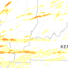


Connect with Interactive Hail Maps