

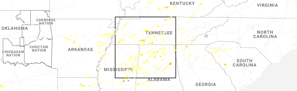
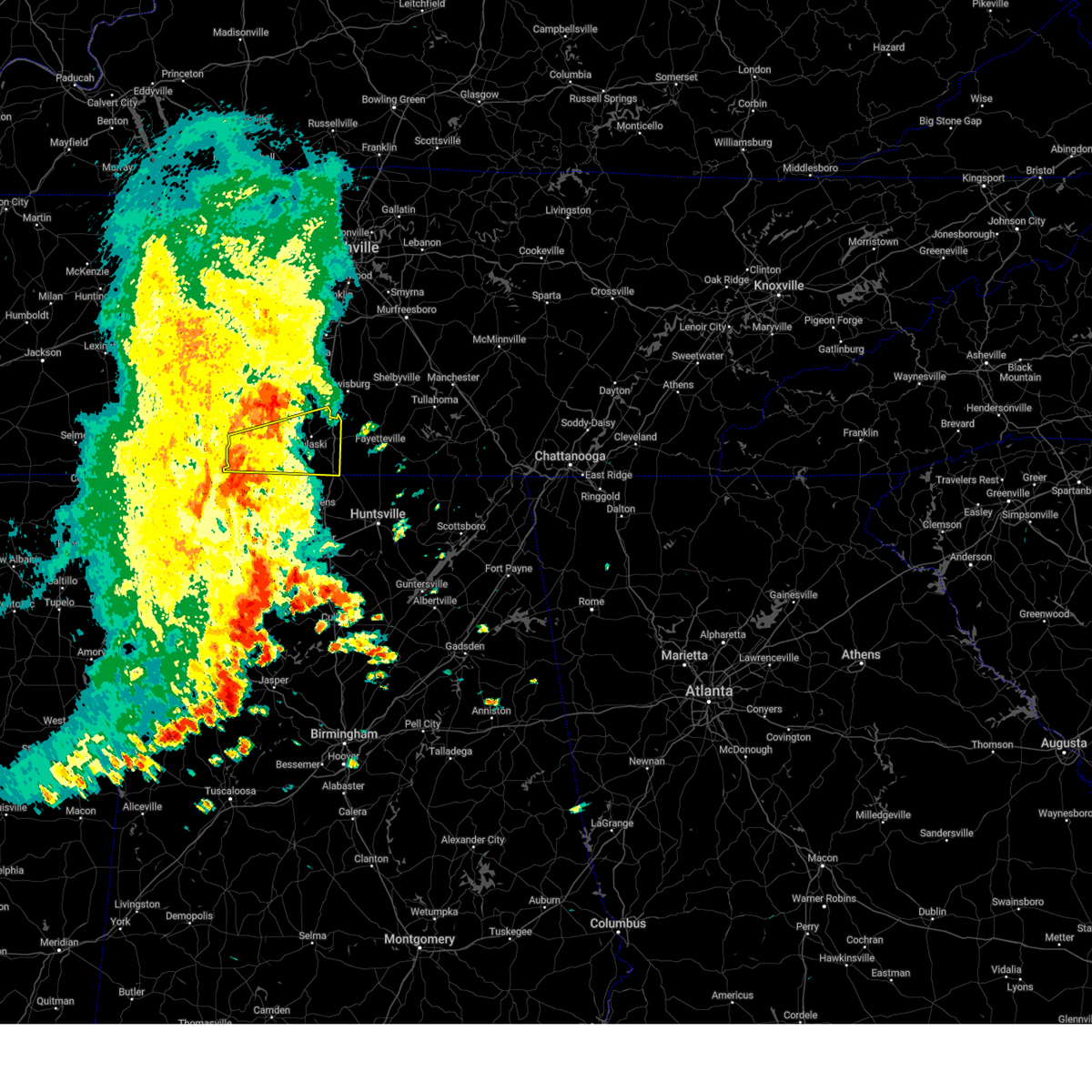
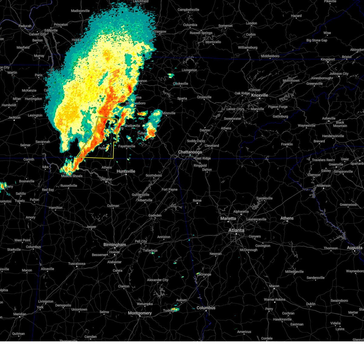
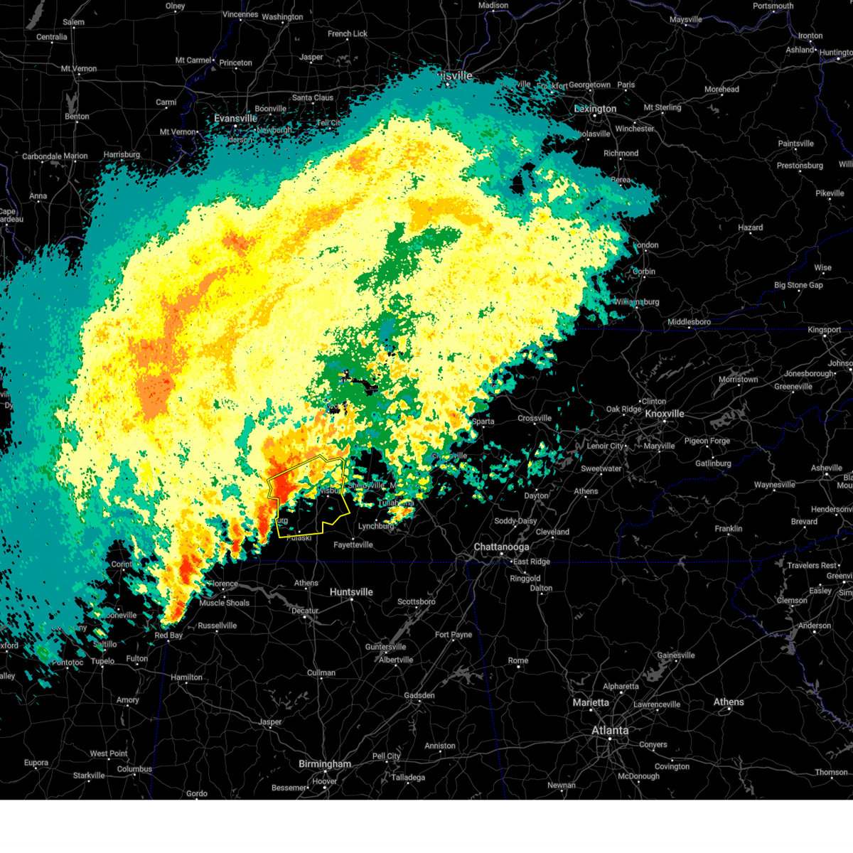
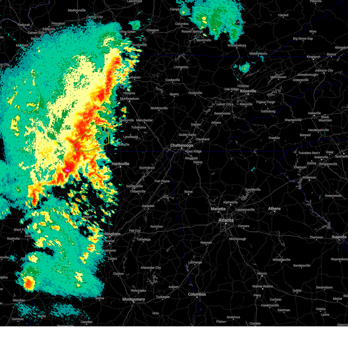
Hail Map for Pulaski, TN
The Pulaski, TN area has had 10 reports of on-the-ground hail by trained spotters, and has been under severe weather warnings 49 times during the past 12 months. Doppler radar has detected hail at or near Pulaski, TN on 56 occasions, including 4 occasions during the past year.
| Name: | Pulaski, TN |
| Where Located: | 45.4 miles NE of Florence, AL |
| Map: | Google Map for Pulaski, TN |
| Population: | 7870 |
| Housing Units: | 3866 |
| More Info: | Search Google for Pulaski, TN |
1
The Top Recent Hail Date for Pulaski, TN is Friday, May 2, 2025 (18th out of 56)
Hail and Wind Damage Spotted near Pulaski, TN
| Date / Time | Report Details |
|---|---|
| 6/18/2025 5:38 PM CDT |
 Svrohx the national weather service in nashville has issued a * severe thunderstorm warning for, southern giles county in middle tennessee, * until 615 pm cdt. * at 538 pm cdt, a severe thunderstorm was located 11 miles east of lexington, or 16 miles southwest of pulaski, moving northeast at 35 mph (radar indicated). Hazards include 60 mph wind gusts. expect damage to roofs, siding, and trees Svrohx the national weather service in nashville has issued a * severe thunderstorm warning for, southern giles county in middle tennessee, * until 615 pm cdt. * at 538 pm cdt, a severe thunderstorm was located 11 miles east of lexington, or 16 miles southwest of pulaski, moving northeast at 35 mph (radar indicated). Hazards include 60 mph wind gusts. expect damage to roofs, siding, and trees
|
| 6/7/2025 2:06 PM CDT |
 At 206 pm cdt, a severe thunderstorm was located near ardmore, or 12 miles southeast of pulaski, moving east at 55 mph (radar indicated). Hazards include 60 mph wind gusts and penny size hail. Expect damage to roofs, siding, and trees. locations impacted include, pulaski, ardmore, elkton, minor hill, goodspring, frankewing, and prospect. This includes interstate 65 between mile markers 1 and 22. At 206 pm cdt, a severe thunderstorm was located near ardmore, or 12 miles southeast of pulaski, moving east at 55 mph (radar indicated). Hazards include 60 mph wind gusts and penny size hail. Expect damage to roofs, siding, and trees. locations impacted include, pulaski, ardmore, elkton, minor hill, goodspring, frankewing, and prospect. This includes interstate 65 between mile markers 1 and 22.
|
| 6/7/2025 2:06 PM CDT |
 the severe thunderstorm warning has been cancelled and is no longer in effect the severe thunderstorm warning has been cancelled and is no longer in effect
|
| 6/7/2025 1:53 PM CDT |
 At 153 pm cdt, a severe thunderstorm was located 11 miles east of lexington, or 14 miles southwest of pulaski, moving east at 50 mph (radar indicated). Hazards include 60 mph wind gusts and penny size hail. Expect damage to roofs, siding, and trees. locations impacted include, lawrenceburg, pulaski, loretto, ardmore, elkton, minor hill, goodspring, leoma, frankewing, and prospect. This includes interstate 65 between mile markers 1 and 22. At 153 pm cdt, a severe thunderstorm was located 11 miles east of lexington, or 14 miles southwest of pulaski, moving east at 50 mph (radar indicated). Hazards include 60 mph wind gusts and penny size hail. Expect damage to roofs, siding, and trees. locations impacted include, lawrenceburg, pulaski, loretto, ardmore, elkton, minor hill, goodspring, leoma, frankewing, and prospect. This includes interstate 65 between mile markers 1 and 22.
|
| 6/7/2025 1:36 PM CDT |
 Svrohx the national weather service in nashville has issued a * severe thunderstorm warning for, southern lawrence county in middle tennessee, giles county in middle tennessee, * until 230 pm cdt. * at 136 pm cdt, a severe thunderstorm was located near lexington, or 15 miles northeast of florence, moving east at 45 mph (radar indicated). Hazards include 60 mph wind gusts and penny size hail. expect damage to roofs, siding, and trees Svrohx the national weather service in nashville has issued a * severe thunderstorm warning for, southern lawrence county in middle tennessee, giles county in middle tennessee, * until 230 pm cdt. * at 136 pm cdt, a severe thunderstorm was located near lexington, or 15 miles northeast of florence, moving east at 45 mph (radar indicated). Hazards include 60 mph wind gusts and penny size hail. expect damage to roofs, siding, and trees
|
| 6/6/2025 8:20 PM CDT |
 At 820 pm cdt, a severe thunderstorm was located near summertown, or 9 miles northeast of lawrenceburg, moving east at 20 mph (radar indicated). Hazards include 60 mph wind gusts and quarter size hail. Hail damage to vehicles is expected. expect wind damage to roofs, siding, and trees. Locations impacted include, pulaski and ethridge. At 820 pm cdt, a severe thunderstorm was located near summertown, or 9 miles northeast of lawrenceburg, moving east at 20 mph (radar indicated). Hazards include 60 mph wind gusts and quarter size hail. Hail damage to vehicles is expected. expect wind damage to roofs, siding, and trees. Locations impacted include, pulaski and ethridge.
|
| 6/6/2025 8:20 PM CDT |
 the severe thunderstorm warning has been cancelled and is no longer in effect the severe thunderstorm warning has been cancelled and is no longer in effect
|
| 6/6/2025 8:08 PM CDT | Svrohx the national weather service in nashville has issued a * severe thunderstorm warning for, northeastern lawrence county in middle tennessee, southwestern maury county in middle tennessee, northwestern giles county in middle tennessee, * until 845 pm cdt. * at 808 pm cdt, a severe thunderstorm was located near summertown, or 7 miles north of lawrenceburg, moving east at 20 mph (radar indicated). Hazards include 60 mph wind gusts and quarter size hail. Hail damage to vehicles is expected. Expect wind damage to roofs, siding, and trees. |
| 5/25/2025 3:40 PM CDT |
 The storms which prompted the warning have moved out of the area. therefore, the warning will be allowed to expire. The storms which prompted the warning have moved out of the area. therefore, the warning will be allowed to expire.
|
| 5/25/2025 3:30 PM CDT |
 At 329 pm cdt, severe thunderstorms were located along a line extending from 13 miles southeast of spring hill to 9 miles south of lewisburg to 7 miles southeast of pulaski, moving east at 45 mph (radar indicated). Hazards include 60 mph wind gusts. Expect damage to roofs, siding, and trees. locations impacted include, lewisburg, pulaski, ardmore, cornersville, elkton, minor hill, frankewing, and prospect. This includes interstate 65 between mile markers 1 and 34. At 329 pm cdt, severe thunderstorms were located along a line extending from 13 miles southeast of spring hill to 9 miles south of lewisburg to 7 miles southeast of pulaski, moving east at 45 mph (radar indicated). Hazards include 60 mph wind gusts. Expect damage to roofs, siding, and trees. locations impacted include, lewisburg, pulaski, ardmore, cornersville, elkton, minor hill, frankewing, and prospect. This includes interstate 65 between mile markers 1 and 34.
|
| 5/25/2025 3:30 PM CDT |
 the severe thunderstorm warning has been cancelled and is no longer in effect the severe thunderstorm warning has been cancelled and is no longer in effect
|
| 5/25/2025 3:10 PM CDT |
 At 309 pm cdt, severe thunderstorms were located along a line extending from near columbia to 10 miles north of pulaski to near st. florian, moving east at 45 mph (radar indicated). Hazards include 60 mph wind gusts. Expect damage to roofs, siding, and trees. locations impacted include, columbia, lewisburg, lawrenceburg, pulaski, mount pleasant, loretto, ardmore, cornersville, st. joseph, elkton, minor hill, ethridge, lynnville, culleoka, i-65 east of columbia, goodspring, leoma, frankewing, and prospect. This includes interstate 65 between mile markers 1 and 46. At 309 pm cdt, severe thunderstorms were located along a line extending from near columbia to 10 miles north of pulaski to near st. florian, moving east at 45 mph (radar indicated). Hazards include 60 mph wind gusts. Expect damage to roofs, siding, and trees. locations impacted include, columbia, lewisburg, lawrenceburg, pulaski, mount pleasant, loretto, ardmore, cornersville, st. joseph, elkton, minor hill, ethridge, lynnville, culleoka, i-65 east of columbia, goodspring, leoma, frankewing, and prospect. This includes interstate 65 between mile markers 1 and 46.
|
| 5/25/2025 3:10 PM CDT |
 the severe thunderstorm warning has been cancelled and is no longer in effect the severe thunderstorm warning has been cancelled and is no longer in effect
|
| 5/25/2025 2:57 PM CDT |
 Svrohx the national weather service in nashville has issued a * severe thunderstorm warning for, southeastern wayne county in middle tennessee, western marshall county in middle tennessee, lawrence county in middle tennessee, southern maury county in middle tennessee, giles county in middle tennessee, * until 345 pm cdt. * at 256 pm cdt, severe thunderstorms were located along a line extending from 6 miles southeast of summertown to near underwood-petersville, moving east at 45 mph (radar indicated). Hazards include 60 mph wind gusts. expect damage to roofs, siding, and trees Svrohx the national weather service in nashville has issued a * severe thunderstorm warning for, southeastern wayne county in middle tennessee, western marshall county in middle tennessee, lawrence county in middle tennessee, southern maury county in middle tennessee, giles county in middle tennessee, * until 345 pm cdt. * at 256 pm cdt, severe thunderstorms were located along a line extending from 6 miles southeast of summertown to near underwood-petersville, moving east at 45 mph (radar indicated). Hazards include 60 mph wind gusts. expect damage to roofs, siding, and trees
|
| 5/20/2025 2:14 PM CDT | Torohx the national weather service in nashville has issued a * tornado warning for, southeastern giles county in middle tennessee, * until 245 pm cdt. * at 214 pm cdt, a severe thunderstorm capable of producing a tornado was located 8 miles southeast of pulaski, moving east at 35 mph (radar indicated rotation). Hazards include tornado and quarter size hail. Flying debris will be dangerous to those caught without shelter. mobile homes will be damaged or destroyed. damage to roofs, windows, and vehicles will occur. Tree damage is likely. |
| 5/8/2025 6:02 PM CDT |
 the severe thunderstorm warning has been cancelled and is no longer in effect the severe thunderstorm warning has been cancelled and is no longer in effect
|
| 5/8/2025 5:50 PM CDT |
 Svrohx the national weather service in nashville has issued a * severe thunderstorm warning for, giles county in middle tennessee, * until 630 pm cdt. * at 550 pm cdt, severe thunderstorms were located along a line extending from near pulaski to 12 miles southwest of petersburg, moving east at 30 mph (radar indicated). Hazards include 60 mph wind gusts and quarter size hail. Hail damage to vehicles is expected. Expect wind damage to roofs, siding, and trees. Svrohx the national weather service in nashville has issued a * severe thunderstorm warning for, giles county in middle tennessee, * until 630 pm cdt. * at 550 pm cdt, severe thunderstorms were located along a line extending from near pulaski to 12 miles southwest of petersburg, moving east at 30 mph (radar indicated). Hazards include 60 mph wind gusts and quarter size hail. Hail damage to vehicles is expected. Expect wind damage to roofs, siding, and trees.
|
| 5/2/2025 12:57 PM CDT | At 1257 pm cdt, a severe thunderstorm was located near loretto, or 10 miles south of lawrenceburg, moving northeast at 20 mph (radar indicated). Hazards include 60 mph wind gusts and half dollar size hail. Hail damage to vehicles is expected. expect wind damage to roofs, siding, and trees. locations impacted include, lawrenceburg, loretto, ethridge, goodspring, leoma, minor hill, st. joseph, pulaski, and iron city. This includes interstate 65 between mile markers 20 and 22. |
| 5/2/2025 12:44 PM CDT |
 Svrohx the national weather service in nashville has issued a * severe thunderstorm warning for, southern lawrence county in middle tennessee, giles county in middle tennessee, * until 130 pm cdt. * at 1244 pm cdt, a severe thunderstorm was located near loretto, or 14 miles south of lawrenceburg, moving northeast at 20 mph (radar indicated). Hazards include 60 mph wind gusts and quarter size hail. Hail damage to vehicles is expected. Expect wind damage to roofs, siding, and trees. Svrohx the national weather service in nashville has issued a * severe thunderstorm warning for, southern lawrence county in middle tennessee, giles county in middle tennessee, * until 130 pm cdt. * at 1244 pm cdt, a severe thunderstorm was located near loretto, or 14 miles south of lawrenceburg, moving northeast at 20 mph (radar indicated). Hazards include 60 mph wind gusts and quarter size hail. Hail damage to vehicles is expected. Expect wind damage to roofs, siding, and trees.
|
| 5/2/2025 12:12 PM CDT |
 Svrohx the national weather service in nashville has issued a * severe thunderstorm warning for, southeastern lawrence county in middle tennessee, southern giles county in middle tennessee, * until 1245 pm cdt. * at 1212 pm cdt, a severe thunderstorm was located near lexington, or 19 miles south of lawrenceburg, moving northeast at 20 mph (radar indicated). Hazards include 60 mph wind gusts and quarter size hail. Hail damage to vehicles is expected. Expect wind damage to roofs, siding, and trees. Svrohx the national weather service in nashville has issued a * severe thunderstorm warning for, southeastern lawrence county in middle tennessee, southern giles county in middle tennessee, * until 1245 pm cdt. * at 1212 pm cdt, a severe thunderstorm was located near lexington, or 19 miles south of lawrenceburg, moving northeast at 20 mph (radar indicated). Hazards include 60 mph wind gusts and quarter size hail. Hail damage to vehicles is expected. Expect wind damage to roofs, siding, and trees.
|
| 4/10/2025 5:47 PM CDT | At 547 pm cdt, severe thunderstorms were located along a line extending from near columbia to near rogersville, moving southeast at 35 mph (emergency management). Hazards include 60 mph wind gusts. Expect damage to roofs, siding, and trees. locations impacted include, ethridge, mount pleasant, culleoka, minor hill, i-65 east of columbia, elkton, pulaski, goodspring, columbia, lynnville, frankewing, ardmore, cornersville, prospect, lewisburg, lawrenceburg, and spring hill. This includes interstate 65 between mile markers 1 and 50. |
| 4/10/2025 5:47 PM CDT | the severe thunderstorm warning has been cancelled and is no longer in effect |
| 4/10/2025 5:26 PM CDT |
 At 525 pm cdt, severe thunderstorms were located along a line extending from 8 miles northwest of mount pleasant to near lexington, moving southeast at 35 mph (radar indicated). Hazards include 60 mph wind gusts. Expect damage to roofs, siding, and trees. locations impacted include, gordonsburg, henryville, culleoka, st. joseph, pulaski, goodspring, leoma, lynnville, frankewing, hampshire, williamsport, loretto, ethridge, mount pleasant, minor hill, cypress inn, collinwood, i-65 east of columbia, elkton, and lawrenceburg. This includes interstate 65 between mile markers 1 and 52. At 525 pm cdt, severe thunderstorms were located along a line extending from 8 miles northwest of mount pleasant to near lexington, moving southeast at 35 mph (radar indicated). Hazards include 60 mph wind gusts. Expect damage to roofs, siding, and trees. locations impacted include, gordonsburg, henryville, culleoka, st. joseph, pulaski, goodspring, leoma, lynnville, frankewing, hampshire, williamsport, loretto, ethridge, mount pleasant, minor hill, cypress inn, collinwood, i-65 east of columbia, elkton, and lawrenceburg. This includes interstate 65 between mile markers 1 and 52.
|
| 4/10/2025 5:26 PM CDT |
 the severe thunderstorm warning has been cancelled and is no longer in effect the severe thunderstorm warning has been cancelled and is no longer in effect
|
| 4/10/2025 5:11 PM CDT |
 Svrohx the national weather service in nashville has issued a * severe thunderstorm warning for, lewis county in middle tennessee, eastern wayne county in middle tennessee, western marshall county in middle tennessee, lawrence county in middle tennessee, maury county in middle tennessee, giles county in middle tennessee, southern hickman county in middle tennessee, * until 600 pm cdt. * at 511 pm cdt, severe thunderstorms were located along a line extending from 6 miles southeast of centerville to 8 miles southwest of loretto, moving southeast at 35 mph (radar indicated). Hazards include 60 mph wind gusts. expect damage to roofs, siding, and trees Svrohx the national weather service in nashville has issued a * severe thunderstorm warning for, lewis county in middle tennessee, eastern wayne county in middle tennessee, western marshall county in middle tennessee, lawrence county in middle tennessee, maury county in middle tennessee, giles county in middle tennessee, southern hickman county in middle tennessee, * until 600 pm cdt. * at 511 pm cdt, severe thunderstorms were located along a line extending from 6 miles southeast of centerville to 8 miles southwest of loretto, moving southeast at 35 mph (radar indicated). Hazards include 60 mph wind gusts. expect damage to roofs, siding, and trees
|
| 4/5/2025 11:16 PM CDT |
 At 1116 pm cdt, a severe thunderstorm capable of producing a tornado was located 12 miles southwest of pulaski, moving east at 30 mph (radar indicated rotation). Hazards include tornado. Flying debris will be dangerous to those caught without shelter. mobile homes will be damaged or destroyed. damage to roofs, windows, and vehicles will occur. tree damage is likely. this dangerous storm will be near, pulaski around 1130 pm cdt. other locations impacted by this tornadic thunderstorm include ardmore, prospect, goodspring, elkton, frankewing, and minor hill. This includes interstate 65 between mile markers 1 and 18. At 1116 pm cdt, a severe thunderstorm capable of producing a tornado was located 12 miles southwest of pulaski, moving east at 30 mph (radar indicated rotation). Hazards include tornado. Flying debris will be dangerous to those caught without shelter. mobile homes will be damaged or destroyed. damage to roofs, windows, and vehicles will occur. tree damage is likely. this dangerous storm will be near, pulaski around 1130 pm cdt. other locations impacted by this tornadic thunderstorm include ardmore, prospect, goodspring, elkton, frankewing, and minor hill. This includes interstate 65 between mile markers 1 and 18.
|
| 4/5/2025 11:16 PM CDT |
 the tornado warning has been cancelled and is no longer in effect the tornado warning has been cancelled and is no longer in effect
|
| 4/5/2025 11:07 PM CDT |
 Torohx the national weather service in nashville has issued a * tornado warning for, southeastern lawrence county in middle tennessee, southern giles county in middle tennessee, * until 1145 pm cdt. * at 1107 pm cdt, a severe thunderstorm capable of producing a tornado was located 8 miles northeast of lexington, or 15 miles south of lawrenceburg, moving east at 30 mph (radar indicated rotation). Hazards include tornado. Flying debris will be dangerous to those caught without shelter. mobile homes will be damaged or destroyed. damage to roofs, windows, and vehicles will occur. tree damage is likely. this dangerous storm will be near, pulaski around 1130 pm cdt. other locations impacted by this tornadic thunderstorm include ardmore, prospect, goodspring, elkton, frankewing, and minor hill. This includes interstate 65 between mile markers 1 and 18. Torohx the national weather service in nashville has issued a * tornado warning for, southeastern lawrence county in middle tennessee, southern giles county in middle tennessee, * until 1145 pm cdt. * at 1107 pm cdt, a severe thunderstorm capable of producing a tornado was located 8 miles northeast of lexington, or 15 miles south of lawrenceburg, moving east at 30 mph (radar indicated rotation). Hazards include tornado. Flying debris will be dangerous to those caught without shelter. mobile homes will be damaged or destroyed. damage to roofs, windows, and vehicles will occur. tree damage is likely. this dangerous storm will be near, pulaski around 1130 pm cdt. other locations impacted by this tornadic thunderstorm include ardmore, prospect, goodspring, elkton, frankewing, and minor hill. This includes interstate 65 between mile markers 1 and 18.
|
| 4/5/2025 10:27 PM CDT |
 Svrohx the national weather service in nashville has issued a * severe thunderstorm warning for, marshall county in middle tennessee, rutherford county in middle tennessee, eastern maury county in middle tennessee, southeastern williamson county in middle tennessee, northeastern giles county in middle tennessee, bedford county in middle tennessee, * until 1115 pm cdt. * at 1027 pm cdt, severe thunderstorms were located along a line extending from 7 miles southeast of spring hill to 8 miles northeast of pulaski, moving northeast at 55 mph (radar indicated). Hazards include 60 mph wind gusts and quarter size hail. Hail damage to vehicles is expected. Expect wind damage to roofs, siding, and trees. Svrohx the national weather service in nashville has issued a * severe thunderstorm warning for, marshall county in middle tennessee, rutherford county in middle tennessee, eastern maury county in middle tennessee, southeastern williamson county in middle tennessee, northeastern giles county in middle tennessee, bedford county in middle tennessee, * until 1115 pm cdt. * at 1027 pm cdt, severe thunderstorms were located along a line extending from 7 miles southeast of spring hill to 8 miles northeast of pulaski, moving northeast at 55 mph (radar indicated). Hazards include 60 mph wind gusts and quarter size hail. Hail damage to vehicles is expected. Expect wind damage to roofs, siding, and trees.
|
| 4/5/2025 10:18 PM CDT |
 At 1018 pm cdt, a severe thunderstorm was located 12 miles north of pulaski, moving northeast at 50 mph (radar indicated). Hazards include 60 mph wind gusts and quarter size hail. Hail damage to vehicles is expected. expect wind damage to roofs, siding, and trees. locations impacted include, mount pleasant, culleoka, i-65 east of columbia, lewisburg, pulaski, chapel hill, belfast, columbia, lynnville, frankewing, cornersville, farmington, and spring hill. This includes interstate 65 between mile markers 14 and 51. At 1018 pm cdt, a severe thunderstorm was located 12 miles north of pulaski, moving northeast at 50 mph (radar indicated). Hazards include 60 mph wind gusts and quarter size hail. Hail damage to vehicles is expected. expect wind damage to roofs, siding, and trees. locations impacted include, mount pleasant, culleoka, i-65 east of columbia, lewisburg, pulaski, chapel hill, belfast, columbia, lynnville, frankewing, cornersville, farmington, and spring hill. This includes interstate 65 between mile markers 14 and 51.
|
| 4/5/2025 10:01 PM CDT |
 At 1001 pm cdt, a severe thunderstorm was located 8 miles south of columbia, moving east at 55 mph (radar indicated). Hazards include 60 mph wind gusts and penny size hail. Expect damage to roofs, siding, and trees. locations impacted include, mount pleasant, culleoka, i-65 east of columbia, lewisburg, pulaski, chapel hill, belfast, columbia, lynnville, frankewing, cornersville, farmington, and spring hill. This includes interstate 65 between mile markers 14 and 51. At 1001 pm cdt, a severe thunderstorm was located 8 miles south of columbia, moving east at 55 mph (radar indicated). Hazards include 60 mph wind gusts and penny size hail. Expect damage to roofs, siding, and trees. locations impacted include, mount pleasant, culleoka, i-65 east of columbia, lewisburg, pulaski, chapel hill, belfast, columbia, lynnville, frankewing, cornersville, farmington, and spring hill. This includes interstate 65 between mile markers 14 and 51.
|
| 4/5/2025 10:01 PM CDT |
 the severe thunderstorm warning has been cancelled and is no longer in effect the severe thunderstorm warning has been cancelled and is no longer in effect
|
| 4/5/2025 9:36 PM CDT |
 Svrohx the national weather service in nashville has issued a * severe thunderstorm warning for, southeastern lewis county in middle tennessee, marshall county in middle tennessee, southern maury county in middle tennessee, northern giles county in middle tennessee, * until 1030 pm cdt. * at 935 pm cdt, a severe thunderstorm was located over summertown, or 11 miles north of lawrenceburg, moving east at 55 mph (radar indicated). Hazards include 60 mph wind gusts and penny size hail. expect damage to roofs, siding, and trees Svrohx the national weather service in nashville has issued a * severe thunderstorm warning for, southeastern lewis county in middle tennessee, marshall county in middle tennessee, southern maury county in middle tennessee, northern giles county in middle tennessee, * until 1030 pm cdt. * at 935 pm cdt, a severe thunderstorm was located over summertown, or 11 miles north of lawrenceburg, moving east at 55 mph (radar indicated). Hazards include 60 mph wind gusts and penny size hail. expect damage to roofs, siding, and trees
|
| 3/31/2025 2:41 AM CDT |
 At 241 am cdt, a severe thunderstorm was located near pulaski, moving east at 40 mph (radar indicated). Hazards include 60 mph wind gusts. Expect damage to roofs, siding, and trees. locations impacted include, goodspring, frankewing, minor hill, ardmore, prospect, elkton, and pulaski. This includes interstate 65 between mile markers 1 and 20. At 241 am cdt, a severe thunderstorm was located near pulaski, moving east at 40 mph (radar indicated). Hazards include 60 mph wind gusts. Expect damage to roofs, siding, and trees. locations impacted include, goodspring, frankewing, minor hill, ardmore, prospect, elkton, and pulaski. This includes interstate 65 between mile markers 1 and 20.
|
| 3/31/2025 2:41 AM CDT |
 the severe thunderstorm warning has been cancelled and is no longer in effect the severe thunderstorm warning has been cancelled and is no longer in effect
|
| 3/31/2025 2:26 AM CDT | Svrohx the national weather service in nashville has issued a * severe thunderstorm warning for, southeastern lawrence county in middle tennessee, giles county in middle tennessee, * until 315 am cdt. * at 225 am cdt, a severe thunderstorm was located 10 miles east of loretto, or 11 miles south of lawrenceburg, moving east at 40 mph (radar indicated). Hazards include 60 mph wind gusts. expect damage to roofs, siding, and trees |
| 3/31/2025 1:35 AM CDT |
 Svrohx the national weather service in nashville has issued a * severe thunderstorm warning for, marshall county in middle tennessee, southeastern maury county in middle tennessee, northeastern giles county in middle tennessee, bedford county in middle tennessee, * until 215 am cdt. * at 135 am cdt, severe thunderstorms were located along a line extending from 6 miles east of columbia to near pulaski, moving east at 45 mph (radar indicated). Hazards include 60 mph wind gusts and penny size hail. expect damage to roofs, siding, and trees Svrohx the national weather service in nashville has issued a * severe thunderstorm warning for, marshall county in middle tennessee, southeastern maury county in middle tennessee, northeastern giles county in middle tennessee, bedford county in middle tennessee, * until 215 am cdt. * at 135 am cdt, severe thunderstorms were located along a line extending from 6 miles east of columbia to near pulaski, moving east at 45 mph (radar indicated). Hazards include 60 mph wind gusts and penny size hail. expect damage to roofs, siding, and trees
|
| 3/31/2025 1:31 AM CDT | At 129 am cdt, severe thunderstorms were located along a line extending from 11 miles southeast of mount pleasant to 8 miles north of pulaski to 10 miles southeast of lawrenceburg, moving east at 45 mph (radar indicated). Hazards include 60 mph wind gusts and penny size hail. Expect damage to roofs, siding, and trees. locations impacted include, lawrenceburg, loretto, ethridge, leoma, lynnville, westpoint, iron city, culleoka, cypress inn, collinwood, st. joseph, and pulaski. This includes interstate 65 near mile marker 22. |
| 3/31/2025 1:17 AM CDT |
 At 117 am cdt, severe thunderstorms were located along a line extending from 6 miles east of summertown to 9 miles northeast of lawrenceburg to 6 miles northeast of loretto, moving east at 45 mph (radar indicated). Hazards include 60 mph wind gusts and penny size hail. Expect damage to roofs, siding, and trees. locations impacted include, loretto, ethridge, henryville, mount pleasant, culleoka, cypress inn, collinwood, st. joseph, lawrenceburg, leoma, lynnville, westpoint, summertown, iron city, pulaski, and columbia. This includes interstate 65 near mile marker 22. At 117 am cdt, severe thunderstorms were located along a line extending from 6 miles east of summertown to 9 miles northeast of lawrenceburg to 6 miles northeast of loretto, moving east at 45 mph (radar indicated). Hazards include 60 mph wind gusts and penny size hail. Expect damage to roofs, siding, and trees. locations impacted include, loretto, ethridge, henryville, mount pleasant, culleoka, cypress inn, collinwood, st. joseph, lawrenceburg, leoma, lynnville, westpoint, summertown, iron city, pulaski, and columbia. This includes interstate 65 near mile marker 22.
|
| 3/31/2025 1:17 AM CDT |
 the severe thunderstorm warning has been cancelled and is no longer in effect the severe thunderstorm warning has been cancelled and is no longer in effect
|
| 3/31/2025 12:56 AM CDT | Svrohx the national weather service in nashville has issued a * severe thunderstorm warning for, southeastern lewis county in middle tennessee, southern wayne county in middle tennessee, lawrence county in middle tennessee, southwestern maury county in middle tennessee, northern giles county in middle tennessee, * until 145 am cdt. * at 1255 am cdt, severe thunderstorms were located along a line extending from 9 miles west of summertown to 8 miles west of lawrenceburg to 6 miles southeast of collinwood, moving east at 45 mph (radar indicated). Hazards include 60 mph wind gusts and penny size hail. expect damage to roofs, siding, and trees |
| 3/15/2025 3:06 PM CDT |
 The storm which prompted the warning has moved out of the area. therefore, the warning will be allowed to expire. a tornado watch remains in effect until 900 pm cdt for middle tennessee. to report severe weather, contact your nearest law enforcement agency. they will relay your report to the national weather service nashville. The storm which prompted the warning has moved out of the area. therefore, the warning will be allowed to expire. a tornado watch remains in effect until 900 pm cdt for middle tennessee. to report severe weather, contact your nearest law enforcement agency. they will relay your report to the national weather service nashville.
|
| 3/15/2025 2:52 PM CDT |
 At 252 pm cdt, a severe thunderstorm was located near pulaski, moving northeast at 55 mph (radar indicated). Hazards include 60 mph wind gusts and penny size hail. Expect damage to roofs, siding, and trees. locations impacted include, goodspring, lynnville, frankewing, and pulaski. This includes interstate 65 between mile markers 9 and 22. At 252 pm cdt, a severe thunderstorm was located near pulaski, moving northeast at 55 mph (radar indicated). Hazards include 60 mph wind gusts and penny size hail. Expect damage to roofs, siding, and trees. locations impacted include, goodspring, lynnville, frankewing, and pulaski. This includes interstate 65 between mile markers 9 and 22.
|
| 3/15/2025 2:52 PM CDT |
 the severe thunderstorm warning has been cancelled and is no longer in effect the severe thunderstorm warning has been cancelled and is no longer in effect
|
| 3/15/2025 2:26 PM CDT |
 Svrohx the national weather service in nashville has issued a * severe thunderstorm warning for, southern lawrence county in middle tennessee, giles county in middle tennessee, * until 315 pm cdt. * at 225 pm cdt, a severe thunderstorm was located over loretto, or 13 miles south of lawrenceburg, moving northeast at 55 mph (radar indicated). Hazards include 60 mph wind gusts and quarter size hail. Hail damage to vehicles is expected. Expect wind damage to roofs, siding, and trees. Svrohx the national weather service in nashville has issued a * severe thunderstorm warning for, southern lawrence county in middle tennessee, giles county in middle tennessee, * until 315 pm cdt. * at 225 pm cdt, a severe thunderstorm was located over loretto, or 13 miles south of lawrenceburg, moving northeast at 55 mph (radar indicated). Hazards include 60 mph wind gusts and quarter size hail. Hail damage to vehicles is expected. Expect wind damage to roofs, siding, and trees.
|
| 2/16/2025 12:05 AM CST |
 Svrohx the national weather service in nashville has issued a * severe thunderstorm warning for, southern marshall county in middle tennessee, northeastern giles county in middle tennessee, southern bedford county in middle tennessee, * until 1245 am cst. * at 1205 am cst, a severe thunderstorm was located 11 miles northeast of pulaski, moving east at 55 mph (radar indicated). Hazards include 60 mph wind gusts. expect damage to roofs, siding, and trees Svrohx the national weather service in nashville has issued a * severe thunderstorm warning for, southern marshall county in middle tennessee, northeastern giles county in middle tennessee, southern bedford county in middle tennessee, * until 1245 am cst. * at 1205 am cst, a severe thunderstorm was located 11 miles northeast of pulaski, moving east at 55 mph (radar indicated). Hazards include 60 mph wind gusts. expect damage to roofs, siding, and trees
|
| 2/15/2025 11:52 PM CST |
 At 1151 pm cst, a severe thunderstorm was located near pulaski, moving east at 55 mph (radar indicated). Hazards include 60 mph wind gusts. Expect damage to roofs, siding, and trees. locations impacted include, pulaski, ardmore, elkton, minor hill, goodspring, frankewing, and prospect. This includes interstate 65 between mile markers 1 and 22. At 1151 pm cst, a severe thunderstorm was located near pulaski, moving east at 55 mph (radar indicated). Hazards include 60 mph wind gusts. Expect damage to roofs, siding, and trees. locations impacted include, pulaski, ardmore, elkton, minor hill, goodspring, frankewing, and prospect. This includes interstate 65 between mile markers 1 and 22.
|
| 2/15/2025 11:52 PM CST |
 the severe thunderstorm warning has been cancelled and is no longer in effect the severe thunderstorm warning has been cancelled and is no longer in effect
|
| 2/15/2025 11:43 PM CST |
 Svrohx the national weather service in nashville has issued a * severe thunderstorm warning for, southeastern lawrence county in middle tennessee, giles county in middle tennessee, * until 1215 am cst. * at 1142 pm cst, a severe thunderstorm was located 11 miles southeast of lawrenceburg, moving east at 50 mph (radar indicated). Hazards include 60 mph wind gusts. expect damage to roofs, siding, and trees Svrohx the national weather service in nashville has issued a * severe thunderstorm warning for, southeastern lawrence county in middle tennessee, giles county in middle tennessee, * until 1215 am cst. * at 1142 pm cst, a severe thunderstorm was located 11 miles southeast of lawrenceburg, moving east at 50 mph (radar indicated). Hazards include 60 mph wind gusts. expect damage to roofs, siding, and trees
|
| 5/14/2024 4:26 PM CDT |
 Svrohx the national weather service in nashville has issued a * severe thunderstorm warning for, east central lewis county in middle tennessee, southwestern marshall county in middle tennessee, eastern lawrence county in middle tennessee, southern maury county in middle tennessee, giles county in middle tennessee, * until 500 pm cdt. * at 426 pm cdt, severe thunderstorms were located along a line extending from near summertown to near pulaski to 10 miles east of lexington, moving east at 45 mph (radar indicated). Hazards include 60 mph wind gusts and penny size hail. expect damage to roofs, siding, and trees Svrohx the national weather service in nashville has issued a * severe thunderstorm warning for, east central lewis county in middle tennessee, southwestern marshall county in middle tennessee, eastern lawrence county in middle tennessee, southern maury county in middle tennessee, giles county in middle tennessee, * until 500 pm cdt. * at 426 pm cdt, severe thunderstorms were located along a line extending from near summertown to near pulaski to 10 miles east of lexington, moving east at 45 mph (radar indicated). Hazards include 60 mph wind gusts and penny size hail. expect damage to roofs, siding, and trees
|
| 5/9/2024 3:33 AM CDT |
 the severe thunderstorm warning has been cancelled and is no longer in effect the severe thunderstorm warning has been cancelled and is no longer in effect
|
| 5/9/2024 3:33 AM CDT |
 At 333 am cdt, severe thunderstorms were located along a line extending from 11 miles southwest of lewisburg to 6 miles south of pulaski, moving southeast at 50 mph (radar indicated). Hazards include 60 mph wind gusts. Expect damage to roofs, siding, and trees. locations impacted include, pulaski, petersburg, ardmore, cornersville, elkton, lynnville, goodspring, frankewing, and prospect. This includes interstate 65 between mile markers 1 and 28. At 333 am cdt, severe thunderstorms were located along a line extending from 11 miles southwest of lewisburg to 6 miles south of pulaski, moving southeast at 50 mph (radar indicated). Hazards include 60 mph wind gusts. Expect damage to roofs, siding, and trees. locations impacted include, pulaski, petersburg, ardmore, cornersville, elkton, lynnville, goodspring, frankewing, and prospect. This includes interstate 65 between mile markers 1 and 28.
|
| 5/9/2024 3:20 AM CDT |
 Svrohx the national weather service in nashville has issued a * severe thunderstorm warning for, southern marshall county in middle tennessee, east central lawrence county in middle tennessee, giles county in middle tennessee, * until 345 am cdt. * at 320 am cdt, severe thunderstorms were located along a line extending from 14 miles southwest of lewisburg to 8 miles southwest of pulaski, moving southeast at 60 mph (radar indicated). Hazards include 60 mph wind gusts. expect damage to roofs, siding, and trees Svrohx the national weather service in nashville has issued a * severe thunderstorm warning for, southern marshall county in middle tennessee, east central lawrence county in middle tennessee, giles county in middle tennessee, * until 345 am cdt. * at 320 am cdt, severe thunderstorms were located along a line extending from 14 miles southwest of lewisburg to 8 miles southwest of pulaski, moving southeast at 60 mph (radar indicated). Hazards include 60 mph wind gusts. expect damage to roofs, siding, and trees
|
| 5/8/2024 10:14 PM CDT |
 The storm which prompted the warning has moved out of the area. therefore, the warning will be allowed to expire. a tornado watch remains in effect until 300 am cdt for middle tennessee. The storm which prompted the warning has moved out of the area. therefore, the warning will be allowed to expire. a tornado watch remains in effect until 300 am cdt for middle tennessee.
|
| 5/8/2024 9:56 PM CDT |
 At 955 pm cdt, a severe thunderstorm was located 8 miles northwest of ardmore, or 10 miles south of pulaski, moving east at 30 mph (radar indicated). Hazards include 60 mph wind gusts and quarter size hail. Hail damage to vehicles is expected. expect wind damage to roofs, siding, and trees. locations impacted include, pulaski, ardmore, elkton, prospect, and frankewing. This includes interstate 65 between mile markers 1 and 13. At 955 pm cdt, a severe thunderstorm was located 8 miles northwest of ardmore, or 10 miles south of pulaski, moving east at 30 mph (radar indicated). Hazards include 60 mph wind gusts and quarter size hail. Hail damage to vehicles is expected. expect wind damage to roofs, siding, and trees. locations impacted include, pulaski, ardmore, elkton, prospect, and frankewing. This includes interstate 65 between mile markers 1 and 13.
|
| 5/8/2024 9:43 PM CDT |
 Svrohx the national weather service in nashville has issued a * severe thunderstorm warning for, southern giles county in middle tennessee, * until 1015 pm cdt. * at 943 pm cdt, a severe thunderstorm was located 10 miles south of pulaski, moving east at 35 mph (radar indicated). Hazards include 60 mph wind gusts and quarter size hail. Hail damage to vehicles is expected. Expect wind damage to roofs, siding, and trees. Svrohx the national weather service in nashville has issued a * severe thunderstorm warning for, southern giles county in middle tennessee, * until 1015 pm cdt. * at 943 pm cdt, a severe thunderstorm was located 10 miles south of pulaski, moving east at 35 mph (radar indicated). Hazards include 60 mph wind gusts and quarter size hail. Hail damage to vehicles is expected. Expect wind damage to roofs, siding, and trees.
|
| 5/8/2024 7:58 PM CDT |
 At 758 pm cdt, a confirmed tornado was located 8 miles northwest of ardmore, or 9 miles southeast of pulaski, moving east at 30 mph (weather spotters confirmed tornado). Hazards include damaging tornado and half dollar size hail. Flying debris will be dangerous to those caught without shelter. mobile homes will be damaged or destroyed. damage to roofs, windows, and vehicles will occur. tree damage is likely. locations impacted include, pulaski, ardmore, elkton, prospect, and frankewing. This includes interstate 65 between mile markers 1 and 13. At 758 pm cdt, a confirmed tornado was located 8 miles northwest of ardmore, or 9 miles southeast of pulaski, moving east at 30 mph (weather spotters confirmed tornado). Hazards include damaging tornado and half dollar size hail. Flying debris will be dangerous to those caught without shelter. mobile homes will be damaged or destroyed. damage to roofs, windows, and vehicles will occur. tree damage is likely. locations impacted include, pulaski, ardmore, elkton, prospect, and frankewing. This includes interstate 65 between mile markers 1 and 13.
|
| 5/8/2024 7:56 PM CDT |
 Torohx the national weather service in nashville has issued a * tornado warning for, southeastern giles county in middle tennessee, * until 830 pm cdt. * at 756 pm cdt, a severe thunderstorm capable of producing a tornado was located 8 miles northwest of ardmore, or 9 miles southeast of pulaski, moving east at 30 mph (radar indicated rotation). Hazards include tornado and half dollar size hail. Flying debris will be dangerous to those caught without shelter. mobile homes will be damaged or destroyed. damage to roofs, windows, and vehicles will occur. tree damage is likely. this tornadic thunderstorm will remain over mainly rural areas of southeastern giles county, including the following locations, ardmore, prospect, elkton, and frankewing. This includes interstate 65 between mile markers 1 and 13. Torohx the national weather service in nashville has issued a * tornado warning for, southeastern giles county in middle tennessee, * until 830 pm cdt. * at 756 pm cdt, a severe thunderstorm capable of producing a tornado was located 8 miles northwest of ardmore, or 9 miles southeast of pulaski, moving east at 30 mph (radar indicated rotation). Hazards include tornado and half dollar size hail. Flying debris will be dangerous to those caught without shelter. mobile homes will be damaged or destroyed. damage to roofs, windows, and vehicles will occur. tree damage is likely. this tornadic thunderstorm will remain over mainly rural areas of southeastern giles county, including the following locations, ardmore, prospect, elkton, and frankewing. This includes interstate 65 between mile markers 1 and 13.
|
| 5/8/2024 7:46 PM CDT |
 the severe thunderstorm warning has been cancelled and is no longer in effect the severe thunderstorm warning has been cancelled and is no longer in effect
|
| 5/8/2024 7:46 PM CDT |
 At 744 pm cdt, a severe thunderstorm was located 7 miles southeast of pulaski, moving east at 40 mph (radar indicated). Hazards include 60 mph wind gusts and quarter size hail. Hail damage to vehicles is expected. expect wind damage to roofs, siding, and trees. locations impacted include, pulaski, ardmore, elkton, goodspring, frankewing, and prospect. This includes interstate 65 between mile markers 1 and 17. At 744 pm cdt, a severe thunderstorm was located 7 miles southeast of pulaski, moving east at 40 mph (radar indicated). Hazards include 60 mph wind gusts and quarter size hail. Hail damage to vehicles is expected. expect wind damage to roofs, siding, and trees. locations impacted include, pulaski, ardmore, elkton, goodspring, frankewing, and prospect. This includes interstate 65 between mile markers 1 and 17.
|
| 5/8/2024 7:38 PM CDT |
 At 737 pm cdt, a severe thunderstorm was located 8 miles northeast of pulaski, moving east at 30 mph (radar indicated). Hazards include 60 mph wind gusts and half dollar size hail. Hail damage to vehicles is expected. expect wind damage to roofs, siding, and trees. locations impacted include, lewisburg, pulaski, cornersville, lynnville, belfast, and frankewing. This includes interstate 65 between mile markers 14 and 29. At 737 pm cdt, a severe thunderstorm was located 8 miles northeast of pulaski, moving east at 30 mph (radar indicated). Hazards include 60 mph wind gusts and half dollar size hail. Hail damage to vehicles is expected. expect wind damage to roofs, siding, and trees. locations impacted include, lewisburg, pulaski, cornersville, lynnville, belfast, and frankewing. This includes interstate 65 between mile markers 14 and 29.
|
| 5/8/2024 7:29 PM CDT |
 Svrohx the national weather service in nashville has issued a * severe thunderstorm warning for, southeastern marshall county in middle tennessee, southeastern lawrence county in middle tennessee, southern giles county in middle tennessee, * until 815 pm cdt. * at 728 pm cdt, a severe thunderstorm was located 10 miles southwest of pulaski, moving east at 40 mph (radar indicated). Hazards include 60 mph wind gusts and quarter size hail. Hail damage to vehicles is expected. Expect wind damage to roofs, siding, and trees. Svrohx the national weather service in nashville has issued a * severe thunderstorm warning for, southeastern marshall county in middle tennessee, southeastern lawrence county in middle tennessee, southern giles county in middle tennessee, * until 815 pm cdt. * at 728 pm cdt, a severe thunderstorm was located 10 miles southwest of pulaski, moving east at 40 mph (radar indicated). Hazards include 60 mph wind gusts and quarter size hail. Hail damage to vehicles is expected. Expect wind damage to roofs, siding, and trees.
|
| 5/8/2024 7:19 PM CDT |
 Svrohx the national weather service in nashville has issued a * severe thunderstorm warning for, southern marshall county in middle tennessee, central giles county in middle tennessee, * until 800 pm cdt. * at 719 pm cdt, a severe thunderstorm was located near pulaski, moving east at 30 mph (radar indicated). Hazards include 60 mph wind gusts and quarter size hail. Hail damage to vehicles is expected. Expect wind damage to roofs, siding, and trees. Svrohx the national weather service in nashville has issued a * severe thunderstorm warning for, southern marshall county in middle tennessee, central giles county in middle tennessee, * until 800 pm cdt. * at 719 pm cdt, a severe thunderstorm was located near pulaski, moving east at 30 mph (radar indicated). Hazards include 60 mph wind gusts and quarter size hail. Hail damage to vehicles is expected. Expect wind damage to roofs, siding, and trees.
|
| 3/14/2024 11:21 PM CDT | Quarter sized hail reported 6.6 miles WSW of Pulaski, TN, quarter size hail reported south of highway 31 east of pulaski. |
| 12/9/2023 7:28 PM CST |
 The severe thunderstorm warning for southeastern lawrence and southern giles counties will expire at 730 pm cst, the storm which prompted the warning has moved out of the area. therefore, the warning will be allowed to expire. however, gusty winds are still possible with this thunderstorm. a tornado watch remains in effect until 900 pm cst for middle tennessee. a tornado watch also remains in effect until 1100 pm cst for middle tennessee. The severe thunderstorm warning for southeastern lawrence and southern giles counties will expire at 730 pm cst, the storm which prompted the warning has moved out of the area. therefore, the warning will be allowed to expire. however, gusty winds are still possible with this thunderstorm. a tornado watch remains in effect until 900 pm cst for middle tennessee. a tornado watch also remains in effect until 1100 pm cst for middle tennessee.
|
| 12/9/2023 7:03 PM CST |
 At 702 pm cst, a severe thunderstorm was located 7 miles southeast of pulaski, moving east at 55 mph (radar indicated). Hazards include 60 mph wind gusts and penny size hail. Expect damage to roofs, siding, and trees. locations impacted include, pulaski, ardmore, elkton, minor hill, goodspring, frankewing, and prospect. This includes interstate 65 between mile markers 1 and 20. At 702 pm cst, a severe thunderstorm was located 7 miles southeast of pulaski, moving east at 55 mph (radar indicated). Hazards include 60 mph wind gusts and penny size hail. Expect damage to roofs, siding, and trees. locations impacted include, pulaski, ardmore, elkton, minor hill, goodspring, frankewing, and prospect. This includes interstate 65 between mile markers 1 and 20.
|
| 12/9/2023 6:58 PM CST |
 The severe thunderstorm warning for eastern lawrence and northern giles counties will expire at 700 pm cst, the storm which prompted the warning has weakened below severe limits, and no longer poses an immediate threat to life or property. therefore, the warning will be allowed to expire. however, gusty winds are still possible with this thunderstorm. a tornado watch remains in effect until 900 pm cst for middle tennessee. a tornado watch also remains in effect until 1100 pm cst for middle tennessee. The severe thunderstorm warning for eastern lawrence and northern giles counties will expire at 700 pm cst, the storm which prompted the warning has weakened below severe limits, and no longer poses an immediate threat to life or property. therefore, the warning will be allowed to expire. however, gusty winds are still possible with this thunderstorm. a tornado watch remains in effect until 900 pm cst for middle tennessee. a tornado watch also remains in effect until 1100 pm cst for middle tennessee.
|
| 12/9/2023 6:51 PM CST |
 At 649 pm cst, a severe thunderstorm was located near lawrenceburg, moving northeast at 60 mph (radar indicated). Hazards include 60 mph wind gusts and penny size hail. Expect damage to roofs, siding, and trees. locations impacted include, lawrenceburg, pulaski, ethridge, and leoma. this includes interstate 65 near mile marker 19. hail threat, radar indicated max hail size, 0. 75 in wind threat, radar indicated max wind gust, 60 mph. At 649 pm cst, a severe thunderstorm was located near lawrenceburg, moving northeast at 60 mph (radar indicated). Hazards include 60 mph wind gusts and penny size hail. Expect damage to roofs, siding, and trees. locations impacted include, lawrenceburg, pulaski, ethridge, and leoma. this includes interstate 65 near mile marker 19. hail threat, radar indicated max hail size, 0. 75 in wind threat, radar indicated max wind gust, 60 mph.
|
| 12/9/2023 6:43 PM CST |
 At 643 pm cst, a severe thunderstorm was located 8 miles northeast of lexington, or 14 miles south of lawrenceburg, moving east at 55 mph (radar indicated). Hazards include 60 mph wind gusts and penny size hail. expect damage to roofs, siding, and trees At 643 pm cst, a severe thunderstorm was located 8 miles northeast of lexington, or 14 miles south of lawrenceburg, moving east at 55 mph (radar indicated). Hazards include 60 mph wind gusts and penny size hail. expect damage to roofs, siding, and trees
|
| 12/9/2023 6:34 PM CST |
 At 634 pm cst, a severe thunderstorm was located 7 miles northwest of loretto, or 11 miles southwest of lawrenceburg, moving northeast at 60 mph (radar indicated). Hazards include 60 mph wind gusts and penny size hail. expect damage to roofs, siding, and trees At 634 pm cst, a severe thunderstorm was located 7 miles northwest of loretto, or 11 miles southwest of lawrenceburg, moving northeast at 60 mph (radar indicated). Hazards include 60 mph wind gusts and penny size hail. expect damage to roofs, siding, and trees
|
| 8/9/2023 3:40 PM CDT |
 The severe thunderstorm warning for giles county will expire at 345 pm cdt, the storms which prompted the warning have moved out of the area. therefore, the warning will be allowed to expire. a severe thunderstorm watch remains in effect until 800 pm cdt for middle tennessee. The severe thunderstorm warning for giles county will expire at 345 pm cdt, the storms which prompted the warning have moved out of the area. therefore, the warning will be allowed to expire. a severe thunderstorm watch remains in effect until 800 pm cdt for middle tennessee.
|
| 8/9/2023 3:24 PM CDT |
 At 322 pm cdt, severe thunderstorms were located along a line extending from 7 miles north of pulaski to 14 miles west of ardmore, moving east at 60 mph (radar indicated. some wind damage and power outages have already occurred in lawrence county). Hazards include 70 mph wind gusts. Expect considerable tree damage. Damage is likely to mobile homes, roofs, and outbuildings. At 322 pm cdt, severe thunderstorms were located along a line extending from 7 miles north of pulaski to 14 miles west of ardmore, moving east at 60 mph (radar indicated. some wind damage and power outages have already occurred in lawrence county). Hazards include 70 mph wind gusts. Expect considerable tree damage. Damage is likely to mobile homes, roofs, and outbuildings.
|
| 8/9/2023 3:14 PM CDT |
 At 313 pm cdt, severe thunderstorms were located along a line extending from 7 miles southeast of summertown to 6 miles northeast of lexington, moving east at 60 mph (radar indicated). Hazards include 70 mph wind gusts. Expect considerable tree damage. damage is likely to mobile homes, roofs, and outbuildings. locations impacted include, lawrenceburg, pulaski, minor hill, ethridge, lynnville, goodspring and prospect. thunderstorm damage threat, considerable hail threat, radar indicated max hail size, <. 75 in wind threat, radar indicated max wind gust, 70 mph. At 313 pm cdt, severe thunderstorms were located along a line extending from 7 miles southeast of summertown to 6 miles northeast of lexington, moving east at 60 mph (radar indicated). Hazards include 70 mph wind gusts. Expect considerable tree damage. damage is likely to mobile homes, roofs, and outbuildings. locations impacted include, lawrenceburg, pulaski, minor hill, ethridge, lynnville, goodspring and prospect. thunderstorm damage threat, considerable hail threat, radar indicated max hail size, <. 75 in wind threat, radar indicated max wind gust, 70 mph.
|
| 8/9/2023 3:00 PM CDT |
 At 300 pm cdt, severe thunderstorms were located along a line extending from 10 miles northwest of lawrenceburg to 7 miles southwest of loretto, moving east at 50 mph (radar indicated). Hazards include 70 mph wind gusts. Expect considerable tree damage. damage is likely to mobile homes, roofs, and outbuildings. locations impacted include, lawrenceburg, pulaski, loretto, st. joseph, minor hill, ethridge, lynnville, henryville, goodspring, leoma, westpoint, prospect and iron city. thunderstorm damage threat, considerable hail threat, radar indicated max hail size, <. 75 in wind threat, radar indicated max wind gust, 70 mph. At 300 pm cdt, severe thunderstorms were located along a line extending from 10 miles northwest of lawrenceburg to 7 miles southwest of loretto, moving east at 50 mph (radar indicated). Hazards include 70 mph wind gusts. Expect considerable tree damage. damage is likely to mobile homes, roofs, and outbuildings. locations impacted include, lawrenceburg, pulaski, loretto, st. joseph, minor hill, ethridge, lynnville, henryville, goodspring, leoma, westpoint, prospect and iron city. thunderstorm damage threat, considerable hail threat, radar indicated max hail size, <. 75 in wind threat, radar indicated max wind gust, 70 mph.
|
| 8/9/2023 2:42 PM CDT |
 At 241 pm cdt, severe thunderstorms were located along a line extending from waynesboro to cypress inn, moving east at 50 mph (radar indicated). Hazards include 70 mph wind gusts. Expect considerable tree damage. Damage is likely to mobile homes, roofs, and outbuildings. At 241 pm cdt, severe thunderstorms were located along a line extending from waynesboro to cypress inn, moving east at 50 mph (radar indicated). Hazards include 70 mph wind gusts. Expect considerable tree damage. Damage is likely to mobile homes, roofs, and outbuildings.
|
| 8/7/2023 10:56 AM CDT |
 The severe thunderstorm warning for eastern lewis, eastern lawrence, maury, central williamson and giles counties will expire at 1100 am cdt, the storms which prompted the warning have weakened below severe limits, and no longer pose an immediate threat to life or property. therefore, the warning will be allowed to expire. however gusty winds and heavy rain are still possible with these thunderstorms. a tornado watch remains in effect until 600 pm cdt for middle tennessee. a severe thunderstorm watch remains in effect until 700 pm cdt for middle tennessee. The severe thunderstorm warning for eastern lewis, eastern lawrence, maury, central williamson and giles counties will expire at 1100 am cdt, the storms which prompted the warning have weakened below severe limits, and no longer pose an immediate threat to life or property. therefore, the warning will be allowed to expire. however gusty winds and heavy rain are still possible with these thunderstorms. a tornado watch remains in effect until 600 pm cdt for middle tennessee. a severe thunderstorm watch remains in effect until 700 pm cdt for middle tennessee.
|
| 8/7/2023 10:48 AM CDT |
 At 1048 am cdt, severe thunderstorms were located along a line extending from 7 miles south of fairview to lawrenceburg, moving east at 50 mph (radar indicated). Hazards include 60 mph wind gusts and penny size hail. Expect damage to roofs, siding, and trees. locations impacted include, franklin, columbia, lawrenceburg, pulaski, spring hill, mount pleasant, thompson`s station, loretto, summertown, ethridge, lynnville, gordonsburg, henryville, culleoka, i-65 east of columbia, santa fe, goodspring, leoma, frankewing and hampshire. this includes the following highways, interstate 65 between mile markers 7 and 22, and between mile markers 36 and 66. interstate 840 between mile markers 10 and 37. hail threat, radar indicated max hail size, 0. 75 in wind threat, radar indicated max wind gust, 60 mph. At 1048 am cdt, severe thunderstorms were located along a line extending from 7 miles south of fairview to lawrenceburg, moving east at 50 mph (radar indicated). Hazards include 60 mph wind gusts and penny size hail. Expect damage to roofs, siding, and trees. locations impacted include, franklin, columbia, lawrenceburg, pulaski, spring hill, mount pleasant, thompson`s station, loretto, summertown, ethridge, lynnville, gordonsburg, henryville, culleoka, i-65 east of columbia, santa fe, goodspring, leoma, frankewing and hampshire. this includes the following highways, interstate 65 between mile markers 7 and 22, and between mile markers 36 and 66. interstate 840 between mile markers 10 and 37. hail threat, radar indicated max hail size, 0. 75 in wind threat, radar indicated max wind gust, 60 mph.
|
| 8/7/2023 10:38 AM CDT |
 At 1037 am cdt, severe thunderstorms were located along a line extending from 8 miles east of centerville to 8 miles northwest of loretto, moving east at 50 mph (radar indicated). Hazards include 60 mph wind gusts and penny size hail. Expect damage to roofs, siding, and trees. locations impacted include, franklin, columbia, lawrenceburg, pulaski, hohenwald, centerville, spring hill, mount pleasant, thompson`s station, loretto, summertown, st. joseph, elkton, minor hill, ethridge, lynnville, gordonsburg, kimmins, henryville and culleoka. this includes the following highways, interstate 65 between mile markers 1 and 22, and between mile markers 36 and 66. interstate 840 between mile markers 10 and 37. hail threat, radar indicated max hail size, 0. 75 in wind threat, radar indicated max wind gust, 60 mph. At 1037 am cdt, severe thunderstorms were located along a line extending from 8 miles east of centerville to 8 miles northwest of loretto, moving east at 50 mph (radar indicated). Hazards include 60 mph wind gusts and penny size hail. Expect damage to roofs, siding, and trees. locations impacted include, franklin, columbia, lawrenceburg, pulaski, hohenwald, centerville, spring hill, mount pleasant, thompson`s station, loretto, summertown, st. joseph, elkton, minor hill, ethridge, lynnville, gordonsburg, kimmins, henryville and culleoka. this includes the following highways, interstate 65 between mile markers 1 and 22, and between mile markers 36 and 66. interstate 840 between mile markers 10 and 37. hail threat, radar indicated max hail size, 0. 75 in wind threat, radar indicated max wind gust, 60 mph.
|
| 8/7/2023 10:28 AM CDT |
 At 1027 am cdt, severe thunderstorms were located along a line extending from near centerville to 7 miles south of collinwood, moving east at 50 mph (radar indicated). Hazards include 60 mph wind gusts and penny size hail. expect damage to roofs, siding, and trees At 1027 am cdt, severe thunderstorms were located along a line extending from near centerville to 7 miles south of collinwood, moving east at 50 mph (radar indicated). Hazards include 60 mph wind gusts and penny size hail. expect damage to roofs, siding, and trees
|
| 8/5/2023 8:13 PM CDT |
 At 813 pm cdt, a severe thunderstorm was located 9 miles south of pulaski, moving east at 30 mph (radar indicated). Hazards include 60 mph wind gusts. Expect damage to roofs, siding, and trees. locations impacted include, ardmore, elkton, minor hill, goodspring and prospect. this includes interstate 65 between mile markers 1 and 10. hail threat, radar indicated max hail size, <. 75 in wind threat, radar indicated max wind gust, 60 mph. At 813 pm cdt, a severe thunderstorm was located 9 miles south of pulaski, moving east at 30 mph (radar indicated). Hazards include 60 mph wind gusts. Expect damage to roofs, siding, and trees. locations impacted include, ardmore, elkton, minor hill, goodspring and prospect. this includes interstate 65 between mile markers 1 and 10. hail threat, radar indicated max hail size, <. 75 in wind threat, radar indicated max wind gust, 60 mph.
|
| 8/5/2023 7:57 PM CDT |
 At 757 pm cdt, a severe thunderstorm was located 11 miles northeast of lexington, or 13 miles southeast of lawrenceburg, moving east at 30 mph (radar indicated). Hazards include 60 mph wind gusts. expect damage to roofs, siding, and trees At 757 pm cdt, a severe thunderstorm was located 11 miles northeast of lexington, or 13 miles southeast of lawrenceburg, moving east at 30 mph (radar indicated). Hazards include 60 mph wind gusts. expect damage to roofs, siding, and trees
|
| 7/20/2023 3:25 PM CDT |
 The severe thunderstorm warning for southern marshall, southeastern maury, northern giles and southwestern bedford counties will expire at 330 pm cdt, the storms which prompted the warning have weakened below severe limits, and no longer pose an immediate threat to life or property. therefore, the warning will be allowed to expire. however gusty winds and heavy rain are still possible with these thunderstorms. a severe thunderstorm watch remains in effect until 700 pm cdt for middle tennessee. The severe thunderstorm warning for southern marshall, southeastern maury, northern giles and southwestern bedford counties will expire at 330 pm cdt, the storms which prompted the warning have weakened below severe limits, and no longer pose an immediate threat to life or property. therefore, the warning will be allowed to expire. however gusty winds and heavy rain are still possible with these thunderstorms. a severe thunderstorm watch remains in effect until 700 pm cdt for middle tennessee.
|
| 7/20/2023 3:09 PM CDT |
 At 309 pm cdt, severe thunderstorms were located along a line extending from 11 miles north of pulaski to 8 miles east of petersburg, moving southeast at 35 mph (radar indicated). Hazards include 60 mph wind gusts and nickel size hail. Expect damage to roofs, siding, and trees. locations impacted include, lewisburg, pulaski, cornersville, lynnville and belfast. this includes interstate 65 between mile markers 15 and 34. hail threat, radar indicated max hail size, 0. 88 in wind threat, radar indicated max wind gust, 60 mph. At 309 pm cdt, severe thunderstorms were located along a line extending from 11 miles north of pulaski to 8 miles east of petersburg, moving southeast at 35 mph (radar indicated). Hazards include 60 mph wind gusts and nickel size hail. Expect damage to roofs, siding, and trees. locations impacted include, lewisburg, pulaski, cornersville, lynnville and belfast. this includes interstate 65 between mile markers 15 and 34. hail threat, radar indicated max hail size, 0. 88 in wind threat, radar indicated max wind gust, 60 mph.
|
| 7/20/2023 3:06 PM CDT |
 The severe thunderstorm warning for southern giles county will expire at 315 pm cdt, the storm which prompted the warning has weakened below severe limits, and no longer poses an immediate threat to life or property. therefore, the warning will be allowed to expire. however gusty winds and heavy rain are still possible with this thunderstorm. a severe thunderstorm watch remains in effect until 700 pm cdt for middle tennessee. The severe thunderstorm warning for southern giles county will expire at 315 pm cdt, the storm which prompted the warning has weakened below severe limits, and no longer poses an immediate threat to life or property. therefore, the warning will be allowed to expire. however gusty winds and heavy rain are still possible with this thunderstorm. a severe thunderstorm watch remains in effect until 700 pm cdt for middle tennessee.
|
| 7/20/2023 2:55 PM CDT |
 At 254 pm cdt, severe thunderstorms were located along a line extending from 10 miles east of summertown to 6 miles northeast of petersburg, moving southeast at 35 mph (radar indicated). Hazards include 60 mph wind gusts and nickel size hail. expect damage to roofs, siding, and trees At 254 pm cdt, severe thunderstorms were located along a line extending from 10 miles east of summertown to 6 miles northeast of petersburg, moving southeast at 35 mph (radar indicated). Hazards include 60 mph wind gusts and nickel size hail. expect damage to roofs, siding, and trees
|
| 7/20/2023 2:52 PM CDT |
 At 252 pm cdt, a severe thunderstorm was located near pulaski, moving southeast at 35 mph (radar indicated). Hazards include 60 mph wind gusts and nickel size hail. expect damage to roofs, siding, and trees At 252 pm cdt, a severe thunderstorm was located near pulaski, moving southeast at 35 mph (radar indicated). Hazards include 60 mph wind gusts and nickel size hail. expect damage to roofs, siding, and trees
|
| 7/18/2023 4:56 PM CDT |
 At 456 pm cdt, severe thunderstorms were located along a line extending from 7 miles south of murfreesboro to 13 miles west of ardmore, moving southeast at 50 mph (radar indicated). Hazards include 60 mph wind gusts and penny size hail. expect damage to roofs, siding, and trees At 456 pm cdt, severe thunderstorms were located along a line extending from 7 miles south of murfreesboro to 13 miles west of ardmore, moving southeast at 50 mph (radar indicated). Hazards include 60 mph wind gusts and penny size hail. expect damage to roofs, siding, and trees
|
| 7/18/2023 4:40 PM CDT |
 At 439 pm cdt, severe thunderstorms were located along a line extending from 8 miles northeast of pulaski to near loretto, moving southeast at 50 mph (radar indicated). Hazards include 60 mph wind gusts and penny size hail. Expect damage to roofs, siding, and trees. locations impacted include, lawrenceburg, pulaski, waynesboro, loretto, collinwood, clifton, ardmore, st. joseph, elkton, minor hill, ethridge, lynnville, cypress inn, lutts, goodspring, leoma, westpoint, frankewing, iron city and prospect. this includes interstate 65 between mile markers 1 and 22. hail threat, radar indicated max hail size, 0. 75 in wind threat, radar indicated max wind gust, 60 mph. At 439 pm cdt, severe thunderstorms were located along a line extending from 8 miles northeast of pulaski to near loretto, moving southeast at 50 mph (radar indicated). Hazards include 60 mph wind gusts and penny size hail. Expect damage to roofs, siding, and trees. locations impacted include, lawrenceburg, pulaski, waynesboro, loretto, collinwood, clifton, ardmore, st. joseph, elkton, minor hill, ethridge, lynnville, cypress inn, lutts, goodspring, leoma, westpoint, frankewing, iron city and prospect. this includes interstate 65 between mile markers 1 and 22. hail threat, radar indicated max hail size, 0. 75 in wind threat, radar indicated max wind gust, 60 mph.
|
| 7/18/2023 4:37 PM CDT | Facebook reports indicate numerous trees down across giles county with a shed overturned in pulask in giles county TN, 0.7 miles S of Pulaski, TN |
| 7/18/2023 4:26 PM CDT |
 At 426 pm cdt, severe thunderstorms were located along a line extending from 11 miles southeast of mount pleasant to 7 miles east of collinwood, moving southeast at 60 mph (radar indicated). Hazards include 60 mph wind gusts and penny size hail. Expect damage to roofs, siding, and trees. locations impacted include, lawrenceburg, pulaski, waynesboro, mount pleasant, loretto, collinwood, summertown, clifton, ardmore, st. joseph, elkton, minor hill, ethridge, lynnville, henryville, cypress inn, lutts, goodspring, leoma and westpoint. this includes interstate 65 between mile markers 1 and 22. hail threat, radar indicated max hail size, 0. 75 in wind threat, radar indicated max wind gust, 60 mph. At 426 pm cdt, severe thunderstorms were located along a line extending from 11 miles southeast of mount pleasant to 7 miles east of collinwood, moving southeast at 60 mph (radar indicated). Hazards include 60 mph wind gusts and penny size hail. Expect damage to roofs, siding, and trees. locations impacted include, lawrenceburg, pulaski, waynesboro, mount pleasant, loretto, collinwood, summertown, clifton, ardmore, st. joseph, elkton, minor hill, ethridge, lynnville, henryville, cypress inn, lutts, goodspring, leoma and westpoint. this includes interstate 65 between mile markers 1 and 22. hail threat, radar indicated max hail size, 0. 75 in wind threat, radar indicated max wind gust, 60 mph.
|
| 7/18/2023 3:52 PM CDT |
 At 352 pm cdt, severe thunderstorms were located along a line extending from 6 miles east of centerville to 6 miles southwest of linden, moving southeast at 60 mph (radar indicated). Hazards include 60 mph wind gusts and penny size hail. expect damage to roofs, siding, and trees At 352 pm cdt, severe thunderstorms were located along a line extending from 6 miles east of centerville to 6 miles southwest of linden, moving southeast at 60 mph (radar indicated). Hazards include 60 mph wind gusts and penny size hail. expect damage to roofs, siding, and trees
|
| 6/29/2023 3:15 PM CDT |
 At 315 pm cdt, a severe thunderstorm was located over lawrenceburg, moving southeast at 30 mph (radar indicated). Hazards include 60 mph wind gusts and quarter size hail. Hail damage to vehicles is expected. Expect wind damage to roofs, siding, and trees. At 315 pm cdt, a severe thunderstorm was located over lawrenceburg, moving southeast at 30 mph (radar indicated). Hazards include 60 mph wind gusts and quarter size hail. Hail damage to vehicles is expected. Expect wind damage to roofs, siding, and trees.
|
| 6/25/2023 1:41 PM CDT |
 The severe thunderstorm warning for central giles county will expire at 145 pm cdt, the storm which prompted the warning has weakened below severe limits, and no longer poses an immediate threat to life or property. therefore, the warning will be allowed to expire. however small hail, gusty winds and heavy rain are still possible with this thunderstorm. a severe thunderstorm watch remains in effect until 600 pm cdt for middle tennessee. The severe thunderstorm warning for central giles county will expire at 145 pm cdt, the storm which prompted the warning has weakened below severe limits, and no longer poses an immediate threat to life or property. therefore, the warning will be allowed to expire. however small hail, gusty winds and heavy rain are still possible with this thunderstorm. a severe thunderstorm watch remains in effect until 600 pm cdt for middle tennessee.
|
| 6/25/2023 1:29 PM CDT |
 At 129 pm cdt, a severe thunderstorm was located near pulaski, moving east at 20 mph (radar indicated). Hazards include 60 mph wind gusts and quarter size hail. Hail damage to vehicles is expected. expect wind damage to roofs, siding, and trees. locations impacted include, pulaski and goodspring. this includes interstate 65 between mile markers 11 and 18. hail threat, radar indicated max hail size, 1. 00 in wind threat, radar indicated max wind gust, 60 mph. At 129 pm cdt, a severe thunderstorm was located near pulaski, moving east at 20 mph (radar indicated). Hazards include 60 mph wind gusts and quarter size hail. Hail damage to vehicles is expected. expect wind damage to roofs, siding, and trees. locations impacted include, pulaski and goodspring. this includes interstate 65 between mile markers 11 and 18. hail threat, radar indicated max hail size, 1. 00 in wind threat, radar indicated max wind gust, 60 mph.
|
| 6/25/2023 1:10 PM CDT |
 At 110 pm cdt, a severe thunderstorm was located near pulaski, moving east at 20 mph (emergency management). Hazards include golf ball size hail and 60 mph wind gusts. People and animals outdoors will be injured. expect hail damage to roofs, siding, windows, and vehicles. expect wind damage to roofs, siding, and trees. locations impacted include, pulaski and goodspring. this includes interstate 65 between mile markers 11 and 19. thunderstorm damage threat, considerable hail threat, observed max hail size, 1. 75 in wind threat, radar indicated max wind gust, 60 mph. At 110 pm cdt, a severe thunderstorm was located near pulaski, moving east at 20 mph (emergency management). Hazards include golf ball size hail and 60 mph wind gusts. People and animals outdoors will be injured. expect hail damage to roofs, siding, windows, and vehicles. expect wind damage to roofs, siding, and trees. locations impacted include, pulaski and goodspring. this includes interstate 65 between mile markers 11 and 19. thunderstorm damage threat, considerable hail threat, observed max hail size, 1. 75 in wind threat, radar indicated max wind gust, 60 mph.
|
| 6/25/2023 12:59 PM CDT |
 At 1258 pm cdt, a severe thunderstorm was located 7 miles west of pulaski, moving east at 20 mph (broadcast media). Hazards include 60 mph wind gusts and quarter size hail. Hail damage to vehicles is expected. Expect wind damage to roofs, siding, and trees. At 1258 pm cdt, a severe thunderstorm was located 7 miles west of pulaski, moving east at 20 mph (broadcast media). Hazards include 60 mph wind gusts and quarter size hail. Hail damage to vehicles is expected. Expect wind damage to roofs, siding, and trees.
|
| 6/15/2023 4:51 PM CDT |
 The severe thunderstorm warning for southeastern lawrence and southwestern giles counties will expire at 500 pm cdt, the storm which prompted the warning has weakened below severe limits, and no longer poses an immediate threat to life or property. therefore, the warning will be allowed to expire. however heavy rain is still possible with this thunderstorm. The severe thunderstorm warning for southeastern lawrence and southwestern giles counties will expire at 500 pm cdt, the storm which prompted the warning has weakened below severe limits, and no longer poses an immediate threat to life or property. therefore, the warning will be allowed to expire. however heavy rain is still possible with this thunderstorm.
|
| 6/15/2023 4:37 PM CDT |
 At 436 pm cdt, a severe thunderstorm was located 9 miles southeast of lawrenceburg, moving southeast at 20 mph (radar indicated). Hazards include 60 mph wind gusts and penny size hail. Expect damage to roofs, siding, and trees. locations impacted include, pulaski, minor hill and goodspring. hail threat, radar indicated max hail size, 0. 75 in wind threat, radar indicated max wind gust, 60 mph. At 436 pm cdt, a severe thunderstorm was located 9 miles southeast of lawrenceburg, moving southeast at 20 mph (radar indicated). Hazards include 60 mph wind gusts and penny size hail. Expect damage to roofs, siding, and trees. locations impacted include, pulaski, minor hill and goodspring. hail threat, radar indicated max hail size, 0. 75 in wind threat, radar indicated max wind gust, 60 mph.
|
| 6/15/2023 4:24 PM CDT |
 At 424 pm cdt, a severe thunderstorm was located near lawrenceburg, moving southeast at 20 mph (radar indicated). Hazards include 60 mph wind gusts and quarter size hail. Hail damage to vehicles is expected. Expect wind damage to roofs, siding, and trees. At 424 pm cdt, a severe thunderstorm was located near lawrenceburg, moving southeast at 20 mph (radar indicated). Hazards include 60 mph wind gusts and quarter size hail. Hail damage to vehicles is expected. Expect wind damage to roofs, siding, and trees.
|
| 6/11/2023 8:21 PM CDT |
 The severe thunderstorm warning for southeastern lawrence and southern giles counties will expire at 830 pm cdt, the storms which prompted the warning have moved out of the area. therefore, the warning will be allowed to expire. a severe thunderstorm watch remains in effect until 1000 pm cdt for middle tennessee. The severe thunderstorm warning for southeastern lawrence and southern giles counties will expire at 830 pm cdt, the storms which prompted the warning have moved out of the area. therefore, the warning will be allowed to expire. a severe thunderstorm watch remains in effect until 1000 pm cdt for middle tennessee.
|
| 6/11/2023 8:11 PM CDT |
 At 810 pm cdt, severe thunderstorms were located along a line extending from 7 miles west of lynchburg to 12 miles east of lexington, moving east at 40 mph (radar indicated). Hazards include 60 mph wind gusts and penny size hail. Expect damage to roofs, siding, and trees. locations impacted include, pulaski, ardmore, elkton, minor hill, goodspring, frankewing and prospect. this includes interstate 65 between mile markers 1 and 22. hail threat, radar indicated max hail size, 0. 75 in wind threat, radar indicated max wind gust, 60 mph. At 810 pm cdt, severe thunderstorms were located along a line extending from 7 miles west of lynchburg to 12 miles east of lexington, moving east at 40 mph (radar indicated). Hazards include 60 mph wind gusts and penny size hail. Expect damage to roofs, siding, and trees. locations impacted include, pulaski, ardmore, elkton, minor hill, goodspring, frankewing and prospect. this includes interstate 65 between mile markers 1 and 22. hail threat, radar indicated max hail size, 0. 75 in wind threat, radar indicated max wind gust, 60 mph.
|
| 6/11/2023 7:55 PM CDT |
 At 755 pm cdt, severe thunderstorms were located along a line extending from petersburg to 7 miles east of loretto, moving east at 40 mph (radar indicated). Hazards include 60 mph wind gusts and nickel size hail. expect damage to roofs, siding, and trees At 755 pm cdt, severe thunderstorms were located along a line extending from petersburg to 7 miles east of loretto, moving east at 40 mph (radar indicated). Hazards include 60 mph wind gusts and nickel size hail. expect damage to roofs, siding, and trees
|
| 6/11/2023 7:46 PM CDT |
 At 746 pm cdt, a severe thunderstorm was located near loretto, or 8 miles south of lawrenceburg, moving southeast at 50 mph (radar indicated). Hazards include 60 mph wind gusts and nickel size hail. Expect damage to roofs, siding, and trees. locations impacted include, lawrenceburg, loretto, ardmore, st. joseph, elkton, minor hill, goodspring, leoma, westpoint and prospect. This includes interstate 65 between mile markers 1 and 8. At 746 pm cdt, a severe thunderstorm was located near loretto, or 8 miles south of lawrenceburg, moving southeast at 50 mph (radar indicated). Hazards include 60 mph wind gusts and nickel size hail. Expect damage to roofs, siding, and trees. locations impacted include, lawrenceburg, loretto, ardmore, st. joseph, elkton, minor hill, goodspring, leoma, westpoint and prospect. This includes interstate 65 between mile markers 1 and 8.
|
| 6/11/2023 7:34 PM CDT |
 At 734 pm cdt, a severe thunderstorm was located near loretto, or 9 miles southwest of lawrenceburg, moving southeast at 50 mph (radar indicated). Hazards include 60 mph wind gusts and nickel size hail. expect damage to roofs, siding, and trees At 734 pm cdt, a severe thunderstorm was located near loretto, or 9 miles southwest of lawrenceburg, moving southeast at 50 mph (radar indicated). Hazards include 60 mph wind gusts and nickel size hail. expect damage to roofs, siding, and trees
|
| 6/4/2023 6:00 PM CDT | Quarter sized hail reported 7.4 miles E of Pulaski, TN, tennessee valley weather twitter photo showed estimated quarter size hail in the westside community. |
| 3/24/2023 11:41 PM CDT |
 At 1141 pm cdt, a severe thunderstorm was located 12 miles north of ardmore, or 13 miles west of fayetteville, moving northeast at 65 mph (radar indicated). Hazards include 70 mph wind gusts. Expect considerable tree damage. damage is likely to mobile homes, roofs, and outbuildings. locations impacted include, lewisburg, pulaski, ardmore, cornersville, elkton, belfast, frankewing and prospect. this includes interstate 65 between mile markers 1 and 30. thunderstorm damage threat, considerable hail threat, radar indicated max hail size, <. 75 in wind threat, radar indicated max wind gust, 70 mph. At 1141 pm cdt, a severe thunderstorm was located 12 miles north of ardmore, or 13 miles west of fayetteville, moving northeast at 65 mph (radar indicated). Hazards include 70 mph wind gusts. Expect considerable tree damage. damage is likely to mobile homes, roofs, and outbuildings. locations impacted include, lewisburg, pulaski, ardmore, cornersville, elkton, belfast, frankewing and prospect. this includes interstate 65 between mile markers 1 and 30. thunderstorm damage threat, considerable hail threat, radar indicated max hail size, <. 75 in wind threat, radar indicated max wind gust, 70 mph.
|
| 3/24/2023 11:25 PM CDT |
 At 1124 pm cdt, a severe thunderstorm was located 11 miles south of pulaski, moving northeast at 65 mph (radar indicated). Hazards include 70 mph wind gusts. Expect considerable tree damage. Damage is likely to mobile homes, roofs, and outbuildings. At 1124 pm cdt, a severe thunderstorm was located 11 miles south of pulaski, moving northeast at 65 mph (radar indicated). Hazards include 70 mph wind gusts. Expect considerable tree damage. Damage is likely to mobile homes, roofs, and outbuildings.
|
| 3/3/2023 11:09 AM CST |
 At 1108 am cst, a severe thunderstorm was located 7 miles east of pulaski, moving northeast at 60 mph (radar indicated). Hazards include 70 mph wind gusts. Expect considerable tree damage. damage is likely to mobile homes, roofs, and outbuildings. locations impacted include, lewisburg, pulaski, ardmore, cornersville, elkton, lynnville, belfast, goodspring, frankewing, culleoka, prospect and farmington. this includes interstate 65 between mile markers 1 and 44. thunderstorm damage threat, considerable hail threat, radar indicated max hail size, <. 75 in wind threat, radar indicated max wind gust, 70 mph. At 1108 am cst, a severe thunderstorm was located 7 miles east of pulaski, moving northeast at 60 mph (radar indicated). Hazards include 70 mph wind gusts. Expect considerable tree damage. damage is likely to mobile homes, roofs, and outbuildings. locations impacted include, lewisburg, pulaski, ardmore, cornersville, elkton, lynnville, belfast, goodspring, frankewing, culleoka, prospect and farmington. this includes interstate 65 between mile markers 1 and 44. thunderstorm damage threat, considerable hail threat, radar indicated max hail size, <. 75 in wind threat, radar indicated max wind gust, 70 mph.
|
| 3/3/2023 11:02 AM CST | Roof damage to a metal buildin in giles county TN, 1.3 miles ENE of Pulaski, TN |
| 3/3/2023 10:55 AM CST |
 At 1055 am cst, a severe thunderstorm was located 10 miles southwest of pulaski, moving northeast at 60 mph (radar indicated). Hazards include 70 mph wind gusts. Expect considerable tree damage. Damage is likely to mobile homes, roofs, and outbuildings. At 1055 am cst, a severe thunderstorm was located 10 miles southwest of pulaski, moving northeast at 60 mph (radar indicated). Hazards include 70 mph wind gusts. Expect considerable tree damage. Damage is likely to mobile homes, roofs, and outbuildings.
|
| 2/16/2023 5:21 PM CST |
 At 520 pm cst, a severe thunderstorm was located 8 miles south of pulaski, moving east at 45 mph (radar indicated). Hazards include 60 mph wind gusts and quarter size hail. Hail damage to vehicles is expected. expect wind damage to roofs, siding, and trees. locations impacted include, pulaski, ardmore, elkton, minor hill, goodspring and prospect. this includes interstate 65 between mile markers 1 and 13. hail threat, radar indicated max hail size, 1. 00 in wind threat, radar indicated max wind gust, 60 mph. At 520 pm cst, a severe thunderstorm was located 8 miles south of pulaski, moving east at 45 mph (radar indicated). Hazards include 60 mph wind gusts and quarter size hail. Hail damage to vehicles is expected. expect wind damage to roofs, siding, and trees. locations impacted include, pulaski, ardmore, elkton, minor hill, goodspring and prospect. this includes interstate 65 between mile markers 1 and 13. hail threat, radar indicated max hail size, 1. 00 in wind threat, radar indicated max wind gust, 60 mph.
|
| 2/16/2023 5:01 PM CST |
 At 500 pm cst, a severe thunderstorm was located near lexington, or 15 miles south of lawrenceburg, moving east at 45 mph (radar indicated). Hazards include 60 mph wind gusts and quarter size hail. Hail damage to vehicles is expected. Expect wind damage to roofs, siding, and trees. At 500 pm cst, a severe thunderstorm was located near lexington, or 15 miles south of lawrenceburg, moving east at 45 mph (radar indicated). Hazards include 60 mph wind gusts and quarter size hail. Hail damage to vehicles is expected. Expect wind damage to roofs, siding, and trees.
|
| 2/16/2023 4:56 PM CST |
 At 456 pm cst, severe thunderstorms were located along a line extending from 6 miles north of petersburg to near pulaski, moving east at 40 mph (radar indicated). Hazards include 60 mph wind gusts and half dollar size hail. Hail damage to vehicles is expected. Expect wind damage to roofs, siding, and trees. At 456 pm cst, severe thunderstorms were located along a line extending from 6 miles north of petersburg to near pulaski, moving east at 40 mph (radar indicated). Hazards include 60 mph wind gusts and half dollar size hail. Hail damage to vehicles is expected. Expect wind damage to roofs, siding, and trees.
|
| 7/12/2022 10:54 PM CDT |
 At 1053 pm cdt, severe thunderstorms were located along a line extending from collinwood to lynnville, moving southeast at 10 mph (radar indicated). Hazards include 60 mph wind gusts and quarter size hail. Hail damage to vehicles is expected. Expect wind damage to roofs, siding, and trees. At 1053 pm cdt, severe thunderstorms were located along a line extending from collinwood to lynnville, moving southeast at 10 mph (radar indicated). Hazards include 60 mph wind gusts and quarter size hail. Hail damage to vehicles is expected. Expect wind damage to roofs, siding, and trees.
|
| 7/12/2022 10:47 PM CDT |
 At 1047 pm cdt, a severe thunderstorm was located 7 miles northeast of lawrenceburg, moving southeast at 15 mph (radar indicated). Hazards include 60 mph wind gusts and quarter size hail. Hail damage to vehicles is expected. expect wind damage to roofs, siding, and trees. locations impacted include, lawrenceburg, pulaski, ethridge and lynnville. this includes interstate 65 between mile markers 19 and 20. hail threat, radar indicated max hail size, 1. 00 in wind threat, radar indicated max wind gust, 60 mph. At 1047 pm cdt, a severe thunderstorm was located 7 miles northeast of lawrenceburg, moving southeast at 15 mph (radar indicated). Hazards include 60 mph wind gusts and quarter size hail. Hail damage to vehicles is expected. expect wind damage to roofs, siding, and trees. locations impacted include, lawrenceburg, pulaski, ethridge and lynnville. this includes interstate 65 between mile markers 19 and 20. hail threat, radar indicated max hail size, 1. 00 in wind threat, radar indicated max wind gust, 60 mph.
|
| 7/12/2022 10:35 PM CDT |
 At 1034 pm cdt, a severe thunderstorm was located 9 miles northeast of lawrenceburg, or just east of ethridge, moving southeast at 15 mph (radar indicated). Hazards include 60 mph wind gusts and quarter size hail. Hail damage to vehicles is expected. expect wind damage to roofs, siding, and trees. locations impacted include, campbellsville, lawrenceburg, pulaski, cornersville, ethridge and lynnville. this includes interstate 65 between mile markers 19 and 31. hail threat, radar indicated max hail size, 1. 00 in wind threat, radar indicated max wind gust, 60 mph. At 1034 pm cdt, a severe thunderstorm was located 9 miles northeast of lawrenceburg, or just east of ethridge, moving southeast at 15 mph (radar indicated). Hazards include 60 mph wind gusts and quarter size hail. Hail damage to vehicles is expected. expect wind damage to roofs, siding, and trees. locations impacted include, campbellsville, lawrenceburg, pulaski, cornersville, ethridge and lynnville. this includes interstate 65 between mile markers 19 and 31. hail threat, radar indicated max hail size, 1. 00 in wind threat, radar indicated max wind gust, 60 mph.
|
| 7/12/2022 10:10 PM CDT |
 At 1009 pm cdt, a severe thunderstorm was located near summertown, or 11 miles northeast of lawrenceburg, moving east at 20 mph (radar indicated). Hazards include 60 mph wind gusts and quarter size hail. Hail damage to vehicles is expected. Expect wind damage to roofs, siding, and trees. At 1009 pm cdt, a severe thunderstorm was located near summertown, or 11 miles northeast of lawrenceburg, moving east at 20 mph (radar indicated). Hazards include 60 mph wind gusts and quarter size hail. Hail damage to vehicles is expected. Expect wind damage to roofs, siding, and trees.
|
| 7/12/2022 9:04 PM CDT |
 At 904 pm cdt, severe thunderstorms were located along a line extending from 6 miles west of shelbyville to 10 miles west of lewisburg, moving southeast at 10 mph (radar indicated). Hazards include 60 mph wind gusts and quarter size hail. Hail damage to vehicles is expected. expect wind damage to roofs, siding, and trees. locations impacted include, shelbyville, lewisburg, pulaski, chapel hill, cornersville, lynnville, belfast, frankewing, culleoka, raus, farmington and unionville. this includes interstate 65 between mile markers 14 and 42. hail threat, radar indicated max hail size, 1. 00 in wind threat, radar indicated max wind gust, 60 mph. At 904 pm cdt, severe thunderstorms were located along a line extending from 6 miles west of shelbyville to 10 miles west of lewisburg, moving southeast at 10 mph (radar indicated). Hazards include 60 mph wind gusts and quarter size hail. Hail damage to vehicles is expected. expect wind damage to roofs, siding, and trees. locations impacted include, shelbyville, lewisburg, pulaski, chapel hill, cornersville, lynnville, belfast, frankewing, culleoka, raus, farmington and unionville. this includes interstate 65 between mile markers 14 and 42. hail threat, radar indicated max hail size, 1. 00 in wind threat, radar indicated max wind gust, 60 mph.
|
| 7/12/2022 8:33 PM CDT |
 At 832 pm cdt, severe thunderstorms were located along a line extending from lynnville to shelbyville, moving southeast at 10 mph (radar indicated. at 820 pm cdt...teacup size hail was reported in marshall county with these storms). Hazards include 60 mph wind gusts and quarter size hail. Hail damage to vehicles is expected. Expect wind damage to roofs, siding, and trees. At 832 pm cdt, severe thunderstorms were located along a line extending from lynnville to shelbyville, moving southeast at 10 mph (radar indicated. at 820 pm cdt...teacup size hail was reported in marshall county with these storms). Hazards include 60 mph wind gusts and quarter size hail. Hail damage to vehicles is expected. Expect wind damage to roofs, siding, and trees.
|
| 5/25/2022 5:42 PM CDT |
 The severe thunderstorm warning for southwestern marshall, maury, giles and southeastern hickman counties will expire at 545 pm cdt, the storms which prompted the warning have weakened below severe limits, and no longer pose an immediate threat to life or property. therefore, the warning will be allowed to expire. however gusty winds are still possible with these thunderstorms. The severe thunderstorm warning for southwestern marshall, maury, giles and southeastern hickman counties will expire at 545 pm cdt, the storms which prompted the warning have weakened below severe limits, and no longer pose an immediate threat to life or property. therefore, the warning will be allowed to expire. however gusty winds are still possible with these thunderstorms.
|
| 5/25/2022 5:35 PM CDT |
 At 535 pm cdt, severe thunderstorms were located along a line extending from 8 miles north of mount pleasant to 12 miles west of lewisburg to near pulaski, moving northeast at 50 mph (radar indicated). Hazards include 60 mph wind gusts. Expect damage to roofs, siding, and trees. locations impacted include, columbia, lewisburg, pulaski, mount pleasant, cornersville, elkton, lynnville, culleoka, santa fe, goodspring, frankewing, hampshire, williamsport, prospect and i-65 east of columbia. this includes interstate 65 between mile markers 7 and 45. hail threat, radar indicated max hail size, <. 75 in wind threat, radar indicated max wind gust, 60 mph. At 535 pm cdt, severe thunderstorms were located along a line extending from 8 miles north of mount pleasant to 12 miles west of lewisburg to near pulaski, moving northeast at 50 mph (radar indicated). Hazards include 60 mph wind gusts. Expect damage to roofs, siding, and trees. locations impacted include, columbia, lewisburg, pulaski, mount pleasant, cornersville, elkton, lynnville, culleoka, santa fe, goodspring, frankewing, hampshire, williamsport, prospect and i-65 east of columbia. this includes interstate 65 between mile markers 7 and 45. hail threat, radar indicated max hail size, <. 75 in wind threat, radar indicated max wind gust, 60 mph.
|
| 5/25/2022 5:11 PM CDT |
 At 511 pm cdt, severe thunderstorms were located along a line extending from near hohenwald to near lawrenceburg to 9 miles northeast of lexington, moving northeast at 50 mph (radar indicated). Hazards include 60 mph wind gusts. expect damage to roofs, siding, and trees At 511 pm cdt, severe thunderstorms were located along a line extending from near hohenwald to near lawrenceburg to 9 miles northeast of lexington, moving northeast at 50 mph (radar indicated). Hazards include 60 mph wind gusts. expect damage to roofs, siding, and trees
|
| 5/21/2022 8:56 PM CDT |
 The severe thunderstorm warning for eastern lawrence and western giles counties will expire at 900 pm cdt, the storm which prompted the warning has weakened below severe limits, and no longer poses an immediate threat to life or property. therefore, the warning will be allowed to expire. however gusty winds are still possible with this thunderstorm. The severe thunderstorm warning for eastern lawrence and western giles counties will expire at 900 pm cdt, the storm which prompted the warning has weakened below severe limits, and no longer poses an immediate threat to life or property. therefore, the warning will be allowed to expire. however gusty winds are still possible with this thunderstorm.
|
| 5/21/2022 8:21 PM CDT |
 At 820 pm cdt, a severe thunderstorm was located over lawrenceburg, moving northeast at 20 mph. another severe thunderstorms was located about 5 miles east of lawrenceburg, (radar indicated). Hazards include 60 mph wind gusts and quarter size hail. Hail damage to vehicles is expected. Expect wind damage to roofs, siding, and trees. At 820 pm cdt, a severe thunderstorm was located over lawrenceburg, moving northeast at 20 mph. another severe thunderstorms was located about 5 miles east of lawrenceburg, (radar indicated). Hazards include 60 mph wind gusts and quarter size hail. Hail damage to vehicles is expected. Expect wind damage to roofs, siding, and trees.
|
| 5/21/2022 6:52 PM CDT |
 The severe thunderstorm warning for southeastern lawrence and southern giles counties will expire at 700 pm cdt, the storm which prompted the warning has weakened below severe limits, and no longer poses an immediate threat to life or property. therefore, the warning will be allowed to expire. however gusty winds are still possible with this thunderstorm. The severe thunderstorm warning for southeastern lawrence and southern giles counties will expire at 700 pm cdt, the storm which prompted the warning has weakened below severe limits, and no longer poses an immediate threat to life or property. therefore, the warning will be allowed to expire. however gusty winds are still possible with this thunderstorm.
|
| 5/21/2022 6:23 PM CDT |
 At 623 pm cdt, a severe thunderstorm was located near lexington, or 18 miles south of lawrenceburg, moving northeast at 20 mph (radar indicated). Hazards include 60 mph wind gusts and quarter size hail. Hail damage to vehicles is expected. Expect wind damage to roofs, siding, and trees. At 623 pm cdt, a severe thunderstorm was located near lexington, or 18 miles south of lawrenceburg, moving northeast at 20 mph (radar indicated). Hazards include 60 mph wind gusts and quarter size hail. Hail damage to vehicles is expected. Expect wind damage to roofs, siding, and trees.
|
| 4/13/2022 8:16 PM CDT |
 At 815 pm cdt, severe thunderstorms were located along a line extending from 9 miles south of murfreesboro to near ardmore, moving east at 60 mph (radar indicated). Hazards include 70 mph wind gusts. Expect considerable tree damage. damage is likely to mobile homes, roofs, and outbuildings. locations impacted include, shelbyville, lewisburg, manchester, pulaski, tullahoma, chapel hill, ardmore, cornersville, wartrace, eagleville, elkton, bell buckle, normandy, beechgrove, raus, fosterville, rover, belfast, frankewing and bradyville. this includes the following highways, interstate 65 between mile markers 1 and 25. interstate 24 between mile markers 87 and 111. thunderstorm damage threat, considerable hail threat, radar indicated max hail size, <. 75 in wind threat, radar indicated max wind gust, 70 mph. At 815 pm cdt, severe thunderstorms were located along a line extending from 9 miles south of murfreesboro to near ardmore, moving east at 60 mph (radar indicated). Hazards include 70 mph wind gusts. Expect considerable tree damage. damage is likely to mobile homes, roofs, and outbuildings. locations impacted include, shelbyville, lewisburg, manchester, pulaski, tullahoma, chapel hill, ardmore, cornersville, wartrace, eagleville, elkton, bell buckle, normandy, beechgrove, raus, fosterville, rover, belfast, frankewing and bradyville. this includes the following highways, interstate 65 between mile markers 1 and 25. interstate 24 between mile markers 87 and 111. thunderstorm damage threat, considerable hail threat, radar indicated max hail size, <. 75 in wind threat, radar indicated max wind gust, 70 mph.
|
| 4/13/2022 7:55 PM CDT | Abernathy field (kgzs in giles county TN, 0.7 miles S of Pulaski, TN |
| 4/13/2022 7:54 PM CDT |
 At 753 pm cdt, severe thunderstorms were located along a line extending from 7 miles east of spring hill to 13 miles east of lexington, moving east at 60 mph (radar indicated). Hazards include 70 mph wind gusts. Expect considerable tree damage. Damage is likely to mobile homes, roofs, and outbuildings. At 753 pm cdt, severe thunderstorms were located along a line extending from 7 miles east of spring hill to 13 miles east of lexington, moving east at 60 mph (radar indicated). Hazards include 70 mph wind gusts. Expect considerable tree damage. Damage is likely to mobile homes, roofs, and outbuildings.
|
| 4/13/2022 7:47 PM CDT |
 At 745 pm cdt, severe thunderstorms were located along a line extending from near spring hill to 8 miles southwest of pulaski, moving east at 65 mph (radar indicated). Hazards include 70 mph wind gusts. Expect considerable tree damage. damage is likely to mobile homes, roofs, and outbuildings. locations impacted include, columbia, lewisburg, lawrenceburg, pulaski, spring hill, mount pleasant, loretto, chapel hill, ardmore, cornersville, elkton, minor hill, ethridge, lynnville, culleoka, i-65 east of columbia, goodspring, leoma, frankewing and williamsport. this includes interstate 65 between mile markers 1 and 51. thunderstorm damage threat, considerable hail threat, radar indicated max hail size, <. 75 in wind threat, radar indicated max wind gust, 70 mph. At 745 pm cdt, severe thunderstorms were located along a line extending from near spring hill to 8 miles southwest of pulaski, moving east at 65 mph (radar indicated). Hazards include 70 mph wind gusts. Expect considerable tree damage. damage is likely to mobile homes, roofs, and outbuildings. locations impacted include, columbia, lewisburg, lawrenceburg, pulaski, spring hill, mount pleasant, loretto, chapel hill, ardmore, cornersville, elkton, minor hill, ethridge, lynnville, culleoka, i-65 east of columbia, goodspring, leoma, frankewing and williamsport. this includes interstate 65 between mile markers 1 and 51. thunderstorm damage threat, considerable hail threat, radar indicated max hail size, <. 75 in wind threat, radar indicated max wind gust, 70 mph.
|
| 4/13/2022 7:19 PM CDT |
 At 718 pm cdt, severe thunderstorms were located along a line extending from 9 miles southeast of centerville to 9 miles west of loretto, moving east at 65 mph (radar indicated). Hazards include 70 mph wind gusts. Expect considerable tree damage. Damage is likely to mobile homes, roofs, and outbuildings. At 718 pm cdt, severe thunderstorms were located along a line extending from 9 miles southeast of centerville to 9 miles west of loretto, moving east at 65 mph (radar indicated). Hazards include 70 mph wind gusts. Expect considerable tree damage. Damage is likely to mobile homes, roofs, and outbuildings.
|
| 3/30/2022 9:37 PM CDT |
 At 937 pm cdt, a severe thunderstorm was located 9 miles west of lewisburg, moving northeast at 65 mph (radar indicated). Hazards include 60 mph wind gusts. Expect damage to roofs, siding, and trees. locations impacted include, columbia, lewisburg, pulaski, spring hill, chapel hill, cornersville, lynnville, culleoka, i-65 east of columbia, rover, belfast, frankewing, farmington and unionville. This includes interstate 65 between mile markers 11 and 52. At 937 pm cdt, a severe thunderstorm was located 9 miles west of lewisburg, moving northeast at 65 mph (radar indicated). Hazards include 60 mph wind gusts. Expect damage to roofs, siding, and trees. locations impacted include, columbia, lewisburg, pulaski, spring hill, chapel hill, cornersville, lynnville, culleoka, i-65 east of columbia, rover, belfast, frankewing, farmington and unionville. This includes interstate 65 between mile markers 11 and 52.
|
| 3/30/2022 9:35 PM CDT |
 At 935 pm cdt, a severe thunderstorm was located 7 miles west of ardmore, or 12 miles south of pulaski, moving east at 50 mph (radar indicated). Hazards include 60 mph wind gusts. expect damage to roofs, siding, and trees At 935 pm cdt, a severe thunderstorm was located 7 miles west of ardmore, or 12 miles south of pulaski, moving east at 50 mph (radar indicated). Hazards include 60 mph wind gusts. expect damage to roofs, siding, and trees
|
| 3/30/2022 9:22 PM CDT |
 At 922 pm cdt, a severe thunderstorm was located 9 miles northwest of pulaski, moving northeast at 65 mph (radar indicated). Hazards include 60 mph wind gusts. expect damage to roofs, siding, and trees At 922 pm cdt, a severe thunderstorm was located 9 miles northwest of pulaski, moving northeast at 65 mph (radar indicated). Hazards include 60 mph wind gusts. expect damage to roofs, siding, and trees
|
| 3/22/2022 6:01 PM CDT |
 At 601 pm cdt, a severe thunderstorm was located near pulaski, moving north at 60 mph (radar indicated). Hazards include 60 mph wind gusts. Expect damage to roofs, siding, and trees. locations impacted include, lawrenceburg, pulaski, summertown, ardmore, elkton, ethridge, lynnville, goodspring, frankewing and prospect. this includes interstate 65 between mile markers 1 and 22. hail threat, radar indicated max hail size, <. 75 in wind threat, radar indicated max wind gust, 60 mph. At 601 pm cdt, a severe thunderstorm was located near pulaski, moving north at 60 mph (radar indicated). Hazards include 60 mph wind gusts. Expect damage to roofs, siding, and trees. locations impacted include, lawrenceburg, pulaski, summertown, ardmore, elkton, ethridge, lynnville, goodspring, frankewing and prospect. this includes interstate 65 between mile markers 1 and 22. hail threat, radar indicated max hail size, <. 75 in wind threat, radar indicated max wind gust, 60 mph.
|
| 3/22/2022 5:45 PM CDT |
 At 544 pm cdt, a severe thunderstorm was located 10 miles east of lexington, or 16 miles southwest of pulaski, moving north at 60 mph (radar indicated). Hazards include 60 mph wind gusts. expect damage to roofs, siding, and trees At 544 pm cdt, a severe thunderstorm was located 10 miles east of lexington, or 16 miles southwest of pulaski, moving north at 60 mph (radar indicated). Hazards include 60 mph wind gusts. expect damage to roofs, siding, and trees
|
| 2/22/2022 6:13 PM CST |
 The severe thunderstorm warning for southeastern lawrence and central giles counties will expire at 615 pm cst, the storm which prompted the warning has weakened below severe limits, and no longer poses an immediate threat to life or property. therefore, the warning will be allowed to expire. however gusty winds and heavy rain are still possible with this thunderstorm. The severe thunderstorm warning for southeastern lawrence and central giles counties will expire at 615 pm cst, the storm which prompted the warning has weakened below severe limits, and no longer poses an immediate threat to life or property. therefore, the warning will be allowed to expire. however gusty winds and heavy rain are still possible with this thunderstorm.
|
| 2/22/2022 5:57 PM CST |
 At 556 pm cst, a severe thunderstorm was located 8 miles south of lawrenceburg, moving east at 50 mph (radar indicated). Hazards include 60 mph wind gusts and quarter size hail. Hail damage to vehicles is expected. expect wind damage to roofs, siding, and trees. locations impacted include, lawrenceburg, pulaski, loretto, goodspring and leoma. hail threat, observed max hail size, 1. 00 in wind threat, radar indicated max wind gust, 60 mph. At 556 pm cst, a severe thunderstorm was located 8 miles south of lawrenceburg, moving east at 50 mph (radar indicated). Hazards include 60 mph wind gusts and quarter size hail. Hail damage to vehicles is expected. expect wind damage to roofs, siding, and trees. locations impacted include, lawrenceburg, pulaski, loretto, goodspring and leoma. hail threat, observed max hail size, 1. 00 in wind threat, radar indicated max wind gust, 60 mph.
|
| 2/22/2022 5:40 PM CST |
 At 540 pm cst, a severe thunderstorm was located near loretto, or 16 miles southwest of lawrenceburg, moving east at 55 mph (radar indicated). Hazards include 60 mph wind gusts and quarter size hail. Hail damage to vehicles is expected. Expect wind damage to roofs, siding, and trees. At 540 pm cst, a severe thunderstorm was located near loretto, or 16 miles southwest of lawrenceburg, moving east at 55 mph (radar indicated). Hazards include 60 mph wind gusts and quarter size hail. Hail damage to vehicles is expected. Expect wind damage to roofs, siding, and trees.
|
| 1/1/2022 4:11 PM CST |
 At 411 pm cst, a severe thunderstorm was located 14 miles south of pulaski, moving east at 40 mph (radar indicated). Hazards include 60 mph wind gusts. expect damage to roofs, siding, and trees At 411 pm cst, a severe thunderstorm was located 14 miles south of pulaski, moving east at 40 mph (radar indicated). Hazards include 60 mph wind gusts. expect damage to roofs, siding, and trees
|
| 1/1/2022 2:18 PM CST |
 At 217 pm cst, a severe thunderstorm was located near pulaski, moving northeast at 60 mph (radar indicated). Hazards include 60 mph wind gusts. Expect damage to roofs, siding, and trees. locations impacted include, pulaski and cornersville. This includes interstate 65 between mile markers 17 and 30. At 217 pm cst, a severe thunderstorm was located near pulaski, moving northeast at 60 mph (radar indicated). Hazards include 60 mph wind gusts. Expect damage to roofs, siding, and trees. locations impacted include, pulaski and cornersville. This includes interstate 65 between mile markers 17 and 30.
|
| 1/1/2022 2:07 PM CST |
 At 206 pm cst, a severe thunderstorm was located near pulaski, moving northeast at 60 mph (radar indicated). Hazards include 60 mph wind gusts. expect damage to roofs, siding, and trees At 206 pm cst, a severe thunderstorm was located near pulaski, moving northeast at 60 mph (radar indicated). Hazards include 60 mph wind gusts. expect damage to roofs, siding, and trees
|
| 12/6/2021 7:09 AM CST |
 The tornado warning for east central lawrence and northwestern giles counties will expire at 715 am cst, the tornadic thunderstorm which prompted the warning has weakened. therefore, the warning will be allowed to expire. The tornado warning for east central lawrence and northwestern giles counties will expire at 715 am cst, the tornadic thunderstorm which prompted the warning has weakened. therefore, the warning will be allowed to expire.
|
| 12/6/2021 7:03 AM CST |
 At 702 am cst, severe thunderstorms were located along a line extending from 9 miles west of lewisburg to 7 miles northeast of lexington, moving east at 50 mph (radar indicated). Hazards include 60 mph wind gusts. Expect damage to roofs, siding, and trees. locations impacted include, pulaski, loretto, ardmore, st. joseph, elkton, minor hill, lynnville, goodspring, leoma, frankewing and prospect. This includes interstate 65 between mile markers 1 and 22. At 702 am cst, severe thunderstorms were located along a line extending from 9 miles west of lewisburg to 7 miles northeast of lexington, moving east at 50 mph (radar indicated). Hazards include 60 mph wind gusts. Expect damage to roofs, siding, and trees. locations impacted include, pulaski, loretto, ardmore, st. joseph, elkton, minor hill, lynnville, goodspring, leoma, frankewing and prospect. This includes interstate 65 between mile markers 1 and 22.
|
| 12/6/2021 6:55 AM CST |
 At 655 am cst, a severe thunderstorm capable of producing a tornado was located near lawrenceburg, moving east at 45 mph (radar indicated rotation). Hazards include tornado. Flying debris will be dangerous to those caught without shelter. mobile homes will be damaged or destroyed. damage to roofs, windows, and vehicles will occur. tree damage is likely. This dangerous storm will be near, pulaski around 710 am cst. At 655 am cst, a severe thunderstorm capable of producing a tornado was located near lawrenceburg, moving east at 45 mph (radar indicated rotation). Hazards include tornado. Flying debris will be dangerous to those caught without shelter. mobile homes will be damaged or destroyed. damage to roofs, windows, and vehicles will occur. tree damage is likely. This dangerous storm will be near, pulaski around 710 am cst.
|
| 12/6/2021 6:40 AM CST |
 At 640 am cst, a severe thunderstorm capable of producing a tornado was located 7 miles west of lawrenceburg, moving east at 45 mph (radar indicated rotation). Hazards include tornado. Flying debris will be dangerous to those caught without shelter. mobile homes will be damaged or destroyed. damage to roofs, windows, and vehicles will occur. tree damage is likely. this dangerous storm will be near, lawrenceburg around 650 am cst. pulaski around 710 am cst. Other locations impacted by this tornadic thunderstorm include ethridge. At 640 am cst, a severe thunderstorm capable of producing a tornado was located 7 miles west of lawrenceburg, moving east at 45 mph (radar indicated rotation). Hazards include tornado. Flying debris will be dangerous to those caught without shelter. mobile homes will be damaged or destroyed. damage to roofs, windows, and vehicles will occur. tree damage is likely. this dangerous storm will be near, lawrenceburg around 650 am cst. pulaski around 710 am cst. Other locations impacted by this tornadic thunderstorm include ethridge.
|
| 12/6/2021 6:32 AM CST |
 At 632 am cst, severe thunderstorms were located along a line extending from near summertown to collinwood, moving east at 50 mph (radar indicated). Hazards include 60 mph wind gusts. expect damage to roofs, siding, and trees At 632 am cst, severe thunderstorms were located along a line extending from near summertown to collinwood, moving east at 50 mph (radar indicated). Hazards include 60 mph wind gusts. expect damage to roofs, siding, and trees
|
| 6/12/2021 3:05 PM CDT |
 At 304 pm cdt, a severe thunderstorm was located 11 miles east of pulaski, moving south at 20 mph. storms continue to back build over the same areas (radar indicated). Hazards include 60 mph wind gusts and quarter size hail. Hail damage to vehicles is expected. expect wind damage to roofs, siding, and trees. locations impacted include, pulaski, ardmore, elkton, prospect and frankewing. This includes interstate 65 between mile markers 1 and 24. At 304 pm cdt, a severe thunderstorm was located 11 miles east of pulaski, moving south at 20 mph. storms continue to back build over the same areas (radar indicated). Hazards include 60 mph wind gusts and quarter size hail. Hail damage to vehicles is expected. expect wind damage to roofs, siding, and trees. locations impacted include, pulaski, ardmore, elkton, prospect and frankewing. This includes interstate 65 between mile markers 1 and 24.
|
| 6/12/2021 2:50 PM CDT |
 At 249 pm cdt, a severe thunderstorm was located 11 miles west of petersburg, or 12 miles east of pulaski, moving south at 20 mph. these storms are very pulsy and will continue to pulse up and down (radar indicated). Hazards include 60 mph wind gusts and quarter size hail. Hail damage to vehicles is expected. Expect wind damage to roofs, siding, and trees. At 249 pm cdt, a severe thunderstorm was located 11 miles west of petersburg, or 12 miles east of pulaski, moving south at 20 mph. these storms are very pulsy and will continue to pulse up and down (radar indicated). Hazards include 60 mph wind gusts and quarter size hail. Hail damage to vehicles is expected. Expect wind damage to roofs, siding, and trees.
|
| 5/9/2021 7:19 PM CDT |
 At 718 pm cdt, a severe thunderstorm was located 8 miles north of pulaski, moving east at 60 mph (radar indicated). Hazards include 60 mph wind gusts. Expect damage to roofs, siding, and trees. locations impacted include, lewisburg, pulaski, cornersville, lynnville, belfast, goodspring and frankewing. This includes interstate 65 between mile markers 9 and 33. At 718 pm cdt, a severe thunderstorm was located 8 miles north of pulaski, moving east at 60 mph (radar indicated). Hazards include 60 mph wind gusts. Expect damage to roofs, siding, and trees. locations impacted include, lewisburg, pulaski, cornersville, lynnville, belfast, goodspring and frankewing. This includes interstate 65 between mile markers 9 and 33.
|
| 5/9/2021 7:07 PM CDT |
 At 707 pm cdt, a severe thunderstorm was located 7 miles northeast of lawrenceburg, moving east at 60 mph (radar indicated). Hazards include 60 mph wind gusts. expect damage to roofs, siding, and trees At 707 pm cdt, a severe thunderstorm was located 7 miles northeast of lawrenceburg, moving east at 60 mph (radar indicated). Hazards include 60 mph wind gusts. expect damage to roofs, siding, and trees
|
| 5/6/2021 6:02 PM CDT |
 At 601 pm cdt, severe thunderstorms were located along a line extending from 14 miles south of nolensville to 13 miles northeast of rogersville, moving east at 50 mph (radar indicated). Hazards include 60 mph wind gusts. Expect damage to roofs, siding, and trees. locations impacted include, shelbyville, lewisburg, pulaski, chapel hill, ardmore, cornersville, eagleville, elkton, minor hill, bell buckle, lynnville, christiana, fosterville, rover, belfast, goodspring, deason, frankewing, rockvale and prospect. this includes the following highways, interstate 65 between mile markers 1 and 39. Interstate 24 between mile markers 86 and 91. At 601 pm cdt, severe thunderstorms were located along a line extending from 14 miles south of nolensville to 13 miles northeast of rogersville, moving east at 50 mph (radar indicated). Hazards include 60 mph wind gusts. Expect damage to roofs, siding, and trees. locations impacted include, shelbyville, lewisburg, pulaski, chapel hill, ardmore, cornersville, eagleville, elkton, minor hill, bell buckle, lynnville, christiana, fosterville, rover, belfast, goodspring, deason, frankewing, rockvale and prospect. this includes the following highways, interstate 65 between mile markers 1 and 39. Interstate 24 between mile markers 86 and 91.
|
| 5/6/2021 5:45 PM CDT |
 At 545 pm cdt, severe thunderstorms were located along a line extending from near thompson`s station to near lexington, moving east at 50 mph (radar indicated). Hazards include 60 mph wind gusts. expect damage to roofs, siding, and trees At 545 pm cdt, severe thunderstorms were located along a line extending from near thompson`s station to near lexington, moving east at 50 mph (radar indicated). Hazards include 60 mph wind gusts. expect damage to roofs, siding, and trees
|
| 5/6/2021 5:32 PM CDT |
 At 531 pm cdt, severe thunderstorms were located along a line extending from near thompson`s station to 6 miles east of mount pleasant to near loretto, moving east at 60 mph (radar indicated). Hazards include 60 mph wind gusts. Expect damage to roofs, siding, and trees. locations impacted include, columbia, lewisburg, lawrenceburg, pulaski, spring hill, mount pleasant, thompson`s station, loretto, summertown, chapel hill, cornersville, st. Joseph, minor hill, ethridge, lynnville, henryville, culleoka, goodspring, leoma and williamsport. At 531 pm cdt, severe thunderstorms were located along a line extending from near thompson`s station to 6 miles east of mount pleasant to near loretto, moving east at 60 mph (radar indicated). Hazards include 60 mph wind gusts. Expect damage to roofs, siding, and trees. locations impacted include, columbia, lewisburg, lawrenceburg, pulaski, spring hill, mount pleasant, thompson`s station, loretto, summertown, chapel hill, cornersville, st. Joseph, minor hill, ethridge, lynnville, henryville, culleoka, goodspring, leoma and williamsport.
|
| 5/6/2021 5:05 PM CDT |
 At 505 pm cdt, severe thunderstorms were located along a line extending from 10 miles northeast of centerville to near hohenwald to 8 miles southwest of collinwood, moving east at 60 mph (radar indicated). Hazards include 60 mph wind gusts. expect damage to roofs, siding, and trees At 505 pm cdt, severe thunderstorms were located along a line extending from 10 miles northeast of centerville to near hohenwald to 8 miles southwest of collinwood, moving east at 60 mph (radar indicated). Hazards include 60 mph wind gusts. expect damage to roofs, siding, and trees
|
| 3/28/2021 2:22 AM CDT |
 At 221 am cdt, severe thunderstorms were located along a line extending from 8 miles west of shelbyville to 8 miles west of ardmore, moving east at 35 mph (radar indicated). Hazards include 60 mph wind gusts. Expect damage to roofs, siding, and trees. locations impacted include, shelbyville, lewisburg, pulaski, ardmore, wartrace, elkton, minor hill, belfast, frankewing and prospect. This includes interstate 65 between mile markers 1 and 21. At 221 am cdt, severe thunderstorms were located along a line extending from 8 miles west of shelbyville to 8 miles west of ardmore, moving east at 35 mph (radar indicated). Hazards include 60 mph wind gusts. Expect damage to roofs, siding, and trees. locations impacted include, shelbyville, lewisburg, pulaski, ardmore, wartrace, elkton, minor hill, belfast, frankewing and prospect. This includes interstate 65 between mile markers 1 and 21.
|
| 3/28/2021 1:54 AM CDT |
 At 153 am cdt, severe thunderstorms were located along a line extending from near lewisburg to 6 miles northeast of lexington, moving east at 35 mph (radar indicated). Hazards include 60 mph wind gusts. expect damage to roofs, siding, and trees At 153 am cdt, severe thunderstorms were located along a line extending from near lewisburg to 6 miles northeast of lexington, moving east at 35 mph (radar indicated). Hazards include 60 mph wind gusts. expect damage to roofs, siding, and trees
|
| 3/28/2021 1:25 AM CDT |
 The national weather service in nashville has issued a * severe thunderstorm warning for. marshall county in middle tennessee. southern rutherford county in middle tennessee. east central lawrence county in middle tennessee. Southeastern maury county in middle tennessee. The national weather service in nashville has issued a * severe thunderstorm warning for. marshall county in middle tennessee. southern rutherford county in middle tennessee. east central lawrence county in middle tennessee. Southeastern maury county in middle tennessee.
|
| 3/28/2021 1:20 AM CDT |
 At 120 am cdt, severe thunderstorms were located along a line extending from near thompson`s station to 8 miles east of lawrenceburg, moving east at 60 mph (radar indicated). Hazards include 60 mph wind gusts. Expect damage to roofs, siding, and trees. locations impacted include, columbia, lawrenceburg, pulaski, spring hill, mount pleasant, thompson`s station, ethridge, lynnville, culleoka and i-65 east of columbia. this includes the following highways, interstate 65 between mile markers 27 and 60. Interstate 840 between mile markers 27 and 38. At 120 am cdt, severe thunderstorms were located along a line extending from near thompson`s station to 8 miles east of lawrenceburg, moving east at 60 mph (radar indicated). Hazards include 60 mph wind gusts. Expect damage to roofs, siding, and trees. locations impacted include, columbia, lawrenceburg, pulaski, spring hill, mount pleasant, thompson`s station, ethridge, lynnville, culleoka and i-65 east of columbia. this includes the following highways, interstate 65 between mile markers 27 and 60. Interstate 840 between mile markers 27 and 38.
|
| 3/28/2021 12:54 AM CDT |
 At 1253 am cdt, severe thunderstorms were located along a line extending from 11 miles east of centerville to 8 miles northeast of collinwood, moving east at 60 mph (radar indicated). Hazards include 60 mph wind gusts. expect damage to roofs, siding, and trees At 1253 am cdt, severe thunderstorms were located along a line extending from 11 miles east of centerville to 8 miles northeast of collinwood, moving east at 60 mph (radar indicated). Hazards include 60 mph wind gusts. expect damage to roofs, siding, and trees
|
| 7/5/2020 5:40 PM CDT |
 At 540 pm cdt, a severe thunderstorm was located 7 miles south of pulaski, moving northwest at 15 mph (radar indicated). Hazards include 60 mph wind gusts. expect damage to roofs, siding, and trees At 540 pm cdt, a severe thunderstorm was located 7 miles south of pulaski, moving northwest at 15 mph (radar indicated). Hazards include 60 mph wind gusts. expect damage to roofs, siding, and trees
|
| 6/30/2020 5:23 PM CDT |
 The severe thunderstorm warning for southeastern giles county will expire at 530 pm cdt, the severe thunderstorm which prompted the warning has moved out of the warned area. therefore, the warning will be allowed to expire. The severe thunderstorm warning for southeastern giles county will expire at 530 pm cdt, the severe thunderstorm which prompted the warning has moved out of the warned area. therefore, the warning will be allowed to expire.
|
| 6/30/2020 4:59 PM CDT |
 At 459 pm cdt, a severe thunderstorm was located near pulaski, moving southeast at 40 mph (radar indicated). Hazards include 60 mph wind gusts. Expect damage to roofs, siding, and trees. locations impacted include, pulaski, ardmore, elkton, goodspring, frankewing and prospect. This includes interstate 65 between mile markers 1 and 22. At 459 pm cdt, a severe thunderstorm was located near pulaski, moving southeast at 40 mph (radar indicated). Hazards include 60 mph wind gusts. Expect damage to roofs, siding, and trees. locations impacted include, pulaski, ardmore, elkton, goodspring, frankewing and prospect. This includes interstate 65 between mile markers 1 and 22.
|
| 6/30/2020 4:43 PM CDT |
 At 443 pm cdt, a severe thunderstorm was located near pulaski, moving southeast at 40 mph (radar indicated). Hazards include 70 mph wind gusts. Expect considerable tree damage. Damage is likely to mobile homes, roofs, and outbuildings. At 443 pm cdt, a severe thunderstorm was located near pulaski, moving southeast at 40 mph (radar indicated). Hazards include 70 mph wind gusts. Expect considerable tree damage. Damage is likely to mobile homes, roofs, and outbuildings.
|
| 6/30/2020 4:39 PM CDT |
 At 439 pm cdt, a severe thunderstorm was located 9 miles north of pulaski, moving southeast at 35 mph (emergency management reported wind damage in summertown). Hazards include 60 mph wind gusts. Expect damage to roofs, siding, and trees. locations impacted include, lewisburg, pulaski, cornersville and lynnville. This includes interstate 65 between mile markers 19 and 32. At 439 pm cdt, a severe thunderstorm was located 9 miles north of pulaski, moving southeast at 35 mph (emergency management reported wind damage in summertown). Hazards include 60 mph wind gusts. Expect damage to roofs, siding, and trees. locations impacted include, lewisburg, pulaski, cornersville and lynnville. This includes interstate 65 between mile markers 19 and 32.
|
| 6/30/2020 4:07 PM CDT |
 The national weather service in nashville has issued a * severe thunderstorm warning for. southeastern lewis county in middle tennessee. southwestern marshall county in middle tennessee. northeastern lawrence county in middle tennessee. Southwestern maury county in middle tennessee. The national weather service in nashville has issued a * severe thunderstorm warning for. southeastern lewis county in middle tennessee. southwestern marshall county in middle tennessee. northeastern lawrence county in middle tennessee. Southwestern maury county in middle tennessee.
|
| 5/22/2020 8:17 PM CDT |
 At 817 pm cdt, a severe thunderstorm was located near pulaski, moving east at 35 mph (radar indicated). Hazards include 60 mph wind gusts. expect damage to roofs, siding, and trees At 817 pm cdt, a severe thunderstorm was located near pulaski, moving east at 35 mph (radar indicated). Hazards include 60 mph wind gusts. expect damage to roofs, siding, and trees
|
| 5/4/2020 9:27 PM CDT |
 The severe thunderstorm warning for southern giles county will expire at 930 pm cdt, the storms which prompted the warning have moved out of the area. therefore, the warning will be allowed to expire. a severe thunderstorm watch remains in effect until midnight cdt for middle tennessee. The severe thunderstorm warning for southern giles county will expire at 930 pm cdt, the storms which prompted the warning have moved out of the area. therefore, the warning will be allowed to expire. a severe thunderstorm watch remains in effect until midnight cdt for middle tennessee.
|
| 5/4/2020 9:16 PM CDT |
 At 915 pm cdt, severe thunderstorms were located along a line extending from 12 miles west of fayetteville to 7 miles northwest of ardmore, moving southeast at 55 mph (radar indicated). Hazards include 60 mph wind gusts and penny size hail. Expect damage to roofs, siding, and trees. locations impacted include, pulaski, ardmore, elkton, goodspring, frankewing and prospect. This includes interstate 65 between mile markers 1 and 22. At 915 pm cdt, severe thunderstorms were located along a line extending from 12 miles west of fayetteville to 7 miles northwest of ardmore, moving southeast at 55 mph (radar indicated). Hazards include 60 mph wind gusts and penny size hail. Expect damage to roofs, siding, and trees. locations impacted include, pulaski, ardmore, elkton, goodspring, frankewing and prospect. This includes interstate 65 between mile markers 1 and 22.
|
| 5/4/2020 9:13 PM CDT |
 At 913 pm cdt, severe thunderstorms were located along a line extending from near petersburg to 7 miles northwest of ardmore, moving east at 50 mph (radar indicated). Hazards include 60 mph wind gusts and penny size hail. Expect damage to roofs, siding, and trees. locations impacted include, lewisburg, pulaski, ardmore, cornersville, elkton, lynnville, goodspring, frankewing and prospect. This includes interstate 65 between mile markers 1 and 33. At 913 pm cdt, severe thunderstorms were located along a line extending from near petersburg to 7 miles northwest of ardmore, moving east at 50 mph (radar indicated). Hazards include 60 mph wind gusts and penny size hail. Expect damage to roofs, siding, and trees. locations impacted include, lewisburg, pulaski, ardmore, cornersville, elkton, lynnville, goodspring, frankewing and prospect. This includes interstate 65 between mile markers 1 and 33.
|
| 5/4/2020 9:00 PM CDT |
 At 900 pm cdt, severe thunderstorms were located along a line extending from 11 miles west of lewisburg to 9 miles southwest of pulaski, moving east at 60 mph (radar indicated). Hazards include 70 mph wind gusts and quarter size hail. Hail damage to vehicles is expected. expect considerable tree damage. wind damage is also likely to mobile homes, roofs, and outbuildings. locations impacted include, lewisburg, lawrenceburg, pulaski, ardmore, cornersville, elkton, ethridge, lynnville, culleoka, goodspring, leoma, frankewing and prospect. This includes interstate 65 between mile markers 1 and 32. At 900 pm cdt, severe thunderstorms were located along a line extending from 11 miles west of lewisburg to 9 miles southwest of pulaski, moving east at 60 mph (radar indicated). Hazards include 70 mph wind gusts and quarter size hail. Hail damage to vehicles is expected. expect considerable tree damage. wind damage is also likely to mobile homes, roofs, and outbuildings. locations impacted include, lewisburg, lawrenceburg, pulaski, ardmore, cornersville, elkton, ethridge, lynnville, culleoka, goodspring, leoma, frankewing and prospect. This includes interstate 65 between mile markers 1 and 32.
|
| 5/4/2020 8:36 PM CDT |
 At 836 pm cdt, severe thunderstorms were located along a line extending from near summertown to 10 miles northwest of loretto, moving east at 60 mph (radar indicated). Hazards include 60 mph wind gusts and half dollar size hail. Hail damage to vehicles is expected. Expect wind damage to roofs, siding, and trees. At 836 pm cdt, severe thunderstorms were located along a line extending from near summertown to 10 miles northwest of loretto, moving east at 60 mph (radar indicated). Hazards include 60 mph wind gusts and half dollar size hail. Hail damage to vehicles is expected. Expect wind damage to roofs, siding, and trees.
|
| 5/3/2020 5:00 PM CDT |
 At 500 pm cdt, severe thunderstorms were located along a line extending from 6 miles northwest of pulaski to 6 miles northeast of lexington to near underwood-petersville, moving southeast at 35 mph (radar indicated). Hazards include 60 mph wind gusts and penny size hail. Expect damage to roofs, siding, and trees. locations impacted include, lawrenceburg, pulaski, loretto, elkton, minor hill, goodspring, leoma, frankewing and prospect. pulaski covid-19 mobile testing site will also be impacted. This includes interstate 65 between mile markers 1 and 16. At 500 pm cdt, severe thunderstorms were located along a line extending from 6 miles northwest of pulaski to 6 miles northeast of lexington to near underwood-petersville, moving southeast at 35 mph (radar indicated). Hazards include 60 mph wind gusts and penny size hail. Expect damage to roofs, siding, and trees. locations impacted include, lawrenceburg, pulaski, loretto, elkton, minor hill, goodspring, leoma, frankewing and prospect. pulaski covid-19 mobile testing site will also be impacted. This includes interstate 65 between mile markers 1 and 16.
|
| 5/3/2020 4:49 PM CDT | Trees and power lines down throughout lincoln county power is out in about 1/2 of the county. the gust front entered northwest lincoln county around 449 pm and exiting in lincoln county TN, 12.1 miles WSW of Pulaski, TN |
| 5/3/2020 4:35 PM CDT |
 At 435 pm cdt, severe thunderstorms were located along a line extending from near summertown to 8 miles west of lawrenceburg to 7 miles southwest of collinwood, moving southeast at 35 mph (radar indicated). Hazards include 60 mph wind gusts and penny size hail. expect damage to roofs, siding, and trees At 435 pm cdt, severe thunderstorms were located along a line extending from near summertown to 8 miles west of lawrenceburg to 7 miles southwest of collinwood, moving southeast at 35 mph (radar indicated). Hazards include 60 mph wind gusts and penny size hail. expect damage to roofs, siding, and trees
|
| 4/8/2020 5:56 PM CDT |
 At 556 pm cdt, a severe thunderstorm was located 10 miles south of pulaski, moving southeast at 30 mph (radar indicated). Hazards include 60 mph wind gusts and quarter size hail. Hail damage to vehicles is expected. Expect wind damage to roofs, siding, and trees. At 556 pm cdt, a severe thunderstorm was located 10 miles south of pulaski, moving southeast at 30 mph (radar indicated). Hazards include 60 mph wind gusts and quarter size hail. Hail damage to vehicles is expected. Expect wind damage to roofs, siding, and trees.
|
| 4/8/2020 5:14 PM CDT |
 At 514 pm cdt, a severe thunderstorm was located over lawrenceburg, moving east at 25 mph (radar indicated). Hazards include 60 mph wind gusts and quarter size hail. Hail damage to vehicles is expected. expect wind damage to roofs, siding, and trees. Locations impacted include, lawrenceburg, leoma and goodspring. At 514 pm cdt, a severe thunderstorm was located over lawrenceburg, moving east at 25 mph (radar indicated). Hazards include 60 mph wind gusts and quarter size hail. Hail damage to vehicles is expected. expect wind damage to roofs, siding, and trees. Locations impacted include, lawrenceburg, leoma and goodspring.
|
| 4/8/2020 5:06 PM CDT |
 At 505 pm cdt, a severe thunderstorm was located near lawrenceburg, moving east at 25 mph (radar indicated). Hazards include 60 mph wind gusts and quarter size hail. Hail damage to vehicles is expected. expect wind damage to roofs, siding, and trees. Locations impacted include, lawrenceburg, ethridge, goodspring and leoma. At 505 pm cdt, a severe thunderstorm was located near lawrenceburg, moving east at 25 mph (radar indicated). Hazards include 60 mph wind gusts and quarter size hail. Hail damage to vehicles is expected. expect wind damage to roofs, siding, and trees. Locations impacted include, lawrenceburg, ethridge, goodspring and leoma.
|
| 4/8/2020 4:58 PM CDT |
 At 458 pm cdt, a severe thunderstorm was located 7 miles west of lawrenceburg, moving east at 25 mph (trained weather spotters). Hazards include golf ball size hail and 60 mph wind gusts. People and animals outdoors will be injured. expect hail damage to roofs, siding, windows, and vehicles. expect wind damage to roofs, siding, and trees. Locations impacted include, lawrenceburg, ethridge, goodspring and leoma. At 458 pm cdt, a severe thunderstorm was located 7 miles west of lawrenceburg, moving east at 25 mph (trained weather spotters). Hazards include golf ball size hail and 60 mph wind gusts. People and animals outdoors will be injured. expect hail damage to roofs, siding, windows, and vehicles. expect wind damage to roofs, siding, and trees. Locations impacted include, lawrenceburg, ethridge, goodspring and leoma.
|
| 4/8/2020 4:54 PM CDT |
 At 454 pm cdt, a severe thunderstorm was located 9 miles west of lawrenceburg, moving east at 25 mph (radar indicated). Hazards include 60 mph wind gusts and quarter size hail. Hail damage to vehicles is expected. Expect wind damage to roofs, siding, and trees. At 454 pm cdt, a severe thunderstorm was located 9 miles west of lawrenceburg, moving east at 25 mph (radar indicated). Hazards include 60 mph wind gusts and quarter size hail. Hail damage to vehicles is expected. Expect wind damage to roofs, siding, and trees.
|
| 3/29/2020 1:22 AM CDT |
 The severe thunderstorm warning for southeastern lawrence and southern giles counties will expire at 130 am cdt, the storm which prompted the warning has weakened below severe limits, and has exited the warned area. therefore, the warning will be allowed to expire. a tornado watch remains in effect until 400 am cdt for middle tennessee. The severe thunderstorm warning for southeastern lawrence and southern giles counties will expire at 130 am cdt, the storm which prompted the warning has weakened below severe limits, and has exited the warned area. therefore, the warning will be allowed to expire. a tornado watch remains in effect until 400 am cdt for middle tennessee.
|
| 3/29/2020 1:09 AM CDT |
 At 108 am cdt, a severe thunderstorm was located 7 miles southwest of pulaski, moving northeast at 75 mph (radar indicated). Hazards include 60 mph wind gusts and penny size hail. Expect damage to roofs, siding, and trees. locations impacted include, pulaski, elkton, minor hill and goodspring. This includes interstate 65 between mile markers 6 and 10. At 108 am cdt, a severe thunderstorm was located 7 miles southwest of pulaski, moving northeast at 75 mph (radar indicated). Hazards include 60 mph wind gusts and penny size hail. Expect damage to roofs, siding, and trees. locations impacted include, pulaski, elkton, minor hill and goodspring. This includes interstate 65 between mile markers 6 and 10.
|
| 3/29/2020 12:57 AM CDT |
 At 1256 am cdt, a severe thunderstorm was located 8 miles southeast of mount pleasant, or 11 miles south of columbia, moving northeast at 75 mph (radar indicated). Hazards include 60 mph wind gusts and nickel size hail. Expect damage to roofs, siding, and trees. locations impacted include, columbia, lewisburg, mount pleasant, summertown, cornersville, lynnville, culleoka, i-65 east of columbia and farmington. This includes interstate 65 between mile markers 25 and 46. At 1256 am cdt, a severe thunderstorm was located 8 miles southeast of mount pleasant, or 11 miles south of columbia, moving northeast at 75 mph (radar indicated). Hazards include 60 mph wind gusts and nickel size hail. Expect damage to roofs, siding, and trees. locations impacted include, columbia, lewisburg, mount pleasant, summertown, cornersville, lynnville, culleoka, i-65 east of columbia and farmington. This includes interstate 65 between mile markers 25 and 46.
|
| 3/29/2020 12:52 AM CDT |
 At 1252 am cdt, a severe thunderstorm was located near lexington, or 16 miles northeast of florence, moving northeast at 65 mph (radar indicated). Hazards include 60 mph wind gusts and nickel size hail. expect damage to roofs, siding, and trees At 1252 am cdt, a severe thunderstorm was located near lexington, or 16 miles northeast of florence, moving northeast at 65 mph (radar indicated). Hazards include 60 mph wind gusts and nickel size hail. expect damage to roofs, siding, and trees
|
| 3/29/2020 12:39 AM CDT |
 At 1238 am cdt, a severe thunderstorm was located near lawrenceburg, moving northeast at 75 mph (radar indicated). Hazards include 70 mph wind gusts and ping pong ball size hail. People and animals outdoors will be injured. expect hail damage to roofs, siding, windows, and vehicles. expect considerable tree damage. Wind damage is also likely to mobile homes, roofs, and outbuildings. At 1238 am cdt, a severe thunderstorm was located near lawrenceburg, moving northeast at 75 mph (radar indicated). Hazards include 70 mph wind gusts and ping pong ball size hail. People and animals outdoors will be injured. expect hail damage to roofs, siding, windows, and vehicles. expect considerable tree damage. Wind damage is also likely to mobile homes, roofs, and outbuildings.
|
| 3/24/2020 6:00 PM CDT |
 At 559 pm cdt, a severe thunderstorm was located 8 miles northeast of lawrenceburg, moving east at 45 mph (radar indicated). Hazards include 60 mph wind gusts and penny size hail. expect damage to roofs, siding, and trees At 559 pm cdt, a severe thunderstorm was located 8 miles northeast of lawrenceburg, moving east at 45 mph (radar indicated). Hazards include 60 mph wind gusts and penny size hail. expect damage to roofs, siding, and trees
|
| 3/24/2020 5:52 PM CDT |
 At 552 pm cdt, a severe thunderstorm capable of producing a tornado was located 9 miles east of lawrenceburg, moving east at 45 mph (radar indicated rotation). Hazards include tornado. Flying debris will be dangerous to those caught without shelter. mobile homes will be damaged or destroyed. damage to roofs, windows, and vehicles will occur. tree damage is likely. Locations impacted include, pulaski. At 552 pm cdt, a severe thunderstorm capable of producing a tornado was located 9 miles east of lawrenceburg, moving east at 45 mph (radar indicated rotation). Hazards include tornado. Flying debris will be dangerous to those caught without shelter. mobile homes will be damaged or destroyed. damage to roofs, windows, and vehicles will occur. tree damage is likely. Locations impacted include, pulaski.
|
| 3/24/2020 5:38 PM CDT |
 At 538 pm cdt, a severe thunderstorm capable of producing a tornado was located near lawrenceburg, moving east at 45 mph (radar indicated rotation). Hazards include tornado. Flying debris will be dangerous to those caught without shelter. mobile homes will be damaged or destroyed. damage to roofs, windows, and vehicles will occur. tree damage is likely. This tornadic thunderstorm will remain over mainly rural areas of northeastern lawrence and northwestern giles counties, including the following locations, ethridge. At 538 pm cdt, a severe thunderstorm capable of producing a tornado was located near lawrenceburg, moving east at 45 mph (radar indicated rotation). Hazards include tornado. Flying debris will be dangerous to those caught without shelter. mobile homes will be damaged or destroyed. damage to roofs, windows, and vehicles will occur. tree damage is likely. This tornadic thunderstorm will remain over mainly rural areas of northeastern lawrence and northwestern giles counties, including the following locations, ethridge.
|
| 3/24/2020 5:27 PM CDT |
 At 527 pm cdt, a severe thunderstorm capable of producing a tornado was located 8 miles northwest of lawrenceburg, moving east at 45 mph (radar indicated rotation). Hazards include tornado and quarter size hail. Flying debris will be dangerous to those caught without shelter. mobile homes will be damaged or destroyed. damage to roofs, windows, and vehicles will occur. tree damage is likely. this dangerous storm will be near, lawrenceburg around 540 pm cdt. Other locations impacted by this tornadic thunderstorm include ethridge. At 527 pm cdt, a severe thunderstorm capable of producing a tornado was located 8 miles northwest of lawrenceburg, moving east at 45 mph (radar indicated rotation). Hazards include tornado and quarter size hail. Flying debris will be dangerous to those caught without shelter. mobile homes will be damaged or destroyed. damage to roofs, windows, and vehicles will occur. tree damage is likely. this dangerous storm will be near, lawrenceburg around 540 pm cdt. Other locations impacted by this tornadic thunderstorm include ethridge.
|
| 2/12/2020 6:45 PM CST | Reports of several trees down and house damage near highway 31s and amos hamlet rd. also reports of trees down on gunther ridge r in giles county TN, 2.4 miles NNW of Pulaski, TN |
| 2/12/2020 5:48 PM CST | Trees down reported on stoval roa in giles county TN, 3.7 miles WNW of Pulaski, TN |
| 2/5/2020 6:26 PM CST |
 At 625 pm cst, severe thunderstorms were located along a line extending from 8 miles west of lewisburg to 11 miles west of ardmore, moving east at 65 mph (radar indicated). Hazards include 60 mph wind gusts. expect damage to roofs, siding, and trees At 625 pm cst, severe thunderstorms were located along a line extending from 8 miles west of lewisburg to 11 miles west of ardmore, moving east at 65 mph (radar indicated). Hazards include 60 mph wind gusts. expect damage to roofs, siding, and trees
|
| 2/5/2020 6:10 PM CST |
 At 609 pm cst, a severe thunderstorm was located 10 miles southwest of pulaski, moving east at 60 mph (radar indicated). Hazards include 60 mph wind gusts. Expect damage to roofs, siding, and trees. locations impacted include, lawrenceburg, pulaski, loretto, ardmore, st. joseph, elkton, minor hill, goodspring, leoma, frankewing and prospect. This includes interstate 65 between mile markers 1 and 22. At 609 pm cst, a severe thunderstorm was located 10 miles southwest of pulaski, moving east at 60 mph (radar indicated). Hazards include 60 mph wind gusts. Expect damage to roofs, siding, and trees. locations impacted include, lawrenceburg, pulaski, loretto, ardmore, st. joseph, elkton, minor hill, goodspring, leoma, frankewing and prospect. This includes interstate 65 between mile markers 1 and 22.
|
| 2/5/2020 5:50 PM CST |
 At 549 pm cst, a severe thunderstorm was located 7 miles west of loretto, or 18 miles southwest of lawrenceburg, moving east at 60 mph (radar indicated). Hazards include 60 mph wind gusts. expect damage to roofs, siding, and trees At 549 pm cst, a severe thunderstorm was located 7 miles west of loretto, or 18 miles southwest of lawrenceburg, moving east at 60 mph (radar indicated). Hazards include 60 mph wind gusts. expect damage to roofs, siding, and trees
|
| 1/11/2020 10:06 AM CST |
 The severe thunderstorm warning for marshall, northwestern rutherford, southeastern maury, southeastern williamson and eastern giles counties will expire at 1015 am cst, the storms which prompted the warning have weakened below severe limits, and have exited the warned area. therefore, the warning will be allowed to expire. a tornado watch remains in effect until 100 pm cst for middle tennessee. The severe thunderstorm warning for marshall, northwestern rutherford, southeastern maury, southeastern williamson and eastern giles counties will expire at 1015 am cst, the storms which prompted the warning have weakened below severe limits, and have exited the warned area. therefore, the warning will be allowed to expire. a tornado watch remains in effect until 100 pm cst for middle tennessee.
|
| 1/11/2020 10:00 AM CST |
 At 1000 am cst, severe thunderstorms were located along a line extending from near la vergne to 7 miles northeast of pulaski, moving northeast at 30 mph (radar indicated). Hazards include 60 mph wind gusts. Expect damage to roofs, siding, and trees. locations impacted include, lewisburg, pulaski, smyrna, nolensville, chapel hill, cornersville, eagleville, frankewing, farmington and triune. this includes the following highways, interstate 65 between mile markers 8 and 37. interstate 24 between mile markers 66 and 71. Interstate 840 between mile markers 35 and 48. At 1000 am cst, severe thunderstorms were located along a line extending from near la vergne to 7 miles northeast of pulaski, moving northeast at 30 mph (radar indicated). Hazards include 60 mph wind gusts. Expect damage to roofs, siding, and trees. locations impacted include, lewisburg, pulaski, smyrna, nolensville, chapel hill, cornersville, eagleville, frankewing, farmington and triune. this includes the following highways, interstate 65 between mile markers 8 and 37. interstate 24 between mile markers 66 and 71. Interstate 840 between mile markers 35 and 48.
|
| 1/11/2020 9:43 AM CST |
 At 942 am cst, severe thunderstorms were located along a line extending from near nolensville to near pulaski, moving northeast at 30 mph (radar indicated). Hazards include 60 mph wind gusts. expect damage to roofs, siding, and trees At 942 am cst, severe thunderstorms were located along a line extending from near nolensville to near pulaski, moving northeast at 30 mph (radar indicated). Hazards include 60 mph wind gusts. expect damage to roofs, siding, and trees
|
| 1/11/2020 9:28 AM CST |
 At 928 am cst, severe thunderstorms were located along a line extending from near thompson`s station to 12 miles east of lexington, moving northeast at 35 mph (radar indicated). Hazards include 70 mph wind gusts. Expect considerable tree damage. damage is likely to mobile homes, roofs, and outbuildings. locations impacted include, columbia, lewisburg, pulaski, spring hill, thompson`s station, chapel hill, cornersville, minor hill, lynnville, culleoka, i-65 east of columbia, goodspring and prospect. this includes the following highways, interstate 65 between mile markers 15 and 61. Interstate 840 between mile markers 27 and 37. At 928 am cst, severe thunderstorms were located along a line extending from near thompson`s station to 12 miles east of lexington, moving northeast at 35 mph (radar indicated). Hazards include 70 mph wind gusts. Expect considerable tree damage. damage is likely to mobile homes, roofs, and outbuildings. locations impacted include, columbia, lewisburg, pulaski, spring hill, thompson`s station, chapel hill, cornersville, minor hill, lynnville, culleoka, i-65 east of columbia, goodspring and prospect. this includes the following highways, interstate 65 between mile markers 15 and 61. Interstate 840 between mile markers 27 and 37.
|
| 1/11/2020 9:11 AM CST |
 At 910 am cst, severe thunderstorms were located along a line extending from near columbia to near lexington, moving northeast at 60 mph (radar indicated). Hazards include 70 mph wind gusts. Expect considerable tree damage. Damage is likely to mobile homes, roofs, and outbuildings. At 910 am cst, severe thunderstorms were located along a line extending from near columbia to near lexington, moving northeast at 60 mph (radar indicated). Hazards include 70 mph wind gusts. Expect considerable tree damage. Damage is likely to mobile homes, roofs, and outbuildings.
|
| 1/11/2020 9:02 AM CST |
 At 901 am cst, severe thunderstorms were located along a line extending from near mount pleasant to near summertown to 8 miles northeast of lawrenceburg to near loretto, moving northeast at 60 mph (radar indicated). Hazards include 70 mph wind gusts. Expect considerable tree damage. damage is likely to mobile homes, roofs, and outbuildings. locations impacted include, columbia, lawrenceburg, pulaski, spring hill, mount pleasant, loretto, summertown, st. joseph, minor hill, ethridge, lynnville, henryville, culleoka, i-65 east of columbia, goodspring, leoma and hampshire. This includes interstate 65 between mile markers 38 and 47. At 901 am cst, severe thunderstorms were located along a line extending from near mount pleasant to near summertown to 8 miles northeast of lawrenceburg to near loretto, moving northeast at 60 mph (radar indicated). Hazards include 70 mph wind gusts. Expect considerable tree damage. damage is likely to mobile homes, roofs, and outbuildings. locations impacted include, columbia, lawrenceburg, pulaski, spring hill, mount pleasant, loretto, summertown, st. joseph, minor hill, ethridge, lynnville, henryville, culleoka, i-65 east of columbia, goodspring, leoma and hampshire. This includes interstate 65 between mile markers 38 and 47.
|
| 1/11/2020 8:51 AM CST |
 At 851 am cst, severe thunderstorms were located along a line extending from near summertown to 16 miles southwest of mount pleasant to lawrenceburg to near loretto, moving northeast at 70 mph (radar indicated). Hazards include 70 mph wind gusts. Expect considerable tree damage. damage is likely to mobile homes, roofs, and outbuildings. locations impacted include, columbia, lawrenceburg, pulaski, spring hill, mount pleasant, loretto, summertown, st. joseph, minor hill, ethridge, lynnville, henryville, culleoka, i-65 east of columbia, goodspring, leoma, westpoint, iron city and hampshire. This includes interstate 65 between mile markers 38 and 47. At 851 am cst, severe thunderstorms were located along a line extending from near summertown to 16 miles southwest of mount pleasant to lawrenceburg to near loretto, moving northeast at 70 mph (radar indicated). Hazards include 70 mph wind gusts. Expect considerable tree damage. damage is likely to mobile homes, roofs, and outbuildings. locations impacted include, columbia, lawrenceburg, pulaski, spring hill, mount pleasant, loretto, summertown, st. joseph, minor hill, ethridge, lynnville, henryville, culleoka, i-65 east of columbia, goodspring, leoma, westpoint, iron city and hampshire. This includes interstate 65 between mile markers 38 and 47.
|
| 1/11/2020 8:42 AM CST |
 At 840 am cst, severe thunderstorms were located along a line extending from 10 miles northwest of mount pleasant to near summertown to 8 miles southwest of loretto, moving northeast at 60 mph (radar indicated). Hazards include 60 mph wind gusts. expect damage to roofs, siding, and trees At 840 am cst, severe thunderstorms were located along a line extending from 10 miles northwest of mount pleasant to near summertown to 8 miles southwest of loretto, moving northeast at 60 mph (radar indicated). Hazards include 60 mph wind gusts. expect damage to roofs, siding, and trees
|
| 12/16/2019 5:36 PM CST | Report of debris in the road. also several reports of trees down across the county. time estimated via rada in giles county TN, 1.4 miles S of Pulaski, TN |
| 12/16/2019 5:34 PM CST |
 At 532 pm cst, severe thunderstorms were located along a line extending from 12 miles southeast of mount pleasant to 15 miles northwest of ardmore, moving east at 55 mph (radar indicated. tree damage has been reported in lawrenceburg with this line of storms). Hazards include 60 mph wind gusts and penny size hail. Expect damage to roofs, siding, and trees. locations impacted include, pulaski, ardmore, cornersville, elkton, minor hill, lynnville, goodspring, frankewing, culleoka and prospect. This includes interstate 65 between mile markers 1 and 36. At 532 pm cst, severe thunderstorms were located along a line extending from 12 miles southeast of mount pleasant to 15 miles northwest of ardmore, moving east at 55 mph (radar indicated. tree damage has been reported in lawrenceburg with this line of storms). Hazards include 60 mph wind gusts and penny size hail. Expect damage to roofs, siding, and trees. locations impacted include, pulaski, ardmore, cornersville, elkton, minor hill, lynnville, goodspring, frankewing, culleoka and prospect. This includes interstate 65 between mile markers 1 and 36.
|
| 12/16/2019 5:15 PM CST |
 At 514 pm cst, severe thunderstorms were located along a line extending from near summertown to 6 miles northeast of lawrenceburg to 11 miles northeast of loretto to near lexington, moving northeast at 40 mph (radar indicated). Hazards include 60 mph wind gusts and penny size hail. expect damage to roofs, siding, and trees At 514 pm cst, severe thunderstorms were located along a line extending from near summertown to 6 miles northeast of lawrenceburg to 11 miles northeast of loretto to near lexington, moving northeast at 40 mph (radar indicated). Hazards include 60 mph wind gusts and penny size hail. expect damage to roofs, siding, and trees
|
| 6/21/2019 9:02 PM CDT |
 At 902 pm cdt, severe thunderstorms were located along a line extending from near petersburg to 7 miles northeast of cherokee, moving south at 40 mph (radar indicated). Hazards include 70 mph wind gusts. Expect considerable tree damage. damage is likely to mobile homes, roofs, and outbuildings. locations impacted include, lewisburg, lawrenceburg, pulaski, loretto, collinwood, ardmore, cornersville, st. joseph, elkton, minor hill, lynnville, cypress inn, belfast, goodspring, leoma, westpoint, frankewing, iron city, prospect and farmington. This includes interstate 65 between mile markers 1 and 32. At 902 pm cdt, severe thunderstorms were located along a line extending from near petersburg to 7 miles northeast of cherokee, moving south at 40 mph (radar indicated). Hazards include 70 mph wind gusts. Expect considerable tree damage. damage is likely to mobile homes, roofs, and outbuildings. locations impacted include, lewisburg, lawrenceburg, pulaski, loretto, collinwood, ardmore, cornersville, st. joseph, elkton, minor hill, lynnville, cypress inn, belfast, goodspring, leoma, westpoint, frankewing, iron city, prospect and farmington. This includes interstate 65 between mile markers 1 and 32.
|
| 6/21/2019 8:39 PM CDT |
 At 838 pm cdt, severe thunderstorms were located along a line extending from chapel hill to walnut grove, moving south at 40 mph (radar indicated). Hazards include 70 mph wind gusts. Expect considerable tree damage. Damage is likely to mobile homes, roofs, and outbuildings. At 838 pm cdt, severe thunderstorms were located along a line extending from chapel hill to walnut grove, moving south at 40 mph (radar indicated). Hazards include 70 mph wind gusts. Expect considerable tree damage. Damage is likely to mobile homes, roofs, and outbuildings.
|
| 6/5/2019 4:44 PM CDT | Tree down near intersection of west madison street and n. 8th street. minor roof damage from tre in giles county TN, 0.7 miles S of Pulaski, TN |
| 4/14/2019 2:47 AM CDT |
 At 246 am cdt, a severe thunderstorm capable of producing a tornado was located 10 miles west of ardmore, or near prospect, moving northeast at 40 mph (radar indicated rotation). Hazards include tornado. Flying debris will be dangerous to those caught without shelter. mobile homes will be damaged or destroyed. damage to roofs, windows, and vehicles will occur. tree damage is likely. this tornadic thunderstorm will remain over mainly rural areas of southeastern giles county, including the following locations, elkton, frankewing and prospect. This includes interstate 65 between mile markers 2 and 20. At 246 am cdt, a severe thunderstorm capable of producing a tornado was located 10 miles west of ardmore, or near prospect, moving northeast at 40 mph (radar indicated rotation). Hazards include tornado. Flying debris will be dangerous to those caught without shelter. mobile homes will be damaged or destroyed. damage to roofs, windows, and vehicles will occur. tree damage is likely. this tornadic thunderstorm will remain over mainly rural areas of southeastern giles county, including the following locations, elkton, frankewing and prospect. This includes interstate 65 between mile markers 2 and 20.
|
| 4/13/2019 9:23 PM CDT |
 The severe thunderstorm warning for central giles county will expire at 930 pm cdt, the storm which prompted the warning has weakened below severe limits, and no longer poses an immediate threat to life or property. therefore, the warning will be allowed to expire. however small hail is still possible with this thunderstorm. The severe thunderstorm warning for central giles county will expire at 930 pm cdt, the storm which prompted the warning has weakened below severe limits, and no longer poses an immediate threat to life or property. therefore, the warning will be allowed to expire. however small hail is still possible with this thunderstorm.
|
| 4/13/2019 9:09 PM CDT |
 At 909 pm cdt, a severe thunderstorm was located near pulaski, moving north at 45 mph (radar indicated). Hazards include 60 mph wind gusts and quarter size hail. Hail damage to vehicles is expected. expect wind damage to roofs, siding, and trees. Locations impacted include, pulaski, lynnville and goodspring. At 909 pm cdt, a severe thunderstorm was located near pulaski, moving north at 45 mph (radar indicated). Hazards include 60 mph wind gusts and quarter size hail. Hail damage to vehicles is expected. expect wind damage to roofs, siding, and trees. Locations impacted include, pulaski, lynnville and goodspring.
|
| 4/13/2019 8:55 PM CDT |
 At 854 pm cdt, a severe thunderstorm was located 5 miles southwest of pulaski, moving north at 50 mph (radar indicated). Hazards include 60 mph wind gusts and quarter size hail. Hail damage to vehicles is expected. expect wind damage to roofs, siding, and trees. Locations impacted include, pulaski, minor hill, lynnville and goodspring. At 854 pm cdt, a severe thunderstorm was located 5 miles southwest of pulaski, moving north at 50 mph (radar indicated). Hazards include 60 mph wind gusts and quarter size hail. Hail damage to vehicles is expected. expect wind damage to roofs, siding, and trees. Locations impacted include, pulaski, minor hill, lynnville and goodspring.
|
| 4/13/2019 8:44 PM CDT |
 At 843 pm cdt, a severe thunderstorm was located near minor hill, or 15 miles northwest of athens, alabama, moving north at 50 mph (radar indicated. at 837 pm...ping pong ball size hail was reported in limestone county, alabama with this storm). Hazards include 60 mph wind gusts and quarter size hail. Hail damage to vehicles is expected. Expect wind damage to roofs, siding, and trees. At 843 pm cdt, a severe thunderstorm was located near minor hill, or 15 miles northwest of athens, alabama, moving north at 50 mph (radar indicated. at 837 pm...ping pong ball size hail was reported in limestone county, alabama with this storm). Hazards include 60 mph wind gusts and quarter size hail. Hail damage to vehicles is expected. Expect wind damage to roofs, siding, and trees.
|
| 12/31/2018 3:06 PM CST |
 The severe thunderstorm warning for marshall, southwestern rutherford, southeastern maury, southeastern williamson, eastern giles and western bedford counties will expire at 315 pm cst, the storms which prompted the warning have weakened below severe limits, and no longer pose an immediate threat to life or property. therefore, the warning will be allowed to expire. however heavy rain is still possible with these thunderstorms. a tornado watch remains in effect until 700 pm cst for middle tennessee. The severe thunderstorm warning for marshall, southwestern rutherford, southeastern maury, southeastern williamson, eastern giles and western bedford counties will expire at 315 pm cst, the storms which prompted the warning have weakened below severe limits, and no longer pose an immediate threat to life or property. therefore, the warning will be allowed to expire. however heavy rain is still possible with these thunderstorms. a tornado watch remains in effect until 700 pm cst for middle tennessee.
|
| 12/31/2018 2:52 PM CST |
 At 251 pm cst, severe thunderstorms were located along a line extending from 6 miles southeast of nolensville to 9 miles north of ardmore, moving east at 55 mph (radar indicated). Hazards include 60 mph wind gusts. Expect damage to roofs, siding, and trees. Locations impacted include, murfreesboro, lewisburg, pulaski, chapel hill, ardmore, cornersville, eagleville, elkton, i-65 east of columbia, triune, rover, belfast, frankewing, rockvale, prospect, farmington and unionville. At 251 pm cst, severe thunderstorms were located along a line extending from 6 miles southeast of nolensville to 9 miles north of ardmore, moving east at 55 mph (radar indicated). Hazards include 60 mph wind gusts. Expect damage to roofs, siding, and trees. Locations impacted include, murfreesboro, lewisburg, pulaski, chapel hill, ardmore, cornersville, eagleville, elkton, i-65 east of columbia, triune, rover, belfast, frankewing, rockvale, prospect, farmington and unionville.
|
| 12/31/2018 2:32 PM CST |
 At 231 pm cst, severe thunderstorms were located along a line extending from thompson`s station to 9 miles southwest of pulaski, moving east at 55 mph (radar indicated). Hazards include 60 mph wind gusts. expect damage to roofs, siding, and trees At 231 pm cst, severe thunderstorms were located along a line extending from thompson`s station to 9 miles southwest of pulaski, moving east at 55 mph (radar indicated). Hazards include 60 mph wind gusts. expect damage to roofs, siding, and trees
|
| 12/31/2018 2:27 PM CST |
 At 226 pm cst, severe thunderstorms were located along a line extending from 6 miles south of fairview to 11 miles southeast of lawrenceburg, moving east at 45 mph (radar indicated). Hazards include 60 mph wind gusts. Expect damage to roofs, siding, and trees. Locations impacted include, franklin, columbia, lawrenceburg, pulaski, spring hill, mount pleasant, thompson`s station, loretto, minor hill, ethridge, lynnville, culleoka, i-65 east of columbia, santa fe, goodspring, leoma and leipers fork. At 226 pm cst, severe thunderstorms were located along a line extending from 6 miles south of fairview to 11 miles southeast of lawrenceburg, moving east at 45 mph (radar indicated). Hazards include 60 mph wind gusts. Expect damage to roofs, siding, and trees. Locations impacted include, franklin, columbia, lawrenceburg, pulaski, spring hill, mount pleasant, thompson`s station, loretto, minor hill, ethridge, lynnville, culleoka, i-65 east of columbia, santa fe, goodspring, leoma and leipers fork.
|
| 12/31/2018 2:06 PM CST |
 At 206 pm cst, severe thunderstorms were located along a line extending from 14 miles southwest of fairview to loretto, moving east at 45 mph (radar indicated). Hazards include 60 mph wind gusts. expect damage to roofs, siding, and trees At 206 pm cst, severe thunderstorms were located along a line extending from 14 miles southwest of fairview to loretto, moving east at 45 mph (radar indicated). Hazards include 60 mph wind gusts. expect damage to roofs, siding, and trees
|
| 11/6/2018 12:37 AM CST |
 The tornado warning for southeastern giles county will expire at 1245 am cst, the storm which prompted the warning has moved out of the area. therefore, the warning will be allowed to expire. a tornado watch remains in effect until 300 am cst for middle tennessee. The tornado warning for southeastern giles county will expire at 1245 am cst, the storm which prompted the warning has moved out of the area. therefore, the warning will be allowed to expire. a tornado watch remains in effect until 300 am cst for middle tennessee.
|
| 11/6/2018 12:27 AM CST |
 At 1226 am cst, a severe thunderstorm capable of producing a tornado was located 8 miles southeast of pulaski, moving east at 70 mph (radar indicated rotation). Hazards include tornado. Flying debris will be dangerous to those caught without shelter. mobile homes will be damaged or destroyed. damage to roofs, windows, and vehicles will occur. tree damage is likely. this tornadic thunderstorm will remain over mainly rural areas of southeastern giles county, including the following locations, elkton and frankewing. This includes interstate 65 between mile markers 3 and 16. At 1226 am cst, a severe thunderstorm capable of producing a tornado was located 8 miles southeast of pulaski, moving east at 70 mph (radar indicated rotation). Hazards include tornado. Flying debris will be dangerous to those caught without shelter. mobile homes will be damaged or destroyed. damage to roofs, windows, and vehicles will occur. tree damage is likely. this tornadic thunderstorm will remain over mainly rural areas of southeastern giles county, including the following locations, elkton and frankewing. This includes interstate 65 between mile markers 3 and 16.
|
| 11/6/2018 12:20 AM CST |
 At 1220 am cst, a severe thunderstorm capable of producing a tornado was located 7 miles southeast of pulaski, moving northeast at 55 mph (radar indicated rotation). Hazards include tornado. Flying debris will be dangerous to those caught without shelter. mobile homes will be damaged or destroyed. damage to roofs, windows, and vehicles will occur. tree damage is likely. locations impacted include, pulaski, ardmore, elkton, goodspring, prospect and frankewing. This includes interstate 65 between mile markers 1 and 22. At 1220 am cst, a severe thunderstorm capable of producing a tornado was located 7 miles southeast of pulaski, moving northeast at 55 mph (radar indicated rotation). Hazards include tornado. Flying debris will be dangerous to those caught without shelter. mobile homes will be damaged or destroyed. damage to roofs, windows, and vehicles will occur. tree damage is likely. locations impacted include, pulaski, ardmore, elkton, goodspring, prospect and frankewing. This includes interstate 65 between mile markers 1 and 22.
|
| 11/6/2018 12:10 AM CST |
 At 1209 am cst, a confirmed tornado was located 10 miles south of pulaski, moving east at 40 mph (radar confirmed tornado). Hazards include damaging tornado. Flying debris will be dangerous to those caught without shelter. mobile homes will be damaged or destroyed. damage to roofs, windows, and vehicles will occur. tree damage is likely. locations impacted include, pulaski, ardmore, elkton, minor hill, goodspring, frankewing and prospect. This includes interstate 65 between mile markers 1 and 22. At 1209 am cst, a confirmed tornado was located 10 miles south of pulaski, moving east at 40 mph (radar confirmed tornado). Hazards include damaging tornado. Flying debris will be dangerous to those caught without shelter. mobile homes will be damaged or destroyed. damage to roofs, windows, and vehicles will occur. tree damage is likely. locations impacted include, pulaski, ardmore, elkton, minor hill, goodspring, frankewing and prospect. This includes interstate 65 between mile markers 1 and 22.
|
| 11/6/2018 12:01 AM CST |
 At 1201 am cst, a severe thunderstorm capable of producing a tornado was located 12 miles southwest of pulaski, moving northeast at 55 mph (radar indicated rotation). Hazards include tornado. Flying debris will be dangerous to those caught without shelter. mobile homes will be damaged or destroyed. damage to roofs, windows, and vehicles will occur. tree damage is likely. this tornadic thunderstorm will remain over mainly rural areas of southeastern lawrence and giles counties, including the following locations, ardmore, goodspring, prospect, elkton, frankewing and minor hill. This includes interstate 65 between mile markers 1 and 22. At 1201 am cst, a severe thunderstorm capable of producing a tornado was located 12 miles southwest of pulaski, moving northeast at 55 mph (radar indicated rotation). Hazards include tornado. Flying debris will be dangerous to those caught without shelter. mobile homes will be damaged or destroyed. damage to roofs, windows, and vehicles will occur. tree damage is likely. this tornadic thunderstorm will remain over mainly rural areas of southeastern lawrence and giles counties, including the following locations, ardmore, goodspring, prospect, elkton, frankewing and minor hill. This includes interstate 65 between mile markers 1 and 22.
|
| 7/5/2018 4:10 PM CDT |
 At 410 pm cdt, a severe thunderstorm was located 7 miles west of pulaski, moving west at 25 mph (radar indicated). Hazards include 60 mph wind gusts. Expect damage to roofs, siding, and trees. Locations impacted include, lawrenceburg, pulaski, loretto, ethridge, goodspring and leoma. At 410 pm cdt, a severe thunderstorm was located 7 miles west of pulaski, moving west at 25 mph (radar indicated). Hazards include 60 mph wind gusts. Expect damage to roofs, siding, and trees. Locations impacted include, lawrenceburg, pulaski, loretto, ethridge, goodspring and leoma.
|
| 7/5/2018 3:55 PM CDT | Report of trees down on east jefferson stree in giles county TN, 0.7 miles S of Pulaski, TN |
| 7/5/2018 3:55 PM CDT |
 At 355 pm cdt, a severe thunderstorm was located over pulaski, moving west at 30 mph (radar indicated). Hazards include 60 mph wind gusts. expect damage to roofs, siding, and trees At 355 pm cdt, a severe thunderstorm was located over pulaski, moving west at 30 mph (radar indicated). Hazards include 60 mph wind gusts. expect damage to roofs, siding, and trees
|
| 6/28/2018 2:00 PM CDT |
 At 159 pm cdt, severe thunderstorms were located along a line extending from near madison, alabama to near lawrenceburg, moving southeast at 40 mph (radar indicated). Hazards include 60 mph wind gusts and nickel size hail. Expect damage to roofs, siding, and trees. locations impacted include, lawrenceburg, pulaski, loretto, ardmore, st. joseph, elkton, minor hill, ethridge, goodspring, leoma, westpoint, frankewing and prospect. This includes interstate 65 between mile markers 1 and 21. At 159 pm cdt, severe thunderstorms were located along a line extending from near madison, alabama to near lawrenceburg, moving southeast at 40 mph (radar indicated). Hazards include 60 mph wind gusts and nickel size hail. Expect damage to roofs, siding, and trees. locations impacted include, lawrenceburg, pulaski, loretto, ardmore, st. joseph, elkton, minor hill, ethridge, goodspring, leoma, westpoint, frankewing and prospect. This includes interstate 65 between mile markers 1 and 21.
|
| 6/28/2018 1:40 PM CDT |
 At 139 pm cdt, severe thunderstorms were located along a line extending from fayetteville to ardmore to loretto, moving southeast at 55 mph (emergency management. at 140 pm cdt, numerous reports of trees and power lines down have been received across lawrence and giles counties with these storms). Hazards include 70 mph wind gusts and penny size hail. Expect considerable tree damage. damage is likely to mobile homes, roofs, and outbuildings. locations impacted include, lewisburg, lawrenceburg, pulaski, loretto, ardmore, cornersville, st. joseph, elkton, minor hill, ethridge, lynnville, belfast, goodspring, leoma, westpoint, frankewing and prospect. This includes interstate 65 between mile markers 1 and 33. At 139 pm cdt, severe thunderstorms were located along a line extending from fayetteville to ardmore to loretto, moving southeast at 55 mph (emergency management. at 140 pm cdt, numerous reports of trees and power lines down have been received across lawrence and giles counties with these storms). Hazards include 70 mph wind gusts and penny size hail. Expect considerable tree damage. damage is likely to mobile homes, roofs, and outbuildings. locations impacted include, lewisburg, lawrenceburg, pulaski, loretto, ardmore, cornersville, st. joseph, elkton, minor hill, ethridge, lynnville, belfast, goodspring, leoma, westpoint, frankewing and prospect. This includes interstate 65 between mile markers 1 and 33.
|
| 6/28/2018 1:33 PM CDT |
 At 132 pm cdt, severe thunderstorms were located along a line extending from near petersburg to ardmore to near loretto, moving southeast at 55 mph (emergency management. at 125 pm cdt, numerous trees and pwoer lines were reporteldy blown down across lawrence county with these storms). Hazards include 70 mph wind gusts and penny size hail. Expect considerable tree damage. damage is likely to mobile homes, roofs, and outbuildings. locations impacted include, lewisburg, lawrenceburg, pulaski, loretto, ardmore, cornersville, st. joseph, elkton, minor hill, ethridge, lynnville, belfast, goodspring, leoma, westpoint, frankewing and prospect. This includes interstate 65 between mile markers 1 and 33. At 132 pm cdt, severe thunderstorms were located along a line extending from near petersburg to ardmore to near loretto, moving southeast at 55 mph (emergency management. at 125 pm cdt, numerous trees and pwoer lines were reporteldy blown down across lawrence county with these storms). Hazards include 70 mph wind gusts and penny size hail. Expect considerable tree damage. damage is likely to mobile homes, roofs, and outbuildings. locations impacted include, lewisburg, lawrenceburg, pulaski, loretto, ardmore, cornersville, st. joseph, elkton, minor hill, ethridge, lynnville, belfast, goodspring, leoma, westpoint, frankewing and prospect. This includes interstate 65 between mile markers 1 and 33.
|
| 6/28/2018 1:25 PM CDT | Several reports of trees down in pulask in giles county TN, 0.7 miles S of Pulaski, TN |
| 6/28/2018 1:24 PM CDT |
 At 123 pm cdt, severe thunderstorms were located along a line extending from near lewisburg to pulaski to lawrenceburg, moving southeast at 55 mph (emergency management. at 120 pm, numerous trees and power lines were blown down across lawrence county with these storms). Hazards include 70 mph wind gusts. Expect considerable tree damage. damage is likely to mobile homes, roofs, and outbuildings. locations impacted include, columbia, lewisburg, lawrenceburg, pulaski, hohenwald, spring hill, mount pleasant, loretto, summertown, ardmore, cornersville, st. joseph, elkton, minor hill, ethridge, lynnville, gordonsburg, henryville, culleoka and belfast. This includes interstate 65 between mile markers 1 and 48. At 123 pm cdt, severe thunderstorms were located along a line extending from near lewisburg to pulaski to lawrenceburg, moving southeast at 55 mph (emergency management. at 120 pm, numerous trees and power lines were blown down across lawrence county with these storms). Hazards include 70 mph wind gusts. Expect considerable tree damage. damage is likely to mobile homes, roofs, and outbuildings. locations impacted include, columbia, lewisburg, lawrenceburg, pulaski, hohenwald, spring hill, mount pleasant, loretto, summertown, ardmore, cornersville, st. joseph, elkton, minor hill, ethridge, lynnville, gordonsburg, henryville, culleoka and belfast. This includes interstate 65 between mile markers 1 and 48.
|
| 6/28/2018 1:09 PM CDT |
 At 107 pm cdt, severe thunderstorms were located along a line extending from culleoka to near ethridge, moving southeast at 50 mph (emergency management. at 105 pm cdt, numerous trees were blown down with these storms across hickman and maury counties). Hazards include 70 mph wind gusts. Expect considerable tree damage. Damage is likely to mobile homes, roofs, and outbuildings. At 107 pm cdt, severe thunderstorms were located along a line extending from culleoka to near ethridge, moving southeast at 50 mph (emergency management. at 105 pm cdt, numerous trees were blown down with these storms across hickman and maury counties). Hazards include 70 mph wind gusts. Expect considerable tree damage. Damage is likely to mobile homes, roofs, and outbuildings.
|
| 6/28/2018 12:40 PM CDT |
 At 1239 pm cdt, a severe thunderstorm was located near ardmore, or 11 miles northeast of athens, moving south at 50 mph (radar indicated). Hazards include 60 mph wind gusts and quarter size hail. Hail damage to vehicles is expected. expect wind damage to roofs, siding, and trees. locations impacted include, pulaski, ardmore, elkton, prospect and frankewing. This includes interstate 65 between mile markers 1 and 18. At 1239 pm cdt, a severe thunderstorm was located near ardmore, or 11 miles northeast of athens, moving south at 50 mph (radar indicated). Hazards include 60 mph wind gusts and quarter size hail. Hail damage to vehicles is expected. expect wind damage to roofs, siding, and trees. locations impacted include, pulaski, ardmore, elkton, prospect and frankewing. This includes interstate 65 between mile markers 1 and 18.
|
| 6/28/2018 12:23 PM CDT |
 The national weather service in nashville has issued a * severe thunderstorm warning for. southwestern marshall county in middle tennessee. southeastern giles county in middle tennessee. until 115 pm cdt. At 1223 pm cdt, a severe thunderstorm was located 10 miles north of. The national weather service in nashville has issued a * severe thunderstorm warning for. southwestern marshall county in middle tennessee. southeastern giles county in middle tennessee. until 115 pm cdt. At 1223 pm cdt, a severe thunderstorm was located 10 miles north of.
|
| 6/28/2018 12:16 PM CDT |
 At 1215 pm cdt, a severe thunderstorm was located 7 miles northeast of pulaski, moving southeast at 40 mph (radar indicated). Hazards include 60 mph wind gusts and quarter size hail. Hail damage to vehicles is expected. expect wind damage to roofs, siding, and trees. locations impacted include, pulaski, cornersville, lynnville and frankewing. This includes interstate 65 between mile markers 13 and 34. At 1215 pm cdt, a severe thunderstorm was located 7 miles northeast of pulaski, moving southeast at 40 mph (radar indicated). Hazards include 60 mph wind gusts and quarter size hail. Hail damage to vehicles is expected. expect wind damage to roofs, siding, and trees. locations impacted include, pulaski, cornersville, lynnville and frankewing. This includes interstate 65 between mile markers 13 and 34.
|
| 6/28/2018 12:00 PM CDT |
 At 1200 pm cdt, a severe thunderstorm was located 13 miles north of pulaski, or near lynnville, moving southeast at 40 mph (emergency management). Hazards include 60 mph wind gusts and quarter size hail. Hail damage to vehicles is expected. expect wind damage to roofs, siding, and trees. locations impacted include, columbia, pulaski, mount pleasant, cornersville, lynnville, frankewing and culleoka. This includes interstate 65 between mile markers 13 and 37. At 1200 pm cdt, a severe thunderstorm was located 13 miles north of pulaski, or near lynnville, moving southeast at 40 mph (emergency management). Hazards include 60 mph wind gusts and quarter size hail. Hail damage to vehicles is expected. expect wind damage to roofs, siding, and trees. locations impacted include, columbia, pulaski, mount pleasant, cornersville, lynnville, frankewing and culleoka. This includes interstate 65 between mile markers 13 and 37.
|
| 6/28/2018 11:48 AM CDT |
 The national weather service in nashville has issued a * severe thunderstorm warning for. southwestern marshall county in middle tennessee. southeastern maury county in middle tennessee. northern giles county in middle tennessee. Until 1230 pm cdt. The national weather service in nashville has issued a * severe thunderstorm warning for. southwestern marshall county in middle tennessee. southeastern maury county in middle tennessee. northern giles county in middle tennessee. Until 1230 pm cdt.
|
| 6/23/2018 11:30 AM CDT |
 At 1130 am cdt, a severe thunderstorm was located near pulaski, moving east at 50 mph (radar indicated). Hazards include 60 mph wind gusts and penny size hail. Expect damage to roofs, siding, and trees. locations impacted include, lewisburg, pulaski, ardmore, cornersville, elkton, minor hill, lynnville, belfast, goodspring, frankewing and prospect. This includes interstate 65 between mile markers 1 and 32. At 1130 am cdt, a severe thunderstorm was located near pulaski, moving east at 50 mph (radar indicated). Hazards include 60 mph wind gusts and penny size hail. Expect damage to roofs, siding, and trees. locations impacted include, lewisburg, pulaski, ardmore, cornersville, elkton, minor hill, lynnville, belfast, goodspring, frankewing and prospect. This includes interstate 65 between mile markers 1 and 32.
|
| 6/23/2018 11:10 AM CDT |
 At 1110 am cdt, a severe thunderstorm was located near lawrenceburg, moving east at 50 mph (radar indicated). Hazards include 60 mph wind gusts and penny size hail. expect damage to roofs, siding, and trees At 1110 am cdt, a severe thunderstorm was located near lawrenceburg, moving east at 50 mph (radar indicated). Hazards include 60 mph wind gusts and penny size hail. expect damage to roofs, siding, and trees
|
| 6/22/2018 12:58 PM CDT |
 The national weather service in nashville has issued a * severe thunderstorm warning for. southeastern marshall county in middle tennessee. central giles county in middle tennessee. until 130 pm cdt. At 1257 pm cdt, a severe thunderstorm was located over pulaski,. The national weather service in nashville has issued a * severe thunderstorm warning for. southeastern marshall county in middle tennessee. central giles county in middle tennessee. until 130 pm cdt. At 1257 pm cdt, a severe thunderstorm was located over pulaski,.
|
| 6/3/2018 5:53 AM CDT |
 At 552 am cdt, a severe thunderstorm was located 10 miles northeast of pulaski, moving southeast at 35 mph (radar indicated). Hazards include 60 mph wind gusts and quarter size hail. Hail damage to vehicles is expected. Expect wind damage to roofs, siding, and trees. At 552 am cdt, a severe thunderstorm was located 10 miles northeast of pulaski, moving southeast at 35 mph (radar indicated). Hazards include 60 mph wind gusts and quarter size hail. Hail damage to vehicles is expected. Expect wind damage to roofs, siding, and trees.
|
| 2/25/2018 12:37 AM CST |
 At 1235 am cst, a severe thunderstorm was located over pulaski, moving east at 35 mph (radar indicated). Hazards include 60 mph wind gusts. Expect damage to roofs, siding, and trees. Locations impacted include, pulaski, ardmore, elkton, minor hill, goodspring, frankewing and prospect. At 1235 am cst, a severe thunderstorm was located over pulaski, moving east at 35 mph (radar indicated). Hazards include 60 mph wind gusts. Expect damage to roofs, siding, and trees. Locations impacted include, pulaski, ardmore, elkton, minor hill, goodspring, frankewing and prospect.
|
| 2/25/2018 12:16 AM CST |
 At 1215 am cst, a severe thunderstorm was located 8 miles southeast of lawrenceburg, moving east at 40 mph (radar indicated). Hazards include 60 mph wind gusts. expect damage to roofs, siding, and trees At 1215 am cst, a severe thunderstorm was located 8 miles southeast of lawrenceburg, moving east at 40 mph (radar indicated). Hazards include 60 mph wind gusts. expect damage to roofs, siding, and trees
|
| 7/3/2017 1:51 PM CDT |
 At 151 pm cdt, a severe thunderstorm was located 7 miles east of lawrenceburg, moving east at 15 mph (trained weather spotters). Hazards include 60 mph wind gusts. Expect damage to roofs, siding, and trees. Locations impacted include, pulaski, ethridge and goodspring. At 151 pm cdt, a severe thunderstorm was located 7 miles east of lawrenceburg, moving east at 15 mph (trained weather spotters). Hazards include 60 mph wind gusts. Expect damage to roofs, siding, and trees. Locations impacted include, pulaski, ethridge and goodspring.
|
| 7/3/2017 1:32 PM CDT |
 At 132 pm cdt, a severe thunderstorm was located near lawrenceburg, moving east at 30 mph (emergency management. this storm has already produced some structural damage in lawrenceburg). Hazards include 60 mph wind gusts. expect damage to roofs, siding, and trees At 132 pm cdt, a severe thunderstorm was located near lawrenceburg, moving east at 30 mph (emergency management. this storm has already produced some structural damage in lawrenceburg). Hazards include 60 mph wind gusts. expect damage to roofs, siding, and trees
|
| 4/30/2017 2:45 PM CDT | Tree down on old hwy 64 in giles county TN, 2.7 miles NW of Pulaski, TN |
| 4/30/2017 2:44 PM CDT | Tree down near crooked hill south of pulaski in giles county TN, 3.6 miles NNW of Pulaski, TN |
| 4/30/2017 2:42 PM CDT |
 At 242 pm cdt, severe thunderstorms were located along a line extending from near thompson`s station to near pulaski to near ardmore, moving northeast at 40 mph (radar indicated). Hazards include 60 mph wind gusts. expect damage to roofs, siding, and trees At 242 pm cdt, severe thunderstorms were located along a line extending from near thompson`s station to near pulaski to near ardmore, moving northeast at 40 mph (radar indicated). Hazards include 60 mph wind gusts. expect damage to roofs, siding, and trees
|
| 4/22/2017 4:11 PM CDT |
 At 411 pm cdt, a tornado producing storm was located near pulaski, moving east at 40 mph (radar confirmed tornado). Hazards include damaging tornado and quarter size hail. Flying debris will be dangerous to those caught without shelter. mobile homes will be damaged or destroyed. damage to roofs, windows, and vehicles will occur. tree damage is likely. This tornadic thunderstorm will remain over mainly rural areas of southern giles county, including the following locations: ardmore, goodspring, prospect, elkton, frankewing and minor hill. At 411 pm cdt, a tornado producing storm was located near pulaski, moving east at 40 mph (radar confirmed tornado). Hazards include damaging tornado and quarter size hail. Flying debris will be dangerous to those caught without shelter. mobile homes will be damaged or destroyed. damage to roofs, windows, and vehicles will occur. tree damage is likely. This tornadic thunderstorm will remain over mainly rural areas of southern giles county, including the following locations: ardmore, goodspring, prospect, elkton, frankewing and minor hill.
|
| 4/22/2017 4:09 PM CDT | Quarter sized hail reported 5.2 miles NE of Pulaski, TN, quarter hail covering the ground in goodspring |
| 4/22/2017 4:02 PM CDT |
 At 402 pm cdt, a severe thunderstorm capable of producing a tornado was located 8 miles southwest of pulaski, moving east at 40 mph (radar indicated rotation). Hazards include tornado and quarter size hail. Flying debris will be dangerous to those caught without shelter. mobile homes will be damaged or destroyed. damage to roofs, windows, and vehicles will occur. tree damage is likely. Locations impacted include, pulaski, elkton, minor hill, goodspring and prospect. At 402 pm cdt, a severe thunderstorm capable of producing a tornado was located 8 miles southwest of pulaski, moving east at 40 mph (radar indicated rotation). Hazards include tornado and quarter size hail. Flying debris will be dangerous to those caught without shelter. mobile homes will be damaged or destroyed. damage to roofs, windows, and vehicles will occur. tree damage is likely. Locations impacted include, pulaski, elkton, minor hill, goodspring and prospect.
|
| 4/22/2017 3:52 PM CDT |
 At 352 pm cdt, a severe thunderstorm capable of producing a tornado was located 10 miles east of loretto, or 11 miles southeast of lawrenceburg, moving east at 40 mph (radar indicated rotation). Hazards include tornado and quarter size hail. Flying debris will be dangerous to those caught without shelter. mobile homes will be damaged or destroyed. damage to roofs, windows, and vehicles will occur. tree damage is likely. This tornadic thunderstorm will remain over mainly rural areas of southeastern lawrence and southern giles counties, including the following locations: goodspring, prospect, leoma, minor hill and elkton. At 352 pm cdt, a severe thunderstorm capable of producing a tornado was located 10 miles east of loretto, or 11 miles southeast of lawrenceburg, moving east at 40 mph (radar indicated rotation). Hazards include tornado and quarter size hail. Flying debris will be dangerous to those caught without shelter. mobile homes will be damaged or destroyed. damage to roofs, windows, and vehicles will occur. tree damage is likely. This tornadic thunderstorm will remain over mainly rural areas of southeastern lawrence and southern giles counties, including the following locations: goodspring, prospect, leoma, minor hill and elkton.
|
| 4/22/2017 3:40 PM CDT |
 At 339 pm cdt, a severe thunderstorm was located over lawrenceburg, moving east at 40 mph (radar indicated). Hazards include 60 mph wind gusts and quarter size hail. Hail damage to vehicles is expected. Expect wind damage to roofs, siding, and trees. At 339 pm cdt, a severe thunderstorm was located over lawrenceburg, moving east at 40 mph (radar indicated). Hazards include 60 mph wind gusts and quarter size hail. Hail damage to vehicles is expected. Expect wind damage to roofs, siding, and trees.
|
| 3/27/2017 8:31 PM CDT |
 At 831 pm cdt, a severe thunderstorm was located 8 miles southeast of pulaski, moving east at 45 mph (radar indicated). Hazards include 60 mph wind gusts and nickel size hail. Expect damage to roofs, siding, and trees. locations impacted include, lawrenceburg, pulaski, loretto, ardmore, st. Joseph, elkton, minor hill, goodspring, leoma, westpoint, frankewing, prospect and iron city. At 831 pm cdt, a severe thunderstorm was located 8 miles southeast of pulaski, moving east at 45 mph (radar indicated). Hazards include 60 mph wind gusts and nickel size hail. Expect damage to roofs, siding, and trees. locations impacted include, lawrenceburg, pulaski, loretto, ardmore, st. Joseph, elkton, minor hill, goodspring, leoma, westpoint, frankewing, prospect and iron city.
|
| 3/27/2017 7:58 PM CDT |
 At 756 pm cdt, a severe thunderstorm was located near loretto, or 7 miles south of lawrenceburg, moving east at 45 mph (radar indicated). Hazards include 60 mph wind gusts and quarter size hail. Hail damage to vehicles is expected. Expect wind damage to roofs, siding, and trees. At 756 pm cdt, a severe thunderstorm was located near loretto, or 7 miles south of lawrenceburg, moving east at 45 mph (radar indicated). Hazards include 60 mph wind gusts and quarter size hail. Hail damage to vehicles is expected. Expect wind damage to roofs, siding, and trees.
|
| 3/27/2017 3:58 PM CDT |
 At 358 pm cdt, a severe thunderstorm was located 7 miles east of pulaski, moving northeast at 45 mph (radar indicated). Hazards include 60 mph wind gusts and quarter size hail. Hail damage to vehicles is expected. expect wind damage to roofs, siding, and trees. Locations impacted include, pulaski, ardmore, cornersville, elkton, goodspring, frankewing and prospect. At 358 pm cdt, a severe thunderstorm was located 7 miles east of pulaski, moving northeast at 45 mph (radar indicated). Hazards include 60 mph wind gusts and quarter size hail. Hail damage to vehicles is expected. expect wind damage to roofs, siding, and trees. Locations impacted include, pulaski, ardmore, cornersville, elkton, goodspring, frankewing and prospect.
|
| 3/27/2017 3:39 PM CDT |
 At 339 pm cdt, a severe thunderstorm was located 9 miles southwest of pulaski, moving northeast at 45 mph (radar indicated). Hazards include 60 mph wind gusts and quarter size hail. Hail damage to vehicles is expected. Expect wind damage to roofs, siding, and trees. At 339 pm cdt, a severe thunderstorm was located 9 miles southwest of pulaski, moving northeast at 45 mph (radar indicated). Hazards include 60 mph wind gusts and quarter size hail. Hail damage to vehicles is expected. Expect wind damage to roofs, siding, and trees.
|
| 3/21/2017 4:24 PM CDT |
 The severe thunderstorm warning for southeastern maury, northeastern lawrence and northern giles counties will expire at 430 pm cdt, the storm which prompted the warning has moved out of the area. therefore the warning will be allowed to expire. a severe thunderstorm watch remains in effect until 1000 pm cdt for middle tennessee. The severe thunderstorm warning for southeastern maury, northeastern lawrence and northern giles counties will expire at 430 pm cdt, the storm which prompted the warning has moved out of the area. therefore the warning will be allowed to expire. a severe thunderstorm watch remains in effect until 1000 pm cdt for middle tennessee.
|
| 3/21/2017 4:20 PM CDT |
 At 419 pm cdt, severe thunderstorms were located along a line extending from 7 miles southeast of spring hill to 6 miles southwest of pulaski, moving southeast at 50 mph (radar indicated). Hazards include 60 mph wind gusts and quarter size hail. Hail damage to vehicles is expected. Expect wind damage to roofs, siding, and trees. At 419 pm cdt, severe thunderstorms were located along a line extending from 7 miles southeast of spring hill to 6 miles southwest of pulaski, moving southeast at 50 mph (radar indicated). Hazards include 60 mph wind gusts and quarter size hail. Hail damage to vehicles is expected. Expect wind damage to roofs, siding, and trees.
|
| 3/21/2017 4:18 PM CDT |
 At 418 pm cdt, a severe thunderstorm was located 10 miles west of lewisburg, moving east at 55 mph (radar indicated). Hazards include 60 mph wind gusts and half dollar size hail. Hail damage to vehicles is expected. expect wind damage to roofs, siding, and trees. Locations impacted include, lawrenceburg, pulaski, summertown, ethridge, lynnville and culleoka. At 418 pm cdt, a severe thunderstorm was located 10 miles west of lewisburg, moving east at 55 mph (radar indicated). Hazards include 60 mph wind gusts and half dollar size hail. Hail damage to vehicles is expected. expect wind damage to roofs, siding, and trees. Locations impacted include, lawrenceburg, pulaski, summertown, ethridge, lynnville and culleoka.
|
| 3/21/2017 4:17 PM CDT |
 At 416 pm cdt, a severe thunderstorm was located near lawrenceburg, moving east at 55 mph (radar indicated). Hazards include 60 mph wind gusts and half dollar size hail. Hail damage to vehicles is expected. expect wind damage to roofs, siding, and trees. Locations impacted include, lawrenceburg, pulaski, loretto, minor hill, ethridge, goodspring and leoma. At 416 pm cdt, a severe thunderstorm was located near lawrenceburg, moving east at 55 mph (radar indicated). Hazards include 60 mph wind gusts and half dollar size hail. Hail damage to vehicles is expected. expect wind damage to roofs, siding, and trees. Locations impacted include, lawrenceburg, pulaski, loretto, minor hill, ethridge, goodspring and leoma.
|
| 3/21/2017 3:58 PM CDT |
 At 358 pm cdt, a severe thunderstorm was located over waynesboro, moving east at 45 mph (radar indicated). Hazards include 60 mph wind gusts and half dollar size hail. Hail damage to vehicles is expected. Expect wind damage to roofs, siding, and trees. At 358 pm cdt, a severe thunderstorm was located over waynesboro, moving east at 45 mph (radar indicated). Hazards include 60 mph wind gusts and half dollar size hail. Hail damage to vehicles is expected. Expect wind damage to roofs, siding, and trees.
|
| 3/21/2017 3:53 PM CDT |
 At 352 pm cdt, a severe thunderstorm was located near summertown, or 11 miles southeast of hohenwald, moving east at 55 mph (radar indicated). Hazards include 60 mph wind gusts and half dollar size hail. Hail damage to vehicles is expected. Expect wind damage to roofs, siding, and trees. At 352 pm cdt, a severe thunderstorm was located near summertown, or 11 miles southeast of hohenwald, moving east at 55 mph (radar indicated). Hazards include 60 mph wind gusts and half dollar size hail. Hail damage to vehicles is expected. Expect wind damage to roofs, siding, and trees.
|
| 3/9/2017 11:16 PM CST |
 At 1116 pm cst, a severe thunderstorm was located 9 miles west of lewisburg, moving east at 50 mph (radar indicated). Hazards include 60 mph wind gusts. expect damage to roofs, siding, and trees At 1116 pm cst, a severe thunderstorm was located 9 miles west of lewisburg, moving east at 50 mph (radar indicated). Hazards include 60 mph wind gusts. expect damage to roofs, siding, and trees
|
| 3/1/2017 12:13 PM CST |
 At 1212 pm cst, a severe thunderstorm was located 8 miles south of pulaski, moving east at 55 mph (radar indicated). Hazards include 60 mph wind gusts. expect damage to roofs, siding, and trees At 1212 pm cst, a severe thunderstorm was located 8 miles south of pulaski, moving east at 55 mph (radar indicated). Hazards include 60 mph wind gusts. expect damage to roofs, siding, and trees
|
| 3/1/2017 12:01 PM CST |
 At 1200 pm cst, severe thunderstorms were located along a line extending from 6 miles southwest of shelbyville to near petersburg to 7 miles northeast of lexington, moving east at 65 mph (radar indicated). Hazards include 60 mph wind gusts and quarter size hail. Hail damage to vehicles is expected. expect wind damage to roofs, siding, and trees. Locations impacted include, pulaski, ardmore, elkton, minor hill, goodspring, frankewing and prospect. At 1200 pm cst, severe thunderstorms were located along a line extending from 6 miles southwest of shelbyville to near petersburg to 7 miles northeast of lexington, moving east at 65 mph (radar indicated). Hazards include 60 mph wind gusts and quarter size hail. Hail damage to vehicles is expected. expect wind damage to roofs, siding, and trees. Locations impacted include, pulaski, ardmore, elkton, minor hill, goodspring, frankewing and prospect.
|
| 3/1/2017 11:48 AM CST |
 At 1148 am cst, severe thunderstorms were located along a line extending from near lewisburg to 9 miles northeast of pulaski to near loretto, moving northeast at 40 mph (radar indicated). Hazards include 60 mph wind gusts and quarter size hail. Hail damage to vehicles is expected. expect wind damage to roofs, siding, and trees. locations impacted include, lawrenceburg, pulaski, loretto, ardmore, cornersville, st. Joseph, elkton, minor hill, goodspring, leoma, frankewing and prospect. At 1148 am cst, severe thunderstorms were located along a line extending from near lewisburg to 9 miles northeast of pulaski to near loretto, moving northeast at 40 mph (radar indicated). Hazards include 60 mph wind gusts and quarter size hail. Hail damage to vehicles is expected. expect wind damage to roofs, siding, and trees. locations impacted include, lawrenceburg, pulaski, loretto, ardmore, cornersville, st. Joseph, elkton, minor hill, goodspring, leoma, frankewing and prospect.
|
| 3/1/2017 11:27 AM CST |
 At 1127 am cst, severe thunderstorms were located along a line extending from 13 miles west of lewisburg to 7 miles west of pulaski to 11 miles west of loretto, moving east at 65 mph (radar indicated). Hazards include 60 mph wind gusts and penny size hail. expect damage to roofs, siding, and trees At 1127 am cst, severe thunderstorms were located along a line extending from 13 miles west of lewisburg to 7 miles west of pulaski to 11 miles west of loretto, moving east at 65 mph (radar indicated). Hazards include 60 mph wind gusts and penny size hail. expect damage to roofs, siding, and trees
|
| 12/18/2016 1:04 AM CST |
 At 103 am cst, a severe thunderstorm was located near pulaski, moving northeast at 70 mph (radar indicated). Hazards include 60 mph wind gusts. expect damage to roofs, siding, and trees At 103 am cst, a severe thunderstorm was located near pulaski, moving northeast at 70 mph (radar indicated). Hazards include 60 mph wind gusts. expect damage to roofs, siding, and trees
|
| 12/18/2016 12:38 AM CST |
 At 1237 am cst, a severe thunderstorm was located near pulaski, moving northeast at 70 mph. another cell was located near lynnville moving northeast at 70 mph (radar indicated). Hazards include 60 mph wind gusts. expect damage to roofs, siding, and trees At 1237 am cst, a severe thunderstorm was located near pulaski, moving northeast at 70 mph. another cell was located near lynnville moving northeast at 70 mph (radar indicated). Hazards include 60 mph wind gusts. expect damage to roofs, siding, and trees
|
| 7/18/2016 2:55 PM CDT | Trees down / 4 utility poles down industrial blvd and bennet dr. tree on car 5th and flower st. tree down on east madison s in giles county TN, 0.7 miles S of Pulaski, TN |
| 6/15/2016 6:39 PM CDT | A few trees down throughout the county in giles county TN, 0.7 miles S of Pulaski, TN |
| 6/15/2016 5:39 PM CDT | A few trees down throughout the county in giles county TN, 0.7 miles S of Pulaski, TN |
| 6/15/2016 5:36 PM CDT |
 At 535 pm cdt, severe thunderstorms were located along a line extending from 10 miles west of petersburg to 10 miles southeast of lawrenceburg, moving south at 40 mph (radar indicated). Hazards include 60 mph wind gusts. Expect damage to roofs. siding. And trees. At 535 pm cdt, severe thunderstorms were located along a line extending from 10 miles west of petersburg to 10 miles southeast of lawrenceburg, moving south at 40 mph (radar indicated). Hazards include 60 mph wind gusts. Expect damage to roofs. siding. And trees.
|
| 6/15/2016 5:30 PM CDT | Trees were blown down with power outages. a 60 mph wind gust was measure in giles county TN, 0.7 miles S of Pulaski, TN |
| 3/31/2016 8:12 PM CDT |
 At 812 pm cdt, a severe thunderstorm was located 11 miles southwest of pulaski, moving east at 35 mph (radar indicated). Hazards include 60 mph wind gusts. Expect damage to roofs. siding. And trees. At 812 pm cdt, a severe thunderstorm was located 11 miles southwest of pulaski, moving east at 35 mph (radar indicated). Hazards include 60 mph wind gusts. Expect damage to roofs. siding. And trees.
|
| 3/31/2016 6:52 PM CDT |
 At 651 pm cdt, severe thunderstorms capable of producing tornadoes were located along a line extending from 10 miles east of pulaski to near ardmore, moving east at 50 mph (radar indicated rotation). Hazards include tornado. Flying debris will be dangerous to those caught without shelter. mobile homes will be damaged or destroyed. damage to roofs, windows, and vehicles will occur. tree damage is likely. These tornadic storms will remain over mainly rural areas of southeastern giles county, including the following locations: elkton, prospect, frankewing and ardmore. At 651 pm cdt, severe thunderstorms capable of producing tornadoes were located along a line extending from 10 miles east of pulaski to near ardmore, moving east at 50 mph (radar indicated rotation). Hazards include tornado. Flying debris will be dangerous to those caught without shelter. mobile homes will be damaged or destroyed. damage to roofs, windows, and vehicles will occur. tree damage is likely. These tornadic storms will remain over mainly rural areas of southeastern giles county, including the following locations: elkton, prospect, frankewing and ardmore.
|
| 3/31/2016 6:47 PM CDT |
 At 647 pm cdt, severe thunderstorms capable of producing a tornado were located along a line extending from 6 miles west of petersburg to 7 miles west of ardmore, moving east at 50 mph (radar indicated rotation). Hazards include tornado. Flying debris will be dangerous to those caught without shelter. mobile homes will be damaged or destroyed. damage to roofs, windows, and vehicles will occur. tree damage is likely. these dangerous storms will be near, petersburg around 655 pm cdt. Other locations impacted by these tornadic storms include elkton, frankewing, prospect, minor hill and ardmore. At 647 pm cdt, severe thunderstorms capable of producing a tornado were located along a line extending from 6 miles west of petersburg to 7 miles west of ardmore, moving east at 50 mph (radar indicated rotation). Hazards include tornado. Flying debris will be dangerous to those caught without shelter. mobile homes will be damaged or destroyed. damage to roofs, windows, and vehicles will occur. tree damage is likely. these dangerous storms will be near, petersburg around 655 pm cdt. Other locations impacted by these tornadic storms include elkton, frankewing, prospect, minor hill and ardmore.
|
| 3/31/2016 6:28 PM CDT |
 At 626 pm cdt, a severe thunderstorm capable of producing a tornado was located near pulaski, moving east at 35 mph. a second severe thunderstorm with a possible tornado was near minor hill, also moving east at 35 mph (radar indicated rotation). Hazards include tornado. Flying debris will be dangerous to those caught without shelter. mobile homes will be damaged or destroyed. damage to roofs, windows, and vehicles will occur. tree damage is likely. Locations impacted include, pulaski, ardmore, elkton, minor hill, goodspring, prospect and frankewing. At 626 pm cdt, a severe thunderstorm capable of producing a tornado was located near pulaski, moving east at 35 mph. a second severe thunderstorm with a possible tornado was near minor hill, also moving east at 35 mph (radar indicated rotation). Hazards include tornado. Flying debris will be dangerous to those caught without shelter. mobile homes will be damaged or destroyed. damage to roofs, windows, and vehicles will occur. tree damage is likely. Locations impacted include, pulaski, ardmore, elkton, minor hill, goodspring, prospect and frankewing.
|
| 3/31/2016 6:14 PM CDT |
 At 614 pm cdt, a severe thunderstorm capable of producing a tornado was located 11 miles southwest of pulaski, moving east at 35 mph (radar indicated rotation). Hazards include tornado. Flying debris will be dangerous to those caught without shelter. mobile homes will be damaged or destroyed. damage to roofs, windows, and vehicles will occur. tree damage is likely. This tornadic thunderstorm will remain over mainly rural areas of southern giles and southeastern lawrence counties, including the following locations: elkton, prospect, frankewing, minor hill, ardmore and goodspring. At 614 pm cdt, a severe thunderstorm capable of producing a tornado was located 11 miles southwest of pulaski, moving east at 35 mph (radar indicated rotation). Hazards include tornado. Flying debris will be dangerous to those caught without shelter. mobile homes will be damaged or destroyed. damage to roofs, windows, and vehicles will occur. tree damage is likely. This tornadic thunderstorm will remain over mainly rural areas of southern giles and southeastern lawrence counties, including the following locations: elkton, prospect, frankewing, minor hill, ardmore and goodspring.
|
| 3/31/2016 6:01 PM CDT |
 At 600 pm cdt, a severe thunderstorm capable of producing a tornado was located near loretto, or 12 miles south of lawrenceburg, moving east at 40 mph (radar indicated rotation). Hazards include tornado and quarter size hail. Flying debris will be dangerous to those caught without shelter. mobile homes will be damaged or destroyed. damage to roofs, windows, and vehicles will occur. tree damage is likely. Locations impacted include, pulaski, elkton, minor hill, prospect, leoma and goodspring. At 600 pm cdt, a severe thunderstorm capable of producing a tornado was located near loretto, or 12 miles south of lawrenceburg, moving east at 40 mph (radar indicated rotation). Hazards include tornado and quarter size hail. Flying debris will be dangerous to those caught without shelter. mobile homes will be damaged or destroyed. damage to roofs, windows, and vehicles will occur. tree damage is likely. Locations impacted include, pulaski, elkton, minor hill, prospect, leoma and goodspring.
|
| 3/31/2016 5:44 PM CDT |
 At 544 pm cdt, a severe thunderstorm capable of producing a tornado was located near loretto, or 16 miles southwest of lawrenceburg, moving east at 45 mph (radar indicated rotation). Hazards include tornado and quarter size hail. Flying debris will be dangerous to those caught without shelter. mobile homes will be damaged or destroyed. damage to roofs, windows, and vehicles will occur. tree damage is likely. this tornadic thunderstorm will remain over mainly rural areas of southern giles and southern lawrence counties, including the following locations: minor hill, leoma, goodspring, westpoint, prospect, st. Joseph and elkton. At 544 pm cdt, a severe thunderstorm capable of producing a tornado was located near loretto, or 16 miles southwest of lawrenceburg, moving east at 45 mph (radar indicated rotation). Hazards include tornado and quarter size hail. Flying debris will be dangerous to those caught without shelter. mobile homes will be damaged or destroyed. damage to roofs, windows, and vehicles will occur. tree damage is likely. this tornadic thunderstorm will remain over mainly rural areas of southern giles and southern lawrence counties, including the following locations: minor hill, leoma, goodspring, westpoint, prospect, st. Joseph and elkton.
|
| 4/3/2015 7:19 PM CDT | The national weather service in nashville has issued a * severe thunderstorm warning for. southeastern giles county in middle tennessee. until 745 pm cdt * at 717 pm cdt. a severe thunderstorm was located 7 miles northwest of ardmore. And moving east at 45 mph. |
| 6/5/2014 4:18 PM CDT | Trees were downed at the intersection of little dry creek road and fields roa in giles county TN, 10.5 miles SE of Pulaski, TN |
| 6/5/2014 7:10 AM CDT | Numerous trees down all across giles county in giles county TN, 0.7 miles S of Pulaski, TN |
| 2/20/2014 9:15 PM CST | Trees and phone lines down in several parts of giles county in giles county TN, 0.7 miles S of Pulaski, TN |
| 12/21/2013 10:21 PM CST | Scattered trees reported down countywid in giles county TN, 0.7 miles S of Pulaski, TN |
| 3/18/2013 12:05 PM CDT | Quarter sized hail reported 7.6 miles N of Pulaski, TN |
| 8/17/2012 12:26 AM CDT | One tree down in pulask in giles county TN, 0.7 miles S of Pulaski, TN |
| 8/13/2012 12:10 PM CDT | Tree blown down on puryear road in giles county TN, 8 miles E of Pulaski, TN |
| 3/31/2012 4:20 PM CDT | Hen Egg sized hail reported 0.7 miles S of Pulaski, TN |
| 3/31/2012 4:11 PM CDT | Baseball sized hail reported 7.6 miles N of Pulaski, TN |
| 3/31/2012 4:00 PM CDT | Some metal blown off roof barns and some trees were downed along with windows broken in some buildings across the count in giles county TN, 0.7 miles S of Pulaski, TN |
| 3/31/2012 4:00 PM CDT | Some metal blown off roof barns and some trees were downed along with windows broken in some buildings across the county. some of this damage was reported in goodspring in giles county TN, 0.7 miles S of Pulaski, TN |
| 3/31/2012 3:58 PM CDT | Golf Ball sized hail reported 7.6 miles N of Pulaski, TN |
| 3/31/2012 3:36 PM CDT | Grapefruit sized hail reported 1.4 miles N of Pulaski, TN, baseball to softball sized hail reported just south of pulaski. |
| 3/31/2012 3:19 PM CDT | Half Dollar sized hail reported 0.7 miles N of Pulaski, TN |
| 3/31/2012 2:52 PM CDT | Half Dollar sized hail reported 8.3 miles S of Pulaski, TN, hail reported in b |
| 1/1/0001 12:00 AM | Report of trees down on north side of pulaski with power outages. time estimated based on rada in giles county TN, 2.1 miles S of Pulaski, TN |
| 1/1/0001 12:00 AM | Approximately 100 trees down throughout giles count in giles county TN, 4.9 miles SSW of Pulaski, TN |
| 1/1/0001 12:00 AM | Trees blown down on powell chapel road at highway 31 in giles county TN, 4 miles SW of Pulaski, TN |
| 1/1/0001 12:00 AM | Tree was downed just southwest of the marshall county lin in giles county TN, 5.4 miles SW of Pulaski, TN |
| 1/1/0001 12:00 AM | Tree was downed just southwest of the marshall county line. tree fell on power line near in giles county TN, 5.4 miles SW of Pulaski, TN |
| 1/1/0001 12:00 AM | Storm damage reported in giles county TN, 0.7 miles N of Pulaski, TN |
| 1/1/0001 12:00 AM | Several trees down south of pulaski and large oak trees strippe in giles county TN, 0.7 miles N of Pulaski, TN |
| 1/1/0001 12:00 AM | Trees blown down and small hail in and near pulask in giles county TN, 0.7 miles S of Pulaski, TN |
| 1/1/0001 12:00 AM | Trees blown down on highway 31a near pulask in giles county TN, 0.7 miles S of Pulaski, TN |
Hail Maps for Pulaski, TN


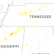


Connect with Interactive Hail Maps