

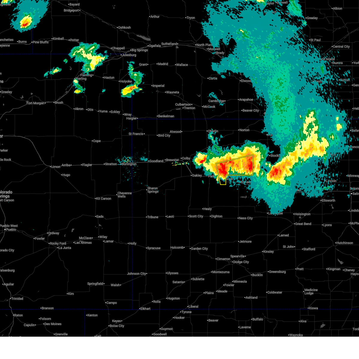
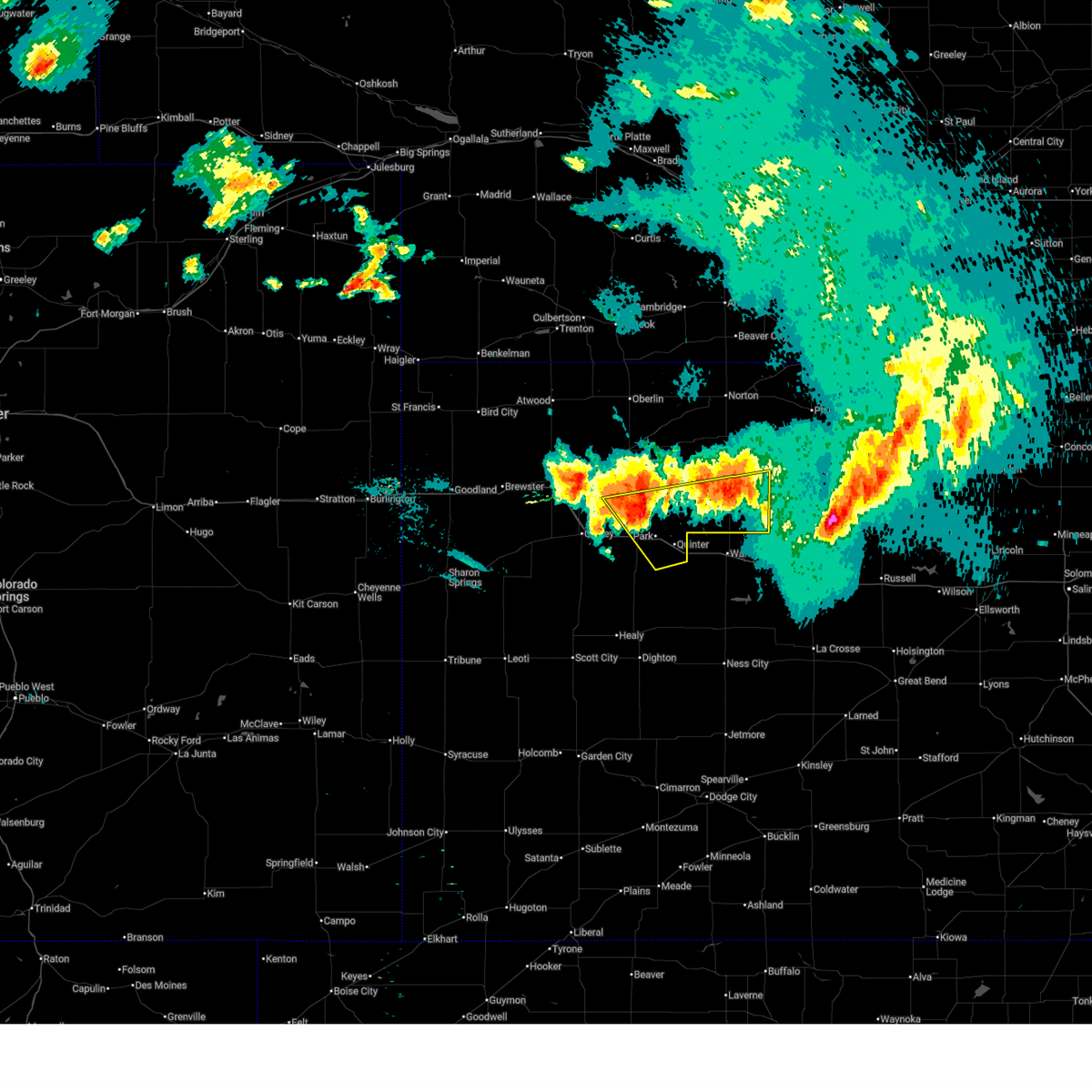
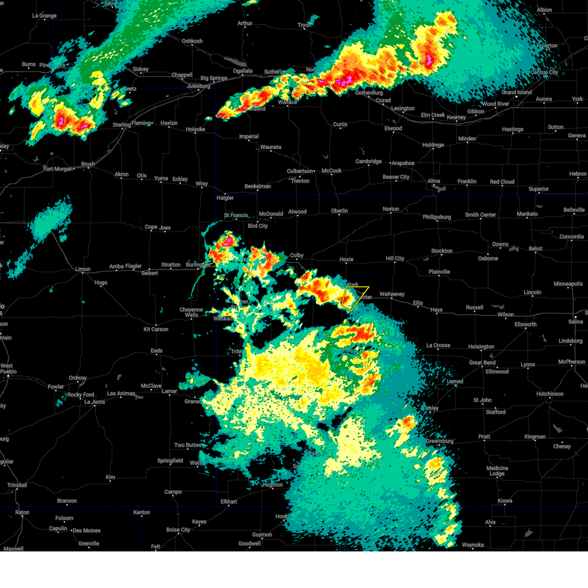
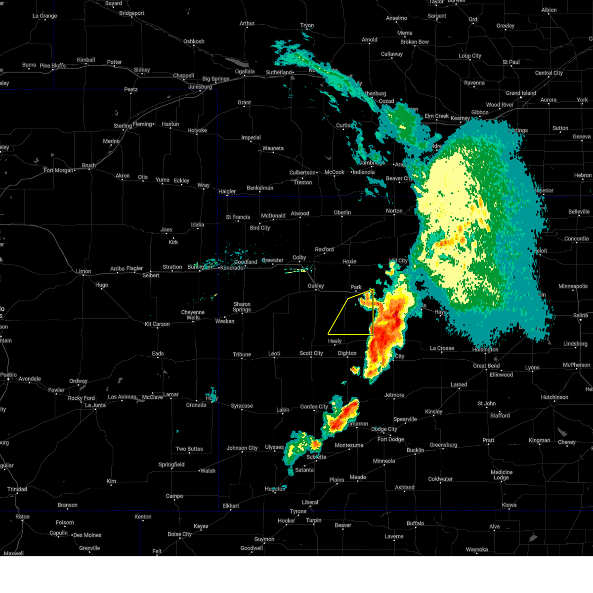
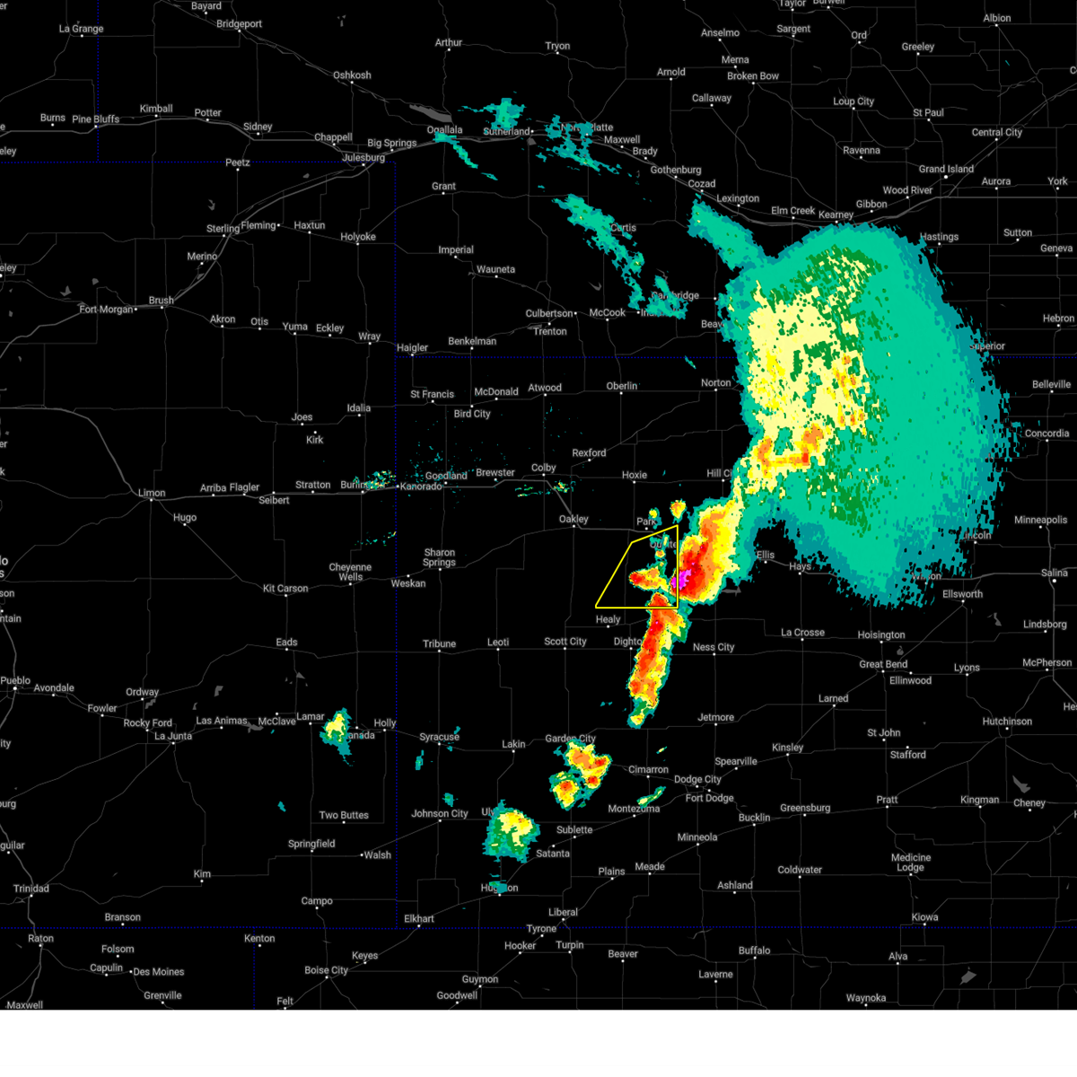
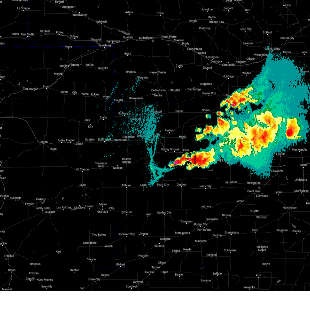
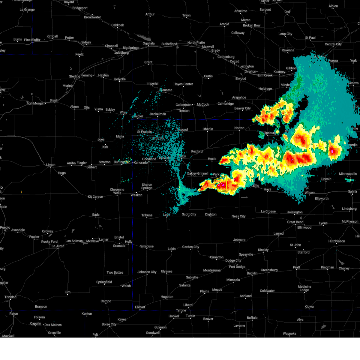
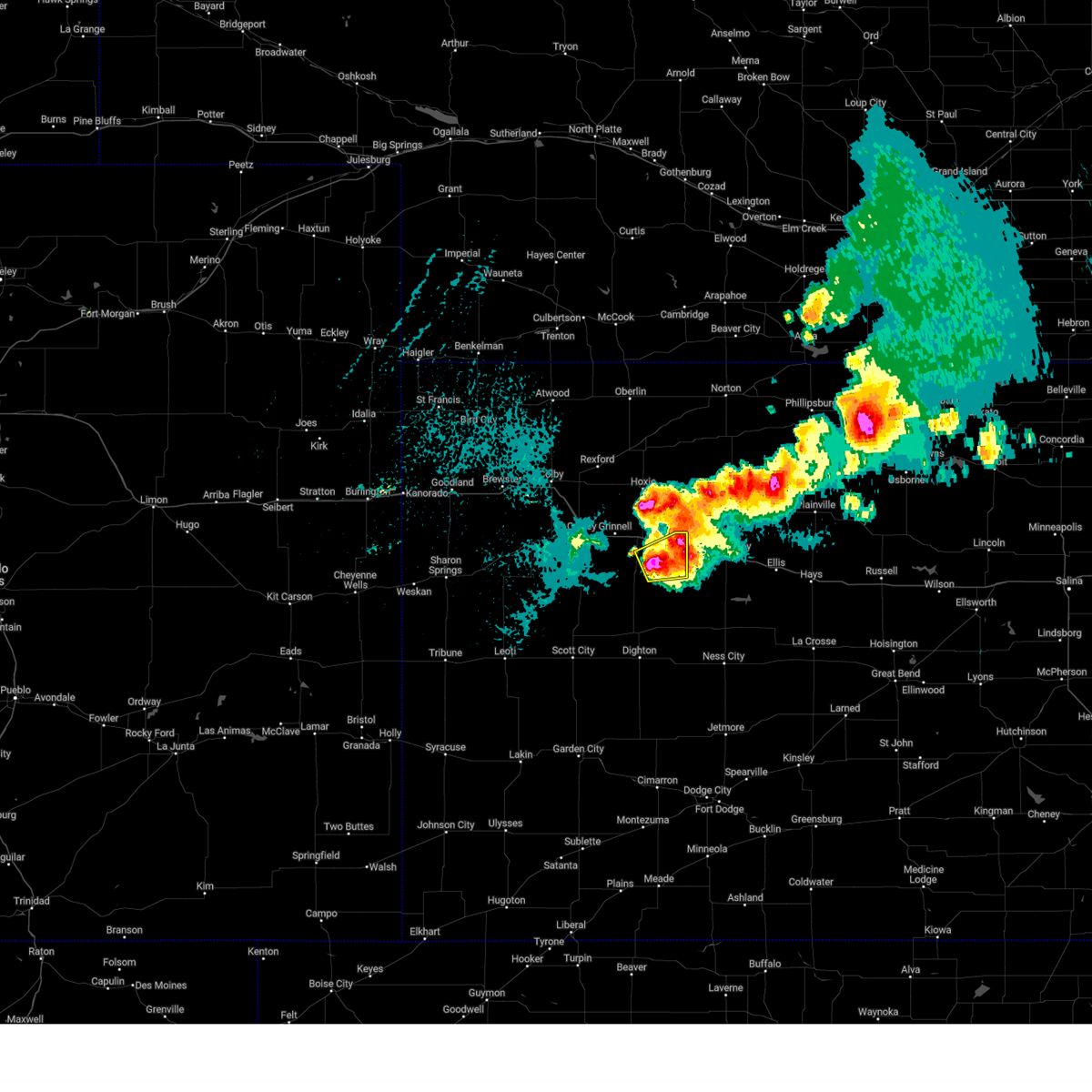
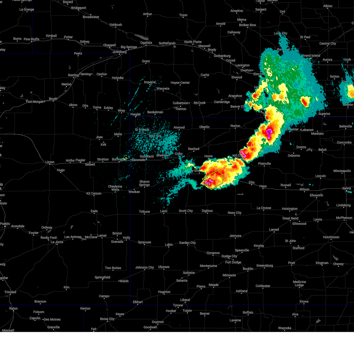
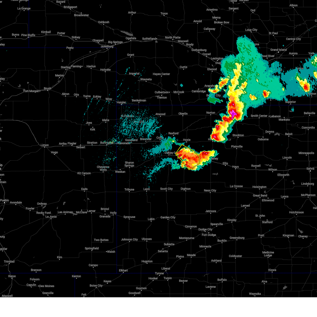
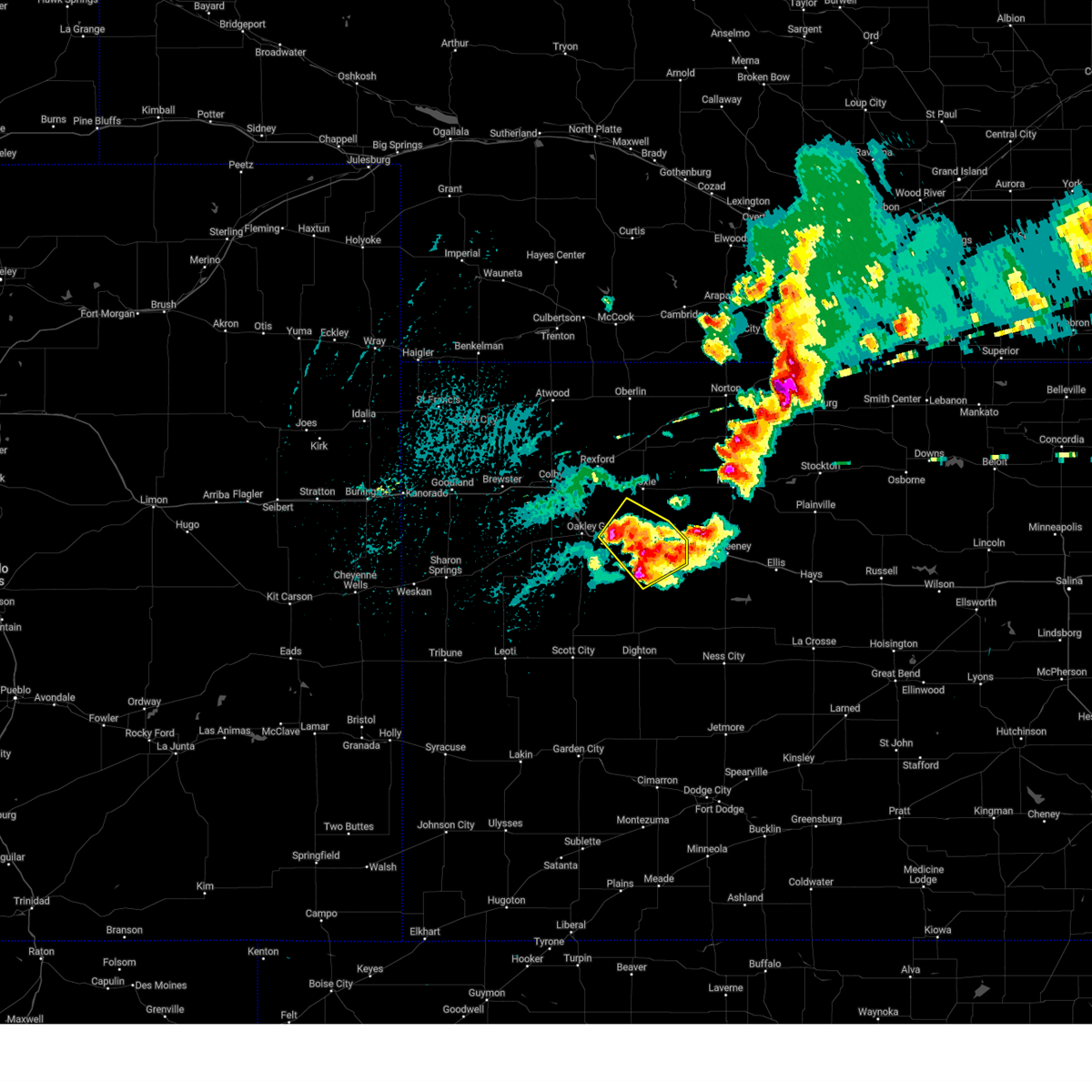
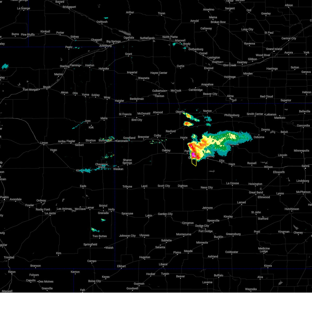
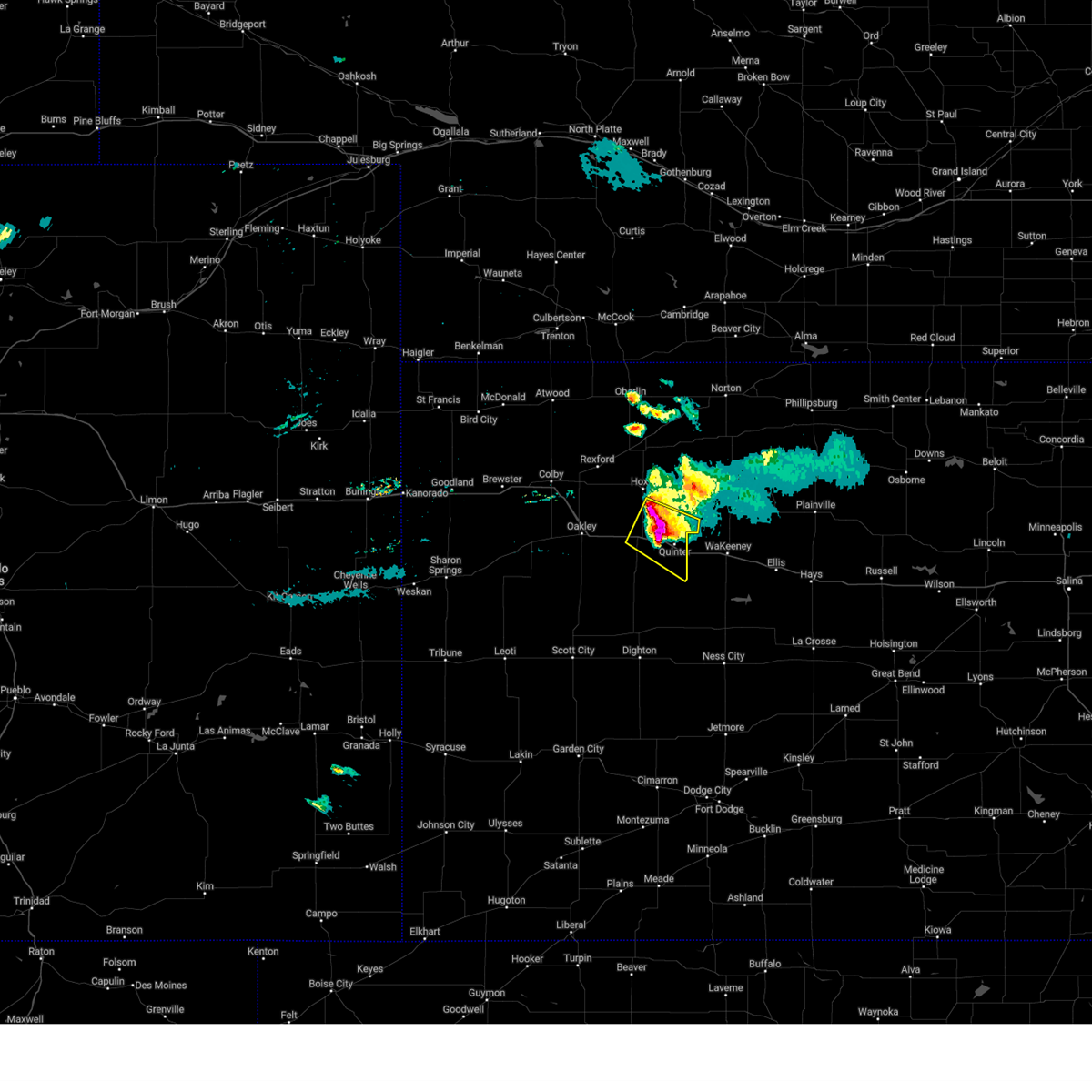
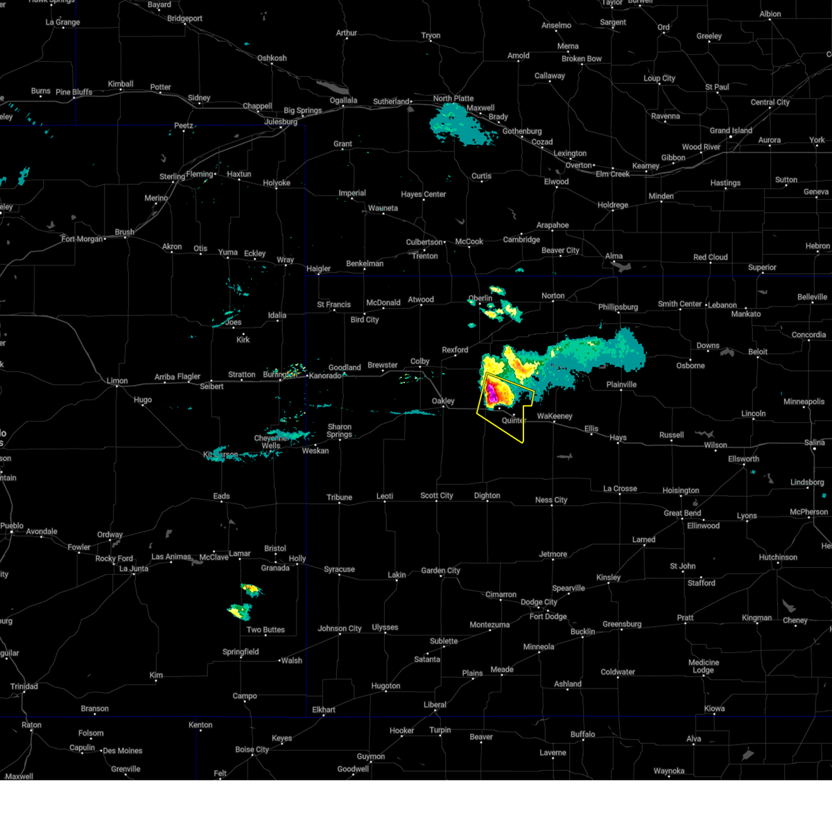
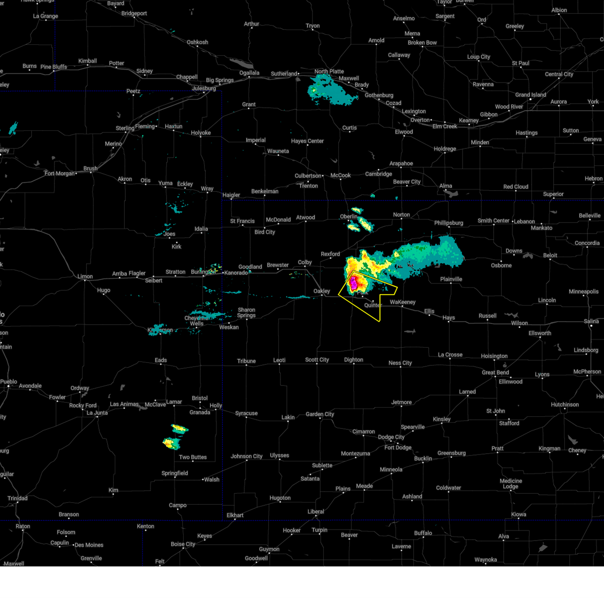
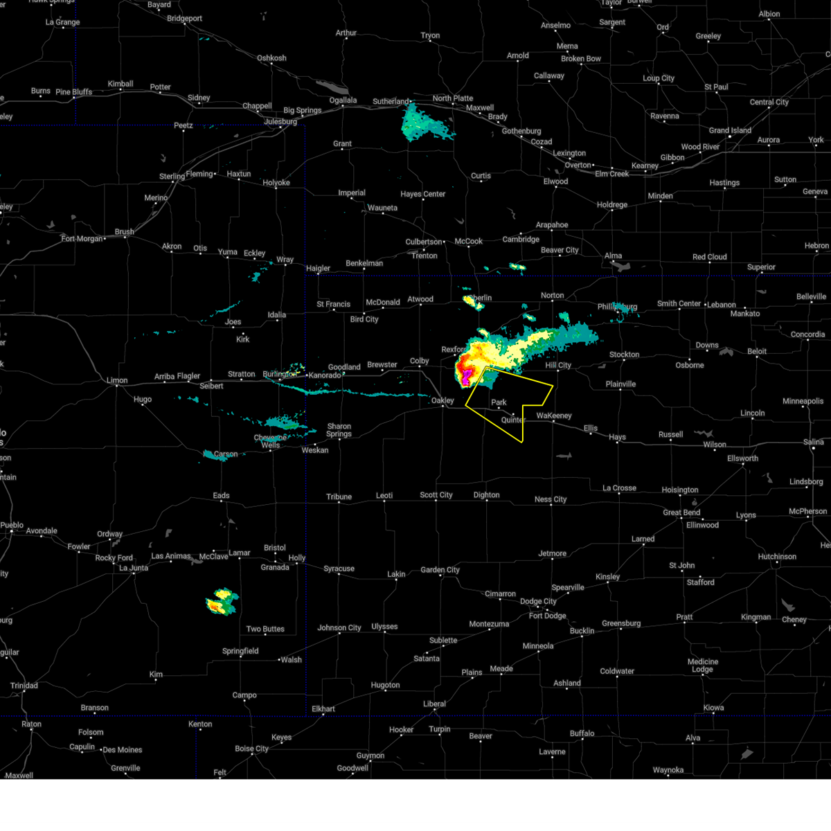
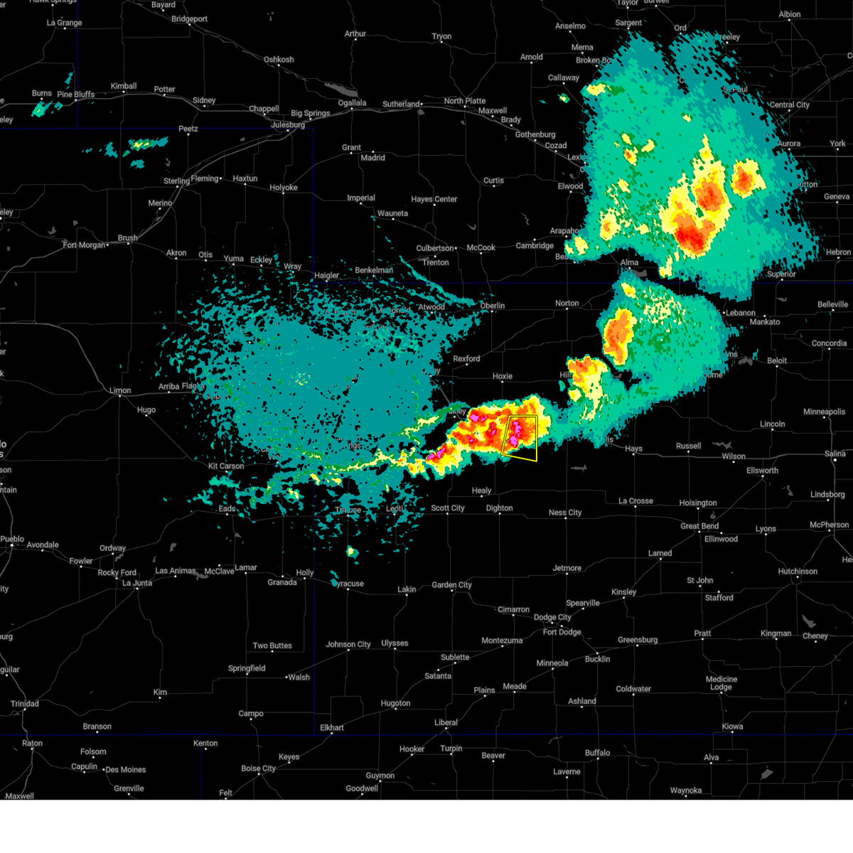
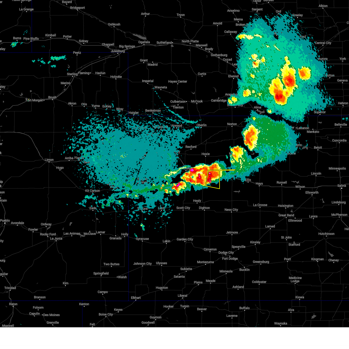
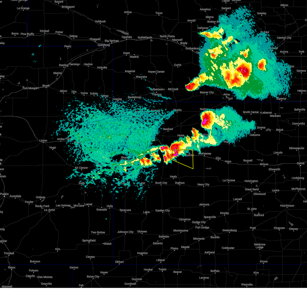
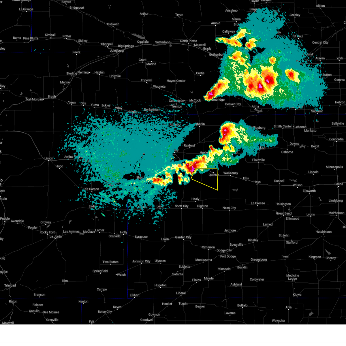
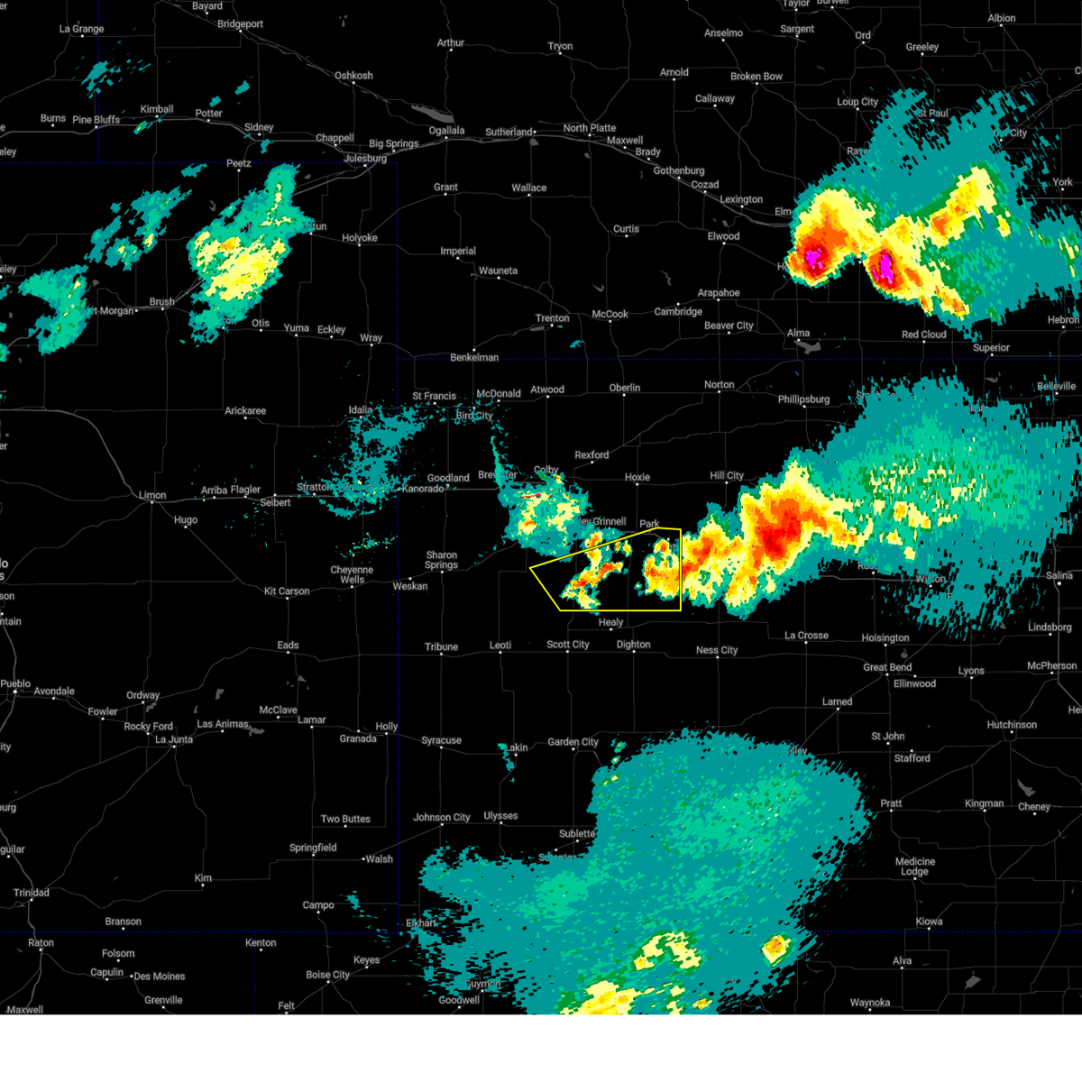
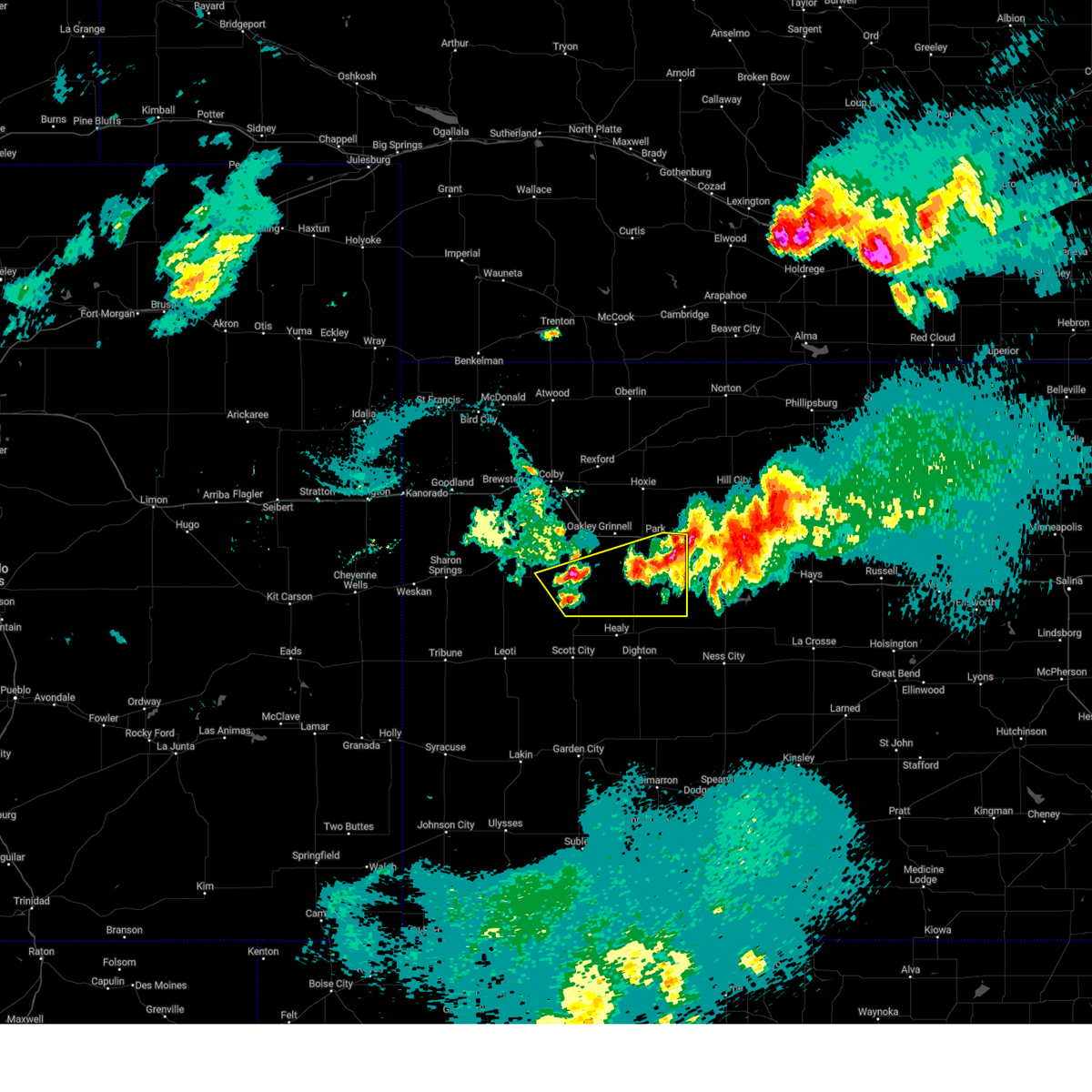
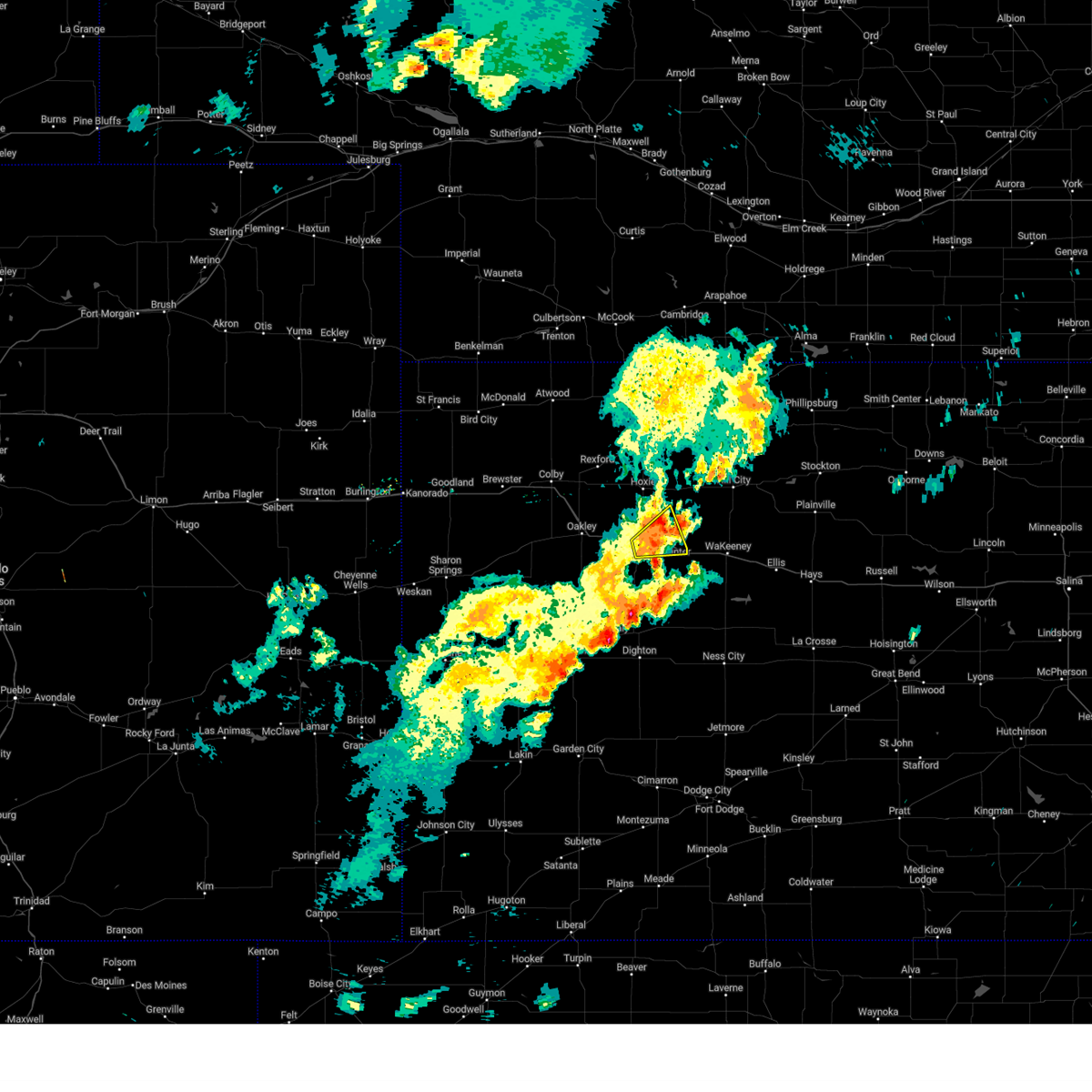
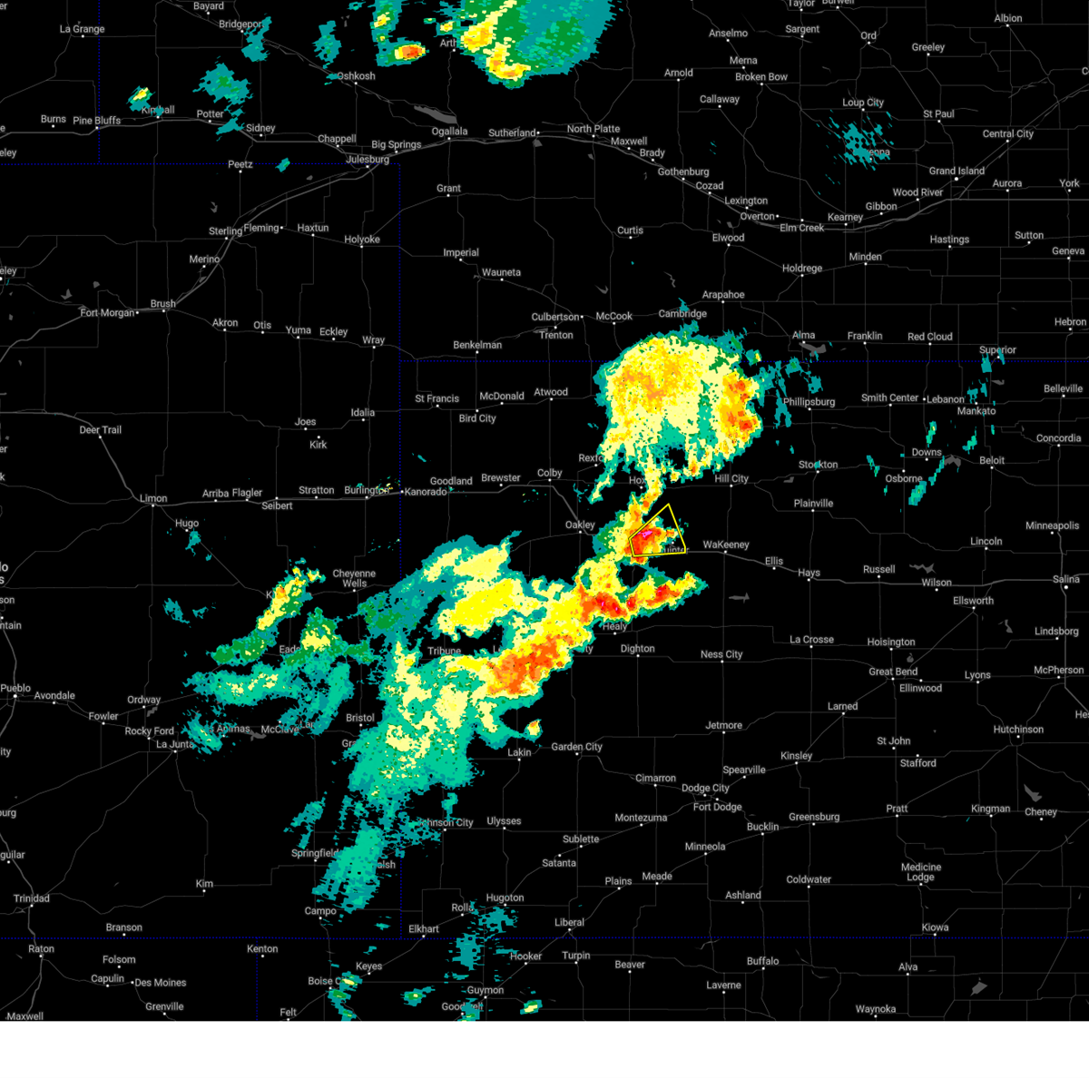
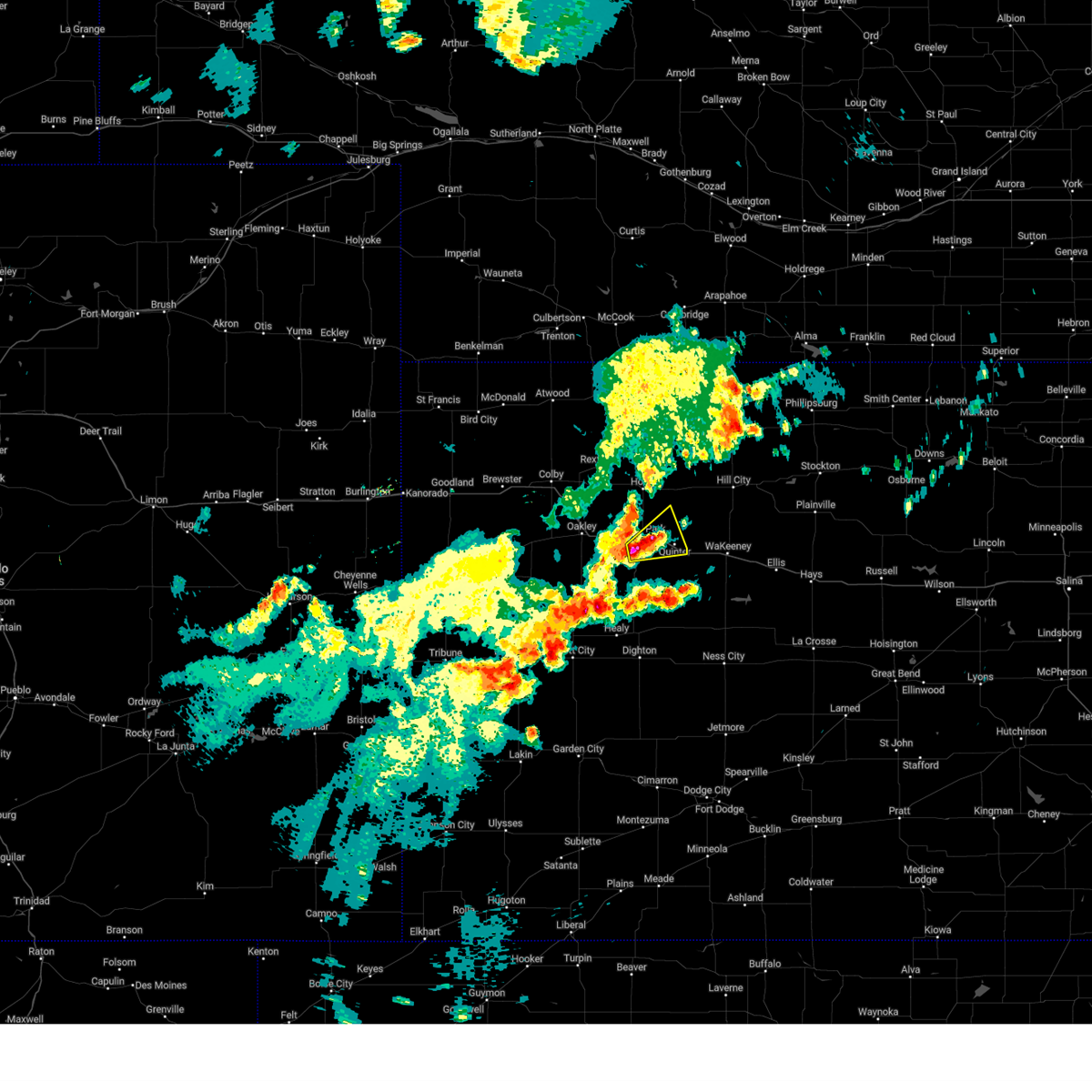
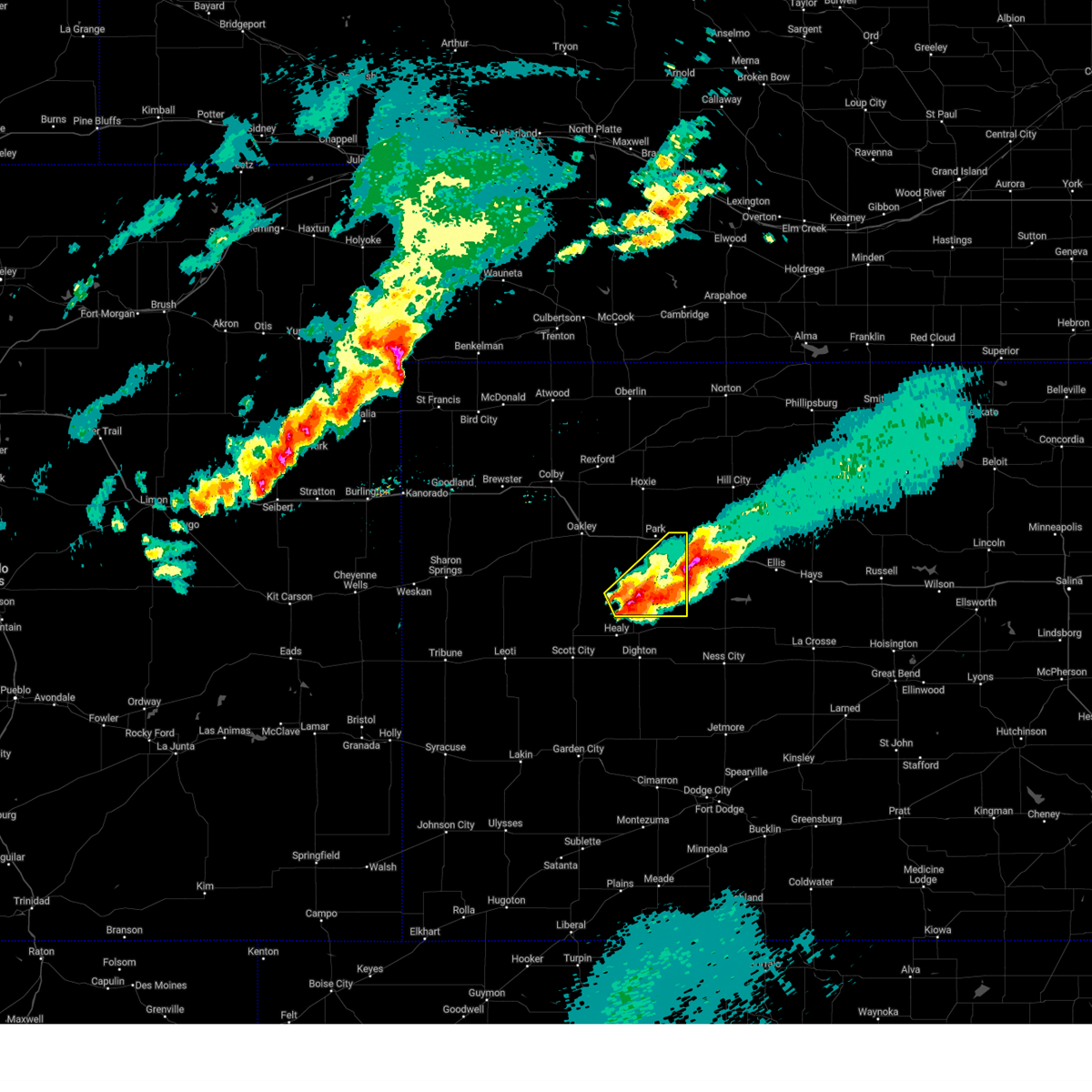
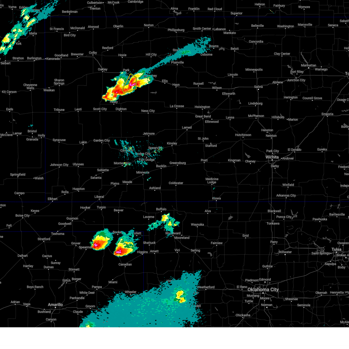
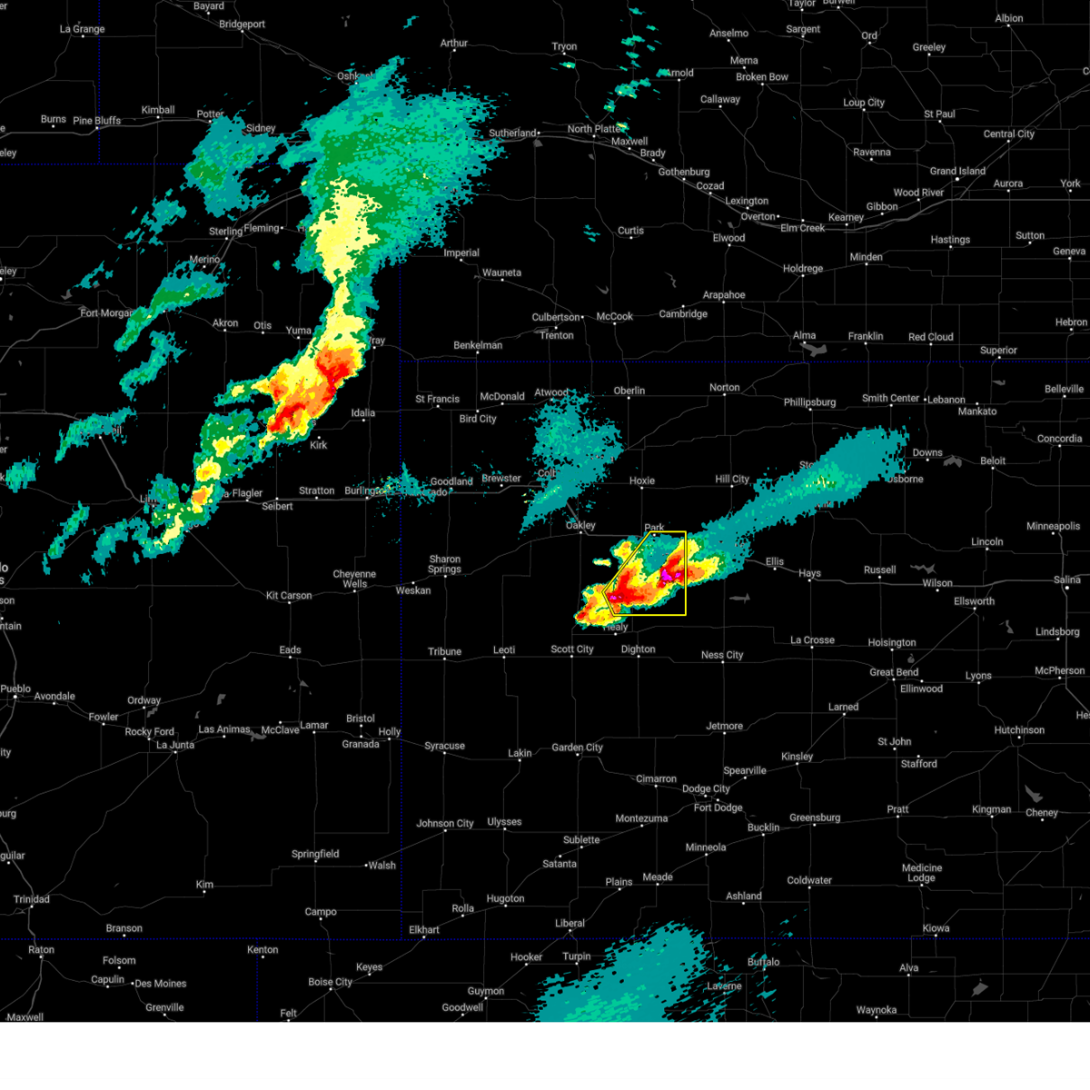
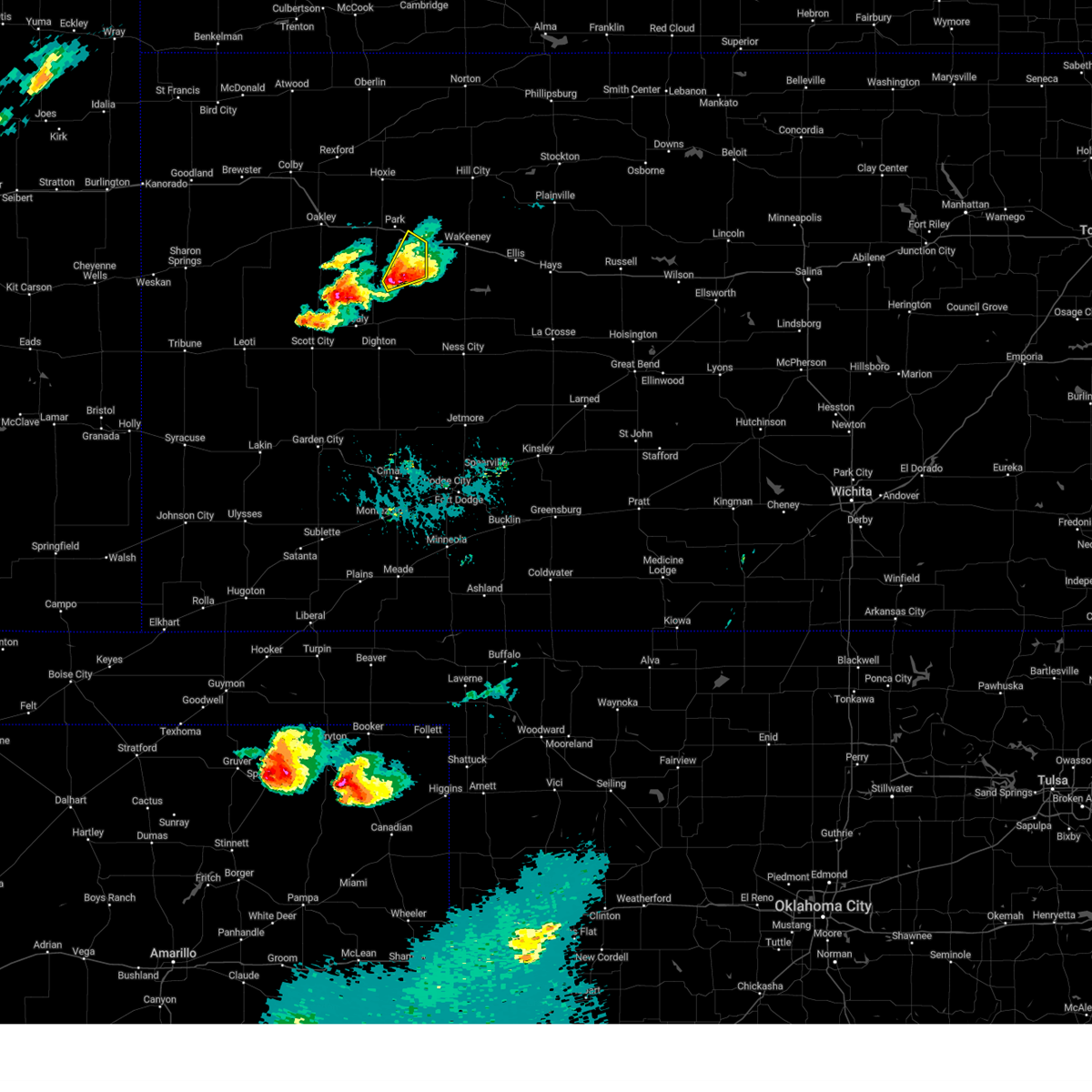
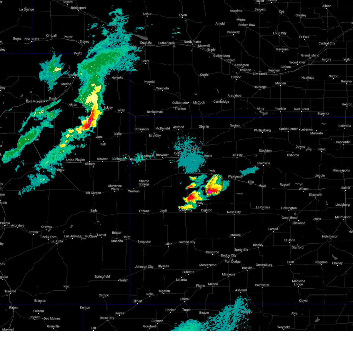
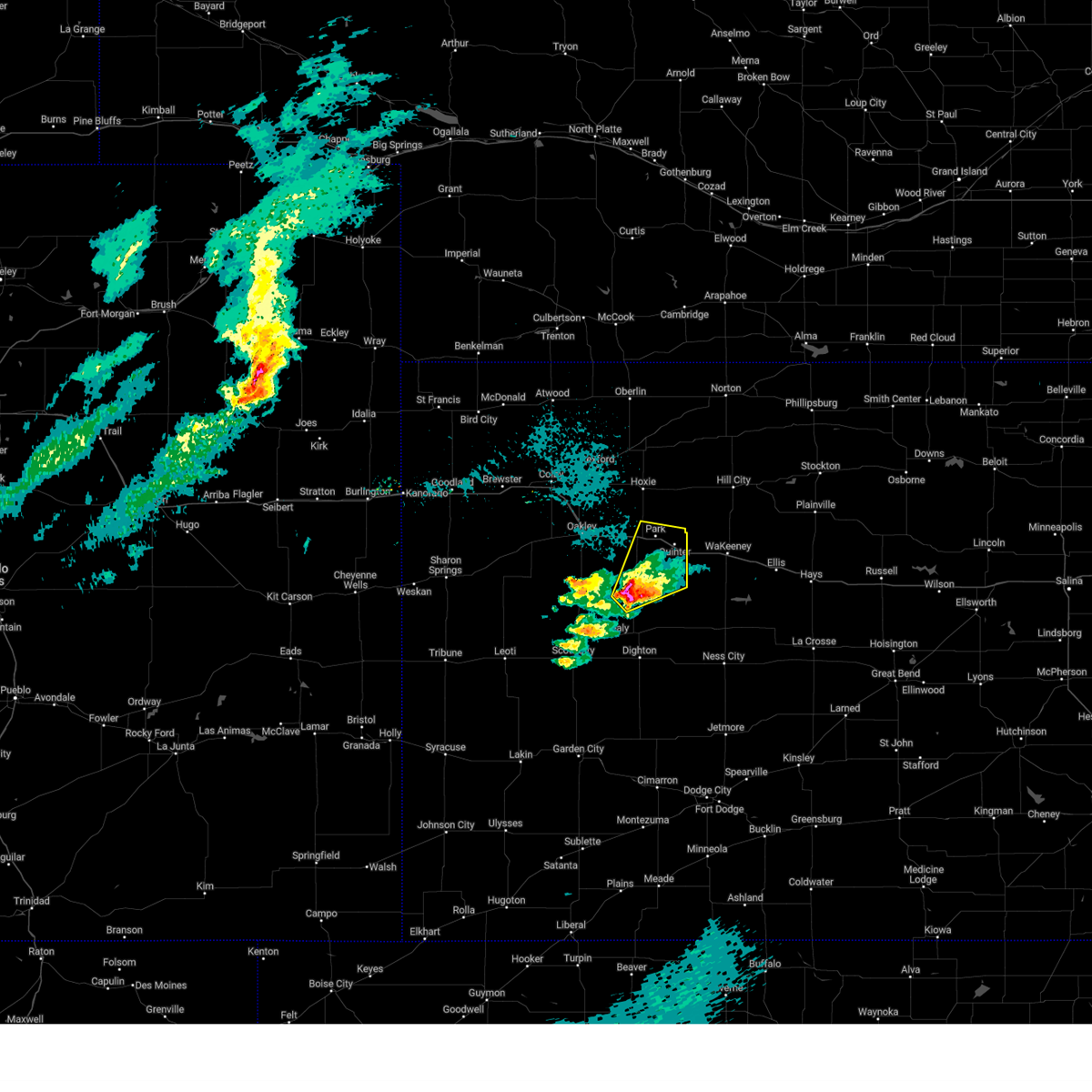
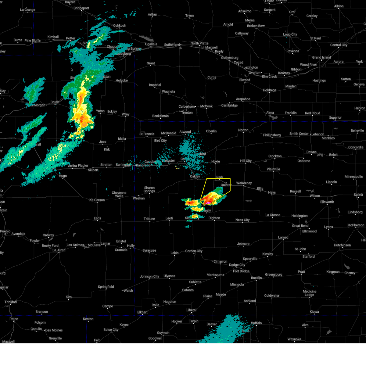
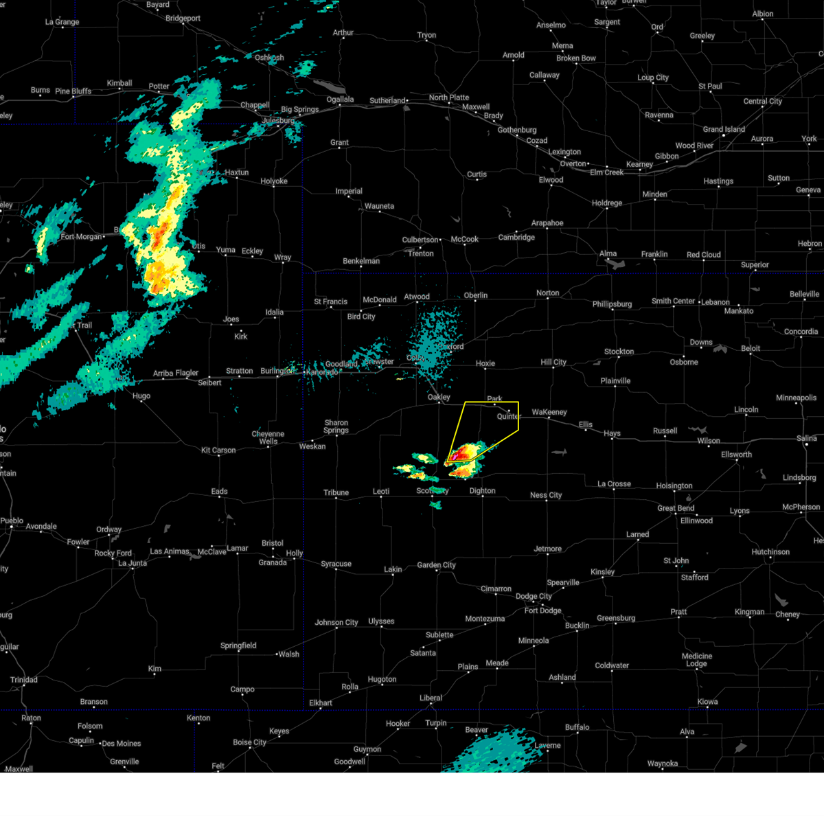
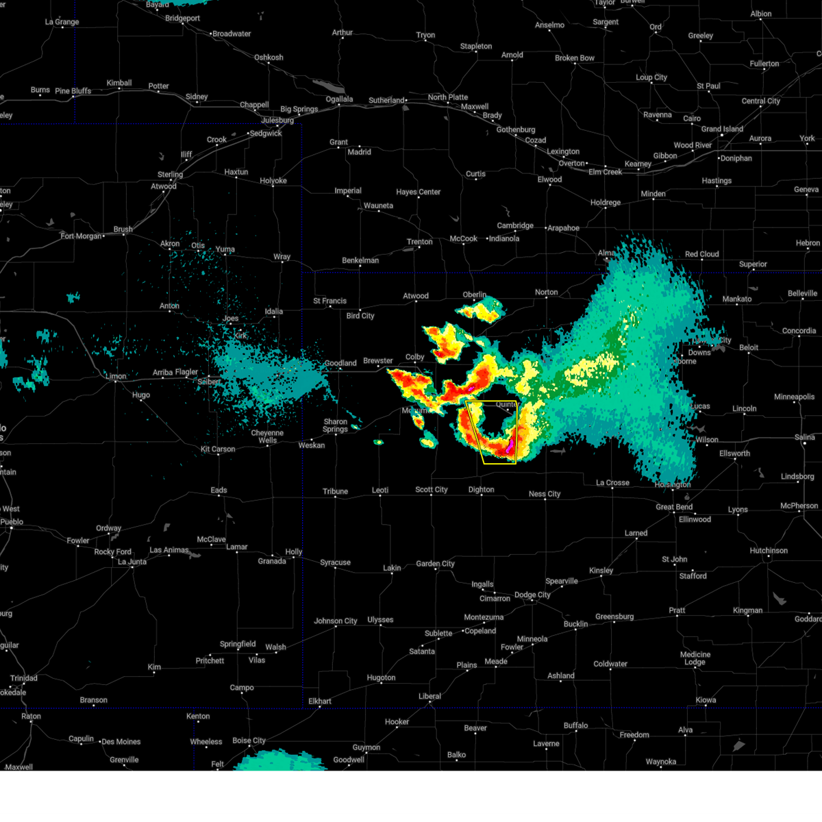
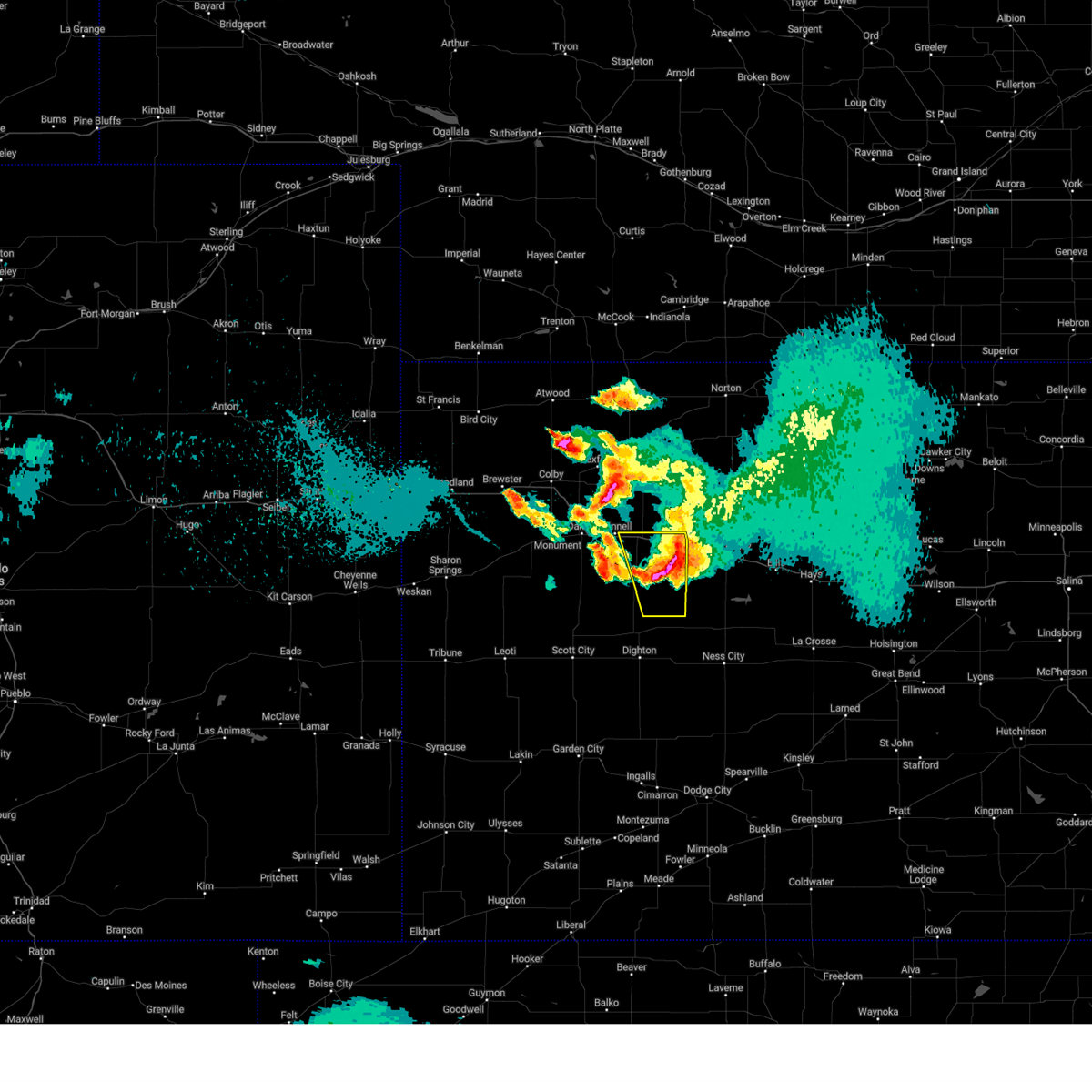
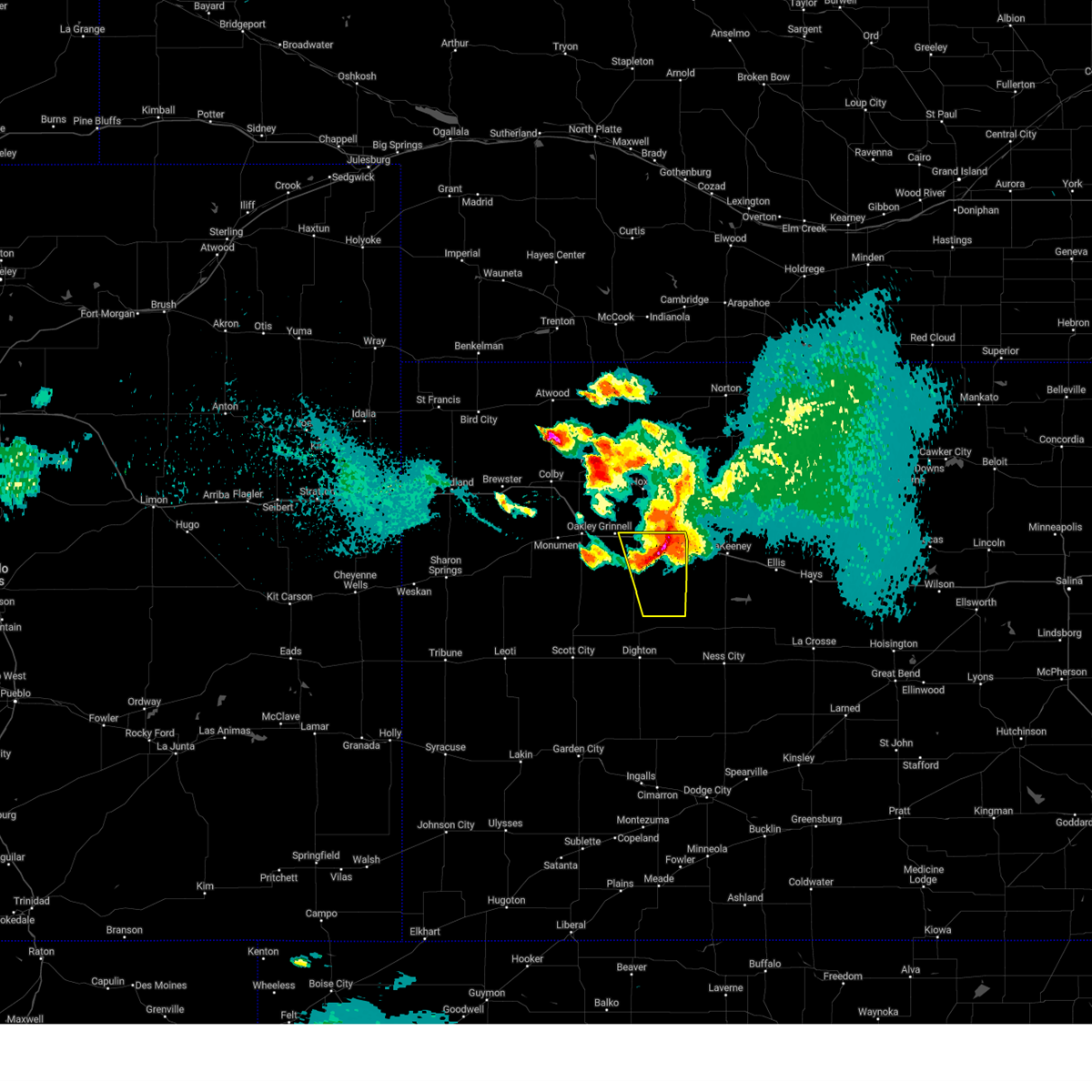
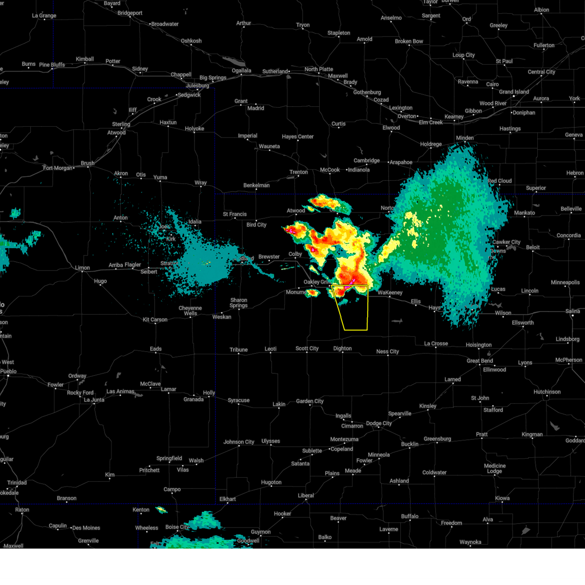
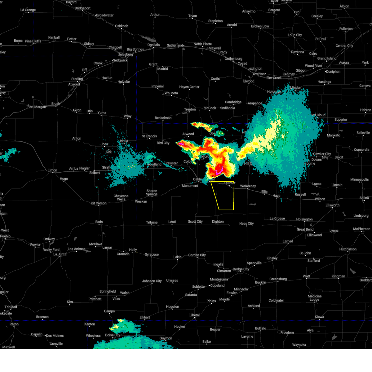
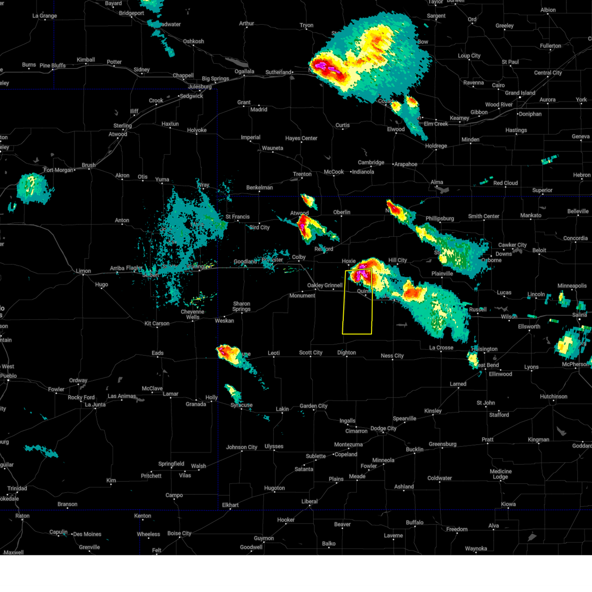
Hail Map for Quinter, KS
The Quinter, KS area has had 25 reports of on-the-ground hail by trained spotters, and has been under severe weather warnings 25 times during the past 12 months. Doppler radar has detected hail at or near Quinter, KS on 110 occasions, including 7 occasions during the past year.
| Name: | Quinter, KS |
| Where Located: | 49 miles ESE of Colby, KS |
| Map: | Google Map for Quinter, KS |
| Population: | 918 |
| Housing Units: | 425 |
| More Info: | Search Google for Quinter, KS |
1
The Top Recent Hail Date for Quinter, KS is Sunday, July 28, 2024 (12th out of 110)

Hail and Wind Damage Spotted near Quinter, KS
| Date / Time | Report Details |
|---|---|
| 6/25/2025 5:02 PM CDT | Up846 reported the gus in gove county KS, 2 miles W of Quinter, KS |
| 6/17/2025 12:36 AM CDT | Mesonet station up846 2.0 e quinter (upr in gove county KS, 2 miles W of Quinter, KS |
| 6/17/2025 12:36 AM CDT |
 At 1236 am cdt, severe thunderstorms were located along a line extending from 3 miles west of palco to near quinter, moving southeast at 35 mph (radar indicated). Hazards include 60 mph wind gusts and quarter size hail. Hail damage to vehicles is expected. expect wind damage to roofs, siding, and trees. These severe thunderstorms will remain over mainly rural areas of southeastern sheridan, northeastern gove and graham counties, including the following locations, saint peter and penokee. At 1236 am cdt, severe thunderstorms were located along a line extending from 3 miles west of palco to near quinter, moving southeast at 35 mph (radar indicated). Hazards include 60 mph wind gusts and quarter size hail. Hail damage to vehicles is expected. expect wind damage to roofs, siding, and trees. These severe thunderstorms will remain over mainly rural areas of southeastern sheridan, northeastern gove and graham counties, including the following locations, saint peter and penokee.
|
| 6/17/2025 12:14 AM CDT |
 Svrgld the national weather service in goodland has issued a * severe thunderstorm warning for, southern sheridan county in northwestern kansas, northeastern gove county in west central kansas, graham county in northwestern kansas, * until 115 am cdt. * at 1214 am cdt, severe thunderstorms were located along a line extending from near bogue to near grinnell, moving southeast at 35 mph (radar indicated). Hazards include 60 mph wind gusts and quarter size hail. Hail damage to vehicles is expected. expect wind damage to roofs, siding, and trees. severe thunderstorms will be near, grainfield and park around 1220 am cdt. Quinter around 1230 am cdt. Svrgld the national weather service in goodland has issued a * severe thunderstorm warning for, southern sheridan county in northwestern kansas, northeastern gove county in west central kansas, graham county in northwestern kansas, * until 115 am cdt. * at 1214 am cdt, severe thunderstorms were located along a line extending from near bogue to near grinnell, moving southeast at 35 mph (radar indicated). Hazards include 60 mph wind gusts and quarter size hail. Hail damage to vehicles is expected. expect wind damage to roofs, siding, and trees. severe thunderstorms will be near, grainfield and park around 1220 am cdt. Quinter around 1230 am cdt.
|
| 6/16/2025 12:40 PM CDT | Up846 reported the gus in gove county KS, 2 miles W of Quinter, KS |
| 6/2/2025 8:14 PM CDT | The storm which prompted the warning has moved out of the area. therefore, the warning will be allowed to expire. however, heavy rain is still possible with this thunderstorm. a severe thunderstorm watch remains in effect until 1000 pm cdt for west central kansas. to report severe weather, contact your nearest law enforcement agency. they will relay your report to the national weather service goodland. |
| 6/2/2025 7:48 PM CDT |
 Svrgld the national weather service in goodland has issued a * severe thunderstorm warning for, northeastern gove county in west central kansas, * until 815 pm cdt. * at 748 pm cdt, a severe thunderstorm was located near gove, moving north at 25 mph (radar indicated). Hazards include 60 mph wind gusts and quarter size hail. Hail damage to vehicles is expected. expect wind damage to roofs, siding, and trees. this severe thunderstorm will be near, park around 805 pm cdt. This includes interstate 70 in kansas between mile markers 96 and 108. Svrgld the national weather service in goodland has issued a * severe thunderstorm warning for, northeastern gove county in west central kansas, * until 815 pm cdt. * at 748 pm cdt, a severe thunderstorm was located near gove, moving north at 25 mph (radar indicated). Hazards include 60 mph wind gusts and quarter size hail. Hail damage to vehicles is expected. expect wind damage to roofs, siding, and trees. this severe thunderstorm will be near, park around 805 pm cdt. This includes interstate 70 in kansas between mile markers 96 and 108.
|
| 9/16/2024 9:59 PM CDT |
 the severe thunderstorm warning has been cancelled and is no longer in effect the severe thunderstorm warning has been cancelled and is no longer in effect
|
| 9/16/2024 9:25 PM CDT |
 Svrgld the national weather service in goodland has issued a * severe thunderstorm warning for, eastern gove county in west central kansas, * until 1030 pm cdt. * at 925 pm cdt, a severe thunderstorm was located 11 miles north of utica, moving northeast at 5 mph (radar indicated). Hazards include two inch hail and 60 mph wind gusts. People and animals outdoors will be injured. expect hail damage to roofs, siding, windows, and vehicles. expect wind damage to roofs, siding, and trees. this severe thunderstorm will remain over mainly rural areas of eastern gove county. This includes interstate 70 in kansas between mile markers 104 and 113. Svrgld the national weather service in goodland has issued a * severe thunderstorm warning for, eastern gove county in west central kansas, * until 1030 pm cdt. * at 925 pm cdt, a severe thunderstorm was located 11 miles north of utica, moving northeast at 5 mph (radar indicated). Hazards include two inch hail and 60 mph wind gusts. People and animals outdoors will be injured. expect hail damage to roofs, siding, windows, and vehicles. expect wind damage to roofs, siding, and trees. this severe thunderstorm will remain over mainly rural areas of eastern gove county. This includes interstate 70 in kansas between mile markers 104 and 113.
|
| 9/16/2024 7:15 PM CDT | Reported via mesonet up84 in gove county KS, 2 miles W of Quinter, KS |
| 8/26/2024 7:28 PM CDT | Reported via mesonet up84 in gove county KS, 2 miles W of Quinter, KS |
| 8/26/2024 7:28 PM CDT | Report relayed of damage to two tin sheds that had part of the roofs torn off... a metal fence blown over... and some power lines were broken. time is estimated from a in gove county KS, 2.6 miles W of Quinter, KS |
| 7/31/2024 6:30 PM CDT | Golf Ball sized hail reported 14.5 miles NNW of Quinter, KS |
| 7/31/2024 6:02 PM CDT |
 At 602 pm cdt, a severe thunderstorm was located 4 miles southwest of collyer, moving east at 10 mph (radar indicated). Hazards include 60 mph wind gusts and half dollar size hail. Hail damage to vehicles is expected. expect wind damage to roofs, siding, and trees. this severe thunderstorm will remain over mainly rural areas of northeastern gove county. This includes interstate 70 in kansas between mile markers 104 and 113. At 602 pm cdt, a severe thunderstorm was located 4 miles southwest of collyer, moving east at 10 mph (radar indicated). Hazards include 60 mph wind gusts and half dollar size hail. Hail damage to vehicles is expected. expect wind damage to roofs, siding, and trees. this severe thunderstorm will remain over mainly rural areas of northeastern gove county. This includes interstate 70 in kansas between mile markers 104 and 113.
|
| 7/31/2024 5:45 PM CDT |
 Svrgld the national weather service in goodland has issued a * severe thunderstorm warning for, northeastern gove county in west central kansas, * until 630 pm cdt. * at 544 pm cdt, a severe thunderstorm was located 4 miles south of quinter, moving east at 15 mph (radar indicated). Hazards include ping pong ball size hail and 60 mph wind gusts. People and animals outdoors will be injured. expect hail damage to roofs, siding, windows, and vehicles. expect wind damage to roofs, siding, and trees. this severe thunderstorm will be near, quinter around 550 pm cdt. This includes interstate 70 in kansas between mile markers 104 and 113. Svrgld the national weather service in goodland has issued a * severe thunderstorm warning for, northeastern gove county in west central kansas, * until 630 pm cdt. * at 544 pm cdt, a severe thunderstorm was located 4 miles south of quinter, moving east at 15 mph (radar indicated). Hazards include ping pong ball size hail and 60 mph wind gusts. People and animals outdoors will be injured. expect hail damage to roofs, siding, windows, and vehicles. expect wind damage to roofs, siding, and trees. this severe thunderstorm will be near, quinter around 550 pm cdt. This includes interstate 70 in kansas between mile markers 104 and 113.
|
| 7/31/2024 5:14 PM CDT |
 At 513 pm cdt, a severe thunderstorm was located 7 miles east of gove, moving east at 10 mph (trained weather spotters. at 512 pm cdt, golf ball sized hail was reported 7 ene of gove city). Hazards include golf ball size hail and 60 mph wind gusts. People and animals outdoors will be injured. expect hail damage to roofs, siding, windows, and vehicles. expect wind damage to roofs, siding, and trees. this severe storm will be near, quinter around 535 pm cdt. This includes interstate 70 in kansas between mile markers 103 and 113. At 513 pm cdt, a severe thunderstorm was located 7 miles east of gove, moving east at 10 mph (trained weather spotters. at 512 pm cdt, golf ball sized hail was reported 7 ene of gove city). Hazards include golf ball size hail and 60 mph wind gusts. People and animals outdoors will be injured. expect hail damage to roofs, siding, windows, and vehicles. expect wind damage to roofs, siding, and trees. this severe storm will be near, quinter around 535 pm cdt. This includes interstate 70 in kansas between mile markers 103 and 113.
|
| 7/31/2024 5:13 PM CDT | Up84 in gove county KS, 0.6 miles SW of Quinter, KS |
| 7/31/2024 5:00 PM CDT | Svrgld the national weather service in goodland has issued a * severe thunderstorm warning for, northeastern gove county in west central kansas, * until 545 pm cdt. * at 459 pm cdt, a severe thunderstorm was located 5 miles east of gove, moving east at 15 mph (radar indicated. at 455 pm cdt, ping pong ball sized hail was reported in gove city). Hazards include ping pong ball size hail and 60 mph wind gusts. People and animals outdoors will be injured. expect hail damage to roofs, siding, windows, and vehicles. expect wind damage to roofs, siding, and trees. this severe thunderstorm will be near, quinter around 525 pm cdt. This includes interstate 70 in kansas between mile markers 103 and 113. |
| 7/31/2024 4:50 PM CDT |
 At 449 pm cdt, a severe thunderstorm was located over gove, moving east at 15 mph (trained weather spotters. at 446 pm cdt, half dollar sized hail was reported in gove city). Hazards include 60 mph wind gusts and half dollar size hail. Hail damage to vehicles is expected. expect wind damage to roofs, siding, and trees. this severe thunderstorm will remain over mainly rural areas of southern sheridan and northeastern gove counties. This includes interstate 70 in kansas between mile markers 98 and 113. At 449 pm cdt, a severe thunderstorm was located over gove, moving east at 15 mph (trained weather spotters. at 446 pm cdt, half dollar sized hail was reported in gove city). Hazards include 60 mph wind gusts and half dollar size hail. Hail damage to vehicles is expected. expect wind damage to roofs, siding, and trees. this severe thunderstorm will remain over mainly rural areas of southern sheridan and northeastern gove counties. This includes interstate 70 in kansas between mile markers 98 and 113.
|
| 7/31/2024 4:32 PM CDT |
 At 432 pm cdt, severe thunderstorms were located along a line extending from near grinnell to 3 miles southwest of park to 5 miles east of gove, moving east at 15 mph (radar indicated). Hazards include 60 mph wind gusts and quarter size hail. Hail damage to vehicles is expected. expect wind damage to roofs, siding, and trees. these severe storms will be near, grainfield and park around 440 pm cdt. quinter around 450 pm cdt. This includes interstate 70 in kansas between mile markers 85 and 113. At 432 pm cdt, severe thunderstorms were located along a line extending from near grinnell to 3 miles southwest of park to 5 miles east of gove, moving east at 15 mph (radar indicated). Hazards include 60 mph wind gusts and quarter size hail. Hail damage to vehicles is expected. expect wind damage to roofs, siding, and trees. these severe storms will be near, grainfield and park around 440 pm cdt. quinter around 450 pm cdt. This includes interstate 70 in kansas between mile markers 85 and 113.
|
| 7/31/2024 4:17 PM CDT |
 Svrgld the national weather service in goodland has issued a * severe thunderstorm warning for, southwestern sheridan county in northwestern kansas, northeastern gove county in west central kansas, * until 500 pm cdt. * at 416 pm cdt, severe thunderstorms were located along a line extending from near grinnell to 3 miles north of gove to 14 miles south of grainfield, moving northeast at 15 mph (trained weather spotters. at 415 pm cdt, quarter sized hail was reported 3 miles ese of campus along i-70). Hazards include 60 mph wind gusts and quarter size hail. Hail damage to vehicles is expected. expect wind damage to roofs, siding, and trees. severe thunderstorms will be near, grainfield and grinnell around 420 pm cdt. park around 435 pm cdt. This includes interstate 70 in kansas between mile markers 80 and 113. Svrgld the national weather service in goodland has issued a * severe thunderstorm warning for, southwestern sheridan county in northwestern kansas, northeastern gove county in west central kansas, * until 500 pm cdt. * at 416 pm cdt, severe thunderstorms were located along a line extending from near grinnell to 3 miles north of gove to 14 miles south of grainfield, moving northeast at 15 mph (trained weather spotters. at 415 pm cdt, quarter sized hail was reported 3 miles ese of campus along i-70). Hazards include 60 mph wind gusts and quarter size hail. Hail damage to vehicles is expected. expect wind damage to roofs, siding, and trees. severe thunderstorms will be near, grainfield and grinnell around 420 pm cdt. park around 435 pm cdt. This includes interstate 70 in kansas between mile markers 80 and 113.
|
| 7/28/2024 9:08 PM CDT |
 The storm which prompted the warning has moved out of the area. therefore, the warning will be allowed to expire. however, gusty winds and heavy rain are still possible with this thunderstorm. The storm which prompted the warning has moved out of the area. therefore, the warning will be allowed to expire. however, gusty winds and heavy rain are still possible with this thunderstorm.
|
| 7/28/2024 9:03 PM CDT |
 At 903 pm cdt, a severe thunderstorm was located over collyer, moving southeast at 35 mph (radar indicated). Hazards include golf ball size hail and 70 mph wind gusts. People and animals outdoors will be injured. expect hail damage to roofs, siding, windows, and vehicles. expect considerable tree damage. wind damage is also likely to mobile homes, roofs, and outbuildings. locations impacted include, quinter. This includes interstate 70 in kansas between mile markers 107 and 113. At 903 pm cdt, a severe thunderstorm was located over collyer, moving southeast at 35 mph (radar indicated). Hazards include golf ball size hail and 70 mph wind gusts. People and animals outdoors will be injured. expect hail damage to roofs, siding, windows, and vehicles. expect considerable tree damage. wind damage is also likely to mobile homes, roofs, and outbuildings. locations impacted include, quinter. This includes interstate 70 in kansas between mile markers 107 and 113.
|
| 7/28/2024 9:03 PM CDT |
 the severe thunderstorm warning has been cancelled and is no longer in effect the severe thunderstorm warning has been cancelled and is no longer in effect
|
| 7/28/2024 9:00 PM CDT | Upr84 in gove county KS, 2 miles W of Quinter, KS |
| 7/28/2024 8:55 PM CDT | Storm damage reported in gove county KS, 0.4 miles SSE of Quinter, KS |
| 7/28/2024 8:54 PM CDT | Quarter sized hail reported 0.4 miles SSE of Quinter, KS, report from mping: quarter (1.00 in.). |
| 7/28/2024 8:54 PM CDT | Golf Ball sized hail reported 0.4 miles SSE of Quinter, KS, corrects previous hail report from quinter. quarter to golf ball size hail in quinter. |
| 7/28/2024 8:46 PM CDT |
 At 845 pm cdt, a severe thunderstorm was located near park, or 4 miles northwest of quinter, moving southeast at 35 mph (radar indicated. this storm has a history of producing winds in excess of 70 mph and hail to the size of tennis balls). Hazards include tennis ball size hail and 70 mph wind gusts. People and animals outdoors will be injured. expect hail damage to roofs, siding, windows, and vehicles. expect considerable tree damage. wind damage is also likely to mobile homes, roofs, and outbuildings. locations impacted include, quinter, grainfield, park, and saint peter. This includes interstate 70 in kansas between mile markers 91 and 113. At 845 pm cdt, a severe thunderstorm was located near park, or 4 miles northwest of quinter, moving southeast at 35 mph (radar indicated. this storm has a history of producing winds in excess of 70 mph and hail to the size of tennis balls). Hazards include tennis ball size hail and 70 mph wind gusts. People and animals outdoors will be injured. expect hail damage to roofs, siding, windows, and vehicles. expect considerable tree damage. wind damage is also likely to mobile homes, roofs, and outbuildings. locations impacted include, quinter, grainfield, park, and saint peter. This includes interstate 70 in kansas between mile markers 91 and 113.
|
| 7/28/2024 8:39 PM CDT |
 At 837 pm cdt, a severe thunderstorm was located near park, or 6 miles east of grainfield, moving southeast at 40 mph (radar indicated. a 72 mph wind gust was measured around 6 miles north of grainfield). Hazards include tennis ball size hail and 70 mph wind gusts. People and animals outdoors will be injured. expect hail damage to roofs, siding, windows, and vehicles. expect considerable tree damage. wind damage is also likely to mobile homes, roofs, and outbuildings. locations impacted include, quinter, grainfield, park, and saint peter. This includes interstate 70 in kansas between mile markers 91 and 113. At 837 pm cdt, a severe thunderstorm was located near park, or 6 miles east of grainfield, moving southeast at 40 mph (radar indicated. a 72 mph wind gust was measured around 6 miles north of grainfield). Hazards include tennis ball size hail and 70 mph wind gusts. People and animals outdoors will be injured. expect hail damage to roofs, siding, windows, and vehicles. expect considerable tree damage. wind damage is also likely to mobile homes, roofs, and outbuildings. locations impacted include, quinter, grainfield, park, and saint peter. This includes interstate 70 in kansas between mile markers 91 and 113.
|
| 7/28/2024 8:32 PM CDT |
 At 832 pm cdt, a severe thunderstorm was located 6 miles north of grainfield, moving southeast at 35 mph (trained weather spotters). Hazards include tennis ball size hail and 70 mph wind gusts. People and animals outdoors will be injured. expect hail damage to roofs, siding, windows, and vehicles. expect considerable tree damage. wind damage is also likely to mobile homes, roofs, and outbuildings. locations impacted include, quinter, grainfield, grinnell, park, and saint peter. This includes interstate 70 in kansas between mile markers 87 and 113. At 832 pm cdt, a severe thunderstorm was located 6 miles north of grainfield, moving southeast at 35 mph (trained weather spotters). Hazards include tennis ball size hail and 70 mph wind gusts. People and animals outdoors will be injured. expect hail damage to roofs, siding, windows, and vehicles. expect considerable tree damage. wind damage is also likely to mobile homes, roofs, and outbuildings. locations impacted include, quinter, grainfield, grinnell, park, and saint peter. This includes interstate 70 in kansas between mile markers 87 and 113.
|
| 7/28/2024 8:16 PM CDT |
 Svrgld the national weather service in goodland has issued a * severe thunderstorm warning for, southeastern sheridan county in northwestern kansas, northeastern gove county in west central kansas, southwestern graham county in northwestern kansas, * until 915 pm cdt. * at 816 pm cdt, a severe thunderstorm was located 8 miles southwest of hoxie, moving southeast at 30 mph (trained weather spotters). Hazards include tennis ball size hail and 70 mph wind gusts. People and animals outdoors will be injured. expect hail damage to roofs, siding, windows, and vehicles. expect considerable tree damage. Wind damage is also likely to mobile homes, roofs, and outbuildings. Svrgld the national weather service in goodland has issued a * severe thunderstorm warning for, southeastern sheridan county in northwestern kansas, northeastern gove county in west central kansas, southwestern graham county in northwestern kansas, * until 915 pm cdt. * at 816 pm cdt, a severe thunderstorm was located 8 miles southwest of hoxie, moving southeast at 30 mph (trained weather spotters). Hazards include tennis ball size hail and 70 mph wind gusts. People and animals outdoors will be injured. expect hail damage to roofs, siding, windows, and vehicles. expect considerable tree damage. Wind damage is also likely to mobile homes, roofs, and outbuildings.
|
| 7/6/2024 4:36 PM CDT | Storm damage reported in gove county KS, 9.9 miles N of Quinter, KS |
| 7/6/2024 4:33 PM CDT | Reported via ambient weather station my weather statio in gove county KS, 10.8 miles N of Quinter, KS |
| 7/6/2024 4:21 PM CDT |
 the severe thunderstorm warning has been cancelled and is no longer in effect the severe thunderstorm warning has been cancelled and is no longer in effect
|
| 7/6/2024 4:21 PM CDT |
 At 420 pm cdt, a severe thunderstorm was located 5 miles southwest of quinter, moving east at 30 mph. this is a destructive storm for northern gove county including interstate 70 (radar indicated). Hazards include 80 mph wind gusts and quarter size hail. Flying debris will be dangerous to those caught without shelter. mobile homes will be heavily damaged. expect considerable damage to roofs, windows, and vehicles. extensive tree damage and power outages are likely. locations impacted include, quinter and park. This includes interstate 70 in kansas between mile markers 99 and 113. At 420 pm cdt, a severe thunderstorm was located 5 miles southwest of quinter, moving east at 30 mph. this is a destructive storm for northern gove county including interstate 70 (radar indicated). Hazards include 80 mph wind gusts and quarter size hail. Flying debris will be dangerous to those caught without shelter. mobile homes will be heavily damaged. expect considerable damage to roofs, windows, and vehicles. extensive tree damage and power outages are likely. locations impacted include, quinter and park. This includes interstate 70 in kansas between mile markers 99 and 113.
|
| 7/6/2024 4:17 PM CDT |
 Svrgld the national weather service in goodland has issued a * severe thunderstorm warning for, northeastern gove county in west central kansas, south central graham county in northwestern kansas, * until 445 pm cdt. * at 417 pm cdt, a severe thunderstorm was located 6 miles southwest of quinter, moving east at 30 mph. this is a destructive storm for northern gove county, including interstate 70 (radar indicated). Hazards include 80 mph wind gusts and quarter size hail. Flying debris will be dangerous to those caught without shelter. mobile homes will be heavily damaged. expect considerable damage to roofs, windows, and vehicles. extensive tree damage and power outages are likely. this severe thunderstorm will remain over mainly rural areas of northeastern gove and south central graham counties. This includes interstate 70 in kansas between mile markers 99 and 113. Svrgld the national weather service in goodland has issued a * severe thunderstorm warning for, northeastern gove county in west central kansas, south central graham county in northwestern kansas, * until 445 pm cdt. * at 417 pm cdt, a severe thunderstorm was located 6 miles southwest of quinter, moving east at 30 mph. this is a destructive storm for northern gove county, including interstate 70 (radar indicated). Hazards include 80 mph wind gusts and quarter size hail. Flying debris will be dangerous to those caught without shelter. mobile homes will be heavily damaged. expect considerable damage to roofs, windows, and vehicles. extensive tree damage and power outages are likely. this severe thunderstorm will remain over mainly rural areas of northeastern gove and south central graham counties. This includes interstate 70 in kansas between mile markers 99 and 113.
|
| 7/6/2024 3:53 PM CDT |
 At 352 pm cdt, a severe thunderstorm was located near gove, moving southeast at 30 mph. this is a destructive storm for northern gove county, including interstate 70 (public). Hazards include 80 mph wind gusts and half dollar size hail. Flying debris will be dangerous to those caught without shelter. mobile homes will be heavily damaged. expect considerable damage to roofs, windows, and vehicles. extensive tree damage and power outages are likely. this severe storm will be near, gove around 355 pm cdt. This includes interstate 70 in kansas between mile markers 86 and 112. At 352 pm cdt, a severe thunderstorm was located near gove, moving southeast at 30 mph. this is a destructive storm for northern gove county, including interstate 70 (public). Hazards include 80 mph wind gusts and half dollar size hail. Flying debris will be dangerous to those caught without shelter. mobile homes will be heavily damaged. expect considerable damage to roofs, windows, and vehicles. extensive tree damage and power outages are likely. this severe storm will be near, gove around 355 pm cdt. This includes interstate 70 in kansas between mile markers 86 and 112.
|
| 7/6/2024 3:39 PM CDT |
 Svrgld the national weather service in goodland has issued a * severe thunderstorm warning for, northern gove county in west central kansas, * until 415 pm cdt. * at 338 pm cdt, a severe thunderstorm was located 6 miles southeast of grinnell, moving southeast at 40 mph (public). Hazards include 70 mph wind gusts and half dollar size hail. Hail damage to vehicles is expected. expect considerable tree damage. wind damage is also likely to mobile homes, roofs, and outbuildings. this severe thunderstorm will be near, gove around 345 pm cdt. This includes interstate 70 in kansas between mile markers 86 and 112. Svrgld the national weather service in goodland has issued a * severe thunderstorm warning for, northern gove county in west central kansas, * until 415 pm cdt. * at 338 pm cdt, a severe thunderstorm was located 6 miles southeast of grinnell, moving southeast at 40 mph (public). Hazards include 70 mph wind gusts and half dollar size hail. Hail damage to vehicles is expected. expect considerable tree damage. wind damage is also likely to mobile homes, roofs, and outbuildings. this severe thunderstorm will be near, gove around 345 pm cdt. This includes interstate 70 in kansas between mile markers 86 and 112.
|
| 6/7/2024 8:47 PM CDT |
 the severe thunderstorm warning has been cancelled and is no longer in effect the severe thunderstorm warning has been cancelled and is no longer in effect
|
| 6/7/2024 8:28 PM CDT |
 Svrgld the national weather service in goodland has issued a * severe thunderstorm warning for, southeastern logan county in west central kansas, gove county in west central kansas, * until 915 pm cdt. * at 828 pm cdt, severe thunderstorms were located along a line extending from 5 miles northeast of quinter to 8 miles east of russell springs, moving southeast at 30 mph (radar indicated). Hazards include 60 mph wind gusts and half dollar size hail. Hail damage to vehicles is expected. expect wind damage to roofs, siding, and trees. severe thunderstorms will be near, quinter and gove around 835 pm cdt. This includes interstate 70 in kansas between mile markers 97 and 113. Svrgld the national weather service in goodland has issued a * severe thunderstorm warning for, southeastern logan county in west central kansas, gove county in west central kansas, * until 915 pm cdt. * at 828 pm cdt, severe thunderstorms were located along a line extending from 5 miles northeast of quinter to 8 miles east of russell springs, moving southeast at 30 mph (radar indicated). Hazards include 60 mph wind gusts and half dollar size hail. Hail damage to vehicles is expected. expect wind damage to roofs, siding, and trees. severe thunderstorms will be near, quinter and gove around 835 pm cdt. This includes interstate 70 in kansas between mile markers 97 and 113.
|
| 6/7/2024 8:03 PM CDT |
 At 802 pm cdt, severe thunderstorms were located along a line extending from 8 miles south of edmond to near park, moving east at 40 mph (public). Hazards include tennis ball size hail and 60 mph wind gusts. People and animals outdoors will be injured. expect hail damage to roofs, siding, windows, and vehicles. expect wind damage to roofs, siding, and trees. these severe storms will be near, hill city and quinter around 810 pm cdt. bogue around 815 pm cdt. other locations impacted by these severe thunderstorms include saint peter, studley, and penokee. This includes interstate 70 in kansas between mile markers 83 and 113. At 802 pm cdt, severe thunderstorms were located along a line extending from 8 miles south of edmond to near park, moving east at 40 mph (public). Hazards include tennis ball size hail and 60 mph wind gusts. People and animals outdoors will be injured. expect hail damage to roofs, siding, windows, and vehicles. expect wind damage to roofs, siding, and trees. these severe storms will be near, hill city and quinter around 810 pm cdt. bogue around 815 pm cdt. other locations impacted by these severe thunderstorms include saint peter, studley, and penokee. This includes interstate 70 in kansas between mile markers 83 and 113.
|
| 6/7/2024 7:53 PM CDT |
 the severe thunderstorm warning has been cancelled and is no longer in effect the severe thunderstorm warning has been cancelled and is no longer in effect
|
| 6/7/2024 7:53 PM CDT |
 At 753 pm cdt, severe thunderstorms were located along a line extending from 8 miles southwest of edmond to near grainfield, moving east at 40 mph (public). Hazards include tennis ball size hail and 60 mph wind gusts. People and animals outdoors will be injured. expect hail damage to roofs, siding, windows, and vehicles. expect wind damage to roofs, siding, and trees. these severe storms will be near, grainfield, morland, and park around 800 pm cdt. hill city around 805 pm cdt. quinter around 810 pm cdt. bogue around 815 pm cdt. nicodemus around 820 pm cdt. other locations impacted by these severe thunderstorms include penokee, saint peter, tasco, and studley. This includes interstate 70 in kansas between mile markers 76 and 113. At 753 pm cdt, severe thunderstorms were located along a line extending from 8 miles southwest of edmond to near grainfield, moving east at 40 mph (public). Hazards include tennis ball size hail and 60 mph wind gusts. People and animals outdoors will be injured. expect hail damage to roofs, siding, windows, and vehicles. expect wind damage to roofs, siding, and trees. these severe storms will be near, grainfield, morland, and park around 800 pm cdt. hill city around 805 pm cdt. quinter around 810 pm cdt. bogue around 815 pm cdt. nicodemus around 820 pm cdt. other locations impacted by these severe thunderstorms include penokee, saint peter, tasco, and studley. This includes interstate 70 in kansas between mile markers 76 and 113.
|
| 6/7/2024 7:35 PM CDT |
 Svrgld the national weather service in goodland has issued a * severe thunderstorm warning for, southeastern thomas county in northwestern kansas, southeastern sheridan county in northwestern kansas, northern gove county in west central kansas, graham county in northwestern kansas, * until 830 pm cdt. * at 735 pm cdt, severe thunderstorms were located along a line extending from 5 miles southwest of lenora to 4 miles west of grinnell, moving east at 40 mph (public). Hazards include tennis ball size hail and 60 mph wind gusts. People and animals outdoors will be injured. expect hail damage to roofs, siding, windows, and vehicles. expect wind damage to roofs, siding, and trees. severe thunderstorms will be near, grinnell around 740 pm cdt. grainfield around 745 pm cdt. morland around 750 pm cdt. park around 755 pm cdt. other locations in the path of these severe thunderstorms include hill city, quinter, bogue and nicodemus. This includes interstate 70 in kansas between mile markers 75 and 113. Svrgld the national weather service in goodland has issued a * severe thunderstorm warning for, southeastern thomas county in northwestern kansas, southeastern sheridan county in northwestern kansas, northern gove county in west central kansas, graham county in northwestern kansas, * until 830 pm cdt. * at 735 pm cdt, severe thunderstorms were located along a line extending from 5 miles southwest of lenora to 4 miles west of grinnell, moving east at 40 mph (public). Hazards include tennis ball size hail and 60 mph wind gusts. People and animals outdoors will be injured. expect hail damage to roofs, siding, windows, and vehicles. expect wind damage to roofs, siding, and trees. severe thunderstorms will be near, grinnell around 740 pm cdt. grainfield around 745 pm cdt. morland around 750 pm cdt. park around 755 pm cdt. other locations in the path of these severe thunderstorms include hill city, quinter, bogue and nicodemus. This includes interstate 70 in kansas between mile markers 75 and 113.
|
| 6/2/2024 9:41 PM CDT |
 the severe thunderstorm warning has been cancelled and is no longer in effect the severe thunderstorm warning has been cancelled and is no longer in effect
|
| 6/2/2024 9:33 PM CDT |
 At 932 pm cdt, severe thunderstorms were located along a line extending from 8 miles south of woodruff to 7 miles south of edmond to 9 miles southeast of hoxie, moving east at 40 mph (radar indicated). Hazards include 60 mph wind gusts and nickel size hail. Expect damage to roofs, siding, and trees. these severe storms will be near, hill city and morland around 940 pm cdt. bogue around 955 pm cdt. other locations impacted by these severe thunderstorms include leoville, new almelo, seguin, studley, densmore, angelus, and penokee. This includes interstate 70 in kansas between mile markers 83 and 113. At 932 pm cdt, severe thunderstorms were located along a line extending from 8 miles south of woodruff to 7 miles south of edmond to 9 miles southeast of hoxie, moving east at 40 mph (radar indicated). Hazards include 60 mph wind gusts and nickel size hail. Expect damage to roofs, siding, and trees. these severe storms will be near, hill city and morland around 940 pm cdt. bogue around 955 pm cdt. other locations impacted by these severe thunderstorms include leoville, new almelo, seguin, studley, densmore, angelus, and penokee. This includes interstate 70 in kansas between mile markers 83 and 113.
|
| 6/2/2024 9:33 PM CDT |
 the severe thunderstorm warning has been cancelled and is no longer in effect the severe thunderstorm warning has been cancelled and is no longer in effect
|
| 6/2/2024 9:14 PM CDT |
 Svrgld the national weather service in goodland has issued a * severe thunderstorm warning for, northeastern thomas county in northwestern kansas, norton county in northwestern kansas, sheridan county in northwestern kansas, southeastern rawlins county in northwestern kansas, decatur county in northwestern kansas, eastern gove county in west central kansas, graham county in northwestern kansas, * until 1000 pm cdt. * at 913 pm cdt, severe thunderstorms were located along a line extending from 3 miles southeast of almena to 6 miles south of lenora to 9 miles southwest of hoxie, moving southeast at 40 mph (mesonet. at 0908 pm cdt, a 58 mph wind gust was reported near new almelo). Hazards include 60 mph wind gusts and quarter size hail. Hail damage to vehicles is expected. expect wind damage to roofs, siding, and trees. severe thunderstorms will be near, morland and edmond around 920 pm cdt. hill city and park around 925 pm cdt. quinter and bogue around 935 pm cdt. other locations impacted by these severe thunderstorms include new almelo, halford, seguin, studley, kanona, reager, and calvert. This includes interstate 70 in kansas between mile markers 83 and 113. Svrgld the national weather service in goodland has issued a * severe thunderstorm warning for, northeastern thomas county in northwestern kansas, norton county in northwestern kansas, sheridan county in northwestern kansas, southeastern rawlins county in northwestern kansas, decatur county in northwestern kansas, eastern gove county in west central kansas, graham county in northwestern kansas, * until 1000 pm cdt. * at 913 pm cdt, severe thunderstorms were located along a line extending from 3 miles southeast of almena to 6 miles south of lenora to 9 miles southwest of hoxie, moving southeast at 40 mph (mesonet. at 0908 pm cdt, a 58 mph wind gust was reported near new almelo). Hazards include 60 mph wind gusts and quarter size hail. Hail damage to vehicles is expected. expect wind damage to roofs, siding, and trees. severe thunderstorms will be near, morland and edmond around 920 pm cdt. hill city and park around 925 pm cdt. quinter and bogue around 935 pm cdt. other locations impacted by these severe thunderstorms include new almelo, halford, seguin, studley, kanona, reager, and calvert. This includes interstate 70 in kansas between mile markers 83 and 113.
|
| 5/12/2024 7:30 PM CDT |
 The storm which prompted the warning has weakened below severe limits, and no longer poses an immediate threat to life or property. therefore, the warning has been allowed to expire. however, small hail and heavy rain are still possible with this thunderstorm. to report severe weather, contact your nearest law enforcement agency. they will relay your report to the national weather service goodland. The storm which prompted the warning has weakened below severe limits, and no longer poses an immediate threat to life or property. therefore, the warning has been allowed to expire. however, small hail and heavy rain are still possible with this thunderstorm. to report severe weather, contact your nearest law enforcement agency. they will relay your report to the national weather service goodland.
|
| 5/12/2024 7:12 PM CDT |
 At 712 pm cdt, a severe thunderstorm was located near park, or near grainfield, moving northeast at 25 mph (radar indicated). Hazards include 60 mph wind gusts and quarter size hail. Hail damage to vehicles is expected. expect wind damage to roofs, siding, and trees. this severe storm will be near, park around 720 pm cdt. This includes interstate 70 in kansas between mile markers 94 and 113. At 712 pm cdt, a severe thunderstorm was located near park, or near grainfield, moving northeast at 25 mph (radar indicated). Hazards include 60 mph wind gusts and quarter size hail. Hail damage to vehicles is expected. expect wind damage to roofs, siding, and trees. this severe storm will be near, park around 720 pm cdt. This includes interstate 70 in kansas between mile markers 94 and 113.
|
| 5/12/2024 6:58 PM CDT |
 Svrgld the national weather service in goodland has issued a * severe thunderstorm warning for, southeastern sheridan county in northwestern kansas, northeastern gove county in west central kansas, * until 730 pm cdt. * at 658 pm cdt, a severe thunderstorm was located 4 miles south of grainfield, moving east at 20 mph (radar indicated). Hazards include 60 mph wind gusts and quarter size hail. Hail damage to vehicles is expected. expect wind damage to roofs, siding, and trees. this severe thunderstorm will be near, grainfield around 705 pm cdt. park around 710 pm cdt. This includes interstate 70 in kansas between mile markers 94 and 113. Svrgld the national weather service in goodland has issued a * severe thunderstorm warning for, southeastern sheridan county in northwestern kansas, northeastern gove county in west central kansas, * until 730 pm cdt. * at 658 pm cdt, a severe thunderstorm was located 4 miles south of grainfield, moving east at 20 mph (radar indicated). Hazards include 60 mph wind gusts and quarter size hail. Hail damage to vehicles is expected. expect wind damage to roofs, siding, and trees. this severe thunderstorm will be near, grainfield around 705 pm cdt. park around 710 pm cdt. This includes interstate 70 in kansas between mile markers 94 and 113.
|
| 5/6/2024 11:47 AM CDT |
 At 1147 am cdt, severe thunderstorms were located along a line extending from 4 miles southeast of clayton to 4 miles southwest of morland to 3 miles south of quinter, moving east at 20 mph (radar indicated). Hazards include 60 mph wind gusts and half dollar size hail. Hail damage to vehicles is expected. expect wind damage to roofs, siding, and trees. these severe storms will be near, morland around 1150 am cdt. lenora around 1155 am cdt. hill city and edmond around 1220 pm cdt. bogue around 1245 pm cdt. other locations impacted by these severe thunderstorms include densmore, penokee, saint peter, new almelo, tasco, and studley. This includes interstate 70 in kansas between mile markers 103 and 113. At 1147 am cdt, severe thunderstorms were located along a line extending from 4 miles southeast of clayton to 4 miles southwest of morland to 3 miles south of quinter, moving east at 20 mph (radar indicated). Hazards include 60 mph wind gusts and half dollar size hail. Hail damage to vehicles is expected. expect wind damage to roofs, siding, and trees. these severe storms will be near, morland around 1150 am cdt. lenora around 1155 am cdt. hill city and edmond around 1220 pm cdt. bogue around 1245 pm cdt. other locations impacted by these severe thunderstorms include densmore, penokee, saint peter, new almelo, tasco, and studley. This includes interstate 70 in kansas between mile markers 103 and 113.
|
| 5/6/2024 11:34 AM CDT |
 At 1134 am cdt, severe thunderstorms were located along a line extending from 4 miles east of jennings to 8 miles southwest of morland to 6 miles southwest of quinter, moving east at 35 mph (radar indicated). Hazards include 60 mph wind gusts and half dollar size hail. Hail damage to vehicles is expected. expect wind damage to roofs, siding, and trees. these severe storms will be near, quinter and morland around 1140 am cdt. lenora around 1145 am cdt. hill city around 1200 pm cdt. edmond around 1205 pm cdt. bogue around 1215 pm cdt. nicodemus around 1225 pm cdt. other locations impacted by these severe thunderstorms include densmore, penokee, saint peter, new almelo, tasco, and studley. This includes interstate 70 in kansas between mile markers 98 and 113. At 1134 am cdt, severe thunderstorms were located along a line extending from 4 miles east of jennings to 8 miles southwest of morland to 6 miles southwest of quinter, moving east at 35 mph (radar indicated). Hazards include 60 mph wind gusts and half dollar size hail. Hail damage to vehicles is expected. expect wind damage to roofs, siding, and trees. these severe storms will be near, quinter and morland around 1140 am cdt. lenora around 1145 am cdt. hill city around 1200 pm cdt. edmond around 1205 pm cdt. bogue around 1215 pm cdt. nicodemus around 1225 pm cdt. other locations impacted by these severe thunderstorms include densmore, penokee, saint peter, new almelo, tasco, and studley. This includes interstate 70 in kansas between mile markers 98 and 113.
|
| 5/6/2024 11:20 AM CDT |
 At 1120 am cdt, severe thunderstorms were located along a line extending from 3 miles east of dresden to 6 miles southeast of hoxie to 4 miles southeast of grainfield, moving east at 25 mph (radar indicated). Hazards include 60 mph wind gusts and half dollar size hail. Hail damage to vehicles is expected. expect wind damage to roofs, siding, and trees. these severe storms will be near, park around 1125 am cdt. quinter around 1135 am cdt. morland around 1155 am cdt. lenora around 1200 pm cdt. other locations impacted by these severe thunderstorms include leoville, new almelo, studley, densmore, penokee, saint peter, and tasco. This includes interstate 70 in kansas between mile markers 95 and 113. At 1120 am cdt, severe thunderstorms were located along a line extending from 3 miles east of dresden to 6 miles southeast of hoxie to 4 miles southeast of grainfield, moving east at 25 mph (radar indicated). Hazards include 60 mph wind gusts and half dollar size hail. Hail damage to vehicles is expected. expect wind damage to roofs, siding, and trees. these severe storms will be near, park around 1125 am cdt. quinter around 1135 am cdt. morland around 1155 am cdt. lenora around 1200 pm cdt. other locations impacted by these severe thunderstorms include leoville, new almelo, studley, densmore, penokee, saint peter, and tasco. This includes interstate 70 in kansas between mile markers 95 and 113.
|
| 5/6/2024 10:59 AM CDT |
 Svrgld the national weather service in goodland has issued a * severe thunderstorm warning for, southern norton county in northwestern kansas, sheridan county in northwestern kansas, southeastern decatur county in northwestern kansas, northeastern gove county in west central kansas, graham county in northwestern kansas, * until 1215 pm cdt. * at 1058 am cdt, severe thunderstorms were located along a line extending from 5 miles southeast of selden to 8 miles southwest of hoxie to 6 miles northwest of gove, moving east at 20 mph (radar indicated). Hazards include 60 mph wind gusts and half dollar size hail. Hail damage to vehicles is expected. expect wind damage to roofs, siding, and trees. severe thunderstorms will be near, hoxie and grainfield around 1105 am cdt. park around 1115 am cdt. other locations in the path of these severe thunderstorms include quinter and morland. This includes interstate 70 in kansas between mile markers 87 and 113. Svrgld the national weather service in goodland has issued a * severe thunderstorm warning for, southern norton county in northwestern kansas, sheridan county in northwestern kansas, southeastern decatur county in northwestern kansas, northeastern gove county in west central kansas, graham county in northwestern kansas, * until 1215 pm cdt. * at 1058 am cdt, severe thunderstorms were located along a line extending from 5 miles southeast of selden to 8 miles southwest of hoxie to 6 miles northwest of gove, moving east at 20 mph (radar indicated). Hazards include 60 mph wind gusts and half dollar size hail. Hail damage to vehicles is expected. expect wind damage to roofs, siding, and trees. severe thunderstorms will be near, hoxie and grainfield around 1105 am cdt. park around 1115 am cdt. other locations in the path of these severe thunderstorms include quinter and morland. This includes interstate 70 in kansas between mile markers 87 and 113.
|
| 5/1/2024 11:40 PM CDT |
 The storms which prompted the warning have moved out of the area. therefore, the warning will be allowed to expire. however, gusty winds are still possible with these thunderstorms. a tornado watch remains in effect until midnight cdt for west central kansas. a severe thunderstorm watch remains in effect until 200 am cdt for northwestern kansas. to report severe weather, contact your nearest law enforcement agency. they will relay your report to the national weather service goodland. remember, a severe thunderstorm warning still remains in effect for gove county until 12:30 am ct. The storms which prompted the warning have moved out of the area. therefore, the warning will be allowed to expire. however, gusty winds are still possible with these thunderstorms. a tornado watch remains in effect until midnight cdt for west central kansas. a severe thunderstorm watch remains in effect until 200 am cdt for northwestern kansas. to report severe weather, contact your nearest law enforcement agency. they will relay your report to the national weather service goodland. remember, a severe thunderstorm warning still remains in effect for gove county until 12:30 am ct.
|
| 5/1/2024 11:12 PM CDT |
 At 1112 pm cdt, severe thunderstorms were located along a line extending from near quinter to 5 miles northwest of healy, moving southeast at 20 mph (radar indicated). Hazards include 60 mph wind gusts and quarter size hail. Hail damage to vehicles is expected. expect wind damage to roofs, siding, and trees. these severe thunderstorms will remain over mainly rural areas of gove county. This includes interstate 70 in kansas between mile markers 88 and 112. At 1112 pm cdt, severe thunderstorms were located along a line extending from near quinter to 5 miles northwest of healy, moving southeast at 20 mph (radar indicated). Hazards include 60 mph wind gusts and quarter size hail. Hail damage to vehicles is expected. expect wind damage to roofs, siding, and trees. these severe thunderstorms will remain over mainly rural areas of gove county. This includes interstate 70 in kansas between mile markers 88 and 112.
|
| 5/1/2024 10:54 PM CDT |
 The storms which prompted the warning have moved out of the area. therefore, the warning will be allowed to expire. however, gusty winds are still possible with these thunderstorms. a tornado watch remains in effect until midnight cdt for west central kansas. a severe thunderstorm watch remains in effect until 200 am cdt for northwestern kansas. to report severe weather, contact your nearest law enforcement agency. they will relay your report to the national weather service goodland. remember, a severe thunderstorm warning still remains in effect for gove and sheridan counties until 11:45 pm ct. The storms which prompted the warning have moved out of the area. therefore, the warning will be allowed to expire. however, gusty winds are still possible with these thunderstorms. a tornado watch remains in effect until midnight cdt for west central kansas. a severe thunderstorm watch remains in effect until 200 am cdt for northwestern kansas. to report severe weather, contact your nearest law enforcement agency. they will relay your report to the national weather service goodland. remember, a severe thunderstorm warning still remains in effect for gove and sheridan counties until 11:45 pm ct.
|
| 5/1/2024 10:53 PM CDT |
 Svrgld the national weather service in goodland has issued a * severe thunderstorm warning for, gove county in west central kansas, * until 1145 pm cdt. * at 1052 pm cdt, severe thunderstorms were located along a line extending from 6 miles north of quinter to 9 miles east of scott state lake, moving southeast at 20 mph (automated weather station near park ks reported a 63 mph gust around 10:45 pm ct). Hazards include 60 mph wind gusts and quarter size hail. Hail damage to vehicles is expected. expect wind damage to roofs, siding, and trees. severe thunderstorms will be near, quinter around 1055 pm cdt. This includes interstate 70 in kansas between mile markers 88 and 112. Svrgld the national weather service in goodland has issued a * severe thunderstorm warning for, gove county in west central kansas, * until 1145 pm cdt. * at 1052 pm cdt, severe thunderstorms were located along a line extending from 6 miles north of quinter to 9 miles east of scott state lake, moving southeast at 20 mph (automated weather station near park ks reported a 63 mph gust around 10:45 pm ct). Hazards include 60 mph wind gusts and quarter size hail. Hail damage to vehicles is expected. expect wind damage to roofs, siding, and trees. severe thunderstorms will be near, quinter around 1055 pm cdt. This includes interstate 70 in kansas between mile markers 88 and 112.
|
| 5/1/2024 10:44 PM CDT | Weatherunderground site kkspark in gove county KS, 4.3 miles ESE of Quinter, KS |
| 5/1/2024 10:30 PM CDT |
 the severe thunderstorm warning has been cancelled and is no longer in effect the severe thunderstorm warning has been cancelled and is no longer in effect
|
| 5/1/2024 10:30 PM CDT |
 At 1029 pm cdt, severe thunderstorms were located along a line extending from 4 miles southeast of selden to near hoxie to 5 miles southwest of grainfield, moving southeast at 30 mph (radar indicated). Hazards include 70 mph wind gusts and quarter size hail. Hail damage to vehicles is expected. expect considerable tree damage. wind damage is also likely to mobile homes, roofs, and outbuildings. these severe storms will be near, grainfield around 1035 pm cdt. park around 1040 pm cdt. other locations impacted by these severe thunderstorms include angelus, seguin, and tasco. This includes interstate 70 in kansas between mile markers 78 and 106. At 1029 pm cdt, severe thunderstorms were located along a line extending from 4 miles southeast of selden to near hoxie to 5 miles southwest of grainfield, moving southeast at 30 mph (radar indicated). Hazards include 70 mph wind gusts and quarter size hail. Hail damage to vehicles is expected. expect considerable tree damage. wind damage is also likely to mobile homes, roofs, and outbuildings. these severe storms will be near, grainfield around 1035 pm cdt. park around 1040 pm cdt. other locations impacted by these severe thunderstorms include angelus, seguin, and tasco. This includes interstate 70 in kansas between mile markers 78 and 106.
|
| 5/1/2024 9:57 PM CDT |
 Svrgld the national weather service in goodland has issued a * severe thunderstorm warning for, eastern thomas county in northwestern kansas, northeastern logan county in west central kansas, sheridan county in northwestern kansas, northern gove county in west central kansas, * until 1100 pm cdt. * at 957 pm cdt, severe thunderstorms were located along a line extending from 5 miles northeast of menlo to 4 miles northwest of monument, moving southeast at 30 mph (radar indicated). Hazards include 60 mph wind gusts and quarter size hail. Hail damage to vehicles is expected. expect wind damage to roofs, siding, and trees. severe thunderstorms will be near, monument around 1000 pm cdt. oakley around 1005 pm cdt. hoxie around 1015 pm cdt. other locations in the path of these severe thunderstorms include grinnell, grainfield, park and gove. This includes interstate 70 in kansas between mile markers 54 and 106. Svrgld the national weather service in goodland has issued a * severe thunderstorm warning for, eastern thomas county in northwestern kansas, northeastern logan county in west central kansas, sheridan county in northwestern kansas, northern gove county in west central kansas, * until 1100 pm cdt. * at 957 pm cdt, severe thunderstorms were located along a line extending from 5 miles northeast of menlo to 4 miles northwest of monument, moving southeast at 30 mph (radar indicated). Hazards include 60 mph wind gusts and quarter size hail. Hail damage to vehicles is expected. expect wind damage to roofs, siding, and trees. severe thunderstorms will be near, monument around 1000 pm cdt. oakley around 1005 pm cdt. hoxie around 1015 pm cdt. other locations in the path of these severe thunderstorms include grinnell, grainfield, park and gove. This includes interstate 70 in kansas between mile markers 54 and 106.
|
| 5/1/2024 7:59 PM CDT |
 At 758 pm cdt, a severe thunderstorm was located 10 miles south of gove, moving northeast at 15 mph (radar indicated). Hazards include 60 mph wind gusts and quarter size hail. Hail damage to vehicles is expected. expect wind damage to roofs, siding, and trees. locations impacted include, quinter and gove. This includes interstate 70 in kansas between mile markers 103 and 113. At 758 pm cdt, a severe thunderstorm was located 10 miles south of gove, moving northeast at 15 mph (radar indicated). Hazards include 60 mph wind gusts and quarter size hail. Hail damage to vehicles is expected. expect wind damage to roofs, siding, and trees. locations impacted include, quinter and gove. This includes interstate 70 in kansas between mile markers 103 and 113.
|
| 5/1/2024 7:26 PM CDT |
 The severe thunderstorm which prompted the warning is still in the area. a new severe thunderstorm warning for gove county has been issued. a tornado watch remains in effect until midnight cdt for west central kansas. remember, a severe thunderstorm warning still remains in effect for gove county until 8:30 pm ct. remember, a tornado warning still remains in effect for gove county until 8:30 pm ct. The severe thunderstorm which prompted the warning is still in the area. a new severe thunderstorm warning for gove county has been issued. a tornado watch remains in effect until midnight cdt for west central kansas. remember, a severe thunderstorm warning still remains in effect for gove county until 8:30 pm ct. remember, a tornado warning still remains in effect for gove county until 8:30 pm ct.
|
| 5/1/2024 7:23 PM CDT |
 Svrgld the national weather service in goodland has issued a * severe thunderstorm warning for, gove county in west central kansas, * until 830 pm cdt. * at 723 pm cdt, a severe thunderstorm was located 11 miles south of gove, moving east at 30 mph (radar indicated). Hazards include two inch hail and 60 mph wind gusts. People and animals outdoors will be injured. expect hail damage to roofs, siding, windows, and vehicles. expect wind damage to roofs, siding, and trees. this severe thunderstorm will remain over mainly rural areas of gove county. This includes interstate 70 in kansas between mile markers 98 and 113. Svrgld the national weather service in goodland has issued a * severe thunderstorm warning for, gove county in west central kansas, * until 830 pm cdt. * at 723 pm cdt, a severe thunderstorm was located 11 miles south of gove, moving east at 30 mph (radar indicated). Hazards include two inch hail and 60 mph wind gusts. People and animals outdoors will be injured. expect hail damage to roofs, siding, windows, and vehicles. expect wind damage to roofs, siding, and trees. this severe thunderstorm will remain over mainly rural areas of gove county. This includes interstate 70 in kansas between mile markers 98 and 113.
|
| 5/1/2024 6:53 PM CDT |
 At 652 pm cdt, a severe thunderstorm was located 10 miles southeast of gove, moving northeast at 20 mph (storm chasers in southeastern gove county reported estimated 2 inch hail at 6:50 pm ct). Hazards include two inch hail and 60 mph wind gusts. People and animals outdoors will be injured. expect hail damage to roofs, siding, windows, and vehicles. expect wind damage to roofs, siding, and trees. locations impacted include, quinter. This includes interstate 70 in kansas between mile markers 106 and 113. At 652 pm cdt, a severe thunderstorm was located 10 miles southeast of gove, moving northeast at 20 mph (storm chasers in southeastern gove county reported estimated 2 inch hail at 6:50 pm ct). Hazards include two inch hail and 60 mph wind gusts. People and animals outdoors will be injured. expect hail damage to roofs, siding, windows, and vehicles. expect wind damage to roofs, siding, and trees. locations impacted include, quinter. This includes interstate 70 in kansas between mile markers 106 and 113.
|
| 5/1/2024 6:42 PM CDT |
 the severe thunderstorm warning has been cancelled and is no longer in effect the severe thunderstorm warning has been cancelled and is no longer in effect
|
| 5/1/2024 6:42 PM CDT |
 At 641 pm cdt, a severe thunderstorm was located 11 miles southeast of gove, moving east at 20 mph (radar indicated). Hazards include ping pong ball size hail and 60 mph wind gusts. People and animals outdoors will be injured. expect hail damage to roofs, siding, windows, and vehicles. expect wind damage to roofs, siding, and trees. locations impacted include, quinter. This includes interstate 70 in kansas between mile markers 106 and 113. At 641 pm cdt, a severe thunderstorm was located 11 miles southeast of gove, moving east at 20 mph (radar indicated). Hazards include ping pong ball size hail and 60 mph wind gusts. People and animals outdoors will be injured. expect hail damage to roofs, siding, windows, and vehicles. expect wind damage to roofs, siding, and trees. locations impacted include, quinter. This includes interstate 70 in kansas between mile markers 106 and 113.
|
| 5/1/2024 6:22 PM CDT |
 Svrgld the national weather service in goodland has issued a * severe thunderstorm warning for, southeastern sheridan county in northwestern kansas, eastern gove county in west central kansas, * until 730 pm cdt. * at 621 pm cdt, a severe thunderstorm was located 9 miles south of gove, moving northeast at 25 mph (radar indicated). Hazards include ping pong ball size hail and 60 mph wind gusts. People and animals outdoors will be injured. expect hail damage to roofs, siding, windows, and vehicles. Expect wind damage to roofs, siding, and trees. Svrgld the national weather service in goodland has issued a * severe thunderstorm warning for, southeastern sheridan county in northwestern kansas, eastern gove county in west central kansas, * until 730 pm cdt. * at 621 pm cdt, a severe thunderstorm was located 9 miles south of gove, moving northeast at 25 mph (radar indicated). Hazards include ping pong ball size hail and 60 mph wind gusts. People and animals outdoors will be injured. expect hail damage to roofs, siding, windows, and vehicles. Expect wind damage to roofs, siding, and trees.
|
| 5/1/2024 6:07 PM CDT |
 At 607 pm cdt, a severe thunderstorm was located 10 miles southwest of gove, moving northeast at 30 mph (radar indicated). Hazards include ping pong ball size hail and 60 mph wind gusts. People and animals outdoors will be injured. expect hail damage to roofs, siding, windows, and vehicles. expect wind damage to roofs, siding, and trees. locations impacted include, quinter, grainfield, gove, and park. This includes interstate 70 in kansas between mile markers 86 and 113. At 607 pm cdt, a severe thunderstorm was located 10 miles southwest of gove, moving northeast at 30 mph (radar indicated). Hazards include ping pong ball size hail and 60 mph wind gusts. People and animals outdoors will be injured. expect hail damage to roofs, siding, windows, and vehicles. expect wind damage to roofs, siding, and trees. locations impacted include, quinter, grainfield, gove, and park. This includes interstate 70 in kansas between mile markers 86 and 113.
|
| 5/1/2024 5:50 PM CDT |
 At 549 pm cdt, a severe thunderstorm was located 12 miles north of healy, moving northeast at 35 mph (radar indicated). Hazards include 60 mph wind gusts and quarter size hail. Hail damage to vehicles is expected. expect wind damage to roofs, siding, and trees. locations impacted include, quinter, grainfield, gove, and park. This includes interstate 70 in kansas between mile markers 86 and 113. At 549 pm cdt, a severe thunderstorm was located 12 miles north of healy, moving northeast at 35 mph (radar indicated). Hazards include 60 mph wind gusts and quarter size hail. Hail damage to vehicles is expected. expect wind damage to roofs, siding, and trees. locations impacted include, quinter, grainfield, gove, and park. This includes interstate 70 in kansas between mile markers 86 and 113.
|
| 5/1/2024 5:34 PM CDT |
 Svrgld the national weather service in goodland has issued a * severe thunderstorm warning for, gove county in west central kansas, * until 630 pm cdt. * at 533 pm cdt, a severe thunderstorm was located 8 miles east of scott state lake, moving northeast at 40 mph (radar indicated). Hazards include 60 mph wind gusts and quarter size hail. Hail damage to vehicles is expected. Expect wind damage to roofs, siding, and trees. Svrgld the national weather service in goodland has issued a * severe thunderstorm warning for, gove county in west central kansas, * until 630 pm cdt. * at 533 pm cdt, a severe thunderstorm was located 8 miles east of scott state lake, moving northeast at 40 mph (radar indicated). Hazards include 60 mph wind gusts and quarter size hail. Hail damage to vehicles is expected. Expect wind damage to roofs, siding, and trees.
|
| 9/9/2023 10:53 PM CDT |
 The severe thunderstorm warning for eastern gove county will expire at 1100 pm cdt, the storms which prompted the warning have moved out of the area. therefore, the warning will be allowed to expire. however, small hail and gusty winds are still possible with these thunderstorms. a severe thunderstorm watch remains in effect until midnight cdt for west central kansas. The severe thunderstorm warning for eastern gove county will expire at 1100 pm cdt, the storms which prompted the warning have moved out of the area. therefore, the warning will be allowed to expire. however, small hail and gusty winds are still possible with these thunderstorms. a severe thunderstorm watch remains in effect until midnight cdt for west central kansas.
|
| 9/9/2023 10:44 PM CDT |
 At 1043 pm cdt, a severe thunderstorm was located 8 miles southwest of hoxie, moving southeast at 35 mph (radar indicated). Hazards include 60 mph wind gusts and quarter size hail. Hail damage to vehicles is expected. expect wind damage to roofs, siding, and trees. locations impacted include, quinter, grainfield, grinnell, park, menlo, seguin, and angelus. this includes interstate 70 in kansas between mile markers 86 and 109. hail threat, radar indicated max hail size, 1. 00 in wind threat, radar indicated max wind gust, 60 mph. At 1043 pm cdt, a severe thunderstorm was located 8 miles southwest of hoxie, moving southeast at 35 mph (radar indicated). Hazards include 60 mph wind gusts and quarter size hail. Hail damage to vehicles is expected. expect wind damage to roofs, siding, and trees. locations impacted include, quinter, grainfield, grinnell, park, menlo, seguin, and angelus. this includes interstate 70 in kansas between mile markers 86 and 109. hail threat, radar indicated max hail size, 1. 00 in wind threat, radar indicated max wind gust, 60 mph.
|
| 9/9/2023 10:39 PM CDT |
 At 1038 pm cdt, severe thunderstorms were located along a line extending from 6 miles southwest of collyer to 10 miles north of pendennis, moving southeast at 40 mph (radar indicated). Hazards include 60 mph wind gusts and half dollar size hail. Hail damage to vehicles is expected. expect wind damage to roofs, siding, and trees. these severe thunderstorms will remain over mainly rural areas of eastern gove county. this includes interstate 70 in kansas between mile markers 88 and 113. hail threat, radar indicated max hail size, 1. 25 in wind threat, radar indicated max wind gust, 60 mph. At 1038 pm cdt, severe thunderstorms were located along a line extending from 6 miles southwest of collyer to 10 miles north of pendennis, moving southeast at 40 mph (radar indicated). Hazards include 60 mph wind gusts and half dollar size hail. Hail damage to vehicles is expected. expect wind damage to roofs, siding, and trees. these severe thunderstorms will remain over mainly rural areas of eastern gove county. this includes interstate 70 in kansas between mile markers 88 and 113. hail threat, radar indicated max hail size, 1. 25 in wind threat, radar indicated max wind gust, 60 mph.
|
| 9/9/2023 10:34 PM CDT |
 At 1034 pm cdt, a severe thunderstorm was located 5 miles southeast of menlo, or 11 miles west of hoxie, moving southeast at 35 mph (radar indicated). Hazards include 60 mph wind gusts and quarter size hail. Hail damage to vehicles is expected. Expect wind damage to roofs, siding, and trees. At 1034 pm cdt, a severe thunderstorm was located 5 miles southeast of menlo, or 11 miles west of hoxie, moving southeast at 35 mph (radar indicated). Hazards include 60 mph wind gusts and quarter size hail. Hail damage to vehicles is expected. Expect wind damage to roofs, siding, and trees.
|
| 9/9/2023 10:26 PM CDT | Storm damage reported in gove county KS, 0.4 miles SSE of Quinter, KS |
| 9/9/2023 10:24 PM CDT |
 At 1024 pm cdt, severe thunderstorms were located along a line extending from 3 miles southwest of collyer to 9 miles southeast of gove, moving southeast at 45 mph (radar indicated). Hazards include 60 mph wind gusts and quarter size hail. Hail damage to vehicles is expected. expect wind damage to roofs, siding, and trees. these severe thunderstorms will remain over mainly rural areas of eastern gove county. this includes interstate 70 in kansas between mile markers 88 and 113. hail threat, radar indicated max hail size, 1. 00 in wind threat, radar indicated max wind gust, 60 mph. At 1024 pm cdt, severe thunderstorms were located along a line extending from 3 miles southwest of collyer to 9 miles southeast of gove, moving southeast at 45 mph (radar indicated). Hazards include 60 mph wind gusts and quarter size hail. Hail damage to vehicles is expected. expect wind damage to roofs, siding, and trees. these severe thunderstorms will remain over mainly rural areas of eastern gove county. this includes interstate 70 in kansas between mile markers 88 and 113. hail threat, radar indicated max hail size, 1. 00 in wind threat, radar indicated max wind gust, 60 mph.
|
| 9/9/2023 10:15 PM CDT |
 At 1015 pm cdt, severe thunderstorms were located along a line extending from 3 miles north of quinter to 3 miles northwest of gove, moving south at 45 mph (radar indicated). Hazards include 60 mph wind gusts and quarter size hail. Hail damage to vehicles is expected. expect wind damage to roofs, siding, and trees. these severe storms will be near, quinter and gove around 1020 pm cdt. this includes interstate 70 in kansas between mile markers 88 and 113. hail threat, radar indicated max hail size, 1. 00 in wind threat, radar indicated max wind gust, 60 mph. At 1015 pm cdt, severe thunderstorms were located along a line extending from 3 miles north of quinter to 3 miles northwest of gove, moving south at 45 mph (radar indicated). Hazards include 60 mph wind gusts and quarter size hail. Hail damage to vehicles is expected. expect wind damage to roofs, siding, and trees. these severe storms will be near, quinter and gove around 1020 pm cdt. this includes interstate 70 in kansas between mile markers 88 and 113. hail threat, radar indicated max hail size, 1. 00 in wind threat, radar indicated max wind gust, 60 mph.
|
| 9/9/2023 9:59 PM CDT |
 At 958 pm cdt, a severe thunderstorm was located 8 miles south of hoxie, moving south at 30 mph (radar indicated). Hazards include ping pong ball size hail and 60 mph wind gusts. People and animals outdoors will be injured. expect hail damage to roofs, siding, windows, and vehicles. expect wind damage to roofs, siding, and trees. this severe thunderstorm will be near, park around 1010 pm cdt. this includes interstate 70 in kansas between mile markers 88 and 113. hail threat, radar indicated max hail size, 1. 50 in wind threat, radar indicated max wind gust, 60 mph. At 958 pm cdt, a severe thunderstorm was located 8 miles south of hoxie, moving south at 30 mph (radar indicated). Hazards include ping pong ball size hail and 60 mph wind gusts. People and animals outdoors will be injured. expect hail damage to roofs, siding, windows, and vehicles. expect wind damage to roofs, siding, and trees. this severe thunderstorm will be near, park around 1010 pm cdt. this includes interstate 70 in kansas between mile markers 88 and 113. hail threat, radar indicated max hail size, 1. 50 in wind threat, radar indicated max wind gust, 60 mph.
|
| 7/28/2023 10:27 PM CDT |
 At 1027 pm cdt, severe thunderstorms were located along a line extending from 6 miles south of collyer to 4 miles east of gove, moving south at 20 mph (radar indicated). Hazards include 60 mph wind gusts and quarter size hail. Hail damage to vehicles is expected. expect wind damage to roofs, siding, and trees. these severe thunderstorms will remain over mainly rural areas of eastern gove county. this includes interstate 70 in kansas between mile markers 107 and 113. hail threat, radar indicated max hail size, 1. 00 in wind threat, radar indicated max wind gust, 60 mph. At 1027 pm cdt, severe thunderstorms were located along a line extending from 6 miles south of collyer to 4 miles east of gove, moving south at 20 mph (radar indicated). Hazards include 60 mph wind gusts and quarter size hail. Hail damage to vehicles is expected. expect wind damage to roofs, siding, and trees. these severe thunderstorms will remain over mainly rural areas of eastern gove county. this includes interstate 70 in kansas between mile markers 107 and 113. hail threat, radar indicated max hail size, 1. 00 in wind threat, radar indicated max wind gust, 60 mph.
|
| 7/22/2023 8:16 PM CDT |
 At 816 pm cdt, a severe thunderstorm was located 13 miles southeast of gove, moving south at 40 mph (radar indicated). Hazards include 60 mph wind gusts and half dollar size hail. Hail damage to vehicles is expected. expect wind damage to roofs, siding, and trees. locations impacted include, quinter. this includes interstate 70 in kansas between mile markers 106 and 112. hail threat, radar indicated max hail size, 1. 25 in wind threat, radar indicated max wind gust, 60 mph. At 816 pm cdt, a severe thunderstorm was located 13 miles southeast of gove, moving south at 40 mph (radar indicated). Hazards include 60 mph wind gusts and half dollar size hail. Hail damage to vehicles is expected. expect wind damage to roofs, siding, and trees. locations impacted include, quinter. this includes interstate 70 in kansas between mile markers 106 and 112. hail threat, radar indicated max hail size, 1. 25 in wind threat, radar indicated max wind gust, 60 mph.
|
| 7/22/2023 8:04 PM CDT |
 At 804 pm cdt, a severe thunderstorm was located 5 miles south of quinter, moving south at 40 mph (radar indicated). Hazards include ping pong ball size hail and 60 mph wind gusts. People and animals outdoors will be injured. expect hail damage to roofs, siding, windows, and vehicles. expect wind damage to roofs, siding, and trees. this severe thunderstorm will remain over mainly rural areas of eastern gove county. this includes interstate 70 in kansas between mile markers 94 and 112. hail threat, radar indicated max hail size, 1. 50 in wind threat, radar indicated max wind gust, 60 mph. At 804 pm cdt, a severe thunderstorm was located 5 miles south of quinter, moving south at 40 mph (radar indicated). Hazards include ping pong ball size hail and 60 mph wind gusts. People and animals outdoors will be injured. expect hail damage to roofs, siding, windows, and vehicles. expect wind damage to roofs, siding, and trees. this severe thunderstorm will remain over mainly rural areas of eastern gove county. this includes interstate 70 in kansas between mile markers 94 and 112. hail threat, radar indicated max hail size, 1. 50 in wind threat, radar indicated max wind gust, 60 mph.
|
| 7/22/2023 7:38 PM CDT |
 At 738 pm cdt, a severe thunderstorm was located 10 miles northeast of park, or 11 miles southeast of hoxie, moving south at 40 mph (radar indicated). Hazards include tennis ball size hail and 70 mph wind gusts. People and animals outdoors will be injured. expect hail damage to roofs, siding, windows, and vehicles. expect considerable tree damage. wind damage is also likely to mobile homes, roofs, and outbuildings. this severe thunderstorm will be near, park around 750 pm cdt. quinter around 755 pm cdt. this includes interstate 70 in kansas between mile markers 94 and 112. thunderstorm damage threat, considerable hail threat, radar indicated max hail size, 2. 50 in wind threat, radar indicated max wind gust, 70 mph. At 738 pm cdt, a severe thunderstorm was located 10 miles northeast of park, or 11 miles southeast of hoxie, moving south at 40 mph (radar indicated). Hazards include tennis ball size hail and 70 mph wind gusts. People and animals outdoors will be injured. expect hail damage to roofs, siding, windows, and vehicles. expect considerable tree damage. wind damage is also likely to mobile homes, roofs, and outbuildings. this severe thunderstorm will be near, park around 750 pm cdt. quinter around 755 pm cdt. this includes interstate 70 in kansas between mile markers 94 and 112. thunderstorm damage threat, considerable hail threat, radar indicated max hail size, 2. 50 in wind threat, radar indicated max wind gust, 70 mph.
|
| 7/19/2023 9:33 PM CDT |
 At 933 pm cdt, a severe thunderstorm was located 9 miles south of gove, moving southeast at 35 mph (radar indicated). Hazards include 70 mph wind gusts and ping pong ball size hail. People and animals outdoors will be injured. expect hail damage to roofs, siding, windows, and vehicles. expect considerable tree damage. wind damage is also likely to mobile homes, roofs, and outbuildings. locations impacted include, gove. thunderstorm damage threat, considerable hail threat, radar indicated max hail size, 1. 50 in wind threat, radar indicated max wind gust, 70 mph. At 933 pm cdt, a severe thunderstorm was located 9 miles south of gove, moving southeast at 35 mph (radar indicated). Hazards include 70 mph wind gusts and ping pong ball size hail. People and animals outdoors will be injured. expect hail damage to roofs, siding, windows, and vehicles. expect considerable tree damage. wind damage is also likely to mobile homes, roofs, and outbuildings. locations impacted include, gove. thunderstorm damage threat, considerable hail threat, radar indicated max hail size, 1. 50 in wind threat, radar indicated max wind gust, 70 mph.
|
| 7/19/2023 9:19 PM CDT |
 At 918 pm cdt, a severe thunderstorm was located near quinter, moving south at 20 mph (radar indicated). Hazards include 70 mph wind gusts and ping pong ball size hail. People and animals outdoors will be injured. expect hail damage to roofs, siding, windows, and vehicles. expect considerable tree damage. wind damage is also likely to mobile homes, roofs, and outbuildings. this severe thunderstorm will remain over mainly rural areas of gove county. this includes interstate 70 in kansas between mile markers 86 and 113. thunderstorm damage threat, considerable hail threat, radar indicated max hail size, 1. 50 in wind threat, radar indicated max wind gust, 70 mph. At 918 pm cdt, a severe thunderstorm was located near quinter, moving south at 20 mph (radar indicated). Hazards include 70 mph wind gusts and ping pong ball size hail. People and animals outdoors will be injured. expect hail damage to roofs, siding, windows, and vehicles. expect considerable tree damage. wind damage is also likely to mobile homes, roofs, and outbuildings. this severe thunderstorm will remain over mainly rural areas of gove county. this includes interstate 70 in kansas between mile markers 86 and 113. thunderstorm damage threat, considerable hail threat, radar indicated max hail size, 1. 50 in wind threat, radar indicated max wind gust, 70 mph.
|
| 7/19/2023 8:47 PM CDT |
 At 846 pm cdt, a severe thunderstorm was located near grainfield, moving south at 30 mph (radar indicated). Hazards include golf ball size hail and 70 mph wind gusts. People and animals outdoors will be injured. expect hail damage to roofs, siding, windows, and vehicles. expect considerable tree damage. wind damage is also likely to mobile homes, roofs, and outbuildings. this severe thunderstorm will be near, park around 855 pm cdt. other locations in the path of this severe thunderstorm include gove. This includes interstate 70 in kansas between mile markers 86 and 113. At 846 pm cdt, a severe thunderstorm was located near grainfield, moving south at 30 mph (radar indicated). Hazards include golf ball size hail and 70 mph wind gusts. People and animals outdoors will be injured. expect hail damage to roofs, siding, windows, and vehicles. expect considerable tree damage. wind damage is also likely to mobile homes, roofs, and outbuildings. this severe thunderstorm will be near, park around 855 pm cdt. other locations in the path of this severe thunderstorm include gove. This includes interstate 70 in kansas between mile markers 86 and 113.
|
| 7/10/2023 8:57 PM CDT |
 The severe thunderstorm warning for southeastern thomas, sheridan and northern gove counties will expire at 900 pm cdt, the storms which prompted the warning have weakened below severe limits, and no longer pose an immediate threat to life or property. therefore, the warning will be allowed to expire. however heavy rain is still possible with these thunderstorms. a severe thunderstorm watch remains in effect until 1000 pm cdt for northwestern and west central kansas. to report severe weather, contact your nearest law enforcement agency. they will relay your report to the national weather service goodland. The severe thunderstorm warning for southeastern thomas, sheridan and northern gove counties will expire at 900 pm cdt, the storms which prompted the warning have weakened below severe limits, and no longer pose an immediate threat to life or property. therefore, the warning will be allowed to expire. however heavy rain is still possible with these thunderstorms. a severe thunderstorm watch remains in effect until 1000 pm cdt for northwestern and west central kansas. to report severe weather, contact your nearest law enforcement agency. they will relay your report to the national weather service goodland.
|
| 7/10/2023 8:49 PM CDT |
 At 848 pm cdt, severe thunderstorms were located along a line extending from 9 miles north of quinter to 5 miles southeast of grinnell to 4 miles southeast of monument, moving south at 25 mph (radar indicated). Hazards include 60 mph wind gusts and quarter size hail. Hail damage to vehicles is expected. expect wind damage to roofs, siding, and trees. locations impacted include, oakley, hoxie, quinter, grainfield, grinnell, park and seguin. this includes interstate 70 in kansas between mile markers 73 and 110. hail threat, radar indicated max hail size, 1. 00 in wind threat, radar indicated max wind gust, 60 mph. At 848 pm cdt, severe thunderstorms were located along a line extending from 9 miles north of quinter to 5 miles southeast of grinnell to 4 miles southeast of monument, moving south at 25 mph (radar indicated). Hazards include 60 mph wind gusts and quarter size hail. Hail damage to vehicles is expected. expect wind damage to roofs, siding, and trees. locations impacted include, oakley, hoxie, quinter, grainfield, grinnell, park and seguin. this includes interstate 70 in kansas between mile markers 73 and 110. hail threat, radar indicated max hail size, 1. 00 in wind threat, radar indicated max wind gust, 60 mph.
|
| 7/10/2023 8:42 PM CDT |
 At 842 pm cdt, severe thunderstorms were located along a line extending from 10 miles southwest of morland to 3 miles southeast of grinnell to near monument, moving southeast at 60 mph (radar indicated). Hazards include 60 mph wind gusts and quarter size hail. Hail damage to vehicles is expected. expect wind damage to roofs, siding, and trees. locations impacted include, colby, oakley, hoxie, quinter, grainfield, grinnell and park. this includes interstate 70 in kansas between mile markers 44 and 110. hail threat, radar indicated max hail size, 1. 00 in wind threat, radar indicated max wind gust, 60 mph. At 842 pm cdt, severe thunderstorms were located along a line extending from 10 miles southwest of morland to 3 miles southeast of grinnell to near monument, moving southeast at 60 mph (radar indicated). Hazards include 60 mph wind gusts and quarter size hail. Hail damage to vehicles is expected. expect wind damage to roofs, siding, and trees. locations impacted include, colby, oakley, hoxie, quinter, grainfield, grinnell and park. this includes interstate 70 in kansas between mile markers 44 and 110. hail threat, radar indicated max hail size, 1. 00 in wind threat, radar indicated max wind gust, 60 mph.
|
| 7/10/2023 8:25 PM CDT |
 At 825 pm cdt, severe thunderstorms were located along a line extending from near menlo to 3 miles northwest of oakley to 9 miles north of winona, moving south at 25 mph (radar indicated). Hazards include 60 mph wind gusts and quarter size hail. Hail damage to vehicles is expected. expect wind damage to roofs, siding, and trees. locations impacted include, monument, oakley, winona, grinnell and grainfield. this includes interstate 70 in kansas between mile markers 37 and 111. hail threat, radar indicated max hail size, 1. 00 in wind threat, radar indicated max wind gust, 60 mph. At 825 pm cdt, severe thunderstorms were located along a line extending from near menlo to 3 miles northwest of oakley to 9 miles north of winona, moving south at 25 mph (radar indicated). Hazards include 60 mph wind gusts and quarter size hail. Hail damage to vehicles is expected. expect wind damage to roofs, siding, and trees. locations impacted include, monument, oakley, winona, grinnell and grainfield. this includes interstate 70 in kansas between mile markers 37 and 111. hail threat, radar indicated max hail size, 1. 00 in wind threat, radar indicated max wind gust, 60 mph.
|
| 7/10/2023 7:52 PM CDT |
 At 651 pm mdt/751 pm cdt/, severe thunderstorms were located along a line extending from 3 miles northwest of rexford to 4 miles southeast of colby to brewster, moving south at 25 mph (radar indicated). Hazards include 60 mph wind gusts and quarter size hail. Hail damage to vehicles is expected. expect wind damage to roofs, siding, and trees. severe thunderstorms will be near, rexford and gem around 800 pm cdt. other locations in the path of these severe thunderstorms include menlo, monument, oakley, winona, grinnell and russell springs. this includes interstate 70 in kansas between mile markers 32 and 111. hail threat, radar indicated max hail size, 1. 00 in wind threat, radar indicated max wind gust, 60 mph. At 651 pm mdt/751 pm cdt/, severe thunderstorms were located along a line extending from 3 miles northwest of rexford to 4 miles southeast of colby to brewster, moving south at 25 mph (radar indicated). Hazards include 60 mph wind gusts and quarter size hail. Hail damage to vehicles is expected. expect wind damage to roofs, siding, and trees. severe thunderstorms will be near, rexford and gem around 800 pm cdt. other locations in the path of these severe thunderstorms include menlo, monument, oakley, winona, grinnell and russell springs. this includes interstate 70 in kansas between mile markers 32 and 111. hail threat, radar indicated max hail size, 1. 00 in wind threat, radar indicated max wind gust, 60 mph.
|
| 6/10/2023 11:32 PM CDT |
 At 1131 pm cdt, severe thunderstorms were located along a line extending from 10 miles southwest of lenora to 10 miles north of voda to 14 miles southeast of gove, moving east at 50 mph (radar indicated). Hazards include 60 mph wind gusts. Expect damage to roofs, siding, and trees. locations impacted include, hill city, hoxie, quinter, grainfield, grinnell, gove and selden. this includes interstate 70 in kansas between mile markers 81 and 112. hail threat, radar indicated max hail size, <. 75 in wind threat, radar indicated max wind gust, 60 mph. At 1131 pm cdt, severe thunderstorms were located along a line extending from 10 miles southwest of lenora to 10 miles north of voda to 14 miles southeast of gove, moving east at 50 mph (radar indicated). Hazards include 60 mph wind gusts. Expect damage to roofs, siding, and trees. locations impacted include, hill city, hoxie, quinter, grainfield, grinnell, gove and selden. this includes interstate 70 in kansas between mile markers 81 and 112. hail threat, radar indicated max hail size, <. 75 in wind threat, radar indicated max wind gust, 60 mph.
|
| 6/10/2023 11:18 PM CDT |
 At 1118 pm cdt, severe thunderstorms were located along a line extending from 8 miles southeast of dresden to 8 miles northeast of park to 6 miles southeast of gove, moving east at 50 mph (public reported 55-60 mph winds in gem, kansas). Hazards include 60 mph wind gusts. Expect damage to roofs, siding, and trees. locations impacted include, hill city, bogue and nicodemus. this includes interstate 70 in kansas between mile markers 71 and 112. hail threat, radar indicated max hail size, <. 75 in wind threat, radar indicated max wind gust, 60 mph. At 1118 pm cdt, severe thunderstorms were located along a line extending from 8 miles southeast of dresden to 8 miles northeast of park to 6 miles southeast of gove, moving east at 50 mph (public reported 55-60 mph winds in gem, kansas). Hazards include 60 mph wind gusts. Expect damage to roofs, siding, and trees. locations impacted include, hill city, bogue and nicodemus. this includes interstate 70 in kansas between mile markers 71 and 112. hail threat, radar indicated max hail size, <. 75 in wind threat, radar indicated max wind gust, 60 mph.
|
| 6/10/2023 10:57 PM CDT |
 At 1057 pm cdt, severe thunderstorms were located along a line extending from 3 miles northwest of selden to 8 miles northeast of grinnell to 14 miles west of gove, moving east at 50 mph (radar indicated). Hazards include 60 mph wind gusts. Expect damage to roofs, siding, and trees. severe thunderstorms will be near, grainfield around 1105 pm cdt. gove and park around 1115 pm cdt. this includes interstate 70 in kansas between mile markers 71 and 112. hail threat, radar indicated max hail size, <. 75 in wind threat, radar indicated max wind gust, 60 mph. At 1057 pm cdt, severe thunderstorms were located along a line extending from 3 miles northwest of selden to 8 miles northeast of grinnell to 14 miles west of gove, moving east at 50 mph (radar indicated). Hazards include 60 mph wind gusts. Expect damage to roofs, siding, and trees. severe thunderstorms will be near, grainfield around 1105 pm cdt. gove and park around 1115 pm cdt. this includes interstate 70 in kansas between mile markers 71 and 112. hail threat, radar indicated max hail size, <. 75 in wind threat, radar indicated max wind gust, 60 mph.
|
| 5/30/2023 7:09 PM CDT |
 At 709 pm cdt, severe thunderstorms were located along a line extending from 6 miles southwest of collyer to 5 miles southwest of grinnell, moving north at 15 mph (radar indicated). Hazards include 60 mph wind gusts and quarter size hail. Hail damage to vehicles is expected. expect wind damage to roofs, siding, and trees. locations impacted include, quinter, grainfield, grinnell, gove and park. this includes interstate 70 in kansas between mile markers 81 and 113. hail threat, radar indicated max hail size, 1. 00 in wind threat, radar indicated max wind gust, 60 mph. At 709 pm cdt, severe thunderstorms were located along a line extending from 6 miles southwest of collyer to 5 miles southwest of grinnell, moving north at 15 mph (radar indicated). Hazards include 60 mph wind gusts and quarter size hail. Hail damage to vehicles is expected. expect wind damage to roofs, siding, and trees. locations impacted include, quinter, grainfield, grinnell, gove and park. this includes interstate 70 in kansas between mile markers 81 and 113. hail threat, radar indicated max hail size, 1. 00 in wind threat, radar indicated max wind gust, 60 mph.
|
| 5/30/2023 6:49 PM CDT |
 At 649 pm cdt, severe thunderstorms were located along a line extending from near quinter to 11 miles southeast of oakley, and are nearly stationary (radar indicated). Hazards include 60 mph wind gusts and quarter size hail. Hail damage to vehicles is expected. expect wind damage to roofs, siding, and trees. these severe thunderstorms will remain over mainly rural areas of northern gove county. this includes interstate 70 in kansas between mile markers 81 and 113. hail threat, radar indicated max hail size, 1. 00 in wind threat, radar indicated max wind gust, 60 mph. At 649 pm cdt, severe thunderstorms were located along a line extending from near quinter to 11 miles southeast of oakley, and are nearly stationary (radar indicated). Hazards include 60 mph wind gusts and quarter size hail. Hail damage to vehicles is expected. expect wind damage to roofs, siding, and trees. these severe thunderstorms will remain over mainly rural areas of northern gove county. this includes interstate 70 in kansas between mile markers 81 and 113. hail threat, radar indicated max hail size, 1. 00 in wind threat, radar indicated max wind gust, 60 mph.
|
| 5/30/2023 6:31 PM CDT |
 At 630 pm cdt, a severe thunderstorm was located near quinter, moving south at 15 mph (radar indicated). Hazards include 60 mph wind gusts and quarter size hail. Hail damage to vehicles is expected. expect wind damage to roofs, siding, and trees. locations impacted include, quinter. this includes interstate 70 in kansas near mile marker 107. hail threat, radar indicated max hail size, 1. 00 in wind threat, radar indicated max wind gust, 60 mph. At 630 pm cdt, a severe thunderstorm was located near quinter, moving south at 15 mph (radar indicated). Hazards include 60 mph wind gusts and quarter size hail. Hail damage to vehicles is expected. expect wind damage to roofs, siding, and trees. locations impacted include, quinter. this includes interstate 70 in kansas near mile marker 107. hail threat, radar indicated max hail size, 1. 00 in wind threat, radar indicated max wind gust, 60 mph.
|
| 5/30/2023 6:18 PM CDT |
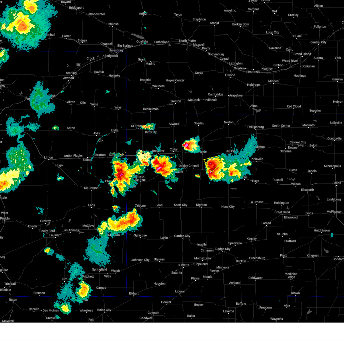 At 618 pm cdt, a severe thunderstorm was located 5 miles northeast of park, or 8 miles north of quinter, moving north at 10 mph (radar indicated). Hazards include 60 mph wind gusts and quarter size hail. Hail damage to vehicles is expected. expect wind damage to roofs, siding, and trees. locations impacted include, quinter and saint peter. this includes interstate 70 in kansas near mile marker 107. hail threat, radar indicated max hail size, 1. 00 in wind threat, radar indicated max wind gust, 60 mph. At 618 pm cdt, a severe thunderstorm was located 5 miles northeast of park, or 8 miles north of quinter, moving north at 10 mph (radar indicated). Hazards include 60 mph wind gusts and quarter size hail. Hail damage to vehicles is expected. expect wind damage to roofs, siding, and trees. locations impacted include, quinter and saint peter. this includes interstate 70 in kansas near mile marker 107. hail threat, radar indicated max hail size, 1. 00 in wind threat, radar indicated max wind gust, 60 mph.
|
| 5/30/2023 6:08 PM CDT |
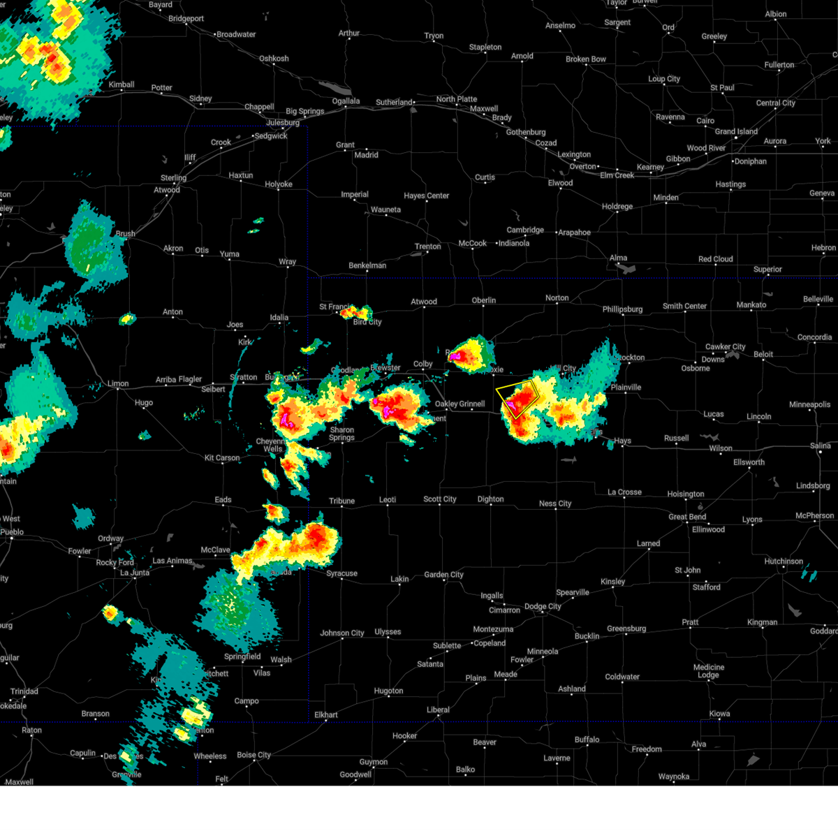 At 608 pm cdt, a severe thunderstorm was located 5 miles northeast of park, or 8 miles northwest of quinter, moving north at 20 mph (radar indicated). Hazards include 60 mph wind gusts and half dollar size hail. Hail damage to vehicles is expected. expect wind damage to roofs, siding, and trees. locations impacted include, quinter and saint peter. this includes interstate 70 in kansas near mile marker 107. hail threat, radar indicated max hail size, 1. 25 in wind threat, radar indicated max wind gust, 60 mph. At 608 pm cdt, a severe thunderstorm was located 5 miles northeast of park, or 8 miles northwest of quinter, moving north at 20 mph (radar indicated). Hazards include 60 mph wind gusts and half dollar size hail. Hail damage to vehicles is expected. expect wind damage to roofs, siding, and trees. locations impacted include, quinter and saint peter. this includes interstate 70 in kansas near mile marker 107. hail threat, radar indicated max hail size, 1. 25 in wind threat, radar indicated max wind gust, 60 mph.
|
| 5/30/2023 6:07 PM CDT | Quarter sized hail reported 0.4 miles SSE of Quinter, KS, social media image of quarter size hail. |
| 5/30/2023 5:47 PM CDT |
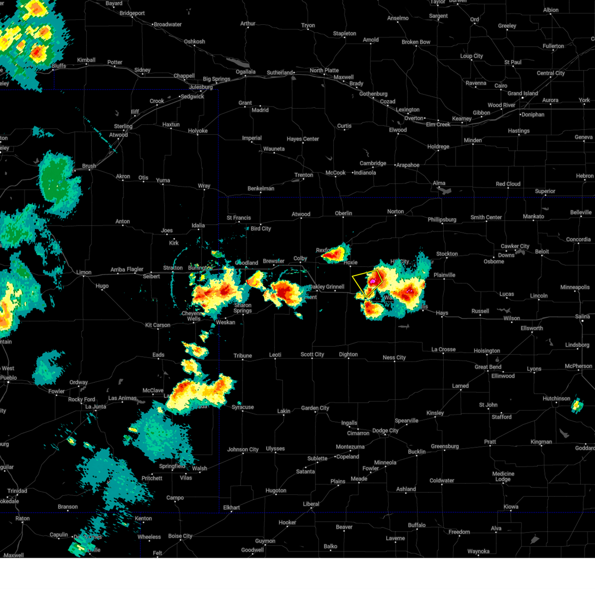 At 547 pm cdt, a severe thunderstorm was located 9 miles south of morland, or 12 miles northeast of quinter, and is nearly stationary (radar indicated). Hazards include 60 mph wind gusts and half dollar size hail. Hail damage to vehicles is expected. expect wind damage to roofs, siding, and trees. this severe thunderstorm will remain over mainly rural areas of southeastern sheridan, southwestern graham and northeastern gove counties, including the following locations, saint peter. this includes interstate 70 in kansas near mile marker 107. hail threat, radar indicated max hail size, 1. 25 in wind threat, radar indicated max wind gust, 60 mph. At 547 pm cdt, a severe thunderstorm was located 9 miles south of morland, or 12 miles northeast of quinter, and is nearly stationary (radar indicated). Hazards include 60 mph wind gusts and half dollar size hail. Hail damage to vehicles is expected. expect wind damage to roofs, siding, and trees. this severe thunderstorm will remain over mainly rural areas of southeastern sheridan, southwestern graham and northeastern gove counties, including the following locations, saint peter. this includes interstate 70 in kansas near mile marker 107. hail threat, radar indicated max hail size, 1. 25 in wind threat, radar indicated max wind gust, 60 mph.
|
| 4/27/2023 9:21 PM CDT |
 The severe thunderstorm warning for southern sheridan and gove counties will expire at 930 pm cdt, the storms which prompted the warning have weakened below severe limits, and no longer pose an immediate threat to life or property. therefore, the warning will be allowed to expire. however gusty winds are still possible with these thunderstorms. to report severe weather, contact your nearest law enforcement agency. they will relay your report to the national weather service goodland. The severe thunderstorm warning for southern sheridan and gove counties will expire at 930 pm cdt, the storms which prompted the warning have weakened below severe limits, and no longer pose an immediate threat to life or property. therefore, the warning will be allowed to expire. however gusty winds are still possible with these thunderstorms. to report severe weather, contact your nearest law enforcement agency. they will relay your report to the national weather service goodland.
|
| 4/27/2023 8:53 PM CDT |
 At 853 pm cdt, severe thunderstorms were located along a line extending from near grainfield to 6 miles south of grinnell, moving southeast at 35 mph (radar indicated). Hazards include 60 mph wind gusts. Expect damage to roofs, siding, and trees. locations impacted include, park, gove and quinter. this includes interstate 70 in kansas between mile markers 76 and 113. hail threat, radar indicated max hail size, <. 75 in wind threat, radar indicated max wind gust, 60 mph. At 853 pm cdt, severe thunderstorms were located along a line extending from near grainfield to 6 miles south of grinnell, moving southeast at 35 mph (radar indicated). Hazards include 60 mph wind gusts. Expect damage to roofs, siding, and trees. locations impacted include, park, gove and quinter. this includes interstate 70 in kansas between mile markers 76 and 113. hail threat, radar indicated max hail size, <. 75 in wind threat, radar indicated max wind gust, 60 mph.
|
| 4/27/2023 8:35 PM CDT |
 At 835 pm cdt, severe thunderstorms were located along a line extending from 6 miles north of grinnell to 3 miles southeast of oakley, moving southeast at 40 mph (radar indicated. at 834 pm cdt, 59 mph winds were measured at the oakley airport). Hazards include 60 mph wind gusts. Expect damage to roofs, siding, and trees. these severe storms will be near, grinnell around 840 pm cdt. grainfield around 850 pm cdt. other locations in the path of these severe thunderstorms include gove. this includes interstate 70 in kansas between mile markers 62 and 113. hail threat, radar indicated max hail size, <. 75 in wind threat, observed max wind gust, 60 mph. At 835 pm cdt, severe thunderstorms were located along a line extending from 6 miles north of grinnell to 3 miles southeast of oakley, moving southeast at 40 mph (radar indicated. at 834 pm cdt, 59 mph winds were measured at the oakley airport). Hazards include 60 mph wind gusts. Expect damage to roofs, siding, and trees. these severe storms will be near, grinnell around 840 pm cdt. grainfield around 850 pm cdt. other locations in the path of these severe thunderstorms include gove. this includes interstate 70 in kansas between mile markers 62 and 113. hail threat, radar indicated max hail size, <. 75 in wind threat, observed max wind gust, 60 mph.
|
| 4/27/2023 8:30 PM CDT |
 At 830 pm cdt, severe thunderstorms were located along a line extending from 8 miles north of grinnell to near oakley, moving southeast at 40 mph (radar indicated). Hazards include 60 mph wind gusts. Expect damage to roofs, siding, and trees. severe thunderstorms will be near, grinnell around 840 pm cdt. grainfield around 850 pm cdt. other locations in the path of these severe thunderstorms include gove. this includes interstate 70 in kansas between mile markers 62 and 113. hail threat, radar indicated max hail size, <. 75 in wind threat, radar indicated max wind gust, 60 mph. At 830 pm cdt, severe thunderstorms were located along a line extending from 8 miles north of grinnell to near oakley, moving southeast at 40 mph (radar indicated). Hazards include 60 mph wind gusts. Expect damage to roofs, siding, and trees. severe thunderstorms will be near, grinnell around 840 pm cdt. grainfield around 850 pm cdt. other locations in the path of these severe thunderstorms include gove. this includes interstate 70 in kansas between mile markers 62 and 113. hail threat, radar indicated max hail size, <. 75 in wind threat, radar indicated max wind gust, 60 mph.
|
| 4/27/2023 6:23 PM CDT |
 At 622 pm cdt, a severe thunderstorm was located 5 miles north of grinnell, moving east at 35 mph (radar indicated). Hazards include 60 mph wind gusts. Expect damage to roofs, siding, and trees. locations impacted include, grainfield, park and quinter. this includes interstate 70 in kansas between mile markers 81 and 112. hail threat, radar indicated max hail size, <. 75 in wind threat, radar indicated max wind gust, 60 mph. At 622 pm cdt, a severe thunderstorm was located 5 miles north of grinnell, moving east at 35 mph (radar indicated). Hazards include 60 mph wind gusts. Expect damage to roofs, siding, and trees. locations impacted include, grainfield, park and quinter. this includes interstate 70 in kansas between mile markers 81 and 112. hail threat, radar indicated max hail size, <. 75 in wind threat, radar indicated max wind gust, 60 mph.
|
| 4/27/2023 6:17 PM CDT |
 At 617 pm cdt, a severe thunderstorm was located 6 miles north of grinnell, moving east at 35 mph (radar indicated). Hazards include 60 mph wind gusts and penny size hail. Expect damage to roofs, siding, and trees. locations impacted include, grainfield, park and quinter. this includes interstate 70 in kansas between mile markers 74 and 112. hail threat, radar indicated max hail size, 0. 75 in wind threat, radar indicated max wind gust, 60 mph. At 617 pm cdt, a severe thunderstorm was located 6 miles north of grinnell, moving east at 35 mph (radar indicated). Hazards include 60 mph wind gusts and penny size hail. Expect damage to roofs, siding, and trees. locations impacted include, grainfield, park and quinter. this includes interstate 70 in kansas between mile markers 74 and 112. hail threat, radar indicated max hail size, 0. 75 in wind threat, radar indicated max wind gust, 60 mph.
|
| 4/27/2023 6:01 PM CDT |
 At 601 pm cdt, a severe thunderstorm was located near menlo, or 13 miles east of colby, moving east at 50 mph (radar indicated). Hazards include 60 mph wind gusts and penny size hail. Expect damage to roofs, siding, and trees. this severe thunderstorm will be near, menlo around 605 pm cdt. other locations in the path of this severe thunderstorm include grainfield, park and quinter. this includes interstate 70 in kansas between mile markers 61 and 112. hail threat, radar indicated max hail size, 0. 75 in wind threat, radar indicated max wind gust, 60 mph. At 601 pm cdt, a severe thunderstorm was located near menlo, or 13 miles east of colby, moving east at 50 mph (radar indicated). Hazards include 60 mph wind gusts and penny size hail. Expect damage to roofs, siding, and trees. this severe thunderstorm will be near, menlo around 605 pm cdt. other locations in the path of this severe thunderstorm include grainfield, park and quinter. this includes interstate 70 in kansas between mile markers 61 and 112. hail threat, radar indicated max hail size, 0. 75 in wind threat, radar indicated max wind gust, 60 mph.
|
| 7/22/2022 9:01 PM CDT |
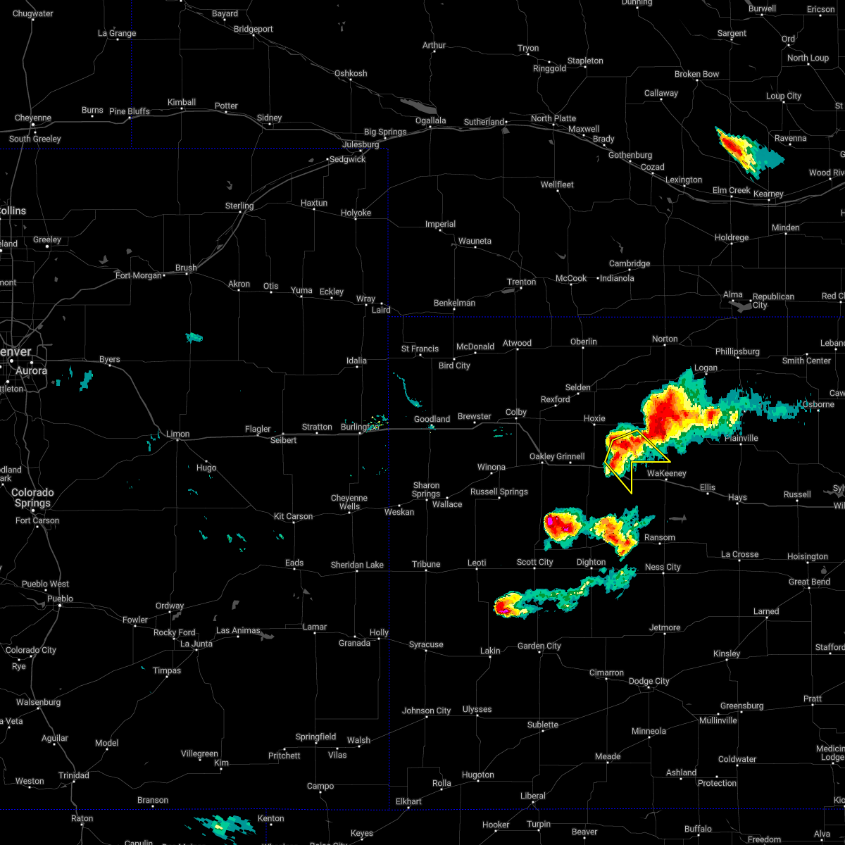 At 901 pm cdt, a severe thunderstorm was located 6 miles north of quinter, moving southeast at 20 mph (radar indicated). Hazards include 60 mph wind gusts and quarter size hail. Hail damage to vehicles is expected. expect wind damage to roofs, siding, and trees. this severe storm will be near, quinter around 910 pm cdt. other locations impacted by this severe thunderstorm include saint peter. this includes interstate 70 in kansas between mile markers 103 and 113. hail threat, radar indicated max hail size, 1. 00 in wind threat, radar indicated max wind gust, 60 mph. At 901 pm cdt, a severe thunderstorm was located 6 miles north of quinter, moving southeast at 20 mph (radar indicated). Hazards include 60 mph wind gusts and quarter size hail. Hail damage to vehicles is expected. expect wind damage to roofs, siding, and trees. this severe storm will be near, quinter around 910 pm cdt. other locations impacted by this severe thunderstorm include saint peter. this includes interstate 70 in kansas between mile markers 103 and 113. hail threat, radar indicated max hail size, 1. 00 in wind threat, radar indicated max wind gust, 60 mph.
|
| 7/22/2022 8:44 PM CDT |
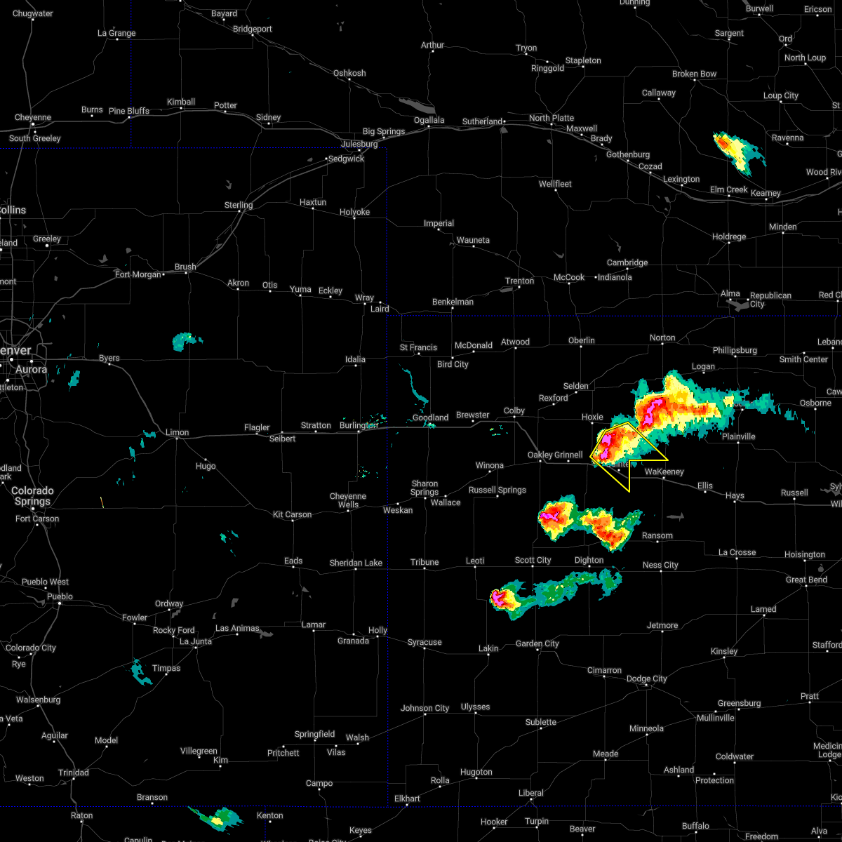 At 844 pm cdt, a severe thunderstorm was located 8 miles north of park, or 11 miles north of quinter, moving southeast at 20 mph (radar indicated). Hazards include 60 mph wind gusts and quarter size hail. Hail damage to vehicles is expected. expect wind damage to roofs, siding, and trees. this severe thunderstorm will be near, quinter around 910 pm cdt. other locations impacted by this severe thunderstorm include saint peter and studley. this includes interstate 70 in kansas between mile markers 100 and 113. hail threat, radar indicated max hail size, 1. 00 in wind threat, radar indicated max wind gust, 60 mph. At 844 pm cdt, a severe thunderstorm was located 8 miles north of park, or 11 miles north of quinter, moving southeast at 20 mph (radar indicated). Hazards include 60 mph wind gusts and quarter size hail. Hail damage to vehicles is expected. expect wind damage to roofs, siding, and trees. this severe thunderstorm will be near, quinter around 910 pm cdt. other locations impacted by this severe thunderstorm include saint peter and studley. this includes interstate 70 in kansas between mile markers 100 and 113. hail threat, radar indicated max hail size, 1. 00 in wind threat, radar indicated max wind gust, 60 mph.
|
| 6/19/2022 6:28 PM CDT | Report from mping: 1-inch tree limbs broken; shingles blown of in gove county KS, 0.6 miles SW of Quinter, KS |
| 6/12/2022 10:11 PM CDT |
 At 1011 pm cdt, a severe thunderstorm was located 11 miles southwest of palco, or 12 miles north of ogallah, moving northeast at 40 mph (radar indicated). Hazards include 60 mph wind gusts and quarter size hail. Hail damage to vehicles is expected. expect wind damage to roofs, siding, and trees. locations impacted include, hill city, quinter, grainfield, morland, park, studley and penokee. this includes interstate 70 in kansas between mile markers 95 and 112. hail threat, radar indicated max hail size, 1. 00 in wind threat, radar indicated max wind gust, 60 mph. At 1011 pm cdt, a severe thunderstorm was located 11 miles southwest of palco, or 12 miles north of ogallah, moving northeast at 40 mph (radar indicated). Hazards include 60 mph wind gusts and quarter size hail. Hail damage to vehicles is expected. expect wind damage to roofs, siding, and trees. locations impacted include, hill city, quinter, grainfield, morland, park, studley and penokee. this includes interstate 70 in kansas between mile markers 95 and 112. hail threat, radar indicated max hail size, 1. 00 in wind threat, radar indicated max wind gust, 60 mph.
|
| 6/12/2022 9:55 PM CDT |
 At 955 pm cdt, a severe thunderstorm was located 5 miles south of voda, moving northeast at 55 mph (radar indicated). Hazards include 60 mph wind gusts and penny size hail. Expect damage to roofs, siding, and trees. locations impacted include, hill city, quinter, grainfield, morland, park, studley and penokee. this includes interstate 70 in kansas between mile markers 95 and 112. hail threat, radar indicated max hail size, 0. 75 in wind threat, radar indicated max wind gust, 60 mph. At 955 pm cdt, a severe thunderstorm was located 5 miles south of voda, moving northeast at 55 mph (radar indicated). Hazards include 60 mph wind gusts and penny size hail. Expect damage to roofs, siding, and trees. locations impacted include, hill city, quinter, grainfield, morland, park, studley and penokee. this includes interstate 70 in kansas between mile markers 95 and 112. hail threat, radar indicated max hail size, 0. 75 in wind threat, radar indicated max wind gust, 60 mph.
|
| 6/12/2022 9:46 PM CDT |
 At 945 pm cdt, a severe thunderstorm was located 11 miles west of trego center, moving northeast at 55 mph (radar indicated). Hazards include 60 mph wind gusts and quarter size hail. Hail damage to vehicles is expected. expect wind damage to roofs, siding, and trees. this severe thunderstorm will remain over mainly rural areas of southeastern sheridan, northeastern gove and graham counties, including the following locations, saint peter, studley and penokee. this includes interstate 70 in kansas between mile markers 95 and 112. hail threat, radar indicated max hail size, 1. 00 in wind threat, radar indicated max wind gust, 60 mph. At 945 pm cdt, a severe thunderstorm was located 11 miles west of trego center, moving northeast at 55 mph (radar indicated). Hazards include 60 mph wind gusts and quarter size hail. Hail damage to vehicles is expected. expect wind damage to roofs, siding, and trees. this severe thunderstorm will remain over mainly rural areas of southeastern sheridan, northeastern gove and graham counties, including the following locations, saint peter, studley and penokee. this includes interstate 70 in kansas between mile markers 95 and 112. hail threat, radar indicated max hail size, 1. 00 in wind threat, radar indicated max wind gust, 60 mph.
|
| 6/4/2022 10:25 PM CDT |
 The severe thunderstorm warning for southern norton, sheridan, southeastern decatur, northeastern gove and graham counties will expire at 1030 pm cdt, the storms which prompted the warning have weakened below severe limits, and no longer pose an immediate threat to life or property. therefore, the warning will be allowed to expire. however gusty winds and heavy rain are still possible with these thunderstorms. a severe thunderstorm watch remains in effect until 100 am cdt for northwestern and west central kansas. to report severe weather, contact your nearest law enforcement agency. they will relay your report to the national weather service goodland. The severe thunderstorm warning for southern norton, sheridan, southeastern decatur, northeastern gove and graham counties will expire at 1030 pm cdt, the storms which prompted the warning have weakened below severe limits, and no longer pose an immediate threat to life or property. therefore, the warning will be allowed to expire. however gusty winds and heavy rain are still possible with these thunderstorms. a severe thunderstorm watch remains in effect until 100 am cdt for northwestern and west central kansas. to report severe weather, contact your nearest law enforcement agency. they will relay your report to the national weather service goodland.
|
| 6/4/2022 10:12 PM CDT |
 At 1012 pm cdt, severe thunderstorms were located along a line extending from 4 miles northwest of edmond to 8 miles southeast of hoxie to 4 miles west of grainfield, moving east at 40 mph (radar indicated). Hazards include 70 mph wind gusts and ping pong ball size hail. People and animals outdoors will be injured. expect hail damage to roofs, siding, windows, and vehicles. expect considerable tree damage. wind damage is also likely to mobile homes, roofs, and outbuildings. locations impacted include, hill city, hoxie, quinter, grainfield, grinnell, gove and lenora. This includes interstate 70 in kansas between mile markers 84 and 111. At 1012 pm cdt, severe thunderstorms were located along a line extending from 4 miles northwest of edmond to 8 miles southeast of hoxie to 4 miles west of grainfield, moving east at 40 mph (radar indicated). Hazards include 70 mph wind gusts and ping pong ball size hail. People and animals outdoors will be injured. expect hail damage to roofs, siding, windows, and vehicles. expect considerable tree damage. wind damage is also likely to mobile homes, roofs, and outbuildings. locations impacted include, hill city, hoxie, quinter, grainfield, grinnell, gove and lenora. This includes interstate 70 in kansas between mile markers 84 and 111.
|
| 6/4/2022 10:10 PM CDT |
 At 1009 pm cdt, severe thunderstorms were located along a line extending from 4 miles northwest of edmond to 8 miles southeast of hoxie to 4 miles west of grainfield, moving southeast at 40 mph (mesonet. at 959pm cdt a new almeno weather station gusted to 65 mph). Hazards include 70 mph wind gusts and ping pong ball size hail. People and animals outdoors will be injured. expect hail damage to roofs, siding, windows, and vehicles. expect considerable tree damage. wind damage is also likely to mobile homes, roofs, and outbuildings. locations impacted include, hill city, hoxie, quinter, grainfield, grinnell, gove and lenora. This includes interstate 70 in kansas between mile markers 84 and 111. At 1009 pm cdt, severe thunderstorms were located along a line extending from 4 miles northwest of edmond to 8 miles southeast of hoxie to 4 miles west of grainfield, moving southeast at 40 mph (mesonet. at 959pm cdt a new almeno weather station gusted to 65 mph). Hazards include 70 mph wind gusts and ping pong ball size hail. People and animals outdoors will be injured. expect hail damage to roofs, siding, windows, and vehicles. expect considerable tree damage. wind damage is also likely to mobile homes, roofs, and outbuildings. locations impacted include, hill city, hoxie, quinter, grainfield, grinnell, gove and lenora. This includes interstate 70 in kansas between mile markers 84 and 111.
|
| 6/4/2022 10:01 PM CDT |
 At 1001 pm cdt, severe thunderstorms were located along a line extending from 6 miles northeast of lenora to 5 miles southeast of hoxie to near grinnell, moving southeast at 40 mph (radar indicated). Hazards include 70 mph wind gusts and ping pong ball size hail. People and animals outdoors will be injured. expect hail damage to roofs, siding, windows, and vehicles. expect considerable tree damage. wind damage is also likely to mobile homes, roofs, and outbuildings. locations impacted include, hill city, hoxie, quinter, grainfield, grinnell, gove and lenora. This includes interstate 70 in kansas between mile markers 84 and 111. At 1001 pm cdt, severe thunderstorms were located along a line extending from 6 miles northeast of lenora to 5 miles southeast of hoxie to near grinnell, moving southeast at 40 mph (radar indicated). Hazards include 70 mph wind gusts and ping pong ball size hail. People and animals outdoors will be injured. expect hail damage to roofs, siding, windows, and vehicles. expect considerable tree damage. wind damage is also likely to mobile homes, roofs, and outbuildings. locations impacted include, hill city, hoxie, quinter, grainfield, grinnell, gove and lenora. This includes interstate 70 in kansas between mile markers 84 and 111.
|
| 6/4/2022 9:55 PM CDT |
 At 955 pm cdt, severe thunderstorms were located along a line extending from 7 miles north of lenora to near hoxie to 3 miles north of grinnell, moving southeast at 40 mph (radar indicated). Hazards include 70 mph wind gusts and ping pong ball size hail. People and animals outdoors will be injured. expect hail damage to roofs, siding, windows, and vehicles. expect considerable tree damage. wind damage is also likely to mobile homes, roofs, and outbuildings. locations impacted include, lenora, grainfield, edmond, gove, park and nicodemus. this includes interstate 70 in kansas between mile markers 84 and 111. thunderstorm damage threat, considerable hail threat, radar indicated max hail size, 1. 50 in wind threat, radar indicated max wind gust, 70 mph. At 955 pm cdt, severe thunderstorms were located along a line extending from 7 miles north of lenora to near hoxie to 3 miles north of grinnell, moving southeast at 40 mph (radar indicated). Hazards include 70 mph wind gusts and ping pong ball size hail. People and animals outdoors will be injured. expect hail damage to roofs, siding, windows, and vehicles. expect considerable tree damage. wind damage is also likely to mobile homes, roofs, and outbuildings. locations impacted include, lenora, grainfield, edmond, gove, park and nicodemus. this includes interstate 70 in kansas between mile markers 84 and 111. thunderstorm damage threat, considerable hail threat, radar indicated max hail size, 1. 50 in wind threat, radar indicated max wind gust, 70 mph.
|
| 6/4/2022 9:28 PM CDT |
 At 928 pm cdt, severe thunderstorms were located along a line extending from 3 miles northwest of norcatur to 4 miles southwest of selden to 6 miles south of gem, moving southeast at 35 mph (radar indicated). Hazards include golf ball size hail and 70 mph wind gusts. People and animals outdoors will be injured. expect hail damage to roofs, siding, windows, and vehicles. expect considerable tree damage. wind damage is also likely to mobile homes, roofs, and outbuildings. severe thunderstorms will be near, clayton around 940 pm cdt. other locations in the path of these severe thunderstorms include hoxie, grinnell, lenora, grainfield, edmond, gove and park. this includes interstate 70 in kansas between mile markers 58 and 111. thunderstorm damage threat, considerable hail threat, radar indicated max hail size, 1. 75 in wind threat, radar indicated max wind gust, 70 mph. At 928 pm cdt, severe thunderstorms were located along a line extending from 3 miles northwest of norcatur to 4 miles southwest of selden to 6 miles south of gem, moving southeast at 35 mph (radar indicated). Hazards include golf ball size hail and 70 mph wind gusts. People and animals outdoors will be injured. expect hail damage to roofs, siding, windows, and vehicles. expect considerable tree damage. wind damage is also likely to mobile homes, roofs, and outbuildings. severe thunderstorms will be near, clayton around 940 pm cdt. other locations in the path of these severe thunderstorms include hoxie, grinnell, lenora, grainfield, edmond, gove and park. this includes interstate 70 in kansas between mile markers 58 and 111. thunderstorm damage threat, considerable hail threat, radar indicated max hail size, 1. 75 in wind threat, radar indicated max wind gust, 70 mph.
|
| 5/17/2022 8:09 PM CDT |
 The severe thunderstorm warning for southeastern thomas, northeastern logan, southern sheridan and northern gove counties will expire at 815 pm cdt, the storms which prompted the warning have weakened below severe limits, and no longer pose an immediate threat to life or property. therefore, the warning will be allowed to expire. however small hail and heavy rain are still possible with these thunderstorms. a severe thunderstorm watch remains in effect until midnight cdt for northwestern and west central kansas. to report severe weather, contact your nearest law enforcement agency. they will relay your report to the national weather service goodland. The severe thunderstorm warning for southeastern thomas, northeastern logan, southern sheridan and northern gove counties will expire at 815 pm cdt, the storms which prompted the warning have weakened below severe limits, and no longer pose an immediate threat to life or property. therefore, the warning will be allowed to expire. however small hail and heavy rain are still possible with these thunderstorms. a severe thunderstorm watch remains in effect until midnight cdt for northwestern and west central kansas. to report severe weather, contact your nearest law enforcement agency. they will relay your report to the national weather service goodland.
|
| 5/17/2022 7:58 PM CDT |
 At 758 pm cdt, severe thunderstorms were located along a line extending from 10 miles northeast of park to 4 miles north of gove to 10 miles southeast of oakley, moving southeast at 25 mph (radar indicated). Hazards include 60 mph wind gusts and quarter size hail. Hail damage to vehicles is expected. expect wind damage to roofs, siding, and trees. locations impacted include, gove and quinter. this includes interstate 70 in kansas between mile markers 74 and 110. hail threat, radar indicated max hail size, 1. 00 in wind threat, radar indicated max wind gust, 60 mph. At 758 pm cdt, severe thunderstorms were located along a line extending from 10 miles northeast of park to 4 miles north of gove to 10 miles southeast of oakley, moving southeast at 25 mph (radar indicated). Hazards include 60 mph wind gusts and quarter size hail. Hail damage to vehicles is expected. expect wind damage to roofs, siding, and trees. locations impacted include, gove and quinter. this includes interstate 70 in kansas between mile markers 74 and 110. hail threat, radar indicated max hail size, 1. 00 in wind threat, radar indicated max wind gust, 60 mph.
|
| 5/17/2022 7:24 PM CDT |
 At 724 pm cdt, severe thunderstorms were located along a line extending from near hoxie to near grinnell to 3 miles east of monument, moving southeast at 25 mph (radar indicated). Hazards include 60 mph wind gusts and quarter size hail. Hail damage to vehicles is expected. expect wind damage to roofs, siding, and trees. severe thunderstorms will be near, hoxie and grinnell around 730 pm cdt. other locations in the path of these severe thunderstorms include grainfield, gove and quinter. this includes interstate 70 in kansas between mile markers 73 and 110. hail threat, radar indicated max hail size, 1. 00 in wind threat, radar indicated max wind gust, 60 mph. At 724 pm cdt, severe thunderstorms were located along a line extending from near hoxie to near grinnell to 3 miles east of monument, moving southeast at 25 mph (radar indicated). Hazards include 60 mph wind gusts and quarter size hail. Hail damage to vehicles is expected. expect wind damage to roofs, siding, and trees. severe thunderstorms will be near, hoxie and grinnell around 730 pm cdt. other locations in the path of these severe thunderstorms include grainfield, gove and quinter. this includes interstate 70 in kansas between mile markers 73 and 110. hail threat, radar indicated max hail size, 1. 00 in wind threat, radar indicated max wind gust, 60 mph.
|
| 5/12/2022 5:49 PM CDT |
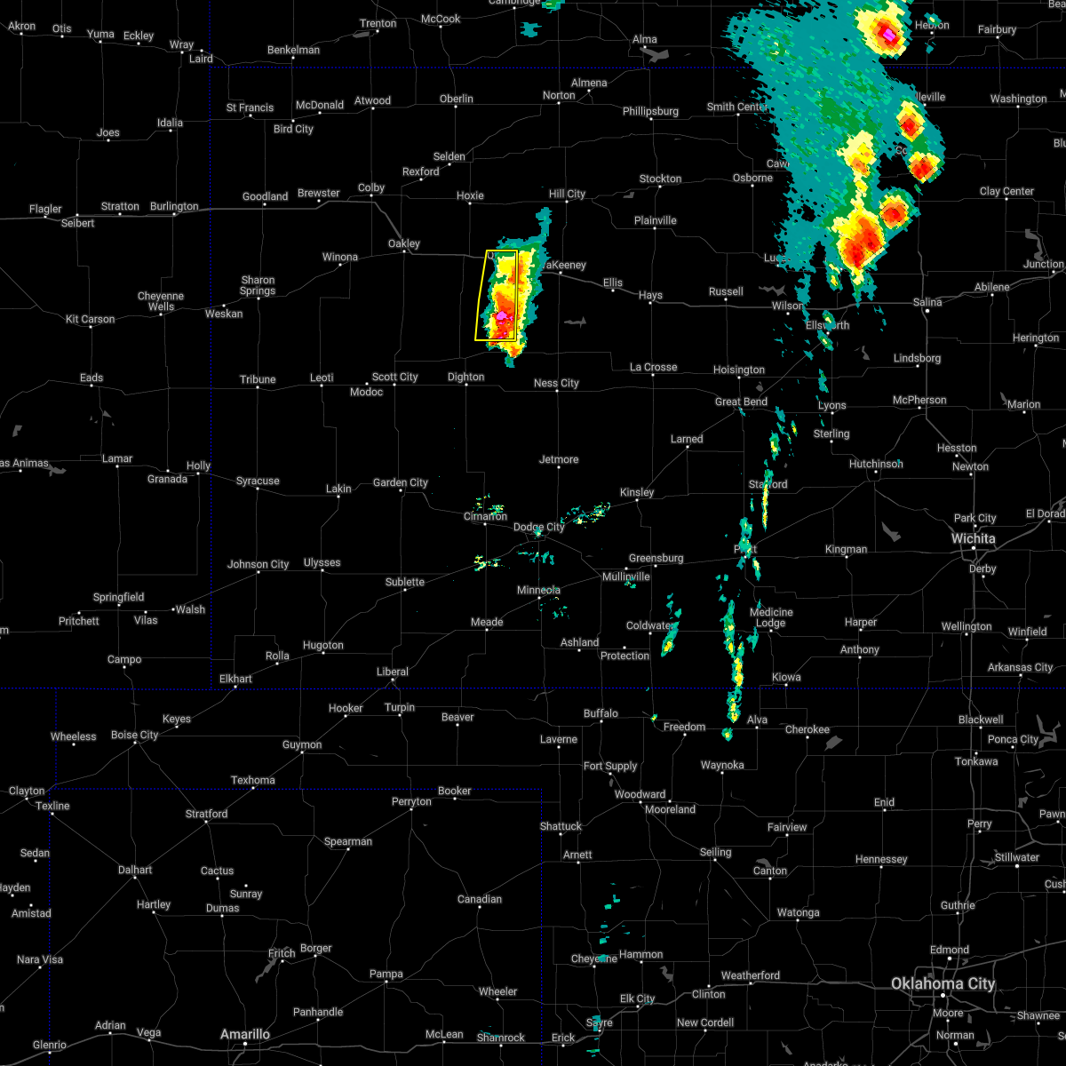 At 548 pm cdt, a severe thunderstorm was located 12 miles south of collyer, moving northeast at 30 mph (radar indicated). Hazards include 70 mph wind gusts and quarter size hail. Hail damage to vehicles is expected. expect considerable tree damage. wind damage is also likely to mobile homes, roofs, and outbuildings. locations impacted include, quinter. this includes interstate 70 in kansas between mile markers 102 and 112. thunderstorm damage threat, considerable hail threat, radar indicated max hail size, 1. 00 in wind threat, radar indicated max wind gust, 70 mph. At 548 pm cdt, a severe thunderstorm was located 12 miles south of collyer, moving northeast at 30 mph (radar indicated). Hazards include 70 mph wind gusts and quarter size hail. Hail damage to vehicles is expected. expect considerable tree damage. wind damage is also likely to mobile homes, roofs, and outbuildings. locations impacted include, quinter. this includes interstate 70 in kansas between mile markers 102 and 112. thunderstorm damage threat, considerable hail threat, radar indicated max hail size, 1. 00 in wind threat, radar indicated max wind gust, 70 mph.
|
| 5/12/2022 5:41 PM CDT |
 At 540 pm cdt, a severe thunderstorm was located 12 miles north of utica, moving northeast at 35 mph (radar indicated). Hazards include 70 mph wind gusts and quarter size hail. Hail damage to vehicles is expected. expect considerable tree damage. wind damage is also likely to mobile homes, roofs, and outbuildings. locations impacted include, quinter. this includes interstate 70 in kansas between mile markers 101 and 112. thunderstorm damage threat, considerable hail threat, radar indicated max hail size, 1. 00 in wind threat, radar indicated max wind gust, 70 mph. At 540 pm cdt, a severe thunderstorm was located 12 miles north of utica, moving northeast at 35 mph (radar indicated). Hazards include 70 mph wind gusts and quarter size hail. Hail damage to vehicles is expected. expect considerable tree damage. wind damage is also likely to mobile homes, roofs, and outbuildings. locations impacted include, quinter. this includes interstate 70 in kansas between mile markers 101 and 112. thunderstorm damage threat, considerable hail threat, radar indicated max hail size, 1. 00 in wind threat, radar indicated max wind gust, 70 mph.
|
| 5/12/2022 5:34 PM CDT |
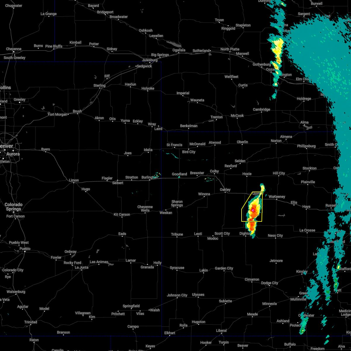 At 534 pm cdt, a severe thunderstorm was located 12 miles southwest of collyer, moving northeast at 35 mph (radar indicated). Hazards include 70 mph wind gusts and quarter size hail. Hail damage to vehicles is expected. expect considerable tree damage. wind damage is also likely to mobile homes, roofs, and outbuildings. locations impacted include, quinter and park. this includes interstate 70 in kansas between mile markers 101 and 112. thunderstorm damage threat, considerable hail threat, radar indicated max hail size, 1. 00 in wind threat, radar indicated max wind gust, 70 mph. At 534 pm cdt, a severe thunderstorm was located 12 miles southwest of collyer, moving northeast at 35 mph (radar indicated). Hazards include 70 mph wind gusts and quarter size hail. Hail damage to vehicles is expected. expect considerable tree damage. wind damage is also likely to mobile homes, roofs, and outbuildings. locations impacted include, quinter and park. this includes interstate 70 in kansas between mile markers 101 and 112. thunderstorm damage threat, considerable hail threat, radar indicated max hail size, 1. 00 in wind threat, radar indicated max wind gust, 70 mph.
|
| 5/12/2022 5:30 PM CDT | Quarter sized hail reported 18.2 miles N of Quinter, KS, report of nickel to quarter hail. |
| 5/12/2022 5:22 PM CDT |
 At 521 pm cdt, a severe thunderstorm was located 12 miles north of pendennis, moving northeast at 40 mph (radar indicated). Hazards include 70 mph wind gusts and half dollar size hail. Hail damage to vehicles is expected. expect considerable tree damage. wind damage is also likely to mobile homes, roofs, and outbuildings. locations impacted include, quinter and park. this includes interstate 70 in kansas between mile markers 101 and 112. thunderstorm damage threat, considerable hail threat, radar indicated max hail size, 1. 25 in wind threat, radar indicated max wind gust, 70 mph. At 521 pm cdt, a severe thunderstorm was located 12 miles north of pendennis, moving northeast at 40 mph (radar indicated). Hazards include 70 mph wind gusts and half dollar size hail. Hail damage to vehicles is expected. expect considerable tree damage. wind damage is also likely to mobile homes, roofs, and outbuildings. locations impacted include, quinter and park. this includes interstate 70 in kansas between mile markers 101 and 112. thunderstorm damage threat, considerable hail threat, radar indicated max hail size, 1. 25 in wind threat, radar indicated max wind gust, 70 mph.
|
| 5/12/2022 5:14 PM CDT |
 At 514 pm cdt, a severe thunderstorm was located 11 miles northwest of pendennis, moving northeast at 45 mph (radar indicated). Hazards include 60 mph wind gusts and quarter size hail. Hail damage to vehicles is expected. expect wind damage to roofs, siding, and trees. this severe thunderstorm will remain over mainly rural areas of eastern gove county. this includes interstate 70 in kansas between mile markers 101 and 112. hail threat, radar indicated max hail size, 1. 00 in wind threat, radar indicated max wind gust, 60 mph. At 514 pm cdt, a severe thunderstorm was located 11 miles northwest of pendennis, moving northeast at 45 mph (radar indicated). Hazards include 60 mph wind gusts and quarter size hail. Hail damage to vehicles is expected. expect wind damage to roofs, siding, and trees. this severe thunderstorm will remain over mainly rural areas of eastern gove county. this includes interstate 70 in kansas between mile markers 101 and 112. hail threat, radar indicated max hail size, 1. 00 in wind threat, radar indicated max wind gust, 60 mph.
|
| 4/29/2022 5:49 PM CDT |
 At 549 pm cdt, severe thunderstorms were located along a line extending from near ogallah to 7 miles north of voda to 5 miles north of grainfield, moving northeast at 55 mph (radar indicated). Hazards include 60 mph wind gusts and penny size hail. expect damage to roofs, siding, and trees At 549 pm cdt, severe thunderstorms were located along a line extending from near ogallah to 7 miles north of voda to 5 miles north of grainfield, moving northeast at 55 mph (radar indicated). Hazards include 60 mph wind gusts and penny size hail. expect damage to roofs, siding, and trees
|
| 4/23/2022 2:09 AM CDT |
 At 209 am cdt, severe thunderstorms were located along a line extending from 8 miles southwest of norton to 3 miles south of morland to 7 miles north of pendennis, moving east at 50 mph (radar indicated). Hazards include 70 mph wind gusts and quarter size hail. Hail damage to vehicles is expected. expect considerable tree damage. wind damage is also likely to mobile homes, roofs, and outbuildings. locations impacted include, norton, edmond, hill city and bogue. This includes interstate 70 in kansas between mile markers 96 and 112. At 209 am cdt, severe thunderstorms were located along a line extending from 8 miles southwest of norton to 3 miles south of morland to 7 miles north of pendennis, moving east at 50 mph (radar indicated). Hazards include 70 mph wind gusts and quarter size hail. Hail damage to vehicles is expected. expect considerable tree damage. wind damage is also likely to mobile homes, roofs, and outbuildings. locations impacted include, norton, edmond, hill city and bogue. This includes interstate 70 in kansas between mile markers 96 and 112.
|
| 4/23/2022 2:03 AM CDT |
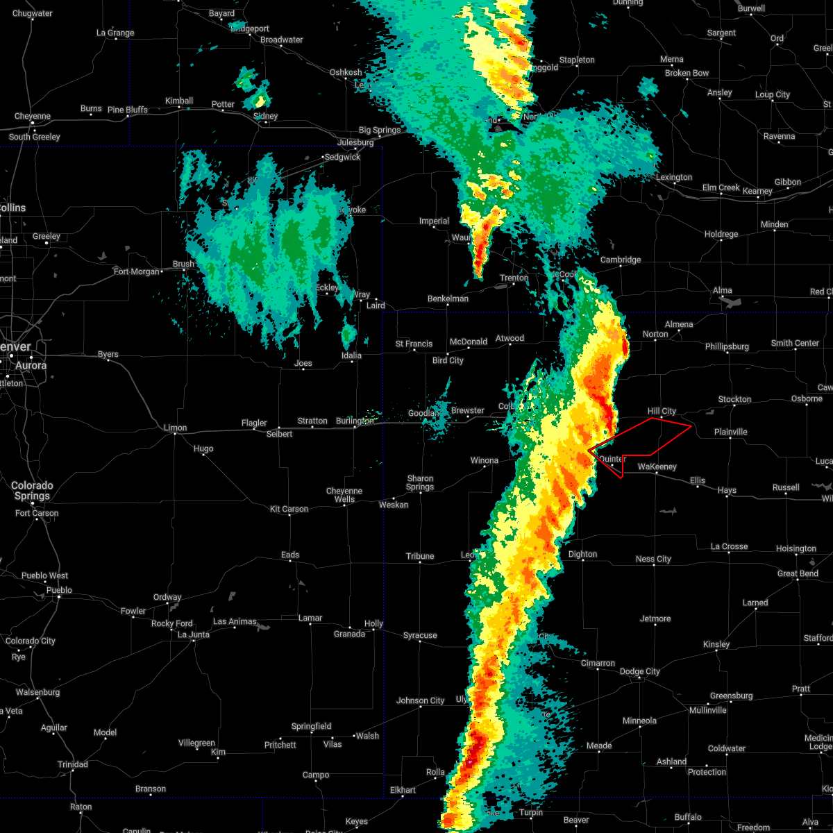 At 203 am cdt, severe thunderstorms capable of producing both tornadoes and extensive straight line wind damage were located 6 miles northeast of quinter, moving northeast at 100 mph (radar indicated rotation). Hazards include tornado and quarter size hail. Flying debris will be dangerous to those caught without shelter. mobile homes will be damaged or destroyed. damage to roofs, windows, and vehicles will occur. tree damage is likely. this tornadic thunderstorm will remain over mainly rural areas of southeastern sheridan, northeastern gove and southern graham counties, including the following locations, saint peter. This includes interstate 70 in kansas between mile markers 103 and 113. At 203 am cdt, severe thunderstorms capable of producing both tornadoes and extensive straight line wind damage were located 6 miles northeast of quinter, moving northeast at 100 mph (radar indicated rotation). Hazards include tornado and quarter size hail. Flying debris will be dangerous to those caught without shelter. mobile homes will be damaged or destroyed. damage to roofs, windows, and vehicles will occur. tree damage is likely. this tornadic thunderstorm will remain over mainly rural areas of southeastern sheridan, northeastern gove and southern graham counties, including the following locations, saint peter. This includes interstate 70 in kansas between mile markers 103 and 113.
|
| 4/23/2022 1:41 AM CDT |
 At 141 am cdt, severe thunderstorms were located along a line extending from 3 miles northeast of jennings to 6 miles southeast of hoxie to 9 miles north of healy, moving east at 70 mph (radar indicated). Hazards include 70 mph wind gusts and quarter size hail. Hail damage to vehicles is expected. expect considerable tree damage. wind damage is also likely to mobile homes, roofs, and outbuildings. severe thunderstorms will be near, norcatur, jennings and clayton around 145 am cdt. lenora and morland around 155 am cdt. edmond around 200 am cdt. This includes interstate 70 in kansas between mile markers 89 and 112. At 141 am cdt, severe thunderstorms were located along a line extending from 3 miles northeast of jennings to 6 miles southeast of hoxie to 9 miles north of healy, moving east at 70 mph (radar indicated). Hazards include 70 mph wind gusts and quarter size hail. Hail damage to vehicles is expected. expect considerable tree damage. wind damage is also likely to mobile homes, roofs, and outbuildings. severe thunderstorms will be near, norcatur, jennings and clayton around 145 am cdt. lenora and morland around 155 am cdt. edmond around 200 am cdt. This includes interstate 70 in kansas between mile markers 89 and 112.
|
| 4/22/2022 10:34 PM CDT |
 At 1034 pm cdt, a severe thunderstorm was located over collyer, moving northeast at 60 mph (radar indicated). Hazards include 60 mph wind gusts and half dollar size hail. Hail damage to vehicles is expected. expect wind damage to roofs, siding, and trees. this severe thunderstorm will remain over mainly rural areas of east central gove county. this includes interstate 70 in kansas between mile markers 108 and 113. hail threat, radar indicated max hail size, 1. 25 in wind threat, radar indicated max wind gust, 60 mph. At 1034 pm cdt, a severe thunderstorm was located over collyer, moving northeast at 60 mph (radar indicated). Hazards include 60 mph wind gusts and half dollar size hail. Hail damage to vehicles is expected. expect wind damage to roofs, siding, and trees. this severe thunderstorm will remain over mainly rural areas of east central gove county. this includes interstate 70 in kansas between mile markers 108 and 113. hail threat, radar indicated max hail size, 1. 25 in wind threat, radar indicated max wind gust, 60 mph.
|
| 4/22/2022 10:25 PM CDT |
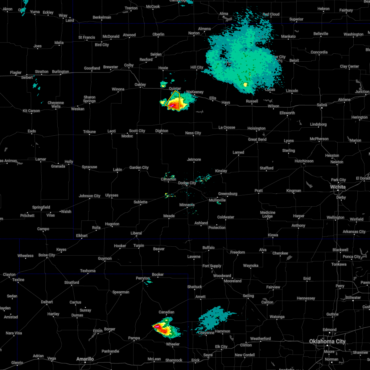 At 1025 pm cdt, a severe thunderstorm was located 10 miles south of quinter, moving northeast at 60 mph (radar indicated). Hazards include 60 mph wind gusts and half dollar size hail. Hail damage to vehicles is expected. expect wind damage to roofs, siding, and trees. this severe thunderstorm will be near, quinter around 1035 pm cdt. this includes interstate 70 in kansas between mile markers 108 and 113. hail threat, radar indicated max hail size, 1. 25 in wind threat, radar indicated max wind gust, 60 mph. At 1025 pm cdt, a severe thunderstorm was located 10 miles south of quinter, moving northeast at 60 mph (radar indicated). Hazards include 60 mph wind gusts and half dollar size hail. Hail damage to vehicles is expected. expect wind damage to roofs, siding, and trees. this severe thunderstorm will be near, quinter around 1035 pm cdt. this includes interstate 70 in kansas between mile markers 108 and 113. hail threat, radar indicated max hail size, 1. 25 in wind threat, radar indicated max wind gust, 60 mph.
|
| 4/22/2022 10:21 PM CDT |
 At 1021 pm cdt, a severe thunderstorm was located 12 miles southeast of gove, moving northeast at 55 mph (radar indicated). Hazards include 60 mph wind gusts and half dollar size hail. Hail damage to vehicles is expected. expect wind damage to roofs, siding, and trees. locations impacted include, quinter. this includes interstate 70 in kansas between mile markers 108 and 113. hail threat, radar indicated max hail size, 1. 25 in wind threat, radar indicated max wind gust, 60 mph. At 1021 pm cdt, a severe thunderstorm was located 12 miles southeast of gove, moving northeast at 55 mph (radar indicated). Hazards include 60 mph wind gusts and half dollar size hail. Hail damage to vehicles is expected. expect wind damage to roofs, siding, and trees. locations impacted include, quinter. this includes interstate 70 in kansas between mile markers 108 and 113. hail threat, radar indicated max hail size, 1. 25 in wind threat, radar indicated max wind gust, 60 mph.
|
| 4/22/2022 10:04 PM CDT |
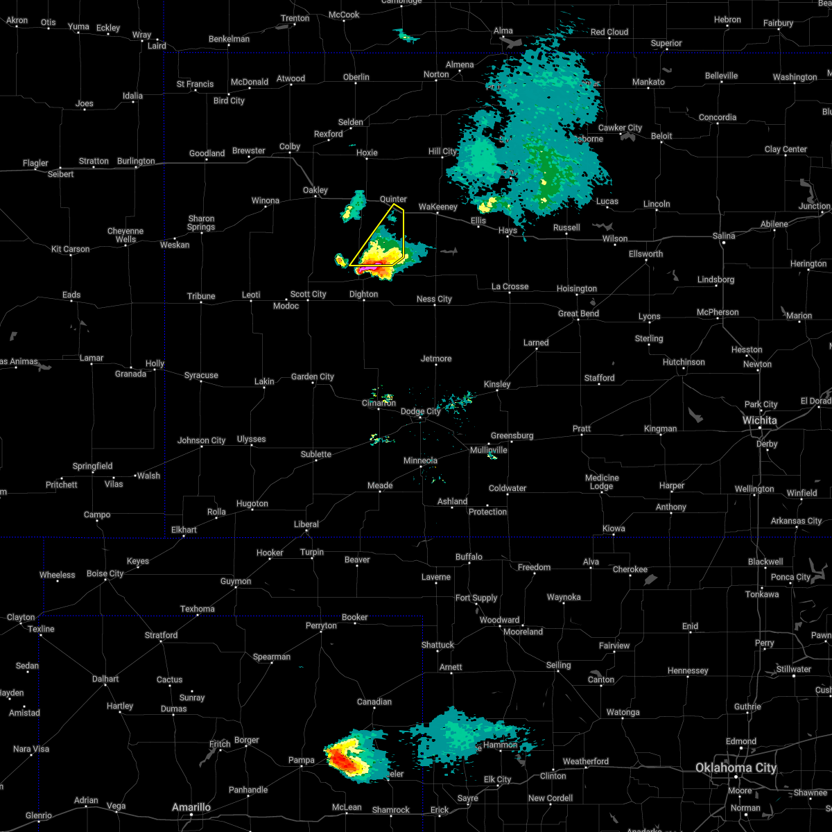 At 1004 pm cdt, a severe thunderstorm was located 4 miles north of shields, moving northeast at 55 mph (radar indicated). Hazards include 60 mph wind gusts and half dollar size hail. Hail damage to vehicles is expected. expect wind damage to roofs, siding, and trees. this severe thunderstorm will remain over mainly rural areas of southeastern gove county. this includes interstate 70 in kansas between mile markers 108 and 113. hail threat, radar indicated max hail size, 1. 25 in wind threat, radar indicated max wind gust, 60 mph. At 1004 pm cdt, a severe thunderstorm was located 4 miles north of shields, moving northeast at 55 mph (radar indicated). Hazards include 60 mph wind gusts and half dollar size hail. Hail damage to vehicles is expected. expect wind damage to roofs, siding, and trees. this severe thunderstorm will remain over mainly rural areas of southeastern gove county. this includes interstate 70 in kansas between mile markers 108 and 113. hail threat, radar indicated max hail size, 1. 25 in wind threat, radar indicated max wind gust, 60 mph.
|
| 7/10/2021 3:38 AM CDT |
 The severe thunderstorm warning for southeastern norton, southeastern sheridan, eastern gove and graham counties will expire at 345 am cdt, the storms which prompted the warning have weakened below severe limits, and no longer pose an immediate threat to life or property. therefore, the warning will be allowed to expire. however gusty winds are still possible with these thunderstorms. The severe thunderstorm warning for southeastern norton, southeastern sheridan, eastern gove and graham counties will expire at 345 am cdt, the storms which prompted the warning have weakened below severe limits, and no longer pose an immediate threat to life or property. therefore, the warning will be allowed to expire. however gusty winds are still possible with these thunderstorms.
|
| 7/10/2021 3:31 AM CDT |
 At 330 am cdt, severe thunderstorms were located along a line extending from near nicodemus to near park, moving southeast at 10 mph (hill city asos has reported 60 mph gusts with outflow. the outflow is spawning other convection). Hazards include 60 mph wind gusts. Expect damage to roofs, siding, and trees. locations impacted include, bogue, nicodemus and quinter. This includes interstate 70 in kansas between mile markers 98 and 112. At 330 am cdt, severe thunderstorms were located along a line extending from near nicodemus to near park, moving southeast at 10 mph (hill city asos has reported 60 mph gusts with outflow. the outflow is spawning other convection). Hazards include 60 mph wind gusts. Expect damage to roofs, siding, and trees. locations impacted include, bogue, nicodemus and quinter. This includes interstate 70 in kansas between mile markers 98 and 112.
|
| 7/10/2021 3:12 AM CDT |
 At 311 am cdt, severe thunderstorms were located along a line extending from 4 miles northwest of nicodemus to near park, moving southeast at 10 mph (hill city asos reporting 60 mph gusts with outflow. the outflow is spawning other convection). Hazards include 60 mph wind gusts. Expect damage to roofs, siding, and trees. severe thunderstorms will be near, bogue around 330 am cdt. other locations in the path of these severe thunderstorms include nicodemus and quinter. This includes interstate 70 in kansas between mile markers 98 and 112. At 311 am cdt, severe thunderstorms were located along a line extending from 4 miles northwest of nicodemus to near park, moving southeast at 10 mph (hill city asos reporting 60 mph gusts with outflow. the outflow is spawning other convection). Hazards include 60 mph wind gusts. Expect damage to roofs, siding, and trees. severe thunderstorms will be near, bogue around 330 am cdt. other locations in the path of these severe thunderstorms include nicodemus and quinter. This includes interstate 70 in kansas between mile markers 98 and 112.
|
| 7/4/2021 5:33 PM CDT |
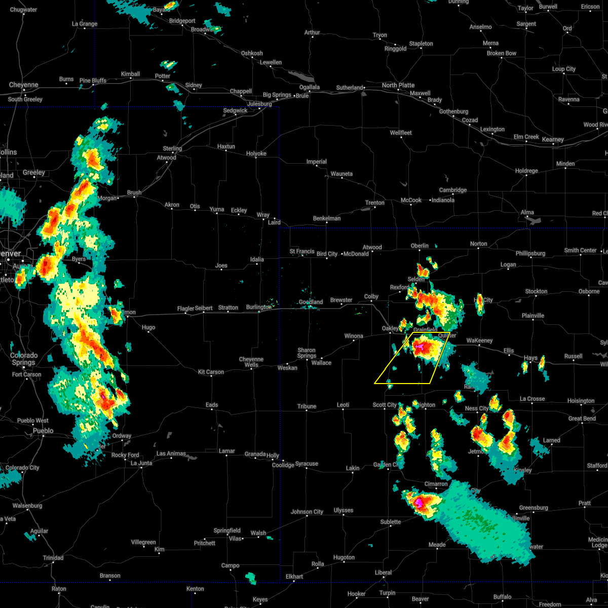 At 532 pm cdt, a severe thunderstorm was located 5 miles southwest of gove, moving southwest at 30 mph (radar indicated). Hazards include ping pong ball size hail. People and animals outdoors will be injured. expect damage to roofs, siding, windows, and vehicles. this severe thunderstorm will remain over mainly rural areas of southeastern logan and gove counties, including the following locations, the monument rocks. This includes interstate 70 in kansas between mile markers 87 and 107. At 532 pm cdt, a severe thunderstorm was located 5 miles southwest of gove, moving southwest at 30 mph (radar indicated). Hazards include ping pong ball size hail. People and animals outdoors will be injured. expect damage to roofs, siding, windows, and vehicles. this severe thunderstorm will remain over mainly rural areas of southeastern logan and gove counties, including the following locations, the monument rocks. This includes interstate 70 in kansas between mile markers 87 and 107.
|
| 7/4/2021 5:15 PM CDT |
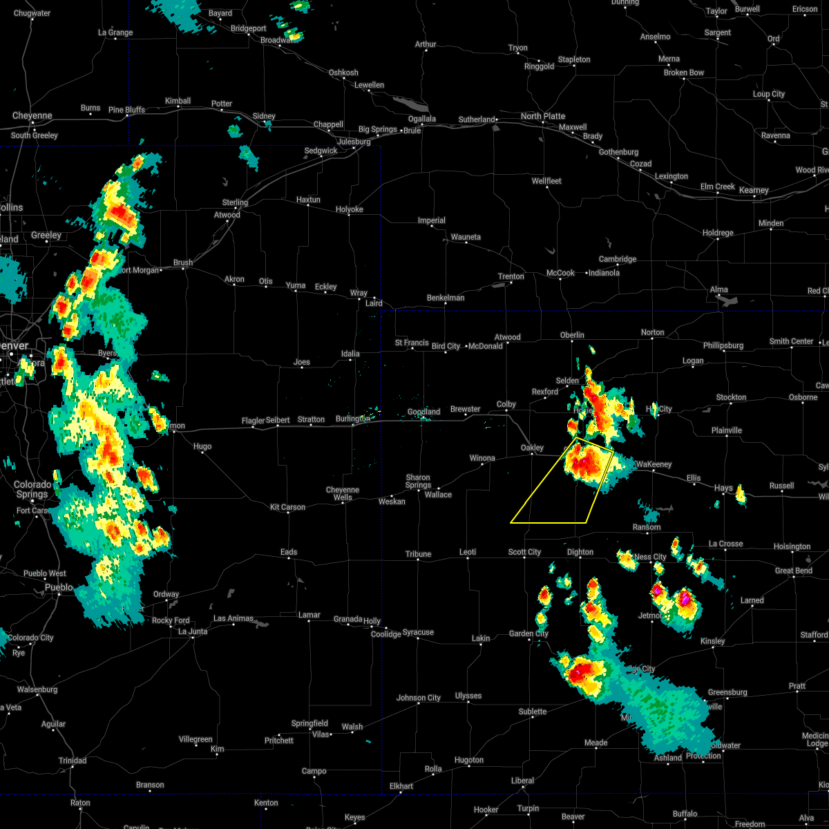 At 515 pm cdt, a severe thunderstorm was located near gove, moving southwest at 30 mph (radar indicated). Hazards include ping pong ball size hail and 60 mph wind gusts. People and animals outdoors will be injured. expect hail damage to roofs, siding, windows, and vehicles. expect wind damage to roofs, siding, and trees. this severe thunderstorm will be near, gove around 520 pm cdt. This includes interstate 70 in kansas between mile markers 87 and 107. At 515 pm cdt, a severe thunderstorm was located near gove, moving southwest at 30 mph (radar indicated). Hazards include ping pong ball size hail and 60 mph wind gusts. People and animals outdoors will be injured. expect hail damage to roofs, siding, windows, and vehicles. expect wind damage to roofs, siding, and trees. this severe thunderstorm will be near, gove around 520 pm cdt. This includes interstate 70 in kansas between mile markers 87 and 107.
|
| 7/4/2021 4:59 PM CDT |
 At 459 pm cdt, a severe thunderstorm was located near park, or 6 miles northeast of grainfield, moving southwest at 10 mph (trained weather spotter reports at least inch hail northeast of park). Hazards include two inch hail and 60 mph wind gusts. People and animals outdoors will be injured. expect hail damage to roofs, siding, windows, and vehicles. expect wind damage to roofs, siding, and trees. locations impacted include, quinter, grainfield, park and saint peter. This includes interstate 70 in kansas between mile markers 89 and 111. At 459 pm cdt, a severe thunderstorm was located near park, or 6 miles northeast of grainfield, moving southwest at 10 mph (trained weather spotter reports at least inch hail northeast of park). Hazards include two inch hail and 60 mph wind gusts. People and animals outdoors will be injured. expect hail damage to roofs, siding, windows, and vehicles. expect wind damage to roofs, siding, and trees. locations impacted include, quinter, grainfield, park and saint peter. This includes interstate 70 in kansas between mile markers 89 and 111.
|
| 7/4/2021 4:39 PM CDT |
 At 439 pm cdt, a severe thunderstorm was located 5 miles north of park, or 8 miles northeast of grainfield, moving southwest at 10 mph (radar indicated). Hazards include two inch hail and 60 mph wind gusts. People and animals outdoors will be injured. expect hail damage to roofs, siding, windows, and vehicles. Expect wind damage to roofs, siding, and trees. At 439 pm cdt, a severe thunderstorm was located 5 miles north of park, or 8 miles northeast of grainfield, moving southwest at 10 mph (radar indicated). Hazards include two inch hail and 60 mph wind gusts. People and animals outdoors will be injured. expect hail damage to roofs, siding, windows, and vehicles. Expect wind damage to roofs, siding, and trees.
|
| 7/4/2021 4:32 PM CDT |
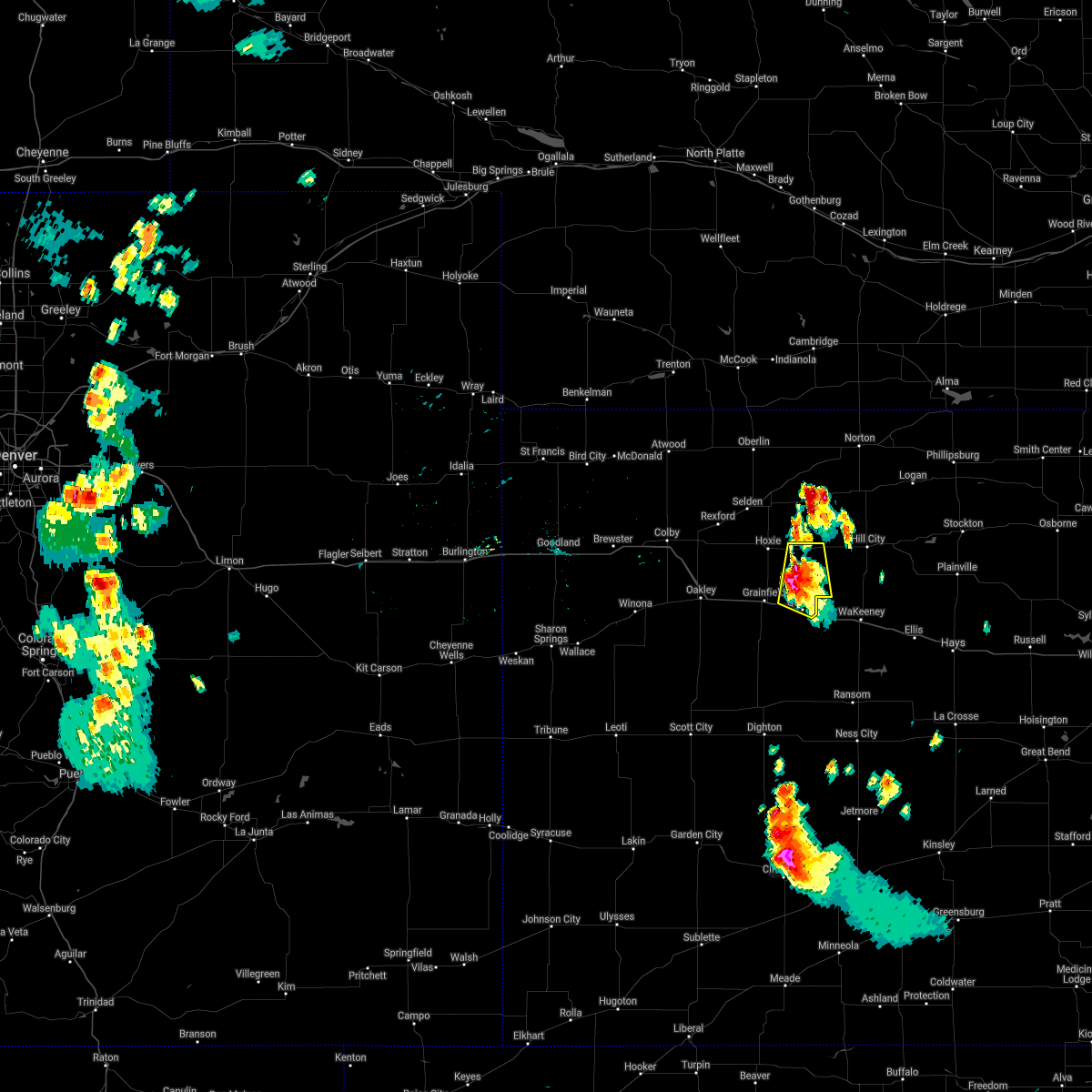 At 432 pm cdt, a severe thunderstorm was located 9 miles southwest of morland, or 13 miles north of quinter, moving south at 5 mph (radar indicated). Hazards include two inch hail and 60 mph wind gusts. People and animals outdoors will be injured. expect hail damage to roofs, siding, windows, and vehicles. expect wind damage to roofs, siding, and trees. locations impacted include, quinter, park, saint peter, tasco and studley. This includes interstate 70 in kansas between mile markers 100 and 110. At 432 pm cdt, a severe thunderstorm was located 9 miles southwest of morland, or 13 miles north of quinter, moving south at 5 mph (radar indicated). Hazards include two inch hail and 60 mph wind gusts. People and animals outdoors will be injured. expect hail damage to roofs, siding, windows, and vehicles. expect wind damage to roofs, siding, and trees. locations impacted include, quinter, park, saint peter, tasco and studley. This includes interstate 70 in kansas between mile markers 100 and 110.
|
| 7/4/2021 4:20 PM CDT |
 At 420 pm cdt, a severe thunderstorm was located 8 miles southwest of morland, or 13 miles east of hoxie, moving south at 5 mph (radar indicated). Hazards include ping pong ball size hail and 60 mph wind gusts. People and animals outdoors will be injured. expect hail damage to roofs, siding, windows, and vehicles. expect wind damage to roofs, siding, and trees. locations impacted include, quinter, park, saint peter, tasco and studley. This includes interstate 70 in kansas between mile markers 100 and 110. At 420 pm cdt, a severe thunderstorm was located 8 miles southwest of morland, or 13 miles east of hoxie, moving south at 5 mph (radar indicated). Hazards include ping pong ball size hail and 60 mph wind gusts. People and animals outdoors will be injured. expect hail damage to roofs, siding, windows, and vehicles. expect wind damage to roofs, siding, and trees. locations impacted include, quinter, park, saint peter, tasco and studley. This includes interstate 70 in kansas between mile markers 100 and 110.
|
| 7/4/2021 4:10 PM CDT |
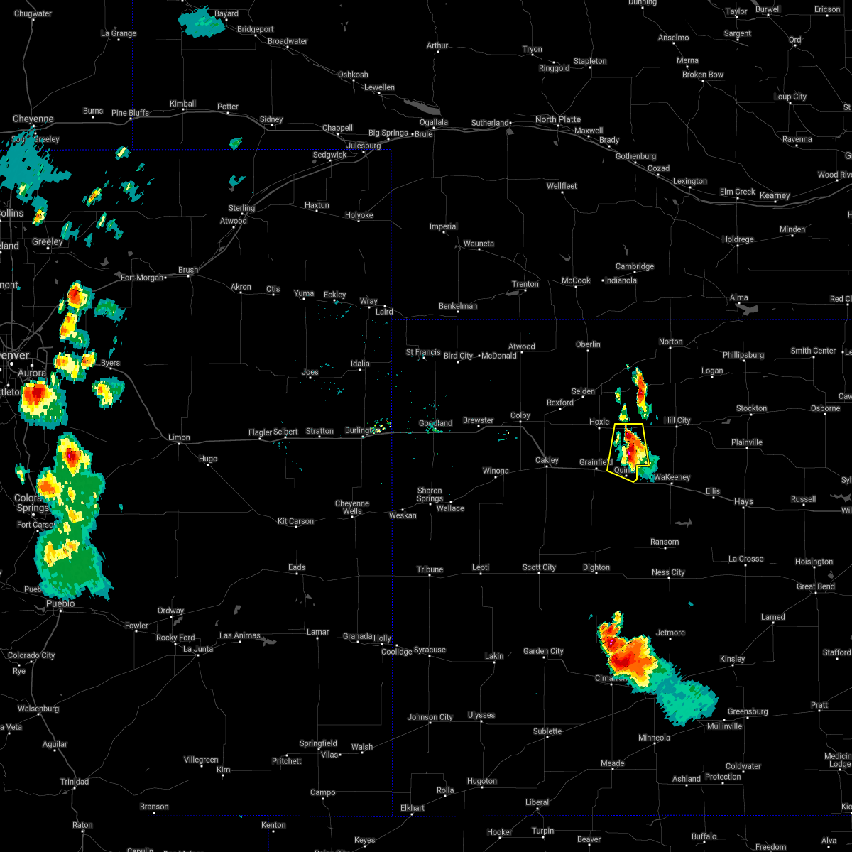 At 410 pm cdt, a severe thunderstorm was located 8 miles southwest of morland, or 12 miles east of hoxie, moving south at 5 mph (radar indicated). Hazards include 60 mph wind gusts and quarter size hail. Hail damage to vehicles is expected. expect wind damage to roofs, siding, and trees. this severe thunderstorm will remain over mainly rural areas of southeastern sheridan, northeastern gove and southwestern graham counties, including the following locations, saint peter, tasco and studley. This includes interstate 70 in kansas between mile markers 100 and 110. At 410 pm cdt, a severe thunderstorm was located 8 miles southwest of morland, or 12 miles east of hoxie, moving south at 5 mph (radar indicated). Hazards include 60 mph wind gusts and quarter size hail. Hail damage to vehicles is expected. expect wind damage to roofs, siding, and trees. this severe thunderstorm will remain over mainly rural areas of southeastern sheridan, northeastern gove and southwestern graham counties, including the following locations, saint peter, tasco and studley. This includes interstate 70 in kansas between mile markers 100 and 110.
|
| 6/19/2021 9:03 PM CDT |
 At 902 pm cdt, severe thunderstorms were located along a line extending from 5 miles south of dresden to 8 miles north of healy, moving east at 40 mph. at 848 pm cdt, a wind gust of 83 mph was observed 5 miles south of hoxie. these are very dangerous storms (weather instrument). Hazards include 80 mph wind gusts. Flying debris will be dangerous to those caught without shelter. mobile homes will be heavily damaged. expect considerable damage to roofs, windows, and vehicles. Extensive tree damage and power outages are likely. At 902 pm cdt, severe thunderstorms were located along a line extending from 5 miles south of dresden to 8 miles north of healy, moving east at 40 mph. at 848 pm cdt, a wind gust of 83 mph was observed 5 miles south of hoxie. these are very dangerous storms (weather instrument). Hazards include 80 mph wind gusts. Flying debris will be dangerous to those caught without shelter. mobile homes will be heavily damaged. expect considerable damage to roofs, windows, and vehicles. Extensive tree damage and power outages are likely.
|
| 6/19/2021 9:01 PM CDT |
 At 901 pm cdt, severe thunderstorms were located along a line extending from 5 miles south of dresden to 8 miles north of healy, moving east at 40 mph. these are very dangerous storms (radar indicated). Hazards include 80 mph wind gusts. Flying debris will be dangerous to those caught without shelter. mobile homes will be heavily damaged. expect considerable damage to roofs, windows, and vehicles. extensive tree damage and power outages are likely. these severe thunderstorms will remain over mainly rural areas of sheridan, gove and graham counties, including the following locations, the monument rocks, seguin, studley, angelus, penokee, saint peter and tasco. This includes interstate 70 in kansas between mile markers 76 and 112. At 901 pm cdt, severe thunderstorms were located along a line extending from 5 miles south of dresden to 8 miles north of healy, moving east at 40 mph. these are very dangerous storms (radar indicated). Hazards include 80 mph wind gusts. Flying debris will be dangerous to those caught without shelter. mobile homes will be heavily damaged. expect considerable damage to roofs, windows, and vehicles. extensive tree damage and power outages are likely. these severe thunderstorms will remain over mainly rural areas of sheridan, gove and graham counties, including the following locations, the monument rocks, seguin, studley, angelus, penokee, saint peter and tasco. This includes interstate 70 in kansas between mile markers 76 and 112.
|
| 6/19/2021 8:33 PM CDT |
 At 832 pm cdt, severe thunderstorms were located along a line extending from 3 miles southeast of ludell to 4 miles southeast of gem to 6 miles northeast of russell springs, moving east at 45 mph. at 818 pm cdt, a mesonet site 1 mile east of colby reported an 84 mph wind gust. these are very dangerous storms (radar indicated). Hazards include 80 mph wind gusts. Flying debris will be dangerous to those caught without shelter. mobile homes will be heavily damaged. expect considerable damage to roofs, windows, and vehicles. extensive tree damage and power outages are likely. locations impacted include, rexford, menlo, hoxie and gove. This includes interstate 70 in kansas between mile markers 36 and 112. At 832 pm cdt, severe thunderstorms were located along a line extending from 3 miles southeast of ludell to 4 miles southeast of gem to 6 miles northeast of russell springs, moving east at 45 mph. at 818 pm cdt, a mesonet site 1 mile east of colby reported an 84 mph wind gust. these are very dangerous storms (radar indicated). Hazards include 80 mph wind gusts. Flying debris will be dangerous to those caught without shelter. mobile homes will be heavily damaged. expect considerable damage to roofs, windows, and vehicles. extensive tree damage and power outages are likely. locations impacted include, rexford, menlo, hoxie and gove. This includes interstate 70 in kansas between mile markers 36 and 112.
|
| 6/19/2021 7:34 PM CDT |
 At 734 pm cdt, severe thunderstorms were located along a line extending from 6 miles east of st. francis to 6 miles east of goodland to 3 miles northwest of sharon springs, moving east at 45 mph. these are very dangerous storms (radar indicated). Hazards include 80 mph wind gusts. Flying debris will be dangerous to those caught without shelter. mobile homes will be heavily damaged. expect considerable damage to roofs, windows, and vehicles. extensive tree damage and power outages are likely. severe thunderstorms will be near, brewster around 750 pm cdt. other locations in the path of these severe thunderstorms include levant, colby, russell springs, gem, rexford, menlo, hoxie and gove. This includes interstate 70 in kansas between mile markers 36 and 112. At 734 pm cdt, severe thunderstorms were located along a line extending from 6 miles east of st. francis to 6 miles east of goodland to 3 miles northwest of sharon springs, moving east at 45 mph. these are very dangerous storms (radar indicated). Hazards include 80 mph wind gusts. Flying debris will be dangerous to those caught without shelter. mobile homes will be heavily damaged. expect considerable damage to roofs, windows, and vehicles. extensive tree damage and power outages are likely. severe thunderstorms will be near, brewster around 750 pm cdt. other locations in the path of these severe thunderstorms include levant, colby, russell springs, gem, rexford, menlo, hoxie and gove. This includes interstate 70 in kansas between mile markers 36 and 112.
|
| 5/2/2021 9:50 PM CDT |
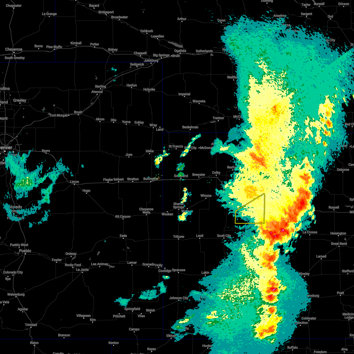 The severe thunderstorm warning for southeastern gove county will expire at 1000 pm cdt, the storm which prompted the warning has moved out of the area. therefore, the warning will be allowed to expire. however gusty winds are still possible with this thunderstorm. a severe thunderstorm watch remains in effect until midnight cdt for west central kansas. The severe thunderstorm warning for southeastern gove county will expire at 1000 pm cdt, the storm which prompted the warning has moved out of the area. therefore, the warning will be allowed to expire. however gusty winds are still possible with this thunderstorm. a severe thunderstorm watch remains in effect until midnight cdt for west central kansas.
|
| 5/2/2021 9:35 PM CDT |
 At 935 pm cdt, a severe thunderstorm was located 7 miles north of utica, moving east at 40 mph (radar indicated). Hazards include 60 mph wind gusts. Expect damage to roofs, siding, and trees. locations impacted include, quinter and gove. This includes interstate 70 in kansas between mile markers 106 and 112. At 935 pm cdt, a severe thunderstorm was located 7 miles north of utica, moving east at 40 mph (radar indicated). Hazards include 60 mph wind gusts. Expect damage to roofs, siding, and trees. locations impacted include, quinter and gove. This includes interstate 70 in kansas between mile markers 106 and 112.
|
| 5/2/2021 9:14 PM CDT |
 At 914 pm cdt, severe thunderstorms were located along a line extending from 7 miles south of collyer to near healy, moving southeast at 30 mph (radar indicated). Hazards include 60 mph wind gusts. Expect damage to roofs, siding, and trees. these severe thunderstorms will remain over mainly rural areas of gove county, including the following locations, the monument rocks. This includes interstate 70 in kansas between mile markers 105 and 112. At 914 pm cdt, severe thunderstorms were located along a line extending from 7 miles south of collyer to near healy, moving southeast at 30 mph (radar indicated). Hazards include 60 mph wind gusts. Expect damage to roofs, siding, and trees. these severe thunderstorms will remain over mainly rural areas of gove county, including the following locations, the monument rocks. This includes interstate 70 in kansas between mile markers 105 and 112.
|
| 5/2/2021 9:02 PM CDT |
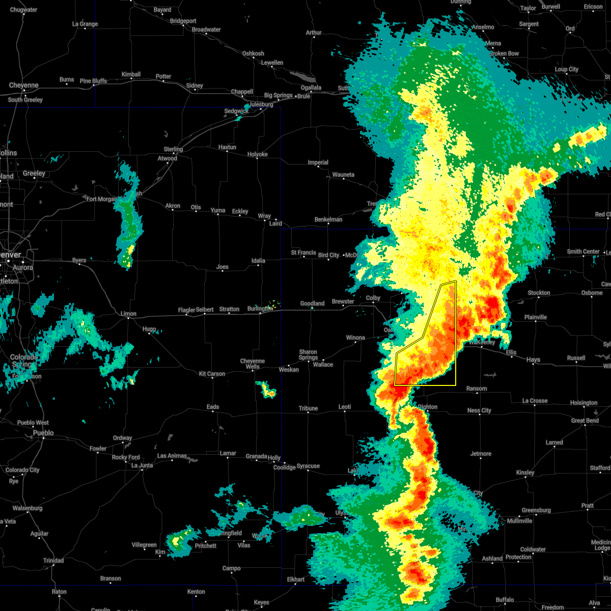 At 902 pm cdt, severe thunderstorms were located along a line extending from 8 miles south of morland to 7 miles northwest of healy, moving southeast at 20 mph (radar indicated). Hazards include 70 mph wind gusts. Expect considerable tree damage. damage is likely to mobile homes, roofs, and outbuildings. locations impacted include, quinter, grainfield, gove, park, the monument rocks, tasco and studley. This includes interstate 70 in kansas between mile markers 92 and 112. At 902 pm cdt, severe thunderstorms were located along a line extending from 8 miles south of morland to 7 miles northwest of healy, moving southeast at 20 mph (radar indicated). Hazards include 70 mph wind gusts. Expect considerable tree damage. damage is likely to mobile homes, roofs, and outbuildings. locations impacted include, quinter, grainfield, gove, park, the monument rocks, tasco and studley. This includes interstate 70 in kansas between mile markers 92 and 112.
|
| 5/2/2021 8:29 PM CDT |
 At 829 pm cdt, severe thunderstorms were located along a line extending from 4 miles southeast of hoxie to 5 miles northwest of scott state lake, moving southeast at 30 mph (radar indicated). Hazards include 70 mph wind gusts. Expect considerable tree damage. damage is likely to mobile homes, roofs, and outbuildings. locations impacted include, oakley, hoxie, quinter, grainfield, grinnell, gove and park. This includes interstate 70 in kansas between mile markers 76 and 112. At 829 pm cdt, severe thunderstorms were located along a line extending from 4 miles southeast of hoxie to 5 miles northwest of scott state lake, moving southeast at 30 mph (radar indicated). Hazards include 70 mph wind gusts. Expect considerable tree damage. damage is likely to mobile homes, roofs, and outbuildings. locations impacted include, oakley, hoxie, quinter, grainfield, grinnell, gove and park. This includes interstate 70 in kansas between mile markers 76 and 112.
|
| 5/2/2021 7:50 PM CDT |
 At 750 pm cdt, severe thunderstorms were located along a line extending from 5 miles north of rexford to 12 miles south of russell springs, moving east at 25 mph (weather instrument). Hazards include 60 mph wind gusts at oakley airport. Expect damage to roofs, siding, and trees. locations impacted include, oakley, hoxie, quinter, grainfield, grinnell, gove and selden. This includes interstate 70 in kansas between mile markers 76 and 112. At 750 pm cdt, severe thunderstorms were located along a line extending from 5 miles north of rexford to 12 miles south of russell springs, moving east at 25 mph (weather instrument). Hazards include 60 mph wind gusts at oakley airport. Expect damage to roofs, siding, and trees. locations impacted include, oakley, hoxie, quinter, grainfield, grinnell, gove and selden. This includes interstate 70 in kansas between mile markers 76 and 112.
|
| 5/2/2021 7:45 PM CDT |
 At 744 pm cdt, severe thunderstorms were located along a line extending from 5 miles north of rexford to 13 miles southwest of russell springs, moving east at 25 mph (radar indicated). Hazards include 70 mph wind gusts and quarter size hail. Hail damage to vehicles is expected. expect considerable tree damage. Wind damage is also likely to mobile homes, roofs, and outbuildings. At 744 pm cdt, severe thunderstorms were located along a line extending from 5 miles north of rexford to 13 miles southwest of russell springs, moving east at 25 mph (radar indicated). Hazards include 70 mph wind gusts and quarter size hail. Hail damage to vehicles is expected. expect considerable tree damage. Wind damage is also likely to mobile homes, roofs, and outbuildings.
|
| 8/16/2020 7:37 PM CDT |
 At 636 pm mdt/736 pm cdt/, severe thunderstorms were located along a line extending from 10 miles north of ruleton to 5 miles south of brewster to near grinnell, moving south at 30 mph (these storms have a history of producing wind gusts up to 70 mph. an automated weather observation site in st. francis reported a 67 mph wind gust at 535 pm mdt. the national weather service in goodland measured a 62 mph wind gust at 620 pm mdt). Hazards include 70 mph wind gusts and penny size hail. Expect considerable tree damage. damage is likely to mobile homes, roofs, and outbuildings. locations impacted include, oakley, quinter, sharon springs, grainfield, grinnell, gove and weskan. This includes interstate 70 in kansas between mile markers 76 and 112. At 636 pm mdt/736 pm cdt/, severe thunderstorms were located along a line extending from 10 miles north of ruleton to 5 miles south of brewster to near grinnell, moving south at 30 mph (these storms have a history of producing wind gusts up to 70 mph. an automated weather observation site in st. francis reported a 67 mph wind gust at 535 pm mdt. the national weather service in goodland measured a 62 mph wind gust at 620 pm mdt). Hazards include 70 mph wind gusts and penny size hail. Expect considerable tree damage. damage is likely to mobile homes, roofs, and outbuildings. locations impacted include, oakley, quinter, sharon springs, grainfield, grinnell, gove and weskan. This includes interstate 70 in kansas between mile markers 76 and 112.
|
| 8/16/2020 7:06 PM CDT |
 At 605 pm mdt/705 pm cdt/, severe thunderstorms were located along a line extending from 7 miles north of ruleton to 10 miles northwest of winona to near oakley, moving south at 20 mph (radar indicated). Hazards include 70 mph wind gusts and quarter size hail. Hail damage to vehicles is expected. expect considerable tree damage. Wind damage is also likely to mobile homes, roofs, and outbuildings. At 605 pm mdt/705 pm cdt/, severe thunderstorms were located along a line extending from 7 miles north of ruleton to 10 miles northwest of winona to near oakley, moving south at 20 mph (radar indicated). Hazards include 70 mph wind gusts and quarter size hail. Hail damage to vehicles is expected. expect considerable tree damage. Wind damage is also likely to mobile homes, roofs, and outbuildings.
|
| 8/9/2020 8:16 PM CDT |
 At 814 pm cdt, a severe thunderstorm was located over gove, moving east at 20 mph (radar indicated). Hazards include 60 mph wind gusts. Expect damage to roofs, siding, and trees. locations impacted include, oakley, quinter, grainfield, grinnell, gove, park and the monument rocks. This includes interstate 70 in kansas between mile markers 76 and 112. At 814 pm cdt, a severe thunderstorm was located over gove, moving east at 20 mph (radar indicated). Hazards include 60 mph wind gusts. Expect damage to roofs, siding, and trees. locations impacted include, oakley, quinter, grainfield, grinnell, gove, park and the monument rocks. This includes interstate 70 in kansas between mile markers 76 and 112.
|
| 8/9/2020 8:05 PM CDT |
 At 804 pm cdt, a severe thunderstorm was located 4 miles southeast of grinnell, moving east at 30 mph (radar indicated). Hazards include 60 mph wind gusts. Expect damage to roofs, siding, and trees. locations impacted include, oakley, hoxie, quinter, grainfield, grinnell, gove and park. This includes interstate 70 in kansas between mile markers 76 and 112. At 804 pm cdt, a severe thunderstorm was located 4 miles southeast of grinnell, moving east at 30 mph (radar indicated). Hazards include 60 mph wind gusts. Expect damage to roofs, siding, and trees. locations impacted include, oakley, hoxie, quinter, grainfield, grinnell, gove and park. This includes interstate 70 in kansas between mile markers 76 and 112.
|
| 8/9/2020 7:52 PM CDT |
 At 750 pm cdt, a severe thunderstorm was located over grinnell, moving east at 25 mph (radar indicated). Hazards include 70 mph wind gusts and penny size hail. Expect considerable tree damage. damage is likely to mobile homes, roofs, and outbuildings. locations impacted include, oakley, hoxie, quinter, grainfield, grinnell, gove and park. This includes interstate 70 in kansas between mile markers 76 and 112. At 750 pm cdt, a severe thunderstorm was located over grinnell, moving east at 25 mph (radar indicated). Hazards include 70 mph wind gusts and penny size hail. Expect considerable tree damage. damage is likely to mobile homes, roofs, and outbuildings. locations impacted include, oakley, hoxie, quinter, grainfield, grinnell, gove and park. This includes interstate 70 in kansas between mile markers 76 and 112.
|
| 8/9/2020 7:45 PM CDT |
 At 617 pm mdt/717 pm cdt/, a severe thunderstorm was located near monument, or 11 miles west of oakley, moving east at 30 mph (radar indicated). Hazards include 70 mph wind gusts and quarter size hail. Hail damage to vehicles is expected. expect considerable tree damage. wind damage is also likely to mobile homes, roofs, and outbuildings. wind gusts up to 70 mph are possible in association with any thunderstorms developing along and on either side of interstate 70 in thomas, sheridan, logan, and gove counties. The automated surface observation in burlington, colorado reported a wind gust of 68 mph in association with a nearby thunderstorm at 335 pm mdt. At 617 pm mdt/717 pm cdt/, a severe thunderstorm was located near monument, or 11 miles west of oakley, moving east at 30 mph (radar indicated). Hazards include 70 mph wind gusts and quarter size hail. Hail damage to vehicles is expected. expect considerable tree damage. wind damage is also likely to mobile homes, roofs, and outbuildings. wind gusts up to 70 mph are possible in association with any thunderstorms developing along and on either side of interstate 70 in thomas, sheridan, logan, and gove counties. The automated surface observation in burlington, colorado reported a wind gust of 68 mph in association with a nearby thunderstorm at 335 pm mdt.
|
| 8/9/2020 7:20 PM CDT |
 At 617 pm mdt/717 pm cdt/, a severe thunderstorm was located near monument, or 11 miles west of oakley, moving east at 30 mph (radar indicated). Hazards include 70 mph wind gusts and quarter size hail. Hail damage to vehicles is expected. expect considerable tree damage. wind damage is also likely to mobile homes, roofs, and outbuildings. wind gusts up to 70 mph are possible in association with any thunderstorms developing along and on either side of interstate 70 in thomas, sheridan, logan, and gove counties. The automated surface observation in burlington, colorado reported a wind gust of 68 mph in association with a nearby thunderstorm at 335 pm mdt. At 617 pm mdt/717 pm cdt/, a severe thunderstorm was located near monument, or 11 miles west of oakley, moving east at 30 mph (radar indicated). Hazards include 70 mph wind gusts and quarter size hail. Hail damage to vehicles is expected. expect considerable tree damage. wind damage is also likely to mobile homes, roofs, and outbuildings. wind gusts up to 70 mph are possible in association with any thunderstorms developing along and on either side of interstate 70 in thomas, sheridan, logan, and gove counties. The automated surface observation in burlington, colorado reported a wind gust of 68 mph in association with a nearby thunderstorm at 335 pm mdt.
|
| 7/13/2020 11:44 PM CDT |
 At 1143 pm cdt, a severe thunderstorm was located 5 miles northwest of gove, moving east at 25 mph (radar indicated). Hazards include 60 mph wind gusts and quarter size hail. Hail damage to vehicles is expected. expect wind damage to roofs, siding, and trees. locations impacted include, oakley, quinter, grainfield, grinnell, gove and park. This includes interstate 70 in kansas between mile markers 76 and 113. At 1143 pm cdt, a severe thunderstorm was located 5 miles northwest of gove, moving east at 25 mph (radar indicated). Hazards include 60 mph wind gusts and quarter size hail. Hail damage to vehicles is expected. expect wind damage to roofs, siding, and trees. locations impacted include, oakley, quinter, grainfield, grinnell, gove and park. This includes interstate 70 in kansas between mile markers 76 and 113.
|
| 7/13/2020 11:20 PM CDT |
 At 1120 pm cdt, a severe thunderstorm was located 8 miles southwest of grinnell, moving east at 20 mph (radar indicated). Hazards include 60 mph wind gusts and quarter size hail. Hail damage to vehicles is expected. Expect wind damage to roofs, siding, and trees. At 1120 pm cdt, a severe thunderstorm was located 8 miles southwest of grinnell, moving east at 20 mph (radar indicated). Hazards include 60 mph wind gusts and quarter size hail. Hail damage to vehicles is expected. Expect wind damage to roofs, siding, and trees.
|
| 6/21/2020 3:19 PM CDT |
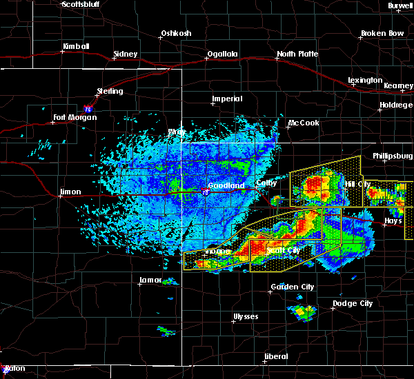 At 319 pm cdt, a severe thunderstorm was located 11 miles south of gove, moving southeast at 20 mph (radar indicated). Hazards include 60 mph wind gusts and quarter size hail. Hail damage to vehicles is expected. expect wind damage to roofs, siding, and trees. locations impacted include, quinter, gove and the monument rocks. This includes interstate 70 in kansas between mile markers 105 and 112. At 319 pm cdt, a severe thunderstorm was located 11 miles south of gove, moving southeast at 20 mph (radar indicated). Hazards include 60 mph wind gusts and quarter size hail. Hail damage to vehicles is expected. expect wind damage to roofs, siding, and trees. locations impacted include, quinter, gove and the monument rocks. This includes interstate 70 in kansas between mile markers 105 and 112.
|
| 6/21/2020 2:51 PM CDT |
 At 251 pm cdt, a severe thunderstorm was located 6 miles southwest of gove, moving east at 5 mph (radar indicated). Hazards include 60 mph wind gusts and quarter size hail. Hail damage to vehicles is expected. Expect wind damage to roofs, siding, and trees. At 251 pm cdt, a severe thunderstorm was located 6 miles southwest of gove, moving east at 5 mph (radar indicated). Hazards include 60 mph wind gusts and quarter size hail. Hail damage to vehicles is expected. Expect wind damage to roofs, siding, and trees.
|
| 6/21/2020 2:34 PM CDT |
 At 233 pm cdt, a severe thunderstorm was located near grinnell, moving east at 10 mph (radar indicated). Hazards include 60 mph wind gusts and quarter size hail. Hail damage to vehicles is expected. expect wind damage to roofs, siding, and trees. locations impacted include, quinter, grainfield, grinnell, gove, park, studley and angelus. This includes interstate 70 in kansas between mile markers 78 and 112. At 233 pm cdt, a severe thunderstorm was located near grinnell, moving east at 10 mph (radar indicated). Hazards include 60 mph wind gusts and quarter size hail. Hail damage to vehicles is expected. expect wind damage to roofs, siding, and trees. locations impacted include, quinter, grainfield, grinnell, gove, park, studley and angelus. This includes interstate 70 in kansas between mile markers 78 and 112.
|
| 6/21/2020 2:28 PM CDT |
 At 228 pm cdt, a severe thunderstorm was located near grinnell, moving east at 10 mph (radar indicated). Hazards include ping pong ball size hail and 60 mph wind gusts. People and animals outdoors will be injured. expect hail damage to roofs, siding, windows, and vehicles. expect wind damage to roofs, siding, and trees. locations impacted include, quinter, grainfield, grinnell, gove, park, studley and angelus. This includes interstate 70 in kansas between mile markers 78 and 112. At 228 pm cdt, a severe thunderstorm was located near grinnell, moving east at 10 mph (radar indicated). Hazards include ping pong ball size hail and 60 mph wind gusts. People and animals outdoors will be injured. expect hail damage to roofs, siding, windows, and vehicles. expect wind damage to roofs, siding, and trees. locations impacted include, quinter, grainfield, grinnell, gove, park, studley and angelus. This includes interstate 70 in kansas between mile markers 78 and 112.
|
| 6/21/2020 2:12 PM CDT |
 At 212 pm cdt, a severe thunderstorm was located over grinnell, moving east at 10 mph (radar indicated). Hazards include two inch hail and 70 mph wind gusts. People and animals outdoors will be injured. expect hail damage to roofs, siding, windows, and vehicles. expect considerable tree damage. wind damage is also likely to mobile homes, roofs, and outbuildings. locations impacted include, quinter, grainfield, grinnell, gove, park, studley and angelus. This includes interstate 70 in kansas between mile markers 78 and 112. At 212 pm cdt, a severe thunderstorm was located over grinnell, moving east at 10 mph (radar indicated). Hazards include two inch hail and 70 mph wind gusts. People and animals outdoors will be injured. expect hail damage to roofs, siding, windows, and vehicles. expect considerable tree damage. wind damage is also likely to mobile homes, roofs, and outbuildings. locations impacted include, quinter, grainfield, grinnell, gove, park, studley and angelus. This includes interstate 70 in kansas between mile markers 78 and 112.
|
| 6/21/2020 2:03 PM CDT |
 At 203 pm cdt, a severe thunderstorm was located over grinnell, moving east at 10 mph (radar indicated). Hazards include 70 mph wind gusts and ping pong ball size hail. People and animals outdoors will be injured. expect hail damage to roofs, siding, windows, and vehicles. expect considerable tree damage. Wind damage is also likely to mobile homes, roofs, and outbuildings. At 203 pm cdt, a severe thunderstorm was located over grinnell, moving east at 10 mph (radar indicated). Hazards include 70 mph wind gusts and ping pong ball size hail. People and animals outdoors will be injured. expect hail damage to roofs, siding, windows, and vehicles. expect considerable tree damage. Wind damage is also likely to mobile homes, roofs, and outbuildings.
|
| 8/29/2019 8:59 PM CDT |
 At 844 pm cdt, a severe thunderstorm was located 7 miles southeast of hill city, moving southeast at 40 mph. this is a very dangerous storm (winds measured at the hill city airport). Hazards include 80 mph wind gusts and two inch hail. Flying debris will be dangerous to those caught without shelter. mobile homes will be heavily damaged. expect considerable damage to roofs, windows, and vehicles. extensive tree damage and power outages are likely. locations impacted include, hill city, quinter, morland, bogue, nicodemus, studley and penokee. This includes interstate 70 in kansas between mile markers 104 and 113. At 844 pm cdt, a severe thunderstorm was located 7 miles southeast of hill city, moving southeast at 40 mph. this is a very dangerous storm (winds measured at the hill city airport). Hazards include 80 mph wind gusts and two inch hail. Flying debris will be dangerous to those caught without shelter. mobile homes will be heavily damaged. expect considerable damage to roofs, windows, and vehicles. extensive tree damage and power outages are likely. locations impacted include, hill city, quinter, morland, bogue, nicodemus, studley and penokee. This includes interstate 70 in kansas between mile markers 104 and 113.
|
| 8/29/2019 8:45 PM CDT |
 At 844 pm cdt, a severe thunderstorm was located 7 miles southeast of hill city, moving southeast at 40 mph. this is a very dangerous storm (winds measured at the hill city airport). Hazards include 80 mph wind gusts and two inch hail. Flying debris will be dangerous to those caught without shelter. mobile homes will be heavily damaged. expect considerable damage to roofs, windows, and vehicles. extensive tree damage and power outages are likely. locations impacted include, hill city, quinter, morland, bogue, nicodemus, studley and penokee. This includes interstate 70 in kansas between mile markers 104 and 113. At 844 pm cdt, a severe thunderstorm was located 7 miles southeast of hill city, moving southeast at 40 mph. this is a very dangerous storm (winds measured at the hill city airport). Hazards include 80 mph wind gusts and two inch hail. Flying debris will be dangerous to those caught without shelter. mobile homes will be heavily damaged. expect considerable damage to roofs, windows, and vehicles. extensive tree damage and power outages are likely. locations impacted include, hill city, quinter, morland, bogue, nicodemus, studley and penokee. This includes interstate 70 in kansas between mile markers 104 and 113.
|
| 8/29/2019 8:38 PM CDT |
 At 837 pm cdt, a severe thunderstorm was located near hill city, moving southeast at 45 mph. this is a very dangerous storm (radar indicated). Hazards include 80 mph wind gusts and two inch hail. Flying debris will be dangerous to those caught without shelter. mobile homes will be heavily damaged. expect considerable damage to roofs, windows, and vehicles. extensive tree damage and power outages are likely. locations impacted include, hill city, quinter, morland, bogue, nicodemus, studley and penokee. This includes interstate 70 in kansas between mile markers 104 and 113. At 837 pm cdt, a severe thunderstorm was located near hill city, moving southeast at 45 mph. this is a very dangerous storm (radar indicated). Hazards include 80 mph wind gusts and two inch hail. Flying debris will be dangerous to those caught without shelter. mobile homes will be heavily damaged. expect considerable damage to roofs, windows, and vehicles. extensive tree damage and power outages are likely. locations impacted include, hill city, quinter, morland, bogue, nicodemus, studley and penokee. This includes interstate 70 in kansas between mile markers 104 and 113.
|
| 8/29/2019 7:58 PM CDT |
 At 758 pm cdt, a severe thunderstorm was located 8 miles southwest of lenora, or 18 miles northwest of hill city, moving southeast at 40 mph (radar indicated). Hazards include tennis ball size hail and 70 mph wind gusts. People and animals outdoors will be injured. expect hail damage to roofs, siding, windows, and vehicles. expect considerable tree damage. Wind damage is also likely to mobile homes, roofs, and outbuildings. At 758 pm cdt, a severe thunderstorm was located 8 miles southwest of lenora, or 18 miles northwest of hill city, moving southeast at 40 mph (radar indicated). Hazards include tennis ball size hail and 70 mph wind gusts. People and animals outdoors will be injured. expect hail damage to roofs, siding, windows, and vehicles. expect considerable tree damage. Wind damage is also likely to mobile homes, roofs, and outbuildings.
|
| 8/24/2019 10:43 PM CDT |
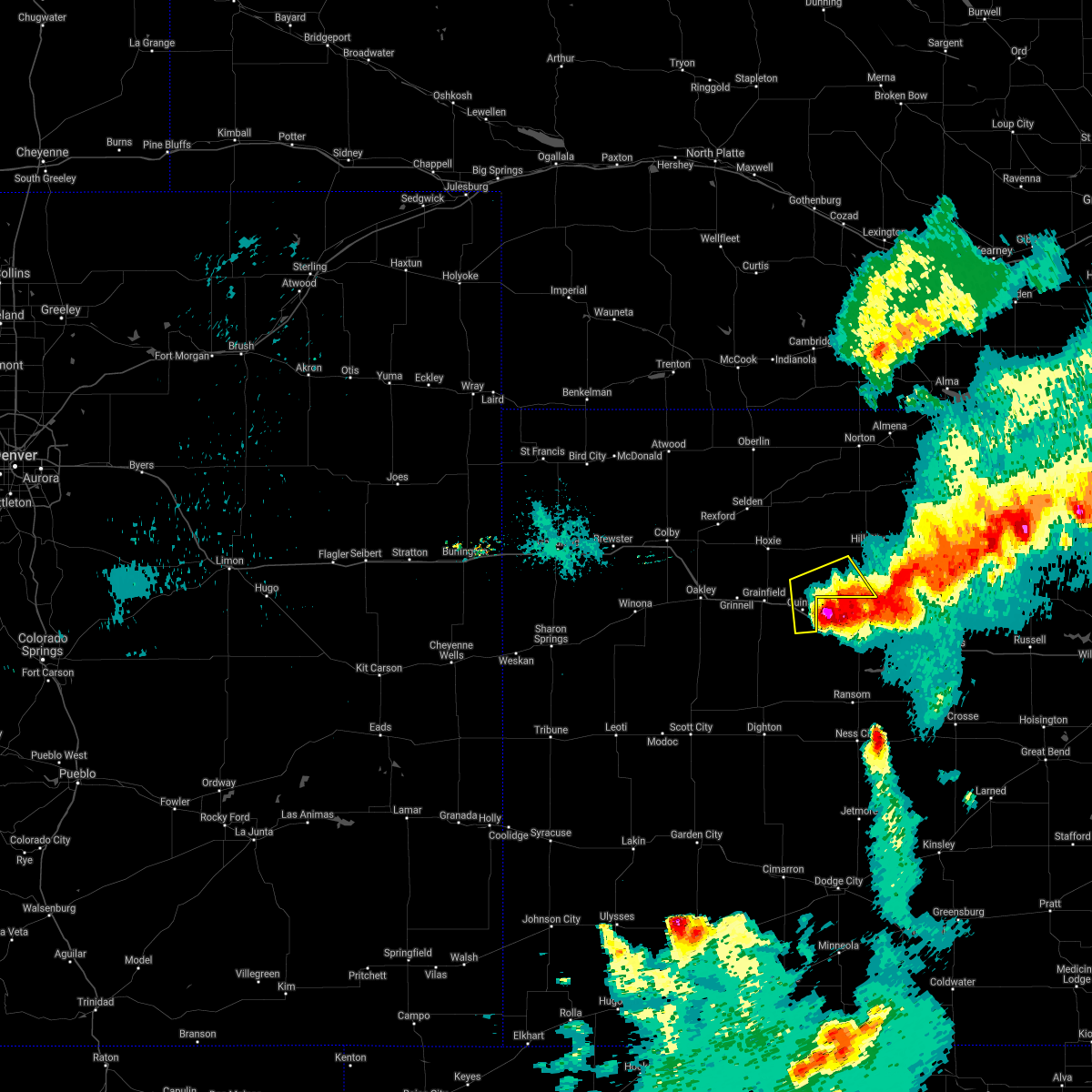 The severe thunderstorm warning for southeastern sheridan, northeastern gove and southwestern graham counties will expire at 1045 pm cdt, the storm which prompted the warning is moving out of the warned area. therefore, the warning will be allowed to expire. however small hail and gusty winds are still possible with this thunderstorm as it continues southeast. a tornado watch remains in effect until midnight cdt for northwestern and west central kansas. The severe thunderstorm warning for southeastern sheridan, northeastern gove and southwestern graham counties will expire at 1045 pm cdt, the storm which prompted the warning is moving out of the warned area. therefore, the warning will be allowed to expire. however small hail and gusty winds are still possible with this thunderstorm as it continues southeast. a tornado watch remains in effect until midnight cdt for northwestern and west central kansas.
|
| 8/24/2019 10:28 PM CDT |
 At 1028 pm cdt, a severe thunderstorm was located 5 miles north of collyer, moving south at 40 mph. this is a very dangerous storm (radar indicated). Hazards include 80 mph wind gusts and tennis ball size hail. Flying debris will be dangerous to those caught without shelter. mobile homes will be heavily damaged. expect considerable damage to roofs, windows, and vehicles. extensive tree damage and power outages are likely. locations impacted include, quinter and saint peter. this includes interstate 70 in kansas between mile markers 105 and 113. A tornado watch remains in effect until midnight cdt for northwestern and west central kansas. At 1028 pm cdt, a severe thunderstorm was located 5 miles north of collyer, moving south at 40 mph. this is a very dangerous storm (radar indicated). Hazards include 80 mph wind gusts and tennis ball size hail. Flying debris will be dangerous to those caught without shelter. mobile homes will be heavily damaged. expect considerable damage to roofs, windows, and vehicles. extensive tree damage and power outages are likely. locations impacted include, quinter and saint peter. this includes interstate 70 in kansas between mile markers 105 and 113. A tornado watch remains in effect until midnight cdt for northwestern and west central kansas.
|
| 8/24/2019 10:16 PM CDT |
 At 1015 pm cdt, severe thunderstorms were located along a line extending from 10 miles north of quinter to 9 miles south of morland, moving southeast at 25 mph (radar indicated). Hazards include two inch hail and 70 mph wind gusts. People and animals outdoors will be injured. expect hail damage to roofs, siding, windows, and vehicles. expect considerable tree damage. wind damage is also likely to mobile homes, roofs, and outbuildings. locations impacted include, quinter, morland, penokee and saint peter. this includes interstate 70 in kansas between mile markers 104 and 113. A tornado watch remains in effect until midnight cdt for northwestern and west central kansas. At 1015 pm cdt, severe thunderstorms were located along a line extending from 10 miles north of quinter to 9 miles south of morland, moving southeast at 25 mph (radar indicated). Hazards include two inch hail and 70 mph wind gusts. People and animals outdoors will be injured. expect hail damage to roofs, siding, windows, and vehicles. expect considerable tree damage. wind damage is also likely to mobile homes, roofs, and outbuildings. locations impacted include, quinter, morland, penokee and saint peter. this includes interstate 70 in kansas between mile markers 104 and 113. A tornado watch remains in effect until midnight cdt for northwestern and west central kansas.
|
| 8/24/2019 10:11 PM CDT |
 At 1011 pm cdt, severe thunderstorms were located along a line extending from 10 miles north of quinter to 8 miles south of morland, moving southeast at 30 mph (radar indicated). Hazards include two inch hail and 70 mph wind gusts. People and animals outdoors will be injured. expect hail damage to roofs, siding, windows, and vehicles. expect considerable tree damage. wind damage is also likely to mobile homes, roofs, and outbuildings. locations impacted include, quinter, morland, penokee, saint peter and studley. this includes interstate 70 in kansas between mile markers 103 and 113. A tornado watch remains in effect until midnight cdt for northwestern and west central kansas. At 1011 pm cdt, severe thunderstorms were located along a line extending from 10 miles north of quinter to 8 miles south of morland, moving southeast at 30 mph (radar indicated). Hazards include two inch hail and 70 mph wind gusts. People and animals outdoors will be injured. expect hail damage to roofs, siding, windows, and vehicles. expect considerable tree damage. wind damage is also likely to mobile homes, roofs, and outbuildings. locations impacted include, quinter, morland, penokee, saint peter and studley. this includes interstate 70 in kansas between mile markers 103 and 113. A tornado watch remains in effect until midnight cdt for northwestern and west central kansas.
|
| 8/24/2019 10:00 PM CDT |
 At 959 pm cdt, severe thunderstorms were located along a line extending from 10 miles southeast of hoxie to 3 miles south of morland, moving southeast at 30 mph (radar indicated). Hazards include golf ball size hail and 60 mph wind gusts. People and animals outdoors will be injured. expect hail damage to roofs, siding, windows, and vehicles. Expect wind damage to roofs, siding, and trees. At 959 pm cdt, severe thunderstorms were located along a line extending from 10 miles southeast of hoxie to 3 miles south of morland, moving southeast at 30 mph (radar indicated). Hazards include golf ball size hail and 60 mph wind gusts. People and animals outdoors will be injured. expect hail damage to roofs, siding, windows, and vehicles. Expect wind damage to roofs, siding, and trees.
|
| 8/20/2019 7:16 PM CDT |
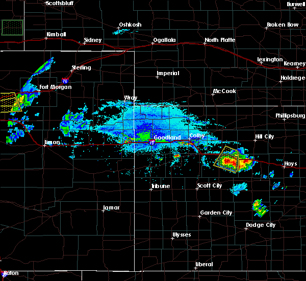 At 716 pm cdt, a severe thunderstorm was located 6 miles southwest of quinter, moving northeast at 10 mph (radar indicated). Hazards include 60 mph wind gusts and quarter size hail. Hail damage to vehicles is expected. expect wind damage to roofs, siding, and trees. locations impacted include, quinter, grainfield, gove and park. This includes interstate 70 in kansas between mile markers 94 and 113. At 716 pm cdt, a severe thunderstorm was located 6 miles southwest of quinter, moving northeast at 10 mph (radar indicated). Hazards include 60 mph wind gusts and quarter size hail. Hail damage to vehicles is expected. expect wind damage to roofs, siding, and trees. locations impacted include, quinter, grainfield, gove and park. This includes interstate 70 in kansas between mile markers 94 and 113.
|
| 8/20/2019 6:59 PM CDT |
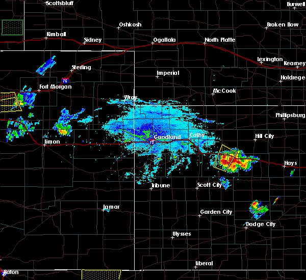 The national weather service in goodland has issued a * severe thunderstorm warning for. southeastern sheridan county in northwestern kansas. northeastern gove county in west central kansas. until 745 pm cdt. At 659 pm cdt, a severe thunderstorm was located 4 miles south of. The national weather service in goodland has issued a * severe thunderstorm warning for. southeastern sheridan county in northwestern kansas. northeastern gove county in west central kansas. until 745 pm cdt. At 659 pm cdt, a severe thunderstorm was located 4 miles south of.
|
| 8/20/2019 6:45 PM CDT |
 A severe thunderstorm warning remains in effect until 700 pm cdt for southeastern sheridan and northeastern gove counties. at 645 pm cdt, a severe thunderstorm was located near park, or 4 miles southeast of grainfield, moving north at 15 mph. hazard. two inch hail and 60 mph wind gusts. source. Radar indicated. A severe thunderstorm warning remains in effect until 700 pm cdt for southeastern sheridan and northeastern gove counties. at 645 pm cdt, a severe thunderstorm was located near park, or 4 miles southeast of grainfield, moving north at 15 mph. hazard. two inch hail and 60 mph wind gusts. source. Radar indicated.
|
| 8/20/2019 6:39 PM CDT |
 At 638 pm cdt, a severe thunderstorm was located 4 miles southwest of park, or 4 miles southeast of grainfield, moving north at 15 mph (radar indicated). Hazards include two inch hail and 60 mph wind gusts. People and animals outdoors will be injured. expect hail damage to roofs, siding, windows, and vehicles. expect wind damage to roofs, siding, and trees. locations impacted include, quinter, grainfield, gove, morland, park, studley and tasco. This includes interstate 70 in kansas between mile markers 93 and 108. At 638 pm cdt, a severe thunderstorm was located 4 miles southwest of park, or 4 miles southeast of grainfield, moving north at 15 mph (radar indicated). Hazards include two inch hail and 60 mph wind gusts. People and animals outdoors will be injured. expect hail damage to roofs, siding, windows, and vehicles. expect wind damage to roofs, siding, and trees. locations impacted include, quinter, grainfield, gove, morland, park, studley and tasco. This includes interstate 70 in kansas between mile markers 93 and 108.
|
| 8/20/2019 6:29 PM CDT |
 At 609 pm cdt, a severe thunderstorm was located near gove, moving northeast at 20 mph (radar indicated). Hazards include golf ball size hail and 60 mph wind gusts. People and animals outdoors will be injured. expect hail damage to roofs, siding, windows, and vehicles. Expect wind damage to roofs, siding, and trees. At 609 pm cdt, a severe thunderstorm was located near gove, moving northeast at 20 mph (radar indicated). Hazards include golf ball size hail and 60 mph wind gusts. People and animals outdoors will be injured. expect hail damage to roofs, siding, windows, and vehicles. Expect wind damage to roofs, siding, and trees.
|
| 8/20/2019 6:19 PM CDT |
 A severe thunderstorm warning remains in effect until 700 pm cdt for southeastern sheridan. northeastern gove and west central graham counties. at 619 pm cdt, a severe thunderstorm was located near gove, moving north at 10 mph. hazard. Two inch hail and 60 mph wind gusts. A severe thunderstorm warning remains in effect until 700 pm cdt for southeastern sheridan. northeastern gove and west central graham counties. at 619 pm cdt, a severe thunderstorm was located near gove, moving north at 10 mph. hazard. Two inch hail and 60 mph wind gusts.
|
| 8/20/2019 6:09 PM CDT |
 At 609 pm cdt, a severe thunderstorm was located near gove, moving northeast at 20 mph (radar indicated). Hazards include golf ball size hail and 60 mph wind gusts. People and animals outdoors will be injured. expect hail damage to roofs, siding, windows, and vehicles. Expect wind damage to roofs, siding, and trees. At 609 pm cdt, a severe thunderstorm was located near gove, moving northeast at 20 mph (radar indicated). Hazards include golf ball size hail and 60 mph wind gusts. People and animals outdoors will be injured. expect hail damage to roofs, siding, windows, and vehicles. Expect wind damage to roofs, siding, and trees.
|
| 8/13/2019 7:41 PM CDT |
 The severe thunderstorm warning for wichita, logan and gove counties will expire at 745 pm cdt, the storms which prompted the warning have weakened below severe limits, and no longer pose an immediate threat to life or property. therefore, the warning will be allowed to expire. a tornado watch remains in effect until 800 pm cdt for northwestern and west central kansas. The severe thunderstorm warning for wichita, logan and gove counties will expire at 745 pm cdt, the storms which prompted the warning have weakened below severe limits, and no longer pose an immediate threat to life or property. therefore, the warning will be allowed to expire. a tornado watch remains in effect until 800 pm cdt for northwestern and west central kansas.
|
| 8/13/2019 7:00 PM CDT |
 At 700 pm cdt, severe thunderstorms were located along a line extending from 7 miles northwest of leoti to 12 miles north of utica, moving south at 35 mph (trained weather spotters). Hazards include 70 mph wind gusts and quarter size hail. Hail damage to vehicles is expected. expect considerable tree damage. Wind damage is also likely to mobile homes, roofs, and outbuildings. At 700 pm cdt, severe thunderstorms were located along a line extending from 7 miles northwest of leoti to 12 miles north of utica, moving south at 35 mph (trained weather spotters). Hazards include 70 mph wind gusts and quarter size hail. Hail damage to vehicles is expected. expect considerable tree damage. Wind damage is also likely to mobile homes, roofs, and outbuildings.
|
| 8/13/2019 6:17 PM CDT |
 At 617 pm cdt, severe thunderstorms were located along a line extending from park to near russell springs, moving southeast at 35 mph (radar indicated). Hazards include 70 mph wind gusts and quarter size hail. Hail damage to vehicles is expected. expect considerable tree damage. wind damage is also likely to mobile homes, roofs, and outbuildings. locations impacted include, oakley, quinter, grainfield, grinnell, gove, winona and monument. this includes interstate 70 in kansas between mile markers 76 and 112. A tornado watch remains in effect until 800 pm cdt for west central kansas. At 617 pm cdt, severe thunderstorms were located along a line extending from park to near russell springs, moving southeast at 35 mph (radar indicated). Hazards include 70 mph wind gusts and quarter size hail. Hail damage to vehicles is expected. expect considerable tree damage. wind damage is also likely to mobile homes, roofs, and outbuildings. locations impacted include, oakley, quinter, grainfield, grinnell, gove, winona and monument. this includes interstate 70 in kansas between mile markers 76 and 112. A tornado watch remains in effect until 800 pm cdt for west central kansas.
|
| 8/13/2019 5:55 PM CDT |
 At 554 pm cdt, severe thunderstorms were located along a line extending from 9 miles northwest of oakley to near wallace, moving southeast at 40 mph (radar indicated). Hazards include 70 mph wind gusts and quarter size hail. Hail damage to vehicles is expected. expect considerable tree damage. Wind damage is also likely to mobile homes, roofs, and outbuildings. At 554 pm cdt, severe thunderstorms were located along a line extending from 9 miles northwest of oakley to near wallace, moving southeast at 40 mph (radar indicated). Hazards include 70 mph wind gusts and quarter size hail. Hail damage to vehicles is expected. expect considerable tree damage. Wind damage is also likely to mobile homes, roofs, and outbuildings.
|
| 8/11/2019 10:55 PM CDT |
 The national weather service in goodland has issued a * severe thunderstorm warning for. eastern thomas county in northwestern kansas. southwestern norton county in northwestern kansas. eastern logan county in west central kansas. Sheridan county in northwestern kansas. The national weather service in goodland has issued a * severe thunderstorm warning for. eastern thomas county in northwestern kansas. southwestern norton county in northwestern kansas. eastern logan county in west central kansas. Sheridan county in northwestern kansas.
|
| 8/11/2019 10:03 PM CDT |
 At 1002 pm cdt, severe thunderstorms were located along a line extending from 5 miles north of danbury to 4 miles northeast of gove, moving east at 25 mph (radar indicated). Hazards include 70 mph wind gusts and quarter size hail. Hail damage to vehicles is expected. expect considerable tree damage. Wind damage is also likely to mobile homes, roofs, and outbuildings. At 1002 pm cdt, severe thunderstorms were located along a line extending from 5 miles north of danbury to 4 miles northeast of gove, moving east at 25 mph (radar indicated). Hazards include 70 mph wind gusts and quarter size hail. Hail damage to vehicles is expected. expect considerable tree damage. Wind damage is also likely to mobile homes, roofs, and outbuildings.
|
| 8/11/2019 12:21 AM CDT |
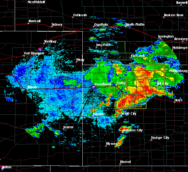 At 1220 am cdt, a severe thunderstorm was located 8 miles south of quinter, moving east at 35 mph (radar indicated). Hazards include 70 mph wind gusts and quarter size hail. Hail damage to vehicles is expected. expect considerable tree damage. wind damage is also likely to mobile homes, roofs, and outbuildings. locations impacted include, quinter, grainfield, gove and park. This includes interstate 70 in kansas between mile markers 95 and 112. At 1220 am cdt, a severe thunderstorm was located 8 miles south of quinter, moving east at 35 mph (radar indicated). Hazards include 70 mph wind gusts and quarter size hail. Hail damage to vehicles is expected. expect considerable tree damage. wind damage is also likely to mobile homes, roofs, and outbuildings. locations impacted include, quinter, grainfield, gove and park. This includes interstate 70 in kansas between mile markers 95 and 112.
|
| 8/11/2019 12:01 AM CDT |
 At 1201 am cdt, a severe thunderstorm was located near gove, moving east at 35 mph. this is a very dangerous storm (radar indicated). Hazards include 80 mph wind gusts and quarter size hail. Flying debris will be dangerous to those caught without shelter. mobile homes will be heavily damaged. expect considerable damage to roofs, windows, and vehicles. Extensive tree damage and power outages are likely. At 1201 am cdt, a severe thunderstorm was located near gove, moving east at 35 mph. this is a very dangerous storm (radar indicated). Hazards include 80 mph wind gusts and quarter size hail. Flying debris will be dangerous to those caught without shelter. mobile homes will be heavily damaged. expect considerable damage to roofs, windows, and vehicles. Extensive tree damage and power outages are likely.
|
| 7/5/2019 8:02 PM CDT |
 At 801 pm cdt, a severe thunderstorm was located 4 miles south of collyer, moving southeast at 25 mph (radar indicated). Hazards include ping pong ball size hail and 60 mph wind gusts. People and animals outdoors will be injured. expect hail damage to roofs, siding, windows, and vehicles. expect wind damage to roofs, siding, and trees. this severe thunderstorm will remain over mainly rural areas of northeastern gove county. This includes interstate 70 in kansas between mile markers 109 and 113. At 801 pm cdt, a severe thunderstorm was located 4 miles south of collyer, moving southeast at 25 mph (radar indicated). Hazards include ping pong ball size hail and 60 mph wind gusts. People and animals outdoors will be injured. expect hail damage to roofs, siding, windows, and vehicles. expect wind damage to roofs, siding, and trees. this severe thunderstorm will remain over mainly rural areas of northeastern gove county. This includes interstate 70 in kansas between mile markers 109 and 113.
|
| 7/5/2019 7:50 PM CDT |
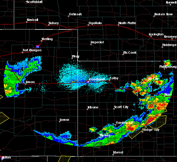 At 749 pm cdt, a severe thunderstorm was located near collyer, moving southeast at 15 mph (radar indicated). Hazards include golf ball size hail and 60 mph wind gusts. People and animals outdoors will be injured. expect hail damage to roofs, siding, windows, and vehicles. expect wind damage to roofs, siding, and trees. locations impacted include, quinter. This includes interstate 70 in kansas between mile markers 106 and 113. At 749 pm cdt, a severe thunderstorm was located near collyer, moving southeast at 15 mph (radar indicated). Hazards include golf ball size hail and 60 mph wind gusts. People and animals outdoors will be injured. expect hail damage to roofs, siding, windows, and vehicles. expect wind damage to roofs, siding, and trees. locations impacted include, quinter. This includes interstate 70 in kansas between mile markers 106 and 113.
|
| 7/5/2019 7:39 PM CDT |
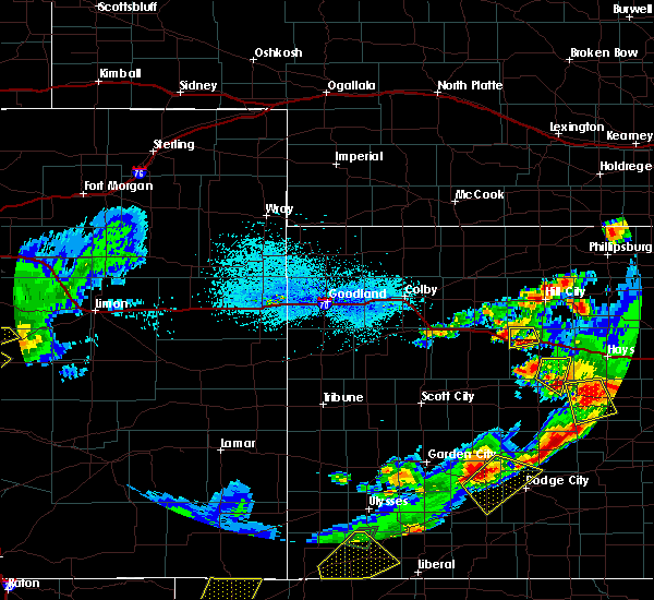 At 739 pm cdt, a severe thunderstorm was located near quinter, moving southeast at 15 mph (radar indicated). Hazards include ping pong ball size hail and 60 mph wind gusts. People and animals outdoors will be injured. expect hail damage to roofs, siding, windows, and vehicles. Expect wind damage to roofs, siding, and trees. At 739 pm cdt, a severe thunderstorm was located near quinter, moving southeast at 15 mph (radar indicated). Hazards include ping pong ball size hail and 60 mph wind gusts. People and animals outdoors will be injured. expect hail damage to roofs, siding, windows, and vehicles. Expect wind damage to roofs, siding, and trees.
|
| 6/26/2019 8:13 AM CDT |
 The severe thunderstorm warning for northeastern gove county will expire at 815 am cdt, the storm which prompted the warning has weakened below severe limits, and no longer poses an immediate threat to life or property. therefore, the warning will be allowed to expire. however gusty winds are still possible with this thunderstorm. The severe thunderstorm warning for northeastern gove county will expire at 815 am cdt, the storm which prompted the warning has weakened below severe limits, and no longer poses an immediate threat to life or property. therefore, the warning will be allowed to expire. however gusty winds are still possible with this thunderstorm.
|
| 6/26/2019 8:01 AM CDT |
 At 801 am cdt, a severe thunderstorm was located 11 miles southwest of collyer, moving northeast at 15 mph (radar indicated). Hazards include 60 mph wind gusts and quarter size hail. Hail damage to vehicles is expected. expect wind damage to roofs, siding, and trees. locations impacted include, quinter. This includes interstate 70 in kansas between mile markers 107 and 113. At 801 am cdt, a severe thunderstorm was located 11 miles southwest of collyer, moving northeast at 15 mph (radar indicated). Hazards include 60 mph wind gusts and quarter size hail. Hail damage to vehicles is expected. expect wind damage to roofs, siding, and trees. locations impacted include, quinter. This includes interstate 70 in kansas between mile markers 107 and 113.
|
| 6/26/2019 7:49 AM CDT |
 At 742 am cdt, a severe thunderstorm was located 12 miles southeast of gove, moving northeast at 15 mph (radar indicated). Hazards include 60 mph wind gusts and quarter size hail. Hail damage to vehicles is expected. expect wind damage to roofs, siding, and trees. locations impacted include, quinter. This includes interstate 70 in kansas between mile markers 105 and 113. At 742 am cdt, a severe thunderstorm was located 12 miles southeast of gove, moving northeast at 15 mph (radar indicated). Hazards include 60 mph wind gusts and quarter size hail. Hail damage to vehicles is expected. expect wind damage to roofs, siding, and trees. locations impacted include, quinter. This includes interstate 70 in kansas between mile markers 105 and 113.
|
| 6/26/2019 7:42 AM CDT |
 At 742 am cdt, a severe thunderstorm was located 12 miles southeast of gove, moving northeast at 15 mph (radar indicated). Hazards include 60 mph wind gusts and quarter size hail. Hail damage to vehicles is expected. expect wind damage to roofs, siding, and trees. locations impacted include, quinter. This includes interstate 70 in kansas between mile markers 105 and 113. At 742 am cdt, a severe thunderstorm was located 12 miles southeast of gove, moving northeast at 15 mph (radar indicated). Hazards include 60 mph wind gusts and quarter size hail. Hail damage to vehicles is expected. expect wind damage to roofs, siding, and trees. locations impacted include, quinter. This includes interstate 70 in kansas between mile markers 105 and 113.
|
| 6/26/2019 7:30 AM CDT |
 At 730 am cdt, a severe thunderstorm was located 11 miles southeast of gove, moving northeast at 10 mph (radar indicated). Hazards include 60 mph wind gusts and quarter size hail. Hail damage to vehicles is expected. Expect wind damage to roofs, siding, and trees. At 730 am cdt, a severe thunderstorm was located 11 miles southeast of gove, moving northeast at 10 mph (radar indicated). Hazards include 60 mph wind gusts and quarter size hail. Hail damage to vehicles is expected. Expect wind damage to roofs, siding, and trees.
|
| 6/23/2019 4:12 PM CDT |
 At 412 pm cdt, a severe thunderstorm was located 9 miles south of quinter, moving east at 40 mph (radar indicated). Hazards include quarter size hail. Damage to vehicles is expected. locations impacted include, quinter. This includes interstate 70 in kansas between mile markers 108 and 113. At 412 pm cdt, a severe thunderstorm was located 9 miles south of quinter, moving east at 40 mph (radar indicated). Hazards include quarter size hail. Damage to vehicles is expected. locations impacted include, quinter. This includes interstate 70 in kansas between mile markers 108 and 113.
|
| 6/23/2019 3:42 PM CDT |
 At 342 pm cdt, a severe thunderstorm was located 5 miles west of gove, moving east at 40 mph (radar indicated). Hazards include quarter size hail. damage to vehicles is expected At 342 pm cdt, a severe thunderstorm was located 5 miles west of gove, moving east at 40 mph (radar indicated). Hazards include quarter size hail. damage to vehicles is expected
|
| 6/21/2019 11:36 PM CDT |
 The severe thunderstorm warning for northeastern gove county will expire at 1145 pm cdt, the storms which prompted the warning have moved out of the area. therefore, the warning will be allowed to expire. a severe thunderstorm watch remains in effect until 500 am cdt for west central kansas. The severe thunderstorm warning for northeastern gove county will expire at 1145 pm cdt, the storms which prompted the warning have moved out of the area. therefore, the warning will be allowed to expire. a severe thunderstorm watch remains in effect until 500 am cdt for west central kansas.
|
| 6/21/2019 11:22 PM CDT |
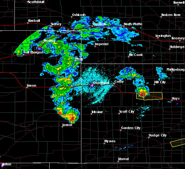 At 1122 pm cdt, severe thunderstorms were located along a line extending from 5 miles south of hoxie to 10 miles northeast of park to 4 miles south of quinter, moving northeast at 50 mph (radar indicated). Hazards include 60 mph wind gusts and quarter size hail. Hail damage to vehicles is expected. expect wind damage to roofs, siding, and trees. locations impacted include, quinter. This includes interstate 70 in kansas between mile markers 100 and 112. At 1122 pm cdt, severe thunderstorms were located along a line extending from 5 miles south of hoxie to 10 miles northeast of park to 4 miles south of quinter, moving northeast at 50 mph (radar indicated). Hazards include 60 mph wind gusts and quarter size hail. Hail damage to vehicles is expected. expect wind damage to roofs, siding, and trees. locations impacted include, quinter. This includes interstate 70 in kansas between mile markers 100 and 112.
|
| 6/21/2019 11:06 PM CDT |
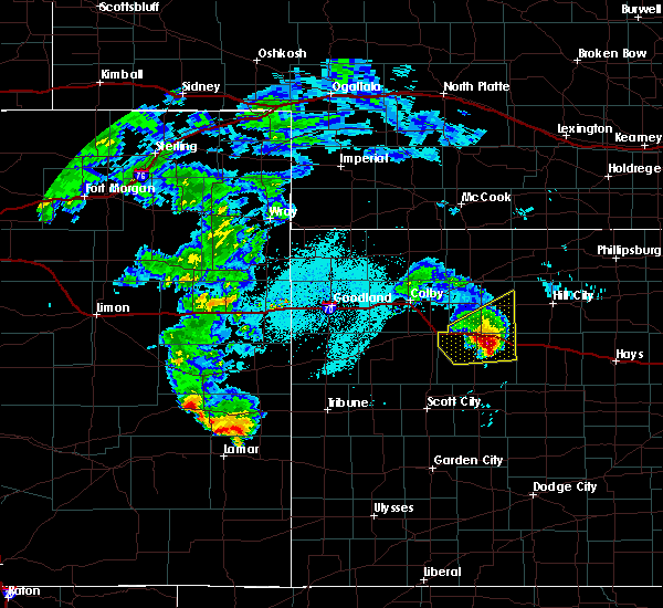 At 1106 pm cdt, severe thunderstorms were located along a line extending from 5 miles north of grinnell to near grainfield to 4 miles southeast of gove, moving northeast at 50 mph (radar indicated). Hazards include 60 mph wind gusts and quarter size hail. Hail damage to vehicles is expected. expect wind damage to roofs, siding, and trees. locations impacted include, quinter, grainfield, gove and park. This includes interstate 70 in kansas between mile markers 89 and 112. At 1106 pm cdt, severe thunderstorms were located along a line extending from 5 miles north of grinnell to near grainfield to 4 miles southeast of gove, moving northeast at 50 mph (radar indicated). Hazards include 60 mph wind gusts and quarter size hail. Hail damage to vehicles is expected. expect wind damage to roofs, siding, and trees. locations impacted include, quinter, grainfield, gove and park. This includes interstate 70 in kansas between mile markers 89 and 112.
|
| 6/21/2019 10:53 PM CDT |
 At 1052 pm cdt, severe thunderstorms were located along a line extending from 3 miles east of oakley to near grinnell to 8 miles southwest of gove, moving northeast at 50 mph (radar indicated). Hazards include 60 mph wind gusts and quarter size hail. Hail damage to vehicles is expected. Expect wind damage to roofs, siding, and trees. At 1052 pm cdt, severe thunderstorms were located along a line extending from 3 miles east of oakley to near grinnell to 8 miles southwest of gove, moving northeast at 50 mph (radar indicated). Hazards include 60 mph wind gusts and quarter size hail. Hail damage to vehicles is expected. Expect wind damage to roofs, siding, and trees.
|
| 6/21/2019 10:47 PM CDT |
 At 1047 pm cdt, severe thunderstorms were located along a line extending from 8 miles south of colby to 7 miles north of oakley to 5 miles northwest of gove to 9 miles north of healy, moving northeast at 60 mph (radar indicated). Hazards include 60 mph wind gusts and quarter size hail. Hail damage to vehicles is expected. expect wind damage to roofs, siding, and trees. locations impacted include, oakley, hoxie, quinter, grainfield, grinnell, gove and monument. This includes interstate 70 in kansas between mile markers 71 and 107. At 1047 pm cdt, severe thunderstorms were located along a line extending from 8 miles south of colby to 7 miles north of oakley to 5 miles northwest of gove to 9 miles north of healy, moving northeast at 60 mph (radar indicated). Hazards include 60 mph wind gusts and quarter size hail. Hail damage to vehicles is expected. expect wind damage to roofs, siding, and trees. locations impacted include, oakley, hoxie, quinter, grainfield, grinnell, gove and monument. This includes interstate 70 in kansas between mile markers 71 and 107.
|
| 6/21/2019 10:36 PM CDT |
 At 1035 pm cdt, severe thunderstorms were located along a line extending from 8 miles north of winona to 3 miles north of monument to 13 miles south of oakley to 3 miles east of scott state lake, moving east at 60 mph (radar indicated). Hazards include 70 mph wind gusts and ping pong ball size hail. People and animals outdoors will be injured. expect hail damage to roofs, siding, windows, and vehicles. expect considerable tree damage. wind damage is also likely to mobile homes, roofs, and outbuildings. locations impacted include, oakley, hoxie, quinter, grainfield, grinnell, gove and winona. This includes interstate 70 in kansas between mile markers 61 and 107. At 1035 pm cdt, severe thunderstorms were located along a line extending from 8 miles north of winona to 3 miles north of monument to 13 miles south of oakley to 3 miles east of scott state lake, moving east at 60 mph (radar indicated). Hazards include 70 mph wind gusts and ping pong ball size hail. People and animals outdoors will be injured. expect hail damage to roofs, siding, windows, and vehicles. expect considerable tree damage. wind damage is also likely to mobile homes, roofs, and outbuildings. locations impacted include, oakley, hoxie, quinter, grainfield, grinnell, gove and winona. This includes interstate 70 in kansas between mile markers 61 and 107.
|
| 6/21/2019 10:23 PM CDT |
 At 922 pm mdt/1022 pm cdt/, severe thunderstorms were located along a line extending from 16 miles south of brewster to 4 miles northeast of winona to 12 miles east of russell springs to 7 miles southwest of scott state lake, moving northeast at 60 mph (radar indicated). Hazards include 70 mph wind gusts and half dollar size hail. Hail damage to vehicles is expected. expect considerable tree damage. Wind damage is also likely to mobile homes, roofs, and outbuildings. At 922 pm mdt/1022 pm cdt/, severe thunderstorms were located along a line extending from 16 miles south of brewster to 4 miles northeast of winona to 12 miles east of russell springs to 7 miles southwest of scott state lake, moving northeast at 60 mph (radar indicated). Hazards include 70 mph wind gusts and half dollar size hail. Hail damage to vehicles is expected. expect considerable tree damage. Wind damage is also likely to mobile homes, roofs, and outbuildings.
|
| 6/14/2019 8:38 PM CDT |
 The severe thunderstorm warning for northeastern logan and gove counties will expire at 845 pm cdt, the storms which prompted the warning have weakened below severe limits, and no longer pose an immediate threat to life or property. therefore, the warning will be allowed to expire. however gusty winds and heavy rain are still possible with these thunderstorms. a severe thunderstorm watch remains in effect until 1000 pm cdt for west central kansas. The severe thunderstorm warning for northeastern logan and gove counties will expire at 845 pm cdt, the storms which prompted the warning have weakened below severe limits, and no longer pose an immediate threat to life or property. therefore, the warning will be allowed to expire. however gusty winds and heavy rain are still possible with these thunderstorms. a severe thunderstorm watch remains in effect until 1000 pm cdt for west central kansas.
|
| 6/14/2019 8:21 PM CDT |
 At 820 pm cdt, severe thunderstorms were located along a line extending from 7 miles southwest of hoxie to shields, moving east at 35 mph (radar indicated). Hazards include 60 mph wind gusts. Expect damage to roofs, siding, and trees. locations impacted include, oakley, quinter, grainfield, grinnell, gove, park and the monument rocks. This includes interstate 70 in kansas between mile markers 76 and 112. At 820 pm cdt, severe thunderstorms were located along a line extending from 7 miles southwest of hoxie to shields, moving east at 35 mph (radar indicated). Hazards include 60 mph wind gusts. Expect damage to roofs, siding, and trees. locations impacted include, oakley, quinter, grainfield, grinnell, gove, park and the monument rocks. This includes interstate 70 in kansas between mile markers 76 and 112.
|
| 6/14/2019 8:05 PM CDT |
 At 804 pm cdt, severe thunderstorms were located along a line extending from 8 miles north of grinnell to 3 miles east of healy, moving east at 35 mph (radar indicated). Hazards include 60 mph wind gusts. expect damage to roofs, siding, and trees At 804 pm cdt, severe thunderstorms were located along a line extending from 8 miles north of grinnell to 3 miles east of healy, moving east at 35 mph (radar indicated). Hazards include 60 mph wind gusts. expect damage to roofs, siding, and trees
|
| 6/9/2019 12:29 AM CDT |
 At 1211 am cdt, severe thunderstorms were located along a line extending from 3 miles northwest of quinter to 6 miles southeast of gove to 6 miles north of healy, moving east at 45 mph (emergency management). Hazards include 60 mph wind gusts. expect damage to roofs, siding, and trees At 1211 am cdt, severe thunderstorms were located along a line extending from 3 miles northwest of quinter to 6 miles southeast of gove to 6 miles north of healy, moving east at 45 mph (emergency management). Hazards include 60 mph wind gusts. expect damage to roofs, siding, and trees
|
| 6/9/2019 12:11 AM CDT |
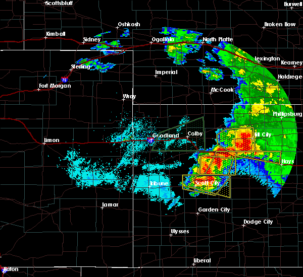 At 1211 am cdt, severe thunderstorms were located along a line extending from 3 miles northwest of quinter to 6 miles southeast of gove to 6 miles north of healy, moving east at 45 mph (emergency management). Hazards include 60 mph wind gusts. expect damage to roofs, siding, and trees At 1211 am cdt, severe thunderstorms were located along a line extending from 3 miles northwest of quinter to 6 miles southeast of gove to 6 miles north of healy, moving east at 45 mph (emergency management). Hazards include 60 mph wind gusts. expect damage to roofs, siding, and trees
|
| 6/9/2019 12:09 AM CDT | Storm damage reported in gove county KS, 0.4 miles SSE of Quinter, KS |
| 5/28/2019 7:14 PM CDT |
 At 714 pm cdt, a severe thunderstorm was located 5 miles north of voda, moving northeast at 35 mph (radar indicated). Hazards include ping pong ball size hail and 60 mph wind gusts. People and animals outdoors will be injured. expect hail damage to roofs, siding, windows, and vehicles. expect wind damage to roofs, siding, and trees. locations impacted include, quinter and saint peter. This includes interstate 70 in kansas between mile markers 106 and 113. At 714 pm cdt, a severe thunderstorm was located 5 miles north of voda, moving northeast at 35 mph (radar indicated). Hazards include ping pong ball size hail and 60 mph wind gusts. People and animals outdoors will be injured. expect hail damage to roofs, siding, windows, and vehicles. expect wind damage to roofs, siding, and trees. locations impacted include, quinter and saint peter. This includes interstate 70 in kansas between mile markers 106 and 113.
|
| 5/28/2019 7:05 PM CDT |
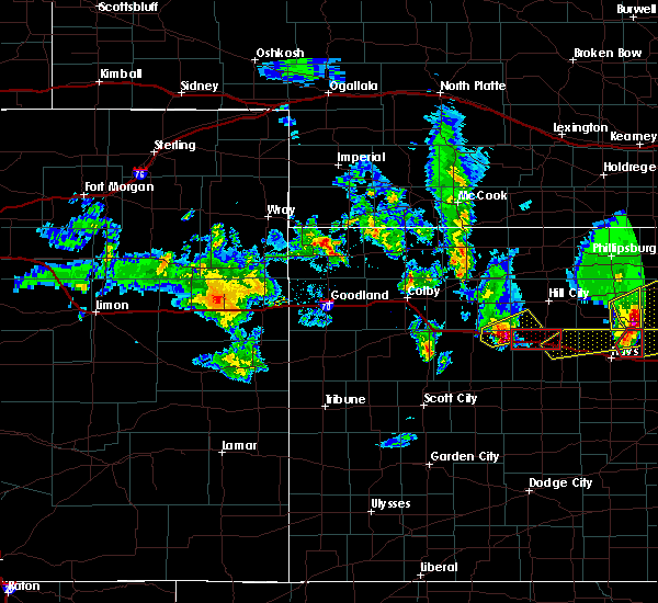 At 704 pm cdt, a severe thunderstorm was located near collyer, moving east at 40 mph (radar indicated). Hazards include ping pong ball size hail and 60 mph wind gusts. People and animals outdoors will be injured. expect hail damage to roofs, siding, windows, and vehicles. expect wind damage to roofs, siding, and trees. locations impacted include, quinter, park and saint peter. This includes interstate 70 in kansas between mile markers 99 and 113. At 704 pm cdt, a severe thunderstorm was located near collyer, moving east at 40 mph (radar indicated). Hazards include ping pong ball size hail and 60 mph wind gusts. People and animals outdoors will be injured. expect hail damage to roofs, siding, windows, and vehicles. expect wind damage to roofs, siding, and trees. locations impacted include, quinter, park and saint peter. This includes interstate 70 in kansas between mile markers 99 and 113.
|
| 5/28/2019 6:57 PM CDT |
 At 645 pm cdt, a severe thunderstorm was located near park, or 5 miles west of quinter, moving northeast at 35 mph (radar indicated). Hazards include 60 mph wind gusts and quarter size hail. Hail damage to vehicles is expected. Expect wind damage to roofs, siding, and trees. At 645 pm cdt, a severe thunderstorm was located near park, or 5 miles west of quinter, moving northeast at 35 mph (radar indicated). Hazards include 60 mph wind gusts and quarter size hail. Hail damage to vehicles is expected. Expect wind damage to roofs, siding, and trees.
|
| 5/28/2019 6:45 PM CDT |
 At 645 pm cdt, a severe thunderstorm was located near park, or 5 miles west of quinter, moving northeast at 35 mph (radar indicated). Hazards include 60 mph wind gusts and quarter size hail. Hail damage to vehicles is expected. Expect wind damage to roofs, siding, and trees. At 645 pm cdt, a severe thunderstorm was located near park, or 5 miles west of quinter, moving northeast at 35 mph (radar indicated). Hazards include 60 mph wind gusts and quarter size hail. Hail damage to vehicles is expected. Expect wind damage to roofs, siding, and trees.
|
| 4/28/2019 8:37 PM CDT |
 The severe thunderstorm warning for gove county will expire at 845 pm cdt, the storm which prompted the warning has weakened below severe limits, and has exited the warned area. therefore, the warning will be allowed to expire. a severe thunderstorm watch remains in effect until 1100 pm cdt for west central kansas. The severe thunderstorm warning for gove county will expire at 845 pm cdt, the storm which prompted the warning has weakened below severe limits, and has exited the warned area. therefore, the warning will be allowed to expire. a severe thunderstorm watch remains in effect until 1100 pm cdt for west central kansas.
|
| 4/28/2019 8:28 PM CDT |
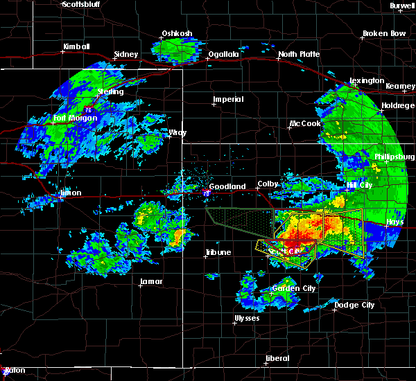 At 828 pm cdt, a severe thunderstorm was located 8 miles north of arnold, moving east at 55 mph (radar indicated). Hazards include 60 mph wind gusts and quarter size hail. Hail damage to vehicles is expected. expect wind damage to roofs, siding, and trees. locations impacted include, quinter, gove and the monument rocks. This includes interstate 70 in kansas between mile markers 108 and 113. At 828 pm cdt, a severe thunderstorm was located 8 miles north of arnold, moving east at 55 mph (radar indicated). Hazards include 60 mph wind gusts and quarter size hail. Hail damage to vehicles is expected. expect wind damage to roofs, siding, and trees. locations impacted include, quinter, gove and the monument rocks. This includes interstate 70 in kansas between mile markers 108 and 113.
|
| 4/28/2019 8:05 PM CDT |
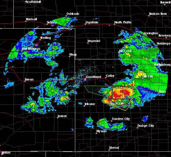 At 805 pm cdt, a severe thunderstorm was located 10 miles south of gove, moving east at 55 mph (radar indicated). Hazards include 60 mph wind gusts and quarter size hail. Hail damage to vehicles is expected. expect wind damage to roofs, siding, and trees. locations impacted include, quinter, gove and the monument rocks. This includes interstate 70 in kansas between mile markers 108 and 113. At 805 pm cdt, a severe thunderstorm was located 10 miles south of gove, moving east at 55 mph (radar indicated). Hazards include 60 mph wind gusts and quarter size hail. Hail damage to vehicles is expected. expect wind damage to roofs, siding, and trees. locations impacted include, quinter, gove and the monument rocks. This includes interstate 70 in kansas between mile markers 108 and 113.
|
| 4/28/2019 7:49 PM CDT |
 At 749 pm cdt, a severe thunderstorm was located 14 miles northeast of scott state lake, moving east at 55 mph (radar indicated). Hazards include 70 mph wind gusts and ping pong ball size hail. People and animals outdoors will be injured. expect hail damage to roofs, siding, windows, and vehicles. expect considerable tree damage. Wind damage is also likely to mobile homes, roofs, and outbuildings. At 749 pm cdt, a severe thunderstorm was located 14 miles northeast of scott state lake, moving east at 55 mph (radar indicated). Hazards include 70 mph wind gusts and ping pong ball size hail. People and animals outdoors will be injured. expect hail damage to roofs, siding, windows, and vehicles. expect considerable tree damage. Wind damage is also likely to mobile homes, roofs, and outbuildings.
|
| 4/28/2019 7:25 PM CDT |
 At 624 pm mdt/724 pm cdt/, severe thunderstorms were located along a line extending from monument to 14 miles southeast of wallace, moving east at 35 mph (radar indicated). Hazards include 70 mph wind gusts and ping pong ball size hail. People and animals outdoors will be injured. expect hail damage to roofs, siding, windows, and vehicles. expect considerable tree damage. wind damage is also likely to mobile homes, roofs, and outbuildings. locations impacted include, oakley, quinter, sharon springs, grainfield, grinnell, gove and winona. This includes interstate 70 in kansas between mile markers 73 and 112. At 624 pm mdt/724 pm cdt/, severe thunderstorms were located along a line extending from monument to 14 miles southeast of wallace, moving east at 35 mph (radar indicated). Hazards include 70 mph wind gusts and ping pong ball size hail. People and animals outdoors will be injured. expect hail damage to roofs, siding, windows, and vehicles. expect considerable tree damage. wind damage is also likely to mobile homes, roofs, and outbuildings. locations impacted include, oakley, quinter, sharon springs, grainfield, grinnell, gove and winona. This includes interstate 70 in kansas between mile markers 73 and 112.
|
| 4/28/2019 7:02 PM CDT |
 At 601 pm mdt/701 pm cdt/, severe thunderstorms were located along a line extending from near winona to 14 miles south of sharon springs, moving east at 35 mph (radar indicated). Hazards include 70 mph wind gusts and ping pong ball size hail. blowing dust. People and animals outdoors will be injured. expect hail damage to roofs, siding, windows, and vehicles. expect considerable tree damage. Wind damage is also likely to mobile homes, roofs, and outbuildings. At 601 pm mdt/701 pm cdt/, severe thunderstorms were located along a line extending from near winona to 14 miles south of sharon springs, moving east at 35 mph (radar indicated). Hazards include 70 mph wind gusts and ping pong ball size hail. blowing dust. People and animals outdoors will be injured. expect hail damage to roofs, siding, windows, and vehicles. expect considerable tree damage. Wind damage is also likely to mobile homes, roofs, and outbuildings.
|
| 4/21/2019 6:57 PM CDT |
 At 657 pm cdt, a severe thunderstorm was located 9 miles north of collyer, moving northeast at 30 mph (radar indicated). Hazards include 60 mph wind gusts and quarter size hail. Expect wind damage to roofs, siding, and trees. locations impacted include, hill city, quinter, morland, penokee, saint peter and studley. This includes interstate 70 in kansas between mile markers 101 and 113. At 657 pm cdt, a severe thunderstorm was located 9 miles north of collyer, moving northeast at 30 mph (radar indicated). Hazards include 60 mph wind gusts and quarter size hail. Expect wind damage to roofs, siding, and trees. locations impacted include, hill city, quinter, morland, penokee, saint peter and studley. This includes interstate 70 in kansas between mile markers 101 and 113.
|
| 4/21/2019 6:41 PM CDT |
 At 641 pm cdt, a severe thunderstorm was located near quinter, moving northeast at 30 mph (radar indicated). Hazards include 60 mph wind gusts and quarter size hail. Expect wind damage to roofs, siding, and trees. hail damage to vehicles will be possible. locations impacted include, hill city, quinter, grainfield, gove, morland, park and studley. This includes interstate 70 in kansas between mile markers 94 and 112. At 641 pm cdt, a severe thunderstorm was located near quinter, moving northeast at 30 mph (radar indicated). Hazards include 60 mph wind gusts and quarter size hail. Expect wind damage to roofs, siding, and trees. hail damage to vehicles will be possible. locations impacted include, hill city, quinter, grainfield, gove, morland, park and studley. This includes interstate 70 in kansas between mile markers 94 and 112.
|
| 4/21/2019 6:30 PM CDT | Also occurred with nickel to half dollar size hai in gove county KS, 6.2 miles NNE of Quinter, KS |
| 4/21/2019 6:30 PM CDT | Half Dollar sized hail reported 6.2 miles NNE of Quinter, KS, hail ranged from nickel/quarter size to half dollar. occurred with 60 mph gusts. |
| 4/21/2019 6:12 PM CDT |
 At 611 pm cdt, a severe thunderstorm was located near gove, moving northeast at 35 mph (radar indicated). Hazards include 60 mph wind gusts and quarter size hail. Expect wind damage to roofs, siding, and trees. Hail damage to vehicles will be possible. At 611 pm cdt, a severe thunderstorm was located near gove, moving northeast at 35 mph (radar indicated). Hazards include 60 mph wind gusts and quarter size hail. Expect wind damage to roofs, siding, and trees. Hail damage to vehicles will be possible.
|
| 9/2/2018 6:50 PM CDT |
 The severe thunderstorm warning for eastern gove county will expire at 700 pm cdt, the storm which prompted the warning has weakened below severe limits, and no longer poses an immediate threat to life or property. therefore, the warning will be allowed to expire. however small hail, gusty winds and heavy rain are still possible with this thunderstorm. The severe thunderstorm warning for eastern gove county will expire at 700 pm cdt, the storm which prompted the warning has weakened below severe limits, and no longer poses an immediate threat to life or property. therefore, the warning will be allowed to expire. however small hail, gusty winds and heavy rain are still possible with this thunderstorm.
|
| 9/2/2018 6:19 PM CDT |
 At 619 pm cdt, a severe thunderstorm was located 7 miles southeast of gove, moving northeast at 20 mph (radar indicated). Hazards include two inch hail and 60 mph wind gusts. People and animals outdoors will be injured. expect hail damage to roofs, siding, windows, and vehicles. Expect wind damage to roofs, siding, and trees. At 619 pm cdt, a severe thunderstorm was located 7 miles southeast of gove, moving northeast at 20 mph (radar indicated). Hazards include two inch hail and 60 mph wind gusts. People and animals outdoors will be injured. expect hail damage to roofs, siding, windows, and vehicles. Expect wind damage to roofs, siding, and trees.
|
| 8/31/2018 10:10 PM CDT |
 The national weather service in goodland has issued a * severe thunderstorm warning for. southeastern sheridan county in northwestern kansas. northeastern gove county in west central kansas. southwestern graham county in northwestern kansas. Until 1045 pm cdt. The national weather service in goodland has issued a * severe thunderstorm warning for. southeastern sheridan county in northwestern kansas. northeastern gove county in west central kansas. southwestern graham county in northwestern kansas. Until 1045 pm cdt.
|
| 8/31/2018 10:02 PM CDT |
 At 946 pm cdt, a severe thunderstorm was located 5 miles northwest of gove, moving northeast at 30 mph (radar indicated). Hazards include two inch hail and 70 mph wind gusts. People and animals outdoors will be injured. expect hail damage to roofs, siding, windows, and vehicles. expect considerable tree damage. wind damage is also likely to mobile homes, roofs, and outbuildings. locations impacted include, quinter, grainfield, grinnell, gove, park and angelus. This includes interstate 70 in kansas between mile markers 80 and 109. At 946 pm cdt, a severe thunderstorm was located 5 miles northwest of gove, moving northeast at 30 mph (radar indicated). Hazards include two inch hail and 70 mph wind gusts. People and animals outdoors will be injured. expect hail damage to roofs, siding, windows, and vehicles. expect considerable tree damage. wind damage is also likely to mobile homes, roofs, and outbuildings. locations impacted include, quinter, grainfield, grinnell, gove, park and angelus. This includes interstate 70 in kansas between mile markers 80 and 109.
|
| 8/31/2018 9:46 PM CDT |
 At 946 pm cdt, a severe thunderstorm was located 5 miles northwest of gove, moving northeast at 30 mph (radar indicated). Hazards include two inch hail and 70 mph wind gusts. People and animals outdoors will be injured. expect hail damage to roofs, siding, windows, and vehicles. expect considerable tree damage. wind damage is also likely to mobile homes, roofs, and outbuildings. locations impacted include, quinter, grainfield, grinnell, gove, park and angelus. This includes interstate 70 in kansas between mile markers 80 and 109. At 946 pm cdt, a severe thunderstorm was located 5 miles northwest of gove, moving northeast at 30 mph (radar indicated). Hazards include two inch hail and 70 mph wind gusts. People and animals outdoors will be injured. expect hail damage to roofs, siding, windows, and vehicles. expect considerable tree damage. wind damage is also likely to mobile homes, roofs, and outbuildings. locations impacted include, quinter, grainfield, grinnell, gove, park and angelus. This includes interstate 70 in kansas between mile markers 80 and 109.
|
| 8/31/2018 9:39 PM CDT |
 At 939 pm cdt, a severe thunderstorm was located 7 miles west of gove, moving northeast at 30 mph (radar indicated). Hazards include two inch hail and 70 mph wind gusts. People and animals outdoors will be injured. expect hail damage to roofs, siding, windows, and vehicles. expect considerable tree damage. Wind damage is also likely to mobile homes, roofs, and outbuildings. At 939 pm cdt, a severe thunderstorm was located 7 miles west of gove, moving northeast at 30 mph (radar indicated). Hazards include two inch hail and 70 mph wind gusts. People and animals outdoors will be injured. expect hail damage to roofs, siding, windows, and vehicles. expect considerable tree damage. Wind damage is also likely to mobile homes, roofs, and outbuildings.
|
| 8/5/2018 5:55 PM CDT |
 The severe thunderstorm warning for northeastern gove county will expire at 600 pm cdt, the severe thunderstorm which prompted the warning has weakened. therefore, the warning will be allowed to expire. The severe thunderstorm warning for northeastern gove county will expire at 600 pm cdt, the severe thunderstorm which prompted the warning has weakened. therefore, the warning will be allowed to expire.
|
| 8/5/2018 5:46 PM CDT |
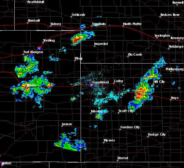 At 546 pm cdt, a severe thunderstorm was located over quinter, moving east at 35 mph (radar indicated). Hazards include 60 mph wind gusts and quarter size hail. Hail damage to vehicles is expected. expect wind damage to roofs, siding, and trees. locations impacted include, quinter and park. This includes interstate 70 in kansas between mile markers 100 and 113. At 546 pm cdt, a severe thunderstorm was located over quinter, moving east at 35 mph (radar indicated). Hazards include 60 mph wind gusts and quarter size hail. Hail damage to vehicles is expected. expect wind damage to roofs, siding, and trees. locations impacted include, quinter and park. This includes interstate 70 in kansas between mile markers 100 and 113.
|
| 8/5/2018 5:45 PM CDT | Tree uprooted and roof blown off a hous in gove county KS, 0.4 miles SSE of Quinter, KS |
| 8/5/2018 5:37 PM CDT |
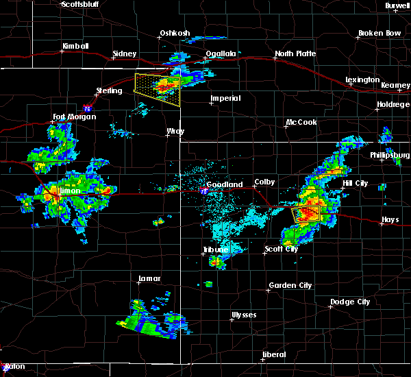 At 537 pm cdt, a severe thunderstorm was located near collyer, moving east at 40 mph (radar indicated). Hazards include 60 mph wind gusts and quarter size hail. Hail damage to vehicles is expected. expect wind damage to roofs, siding, and trees. locations impacted include, quinter, gove and park. This includes interstate 70 in kansas between mile markers 96 and 113. At 537 pm cdt, a severe thunderstorm was located near collyer, moving east at 40 mph (radar indicated). Hazards include 60 mph wind gusts and quarter size hail. Hail damage to vehicles is expected. expect wind damage to roofs, siding, and trees. locations impacted include, quinter, gove and park. This includes interstate 70 in kansas between mile markers 96 and 113.
|
| 8/5/2018 5:07 PM CDT |
 At 507 pm cdt, a severe thunderstorm was located near gove, moving east at 40 mph (radar indicated). Hazards include 60 mph wind gusts and quarter size hail. Hail damage to vehicles is expected. Expect wind damage to roofs, siding, and trees. At 507 pm cdt, a severe thunderstorm was located near gove, moving east at 40 mph (radar indicated). Hazards include 60 mph wind gusts and quarter size hail. Hail damage to vehicles is expected. Expect wind damage to roofs, siding, and trees.
|
| 7/15/2018 7:50 PM CDT | Report of spare tire being moved 20 to 30 feet by the win in gove county KS, 10.6 miles N of Quinter, KS |
| 6/30/2018 10:55 PM CDT |
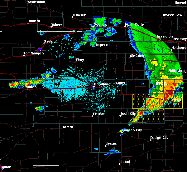 The severe thunderstorm warning for eastern gove county will expire at 1100 pm cdt, the storms which prompted the warning have moved out of the area. therefore, the warning will be allowed to expire. however gusty winds are still possible with these thunderstorms. a severe thunderstorm watch remains in effect until midnight cdt for west central kansas. The severe thunderstorm warning for eastern gove county will expire at 1100 pm cdt, the storms which prompted the warning have moved out of the area. therefore, the warning will be allowed to expire. however gusty winds are still possible with these thunderstorms. a severe thunderstorm watch remains in effect until midnight cdt for west central kansas.
|
| 6/30/2018 10:39 PM CDT |
 At 1039 pm cdt, severe thunderstorms were located along a line extending from collyer to pendennis, moving southeast at 25 mph (radar indicated). Hazards include 60 mph wind gusts. Expect damage to roofs, siding, and trees. locations impacted include, quinter, grainfield, gove and park. This includes interstate 70 in kansas between mile markers 91 and 112. At 1039 pm cdt, severe thunderstorms were located along a line extending from collyer to pendennis, moving southeast at 25 mph (radar indicated). Hazards include 60 mph wind gusts. Expect damage to roofs, siding, and trees. locations impacted include, quinter, grainfield, gove and park. This includes interstate 70 in kansas between mile markers 91 and 112.
|
| 6/30/2018 10:13 PM CDT | Measured 60-70 mph wind gusts as storm first moved throug in gove county KS, 5.6 miles WNW of Quinter, KS |
| 6/30/2018 10:11 PM CDT |
 At 1011 pm cdt, severe thunderstorms were located along a line extending from 6 miles south of lenora to 8 miles north of shields, moving east at 45 mph (radar indicated). Hazards include 60 mph wind gusts. expect damage to roofs, siding, and trees At 1011 pm cdt, severe thunderstorms were located along a line extending from 6 miles south of lenora to 8 miles north of shields, moving east at 45 mph (radar indicated). Hazards include 60 mph wind gusts. expect damage to roofs, siding, and trees
|
| 6/30/2018 9:21 PM CDT |
 At 921 pm cdt, a severe thunderstorm was located 5 miles southeast of oakley, moving east at 50 mph (radar indicated). Hazards include 60 mph wind gusts. expect damage to roofs, siding, and trees At 921 pm cdt, a severe thunderstorm was located 5 miles southeast of oakley, moving east at 50 mph (radar indicated). Hazards include 60 mph wind gusts. expect damage to roofs, siding, and trees
|
| 6/24/2018 8:15 PM CDT |
 At 814 pm cdt, severe thunderstorms were located along a line extending from 4 miles north of almena to 4 miles southwest of hill city to 3 miles north of arnold, moving east at 55 mph (radar indicated). Hazards include 60 mph wind gusts. Expect damage to roofs, siding, and trees. locations impacted include, norton, hill city, quinter, almena, lenora, morland and norcatur. This includes interstate 70 in kansas between mile markers 102 and 112. At 814 pm cdt, severe thunderstorms were located along a line extending from 4 miles north of almena to 4 miles southwest of hill city to 3 miles north of arnold, moving east at 55 mph (radar indicated). Hazards include 60 mph wind gusts. Expect damage to roofs, siding, and trees. locations impacted include, norton, hill city, quinter, almena, lenora, morland and norcatur. This includes interstate 70 in kansas between mile markers 102 and 112.
|
| 6/24/2018 7:53 PM CDT |
 At 753 pm cdt, severe thunderstorms were located along a line extending from 10 miles north of norton to near morland to 5 miles northeast of pendennis, moving east at 35 mph (radar indicated). Hazards include 70 mph wind gusts. Expect considerable tree damage. Damage is likely to mobile homes, roofs, and outbuildings. At 753 pm cdt, severe thunderstorms were located along a line extending from 10 miles north of norton to near morland to 5 miles northeast of pendennis, moving east at 35 mph (radar indicated). Hazards include 70 mph wind gusts. Expect considerable tree damage. Damage is likely to mobile homes, roofs, and outbuildings.
|
| 6/24/2018 7:40 PM CDT |
 At 739 pm cdt, severe thunderstorms were located along a line extending from 5 miles northeast of norcatur to 9 miles east of hoxie to 4 miles east of gove, moving east at 35 mph (radar indicated). Hazards include 70 mph wind gusts. Expect considerable tree damage. damage is likely to mobile homes, roofs, and outbuildings. locations impacted include, norton, hill city, hoxie, quinter, grainfield, grinnell and gove. This includes interstate 70 in kansas between mile markers 85 and 113. At 739 pm cdt, severe thunderstorms were located along a line extending from 5 miles northeast of norcatur to 9 miles east of hoxie to 4 miles east of gove, moving east at 35 mph (radar indicated). Hazards include 70 mph wind gusts. Expect considerable tree damage. damage is likely to mobile homes, roofs, and outbuildings. locations impacted include, norton, hill city, hoxie, quinter, grainfield, grinnell and gove. This includes interstate 70 in kansas between mile markers 85 and 113.
|
| 6/24/2018 7:25 PM CDT |
 At 725 pm cdt, severe thunderstorms were located along a line extending from 6 miles northwest of norcatur to near hoxie to 4 miles west of gove, moving east at 35 mph (radar indicated). Hazards include 70 mph wind gusts and quarter size hail. Hail damage to vehicles is expected. expect considerable tree damage. wind damage is also likely to mobile homes, roofs, and outbuildings. locations impacted include, norton, oakley, oberlin, hill city, hoxie, quinter and grainfield. This includes interstate 70 in kansas between mile markers 73 and 113. At 725 pm cdt, severe thunderstorms were located along a line extending from 6 miles northwest of norcatur to near hoxie to 4 miles west of gove, moving east at 35 mph (radar indicated). Hazards include 70 mph wind gusts and quarter size hail. Hail damage to vehicles is expected. expect considerable tree damage. wind damage is also likely to mobile homes, roofs, and outbuildings. locations impacted include, norton, oakley, oberlin, hill city, hoxie, quinter and grainfield. This includes interstate 70 in kansas between mile markers 73 and 113.
|
| 6/24/2018 7:12 PM CDT |
 At 711 pm cdt, severe thunderstorms were located along a line extending from 6 miles north of oberlin to near menlo to 10 miles south of oakley, moving east at 45 mph (radar indicated). Hazards include 70 mph wind gusts and quarter size hail. Hail damage to vehicles is expected. expect considerable tree damage. wind damage is also likely to mobile homes, roofs, and outbuildings. locations impacted include, norton, oakley, oberlin, hill city, hoxie, quinter and grainfield. This includes interstate 70 in kansas between mile markers 73 and 113. At 711 pm cdt, severe thunderstorms were located along a line extending from 6 miles north of oberlin to near menlo to 10 miles south of oakley, moving east at 45 mph (radar indicated). Hazards include 70 mph wind gusts and quarter size hail. Hail damage to vehicles is expected. expect considerable tree damage. wind damage is also likely to mobile homes, roofs, and outbuildings. locations impacted include, norton, oakley, oberlin, hill city, hoxie, quinter and grainfield. This includes interstate 70 in kansas between mile markers 73 and 113.
|
| 6/24/2018 7:00 PM CDT |
 At 659 pm cdt, severe thunderstorms were located along a line extending from 6 miles north of oberlin to near menlo to 9 miles south of oakley, moving east at 50 mph (radar indicated). Hazards include 60 mph wind gusts and quarter size hail. Hail damage to vehicles is expected. Expect wind damage to roofs, siding, and trees. At 659 pm cdt, severe thunderstorms were located along a line extending from 6 miles north of oberlin to near menlo to 9 miles south of oakley, moving east at 50 mph (radar indicated). Hazards include 60 mph wind gusts and quarter size hail. Hail damage to vehicles is expected. Expect wind damage to roofs, siding, and trees.
|
| 6/23/2018 7:22 PM CDT |
 At 722 pm cdt, a severe thunderstorm was located near collyer, moving east at 30 mph (radar indicated). Hazards include 60 mph wind gusts and quarter size hail. Hail damage to vehicles is expected. expect wind damage to roofs, siding, and trees. locations impacted include, quinter and saint peter. This includes interstate 70 in kansas between mile markers 102 and 113. At 722 pm cdt, a severe thunderstorm was located near collyer, moving east at 30 mph (radar indicated). Hazards include 60 mph wind gusts and quarter size hail. Hail damage to vehicles is expected. expect wind damage to roofs, siding, and trees. locations impacted include, quinter and saint peter. This includes interstate 70 in kansas between mile markers 102 and 113.
|
| 6/23/2018 7:13 PM CDT |
 At 713 pm cdt, a severe thunderstorm was located near quinter, moving east at 30 mph (radar indicated). Hazards include 60 mph wind gusts and quarter size hail. Hail damage to vehicles is expected. Expect wind damage to roofs, siding, and trees. At 713 pm cdt, a severe thunderstorm was located near quinter, moving east at 30 mph (radar indicated). Hazards include 60 mph wind gusts and quarter size hail. Hail damage to vehicles is expected. Expect wind damage to roofs, siding, and trees.
|
| 6/23/2018 6:58 PM CDT |
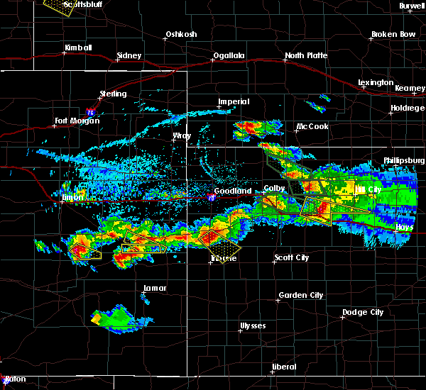 At 657 pm cdt, a severe thunderstorm was located near quinter, moving east at 30 mph (trained weather spotters). Hazards include ping pong ball size hail and 60 mph wind gusts. People and animals outdoors will be injured. expect hail damage to roofs, siding, windows, and vehicles. expect wind damage to roofs, siding, and trees. locations impacted include, quinter, grainfield, park and saint peter. This includes interstate 70 in kansas between mile markers 90 and 113. At 657 pm cdt, a severe thunderstorm was located near quinter, moving east at 30 mph (trained weather spotters). Hazards include ping pong ball size hail and 60 mph wind gusts. People and animals outdoors will be injured. expect hail damage to roofs, siding, windows, and vehicles. expect wind damage to roofs, siding, and trees. locations impacted include, quinter, grainfield, park and saint peter. This includes interstate 70 in kansas between mile markers 90 and 113.
|
| 6/23/2018 6:42 PM CDT |
 At 642 pm cdt, a severe thunderstorm was located over park, or 4 miles east of grainfield, moving southeast at 25 mph (trained weather spotters). Hazards include golf ball size hail and 60 mph wind gusts. People and animals outdoors will be injured. expect hail damage to roofs, siding, windows, and vehicles. expect wind damage to roofs, siding, and trees. locations impacted include, quinter, grainfield, park and saint peter. This includes interstate 70 in kansas between mile markers 90 and 113. At 642 pm cdt, a severe thunderstorm was located over park, or 4 miles east of grainfield, moving southeast at 25 mph (trained weather spotters). Hazards include golf ball size hail and 60 mph wind gusts. People and animals outdoors will be injured. expect hail damage to roofs, siding, windows, and vehicles. expect wind damage to roofs, siding, and trees. locations impacted include, quinter, grainfield, park and saint peter. This includes interstate 70 in kansas between mile markers 90 and 113.
|
| 6/23/2018 6:34 PM CDT |
 At 634 pm cdt, a severe thunderstorm was located over grainfield, moving east at 25 mph (trained weather spotters). Hazards include ping pong ball size hail and 60 mph wind gusts. People and animals outdoors will be injured. expect hail damage to roofs, siding, windows, and vehicles. Expect wind damage to roofs, siding, and trees. At 634 pm cdt, a severe thunderstorm was located over grainfield, moving east at 25 mph (trained weather spotters). Hazards include ping pong ball size hail and 60 mph wind gusts. People and animals outdoors will be injured. expect hail damage to roofs, siding, windows, and vehicles. Expect wind damage to roofs, siding, and trees.
|
| 6/23/2018 6:13 PM CDT |
 At 613 pm cdt, a severe thunderstorm was located 4 miles northeast of grinnell, moving east at 20 mph (radar indicated). Hazards include ping pong ball size hail and 60 mph wind gusts. People and animals outdoors will be injured. expect hail damage to roofs, siding, windows, and vehicles. expect wind damage to roofs, siding, and trees. locations impacted include, quinter, grainfield, grinnell, park, angelus and saint peter. This includes interstate 70 in kansas between mile markers 84 and 113. At 613 pm cdt, a severe thunderstorm was located 4 miles northeast of grinnell, moving east at 20 mph (radar indicated). Hazards include ping pong ball size hail and 60 mph wind gusts. People and animals outdoors will be injured. expect hail damage to roofs, siding, windows, and vehicles. expect wind damage to roofs, siding, and trees. locations impacted include, quinter, grainfield, grinnell, park, angelus and saint peter. This includes interstate 70 in kansas between mile markers 84 and 113.
|
| 6/23/2018 5:55 PM CDT |
 At 554 pm cdt, a severe thunderstorm was located near grainfield, moving east at 20 mph (radar indicated). Hazards include golf ball size hail and 60 mph wind gusts. People and animals outdoors will be injured. expect hail damage to roofs, siding, windows, and vehicles. expect wind damage to roofs, siding, and trees. locations impacted include, quinter, grainfield, grinnell, park, angelus and saint peter. This includes interstate 70 in kansas between mile markers 83 and 113. At 554 pm cdt, a severe thunderstorm was located near grainfield, moving east at 20 mph (radar indicated). Hazards include golf ball size hail and 60 mph wind gusts. People and animals outdoors will be injured. expect hail damage to roofs, siding, windows, and vehicles. expect wind damage to roofs, siding, and trees. locations impacted include, quinter, grainfield, grinnell, park, angelus and saint peter. This includes interstate 70 in kansas between mile markers 83 and 113.
|
| 6/23/2018 5:44 PM CDT |
 At 544 pm cdt, a severe thunderstorm was located 4 miles northwest of grainfield, moving east at 25 mph (radar indicated). Hazards include 60 mph wind gusts and half dollar size hail. Hail damage to vehicles is expected. Expect wind damage to roofs, siding, and trees. At 544 pm cdt, a severe thunderstorm was located 4 miles northwest of grainfield, moving east at 25 mph (radar indicated). Hazards include 60 mph wind gusts and half dollar size hail. Hail damage to vehicles is expected. Expect wind damage to roofs, siding, and trees.
|
| 6/22/2018 5:21 PM CDT |
 At 520 pm cdt, severe thunderstorms were located along a line extending from 8 miles northeast of hoxie to 7 miles north of collyer to 9 miles north of shields, moving east at 40 mph (trained weather spotters. at 502 pm cdt...65 mph winds were reported in hoxie). Hazards include 70 mph wind gusts and quarter size hail. Hail damage to vehicles is expected. expect considerable tree damage. wind damage is also likely to mobile homes, roofs, and outbuildings. locations impacted include, hill city, hoxie, quinter, gove, morland, park and the monument rocks. This includes interstate 70 in kansas between mile markers 100 and 113. At 520 pm cdt, severe thunderstorms were located along a line extending from 8 miles northeast of hoxie to 7 miles north of collyer to 9 miles north of shields, moving east at 40 mph (trained weather spotters. at 502 pm cdt...65 mph winds were reported in hoxie). Hazards include 70 mph wind gusts and quarter size hail. Hail damage to vehicles is expected. expect considerable tree damage. wind damage is also likely to mobile homes, roofs, and outbuildings. locations impacted include, hill city, hoxie, quinter, gove, morland, park and the monument rocks. This includes interstate 70 in kansas between mile markers 100 and 113.
|
| 6/22/2018 5:11 PM CDT |
 At 508 pm cdt, severe thunderstorms were located along a line extending from 5 miles southeast of selden to 6 miles northeast of park to 14 miles southwest of gove, moving east at 45 mph (emergency management. at 453 pm cdt...65 mph wind gusts were reported in grinnell. in addition, brown out conditions were reported in gove at 502 pm mdt). Hazards include 70 mph wind gusts and quarter size hail. Hail damage to vehicles is expected. expect considerable tree damage. wind damage is also likely to mobile homes, roofs, and outbuildings. locations impacted include, hill city, hoxie, quinter, grainfield, gove, morland and park. This includes interstate 70 in kansas between mile markers 92 and 113. At 508 pm cdt, severe thunderstorms were located along a line extending from 5 miles southeast of selden to 6 miles northeast of park to 14 miles southwest of gove, moving east at 45 mph (emergency management. at 453 pm cdt...65 mph wind gusts were reported in grinnell. in addition, brown out conditions were reported in gove at 502 pm mdt). Hazards include 70 mph wind gusts and quarter size hail. Hail damage to vehicles is expected. expect considerable tree damage. wind damage is also likely to mobile homes, roofs, and outbuildings. locations impacted include, hill city, hoxie, quinter, grainfield, gove, morland and park. This includes interstate 70 in kansas between mile markers 92 and 113.
|
| 6/22/2018 4:55 PM CDT |
 At 454 pm cdt, severe thunderstorms were located along a line extending from near rexford to 3 miles north of grainfield to 10 miles north of scott state lake, moving east at 45 mph (emergency management. at 453 pm cdt...dime sized hail and wind gusts estimated to 65 mph was reported in grinnell). Hazards include 70 mph wind gusts and quarter size hail. Hail damage to vehicles is expected. expect considerable tree damage. Wind damage is also likely to mobile homes, roofs, and outbuildings. At 454 pm cdt, severe thunderstorms were located along a line extending from near rexford to 3 miles north of grainfield to 10 miles north of scott state lake, moving east at 45 mph (emergency management. at 453 pm cdt...dime sized hail and wind gusts estimated to 65 mph was reported in grinnell). Hazards include 70 mph wind gusts and quarter size hail. Hail damage to vehicles is expected. expect considerable tree damage. Wind damage is also likely to mobile homes, roofs, and outbuildings.
|
| 6/19/2018 9:40 PM CDT |
 The severe thunderstorm warning for southeastern logan and gove counties will expire at 945 pm cdt, the storms which prompted the warning have moved out of the area. therefore, the warning will be allowed to expire. however gusty winds and heavy rain are still possible with these thunderstorms. a severe thunderstorm watch remains in effect until 1100 pm cdt for west central kansas. The severe thunderstorm warning for southeastern logan and gove counties will expire at 945 pm cdt, the storms which prompted the warning have moved out of the area. therefore, the warning will be allowed to expire. however gusty winds and heavy rain are still possible with these thunderstorms. a severe thunderstorm watch remains in effect until 1100 pm cdt for west central kansas.
|
| 6/19/2018 9:34 PM CDT |
 At 934 pm cdt, severe thunderstorms were located along a line extending from collyer to 3 miles south of pendennis, moving east at 35 mph (radar indicated). Hazards include 60 mph wind gusts. Expect damage to roofs, siding, and trees. locations impacted include, quinter, grainfield, grinnell, gove, park and the monument rocks. This includes interstate 70 in kansas between mile markers 83 and 112. At 934 pm cdt, severe thunderstorms were located along a line extending from collyer to 3 miles south of pendennis, moving east at 35 mph (radar indicated). Hazards include 60 mph wind gusts. Expect damage to roofs, siding, and trees. locations impacted include, quinter, grainfield, grinnell, gove, park and the monument rocks. This includes interstate 70 in kansas between mile markers 83 and 112.
|
| 6/19/2018 9:19 PM CDT |
 At 908 pm cdt, severe thunderstorms were located along a line extending from near grainfield to 4 miles northwest of healy, moving east at 55 mph (radar indicated). Hazards include 70 mph wind gusts. Expect considerable tree damage. damage is likely to mobile homes, roofs, and outbuildings. locations impacted include, quinter, grainfield, grinnell, gove, park and the monument rocks. This includes interstate 70 in kansas between mile markers 83 and 112. At 908 pm cdt, severe thunderstorms were located along a line extending from near grainfield to 4 miles northwest of healy, moving east at 55 mph (radar indicated). Hazards include 70 mph wind gusts. Expect considerable tree damage. damage is likely to mobile homes, roofs, and outbuildings. locations impacted include, quinter, grainfield, grinnell, gove, park and the monument rocks. This includes interstate 70 in kansas between mile markers 83 and 112.
|
| 6/19/2018 9:08 PM CDT |
 At 908 pm cdt, severe thunderstorms were located along a line extending from near grainfield to 4 miles northwest of healy, moving east at 55 mph (radar indicated). Hazards include 70 mph wind gusts. Expect considerable tree damage. damage is likely to mobile homes, roofs, and outbuildings. locations impacted include, quinter, grainfield, grinnell, gove, park and the monument rocks. This includes interstate 70 in kansas between mile markers 83 and 112. At 908 pm cdt, severe thunderstorms were located along a line extending from near grainfield to 4 miles northwest of healy, moving east at 55 mph (radar indicated). Hazards include 70 mph wind gusts. Expect considerable tree damage. damage is likely to mobile homes, roofs, and outbuildings. locations impacted include, quinter, grainfield, grinnell, gove, park and the monument rocks. This includes interstate 70 in kansas between mile markers 83 and 112.
|
| 6/19/2018 8:52 PM CDT |
 At 852 pm cdt, severe thunderstorms were located along a line extending from near grinnell to near scott state lake, moving southeast at 40 mph (radar indicated). Hazards include 70 mph wind gusts. Expect considerable tree damage. Damage is likely to mobile homes, roofs, and outbuildings. At 852 pm cdt, severe thunderstorms were located along a line extending from near grinnell to near scott state lake, moving southeast at 40 mph (radar indicated). Hazards include 70 mph wind gusts. Expect considerable tree damage. Damage is likely to mobile homes, roofs, and outbuildings.
|
| 6/19/2018 3:52 PM CDT |
 At 352 pm cdt, a severe thunderstorm was located 10 miles south of collyer, moving north at 25 mph (radar indicated). Hazards include ping pong ball size hail and 60 mph wind gusts. People and animals outdoors will be injured. expect hail damage to roofs, siding, windows, and vehicles. expect wind damage to roofs, siding, and trees. locations impacted include, quinter. This includes interstate 70 in kansas between mile markers 106 and 113. At 352 pm cdt, a severe thunderstorm was located 10 miles south of collyer, moving north at 25 mph (radar indicated). Hazards include ping pong ball size hail and 60 mph wind gusts. People and animals outdoors will be injured. expect hail damage to roofs, siding, windows, and vehicles. expect wind damage to roofs, siding, and trees. locations impacted include, quinter. This includes interstate 70 in kansas between mile markers 106 and 113.
|
| 6/19/2018 3:38 PM CDT |
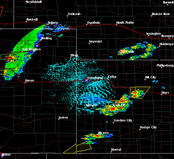 At 338 pm cdt, a severe thunderstorm was located 12 miles south of collyer, moving north at 20 mph (radar indicated). Hazards include ping pong ball size hail and 60 mph wind gusts. People and animals outdoors will be injured. expect hail damage to roofs, siding, windows, and vehicles. expect wind damage to roofs, siding, and trees. locations impacted include, quinter. This includes interstate 70 in kansas between mile markers 104 and 113. At 338 pm cdt, a severe thunderstorm was located 12 miles south of collyer, moving north at 20 mph (radar indicated). Hazards include ping pong ball size hail and 60 mph wind gusts. People and animals outdoors will be injured. expect hail damage to roofs, siding, windows, and vehicles. expect wind damage to roofs, siding, and trees. locations impacted include, quinter. This includes interstate 70 in kansas between mile markers 104 and 113.
|
| 6/19/2018 3:31 PM CDT |
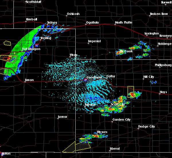 At 331 pm cdt, a severe thunderstorm was located 7 miles southwest of collyer, moving north at 30 mph (radar indicated). Hazards include 60 mph wind gusts and quarter size hail. Hail damage to vehicles is expected. expect wind damage to roofs, siding, and trees. locations impacted include, quinter. This includes interstate 70 in kansas between mile markers 103 and 113. At 331 pm cdt, a severe thunderstorm was located 7 miles southwest of collyer, moving north at 30 mph (radar indicated). Hazards include 60 mph wind gusts and quarter size hail. Hail damage to vehicles is expected. expect wind damage to roofs, siding, and trees. locations impacted include, quinter. This includes interstate 70 in kansas between mile markers 103 and 113.
|
| 6/19/2018 3:27 PM CDT |
 At 327 pm cdt, a severe thunderstorm was located 9 miles southwest of collyer, moving north at 30 mph (radar indicated). Hazards include 60 mph wind gusts and half dollar size hail. Hail damage to vehicles is expected. Expect wind damage to roofs, siding, and trees. At 327 pm cdt, a severe thunderstorm was located 9 miles southwest of collyer, moving north at 30 mph (radar indicated). Hazards include 60 mph wind gusts and half dollar size hail. Hail damage to vehicles is expected. Expect wind damage to roofs, siding, and trees.
|
| 5/28/2018 5:55 PM CDT |
 The severe thunderstorm warning for northeastern gove county will expire at 600 pm cdt, the storm which prompted the warning has weakened below severe limits, and no longer poses an immediate threat to life or property. therefore the warning will be allowed to expire. however gusty winds and heavy rain are still possible with this thunderstorm. a tornado watch remains in effect until 1000 pm cdt for west central kansas. The severe thunderstorm warning for northeastern gove county will expire at 600 pm cdt, the storm which prompted the warning has weakened below severe limits, and no longer poses an immediate threat to life or property. therefore the warning will be allowed to expire. however gusty winds and heavy rain are still possible with this thunderstorm. a tornado watch remains in effect until 1000 pm cdt for west central kansas.
|
| 5/28/2018 5:33 PM CDT |
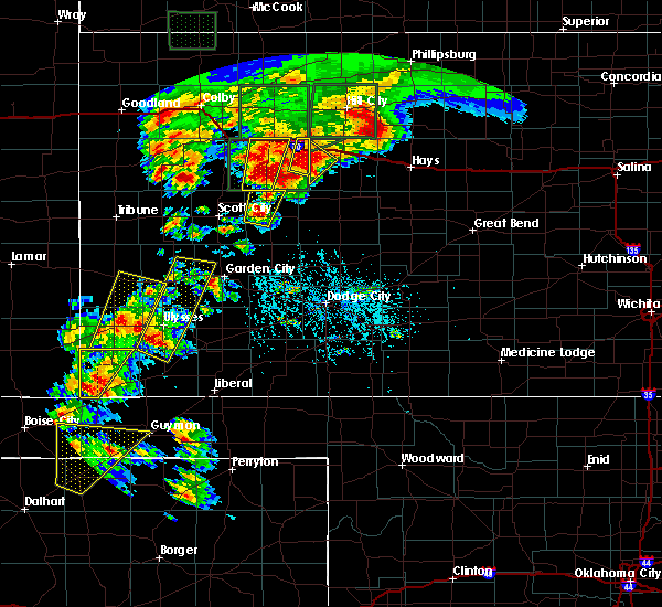 At 533 pm cdt, a severe thunderstorm was located 12 miles southwest of collyer, moving northeast at 20 mph (radar indicated). Hazards include 60 mph wind gusts and quarter size hail. Hail damage to vehicles is expected. expect wind damage to roofs, siding, and trees. locations impacted include, quinter. this includes interstate 70 in kansas between mile markers 107 and 113. A tornado watch remains in effect until 1000 pm cdt for west central kansas. At 533 pm cdt, a severe thunderstorm was located 12 miles southwest of collyer, moving northeast at 20 mph (radar indicated). Hazards include 60 mph wind gusts and quarter size hail. Hail damage to vehicles is expected. expect wind damage to roofs, siding, and trees. locations impacted include, quinter. this includes interstate 70 in kansas between mile markers 107 and 113. A tornado watch remains in effect until 1000 pm cdt for west central kansas.
|
| 5/28/2018 5:21 PM CDT |
 At 520 pm cdt, a severe thunderstorm was located 10 miles southwest of collyer, moving north at 15 mph (radar indicated). Hazards include 60 mph wind gusts and quarter size hail. Hail damage to vehicles is expected. Expect wind damage to roofs, siding, and trees. At 520 pm cdt, a severe thunderstorm was located 10 miles southwest of collyer, moving north at 15 mph (radar indicated). Hazards include 60 mph wind gusts and quarter size hail. Hail damage to vehicles is expected. Expect wind damage to roofs, siding, and trees.
|
| 5/28/2018 4:37 PM CDT |
 At 437 pm cdt, a severe thunderstorm capable of producing a tornado was located 4 miles southwest of quinter, moving northeast at 20 mph (radar indicated rotation). Hazards include tornado and two inch hail. Flying debris will be dangerous to those caught without shelter. mobile homes will be damaged or destroyed. damage to roofs, windows, and vehicles will occur. tree damage is likely. locations impacted include, quinter. This includes interstate 70 in kansas between mile markers 104 and 108. At 437 pm cdt, a severe thunderstorm capable of producing a tornado was located 4 miles southwest of quinter, moving northeast at 20 mph (radar indicated rotation). Hazards include tornado and two inch hail. Flying debris will be dangerous to those caught without shelter. mobile homes will be damaged or destroyed. damage to roofs, windows, and vehicles will occur. tree damage is likely. locations impacted include, quinter. This includes interstate 70 in kansas between mile markers 104 and 108.
|
| 5/28/2018 4:30 PM CDT |
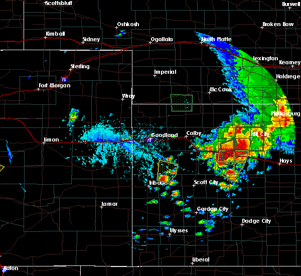 At 430 pm cdt, a severe thunderstorm was located 6 miles east of gove, moving northeast at 15 mph (radar indicated). Hazards include 60 mph wind gusts and quarter size hail. Hail damage to vehicles is expected. expect wind damage to roofs, siding, and trees. locations impacted include, quinter and park. this includes interstate 70 in kansas between mile markers 98 and 113. A tornado watch remains in effect until 1000 pm cdt for west central kansas. At 430 pm cdt, a severe thunderstorm was located 6 miles east of gove, moving northeast at 15 mph (radar indicated). Hazards include 60 mph wind gusts and quarter size hail. Hail damage to vehicles is expected. expect wind damage to roofs, siding, and trees. locations impacted include, quinter and park. this includes interstate 70 in kansas between mile markers 98 and 113. A tornado watch remains in effect until 1000 pm cdt for west central kansas.
|
| 5/28/2018 4:26 PM CDT |
 At 426 pm cdt, a severe thunderstorm capable of producing a tornado was located 7 miles southwest of quinter, moving northeast at 15 mph (radar indicated rotation). Hazards include tornado and hail up to two inches in diameter. Flying debris will be dangerous to those caught without shelter. mobile homes will be damaged or destroyed. damage to roofs, windows, and vehicles will occur. Tree damage is likely. At 426 pm cdt, a severe thunderstorm capable of producing a tornado was located 7 miles southwest of quinter, moving northeast at 15 mph (radar indicated rotation). Hazards include tornado and hail up to two inches in diameter. Flying debris will be dangerous to those caught without shelter. mobile homes will be damaged or destroyed. damage to roofs, windows, and vehicles will occur. Tree damage is likely.
|
| 5/28/2018 4:15 PM CDT |
 At 415 pm cdt, a severe thunderstorm was located near collyer, moving northeast at 15 mph (radar indicated). Hazards include 60 mph wind gusts and quarter size hail. Hail damage to vehicles is expected. expect wind damage to roofs, siding, and trees. locations impacted include, quinter, morland, park, tasco and studley. this includes interstate 70 in kansas between mile markers 98 and 113. A tornado watch remains in effect until 1000 pm cdt for northwestern and west central kansas. At 415 pm cdt, a severe thunderstorm was located near collyer, moving northeast at 15 mph (radar indicated). Hazards include 60 mph wind gusts and quarter size hail. Hail damage to vehicles is expected. expect wind damage to roofs, siding, and trees. locations impacted include, quinter, morland, park, tasco and studley. this includes interstate 70 in kansas between mile markers 98 and 113. A tornado watch remains in effect until 1000 pm cdt for northwestern and west central kansas.
|
| 5/28/2018 4:13 PM CDT |
 At 413 pm cdt, a severe thunderstorm was located near collyer, moving northeast at 15 mph (radar indicated). Hazards include 60 mph wind gusts and quarter size hail. Hail damage to vehicles is expected. expect wind damage to roofs, siding, and trees. locations impacted include, quinter, morland, park, tasco and studley. this includes interstate 70 in kansas between mile markers 98 and 113. A tornado watch remains in effect until 1000 pm cdt for northwestern and west central kansas. At 413 pm cdt, a severe thunderstorm was located near collyer, moving northeast at 15 mph (radar indicated). Hazards include 60 mph wind gusts and quarter size hail. Hail damage to vehicles is expected. expect wind damage to roofs, siding, and trees. locations impacted include, quinter, morland, park, tasco and studley. this includes interstate 70 in kansas between mile markers 98 and 113. A tornado watch remains in effect until 1000 pm cdt for northwestern and west central kansas.
|
| 5/28/2018 4:09 PM CDT | Quarter sized hail reported 0.6 miles SW of Quinter, KS, spotter reported quarter sized hail falling in quinter. |
| 5/28/2018 4:06 PM CDT | Quarter sized hail reported 0.4 miles SSE of Quinter, KS, public reported on twitter quarter sized hail in quinter. |
| 5/28/2018 4:01 PM CDT | Quarter sized hail reported 0.6 miles SW of Quinter, KS, quarter sized hail reported in quinter by splinter. |
| 5/28/2018 3:58 PM CDT |
 At 358 pm cdt, a severe thunderstorm was located near quinter, moving north at 25 mph (radar indicated). Hazards include 60 mph wind gusts and quarter size hail. Hail damage to vehicles is expected. Expect wind damage to roofs, siding, and trees. At 358 pm cdt, a severe thunderstorm was located near quinter, moving north at 25 mph (radar indicated). Hazards include 60 mph wind gusts and quarter size hail. Hail damage to vehicles is expected. Expect wind damage to roofs, siding, and trees.
|
| 5/28/2018 3:52 PM CDT | Quarter sized hail reported 0.3 miles NNE of Quinter, KS, spotter called in report of quarter sized hail east i-70 at quinter. |
| 5/28/2018 3:49 PM CDT | Ping Pong Ball sized hail reported 0.5 miles NW of Quinter, KS, public reported via twitter hail ping pong sized in quinter. |
| 5/28/2018 3:40 PM CDT |
 The severe thunderstorm warning for southeastern sheridan, northeastern gove and southwestern graham counties will expire at 345 pm cdt, the storm which prompted the warning has weakened below severe limits, and no longer poses an immediate threat to life or property. therefore the warning will be allowed to expire. however small hail, gusty winds and heavy rain are still possible with this thunderstorm. a tornado watch remains in effect until 1000 pm cdt for northwestern and west central kansas. The severe thunderstorm warning for southeastern sheridan, northeastern gove and southwestern graham counties will expire at 345 pm cdt, the storm which prompted the warning has weakened below severe limits, and no longer poses an immediate threat to life or property. therefore the warning will be allowed to expire. however small hail, gusty winds and heavy rain are still possible with this thunderstorm. a tornado watch remains in effect until 1000 pm cdt for northwestern and west central kansas.
|
| 5/28/2018 3:31 PM CDT |
 At 331 pm cdt, a severe thunderstorm was located 7 miles north of collyer, moving northeast at 20 mph (radar indicated). Hazards include ping pong ball size hail and 60 mph wind gusts. People and animals outdoors will be injured. expect hail damage to roofs, siding, windows, and vehicles. expect wind damage to roofs, siding, and trees. locations impacted include, quinter, morland, penokee and saint peter. this includes interstate 70 in kansas between mile markers 107 and 113. A tornado watch remains in effect until 1000 pm cdt for northwestern and west central kansas. At 331 pm cdt, a severe thunderstorm was located 7 miles north of collyer, moving northeast at 20 mph (radar indicated). Hazards include ping pong ball size hail and 60 mph wind gusts. People and animals outdoors will be injured. expect hail damage to roofs, siding, windows, and vehicles. expect wind damage to roofs, siding, and trees. locations impacted include, quinter, morland, penokee and saint peter. this includes interstate 70 in kansas between mile markers 107 and 113. A tornado watch remains in effect until 1000 pm cdt for northwestern and west central kansas.
|
| 5/28/2018 3:18 PM CDT |
 At 318 pm cdt, a severe thunderstorm was located 10 miles north of collyer, moving northeast at 20 mph (radar indicated). Hazards include ping pong ball size hail and 60 mph wind gusts. People and animals outdoors will be injured. expect hail damage to roofs, siding, windows, and vehicles. expect wind damage to roofs, siding, and trees. locations impacted include, quinter, morland, penokee and saint peter. this includes interstate 70 in kansas between mile markers 107 and 113. A tornado watch remains in effect until 1000 pm cdt for northwestern and west central kansas. At 318 pm cdt, a severe thunderstorm was located 10 miles north of collyer, moving northeast at 20 mph (radar indicated). Hazards include ping pong ball size hail and 60 mph wind gusts. People and animals outdoors will be injured. expect hail damage to roofs, siding, windows, and vehicles. expect wind damage to roofs, siding, and trees. locations impacted include, quinter, morland, penokee and saint peter. this includes interstate 70 in kansas between mile markers 107 and 113. A tornado watch remains in effect until 1000 pm cdt for northwestern and west central kansas.
|
| 5/28/2018 3:16 PM CDT |
 At 316 pm cdt, a severe thunderstorm was located 10 miles south of morland, or 10 miles north of voda, moving northeast at 20 mph (radar indicated). Hazards include ping pong ball size hail and 60 mph wind gusts. People and animals outdoors will be injured. expect hail damage to roofs, siding, windows, and vehicles. expect wind damage to roofs, siding, and trees. locations impacted include, quinter, morland, penokee and saint peter. this includes interstate 70 in kansas between mile markers 107 and 113. A tornado watch remains in effect until 1000 pm cdt for northwestern and west central kansas. At 316 pm cdt, a severe thunderstorm was located 10 miles south of morland, or 10 miles north of voda, moving northeast at 20 mph (radar indicated). Hazards include ping pong ball size hail and 60 mph wind gusts. People and animals outdoors will be injured. expect hail damage to roofs, siding, windows, and vehicles. expect wind damage to roofs, siding, and trees. locations impacted include, quinter, morland, penokee and saint peter. this includes interstate 70 in kansas between mile markers 107 and 113. A tornado watch remains in effect until 1000 pm cdt for northwestern and west central kansas.
|
| 5/28/2018 2:54 PM CDT |
 At 254 pm cdt, a severe thunderstorm was located 7 miles north of collyer, moving northeast at 20 mph (radar indicated). Hazards include golf ball size hail and 60 mph wind gusts. People and animals outdoors will be injured. expect hail damage to roofs, siding, windows, and vehicles. Expect wind damage to roofs, siding, and trees. At 254 pm cdt, a severe thunderstorm was located 7 miles north of collyer, moving northeast at 20 mph (radar indicated). Hazards include golf ball size hail and 60 mph wind gusts. People and animals outdoors will be injured. expect hail damage to roofs, siding, windows, and vehicles. Expect wind damage to roofs, siding, and trees.
|
| 5/28/2018 2:40 PM CDT | Golf Ball sized hail reported 1 miles N of Quinter, KS, em gove county reported measured golf ball hail mm 107 i-70. |
| 5/18/2018 9:26 PM CDT |
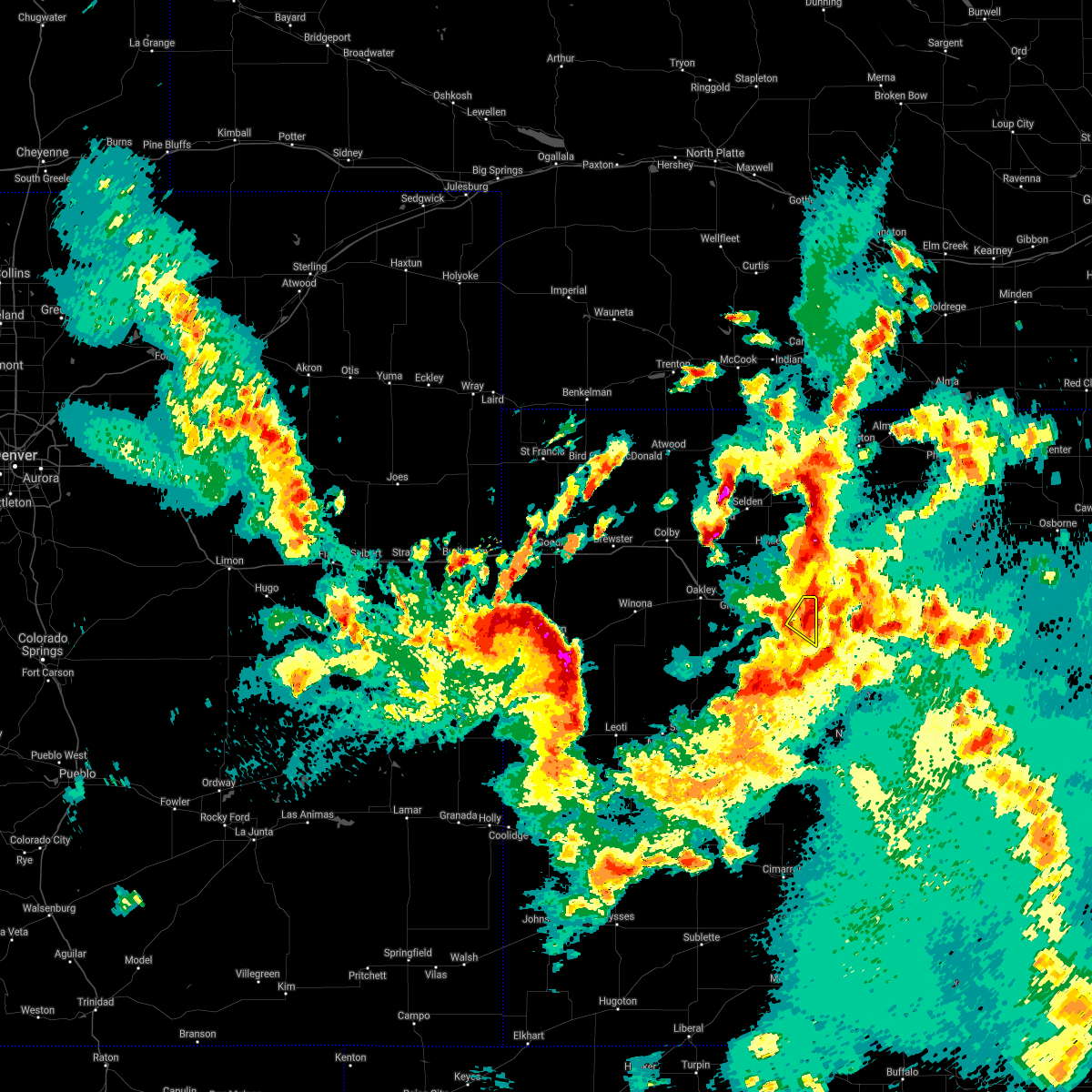 The severe thunderstorm warning for northeastern gove county will expire at 930 pm cdt. the storm which prompted the warning has weakened below severe limits, and no longer poses an immediate threat to life or property. therefore the warning will be allowed to expire. However heavy rain is still possible with this thunderstorm. The severe thunderstorm warning for northeastern gove county will expire at 930 pm cdt. the storm which prompted the warning has weakened below severe limits, and no longer poses an immediate threat to life or property. therefore the warning will be allowed to expire. However heavy rain is still possible with this thunderstorm.
|
| 5/18/2018 9:17 PM CDT |
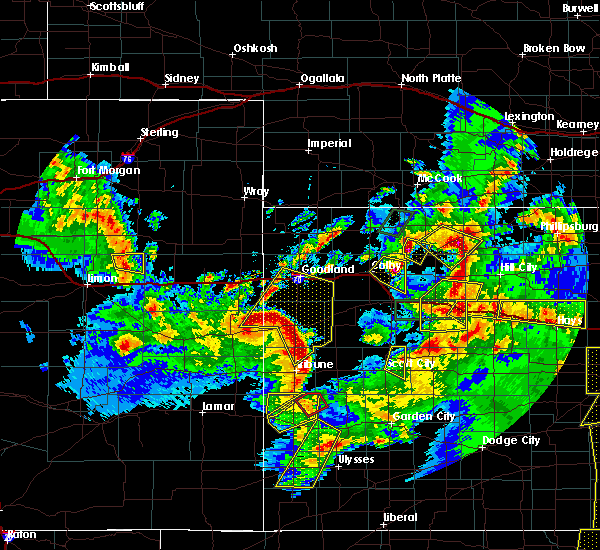 At 916 pm cdt, a severe thunderstorm was located near quinter, moving southeast at 20 mph (radar indicated). Hazards include 60 mph wind gusts and half dollar size hail. Hail damage to vehicles is expected. Expect wind damage to roofs, siding, and trees. At 916 pm cdt, a severe thunderstorm was located near quinter, moving southeast at 20 mph (radar indicated). Hazards include 60 mph wind gusts and half dollar size hail. Hail damage to vehicles is expected. Expect wind damage to roofs, siding, and trees.
|
| 5/18/2018 8:54 PM CDT |
 At 854 pm cdt, severe thunderstorms were located along a line extending from 10 miles southeast of hoxie to 5 miles south of grainfield to 11 miles west of gove, moving east at 20 mph (radar indicated). Hazards include 60 mph wind gusts and half dollar size hail. Hail damage to vehicles is expected. Expect wind damage to roofs, siding, and trees. At 854 pm cdt, severe thunderstorms were located along a line extending from 10 miles southeast of hoxie to 5 miles south of grainfield to 11 miles west of gove, moving east at 20 mph (radar indicated). Hazards include 60 mph wind gusts and half dollar size hail. Hail damage to vehicles is expected. Expect wind damage to roofs, siding, and trees.
|
| 5/18/2018 8:40 PM CDT |
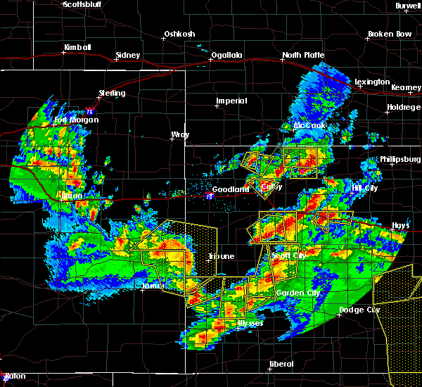 At 840 pm cdt, a severe thunderstorm was located near quinter, moving southeast at 20 mph. this is a very dangerous storm (emergency management). Hazards include baseball size hail and 60 mph wind gusts. People and animals outdoors will be severely injured. Expect shattered windows, extensive damage to roofs, siding, and vehicles. At 840 pm cdt, a severe thunderstorm was located near quinter, moving southeast at 20 mph. this is a very dangerous storm (emergency management). Hazards include baseball size hail and 60 mph wind gusts. People and animals outdoors will be severely injured. Expect shattered windows, extensive damage to roofs, siding, and vehicles.
|
| 5/18/2018 8:38 PM CDT | Baseball sized hail reported 1 miles NNW of Quinter, KS, reported between mile marker 108 and 109 on i70 |
| 5/18/2018 8:29 PM CDT | Quarter sized hail reported 0.6 miles SW of Quinter, KS |
| 5/18/2018 8:27 PM CDT | Golf Ball sized hail reported 0.6 miles SW of Quinter, KS |
| 5/18/2018 8:26 PM CDT |
 At 826 pm cdt, a severe thunderstorm was located near quinter, moving southeast at 10 mph. this is a very dangerous storm (public). Hazards include baseball size hail and 60 mph wind gusts. People and animals outdoors will be severely injured. expect shattered windows, extensive damage to roofs, siding, and vehicles. locations impacted include, quinter. This includes interstate 70 in kansas between mile markers 104 and 113. At 826 pm cdt, a severe thunderstorm was located near quinter, moving southeast at 10 mph. this is a very dangerous storm (public). Hazards include baseball size hail and 60 mph wind gusts. People and animals outdoors will be severely injured. expect shattered windows, extensive damage to roofs, siding, and vehicles. locations impacted include, quinter. This includes interstate 70 in kansas between mile markers 104 and 113.
|
| 5/18/2018 8:15 PM CDT |
 At 815 pm cdt, a severe thunderstorm was located over quinter, moving southeast at 15 mph. this is a very dangerous storm (public). Hazards include baseball size hail and 60 mph wind gusts. People and animals outdoors will be severely injured. expect shattered windows, extensive damage to roofs, siding, and vehicles. locations impacted include, quinter. This includes interstate 70 in kansas between mile markers 104 and 113. At 815 pm cdt, a severe thunderstorm was located over quinter, moving southeast at 15 mph. this is a very dangerous storm (public). Hazards include baseball size hail and 60 mph wind gusts. People and animals outdoors will be severely injured. expect shattered windows, extensive damage to roofs, siding, and vehicles. locations impacted include, quinter. This includes interstate 70 in kansas between mile markers 104 and 113.
|
| 5/18/2018 8:14 PM CDT | Baseball sized hail reported 3.9 miles E of Quinter, KS, mile marker 103 on i70. |
| 5/18/2018 8:13 PM CDT |
 The tornado warning for southeastern sheridan and northeastern gove counties will expire at 815 pm cdt, the tornado threat has diminished and the tornado warning has been cancelled. however, large hail and damaging winds remain likely and a severe thunderstorm warning remains in effect for the area. a severe thunderstorm watch remains in effect until 1100 pm cdt for northwestern and west central kansas. The tornado warning for southeastern sheridan and northeastern gove counties will expire at 815 pm cdt, the tornado threat has diminished and the tornado warning has been cancelled. however, large hail and damaging winds remain likely and a severe thunderstorm warning remains in effect for the area. a severe thunderstorm watch remains in effect until 1100 pm cdt for northwestern and west central kansas.
|
| 5/18/2018 8:12 PM CDT | Ping Pong Ball sized hail reported 1.8 miles ESE of Quinter, KS |
| 5/18/2018 8:12 PM CDT |
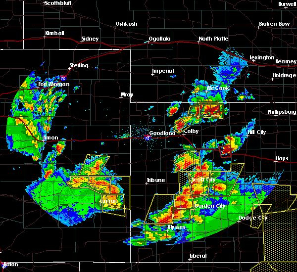 At 812 pm cdt, a severe thunderstorm was located over quinter, moving southeast at 15 mph (radar indicated). Hazards include two inch hail and 60 mph wind gusts. People and animals outdoors will be injured. expect hail damage to roofs, siding, windows, and vehicles. Expect wind damage to roofs, siding, and trees. At 812 pm cdt, a severe thunderstorm was located over quinter, moving southeast at 15 mph (radar indicated). Hazards include two inch hail and 60 mph wind gusts. People and animals outdoors will be injured. expect hail damage to roofs, siding, windows, and vehicles. Expect wind damage to roofs, siding, and trees.
|
| 5/18/2018 8:08 PM CDT |
 At 808 pm cdt, a severe thunderstorm capable of producing a tornado was located over quinter, moving southeast at 30 mph (radar indicated rotation). Hazards include tornado and golf ball size hail. Flying debris will be dangerous to those caught without shelter. mobile homes will be damaged or destroyed. damage to roofs, windows, and vehicles will occur. tree damage is likely. locations impacted include, quinter and park. This includes interstate 70 in kansas between mile markers 101 and 113. At 808 pm cdt, a severe thunderstorm capable of producing a tornado was located over quinter, moving southeast at 30 mph (radar indicated rotation). Hazards include tornado and golf ball size hail. Flying debris will be dangerous to those caught without shelter. mobile homes will be damaged or destroyed. damage to roofs, windows, and vehicles will occur. tree damage is likely. locations impacted include, quinter and park. This includes interstate 70 in kansas between mile markers 101 and 113.
|
| 5/18/2018 8:01 PM CDT | Golf Ball sized hail reported 3 miles ESE of Quinter, KS |
| 5/18/2018 8:01 PM CDT |
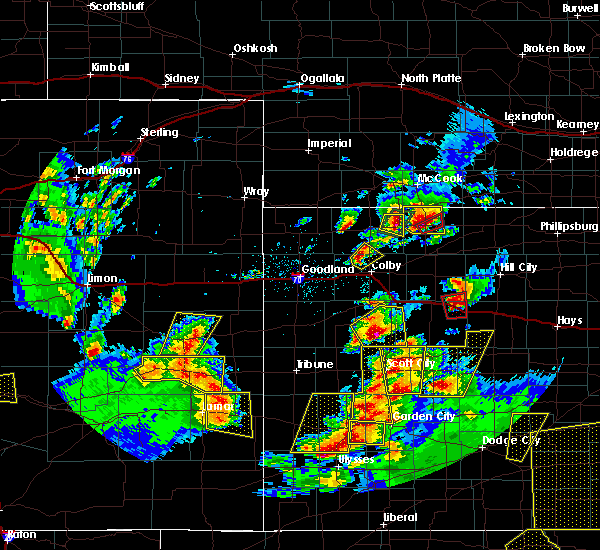 At 801 pm cdt, a severe thunderstorm capable of producing a tornado was located over quinter, moving east at 15 mph (radar indicated rotation). Hazards include tornado and ping pong ball size hail. Flying debris will be dangerous to those caught without shelter. mobile homes will be damaged or destroyed. damage to roofs, windows, and vehicles will occur. tree damage is likely. locations impacted include, quinter and park. This includes interstate 70 in kansas between mile markers 101 and 113. At 801 pm cdt, a severe thunderstorm capable of producing a tornado was located over quinter, moving east at 15 mph (radar indicated rotation). Hazards include tornado and ping pong ball size hail. Flying debris will be dangerous to those caught without shelter. mobile homes will be damaged or destroyed. damage to roofs, windows, and vehicles will occur. tree damage is likely. locations impacted include, quinter and park. This includes interstate 70 in kansas between mile markers 101 and 113.
|
| 5/18/2018 8:00 PM CDT | Quarter sized hail reported 1.8 miles ESE of Quinter, KS |
| 5/18/2018 7:57 PM CDT |
 At 756 pm cdt, a severe thunderstorm capable of producing a tornado was located near quinter, moving east at 20 mph (radar indicated rotation). Hazards include tornado and half dollar size hail. Flying debris will be dangerous to those caught without shelter. mobile homes will be damaged or destroyed. damage to roofs, windows, and vehicles will occur. Tree damage is likely. At 756 pm cdt, a severe thunderstorm capable of producing a tornado was located near quinter, moving east at 20 mph (radar indicated rotation). Hazards include tornado and half dollar size hail. Flying debris will be dangerous to those caught without shelter. mobile homes will be damaged or destroyed. damage to roofs, windows, and vehicles will occur. Tree damage is likely.
|
| 10/2/2017 10:31 PM CDT |
 At 1031 pm cdt, a severe thunderstorm was located 4 miles east of quinter, moving northeast at 40 mph (radar indicated). Hazards include ping pong ball size hail and 60 mph wind gusts. People and animals outdoors will be injured. expect hail damage to roofs, siding, windows, and vehicles. expect wind damage to roofs, siding, and trees. locations impacted include, quinter, park and saint peter. this includes interstate 70 in kansas between mile markers 99 and 107. A tornado watch remains in effect until 1100 pm cdt for northwestern and west central kansas. At 1031 pm cdt, a severe thunderstorm was located 4 miles east of quinter, moving northeast at 40 mph (radar indicated). Hazards include ping pong ball size hail and 60 mph wind gusts. People and animals outdoors will be injured. expect hail damage to roofs, siding, windows, and vehicles. expect wind damage to roofs, siding, and trees. locations impacted include, quinter, park and saint peter. this includes interstate 70 in kansas between mile markers 99 and 107. A tornado watch remains in effect until 1100 pm cdt for northwestern and west central kansas.
|
| 10/2/2017 10:15 PM CDT |
 At 1015 pm cdt, a severe thunderstorm was located 6 miles southwest of quinter, moving northeast at 40 mph (radar indicated). Hazards include ping pong ball size hail and 60 mph wind gusts. People and animals outdoors will be injured. expect hail damage to roofs, siding, windows, and vehicles. Expect wind damage to roofs, siding, and trees. At 1015 pm cdt, a severe thunderstorm was located 6 miles southwest of quinter, moving northeast at 40 mph (radar indicated). Hazards include ping pong ball size hail and 60 mph wind gusts. People and animals outdoors will be injured. expect hail damage to roofs, siding, windows, and vehicles. Expect wind damage to roofs, siding, and trees.
|
| 10/2/2017 10:05 PM CDT |
 At 1005 pm cdt, a severe thunderstorm was located 4 miles east of kearney, moving northeast at 60 mph (radar indicated). Hazards include two inch hail and 70 mph wind gusts. People and animals outdoors will be injured. expect hail damage to roofs, siding, windows, and vehicles. expect considerable tree damage. wind damage is also likely to mobile homes, roofs, and outbuildings. locations impacted include, hill city, quinter, gove, morland, bogue, park and nicodemus. this includes interstate 70 in kansas between mile markers 97 and 111. A tornado watch remains in effect until 1100 pm cdt for northwestern and west central kansas. At 1005 pm cdt, a severe thunderstorm was located 4 miles east of kearney, moving northeast at 60 mph (radar indicated). Hazards include two inch hail and 70 mph wind gusts. People and animals outdoors will be injured. expect hail damage to roofs, siding, windows, and vehicles. expect considerable tree damage. wind damage is also likely to mobile homes, roofs, and outbuildings. locations impacted include, hill city, quinter, gove, morland, bogue, park and nicodemus. this includes interstate 70 in kansas between mile markers 97 and 111. A tornado watch remains in effect until 1100 pm cdt for northwestern and west central kansas.
|
| 10/2/2017 9:40 PM CDT | Additional damage report recieved for this region. doors removed from a building... as well as windows being sucked out of the building. there was also a 2 foot diamete in gove county KS, 0.6 miles SW of Quinter, KS |
| 10/2/2017 9:30 PM CDT |
 At 930 pm cdt, a severe thunderstorm was located 6 miles southeast of atlanta, or 10 miles south of holdrege, moving northeast at 60 mph (radar indicated). Hazards include two inch hail and 70 mph wind gusts. People and animals outdoors will be injured. expect hail damage to roofs, siding, windows, and vehicles. expect considerable tree damage. Wind damage is also likely to mobile homes, roofs, and outbuildings. At 930 pm cdt, a severe thunderstorm was located 6 miles southeast of atlanta, or 10 miles south of holdrege, moving northeast at 60 mph (radar indicated). Hazards include two inch hail and 70 mph wind gusts. People and animals outdoors will be injured. expect hail damage to roofs, siding, windows, and vehicles. expect considerable tree damage. Wind damage is also likely to mobile homes, roofs, and outbuildings.
|
| 10/2/2017 8:45 PM CDT | Large tree uprooted and numerous 4 to 6 inch tree branches down across tow in gove county KS, 0.6 miles SW of Quinter, KS |
| 10/2/2017 8:34 PM CDT | Ping Pong Ball sized hail reported 2.5 miles ESE of Quinter, KS |
| 10/2/2017 8:32 PM CDT |
 At 832 pm cdt, a severe thunderstorm was located 4 miles northwest of lenora, or 16 miles southwest of norton, moving northeast at 60 mph (radar indicated). Hazards include golf ball size hail and 60 mph wind gusts. People and animals outdoors will be injured. expect hail damage to roofs, siding, windows, and vehicles. Expect wind damage to roofs, siding, and trees. At 832 pm cdt, a severe thunderstorm was located 4 miles northwest of lenora, or 16 miles southwest of norton, moving northeast at 60 mph (radar indicated). Hazards include golf ball size hail and 60 mph wind gusts. People and animals outdoors will be injured. expect hail damage to roofs, siding, windows, and vehicles. Expect wind damage to roofs, siding, and trees.
|
| 10/2/2017 8:24 PM CDT | Reports of uprooted trees and 4 to 6 inch tree branche in gove county KS, 0.6 miles SW of Quinter, KS |
| 10/2/2017 7:54 PM CDT |
 At 753 pm cdt, a severe thunderstorm was located 6 miles northwest of grainfield, moving northeast at 40 mph (radar indicated). Hazards include ping pong ball size hail and 60 mph wind gusts. People and animals outdoors will be injured. expect hail damage to roofs, siding, windows, and vehicles. expect wind damage to roofs, siding, and trees. locations impacted include, oakley, hoxie, quinter, grainfield, grinnell, gove and morland. this includes interstate 70 in kansas between mile markers 74 and 111. A tornado watch remains in effect until 1100 pm cdt for northwestern and west central kansas. At 753 pm cdt, a severe thunderstorm was located 6 miles northwest of grainfield, moving northeast at 40 mph (radar indicated). Hazards include ping pong ball size hail and 60 mph wind gusts. People and animals outdoors will be injured. expect hail damage to roofs, siding, windows, and vehicles. expect wind damage to roofs, siding, and trees. locations impacted include, oakley, hoxie, quinter, grainfield, grinnell, gove and morland. this includes interstate 70 in kansas between mile markers 74 and 111. A tornado watch remains in effect until 1100 pm cdt for northwestern and west central kansas.
|
| 10/2/2017 7:52 PM CDT |
 At 751 pm cdt, a severe thunderstorm was located 7 miles west of gove, moving northeast at 60 mph (radar indicated). Hazards include ping pong ball size hail and 60 mph wind gusts. People and animals outdoors will be injured. expect hail damage to roofs, siding, windows, and vehicles. Expect wind damage to roofs, siding, and trees. At 751 pm cdt, a severe thunderstorm was located 7 miles west of gove, moving northeast at 60 mph (radar indicated). Hazards include ping pong ball size hail and 60 mph wind gusts. People and animals outdoors will be injured. expect hail damage to roofs, siding, windows, and vehicles. Expect wind damage to roofs, siding, and trees.
|
| 10/2/2017 7:40 PM CDT |
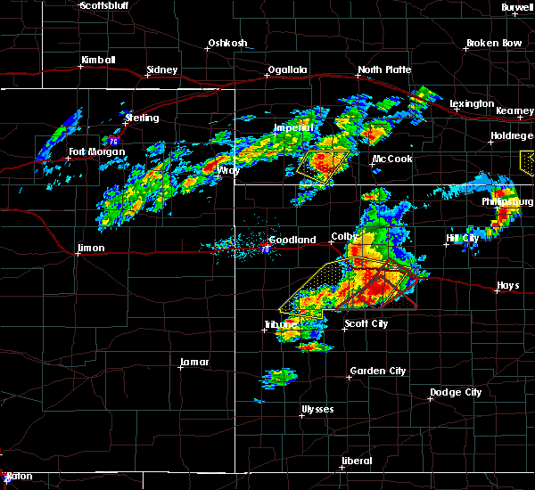 At 740 pm cdt, a severe thunderstorm capable of producing a tornado was located 11 miles southwest of gove, moving northeast at 40 mph (radar indicated rotation). Hazards include tornado and hail up to two inches in diameter. Flying debris will be dangerous to those caught without shelter. mobile homes will be damaged or destroyed. damage to roofs, windows, and vehicles will occur. Tree damage is likely. At 740 pm cdt, a severe thunderstorm capable of producing a tornado was located 11 miles southwest of gove, moving northeast at 40 mph (radar indicated rotation). Hazards include tornado and hail up to two inches in diameter. Flying debris will be dangerous to those caught without shelter. mobile homes will be damaged or destroyed. damage to roofs, windows, and vehicles will occur. Tree damage is likely.
|
| 8/10/2017 2:14 PM CDT |
 At 213 pm cdt, a severe thunderstorm was located 5 miles north of collyer, moving southeast at 40 mph. this is a very dangerous storm (trained weather spotters. wind damage was reported 4 miles east of hoxie at 145 pm cdt and a 70 mph gust was reported in hoxie at 156 pm cdt). Hazards include softball size hail and 70 mph wind gusts. People and animals outdoors will be severely injured. expect shattered windows, extensive damage to roofs, siding, and vehicles. locations impacted include, quinter and saint peter. This includes interstate 70 in kansas between mile markers 104 and 113. At 213 pm cdt, a severe thunderstorm was located 5 miles north of collyer, moving southeast at 40 mph. this is a very dangerous storm (trained weather spotters. wind damage was reported 4 miles east of hoxie at 145 pm cdt and a 70 mph gust was reported in hoxie at 156 pm cdt). Hazards include softball size hail and 70 mph wind gusts. People and animals outdoors will be severely injured. expect shattered windows, extensive damage to roofs, siding, and vehicles. locations impacted include, quinter and saint peter. This includes interstate 70 in kansas between mile markers 104 and 113.
|
| 8/10/2017 2:10 PM CDT | Delayed report via social media. large tree split in two. time approximate in gove county KS, 3.1 miles W of Quinter, KS |
| 8/10/2017 1:56 PM CDT |
 At 156 pm cdt, a severe thunderstorm was located 9 miles northeast of park, or 10 miles north of quinter, moving southeast at 35 mph. this is a very dangerous storm (trained weather spotters. at 145 pm cdt...a 70 mph gust was reported in hoxie by a local weather station). Hazards include softball size hail and 70 mph wind gusts. People and animals outdoors will be severely injured. expect shattered windows, extensive damage to roofs, siding, and vehicles. locations impacted include, quinter, park, saint peter and tasco. This includes interstate 70 in kansas between mile markers 102 and 113. At 156 pm cdt, a severe thunderstorm was located 9 miles northeast of park, or 10 miles north of quinter, moving southeast at 35 mph. this is a very dangerous storm (trained weather spotters. at 145 pm cdt...a 70 mph gust was reported in hoxie by a local weather station). Hazards include softball size hail and 70 mph wind gusts. People and animals outdoors will be severely injured. expect shattered windows, extensive damage to roofs, siding, and vehicles. locations impacted include, quinter, park, saint peter and tasco. This includes interstate 70 in kansas between mile markers 102 and 113.
|
| 8/10/2017 1:50 PM CDT |
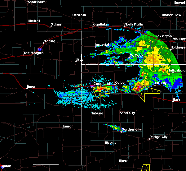 At 150 pm cdt, a severe thunderstorm was located 8 miles north of park, or 11 miles southeast of hoxie, moving southeast at 40 mph. this is a very dangerous storm (trained weather spotters. at 145 pm cdt...a 70 mph gust was reported in hoxie by a local weather station). Hazards include baseball size hail and 70 mph wind gusts. People and animals outdoors will be severely injured. expect shattered windows, extensive damage to roofs, siding, and vehicles. locations impacted include, quinter, park, saint peter and tasco. This includes interstate 70 in kansas between mile markers 102 and 113. At 150 pm cdt, a severe thunderstorm was located 8 miles north of park, or 11 miles southeast of hoxie, moving southeast at 40 mph. this is a very dangerous storm (trained weather spotters. at 145 pm cdt...a 70 mph gust was reported in hoxie by a local weather station). Hazards include baseball size hail and 70 mph wind gusts. People and animals outdoors will be severely injured. expect shattered windows, extensive damage to roofs, siding, and vehicles. locations impacted include, quinter, park, saint peter and tasco. This includes interstate 70 in kansas between mile markers 102 and 113.
|
| 8/10/2017 1:48 PM CDT |
 At 148 pm cdt, a severe thunderstorm was located 8 miles north of park, or 9 miles southeast of hoxie, moving southeast at 40 mph (trained weather spotters. at 145 pm cdt...a 70 mph gust was reported in hoxie by a local weather station). Hazards include tennis ball size hail and 70 mph wind gusts. People and animals outdoors will be injured. expect hail damage to roofs, siding, windows, and vehicles. expect considerable tree damage. Wind damage is also likely to mobile homes, roofs, and outbuildings. At 148 pm cdt, a severe thunderstorm was located 8 miles north of park, or 9 miles southeast of hoxie, moving southeast at 40 mph (trained weather spotters. at 145 pm cdt...a 70 mph gust was reported in hoxie by a local weather station). Hazards include tennis ball size hail and 70 mph wind gusts. People and animals outdoors will be injured. expect hail damage to roofs, siding, windows, and vehicles. expect considerable tree damage. Wind damage is also likely to mobile homes, roofs, and outbuildings.
|
| 7/2/2017 11:31 PM CDT |
 At 1127 pm cdt, severe thunderstorms were located along a line extending from 7 miles southeast of woodruff to 8 miles south of hill city to 4 miles northwest of grainfield, moving southeast at 35 mph (radar indicated. at 1059 pm cdt, the automated station at norton reported a 64 mph gust). Hazards include 70 mph wind gusts and quarter size hail. Hail damage to vehicles is expected. expect considerable tree damage. wind damage is also likely to mobile homes, roofs, and outbuildings. locations impacted include, norton, hill city, hoxie, quinter, grainfield, gove and almena. This includes interstate 70 in kansas between mile markers 90 and 113. At 1127 pm cdt, severe thunderstorms were located along a line extending from 7 miles southeast of woodruff to 8 miles south of hill city to 4 miles northwest of grainfield, moving southeast at 35 mph (radar indicated. at 1059 pm cdt, the automated station at norton reported a 64 mph gust). Hazards include 70 mph wind gusts and quarter size hail. Hail damage to vehicles is expected. expect considerable tree damage. wind damage is also likely to mobile homes, roofs, and outbuildings. locations impacted include, norton, hill city, hoxie, quinter, grainfield, gove and almena. This includes interstate 70 in kansas between mile markers 90 and 113.
|
| 7/2/2017 11:00 PM CDT |
 At 1100 pm cdt, severe thunderstorms were located along a line extending from near long island to 7 miles northwest of hill city to 4 miles west of hoxie, moving east at 35 mph (radar indicated). Hazards include 70 mph wind gusts and quarter size hail. Hail damage to vehicles is expected. expect considerable tree damage. Wind damage is also likely to mobile homes, roofs, and outbuildings. At 1100 pm cdt, severe thunderstorms were located along a line extending from near long island to 7 miles northwest of hill city to 4 miles west of hoxie, moving east at 35 mph (radar indicated). Hazards include 70 mph wind gusts and quarter size hail. Hail damage to vehicles is expected. expect considerable tree damage. Wind damage is also likely to mobile homes, roofs, and outbuildings.
|
| 6/28/2017 11:01 PM CDT |
 The national weather service in goodland has issued a * severe thunderstorm warning for. southeastern thomas county in northwestern kansas. southwestern norton county in northwestern kansas. sheridan county in northwestern kansas. Southeastern decatur county in northwestern kansas. The national weather service in goodland has issued a * severe thunderstorm warning for. southeastern thomas county in northwestern kansas. southwestern norton county in northwestern kansas. sheridan county in northwestern kansas. Southeastern decatur county in northwestern kansas.
|
| 6/27/2017 7:26 PM CDT |
 At 1226 am cdt, a severe thunderstorm was located 7 miles east of gove, moving east at 55 mph (radar indicated). Hazards include 60 mph wind gusts. expect damage to roofs, siding, and trees At 1226 am cdt, a severe thunderstorm was located 7 miles east of gove, moving east at 55 mph (radar indicated). Hazards include 60 mph wind gusts. expect damage to roofs, siding, and trees
|
| 6/20/2017 4:28 PM CDT |
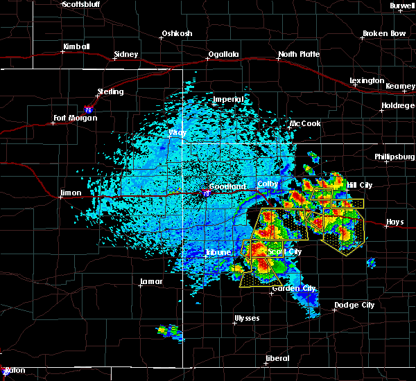 At 428 pm cdt, a severe thunderstorm was located 7 miles south of quinter, moving southeast at 15 mph (trained weather spotters). Hazards include 60 mph wind gusts and quarter size hail. Hail damage to vehicles is expected. expect wind damage to roofs, siding, and trees. locations impacted include, quinter. This includes interstate 70 in kansas between mile markers 106 and 113. At 428 pm cdt, a severe thunderstorm was located 7 miles south of quinter, moving southeast at 15 mph (trained weather spotters). Hazards include 60 mph wind gusts and quarter size hail. Hail damage to vehicles is expected. expect wind damage to roofs, siding, and trees. locations impacted include, quinter. This includes interstate 70 in kansas between mile markers 106 and 113.
|
| 6/20/2017 4:16 PM CDT | Quarter sized hail reported 0.8 miles ESE of Quinter, KS, nickel to quarter size hail at mm 106 on i-70. |
| 6/20/2017 4:02 PM CDT |
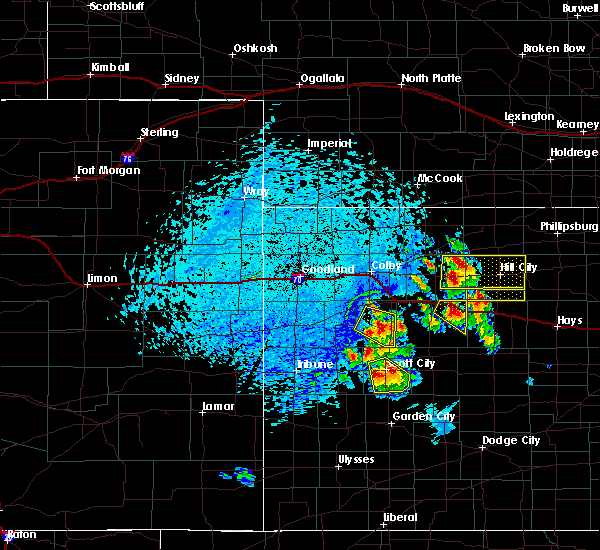 At 402 pm cdt, a severe thunderstorm was located over quinter, moving east at 30 mph (trained weather spotters). Hazards include ping pong ball size hail and 60 mph wind gusts. People and animals outdoors will be injured. expect hail damage to roofs, siding, windows, and vehicles. expect wind damage to roofs, siding, and trees. locations impacted include, quinter and park. This includes interstate 70 in kansas between mile markers 98 and 113. At 402 pm cdt, a severe thunderstorm was located over quinter, moving east at 30 mph (trained weather spotters). Hazards include ping pong ball size hail and 60 mph wind gusts. People and animals outdoors will be injured. expect hail damage to roofs, siding, windows, and vehicles. expect wind damage to roofs, siding, and trees. locations impacted include, quinter and park. This includes interstate 70 in kansas between mile markers 98 and 113.
|
| 6/20/2017 3:55 PM CDT |
 At 355 pm cdt, a severe thunderstorm was located near park, or 4 miles west of quinter, moving east at 30 mph (radar indicated). Hazards include 60 mph wind gusts and quarter size hail. Hail damage to vehicles is expected. Expect wind damage to roofs, siding, and trees. At 355 pm cdt, a severe thunderstorm was located near park, or 4 miles west of quinter, moving east at 30 mph (radar indicated). Hazards include 60 mph wind gusts and quarter size hail. Hail damage to vehicles is expected. Expect wind damage to roofs, siding, and trees.
|
| 5/27/2017 1:26 AM CDT |
 At 125 am cdt, severe thunderstorms were located along a line extending from 6 miles southwest of lenora to 3 miles west of hill city to near collyer, moving east at 45 mph (radar indicated). Hazards include 70 mph wind gusts and half dollar size hail. Hail damage to vehicles is expected. expect considerable tree damage. wind damage is also likely to mobile homes, roofs, and outbuildings. locations impacted include, hill city, quinter, morland, bogue, nicodemus, studley and penokee. This includes interstate 70 in kansas between mile markers 102 and 110. At 125 am cdt, severe thunderstorms were located along a line extending from 6 miles southwest of lenora to 3 miles west of hill city to near collyer, moving east at 45 mph (radar indicated). Hazards include 70 mph wind gusts and half dollar size hail. Hail damage to vehicles is expected. expect considerable tree damage. wind damage is also likely to mobile homes, roofs, and outbuildings. locations impacted include, hill city, quinter, morland, bogue, nicodemus, studley and penokee. This includes interstate 70 in kansas between mile markers 102 and 110.
|
| 5/27/2017 1:20 AM CDT | Zero visibility in blowing dust. also nickel sized hai in gove county KS, 1.8 miles ESE of Quinter, KS |
| 5/27/2017 1:13 AM CDT |
 At 113 am cdt, a severe thunderstorm capable of producing a tornado was located near quinter, moving east at 30 mph (radar indicated rotation). Hazards include tornado and half dollar size hail. Flying debris will be dangerous to those caught without shelter. mobile homes will be damaged or destroyed. damage to roofs, windows, and vehicles will occur. Tree damage is likely. At 113 am cdt, a severe thunderstorm capable of producing a tornado was located near quinter, moving east at 30 mph (radar indicated rotation). Hazards include tornado and half dollar size hail. Flying debris will be dangerous to those caught without shelter. mobile homes will be damaged or destroyed. damage to roofs, windows, and vehicles will occur. Tree damage is likely.
|
| 5/27/2017 1:12 AM CDT |
 At 112 am cdt, severe thunderstorms were located along a line extending from 10 miles south of jennings to morland to 3 miles west of quinter, moving east at 45 mph (radar indicated). Hazards include 70 mph wind gusts and half dollar size hail. Hail damage to vehicles is expected. expect considerable tree damage. wind damage is also likely to mobile homes, roofs, and outbuildings. locations impacted include, hill city, hoxie, quinter, morland, bogue, park and nicodemus. This includes interstate 70 in kansas between mile markers 97 and 110. At 112 am cdt, severe thunderstorms were located along a line extending from 10 miles south of jennings to morland to 3 miles west of quinter, moving east at 45 mph (radar indicated). Hazards include 70 mph wind gusts and half dollar size hail. Hail damage to vehicles is expected. expect considerable tree damage. wind damage is also likely to mobile homes, roofs, and outbuildings. locations impacted include, hill city, hoxie, quinter, morland, bogue, park and nicodemus. This includes interstate 70 in kansas between mile markers 97 and 110.
|
| 5/27/2017 12:49 AM CDT |
 At 1249 am cdt, a severe thunderstorm capable of producing a tornado was located near grainfield, moving east at 35 mph (radar indicated rotation). Hazards include tornado and ping pong ball size hail. Flying debris will be dangerous to those caught without shelter. mobile homes will be damaged or destroyed. damage to roofs, windows, and vehicles will occur. Tree damage is likely. At 1249 am cdt, a severe thunderstorm capable of producing a tornado was located near grainfield, moving east at 35 mph (radar indicated rotation). Hazards include tornado and ping pong ball size hail. Flying debris will be dangerous to those caught without shelter. mobile homes will be damaged or destroyed. damage to roofs, windows, and vehicles will occur. Tree damage is likely.
|
| 5/27/2017 12:47 AM CDT |
 At 1247 am cdt, severe thunderstorms were located along a line extending from near selden to 3 miles southeast of hoxie to near grinnell, moving east at 40 mph (radar indicated). Hazards include 70 mph wind gusts and ping pong ball size hail. People and animals outdoors will be injured. expect hail damage to roofs, siding, windows, and vehicles. expect considerable tree damage. Wind damage is also likely to mobile homes, roofs, and outbuildings. At 1247 am cdt, severe thunderstorms were located along a line extending from near selden to 3 miles southeast of hoxie to near grinnell, moving east at 40 mph (radar indicated). Hazards include 70 mph wind gusts and ping pong ball size hail. People and animals outdoors will be injured. expect hail damage to roofs, siding, windows, and vehicles. expect considerable tree damage. Wind damage is also likely to mobile homes, roofs, and outbuildings.
|
| 5/25/2017 8:05 PM CDT | Report of power line blown down in quinte in gove county KS, 0.6 miles SW of Quinter, KS |
| 5/25/2017 7:42 PM CDT |
 At 742 pm cdt, a severe thunderstorm was located 8 miles north of pendennis, moving east at 35 mph. this is a very dangerous storm (radar indicated). Hazards include baseball size hail and 70 mph wind gusts. People and animals outdoors will be severely injured. expect shattered windows, extensive damage to roofs, siding, and vehicles. locations impacted include, quinter and gove. This includes interstate 70 in kansas between mile markers 107 and 113. At 742 pm cdt, a severe thunderstorm was located 8 miles north of pendennis, moving east at 35 mph. this is a very dangerous storm (radar indicated). Hazards include baseball size hail and 70 mph wind gusts. People and animals outdoors will be severely injured. expect shattered windows, extensive damage to roofs, siding, and vehicles. locations impacted include, quinter and gove. This includes interstate 70 in kansas between mile markers 107 and 113.
|
| 5/25/2017 7:20 PM CDT |
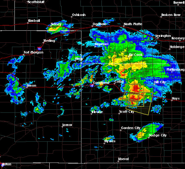 At 719 pm cdt, a severe thunderstorm was located 11 miles south of gove, moving southeast at 30 mph. this is a very dangerous storm (radar indicated). Hazards include baseball size hail and 70 mph wind gusts. People and animals outdoors will be severely injured. Expect shattered windows, extensive damage to roofs, siding, and vehicles. At 719 pm cdt, a severe thunderstorm was located 11 miles south of gove, moving southeast at 30 mph. this is a very dangerous storm (radar indicated). Hazards include baseball size hail and 70 mph wind gusts. People and animals outdoors will be severely injured. Expect shattered windows, extensive damage to roofs, siding, and vehicles.
|
| 5/16/2017 5:21 PM CDT |
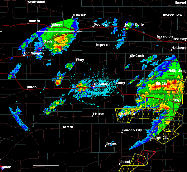 The severe thunderstorm warning for northeastern gove county will expire at 530 pm cdt, the storm which prompted the warning has weakened below severe limits, and no longer poses an immediate threat to life or property. therefore the warning will be allowed to expire. a severe thunderstorm watch remains in effect until midnight cdt for west central kansas. The severe thunderstorm warning for northeastern gove county will expire at 530 pm cdt, the storm which prompted the warning has weakened below severe limits, and no longer poses an immediate threat to life or property. therefore the warning will be allowed to expire. a severe thunderstorm watch remains in effect until midnight cdt for west central kansas.
|
| 5/16/2017 5:11 PM CDT |
 At 510 pm cdt, a severe thunderstorm was located 7 miles southwest of quinter, moving north at 45 mph (radar indicated). Hazards include 60 mph wind gusts and quarter size hail. Hail damage to vehicles is expected. expect wind damage to roofs, siding, and trees. locations impacted include, quinter and park. This includes interstate 70 in kansas between mile markers 98 and 110. At 510 pm cdt, a severe thunderstorm was located 7 miles southwest of quinter, moving north at 45 mph (radar indicated). Hazards include 60 mph wind gusts and quarter size hail. Hail damage to vehicles is expected. expect wind damage to roofs, siding, and trees. locations impacted include, quinter and park. This includes interstate 70 in kansas between mile markers 98 and 110.
|
| 5/16/2017 5:04 PM CDT |
 At 504 pm cdt, a severe thunderstorm was located 7 miles southeast of gove, moving north at 35 mph (radar indicated). Hazards include 60 mph wind gusts and quarter size hail. Hail damage to vehicles is expected. Expect wind damage to roofs, siding, and trees. At 504 pm cdt, a severe thunderstorm was located 7 miles southeast of gove, moving north at 35 mph (radar indicated). Hazards include 60 mph wind gusts and quarter size hail. Hail damage to vehicles is expected. Expect wind damage to roofs, siding, and trees.
|
| 5/10/2017 11:57 PM CDT |
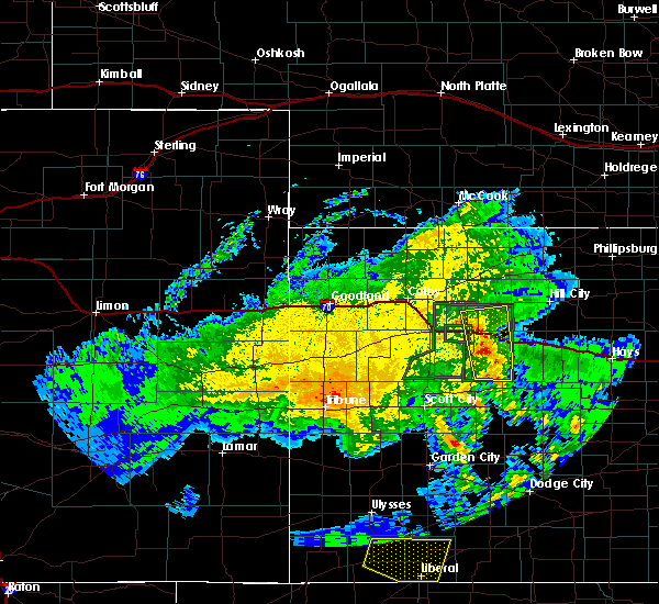 At 1156 pm cdt, a severe thunderstorm was located 5 miles east of gove, moving north at 15 mph (trained weather spotters). Hazards include 60 mph wind gusts and half dollar size hail. Hail damage to vehicles is expected. expect wind damage to roofs, siding, and trees. locations impacted include, quinter, grainfield, gove and park. This includes interstate 70 in kansas between mile markers 90 and 112. At 1156 pm cdt, a severe thunderstorm was located 5 miles east of gove, moving north at 15 mph (trained weather spotters). Hazards include 60 mph wind gusts and half dollar size hail. Hail damage to vehicles is expected. expect wind damage to roofs, siding, and trees. locations impacted include, quinter, grainfield, gove and park. This includes interstate 70 in kansas between mile markers 90 and 112.
|
| 5/10/2017 11:53 PM CDT |
 At 1152 pm cdt, a severe thunderstorm was located 5 miles northeast of gove, moving north at 15 mph (trained weather spotters). Hazards include 60 mph wind gusts and half dollar size hail. Hail damage to vehicles is expected. expect wind damage to roofs, siding, and trees. locations impacted include, quinter, grainfield, grinnell, gove, park and angelus. This includes interstate 70 in kansas between mile markers 77 and 112. At 1152 pm cdt, a severe thunderstorm was located 5 miles northeast of gove, moving north at 15 mph (trained weather spotters). Hazards include 60 mph wind gusts and half dollar size hail. Hail damage to vehicles is expected. expect wind damage to roofs, siding, and trees. locations impacted include, quinter, grainfield, grinnell, gove, park and angelus. This includes interstate 70 in kansas between mile markers 77 and 112.
|
| 5/10/2017 11:24 PM CDT |
 At 1122 pm cdt, a severe thunderstorm was located 4 miles southwest of grainfield, moving north northwest at 20 mph. other thunderstorms will move through the area during this time (emergency management has reported flooding is occuring in the town of grinnell. it is an emergency situation). Hazards include 60 mph wind gusts and half dollar size hail. Hail damage to vehicles is expected. Expect wind damage to roofs, siding, and trees. At 1122 pm cdt, a severe thunderstorm was located 4 miles southwest of grainfield, moving north northwest at 20 mph. other thunderstorms will move through the area during this time (emergency management has reported flooding is occuring in the town of grinnell. it is an emergency situation). Hazards include 60 mph wind gusts and half dollar size hail. Hail damage to vehicles is expected. Expect wind damage to roofs, siding, and trees.
|
| 3/23/2017 8:09 PM CDT |
 At 808 pm cdt, severe thunderstorms were located along a line extending from 3 miles southeast of hoxie to 5 miles northwest of quinter to 13 miles southeast of gove, moving northeast at 45 mph (radar indicated). Hazards include 60 mph wind gusts and penny size hail. Expect damage to roofs, siding, and trees. locations impacted include, hoxie, quinter, park, studley and tasco. This includes interstate 70 in kansas between mile markers 97 and 112. At 808 pm cdt, severe thunderstorms were located along a line extending from 3 miles southeast of hoxie to 5 miles northwest of quinter to 13 miles southeast of gove, moving northeast at 45 mph (radar indicated). Hazards include 60 mph wind gusts and penny size hail. Expect damage to roofs, siding, and trees. locations impacted include, hoxie, quinter, park, studley and tasco. This includes interstate 70 in kansas between mile markers 97 and 112.
|
| 3/23/2017 7:53 PM CDT |
 At 753 pm cdt, severe thunderstorms were located along a line extending from 9 miles northeast of grinnell to 5 miles southeast of grainfield to 9 miles north of pendennis, moving northeast at 40 mph (radar indicated). Hazards include 60 mph wind gusts and penny size hail. expect damage to roofs, siding, and trees At 753 pm cdt, severe thunderstorms were located along a line extending from 9 miles northeast of grinnell to 5 miles southeast of grainfield to 9 miles north of pendennis, moving northeast at 40 mph (radar indicated). Hazards include 60 mph wind gusts and penny size hail. expect damage to roofs, siding, and trees
|
| 3/23/2017 7:35 PM CDT | Spotter reported down limbs due to thunderstorm winds. unknown wind spee in gove county KS, 0.4 miles SSE of Quinter, KS |
| 8/4/2016 5:37 PM CDT |
 At 536 pm cdt, a severe thunderstorm was located near quinter, moving east at 10 mph (radar indicated). Hazards include 70 mph wind gusts and penny size hail. Expect considerable tree damage. damage is likely to mobile homes, roofs, and outbuildings. extremely heavy rainfall is also occurring with this storm. locations impacted include, quinter and park. This includes interstate 70 in kansas between mile markers 100 and 113. At 536 pm cdt, a severe thunderstorm was located near quinter, moving east at 10 mph (radar indicated). Hazards include 70 mph wind gusts and penny size hail. Expect considerable tree damage. damage is likely to mobile homes, roofs, and outbuildings. extremely heavy rainfall is also occurring with this storm. locations impacted include, quinter and park. This includes interstate 70 in kansas between mile markers 100 and 113.
|
| 8/4/2016 5:20 PM CDT |
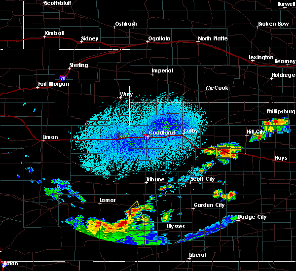 At 517 pm cdt, a severe thunderstorm was located near quinter, and is nearly stationary (radar indicated). Hazards include 70 mph wind gusts and nickel size hail. Expect considerable tree damage. damage is likely to mobile homes, roofs, and outbuildings. locations impacted include, quinter and park. This includes interstate 70 in kansas between mile markers 98 and 113. At 517 pm cdt, a severe thunderstorm was located near quinter, and is nearly stationary (radar indicated). Hazards include 70 mph wind gusts and nickel size hail. Expect considerable tree damage. damage is likely to mobile homes, roofs, and outbuildings. locations impacted include, quinter and park. This includes interstate 70 in kansas between mile markers 98 and 113.
|
| 8/4/2016 5:08 PM CDT |
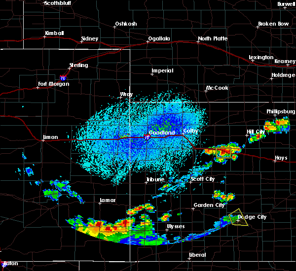 At 508 pm cdt, a severe thunderstorm was located near quinter, and is nearly stationary (radar indicated). Hazards include 70 mph wind gusts and nickel size hail. Expect considerable tree damage. Damage is likely to mobile homes, roofs, and outbuildings. At 508 pm cdt, a severe thunderstorm was located near quinter, and is nearly stationary (radar indicated). Hazards include 70 mph wind gusts and nickel size hail. Expect considerable tree damage. Damage is likely to mobile homes, roofs, and outbuildings.
|
| 7/22/2016 6:27 PM CDT |
 At 626 pm cdt, severe thunderstorms were located along a line extending from 5 miles north of grainfield to 5 miles north of quinter, moving northeast at 15 mph (trained weather spotters in quinter and parks). Hazards include 60 mph wind gusts and quarter size hail. Hail damage to vehicles is expected. expect wind damage to roofs, siding, and trees. locations impacted include, hoxie, quinter, grainfield, grinnell, park, angelus and saint peter. this includes interstate 70 in kansas between mile markers 87 and 109. this warning replaces the previous warning that was in effect. precautionary/preparedness actions, for your protection move to an interior room on the lowest floor of a building. At 626 pm cdt, severe thunderstorms were located along a line extending from 5 miles north of grainfield to 5 miles north of quinter, moving northeast at 15 mph (trained weather spotters in quinter and parks). Hazards include 60 mph wind gusts and quarter size hail. Hail damage to vehicles is expected. expect wind damage to roofs, siding, and trees. locations impacted include, hoxie, quinter, grainfield, grinnell, park, angelus and saint peter. this includes interstate 70 in kansas between mile markers 87 and 109. this warning replaces the previous warning that was in effect. precautionary/preparedness actions, for your protection move to an interior room on the lowest floor of a building.
|
| 7/22/2016 6:24 PM CDT |
 At 623 pm cdt, severe thunderstorms were located along a line extending from 4 miles north of grainfield to 5 miles north of quinter, moving northeast at 15 mph (trained weather spotters in quinter). Hazards include 60 mph wind gusts and quarter size hail. Hail damage to vehicles is expected. Expect wind damage to roofs, siding, and trees. At 623 pm cdt, severe thunderstorms were located along a line extending from 4 miles north of grainfield to 5 miles north of quinter, moving northeast at 15 mph (trained weather spotters in quinter). Hazards include 60 mph wind gusts and quarter size hail. Hail damage to vehicles is expected. Expect wind damage to roofs, siding, and trees.
|
| 7/22/2016 6:15 PM CDT |
 At 615 pm cdt, severe thunderstorms were located along a line extending from 4 miles north of quinter to near grainfield, moving northeast at 15 mph (radar indicated). Hazards include 60 mph wind gusts and half dollar size hail. Hail damage to vehicles is expected. expect wind damage to roofs, siding, and trees. locations impacted include, quinter, grainfield, grinnell and park. This includes interstate 70 in kansas between mile markers 85 and 110. At 615 pm cdt, severe thunderstorms were located along a line extending from 4 miles north of quinter to near grainfield, moving northeast at 15 mph (radar indicated). Hazards include 60 mph wind gusts and half dollar size hail. Hail damage to vehicles is expected. expect wind damage to roofs, siding, and trees. locations impacted include, quinter, grainfield, grinnell and park. This includes interstate 70 in kansas between mile markers 85 and 110.
|
| 7/22/2016 6:12 PM CDT | Quarter sized hail reported 3.2 miles S of Quinter, KS, 60 to 70 mph wind gusts as well |
| 7/22/2016 6:10 PM CDT |
 At 609 pm cdt, severe thunderstorms were located along a line extending from 4 miles northwest of quinter to near grainfield, moving northeast at 20 mph (radar indicated). Hazards include 60 mph wind gusts and quarter size hail. Hail damage to vehicles is expected. expect wind damage to roofs, siding, and trees. locations impacted include, quinter, grainfield, grinnell and park. This includes interstate 70 in kansas between mile markers 85 and 113. At 609 pm cdt, severe thunderstorms were located along a line extending from 4 miles northwest of quinter to near grainfield, moving northeast at 20 mph (radar indicated). Hazards include 60 mph wind gusts and quarter size hail. Hail damage to vehicles is expected. expect wind damage to roofs, siding, and trees. locations impacted include, quinter, grainfield, grinnell and park. This includes interstate 70 in kansas between mile markers 85 and 113.
|
| 7/22/2016 6:01 PM CDT |
 At 600 pm cdt, severe thunderstorms were located along a line extending from near park to near grainfield, moving northeast at 10 mph (radar indicated). Hazards include 60 mph wind gusts and quarter size hail. Hail damage to vehicles is expected. Expect wind damage to roofs, siding, and trees. At 600 pm cdt, severe thunderstorms were located along a line extending from near park to near grainfield, moving northeast at 10 mph (radar indicated). Hazards include 60 mph wind gusts and quarter size hail. Hail damage to vehicles is expected. Expect wind damage to roofs, siding, and trees.
|
| 7/14/2016 4:19 AM CDT |
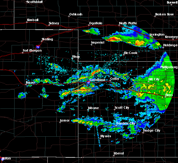 At 419 am cdt, severe thunderstorms were located along a line extending from 10 miles north of wakeeney to 6 miles northwest of voda, moving east at 40 mph (radar indicated). Hazards include 70 mph wind gusts. Expect considerable tree damage. damage is likely to mobile homes, roofs, and outbuildings. locations impacted include, quinter, park and saint peter. This includes interstate 70 in kansas between mile markers 100 and 113. At 419 am cdt, severe thunderstorms were located along a line extending from 10 miles north of wakeeney to 6 miles northwest of voda, moving east at 40 mph (radar indicated). Hazards include 70 mph wind gusts. Expect considerable tree damage. damage is likely to mobile homes, roofs, and outbuildings. locations impacted include, quinter, park and saint peter. This includes interstate 70 in kansas between mile markers 100 and 113.
|
| 7/14/2016 4:06 AM CDT |
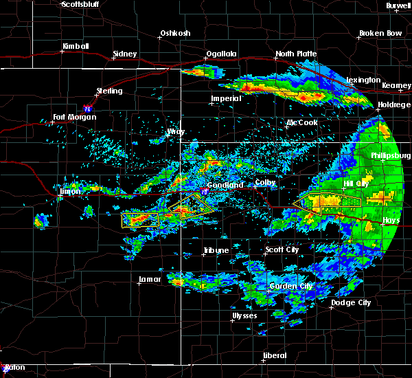 At 406 am cdt, severe thunderstorms were located along a line extending from 10 miles south of morland to 6 miles north of quinter, moving east at 40 mph (radar indicated). Hazards include 70 mph wind gusts. Expect considerable tree damage. damage is likely to mobile homes, roofs, and outbuildings. locations impacted include, quinter, park and saint peter. This includes interstate 70 in kansas between mile markers 100 and 113. At 406 am cdt, severe thunderstorms were located along a line extending from 10 miles south of morland to 6 miles north of quinter, moving east at 40 mph (radar indicated). Hazards include 70 mph wind gusts. Expect considerable tree damage. damage is likely to mobile homes, roofs, and outbuildings. locations impacted include, quinter, park and saint peter. This includes interstate 70 in kansas between mile markers 100 and 113.
|
| 7/14/2016 3:55 AM CDT |
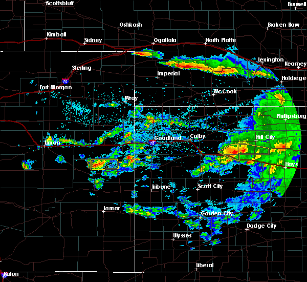 At 355 am cdt, severe thunderstorms were located along a line extending from 10 miles north of quinter to 4 miles north of park, moving east at 40 mph (radar indicated). Hazards include 70 mph wind gusts and nickel size hail. Expect considerable tree damage. Damage is likely to mobile homes, roofs, and outbuildings. At 355 am cdt, severe thunderstorms were located along a line extending from 10 miles north of quinter to 4 miles north of park, moving east at 40 mph (radar indicated). Hazards include 70 mph wind gusts and nickel size hail. Expect considerable tree damage. Damage is likely to mobile homes, roofs, and outbuildings.
|
| 7/13/2016 5:26 AM CDT |
 The severe thunderstorm warning for southeastern gove county will expire at 530 am cdt, the storm which prompted the warning has moved out of the area. therefore the warning will be allowed to expire. however gusty winds are still possible with this thunderstorm. a severe thunderstorm watch remains in effect until 1000 am cdt for west central kansas. The severe thunderstorm warning for southeastern gove county will expire at 530 am cdt, the storm which prompted the warning has moved out of the area. therefore the warning will be allowed to expire. however gusty winds are still possible with this thunderstorm. a severe thunderstorm watch remains in effect until 1000 am cdt for west central kansas.
|
| 7/13/2016 5:15 AM CDT |
 At 515 am cdt, a severe thunderstorm was located 6 miles west of trego center, moving southeast at 60 mph (radar indicated). Hazards include 60 mph wind gusts and penny size hail. Expect damage to roofs. siding. and trees. locations impacted include, quinter. This includes interstate 70 in kansas between mile markers 107 and 112. At 515 am cdt, a severe thunderstorm was located 6 miles west of trego center, moving southeast at 60 mph (radar indicated). Hazards include 60 mph wind gusts and penny size hail. Expect damage to roofs. siding. and trees. locations impacted include, quinter. This includes interstate 70 in kansas between mile markers 107 and 112.
|
| 7/13/2016 5:01 AM CDT |
 At 501 am cdt, a severe thunderstorm was located 13 miles north of utica, moving southeast at 55 mph (radar indicated). Hazards include 60 mph wind gusts and quarter size hail. Hail damage to vehicles is expected. expect wind damage to roofs, siding, and trees. locations impacted include, quinter. This includes interstate 70 in kansas between mile markers 107 and 112. At 501 am cdt, a severe thunderstorm was located 13 miles north of utica, moving southeast at 55 mph (radar indicated). Hazards include 60 mph wind gusts and quarter size hail. Hail damage to vehicles is expected. expect wind damage to roofs, siding, and trees. locations impacted include, quinter. This includes interstate 70 in kansas between mile markers 107 and 112.
|
| 7/13/2016 4:43 AM CDT |
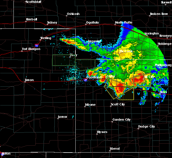 At 442 am cdt, a severe thunderstorm was located 4 miles east of gove, moving southeast at 55 mph (radar indicated). Hazards include ping pong ball size hail and 60 mph wind gusts. People and animals outdoors will be injured. expect hail damage to roofs, siding, windows, and vehicles. Expect wind damage to roofs, siding, and trees. At 442 am cdt, a severe thunderstorm was located 4 miles east of gove, moving southeast at 55 mph (radar indicated). Hazards include ping pong ball size hail and 60 mph wind gusts. People and animals outdoors will be injured. expect hail damage to roofs, siding, windows, and vehicles. Expect wind damage to roofs, siding, and trees.
|
| 7/13/2016 4:33 AM CDT |
 At 433 am cdt, a severe thunderstorm was located 4 miles northwest of gove, moving southeast at 55 mph (radar indicated). Hazards include 60 mph wind gusts and half dollar size hail. Hail damage to vehicles is expected. expect wind damage to roofs, siding, and trees. locations impacted include, colby, oakley, quinter, grainfield, grinnell, gove and monument. This includes interstate 70 in kansas between mile markers 57 and 107. At 433 am cdt, a severe thunderstorm was located 4 miles northwest of gove, moving southeast at 55 mph (radar indicated). Hazards include 60 mph wind gusts and half dollar size hail. Hail damage to vehicles is expected. expect wind damage to roofs, siding, and trees. locations impacted include, colby, oakley, quinter, grainfield, grinnell, gove and monument. This includes interstate 70 in kansas between mile markers 57 and 107.
|
| 7/13/2016 4:22 AM CDT |
 At 421 am cdt, a severe thunderstorm was located 7 miles southeast of oakley, moving southeast at 35 mph (radar indicated). Hazards include ping pong ball size hail and 60 mph wind gusts. People and animals outdoors will be injured. expect hail damage to roofs, siding, windows, and vehicles. expect wind damage to roofs, siding, and trees. locations impacted include, colby, oakley, quinter, grainfield, grinnell, gove and winona. This includes interstate 70 in kansas between mile markers 55 and 107. At 421 am cdt, a severe thunderstorm was located 7 miles southeast of oakley, moving southeast at 35 mph (radar indicated). Hazards include ping pong ball size hail and 60 mph wind gusts. People and animals outdoors will be injured. expect hail damage to roofs, siding, windows, and vehicles. expect wind damage to roofs, siding, and trees. locations impacted include, colby, oakley, quinter, grainfield, grinnell, gove and winona. This includes interstate 70 in kansas between mile markers 55 and 107.
|
| 7/13/2016 4:08 AM CDT |
 At 408 am cdt, a severe thunderstorm was located near oakley, moving southeast at 35 mph (radar indicated). Hazards include 60 mph wind gusts and quarter size hail. Hail damage to vehicles is expected. expect wind damage to roofs, siding, and trees. locations impacted include, colby, oakley, quinter, grainfield, grinnell, gove and winona. This includes interstate 70 in kansas between mile markers 55 and 107. At 408 am cdt, a severe thunderstorm was located near oakley, moving southeast at 35 mph (radar indicated). Hazards include 60 mph wind gusts and quarter size hail. Hail damage to vehicles is expected. expect wind damage to roofs, siding, and trees. locations impacted include, colby, oakley, quinter, grainfield, grinnell, gove and winona. This includes interstate 70 in kansas between mile markers 55 and 107.
|
| 7/13/2016 3:52 AM CDT |
 At 351 am cdt, a severe thunderstorm was located 9 miles south of colby, moving southeast at 20 mph (radar indicated). Hazards include 70 mph wind gusts and ping pong ball size hail. People and animals outdoors will be injured. expect hail damage to roofs, siding, windows, and vehicles. expect considerable tree damage. Wind damage is also likely to mobile homes, roofs, and outbuildings. At 351 am cdt, a severe thunderstorm was located 9 miles south of colby, moving southeast at 20 mph (radar indicated). Hazards include 70 mph wind gusts and ping pong ball size hail. People and animals outdoors will be injured. expect hail damage to roofs, siding, windows, and vehicles. expect considerable tree damage. Wind damage is also likely to mobile homes, roofs, and outbuildings.
|
| 7/5/2016 10:17 PM CDT |
 At 1016 pm cdt, severe thunderstorms were located along a line extending from 7 miles north of park to 3 miles south of grinnell to 9 miles north of scott state lake, moving east at 25 mph (radar indicated). Hazards include 60 mph wind gusts and quarter size hail. Hail damage to vehicles is expected. expect wind damage to roofs, siding, and trees. locations impacted include, oakley, quinter, grainfield, grinnell, gove, park and the monument rocks. This includes interstate 70 in kansas between mile markers 76 and 109. At 1016 pm cdt, severe thunderstorms were located along a line extending from 7 miles north of park to 3 miles south of grinnell to 9 miles north of scott state lake, moving east at 25 mph (radar indicated). Hazards include 60 mph wind gusts and quarter size hail. Hail damage to vehicles is expected. expect wind damage to roofs, siding, and trees. locations impacted include, oakley, quinter, grainfield, grinnell, gove, park and the monument rocks. This includes interstate 70 in kansas between mile markers 76 and 109.
|
| 7/5/2016 9:58 PM CDT |
 At 958 pm cdt, severe thunderstorms were located along a line extending from 7 miles south of hoxie to 5 miles east of oakley to 7 miles southeast of russell springs, moving east at 25 mph (radar indicated). Hazards include ping pong ball size hail and 60 mph wind gusts. People and animals outdoors will be injured. expect hail damage to roofs, siding, windows, and vehicles. Expect wind damage to roofs, siding, and trees. At 958 pm cdt, severe thunderstorms were located along a line extending from 7 miles south of hoxie to 5 miles east of oakley to 7 miles southeast of russell springs, moving east at 25 mph (radar indicated). Hazards include ping pong ball size hail and 60 mph wind gusts. People and animals outdoors will be injured. expect hail damage to roofs, siding, windows, and vehicles. Expect wind damage to roofs, siding, and trees.
|
| 7/5/2016 8:57 PM CDT |
 At 857 pm cdt, a severe thunderstorm was located over quinter, moving southeast at 20 mph (radar indicated). Hazards include ping pong ball size hail and 60 mph wind gusts. People and animals outdoors will be injured. expect hail damage to roofs, siding, windows, and vehicles. Expect wind damage to roofs, siding, and trees. At 857 pm cdt, a severe thunderstorm was located over quinter, moving southeast at 20 mph (radar indicated). Hazards include ping pong ball size hail and 60 mph wind gusts. People and animals outdoors will be injured. expect hail damage to roofs, siding, windows, and vehicles. Expect wind damage to roofs, siding, and trees.
|
| 6/29/2016 12:47 AM CDT |
 At 1247 am cdt, a severe thunderstorm was located 6 miles southeast of oakley, moving southeast at 45 mph (radar indicated). Hazards include 60 mph wind gusts and quarter size hail. Hail damage to vehicles is expected. expect wind damage to roofs, siding, and trees. locations impacted include, oakley, quinter, grainfield, grinnell, gove, park and the monument rocks. This includes interstate 70 in kansas between mile markers 74 and 107. At 1247 am cdt, a severe thunderstorm was located 6 miles southeast of oakley, moving southeast at 45 mph (radar indicated). Hazards include 60 mph wind gusts and quarter size hail. Hail damage to vehicles is expected. expect wind damage to roofs, siding, and trees. locations impacted include, oakley, quinter, grainfield, grinnell, gove, park and the monument rocks. This includes interstate 70 in kansas between mile markers 74 and 107.
|
| 6/29/2016 12:38 AM CDT |
 At 1238 am cdt, a severe thunderstorm was located over oakley, moving southeast at 45 mph (radar indicated). Hazards include 60 mph wind gusts and quarter size hail. Hail damage to vehicles is expected. Expect wind damage to roofs, siding, and trees. At 1238 am cdt, a severe thunderstorm was located over oakley, moving southeast at 45 mph (radar indicated). Hazards include 60 mph wind gusts and quarter size hail. Hail damage to vehicles is expected. Expect wind damage to roofs, siding, and trees.
|
| 6/17/2016 8:36 PM CDT | Storm damage reported in gove county KS, 17.7 miles N of Quinter, KS |
| 5/29/2016 4:36 PM CDT |
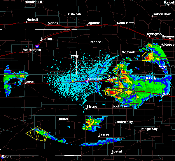 At 436 pm cdt, a severe thunderstorm was located near gove, moving northeast at 10 mph (radar indicated. at 435 pm cdt...dime size hail was reported just north of gove). Hazards include 60 mph wind gusts and quarter size hail. Hail damage to vehicles is expected. expect wind damage to roofs, siding, and trees. locations impacted include, quinter, grainfield and gove. This includes interstate 70 in kansas between mile markers 91 and 101, and between mile markers 110 and 112. At 436 pm cdt, a severe thunderstorm was located near gove, moving northeast at 10 mph (radar indicated. at 435 pm cdt...dime size hail was reported just north of gove). Hazards include 60 mph wind gusts and quarter size hail. Hail damage to vehicles is expected. expect wind damage to roofs, siding, and trees. locations impacted include, quinter, grainfield and gove. This includes interstate 70 in kansas between mile markers 91 and 101, and between mile markers 110 and 112.
|
| 5/29/2016 4:16 PM CDT |
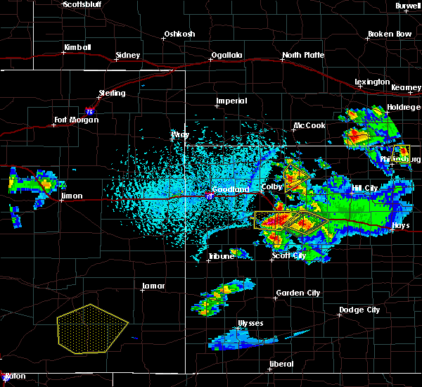 At 416 pm cdt, a severe thunderstorm was located over gove, moving northeast at 10 mph (radar indicated). Hazards include 60 mph wind gusts and quarter size hail. Hail damage to vehicles is expected. expect wind damage to roofs, siding, and trees. locations impacted include, quinter, grainfield and gove. This includes interstate 70 in kansas between mile markers 91 and 101, and between mile markers 110 and 112. At 416 pm cdt, a severe thunderstorm was located over gove, moving northeast at 10 mph (radar indicated). Hazards include 60 mph wind gusts and quarter size hail. Hail damage to vehicles is expected. expect wind damage to roofs, siding, and trees. locations impacted include, quinter, grainfield and gove. This includes interstate 70 in kansas between mile markers 91 and 101, and between mile markers 110 and 112.
|
| 5/29/2016 3:57 PM CDT |
 At 357 pm cdt, a severe thunderstorm was located 5 miles southwest of gove, moving northeast at 10 mph (radar indicated). Hazards include 60 mph wind gusts and half dollar size hail. Hail damage to vehicles is expected. Expect wind damage to roofs, siding, and trees. At 357 pm cdt, a severe thunderstorm was located 5 miles southwest of gove, moving northeast at 10 mph (radar indicated). Hazards include 60 mph wind gusts and half dollar size hail. Hail damage to vehicles is expected. Expect wind damage to roofs, siding, and trees.
|
| 5/29/2016 3:50 PM CDT |
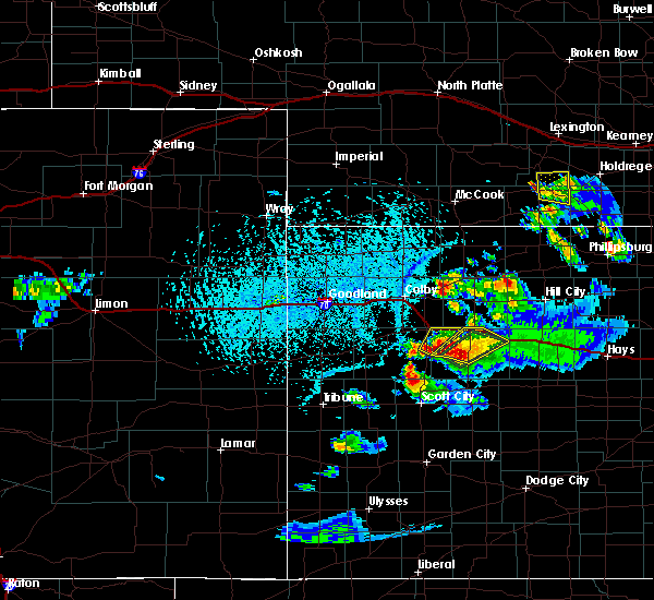 At 350 pm cdt, a severe thunderstorm was located 5 miles southwest of gove, moving northeast at 15 mph (radar indicated). Hazards include 60 mph wind gusts and half dollar size hail. Hail damage to vehicles is expected. expect wind damage to roofs, siding, and trees. locations impacted include, quinter, grainfield, gove and park. This includes interstate 70 in kansas between mile markers 91 and 112. At 350 pm cdt, a severe thunderstorm was located 5 miles southwest of gove, moving northeast at 15 mph (radar indicated). Hazards include 60 mph wind gusts and half dollar size hail. Hail damage to vehicles is expected. expect wind damage to roofs, siding, and trees. locations impacted include, quinter, grainfield, gove and park. This includes interstate 70 in kansas between mile markers 91 and 112.
|
| 5/29/2016 3:34 PM CDT |
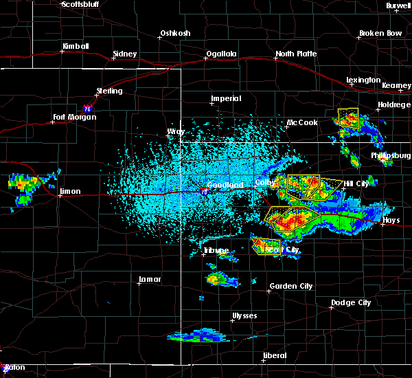 At 334 pm cdt, a severe thunderstorm was located 7 miles southwest of gove, moving northeast at 20 mph (trained weather spotters). Hazards include 60 mph wind gusts and half dollar size hail. Hail damage to vehicles is expected. expect wind damage to roofs, siding, and trees. locations impacted include, quinter, grainfield, gove and park. This includes interstate 70 in kansas between mile markers 91 and 112. At 334 pm cdt, a severe thunderstorm was located 7 miles southwest of gove, moving northeast at 20 mph (trained weather spotters). Hazards include 60 mph wind gusts and half dollar size hail. Hail damage to vehicles is expected. expect wind damage to roofs, siding, and trees. locations impacted include, quinter, grainfield, gove and park. This includes interstate 70 in kansas between mile markers 91 and 112.
|
| 5/29/2016 3:12 PM CDT |
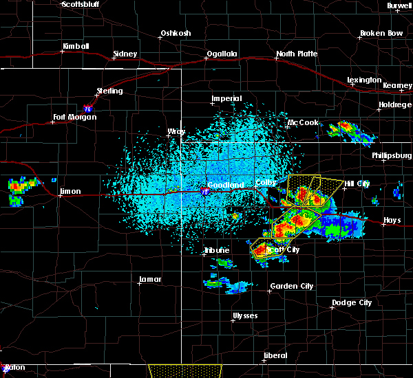 At 311 pm cdt, a severe thunderstorm was located over gove, moving northeast at 15 mph. an additional severe thunderstorm was located near monument rocks, moving northeast at 15 mph (trained weather spotters. at 309 pm cdt...half dollar size hail was reported 3 miles west of gove). Hazards include 60 mph wind gusts and half dollar size hail. Hail damage to vehicles is expected. Expect wind damage to roofs, siding, and trees. At 311 pm cdt, a severe thunderstorm was located over gove, moving northeast at 15 mph. an additional severe thunderstorm was located near monument rocks, moving northeast at 15 mph (trained weather spotters. at 309 pm cdt...half dollar size hail was reported 3 miles west of gove). Hazards include 60 mph wind gusts and half dollar size hail. Hail damage to vehicles is expected. Expect wind damage to roofs, siding, and trees.
|
| 5/29/2016 2:54 PM CDT |
 At 254 pm cdt, a severe thunderstorm was located 5 miles northeast of park, or 6 miles north of quinter, moving northeast at 30 mph (radar indicated). Hazards include golf ball size hail and 60 mph wind gusts. People and animals outdoors will be injured. expect hail damage to roofs, siding, windows, and vehicles. Expect wind damage to roofs, siding, and trees. At 254 pm cdt, a severe thunderstorm was located 5 miles northeast of park, or 6 miles north of quinter, moving northeast at 30 mph (radar indicated). Hazards include golf ball size hail and 60 mph wind gusts. People and animals outdoors will be injured. expect hail damage to roofs, siding, windows, and vehicles. Expect wind damage to roofs, siding, and trees.
|
| 5/29/2016 2:45 PM CDT |
 At 245 pm cdt, a severe thunderstorm was located near park, or 5 miles northwest of quinter, moving northeast at 30 mph (trained weather spotters). Hazards include two inch hail and 60 mph wind gusts. People and animals outdoors will be injured. expect hail damage to roofs, siding, windows, and vehicles. expect wind damage to roofs, siding, and trees. locations impacted include, hoxie, quinter, grainfield, park, tasco and studley. This includes interstate 70 in kansas between mile markers 89 and 108. At 245 pm cdt, a severe thunderstorm was located near park, or 5 miles northwest of quinter, moving northeast at 30 mph (trained weather spotters). Hazards include two inch hail and 60 mph wind gusts. People and animals outdoors will be injured. expect hail damage to roofs, siding, windows, and vehicles. expect wind damage to roofs, siding, and trees. locations impacted include, hoxie, quinter, grainfield, park, tasco and studley. This includes interstate 70 in kansas between mile markers 89 and 108.
|
| 5/29/2016 2:41 PM CDT |
 At 241 pm cdt, a severe thunderstorm was located over park, or 6 miles east of grainfield, moving northeast at 30 mph (trained weather spotters). Hazards include ping pong ball size hail and 60 mph wind gusts. People and animals outdoors will be injured. expect hail damage to roofs, siding, windows, and vehicles. expect wind damage to roofs, siding, and trees. locations impacted include, hoxie, quinter, grainfield, park, tasco and studley. This includes interstate 70 in kansas between mile markers 89 and 108. At 241 pm cdt, a severe thunderstorm was located over park, or 6 miles east of grainfield, moving northeast at 30 mph (trained weather spotters). Hazards include ping pong ball size hail and 60 mph wind gusts. People and animals outdoors will be injured. expect hail damage to roofs, siding, windows, and vehicles. expect wind damage to roofs, siding, and trees. locations impacted include, hoxie, quinter, grainfield, park, tasco and studley. This includes interstate 70 in kansas between mile markers 89 and 108.
|
| 5/29/2016 2:22 PM CDT |
 At 222 pm cdt, a severe thunderstorm was located 4 miles north of gove, moving northeast at 30 mph (trained weather spotters). Hazards include 60 mph wind gusts and half dollar size hail. Hail damage to vehicles is expected. Expect wind damage to roofs, siding, and trees. At 222 pm cdt, a severe thunderstorm was located 4 miles north of gove, moving northeast at 30 mph (trained weather spotters). Hazards include 60 mph wind gusts and half dollar size hail. Hail damage to vehicles is expected. Expect wind damage to roofs, siding, and trees.
|
| 5/29/2016 2:09 PM CDT |
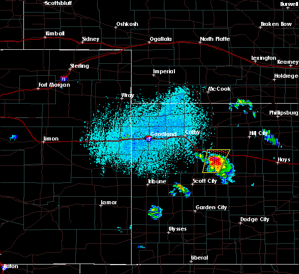 At 209 pm cdt, a severe thunderstorm was located near gove, moving north at 25 mph (radar indicated). Hazards include golf ball size hail and 60 mph wind gusts. People and animals outdoors will be injured. expect hail damage to roofs, siding, windows, and vehicles. expect wind damage to roofs, siding, and trees. locations impacted include, quinter, grainfield, gove and park. This includes interstate 70 in kansas between mile markers 87 and 107. At 209 pm cdt, a severe thunderstorm was located near gove, moving north at 25 mph (radar indicated). Hazards include golf ball size hail and 60 mph wind gusts. People and animals outdoors will be injured. expect hail damage to roofs, siding, windows, and vehicles. expect wind damage to roofs, siding, and trees. locations impacted include, quinter, grainfield, gove and park. This includes interstate 70 in kansas between mile markers 87 and 107.
|
| 5/29/2016 1:52 PM CDT |
 At 152 pm cdt, a severe thunderstorm was located 9 miles northwest of shields, moving north at 20 mph (radar indicated). Hazards include 60 mph wind gusts and half dollar size hail. Hail damage to vehicles is expected. Expect wind damage to roofs, siding, and trees. At 152 pm cdt, a severe thunderstorm was located 9 miles northwest of shields, moving north at 20 mph (radar indicated). Hazards include 60 mph wind gusts and half dollar size hail. Hail damage to vehicles is expected. Expect wind damage to roofs, siding, and trees.
|
| 5/26/2016 9:40 PM CDT |
 The severe thunderstorm warning for gove and sheridan counties will expire at 945 pm cdt, the storms which prompted the warning have weakened below severe limits, and no longer pose an immediate threat to life or property. therefore the warning will be allowed to expire. a tornado watch remains in effect until 1000 pm cdt for northwestern kansas. The severe thunderstorm warning for gove and sheridan counties will expire at 945 pm cdt, the storms which prompted the warning have weakened below severe limits, and no longer pose an immediate threat to life or property. therefore the warning will be allowed to expire. a tornado watch remains in effect until 1000 pm cdt for northwestern kansas.
|
| 5/26/2016 8:53 PM CDT |
 At 853 pm cdt, severe thunderstorms were located along a line extending from 11 miles southwest of lenora to near gove, moving northeast at 20 mph (radar indicated). Hazards include 70 mph wind gusts and quarter size hail. Hail damage to vehicles is expected. expect considerable tree damage. Wind damage is also likely to mobile homes, roofs, and outbuildings. At 853 pm cdt, severe thunderstorms were located along a line extending from 11 miles southwest of lenora to near gove, moving northeast at 20 mph (radar indicated). Hazards include 70 mph wind gusts and quarter size hail. Hail damage to vehicles is expected. expect considerable tree damage. Wind damage is also likely to mobile homes, roofs, and outbuildings.
|
| 5/26/2016 8:08 PM CDT |
 At 807 pm cdt, severe thunderstorms were located along a line extending from near rexford to 6 miles north of scott state lake, moving east at 40 mph (radar indicated). Hazards include 70 mph wind gusts. Expect considerable tree damage. Damage is likely to mobile homes, roofs, and outbuildings. At 807 pm cdt, severe thunderstorms were located along a line extending from near rexford to 6 miles north of scott state lake, moving east at 40 mph (radar indicated). Hazards include 70 mph wind gusts. Expect considerable tree damage. Damage is likely to mobile homes, roofs, and outbuildings.
|
| 5/24/2016 12:16 AM CDT | The national weather service in goodland has issued a * severe thunderstorm warning for. northeastern gove county in west central kansas. southwestern graham county in northwestern kansas. southeastern sheridan county in northwestern kansas. Until 100 am cdt. |
| 5/8/2016 5:57 PM CDT |
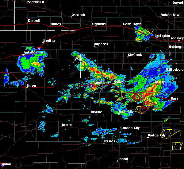 At 556 pm cdt, a confirmed tornado was located 6 miles southwest of quinter, moving northeast at 30 mph (weather spotters confirmed tornado. at 548 pm cdt...a rain wrapped tornado was reported south of gove). Hazards include damaging tornado and ping pong ball size hail. Flying debris will be dangerous to those caught without shelter. mobile homes will be damaged or destroyed. damage to roofs, windows, and vehicles will occur. Tree damage is likely. At 556 pm cdt, a confirmed tornado was located 6 miles southwest of quinter, moving northeast at 30 mph (weather spotters confirmed tornado. at 548 pm cdt...a rain wrapped tornado was reported south of gove). Hazards include damaging tornado and ping pong ball size hail. Flying debris will be dangerous to those caught without shelter. mobile homes will be damaged or destroyed. damage to roofs, windows, and vehicles will occur. Tree damage is likely.
|
| 5/7/2016 9:33 PM CDT |
 At 933 pm cdt, a severe thunderstorm was located near park, or 5 miles northwest of quinter, moving northeast at 60 mph (trained weather spotters. at 932 pm cdt...golf ball size hail was reported 3 miles south of park). Hazards include tennis ball size hail and 60 mph wind gusts. People and animals outdoors will be injured. expect hail damage to roofs, siding, windows, and vehicles. expect wind damage to roofs, siding, and trees. locations impacted include, quinter, grainfield and park. This includes interstate 70 in kansas between mile markers 94 and 108. At 933 pm cdt, a severe thunderstorm was located near park, or 5 miles northwest of quinter, moving northeast at 60 mph (trained weather spotters. at 932 pm cdt...golf ball size hail was reported 3 miles south of park). Hazards include tennis ball size hail and 60 mph wind gusts. People and animals outdoors will be injured. expect hail damage to roofs, siding, windows, and vehicles. expect wind damage to roofs, siding, and trees. locations impacted include, quinter, grainfield and park. This includes interstate 70 in kansas between mile markers 94 and 108.
|
| 5/7/2016 9:28 PM CDT |
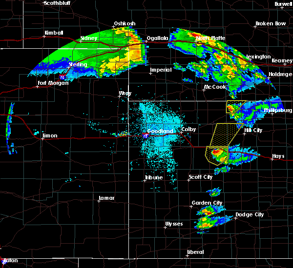 At 928 pm cdt, a severe thunderstorm was located near park, or 6 miles west of quinter, moving northeast at 60 mph. this is a very dangerous storm (radar indicated). Hazards include baseball size hail and 60 mph wind gusts. People and animals outdoors will be severely injured. expect shattered windows, extensive damage to roofs, siding, and vehicles. locations impacted include, quinter, grainfield and park. This includes interstate 70 in kansas between mile markers 94 and 109. At 928 pm cdt, a severe thunderstorm was located near park, or 6 miles west of quinter, moving northeast at 60 mph. this is a very dangerous storm (radar indicated). Hazards include baseball size hail and 60 mph wind gusts. People and animals outdoors will be severely injured. expect shattered windows, extensive damage to roofs, siding, and vehicles. locations impacted include, quinter, grainfield and park. This includes interstate 70 in kansas between mile markers 94 and 109.
|
| 5/7/2016 9:18 PM CDT |
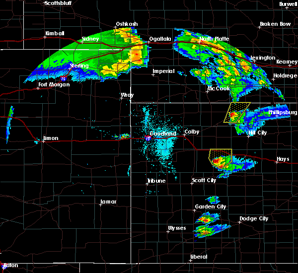 At 918 pm cdt, a severe thunderstorm was located near gove, moving northeast at 55 mph. this is a very dangerous storm (radar indicated). Hazards include three inch hail and 60 mph wind gusts. People and animals outdoors will be severely injured. expect shattered windows, extensive damage to roofs, siding, and vehicles. locations impacted include, quinter, grainfield, gove and park. This includes interstate 70 in kansas between mile markers 90 and 113. At 918 pm cdt, a severe thunderstorm was located near gove, moving northeast at 55 mph. this is a very dangerous storm (radar indicated). Hazards include three inch hail and 60 mph wind gusts. People and animals outdoors will be severely injured. expect shattered windows, extensive damage to roofs, siding, and vehicles. locations impacted include, quinter, grainfield, gove and park. This includes interstate 70 in kansas between mile markers 90 and 113.
|
| 5/7/2016 9:07 PM CDT |
 At 907 pm cdt, a severe thunderstorm was located 11 miles south of gove, moving northeast at 60 mph (radar indicated). Hazards include tennis ball size hail and 60 mph wind gusts. People and animals outdoors will be injured. expect hail damage to roofs, siding, windows, and vehicles. expect wind damage to roofs, siding, and trees. locations impacted include, quinter, grainfield, gove and park. This includes interstate 70 in kansas between mile markers 90 and 113. At 907 pm cdt, a severe thunderstorm was located 11 miles south of gove, moving northeast at 60 mph (radar indicated). Hazards include tennis ball size hail and 60 mph wind gusts. People and animals outdoors will be injured. expect hail damage to roofs, siding, windows, and vehicles. expect wind damage to roofs, siding, and trees. locations impacted include, quinter, grainfield, gove and park. This includes interstate 70 in kansas between mile markers 90 and 113.
|
| 5/7/2016 8:52 PM CDT |
 At 851 pm cdt, a severe thunderstorm was located over healy, moving northeast at 60 mph (radar indicated). Hazards include two inch hail and 60 mph wind gusts. People and animals outdoors will be injured. expect hail damage to roofs, siding, windows, and vehicles. Expect wind damage to roofs, siding, and trees. At 851 pm cdt, a severe thunderstorm was located over healy, moving northeast at 60 mph (radar indicated). Hazards include two inch hail and 60 mph wind gusts. People and animals outdoors will be injured. expect hail damage to roofs, siding, windows, and vehicles. Expect wind damage to roofs, siding, and trees.
|
| 11/16/2015 8:05 PM CST |
 At 805 pm cst, severe thunderstorms were located along a line extending from 4 miles southwest of park to 12 miles south of quinter, moving northeast at 50 mph (radar indicated). Hazards include ping pong ball size hail and 60 mph wind gusts. People and animals outdoors will be injured. expect hail damage to roofs, siding, windows and vehicles. expect wind damage to roofs, siding and trees. locations impacted include, quinter, grainfield, gove and park. this includes interstate 70 in kansas between mile markers 93 and 112. A tornado watch remains in effect until 1000 pm cst for west central kansas. At 805 pm cst, severe thunderstorms were located along a line extending from 4 miles southwest of park to 12 miles south of quinter, moving northeast at 50 mph (radar indicated). Hazards include ping pong ball size hail and 60 mph wind gusts. People and animals outdoors will be injured. expect hail damage to roofs, siding, windows and vehicles. expect wind damage to roofs, siding and trees. locations impacted include, quinter, grainfield, gove and park. this includes interstate 70 in kansas between mile markers 93 and 112. A tornado watch remains in effect until 1000 pm cst for west central kansas.
|
| 11/16/2015 7:52 PM CST |
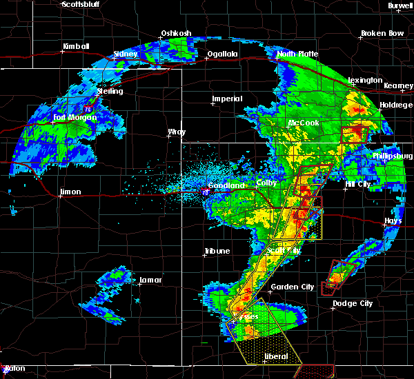 At 752 pm cst, severe thunderstorms were located along a line extending from 4 miles northwest of gove to 11 miles north of shields, moving northeast at 45 mph (radar indicated). Hazards include 60 mph wind gusts and quarter size hail. Hail damage to vehicles is expected. Expect wind damage to roofs, siding and trees. At 752 pm cst, severe thunderstorms were located along a line extending from 4 miles northwest of gove to 11 miles north of shields, moving northeast at 45 mph (radar indicated). Hazards include 60 mph wind gusts and quarter size hail. Hail damage to vehicles is expected. Expect wind damage to roofs, siding and trees.
|
| 11/16/2015 7:48 PM CST |
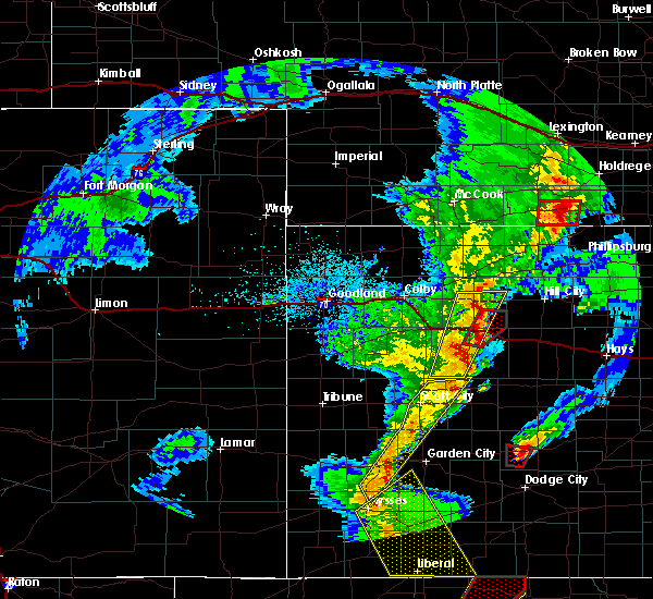 At 748 pm cst, a severe thunderstorm capable of producing a tornado was located near park, or 4 miles east of grainfield, moving northeast at 45 mph (radar indicated rotation). Hazards include tornado and ping pong ball size hail. Flying debris will be dangerous to those caught without shelter. mobile homes will be damaged or destroyed. damage to roofs, windows and vehicles will occur. tree damage is likely. locations impacted include, quinter, grainfield and park. This includes interstate 70 in kansas between mile markers 95 and 107. At 748 pm cst, a severe thunderstorm capable of producing a tornado was located near park, or 4 miles east of grainfield, moving northeast at 45 mph (radar indicated rotation). Hazards include tornado and ping pong ball size hail. Flying debris will be dangerous to those caught without shelter. mobile homes will be damaged or destroyed. damage to roofs, windows and vehicles will occur. tree damage is likely. locations impacted include, quinter, grainfield and park. This includes interstate 70 in kansas between mile markers 95 and 107.
|
| 11/16/2015 7:36 PM CST |
 At 735 pm cst, a severe thunderstorm capable of producing a tornado was located near gove, moving northeast at 40 mph (radar indicated rotation). Hazards include tornado. Flying debris will be dangerous to those caught without shelter. mobile homes will be damaged or destroyed. damage to roofs, windows and vehicles will occur. Tree damage is likely. At 735 pm cst, a severe thunderstorm capable of producing a tornado was located near gove, moving northeast at 40 mph (radar indicated rotation). Hazards include tornado. Flying debris will be dangerous to those caught without shelter. mobile homes will be damaged or destroyed. damage to roofs, windows and vehicles will occur. Tree damage is likely.
|
| 8/7/2015 10:04 PM CDT |
 At 1004 pm cdt, severe thunderstorms were located along a line extending from 10 miles north of norton to 3 miles northeast of voda, moving east at 35 mph (radar indicated). Hazards include 70 mph wind gusts and quarter size hail. Hail damage to vehicles is expected. expect considerable tree damage. Wind damage is also likely to mobile homes, roofs and outbuildings. At 1004 pm cdt, severe thunderstorms were located along a line extending from 10 miles north of norton to 3 miles northeast of voda, moving east at 35 mph (radar indicated). Hazards include 70 mph wind gusts and quarter size hail. Hail damage to vehicles is expected. expect considerable tree damage. Wind damage is also likely to mobile homes, roofs and outbuildings.
|
| 8/7/2015 9:27 PM CDT |
 At 927 pm cdt, severe thunderstorms were located along a line extending from 5 miles northeast of herndon to 5 miles northeast of park, moving north at 25 mph (radar indicated). Hazards include 70 mph wind gusts and quarter size hail. Hail damage to vehicles is expected. expect considerable tree damage. wind damage is also likely to mobile homes, roofs and outbuildings. locations impacted include, norton, oberlin, hill city, hoxie, quinter, grainfield, lenora, selden, morland and norcatur. This includes interstate 70 in kansas between mile markers 95 and 113. At 927 pm cdt, severe thunderstorms were located along a line extending from 5 miles northeast of herndon to 5 miles northeast of park, moving north at 25 mph (radar indicated). Hazards include 70 mph wind gusts and quarter size hail. Hail damage to vehicles is expected. expect considerable tree damage. wind damage is also likely to mobile homes, roofs and outbuildings. locations impacted include, norton, oberlin, hill city, hoxie, quinter, grainfield, lenora, selden, morland and norcatur. This includes interstate 70 in kansas between mile markers 95 and 113.
|
| 8/7/2015 9:09 PM CDT |
 At 908 pm cdt, severe thunderstorms were located along a line extending from 6 miles south of herndon to 7 miles southwest of quinter, moving northeast at 30 mph (radar indicated). Hazards include 70 mph wind gusts and quarter size hail. Hail damage to vehicles is expected. expect considerable tree damage. Wind damage is also likely to mobile homes, roofs and outbuildings. At 908 pm cdt, severe thunderstorms were located along a line extending from 6 miles south of herndon to 7 miles southwest of quinter, moving northeast at 30 mph (radar indicated). Hazards include 70 mph wind gusts and quarter size hail. Hail damage to vehicles is expected. expect considerable tree damage. Wind damage is also likely to mobile homes, roofs and outbuildings.
|
| 7/26/2015 9:31 PM CDT |
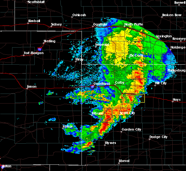 At 931 pm cdt, a severe thunderstorm was located near gove, moving east at 30 mph (radar indicated). Hazards include 60 mph wind gusts and quarter size hail. Hail damage to vehicles is expected. expect wind damage to roofs, siding and trees. locations impacted include, quinter and gove. This includes interstate 70 in kansas between mile markers 103 and 113. At 931 pm cdt, a severe thunderstorm was located near gove, moving east at 30 mph (radar indicated). Hazards include 60 mph wind gusts and quarter size hail. Hail damage to vehicles is expected. expect wind damage to roofs, siding and trees. locations impacted include, quinter and gove. This includes interstate 70 in kansas between mile markers 103 and 113.
|
| 7/26/2015 9:17 PM CDT |
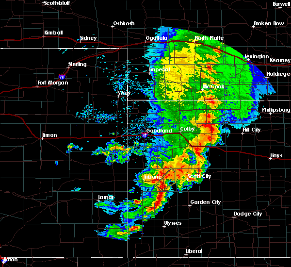 At 917 pm cdt, a severe thunderstorm was located 4 miles west of gove, moving east at 30 mph (radar indicated). Hazards include 60 mph wind gusts and half dollar size hail. Hail damage to vehicles is expected. Expect wind damage to roofs, siding and trees. At 917 pm cdt, a severe thunderstorm was located 4 miles west of gove, moving east at 30 mph (radar indicated). Hazards include 60 mph wind gusts and half dollar size hail. Hail damage to vehicles is expected. Expect wind damage to roofs, siding and trees.
|
| 6/4/2015 10:55 PM CDT | At 1054 pm cdt, a severe thunderstorm was located near grainfield, moving northeast at 20 mph (radar indicated). Hazards include half dollar size hail. Damage to vehicles is expected. locations impacted include, quinter, grainfield, grinnell and park. this includes interstate 70 in kansas between mile markers 86 and 112. A tornado watch remains in effect until 200 am cdt for northwestern kansas. |
| 6/4/2015 10:41 PM CDT | At 1040 pm cdt, a severe thunderstorm was located near grainfield, moving northeast at 15 mph (radar indicated). Hazards include half dollar size hail. Damage to vehicles is expected. locations impacted include, quinter, grainfield, grinnell, park and gove. this includes interstate 70 in kansas between mile markers 86 and 112. A tornado watch remains in effect until 200 am cdt for northwestern kansas. |
| 6/4/2015 10:13 PM CDT | At 1013 pm cdt, a severe thunderstorm was located 4 miles south of park, moving northeast at 20 mph (radar indicated). Hazards include ping pong ball size hail. People and animals outdoors will be injured. Expect damage to roofs, siding, windows and vehicles. |
| 6/4/2015 10:08 PM CDT | At 1007 pm cdt, a severe thunderstorm was located 5 miles southwest of quinter, moving east at 20 mph (radar indicated). Hazards include half dollar size hail. Damage to vehicles is expected. locations impacted include, quinter, grainfield, park and gove. this includes interstate 70 in kansas between mile markers 88 and 112. A tornado watch remains in effect until 200 am cdt for west central kansas. |
| 6/4/2015 9:34 PM CDT | At 933 pm cdt, a severe thunderstorm was located near grainfield, moving northeast at 25 mph (law enforcement). Hazards include half dollar size hail. Damage to vehicles is expected. locations impacted include, quinter, grainfield, park and gove. this includes interstate 70 in kansas between mile markers 88 and 112. A tornado watch remains in effect until 200 am cdt for west central kansas. |
| 6/4/2015 9:10 PM CDT | At 909 pm cdt, a severe thunderstorm was located 5 miles south of grainfield, moving northeast at 30 mph (radar indicated). Hazards include ping pong ball size hail. People and animals outdoors will be injured. Expect damage to roofs, siding, windows and vehicles. |
| 5/27/2015 3:42 PM CDT | At 342 pm cdt, severe thunderstorms were located along a line extending from near gem to 11 miles north of pendennis, moving northeast at 25 mph (radar indicated). Hazards include ping pong ball size hail and 60 mph wind gusts. People and animals outdoors will be injured. expect hail damage to roofs, siding, windows and vehicles. expect wind damage to roofs, siding and trees. locations impacted include, colby, oakley, hoxie, quinter, grainfield, grinnell, park, gove, levant and rexford. this includes interstate 70 in kansas between mile markers 46 and 112. A tornado watch remains in effect until 1000 pm cdt for northwestern kansas. |
| 5/27/2015 3:35 PM CDT | At 334 pm cdt, severe thunderstorms were located along a line extending from 4 miles southeast of levant to 6 miles north of shields, moving northeast at 105 mph (radar indicated). Hazards include ping pong ball size hail and 60 mph wind gusts. People and animals outdoors will be injured. expect hail damage to roofs, siding, windows and vehicles. Expect wind damage to roofs, siding and trees. |
| 4/2/2015 9:42 PM CDT | The severe thunderstorm warning for eastern gove county will expire at 945 pm cdt. the storm which prompted the warning has moved out of the area. therefore the warning will be allowed to expire. however gusty winds are still possible with this thunderstorm. to report severe weather. Contact your nearest law enforcement. |
| 4/2/2015 9:37 PM CDT | A severe thunderstorm warning remains in effect until 945 pm cdt for eastern gove county. at 936 pm cdt. a severe thunderstorm was located 8 miles north of ransom. moving east at 55 mph. hazard. 60 mph wind gusts. source. Radar indicated. |
| 4/2/2015 9:15 PM CDT | A severe thunderstorm warning remains in effect until 945 pm cdt for gove county. at 915 pm cdt. a severe thunderstorm was located 11 miles north of pendennis. moving east at 55 mph. hazard. 60 mph wind gusts and quarter size hail. Blowing dust creating near zero visibility possible. |
| 4/2/2015 8:11 PM CST | Half Dollar sized hail reported 0.6 miles SW of Quinter, KS |
| 4/2/2015 8:41 PM CDT | The national weather service in goodland has issued a * severe thunderstorm warning for. gove county in west central kansas. until 945 pm cdt * at 841 pm cdt. a severe thunderstorm was located 9 miles northwest of the monument rocks. Or 14 miles north of scott state lake. |
| 6/5/2014 3:43 AM CDT | Quarter sized hail reported 0.6 miles SW of Quinter, KS |
| 6/1/2014 5:10 PM CDT | 60 mph straight line winds in gove county KS, 0.6 miles SW of Quinter, KS |
| 5/19/2013 4:50 PM CDT | Golf Ball sized hail reported 0.6 miles SW of Quinter, KS, mainly pea sized but several larger stones |
| 9/4/2012 4:48 PM CDT | Storm damage reported in gove county KS, 0.6 miles SW of Quinter, KS |
| 9/4/2012 4:48 PM CDT | Several one inch diameter tree limbs had been broken across the tow in gove county KS, 0.6 miles SW of Quinter, KS |
| 1/1/0001 12:00 AM | Storm damage reported in graham county KS, 6.7 miles SW of Quinter, KS |
Hail Maps for Quinter, KS


Connect with Interactive Hail Maps