

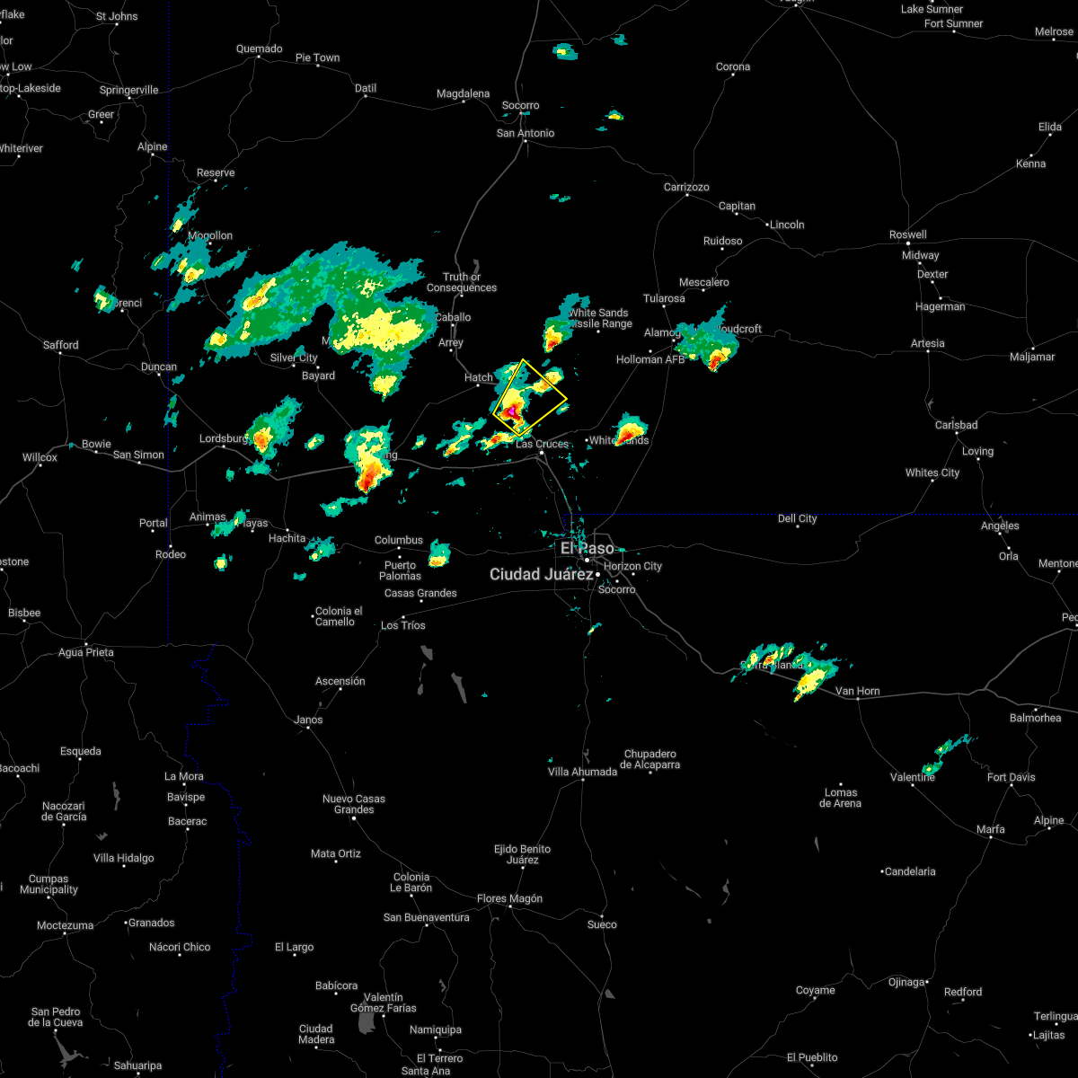
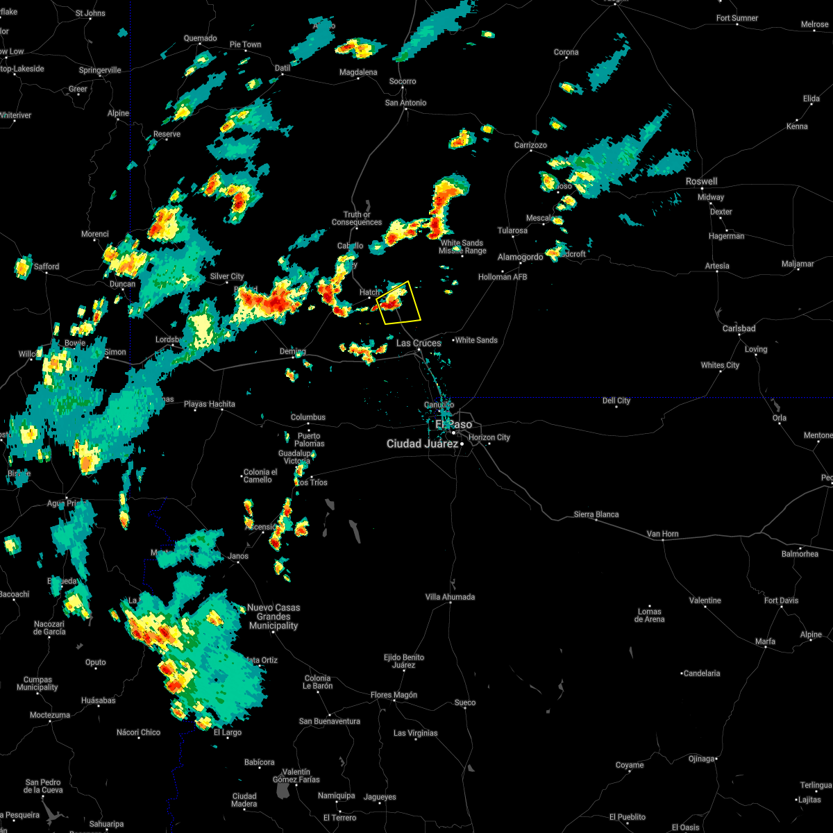
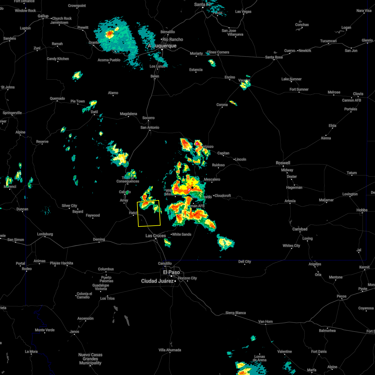
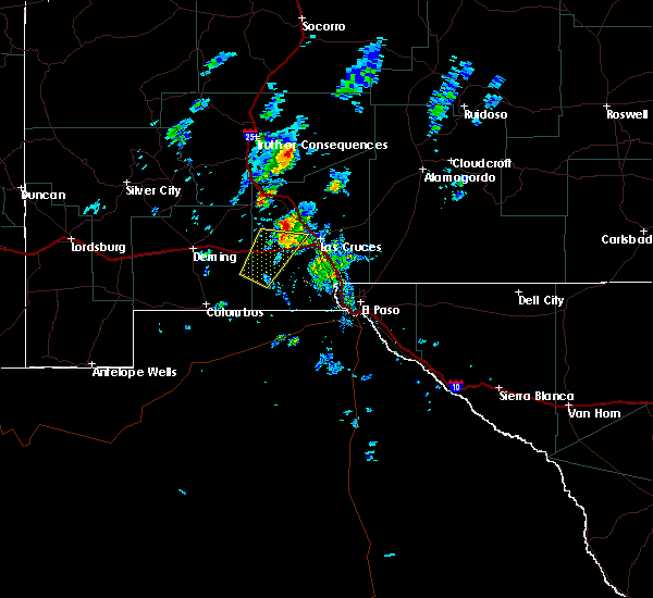
Hail Map for Radium Springs, NM
The Radium Springs, NM area has had 0 reports of on-the-ground hail by trained spotters, and has been under severe weather warnings 0 times during the past 12 months. Doppler radar has detected hail at or near Radium Springs, NM on 27 occasions.
| Name: | Radium Springs, NM |
| Where Located: | 55.9 miles NNW of El Paso, TX |
| Map: | Google Map for Radium Springs, NM |
| Population: | 1699 |
| Housing Units: | 689 |
| More Info: | Search Google for Radium Springs, NM |
0
The Top Recent Hail Date for Radium Springs, NM is Sunday, June 30, 2024 (24th out of 27)

Hail and Wind Damage Spotted near Radium Springs, NM
| Date / Time | Report Details |
|---|---|
| 6/30/2024 4:09 PM MDT |
 the severe thunderstorm warning has been cancelled and is no longer in effect the severe thunderstorm warning has been cancelled and is no longer in effect
|
| 6/30/2024 3:41 PM MDT |
 At 341 pm mdt, a severe thunderstorm was located 4 miles northeast of dona ana, moving northwest at 15 mph (radar indicated). Hazards include ping pong ball size hail and 60 mph wind gusts. People and animals outdoors will be injured. expect hail damage to roofs, siding, windows, and vehicles. expect wind damage to roofs, siding, and trees. Locations impacted include, leasburg, jornada range, radium springs, dona ana, east mesa, portions of jornada experimental range, northeast las cruces, fort selden state historic site, and leasburg dam state park. At 341 pm mdt, a severe thunderstorm was located 4 miles northeast of dona ana, moving northwest at 15 mph (radar indicated). Hazards include ping pong ball size hail and 60 mph wind gusts. People and animals outdoors will be injured. expect hail damage to roofs, siding, windows, and vehicles. expect wind damage to roofs, siding, and trees. Locations impacted include, leasburg, jornada range, radium springs, dona ana, east mesa, portions of jornada experimental range, northeast las cruces, fort selden state historic site, and leasburg dam state park.
|
| 6/30/2024 3:38 PM MDT |
 Svrepz the national weather service in el paso has issued a * severe thunderstorm warning for, central dona ana county in south central new mexico, * until 430 pm mdt. * at 338 pm mdt, a severe thunderstorm was located 4 miles northeast of dona ana, moving northwest at 15 mph (radar indicated). Hazards include 60 mph wind gusts and quarter size hail. Hail damage to vehicles is expected. Expect wind damage to roofs, siding, and trees. Svrepz the national weather service in el paso has issued a * severe thunderstorm warning for, central dona ana county in south central new mexico, * until 430 pm mdt. * at 338 pm mdt, a severe thunderstorm was located 4 miles northeast of dona ana, moving northwest at 15 mph (radar indicated). Hazards include 60 mph wind gusts and quarter size hail. Hail damage to vehicles is expected. Expect wind damage to roofs, siding, and trees.
|
| 6/29/2024 3:59 PM MDT |
 The storm which prompted the warning has weakened below severe limits, and no longer poses an immediate threat to life or property. therefore, the warning will be allowed to expire. however, heavy rain is still possible with this thunderstorm. The storm which prompted the warning has weakened below severe limits, and no longer poses an immediate threat to life or property. therefore, the warning will be allowed to expire. however, heavy rain is still possible with this thunderstorm.
|
| 6/29/2024 3:36 PM MDT |
 Svrepz the national weather service in el paso has issued a * severe thunderstorm warning for, central dona ana county in south central new mexico, * until 400 pm mdt. * at 335 pm mdt, a severe thunderstorm was located over dona ana, moving north at 15 mph (radar indicated). Hazards include 60 mph wind gusts and half dollar size hail. Hail damage to vehicles is expected. Expect wind damage to roofs, siding, and trees. Svrepz the national weather service in el paso has issued a * severe thunderstorm warning for, central dona ana county in south central new mexico, * until 400 pm mdt. * at 335 pm mdt, a severe thunderstorm was located over dona ana, moving north at 15 mph (radar indicated). Hazards include 60 mph wind gusts and half dollar size hail. Hail damage to vehicles is expected. Expect wind damage to roofs, siding, and trees.
|
| 10/16/2022 2:26 PM MDT |
 At 226 pm mdt, a severe thunderstorm was located 6 miles northeast of radium springs, moving northeast at 60 mph (radar indicated). Hazards include 60 mph wind gusts and quarter size hail. Hail damage to vehicles is expected. Expect wind damage to roofs, siding, and trees. At 226 pm mdt, a severe thunderstorm was located 6 miles northeast of radium springs, moving northeast at 60 mph (radar indicated). Hazards include 60 mph wind gusts and quarter size hail. Hail damage to vehicles is expected. Expect wind damage to roofs, siding, and trees.
|
| 9/26/2021 4:43 PM MDT |
 The severe thunderstorm warning for west central dona ana county will expire at 445 pm mdt, the storm which prompted the warning has moved out of the area. therefore, the warning will be allowed to expire. The severe thunderstorm warning for west central dona ana county will expire at 445 pm mdt, the storm which prompted the warning has moved out of the area. therefore, the warning will be allowed to expire.
|
| 9/26/2021 4:10 PM MDT |
 At 409 pm mdt, a severe thunderstorm was located 4 miles west of radium springs, moving northeast at 35 mph (radar indicated). Hazards include golf ball size hail and 60 mph wind gusts. People and animals outdoors will be injured. expect hail damage to roofs, siding, windows, and vehicles. expect wind damage to roofs, siding, and trees. locations impacted include, leasburg, rincon, las cruces, radium springs, dona ana, east mesa, portions of jornada experimental range, hill, northeast las cruces, corralitos, fort selden state historic site and leasburg dam state park. this includes the following highways, interstate 25 in new mexico near mile marker 1, and between mile markers 7 and 34. highway 70 in new mexico between mile markers 153 and 157. thunderstorm damage threat, considerable hail threat, radar indicated max hail size, 1. 75 in wind threat, radar indicated max wind gust, 60 mph. At 409 pm mdt, a severe thunderstorm was located 4 miles west of radium springs, moving northeast at 35 mph (radar indicated). Hazards include golf ball size hail and 60 mph wind gusts. People and animals outdoors will be injured. expect hail damage to roofs, siding, windows, and vehicles. expect wind damage to roofs, siding, and trees. locations impacted include, leasburg, rincon, las cruces, radium springs, dona ana, east mesa, portions of jornada experimental range, hill, northeast las cruces, corralitos, fort selden state historic site and leasburg dam state park. this includes the following highways, interstate 25 in new mexico near mile marker 1, and between mile markers 7 and 34. highway 70 in new mexico between mile markers 153 and 157. thunderstorm damage threat, considerable hail threat, radar indicated max hail size, 1. 75 in wind threat, radar indicated max wind gust, 60 mph.
|
| 9/26/2021 3:54 PM MDT |
 At 354 pm mdt, a severe thunderstorm was located 14 miles southwest of radium springs, moving northeast at 35 mph (radar indicated). Hazards include 60 mph wind gusts and quarter size hail. Hail damage to vehicles is expected. Expect wind damage to roofs, siding, and trees. At 354 pm mdt, a severe thunderstorm was located 14 miles southwest of radium springs, moving northeast at 35 mph (radar indicated). Hazards include 60 mph wind gusts and quarter size hail. Hail damage to vehicles is expected. Expect wind damage to roofs, siding, and trees.
|
| 8/23/2021 4:17 PM MDT |
 At 417 pm mdt, a severe thunderstorm was located 6 miles southeast of rincon, moving east at 5 mph (radar indicated). Hazards include 60 mph wind gusts and half dollar size hail. Hail damage to vehicles is expected. Expect wind damage to roofs, siding, and trees. At 417 pm mdt, a severe thunderstorm was located 6 miles southeast of rincon, moving east at 5 mph (radar indicated). Hazards include 60 mph wind gusts and half dollar size hail. Hail damage to vehicles is expected. Expect wind damage to roofs, siding, and trees.
|
| 7/11/2021 8:28 PM MDT |
 At 828 pm mdt, a severe thunderstorm was located 7 miles south of hatch, moving south at 40 mph (radar indicated). Hazards include 60 mph wind gusts and quarter size hail. Hail damage to vehicles is expected. Expect wind damage to roofs, siding, and trees. At 828 pm mdt, a severe thunderstorm was located 7 miles south of hatch, moving south at 40 mph (radar indicated). Hazards include 60 mph wind gusts and quarter size hail. Hail damage to vehicles is expected. Expect wind damage to roofs, siding, and trees.
|
| 7/11/2021 7:06 PM MDT |
 At 706 pm mdt, a severe thunderstorm was located over jornada range, moving south at 20 mph (radar indicated). Hazards include 70 mph wind gusts and ping pong ball size hail. People and animals outdoors will be injured. expect hail damage to roofs, siding, windows, and vehicles. expect considerable tree damage. Wind damage is also likely to mobile homes, roofs, and outbuildings. At 706 pm mdt, a severe thunderstorm was located over jornada range, moving south at 20 mph (radar indicated). Hazards include 70 mph wind gusts and ping pong ball size hail. People and animals outdoors will be injured. expect hail damage to roofs, siding, windows, and vehicles. expect considerable tree damage. Wind damage is also likely to mobile homes, roofs, and outbuildings.
|
| 7/11/2021 6:13 PM MDT |
 At 612 pm mdt, a severe thunderstorm was located 6 miles southeast of upham, moving south at 25 mph (radar indicated). Hazards include golf ball size hail and 60 mph wind gusts. People and animals outdoors will be injured. expect hail damage to roofs, siding, windows, and vehicles. Expect wind damage to roofs, siding, and trees. At 612 pm mdt, a severe thunderstorm was located 6 miles southeast of upham, moving south at 25 mph (radar indicated). Hazards include golf ball size hail and 60 mph wind gusts. People and animals outdoors will be injured. expect hail damage to roofs, siding, windows, and vehicles. Expect wind damage to roofs, siding, and trees.
|
| 3/18/2020 10:43 PM MDT |
 At 1041 pm mdt, severe thunderstorms were approaching the las cruces area and surrounding locations, moving northeast at 50 mph (radar indicated). Hazards include 60 mph wind gusts and penny size hail. expect damage to roofs, siding, and trees At 1041 pm mdt, severe thunderstorms were approaching the las cruces area and surrounding locations, moving northeast at 50 mph (radar indicated). Hazards include 60 mph wind gusts and penny size hail. expect damage to roofs, siding, and trees
|
| 6/4/2019 3:47 PM MDT |
 At 346 pm mdt, a severe thunderstorm was located 6 miles northeast of dona ana, moving northeast at 20 mph (radar indicated). Hazards include 60 mph wind gusts and quarter size hail. Hail damage to vehicles is expected. expect wind damage to roofs, siding, and trees. Locations impacted include, leasburg, las cruces, jornada range, dona ana, nmsu main campus, mesilla, fairacres, organ, east mesa, picacho, portions of jornada experimental range, hill, northeast las cruces, dripping springs, aguirre springs and portions of organ mountains desert peaks national monument. At 346 pm mdt, a severe thunderstorm was located 6 miles northeast of dona ana, moving northeast at 20 mph (radar indicated). Hazards include 60 mph wind gusts and quarter size hail. Hail damage to vehicles is expected. expect wind damage to roofs, siding, and trees. Locations impacted include, leasburg, las cruces, jornada range, dona ana, nmsu main campus, mesilla, fairacres, organ, east mesa, picacho, portions of jornada experimental range, hill, northeast las cruces, dripping springs, aguirre springs and portions of organ mountains desert peaks national monument.
|
| 6/4/2019 3:23 PM MDT |
 At 323 pm mdt, a severe thunderstorm was located near dona ana, moving northeast at 10 mph (radar indicated). Hazards include 60 mph wind gusts and quarter size hail. Hail damage to vehicles is expected. Expect wind damage to roofs, siding, and trees. At 323 pm mdt, a severe thunderstorm was located near dona ana, moving northeast at 10 mph (radar indicated). Hazards include 60 mph wind gusts and quarter size hail. Hail damage to vehicles is expected. Expect wind damage to roofs, siding, and trees.
|
| 10/7/2018 4:41 PM MDT |
 At 438 pm mdt, a severe thunderstorm was located 5 miles southwest of radium springs, moving northeast at 50 mph (radar indicated). Hazards include 60 mph wind gusts and quarter size hail. Hail damage to vehicles is expected. Expect wind damage to roofs, siding, and trees. At 438 pm mdt, a severe thunderstorm was located 5 miles southwest of radium springs, moving northeast at 50 mph (radar indicated). Hazards include 60 mph wind gusts and quarter size hail. Hail damage to vehicles is expected. Expect wind damage to roofs, siding, and trees.
|
| 8/13/2017 3:46 PM MDT |
 At 346 pm mdt, a severe thunderstorm was located over east mesa, or 4 miles north of las cruces, moving east at 20 mph (radar indicated). Hazards include quarter size hail. damage to vehicles is expected At 346 pm mdt, a severe thunderstorm was located over east mesa, or 4 miles north of las cruces, moving east at 20 mph (radar indicated). Hazards include quarter size hail. damage to vehicles is expected
|
| 11/4/2016 7:30 PM MDT |
 At 730 pm mdt, a severe thunderstorm was located near dona ana, or 6 miles east of leasburg, moving east at 25 mph (trained weather spotters). Hazards include quarter size hail. Damage to vehicles is expected. Locations impacted include, radium springs, leasburg, las cruces, dona ana, talavera, fairacres, northeast las cruces, hill, east mesa, portions of jornada experimental range, leasburg dam state park, and fort selden state historic site. At 730 pm mdt, a severe thunderstorm was located near dona ana, or 6 miles east of leasburg, moving east at 25 mph (trained weather spotters). Hazards include quarter size hail. Damage to vehicles is expected. Locations impacted include, radium springs, leasburg, las cruces, dona ana, talavera, fairacres, northeast las cruces, hill, east mesa, portions of jornada experimental range, leasburg dam state park, and fort selden state historic site.
|
| 11/4/2016 7:06 PM MDT |
 At 706 pm mdt, a severe thunderstorm was located 5 miles southwest of leasburg, moving east at 25 mph (radar indicated). Hazards include 60 mph wind gusts and quarter size hail. Hail damage to vehicles is expected. Expect wind damage to roofs, siding, and trees. At 706 pm mdt, a severe thunderstorm was located 5 miles southwest of leasburg, moving east at 25 mph (radar indicated). Hazards include 60 mph wind gusts and quarter size hail. Hail damage to vehicles is expected. Expect wind damage to roofs, siding, and trees.
|
| 11/4/2016 6:23 PM MDT |
 The severe thunderstorm warning for central dona ana county will expire at 630 pm mdt, the storm which prompted the warning has weakened below severe limits, and no longer pose an immediate threat to life or property. therefore, the warning will be allowed to expire. The severe thunderstorm warning for central dona ana county will expire at 630 pm mdt, the storm which prompted the warning has weakened below severe limits, and no longer pose an immediate threat to life or property. therefore, the warning will be allowed to expire.
|
| 11/4/2016 5:59 PM MDT |
 At 559 pm mdt, a severe thunderstorm was located 5 miles southwest of jornada range, moving northeast at 30 mph (radar indicated). Hazards include 60 mph wind gusts and half dollar size hail. Hail damage to vehicles is expected. expect wind damage to roofs, siding, and trees. Locations impacted include, radium springs, jornada range, leasburg, dona ana, hill, portions of jornada experimental range, east mesa, leasburg dam state park, and fort selden state historic site. At 559 pm mdt, a severe thunderstorm was located 5 miles southwest of jornada range, moving northeast at 30 mph (radar indicated). Hazards include 60 mph wind gusts and half dollar size hail. Hail damage to vehicles is expected. expect wind damage to roofs, siding, and trees. Locations impacted include, radium springs, jornada range, leasburg, dona ana, hill, portions of jornada experimental range, east mesa, leasburg dam state park, and fort selden state historic site.
|
| 11/4/2016 5:43 PM MDT |
 At 542 pm mdt, a severe thunderstorm was located over radium springs, moving northeast at 30 mph (radar indicated). Hazards include 60 mph wind gusts and quarter size hail. Hail damage to vehicles is expected. Expect wind damage to roofs, siding, and trees. At 542 pm mdt, a severe thunderstorm was located over radium springs, moving northeast at 30 mph (radar indicated). Hazards include 60 mph wind gusts and quarter size hail. Hail damage to vehicles is expected. Expect wind damage to roofs, siding, and trees.
|
| 10/9/2016 11:52 PM MDT |
 At 1150 pm mdt, severe thunderstorms were located over 10 miles northwest of las cruces moving southeast at 25 mph (radar indicated). Hazards include 60 mph wind gusts and quarter size hail. Hail damage to vehicles is expected. Expect wind damage to roofs, siding, and trees. At 1150 pm mdt, severe thunderstorms were located over 10 miles northwest of las cruces moving southeast at 25 mph (radar indicated). Hazards include 60 mph wind gusts and quarter size hail. Hail damage to vehicles is expected. Expect wind damage to roofs, siding, and trees.
|
| 8/28/2016 3:19 PM MDT |
 The national weather service in el paso has issued a * severe thunderstorm warning for. central dona ana county in south central new mexico. until 400 pm mdt * at 318 pm mdt. a severe thunderstorm was located between radium springs and leasburg. Moving east at 15 mph. The national weather service in el paso has issued a * severe thunderstorm warning for. central dona ana county in south central new mexico. until 400 pm mdt * at 318 pm mdt. a severe thunderstorm was located between radium springs and leasburg. Moving east at 15 mph.
|
| 8/27/2016 6:13 PM MDT |
 At 612 pm mdt, a severe thunderstorm was located near dona ana, or 5 miles northwest of las cruces, moving east at 25 mph (radar indicated). Hazards include 60 mph wind gusts and quarter size hail. Hail damage to vehicles is expected. Expect wind damage to roofs, siding, and trees. At 612 pm mdt, a severe thunderstorm was located near dona ana, or 5 miles northwest of las cruces, moving east at 25 mph (radar indicated). Hazards include 60 mph wind gusts and quarter size hail. Hail damage to vehicles is expected. Expect wind damage to roofs, siding, and trees.
|
| 5/18/2016 3:51 PM MDT |
 The severe thunderstorm warning for central dona ana county will expire at 400 pm mdt, the storm which prompted the warning has moved out of the area. therefore the warning will be allowed to expire. another warning is now in effect for the las cruces area until 430 pm. The severe thunderstorm warning for central dona ana county will expire at 400 pm mdt, the storm which prompted the warning has moved out of the area. therefore the warning will be allowed to expire. another warning is now in effect for the las cruces area until 430 pm.
|
| 5/18/2016 3:36 PM MDT |
 At 336 pm mdt, a severe thunderstorm was located 5 miles southwest of leasburg, moving east at 20 mph (radar indicated). Hazards include 60 mph wind gusts and quarter size hail. Hail damage to vehicles is expected. expect wind damage to roofs, siding, and trees. Locations impacted include, las cruces, leasburg, radium springs, dona ana, lookout peak. At 336 pm mdt, a severe thunderstorm was located 5 miles southwest of leasburg, moving east at 20 mph (radar indicated). Hazards include 60 mph wind gusts and quarter size hail. Hail damage to vehicles is expected. expect wind damage to roofs, siding, and trees. Locations impacted include, las cruces, leasburg, radium springs, dona ana, lookout peak.
|
| 5/18/2016 3:17 PM MDT |
 At 316 pm mdt, a severe thunderstorm was located 5 miles northwest of corralitos, or 11 miles southwest of leasburg, moving northeast at 20 mph (radar indicated). Hazards include 60 mph wind gusts and quarter size hail. Hail damage to vehicles is expected. Expect wind damage to roofs, siding, and trees. At 316 pm mdt, a severe thunderstorm was located 5 miles northwest of corralitos, or 11 miles southwest of leasburg, moving northeast at 20 mph (radar indicated). Hazards include 60 mph wind gusts and quarter size hail. Hail damage to vehicles is expected. Expect wind damage to roofs, siding, and trees.
|
| 5/18/2016 2:55 PM MDT |
 The severe thunderstorm warning for central dona ana county will expire at 300 pm mdt, the storm which prompted the warning has weakened below severe limits, and no longer poses an immediate threat to life or property. therefore the warning will be allowed to expire. however hail to the size of dimes is still possible with this thunderstorm. The severe thunderstorm warning for central dona ana county will expire at 300 pm mdt, the storm which prompted the warning has weakened below severe limits, and no longer poses an immediate threat to life or property. therefore the warning will be allowed to expire. however hail to the size of dimes is still possible with this thunderstorm.
|
| 5/18/2016 2:35 PM MDT |
 At 234 pm mdt, a severe thunderstorm was located 7 miles south of jornada range, or 8 miles northeast of leasburg, moving northeast at 20 mph (radar indicated. at 210 pm penny size hail was reported near leasburg). Hazards include 60 mph wind gusts and quarter size hail. Hail damage to vehicles is expected. expect wind damage to roofs, siding, and trees. Locations impacted include, leasburg, radium springs, jornada range, lookout peak. At 234 pm mdt, a severe thunderstorm was located 7 miles south of jornada range, or 8 miles northeast of leasburg, moving northeast at 20 mph (radar indicated. at 210 pm penny size hail was reported near leasburg). Hazards include 60 mph wind gusts and quarter size hail. Hail damage to vehicles is expected. expect wind damage to roofs, siding, and trees. Locations impacted include, leasburg, radium springs, jornada range, lookout peak.
|
| 5/18/2016 2:08 PM MDT |
 At 208 pm mdt, a severe thunderstorm was located over leasburg, moving northeast at 20 mph (radar indicated). Hazards include 60 mph wind gusts and quarter size hail. Hail damage to vehicles is expected. Expect wind damage to roofs, siding, and trees. At 208 pm mdt, a severe thunderstorm was located over leasburg, moving northeast at 20 mph (radar indicated). Hazards include 60 mph wind gusts and quarter size hail. Hail damage to vehicles is expected. Expect wind damage to roofs, siding, and trees.
|
| 10/20/2015 4:26 PM MDT |
 At 425 pm mdt, a severe thunderstorm was located near radium springs moving northeast at 30 mph (radar indicated). Hazards include 60 mph wind gusts and quarter size hail. Hail damage to vehicles is expected. Expect wind damage to roofs, siding and trees. At 425 pm mdt, a severe thunderstorm was located near radium springs moving northeast at 30 mph (radar indicated). Hazards include 60 mph wind gusts and quarter size hail. Hail damage to vehicles is expected. Expect wind damage to roofs, siding and trees.
|
| 10/7/2015 8:19 AM MDT |
 At 816 am mdt, a severe thunderstorm continues was located near rincon moving northeast at 15 to 20 mph (radar indicated). Hazards include 60 mph wind gusts and quarter size hail. Hail damage to vehicles is expected. Expect wind damage to roofs, siding and trees. At 816 am mdt, a severe thunderstorm continues was located near rincon moving northeast at 15 to 20 mph (radar indicated). Hazards include 60 mph wind gusts and quarter size hail. Hail damage to vehicles is expected. Expect wind damage to roofs, siding and trees.
|
| 7/10/2015 2:58 PM MDT |
 At 258 pm mdt, a severe thunderstorm was located near dona ana, or 6 miles north of las cruces, moving northeast at 20 mph (radar indicated). Hazards include 60 mph wind gusts and nickel size hail. Expect damage to roofs. Siding and trees. At 258 pm mdt, a severe thunderstorm was located near dona ana, or 6 miles north of las cruces, moving northeast at 20 mph (radar indicated). Hazards include 60 mph wind gusts and nickel size hail. Expect damage to roofs. Siding and trees.
|
| 7/10/2015 2:44 PM MDT |
 At 244 pm mdt, a severe thunderstorm was located near fairacres, or 5 miles northwest of las cruces, moving northeast at 15 mph (radar indicated). Hazards include 60 mph wind gusts and penny size hail. Expect damage to roofs. siding and trees. Locations impacted include, las cruces, leasburg, fairacres, dona ana, radium springs, and lookout peak. At 244 pm mdt, a severe thunderstorm was located near fairacres, or 5 miles northwest of las cruces, moving northeast at 15 mph (radar indicated). Hazards include 60 mph wind gusts and penny size hail. Expect damage to roofs. siding and trees. Locations impacted include, las cruces, leasburg, fairacres, dona ana, radium springs, and lookout peak.
|
| 7/10/2015 2:14 PM MDT |
 At 214 pm mdt, a severe thunderstorm was located over corralitos, or 11 miles southwest of leasburg, moving northeast at 15 mph (radar indicated). Hazards include 60 mph wind gusts and nickel size hail. Expect damage to roofs. Siding and trees. At 214 pm mdt, a severe thunderstorm was located over corralitos, or 11 miles southwest of leasburg, moving northeast at 15 mph (radar indicated). Hazards include 60 mph wind gusts and nickel size hail. Expect damage to roofs. Siding and trees.
|
| 7/7/2015 3:43 PM MDT |
 At 343 pm mdt, a severe thunderstorm was located near radium springs, or near leasburg, moving east at 20 mph (radar indicated). Hazards include 60 mph wind gusts and penny size hail. Expect damage to roofs. Siding and trees. At 343 pm mdt, a severe thunderstorm was located near radium springs, or near leasburg, moving east at 20 mph (radar indicated). Hazards include 60 mph wind gusts and penny size hail. Expect damage to roofs. Siding and trees.
|
| 7/7/2015 3:26 PM MDT |
 At 324 pm mdt, a severe thunderstorm was located near leasburg, moving southeast at 35 mph. strong outflow winds from this storm were travelling well out ahead of the parent thunderstorm. expect strong winds well ahead of any rain (radar indicated). Hazards include 60 mph wind gusts. Expect damage to roofs. Siding and trees. At 324 pm mdt, a severe thunderstorm was located near leasburg, moving southeast at 35 mph. strong outflow winds from this storm were travelling well out ahead of the parent thunderstorm. expect strong winds well ahead of any rain (radar indicated). Hazards include 60 mph wind gusts. Expect damage to roofs. Siding and trees.
|
| 7/7/2015 3:13 PM MDT |
 At 311 pm mdt, severe thunderstorms were located along a line extending from near rincon to 6 miles northeast of uvas valley to 10 miles west of nutt, moving east at 20 mph. the strongest storms were located just south of hatch, near rodey, and in the vicinity of the macho springs wind farm (radar indicated). Hazards include 70 mph wind gusts and quarter size hail. Hail damage to vehicles is expected. expect considerable tree damage. wind damage is also likely to mobile homes, roofs and outbuildings. Locations impacted include, hatch, rodey, macho springs, uvas valley, jornada range, nutt, rincon, salem. At 311 pm mdt, severe thunderstorms were located along a line extending from near rincon to 6 miles northeast of uvas valley to 10 miles west of nutt, moving east at 20 mph. the strongest storms were located just south of hatch, near rodey, and in the vicinity of the macho springs wind farm (radar indicated). Hazards include 70 mph wind gusts and quarter size hail. Hail damage to vehicles is expected. expect considerable tree damage. wind damage is also likely to mobile homes, roofs and outbuildings. Locations impacted include, hatch, rodey, macho springs, uvas valley, jornada range, nutt, rincon, salem.
|
| 7/7/2015 2:51 PM MDT |
 At 250 pm mdt, severe thunderstorms were located along a line extending from rincon to near nutt to 8 miles east of faywood, moving east at 20 mph (radar indicated). Hazards include 60 mph wind gusts and quarter size hail. Hail damage to vehicles is expected. Expect wind damage to roofs, siding and trees. At 250 pm mdt, severe thunderstorms were located along a line extending from rincon to near nutt to 8 miles east of faywood, moving east at 20 mph (radar indicated). Hazards include 60 mph wind gusts and quarter size hail. Hail damage to vehicles is expected. Expect wind damage to roofs, siding and trees.
|
| 5/30/2015 6:00 PM MDT | At 548 pm mdt, a severe thunderstorm was reported, producing quarter size hail, and damaging winds in excess of 60 mph. this storm was located 12 miles east of leasburg, moving southeast at 5 mph. radar indicates this storm continues to pulse between strong and severe. locations impacted include, leasburg, las cruces, chaparral, anthony, east mesa, talavera, berino, san miguel, san miguel in dona ana county, fairacres, lookout peak, twin peaks, aguirre springs, soledad canyon,. |
| 5/30/2015 6:00 PM MDT | At 548 pm mdt, a severe thunderstorm was reported, producing quarter size hail, and damaging winds in excess of 60 mph. this storm was located 12 miles east of leasburg, moving southeast at 5 mph. radar indicates this storm continues to pulse between strong and severe. locations impacted include, leasburg, las cruces, chaparral, anthony, east mesa, talavera, berino, san miguel, san miguel in dona ana county, fairacres, lookout peak, twin peaks, aguirre springs, soledad canyon,. |
| 5/30/2015 5:23 PM MDT | At 516 pm mdt, national weather service meteorologists detected a severe thunderstorm capable of producing quarter size hail, and damaging winds in excess of 60 mph. this storm was located 11 miles northeast of leasburg, moving southeast at 5 mph. |
| 5/30/2015 5:23 PM MDT | At 516 pm mdt, national weather service meteorologists detected a severe thunderstorm capable of producing quarter size hail, and damaging winds in excess of 60 mph. this storm was located 11 miles northeast of leasburg, moving southeast at 5 mph. |
| 5/21/2015 6:00 PM MDT | At 553 pm mdt, national weather service meteorologists detected a severe thunderstorm capable of producing damaging winds in excess of 60 mph. this storm was located 5 miles west of leasburg, moving northeast at 40 mph. penny size hail may also accompany these damaging winds. |
| 6/13/2014 6:00 PM MDT | Storm damage reported in dona ana county NM, 3.1 miles NE of Radium Springs, NM |
Hail Maps for Radium Springs, NM


Connect with Interactive Hail Maps