

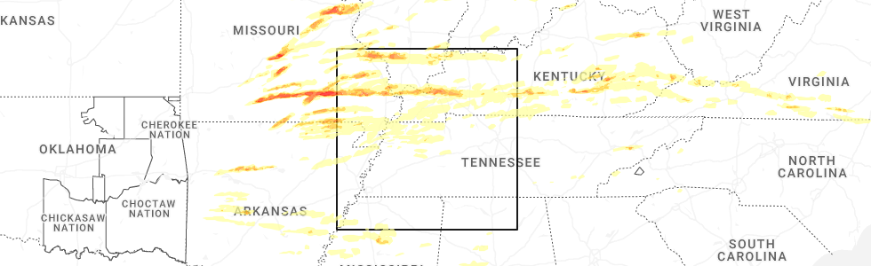
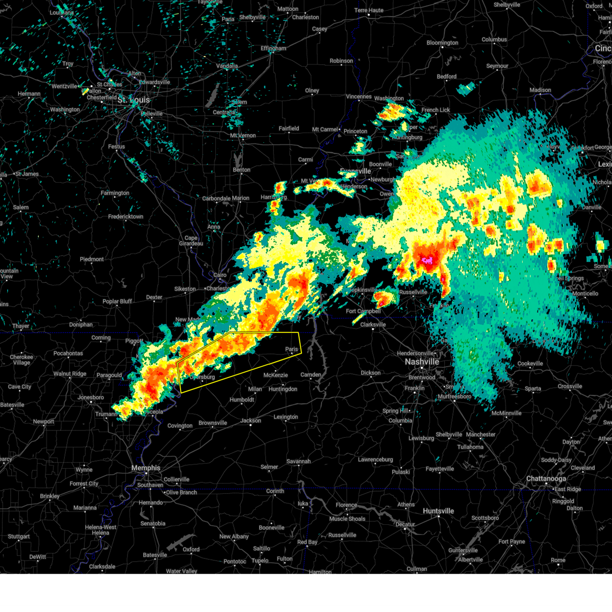
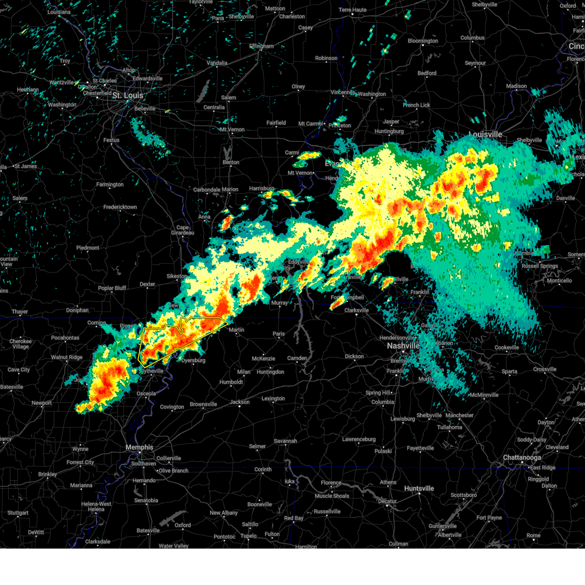
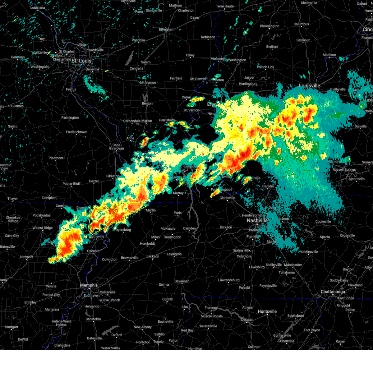
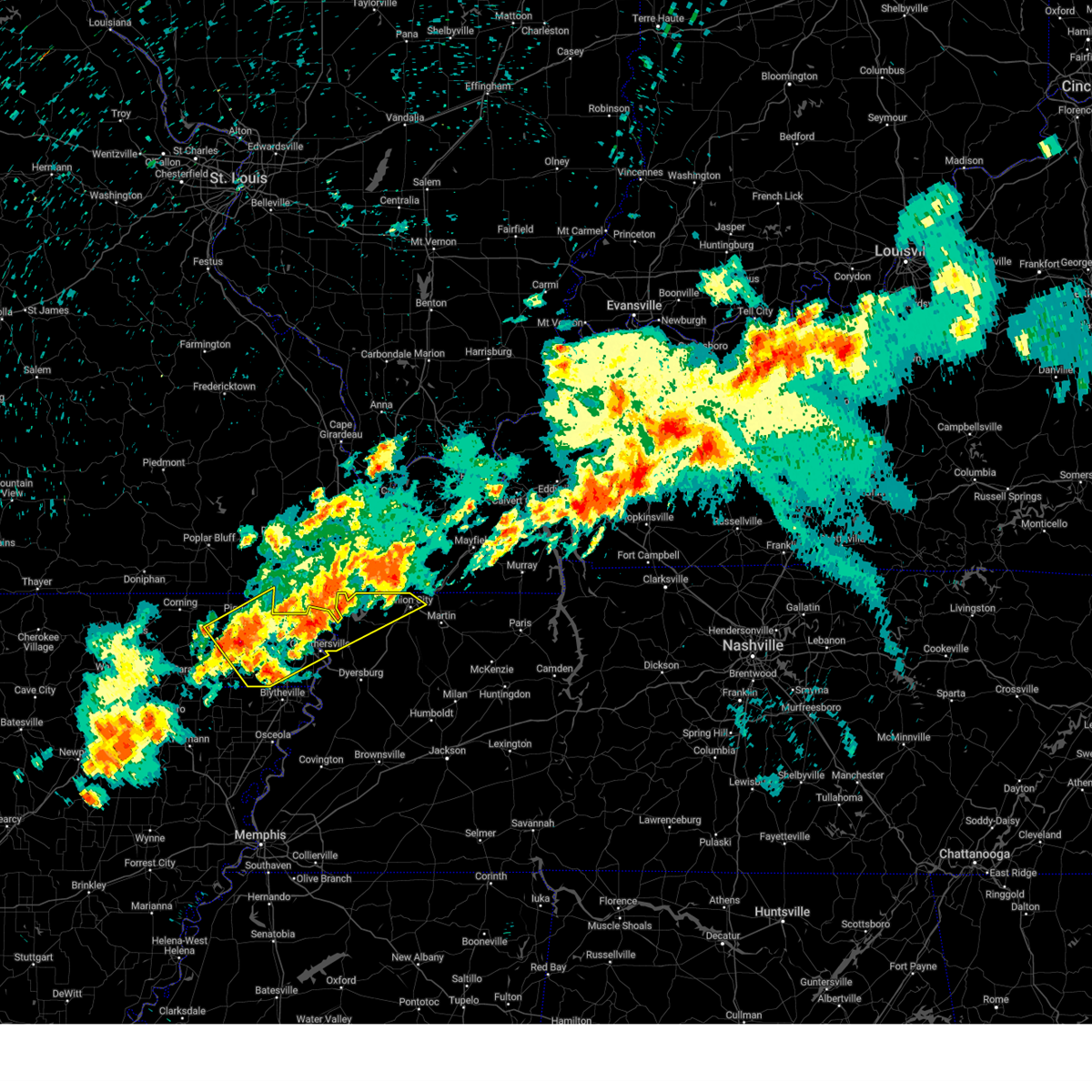
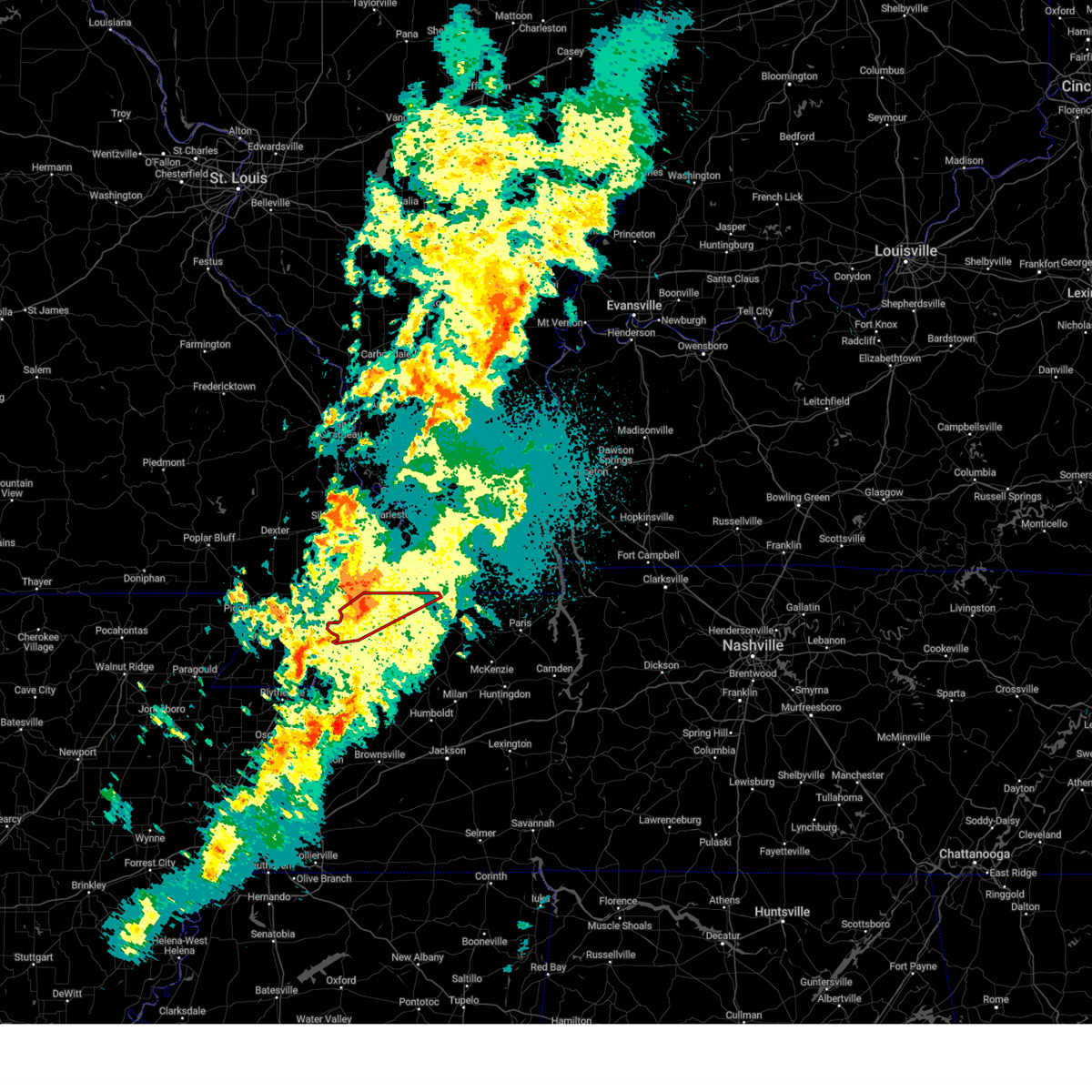
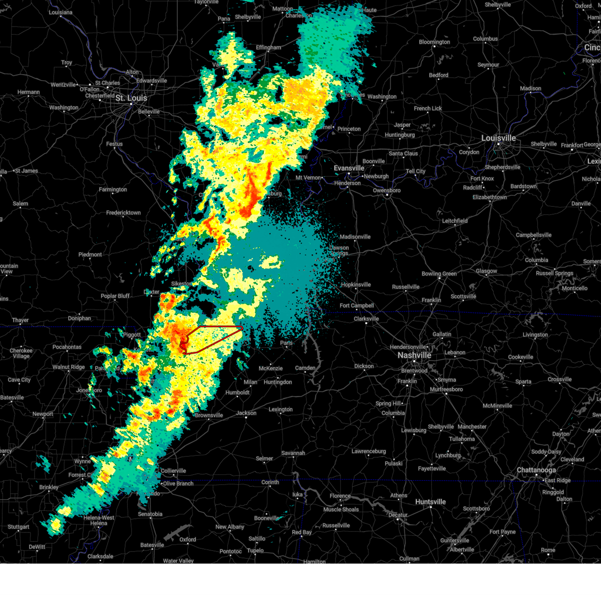
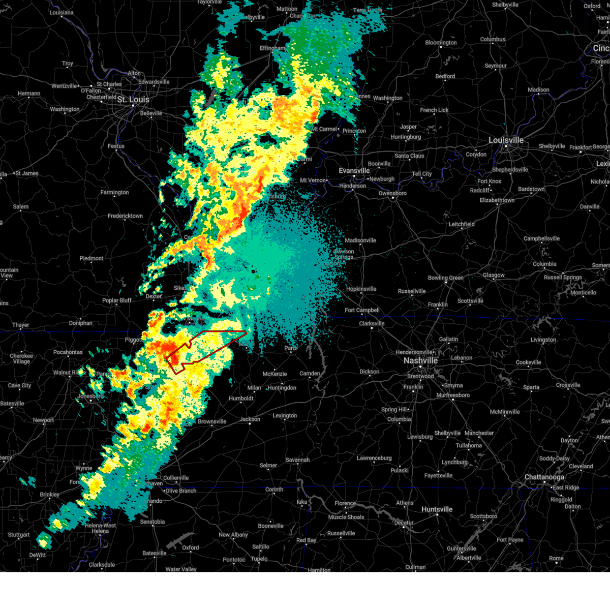
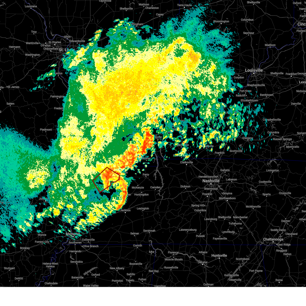
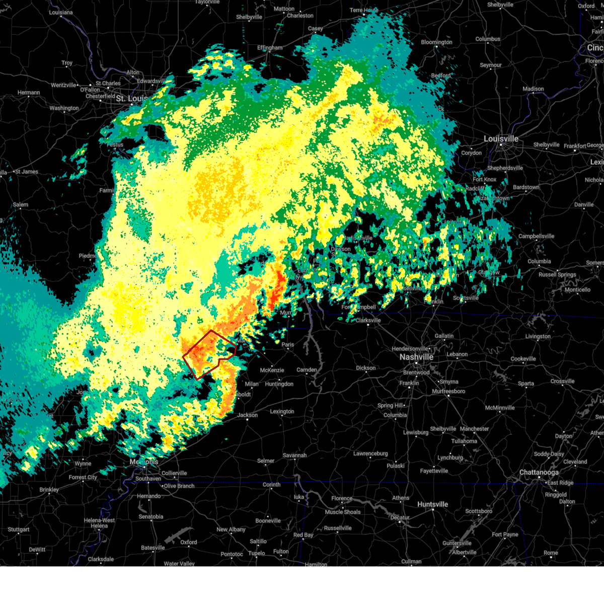
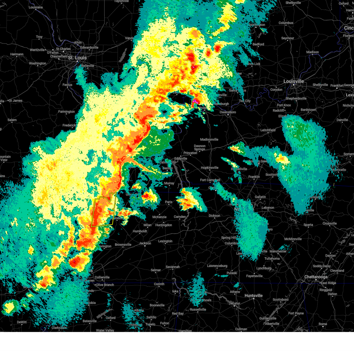
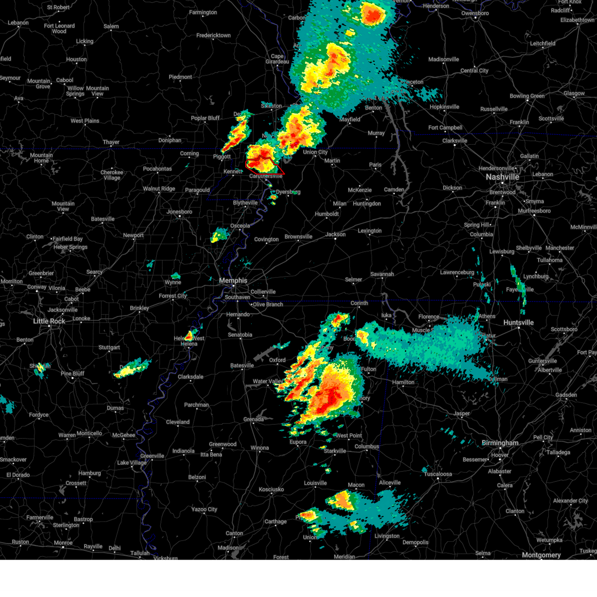
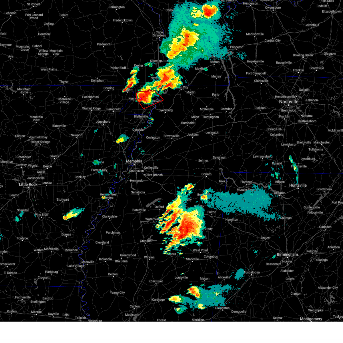
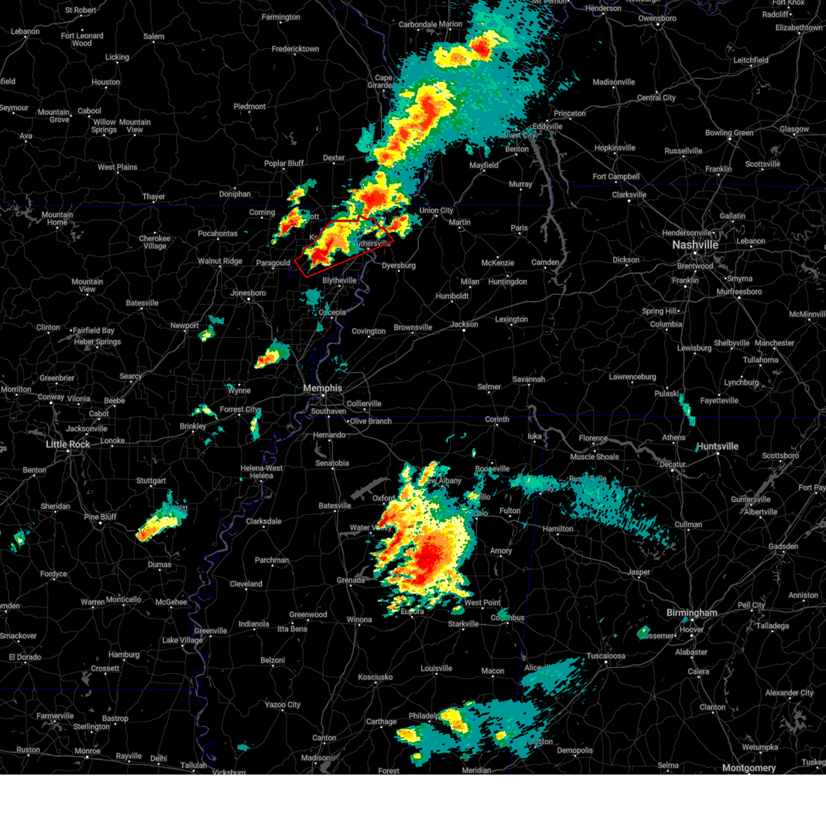
Hail Map for Ridgely, TN
The Ridgely, TN area has had 2 reports of on-the-ground hail by trained spotters, and has been under severe weather warnings 43 times during the past 12 months. Doppler radar has detected hail at or near Ridgely, TN on 53 occasions, including 5 occasions during the past year.
| Name: | Ridgely, TN |
| Where Located: | 54.4 miles W of Mc Kenzie, TN |
| Map: | Google Map for Ridgely, TN |
| Population: | 1795 |
| Housing Units: | 785 |
| More Info: | Search Google for Ridgely, TN |
2
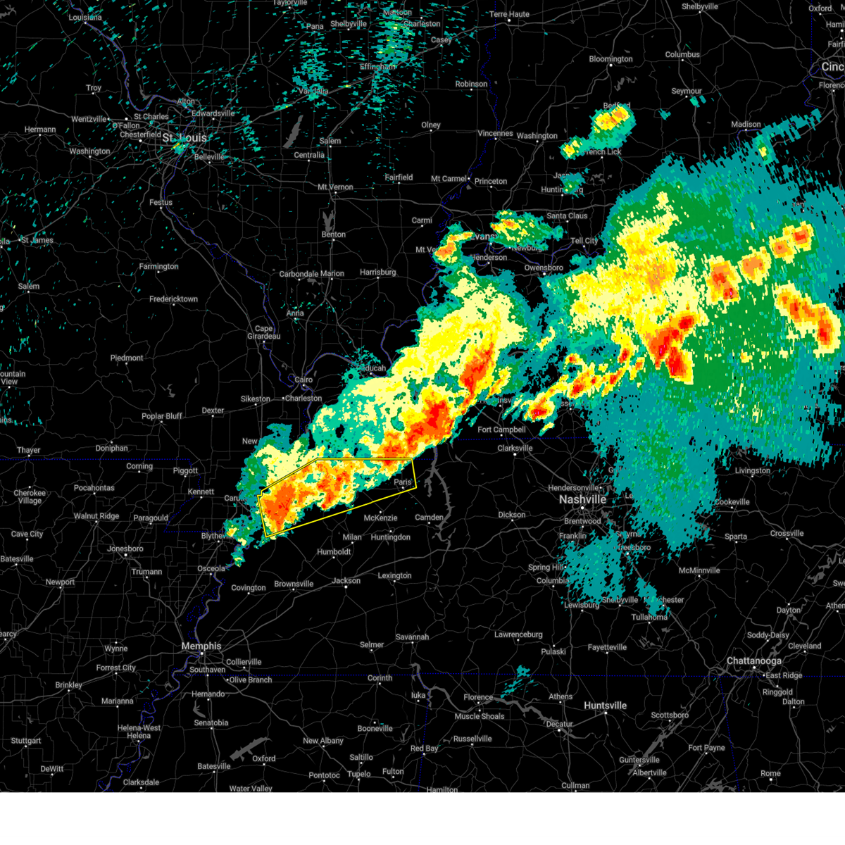
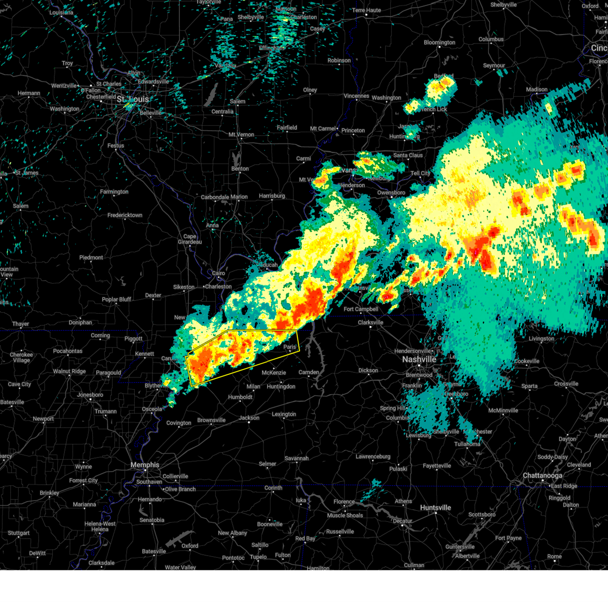
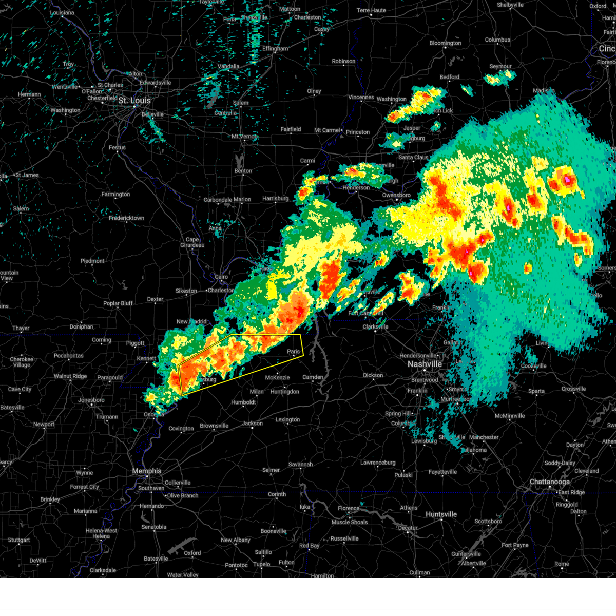
The Top Recent Hail Date for Ridgely, TN is Friday, May 16, 2025 (7th out of 53)
Hail and Wind Damage Spotted near Ridgely, TN
| Date / Time | Report Details |
|---|---|
| 5/20/2025 3:05 PM CDT | Svrmeg the national weather service in memphis has issued a * severe thunderstorm warning for, northern weakley county in west tennessee, obion county in west tennessee, southeastern lake county in west tennessee, * until 345 pm cdt. * at 305 pm cdt, a severe thunderstorm was located near clayton, or 7 miles east of reelfoot lake state park, moving east at 45 mph (radar indicated). Hazards include 60 mph wind gusts and quarter size hail. Hail damage to vehicles is expected. Expect wind damage to roofs, siding, and trees. |
| 5/16/2025 10:15 PM CDT | Svrmeg the national weather service in memphis has issued a * severe thunderstorm warning for, weakley county in west tennessee, northern dyer county in west tennessee, northwestern gibson county in west tennessee, obion county in west tennessee, henry county in west tennessee, southeastern lake county in west tennessee, * until 1100 pm cdt. * at 1015 pm cdt, severe thunderstorms were located along a line extending from 7 miles southeast of paris landing state park to dresden to near miston, moving east at 45 mph (radar indicated). Hazards include 60 mph wind gusts and quarter size hail. Hail damage to vehicles is expected. Expect wind damage to roofs, siding, and trees. |
| 5/16/2025 8:52 PM CDT | At 852 pm cdt, severe thunderstorms were located along a line extending from near fulton to reelfoot lake state park to 6 miles west of wardell, moving east at 40 mph (radar indicated). Hazards include 60 mph wind gusts and quarter size hail. Hail damage to vehicles is expected. expect wind damage to roofs, siding, and trees. Locations impacted include, tiptonville, south fulton, latham, shaffner, terrell, pascola, jacksonville, reelfoot national wildlife refuge, peach orchard, madie, spout springs, moffatt, homestown, clayton, troy, wardell, hayti heights, lassiter corner, mccutchen heights, and gratio. |
| 5/16/2025 8:32 PM CDT | Svrmeg the national weather service in memphis has issued a * severe thunderstorm warning for, northern pemiscot county in southeastern missouri, northern weakley county in west tennessee, obion county in west tennessee, lake county in west tennessee, * until 915 pm cdt. * at 831 pm cdt, severe thunderstorms were located along a line extending from near cayce to near reelfoot lake state park to near wardell, moving east at 40 mph (radar indicated). Hazards include 60 mph wind gusts and quarter size hail. Hail damage to vehicles is expected. Expect wind damage to roofs, siding, and trees. |
| 5/16/2025 8:44 AM CDT |
 the severe thunderstorm warning has been cancelled and is no longer in effect the severe thunderstorm warning has been cancelled and is no longer in effect
|
| 5/16/2025 8:44 AM CDT |
 At 844 am cdt, a severe thunderstorm was located over miston, or 8 miles northwest of dyersburg, moving northeast at 40 mph (trained weather spotters). Hazards include 70 mph wind gusts and quarter size hail. Hail damage to vehicles is expected. expect considerable tree damage. wind damage is also likely to mobile homes, roofs, and outbuildings. Locations impacted include, south fulton, newbern, jones mill, lapata, como, ralston, shaffner, rohoboth, terrell, edgewood, ore springs, kenton, madie, lane, moffatt, troy, india, mill creek, nauvoo, and lassiter corner. At 844 am cdt, a severe thunderstorm was located over miston, or 8 miles northwest of dyersburg, moving northeast at 40 mph (trained weather spotters). Hazards include 70 mph wind gusts and quarter size hail. Hail damage to vehicles is expected. expect considerable tree damage. wind damage is also likely to mobile homes, roofs, and outbuildings. Locations impacted include, south fulton, newbern, jones mill, lapata, como, ralston, shaffner, rohoboth, terrell, edgewood, ore springs, kenton, madie, lane, moffatt, troy, india, mill creek, nauvoo, and lassiter corner.
|
| 5/16/2025 8:32 AM CDT |
 At 831 am cdt, a severe thunderstorm was located near union city, moving northeast at 55 mph (trained weather spotters). Hazards include 60 mph wind gusts and quarter size hail. Hail damage to vehicles is expected. expect wind damage to roofs, siding, and trees. Locations impacted include, south fulton, newbern, jones mill, lapata, como, ralston, shaffner, rohoboth, terrell, edgewood, ore springs, kenton, madie, lane, moffatt, troy, india, tennemo, mill creek, and nauvoo. At 831 am cdt, a severe thunderstorm was located near union city, moving northeast at 55 mph (trained weather spotters). Hazards include 60 mph wind gusts and quarter size hail. Hail damage to vehicles is expected. expect wind damage to roofs, siding, and trees. Locations impacted include, south fulton, newbern, jones mill, lapata, como, ralston, shaffner, rohoboth, terrell, edgewood, ore springs, kenton, madie, lane, moffatt, troy, india, tennemo, mill creek, and nauvoo.
|
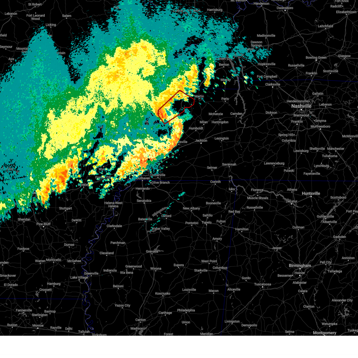
| 5/16/2025 8:30 AM CDT | Quarter sized hail reported 0.3 miles N of Ridgely, TN |
| 5/16/2025 8:15 AM CDT |
 Svrmeg the national weather service in memphis has issued a * severe thunderstorm warning for, east central pemiscot county in southeastern missouri, weakley county in west tennessee, dyer county in west tennessee, northwestern gibson county in west tennessee, obion county in west tennessee, northwestern henry county in west tennessee, southeastern lake county in west tennessee, * until 915 am cdt. * at 815 am cdt, a severe thunderstorm was located over obion, or 12 miles southeast of reelfoot lake state park, moving northeast at 55 mph (radar indicated). Hazards include 60 mph wind gusts and quarter size hail. Hail damage to vehicles is expected. Expect wind damage to roofs, siding, and trees. Svrmeg the national weather service in memphis has issued a * severe thunderstorm warning for, east central pemiscot county in southeastern missouri, weakley county in west tennessee, dyer county in west tennessee, northwestern gibson county in west tennessee, obion county in west tennessee, northwestern henry county in west tennessee, southeastern lake county in west tennessee, * until 915 am cdt. * at 815 am cdt, a severe thunderstorm was located over obion, or 12 miles southeast of reelfoot lake state park, moving northeast at 55 mph (radar indicated). Hazards include 60 mph wind gusts and quarter size hail. Hail damage to vehicles is expected. Expect wind damage to roofs, siding, and trees.
|
| 5/16/2025 7:54 AM CDT |
 the severe thunderstorm warning has been cancelled and is no longer in effect the severe thunderstorm warning has been cancelled and is no longer in effect
|
| 5/16/2025 7:54 AM CDT |
 At 754 am cdt, a severe thunderstorm was located over deering, or near steele, moving northeast at 50 mph (radar indicated). Hazards include 60 mph wind gusts and quarter size hail. Hail damage to vehicles is expected. expect wind damage to roofs, siding, and trees. Locations impacted include, west hermondale, tiptonville, new survey, denton, gobler, covington, caruthersville, deer land, temples corner, west kennett, pascola, jacksonville, reelfoot national wildlife refuge, peach orchard, samford, madie, spout springs, channel, homestown, and clayton. At 754 am cdt, a severe thunderstorm was located over deering, or near steele, moving northeast at 50 mph (radar indicated). Hazards include 60 mph wind gusts and quarter size hail. Hail damage to vehicles is expected. expect wind damage to roofs, siding, and trees. Locations impacted include, west hermondale, tiptonville, new survey, denton, gobler, covington, caruthersville, deer land, temples corner, west kennett, pascola, jacksonville, reelfoot national wildlife refuge, peach orchard, samford, madie, spout springs, channel, homestown, and clayton.
|
| 5/16/2025 7:24 AM CDT |
 Svrmeg the national weather service in memphis has issued a * severe thunderstorm warning for, northeastern greene county in eastern arkansas, southeastern clay county in eastern arkansas, pemiscot county in southeastern missouri, dunklin county in southeastern missouri, northern obion county in west tennessee, lake county in west tennessee, * until 815 am cdt. * at 724 am cdt, a severe thunderstorm was located near kennett, moving northeast at 55 mph (radar indicated). Hazards include 60 mph wind gusts and quarter size hail. Hail damage to vehicles is expected. Expect wind damage to roofs, siding, and trees. Svrmeg the national weather service in memphis has issued a * severe thunderstorm warning for, northeastern greene county in eastern arkansas, southeastern clay county in eastern arkansas, pemiscot county in southeastern missouri, dunklin county in southeastern missouri, northern obion county in west tennessee, lake county in west tennessee, * until 815 am cdt. * at 724 am cdt, a severe thunderstorm was located near kennett, moving northeast at 55 mph (radar indicated). Hazards include 60 mph wind gusts and quarter size hail. Hail damage to vehicles is expected. Expect wind damage to roofs, siding, and trees.
|
| 4/20/2025 11:55 PM CDT |
 The storm which prompted the warning has weakened below severe limits, and no longer appears capable of producing a tornado. therefore, the warning will be allowed to expire. however, gusty winds are still possible with this thunderstorm. a tornado watch remains in effect until midnight cdt for southeastern missouri. a tornado watch also remains in effect until 400 am cdt for west tennessee. The storm which prompted the warning has weakened below severe limits, and no longer appears capable of producing a tornado. therefore, the warning will be allowed to expire. however, gusty winds are still possible with this thunderstorm. a tornado watch remains in effect until midnight cdt for southeastern missouri. a tornado watch also remains in effect until 400 am cdt for west tennessee.
|
| 4/20/2025 11:37 PM CDT |
 At 1136 pm cdt, a severe thunderstorm capable of producing a tornado was located near tiptonville, or near reelfoot lake state park, moving northeast at 50 mph (radar indicated rotation). Hazards include tornado. Flying debris will be dangerous to those caught without shelter. mobile homes will be damaged or destroyed. damage to roofs, windows, and vehicles will occur. tree damage is likely. Locations impacted include, tiptonville, wynnburg, south fulton, ridgely, wright, cronanville, union city, roneys store, sunkist beach, blue bank, proctor city, jacksonville, reelfoot national wildlife refuge, samburg, fremont, woodland mills, madie, spout springs, mooring, and walnut log. At 1136 pm cdt, a severe thunderstorm capable of producing a tornado was located near tiptonville, or near reelfoot lake state park, moving northeast at 50 mph (radar indicated rotation). Hazards include tornado. Flying debris will be dangerous to those caught without shelter. mobile homes will be damaged or destroyed. damage to roofs, windows, and vehicles will occur. tree damage is likely. Locations impacted include, tiptonville, wynnburg, south fulton, ridgely, wright, cronanville, union city, roneys store, sunkist beach, blue bank, proctor city, jacksonville, reelfoot national wildlife refuge, samburg, fremont, woodland mills, madie, spout springs, mooring, and walnut log.
|
| 4/20/2025 11:37 PM CDT |
 the tornado warning has been cancelled and is no longer in effect the tornado warning has been cancelled and is no longer in effect
|
| 4/20/2025 11:22 PM CDT |
 Tormeg the national weather service in memphis has issued a * tornado warning for, eastern pemiscot county in southeastern missouri, central obion county in west tennessee, lake county in west tennessee, * until midnight cdt. * at 1121 pm cdt, a severe thunderstorm capable of producing a tornado was located over caruthersville, moving northeast at 55 mph (radar indicated rotation). Hazards include tornado. Flying debris will be dangerous to those caught without shelter. mobile homes will be damaged or destroyed. damage to roofs, windows, and vehicles will occur. Tree damage is likely. Tormeg the national weather service in memphis has issued a * tornado warning for, eastern pemiscot county in southeastern missouri, central obion county in west tennessee, lake county in west tennessee, * until midnight cdt. * at 1121 pm cdt, a severe thunderstorm capable of producing a tornado was located over caruthersville, moving northeast at 55 mph (radar indicated rotation). Hazards include tornado. Flying debris will be dangerous to those caught without shelter. mobile homes will be damaged or destroyed. damage to roofs, windows, and vehicles will occur. Tree damage is likely.
|
| 4/5/2025 4:23 AM CDT |
 the tornado warning has been cancelled and is no longer in effect the tornado warning has been cancelled and is no longer in effect
|
| 4/5/2025 4:12 AM CDT |
 the tornado warning has been cancelled and is no longer in effect the tornado warning has been cancelled and is no longer in effect
|
| 4/5/2025 4:12 AM CDT |
 At 412 am cdt, a severe thunderstorm capable of producing a tornado was located over cloverdale, or 11 miles north of dyersburg, moving northeast at 50 mph (radar indicated rotation). Hazards include tornado. Flying debris will be dangerous to those caught without shelter. mobile homes will be damaged or destroyed. damage to roofs, windows, and vehicles will occur. tree damage is likely. Locations impacted include, mason hall, cat corner, newbern, ridgely, glass, locust grove, jenkinsville, maxey, roneys store, elbridge, templeton, trimble, bradleytown, rives, jacksonville, miston, samburg, fremont, broadmoor, and sharps ferry. At 412 am cdt, a severe thunderstorm capable of producing a tornado was located over cloverdale, or 11 miles north of dyersburg, moving northeast at 50 mph (radar indicated rotation). Hazards include tornado. Flying debris will be dangerous to those caught without shelter. mobile homes will be damaged or destroyed. damage to roofs, windows, and vehicles will occur. tree damage is likely. Locations impacted include, mason hall, cat corner, newbern, ridgely, glass, locust grove, jenkinsville, maxey, roneys store, elbridge, templeton, trimble, bradleytown, rives, jacksonville, miston, samburg, fremont, broadmoor, and sharps ferry.
|
| 4/5/2025 3:53 AM CDT |
 Tormeg the national weather service in memphis has issued a * tornado warning for, southeastern pemiscot county in southeastern missouri, dyer county in west tennessee, obion county in west tennessee, southeastern lake county in west tennessee, * until 445 am cdt. * at 353 am cdt, a severe thunderstorm capable of producing a tornado was located near bradleytown, or 8 miles west of dyersburg, moving northeast at 50 mph (radar indicated rotation). Hazards include tornado. Flying debris will be dangerous to those caught without shelter. mobile homes will be damaged or destroyed. damage to roofs, windows, and vehicles will occur. Tree damage is likely. Tormeg the national weather service in memphis has issued a * tornado warning for, southeastern pemiscot county in southeastern missouri, dyer county in west tennessee, obion county in west tennessee, southeastern lake county in west tennessee, * until 445 am cdt. * at 353 am cdt, a severe thunderstorm capable of producing a tornado was located near bradleytown, or 8 miles west of dyersburg, moving northeast at 50 mph (radar indicated rotation). Hazards include tornado. Flying debris will be dangerous to those caught without shelter. mobile homes will be damaged or destroyed. damage to roofs, windows, and vehicles will occur. Tree damage is likely.
|
| 4/2/2025 8:20 PM CDT |
 the severe thunderstorm warning has been cancelled and is no longer in effect the severe thunderstorm warning has been cancelled and is no longer in effect
|
| 4/2/2025 8:20 PM CDT |
 At 820 pm cdt, severe thunderstorms were located along a line extending from near clayton to cloverdale to near bradleytown, moving northeast at 75 mph (radar indicated). Hazards include 60 mph wind gusts and quarter size hail. Hail damage to vehicles is expected. expect wind damage to roofs, siding, and trees. Locations impacted include, tiptonville, dyer, grizzard, south fulton, newbern, fowlkes, lapata, bonicord, ralston, shaffner, rohoboth, terrell, currie, reelfoot national wildlife refuge, georgetown, edgewood, laneview, kenton, poplar grove, and madie. At 820 pm cdt, severe thunderstorms were located along a line extending from near clayton to cloverdale to near bradleytown, moving northeast at 75 mph (radar indicated). Hazards include 60 mph wind gusts and quarter size hail. Hail damage to vehicles is expected. expect wind damage to roofs, siding, and trees. Locations impacted include, tiptonville, dyer, grizzard, south fulton, newbern, fowlkes, lapata, bonicord, ralston, shaffner, rohoboth, terrell, currie, reelfoot national wildlife refuge, georgetown, edgewood, laneview, kenton, poplar grove, and madie.
|
| 4/2/2025 8:07 PM CDT |
 Svrmeg the national weather service in memphis has issued a * severe thunderstorm warning for, northeastern mississippi county in eastern arkansas, central pemiscot county in southeastern missouri, northwestern crockett county in west tennessee, western weakley county in west tennessee, dyer county in west tennessee, western gibson county in west tennessee, obion county in west tennessee, northeastern lauderdale county in west tennessee, lake county in west tennessee, * until 900 pm cdt. * at 806 pm cdt, severe thunderstorms were located along a line extending from tiptonville to near miston to 7 miles south of heloise, moving northeast at 60 mph (radar indicated). Hazards include 60 mph wind gusts and quarter size hail. Hail damage to vehicles is expected. Expect wind damage to roofs, siding, and trees. Svrmeg the national weather service in memphis has issued a * severe thunderstorm warning for, northeastern mississippi county in eastern arkansas, central pemiscot county in southeastern missouri, northwestern crockett county in west tennessee, western weakley county in west tennessee, dyer county in west tennessee, western gibson county in west tennessee, obion county in west tennessee, northeastern lauderdale county in west tennessee, lake county in west tennessee, * until 900 pm cdt. * at 806 pm cdt, severe thunderstorms were located along a line extending from tiptonville to near miston to 7 miles south of heloise, moving northeast at 60 mph (radar indicated). Hazards include 60 mph wind gusts and quarter size hail. Hail damage to vehicles is expected. Expect wind damage to roofs, siding, and trees.
|
| 4/2/2025 7:58 PM CDT | At 758 pm cdt, a severe thunderstorm capable of producing a tornado was located over heloise, or 7 miles south of caruthersville, moving northeast at 55 mph (radar indicated rotation). Hazards include tornado. Flying debris will be dangerous to those caught without shelter. mobile homes will be damaged or destroyed. damage to roofs, windows, and vehicles will occur. tree damage is likely. Locations impacted include, lenox, ayers, cat corner, newbern, ridgely, barfield, tyler, locust grove, jenkinsville, caruthersville, maxey, elbridge, bradleytown, heloise, jacksonville, miston, samburg, broadmoor, sharps ferry, and middle city. |
| 4/2/2025 7:58 PM CDT | the tornado warning has been cancelled and is no longer in effect |
| 4/2/2025 7:55 PM CDT |
 At 755 pm cdt, a severe thunderstorm was located near cottonwood grove, or near caruthersville, moving east at 65 mph (radar indicated). Hazards include 60 mph wind gusts and nickel size hail. Expect damage to roofs, siding, and trees. Locations impacted include, tiptonville, tyler, covington, caruthersville, pascola, broadmoor, madie, homestown, steele, wardell, tennemo, hayti heights, blytheville, boothspoint, big boy junction, huffman, cates, bessie, bolton, and swift. At 755 pm cdt, a severe thunderstorm was located near cottonwood grove, or near caruthersville, moving east at 65 mph (radar indicated). Hazards include 60 mph wind gusts and nickel size hail. Expect damage to roofs, siding, and trees. Locations impacted include, tiptonville, tyler, covington, caruthersville, pascola, broadmoor, madie, homestown, steele, wardell, tennemo, hayti heights, blytheville, boothspoint, big boy junction, huffman, cates, bessie, bolton, and swift.
|
| 4/2/2025 7:55 PM CDT |
 the severe thunderstorm warning has been cancelled and is no longer in effect the severe thunderstorm warning has been cancelled and is no longer in effect
|
| 4/2/2025 7:45 PM CDT | At 745 pm cdt, a severe thunderstorm was located near portageville, moving northeast at 50 mph (radar indicated). Hazards include 60 mph wind gusts and nickel size hail. Expect damage to roofs, siding, and trees. Locations impacted include, west hermondale, tiptonville, calumet, new survey, denton, tyler, gobler, covington, caruthersville, buckeye, deer land, temples corner, pascola, peach orchard, broadmoor, samford, madie, channel, homestown, and gosnell. |
| 4/2/2025 7:44 PM CDT | At 744 pm cdt, a severe thunderstorm was located near hayti, moving northeast at 50 mph (radar indicated). Hazards include 60 mph wind gusts and nickel size hail. Expect damage to roofs, siding, and trees. Locations impacted include, west hermondale, tiptonville, calumet, new survey, denton, tyler, gobler, covington, caruthersville, deer land, temples corner, pascola, peach orchard, broadmoor, samford, madie, channel, homestown, gosnell, and steele. |
| 4/2/2025 7:44 PM CDT | the severe thunderstorm warning has been cancelled and is no longer in effect |
| 4/2/2025 7:40 PM CDT | Tormeg the national weather service in memphis has issued a * tornado warning for, northeastern mississippi county in eastern arkansas, southern pemiscot county in southeastern missouri, southeastern dunklin county in southeastern missouri, dyer county in west tennessee, southwestern obion county in west tennessee, lake county in west tennessee, * until 830 pm cdt. * at 739 pm cdt, a severe thunderstorm capable of producing a tornado was located over blytheville, moving northeast at 55 mph (radar indicated rotation). Hazards include tornado. Flying debris will be dangerous to those caught without shelter. mobile homes will be damaged or destroyed. damage to roofs, windows, and vehicles will occur. Tree damage is likely. |
| 4/2/2025 7:13 PM CDT | Svrmeg the national weather service in memphis has issued a * severe thunderstorm warning for, northeastern greene county in eastern arkansas, northern mississippi county in eastern arkansas, eastern clay county in eastern arkansas, pemiscot county in southeastern missouri, dunklin county in southeastern missouri, western dyer county in west tennessee, lake county in west tennessee, * until 815 pm cdt. * at 713 pm cdt, a severe thunderstorm was located near kennett, moving northeast at 50 mph (radar indicated). Hazards include 60 mph wind gusts and nickel size hail. expect damage to roofs, siding, and trees |
| 3/30/2025 8:01 PM CDT | At 801 pm cdt, severe thunderstorms were located along a line extending from near clayton to ridgely to near cooter, moving east at 60 mph (radar indicated). Hazards include 60 mph wind gusts and quarter size hail. Hail damage to vehicles is expected. expect wind damage to roofs, siding, and trees. Locations impacted include, tiptonville, south fulton, newbern, fowlkes, new survey, lapata, covington, ralston, shaffner, rohoboth, terrell, reelfoot national wildlife refuge, edgewood, kenton, madie, spout springs, parker, lane, moffatt, and clayton. |
| 3/30/2025 8:01 PM CDT | the severe thunderstorm warning has been cancelled and is no longer in effect |
| 3/30/2025 7:45 PM CDT | Svrmeg the national weather service in memphis has issued a * severe thunderstorm warning for, pemiscot county in southeastern missouri, southeastern dunklin county in southeastern missouri, northwestern weakley county in west tennessee, dyer county in west tennessee, northwestern gibson county in west tennessee, obion county in west tennessee, lake county in west tennessee, * until 830 pm cdt. * at 745 pm cdt, severe thunderstorms were located along a line extending from 6 miles northwest of tiptonville to hayti to near hornersville, moving east at 60 mph (radar indicated). Hazards include 60 mph wind gusts and quarter size hail. Hail damage to vehicles is expected. Expect wind damage to roofs, siding, and trees. |
| 3/15/2025 2:04 AM CDT |
 the tornado warning has been cancelled and is no longer in effect the tornado warning has been cancelled and is no longer in effect
|
| 3/15/2025 1:58 AM CDT |
 the tornado warning has been cancelled and is no longer in effect the tornado warning has been cancelled and is no longer in effect
|
| 3/15/2025 1:58 AM CDT |
 At 157 am cdt, a severe thunderstorm capable of producing a tornado was located over bolton, or near hayti, moving northeast at 65 mph (radar indicated rotation). Hazards include tornado and ping pong ball size hail. Flying debris will be dangerous to those caught without shelter. mobile homes will be damaged or destroyed. damage to roofs, windows, and vehicles will occur. tree damage is likely. Locations impacted include, wardell, stanley, north wardell, ridgely, madie, mooring, bolton, swift, homestown, hayward, stewart, and portageville. At 157 am cdt, a severe thunderstorm capable of producing a tornado was located over bolton, or near hayti, moving northeast at 65 mph (radar indicated rotation). Hazards include tornado and ping pong ball size hail. Flying debris will be dangerous to those caught without shelter. mobile homes will be damaged or destroyed. damage to roofs, windows, and vehicles will occur. tree damage is likely. Locations impacted include, wardell, stanley, north wardell, ridgely, madie, mooring, bolton, swift, homestown, hayward, stewart, and portageville.
|
| 3/15/2025 1:53 AM CDT |
 At 152 am cdt, a severe thunderstorm capable of producing a tornado was located near bolton, or near hayti, moving northeast at 65 mph (radar indicated rotation). Hazards include tornado and ping pong ball size hail. Flying debris will be dangerous to those caught without shelter. mobile homes will be damaged or destroyed. damage to roofs, windows, and vehicles will occur. tree damage is likely. Locations impacted include, ridgely, stewart, shade, caruthersville, bakerville, hathaway, deering, hayti, stanley, pascola, canady, hayward, peach orchard, braggadocio, madie, mooring, homestown, wardell, north wardell, and hayti heights. At 152 am cdt, a severe thunderstorm capable of producing a tornado was located near bolton, or near hayti, moving northeast at 65 mph (radar indicated rotation). Hazards include tornado and ping pong ball size hail. Flying debris will be dangerous to those caught without shelter. mobile homes will be damaged or destroyed. damage to roofs, windows, and vehicles will occur. tree damage is likely. Locations impacted include, ridgely, stewart, shade, caruthersville, bakerville, hathaway, deering, hayti, stanley, pascola, canady, hayward, peach orchard, braggadocio, madie, mooring, homestown, wardell, north wardell, and hayti heights.
|
| 3/15/2025 1:46 AM CDT | At 146 am cdt, a severe thunderstorm capable of producing a tornado was located over deering, or 7 miles east of kennett, moving northeast at 70 mph (radar indicated rotation). Hazards include tornado and ping pong ball size hail. Flying debris will be dangerous to those caught without shelter. mobile homes will be damaged or destroyed. damage to roofs, windows, and vehicles will occur. tree damage is likely. Locations impacted include, ipley, scobeville, ridgely, new survey, vincit, gobler, covington, tinkerville, stewart, shade, lorine, caruthersville, bakerville, hathaway, deering, hayti, stanley, deer land, west kennett, and pascola. |
| 3/15/2025 1:33 AM CDT |
 Tormeg the national weather service in memphis has issued a * tornado warning for, pemiscot county in southeastern missouri, southeastern dunklin county in southeastern missouri, southwestern lake county in west tennessee, * until 215 am cdt. * at 133 am cdt, a severe thunderstorm capable of producing a tornado was located over hornersville, or near senath, moving northeast at 45 mph (radar indicated rotation). Hazards include tornado and golf ball size hail. Flying debris will be dangerous to those caught without shelter. mobile homes will be damaged or destroyed. damage to roofs, windows, and vehicles will occur. Tree damage is likely. Tormeg the national weather service in memphis has issued a * tornado warning for, pemiscot county in southeastern missouri, southeastern dunklin county in southeastern missouri, southwestern lake county in west tennessee, * until 215 am cdt. * at 133 am cdt, a severe thunderstorm capable of producing a tornado was located over hornersville, or near senath, moving northeast at 45 mph (radar indicated rotation). Hazards include tornado and golf ball size hail. Flying debris will be dangerous to those caught without shelter. mobile homes will be damaged or destroyed. damage to roofs, windows, and vehicles will occur. Tree damage is likely.
|
| 8/17/2024 3:18 AM CDT |
 the severe thunderstorm warning has been cancelled and is no longer in effect the severe thunderstorm warning has been cancelled and is no longer in effect
|
| 8/17/2024 2:59 AM CDT |
 At 259 am cdt, a severe thunderstorm was located over cooter, or near steele, moving southeast at 45 mph (radar indicated). Hazards include 60 mph wind gusts and quarter size hail. Hail damage to vehicles is expected. expect wind damage to roofs, siding, and trees. Locations impacted include, dyersburg, blytheville, kennett, ripley, osceola, caruthersville, gosnell, hayti, steele, senath, luxora, fort pillow state park, newbern, halls, ridgely, hornersville, hayti heights, arbyrd, cooter, and wardell. At 259 am cdt, a severe thunderstorm was located over cooter, or near steele, moving southeast at 45 mph (radar indicated). Hazards include 60 mph wind gusts and quarter size hail. Hail damage to vehicles is expected. expect wind damage to roofs, siding, and trees. Locations impacted include, dyersburg, blytheville, kennett, ripley, osceola, caruthersville, gosnell, hayti, steele, senath, luxora, fort pillow state park, newbern, halls, ridgely, hornersville, hayti heights, arbyrd, cooter, and wardell.
|
| 8/17/2024 2:39 AM CDT |
 Svrmeg the national weather service in memphis has issued a * severe thunderstorm warning for, eastern greene county in eastern arkansas, northern mississippi county in eastern arkansas, southeastern clay county in eastern arkansas, pemiscot county in southeastern missouri, dunklin county in southeastern missouri, dyer county in west tennessee, west central gibson county in west tennessee, lauderdale county in west tennessee, southwestern lake county in west tennessee, * until 330 am cdt. * at 239 am cdt, a severe thunderstorm was located near kennett, moving southeast at 45 mph (radar indicated). Hazards include 60 mph wind gusts and quarter size hail. Hail damage to vehicles is expected. Expect wind damage to roofs, siding, and trees. Svrmeg the national weather service in memphis has issued a * severe thunderstorm warning for, eastern greene county in eastern arkansas, northern mississippi county in eastern arkansas, southeastern clay county in eastern arkansas, pemiscot county in southeastern missouri, dunklin county in southeastern missouri, dyer county in west tennessee, west central gibson county in west tennessee, lauderdale county in west tennessee, southwestern lake county in west tennessee, * until 330 am cdt. * at 239 am cdt, a severe thunderstorm was located near kennett, moving southeast at 45 mph (radar indicated). Hazards include 60 mph wind gusts and quarter size hail. Hail damage to vehicles is expected. Expect wind damage to roofs, siding, and trees.
|
| 6/9/2024 12:49 AM CDT |
 At 1249 am cdt, severe thunderstorms were located along a line extending from near cloverdale to near heloise to near burdette, moving southeast at 40 mph (radar indicated). Hazards include 60 mph wind gusts and quarter size hail. Hail damage to vehicles is expected. expect wind damage to roofs, siding, and trees. Locations impacted include, blytheville, osceola, caruthersville, gosnell, manila, steele, luxora, keiser, reelfoot lake state park, tiptonville, ridgely, cooter, dell, burdette, clayton, heloise, cloverdale, miston, cottonwood grove, and little river. At 1249 am cdt, severe thunderstorms were located along a line extending from near cloverdale to near heloise to near burdette, moving southeast at 40 mph (radar indicated). Hazards include 60 mph wind gusts and quarter size hail. Hail damage to vehicles is expected. expect wind damage to roofs, siding, and trees. Locations impacted include, blytheville, osceola, caruthersville, gosnell, manila, steele, luxora, keiser, reelfoot lake state park, tiptonville, ridgely, cooter, dell, burdette, clayton, heloise, cloverdale, miston, cottonwood grove, and little river.
|
| 6/9/2024 12:49 AM CDT |
 the severe thunderstorm warning has been cancelled and is no longer in effect the severe thunderstorm warning has been cancelled and is no longer in effect
|
| 6/9/2024 12:38 AM CDT |
 At 1238 am cdt, severe thunderstorms were located along a line extending from reelfoot lake state park to cooter to near dell, moving east at 45 mph (radar indicated). Hazards include ping pong ball size hail and 60 mph wind gusts. People and animals outdoors will be injured. expect hail damage to roofs, siding, windows, and vehicles. expect wind damage to roofs, siding, and trees. Locations impacted include, blytheville, osceola, caruthersville, gosnell, manila, hayti, steele, leachville, monette, luxora, keiser, reelfoot lake state park, tiptonville, ridgely, hornersville, hayti heights, cooter, dell, burdette, and clayton. At 1238 am cdt, severe thunderstorms were located along a line extending from reelfoot lake state park to cooter to near dell, moving east at 45 mph (radar indicated). Hazards include ping pong ball size hail and 60 mph wind gusts. People and animals outdoors will be injured. expect hail damage to roofs, siding, windows, and vehicles. expect wind damage to roofs, siding, and trees. Locations impacted include, blytheville, osceola, caruthersville, gosnell, manila, hayti, steele, leachville, monette, luxora, keiser, reelfoot lake state park, tiptonville, ridgely, hornersville, hayti heights, cooter, dell, burdette, and clayton.
|
| 6/9/2024 12:16 AM CDT |
 Svrmeg the national weather service in memphis has issued a * severe thunderstorm warning for, east central craighead county in eastern arkansas, mississippi county in eastern arkansas, pemiscot county in southeastern missouri, southeastern dunklin county in southeastern missouri, western dyer county in west tennessee, western obion county in west tennessee, northwestern lauderdale county in west tennessee, lake county in west tennessee, * until 100 am cdt. * at 1216 am cdt, severe thunderstorms were located along a line extending from near portageville to near senath to near monette, moving southeast at 40 mph (radar indicated). Hazards include ping pong ball size hail and 60 mph wind gusts. People and animals outdoors will be injured. expect hail damage to roofs, siding, windows, and vehicles. Expect wind damage to roofs, siding, and trees. Svrmeg the national weather service in memphis has issued a * severe thunderstorm warning for, east central craighead county in eastern arkansas, mississippi county in eastern arkansas, pemiscot county in southeastern missouri, southeastern dunklin county in southeastern missouri, western dyer county in west tennessee, western obion county in west tennessee, northwestern lauderdale county in west tennessee, lake county in west tennessee, * until 100 am cdt. * at 1216 am cdt, severe thunderstorms were located along a line extending from near portageville to near senath to near monette, moving southeast at 40 mph (radar indicated). Hazards include ping pong ball size hail and 60 mph wind gusts. People and animals outdoors will be injured. expect hail damage to roofs, siding, windows, and vehicles. Expect wind damage to roofs, siding, and trees.
|
| 5/27/2024 12:07 AM CDT |
 The storms which prompted the warning have weakened below severe limits, and no longer pose an immediate threat to life or property. therefore, the warning will be allowed to expire. however, gusty winds are still possible with these thunderstorms. a tornado watch remains in effect until 500 am cdt for west tennessee. a tornado watch also remains in effect until 400 am cdt for west tennessee. The storms which prompted the warning have weakened below severe limits, and no longer pose an immediate threat to life or property. therefore, the warning will be allowed to expire. however, gusty winds are still possible with these thunderstorms. a tornado watch remains in effect until 500 am cdt for west tennessee. a tornado watch also remains in effect until 400 am cdt for west tennessee.
|
| 5/26/2024 11:55 PM CDT |
 At 1155 pm cdt, severe thunderstorms were located along a line extending from near tennessee ridge to near huntingdon to near dyersburg, moving southeast at 25 mph (radar indicated). Hazards include 60 mph wind gusts and nickel size hail. Expect damage to roofs, siding, and trees. Locations impacted include, dyersburg, martin, union city, paris, milan, mckenzie, trenton, huntingdon, camden, fulton, paris landing state park, reelfoot lake state park, tiptonville, newbern, dresden, south fulton, dyer, greenfield, new johnsonville, and ridgely. At 1155 pm cdt, severe thunderstorms were located along a line extending from near tennessee ridge to near huntingdon to near dyersburg, moving southeast at 25 mph (radar indicated). Hazards include 60 mph wind gusts and nickel size hail. Expect damage to roofs, siding, and trees. Locations impacted include, dyersburg, martin, union city, paris, milan, mckenzie, trenton, huntingdon, camden, fulton, paris landing state park, reelfoot lake state park, tiptonville, newbern, dresden, south fulton, dyer, greenfield, new johnsonville, and ridgely.
|
| 5/26/2024 11:54 PM CDT |
 Svrmeg the national weather service in memphis has issued a * severe thunderstorm warning for, eastern craighead county in eastern arkansas, northern mississippi county in eastern arkansas, pemiscot county in southeastern missouri, southeastern dunklin county in southeastern missouri, western dyer county in west tennessee, north central lauderdale county in west tennessee, western lake county in west tennessee, * until 1245 am cdt. * at 1153 pm cdt, severe thunderstorms were located along a line extending from near miston to near gosnell to near lake city, moving southeast at 20 mph (radar indicated). Hazards include 60 mph wind gusts and quarter size hail. Hail damage to vehicles is expected. Expect wind damage to roofs, siding, and trees. Svrmeg the national weather service in memphis has issued a * severe thunderstorm warning for, eastern craighead county in eastern arkansas, northern mississippi county in eastern arkansas, pemiscot county in southeastern missouri, southeastern dunklin county in southeastern missouri, western dyer county in west tennessee, north central lauderdale county in west tennessee, western lake county in west tennessee, * until 1245 am cdt. * at 1153 pm cdt, severe thunderstorms were located along a line extending from near miston to near gosnell to near lake city, moving southeast at 20 mph (radar indicated). Hazards include 60 mph wind gusts and quarter size hail. Hail damage to vehicles is expected. Expect wind damage to roofs, siding, and trees.
|
| 5/26/2024 11:30 PM CDT |
 Svrmeg the national weather service in memphis has issued a * severe thunderstorm warning for, weakley county in west tennessee, northeastern dyer county in west tennessee, gibson county in west tennessee, benton county in west tennessee, obion county in west tennessee, carroll county in west tennessee, henry county in west tennessee, northeastern decatur county in west tennessee, lake county in west tennessee, * until 1215 am cdt. * at 1130 pm cdt, severe thunderstorms were located along a line extending from near paris landing state park to near huntingdon to cottonwood grove, moving southeast at 25 mph (radar indicated). Hazards include 60 mph wind gusts and nickel size hail. expect damage to roofs, siding, and trees Svrmeg the national weather service in memphis has issued a * severe thunderstorm warning for, weakley county in west tennessee, northeastern dyer county in west tennessee, gibson county in west tennessee, benton county in west tennessee, obion county in west tennessee, carroll county in west tennessee, henry county in west tennessee, northeastern decatur county in west tennessee, lake county in west tennessee, * until 1215 am cdt. * at 1130 pm cdt, severe thunderstorms were located along a line extending from near paris landing state park to near huntingdon to cottonwood grove, moving southeast at 25 mph (radar indicated). Hazards include 60 mph wind gusts and nickel size hail. expect damage to roofs, siding, and trees
|
| 5/26/2024 7:56 AM CDT |
 At 756 am cdt, severe thunderstorms were located along a line extending from near union city to near troy to cloverdale, moving east at 40 mph (radar indicated). Hazards include 60 mph wind gusts and half dollar size hail. Hail damage to vehicles is expected. expect wind damage to roofs, siding, and trees. Locations impacted include, martin, union city, mckenzie, fulton, newbern, dresden, south fulton, dyer, greenfield, ridgely, gleason, troy, kenton, rutherford, obion, bradford, sharon, latham, clayton, and cloverdale. At 756 am cdt, severe thunderstorms were located along a line extending from near union city to near troy to cloverdale, moving east at 40 mph (radar indicated). Hazards include 60 mph wind gusts and half dollar size hail. Hail damage to vehicles is expected. expect wind damage to roofs, siding, and trees. Locations impacted include, martin, union city, mckenzie, fulton, newbern, dresden, south fulton, dyer, greenfield, ridgely, gleason, troy, kenton, rutherford, obion, bradford, sharon, latham, clayton, and cloverdale.
|
| 5/26/2024 7:50 AM CDT |
 Svrmeg the national weather service in memphis has issued a * severe thunderstorm warning for, weakley county in west tennessee, northeastern dyer county in west tennessee, northern gibson county in west tennessee, obion county in west tennessee, southeastern lake county in west tennessee, * until 830 am cdt. * at 749 am cdt, severe thunderstorms were located along a line extending from near clayton to 6 miles east of reelfoot lake state park to near ridgely, moving east at 40 mph (radar indicated). Hazards include 60 mph wind gusts and quarter size hail. Hail damage to vehicles is expected. Expect wind damage to roofs, siding, and trees. Svrmeg the national weather service in memphis has issued a * severe thunderstorm warning for, weakley county in west tennessee, northeastern dyer county in west tennessee, northern gibson county in west tennessee, obion county in west tennessee, southeastern lake county in west tennessee, * until 830 am cdt. * at 749 am cdt, severe thunderstorms were located along a line extending from near clayton to 6 miles east of reelfoot lake state park to near ridgely, moving east at 40 mph (radar indicated). Hazards include 60 mph wind gusts and quarter size hail. Hail damage to vehicles is expected. Expect wind damage to roofs, siding, and trees.
|
| 5/26/2024 7:34 AM CDT |
 the severe thunderstorm warning has been cancelled and is no longer in effect the severe thunderstorm warning has been cancelled and is no longer in effect
|
| 5/26/2024 7:34 AM CDT |
 At 734 am cdt, severe thunderstorms were located along a line extending from near tiptonville to near burdette, moving southeast at 60 mph (radar indicated). Hazards include 60 mph wind gusts and quarter size hail. Hail damage to vehicles is expected. expect wind damage to roofs, siding, and trees. Locations impacted include, caruthersville, malden, portageville, hayti, steele, reelfoot lake state park, tiptonville, ridgely, hayti heights, cooter, wardell, clayton, bolton, deering, heloise, cottonwood grove, holland, samburg, bragg city, and pascola. At 734 am cdt, severe thunderstorms were located along a line extending from near tiptonville to near burdette, moving southeast at 60 mph (radar indicated). Hazards include 60 mph wind gusts and quarter size hail. Hail damage to vehicles is expected. expect wind damage to roofs, siding, and trees. Locations impacted include, caruthersville, malden, portageville, hayti, steele, reelfoot lake state park, tiptonville, ridgely, hayti heights, cooter, wardell, clayton, bolton, deering, heloise, cottonwood grove, holland, samburg, bragg city, and pascola.
|
| 5/26/2024 7:19 AM CDT |
 At 719 am cdt, severe thunderstorms were located along a line extending from portageville to near hornersville, moving southeast at 60 mph (radar indicated). Hazards include 60 mph wind gusts and quarter size hail. Hail damage to vehicles is expected. expect wind damage to roofs, siding, and trees. locations impacted include, kennett, caruthersville, malden, piggott, portageville, hayti, steele, campbell, rector, senath, marmaduke, reelfoot lake state park, tiptonville, ridgely, holcomb, hayti heights, cooter, wardell, st. Francis, and greenway. At 719 am cdt, severe thunderstorms were located along a line extending from portageville to near hornersville, moving southeast at 60 mph (radar indicated). Hazards include 60 mph wind gusts and quarter size hail. Hail damage to vehicles is expected. expect wind damage to roofs, siding, and trees. locations impacted include, kennett, caruthersville, malden, piggott, portageville, hayti, steele, campbell, rector, senath, marmaduke, reelfoot lake state park, tiptonville, ridgely, holcomb, hayti heights, cooter, wardell, st. Francis, and greenway.
|
| 5/26/2024 7:19 AM CDT |
 the severe thunderstorm warning has been cancelled and is no longer in effect the severe thunderstorm warning has been cancelled and is no longer in effect
|
| 5/26/2024 7:03 AM CDT |
 Svrmeg the national weather service in memphis has issued a * severe thunderstorm warning for, northeastern greene county in eastern arkansas, northeastern mississippi county in eastern arkansas, eastern clay county in eastern arkansas, pemiscot county in southeastern missouri, dunklin county in southeastern missouri, western dyer county in west tennessee, obion county in west tennessee, lake county in west tennessee, * until 745 am cdt. * at 702 am cdt, severe thunderstorms were located along a line extending from malden to near marmaduke, moving southeast at 35 mph (radar indicated). Hazards include 60 mph wind gusts and quarter size hail. Hail damage to vehicles is expected. Expect wind damage to roofs, siding, and trees. Svrmeg the national weather service in memphis has issued a * severe thunderstorm warning for, northeastern greene county in eastern arkansas, northeastern mississippi county in eastern arkansas, eastern clay county in eastern arkansas, pemiscot county in southeastern missouri, dunklin county in southeastern missouri, western dyer county in west tennessee, obion county in west tennessee, lake county in west tennessee, * until 745 am cdt. * at 702 am cdt, severe thunderstorms were located along a line extending from malden to near marmaduke, moving southeast at 35 mph (radar indicated). Hazards include 60 mph wind gusts and quarter size hail. Hail damage to vehicles is expected. Expect wind damage to roofs, siding, and trees.
|
| 5/9/2024 12:10 AM CDT |
 At 1210 am cdt, a severe thunderstorm was located near cayce, or near hickman, moving northeast at 50 mph (radar indicated). Hazards include golf ball size hail and 60 mph wind gusts. People and animals outdoors will be injured. expect hail damage to roofs, siding, windows, and vehicles. expect wind damage to roofs, siding, and trees. Locations impacted include, martin, union city, fulton, reelfoot lake state park, tiptonville, south fulton, ridgely, troy, obion, sharon, latham, clayton, cloverdale, hornbeak, woodland mills, rives, samburg, ralston, shaffner, and elbridge. At 1210 am cdt, a severe thunderstorm was located near cayce, or near hickman, moving northeast at 50 mph (radar indicated). Hazards include golf ball size hail and 60 mph wind gusts. People and animals outdoors will be injured. expect hail damage to roofs, siding, windows, and vehicles. expect wind damage to roofs, siding, and trees. Locations impacted include, martin, union city, fulton, reelfoot lake state park, tiptonville, south fulton, ridgely, troy, obion, sharon, latham, clayton, cloverdale, hornbeak, woodland mills, rives, samburg, ralston, shaffner, and elbridge.
|
| 5/8/2024 11:53 PM CDT |
 Svrmeg the national weather service in memphis has issued a * severe thunderstorm warning for, weakley county in west tennessee, obion county in west tennessee, lake county in west tennessee, * until 1245 am cdt. * at 1152 pm cdt, a severe thunderstorm was located near reelfoot lake state park, moving northeast at 50 mph (radar indicated). Hazards include 60 mph wind gusts and quarter size hail. Hail damage to vehicles is expected. Expect wind damage to roofs, siding, and trees. Svrmeg the national weather service in memphis has issued a * severe thunderstorm warning for, weakley county in west tennessee, obion county in west tennessee, lake county in west tennessee, * until 1245 am cdt. * at 1152 pm cdt, a severe thunderstorm was located near reelfoot lake state park, moving northeast at 50 mph (radar indicated). Hazards include 60 mph wind gusts and quarter size hail. Hail damage to vehicles is expected. Expect wind damage to roofs, siding, and trees.
|
| 8/3/2023 6:18 AM CDT |
 At 618 am cdt, a severe thunderstorm was located near clayton, or 8 miles east of reelfoot lake state park, moving southeast at 45 mph (radar indicated). Hazards include 60 mph wind gusts. Expect damage to roofs, siding, and trees. locations impacted include, martin, union city, caruthersville, fulton, reelfoot lake state park, tiptonville, newbern, dresden, south fulton, greenfield, ridgely, troy, kenton, rutherford, obion, sharon, clayton, cloverdale, miston and cottonwood grove. hail threat, radar indicated max hail size, <. 75 in wind threat, radar indicated max wind gust, 60 mph. At 618 am cdt, a severe thunderstorm was located near clayton, or 8 miles east of reelfoot lake state park, moving southeast at 45 mph (radar indicated). Hazards include 60 mph wind gusts. Expect damage to roofs, siding, and trees. locations impacted include, martin, union city, caruthersville, fulton, reelfoot lake state park, tiptonville, newbern, dresden, south fulton, greenfield, ridgely, troy, kenton, rutherford, obion, sharon, clayton, cloverdale, miston and cottonwood grove. hail threat, radar indicated max hail size, <. 75 in wind threat, radar indicated max wind gust, 60 mph.
|
| 8/3/2023 5:57 AM CDT |
 At 557 am cdt, a severe thunderstorm was located near hunter-dawson state historic site, moving southeast at 45 mph (radar indicated). Hazards include 60 mph wind gusts and nickel size hail. expect damage to roofs, siding, and trees At 557 am cdt, a severe thunderstorm was located near hunter-dawson state historic site, moving southeast at 45 mph (radar indicated). Hazards include 60 mph wind gusts and nickel size hail. expect damage to roofs, siding, and trees
|
| 7/18/2023 2:05 PM CDT |
 At 205 pm cdt, severe thunderstorms were located along a line extending from near union city to near newbern to near heloise, moving southeast at 35 mph (radar indicated). Hazards include 60 mph wind gusts. Expect damage to roofs, siding, and trees. locations impacted include, dyersburg, martin, union city, caruthersville, hayti, steele, reelfoot lake state park, tiptonville, newbern, dresden, dyer, greenfield, ridgely, gleason, troy, kenton, rutherford, obion, sharon and hayti heights. hail threat, radar indicated max hail size, <. 75 in wind threat, radar indicated max wind gust, 60 mph. At 205 pm cdt, severe thunderstorms were located along a line extending from near union city to near newbern to near heloise, moving southeast at 35 mph (radar indicated). Hazards include 60 mph wind gusts. Expect damage to roofs, siding, and trees. locations impacted include, dyersburg, martin, union city, caruthersville, hayti, steele, reelfoot lake state park, tiptonville, newbern, dresden, dyer, greenfield, ridgely, gleason, troy, kenton, rutherford, obion, sharon and hayti heights. hail threat, radar indicated max hail size, <. 75 in wind threat, radar indicated max wind gust, 60 mph.
|
| 7/18/2023 1:47 PM CDT |
 At 146 pm cdt, severe thunderstorms were located along a line extending from near union city to near hayti heights, moving southeast at 40 mph (radar indicated). Hazards include 60 mph wind gusts and nickel size hail. expect damage to roofs, siding, and trees At 146 pm cdt, severe thunderstorms were located along a line extending from near union city to near hayti heights, moving southeast at 40 mph (radar indicated). Hazards include 60 mph wind gusts and nickel size hail. expect damage to roofs, siding, and trees
|
| 4/15/2023 8:55 PM CDT |
 The severe thunderstorm warning for northern mississippi, pemiscot, southeastern dunklin, dyer, western obion, northeastern lauderdale and lake counties will expire at 900 pm cdt, the storms which prompted the warning have weakened below severe limits, and no longer pose an immediate threat to life or property. therefore, the warning will be allowed to expire. however gusty winds are still possible with these thunderstorms. a severe thunderstorm watch remains in effect until 200 am cdt for eastern arkansas, southeastern missouri, and west tennessee. to report severe weather, contact your nearest law enforcement agency. they will relay your report to the national weather service memphis. The severe thunderstorm warning for northern mississippi, pemiscot, southeastern dunklin, dyer, western obion, northeastern lauderdale and lake counties will expire at 900 pm cdt, the storms which prompted the warning have weakened below severe limits, and no longer pose an immediate threat to life or property. therefore, the warning will be allowed to expire. however gusty winds are still possible with these thunderstorms. a severe thunderstorm watch remains in effect until 200 am cdt for eastern arkansas, southeastern missouri, and west tennessee. to report severe weather, contact your nearest law enforcement agency. they will relay your report to the national weather service memphis.
|
| 4/15/2023 8:42 PM CDT |
 At 842 pm cdt, severe thunderstorms were located along a line extending from near risco to heloise to fort pillow state park, moving east at 60 mph (radar indicated). Hazards include 60 mph wind gusts. Expect damage to roofs, siding, and trees. locations impacted include, dyersburg, blytheville, kennett, ripley, caruthersville, gosnell, manila, portageville, hayti, steele, reelfoot lake state park, tiptonville, malden, newbern, halls, ridgely, troy, obion, hornersville and hayti heights. hail threat, radar indicated max hail size, <. 75 in wind threat, radar indicated max wind gust, 60 mph. At 842 pm cdt, severe thunderstorms were located along a line extending from near risco to heloise to fort pillow state park, moving east at 60 mph (radar indicated). Hazards include 60 mph wind gusts. Expect damage to roofs, siding, and trees. locations impacted include, dyersburg, blytheville, kennett, ripley, caruthersville, gosnell, manila, portageville, hayti, steele, reelfoot lake state park, tiptonville, malden, newbern, halls, ridgely, troy, obion, hornersville and hayti heights. hail threat, radar indicated max hail size, <. 75 in wind threat, radar indicated max wind gust, 60 mph.
|
| 4/15/2023 8:20 PM CDT |
 At 820 pm cdt, severe thunderstorms were located along a line extending from chalk bluff natural area to near gosnell to dyess, moving east at 60 mph (radar indicated). Hazards include 60 mph wind gusts. expect damage to roofs, siding, and trees At 820 pm cdt, severe thunderstorms were located along a line extending from chalk bluff natural area to near gosnell to dyess, moving east at 60 mph (radar indicated). Hazards include 60 mph wind gusts. expect damage to roofs, siding, and trees
|
| 5/21/2022 7:47 PM CDT |
 At 747 pm cdt, severe thunderstorms were located along a line extending from near lilbourn to near miston to burdette, moving east at 50 mph (radar indicated). Hazards include 60 mph wind gusts and quarter size hail. Hail damage to vehicles is expected. expect wind damage to roofs, siding, and trees. locations impacted include, blytheville, caruthersville, gosnell, portageville, hayti, steele, luxora, reelfoot lake state park, tiptonville, ridgely, hayti heights, cooter, wardell, dell, burdette, bolton, heloise, miston, ashport and cottonwood grove. hail threat, radar indicated max hail size, 1. 00 in wind threat, radar indicated max wind gust, 60 mph. At 747 pm cdt, severe thunderstorms were located along a line extending from near lilbourn to near miston to burdette, moving east at 50 mph (radar indicated). Hazards include 60 mph wind gusts and quarter size hail. Hail damage to vehicles is expected. expect wind damage to roofs, siding, and trees. locations impacted include, blytheville, caruthersville, gosnell, portageville, hayti, steele, luxora, reelfoot lake state park, tiptonville, ridgely, hayti heights, cooter, wardell, dell, burdette, bolton, heloise, miston, ashport and cottonwood grove. hail threat, radar indicated max hail size, 1. 00 in wind threat, radar indicated max wind gust, 60 mph.
|
| 5/21/2022 7:38 PM CDT |
 At 737 pm cdt, severe thunderstorms were located along a line extending from risco to near caruthersville to near dell, moving east at 50 mph (radar indicated). Hazards include 60 mph wind gusts and quarter size hail. Hail damage to vehicles is expected. expect wind damage to roofs, siding, and trees. locations impacted include, blytheville, caruthersville, malden, gosnell, manila, portageville, hayti, steele, campbell, luxora, reelfoot lake state park, tiptonville, ridgely, holcomb, hayti heights, cooter, wardell, dell, burdette and deering. hail threat, radar indicated max hail size, 1. 00 in wind threat, radar indicated max wind gust, 60 mph. At 737 pm cdt, severe thunderstorms were located along a line extending from risco to near caruthersville to near dell, moving east at 50 mph (radar indicated). Hazards include 60 mph wind gusts and quarter size hail. Hail damage to vehicles is expected. expect wind damage to roofs, siding, and trees. locations impacted include, blytheville, caruthersville, malden, gosnell, manila, portageville, hayti, steele, campbell, luxora, reelfoot lake state park, tiptonville, ridgely, holcomb, hayti heights, cooter, wardell, dell, burdette and deering. hail threat, radar indicated max hail size, 1. 00 in wind threat, radar indicated max wind gust, 60 mph.
|
| 5/21/2022 7:20 PM CDT |
 At 719 pm cdt, severe thunderstorms were located along a line extending from campbell to near steele to caraway, moving east at 50 mph (radar indicated). Hazards include 60 mph wind gusts and quarter size hail. Hail damage to vehicles is expected. expect wind damage to roofs, siding, and trees. locations impacted include, blytheville, kennett, caruthersville, malden, piggott, gosnell, manila, portageville, hayti, steele, leachville, campbell, caraway, luxora, reelfoot lake state park, chalk bluff natural area, tiptonville, ridgely, hornersville and holcomb. hail threat, radar indicated max hail size, 1. 00 in wind threat, radar indicated max wind gust, 60 mph. At 719 pm cdt, severe thunderstorms were located along a line extending from campbell to near steele to caraway, moving east at 50 mph (radar indicated). Hazards include 60 mph wind gusts and quarter size hail. Hail damage to vehicles is expected. expect wind damage to roofs, siding, and trees. locations impacted include, blytheville, kennett, caruthersville, malden, piggott, gosnell, manila, portageville, hayti, steele, leachville, campbell, caraway, luxora, reelfoot lake state park, chalk bluff natural area, tiptonville, ridgely, hornersville and holcomb. hail threat, radar indicated max hail size, 1. 00 in wind threat, radar indicated max wind gust, 60 mph.
|
| 5/21/2022 7:01 PM CDT |
 At 701 pm cdt, severe thunderstorms were located along a line extending from near mcdougal to near arbyrd to near bay, moving east at 50 mph (radar indicated). Hazards include 60 mph wind gusts and quarter size hail. Hail damage to vehicles is expected. Expect wind damage to roofs, siding, and trees. At 701 pm cdt, severe thunderstorms were located along a line extending from near mcdougal to near arbyrd to near bay, moving east at 50 mph (radar indicated). Hazards include 60 mph wind gusts and quarter size hail. Hail damage to vehicles is expected. Expect wind damage to roofs, siding, and trees.
|
| 5/21/2022 4:53 PM CDT |
 The severe thunderstorm warning for northeastern mississippi, southeastern pemiscot, dyer, southwestern obion, northeastern lauderdale and southeastern lake counties will expire at 500 pm cdt, the storms which prompted the warning have weakened below severe limits, and no longer pose an immediate threat to life or property. therefore, the warning will be allowed to expire. however small hail and gusty winds are still possible with these thunderstorms. a severe thunderstorm watch remains in effect until 1000 pm cdt for eastern arkansas, southeastern missouri, and west tennessee. The severe thunderstorm warning for northeastern mississippi, southeastern pemiscot, dyer, southwestern obion, northeastern lauderdale and southeastern lake counties will expire at 500 pm cdt, the storms which prompted the warning have weakened below severe limits, and no longer pose an immediate threat to life or property. therefore, the warning will be allowed to expire. however small hail and gusty winds are still possible with these thunderstorms. a severe thunderstorm watch remains in effect until 1000 pm cdt for eastern arkansas, southeastern missouri, and west tennessee.
|
| 5/21/2022 4:53 PM CDT |
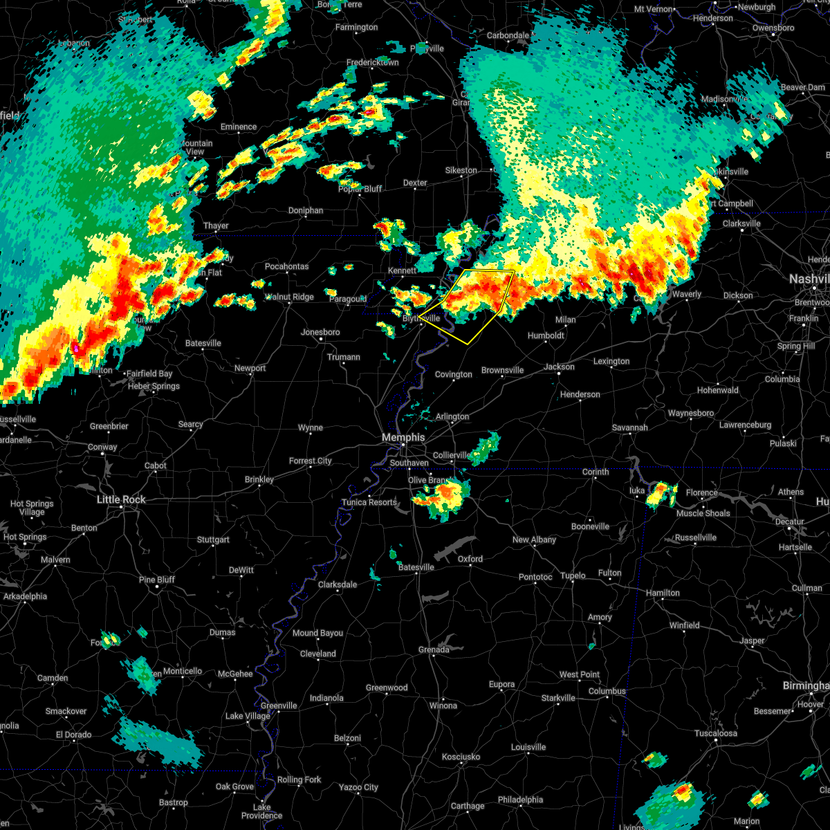 The severe thunderstorm warning for northeastern mississippi, southeastern pemiscot, dyer, southwestern obion, northeastern lauderdale and southeastern lake counties will expire at 500 pm cdt, the storms which prompted the warning have weakened below severe limits, and no longer pose an immediate threat to life or property. therefore, the warning will be allowed to expire. however small hail and gusty winds are still possible with these thunderstorms. a severe thunderstorm watch remains in effect until 1000 pm cdt for eastern arkansas, southeastern missouri, and west tennessee. The severe thunderstorm warning for northeastern mississippi, southeastern pemiscot, dyer, southwestern obion, northeastern lauderdale and southeastern lake counties will expire at 500 pm cdt, the storms which prompted the warning have weakened below severe limits, and no longer pose an immediate threat to life or property. therefore, the warning will be allowed to expire. however small hail and gusty winds are still possible with these thunderstorms. a severe thunderstorm watch remains in effect until 1000 pm cdt for eastern arkansas, southeastern missouri, and west tennessee.
|
| 5/21/2022 4:35 PM CDT |
 At 435 pm cdt, severe thunderstorms were located along a line extending from near miston to near heloise to 8 miles southeast of cooter, moving east at 15 mph (radar indicated). Hazards include 60 mph wind gusts and quarter size hail. Hail damage to vehicles is expected. expect wind damage to roofs, siding, and trees. locations impacted include, dyersburg, caruthersville, newbern, ridgely, obion, cooter, cloverdale, bradleytown, heloise, unionville, miston, cottonwood grove, trimble, cat corner, edith, fowlkes, locust grove, jenkinsville, maxey and elbridge. hail threat, radar indicated max hail size, 1. 00 in wind threat, radar indicated max wind gust, 60 mph. At 435 pm cdt, severe thunderstorms were located along a line extending from near miston to near heloise to 8 miles southeast of cooter, moving east at 15 mph (radar indicated). Hazards include 60 mph wind gusts and quarter size hail. Hail damage to vehicles is expected. expect wind damage to roofs, siding, and trees. locations impacted include, dyersburg, caruthersville, newbern, ridgely, obion, cooter, cloverdale, bradleytown, heloise, unionville, miston, cottonwood grove, trimble, cat corner, edith, fowlkes, locust grove, jenkinsville, maxey and elbridge. hail threat, radar indicated max hail size, 1. 00 in wind threat, radar indicated max wind gust, 60 mph.
|
| 5/21/2022 4:35 PM CDT |
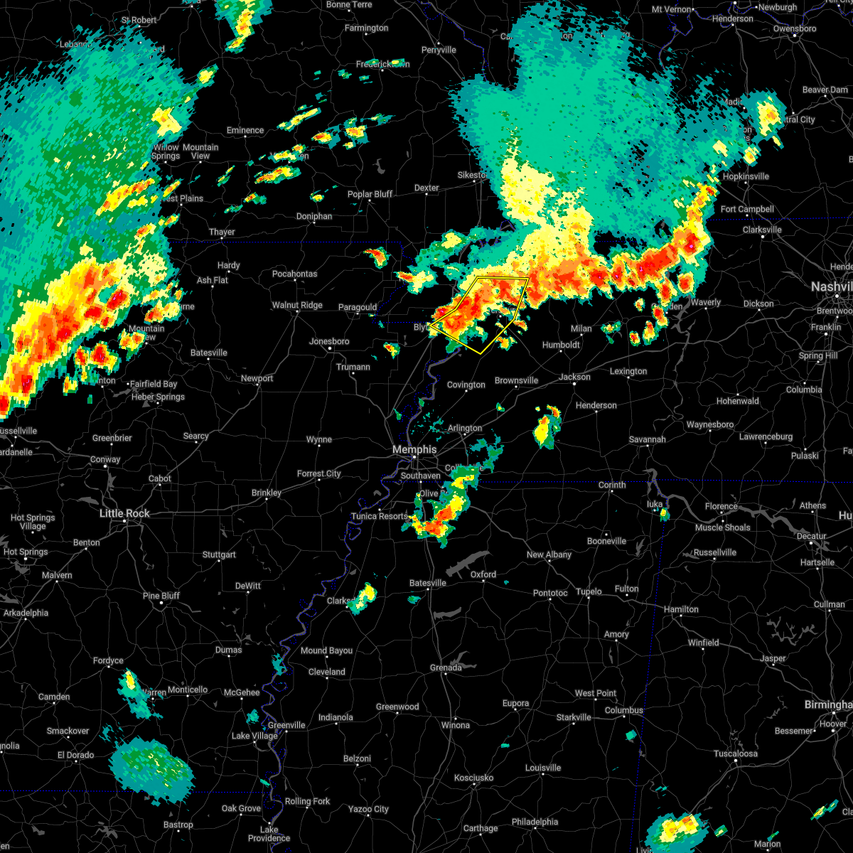 At 435 pm cdt, severe thunderstorms were located along a line extending from near miston to near heloise to 8 miles southeast of cooter, moving east at 15 mph (radar indicated). Hazards include 60 mph wind gusts and quarter size hail. Hail damage to vehicles is expected. expect wind damage to roofs, siding, and trees. locations impacted include, dyersburg, caruthersville, newbern, ridgely, obion, cooter, cloverdale, bradleytown, heloise, unionville, miston, cottonwood grove, trimble, cat corner, edith, fowlkes, locust grove, jenkinsville, maxey and elbridge. hail threat, radar indicated max hail size, 1. 00 in wind threat, radar indicated max wind gust, 60 mph. At 435 pm cdt, severe thunderstorms were located along a line extending from near miston to near heloise to 8 miles southeast of cooter, moving east at 15 mph (radar indicated). Hazards include 60 mph wind gusts and quarter size hail. Hail damage to vehicles is expected. expect wind damage to roofs, siding, and trees. locations impacted include, dyersburg, caruthersville, newbern, ridgely, obion, cooter, cloverdale, bradleytown, heloise, unionville, miston, cottonwood grove, trimble, cat corner, edith, fowlkes, locust grove, jenkinsville, maxey and elbridge. hail threat, radar indicated max hail size, 1. 00 in wind threat, radar indicated max wind gust, 60 mph.
|
| 5/21/2022 4:15 PM CDT |
 At 415 pm cdt, severe thunderstorms were located along a line extending from cottonwood grove to heloise to 6 miles east of blytheville, moving east at 15 mph (radar indicated). Hazards include 60 mph wind gusts and quarter size hail. Hail damage to vehicles is expected. Expect wind damage to roofs, siding, and trees. At 415 pm cdt, severe thunderstorms were located along a line extending from cottonwood grove to heloise to 6 miles east of blytheville, moving east at 15 mph (radar indicated). Hazards include 60 mph wind gusts and quarter size hail. Hail damage to vehicles is expected. Expect wind damage to roofs, siding, and trees.
|
| 5/21/2022 3:55 PM CDT |
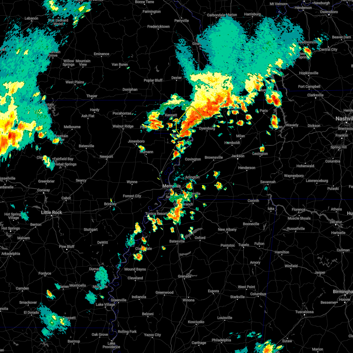 The severe thunderstorm warning for pemiscot and southwestern lake counties will expire at 400 pm cdt, the storm which prompted the warning has weakened below severe limits, and no longer poses an immediate threat to life or property. therefore, the warning will be allowed to expire. a severe thunderstorm watch remains in effect until 1000 pm cdt for southeastern missouri, and west tennessee. The severe thunderstorm warning for pemiscot and southwestern lake counties will expire at 400 pm cdt, the storm which prompted the warning has weakened below severe limits, and no longer poses an immediate threat to life or property. therefore, the warning will be allowed to expire. a severe thunderstorm watch remains in effect until 1000 pm cdt for southeastern missouri, and west tennessee.
|
| 5/21/2022 3:20 PM CDT |
 At 319 pm cdt, a severe thunderstorm was located over steele, moving northeast at 30 mph (radar indicated). Hazards include 60 mph wind gusts and quarter size hail. Hail damage to vehicles is expected. Expect wind damage to roofs, siding, and trees. At 319 pm cdt, a severe thunderstorm was located over steele, moving northeast at 30 mph (radar indicated). Hazards include 60 mph wind gusts and quarter size hail. Hail damage to vehicles is expected. Expect wind damage to roofs, siding, and trees.
|
| 5/21/2022 3:20 PM CDT |
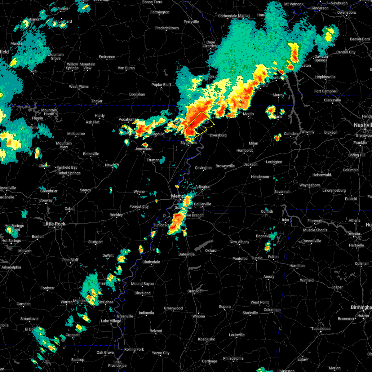 At 319 pm cdt, a severe thunderstorm was located over steele, moving northeast at 30 mph (radar indicated). Hazards include 60 mph wind gusts and quarter size hail. Hail damage to vehicles is expected. Expect wind damage to roofs, siding, and trees. At 319 pm cdt, a severe thunderstorm was located over steele, moving northeast at 30 mph (radar indicated). Hazards include 60 mph wind gusts and quarter size hail. Hail damage to vehicles is expected. Expect wind damage to roofs, siding, and trees.
|
| 5/2/2022 10:12 PM CDT |
 At 1012 pm cdt, a severe thunderstorm was located over reelfoot lake state park, moving northeast at 40 mph (radar indicated). Hazards include 60 mph wind gusts and quarter size hail. Hail damage to vehicles is expected. expect wind damage to roofs, siding, and trees. locations impacted include, union city, reelfoot lake state park, tiptonville, clayton, hornbeak, woodland mills, samburg, wynnburg, wright, cronanville, roneys store, sunkist beach, blue bank, proctor city, fremont, madie, spout springs, mooring, walnut log and old fremont. hail threat, radar indicated max hail size, 1. 00 in wind threat, radar indicated max wind gust, 60 mph. At 1012 pm cdt, a severe thunderstorm was located over reelfoot lake state park, moving northeast at 40 mph (radar indicated). Hazards include 60 mph wind gusts and quarter size hail. Hail damage to vehicles is expected. expect wind damage to roofs, siding, and trees. locations impacted include, union city, reelfoot lake state park, tiptonville, clayton, hornbeak, woodland mills, samburg, wynnburg, wright, cronanville, roneys store, sunkist beach, blue bank, proctor city, fremont, madie, spout springs, mooring, walnut log and old fremont. hail threat, radar indicated max hail size, 1. 00 in wind threat, radar indicated max wind gust, 60 mph.
|
| 5/2/2022 10:01 PM CDT |
 At 1000 pm cdt, a severe thunderstorm was located near ridgely, or near reelfoot lake state park, moving northeast at 40 mph (radar indicated). Hazards include 60 mph wind gusts and quarter size hail. Hail damage to vehicles is expected. Expect wind damage to roofs, siding, and trees. At 1000 pm cdt, a severe thunderstorm was located near ridgely, or near reelfoot lake state park, moving northeast at 40 mph (radar indicated). Hazards include 60 mph wind gusts and quarter size hail. Hail damage to vehicles is expected. Expect wind damage to roofs, siding, and trees.
|
| 4/13/2022 3:45 PM CDT |
 At 345 pm cdt, a severe thunderstorm producing a tornado was located near clayton, or 10 miles west of union city, moving northeast at 70 mph (radar indicated rotation). Hazards include tornado. Flying debris will be dangerous to those caught without shelter. mobile homes will be damaged or destroyed. damage to roofs, windows, and vehicles will occur. tree damage is likely. Locations impacted include, martin, union city, portageville, fulton, reelfoot lake state park, tiptonville, south fulton, ridgely, troy, obion, latham, clayton, cloverdale, miston, cottonwood grove, trimble, hornbeak, woodland mills, rives and samburg. At 345 pm cdt, a severe thunderstorm producing a tornado was located near clayton, or 10 miles west of union city, moving northeast at 70 mph (radar indicated rotation). Hazards include tornado. Flying debris will be dangerous to those caught without shelter. mobile homes will be damaged or destroyed. damage to roofs, windows, and vehicles will occur. tree damage is likely. Locations impacted include, martin, union city, portageville, fulton, reelfoot lake state park, tiptonville, south fulton, ridgely, troy, obion, latham, clayton, cloverdale, miston, cottonwood grove, trimble, hornbeak, woodland mills, rives and samburg.
|
| 4/13/2022 3:34 PM CDT |
 At 333 pm cdt, severe thunderstorms were located along a line extending from near portageville to near cooter to near dixonville, moving east at 40 mph (radar indicated). Hazards include 70 mph wind gusts and quarter size hail. Hail damage to vehicles is expected. expect considerable tree damage. wind damage is also likely to mobile homes, roofs, and outbuildings. locations impacted include, dyersburg, blytheville, ripley, osceola, caruthersville, portageville, hayti, steele, luxora, wilson, reelfoot lake state park, fort pillow state park, munford, tiptonville, newbern, brighton, halls, ridgely, hayti heights and joiner. thunderstorm damage threat, considerable hail threat, radar indicated max hail size, 1. 00 in wind threat, radar indicated max wind gust, 70 mph. At 333 pm cdt, severe thunderstorms were located along a line extending from near portageville to near cooter to near dixonville, moving east at 40 mph (radar indicated). Hazards include 70 mph wind gusts and quarter size hail. Hail damage to vehicles is expected. expect considerable tree damage. wind damage is also likely to mobile homes, roofs, and outbuildings. locations impacted include, dyersburg, blytheville, ripley, osceola, caruthersville, portageville, hayti, steele, luxora, wilson, reelfoot lake state park, fort pillow state park, munford, tiptonville, newbern, brighton, halls, ridgely, hayti heights and joiner. thunderstorm damage threat, considerable hail threat, radar indicated max hail size, 1. 00 in wind threat, radar indicated max wind gust, 70 mph.
|
| 4/13/2022 3:26 PM CDT |
 At 326 pm cdt, a severe thunderstorm producing a tornado was located near cottonwood grove, or near caruthersville, moving northeast at 65 mph (radar indicated rotation). Hazards include tornado. Flying debris will be dangerous to those caught without shelter. mobile homes will be damaged or destroyed. damage to roofs, windows, and vehicles will occur. Tree damage is likely. At 326 pm cdt, a severe thunderstorm producing a tornado was located near cottonwood grove, or near caruthersville, moving northeast at 65 mph (radar indicated rotation). Hazards include tornado. Flying debris will be dangerous to those caught without shelter. mobile homes will be damaged or destroyed. damage to roofs, windows, and vehicles will occur. Tree damage is likely.
|
| 4/13/2022 3:11 PM CDT |
 At 311 pm cdt, severe thunderstorms were located along a line extending from clarkton to gosnell to near gilmore, moving east at 40 mph (radar indicated). Hazards include 70 mph wind gusts and quarter size hail. Hail damage to vehicles is expected. expect considerable tree damage. Wind damage is also likely to mobile homes, roofs, and outbuildings. At 311 pm cdt, severe thunderstorms were located along a line extending from clarkton to gosnell to near gilmore, moving east at 40 mph (radar indicated). Hazards include 70 mph wind gusts and quarter size hail. Hail damage to vehicles is expected. expect considerable tree damage. Wind damage is also likely to mobile homes, roofs, and outbuildings.
|
| 4/13/2022 3:07 PM CDT |
 At 307 pm cdt, a severe thunderstorm producing a tornado was located near steele, moving northeast at 55 mph (radar indicated rotation). Hazards include tornado. Flying debris will be dangerous to those caught without shelter. mobile homes will be damaged or destroyed. damage to roofs, windows, and vehicles will occur. Tree damage is likely. At 307 pm cdt, a severe thunderstorm producing a tornado was located near steele, moving northeast at 55 mph (radar indicated rotation). Hazards include tornado. Flying debris will be dangerous to those caught without shelter. mobile homes will be damaged or destroyed. damage to roofs, windows, and vehicles will occur. Tree damage is likely.
|
| 4/13/2022 2:33 PM CDT |
 At 233 pm cdt, a severe thunderstorm was located over hayti heights, or over hayti, moving northeast at 70 mph (radar indicated). Hazards include 70 mph wind gusts and quarter size hail. Hail damage to vehicles is expected. expect considerable tree damage. wind damage is also likely to mobile homes, roofs, and outbuildings. locations impacted include, caruthersville, portageville, hayti, steele, reelfoot lake state park, tiptonville, ridgely, hayti heights, wardell, deering, bolton, samburg, bragg city, pascola, wynnburg, wright, cronanville, hathaway, roneys store and sunkist beach. thunderstorm damage threat, considerable hail threat, radar indicated max hail size, 1. 00 in wind threat, radar indicated max wind gust, 70 mph. At 233 pm cdt, a severe thunderstorm was located over hayti heights, or over hayti, moving northeast at 70 mph (radar indicated). Hazards include 70 mph wind gusts and quarter size hail. Hail damage to vehicles is expected. expect considerable tree damage. wind damage is also likely to mobile homes, roofs, and outbuildings. locations impacted include, caruthersville, portageville, hayti, steele, reelfoot lake state park, tiptonville, ridgely, hayti heights, wardell, deering, bolton, samburg, bragg city, pascola, wynnburg, wright, cronanville, hathaway, roneys store and sunkist beach. thunderstorm damage threat, considerable hail threat, radar indicated max hail size, 1. 00 in wind threat, radar indicated max wind gust, 70 mph.
|
| 4/13/2022 2:28 PM CDT |
 At 227 pm cdt, a severe thunderstorm was located near steele, moving northeast at 70 mph (radar indicated). Hazards include 70 mph wind gusts and quarter size hail. Hail damage to vehicles is expected. expect considerable tree damage. wind damage is also likely to mobile homes, roofs, and outbuildings. locations impacted include, caruthersville, portageville, hayti, steele, reelfoot lake state park, tiptonville, ridgely, hayti heights, wardell, bolton, deering, cottonwood grove, holland, samburg, bragg city, pascola, madie, spout springs, lassiter corner and cates. thunderstorm damage threat, considerable hail threat, radar indicated max hail size, 1. 00 in wind threat, radar indicated max wind gust, 70 mph. At 227 pm cdt, a severe thunderstorm was located near steele, moving northeast at 70 mph (radar indicated). Hazards include 70 mph wind gusts and quarter size hail. Hail damage to vehicles is expected. expect considerable tree damage. wind damage is also likely to mobile homes, roofs, and outbuildings. locations impacted include, caruthersville, portageville, hayti, steele, reelfoot lake state park, tiptonville, ridgely, hayti heights, wardell, bolton, deering, cottonwood grove, holland, samburg, bragg city, pascola, madie, spout springs, lassiter corner and cates. thunderstorm damage threat, considerable hail threat, radar indicated max hail size, 1. 00 in wind threat, radar indicated max wind gust, 70 mph.
|
| 4/13/2022 2:23 PM CDT |
 At 222 pm cdt, a severe thunderstorm was located near hornersville, or 7 miles north of gosnell, moving northeast at 60 mph (radar indicated). Hazards include 70 mph wind gusts and quarter size hail. Hail damage to vehicles is expected. expect considerable tree damage. Wind damage is also likely to mobile homes, roofs, and outbuildings. At 222 pm cdt, a severe thunderstorm was located near hornersville, or 7 miles north of gosnell, moving northeast at 60 mph (radar indicated). Hazards include 70 mph wind gusts and quarter size hail. Hail damage to vehicles is expected. expect considerable tree damage. Wind damage is also likely to mobile homes, roofs, and outbuildings.
|
| 4/11/2022 7:16 PM CDT |
 At 716 pm cdt, a severe thunderstorm was located near deering, or 8 miles west of hayti, moving east at 50 mph (broadcast media). Hazards include quarter size hail. Damage to vehicles is expected. locations impacted include, caruthersville, portageville, hayti, reelfoot lake state park, tiptonville, ridgely, hayti heights, wardell, deering, bolton, cottonwood grove, bragg city, pascola, wynnburg, wright, cronanville, hathaway, sunkist beach, blue bank and proctor city. hail threat, observed max hail size, 1. 00 in wind threat, radar indicated max wind gust, <50 mph. At 716 pm cdt, a severe thunderstorm was located near deering, or 8 miles west of hayti, moving east at 50 mph (broadcast media). Hazards include quarter size hail. Damage to vehicles is expected. locations impacted include, caruthersville, portageville, hayti, reelfoot lake state park, tiptonville, ridgely, hayti heights, wardell, deering, bolton, cottonwood grove, bragg city, pascola, wynnburg, wright, cronanville, hathaway, sunkist beach, blue bank and proctor city. hail threat, observed max hail size, 1. 00 in wind threat, radar indicated max wind gust, <50 mph.
|
| 4/11/2022 7:03 PM CDT |
 At 703 pm cdt, a severe thunderstorm was located over kennett, moving east at 50 mph (radar indicated). Hazards include 60 mph wind gusts and quarter size hail. Hail damage to vehicles is expected. Expect wind damage to roofs, siding, and trees. At 703 pm cdt, a severe thunderstorm was located over kennett, moving east at 50 mph (radar indicated). Hazards include 60 mph wind gusts and quarter size hail. Hail damage to vehicles is expected. Expect wind damage to roofs, siding, and trees.
|
| 3/30/2022 3:39 PM CDT |
 At 339 pm cdt, severe thunderstorms were located along a line extending from near risco to near bolton to near steele, moving northeast at 50 mph (radar indicated). Hazards include 60 mph wind gusts. expect damage to roofs, siding, and trees At 339 pm cdt, severe thunderstorms were located along a line extending from near risco to near bolton to near steele, moving northeast at 50 mph (radar indicated). Hazards include 60 mph wind gusts. expect damage to roofs, siding, and trees
|
| 1/1/2022 1:03 AM CST |
 At 103 am cst, a severe thunderstorm was located near cloverdale, or 9 miles southeast of reelfoot lake state park, moving northeast at 55 mph (radar indicated). Hazards include 60 mph wind gusts and quarter size hail. Hail damage to vehicles is expected. expect wind damage to roofs, siding, and trees. locations impacted include, ridgely, troy, obion, miston, cloverdale, cottonwood grove, trimble, hornbeak, mason hall, cat corner, glass, locust grove, maxey, roneys store, elbridge, templeton, jacksonville, fremont, broadmoor and sharps ferry. hail threat, radar indicated max hail size, 1. 00 in wind threat, radar indicated max wind gust, 60 mph. At 103 am cst, a severe thunderstorm was located near cloverdale, or 9 miles southeast of reelfoot lake state park, moving northeast at 55 mph (radar indicated). Hazards include 60 mph wind gusts and quarter size hail. Hail damage to vehicles is expected. expect wind damage to roofs, siding, and trees. locations impacted include, ridgely, troy, obion, miston, cloverdale, cottonwood grove, trimble, hornbeak, mason hall, cat corner, glass, locust grove, maxey, roneys store, elbridge, templeton, jacksonville, fremont, broadmoor and sharps ferry. hail threat, radar indicated max hail size, 1. 00 in wind threat, radar indicated max wind gust, 60 mph.
|
| 1/1/2022 12:58 AM CST | Tree knocked down on cat corner roa in obion county TN, 5.4 miles NW of Ridgely, TN |
| 1/1/2022 12:42 AM CST |
 At 1241 am cst, a severe thunderstorm was located near caruthersville, moving northeast at 55 mph (radar indicated). Hazards include 60 mph wind gusts and quarter size hail. Hail damage to vehicles is expected. Expect wind damage to roofs, siding, and trees. At 1241 am cst, a severe thunderstorm was located near caruthersville, moving northeast at 55 mph (radar indicated). Hazards include 60 mph wind gusts and quarter size hail. Hail damage to vehicles is expected. Expect wind damage to roofs, siding, and trees.
|
| 1/1/2022 12:36 AM CST |
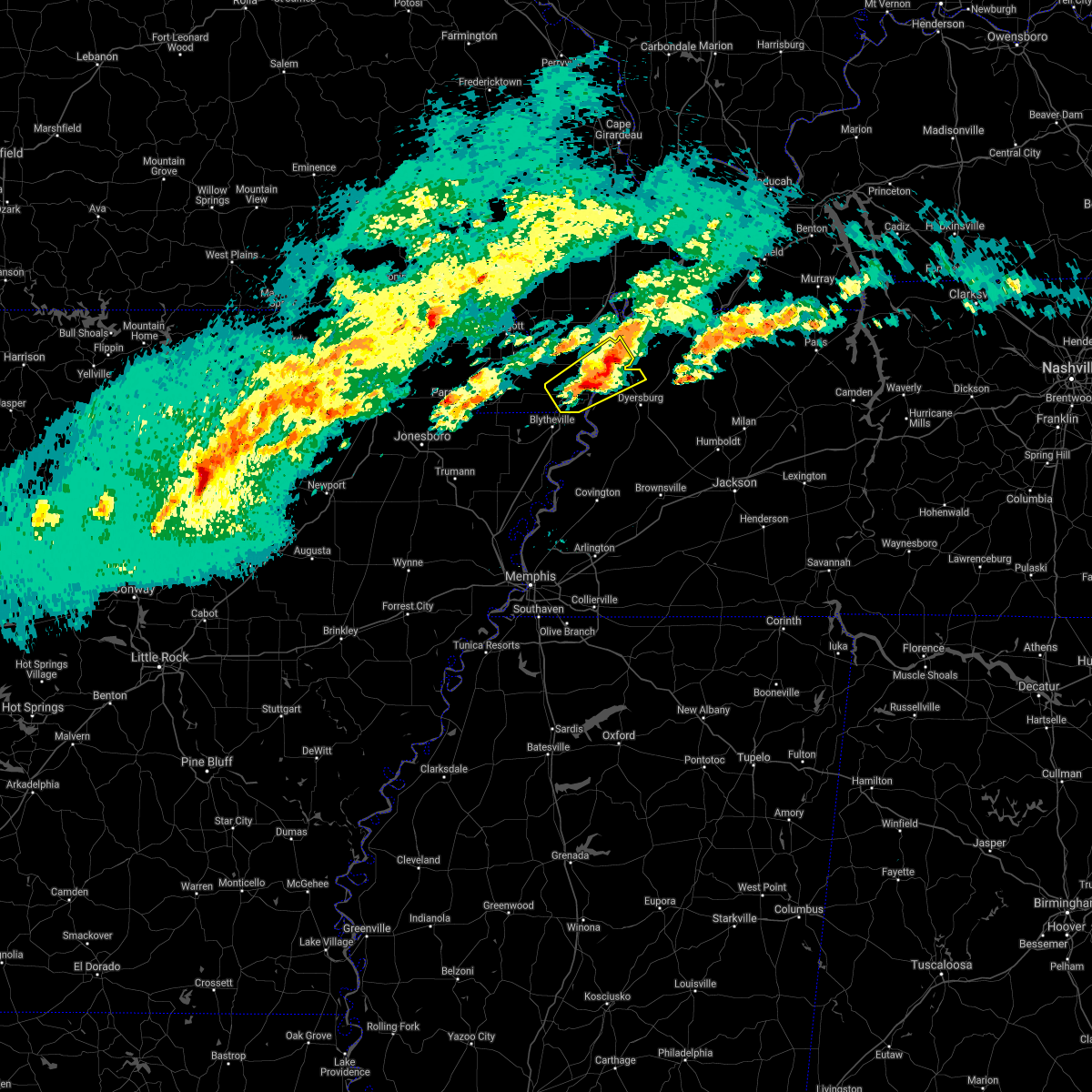 At 1235 am cst, a severe thunderstorm was located over caruthersville, moving northeast at 55 mph (radar indicated). Hazards include 60 mph wind gusts and quarter size hail. Hail damage to vehicles is expected. expect wind damage to roofs, siding, and trees. locations impacted include, caruthersville, hayti, steele, ridgely, hayti heights, cooter, heloise, miston, cottonwood grove, holland, ayers, hathaway, broadmoor, madie, mooring, bogota, haynes, tennemo, boothspoint and owl hoot. hail threat, radar indicated max hail size, 1. 00 in wind threat, radar indicated max wind gust, 60 mph. At 1235 am cst, a severe thunderstorm was located over caruthersville, moving northeast at 55 mph (radar indicated). Hazards include 60 mph wind gusts and quarter size hail. Hail damage to vehicles is expected. expect wind damage to roofs, siding, and trees. locations impacted include, caruthersville, hayti, steele, ridgely, hayti heights, cooter, heloise, miston, cottonwood grove, holland, ayers, hathaway, broadmoor, madie, mooring, bogota, haynes, tennemo, boothspoint and owl hoot. hail threat, radar indicated max hail size, 1. 00 in wind threat, radar indicated max wind gust, 60 mph.
|
| 1/1/2022 12:17 AM CST |
 At 1216 am cst, a severe thunderstorm was located near gosnell, moving northeast at 55 mph (radar indicated). Hazards include 60 mph wind gusts and quarter size hail. Hail damage to vehicles is expected. Expect wind damage to roofs, siding, and trees. At 1216 am cst, a severe thunderstorm was located near gosnell, moving northeast at 55 mph (radar indicated). Hazards include 60 mph wind gusts and quarter size hail. Hail damage to vehicles is expected. Expect wind damage to roofs, siding, and trees.
|
| 1/1/2022 12:17 AM CST |
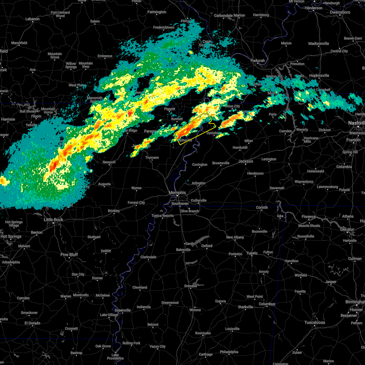 At 1216 am cst, a severe thunderstorm was located near gosnell, moving northeast at 55 mph (radar indicated). Hazards include 60 mph wind gusts and quarter size hail. Hail damage to vehicles is expected. Expect wind damage to roofs, siding, and trees. At 1216 am cst, a severe thunderstorm was located near gosnell, moving northeast at 55 mph (radar indicated). Hazards include 60 mph wind gusts and quarter size hail. Hail damage to vehicles is expected. Expect wind damage to roofs, siding, and trees.
|
| 12/10/2021 9:52 PM CST |
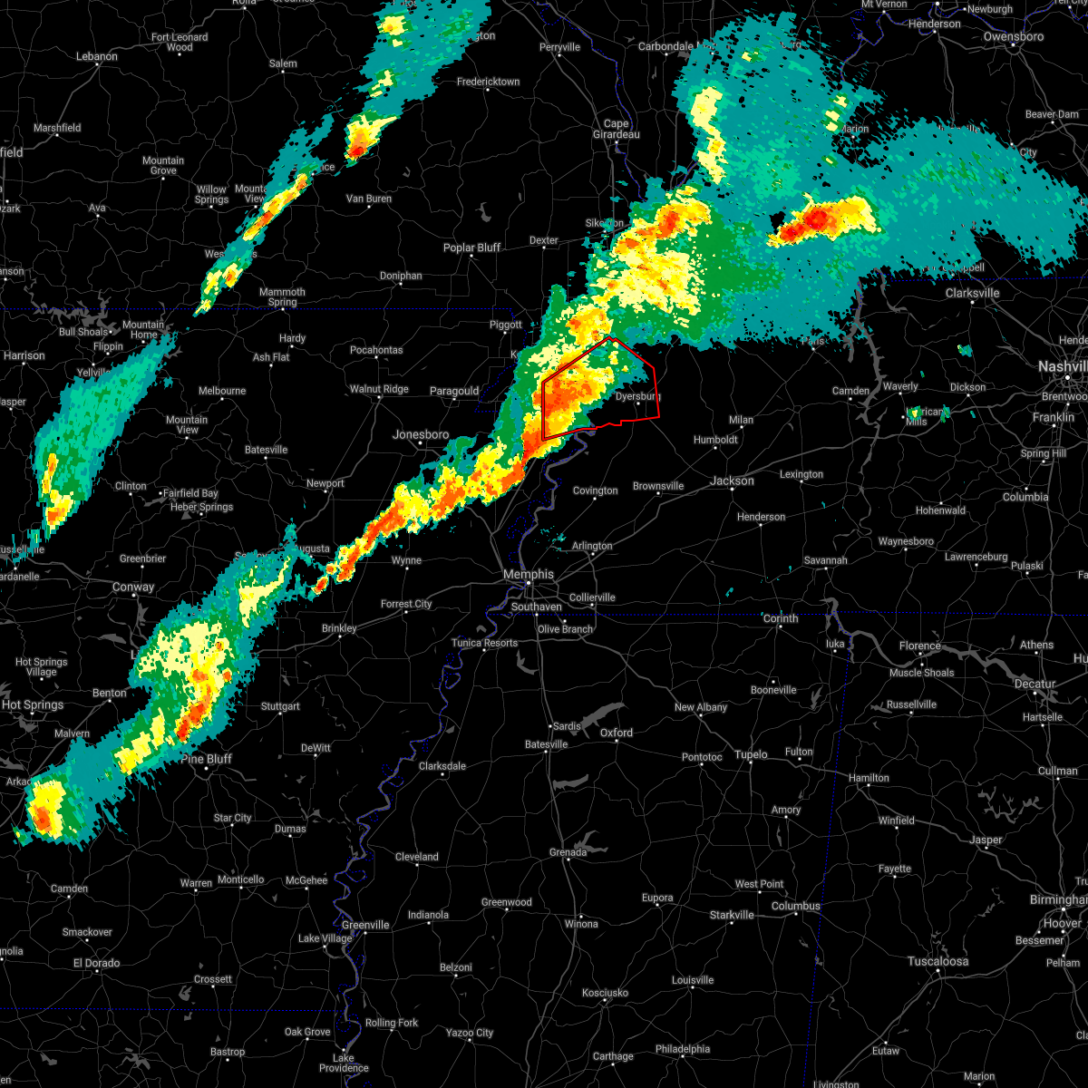 At 951 pm cst, a severe thunderstorm producing a tornado was located over blytheville, moving east at 55 mph (radar indicated rotation). Hazards include tornado and quarter size hail. Flying debris will be dangerous to those caught without shelter. mobile homes will be damaged or destroyed. damage to roofs, windows, and vehicles will occur. tree damage is likely. this dangerous storm will be near, cooter around 1000 pm cst. heloise around 1010 pm cst. unionville around 1020 pm cst. bradleytown and miston around 1025 pm cst. dyersburg and newbern around 1030 pm cst. Other locations impacted by this tornadic thunderstorm include cat corner, fowlkes, jenkinsville, maxey, broadmoor, madie, parker, lane, bogota and tennemo. At 951 pm cst, a severe thunderstorm producing a tornado was located over blytheville, moving east at 55 mph (radar indicated rotation). Hazards include tornado and quarter size hail. Flying debris will be dangerous to those caught without shelter. mobile homes will be damaged or destroyed. damage to roofs, windows, and vehicles will occur. tree damage is likely. this dangerous storm will be near, cooter around 1000 pm cst. heloise around 1010 pm cst. unionville around 1020 pm cst. bradleytown and miston around 1025 pm cst. dyersburg and newbern around 1030 pm cst. Other locations impacted by this tornadic thunderstorm include cat corner, fowlkes, jenkinsville, maxey, broadmoor, madie, parker, lane, bogota and tennemo.
|
| 5/4/2021 3:36 AM CDT |
 At 336 am cdt, severe thunderstorms were located along a line extending from 7 miles south of union city to near rutherford to near nutbush, moving east at 65 mph (radar indicated). Hazards include 60 mph wind gusts. Expect damage to roofs, siding, and trees. Locations impacted include, dyersburg, ripley, reelfoot lake state park, fort pillow state park, tiptonville, newbern, halls, ridgely, troy, obion, clayton, bradleytown, unionville, ashport, ft pillow, cloverdale, fulton, miston, henning and gates. At 336 am cdt, severe thunderstorms were located along a line extending from 7 miles south of union city to near rutherford to near nutbush, moving east at 65 mph (radar indicated). Hazards include 60 mph wind gusts. Expect damage to roofs, siding, and trees. Locations impacted include, dyersburg, ripley, reelfoot lake state park, fort pillow state park, tiptonville, newbern, halls, ridgely, troy, obion, clayton, bradleytown, unionville, ashport, ft pillow, cloverdale, fulton, miston, henning and gates.
|
| 5/4/2021 2:59 AM CDT |
 At 258 am cdt, severe thunderstorms were located along a line extending from near bolton to near caruthersville to near marie, moving east at 65 mph (radar indicated). Hazards include 60 mph wind gusts and quarter size hail. Hail damage to vehicles is expected. Expect wind damage to roofs, siding, and trees. At 258 am cdt, severe thunderstorms were located along a line extending from near bolton to near caruthersville to near marie, moving east at 65 mph (radar indicated). Hazards include 60 mph wind gusts and quarter size hail. Hail damage to vehicles is expected. Expect wind damage to roofs, siding, and trees.
|
| 4/9/2021 5:50 PM CDT |
 At 549 pm cdt, a severe thunderstorm was located near bradleytown, or 8 miles west of dyersburg, moving northeast at 25 mph (radar indicated). Hazards include 60 mph wind gusts and quarter size hail. Hail damage to vehicles is expected. expect wind damage to roofs, siding, and trees. Locations impacted include, dyersburg, ridgely, miston, cloverdale, cottonwood grove, bradleytown, lenox, ayers, cat corner, papaw ridge, wynnburg, jenkinsville, maxey, broadmoor, sharps ferry, middle city, poplar ridge, madie, mooring and lane. At 549 pm cdt, a severe thunderstorm was located near bradleytown, or 8 miles west of dyersburg, moving northeast at 25 mph (radar indicated). Hazards include 60 mph wind gusts and quarter size hail. Hail damage to vehicles is expected. expect wind damage to roofs, siding, and trees. Locations impacted include, dyersburg, ridgely, miston, cloverdale, cottonwood grove, bradleytown, lenox, ayers, cat corner, papaw ridge, wynnburg, jenkinsville, maxey, broadmoor, sharps ferry, middle city, poplar ridge, madie, mooring and lane.
|
| 4/9/2021 5:37 PM CDT |
 At 537 pm cdt, a severe thunderstorm was located near heloise, or 10 miles south of caruthersville, moving northeast at 25 mph (radar indicated). Hazards include 60 mph wind gusts and quarter size hail. Hail damage to vehicles is expected. expect wind damage to roofs, siding, and trees. Locations impacted include, dyersburg, caruthersville, ridgely, bradleytown, heloise, miston, cloverdale, cottonwood grove, lenox, ayers, cat corner, papaw ridge, wynnburg, jenkinsville, maxey, broadmoor, sharps ferry, middle city, poplar ridge and madie. At 537 pm cdt, a severe thunderstorm was located near heloise, or 10 miles south of caruthersville, moving northeast at 25 mph (radar indicated). Hazards include 60 mph wind gusts and quarter size hail. Hail damage to vehicles is expected. expect wind damage to roofs, siding, and trees. Locations impacted include, dyersburg, caruthersville, ridgely, bradleytown, heloise, miston, cloverdale, cottonwood grove, lenox, ayers, cat corner, papaw ridge, wynnburg, jenkinsville, maxey, broadmoor, sharps ferry, middle city, poplar ridge and madie.
|
| 4/9/2021 5:37 PM CDT |
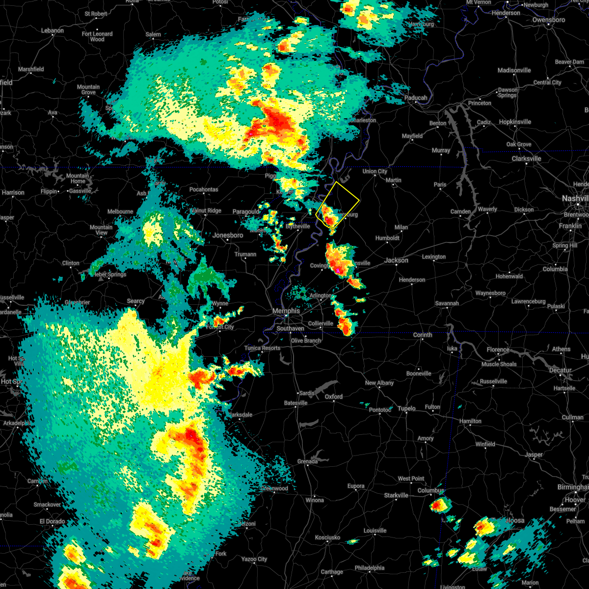 At 537 pm cdt, a severe thunderstorm was located near heloise, or 10 miles south of caruthersville, moving northeast at 25 mph (radar indicated). Hazards include 60 mph wind gusts and quarter size hail. Hail damage to vehicles is expected. expect wind damage to roofs, siding, and trees. Locations impacted include, dyersburg, caruthersville, ridgely, bradleytown, heloise, miston, cloverdale, cottonwood grove, lenox, ayers, cat corner, papaw ridge, wynnburg, jenkinsville, maxey, broadmoor, sharps ferry, middle city, poplar ridge and madie. At 537 pm cdt, a severe thunderstorm was located near heloise, or 10 miles south of caruthersville, moving northeast at 25 mph (radar indicated). Hazards include 60 mph wind gusts and quarter size hail. Hail damage to vehicles is expected. expect wind damage to roofs, siding, and trees. Locations impacted include, dyersburg, caruthersville, ridgely, bradleytown, heloise, miston, cloverdale, cottonwood grove, lenox, ayers, cat corner, papaw ridge, wynnburg, jenkinsville, maxey, broadmoor, sharps ferry, middle city, poplar ridge and madie.
|
| 4/9/2021 5:27 PM CDT |
 At 527 pm cdt, a severe thunderstorm was located near heloise, or 13 miles southeast of steele, moving northeast at 25 mph (radar indicated). Hazards include 60 mph wind gusts and quarter size hail. Hail damage to vehicles is expected. Expect wind damage to roofs, siding, and trees. At 527 pm cdt, a severe thunderstorm was located near heloise, or 13 miles southeast of steele, moving northeast at 25 mph (radar indicated). Hazards include 60 mph wind gusts and quarter size hail. Hail damage to vehicles is expected. Expect wind damage to roofs, siding, and trees.
|
| 4/9/2021 5:27 PM CDT |
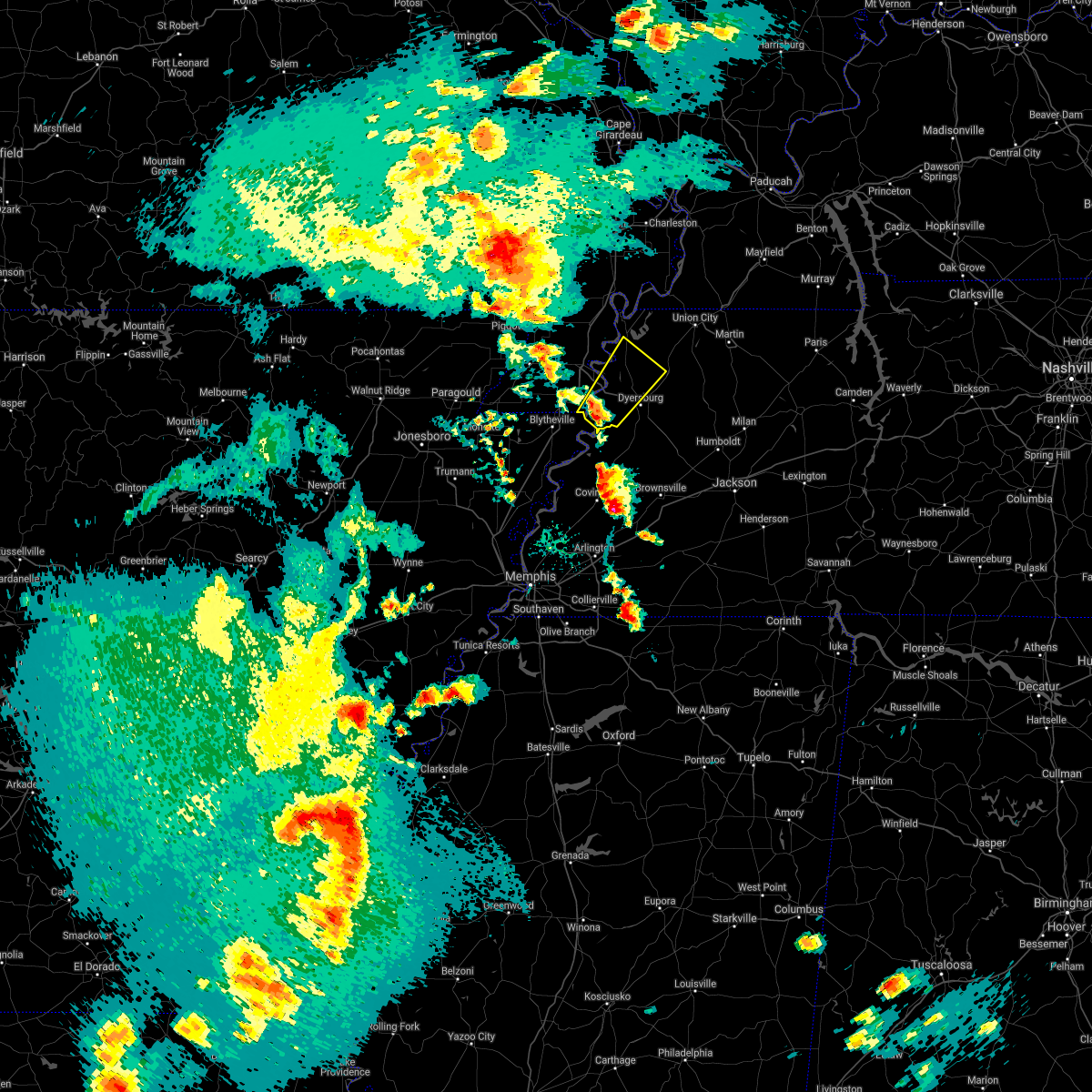 At 527 pm cdt, a severe thunderstorm was located near heloise, or 13 miles southeast of steele, moving northeast at 25 mph (radar indicated). Hazards include 60 mph wind gusts and quarter size hail. Hail damage to vehicles is expected. Expect wind damage to roofs, siding, and trees. At 527 pm cdt, a severe thunderstorm was located near heloise, or 13 miles southeast of steele, moving northeast at 25 mph (radar indicated). Hazards include 60 mph wind gusts and quarter size hail. Hail damage to vehicles is expected. Expect wind damage to roofs, siding, and trees.
|
| 9/1/2020 5:18 PM CDT |
 At 518 pm cdt, doppler radar indicated a severe thunderstorm producing a tornado was located near tiptonville, or near reelfoot lake state park, moving northeast at 25 mph (radar indicated rotation). Hazards include tornado. Flying debris will be dangerous to those caught without shelter. mobile homes will be damaged or destroyed. damage to roofs, windows, and vehicles will occur. Tree damage is likely. At 518 pm cdt, doppler radar indicated a severe thunderstorm producing a tornado was located near tiptonville, or near reelfoot lake state park, moving northeast at 25 mph (radar indicated rotation). Hazards include tornado. Flying debris will be dangerous to those caught without shelter. mobile homes will be damaged or destroyed. damage to roofs, windows, and vehicles will occur. Tree damage is likely.
|
| 5/4/2020 6:05 PM CDT |
 The severe thunderstorm warning for pemiscot, northern dyer, western obion and lake counties will expire at 615 pm cdt, the storm which prompted the warning has moved out of the area. therefore, the warning will be allowed to expire. however gusty winds are still possible with this thunderstorm. a severe thunderstorm watch remains in effect until 1000 pm cdt for southeastern missouri, and western tennessee. The severe thunderstorm warning for pemiscot, northern dyer, western obion and lake counties will expire at 615 pm cdt, the storm which prompted the warning has moved out of the area. therefore, the warning will be allowed to expire. however gusty winds are still possible with this thunderstorm. a severe thunderstorm watch remains in effect until 1000 pm cdt for southeastern missouri, and western tennessee.
|
| 5/4/2020 6:00 PM CDT | *** 1 inj *** mobile home destroyed in lake county TN, 0.3 miles N of Ridgely, TN |
| 5/4/2020 5:58 PM CDT |
 At 557 pm cdt, a severe thunderstorm was located over ridgely, or near reelfoot lake state park, moving east at 55 mph (radar indicated). Hazards include 60 mph wind gusts and quarter size hail. Hail damage to vehicles is expected. expect wind damage to roofs, siding, and trees. Locations impacted include, caruthersville, portageville, hayti, steele, reelfoot lake state park, tiptonville, newbern, ridgely, hayti heights, wardell, bolton, cloverdale, deering, miston, cottonwood grove, hornbeak, samburg, bragg city, pascola and cat corner. At 557 pm cdt, a severe thunderstorm was located over ridgely, or near reelfoot lake state park, moving east at 55 mph (radar indicated). Hazards include 60 mph wind gusts and quarter size hail. Hail damage to vehicles is expected. expect wind damage to roofs, siding, and trees. Locations impacted include, caruthersville, portageville, hayti, steele, reelfoot lake state park, tiptonville, newbern, ridgely, hayti heights, wardell, bolton, cloverdale, deering, miston, cottonwood grove, hornbeak, samburg, bragg city, pascola and cat corner.
|
| 5/4/2020 5:41 PM CDT |
 At 541 pm cdt, a severe thunderstorm was located over hayti heights, or over hayti, moving east at 55 mph (radar indicated). Hazards include 60 mph wind gusts and quarter size hail. Hail damage to vehicles is expected. Expect wind damage to roofs, siding, and trees. At 541 pm cdt, a severe thunderstorm was located over hayti heights, or over hayti, moving east at 55 mph (radar indicated). Hazards include 60 mph wind gusts and quarter size hail. Hail damage to vehicles is expected. Expect wind damage to roofs, siding, and trees.
|
| 5/3/2020 2:29 PM CDT |
 At 229 pm cdt, severe thunderstorms were located along a line extending from near union city to near newbern, moving east at 65 mph (radar indicated). Hazards include 70 mph wind gusts and quarter size hail. Hail damage to vehicles is expected. expect considerable tree damage. wind damage is also likely to mobile homes, roofs, and outbuildings. Locations impacted include, dyersburg, blytheville, martin, union city, caruthersville, gosnell, fulton, steele, newbern, south fulton, ridgely, troy, kenton, obion, cooter, clayton, bradleytown, heloise, unionville and latham. At 229 pm cdt, severe thunderstorms were located along a line extending from near union city to near newbern, moving east at 65 mph (radar indicated). Hazards include 70 mph wind gusts and quarter size hail. Hail damage to vehicles is expected. expect considerable tree damage. wind damage is also likely to mobile homes, roofs, and outbuildings. Locations impacted include, dyersburg, blytheville, martin, union city, caruthersville, gosnell, fulton, steele, newbern, south fulton, ridgely, troy, kenton, obion, cooter, clayton, bradleytown, heloise, unionville and latham.
|
| 5/3/2020 2:09 PM CDT |
 At 208 pm cdt, severe thunderstorms were located along a line extending from near clayton to near gosnell, moving east at 55 mph (radar indicated). Hazards include 70 mph wind gusts and quarter size hail. Hail damage to vehicles is expected. expect considerable tree damage. Wind damage is also likely to mobile homes, roofs, and outbuildings. At 208 pm cdt, severe thunderstorms were located along a line extending from near clayton to near gosnell, moving east at 55 mph (radar indicated). Hazards include 70 mph wind gusts and quarter size hail. Hail damage to vehicles is expected. expect considerable tree damage. Wind damage is also likely to mobile homes, roofs, and outbuildings.
|
| 5/3/2020 1:50 PM CDT |
 At 149 pm cdt, severe thunderstorms were located along a line extending from near parma to near senath, moving east at 55 mph (radar indicated). Hazards include 70 mph wind gusts and half dollar size hail. Hail damage to vehicles is expected. expect considerable tree damage. wind damage is also likely to mobile homes, roofs, and outbuildings. Locations impacted include, paragould, dyersburg, kennett, caruthersville, piggott, portageville, hayti, steele, campbell, rector, senath, marmaduke, reelfoot lake state park, chalk bluff natural area, tiptonville, malden, ridgely, oak grove heights, cardwell and hornersville. At 149 pm cdt, severe thunderstorms were located along a line extending from near parma to near senath, moving east at 55 mph (radar indicated). Hazards include 70 mph wind gusts and half dollar size hail. Hail damage to vehicles is expected. expect considerable tree damage. wind damage is also likely to mobile homes, roofs, and outbuildings. Locations impacted include, paragould, dyersburg, kennett, caruthersville, piggott, portageville, hayti, steele, campbell, rector, senath, marmaduke, reelfoot lake state park, chalk bluff natural area, tiptonville, malden, ridgely, oak grove heights, cardwell and hornersville.
|
| 5/3/2020 1:30 PM CDT |
 At 130 pm cdt, severe thunderstorms were located along a line extending from near glennonville to near oak grove heights, moving east at 70 mph (radar indicated). Hazards include 70 mph wind gusts and half dollar size hail. Hail damage to vehicles is expected. expect considerable tree damage. Wind damage is also likely to mobile homes, roofs, and outbuildings. At 130 pm cdt, severe thunderstorms were located along a line extending from near glennonville to near oak grove heights, moving east at 70 mph (radar indicated). Hazards include 70 mph wind gusts and half dollar size hail. Hail damage to vehicles is expected. expect considerable tree damage. Wind damage is also likely to mobile homes, roofs, and outbuildings.
|
| 4/29/2020 12:25 AM CDT |
 The severe thunderstorm warning for southeastern craighead, mississippi, southeastern clay, pemiscot, dunklin, western dyer, central lauderdale and central lake counties will expire at 1230 am cdt, the storm which prompted the warning has weakened below severe limits, and has exited the warned area. therefore, the warning will be allowed to expire. a severe thunderstorm watch remains in effect until 300 am cdt for eastern arkansas, southeastern missouri, and western tennessee. The severe thunderstorm warning for southeastern craighead, mississippi, southeastern clay, pemiscot, dunklin, western dyer, central lauderdale and central lake counties will expire at 1230 am cdt, the storm which prompted the warning has weakened below severe limits, and has exited the warned area. therefore, the warning will be allowed to expire. a severe thunderstorm watch remains in effect until 300 am cdt for eastern arkansas, southeastern missouri, and western tennessee.
|
| 4/28/2020 11:43 PM CDT |
 At 1139 pm cdt, a severe thunderstorm was located near steele, moving east at 65 mph (radar indicated). Hazards include 70 mph wind gusts. Expect considerable tree damage. Damage is likely to mobile homes, roofs, and outbuildings. At 1139 pm cdt, a severe thunderstorm was located near steele, moving east at 65 mph (radar indicated). Hazards include 70 mph wind gusts. Expect considerable tree damage. Damage is likely to mobile homes, roofs, and outbuildings.
|
| 4/28/2020 11:43 PM CDT |
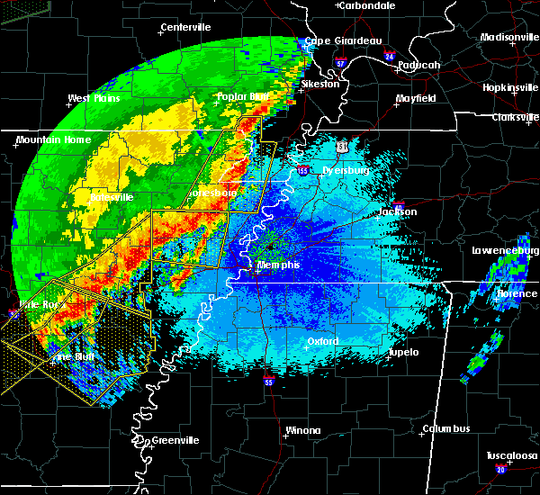 At 1139 pm cdt, a severe thunderstorm was located near steele, moving east at 65 mph (radar indicated). Hazards include 70 mph wind gusts. Expect considerable tree damage. Damage is likely to mobile homes, roofs, and outbuildings. At 1139 pm cdt, a severe thunderstorm was located near steele, moving east at 65 mph (radar indicated). Hazards include 70 mph wind gusts. Expect considerable tree damage. Damage is likely to mobile homes, roofs, and outbuildings.
|
| 3/28/2020 7:35 PM CDT |
 The tornado warning for east central pemiscot, northwestern dyer, southwestern obion and lake counties will expire at 745 pm cdt, the storm which prompted the warning has weakened below severe limits, and no longer appears capable of producing a tornado. therefore, the warning will be allowed to expire. a tornado watch remains in effect until 200 am cdt for southeastern missouri, and western tennessee. The tornado warning for east central pemiscot, northwestern dyer, southwestern obion and lake counties will expire at 745 pm cdt, the storm which prompted the warning has weakened below severe limits, and no longer appears capable of producing a tornado. therefore, the warning will be allowed to expire. a tornado watch remains in effect until 200 am cdt for southeastern missouri, and western tennessee.
|
| 3/28/2020 7:21 PM CDT |
 At 721 pm cdt, doppler radar indicated a severe thunderstorm producing a tornado was located over caruthersville, moving northeast at 35 mph (radar indicated rotation). Hazards include tornado. Flying debris will be dangerous to those caught without shelter. mobile homes will be damaged or destroyed. damage to roofs, windows, and vehicles will occur. Tree damage is likely. At 721 pm cdt, doppler radar indicated a severe thunderstorm producing a tornado was located over caruthersville, moving northeast at 35 mph (radar indicated rotation). Hazards include tornado. Flying debris will be dangerous to those caught without shelter. mobile homes will be damaged or destroyed. damage to roofs, windows, and vehicles will occur. Tree damage is likely.
|
| 3/28/2020 6:51 PM CDT |
 At 651 pm cdt, a severe thunderstorm was located near steele, moving northeast at 40 mph (radar indicated). Hazards include 60 mph wind gusts and quarter size hail. Hail damage to vehicles is expected. Expect wind damage to roofs, siding, and trees. At 651 pm cdt, a severe thunderstorm was located near steele, moving northeast at 40 mph (radar indicated). Hazards include 60 mph wind gusts and quarter size hail. Hail damage to vehicles is expected. Expect wind damage to roofs, siding, and trees.
|
| 3/20/2020 2:00 AM CDT |
 At 200 am cdt, a severe thunderstorm was located over miston, or 8 miles east of caruthersville, moving northeast at 55 mph (radar indicated). Hazards include 60 mph wind gusts. expect damage to roofs, siding, and trees At 200 am cdt, a severe thunderstorm was located over miston, or 8 miles east of caruthersville, moving northeast at 55 mph (radar indicated). Hazards include 60 mph wind gusts. expect damage to roofs, siding, and trees
|
| 3/12/2020 11:41 AM CDT |
 At 1141 am cdt, a severe thunderstorm was located over cottonwood grove, or 7 miles northeast of caruthersville, moving northeast at 40 mph (radar indicated). Hazards include 60 mph wind gusts and quarter size hail. Hail damage to vehicles is expected. Expect wind damage to roofs, siding, and trees. At 1141 am cdt, a severe thunderstorm was located over cottonwood grove, or 7 miles northeast of caruthersville, moving northeast at 40 mph (radar indicated). Hazards include 60 mph wind gusts and quarter size hail. Hail damage to vehicles is expected. Expect wind damage to roofs, siding, and trees.
|
| 1/11/2020 4:19 AM CST |
 At 419 am cst, a severe thunderstorm was located over bradleytown, or near dyersburg, moving northeast at 40 mph (radar indicated). Hazards include 60 mph wind gusts. Expect damage to roofs, siding, and trees. Locations impacted include, dyersburg, union city, caruthersville, trenton, reelfoot lake state park, newbern, dyer, halls, ridgely, troy, kenton, rutherford, obion, bradford, clayton, bradleytown, heloise, unionville, cloverdale and miston. At 419 am cst, a severe thunderstorm was located over bradleytown, or near dyersburg, moving northeast at 40 mph (radar indicated). Hazards include 60 mph wind gusts. Expect damage to roofs, siding, and trees. Locations impacted include, dyersburg, union city, caruthersville, trenton, reelfoot lake state park, newbern, dyer, halls, ridgely, troy, kenton, rutherford, obion, bradford, clayton, bradleytown, heloise, unionville, cloverdale and miston.
|
| 1/11/2020 3:54 AM CST |
 At 353 am cst, a severe thunderstorm was located 10 miles north of ashport, or 10 miles east of blytheville, moving northeast at 45 mph (radar indicated). Hazards include 60 mph wind gusts. expect damage to roofs, siding, and trees At 353 am cst, a severe thunderstorm was located 10 miles north of ashport, or 10 miles east of blytheville, moving northeast at 45 mph (radar indicated). Hazards include 60 mph wind gusts. expect damage to roofs, siding, and trees
|
| 1/11/2020 2:47 AM CST |
 At 247 am cst, severe thunderstorms were located along a line extending from near portageville to near osceola, moving east at 40 mph (radar indicated). Hazards include 60 mph wind gusts. Expect damage to roofs, siding, and trees. Locations impacted include, dyersburg, blytheville, kennett, osceola, caruthersville, gosnell, manila, portageville, hayti, steele, caraway, luxora, keiser, reelfoot lake state park, tiptonville, ridgely, hornersville, hayti heights, cooter and wardell. At 247 am cst, severe thunderstorms were located along a line extending from near portageville to near osceola, moving east at 40 mph (radar indicated). Hazards include 60 mph wind gusts. Expect damage to roofs, siding, and trees. Locations impacted include, dyersburg, blytheville, kennett, osceola, caruthersville, gosnell, manila, portageville, hayti, steele, caraway, luxora, keiser, reelfoot lake state park, tiptonville, ridgely, hornersville, hayti heights, cooter and wardell.
|
| 1/11/2020 2:26 AM CST |
 At 225 am cst, severe thunderstorms were located along a line extending from near gideon to near caraway, moving northeast at 40 mph (radar indicated). Hazards include 60 mph wind gusts. expect damage to roofs, siding, and trees At 225 am cst, severe thunderstorms were located along a line extending from near gideon to near caraway, moving northeast at 40 mph (radar indicated). Hazards include 60 mph wind gusts. expect damage to roofs, siding, and trees
|
| 10/21/2019 7:00 AM CDT |
 At 700 am cdt, severe thunderstorms were located along a line extending from near marston to near bradleytown to 6 miles east of covington, moving east at 110 mph (radar indicated). Hazards include 60 mph wind gusts. expect damage to roofs, siding, and trees At 700 am cdt, severe thunderstorms were located along a line extending from near marston to near bradleytown to 6 miles east of covington, moving east at 110 mph (radar indicated). Hazards include 60 mph wind gusts. expect damage to roofs, siding, and trees
|
| 6/23/2019 4:31 PM CDT |
 At 430 pm cdt, severe thunderstorms were located along a line extending from near cayce, to near forked deer, to dixonville, moving east at 40 mph (radar indicated). Hazards include 60 mph wind gusts. Expect damage to roofs, siding, and trees. Locations impacted include, dyersburg, union city, covington, ripley, osceola, wilson, reelfoot lake state park, fort pillow state park, munford, tiptonville, newbern, brighton, south fulton, halls, ridgely, troy, kenton, obion, joiner and bassett. At 430 pm cdt, severe thunderstorms were located along a line extending from near cayce, to near forked deer, to dixonville, moving east at 40 mph (radar indicated). Hazards include 60 mph wind gusts. Expect damage to roofs, siding, and trees. Locations impacted include, dyersburg, union city, covington, ripley, osceola, wilson, reelfoot lake state park, fort pillow state park, munford, tiptonville, newbern, brighton, south fulton, halls, ridgely, troy, kenton, obion, joiner and bassett.
|
| 6/23/2019 4:11 PM CDT |
 At 410 pm cdt, severe thunderstorms were located along a line extending from 6 miles northwest of clayton to 7 miles northwest of ripley to 7 miles northeast of meeman shelby forest state park, moving east at 40 mph (radar indicated). Hazards include 60 mph wind gusts. expect damage to roofs, siding, and trees At 410 pm cdt, severe thunderstorms were located along a line extending from 6 miles northwest of clayton to 7 miles northwest of ripley to 7 miles northeast of meeman shelby forest state park, moving east at 40 mph (radar indicated). Hazards include 60 mph wind gusts. expect damage to roofs, siding, and trees
|
| 6/23/2019 3:55 PM CDT |
 At 354 pm cdt, severe thunderstorms were located along a line extending from near marston to near heloise to near fort pillow state park, moving east at 45 mph (trained weather spotters. at 335 pm cdt, a 59 mph wind gust was measured in kennett. trees were down across southern dunklin county). Hazards include 60 mph wind gusts. Expect damage to roofs, siding, and trees. Locations impacted include, blytheville, osceola, caruthersville, gosnell, manila, portageville, hayti, steele, luxora, keiser, reelfoot lake state park, tiptonville, ridgely, hayti heights, cooter, wardell, dell, burdette, deering and heloise. At 354 pm cdt, severe thunderstorms were located along a line extending from near marston to near heloise to near fort pillow state park, moving east at 45 mph (trained weather spotters. at 335 pm cdt, a 59 mph wind gust was measured in kennett. trees were down across southern dunklin county). Hazards include 60 mph wind gusts. Expect damage to roofs, siding, and trees. Locations impacted include, blytheville, osceola, caruthersville, gosnell, manila, portageville, hayti, steele, luxora, keiser, reelfoot lake state park, tiptonville, ridgely, hayti heights, cooter, wardell, dell, burdette, deering and heloise.
|
| 6/23/2019 3:28 PM CDT |
 At 327 pm cdt, severe thunderstorms were located along a line extending from near gideon to near gosnell to near dyess, moving east at 45 mph (radar indicated). Hazards include 60 mph wind gusts. expect damage to roofs, siding, and trees At 327 pm cdt, severe thunderstorms were located along a line extending from near gideon to near gosnell to near dyess, moving east at 45 mph (radar indicated). Hazards include 60 mph wind gusts. expect damage to roofs, siding, and trees
|
| 6/21/2019 6:41 PM CDT |
 The severe thunderstorm warning for weakley, northeastern dyer, northwestern gibson, north central benton, obion, henry and southeastern lake counties will expire at 645 pm cdt, the storms which prompted the warning have moved out of the area. therefore, the warning will be allowed to expire. however strong winds to 45 mph is still possible with these thunderstorms. a severe thunderstorm watch remains in effect until 100 am cdt for southeastern missouri, and western tennessee. The severe thunderstorm warning for weakley, northeastern dyer, northwestern gibson, north central benton, obion, henry and southeastern lake counties will expire at 645 pm cdt, the storms which prompted the warning have moved out of the area. therefore, the warning will be allowed to expire. however strong winds to 45 mph is still possible with these thunderstorms. a severe thunderstorm watch remains in effect until 100 am cdt for southeastern missouri, and western tennessee.
|
| 6/21/2019 6:29 PM CDT |
 At 629 pm cdt, severe thunderstorms were located along a line extending from 6 miles south of cottage grove to near dyersburg, moving southeast at 35 mph (radar indicated). Hazards include 60 mph wind gusts. Expect damage to roofs, siding, and trees. Locations impacted include, dyersburg, martin, union city, paris, fulton, paris landing state park, newbern, dresden, greenfield, ridgely, gleason, troy, kenton, rutherford, obion, sharon, cottage grove, latham, cloverdale and miston. At 629 pm cdt, severe thunderstorms were located along a line extending from 6 miles south of cottage grove to near dyersburg, moving southeast at 35 mph (radar indicated). Hazards include 60 mph wind gusts. Expect damage to roofs, siding, and trees. Locations impacted include, dyersburg, martin, union city, paris, fulton, paris landing state park, newbern, dresden, greenfield, ridgely, gleason, troy, kenton, rutherford, obion, sharon, cottage grove, latham, cloverdale and miston.
|
| 6/21/2019 5:54 PM CDT |
 At 553 pm cdt, severe thunderstorms were located along a line extending from near latham to cottonwood grove, moving south at 25 mph (radar indicated). Hazards include 60 mph wind gusts. expect damage to roofs, siding, and trees At 553 pm cdt, severe thunderstorms were located along a line extending from near latham to cottonwood grove, moving south at 25 mph (radar indicated). Hazards include 60 mph wind gusts. expect damage to roofs, siding, and trees
|
| 6/16/2019 5:22 PM CDT |
 At 522 pm cdt, a severe thunderstorm was located over hayti, moving northeast at 50 mph (radar indicated). Hazards include ping pong ball size hail and 60 mph wind gusts. People and animals outdoors will be injured. expect hail damage to roofs, siding, windows, and vehicles. expect wind damage to roofs, siding, and trees. Locations impacted include, caruthersville, portageville, hayti, reelfoot lake state park, tiptonville, ridgely, hayti heights, bolton, cottonwood grove, pascola, wynnburg, wright, cronanville, hathaway, sunkist beach, blue bank, proctor city, madie, mooring and grays camp. At 522 pm cdt, a severe thunderstorm was located over hayti, moving northeast at 50 mph (radar indicated). Hazards include ping pong ball size hail and 60 mph wind gusts. People and animals outdoors will be injured. expect hail damage to roofs, siding, windows, and vehicles. expect wind damage to roofs, siding, and trees. Locations impacted include, caruthersville, portageville, hayti, reelfoot lake state park, tiptonville, ridgely, hayti heights, bolton, cottonwood grove, pascola, wynnburg, wright, cronanville, hathaway, sunkist beach, blue bank, proctor city, madie, mooring and grays camp.
|
| 5/2/2019 6:52 PM CDT |
 At 651 pm cdt, a severe thunderstorm producing a tornado was located near reelfoot lake state park, moving northeast at 20 mph (weather spotters reported a funnel cloud. at 650 pm cdt, a trained spotter reported a funnel cloud near samburg). Hazards include tornado and half dollar size hail. Flying debris will be dangerous to those caught without shelter. mobile homes will be damaged or destroyed. damage to roofs, windows, and vehicles will occur. tree damage is likely. Locations impacted include, reelfoot lake state park, tiptonville, ridgely, hornbeak, samburg, wynnburg, madie, spout springs, mooring, wright, cronanville, grays camp, haynes, roneys store, sunkist beach, lassiter corner, gratio, cates, blue bank and keefe. At 651 pm cdt, a severe thunderstorm producing a tornado was located near reelfoot lake state park, moving northeast at 20 mph (weather spotters reported a funnel cloud. at 650 pm cdt, a trained spotter reported a funnel cloud near samburg). Hazards include tornado and half dollar size hail. Flying debris will be dangerous to those caught without shelter. mobile homes will be damaged or destroyed. damage to roofs, windows, and vehicles will occur. tree damage is likely. Locations impacted include, reelfoot lake state park, tiptonville, ridgely, hornbeak, samburg, wynnburg, madie, spout springs, mooring, wright, cronanville, grays camp, haynes, roneys store, sunkist beach, lassiter corner, gratio, cates, blue bank and keefe.
|
| 5/2/2019 6:45 PM CDT |
 At 645 pm cdt, doppler radar indicated a severe thunderstorm producing a tornado was located over reelfoot lake state park, moving northeast at 20 mph (radar indicated rotation). Hazards include tornado and half dollar size hail. Flying debris will be dangerous to those caught without shelter. mobile homes will be damaged or destroyed. damage to roofs, windows, and vehicles will occur. tree damage is likely. Locations impacted include, reelfoot lake state park, tiptonville, ridgely, hornbeak, samburg, wynnburg, madie, spout springs, mooring, wright, cronanville, grays camp, haynes, roneys store, sunkist beach, lassiter corner, gratio, cates, blue bank and keefe. At 645 pm cdt, doppler radar indicated a severe thunderstorm producing a tornado was located over reelfoot lake state park, moving northeast at 20 mph (radar indicated rotation). Hazards include tornado and half dollar size hail. Flying debris will be dangerous to those caught without shelter. mobile homes will be damaged or destroyed. damage to roofs, windows, and vehicles will occur. tree damage is likely. Locations impacted include, reelfoot lake state park, tiptonville, ridgely, hornbeak, samburg, wynnburg, madie, spout springs, mooring, wright, cronanville, grays camp, haynes, roneys store, sunkist beach, lassiter corner, gratio, cates, blue bank and keefe.
|
| 5/2/2019 6:40 PM CDT | Pole down on highway 7 in lake county TN, 0.3 miles N of Ridgely, TN |
| 5/2/2019 6:34 PM CDT |
 At 633 pm cdt, a severe thunderstorm was located over ridgely, or 7 miles southwest of reelfoot lake state park, moving north at 15 mph (radar indicated). Hazards include 60 mph wind gusts and quarter size hail. Hail damage to vehicles is expected. expect wind damage to roofs, siding, and trees. locations impacted include, reelfoot lake state park, tiptonville, ridgely, cottonwood grove, samburg, wynnburg, madie, mooring, cronanville, haynes, sunkist beach, lassiter corner, gratio, blue bank, keefe, proctor city and cates. A tornado watch remains in effect until 1000 pm cdt for southeastern missouri, and western tennessee. At 633 pm cdt, a severe thunderstorm was located over ridgely, or 7 miles southwest of reelfoot lake state park, moving north at 15 mph (radar indicated). Hazards include 60 mph wind gusts and quarter size hail. Hail damage to vehicles is expected. expect wind damage to roofs, siding, and trees. locations impacted include, reelfoot lake state park, tiptonville, ridgely, cottonwood grove, samburg, wynnburg, madie, mooring, cronanville, haynes, sunkist beach, lassiter corner, gratio, blue bank, keefe, proctor city and cates. A tornado watch remains in effect until 1000 pm cdt for southeastern missouri, and western tennessee.
|
| 5/2/2019 6:26 PM CDT |
 At 625 pm cdt, a confirmed tornado was located over cottonwood grove, or near caruthersville, moving northeast at 25 mph. another potential tornado was located near ridgley, also moving northeast at 25 mph (weather spotters confirmed tornado). Hazards include damaging tornado. Flying debris will be dangerous to those caught without shelter. mobile homes will be damaged or destroyed. damage to roofs, windows, and vehicles will occur. Tree damage is likely. At 625 pm cdt, a confirmed tornado was located over cottonwood grove, or near caruthersville, moving northeast at 25 mph. another potential tornado was located near ridgley, also moving northeast at 25 mph (weather spotters confirmed tornado). Hazards include damaging tornado. Flying debris will be dangerous to those caught without shelter. mobile homes will be damaged or destroyed. damage to roofs, windows, and vehicles will occur. Tree damage is likely.
|
| 5/2/2019 6:17 PM CDT |
 At 616 pm cdt, a severe thunderstorm was located over ridgely, or near reelfoot lake state park, moving northeast at 20 mph. another severe storm was moving into far western lake county (radar indicated). Hazards include 60 mph wind gusts and half dollar size hail. Hail damage to vehicles is expected. expect wind damage to roofs, siding, and trees. locations impacted include, caruthersville, reelfoot lake state park, tiptonville, ridgely, miston, cottonwood grove, samburg, wynnburg, cronanville, hathaway, sunkist beach, blue bank, proctor city, broadmoor, madie, mooring, haynes, tennemo, lassiter corner and gratio. A tornado watch remains in effect until 1000 pm cdt for southeastern missouri, and western tennessee. At 616 pm cdt, a severe thunderstorm was located over ridgely, or near reelfoot lake state park, moving northeast at 20 mph. another severe storm was moving into far western lake county (radar indicated). Hazards include 60 mph wind gusts and half dollar size hail. Hail damage to vehicles is expected. expect wind damage to roofs, siding, and trees. locations impacted include, caruthersville, reelfoot lake state park, tiptonville, ridgely, miston, cottonwood grove, samburg, wynnburg, cronanville, hathaway, sunkist beach, blue bank, proctor city, broadmoor, madie, mooring, haynes, tennemo, lassiter corner and gratio. A tornado watch remains in effect until 1000 pm cdt for southeastern missouri, and western tennessee.
|
| 5/2/2019 6:10 PM CDT | Golf Ball sized hail reported 0.3 miles N of Ridgely, TN, golf ball size hail reported in ridgely. |
| 5/2/2019 6:02 PM CDT |
 At 602 pm cdt, a severe thunderstorm was located over cottonwood grove, or near caruthersville, moving north at 20 mph (radar indicated). Hazards include ping pong ball size hail and 60 mph wind gusts. People and animals outdoors will be injured. expect hail damage to roofs, siding, windows, and vehicles. Expect wind damage to roofs, siding, and trees. At 602 pm cdt, a severe thunderstorm was located over cottonwood grove, or near caruthersville, moving north at 20 mph (radar indicated). Hazards include ping pong ball size hail and 60 mph wind gusts. People and animals outdoors will be injured. expect hail damage to roofs, siding, windows, and vehicles. Expect wind damage to roofs, siding, and trees.
|
| 3/14/2019 8:07 AM CDT |
 At 806 am cdt, a severe thunderstorm was located near steele, moving northeast at 60 mph (radar indicated). Hazards include 60 mph wind gusts. Expect damage to roofs, siding, and trees. locations impacted include, caruthersville, hayti, steele, reelfoot lake state park, tiptonville, ridgely, hayti heights, clayton, deering, cottonwood grove, hornbeak, holland, samburg, pascola, madie, spout springs, lassiter corner, cates, bessie and new markham. A tornado watch remains in effect until noon cdt for southeastern missouri, and western tennessee. At 806 am cdt, a severe thunderstorm was located near steele, moving northeast at 60 mph (radar indicated). Hazards include 60 mph wind gusts. Expect damage to roofs, siding, and trees. locations impacted include, caruthersville, hayti, steele, reelfoot lake state park, tiptonville, ridgely, hayti heights, clayton, deering, cottonwood grove, hornbeak, holland, samburg, pascola, madie, spout springs, lassiter corner, cates, bessie and new markham. A tornado watch remains in effect until noon cdt for southeastern missouri, and western tennessee.
|
| 3/14/2019 7:57 AM CDT |
 At 756 am cdt, a severe thunderstorm was located near gosnell, moving northeast at 65 mph (radar indicated). Hazards include 60 mph wind gusts. expect damage to roofs, siding, and trees At 756 am cdt, a severe thunderstorm was located near gosnell, moving northeast at 65 mph (radar indicated). Hazards include 60 mph wind gusts. expect damage to roofs, siding, and trees
|
| 6/28/2018 10:01 PM CDT |
 At 1000 pm cdt, a severe thunderstorm was located near miston, or 10 miles south of reelfoot lake state park, moving southwest at 35 mph (radar indicated). Hazards include 60 mph wind gusts and quarter size hail. Hail damage to vehicles is expected. Expect wind damage to roofs, siding, and trees. At 1000 pm cdt, a severe thunderstorm was located near miston, or 10 miles south of reelfoot lake state park, moving southwest at 35 mph (radar indicated). Hazards include 60 mph wind gusts and quarter size hail. Hail damage to vehicles is expected. Expect wind damage to roofs, siding, and trees.
|
| 6/28/2018 9:22 PM CDT |
 At 922 pm cdt, a severe thunderstorm was located near troy, or 8 miles west of union city, moving south at 60 mph (radar indicated). Hazards include 60 mph wind gusts and quarter size hail. Hail damage to vehicles is expected. Expect wind damage to roofs, siding, and trees. At 922 pm cdt, a severe thunderstorm was located near troy, or 8 miles west of union city, moving south at 60 mph (radar indicated). Hazards include 60 mph wind gusts and quarter size hail. Hail damage to vehicles is expected. Expect wind damage to roofs, siding, and trees.
|
| 6/28/2018 8:59 PM CDT |
 At 842 pm cdt, severe thunderstorms were located along a line extending from near energy to 7 miles southeast of wyatt, moving south at 60 mph (radar indicated). Hazards include 60 mph wind gusts. Expect damage to roofs, siding, and trees. Locations impacted include, martin, union city, paris, caruthersville, mckenzie, fulton, paris landing state park, reelfoot lake state park, tiptonville, newbern, dresden, south fulton, dyer, greenfield, ridgely, gleason, troy, kenton, rutherford and obion. At 842 pm cdt, severe thunderstorms were located along a line extending from near energy to 7 miles southeast of wyatt, moving south at 60 mph (radar indicated). Hazards include 60 mph wind gusts. Expect damage to roofs, siding, and trees. Locations impacted include, martin, union city, paris, caruthersville, mckenzie, fulton, paris landing state park, reelfoot lake state park, tiptonville, newbern, dresden, south fulton, dyer, greenfield, ridgely, gleason, troy, kenton, rutherford and obion.
|
| 6/28/2018 8:42 PM CDT |
 At 842 pm cdt, severe thunderstorms were located along a line extending from near energy to 7 miles southeast of wyatt, moving south at 60 mph (radar indicated). Hazards include 60 mph wind gusts. Expect damage to roofs, siding, and trees. Locations impacted include, martin, union city, paris, caruthersville, mckenzie, fulton, paris landing state park, reelfoot lake state park, tiptonville, newbern, dresden, south fulton, dyer, greenfield, ridgely, gleason, troy, kenton, rutherford and obion. At 842 pm cdt, severe thunderstorms were located along a line extending from near energy to 7 miles southeast of wyatt, moving south at 60 mph (radar indicated). Hazards include 60 mph wind gusts. Expect damage to roofs, siding, and trees. Locations impacted include, martin, union city, paris, caruthersville, mckenzie, fulton, paris landing state park, reelfoot lake state park, tiptonville, newbern, dresden, south fulton, dyer, greenfield, ridgely, gleason, troy, kenton, rutherford and obion.
|
| 6/28/2018 8:36 PM CDT |
 At 836 pm cdt, severe thunderstorms were located along a line extending from energy to 7 miles north of towosahgy state historic site, moving northeast at 30 mph (radar indicated). Hazards include 60 mph wind gusts. expect damage to roofs, siding, and trees At 836 pm cdt, severe thunderstorms were located along a line extending from energy to 7 miles north of towosahgy state historic site, moving northeast at 30 mph (radar indicated). Hazards include 60 mph wind gusts. expect damage to roofs, siding, and trees
|
| 6/21/2018 4:12 PM CDT |
 At 411 pm cdt, a severe thunderstorm was located near portageville, moving east at 35 mph (radar indicated). Hazards include 60 mph wind gusts and quarter size hail. Hail damage to vehicles is expected. Expect wind damage to roofs, siding, and trees. At 411 pm cdt, a severe thunderstorm was located near portageville, moving east at 35 mph (radar indicated). Hazards include 60 mph wind gusts and quarter size hail. Hail damage to vehicles is expected. Expect wind damage to roofs, siding, and trees.
|
| 5/20/2018 4:27 PM CDT |
 At 427 pm cdt, a severe thunderstorm was located 7 miles west of unionville, or 12 miles north of ripley, moving east at 30 mph (radar indicated). Hazards include 60 mph wind gusts and quarter size hail. Hail damage to vehicles is expected. Expect wind damage to roofs, siding, and trees. At 427 pm cdt, a severe thunderstorm was located 7 miles west of unionville, or 12 miles north of ripley, moving east at 30 mph (radar indicated). Hazards include 60 mph wind gusts and quarter size hail. Hail damage to vehicles is expected. Expect wind damage to roofs, siding, and trees.
|
| 5/20/2018 3:30 PM CDT |
 At 330 pm cdt, a severe thunderstorm was located near marston, or near portageville, moving east at 25 mph (radar indicated). Hazards include golf ball size hail and 60 mph wind gusts. People and animals outdoors will be injured. expect hail damage to roofs, siding, windows, and vehicles. Expect wind damage to roofs, siding, and trees. At 330 pm cdt, a severe thunderstorm was located near marston, or near portageville, moving east at 25 mph (radar indicated). Hazards include golf ball size hail and 60 mph wind gusts. People and animals outdoors will be injured. expect hail damage to roofs, siding, windows, and vehicles. Expect wind damage to roofs, siding, and trees.
|
| 5/19/2018 3:54 PM CDT |
 At 354 pm cdt, a severe thunderstorm was located near cloverdale, or 7 miles south of reelfoot lake state park, moving northeast at 20 mph (radar indicated). Hazards include 70 mph wind gusts and half dollar size hail. Hail damage to vehicles is expected. expect considerable tree damage. wind damage is also likely to mobile homes, roofs, and outbuildings. Locations impacted include, caruthersville, reelfoot lake state park, ridgely, obion, cloverdale, cottonwood grove, hornbeak, samburg, cat corner, wynnburg, glass, hathaway, elbridge, sunkist beach, blue bank, jacksonville, broadmoor, sharps ferry, madie and mooring. At 354 pm cdt, a severe thunderstorm was located near cloverdale, or 7 miles south of reelfoot lake state park, moving northeast at 20 mph (radar indicated). Hazards include 70 mph wind gusts and half dollar size hail. Hail damage to vehicles is expected. expect considerable tree damage. wind damage is also likely to mobile homes, roofs, and outbuildings. Locations impacted include, caruthersville, reelfoot lake state park, ridgely, obion, cloverdale, cottonwood grove, hornbeak, samburg, cat corner, wynnburg, glass, hathaway, elbridge, sunkist beach, blue bank, jacksonville, broadmoor, sharps ferry, madie and mooring.
|
| 5/19/2018 3:28 PM CDT |
 At 328 pm cdt, a severe thunderstorm was located over caruthersville, moving northeast at 20 mph (radar indicated). Hazards include 60 mph wind gusts and quarter size hail. Hail damage to vehicles is expected. Expect wind damage to roofs, siding, and trees. At 328 pm cdt, a severe thunderstorm was located over caruthersville, moving northeast at 20 mph (radar indicated). Hazards include 60 mph wind gusts and quarter size hail. Hail damage to vehicles is expected. Expect wind damage to roofs, siding, and trees.
|
| 4/3/2018 6:34 PM CDT |
 At 634 pm cdt, a severe thunderstorm was located over cooter, or over steele, moving east at 55 mph (radar indicated). Hazards include 60 mph wind gusts and quarter size hail. Hail damage to vehicles is expected. Expect wind damage to roofs, siding, and trees. At 634 pm cdt, a severe thunderstorm was located over cooter, or over steele, moving east at 55 mph (radar indicated). Hazards include 60 mph wind gusts and quarter size hail. Hail damage to vehicles is expected. Expect wind damage to roofs, siding, and trees.
|
| 2/24/2018 6:53 PM CST |
 The severe thunderstorm warning for northeastern mississippi, pemiscot, dyer, western obion, northeastern lauderdale and lake counties will expire at 700 pm cst, the storms which prompted the warning have moved out of the area. therefore the warning will be allowed to expire. a tornado watch remains in effect until 900 pm cst for eastern arkansas, southeastern missouri, and southwestern and northwestern tennessee. The severe thunderstorm warning for northeastern mississippi, pemiscot, dyer, western obion, northeastern lauderdale and lake counties will expire at 700 pm cst, the storms which prompted the warning have moved out of the area. therefore the warning will be allowed to expire. a tornado watch remains in effect until 900 pm cst for eastern arkansas, southeastern missouri, and southwestern and northwestern tennessee.
|
| 2/24/2018 6:30 PM CST |
 At 630 pm cst, a severe thunderstorm producing a tornado was located over caruthersville, moving east at 55 mph (radar indicated rotation). Hazards include tornado. Flying debris will be dangerous to those caught without shelter. mobile homes will be damaged or destroyed. damage to roofs, windows, and vehicles will occur. tree damage is likely. this dangerous storm will be near, cottonwood grove and miston around 635 pm cst. ridgely around 640 pm cst. cloverdale around 650 pm cst. obion around 655 pm cst. troy around 705 pm cst. Other locations impacted by this tornadic thunderstorm include mason hall, cat corner, wynnburg, glass, locust grove, hathaway, shaffner, roneys store, elbridge and trimble. At 630 pm cst, a severe thunderstorm producing a tornado was located over caruthersville, moving east at 55 mph (radar indicated rotation). Hazards include tornado. Flying debris will be dangerous to those caught without shelter. mobile homes will be damaged or destroyed. damage to roofs, windows, and vehicles will occur. tree damage is likely. this dangerous storm will be near, cottonwood grove and miston around 635 pm cst. ridgely around 640 pm cst. cloverdale around 650 pm cst. obion around 655 pm cst. troy around 705 pm cst. Other locations impacted by this tornadic thunderstorm include mason hall, cat corner, wynnburg, glass, locust grove, hathaway, shaffner, roneys store, elbridge and trimble.
|
| 2/24/2018 6:22 PM CST |
 At 622 pm cst, severe thunderstorms were located along a line extending from near parma to near burdette, moving east at 50 mph (radar indicated). Hazards include 60 mph wind gusts. expect damage to roofs, siding, and trees At 622 pm cst, severe thunderstorms were located along a line extending from near parma to near burdette, moving east at 50 mph (radar indicated). Hazards include 60 mph wind gusts. expect damage to roofs, siding, and trees
|
| 2/24/2018 6:22 PM CST |
 The national weather service in memphis has issued a * severe thunderstorm warning for. northeastern mississippi county in eastern arkansas. pemiscot county in southeastern missouri. dyer county in northwestern tennessee. Western obion county in northwestern tennessee. The national weather service in memphis has issued a * severe thunderstorm warning for. northeastern mississippi county in eastern arkansas. pemiscot county in southeastern missouri. dyer county in northwestern tennessee. Western obion county in northwestern tennessee.
|
| 2/24/2018 6:22 PM CST |
 At 622 pm cst, severe thunderstorms were located along a line extending from near parma to near burdette, moving east at 50 mph (radar indicated). Hazards include 60 mph wind gusts. expect damage to roofs, siding, and trees At 622 pm cst, severe thunderstorms were located along a line extending from near parma to near burdette, moving east at 50 mph (radar indicated). Hazards include 60 mph wind gusts. expect damage to roofs, siding, and trees
|
| 5/27/2017 10:16 PM CDT |
 At 1016 pm cdt, a severe thunderstorm was located near caruthersville, moving southeast at 70 mph. this is a very dangerous storm (radar indicated). Hazards include 80 mph wind gusts and quarter size hail. Flying debris will be dangerous to those caught without shelter. mobile homes will be heavily damaged. expect considerable damage to roofs, windows, and vehicles. extensive tree damage and power outages are likely. locations impacted include, dyersburg, blytheville, kennett, ripley, caruthersville, gosnell, portageville, hayti, steele, senath, reelfoot lake state park, tiptonville, ridgely, clarkton, hornersville, holcomb, hayti heights, arbyrd, cooter and wardell. a tornado watch remains in effect until 200 am cdt for eastern arkansas, and southeastern missouri. A tornado watch also remains in effect until 500 am cdt for western tennessee. At 1016 pm cdt, a severe thunderstorm was located near caruthersville, moving southeast at 70 mph. this is a very dangerous storm (radar indicated). Hazards include 80 mph wind gusts and quarter size hail. Flying debris will be dangerous to those caught without shelter. mobile homes will be heavily damaged. expect considerable damage to roofs, windows, and vehicles. extensive tree damage and power outages are likely. locations impacted include, dyersburg, blytheville, kennett, ripley, caruthersville, gosnell, portageville, hayti, steele, senath, reelfoot lake state park, tiptonville, ridgely, clarkton, hornersville, holcomb, hayti heights, arbyrd, cooter and wardell. a tornado watch remains in effect until 200 am cdt for eastern arkansas, and southeastern missouri. A tornado watch also remains in effect until 500 am cdt for western tennessee.
|
| 5/27/2017 9:55 PM CDT |
 At 955 pm cdt, a severe thunderstorm was located near holcomb, or near kennett, moving southeast at 70 mph (radar indicated). Hazards include 70 mph wind gusts and quarter size hail. Hail damage to vehicles is expected. expect considerable tree damage. Wind damage is also likely to mobile homes, roofs, and outbuildings. At 955 pm cdt, a severe thunderstorm was located near holcomb, or near kennett, moving southeast at 70 mph (radar indicated). Hazards include 70 mph wind gusts and quarter size hail. Hail damage to vehicles is expected. expect considerable tree damage. Wind damage is also likely to mobile homes, roofs, and outbuildings.
|
| 5/11/2017 6:07 PM CDT |
 At 607 pm cdt, a severe thunderstorm was located near caruthersville, moving northeast at 20 mph (radar indicated). Hazards include 60 mph wind gusts and half dollar size hail. Hail damage to vehicles is expected. Expect wind damage to roofs, siding, and trees. At 607 pm cdt, a severe thunderstorm was located near caruthersville, moving northeast at 20 mph (radar indicated). Hazards include 60 mph wind gusts and half dollar size hail. Hail damage to vehicles is expected. Expect wind damage to roofs, siding, and trees.
|
| 4/30/2017 2:33 AM CDT |
 At 233 am cdt, a severe thunderstorm was located 7 miles northwest of cottonwood grove, or 7 miles northeast of hayti, moving east at 60 mph (radar indicated). Hazards include 60 mph wind gusts. expect damage to roofs, siding, and trees At 233 am cdt, a severe thunderstorm was located 7 miles northwest of cottonwood grove, or 7 miles northeast of hayti, moving east at 60 mph (radar indicated). Hazards include 60 mph wind gusts. expect damage to roofs, siding, and trees
|
| 4/30/2017 2:27 AM CDT |
 At 227 am cdt, a severe thunderstorm producing a tornado was located near heloise, or 11 miles southeast of steele, moving east at 60 mph (radar indicated rotation). Hazards include tornado. Flying debris will be dangerous to those caught without shelter. mobile homes will be damaged or destroyed. damage to roofs, windows, and vehicles will occur. tree damage is likely. this dangerous storm will be near, unionville around 240 am cdt. bradleytown around 245 am cdt. dyersburg around 250 am cdt. newbern around 255 am cdt. dyer around 305 am cdt. kenton and rutherford around 310 am cdt. Other locations impacted by this tornadic thunderstorm include cat corner, grizzard, fowlkes, lapata, bonicord, central, tyler, locust grove, jenkinsville and maxey. At 227 am cdt, a severe thunderstorm producing a tornado was located near heloise, or 11 miles southeast of steele, moving east at 60 mph (radar indicated rotation). Hazards include tornado. Flying debris will be dangerous to those caught without shelter. mobile homes will be damaged or destroyed. damage to roofs, windows, and vehicles will occur. tree damage is likely. this dangerous storm will be near, unionville around 240 am cdt. bradleytown around 245 am cdt. dyersburg around 250 am cdt. newbern around 255 am cdt. dyer around 305 am cdt. kenton and rutherford around 310 am cdt. Other locations impacted by this tornadic thunderstorm include cat corner, grizzard, fowlkes, lapata, bonicord, central, tyler, locust grove, jenkinsville and maxey.
|
| 3/9/2017 8:26 PM CST |
 At 824 pm cst, severe thunderstorms were located along a line extending from near hunter-dawson state historic site to tiptonville to near hayti, moving east at 70 mph. brief tornadoes may also occur within the fast moving line (radar indicated). Hazards include 70 mph wind gusts and quarter size hail. Hail damage to vehicles is expected. expect considerable tree damage. wind damage is also likely to mobile homes, roofs, and outbuildings. Locations impacted include, union city, portageville, reelfoot lake state park, tiptonville, ridgely, troy, kenton, obion, wardell, clayton, bolton, cloverdale, cottonwood grove, hornbeak, woodland mills, rives, samburg, shaffner, elbridge and jacksonville. At 824 pm cst, severe thunderstorms were located along a line extending from near hunter-dawson state historic site to tiptonville to near hayti, moving east at 70 mph. brief tornadoes may also occur within the fast moving line (radar indicated). Hazards include 70 mph wind gusts and quarter size hail. Hail damage to vehicles is expected. expect considerable tree damage. wind damage is also likely to mobile homes, roofs, and outbuildings. Locations impacted include, union city, portageville, reelfoot lake state park, tiptonville, ridgely, troy, kenton, obion, wardell, clayton, bolton, cloverdale, cottonwood grove, hornbeak, woodland mills, rives, samburg, shaffner, elbridge and jacksonville.
|
| 3/9/2017 8:00 PM CST |
 At 758 pm cst, severe thunderstorms were located along a line extending from near canalou to near risco to near clarkton, moving east at 45 mph (radar indicated). Hazards include 70 mph wind gusts and quarter size hail. Hail damage to vehicles is expected. expect considerable tree damage. Wind damage is also likely to mobile homes, roofs, and outbuildings. At 758 pm cst, severe thunderstorms were located along a line extending from near canalou to near risco to near clarkton, moving east at 45 mph (radar indicated). Hazards include 70 mph wind gusts and quarter size hail. Hail damage to vehicles is expected. expect considerable tree damage. Wind damage is also likely to mobile homes, roofs, and outbuildings.
|
| 3/7/2017 4:12 AM CST |
 At 411 am cst, severe thunderstorms were located along a line extending from 6 miles south of marston to caruthersville, moving east at 60 mph (radar indicated). Hazards include 60 mph wind gusts. expect damage to roofs, siding, and trees At 411 am cst, severe thunderstorms were located along a line extending from 6 miles south of marston to caruthersville, moving east at 60 mph (radar indicated). Hazards include 60 mph wind gusts. expect damage to roofs, siding, and trees
|
| 3/7/2017 4:07 AM CST |
 At 406 am cst, a severe thunderstorm was located 7 miles northwest of cottonwood grove, or 7 miles northeast of hayti, moving east at 55 mph (radar indicated). Hazards include 60 mph wind gusts and quarter size hail. Hail damage to vehicles is expected. expect wind damage to roofs, siding, and trees. Locations impacted include, caruthersville, hayti, reelfoot lake state park, tiptonville, ridgely, cottonwood grove, wynnburg, madie, mooring, haynes, hathaway, sunkist beach, blue bank, keefe, owl hoot, proctor city, stewart, stanley and stubtown. At 406 am cst, a severe thunderstorm was located 7 miles northwest of cottonwood grove, or 7 miles northeast of hayti, moving east at 55 mph (radar indicated). Hazards include 60 mph wind gusts and quarter size hail. Hail damage to vehicles is expected. expect wind damage to roofs, siding, and trees. Locations impacted include, caruthersville, hayti, reelfoot lake state park, tiptonville, ridgely, cottonwood grove, wynnburg, madie, mooring, haynes, hathaway, sunkist beach, blue bank, keefe, owl hoot, proctor city, stewart, stanley and stubtown.
|
| 3/7/2017 3:42 AM CST |
 At 342 am cst, a severe thunderstorm was located over kennett, moving east at 60 mph (radar indicated). Hazards include 60 mph wind gusts and quarter size hail. Hail damage to vehicles is expected. Expect wind damage to roofs, siding, and trees. At 342 am cst, a severe thunderstorm was located over kennett, moving east at 60 mph (radar indicated). Hazards include 60 mph wind gusts and quarter size hail. Hail damage to vehicles is expected. Expect wind damage to roofs, siding, and trees.
|
| 3/1/2017 4:45 AM CST | Several large tree limbs down. nickel size hai in lake county TN, 0.3 miles N of Ridgely, TN |
| 3/1/2017 4:36 AM CST |
 At 435 am cst, severe thunderstorms were located along a line extending from new madrid to near caruthersville, moving east at 70 mph (radar indicated). Hazards include 70 mph wind gusts. Expect considerable tree damage. Damage is likely to mobile homes, roofs, and outbuildings. At 435 am cst, severe thunderstorms were located along a line extending from new madrid to near caruthersville, moving east at 70 mph (radar indicated). Hazards include 70 mph wind gusts. Expect considerable tree damage. Damage is likely to mobile homes, roofs, and outbuildings.
|
| 12/26/2016 4:22 PM CST |
 At 421 pm cst, a severe thunderstorm was located over cottonwood grove, or 8 miles northeast of caruthersville, moving northeast at 45 mph (radar indicated). Hazards include 60 mph wind gusts. Expect damage to roofs, siding, and trees. Locations impacted include, caruthersville, hayti, steele, tiptonville, ridgely, hayti heights, miston, cottonwood grove, deering, pascola, bogota, wynnburg, tennemo, hathaway, owl hoot, broadmoor, boothspoint, haynes, mooring and cat corner. At 421 pm cst, a severe thunderstorm was located over cottonwood grove, or 8 miles northeast of caruthersville, moving northeast at 45 mph (radar indicated). Hazards include 60 mph wind gusts. Expect damage to roofs, siding, and trees. Locations impacted include, caruthersville, hayti, steele, tiptonville, ridgely, hayti heights, miston, cottonwood grove, deering, pascola, bogota, wynnburg, tennemo, hathaway, owl hoot, broadmoor, boothspoint, haynes, mooring and cat corner.
|
| 12/26/2016 3:54 PM CST |
 At 353 pm cst, a severe thunderstorm was located near deering, or near steele, moving northeast at 45 mph (radar indicated). Hazards include 60 mph wind gusts. expect damage to roofs, siding, and trees At 353 pm cst, a severe thunderstorm was located near deering, or near steele, moving northeast at 45 mph (radar indicated). Hazards include 60 mph wind gusts. expect damage to roofs, siding, and trees
|
| 12/17/2016 5:04 PM CST |
 At 504 pm cst, a severe thunderstorm was located near portageville, moving northeast at 60 mph (radar indicated). Hazards include 60 mph wind gusts. expect damage to roofs, siding, and trees At 504 pm cst, a severe thunderstorm was located near portageville, moving northeast at 60 mph (radar indicated). Hazards include 60 mph wind gusts. expect damage to roofs, siding, and trees
|
| 8/14/2016 5:40 PM CDT |
 The severe thunderstorm warning for northeastern pemiscot and lake counties will expire at 545 pm cdt, the storm which prompted the warning has moved out of the area. therefore, the warning will be allowed to expire. The severe thunderstorm warning for northeastern pemiscot and lake counties will expire at 545 pm cdt, the storm which prompted the warning has moved out of the area. therefore, the warning will be allowed to expire.
|
| 8/14/2016 5:27 PM CDT |
 At 526 pm cdt, a severe thunderstorm was located 7 miles west of tiptonville, or 7 miles southeast of portageville, moving north at 30 mph (radar indicated). Hazards include 60 mph wind gusts. Expect damage to roofs. siding. and trees. Locations impacted include, portageville, reelfoot lake state park, tiptonville, ridgely, cottonwood grove, haynes, new markham, blue bank, wright, mooring, cates, proctor city, wynnburg, sunkist beach, cronanville, madie, bessie, keefe, stewart and hayward. At 526 pm cdt, a severe thunderstorm was located 7 miles west of tiptonville, or 7 miles southeast of portageville, moving north at 30 mph (radar indicated). Hazards include 60 mph wind gusts. Expect damage to roofs. siding. and trees. Locations impacted include, portageville, reelfoot lake state park, tiptonville, ridgely, cottonwood grove, haynes, new markham, blue bank, wright, mooring, cates, proctor city, wynnburg, sunkist beach, cronanville, madie, bessie, keefe, stewart and hayward.
|
| 8/14/2016 5:03 PM CDT |
 At 502 pm cdt, a severe thunderstorm was located over caruthersville, moving north at 30 mph (radar indicated). Hazards include 60 mph wind gusts. Expect damage to roofs. siding. And trees. At 502 pm cdt, a severe thunderstorm was located over caruthersville, moving north at 30 mph (radar indicated). Hazards include 60 mph wind gusts. Expect damage to roofs. siding. And trees.
|
| 7/6/2016 1:00 PM CDT |
 At 1259 pm cdt, a severe thunderstorm was located near gideon, or 8 miles west of portageville, moving east at 55 mph (radar indicated). Hazards include 60 mph wind gusts. Expect damage to roofs. siding. And trees. At 1259 pm cdt, a severe thunderstorm was located near gideon, or 8 miles west of portageville, moving east at 55 mph (radar indicated). Hazards include 60 mph wind gusts. Expect damage to roofs. siding. And trees.
|
| 6/15/2016 4:34 PM CDT |
 At 434 pm cdt, a severe thunderstorm was located near martin, moving east at 20 mph (radar indicated). Hazards include 60 mph wind gusts and quarter size hail. Hail damage to vehicles is expected. expect wind damage to roofs, siding, and trees. Locations impacted include, union city, fulton, reelfoot lake state park, tiptonville, south fulton, troy, kenton, obion, clayton, hornbeak, woodland mills, rives, samburg, elbridge, blue bank, moffatt, mc cutchen heights, spout springs, wynnburg and old fremont. At 434 pm cdt, a severe thunderstorm was located near martin, moving east at 20 mph (radar indicated). Hazards include 60 mph wind gusts and quarter size hail. Hail damage to vehicles is expected. expect wind damage to roofs, siding, and trees. Locations impacted include, union city, fulton, reelfoot lake state park, tiptonville, south fulton, troy, kenton, obion, clayton, hornbeak, woodland mills, rives, samburg, elbridge, blue bank, moffatt, mc cutchen heights, spout springs, wynnburg and old fremont.
|
| 6/15/2016 3:54 PM CDT |
 At 354 pm cdt, a severe thunderstorm was located near troy, or near union city, moving east at 20 mph (radar indicated). Hazards include 60 mph wind gusts and quarter size hail. Hail damage to vehicles is expected. Expect wind damage to roofs, siding, and trees. At 354 pm cdt, a severe thunderstorm was located near troy, or near union city, moving east at 20 mph (radar indicated). Hazards include 60 mph wind gusts and quarter size hail. Hail damage to vehicles is expected. Expect wind damage to roofs, siding, and trees.
|
| 6/15/2016 3:41 PM CDT |
 At 340 pm cdt, a severe thunderstorm was located over south fulton, or over fulton, moving east at 20 mph (radar indicated). Hazards include 60 mph wind gusts and quarter size hail. Hail damage to vehicles is expected. expect wind damage to roofs, siding, and trees. Locations impacted include, martin, union city, fulton, reelfoot lake state park, tiptonville, dresden, south fulton, greenfield, ridgely, troy, kenton, obion, sharon, latham, cottonwood grove, clayton, cloverdale, trimble, hornbeak and woodland mills. At 340 pm cdt, a severe thunderstorm was located over south fulton, or over fulton, moving east at 20 mph (radar indicated). Hazards include 60 mph wind gusts and quarter size hail. Hail damage to vehicles is expected. expect wind damage to roofs, siding, and trees. Locations impacted include, martin, union city, fulton, reelfoot lake state park, tiptonville, dresden, south fulton, greenfield, ridgely, troy, kenton, obion, sharon, latham, cottonwood grove, clayton, cloverdale, trimble, hornbeak and woodland mills.
|
| 6/15/2016 2:54 PM CDT |
 At 253 pm cdt, a severe thunderstorm was located over hickman, moving east southeast at 20 mph (radar indicated). Hazards include 60 mph wind gusts and quarter size hail. Hail damage to vehicles is expected. Expect wind damage to roofs, siding, and trees. At 253 pm cdt, a severe thunderstorm was located over hickman, moving east southeast at 20 mph (radar indicated). Hazards include 60 mph wind gusts and quarter size hail. Hail damage to vehicles is expected. Expect wind damage to roofs, siding, and trees.
|
| 12/23/2015 2:04 PM CST | At 204 pm cst, a severe thunderstorm was located over hayti heights, or near hayti, moving northeast at 60 mph (radar indicated). Hazards include 60 mph wind gusts and quarter size hail. Hail damage to vehicles is expected. expect wind damage to roofs, siding and trees. this severe thunderstorm will be near, portageville around 215 pm cst. reelfoot lake state park and tiptonville around 225 pm cst. clayton around 235 pm cst. other locations impacted by this severe thunderstorm include woodland mills, blue bank, stubtown, spout springs, hayward, wynnburg, old fremont, hathaway, stanley and grays camp. A tornado watch remains in effect until 500 pm cst for southeastern missouri and western tennessee. |
| 12/23/2015 2:04 PM CST | At 204 pm cst, a severe thunderstorm was located over hayti heights, or near hayti, moving northeast at 60 mph (radar indicated). Hazards include 60 mph wind gusts and quarter size hail. Hail damage to vehicles is expected. expect wind damage to roofs, siding and trees. this severe thunderstorm will be near, portageville around 215 pm cst. reelfoot lake state park and tiptonville around 225 pm cst. clayton around 235 pm cst. other locations impacted by this severe thunderstorm include woodland mills, blue bank, stubtown, spout springs, hayward, wynnburg, old fremont, hathaway, stanley and grays camp. A tornado watch remains in effect until 500 pm cst for southeastern missouri and western tennessee. |
| 8/10/2015 3:26 AM CDT |
 At 326 am cdt, a severe thunderstorm was located near reelfoot lake state park, moving southeast at 50 mph (radar indicated). Hazards include 60 mph wind gusts. Expect damage to roofs. siding and trees. Locations impacted include, union city, caruthersville, hayti, fulton, reelfoot lake state park, tiptonville, ridgely, troy, obion, hayti heights, wardell, cottonwood grove, heloise, clayton, deering, miston, cloverdale, bolton, hornbeak and woodland mills. At 326 am cdt, a severe thunderstorm was located near reelfoot lake state park, moving southeast at 50 mph (radar indicated). Hazards include 60 mph wind gusts. Expect damage to roofs. siding and trees. Locations impacted include, union city, caruthersville, hayti, fulton, reelfoot lake state park, tiptonville, ridgely, troy, obion, hayti heights, wardell, cottonwood grove, heloise, clayton, deering, miston, cloverdale, bolton, hornbeak and woodland mills.
|
| 8/10/2015 2:58 AM CDT |
 At 257 am cdt, a severe thunderstorm was located over lilbourn, moving southeast at 50 mph (radar indicated). Hazards include 60 mph wind gusts. Expect damage to roofs. Siding and trees. At 257 am cdt, a severe thunderstorm was located over lilbourn, moving southeast at 50 mph (radar indicated). Hazards include 60 mph wind gusts. Expect damage to roofs. Siding and trees.
|
| 6/5/2015 6:53 PM CDT | The severe thunderstorm warning for northeastern pemiscot and lake counties will expire at 700 pm cdt, the storm which prompted the warning has weakened below severe limits, and no longer pose an immediate threat to life or property. therefore the warning will be allowed to expire. however gusty winds and heavy rain are still possible with this thunderstorm. to report severe weather, contact your nearest law enforcement agency. they will relay your report to the national weather service memphis. |
| 6/5/2015 6:53 PM CDT | The severe thunderstorm warning for northeastern pemiscot and lake counties will expire at 700 pm cdt, the storm which prompted the warning has weakened below severe limits, and no longer pose an immediate threat to life or property. therefore the warning will be allowed to expire. however gusty winds and heavy rain are still possible with this thunderstorm. to report severe weather, contact your nearest law enforcement agency. they will relay your report to the national weather service memphis. |
| 6/5/2015 6:09 PM CDT | At 608 pm cdt, a severe thunderstorm was located 10 miles northwest of tiptonville, or 13 miles northwest of reelfoot lake state park, moving southeast at 20 mph (radar indicated). Hazards include 60 mph wind gusts and half dollar size hail. Hail damage to vehicles is expected. Expect wind damage to roofs, siding and trees. |
| 6/5/2015 6:09 PM CDT | At 608 pm cdt, a severe thunderstorm was located 10 miles northwest of tiptonville, or 13 miles northwest of reelfoot lake state park, moving southeast at 20 mph (radar indicated). Hazards include 60 mph wind gusts and half dollar size hail. Hail damage to vehicles is expected. Expect wind damage to roofs, siding and trees. |
| 5/30/2015 12:33 PM CDT | At 1232 pm cdt, a severe thunderstorm was located over reelfoot lake state park, moving northeast at 25 mph (radar indicated). Hazards include 60 mph wind gusts and penny size hail. Expect damage to roofs. Siding and trees. |
| 4/19/2015 9:10 PM CDT | At 910 pm cdt, a severe thunderstorm was located 7 miles northeast of hayti, moving east at 40 mph (radar indicated). Hazards include 60 mph wind gusts. Expect damage to roofs. Siding and trees. |
| 4/19/2015 5:09 PM CDT | A severe thunderstorm warning remains in effect until 530 pm cdt for pemiscot. east central dunklin and lake counties. at 509 pm cdt. a severe thunderstorm was located near bolton. or 8 miles north of hayti. moving east at 45 mph. hazard. 60 mph wind gusts and penny size hail. source. Radar indicated. |
| 4/19/2015 5:09 PM CDT | A severe thunderstorm warning remains in effect until 530 pm cdt for pemiscot. east central dunklin and lake counties. at 509 pm cdt. a severe thunderstorm was located near bolton. or 8 miles north of hayti. moving east at 45 mph. hazard. 60 mph wind gusts and penny size hail. source. Radar indicated. |
| 4/19/2015 5:00 PM CDT | At 500 pm cdt, a severe thunderstorm was located over wardell, or 11 miles northwest of hayti, moving east at 45 mph (radar indicated). Hazards include 60 mph wind gusts and penny size hail. Expect damage to roofs. siding and trees. locations impacted include, kennett, caruthersville, hayti, reelfoot lake state park, tiptonville, ridgely, clarkton, holcomb, hayti heights, wardell, cottonwood grove, deering, bolton, bragg city, pascola, nimmons, blue bank, west kennett, bell city and hathaway. 0. 75in. |
| 4/19/2015 5:00 PM CDT | A severe thunderstorm warning remains in effect until 530 pm cdt for southeastern clay. pemiscot. east central dunklin and lake counties. at 500 pm cdt. a severe thunderstorm was located over wardell. or 11 miles northwest of hayti. moving east at 45 mph. hazard. 60 mph wind gusts and penny size hail. |
| 4/19/2015 5:00 PM CDT | A severe thunderstorm warning remains in effect until 530 pm cdt for southeastern clay. pemiscot. east central dunklin and lake counties. at 500 pm cdt. a severe thunderstorm was located over wardell. or 11 miles northwest of hayti. moving east at 45 mph. hazard. 60 mph wind gusts and penny size hail. |
| 4/19/2015 4:50 PM CDT | The national weather service in memphis has issued a * severe thunderstorm warning for. southeastern clay county in eastern arkansas. pemiscot county in southeastern missouri. east central dunklin county in southeastern missouri. Lake county in northwestern tennessee. |
| 4/19/2015 4:50 PM CDT | The national weather service in memphis has issued a * severe thunderstorm warning for. southeastern clay county in eastern arkansas. pemiscot county in southeastern missouri. east central dunklin county in southeastern missouri. Lake county in northwestern tennessee. |
| 4/19/2015 4:50 PM CDT | At 450 pm cdt, a severe thunderstorm was located over holcomb, or 8 miles north of kennett, moving east at 45 mph (radar indicated). Hazards include 60 mph wind gusts and penny size hail. Expect damage to roofs. Siding and trees. |
| 3/31/2015 5:55 PM CDT | The national weather service in memphis has issued a * severe thunderstorm warning for. east central pemiscot county in southeastern missouri. southwestern lake county in northwestern tennessee. southwestern obion county in northwestern tennessee. Dyer county in northwestern tennessee. |
| 3/31/2015 5:55 PM CDT | The national weather service in memphis has issued a * severe thunderstorm warning for. east central pemiscot county in southeastern missouri. southwestern lake county in northwestern tennessee. southwestern obion county in northwestern tennessee. Dyer county in northwestern tennessee. |
| 6/7/2014 4:47 PM CDT | Deer processing plant and browns meat market extensive damage. possible tornado damag in obion county TN, 5.6 miles WSW of Ridgely, TN |
Hail Maps for Ridgely, TN


Connect with Interactive Hail Maps