

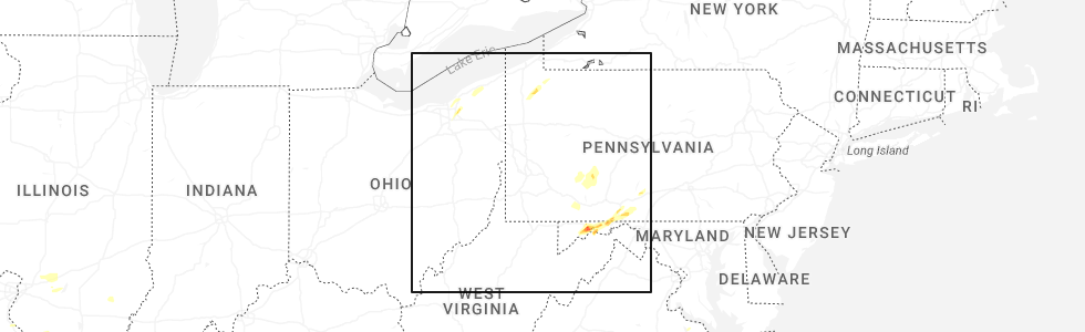
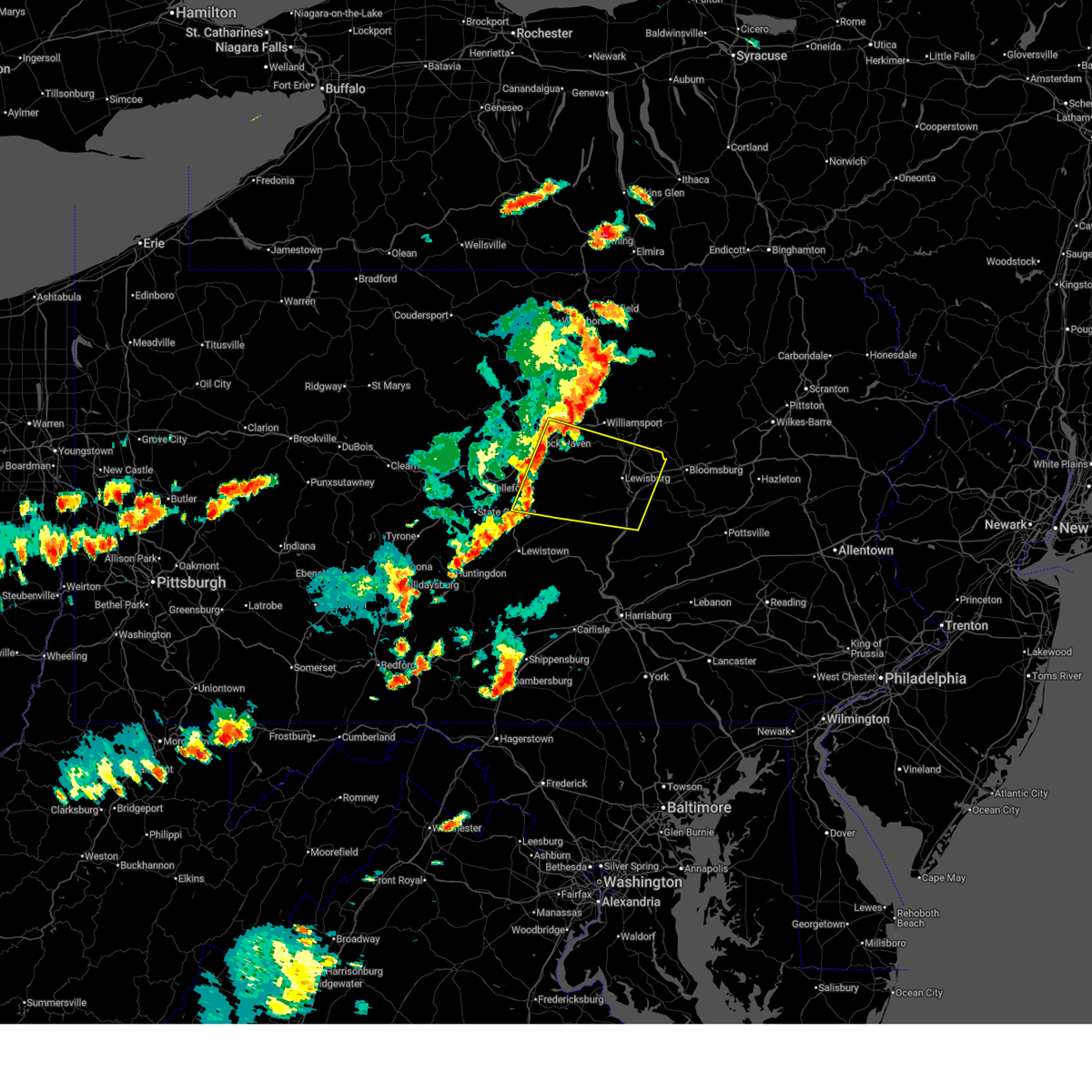
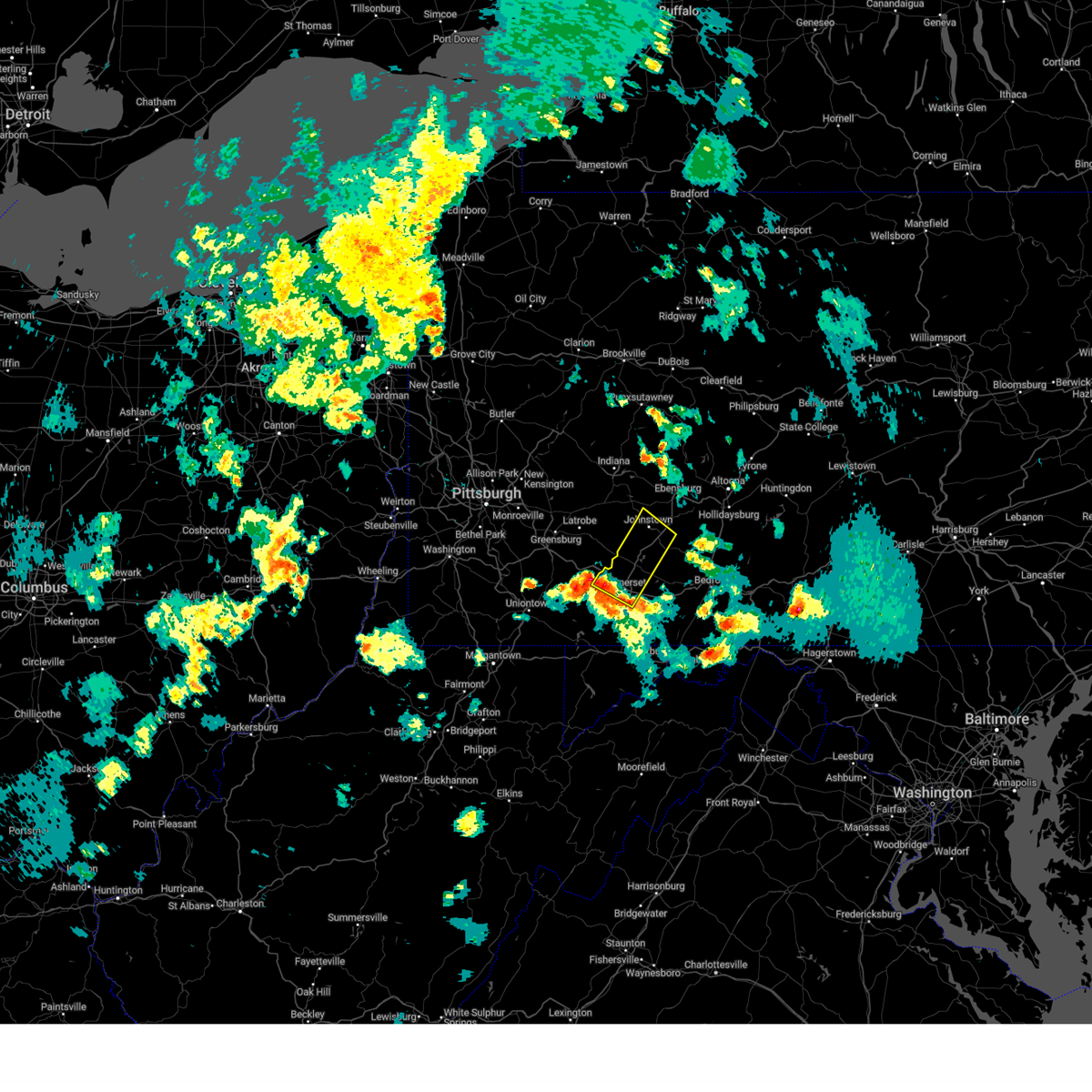
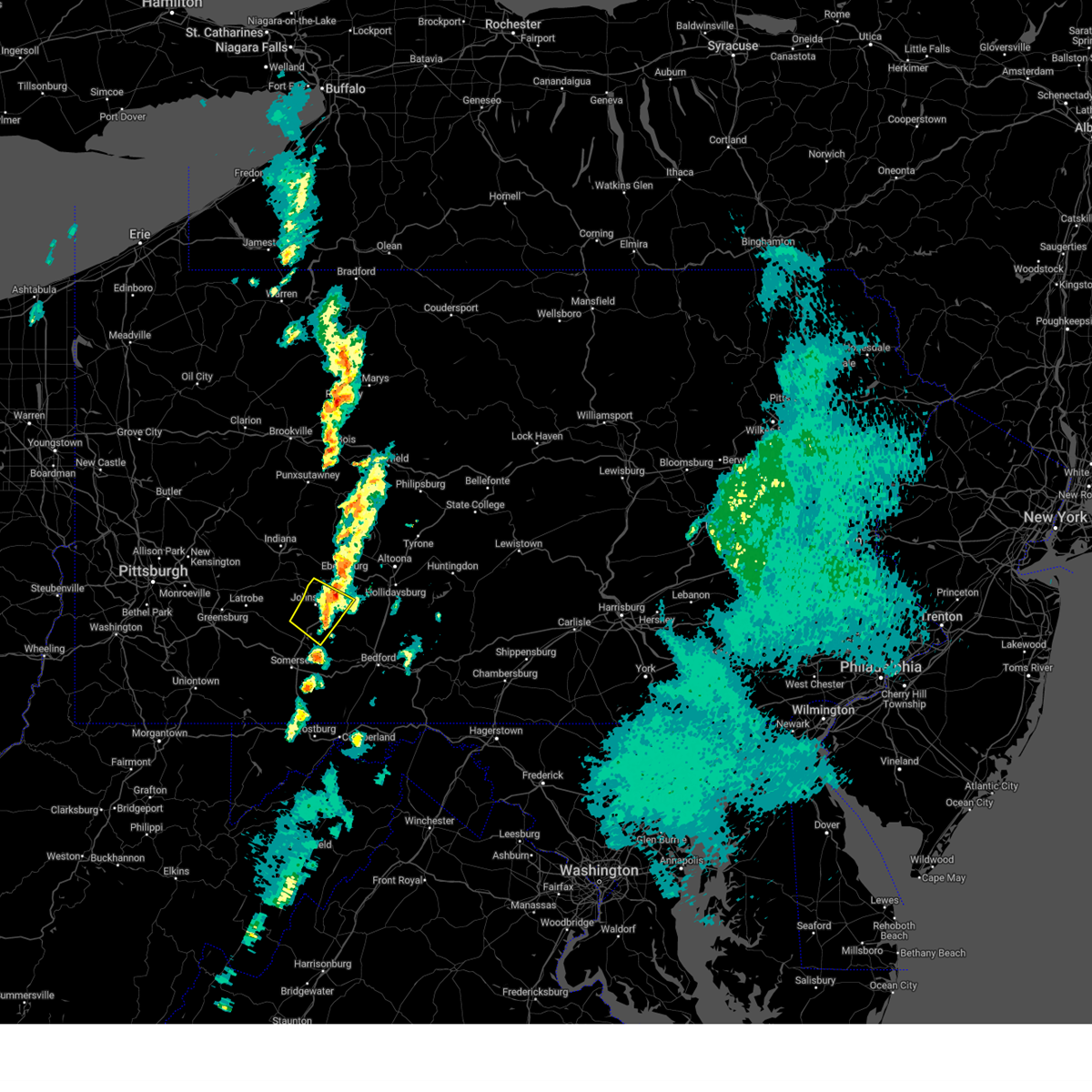
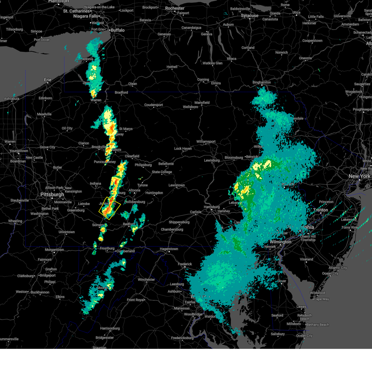
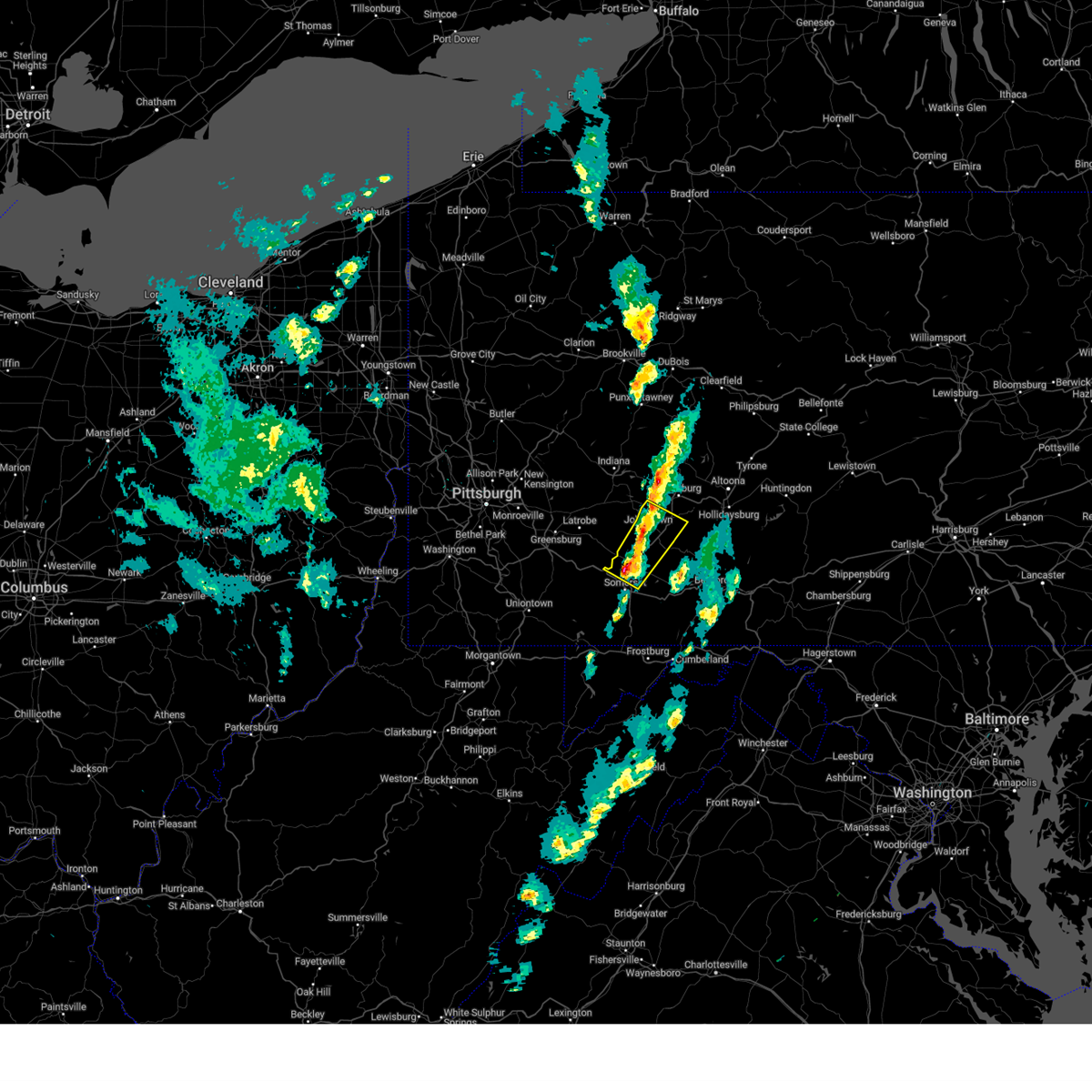
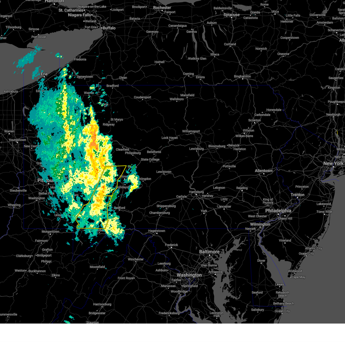
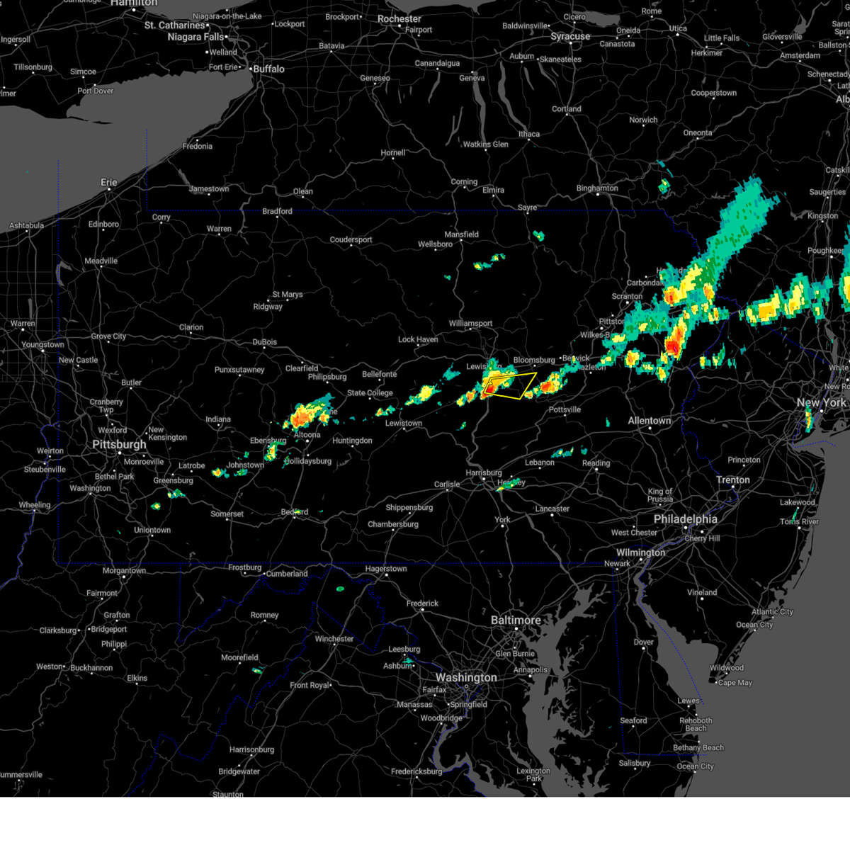
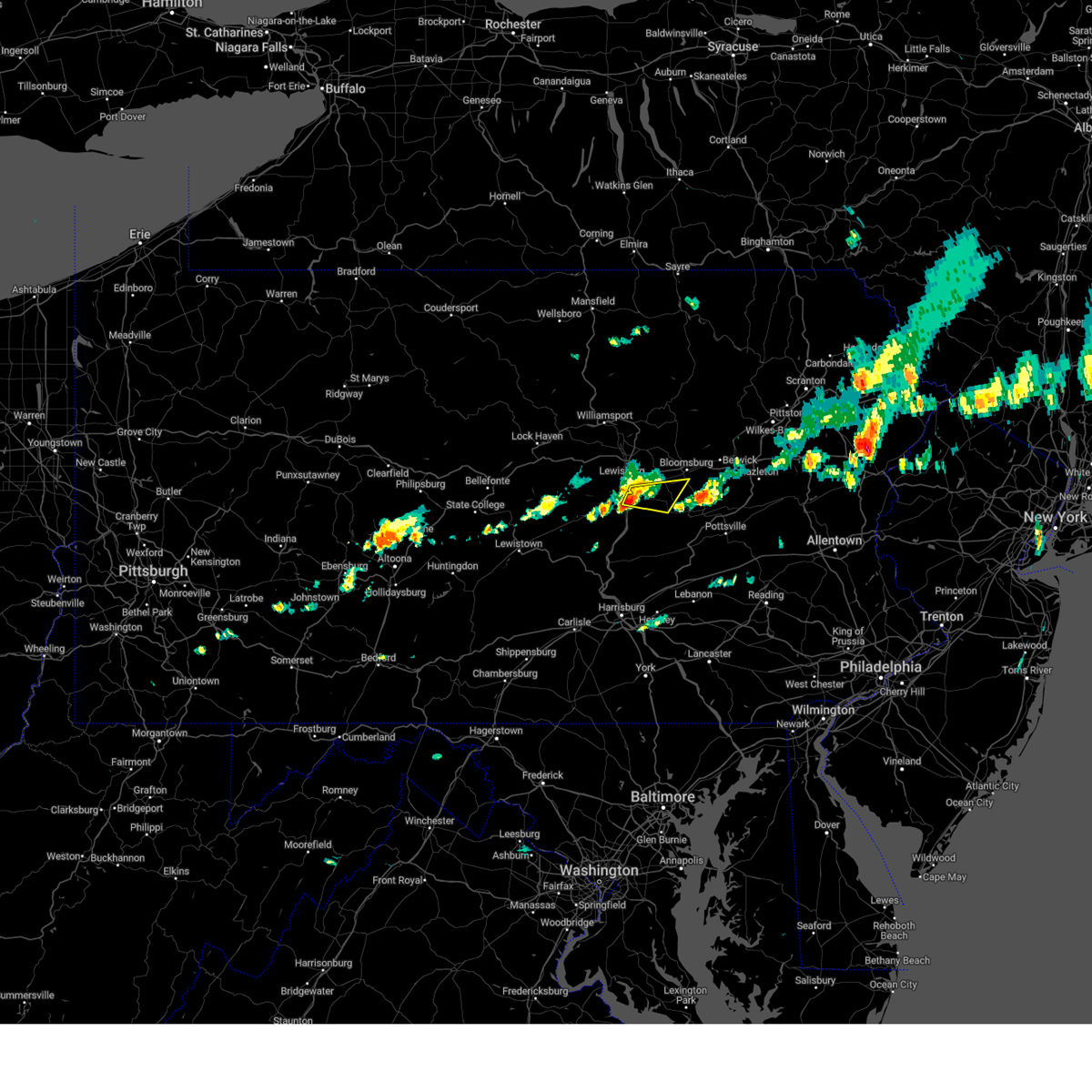
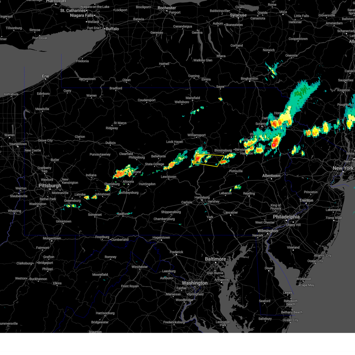
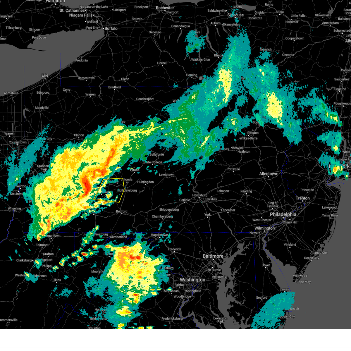
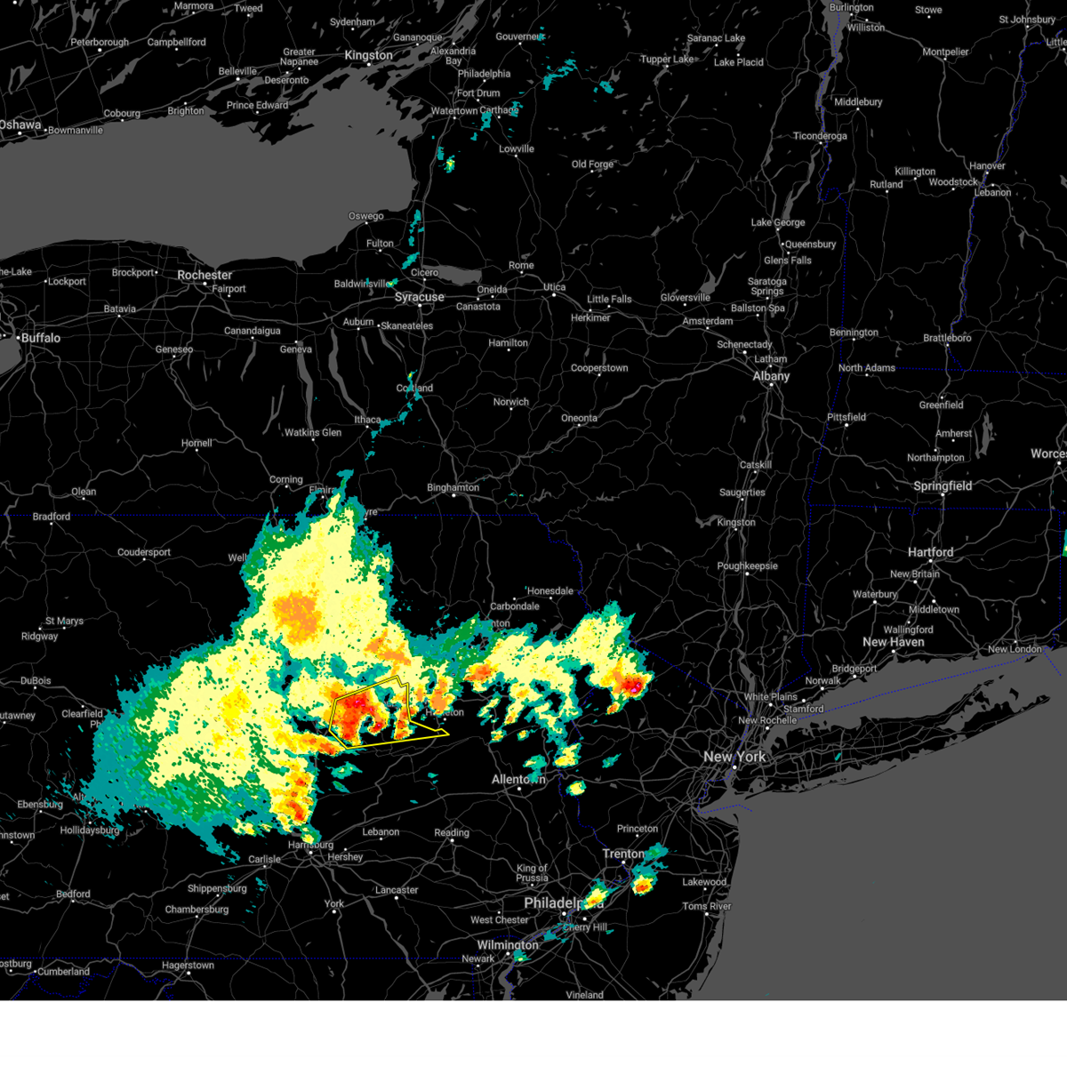
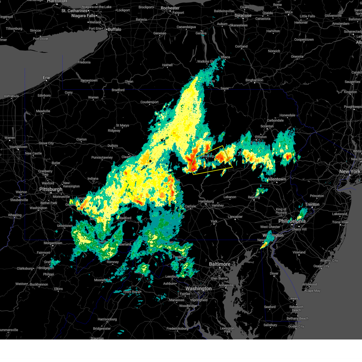
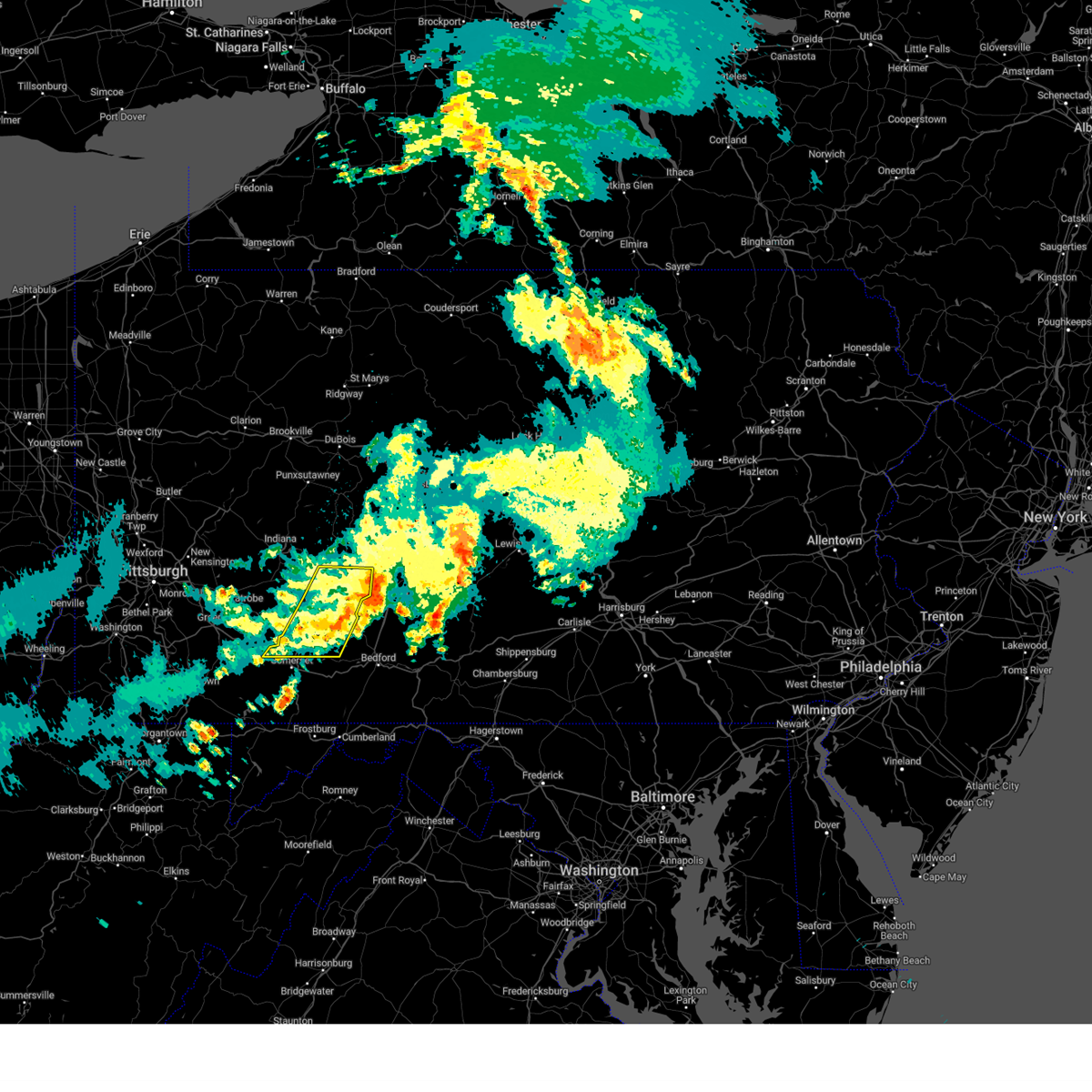
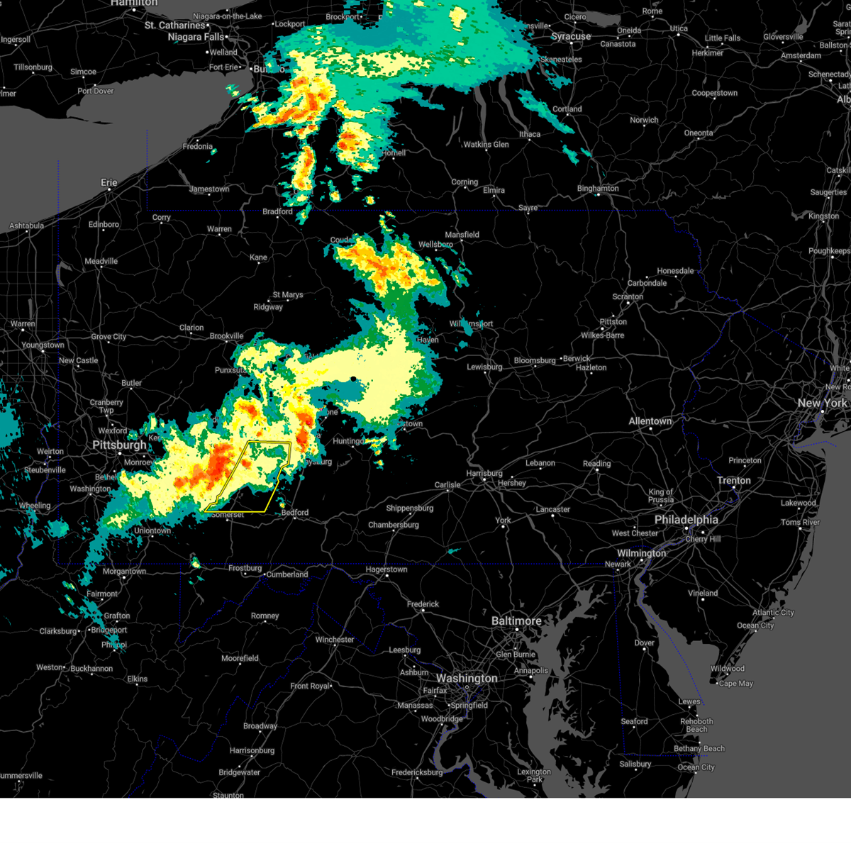
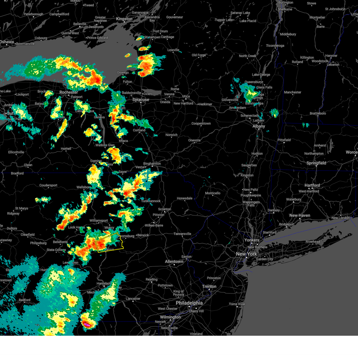
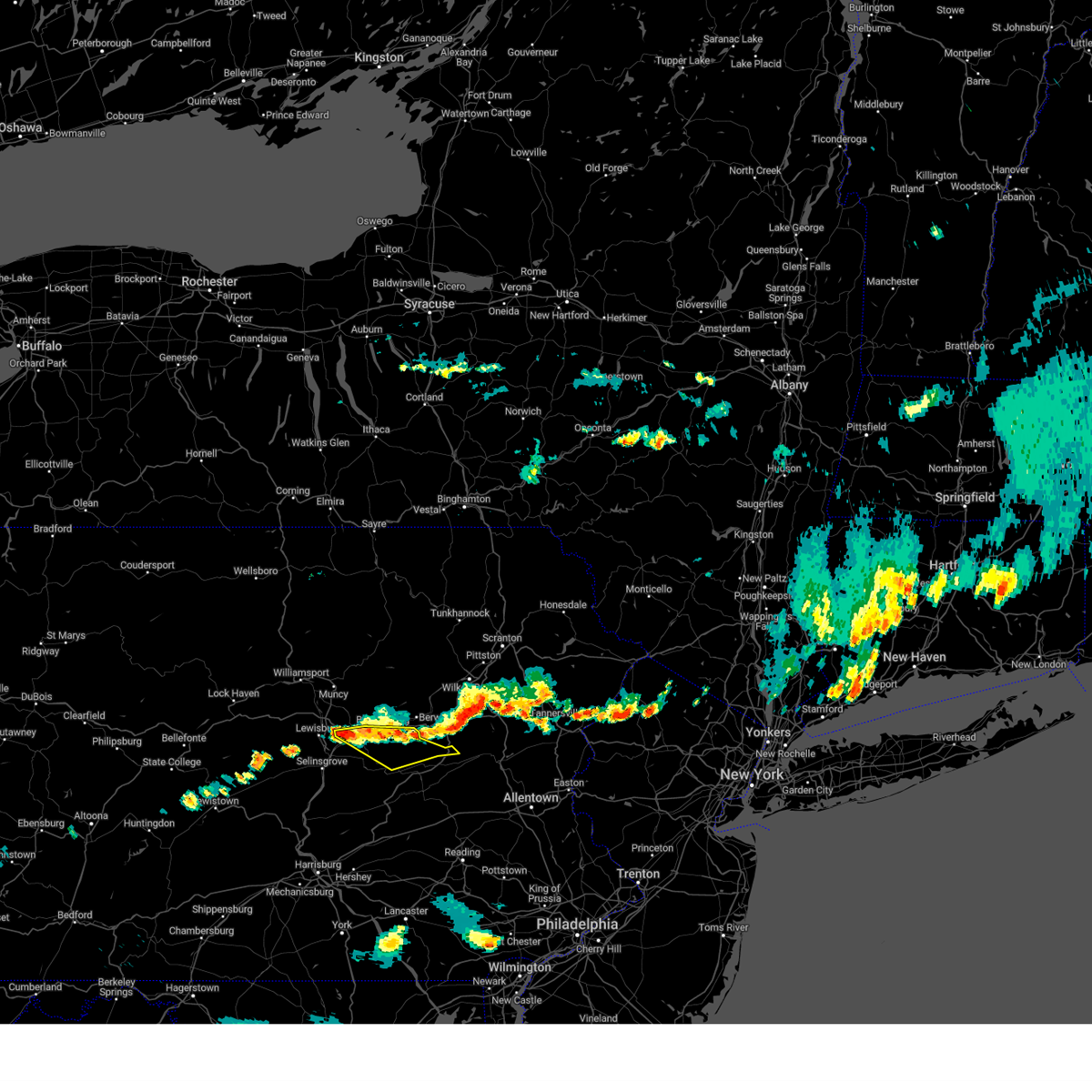
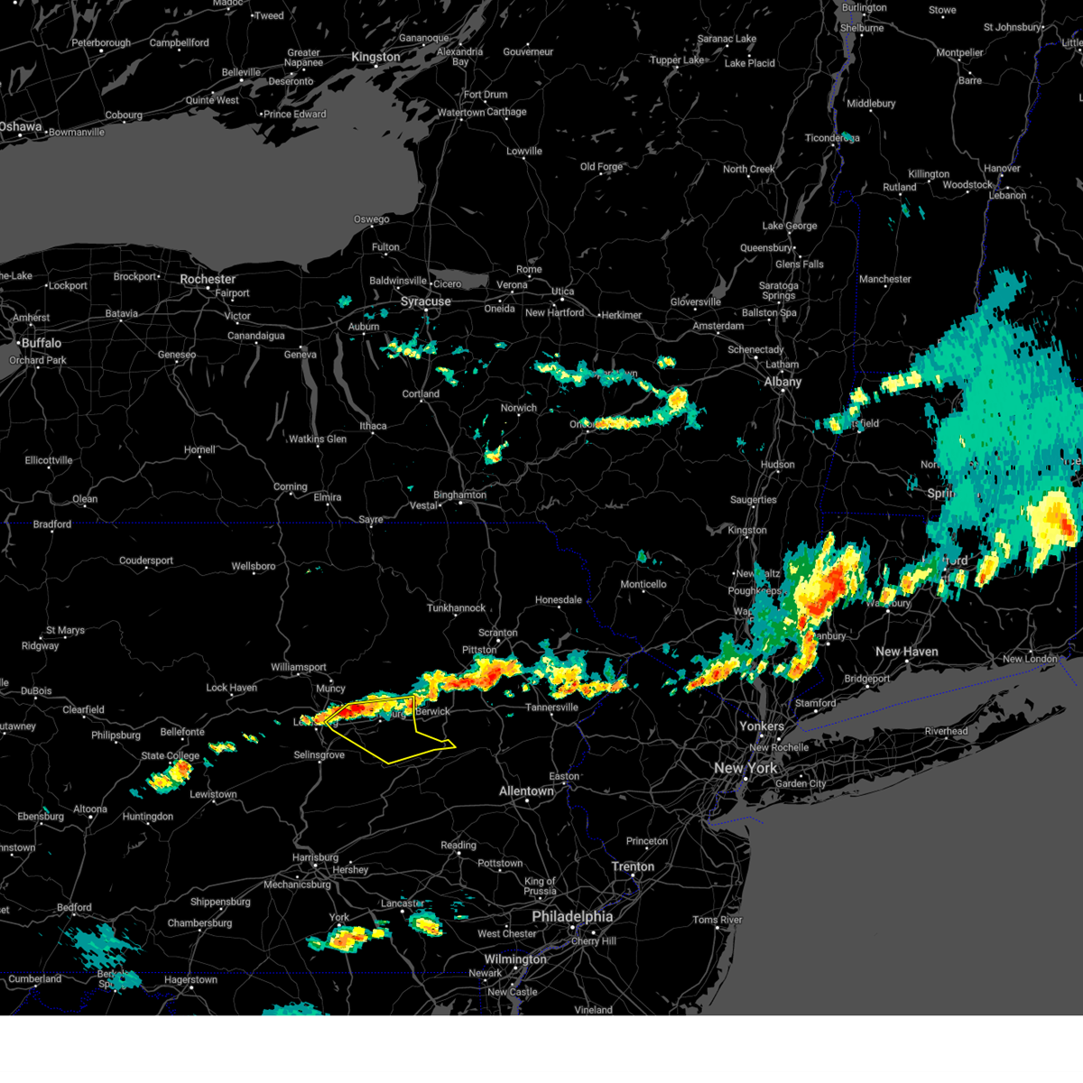
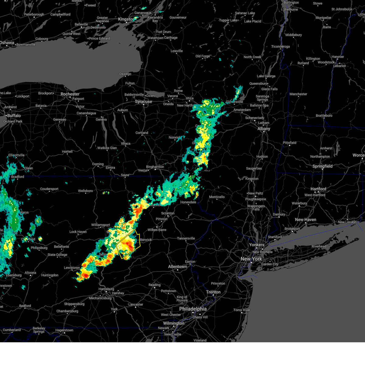
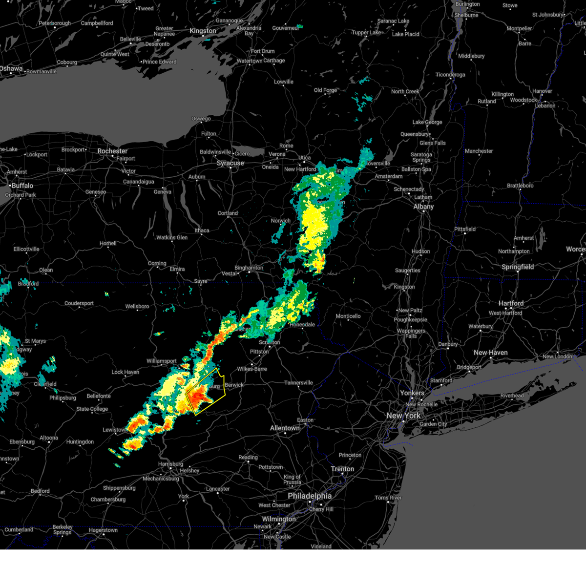
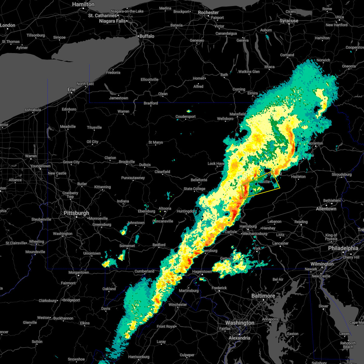
Hail Map for Riverside, PA
The Riverside, PA area has had 0 reports of on-the-ground hail by trained spotters, and has been under severe weather warnings 29 times during the past 12 months. Doppler radar has detected hail at or near Riverside, PA on 53 occasions, including 5 occasions during the past year.
| Name: | Riverside, PA |
| Where Located: | 60.4 miles WSW of Scranton, PA |
| Map: | Google Map for Riverside, PA |
| Population: | 1932 |
| Housing Units: | 854 |
| More Info: | Search Google for Riverside, PA |
1
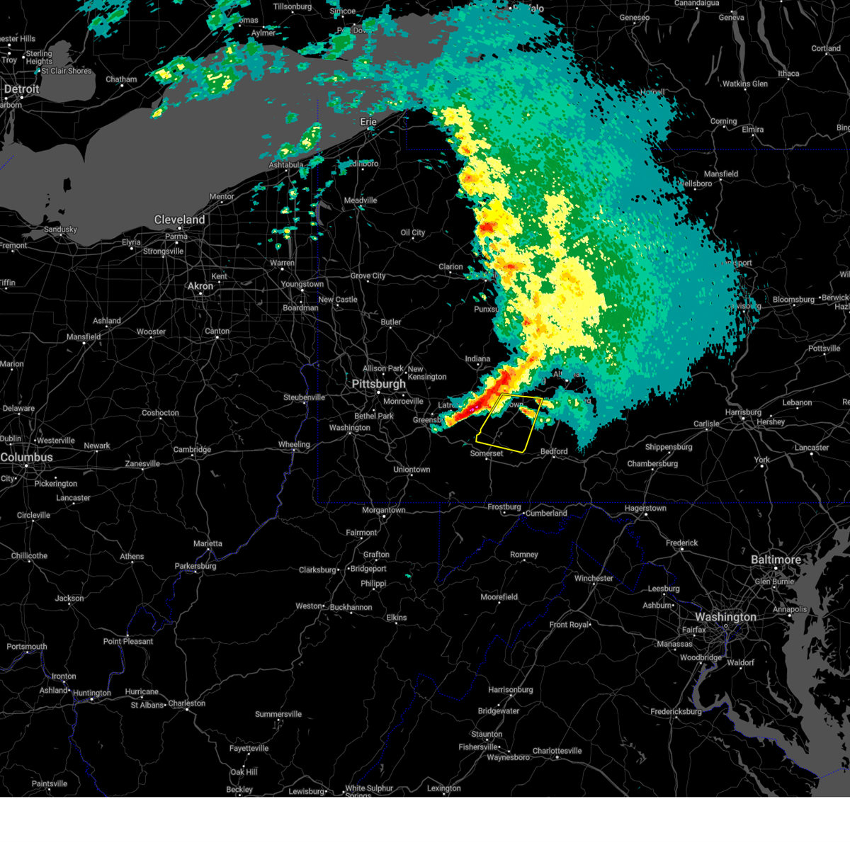
The Top Recent Hail Date for Riverside, PA is Thursday, May 1, 2025 (10th out of 53)
Hail and Wind Damage Spotted near Riverside, PA
| Date / Time | Report Details |
|---|---|
| 6/28/2025 4:15 PM EDT |
 The storms which prompted the warning have weakened below severe limits, and no longer pose an immediate threat to life or property. therefore, the warning has been allowed to expire. however, gusty winds are still possible with these thunderstorms. a severe thunderstorm watch remains in effect until 800 pm edt for central and north central pennsylvania. The storms which prompted the warning have weakened below severe limits, and no longer pose an immediate threat to life or property. therefore, the warning has been allowed to expire. however, gusty winds are still possible with these thunderstorms. a severe thunderstorm watch remains in effect until 800 pm edt for central and north central pennsylvania.
|
| 6/28/2025 4:02 PM EDT |
 the severe thunderstorm warning has been cancelled and is no longer in effect the severe thunderstorm warning has been cancelled and is no longer in effect
|
| 6/28/2025 4:02 PM EDT |
 At 402 pm edt, severe thunderstorms were located along a line extending from muncy to penns creek, moving east at 40 mph (radar indicated). Hazards include 60 mph wind gusts and penny size hail. Expect damage to roofs, siding, and trees. locations impacted include, sunbury, milton, lewisburg, northumberland, mifflinburg, winfield, watsontown, riverside, shamokin dam, linntown, hummels wharf, and new columbia. for those driving on interstate 80, this includes areas between the jersey shore and buckhorn exits, specifically from mile markers 196 to 225. This includes interstate 180 from mile markers 1 to 5. At 402 pm edt, severe thunderstorms were located along a line extending from muncy to penns creek, moving east at 40 mph (radar indicated). Hazards include 60 mph wind gusts and penny size hail. Expect damage to roofs, siding, and trees. locations impacted include, sunbury, milton, lewisburg, northumberland, mifflinburg, winfield, watsontown, riverside, shamokin dam, linntown, hummels wharf, and new columbia. for those driving on interstate 80, this includes areas between the jersey shore and buckhorn exits, specifically from mile markers 196 to 225. This includes interstate 180 from mile markers 1 to 5.
|
| 6/28/2025 3:47 PM EDT |
 the severe thunderstorm warning has been cancelled and is no longer in effect the severe thunderstorm warning has been cancelled and is no longer in effect
|
| 6/28/2025 3:47 PM EDT |
 At 346 pm edt, severe thunderstorms were located along a line extending from williamsport to laurelton center, moving east at 40 mph (radar indicated). Hazards include 60 mph wind gusts and penny size hail. Expect damage to roofs, siding, and trees. locations impacted include, sunbury, milton, lewisburg, selinsgrove, northumberland, mifflinburg, carroll, woodward, winfield, watsontown, riverside, and shamokin dam. for those driving on interstate 80, this includes areas between the loganton and buckhorn exits, specifically from mile markers 187 to 225. This includes interstate 180 from mile markers 1 to 5. At 346 pm edt, severe thunderstorms were located along a line extending from williamsport to laurelton center, moving east at 40 mph (radar indicated). Hazards include 60 mph wind gusts and penny size hail. Expect damage to roofs, siding, and trees. locations impacted include, sunbury, milton, lewisburg, selinsgrove, northumberland, mifflinburg, carroll, woodward, winfield, watsontown, riverside, and shamokin dam. for those driving on interstate 80, this includes areas between the loganton and buckhorn exits, specifically from mile markers 187 to 225. This includes interstate 180 from mile markers 1 to 5.
|
| 6/28/2025 3:25 PM EDT |
 Svrctp the national weather service in state college pa has issued a * severe thunderstorm warning for, southeastern centre county in central pennsylvania, southeastern clinton county in north central pennsylvania, southwestern lycoming county in north central pennsylvania, northeastern mifflin county in central pennsylvania, northwestern montour county in central pennsylvania, western northumberland county in central pennsylvania, snyder county in central pennsylvania, union county in central pennsylvania, * until 415 pm edt. * at 324 pm edt, severe thunderstorms were located along a line extending from jersey shore to coburn, moving east at 40 mph (radar indicated). Hazards include 60 mph wind gusts. expect damage to roofs, siding, and trees Svrctp the national weather service in state college pa has issued a * severe thunderstorm warning for, southeastern centre county in central pennsylvania, southeastern clinton county in north central pennsylvania, southwestern lycoming county in north central pennsylvania, northeastern mifflin county in central pennsylvania, northwestern montour county in central pennsylvania, western northumberland county in central pennsylvania, snyder county in central pennsylvania, union county in central pennsylvania, * until 415 pm edt. * at 324 pm edt, severe thunderstorms were located along a line extending from jersey shore to coburn, moving east at 40 mph (radar indicated). Hazards include 60 mph wind gusts. expect damage to roofs, siding, and trees
|
| 6/26/2025 4:13 PM EDT | the severe thunderstorm warning has been cancelled and is no longer in effect |
| 6/26/2025 4:13 PM EDT | At 412 pm edt, severe thunderstorms were located along a line extending from elysburg to fairview-ferndale to urban, moving east at 30 mph (radar indicated). Hazards include 60 mph wind gusts and penny size hail. Expect damage to roofs, siding, and trees. Locations impacted include, sunbury, shamokin, mount carmel, northumberland, kulpmont, elysburg, fairview-ferndale, riverside, trevorton, shamokin dam, marshallton, and port trevorton. |
| 6/26/2025 3:26 PM EDT |
 Svrctp the national weather service in state college pa has issued a * severe thunderstorm warning for, northeastern juniata county in central pennsylvania, northumberland county in central pennsylvania, snyder county in central pennsylvania, southeastern union county in central pennsylvania, * until 430 pm edt. * at 326 pm edt, severe thunderstorms were located along a line extending from vicksburg to middleburg to richfield, moving east at 30 mph (radar indicated). Hazards include 60 mph wind gusts and penny size hail. expect damage to roofs, siding, and trees Svrctp the national weather service in state college pa has issued a * severe thunderstorm warning for, northeastern juniata county in central pennsylvania, northumberland county in central pennsylvania, snyder county in central pennsylvania, southeastern union county in central pennsylvania, * until 430 pm edt. * at 326 pm edt, severe thunderstorms were located along a line extending from vicksburg to middleburg to richfield, moving east at 30 mph (radar indicated). Hazards include 60 mph wind gusts and penny size hail. expect damage to roofs, siding, and trees
|
| 6/19/2025 7:20 PM EDT |
 Svrctp the national weather service in state college pa has issued a * severe thunderstorm warning for, columbia county in central pennsylvania, southeastern lycoming county in north central pennsylvania, montour county in central pennsylvania, northwestern northumberland county in central pennsylvania, northeastern snyder county in central pennsylvania, eastern union county in central pennsylvania, * until 830 pm edt. * at 719 pm edt, severe thunderstorms were located along a line extending from montgomery to allenwood to spruce run reservoir to penns creek, moving east northeast at 35 mph (radar indicated). Hazards include 60 mph wind gusts and penny size hail. expect damage to roofs, siding, and trees Svrctp the national weather service in state college pa has issued a * severe thunderstorm warning for, columbia county in central pennsylvania, southeastern lycoming county in north central pennsylvania, montour county in central pennsylvania, northwestern northumberland county in central pennsylvania, northeastern snyder county in central pennsylvania, eastern union county in central pennsylvania, * until 830 pm edt. * at 719 pm edt, severe thunderstorms were located along a line extending from montgomery to allenwood to spruce run reservoir to penns creek, moving east northeast at 35 mph (radar indicated). Hazards include 60 mph wind gusts and penny size hail. expect damage to roofs, siding, and trees
|
| 6/19/2025 6:04 PM EDT | Svrctp the national weather service in state college pa has issued a * severe thunderstorm warning for, cambria county in central pennsylvania, northeastern somerset county in south central pennsylvania, * until 645 pm edt. * at 604 pm edt, severe thunderstorms were located along a line extending from northern cambria to near ligonier, moving east at 45 mph (radar indicated). Hazards include 60 mph wind gusts. expect damage to roofs, siding, and trees |
| 6/6/2025 9:49 AM EDT |
 Svrctp the national weather service in state college pa has issued a * severe thunderstorm warning for, cambria county in central pennsylvania, * until 1045 am edt. * at 948 am edt, severe thunderstorms were located along a line extending from near indiana to near black lick to near westmont, moving east at 35 mph (radar indicated). Hazards include 60 mph wind gusts and penny size hail. Expect damage to roofs, siding, and trees. severe thunderstorms will be near, westmont and johnstown around 950 am edt. belmont, nanty-glo, and belsano around 1000 am edt. ebensburg, salix-beauty line park, and ehrenfeld around 1010 am edt. portage, loretto, and dunlo around 1020 am edt. gallitzin around 1030 am edt. Other locations impacted by these severe thunderstorms include colver, spring hill, mundys corner, cassandra, and elim. Svrctp the national weather service in state college pa has issued a * severe thunderstorm warning for, cambria county in central pennsylvania, * until 1045 am edt. * at 948 am edt, severe thunderstorms were located along a line extending from near indiana to near black lick to near westmont, moving east at 35 mph (radar indicated). Hazards include 60 mph wind gusts and penny size hail. Expect damage to roofs, siding, and trees. severe thunderstorms will be near, westmont and johnstown around 950 am edt. belmont, nanty-glo, and belsano around 1000 am edt. ebensburg, salix-beauty line park, and ehrenfeld around 1010 am edt. portage, loretto, and dunlo around 1020 am edt. gallitzin around 1030 am edt. Other locations impacted by these severe thunderstorms include colver, spring hill, mundys corner, cassandra, and elim.
|
| 5/1/2025 7:12 PM EDT | Svrctp the national weather service in state college pa has issued a * severe thunderstorm warning for, cambria county in central pennsylvania, northeastern somerset county in south central pennsylvania, * until 800 pm edt. * at 711 pm edt, a severe thunderstorm was located over geistown, moving northeast at 45 mph (radar indicated). Hazards include 60 mph wind gusts and quarter size hail. Hail damage to vehicles is expected. Expect wind damage to roofs, siding, and trees. |
| 5/1/2025 6:42 PM EDT |
 Svrctp the national weather service in state college pa has issued a * severe thunderstorm warning for, southwestern cambria county in central pennsylvania, northwestern somerset county in south central pennsylvania, * until 715 pm edt. * at 641 pm edt, severe thunderstorms were located along a line extending from near seven springs to near acosta to friedens, moving northeast at 40 mph (radar indicated). Hazards include 60 mph wind gusts and quarter size hail. Hail damage to vehicles is expected. Expect wind damage to roofs, siding, and trees. Svrctp the national weather service in state college pa has issued a * severe thunderstorm warning for, southwestern cambria county in central pennsylvania, northwestern somerset county in south central pennsylvania, * until 715 pm edt. * at 641 pm edt, severe thunderstorms were located along a line extending from near seven springs to near acosta to friedens, moving northeast at 40 mph (radar indicated). Hazards include 60 mph wind gusts and quarter size hail. Hail damage to vehicles is expected. Expect wind damage to roofs, siding, and trees.
|
| 4/29/2025 7:53 PM EDT | At 753 pm edt, severe thunderstorms were located along a line extending from ralston to barbours to watsontown to port trevorton, moving east at 60 mph (radar indicated). Hazards include 60 mph wind gusts. Expect damage to roofs, siding, and trees. locations impacted include, lairdsville, northumberland, sunbury, ralston, leck kill, urban, seven points, shamokin dam, hummels wharf, mooresburg, biggertown, and stonington. for those driving on interstate 80, this includes areas between the milton-williamsport and buckhorn exits, specifically from mile markers 213 to 227. This includes interstate 180 from mile markers 2 to 16. |
| 4/29/2025 7:53 PM EDT | the severe thunderstorm warning has been cancelled and is no longer in effect |
| 4/29/2025 7:16 PM EDT | Svrctp the national weather service in state college pa has issued a * severe thunderstorm warning for, juniata county in central pennsylvania, lycoming county in north central pennsylvania, northeastern mifflin county in central pennsylvania, montour county in central pennsylvania, northumberland county in central pennsylvania, northern perry county in south central pennsylvania, snyder county in central pennsylvania, union county in central pennsylvania, * until 815 pm edt. * at 716 pm edt, severe thunderstorms were located along a line extending from tamarack to dunnstown to rebersburg to walnut, moving east at 60 mph (radar indicated). Hazards include 60 mph wind gusts. expect damage to roofs, siding, and trees |
| 4/29/2025 5:37 PM EDT |
 Svrctp the national weather service in state college pa has issued a * severe thunderstorm warning for, cambria county in central pennsylvania, clearfield county in central pennsylvania, * until 645 pm edt. * at 535 pm edt, severe thunderstorms were located along a line extending from 11 miles east of shanor-northvue to near leechburg to jeannette to clairton, moving east northeast at 65 mph (radar indicated). Hazards include 70 mph wind gusts and quarter size hail. Hail damage to vehicles is expected. expect considerable tree damage. Wind damage is also likely to mobile homes, roofs, and outbuildings. Svrctp the national weather service in state college pa has issued a * severe thunderstorm warning for, cambria county in central pennsylvania, clearfield county in central pennsylvania, * until 645 pm edt. * at 535 pm edt, severe thunderstorms were located along a line extending from 11 miles east of shanor-northvue to near leechburg to jeannette to clairton, moving east northeast at 65 mph (radar indicated). Hazards include 70 mph wind gusts and quarter size hail. Hail damage to vehicles is expected. expect considerable tree damage. Wind damage is also likely to mobile homes, roofs, and outbuildings.
|
| 4/19/2025 6:27 PM EDT |
 Svrctp the national weather service in state college pa has issued a * severe thunderstorm warning for, northern bedford county in south central pennsylvania, southwestern blair county in central pennsylvania, southwestern cambria county in central pennsylvania, northeastern somerset county in south central pennsylvania, * until 715 pm edt. * at 627 pm edt, a severe thunderstorm was located over boswell, moving east at 70 mph (radar indicated). Hazards include 60 mph wind gusts and penny size hail. expect damage to roofs, siding, and trees Svrctp the national weather service in state college pa has issued a * severe thunderstorm warning for, northern bedford county in south central pennsylvania, southwestern blair county in central pennsylvania, southwestern cambria county in central pennsylvania, northeastern somerset county in south central pennsylvania, * until 715 pm edt. * at 627 pm edt, a severe thunderstorm was located over boswell, moving east at 70 mph (radar indicated). Hazards include 60 mph wind gusts and penny size hail. expect damage to roofs, siding, and trees
|
| 4/2/2025 3:47 PM EDT |
 At 347 pm edt, a severe thunderstorm was located over dunlo, moving east at 50 mph (radar indicated). Hazards include quarter size hail. Damage to vehicles is expected. locations impacted include, acosta, salix-beauty line park, davidsville, spring hill, belmont, elim, central city, windber, scalp level, dunlo, john murtha johnstown-cambria county airport, and jennerstown. this includes the following highways, route 30 from the westmoreland county line to indian lake. route 219 from north of somerset to near south fork. The johnstown expressway. At 347 pm edt, a severe thunderstorm was located over dunlo, moving east at 50 mph (radar indicated). Hazards include quarter size hail. Damage to vehicles is expected. locations impacted include, acosta, salix-beauty line park, davidsville, spring hill, belmont, elim, central city, windber, scalp level, dunlo, john murtha johnstown-cambria county airport, and jennerstown. this includes the following highways, route 30 from the westmoreland county line to indian lake. route 219 from north of somerset to near south fork. The johnstown expressway.
|
| 4/2/2025 3:25 PM EDT |
 Svrctp the national weather service in state college pa has issued a * severe thunderstorm warning for, southwestern cambria county in central pennsylvania, northeastern somerset county in south central pennsylvania, * until 400 pm edt. * at 322 pm edt, a severe thunderstorm was located near ligonier, moving east at 50 mph (radar indicated). Hazards include quarter size hail. Damage to vehicles is expected. this severe thunderstorm will be near, westmont, davidsville, and dale around 330 pm edt. dunlo, scalp level, and salix-beauty line park around 340 pm edt. other locations impacted by this severe thunderstorm include benson, spring hill, university of pittsburgh - johnstown, elim, and stoystown. this includes the following highways, route 30 from the westmoreland county line to indian lake. route 219 from north of somerset to near south fork. state road 56 from the westmoreland county line to johnstown. The johnstown expressway. Svrctp the national weather service in state college pa has issued a * severe thunderstorm warning for, southwestern cambria county in central pennsylvania, northeastern somerset county in south central pennsylvania, * until 400 pm edt. * at 322 pm edt, a severe thunderstorm was located near ligonier, moving east at 50 mph (radar indicated). Hazards include quarter size hail. Damage to vehicles is expected. this severe thunderstorm will be near, westmont, davidsville, and dale around 330 pm edt. dunlo, scalp level, and salix-beauty line park around 340 pm edt. other locations impacted by this severe thunderstorm include benson, spring hill, university of pittsburgh - johnstown, elim, and stoystown. this includes the following highways, route 30 from the westmoreland county line to indian lake. route 219 from north of somerset to near south fork. state road 56 from the westmoreland county line to johnstown. The johnstown expressway.
|
| 3/16/2025 1:47 PM EDT |
 Svrctp the national weather service in state college pa has issued a * severe thunderstorm warning for, bedford county in south central pennsylvania, blair county in central pennsylvania, cambria county in central pennsylvania, southwestern centre county in central pennsylvania, clearfield county in central pennsylvania, eastern elk county in north central pennsylvania, eastern somerset county in south central pennsylvania, * until 230 pm edt. * at 147 pm edt, severe thunderstorms were located along a line extending from near portland mills to near punxsutawney to near friedens, moving northeast at 80 mph (trained weather spotters). Hazards include 60 mph wind gusts and penny size hail. expect damage to roofs, siding, and trees Svrctp the national weather service in state college pa has issued a * severe thunderstorm warning for, bedford county in south central pennsylvania, blair county in central pennsylvania, cambria county in central pennsylvania, southwestern centre county in central pennsylvania, clearfield county in central pennsylvania, eastern elk county in north central pennsylvania, eastern somerset county in south central pennsylvania, * until 230 pm edt. * at 147 pm edt, severe thunderstorms were located along a line extending from near portland mills to near punxsutawney to near friedens, moving northeast at 80 mph (trained weather spotters). Hazards include 60 mph wind gusts and penny size hail. expect damage to roofs, siding, and trees
|
| 3/16/2025 1:31 PM EDT |
 At 130 pm edt, severe thunderstorms were located along a line extending from blairsville to somerset to near grantsville, moving northeast at 55 mph (trained weather spotters). Hazards include 60 mph wind gusts and penny size hail. Expect damage to roofs, siding, and trees. locations impacted include, acosta, salix-beauty line park, mundys corner, northern cambria, belmont, johnstown, elim, central city, buffalo mills, friedens, salisbury, and casselman. This includes the pennsylvania turnpike from mile markers 100 to 138. At 130 pm edt, severe thunderstorms were located along a line extending from blairsville to somerset to near grantsville, moving northeast at 55 mph (trained weather spotters). Hazards include 60 mph wind gusts and penny size hail. Expect damage to roofs, siding, and trees. locations impacted include, acosta, salix-beauty line park, mundys corner, northern cambria, belmont, johnstown, elim, central city, buffalo mills, friedens, salisbury, and casselman. This includes the pennsylvania turnpike from mile markers 100 to 138.
|
| 3/16/2025 1:14 PM EDT |
 At 113 pm edt, severe thunderstorms were located along a line extending from greensburg to near seven springs to friendsville, moving northeast at 55 mph (radar indicated). Hazards include 60 mph wind gusts. Expect damage to roofs, siding, and trees. locations impacted include, acosta, salix-beauty line park, mundys corner, northern cambria, belmont, johnstown, elim, central city, buffalo mills, seven springs, friedens, and salisbury. This includes the pennsylvania turnpike from mile markers 100 to 138. At 113 pm edt, severe thunderstorms were located along a line extending from greensburg to near seven springs to friendsville, moving northeast at 55 mph (radar indicated). Hazards include 60 mph wind gusts. Expect damage to roofs, siding, and trees. locations impacted include, acosta, salix-beauty line park, mundys corner, northern cambria, belmont, johnstown, elim, central city, buffalo mills, seven springs, friedens, and salisbury. This includes the pennsylvania turnpike from mile markers 100 to 138.
|
| 3/16/2025 12:59 PM EDT |
 Svrctp the national weather service in state college pa has issued a * severe thunderstorm warning for, western bedford county in south central pennsylvania, western cambria county in central pennsylvania, somerset county in south central pennsylvania, * until 200 pm edt. * at 1257 pm edt, severe thunderstorms were located along a line extending from west newton to uniontown to kingwood, moving northeast at 55 mph (radar indicated). Hazards include 60 mph wind gusts. expect damage to roofs, siding, and trees Svrctp the national weather service in state college pa has issued a * severe thunderstorm warning for, western bedford county in south central pennsylvania, western cambria county in central pennsylvania, somerset county in south central pennsylvania, * until 200 pm edt. * at 1257 pm edt, severe thunderstorms were located along a line extending from west newton to uniontown to kingwood, moving northeast at 55 mph (radar indicated). Hazards include 60 mph wind gusts. expect damage to roofs, siding, and trees
|
| 3/5/2025 5:12 PM EST |
 The storm which prompted the warning has weakened below severe limits, and no longer poses an immediate threat to life or property. therefore, the warning will be allowed to expire. however, gusty winds are still possible with this thunderstorm. to report severe weather, contact your nearest law enforcement agency. they will relay your report to the national weather service state college pa. The storm which prompted the warning has weakened below severe limits, and no longer poses an immediate threat to life or property. therefore, the warning will be allowed to expire. however, gusty winds are still possible with this thunderstorm. to report severe weather, contact your nearest law enforcement agency. they will relay your report to the national weather service state college pa.
|
| 3/5/2025 4:56 PM EST |
 At 455 pm est, a severe thunderstorm was located over davidsville, moving northeast at 40 mph (radar indicated). Hazards include 60 mph wind gusts and quarter size hail. Hail damage to vehicles is expected. expect wind damage to roofs, siding, and trees. Locations impacted include, salix-beauty line park, davidsville, belmont, johnstown, vinco, elim, windber, scalp level, dunlo, east conemaugh, johnstown flood national memorial historic site, and john murtha johnstown-cambria county airport. At 455 pm est, a severe thunderstorm was located over davidsville, moving northeast at 40 mph (radar indicated). Hazards include 60 mph wind gusts and quarter size hail. Hail damage to vehicles is expected. expect wind damage to roofs, siding, and trees. Locations impacted include, salix-beauty line park, davidsville, belmont, johnstown, vinco, elim, windber, scalp level, dunlo, east conemaugh, johnstown flood national memorial historic site, and john murtha johnstown-cambria county airport.
|
| 3/5/2025 4:41 PM EST |
 Svrctp the national weather service in state college pa has issued a * severe thunderstorm warning for, southwestern cambria county in central pennsylvania, north central somerset county in south central pennsylvania, * until 515 pm est. * at 441 pm est, a severe thunderstorm was located over acosta, moving northeast at 40 mph (radar indicated). Hazards include 60 mph wind gusts and quarter size hail. Hail damage to vehicles is expected. Expect wind damage to roofs, siding, and trees. Svrctp the national weather service in state college pa has issued a * severe thunderstorm warning for, southwestern cambria county in central pennsylvania, north central somerset county in south central pennsylvania, * until 515 pm est. * at 441 pm est, a severe thunderstorm was located over acosta, moving northeast at 40 mph (radar indicated). Hazards include 60 mph wind gusts and quarter size hail. Hail damage to vehicles is expected. Expect wind damage to roofs, siding, and trees.
|
| 11/20/2024 5:33 PM EST |
 Svrctp the national weather service in state college pa has issued a * severe thunderstorm warning for, cambria county in central pennsylvania, somerset county in south central pennsylvania, * until 645 pm est. * at 532 pm est, severe thunderstorms were located along a line extending from near ford city to near mount pleasant to near friendsville, moving east at 35 mph (radar indicated). Hazards include 60 mph wind gusts. Expect damage to roofs, siding, and trees. severe thunderstorms will be near, seven springs and ursina around 540 pm est. somerset, mount davis, and new centerville around 550 pm est. acosta, boswell, and meyersdale around 600 pm est. westmont, belmont, and johnstown around 610 pm est. windber, nanty-glo, and scalp level around 620 pm est. other locations impacted by these severe thunderstorms include addison, spring hill, mundys corner, cassandra, and elim. This includes the pennsylvania turnpike from mile markers 101 to 130. Svrctp the national weather service in state college pa has issued a * severe thunderstorm warning for, cambria county in central pennsylvania, somerset county in south central pennsylvania, * until 645 pm est. * at 532 pm est, severe thunderstorms were located along a line extending from near ford city to near mount pleasant to near friendsville, moving east at 35 mph (radar indicated). Hazards include 60 mph wind gusts. Expect damage to roofs, siding, and trees. severe thunderstorms will be near, seven springs and ursina around 540 pm est. somerset, mount davis, and new centerville around 550 pm est. acosta, boswell, and meyersdale around 600 pm est. westmont, belmont, and johnstown around 610 pm est. windber, nanty-glo, and scalp level around 620 pm est. other locations impacted by these severe thunderstorms include addison, spring hill, mundys corner, cassandra, and elim. This includes the pennsylvania turnpike from mile markers 101 to 130.
|
| 6/30/2024 2:03 PM EDT |
 At 203 pm edt, a severe thunderstorm was located over stonington, moving east at 55 mph (radar indicated). Hazards include 60 mph wind gusts and quarter size hail. Hail damage to vehicles is expected. expect wind damage to roofs, siding, and trees. Locations impacted include, sunbury, northumberland, winfield, elysburg, riverside, shamokin dam, catawissa, hummels wharf, stonington, knoebels grove, snydertown, and seven points. At 203 pm edt, a severe thunderstorm was located over stonington, moving east at 55 mph (radar indicated). Hazards include 60 mph wind gusts and quarter size hail. Hail damage to vehicles is expected. expect wind damage to roofs, siding, and trees. Locations impacted include, sunbury, northumberland, winfield, elysburg, riverside, shamokin dam, catawissa, hummels wharf, stonington, knoebels grove, snydertown, and seven points.
|
| 6/30/2024 2:03 PM EDT |
 the severe thunderstorm warning has been cancelled and is no longer in effect the severe thunderstorm warning has been cancelled and is no longer in effect
|
| 6/30/2024 1:46 PM EDT |
 At 146 pm edt, a severe thunderstorm was located over vicksburg, moving east at 45 mph (radar indicated). Hazards include 60 mph wind gusts and quarter size hail. Hail damage to vehicles is expected. expect wind damage to roofs, siding, and trees. Locations impacted include, sunbury, milton, lewisburg, danville, northumberland, mifflinburg, winfield, elysburg, riverside, shamokin dam, catawissa, and linntown. At 146 pm edt, a severe thunderstorm was located over vicksburg, moving east at 45 mph (radar indicated). Hazards include 60 mph wind gusts and quarter size hail. Hail damage to vehicles is expected. expect wind damage to roofs, siding, and trees. Locations impacted include, sunbury, milton, lewisburg, danville, northumberland, mifflinburg, winfield, elysburg, riverside, shamokin dam, catawissa, and linntown.
|
| 6/30/2024 1:30 PM EDT |
 Svrctp the national weather service in state college pa has issued a * severe thunderstorm warning for, south central columbia county in central pennsylvania, southern montour county in central pennsylvania, northumberland county in central pennsylvania, northeastern snyder county in central pennsylvania, southern union county in central pennsylvania, * until 215 pm edt. * at 129 pm edt, a severe thunderstorm was located over laurelton center, moving east at 55 mph (radar indicated). Hazards include 60 mph wind gusts and quarter size hail. Hail damage to vehicles is expected. Expect wind damage to roofs, siding, and trees. Svrctp the national weather service in state college pa has issued a * severe thunderstorm warning for, south central columbia county in central pennsylvania, southern montour county in central pennsylvania, northumberland county in central pennsylvania, northeastern snyder county in central pennsylvania, southern union county in central pennsylvania, * until 215 pm edt. * at 129 pm edt, a severe thunderstorm was located over laurelton center, moving east at 55 mph (radar indicated). Hazards include 60 mph wind gusts and quarter size hail. Hail damage to vehicles is expected. Expect wind damage to roofs, siding, and trees.
|
| 6/26/2024 8:44 PM EDT |
 Svrctp the national weather service in state college pa has issued a * severe thunderstorm warning for, north central bedford county in south central pennsylvania, southwestern blair county in central pennsylvania, cambria county in central pennsylvania, northeastern somerset county in south central pennsylvania, * until 930 pm edt. * at 843 pm edt, severe thunderstorms were located along a line extending from homer city to near black lick to ligonier, moving east at 40 mph (radar indicated). Hazards include 60 mph wind gusts. expect damage to roofs, siding, and trees Svrctp the national weather service in state college pa has issued a * severe thunderstorm warning for, north central bedford county in south central pennsylvania, southwestern blair county in central pennsylvania, cambria county in central pennsylvania, northeastern somerset county in south central pennsylvania, * until 930 pm edt. * at 843 pm edt, severe thunderstorms were located along a line extending from homer city to near black lick to ligonier, moving east at 40 mph (radar indicated). Hazards include 60 mph wind gusts. expect damage to roofs, siding, and trees
|
| 6/26/2024 6:02 PM EDT |
 the severe thunderstorm warning has been cancelled and is no longer in effect the severe thunderstorm warning has been cancelled and is no longer in effect
|
| 6/26/2024 6:02 PM EDT |
 At 602 pm edt, severe thunderstorms were located along a line extending from exchange to mechanicsville to shamokin, moving northeast at 35 mph (radar indicated). Hazards include 60 mph wind gusts. Expect damage to roofs, siding, and trees. locations impacted include, bloomsburg, berwick, shamokin, mount carmel, shenandoah, danville, kulpmont, ashland, elysburg, fairview-ferndale, riverside, and trevorton. For those driving on interstate 80, this includes areas between the limestoneville and nescopek exits, specifically from mile markers 216 to 247. At 602 pm edt, severe thunderstorms were located along a line extending from exchange to mechanicsville to shamokin, moving northeast at 35 mph (radar indicated). Hazards include 60 mph wind gusts. Expect damage to roofs, siding, and trees. locations impacted include, bloomsburg, berwick, shamokin, mount carmel, shenandoah, danville, kulpmont, ashland, elysburg, fairview-ferndale, riverside, and trevorton. For those driving on interstate 80, this includes areas between the limestoneville and nescopek exits, specifically from mile markers 216 to 247.
|
| 6/26/2024 5:35 PM EDT |
 Svrctp the national weather service in state college pa has issued a * severe thunderstorm warning for, columbia county in central pennsylvania, montour county in central pennsylvania, northumberland county in central pennsylvania, northwestern schuylkill county in central pennsylvania, northeastern snyder county in central pennsylvania, east central union county in central pennsylvania, * until 615 pm edt. * at 535 pm edt, severe thunderstorms were located along a line extending from spruce run reservoir to hummels wharf to urban, moving northeast at 35 mph (radar indicated). Hazards include 60 mph wind gusts. expect damage to roofs, siding, and trees Svrctp the national weather service in state college pa has issued a * severe thunderstorm warning for, columbia county in central pennsylvania, montour county in central pennsylvania, northumberland county in central pennsylvania, northwestern schuylkill county in central pennsylvania, northeastern snyder county in central pennsylvania, east central union county in central pennsylvania, * until 615 pm edt. * at 535 pm edt, severe thunderstorms were located along a line extending from spruce run reservoir to hummels wharf to urban, moving northeast at 35 mph (radar indicated). Hazards include 60 mph wind gusts. expect damage to roofs, siding, and trees
|
| 6/23/2024 5:56 PM EDT |
 The storm which prompted the warning has weakened below severe limits, and has exited the warned area. therefore, the warning will be allowed to expire. a severe thunderstorm watch remains in effect until 1000 pm edt for south central and central pennsylvania. The storm which prompted the warning has weakened below severe limits, and has exited the warned area. therefore, the warning will be allowed to expire. a severe thunderstorm watch remains in effect until 1000 pm edt for south central and central pennsylvania.
|
| 6/23/2024 5:17 PM EDT |
 Svrctp the national weather service in state college pa has issued a * severe thunderstorm warning for, north central bedford county in south central pennsylvania, southwestern blair county in central pennsylvania, southwestern cambria county in central pennsylvania, northeastern somerset county in south central pennsylvania, * until 600 pm edt. * at 517 pm edt, a severe thunderstorm was located over westmont, moving east at 45 mph (radar indicated). Hazards include 60 mph wind gusts. expect damage to roofs, siding, and trees Svrctp the national weather service in state college pa has issued a * severe thunderstorm warning for, north central bedford county in south central pennsylvania, southwestern blair county in central pennsylvania, southwestern cambria county in central pennsylvania, northeastern somerset county in south central pennsylvania, * until 600 pm edt. * at 517 pm edt, a severe thunderstorm was located over westmont, moving east at 45 mph (radar indicated). Hazards include 60 mph wind gusts. expect damage to roofs, siding, and trees
|
| 6/22/2024 7:47 PM EDT |
 Svrctp the national weather service in state college pa has issued a * severe thunderstorm warning for, montour county in central pennsylvania, northwestern northumberland county in central pennsylvania, east central union county in central pennsylvania, * until 830 pm edt. * at 747 pm edt, a severe thunderstorm was located over lewisburg, moving east at 25 mph (radar indicated). Hazards include 60 mph wind gusts and quarter size hail. Hail damage to vehicles is expected. Expect wind damage to roofs, siding, and trees. Svrctp the national weather service in state college pa has issued a * severe thunderstorm warning for, montour county in central pennsylvania, northwestern northumberland county in central pennsylvania, east central union county in central pennsylvania, * until 830 pm edt. * at 747 pm edt, a severe thunderstorm was located over lewisburg, moving east at 25 mph (radar indicated). Hazards include 60 mph wind gusts and quarter size hail. Hail damage to vehicles is expected. Expect wind damage to roofs, siding, and trees.
|
| 5/26/2024 8:54 PM EDT |
 Svrctp the national weather service in state college pa has issued a * severe thunderstorm warning for, bedford county in south central pennsylvania, southwestern blair county in central pennsylvania, cambria county in central pennsylvania, western fulton county in south central pennsylvania, eastern somerset county in south central pennsylvania, * until 945 pm edt. * at 850 pm edt, severe thunderstorms were located along a line extending from near ligonier to somerset to frostburg to near meyersdale to lonaconing to near keyser, moving northeast at 50 mph (radar indicated). Hazards include 60 mph wind gusts. expect damage to roofs, siding, and trees Svrctp the national weather service in state college pa has issued a * severe thunderstorm warning for, bedford county in south central pennsylvania, southwestern blair county in central pennsylvania, cambria county in central pennsylvania, western fulton county in south central pennsylvania, eastern somerset county in south central pennsylvania, * until 945 pm edt. * at 850 pm edt, severe thunderstorms were located along a line extending from near ligonier to somerset to frostburg to near meyersdale to lonaconing to near keyser, moving northeast at 50 mph (radar indicated). Hazards include 60 mph wind gusts. expect damage to roofs, siding, and trees
|
| 5/23/2024 6:47 AM EDT |
 Svrctp the national weather service in state college pa has issued a * severe thunderstorm warning for, columbia county in central pennsylvania, montour county in central pennsylvania, central northumberland county in central pennsylvania, north central schuylkill county in central pennsylvania, * until 730 am edt. * at 642 am edt, a severe thunderstorm was located over buckhorn, moving east northeast at 40 mph (local law enforcement report numerous instances of trees downed by the strong wind gusts from this long-lasting storm, that has a history of producing wind damage for the past 3 hours). Hazards include 60 mph wind gusts and penny size hail. expect damage to roofs, siding, and trees Svrctp the national weather service in state college pa has issued a * severe thunderstorm warning for, columbia county in central pennsylvania, montour county in central pennsylvania, central northumberland county in central pennsylvania, north central schuylkill county in central pennsylvania, * until 730 am edt. * at 642 am edt, a severe thunderstorm was located over buckhorn, moving east northeast at 40 mph (local law enforcement report numerous instances of trees downed by the strong wind gusts from this long-lasting storm, that has a history of producing wind damage for the past 3 hours). Hazards include 60 mph wind gusts and penny size hail. expect damage to roofs, siding, and trees
|
| 5/23/2024 6:08 AM EDT |
 Svrctp the national weather service in state college pa has issued a * severe thunderstorm warning for, southwestern columbia county in central pennsylvania, montour county in central pennsylvania, central northumberland county in central pennsylvania, northeastern snyder county in central pennsylvania, central union county in central pennsylvania, * until 700 am edt. * at 606 am edt, a severe thunderstorm was located over penns creek, moving east northeast 40 mph (radar indicated). Hazards include 60 mph wind gusts and penny size hail. expect damage to roofs, siding, and trees Svrctp the national weather service in state college pa has issued a * severe thunderstorm warning for, southwestern columbia county in central pennsylvania, montour county in central pennsylvania, central northumberland county in central pennsylvania, northeastern snyder county in central pennsylvania, central union county in central pennsylvania, * until 700 am edt. * at 606 am edt, a severe thunderstorm was located over penns creek, moving east northeast 40 mph (radar indicated). Hazards include 60 mph wind gusts and penny size hail. expect damage to roofs, siding, and trees
|
| 5/8/2024 3:51 AM EDT |
 The storm which prompted the warning is moving out of the area. therefore, the warning will be allowed to expire. The storm which prompted the warning is moving out of the area. therefore, the warning will be allowed to expire.
|
| 5/8/2024 3:17 AM EDT |
 Svrctp the national weather service in state college pa has issued a * severe thunderstorm warning for, southwestern cambria county in central pennsylvania, northern somerset county in south central pennsylvania, * until 400 am edt. * at 317 am edt, a severe thunderstorm was located over westmont, moving east at 60 mph (radar indicated). Hazards include 60 mph wind gusts. expect damage to roofs, siding, and trees Svrctp the national weather service in state college pa has issued a * severe thunderstorm warning for, southwestern cambria county in central pennsylvania, northern somerset county in south central pennsylvania, * until 400 am edt. * at 317 am edt, a severe thunderstorm was located over westmont, moving east at 60 mph (radar indicated). Hazards include 60 mph wind gusts. expect damage to roofs, siding, and trees
|
| 4/14/2024 7:44 PM EDT |
 The storms which prompted the warning have moved out of the warned area. therefore, the warning will be allowed to expire. however, gusty winds are still possible with these thunderstorms. a severe thunderstorm watch remains in effect until 1100 pm edt for central and north central pennsylvania. The storms which prompted the warning have moved out of the warned area. therefore, the warning will be allowed to expire. however, gusty winds are still possible with these thunderstorms. a severe thunderstorm watch remains in effect until 1100 pm edt for central and north central pennsylvania.
|
| 4/14/2024 7:10 PM EDT |
 Svrctp the national weather service in state college pa has issued a * severe thunderstorm warning for, columbia county in central pennsylvania, montour county in central pennsylvania, northumberland county in central pennsylvania, northern schuylkill county in central pennsylvania, northeastern snyder county in central pennsylvania, east central union county in central pennsylvania, * until 745 pm edt. * at 709 pm edt, severe thunderstorms were located along a line extending from huntington mills to lightstreet to northumberland, moving southeast at 45 mph (radar indicated). Hazards include 60 mph wind gusts and penny size hail. expect damage to roofs, siding, and trees Svrctp the national weather service in state college pa has issued a * severe thunderstorm warning for, columbia county in central pennsylvania, montour county in central pennsylvania, northumberland county in central pennsylvania, northern schuylkill county in central pennsylvania, northeastern snyder county in central pennsylvania, east central union county in central pennsylvania, * until 745 pm edt. * at 709 pm edt, severe thunderstorms were located along a line extending from huntington mills to lightstreet to northumberland, moving southeast at 45 mph (radar indicated). Hazards include 60 mph wind gusts and penny size hail. expect damage to roofs, siding, and trees
|
| 8/7/2023 4:39 PM EDT |
 At 438 pm edt, a severe thunderstorm was located over mooresburg, moving east at 35 mph (radar indicated). Hazards include 60 mph wind gusts and half dollar size hail. Hail damage to vehicles is expected. expect wind damage to roofs, siding, and trees. this severe thunderstorm will be near, mooresburg and stonington around 440 pm edt. danville, riverside and elysburg around 450 pm edt. bloomsburg, buckhorn and fernville around 500 pm edt. almedia, lightstreet and mainville around 510 pm edt. berwick, mifflinville and shumans around 520 pm edt. other locations impacted by this severe thunderstorm include briar creek, lime ridge, orangeville, espy and snydertown. radar has indicated rotation within this severe thunderstorm. although a tornado is not immediately likely, tornadoes can develop quickly during severe thunderstorms. For those driving on interstate 80, this includes areas between the limestoneville and nescopek exits, specifically from mile markers 216 to 247. At 438 pm edt, a severe thunderstorm was located over mooresburg, moving east at 35 mph (radar indicated). Hazards include 60 mph wind gusts and half dollar size hail. Hail damage to vehicles is expected. expect wind damage to roofs, siding, and trees. this severe thunderstorm will be near, mooresburg and stonington around 440 pm edt. danville, riverside and elysburg around 450 pm edt. bloomsburg, buckhorn and fernville around 500 pm edt. almedia, lightstreet and mainville around 510 pm edt. berwick, mifflinville and shumans around 520 pm edt. other locations impacted by this severe thunderstorm include briar creek, lime ridge, orangeville, espy and snydertown. radar has indicated rotation within this severe thunderstorm. although a tornado is not immediately likely, tornadoes can develop quickly during severe thunderstorms. For those driving on interstate 80, this includes areas between the limestoneville and nescopek exits, specifically from mile markers 216 to 247.
|
| 8/7/2023 4:06 PM EDT |
 At 405 pm edt, a severe thunderstorm was located over vicksburg, moving east at 25 mph (radar indicated). Hazards include 60 mph wind gusts and half dollar size hail. Hail damage to vehicles is expected. expect wind damage to roofs, siding, and trees. this severe thunderstorm will be near, selinsgrove, winfield and kratzerville around 410 pm edt. lewisburg, sunbury and milton around 420 pm edt. northumberland around 430 pm edt. danville, riverside and mooresburg around 440 pm edt. other locations impacted by this severe thunderstorm include washingtonville, new berlin, snydertown, selinsgrove airport and bucknell. radar has indicated rotation within this severe thunderstorm. although a tornado is not immediately likely, tornadoes can develop quickly during severe thunderstorms. For those driving on interstate 80, this includes areas between the milton-williamsport and buckhorn exits, specifically from mile markers 214 to 227. At 405 pm edt, a severe thunderstorm was located over vicksburg, moving east at 25 mph (radar indicated). Hazards include 60 mph wind gusts and half dollar size hail. Hail damage to vehicles is expected. expect wind damage to roofs, siding, and trees. this severe thunderstorm will be near, selinsgrove, winfield and kratzerville around 410 pm edt. lewisburg, sunbury and milton around 420 pm edt. northumberland around 430 pm edt. danville, riverside and mooresburg around 440 pm edt. other locations impacted by this severe thunderstorm include washingtonville, new berlin, snydertown, selinsgrove airport and bucknell. radar has indicated rotation within this severe thunderstorm. although a tornado is not immediately likely, tornadoes can develop quickly during severe thunderstorms. For those driving on interstate 80, this includes areas between the milton-williamsport and buckhorn exits, specifically from mile markers 214 to 227.
|
| 8/4/2023 4:06 PM EDT |
 At 406 pm edt, a severe thunderstorm was located over mooresburg, moving southeast at 25 mph (radar indicated). Hazards include 60 mph wind gusts and quarter size hail. Hail damage to vehicles is expected. Expect wind damage to roofs, siding, and trees. At 406 pm edt, a severe thunderstorm was located over mooresburg, moving southeast at 25 mph (radar indicated). Hazards include 60 mph wind gusts and quarter size hail. Hail damage to vehicles is expected. Expect wind damage to roofs, siding, and trees.
|
| 7/27/2023 6:28 PM EDT |
 At 627 pm edt, severe thunderstorms were located along a line extending from rock glen to catawissa to mooresburg, moving southeast at 20 mph (radar indicated). Hazards include 60 mph wind gusts. Expect damage to roofs, siding, and trees. locations impacted include, bloomsburg, mount carmel, danville, mcadoo, elysburg, riverside, catawissa, oneida, fernville, mechanicsville, nuremburg and aristes. for those driving on interstate 80, this includes areas between the limestoneville and buckhorn exits, specifically from mile markers 219 to 230. this includes interstate 81 from mile markers 137 to 139. hail threat, radar indicated max hail size, <. 75 in wind threat, radar indicated max wind gust, 60 mph. At 627 pm edt, severe thunderstorms were located along a line extending from rock glen to catawissa to mooresburg, moving southeast at 20 mph (radar indicated). Hazards include 60 mph wind gusts. Expect damage to roofs, siding, and trees. locations impacted include, bloomsburg, mount carmel, danville, mcadoo, elysburg, riverside, catawissa, oneida, fernville, mechanicsville, nuremburg and aristes. for those driving on interstate 80, this includes areas between the limestoneville and buckhorn exits, specifically from mile markers 219 to 230. this includes interstate 81 from mile markers 137 to 139. hail threat, radar indicated max hail size, <. 75 in wind threat, radar indicated max wind gust, 60 mph.
|
| 7/27/2023 5:59 PM EDT |
 At 558 pm edt, severe thunderstorms were located along a line extending from east berwick to buckhorn to jerseytown to milton, moving east at 30 mph (radar indicated). Hazards include 60 mph wind gusts. expect damage to roofs, siding, and trees At 558 pm edt, severe thunderstorms were located along a line extending from east berwick to buckhorn to jerseytown to milton, moving east at 30 mph (radar indicated). Hazards include 60 mph wind gusts. expect damage to roofs, siding, and trees
|
| 7/24/2023 3:14 PM EDT |
 At 314 pm edt, a severe thunderstorm was located over new columbia, moving east at 10 mph (radar indicated). Hazards include 60 mph wind gusts and quarter size hail. Hail damage to vehicles is expected. Expect wind damage to roofs, siding, and trees. At 314 pm edt, a severe thunderstorm was located over new columbia, moving east at 10 mph (radar indicated). Hazards include 60 mph wind gusts and quarter size hail. Hail damage to vehicles is expected. Expect wind damage to roofs, siding, and trees.
|
| 7/20/2023 11:12 PM EDT |
 At 1112 pm edt, severe thunderstorms were located along a line extending from grover to kettle creek gorge to near lairdsville to hughesville to muncy, moving east at 45 mph (radar indicated). Hazards include 60 mph wind gusts. Expect damage to roofs, siding, and trees. severe thunderstorms will be near, lairdsville and muncy valley around 1120 pm edt. biggertown, iola and eyers grove around 1130 pm edt. rohrsburg, waller and central around 1140 pm edt. berwick around 1150 pm edt. other locations impacted by these severe thunderstorms include turbotville, lime ridge, eagles mere, washingtonville and orangeville. for those driving on interstate 80, this includes areas between the mile run and nescopek exits, specifically from mile markers 206 to 247. this includes interstate 180 from mile markers 1 to 18. hail threat, radar indicated max hail size, <. 75 in wind threat, radar indicated max wind gust, 60 mph. At 1112 pm edt, severe thunderstorms were located along a line extending from grover to kettle creek gorge to near lairdsville to hughesville to muncy, moving east at 45 mph (radar indicated). Hazards include 60 mph wind gusts. Expect damage to roofs, siding, and trees. severe thunderstorms will be near, lairdsville and muncy valley around 1120 pm edt. biggertown, iola and eyers grove around 1130 pm edt. rohrsburg, waller and central around 1140 pm edt. berwick around 1150 pm edt. other locations impacted by these severe thunderstorms include turbotville, lime ridge, eagles mere, washingtonville and orangeville. for those driving on interstate 80, this includes areas between the mile run and nescopek exits, specifically from mile markers 206 to 247. this includes interstate 180 from mile markers 1 to 18. hail threat, radar indicated max hail size, <. 75 in wind threat, radar indicated max wind gust, 60 mph.
|
| 7/9/2023 9:07 AM EDT |
 At 906 am edt, a severe thunderstorm was located over mifflinville, moving northeast at 25 mph (radar indicated). Hazards include 60 mph wind gusts and quarter size hail. Hail damage to vehicles is expected. expect wind damage to roofs, siding, and trees. locations impacted include, bloomsburg, berwick, shamokin, danville, elysburg, fairview-ferndale, riverside, catawissa, marshallton, mifflinville, lightstreet and almedia. for those driving on interstate 80, this includes areas between the limestoneville and nescopek exits, specifically from mile markers 223 to 247. hail threat, radar indicated max hail size, 1. 00 in wind threat, radar indicated max wind gust, 60 mph. At 906 am edt, a severe thunderstorm was located over mifflinville, moving northeast at 25 mph (radar indicated). Hazards include 60 mph wind gusts and quarter size hail. Hail damage to vehicles is expected. expect wind damage to roofs, siding, and trees. locations impacted include, bloomsburg, berwick, shamokin, danville, elysburg, fairview-ferndale, riverside, catawissa, marshallton, mifflinville, lightstreet and almedia. for those driving on interstate 80, this includes areas between the limestoneville and nescopek exits, specifically from mile markers 223 to 247. hail threat, radar indicated max hail size, 1. 00 in wind threat, radar indicated max wind gust, 60 mph.
|
| 7/9/2023 8:44 AM EDT |
 At 843 am edt, a severe thunderstorm was located over rupert, moving northeast at 25 mph (radar indicated). Hazards include 60 mph wind gusts and quarter size hail. Hail damage to vehicles is expected. Expect wind damage to roofs, siding, and trees. At 843 am edt, a severe thunderstorm was located over rupert, moving northeast at 25 mph (radar indicated). Hazards include 60 mph wind gusts and quarter size hail. Hail damage to vehicles is expected. Expect wind damage to roofs, siding, and trees.
|
| 7/2/2023 4:46 PM EDT |
 At 445 pm edt, a severe thunderstorm capable of producing a tornado was located over vicksburg, moving east at 35 mph (radar indicated rotation). Hazards include tornado. Flying debris will be dangerous to those caught without shelter. mobile homes will be damaged or destroyed. damage to roofs, windows, and vehicles will occur. tree damage is likely. this dangerous storm will be near, lewisburg, winfield and kratzerville around 450 pm edt. northumberland, sunbury and montandon around 500 pm edt. riverside, mooresburg and stonington around 510 pm edt. other locations impacted by this tornadic thunderstorm include new berlin, snydertown, bucknell and selinsgrove airport. For those driving on interstate 80, this includes areas between the limestoneville and danville exits, specifically from mile markers 219 to 221. At 445 pm edt, a severe thunderstorm capable of producing a tornado was located over vicksburg, moving east at 35 mph (radar indicated rotation). Hazards include tornado. Flying debris will be dangerous to those caught without shelter. mobile homes will be damaged or destroyed. damage to roofs, windows, and vehicles will occur. tree damage is likely. this dangerous storm will be near, lewisburg, winfield and kratzerville around 450 pm edt. northumberland, sunbury and montandon around 500 pm edt. riverside, mooresburg and stonington around 510 pm edt. other locations impacted by this tornadic thunderstorm include new berlin, snydertown, bucknell and selinsgrove airport. For those driving on interstate 80, this includes areas between the limestoneville and danville exits, specifically from mile markers 219 to 221.
|
| 6/26/2023 9:32 PM EDT |
 At 931 pm edt, a severe thunderstorm was located over rebuck, moving north at 30 mph (radar indicated). Hazards include 60 mph wind gusts and quarter size hail. Hail damage to vehicles is expected. Expect wind damage to roofs, siding, and trees. At 931 pm edt, a severe thunderstorm was located over rebuck, moving north at 30 mph (radar indicated). Hazards include 60 mph wind gusts and quarter size hail. Hail damage to vehicles is expected. Expect wind damage to roofs, siding, and trees.
|
| 4/22/2023 3:08 PM EDT |
 At 307 pm edt, a severe thunderstorm was located over fort indiantown gap, moving north at 45 mph (radar indicated). Hazards include 60 mph wind gusts and quarter size hail. Hail damage to vehicles is expected. expect wind damage to roofs, siding, and trees. this severe thunderstorm will be near, lykens around 310 pm edt. tower city, williamstown and klingerstown around 320 pm edt. shamokin, fairview-ferndale and marshallton around 330 pm edt. kulpmont, mount carmel and knoebels grove around 340 pm edt. other locations impacted by this severe thunderstorm include edgewood, gratz, muir, espy and orwin. for those driving on interstate 80, this includes areas between the danville and bloomsburg-light street exits, specifically from mile markers 225 to 233. this includes interstate 81 between mile markers 85 and 87, between mile markers 92 and 95, and from mile markers 108 to 109. hail threat, radar indicated max hail size, 1. 00 in wind threat, radar indicated max wind gust, 60 mph. At 307 pm edt, a severe thunderstorm was located over fort indiantown gap, moving north at 45 mph (radar indicated). Hazards include 60 mph wind gusts and quarter size hail. Hail damage to vehicles is expected. expect wind damage to roofs, siding, and trees. this severe thunderstorm will be near, lykens around 310 pm edt. tower city, williamstown and klingerstown around 320 pm edt. shamokin, fairview-ferndale and marshallton around 330 pm edt. kulpmont, mount carmel and knoebels grove around 340 pm edt. other locations impacted by this severe thunderstorm include edgewood, gratz, muir, espy and orwin. for those driving on interstate 80, this includes areas between the danville and bloomsburg-light street exits, specifically from mile markers 225 to 233. this includes interstate 81 between mile markers 85 and 87, between mile markers 92 and 95, and from mile markers 108 to 109. hail threat, radar indicated max hail size, 1. 00 in wind threat, radar indicated max wind gust, 60 mph.
|
| 4/5/2023 9:57 PM EDT |
 At 957 pm edt, a severe thunderstorm was located over friedens, moving east at 45 mph (radar indicated). Hazards include 60 mph wind gusts. expect damage to roofs, siding, and trees At 957 pm edt, a severe thunderstorm was located over friedens, moving east at 45 mph (radar indicated). Hazards include 60 mph wind gusts. expect damage to roofs, siding, and trees
|
| 4/5/2023 8:35 PM EDT |
 At 835 pm edt, a severe thunderstorm was located over windber, moving northeast at 45 mph (radar indicated). Hazards include 60 mph wind gusts. Expect damage to roofs, siding, and trees. this severe thunderstorm will remain over mainly rural areas of southwestern cambria and northeastern somerset counties, including the following locations, benson, lorain, hooversville, elim and stoystown. hail threat, radar indicated max hail size, <. 75 in wind threat, radar indicated max wind gust, 60 mph. At 835 pm edt, a severe thunderstorm was located over windber, moving northeast at 45 mph (radar indicated). Hazards include 60 mph wind gusts. Expect damage to roofs, siding, and trees. this severe thunderstorm will remain over mainly rural areas of southwestern cambria and northeastern somerset counties, including the following locations, benson, lorain, hooversville, elim and stoystown. hail threat, radar indicated max hail size, <. 75 in wind threat, radar indicated max wind gust, 60 mph.
|
| 4/5/2023 8:19 PM EDT |
 At 819 pm edt, a severe thunderstorm was located over acosta, moving northeast at 45 mph (radar indicated). Hazards include 60 mph wind gusts. Expect damage to roofs, siding, and trees. this severe thunderstorm will be near, acosta around 820 pm edt. boswell and jerome around 830 pm edt. windber around 840 pm edt. other locations impacted by this severe thunderstorm include benson, lorain, hooversville, jennerstown and elim. this includes the pennsylvania turnpike from mile markers 100 to 108. this includes the following highways, route 30 from the westmoreland county line to east of stoystown. route 219 from north of somerset to geistown. the johnstown expressway. hail threat, radar indicated max hail size, <. 75 in wind threat, radar indicated max wind gust, 60 mph. At 819 pm edt, a severe thunderstorm was located over acosta, moving northeast at 45 mph (radar indicated). Hazards include 60 mph wind gusts. Expect damage to roofs, siding, and trees. this severe thunderstorm will be near, acosta around 820 pm edt. boswell and jerome around 830 pm edt. windber around 840 pm edt. other locations impacted by this severe thunderstorm include benson, lorain, hooversville, jennerstown and elim. this includes the pennsylvania turnpike from mile markers 100 to 108. this includes the following highways, route 30 from the westmoreland county line to east of stoystown. route 219 from north of somerset to geistown. the johnstown expressway. hail threat, radar indicated max hail size, <. 75 in wind threat, radar indicated max wind gust, 60 mph.
|
| 4/1/2023 2:57 PM EDT |
 The severe thunderstorm warning for cambria and somerset counties will expire at 300 pm edt, the line of storms which prompted the warning have moved out of the area and weakened. therefore, the warning will be allowed to expire. however, a high wind warning remains in effect though the first half of the night. additional thunderstorms to the west near pittsburgh may also move into the area shortly. gusty winds are still possible with those thunderstorms. a severe thunderstorm watch remains in effect until 600 pm edt for central and south central pennsylvania. a severe thunderstorm watch also remains in effect until 800 pm edt for south central and central pennsylvania. The severe thunderstorm warning for cambria and somerset counties will expire at 300 pm edt, the line of storms which prompted the warning have moved out of the area and weakened. therefore, the warning will be allowed to expire. however, a high wind warning remains in effect though the first half of the night. additional thunderstorms to the west near pittsburgh may also move into the area shortly. gusty winds are still possible with those thunderstorms. a severe thunderstorm watch remains in effect until 600 pm edt for central and south central pennsylvania. a severe thunderstorm watch also remains in effect until 800 pm edt for south central and central pennsylvania.
|
| 4/1/2023 2:33 PM EDT |
 At 231 pm edt, severe thunderstorms were located along a line extending from hastings to geistown to new centerville, moving east at 60 mph (automatic observing system. wind gust to 58 mph at westmoreland county airport). Hazards include 70 mph wind gusts. Expect considerable tree damage. damage is likely to mobile homes, roofs, and outbuildings. locations impacted include, johnstown, somerset, westmont, windber, ebensburg, belmont, nanty-glo, portage, northern cambria, geistown, southmont and meyersdale. this includes the pennsylvania turnpike from mile markers 101 to 130. this includes the following highways, route 22 from near nanty-glo to near gallitzin. route 30 from west of jennerstown to east of indian lake. route 40 from near somerfield to addison. route 219 from the maryland border to near cherry tree. route 422 from near the indiana county line to ebensburg. state road 56 near johnstown. the johnstown expressway. thunderstorm damage threat, considerable hail threat, radar indicated max hail size, <. 75 in wind threat, observed max wind gust, 70 mph. At 231 pm edt, severe thunderstorms were located along a line extending from hastings to geistown to new centerville, moving east at 60 mph (automatic observing system. wind gust to 58 mph at westmoreland county airport). Hazards include 70 mph wind gusts. Expect considerable tree damage. damage is likely to mobile homes, roofs, and outbuildings. locations impacted include, johnstown, somerset, westmont, windber, ebensburg, belmont, nanty-glo, portage, northern cambria, geistown, southmont and meyersdale. this includes the pennsylvania turnpike from mile markers 101 to 130. this includes the following highways, route 22 from near nanty-glo to near gallitzin. route 30 from west of jennerstown to east of indian lake. route 40 from near somerfield to addison. route 219 from the maryland border to near cherry tree. route 422 from near the indiana county line to ebensburg. state road 56 near johnstown. the johnstown expressway. thunderstorm damage threat, considerable hail threat, radar indicated max hail size, <. 75 in wind threat, observed max wind gust, 70 mph.
|
| 4/1/2023 2:07 PM EDT |
 At 206 pm edt, severe thunderstorms were located along a line extending from indiana to ligonier to uniontown, moving east at 75 mph (automatic observing system. wind gust to 68 mph at allegheny county airport). Hazards include 70 mph wind gusts. Expect considerable tree damage. Damage is likely to mobile homes, roofs, and outbuildings. At 206 pm edt, severe thunderstorms were located along a line extending from indiana to ligonier to uniontown, moving east at 75 mph (automatic observing system. wind gust to 68 mph at allegheny county airport). Hazards include 70 mph wind gusts. Expect considerable tree damage. Damage is likely to mobile homes, roofs, and outbuildings.
|
| 11/27/2022 3:39 PM EST |
 At 339 pm est, a severe thunderstorm was located over vinco, moving northeast at 55 mph (radar indicated). Hazards include 60 mph wind gusts and penny size hail. Expect damage to roofs, siding, and trees. Locations impacted include, johnstown, westmont, windber, ebensburg, belmont, nanty-glo, portage, northern cambria, geistown, southmont, patton and cresson. At 339 pm est, a severe thunderstorm was located over vinco, moving northeast at 55 mph (radar indicated). Hazards include 60 mph wind gusts and penny size hail. Expect damage to roofs, siding, and trees. Locations impacted include, johnstown, westmont, windber, ebensburg, belmont, nanty-glo, portage, northern cambria, geistown, southmont, patton and cresson.
|
| 11/27/2022 3:18 PM EST |
 At 318 pm est, a severe thunderstorm was located over ligonier, moving northeast at 55 mph (radar indicated). Hazards include 60 mph wind gusts and penny size hail. expect damage to roofs, siding, and trees At 318 pm est, a severe thunderstorm was located over ligonier, moving northeast at 55 mph (radar indicated). Hazards include 60 mph wind gusts and penny size hail. expect damage to roofs, siding, and trees
|
| 9/25/2022 6:51 PM EDT |
 At 651 pm edt, a severe thunderstorm was located over riverside, moving east at 35 mph (radar indicated). Hazards include 60 mph wind gusts. Expect damage to roofs, siding, and trees. this severe thunderstorm will be near, bloomsburg, catawissa and rupert around 710 pm edt. other locations impacted by this severe thunderstorm include snydertown, espy and bloomsburg university. for those driving on interstate 80, this includes areas between the limestoneville and berwick-lime ridge exits, specifically from mile markers 220 to 236. this includes route 11 from east of northumberland to bloomsburg. hail threat, radar indicated max hail size, <. 75 in wind threat, radar indicated max wind gust, 60 mph. At 651 pm edt, a severe thunderstorm was located over riverside, moving east at 35 mph (radar indicated). Hazards include 60 mph wind gusts. Expect damage to roofs, siding, and trees. this severe thunderstorm will be near, bloomsburg, catawissa and rupert around 710 pm edt. other locations impacted by this severe thunderstorm include snydertown, espy and bloomsburg university. for those driving on interstate 80, this includes areas between the limestoneville and berwick-lime ridge exits, specifically from mile markers 220 to 236. this includes route 11 from east of northumberland to bloomsburg. hail threat, radar indicated max hail size, <. 75 in wind threat, radar indicated max wind gust, 60 mph.
|
| 7/23/2022 4:10 PM EDT |
 At 409 pm edt, severe thunderstorms were located along a line extending from near indiana to near westmont to acosta to near friendsville, moving east at 40 mph (radar indicated). Hazards include 60 mph wind gusts and penny size hail. expect damage to roofs, siding, and trees At 409 pm edt, severe thunderstorms were located along a line extending from near indiana to near westmont to acosta to near friendsville, moving east at 40 mph (radar indicated). Hazards include 60 mph wind gusts and penny size hail. expect damage to roofs, siding, and trees
|
| 6/22/2022 6:31 PM EDT |
 At 630 pm edt, severe thunderstorms were located along a line extending from northern cambria to westmont, moving east at 15 mph (radar indicated). Hazards include 60 mph wind gusts and quarter size hail. Hail damage to vehicles is expected. expect wind damage to roofs, siding, and trees. locations impacted include, johnstown, westmont, windber, ebensburg, belmont, nanty-glo, portage, northern cambria, geistown, southmont, patton and cresson. hail threat, radar indicated max hail size, 1. 00 in wind threat, radar indicated max wind gust, 60 mph. At 630 pm edt, severe thunderstorms were located along a line extending from northern cambria to westmont, moving east at 15 mph (radar indicated). Hazards include 60 mph wind gusts and quarter size hail. Hail damage to vehicles is expected. expect wind damage to roofs, siding, and trees. locations impacted include, johnstown, westmont, windber, ebensburg, belmont, nanty-glo, portage, northern cambria, geistown, southmont, patton and cresson. hail threat, radar indicated max hail size, 1. 00 in wind threat, radar indicated max wind gust, 60 mph.
|
| 6/22/2022 6:26 PM EDT |
 At 625 pm edt, severe thunderstorms were located along a line extending from northern cambria to westmont, moving east at 20 mph (radar indicated). Hazards include 60 mph wind gusts and penny size hail. expect damage to roofs, siding, and trees At 625 pm edt, severe thunderstorms were located along a line extending from northern cambria to westmont, moving east at 20 mph (radar indicated). Hazards include 60 mph wind gusts and penny size hail. expect damage to roofs, siding, and trees
|
| 3/31/2022 5:17 PM EDT |
 At 517 pm edt, a severe thunderstorm was located over selinsgrove, moving northeast at 50 mph (radar indicated). Hazards include 60 mph wind gusts. expect damage to roofs, siding, and trees At 517 pm edt, a severe thunderstorm was located over selinsgrove, moving northeast at 50 mph (radar indicated). Hazards include 60 mph wind gusts. expect damage to roofs, siding, and trees
|
| 3/31/2022 4:47 PM EDT |
 At 446 pm edt, severe thunderstorms were located along a line extending from lairdsville to exchange to mooresburg to kratzerville, moving northeast at 45 mph (radar indicated. at 4:45pm, nickel sized hail was reported in muncy). Hazards include 70 mph wind gusts and nickel size hail. Expect considerable tree damage. damage is likely to mobile homes, roofs, and outbuildings. locations impacted include, bloomsburg, berwick, sunbury, milton, lewisburg, selinsgrove, danville, laporte, northumberland, winfield, muncy and hughesville. for those driving on interstate 80, this includes areas between the lewisburg-williamsport and nescopek exits, specifically from mile markers 211 to 247. This includes interstate 180 from mile markers 1 to 14. At 446 pm edt, severe thunderstorms were located along a line extending from lairdsville to exchange to mooresburg to kratzerville, moving northeast at 45 mph (radar indicated. at 4:45pm, nickel sized hail was reported in muncy). Hazards include 70 mph wind gusts and nickel size hail. Expect considerable tree damage. damage is likely to mobile homes, roofs, and outbuildings. locations impacted include, bloomsburg, berwick, sunbury, milton, lewisburg, selinsgrove, danville, laporte, northumberland, winfield, muncy and hughesville. for those driving on interstate 80, this includes areas between the lewisburg-williamsport and nescopek exits, specifically from mile markers 211 to 247. This includes interstate 180 from mile markers 1 to 14.
|
| 3/31/2022 4:25 PM EDT |
 At 424 pm edt, severe thunderstorms were located along a line extending from montgomery to allenwood to mifflinburg to troxelville, moving northeast at 45 mph (radar indicated). Hazards include 70 mph wind gusts and nickel size hail. Expect considerable tree damage. Damage is likely to mobile homes, roofs, and outbuildings. At 424 pm edt, severe thunderstorms were located along a line extending from montgomery to allenwood to mifflinburg to troxelville, moving northeast at 45 mph (radar indicated). Hazards include 70 mph wind gusts and nickel size hail. Expect considerable tree damage. Damage is likely to mobile homes, roofs, and outbuildings.
|
| 3/7/2022 6:44 PM EST |
 At 643 pm est, severe thunderstorms were located along a line extending from le roy to mooresburg to perulack, moving east at 55 mph (radar indicated). Hazards include 60 mph wind gusts. expect damage to roofs, siding, and trees At 643 pm est, severe thunderstorms were located along a line extending from le roy to mooresburg to perulack, moving east at 55 mph (radar indicated). Hazards include 60 mph wind gusts. expect damage to roofs, siding, and trees
|
| 3/7/2022 4:52 PM EST |
 At 451 pm est, severe thunderstorms were located along a line extending from near indiana to ligonier to near uniontown, moving east at 50 mph (radar indicated). Hazards include 60 mph wind gusts. expect damage to roofs, siding, and trees At 451 pm est, severe thunderstorms were located along a line extending from near indiana to ligonier to near uniontown, moving east at 50 mph (radar indicated). Hazards include 60 mph wind gusts. expect damage to roofs, siding, and trees
|
| 9/15/2021 3:52 PM EDT |
 At 351 pm edt, severe thunderstorms were located along a line extending from exchange to near mooresburg, moving east at 20 mph (radar indicated). Hazards include 60 mph wind gusts and quarter size hail. Hail damage to vehicles is expected. expect wind damage to roofs, siding, and trees. locations impacted include, milton, lewisburg, danville, riverside, montandon, mechanicsville, exchange, mooresburg, turbotville and washingtonville. for those driving on interstate 80, this includes areas between the milton-williamsport and buckhorn exits, specifically from mile markers 213 to 227. hail threat, radar indicated max hail size, 1. 00 in wind threat, radar indicated max wind gust, 60 mph. At 351 pm edt, severe thunderstorms were located along a line extending from exchange to near mooresburg, moving east at 20 mph (radar indicated). Hazards include 60 mph wind gusts and quarter size hail. Hail damage to vehicles is expected. expect wind damage to roofs, siding, and trees. locations impacted include, milton, lewisburg, danville, riverside, montandon, mechanicsville, exchange, mooresburg, turbotville and washingtonville. for those driving on interstate 80, this includes areas between the milton-williamsport and buckhorn exits, specifically from mile markers 213 to 227. hail threat, radar indicated max hail size, 1. 00 in wind threat, radar indicated max wind gust, 60 mph.
|
| 9/15/2021 3:24 PM EDT |
 At 324 pm edt, severe thunderstorms were located along a line extending from watsontown to vicksburg, moving east at 35 mph (radar indicated). Hazards include 60 mph wind gusts and quarter size hail. Hail damage to vehicles is expected. Expect wind damage to roofs, siding, and trees. At 324 pm edt, severe thunderstorms were located along a line extending from watsontown to vicksburg, moving east at 35 mph (radar indicated). Hazards include 60 mph wind gusts and quarter size hail. Hail damage to vehicles is expected. Expect wind damage to roofs, siding, and trees.
|
| 9/13/2021 8:01 PM EDT |
 At 800 pm edt, severe thunderstorms were located along a line extending from bloomsburg to near exchange, moving southeast at 40 mph (radar indicated). Hazards include 60 mph wind gusts and quarter size hail. Hail damage to vehicles is expected. Expect wind damage to roofs, siding, and trees. At 800 pm edt, severe thunderstorms were located along a line extending from bloomsburg to near exchange, moving southeast at 40 mph (radar indicated). Hazards include 60 mph wind gusts and quarter size hail. Hail damage to vehicles is expected. Expect wind damage to roofs, siding, and trees.
|
| 9/8/2021 5:33 PM EDT |
 At 532 pm edt, a severe thunderstorm was located over fremont, moving east at 35 mph (radar indicated). Hazards include 60 mph wind gusts and half dollar size hail. Hail damage to vehicles is expected. expect wind damage to roofs, siding, and trees. this severe storm will be near, selinsgrove and kratzerville around 540 pm edt. sunbury, shamokin dam, rebuck, hummels wharf and urban around 550 pm edt. trevorton, stonington and leck kill around 600 pm edt. shamokin, fairview-ferndale, marshallton and elysburg around 610 pm edt. other locations impacted by this severe thunderstorm include edgewood, seven points, freeburg, snydertown, herndon, selinsgrove airport and dalmatia. hail threat, radar indicated max hail size, 1. 25 in wind threat, radar indicated max wind gust, 60 mph. At 532 pm edt, a severe thunderstorm was located over fremont, moving east at 35 mph (radar indicated). Hazards include 60 mph wind gusts and half dollar size hail. Hail damage to vehicles is expected. expect wind damage to roofs, siding, and trees. this severe storm will be near, selinsgrove and kratzerville around 540 pm edt. sunbury, shamokin dam, rebuck, hummels wharf and urban around 550 pm edt. trevorton, stonington and leck kill around 600 pm edt. shamokin, fairview-ferndale, marshallton and elysburg around 610 pm edt. other locations impacted by this severe thunderstorm include edgewood, seven points, freeburg, snydertown, herndon, selinsgrove airport and dalmatia. hail threat, radar indicated max hail size, 1. 25 in wind threat, radar indicated max wind gust, 60 mph.
|
| 9/8/2021 5:11 PM EDT |
 At 511 pm edt, a severe thunderstorm was located near richfield, moving east at 40 mph (radar indicated). Hazards include 60 mph wind gusts. Expect damage to roofs, siding, and trees. this severe thunderstorm will be near, mount pleasant mills, fremont, middleburg and meiserville around 520 pm edt. kreamer and port trevorton around 530 pm edt. selinsgrove, hummels wharf, shamokin dam, kratzerville, rebuck and winfield around 540 pm edt. sunbury, northumberland and stonington around 550 pm edt. other locations impacted by this severe thunderstorm include edgewood, beavertown, seven points, freeburg, snydertown, herndon, selinsgrove airport and dalmatia. hail threat, radar indicated max hail size, <. 75 in wind threat, radar indicated max wind gust, 60 mph. At 511 pm edt, a severe thunderstorm was located near richfield, moving east at 40 mph (radar indicated). Hazards include 60 mph wind gusts. Expect damage to roofs, siding, and trees. this severe thunderstorm will be near, mount pleasant mills, fremont, middleburg and meiserville around 520 pm edt. kreamer and port trevorton around 530 pm edt. selinsgrove, hummels wharf, shamokin dam, kratzerville, rebuck and winfield around 540 pm edt. sunbury, northumberland and stonington around 550 pm edt. other locations impacted by this severe thunderstorm include edgewood, beavertown, seven points, freeburg, snydertown, herndon, selinsgrove airport and dalmatia. hail threat, radar indicated max hail size, <. 75 in wind threat, radar indicated max wind gust, 60 mph.
|
| 8/12/2021 9:23 PM EDT |
 At 922 pm edt, severe thunderstorms were located along a line extending from allenwood to kreamer, moving east at 45 mph (radar indicated). Hazards include 60 mph wind gusts. expect damage to roofs, siding, and trees At 922 pm edt, severe thunderstorms were located along a line extending from allenwood to kreamer, moving east at 45 mph (radar indicated). Hazards include 60 mph wind gusts. expect damage to roofs, siding, and trees
|
| 8/11/2021 5:08 PM EDT |
 At 507 pm edt, severe thunderstorms were located along a line extending from watsontown to selinsgrove, moving east at 25 mph (radar indicated). Hazards include 60 mph wind gusts. expect damage to roofs, siding, and trees At 507 pm edt, severe thunderstorms were located along a line extending from watsontown to selinsgrove, moving east at 25 mph (radar indicated). Hazards include 60 mph wind gusts. expect damage to roofs, siding, and trees
|
| 7/17/2021 6:39 PM EDT |
 The severe thunderstorm warning for northumberland, northwestern dauphin, northeastern juniata, montour, southeastern lycoming, western columbia, north central cumberland, southeastern sullivan and eastern perry counties will expire at 645 pm edt, the storms which prompted the warning have weakened below severe limits, and have exited the warned area. therefore, the warning will be allowed to expire. however heavy rain is still possible with these thunderstorms. a severe thunderstorm warning remains in effect for eastern lycoming, northern columbia, and eastern sullivan counties until 715 pm. a severe thunderstorm watch remains in effect until 1100 pm edt for central, south central and north central pennsylvania. to report severe weather, contact your nearest law enforcement agency. they will relay your report to the national weather service state college pa. The severe thunderstorm warning for northumberland, northwestern dauphin, northeastern juniata, montour, southeastern lycoming, western columbia, north central cumberland, southeastern sullivan and eastern perry counties will expire at 645 pm edt, the storms which prompted the warning have weakened below severe limits, and have exited the warned area. therefore, the warning will be allowed to expire. however heavy rain is still possible with these thunderstorms. a severe thunderstorm warning remains in effect for eastern lycoming, northern columbia, and eastern sullivan counties until 715 pm. a severe thunderstorm watch remains in effect until 1100 pm edt for central, south central and north central pennsylvania. to report severe weather, contact your nearest law enforcement agency. they will relay your report to the national weather service state college pa.
|
| 7/17/2021 6:03 PM EDT |
 At 602 pm edt, severe thunderstorms were located along a line extending from exchange to near millersburg to near carlisle, moving northeast at 30 mph (radar indicated). Hazards include 60 mph wind gusts and quarter size hail. Hail damage to vehicles is expected. expect wind damage to roofs, siding, and trees. locations impacted include, bloomsburg, sunbury, shamokin, milton, lewisburg, danville, northumberland, plainfield, schlusser, millersburg, marysville, muncy, watsontown, elysburg, fairview-ferndale, hughesville, riverside, trevorton, lykens and shamokin dam. for those driving on interstate 80, this includes areas between the lewisburg-williamsport and bloomsburg-light street exits, specifically from mile markers 211 to 234. this includes the following interstates, the pennsylvania turnpike from mile markers 214 to 219. Interstate 180 from mile markers 1 to 13. At 602 pm edt, severe thunderstorms were located along a line extending from exchange to near millersburg to near carlisle, moving northeast at 30 mph (radar indicated). Hazards include 60 mph wind gusts and quarter size hail. Hail damage to vehicles is expected. expect wind damage to roofs, siding, and trees. locations impacted include, bloomsburg, sunbury, shamokin, milton, lewisburg, danville, northumberland, plainfield, schlusser, millersburg, marysville, muncy, watsontown, elysburg, fairview-ferndale, hughesville, riverside, trevorton, lykens and shamokin dam. for those driving on interstate 80, this includes areas between the lewisburg-williamsport and bloomsburg-light street exits, specifically from mile markers 211 to 234. this includes the following interstates, the pennsylvania turnpike from mile markers 214 to 219. Interstate 180 from mile markers 1 to 13.
|
| 7/17/2021 5:44 PM EDT |
 At 543 pm edt, severe thunderstorms were located along a line extending from near milton to near new buffalo to near newville, moving northeast at 30 mph (radar indicated). Hazards include 60 mph wind gusts and quarter size hail. Hail damage to vehicles is expected. Expect wind damage to roofs, siding, and trees. At 543 pm edt, severe thunderstorms were located along a line extending from near milton to near new buffalo to near newville, moving northeast at 30 mph (radar indicated). Hazards include 60 mph wind gusts and quarter size hail. Hail damage to vehicles is expected. Expect wind damage to roofs, siding, and trees.
|
| 7/17/2021 3:04 PM EDT |
 At 304 pm edt, severe thunderstorms were located along a line extending from near punxsutawney to near homer city to near westmont to acosta, moving northeast at 35 mph (radar indicated). Hazards include 60 mph wind gusts. expect damage to roofs, siding, and trees At 304 pm edt, severe thunderstorms were located along a line extending from near punxsutawney to near homer city to near westmont to acosta, moving northeast at 35 mph (radar indicated). Hazards include 60 mph wind gusts. expect damage to roofs, siding, and trees
|
| 7/13/2021 10:18 PM EDT |
 At 1017 pm edt, severe thunderstorms were located along a line extending from allenwood to lewisburg to near linntown to kreamer, moving northeast at 25 mph (radar indicated). Hazards include 70 mph wind gusts. Expect considerable tree damage. damage is likely to mobile homes, roofs, and outbuildings. severe thunderstorms will be near, lewisburg, allenwood, watsontown, winfield, new columbia and linntown around 1020 pm edt. milton, montandon and delaware run around 1030 pm edt. shamokin dam and hummels wharf around 1040 pm edt. sunbury, northumberland, mooresburg, riverside and exchange around 1050 pm edt. other locations impacted by these severe thunderstorms include turbotville, washingtonville, orangeville, benton, west milton, snydertown, seven points, espy, new berlin and stillwater. for those driving on interstate 80, this includes areas between the mile run and berwick-lime ridge exits, specifically from mile markers 205 to 239. This includes interstate 180 from mile markers 1 to 9. At 1017 pm edt, severe thunderstorms were located along a line extending from allenwood to lewisburg to near linntown to kreamer, moving northeast at 25 mph (radar indicated). Hazards include 70 mph wind gusts. Expect considerable tree damage. damage is likely to mobile homes, roofs, and outbuildings. severe thunderstorms will be near, lewisburg, allenwood, watsontown, winfield, new columbia and linntown around 1020 pm edt. milton, montandon and delaware run around 1030 pm edt. shamokin dam and hummels wharf around 1040 pm edt. sunbury, northumberland, mooresburg, riverside and exchange around 1050 pm edt. other locations impacted by these severe thunderstorms include turbotville, washingtonville, orangeville, benton, west milton, snydertown, seven points, espy, new berlin and stillwater. for those driving on interstate 80, this includes areas between the mile run and berwick-lime ridge exits, specifically from mile markers 205 to 239. This includes interstate 180 from mile markers 1 to 9.
|
| 7/11/2021 8:43 PM EDT |
 At 842 pm edt, severe thunderstorms were located along a line extending from montoursville to near delaware run to near jerseytown to danville to stonington to near trevorton to near urban, moving northeast at 35 mph (radar indicated). Hazards include 70 mph wind gusts. Expect considerable tree damage. damage is likely to mobile homes, roofs, and outbuildings. severe thunderstorms will be near, bloomsburg, danville, buckhorn, jerseytown, elysburg, eyers grove, fernville, iola, rupert and hughesville around 850 pm edt. lightstreet, lairdsville, catawissa, rohrsburg, almedia, knoebels grove and barbours around 900 pm edt. shamokin, biggertown, mainville, marshallton, slabtown, numidia, mifflinville, shumans, muncy valley and kettle creek gorge around 910 pm edt. mount carmel, kulpmont, berwick, central, wilburton number one, jamison city and waller around 920 pm edt. other locations impacted by these severe thunderstorms include lime ridge, dushore, marion heights, forksville, seven points, garden view, hillsgrove, stillwater, millville and edgewood. for those driving on interstate 80, this includes areas between the limestoneville and nescopek exits, specifically from mile markers 222 to 247. This includes interstate 180 from mile markers 3 to 28. At 842 pm edt, severe thunderstorms were located along a line extending from montoursville to near delaware run to near jerseytown to danville to stonington to near trevorton to near urban, moving northeast at 35 mph (radar indicated). Hazards include 70 mph wind gusts. Expect considerable tree damage. damage is likely to mobile homes, roofs, and outbuildings. severe thunderstorms will be near, bloomsburg, danville, buckhorn, jerseytown, elysburg, eyers grove, fernville, iola, rupert and hughesville around 850 pm edt. lightstreet, lairdsville, catawissa, rohrsburg, almedia, knoebels grove and barbours around 900 pm edt. shamokin, biggertown, mainville, marshallton, slabtown, numidia, mifflinville, shumans, muncy valley and kettle creek gorge around 910 pm edt. mount carmel, kulpmont, berwick, central, wilburton number one, jamison city and waller around 920 pm edt. other locations impacted by these severe thunderstorms include lime ridge, dushore, marion heights, forksville, seven points, garden view, hillsgrove, stillwater, millville and edgewood. for those driving on interstate 80, this includes areas between the limestoneville and nescopek exits, specifically from mile markers 222 to 247. This includes interstate 180 from mile markers 3 to 28.
|
| 7/11/2021 8:03 PM EDT |
 At 802 pm edt, severe thunderstorms were located along a line extending from near castanea to r.b. winter state park to near mifflinburg to paxtonville to near richfield, moving east at 40 mph. these are very dangerous storms (radar indicated). Hazards include 80 mph wind gusts. Flying debris will be dangerous to those caught without shelter. mobile homes will be heavily damaged. expect considerable damage to roofs, windows, and vehicles. Extensive tree damage and power outages are likely. At 802 pm edt, severe thunderstorms were located along a line extending from near castanea to r.b. winter state park to near mifflinburg to paxtonville to near richfield, moving east at 40 mph. these are very dangerous storms (radar indicated). Hazards include 80 mph wind gusts. Flying debris will be dangerous to those caught without shelter. mobile homes will be heavily damaged. expect considerable damage to roofs, windows, and vehicles. Extensive tree damage and power outages are likely.
|
| 7/11/2021 5:25 PM EDT |
 At 524 pm edt, severe thunderstorms were located along a line extending from 7 miles northeast of indiana to near westmont to 6 miles west of somerset to near ursina, moving northeast at 35 mph (radar indicated). Hazards include 60 mph wind gusts. expect damage to roofs, siding, and trees At 524 pm edt, severe thunderstorms were located along a line extending from 7 miles northeast of indiana to near westmont to 6 miles west of somerset to near ursina, moving northeast at 35 mph (radar indicated). Hazards include 60 mph wind gusts. expect damage to roofs, siding, and trees
|
| 7/7/2021 9:37 PM EDT |
 The severe thunderstorm warning for cambria county will expire at 945 pm edt, the storms which prompted the warning have weakened below severe limits, and have exited the warned area. therefore, the warning will be allowed to expire. however heavy rain is still possible with these thunderstorms. a severe thunderstorm watch remains in effect until 1100 pm edt for central pennsylvania. remember, a severe thunderstorm warning still remains in effect for northeast cambria and northern blair counties until 1000 pm edt. The severe thunderstorm warning for cambria county will expire at 945 pm edt, the storms which prompted the warning have weakened below severe limits, and have exited the warned area. therefore, the warning will be allowed to expire. however heavy rain is still possible with these thunderstorms. a severe thunderstorm watch remains in effect until 1100 pm edt for central pennsylvania. remember, a severe thunderstorm warning still remains in effect for northeast cambria and northern blair counties until 1000 pm edt.
|
| 7/7/2021 9:21 PM EDT |
 At 920 pm edt, severe thunderstorms were located along a line extending from near belsano to south fork, moving northeast at 30 mph (law enforcement reported numerous downed trees in the warned area). Hazards include 60 mph wind gusts and nickel size hail. Expect damage to roofs, siding, and trees. Locations impacted include, johnstown, westmont, ebensburg, belmont, nanty-glo, portage, northern cambria, geistown, southmont, cresson, vinco, loretto, dale, east conemaugh, salix-beauty line park, beaverdale-lloydell, lilly, south fork, carrolltown and sankertown. At 920 pm edt, severe thunderstorms were located along a line extending from near belsano to south fork, moving northeast at 30 mph (law enforcement reported numerous downed trees in the warned area). Hazards include 60 mph wind gusts and nickel size hail. Expect damage to roofs, siding, and trees. Locations impacted include, johnstown, westmont, ebensburg, belmont, nanty-glo, portage, northern cambria, geistown, southmont, cresson, vinco, loretto, dale, east conemaugh, salix-beauty line park, beaverdale-lloydell, lilly, south fork, carrolltown and sankertown.
|
| 7/7/2021 8:40 PM EDT |
 At 839 pm edt, severe thunderstorms were located along a line extending from near blairsville to near ligonier, moving northeast at 30 mph (radar indicated). Hazards include 60 mph wind gusts. expect damage to roofs, siding, and trees At 839 pm edt, severe thunderstorms were located along a line extending from near blairsville to near ligonier, moving northeast at 30 mph (radar indicated). Hazards include 60 mph wind gusts. expect damage to roofs, siding, and trees
|
| 7/7/2021 7:53 PM EDT |
 At 753 pm edt, severe thunderstorms were located along a line extending from slate run to near english center to near cogan station to near allenwood to near linntown, moving east at 40 mph (radar indicated). Hazards include 60 mph wind gusts and quarter size hail. Hail damage to vehicles is expected. expect wind damage to roofs, siding, and trees. locations impacted include, williamsport, milton, lewisburg, danville, montoursville, northumberland, winfield, muncy, watsontown, hughesville, riverside, montgomery, linntown, duboistown, new columbia, montandon, mechanicsville, allenwood, elimsport and lairdsville. for those driving on interstate 80, this includes areas between the mile run and buckhorn exits, specifically from mile markers 203 to 227. This includes interstate 180 from mile markers 1 to 29. At 753 pm edt, severe thunderstorms were located along a line extending from slate run to near english center to near cogan station to near allenwood to near linntown, moving east at 40 mph (radar indicated). Hazards include 60 mph wind gusts and quarter size hail. Hail damage to vehicles is expected. expect wind damage to roofs, siding, and trees. locations impacted include, williamsport, milton, lewisburg, danville, montoursville, northumberland, winfield, muncy, watsontown, hughesville, riverside, montgomery, linntown, duboistown, new columbia, montandon, mechanicsville, allenwood, elimsport and lairdsville. for those driving on interstate 80, this includes areas between the mile run and buckhorn exits, specifically from mile markers 203 to 227. This includes interstate 180 from mile markers 1 to 29.
|
| 7/7/2021 7:31 PM EDT |
 At 730 pm edt, severe thunderstorms were located along a line extending from near tamarack to near hyner to near dunnstown to carroll to penns creek, moving east at 90 mph (radar indicated). Hazards include 60 mph wind gusts and quarter size hail. Hail damage to vehicles is expected. Expect wind damage to roofs, siding, and trees. At 730 pm edt, severe thunderstorms were located along a line extending from near tamarack to near hyner to near dunnstown to carroll to penns creek, moving east at 90 mph (radar indicated). Hazards include 60 mph wind gusts and quarter size hail. Hail damage to vehicles is expected. Expect wind damage to roofs, siding, and trees.
|
| 7/7/2021 4:33 PM EDT |
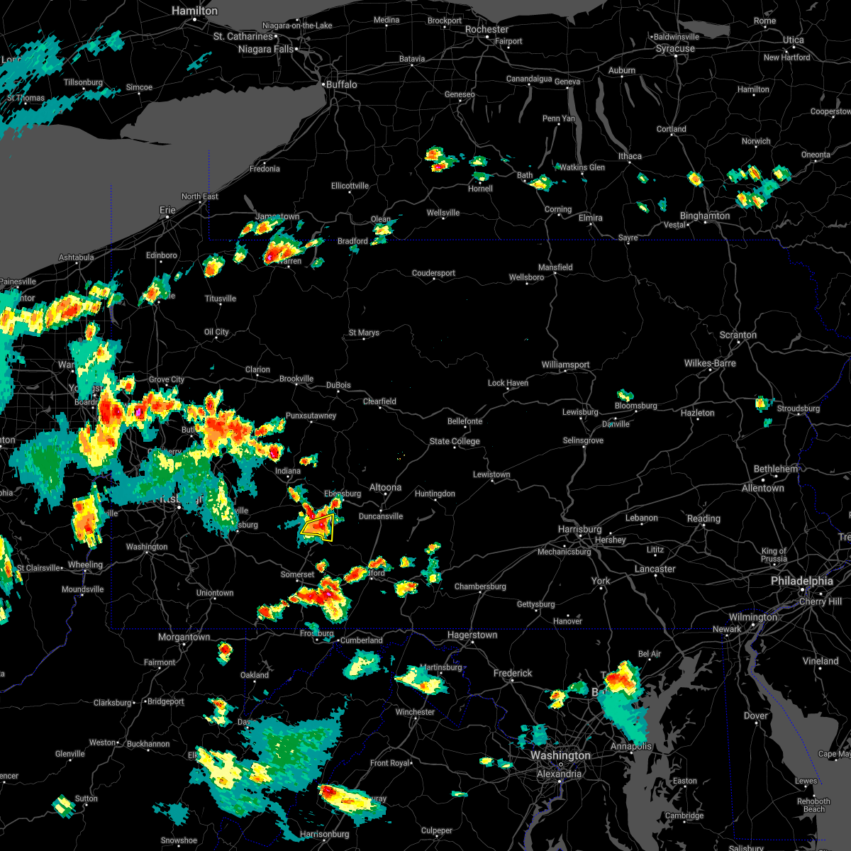 At 432 pm edt, a severe thunderstorm was located over southmont, moving northeast at 15 mph (radar indicated). Hazards include 60 mph wind gusts and quarter size hail. Hail damage to vehicles is expected. expect wind damage to roofs, siding, and trees. Locations impacted include, johnstown, westmont, windber, belmont, geistown, southmont, dale, east conemaugh, paint, scalp level, daisytown, elim, lorain, brownstown, university of pittsburgh - johnstown, johnstown flood national memorial historic site and john murtha johnstown-cambria county airport. At 432 pm edt, a severe thunderstorm was located over southmont, moving northeast at 15 mph (radar indicated). Hazards include 60 mph wind gusts and quarter size hail. Hail damage to vehicles is expected. expect wind damage to roofs, siding, and trees. Locations impacted include, johnstown, westmont, windber, belmont, geistown, southmont, dale, east conemaugh, paint, scalp level, daisytown, elim, lorain, brownstown, university of pittsburgh - johnstown, johnstown flood national memorial historic site and john murtha johnstown-cambria county airport.
|
| 7/7/2021 4:12 PM EDT |
 At 411 pm edt, a severe thunderstorm was located near jerome, moving east at 10 mph (radar indicated). Hazards include 60 mph wind gusts and quarter size hail. Hail damage to vehicles is expected. Expect wind damage to roofs, siding, and trees. At 411 pm edt, a severe thunderstorm was located near jerome, moving east at 10 mph (radar indicated). Hazards include 60 mph wind gusts and quarter size hail. Hail damage to vehicles is expected. Expect wind damage to roofs, siding, and trees.
|
| 6/21/2021 4:39 PM EDT |
 At 439 pm edt, severe thunderstorms were located along a line extending from 8 miles west of vinco to 7 miles south of lawson heights, moving east at 60 mph (radar indicated). Hazards include 60 mph wind gusts. expect damage to roofs, siding, and trees At 439 pm edt, severe thunderstorms were located along a line extending from 8 miles west of vinco to 7 miles south of lawson heights, moving east at 60 mph (radar indicated). Hazards include 60 mph wind gusts. expect damage to roofs, siding, and trees
|
| 6/14/2021 3:39 PM EDT |
 At 338 pm edt, severe thunderstorms were located along a line extending from iola to near danville to near sunbury, moving east at 45 mph (radar indicated). Hazards include 60 mph wind gusts. Expect damage to roofs, siding, and trees. locations impacted include, bloomsburg, berwick, sunbury, milton, danville, northumberland, elysburg, riverside, catawissa, mifflinville, lightstreet, almedia, montandon, fernville, mechanicsville, buckhorn, aristes, numidia, jerseytown and rupert. For those driving on interstate 80, this includes areas between the milton-williamsport and nescopek exits, specifically from mile markers 213 to 247. At 338 pm edt, severe thunderstorms were located along a line extending from iola to near danville to near sunbury, moving east at 45 mph (radar indicated). Hazards include 60 mph wind gusts. Expect damage to roofs, siding, and trees. locations impacted include, bloomsburg, berwick, sunbury, milton, danville, northumberland, elysburg, riverside, catawissa, mifflinville, lightstreet, almedia, montandon, fernville, mechanicsville, buckhorn, aristes, numidia, jerseytown and rupert. For those driving on interstate 80, this includes areas between the milton-williamsport and nescopek exits, specifically from mile markers 213 to 247.
|
| 6/14/2021 3:18 PM EDT |
 At 316 pm edt, severe thunderstorms were located along a line extending from montgomery to new columbia to mifflinburg, moving east at 35 mph (radar indicated). Hazards include 60 mph wind gusts. expect damage to roofs, siding, and trees At 316 pm edt, severe thunderstorms were located along a line extending from montgomery to new columbia to mifflinburg, moving east at 35 mph (radar indicated). Hazards include 60 mph wind gusts. expect damage to roofs, siding, and trees
|
| 6/13/2021 10:11 AM EDT |
 The severe thunderstorm warning for northeastern somerset and southwestern cambria counties will expire at 1015 am edt, the storm which prompted the warning has weakened below severe limits, and has exited the warned area. therefore, the warning will be allowed to expire. The severe thunderstorm warning for northeastern somerset and southwestern cambria counties will expire at 1015 am edt, the storm which prompted the warning has weakened below severe limits, and has exited the warned area. therefore, the warning will be allowed to expire.
|
| 6/13/2021 9:08 AM EDT |
 At 907 am edt, a severe thunderstorm was located near jerome, moving southeast at 30 mph (radar indicated). Hazards include 60 mph wind gusts. expect damage to roofs, siding, and trees At 907 am edt, a severe thunderstorm was located near jerome, moving southeast at 30 mph (radar indicated). Hazards include 60 mph wind gusts. expect damage to roofs, siding, and trees
|
| 11/15/2020 3:46 PM EST |
 At 345 pm est, severe thunderstorms were located along a line extending from near black lick to 7 miles south of farmington, moving east at 60 mph (radar indicated). Hazards include 60 mph wind gusts. expect damage to trees, roofs, and siding At 345 pm est, severe thunderstorms were located along a line extending from near black lick to 7 miles south of farmington, moving east at 60 mph (radar indicated). Hazards include 60 mph wind gusts. expect damage to trees, roofs, and siding
|
| 8/28/2020 1:48 PM EDT |
 At 148 pm edt, a severe thunderstorm was located near stonington, moving east at 25 mph (radar indicated). Hazards include 60 mph wind gusts and quarter size hail. Hail damage to vehicles is expected. Expect wind damage to trees, roofs, and siding. At 148 pm edt, a severe thunderstorm was located near stonington, moving east at 25 mph (radar indicated). Hazards include 60 mph wind gusts and quarter size hail. Hail damage to vehicles is expected. Expect wind damage to trees, roofs, and siding.
|
| 8/28/2020 12:46 PM EDT |
 At 1244 pm edt, severe thunderstorms were located along a line extending from near prince gallitzin state park to cresson to near st. michael to near westmont, moving east at 15 mph (radar indicated). Hazards include 60 mph wind gusts and penny size hail. expect damage to trees, roofs, and siding At 1244 pm edt, severe thunderstorms were located along a line extending from near prince gallitzin state park to cresson to near st. michael to near westmont, moving east at 15 mph (radar indicated). Hazards include 60 mph wind gusts and penny size hail. expect damage to trees, roofs, and siding
|
| 8/27/2020 7:12 PM EDT |
 At 712 pm edt, a severe thunderstorm was located over shamokin dam, moving east at 55 mph (radar indicated). Hazards include 60 mph wind gusts. expect damage to trees, roofs, and siding At 712 pm edt, a severe thunderstorm was located over shamokin dam, moving east at 55 mph (radar indicated). Hazards include 60 mph wind gusts. expect damage to trees, roofs, and siding
|
| 8/27/2020 7:03 PM EDT |
 At 702 pm edt, severe thunderstorms were located along a line extending from near mcclure to strodes mills to near duncansville, moving east at 45 mph (radar indicated). Hazards include 60 mph wind gusts and quarter size hail. Hail damage to vehicles is expected. expect wind damage to trees, roofs, and siding. locations impacted include, johnstown, huntingdon, hollidaysburg, westmont, windber, belmont, portage, roaring spring, geistown, southmont, martinsburg, lakemont, claysburg, williamsburg, dale, duncansville, east conemaugh, salix-beauty line park, beaverdale-lloydell and paint. This includes interstate 99 from mile markers 15 to 30. At 702 pm edt, severe thunderstorms were located along a line extending from near mcclure to strodes mills to near duncansville, moving east at 45 mph (radar indicated). Hazards include 60 mph wind gusts and quarter size hail. Hail damage to vehicles is expected. expect wind damage to trees, roofs, and siding. locations impacted include, johnstown, huntingdon, hollidaysburg, westmont, windber, belmont, portage, roaring spring, geistown, southmont, martinsburg, lakemont, claysburg, williamsburg, dale, duncansville, east conemaugh, salix-beauty line park, beaverdale-lloydell and paint. This includes interstate 99 from mile markers 15 to 30.
|
| 8/27/2020 6:15 PM EDT |
 At 614 pm edt, severe thunderstorms were located along a line extending from near black moshannon state park to near houtzdale to near indiana, moving east at 45 mph (radar indicated). Hazards include 60 mph wind gusts and quarter size hail. Hail damage to vehicles is expected. Expect wind damage to trees, roofs, and siding. At 614 pm edt, severe thunderstorms were located along a line extending from near black moshannon state park to near houtzdale to near indiana, moving east at 45 mph (radar indicated). Hazards include 60 mph wind gusts and quarter size hail. Hail damage to vehicles is expected. Expect wind damage to trees, roofs, and siding.
|
| 8/25/2020 3:00 PM EDT |
 At 259 pm edt, a severe thunderstorm was located near black lick, moving southeast at 40 mph (radar indicated). Hazards include 60 mph wind gusts and quarter size hail. Hail damage to vehicles is expected. Expect wind damage to trees, roofs, and siding. At 259 pm edt, a severe thunderstorm was located near black lick, moving southeast at 40 mph (radar indicated). Hazards include 60 mph wind gusts and quarter size hail. Hail damage to vehicles is expected. Expect wind damage to trees, roofs, and siding.
|
| 7/16/2020 3:35 PM EDT |
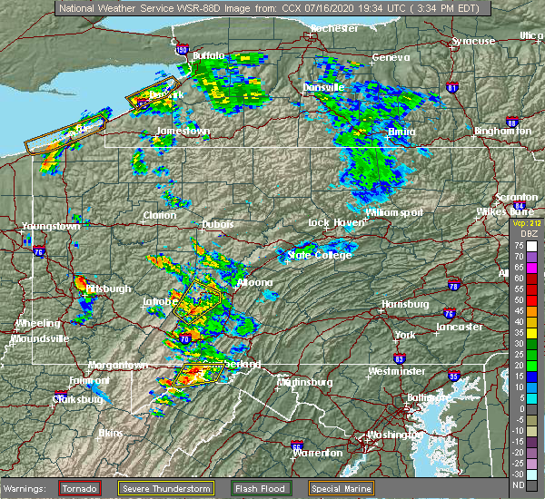 At 335 pm edt, a severe thunderstorm was located over loretto, moving northeast at 40 mph (radar indicated). Hazards include 60 mph wind gusts and penny size hail. Expect damage to trees, roofs, and siding. Locations impacted include, johnstown, westmont, ebensburg, belmont, nanty-glo, portage, geistown, southmont, cresson, vinco, loretto, dale, east conemaugh, salix-beauty line park, beaverdale-lloydell, lilly, south fork, scalp level, sankertown and sidman. At 335 pm edt, a severe thunderstorm was located over loretto, moving northeast at 40 mph (radar indicated). Hazards include 60 mph wind gusts and penny size hail. Expect damage to trees, roofs, and siding. Locations impacted include, johnstown, westmont, ebensburg, belmont, nanty-glo, portage, geistown, southmont, cresson, vinco, loretto, dale, east conemaugh, salix-beauty line park, beaverdale-lloydell, lilly, south fork, scalp level, sankertown and sidman.
|
| 7/16/2020 3:02 PM EDT |
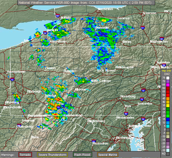 At 302 pm edt, a severe thunderstorm was located over belmont, moving northeast at 40 mph (radar indicated). Hazards include 60 mph wind gusts and quarter size hail. Hail damage to vehicles is expected. Expect wind damage to trees, roofs, and siding. At 302 pm edt, a severe thunderstorm was located over belmont, moving northeast at 40 mph (radar indicated). Hazards include 60 mph wind gusts and quarter size hail. Hail damage to vehicles is expected. Expect wind damage to trees, roofs, and siding.
|
| 5/29/2020 8:37 PM EDT |
 At 837 pm edt, a severe thunderstorm was located over kreamer, moving east at 45 mph (radar indicated). Hazards include 60 mph wind gusts. expect damage to trees, roofs, and siding At 837 pm edt, a severe thunderstorm was located over kreamer, moving east at 45 mph (radar indicated). Hazards include 60 mph wind gusts. expect damage to trees, roofs, and siding
|
| 4/13/2020 12:45 PM EDT |
 At 1244 pm edt, severe thunderstorms were located along a line extending from 6 miles southwest of pine glen to blue knob state park, moving northeast at 60 mph (radar indicated). Hazards include 60 mph wind gusts and penny size hail. Expect damage to trees, roofs, and siding. Locations impacted include, johnstown, clearfield, westmont, ebensburg, belmont, nanty-glo, portage, northern cambria, curwensville, geistown, southmont, patton, cresson, gallitzin, hyde, vinco, loretto, hastings, dale and east conemaugh. At 1244 pm edt, severe thunderstorms were located along a line extending from 6 miles southwest of pine glen to blue knob state park, moving northeast at 60 mph (radar indicated). Hazards include 60 mph wind gusts and penny size hail. Expect damage to trees, roofs, and siding. Locations impacted include, johnstown, clearfield, westmont, ebensburg, belmont, nanty-glo, portage, northern cambria, curwensville, geistown, southmont, patton, cresson, gallitzin, hyde, vinco, loretto, hastings, dale and east conemaugh.
|
| 4/13/2020 11:48 AM EDT |
 At 1146 am edt, severe thunderstorms were located along a line extending from 7 miles northeast of indiana to near south connellsville, moving northeast at 60 mph (radar indicated). Hazards include 60 mph wind gusts and penny size hail. expect damage to trees, roofs, and siding At 1146 am edt, severe thunderstorms were located along a line extending from 7 miles northeast of indiana to near south connellsville, moving northeast at 60 mph (radar indicated). Hazards include 60 mph wind gusts and penny size hail. expect damage to trees, roofs, and siding
|
| 4/8/2020 2:38 AM EDT |
 The severe thunderstorm warning for somerset and southwestern cambria counties will expire at 245 am edt, the storms which prompted the warning have moved out of the area. therefore, the warning will be allowed to expire. a severe thunderstorm watch remains in effect until 600 am edt for south central pennsylvania. to report severe weather, contact your nearest law enforcement agency. they will relay your report to the national weather service state college pa. The severe thunderstorm warning for somerset and southwestern cambria counties will expire at 245 am edt, the storms which prompted the warning have moved out of the area. therefore, the warning will be allowed to expire. a severe thunderstorm watch remains in effect until 600 am edt for south central pennsylvania. to report severe weather, contact your nearest law enforcement agency. they will relay your report to the national weather service state college pa.
|
| 4/8/2020 1:59 AM EDT |
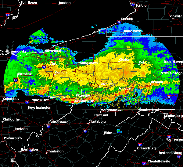 At 158 am edt, severe thunderstorms were located along a line extending from near vinco to near connellsville, moving southeast at 60 mph (radar indicated). Hazards include 70 mph wind gusts. Expect considerable tree damage. damage is likely to mobile homes, roofs, and outbuildings. locations impacted include, johnstown, somerset, westmont, windber, ebensburg, belmont, nanty-glo, portage, geistown, southmont, meyersdale, berlin, friedens, vinco, boswell, dale, east conemaugh, salix-beauty line park, davidsville and central city. This includes the pennsylvania turnpike from mile markers 100 to 130. At 158 am edt, severe thunderstorms were located along a line extending from near vinco to near connellsville, moving southeast at 60 mph (radar indicated). Hazards include 70 mph wind gusts. Expect considerable tree damage. damage is likely to mobile homes, roofs, and outbuildings. locations impacted include, johnstown, somerset, westmont, windber, ebensburg, belmont, nanty-glo, portage, geistown, southmont, meyersdale, berlin, friedens, vinco, boswell, dale, east conemaugh, salix-beauty line park, davidsville and central city. This includes the pennsylvania turnpike from mile markers 100 to 130.
|
| 4/8/2020 1:44 AM EDT |
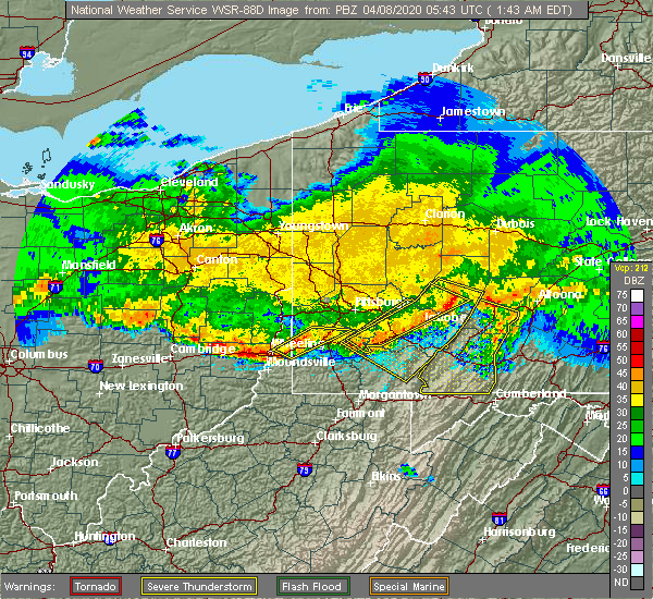 At 143 am edt, severe thunderstorms were located along a line extending from near black lick to youngwood, moving southeast at 60 mph (radar indicated). Hazards include 60 mph wind gusts. expect damage to trees, roofs, and siding At 143 am edt, severe thunderstorms were located along a line extending from near black lick to youngwood, moving southeast at 60 mph (radar indicated). Hazards include 60 mph wind gusts. expect damage to trees, roofs, and siding
|
| 9/11/2019 7:50 PM EDT |
 The severe thunderstorm warning for cambria county will expire at 800 pm edt, the storms which prompted the warning have moved out of the area. therefore, the warning will be allowed to expire. The severe thunderstorm warning for cambria county will expire at 800 pm edt, the storms which prompted the warning have moved out of the area. therefore, the warning will be allowed to expire.
|
| 9/11/2019 6:59 PM EDT |
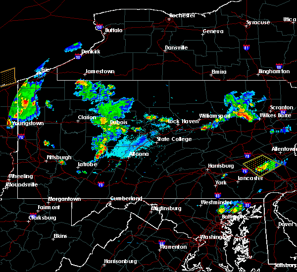 At 658 pm edt, severe thunderstorms were located along a line extending from near northern cambria to near westmont, moving southeast at 35 mph (radar indicated). Hazards include 60 mph wind gusts. expect damage to trees, roofs, and siding At 658 pm edt, severe thunderstorms were located along a line extending from near northern cambria to near westmont, moving southeast at 35 mph (radar indicated). Hazards include 60 mph wind gusts. expect damage to trees, roofs, and siding
|
| 8/2/2019 5:43 PM EDT |
 At 542 pm edt, severe thunderstorms were located along a line extending from mechanicsville to altamont, moving east at 10 mph (radar indicated). Hazards include 60 mph wind gusts and quarter size hail. Hail damage to vehicles is expected. expect wind damage to trees, roofs, and siding. Locations impacted include, shamokin, mount carmel, danville, kulpmont, elysburg, fairview-ferndale, riverside, trevorton, catawissa, marshallton, mechanicsville, numidia, wilburton number one, slabtown, wilburton number two, leck kill, stonington, knoebels grove, edgewood and marion heights. At 542 pm edt, severe thunderstorms were located along a line extending from mechanicsville to altamont, moving east at 10 mph (radar indicated). Hazards include 60 mph wind gusts and quarter size hail. Hail damage to vehicles is expected. expect wind damage to trees, roofs, and siding. Locations impacted include, shamokin, mount carmel, danville, kulpmont, elysburg, fairview-ferndale, riverside, trevorton, catawissa, marshallton, mechanicsville, numidia, wilburton number one, slabtown, wilburton number two, leck kill, stonington, knoebels grove, edgewood and marion heights.
|
| 8/2/2019 5:01 PM EDT |
 At 500 pm edt, severe thunderstorms were located along a line extending from near riverside to ashland, moving east at 10 mph (radar indicated). Hazards include 60 mph wind gusts and quarter size hail. Hail damage to vehicles is expected. Expect wind damage to trees, roofs, and siding. At 500 pm edt, severe thunderstorms were located along a line extending from near riverside to ashland, moving east at 10 mph (radar indicated). Hazards include 60 mph wind gusts and quarter size hail. Hail damage to vehicles is expected. Expect wind damage to trees, roofs, and siding.
|
| 7/30/2019 4:39 PM EDT |
 At 439 pm edt, a severe thunderstorm was located over fairview-ferndale, moving northeast at 15 mph (radar indicated). Hazards include 60 mph wind gusts and penny size hail. Expect damage to trees, roofs, and siding. Locations impacted include, shamokin, mount carmel, kulpmont, elysburg, fairview-ferndale, riverside, trevorton, marshallton, wilburton number one, stonington, edgewood, marion heights and snydertown. At 439 pm edt, a severe thunderstorm was located over fairview-ferndale, moving northeast at 15 mph (radar indicated). Hazards include 60 mph wind gusts and penny size hail. Expect damage to trees, roofs, and siding. Locations impacted include, shamokin, mount carmel, kulpmont, elysburg, fairview-ferndale, riverside, trevorton, marshallton, wilburton number one, stonington, edgewood, marion heights and snydertown.
|
| 7/30/2019 3:54 PM EDT |
 At 354 pm edt, a severe thunderstorm was located over kreamer, moving northeast at 25 mph (radar indicated). Hazards include 60 mph wind gusts and penny size hail. expect damage to trees, roofs, and siding At 354 pm edt, a severe thunderstorm was located over kreamer, moving northeast at 25 mph (radar indicated). Hazards include 60 mph wind gusts and penny size hail. expect damage to trees, roofs, and siding
|
| 7/6/2019 5:23 PM EDT |
 At 522 pm edt, severe thunderstorms were located along a line extending from central to jerseytown to trevorton to near elizabethville, moving east southeast at 40 mph (radar indicated). Hazards include 60 mph wind gusts and quarter size hail. Hail damage to vehicles is expected. expect wind damage to trees, roofs, and siding. locations impacted include, bloomsburg, berwick, sunbury, shamokin, milton, mount carmel, lewisburg, selinsgrove, danville, northumberland, kulpmont, winfield, watsontown, elysburg, fairview-ferndale, riverside, trevorton, shamokin dam, catawissa and linntown. for those driving on interstate 80, this includes areas between the lewisburg-williamsport and nescopek exits, specifically from mile markers 211 to 247. This includes interstate 180 from mile markers 1 to 7. At 522 pm edt, severe thunderstorms were located along a line extending from central to jerseytown to trevorton to near elizabethville, moving east southeast at 40 mph (radar indicated). Hazards include 60 mph wind gusts and quarter size hail. Hail damage to vehicles is expected. expect wind damage to trees, roofs, and siding. locations impacted include, bloomsburg, berwick, sunbury, shamokin, milton, mount carmel, lewisburg, selinsgrove, danville, northumberland, kulpmont, winfield, watsontown, elysburg, fairview-ferndale, riverside, trevorton, shamokin dam, catawissa and linntown. for those driving on interstate 80, this includes areas between the lewisburg-williamsport and nescopek exits, specifically from mile markers 211 to 247. This includes interstate 180 from mile markers 1 to 7.
|
| 7/6/2019 4:42 PM EDT |
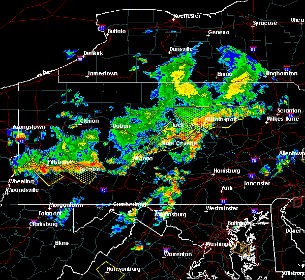 At 442 pm edt, severe thunderstorms were located along a line extending from near east conemaugh to south park township, moving east at 40 mph (radar indicated). Hazards include 60 mph wind gusts and quarter size hail. Hail damage to vehicles is expected. Expect wind damage to trees, roofs, and siding. At 442 pm edt, severe thunderstorms were located along a line extending from near east conemaugh to south park township, moving east at 40 mph (radar indicated). Hazards include 60 mph wind gusts and quarter size hail. Hail damage to vehicles is expected. Expect wind damage to trees, roofs, and siding.
|
| 7/6/2019 4:40 PM EDT |
 At 439 pm edt, severe thunderstorms were located along a line extending from near muncy valley to near montgomery to near forest hill to near mcalisterville, moving southeast at 30 mph (radar indicated). Hazards include 60 mph wind gusts and quarter size hail. Hail damage to vehicles is expected. Expect wind damage to trees, roofs, and siding. At 439 pm edt, severe thunderstorms were located along a line extending from near muncy valley to near montgomery to near forest hill to near mcalisterville, moving southeast at 30 mph (radar indicated). Hazards include 60 mph wind gusts and quarter size hail. Hail damage to vehicles is expected. Expect wind damage to trees, roofs, and siding.
|
| 7/2/2019 4:45 PM EDT |
 At 445 pm edt, a severe thunderstorm was located over mooresburg, moving southeast at 20 mph (radar indicated). Hazards include 60 mph wind gusts and penny size hail. expect damage to trees, roofs, and siding At 445 pm edt, a severe thunderstorm was located over mooresburg, moving southeast at 20 mph (radar indicated). Hazards include 60 mph wind gusts and penny size hail. expect damage to trees, roofs, and siding
|
| 7/2/2019 4:18 PM EDT |
 At 418 pm edt, severe thunderstorms were located along a line extending from east conemaugh to westmont, moving southeast at 25 mph (radar indicated). Hazards include 60 mph wind gusts. expect damage to trees, roofs, and siding At 418 pm edt, severe thunderstorms were located along a line extending from east conemaugh to westmont, moving southeast at 25 mph (radar indicated). Hazards include 60 mph wind gusts. expect damage to trees, roofs, and siding
|
| 6/29/2019 6:04 PM EDT |
 At 603 pm edt, a severe thunderstorm was located over winfield, moving southeast at 35 mph (radar indicated). Hazards include 60 mph wind gusts and penny size hail. expect damage to trees, roofs, and siding At 603 pm edt, a severe thunderstorm was located over winfield, moving southeast at 35 mph (radar indicated). Hazards include 60 mph wind gusts and penny size hail. expect damage to trees, roofs, and siding
|
| 5/29/2019 4:06 PM EDT |
 At 406 pm edt, severe thunderstorms were located along a line extending from fairmount spgs to catawissa to penns creek, moving east at 50 mph (radar indicated). Hazards include 60 mph wind gusts and penny size hail. expect damage to trees, roofs, and siding At 406 pm edt, severe thunderstorms were located along a line extending from fairmount spgs to catawissa to penns creek, moving east at 50 mph (radar indicated). Hazards include 60 mph wind gusts and penny size hail. expect damage to trees, roofs, and siding
|
| 5/29/2019 4:04 PM EDT |
 At 402 pm edt, severe thunderstorms were located along a line extending from ricketts glen state park to near jerseytown to mifflinburg, moving east at 45 mph (radar indicated). Hazards include 60 mph wind gusts and quarter size hail. Hail damage to vehicles is expected. expect wind damage to trees, roofs, and siding. locations impacted include, bloomsburg, sunbury, milton, lewisburg, danville, northumberland, mifflinburg, winfield, watsontown, elysburg, riverside, linntown, lightstreet, montandon, penns creek, mechanicsville, and buckhorn. for those driving on interstate 80, this includes areas between the jersey shore and bloomsburg-light street exits, specifically from mile markers 195 to 235. This includes interstate 180 from mile markers 1 to 8. At 402 pm edt, severe thunderstorms were located along a line extending from ricketts glen state park to near jerseytown to mifflinburg, moving east at 45 mph (radar indicated). Hazards include 60 mph wind gusts and quarter size hail. Hail damage to vehicles is expected. expect wind damage to trees, roofs, and siding. locations impacted include, bloomsburg, sunbury, milton, lewisburg, danville, northumberland, mifflinburg, winfield, watsontown, elysburg, riverside, linntown, lightstreet, montandon, penns creek, mechanicsville, and buckhorn. for those driving on interstate 80, this includes areas between the jersey shore and bloomsburg-light street exits, specifically from mile markers 195 to 235. This includes interstate 180 from mile markers 1 to 8.
|
| 5/29/2019 3:41 PM EDT |
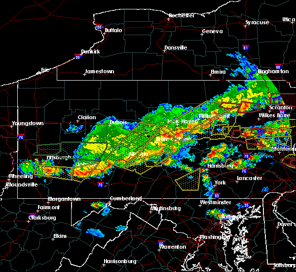 At 340 pm edt, severe thunderstorms were located along a line extending from near ebensburg to near st. michael to jerome to 6 miles north of seven springs, moving east at 35 mph (radar indicated). Hazards include 60 mph wind gusts and quarter size hail. Hail damage to vehicles is expected. Expect wind damage to trees, roofs, and siding. At 340 pm edt, severe thunderstorms were located along a line extending from near ebensburg to near st. michael to jerome to 6 miles north of seven springs, moving east at 35 mph (radar indicated). Hazards include 60 mph wind gusts and quarter size hail. Hail damage to vehicles is expected. Expect wind damage to trees, roofs, and siding.
|
| 5/29/2019 3:40 PM EDT |
 At 339 pm edt, severe thunderstorms were located along a line extending from near kettle creek gorge to allenwood to near rebersburg, moving east at 45 mph (radar indicated). Hazards include 60 mph wind gusts and quarter size hail. Hail damage to vehicles is expected. Expect wind damage to trees, roofs, and siding. At 339 pm edt, severe thunderstorms were located along a line extending from near kettle creek gorge to allenwood to near rebersburg, moving east at 45 mph (radar indicated). Hazards include 60 mph wind gusts and quarter size hail. Hail damage to vehicles is expected. Expect wind damage to trees, roofs, and siding.
|
| 5/29/2019 2:45 PM EDT |
 The national weather service in state college pa has issued a * severe thunderstorm warning for. montour county in central pennsylvania. west central columbia county in central pennsylvania. until 345 pm edt. At 245 pm edt, a severe thunderstorm was located near mooresburg,. The national weather service in state college pa has issued a * severe thunderstorm warning for. montour county in central pennsylvania. west central columbia county in central pennsylvania. until 345 pm edt. At 245 pm edt, a severe thunderstorm was located near mooresburg,.
|
| 5/28/2019 10:37 PM EDT |
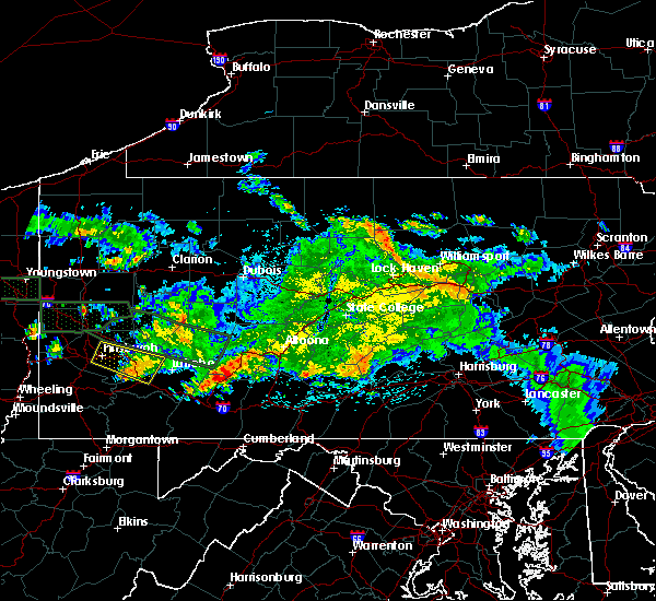 At 1037 pm edt, a severe thunderstorm was located over tire hill, moving east at 50 mph (radar indicated). Hazards include 60 mph wind gusts. expect damage to trees, roofs, and siding At 1037 pm edt, a severe thunderstorm was located over tire hill, moving east at 50 mph (radar indicated). Hazards include 60 mph wind gusts. expect damage to trees, roofs, and siding
|
| 5/28/2019 5:49 PM EDT |
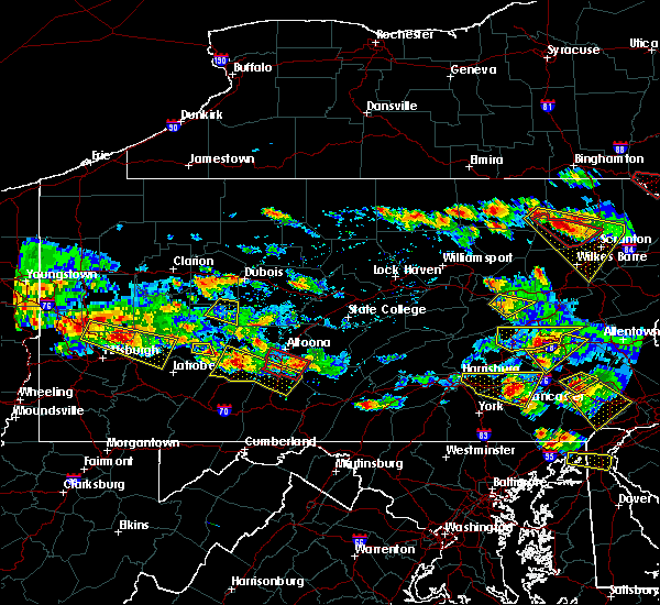 At 548 pm edt, a severe thunderstorm was located over south fork, moving southeast at 40 mph (radar indicated). Hazards include 60 mph wind gusts and quarter size hail. Hail damage to vehicles is expected. Expect wind damage to trees, roofs, and siding. At 548 pm edt, a severe thunderstorm was located over south fork, moving southeast at 40 mph (radar indicated). Hazards include 60 mph wind gusts and quarter size hail. Hail damage to vehicles is expected. Expect wind damage to trees, roofs, and siding.
|
| 5/28/2019 5:39 PM EDT |
 At 538 pm edt, a severe thunderstorm was located near riverside, moving east at 40 mph (radar indicated). Hazards include 60 mph wind gusts and half dollar size hail. Hail damage to vehicles is expected. expect wind damage to trees, roofs, and siding. locations impacted include, shamokin, danville, northumberland, kulpmont, elysburg, riverside, catawissa, marshallton, mechanicsville, numidia, rupert, slabtown, mooresburg, stonington, knoebels grove, marion heights and snydertown. For those driving on interstate 80, this includes areas between the limestoneville and buckhorn exits, specifically from mile markers 217 to 225. At 538 pm edt, a severe thunderstorm was located near riverside, moving east at 40 mph (radar indicated). Hazards include 60 mph wind gusts and half dollar size hail. Hail damage to vehicles is expected. expect wind damage to trees, roofs, and siding. locations impacted include, shamokin, danville, northumberland, kulpmont, elysburg, riverside, catawissa, marshallton, mechanicsville, numidia, rupert, slabtown, mooresburg, stonington, knoebels grove, marion heights and snydertown. For those driving on interstate 80, this includes areas between the limestoneville and buckhorn exits, specifically from mile markers 217 to 225.
|
| 5/28/2019 5:25 PM EDT |
 At 525 pm edt, a severe thunderstorm was located over montandon, moving east at 40 mph (radar indicated). Hazards include 60 mph wind gusts and half dollar size hail. Hail damage to vehicles is expected. Expect wind damage to trees, roofs, and siding. At 525 pm edt, a severe thunderstorm was located over montandon, moving east at 40 mph (radar indicated). Hazards include 60 mph wind gusts and half dollar size hail. Hail damage to vehicles is expected. Expect wind damage to trees, roofs, and siding.
|
| 5/28/2019 5:06 PM EDT |
 At 505 pm edt, a severe thunderstorm was located over trevorton, moving southeast at 40 mph (radar indicated). Hazards include ping pong ball size hail and 60 mph wind gusts. People and animals outdoors will be injured. expect hail damage to roofs, siding, windows, and vehicles. expect wind damage to trees, roofs, and siding. locations impacted include, shamokin, mount carmel, kulpmont, ashland, elysburg, fairview-ferndale, riverside, trevorton, girardville, marshallton, williamstown, tower city, lavelle, englewood, aristes, fountain springs, wilburton number one, locustdale, klingerstown and beurys lake. This includes interstate 81 from mile markers 115 to 117. At 505 pm edt, a severe thunderstorm was located over trevorton, moving southeast at 40 mph (radar indicated). Hazards include ping pong ball size hail and 60 mph wind gusts. People and animals outdoors will be injured. expect hail damage to roofs, siding, windows, and vehicles. expect wind damage to trees, roofs, and siding. locations impacted include, shamokin, mount carmel, kulpmont, ashland, elysburg, fairview-ferndale, riverside, trevorton, girardville, marshallton, williamstown, tower city, lavelle, englewood, aristes, fountain springs, wilburton number one, locustdale, klingerstown and beurys lake. This includes interstate 81 from mile markers 115 to 117.
|
| 5/28/2019 4:54 PM EDT |
 At 454 pm edt, a severe thunderstorm was located over hummels wharf, moving southeast at 40 mph (radar indicated). Hazards include ping pong ball size hail and 60 mph wind gusts. People and animals outdoors will be injured. expect hail damage to roofs, siding, windows, and vehicles. Expect wind damage to trees, roofs, and siding. At 454 pm edt, a severe thunderstorm was located over hummels wharf, moving southeast at 40 mph (radar indicated). Hazards include ping pong ball size hail and 60 mph wind gusts. People and animals outdoors will be injured. expect hail damage to roofs, siding, windows, and vehicles. Expect wind damage to trees, roofs, and siding.
|
| 5/23/2019 9:09 PM EDT |
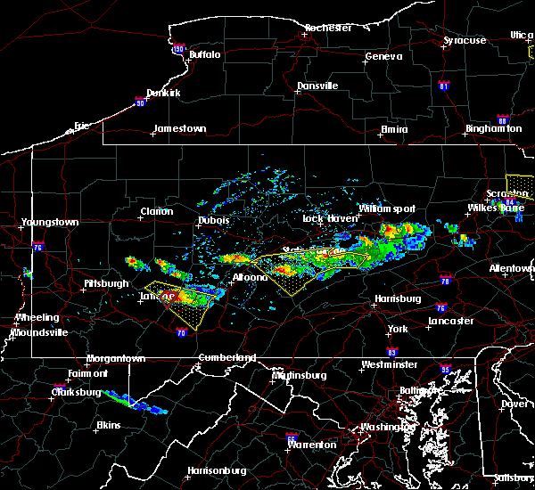 At 909 pm edt, a severe thunderstorm capable of producing a tornado was located over westmont, moving southeast at 45 mph (radar indicated rotation). Hazards include tornado and quarter size hail. Tree damage will occur. damage to roofs, windows, and vehicles is likely. flying debris will be dangerous to those caught without shelter. mobile homes will be damaged or destroyed. this dangerous storm will be near, johnstown, westmont, southmont, tire hill, dale, daisytown, jerome and east conemaugh around 910 pm edt. windber, belmont, scalp level, paint, geistown, davidsville and salix-beauty line park around 920 pm edt. ogletown, central city and dunlo around 930 pm edt. Other locations impacted by this tornadic thunderstorm include benson, lorain, elim, brownstown, johnstown flood national memorial historic site, john murtha johnstown-cambria county airport, university of pittsburgh - johnstown and hooversville. At 909 pm edt, a severe thunderstorm capable of producing a tornado was located over westmont, moving southeast at 45 mph (radar indicated rotation). Hazards include tornado and quarter size hail. Tree damage will occur. damage to roofs, windows, and vehicles is likely. flying debris will be dangerous to those caught without shelter. mobile homes will be damaged or destroyed. this dangerous storm will be near, johnstown, westmont, southmont, tire hill, dale, daisytown, jerome and east conemaugh around 910 pm edt. windber, belmont, scalp level, paint, geistown, davidsville and salix-beauty line park around 920 pm edt. ogletown, central city and dunlo around 930 pm edt. Other locations impacted by this tornadic thunderstorm include benson, lorain, elim, brownstown, johnstown flood national memorial historic site, john murtha johnstown-cambria county airport, university of pittsburgh - johnstown and hooversville.
|
| 5/23/2019 8:58 PM EDT |
 At 856 pm edt, a severe thunderstorm was located over westmont, moving southeast at 45 mph (radar indicated). Hazards include 60 mph wind gusts and ping pong ball size hail. People and animals outdoors will be injured. expect hail damage to roofs, siding, windows, and vehicles. Expect wind damage to trees, roofs, and siding. At 856 pm edt, a severe thunderstorm was located over westmont, moving southeast at 45 mph (radar indicated). Hazards include 60 mph wind gusts and ping pong ball size hail. People and animals outdoors will be injured. expect hail damage to roofs, siding, windows, and vehicles. Expect wind damage to trees, roofs, and siding.
|
| 5/19/2019 4:56 PM EDT |
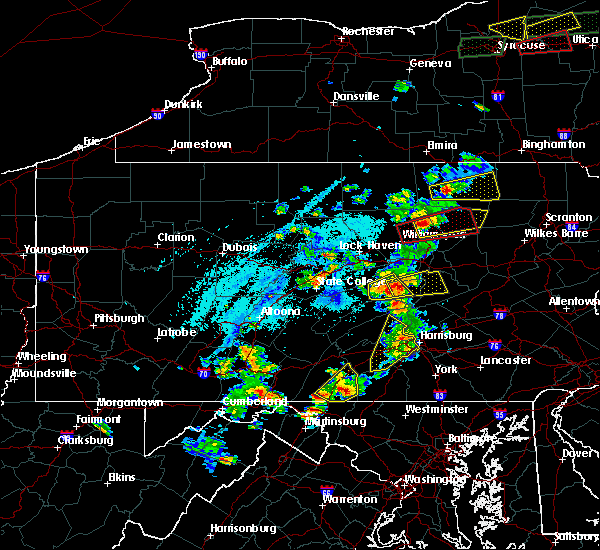 At 455 pm edt, a severe thunderstorm was located over middleburg, moving east at 35 mph (radar indicated). Hazards include 60 mph wind gusts and quarter size hail. Hail damage to vehicles is expected. Expect wind damage to trees, roofs, and siding. At 455 pm edt, a severe thunderstorm was located over middleburg, moving east at 35 mph (radar indicated). Hazards include 60 mph wind gusts and quarter size hail. Hail damage to vehicles is expected. Expect wind damage to trees, roofs, and siding.
|
| 4/19/2019 10:16 PM EDT |
 At 1016 pm edt, severe thunderstorms were located along a line extending from near waller to rupert to near marshallton, moving northeast at 40 mph (radar indicated). Hazards include 60 mph wind gusts. Expect damage to roofs, siding, and trees. locations impacted include, bloomsburg, berwick, shamokin, mount carmel, danville, kulpmont, elysburg, fairview-ferndale, riverside, trevorton, catawissa, marshallton, mifflinville, lightstreet, almedia, fernville, mechanicsville, buckhorn, aristes and numidia. For those driving on interstate 80, this includes areas between the danville and nescopek exits, specifically from mile markers 226 to 247. At 1016 pm edt, severe thunderstorms were located along a line extending from near waller to rupert to near marshallton, moving northeast at 40 mph (radar indicated). Hazards include 60 mph wind gusts. Expect damage to roofs, siding, and trees. locations impacted include, bloomsburg, berwick, shamokin, mount carmel, danville, kulpmont, elysburg, fairview-ferndale, riverside, trevorton, catawissa, marshallton, mifflinville, lightstreet, almedia, fernville, mechanicsville, buckhorn, aristes and numidia. For those driving on interstate 80, this includes areas between the danville and nescopek exits, specifically from mile markers 226 to 247.
|
| 4/19/2019 9:36 PM EDT |
 At 935 pm edt, severe thunderstorms were located along a line extending from near kreamer to near port trevorton to near elizabethville, moving northeast at 50 mph (radar indicated). Hazards include 60 mph wind gusts. expect damage to roofs, siding, and trees At 935 pm edt, severe thunderstorms were located along a line extending from near kreamer to near port trevorton to near elizabethville, moving northeast at 50 mph (radar indicated). Hazards include 60 mph wind gusts. expect damage to roofs, siding, and trees
|
| 4/15/2019 12:41 AM EDT |
 At 1240 am edt, severe thunderstorms were located along a line extending from near shunk to lewisburg to near millersburg, moving northeast at 65 mph (radar indicated). Hazards include 60 mph wind gusts and nickel size hail. expect damage to roofs, siding, and trees At 1240 am edt, severe thunderstorms were located along a line extending from near shunk to lewisburg to near millersburg, moving northeast at 65 mph (radar indicated). Hazards include 60 mph wind gusts and nickel size hail. expect damage to roofs, siding, and trees
|
| 4/14/2019 10:17 PM EDT |
 At 1017 pm edt, severe thunderstorms were located along a line extending from belsano to friedens to near frostburg, moving northeast at 60 mph (radar indicated). Hazards include 60 mph wind gusts and penny size hail. expect damage to roofs, siding, and trees At 1017 pm edt, severe thunderstorms were located along a line extending from belsano to friedens to near frostburg, moving northeast at 60 mph (radar indicated). Hazards include 60 mph wind gusts and penny size hail. expect damage to roofs, siding, and trees
|
| 9/3/2018 7:00 PM EDT |
 At 659 pm edt, severe thunderstorms were located along a line extending from near loyalsockville to allenwood, moving southeast at 20 mph (radar indicated). Hazards include 60 mph wind gusts and quarter size hail. Hail damage to vehicles is expected. Expect wind damage to roofs, siding, and trees. At 659 pm edt, severe thunderstorms were located along a line extending from near loyalsockville to allenwood, moving southeast at 20 mph (radar indicated). Hazards include 60 mph wind gusts and quarter size hail. Hail damage to vehicles is expected. Expect wind damage to roofs, siding, and trees.
|
| 8/21/2018 2:45 PM EDT |
 At 245 pm edt, a severe thunderstorm was located over nanty-glo, moving northeast at 30 mph (radar indicated). Hazards include 70 mph wind gusts. Expect considerable tree damage. damage is likely to mobile homes, roofs, and outbuildings. this severe storm will be near, ebensburg and loretto around 300 pm edt. patton, carrolltown, hastings and prince gallitzin state park around 310 pm edt. Other locations impacted by this severe thunderstorm include colver, benson, spring hill, mundys corner, cassandra, elim, vintondale, lorain, chest springs and ashville. At 245 pm edt, a severe thunderstorm was located over nanty-glo, moving northeast at 30 mph (radar indicated). Hazards include 70 mph wind gusts. Expect considerable tree damage. damage is likely to mobile homes, roofs, and outbuildings. this severe storm will be near, ebensburg and loretto around 300 pm edt. patton, carrolltown, hastings and prince gallitzin state park around 310 pm edt. Other locations impacted by this severe thunderstorm include colver, benson, spring hill, mundys corner, cassandra, elim, vintondale, lorain, chest springs and ashville.
|
| 8/21/2018 2:22 PM EDT |
 The national weather service in state college pa has issued a * severe thunderstorm warning for. northeastern somerset county in south central pennsylvania. cambria county in central pennsylvania. until 315 pm edt. At 221 pm edt, a severe thunderstorm was located near westmont,. The national weather service in state college pa has issued a * severe thunderstorm warning for. northeastern somerset county in south central pennsylvania. cambria county in central pennsylvania. until 315 pm edt. At 221 pm edt, a severe thunderstorm was located near westmont,.
|
| 8/7/2018 2:43 PM EDT |
 At 243 pm edt, severe thunderstorms were located along a line extending from near buckhorn to near milton, moving southeast at 10 mph (radar indicated). Hazards include 60 mph wind gusts. expect damage to roofs, siding, and trees At 243 pm edt, severe thunderstorms were located along a line extending from near buckhorn to near milton, moving southeast at 10 mph (radar indicated). Hazards include 60 mph wind gusts. expect damage to roofs, siding, and trees
|
| 8/7/2018 2:15 PM EDT |
 At 214 pm edt, severe thunderstorms were located along a line extending from jerseytown to milton, moving east at 20 mph (radar indicated). Hazards include 60 mph wind gusts and quarter size hail. Hail damage to vehicles is expected. expect wind damage to roofs, siding, and trees. locations impacted include, bloomsburg, milton, danville, watsontown, riverside, mifflinville, lightstreet, almedia, montandon, fernville, mechanicsville, buckhorn, jerseytown, rupert, rohrsburg, iola, eyers grove, mooresburg, exchange and delaware run. for those driving on interstate 80, this includes areas between the lewisburg-williamsport and nescopek exits, specifically from mile markers 211 to 244. This includes interstate 180 from mile markers 1 to 9. At 214 pm edt, severe thunderstorms were located along a line extending from jerseytown to milton, moving east at 20 mph (radar indicated). Hazards include 60 mph wind gusts and quarter size hail. Hail damage to vehicles is expected. expect wind damage to roofs, siding, and trees. locations impacted include, bloomsburg, milton, danville, watsontown, riverside, mifflinville, lightstreet, almedia, montandon, fernville, mechanicsville, buckhorn, jerseytown, rupert, rohrsburg, iola, eyers grove, mooresburg, exchange and delaware run. for those driving on interstate 80, this includes areas between the lewisburg-williamsport and nescopek exits, specifically from mile markers 211 to 244. This includes interstate 180 from mile markers 1 to 9.
|
| 8/7/2018 1:52 PM EDT |
 At 151 pm edt, a severe thunderstorm was located near exchange, moving east at 40 mph (radar indicated). Hazards include 60 mph wind gusts and quarter size hail. Hail damage to vehicles is expected. Expect wind damage to roofs, siding, and trees. At 151 pm edt, a severe thunderstorm was located near exchange, moving east at 40 mph (radar indicated). Hazards include 60 mph wind gusts and quarter size hail. Hail damage to vehicles is expected. Expect wind damage to roofs, siding, and trees.
|
| 6/18/2018 1:51 PM EDT |
 At 151 pm edt, a severe thunderstorm was located over riverside, moving southeast at 10 mph (radar indicated). Hazards include 60 mph wind gusts and penny size hail. expect damage to roofs, siding, and trees At 151 pm edt, a severe thunderstorm was located over riverside, moving southeast at 10 mph (radar indicated). Hazards include 60 mph wind gusts and penny size hail. expect damage to roofs, siding, and trees
|
| 5/15/2018 2:57 PM EDT |
 At 256 pm edt, severe thunderstorms were located along a line extending from waller to near milton to near kreamer to near richfield, moving east at 55 mph (radar indicated). Hazards include 70 mph wind gusts. Expect considerable tree damage. damage is likely to mobile homes, roofs, and outbuildings. these severe storms will be near, fairmount spgs, mooresburg, central, waller, jamison city, rohrsburg and ricketts glen state park around 300 pm edt. danville, meiserville, stonington, buckhorn, port trevorton, riverside, fremont, jerseytown and eyers grove around 310 pm edt. shamokin, bloomsburg, kulpmont, mainville, urban, almedia, marshallton, elysburg, fairview-ferndale and knoebels grove around 320 pm edt. mount carmel, berwick, wilburton number two, wilburton number one, aristes, locustdale, numidia, shumans, leck kill and mifflinville around 330 pm edt. Other locations impacted by these severe thunderstorms include wagner, lime ridge, marion heights, seven points, hartleton, new berlin, stillwater, millville, herndon and edgewood. At 256 pm edt, severe thunderstorms were located along a line extending from waller to near milton to near kreamer to near richfield, moving east at 55 mph (radar indicated). Hazards include 70 mph wind gusts. Expect considerable tree damage. damage is likely to mobile homes, roofs, and outbuildings. these severe storms will be near, fairmount spgs, mooresburg, central, waller, jamison city, rohrsburg and ricketts glen state park around 300 pm edt. danville, meiserville, stonington, buckhorn, port trevorton, riverside, fremont, jerseytown and eyers grove around 310 pm edt. shamokin, bloomsburg, kulpmont, mainville, urban, almedia, marshallton, elysburg, fairview-ferndale and knoebels grove around 320 pm edt. mount carmel, berwick, wilburton number two, wilburton number one, aristes, locustdale, numidia, shumans, leck kill and mifflinville around 330 pm edt. Other locations impacted by these severe thunderstorms include wagner, lime ridge, marion heights, seven points, hartleton, new berlin, stillwater, millville, herndon and edgewood.
|
| 5/15/2018 2:57 PM EDT |
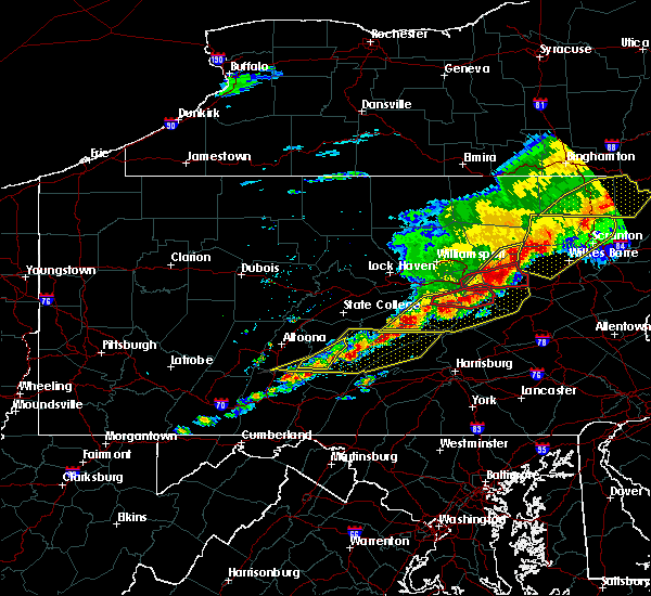 At 257 pm edt, a severe squall line capable of producing both tornadoes and extensive straight line wind damage was located over sunbury, moving east at 35 mph (radar indicated rotation). Hazards include tornado and quarter size hail. Flying debris will be dangerous to those caught without shelter. mobile homes will be damaged or destroyed. damage to roofs, windows, and vehicles will occur. tree damage is likely. these dangerous storms will be near, danville, stonington and riverside around 310 pm edt. elysburg around 320 pm edt. Other locations impacted by this tornadic thunderstorm include snydertown and new berlin. At 257 pm edt, a severe squall line capable of producing both tornadoes and extensive straight line wind damage was located over sunbury, moving east at 35 mph (radar indicated rotation). Hazards include tornado and quarter size hail. Flying debris will be dangerous to those caught without shelter. mobile homes will be damaged or destroyed. damage to roofs, windows, and vehicles will occur. tree damage is likely. these dangerous storms will be near, danville, stonington and riverside around 310 pm edt. elysburg around 320 pm edt. Other locations impacted by this tornadic thunderstorm include snydertown and new berlin.
|
| 5/15/2018 2:45 PM EDT |
 At 243 pm edt, a severe thunderstorm capable of producing a tornado was located near vicksburg, moving east at 35 mph (radar indicated rotation). Hazards include tornado and quarter size hail. Flying debris will be dangerous to those caught without shelter. mobile homes will be damaged or destroyed. damage to roofs, windows, and vehicles will occur. tree damage is likely. this dangerous storm will be near, lewisburg, winfield and montandon around 250 pm edt. northumberland, sunbury and shamokin dam around 300 pm edt. riverside, mooresburg and stonington around 310 pm edt. danville and elysburg around 320 pm edt. other locations impacted by this tornadic thunderstorm include snydertown, new berlin and bucknell. for those driving on interstate 80, this includes areas between the limestoneville and buckhorn exits, specifically from mile markers 217 to 227. this includes the following highways, route 11 from near shamokin dam to east of danville. route 15 from near shamokin dam to lewisburg. state road 45 from mifflinburg to lewisburg. state road 61 from sunbury to stonington. State highway 147 from near lewisburg to sunbury. At 243 pm edt, a severe thunderstorm capable of producing a tornado was located near vicksburg, moving east at 35 mph (radar indicated rotation). Hazards include tornado and quarter size hail. Flying debris will be dangerous to those caught without shelter. mobile homes will be damaged or destroyed. damage to roofs, windows, and vehicles will occur. tree damage is likely. this dangerous storm will be near, lewisburg, winfield and montandon around 250 pm edt. northumberland, sunbury and shamokin dam around 300 pm edt. riverside, mooresburg and stonington around 310 pm edt. danville and elysburg around 320 pm edt. other locations impacted by this tornadic thunderstorm include snydertown, new berlin and bucknell. for those driving on interstate 80, this includes areas between the limestoneville and buckhorn exits, specifically from mile markers 217 to 227. this includes the following highways, route 11 from near shamokin dam to east of danville. route 15 from near shamokin dam to lewisburg. state road 45 from mifflinburg to lewisburg. state road 61 from sunbury to stonington. State highway 147 from near lewisburg to sunbury.
|
| 5/15/2018 2:16 PM EDT |
 At 215 pm edt, severe thunderstorms were located along a line extending from near williamsport to near lamar to centre hall to whipple dam state park, moving east at 55 mph (radar indicated). Hazards include 70 mph wind gusts. Expect considerable tree damage. damage is likely to mobile homes, roofs, and outbuildings. severe thunderstorms will be near, williamsport, duboistown and cogan station around 220 pm edt. montoursville, reedsville, r. b. winter state park, yeagertown, carroll, montgomery, seven mountains, muncy, woodward and milroy around 230 pm edt. mifflinburg, sand bridge state park, alfarata, forest hill, hughesville, weikert, snyder-middleswart state park, troxelville, lairdsville and reeds gap state park around 240 pm edt. lewisburg, milton, biggertown, linntown, penns creek, mcalisterville, mcclure, montandon, new columbia and middleburg around 250 pm edt. other locations impacted by these severe thunderstorms include wagner, lime ridge, west milton, marion heights, siglerville, seven points, hartleton, garden view, oval and loganton. for those driving on interstate 80, this includes areas between the bellefonte and nescopek exits, specifically from mile markers 172 to 247. This includes interstate 180 from mile markers 1 to 29. At 215 pm edt, severe thunderstorms were located along a line extending from near williamsport to near lamar to centre hall to whipple dam state park, moving east at 55 mph (radar indicated). Hazards include 70 mph wind gusts. Expect considerable tree damage. damage is likely to mobile homes, roofs, and outbuildings. severe thunderstorms will be near, williamsport, duboistown and cogan station around 220 pm edt. montoursville, reedsville, r. b. winter state park, yeagertown, carroll, montgomery, seven mountains, muncy, woodward and milroy around 230 pm edt. mifflinburg, sand bridge state park, alfarata, forest hill, hughesville, weikert, snyder-middleswart state park, troxelville, lairdsville and reeds gap state park around 240 pm edt. lewisburg, milton, biggertown, linntown, penns creek, mcalisterville, mcclure, montandon, new columbia and middleburg around 250 pm edt. other locations impacted by these severe thunderstorms include wagner, lime ridge, west milton, marion heights, siglerville, seven points, hartleton, garden view, oval and loganton. for those driving on interstate 80, this includes areas between the bellefonte and nescopek exits, specifically from mile markers 172 to 247. This includes interstate 180 from mile markers 1 to 29.
|
| 5/13/2018 5:44 PM EDT |
 At 543 pm edt, severe thunderstorms were located along a line extending from davidsville to boswell to 7 miles northeast of seven springs, moving southeast at 30 mph (radar indicated). Hazards include 60 mph wind gusts and quarter size hail. Hail damage to vehicles is possible. expect wind damage to trees and power lines. These storms have a history of causing wind damage. At 543 pm edt, severe thunderstorms were located along a line extending from davidsville to boswell to 7 miles northeast of seven springs, moving southeast at 30 mph (radar indicated). Hazards include 60 mph wind gusts and quarter size hail. Hail damage to vehicles is possible. expect wind damage to trees and power lines. These storms have a history of causing wind damage.
|
| 5/13/2018 5:25 PM EDT |
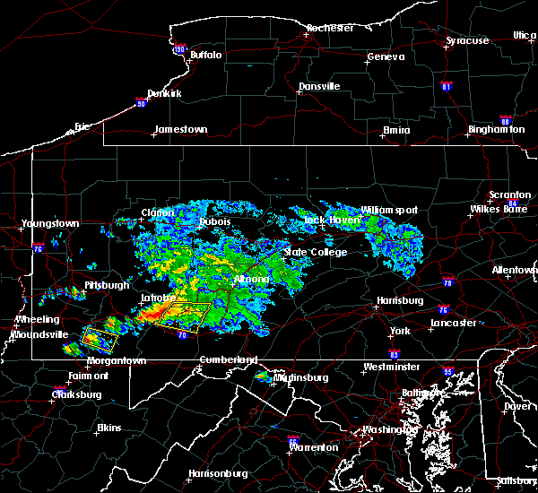 At 524 pm edt, severe thunderstorms were located along a line extending from 7 miles southwest of ligonier to near acosta to jerome to daisytown, moving southeast at 35 mph (radar indicated). Hazards include 60 mph wind gusts. Expect damage to trees and power lines. Locations impacted include, belmont, johnstown, windber, westmont, acosta, salix-beauty line park, davidsville, central city, scalp level and dunlo. At 524 pm edt, severe thunderstorms were located along a line extending from 7 miles southwest of ligonier to near acosta to jerome to daisytown, moving southeast at 35 mph (radar indicated). Hazards include 60 mph wind gusts. Expect damage to trees and power lines. Locations impacted include, belmont, johnstown, windber, westmont, acosta, salix-beauty line park, davidsville, central city, scalp level and dunlo.
|
| 5/13/2018 4:36 PM EDT |
 At 435 pm edt, a severe thunderstorm was located over ligonier, moving east at 30 mph (radar indicated). Hazards include 60 mph wind gusts. expect damage to trees and power lines At 435 pm edt, a severe thunderstorm was located over ligonier, moving east at 30 mph (radar indicated). Hazards include 60 mph wind gusts. expect damage to trees and power lines
|
| 5/12/2018 6:21 PM EDT |
 At 621 pm edt, a severe thunderstorm was located near jerome, moving east at 50 mph (radar indicated). Hazards include 60 mph wind gusts and quarter size hail. Hail damage to vehicles is possible. Expect wind damage to trees and power lines. At 621 pm edt, a severe thunderstorm was located near jerome, moving east at 50 mph (radar indicated). Hazards include 60 mph wind gusts and quarter size hail. Hail damage to vehicles is possible. Expect wind damage to trees and power lines.
|
| 5/12/2018 4:19 PM EDT |
 At 419 pm edt, a severe thunderstorm was located near ligonier, moving east at 45 mph (radar indicated). Hazards include 60 mph wind gusts and quarter size hail. Expect wind damage to trees and power lines. Hail damage to vehicles is possible. At 419 pm edt, a severe thunderstorm was located near ligonier, moving east at 45 mph (radar indicated). Hazards include 60 mph wind gusts and quarter size hail. Expect wind damage to trees and power lines. Hail damage to vehicles is possible.
|
| 5/12/2018 3:57 PM EDT |
 At 356 pm edt, a severe thunderstorm was located near blue knob state park, moving east at 45 mph. another strong storm was located west of belmont, also moving east at 45 mph (radar indicated). Hazards include 60 mph wind gusts and quarter size hail. Hail damage to vehicles is possible. expect wind damage to trees and power lines. Locations impacted include, belmont, johnstown, westmont, windber, portage, salix-beauty line park, osterburg, roaring spring, scalp level and ski gap. At 356 pm edt, a severe thunderstorm was located near blue knob state park, moving east at 45 mph. another strong storm was located west of belmont, also moving east at 45 mph (radar indicated). Hazards include 60 mph wind gusts and quarter size hail. Hail damage to vehicles is possible. expect wind damage to trees and power lines. Locations impacted include, belmont, johnstown, westmont, windber, portage, salix-beauty line park, osterburg, roaring spring, scalp level and ski gap.
|
| 5/12/2018 3:23 PM EDT |
 At 323 pm edt, a severe thunderstorm was located 8 miles west of westmont, moving east at 40 mph (radar indicated). Hazards include 60 mph wind gusts and quarter size hail. Hail damage to vehicles is possible. Expect wind damage to trees and power lines. At 323 pm edt, a severe thunderstorm was located 8 miles west of westmont, moving east at 40 mph (radar indicated). Hazards include 60 mph wind gusts and quarter size hail. Hail damage to vehicles is possible. Expect wind damage to trees and power lines.
|
| 5/4/2018 6:33 PM EDT |
 At 632 pm edt, severe thunderstorms were located along a line extending from 10 miles north of northern cambria to near indiana to murrysville, moving east at 60 mph (radar indicated). Hazards include 60 mph wind gusts. expect damage to trees and power lines At 632 pm edt, severe thunderstorms were located along a line extending from 10 miles north of northern cambria to near indiana to murrysville, moving east at 60 mph (radar indicated). Hazards include 60 mph wind gusts. expect damage to trees and power lines
|
| 5/3/2018 4:54 PM EDT |
 At 450 pm edt, a severe thunderstorm was located over elysburg, moving east at 50 mph (radar indicated). Hazards include 60 mph wind gusts. Expect damage to trees and power lines. this severe thunderstorm will remain over southern northumberland, montour and columbia counties. Locations which will be impacted include the following locations: elysburg, kulpmont, mount carmel, edgewood, numidia, seven points, marion heights, snydertown, espy and bloomsburg university. At 450 pm edt, a severe thunderstorm was located over elysburg, moving east at 50 mph (radar indicated). Hazards include 60 mph wind gusts. Expect damage to trees and power lines. this severe thunderstorm will remain over southern northumberland, montour and columbia counties. Locations which will be impacted include the following locations: elysburg, kulpmont, mount carmel, edgewood, numidia, seven points, marion heights, snydertown, espy and bloomsburg university.
|
| 5/3/2018 4:27 PM EDT |
 At 426 pm edt, a severe thunderstorm was located near kratzerville, moving east at 50 mph (radar indicated). Hazards include 60 mph wind gusts. Expect damage to trees and power lines. this severe thunderstorm will be near, selinsgrove, lewisburg, kratzerville, winfield, hummels wharf and montandon around 430 pm edt. sunbury, northumberland and shamokin dam around 440 pm edt. shamokin, stonington, trevorton, elysburg and fairview-ferndale around 450 pm edt. kulpmont, mount carmel, wilburton number one, marshallton, knoebels grove, numidia and slabtown around 500 pm edt. For those driving on interstate 80, this includes areas between the limestoneville and berwick-lime ridge exits, specifically from mile markers 217 to 236. At 426 pm edt, a severe thunderstorm was located near kratzerville, moving east at 50 mph (radar indicated). Hazards include 60 mph wind gusts. Expect damage to trees and power lines. this severe thunderstorm will be near, selinsgrove, lewisburg, kratzerville, winfield, hummels wharf and montandon around 430 pm edt. sunbury, northumberland and shamokin dam around 440 pm edt. shamokin, stonington, trevorton, elysburg and fairview-ferndale around 450 pm edt. kulpmont, mount carmel, wilburton number one, marshallton, knoebels grove, numidia and slabtown around 500 pm edt. For those driving on interstate 80, this includes areas between the limestoneville and berwick-lime ridge exits, specifically from mile markers 217 to 236.
|
| 8/22/2017 5:33 PM EDT |
 At 532 pm edt, severe thunderstorms were located along a line extending from 9 miles north of hastings to davidsville, moving east at 45 mph (radar indicated). Hazards include 60 mph wind gusts. expect damage to trees and power lines At 532 pm edt, severe thunderstorms were located along a line extending from 9 miles north of hastings to davidsville, moving east at 45 mph (radar indicated). Hazards include 60 mph wind gusts. expect damage to trees and power lines
|
| 8/22/2017 3:26 PM EDT |
 At 325 pm edt, a severe thunderstorm was located near westmont, moving east at 45 mph (radar indicated). Hazards include 60 mph wind gusts and quarter size hail. Hail damage to vehicles is possible. Expect wind damage to trees and power lines. At 325 pm edt, a severe thunderstorm was located near westmont, moving east at 45 mph (radar indicated). Hazards include 60 mph wind gusts and quarter size hail. Hail damage to vehicles is possible. Expect wind damage to trees and power lines.
|
| 8/19/2017 7:54 PM EDT |
 At 752 pm edt, severe thunderstorms were located along a line extending from near hughesville to near leck kill, moving east at 40 mph (radar indicated). Hazards include 60 mph wind gusts. expect damage to trees and power lines At 752 pm edt, severe thunderstorms were located along a line extending from near hughesville to near leck kill, moving east at 40 mph (radar indicated). Hazards include 60 mph wind gusts. expect damage to trees and power lines
|
| 8/19/2017 7:14 PM EDT |
 At 713 pm edt, severe thunderstorms were located along a line extending from forest hill to near newport to shermansdale to newville, moving east at 40 mph (radar indicated). Hazards include 60 mph wind gusts and penny size hail. Expect damage to trees and power lines. severe thunderstorms will be near, millersburg around 720 pm edt. lewisburg, harrisburg, milton, montandon, rockville, marysville and new columbia around 730 pm edt. steelton, linglestown, northumberland, progress, sunbury, colonial park, paxtang, bressler-enhaut-oberlin, penbrook and lawnton around 740 pm edt. middletown, hummelstown, hershey, royalton, penn national race course, highspire, skyline view, riverside, stonington and valley green around 750 pm edt. other locations impacted by these severe thunderstorms include three mile island, dauphin, marion heights, seven points, goldsboro, mcewensville, herndon, edgewood, gratz and turbotville. for those driving on interstate 80, this includes areas between the lewisburg-williamsport and danville exits, specifically from mile markers 211 to 216. this includes the following interstates, the pennsylvania turnpike from mile markers 246 to 258. interstate 81 from mile markers 66 to 81. interstate 83 from mile markers 43 to 50. interstate 180 from mile markers 1 to 8. Interstate 283 from mile markers 0 to 2. At 713 pm edt, severe thunderstorms were located along a line extending from forest hill to near newport to shermansdale to newville, moving east at 40 mph (radar indicated). Hazards include 60 mph wind gusts and penny size hail. Expect damage to trees and power lines. severe thunderstorms will be near, millersburg around 720 pm edt. lewisburg, harrisburg, milton, montandon, rockville, marysville and new columbia around 730 pm edt. steelton, linglestown, northumberland, progress, sunbury, colonial park, paxtang, bressler-enhaut-oberlin, penbrook and lawnton around 740 pm edt. middletown, hummelstown, hershey, royalton, penn national race course, highspire, skyline view, riverside, stonington and valley green around 750 pm edt. other locations impacted by these severe thunderstorms include three mile island, dauphin, marion heights, seven points, goldsboro, mcewensville, herndon, edgewood, gratz and turbotville. for those driving on interstate 80, this includes areas between the lewisburg-williamsport and danville exits, specifically from mile markers 211 to 216. this includes the following interstates, the pennsylvania turnpike from mile markers 246 to 258. interstate 81 from mile markers 66 to 81. interstate 83 from mile markers 43 to 50. interstate 180 from mile markers 1 to 8. Interstate 283 from mile markers 0 to 2.
|
| 8/19/2017 6:02 PM EDT |
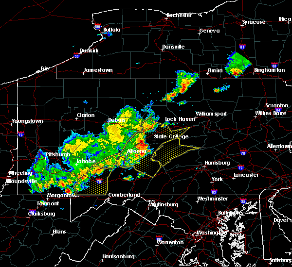 At 601 pm edt, severe thunderstorms were located along a line extending from near altoona to near blue knob state park to near jerome, moving east at 35 mph (radar indicated). Hazards include 60 mph wind gusts and penny size hail. Expect damage to trees and power lines. These severe thunderstorms will remain over mainly rural areas of southwestern cambria county, including the following locations: spring hill, cassandra, elim, lorain, summerhill, brownstown, wilmore, allegheny portage railroad national historic site, university of pittsburgh - johnstown and johnstown flood national memorial historic site. At 601 pm edt, severe thunderstorms were located along a line extending from near altoona to near blue knob state park to near jerome, moving east at 35 mph (radar indicated). Hazards include 60 mph wind gusts and penny size hail. Expect damage to trees and power lines. These severe thunderstorms will remain over mainly rural areas of southwestern cambria county, including the following locations: spring hill, cassandra, elim, lorain, summerhill, brownstown, wilmore, allegheny portage railroad national historic site, university of pittsburgh - johnstown and johnstown flood national memorial historic site.
|
| 8/19/2017 5:06 PM EDT |
 At 505 pm edt, severe thunderstorms were located along a line extending from near curwensville to near hastings to 6 miles west of belsano, moving east at 55 mph (radar indicated). Hazards include 60 mph wind gusts and penny size hail. Expect damage to trees and power lines. severe thunderstorms will be near, clearfield, plymptonville, hyde, curwensville and patton around 510 pm edt. ebensburg, lecontes mills, woodland, carrolltown and blandburg around 520 pm edt. karthaus, gallitzin, houtzdale, loretto, prince gallitzin state park, cresson and sankertown around 530 pm edt. other locations impacted by these severe thunderstorms include west decatur, ramey, spring hill, mundys corner, cassandra, elim, brisbin, westover, mahaffey and burnside. For those driving on interstate 80, this includes areas between the penfield and snow shoe exits, specifically from mile markers 111 to 138. At 505 pm edt, severe thunderstorms were located along a line extending from near curwensville to near hastings to 6 miles west of belsano, moving east at 55 mph (radar indicated). Hazards include 60 mph wind gusts and penny size hail. Expect damage to trees and power lines. severe thunderstorms will be near, clearfield, plymptonville, hyde, curwensville and patton around 510 pm edt. ebensburg, lecontes mills, woodland, carrolltown and blandburg around 520 pm edt. karthaus, gallitzin, houtzdale, loretto, prince gallitzin state park, cresson and sankertown around 530 pm edt. other locations impacted by these severe thunderstorms include west decatur, ramey, spring hill, mundys corner, cassandra, elim, brisbin, westover, mahaffey and burnside. For those driving on interstate 80, this includes areas between the penfield and snow shoe exits, specifically from mile markers 111 to 138.
|
| 8/4/2017 9:11 PM EDT |
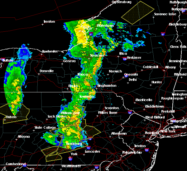 At 910 pm edt, severe thunderstorms were located along a line extending from 8 miles northwest of ricketts glen state park to jerseytown, moving northeast at 50 mph (radar indicated). Hazards include 60 mph wind gusts. Expect damage to trees and power lines. Locations impacted include, danville, eyers grove, jerseytown, jamison city, lairdsville, waller, ricketts glen state park, central, exchange and mooresburg. At 910 pm edt, severe thunderstorms were located along a line extending from 8 miles northwest of ricketts glen state park to jerseytown, moving northeast at 50 mph (radar indicated). Hazards include 60 mph wind gusts. Expect damage to trees and power lines. Locations impacted include, danville, eyers grove, jerseytown, jamison city, lairdsville, waller, ricketts glen state park, central, exchange and mooresburg.
|
| 8/4/2017 8:16 PM EDT |
 At 816 pm edt, severe thunderstorms were located along a line extending from near le roy to near spruce run reservoir, moving east at 30 mph (radar indicated). Hazards include 60 mph wind gusts. expect damage to trees and power lines At 816 pm edt, severe thunderstorms were located along a line extending from near le roy to near spruce run reservoir, moving east at 30 mph (radar indicated). Hazards include 60 mph wind gusts. expect damage to trees and power lines
|
| 8/4/2017 8:12 PM EDT |
 At 811 pm edt, severe thunderstorms were located along a line extending from paxtonville to near elizabethville to near new buffalo to near mount holly springs, moving northeast at 30 mph (radar indicated). Hazards include 60 mph wind gusts and quarter size hail. Hail damage to vehicles is possible. Expect wind damage to trees and power lines. At 811 pm edt, severe thunderstorms were located along a line extending from paxtonville to near elizabethville to near new buffalo to near mount holly springs, moving northeast at 30 mph (radar indicated). Hazards include 60 mph wind gusts and quarter size hail. Hail damage to vehicles is possible. Expect wind damage to trees and power lines.
|
| 7/24/2017 3:58 PM EDT |
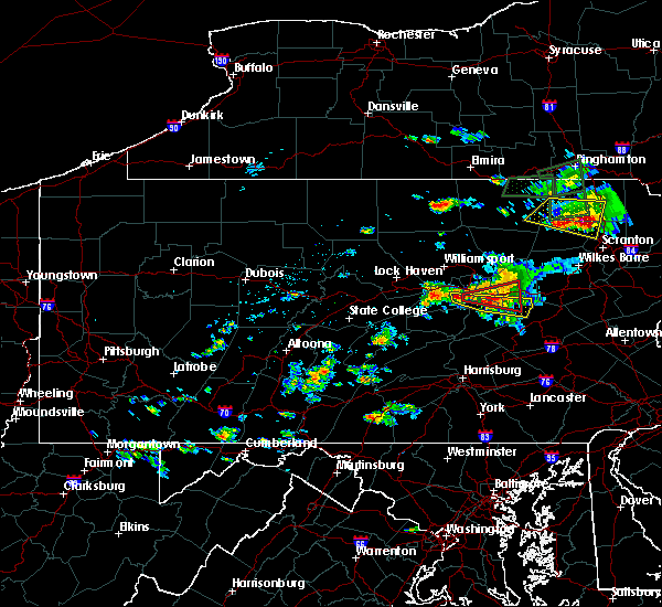 At 357 pm edt, a severe thunderstorm was located near riverside, moving east at 20 mph (radar indicated). Hazards include 60 mph wind gusts and quarter size hail. expect wind damage to trees and power lines At 357 pm edt, a severe thunderstorm was located near riverside, moving east at 20 mph (radar indicated). Hazards include 60 mph wind gusts and quarter size hail. expect wind damage to trees and power lines
|
| 7/24/2017 3:29 PM EDT |
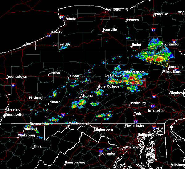 At 328 pm edt, a severe thunderstorm capable of producing a tornado was located over montandon, moving east at 20 mph (radar indicated rotation). Hazards include tornado and quarter size hail. Flying debris will be dangerous to those caught without shelter. mobile homes will be damaged or destroyed. damage to roofs, windows, and vehicles will occur. tree damage is likely. this dangerous storm will be near, riverside and mooresburg around 350 pm edt. danville around 400 pm edt. bloomsburg, buckhorn, rupert, fernville, catawissa, eyers grove, knoebels grove and lightstreet around 410 pm edt. other locations impacted by this tornadic thunderstorm include orangeville, espy, bloomsburg university and lime ridge. For those driving on interstate 80, this includes areas between the limestoneville and berwick-lime ridge exits, specifically from mile markers 216 to 238. At 328 pm edt, a severe thunderstorm capable of producing a tornado was located over montandon, moving east at 20 mph (radar indicated rotation). Hazards include tornado and quarter size hail. Flying debris will be dangerous to those caught without shelter. mobile homes will be damaged or destroyed. damage to roofs, windows, and vehicles will occur. tree damage is likely. this dangerous storm will be near, riverside and mooresburg around 350 pm edt. danville around 400 pm edt. bloomsburg, buckhorn, rupert, fernville, catawissa, eyers grove, knoebels grove and lightstreet around 410 pm edt. other locations impacted by this tornadic thunderstorm include orangeville, espy, bloomsburg university and lime ridge. For those driving on interstate 80, this includes areas between the limestoneville and berwick-lime ridge exits, specifically from mile markers 216 to 238.
|
| 7/23/2017 6:59 PM EDT |
 At 658 pm edt, a severe thunderstorm was located over muncy, moving southeast at 15 mph (radar indicated). Hazards include 60 mph wind gusts and quarter size hail. Hail damage to vehicles is possible. Expect wind damage to trees and power lines. At 658 pm edt, a severe thunderstorm was located over muncy, moving southeast at 15 mph (radar indicated). Hazards include 60 mph wind gusts and quarter size hail. Hail damage to vehicles is possible. Expect wind damage to trees and power lines.
|
| 6/15/2017 5:47 PM EDT |
 At 546 pm edt, severe thunderstorms were located along a line extending from near reynoldsville to 9 miles south of punxsutawney to 8 miles northwest of westmont, moving east at 30 mph (radar indicated). Hazards include 60 mph wind gusts. expect damage to trees and power lines At 546 pm edt, severe thunderstorms were located along a line extending from near reynoldsville to 9 miles south of punxsutawney to 8 miles northwest of westmont, moving east at 30 mph (radar indicated). Hazards include 60 mph wind gusts. expect damage to trees and power lines
|
| 5/1/2017 10:23 PM EDT |
 At 1022 pm edt, a severe thunderstorm was located over stonington, moving northeast at 55 mph (radar indicated). Hazards include 70 mph wind gusts. Expect considerable tree damage. damage is likely to mobile homes, roofs, and outbuildings. Locations impacted include, berwick, shamokin, mount carmel, kulpmont, danville, bloomsburg, sunbury, mifflinville, rupert and wilburton number two. At 1022 pm edt, a severe thunderstorm was located over stonington, moving northeast at 55 mph (radar indicated). Hazards include 70 mph wind gusts. Expect considerable tree damage. damage is likely to mobile homes, roofs, and outbuildings. Locations impacted include, berwick, shamokin, mount carmel, kulpmont, danville, bloomsburg, sunbury, mifflinville, rupert and wilburton number two.
|
| 5/1/2017 9:55 PM EDT |
 At 953 pm edt, a severe thunderstorm was located near meiserville, moving northeast at 55 mph (radar indicated). Hazards include 70 mph wind gusts. Expect considerable tree damage. Damage is likely to mobile homes, roofs, and outbuildings. At 953 pm edt, a severe thunderstorm was located near meiserville, moving northeast at 55 mph (radar indicated). Hazards include 70 mph wind gusts. Expect considerable tree damage. Damage is likely to mobile homes, roofs, and outbuildings.
|
| 5/1/2017 8:39 PM EDT |
 At 838 pm edt, severe thunderstorms were located along a line extending from near hughesville to near jerseytown to near danville, moving northeast at 55 mph (radar indicated). Hazards include 60 mph wind gusts. expect damage to roofs, siding, and trees At 838 pm edt, severe thunderstorms were located along a line extending from near hughesville to near jerseytown to near danville, moving northeast at 55 mph (radar indicated). Hazards include 60 mph wind gusts. expect damage to roofs, siding, and trees
|
| 5/1/2017 7:14 PM EDT |
 At 713 pm edt, severe thunderstorms were located along a line extending from near allenwood to near laurelton center, moving northeast at 60 mph (radar indicated). Hazards include 70 mph wind gusts. Expect considerable tree damage. Damage is likely to mobile homes, roofs, and outbuildings. At 713 pm edt, severe thunderstorms were located along a line extending from near allenwood to near laurelton center, moving northeast at 60 mph (radar indicated). Hazards include 70 mph wind gusts. Expect considerable tree damage. Damage is likely to mobile homes, roofs, and outbuildings.
|
| 5/1/2017 5:12 PM EDT |
 At 511 pm edt, severe thunderstorms were located along a line extending from near karthaus to glen hope to ebensburg to johnstown, moving east at 40 mph (radar indicated). Hazards include 70 mph wind gusts. Expect considerable tree damage. damage is likely to mobile homes, roofs, and outbuildings. locations impacted include, belmont, johnstown, westmont, nanty-glo, portage, ebensburg, windber, salix-beauty line park, scalp level and prince gallitzin state park. A tornado watch remains in effect until 1000 pm edt for south central, central and north central pennsylvania. At 511 pm edt, severe thunderstorms were located along a line extending from near karthaus to glen hope to ebensburg to johnstown, moving east at 40 mph (radar indicated). Hazards include 70 mph wind gusts. Expect considerable tree damage. damage is likely to mobile homes, roofs, and outbuildings. locations impacted include, belmont, johnstown, westmont, nanty-glo, portage, ebensburg, windber, salix-beauty line park, scalp level and prince gallitzin state park. A tornado watch remains in effect until 1000 pm edt for south central, central and north central pennsylvania.
|
| 5/1/2017 4:28 PM EDT |
 At 427 pm edt, severe thunderstorms were located along a line extending from penfield to curwensville to northern cambria to southmont, moving east at 35 mph (radar indicated). Hazards include 70 mph wind gusts. Expect considerable tree damage. damage is likely to mobile homes, roofs, and outbuildings. locations impacted include, belmont, johnstown, dubois, westmont, nanty-glo, portage, ebensburg, clearfield, windber and salix-beauty line park. A tornado watch remains in effect until 1000 pm edt for south central, central and north central pennsylvania. At 427 pm edt, severe thunderstorms were located along a line extending from penfield to curwensville to northern cambria to southmont, moving east at 35 mph (radar indicated). Hazards include 70 mph wind gusts. Expect considerable tree damage. damage is likely to mobile homes, roofs, and outbuildings. locations impacted include, belmont, johnstown, dubois, westmont, nanty-glo, portage, ebensburg, clearfield, windber and salix-beauty line park. A tornado watch remains in effect until 1000 pm edt for south central, central and north central pennsylvania.
|
| 5/1/2017 3:56 PM EDT |
 At 355 pm edt, severe thunderstorms were located along a line from just west of dubois to latrobe, moving east at 40 mph (radar indicated). Hazards include 70 mph wind gusts. Expect considerable tree damage. damage is likely to mobile homes, roofs, and outbuildings. severe thunderstorms will be near, dubois and sandy around 410 pm edt. westmont, southmont, rockton and belsano around 420 pm edt. belmont, johnstown, windber, ebensburg, carrolltown, s. b. elliot state park, geistown, daisytown, dale and east conemaugh around 430 pm edt. portage, clearfield, beaverdale-lloydell, dunlo, salix-beauty line park, sidman, st. michael, prince gallitzin state park, patton and ehrenfeld around 440 pm edt. for those driving on interstate 80, this includes areas between the dubois and snow shoe exits, specifically from mile markers 97 to 138. A tornado watch remains in effect until 1000 pm edt for south central, central and north central pennsylvania. At 355 pm edt, severe thunderstorms were located along a line from just west of dubois to latrobe, moving east at 40 mph (radar indicated). Hazards include 70 mph wind gusts. Expect considerable tree damage. damage is likely to mobile homes, roofs, and outbuildings. severe thunderstorms will be near, dubois and sandy around 410 pm edt. westmont, southmont, rockton and belsano around 420 pm edt. belmont, johnstown, windber, ebensburg, carrolltown, s. b. elliot state park, geistown, daisytown, dale and east conemaugh around 430 pm edt. portage, clearfield, beaverdale-lloydell, dunlo, salix-beauty line park, sidman, st. michael, prince gallitzin state park, patton and ehrenfeld around 440 pm edt. for those driving on interstate 80, this includes areas between the dubois and snow shoe exits, specifically from mile markers 97 to 138. A tornado watch remains in effect until 1000 pm edt for south central, central and north central pennsylvania.
|
| 2/12/2017 8:11 PM EST |
 At 810 pm est, severe thunderstorms were located along a line extending from near belsano to near cameron, moving east-southeast at 45 mph (radar indicated). Hazards include 60 mph wind gusts. expect damage to roofs, siding, and trees At 810 pm est, severe thunderstorms were located along a line extending from near belsano to near cameron, moving east-southeast at 45 mph (radar indicated). Hazards include 60 mph wind gusts. expect damage to roofs, siding, and trees
|
| 10/20/2016 7:35 PM EDT |
 At 734 pm edt, a severe thunderstorm was located over daisytown, moving northeast at 30 mph (radar indicated). Hazards include 60 mph wind gusts and nickel size hail. Expect damage to roofs. siding. and trees. locations impacted include, johnstown, portage, belmont, windber, elim, westmont, ehrenfeld, beaverdale-lloydell, tire hill, cresson, geistown, south fork, st. Michael, sidman, dale, salix-beauty line park, southmont, lilly, sankertown and davidsville. At 734 pm edt, a severe thunderstorm was located over daisytown, moving northeast at 30 mph (radar indicated). Hazards include 60 mph wind gusts and nickel size hail. Expect damage to roofs. siding. and trees. locations impacted include, johnstown, portage, belmont, windber, elim, westmont, ehrenfeld, beaverdale-lloydell, tire hill, cresson, geistown, south fork, st. Michael, sidman, dale, salix-beauty line park, southmont, lilly, sankertown and davidsville.
|
| 10/20/2016 7:04 PM EDT |
 At 703 pm edt, a severe thunderstorm was located near acosta, moving east at 50 mph (radar indicated). Hazards include 60 mph wind gusts and nickel size hail. Expect damage to roofs. siding. And trees. At 703 pm edt, a severe thunderstorm was located near acosta, moving east at 50 mph (radar indicated). Hazards include 60 mph wind gusts and nickel size hail. Expect damage to roofs. siding. And trees.
|
| 8/16/2016 7:52 PM EDT |
 The severe thunderstorm warning for western clearfield and cambria counties will expire at 800 pm edt, the storms which prompted the warning have weakened below severe limits, and no longer pose an immediate threat to life or property. therefore, the warning will be allowed to expire. however gusty winds are still possible with these thunderstorms. The severe thunderstorm warning for western clearfield and cambria counties will expire at 800 pm edt, the storms which prompted the warning have weakened below severe limits, and no longer pose an immediate threat to life or property. therefore, the warning will be allowed to expire. however gusty winds are still possible with these thunderstorms.
|
| 8/16/2016 7:34 PM EDT |
 At 734 pm edt, severe thunderstorms were located along a line extending from near jeffries to windber, moving southeast at 40 mph (radar indicated). Hazards include 60 mph wind gusts. Expect damage to roofs. siding. And trees. At 734 pm edt, severe thunderstorms were located along a line extending from near jeffries to windber, moving southeast at 40 mph (radar indicated). Hazards include 60 mph wind gusts. Expect damage to roofs. siding. And trees.
|
| 8/16/2016 7:07 PM EDT |
 At 707 pm edt, severe thunderstorms were located along a line extending from near westmont to near acosta to 10 miles southwest of farmington, moving east at 35 mph (radar indicated). Hazards include 60 mph wind gusts. Expect damage to roofs. siding. And trees. At 707 pm edt, severe thunderstorms were located along a line extending from near westmont to near acosta to 10 miles southwest of farmington, moving east at 35 mph (radar indicated). Hazards include 60 mph wind gusts. Expect damage to roofs. siding. And trees.
|
| 8/16/2016 6:37 PM EDT |
 At 637 pm edt, severe thunderstorms were located along a line extending from near new bethlehem to 14 miles east of ford city to near indiana to near homer city to near greensburg, moving east at 40 mph (radar indicated). Hazards include 60 mph wind gusts. Expect damage to roofs. siding. And trees. At 637 pm edt, severe thunderstorms were located along a line extending from near new bethlehem to 14 miles east of ford city to near indiana to near homer city to near greensburg, moving east at 40 mph (radar indicated). Hazards include 60 mph wind gusts. Expect damage to roofs. siding. And trees.
|
| 7/31/2016 9:18 PM EDT |
 At 917 pm edt, a severe thunderstorm was located over elysburg, moving east at 25 mph (radar indicated). Hazards include 60 mph wind gusts and quarter size hail. Downed tree limbs and isolated power outages are possible. Locations impacted include, shamokin, danville, kulpmont, mount carmel, ashland, bloomsburg, rupert, aristes, marshallton, riverside, locustdale, numidia, elysburg, stonington, catawissa, fairview-ferndale, knoebels grove, wilburton number two, trevorton and slabtown. At 917 pm edt, a severe thunderstorm was located over elysburg, moving east at 25 mph (radar indicated). Hazards include 60 mph wind gusts and quarter size hail. Downed tree limbs and isolated power outages are possible. Locations impacted include, shamokin, danville, kulpmont, mount carmel, ashland, bloomsburg, rupert, aristes, marshallton, riverside, locustdale, numidia, elysburg, stonington, catawissa, fairview-ferndale, knoebels grove, wilburton number two, trevorton and slabtown.
|
| 7/31/2016 8:58 PM EDT |
 At 858 pm edt, a severe thunderstorm was located over riverside, moving east at 25 mph (radar indicated). Hazards include 60 mph wind gusts and quarter size hail. downed tree limbs and isolated power outages are possible At 858 pm edt, a severe thunderstorm was located over riverside, moving east at 25 mph (radar indicated). Hazards include 60 mph wind gusts and quarter size hail. downed tree limbs and isolated power outages are possible
|
| 7/25/2016 3:54 PM EDT |
 At 354 pm edt, severe thunderstorms were located along a line extending from near northern cambria to near blairsville, moving east at 35 mph (radar indicated). Hazards include 60 mph wind gusts and penny size hail. Expect damage to roofs. siding. And trees. At 354 pm edt, severe thunderstorms were located along a line extending from near northern cambria to near blairsville, moving east at 35 mph (radar indicated). Hazards include 60 mph wind gusts and penny size hail. Expect damage to roofs. siding. And trees.
|
| 7/25/2016 3:40 PM EDT |
 At 339 pm edt, severe thunderstorms were located along a line extending from near waller to near allenwood, moving southeast at 30 mph (radar indicated). Hazards include 60 mph wind gusts and quarter size hail. Hail damage to vehicles is expected. Expect wind damage to roofs, siding, and trees. At 339 pm edt, severe thunderstorms were located along a line extending from near waller to near allenwood, moving southeast at 30 mph (radar indicated). Hazards include 60 mph wind gusts and quarter size hail. Hail damage to vehicles is expected. Expect wind damage to roofs, siding, and trees.
|
| 7/25/2016 2:51 PM EDT |
 At 250 pm edt, a severe thunderstorm was located near vicksburg, moving east at 25 mph (radar indicated). Hazards include 60 mph wind gusts and quarter size hail. Hail damage to vehicles is expected. Expect wind damage to roofs, siding, and trees. At 250 pm edt, a severe thunderstorm was located near vicksburg, moving east at 25 mph (radar indicated). Hazards include 60 mph wind gusts and quarter size hail. Hail damage to vehicles is expected. Expect wind damage to roofs, siding, and trees.
|
| 7/18/2016 12:55 PM EDT |
 At 1252 pm edt, a severe thunderstorm was located over jerseytown, moving east at 30 mph (large hail observed and radar indicated strong winds). Hazards include 60 mph wind gusts and quarter size hail. Hail damage to vehicles is expected. expect wind damage to roofs, siding, and trees. Locations impacted include, danville, berwick, bloomsburg, rupert, riverside, almedia, fernville, exchange, rohrsburg, numidia, iola, shumans, mooresburg, eyers grove, lightstreet, jerseytown, catawissa, mainville, mifflinville and buckhorn. At 1252 pm edt, a severe thunderstorm was located over jerseytown, moving east at 30 mph (large hail observed and radar indicated strong winds). Hazards include 60 mph wind gusts and quarter size hail. Hail damage to vehicles is expected. expect wind damage to roofs, siding, and trees. Locations impacted include, danville, berwick, bloomsburg, rupert, riverside, almedia, fernville, exchange, rohrsburg, numidia, iola, shumans, mooresburg, eyers grove, lightstreet, jerseytown, catawissa, mainville, mifflinville and buckhorn.
|
| 7/18/2016 12:30 PM EDT |
 At 1228 pm edt, a severe thunderstorm was located near delaware run, moving east at 30 mph (observed and radar indicated). Hazards include golf ball size hail and 60 mph wind gusts. People and animals outdoors will be injured. expect hail damage to roofs, siding, windows, and vehicles. expect wind damage to roofs, siding, and trees. A period of torrential rain will also accompany this storm. At 1228 pm edt, a severe thunderstorm was located near delaware run, moving east at 30 mph (observed and radar indicated). Hazards include golf ball size hail and 60 mph wind gusts. People and animals outdoors will be injured. expect hail damage to roofs, siding, windows, and vehicles. expect wind damage to roofs, siding, and trees. A period of torrential rain will also accompany this storm.
|
| 6/16/2016 11:12 AM EDT |
 At 1111 am edt, severe thunderstorms were located along a line extending from near northern cambria to near ligonier, moving east at 30 mph (radar indicated). Hazards include 60 mph wind gusts. Expect damage to roofs. siding. And trees. At 1111 am edt, severe thunderstorms were located along a line extending from near northern cambria to near ligonier, moving east at 30 mph (radar indicated). Hazards include 60 mph wind gusts. Expect damage to roofs. siding. And trees.
|
| 7/18/2015 7:21 PM EDT |
 At 719 pm edt, doppler radar indicated a severe thunderstorm capable of producing damaging winds of 60 to 70 mph. this storm was located near sunbury, and moving south at 15 mph. penny size hail may also accompany the damaging winds. * this severe thunderstorm will be near, stonington around 720 pm edt. rebuck and trevorton around 750 pm edt. klingerstown, leck kill and urban around 800 pm edt. other locations impacted by this severe thunderstorm include edgewood, herndon, pillow, seven points, snydertown and selinsgrove airport. At 719 pm edt, doppler radar indicated a severe thunderstorm capable of producing damaging winds of 60 to 70 mph. this storm was located near sunbury, and moving south at 15 mph. penny size hail may also accompany the damaging winds. * this severe thunderstorm will be near, stonington around 720 pm edt. rebuck and trevorton around 750 pm edt. klingerstown, leck kill and urban around 800 pm edt. other locations impacted by this severe thunderstorm include edgewood, herndon, pillow, seven points, snydertown and selinsgrove airport.
|
| 7/9/2015 3:01 PM EDT |
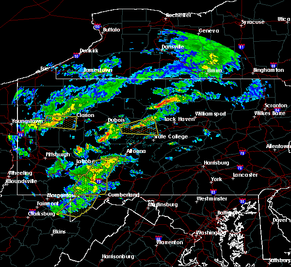 At 301 pm edt, doppler radar indicated a line of severe thunderstorms capable of producing damaging winds in excess of 60 mph. these storms were located along a line extending from near jerome to near berlin to near bittinger, moving east at 65 mph. locations impacted include, belmont, elim, johnstown, portage, somerset, westmont, windber, acosta, beaverdale-lloydell, berlin, boswell, central city, cresson, daisytown, dale, davidsville, dunlo, east conemaugh, ehrenfeld and ferndale. At 301 pm edt, doppler radar indicated a line of severe thunderstorms capable of producing damaging winds in excess of 60 mph. these storms were located along a line extending from near jerome to near berlin to near bittinger, moving east at 65 mph. locations impacted include, belmont, elim, johnstown, portage, somerset, westmont, windber, acosta, beaverdale-lloydell, berlin, boswell, central city, cresson, daisytown, dale, davidsville, dunlo, east conemaugh, ehrenfeld and ferndale.
|
| 7/9/2015 2:21 PM EDT |
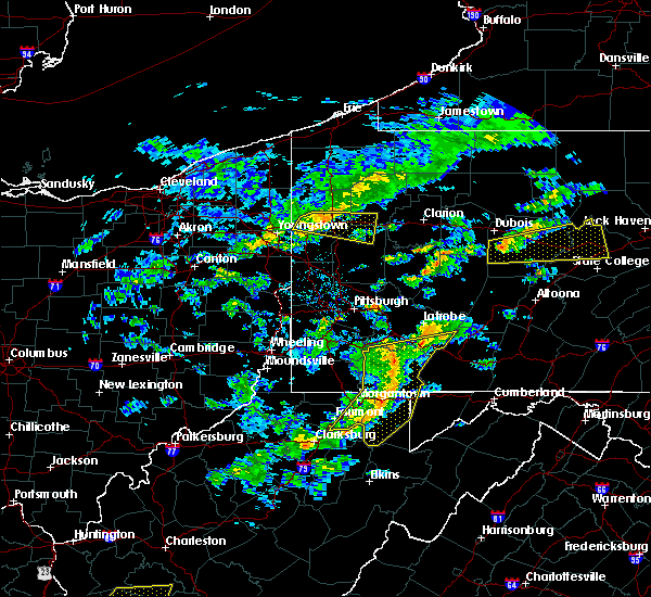 At 219 pm edt, doppler radar indicated a line of severe thunderstorms capable of producing damaging winds around 60 mph. these storms were located along a line extending from near west newton to near farmington to near winfield, and moving east at 40 mph. At 219 pm edt, doppler radar indicated a line of severe thunderstorms capable of producing damaging winds around 60 mph. these storms were located along a line extending from near west newton to near farmington to near winfield, and moving east at 40 mph.
|
| 7/7/2015 9:02 PM EDT |
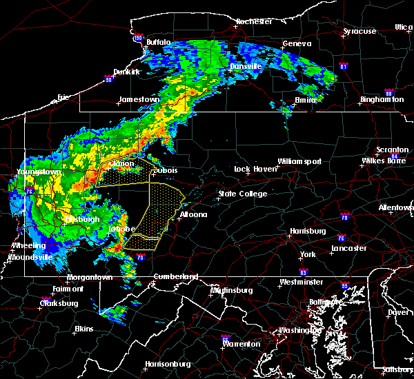 At 901 pm edt, doppler radar indicated a severe thunderstorm capable of producing damaging winds around 60 mph. this storm was located near jerome, and moving northeast at 40 mph. At 901 pm edt, doppler radar indicated a severe thunderstorm capable of producing damaging winds around 60 mph. this storm was located near jerome, and moving northeast at 40 mph.
|
| 7/7/2015 8:47 PM EDT |
 At 847 pm edt, doppler radar indicated a line of severe thunderstorms capable of producing damaging winds around 60 mph. these storms were located along a line extending from near vandergrift to 14 miles north of homer city to near indiana to near belsano to near westmont to near ligonier, and moving east at 55 mph. At 847 pm edt, doppler radar indicated a line of severe thunderstorms capable of producing damaging winds around 60 mph. these storms were located along a line extending from near vandergrift to 14 miles north of homer city to near indiana to near belsano to near westmont to near ligonier, and moving east at 55 mph.
|
| 6/30/2015 8:23 PM EDT |
 At 821 pm edt, doppler radar indicated a severe thunderstorm capable of producing destructive winds in excess of 70 mph. this storm was located over rupert, moving east at 30 mph. a skywarn spotter reported a funnel cloud near riverside at 810 pm edt. he reported that the funnel did not touch down. locations impacted include, berwick, bloomsburg, danville, almedia, buckhorn, catawissa, fernville, lightstreet, mainville, mechanicsville, mifflinville, numidia, riverside, rupert, shumans, slabtown, briar creek, espy, lime ridge and bloomsburg university. At 821 pm edt, doppler radar indicated a severe thunderstorm capable of producing destructive winds in excess of 70 mph. this storm was located over rupert, moving east at 30 mph. a skywarn spotter reported a funnel cloud near riverside at 810 pm edt. he reported that the funnel did not touch down. locations impacted include, berwick, bloomsburg, danville, almedia, buckhorn, catawissa, fernville, lightstreet, mainville, mechanicsville, mifflinville, numidia, riverside, rupert, shumans, slabtown, briar creek, espy, lime ridge and bloomsburg university.
|
| 6/30/2015 8:20 PM EDT | Multiple buildings damaged on moser rd. trees/wires down in northumberland county PA, 2.3 miles NNW of Riverside, PA |
| 6/30/2015 8:14 PM EDT |
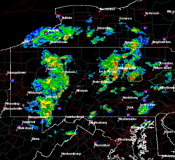 At 814 pm edt, doppler radar indicated a severe thunderstorm capable of producing damaging winds of 60 to 70 mph. this storm was located near danville, and moving east at 20 mph. At 814 pm edt, doppler radar indicated a severe thunderstorm capable of producing damaging winds of 60 to 70 mph. this storm was located near danville, and moving east at 20 mph.
|
| 6/30/2015 4:05 PM EDT |
 At 403 pm edt, doppler radar indicated a severe thunderstorm capable of producing damaging winds in excess of 60 mph. this storm was located over hummels wharf, and moving east at 30 mph. At 403 pm edt, doppler radar indicated a severe thunderstorm capable of producing damaging winds in excess of 60 mph. this storm was located over hummels wharf, and moving east at 30 mph.
|
| 6/23/2015 2:22 PM EDT |
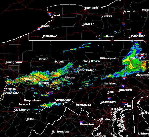 At 221 pm edt, doppler radar indicated a severe thunderstorm capable of producing quarter size hail and damaging winds in excess of 60 mph. this storm was located over east conemaugh, moving east at 35 mph. locations impacted include, belmont, elim, johnstown, portage, westmont, windber, beaverdale-lloydell, daisytown, dale, davidsville, dunlo, ehrenfeld, ferndale, geistown, lilly, ogletown, paint, salix-beauty line park, scalp level and sidman. At 221 pm edt, doppler radar indicated a severe thunderstorm capable of producing quarter size hail and damaging winds in excess of 60 mph. this storm was located over east conemaugh, moving east at 35 mph. locations impacted include, belmont, elim, johnstown, portage, westmont, windber, beaverdale-lloydell, daisytown, dale, davidsville, dunlo, ehrenfeld, ferndale, geistown, lilly, ogletown, paint, salix-beauty line park, scalp level and sidman.
|
| 6/23/2015 1:55 PM EDT |
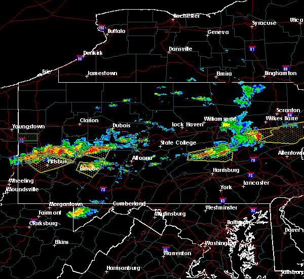 At 155 pm edt, doppler radar indicated a severe thunderstorm capable of producing quarter size hail and damaging winds around 60 mph. this storm was located near black lick, and moving east at 35 mph. At 155 pm edt, doppler radar indicated a severe thunderstorm capable of producing quarter size hail and damaging winds around 60 mph. this storm was located near black lick, and moving east at 35 mph.
|
| 6/23/2015 1:27 PM EDT |
 At 126 pm edt, doppler radar indicated a line of severe thunderstorms capable of producing destructive winds in excess of 70 mph. these storms were located along a line extending from near carroll to near troxelville to near reeds gap state park. these storms were nearly stationary. locations impacted include, berwick, bloomsburg, danville, kulpmont, mount carmel, northumberland, selinsgrove, shamokin, sunbury, almedia, aristes, buckhorn, catawissa, elysburg, eyers grove, fairview-ferndale, fernville, fremont, hummels wharf and jerseytown. At 126 pm edt, doppler radar indicated a line of severe thunderstorms capable of producing destructive winds in excess of 70 mph. these storms were located along a line extending from near carroll to near troxelville to near reeds gap state park. these storms were nearly stationary. locations impacted include, berwick, bloomsburg, danville, kulpmont, mount carmel, northumberland, selinsgrove, shamokin, sunbury, almedia, aristes, buckhorn, catawissa, elysburg, eyers grove, fairview-ferndale, fernville, fremont, hummels wharf and jerseytown.
|
| 6/23/2015 1:13 PM EDT |
 At 113 pm edt, doppler radar indicated a line of severe thunderstorms capable of producing destructive winds in excess of 70 mph. these storms were located along a line extending from near carroll to near troxelville to near reeds gap state park. these storms were nearly stationary. locations impacted include, berwick, bloomsburg, danville, kulpmont, lewisburg, milton, mount carmel, northumberland, selinsgrove, shamokin, sunbury, almedia, aristes, beaver springs, belltown, buckhorn, catawissa, elysburg, exchange and eyers grove. At 113 pm edt, doppler radar indicated a line of severe thunderstorms capable of producing destructive winds in excess of 70 mph. these storms were located along a line extending from near carroll to near troxelville to near reeds gap state park. these storms were nearly stationary. locations impacted include, berwick, bloomsburg, danville, kulpmont, lewisburg, milton, mount carmel, northumberland, selinsgrove, shamokin, sunbury, almedia, aristes, beaver springs, belltown, buckhorn, catawissa, elysburg, exchange and eyers grove.
|
| 6/23/2015 12:50 PM EDT |
 At 1250 pm edt, doppler radar indicated a line of severe thunderstorms capable of producing damaging winds of 60 to 70 mph. these storms were located along a line extending from near carroll to near troxelville to near reeds gap state park, and moving east at 60 mph. At 1250 pm edt, doppler radar indicated a line of severe thunderstorms capable of producing damaging winds of 60 to 70 mph. these storms were located along a line extending from near carroll to near troxelville to near reeds gap state park, and moving east at 60 mph.
|
| 6/23/2015 10:04 AM EDT |
 At 1004 am edt, doppler radar indicated a severe thunderstorm capable of producing destructive winds in excess of 70 mph. this storm was located over riverside. this storm was nearly stationary. locations impacted include, bloomsburg, danville, lewisburg, milton, northumberland, selinsgrove, shamokin, sunbury, allenwood, catawissa, elysburg, hummels wharf, iola, jerseytown and knoebels grove. At 1004 am edt, doppler radar indicated a severe thunderstorm capable of producing destructive winds in excess of 70 mph. this storm was located over riverside. this storm was nearly stationary. locations impacted include, bloomsburg, danville, lewisburg, milton, northumberland, selinsgrove, shamokin, sunbury, allenwood, catawissa, elysburg, hummels wharf, iola, jerseytown and knoebels grove.
|
| 6/23/2015 9:49 AM EDT |
 At 948 am edt, doppler radar indicated a severe thunderstorm capable of producing destructive winds in excess of 70 mph. this storm was located near linntown, moving east at 50 mph. locations impacted include, bloomsburg, danville, lewisburg, mifflinburg, milton, northumberland, selinsgrove, shamokin, sunbury, allenwood, almedia, buckhorn, catawissa, elysburg, exchange, eyers grove, fairview-ferndale, fernville, forest hill and hummels wharf. At 948 am edt, doppler radar indicated a severe thunderstorm capable of producing destructive winds in excess of 70 mph. this storm was located near linntown, moving east at 50 mph. locations impacted include, bloomsburg, danville, lewisburg, mifflinburg, milton, northumberland, selinsgrove, shamokin, sunbury, allenwood, almedia, buckhorn, catawissa, elysburg, exchange, eyers grove, fairview-ferndale, fernville, forest hill and hummels wharf.
|
| 6/23/2015 9:37 AM EDT |
 At 936 am edt, doppler radar indicated a severe thunderstorm capable of producing damaging winds of 60 to 70 mph. this storm was located over woodward, and moving east at 50 mph. At 936 am edt, doppler radar indicated a severe thunderstorm capable of producing damaging winds of 60 to 70 mph. this storm was located over woodward, and moving east at 50 mph.
|
| 6/20/2015 5:59 PM EDT |
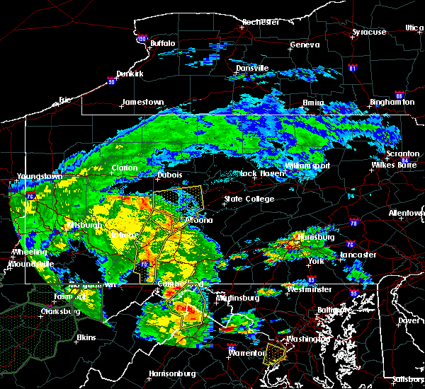 At 557 pm edt, doppler radar indicated a line of severe thunderstorms capable of producing damaging winds in excess of 60 mph. these storms were located along a line extending from near cherry tree to near patton to near windber, moving northeast at 50 mph. locations impacted include, ebensburg, johnstown, nanty- glo, portage, somerset, westmont, windber, beaverdale- lloydell, berlin, boswell, carrolltown, central city, cresson, dale, and davidsville. At 557 pm edt, doppler radar indicated a line of severe thunderstorms capable of producing damaging winds in excess of 60 mph. these storms were located along a line extending from near cherry tree to near patton to near windber, moving northeast at 50 mph. locations impacted include, ebensburg, johnstown, nanty- glo, portage, somerset, westmont, windber, beaverdale- lloydell, berlin, boswell, carrolltown, central city, cresson, dale, and davidsville.
|
| 6/14/2015 6:11 PM EDT |
 The national weather service in state college pa has issued a * severe thunderstorm warning for. southeastern montour county in central pennsylvania. southeastern columbia county in central pennsylvania. central schuylkill county in central pennsylvania. East central northumberland county in central pennsylvania. The national weather service in state college pa has issued a * severe thunderstorm warning for. southeastern montour county in central pennsylvania. southeastern columbia county in central pennsylvania. central schuylkill county in central pennsylvania. East central northumberland county in central pennsylvania.
|
| 6/12/2015 9:35 PM EDT |
 At 934 pm edt, doppler radar indicated a line of severe thunderstorms capable of producing destructive winds in excess of 70 mph. these storms were located along a line extending from near collomsville to near sand bridge state park to near weikert to near woodward to near reeds gap state park. these storms were nearly stationary. locations impacted include, berwick, bloomsburg, danville, kulpmont, mount carmel, shamokin, almedia, aristes, buckhorn, catawissa, elysburg, eyers grove, fairview-ferndale, fernville, iola, jerseytown, klingerstown, knoebels grove, leck kill and lightstreet. At 934 pm edt, doppler radar indicated a line of severe thunderstorms capable of producing destructive winds in excess of 70 mph. these storms were located along a line extending from near collomsville to near sand bridge state park to near weikert to near woodward to near reeds gap state park. these storms were nearly stationary. locations impacted include, berwick, bloomsburg, danville, kulpmont, mount carmel, shamokin, almedia, aristes, buckhorn, catawissa, elysburg, eyers grove, fairview-ferndale, fernville, iola, jerseytown, klingerstown, knoebels grove, leck kill and lightstreet.
|
| 6/12/2015 9:22 PM EDT |
 At 922 pm edt, doppler radar indicated a line of severe thunderstorms capable of producing destructive winds in excess of 70 mph. these storms were located along a line extending from near collomsville to near sand bridge state park to near weikert to near woodward to near reeds gap state park. these storms were nearly stationary. locations impacted include, berwick, bloomsburg, danville, kulpmont, milton, mount carmel, northumberland, selinsgrove, shamokin, sunbury, almedia, aristes, buckhorn, catawissa, delaware run, elysburg, exchange, eyers grove, fairview-ferndale and fernville. At 922 pm edt, doppler radar indicated a line of severe thunderstorms capable of producing destructive winds in excess of 70 mph. these storms were located along a line extending from near collomsville to near sand bridge state park to near weikert to near woodward to near reeds gap state park. these storms were nearly stationary. locations impacted include, berwick, bloomsburg, danville, kulpmont, milton, mount carmel, northumberland, selinsgrove, shamokin, sunbury, almedia, aristes, buckhorn, catawissa, delaware run, elysburg, exchange, eyers grove, fairview-ferndale and fernville.
|
| 6/12/2015 9:01 PM EDT |
 At 900 pm edt, doppler radar indicated a line of severe thunderstorms capable of producing destructive winds in excess of 70 mph. these storms were located along a line extending from near collomsville to near sand bridge state park to near weikert to near woodward to near reeds gap state park, moving east at 40 mph. locations impacted include, berwick, bloomsburg, danville, kulpmont, lewisburg, mifflinburg, milton, mount carmel, northumberland, selinsgrove, shamokin, sunbury, allenwood, almedia, aristes, beaver springs, buckhorn, catawissa, collomsville and delaware run. At 900 pm edt, doppler radar indicated a line of severe thunderstorms capable of producing destructive winds in excess of 70 mph. these storms were located along a line extending from near collomsville to near sand bridge state park to near weikert to near woodward to near reeds gap state park, moving east at 40 mph. locations impacted include, berwick, bloomsburg, danville, kulpmont, lewisburg, mifflinburg, milton, mount carmel, northumberland, selinsgrove, shamokin, sunbury, allenwood, almedia, aristes, beaver springs, buckhorn, catawissa, collomsville and delaware run.
|
| 6/12/2015 8:43 PM EDT |
 At 843 pm edt, doppler radar indicated a line of severe thunderstorms capable of producing damaging winds of 60 to 70 mph. these storms were located along a line extending from near avis to near r.b. winter state park to near weikert to near woodward to near alfarata, and moving east at 40 mph. At 843 pm edt, doppler radar indicated a line of severe thunderstorms capable of producing damaging winds of 60 to 70 mph. these storms were located along a line extending from near avis to near r.b. winter state park to near weikert to near woodward to near alfarata, and moving east at 40 mph.
|
| 6/12/2015 7:52 PM EDT |
 At 752 pm edt, doppler radar indicated a line of severe thunderstorms capable of producing damaging winds around 60 mph. these storms were located along a line extending from near ligonier to near seven springs to near chalkhill, and moving east at 40 mph. At 752 pm edt, doppler radar indicated a line of severe thunderstorms capable of producing damaging winds around 60 mph. these storms were located along a line extending from near ligonier to near seven springs to near chalkhill, and moving east at 40 mph.
|
| 6/8/2015 3:20 PM EDT |
 At 318 pm edt, doppler radar indicated a severe thunderstorm capable of producing destructive winds in excess of 70 mph. this storm was located near royer, moving east northeast at 45 mph. penny size hail may also accompany the damaging winds. additional thunderstorms will likely strengthen to near severe levels and move into the western part of the warned area, near windber around 330 pm. locations impacted include, belmont, hollidaysburg, huntingdon, johnstown, portage, windber, beaverdale-lloydell, blue knob state park, canoe creek state park, claysburg, davidsville, duncansville, dunlo, entriken, ferndale, geistown, lakemont, martinsburg, mount union and ogletown. At 318 pm edt, doppler radar indicated a severe thunderstorm capable of producing destructive winds in excess of 70 mph. this storm was located near royer, moving east northeast at 45 mph. penny size hail may also accompany the damaging winds. additional thunderstorms will likely strengthen to near severe levels and move into the western part of the warned area, near windber around 330 pm. locations impacted include, belmont, hollidaysburg, huntingdon, johnstown, portage, windber, beaverdale-lloydell, blue knob state park, canoe creek state park, claysburg, davidsville, duncansville, dunlo, entriken, ferndale, geistown, lakemont, martinsburg, mount union and ogletown.
|
| 6/8/2015 3:15 PM EDT |
 At 309 pm edt, doppler radar indicated severe thunderstorms capable of producing quarter size hail and destructive winds in excess of 70 mph. storms were located near rebuck and port royal. both storms were moving east at 45 mph. locations impacted include, leck hill, trevorton, shamokin, farnsworth, ickesburg, thompsontown, millerstown, and liverpool. At 309 pm edt, doppler radar indicated severe thunderstorms capable of producing quarter size hail and destructive winds in excess of 70 mph. storms were located near rebuck and port royal. both storms were moving east at 45 mph. locations impacted include, leck hill, trevorton, shamokin, farnsworth, ickesburg, thompsontown, millerstown, and liverpool.
|
| 6/8/2015 2:44 PM EDT |
 At 244 pm edt, doppler radar indicated a severe thunderstorm capable of producing damaging winds of 60 to 70 mph. this storm was located near ski gap, and moving east northeast at 55 mph. penny size hail may also accompany the damaging winds. At 244 pm edt, doppler radar indicated a severe thunderstorm capable of producing damaging winds of 60 to 70 mph. this storm was located near ski gap, and moving east northeast at 55 mph. penny size hail may also accompany the damaging winds.
|
| 6/8/2015 2:42 PM EDT |
 At 240 pm edt, doppler radar indicated a severe thunderstorm capable of producing quarter size hail and damaging winds of 60 to 70 mph. this storm was located near fremont, and moving east at 45 mph. a second storm, located northeast of reedsville is also moving east and will follow near the track of the first storm. At 240 pm edt, doppler radar indicated a severe thunderstorm capable of producing quarter size hail and damaging winds of 60 to 70 mph. this storm was located near fremont, and moving east at 45 mph. a second storm, located northeast of reedsville is also moving east and will follow near the track of the first storm.
|
| 6/8/2015 2:00 PM EDT |
 At 159 pm edt, doppler radar indicated a severe thunderstorm capable of producing quarter size hail and damaging winds in excess of 60 mph. this storm was located over mcclure, and moving northeast at 50 mph. At 159 pm edt, doppler radar indicated a severe thunderstorm capable of producing quarter size hail and damaging winds in excess of 60 mph. this storm was located over mcclure, and moving northeast at 50 mph.
|
| 5/31/2015 2:51 PM EDT | At 249 pm edt, the public reported a severe thunderstorm producing quarter size hail in new columbia. this storm was located over new columbia, moving east at 10 mph. locations impacted include, lewisburg, milton, allenwood, linntown, montandon, new columbia, riverside, spruce run reservoir, watsontown, mcewensville, turbotville, west milton and bucknell. |
| 5/31/2015 2:17 PM EDT | At 216 pm edt, doppler radar indicated a severe thunderstorm capable of producing quarter size hail and damaging winds around 60 mph. this storm was located over spruce run reservoir, and moving east at 10 mph. |
| 5/16/2015 5:46 PM EDT | At 544 pm edt, doppler radar indicated a line of severe thunderstorms capable of producing destructive winds of 60 to 70 mph. these storms were located along a line extending from near danville to near mechanicsville to near lavelle, moving northeast at 25 mph. nickel size hail may also accompany the damaging winds. locations impacted include, bloomsburg, berwick, mount carmel, shenandoah, danville, kulpmont, ashland, elysburg, riverside, catawissa, girardville, mifflinville, lightstreet, almedia, lavelle, fernville, mechanicsville, nuremburg, buckhorn and aristes. |
| 5/16/2015 5:10 PM EDT | At 510 pm edt, doppler radar indicated a line of severe thunderstorms capable of producing damaging winds of 60 to 70 mph. these storms were located along a line extending from near northumberland to near trevorton to near klingerstown, and moving northeast at 25 mph. nickel size hail may also accompany the damaging winds. |
| 6/27/2013 6:01 PM EDT | Trees reported dow in cambria county PA, 0.3 miles N of Riverside, PA |
| 4/19/2013 6:41 PM EDT | Downed trees in riversid in northumberland county PA, 0.7 miles NNE of Riverside, PA |
| 8/4/2012 3:20 PM EDT | Large tree across railroad tracks in northumberland county PA, 0.7 miles NNE of Riverside, PA |
| 8/4/2012 3:20 PM EDT | Large treedown on boyce road in northumberland county PA, 0.7 miles NNE of Riverside, PA |
| 1/1/0001 12:00 AM | Tree down on tire hill road in conemaugh township in somerset county PA, 0.9 miles N of Riverside, PA |
| 1/1/0001 12:00 AM | Trees down in northumberland county PA, 0.7 miles NNE of Riverside, PA |
Hail Maps for Riverside, PA
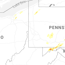


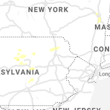


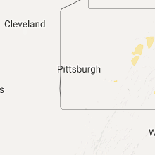


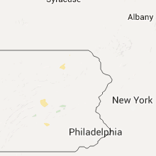


Connect with Interactive Hail Maps