

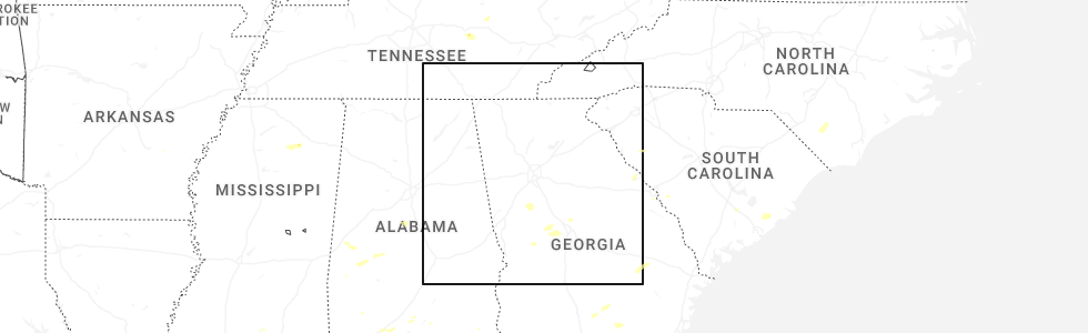
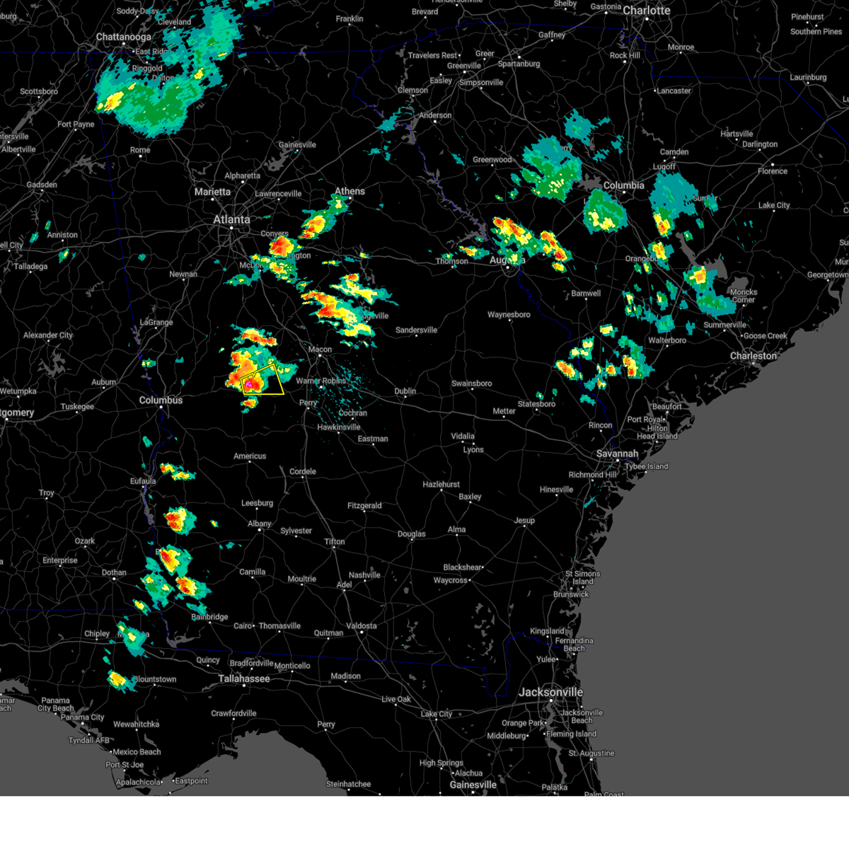
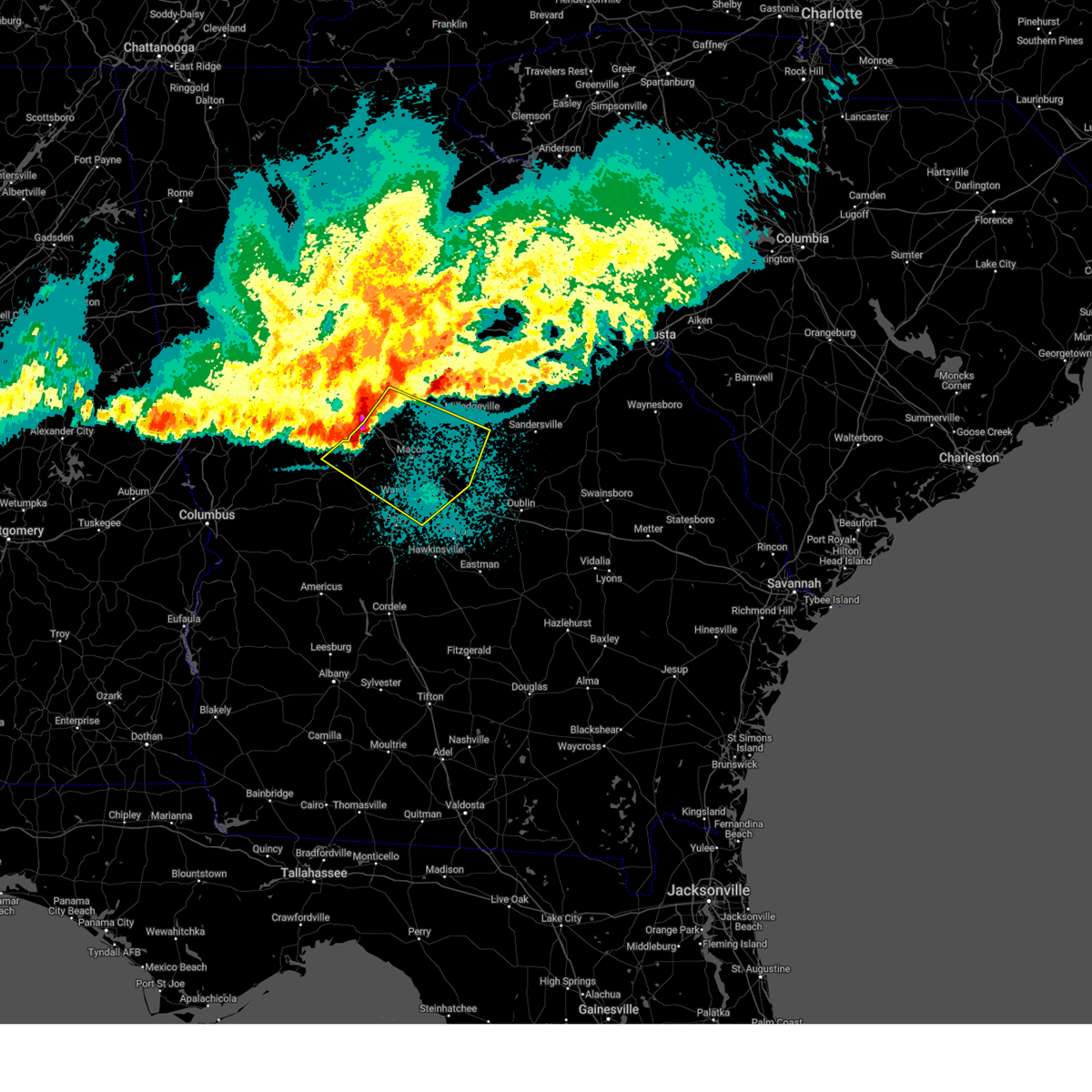
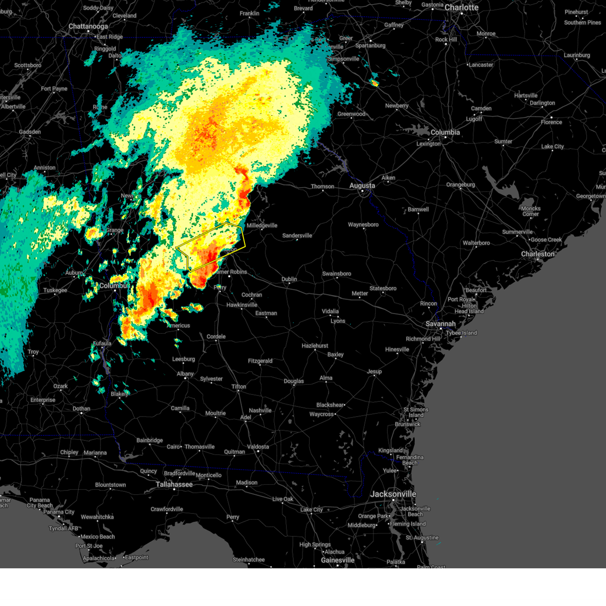
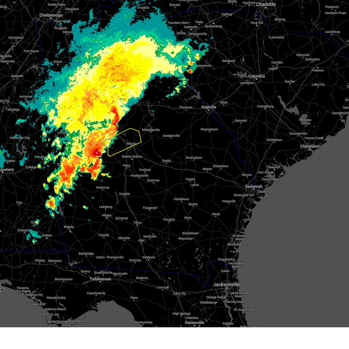
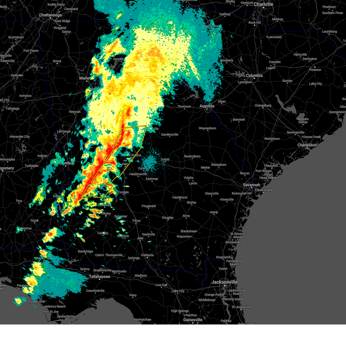
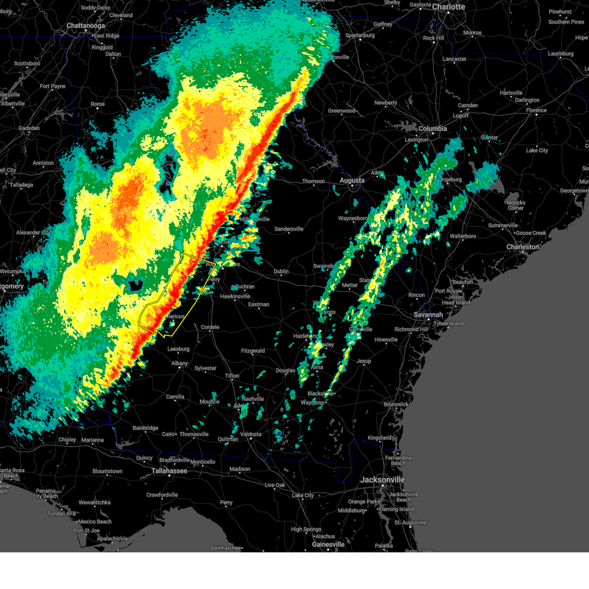
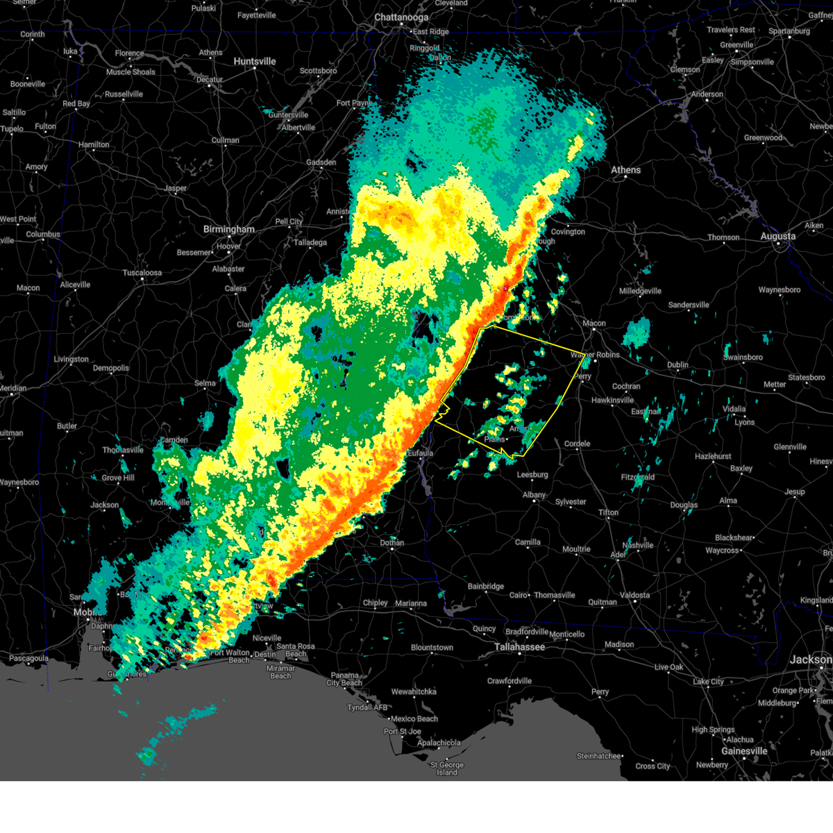
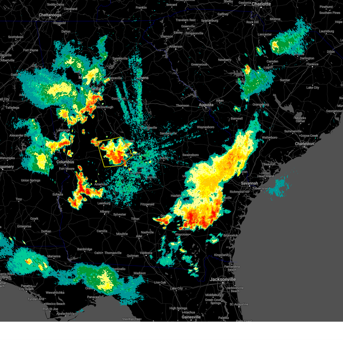
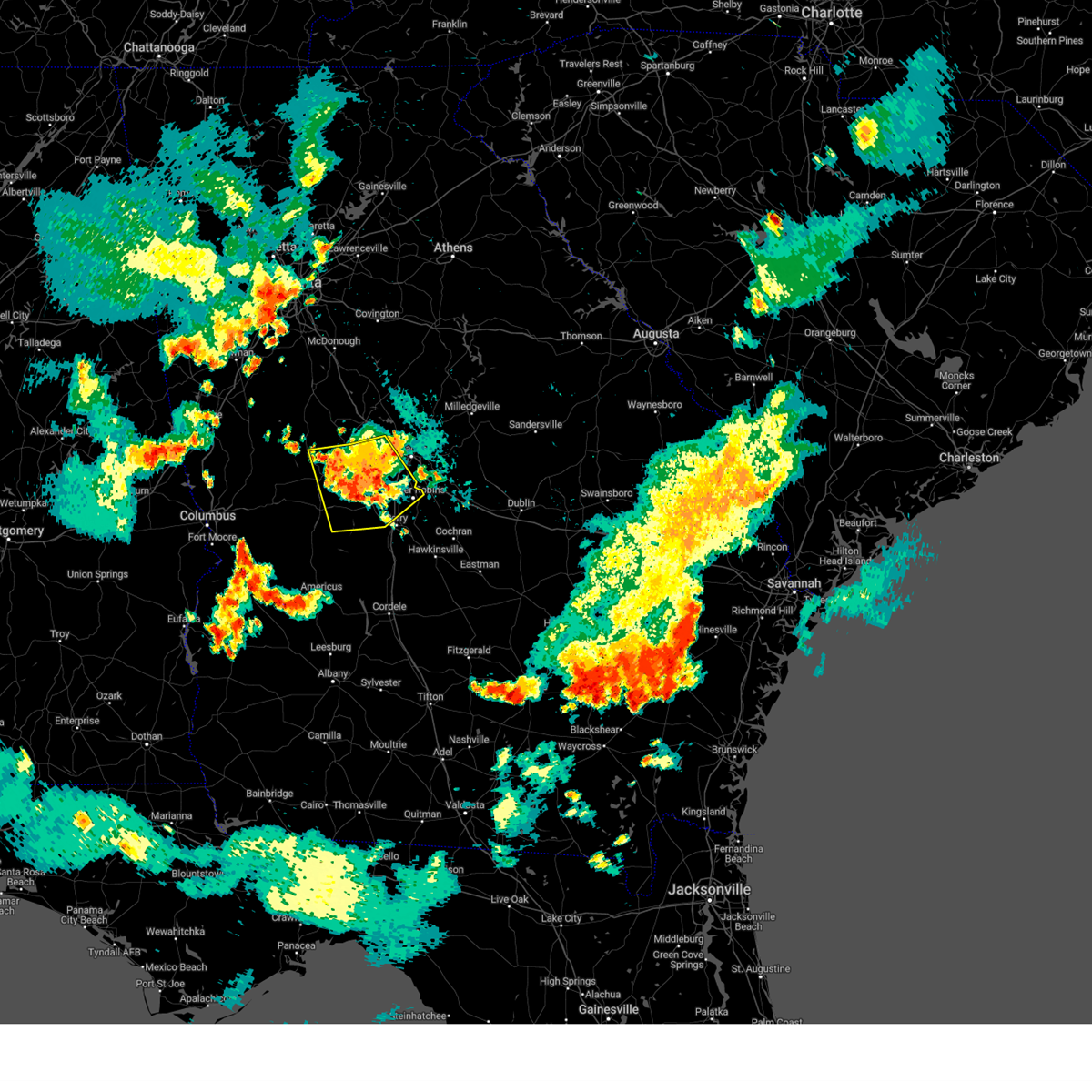
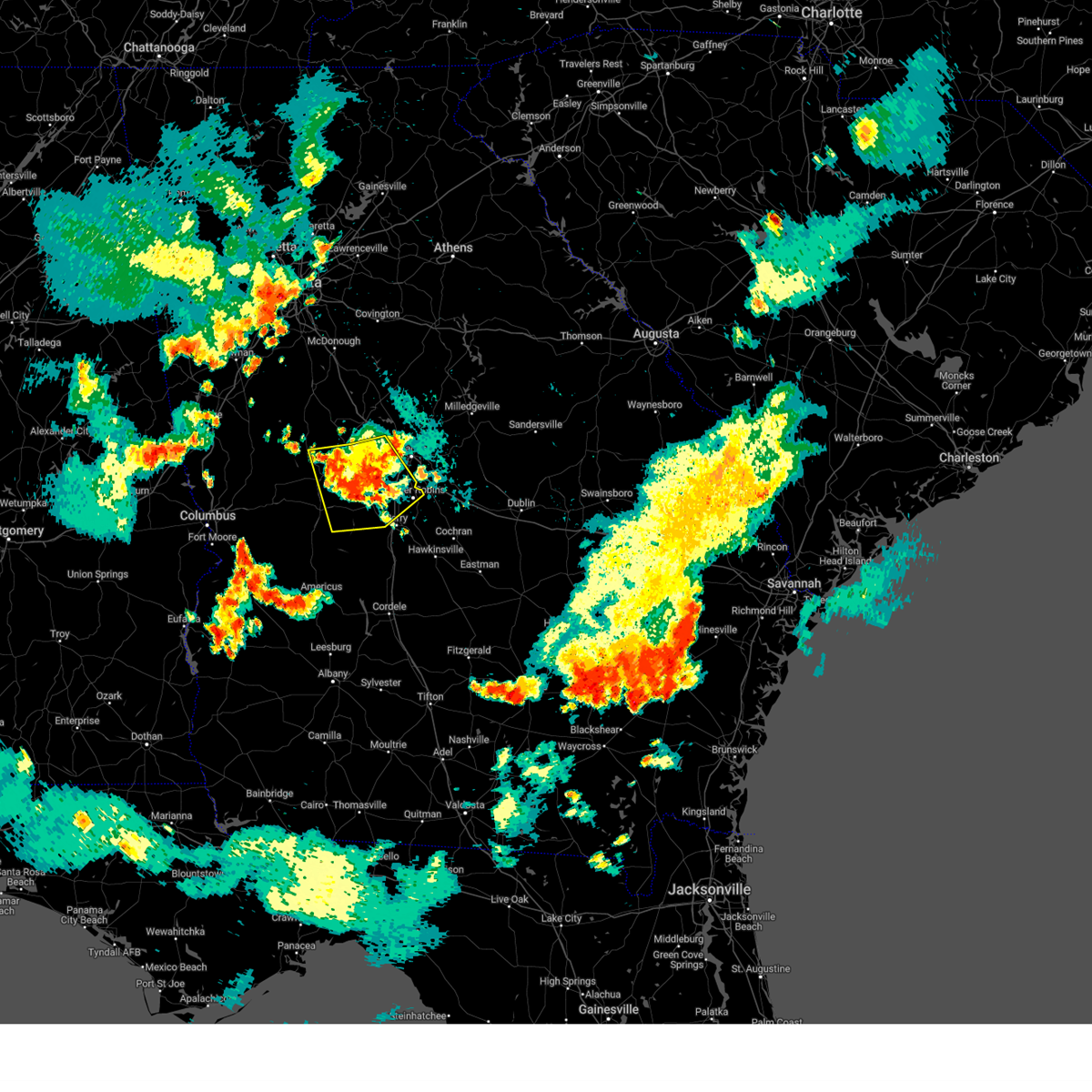
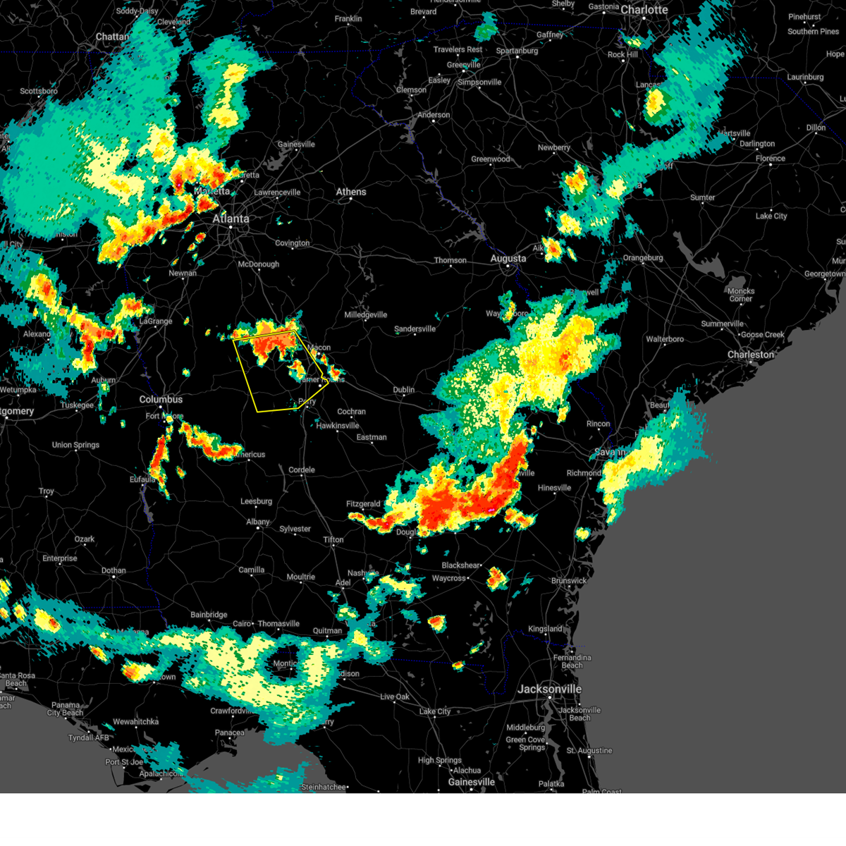
Hail Map for Roberta, GA
The Roberta, GA area has had 4 reports of on-the-ground hail by trained spotters, and has been under severe weather warnings 23 times during the past 12 months. Doppler radar has detected hail at or near Roberta, GA on 39 occasions, including 4 occasions during the past year.
| Name: | Roberta, GA |
| Where Located: | 74.2 miles SSE of Atlanta, GA |
| Map: | Google Map for Roberta, GA |
| Population: | 1007 |
| Housing Units: | 403 |
| More Info: | Search Google for Roberta, GA |
1
The Top Recent Hail Date for Roberta, GA is Monday, June 9, 2025 (11th out of 39)
Hail and Wind Damage Spotted near Roberta, GA
| Date / Time | Report Details |
|---|---|
| 6/25/2025 11:35 PM EDT |
 Svrffc the national weather service in peachtree city has issued a * severe thunderstorm warning for, northern macon county in west central georgia, central peach county in central georgia, central crawford county in central georgia, east central taylor county in west central georgia, * until 1215 am edt. * at 1135 pm edt, severe thunderstorms were located along a line extending from near powerville to near saint louis to near montezuma, moving west at 10 mph (radar indicated). Hazards include 60 mph wind gusts and quarter size hail. Hail damage to vehicles is expected. Expect wind damage to roofs, siding, and trees. Svrffc the national weather service in peachtree city has issued a * severe thunderstorm warning for, northern macon county in west central georgia, central peach county in central georgia, central crawford county in central georgia, east central taylor county in west central georgia, * until 1215 am edt. * at 1135 pm edt, severe thunderstorms were located along a line extending from near powerville to near saint louis to near montezuma, moving west at 10 mph (radar indicated). Hazards include 60 mph wind gusts and quarter size hail. Hail damage to vehicles is expected. Expect wind damage to roofs, siding, and trees.
|
| 5/18/2025 10:30 AM EDT |
 The storms which prompted the warning have moved out of the area. therefore, the warning has been allowed to expire. a severe thunderstorm watch remains in effect until 100 pm edt for central and west central georgia. The storms which prompted the warning have moved out of the area. therefore, the warning has been allowed to expire. a severe thunderstorm watch remains in effect until 100 pm edt for central and west central georgia.
|
| 5/18/2025 10:13 AM EDT |
 the severe thunderstorm warning has been cancelled and is no longer in effect the severe thunderstorm warning has been cancelled and is no longer in effect
|
| 5/18/2025 10:13 AM EDT |
 At 1013 am edt, severe thunderstorms were located along a line extending from lake horton to near orchard hill to the rock to near carsonville to near geneva, moving east at 50 mph (radar indicated). Hazards include 60 mph wind gusts and quarter size hail. Hail damage to vehicles is expected. expect wind damage to roofs, siding, and trees. Locations impacted include, thomaston, barnesville, butler, zebulon, roberta, talbotton, waverly hall, milner, woodland, yatesville, williamson, meansville, junction city, culloden, geneva, aldora, sunset village, lincoln park, the rock, and upatoi. At 1013 am edt, severe thunderstorms were located along a line extending from lake horton to near orchard hill to the rock to near carsonville to near geneva, moving east at 50 mph (radar indicated). Hazards include 60 mph wind gusts and quarter size hail. Hail damage to vehicles is expected. expect wind damage to roofs, siding, and trees. Locations impacted include, thomaston, barnesville, butler, zebulon, roberta, talbotton, waverly hall, milner, woodland, yatesville, williamson, meansville, junction city, culloden, geneva, aldora, sunset village, lincoln park, the rock, and upatoi.
|
| 5/18/2025 10:11 AM EDT |
 Svrffc the national weather service in peachtree city has issued a * severe thunderstorm warning for, marion county in west central georgia, bibb county in central georgia, southeastern pike county in west central georgia, muscogee county in west central georgia, monroe county in central georgia, chattahoochee county in west central georgia, northern stewart county in west central georgia, eastern upson county in west central georgia, houston county in central georgia, central jones county in central georgia, southeastern harris county in west central georgia, macon county in west central georgia, western twiggs county in central georgia, northwestern webster county in west central georgia, peach county in central georgia, crawford county in central georgia, schley county in west central georgia, southern talbot county in west central georgia, taylor county in west central georgia, lamar county in west central georgia, * until 1100 am edt. * at 1011 am edt, severe thunderstorms were located along a line extending from piedmont to logtown to near howard to juniper to benning park, moving east at 55 mph (radar indicated). Hazards include 60 mph wind gusts and quarter size hail. Hail damage to vehicles is expected. Expect wind damage to roofs, siding, and trees. Svrffc the national weather service in peachtree city has issued a * severe thunderstorm warning for, marion county in west central georgia, bibb county in central georgia, southeastern pike county in west central georgia, muscogee county in west central georgia, monroe county in central georgia, chattahoochee county in west central georgia, northern stewart county in west central georgia, eastern upson county in west central georgia, houston county in central georgia, central jones county in central georgia, southeastern harris county in west central georgia, macon county in west central georgia, western twiggs county in central georgia, northwestern webster county in west central georgia, peach county in central georgia, crawford county in central georgia, schley county in west central georgia, southern talbot county in west central georgia, taylor county in west central georgia, lamar county in west central georgia, * until 1100 am edt. * at 1011 am edt, severe thunderstorms were located along a line extending from piedmont to logtown to near howard to juniper to benning park, moving east at 55 mph (radar indicated). Hazards include 60 mph wind gusts and quarter size hail. Hail damage to vehicles is expected. Expect wind damage to roofs, siding, and trees.
|
| 5/18/2025 9:43 AM EDT |
 Svrffc the national weather service in peachtree city has issued a * severe thunderstorm warning for, spalding county in west central georgia, southern fayette county in north central georgia, northeastern marion county in west central georgia, meriwether county in west central georgia, pike county in west central georgia, northeastern muscogee county in west central georgia, western monroe county in central georgia, upson county in west central georgia, southwestern butts county in central georgia, harris county in west central georgia, southwestern henry county in north central georgia, northwestern crawford county in central georgia, southern coweta county in west central georgia, southern clayton county in north central georgia, talbot county in west central georgia, northern taylor county in west central georgia, lamar county in west central georgia, * until 1030 am edt. * at 943 am edt, severe thunderstorms were located along a line extending from newnan to near rocky mount to near woodbury to shiloh to near mulberry grove, moving east at 50 mph (radar indicated). Hazards include 60 mph wind gusts and quarter size hail. Hail damage to vehicles is expected. Expect wind damage to roofs, siding, and trees. Svrffc the national weather service in peachtree city has issued a * severe thunderstorm warning for, spalding county in west central georgia, southern fayette county in north central georgia, northeastern marion county in west central georgia, meriwether county in west central georgia, pike county in west central georgia, northeastern muscogee county in west central georgia, western monroe county in central georgia, upson county in west central georgia, southwestern butts county in central georgia, harris county in west central georgia, southwestern henry county in north central georgia, northwestern crawford county in central georgia, southern coweta county in west central georgia, southern clayton county in north central georgia, talbot county in west central georgia, northern taylor county in west central georgia, lamar county in west central georgia, * until 1030 am edt. * at 943 am edt, severe thunderstorms were located along a line extending from newnan to near rocky mount to near woodbury to shiloh to near mulberry grove, moving east at 50 mph (radar indicated). Hazards include 60 mph wind gusts and quarter size hail. Hail damage to vehicles is expected. Expect wind damage to roofs, siding, and trees.
|
| 4/24/2025 4:22 PM EDT |
 The storm which prompted the warning has weakened below severe limits, and no longer poses an immediate threat to life or property. therefore, the warning will be allowed to expire. however, small hail and gusty winds are still possible with this thunderstorm. The storm which prompted the warning has weakened below severe limits, and no longer poses an immediate threat to life or property. therefore, the warning will be allowed to expire. however, small hail and gusty winds are still possible with this thunderstorm.
|
| 4/24/2025 4:07 PM EDT |
 Svrffc the national weather service in peachtree city has issued a * severe thunderstorm warning for, southwestern crawford county in central georgia, northeastern taylor county in west central georgia, * until 430 pm edt. * at 406 pm edt, a severe thunderstorm was located near fickling mill, or near butler, moving northeast at 10 mph (radar indicated). Hazards include 60 mph wind gusts and quarter size hail. Hail damage to vehicles is expected. Expect wind damage to roofs, siding, and trees. Svrffc the national weather service in peachtree city has issued a * severe thunderstorm warning for, southwestern crawford county in central georgia, northeastern taylor county in west central georgia, * until 430 pm edt. * at 406 pm edt, a severe thunderstorm was located near fickling mill, or near butler, moving northeast at 10 mph (radar indicated). Hazards include 60 mph wind gusts and quarter size hail. Hail damage to vehicles is expected. Expect wind damage to roofs, siding, and trees.
|
| 4/10/2025 10:29 PM EDT |
 Svrffc the national weather service in peachtree city has issued a * severe thunderstorm warning for, western wilkinson county in central georgia, southern baldwin county in central georgia, bibb county in central georgia, twiggs county in central georgia, monroe county in central georgia, east central upson county in west central georgia, northeastern peach county in central georgia, northeastern houston county in central georgia, northern crawford county in central georgia, jones county in central georgia, southwestern jasper county in central georgia, * until 1115 pm edt. * at 1028 pm edt, severe thunderstorms were located along a line extending from near juliette to near forsyth to near culloden, moving southeast at 55 mph (radar indicated). Hazards include 60 mph wind gusts and quarter size hail. Hail damage to vehicles is expected. Expect wind damage to roofs, siding, and trees. Svrffc the national weather service in peachtree city has issued a * severe thunderstorm warning for, western wilkinson county in central georgia, southern baldwin county in central georgia, bibb county in central georgia, twiggs county in central georgia, monroe county in central georgia, east central upson county in west central georgia, northeastern peach county in central georgia, northeastern houston county in central georgia, northern crawford county in central georgia, jones county in central georgia, southwestern jasper county in central georgia, * until 1115 pm edt. * at 1028 pm edt, severe thunderstorms were located along a line extending from near juliette to near forsyth to near culloden, moving southeast at 55 mph (radar indicated). Hazards include 60 mph wind gusts and quarter size hail. Hail damage to vehicles is expected. Expect wind damage to roofs, siding, and trees.
|
| 4/6/2025 5:31 PM EDT |
 The storm which prompted the warning has moved out of the area. therefore, the warning has been allowed to expire. a tornado watch remains in effect until 700 pm edt for central and west central georgia. remember, a severe thunderstorm warning still remains in effect for bibb and jones county. The storm which prompted the warning has moved out of the area. therefore, the warning has been allowed to expire. a tornado watch remains in effect until 700 pm edt for central and west central georgia. remember, a severe thunderstorm warning still remains in effect for bibb and jones county.
|
| 4/6/2025 4:47 PM EDT |
 Svrffc the national weather service in peachtree city has issued a * severe thunderstorm warning for, northern bibb county in central georgia, monroe county in central georgia, east central upson county in west central georgia, northwestern crawford county in central georgia, jones county in central georgia, southeastern lamar county in west central georgia, * until 530 pm edt. * at 447 pm edt, a severe thunderstorm was located over salem, or 8 miles west of roberta, moving northeast at 55 mph (emergency management). Hazards include 60 mph wind gusts and quarter size hail. Hail damage to vehicles is expected. Expect wind damage to roofs, siding, and trees. Svrffc the national weather service in peachtree city has issued a * severe thunderstorm warning for, northern bibb county in central georgia, monroe county in central georgia, east central upson county in west central georgia, northwestern crawford county in central georgia, jones county in central georgia, southeastern lamar county in west central georgia, * until 530 pm edt. * at 447 pm edt, a severe thunderstorm was located over salem, or 8 miles west of roberta, moving northeast at 55 mph (emergency management). Hazards include 60 mph wind gusts and quarter size hail. Hail damage to vehicles is expected. Expect wind damage to roofs, siding, and trees.
|
| 3/16/2025 3:13 AM EDT |
 Svrffc the national weather service in peachtree city has issued a * severe thunderstorm warning for, bibb county in central georgia, southeastern monroe county in central georgia, central houston county in central georgia, jones county in central georgia, sumter county in west central georgia, macon county in west central georgia, western baldwin county in central georgia, northwestern twiggs county in central georgia, southern webster county in west central georgia, peach county in central georgia, crawford county in central georgia, schley county in west central georgia, southeastern taylor county in west central georgia, * until 400 am edt. * at 312 am edt, severe thunderstorms were located along a line extending from plant scherer to near lizella to leveretts, moving east at 35 mph (radar indicated). Hazards include 60 mph wind gusts. expect damage to roofs, siding, and trees Svrffc the national weather service in peachtree city has issued a * severe thunderstorm warning for, bibb county in central georgia, southeastern monroe county in central georgia, central houston county in central georgia, jones county in central georgia, sumter county in west central georgia, macon county in west central georgia, western baldwin county in central georgia, northwestern twiggs county in central georgia, southern webster county in west central georgia, peach county in central georgia, crawford county in central georgia, schley county in west central georgia, southeastern taylor county in west central georgia, * until 400 am edt. * at 312 am edt, severe thunderstorms were located along a line extending from plant scherer to near lizella to leveretts, moving east at 35 mph (radar indicated). Hazards include 60 mph wind gusts. expect damage to roofs, siding, and trees
|
| 2/16/2025 5:47 AM EST |
 the severe thunderstorm warning has been cancelled and is no longer in effect the severe thunderstorm warning has been cancelled and is no longer in effect
|
| 2/16/2025 5:47 AM EST |
 At 546 am est, severe thunderstorms were located along a line extending from near reynolds to near bartlett to near plains, moving southeast at 45 mph (radar indicated). Hazards include 70 mph wind gusts. Expect considerable tree damage. damage is likely to mobile homes, roofs, and outbuildings. Locations impacted include, americus, fort valley, butler, ellaville, oglethorpe, roberta, preston, byron, montezuma, richland, marshallville, reynolds, plains, ideal, andersonville, smithville, sumter, putnam, murrays crossroads, and whitewater state park. At 546 am est, severe thunderstorms were located along a line extending from near reynolds to near bartlett to near plains, moving southeast at 45 mph (radar indicated). Hazards include 70 mph wind gusts. Expect considerable tree damage. damage is likely to mobile homes, roofs, and outbuildings. Locations impacted include, americus, fort valley, butler, ellaville, oglethorpe, roberta, preston, byron, montezuma, richland, marshallville, reynolds, plains, ideal, andersonville, smithville, sumter, putnam, murrays crossroads, and whitewater state park.
|
| 2/16/2025 5:02 AM EST |
 Svrffc the national weather service in peachtree city has issued a * severe thunderstorm warning for, marion county in west central georgia, eastern muscogee county in west central georgia, chattahoochee county in west central georgia, northern stewart county in west central georgia, southern upson county in west central georgia, sumter county in west central georgia, southeastern harris county in west central georgia, macon county in west central georgia, webster county in west central georgia, peach county in central georgia, central crawford county in central georgia, schley county in west central georgia, talbot county in west central georgia, taylor county in west central georgia, * until 600 am est. * at 501 am est, severe thunderstorms were located along a line extending from woodland to near box springs to near jamestown/south fort moore, moving southeast at 45 mph (radar indicated). Hazards include 70 mph wind gusts. Expect considerable tree damage. Damage is likely to mobile homes, roofs, and outbuildings. Svrffc the national weather service in peachtree city has issued a * severe thunderstorm warning for, marion county in west central georgia, eastern muscogee county in west central georgia, chattahoochee county in west central georgia, northern stewart county in west central georgia, southern upson county in west central georgia, sumter county in west central georgia, southeastern harris county in west central georgia, macon county in west central georgia, webster county in west central georgia, peach county in central georgia, central crawford county in central georgia, schley county in west central georgia, talbot county in west central georgia, taylor county in west central georgia, * until 600 am est. * at 501 am est, severe thunderstorms were located along a line extending from woodland to near box springs to near jamestown/south fort moore, moving southeast at 45 mph (radar indicated). Hazards include 70 mph wind gusts. Expect considerable tree damage. Damage is likely to mobile homes, roofs, and outbuildings.
|
| 12/29/2024 4:53 AM EST |
 Svrffc the national weather service in peachtree city has issued a * severe thunderstorm warning for, bibb county in central georgia, monroe county in central georgia, northeastern houston county in central georgia, butts county in central georgia, jones county in central georgia, newton county in north central georgia, rockdale county in north central georgia, northwestern wilkinson county in central georgia, western baldwin county in central georgia, morgan county in north central georgia, twiggs county in central georgia, putnam county in central georgia, henry county in north central georgia, walton county in north central georgia, peach county in central georgia, crawford county in central georgia, jasper county in central georgia, northeastern taylor county in west central georgia, northeastern lamar county in west central georgia, * until 600 am est. * at 452 am est, severe thunderstorms were located along a line extending from stockbridge to high falls state park to brent to near reynolds, moving east at 50 mph (radar indicated). Hazards include 60 mph wind gusts. expect damage to roofs, siding, and trees Svrffc the national weather service in peachtree city has issued a * severe thunderstorm warning for, bibb county in central georgia, monroe county in central georgia, northeastern houston county in central georgia, butts county in central georgia, jones county in central georgia, newton county in north central georgia, rockdale county in north central georgia, northwestern wilkinson county in central georgia, western baldwin county in central georgia, morgan county in north central georgia, twiggs county in central georgia, putnam county in central georgia, henry county in north central georgia, walton county in north central georgia, peach county in central georgia, crawford county in central georgia, jasper county in central georgia, northeastern taylor county in west central georgia, northeastern lamar county in west central georgia, * until 600 am est. * at 452 am est, severe thunderstorms were located along a line extending from stockbridge to high falls state park to brent to near reynolds, moving east at 50 mph (radar indicated). Hazards include 60 mph wind gusts. expect damage to roofs, siding, and trees
|
| 12/29/2024 4:35 AM EST |
 At 435 am est, severe thunderstorms were located along a line extending from near inman to griffin to near the rock to near howard, moving northeast at 55 mph (radar indicated). Hazards include 60 mph wind gusts. Expect damage to roofs, siding, and trees. Locations impacted include, griffin, mcdonough, fayetteville, thomaston, barnesville, jackson, forsyth, butler, zebulon, roberta, peachtree city, stockbridge, hampton, lovejoy, locust grove, reynolds, flovilla, milner, brooks, and jenkinsburg. At 435 am est, severe thunderstorms were located along a line extending from near inman to griffin to near the rock to near howard, moving northeast at 55 mph (radar indicated). Hazards include 60 mph wind gusts. Expect damage to roofs, siding, and trees. Locations impacted include, griffin, mcdonough, fayetteville, thomaston, barnesville, jackson, forsyth, butler, zebulon, roberta, peachtree city, stockbridge, hampton, lovejoy, locust grove, reynolds, flovilla, milner, brooks, and jenkinsburg.
|
| 12/29/2024 4:35 AM EST |
 the severe thunderstorm warning has been cancelled and is no longer in effect the severe thunderstorm warning has been cancelled and is no longer in effect
|
| 12/29/2024 4:02 AM EST |
 Svrffc the national weather service in peachtree city has issued a * severe thunderstorm warning for, spalding county in west central georgia, southern fayette county in north central georgia, meriwether county in west central georgia, pike county in west central georgia, monroe county in central georgia, upson county in west central georgia, southwestern butts county in central georgia, henry county in north central georgia, crawford county in central georgia, southeastern coweta county in west central georgia, southeastern clayton county in north central georgia, central talbot county in west central georgia, taylor county in west central georgia, lamar county in west central georgia, * until 500 am est. * at 401 am est, severe thunderstorms were located along a line extending from near hogansville to near woodland to near eelbeck/west fort moore, moving east at 45 mph (radar indicated). Hazards include 60 mph wind gusts. expect damage to roofs, siding, and trees Svrffc the national weather service in peachtree city has issued a * severe thunderstorm warning for, spalding county in west central georgia, southern fayette county in north central georgia, meriwether county in west central georgia, pike county in west central georgia, monroe county in central georgia, upson county in west central georgia, southwestern butts county in central georgia, henry county in north central georgia, crawford county in central georgia, southeastern coweta county in west central georgia, southeastern clayton county in north central georgia, central talbot county in west central georgia, taylor county in west central georgia, lamar county in west central georgia, * until 500 am est. * at 401 am est, severe thunderstorms were located along a line extending from near hogansville to near woodland to near eelbeck/west fort moore, moving east at 45 mph (radar indicated). Hazards include 60 mph wind gusts. expect damage to roofs, siding, and trees
|
| 7/29/2024 8:47 PM EDT |
 The storm which prompted the warning has weakened below severe limits, and no longer poses an immediate threat to life or property. therefore, the warning has been allowed to expire. however, gusty winds and heavy rain are still possible with this thunderstorm. to report severe weather, contact your nearest law enforcement agency. they will relay your report to the national weather service peachtree city. The storm which prompted the warning has weakened below severe limits, and no longer poses an immediate threat to life or property. therefore, the warning has been allowed to expire. however, gusty winds and heavy rain are still possible with this thunderstorm. to report severe weather, contact your nearest law enforcement agency. they will relay your report to the national weather service peachtree city.
|
| 7/29/2024 8:31 PM EDT |
 the severe thunderstorm warning has been cancelled and is no longer in effect the severe thunderstorm warning has been cancelled and is no longer in effect
|
| 7/29/2024 8:31 PM EDT |
 At 830 pm edt, a severe thunderstorm was located near knoxville, or near roberta, moving southeast at 25 mph (radar indicated). Hazards include 60 mph wind gusts and penny size hail. Expect damage to roofs, siding, and trees. Locations impacted include, macon, perry, fort valley, thomaston, roberta, warner robins, centerville, byron, marshallville, reynolds, culloden, robins afb, nakomis, lake tobesofkee, robins air force base, russellville, logtown, powerville, skipperton, and salem. At 830 pm edt, a severe thunderstorm was located near knoxville, or near roberta, moving southeast at 25 mph (radar indicated). Hazards include 60 mph wind gusts and penny size hail. Expect damage to roofs, siding, and trees. Locations impacted include, macon, perry, fort valley, thomaston, roberta, warner robins, centerville, byron, marshallville, reynolds, culloden, robins afb, nakomis, lake tobesofkee, robins air force base, russellville, logtown, powerville, skipperton, and salem.
|
| 7/29/2024 8:04 PM EDT |
 Svrffc the national weather service in peachtree city has issued a * severe thunderstorm warning for, northern macon county in west central georgia, western bibb county in central georgia, southern monroe county in central georgia, eastern upson county in west central georgia, peach county in central georgia, northwestern houston county in central georgia, crawford county in central georgia, eastern taylor county in west central georgia, southeastern lamar county in west central georgia, * until 845 pm edt. * at 803 pm edt, a severe thunderstorm was located near culloden, or 9 miles north of roberta, moving southeast at 25 mph (radar indicated). Hazards include 60 mph wind gusts and penny size hail. expect damage to roofs, siding, and trees Svrffc the national weather service in peachtree city has issued a * severe thunderstorm warning for, northern macon county in west central georgia, western bibb county in central georgia, southern monroe county in central georgia, eastern upson county in west central georgia, peach county in central georgia, northwestern houston county in central georgia, crawford county in central georgia, eastern taylor county in west central georgia, southeastern lamar county in west central georgia, * until 845 pm edt. * at 803 pm edt, a severe thunderstorm was located near culloden, or 9 miles north of roberta, moving southeast at 25 mph (radar indicated). Hazards include 60 mph wind gusts and penny size hail. expect damage to roofs, siding, and trees
|
| 5/27/2024 3:29 PM EDT |
 The storm which prompted the warning has weakened below severe limits, and no longer poses an immediate threat to life or property. therefore, the warning will be allowed to expire. however, gusty winds are still possible with this thunderstorm. a severe thunderstorm watch remains in effect until 1000 pm edt for central and west central georgia. to report severe weather, contact your nearest law enforcement agency. they will relay your report to the national weather service peachtree city. The storm which prompted the warning has weakened below severe limits, and no longer poses an immediate threat to life or property. therefore, the warning will be allowed to expire. however, gusty winds are still possible with this thunderstorm. a severe thunderstorm watch remains in effect until 1000 pm edt for central and west central georgia. to report severe weather, contact your nearest law enforcement agency. they will relay your report to the national weather service peachtree city.
|
| 5/27/2024 3:04 PM EDT |
 The storm which prompted the warning has moved out of the area. therefore, the warning has been allowed to expire. a severe thunderstorm watch remains in effect until 1000 pm edt for central and west central georgia. to report severe weather, contact your nearest law enforcement agency. they will relay your report to the national weather service peachtree city. The storm which prompted the warning has moved out of the area. therefore, the warning has been allowed to expire. a severe thunderstorm watch remains in effect until 1000 pm edt for central and west central georgia. to report severe weather, contact your nearest law enforcement agency. they will relay your report to the national weather service peachtree city.
|
| 5/27/2024 2:53 PM EDT |
 Svrffc the national weather service in peachtree city has issued a * severe thunderstorm warning for, northeastern macon county in west central georgia, south central bibb county in central georgia, peach county in central georgia, central houston county in central georgia, southeastern crawford county in central georgia, * until 330 pm edt. * at 253 pm edt, a severe thunderstorm was located near horns, or near roberta, moving east at 25 mph (radar indicated). Hazards include 60 mph wind gusts and quarter size hail. Hail damage to vehicles is expected. Expect wind damage to roofs, siding, and trees. Svrffc the national weather service in peachtree city has issued a * severe thunderstorm warning for, northeastern macon county in west central georgia, south central bibb county in central georgia, peach county in central georgia, central houston county in central georgia, southeastern crawford county in central georgia, * until 330 pm edt. * at 253 pm edt, a severe thunderstorm was located near horns, or near roberta, moving east at 25 mph (radar indicated). Hazards include 60 mph wind gusts and quarter size hail. Hail damage to vehicles is expected. Expect wind damage to roofs, siding, and trees.
|
| 5/27/2024 2:42 PM EDT |
 the severe thunderstorm warning has been cancelled and is no longer in effect the severe thunderstorm warning has been cancelled and is no longer in effect
|
| 5/27/2024 2:42 PM EDT |
 At 242 pm edt, a severe thunderstorm was located near butler, moving east at 25 mph (radar indicated). Hazards include 60 mph wind gusts and quarter size hail. Hail damage to vehicles is expected. expect wind damage to roofs, siding, and trees. Locations impacted include, butler, reynolds, howard, garden valley, wesley church, hicks, fickling mill, and potterville. At 242 pm edt, a severe thunderstorm was located near butler, moving east at 25 mph (radar indicated). Hazards include 60 mph wind gusts and quarter size hail. Hail damage to vehicles is expected. expect wind damage to roofs, siding, and trees. Locations impacted include, butler, reynolds, howard, garden valley, wesley church, hicks, fickling mill, and potterville.
|
| 5/27/2024 2:13 PM EDT |
 Svrffc the national weather service in peachtree city has issued a * severe thunderstorm warning for, northwestern macon county in west central georgia, northeastern marion county in west central georgia, southwestern crawford county in central georgia, southeastern talbot county in west central georgia, taylor county in west central georgia, * until 300 pm edt. * at 212 pm edt, a severe thunderstorm was located over junction city, or near talbotton, moving east at 25 mph (radar indicated). Hazards include 60 mph wind gusts and quarter size hail. Hail damage to vehicles is expected. Expect wind damage to roofs, siding, and trees. Svrffc the national weather service in peachtree city has issued a * severe thunderstorm warning for, northwestern macon county in west central georgia, northeastern marion county in west central georgia, southwestern crawford county in central georgia, southeastern talbot county in west central georgia, taylor county in west central georgia, * until 300 pm edt. * at 212 pm edt, a severe thunderstorm was located over junction city, or near talbotton, moving east at 25 mph (radar indicated). Hazards include 60 mph wind gusts and quarter size hail. Hail damage to vehicles is expected. Expect wind damage to roofs, siding, and trees.
|
| 5/27/2024 1:51 PM EDT |
 At 150 pm edt, severe thunderstorms were located along a line extending from near forsyth to near lizella to knoxville, moving east at 50 mph (radar indicated). Hazards include 60 mph wind gusts and quarter size hail. Hail damage to vehicles is expected. expect wind damage to roofs, siding, and trees. Locations impacted include, macon, forsyth, roberta, payne, culloden, payne city, lake tobesofkee, bolingbroke, wayside, jack brown estates, dames ferry, russellville, brent, musella, jarrell plantation, knoxville, wesleyan, lizella, arkwright, and sandy point. At 150 pm edt, severe thunderstorms were located along a line extending from near forsyth to near lizella to knoxville, moving east at 50 mph (radar indicated). Hazards include 60 mph wind gusts and quarter size hail. Hail damage to vehicles is expected. expect wind damage to roofs, siding, and trees. Locations impacted include, macon, forsyth, roberta, payne, culloden, payne city, lake tobesofkee, bolingbroke, wayside, jack brown estates, dames ferry, russellville, brent, musella, jarrell plantation, knoxville, wesleyan, lizella, arkwright, and sandy point.
|
| 5/27/2024 1:51 PM EDT |
 the severe thunderstorm warning has been cancelled and is no longer in effect the severe thunderstorm warning has been cancelled and is no longer in effect
|
| 5/27/2024 1:47 PM EDT | Trees down on oak grove church road roughly 3 miles south of musell in crawford county GA, 2.8 miles S of Roberta, GA |
| 5/27/2024 1:36 PM EDT |
 Svrffc the national weather service in peachtree city has issued a * severe thunderstorm warning for, bibb county in central georgia, monroe county in central georgia, crawford county in central georgia, southwestern jones county in central georgia, northeastern taylor county in west central georgia, * until 200 pm edt. * at 136 pm edt, severe thunderstorms were located along a line extending from near brent to musella to near fickling mill, moving east at 50 mph (radar indicated). Hazards include 60 mph wind gusts and quarter size hail. Hail damage to vehicles is expected. Expect wind damage to roofs, siding, and trees. Svrffc the national weather service in peachtree city has issued a * severe thunderstorm warning for, bibb county in central georgia, monroe county in central georgia, crawford county in central georgia, southwestern jones county in central georgia, northeastern taylor county in west central georgia, * until 200 pm edt. * at 136 pm edt, severe thunderstorms were located along a line extending from near brent to musella to near fickling mill, moving east at 50 mph (radar indicated). Hazards include 60 mph wind gusts and quarter size hail. Hail damage to vehicles is expected. Expect wind damage to roofs, siding, and trees.
|
| 5/27/2024 1:33 PM EDT | Trees down at the intersection of hwy 80 and hopewell roa in crawford county GA, 7.5 miles ESE of Roberta, GA |
| 5/27/2024 1:30 PM EDT | Trees snapped and uprooted on oak grove church road a mile west of hwy 34 in crawford county GA, 3.9 miles SSE of Roberta, GA |
| 4/3/2024 3:27 AM EDT |
 The storm which prompted the warning has moved out of the area. therefore, the warning will be allowed to expire. however, gusty winds are still possible with this thunderstorm. a tornado watch remains in effect until 400 am edt for central and west central georgia. a tornado watch also remains in effect until 800 am edt for central and west central georgia. The storm which prompted the warning has moved out of the area. therefore, the warning will be allowed to expire. however, gusty winds are still possible with this thunderstorm. a tornado watch remains in effect until 400 am edt for central and west central georgia. a tornado watch also remains in effect until 800 am edt for central and west central georgia.
|
| 4/3/2024 3:12 AM EDT |
 At 311 am edt, a severe thunderstorm was located near reynolds, or near butler, moving east at 65 mph (radar indicated). Hazards include 60 mph wind gusts and penny size hail. Expect damage to roofs, siding, and trees. Locations impacted include, perry, fort valley, butler, roberta, byron, marshallville, reynolds, saint louis, nakomis, meadowdale, jack brown estates, rupert, charing, garden valley, hicks, potterville, knoxville, powerville, lee pope, and horns. At 311 am edt, a severe thunderstorm was located near reynolds, or near butler, moving east at 65 mph (radar indicated). Hazards include 60 mph wind gusts and penny size hail. Expect damage to roofs, siding, and trees. Locations impacted include, perry, fort valley, butler, roberta, byron, marshallville, reynolds, saint louis, nakomis, meadowdale, jack brown estates, rupert, charing, garden valley, hicks, potterville, knoxville, powerville, lee pope, and horns.
|
| 4/3/2024 3:12 AM EDT |
 the severe thunderstorm warning has been cancelled and is no longer in effect the severe thunderstorm warning has been cancelled and is no longer in effect
|
| 4/3/2024 2:50 AM EDT |
 Svrffc the national weather service in peachtree city has issued a * severe thunderstorm warning for, northern macon county in west central georgia, northern marion county in west central georgia, southwestern bibb county in central georgia, east central chattahoochee county in west central georgia, peach county in central georgia, west central houston county in central georgia, central crawford county in central georgia, southeastern talbot county in west central georgia, taylor county in west central georgia, * until 330 am edt. * at 250 am edt, a severe thunderstorm was located over marion estates, or 11 miles south of talbotton, moving east at 65 mph (radar indicated). Hazards include 60 mph wind gusts and penny size hail. expect damage to roofs, siding, and trees Svrffc the national weather service in peachtree city has issued a * severe thunderstorm warning for, northern macon county in west central georgia, northern marion county in west central georgia, southwestern bibb county in central georgia, east central chattahoochee county in west central georgia, peach county in central georgia, west central houston county in central georgia, central crawford county in central georgia, southeastern talbot county in west central georgia, taylor county in west central georgia, * until 330 am edt. * at 250 am edt, a severe thunderstorm was located over marion estates, or 11 miles south of talbotton, moving east at 65 mph (radar indicated). Hazards include 60 mph wind gusts and penny size hail. expect damage to roofs, siding, and trees
|
| 1/9/2024 9:38 AM EST |
 At 938 am est, severe thunderstorms were located along a line extending from near wesley church to near rupert to leveretts, moving east at 55 mph (radar indicated). Hazards include 60 mph wind gusts. expect damage to roofs, siding, and trees At 938 am est, severe thunderstorms were located along a line extending from near wesley church to near rupert to leveretts, moving east at 55 mph (radar indicated). Hazards include 60 mph wind gusts. expect damage to roofs, siding, and trees
|
| 8/7/2023 7:13 PM EDT |
 The severe thunderstorm warning for southwestern monroe, southeastern upson and crawford counties will expire at 715 pm edt, the storm which prompted the warning has moved out of the area. therefore, the warning will be allowed to expire. however, gusty winds and heavy rain are still possible with this thunderstorm. a severe thunderstorm watch remains in effect until midnight edt for central and west central georgia. The severe thunderstorm warning for southwestern monroe, southeastern upson and crawford counties will expire at 715 pm edt, the storm which prompted the warning has moved out of the area. therefore, the warning will be allowed to expire. however, gusty winds and heavy rain are still possible with this thunderstorm. a severe thunderstorm watch remains in effect until midnight edt for central and west central georgia.
|
| 8/7/2023 6:34 PM EDT |
 At 634 pm edt, a severe thunderstorm was located near carsonville, or 9 miles south of thomaston, moving east at 40 mph (radar indicated). Hazards include 60 mph wind gusts and quarter size hail. Hail damage to vehicles is expected. Expect wind damage to roofs, siding, and trees. At 634 pm edt, a severe thunderstorm was located near carsonville, or 9 miles south of thomaston, moving east at 40 mph (radar indicated). Hazards include 60 mph wind gusts and quarter size hail. Hail damage to vehicles is expected. Expect wind damage to roofs, siding, and trees.
|
| 8/3/2023 6:35 PM EDT |
 At 635 pm edt, severe thunderstorms were located along a line extending from flovilla to goggins to near crest, moving southeast at 40 mph (radar indicated). Hazards include 60 mph wind gusts. expect damage to roofs, siding, and trees At 635 pm edt, severe thunderstorms were located along a line extending from flovilla to goggins to near crest, moving southeast at 40 mph (radar indicated). Hazards include 60 mph wind gusts. expect damage to roofs, siding, and trees
|
| 6/25/2023 7:42 PM EDT |
 At 742 pm edt, severe thunderstorms were located along a line extending from crest to near russellville to wayside, moving southeast at 40 mph (radar indicated). Hazards include 60 mph wind gusts. expect damage to roofs, siding, and trees At 742 pm edt, severe thunderstorms were located along a line extending from crest to near russellville to wayside, moving southeast at 40 mph (radar indicated). Hazards include 60 mph wind gusts. expect damage to roofs, siding, and trees
|
| 6/7/2023 3:10 PM EDT |
 The severe thunderstorm warning for southeastern crawford county will expire at 315 pm edt, the storm which prompted the warning has weakened below severe limits, and has exited the warned area. therefore, the warning will be allowed to expire. to report severe weather, contact your nearest law enforcement agency. they will relay your report to the national weather service peachtree city. The severe thunderstorm warning for southeastern crawford county will expire at 315 pm edt, the storm which prompted the warning has weakened below severe limits, and has exited the warned area. therefore, the warning will be allowed to expire. to report severe weather, contact your nearest law enforcement agency. they will relay your report to the national weather service peachtree city.
|
| 6/7/2023 2:46 PM EDT |
 At 245 pm edt, a severe thunderstorm was located over lee pope, or near roberta, moving southeast at 15 mph (radar indicated). Hazards include 60 mph wind gusts and quarter size hail. Hail damage to vehicles is expected. Expect wind damage to roofs, siding, and trees. At 245 pm edt, a severe thunderstorm was located over lee pope, or near roberta, moving southeast at 15 mph (radar indicated). Hazards include 60 mph wind gusts and quarter size hail. Hail damage to vehicles is expected. Expect wind damage to roofs, siding, and trees.
|
| 3/27/2023 5:12 AM EDT |
 At 512 am edt, a severe thunderstorm was located over sandy point, or near roberta, moving east at 40 mph (radar indicated). Hazards include 60 mph wind gusts. expect damage to roofs, siding, and trees At 512 am edt, a severe thunderstorm was located over sandy point, or near roberta, moving east at 40 mph (radar indicated). Hazards include 60 mph wind gusts. expect damage to roofs, siding, and trees
|
| 3/27/2023 1:44 AM EDT |
 At 144 am edt, a severe thunderstorm was located over bradley, or near gray, moving east at 60 mph (radar indicated). Hazards include 60 mph wind gusts. Expect damage to roofs, siding, and trees. locations impacted include, roberta, lake tobesofkee, jack brown estates, musella, knoxville, howard, lizella, salem, sandy point, horns, carsonville, wesley church and fickling mill. hail threat, radar indicated max hail size, <. 75 in wind threat, radar indicated max wind gust, 60 mph. At 144 am edt, a severe thunderstorm was located over bradley, or near gray, moving east at 60 mph (radar indicated). Hazards include 60 mph wind gusts. Expect damage to roofs, siding, and trees. locations impacted include, roberta, lake tobesofkee, jack brown estates, musella, knoxville, howard, lizella, salem, sandy point, horns, carsonville, wesley church and fickling mill. hail threat, radar indicated max hail size, <. 75 in wind threat, radar indicated max wind gust, 60 mph.
|
| 3/27/2023 1:33 AM EDT |
 At 133 am edt, severe thunderstorms were located along a line extending from mcelheneys crossroads to near lizella, moving east at 60 mph (radar indicated). Hazards include 60 mph wind gusts. Expect damage to roofs, siding, and trees. locations impacted include, roberta, culloden, lake tobesofkee, bolingbroke, jack brown estates, russellville, musella, knoxville, howard, lizella, salem, sandy point, horns, carsonville, wesley church and fickling mill. hail threat, radar indicated max hail size, <. 75 in wind threat, radar indicated max wind gust, 60 mph. At 133 am edt, severe thunderstorms were located along a line extending from mcelheneys crossroads to near lizella, moving east at 60 mph (radar indicated). Hazards include 60 mph wind gusts. Expect damage to roofs, siding, and trees. locations impacted include, roberta, culloden, lake tobesofkee, bolingbroke, jack brown estates, russellville, musella, knoxville, howard, lizella, salem, sandy point, horns, carsonville, wesley church and fickling mill. hail threat, radar indicated max hail size, <. 75 in wind threat, radar indicated max wind gust, 60 mph.
|
| 3/27/2023 1:22 AM EDT |
 At 122 am edt, severe thunderstorms were located along a line extending from near indian springs state park to sandy point, moving east at 60 mph (radar indicated). Hazards include 60 mph wind gusts. Expect damage to roofs, siding, and trees. locations impacted include, forsyth, roberta, yatesville, culloden, lake tobesofkee, russellville, howard, blount, salem, collier, horns, juliette, wesley church, fickling mill, bolingbroke, jack brown estates, dames ferry, berner, brent and musella. hail threat, radar indicated max hail size, <. 75 in wind threat, radar indicated max wind gust, 60 mph. At 122 am edt, severe thunderstorms were located along a line extending from near indian springs state park to sandy point, moving east at 60 mph (radar indicated). Hazards include 60 mph wind gusts. Expect damage to roofs, siding, and trees. locations impacted include, forsyth, roberta, yatesville, culloden, lake tobesofkee, russellville, howard, blount, salem, collier, horns, juliette, wesley church, fickling mill, bolingbroke, jack brown estates, dames ferry, berner, brent and musella. hail threat, radar indicated max hail size, <. 75 in wind threat, radar indicated max wind gust, 60 mph.
|
| 3/27/2023 1:16 AM EDT |
 At 116 am edt, severe thunderstorms were located along a line extending from near blount to near knoxville, moving east at 60 mph (radar indicated). Hazards include 60 mph wind gusts. Expect damage to roofs, siding, and trees. locations impacted include, barnesville, forsyth, roberta, yatesville, culloden, aldora, lake tobesofkee, russellville, logtown, howard, blount, liberty hill, salem, collier, horns, juliette, johnstonville, wesley church, fickling mill and bolingbroke. hail threat, radar indicated max hail size, <. 75 in wind threat, radar indicated max wind gust, 60 mph. At 116 am edt, severe thunderstorms were located along a line extending from near blount to near knoxville, moving east at 60 mph (radar indicated). Hazards include 60 mph wind gusts. Expect damage to roofs, siding, and trees. locations impacted include, barnesville, forsyth, roberta, yatesville, culloden, aldora, lake tobesofkee, russellville, logtown, howard, blount, liberty hill, salem, collier, horns, juliette, johnstonville, wesley church, fickling mill and bolingbroke. hail threat, radar indicated max hail size, <. 75 in wind threat, radar indicated max wind gust, 60 mph.
|
| 3/27/2023 12:40 AM EDT |
 At 1240 am edt, severe thunderstorms were located along a line extending from gay to near baughville, moving east at 60 mph (radar indicated). Hazards include 60 mph wind gusts. expect damage to roofs, siding, and trees At 1240 am edt, severe thunderstorms were located along a line extending from gay to near baughville, moving east at 60 mph (radar indicated). Hazards include 60 mph wind gusts. expect damage to roofs, siding, and trees
|
| 1/12/2023 5:39 PM EST |
 At 539 pm est, severe thunderstorms were located along a line extending from near howard to near tazewell to near zellobee, moving east at 70 mph (radar indicated). Hazards include 60 mph wind gusts. expect damage to roofs, siding, and trees At 539 pm est, severe thunderstorms were located along a line extending from near howard to near tazewell to near zellobee, moving east at 70 mph (radar indicated). Hazards include 60 mph wind gusts. expect damage to roofs, siding, and trees
|
| 1/12/2023 2:14 PM EST |
 At 214 pm est, a severe thunderstorm was located near musella, or near roberta, moving northeast at 35 mph (radar indicated). Hazards include 60 mph wind gusts. Expect damage to roofs, siding, and trees. Locations impacted include, roberta, culloden, knoxville, lizella, lake tobesofkee, bolingbroke, sandy point, russellville, musella and salem. At 214 pm est, a severe thunderstorm was located near musella, or near roberta, moving northeast at 35 mph (radar indicated). Hazards include 60 mph wind gusts. Expect damage to roofs, siding, and trees. Locations impacted include, roberta, culloden, knoxville, lizella, lake tobesofkee, bolingbroke, sandy point, russellville, musella and salem.
|
| 1/12/2023 2:07 PM EST |
 At 207 pm est, a severe thunderstorm was located near salem, or 7 miles west of roberta, moving northeast at 35 mph (radar indicated). Hazards include 60 mph wind gusts. expect damage to roofs, siding, and trees At 207 pm est, a severe thunderstorm was located near salem, or 7 miles west of roberta, moving northeast at 35 mph (radar indicated). Hazards include 60 mph wind gusts. expect damage to roofs, siding, and trees
|
| 1/4/2023 7:20 AM EST | Report of trees down near us 80 and pleasant hill church rd east of salem... g in crawford county GA, 9 miles ESE of Roberta, GA |
| 1/3/2023 6:12 PM EST |
 At 612 pm est, a severe thunderstorm was located over roberta, moving east at 25 mph (radar indicated). Hazards include 60 mph wind gusts. expect damage to roofs, siding, and trees At 612 pm est, a severe thunderstorm was located over roberta, moving east at 25 mph (radar indicated). Hazards include 60 mph wind gusts. expect damage to roofs, siding, and trees
|
| 6/24/2022 8:29 PM EDT |
 At 829 pm edt, severe thunderstorms were located along a line extending from carsonville to near unadilla, moving west at 15 mph (radar indicated). Hazards include 70 mph wind gusts and ping pong ball size hail. People and animals outdoors will be injured. expect hail damage to roofs, siding, windows, and vehicles. expect considerable tree damage. wind damage is also likely to mobile homes, roofs, and outbuildings. locations impacted include, macon, perry, fort valley, roberta, warner robins, centerville, byron, payne, robins air force base, payne city, nakomis, lake tobesofkee, houston lake, powerville, skipperton, horns, miami valley, kathleen, jack brown estates and rutland. thunderstorm damage threat, considerable hail threat, radar indicated max hail size, 1. 50 in wind threat, radar indicated max wind gust, 70 mph. At 829 pm edt, severe thunderstorms were located along a line extending from carsonville to near unadilla, moving west at 15 mph (radar indicated). Hazards include 70 mph wind gusts and ping pong ball size hail. People and animals outdoors will be injured. expect hail damage to roofs, siding, windows, and vehicles. expect considerable tree damage. wind damage is also likely to mobile homes, roofs, and outbuildings. locations impacted include, macon, perry, fort valley, roberta, warner robins, centerville, byron, payne, robins air force base, payne city, nakomis, lake tobesofkee, houston lake, powerville, skipperton, horns, miami valley, kathleen, jack brown estates and rutland. thunderstorm damage threat, considerable hail threat, radar indicated max hail size, 1. 50 in wind threat, radar indicated max wind gust, 70 mph.
|
| 6/24/2022 8:04 PM EDT |
 At 803 pm edt, severe thunderstorms were located along a line extending from near salem to browndale, moving west at 15 mph (radar indicated). Hazards include 60 mph wind gusts and quarter size hail. Hail damage to vehicles is expected. Expect wind damage to roofs, siding, and trees. At 803 pm edt, severe thunderstorms were located along a line extending from near salem to browndale, moving west at 15 mph (radar indicated). Hazards include 60 mph wind gusts and quarter size hail. Hail damage to vehicles is expected. Expect wind damage to roofs, siding, and trees.
|
| 6/15/2022 6:55 PM EDT |
 The severe thunderstorm warning for peach, central crawford and northeastern taylor counties will expire at 700 pm edt, the storm which prompted the warning has moved out of the area. therefore, the warning will be allowed to expire. a new warning has been issued to the south of the previous one in southern crawford county. The severe thunderstorm warning for peach, central crawford and northeastern taylor counties will expire at 700 pm edt, the storm which prompted the warning has moved out of the area. therefore, the warning will be allowed to expire. a new warning has been issued to the south of the previous one in southern crawford county.
|
| 6/15/2022 6:17 PM EDT |
 At 617 pm edt, a severe thunderstorm was located over miami valley, or near fort valley, moving northwest at 25 mph (radar indicated). Hazards include 60 mph wind gusts and quarter size hail. Hail damage to vehicles is expected. Expect wind damage to roofs, siding, and trees. At 617 pm edt, a severe thunderstorm was located over miami valley, or near fort valley, moving northwest at 25 mph (radar indicated). Hazards include 60 mph wind gusts and quarter size hail. Hail damage to vehicles is expected. Expect wind damage to roofs, siding, and trees.
|
| 4/6/2022 4:08 PM EDT |
 At 408 pm edt, a severe thunderstorm was located near salem, or 7 miles northwest of roberta, moving northeast at 20 mph (radar indicated). Hazards include 60 mph wind gusts and half dollar size hail. Hail damage to vehicles is expected. Expect wind damage to roofs, siding, and trees. At 408 pm edt, a severe thunderstorm was located near salem, or 7 miles northwest of roberta, moving northeast at 20 mph (radar indicated). Hazards include 60 mph wind gusts and half dollar size hail. Hail damage to vehicles is expected. Expect wind damage to roofs, siding, and trees.
|
| 4/5/2022 3:15 PM EDT |
 At 314 pm edt, severe thunderstorms were located along a line extending from blountsville to near franklinton to kathleen, moving east at 70 mph (radar indicated). Hazards include 60 mph wind gusts and penny size hail. Expect damage to roofs, siding, and trees. locations impacted include, fort valley, forsyth, roberta, marshallville, culloden, nakomis, lake tobesofkee, bolingbroke, dames ferry, russellville, brent, hicks, musella, jarrell plantation, knoxville, lizella, lee pope, sandy point, horns and plant scherer. hail threat, radar indicated max hail size, 0. 75 in wind threat, radar indicated max wind gust, 60 mph. At 314 pm edt, severe thunderstorms were located along a line extending from blountsville to near franklinton to kathleen, moving east at 70 mph (radar indicated). Hazards include 60 mph wind gusts and penny size hail. Expect damage to roofs, siding, and trees. locations impacted include, fort valley, forsyth, roberta, marshallville, culloden, nakomis, lake tobesofkee, bolingbroke, dames ferry, russellville, brent, hicks, musella, jarrell plantation, knoxville, lizella, lee pope, sandy point, horns and plant scherer. hail threat, radar indicated max hail size, 0. 75 in wind threat, radar indicated max wind gust, 60 mph.
|
| 4/5/2022 3:14 PM EDT |
 At 314 pm edt, a severe thunderstorm capable of producing a tornado was located just north of knoxville and roberta, moving northeast at 40 mph (radar indicated rotation). Hazards include tornado. Flying debris will be dangerous to those caught without shelter. mobile homes will be damaged or destroyed. damage to roofs, windows, and vehicles will occur. tree damage is likely. Locations impacted include, roberta, knoxville, sandy point and musella. At 314 pm edt, a severe thunderstorm capable of producing a tornado was located just north of knoxville and roberta, moving northeast at 40 mph (radar indicated rotation). Hazards include tornado. Flying debris will be dangerous to those caught without shelter. mobile homes will be damaged or destroyed. damage to roofs, windows, and vehicles will occur. tree damage is likely. Locations impacted include, roberta, knoxville, sandy point and musella.
|
| 4/5/2022 3:07 PM EDT |
 At 306 pm edt, a severe thunderstorm capable of producing a tornado was located about 4 miles west-southwest of roberta, moving northeast at 40 mph (radar indicated rotation). Hazards include tornado. Flying debris will be dangerous to those caught without shelter. mobile homes will be damaged or destroyed. damage to roofs, windows, and vehicles will occur. tree damage is likely. Locations impacted include, roberta, knoxville, sandy point, horns and musella. At 306 pm edt, a severe thunderstorm capable of producing a tornado was located about 4 miles west-southwest of roberta, moving northeast at 40 mph (radar indicated rotation). Hazards include tornado. Flying debris will be dangerous to those caught without shelter. mobile homes will be damaged or destroyed. damage to roofs, windows, and vehicles will occur. tree damage is likely. Locations impacted include, roberta, knoxville, sandy point, horns and musella.
|
| 4/5/2022 2:56 PM EDT |
 At 256 pm edt, a severe thunderstorm capable of producing a tornado was located near fickling mill, or 8 miles northeast of butler, moving northeast at 40 mph (radar indicated rotation). Hazards include tornado. Flying debris will be dangerous to those caught without shelter. mobile homes will be damaged or destroyed. damage to roofs, windows, and vehicles will occur. Tree damage is likely. At 256 pm edt, a severe thunderstorm capable of producing a tornado was located near fickling mill, or 8 miles northeast of butler, moving northeast at 40 mph (radar indicated rotation). Hazards include tornado. Flying debris will be dangerous to those caught without shelter. mobile homes will be damaged or destroyed. damage to roofs, windows, and vehicles will occur. Tree damage is likely.
|
| 4/5/2022 2:48 PM EDT |
 At 248 pm edt, severe thunderstorms were located along a line extending from forsyth to near roberta to garden valley, moving east at 45 mph (radar indicated). Hazards include 60 mph wind gusts and penny size hail. expect damage to roofs, siding, and trees At 248 pm edt, severe thunderstorms were located along a line extending from forsyth to near roberta to garden valley, moving east at 45 mph (radar indicated). Hazards include 60 mph wind gusts and penny size hail. expect damage to roofs, siding, and trees
|
| 3/23/2022 9:24 AM EDT |
 The severe thunderstorm warning for northwestern bibb, southeastern monroe and northeastern crawford counties will expire at 930 am edt, the storm which prompted the warning has weakened below severe limits, and no longer poses an immediate threat to life or property. therefore, the warning will be allowed to expire. however gusty winds and heavy rain are still possible with this thunderstorm. The severe thunderstorm warning for northwestern bibb, southeastern monroe and northeastern crawford counties will expire at 930 am edt, the storm which prompted the warning has weakened below severe limits, and no longer poses an immediate threat to life or property. therefore, the warning will be allowed to expire. however gusty winds and heavy rain are still possible with this thunderstorm.
|
| 3/23/2022 9:00 AM EDT |
 At 900 am edt, a severe thunderstorm was located over sandy point, or near roberta, moving northeast at 40 mph (radar indicated). Hazards include 60 mph wind gusts. expect damage to roofs, siding, and trees At 900 am edt, a severe thunderstorm was located over sandy point, or near roberta, moving northeast at 40 mph (radar indicated). Hazards include 60 mph wind gusts. expect damage to roofs, siding, and trees
|
| 12/30/2021 4:51 PM EST |
 The severe thunderstorm warning for southwestern monroe, southeastern upson, northwestern crawford, east central talbot and north central taylor counties will expire at 500 pm est, the storm which prompted the warning has weakened below severe limits, and has exited the warned area. therefore, the warning will be allowed to expire. a severe thunderstorm watch remains in effect until 900 pm est for central and west central georgia. remember, a tornado warning still remains in effect for eastern crawford. The severe thunderstorm warning for southwestern monroe, southeastern upson, northwestern crawford, east central talbot and north central taylor counties will expire at 500 pm est, the storm which prompted the warning has weakened below severe limits, and has exited the warned area. therefore, the warning will be allowed to expire. a severe thunderstorm watch remains in effect until 900 pm est for central and west central georgia. remember, a tornado warning still remains in effect for eastern crawford.
|
| 12/30/2021 4:41 PM EST |
 At 440 pm est, a severe thunderstorm capable of producing a tornado was located over knoxville, or over roberta, moving east at 50 mph (radar indicated rotation). Hazards include tornado. Flying debris will be dangerous to those caught without shelter. mobile homes will be damaged or destroyed. damage to roofs, windows, and vehicles will occur. Tree damage is likely. At 440 pm est, a severe thunderstorm capable of producing a tornado was located over knoxville, or over roberta, moving east at 50 mph (radar indicated rotation). Hazards include tornado. Flying debris will be dangerous to those caught without shelter. mobile homes will be damaged or destroyed. damage to roofs, windows, and vehicles will occur. Tree damage is likely.
|
| 12/30/2021 4:18 PM EST |
 At 417 pm est, a severe thunderstorm capable of producing a tornado was located over carsonville, or 10 miles north of butler, moving east at 40 mph (radar indicated rotation). Hazards include tornado and quarter size hail. Flying debris will be dangerous to those caught without shelter. mobile homes will be damaged or destroyed. damage to roofs, windows, and vehicles will occur. Tree damage is likely. At 417 pm est, a severe thunderstorm capable of producing a tornado was located over carsonville, or 10 miles north of butler, moving east at 40 mph (radar indicated rotation). Hazards include tornado and quarter size hail. Flying debris will be dangerous to those caught without shelter. mobile homes will be damaged or destroyed. damage to roofs, windows, and vehicles will occur. Tree damage is likely.
|
| 12/30/2021 4:10 PM EST |
 At 410 pm est, a severe thunderstorm was located over prattsburg, or 11 miles east of talbotton, moving east at 30 mph (radar indicated). Hazards include 60 mph wind gusts and quarter size hail. Hail damage to vehicles is expected. Expect wind damage to roofs, siding, and trees. At 410 pm est, a severe thunderstorm was located over prattsburg, or 11 miles east of talbotton, moving east at 30 mph (radar indicated). Hazards include 60 mph wind gusts and quarter size hail. Hail damage to vehicles is expected. Expect wind damage to roofs, siding, and trees.
|
| 8/10/2021 2:20 PM EDT |
 At 219 pm edt, a severe thunderstorm was located near salem, or 8 miles northwest of roberta, moving south at 5 mph (radar indicated). Hazards include 60 mph wind gusts and nickel size hail. expect damage to roofs, siding, and trees At 219 pm edt, a severe thunderstorm was located near salem, or 8 miles northwest of roberta, moving south at 5 mph (radar indicated). Hazards include 60 mph wind gusts and nickel size hail. expect damage to roofs, siding, and trees
|
| 6/14/2021 7:25 PM EDT |
 The severe thunderstorm warning for western bibb and crawford counties will expire at 730 pm edt, the storm which prompted the warning has weakened below severe limits, and no longer poses an immediate threat to life or property. therefore, the warning will be allowed to expire. to report severe weather, contact your nearest law enforcement agency. they will relay your report to the national weather service peachtree city. The severe thunderstorm warning for western bibb and crawford counties will expire at 730 pm edt, the storm which prompted the warning has weakened below severe limits, and no longer poses an immediate threat to life or property. therefore, the warning will be allowed to expire. to report severe weather, contact your nearest law enforcement agency. they will relay your report to the national weather service peachtree city.
|
| 6/14/2021 7:03 PM EDT |
 At 703 pm edt, a severe thunderstorm was located near lizella, or 9 miles northeast of roberta, moving south at 15 mph (radar indicated). Hazards include 60 mph wind gusts and quarter size hail. Hail damage to vehicles is expected. expect wind damage to roofs, siding, and trees. Locations impacted include, macon, roberta, knoxville, lizella, lake tobesofkee, jack brown estates, lee pope, sandy point, horns and musella. At 703 pm edt, a severe thunderstorm was located near lizella, or 9 miles northeast of roberta, moving south at 15 mph (radar indicated). Hazards include 60 mph wind gusts and quarter size hail. Hail damage to vehicles is expected. expect wind damage to roofs, siding, and trees. Locations impacted include, macon, roberta, knoxville, lizella, lake tobesofkee, jack brown estates, lee pope, sandy point, horns and musella.
|
| 6/14/2021 6:40 PM EDT |
 At 640 pm edt, a severe thunderstorm was located near lake tobesofkee, or 11 miles south of forsyth, moving south at 15 mph (radar indicated). Hazards include 60 mph wind gusts and quarter size hail. Hail damage to vehicles is expected. Expect wind damage to roofs, siding, and trees. At 640 pm edt, a severe thunderstorm was located near lake tobesofkee, or 11 miles south of forsyth, moving south at 15 mph (radar indicated). Hazards include 60 mph wind gusts and quarter size hail. Hail damage to vehicles is expected. Expect wind damage to roofs, siding, and trees.
|
| 5/4/2021 10:11 PM EDT |
 The severe thunderstorm warning for bibb, southeastern pike, monroe, eastern upson, houston, sumter, crisp, macon, western pulaski, dooly, peach, crawford and lamar counties will expire at 1015 pm edt, the storms which prompted the warning have weakened below severe limits, and no longer pose an immediate threat to life or property. therefore, the warning will be allowed to expire. however gusty winds and heavy rain are still possible with these thunderstorms. a severe thunderstorm watch remains in effect until 100 am edt for central and west central georgia. The severe thunderstorm warning for bibb, southeastern pike, monroe, eastern upson, houston, sumter, crisp, macon, western pulaski, dooly, peach, crawford and lamar counties will expire at 1015 pm edt, the storms which prompted the warning have weakened below severe limits, and no longer pose an immediate threat to life or property. therefore, the warning will be allowed to expire. however gusty winds and heavy rain are still possible with these thunderstorms. a severe thunderstorm watch remains in effect until 100 am edt for central and west central georgia.
|
| 5/4/2021 9:50 PM EDT |
 At 949 pm edt, severe thunderstorms were located along a line extending from meansville to near salem to montezuma to maddox, moving east at 45 mph (radar indicated). Hazards include 60 mph wind gusts and nickel size hail. expect damage to roofs, siding, and trees At 949 pm edt, severe thunderstorms were located along a line extending from meansville to near salem to montezuma to maddox, moving east at 45 mph (radar indicated). Hazards include 60 mph wind gusts and nickel size hail. expect damage to roofs, siding, and trees
|
| 5/4/2021 9:45 PM EDT |
 At 945 pm edt, severe thunderstorms were located along a line extending from the rock to near horns to clearview to sumter, moving east at 45 mph (radar indicated). Hazards include 60 mph wind gusts and penny size hail. Expect damage to roofs, siding, and trees. Locations impacted include, americus, fort valley, barnesville, forsyth, oglethorpe, roberta, byron, montezuma, marshallville, reynolds, leslie, yatesville, andersonville, de soto, culloden, desoto, the rock, sumter, lamar and new era. At 945 pm edt, severe thunderstorms were located along a line extending from the rock to near horns to clearview to sumter, moving east at 45 mph (radar indicated). Hazards include 60 mph wind gusts and penny size hail. Expect damage to roofs, siding, and trees. Locations impacted include, americus, fort valley, barnesville, forsyth, oglethorpe, roberta, byron, montezuma, marshallville, reynolds, leslie, yatesville, andersonville, de soto, culloden, desoto, the rock, sumter, lamar and new era.
|
| 5/4/2021 9:15 PM EDT |
 At 914 pm edt, severe thunderstorms were located along a line extending from near manchester to near junction city to buena vista to near lumpkin, moving east at 60 mph (radar indicated). Hazards include 60 mph wind gusts and quarter size hail. Hail damage to vehicles is expected. Expect wind damage to roofs, siding, and trees. At 914 pm edt, severe thunderstorms were located along a line extending from near manchester to near junction city to buena vista to near lumpkin, moving east at 60 mph (radar indicated). Hazards include 60 mph wind gusts and quarter size hail. Hail damage to vehicles is expected. Expect wind damage to roofs, siding, and trees.
|
| 1/1/2021 2:14 PM EST |
 At 213 pm est, a severe thunderstorm capable of producing a tornado was located near salem, or near roberta, moving northeast at 40 mph (radar indicated rotation). Hazards include tornado. Flying debris will be dangerous to those caught without shelter. mobile homes will be damaged or destroyed. damage to roofs, windows, and vehicles will occur. tree damage is likely. Locations impacted include, roberta, knoxville, sandy point, musella and salem. At 213 pm est, a severe thunderstorm capable of producing a tornado was located near salem, or near roberta, moving northeast at 40 mph (radar indicated rotation). Hazards include tornado. Flying debris will be dangerous to those caught without shelter. mobile homes will be damaged or destroyed. damage to roofs, windows, and vehicles will occur. tree damage is likely. Locations impacted include, roberta, knoxville, sandy point, musella and salem.
|
| 1/1/2021 2:01 PM EST |
 At 201 pm est, a severe thunderstorm capable of producing a tornado was located near fickling mill, or near butler, moving northeast at 40 mph (radar indicated rotation). Hazards include tornado. Flying debris will be dangerous to those caught without shelter. mobile homes will be damaged or destroyed. damage to roofs, windows, and vehicles will occur. Tree damage is likely. At 201 pm est, a severe thunderstorm capable of producing a tornado was located near fickling mill, or near butler, moving northeast at 40 mph (radar indicated rotation). Hazards include tornado. Flying debris will be dangerous to those caught without shelter. mobile homes will be damaged or destroyed. damage to roofs, windows, and vehicles will occur. Tree damage is likely.
|
| 6/22/2020 5:13 PM EDT | Multiple trees down along us 341 near e houze road in crawford county GA, 6.6 miles NNW of Roberta, GA |
| 6/10/2020 7:07 PM EDT |
 The severe thunderstorm warning for western bibb, southeastern monroe, north central peach and crawford counties will expire at 715 pm edt, the storms which prompted the warning are weakening below severe limits, and no longer pose an immediate threat to life or property. therefore, the warning will be allowed to expire. however gusty winds up to 45 mph and heavy rain are still expected with these thunderstorms. to report severe weather, contact your nearest law enforcement agency. they will relay your report to the national weather service peachtree city. The severe thunderstorm warning for western bibb, southeastern monroe, north central peach and crawford counties will expire at 715 pm edt, the storms which prompted the warning are weakening below severe limits, and no longer pose an immediate threat to life or property. therefore, the warning will be allowed to expire. however gusty winds up to 45 mph and heavy rain are still expected with these thunderstorms. to report severe weather, contact your nearest law enforcement agency. they will relay your report to the national weather service peachtree city.
|
| 6/10/2020 6:56 PM EDT |
 A severe thunderstorm warning remains in effect until 715 pm edt for western bibb. southeastern monroe. north central peach and crawford counties. At 656 pm edt, severe thunderstorms were located along a line extending from near russellville to near jack brown estates to near lee pope to near nakomis, moving northeast at 40 mph. A severe thunderstorm warning remains in effect until 715 pm edt for western bibb. southeastern monroe. north central peach and crawford counties. At 656 pm edt, severe thunderstorms were located along a line extending from near russellville to near jack brown estates to near lee pope to near nakomis, moving northeast at 40 mph.
|
| 6/10/2020 6:24 PM EDT |
 At 624 pm edt, severe thunderstorms were located along a line extending from salem to near butler to near rupert to near mauk, moving east at 45 mph (radar indicated). Hazards include 60 mph wind gusts. expect damage to roofs, siding, and trees At 624 pm edt, severe thunderstorms were located along a line extending from salem to near butler to near rupert to near mauk, moving east at 45 mph (radar indicated). Hazards include 60 mph wind gusts. expect damage to roofs, siding, and trees
|
| 4/13/2020 3:25 AM EDT |
 The severe thunderstorm warning for western bibb, eastern monroe, southeastern butts, central crawford, western jones and southern jasper counties will expire at 330 am edt, the storms which prompted the warning have moved out of the area. therefore, the warning will be allowed to expire. a tornado watch remains in effect until 700 am edt for central georgia. to report severe weather, contact your nearest law enforcement agency. they will relay your report to the national weather service peachtree city. The severe thunderstorm warning for western bibb, eastern monroe, southeastern butts, central crawford, western jones and southern jasper counties will expire at 330 am edt, the storms which prompted the warning have moved out of the area. therefore, the warning will be allowed to expire. a tornado watch remains in effect until 700 am edt for central georgia. to report severe weather, contact your nearest law enforcement agency. they will relay your report to the national weather service peachtree city.
|
| 4/13/2020 2:50 AM EDT |
 At 250 am edt, severe thunderstorms were located along a line extending from near blount to near russellville to near horns, moving east at 55 mph (radar indicated). Hazards include 70 mph wind gusts. Expect considerable tree damage. damage is likely to mobile homes, roofs, and outbuildings. Locations impacted include, macon, forsyth, monticello, roberta, flovilla, lake tobesofkee, bolingbroke, wayside, dames ferry, berner, round oak, jarrell plantation, knoxville, wesleyan, calvin, lizella, hillsboro, arkwright, mcelheneys crossroads and sandy point. At 250 am edt, severe thunderstorms were located along a line extending from near blount to near russellville to near horns, moving east at 55 mph (radar indicated). Hazards include 70 mph wind gusts. Expect considerable tree damage. damage is likely to mobile homes, roofs, and outbuildings. Locations impacted include, macon, forsyth, monticello, roberta, flovilla, lake tobesofkee, bolingbroke, wayside, dames ferry, berner, round oak, jarrell plantation, knoxville, wesleyan, calvin, lizella, hillsboro, arkwright, mcelheneys crossroads and sandy point.
|
| 4/13/2020 2:40 AM EDT |
 At 240 am edt, severe thunderstorms were located along a line extending from near johnstonville to near russellville to near fickling mill, moving northeast at 40 mph (radar indicated). Hazards include 60 mph wind gusts. expect damage to roofs, siding, and trees At 240 am edt, severe thunderstorms were located along a line extending from near johnstonville to near russellville to near fickling mill, moving northeast at 40 mph (radar indicated). Hazards include 60 mph wind gusts. expect damage to roofs, siding, and trees
|
| 1/11/2020 6:58 PM EST |
 At 657 pm est, a severe thunderstorm was located over reynolds, or 8 miles east of butler, moving east at 60 mph (radar indicated). Hazards include 60 mph wind gusts. expect damage to roofs, siding, and trees At 657 pm est, a severe thunderstorm was located over reynolds, or 8 miles east of butler, moving east at 60 mph (radar indicated). Hazards include 60 mph wind gusts. expect damage to roofs, siding, and trees
|
| 1/11/2020 6:34 PM EST |
 At 634 pm est, severe thunderstorms were located along a line extending from near mansfield to monticello to near round oak to near lake tobesofkee, moving northeast at 65 mph (radar indicated). Hazards include 60 mph wind gusts. Expect damage to roofs, siding, and trees. Locations impacted include, forsyth, roberta, bolingbroke, dames ferry, berner, russellville, musella, knoxville, howard, blount, sandy point, horns, juliette, wesley church, carsonville, fickling mill and plant scherer. At 634 pm est, severe thunderstorms were located along a line extending from near mansfield to monticello to near round oak to near lake tobesofkee, moving northeast at 65 mph (radar indicated). Hazards include 60 mph wind gusts. Expect damage to roofs, siding, and trees. Locations impacted include, forsyth, roberta, bolingbroke, dames ferry, berner, russellville, musella, knoxville, howard, blount, sandy point, horns, juliette, wesley church, carsonville, fickling mill and plant scherer.
|
| 1/11/2020 6:08 PM EST |
 At 607 pm est, severe thunderstorms were located along a line extending from near east griffin to goggins to near culloden to near wesley church, moving northeast at 55 mph (radar indicated). Hazards include 60 mph wind gusts. expect damage to roofs, siding, and trees At 607 pm est, severe thunderstorms were located along a line extending from near east griffin to goggins to near culloden to near wesley church, moving northeast at 55 mph (radar indicated). Hazards include 60 mph wind gusts. expect damage to roofs, siding, and trees
|
| 6/23/2019 2:10 PM EDT |
 At 210 pm edt, a severe thunderstorm was located over culloden, or 8 miles northwest of roberta, moving east at 20 mph (radar indicated). Hazards include 60 mph wind gusts and quarter size hail. Hail damage to vehicles is expected. Expect wind damage to roofs, siding, and trees. At 210 pm edt, a severe thunderstorm was located over culloden, or 8 miles northwest of roberta, moving east at 20 mph (radar indicated). Hazards include 60 mph wind gusts and quarter size hail. Hail damage to vehicles is expected. Expect wind damage to roofs, siding, and trees.
|
| 6/22/2019 8:17 PM EDT |
 At 817 pm edt, severe thunderstorms were located along a line extending from near forsyth to near reynolds, moving east at 35 mph (radar indicated). Hazards include 60 mph wind gusts. expect damage to roofs, siding, and trees At 817 pm edt, severe thunderstorms were located along a line extending from near forsyth to near reynolds, moving east at 35 mph (radar indicated). Hazards include 60 mph wind gusts. expect damage to roofs, siding, and trees
|
| 6/22/2019 7:51 PM EDT |
 At 751 pm edt, severe thunderstorms were located along a line extending from near milner to near yatesville to near carsonville, moving east at 35 mph (radar indicated). Hazards include 60 mph wind gusts. expect damage to roofs, siding, and trees At 751 pm edt, severe thunderstorms were located along a line extending from near milner to near yatesville to near carsonville, moving east at 35 mph (radar indicated). Hazards include 60 mph wind gusts. expect damage to roofs, siding, and trees
|
| 6/18/2019 5:33 PM EDT |
 At 533 pm edt, a severe thunderstorm was located over culloden, or 11 miles east of thomaston, moving east at 20 mph (radar indicated). Hazards include 60 mph wind gusts. Expect damage to roofs, siding, and trees. Locations impacted include, thomaston, forsyth, roberta, yatesville, culloden, the rock, lake tobesofkee, jack brown estates, redbone crossroads, russellville, brent, musella, knoxville, redbone, logtown, lizella, sandy point, horns, collier and hannahs mill. At 533 pm edt, a severe thunderstorm was located over culloden, or 11 miles east of thomaston, moving east at 20 mph (radar indicated). Hazards include 60 mph wind gusts. Expect damage to roofs, siding, and trees. Locations impacted include, thomaston, forsyth, roberta, yatesville, culloden, the rock, lake tobesofkee, jack brown estates, redbone crossroads, russellville, brent, musella, knoxville, redbone, logtown, lizella, sandy point, horns, collier and hannahs mill.
|
| 6/18/2019 5:10 PM EDT |
 At 509 pm edt, a severe thunderstorm was located over redbone crossroads, or near thomaston, moving east at 20 mph (radar indicated). Hazards include 60 mph wind gusts. expect damage to roofs, siding, and trees At 509 pm edt, a severe thunderstorm was located over redbone crossroads, or near thomaston, moving east at 20 mph (radar indicated). Hazards include 60 mph wind gusts. expect damage to roofs, siding, and trees
|
| 6/7/2019 4:56 PM EDT |
 At 456 pm edt, a severe thunderstorm was located near lizella, or 9 miles northeast of roberta, moving northeast at 35 mph (radar indicated). Hazards include 60 mph wind gusts. Expect damage to roofs, siding, and trees. Locations impacted include, roberta, knoxville, lizella, lake tobesofkee, jack brown estates, skipperton, lee pope, sandy point and musella. At 456 pm edt, a severe thunderstorm was located near lizella, or 9 miles northeast of roberta, moving northeast at 35 mph (radar indicated). Hazards include 60 mph wind gusts. Expect damage to roofs, siding, and trees. Locations impacted include, roberta, knoxville, lizella, lake tobesofkee, jack brown estates, skipperton, lee pope, sandy point and musella.
|
| 6/7/2019 4:41 PM EDT | A tree was reported down on hopewell road near highway 34 in crawford county GA, 4.9 miles S of Roberta, GA |
| 6/7/2019 4:40 PM EDT | A tree was reported down on dabney avenu in crawford county GA, 0.6 miles W of Roberta, GA |
| 6/7/2019 4:40 PM EDT | A tree was reported down on winifred stree in crawford county GA, 0.6 miles W of Roberta, GA |
| 6/7/2019 4:28 PM EDT |
 At 427 pm edt, a severe thunderstorm was located near fickling mill, or 7 miles southwest of roberta, moving northeast at 35 mph (radar indicated). Hazards include 60 mph wind gusts. expect damage to roofs, siding, and trees At 427 pm edt, a severe thunderstorm was located near fickling mill, or 7 miles southwest of roberta, moving northeast at 35 mph (radar indicated). Hazards include 60 mph wind gusts. expect damage to roofs, siding, and trees
|
| 3/3/2019 2:51 PM EST |
 At 250 pm est, a severe thunderstorm capable of producing a tornado was located over butler, moving northeast at 45 mph (radar indicated rotation). Hazards include tornado. Flying debris will be dangerous to those caught without shelter. mobile homes will be damaged or destroyed. damage to roofs, windows, and vehicles will occur. Tree damage is likely. At 250 pm est, a severe thunderstorm capable of producing a tornado was located over butler, moving northeast at 45 mph (radar indicated rotation). Hazards include tornado. Flying debris will be dangerous to those caught without shelter. mobile homes will be damaged or destroyed. damage to roofs, windows, and vehicles will occur. Tree damage is likely.
|
| 2/12/2019 3:08 PM EST | The severe thunderstorm warning for northeastern macon. southwestern bibb. central peach. crawford and east central taylor counties will expire at 315 pm est. the storm which prompted the warning has moved out of the area. therefore, the warning will be allowed to expire. However gusty winds are still possible with this thunderstorm. |
| 2/12/2019 2:50 PM EST |
 At 249 pm est, a severe thunderstorm was located near lee pope, or 7 miles southeast of roberta, moving east at 45 mph (radar indicated). Hazards include 60 mph wind gusts. Expect damage to roofs, siding, and trees. Locations impacted include, fort valley, roberta, marshallville, reynolds, saint louis, nakomis, hicks, knoxville, lizella, lee pope, sandy point, horns and winchester. At 249 pm est, a severe thunderstorm was located near lee pope, or 7 miles southeast of roberta, moving east at 45 mph (radar indicated). Hazards include 60 mph wind gusts. Expect damage to roofs, siding, and trees. Locations impacted include, fort valley, roberta, marshallville, reynolds, saint louis, nakomis, hicks, knoxville, lizella, lee pope, sandy point, horns and winchester.
|
| 2/12/2019 2:23 PM EST |
 At 222 pm est, a severe thunderstorm was located near wesley church, or near butler, moving east at 45 mph (radar indicated). Hazards include 60 mph wind gusts. expect damage to roofs, siding, and trees At 222 pm est, a severe thunderstorm was located near wesley church, or near butler, moving east at 45 mph (radar indicated). Hazards include 60 mph wind gusts. expect damage to roofs, siding, and trees
|
| 11/7/2018 5:38 PM EST |
 The severe thunderstorm warning for northwestern macon, western bibb, southwestern monroe, central peach, crawford and southeastern taylor counties will expire at 545 pm est, the storms which prompted the warning have moved out of the warned area. therefore, the warning will be allowed to expire. The severe thunderstorm warning for northwestern macon, western bibb, southwestern monroe, central peach, crawford and southeastern taylor counties will expire at 545 pm est, the storms which prompted the warning have moved out of the warned area. therefore, the warning will be allowed to expire.
|
| 11/7/2018 5:16 PM EST |
 At 516 pm est, severe thunderstorms were located along a line extending from brent to roberta to near rupert, moving east at 45 mph (radar indicated). Hazards include 60 mph wind gusts. Expect damage to roofs, siding, and trees. Locations impacted include, fort valley, roberta, reynolds, nakomis, lake tobesofkee, russellville, garden valley, brent, hicks, musella, potterville, knoxville, lizella, lee pope, sandy point and horns. At 516 pm est, severe thunderstorms were located along a line extending from brent to roberta to near rupert, moving east at 45 mph (radar indicated). Hazards include 60 mph wind gusts. Expect damage to roofs, siding, and trees. Locations impacted include, fort valley, roberta, reynolds, nakomis, lake tobesofkee, russellville, garden valley, brent, hicks, musella, potterville, knoxville, lizella, lee pope, sandy point and horns.
|
| 11/7/2018 4:53 PM EST |
 At 453 pm est, severe thunderstorms were located along a line extending from near atwater to prattsburg to oakland, moving east at 40 mph (radar indicated). Hazards include 60 mph wind gusts. expect damage to roofs, siding, and trees At 453 pm est, severe thunderstorms were located along a line extending from near atwater to prattsburg to oakland, moving east at 40 mph (radar indicated). Hazards include 60 mph wind gusts. expect damage to roofs, siding, and trees
|
| 10/10/2018 4:01 PM EDT |
 At 401 pm edt, a tornado producing storm was located near horns, or near roberta, moving northwest at 40 mph (radar confirmed tornado). Hazards include damaging tornado. Flying debris will be dangerous to those caught without shelter. mobile homes will be damaged or destroyed. damage to roofs, windows, and vehicles will occur. Tree damage is likely. At 401 pm edt, a tornado producing storm was located near horns, or near roberta, moving northwest at 40 mph (radar confirmed tornado). Hazards include damaging tornado. Flying debris will be dangerous to those caught without shelter. mobile homes will be damaged or destroyed. damage to roofs, windows, and vehicles will occur. Tree damage is likely.
|
| 8/8/2018 8:23 PM EDT |
 The severe thunderstorm warning for north central peach and central crawford counties will expire at 830 pm edt, the storm which prompted the warning has weakened below severe limits, and has exited the warned area. therefore, the warning will be allowed to expire. The severe thunderstorm warning for north central peach and central crawford counties will expire at 830 pm edt, the storm which prompted the warning has weakened below severe limits, and has exited the warned area. therefore, the warning will be allowed to expire.
|
| 8/8/2018 7:53 PM EDT |
 At 753 pm edt, a severe thunderstorm was located near horns, or near roberta, moving east at 10 mph (radar indicated). Hazards include 60 mph wind gusts and quarter size hail. Hail damage to vehicles is expected. Expect wind damage to roofs, siding, and trees. At 753 pm edt, a severe thunderstorm was located near horns, or near roberta, moving east at 10 mph (radar indicated). Hazards include 60 mph wind gusts and quarter size hail. Hail damage to vehicles is expected. Expect wind damage to roofs, siding, and trees.
|
| 8/8/2018 7:06 PM EDT |
 At 706 pm edt, a severe thunderstorm was located over lee pope, or near roberta, moving northeast at 10 mph (radar indicated). Hazards include 60 mph wind gusts and penny size hail. expect damage to roofs, siding, and trees At 706 pm edt, a severe thunderstorm was located over lee pope, or near roberta, moving northeast at 10 mph (radar indicated). Hazards include 60 mph wind gusts and penny size hail. expect damage to roofs, siding, and trees
|
| 8/7/2018 2:55 PM EDT | A tree was downed onto power lines at intersection of hwy 341 and hwy 12 in crawford county GA, 0 miles SW of Roberta, GA |
| 8/7/2018 2:50 PM EDT | Tree fell in the center of the town of roberta... knocking out a transformer near hwy 80 and 341 in crawford county GA, 1.1 miles E of Roberta, GA |
| 6/8/2018 4:40 PM EDT | Emergency management reported a tree down blocking the road at the intersection of ga hwy 128 and moncrief r in crawford county GA, 2.2 miles NE of Roberta, GA |
| 6/8/2018 4:39 PM EDT |
 At 439 pm edt, a severe thunderstorm was located near horns, or near roberta, moving west at 5 mph (radar indicated). Hazards include 60 mph wind gusts and quarter size hail. Hail damage to vehicles is expected. Expect wind damage to roofs, siding, and trees. At 439 pm edt, a severe thunderstorm was located near horns, or near roberta, moving west at 5 mph (radar indicated). Hazards include 60 mph wind gusts and quarter size hail. Hail damage to vehicles is expected. Expect wind damage to roofs, siding, and trees.
|
| 6/8/2018 4:35 PM EDT | Quarter sized hail reported 1.4 miles WNW of Roberta, GA, spotter report of quarter-sized hail just se of roberta... ga |
| 6/3/2018 8:15 PM EDT |
 The national weather service in peachtree city has issued a * severe thunderstorm warning for. spalding county in west central georgia. northwestern bibb county in central georgia. monroe county in central georgia. Southwestern butts county in central georgia. The national weather service in peachtree city has issued a * severe thunderstorm warning for. spalding county in west central georgia. northwestern bibb county in central georgia. monroe county in central georgia. Southwestern butts county in central georgia.
|
| 6/3/2018 7:49 PM EDT |
 At 749 pm edt, a severe thunderstorm was located over logtown, or 8 miles southeast of thomaston, moving southeast at 30 mph (radar indicated). Hazards include 60 mph wind gusts and quarter size hail. Hail damage to vehicles is expected. Expect wind damage to roofs, siding, and trees. At 749 pm edt, a severe thunderstorm was located over logtown, or 8 miles southeast of thomaston, moving southeast at 30 mph (radar indicated). Hazards include 60 mph wind gusts and quarter size hail. Hail damage to vehicles is expected. Expect wind damage to roofs, siding, and trees.
|
| 9/22/2017 6:57 PM EDT |
 At 656 pm edt, severe thunderstorms were located along a line extending from near sandy point to near hicks, moving southwest at 15 mph (radar indicated). Hazards include 60 mph wind gusts and nickel size hail. expect damage to roofs, siding, and trees At 656 pm edt, severe thunderstorms were located along a line extending from near sandy point to near hicks, moving southwest at 15 mph (radar indicated). Hazards include 60 mph wind gusts and nickel size hail. expect damage to roofs, siding, and trees
|
| 9/22/2017 6:28 PM EDT |
 At 628 pm edt, severe thunderstorms were located along a line extending from near franklinton to near lizella, moving southwest at 15 mph (radar indicated). Hazards include 60 mph wind gusts and quarter size hail. Hail damage to vehicles is expected. Expect wind damage to roofs, siding, and trees. At 628 pm edt, severe thunderstorms were located along a line extending from near franklinton to near lizella, moving southwest at 15 mph (radar indicated). Hazards include 60 mph wind gusts and quarter size hail. Hail damage to vehicles is expected. Expect wind damage to roofs, siding, and trees.
|
| 4/3/2017 12:26 PM EDT |
 At 1226 pm edt, severe thunderstorms capable of producing both tornadoes and extensive straight line wind damage were located over prattsburg, or 9 miles east of talbotton, moving east at 50 mph (radar indicated rotation). Hazards include tornado. Flying debris will be dangerous to those caught without shelter. mobile homes will be damaged or destroyed. damage to roofs, windows, and vehicles will occur. Tree damage is likely. At 1226 pm edt, severe thunderstorms capable of producing both tornadoes and extensive straight line wind damage were located over prattsburg, or 9 miles east of talbotton, moving east at 50 mph (radar indicated rotation). Hazards include tornado. Flying debris will be dangerous to those caught without shelter. mobile homes will be damaged or destroyed. damage to roofs, windows, and vehicles will occur. Tree damage is likely.
|
| 2/7/2017 5:41 PM EST |
 At 540 pm est, severe thunderstorms extended from near culloden to near sandy point to lee pope, moving northeast at 50 mph (radar indicated). Hazards include 60 mph wind gusts. Expect damage to roofs, siding, and trees. Locations impacted include, roberta, culloden, nakomis, lake tobesofkee, jack brown estates, russellville, brent, musella, knoxville, lizella, lee pope, sandy point and horns. At 540 pm est, severe thunderstorms extended from near culloden to near sandy point to lee pope, moving northeast at 50 mph (radar indicated). Hazards include 60 mph wind gusts. Expect damage to roofs, siding, and trees. Locations impacted include, roberta, culloden, nakomis, lake tobesofkee, jack brown estates, russellville, brent, musella, knoxville, lizella, lee pope, sandy point and horns.
|
| 2/7/2017 5:24 PM EST |
 At 522 pm est, severe thunderstorms extended from around salem to near fickling mill and garden valley, moving northeast at 45 mph (radar indicated). Hazards include 60 mph wind gusts. expect damage to roofs, siding, and trees At 522 pm est, severe thunderstorms extended from around salem to near fickling mill and garden valley, moving northeast at 45 mph (radar indicated). Hazards include 60 mph wind gusts. expect damage to roofs, siding, and trees
|
| 1/21/2017 11:57 AM EST |
 The tornado warning for northwestern crawford county will expire at noon est, the storm which prompted the warning has weakened below severe limits, and has exited the warned area. therefore, the warning will be allowed to expire. a tornado watch remains in effect until 300 pm est for central and west central georgia. The tornado warning for northwestern crawford county will expire at noon est, the storm which prompted the warning has weakened below severe limits, and has exited the warned area. therefore, the warning will be allowed to expire. a tornado watch remains in effect until 300 pm est for central and west central georgia.
|
| 1/21/2017 11:39 AM EST |
 At 1138 am est, a severe thunderstorm capable of producing a tornado was located near salem, or 7 miles west of roberta, moving northeast at 45 mph (radar indicated rotation). Hazards include tornado. Flying debris will be dangerous to those caught without shelter. mobile homes will be damaged or destroyed. damage to roofs, windows, and vehicles will occur. tree damage is likely. Locations impacted include, roberta, knoxville, horns and musella. At 1138 am est, a severe thunderstorm capable of producing a tornado was located near salem, or 7 miles west of roberta, moving northeast at 45 mph (radar indicated rotation). Hazards include tornado. Flying debris will be dangerous to those caught without shelter. mobile homes will be damaged or destroyed. damage to roofs, windows, and vehicles will occur. tree damage is likely. Locations impacted include, roberta, knoxville, horns and musella.
|
| 1/21/2017 11:26 AM EST |
 At 1126 am est, a tornado producing storm was located over wesley church, or 7 miles northwest of butler, moving northeast at 50 mph (radar confirmed tornado). Hazards include damaging tornado. Flying debris will be dangerous to those caught without shelter. mobile homes will be damaged or destroyed. damage to roofs, windows, and vehicles will occur. Tree damage is likely. At 1126 am est, a tornado producing storm was located over wesley church, or 7 miles northwest of butler, moving northeast at 50 mph (radar confirmed tornado). Hazards include damaging tornado. Flying debris will be dangerous to those caught without shelter. mobile homes will be damaged or destroyed. damage to roofs, windows, and vehicles will occur. Tree damage is likely.
|
| 7/31/2016 2:00 PM EDT | A tree was blown down on manor stree in crawford county GA, 0 miles SW of Roberta, GA |
| 7/31/2016 1:45 PM EDT |
 At 145 pm edt, a severe thunderstorm was located over reynolds, or 9 miles south of roberta, moving northeast at 15 mph (radar indicated). Hazards include 60 mph wind gusts and penny size hail. Expect damage to roofs. siding. and trees. Other locations in the warning include but are not limited to fort valley, roberta, horns, knoxville, nakomis, lee pope, sandy point and miami valley. At 145 pm edt, a severe thunderstorm was located over reynolds, or 9 miles south of roberta, moving northeast at 15 mph (radar indicated). Hazards include 60 mph wind gusts and penny size hail. Expect damage to roofs. siding. and trees. Other locations in the warning include but are not limited to fort valley, roberta, horns, knoxville, nakomis, lee pope, sandy point and miami valley.
|
| 6/17/2016 4:50 PM EDT | Quarter sized hail reported 4.5 miles SSE of Roberta, GA, a trained storm spotter reported quarter size hail. |
| 6/17/2016 4:30 PM EDT |
 At 429 pm edt, a severe thunderstorm was located 10 miles west of roberta, moving southeast at 35 mph (radar indicated). Hazards include 60 mph wind gusts and quarter size hail. Hail damage to vehicles is expected. expect wind damage to roofs, siding, and trees. Other locations in the warning include but are not limited to butler, roberta, reynolds, horns, carsonville, fickling mill, nakomis, lee pope and salem. At 429 pm edt, a severe thunderstorm was located 10 miles west of roberta, moving southeast at 35 mph (radar indicated). Hazards include 60 mph wind gusts and quarter size hail. Hail damage to vehicles is expected. expect wind damage to roofs, siding, and trees. Other locations in the warning include but are not limited to butler, roberta, reynolds, horns, carsonville, fickling mill, nakomis, lee pope and salem.
|
| 4/1/2016 3:21 AM EDT |
 The tornado warning for northern taylor, southeastern upson and crawford counties will expire at 330 am edt, the storm which prompted the warning has weakened below severe limits, and no longer appears capable of producing a tornado. therefore the warning will be allowed to expire. however heavy rain is still possible with this thunderstorm. a tornado watch remains in effect until 500 am edt for west central georgia. to report severe weather, contact your nearest law enforcement agency. they will relay your report to the national weather service peachtree city. The tornado warning for northern taylor, southeastern upson and crawford counties will expire at 330 am edt, the storm which prompted the warning has weakened below severe limits, and no longer appears capable of producing a tornado. therefore the warning will be allowed to expire. however heavy rain is still possible with this thunderstorm. a tornado watch remains in effect until 500 am edt for west central georgia. to report severe weather, contact your nearest law enforcement agency. they will relay your report to the national weather service peachtree city.
|
| 4/1/2016 3:11 AM EDT |
 At 310 am edt, a severe thunderstorm capable of producing a tornado was located near butler, moving northeast at 45 mph (radar indicated rotation). Hazards include tornado. Flying debris will be dangerous to those caught without shelter. mobile homes will be damaged or destroyed. damage to roofs, windows, and vehicles will occur. tree damage is likely. Other locations in the warning include but are not limited to butler, roberta, horns, carsonville, wesley church, fickling mill, knoxville, sandy point, salem, musella and howard. At 310 am edt, a severe thunderstorm capable of producing a tornado was located near butler, moving northeast at 45 mph (radar indicated rotation). Hazards include tornado. Flying debris will be dangerous to those caught without shelter. mobile homes will be damaged or destroyed. damage to roofs, windows, and vehicles will occur. tree damage is likely. Other locations in the warning include but are not limited to butler, roberta, horns, carsonville, wesley church, fickling mill, knoxville, sandy point, salem, musella and howard.
|
| 4/1/2016 2:57 AM EDT |
 At 256 am edt, a severe thunderstorm capable of producing a tornado was located near junction city, or 10 miles west of butler, moving northeast at 55 mph (radar indicated rotation). Hazards include tornado. Flying debris will be dangerous to those caught without shelter. mobile homes will be damaged or destroyed. damage to roofs, windows, and vehicles will occur. Tree damage is likely. At 256 am edt, a severe thunderstorm capable of producing a tornado was located near junction city, or 10 miles west of butler, moving northeast at 55 mph (radar indicated rotation). Hazards include tornado. Flying debris will be dangerous to those caught without shelter. mobile homes will be damaged or destroyed. damage to roofs, windows, and vehicles will occur. Tree damage is likely.
|
| 6/18/2015 6:30 PM EDT | 2 trees reported down on walkers chapel road and highway 12 in crawford county GA, 4.3 miles ENE of Roberta, GA |
| 5/31/2015 5:20 PM EDT | At 519 pm edt, a severe thunderstorm was located near butler, moving northeast at 20 mph (radar indicated). Hazards include 60 mph wind gusts and quarter size hail. Hail damage to vehicles is expected. expect wind damage to roofs, siding and trees. Other locations in the warning include but are not limited to butler, roberta, reynolds, rupert, potterville, salem, mauk, logtown, horns, carsonville, charing, wesley church, fickling mill, knoxville and howard. |
| 4/25/2015 5:56 PM EDT | At 556 pm edt, a severe thunderstorm was located near fort valley, moving east at 40 mph (radar indicated). Hazards include 60 mph wind gusts and half dollar size hail. Hail damage to vehicles is expected. expect wind damage to roofs, siding and trees. other locations in the warning include but are not limited to macon, fort valley, roberta, warner robins, centerville, byron, skipperton, knoxville, powerville, lakewood, miami valley and jack brown estates. 1. 25in. |
| 4/25/2015 5:44 PM EDT | At 544 pm edt, a severe thunderstorm was located over reynolds, or 9 miles east of butler, moving east at 40 mph (radar indicated). Hazards include golf ball size hail and 60 mph wind gusts. People and animals outdoors will be injured. expect hail damage to roofs, siding, windows and vehicles. expect wind damage to roofs, siding and trees. other locations in the warning include but are not limited to fort valley, butler, roberta, reynolds, horns, potterville, fickling mill, hicks, nakomis and lee pope. 1. 75in. |
| 4/25/2015 5:20 PM EDT | At 519 pm edt, a severe thunderstorm was located near butler, moving northeast at 25 mph (radar indicated). Hazards include quarter size hail and 60 mph wind gusts. Hail damage to vehicles is expected. expect wind damage to roofs, siding and trees. other locations in the warning include but are not limited to fort valley, butler, roberta, marshallville, reynolds, horns, potterville, garden valley, fickling mill, hicks, nakomis and lee pope. 1. 00in. |
| 11/23/2014 4:35 PM EST | Numerous trees and powerlines reported down in crawford count in crawford county GA, 5.7 miles SSE of Roberta, GA |
| 9/1/2014 6:50 PM EDT | A tree reportedly fell on a car on avera roa in crawford county GA, 4.2 miles N of Roberta, GA |
| 9/1/2014 6:40 PM EDT | Tree fell on a car along avera road in crawford county GA, 4.9 miles NNW of Roberta, GA |
| 6/8/2014 4:05 AM EDT | Numerous trees and powerlines were reported down across the count in crawford county GA, 5.7 miles SSE of Roberta, GA |
| 6/28/2013 4:24 PM EDT | The crawford county 911 center reported five trees down county wid in crawford county GA, 3.1 miles NE of Roberta, GA |
| 7/3/2012 5:50 PM EDT | 1 tree down on hopewell road in musell in crawford county GA, 5.7 miles SSE of Roberta, GA |
| 1/1/0001 12:00 AM | Golf Ball sized hail reported 1.4 miles S of Roberta, GA |
| 1/1/0001 12:00 AM | Quarter sized hail reported 4.3 miles SSE of Roberta, GA, at 341 and east hopewell road. |
Hail Maps for Roberta, GA


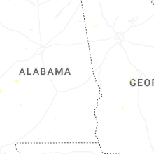
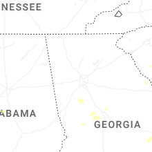


Connect with Interactive Hail Maps