

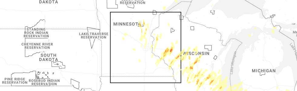
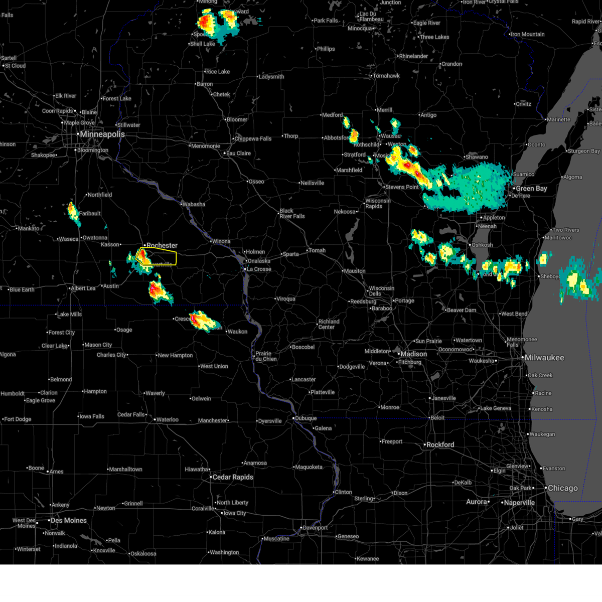
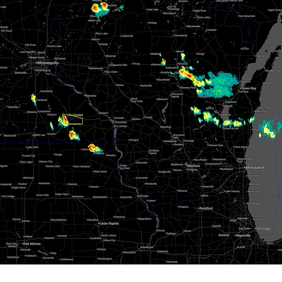
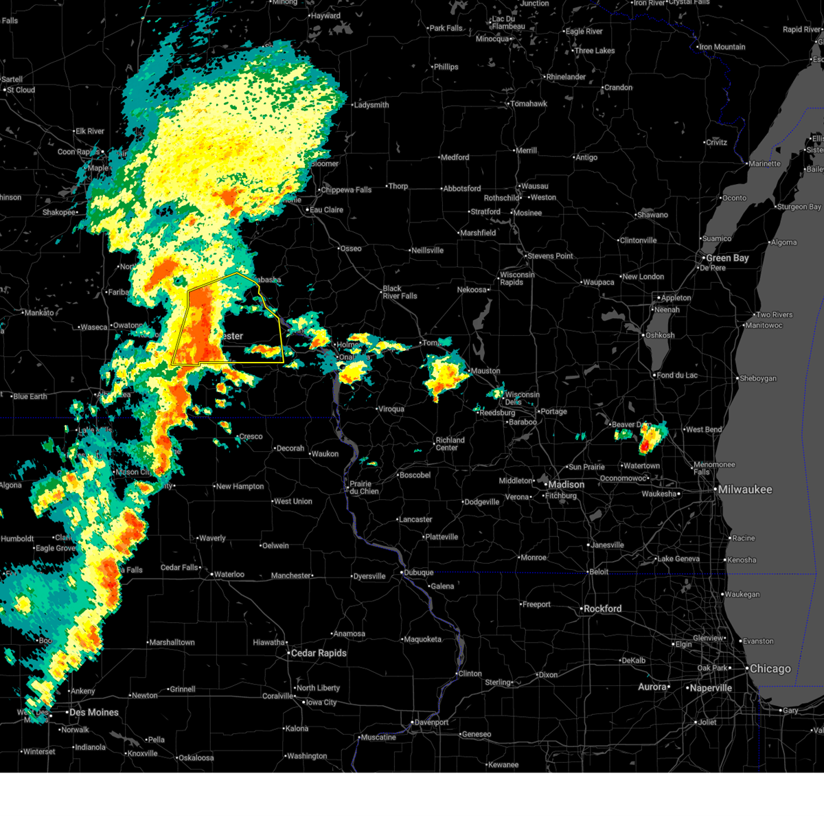
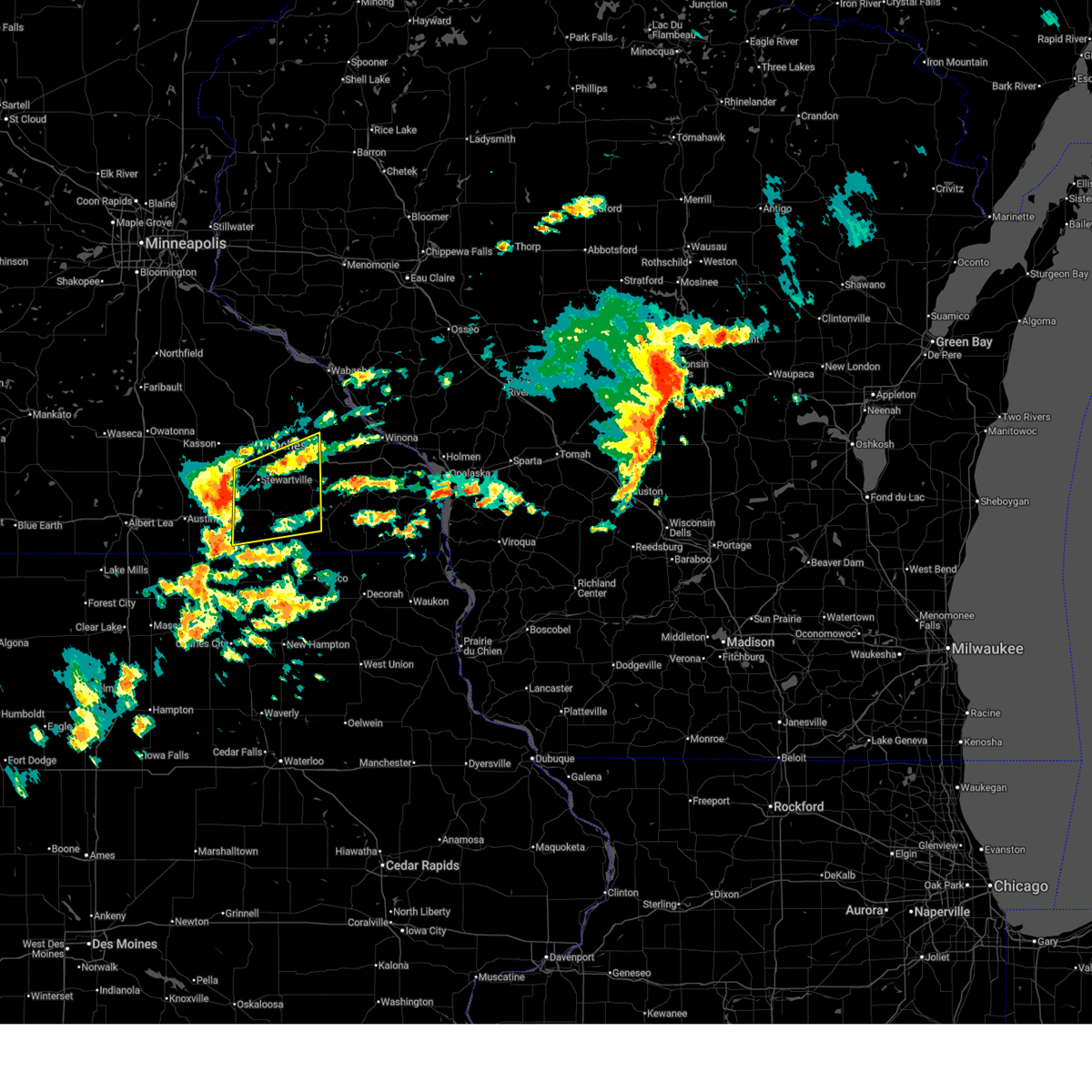
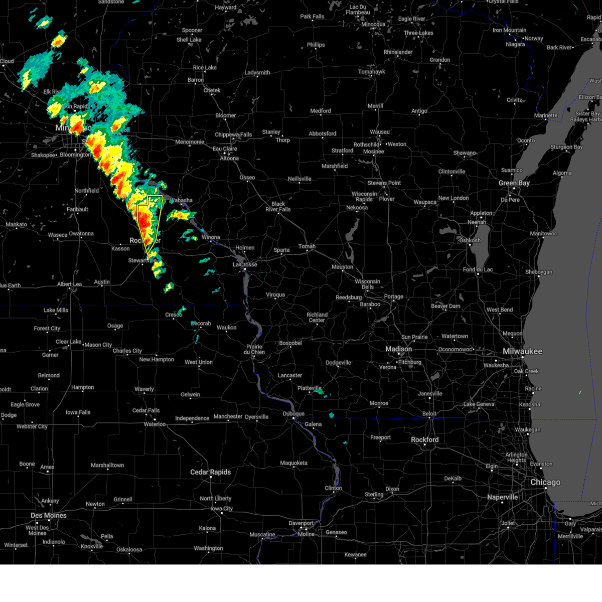
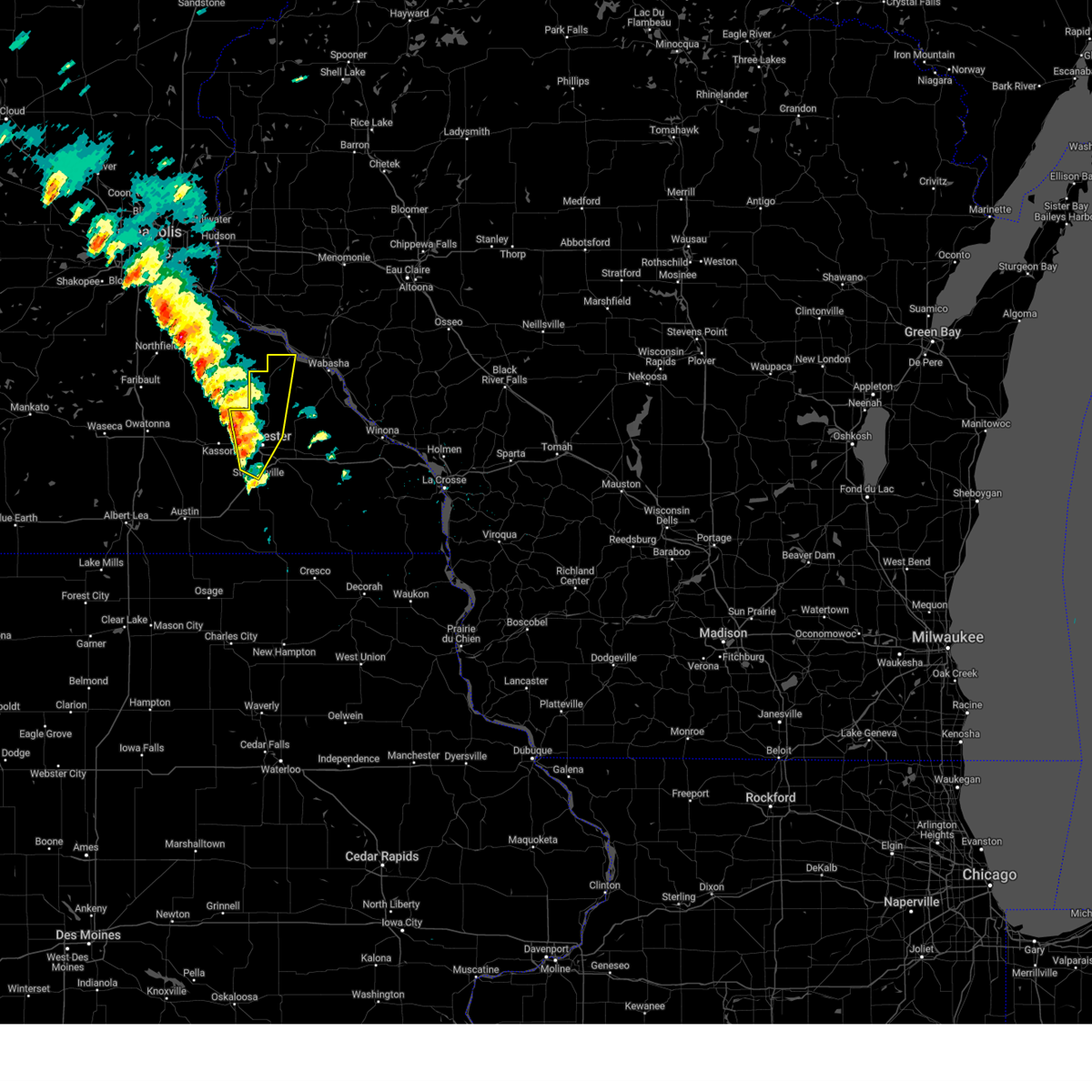
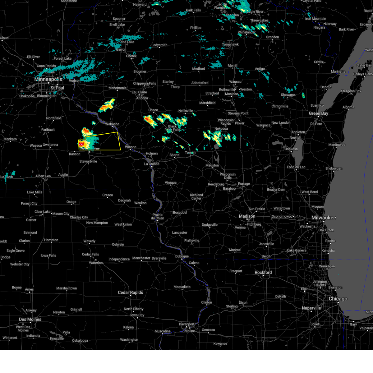
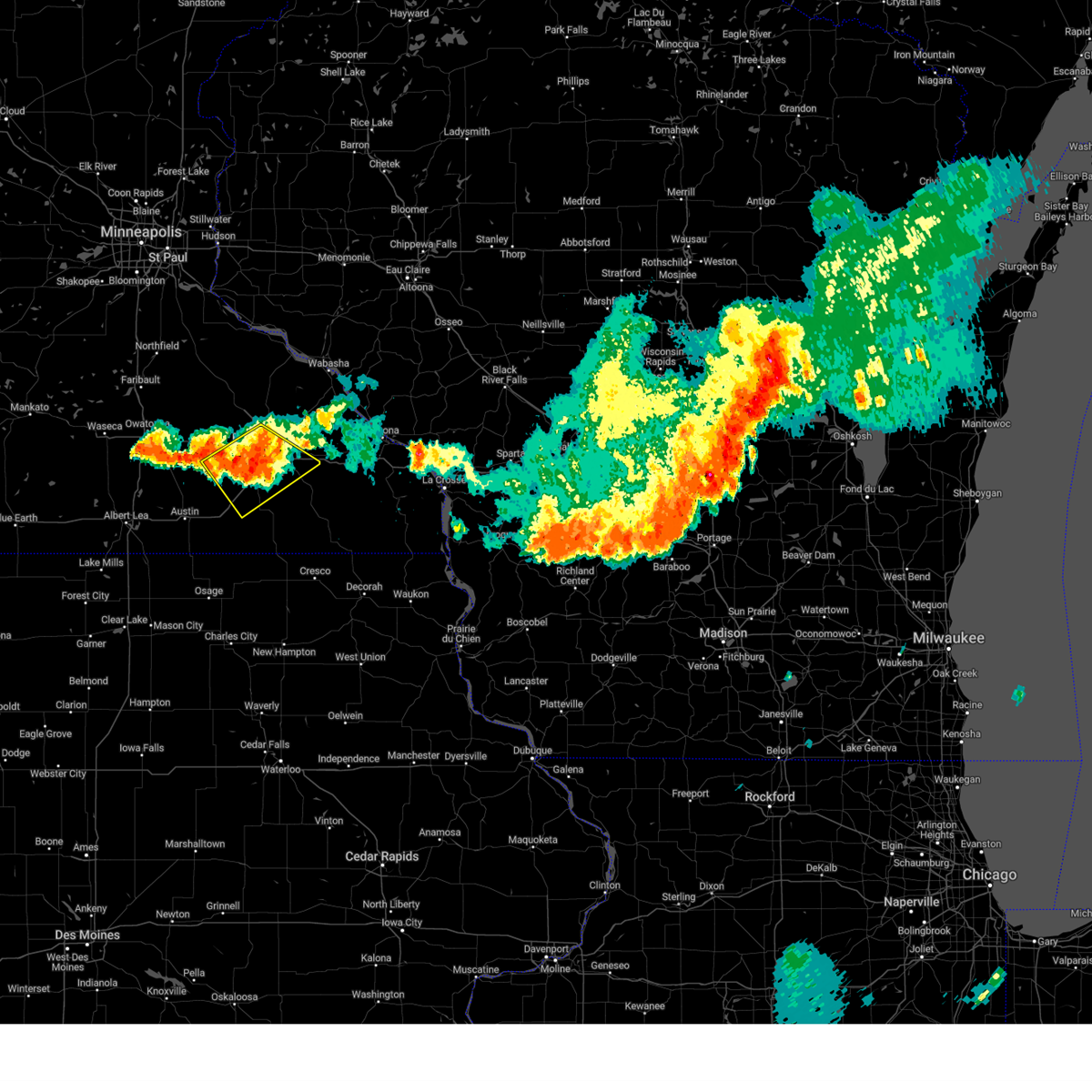
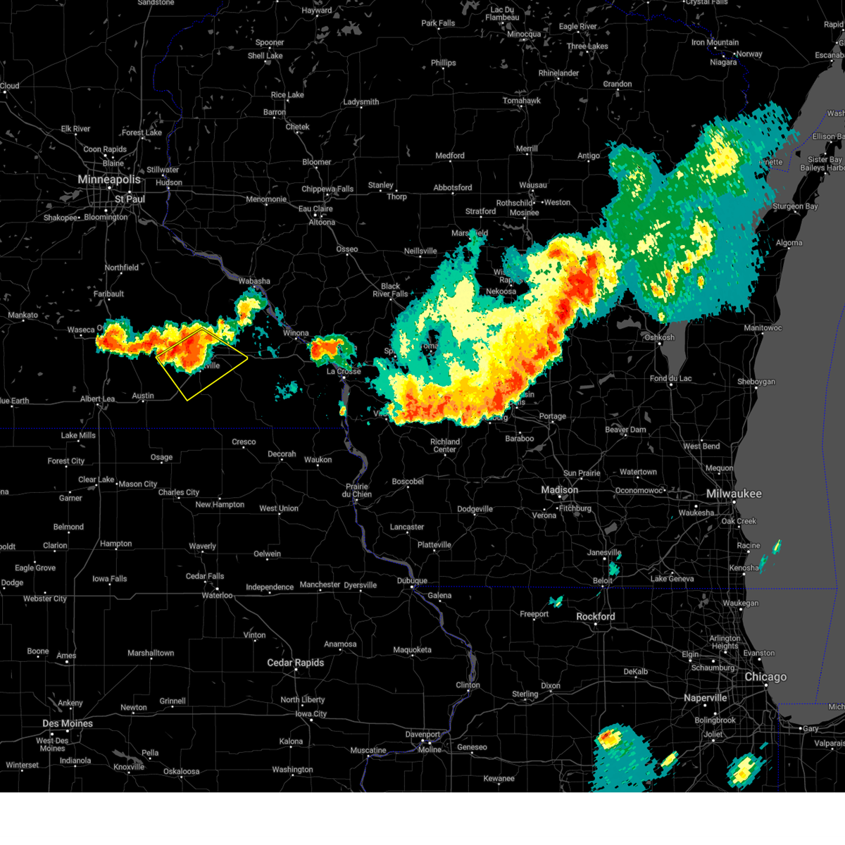
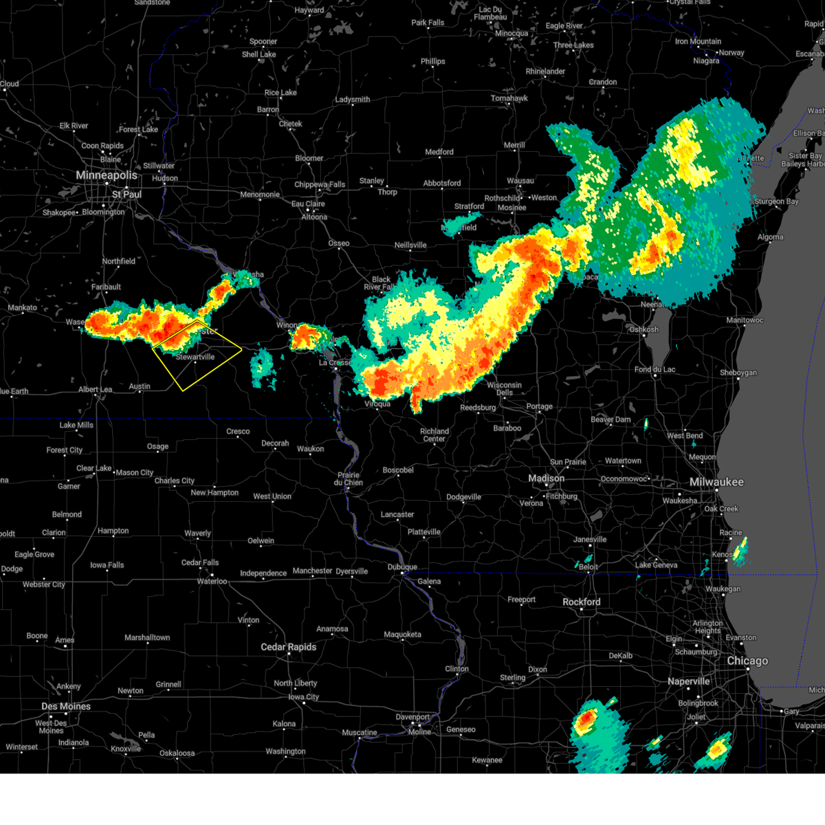
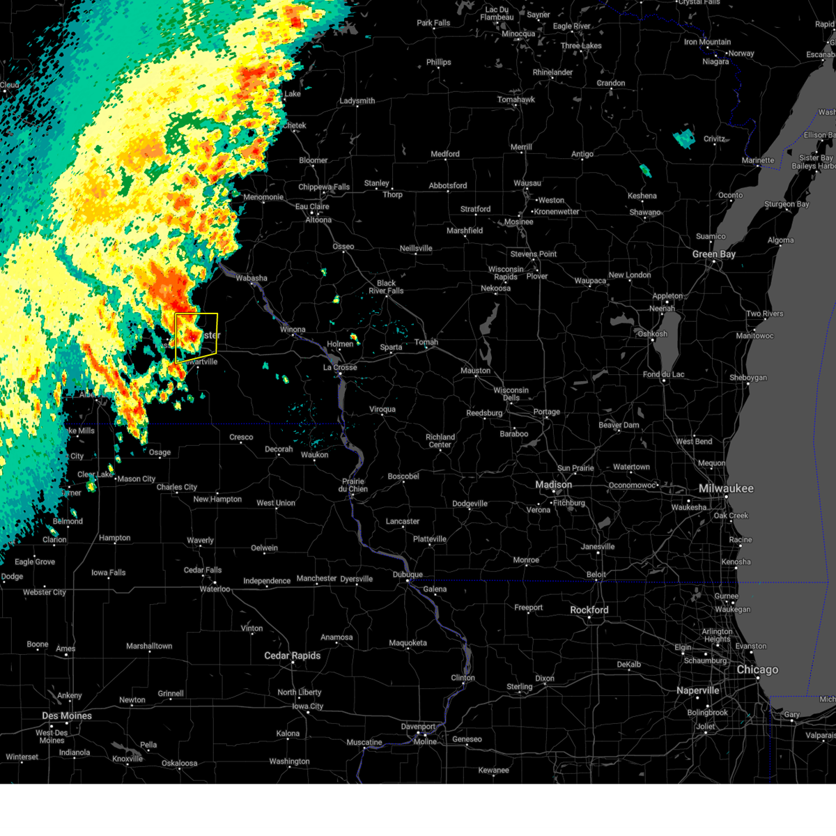
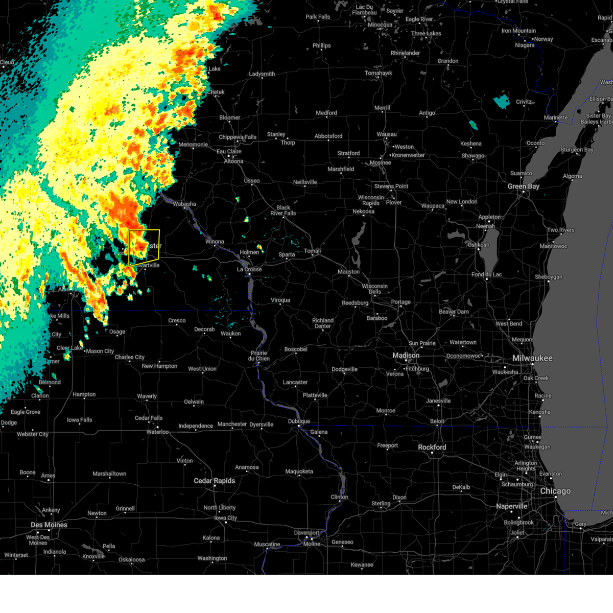
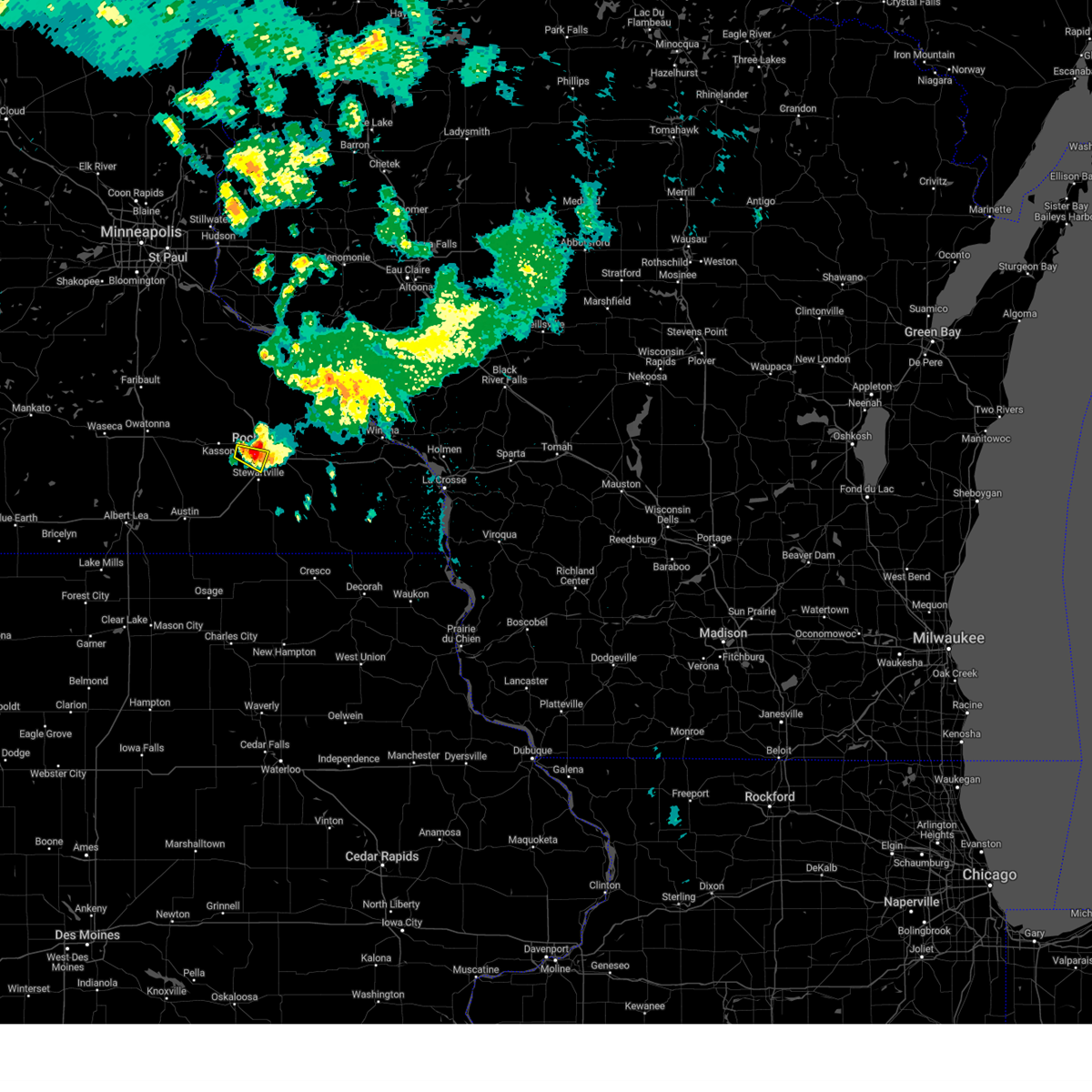
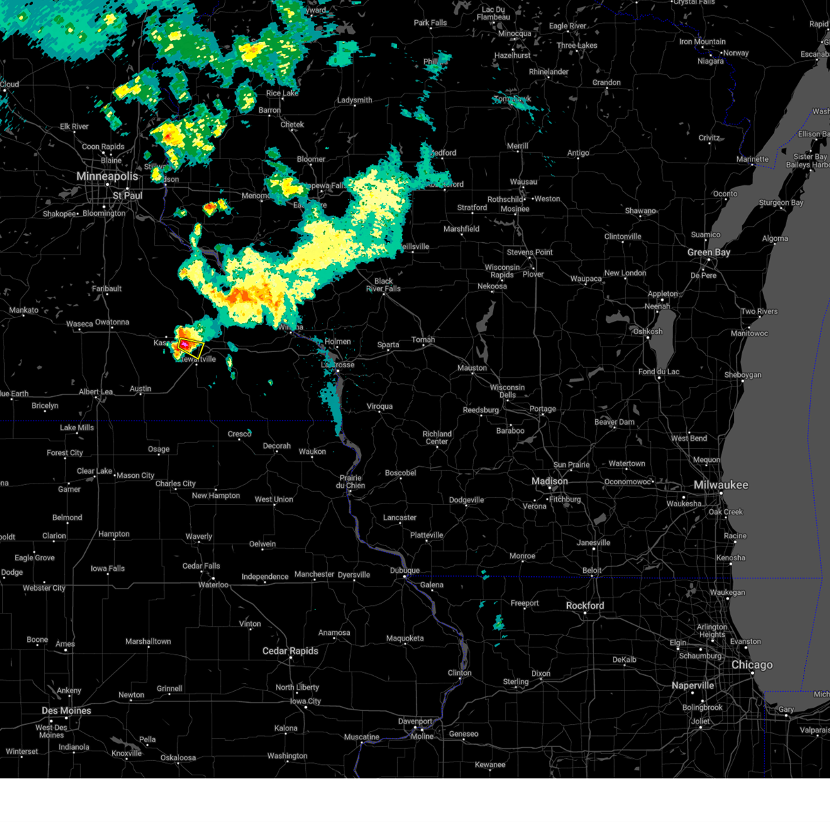
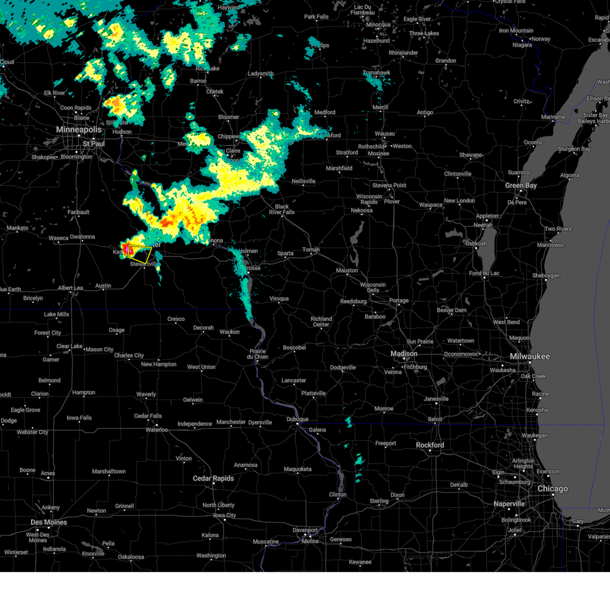
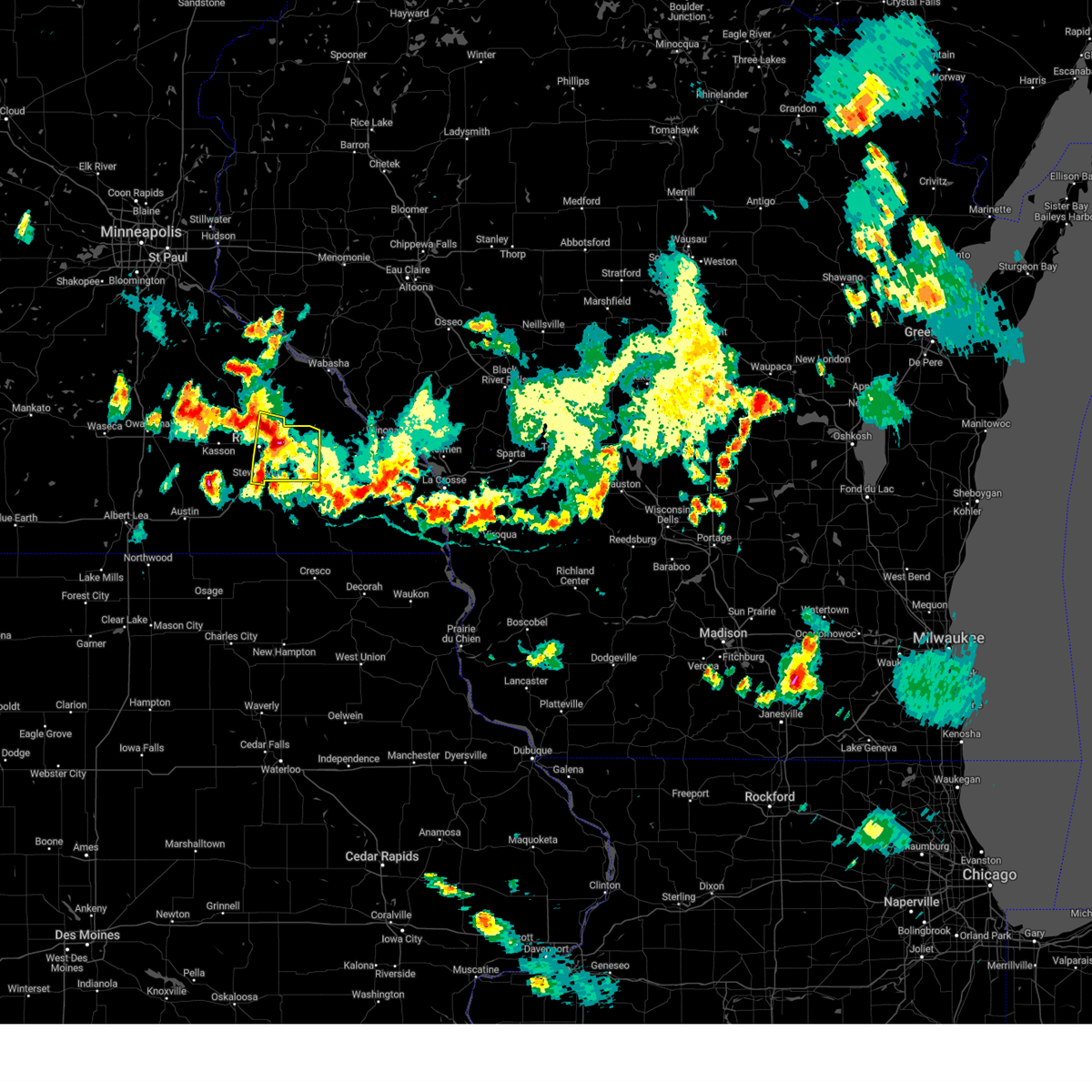
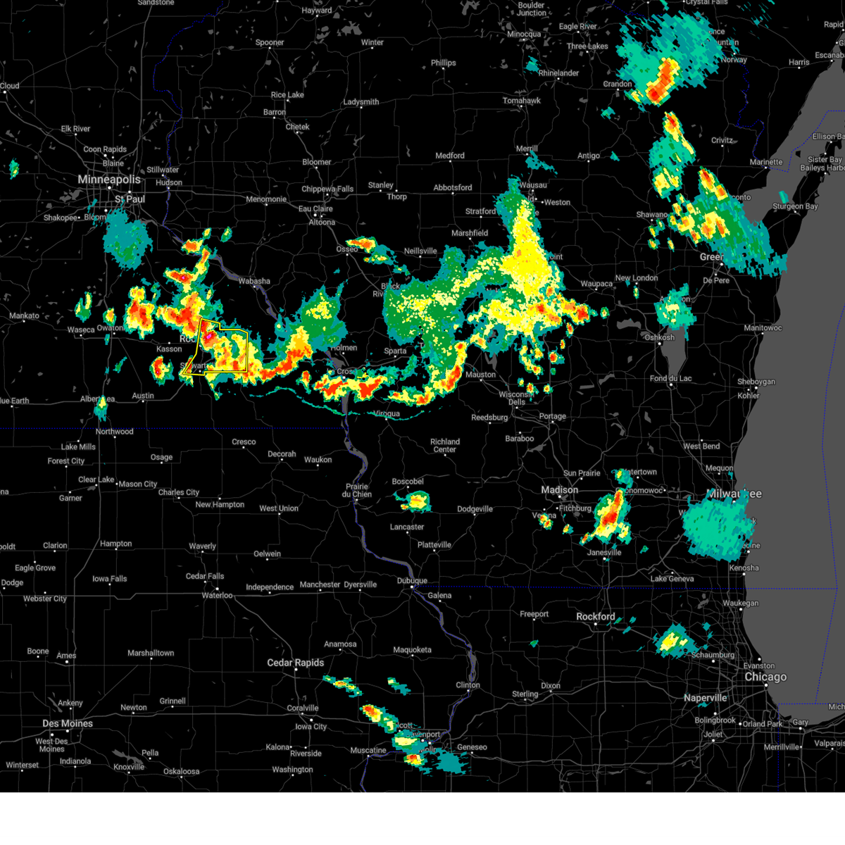
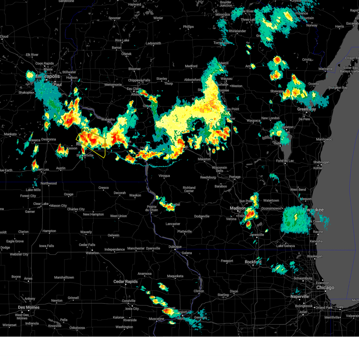
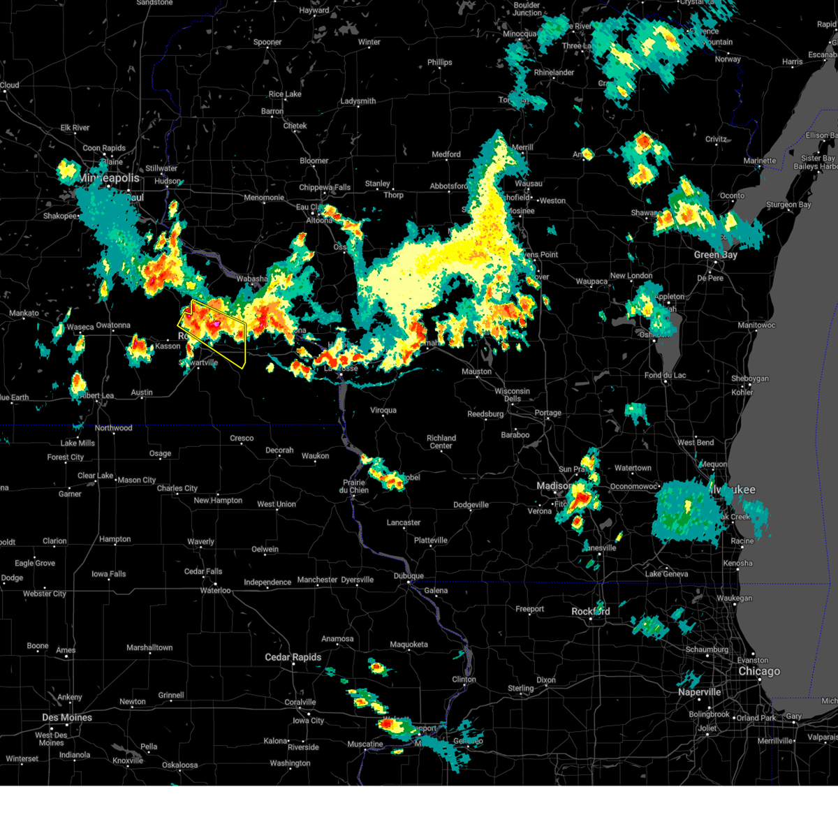
Hail Map for Rochester, MN
The Rochester, MN area has had 34 reports of on-the-ground hail by trained spotters, and has been under severe weather warnings 23 times during the past 12 months. Doppler radar has detected hail at or near Rochester, MN on 85 occasions, including 5 occasions during the past year.
| Name: | Rochester, MN |
| Where Located: | 62.8 miles WNW of La Crosse, WI |
| Map: | Google Map for Rochester, MN |
| Population: | 106769 |
| Housing Units: | 45683 |
| More Info: | Search Google for Rochester, MN |
1
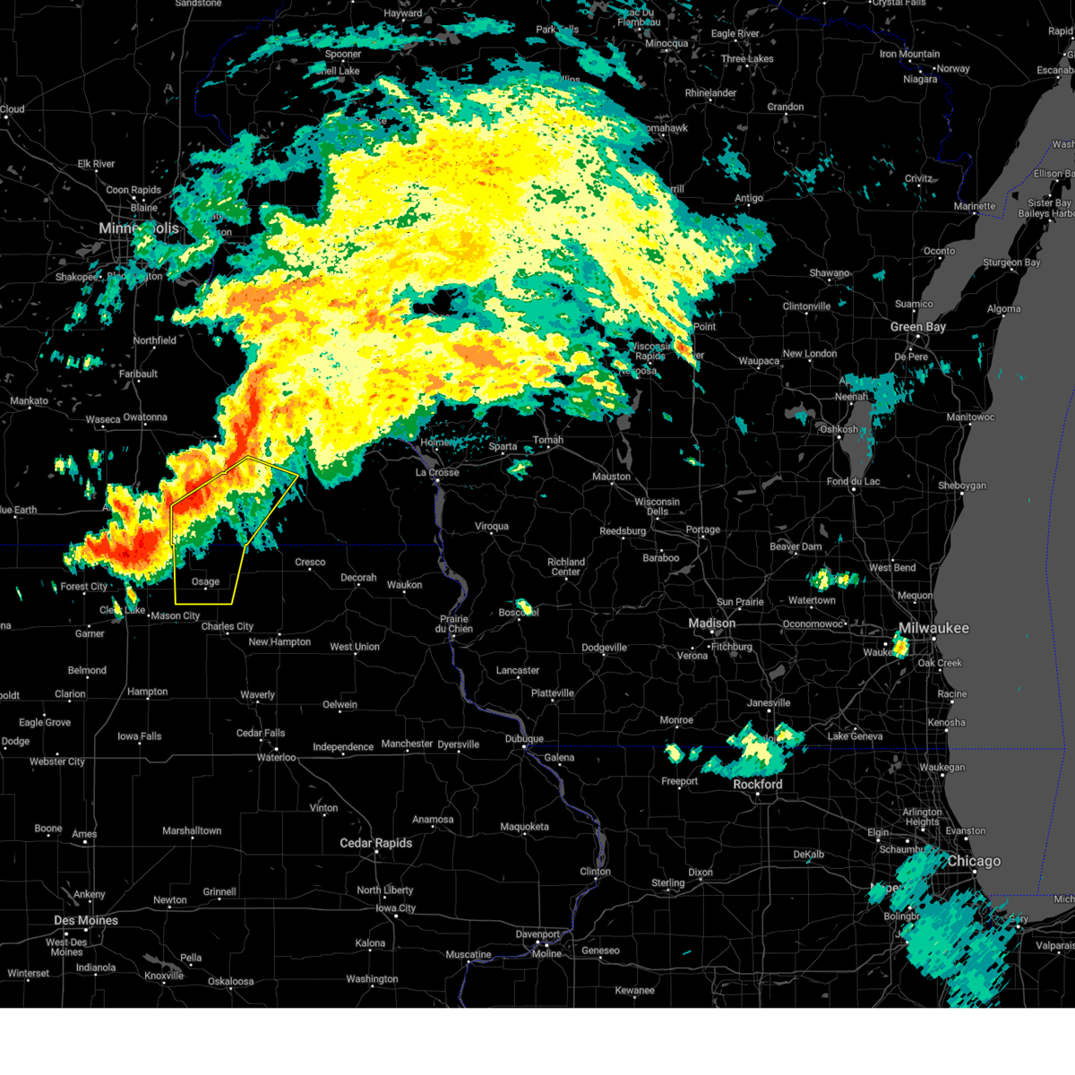
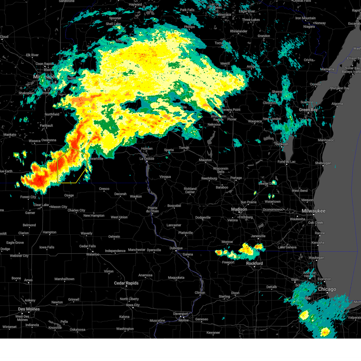
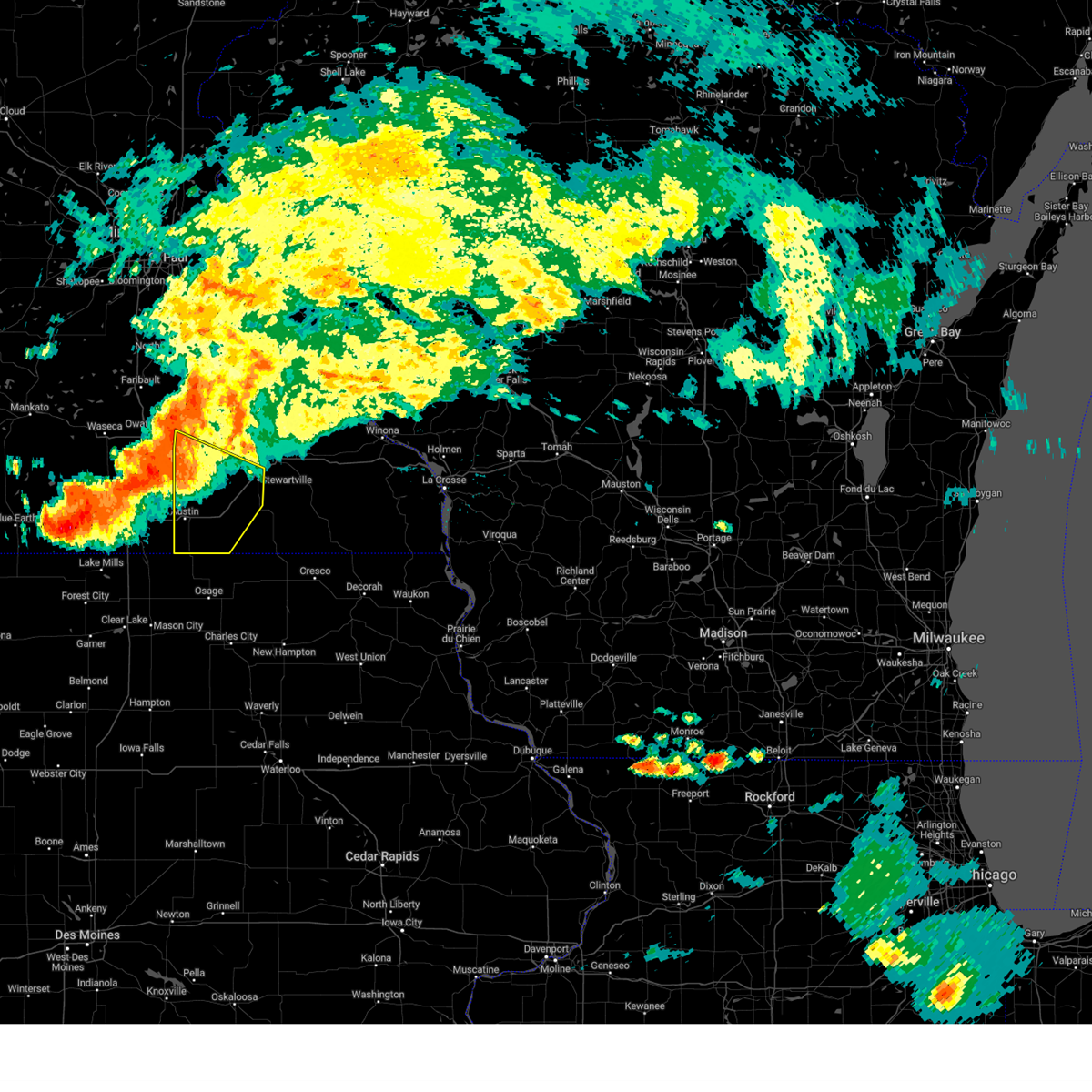
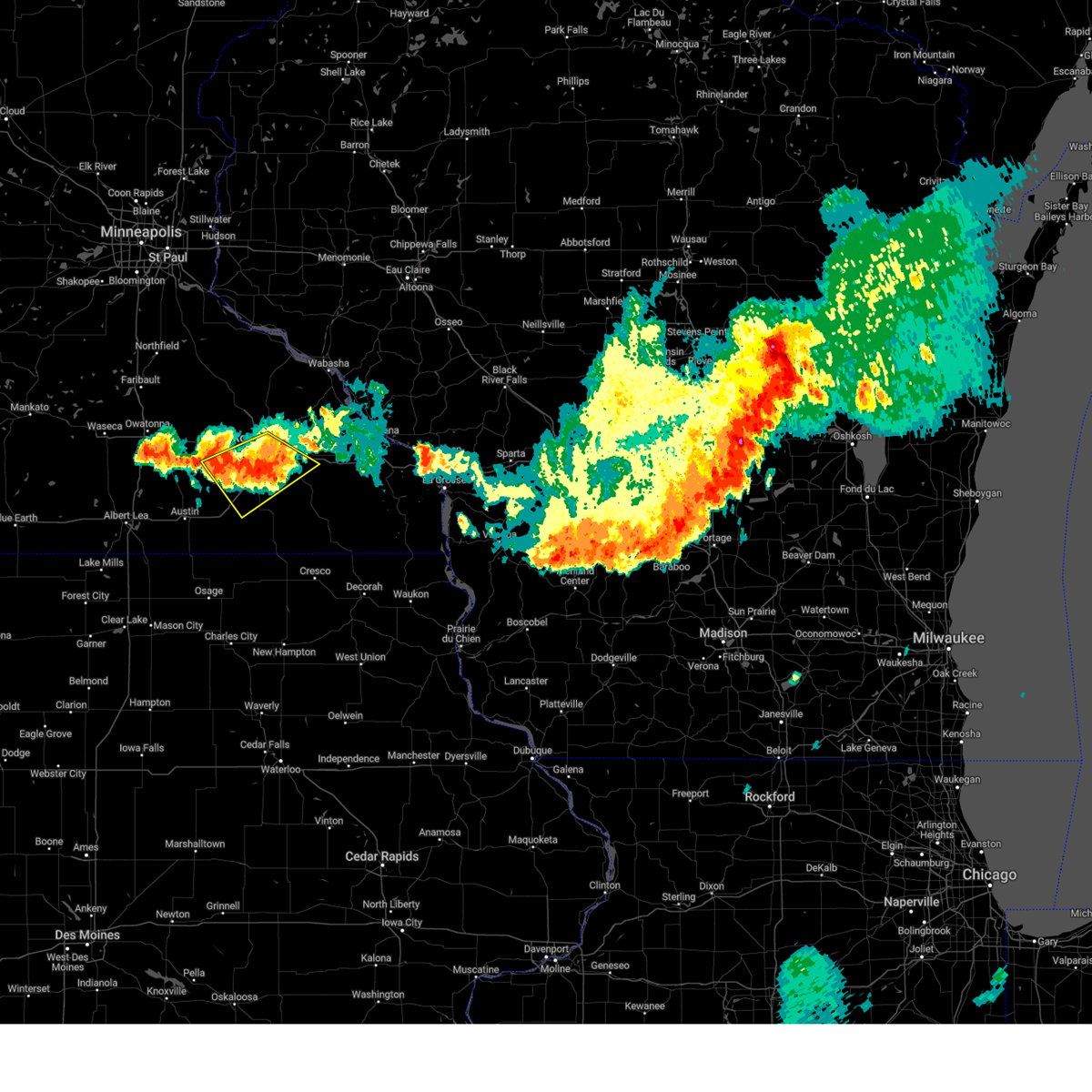
The Top Recent Hail Date for Rochester, MN is Thursday, May 15, 2025 (31st out of 85)
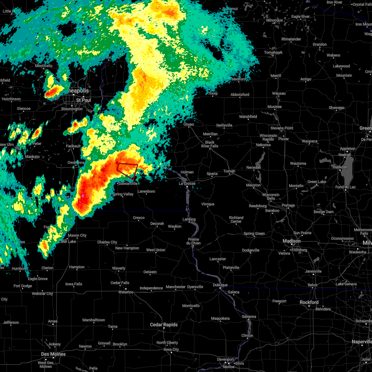
Hail and Wind Damage Spotted near Rochester, MN
| Date / Time | Report Details |
|---|---|
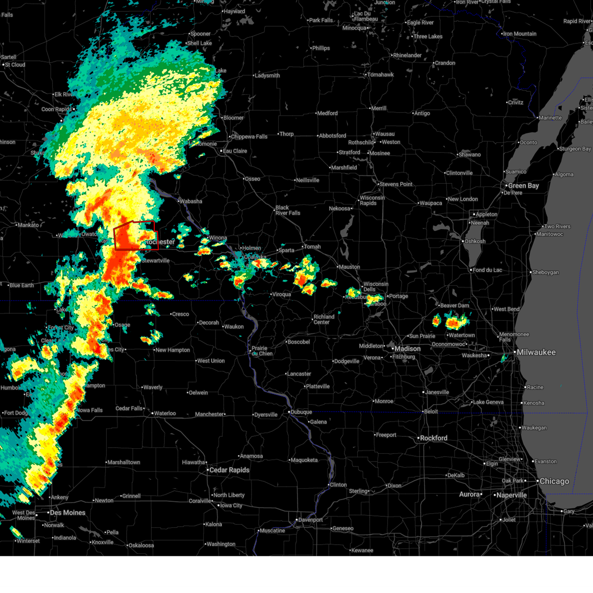
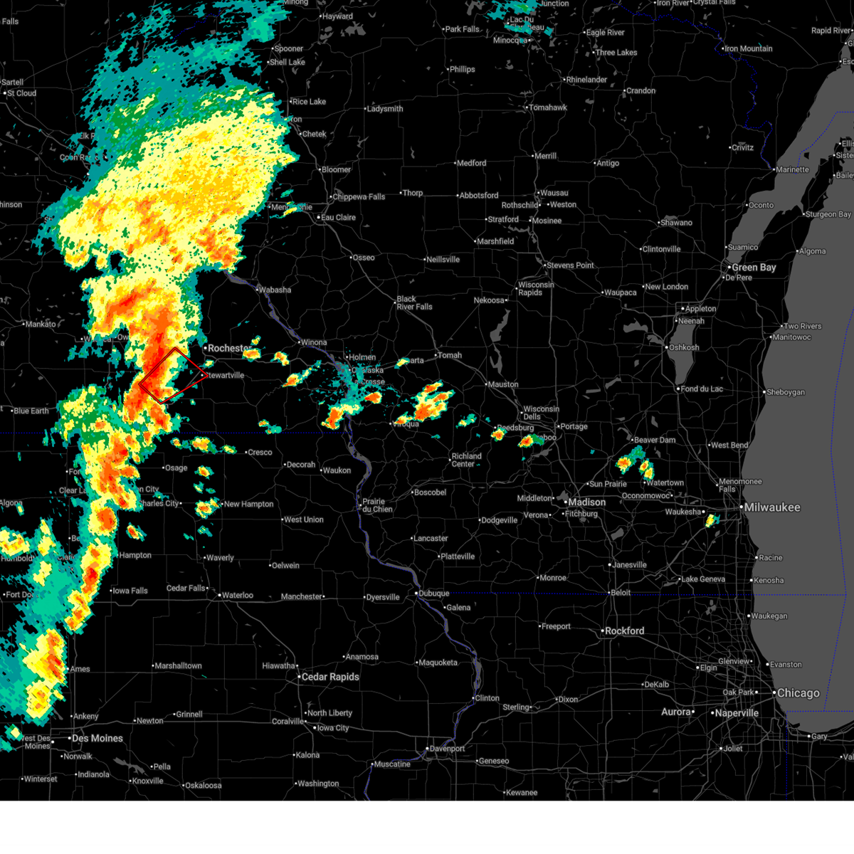
| 7/2/2025 6:52 PM CDT |
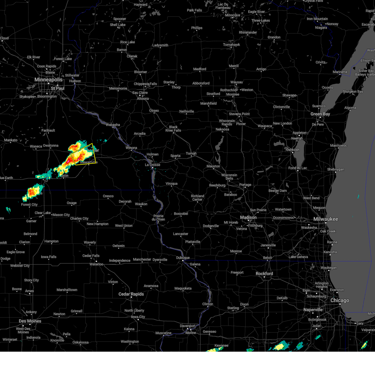
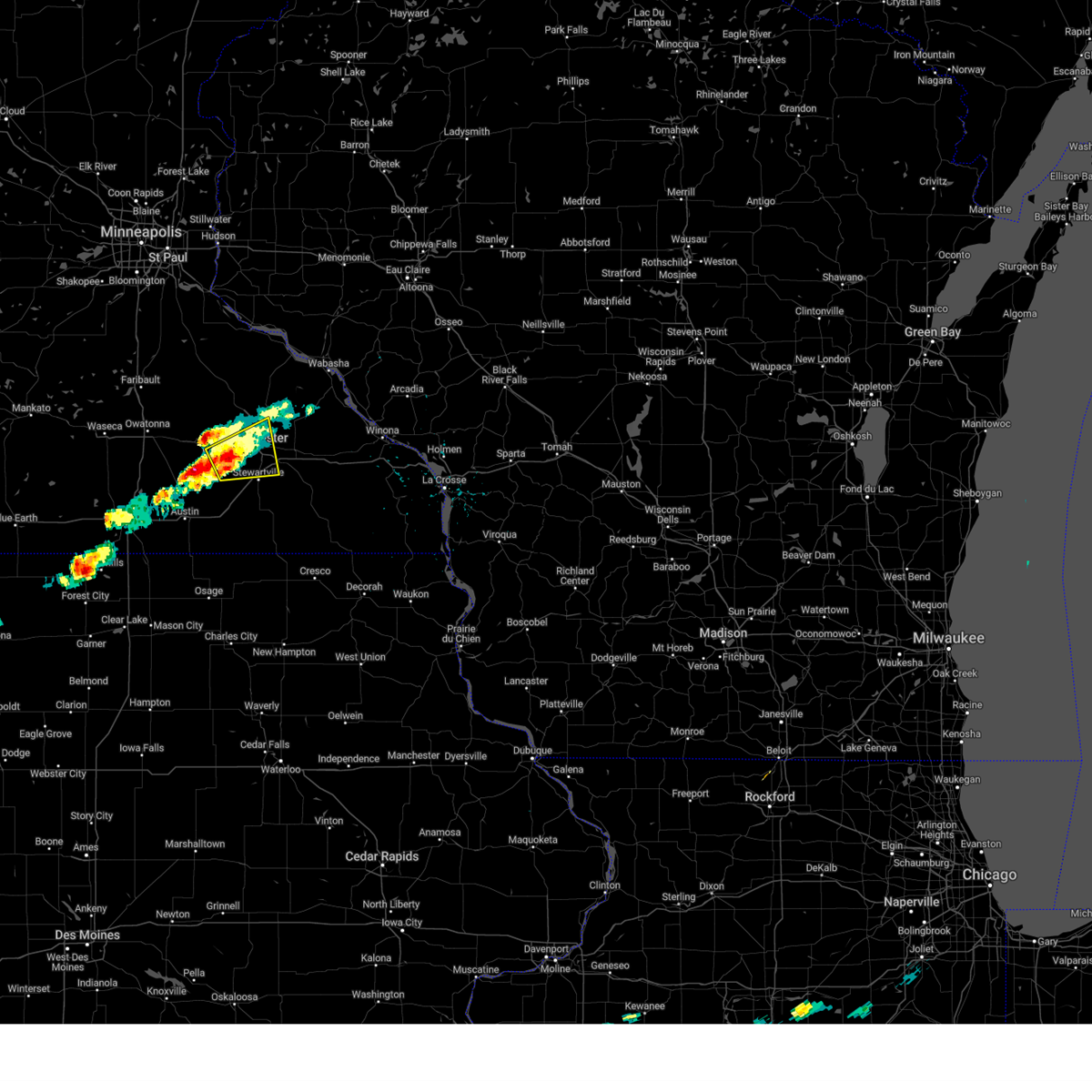
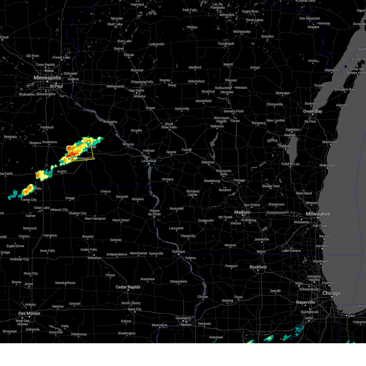
 At 652 pm cdt, a severe thunderstorm was located near stewartville, or 8 miles southeast of rochester, moving east at 15 mph (law enforcement reported downed tree in kasson at 615 pm). Hazards include 60 mph wind gusts and penny size hail. Expect damage to roofs, siding, and trees. this severe storm will be near, chatfield around 720 pm cdt. other locations impacted by this severe thunderstorm include chester, pleasant grove, predmore, county roads 137 and 136, apache mall, marion, and cummingsville. This includes interstate 90 in minnesota between mile markers 208 and 232. At 652 pm cdt, a severe thunderstorm was located near stewartville, or 8 miles southeast of rochester, moving east at 15 mph (law enforcement reported downed tree in kasson at 615 pm). Hazards include 60 mph wind gusts and penny size hail. Expect damage to roofs, siding, and trees. this severe storm will be near, chatfield around 720 pm cdt. other locations impacted by this severe thunderstorm include chester, pleasant grove, predmore, county roads 137 and 136, apache mall, marion, and cummingsville. This includes interstate 90 in minnesota between mile markers 208 and 232.
|
| 7/2/2025 6:40 PM CDT |
 Svrarx the national weather service in la crosse has issued a * severe thunderstorm warning for, southern olmsted county in southeastern minnesota, * until 730 pm cdt. * at 640 pm cdt, a severe thunderstorm was located near stewartville, or near rochester, moving east at 25 mph (law enforcement reported downed trees in kasson at 615pm). Hazards include 60 mph wind gusts and nickel size hail. Expect damage to roofs, siding, and trees. this severe thunderstorm will be near, stewartville around 645 pm cdt. chatfield around 705 pm cdt. other locations impacted by this severe thunderstorm include chester, highway 30 and county 15, pleasant grove, predmore, county roads 137 and 136, apache mall, and salem corners. This includes interstate 90 in minnesota between mile markers 208 and 232. Svrarx the national weather service in la crosse has issued a * severe thunderstorm warning for, southern olmsted county in southeastern minnesota, * until 730 pm cdt. * at 640 pm cdt, a severe thunderstorm was located near stewartville, or near rochester, moving east at 25 mph (law enforcement reported downed trees in kasson at 615pm). Hazards include 60 mph wind gusts and nickel size hail. Expect damage to roofs, siding, and trees. this severe thunderstorm will be near, stewartville around 645 pm cdt. chatfield around 705 pm cdt. other locations impacted by this severe thunderstorm include chester, highway 30 and county 15, pleasant grove, predmore, county roads 137 and 136, apache mall, and salem corners. This includes interstate 90 in minnesota between mile markers 208 and 232.
|
| 6/26/2025 3:17 PM CDT | At 317 pm cdt, severe thunderstorms were located along a line extending from 6 miles west of kellogg to near chatfield, moving northeast at 50 mph (radar indicated). Hazards include 60 mph wind gusts. Expect damage to roofs, siding, and trees. these severe storms will be near, wabasha, alma, st. charles, dover, and kellogg around 325 pm cdt. buffalo city and altura around 330 pm cdt. lewiston and rollingstone around 340 pm cdt. stockton around 345 pm cdt. other locations impacted by these severe thunderstorms include whitewater state park, pioneer campground, county roads 9 and 10, county roads 6 and 33, wyattville, whitman, and county roads 28 and 31. This includes interstate 90 in minnesota between mile markers 211 and 250. |
| 6/26/2025 2:54 PM CDT |
 Svrarx the national weather service in la crosse has issued a * severe thunderstorm warning for, winona county in southeastern minnesota, olmsted county in southeastern minnesota, wabasha county in southeastern minnesota, * until 330 pm cdt. * at 253 pm cdt, a severe thunderstorm was located near elgin, or 8 miles northeast of rochester, moving east at 50 mph (radar indicated). Hazards include 60 mph wind gusts. Expect damage to roofs, siding, and trees. this severe thunderstorm will be near, plainview and elgin around 300 pm cdt. buffalo city around 320 pm cdt. other locations impacted by this severe thunderstorm include south troy, pioneer campground, county roads 9 and 10, potsdam, county roads 28 and 31, hidden meadows r v park, and rock dell. This includes interstate 90 in minnesota between mile markers 205 and 250. Svrarx the national weather service in la crosse has issued a * severe thunderstorm warning for, winona county in southeastern minnesota, olmsted county in southeastern minnesota, wabasha county in southeastern minnesota, * until 330 pm cdt. * at 253 pm cdt, a severe thunderstorm was located near elgin, or 8 miles northeast of rochester, moving east at 50 mph (radar indicated). Hazards include 60 mph wind gusts. Expect damage to roofs, siding, and trees. this severe thunderstorm will be near, plainview and elgin around 300 pm cdt. buffalo city around 320 pm cdt. other locations impacted by this severe thunderstorm include south troy, pioneer campground, county roads 9 and 10, potsdam, county roads 28 and 31, hidden meadows r v park, and rock dell. This includes interstate 90 in minnesota between mile markers 205 and 250.
|
| 6/26/2025 2:44 PM CDT | At 244 pm cdt, a severe thunderstorm capable of producing a tornado was located near oronoco, or near rochester, moving east at 30 mph (radar indicated rotation). Hazards include tornado. Flying debris will be dangerous to those caught without shelter. mobile homes will be damaged or destroyed. damage to roofs, windows, and vehicles will occur. tree damage is likely. this dangerous storm will be near, rochester around 250 pm cdt. other locations impacted by this tornadic thunderstorm include chester, kings park, ringe, douglas, potsdam, apache mall, and highway 52 and 55th northwest. This includes interstate 90 in minnesota between mile markers 218 and 222. |
| 6/26/2025 2:44 PM CDT | the tornado warning has been cancelled and is no longer in effect |
| 6/26/2025 2:43 PM CDT | The storm which prompted the warning has weakened below severe limits, and no longer appears capable of producing a tornado. therefore, the warning will be allowed to expire. a tornado watch remains in effect until 800 pm cdt for southeastern minnesota. remember, a tornado warning still remains in effect for northwestern olmsted county until 300 pm cdt. |
| 6/26/2025 2:25 PM CDT |
 Torarx the national weather service in la crosse has issued a * tornado warning for, northwestern olmsted county in southeastern minnesota, northeastern dodge county in southeastern minnesota, * until 300 pm cdt. * at 225 pm cdt, a severe thunderstorm capable of producing a tornado was located over mantorville, moving east at 30 mph (radar indicated rotation). Hazards include tornado. Flying debris will be dangerous to those caught without shelter. mobile homes will be damaged or destroyed. damage to roofs, windows, and vehicles will occur. tree damage is likely. this dangerous storm will be near, byron around 230 pm cdt. rochester around 235 pm cdt. other locations impacted by this tornadic thunderstorm include ringe, potsdam, danesville, highway 57 and 570th street, salem corners, century high school, and highway 52 and county 14. This includes interstate 90 in minnesota between mile markers 218 and 222. Torarx the national weather service in la crosse has issued a * tornado warning for, northwestern olmsted county in southeastern minnesota, northeastern dodge county in southeastern minnesota, * until 300 pm cdt. * at 225 pm cdt, a severe thunderstorm capable of producing a tornado was located over mantorville, moving east at 30 mph (radar indicated rotation). Hazards include tornado. Flying debris will be dangerous to those caught without shelter. mobile homes will be damaged or destroyed. damage to roofs, windows, and vehicles will occur. tree damage is likely. this dangerous storm will be near, byron around 230 pm cdt. rochester around 235 pm cdt. other locations impacted by this tornadic thunderstorm include ringe, potsdam, danesville, highway 57 and 570th street, salem corners, century high school, and highway 52 and county 14. This includes interstate 90 in minnesota between mile markers 218 and 222.
|
| 6/26/2025 2:13 PM CDT |
 Torarx the national weather service in la crosse has issued a * tornado warning for, southwestern olmsted county in southeastern minnesota, northern mower county in southeastern minnesota, southeastern dodge county in southeastern minnesota, * until 245 pm cdt. * at 213 pm cdt, a severe thunderstorm capable of producing a tornado was located over brownsdale, or 8 miles northeast of austin, moving northeast at 40 mph (radar indicated rotation). Hazards include tornado. Flying debris will be dangerous to those caught without shelter. mobile homes will be damaged or destroyed. damage to roofs, windows, and vehicles will occur. tree damage is likely. this tornadic thunderstorm will remain over mainly rural areas of southwestern olmsted, northern mower and southeastern dodge counties, including the following locations, oslo, sargeant, county roads 1 and 7, county roads 3 and 108, county roads 6 and 15, mayville, and rock dell. This includes interstate 90 in minnesota between mile markers 199 and 209. Torarx the national weather service in la crosse has issued a * tornado warning for, southwestern olmsted county in southeastern minnesota, northern mower county in southeastern minnesota, southeastern dodge county in southeastern minnesota, * until 245 pm cdt. * at 213 pm cdt, a severe thunderstorm capable of producing a tornado was located over brownsdale, or 8 miles northeast of austin, moving northeast at 40 mph (radar indicated rotation). Hazards include tornado. Flying debris will be dangerous to those caught without shelter. mobile homes will be damaged or destroyed. damage to roofs, windows, and vehicles will occur. tree damage is likely. this tornadic thunderstorm will remain over mainly rural areas of southwestern olmsted, northern mower and southeastern dodge counties, including the following locations, oslo, sargeant, county roads 1 and 7, county roads 3 and 108, county roads 6 and 15, mayville, and rock dell. This includes interstate 90 in minnesota between mile markers 199 and 209.
|
| 6/26/2025 1:53 PM CDT | Svrarx the national weather service in la crosse has issued a * severe thunderstorm warning for, olmsted county in southeastern minnesota, dodge county in southeastern minnesota, * until 245 pm cdt. * at 152 pm cdt, a severe thunderstorm was located near claremont, or 8 miles west of dodge center, moving east at 40 mph (radar indicated). Hazards include 60 mph wind gusts. Expect damage to roofs, siding, and trees. this severe thunderstorm will be near, dodge center around 200 pm cdt. mantorville and kasson around 205 pm cdt. byron around 215 pm cdt. rochester around 225 pm cdt. other locations impacted by this severe thunderstorm include county roads 20 and 5, south troy, potsdam, eden, county roads 3 and 108, highway 57 and 570th street, and county roads 6 and 15. This includes interstate 90 in minnesota between mile markers 207 and 221. |
| 6/23/2025 2:23 PM CDT |
 At 222 pm cdt, severe thunderstorms were located along a line extending from 7 miles southwest of eyota to near spring valley, moving northeast at 35 mph (automated weather observations reported 60 to 70 mph gusts briefly in dexter at 2 pm). Hazards include 60 mph wind gusts. Expect damage to roofs, siding, and trees. these severe storms will be near, chatfield, eyota, and wykoff around 230 pm cdt. dover and fountain around 235 pm cdt. preston and st. charles around 240 pm cdt. other locations impacted by these severe thunderstorms include forestville state park, etna, carimona, predmore, county roads 9 and 10, county roads 137 and 136, and ostrander. This includes interstate 90 in minnesota between mile markers 213 and 232. At 222 pm cdt, severe thunderstorms were located along a line extending from 7 miles southwest of eyota to near spring valley, moving northeast at 35 mph (automated weather observations reported 60 to 70 mph gusts briefly in dexter at 2 pm). Hazards include 60 mph wind gusts. Expect damage to roofs, siding, and trees. these severe storms will be near, chatfield, eyota, and wykoff around 230 pm cdt. dover and fountain around 235 pm cdt. preston and st. charles around 240 pm cdt. other locations impacted by these severe thunderstorms include forestville state park, etna, carimona, predmore, county roads 9 and 10, county roads 137 and 136, and ostrander. This includes interstate 90 in minnesota between mile markers 213 and 232.
|
| 6/23/2025 2:23 PM CDT |
 the severe thunderstorm warning has been cancelled and is no longer in effect the severe thunderstorm warning has been cancelled and is no longer in effect
|
| 6/23/2025 2:12 PM CDT |
 At 211 pm cdt, severe thunderstorms were located along a line extending from near stewartville to 6 miles north of le roy, moving east at 50 mph (automated weather observations reported 60 to 70 mph gusts briefly in dexter at 2 pm). Hazards include 60 mph wind gusts. Expect damage to roofs, siding, and trees. these severe storms will be near, spring valley around 215 pm cdt. chatfield, eyota, and wykoff around 220 pm cdt. dover and fountain around 225 pm cdt. preston and st. charles around 230 pm cdt. other locations impacted by these severe thunderstorms include forestville state park, etna, carimona, predmore, county roads 9 and 10, county roads 137 and 136, and ostrander. This includes interstate 90 in minnesota between mile markers 206 and 232. At 211 pm cdt, severe thunderstorms were located along a line extending from near stewartville to 6 miles north of le roy, moving east at 50 mph (automated weather observations reported 60 to 70 mph gusts briefly in dexter at 2 pm). Hazards include 60 mph wind gusts. Expect damage to roofs, siding, and trees. these severe storms will be near, spring valley around 215 pm cdt. chatfield, eyota, and wykoff around 220 pm cdt. dover and fountain around 225 pm cdt. preston and st. charles around 230 pm cdt. other locations impacted by these severe thunderstorms include forestville state park, etna, carimona, predmore, county roads 9 and 10, county roads 137 and 136, and ostrander. This includes interstate 90 in minnesota between mile markers 206 and 232.
|
| 6/23/2025 2:04 PM CDT |
 Svrarx the national weather service in la crosse has issued a * severe thunderstorm warning for, southern olmsted county in southeastern minnesota, eastern mower county in southeastern minnesota, northwestern fillmore county in southeastern minnesota, * until 300 pm cdt. * at 204 pm cdt, severe thunderstorms were located along a line extending from near stewartville to near le roy, moving east at 40 mph (radar indicated. at 155 pm, dexter reported a wind gust to 57 mph). Hazards include 60 mph wind gusts. Expect damage to roofs, siding, and trees. severe thunderstorms will be near, rochester, stewartville, and spring valley around 210 pm cdt. wykoff around 220 pm cdt. chatfield and eyota around 225 pm cdt. dover and fountain around 230 pm cdt. preston and st. charles around 235 pm cdt. other locations impacted by these severe thunderstorms include forestville state park, county roads 9 and 10, county roads 3 and 108, fillmore, county roads 4 and 8, rochester airport, and washington. This includes interstate 90 in minnesota between mile markers 198 and 232. Svrarx the national weather service in la crosse has issued a * severe thunderstorm warning for, southern olmsted county in southeastern minnesota, eastern mower county in southeastern minnesota, northwestern fillmore county in southeastern minnesota, * until 300 pm cdt. * at 204 pm cdt, severe thunderstorms were located along a line extending from near stewartville to near le roy, moving east at 40 mph (radar indicated. at 155 pm, dexter reported a wind gust to 57 mph). Hazards include 60 mph wind gusts. Expect damage to roofs, siding, and trees. severe thunderstorms will be near, rochester, stewartville, and spring valley around 210 pm cdt. wykoff around 220 pm cdt. chatfield and eyota around 225 pm cdt. dover and fountain around 230 pm cdt. preston and st. charles around 235 pm cdt. other locations impacted by these severe thunderstorms include forestville state park, county roads 9 and 10, county roads 3 and 108, fillmore, county roads 4 and 8, rochester airport, and washington. This includes interstate 90 in minnesota between mile markers 198 and 232.
|
| 5/15/2025 2:37 PM CDT | Quarter sized hail reported 4.2 miles SW of Rochester, MN, report from mping: quarter (1.00 in.). |
| 5/15/2025 2:31 PM CDT |
 At 230 pm cdt, severe thunderstorms were located along a line extending from near goodhue to near rochester, moving north at 60 mph (radar indicated). Hazards include 60 mph wind gusts and quarter size hail. Hail damage to vehicles is expected. expect wind damage to roofs, siding, and trees. these severe storms will be near, mazeppa around 235 pm cdt. Other locations impacted by these severe thunderstorms include south troy, jarrett, ringe, rattelsnake point, potsdam, oak center, and century high school. At 230 pm cdt, severe thunderstorms were located along a line extending from near goodhue to near rochester, moving north at 60 mph (radar indicated). Hazards include 60 mph wind gusts and quarter size hail. Hail damage to vehicles is expected. expect wind damage to roofs, siding, and trees. these severe storms will be near, mazeppa around 235 pm cdt. Other locations impacted by these severe thunderstorms include south troy, jarrett, ringe, rattelsnake point, potsdam, oak center, and century high school.
|
| 5/15/2025 2:14 PM CDT |
 Svrarx the national weather service in la crosse has issued a * severe thunderstorm warning for, western olmsted county in southeastern minnesota, western wabasha county in southeastern minnesota, * until 245 pm cdt. * at 214 pm cdt, severe thunderstorms were located along a line extending from near wanamingo to near rochester, moving north at 50 mph (radar indicated). Hazards include 60 mph wind gusts and quarter size hail. Hail damage to vehicles is expected. expect wind damage to roofs, siding, and trees. severe thunderstorms will be near, rochester, oronoco, and mazeppa around 220 pm cdt. other locations impacted by these severe thunderstorms include south troy, rattelsnake point, potsdam, salem corners, hidden meadows r v park, west albany, and rochester airport. This includes interstate 90 in minnesota between mile markers 208 and 211. Svrarx the national weather service in la crosse has issued a * severe thunderstorm warning for, western olmsted county in southeastern minnesota, western wabasha county in southeastern minnesota, * until 245 pm cdt. * at 214 pm cdt, severe thunderstorms were located along a line extending from near wanamingo to near rochester, moving north at 50 mph (radar indicated). Hazards include 60 mph wind gusts and quarter size hail. Hail damage to vehicles is expected. expect wind damage to roofs, siding, and trees. severe thunderstorms will be near, rochester, oronoco, and mazeppa around 220 pm cdt. other locations impacted by these severe thunderstorms include south troy, rattelsnake point, potsdam, salem corners, hidden meadows r v park, west albany, and rochester airport. This includes interstate 90 in minnesota between mile markers 208 and 211.
|
| 4/28/2025 7:59 PM CDT | Quarter sized hail reported 8.8 miles WNW of Rochester, MN, report from mping: quarter (1.00 in.). |
| 3/28/2025 6:29 PM CDT |
 Svrarx the national weather service in la crosse has issued a * severe thunderstorm warning for, northwestern winona county in southeastern minnesota, northern olmsted county in southeastern minnesota, southern wabasha county in southeastern minnesota, * until 715 pm cdt. * at 628 pm cdt, a severe thunderstorm was located over oronoco, or 9 miles northwest of rochester, moving east at 45 mph (radar indicated). Hazards include half dollar size hail. Damage to vehicles is expected. this severe thunderstorm will be near, elgin around 645 pm cdt. plainview around 650 pm cdt. Other locations impacted by this severe thunderstorm include south troy, rattelsnake point, potsdam, county roads 28 and 31, hidden meadows r v park, kings park, and rattlesnake ridge. Svrarx the national weather service in la crosse has issued a * severe thunderstorm warning for, northwestern winona county in southeastern minnesota, northern olmsted county in southeastern minnesota, southern wabasha county in southeastern minnesota, * until 715 pm cdt. * at 628 pm cdt, a severe thunderstorm was located over oronoco, or 9 miles northwest of rochester, moving east at 45 mph (radar indicated). Hazards include half dollar size hail. Damage to vehicles is expected. this severe thunderstorm will be near, elgin around 645 pm cdt. plainview around 650 pm cdt. Other locations impacted by this severe thunderstorm include south troy, rattelsnake point, potsdam, county roads 28 and 31, hidden meadows r v park, kings park, and rattlesnake ridge.
|
| 8/5/2024 9:03 PM CDT | A medium sized healthy tree was partially uprooted and many other trees were snapped in half - report from mpin in olmsted county MN, 4.3 miles SSE of Rochester, MN |
| 8/5/2024 8:11 PM CDT |
 Svrarx the national weather service in la crosse has issued a * severe thunderstorm warning for, mitchell county in north central iowa, southwestern olmsted county in southeastern minnesota, mower county in southeastern minnesota, northwestern fillmore county in southeastern minnesota, * until 900 pm cdt. * at 810 pm cdt, severe thunderstorms were located along a line extending from near rochester to near manly, moving southeast at 35 mph (radar indicated). Hazards include 60 mph wind gusts. Expect damage to roofs, siding, and trees. severe thunderstorms will be near, rochester, stewartville, lyle, and rose creek around 815 pm cdt. grand meadow, st. ansgar, and adams around 820 pm cdt. stacyville around 825 pm cdt. osage and spring valley around 830 pm cdt. chatfield and le roy around 835 pm cdt. other locations impacted by these severe thunderstorms include toeterville, rock creek, otranto, brownville, and rochester airport. People attending the mower county fairgrounds should seek safe shelter immediately! this includes interstate 90 in minnesota between mile markers 175 and 212. Svrarx the national weather service in la crosse has issued a * severe thunderstorm warning for, mitchell county in north central iowa, southwestern olmsted county in southeastern minnesota, mower county in southeastern minnesota, northwestern fillmore county in southeastern minnesota, * until 900 pm cdt. * at 810 pm cdt, severe thunderstorms were located along a line extending from near rochester to near manly, moving southeast at 35 mph (radar indicated). Hazards include 60 mph wind gusts. Expect damage to roofs, siding, and trees. severe thunderstorms will be near, rochester, stewartville, lyle, and rose creek around 815 pm cdt. grand meadow, st. ansgar, and adams around 820 pm cdt. stacyville around 825 pm cdt. osage and spring valley around 830 pm cdt. chatfield and le roy around 835 pm cdt. other locations impacted by these severe thunderstorms include toeterville, rock creek, otranto, brownville, and rochester airport. People attending the mower county fairgrounds should seek safe shelter immediately! this includes interstate 90 in minnesota between mile markers 175 and 212.
|
| 8/5/2024 7:58 PM CDT |
 At 758 pm cdt, severe thunderstorms were located along a line extending from near byron to 7 miles southeast of hayfield to near northwood, moving east at 45 mph (automated weather observations). Hazards include 60 mph wind gusts and penny size hail. Expect damage to roofs, siding, and trees. these severe storms will be near, rochester, lyle, and rose creek around 805 pm cdt. stewartville, grand meadow, and adams around 810 pm cdt. other locations impacted by these severe thunderstorms include county roads 3 and 108, county roads 6 and 15, rock dell, brookside campground, mayville, rochester airport, and graves landing field. People attending the mower county fairgrounds should seek safe shelter immediately! this includes interstate 90 in minnesota between mile markers 175 and 212. At 758 pm cdt, severe thunderstorms were located along a line extending from near byron to 7 miles southeast of hayfield to near northwood, moving east at 45 mph (automated weather observations). Hazards include 60 mph wind gusts and penny size hail. Expect damage to roofs, siding, and trees. these severe storms will be near, rochester, lyle, and rose creek around 805 pm cdt. stewartville, grand meadow, and adams around 810 pm cdt. other locations impacted by these severe thunderstorms include county roads 3 and 108, county roads 6 and 15, rock dell, brookside campground, mayville, rochester airport, and graves landing field. People attending the mower county fairgrounds should seek safe shelter immediately! this includes interstate 90 in minnesota between mile markers 175 and 212.
|
| 8/5/2024 7:49 PM CDT | At 747 pm cdt, severe thunderstorms were located along a line extending from near dodge center to near hayfield to near glenville, moving southeast at 30 mph (radar indicated). Hazards include 60 mph wind gusts and penny size hail. Expect damage to roofs, siding, and trees. these severe storms will be near, austin and brownsdale around 755 pm cdt. rose creek around 805 pm cdt. rochester and lyle around 810 pm cdt. stewartville and grand meadow around 815 pm cdt. adams around 820 pm cdt. other locations impacted by these severe thunderstorms include rock dell, brookside campground, and mayville. People attending the mower county fairgrounds should seek safe shelter immediately! this includes interstate 90 in minnesota between mile markers 175 and 212. |
| 8/5/2024 7:31 PM CDT |
 Svrarx the national weather service in la crosse has issued a * severe thunderstorm warning for, southwestern olmsted county in southeastern minnesota, mower county in southeastern minnesota, southern dodge county in southeastern minnesota, * until 815 pm cdt. * at 729 pm cdt, severe thunderstorms were located along a line extending from near claremont to near blooming prairie to near twin lakes, moving southeast at 45 mph (radar indicated). Hazards include 60 mph wind gusts and penny size hail. Expect damage to roofs, siding, and trees. severe thunderstorms will be near, austin, dodge center, and hayfield around 735 pm cdt. brownsdale around 740 pm cdt. rochester, stewartville, grand meadow, lyle, and rose creek around 755 pm cdt. adams around 800 pm cdt. other locations impacted by these severe thunderstorms include rock dell, brookside campground, and mayville. People attending the mower county fairgrounds should seek safe shelter immediately! this includes interstate 90 in minnesota between mile markers 175 and 212. Svrarx the national weather service in la crosse has issued a * severe thunderstorm warning for, southwestern olmsted county in southeastern minnesota, mower county in southeastern minnesota, southern dodge county in southeastern minnesota, * until 815 pm cdt. * at 729 pm cdt, severe thunderstorms were located along a line extending from near claremont to near blooming prairie to near twin lakes, moving southeast at 45 mph (radar indicated). Hazards include 60 mph wind gusts and penny size hail. Expect damage to roofs, siding, and trees. severe thunderstorms will be near, austin, dodge center, and hayfield around 735 pm cdt. brownsdale around 740 pm cdt. rochester, stewartville, grand meadow, lyle, and rose creek around 755 pm cdt. adams around 800 pm cdt. other locations impacted by these severe thunderstorms include rock dell, brookside campground, and mayville. People attending the mower county fairgrounds should seek safe shelter immediately! this includes interstate 90 in minnesota between mile markers 175 and 212.
|
| 7/31/2024 7:33 PM CDT | At 733 pm cdt, a severe thunderstorm was located 7 miles east of oronoco, or 13 miles north of rochester, moving southeast at 15 mph (trained weather spotters). Hazards include golf ball size hail and 60 mph wind gusts. People and animals outdoors will be injured. expect hail damage to roofs, siding, windows, and vehicles. expect wind damage to roofs, siding, and trees. this severe storm will be near, elgin around 750 pm cdt. other locations impacted by this severe thunderstorm include south troy, jarrett, ringe, county roads 9 and 10, county roads 79 and 2, rattelsnake point, and potsdam. This includes interstate 90 in minnesota between mile markers 223 and 232. |
| 7/31/2024 7:14 PM CDT | Svrarx the national weather service in la crosse has issued a * severe thunderstorm warning for, central olmsted county in southeastern minnesota, southwestern wabasha county in southeastern minnesota, * until 800 pm cdt. * at 714 pm cdt, a severe thunderstorm was located near mazeppa, or 14 miles north of rochester, moving southeast at 30 mph (radar indicated). Hazards include golf ball size hail and 60 mph wind gusts. People and animals outdoors will be injured. expect hail damage to roofs, siding, windows, and vehicles. expect wind damage to roofs, siding, and trees. this severe thunderstorm will be near, eyota around 740 pm cdt. dover around 755 pm cdt. other locations impacted by this severe thunderstorm include south troy, jarrett, ringe, county roads 9 and 10, county roads 79 and 2, rattelsnake point, and potsdam. This includes interstate 90 in minnesota between mile markers 219 and 232. |
| 7/13/2024 7:02 PM CDT |
 At 701 pm cdt, a severe thunderstorm was located near stewartville, or 14 miles southeast of rochester, moving southeast at 20 mph (trained weather spotters). Hazards include 70 mph wind gusts and penny size hail. Expect considerable tree damage. damage is likely to mobile homes, roofs, and outbuildings. this severe thunderstorm will remain over mainly rural areas of southern olmsted, northeastern mower, southeastern dodge and northwestern fillmore counties, including the following locations, oslo, predmore, county roads 3 and 108, county roads 137 and 136, county roads 6 and 15, salem corners, and century high school. This includes interstate 90 in minnesota between mile markers 196 and 229. At 701 pm cdt, a severe thunderstorm was located near stewartville, or 14 miles southeast of rochester, moving southeast at 20 mph (trained weather spotters). Hazards include 70 mph wind gusts and penny size hail. Expect considerable tree damage. damage is likely to mobile homes, roofs, and outbuildings. this severe thunderstorm will remain over mainly rural areas of southern olmsted, northeastern mower, southeastern dodge and northwestern fillmore counties, including the following locations, oslo, predmore, county roads 3 and 108, county roads 137 and 136, county roads 6 and 15, salem corners, and century high school. This includes interstate 90 in minnesota between mile markers 196 and 229.
|
| 7/13/2024 6:53 PM CDT |
 At 651 pm cdt, a severe thunderstorm was located near stewartville, or 12 miles south of rochester, moving southeast at 30 mph (automated weather observations. at 645 pm, a 64 mph wind gust was observed at rochester international airport). Hazards include 60 mph wind gusts and penny size hail. Expect damage to roofs, siding, and trees. this severe thunderstorm will remain over mainly rural areas of olmsted, northeastern mower, southeastern dodge and northwestern fillmore counties, including the following locations, oslo, predmore, county roads 3 and 108, county roads 137 and 136, county roads 6 and 15, salem corners, and century high school. This includes interstate 90 in minnesota between mile markers 196 and 230. At 651 pm cdt, a severe thunderstorm was located near stewartville, or 12 miles south of rochester, moving southeast at 30 mph (automated weather observations. at 645 pm, a 64 mph wind gust was observed at rochester international airport). Hazards include 60 mph wind gusts and penny size hail. Expect damage to roofs, siding, and trees. this severe thunderstorm will remain over mainly rural areas of olmsted, northeastern mower, southeastern dodge and northwestern fillmore counties, including the following locations, oslo, predmore, county roads 3 and 108, county roads 137 and 136, county roads 6 and 15, salem corners, and century high school. This includes interstate 90 in minnesota between mile markers 196 and 230.
|
| 7/13/2024 6:51 PM CDT | Asos station krst rochester international airpor in olmsted county MN, 8 miles N of Rochester, MN |
| 7/13/2024 6:45 PM CDT | Asos station krst rochester international airpor in olmsted county MN, 8 miles N of Rochester, MN |
| 7/13/2024 6:38 PM CDT |
 At 637 pm cdt, a severe thunderstorm was located near stewartville, or 7 miles south of rochester, moving southeast at 30 mph (law enforcement). Hazards include 60 mph wind gusts and quarter size hail. Hail damage to vehicles is expected. expect wind damage to roofs, siding, and trees. this severe storm will be near, stewartville around 640 pm cdt. other locations impacted by this severe thunderstorm include oslo, predmore, county roads 3 and 108, county roads 137 and 136, county roads 6 and 15, salem corners, and century high school. This includes interstate 90 in minnesota between mile markers 196 and 230. At 637 pm cdt, a severe thunderstorm was located near stewartville, or 7 miles south of rochester, moving southeast at 30 mph (law enforcement). Hazards include 60 mph wind gusts and quarter size hail. Hail damage to vehicles is expected. expect wind damage to roofs, siding, and trees. this severe storm will be near, stewartville around 640 pm cdt. other locations impacted by this severe thunderstorm include oslo, predmore, county roads 3 and 108, county roads 137 and 136, county roads 6 and 15, salem corners, and century high school. This includes interstate 90 in minnesota between mile markers 196 and 230.
|
| 7/13/2024 6:37 PM CDT | Several large limbs down... including on a hous in olmsted county MN, 4.5 miles N of Rochester, MN |
| 7/13/2024 6:34 PM CDT |
 At 634 pm cdt, a severe thunderstorm was located 7 miles northwest of stewartville, or 8 miles southwest of rochester, moving southeast at 20 mph (law enforcement). Hazards include 60 mph wind gusts and quarter size hail. Hail damage to vehicles is expected. expect wind damage to roofs, siding, and trees. Locations impacted include, rochester, dodge center, mantorville, kasson, byron, hayfield, oronoco, claremont, wasioja, douglas, oslo, danesville, county roads 6 and 15, salem corners, century high school, highway 52 and county 14, county roads 5 and 6, highway 56 and county 6, oxbow park, and highway 52 and 55th northwest. At 634 pm cdt, a severe thunderstorm was located 7 miles northwest of stewartville, or 8 miles southwest of rochester, moving southeast at 20 mph (law enforcement). Hazards include 60 mph wind gusts and quarter size hail. Hail damage to vehicles is expected. expect wind damage to roofs, siding, and trees. Locations impacted include, rochester, dodge center, mantorville, kasson, byron, hayfield, oronoco, claremont, wasioja, douglas, oslo, danesville, county roads 6 and 15, salem corners, century high school, highway 52 and county 14, county roads 5 and 6, highway 56 and county 6, oxbow park, and highway 52 and 55th northwest.
|
| 7/13/2024 6:24 PM CDT |
 Svrarx the national weather service in la crosse has issued a * severe thunderstorm warning for, olmsted county in southeastern minnesota, northeastern mower county in southeastern minnesota, southeastern dodge county in southeastern minnesota, northwestern fillmore county in southeastern minnesota, * until 715 pm cdt. * at 623 pm cdt, a severe thunderstorm was located near byron, or near rochester, moving southeast at 30 mph (radar indicated). Hazards include 60 mph wind gusts and half dollar size hail. Hail damage to vehicles is expected. expect wind damage to roofs, siding, and trees. this severe thunderstorm will be near, rochester and stewartville around 630 pm cdt. other locations impacted by this severe thunderstorm include oslo, predmore, county roads 3 and 108, county roads 137 and 136, county roads 6 and 15, salem corners, and century high school. This includes interstate 90 in minnesota between mile markers 196 and 230. Svrarx the national weather service in la crosse has issued a * severe thunderstorm warning for, olmsted county in southeastern minnesota, northeastern mower county in southeastern minnesota, southeastern dodge county in southeastern minnesota, northwestern fillmore county in southeastern minnesota, * until 715 pm cdt. * at 623 pm cdt, a severe thunderstorm was located near byron, or near rochester, moving southeast at 30 mph (radar indicated). Hazards include 60 mph wind gusts and half dollar size hail. Hail damage to vehicles is expected. expect wind damage to roofs, siding, and trees. this severe thunderstorm will be near, rochester and stewartville around 630 pm cdt. other locations impacted by this severe thunderstorm include oslo, predmore, county roads 3 and 108, county roads 137 and 136, county roads 6 and 15, salem corners, and century high school. This includes interstate 90 in minnesota between mile markers 196 and 230.
|
| 7/13/2024 6:18 PM CDT |
 At 617 pm cdt, a severe thunderstorm was located near byron, or 8 miles southeast of mantorville, moving southeast at 30 mph (radar indicated). Hazards include ping pong ball size hail and 60 mph wind gusts. People and animals outdoors will be injured. expect hail damage to roofs, siding, windows, and vehicles. expect wind damage to roofs, siding, and trees. This severe thunderstorm will remain over mainly rural areas of northwestern olmsted and dodge counties, including the following locations, county roads 20 and 5, oslo, danesville, concord, eden, highway 57 and 570th street, and county roads 6 and 15. At 617 pm cdt, a severe thunderstorm was located near byron, or 8 miles southeast of mantorville, moving southeast at 30 mph (radar indicated). Hazards include ping pong ball size hail and 60 mph wind gusts. People and animals outdoors will be injured. expect hail damage to roofs, siding, windows, and vehicles. expect wind damage to roofs, siding, and trees. This severe thunderstorm will remain over mainly rural areas of northwestern olmsted and dodge counties, including the following locations, county roads 20 and 5, oslo, danesville, concord, eden, highway 57 and 570th street, and county roads 6 and 15.
|
| 7/13/2024 6:06 PM CDT |
 At 604 pm cdt, a severe thunderstorm was located over kasson, or near mantorville, moving southeast at 30 mph (radar indicated). Hazards include golf ball size hail and 60 mph wind gusts. People and animals outdoors will be injured. expect hail damage to roofs, siding, windows, and vehicles. expect wind damage to roofs, siding, and trees. this severe storm will be near, byron around 610 pm cdt. Other locations impacted by this severe thunderstorm include county roads 20 and 5, oslo, danesville, concord, eden, highway 57 and 570th street, and county roads 6 and 15. At 604 pm cdt, a severe thunderstorm was located over kasson, or near mantorville, moving southeast at 30 mph (radar indicated). Hazards include golf ball size hail and 60 mph wind gusts. People and animals outdoors will be injured. expect hail damage to roofs, siding, windows, and vehicles. expect wind damage to roofs, siding, and trees. this severe storm will be near, byron around 610 pm cdt. Other locations impacted by this severe thunderstorm include county roads 20 and 5, oslo, danesville, concord, eden, highway 57 and 570th street, and county roads 6 and 15.
|
| 7/13/2024 5:55 PM CDT |
 Svrarx the national weather service in la crosse has issued a * severe thunderstorm warning for, northwestern olmsted county in southeastern minnesota, dodge county in southeastern minnesota, * until 645 pm cdt. * at 555 pm cdt, a severe thunderstorm was located near dodge center, moving southeast at 25 mph (radar indicated). Hazards include ping pong ball size hail and 60 mph wind gusts. People and animals outdoors will be injured. expect hail damage to roofs, siding, windows, and vehicles. expect wind damage to roofs, siding, and trees. this severe thunderstorm will be near, dodge center, mantorville, and kasson around 600 pm cdt. Other locations impacted by this severe thunderstorm include county roads 20 and 5, oslo, danesville, concord, eden, highway 57 and 570th street, and county roads 6 and 15. Svrarx the national weather service in la crosse has issued a * severe thunderstorm warning for, northwestern olmsted county in southeastern minnesota, dodge county in southeastern minnesota, * until 645 pm cdt. * at 555 pm cdt, a severe thunderstorm was located near dodge center, moving southeast at 25 mph (radar indicated). Hazards include ping pong ball size hail and 60 mph wind gusts. People and animals outdoors will be injured. expect hail damage to roofs, siding, windows, and vehicles. expect wind damage to roofs, siding, and trees. this severe thunderstorm will be near, dodge center, mantorville, and kasson around 600 pm cdt. Other locations impacted by this severe thunderstorm include county roads 20 and 5, oslo, danesville, concord, eden, highway 57 and 570th street, and county roads 6 and 15.
|
| 6/17/2024 6:35 AM CDT | Awos station k9mn mayo helipa in olmsted county MN, 0.3 miles S of Rochester, MN |
| 6/17/2024 6:30 AM CDT | Tree fell on powerline as wel in olmsted county MN, 2 miles SSW of Rochester, MN |
| 6/17/2024 6:28 AM CDT |
 the severe thunderstorm warning has been cancelled and is no longer in effect the severe thunderstorm warning has been cancelled and is no longer in effect
|
| 6/17/2024 6:28 AM CDT |
 At 627 am cdt, a severe thunderstorm was located near byron, or near rochester, moving east at 35 mph (automated weather observations). Hazards include 60 mph wind gusts. Expect damage to roofs, siding, and trees. this severe storm will be near, rochester around 635 am cdt. This includes interstate 90 in minnesota between mile markers 217 and 219. At 627 am cdt, a severe thunderstorm was located near byron, or near rochester, moving east at 35 mph (automated weather observations). Hazards include 60 mph wind gusts. Expect damage to roofs, siding, and trees. this severe storm will be near, rochester around 635 am cdt. This includes interstate 90 in minnesota between mile markers 217 and 219.
|
| 6/17/2024 6:25 AM CDT | Reported several large tree limbs and full trees dow in olmsted county MN, 2.6 miles SE of Rochester, MN |
| 6/17/2024 6:18 AM CDT |
 At 617 am cdt, a severe thunderstorm was located over byron, or near mantorville, moving east at 35 mph (automated weather observations. a 61 mph wind gust was reported at the dodge center airport). Hazards include 60 mph wind gusts. Expect damage to roofs, siding, and trees. this severe storm will be near, rochester and byron around 625 am cdt. other locations impacted by this severe thunderstorm include potsdam, eden, salem corners, and hidden meadows r v park. This includes interstate 90 in minnesota between mile markers 217 and 219. At 617 am cdt, a severe thunderstorm was located over byron, or near mantorville, moving east at 35 mph (automated weather observations. a 61 mph wind gust was reported at the dodge center airport). Hazards include 60 mph wind gusts. Expect damage to roofs, siding, and trees. this severe storm will be near, rochester and byron around 625 am cdt. other locations impacted by this severe thunderstorm include potsdam, eden, salem corners, and hidden meadows r v park. This includes interstate 90 in minnesota between mile markers 217 and 219.
|
| 6/17/2024 6:06 AM CDT |
 Svrarx the national weather service in la crosse has issued a * severe thunderstorm warning for, western olmsted county in southeastern minnesota, dodge county in southeastern minnesota, * until 645 am cdt. * at 606 am cdt, a severe thunderstorm was located over dodge center, moving east at 35 mph (automated weather observations). Hazards include 60 mph wind gusts. Expect damage to roofs, siding, and trees. this severe thunderstorm will be near, mantorville, kasson, and byron around 610 am cdt. rochester around 625 am cdt. other locations impacted by this severe thunderstorm include county roads 20 and 5, potsdam, eden, highway 57 and 570th street, county roads 6 and 15, salem corners, and hidden meadows r v park. This includes interstate 90 in minnesota between mile markers 217 and 219. Svrarx the national weather service in la crosse has issued a * severe thunderstorm warning for, western olmsted county in southeastern minnesota, dodge county in southeastern minnesota, * until 645 am cdt. * at 606 am cdt, a severe thunderstorm was located over dodge center, moving east at 35 mph (automated weather observations). Hazards include 60 mph wind gusts. Expect damage to roofs, siding, and trees. this severe thunderstorm will be near, mantorville, kasson, and byron around 610 am cdt. rochester around 625 am cdt. other locations impacted by this severe thunderstorm include county roads 20 and 5, potsdam, eden, highway 57 and 570th street, county roads 6 and 15, salem corners, and hidden meadows r v park. This includes interstate 90 in minnesota between mile markers 217 and 219.
|
| 6/2/2024 9:54 PM CDT |
 the severe thunderstorm warning has been cancelled and is no longer in effect the severe thunderstorm warning has been cancelled and is no longer in effect
|
| 6/2/2024 9:39 PM CDT |
 At 938 pm cdt, a severe thunderstorm was located near byron, or near rochester, moving east at 25 mph (radar indicated). Hazards include quarter size hail. Damage to vehicles is expected. this severe storm will be near, rochester around 945 pm cdt. Other locations impacted by this severe thunderstorm include rochester airport and salem corners. At 938 pm cdt, a severe thunderstorm was located near byron, or near rochester, moving east at 25 mph (radar indicated). Hazards include quarter size hail. Damage to vehicles is expected. this severe storm will be near, rochester around 945 pm cdt. Other locations impacted by this severe thunderstorm include rochester airport and salem corners.
|
| 6/2/2024 9:27 PM CDT |
 Svrarx the national weather service in la crosse has issued a * severe thunderstorm warning for, southwestern olmsted county in southeastern minnesota, * until 1015 pm cdt. * at 926 pm cdt, a severe thunderstorm was located over byron, or near mantorville, moving east at 20 mph (radar indicated). Hazards include 60 mph wind gusts and half dollar size hail. Hail damage to vehicles is expected. expect wind damage to roofs, siding, and trees. this severe thunderstorm will be near, byron around 930 pm cdt. rochester around 940 pm cdt. Other locations impacted by this severe thunderstorm include apache mall, rochester airport, and salem corners. Svrarx the national weather service in la crosse has issued a * severe thunderstorm warning for, southwestern olmsted county in southeastern minnesota, * until 1015 pm cdt. * at 926 pm cdt, a severe thunderstorm was located over byron, or near mantorville, moving east at 20 mph (radar indicated). Hazards include 60 mph wind gusts and half dollar size hail. Hail damage to vehicles is expected. expect wind damage to roofs, siding, and trees. this severe thunderstorm will be near, byron around 930 pm cdt. rochester around 940 pm cdt. Other locations impacted by this severe thunderstorm include apache mall, rochester airport, and salem corners.
|
| 5/21/2024 6:59 PM CDT | Report from mping: trees uprooted or snapped; roof blown of in olmsted county MN, 6.6 miles S of Rochester, MN |
| 5/21/2024 5:54 PM CDT | Peak gust 51 kt in olmsted county MN, 8 miles N of Rochester, MN |
| 5/21/2024 5:46 PM CDT | Large branches down in northwest rocheste in olmsted county MN, 0.6 miles ESE of Rochester, MN |
| 5/21/2024 5:30 PM CDT | 15 to 20 inch diameter tree blown dow in olmsted county MN, 1.8 miles NNW of Rochester, MN |
| 5/21/2024 5:24 PM CDT |
 Svrarx the national weather service in la crosse has issued a * severe thunderstorm warning for, howard county in northeastern iowa, chickasaw county in northeastern iowa, olmsted county in southeastern minnesota, western fillmore county in southeastern minnesota, * until 630 pm cdt. * at 523 pm cdt, severe thunderstorms were located along a line extending from near hayfield to near adams to near riceville to near clarksville, moving east at 60 mph (radar indicated). Hazards include 70 mph wind gusts and penny size hail. Expect considerable tree damage. damage is likely to mobile homes, roofs, and outbuildings. severe thunderstorms will be near, nashua, elma, and ionia around 530 pm cdt. rochester, stewartville, spring valley, and lime springs around 535 pm cdt. new hampton, wykoff, and jerico around 540 pm cdt. cresco, chatfield, fredericksburg, lawler, and fountain around 545 pm cdt. preston, eyota, dover, and protivin around 550 pm cdt. other locations impacted by these severe thunderstorms include vernon springs county park, forestville state park, vernon springs, county roads 9 and 10, bradford, potsdam, and chickasaw. This includes interstate 90 in minnesota between mile markers 205 and 232. Svrarx the national weather service in la crosse has issued a * severe thunderstorm warning for, howard county in northeastern iowa, chickasaw county in northeastern iowa, olmsted county in southeastern minnesota, western fillmore county in southeastern minnesota, * until 630 pm cdt. * at 523 pm cdt, severe thunderstorms were located along a line extending from near hayfield to near adams to near riceville to near clarksville, moving east at 60 mph (radar indicated). Hazards include 70 mph wind gusts and penny size hail. Expect considerable tree damage. damage is likely to mobile homes, roofs, and outbuildings. severe thunderstorms will be near, nashua, elma, and ionia around 530 pm cdt. rochester, stewartville, spring valley, and lime springs around 535 pm cdt. new hampton, wykoff, and jerico around 540 pm cdt. cresco, chatfield, fredericksburg, lawler, and fountain around 545 pm cdt. preston, eyota, dover, and protivin around 550 pm cdt. other locations impacted by these severe thunderstorms include vernon springs county park, forestville state park, vernon springs, county roads 9 and 10, bradford, potsdam, and chickasaw. This includes interstate 90 in minnesota between mile markers 205 and 232.
|
| 5/20/2024 8:16 PM CDT |
 The storm which prompted the warning has weakened below severe limits, and no longer poses an immediate threat to life or property. therefore, the warning has been allowed to expire. a severe thunderstorm watch remains in effect until midnight cdt for southeastern minnesota. The storm which prompted the warning has weakened below severe limits, and no longer poses an immediate threat to life or property. therefore, the warning has been allowed to expire. a severe thunderstorm watch remains in effect until midnight cdt for southeastern minnesota.
|
| 5/20/2024 8:07 PM CDT |
 At 807 pm cdt, a severe thunderstorm was located near hayfield, or 10 miles southeast of dodge center, moving east at 20 mph (radar indicated). Hazards include quarter size hail. Damage to vehicles is expected. locations impacted include, rochester. This includes interstate 90 in minnesota between mile markers 208 and 217. At 807 pm cdt, a severe thunderstorm was located near hayfield, or 10 miles southeast of dodge center, moving east at 20 mph (radar indicated). Hazards include quarter size hail. Damage to vehicles is expected. locations impacted include, rochester. This includes interstate 90 in minnesota between mile markers 208 and 217.
|
| 5/20/2024 7:55 PM CDT |
 At 754 pm cdt, a severe thunderstorm was located near byron, or near rochester, moving east at 15 mph (radar indicated). Hazards include quarter size hail. Damage to vehicles is expected. This severe storm will be near, rochester around 800 pm cdt. At 754 pm cdt, a severe thunderstorm was located near byron, or near rochester, moving east at 15 mph (radar indicated). Hazards include quarter size hail. Damage to vehicles is expected. This severe storm will be near, rochester around 800 pm cdt.
|
| 5/20/2024 7:46 PM CDT |
 At 746 pm cdt, a severe thunderstorm was located near byron, or 9 miles southwest of rochester, moving east at 15 mph (radar indicated). Hazards include quarter size hail. Damage to vehicles is expected. This severe storm will be near, rochester around 750 pm cdt. At 746 pm cdt, a severe thunderstorm was located near byron, or 9 miles southwest of rochester, moving east at 15 mph (radar indicated). Hazards include quarter size hail. Damage to vehicles is expected. This severe storm will be near, rochester around 750 pm cdt.
|
| 5/20/2024 7:38 PM CDT |
 At 738 pm cdt, a severe thunderstorm was located 7 miles south of byron, or 10 miles southeast of mantorville, moving east at 10 mph (radar indicated). Hazards include quarter size hail. Damage to vehicles is expected. this severe storm will be near, rochester around 800 pm cdt. other locations impacted by this severe thunderstorm include oslo, county roads 3 and 108, county roads 6 and 15, salem corners, century high school, highway 52 and county 14, and rock dell. This includes interstate 90 in minnesota between mile markers 208 and 217. At 738 pm cdt, a severe thunderstorm was located 7 miles south of byron, or 10 miles southeast of mantorville, moving east at 10 mph (radar indicated). Hazards include quarter size hail. Damage to vehicles is expected. this severe storm will be near, rochester around 800 pm cdt. other locations impacted by this severe thunderstorm include oslo, county roads 3 and 108, county roads 6 and 15, salem corners, century high school, highway 52 and county 14, and rock dell. This includes interstate 90 in minnesota between mile markers 208 and 217.
|
| 5/20/2024 7:21 PM CDT |
 At 721 pm cdt, a severe thunderstorm was located near byron, or 8 miles southeast of mantorville, moving east at 15 mph (radar indicated). Hazards include quarter size hail. Damage to vehicles is expected. this severe storm will be near, rochester around 740 pm cdt. other locations impacted by this severe thunderstorm include oslo, county roads 3 and 108, county roads 6 and 15, salem corners, century high school, highway 52 and county 14, and rock dell. This includes interstate 90 in minnesota between mile markers 208 and 217. At 721 pm cdt, a severe thunderstorm was located near byron, or 8 miles southeast of mantorville, moving east at 15 mph (radar indicated). Hazards include quarter size hail. Damage to vehicles is expected. this severe storm will be near, rochester around 740 pm cdt. other locations impacted by this severe thunderstorm include oslo, county roads 3 and 108, county roads 6 and 15, salem corners, century high school, highway 52 and county 14, and rock dell. This includes interstate 90 in minnesota between mile markers 208 and 217.
|
| 5/20/2024 7:13 PM CDT |
 Svrarx the national weather service in la crosse has issued a * severe thunderstorm warning for, western olmsted county in southeastern minnesota, southeastern dodge county in southeastern minnesota, * until 815 pm cdt. * at 712 pm cdt, a severe thunderstorm was located near kasson, or 7 miles southeast of dodge center, moving east at 15 mph. this will be replacing the tornado warning which will be expiring at 715 pm (radar indicated). Hazards include quarter size hail. Damage to vehicles is expected. this severe thunderstorm will be near, byron around 730 pm cdt. rochester around 740 pm cdt. other locations impacted by this severe thunderstorm include oslo, county roads 3 and 108, county roads 6 and 15, salem corners, century high school, highway 52 and county 14, and rock dell. This includes interstate 90 in minnesota between mile markers 208 and 217. Svrarx the national weather service in la crosse has issued a * severe thunderstorm warning for, western olmsted county in southeastern minnesota, southeastern dodge county in southeastern minnesota, * until 815 pm cdt. * at 712 pm cdt, a severe thunderstorm was located near kasson, or 7 miles southeast of dodge center, moving east at 15 mph. this will be replacing the tornado warning which will be expiring at 715 pm (radar indicated). Hazards include quarter size hail. Damage to vehicles is expected. this severe thunderstorm will be near, byron around 730 pm cdt. rochester around 740 pm cdt. other locations impacted by this severe thunderstorm include oslo, county roads 3 and 108, county roads 6 and 15, salem corners, century high school, highway 52 and county 14, and rock dell. This includes interstate 90 in minnesota between mile markers 208 and 217.
|
| 4/30/2024 8:20 PM CDT |
 At 819 pm cdt, severe thunderstorms were located along a line extending from near mantorville to near stewartville to near grand meadow, moving northeast at 45 mph (radar indicated). Hazards include 60 mph wind gusts. Expect damage to roofs, siding, and trees. these severe storms will be near, rochester, stewartville, byron, and grand meadow around 825 pm cdt. other locations impacted by these severe thunderstorms include oslo, county roads 1 and 7, danesville, county roads 3 and 108, county roads 6 and 15, salem corners, and rock dell. This includes interstate 90 in minnesota between mile markers 195 and 213. At 819 pm cdt, severe thunderstorms were located along a line extending from near mantorville to near stewartville to near grand meadow, moving northeast at 45 mph (radar indicated). Hazards include 60 mph wind gusts. Expect damage to roofs, siding, and trees. these severe storms will be near, rochester, stewartville, byron, and grand meadow around 825 pm cdt. other locations impacted by these severe thunderstorms include oslo, county roads 1 and 7, danesville, county roads 3 and 108, county roads 6 and 15, salem corners, and rock dell. This includes interstate 90 in minnesota between mile markers 195 and 213.
|
| 4/30/2024 8:13 PM CDT |
 At 812 pm cdt, severe thunderstorms were located along a line extending from near dodge center to 8 miles west of stewartville to near adams, moving northeast at 50 mph (radar indicated). Hazards include 60 mph wind gusts. Expect damage to roofs, siding, and trees. these severe storms will be near, dodge center, mantorville, kasson, byron, and grand meadow around 815 pm cdt. rochester and stewartville around 820 pm cdt. other locations impacted by these severe thunderstorms include salem corners, rock dell, and highway 56 and county 6. This includes interstate 90 in minnesota between mile markers 188 and 213. At 812 pm cdt, severe thunderstorms were located along a line extending from near dodge center to 8 miles west of stewartville to near adams, moving northeast at 50 mph (radar indicated). Hazards include 60 mph wind gusts. Expect damage to roofs, siding, and trees. these severe storms will be near, dodge center, mantorville, kasson, byron, and grand meadow around 815 pm cdt. rochester and stewartville around 820 pm cdt. other locations impacted by these severe thunderstorms include salem corners, rock dell, and highway 56 and county 6. This includes interstate 90 in minnesota between mile markers 188 and 213.
|
| 4/30/2024 8:05 PM CDT |
 At 805 pm cdt, severe thunderstorms were located along a line extending from near claremont to 7 miles northeast of brownsdale to near adams, moving northeast at 55 mph (radar indicated). Hazards include 60 mph wind gusts. Expect damage to roofs, siding, and trees. these severe storms will be near, dodge center, mantorville, kasson, grand meadow, and adams around 810 pm cdt. rochester, stewartville, and byron around 815 pm cdt. other locations impacted by these severe thunderstorms include salem corners, rock dell, and brookside campground. This includes interstate 90 in minnesota between mile markers 180 and 213. At 805 pm cdt, severe thunderstorms were located along a line extending from near claremont to 7 miles northeast of brownsdale to near adams, moving northeast at 55 mph (radar indicated). Hazards include 60 mph wind gusts. Expect damage to roofs, siding, and trees. these severe storms will be near, dodge center, mantorville, kasson, grand meadow, and adams around 810 pm cdt. rochester, stewartville, and byron around 815 pm cdt. other locations impacted by these severe thunderstorms include salem corners, rock dell, and brookside campground. This includes interstate 90 in minnesota between mile markers 180 and 213.
|
| 4/30/2024 7:52 PM CDT |
 Svrarx the national weather service in la crosse has issued a * severe thunderstorm warning for, western olmsted county in southeastern minnesota, mower county in southeastern minnesota, dodge county in southeastern minnesota, * until 830 pm cdt. * at 751 pm cdt, severe thunderstorms were located along a line extending from 6 miles northwest of blooming prairie to near brownsdale to lyle, moving northeast at 50 mph (radar indicated). Hazards include 60 mph wind gusts and penny size hail. Expect damage to roofs, siding, and trees. severe thunderstorms will be near, austin, blooming prairie, hayfield, brownsdale, lyle, and rose creek around 755 pm cdt. adams around 800 pm cdt. dodge center around 805 pm cdt. mantorville and kasson around 810 pm cdt. rochester, byron, and grand meadow around 815 pm cdt. stewartville around 820 pm cdt. other locations impacted by these severe thunderstorms include salem corners, rock dell, and brookside campground. This includes interstate 90 in minnesota between mile markers 175 and 213. Svrarx the national weather service in la crosse has issued a * severe thunderstorm warning for, western olmsted county in southeastern minnesota, mower county in southeastern minnesota, dodge county in southeastern minnesota, * until 830 pm cdt. * at 751 pm cdt, severe thunderstorms were located along a line extending from 6 miles northwest of blooming prairie to near brownsdale to lyle, moving northeast at 50 mph (radar indicated). Hazards include 60 mph wind gusts and penny size hail. Expect damage to roofs, siding, and trees. severe thunderstorms will be near, austin, blooming prairie, hayfield, brownsdale, lyle, and rose creek around 755 pm cdt. adams around 800 pm cdt. dodge center around 805 pm cdt. mantorville and kasson around 810 pm cdt. rochester, byron, and grand meadow around 815 pm cdt. stewartville around 820 pm cdt. other locations impacted by these severe thunderstorms include salem corners, rock dell, and brookside campground. This includes interstate 90 in minnesota between mile markers 175 and 213.
|
| 7/26/2023 7:26 AM CDT | Asos station krst rochester international airpor in olmsted county MN, 8 miles N of Rochester, MN |
| 7/22/2023 7:13 PM CDT |
 At 713 pm cdt, a severe thunderstorm was located over mantorville, moving southeast at 35 mph (radar indicated). Hazards include quarter size hail. Damage to vehicles is expected. this severe storm will be near, rochester around 735 pm cdt. other locations impacted by this severe thunderstorm include county roads 20 and 5, oslo, danesville, eden, county roads 3 and 108, highway 57 and 570th street and county roads 6 and 15. this includes interstate 90 in minnesota between mile markers 205 and 207. hail threat, radar indicated max hail size, 1. 00 in wind threat, radar indicated max wind gust, <50 mph. At 713 pm cdt, a severe thunderstorm was located over mantorville, moving southeast at 35 mph (radar indicated). Hazards include quarter size hail. Damage to vehicles is expected. this severe storm will be near, rochester around 735 pm cdt. other locations impacted by this severe thunderstorm include county roads 20 and 5, oslo, danesville, eden, county roads 3 and 108, highway 57 and 570th street and county roads 6 and 15. this includes interstate 90 in minnesota between mile markers 205 and 207. hail threat, radar indicated max hail size, 1. 00 in wind threat, radar indicated max wind gust, <50 mph.
|
| 7/22/2023 7:04 PM CDT |
 At 703 pm cdt, a severe thunderstorm was located near kasson, or near mantorville, moving southeast at 20 mph (radar indicated). Hazards include quarter size hail. Damage to vehicles is expected. this severe storm will be near, rochester around 725 pm cdt. other locations impacted by this severe thunderstorm include county roads 20 and 5, oslo, danesville, eden, county roads 3 and 108, highway 57 and 570th street and county roads 6 and 15. this includes interstate 90 in minnesota between mile markers 205 and 207. hail threat, radar indicated max hail size, 1. 00 in wind threat, radar indicated max wind gust, <50 mph. At 703 pm cdt, a severe thunderstorm was located near kasson, or near mantorville, moving southeast at 20 mph (radar indicated). Hazards include quarter size hail. Damage to vehicles is expected. this severe storm will be near, rochester around 725 pm cdt. other locations impacted by this severe thunderstorm include county roads 20 and 5, oslo, danesville, eden, county roads 3 and 108, highway 57 and 570th street and county roads 6 and 15. this includes interstate 90 in minnesota between mile markers 205 and 207. hail threat, radar indicated max hail size, 1. 00 in wind threat, radar indicated max wind gust, <50 mph.
|
| 7/22/2023 6:54 PM CDT |
 At 654 pm cdt, a severe thunderstorm was located over kasson, or over mantorville, moving southeast at 25 mph (radar indicated). Hazards include quarter size hail. Damage to vehicles is expected. this severe storm will be near, byron around 705 pm cdt. rochester around 725 pm cdt. other locations impacted by this severe thunderstorm include county roads 20 and 5, oslo, danesville, eden, county roads 3 and 108, highway 57 and 570th street and county roads 6 and 15. this includes interstate 90 in minnesota between mile markers 205 and 207. hail threat, radar indicated max hail size, 1. 00 in wind threat, radar indicated max wind gust, <50 mph. At 654 pm cdt, a severe thunderstorm was located over kasson, or over mantorville, moving southeast at 25 mph (radar indicated). Hazards include quarter size hail. Damage to vehicles is expected. this severe storm will be near, byron around 705 pm cdt. rochester around 725 pm cdt. other locations impacted by this severe thunderstorm include county roads 20 and 5, oslo, danesville, eden, county roads 3 and 108, highway 57 and 570th street and county roads 6 and 15. this includes interstate 90 in minnesota between mile markers 205 and 207. hail threat, radar indicated max hail size, 1. 00 in wind threat, radar indicated max wind gust, <50 mph.
|
| 7/22/2023 6:49 PM CDT |
 At 648 pm cdt, a severe thunderstorm was located near dodge center, moving southeast at 20 mph (radar indicated). Hazards include quarter size hail. Damage to vehicles is expected. this severe thunderstorm will be near, dodge center around 655 pm cdt. mantorville around 700 pm cdt. kasson around 705 pm cdt. byron around 715 pm cdt. other locations impacted by this severe thunderstorm include county roads 20 and 5, oslo, danesville, concord, eden, county roads 3 and 108 and highway 57 and 570th street. this includes interstate 90 in minnesota between mile markers 205 and 207. hail threat, radar indicated max hail size, 1. 00 in wind threat, radar indicated max wind gust, <50 mph. At 648 pm cdt, a severe thunderstorm was located near dodge center, moving southeast at 20 mph (radar indicated). Hazards include quarter size hail. Damage to vehicles is expected. this severe thunderstorm will be near, dodge center around 655 pm cdt. mantorville around 700 pm cdt. kasson around 705 pm cdt. byron around 715 pm cdt. other locations impacted by this severe thunderstorm include county roads 20 and 5, oslo, danesville, concord, eden, county roads 3 and 108 and highway 57 and 570th street. this includes interstate 90 in minnesota between mile markers 205 and 207. hail threat, radar indicated max hail size, 1. 00 in wind threat, radar indicated max wind gust, <50 mph.
|
| 7/22/2023 6:35 PM CDT |
 At 635 pm cdt, a severe thunderstorm was located over eyota, or 11 miles east of rochester, moving east at 30 mph (radar indicated). Hazards include quarter size hail. Damage to vehicles is expected. this severe storm will be near, dover around 645 pm cdt. this includes interstate 90 in minnesota between mile markers 206 and 231. hail threat, radar indicated max hail size, 1. 00 in wind threat, radar indicated max wind gust, <50 mph. At 635 pm cdt, a severe thunderstorm was located over eyota, or 11 miles east of rochester, moving east at 30 mph (radar indicated). Hazards include quarter size hail. Damage to vehicles is expected. this severe storm will be near, dover around 645 pm cdt. this includes interstate 90 in minnesota between mile markers 206 and 231. hail threat, radar indicated max hail size, 1. 00 in wind threat, radar indicated max wind gust, <50 mph.
|
| 7/22/2023 6:29 PM CDT |
 At 628 pm cdt, a severe thunderstorm was located near eyota, or 8 miles east of rochester, moving east at 25 mph (radar indicated). Hazards include quarter size hail. Damage to vehicles is expected. this severe storm will be near, eyota around 635 pm cdt. dover around 645 pm cdt. other locations impacted by this severe thunderstorm include ringe, predmore, county roads 9 and 10, county roads 137 and 136, century high school, cummingsville and rochester airport. this includes interstate 90 in minnesota between mile markers 206 and 231. hail threat, radar indicated max hail size, 1. 00 in wind threat, radar indicated max wind gust, <50 mph. At 628 pm cdt, a severe thunderstorm was located near eyota, or 8 miles east of rochester, moving east at 25 mph (radar indicated). Hazards include quarter size hail. Damage to vehicles is expected. this severe storm will be near, eyota around 635 pm cdt. dover around 645 pm cdt. other locations impacted by this severe thunderstorm include ringe, predmore, county roads 9 and 10, county roads 137 and 136, century high school, cummingsville and rochester airport. this includes interstate 90 in minnesota between mile markers 206 and 231. hail threat, radar indicated max hail size, 1. 00 in wind threat, radar indicated max wind gust, <50 mph.
|
| 7/22/2023 6:20 PM CDT | Quarter sized hail reported 5 miles W of Rochester, MN |
| 7/22/2023 6:20 PM CDT |
 At 620 pm cdt, a severe thunderstorm was located near rochester, moving east at 30 mph (radar indicated). Hazards include quarter size hail. Damage to vehicles is expected. this severe thunderstorm will be near, elgin around 625 pm cdt. eyota around 630 pm cdt. dover around 645 pm cdt. other locations impacted by this severe thunderstorm include ringe, predmore, county roads 9 and 10, county roads 137 and 136, century high school, cummingsville and rochester airport. this includes interstate 90 in minnesota between mile markers 205 and 231. hail threat, radar indicated max hail size, 1. 00 in wind threat, radar indicated max wind gust, <50 mph. At 620 pm cdt, a severe thunderstorm was located near rochester, moving east at 30 mph (radar indicated). Hazards include quarter size hail. Damage to vehicles is expected. this severe thunderstorm will be near, elgin around 625 pm cdt. eyota around 630 pm cdt. dover around 645 pm cdt. other locations impacted by this severe thunderstorm include ringe, predmore, county roads 9 and 10, county roads 137 and 136, century high school, cummingsville and rochester airport. this includes interstate 90 in minnesota between mile markers 205 and 231. hail threat, radar indicated max hail size, 1. 00 in wind threat, radar indicated max wind gust, <50 mph.
|
| 7/22/2023 5:54 PM CDT |
 At 554 pm cdt, a severe thunderstorm was located over oronoco, or 8 miles north of rochester, moving southeast at 25 mph (radar indicated). Hazards include quarter size hail. Damage to vehicles is expected. this severe storm will be near, elgin around 615 pm cdt. eyota around 630 pm cdt. dover around 640 pm cdt. other locations impacted by this severe thunderstorm include south troy, ringe, county roads 9 and 10, county roads 79 and 2, rattelsnake point, potsdam and county roads 137 and 136. this includes interstate 90 in minnesota between mile markers 220 and 232. hail threat, radar indicated max hail size, 1. 00 in wind threat, radar indicated max wind gust, <50 mph. At 554 pm cdt, a severe thunderstorm was located over oronoco, or 8 miles north of rochester, moving southeast at 25 mph (radar indicated). Hazards include quarter size hail. Damage to vehicles is expected. this severe storm will be near, elgin around 615 pm cdt. eyota around 630 pm cdt. dover around 640 pm cdt. other locations impacted by this severe thunderstorm include south troy, ringe, county roads 9 and 10, county roads 79 and 2, rattelsnake point, potsdam and county roads 137 and 136. this includes interstate 90 in minnesota between mile markers 220 and 232. hail threat, radar indicated max hail size, 1. 00 in wind threat, radar indicated max wind gust, <50 mph.
|
| 7/22/2023 5:47 PM CDT |
 At 547 pm cdt, a severe thunderstorm was located over oronoco, or 11 miles north of rochester, moving southeast at 30 mph (radar indicated). Hazards include quarter size hail. Damage to vehicles is expected. this severe thunderstorm will be near, elgin around 615 pm cdt. eyota around 625 pm cdt. dover around 630 pm cdt. other locations impacted by this severe thunderstorm include south troy, ringe, county roads 9 and 10, county roads 79 and 2, rattelsnake point, potsdam and county roads 137 and 136. this includes interstate 90 in minnesota between mile markers 220 and 232. hail threat, radar indicated max hail size, 1. 00 in wind threat, radar indicated max wind gust, <50 mph. At 547 pm cdt, a severe thunderstorm was located over oronoco, or 11 miles north of rochester, moving southeast at 30 mph (radar indicated). Hazards include quarter size hail. Damage to vehicles is expected. this severe thunderstorm will be near, elgin around 615 pm cdt. eyota around 625 pm cdt. dover around 630 pm cdt. other locations impacted by this severe thunderstorm include south troy, ringe, county roads 9 and 10, county roads 79 and 2, rattelsnake point, potsdam and county roads 137 and 136. this includes interstate 90 in minnesota between mile markers 220 and 232. hail threat, radar indicated max hail size, 1. 00 in wind threat, radar indicated max wind gust, <50 mph.
|
| 7/23/2022 1:54 PM CDT | Report from mping: trees uprooted or snapped; roof blown of in olmsted county MN, 0.6 miles ESE of Rochester, MN |
| 7/23/2022 1:42 PM CDT |
 At 142 pm cdt, a severe thunderstorm capable of producing a tornado was located near rochester, moving east at 25 mph (radar indicated rotation). Hazards include tornado and quarter size hail. Flying debris will be dangerous to those caught without shelter. mobile homes will be damaged or destroyed. damage to roofs, windows, and vehicles will occur. tree damage is likely. this dangerous storm will be near, eyota around 205 pm cdt. other locations impacted by this tornadic thunderstorm include chester, century high school, little valley, viola and highway 42 and county 9. This includes interstate 90 in minnesota between mile markers 220 and 226. At 142 pm cdt, a severe thunderstorm capable of producing a tornado was located near rochester, moving east at 25 mph (radar indicated rotation). Hazards include tornado and quarter size hail. Flying debris will be dangerous to those caught without shelter. mobile homes will be damaged or destroyed. damage to roofs, windows, and vehicles will occur. tree damage is likely. this dangerous storm will be near, eyota around 205 pm cdt. other locations impacted by this tornadic thunderstorm include chester, century high school, little valley, viola and highway 42 and county 9. This includes interstate 90 in minnesota between mile markers 220 and 226.
|
| 7/23/2022 1:40 PM CDT | Storm damage reported in olmsted county MN, 2 miles SSW of Rochester, MN |
| 7/23/2022 1:38 PM CDT | Several 8-12 inch diameter branches blown dow in olmsted county MN, 2 miles SSW of Rochester, MN |
| 7/23/2022 1:35 PM CDT | Storm damage reported in olmsted county MN, 2 miles SSW of Rochester, MN |
| 7/23/2022 1:35 PM CDT | Rochester mayo helipad k9mn reported a wind gust of 66 mp in olmsted county MN, 0.3 miles S of Rochester, MN |
| 7/23/2022 1:34 PM CDT | At mayo helipor in olmsted county MN, 0.3 miles S of Rochester, MN |
| 7/23/2022 1:33 PM CDT | Numerous trees blown down. time estimate in olmsted county MN, 0.4 miles N of Rochester, MN |
| 7/23/2022 1:33 PM CDT |
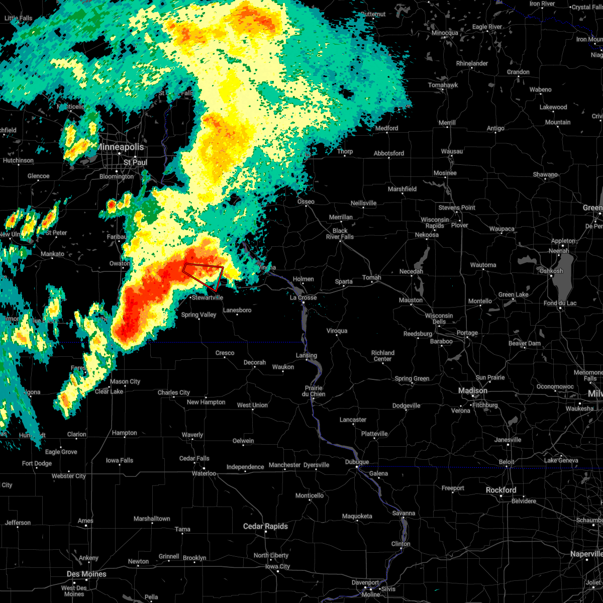 At 133 pm cdt, a severe thunderstorm capable of producing a tornado was located near rochester, moving east at 20 mph (radar indicated rotation). Hazards include tornado and quarter size hail. Flying debris will be dangerous to those caught without shelter. mobile homes will be damaged or destroyed. damage to roofs, windows, and vehicles will occur. tree damage is likely. this dangerous storm will be near, eyota around 200 pm cdt. other locations impacted by this tornadic thunderstorm include chester, highway 52 and 55th northwest, century high school, highway 52 and county 14, little valley, viola and highway 42 and county 9. This includes interstate 90 in minnesota between mile markers 220 and 226. At 133 pm cdt, a severe thunderstorm capable of producing a tornado was located near rochester, moving east at 20 mph (radar indicated rotation). Hazards include tornado and quarter size hail. Flying debris will be dangerous to those caught without shelter. mobile homes will be damaged or destroyed. damage to roofs, windows, and vehicles will occur. tree damage is likely. this dangerous storm will be near, eyota around 200 pm cdt. other locations impacted by this tornadic thunderstorm include chester, highway 52 and 55th northwest, century high school, highway 52 and county 14, little valley, viola and highway 42 and county 9. This includes interstate 90 in minnesota between mile markers 220 and 226.
|
| 7/23/2022 1:18 PM CDT |
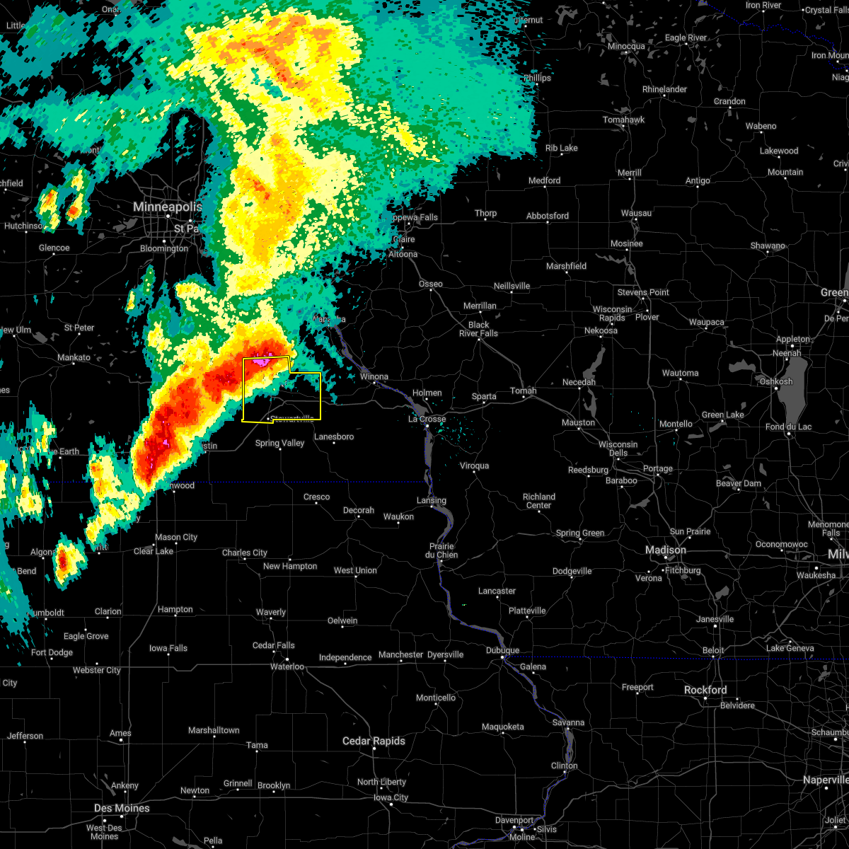 At 118 pm cdt, a severe thunderstorm was located near rochester, moving southeast at 45 mph (radar indicated). Hazards include 60 mph wind gusts and quarter size hail. Hail damage to vehicles is expected. expect wind damage to roofs, siding, and trees. this severe storm will be near, elgin around 125 pm cdt. eyota around 130 pm cdt. dover around 140 pm cdt. other locations impacted by this severe thunderstorm include county roads 9 and 10, potsdam, county roads 3 and 108, salem corners, hidden meadows r v park, rock dell and rochester airport. this includes interstate 90 in minnesota between mile markers 205 and 232. hail threat, radar indicated max hail size, 1. 00 in wind threat, radar indicated max wind gust, 60 mph. At 118 pm cdt, a severe thunderstorm was located near rochester, moving southeast at 45 mph (radar indicated). Hazards include 60 mph wind gusts and quarter size hail. Hail damage to vehicles is expected. expect wind damage to roofs, siding, and trees. this severe storm will be near, elgin around 125 pm cdt. eyota around 130 pm cdt. dover around 140 pm cdt. other locations impacted by this severe thunderstorm include county roads 9 and 10, potsdam, county roads 3 and 108, salem corners, hidden meadows r v park, rock dell and rochester airport. this includes interstate 90 in minnesota between mile markers 205 and 232. hail threat, radar indicated max hail size, 1. 00 in wind threat, radar indicated max wind gust, 60 mph.
|
| 7/23/2022 1:05 PM CDT |
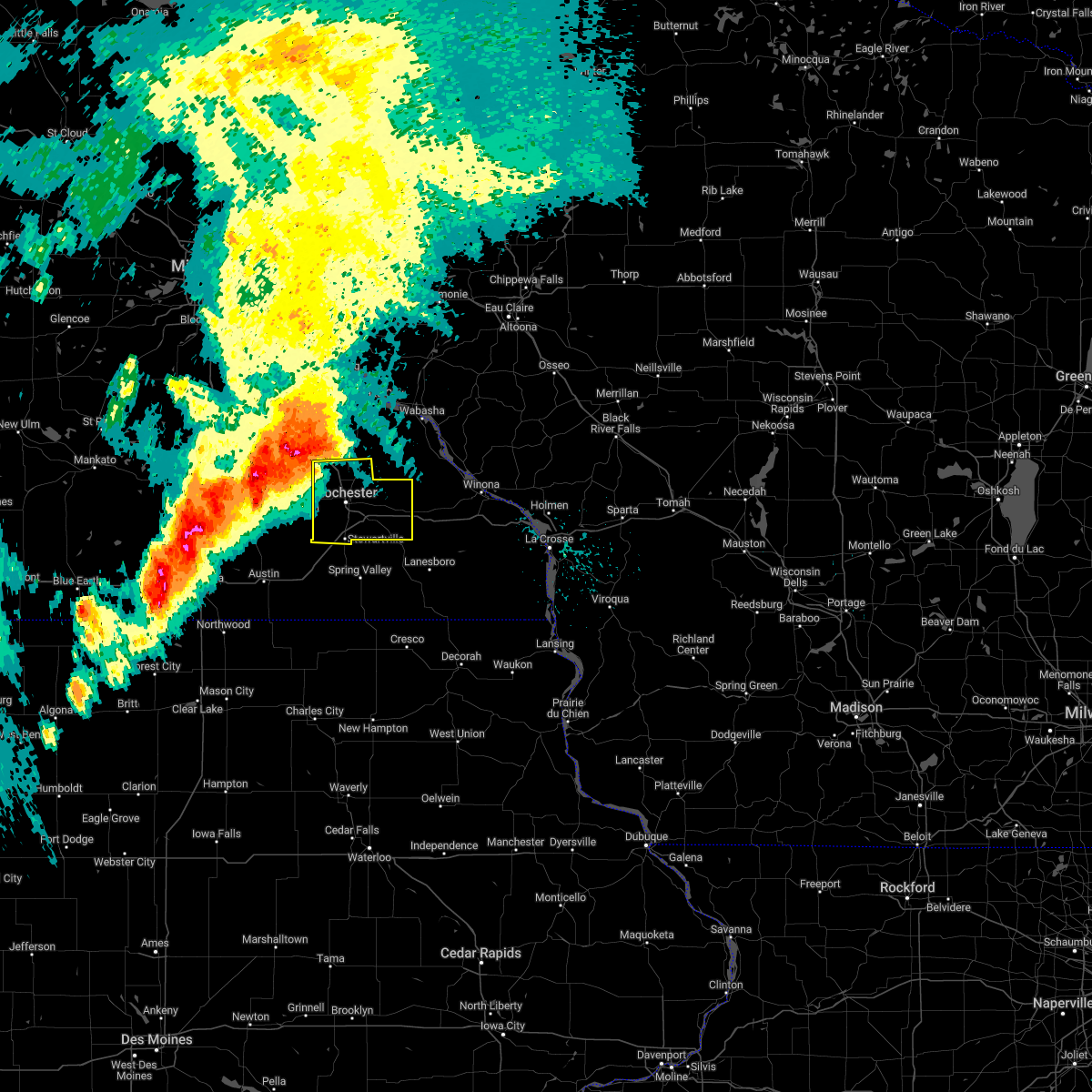 At 105 pm cdt, a severe thunderstorm was located over oronoco, or 10 miles northeast of mantorville, moving southeast at 45 mph (radar indicated). Hazards include 60 mph wind gusts and quarter size hail. Hail damage to vehicles is expected. expect wind damage to roofs, siding, and trees. this severe thunderstorm will be near, rochester around 120 pm cdt. elgin around 125 pm cdt. eyota around 130 pm cdt. dover around 140 pm cdt. other locations impacted by this severe thunderstorm include county roads 9 and 10, potsdam, county roads 3 and 108, salem corners, hidden meadows r v park, rock dell and rochester airport. this includes interstate 90 in minnesota between mile markers 205 and 232. hail threat, radar indicated max hail size, 1. 00 in wind threat, radar indicated max wind gust, 60 mph. At 105 pm cdt, a severe thunderstorm was located over oronoco, or 10 miles northeast of mantorville, moving southeast at 45 mph (radar indicated). Hazards include 60 mph wind gusts and quarter size hail. Hail damage to vehicles is expected. expect wind damage to roofs, siding, and trees. this severe thunderstorm will be near, rochester around 120 pm cdt. elgin around 125 pm cdt. eyota around 130 pm cdt. dover around 140 pm cdt. other locations impacted by this severe thunderstorm include county roads 9 and 10, potsdam, county roads 3 and 108, salem corners, hidden meadows r v park, rock dell and rochester airport. this includes interstate 90 in minnesota between mile markers 205 and 232. hail threat, radar indicated max hail size, 1. 00 in wind threat, radar indicated max wind gust, 60 mph.
|
| 6/28/2022 5:50 PM CDT | Tree branches down in rochester. 2-4 inches in diameter. winds estimated at least 50 mp in olmsted county MN, 1 miles WSW of Rochester, MN |
| 6/28/2022 5:47 PM CDT |
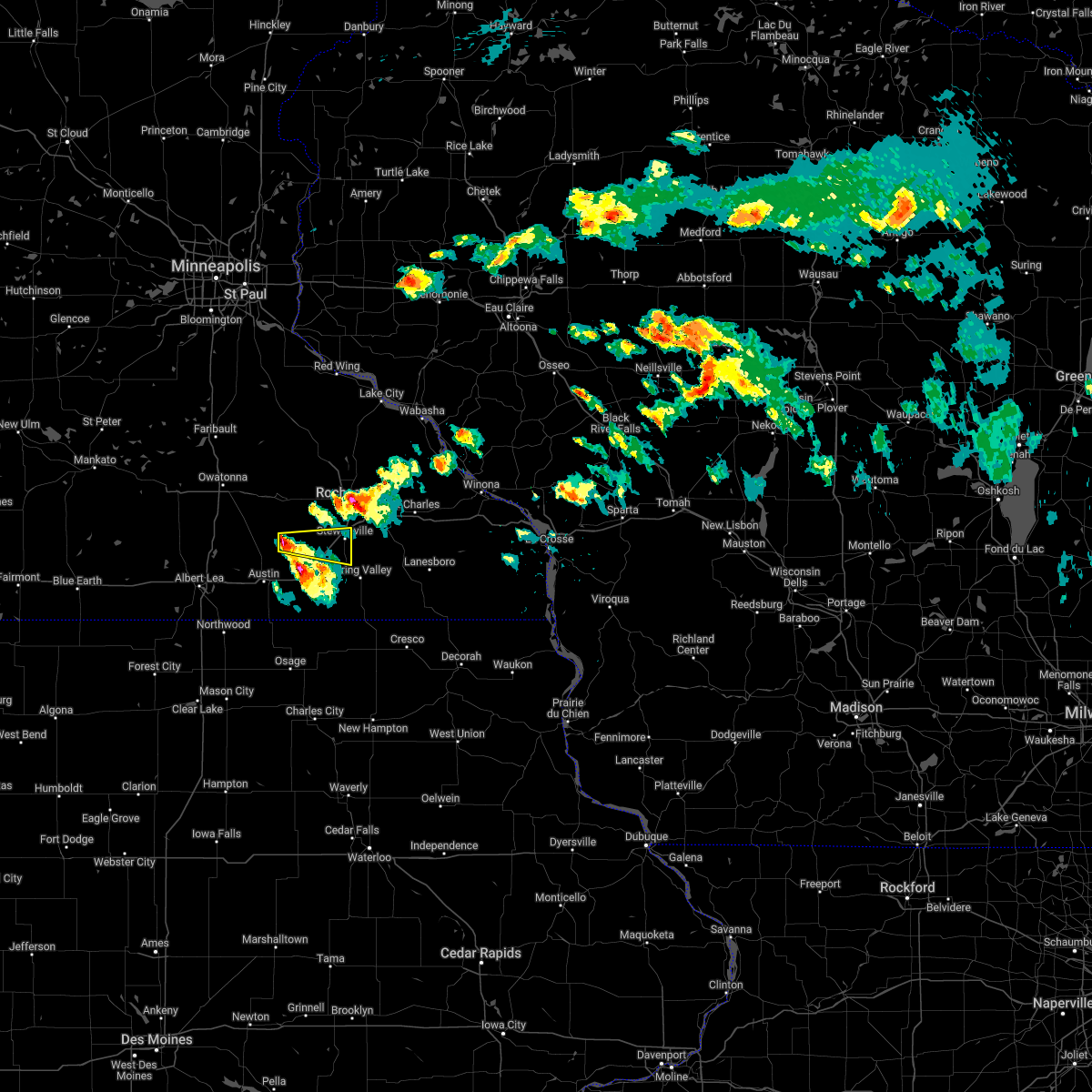 At 546 pm cdt, a severe thunderstorm was located near hayfield, or 13 miles northeast of austin, moving east at 25 mph (radar indicated). Hazards include 60 mph wind gusts and quarter size hail. Hail damage to vehicles is expected. expect wind damage to roofs, siding, and trees. this severe thunderstorm will be near, stewartville around 630 pm cdt. other locations impacted by this severe thunderstorm include oslo, sargeant,and hamilton. this includes interstate 90 in minnesota between mile markers 199 and 211. hail threat, radar indicated max hail size, 1. 00 in wind threat, radar indicated max wind gust, 60 mph. At 546 pm cdt, a severe thunderstorm was located near hayfield, or 13 miles northeast of austin, moving east at 25 mph (radar indicated). Hazards include 60 mph wind gusts and quarter size hail. Hail damage to vehicles is expected. expect wind damage to roofs, siding, and trees. this severe thunderstorm will be near, stewartville around 630 pm cdt. other locations impacted by this severe thunderstorm include oslo, sargeant,and hamilton. this includes interstate 90 in minnesota between mile markers 199 and 211. hail threat, radar indicated max hail size, 1. 00 in wind threat, radar indicated max wind gust, 60 mph.
|
| 6/28/2022 5:44 PM CDT | Storm damage reported in olmsted county MN, 2 miles SSW of Rochester, MN |
| 6/28/2022 5:44 PM CDT |
 At 544 pm cdt, a severe thunderstorm was located near eyota, or near rochester, moving east at 30 mph (trained weather spotters). Hazards include 60 mph wind gusts and quarter size hail. Hail damage to vehicles is expected. expect wind damage to roofs, siding, and trees. this severe thunderstorm will be near, eyota around 555 pm cdt. dover around 605 pm cdt. other locations impacted by this severe thunderstorm include chester, predmore, apache mall, century high school and marion. this includes interstate 90 in minnesota between mile markers 218 and 232. hail threat, radar indicated max hail size, 1. 00 in wind threat, radar indicated max wind gust, 60 mph. At 544 pm cdt, a severe thunderstorm was located near eyota, or near rochester, moving east at 30 mph (trained weather spotters). Hazards include 60 mph wind gusts and quarter size hail. Hail damage to vehicles is expected. expect wind damage to roofs, siding, and trees. this severe thunderstorm will be near, eyota around 555 pm cdt. dover around 605 pm cdt. other locations impacted by this severe thunderstorm include chester, predmore, apache mall, century high school and marion. this includes interstate 90 in minnesota between mile markers 218 and 232. hail threat, radar indicated max hail size, 1. 00 in wind threat, radar indicated max wind gust, 60 mph.
|
| 6/28/2022 5:40 PM CDT | Large tree down in tow in olmsted county MN, 1.1 miles SSW of Rochester, MN |
| 5/31/2022 12:43 AM CDT | Asos station krst rochester international airpor in olmsted county MN, 8 miles N of Rochester, MN |
| 5/19/2022 6:38 PM CDT |
 The severe thunderstorm warning for northwestern olmsted and dodge counties will expire at 645 pm cdt, the storm which prompted the warning has weakened below severe limits, and no longer poses an immediate threat to life or property. therefore, the warning will be allowed to expire. a tornado watch remains in effect until 1000 pm cdt for southeastern minnesota. The severe thunderstorm warning for northwestern olmsted and dodge counties will expire at 645 pm cdt, the storm which prompted the warning has weakened below severe limits, and no longer poses an immediate threat to life or property. therefore, the warning will be allowed to expire. a tornado watch remains in effect until 1000 pm cdt for southeastern minnesota.
|
| 5/19/2022 6:16 PM CDT |
 At 615 pm cdt, a severe thunderstorm was located over dodge center, moving northeast at 55 mph (emergency management reported pea sized hail near dodge center at 610 pm). Hazards include 60 mph wind gusts and quarter size hail. Hail damage to vehicles is expected. expect wind damage to roofs, siding, and trees. this severe storm will be near, byron around 625 pm cdt. pine island around 630 pm cdt. oronoco around 635 pm cdt. other locations impacted by this severe thunderstorm include ringe, potsdam, danesville, eden, highway 57 and 570th street, county roads 6 and 15 and salem corners. hail threat, radar indicated max hail size, 1. 00 in wind threat, radar indicated max wind gust, 60 mph. At 615 pm cdt, a severe thunderstorm was located over dodge center, moving northeast at 55 mph (emergency management reported pea sized hail near dodge center at 610 pm). Hazards include 60 mph wind gusts and quarter size hail. Hail damage to vehicles is expected. expect wind damage to roofs, siding, and trees. this severe storm will be near, byron around 625 pm cdt. pine island around 630 pm cdt. oronoco around 635 pm cdt. other locations impacted by this severe thunderstorm include ringe, potsdam, danesville, eden, highway 57 and 570th street, county roads 6 and 15 and salem corners. hail threat, radar indicated max hail size, 1. 00 in wind threat, radar indicated max wind gust, 60 mph.
|
| 5/19/2022 6:08 PM CDT |
 At 608 pm cdt, a severe thunderstorm was located near dodge center, moving northeast at 65 mph (radar indicated). Hazards include 60 mph wind gusts and quarter size hail. Hail damage to vehicles is expected. expect wind damage to roofs, siding, and trees. this severe thunderstorm will be near, mantorville and kasson around 615 pm cdt. byron around 620 pm cdt. pine island around 625 pm cdt. oronoco around 630 pm cdt. other locations impacted by this severe thunderstorm include ringe, potsdam, danesville, eden, highway 57 and 570th street, county roads 6 and 15 and salem corners. hail threat, radar indicated max hail size, 1. 00 in wind threat, radar indicated max wind gust, 60 mph. At 608 pm cdt, a severe thunderstorm was located near dodge center, moving northeast at 65 mph (radar indicated). Hazards include 60 mph wind gusts and quarter size hail. Hail damage to vehicles is expected. expect wind damage to roofs, siding, and trees. this severe thunderstorm will be near, mantorville and kasson around 615 pm cdt. byron around 620 pm cdt. pine island around 625 pm cdt. oronoco around 630 pm cdt. other locations impacted by this severe thunderstorm include ringe, potsdam, danesville, eden, highway 57 and 570th street, county roads 6 and 15 and salem corners. hail threat, radar indicated max hail size, 1. 00 in wind threat, radar indicated max wind gust, 60 mph.
|
| 5/19/2022 1:54 PM CDT | Ping Pong Ball sized hail reported 2.7 miles WNW of Rochester, MN |
| 5/19/2022 1:44 PM CDT | Quarter sized hail reported 4.7 miles WNW of Rochester, MN, report from mping: quarter (1.00 in.). |
| 5/19/2022 1:44 PM CDT |
 At 144 pm cdt, a severe thunderstorm was located near eyota, or 8 miles east of rochester, moving east at 50 mph (public reported 1 inch hail north of rochester at 140 pm). Hazards include golf ball size hail. People and animals outdoors will be injured. expect damage to roofs, siding, windows, and vehicles. locations impacted include, rochester, viola, chester, century high school and highway 42 and county 9. thunderstorm damage threat, considerable hail threat, observed max hail size, 1. 75 in wind threat, radar indicated max wind gust, <50 mph. At 144 pm cdt, a severe thunderstorm was located near eyota, or 8 miles east of rochester, moving east at 50 mph (public reported 1 inch hail north of rochester at 140 pm). Hazards include golf ball size hail. People and animals outdoors will be injured. expect damage to roofs, siding, windows, and vehicles. locations impacted include, rochester, viola, chester, century high school and highway 42 and county 9. thunderstorm damage threat, considerable hail threat, observed max hail size, 1. 75 in wind threat, radar indicated max wind gust, <50 mph.
|
| 5/19/2022 1:40 PM CDT | Quarter sized hail reported 4.5 miles N of Rochester, MN, report from mping: quarter (1.00 in.). |
| 5/19/2022 1:40 PM CDT |
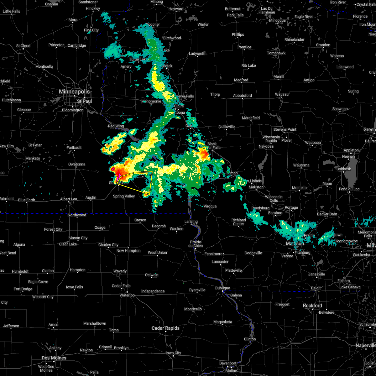 At 139 pm cdt, a severe thunderstorm was located near stewartville, or near rochester, moving east at 40 mph (public reported ping pong ball size hail south of rochester at 135 pm). Hazards include golf ball size hail and 60 mph wind gusts. People and animals outdoors will be injured. expect hail damage to roofs, siding, windows, and vehicles. expect wind damage to roofs, siding, and trees. this severe thunderstorm will be near, eyota around 150 pm cdt. chatfield around 155 pm cdt. st. charles and dover around 200 pm cdt. other locations impacted by this severe thunderstorm include saratoga, predmore, county roads 9 and 10, county roads 6 and 33, county roads 137 and 136, highway 30 and county 74 and utica. this includes interstate 90 in minnesota between mile markers 209 and 240. thunderstorm damage threat, considerable hail threat, observed max hail size, 1. 75 in wind threat, radar indicated max wind gust, 60 mph. At 139 pm cdt, a severe thunderstorm was located near stewartville, or near rochester, moving east at 40 mph (public reported ping pong ball size hail south of rochester at 135 pm). Hazards include golf ball size hail and 60 mph wind gusts. People and animals outdoors will be injured. expect hail damage to roofs, siding, windows, and vehicles. expect wind damage to roofs, siding, and trees. this severe thunderstorm will be near, eyota around 150 pm cdt. chatfield around 155 pm cdt. st. charles and dover around 200 pm cdt. other locations impacted by this severe thunderstorm include saratoga, predmore, county roads 9 and 10, county roads 6 and 33, county roads 137 and 136, highway 30 and county 74 and utica. this includes interstate 90 in minnesota between mile markers 209 and 240. thunderstorm damage threat, considerable hail threat, observed max hail size, 1. 75 in wind threat, radar indicated max wind gust, 60 mph.
|
| 5/19/2022 1:38 PM CDT | Quarter sized hail reported 2 miles NNE of Rochester, MN, report from mping: quarter (1.00 in.). |
| 5/19/2022 1:37 PM CDT | Ping Pong Ball sized hail reported 5.2 miles N of Rochester, MN |
| 5/19/2022 1:37 PM CDT | Half Dollar sized hail reported 3.1 miles N of Rochester, MN, report from mping: half dollar (1.25 in.). |
| 5/19/2022 1:35 PM CDT | Quarter sized hail reported 1.1 miles ENE of Rochester, MN |
| 5/19/2022 1:34 PM CDT |
 At 134 pm cdt, a severe thunderstorm was located over rochester, moving east at 25 mph (radar indicated). Hazards include golf ball size hail. People and animals outdoors will be injured. expect damage to roofs, siding, windows, and vehicles. this severe thunderstorm will remain over mainly rural areas of central olmsted county, including the following locations, chester, oxbow park, apache mall, highway 52 and 55th northwest, salem corners, century high school and viola. thunderstorm damage threat, considerable hail threat, radar indicated max hail size, 1. 75 in wind threat, radar indicated max wind gust, <50 mph. At 134 pm cdt, a severe thunderstorm was located over rochester, moving east at 25 mph (radar indicated). Hazards include golf ball size hail. People and animals outdoors will be injured. expect damage to roofs, siding, windows, and vehicles. this severe thunderstorm will remain over mainly rural areas of central olmsted county, including the following locations, chester, oxbow park, apache mall, highway 52 and 55th northwest, salem corners, century high school and viola. thunderstorm damage threat, considerable hail threat, radar indicated max hail size, 1. 75 in wind threat, radar indicated max wind gust, <50 mph.
|
| 5/19/2022 1:19 PM CDT |
 At 118 pm cdt, a severe thunderstorm was located over byron, or near mantorville, moving east at 50 mph (radar indicated). Hazards include golf ball size hail. People and animals outdoors will be injured. expect damage to roofs, siding, windows, and vehicles. this severe thunderstorm will be near, rochester around 125 pm cdt. elgin around 145 pm cdt. plainview around 150 pm cdt. other locations impacted by this severe thunderstorm include ringe, whitewater state park, county roads 79 and 2, potsdam, county roads 6 and 15, salem corners and century high school. thunderstorm damage threat, considerable hail threat, radar indicated max hail size, 1. 75 in wind threat, radar indicated max wind gust, <50 mph. At 118 pm cdt, a severe thunderstorm was located over byron, or near mantorville, moving east at 50 mph (radar indicated). Hazards include golf ball size hail. People and animals outdoors will be injured. expect damage to roofs, siding, windows, and vehicles. this severe thunderstorm will be near, rochester around 125 pm cdt. elgin around 145 pm cdt. plainview around 150 pm cdt. other locations impacted by this severe thunderstorm include ringe, whitewater state park, county roads 79 and 2, potsdam, county roads 6 and 15, salem corners and century high school. thunderstorm damage threat, considerable hail threat, radar indicated max hail size, 1. 75 in wind threat, radar indicated max wind gust, <50 mph.
|
| 5/11/2022 9:31 AM CDT | Quarter sized hail reported 14.5 miles SSW of Rochester, MN |
| 5/11/2022 9:25 AM CDT | Quarter sized hail reported 15.2 miles SSW of Rochester, MN, report from mping: quarter (1.00 in.). |
| 5/9/2022 8:04 PM CDT |
 At 802 pm cdt, severe thunderstorms were located along a line extending from kellogg to 6 miles south of eyota, moving northeast at 45 mph (radar indicated. at 754 pm, the rochester airport reported a wind gust of 76 mph). Hazards include 75 mph wind gusts and quarter size hail. Hail damage to vehicles is expected. expect considerable tree damage. wind damage is also likely to mobile homes, roofs, and outbuildings. these severe storms will be near, wabasha and kellogg around 805 pm cdt. alma and buffalo city around 810 pm cdt. st. charles around 820 pm cdt. modena around 825 pm cdt. lewiston and altura around 830 pm cdt. rollingstone around 840 pm cdt. other locations impacted by these severe thunderstorms include pioneer campground, county roads 9 and 10, cream, mondovi airfield, highway 88 and county o, county roads 28 and 31 and utica. this includes interstate 90 in minnesota between mile markers 206 and 243. thunderstorm damage threat, considerable hail threat, radar indicated max hail size, 1. 00 in wind threat, observed max wind gust, 70 mph. At 802 pm cdt, severe thunderstorms were located along a line extending from kellogg to 6 miles south of eyota, moving northeast at 45 mph (radar indicated. at 754 pm, the rochester airport reported a wind gust of 76 mph). Hazards include 75 mph wind gusts and quarter size hail. Hail damage to vehicles is expected. expect considerable tree damage. wind damage is also likely to mobile homes, roofs, and outbuildings. these severe storms will be near, wabasha and kellogg around 805 pm cdt. alma and buffalo city around 810 pm cdt. st. charles around 820 pm cdt. modena around 825 pm cdt. lewiston and altura around 830 pm cdt. rollingstone around 840 pm cdt. other locations impacted by these severe thunderstorms include pioneer campground, county roads 9 and 10, cream, mondovi airfield, highway 88 and county o, county roads 28 and 31 and utica. this includes interstate 90 in minnesota between mile markers 206 and 243. thunderstorm damage threat, considerable hail threat, radar indicated max hail size, 1. 00 in wind threat, observed max wind gust, 70 mph.
|
| 5/9/2022 7:54 PM CDT | Storm damage reported in olmsted county MN, 8 miles N of Rochester, MN |
| 5/9/2022 7:34 PM CDT |
 At 734 pm cdt, severe thunderstorms were located along a line extending from 7 miles northwest of elgin to 6 miles north of grand meadow, moving northeast at 45 mph (radar indicated). Hazards include 60 mph wind gusts and quarter size hail. Hail damage to vehicles is expected. expect wind damage to roofs, siding, and trees. severe thunderstorms will be near, elgin around 740 pm cdt. plainview around 745 pm cdt. wabasha and kellogg around 800 pm cdt. chatfield, eyota and buffalo city around 805 pm cdt. alma and dover around 810 pm cdt. st. charles around 815 pm cdt. modena around 820 pm cdt. lewiston, rollingstone and altura around 830 pm cdt. other locations impacted by these severe thunderstorms include south troy, pioneer campground, county roads 9 and 10, potsdam, cream, mondovi airfield and highway 88 and county o. this includes interstate 90 in minnesota between mile markers 205 and 243. hail threat, radar indicated max hail size, 1. 00 in wind threat, radar indicated max wind gust, 60 mph. At 734 pm cdt, severe thunderstorms were located along a line extending from 7 miles northwest of elgin to 6 miles north of grand meadow, moving northeast at 45 mph (radar indicated). Hazards include 60 mph wind gusts and quarter size hail. Hail damage to vehicles is expected. expect wind damage to roofs, siding, and trees. severe thunderstorms will be near, elgin around 740 pm cdt. plainview around 745 pm cdt. wabasha and kellogg around 800 pm cdt. chatfield, eyota and buffalo city around 805 pm cdt. alma and dover around 810 pm cdt. st. charles around 815 pm cdt. modena around 820 pm cdt. lewiston, rollingstone and altura around 830 pm cdt. other locations impacted by these severe thunderstorms include south troy, pioneer campground, county roads 9 and 10, potsdam, cream, mondovi airfield and highway 88 and county o. this includes interstate 90 in minnesota between mile markers 205 and 243. hail threat, radar indicated max hail size, 1. 00 in wind threat, radar indicated max wind gust, 60 mph.
|
| 4/12/2022 2:21 PM CDT |
 At 221 pm cdt, a severe thunderstorm was located near stewartville, or 7 miles southeast of rochester, moving northeast at 55 mph (radar indicated). Hazards include 60 mph wind gusts and quarter size hail. Hail damage to vehicles is expected. expect wind damage to roofs, siding, and trees. this severe thunderstorm will be near, eyota around 230 pm cdt. dover around 235 pm cdt. st. charles around 240 pm cdt. altura around 250 pm cdt. buffalo city and rollingstone around 255 pm cdt. winona, goodview and fountain city around 300 pm cdt. other locations impacted by this severe thunderstorm include whitewater state park, lock and dam 5 a, county roads 9 and 10, whitman, county roads 28 and 31, utica and rochester airport. this includes interstate 90 in minnesota between mile markers 209 and 234. hail threat, radar indicated max hail size, 1. 00 in wind threat, radar indicated max wind gust, 60 mph. At 221 pm cdt, a severe thunderstorm was located near stewartville, or 7 miles southeast of rochester, moving northeast at 55 mph (radar indicated). Hazards include 60 mph wind gusts and quarter size hail. Hail damage to vehicles is expected. expect wind damage to roofs, siding, and trees. this severe thunderstorm will be near, eyota around 230 pm cdt. dover around 235 pm cdt. st. charles around 240 pm cdt. altura around 250 pm cdt. buffalo city and rollingstone around 255 pm cdt. winona, goodview and fountain city around 300 pm cdt. other locations impacted by this severe thunderstorm include whitewater state park, lock and dam 5 a, county roads 9 and 10, whitman, county roads 28 and 31, utica and rochester airport. this includes interstate 90 in minnesota between mile markers 209 and 234. hail threat, radar indicated max hail size, 1. 00 in wind threat, radar indicated max wind gust, 60 mph.
|
| 12/15/2021 7:54 PM CST | Storm damage reported in olmsted county MN, 0.4 miles N of Rochester, MN |
| 12/15/2021 7:53 PM CST | Report from mping: trees uprooted or snapped; roof blown of in olmsted county MN, 0.6 miles ESE of Rochester, MN |
| 12/15/2021 7:45 PM CST | Storm damage reported in olmsted county MN, 7.3 miles N of Rochester, MN |
| 9/20/2021 4:42 PM CDT |
 At 441 pm cdt, severe thunderstorms were located along a line extending from near elgin to near eyota to 7 miles southeast of stewartville, moving northeast at 35 mph (radar indicated). Hazards include 60 mph wind gusts and nickel size hail. Expect damage to roofs, siding, and trees. these severe storms will be near, eyota around 450 pm cdt. other locations in the path of these severe thunderstorms include dover, st. charles, chatfield, altura, lewiston and rollingstone. this includes interstate 90 in minnesota between mile markers 215 and 243. hail threat, radar indicated max hail size, 0. 88 in wind threat, radar indicated max wind gust, 60 mph. At 441 pm cdt, severe thunderstorms were located along a line extending from near elgin to near eyota to 7 miles southeast of stewartville, moving northeast at 35 mph (radar indicated). Hazards include 60 mph wind gusts and nickel size hail. Expect damage to roofs, siding, and trees. these severe storms will be near, eyota around 450 pm cdt. other locations in the path of these severe thunderstorms include dover, st. charles, chatfield, altura, lewiston and rollingstone. this includes interstate 90 in minnesota between mile markers 215 and 243. hail threat, radar indicated max hail size, 0. 88 in wind threat, radar indicated max wind gust, 60 mph.
|
| 9/20/2021 4:30 PM CDT |
 At 430 pm cdt, severe thunderstorms were located along a line extending from rochester to near stewartville to 7 miles northwest of spring valley, moving northeast at 35 mph (radar indicated). Hazards include 60 mph wind gusts and nickel size hail. Expect damage to roofs, siding, and trees. severe thunderstorms will be near, eyota around 450 pm cdt. chatfield and dover around 455 pm cdt. st. charles around 500 pm cdt. lewiston, rollingstone and altura around 515 pm cdt. this includes interstate 90 in minnesota between mile markers 210 and 243. hail threat, radar indicated max hail size, 0. 88 in wind threat, radar indicated max wind gust, 60 mph. At 430 pm cdt, severe thunderstorms were located along a line extending from rochester to near stewartville to 7 miles northwest of spring valley, moving northeast at 35 mph (radar indicated). Hazards include 60 mph wind gusts and nickel size hail. Expect damage to roofs, siding, and trees. severe thunderstorms will be near, eyota around 450 pm cdt. chatfield and dover around 455 pm cdt. st. charles around 500 pm cdt. lewiston, rollingstone and altura around 515 pm cdt. this includes interstate 90 in minnesota between mile markers 210 and 243. hail threat, radar indicated max hail size, 0. 88 in wind threat, radar indicated max wind gust, 60 mph.
|
| 9/20/2021 4:10 PM CDT |
 At 409 pm cdt, a severe thunderstorm was located near stewartville, or 7 miles southwest of rochester, moving northeast at 45 mph (radar indicated. winds up to 40 to 45 mph have been observed with these storms). Hazards include 60 mph wind gusts and penny size hail. Expect damage to roofs, siding, and trees. this severe storm will be near, rochester around 415 pm cdt. This includes interstate 90 in minnesota between mile markers 197 and 222. At 409 pm cdt, a severe thunderstorm was located near stewartville, or 7 miles southwest of rochester, moving northeast at 45 mph (radar indicated. winds up to 40 to 45 mph have been observed with these storms). Hazards include 60 mph wind gusts and penny size hail. Expect damage to roofs, siding, and trees. this severe storm will be near, rochester around 415 pm cdt. This includes interstate 90 in minnesota between mile markers 197 and 222.
|
| 9/20/2021 3:58 PM CDT |
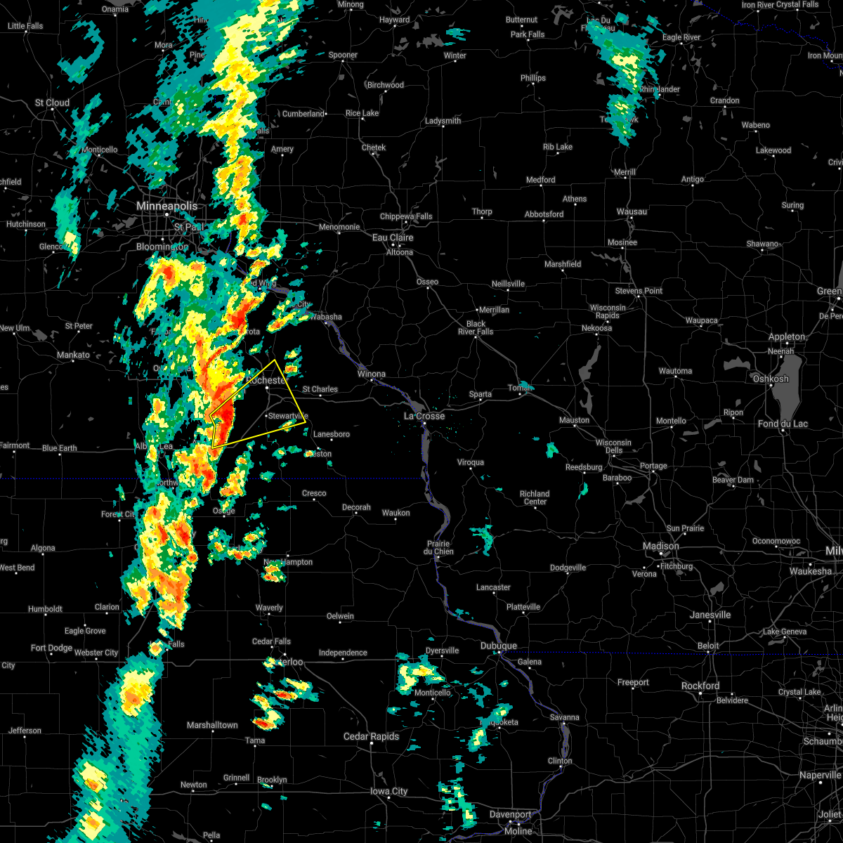 At 357 pm cdt, a severe thunderstorm was located near hayfield, or 13 miles southeast of dodge center, moving northeast at 45 mph (radar indicated). Hazards include 60 mph wind gusts and penny size hail. Expect damage to roofs, siding, and trees. this severe storm will be near, stewartville around 410 pm cdt. rochester around 420 pm cdt. other locations impacted by this severe thunderstorm include salem corners, rock dell, rochester airport, waltham and renova. This includes interstate 90 in minnesota near mile marker 182, and between mile markers 194 and 222. At 357 pm cdt, a severe thunderstorm was located near hayfield, or 13 miles southeast of dodge center, moving northeast at 45 mph (radar indicated). Hazards include 60 mph wind gusts and penny size hail. Expect damage to roofs, siding, and trees. this severe storm will be near, stewartville around 410 pm cdt. rochester around 420 pm cdt. other locations impacted by this severe thunderstorm include salem corners, rock dell, rochester airport, waltham and renova. This includes interstate 90 in minnesota near mile marker 182, and between mile markers 194 and 222.
|
| 9/20/2021 3:47 PM CDT |
 At 346 pm cdt, a severe thunderstorm was located over brownsdale, or 8 miles northeast of austin, moving northeast at 45 mph (radar indicated). Hazards include 60 mph wind gusts and penny size hail. Expect damage to roofs, siding, and trees. this severe thunderstorm will be near, hayfield around 355 pm cdt. stewartville around 415 pm cdt. rochester around 420 pm cdt. This includes interstate 90 in minnesota between mile markers 180 and 182, and between mile markers 194 and 222. At 346 pm cdt, a severe thunderstorm was located over brownsdale, or 8 miles northeast of austin, moving northeast at 45 mph (radar indicated). Hazards include 60 mph wind gusts and penny size hail. Expect damage to roofs, siding, and trees. this severe thunderstorm will be near, hayfield around 355 pm cdt. stewartville around 415 pm cdt. rochester around 420 pm cdt. This includes interstate 90 in minnesota between mile markers 180 and 182, and between mile markers 194 and 222.
|
| 8/7/2021 10:56 AM CDT |
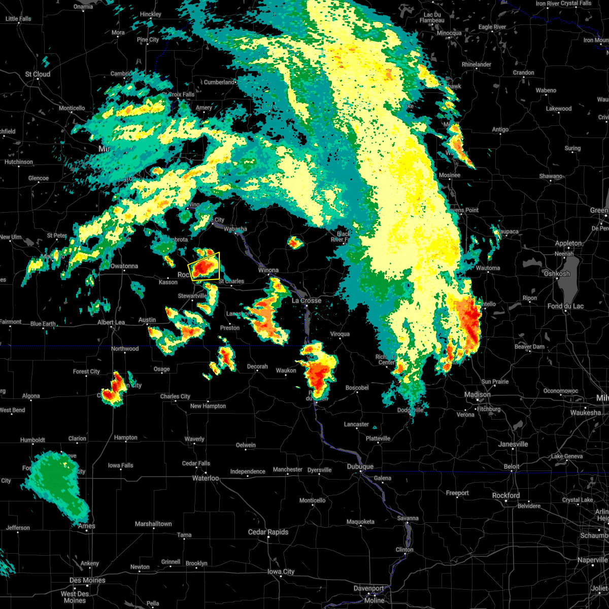 At 1054 am cdt, a severe thunderstorm was located near rochester, moving east at 30 mph (law enforcement. at 10:45am, quarter sized hail was reported north of rochester). Hazards include half dollar size hail. Damage to vehicles is expected. this severe storm will be near, elgin around 1110 am cdt. other locations impacted by this severe thunderstorm include kings park, and ringe. hail threat, observed max hail size, 1. 25 in wind threat, radar indicated max wind gust, <50 mph. At 1054 am cdt, a severe thunderstorm was located near rochester, moving east at 30 mph (law enforcement. at 10:45am, quarter sized hail was reported north of rochester). Hazards include half dollar size hail. Damage to vehicles is expected. this severe storm will be near, elgin around 1110 am cdt. other locations impacted by this severe thunderstorm include kings park, and ringe. hail threat, observed max hail size, 1. 25 in wind threat, radar indicated max wind gust, <50 mph.
|
| 8/7/2021 10:47 AM CDT |
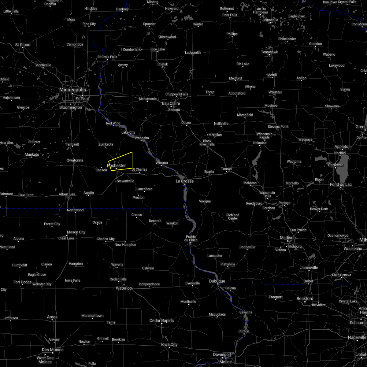 At 1047 am cdt, a severe thunderstorm was located near rochester, moving east at 30 mph (radar indicated). Hazards include ping pong ball size hail. People and animals outdoors will be injured. expect damage to roofs, siding, windows, and vehicles. this severe storm will be near, elgin around 1110 am cdt. other locations impacted by this severe thunderstorm include kings park, ringe, douglas, county roads 79 and 2, potsdam, apache mall and highway 52 and 55th northwest. hail threat, radar indicated max hail size, 1. 50 in wind threat, radar indicated max wind gust, <50 mph. At 1047 am cdt, a severe thunderstorm was located near rochester, moving east at 30 mph (radar indicated). Hazards include ping pong ball size hail. People and animals outdoors will be injured. expect damage to roofs, siding, windows, and vehicles. this severe storm will be near, elgin around 1110 am cdt. other locations impacted by this severe thunderstorm include kings park, ringe, douglas, county roads 79 and 2, potsdam, apache mall and highway 52 and 55th northwest. hail threat, radar indicated max hail size, 1. 50 in wind threat, radar indicated max wind gust, <50 mph.
|
| 8/7/2021 10:45 AM CDT | Quarter sized hail reported 5.9 miles S of Rochester, MN, short period of quarter sized hail on the far north side of rochester. |
| 8/7/2021 10:33 AM CDT |
 At 1033 am cdt, a severe thunderstorm was located over byron, or near rochester, moving east at 30 mph (radar indicated). Hazards include half dollar size hail. Damage to vehicles is expected. this severe thunderstorm will be near, rochester around 1040 am cdt. eyota around 1105 am cdt. elgin around 1110 am cdt. other locations impacted by this severe thunderstorm include ringe, county roads 79 and 2, potsdam, danesville, salem corners, century high school and highway 52 and county 14. hail threat, radar indicated max hail size, 1. 25 in wind threat, radar indicated max wind gust, <50 mph. At 1033 am cdt, a severe thunderstorm was located over byron, or near rochester, moving east at 30 mph (radar indicated). Hazards include half dollar size hail. Damage to vehicles is expected. this severe thunderstorm will be near, rochester around 1040 am cdt. eyota around 1105 am cdt. elgin around 1110 am cdt. other locations impacted by this severe thunderstorm include ringe, county roads 79 and 2, potsdam, danesville, salem corners, century high school and highway 52 and county 14. hail threat, radar indicated max hail size, 1. 25 in wind threat, radar indicated max wind gust, <50 mph.
|
| 7/6/2021 5:01 PM CDT | Tree down in yard. public report via kttc... time estimated from rada in olmsted county MN, 1.1 miles SSE of Rochester, MN |
| 7/6/2021 5:00 PM CDT | Large rotted branches down. time estimated from rada in olmsted county MN, 0.6 miles ESE of Rochester, MN |
| 6/20/2021 4:10 PM CDT | Tree uprooted and other large branches down at silver lake park. time estimate in olmsted county MN, 0.4 miles N of Rochester, MN |
| 8/10/2020 5:38 AM CDT |
 At 537 am cdt, severe thunderstorms were located along a line extending from near pine island to near rochester to near stewartville, moving east at 35 mph (radar indicated). Hazards include 60 mph wind gusts and quarter size hail. Hail damage to vehicles is expected. expect wind damage to roofs, siding, and trees. these severe storms will be near, rochester around 545 am cdt. plainview around 615 am cdt. kellogg around 630 am cdt. Other locations impacted by these severe thunderstorms include south troy, potsdam, eden, highway 57 and 570th street, county roads 6 and 15, hidden meadows r v park and rock dell. At 537 am cdt, severe thunderstorms were located along a line extending from near pine island to near rochester to near stewartville, moving east at 35 mph (radar indicated). Hazards include 60 mph wind gusts and quarter size hail. Hail damage to vehicles is expected. expect wind damage to roofs, siding, and trees. these severe storms will be near, rochester around 545 am cdt. plainview around 615 am cdt. kellogg around 630 am cdt. Other locations impacted by these severe thunderstorms include south troy, potsdam, eden, highway 57 and 570th street, county roads 6 and 15, hidden meadows r v park and rock dell.
|
| 8/10/2020 5:21 AM CDT |
 At 520 am cdt, severe thunderstorms were located along a line extending from wabasha to 6 miles north of plainview to near elgin, moving east at 30 mph (radar indicated). Hazards include 60 mph wind gusts and quarter size hail. Hail damage to vehicles is expected. expect wind damage to roofs, siding, and trees. severe thunderstorms will be near, wabasha around 525 am cdt. kellogg around 540 am cdt. alma, buffalo city and modena around 550 am cdt. buffalo and altura around 555 am cdt. rollingstone around 610 am cdt. goodview and fountain city around 615 am cdt. winona around 620 am cdt. Other locations impacted by these severe thunderstorms include whitewater state park, pioneer campground, merrick state park, czechville, lock and dam 5 a, county roads 9 and 10 and dodge. At 520 am cdt, severe thunderstorms were located along a line extending from wabasha to 6 miles north of plainview to near elgin, moving east at 30 mph (radar indicated). Hazards include 60 mph wind gusts and quarter size hail. Hail damage to vehicles is expected. expect wind damage to roofs, siding, and trees. severe thunderstorms will be near, wabasha around 525 am cdt. kellogg around 540 am cdt. alma, buffalo city and modena around 550 am cdt. buffalo and altura around 555 am cdt. rollingstone around 610 am cdt. goodview and fountain city around 615 am cdt. winona around 620 am cdt. Other locations impacted by these severe thunderstorms include whitewater state park, pioneer campground, merrick state park, czechville, lock and dam 5 a, county roads 9 and 10 and dodge.
|
| 8/10/2020 5:00 AM CDT |
 At 459 am cdt, severe thunderstorms were located along a line extending from 7 miles southwest of pepin to mantorville to near ellendale, moving east at 45 mph (radar indicated). Hazards include 60 mph wind gusts and quarter size hail. Hail damage to vehicles is expected. expect wind damage to roofs, siding, and trees. these severe storms will be near, byron around 505 am cdt. wabasha, oronoco and kellogg around 515 am cdt. claremont around 520 am cdt. hayfield around 525 am cdt. dodge center and elgin around 530 am cdt. plainview around 540 am cdt. rochester around 555 am cdt. Other locations impacted by these severe thunderstorms include south troy, potsdam, eden, highway 57 and 570th street, county roads 6 and 15, hidden meadows r v park and rock dell. At 459 am cdt, severe thunderstorms were located along a line extending from 7 miles southwest of pepin to mantorville to near ellendale, moving east at 45 mph (radar indicated). Hazards include 60 mph wind gusts and quarter size hail. Hail damage to vehicles is expected. expect wind damage to roofs, siding, and trees. these severe storms will be near, byron around 505 am cdt. wabasha, oronoco and kellogg around 515 am cdt. claremont around 520 am cdt. hayfield around 525 am cdt. dodge center and elgin around 530 am cdt. plainview around 540 am cdt. rochester around 555 am cdt. Other locations impacted by these severe thunderstorms include south troy, potsdam, eden, highway 57 and 570th street, county roads 6 and 15, hidden meadows r v park and rock dell.
|
| 8/10/2020 4:20 AM CDT |
 At 419 am cdt, severe thunderstorms were located along a line extending from near red wing to wanamingo to near waseca, moving east at 35 mph (radar indicated). Hazards include 60 mph wind gusts and quarter size hail. Hail damage to vehicles is expected. expect wind damage to roofs, siding, and trees. severe thunderstorms will be near, mazeppa around 440 am cdt. oronoco around 445 am cdt. claremont around 500 am cdt. wabasha and elgin around 505 am cdt. dodge center around 510 am cdt. plainview and hayfield around 515 am cdt. kasson around 520 am cdt. kellogg around 525 am cdt. Other locations impacted by these severe thunderstorms include south troy, potsdam, eden, highway 57 and 570th street, county roads 6 and 15, hidden meadows r v park and rock dell. At 419 am cdt, severe thunderstorms were located along a line extending from near red wing to wanamingo to near waseca, moving east at 35 mph (radar indicated). Hazards include 60 mph wind gusts and quarter size hail. Hail damage to vehicles is expected. expect wind damage to roofs, siding, and trees. severe thunderstorms will be near, mazeppa around 440 am cdt. oronoco around 445 am cdt. claremont around 500 am cdt. wabasha and elgin around 505 am cdt. dodge center around 510 am cdt. plainview and hayfield around 515 am cdt. kasson around 520 am cdt. kellogg around 525 am cdt. Other locations impacted by these severe thunderstorms include south troy, potsdam, eden, highway 57 and 570th street, county roads 6 and 15, hidden meadows r v park and rock dell.
|
| 7/11/2020 4:39 PM CDT |
 At 438 pm cdt, severe thunderstorms were located along a line extending from blooming prairie to near austin to near london, moving east at 45 mph (radar indicated). Hazards include 60 mph wind gusts. Expect damage to roofs, siding, and trees. these severe storms will be near, brownsdale around 445 pm cdt. hayfield, lyle and rose creek around 450 pm cdt. adams around 500 pm cdt. grand meadow around 505 pm cdt. Stewartville and le roy around 515 pm cdt. At 438 pm cdt, severe thunderstorms were located along a line extending from blooming prairie to near austin to near london, moving east at 45 mph (radar indicated). Hazards include 60 mph wind gusts. Expect damage to roofs, siding, and trees. these severe storms will be near, brownsdale around 445 pm cdt. hayfield, lyle and rose creek around 450 pm cdt. adams around 500 pm cdt. grand meadow around 505 pm cdt. Stewartville and le roy around 515 pm cdt.
|
| 7/11/2020 4:31 PM CDT |
 At 430 pm cdt, severe thunderstorms were located along a line extending from 7 miles northeast of ellendale to near hollandale to glenville, moving southeast at 45 mph (radar indicated). Hazards include 60 mph wind gusts. Expect damage to roofs, siding, and trees. these severe storms will be near, austin around 440 pm cdt. hayfield and lyle around 450 pm cdt. rose creek around 455 pm cdt. Adams and brownsdale around 500 pm cdt. At 430 pm cdt, severe thunderstorms were located along a line extending from 7 miles northeast of ellendale to near hollandale to glenville, moving southeast at 45 mph (radar indicated). Hazards include 60 mph wind gusts. Expect damage to roofs, siding, and trees. these severe storms will be near, austin around 440 pm cdt. hayfield and lyle around 450 pm cdt. rose creek around 455 pm cdt. Adams and brownsdale around 500 pm cdt.
|
| 7/11/2020 4:19 PM CDT |
 At 418 pm cdt, severe thunderstorms were located along a line extending from 7 miles southwest of owatonna to near geneva to near albert lea, moving east at 45 mph (radar indicated). Hazards include 60 mph wind gusts. Expect damage to roofs, siding, and trees. severe thunderstorms will be near, austin around 440 pm cdt. brownsdale around 445 pm cdt. hayfield and lyle around 450 pm cdt. rose creek around 455 pm cdt. adams around 500 pm cdt. grand meadow around 505 pm cdt. Stewartville and le roy around 515 pm cdt. At 418 pm cdt, severe thunderstorms were located along a line extending from 7 miles southwest of owatonna to near geneva to near albert lea, moving east at 45 mph (radar indicated). Hazards include 60 mph wind gusts. Expect damage to roofs, siding, and trees. severe thunderstorms will be near, austin around 440 pm cdt. brownsdale around 445 pm cdt. hayfield and lyle around 450 pm cdt. rose creek around 455 pm cdt. adams around 500 pm cdt. grand meadow around 505 pm cdt. Stewartville and le roy around 515 pm cdt.
|
| 6/28/2020 6:33 PM CDT |
 At 633 pm cdt, a severe thunderstorm was located near oronoco, or near rochester, moving northeast at 20 mph (radar indicated). Hazards include 60 mph wind gusts and half dollar size hail. Hail damage to vehicles is expected. expect wind damage to roofs, siding, and trees. This severe thunderstorm will remain over mainly rural areas of north central olmsted and southwestern wabasha counties, including the following locations, south troy, jarrett, ringe, county roads 79 and 2, rattelsnake point, potsdam and highway 52 and county 14. At 633 pm cdt, a severe thunderstorm was located near oronoco, or near rochester, moving northeast at 20 mph (radar indicated). Hazards include 60 mph wind gusts and half dollar size hail. Hail damage to vehicles is expected. expect wind damage to roofs, siding, and trees. This severe thunderstorm will remain over mainly rural areas of north central olmsted and southwestern wabasha counties, including the following locations, south troy, jarrett, ringe, county roads 79 and 2, rattelsnake point, potsdam and highway 52 and county 14.
|
| 6/28/2020 6:08 PM CDT |
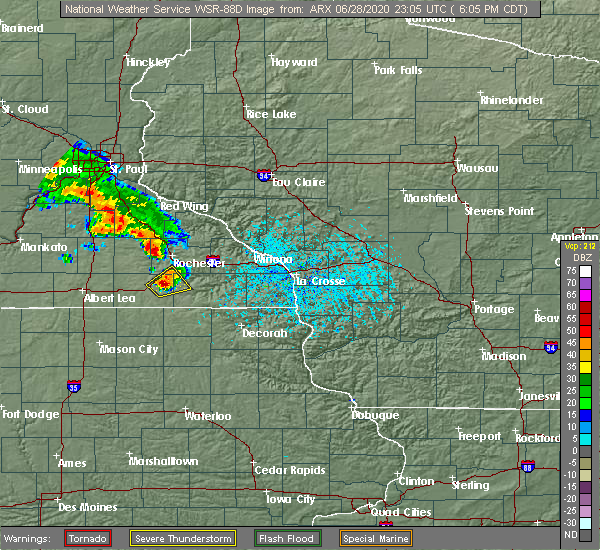 At 608 pm cdt, a severe thunderstorm was located near grand meadow, or 18 miles south of rochester, moving northeast at 25 mph (radar indicated). Hazards include 60 mph wind gusts and quarter size hail. Hail damage to vehicles is expected. expect wind damage to roofs, siding, and trees. this severe storm will be near, spring valley around 615 pm cdt. stewartville around 625 pm cdt. Other locations impacted by this severe thunderstorm include i 90 exit 209, highways 63 and 16, hamilton, high forest, i 90 exit 205, interstate 90 and county 1 and washington. At 608 pm cdt, a severe thunderstorm was located near grand meadow, or 18 miles south of rochester, moving northeast at 25 mph (radar indicated). Hazards include 60 mph wind gusts and quarter size hail. Hail damage to vehicles is expected. expect wind damage to roofs, siding, and trees. this severe storm will be near, spring valley around 615 pm cdt. stewartville around 625 pm cdt. Other locations impacted by this severe thunderstorm include i 90 exit 209, highways 63 and 16, hamilton, high forest, i 90 exit 205, interstate 90 and county 1 and washington.
|
| 6/28/2020 5:57 PM CDT |
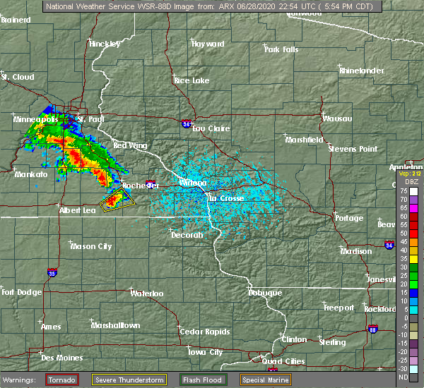 At 556 pm cdt, a severe thunderstorm was located over grand meadow, or 19 miles east of austin, moving northeast at 25 mph (trained weather spotters). Hazards include 60 mph wind gusts and quarter size hail. Hail damage to vehicles is expected. expect wind damage to roofs, siding, and trees. this severe storm will be near, spring valley around 615 pm cdt. Other locations impacted by this severe thunderstorm include i 90 exit 209, highways 63 and 16, hamilton, i 90 exit 193, high forest, i 90 exit 205 and dexter. At 556 pm cdt, a severe thunderstorm was located over grand meadow, or 19 miles east of austin, moving northeast at 25 mph (trained weather spotters). Hazards include 60 mph wind gusts and quarter size hail. Hail damage to vehicles is expected. expect wind damage to roofs, siding, and trees. this severe storm will be near, spring valley around 615 pm cdt. Other locations impacted by this severe thunderstorm include i 90 exit 209, highways 63 and 16, hamilton, i 90 exit 193, high forest, i 90 exit 205 and dexter.
|
| 6/28/2020 5:43 PM CDT |
 At 542 pm cdt, a severe thunderstorm was located near grand meadow, or 13 miles east of austin, moving northeast at 25 mph (radar indicated). Hazards include ping pong ball size hail and 60 mph wind gusts. People and animals outdoors will be injured. expect hail damage to roofs, siding, windows, and vehicles. expect wind damage to roofs, siding, and trees. this severe thunderstorm will be near, grand meadow around 600 pm cdt. spring valley around 615 pm cdt. Other locations impacted by this severe thunderstorm include i 90 exit 209, highways 63 and 16, hamilton, i 90 exit 193, high forest, i 90 exit 205 and dexter. At 542 pm cdt, a severe thunderstorm was located near grand meadow, or 13 miles east of austin, moving northeast at 25 mph (radar indicated). Hazards include ping pong ball size hail and 60 mph wind gusts. People and animals outdoors will be injured. expect hail damage to roofs, siding, windows, and vehicles. expect wind damage to roofs, siding, and trees. this severe thunderstorm will be near, grand meadow around 600 pm cdt. spring valley around 615 pm cdt. Other locations impacted by this severe thunderstorm include i 90 exit 209, highways 63 and 16, hamilton, i 90 exit 193, high forest, i 90 exit 205 and dexter.
|
| 6/21/2020 7:11 PM CDT |
 At 711 pm cdt, a severe thunderstorm was located 7 miles east of brownsdale, or 13 miles northeast of austin, moving east at 30 mph (radar indicated). Hazards include 60 mph wind gusts and penny size hail. Expect damage to roofs, siding, and trees. this severe storm will be near, grand meadow around 725 pm cdt. stewartville around 735 pm cdt. Other locations impacted by this severe thunderstorm include oslo, sargeant, county roads 1 and 7, i 90 exit 209, county roads 3 and 108, i 90 exit 205 and rock dell. At 711 pm cdt, a severe thunderstorm was located 7 miles east of brownsdale, or 13 miles northeast of austin, moving east at 30 mph (radar indicated). Hazards include 60 mph wind gusts and penny size hail. Expect damage to roofs, siding, and trees. this severe storm will be near, grand meadow around 725 pm cdt. stewartville around 735 pm cdt. Other locations impacted by this severe thunderstorm include oslo, sargeant, county roads 1 and 7, i 90 exit 209, county roads 3 and 108, i 90 exit 205 and rock dell.
|
| 6/21/2020 6:58 PM CDT |
 At 658 pm cdt, a severe thunderstorm was located over brownsdale, or 8 miles northeast of austin, moving east at 35 mph (radar indicated). Hazards include 60 mph wind gusts and penny size hail. Expect damage to roofs, siding, and trees. this severe storm will be near, grand meadow around 720 pm cdt. stewartville around 730 pm cdt. Other locations impacted by this severe thunderstorm include county roads 3 and 108, rock dell, mayville, rochester airport, waltham, renova and i 90 exit 179. At 658 pm cdt, a severe thunderstorm was located over brownsdale, or 8 miles northeast of austin, moving east at 35 mph (radar indicated). Hazards include 60 mph wind gusts and penny size hail. Expect damage to roofs, siding, and trees. this severe storm will be near, grand meadow around 720 pm cdt. stewartville around 730 pm cdt. Other locations impacted by this severe thunderstorm include county roads 3 and 108, rock dell, mayville, rochester airport, waltham, renova and i 90 exit 179.
|
| 6/21/2020 6:47 PM CDT |
 At 646 pm cdt, a severe thunderstorm was located near austin, moving east at 35 mph (radar indicated). Hazards include 60 mph wind gusts and penny size hail. Expect damage to roofs, siding, and trees. this severe thunderstorm will be near, brownsdale around 655 pm cdt. grand meadow around 720 pm cdt. stewartville around 730 pm cdt. Other locations impacted by this severe thunderstorm include county roads 3 and 108, rock dell, brookside campground, mayville, rochester airport, waltham and renova. At 646 pm cdt, a severe thunderstorm was located near austin, moving east at 35 mph (radar indicated). Hazards include 60 mph wind gusts and penny size hail. Expect damage to roofs, siding, and trees. this severe thunderstorm will be near, brownsdale around 655 pm cdt. grand meadow around 720 pm cdt. stewartville around 730 pm cdt. Other locations impacted by this severe thunderstorm include county roads 3 and 108, rock dell, brookside campground, mayville, rochester airport, waltham and renova.
|
| 6/2/2020 8:13 PM CDT |
 At 811 pm cdt, severe thunderstorms were located along a line extending from near rochester to near chatfield to near lime springs, moving northeast at 45 mph (trained weather spotters. at 809 pm, a 60 mph wind gust was observed 5 miles west of chatfield). Hazards include 60 mph wind gusts. Expect damage to roofs, siding, and trees. these severe storms will be near, chatfield and fountain around 815 pm cdt. eyota around 820 pm cdt. preston around 825 pm cdt. dover around 830 pm cdt. Other locations impacted by these severe thunderstorms include forestville state park, county roads 9 and 10, i 90 exit 218, york, fillmore, washington and county roads 2 and 38. At 811 pm cdt, severe thunderstorms were located along a line extending from near rochester to near chatfield to near lime springs, moving northeast at 45 mph (trained weather spotters. at 809 pm, a 60 mph wind gust was observed 5 miles west of chatfield). Hazards include 60 mph wind gusts. Expect damage to roofs, siding, and trees. these severe storms will be near, chatfield and fountain around 815 pm cdt. eyota around 820 pm cdt. preston around 825 pm cdt. dover around 830 pm cdt. Other locations impacted by these severe thunderstorms include forestville state park, county roads 9 and 10, i 90 exit 218, york, fillmore, washington and county roads 2 and 38.
|
| 6/2/2020 8:00 PM CDT |
 The severe thunderstorm warning for southwestern olmsted, northern mower, and southern dodge counties will expire at 800 pm cdt, the storm which prompted the warning has moved out of the area. therefore, the warning will be allowed to expire. however gusty winds are still possible. a severe thunderstorm warning still remains in effect for southern mower county until 815 pm. in addition, a severe thunderstorm watch remains in effect until midnight cdt for southeastern minnesota. The severe thunderstorm warning for southwestern olmsted, northern mower, and southern dodge counties will expire at 800 pm cdt, the storm which prompted the warning has moved out of the area. therefore, the warning will be allowed to expire. however gusty winds are still possible. a severe thunderstorm warning still remains in effect for southern mower county until 815 pm. in addition, a severe thunderstorm watch remains in effect until midnight cdt for southeastern minnesota.
|
| 6/2/2020 7:48 PM CDT |
 At 747 pm cdt, a severe thunderstorm was located near grand meadow, or 20 miles west of preston, moving east at 35 mph (radar indicated). Hazards include 60 mph wind gusts and quarter size hail. Hail damage to vehicles is expected. expect wind damage to roofs, siding, and trees. this severe thunderstorm will be near, spring valley around 755 pm cdt. wykoff around 810 pm cdt. chatfield and fountain around 820 pm cdt. preston around 825 pm cdt. Other locations impacted by this severe thunderstorm include forestville state park, county roads 9 and 10, i 90 exit 218, york, fillmore, washington and county roads 2 and 38. At 747 pm cdt, a severe thunderstorm was located near grand meadow, or 20 miles west of preston, moving east at 35 mph (radar indicated). Hazards include 60 mph wind gusts and quarter size hail. Hail damage to vehicles is expected. expect wind damage to roofs, siding, and trees. this severe thunderstorm will be near, spring valley around 755 pm cdt. wykoff around 810 pm cdt. chatfield and fountain around 820 pm cdt. preston around 825 pm cdt. Other locations impacted by this severe thunderstorm include forestville state park, county roads 9 and 10, i 90 exit 218, york, fillmore, washington and county roads 2 and 38.
|
| 6/2/2020 7:30 PM CDT |
 At 730 pm cdt, a severe thunderstorm was located near grand meadow, or 14 miles east of austin, moving east at 30 mph (trained weather spotters). Hazards include 70 mph wind gusts and ping pong ball size hail. People and animals outdoors will be injured. expect hail damage to roofs, siding, windows, and vehicles. expect considerable tree damage. wind damage is also likely to mobile homes, roofs, and outbuildings. this severe storm will be near, grand meadow around 745 pm cdt. Other locations impacted by this severe thunderstorm include county roads 3 and 108, county roads 6 and 15, rock dell, brookside campground, mayville, rochester airport and graves landing field. At 730 pm cdt, a severe thunderstorm was located near grand meadow, or 14 miles east of austin, moving east at 30 mph (trained weather spotters). Hazards include 70 mph wind gusts and ping pong ball size hail. People and animals outdoors will be injured. expect hail damage to roofs, siding, windows, and vehicles. expect considerable tree damage. wind damage is also likely to mobile homes, roofs, and outbuildings. this severe storm will be near, grand meadow around 745 pm cdt. Other locations impacted by this severe thunderstorm include county roads 3 and 108, county roads 6 and 15, rock dell, brookside campground, mayville, rochester airport and graves landing field.
|
| 6/2/2020 7:03 PM CDT |
 At 702 pm cdt, a severe thunderstorm was located over austin, moving east at 35 mph (trained weather spotters. this storm has a history of producing very large hail and damaging winds). Hazards include tennis ball size hail and 70 mph wind gusts. People and animals outdoors will be injured. expect hail damage to roofs, siding, windows, and vehicles. expect considerable tree damage. wind damage is also likely to mobile homes, roofs, and outbuildings. this severe storm will be near, brownsdale around 710 pm cdt. rose creek around 715 pm cdt. grand meadow around 730 pm cdt. Other locations impacted by this severe thunderstorm include county roads 3 and 108, county roads 6 and 15, salem corners, rock dell, brookside campground, county roads 5 and 6 and mayville. At 702 pm cdt, a severe thunderstorm was located over austin, moving east at 35 mph (trained weather spotters. this storm has a history of producing very large hail and damaging winds). Hazards include tennis ball size hail and 70 mph wind gusts. People and animals outdoors will be injured. expect hail damage to roofs, siding, windows, and vehicles. expect considerable tree damage. wind damage is also likely to mobile homes, roofs, and outbuildings. this severe storm will be near, brownsdale around 710 pm cdt. rose creek around 715 pm cdt. grand meadow around 730 pm cdt. Other locations impacted by this severe thunderstorm include county roads 3 and 108, county roads 6 and 15, salem corners, rock dell, brookside campground, county roads 5 and 6 and mayville.
|
| 6/2/2020 6:31 PM CDT |
 At 630 pm cdt, a severe thunderstorm was located near blooming prairie, or 14 miles south of owatonna, moving east at 35 mph (trained weather spotters). Hazards include tennis ball size hail and 70 mph wind gusts. this storm has a history of producing large hail and damaging winds. People and animals outdoors will be injured. expect hail damage to roofs, siding, windows, and vehicles. expect considerable tree damage. wind damage is also likely to mobile homes, roofs, and outbuildings. this severe thunderstorm will be near, blooming prairie around 640 pm cdt. hayfield around 655 pm cdt. rochester and stewartville around 725 pm cdt. Other locations impacted by this severe thunderstorm include county roads 3 and 108, county roads 6 and 15, salem corners, rock dell, brookside campground, county roads 5 and 6 and mayville. At 630 pm cdt, a severe thunderstorm was located near blooming prairie, or 14 miles south of owatonna, moving east at 35 mph (trained weather spotters). Hazards include tennis ball size hail and 70 mph wind gusts. this storm has a history of producing large hail and damaging winds. People and animals outdoors will be injured. expect hail damage to roofs, siding, windows, and vehicles. expect considerable tree damage. wind damage is also likely to mobile homes, roofs, and outbuildings. this severe thunderstorm will be near, blooming prairie around 640 pm cdt. hayfield around 655 pm cdt. rochester and stewartville around 725 pm cdt. Other locations impacted by this severe thunderstorm include county roads 3 and 108, county roads 6 and 15, salem corners, rock dell, brookside campground, county roads 5 and 6 and mayville.
|
| 9/24/2019 8:24 PM CDT |
 The severe thunderstorm warning for north central olmsted and wabasha counties will expire at 830 pm cdt, the storm which prompted the warning continues to move out of the area. therefore, the warning will be allowed to expire. a tornado watch remains in effect until midnight cdt for southeastern minnesota, and west central wisconsin. The severe thunderstorm warning for north central olmsted and wabasha counties will expire at 830 pm cdt, the storm which prompted the warning continues to move out of the area. therefore, the warning will be allowed to expire. a tornado watch remains in effect until midnight cdt for southeastern minnesota, and west central wisconsin.
|
| 9/24/2019 8:20 PM CDT | 3 inch diameter tree limb down. photo via social medi in olmsted county MN, 7.5 miles SW of Rochester, MN |
| 9/24/2019 8:16 PM CDT |
 At 815 pm cdt, a severe thunderstorm was located over wabasha, moving northeast at 75 mph. there have been reports of power outages as these storms move through (trained weather spotters). Hazards include 70 mph wind gusts. Expect considerable tree damage. damage is likely to mobile homes, roofs, and outbuildings. this severe storm will be near, alma around 820 pm cdt. Other locations impacted by this severe thunderstorm include south troy, pioneer campground, rattelsnake point, potsdam, west albany, county roads 33 and 4 and kings park. At 815 pm cdt, a severe thunderstorm was located over wabasha, moving northeast at 75 mph. there have been reports of power outages as these storms move through (trained weather spotters). Hazards include 70 mph wind gusts. Expect considerable tree damage. damage is likely to mobile homes, roofs, and outbuildings. this severe storm will be near, alma around 820 pm cdt. Other locations impacted by this severe thunderstorm include south troy, pioneer campground, rattelsnake point, potsdam, west albany, county roads 33 and 4 and kings park.
|
| 9/24/2019 8:15 PM CDT | Several photos of trees down throughout rochester. relayed via broadcast media. time estimated from rada in olmsted county MN, 0.4 miles N of Rochester, MN |
| 9/24/2019 8:14 PM CDT |
 At 813 pm cdt, severe thunderstorms were located along a line extending from near rochester to near stewartville, moving east at 50 mph (trained weather spotters). Hazards include 60 mph wind gusts. Expect damage to roofs, siding, and trees. these severe storms will be near, eyota and elgin around 830 pm cdt. chatfield and dover around 835 pm cdt. Other locations impacted by these severe thunderstorms include predmore, county roads 9 and 10, i 90 exit 218, i 90 exit 229, i 90 exit 209, i 90 exit 224 and county roads 137 and 136. At 813 pm cdt, severe thunderstorms were located along a line extending from near rochester to near stewartville, moving east at 50 mph (trained weather spotters). Hazards include 60 mph wind gusts. Expect damage to roofs, siding, and trees. these severe storms will be near, eyota and elgin around 830 pm cdt. chatfield and dover around 835 pm cdt. Other locations impacted by these severe thunderstorms include predmore, county roads 9 and 10, i 90 exit 218, i 90 exit 229, i 90 exit 209, i 90 exit 224 and county roads 137 and 136.
|
| 9/24/2019 8:12 PM CDT | Trees down... part of a barn roof peeled off... and calf hutches tossed. relayed via broadcast media. time estimated from rada in olmsted county MN, 6.7 miles NNW of Rochester, MN |
| 9/24/2019 8:10 PM CDT | Asos station krst rochester international airpor in olmsted county MN, 8 miles N of Rochester, MN |
| 9/24/2019 8:04 PM CDT |
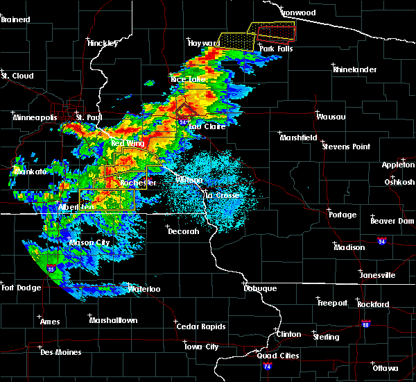 At 804 pm cdt, severe thunderstorms were located along a line extending from near byron to near grand meadow, moving east at 50 mph (radar indicated). Hazards include 60 mph wind gusts. Expect damage to roofs, siding, and trees. these severe storms will be near, rochester around 810 pm cdt. stewartville around 815 pm cdt. eyota and elgin around 825 pm cdt. chatfield around 830 pm cdt. dover around 835 pm cdt. Other locations impacted by these severe thunderstorms include predmore, county roads 9 and 10, i 90 exit 218, i 90 exit 229, i 90 exit 209, i 90 exit 224 and county roads 3 and 108. At 804 pm cdt, severe thunderstorms were located along a line extending from near byron to near grand meadow, moving east at 50 mph (radar indicated). Hazards include 60 mph wind gusts. Expect damage to roofs, siding, and trees. these severe storms will be near, rochester around 810 pm cdt. stewartville around 815 pm cdt. eyota and elgin around 825 pm cdt. chatfield around 830 pm cdt. dover around 835 pm cdt. Other locations impacted by these severe thunderstorms include predmore, county roads 9 and 10, i 90 exit 218, i 90 exit 229, i 90 exit 209, i 90 exit 224 and county roads 3 and 108.
|
| 9/24/2019 8:00 PM CDT | Tree down on car. relayed via broadcast media. time estimated from rada in wabasha county MN, 15.2 miles SSW of Rochester, MN |
| 9/24/2019 7:58 PM CDT |
 At 757 pm cdt, a severe thunderstorm was located near mazeppa, or 14 miles north of rochester, moving northeast at 50 mph. power outages have been reported with really strong winds in parts of western wabasha county (trained weather spotters). Hazards include 70 mph wind gusts. Expect considerable tree damage. damage is likely to mobile homes, roofs, and outbuildings. this severe storm will be near, wabasha around 825 pm cdt. Other locations impacted by this severe thunderstorm include south troy, pioneer campground, rattelsnake point, potsdam, hidden meadows r v park, west albany and county roads 33 and 4. At 757 pm cdt, a severe thunderstorm was located near mazeppa, or 14 miles north of rochester, moving northeast at 50 mph. power outages have been reported with really strong winds in parts of western wabasha county (trained weather spotters). Hazards include 70 mph wind gusts. Expect considerable tree damage. damage is likely to mobile homes, roofs, and outbuildings. this severe storm will be near, wabasha around 825 pm cdt. Other locations impacted by this severe thunderstorm include south troy, pioneer campground, rattelsnake point, potsdam, hidden meadows r v park, west albany and county roads 33 and 4.
|
| 9/24/2019 7:55 PM CDT |
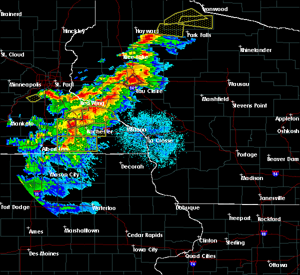 At 754 pm cdt, severe thunderstorms were located along a line extending from mantorville to near brownsdale, moving east at 50 mph (radar indicated). Hazards include 60 mph wind gusts. Expect damage to roofs, siding, and trees. severe thunderstorms will be near, byron around 800 pm cdt. rochester and stewartville around 810 pm cdt. eyota and elgin around 825 pm cdt. chatfield around 830 pm cdt. dover around 835 pm cdt. Other locations impacted by these severe thunderstorms include county roads 9 and 10, i 90 exit 218, county roads 3 and 108, county roads 6 and 15, salem corners, rock dell and rochester airport. At 754 pm cdt, severe thunderstorms were located along a line extending from mantorville to near brownsdale, moving east at 50 mph (radar indicated). Hazards include 60 mph wind gusts. Expect damage to roofs, siding, and trees. severe thunderstorms will be near, byron around 800 pm cdt. rochester and stewartville around 810 pm cdt. eyota and elgin around 825 pm cdt. chatfield around 830 pm cdt. dover around 835 pm cdt. Other locations impacted by these severe thunderstorms include county roads 9 and 10, i 90 exit 218, county roads 3 and 108, county roads 6 and 15, salem corners, rock dell and rochester airport.
|
| 9/24/2019 7:42 PM CDT |
 At 742 pm cdt, a severe thunderstorm was located near oronoco, or 11 miles north of rochester, moving northeast at 55 mph (radar indicated). Hazards include 60 mph wind gusts and penny size hail. Expect damage to roofs, siding, and trees. this severe thunderstorm will be near, elgin around 750 pm cdt. plainview around 755 pm cdt. wabasha and kellogg around 810 pm cdt. alma around 815 pm cdt. Other locations impacted by this severe thunderstorm include south troy, pioneer campground, rattelsnake point, potsdam, hidden meadows r v park, west albany and county roads 33 and 4. At 742 pm cdt, a severe thunderstorm was located near oronoco, or 11 miles north of rochester, moving northeast at 55 mph (radar indicated). Hazards include 60 mph wind gusts and penny size hail. Expect damage to roofs, siding, and trees. this severe thunderstorm will be near, elgin around 750 pm cdt. plainview around 755 pm cdt. wabasha and kellogg around 810 pm cdt. alma around 815 pm cdt. Other locations impacted by this severe thunderstorm include south troy, pioneer campground, rattelsnake point, potsdam, hidden meadows r v park, west albany and county roads 33 and 4.
|
| 9/11/2019 5:42 AM CDT |
 The severe thunderstorm warning for northwestern olmsted, western wabasha and northeastern dodge counties will expire at 545 am cdt, the storm which prompted the warning has weakened below severe limits, and is exiting the warned area. therefore, the warning will be allowed to expire. a severe thunderstorm watch remains in effect until 600 am cdt for southeastern minnesota. The severe thunderstorm warning for northwestern olmsted, western wabasha and northeastern dodge counties will expire at 545 am cdt, the storm which prompted the warning has weakened below severe limits, and is exiting the warned area. therefore, the warning will be allowed to expire. a severe thunderstorm watch remains in effect until 600 am cdt for southeastern minnesota.
|
| 9/11/2019 5:36 AM CDT |
 At 535 am cdt, a severe thunderstorm was located near rochester, moving northeast at 60 mph (radar indicated). Hazards include 60 mph wind gusts and penny size hail. Expect damage to roofs, siding, and trees. this severe thunderstorm will be near, eyota around 550 am cdt. st. charles, elgin and dover around 555 am cdt. plainview around 600 am cdt. Other locations impacted by this severe thunderstorm include whitewater state park, county roads 9 and 10, county roads 6 and 33, i 90 exit 218, county roads 3 and 108, county roads 6 and 15 and salem corners. At 535 am cdt, a severe thunderstorm was located near rochester, moving northeast at 60 mph (radar indicated). Hazards include 60 mph wind gusts and penny size hail. Expect damage to roofs, siding, and trees. this severe thunderstorm will be near, eyota around 550 am cdt. st. charles, elgin and dover around 555 am cdt. plainview around 600 am cdt. Other locations impacted by this severe thunderstorm include whitewater state park, county roads 9 and 10, county roads 6 and 33, i 90 exit 218, county roads 3 and 108, county roads 6 and 15 and salem corners.
|
| 9/11/2019 5:07 AM CDT |
 At 506 am cdt, a severe thunderstorm was located just south of pine island, or 9 miles northeast of mantorville, moving northeast at 45 mph (radar indicated). Hazards include 60 mph wind gusts and penny size hail. Expect damage to roofs, siding, and trees. this severe thunderstorm will be near, oronoco around 510 am cdt. mazeppa around 515 am cdt. Other locations impacted by this severe thunderstorm include south troy, jarrett, rattelsnake point, potsdam, danesville, oak center and highway 52 and county 14. At 506 am cdt, a severe thunderstorm was located just south of pine island, or 9 miles northeast of mantorville, moving northeast at 45 mph (radar indicated). Hazards include 60 mph wind gusts and penny size hail. Expect damage to roofs, siding, and trees. this severe thunderstorm will be near, oronoco around 510 am cdt. mazeppa around 515 am cdt. Other locations impacted by this severe thunderstorm include south troy, jarrett, rattelsnake point, potsdam, danesville, oak center and highway 52 and county 14.
|
| 9/3/2019 12:23 AM CDT | Storm damage reported in olmsted county MN, 8 miles N of Rochester, MN |
| 8/27/2019 4:48 PM CDT |
 At 448 pm cdt, a severe thunderstorm was located near eyota, or 8 miles east of rochester, moving east at 50 mph (radar indicated). Hazards include 60 mph wind gusts. Expect damage to roofs, siding, and trees. this severe storm will be near, dover around 500 pm cdt. Other locations impacted by this severe thunderstorm include i 90 exit 224, chester, county roads 9 and 10, i 90 exit 229 and highway 42 and county 9. At 448 pm cdt, a severe thunderstorm was located near eyota, or 8 miles east of rochester, moving east at 50 mph (radar indicated). Hazards include 60 mph wind gusts. Expect damage to roofs, siding, and trees. this severe storm will be near, dover around 500 pm cdt. Other locations impacted by this severe thunderstorm include i 90 exit 224, chester, county roads 9 and 10, i 90 exit 229 and highway 42 and county 9.
|
| 8/27/2019 4:38 PM CDT |
 At 438 pm cdt, a severe thunderstorm was located over rochester, moving east at 50 mph (radar indicated). Hazards include 60 mph wind gusts. Expect damage to roofs, siding, and trees. this severe thunderstorm will be near, eyota around 450 pm cdt. dover around 500 pm cdt. Other locations impacted by this severe thunderstorm include predmore, county roads 9 and 10, i 90 exit 218, i 90 exit 229, i 90 exit 224, county roads 137 and 136 and century high school. At 438 pm cdt, a severe thunderstorm was located over rochester, moving east at 50 mph (radar indicated). Hazards include 60 mph wind gusts. Expect damage to roofs, siding, and trees. this severe thunderstorm will be near, eyota around 450 pm cdt. dover around 500 pm cdt. Other locations impacted by this severe thunderstorm include predmore, county roads 9 and 10, i 90 exit 218, i 90 exit 229, i 90 exit 224, county roads 137 and 136 and century high school.
|
| 8/5/2019 4:51 PM CDT |
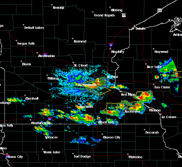 At 451 pm cdt, a severe thunderstorm was located near oronoco, or 9 miles north of rochester, moving east at 40 mph (radar indicated). Hazards include 60 mph wind gusts and quarter size hail. Hail damage to vehicles is expected. expect wind damage to roofs, siding, and trees. Locations impacted include, pine island, oronoco, douglas, hammond, south troy, kings park, ringe, rattelsnake point, bluff valley campground, highway 52 and county 14 and hidden meadows r v park. At 451 pm cdt, a severe thunderstorm was located near oronoco, or 9 miles north of rochester, moving east at 40 mph (radar indicated). Hazards include 60 mph wind gusts and quarter size hail. Hail damage to vehicles is expected. expect wind damage to roofs, siding, and trees. Locations impacted include, pine island, oronoco, douglas, hammond, south troy, kings park, ringe, rattelsnake point, bluff valley campground, highway 52 and county 14 and hidden meadows r v park.
|
| 8/5/2019 4:46 PM CDT |
 At 445 pm cdt, a severe thunderstorm was located over oronoco, or 10 miles north of rochester, moving east at 40 mph (radar indicated). Hazards include 60 mph wind gusts and quarter size hail. Hail damage to vehicles is expected. expect wind damage to roofs, siding, and trees. This severe thunderstorm will remain over mainly rural areas of northwestern olmsted and west central wabasha counties, including the following locations, south troy, ringe, rattelsnake point, highway 52 and county 14, hidden meadows r v park, kings park and douglas. At 445 pm cdt, a severe thunderstorm was located over oronoco, or 10 miles north of rochester, moving east at 40 mph (radar indicated). Hazards include 60 mph wind gusts and quarter size hail. Hail damage to vehicles is expected. expect wind damage to roofs, siding, and trees. This severe thunderstorm will remain over mainly rural areas of northwestern olmsted and west central wabasha counties, including the following locations, south troy, ringe, rattelsnake point, highway 52 and county 14, hidden meadows r v park, kings park and douglas.
|
| 8/5/2019 4:39 PM CDT |
 At 439 pm cdt, a severe thunderstorm was located over pine island, or 9 miles northeast of mantorville, moving east at 40 mph (radar indicated). Hazards include 60 mph wind gusts and half dollar size hail. Hail damage to vehicles is expected. expect wind damage to roofs, siding, and trees. this severe thunderstorm will be near, oronoco around 445 pm cdt. Other locations impacted by this severe thunderstorm include south troy, ringe, rattelsnake point, highway 52 and county 14, hidden meadows r v park, kings park and douglas. At 439 pm cdt, a severe thunderstorm was located over pine island, or 9 miles northeast of mantorville, moving east at 40 mph (radar indicated). Hazards include 60 mph wind gusts and half dollar size hail. Hail damage to vehicles is expected. expect wind damage to roofs, siding, and trees. this severe thunderstorm will be near, oronoco around 445 pm cdt. Other locations impacted by this severe thunderstorm include south troy, ringe, rattelsnake point, highway 52 and county 14, hidden meadows r v park, kings park and douglas.
|
| 8/5/2019 4:17 PM CDT |
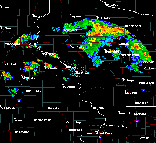 At 416 pm cdt, a severe thunderstorm was located near rochester, moving east at 20 mph (radar indicated). Hazards include 60 mph wind gusts and half dollar size hail. Hail damage to vehicles is expected. expect wind damage to roofs, siding, and trees. this severe thunderstorm will be near, eyota and elgin around 435 pm cdt. dover around 455 pm cdt. Other locations impacted by this severe thunderstorm include ringe, county roads 9 and 10, carley state park, century high school, little valley, viola and highway 42 and county 9. At 416 pm cdt, a severe thunderstorm was located near rochester, moving east at 20 mph (radar indicated). Hazards include 60 mph wind gusts and half dollar size hail. Hail damage to vehicles is expected. expect wind damage to roofs, siding, and trees. this severe thunderstorm will be near, eyota and elgin around 435 pm cdt. dover around 455 pm cdt. Other locations impacted by this severe thunderstorm include ringe, county roads 9 and 10, carley state park, century high school, little valley, viola and highway 42 and county 9.
|
| 7/20/2019 11:47 AM CDT |
 At 1146 am cdt, severe thunderstorms were located along a line extending from near plainview to le roy, moving east at 50 mph (a 64 mph wind gust was reported at the rochester airport at 1134 am). Hazards include 70 mph wind gusts and penny size hail. Expect considerable tree damage. damage is likely to mobile homes, roofs, and outbuildings. These severe thunderstorms will remain over mainly rural areas of olmsted, mower, eastern dodge and western fillmore counties, including the following locations, i 90 exit 218, highway 57 and 570th street, county roads 6 and 15, hidden meadows r v park, rock dell, mayville and rochester airport. At 1146 am cdt, severe thunderstorms were located along a line extending from near plainview to le roy, moving east at 50 mph (a 64 mph wind gust was reported at the rochester airport at 1134 am). Hazards include 70 mph wind gusts and penny size hail. Expect considerable tree damage. damage is likely to mobile homes, roofs, and outbuildings. These severe thunderstorms will remain over mainly rural areas of olmsted, mower, eastern dodge and western fillmore counties, including the following locations, i 90 exit 218, highway 57 and 570th street, county roads 6 and 15, hidden meadows r v park, rock dell, mayville and rochester airport.
|
| 7/20/2019 11:42 AM CDT | Via personal weather station near century hills. power outage in olmsted county MN, 1 miles WSW of Rochester, MN |
| 7/20/2019 11:34 AM CDT | Storm damage reported in olmsted county MN, 7.3 miles N of Rochester, MN |
| 7/20/2019 11:32 AM CDT | Social media photo of large portion of tree down. relayed via broadcast media. time estimated from rada in olmsted county MN, 3.3 miles SSE of Rochester, MN |
| 7/20/2019 11:32 AM CDT | Storm damage reported in olmsted county MN, 0.6 miles ESE of Rochester, MN |
| 7/20/2019 11:24 AM CDT |
 At 1122 am cdt, severe thunderstorms were located along a line extending from mazeppa to near lyle, moving east at 75 mph (trained weather spotters. a 58 mph wind gust was reported 2 miles west of dodge center). Hazards include 70 mph wind gusts and penny size hail. Expect considerable tree damage. damage is likely to mobile homes, roofs, and outbuildings. these severe storms will be near, oronoco around 1125 am cdt. le roy and rochester around 1135 am cdt. other locations impacted by these severe thunderstorms include i 90 exit 218, eden, highway 57 and 570th street, county roads 6 and 15, hidden meadows r v park, rock dell and brookside campground. those attending the dodge county fair and summer fest in le roy are in the path of these storms and should prepare for imminent dangerous weather conditions. Seek shelter now!. At 1122 am cdt, severe thunderstorms were located along a line extending from mazeppa to near lyle, moving east at 75 mph (trained weather spotters. a 58 mph wind gust was reported 2 miles west of dodge center). Hazards include 70 mph wind gusts and penny size hail. Expect considerable tree damage. damage is likely to mobile homes, roofs, and outbuildings. these severe storms will be near, oronoco around 1125 am cdt. le roy and rochester around 1135 am cdt. other locations impacted by these severe thunderstorms include i 90 exit 218, eden, highway 57 and 570th street, county roads 6 and 15, hidden meadows r v park, rock dell and brookside campground. those attending the dodge county fair and summer fest in le roy are in the path of these storms and should prepare for imminent dangerous weather conditions. Seek shelter now!.
|
| 7/20/2019 11:10 AM CDT |
 At 1107 am cdt, severe thunderstorms were located along a line extending from near kenyon to near northwood, moving east at 70 mph (trained weather spotters). Hazards include 70 mph wind gusts and penny size hail. Expect considerable tree damage. damage is likely to mobile homes, roofs, and outbuildings. these severe storms will be near, oronoco, adams and rose creek around 1125 am cdt. le roy around 1135 am cdt. other locations impacted by these severe thunderstorms include i 90 exit 218, eden, highway 57 and 570th street, county roads 6 and 15, hidden meadows r v park, rock dell and brookside campground. those attending the dodge county fair and summer fest in leroy are in the path of these storms and should prepare for imminent dangerous weather conditions. Seek shelter now!. At 1107 am cdt, severe thunderstorms were located along a line extending from near kenyon to near northwood, moving east at 70 mph (trained weather spotters). Hazards include 70 mph wind gusts and penny size hail. Expect considerable tree damage. damage is likely to mobile homes, roofs, and outbuildings. these severe storms will be near, oronoco, adams and rose creek around 1125 am cdt. le roy around 1135 am cdt. other locations impacted by these severe thunderstorms include i 90 exit 218, eden, highway 57 and 570th street, county roads 6 and 15, hidden meadows r v park, rock dell and brookside campground. those attending the dodge county fair and summer fest in leroy are in the path of these storms and should prepare for imminent dangerous weather conditions. Seek shelter now!.
|
| 7/20/2019 10:56 AM CDT |
 At 1053 am cdt, severe thunderstorms were located along a line extending from near faribault to emmons, moving east at 70 mph (radar indicated. this storm has a hisotory of producing 60 to 65 mph wind gusts). Hazards include 60 mph wind gusts and penny size hail. Expect damage to roofs, siding, and trees. severe thunderstorms will be near, lyle around 1115 am cdt. rose creek around 1120 am cdt. oronoco and adams around 1125 am cdt. le roy around 1135 am cdt. other locations impacted by these severe thunderstorms include i 90 exit 218, eden, highway 57 and 570th street, county roads 6 and 15, hidden meadows r v park, rock dell and brookside campground. those attending the dodge county fair are in the path of these storms and should prepare for damaging winds. Seek shelter now!. At 1053 am cdt, severe thunderstorms were located along a line extending from near faribault to emmons, moving east at 70 mph (radar indicated. this storm has a hisotory of producing 60 to 65 mph wind gusts). Hazards include 60 mph wind gusts and penny size hail. Expect damage to roofs, siding, and trees. severe thunderstorms will be near, lyle around 1115 am cdt. rose creek around 1120 am cdt. oronoco and adams around 1125 am cdt. le roy around 1135 am cdt. other locations impacted by these severe thunderstorms include i 90 exit 218, eden, highway 57 and 570th street, county roads 6 and 15, hidden meadows r v park, rock dell and brookside campground. those attending the dodge county fair are in the path of these storms and should prepare for damaging winds. Seek shelter now!.
|
| 7/20/2019 9:28 AM CDT |
 The severe thunderstorm warning for olmsted, wabasha and northwestern trempealeau counties will expire at 930 am cdt, the storms which prompted the warning have moved out of the area. therefore, the warning will be allowed to expire. a severe thunderstorm watch remains in effect until 400 pm cdt for southeastern minnesota, and west central wisconsin. The severe thunderstorm warning for olmsted, wabasha and northwestern trempealeau counties will expire at 930 am cdt, the storms which prompted the warning have moved out of the area. therefore, the warning will be allowed to expire. a severe thunderstorm watch remains in effect until 400 pm cdt for southeastern minnesota, and west central wisconsin.
|
| 7/20/2019 9:28 AM CDT |
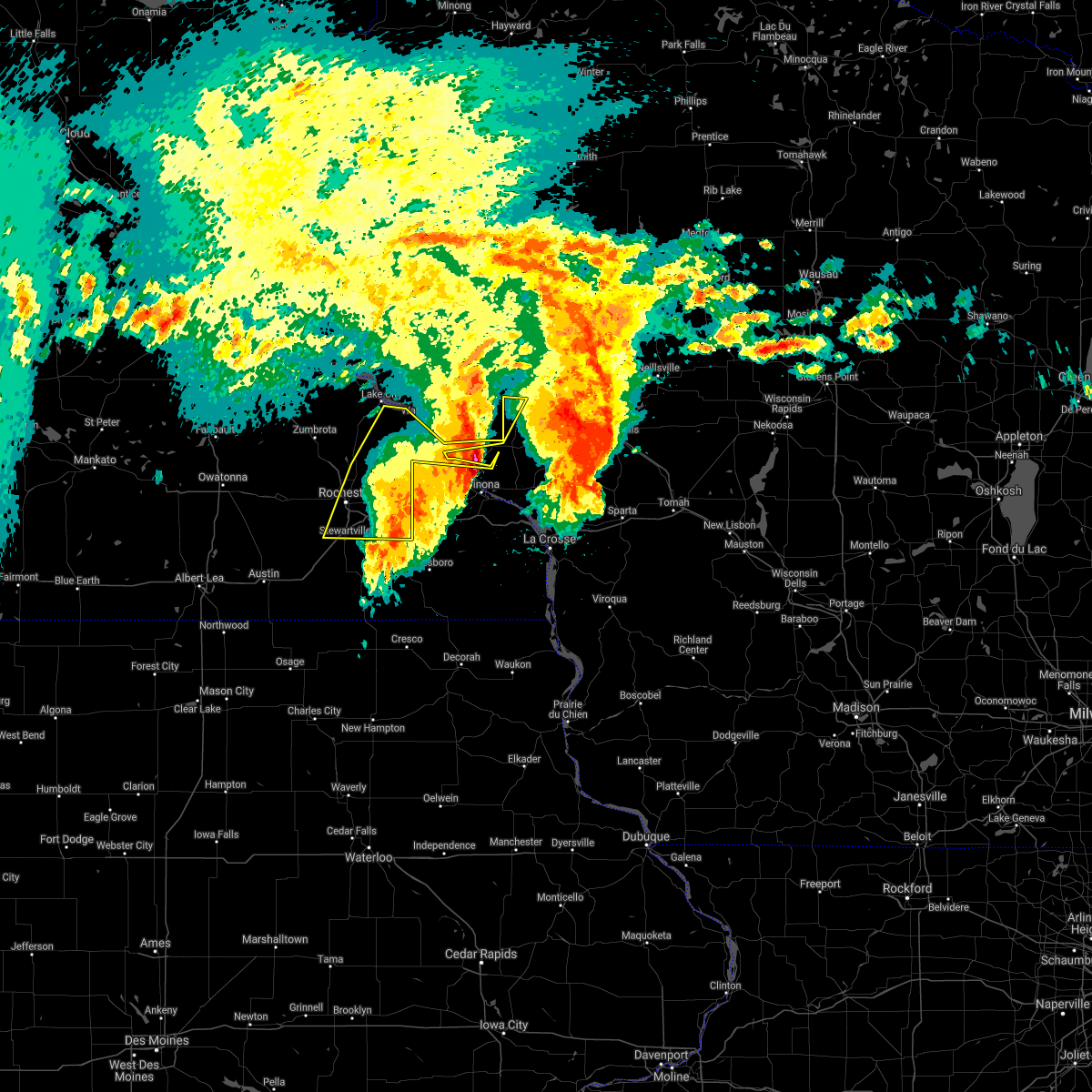 The severe thunderstorm warning for olmsted, wabasha and northwestern trempealeau counties will expire at 930 am cdt, the storms which prompted the warning have moved out of the area. therefore, the warning will be allowed to expire. a severe thunderstorm watch remains in effect until 400 pm cdt for southeastern minnesota, and west central wisconsin. The severe thunderstorm warning for olmsted, wabasha and northwestern trempealeau counties will expire at 930 am cdt, the storms which prompted the warning have moved out of the area. therefore, the warning will be allowed to expire. a severe thunderstorm watch remains in effect until 400 pm cdt for southeastern minnesota, and west central wisconsin.
|
| 7/20/2019 9:14 AM CDT |
 At 914 am cdt, severe thunderstorms were located along a line extending from near wabasha to 6 miles north of dover to 6 miles north of spring valley, moving east at 45 mph (trained weather spotters). Hazards include 60 mph wind gusts. Expect damage to roofs, siding, and trees. these severe storms will be near, kellogg around 920 am cdt. Other locations impacted by these severe thunderstorms include south troy, czechville, county roads 9 and 10, i 90 exit 218, potsdam, west albany and rochester airport. At 914 am cdt, severe thunderstorms were located along a line extending from near wabasha to 6 miles north of dover to 6 miles north of spring valley, moving east at 45 mph (trained weather spotters). Hazards include 60 mph wind gusts. Expect damage to roofs, siding, and trees. these severe storms will be near, kellogg around 920 am cdt. Other locations impacted by these severe thunderstorms include south troy, czechville, county roads 9 and 10, i 90 exit 218, potsdam, west albany and rochester airport.
|
| 7/20/2019 9:05 AM CDT |
 At 904 am cdt, severe thunderstorms were located along a line extending from pepin to near elgin to near stewartville, moving east at 50 mph (trained weather spotters). Hazards include 60 mph wind gusts. Expect damage to roofs, siding, and trees. these severe storms will be near, wabasha, plainview and dover around 910 am cdt. kellogg around 915 am cdt. chatfield around 920 am cdt. Other locations impacted by these severe thunderstorms include south troy, county roads 9 and 10, i 90 exit 218, potsdam, county roads 6 and 15, hidden meadows r v park and rock dell. At 904 am cdt, severe thunderstorms were located along a line extending from pepin to near elgin to near stewartville, moving east at 50 mph (trained weather spotters). Hazards include 60 mph wind gusts. Expect damage to roofs, siding, and trees. these severe storms will be near, wabasha, plainview and dover around 910 am cdt. kellogg around 915 am cdt. chatfield around 920 am cdt. Other locations impacted by these severe thunderstorms include south troy, county roads 9 and 10, i 90 exit 218, potsdam, county roads 6 and 15, hidden meadows r v park and rock dell.
|
| 7/20/2019 8:57 AM CDT | Asos station krst rochester international airpor in olmsted county MN, 8 miles N of Rochester, MN |
| 7/20/2019 8:57 AM CDT |
 At 856 am cdt, severe thunderstorms were located along a line extending from near stockholm to near rochester to 7 miles southwest of stewartville, moving east at 55 mph. at 854 am, a spotter reported estimated 60 mph wind gusts in northwest rochester (trained weather spotters). Hazards include 60 mph wind gusts. Expect damage to roofs, siding, and trees. these severe storms will be near, eyota and elgin around 905 am cdt. wabasha, dover and kellogg around 910 am cdt. chatfield around 920 am cdt. Other locations impacted by these severe thunderstorms include south troy, county roads 9 and 10, i 90 exit 218, potsdam, county roads 6 and 15, hidden meadows r v park and rock dell. At 856 am cdt, severe thunderstorms were located along a line extending from near stockholm to near rochester to 7 miles southwest of stewartville, moving east at 55 mph. at 854 am, a spotter reported estimated 60 mph wind gusts in northwest rochester (trained weather spotters). Hazards include 60 mph wind gusts. Expect damage to roofs, siding, and trees. these severe storms will be near, eyota and elgin around 905 am cdt. wabasha, dover and kellogg around 910 am cdt. chatfield around 920 am cdt. Other locations impacted by these severe thunderstorms include south troy, county roads 9 and 10, i 90 exit 218, potsdam, county roads 6 and 15, hidden meadows r v park and rock dell.
|
| 7/20/2019 8:53 AM CDT |
 At 852 am cdt, severe thunderstorms were located along a line extending from near pepin to rochester to 7 miles southeast of hayfield, moving east at 45 mph (radar indicated). Hazards include 60 mph wind gusts. Expect damage to roofs, siding, and trees. these severe storms will be near, wabasha around 905 am cdt. stewartville, eyota and kellogg around 910 am cdt. dover around 920 am cdt. chatfield around 925 am cdt. Other locations impacted by these severe thunderstorms include south troy, county roads 9 and 10, i 90 exit 218, potsdam, county roads 6 and 15, hidden meadows r v park and rock dell. At 852 am cdt, severe thunderstorms were located along a line extending from near pepin to rochester to 7 miles southeast of hayfield, moving east at 45 mph (radar indicated). Hazards include 60 mph wind gusts. Expect damage to roofs, siding, and trees. these severe storms will be near, wabasha around 905 am cdt. stewartville, eyota and kellogg around 910 am cdt. dover around 920 am cdt. chatfield around 925 am cdt. Other locations impacted by these severe thunderstorms include south troy, county roads 9 and 10, i 90 exit 218, potsdam, county roads 6 and 15, hidden meadows r v park and rock dell.
|
| 7/20/2019 8:45 AM CDT | 50 foot tree fell on a deck in rural north side of rocheste in olmsted county MN, 1.7 miles S of Rochester, MN |
| 7/20/2019 8:43 AM CDT |
 At 843 am cdt, severe thunderstorms were located along a line extending from near frontenac to byron to near hayfield, moving east at 45 mph (radar indicated). Hazards include 60 mph wind gusts. Expect damage to roofs, siding, and trees. severe thunderstorms will be near, rochester around 855 am cdt. wabasha and stewartville around 905 am cdt. eyota and kellogg around 910 am cdt. dover around 915 am cdt. chatfield around 925 am cdt. Other locations impacted by these severe thunderstorms include south troy, county roads 9 and 10, i 90 exit 218, potsdam, county roads 6 and 15, hidden meadows r v park and rock dell. At 843 am cdt, severe thunderstorms were located along a line extending from near frontenac to byron to near hayfield, moving east at 45 mph (radar indicated). Hazards include 60 mph wind gusts. Expect damage to roofs, siding, and trees. severe thunderstorms will be near, rochester around 855 am cdt. wabasha and stewartville around 905 am cdt. eyota and kellogg around 910 am cdt. dover around 915 am cdt. chatfield around 925 am cdt. Other locations impacted by these severe thunderstorms include south troy, county roads 9 and 10, i 90 exit 218, potsdam, county roads 6 and 15, hidden meadows r v park and rock dell.
|
| 6/4/2019 6:39 PM CDT |
 The severe thunderstorm warning for southwestern olmsted, mower and northwestern fillmore counties will expire at 645 pm cdt, the storms which prompted the warning have weakened below severe limits, and no longer pose an immediate threat to life or property. therefore, the warning will be allowed to expire. however gusty winds are still possible with these thunderstorms. severe thunderstorm warnings still remain in effect for much of eastern fillmore county and eastern olmsted county. a severe thunderstorm watch remains in effect until 1100 pm cdt for southeastern minnesota. The severe thunderstorm warning for southwestern olmsted, mower and northwestern fillmore counties will expire at 645 pm cdt, the storms which prompted the warning have weakened below severe limits, and no longer pose an immediate threat to life or property. therefore, the warning will be allowed to expire. however gusty winds are still possible with these thunderstorms. severe thunderstorm warnings still remain in effect for much of eastern fillmore county and eastern olmsted county. a severe thunderstorm watch remains in effect until 1100 pm cdt for southeastern minnesota.
|
| 6/4/2019 6:09 PM CDT |
 At 535 pm cdt, a cluster of severe thunderstorms was located near rochester, moving east at 15 mph (trained weather spotters. at 526 pm, ping pong ball sized hail was reported between byron and kasson). Hazards include two inch hail and 60 mph wind gusts. People and animals outdoors will be injured. expect hail damage to roofs, siding, windows, and vehicles. expect wind damage to roofs, siding, and trees. this severe storm will be near, rochester around 540 pm cdt. Other locations impacted by this severe thunderstorm include county roads 20 and 5, potsdam, eden, county roads 3 and 108, highway 57 and 570th street, county roads 6 and 15 and salem corners. At 535 pm cdt, a cluster of severe thunderstorms was located near rochester, moving east at 15 mph (trained weather spotters. at 526 pm, ping pong ball sized hail was reported between byron and kasson). Hazards include two inch hail and 60 mph wind gusts. People and animals outdoors will be injured. expect hail damage to roofs, siding, windows, and vehicles. expect wind damage to roofs, siding, and trees. this severe storm will be near, rochester around 540 pm cdt. Other locations impacted by this severe thunderstorm include county roads 20 and 5, potsdam, eden, county roads 3 and 108, highway 57 and 570th street, county roads 6 and 15 and salem corners.
|
| 6/4/2019 6:01 PM CDT | Storm damage reported in olmsted county MN, 7.3 miles N of Rochester, MN |
| 6/4/2019 5:59 PM CDT | Storm damage reported in olmsted county MN, 7.3 miles N of Rochester, MN |
| 6/4/2019 5:57 PM CDT | At apache mall in olmsted county MN, 0.4 miles N of Rochester, MN |
| 6/4/2019 5:51 PM CDT |
 At 550 pm cdt, severe thunderstorms were located along a line extending from near rochester to 6 miles north of austin, moving southeast at 40 mph (radar indicated). Hazards include ping pong ball size hail and 60 mph wind gusts. People and animals outdoors will be injured. expect hail damage to roofs, siding, windows, and vehicles. expect wind damage to roofs, siding, and trees. severe thunderstorms will be near, rochester around 555 pm cdt. rose creek around 610 pm cdt. grand meadow and adams around 620 pm cdt. le roy around 635 pm cdt. Other locations impacted by these severe thunderstorms include i 90 exit 218, fillmore, brookside campground, mayville, county roads 4 and 8, washington and waltham. At 550 pm cdt, severe thunderstorms were located along a line extending from near rochester to 6 miles north of austin, moving southeast at 40 mph (radar indicated). Hazards include ping pong ball size hail and 60 mph wind gusts. People and animals outdoors will be injured. expect hail damage to roofs, siding, windows, and vehicles. expect wind damage to roofs, siding, and trees. severe thunderstorms will be near, rochester around 555 pm cdt. rose creek around 610 pm cdt. grand meadow and adams around 620 pm cdt. le roy around 635 pm cdt. Other locations impacted by these severe thunderstorms include i 90 exit 218, fillmore, brookside campground, mayville, county roads 4 and 8, washington and waltham.
|
| 6/4/2019 5:37 PM CDT |
 At 535 pm cdt, a cluster of severe thunderstorms was located near rochester, moving east at 15 mph (trained weather spotters. at 526 pm, ping pong ball sized hail was reported between byron and kasson). Hazards include two inch hail and 60 mph wind gusts. People and animals outdoors will be injured. expect hail damage to roofs, siding, windows, and vehicles. expect wind damage to roofs, siding, and trees. this severe storm will be near, rochester around 540 pm cdt. Other locations impacted by this severe thunderstorm include county roads 20 and 5, potsdam, eden, county roads 3 and 108, highway 57 and 570th street, county roads 6 and 15 and salem corners. At 535 pm cdt, a cluster of severe thunderstorms was located near rochester, moving east at 15 mph (trained weather spotters. at 526 pm, ping pong ball sized hail was reported between byron and kasson). Hazards include two inch hail and 60 mph wind gusts. People and animals outdoors will be injured. expect hail damage to roofs, siding, windows, and vehicles. expect wind damage to roofs, siding, and trees. this severe storm will be near, rochester around 540 pm cdt. Other locations impacted by this severe thunderstorm include county roads 20 and 5, potsdam, eden, county roads 3 and 108, highway 57 and 570th street, county roads 6 and 15 and salem corners.
|
| 6/4/2019 5:23 PM CDT |
 At 521 pm cdt, a severe thunderstorm was located over byron, or 7 miles east of mantorville, moving east at 10 mph. an additional severe thunderstorms were located across the northern half of dodge county. this is a very dangerous storm (trained spotters. this storm has a history of producing baseball sized hail in kasson). Hazards include baseball size hail and 60 mph wind gusts. People and animals outdoors will be severely injured. expect shattered windows, extensive damage to roofs, siding, and vehicles. this severe thunderstorm will be near, rochester and oronoco around 605 pm cdt. other locations impacted by this severe thunderstorm include county roads 20 and 5, potsdam, eden, county roads 3 and 108, highway 57 and 570th street, county roads 6 and 15 and salem corners. People attending safe city nights should seek safe shelter immediately!. At 521 pm cdt, a severe thunderstorm was located over byron, or 7 miles east of mantorville, moving east at 10 mph. an additional severe thunderstorms were located across the northern half of dodge county. this is a very dangerous storm (trained spotters. this storm has a history of producing baseball sized hail in kasson). Hazards include baseball size hail and 60 mph wind gusts. People and animals outdoors will be severely injured. expect shattered windows, extensive damage to roofs, siding, and vehicles. this severe thunderstorm will be near, rochester and oronoco around 605 pm cdt. other locations impacted by this severe thunderstorm include county roads 20 and 5, potsdam, eden, county roads 3 and 108, highway 57 and 570th street, county roads 6 and 15 and salem corners. People attending safe city nights should seek safe shelter immediately!.
|
| 6/4/2019 5:07 PM CDT |
 At 507 pm cdt, a severe thunderstorm was located near byron, or near mantorville, moving northeast at 15 mph. this is a very dangerous storm (emergency management. baseball sized hail has been reported in kasson). Hazards include baseball size hail and 60 mph wind gusts. People and animals outdoors will be severely injured. expect shattered windows, extensive damage to roofs, siding, and vehicles. this severe storm will be near, pine island and oronoco around 530 pm cdt. Other locations impacted by this severe thunderstorm include ringe, potsdam, danesville, eden, highway 57 and 570th street, county roads 6 and 15 and salem corners. At 507 pm cdt, a severe thunderstorm was located near byron, or near mantorville, moving northeast at 15 mph. this is a very dangerous storm (emergency management. baseball sized hail has been reported in kasson). Hazards include baseball size hail and 60 mph wind gusts. People and animals outdoors will be severely injured. expect shattered windows, extensive damage to roofs, siding, and vehicles. this severe storm will be near, pine island and oronoco around 530 pm cdt. Other locations impacted by this severe thunderstorm include ringe, potsdam, danesville, eden, highway 57 and 570th street, county roads 6 and 15 and salem corners.
|
| 6/4/2019 5:05 PM CDT |
 At 504 pm cdt, a severe thunderstorm was located near byron, or near mantorville, moving northeast at 15 mph. this is a very dangerous storm (emergency management. at 503 pm, baseball sized hail was reported in kasson). Hazards include baseball size hail and 60 mph wind gusts. People and animals outdoors will be severely injured. expect shattered windows, extensive damage to roofs, siding, and vehicles. this severe storm will be near, pine island around 525 pm cdt. oronoco around 530 pm cdt. Other locations impacted by this severe thunderstorm include ringe, potsdam, danesville, highway 57 and 570th street, county roads 6 and 15, highway 52 and county 14 and hidden meadows r v park. At 504 pm cdt, a severe thunderstorm was located near byron, or near mantorville, moving northeast at 15 mph. this is a very dangerous storm (emergency management. at 503 pm, baseball sized hail was reported in kasson). Hazards include baseball size hail and 60 mph wind gusts. People and animals outdoors will be severely injured. expect shattered windows, extensive damage to roofs, siding, and vehicles. this severe storm will be near, pine island around 525 pm cdt. oronoco around 530 pm cdt. Other locations impacted by this severe thunderstorm include ringe, potsdam, danesville, highway 57 and 570th street, county roads 6 and 15, highway 52 and county 14 and hidden meadows r v park.
|
| 6/4/2019 5:00 PM CDT |
 At 459 pm cdt, a severe thunderstorm was located near byron, or near mantorville, moving northeast at 15 mph (public. at 456 pm, quarter sized hail was reported in dodge center ). Hazards include 60 mph wind gusts and quarter size hail. Hail damage to vehicles is expected. expect wind damage to roofs, siding, and trees. this severe storm will be near, pine island around 525 pm cdt. oronoco around 530 pm cdt. Other locations impacted by this severe thunderstorm include ringe, potsdam, danesville, highway 57 and 570th street, county roads 6 and 15, highway 52 and county 14 and hidden meadows r v park. At 459 pm cdt, a severe thunderstorm was located near byron, or near mantorville, moving northeast at 15 mph (public. at 456 pm, quarter sized hail was reported in dodge center ). Hazards include 60 mph wind gusts and quarter size hail. Hail damage to vehicles is expected. expect wind damage to roofs, siding, and trees. this severe storm will be near, pine island around 525 pm cdt. oronoco around 530 pm cdt. Other locations impacted by this severe thunderstorm include ringe, potsdam, danesville, highway 57 and 570th street, county roads 6 and 15, highway 52 and county 14 and hidden meadows r v park.
|
| 6/4/2019 4:48 PM CDT |
 At 448 pm cdt, a severe thunderstorm was located near oronoco, or 7 miles northeast of mantorville, moving northeast at 25 mph (radar indicated). Hazards include 60 mph wind gusts and quarter size hail. Hail damage to vehicles is expected. expect wind damage to roofs, siding, and trees. this severe thunderstorm will be near, oronoco around 500 pm cdt. Other locations impacted by this severe thunderstorm include ringe, potsdam, danesville, highway 57 and 570th street, county roads 6 and 15, highway 52 and county 14 and hidden meadows r v park. At 448 pm cdt, a severe thunderstorm was located near oronoco, or 7 miles northeast of mantorville, moving northeast at 25 mph (radar indicated). Hazards include 60 mph wind gusts and quarter size hail. Hail damage to vehicles is expected. expect wind damage to roofs, siding, and trees. this severe thunderstorm will be near, oronoco around 500 pm cdt. Other locations impacted by this severe thunderstorm include ringe, potsdam, danesville, highway 57 and 570th street, county roads 6 and 15, highway 52 and county 14 and hidden meadows r v park.
|
| 5/27/2019 1:55 PM CDT |
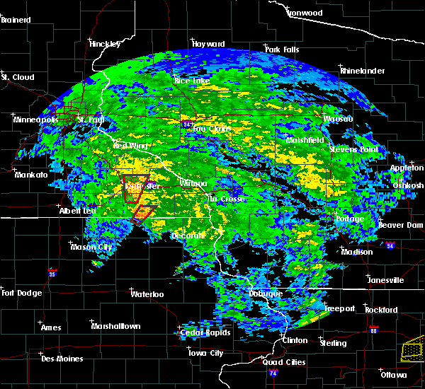 At 155 pm cdt, a severe thunderstorm capable of producing a tornado was located near chatfield, or 14 miles southeast of rochester, moving north at 40 mph (radar indicated rotation). Hazards include tornado. Flying debris will be dangerous to those caught without shelter. mobile homes will be damaged or destroyed. damage to roofs, windows, and vehicles will occur. tree damage is likely. this dangerous storm will be near, eyota around 210 pm cdt. Other locations impacted by this tornadic thunderstorm include predmore, county roads 9 and 10, i 90 exit 218, i 90 exit 224, county roads 137 and 136, century high school and cummingsville. At 155 pm cdt, a severe thunderstorm capable of producing a tornado was located near chatfield, or 14 miles southeast of rochester, moving north at 40 mph (radar indicated rotation). Hazards include tornado. Flying debris will be dangerous to those caught without shelter. mobile homes will be damaged or destroyed. damage to roofs, windows, and vehicles will occur. tree damage is likely. this dangerous storm will be near, eyota around 210 pm cdt. Other locations impacted by this tornadic thunderstorm include predmore, county roads 9 and 10, i 90 exit 218, i 90 exit 224, county roads 137 and 136, century high school and cummingsville.
|
| 5/27/2019 1:50 PM CDT |
 At 150 pm cdt, a confirmed tornado was located near wykoff, or 14 miles northwest of preston, moving north at 45 mph (radar confirmed tornado). Hazards include damaging tornado. Flying debris will be dangerous to those caught without shelter. mobile homes will be damaged or destroyed. damage to roofs, windows, and vehicles will occur. tree damage is likely. this tornado will be near, eyota around 210 pm cdt. Other locations impacted by this tornadic thunderstorm include predmore, county roads 9 and 10, i 90 exit 218, i 90 exit 224, county roads 137 and 136, fillmore and century high school. At 150 pm cdt, a confirmed tornado was located near wykoff, or 14 miles northwest of preston, moving north at 45 mph (radar confirmed tornado). Hazards include damaging tornado. Flying debris will be dangerous to those caught without shelter. mobile homes will be damaged or destroyed. damage to roofs, windows, and vehicles will occur. tree damage is likely. this tornado will be near, eyota around 210 pm cdt. Other locations impacted by this tornadic thunderstorm include predmore, county roads 9 and 10, i 90 exit 218, i 90 exit 224, county roads 137 and 136, fillmore and century high school.
|
| 5/27/2019 1:41 PM CDT |
 At 141 pm cdt, a tornado producing storm was located over spring valley, or 12 miles west of preston, moving north at 35 mph (radar confirmed tornado). Hazards include damaging tornado. Flying debris will be dangerous to those caught without shelter. mobile homes will be damaged or destroyed. damage to roofs, windows, and vehicles will occur. tree damage is likely. this tornadic storm will be near, wykoff around 145 pm cdt. chatfield around 205 pm cdt. eyota around 220 pm cdt. Other locations impacted by this tornadic thunderstorm include predmore, county roads 9 and 10, i 90 exit 218, i 90 exit 224, county roads 137 and 136, fillmore and century high school. At 141 pm cdt, a tornado producing storm was located over spring valley, or 12 miles west of preston, moving north at 35 mph (radar confirmed tornado). Hazards include damaging tornado. Flying debris will be dangerous to those caught without shelter. mobile homes will be damaged or destroyed. damage to roofs, windows, and vehicles will occur. tree damage is likely. this tornadic storm will be near, wykoff around 145 pm cdt. chatfield around 205 pm cdt. eyota around 220 pm cdt. Other locations impacted by this tornadic thunderstorm include predmore, county roads 9 and 10, i 90 exit 218, i 90 exit 224, county roads 137 and 136, fillmore and century high school.
|
| 9/20/2018 7:42 PM CDT |
 At 721 pm cdt, severe thunderstorms were located along a line extending from near red wing to austin, moving northeast at 65 mph (trained weather spotters. these storms have a history of localized damaging winds to 70 mph and brief tornadoes). Hazards include 70 mph wind gusts. Expect considerable tree damage. damage is likely to mobile homes, roofs, and outbuildings. these severe storms will be near, rochester around 735 pm cdt. chatfield and eyota around 745 pm cdt. mondovi and dover around 750 pm cdt. st. charles around 755 pm cdt. lewiston, altura and rollingstone around 800 pm cdt. other locations impacted by these severe thunderstorms include marion, pleasant grove, saratoga, viola and cochrane. A tornado watch remains in effect until midnight cdt for southeastern minnesota, and west central wisconsin. At 721 pm cdt, severe thunderstorms were located along a line extending from near red wing to austin, moving northeast at 65 mph (trained weather spotters. these storms have a history of localized damaging winds to 70 mph and brief tornadoes). Hazards include 70 mph wind gusts. Expect considerable tree damage. damage is likely to mobile homes, roofs, and outbuildings. these severe storms will be near, rochester around 735 pm cdt. chatfield and eyota around 745 pm cdt. mondovi and dover around 750 pm cdt. st. charles around 755 pm cdt. lewiston, altura and rollingstone around 800 pm cdt. other locations impacted by these severe thunderstorms include marion, pleasant grove, saratoga, viola and cochrane. A tornado watch remains in effect until midnight cdt for southeastern minnesota, and west central wisconsin.
|
| 9/20/2018 7:32 PM CDT |
 At 729 pm cdt, severe thunderstorms were located along a line extending from near stockholm to near stewartville, moving northeast at 75 mph (trained weather spotters have reported trees down in cannon falls). Hazards include 70 mph wind gusts. Expect considerable tree damage. damage is likely to mobile homes, roofs, and outbuildings. these severe storms will be near, dover and elgin around 745 pm cdt. mondovi, st. charles and plainview around 750 pm cdt. altura and lewiston around 755 pm cdt. alma, rollingstone, buffalo and buffalo city around 800 pm cdt. the most severe winds near 70 mph and possible tornadoes are more likely in northern wabasha and northern buffalo county. other locations impacted by these severe thunderstorms include marion, pleasant grove, saratoga, viola and cochrane. A tornado watch remains in effect until midnight cdt for southeastern minnesota, and west central wisconsin. At 729 pm cdt, severe thunderstorms were located along a line extending from near stockholm to near stewartville, moving northeast at 75 mph (trained weather spotters have reported trees down in cannon falls). Hazards include 70 mph wind gusts. Expect considerable tree damage. damage is likely to mobile homes, roofs, and outbuildings. these severe storms will be near, dover and elgin around 745 pm cdt. mondovi, st. charles and plainview around 750 pm cdt. altura and lewiston around 755 pm cdt. alma, rollingstone, buffalo and buffalo city around 800 pm cdt. the most severe winds near 70 mph and possible tornadoes are more likely in northern wabasha and northern buffalo county. other locations impacted by these severe thunderstorms include marion, pleasant grove, saratoga, viola and cochrane. A tornado watch remains in effect until midnight cdt for southeastern minnesota, and west central wisconsin.
|
| 9/20/2018 7:32 PM CDT |
 At 721 pm cdt, severe thunderstorms were located along a line extending from near red wing to austin, moving northeast at 65 mph (trained weather spotters. these storms have a history of localized damaging winds to 70 mph and brief tornadoes). Hazards include 70 mph wind gusts. Expect considerable tree damage. damage is likely to mobile homes, roofs, and outbuildings. these severe storms will be near, rochester around 735 pm cdt. chatfield and eyota around 745 pm cdt. mondovi and dover around 750 pm cdt. st. charles around 755 pm cdt. lewiston, altura and rollingstone around 800 pm cdt. other locations impacted by these severe thunderstorms include marion, pleasant grove, saratoga, viola and cochrane. A tornado watch remains in effect until midnight cdt for southeastern minnesota, and west central wisconsin. At 721 pm cdt, severe thunderstorms were located along a line extending from near red wing to austin, moving northeast at 65 mph (trained weather spotters. these storms have a history of localized damaging winds to 70 mph and brief tornadoes). Hazards include 70 mph wind gusts. Expect considerable tree damage. damage is likely to mobile homes, roofs, and outbuildings. these severe storms will be near, rochester around 735 pm cdt. chatfield and eyota around 745 pm cdt. mondovi and dover around 750 pm cdt. st. charles around 755 pm cdt. lewiston, altura and rollingstone around 800 pm cdt. other locations impacted by these severe thunderstorms include marion, pleasant grove, saratoga, viola and cochrane. A tornado watch remains in effect until midnight cdt for southeastern minnesota, and west central wisconsin.
|
| 9/20/2018 7:23 PM CDT |
 At 721 pm cdt, severe thunderstorms were located along a line extending from near red wing to austin, moving northeast at 65 mph (trained weather spotters. these storms have a history of localized damaging winds to 70 mph and brief tornadoes). Hazards include 70 mph wind gusts. Expect considerable tree damage. damage is likely to mobile homes, roofs, and outbuildings. these severe storms will be near, rochester around 735 pm cdt. chatfield and eyota around 745 pm cdt. mondovi and dover around 750 pm cdt. st. charles around 755 pm cdt. lewiston, altura and rollingstone around 800 pm cdt. other locations impacted by these severe thunderstorms include marion, pleasant grove, saratoga, viola and cochrane. A tornado watch remains in effect until midnight cdt for southeastern minnesota, and west central wisconsin. At 721 pm cdt, severe thunderstorms were located along a line extending from near red wing to austin, moving northeast at 65 mph (trained weather spotters. these storms have a history of localized damaging winds to 70 mph and brief tornadoes). Hazards include 70 mph wind gusts. Expect considerable tree damage. damage is likely to mobile homes, roofs, and outbuildings. these severe storms will be near, rochester around 735 pm cdt. chatfield and eyota around 745 pm cdt. mondovi and dover around 750 pm cdt. st. charles around 755 pm cdt. lewiston, altura and rollingstone around 800 pm cdt. other locations impacted by these severe thunderstorms include marion, pleasant grove, saratoga, viola and cochrane. A tornado watch remains in effect until midnight cdt for southeastern minnesota, and west central wisconsin.
|
| 9/20/2018 7:08 PM CDT |
 At 653 pm cdt, severe thunderstorms were located along a line extending from 6 miles northeast of kenyon to near northwood, moving east at 65 mph (trained weather spotters. spotters and airport wind equipment have recorded 60 to 70 mph winds with this line of storms. brief tornadoes have also been confirmed). Hazards include 70 mph wind gusts. Expect considerable tree damage. damage is likely to mobile homes, roofs, and outbuildings. these severe storms will be near, rose creek around 715 pm cdt. adams around 720 pm cdt. le roy and grand meadow around 730 pm cdt. western rochester around 720 pm. other locations impacted by these severe thunderstorms include high forest, lansing, wasioja, douglas and rock dell. A tornado watch remains in effect until midnight cdt for north central and northeastern iowa, and southeastern minnesota. At 653 pm cdt, severe thunderstorms were located along a line extending from 6 miles northeast of kenyon to near northwood, moving east at 65 mph (trained weather spotters. spotters and airport wind equipment have recorded 60 to 70 mph winds with this line of storms. brief tornadoes have also been confirmed). Hazards include 70 mph wind gusts. Expect considerable tree damage. damage is likely to mobile homes, roofs, and outbuildings. these severe storms will be near, rose creek around 715 pm cdt. adams around 720 pm cdt. le roy and grand meadow around 730 pm cdt. western rochester around 720 pm. other locations impacted by these severe thunderstorms include high forest, lansing, wasioja, douglas and rock dell. A tornado watch remains in effect until midnight cdt for north central and northeastern iowa, and southeastern minnesota.
|
| 9/20/2018 7:04 PM CDT |
 The national weather service in la crosse has issued a * severe thunderstorm warning for. western winona county in southeastern minnesota. eastern olmsted county in southeastern minnesota. wabasha county in southeastern minnesota. Western buffalo county in west central wisconsin. The national weather service in la crosse has issued a * severe thunderstorm warning for. western winona county in southeastern minnesota. eastern olmsted county in southeastern minnesota. wabasha county in southeastern minnesota. Western buffalo county in west central wisconsin.
|
| 9/20/2018 7:04 PM CDT |
 At 702 pm cdt, severe thunderstorms were located along a line extending from near goodhue to near london, moving east at 70 mph (trained weather spotters and law enforcement have reported wind damage, wind gusts to 70 mph, and brief tornadoes with this line of storms). Hazards include 70 mph wind gusts. Expect considerable tree damage. damage is likely to mobile homes, roofs, and outbuildings. severe thunderstorms will be near, mazeppa around 710 pm cdt. wabasha around 730 pm cdt. modena around 740 pm cdt. mondovi around 750 pm cdt. other locations impacted by these severe thunderstorms include marion, pleasant grove, saratoga, viola and cochrane. A tornado watch remains in effect until midnight cdt for southeastern minnesota, and west central wisconsin. At 702 pm cdt, severe thunderstorms were located along a line extending from near goodhue to near london, moving east at 70 mph (trained weather spotters and law enforcement have reported wind damage, wind gusts to 70 mph, and brief tornadoes with this line of storms). Hazards include 70 mph wind gusts. Expect considerable tree damage. damage is likely to mobile homes, roofs, and outbuildings. severe thunderstorms will be near, mazeppa around 710 pm cdt. wabasha around 730 pm cdt. modena around 740 pm cdt. mondovi around 750 pm cdt. other locations impacted by these severe thunderstorms include marion, pleasant grove, saratoga, viola and cochrane. A tornado watch remains in effect until midnight cdt for southeastern minnesota, and west central wisconsin.
|
| 9/20/2018 6:55 PM CDT |
 At 653 pm cdt, severe thunderstorms were located along a line extending from 6 miles northeast of kenyon to near northwood, moving east at 65 mph (trained weather spotters. spotters and airport wind equipment have recorded 60 to 70 mph winds with this line of storms. brief tornadoes have also been confirmed). Hazards include 70 mph wind gusts. Expect considerable tree damage. damage is likely to mobile homes, roofs, and outbuildings. these severe storms will be near, rose creek around 715 pm cdt. adams around 720 pm cdt. le roy and grand meadow around 730 pm cdt. western rochester around 720 pm. other locations impacted by these severe thunderstorms include high forest, lansing, wasioja, douglas and rock dell. A tornado watch remains in effect until midnight cdt for north central and northeastern iowa, and southeastern minnesota. At 653 pm cdt, severe thunderstorms were located along a line extending from 6 miles northeast of kenyon to near northwood, moving east at 65 mph (trained weather spotters. spotters and airport wind equipment have recorded 60 to 70 mph winds with this line of storms. brief tornadoes have also been confirmed). Hazards include 70 mph wind gusts. Expect considerable tree damage. damage is likely to mobile homes, roofs, and outbuildings. these severe storms will be near, rose creek around 715 pm cdt. adams around 720 pm cdt. le roy and grand meadow around 730 pm cdt. western rochester around 720 pm. other locations impacted by these severe thunderstorms include high forest, lansing, wasioja, douglas and rock dell. A tornado watch remains in effect until midnight cdt for north central and northeastern iowa, and southeastern minnesota.
|
| 9/20/2018 6:38 PM CDT |
 At 636 pm cdt, severe thunderstorms were located along a line extending from near faribault to lake mills, moving east at 65 mph (trained spotters. the storms have a history of producing 60 to 70 mph winds and brief damaging tornadoes). Hazards include 70 mph wind gusts. Expect considerable tree damage. damage is likely to mobile homes, roofs, and outbuildings. severe thunderstorms will be near, lyle around 705 pm cdt. rose creek around 710 pm cdt. adams around 715 pm cdt. le roy and grand meadow around 725 pm cdt. western side of the city of rochester around 720 pm. other locations impacted by these severe thunderstorms include high forest, lansing, wasioja, douglas and rock dell. A tornado watch remains in effect until midnight cdt for north central and northeastern iowa, and southeastern minnesota. At 636 pm cdt, severe thunderstorms were located along a line extending from near faribault to lake mills, moving east at 65 mph (trained spotters. the storms have a history of producing 60 to 70 mph winds and brief damaging tornadoes). Hazards include 70 mph wind gusts. Expect considerable tree damage. damage is likely to mobile homes, roofs, and outbuildings. severe thunderstorms will be near, lyle around 705 pm cdt. rose creek around 710 pm cdt. adams around 715 pm cdt. le roy and grand meadow around 725 pm cdt. western side of the city of rochester around 720 pm. other locations impacted by these severe thunderstorms include high forest, lansing, wasioja, douglas and rock dell. A tornado watch remains in effect until midnight cdt for north central and northeastern iowa, and southeastern minnesota.
|
| 9/17/2018 3:15 PM CDT | Wind gust at helipad on top of st marys hospital near downtown rochester in olmsted county MN, 0.4 miles N of Rochester, MN |
| 8/27/2018 6:41 PM CDT |
 The severe thunderstorm warning for western winona, eastern olmsted, southeastern mower, wabasha, western fillmore and northwestern buffalo counties will expire at 645 pm cdt, the storms which prompted the warning have either weakened or moved out of the area. therefore the warning will be allowed to expire. however gusty winds and heavy rain are still possible with thunderstorms that remain in the area. a severe thunderstorm watch remains in effect until 1000 pm cdt for northeastern iowa, southeastern minnesota, and west central wisconsin. remember, a severe thunderstorm warning still remains in effect for eastern buffalo and eastern winona counties until 715 pm!. The severe thunderstorm warning for western winona, eastern olmsted, southeastern mower, wabasha, western fillmore and northwestern buffalo counties will expire at 645 pm cdt, the storms which prompted the warning have either weakened or moved out of the area. therefore the warning will be allowed to expire. however gusty winds and heavy rain are still possible with thunderstorms that remain in the area. a severe thunderstorm watch remains in effect until 1000 pm cdt for northeastern iowa, southeastern minnesota, and west central wisconsin. remember, a severe thunderstorm warning still remains in effect for eastern buffalo and eastern winona counties until 715 pm!.
|
| 8/27/2018 6:17 PM CDT |
 At 616 pm cdt, severe thunderstorms were located along a line extending from near durand to near plainview to adams, moving east at 45 mph. these storms have a history of 45 to 55 mph (radar indicated). Hazards include 60 mph wind gusts. Expect damage to roofs, siding, and trees. these severe storms will be near, plainview and st. charles around 620 pm cdt. altura around 625 pm cdt. kellogg around 630 pm cdt. alma, buffalo and buffalo city around 635 pm cdt. spring valley around 640 pm cdt. Other locations impacted by these severe thunderstorms include fillmore, marion, pleasant grove, washington and saratoga. At 616 pm cdt, severe thunderstorms were located along a line extending from near durand to near plainview to adams, moving east at 45 mph. these storms have a history of 45 to 55 mph (radar indicated). Hazards include 60 mph wind gusts. Expect damage to roofs, siding, and trees. these severe storms will be near, plainview and st. charles around 620 pm cdt. altura around 625 pm cdt. kellogg around 630 pm cdt. alma, buffalo and buffalo city around 635 pm cdt. spring valley around 640 pm cdt. Other locations impacted by these severe thunderstorms include fillmore, marion, pleasant grove, washington and saratoga.
|
| 8/27/2018 6:10 PM CDT |
 The severe thunderstorm warning for western olmsted, mower and eastern dodge counties will expire at 615 pm cdt, the storms which prompted the warning have moved out of the area. therefore the warning will be allowed to expire. however gusty winds and heavy rain are still possible with these thunderstorms. a severe thunderstorm watch remains in effect until 1000 pm cdt for southeastern minnesota. remember, a severe thunderstorm warning still remains in effect for eastern olmsted and southeast mower counties until 645 pm!. The severe thunderstorm warning for western olmsted, mower and eastern dodge counties will expire at 615 pm cdt, the storms which prompted the warning have moved out of the area. therefore the warning will be allowed to expire. however gusty winds and heavy rain are still possible with these thunderstorms. a severe thunderstorm watch remains in effect until 1000 pm cdt for southeastern minnesota. remember, a severe thunderstorm warning still remains in effect for eastern olmsted and southeast mower counties until 645 pm!.
|
| 8/27/2018 5:57 PM CDT |
 At 555 pm cdt, severe thunderstorms were located along a line extending from near bay city to near rochester to near lyle, moving east at 50 mph (radar indicated. trees were reported down in the city of kasson minnesota at 535 pm). Hazards include 60 mph wind gusts. Expect damage to roofs, siding, and trees. these severe storms will be near, eyota around 600 pm cdt. elgin and dover around 605 pm cdt. plainview and st. charles around 610 pm cdt. le roy around 615 pm cdt. grand meadow and altura around 620 pm cdt. buffalo, buffalo city and kellogg around 625 pm cdt. Other locations impacted by these severe thunderstorms include fillmore, marion, pleasant grove, washington and saratoga. At 555 pm cdt, severe thunderstorms were located along a line extending from near bay city to near rochester to near lyle, moving east at 50 mph (radar indicated. trees were reported down in the city of kasson minnesota at 535 pm). Hazards include 60 mph wind gusts. Expect damage to roofs, siding, and trees. these severe storms will be near, eyota around 600 pm cdt. elgin and dover around 605 pm cdt. plainview and st. charles around 610 pm cdt. le roy around 615 pm cdt. grand meadow and altura around 620 pm cdt. buffalo, buffalo city and kellogg around 625 pm cdt. Other locations impacted by these severe thunderstorms include fillmore, marion, pleasant grove, washington and saratoga.
|
| 8/27/2018 5:52 PM CDT |
 At 551 pm cdt, severe thunderstorms were located along a line extending from near mazeppa to near stewartville to lyle, moving east at 35 mph. these storms have produced winds of 45 to 55 mph (radar indicated). Hazards include 60 mph wind gusts. Expect damage to roofs, siding, and trees. these severe storms will be near, oronoco and byron around 555 pm cdt. rochester and stewartville around 600 pm cdt. Other locations impacted by these severe thunderstorms include high forest, lansing, douglas, rock dell and mayville. At 551 pm cdt, severe thunderstorms were located along a line extending from near mazeppa to near stewartville to lyle, moving east at 35 mph. these storms have produced winds of 45 to 55 mph (radar indicated). Hazards include 60 mph wind gusts. Expect damage to roofs, siding, and trees. these severe storms will be near, oronoco and byron around 555 pm cdt. rochester and stewartville around 600 pm cdt. Other locations impacted by these severe thunderstorms include high forest, lansing, douglas, rock dell and mayville.
|
| 8/27/2018 5:42 PM CDT |
 At 541 pm cdt, severe thunderstorms were located along a line extending from near goodhue to near byron to 6 miles east of northwood, moving northeast at 50 mph. this line of storms has produced winds of 45 to 55 mph (radar indicated). Hazards include 60 mph wind gusts. Expect damage to roofs, siding, and trees. these severe storms will be near, adams and eyota around 605 pm cdt. elgin and dover around 610 pm cdt. plainview and le roy around 615 pm cdt. grand meadow around 620 pm cdt. altura around 625 pm cdt. Other locations impacted by these severe thunderstorms include fillmore, marion, pleasant grove, washington and saratoga. At 541 pm cdt, severe thunderstorms were located along a line extending from near goodhue to near byron to 6 miles east of northwood, moving northeast at 50 mph. this line of storms has produced winds of 45 to 55 mph (radar indicated). Hazards include 60 mph wind gusts. Expect damage to roofs, siding, and trees. these severe storms will be near, adams and eyota around 605 pm cdt. elgin and dover around 610 pm cdt. plainview and le roy around 615 pm cdt. grand meadow around 620 pm cdt. altura around 625 pm cdt. Other locations impacted by these severe thunderstorms include fillmore, marion, pleasant grove, washington and saratoga.
|
| 8/27/2018 5:31 PM CDT |
 At 530 pm cdt, severe thunderstorms were located along a line extending from 6 miles south of wanamingo to hayfield to near northwood, moving east at 45 mph (radar indicated). Hazards include 60 mph wind gusts. Expect damage to roofs, siding, and trees. these severe storms will be near, mantorville, dodge center, hayfield and west concord around 535 pm cdt. kasson around 540 pm cdt. oronoco and byron around 545 pm cdt. stewartville around 550 pm cdt. rochester and rose creek around 555 pm cdt. Other locations impacted by these severe thunderstorms include high forest, lansing, wasioja, douglas and rock dell. At 530 pm cdt, severe thunderstorms were located along a line extending from 6 miles south of wanamingo to hayfield to near northwood, moving east at 45 mph (radar indicated). Hazards include 60 mph wind gusts. Expect damage to roofs, siding, and trees. these severe storms will be near, mantorville, dodge center, hayfield and west concord around 535 pm cdt. kasson around 540 pm cdt. oronoco and byron around 545 pm cdt. stewartville around 550 pm cdt. rochester and rose creek around 555 pm cdt. Other locations impacted by these severe thunderstorms include high forest, lansing, wasioja, douglas and rock dell.
|
| 8/27/2018 5:28 PM CDT |
 At 527 pm cdt, severe thunderstorms were located along a line extending from near wanamingo to hayfield to 7 miles southwest of northwood, moving east at 45 mph (radar indicated). Hazards include 60 mph wind gusts. expect damage to roofs, siding, and trees At 527 pm cdt, severe thunderstorms were located along a line extending from near wanamingo to hayfield to 7 miles southwest of northwood, moving east at 45 mph (radar indicated). Hazards include 60 mph wind gusts. expect damage to roofs, siding, and trees
|
| 8/27/2018 5:09 PM CDT |
 At 509 pm cdt, severe thunderstorms were located along a line extending from near medford to near hollandale to 6 miles northeast of rice lake, moving east at 35 mph (radar indicated). Hazards include 60 mph wind gusts and penny size hail. Expect damage to roofs, siding, and trees. Locations impacted include, rochester, austin, dodge center, mantorville, kasson, stewartville, byron, hayfield, oronoco, west concord, brownsdale, lyle, claremont, rose creek, high forest, lansing, wasioja, douglas, rock dell and concord. At 509 pm cdt, severe thunderstorms were located along a line extending from near medford to near hollandale to 6 miles northeast of rice lake, moving east at 35 mph (radar indicated). Hazards include 60 mph wind gusts and penny size hail. Expect damage to roofs, siding, and trees. Locations impacted include, rochester, austin, dodge center, mantorville, kasson, stewartville, byron, hayfield, oronoco, west concord, brownsdale, lyle, claremont, rose creek, high forest, lansing, wasioja, douglas, rock dell and concord.
|
| 8/27/2018 4:57 PM CDT |
 At 456 pm cdt, severe thunderstorms were located along a line extending from near medford to clarks grove to rice lake, moving east at 35 mph (radar indicated). Hazards include 60 mph wind gusts and penny size hail. expect damage to roofs, siding, and trees At 456 pm cdt, severe thunderstorms were located along a line extending from near medford to clarks grove to rice lake, moving east at 35 mph (radar indicated). Hazards include 60 mph wind gusts and penny size hail. expect damage to roofs, siding, and trees
|
| 7/4/2018 3:04 PM CDT |
 The national weather service in la crosse has issued a * severe thunderstorm warning for. winona county in southeastern minnesota. eastern olmsted county in southeastern minnesota. northern fillmore county in southeastern minnesota. Until 400 pm cdt. The national weather service in la crosse has issued a * severe thunderstorm warning for. winona county in southeastern minnesota. eastern olmsted county in southeastern minnesota. northern fillmore county in southeastern minnesota. Until 400 pm cdt.
|
| 7/4/2018 2:53 PM CDT | Tree snapped. time estimated based on radar. relayed via ktt in olmsted county MN, 0.6 miles NE of Rochester, MN |
| 7/4/2018 2:45 PM CDT | Trees snapped and basketball pole damaged in olmsted county MN, 6 miles NE of Rochester, MN |
| 6/30/2018 6:55 PM CDT |
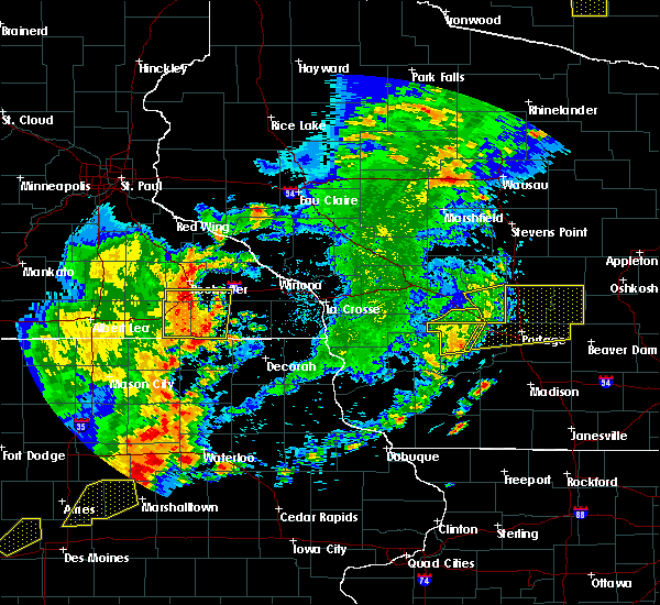 At 654 pm cdt, severe thunderstorms were located along a line extending from 8 miles northwest of chatfield to wykoff to near lime springs, moving east at 55 mph (radar indicated). Hazards include 70 mph wind gusts. Expect considerable tree damage. damage is likely to mobile homes, roofs, and outbuildings. these severe storms will be near, fountain and chatfield around 700 pm cdt. Other locations impacted by these severe thunderstorms include fillmore, high forest, pleasant grove, washington and rock dell. At 654 pm cdt, severe thunderstorms were located along a line extending from 8 miles northwest of chatfield to wykoff to near lime springs, moving east at 55 mph (radar indicated). Hazards include 70 mph wind gusts. Expect considerable tree damage. damage is likely to mobile homes, roofs, and outbuildings. these severe storms will be near, fountain and chatfield around 700 pm cdt. Other locations impacted by these severe thunderstorms include fillmore, high forest, pleasant grove, washington and rock dell.
|
| 6/30/2018 6:54 PM CDT | Storm damage reported in olmsted county MN, 7.3 miles N of Rochester, MN |
| 6/30/2018 6:46 PM CDT |
 At 645 pm cdt, severe thunderstorms were located along a line extending from near stewartville to near spring valley to le roy, moving east at 50 mph (radar indicated). Hazards include 70 mph wind gusts. Expect considerable tree damage. damage is likely to mobile homes, roofs, and outbuildings. these severe storms will be near, spring valley around 650 pm cdt. wykoff around 655 pm cdt. fountain and chatfield around 705 pm cdt. Other locations impacted by these severe thunderstorms include fillmore, high forest, pleasant grove, washington and rock dell. At 645 pm cdt, severe thunderstorms were located along a line extending from near stewartville to near spring valley to le roy, moving east at 50 mph (radar indicated). Hazards include 70 mph wind gusts. Expect considerable tree damage. damage is likely to mobile homes, roofs, and outbuildings. these severe storms will be near, spring valley around 650 pm cdt. wykoff around 655 pm cdt. fountain and chatfield around 705 pm cdt. Other locations impacted by these severe thunderstorms include fillmore, high forest, pleasant grove, washington and rock dell.
|
| 6/30/2018 6:35 PM CDT |
 At 634 pm cdt, severe thunderstorms were located along a line extending from near hayfield to 6 miles west of grand meadow to near stacyville, moving east at 45 mph (emergency management. numerous reports of trees down have been received across western mower county). Hazards include 60 mph wind gusts. Expect damage to roofs, siding, and trees. severe thunderstorms will be near, grand meadow around 645 pm cdt. rochester and le roy around 650 pm cdt. spring valley and stewartville around 655 pm cdt. wykoff around 705 pm cdt. chatfield and fountain around 715 pm cdt. other locations impacted by these severe thunderstorms include fillmore, high forest, lansing, pleasant grove and washington. In addition to damaging winds, torrential rainfall will likely cause some flooding as these storms cross the area, particularly in urban areas. At 634 pm cdt, severe thunderstorms were located along a line extending from near hayfield to 6 miles west of grand meadow to near stacyville, moving east at 45 mph (emergency management. numerous reports of trees down have been received across western mower county). Hazards include 60 mph wind gusts. Expect damage to roofs, siding, and trees. severe thunderstorms will be near, grand meadow around 645 pm cdt. rochester and le roy around 650 pm cdt. spring valley and stewartville around 655 pm cdt. wykoff around 705 pm cdt. chatfield and fountain around 715 pm cdt. other locations impacted by these severe thunderstorms include fillmore, high forest, lansing, pleasant grove and washington. In addition to damaging winds, torrential rainfall will likely cause some flooding as these storms cross the area, particularly in urban areas.
|
| 5/29/2018 3:26 PM CDT |
 The severe thunderstorm warning for northwestern olmsted county will expire at 330 pm cdt, the storm which prompted the warning has weakened below severe limits, and no longer poses an immediate threat to life or property. therefore the warning will be allowed to expire. The severe thunderstorm warning for northwestern olmsted county will expire at 330 pm cdt, the storm which prompted the warning has weakened below severe limits, and no longer poses an immediate threat to life or property. therefore the warning will be allowed to expire.
|
| 5/29/2018 3:15 PM CDT |
 At 314 pm cdt, a severe thunderstorm was located over oronoco, or 11 miles north of rochester, moving north at 50 mph (radar indicated. radar has indicated that storms were generally weakening below severe levels across the area). Hazards include up to quarter size hail is still possible. Damage to vehicles may occur. Locations impacted include, oronoco and douglas,. At 314 pm cdt, a severe thunderstorm was located over oronoco, or 11 miles north of rochester, moving north at 50 mph (radar indicated. radar has indicated that storms were generally weakening below severe levels across the area). Hazards include up to quarter size hail is still possible. Damage to vehicles may occur. Locations impacted include, oronoco and douglas,.
|
| 5/29/2018 2:58 PM CDT | Quarter sized hail reported 4.7 miles SSE of Rochester, MN |
| 5/29/2018 2:55 PM CDT |
 At 255 pm cdt, a severe thunderstorm was located over oronoco, or 9 miles north of rochester, moving north at 20 mph (radar indicated). Hazards include 60 mph wind gusts and quarter size hail. Hail damage to vehicles is expected. expect wind damage to roofs, siding, and trees. This severe thunderstorm will remain over mainly rural areas of northwestern olmsted county, including the following locations: douglas, kings park, oxbow park, highway 52 and 55th northwest and genoa. At 255 pm cdt, a severe thunderstorm was located over oronoco, or 9 miles north of rochester, moving north at 20 mph (radar indicated). Hazards include 60 mph wind gusts and quarter size hail. Hail damage to vehicles is expected. expect wind damage to roofs, siding, and trees. This severe thunderstorm will remain over mainly rural areas of northwestern olmsted county, including the following locations: douglas, kings park, oxbow park, highway 52 and 55th northwest and genoa.
|
| 5/29/2018 2:41 PM CDT |
 At 239 pm cdt, a severe thunderstorm was located near pine island, or 8 miles northeast of mantorville, moving north at 25 mph (public). Hazards include 60 mph wind gusts and quarter size hail. however, these storms are on a weakening trend across western olmsted county. Hail damage to vehicles is expected. expect wind damage to roofs, siding, and trees. Locations impacted include, rochester, dodge center, mantorville, kasson, stewartville, byron, west concord, rock dell, concord, oslo, eden. At 239 pm cdt, a severe thunderstorm was located near pine island, or 8 miles northeast of mantorville, moving north at 25 mph (public). Hazards include 60 mph wind gusts and quarter size hail. however, these storms are on a weakening trend across western olmsted county. Hail damage to vehicles is expected. expect wind damage to roofs, siding, and trees. Locations impacted include, rochester, dodge center, mantorville, kasson, stewartville, byron, west concord, rock dell, concord, oslo, eden.
|
| 5/29/2018 2:22 PM CDT |
 At 219 pm cdt, a severe thunderstorm was located over byron, or near mantorville, moving north at 15 mph. quarter-sized hail was falling in byron at 218 pm (public. up to 2 inch diameter hail has reported in the rock dell and salem corners area since 145 pm). Hazards include two inch hail and 60 mph wind gusts. People and animals outdoors will be injured. expect hail damage to roofs, siding, windows, and vehicles. expect wind damage to roofs, siding, and trees. this severe storm will be near, dodge center around 225 pm cdt. mantorville around 230 pm cdt. west concord around 250 pm cdt. Other locations impacted by this severe thunderstorm include high forest, wasioja, douglas, rock dell and concord. At 219 pm cdt, a severe thunderstorm was located over byron, or near mantorville, moving north at 15 mph. quarter-sized hail was falling in byron at 218 pm (public. up to 2 inch diameter hail has reported in the rock dell and salem corners area since 145 pm). Hazards include two inch hail and 60 mph wind gusts. People and animals outdoors will be injured. expect hail damage to roofs, siding, windows, and vehicles. expect wind damage to roofs, siding, and trees. this severe storm will be near, dodge center around 225 pm cdt. mantorville around 230 pm cdt. west concord around 250 pm cdt. Other locations impacted by this severe thunderstorm include high forest, wasioja, douglas, rock dell and concord.
|
| 5/29/2018 2:12 PM CDT |
 At 211 pm cdt, a severe thunderstorm was located over byron, or 7 miles west of rochester, moving north at 15 mph (public. up to golfball sized hail has reproted in the rock dell and salem corners area since 145 pm). Hazards include golf ball size hail and 60 mph wind gusts. People and animals outdoors will be injured. expect hail damage to roofs, siding, windows, and vehicles. expect wind damage to roofs, siding, and trees. this severe thunderstorm will be near, byron around 220 pm cdt. dodge center and kasson around 225 pm cdt. mantorville around 230 pm cdt. west concord around 255 pm cdt. Other locations impacted by this severe thunderstorm include high forest, wasioja, douglas, rock dell and concord. At 211 pm cdt, a severe thunderstorm was located over byron, or 7 miles west of rochester, moving north at 15 mph (public. up to golfball sized hail has reproted in the rock dell and salem corners area since 145 pm). Hazards include golf ball size hail and 60 mph wind gusts. People and animals outdoors will be injured. expect hail damage to roofs, siding, windows, and vehicles. expect wind damage to roofs, siding, and trees. this severe thunderstorm will be near, byron around 220 pm cdt. dodge center and kasson around 225 pm cdt. mantorville around 230 pm cdt. west concord around 255 pm cdt. Other locations impacted by this severe thunderstorm include high forest, wasioja, douglas, rock dell and concord.
|
| 5/29/2018 2:09 PM CDT |
 At 207 pm cdt, a severe thunderstorm was located over byron, or 7 miles west of rochester, moving north at 20 mph (public. hail the size of dimes to half-dollars has been reported in the stretch from rock dell to salem corners in olmsted county since 145 pm). Hazards include 60 mph wind gusts and half dollar size hail. Hail damage to vehicles is expected. expect wind damage to roofs, siding, and trees. This severe thunderstorm will remain over mainly rural areas of western olmsted and eastern dodge counties, including the following locations: wasioja, rock dell, concord, oslo and eden. At 207 pm cdt, a severe thunderstorm was located over byron, or 7 miles west of rochester, moving north at 20 mph (public. hail the size of dimes to half-dollars has been reported in the stretch from rock dell to salem corners in olmsted county since 145 pm). Hazards include 60 mph wind gusts and half dollar size hail. Hail damage to vehicles is expected. expect wind damage to roofs, siding, and trees. This severe thunderstorm will remain over mainly rural areas of western olmsted and eastern dodge counties, including the following locations: wasioja, rock dell, concord, oslo and eden.
|
| 5/29/2018 1:55 PM CDT |
 At 150 pm cdt, a severe thunderstorm was located near mantorville, moving north at 25 mph. however, another severe storm was following and was located a few miles east of rock dell (public. at 145 pm, quarter to half-dollar size hail was reported near rock dell southwest of rochester). Hazards include 60 mph wind gusts and half dollar size hail. Hail damage to vehicles is expected. expect wind damage to roofs, siding, and trees. this severe storm will be near, west concord around 205 pm cdt. those near the olmsted-dodge county line could experience large hail for the next 30 minutes. This includes those near manto in the rville, salem corners, and rock dell. At 150 pm cdt, a severe thunderstorm was located near mantorville, moving north at 25 mph. however, another severe storm was following and was located a few miles east of rock dell (public. at 145 pm, quarter to half-dollar size hail was reported near rock dell southwest of rochester). Hazards include 60 mph wind gusts and half dollar size hail. Hail damage to vehicles is expected. expect wind damage to roofs, siding, and trees. this severe storm will be near, west concord around 205 pm cdt. those near the olmsted-dodge county line could experience large hail for the next 30 minutes. This includes those near manto in the rville, salem corners, and rock dell.
|
| 5/29/2018 1:47 PM CDT |
 At 146 pm cdt, a severe thunderstorm was located near mantorville, moving north at 25 mph (public. at 145 pm, quarter to half-dollar sie hail was reported near rock dell southwest of rochester). Hazards include 60 mph wind gusts and half dollar size hail. Hail damage to vehicles is expected. expect wind damage to roofs, siding, and trees. this severe storm will be near, west concord around 205 pm cdt. Other locations impacted by this severe thunderstorm include wasioja, rock dell, concord, oslo and eden. At 146 pm cdt, a severe thunderstorm was located near mantorville, moving north at 25 mph (public. at 145 pm, quarter to half-dollar sie hail was reported near rock dell southwest of rochester). Hazards include 60 mph wind gusts and half dollar size hail. Hail damage to vehicles is expected. expect wind damage to roofs, siding, and trees. this severe storm will be near, west concord around 205 pm cdt. Other locations impacted by this severe thunderstorm include wasioja, rock dell, concord, oslo and eden.
|
| 5/29/2018 1:43 PM CDT |
 At 142 pm cdt, a severe thunderstorm was located over byron, or near mantorville, moving north at 40 mph (radar indicated). Hazards include 60 mph wind gusts and half dollar size hail. Hail damage to vehicles is expected. expect wind damage to roofs, siding, and trees. this severe storm will be near, west concord around 155 pm cdt. Other locations impacted by this severe thunderstorm include wasioja, rock dell, concord, oslo and eden. At 142 pm cdt, a severe thunderstorm was located over byron, or near mantorville, moving north at 40 mph (radar indicated). Hazards include 60 mph wind gusts and half dollar size hail. Hail damage to vehicles is expected. expect wind damage to roofs, siding, and trees. this severe storm will be near, west concord around 155 pm cdt. Other locations impacted by this severe thunderstorm include wasioja, rock dell, concord, oslo and eden.
|
| 5/29/2018 1:32 PM CDT |
 At 132 pm cdt, a severe thunderstorm was located near byron, or 7 miles southwest of rochester, moving north at 45 mph (radar indicated). Hazards include 60 mph wind gusts and quarter size hail. Hail damage to vehicles is expected. expect wind damage to roofs, siding, and trees. this severe thunderstorm will be near, byron and kasson around 140 pm cdt. mantorville and dodge center around 145 pm cdt. west concord around 155 pm cdt. Other locations impacted by this severe thunderstorm include wasioja, rock dell, concord, oslo and eden. At 132 pm cdt, a severe thunderstorm was located near byron, or 7 miles southwest of rochester, moving north at 45 mph (radar indicated). Hazards include 60 mph wind gusts and quarter size hail. Hail damage to vehicles is expected. expect wind damage to roofs, siding, and trees. this severe thunderstorm will be near, byron and kasson around 140 pm cdt. mantorville and dodge center around 145 pm cdt. west concord around 155 pm cdt. Other locations impacted by this severe thunderstorm include wasioja, rock dell, concord, oslo and eden.
|
| 5/25/2018 8:40 PM CDT |
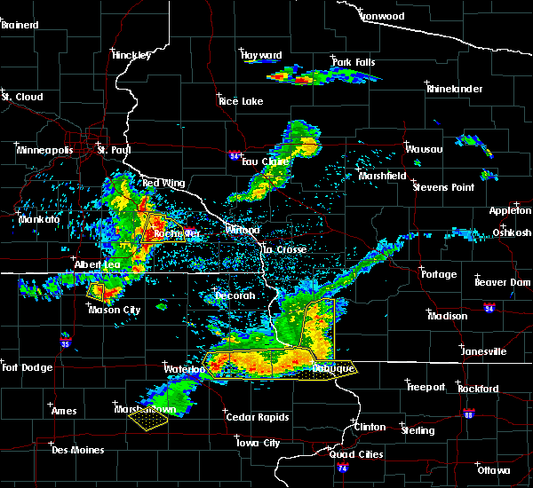 At 838 pm cdt, severe thunderstorms were located along a line extending from near oronoco to near rochester to near stewartville, moving east at 30 mph (trained weather spotters. wind gusts to 60 mph were recorded at the rochester airport at 832 pm). Hazards include 60 mph wind gusts and nickel size hail. Expect damage to roofs, siding, and trees. these severe storms will be near, eyota around 850 pm cdt. chatfield and dover around 900 pm cdt. Other locations impacted by these severe thunderstorms include marion, high forest, pleasant grove, viola and chester. At 838 pm cdt, severe thunderstorms were located along a line extending from near oronoco to near rochester to near stewartville, moving east at 30 mph (trained weather spotters. wind gusts to 60 mph were recorded at the rochester airport at 832 pm). Hazards include 60 mph wind gusts and nickel size hail. Expect damage to roofs, siding, and trees. these severe storms will be near, eyota around 850 pm cdt. chatfield and dover around 900 pm cdt. Other locations impacted by these severe thunderstorms include marion, high forest, pleasant grove, viola and chester.
|
| 5/25/2018 8:32 PM CDT |
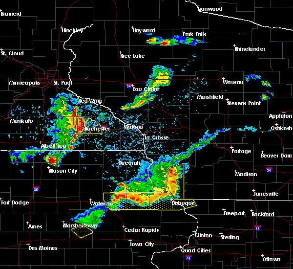 At 831 pm cdt, severe thunderstorms were located along a line extending from near oronoco to near rochester to near stewartville, moving east at 35 mph (radar indicated). Hazards include 60 mph wind gusts and nickel size hail. Expect damage to roofs, siding, and trees. these severe storms will be near, eyota around 845 pm cdt. dover and chatfield around 855 pm cdt. Other locations impacted by these severe thunderstorms include marion, high forest, pleasant grove, douglas and viola. At 831 pm cdt, severe thunderstorms were located along a line extending from near oronoco to near rochester to near stewartville, moving east at 35 mph (radar indicated). Hazards include 60 mph wind gusts and nickel size hail. Expect damage to roofs, siding, and trees. these severe storms will be near, eyota around 845 pm cdt. dover and chatfield around 855 pm cdt. Other locations impacted by these severe thunderstorms include marion, high forest, pleasant grove, douglas and viola.
|
| 5/25/2018 8:31 PM CDT | Rochester international airport official observatio in olmsted county MN, 7.3 miles N of Rochester, MN |
| 5/25/2018 8:15 PM CDT |
 At 815 pm cdt, severe thunderstorms were located along a line extending from near pine island to byron to 7 miles southeast of kasson, moving east at 30 mph (trained weather spotters. several reports of wind gusts to 50 mph or greater have been received from northern dodge county). Hazards include 60 mph wind gusts and nickel size hail. Expect damage to roofs, siding, and trees. severe thunderstorms will be near, rochester, oronoco and stewartville around 835 pm cdt. eyota around 855 pm cdt. dover and chatfield around 900 pm cdt. Other locations impacted by these severe thunderstorms include marion, high forest, pleasant grove, douglas and rock dell. At 815 pm cdt, severe thunderstorms were located along a line extending from near pine island to byron to 7 miles southeast of kasson, moving east at 30 mph (trained weather spotters. several reports of wind gusts to 50 mph or greater have been received from northern dodge county). Hazards include 60 mph wind gusts and nickel size hail. Expect damage to roofs, siding, and trees. severe thunderstorms will be near, rochester, oronoco and stewartville around 835 pm cdt. eyota around 855 pm cdt. dover and chatfield around 900 pm cdt. Other locations impacted by these severe thunderstorms include marion, high forest, pleasant grove, douglas and rock dell.
|
| 7/19/2017 5:06 PM CDT |
 At 504 pm cdt, severe thunderstorms were located along a line extending from near elgin to near stewartville to adams, moving east at 50 mph (trained weather spotters reported 60 to 65 mph winds and numerous trees downed and power outages in dodge and olmsted county). Hazards include 70 mph wind gusts. Expect considerable tree damage. damage is likely to mobile homes, roofs, and outbuildings. these severe storms will be near, elgin around 510 pm cdt. plainview and eyota around 515 pm cdt. chatfield and dover around 520 pm cdt. st. charles and spring valley around 525 pm cdt. altura around 530 pm cdt. rollingstone around 535 pm cdt. stockton and lewiston around 540 pm cdt. Preston and rushford around 545 pm cdt. At 504 pm cdt, severe thunderstorms were located along a line extending from near elgin to near stewartville to adams, moving east at 50 mph (trained weather spotters reported 60 to 65 mph winds and numerous trees downed and power outages in dodge and olmsted county). Hazards include 70 mph wind gusts. Expect considerable tree damage. damage is likely to mobile homes, roofs, and outbuildings. these severe storms will be near, elgin around 510 pm cdt. plainview and eyota around 515 pm cdt. chatfield and dover around 520 pm cdt. st. charles and spring valley around 525 pm cdt. altura around 530 pm cdt. rollingstone around 535 pm cdt. stockton and lewiston around 540 pm cdt. Preston and rushford around 545 pm cdt.
|
| 7/19/2017 5:01 PM CDT |
 At 459 pm cdt, severe thunderstorms were located along a line extending from 6 miles southwest of elgin to near stacyville, moving southeast at 40 mph (trained weather spotters report many pockets of wind damage and power outages. many reports of 50 to 70 mph wind have been received). Hazards include 70 mph wind gusts. Expect considerable tree damage. damage is likely to mobile homes, roofs, and outbuildings. these severe storms will be near, le roy around 515 pm cdt. other locations impacted by these severe thunderstorms include high forest, lansing, wasioja, douglas and rock dell. People attending the dodge county free fair should seek safe shelter immediately!. At 459 pm cdt, severe thunderstorms were located along a line extending from 6 miles southwest of elgin to near stacyville, moving southeast at 40 mph (trained weather spotters report many pockets of wind damage and power outages. many reports of 50 to 70 mph wind have been received). Hazards include 70 mph wind gusts. Expect considerable tree damage. damage is likely to mobile homes, roofs, and outbuildings. these severe storms will be near, le roy around 515 pm cdt. other locations impacted by these severe thunderstorms include high forest, lansing, wasioja, douglas and rock dell. People attending the dodge county free fair should seek safe shelter immediately!.
|
| 7/19/2017 5:00 PM CDT | Storm damage reported in olmsted county MN, 1.8 miles SW of Rochester, MN |
| 7/19/2017 4:54 PM CDT |
 At 454 pm cdt, a severe squall line capable of producing both tornadoes and extensive straight line wind damage was located near rochester, moving east at 60 mph (radar indicated rotation). Hazards include tornado. Flying debris will be dangerous to those caught without shelter. mobile homes will be damaged or destroyed. damage to roofs, windows, and vehicles will occur. tree damage is likely. This tornadic thunderstorm will remain over mainly rural areas of northwestern olmsted county, including the following locations: douglas, highway 52 and county 14, apache mall, highway 52 and 55th northwest and genoa. At 454 pm cdt, a severe squall line capable of producing both tornadoes and extensive straight line wind damage was located near rochester, moving east at 60 mph (radar indicated rotation). Hazards include tornado. Flying debris will be dangerous to those caught without shelter. mobile homes will be damaged or destroyed. damage to roofs, windows, and vehicles will occur. tree damage is likely. This tornadic thunderstorm will remain over mainly rural areas of northwestern olmsted county, including the following locations: douglas, highway 52 and county 14, apache mall, highway 52 and 55th northwest and genoa.
|
| 7/19/2017 4:50 PM CDT |
 At 448 pm cdt, severe thunderstorms were located along a line extending from near oronoco to 6 miles south of byron to near lyle, moving east at 50 mph (law enforcement. wind damage reports have been received in dodge county with these storms. buildings have been damaged). Hazards include 70 mph wind gusts. Expect considerable tree damage. damage is likely to mobile homes, roofs, and outbuildings. severe thunderstorms will be near, rochester around 500 pm cdt. elgin around 505 pm cdt. eyota around 510 pm cdt. chatfield and plainview around 515 pm cdt. dover, spring valley and fountain around 520 pm cdt. st. charles around 525 pm cdt. lanesboro around 530 pm cdt. lewiston around 535 pm cdt. Other locations impacted by these severe thunderstorms include fillmore, marion, rushford village, pleasant grove and washington. At 448 pm cdt, severe thunderstorms were located along a line extending from near oronoco to 6 miles south of byron to near lyle, moving east at 50 mph (law enforcement. wind damage reports have been received in dodge county with these storms. buildings have been damaged). Hazards include 70 mph wind gusts. Expect considerable tree damage. damage is likely to mobile homes, roofs, and outbuildings. severe thunderstorms will be near, rochester around 500 pm cdt. elgin around 505 pm cdt. eyota around 510 pm cdt. chatfield and plainview around 515 pm cdt. dover, spring valley and fountain around 520 pm cdt. st. charles around 525 pm cdt. lanesboro around 530 pm cdt. lewiston around 535 pm cdt. Other locations impacted by these severe thunderstorms include fillmore, marion, rushford village, pleasant grove and washington.
|
| 7/19/2017 4:46 PM CDT |
 At 445 pm cdt, a severe squall line capable of producing both tornadoes and extensive straight line wind damage was located over mantorville, moving east at 55 mph (radar indicated rotation). Hazards include tornado. Flying debris will be dangerous to those caught without shelter. mobile homes will be damaged or destroyed. damage to roofs, windows, and vehicles will occur. tree damage is likely. these dangerous storms will be near, rochester around 500 pm cdt. other locations impacted by this tornadic thunderstorm include douglas, danesville, highway 57 and 570th street, highway 52 and county 14 and oxbow park. People attending the dodge county free fair should seek safe shelter immediately!. At 445 pm cdt, a severe squall line capable of producing both tornadoes and extensive straight line wind damage was located over mantorville, moving east at 55 mph (radar indicated rotation). Hazards include tornado. Flying debris will be dangerous to those caught without shelter. mobile homes will be damaged or destroyed. damage to roofs, windows, and vehicles will occur. tree damage is likely. these dangerous storms will be near, rochester around 500 pm cdt. other locations impacted by this tornadic thunderstorm include douglas, danesville, highway 57 and 570th street, highway 52 and county 14 and oxbow park. People attending the dodge county free fair should seek safe shelter immediately!.
|
| 7/19/2017 4:36 PM CDT |
 At 436 pm cdt, severe thunderstorms capable of producing both tornadoes and extensive straight line wind damage were located near dodge center, moving east at 60 mph (radar indicated rotation). Hazards include tornado. Flying debris will be dangerous to those caught without shelter. mobile homes will be damaged or destroyed. damage to roofs, windows, and vehicles will occur. Tree damage is likely. At 436 pm cdt, severe thunderstorms capable of producing both tornadoes and extensive straight line wind damage were located near dodge center, moving east at 60 mph (radar indicated rotation). Hazards include tornado. Flying debris will be dangerous to those caught without shelter. mobile homes will be damaged or destroyed. damage to roofs, windows, and vehicles will occur. Tree damage is likely.
|
| 7/19/2017 4:34 PM CDT |
 At 433 pm cdt, severe thunderstorms were located along a line extending from near west concord to near brownsdale to near northwood, moving east at 50 mph (trained weather spotters have reported 60 to 65 mph winds with this line of storms). Hazards include 70 mph wind gusts. Expect considerable tree damage. damage is likely to mobile homes, roofs, and outbuildings. these severe storms will be near, mantorville, dodge center, brownsdale and kasson around 440 pm cdt. pine island around 445 pm cdt. byron around 450 pm cdt. oronoco and lyle around 455 pm cdt. rochester, grand meadow and stewartville around 500 pm cdt. other locations impacted by these severe thunderstorms include high forest, lansing, wasioja, douglas and rock dell. People attending the dodge county free fair should seek safe shelter immediately!. At 433 pm cdt, severe thunderstorms were located along a line extending from near west concord to near brownsdale to near northwood, moving east at 50 mph (trained weather spotters have reported 60 to 65 mph winds with this line of storms). Hazards include 70 mph wind gusts. Expect considerable tree damage. damage is likely to mobile homes, roofs, and outbuildings. these severe storms will be near, mantorville, dodge center, brownsdale and kasson around 440 pm cdt. pine island around 445 pm cdt. byron around 450 pm cdt. oronoco and lyle around 455 pm cdt. rochester, grand meadow and stewartville around 500 pm cdt. other locations impacted by these severe thunderstorms include high forest, lansing, wasioja, douglas and rock dell. People attending the dodge county free fair should seek safe shelter immediately!.
|
| 7/19/2017 4:32 PM CDT |
 At 430 pm cdt, severe thunderstorms were located along a line extending from west concord to near blooming prairie to near northwood, moving east at 50 mph (trained weather spotters reported 60-65 mph winds west of dodge county). Hazards include 70 mph wind gusts. Expect considerable tree damage. damage is likely to mobile homes, roofs, and outbuildings. these severe storms will be near, dodge center, austin, west concord and ramsey around 435 pm cdt. mantorville, brownsdale and kasson around 440 pm cdt. byron and pine island around 445 pm cdt. oronoco around 450 pm cdt. rochester, grand meadow and lyle around 455 pm cdt. le roy around 515 pm cdt. other locations impacted by these severe thunderstorms include high forest, lansing, wasioja, douglas and rock dell. People attending the dodge county free fair should seek safe shelter immediately!. At 430 pm cdt, severe thunderstorms were located along a line extending from west concord to near blooming prairie to near northwood, moving east at 50 mph (trained weather spotters reported 60-65 mph winds west of dodge county). Hazards include 70 mph wind gusts. Expect considerable tree damage. damage is likely to mobile homes, roofs, and outbuildings. these severe storms will be near, dodge center, austin, west concord and ramsey around 435 pm cdt. mantorville, brownsdale and kasson around 440 pm cdt. byron and pine island around 445 pm cdt. oronoco around 450 pm cdt. rochester, grand meadow and lyle around 455 pm cdt. le roy around 515 pm cdt. other locations impacted by these severe thunderstorms include high forest, lansing, wasioja, douglas and rock dell. People attending the dodge county free fair should seek safe shelter immediately!.
|
| 7/19/2017 4:15 PM CDT |
 At 412 pm cdt, severe thunderstorms were located along a line extending from near medford to near geneva to near mansfield, moving east at 60 mph (trained weather spotters. wind gusts of 60 to 65 mph and downed trees have been reported near interstate 35 with these storms). Hazards include 70 mph wind gusts. Expect considerable tree damage. damage is likely to mobile homes, roofs, and outbuildings. severe thunderstorms will be near, claremont around 425 pm cdt. austin, dodge center around 430 pm cdt. mantorville and hayfield around 435 pm cdt. byron and pine island around 440 pm cdt. oronoco around 445 pm cdt. rochester around 450 pm cdt. People attending the dodge county free fair should seek safe shelter immediately!. At 412 pm cdt, severe thunderstorms were located along a line extending from near medford to near geneva to near mansfield, moving east at 60 mph (trained weather spotters. wind gusts of 60 to 65 mph and downed trees have been reported near interstate 35 with these storms). Hazards include 70 mph wind gusts. Expect considerable tree damage. damage is likely to mobile homes, roofs, and outbuildings. severe thunderstorms will be near, claremont around 425 pm cdt. austin, dodge center around 430 pm cdt. mantorville and hayfield around 435 pm cdt. byron and pine island around 440 pm cdt. oronoco around 445 pm cdt. rochester around 450 pm cdt. People attending the dodge county free fair should seek safe shelter immediately!.
|
| 6/28/2017 7:45 PM CDT | Power pole snapped. relayed via broadcast media. time estimated from rada in olmsted county MN, 3.9 miles NNW of Rochester, MN |
| 6/16/2017 5:05 PM CDT | Ping Pong Ball sized hail reported 3 miles W of Rochester, MN, hail between quarter and golf ball size reported. |
| 6/16/2017 4:59 PM CDT | Ping Pong Ball sized hail reported 6.5 miles W of Rochester, MN |
| 6/16/2017 4:59 PM CDT |
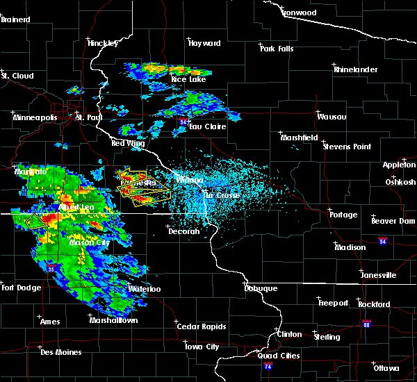 At 459 pm cdt, a severe thunderstorm was located near eyota, or 7 miles east of rochester, moving east at 15 mph (public reported golf ball sized hail in southeast rochester at 456 pm). Hazards include golf ball size hail and 60 mph wind gusts. People and animals outdoors will be injured. expect hail damage to roofs, siding, windows, and vehicles. expect wind damage to roofs, siding, and trees. this severe storm will be near, eyota around 510 pm cdt. elgin around 520 pm cdt. Other locations impacted by this severe thunderstorm include marion, viola, chester, county roads 9 and 10 and i 90 exit 218. At 459 pm cdt, a severe thunderstorm was located near eyota, or 7 miles east of rochester, moving east at 15 mph (public reported golf ball sized hail in southeast rochester at 456 pm). Hazards include golf ball size hail and 60 mph wind gusts. People and animals outdoors will be injured. expect hail damage to roofs, siding, windows, and vehicles. expect wind damage to roofs, siding, and trees. this severe storm will be near, eyota around 510 pm cdt. elgin around 520 pm cdt. Other locations impacted by this severe thunderstorm include marion, viola, chester, county roads 9 and 10 and i 90 exit 218.
|
| 6/16/2017 4:56 PM CDT | Golf Ball sized hail reported 2.5 miles W of Rochester, MN, golf ball sized hail reported on the southeast side of rochester. relayed via kaal. |
| 6/16/2017 4:55 PM CDT | Half Dollar sized hail reported 4 miles W of Rochester, MN, hail size estimated from facebook photo. |
| 6/16/2017 4:55 PM CDT | Golf Ball sized hail reported 6.5 miles W of Rochester, MN, size estimated from photo via twitter. time estimated from radar. |
| 6/16/2017 4:51 PM CDT |
 At 450 pm cdt, a severe thunderstorm was located near eyota, or 7 miles east of rochester, moving east at 30 mph (public reported dime to quarter size hail at 450 pm in southeast rochester). Hazards include 60 mph wind gusts and quarter size hail. Hail damage to vehicles is expected. expect wind damage to roofs, siding, and trees. this severe storm will be near, eyota around 455 pm cdt. elgin around 505 pm cdt. Other locations impacted by this severe thunderstorm include marion, viola, chester, county roads 9 and 10 and i 90 exit 218. At 450 pm cdt, a severe thunderstorm was located near eyota, or 7 miles east of rochester, moving east at 30 mph (public reported dime to quarter size hail at 450 pm in southeast rochester). Hazards include 60 mph wind gusts and quarter size hail. Hail damage to vehicles is expected. expect wind damage to roofs, siding, and trees. this severe storm will be near, eyota around 455 pm cdt. elgin around 505 pm cdt. Other locations impacted by this severe thunderstorm include marion, viola, chester, county roads 9 and 10 and i 90 exit 218.
|
| 6/16/2017 4:50 PM CDT | Quarter sized hail reported 1.5 miles WNW of Rochester, MN, dime to quarter sized hail reported in southeast rochester. relayed via kttc. |
| 6/16/2017 4:48 PM CDT |
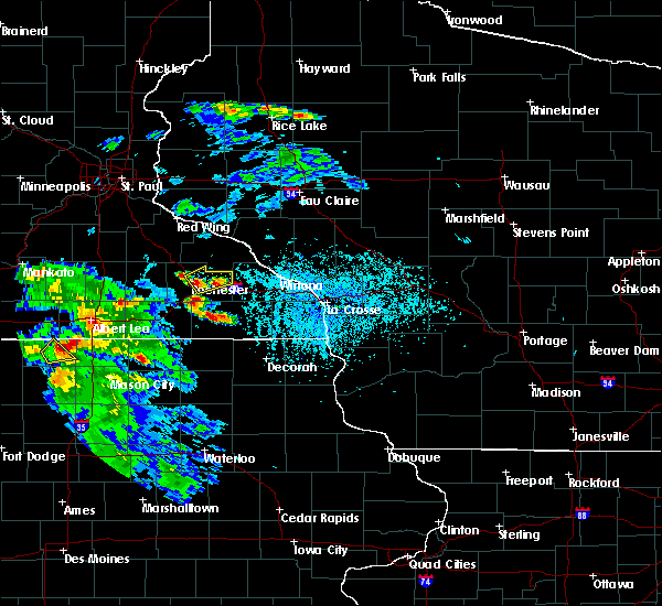 At 450 pm cdt, a severe thunderstorm was located near eyota, or 7 miles east of rochester, moving east at 30 mph (public reported dime to quarter size hail at 450 pm in southeast rochester). Hazards include 60 mph wind gusts and quarter size hail. Hail damage to vehicles is expected. expect wind damage to roofs, siding, and trees. this severe storm will be near, eyota around 455 pm cdt. elgin around 505 pm cdt. Other locations impacted by this severe thunderstorm include marion, viola, chester, county roads 9 and 10 and i 90 exit 218. At 450 pm cdt, a severe thunderstorm was located near eyota, or 7 miles east of rochester, moving east at 30 mph (public reported dime to quarter size hail at 450 pm in southeast rochester). Hazards include 60 mph wind gusts and quarter size hail. Hail damage to vehicles is expected. expect wind damage to roofs, siding, and trees. this severe storm will be near, eyota around 455 pm cdt. elgin around 505 pm cdt. Other locations impacted by this severe thunderstorm include marion, viola, chester, county roads 9 and 10 and i 90 exit 218.
|
| 6/12/2017 2:54 PM CDT |
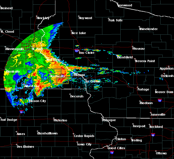 The severe thunderstorm warning for northeastern olmsted and south central wabasha counties will expire at 300 pm cdt, the storm which prompted the warning has weakened below severe limits, and has exited the warned area. therefore, the warning will be allowed to expire. however heavy rain is still possible with this thunderstorm. a severe thunderstorm watch remains in effect until 700 pm cdt for southeastern minnesota. The severe thunderstorm warning for northeastern olmsted and south central wabasha counties will expire at 300 pm cdt, the storm which prompted the warning has weakened below severe limits, and has exited the warned area. therefore, the warning will be allowed to expire. however heavy rain is still possible with this thunderstorm. a severe thunderstorm watch remains in effect until 700 pm cdt for southeastern minnesota.
|
| 6/12/2017 2:42 PM CDT |
 At 242 pm cdt, a severe thunderstorm was located near st. charles, or 19 miles east of rochester, moving east at 55 mph (public). Hazards include 60 mph wind gusts. Expect damage to roofs, siding, and trees. This severe thunderstorm will remain over mainly rural areas of northeastern olmsted and south central wabasha counties, including the following locations: viola, county roads 9 and 10, potsdam, kings park and highway 42 and county 9. At 242 pm cdt, a severe thunderstorm was located near st. charles, or 19 miles east of rochester, moving east at 55 mph (public). Hazards include 60 mph wind gusts. Expect damage to roofs, siding, and trees. This severe thunderstorm will remain over mainly rural areas of northeastern olmsted and south central wabasha counties, including the following locations: viola, county roads 9 and 10, potsdam, kings park and highway 42 and county 9.
|
| 6/12/2017 2:28 PM CDT | Nine inch tree uproote in olmsted county MN, 5.7 miles SE of Rochester, MN |
| 6/12/2017 2:26 PM CDT |
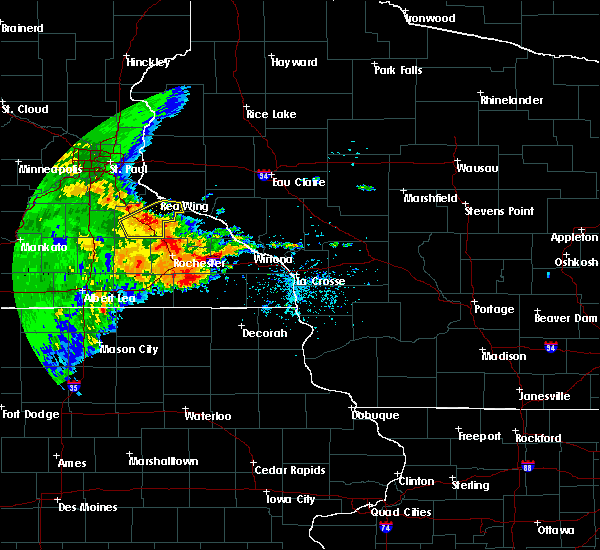 At 225 pm cdt, a severe thunderstorm was located near rochester, moving east at 55 mph (public. at 222 pm cdt, a 62 mph wind gust was reported in northeast rochester). Hazards include 60 mph wind gusts. Expect damage to roofs, siding, and trees. this severe thunderstorm will be near, elgin and eyota around 235 pm cdt. dover and plainview around 240 pm cdt. Other locations impacted by this severe thunderstorm include douglas, viola, chester, county roads 9 and 10 and potsdam. At 225 pm cdt, a severe thunderstorm was located near rochester, moving east at 55 mph (public. at 222 pm cdt, a 62 mph wind gust was reported in northeast rochester). Hazards include 60 mph wind gusts. Expect damage to roofs, siding, and trees. this severe thunderstorm will be near, elgin and eyota around 235 pm cdt. dover and plainview around 240 pm cdt. Other locations impacted by this severe thunderstorm include douglas, viola, chester, county roads 9 and 10 and potsdam.
|
| 6/12/2017 2:22 PM CDT | Measured near century high schoo in olmsted county MN, 3.4 miles SW of Rochester, MN |
| 6/12/2017 1:48 PM CDT |
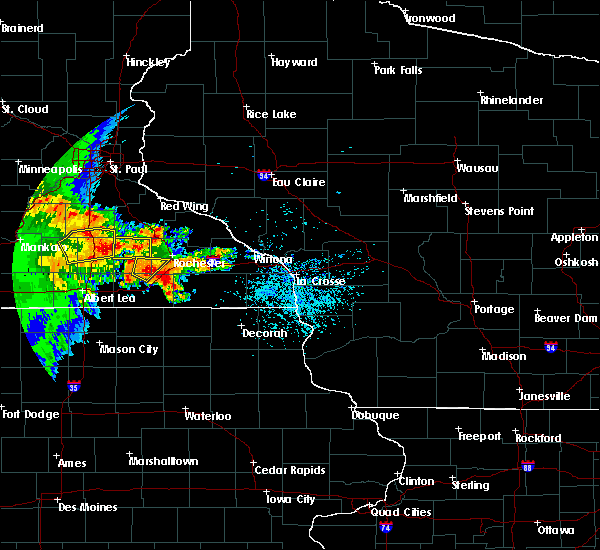 At 148 pm cdt, a severe thunderstorm was located near hayfield, or 10 miles southeast of dodge center, moving northeast at 20 mph (radar indicated). Hazards include 60 mph wind gusts and quarter size hail. Hail damage to vehicles is expected. expect wind damage to roofs, siding, and trees. This severe thunderstorm will remain over mainly rural areas of southwestern olmsted, north central mower and southeastern dodge counties, including the following locations: rock dell, oslo, sargeant, county roads 1 and 7 and county roads 3 and 108. At 148 pm cdt, a severe thunderstorm was located near hayfield, or 10 miles southeast of dodge center, moving northeast at 20 mph (radar indicated). Hazards include 60 mph wind gusts and quarter size hail. Hail damage to vehicles is expected. expect wind damage to roofs, siding, and trees. This severe thunderstorm will remain over mainly rural areas of southwestern olmsted, north central mower and southeastern dodge counties, including the following locations: rock dell, oslo, sargeant, county roads 1 and 7 and county roads 3 and 108.
|
| 6/12/2017 1:31 PM CDT |
 At 131 pm cdt, a severe thunderstorm was located near hayfield, or 11 miles south of dodge center, moving northeast at 25 mph (radar indicated). Hazards include 60 mph wind gusts and quarter size hail. Hail damage to vehicles is expected. expect wind damage to roofs, siding, and trees. this severe thunderstorm will be near, kasson around 200 pm cdt. mantorville around 205 pm cdt. byron around 210 pm cdt. rochester around 215 pm cdt. Other locations impacted by this severe thunderstorm include rock dell, oslo, waltham, sargeant and county roads 3 and 108. At 131 pm cdt, a severe thunderstorm was located near hayfield, or 11 miles south of dodge center, moving northeast at 25 mph (radar indicated). Hazards include 60 mph wind gusts and quarter size hail. Hail damage to vehicles is expected. expect wind damage to roofs, siding, and trees. this severe thunderstorm will be near, kasson around 200 pm cdt. mantorville around 205 pm cdt. byron around 210 pm cdt. rochester around 215 pm cdt. Other locations impacted by this severe thunderstorm include rock dell, oslo, waltham, sargeant and county roads 3 and 108.
|
| 5/17/2017 7:22 PM CDT |
 At 721 pm cdt, severe thunderstorms were located along a line extending from byron to eyota to near rushford, moving north at 55 mph (radar indicated. these storms have a history of producing damaging winds). Hazards include 70 mph wind gusts. Expect considerable tree damage. damage is likely to mobile homes, roofs, and outbuildings. these severe storms will be near, elgin and lewiston around 730 pm cdt. plainview, oronoco and stockton around 735 pm cdt. winona, goodview and rollingstone around 740 pm cdt. fountain city around 745 pm cdt. other locations impacted by these severe thunderstorms include marion, high forest, pleasant grove, douglas and rock dell. A tornado watch remains in effect until 1100 pm cdt for southeastern minnesota, and west central wisconsin. At 721 pm cdt, severe thunderstorms were located along a line extending from byron to eyota to near rushford, moving north at 55 mph (radar indicated. these storms have a history of producing damaging winds). Hazards include 70 mph wind gusts. Expect considerable tree damage. damage is likely to mobile homes, roofs, and outbuildings. these severe storms will be near, elgin and lewiston around 730 pm cdt. plainview, oronoco and stockton around 735 pm cdt. winona, goodview and rollingstone around 740 pm cdt. fountain city around 745 pm cdt. other locations impacted by these severe thunderstorms include marion, high forest, pleasant grove, douglas and rock dell. A tornado watch remains in effect until 1100 pm cdt for southeastern minnesota, and west central wisconsin.
|
| 5/17/2017 7:21 PM CDT | Also reported some pea size hail in olmsted county MN, 0.4 miles N of Rochester, MN |
| 5/17/2017 7:11 PM CDT | Storm damage reported in olmsted county MN, 7.3 miles N of Rochester, MN |
| 5/17/2017 7:09 PM CDT |
 At 708 pm cdt, severe thunderstorms were located along a line extending from 8 miles west of stewartville to near chatfield to 9 miles south of rushford, moving north at 55 mph (radar indicated). Hazards include 70 mph wind gusts. Expect considerable tree damage. damage is likely to mobile homes, roofs, and outbuildings. severe thunderstorms will be near, rochester, eyota, byron and dover around 720 pm cdt. elgin and lewiston around 730 pm cdt. plainview, oronoco and stockton around 735 pm cdt. winona, goodview and rollingstone around 740 pm cdt. fountain city around 745 pm cdt. other locations impacted by these severe thunderstorms include marion, high forest, pleasant grove, douglas and rock dell. A tornado watch remains in effect until 1100 pm cdt for southeastern minnesota, and west central wisconsin. At 708 pm cdt, severe thunderstorms were located along a line extending from 8 miles west of stewartville to near chatfield to 9 miles south of rushford, moving north at 55 mph (radar indicated). Hazards include 70 mph wind gusts. Expect considerable tree damage. damage is likely to mobile homes, roofs, and outbuildings. severe thunderstorms will be near, rochester, eyota, byron and dover around 720 pm cdt. elgin and lewiston around 730 pm cdt. plainview, oronoco and stockton around 735 pm cdt. winona, goodview and rollingstone around 740 pm cdt. fountain city around 745 pm cdt. other locations impacted by these severe thunderstorms include marion, high forest, pleasant grove, douglas and rock dell. A tornado watch remains in effect until 1100 pm cdt for southeastern minnesota, and west central wisconsin.
|
| 5/16/2017 11:54 PM CDT | Storm damage reported in olmsted county MN, 7.3 miles N of Rochester, MN |
| 5/16/2017 9:24 PM CDT |
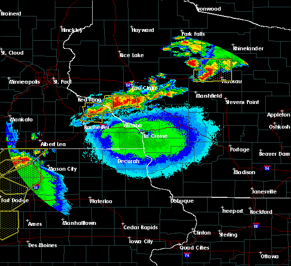 At 923 pm cdt, a severe thunderstorm was located near elgin, or 13 miles northeast of rochester, moving east at 40 mph (radar indicated). Hazards include 70 mph wind gusts and ping pong ball size hail. People and animals outdoors will be injured. expect hail damage to roofs, siding, windows, and vehicles. expect considerable tree damage. wind damage is also likely to mobile homes, roofs, and outbuildings. this severe storm will be near, plainview around 930 pm cdt. Other locations impacted by this severe thunderstorm include viola, bremen, south troy, potsdam and kings park. At 923 pm cdt, a severe thunderstorm was located near elgin, or 13 miles northeast of rochester, moving east at 40 mph (radar indicated). Hazards include 70 mph wind gusts and ping pong ball size hail. People and animals outdoors will be injured. expect hail damage to roofs, siding, windows, and vehicles. expect considerable tree damage. wind damage is also likely to mobile homes, roofs, and outbuildings. this severe storm will be near, plainview around 930 pm cdt. Other locations impacted by this severe thunderstorm include viola, bremen, south troy, potsdam and kings park.
|
| 5/16/2017 9:10 PM CDT |
 At 909 pm cdt, a severe thunderstorm was located near oronoco, or 8 miles north of rochester, moving east at 40 mph (radar indicated). Hazards include 70 mph wind gusts and ping pong ball size hail. People and animals outdoors will be injured. expect hail damage to roofs, siding, windows, and vehicles. expect considerable tree damage. wind damage is also likely to mobile homes, roofs, and outbuildings. this severe thunderstorm will be near, elgin around 925 pm cdt. plainview around 935 pm cdt. Other locations impacted by this severe thunderstorm include douglas, viola, bremen, south troy and rattelsnake point. At 909 pm cdt, a severe thunderstorm was located near oronoco, or 8 miles north of rochester, moving east at 40 mph (radar indicated). Hazards include 70 mph wind gusts and ping pong ball size hail. People and animals outdoors will be injured. expect hail damage to roofs, siding, windows, and vehicles. expect considerable tree damage. wind damage is also likely to mobile homes, roofs, and outbuildings. this severe thunderstorm will be near, elgin around 925 pm cdt. plainview around 935 pm cdt. Other locations impacted by this severe thunderstorm include douglas, viola, bremen, south troy and rattelsnake point.
|
| 5/15/2017 10:52 PM CDT |
 At 1051 pm cdt, a severe thunderstorm was located near elgin, or 12 miles northeast of rochester, moving northeast at 25 mph (trained weather spotters). Hazards include quarter size hail. Damage to vehicles is expected. this severe storm will be near, elgin around 1055 pm cdt. plainview around 1110 pm cdt. Other locations impacted by this severe thunderstorm include marion, viola, west newton, bremen and millville. At 1051 pm cdt, a severe thunderstorm was located near elgin, or 12 miles northeast of rochester, moving northeast at 25 mph (trained weather spotters). Hazards include quarter size hail. Damage to vehicles is expected. this severe storm will be near, elgin around 1055 pm cdt. plainview around 1110 pm cdt. Other locations impacted by this severe thunderstorm include marion, viola, west newton, bremen and millville.
|
| 5/15/2017 10:44 PM CDT |
 At 1043 pm cdt, a severe thunderstorm was located 7 miles west of elgin, or 8 miles northeast of rochester, moving northeast at 20 mph (trained weather spotters). Hazards include quarter size hail. Damage to vehicles is expected. this severe storm will be near, eyota around 1050 pm cdt. elgin around 1100 pm cdt. plainview around 1115 pm cdt. wabasha and kellogg around 1130 pm cdt. Other locations impacted by this severe thunderstorm include marion, douglas, viola, west newton and bremen. At 1043 pm cdt, a severe thunderstorm was located 7 miles west of elgin, or 8 miles northeast of rochester, moving northeast at 20 mph (trained weather spotters). Hazards include quarter size hail. Damage to vehicles is expected. this severe storm will be near, eyota around 1050 pm cdt. elgin around 1100 pm cdt. plainview around 1115 pm cdt. wabasha and kellogg around 1130 pm cdt. Other locations impacted by this severe thunderstorm include marion, douglas, viola, west newton and bremen.
|
| 5/15/2017 10:33 PM CDT |
 At 1032 pm cdt, a severe thunderstorm was located over eyota, or 9 miles east of rochester, moving east at 30 mph (trained weather spotters). Hazards include quarter size hail. Damage to vehicles is expected. this severe storm will be near, plainview around 1050 pm cdt. altura around 1110 pm cdt. rollingstone around 1125 pm cdt. Other locations impacted by this severe thunderstorm include marion, douglas, viola, west newton and bremen. At 1032 pm cdt, a severe thunderstorm was located over eyota, or 9 miles east of rochester, moving east at 30 mph (trained weather spotters). Hazards include quarter size hail. Damage to vehicles is expected. this severe storm will be near, plainview around 1050 pm cdt. altura around 1110 pm cdt. rollingstone around 1125 pm cdt. Other locations impacted by this severe thunderstorm include marion, douglas, viola, west newton and bremen.
|
| 5/15/2017 10:25 PM CDT | Quarter sized hail reported 5.9 miles S of Rochester, MN |
| 5/15/2017 10:25 PM CDT |
 At 1025 pm cdt, a severe thunderstorm was located near rochester, moving northeast at 35 mph (trained weather spotters). Hazards include quarter size hail. Damage to vehicles is expected. this severe thunderstorm will be near, eyota around 1035 pm cdt. elgin around 1045 pm cdt. plainview around 1050 pm cdt. wabasha and kellogg around 1110 pm cdt. Other locations impacted by this severe thunderstorm include marion, douglas, viola, west newton and bremen. At 1025 pm cdt, a severe thunderstorm was located near rochester, moving northeast at 35 mph (trained weather spotters). Hazards include quarter size hail. Damage to vehicles is expected. this severe thunderstorm will be near, eyota around 1035 pm cdt. elgin around 1045 pm cdt. plainview around 1050 pm cdt. wabasha and kellogg around 1110 pm cdt. Other locations impacted by this severe thunderstorm include marion, douglas, viola, west newton and bremen.
|
| 5/15/2017 10:20 PM CDT | Quarter sized hail reported 4.7 miles SSE of Rochester, MN, quarter size hail at intersection of 55th street and highway 52. |
| 5/15/2017 10:18 PM CDT | Quarter sized hail reported 0.4 miles N of Rochester, MN, numerous reports of quarter size hail in rochester. via social media. |
| 5/15/2017 9:51 PM CDT | Quarter sized hail reported 6.5 miles W of Rochester, MN |
| 4/9/2017 10:56 PM CDT |
 The severe thunderstorm warning for olmsted and wabasha counties will expire at 1100 pm cdt, the severe thunderstorm which prompted the warning has moved out of the warned area. therefore, the warning will be allowed to expire. a severe thunderstorm watch remains in effect until 100 am cdt for southeastern minnesota, and west central wisconsin. The severe thunderstorm warning for olmsted and wabasha counties will expire at 1100 pm cdt, the severe thunderstorm which prompted the warning has moved out of the warned area. therefore, the warning will be allowed to expire. a severe thunderstorm watch remains in effect until 100 am cdt for southeastern minnesota, and west central wisconsin.
|
| 4/9/2017 10:35 PM CDT |
 At 1035 pm cdt, a severe thunderstorm was located near rochester, moving east at 40 mph (radar indicated). Hazards include quarter size hail. Damage to vehicles is expected. this severe storm will be near, eyota and chatfield around 1045 pm cdt. dover and elgin around 1050 pm cdt. plainview around 1055 pm cdt. Other locations impacted by this severe thunderstorm include marion, high forest, pleasant grove, douglas and rock dell. At 1035 pm cdt, a severe thunderstorm was located near rochester, moving east at 40 mph (radar indicated). Hazards include quarter size hail. Damage to vehicles is expected. this severe storm will be near, eyota and chatfield around 1045 pm cdt. dover and elgin around 1050 pm cdt. plainview around 1055 pm cdt. Other locations impacted by this severe thunderstorm include marion, high forest, pleasant grove, douglas and rock dell.
|
| 4/9/2017 10:21 PM CDT |
 At 1021 pm cdt, a severe thunderstorm was located near elgin, or 11 miles northeast of rochester, moving northeast at 55 mph (radar indicated). Hazards include quarter size hail. Damage to vehicles is expected. this severe thunderstorm will be near, elgin around 1025 pm cdt. plainview around 1030 pm cdt. wabasha, kellogg and buffalo city around 1045 pm cdt. Other locations impacted by this severe thunderstorm include marion, high forest, pleasant grove, douglas and rock dell. At 1021 pm cdt, a severe thunderstorm was located near elgin, or 11 miles northeast of rochester, moving northeast at 55 mph (radar indicated). Hazards include quarter size hail. Damage to vehicles is expected. this severe thunderstorm will be near, elgin around 1025 pm cdt. plainview around 1030 pm cdt. wabasha, kellogg and buffalo city around 1045 pm cdt. Other locations impacted by this severe thunderstorm include marion, high forest, pleasant grove, douglas and rock dell.
|
| 4/9/2017 10:15 PM CDT | Ping Pong Ball sized hail reported 6 miles SSE of Rochester, MN, amateur radio operator reported ping pong ball size hail on the northwest side of rochester. |
| 4/9/2017 9:23 PM CDT |
 The severe thunderstorm warning for western olmsted and southeastern dodge counties will expire at 930 pm cdt, the storm which prompted the warning has moved out of the area. therefore the warning will be allowed to expire. a severe thunderstorm watch remains in effect until 100 am cdt for southeastern minnesota. remember, a severe thunderstorm warning still remains in effect for north central olmsted county. The severe thunderstorm warning for western olmsted and southeastern dodge counties will expire at 930 pm cdt, the storm which prompted the warning has moved out of the area. therefore the warning will be allowed to expire. a severe thunderstorm watch remains in effect until 100 am cdt for southeastern minnesota. remember, a severe thunderstorm warning still remains in effect for north central olmsted county.
|
| 4/9/2017 9:17 PM CDT | Quarter sized hail reported 15.2 miles SSW of Rochester, MN, public via social media reported quarter size hail in the town of hammond. |
| 4/9/2017 9:00 PM CDT | Quarter sized hail reported 5.9 miles N of Rochester, MN, cooperative observer reported quarter size hail two miles northeast of rochester international airport. |
| 4/9/2017 8:48 PM CDT |
 At 848 pm cdt, a severe thunderstorm was located over byron, or near rochester, moving northeast at 40 mph (radar indicated). Hazards include 60 mph wind gusts and half dollar size hail. Hail damage to vehicles is expected. expect wind damage to roofs, siding, and trees. this severe storm will be near, oronoco around 900 pm cdt. Other locations impacted by this severe thunderstorm include high forest, douglas, rock dell, oslo and potsdam. At 848 pm cdt, a severe thunderstorm was located over byron, or near rochester, moving northeast at 40 mph (radar indicated). Hazards include 60 mph wind gusts and half dollar size hail. Hail damage to vehicles is expected. expect wind damage to roofs, siding, and trees. this severe storm will be near, oronoco around 900 pm cdt. Other locations impacted by this severe thunderstorm include high forest, douglas, rock dell, oslo and potsdam.
|
| 4/9/2017 8:46 PM CDT |
 At 845 pm cdt, a severe thunderstorm was located over byron, or 7 miles west of rochester, moving northeast at 40 mph (radar indicated). Hazards include 60 mph wind gusts and quarter size hail. Hail damage to vehicles is expected. expect wind damage to roofs, siding, and trees. this severe thunderstorm will be near, rochester around 850 pm cdt. oronoco around 905 pm cdt. Other locations impacted by this severe thunderstorm include high forest, douglas, rock dell, oslo and potsdam. At 845 pm cdt, a severe thunderstorm was located over byron, or 7 miles west of rochester, moving northeast at 40 mph (radar indicated). Hazards include 60 mph wind gusts and quarter size hail. Hail damage to vehicles is expected. expect wind damage to roofs, siding, and trees. this severe thunderstorm will be near, rochester around 850 pm cdt. oronoco around 905 pm cdt. Other locations impacted by this severe thunderstorm include high forest, douglas, rock dell, oslo and potsdam.
|
| 3/6/2017 6:37 PM CST |
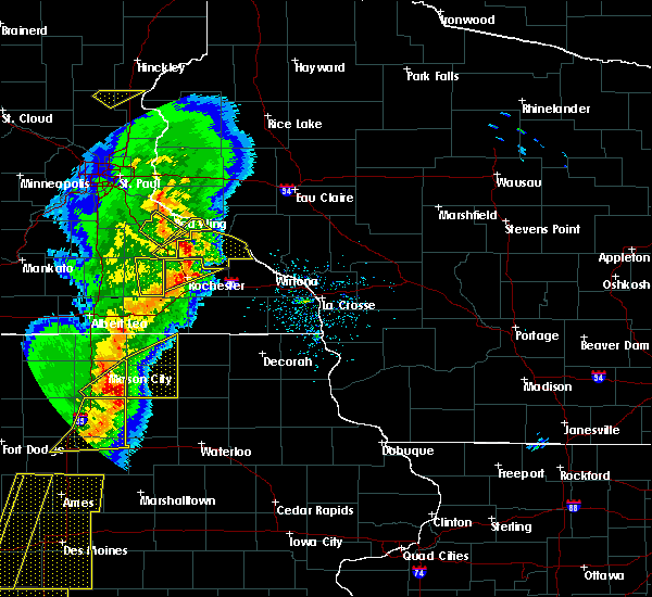 At 636 pm cst, severe thunderstorms were located along a line extending from near mazeppa to near rochester, moving east at 55 mph (radar indicated. pea size hail was reported in northwest rochester at 629 pm). Hazards include 60 mph wind gusts and penny size hail. Expect damage to roofs, siding, and trees. these severe thunderstorms will remain over mainly rural areas of northern olmsted county, including the following locations: douglas, rock dell, viola, potsdam and salem corners. A tornado watch remains in effect until 1000 pm cst for southeastern minnesota. At 636 pm cst, severe thunderstorms were located along a line extending from near mazeppa to near rochester, moving east at 55 mph (radar indicated. pea size hail was reported in northwest rochester at 629 pm). Hazards include 60 mph wind gusts and penny size hail. Expect damage to roofs, siding, and trees. these severe thunderstorms will remain over mainly rural areas of northern olmsted county, including the following locations: douglas, rock dell, viola, potsdam and salem corners. A tornado watch remains in effect until 1000 pm cst for southeastern minnesota.
|
| 3/6/2017 6:22 PM CST |
 At 621 pm cst, severe thunderstorms were located along a line extending from near west concord to near byron, moving east at 60 mph (radar indicated. a 53 mph wind gust was reported in kasson at 620 pm and the power was reported out). Hazards include 60 mph wind gusts and penny size hail. Expect damage to roofs, siding, and trees. severe thunderstorms will be near, rochester around 630 pm cst. oronoco around 635 pm cst. elgin around 640 pm cst. other locations impacted by these severe thunderstorms include douglas, rock dell, viola, potsdam and salem corners. A tornado watch remains in effect until 1000 pm cst for southeastern minnesota. At 621 pm cst, severe thunderstorms were located along a line extending from near west concord to near byron, moving east at 60 mph (radar indicated. a 53 mph wind gust was reported in kasson at 620 pm and the power was reported out). Hazards include 60 mph wind gusts and penny size hail. Expect damage to roofs, siding, and trees. severe thunderstorms will be near, rochester around 630 pm cst. oronoco around 635 pm cst. elgin around 640 pm cst. other locations impacted by these severe thunderstorms include douglas, rock dell, viola, potsdam and salem corners. A tornado watch remains in effect until 1000 pm cst for southeastern minnesota.
|
| 9/21/2016 1:08 AM CDT |
 At 107 am cdt, severe thunderstorms were located along a line extending from near oronoco to stewartville, moving east at 45 mph (law enforcement). Hazards include 60 mph wind gusts. Expect damage to roofs. siding. and trees. these severe storms will be near, eyota around 120 am cdt. chatfield and dover around 130 am cdt. Other locations impacted by these severe thunderstorms include marion, pleasant grove, douglas, rock dell and viola. At 107 am cdt, severe thunderstorms were located along a line extending from near oronoco to stewartville, moving east at 45 mph (law enforcement). Hazards include 60 mph wind gusts. Expect damage to roofs. siding. and trees. these severe storms will be near, eyota around 120 am cdt. chatfield and dover around 130 am cdt. Other locations impacted by these severe thunderstorms include marion, pleasant grove, douglas, rock dell and viola.
|
| 9/21/2016 12:59 AM CDT |
 At 1258 am cdt, severe thunderstorms were located along a line extending from near oronoco to 7 miles west of stewartville, moving east at 45 mph (law enforcement. reports of 40 to 50 mph winds have been received from this storm). Hazards include 60 mph wind gusts. Expect damage to roofs. siding. and trees. these severe storms will be near, rochester and stewartville around 105 am cdt. eyota around 120 am cdt. chatfield around 125 am cdt. dover around 130 am cdt. Other locations impacted by these severe thunderstorms include marion, pleasant grove, douglas, rock dell and viola. At 1258 am cdt, severe thunderstorms were located along a line extending from near oronoco to 7 miles west of stewartville, moving east at 45 mph (law enforcement. reports of 40 to 50 mph winds have been received from this storm). Hazards include 60 mph wind gusts. Expect damage to roofs. siding. and trees. these severe storms will be near, rochester and stewartville around 105 am cdt. eyota around 120 am cdt. chatfield around 125 am cdt. dover around 130 am cdt. Other locations impacted by these severe thunderstorms include marion, pleasant grove, douglas, rock dell and viola.
|
| 9/21/2016 12:51 AM CDT |
 At 1251 am cdt, severe thunderstorms were located along a line extending from near pine island to hayfield, moving east at 40 mph (radar indicated). Hazards include 60 mph wind gusts. Expect damage to roofs. siding. and trees. severe thunderstorms will be near, byron around 1255 am cdt. rochester and stewartville around 115 am cdt. eyota around 125 am cdt. dover around 130 am cdt. chatfield around 140 am cdt. other locations impacted by these severe thunderstorms include marion, wasioja, pleasant grove, douglas and rock dell. parse("dssevents. Vm"). At 1251 am cdt, severe thunderstorms were located along a line extending from near pine island to hayfield, moving east at 40 mph (radar indicated). Hazards include 60 mph wind gusts. Expect damage to roofs. siding. and trees. severe thunderstorms will be near, byron around 1255 am cdt. rochester and stewartville around 115 am cdt. eyota around 125 am cdt. dover around 130 am cdt. chatfield around 140 am cdt. other locations impacted by these severe thunderstorms include marion, wasioja, pleasant grove, douglas and rock dell. parse("dssevents. Vm").
|
| 8/18/2016 5:56 PM CDT |
 At 554 pm cdt, severe thunderstorms were located along a line extending from 6 miles southwest of eyota to near fountain to near lime springs, moving east at 35 mph (trained weather spotters). Hazards include 60 mph wind gusts. Expect damage to roofs. siding. and trees. This warning may need to be extended past 6 pm, for a small area along the olmsted-fillmore county line or slight south, for wind gusts to 60 mph. At 554 pm cdt, severe thunderstorms were located along a line extending from 6 miles southwest of eyota to near fountain to near lime springs, moving east at 35 mph (trained weather spotters). Hazards include 60 mph wind gusts. Expect damage to roofs. siding. and trees. This warning may need to be extended past 6 pm, for a small area along the olmsted-fillmore county line or slight south, for wind gusts to 60 mph.
|
| 8/18/2016 5:35 PM CDT |
 At 533 pm cdt, severe thunderstorms were located along a line extending from near rochester to near chatfield to near le roy, moving east at 35 mph (trained weather spotters estimated 60 to 70 mph winds near rock dell around 530 pm. winds said to be very impressive). Hazards include 60 mph wind gusts. Expect damage to roofs. siding. and trees. these severe storms will be near, chatfield and wykoff around 540 pm cdt. fountain around 545 pm cdt. preston around 550 pm cdt. eyota around 555 pm cdt. Dover around 600 pm cdt. At 533 pm cdt, severe thunderstorms were located along a line extending from near rochester to near chatfield to near le roy, moving east at 35 mph (trained weather spotters estimated 60 to 70 mph winds near rock dell around 530 pm. winds said to be very impressive). Hazards include 60 mph wind gusts. Expect damage to roofs. siding. and trees. these severe storms will be near, chatfield and wykoff around 540 pm cdt. fountain around 545 pm cdt. preston around 550 pm cdt. eyota around 555 pm cdt. Dover around 600 pm cdt.
|
| 8/18/2016 5:17 PM CDT |
 At 514 pm cdt, the leading edge of severe thunderstorms were located along a line extending from near byron and west rochester, to near le roy, moving east at 50 mph (law enforcement has reported some isolated tree branch and power line damage. winds have been measured around 50 mph). Hazards include 60 mph wind gusts. Expect damage to roofs. siding. and trees. these severe storms will be near, rochester and stewartville around 520 pm cdt. spring valley around 525 pm cdt. eyota and wykoff around 535 pm cdt. dover and chatfield around 540 pm cdt. preston around 545 pm cdt. other locations impacted by these severe thunderstorms include fillmore, marion, high forest, pleasant grove and washington. People attending thursdays on first and 3rd should seek safe shelter immediately!. At 514 pm cdt, the leading edge of severe thunderstorms were located along a line extending from near byron and west rochester, to near le roy, moving east at 50 mph (law enforcement has reported some isolated tree branch and power line damage. winds have been measured around 50 mph). Hazards include 60 mph wind gusts. Expect damage to roofs. siding. and trees. these severe storms will be near, rochester and stewartville around 520 pm cdt. spring valley around 525 pm cdt. eyota and wykoff around 535 pm cdt. dover and chatfield around 540 pm cdt. preston around 545 pm cdt. other locations impacted by these severe thunderstorms include fillmore, marion, high forest, pleasant grove and washington. People attending thursdays on first and 3rd should seek safe shelter immediately!.
|
| 8/18/2016 4:59 PM CDT |
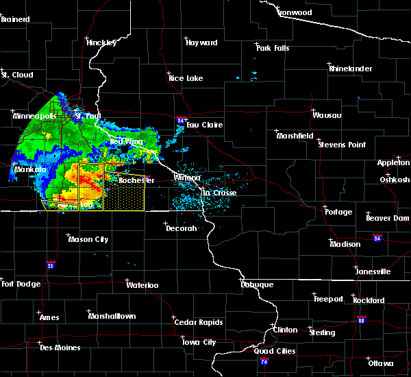 At 457 pm cdt, severe thunderstorms were located along a line extending from near hayfield to near rose creek, moving east at 55 mph (law enforcement reports tree branches down in austin). Hazards include 60 mph wind gusts and penny size hail. Expect damage to roofs. siding. and trees. severe thunderstorms will be near, rochester around 510 pm cdt. stewartville and grand meadow around 515 pm cdt. le roy around 520 pm cdt. spring valley and eyota around 525 pm cdt. chatfield, wykoff and dover around 530 pm cdt. fountain around 535 pm cdt. preston around 540 pm cdt. People attending thursdays on first and 3rd should seek safe shelter immediately!. At 457 pm cdt, severe thunderstorms were located along a line extending from near hayfield to near rose creek, moving east at 55 mph (law enforcement reports tree branches down in austin). Hazards include 60 mph wind gusts and penny size hail. Expect damage to roofs. siding. and trees. severe thunderstorms will be near, rochester around 510 pm cdt. stewartville and grand meadow around 515 pm cdt. le roy around 520 pm cdt. spring valley and eyota around 525 pm cdt. chatfield, wykoff and dover around 530 pm cdt. fountain around 535 pm cdt. preston around 540 pm cdt. People attending thursdays on first and 3rd should seek safe shelter immediately!.
|
| 7/23/2016 10:07 AM CDT |
 At 1006 am cdt, a severe thunderstorm was located near oronoco, or 8 miles north of rochester, moving northeast at 40 mph (radar indicated). Hazards include 60 mph wind gusts. Expect damage to roofs. siding. and trees. this severe storm will be near, elgin around 1020 am cdt. plainview around 1025 am cdt. Other locations impacted by this severe thunderstorm include west albany, bremen, zumbro falls, millville and bellechester. At 1006 am cdt, a severe thunderstorm was located near oronoco, or 8 miles north of rochester, moving northeast at 40 mph (radar indicated). Hazards include 60 mph wind gusts. Expect damage to roofs. siding. and trees. this severe storm will be near, elgin around 1020 am cdt. plainview around 1025 am cdt. Other locations impacted by this severe thunderstorm include west albany, bremen, zumbro falls, millville and bellechester.
|
| 7/23/2016 9:49 AM CDT |
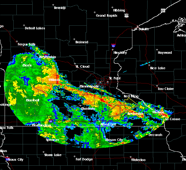 At 949 am cdt, a severe thunderstorm was located over byron, or near mantorville, moving northeast at 45 mph (radar indicated). Hazards include 60 mph wind gusts. Expect damage to roofs. siding. and trees. this severe thunderstorm will be near, rochester around 955 am cdt. oronoco around 1000 am cdt. mazeppa around 1005 am cdt. elgin around 1015 am cdt. plainview around 1020 am cdt. Other locations impacted by this severe thunderstorm include douglas, west albany, bremen, zumbro falls and millville. At 949 am cdt, a severe thunderstorm was located over byron, or near mantorville, moving northeast at 45 mph (radar indicated). Hazards include 60 mph wind gusts. Expect damage to roofs. siding. and trees. this severe thunderstorm will be near, rochester around 955 am cdt. oronoco around 1000 am cdt. mazeppa around 1005 am cdt. elgin around 1015 am cdt. plainview around 1020 am cdt. Other locations impacted by this severe thunderstorm include douglas, west albany, bremen, zumbro falls and millville.
|
| 7/5/2016 8:54 PM CDT |
 At 854 pm cdt, severe thunderstorms were located along a line extending from 8 miles southeast of modena to near stewartville, moving east at 55 mph (trained weather spotters). Hazards include 60 mph wind gusts. Expect damage to roofs. siding. And trees. At 854 pm cdt, severe thunderstorms were located along a line extending from 8 miles southeast of modena to near stewartville, moving east at 55 mph (trained weather spotters). Hazards include 60 mph wind gusts. Expect damage to roofs. siding. And trees.
|
| 7/5/2016 8:35 PM CDT |
 At 835 pm cdt, severe thunderstorms were located along a line extending from near wabasha to near kasson, moving east at 55 mph (trained weather spotters). Hazards include 60 mph wind gusts. Expect damage to roofs. siding. and trees. these severe storms will be near, wabasha and kellogg around 840 pm cdt. buffalo city around 845 pm cdt. chatfield, eyota and dover around 900 pm cdt. Other locations impacted by these severe thunderstorms include marion, high forest, wasioja, pleasant grove and douglas. At 835 pm cdt, severe thunderstorms were located along a line extending from near wabasha to near kasson, moving east at 55 mph (trained weather spotters). Hazards include 60 mph wind gusts. Expect damage to roofs. siding. and trees. these severe storms will be near, wabasha and kellogg around 840 pm cdt. buffalo city around 845 pm cdt. chatfield, eyota and dover around 900 pm cdt. Other locations impacted by these severe thunderstorms include marion, high forest, wasioja, pleasant grove and douglas.
|
| 7/5/2016 8:24 PM CDT |
 At 823 pm cdt, severe thunderstorms were located along a line extending from pepin to near dodge center, moving east at 55 mph (trained weather spotters). Hazards include 60 mph wind gusts. Expect damage to roofs. siding. and trees. these severe storms will be near, wabasha around 830 pm cdt. kellogg around 835 pm cdt. buffalo city around 840 pm cdt. Rochester around 845 pm cdt. At 823 pm cdt, severe thunderstorms were located along a line extending from pepin to near dodge center, moving east at 55 mph (trained weather spotters). Hazards include 60 mph wind gusts. Expect damage to roofs. siding. and trees. these severe storms will be near, wabasha around 830 pm cdt. kellogg around 835 pm cdt. buffalo city around 840 pm cdt. Rochester around 845 pm cdt.
|
| 7/5/2016 8:12 PM CDT |
 At 811 pm cdt, severe thunderstorms were located along a line extending from frontenac to 6 miles southeast of owatonna, moving east at 55 mph (radar indicated). Hazards include 60 mph wind gusts. Expect damage to roofs. siding. and trees. these severe storms will be near, west concord around 820 pm cdt. wabasha, mantorville, hayfield and kasson around 830 pm cdt. byron and kellogg around 835 pm cdt. Buffalo city around 840 pm cdt. At 811 pm cdt, severe thunderstorms were located along a line extending from frontenac to 6 miles southeast of owatonna, moving east at 55 mph (radar indicated). Hazards include 60 mph wind gusts. Expect damage to roofs. siding. and trees. these severe storms will be near, west concord around 820 pm cdt. wabasha, mantorville, hayfield and kasson around 830 pm cdt. byron and kellogg around 835 pm cdt. Buffalo city around 840 pm cdt.
|
| 7/5/2016 8:02 PM CDT |
 At 800 pm cdt, severe thunderstorms were located along a line extending from near red wing to near owatonna, moving east at 55 mph (radar indicated). Hazards include 70 mph wind gusts. Expect considerable tree damage. damage is likely to mobile homes, roofs, and outbuildings. these severe storms will be near, claremont, blooming prairie and west concord around 820 pm cdt. dodge center around 825 pm cdt. wabasha, mantorville, hayfield and kasson around 830 pm cdt. Byron and kellogg around 835 pm cdt. At 800 pm cdt, severe thunderstorms were located along a line extending from near red wing to near owatonna, moving east at 55 mph (radar indicated). Hazards include 70 mph wind gusts. Expect considerable tree damage. damage is likely to mobile homes, roofs, and outbuildings. these severe storms will be near, claremont, blooming prairie and west concord around 820 pm cdt. dodge center around 825 pm cdt. wabasha, mantorville, hayfield and kasson around 830 pm cdt. Byron and kellogg around 835 pm cdt.
|
| 7/5/2016 7:48 PM CDT |
 At 747 pm cdt, severe thunderstorms were located along a line extending from near welch to waseca, moving east at 55 mph (radar indicated). Hazards include 70 mph wind gusts. Expect considerable tree damage. damage is likely to mobile homes, roofs, and outbuildings. severe thunderstorms will be near, claremont and blooming prairie around 815 pm cdt. west concord around 820 pm cdt. wabasha, dodge center and hayfield around 825 pm cdt. Mantorville, kasson and kellogg around 830 pm cdt. At 747 pm cdt, severe thunderstorms were located along a line extending from near welch to waseca, moving east at 55 mph (radar indicated). Hazards include 70 mph wind gusts. Expect considerable tree damage. damage is likely to mobile homes, roofs, and outbuildings. severe thunderstorms will be near, claremont and blooming prairie around 815 pm cdt. west concord around 820 pm cdt. wabasha, dodge center and hayfield around 825 pm cdt. Mantorville, kasson and kellogg around 830 pm cdt.
|
| 5/26/2016 3:57 AM CDT |
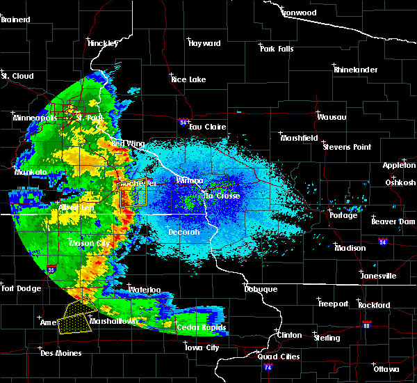 At 356 am cdt, severe thunderstorms were located along a line extending from rochester to spring valley, moving east at 40 mph (radar indicated). Hazards include 60 mph wind gusts and penny size hail. Expect damage to roofs. siding. and trees. these severe storms will be near, eyota and chatfield around 405 am cdt. preston, dover and fountain around 410 am cdt. Other locations impacted by these severe thunderstorms include fillmore, marion, pleasant grove, washington and carimona. At 356 am cdt, severe thunderstorms were located along a line extending from rochester to spring valley, moving east at 40 mph (radar indicated). Hazards include 60 mph wind gusts and penny size hail. Expect damage to roofs. siding. and trees. these severe storms will be near, eyota and chatfield around 405 am cdt. preston, dover and fountain around 410 am cdt. Other locations impacted by these severe thunderstorms include fillmore, marion, pleasant grove, washington and carimona.
|
| 5/26/2016 3:42 AM CDT |
 At 341 am cdt, severe thunderstorms were located along a line extending from near stewartville to near spring valley, moving east at 30 mph (radar indicated). Hazards include 60 mph wind gusts and penny size hail. Expect damage to roofs. siding. and trees. these severe storms will be near, far south rochester and spring valley around 350 am cdt. wykoff around 400 am cdt. eyota and chatfield around 410 am cdt. preston, fountain and dover around 415 am cdt. Other locations impacted by these severe thunderstorms include fillmore, marion, high forest, pleasant grove and washington. At 341 am cdt, severe thunderstorms were located along a line extending from near stewartville to near spring valley, moving east at 30 mph (radar indicated). Hazards include 60 mph wind gusts and penny size hail. Expect damage to roofs. siding. and trees. these severe storms will be near, far south rochester and spring valley around 350 am cdt. wykoff around 400 am cdt. eyota and chatfield around 410 am cdt. preston, fountain and dover around 415 am cdt. Other locations impacted by these severe thunderstorms include fillmore, marion, high forest, pleasant grove and washington.
|
| 5/26/2016 3:29 AM CDT |
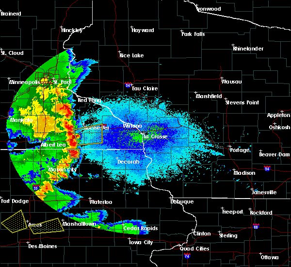 At 328 am cdt, severe thunderstorms were located along a line extending from near stewartville to near le roy, moving east at 40 mph (radar indicated). Hazards include 60 mph wind gusts and quarter size hail. Hail damage to vehicles is expected. expect wind damage to roofs, siding, and trees. severe thunderstorms will be near, stewartville around 335 am cdt. rochester around 340 am cdt. spring valley around 345 am cdt. wykoff and eyota around 355 am cdt. chatfield around 400 am cdt. preston, dover and fountain around 405 am cdt. Other locations impacted by these severe thunderstorms include fillmore, marion, high forest, pleasant grove and washington. At 328 am cdt, severe thunderstorms were located along a line extending from near stewartville to near le roy, moving east at 40 mph (radar indicated). Hazards include 60 mph wind gusts and quarter size hail. Hail damage to vehicles is expected. expect wind damage to roofs, siding, and trees. severe thunderstorms will be near, stewartville around 335 am cdt. rochester around 340 am cdt. spring valley around 345 am cdt. wykoff and eyota around 355 am cdt. chatfield around 400 am cdt. preston, dover and fountain around 405 am cdt. Other locations impacted by these severe thunderstorms include fillmore, marion, high forest, pleasant grove and washington.
|
| 7/18/2015 2:16 AM CDT |
 At 216 am cdt, severe thunderstorms were located along a line extending from mondovi to near stewartville, moving east at 45 mph (radar indicated). Hazards include 60 mph wind gusts. Expect damage to roofs. siding and trees. these severe storms will be near, mondovi around 220 am cdt. dover around 230 am cdt. Other locations impacted by these severe thunderstorms include marion, high forest, pleasant grove, rock dell and viola. At 216 am cdt, severe thunderstorms were located along a line extending from mondovi to near stewartville, moving east at 45 mph (radar indicated). Hazards include 60 mph wind gusts. Expect damage to roofs. siding and trees. these severe storms will be near, mondovi around 220 am cdt. dover around 230 am cdt. Other locations impacted by these severe thunderstorms include marion, high forest, pleasant grove, rock dell and viola.
|
| 7/18/2015 2:00 AM CDT |
 At 159 am cdt, severe thunderstorms were located along a line extending from 6 miles southeast of durand to the rochester airport, moving east at 50 mph (radar indicated). Hazards include 60 mph wind gusts. Expect damage to roofs. siding and trees. these severe storms will be near, modena around 205 am cdt. mondovi around 210 am cdt. eyota around 220 am cdt. chatfield around 225 am cdt. dover around 230 am cdt. other locations impacted by these severe thunderstorms include marion, high forest, pleasant grove, douglas and rock dell. Note that a tornado warning remains in effect for northeastern wabasha county until 230 am cdt. At 159 am cdt, severe thunderstorms were located along a line extending from 6 miles southeast of durand to the rochester airport, moving east at 50 mph (radar indicated). Hazards include 60 mph wind gusts. Expect damage to roofs. siding and trees. these severe storms will be near, modena around 205 am cdt. mondovi around 210 am cdt. eyota around 220 am cdt. chatfield around 225 am cdt. dover around 230 am cdt. other locations impacted by these severe thunderstorms include marion, high forest, pleasant grove, douglas and rock dell. Note that a tornado warning remains in effect for northeastern wabasha county until 230 am cdt.
|
| 7/18/2015 1:40 AM CDT |
 At 139 am cdt, severe thunderstorms were located along a line extending from near maiden rock to near blooming prairie, moving east at 45 mph (radar indicated). Hazards include 70 mph wind gusts. Expect considerable tree damage. damage is likely to mobile homes, roofs and outbuildings. these severe storms will be near, wabasha around 150 am cdt. modena and rochester around 205 am cdt. mondovi and stewartville around 210 am cdt. Other locations impacted by these severe thunderstorms include marion, high forest, pleasant grove, douglas and rock dell. At 139 am cdt, severe thunderstorms were located along a line extending from near maiden rock to near blooming prairie, moving east at 45 mph (radar indicated). Hazards include 70 mph wind gusts. Expect considerable tree damage. damage is likely to mobile homes, roofs and outbuildings. these severe storms will be near, wabasha around 150 am cdt. modena and rochester around 205 am cdt. mondovi and stewartville around 210 am cdt. Other locations impacted by these severe thunderstorms include marion, high forest, pleasant grove, douglas and rock dell.
|
| 7/18/2015 1:23 AM CDT |
 At 120 am cdt, severe thunderstorms were located along a line extending from 8 miles northeast of ellsworth to near waseca, moving east at 45 mph (radar indicated). Hazards include 70 mph wind gusts. Expect considerable tree damage. damage is likely to mobile homes, roofs and outbuildings. severe thunderstorms will be near, lake city and pine island around 145 am cdt. rochester around 150 am cdt. stewartville and alma around 205 am cdt. mondovi around 210 am cdt. chatfield around 225 am cdt. Other locations impacted by these severe thunderstorms include marion, wabasha, pleasant grove, douglas and rock dell. At 120 am cdt, severe thunderstorms were located along a line extending from 8 miles northeast of ellsworth to near waseca, moving east at 45 mph (radar indicated). Hazards include 70 mph wind gusts. Expect considerable tree damage. damage is likely to mobile homes, roofs and outbuildings. severe thunderstorms will be near, lake city and pine island around 145 am cdt. rochester around 150 am cdt. stewartville and alma around 205 am cdt. mondovi around 210 am cdt. chatfield around 225 am cdt. Other locations impacted by these severe thunderstorms include marion, wabasha, pleasant grove, douglas and rock dell.
|
| 6/29/2015 8:11 PM CDT | Ping Pong Ball sized hail reported 3.3 miles NNE of Rochester, MN, near airport |
| 6/29/2015 8:10 PM CDT |
 At 809 pm cdt, a severe thunderstorm was located near stewartville, or 11 miles south of rochester, moving south at 25 mph (public). Hazards include quarter size hail. Damage to vehicles is expected. This severe thunderstorm will remain over mainly rural areas of southwestern olmsted county, including the following locations, marion, high forest, pleasant grove, chester and i 90 exit 218. At 809 pm cdt, a severe thunderstorm was located near stewartville, or 11 miles south of rochester, moving south at 25 mph (public). Hazards include quarter size hail. Damage to vehicles is expected. This severe thunderstorm will remain over mainly rural areas of southwestern olmsted county, including the following locations, marion, high forest, pleasant grove, chester and i 90 exit 218.
|
| 6/29/2015 8:06 PM CDT | Quarter sized hail reported 1 miles N of Rochester, MN |
| 6/29/2015 8:04 PM CDT | Quarter sized hail reported 0.4 miles N of Rochester, MN |
| 6/29/2015 8:04 PM CDT |
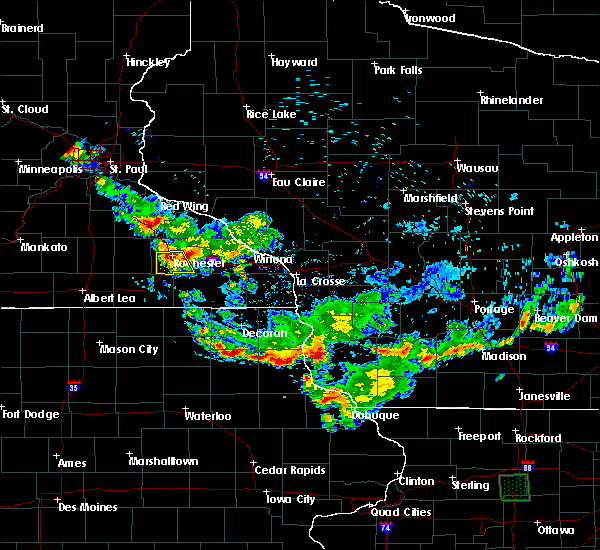 At 803 pm cdt, a severe thunderstorm was located over southern rochester, moving south at 25 mph (public). Hazards include quarter size hail just north of downtown rochester. Damage to vehicles is expected. this severe storm will be near, stewartville around 820 pm cdt. Other locations impacted by this severe thunderstorm include marion, high forest, pleasant grove, chester and i 90 exit 218. At 803 pm cdt, a severe thunderstorm was located over southern rochester, moving south at 25 mph (public). Hazards include quarter size hail just north of downtown rochester. Damage to vehicles is expected. this severe storm will be near, stewartville around 820 pm cdt. Other locations impacted by this severe thunderstorm include marion, high forest, pleasant grove, chester and i 90 exit 218.
|
| 6/29/2015 8:02 PM CDT | Quarter sized hail reported 0.4 miles N of Rochester, MN |
| 6/29/2015 7:54 PM CDT |
 At 754 pm cdt, a severe thunderstorm was located over northwestern rochester, moving south at 25 mph (radar indicated). Hazards include quarter size hail. Damage to vehicles is expected. this severe thunderstorm will be near, stewartville around 820 pm cdt. Other locations impacted by this severe thunderstorm include marion, high forest, pleasant grove, chester and predmore. At 754 pm cdt, a severe thunderstorm was located over northwestern rochester, moving south at 25 mph (radar indicated). Hazards include quarter size hail. Damage to vehicles is expected. this severe thunderstorm will be near, stewartville around 820 pm cdt. Other locations impacted by this severe thunderstorm include marion, high forest, pleasant grove, chester and predmore.
|
| 6/22/2015 7:05 AM CDT |
 At 705 am cdt, severe thunderstorms were located along a line extending from near mantorville to 6 miles north of grand meadow to adams, moving southeast at 55 mph (radar indicated). Hazards include 60 mph wind gusts. Expect damage to roofs. siding and trees. these severe storms will be near, grand meadow and stewartville around 710 am cdt. spring valley, rochester and le roy around 715 am cdt. wykoff around 720 am cdt. eyota and fountain around 725 am cdt. preston and dover around 730 am cdt. chatfield around 735 am cdt. Other locations impacted by these severe thunderstorms include ramsey, fillmore, marion, high forest and lansing. At 705 am cdt, severe thunderstorms were located along a line extending from near mantorville to 6 miles north of grand meadow to adams, moving southeast at 55 mph (radar indicated). Hazards include 60 mph wind gusts. Expect damage to roofs. siding and trees. these severe storms will be near, grand meadow and stewartville around 710 am cdt. spring valley, rochester and le roy around 715 am cdt. wykoff around 720 am cdt. eyota and fountain around 725 am cdt. preston and dover around 730 am cdt. chatfield around 735 am cdt. Other locations impacted by these severe thunderstorms include ramsey, fillmore, marion, high forest and lansing.
|
| 6/22/2015 6:42 AM CDT |
 At 640 am cdt, severe thunderstorms were located along a line extending from 7 miles southwest of faribault to 10 miles west of blooming prairie to albert lea, moving east at 50 mph (radar indicated). Hazards include 60 mph wind gusts. Expect damage to roofs. siding and trees. severe thunderstorms will be near, blooming prairie around 650 am cdt. claremont around 700 am cdt. dodge center, austin and west concord around 705 am cdt. brownsdale around 710 am cdt. mantorville, kasson and hayfield around 715 am cdt. byron and pine island around 720 am cdt. rochester and grand meadow around 725 am cdt. oronoco around 730 am cdt. this warning replaces the previous severe thunderstorm warning for parts of mower and dodge counties. Strong winds can be expected behind these storms as well so be alert for that. At 640 am cdt, severe thunderstorms were located along a line extending from 7 miles southwest of faribault to 10 miles west of blooming prairie to albert lea, moving east at 50 mph (radar indicated). Hazards include 60 mph wind gusts. Expect damage to roofs. siding and trees. severe thunderstorms will be near, blooming prairie around 650 am cdt. claremont around 700 am cdt. dodge center, austin and west concord around 705 am cdt. brownsdale around 710 am cdt. mantorville, kasson and hayfield around 715 am cdt. byron and pine island around 720 am cdt. rochester and grand meadow around 725 am cdt. oronoco around 730 am cdt. this warning replaces the previous severe thunderstorm warning for parts of mower and dodge counties. Strong winds can be expected behind these storms as well so be alert for that.
|
| 5/3/2015 7:57 PM CDT | The severe thunderstorm warning for northeastern mower. northwestern fillmore and olmsted counties will expire at 800 pm cdt. the storm which prompted the warning has moved out of the area. Therefore the warning will be allowed to expire. |
| 5/3/2015 7:50 PM CDT | At 749 pm cdt, a severe thunderstorm was located over st. charles, or 18 miles north of preston, moving east at 35 mph (radar indicated). Hazards include quarter size hail. Damage to vehicles is expected. this severe thunderstorm will remain over mainly rural areas of northeastern mower, northwestern fillmore and olmsted counties, including the following locations, fillmore, marion, high forest, pleasant grove and washington. 1. 00in. |
| 5/3/2015 7:34 PM CDT | At 734 pm cdt, a severe thunderstorm was located near eyota, or 8 miles southeast of rochester, moving east at 25 mph (radar indicated). Hazards include quarter size hail. Damage to vehicles is expected. this severe storm will be near, eyota around 745 pm cdt. chatfield around 750 pm cdt. dover around 755 pm cdt. other locations impacted by this severe thunderstorm include fillmore, marion, high forest, pleasant grove and washington. 1. 00in. |
| 5/3/2015 7:25 PM CDT | At 725 pm cdt, a severe thunderstorm was located near rochester, moving east at 40 mph (radar indicated). Hazards include ping pong ball size hail. People and animals outdoors will be injured. expect damage to roofs, siding, windows and vehicles. this severe storm will be near, eyota around 735 pm cdt. chatfield around 740 pm cdt. dover around 745 pm cdt. other locations impacted by this severe thunderstorm include fillmore, marion, high forest, pleasant grove and washington. 1. 50in. |
| 5/3/2015 7:20 PM CDT | At 720 pm cdt, a severe thunderstorm was located near rochester, moving east at 45 mph (radar indicated). Hazards include ping pong ball size hail. People and animals outdoors will be injured. expect damage to roofs, siding, windows and vehicles. this severe storm will be near, eyota around 730 pm cdt. dover and chatfield around 735 pm cdt. other locations impacted by this severe thunderstorm include fillmore, marion, high forest, pleasant grove and washington. 1. 50in. |
| 5/3/2015 7:13 PM CDT | At 712 pm cdt, a severe thunderstorm was located near stewartville, or 13 miles south of byron, moving east at 35 mph (trained weather spotters). Hazards include quarter size hail. Damage to vehicles is expected. this severe storm will be near, stewartville around 725 pm cdt. eyota around 740 pm cdt. chatfield around 745 pm cdt. dover around 750 pm cdt. fountain around 755 pm cdt. other locations impacted by this severe thunderstorm include fillmore, marion, high forest, pleasant grove and washington. 1. 00in. |
| 5/3/2015 7:02 PM CDT | At 701 pm cdt, a severe thunderstorm was located near hayfield, or 14 miles south of dodge center, moving east at 40 mph (trained weather spotters). Hazards include ping pong ball size hail. People and animals outdoors will be injured. expect damage to roofs, siding, windows and vehicles. this severe thunderstorm will be near, stewartville around 720 pm cdt. eyota around 735 pm cdt. chatfield around 740 pm cdt. fountain and dover around 745 pm cdt. other locations impacted by this severe thunderstorm include fillmore, marion, high forest, pleasant grove and washington. 1. 50in. |
| 6/16/2014 8:10 PM CDT | Gust occurred well after main storms passed...but other showers and storms were still in the are in olmsted county MN, 8 miles N of Rochester, MN |
| 6/16/2014 8:00 PM CDT | 8 inch tree snapped off just above the ground in olmsted county MN, 6.6 miles N of Rochester, MN |
| 7/19/2013 5:31 AM CDT | Automated observation on the helipad on top of mayo clinic. report of a tree branch down on a power line in rochester as well from law enforcmen in olmsted county MN, 0.4 miles N of Rochester, MN |
| 6/22/2013 2:55 AM CDT | 2 large trees down on roadways in northwest rochester...widespread power outages southwest side of town. shed blown off foundation northwest side of town. time estimate in olmsted county MN, 0.4 miles N of Rochester, MN |
| 6/21/2013 5:30 AM CDT | Large tree blown down in the middle of the road on 25th avenue and 55th street northwest in olmsted county MN, 0.4 miles N of Rochester, MN |
| 5/31/2013 9:45 PM CDT | Golf Ball sized hail reported 7.2 miles NW of Rochester, MN |
| 5/31/2013 9:40 PM CDT | Quarter sized hail reported 9.1 miles NW of Rochester, MN, ground covered with hail |
| 5/31/2013 8:55 PM CDT | Quarter sized hail reported 3.8 miles N of Rochester, MN |
| 5/19/2013 4:43 PM CDT | Twitter report relayed by kttc of power out near target north and debris down on roads near the railroad tracks and assisi height in olmsted county MN, 3.5 miles SE of Rochester, MN |
| 5/19/2013 4:19 PM CDT | Rochester airport gusted to 6o mph at 419 p in olmsted county MN, 6.6 miles N of Rochester, MN |
| 9/5/2012 1:10 AM CDT | Storm damage reported in olmsted county MN, 0.4 miles N of Rochester, MN |
| 9/5/2012 1:10 AM CDT | Trees down and power outages in northwest part of tow in olmsted county MN, 0.4 miles N of Rochester, MN |
| 9/5/2012 1:10 AM CDT | Trees down blocking 16th st sw between hwy 63 and apache mall. via facebook. time estimated by radar and local observation in olmsted county MN, 0.4 miles N of Rochester, MN |
| 9/5/2012 1:06 AM CDT | Storm damage reported in olmsted county MN, 5.2 miles N of Rochester, MN |
| 8/4/2012 12:15 AM CDT | Large tree reported down on northeast side of city in olmsted county MN, 1.8 miles SW of Rochester, MN |
| 6/14/2012 7:47 PM CDT | Emergency management reports power outages in the city of rochester in olmsted county MN, 0.4 miles N of Rochester, MN |
| 6/14/2012 7:41 PM CDT | At kttc studios northwest side of rochester in olmsted county MN, 2.6 miles SE of Rochester, MN |
| 6/14/2012 7:30 PM CDT | Emergency management reported trees down in the city of genoa in olmsted county MN, 10.1 miles SE of Rochester, MN |
| 5/26/2012 12:23 PM CDT | Rochester asos pk wnd 31060/1723 in olmsted county MN, 7.3 miles N of Rochester, MN |
| 5/26/2012 12:23 AM CDT | Rochester asos pk wnd 31060/1723 in olmsted county MN, 7.3 miles N of Rochester, MN |
| 3/19/2012 8:04 PM CDT | From the rochester airport asos in olmsted county MN, 7.3 miles N of Rochester, MN |
| 1/1/0001 12:00 AM | Storm damage reported in olmsted county MN, 5.2 miles N of Rochester, MN |
Hail Maps for Rochester, MN


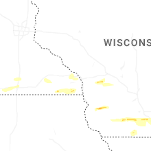


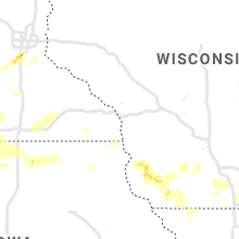


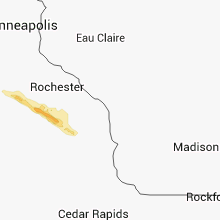


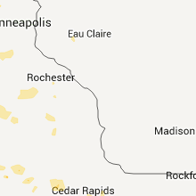


Connect with Interactive Hail Maps