

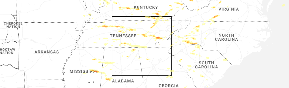
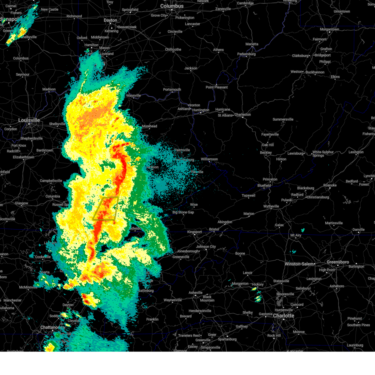
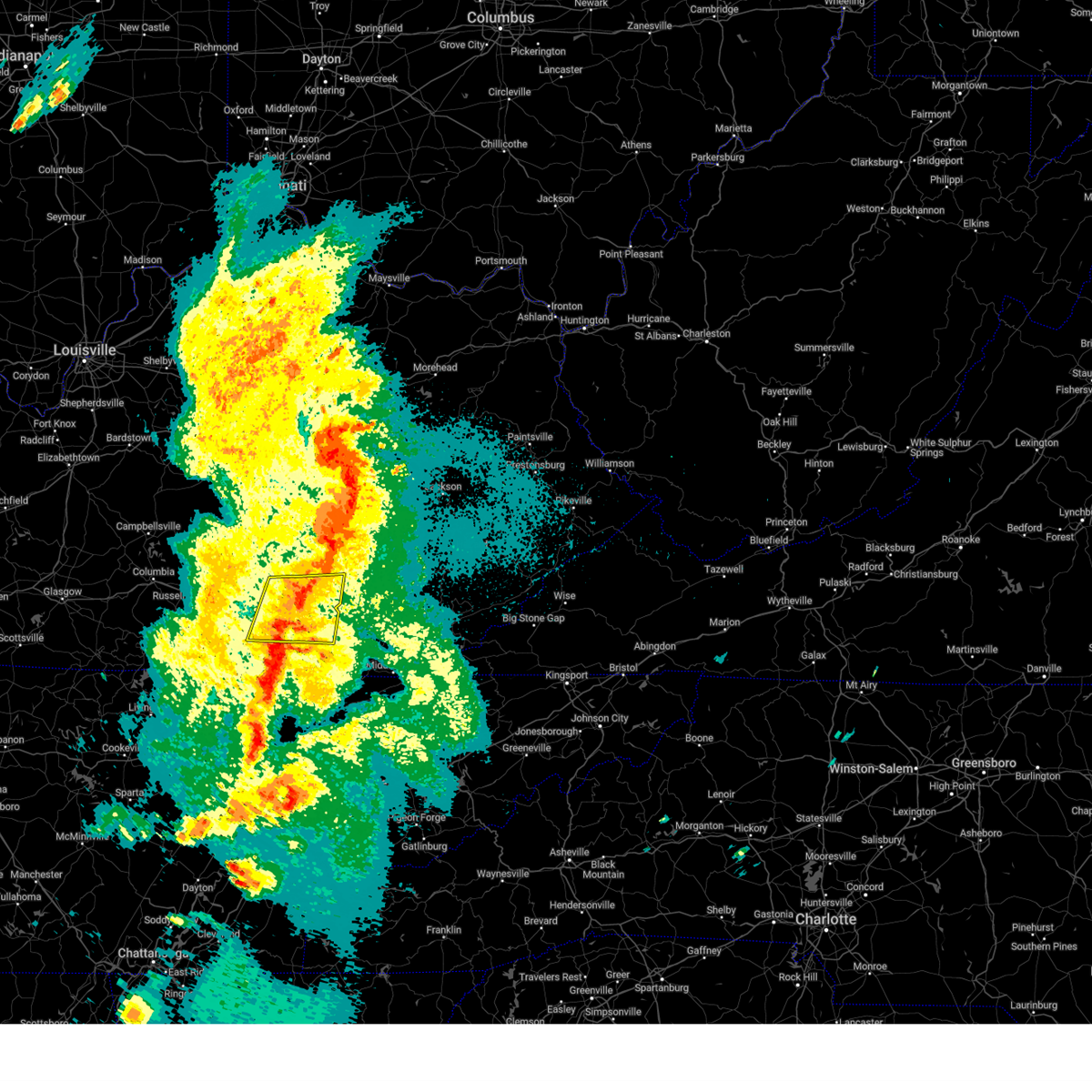
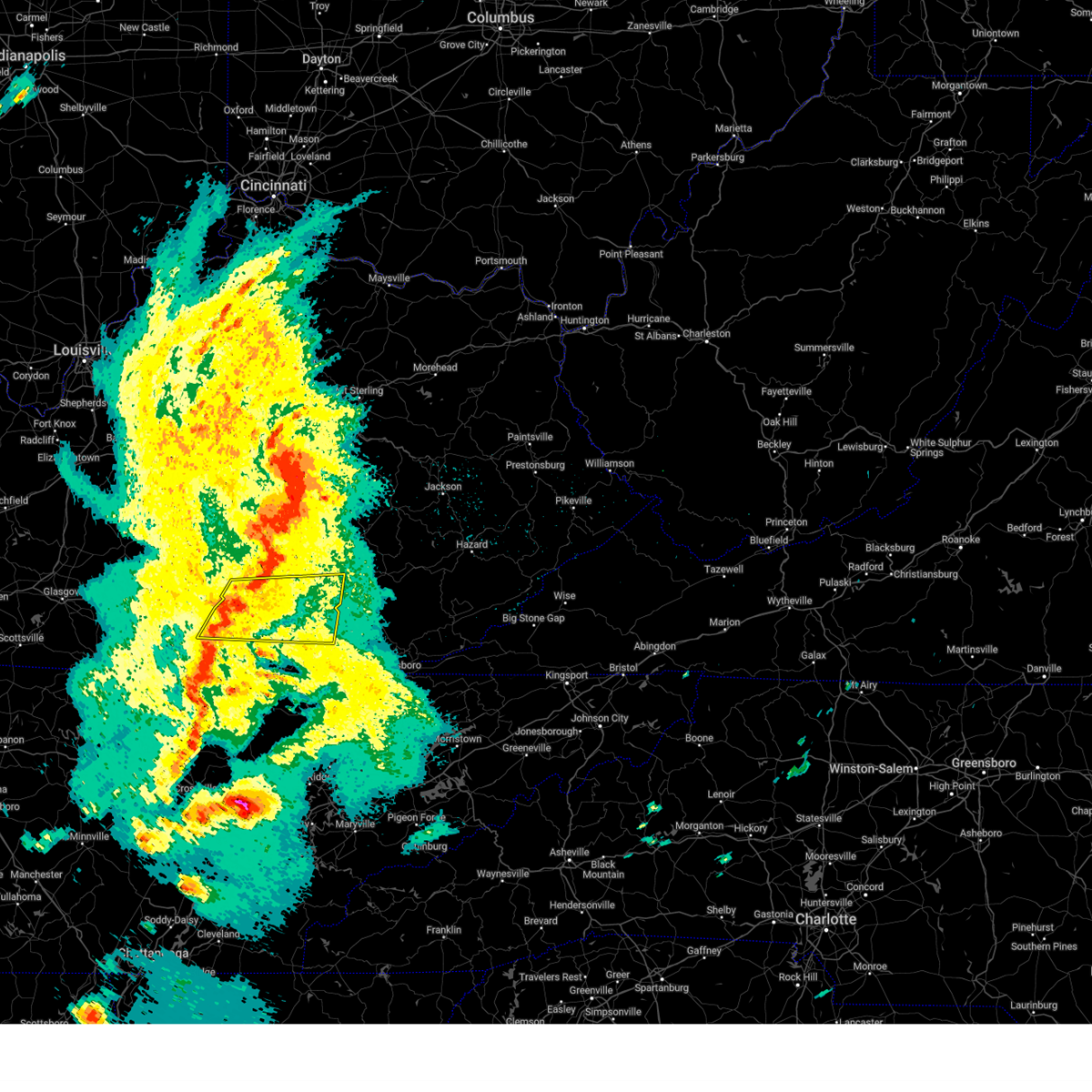
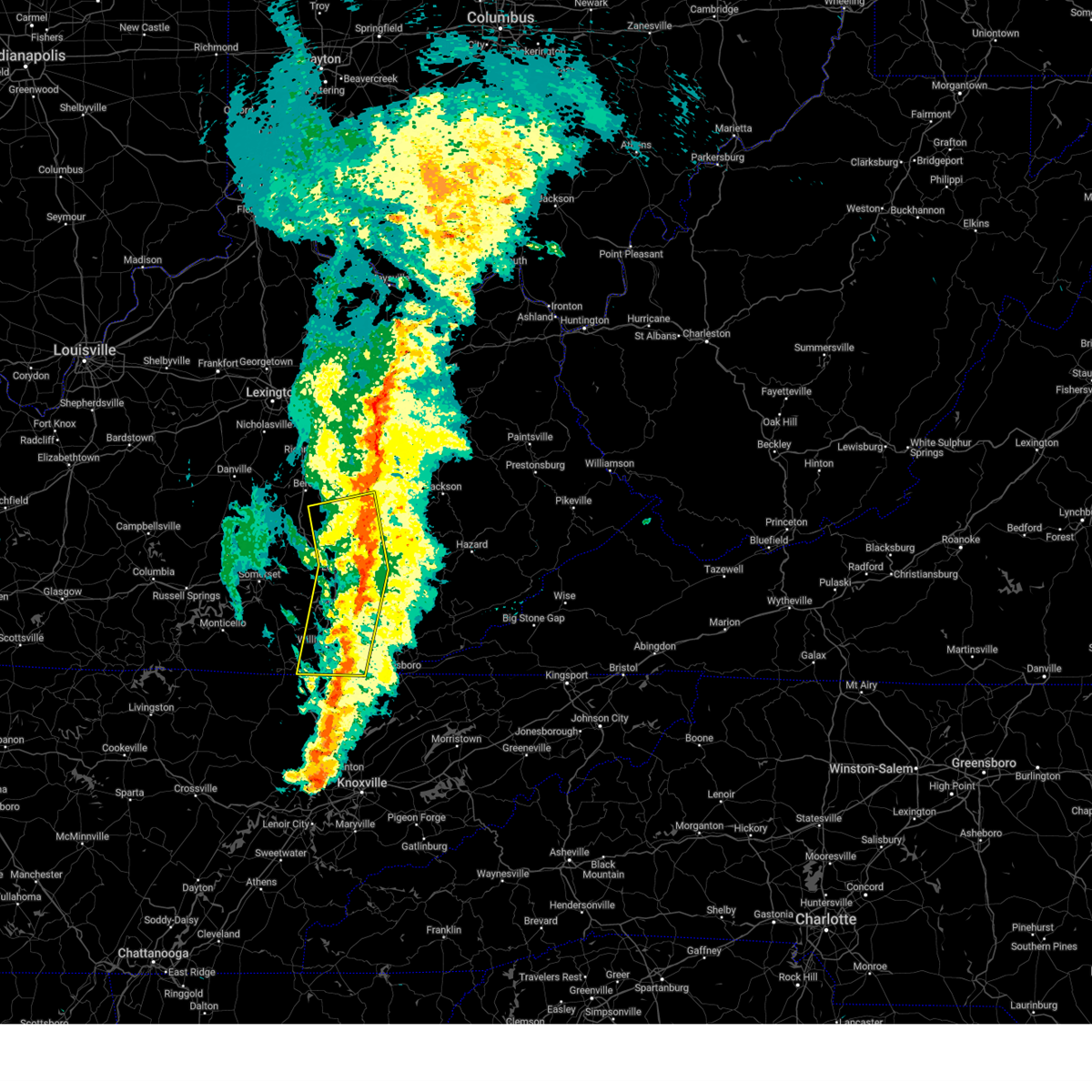
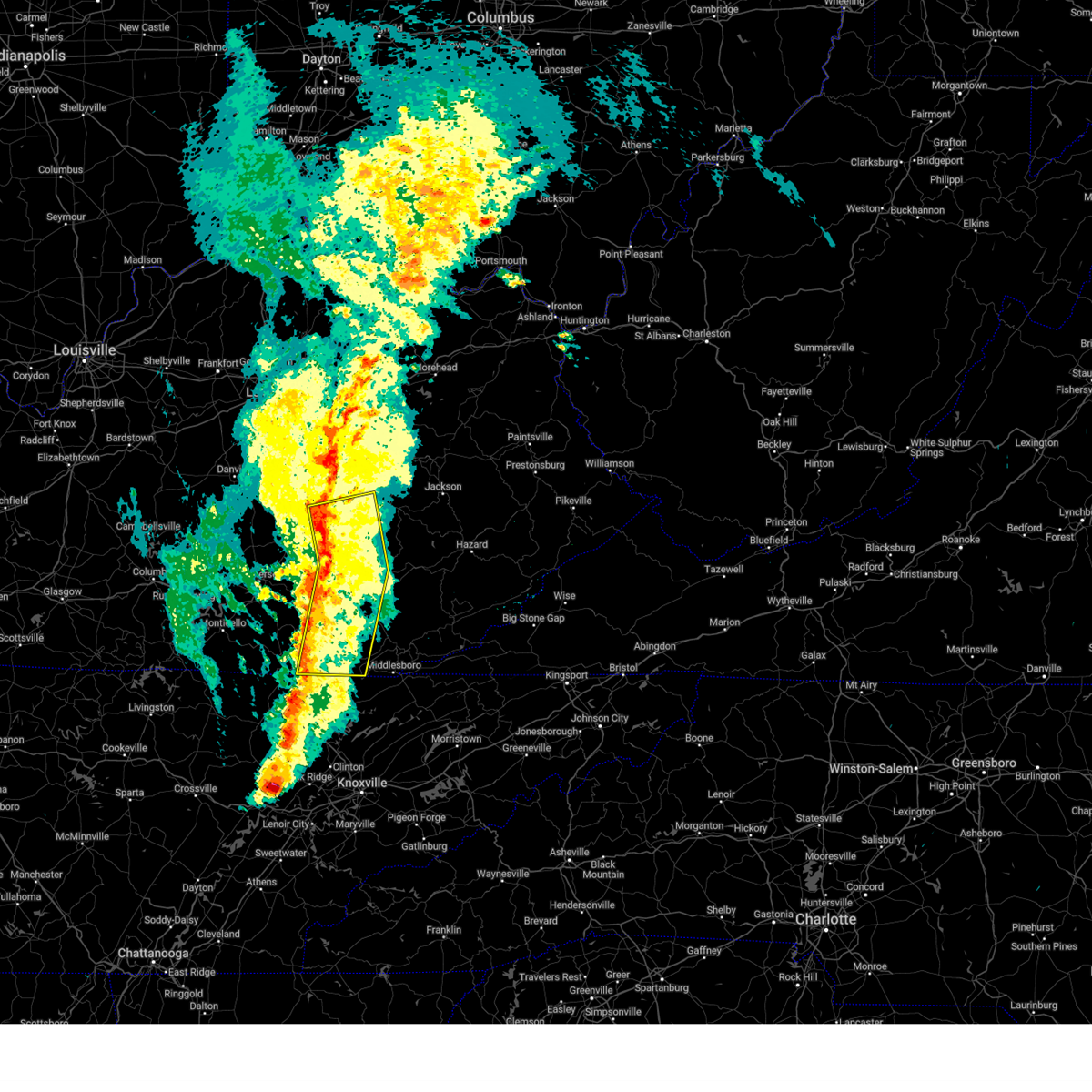
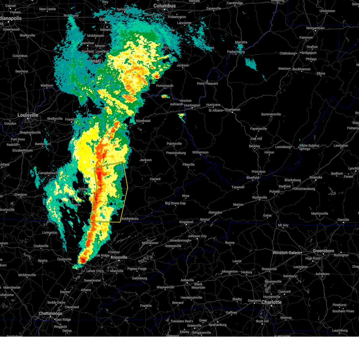
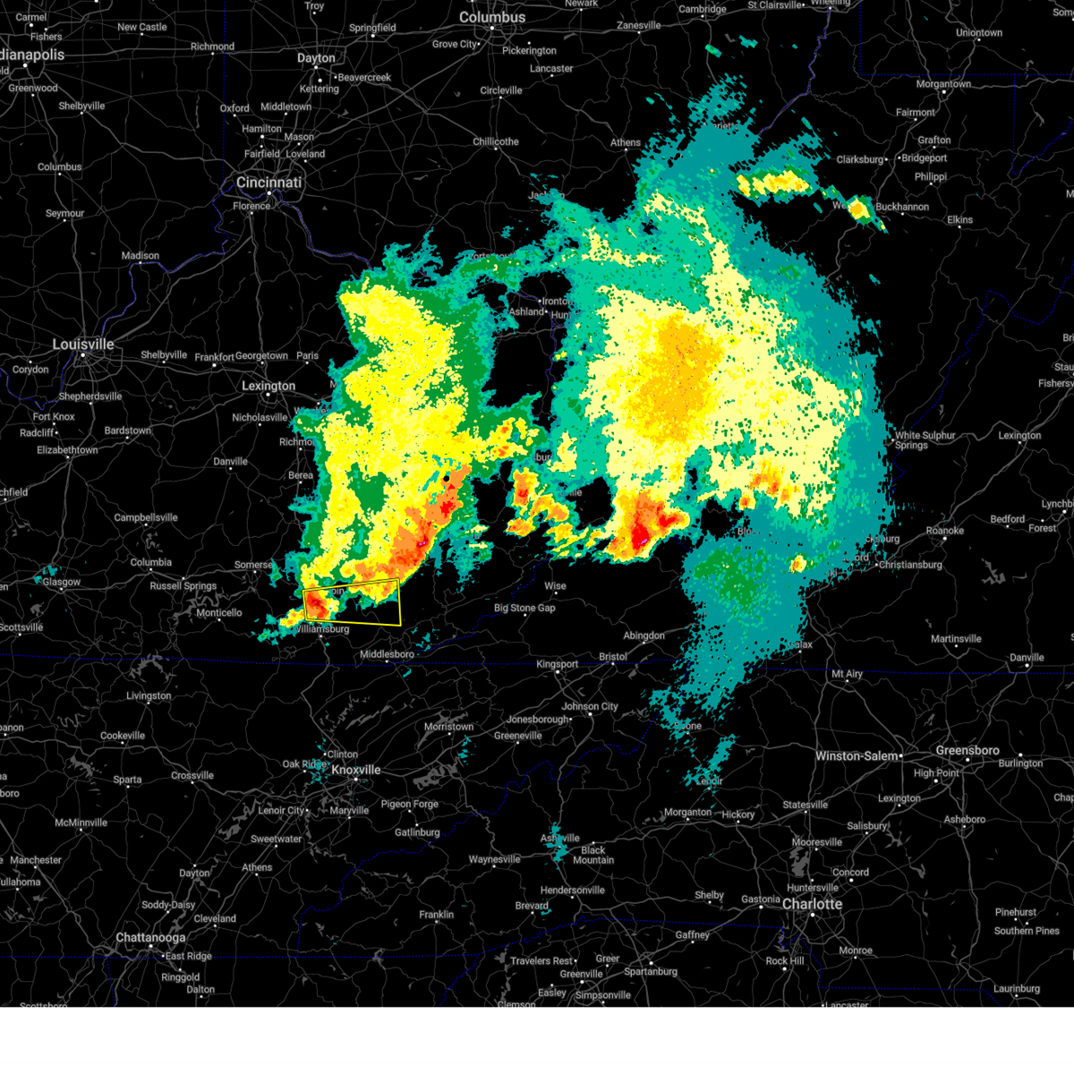
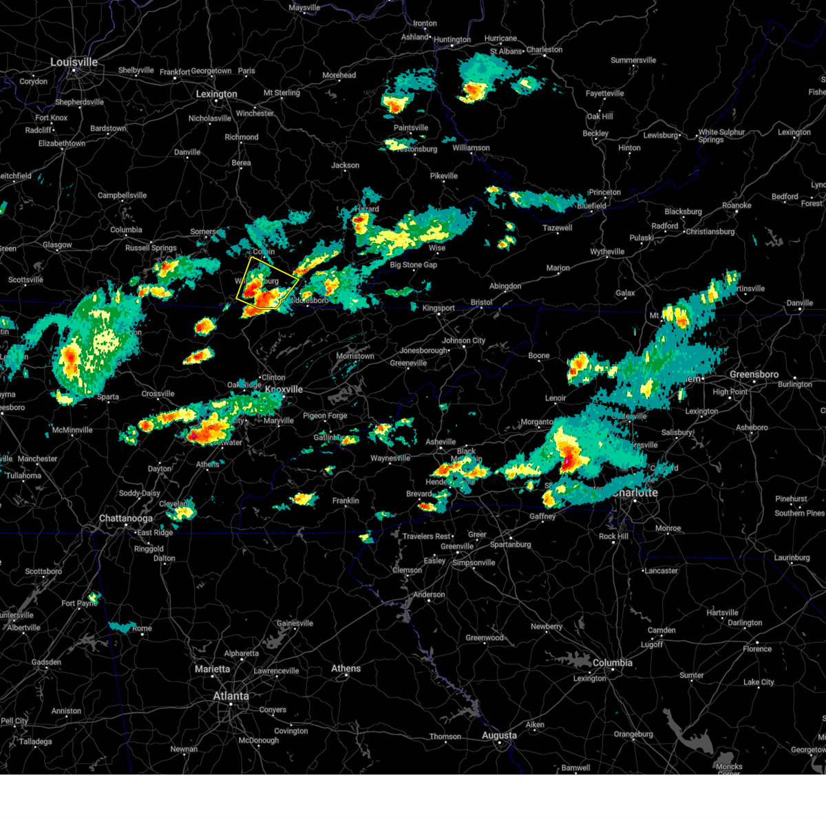
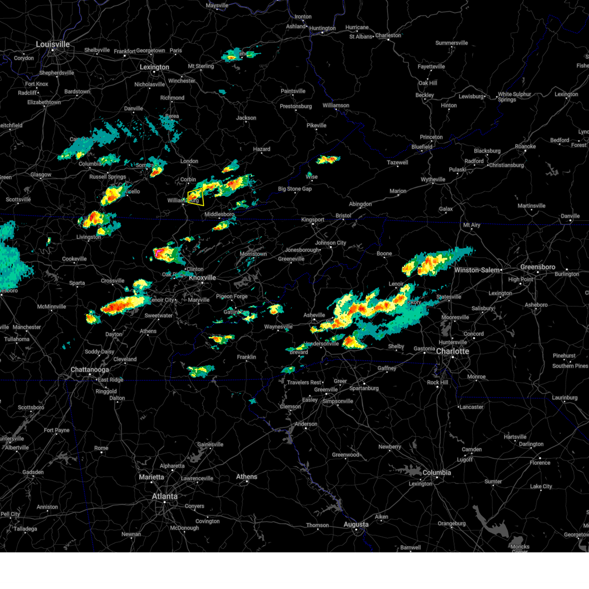
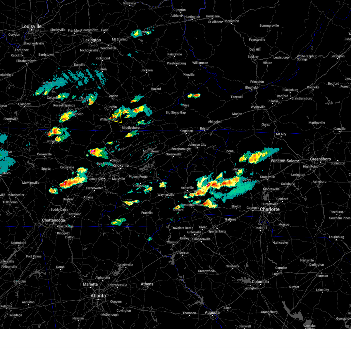
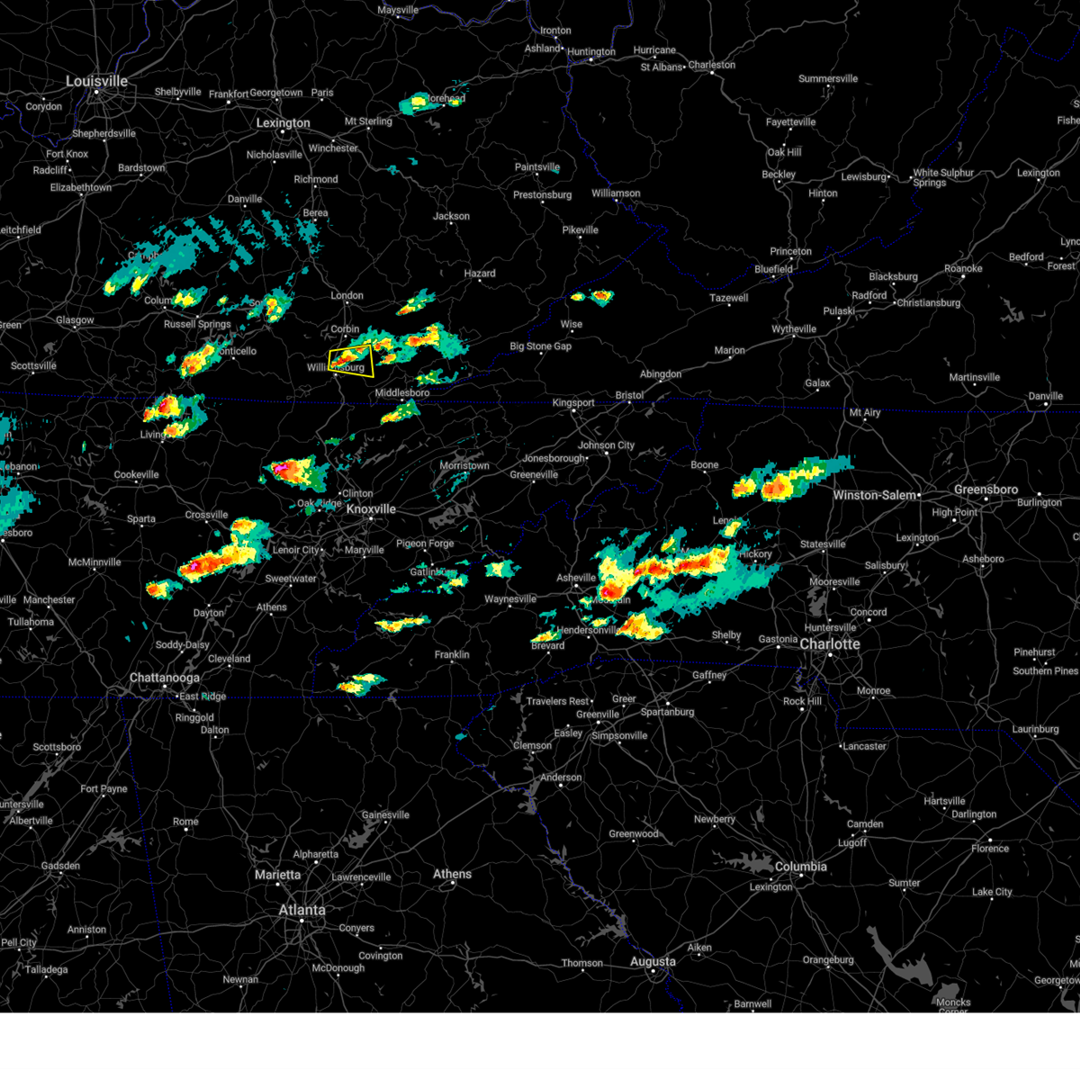
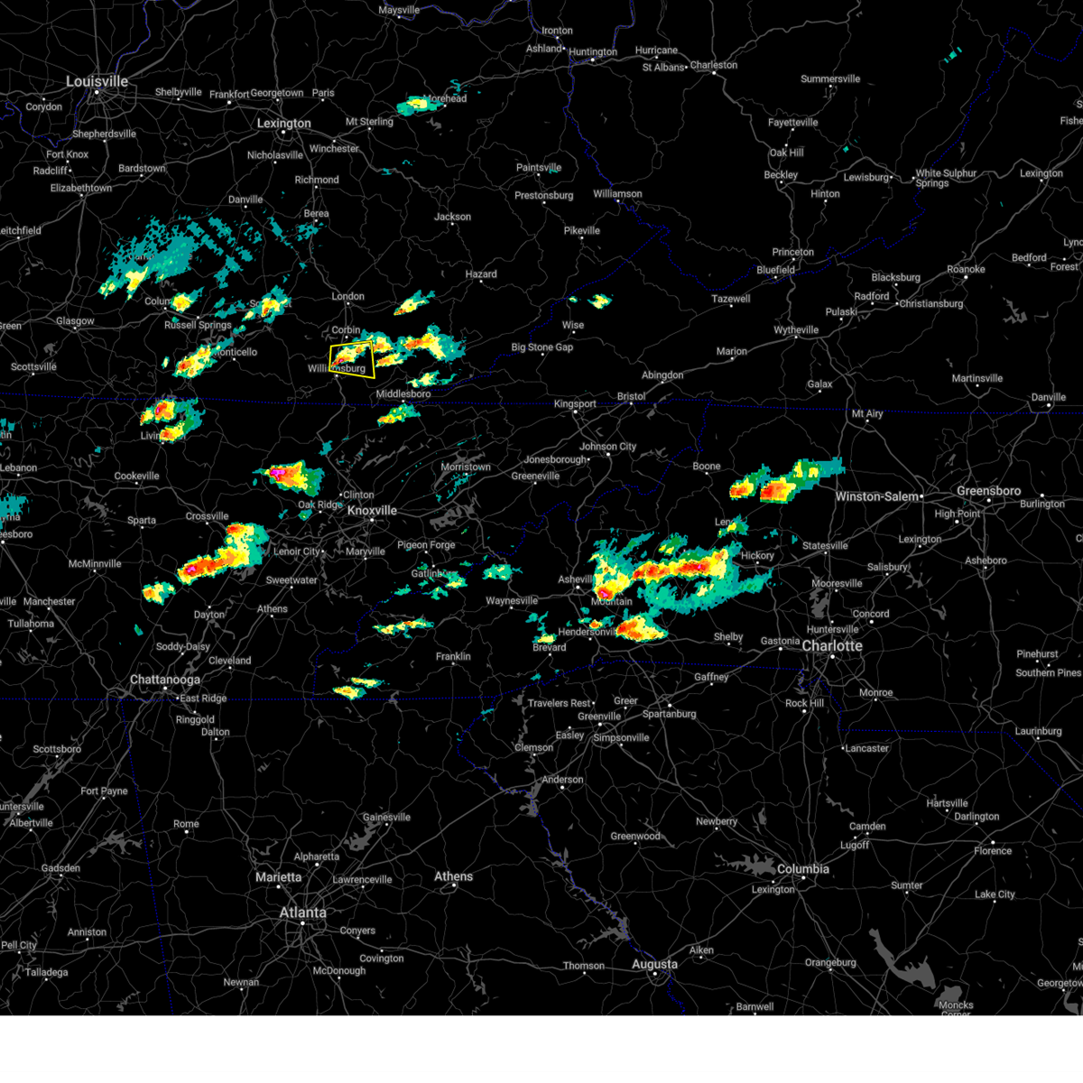
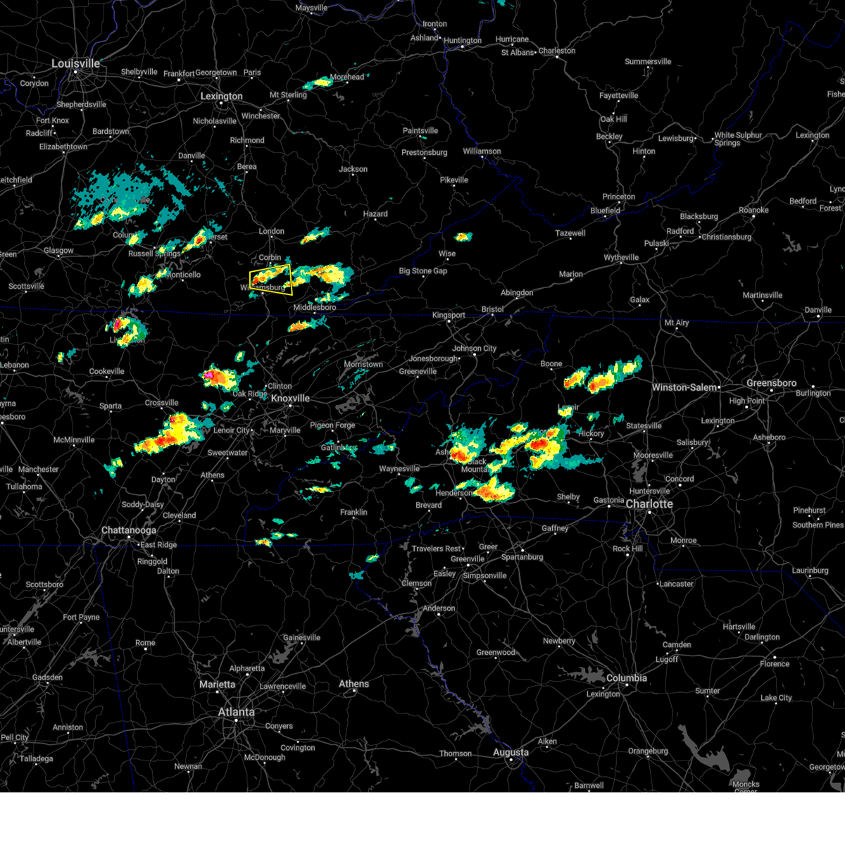
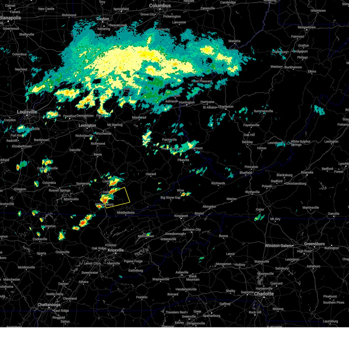
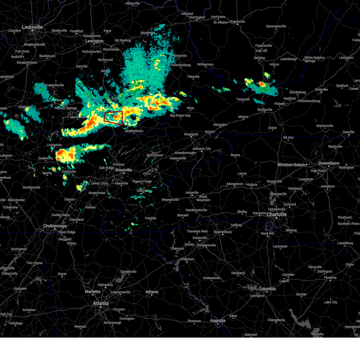
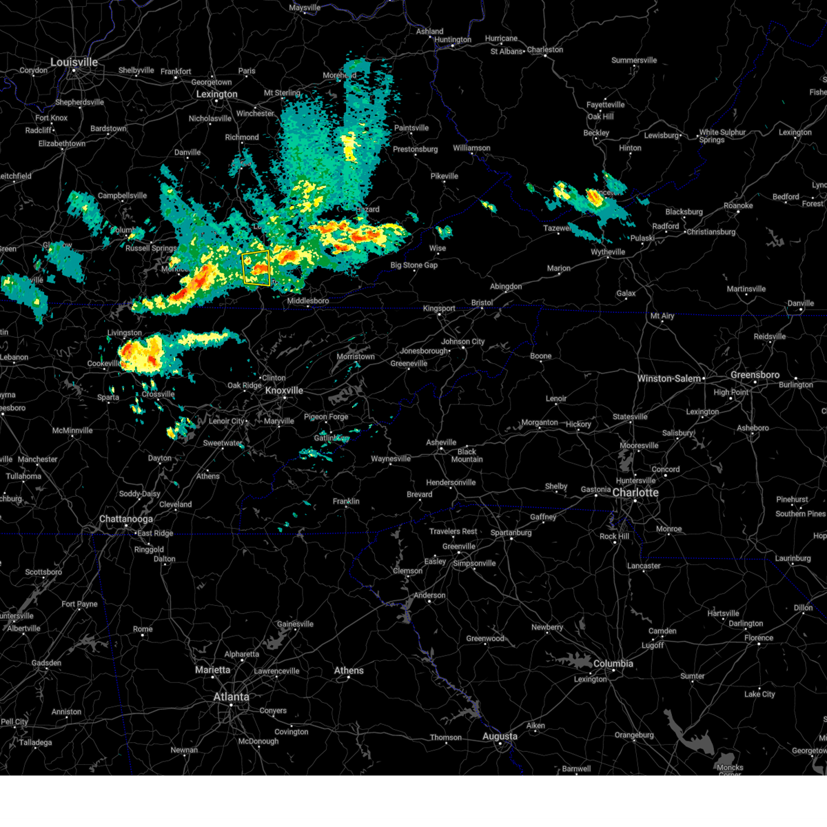
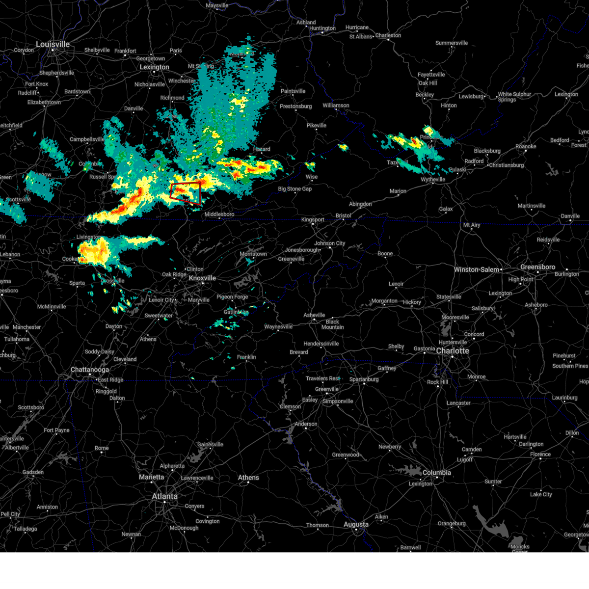
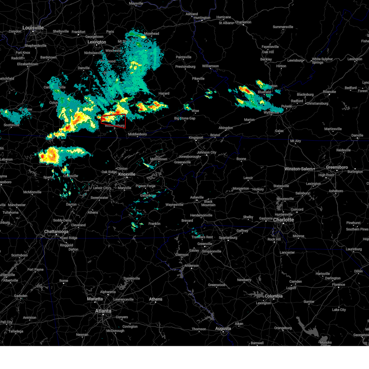
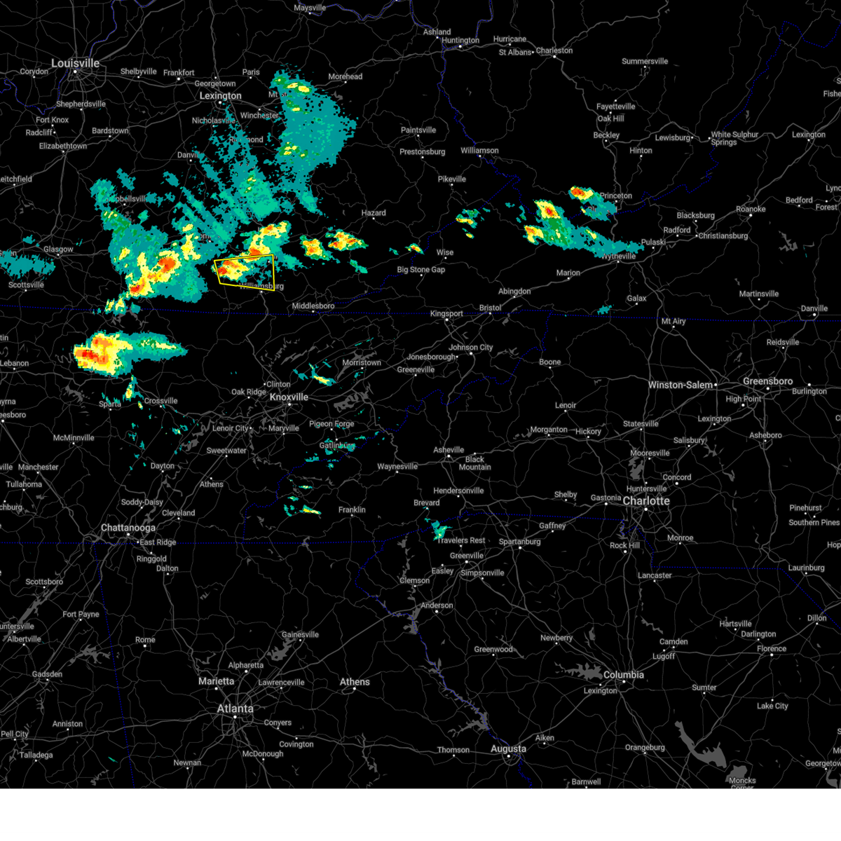
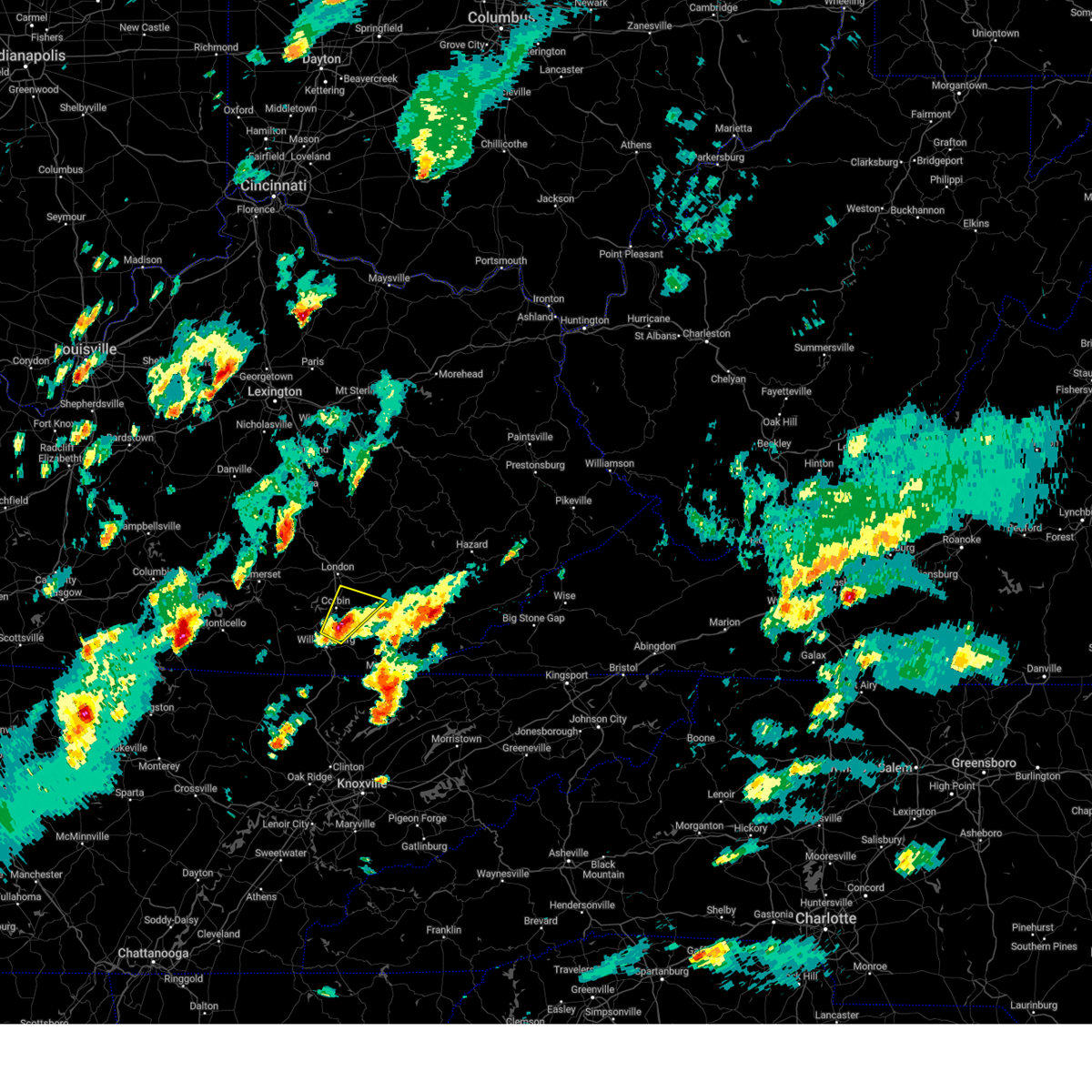
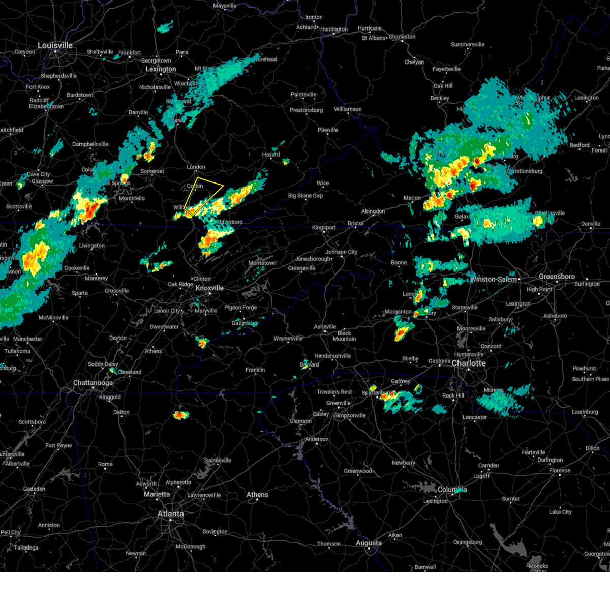
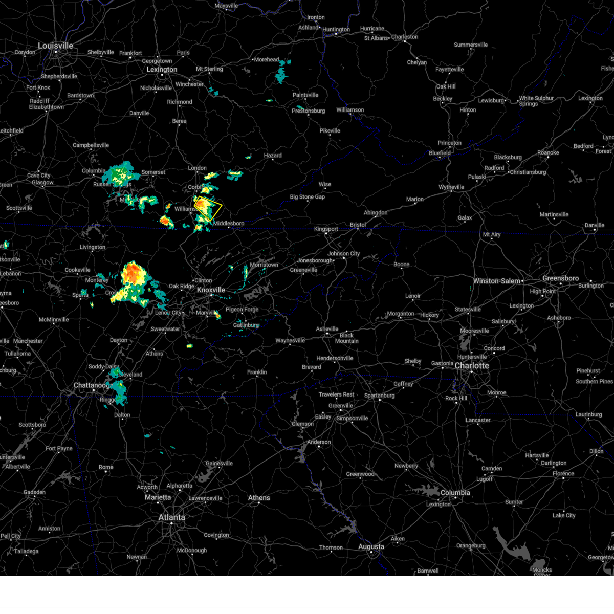
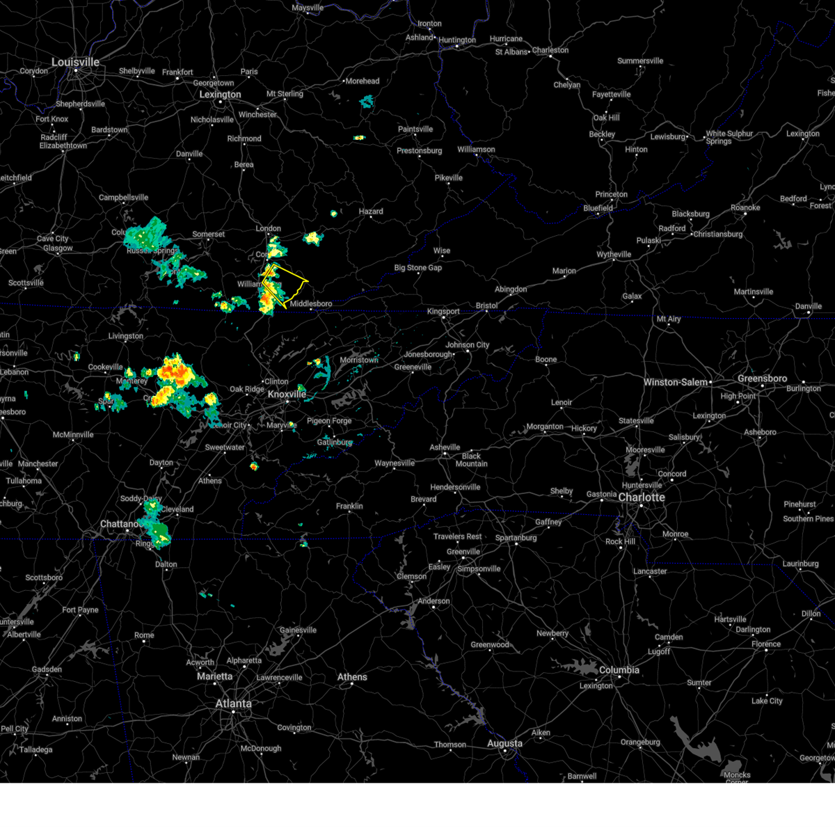
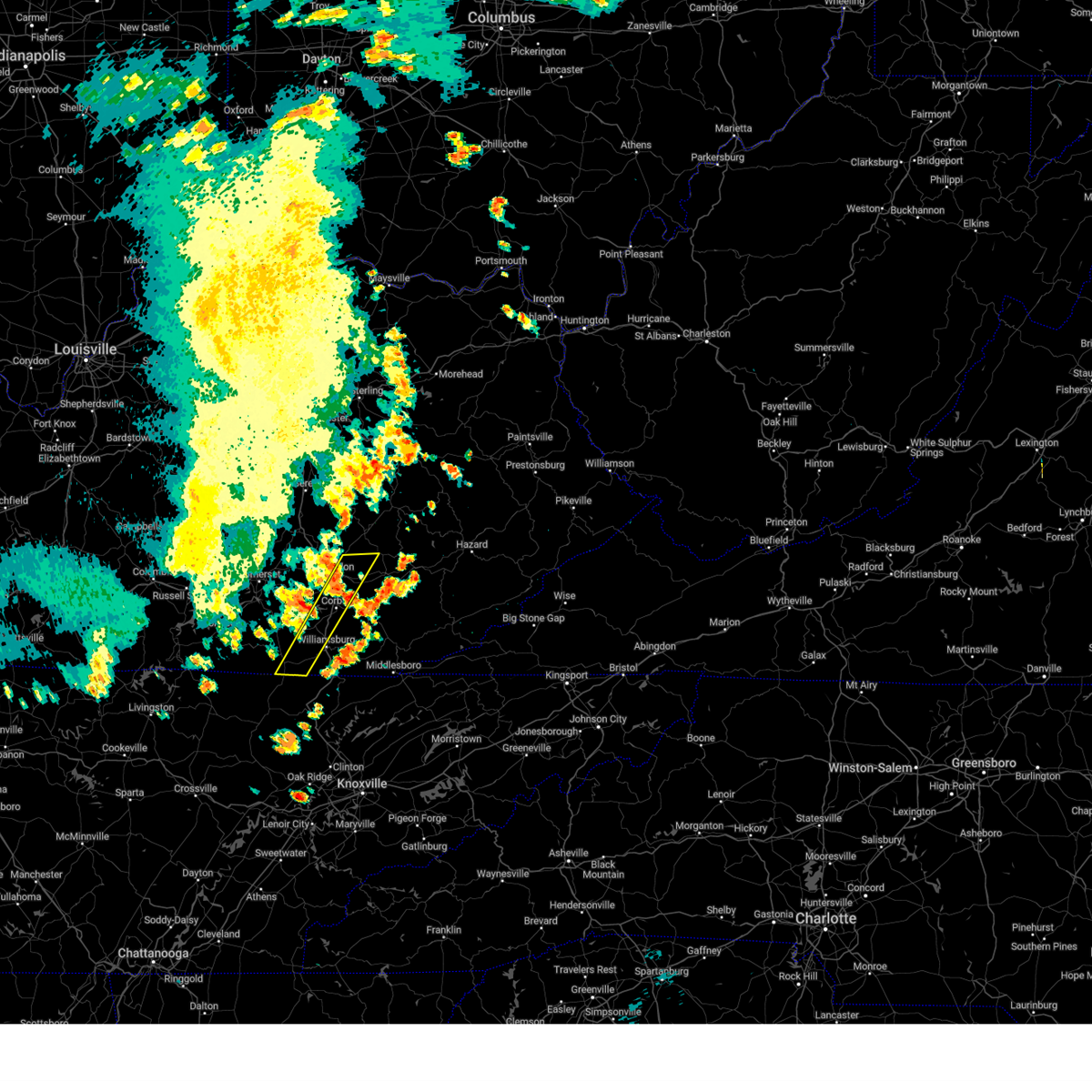
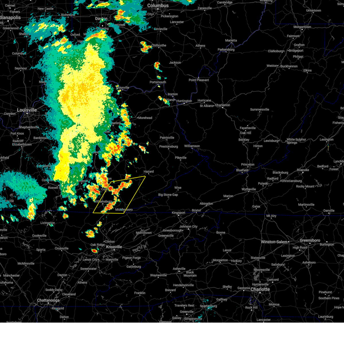
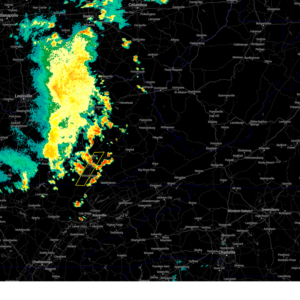
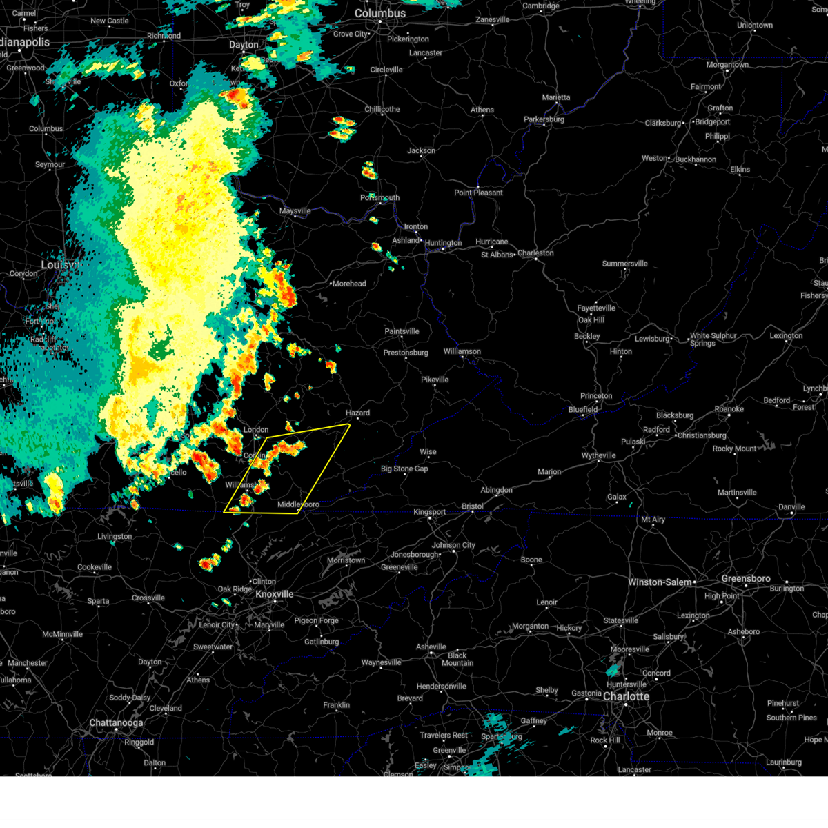
Hail Map for Rockholds, KY
The Rockholds, KY area has had 3 reports of on-the-ground hail by trained spotters, and has been under severe weather warnings 51 times during the past 12 months. Doppler radar has detected hail at or near Rockholds, KY on 23 occasions, including 6 occasions during the past year.
| Name: | Rockholds, KY |
| Where Located: | 60.4 miles S of Irvine, KY |
| Map: | Google Map for Rockholds, KY |
| Population: | 390 |
| Housing Units: | 158 |
| More Info: | Search Google for Rockholds, KY |
5
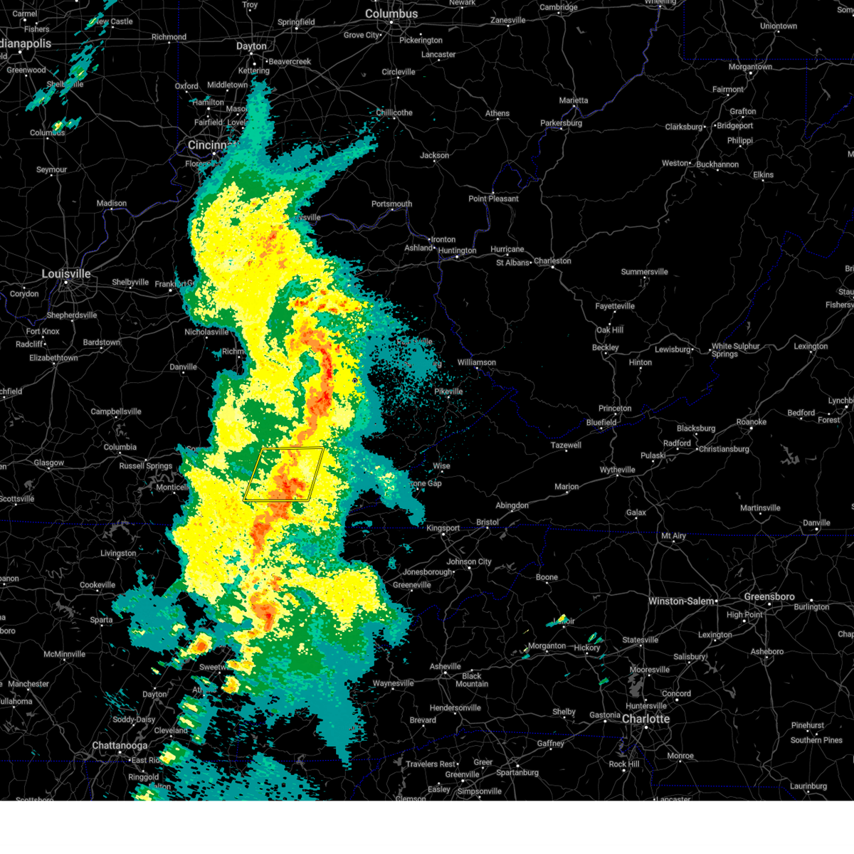
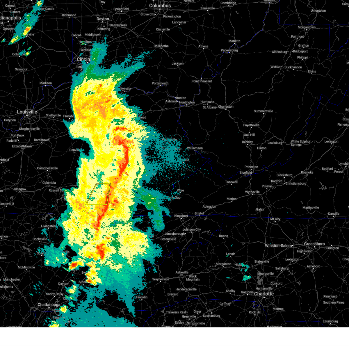
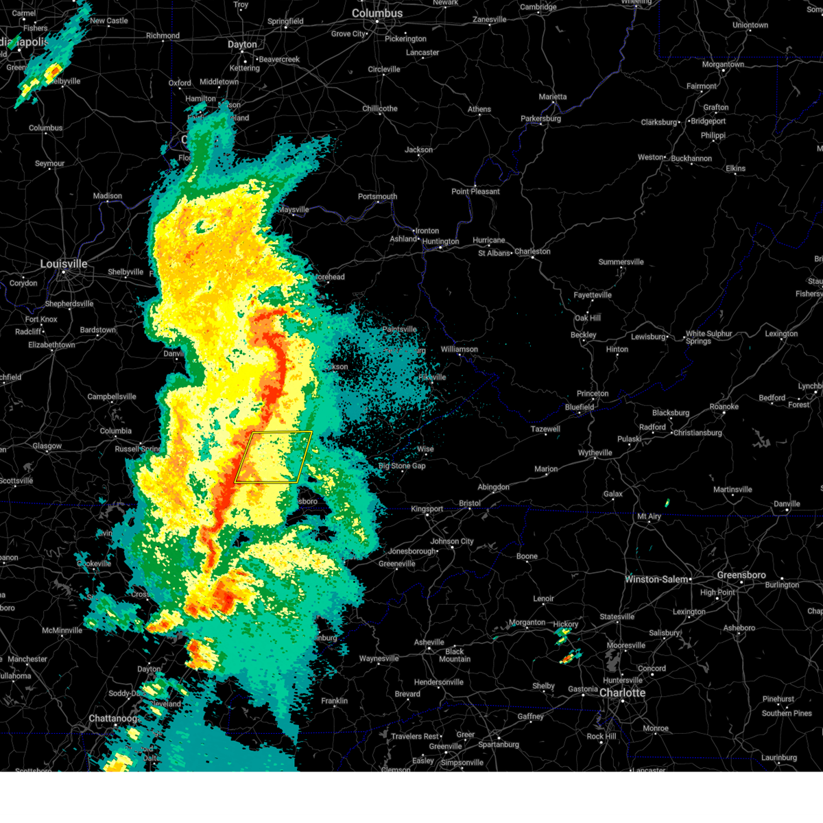
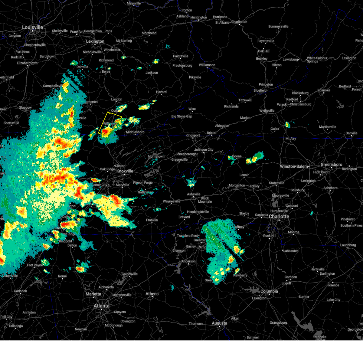
The Top Recent Hail Date for Rockholds, KY is Thursday, May 8, 2025 (1st out of 23)
Hail and Wind Damage Spotted near Rockholds, KY
| Date / Time | Report Details |
|---|---|
| 6/17/2025 6:56 PM EDT | Svrjkl the national weather service in jackson ky has issued a * severe thunderstorm warning for, southern laurel county in south central kentucky, western knox county in southeastern kentucky, whitley county in south central kentucky, west central clay county in southeastern kentucky, * until 730 pm edt. * at 656 pm edt, severe thunderstorms were located along a line extending from near london-corbin airport to mountain ash, moving northeast at 35 mph (radar indicated). Hazards include 60 mph wind gusts. Expect damage to roofs, siding, and trees. severe thunderstorms will be near, london around 700 pm edt. emmanuel around 705 pm edt. barbourville around 710 pm edt. Tedders around 715 pm edt. |
| 5/20/2025 10:19 PM EDT |
 The warning has expired. a new downstream warning has been issued. refer to that bulletin for further details. a tornado watch remains in effect until 200 am edt for south central and southeastern kentucky. remember, a severe thunderstorm warning still remains in effect for southwestern harlan county in southeastern kentucky, east central laurel county in south central kentucky, bell county in southeastern kentucky, knox county in southeastern kentucky, leslie county in southeastern kentucky, southeastern owsley county in southeastern kentucky, perry county in southeastern kentucky, northwestern knott county in southeastern kentucky, southeastern whitley county in south central kentucky, southern breathitt county in southeastern kentucky and clay county in southeastern kentucky until 1045 pm edt. The warning has expired. a new downstream warning has been issued. refer to that bulletin for further details. a tornado watch remains in effect until 200 am edt for south central and southeastern kentucky. remember, a severe thunderstorm warning still remains in effect for southwestern harlan county in southeastern kentucky, east central laurel county in south central kentucky, bell county in southeastern kentucky, knox county in southeastern kentucky, leslie county in southeastern kentucky, southeastern owsley county in southeastern kentucky, perry county in southeastern kentucky, northwestern knott county in southeastern kentucky, southeastern whitley county in south central kentucky, southern breathitt county in southeastern kentucky and clay county in southeastern kentucky until 1045 pm edt.
|
| 5/20/2025 10:01 PM EDT |
 The storm which prompted the warning has moved out of the area. therefore, the warning has been allowed to expire. a tornado watch remains in effect until 200 am edt for south central and southeastern kentucky. The storm which prompted the warning has moved out of the area. therefore, the warning has been allowed to expire. a tornado watch remains in effect until 200 am edt for south central and southeastern kentucky.
|
| 5/20/2025 9:47 PM EDT |
 Svrjkl the national weather service in jackson ky has issued a * severe thunderstorm warning for, southeastern laurel county in south central kentucky, central bell county in southeastern kentucky, knox county in southeastern kentucky, northern whitley county in south central kentucky, southern clay county in southeastern kentucky, * until 1015 pm edt. * at 947 pm edt, severe thunderstorms were located along a line extending from near levi jackson s.p. to clio, moving east at 55 mph (radar indicated). Hazards include 60 mph wind gusts and penny size hail. Expect damage to roofs, siding, and trees. severe thunderstorms will be near, blackwater around 955 pm edt. barbourville around 1000 pm edt. Brush creek around 1005 pm edt. Svrjkl the national weather service in jackson ky has issued a * severe thunderstorm warning for, southeastern laurel county in south central kentucky, central bell county in southeastern kentucky, knox county in southeastern kentucky, northern whitley county in south central kentucky, southern clay county in southeastern kentucky, * until 1015 pm edt. * at 947 pm edt, severe thunderstorms were located along a line extending from near levi jackson s.p. to clio, moving east at 55 mph (radar indicated). Hazards include 60 mph wind gusts and penny size hail. Expect damage to roofs, siding, and trees. severe thunderstorms will be near, blackwater around 955 pm edt. barbourville around 1000 pm edt. Brush creek around 1005 pm edt.
|
| 5/20/2025 9:42 PM EDT |
 At 941 pm edt, a severe thunderstorm was located over holly bay rec. area, or 15 miles southwest of london, moving east at 40 mph (radar indicated). Hazards include 60 mph wind gusts and penny size hail. Expect damage to roofs, siding, and trees. locations impacted include, london, fariston, parkers lake, cumberland falls s. p. Lily, clio, huxley, goldbug, deering, north corbin, bunch, and krupp. At 941 pm edt, a severe thunderstorm was located over holly bay rec. area, or 15 miles southwest of london, moving east at 40 mph (radar indicated). Hazards include 60 mph wind gusts and penny size hail. Expect damage to roofs, siding, and trees. locations impacted include, london, fariston, parkers lake, cumberland falls s. p. Lily, clio, huxley, goldbug, deering, north corbin, bunch, and krupp.
|
| 5/20/2025 9:42 PM EDT |
 the severe thunderstorm warning has been cancelled and is no longer in effect the severe thunderstorm warning has been cancelled and is no longer in effect
|
| 5/20/2025 9:35 PM EDT |
 At 934 pm edt, a severe thunderstorm was located near huxley, or 13 miles southeast of somerset, moving east at 40 mph (radar indicated). Hazards include 60 mph wind gusts and penny size hail. Expect damage to roofs, siding, and trees. Locations impacted include, huxley, bark camp, keavy, hightop and lily. At 934 pm edt, a severe thunderstorm was located near huxley, or 13 miles southeast of somerset, moving east at 40 mph (radar indicated). Hazards include 60 mph wind gusts and penny size hail. Expect damage to roofs, siding, and trees. Locations impacted include, huxley, bark camp, keavy, hightop and lily.
|
| 5/20/2025 9:06 PM EDT |
 Svrjkl the national weather service in jackson ky has issued a * severe thunderstorm warning for, northern wayne county in south central kentucky, southwestern laurel county in south central kentucky, southern pulaski county in south central kentucky, northeastern mccreary county in south central kentucky, northwestern whitley county in south central kentucky, * until 1000 pm edt. * at 905 pm edt, a severe thunderstorm was located over steubenville, or near monticello, moving east at 40 mph (radar indicated). Hazards include 60 mph wind gusts. Expect damage to roofs, siding, and trees. this severe thunderstorm will be near, kidder around 910 pm edt. quinton around 915 pm edt. burnside around 920 pm edt. greenwood around 925 pm edt. Other locations in the path of this severe thunderstorm include huxley and bark camp. Svrjkl the national weather service in jackson ky has issued a * severe thunderstorm warning for, northern wayne county in south central kentucky, southwestern laurel county in south central kentucky, southern pulaski county in south central kentucky, northeastern mccreary county in south central kentucky, northwestern whitley county in south central kentucky, * until 1000 pm edt. * at 905 pm edt, a severe thunderstorm was located over steubenville, or near monticello, moving east at 40 mph (radar indicated). Hazards include 60 mph wind gusts. Expect damage to roofs, siding, and trees. this severe thunderstorm will be near, kidder around 910 pm edt. quinton around 915 pm edt. burnside around 920 pm edt. greenwood around 925 pm edt. Other locations in the path of this severe thunderstorm include huxley and bark camp.
|
| 5/20/2025 3:14 PM EDT |
 However, gusty winds and heavy rain are still possible with these thunderstorms. a tornado watch remains in effect until 800 pm edt for south central, southeastern and east central kentucky. However, gusty winds and heavy rain are still possible with these thunderstorms. a tornado watch remains in effect until 800 pm edt for south central, southeastern and east central kentucky.
|
| 5/20/2025 2:55 PM EDT |
 At 254 pm edt, severe thunderstorms were located along a line extending from sandgap to near maplesville to zion hill, moving east at 35 mph (radar indicated). Hazards include 60 mph wind gusts and quarter size hail. Hail damage to vehicles is expected. expect wind damage to roofs, siding, and trees. Locations impacted include, london, blackwater, barbourville, manchester and brush creek. At 254 pm edt, severe thunderstorms were located along a line extending from sandgap to near maplesville to zion hill, moving east at 35 mph (radar indicated). Hazards include 60 mph wind gusts and quarter size hail. Hail damage to vehicles is expected. expect wind damage to roofs, siding, and trees. Locations impacted include, london, blackwater, barbourville, manchester and brush creek.
|
| 5/20/2025 2:55 PM EDT |
 the severe thunderstorm warning has been cancelled and is no longer in effect the severe thunderstorm warning has been cancelled and is no longer in effect
|
| 5/20/2025 2:37 PM EDT |
 Svrjkl the national weather service in jackson ky has issued a * severe thunderstorm warning for, laurel county in south central kentucky, southwestern bell county in southeastern kentucky, knox county in southeastern kentucky, west central owsley county in southeastern kentucky, southeastern pulaski county in south central kentucky, jackson county in southeastern kentucky, eastern mccreary county in south central kentucky, rockcastle county in south central kentucky, whitley county in south central kentucky, southwestern lee county in southeastern kentucky, western clay county in southeastern kentucky, * until 315 pm edt. * at 237 pm edt, severe thunderstorms were located along a line extending from near hiatt to near billows to near strunk, moving east at 30 mph (radar indicated). Hazards include 60 mph wind gusts and quarter size hail. Hail damage to vehicles is expected. expect wind damage to roofs, siding, and trees. severe thunderstorms will be near, mount vernon around 240 pm edt. london around 245 pm edt. faber around 250 pm edt. carico around 255 pm edt. Other locations in the path of these severe thunderstorms include julip and lot. Svrjkl the national weather service in jackson ky has issued a * severe thunderstorm warning for, laurel county in south central kentucky, southwestern bell county in southeastern kentucky, knox county in southeastern kentucky, west central owsley county in southeastern kentucky, southeastern pulaski county in south central kentucky, jackson county in southeastern kentucky, eastern mccreary county in south central kentucky, rockcastle county in south central kentucky, whitley county in south central kentucky, southwestern lee county in southeastern kentucky, western clay county in southeastern kentucky, * until 315 pm edt. * at 237 pm edt, severe thunderstorms were located along a line extending from near hiatt to near billows to near strunk, moving east at 30 mph (radar indicated). Hazards include 60 mph wind gusts and quarter size hail. Hail damage to vehicles is expected. expect wind damage to roofs, siding, and trees. severe thunderstorms will be near, mount vernon around 240 pm edt. london around 245 pm edt. faber around 250 pm edt. carico around 255 pm edt. Other locations in the path of these severe thunderstorms include julip and lot.
|
| 5/16/2025 1:39 PM EDT |
 At 139 pm edt, a severe thunderstorm was located over woodbine, or 12 miles west of barbourville, moving east at 70 mph (radar indicated). Hazards include 60 mph wind gusts and quarter size hail. Hail damage to vehicles is expected. expect wind damage to roofs, siding, and trees. this severe storm will be near, emmanuel around 145 pm edt. Other locations in the path of this severe thunderstorm include cannon, hammond and lipps. At 139 pm edt, a severe thunderstorm was located over woodbine, or 12 miles west of barbourville, moving east at 70 mph (radar indicated). Hazards include 60 mph wind gusts and quarter size hail. Hail damage to vehicles is expected. expect wind damage to roofs, siding, and trees. this severe storm will be near, emmanuel around 145 pm edt. Other locations in the path of this severe thunderstorm include cannon, hammond and lipps.
|
| 5/16/2025 1:39 PM EDT |
 the severe thunderstorm warning has been cancelled and is no longer in effect the severe thunderstorm warning has been cancelled and is no longer in effect
|
| 5/16/2025 1:28 PM EDT | Svrjkl the national weather service in jackson ky has issued a * severe thunderstorm warning for, southern laurel county in south central kentucky, central bell county in southeastern kentucky, knox county in southeastern kentucky, southeastern pulaski county in south central kentucky, northeastern mccreary county in south central kentucky, northern whitley county in south central kentucky, south central clay county in southeastern kentucky, * until 200 pm edt. * at 127 pm edt, a severe thunderstorm was located over cumberland falls s.p., or 11 miles northeast of whitley city, moving east at 70 mph (radar indicated). Hazards include 60 mph wind gusts and quarter size hail. Hail damage to vehicles is expected. expect wind damage to roofs, siding, and trees. this severe thunderstorm will be near, faber around 135 pm edt. emmanuel around 140 pm edt. barbourville around 145 pm edt. Other locations in the path of this severe thunderstorm include dewitt and rella. |
| 5/8/2025 6:27 PM EDT |
 Svrjkl the national weather service in jackson ky has issued a * severe thunderstorm warning for, southwestern knox county in southeastern kentucky, southeastern mccreary county in south central kentucky, whitley county in south central kentucky, * until 715 pm edt. * at 627 pm edt, a severe thunderstorm was located over emlyn, or over williamsburg, moving northeast at 15 mph (radar indicated). Hazards include 60 mph wind gusts and half dollar size hail. Hail damage to vehicles is expected. expect wind damage to roofs, siding, and trees. this severe thunderstorm will be near, julip around 635 pm edt. louden around 640 pm edt. rockholds around 645 pm edt. Other locations in the path of this severe thunderstorm include permon. Svrjkl the national weather service in jackson ky has issued a * severe thunderstorm warning for, southwestern knox county in southeastern kentucky, southeastern mccreary county in south central kentucky, whitley county in south central kentucky, * until 715 pm edt. * at 627 pm edt, a severe thunderstorm was located over emlyn, or over williamsburg, moving northeast at 15 mph (radar indicated). Hazards include 60 mph wind gusts and half dollar size hail. Hail damage to vehicles is expected. expect wind damage to roofs, siding, and trees. this severe thunderstorm will be near, julip around 635 pm edt. louden around 640 pm edt. rockholds around 645 pm edt. Other locations in the path of this severe thunderstorm include permon.
|
| 5/8/2025 5:05 PM EDT |
 The storm which prompted the warning has moved out of the area. therefore, the warning will be allowed to expire. a new warning was issued down stream for knox and bell counties. a severe thunderstorm watch remains in effect until 1100 pm edt for south central and southeastern kentucky. The storm which prompted the warning has moved out of the area. therefore, the warning will be allowed to expire. a new warning was issued down stream for knox and bell counties. a severe thunderstorm watch remains in effect until 1100 pm edt for south central and southeastern kentucky.
|
| 5/8/2025 4:54 PM EDT |
 At 454 pm edt, a severe thunderstorm was located over permon, or 7 miles southwest of barbourville, moving east at 25 mph (radar indicated). Hazards include 60 mph wind gusts and half dollar size hail. Hail damage to vehicles is expected. expect wind damage to roofs, siding, and trees. This severe storm will be near, bryants store around 500 pm edt. At 454 pm edt, a severe thunderstorm was located over permon, or 7 miles southwest of barbourville, moving east at 25 mph (radar indicated). Hazards include 60 mph wind gusts and half dollar size hail. Hail damage to vehicles is expected. expect wind damage to roofs, siding, and trees. This severe storm will be near, bryants store around 500 pm edt.
|
| 5/8/2025 4:41 PM EDT | Golf Ball sized hail reported 1.5 miles N of Rockholds, KY, social media picture of golf ball sized hail on jacks fork road off 26. time estimated via radar. |
| 5/8/2025 4:40 PM EDT |
 At 440 pm edt, a severe thunderstorm was located over rockholds, or near williamsburg, moving east at 25 mph (law enforcement). Hazards include two inch hail and 60 mph wind gusts. People and animals outdoors will be injured. expect hail damage to roofs, siding, windows, and vehicles. expect wind damage to roofs, siding, and trees. this severe storm will be near, perkins around 445 pm edt. louden around 450 pm edt. gausdale around 455 pm edt. Other locations in the path of this severe thunderstorm include bryants store. At 440 pm edt, a severe thunderstorm was located over rockholds, or near williamsburg, moving east at 25 mph (law enforcement). Hazards include two inch hail and 60 mph wind gusts. People and animals outdoors will be injured. expect hail damage to roofs, siding, windows, and vehicles. expect wind damage to roofs, siding, and trees. this severe storm will be near, perkins around 445 pm edt. louden around 450 pm edt. gausdale around 455 pm edt. Other locations in the path of this severe thunderstorm include bryants store.
|
| 5/8/2025 4:36 PM EDT | Half Dollar sized hail reported 0.2 miles NE of Rockholds, KY, delayed social media report of half dollar sized hail in rockholds. report passed on by skywarn ham network. time estimated via radar. |
| 5/8/2025 4:36 PM EDT |
 At 436 pm edt, a severe thunderstorm was located over rockholds, or near williamsburg, moving east at 25 mph (law enforcement reports 1 inch hail). Hazards include 60 mph wind gusts and quarter size hail. Hail damage to vehicles is expected. expect wind damage to roofs, siding, and trees. this severe storm will be near, perkins around 440 pm edt. permon around 445 pm edt. Other locations in the path of this severe thunderstorm include clate, dishman springs and bryants store. At 436 pm edt, a severe thunderstorm was located over rockholds, or near williamsburg, moving east at 25 mph (law enforcement reports 1 inch hail). Hazards include 60 mph wind gusts and quarter size hail. Hail damage to vehicles is expected. expect wind damage to roofs, siding, and trees. this severe storm will be near, perkins around 440 pm edt. permon around 445 pm edt. Other locations in the path of this severe thunderstorm include clate, dishman springs and bryants store.
|
| 5/8/2025 4:28 PM EDT |
 Svrjkl the national weather service in jackson ky has issued a * severe thunderstorm warning for, southwestern knox county in southeastern kentucky, central whitley county in south central kentucky, * until 515 pm edt. * at 428 pm edt, a severe thunderstorm was located over clio, or near williamsburg, moving east at 25 mph (radar indicated). Hazards include 60 mph wind gusts and quarter size hail. Hail damage to vehicles is expected. expect wind damage to roofs, siding, and trees. this severe thunderstorm will be near, faber around 435 pm edt. perkins around 440 pm edt. wilton around 445 pm edt. Other locations in the path of this severe thunderstorm include permon, dishman springs and king. Svrjkl the national weather service in jackson ky has issued a * severe thunderstorm warning for, southwestern knox county in southeastern kentucky, central whitley county in south central kentucky, * until 515 pm edt. * at 428 pm edt, a severe thunderstorm was located over clio, or near williamsburg, moving east at 25 mph (radar indicated). Hazards include 60 mph wind gusts and quarter size hail. Hail damage to vehicles is expected. expect wind damage to roofs, siding, and trees. this severe thunderstorm will be near, faber around 435 pm edt. perkins around 440 pm edt. wilton around 445 pm edt. Other locations in the path of this severe thunderstorm include permon, dishman springs and king.
|
| 5/2/2025 5:02 PM EDT |
 A new downstream warning has been issued for southeastern laurel county in south central kentucky, northwestern knox county in southeastern kentucky, northwestern whitley county in south central kentucky, and southwestern clay county in southeastern kentucky until 545 pm edt. refer to that bulletin for further details. a severe thunderstorm watch remains in effect until 900 pm edt for south central and southeastern kentucky. A new downstream warning has been issued for southeastern laurel county in south central kentucky, northwestern knox county in southeastern kentucky, northwestern whitley county in south central kentucky, and southwestern clay county in southeastern kentucky until 545 pm edt. refer to that bulletin for further details. a severe thunderstorm watch remains in effect until 900 pm edt for south central and southeastern kentucky.
|
| 5/2/2025 4:58 PM EDT | Svrjkl the national weather service in jackson ky has issued a * severe thunderstorm warning for, southeastern laurel county in south central kentucky, northwestern knox county in southeastern kentucky, northwestern whitley county in south central kentucky, southwestern clay county in southeastern kentucky, * until 545 pm edt. * at 458 pm edt, a severe thunderstorm was located over faber, or 9 miles north of williamsburg, moving northeast at 35 mph (radar indicated). Hazards include 60 mph wind gusts and quarter size hail. Hail damage to vehicles is expected. expect wind damage to roofs, siding, and trees. this severe thunderstorm will be near, woodbine around 505 pm edt. arkle around 510 pm edt. tuttle around 515 pm edt. Other locations in the path of this severe thunderstorm include cane creek, blackwater and bush. |
| 5/2/2025 4:42 PM EDT |
 At 441 pm edt, a severe thunderstorm was located over redbird, or near williamsburg, moving northeast at 30 mph (radar indicated). Hazards include 60 mph wind gusts and quarter size hail. Hail damage to vehicles is expected. expect wind damage to roofs, siding, and trees. this severe storm will be near, wofford around 445 pm edt. Other locations in the path of this severe thunderstorm include faber, woodbine and wilton. At 441 pm edt, a severe thunderstorm was located over redbird, or near williamsburg, moving northeast at 30 mph (radar indicated). Hazards include 60 mph wind gusts and quarter size hail. Hail damage to vehicles is expected. expect wind damage to roofs, siding, and trees. this severe storm will be near, wofford around 445 pm edt. Other locations in the path of this severe thunderstorm include faber, woodbine and wilton.
|
| 5/2/2025 4:42 PM EDT |
 the severe thunderstorm warning has been cancelled and is no longer in effect the severe thunderstorm warning has been cancelled and is no longer in effect
|
| 5/2/2025 4:27 PM EDT |
 Svrjkl the national weather service in jackson ky has issued a * severe thunderstorm warning for, west central knox county in southeastern kentucky, southeastern mccreary county in south central kentucky, western whitley county in south central kentucky, * until 500 pm edt. * at 426 pm edt, a severe thunderstorm was located over hollyhill, or 8 miles southwest of williamsburg, moving northeast at 35 mph (radar indicated). Hazards include 60 mph wind gusts and quarter size hail. Hail damage to vehicles is expected. expect wind damage to roofs, siding, and trees. this severe thunderstorm will be near, redbird around 430 pm edt. williamsburg around 435 pm edt. clio around 440 pm edt. walden around 445 pm edt. Other locations in the path of this severe thunderstorm include rye and woodbine. Svrjkl the national weather service in jackson ky has issued a * severe thunderstorm warning for, west central knox county in southeastern kentucky, southeastern mccreary county in south central kentucky, western whitley county in south central kentucky, * until 500 pm edt. * at 426 pm edt, a severe thunderstorm was located over hollyhill, or 8 miles southwest of williamsburg, moving northeast at 35 mph (radar indicated). Hazards include 60 mph wind gusts and quarter size hail. Hail damage to vehicles is expected. expect wind damage to roofs, siding, and trees. this severe thunderstorm will be near, redbird around 430 pm edt. williamsburg around 435 pm edt. clio around 440 pm edt. walden around 445 pm edt. Other locations in the path of this severe thunderstorm include rye and woodbine.
|
| 4/4/2025 3:35 PM EDT | Whitley county em reports localized straight line wind damage along mosley branch road headed towards knox county... just to the ne of the intersection with 1064. outbu in whitley county KY, 3.9 miles WSW of Rockholds, KY |
| 4/4/2025 3:33 PM EDT | Corrects previous tstm wnd dmg report from 4 n perkins. the whitley county em confirmed that they received a call about a tree on vehicle with entrapment. however... th in whitley county KY, 3.8 miles W of Rockholds, KY |
| 4/4/2025 3:32 PM EDT |
 Svrjkl the national weather service in jackson ky has issued a * severe thunderstorm warning for, central bell county in southeastern kentucky, knox county in southeastern kentucky, central whitley county in south central kentucky, south central clay county in southeastern kentucky, * until 400 pm edt. * at 332 pm edt, a severe thunderstorm was located over rockholds, or 8 miles northeast of williamsburg, moving east at 30 mph (radar indicated). Hazards include 60 mph wind gusts and quarter size hail. Hail damage to vehicles is expected. expect wind damage to roofs, siding, and trees. this severe thunderstorm will be near, woodbine around 335 pm edt. dishman springs around 340 pm edt. emmanuel around 345 pm edt. boone heights around 350 pm edt. Other locations in the path of this severe thunderstorm include bimble. Svrjkl the national weather service in jackson ky has issued a * severe thunderstorm warning for, central bell county in southeastern kentucky, knox county in southeastern kentucky, central whitley county in south central kentucky, south central clay county in southeastern kentucky, * until 400 pm edt. * at 332 pm edt, a severe thunderstorm was located over rockholds, or 8 miles northeast of williamsburg, moving east at 30 mph (radar indicated). Hazards include 60 mph wind gusts and quarter size hail. Hail damage to vehicles is expected. expect wind damage to roofs, siding, and trees. this severe thunderstorm will be near, woodbine around 335 pm edt. dishman springs around 340 pm edt. emmanuel around 345 pm edt. boone heights around 350 pm edt. Other locations in the path of this severe thunderstorm include bimble.
|
| 2/6/2025 7:45 PM EST |
 The tornado threat has diminished and the tornado warning has expired. however, large hail and damaging winds remain likely and a severe thunderstorm warning remains in effect for the area. a severe thunderstorm watch remains in effect until midnight est for south central and southeastern kentucky. The tornado threat has diminished and the tornado warning has expired. however, large hail and damaging winds remain likely and a severe thunderstorm warning remains in effect for the area. a severe thunderstorm watch remains in effect until midnight est for south central and southeastern kentucky.
|
| 2/6/2025 7:44 PM EST |
 Svrjkl the national weather service in jackson ky has issued a * severe thunderstorm warning for, central bell county in southeastern kentucky, central knox county in southeastern kentucky, northeastern whitley county in south central kentucky, * until 815 pm est. * at 744 pm est, a severe thunderstorm was located over wilton, or 10 miles northeast of williamsburg, moving east at 30 mph (radar indicated). Hazards include 60 mph wind gusts and quarter size hail. Hail damage to vehicles is expected. expect wind damage to roofs, siding, and trees. this severe thunderstorm will be near, dishman springs around 750 pm est. barbourville around 755 pm est. boone heights around 800 pm est. Other locations in the path of this severe thunderstorm include brush creek. Svrjkl the national weather service in jackson ky has issued a * severe thunderstorm warning for, central bell county in southeastern kentucky, central knox county in southeastern kentucky, northeastern whitley county in south central kentucky, * until 815 pm est. * at 744 pm est, a severe thunderstorm was located over wilton, or 10 miles northeast of williamsburg, moving east at 30 mph (radar indicated). Hazards include 60 mph wind gusts and quarter size hail. Hail damage to vehicles is expected. expect wind damage to roofs, siding, and trees. this severe thunderstorm will be near, dishman springs around 750 pm est. barbourville around 755 pm est. boone heights around 800 pm est. Other locations in the path of this severe thunderstorm include brush creek.
|
| 2/6/2025 7:38 PM EST |
 At 738 pm est, a severe thunderstorm was located over wilton, or 9 miles northeast of williamsburg, moving east at 35 mph (radar indicated). Hazards include 60 mph wind gusts and quarter size hail. Hail damage to vehicles is expected. expect wind damage to roofs, siding, and trees. Locations impacted include, perkins, moore hill, barton, grove, clio, dorthae, goldbug, deering, north corbin, walden, rockholds, and woodbine. At 738 pm est, a severe thunderstorm was located over wilton, or 9 miles northeast of williamsburg, moving east at 35 mph (radar indicated). Hazards include 60 mph wind gusts and quarter size hail. Hail damage to vehicles is expected. expect wind damage to roofs, siding, and trees. Locations impacted include, perkins, moore hill, barton, grove, clio, dorthae, goldbug, deering, north corbin, walden, rockholds, and woodbine.
|
| 2/6/2025 7:38 PM EST |
 the severe thunderstorm warning has been cancelled and is no longer in effect the severe thunderstorm warning has been cancelled and is no longer in effect
|
| 2/6/2025 7:35 PM EST |
 At 735 pm est, a severe thunderstorm capable of producing a tornado was located over walden, or 8 miles north of williamsburg, moving east at 35 mph (radar indicated rotation). Hazards include tornado and quarter size hail. Flying debris will be dangerous to those caught without shelter. mobile homes will be damaged or destroyed. damage to roofs, windows, and vehicles will occur. tree damage is likely. Locations impacted include, faber, indian creek and dishman springs. At 735 pm est, a severe thunderstorm capable of producing a tornado was located over walden, or 8 miles north of williamsburg, moving east at 35 mph (radar indicated rotation). Hazards include tornado and quarter size hail. Flying debris will be dangerous to those caught without shelter. mobile homes will be damaged or destroyed. damage to roofs, windows, and vehicles will occur. tree damage is likely. Locations impacted include, faber, indian creek and dishman springs.
|
| 2/6/2025 7:35 PM EST |
 the tornado warning has been cancelled and is no longer in effect the tornado warning has been cancelled and is no longer in effect
|
| 2/6/2025 7:25 PM EST |
 At 724 pm est, a severe thunderstorm was located over youngs creek, or 9 miles northwest of williamsburg, moving east at 35 mph (radar indicated). Hazards include 60 mph wind gusts and quarter size hail. Hail damage to vehicles is expected. expect wind damage to roofs, siding, and trees. Locations impacted include, faber and woodbine. At 724 pm est, a severe thunderstorm was located over youngs creek, or 9 miles northwest of williamsburg, moving east at 35 mph (radar indicated). Hazards include 60 mph wind gusts and quarter size hail. Hail damage to vehicles is expected. expect wind damage to roofs, siding, and trees. Locations impacted include, faber and woodbine.
|
| 2/6/2025 7:25 PM EST |
 the severe thunderstorm warning has been cancelled and is no longer in effect the severe thunderstorm warning has been cancelled and is no longer in effect
|
| 2/6/2025 7:17 PM EST |
 Torjkl the national weather service in jackson ky has issued a * tornado warning for, southwestern knox county in southeastern kentucky, northeastern mccreary county in south central kentucky, northern whitley county in south central kentucky, * until 745 pm est. * at 717 pm est, a severe thunderstorm capable of producing a tornado was located over honeybee, or 11 miles northeast of whitley city, moving east at 35 mph (radar indicated rotation). Hazards include tornado and quarter size hail. Flying debris will be dangerous to those caught without shelter. mobile homes will be damaged or destroyed. damage to roofs, windows, and vehicles will occur. tree damage is likely. this dangerous storm will be near, cumberland falls s. p. around 720 pm est. bark camp around 725 pm est. walden around 730 pm est. faber around 735 pm est. Other locations in the path of this tornadic thunderstorm include woodbine. Torjkl the national weather service in jackson ky has issued a * tornado warning for, southwestern knox county in southeastern kentucky, northeastern mccreary county in south central kentucky, northern whitley county in south central kentucky, * until 745 pm est. * at 717 pm est, a severe thunderstorm capable of producing a tornado was located over honeybee, or 11 miles northeast of whitley city, moving east at 35 mph (radar indicated rotation). Hazards include tornado and quarter size hail. Flying debris will be dangerous to those caught without shelter. mobile homes will be damaged or destroyed. damage to roofs, windows, and vehicles will occur. tree damage is likely. this dangerous storm will be near, cumberland falls s. p. around 720 pm est. bark camp around 725 pm est. walden around 730 pm est. faber around 735 pm est. Other locations in the path of this tornadic thunderstorm include woodbine.
|
| 2/6/2025 7:08 PM EST |
 Svrjkl the national weather service in jackson ky has issued a * severe thunderstorm warning for, southwestern laurel county in south central kentucky, west central knox county in southeastern kentucky, southeastern pulaski county in south central kentucky, northeastern mccreary county in south central kentucky, northwestern whitley county in south central kentucky, * until 745 pm est. * at 708 pm est, a severe thunderstorm was located over honeybee, or 9 miles north of whitley city, moving east at 35 mph (radar indicated). Hazards include 60 mph wind gusts and quarter size hail. Hail damage to vehicles is expected. expect wind damage to roofs, siding, and trees. this severe thunderstorm will be near, cumberland falls s. p. around 715 pm est. bark camp around 720 pm est. walden around 725 pm est. Other locations in the path of this severe thunderstorm include faber and woodbine. Svrjkl the national weather service in jackson ky has issued a * severe thunderstorm warning for, southwestern laurel county in south central kentucky, west central knox county in southeastern kentucky, southeastern pulaski county in south central kentucky, northeastern mccreary county in south central kentucky, northwestern whitley county in south central kentucky, * until 745 pm est. * at 708 pm est, a severe thunderstorm was located over honeybee, or 9 miles north of whitley city, moving east at 35 mph (radar indicated). Hazards include 60 mph wind gusts and quarter size hail. Hail damage to vehicles is expected. expect wind damage to roofs, siding, and trees. this severe thunderstorm will be near, cumberland falls s. p. around 715 pm est. bark camp around 720 pm est. walden around 725 pm est. Other locations in the path of this severe thunderstorm include faber and woodbine.
|
| 9/24/2024 5:19 PM EDT |
 At 519 pm edt, a severe thunderstorm was located over wilton, or 9 miles west of barbourville, moving northeast at 30 mph (radar indicated). Hazards include golf ball size hail and 60 mph wind gusts. People and animals outdoors will be injured. expect hail damage to roofs, siding, windows, and vehicles. expect wind damage to roofs, siding, and trees. this severe storm will be near, emmanuel around 525 pm edt. Other locations in the path of this severe thunderstorm include baileys switch and gibbs. At 519 pm edt, a severe thunderstorm was located over wilton, or 9 miles west of barbourville, moving northeast at 30 mph (radar indicated). Hazards include golf ball size hail and 60 mph wind gusts. People and animals outdoors will be injured. expect hail damage to roofs, siding, windows, and vehicles. expect wind damage to roofs, siding, and trees. this severe storm will be near, emmanuel around 525 pm edt. Other locations in the path of this severe thunderstorm include baileys switch and gibbs.
|
| 9/24/2024 5:14 PM EDT | Hen Egg sized hail reported 0.2 miles NE of Rockholds, KY, ham radio operator reports 2 inch estimated hail in rockholds... with a picture included. |
| 9/24/2024 5:06 PM EDT |
 Svrjkl the national weather service in jackson ky has issued a * severe thunderstorm warning for, southeastern laurel county in south central kentucky, northwestern knox county in southeastern kentucky, central whitley county in south central kentucky, * until 530 pm edt. * at 506 pm edt, a severe thunderstorm was located over rockholds, or near williamsburg, moving northeast at 35 mph (radar indicated). Hazards include 60 mph wind gusts and quarter size hail. Hail damage to vehicles is expected. expect wind damage to roofs, siding, and trees. this severe thunderstorm will be near, faber around 510 pm edt. bertha station around 515 pm edt. Lynn camp around 525 pm edt. Svrjkl the national weather service in jackson ky has issued a * severe thunderstorm warning for, southeastern laurel county in south central kentucky, northwestern knox county in southeastern kentucky, central whitley county in south central kentucky, * until 530 pm edt. * at 506 pm edt, a severe thunderstorm was located over rockholds, or near williamsburg, moving northeast at 35 mph (radar indicated). Hazards include 60 mph wind gusts and quarter size hail. Hail damage to vehicles is expected. expect wind damage to roofs, siding, and trees. this severe thunderstorm will be near, faber around 510 pm edt. bertha station around 515 pm edt. Lynn camp around 525 pm edt.
|
| 9/24/2024 4:56 PM EDT | The storm which prompted the warning has weakened below severe limits, and no longer poses an immediate threat to life or property. therefore, the warning will be allowed to expire. however, small hail and gusty winds are still possible with this thunderstorm. a severe thunderstorm watch remains in effect until 800 pm edt for south central and southeastern kentucky. |
| 9/24/2024 4:45 PM EDT |
 At 445 pm edt, a severe thunderstorm was located over jellico creek, or near williamsburg, moving northeast at 25 mph (radar indicated). Hazards include 60 mph wind gusts and quarter size hail. Hail damage to vehicles is expected. expect wind damage to roofs, siding, and trees. this severe storm will be near, williamsburg around 450 pm edt. Other locations in the path of this severe thunderstorm include wofford, suttons mill and walden. At 445 pm edt, a severe thunderstorm was located over jellico creek, or near williamsburg, moving northeast at 25 mph (radar indicated). Hazards include 60 mph wind gusts and quarter size hail. Hail damage to vehicles is expected. expect wind damage to roofs, siding, and trees. this severe storm will be near, williamsburg around 450 pm edt. Other locations in the path of this severe thunderstorm include wofford, suttons mill and walden.
|
| 9/24/2024 4:32 PM EDT |
 Svrjkl the national weather service in jackson ky has issued a * severe thunderstorm warning for, southwestern knox county in southeastern kentucky, southeastern mccreary county in south central kentucky, southern whitley county in south central kentucky, * until 500 pm edt. * at 431 pm edt, a severe thunderstorm was located over zion hill, or 10 miles southwest of williamsburg, moving northeast at 40 mph (radar indicated). Hazards include 60 mph wind gusts and quarter size hail. Hail damage to vehicles is expected. expect wind damage to roofs, siding, and trees. this severe thunderstorm will be near, ayers around 435 pm edt. williamsburg around 440 pm edt. redbird around 445 pm edt. suttons mill around 450 pm edt. Other locations in the path of this severe thunderstorm include walden. Svrjkl the national weather service in jackson ky has issued a * severe thunderstorm warning for, southwestern knox county in southeastern kentucky, southeastern mccreary county in south central kentucky, southern whitley county in south central kentucky, * until 500 pm edt. * at 431 pm edt, a severe thunderstorm was located over zion hill, or 10 miles southwest of williamsburg, moving northeast at 40 mph (radar indicated). Hazards include 60 mph wind gusts and quarter size hail. Hail damage to vehicles is expected. expect wind damage to roofs, siding, and trees. this severe thunderstorm will be near, ayers around 435 pm edt. williamsburg around 440 pm edt. redbird around 445 pm edt. suttons mill around 450 pm edt. Other locations in the path of this severe thunderstorm include walden.
|
| 9/22/2024 5:27 PM EDT |
 The storm which prompted the warning has weakened below severe limits, and no longer poses an immediate threat to life or property. therefore, the warning will be allowed to expire. however, gusty winds and heavy rain are still possible with this thunderstorm. to report severe weather, contact your nearest law enforcement agency. they will relay your report to the national weather service jackson ky. The storm which prompted the warning has weakened below severe limits, and no longer poses an immediate threat to life or property. therefore, the warning will be allowed to expire. however, gusty winds and heavy rain are still possible with this thunderstorm. to report severe weather, contact your nearest law enforcement agency. they will relay your report to the national weather service jackson ky.
|
| 9/22/2024 5:14 PM EDT |
 At 514 pm edt, a severe thunderstorm was located over perkins, or 8 miles northeast of williamsburg, moving southeast at 15 mph (radar indicated). Hazards include 60 mph wind gusts and nickel size hail. Expect damage to roofs, siding, and trees. this severe storm will be near, gausdale around 520 pm edt. Other locations in the path of this severe thunderstorm include bryants store and goins. At 514 pm edt, a severe thunderstorm was located over perkins, or 8 miles northeast of williamsburg, moving southeast at 15 mph (radar indicated). Hazards include 60 mph wind gusts and nickel size hail. Expect damage to roofs, siding, and trees. this severe storm will be near, gausdale around 520 pm edt. Other locations in the path of this severe thunderstorm include bryants store and goins.
|
| 9/22/2024 5:11 PM EDT | A tree was blown down and onto a power line on meadow creek road about 3 miles east of rockholds. the tree brought down the power lin in whitley county KY, 3.2 miles W of Rockholds, KY |
| 9/22/2024 5:02 PM EDT |
 Svrjkl the national weather service in jackson ky has issued a * severe thunderstorm warning for, southwestern knox county in southeastern kentucky, southeastern whitley county in south central kentucky, * until 530 pm edt. * at 502 pm edt, a severe thunderstorm was located over perkins, or 7 miles northeast of williamsburg, moving southeast at 15 mph (radar indicated). Hazards include 60 mph wind gusts and quarter size hail. Hail damage to vehicles is expected. expect wind damage to roofs, siding, and trees. this severe thunderstorm will be near, louden around 505 pm edt. gausdale around 510 pm edt. julip around 515 pm edt. Bryants store around 520 pm edt. Svrjkl the national weather service in jackson ky has issued a * severe thunderstorm warning for, southwestern knox county in southeastern kentucky, southeastern whitley county in south central kentucky, * until 530 pm edt. * at 502 pm edt, a severe thunderstorm was located over perkins, or 7 miles northeast of williamsburg, moving southeast at 15 mph (radar indicated). Hazards include 60 mph wind gusts and quarter size hail. Hail damage to vehicles is expected. expect wind damage to roofs, siding, and trees. this severe thunderstorm will be near, louden around 505 pm edt. gausdale around 510 pm edt. julip around 515 pm edt. Bryants store around 520 pm edt.
|
| 8/1/2024 7:56 PM EDT |
 The storms which prompted the warning have moved out of the area. therefore, the warning will be allowed to expire. a severe thunderstorm watch remains in effect until midnight edt for south central and southeastern kentucky. The storms which prompted the warning have moved out of the area. therefore, the warning will be allowed to expire. a severe thunderstorm watch remains in effect until midnight edt for south central and southeastern kentucky.
|
| 8/1/2024 7:55 PM EDT |
 The severe storms are still in the warning therefore, issued a new warning and this warning will be allowed to expire. a severe thunderstorm watch remains in effect until midnight edt for south central and southeastern kentucky. The severe storms are still in the warning therefore, issued a new warning and this warning will be allowed to expire. a severe thunderstorm watch remains in effect until midnight edt for south central and southeastern kentucky.
|
| 8/1/2024 7:53 PM EDT |
 Svrjkl the national weather service in jackson ky has issued a * severe thunderstorm warning for, southeastern laurel county in south central kentucky, bell county in southeastern kentucky, knox county in southeastern kentucky, southwestern leslie county in southeastern kentucky, southeastern mccreary county in south central kentucky, whitley county in south central kentucky, southern clay county in southeastern kentucky, * until 830 pm edt. * at 753 pm edt, severe thunderstorms were located along a line extending from plank to near lot, moving east at 30 mph (radar indicated). Hazards include 60 mph wind gusts. Expect damage to roofs, siding, and trees. severe thunderstorms will be near, hammond around 800 pm edt. pineville around 805 pm edt. east pineville around 810 pm edt. Other locations in the path of these severe thunderstorms include warbranch. Svrjkl the national weather service in jackson ky has issued a * severe thunderstorm warning for, southeastern laurel county in south central kentucky, bell county in southeastern kentucky, knox county in southeastern kentucky, southwestern leslie county in southeastern kentucky, southeastern mccreary county in south central kentucky, whitley county in south central kentucky, southern clay county in southeastern kentucky, * until 830 pm edt. * at 753 pm edt, severe thunderstorms were located along a line extending from plank to near lot, moving east at 30 mph (radar indicated). Hazards include 60 mph wind gusts. Expect damage to roofs, siding, and trees. severe thunderstorms will be near, hammond around 800 pm edt. pineville around 805 pm edt. east pineville around 810 pm edt. Other locations in the path of these severe thunderstorms include warbranch.
|
| 8/1/2024 7:51 PM EDT |
 At 751 pm edt, severe thunderstorms were located along a line extending from botto to near lot, moving east at 30 mph (radar indicated). Hazards include 60 mph wind gusts. Expect damage to roofs, siding, and trees. these severe storms will be near, brush creek around 755 pm edt. Other locations in the path of these severe thunderstorms include pineville and gardner. At 751 pm edt, severe thunderstorms were located along a line extending from botto to near lot, moving east at 30 mph (radar indicated). Hazards include 60 mph wind gusts. Expect damage to roofs, siding, and trees. these severe storms will be near, brush creek around 755 pm edt. Other locations in the path of these severe thunderstorms include pineville and gardner.
|
| 8/1/2024 7:50 PM EDT |
 Svrjkl the national weather service in jackson ky has issued a * severe thunderstorm warning for, southeastern laurel county in south central kentucky, west central knox county in southeastern kentucky, southeastern mccreary county in south central kentucky, western whitley county in south central kentucky, west central clay county in southeastern kentucky, * until 800 pm edt. * at 750 pm edt, severe thunderstorms were located along a line extending from atlanta to 6 miles southwest of zion hill, moving east at 20 mph (radar indicated). Hazards include 60 mph wind gusts. Expect damage to roofs, siding, and trees. severe thunderstorms will be near, london around 755 pm edt. Fogertown around 800 pm edt. Svrjkl the national weather service in jackson ky has issued a * severe thunderstorm warning for, southeastern laurel county in south central kentucky, west central knox county in southeastern kentucky, southeastern mccreary county in south central kentucky, western whitley county in south central kentucky, west central clay county in southeastern kentucky, * until 800 pm edt. * at 750 pm edt, severe thunderstorms were located along a line extending from atlanta to 6 miles southwest of zion hill, moving east at 20 mph (radar indicated). Hazards include 60 mph wind gusts. Expect damage to roofs, siding, and trees. severe thunderstorms will be near, london around 755 pm edt. Fogertown around 800 pm edt.
|
| 8/1/2024 7:37 PM EDT |
 Svrjkl the national weather service in jackson ky has issued a * severe thunderstorm warning for, southeastern laurel county in south central kentucky, bell county in southeastern kentucky, knox county in southeastern kentucky, southwestern leslie county in southeastern kentucky, southeastern mccreary county in south central kentucky, whitley county in south central kentucky, southern clay county in southeastern kentucky, * until 800 pm edt. * at 737 pm edt, severe thunderstorms were located along a line extending from house to near zion hill, moving east at 30 mph (radar indicated). Hazards include 60 mph wind gusts. Expect damage to roofs, siding, and trees. severe thunderstorms will be near, barbourville around 740 pm edt. wilkerson around 745 pm edt. Scalf around 750 pm edt. Svrjkl the national weather service in jackson ky has issued a * severe thunderstorm warning for, southeastern laurel county in south central kentucky, bell county in southeastern kentucky, knox county in southeastern kentucky, southwestern leslie county in southeastern kentucky, southeastern mccreary county in south central kentucky, whitley county in south central kentucky, southern clay county in southeastern kentucky, * until 800 pm edt. * at 737 pm edt, severe thunderstorms were located along a line extending from house to near zion hill, moving east at 30 mph (radar indicated). Hazards include 60 mph wind gusts. Expect damage to roofs, siding, and trees. severe thunderstorms will be near, barbourville around 740 pm edt. wilkerson around 745 pm edt. Scalf around 750 pm edt.
|
| 6/30/2024 4:25 PM EDT |
 The storm which prompted the warning has weakened below severe limits, and no longer poses an immediate threat to life or property. therefore, the warning will be allowed to expire. however, gusty winds are still possible with this thunderstorm. The storm which prompted the warning has weakened below severe limits, and no longer poses an immediate threat to life or property. therefore, the warning will be allowed to expire. however, gusty winds are still possible with this thunderstorm.
|
| 6/30/2024 4:11 PM EDT |
 At 411 pm edt, a severe thunderstorm was located over lily, or near london, moving southeast at 25 mph (radar indicated). Hazards include 60 mph wind gusts and nickel size hail. Expect damage to roofs, siding, and trees. this severe storm will be near, north corbin around 415 pm edt. Other locations in the path of this severe thunderstorm include gray, bertha station, emmanuel and jarvis. At 411 pm edt, a severe thunderstorm was located over lily, or near london, moving southeast at 25 mph (radar indicated). Hazards include 60 mph wind gusts and nickel size hail. Expect damage to roofs, siding, and trees. this severe storm will be near, north corbin around 415 pm edt. Other locations in the path of this severe thunderstorm include gray, bertha station, emmanuel and jarvis.
|
| 6/30/2024 3:55 PM EDT |
 Svrjkl the national weather service in jackson ky has issued a * severe thunderstorm warning for, southern laurel county in south central kentucky, northwestern knox county in southeastern kentucky, north central whitley county in south central kentucky, * until 430 pm edt. * at 354 pm edt, a severe thunderstorm was located over bunch, or near london, moving southeast at 25 mph (radar indicated). Hazards include 60 mph wind gusts and nickel size hail. Expect damage to roofs, siding, and trees. this severe thunderstorm will be near, hightop around 400 pm edt. keavy around 405 pm edt. north corbin around 410 pm edt. Other locations in the path of this severe thunderstorm include lynn camp and moore hill. Svrjkl the national weather service in jackson ky has issued a * severe thunderstorm warning for, southern laurel county in south central kentucky, northwestern knox county in southeastern kentucky, north central whitley county in south central kentucky, * until 430 pm edt. * at 354 pm edt, a severe thunderstorm was located over bunch, or near london, moving southeast at 25 mph (radar indicated). Hazards include 60 mph wind gusts and nickel size hail. Expect damage to roofs, siding, and trees. this severe thunderstorm will be near, hightop around 400 pm edt. keavy around 405 pm edt. north corbin around 410 pm edt. Other locations in the path of this severe thunderstorm include lynn camp and moore hill.
|
| 5/27/2024 2:46 AM EDT |
 A tornado watch remains in effect until 600 am edt for south central and southeastern kentucky. remember, a severe thunderstorm warning still remains in effect for locations further to the east until 330 am edt. A tornado watch remains in effect until 600 am edt for south central and southeastern kentucky. remember, a severe thunderstorm warning still remains in effect for locations further to the east until 330 am edt.
|
| 5/27/2024 2:24 AM EDT |
 At 224 am edt, severe thunderstorms were located along a line extending from brutus to jonsee to jarvis to emmanuel to permon to lot, moving east at 40 mph (radar indicated). Hazards include 60 mph wind gusts and penny size hail. Expect damage to roofs, siding, and trees. Locations impacted include, williamsburg, barbourville, pineville, manchester, julip, brightshade, swan lake, goose rock, gausdale, erose, bush, and cranes nest. At 224 am edt, severe thunderstorms were located along a line extending from brutus to jonsee to jarvis to emmanuel to permon to lot, moving east at 40 mph (radar indicated). Hazards include 60 mph wind gusts and penny size hail. Expect damage to roofs, siding, and trees. Locations impacted include, williamsburg, barbourville, pineville, manchester, julip, brightshade, swan lake, goose rock, gausdale, erose, bush, and cranes nest.
|
| 5/27/2024 2:24 AM EDT |
 the severe thunderstorm warning has been cancelled and is no longer in effect the severe thunderstorm warning has been cancelled and is no longer in effect
|
| 5/27/2024 2:06 AM EDT |
 At 206 am edt, severe thunderstorms were located along a line extending from green hill to lesbas to north corbin to faber to clio to near zion hill, moving east at 45 mph (radar indicated). Hazards include 60 mph wind gusts and penny size hail. Expect damage to roofs, siding, and trees. Locations impacted include, williamsburg, barbourville, seth, brush creek, dewitt and clear creek springs. At 206 am edt, severe thunderstorms were located along a line extending from green hill to lesbas to north corbin to faber to clio to near zion hill, moving east at 45 mph (radar indicated). Hazards include 60 mph wind gusts and penny size hail. Expect damage to roofs, siding, and trees. Locations impacted include, williamsburg, barbourville, seth, brush creek, dewitt and clear creek springs.
|
| 5/27/2024 2:06 AM EDT |
 the severe thunderstorm warning has been cancelled and is no longer in effect the severe thunderstorm warning has been cancelled and is no longer in effect
|
| 5/27/2024 1:41 AM EDT |
 Svrjkl the national weather service in jackson ky has issued a * severe thunderstorm warning for, eastern wayne county in south central kentucky, laurel county in south central kentucky, central bell county in southeastern kentucky, knox county in southeastern kentucky, southeastern owsley county in southeastern kentucky, eastern pulaski county in south central kentucky, south central jackson county in southeastern kentucky, mccreary county in south central kentucky, southern rockcastle county in south central kentucky, whitley county in south central kentucky, clay county in southeastern kentucky, * until 245 am edt. * at 141 am edt, severe thunderstorms were located along a line extending from luner to near rockcastle springs to near sloans valley to greenwood to near ritner to near great meadows campsites, moving east at 40 mph (radar indicated). Hazards include 60 mph wind gusts and penny size hail. Expect damage to roofs, siding, and trees. severe thunderstorms will be near, whitley city around 145 am edt. london around 150 am edt. levi jackson s. p. around 155 am edt. lesbas around 200 am edt. Other locations in the path of these severe thunderstorms include williamsburg and blackwater. Svrjkl the national weather service in jackson ky has issued a * severe thunderstorm warning for, eastern wayne county in south central kentucky, laurel county in south central kentucky, central bell county in southeastern kentucky, knox county in southeastern kentucky, southeastern owsley county in southeastern kentucky, eastern pulaski county in south central kentucky, south central jackson county in southeastern kentucky, mccreary county in south central kentucky, southern rockcastle county in south central kentucky, whitley county in south central kentucky, clay county in southeastern kentucky, * until 245 am edt. * at 141 am edt, severe thunderstorms were located along a line extending from luner to near rockcastle springs to near sloans valley to greenwood to near ritner to near great meadows campsites, moving east at 40 mph (radar indicated). Hazards include 60 mph wind gusts and penny size hail. Expect damage to roofs, siding, and trees. severe thunderstorms will be near, whitley city around 145 am edt. london around 150 am edt. levi jackson s. p. around 155 am edt. lesbas around 200 am edt. Other locations in the path of these severe thunderstorms include williamsburg and blackwater.
|
| 5/26/2024 1:45 PM EDT |
 A tornado watch remains in effect until 400 pm edt for south central and southeastern kentucky. A tornado watch remains in effect until 400 pm edt for south central and southeastern kentucky.
|
| 5/26/2024 1:42 PM EDT |
 Svrjkl the national weather service in jackson ky has issued a * severe thunderstorm warning for, bell county in southeastern kentucky, knox county in southeastern kentucky, eastern whitley county in south central kentucky, * until 230 pm edt. * at 141 pm edt, severe thunderstorms were located along a line extending from fariston to near lot, moving east at 35 mph (radar indicated). Hazards include 60 mph wind gusts and nickel size hail. Expect damage to roofs, siding, and trees. severe thunderstorms will be near, emmanuel around 145 pm edt. barbourville around 150 pm edt. brush creek around 155 pm edt. old flat lick around 200 pm edt. Other locations in the path of these severe thunderstorms include pineville and east pineville. Svrjkl the national weather service in jackson ky has issued a * severe thunderstorm warning for, bell county in southeastern kentucky, knox county in southeastern kentucky, eastern whitley county in south central kentucky, * until 230 pm edt. * at 141 pm edt, severe thunderstorms were located along a line extending from fariston to near lot, moving east at 35 mph (radar indicated). Hazards include 60 mph wind gusts and nickel size hail. Expect damage to roofs, siding, and trees. severe thunderstorms will be near, emmanuel around 145 pm edt. barbourville around 150 pm edt. brush creek around 155 pm edt. old flat lick around 200 pm edt. Other locations in the path of these severe thunderstorms include pineville and east pineville.
|
| 5/26/2024 1:23 PM EDT |
 At 123 pm edt, severe thunderstorms were located along a line extending from grade to near cumberland falls s.p. to near hollyhill, moving east at 60 mph (radar indicated). Hazards include 60 mph wind gusts and nickel size hail. Expect damage to roofs, siding, and trees. Locations impacted include, williamsburg, lot, barbourville, blackwater, pineville and middlesboro. At 123 pm edt, severe thunderstorms were located along a line extending from grade to near cumberland falls s.p. to near hollyhill, moving east at 60 mph (radar indicated). Hazards include 60 mph wind gusts and nickel size hail. Expect damage to roofs, siding, and trees. Locations impacted include, williamsburg, lot, barbourville, blackwater, pineville and middlesboro.
|
| 5/26/2024 12:54 PM EDT |
 Svrjkl the national weather service in jackson ky has issued a * severe thunderstorm warning for, southern laurel county in south central kentucky, bell county in southeastern kentucky, knox county in southeastern kentucky, southeastern pulaski county in south central kentucky, mccreary county in south central kentucky, whitley county in south central kentucky, * until 145 pm edt. * at 1254 pm edt, severe thunderstorms were located along a line extending from somerset to near helenwood, moving east at 60 mph (radar indicated). Hazards include 60 mph wind gusts and nickel size hail. Expect damage to roofs, siding, and trees. severe thunderstorms will be near, whitley city around 100 pm edt. bark camp around 105 pm edt. williamsburg around 110 pm edt. Other locations in the path of these severe thunderstorms include faber, julip and barbourville. Svrjkl the national weather service in jackson ky has issued a * severe thunderstorm warning for, southern laurel county in south central kentucky, bell county in southeastern kentucky, knox county in southeastern kentucky, southeastern pulaski county in south central kentucky, mccreary county in south central kentucky, whitley county in south central kentucky, * until 145 pm edt. * at 1254 pm edt, severe thunderstorms were located along a line extending from somerset to near helenwood, moving east at 60 mph (radar indicated). Hazards include 60 mph wind gusts and nickel size hail. Expect damage to roofs, siding, and trees. severe thunderstorms will be near, whitley city around 100 pm edt. bark camp around 105 pm edt. williamsburg around 110 pm edt. Other locations in the path of these severe thunderstorms include faber, julip and barbourville.
|
| 4/12/2024 3:11 PM EDT | Photos of two downed/damaged trees and lawn furniture at a residence near gausdale. wind arrived in one huge gust. time estimated by rada in whitley county KY, 9.1 miles WNW of Rockholds, KY |
| 4/2/2024 7:36 PM EDT |
 The storm which prompted the warning has weakened below severe limits, and no longer poses an immediate threat to life or property. therefore, the warning will be allowed to expire. however small hail and gusty winds are still possible with this thunderstorm. a tornado watch remains in effect until 800 pm edt for south central and southeastern kentucky. The storm which prompted the warning has weakened below severe limits, and no longer poses an immediate threat to life or property. therefore, the warning will be allowed to expire. however small hail and gusty winds are still possible with this thunderstorm. a tornado watch remains in effect until 800 pm edt for south central and southeastern kentucky.
|
| 4/2/2024 7:31 PM EDT |
 At 731 pm edt, a severe thunderstorm was located over bark camp, or 12 miles northwest of williamsburg, moving northeast at 50 mph (radar indicated). Hazards include 60 mph wind gusts and quarter size hail. Hail damage to vehicles is expected. expect wind damage to roofs, siding, and trees. this severe storm will be near, bark camp around 735 pm edt. barton around 740 pm edt. Other locations in the path of this severe thunderstorm include lily and lynn camp. At 731 pm edt, a severe thunderstorm was located over bark camp, or 12 miles northwest of williamsburg, moving northeast at 50 mph (radar indicated). Hazards include 60 mph wind gusts and quarter size hail. Hail damage to vehicles is expected. expect wind damage to roofs, siding, and trees. this severe storm will be near, bark camp around 735 pm edt. barton around 740 pm edt. Other locations in the path of this severe thunderstorm include lily and lynn camp.
|
| 4/2/2024 7:20 PM EDT |
 Svrjkl the national weather service in jackson ky has issued a * severe thunderstorm warning for, southwestern laurel county in south central kentucky, west central knox county in southeastern kentucky, southeastern pulaski county in south central kentucky, central mccreary county in south central kentucky, northwestern whitley county in south central kentucky, * until 745 pm edt. * at 719 pm edt, a severe thunderstorm was located over honeybee, or 8 miles northeast of whitley city, moving northeast at 50 mph (radar indicated). Hazards include 60 mph wind gusts and quarter size hail. Hail damage to vehicles is expected. expect wind damage to roofs, siding, and trees. this severe thunderstorm will be near, bark camp around 725 pm edt. rye around 730 pm edt. barton around 735 pm edt. Other locations in the path of this severe thunderstorm include dorthae. Svrjkl the national weather service in jackson ky has issued a * severe thunderstorm warning for, southwestern laurel county in south central kentucky, west central knox county in southeastern kentucky, southeastern pulaski county in south central kentucky, central mccreary county in south central kentucky, northwestern whitley county in south central kentucky, * until 745 pm edt. * at 719 pm edt, a severe thunderstorm was located over honeybee, or 8 miles northeast of whitley city, moving northeast at 50 mph (radar indicated). Hazards include 60 mph wind gusts and quarter size hail. Hail damage to vehicles is expected. expect wind damage to roofs, siding, and trees. this severe thunderstorm will be near, bark camp around 725 pm edt. rye around 730 pm edt. barton around 735 pm edt. Other locations in the path of this severe thunderstorm include dorthae.
|
| 3/6/2024 10:07 AM EST |
 Torjkl the national weather service in jackson ky has issued a * this is a test message. tornado warning for, montgomery county in east central kentucky, mccreary county in south central kentucky, rowan county in east central kentucky, morgan county in southeastern kentucky, bath county in east central kentucky, leslie county in southeastern kentucky, estill county in east central kentucky, pulaski county in south central kentucky, rockcastle county in south central kentucky, clay county in southeastern kentucky, elliott county in east central kentucky, wayne county in south central kentucky, harlan county in southeastern kentucky, knox county in southeastern kentucky, owsley county in southeastern kentucky, jackson county in southeastern kentucky, knott county in southeastern kentucky, floyd county in southeastern kentucky, whitley county in south central kentucky, menifee county in east central kentucky, lee county in southeastern kentucky, fleming county in east central kentucky, wolfe county in southeastern kentucky, powell county in east central kentucky, laurel county in south central kentucky, martin county in northeastern kentucky, bell county in southeastern kentucky, johnson county in northeastern kentucky, letcher county in southeastern kentucky, perry county in southeastern kentucky, breathitt county in southeastern kentucky, pike county in southeastern kentucky, magoffin county in southeastern kentucky, * this is a test message. until 1030 am est. * this is a test message. repeat, this is a test tornado warning message. there is no severe weather occuring at this time. this test warning message is part of the annual kentucky tornado drill. if this were an actual severe weather event, you would be given information about the hazard. the national weather service, kentucky emergency management angency, and the kentucky weather preparedness committee, encourges the use of this time to activate and review your severe weather safety plans. repeating, this has been a test tornado warning message for the 2024 kentucky tornado drill. this concludes the test. * this is a test message. Torjkl the national weather service in jackson ky has issued a * this is a test message. tornado warning for, montgomery county in east central kentucky, mccreary county in south central kentucky, rowan county in east central kentucky, morgan county in southeastern kentucky, bath county in east central kentucky, leslie county in southeastern kentucky, estill county in east central kentucky, pulaski county in south central kentucky, rockcastle county in south central kentucky, clay county in southeastern kentucky, elliott county in east central kentucky, wayne county in south central kentucky, harlan county in southeastern kentucky, knox county in southeastern kentucky, owsley county in southeastern kentucky, jackson county in southeastern kentucky, knott county in southeastern kentucky, floyd county in southeastern kentucky, whitley county in south central kentucky, menifee county in east central kentucky, lee county in southeastern kentucky, fleming county in east central kentucky, wolfe county in southeastern kentucky, powell county in east central kentucky, laurel county in south central kentucky, martin county in northeastern kentucky, bell county in southeastern kentucky, johnson county in northeastern kentucky, letcher county in southeastern kentucky, perry county in southeastern kentucky, breathitt county in southeastern kentucky, pike county in southeastern kentucky, magoffin county in southeastern kentucky, * this is a test message. until 1030 am est. * this is a test message. repeat, this is a test tornado warning message. there is no severe weather occuring at this time. this test warning message is part of the annual kentucky tornado drill. if this were an actual severe weather event, you would be given information about the hazard. the national weather service, kentucky emergency management angency, and the kentucky weather preparedness committee, encourges the use of this time to activate and review your severe weather safety plans. repeating, this has been a test tornado warning message for the 2024 kentucky tornado drill. this concludes the test. * this is a test message.
|
| 8/7/2023 12:14 PM EDT |
 At 1214 pm edt, a severe thunderstorm was located over wilton, or 9 miles west of barbourville, moving east at 55 mph (radar indicated). Hazards include 60 mph wind gusts and quarter size hail. Hail damage to vehicles is expected. expect wind damage to roofs, siding, and trees. this severe thunderstorm will be near, bentley station around 1220 pm edt. barbourville around 1225 pm edt. green road around 1230 pm edt. Other locations in the path of this severe thunderstorm include hammond, ice cliff and ashers fork. At 1214 pm edt, a severe thunderstorm was located over wilton, or 9 miles west of barbourville, moving east at 55 mph (radar indicated). Hazards include 60 mph wind gusts and quarter size hail. Hail damage to vehicles is expected. expect wind damage to roofs, siding, and trees. this severe thunderstorm will be near, bentley station around 1220 pm edt. barbourville around 1225 pm edt. green road around 1230 pm edt. Other locations in the path of this severe thunderstorm include hammond, ice cliff and ashers fork.
|
| 6/26/2023 1:29 AM EDT |
 At 128 am edt, severe thunderstorms were located along a line extending from ingram to 6 miles southwest of zion hill, moving southeast at 45 mph (radar indicated). Hazards include 60 mph wind gusts and penny size hail. Expect damage to roofs, siding, and trees. these severe storms will be near, clear creek springs around 135 am edt. other locations in the path of these severe thunderstorms include middlesboro and hutch. hail threat, radar indicated max hail size, 0. 75 in wind threat, radar indicated max wind gust, 60 mph. At 128 am edt, severe thunderstorms were located along a line extending from ingram to 6 miles southwest of zion hill, moving southeast at 45 mph (radar indicated). Hazards include 60 mph wind gusts and penny size hail. Expect damage to roofs, siding, and trees. these severe storms will be near, clear creek springs around 135 am edt. other locations in the path of these severe thunderstorms include middlesboro and hutch. hail threat, radar indicated max hail size, 0. 75 in wind threat, radar indicated max wind gust, 60 mph.
|
| 6/26/2023 1:18 AM EDT |
 At 118 am edt, severe thunderstorms were located along a line extending from myrick to strunk, moving southeast at 45 mph (radar indicated). Hazards include 60 mph wind gusts and penny size hail. Expect damage to roofs, siding, and trees. severe thunderstorms will be near, ingram around 125 am edt. clear creek springs around 130 am edt. meldrum around 135 am edt. other locations in the path of these severe thunderstorms include middlesboro. hail threat, radar indicated max hail size, 0. 75 in wind threat, radar indicated max wind gust, 60 mph. At 118 am edt, severe thunderstorms were located along a line extending from myrick to strunk, moving southeast at 45 mph (radar indicated). Hazards include 60 mph wind gusts and penny size hail. Expect damage to roofs, siding, and trees. severe thunderstorms will be near, ingram around 125 am edt. clear creek springs around 130 am edt. meldrum around 135 am edt. other locations in the path of these severe thunderstorms include middlesboro. hail threat, radar indicated max hail size, 0. 75 in wind threat, radar indicated max wind gust, 60 mph.
|
| 6/26/2023 12:32 AM EDT |
 At 1231 am edt, severe thunderstorms were located along a line extending from eberle to near rockcastle springs to near zula, moving northeast at 40 mph (radar indicated). Hazards include 60 mph wind gusts and penny size hail. Expect damage to roofs, siding, and trees. severe thunderstorms will be near, bunch around 1240 am edt. london around 1250 am edt. other locations in the path of these severe thunderstorms include maplesville, mcwhorter, benge and datha. hail threat, radar indicated max hail size, 0. 75 in wind threat, radar indicated max wind gust, 60 mph. At 1231 am edt, severe thunderstorms were located along a line extending from eberle to near rockcastle springs to near zula, moving northeast at 40 mph (radar indicated). Hazards include 60 mph wind gusts and penny size hail. Expect damage to roofs, siding, and trees. severe thunderstorms will be near, bunch around 1240 am edt. london around 1250 am edt. other locations in the path of these severe thunderstorms include maplesville, mcwhorter, benge and datha. hail threat, radar indicated max hail size, 0. 75 in wind threat, radar indicated max wind gust, 60 mph.
|
| 6/11/2023 7:11 PM EDT |
 At 711 pm edt, a severe thunderstorm was located over clio, or near williamsburg, moving east at 50 mph (radar indicated). Hazards include 60 mph wind gusts and penny size hail. Expect damage to roofs, siding, and trees. this severe storm will be near, walden around 715 pm edt. Other locations in the path of this severe thunderstorm include rockholds, wilton and bertha station. At 711 pm edt, a severe thunderstorm was located over clio, or near williamsburg, moving east at 50 mph (radar indicated). Hazards include 60 mph wind gusts and penny size hail. Expect damage to roofs, siding, and trees. this severe storm will be near, walden around 715 pm edt. Other locations in the path of this severe thunderstorm include rockholds, wilton and bertha station.
|
| 6/11/2023 6:58 PM EDT |
 At 658 pm edt, a severe thunderstorm was located over beulah heights, or near whitley city, moving east at 50 mph (radar indicated). Hazards include 60 mph wind gusts and penny size hail. Expect damage to roofs, siding, and trees. this severe thunderstorm will be near, krupp around 710 pm edt. walden around 715 pm edt. other locations in the path of this severe thunderstorm include rockholds, wilton and bertha station. hail threat, radar indicated max hail size, 0. 75 in wind threat, radar indicated max wind gust, 60 mph. At 658 pm edt, a severe thunderstorm was located over beulah heights, or near whitley city, moving east at 50 mph (radar indicated). Hazards include 60 mph wind gusts and penny size hail. Expect damage to roofs, siding, and trees. this severe thunderstorm will be near, krupp around 710 pm edt. walden around 715 pm edt. other locations in the path of this severe thunderstorm include rockholds, wilton and bertha station. hail threat, radar indicated max hail size, 0. 75 in wind threat, radar indicated max wind gust, 60 mph.
|
| 5/16/2023 4:28 PM EDT |
 The severe thunderstorm warning for west central knox and north central whitley counties will expire at 430 pm edt, the storm which prompted the warning has weakened below severe limits, and no longer poses an immediate threat to life or property. therefore, the warning will be allowed to expire. however small hail and gusty winds are still possible with this thunderstorm. a severe thunderstorm watch remains in effect until 800 pm edt for south central and southeastern kentucky. to report severe weather, contact your nearest law enforcement agency. they will relay your report to the national weather service jackson ky. The severe thunderstorm warning for west central knox and north central whitley counties will expire at 430 pm edt, the storm which prompted the warning has weakened below severe limits, and no longer poses an immediate threat to life or property. therefore, the warning will be allowed to expire. however small hail and gusty winds are still possible with this thunderstorm. a severe thunderstorm watch remains in effect until 800 pm edt for south central and southeastern kentucky. to report severe weather, contact your nearest law enforcement agency. they will relay your report to the national weather service jackson ky.
|
| 5/16/2023 4:23 PM EDT |
 At 422 pm edt, a severe thunderstorm was located over faber, or 9 miles north of williamsburg, moving east at 30 mph (radar indicated). Hazards include 60 mph wind gusts and quarter size hail. Hail damage to vehicles is expected. expect wind damage to roofs, siding, and trees. Locations impacted include, dishman springs, permon, garrich, emmanuel, wilton, swan lake, clio, rossland, deering, walden, rockholds and lowell. At 422 pm edt, a severe thunderstorm was located over faber, or 9 miles north of williamsburg, moving east at 30 mph (radar indicated). Hazards include 60 mph wind gusts and quarter size hail. Hail damage to vehicles is expected. expect wind damage to roofs, siding, and trees. Locations impacted include, dishman springs, permon, garrich, emmanuel, wilton, swan lake, clio, rossland, deering, walden, rockholds and lowell.
|
| 5/16/2023 4:10 PM EDT |
 At 410 pm edt, a severe thunderstorm was located over youngs creek, or 9 miles northwest of williamsburg, moving east at 45 mph (radar indicated). Hazards include 60 mph wind gusts and quarter size hail. Hail damage to vehicles is expected. expect wind damage to roofs, siding, and trees. Locations impacted include, rye, woodbine, wilton and arkle. At 410 pm edt, a severe thunderstorm was located over youngs creek, or 9 miles northwest of williamsburg, moving east at 45 mph (radar indicated). Hazards include 60 mph wind gusts and quarter size hail. Hail damage to vehicles is expected. expect wind damage to roofs, siding, and trees. Locations impacted include, rye, woodbine, wilton and arkle.
|
| 5/16/2023 3:44 PM EDT |
 At 344 pm edt, a severe thunderstorm was located over bark camp, or 13 miles northwest of williamsburg, moving east at 30 mph (radar indicated). Hazards include 60 mph wind gusts and quarter size hail. Hail damage to vehicles is expected. expect wind damage to roofs, siding, and trees. this severe thunderstorm will be near, grove around 350 pm edt. rye around 355 pm edt. faber around 400 pm edt. Other locations in the path of this severe thunderstorm include barton, moore hill and bertha station. At 344 pm edt, a severe thunderstorm was located over bark camp, or 13 miles northwest of williamsburg, moving east at 30 mph (radar indicated). Hazards include 60 mph wind gusts and quarter size hail. Hail damage to vehicles is expected. expect wind damage to roofs, siding, and trees. this severe thunderstorm will be near, grove around 350 pm edt. rye around 355 pm edt. faber around 400 pm edt. Other locations in the path of this severe thunderstorm include barton, moore hill and bertha station.
|
| 8/9/2022 3:21 PM EDT |
 The severe thunderstorm warning for southwestern knox and central whitley counties will expire at 330 pm edt, the storm which prompted the warning has weakened below severe limits, and no longer poses an immediate threat to life or property. therefore, the warning will be allowed to expire. however gusty winds and heavy rain are still possible with this thunderstorm. The severe thunderstorm warning for southwestern knox and central whitley counties will expire at 330 pm edt, the storm which prompted the warning has weakened below severe limits, and no longer poses an immediate threat to life or property. therefore, the warning will be allowed to expire. however gusty winds and heavy rain are still possible with this thunderstorm.
|
| 8/9/2022 3:11 PM EDT |
 At 310 pm edt, a severe thunderstorm was located over permon, or 8 miles southwest of barbourville, moving east at 15 mph (radar indicated). Hazards include 60 mph wind gusts. Expect damage to roofs, siding, and trees. this severe storm will be near, permon around 315 pm edt. other locations in the path of this severe thunderstorm include clate, king, swan lake, swanpond and barbourville. hail threat, radar indicated max hail size, <. 75 in wind threat, radar indicated max wind gust, 60 mph. At 310 pm edt, a severe thunderstorm was located over permon, or 8 miles southwest of barbourville, moving east at 15 mph (radar indicated). Hazards include 60 mph wind gusts. Expect damage to roofs, siding, and trees. this severe storm will be near, permon around 315 pm edt. other locations in the path of this severe thunderstorm include clate, king, swan lake, swanpond and barbourville. hail threat, radar indicated max hail size, <. 75 in wind threat, radar indicated max wind gust, 60 mph.
|
| 8/9/2022 2:59 PM EDT |
 At 259 pm edt, a severe thunderstorm was located over permon, or 7 miles southwest of barbourville, moving east at 20 mph (radar indicated). Hazards include 60 mph wind gusts. Expect damage to roofs, siding, and trees. this severe storm will be near, clate around 305 pm edt. swan lake around 310 pm edt. other locations in the path of this severe thunderstorm include swanpond, barbourville and boone heights. hail threat, radar indicated max hail size, <. 75 in wind threat, radar indicated max wind gust, 60 mph. At 259 pm edt, a severe thunderstorm was located over permon, or 7 miles southwest of barbourville, moving east at 20 mph (radar indicated). Hazards include 60 mph wind gusts. Expect damage to roofs, siding, and trees. this severe storm will be near, clate around 305 pm edt. swan lake around 310 pm edt. other locations in the path of this severe thunderstorm include swanpond, barbourville and boone heights. hail threat, radar indicated max hail size, <. 75 in wind threat, radar indicated max wind gust, 60 mph.
|
| 8/9/2022 2:58 PM EDT | One tree down near the 2700 block of louden-meadow creek roa in whitley county KY, 6.5 miles NW of Rockholds, KY |
| 8/9/2022 2:52 PM EDT |
 At 252 pm edt, a severe thunderstorm was located over perkins, or 7 miles northeast of williamsburg, moving east at 20 mph (radar indicated). Hazards include 60 mph wind gusts. Expect damage to roofs, siding, and trees. this severe thunderstorm will be near, permon around 305 pm edt. king around 310 pm edt. other locations in the path of this severe thunderstorm include swanpond, barbourville and boone heights. hail threat, radar indicated max hail size, <. 75 in wind threat, radar indicated max wind gust, 60 mph. At 252 pm edt, a severe thunderstorm was located over perkins, or 7 miles northeast of williamsburg, moving east at 20 mph (radar indicated). Hazards include 60 mph wind gusts. Expect damage to roofs, siding, and trees. this severe thunderstorm will be near, permon around 305 pm edt. king around 310 pm edt. other locations in the path of this severe thunderstorm include swanpond, barbourville and boone heights. hail threat, radar indicated max hail size, <. 75 in wind threat, radar indicated max wind gust, 60 mph.
|
| 7/12/2022 5:43 PM EDT |
 At 542 pm edt, a severe thunderstorm was located over alpine, or 12 miles north of whitley city, moving east at 25 mph (radar indicated). Hazards include 60 mph wind gusts and quarter size hail. Hail damage to vehicles is expected. expect wind damage to roofs, siding, and trees. this severe thunderstorm will be near, greenwood around 550 pm edt. parkers lake around 555 pm edt. other locations in the path of this severe thunderstorm include honeybee and cumberland falls s. p. hail threat, radar indicated max hail size, 1. 00 in wind threat, radar indicated max wind gust, 60 mph. At 542 pm edt, a severe thunderstorm was located over alpine, or 12 miles north of whitley city, moving east at 25 mph (radar indicated). Hazards include 60 mph wind gusts and quarter size hail. Hail damage to vehicles is expected. expect wind damage to roofs, siding, and trees. this severe thunderstorm will be near, greenwood around 550 pm edt. parkers lake around 555 pm edt. other locations in the path of this severe thunderstorm include honeybee and cumberland falls s. p. hail threat, radar indicated max hail size, 1. 00 in wind threat, radar indicated max wind gust, 60 mph.
|
| 6/17/2022 1:22 PM EDT |
 At 122 pm edt, severe thunderstorms were located along a line extending from goose rock to near zion hill, moving east at 45 mph (radar indicated). Hazards include 60 mph wind gusts and penny size hail. Expect damage to roofs, siding, and trees. locations impacted include, london, williamsburg, barbourville, manchester, julip, fariston, cumberland falls s. p. zion hill, goose rock, bush, cranes nest and krupp. hail threat, radar indicated max hail size, 0. 75 in wind threat, radar indicated max wind gust, 60 mph. At 122 pm edt, severe thunderstorms were located along a line extending from goose rock to near zion hill, moving east at 45 mph (radar indicated). Hazards include 60 mph wind gusts and penny size hail. Expect damage to roofs, siding, and trees. locations impacted include, london, williamsburg, barbourville, manchester, julip, fariston, cumberland falls s. p. zion hill, goose rock, bush, cranes nest and krupp. hail threat, radar indicated max hail size, 0. 75 in wind threat, radar indicated max wind gust, 60 mph.
|
| 6/17/2022 12:55 PM EDT |
 At 1254 pm edt, severe thunderstorms were located along a line extending from maplesville to near blue heron, moving east at 45 mph (radar indicated). Hazards include 60 mph wind gusts and penny size hail. expect damage to roofs, siding, and trees At 1254 pm edt, severe thunderstorms were located along a line extending from maplesville to near blue heron, moving east at 45 mph (radar indicated). Hazards include 60 mph wind gusts and penny size hail. expect damage to roofs, siding, and trees
|
| 5/19/2022 4:10 PM EDT |
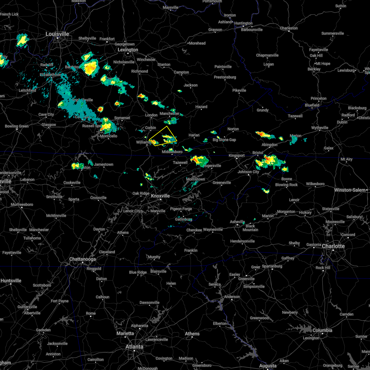 At 410 pm edt, a severe thunderstorm was located over permon, or 8 miles southwest of barbourville, moving northeast at 30 mph (radar indicated). Hazards include quarter size hail. Damage to vehicles is expected. this severe thunderstorm will be near, permon around 415 pm edt. swan lake around 420 pm edt. swanpond around 425 pm edt. barbourville around 430 pm edt. other locations in the path of this severe thunderstorm include yeager and baughman. hail threat, radar indicated max hail size, 1. 00 in wind threat, radar indicated max wind gust, <50 mph. At 410 pm edt, a severe thunderstorm was located over permon, or 8 miles southwest of barbourville, moving northeast at 30 mph (radar indicated). Hazards include quarter size hail. Damage to vehicles is expected. this severe thunderstorm will be near, permon around 415 pm edt. swan lake around 420 pm edt. swanpond around 425 pm edt. barbourville around 430 pm edt. other locations in the path of this severe thunderstorm include yeager and baughman. hail threat, radar indicated max hail size, 1. 00 in wind threat, radar indicated max wind gust, <50 mph.
|
| 5/19/2022 3:28 PM EDT |
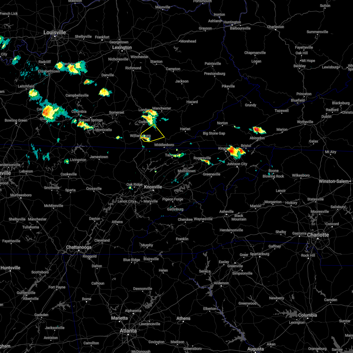 At 328 pm edt, a severe thunderstorm was located over julip, or near williamsburg, moving northeast at 20 mph (radar indicated). Hazards include quarter size hail. Damage to vehicles is expected. this severe thunderstorm will be near, gausdale around 340 pm edt. clate around 345 pm edt. other locations in the path of this severe thunderstorm include king, swan lake and barbourville. hail threat, radar indicated max hail size, 1. 00 in wind threat, radar indicated max wind gust, <50 mph. At 328 pm edt, a severe thunderstorm was located over julip, or near williamsburg, moving northeast at 20 mph (radar indicated). Hazards include quarter size hail. Damage to vehicles is expected. this severe thunderstorm will be near, gausdale around 340 pm edt. clate around 345 pm edt. other locations in the path of this severe thunderstorm include king, swan lake and barbourville. hail threat, radar indicated max hail size, 1. 00 in wind threat, radar indicated max wind gust, <50 mph.
|
| 5/19/2022 12:02 AM EDT |
 At 1202 am edt, a severe thunderstorm was located over rockholds, or 9 miles northeast of williamsburg, moving east at 35 mph (radar indicated). Hazards include 60 mph wind gusts and quarter size hail. Hail damage to vehicles is expected. expect wind damage to roofs, siding, and trees. this severe thunderstorm will be near, indian creek around 1210 am edt. swan lake around 1215 am edt. barbourville around 1220 am edt. other locations in the path of this severe thunderstorm include brush creek, flat lick and fourmile. hail threat, radar indicated max hail size, 1. 00 in wind threat, radar indicated max wind gust, 60 mph. At 1202 am edt, a severe thunderstorm was located over rockholds, or 9 miles northeast of williamsburg, moving east at 35 mph (radar indicated). Hazards include 60 mph wind gusts and quarter size hail. Hail damage to vehicles is expected. expect wind damage to roofs, siding, and trees. this severe thunderstorm will be near, indian creek around 1210 am edt. swan lake around 1215 am edt. barbourville around 1220 am edt. other locations in the path of this severe thunderstorm include brush creek, flat lick and fourmile. hail threat, radar indicated max hail size, 1. 00 in wind threat, radar indicated max wind gust, 60 mph.
|
| 5/18/2022 9:57 PM EDT |
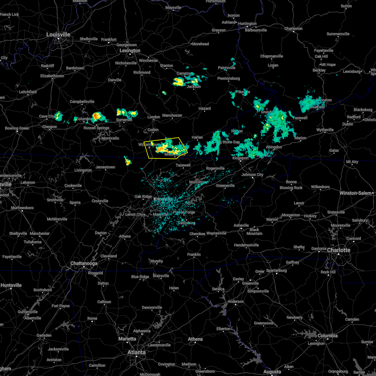 The severe thunderstorm warning for bell, southern knox and southern whitley counties will expire at 1000 pm edt, the storms which prompted the warning have weakened below severe limits, and no longer pose an immediate threat to life or property. therefore, the warning will be allowed to expire. however gusty winds are still possible with these thunderstorms. a severe thunderstorm watch remains in effect until 1100 pm edt for south central and southeastern kentucky. The severe thunderstorm warning for bell, southern knox and southern whitley counties will expire at 1000 pm edt, the storms which prompted the warning have weakened below severe limits, and no longer pose an immediate threat to life or property. therefore, the warning will be allowed to expire. however gusty winds are still possible with these thunderstorms. a severe thunderstorm watch remains in effect until 1100 pm edt for south central and southeastern kentucky.
|
| 5/18/2022 9:47 PM EDT |
 At 947 pm edt, severe thunderstorms were located along a line extending from cubage to dixie, moving southeast at 45 mph (radar indicated). Hazards include 60 mph wind gusts and quarter size hail. Hail damage to vehicles is expected. expect wind damage to roofs, siding, and trees. these severe storms will be near, cubage around 950 pm edt. Other locations in the path of these severe thunderstorms include goins, frakes and fonde. At 947 pm edt, severe thunderstorms were located along a line extending from cubage to dixie, moving southeast at 45 mph (radar indicated). Hazards include 60 mph wind gusts and quarter size hail. Hail damage to vehicles is expected. expect wind damage to roofs, siding, and trees. these severe storms will be near, cubage around 950 pm edt. Other locations in the path of these severe thunderstorms include goins, frakes and fonde.
|
| 5/18/2022 9:30 PM EDT |
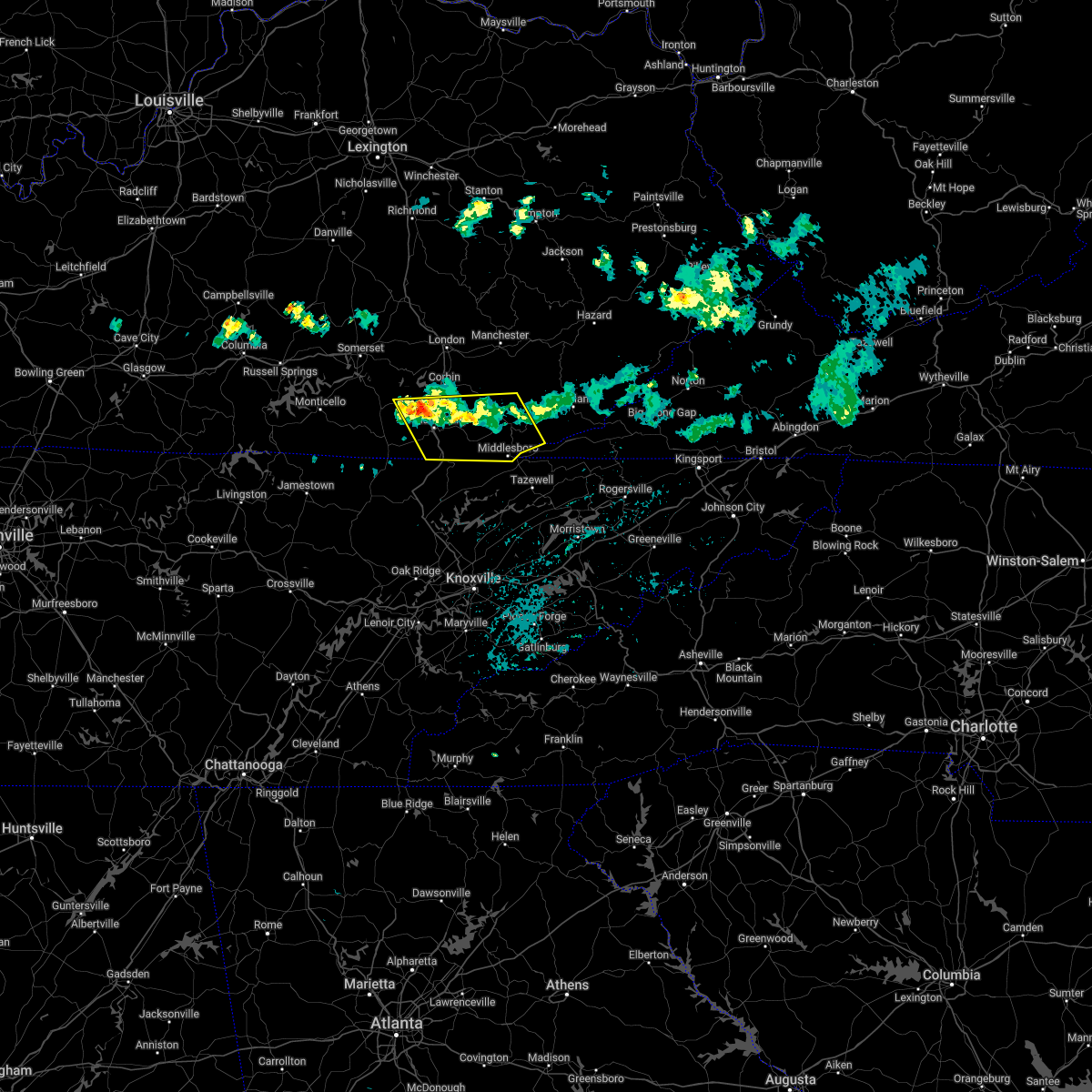 At 929 pm edt, severe thunderstorms were located along a line extending from cary to krupp, moving southeast at 45 mph (radar indicated). Hazards include 60 mph wind gusts and quarter size hail. Hail damage to vehicles is expected. expect wind damage to roofs, siding, and trees. severe thunderstorms will be near, pineville around 935 pm edt. oaks around 940 pm edt. verne around 945 pm edt. Other locations in the path of these severe thunderstorms include gatliff, pearl and pruden. At 929 pm edt, severe thunderstorms were located along a line extending from cary to krupp, moving southeast at 45 mph (radar indicated). Hazards include 60 mph wind gusts and quarter size hail. Hail damage to vehicles is expected. expect wind damage to roofs, siding, and trees. severe thunderstorms will be near, pineville around 935 pm edt. oaks around 940 pm edt. verne around 945 pm edt. Other locations in the path of these severe thunderstorms include gatliff, pearl and pruden.
|
| 5/18/2022 9:22 PM EDT |
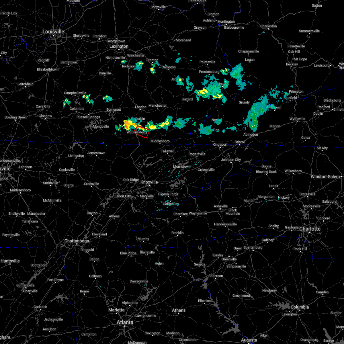 At 921 pm edt, a severe thunderstorm capable of producing a tornado was located over permon, or near barbourville, moving east at 45 mph (radar indicated rotation). Hazards include tornado and quarter size hail. Flying debris will be dangerous to those caught without shelter. mobile homes will be damaged or destroyed. damage to roofs, windows, and vehicles will occur. tree damage is likely. Locations impacted include, swan lake. At 921 pm edt, a severe thunderstorm capable of producing a tornado was located over permon, or near barbourville, moving east at 45 mph (radar indicated rotation). Hazards include tornado and quarter size hail. Flying debris will be dangerous to those caught without shelter. mobile homes will be damaged or destroyed. damage to roofs, windows, and vehicles will occur. tree damage is likely. Locations impacted include, swan lake.
|
| 5/18/2022 9:04 PM EDT |
 At 903 pm edt, a severe thunderstorm capable of producing a tornado was located over youngs creek, or 9 miles northwest of williamsburg, moving east at 45 mph (radar indicated rotation). Hazards include tornado and quarter size hail. Flying debris will be dangerous to those caught without shelter. mobile homes will be damaged or destroyed. damage to roofs, windows, and vehicles will occur. tree damage is likely. this dangerous storm will be near, faber around 910 pm edt. rockholds around 915 pm edt. perkins around 920 pm edt. Other locations in the path of this tornadic thunderstorm include clate. At 903 pm edt, a severe thunderstorm capable of producing a tornado was located over youngs creek, or 9 miles northwest of williamsburg, moving east at 45 mph (radar indicated rotation). Hazards include tornado and quarter size hail. Flying debris will be dangerous to those caught without shelter. mobile homes will be damaged or destroyed. damage to roofs, windows, and vehicles will occur. tree damage is likely. this dangerous storm will be near, faber around 910 pm edt. rockholds around 915 pm edt. perkins around 920 pm edt. Other locations in the path of this tornadic thunderstorm include clate.
|
| 5/18/2022 8:59 PM EDT |
 At 859 pm edt, severe thunderstorms were located along a line extending from cranes nest to near bark camp, moving southeast at 30 mph (radar indicated). Hazards include 60 mph wind gusts and quarter size hail. Hail damage to vehicles is expected. expect wind damage to roofs, siding, and trees. severe thunderstorms will be near, green road around 905 pm edt. hinkle around 910 pm edt. clio around 915 pm edt. Other locations in the path of these severe thunderstorms include dewitt and williamsburg. At 859 pm edt, severe thunderstorms were located along a line extending from cranes nest to near bark camp, moving southeast at 30 mph (radar indicated). Hazards include 60 mph wind gusts and quarter size hail. Hail damage to vehicles is expected. expect wind damage to roofs, siding, and trees. severe thunderstorms will be near, green road around 905 pm edt. hinkle around 910 pm edt. clio around 915 pm edt. Other locations in the path of these severe thunderstorms include dewitt and williamsburg.
|
| 1/1/2022 4:48 PM EST |
 At 448 pm est, a severe thunderstorm was located over permon, or near barbourville, moving east at 50 mph (radar indicated). Hazards include 60 mph wind gusts. Expect damage to roofs, siding, and trees. Locations impacted include, barbourville and bimble. At 448 pm est, a severe thunderstorm was located over permon, or near barbourville, moving east at 50 mph (radar indicated). Hazards include 60 mph wind gusts. Expect damage to roofs, siding, and trees. Locations impacted include, barbourville and bimble.
|
| 1/1/2022 4:28 PM EST |
 At 427 pm est, a severe thunderstorm was located over krupp, or 7 miles west of williamsburg, moving east at 50 mph (radar indicated). Hazards include 60 mph wind gusts. Expect damage to roofs, siding, and trees. this severe thunderstorm will be near, goldbug around 435 pm est. rockholds around 440 pm est. perkins around 445 pm est. Other locations in the path of this severe thunderstorm include dishman springs, barbourville and bimble. At 427 pm est, a severe thunderstorm was located over krupp, or 7 miles west of williamsburg, moving east at 50 mph (radar indicated). Hazards include 60 mph wind gusts. Expect damage to roofs, siding, and trees. this severe thunderstorm will be near, goldbug around 435 pm est. rockholds around 440 pm est. perkins around 445 pm est. Other locations in the path of this severe thunderstorm include dishman springs, barbourville and bimble.
|
| 7/30/2021 4:58 AM EDT |
 The severe thunderstorm warning for southwestern laurel, southeastern pulaski, eastern mccreary and whitley counties will expire at 500 am edt, the storm which prompted the warning has moved out of the area. therefore, the warning will be allowed to expire. however gusty winds and heavy rain are still possible with this thunderstorm. remember, an additional severe thunderstorm warning still remains in effect for whitley and mccreary counties. The severe thunderstorm warning for southwestern laurel, southeastern pulaski, eastern mccreary and whitley counties will expire at 500 am edt, the storm which prompted the warning has moved out of the area. therefore, the warning will be allowed to expire. however gusty winds and heavy rain are still possible with this thunderstorm. remember, an additional severe thunderstorm warning still remains in effect for whitley and mccreary counties.
|
| 7/30/2021 4:54 AM EDT |
 At 453 am edt, a severe thunderstorm was located over emlyn, or over williamsburg, moving southeast at 30 mph (radar indicated). Hazards include 60 mph wind gusts and nickel size hail. Expect damage to roofs, siding, and trees. this severe thunderstorm will be near, mountain ash around 500 am edt. saxton around 505 am edt. Lot around 510 am edt. At 453 am edt, a severe thunderstorm was located over emlyn, or over williamsburg, moving southeast at 30 mph (radar indicated). Hazards include 60 mph wind gusts and nickel size hail. Expect damage to roofs, siding, and trees. this severe thunderstorm will be near, mountain ash around 500 am edt. saxton around 505 am edt. Lot around 510 am edt.
|
| 7/30/2021 4:38 AM EDT |
 At 438 am edt, a severe thunderstorm was located over redbird, or over williamsburg, moving southeast at 30 mph (radar indicated). Hazards include 70 mph wind gusts and nickel size hail. Expect considerable tree damage. damage is likely to mobile homes, roofs, and outbuildings. Locations impacted include, emlyn, verne, nevisdale and gatliff. At 438 am edt, a severe thunderstorm was located over redbird, or over williamsburg, moving southeast at 30 mph (radar indicated). Hazards include 70 mph wind gusts and nickel size hail. Expect considerable tree damage. damage is likely to mobile homes, roofs, and outbuildings. Locations impacted include, emlyn, verne, nevisdale and gatliff.
|
| 7/30/2021 4:25 AM EDT |
 At 424 am edt, a severe thunderstorm was located over krupp, or near williamsburg, moving southeast at 25 mph (radar indicated). Hazards include 70 mph wind gusts and quarter size hail. Hail damage to vehicles is expected. expect considerable tree damage. wind damage is also likely to mobile homes, roofs, and outbuildings. this severe storm will be near, goldbug around 430 am edt. Other locations in the path of this severe thunderstorm include williamsburg, bon, emlyn and mountain ash. At 424 am edt, a severe thunderstorm was located over krupp, or near williamsburg, moving southeast at 25 mph (radar indicated). Hazards include 70 mph wind gusts and quarter size hail. Hail damage to vehicles is expected. expect considerable tree damage. wind damage is also likely to mobile homes, roofs, and outbuildings. this severe storm will be near, goldbug around 430 am edt. Other locations in the path of this severe thunderstorm include williamsburg, bon, emlyn and mountain ash.
|
| 7/30/2021 4:11 AM EDT |
 At 410 am edt, a severe thunderstorm was located near cumberland falls s.p., or 13 miles northwest of williamsburg, moving southeast at 45 mph (radar indicated). Hazards include 60 mph wind gusts. Expect damage to roofs, siding, and trees. this severe thunderstorm will be near, youngs creek around 415 am edt. krupp around 420 am edt. redbird around 425 am edt. bon around 430 am edt. Other locations in the path of this severe thunderstorm include mountain ash. At 410 am edt, a severe thunderstorm was located near cumberland falls s.p., or 13 miles northwest of williamsburg, moving southeast at 45 mph (radar indicated). Hazards include 60 mph wind gusts. Expect damage to roofs, siding, and trees. this severe thunderstorm will be near, youngs creek around 415 am edt. krupp around 420 am edt. redbird around 425 am edt. bon around 430 am edt. Other locations in the path of this severe thunderstorm include mountain ash.
|
| 6/13/2021 8:29 PM EDT |
 At 827 pm edt, a line of severe thunderstorms was located along a line extending from cannon to youngs creek, moving south at 25 mph (radar indicated). Hazards include 60 mph wind gusts. Expect damage to roofs, siding, and trees. Locations impacted include, barbourville, artemus, avis, williamsburg and kayjay. At 827 pm edt, a line of severe thunderstorms was located along a line extending from cannon to youngs creek, moving south at 25 mph (radar indicated). Hazards include 60 mph wind gusts. Expect damage to roofs, siding, and trees. Locations impacted include, barbourville, artemus, avis, williamsburg and kayjay.
|
| 6/13/2021 8:06 PM EDT |
 At 804 pm edt, severe thunderstorms were located along a line extending from mills to hinkle to cranes nest to mchargue to holly bay rec. area, moving southeast at 25 mph (a 62 mph wind gust was reported at the london corbin airport at 759 pm). Hazards include 60 mph wind gusts. Expect damage to roofs, siding, and trees. severe thunderstorms will be near, green road around 810 pm edt. field around 815 pm edt. barton around 820 pm edt. Other locations in the path of these severe thunderstorms include bentley station, dewitt and barbourville. At 804 pm edt, severe thunderstorms were located along a line extending from mills to hinkle to cranes nest to mchargue to holly bay rec. area, moving southeast at 25 mph (a 62 mph wind gust was reported at the london corbin airport at 759 pm). Hazards include 60 mph wind gusts. Expect damage to roofs, siding, and trees. severe thunderstorms will be near, green road around 810 pm edt. field around 815 pm edt. barton around 820 pm edt. Other locations in the path of these severe thunderstorms include bentley station, dewitt and barbourville.
|
| 6/3/2021 4:14 PM EDT |
 At 414 pm edt, a severe thunderstorm was located over walden, or 8 miles north of williamsburg, moving east at 45 mph (radar indicated). Hazards include 60 mph wind gusts and quarter size hail. Hail damage to vehicles is expected. expect wind damage to roofs, siding, and trees. Locations impacted include, perkins, barton, grove, clio, goldbug, deering, walden, rockholds, woodbine, krupp, faber and wofford. At 414 pm edt, a severe thunderstorm was located over walden, or 8 miles north of williamsburg, moving east at 45 mph (radar indicated). Hazards include 60 mph wind gusts and quarter size hail. Hail damage to vehicles is expected. expect wind damage to roofs, siding, and trees. Locations impacted include, perkins, barton, grove, clio, goldbug, deering, walden, rockholds, woodbine, krupp, faber and wofford.
|
| 6/3/2021 3:53 PM EDT |
 At 352 pm edt, a severe thunderstorm was located over beulah heights, moving east at 40 mph (radar indicated). Hazards include 60 mph wind gusts and quarter size hail. Hail damage to vehicles is expected. Expect wind damage to roofs, siding, and trees. At 352 pm edt, a severe thunderstorm was located over beulah heights, moving east at 40 mph (radar indicated). Hazards include 60 mph wind gusts and quarter size hail. Hail damage to vehicles is expected. Expect wind damage to roofs, siding, and trees.
|
| 7/21/2020 10:27 PM EDT |
 At 1027 pm edt, a severe thunderstorm was located over rockholds, or near williamsburg, moving northeast at 10 mph (radar indicated). Hazards include 60 mph wind gusts. expect damage to roofs, siding, and trees At 1027 pm edt, a severe thunderstorm was located over rockholds, or near williamsburg, moving northeast at 10 mph (radar indicated). Hazards include 60 mph wind gusts. expect damage to roofs, siding, and trees
|
| 6/29/2020 7:08 PM EDT |
 At 708 pm edt, a severe thunderstorm was located over redbird, or over williamsburg, moving southeast at 10 mph (radar indicated). Hazards include 60 mph wind gusts and quarter size hail. Hail damage to vehicles is expected. Expect wind damage to roofs, siding, and trees. At 708 pm edt, a severe thunderstorm was located over redbird, or over williamsburg, moving southeast at 10 mph (radar indicated). Hazards include 60 mph wind gusts and quarter size hail. Hail damage to vehicles is expected. Expect wind damage to roofs, siding, and trees.
|
| 6/21/2020 7:02 PM EDT |
 At 702 pm edt, a severe thunderstorm was located over barton, or 11 miles north of williamsburg, moving east at 40 mph (radar indicated). Hazards include 60 mph wind gusts. Expect damage to roofs, siding, and trees. Locations impacted include, london, fariston, garrich, emmanuel, moore hill, lily, clio, rossland, deering, north corbin, hightop and london-corbin airport. At 702 pm edt, a severe thunderstorm was located over barton, or 11 miles north of williamsburg, moving east at 40 mph (radar indicated). Hazards include 60 mph wind gusts. Expect damage to roofs, siding, and trees. Locations impacted include, london, fariston, garrich, emmanuel, moore hill, lily, clio, rossland, deering, north corbin, hightop and london-corbin airport.
|
| 6/21/2020 6:45 PM EDT |
 At 644 pm edt, a severe thunderstorm was located over cumberland falls s.p., or 10 miles northeast of whitley city, moving northeast at 40 mph (radar indicated). Hazards include 60 mph wind gusts. expect damage to roofs, siding, and trees At 644 pm edt, a severe thunderstorm was located over cumberland falls s.p., or 10 miles northeast of whitley city, moving northeast at 40 mph (radar indicated). Hazards include 60 mph wind gusts. expect damage to roofs, siding, and trees
|
| 3/12/2020 10:25 PM EDT |
 At 1024 pm edt, a severe thunderstorm was located over pleasant view, or near williamsburg, moving east at 60 mph (radar indicated). Hazards include 60 mph wind gusts and quarter size hail. Hail damage to vehicles is expected. expect wind damage to roofs, siding, and trees. Locations impacted include, williamsburg, julip, ayers, gatliff, emlyn, red ash, clio, verne, goldbug, pleasant view, louden and krupp. At 1024 pm edt, a severe thunderstorm was located over pleasant view, or near williamsburg, moving east at 60 mph (radar indicated). Hazards include 60 mph wind gusts and quarter size hail. Hail damage to vehicles is expected. expect wind damage to roofs, siding, and trees. Locations impacted include, williamsburg, julip, ayers, gatliff, emlyn, red ash, clio, verne, goldbug, pleasant view, louden and krupp.
|
| 3/12/2020 10:02 PM EDT |
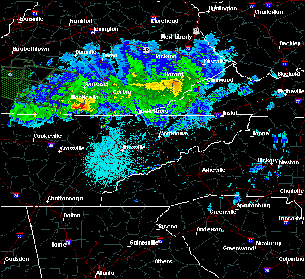 At 1002 pm edt, a severe thunderstorm was located over marshes siding, or over whitley city, moving east at 50 mph (radar indicated). Hazards include 60 mph wind gusts and quarter size hail. Hail damage to vehicles is expected. Expect wind damage to roofs, siding, and trees. At 1002 pm edt, a severe thunderstorm was located over marshes siding, or over whitley city, moving east at 50 mph (radar indicated). Hazards include 60 mph wind gusts and quarter size hail. Hail damage to vehicles is expected. Expect wind damage to roofs, siding, and trees.
|
| 7/2/2019 2:30 PM EDT |
 At 230 pm edt, a severe thunderstorm was located over louden, or 7 miles east of williamsburg, moving southeast at 10 mph (radar indicated). Hazards include 60 mph wind gusts and half dollar size hail. Hail damage to vehicles is expected. Expect wind damage to roofs, siding, and trees. At 230 pm edt, a severe thunderstorm was located over louden, or 7 miles east of williamsburg, moving southeast at 10 mph (radar indicated). Hazards include 60 mph wind gusts and half dollar size hail. Hail damage to vehicles is expected. Expect wind damage to roofs, siding, and trees.
|
| 6/21/2019 11:28 PM EDT |
 The severe thunderstorm warning for southern laurel, southwestern bell, western knox and whitley counties will expire at 1130 pm edt, the storms which prompted the warning have moved out of the area. therefore, the warning will be allowed to expire. The severe thunderstorm warning for southern laurel, southwestern bell, western knox and whitley counties will expire at 1130 pm edt, the storms which prompted the warning have moved out of the area. therefore, the warning will be allowed to expire.
|
| 6/21/2019 11:08 PM EDT |
 At 1107 pm edt, severe thunderstorms were located along a line extending from near billows to deering to near ayers, moving east at 45 mph (radar indicated). Hazards include 60 mph wind gusts and penny size hail. Expect damage to roofs, siding, and trees. Locations impacted include, london, williamsburg, barbourville, julip, fariston, swan lake, zion hill, gausdale, krupp, bark camp, dixie and siler. At 1107 pm edt, severe thunderstorms were located along a line extending from near billows to deering to near ayers, moving east at 45 mph (radar indicated). Hazards include 60 mph wind gusts and penny size hail. Expect damage to roofs, siding, and trees. Locations impacted include, london, williamsburg, barbourville, julip, fariston, swan lake, zion hill, gausdale, krupp, bark camp, dixie and siler.
|
| 6/21/2019 10:55 PM EDT |
 At 1054 pm edt, severe thunderstorms were located along a line extending from bent to near cumberland falls s.p. to near hollyhill, moving east at 45 mph (radar indicated). Hazards include 60 mph wind gusts and penny size hail. expect damage to roofs, siding, and trees At 1054 pm edt, severe thunderstorms were located along a line extending from bent to near cumberland falls s.p. to near hollyhill, moving east at 45 mph (radar indicated). Hazards include 60 mph wind gusts and penny size hail. expect damage to roofs, siding, and trees
|
| 7/20/2018 8:53 PM EDT |
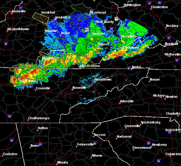 At 852 pm edt, a severe thunderstorm was located over perkins, or 8 miles northeast of williamsburg, moving southeast at 20 mph (radar indicated). Hazards include 60 mph wind gusts. Expect damage to roofs, siding, and trees. Locations impacted include, williamsburg, barbourville, julip, artemus, swan lake, clate, birdseye, verne, goldbug, gausdale, king and louden. At 852 pm edt, a severe thunderstorm was located over perkins, or 8 miles northeast of williamsburg, moving southeast at 20 mph (radar indicated). Hazards include 60 mph wind gusts. Expect damage to roofs, siding, and trees. Locations impacted include, williamsburg, barbourville, julip, artemus, swan lake, clate, birdseye, verne, goldbug, gausdale, king and louden.
|
| 7/20/2018 8:27 PM EDT |
 At 827 pm edt, a severe thunderstorm was located over woodbine, or 11 miles west of barbourville, moving southeast at 20 mph (radar indicated). Hazards include 70 mph wind gusts and penny size hail. Expect considerable tree damage. Damage is likely to mobile homes, roofs, and outbuildings. At 827 pm edt, a severe thunderstorm was located over woodbine, or 11 miles west of barbourville, moving southeast at 20 mph (radar indicated). Hazards include 70 mph wind gusts and penny size hail. Expect considerable tree damage. Damage is likely to mobile homes, roofs, and outbuildings.
|
| 7/5/2018 9:30 PM EDT |
 At 930 pm edt, a severe thunderstorm was located over dorthae, or 8 miles south of london, moving south at 20 mph (emergency management). Hazards include 60 mph wind gusts and penny size hail. Expect damage to roofs, siding, and trees. Locations impacted include, london, fariston, moore hill, lily, rossland, deering, north corbin, hightop, london-corbin airport, faber, youngs creek and indian creek. At 930 pm edt, a severe thunderstorm was located over dorthae, or 8 miles south of london, moving south at 20 mph (emergency management). Hazards include 60 mph wind gusts and penny size hail. Expect damage to roofs, siding, and trees. Locations impacted include, london, fariston, moore hill, lily, rossland, deering, north corbin, hightop, london-corbin airport, faber, youngs creek and indian creek.
|
| 7/5/2018 9:16 PM EDT |
 At 915 pm edt, a severe thunderstorm was located over sublimity city, or near london, moving south at 20 mph (emergency management). Hazards include 60 mph wind gusts and quarter size hail. Hail damage to vehicles is expected. Expect wind damage to roofs, siding, and trees. At 915 pm edt, a severe thunderstorm was located over sublimity city, or near london, moving south at 20 mph (emergency management). Hazards include 60 mph wind gusts and quarter size hail. Hail damage to vehicles is expected. Expect wind damage to roofs, siding, and trees.
|
| 6/26/2018 2:47 PM EDT |
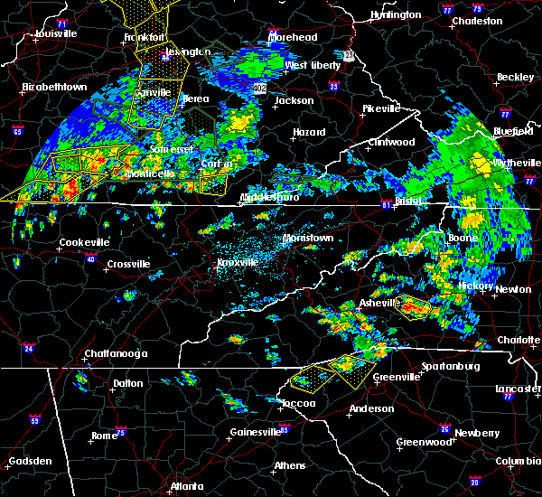 At 246 pm edt, a severe thunderstorm was located over perkins, or 7 miles northeast of williamsburg, moving east at 25 mph (radar indicated). Hazards include 60 mph wind gusts and quarter size hail. Hail damage to vehicles is expected. Expect wind damage to roofs, siding, and trees. At 246 pm edt, a severe thunderstorm was located over perkins, or 7 miles northeast of williamsburg, moving east at 25 mph (radar indicated). Hazards include 60 mph wind gusts and quarter size hail. Hail damage to vehicles is expected. Expect wind damage to roofs, siding, and trees.
|
| 6/25/2018 2:15 PM EDT |
 At 215 pm edt, severe thunderstorms were located along a line extending from near lily to near red ash, moving east at 45 mph (radar indicated). Hazards include 60 mph wind gusts. Expect damage to roofs, siding, and trees. Locations impacted include, williamsburg, barbourville, pineville, middlesboro, julip, fariston, brightshade, varilla, swan lake, zion hill, ponza and goose rock. At 215 pm edt, severe thunderstorms were located along a line extending from near lily to near red ash, moving east at 45 mph (radar indicated). Hazards include 60 mph wind gusts. Expect damage to roofs, siding, and trees. Locations impacted include, williamsburg, barbourville, pineville, middlesboro, julip, fariston, brightshade, varilla, swan lake, zion hill, ponza and goose rock.
|
| 6/25/2018 2:02 PM EDT |
 At 201 pm edt, severe thunderstorms were located along a line extending from near rockcastle springs to near zion hill, moving east at 45 mph (radar indicated). Hazards include 60 mph wind gusts. expect damage to roofs, siding, and trees At 201 pm edt, severe thunderstorms were located along a line extending from near rockcastle springs to near zion hill, moving east at 45 mph (radar indicated). Hazards include 60 mph wind gusts. expect damage to roofs, siding, and trees
|
| 5/31/2018 5:43 PM EDT |
 At 543 pm edt, severe thunderstorms were located along a line extending from arkle to perkins to near bounty, moving southeast at 20 mph (radar indicated). Hazards include 60 mph wind gusts. expect damage to roofs, siding, and trees At 543 pm edt, severe thunderstorms were located along a line extending from arkle to perkins to near bounty, moving southeast at 20 mph (radar indicated). Hazards include 60 mph wind gusts. expect damage to roofs, siding, and trees
|
| 5/31/2018 5:30 PM EDT | Tree down on highway 26...blocking roa in whitley county KY, 2.6 miles S of Rockholds, KY |
| 4/4/2018 12:42 AM EDT |
 The severe thunderstorm warning for southeastern laurel. bell. knox and whitley counties will expire at 1245 am edt. a new warning has been issued for this storm. therefore, the warning will be allowed to expire. keep in mind that severe winds are still possible with this thunderstorm. A severe thunderstorm watch remains in effect until 300 am edt for. The severe thunderstorm warning for southeastern laurel. bell. knox and whitley counties will expire at 1245 am edt. a new warning has been issued for this storm. therefore, the warning will be allowed to expire. keep in mind that severe winds are still possible with this thunderstorm. A severe thunderstorm watch remains in effect until 300 am edt for.
|
| 4/4/2018 12:35 AM EDT |
 At 1234 am edt, a severe thunderstorm was located over barbourville, moving east at 65 mph (radar indicated). Hazards include 60 mph wind gusts. Expect damage to roofs, siding, and trees. Locations impacted include, williamsburg, barbourville, pineville, middlesboro, julip, varilla, swan lake, zion hill, ponza, gausdale, cranes nest, blanche, rella, dixie, wasioto, avis, siler, dewitt, flat lick and wilton. At 1234 am edt, a severe thunderstorm was located over barbourville, moving east at 65 mph (radar indicated). Hazards include 60 mph wind gusts. Expect damage to roofs, siding, and trees. Locations impacted include, williamsburg, barbourville, pineville, middlesboro, julip, varilla, swan lake, zion hill, ponza, gausdale, cranes nest, blanche, rella, dixie, wasioto, avis, siler, dewitt, flat lick and wilton.
|
| 4/4/2018 12:24 AM EDT |
 At 1223 am edt, a severe thunderstorm was located over rockholds, or 7 miles northeast of williamsburg, moving east at 65 mph (radar indicated). Hazards include 60 mph wind gusts. Expect damage to roofs, siding, and trees. locations impacted include, williamsburg, barbourville, pineville, middlesboro, julip, varilla, swan lake, cumberland falls s. p. Zion hill, ponza, gausdale, cranes nest, blanche, krupp, rella, bark camp, dixie, wasioto, avis and siler. At 1223 am edt, a severe thunderstorm was located over rockholds, or 7 miles northeast of williamsburg, moving east at 65 mph (radar indicated). Hazards include 60 mph wind gusts. Expect damage to roofs, siding, and trees. locations impacted include, williamsburg, barbourville, pineville, middlesboro, julip, varilla, swan lake, cumberland falls s. p. Zion hill, ponza, gausdale, cranes nest, blanche, krupp, rella, bark camp, dixie, wasioto, avis and siler.
|
| 4/4/2018 12:04 AM EDT |
 At 1203 am edt, a severe thunderstorm was located over whitley city, moving east at 60 mph (radar indicated). Hazards include 60 mph wind gusts. expect damage to roofs, siding, and trees At 1203 am edt, a severe thunderstorm was located over whitley city, moving east at 60 mph (radar indicated). Hazards include 60 mph wind gusts. expect damage to roofs, siding, and trees
|
| 7/6/2017 10:55 PM EDT | Trees uprooted from high winds in whitley county KY, 9.1 miles WNW of Rockholds, KY |
| 7/6/2017 6:23 PM EDT |
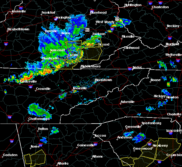 At 623 pm edt, severe thunderstorms were located along a line extending from dishman springs to jellico creek to near pine knot to near oneida, moving east at 40 mph (radar indicated). Hazards include 60 mph wind gusts and penny size hail. Expect damage to roofs, siding, and trees. locations impacted include, williamsburg, whitley city, julip, artemus, swan lake, cumberland falls s. p. Co- operative, zion hill, clate, birdseye, red ash, verne, goldbug, gausdale, king, louden, krupp, hollyhill, polly camp and youngs creek. At 623 pm edt, severe thunderstorms were located along a line extending from dishman springs to jellico creek to near pine knot to near oneida, moving east at 40 mph (radar indicated). Hazards include 60 mph wind gusts and penny size hail. Expect damage to roofs, siding, and trees. locations impacted include, williamsburg, whitley city, julip, artemus, swan lake, cumberland falls s. p. Co- operative, zion hill, clate, birdseye, red ash, verne, goldbug, gausdale, king, louden, krupp, hollyhill, polly camp and youngs creek.
|
| 7/6/2017 6:18 PM EDT |
 At 618 pm edt, severe thunderstorms were located along a line extending from green hall to near green road to near strunk, moving east at 45 mph (radar indicated). Hazards include 60 mph wind gusts and quarter size hail. Hail damage to vehicles is expected. expect wind damage to roofs, siding, and trees. Locations impacted include, barbourville, manchester, blake, swan lake, shop branch, fogertown, tyner, privett, bush, cranes nest, shepherdtown, herron, hooker, byron, avis, cottongin, cruise, sacker gap, wilton and taff. At 618 pm edt, severe thunderstorms were located along a line extending from green hall to near green road to near strunk, moving east at 45 mph (radar indicated). Hazards include 60 mph wind gusts and quarter size hail. Hail damage to vehicles is expected. expect wind damage to roofs, siding, and trees. Locations impacted include, barbourville, manchester, blake, swan lake, shop branch, fogertown, tyner, privett, bush, cranes nest, shepherdtown, herron, hooker, byron, avis, cottongin, cruise, sacker gap, wilton and taff.
|
| 7/6/2017 6:02 PM EDT |
 At 602 pm edt, severe thunderstorms were located along a line extending from woodbine to near duckrun to blue heron to 6 miles northwest of oneida, moving east at 40 mph (radar indicated). Hazards include 60 mph wind gusts and penny size hail. expect damage to roofs, siding, and trees At 602 pm edt, severe thunderstorms were located along a line extending from woodbine to near duckrun to blue heron to 6 miles northwest of oneida, moving east at 40 mph (radar indicated). Hazards include 60 mph wind gusts and penny size hail. expect damage to roofs, siding, and trees
|
| 7/6/2017 5:53 PM EDT |
 At 553 pm edt, severe thunderstorms were located along a line extending from goochland to north corbin to great meadows campsites, moving east at 45 mph (radar indicated). Hazards include 60 mph wind gusts and quarter size hail. Hail damage to vehicles is expected. Expect wind damage to roofs, siding, and trees. At 553 pm edt, severe thunderstorms were located along a line extending from goochland to north corbin to great meadows campsites, moving east at 45 mph (radar indicated). Hazards include 60 mph wind gusts and quarter size hail. Hail damage to vehicles is expected. Expect wind damage to roofs, siding, and trees.
|
| 5/27/2017 6:42 PM EDT |
 At 642 pm edt, a severe thunderstorm was located over moore hill, or 11 miles northwest of barbourville, moving southeast at 30 mph (radar indicated). Hazards include 60 mph wind gusts and quarter size hail. Hail damage to vehicles is expected. expect wind damage to roofs, siding, and trees. Locations impacted include, barbourville, cannon, garrich, emmanuel, swan lake, moore hill, clate, lily, rossland, north corbin, jarvis, cranes nest, girdler, heidrick, baileys switch, faber, indian creek, rye, dishman springs and gray. At 642 pm edt, a severe thunderstorm was located over moore hill, or 11 miles northwest of barbourville, moving southeast at 30 mph (radar indicated). Hazards include 60 mph wind gusts and quarter size hail. Hail damage to vehicles is expected. expect wind damage to roofs, siding, and trees. Locations impacted include, barbourville, cannon, garrich, emmanuel, swan lake, moore hill, clate, lily, rossland, north corbin, jarvis, cranes nest, girdler, heidrick, baileys switch, faber, indian creek, rye, dishman springs and gray.
|
| 5/27/2017 6:29 PM EDT |
 At 628 pm edt, a severe thunderstorm was located over vox, or 10 miles southwest of london, moving southeast at 30 mph (radar indicated). Hazards include 60 mph wind gusts and quarter size hail. Hail damage to vehicles is expected. Expect wind damage to roofs, siding, and trees. At 628 pm edt, a severe thunderstorm was located over vox, or 10 miles southwest of london, moving southeast at 30 mph (radar indicated). Hazards include 60 mph wind gusts and quarter size hail. Hail damage to vehicles is expected. Expect wind damage to roofs, siding, and trees.
|
| 3/1/2017 10:03 AM EST |
 At 1003 am est, severe thunderstorms were located along a line extending from near field to near great meadows campsites, moving southeast at 30 mph (radar indicated). Hazards include 60 mph wind gusts. expect damage to roofs, siding, and trees At 1003 am est, severe thunderstorms were located along a line extending from near field to near great meadows campsites, moving southeast at 30 mph (radar indicated). Hazards include 60 mph wind gusts. expect damage to roofs, siding, and trees
|
| 3/1/2017 9:45 AM EST | A tree was reported to have been blown down on meadow creek road. the time of the event is estimated from radar dat in whitley county KY, 3.3 miles SW of Rockholds, KY |
| 3/1/2017 9:39 AM EST |
 At 939 am est, severe thunderstorms were located along a line extending from boho to youngs creek to slickford, moving east at 15 mph (radar indicated). Hazards include 70 mph wind gusts. Expect considerable tree damage. damage is likely to mobile homes, roofs, and outbuildings. locations impacted include, williamsburg, barbourville, whitley city, julip, brightshade, swan lake, cumberland falls s. p. Co- operative, zion hill, goose rock, gausdale, erose, cranes nest, krupp, bark camp, dixie, blue heron, ice cliff, avis and siler. At 939 am est, severe thunderstorms were located along a line extending from boho to youngs creek to slickford, moving east at 15 mph (radar indicated). Hazards include 70 mph wind gusts. Expect considerable tree damage. damage is likely to mobile homes, roofs, and outbuildings. locations impacted include, williamsburg, barbourville, whitley city, julip, brightshade, swan lake, cumberland falls s. p. Co- operative, zion hill, goose rock, gausdale, erose, cranes nest, krupp, bark camp, dixie, blue heron, ice cliff, avis and siler.
|
| 3/1/2017 9:21 AM EST |
 At 921 am est, severe thunderstorms were located along a line extending from grace to near huxley to near cabell, moving southeast at 40 mph (radar indicated). Hazards include 70 mph wind gusts. Expect considerable tree damage. Damage is likely to mobile homes, roofs, and outbuildings. At 921 am est, severe thunderstorms were located along a line extending from grace to near huxley to near cabell, moving southeast at 40 mph (radar indicated). Hazards include 70 mph wind gusts. Expect considerable tree damage. Damage is likely to mobile homes, roofs, and outbuildings.
|
| 12/18/2016 1:40 AM EST |
 At 140 am est, a severe thunderstorm was located over monticello, moving northeast at 65 mph (radar indicated). Hazards include 70 mph wind gusts. Expect considerable tree damage. Damage is likely to mobile homes, roofs, and outbuildings. At 140 am est, a severe thunderstorm was located over monticello, moving northeast at 65 mph (radar indicated). Hazards include 70 mph wind gusts. Expect considerable tree damage. Damage is likely to mobile homes, roofs, and outbuildings.
|
| 7/27/2016 5:45 PM EDT |
 At 544 pm edt, a cluster of severe thunderstorms remain located between from near williamsburg to barourville. these storms are nearly stationary (radar indicated). Hazards include 60 mph wind gusts and quarter size hail. Hail damage to vehicles is expected. expect wind damage to roofs, siding, and trees. locations impacted include, williamsburg, barbourville, green road, dixie, nevisdale, clate, dishman springs, girdler, swanpond, suttons mill, king, emmanuel, wofford, brush creek, packard, artemus, cannon, siler, indian creek and trosper. This includes the following highways, interstate 75 in east central kentucky between mile markers 13 and 14. At 544 pm edt, a cluster of severe thunderstorms remain located between from near williamsburg to barourville. these storms are nearly stationary (radar indicated). Hazards include 60 mph wind gusts and quarter size hail. Hail damage to vehicles is expected. expect wind damage to roofs, siding, and trees. locations impacted include, williamsburg, barbourville, green road, dixie, nevisdale, clate, dishman springs, girdler, swanpond, suttons mill, king, emmanuel, wofford, brush creek, packard, artemus, cannon, siler, indian creek and trosper. This includes the following highways, interstate 75 in east central kentucky between mile markers 13 and 14.
|
| 7/27/2016 5:26 PM EDT |
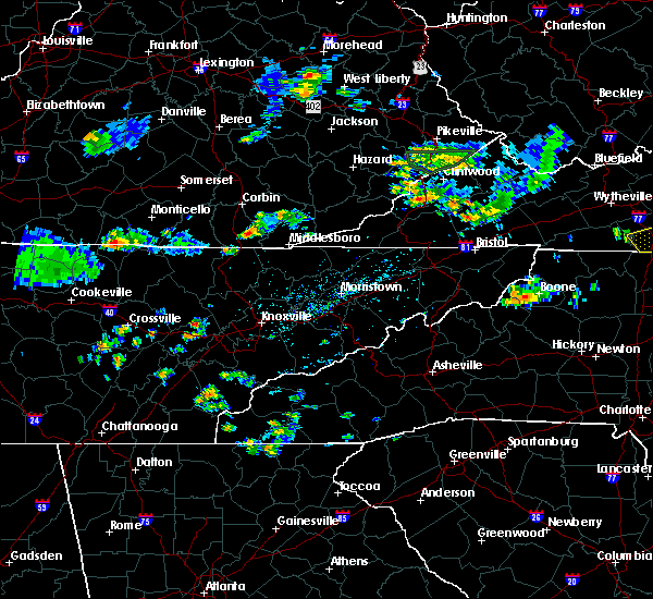 At 525 pm edt, a cluster of severe thunderstorms was located between williamsburg and barbourville. these storms are nearly stationary (radar indicated). Hazards include 60 mph wind gusts and quarter size hail. Hail damage to vehicles is expected. Expect wind damage to roofs, siding, and trees. At 525 pm edt, a cluster of severe thunderstorms was located between williamsburg and barbourville. these storms are nearly stationary (radar indicated). Hazards include 60 mph wind gusts and quarter size hail. Hail damage to vehicles is expected. Expect wind damage to roofs, siding, and trees.
|
| 7/7/2016 6:34 PM EDT |
 At 634 pm edt, severe thunderstorms were located along a line extending from blackwater to wheeler to near fonde, moving east at 50 mph (radar indicated). Hazards include 60 mph wind gusts. Expect damage to roofs. siding. and trees. locations impacted include, williamsburg, barbourville, pineville, middlesboro, dorthae, vox, green road, calvin, clate, blackwater, girdler, moore hill, sprule, bertha station, suttons mill, king, emmanuel, ponza, haven and brush creek. this includes the following highways, interstate 75 in east central kentucky between mile markers 1 and 34. u. s. highway 25 east in bell county between mile markers 1 and 18. u. s. highway 25 east in knox county between mile markers 1 and 26. u. s. Highway 25 east in laurel county between mile markers 0 and 2. At 634 pm edt, severe thunderstorms were located along a line extending from blackwater to wheeler to near fonde, moving east at 50 mph (radar indicated). Hazards include 60 mph wind gusts. Expect damage to roofs. siding. and trees. locations impacted include, williamsburg, barbourville, pineville, middlesboro, dorthae, vox, green road, calvin, clate, blackwater, girdler, moore hill, sprule, bertha station, suttons mill, king, emmanuel, ponza, haven and brush creek. this includes the following highways, interstate 75 in east central kentucky between mile markers 1 and 34. u. s. highway 25 east in bell county between mile markers 1 and 18. u. s. highway 25 east in knox county between mile markers 1 and 26. u. s. Highway 25 east in laurel county between mile markers 0 and 2.
|
| 7/7/2016 6:15 PM EDT |
 At 615 pm edt, severe thunderstorms were located along a line extending from near bunch to wofford to near mountain ash, moving east at 40 mph (radar indicated). Hazards include 60 mph wind gusts. Expect damage to roofs. siding. And trees. At 615 pm edt, severe thunderstorms were located along a line extending from near bunch to wofford to near mountain ash, moving east at 40 mph (radar indicated). Hazards include 60 mph wind gusts. Expect damage to roofs. siding. And trees.
|
| 7/6/2016 6:13 PM EDT |
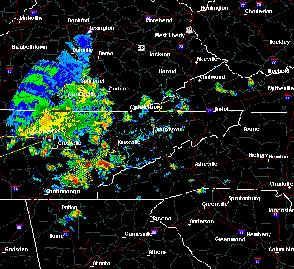 At 612 pm edt, a severe thunderstorm was located over julip, or near williamsburg, moving east at 20 mph (radar indicated). Hazards include 60 mph wind gusts. Expect damage to roofs. siding. And trees. At 612 pm edt, a severe thunderstorm was located over julip, or near williamsburg, moving east at 20 mph (radar indicated). Hazards include 60 mph wind gusts. Expect damage to roofs. siding. And trees.
|
| 6/23/2016 8:25 PM EDT |
 At 825 pm edt, severe thunderstorms were located along a line extending from steubenville to bark camp, moving southeast at 60 mph (radar indicated). Hazards include 60 mph wind gusts. Expect damage to roofs. siding. and trees. locations impacted include, somerset, monticello, burnside, pulaski county park, beulah heights, youngs creek, naomi, frazer, delta, cabell, walden, mill springs, gregory, faubush, somerset pulaski airport, rockholds, clio, kidder, general burnside s. p. And denney. At 825 pm edt, severe thunderstorms were located along a line extending from steubenville to bark camp, moving southeast at 60 mph (radar indicated). Hazards include 60 mph wind gusts. Expect damage to roofs. siding. and trees. locations impacted include, somerset, monticello, burnside, pulaski county park, beulah heights, youngs creek, naomi, frazer, delta, cabell, walden, mill springs, gregory, faubush, somerset pulaski airport, rockholds, clio, kidder, general burnside s. p. And denney.
|
| 6/23/2016 8:01 PM EDT |
 At 801 pm edt, severe thunderstorms were located along a line extending from 9 miles north of jamestown to somerset, moving southeast at 40 mph (radar indicated). Hazards include 60 mph wind gusts. Expect damage to roofs. siding. And trees. At 801 pm edt, severe thunderstorms were located along a line extending from 9 miles north of jamestown to somerset, moving southeast at 40 mph (radar indicated). Hazards include 60 mph wind gusts. Expect damage to roofs. siding. And trees.
|
| 6/2/2016 6:02 PM EDT |
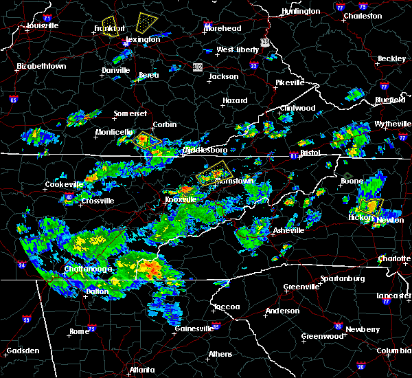 At 600 pm edt, a severe thunderstorm was located over redbird, or near williamsburg, moving northeast at 20 mph (radar indicated). Hazards include 60 mph wind gusts and quarter size hail. Hail damage to vehicles is expected. expect wind damage to roofs, siding, and trees. locations impacted include, williamsburg, redbird, bon, krupp, youngs creek, walden, suttons mill, yaden, rockholds, wofford, clio, deering, goldbug, perkins, bounty and liberty. This includes interstate 75 in east central kentucky between mile markers 10 and 21. At 600 pm edt, a severe thunderstorm was located over redbird, or near williamsburg, moving northeast at 20 mph (radar indicated). Hazards include 60 mph wind gusts and quarter size hail. Hail damage to vehicles is expected. expect wind damage to roofs, siding, and trees. locations impacted include, williamsburg, redbird, bon, krupp, youngs creek, walden, suttons mill, yaden, rockholds, wofford, clio, deering, goldbug, perkins, bounty and liberty. This includes interstate 75 in east central kentucky between mile markers 10 and 21.
|
| 6/2/2016 5:44 PM EDT |
 At 543 pm edt, a severe thunderstorm was located over duckrun, or 7 miles west of williamsburg, moving northeast at 20 mph (radar indicated). Hazards include 60 mph wind gusts and quarter size hail. Hail damage to vehicles is expected. Expect wind damage to roofs, siding, and trees. At 543 pm edt, a severe thunderstorm was located over duckrun, or 7 miles west of williamsburg, moving northeast at 20 mph (radar indicated). Hazards include 60 mph wind gusts and quarter size hail. Hail damage to vehicles is expected. Expect wind damage to roofs, siding, and trees.
|
| 5/7/2016 7:26 PM EDT |
 At 726 pm edt, severe thunderstorms were located along a line extending from treadway to near lesbas to hightop, moving southeast at 50 mph (radar indicated). Hazards include 60 mph wind gusts and penny size hail. Expect damage to roofs. siding. And trees. At 726 pm edt, severe thunderstorms were located along a line extending from treadway to near lesbas to hightop, moving southeast at 50 mph (radar indicated). Hazards include 60 mph wind gusts and penny size hail. Expect damage to roofs. siding. And trees.
|
| 3/1/2016 3:35 PM EST |
 At 333 pm est, a severe thunderstorm was located over manchester, moving east at 50 mph (trained weather spotters). Hazards include 60 mph wind gusts. Expect damage to roofs. siding. and trees. locations impacted include, london, williamsburg, barbourville, pineville, manchester, clate, bush, girdler, moore hill, sprule, cottongin, bertha station, suttons mill, stony fork junction, king, haven, brush creek, clio, artemus and cannon. this includes the following highways, hal rogers parkway between mile markers 4 and 39. interstate 75 in east central kentucky between mile markers 10 and 33. u. s. highway 25 east in bell county between mile markers 10 and 18. u. s. highway 25 east in knox county between mile markers 1 and 26. u. s. Highway 25 east in laurel county between mile markers 0 and 2. At 333 pm est, a severe thunderstorm was located over manchester, moving east at 50 mph (trained weather spotters). Hazards include 60 mph wind gusts. Expect damage to roofs. siding. and trees. locations impacted include, london, williamsburg, barbourville, pineville, manchester, clate, bush, girdler, moore hill, sprule, cottongin, bertha station, suttons mill, stony fork junction, king, haven, brush creek, clio, artemus and cannon. this includes the following highways, hal rogers parkway between mile markers 4 and 39. interstate 75 in east central kentucky between mile markers 10 and 33. u. s. highway 25 east in bell county between mile markers 10 and 18. u. s. highway 25 east in knox county between mile markers 1 and 26. u. s. Highway 25 east in laurel county between mile markers 0 and 2.
|
| 3/1/2016 3:18 PM EST |
 At 317 pm est, a severe thunderstorm was located over lesbas, or near london, moving east at 55 mph (radar indicated). Hazards include 60 mph wind gusts. Expect damage to roofs. siding. And trees. At 317 pm est, a severe thunderstorm was located over lesbas, or near london, moving east at 55 mph (radar indicated). Hazards include 60 mph wind gusts. Expect damage to roofs. siding. And trees.
|
| 2/24/2016 9:26 AM EST |
 The severe thunderstorm warning for clay, eastern whitley, knox, eastern laurel, southeastern jackson and central bell counties will expire at 930 am est, the storms which prompted the warning have weakened. therefore the warning will be allowed to expire. however gusty winds are still possible with these thunderstorms. The severe thunderstorm warning for clay, eastern whitley, knox, eastern laurel, southeastern jackson and central bell counties will expire at 930 am est, the storms which prompted the warning have weakened. therefore the warning will be allowed to expire. however gusty winds are still possible with these thunderstorms.
|
| 2/24/2016 9:03 AM EST |
 At 903 am est, severe thunderstorms were located along a line extending from gray to emmanuel to goins, moving north at 60 mph (radar indicated). Hazards include 60 mph wind gusts. Expect damage to roofs. siding. and trees. locations impacted include, london, barbourville, pineville, manchester, dorthae, green road, clate, bush, blackwater, girdler, moore hill, sprule, cottongin, bertha station, welchburg, king, emmanuel, chestnutburg, haven and portersburg. this includes the following highways, hal rogers parkway between mile markers 3 and 28. interstate 75 in east central kentucky between mile markers 20 and 34. u. s. highway 25 east in bell county between mile markers 13 and 18. u. s. highway 25 east in knox county between mile markers 1 and 26. u. s. Highway 25 east in laurel county between mile markers 0 and 2. At 903 am est, severe thunderstorms were located along a line extending from gray to emmanuel to goins, moving north at 60 mph (radar indicated). Hazards include 60 mph wind gusts. Expect damage to roofs. siding. and trees. locations impacted include, london, barbourville, pineville, manchester, dorthae, green road, clate, bush, blackwater, girdler, moore hill, sprule, cottongin, bertha station, welchburg, king, emmanuel, chestnutburg, haven and portersburg. this includes the following highways, hal rogers parkway between mile markers 3 and 28. interstate 75 in east central kentucky between mile markers 20 and 34. u. s. highway 25 east in bell county between mile markers 13 and 18. u. s. highway 25 east in knox county between mile markers 1 and 26. u. s. Highway 25 east in laurel county between mile markers 0 and 2.
|
| 2/24/2016 8:46 AM EST |
 At 846 am est, severe thunderstorms were located along a line extending from wofford to gatliff to 7 miles southwest of wilkerson, moving north at 60 mph (radar indicated). Hazards include 60 mph wind gusts. Expect damage to roofs. siding. And trees. At 846 am est, severe thunderstorms were located along a line extending from wofford to gatliff to 7 miles southwest of wilkerson, moving north at 60 mph (radar indicated). Hazards include 60 mph wind gusts. Expect damage to roofs. siding. And trees.
|
| 7/14/2015 9:34 PM EDT |
 At 933 pm edt, severe thunderstorms were located along a line extending from permon to near hollyhill to near blue heron to mount pisgah, moving southeast at 40 mph (radar indicated). Hazards include quarter size hail and 60 mph wind gusts. Hail damage to vehicles is expected. expect wind damage to roofs, siding and trees. locations impacted include, monticello, williamsburg, whitley city, corbin, liberty, dixie, nevisdale, frakes, pine knot, great meadows campsites, moore hill, faber, cabell, suttons mill, wofford, powersburg, barrier, clio, packard and denney. This includes interstate 75 in east central kentucky between mile markers 1 and 27. At 933 pm edt, severe thunderstorms were located along a line extending from permon to near hollyhill to near blue heron to mount pisgah, moving southeast at 40 mph (radar indicated). Hazards include quarter size hail and 60 mph wind gusts. Hail damage to vehicles is expected. expect wind damage to roofs, siding and trees. locations impacted include, monticello, williamsburg, whitley city, corbin, liberty, dixie, nevisdale, frakes, pine knot, great meadows campsites, moore hill, faber, cabell, suttons mill, wofford, powersburg, barrier, clio, packard and denney. This includes interstate 75 in east central kentucky between mile markers 1 and 27.
|
| 7/14/2015 8:47 PM EDT |
 At 847 pm edt, severe thunderstorms were located along a line extending from billows to elihu to near mill springs to near jamestown, moving southeast at 40 mph (radar indicated). Hazards include quarter size hail and 60 mph wind gusts. Hail damage to vehicles is expected. Expect wind damage to roofs, siding and trees. At 847 pm edt, severe thunderstorms were located along a line extending from billows to elihu to near mill springs to near jamestown, moving southeast at 40 mph (radar indicated). Hazards include quarter size hail and 60 mph wind gusts. Hail damage to vehicles is expected. Expect wind damage to roofs, siding and trees.
|
| 7/14/2015 7:03 AM EDT |
 At 703 am edt, radar indicated severe thunderstorms located along a line extending from sizerock to rockholds, moving southeast at 55 mph. storm hazards include, winds to 60 mph, penny size hail, locations impacted include, barbourville, manchester, hyden, warren, lincoln, garrard, corbin, providence, daley, green road, clate, girdler, moore hill, sprule, cottongin, bertha station, wendover, king, emmanuel and haven. At 703 am edt, radar indicated severe thunderstorms located along a line extending from sizerock to rockholds, moving southeast at 55 mph. storm hazards include, winds to 60 mph, penny size hail, locations impacted include, barbourville, manchester, hyden, warren, lincoln, garrard, corbin, providence, daley, green road, clate, girdler, moore hill, sprule, cottongin, bertha station, wendover, king, emmanuel and haven.
|
| 7/14/2015 6:41 AM EDT |
 At 640 am edt, radar indicated severe thunderstorms located along a line extending from island city to near huxley, moving southeast at 55 mph. storm hazards include, winds to 60 mph, quarter size hail,. At 640 am edt, radar indicated severe thunderstorms located along a line extending from island city to near huxley, moving southeast at 55 mph. storm hazards include, winds to 60 mph, quarter size hail,.
|
| 4/25/2015 10:42 PM EDT | At 1042 pm edt, severe thunderstorms were located along a line extending from hightop to near cumberland falls s.p. to near whitley city, moving east at 65 mph (radar indicated). Hazards include 60 mph wind gusts. Expect damage to roofs. Siding and trees. |
| 4/25/2015 10:23 PM EDT | At 1023 pm edt, a severe thunderstorm was located over alpine, or 12 miles southeast of somerset, moving east at 55 mph (radar indicated). Hazards include 60 mph wind gusts and penny size hail. Expect damage to roofs. siding and trees. locations impacted include, somerset, london, williamsburg, corbin, liberty, burnside, dorthae, vox, faber, bent, bernstadt, east bernstadt, clio, kidder, general burnside s. p,. denney, huxley, hightop, bark camp and elihu. this includes the following highways, hal rogers parkway between mile markers 1 and 2. interstate 75 in east central kentucky between mile markers 10 and 46. kentucky highway 80 in laurel county between mile markers 1 and 11. kentucky highway 80 in pulaski county between mile markers 20 and 40. u. s. highway 25 east in laurel county near mile marker 2. 0. 75in. |
| 4/25/2015 10:02 PM EDT | At 957 pm edt, a severe thunderstorm was located near faubush, or 15 miles north of monticello, moving east at 50 mph (radar indicated). Hazards include 60 mph wind gusts and penny size hail. Expect damage to roofs. Siding and trees. |
| 4/25/2015 9:56 PM EDT | At 956 pm edt, a severe thunderstorm was located near faubush, or 15 miles north of monticello, moving east at 50 mph (radar indicated). Hazards include 60 mph wind gusts and penny size hail. Expect damage to roofs. Siding and trees. |
| 4/7/2015 9:06 PM EDT | A severe thunderstorm warning remains in effect until 915 pm edt for south central laurel. eastern mccreary and whitley counties. at 903 pm edt. severe thunderstorms were located along a line extending from near huxley to near bark camp to cumberland falls s. p. to near hollyhill to near strunk. moving east at 20 mph. hazard. 60 mph wind gusts. |
| 4/7/2015 8:45 PM EDT | The national weather service in jackson ky has issued a * severe thunderstorm warning for. southwestern laurel county in south central kentucky. southeastern pulaski county in south central kentucky. mccreary county in south central kentucky. Whitley county in south central kentucky. |
| 4/2/2015 8:10 PM EDT | A severe thunderstorm warning remains in effect until 830 pm edt for laurel. eastern pulaski. west central knox. northeastern mccreary. southwestern jackson. northwestern whitley and rockcastle counties. at 809 pm edt. severe thunderstorms were located along a line extending from bandy to honeybee. Moving east at 50 mph. |
| 4/2/2015 7:51 PM EDT | The national weather service in jackson ky has issued a * severe thunderstorm warning for. laurel county in south central kentucky. northeastern wayne county in south central kentucky. pulaski county in south central kentucky. West central knox county in southeastern kentucky. |
| 6/10/2014 5:55 PM EDT | Tree down on bee creek roa in whitley county KY, 2.7 miles S of Rockholds, KY |
| 1/1/0001 12:00 AM | One tree down across a power line at the intersection of ky 836 and lloyd wilson r in whitley county KY, 0.9 miles NNW of Rockholds, KY |
| 1/1/0001 12:00 AM | 3 trees down along highway 20 in whitley county KY, 4.7 miles E of Rockholds, KY |
| 1/1/0001 12:00 AM | At mile marker 18 along intersta in whitley county KY, 2.9 miles E of Rockholds, KY |
| 1/1/0001 12:00 AM | 1 tree down on highway 26 north of jacks fork road in whitley county KY, 1.5 miles N of Rockholds, KY |
Hail Maps for Rockholds, KY


Connect with Interactive Hail Maps