

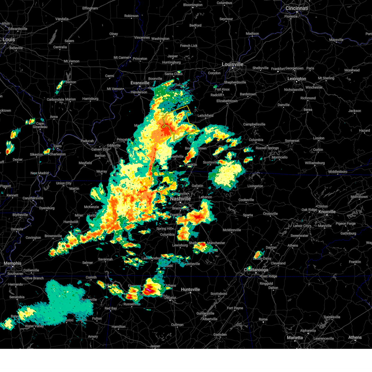
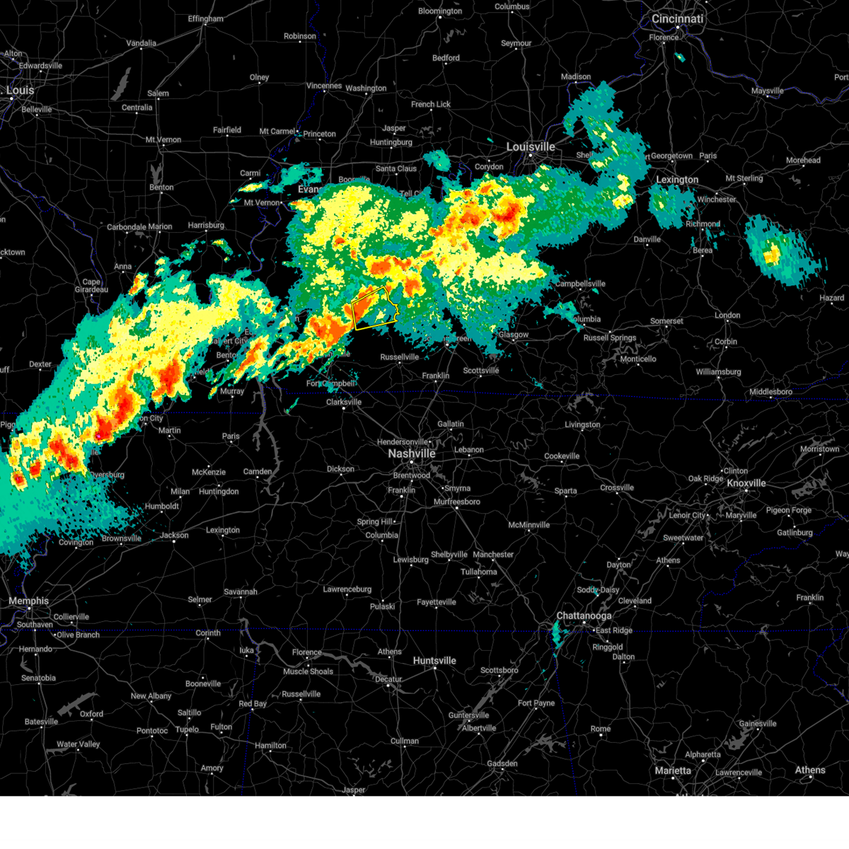
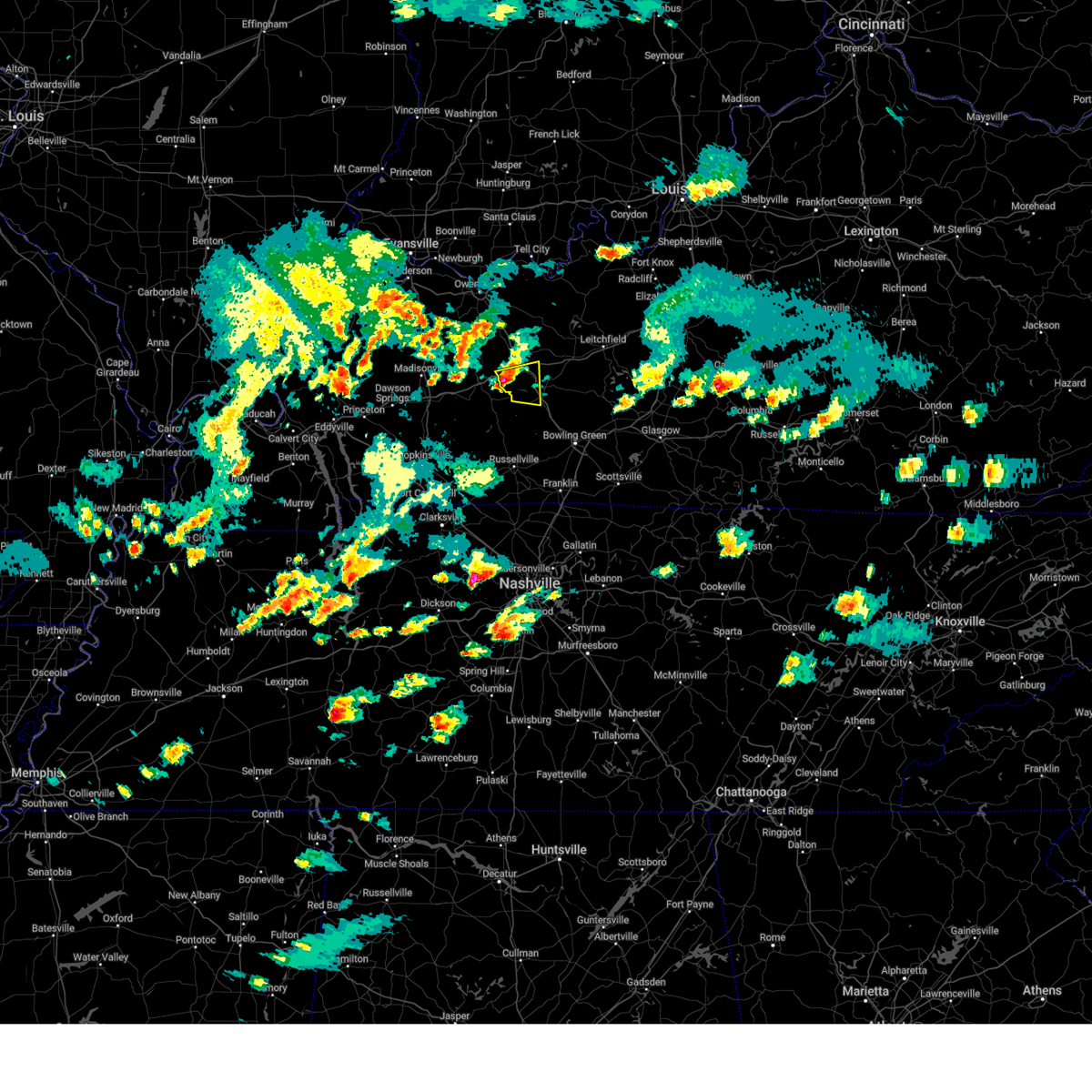
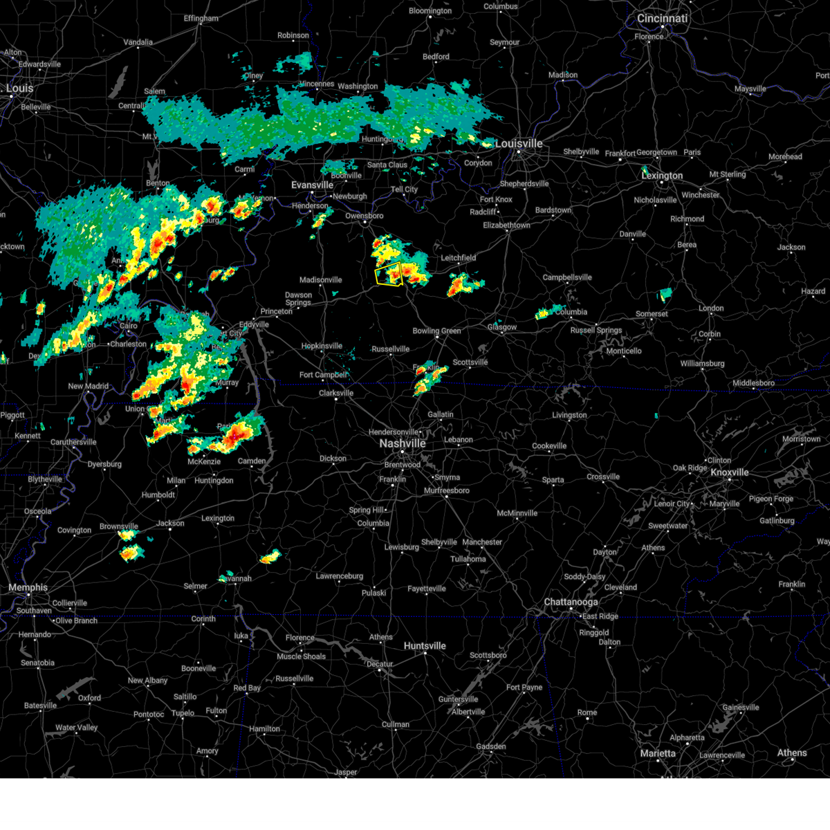
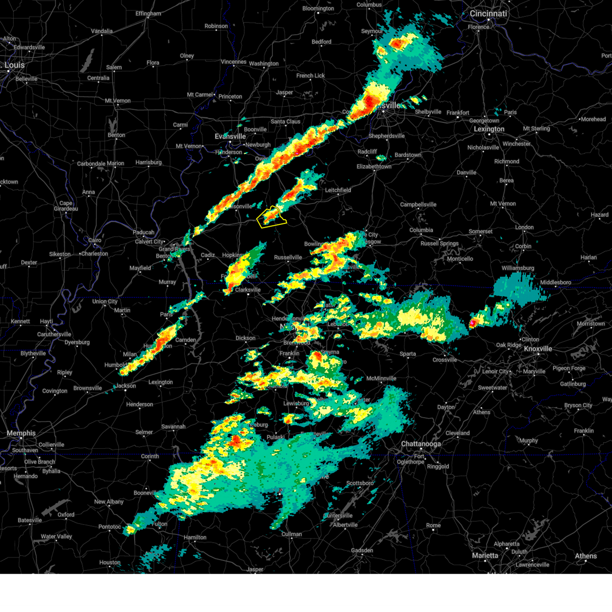
Hail Map for Rockport, KY
The Rockport, KY area has had 0 reports of on-the-ground hail by trained spotters, and has been under severe weather warnings 26 times during the past 12 months. Doppler radar has detected hail at or near Rockport, KY on 57 occasions, including 1 occasion during the past year.
| Name: | Rockport, KY |
| Where Located: | 54.3 miles SE of Evansville, IN |
| Map: | Google Map for Rockport, KY |
| Population: | 266 |
| Housing Units: | 128 |
| More Info: | Search Google for Rockport, KY |
0
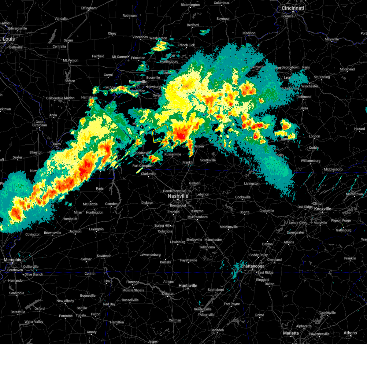
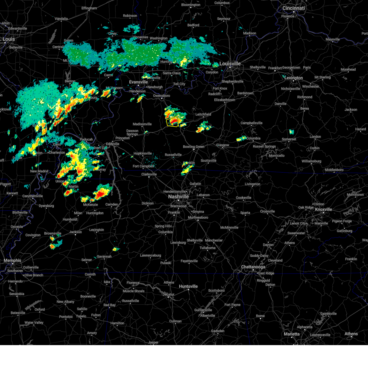
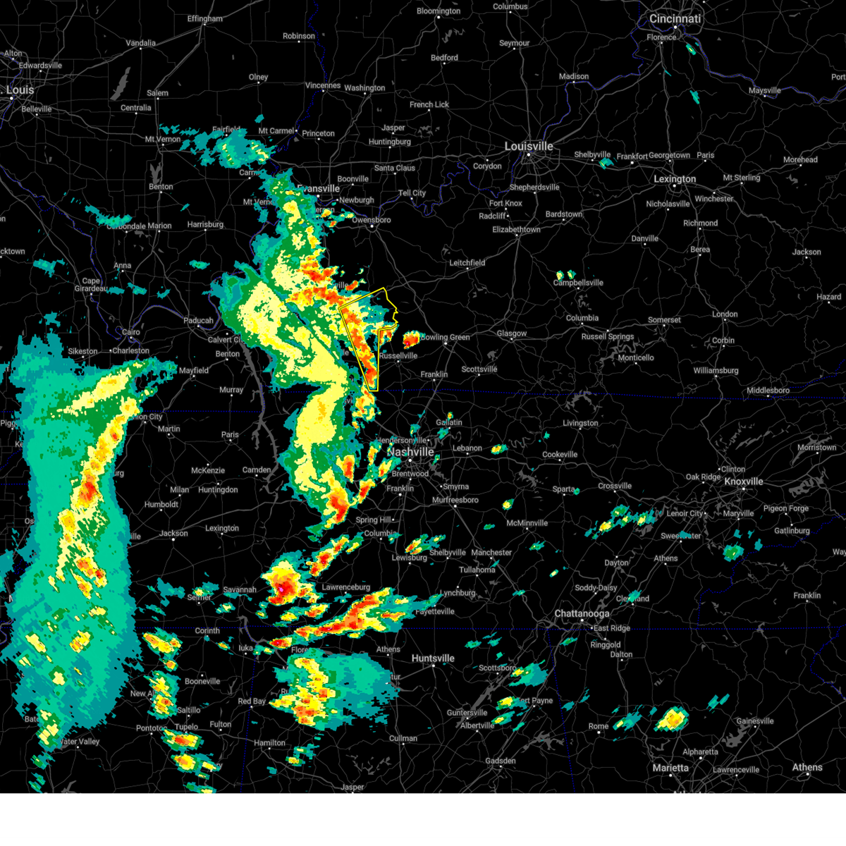
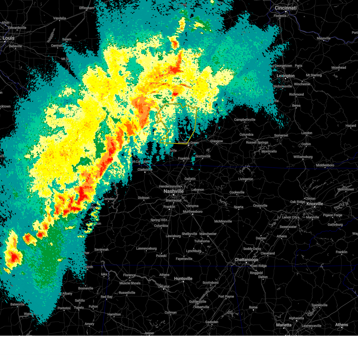
The Top Recent Hail Date for Rockport, KY is Thursday, May 8, 2025 (19th out of 57)

Hail and Wind Damage Spotted near Rockport, KY
| Date / Time | Report Details |
|---|---|
| 5/20/2025 5:30 PM CDT | the severe thunderstorm warning has been cancelled and is no longer in effect |
| 5/20/2025 5:20 PM CDT |
 Svrlmk the national weather service in louisville has issued a * severe thunderstorm warning for, northern butler county in south central kentucky, ohio county in central kentucky, * until 600 pm cdt. * at 520 pm cdt, a severe thunderstorm was located 8 miles southwest of hartford, or 9 miles east of central city, moving east at 55 mph (radar indicated). Hazards include 60 mph wind gusts. expect damage to roofs, siding, and trees Svrlmk the national weather service in louisville has issued a * severe thunderstorm warning for, northern butler county in south central kentucky, ohio county in central kentucky, * until 600 pm cdt. * at 520 pm cdt, a severe thunderstorm was located 8 miles southwest of hartford, or 9 miles east of central city, moving east at 55 mph (radar indicated). Hazards include 60 mph wind gusts. expect damage to roofs, siding, and trees
|
| 5/20/2025 5:17 PM CDT |
 the severe thunderstorm warning has been cancelled and is no longer in effect the severe thunderstorm warning has been cancelled and is no longer in effect
|
| 5/20/2025 5:17 PM CDT |
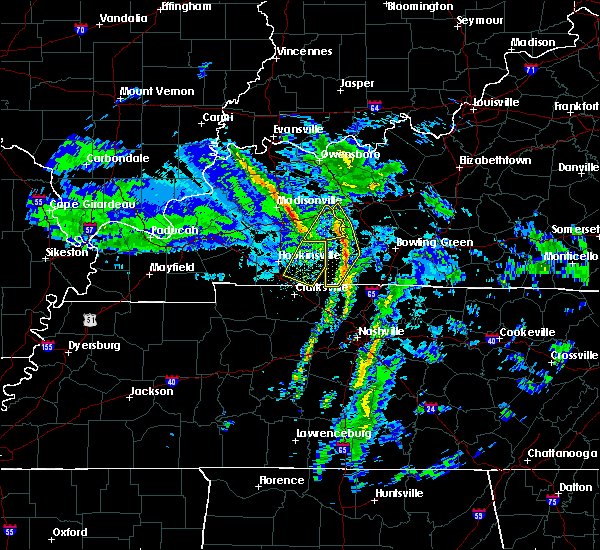
 At 517 pm cdt, a severe thunderstorm was located near central city, moving northeast at 45 mph (radar indicated). Hazards include 60 mph wind gusts and quarter size hail. Hail damage to vehicles is expected. expect wind damage to roofs, siding, and trees. locations impacted include, central city, powderly, greenville, drakesboro, rockport, bremen, and south carrollton. This includes western kentucky parkway between mile markers 50 and 65. At 517 pm cdt, a severe thunderstorm was located near central city, moving northeast at 45 mph (radar indicated). Hazards include 60 mph wind gusts and quarter size hail. Hail damage to vehicles is expected. expect wind damage to roofs, siding, and trees. locations impacted include, central city, powderly, greenville, drakesboro, rockport, bremen, and south carrollton. This includes western kentucky parkway between mile markers 50 and 65.
|
| 5/20/2025 4:51 PM CDT | Svrpah the national weather service in paducah has issued a * severe thunderstorm warning for, muhlenberg county in south central kentucky, northeastern christian county in south central kentucky, southeastern hopkins county in northwestern kentucky, northern todd county in south central kentucky, * until 545 pm cdt. * at 451 pm cdt, a severe thunderstorm was located near weir, or 18 miles southwest of central city, moving northeast at 45 mph (radar indicated). Hazards include 60 mph wind gusts and quarter size hail. Hail damage to vehicles is expected. Expect wind damage to roofs, siding, and trees. |
| 5/16/2025 8:41 PM CDT |
 Svrlmk the national weather service in louisville has issued a * severe thunderstorm warning for, northern logan county in south central kentucky, butler county in south central kentucky, grayson county in central kentucky, northwestern warren county in south central kentucky, southern hardin county in central kentucky, southern ohio county in central kentucky, northwestern edmonson county in south central kentucky, * until 1030 pm edt/930 pm cdt/. * at 940 pm edt/840 pm cdt/, a severe thunderstorm was located over powderly, moving east at 60 mph (radar indicated). Hazards include 70 mph wind gusts and quarter size hail. Hail damage to vehicles is expected. expect considerable tree damage. Wind damage is also likely to mobile homes, roofs, and outbuildings. Svrlmk the national weather service in louisville has issued a * severe thunderstorm warning for, northern logan county in south central kentucky, butler county in south central kentucky, grayson county in central kentucky, northwestern warren county in south central kentucky, southern hardin county in central kentucky, southern ohio county in central kentucky, northwestern edmonson county in south central kentucky, * until 1030 pm edt/930 pm cdt/. * at 940 pm edt/840 pm cdt/, a severe thunderstorm was located over powderly, moving east at 60 mph (radar indicated). Hazards include 70 mph wind gusts and quarter size hail. Hail damage to vehicles is expected. expect considerable tree damage. Wind damage is also likely to mobile homes, roofs, and outbuildings.
|
| 5/16/2025 8:14 AM CDT |
 The storm which prompted the warning has moved out of the area. therefore, the warning will be allowed to expire. a severe thunderstorm watch remains in effect until 900 am cdt for south central kentucky. The storm which prompted the warning has moved out of the area. therefore, the warning will be allowed to expire. a severe thunderstorm watch remains in effect until 900 am cdt for south central kentucky.
|
| 5/16/2025 7:39 AM CDT |
 Svrpah the national weather service in paducah has issued a * severe thunderstorm warning for, central muhlenberg county in south central kentucky, * until 815 am cdt. * at 739 am cdt, a severe thunderstorm was located over greenville, or 8 miles southwest of central city, moving east at 60 mph (radar indicated). Hazards include quarter size hail. damage to vehicles is expected Svrpah the national weather service in paducah has issued a * severe thunderstorm warning for, central muhlenberg county in south central kentucky, * until 815 am cdt. * at 739 am cdt, a severe thunderstorm was located over greenville, or 8 miles southwest of central city, moving east at 60 mph (radar indicated). Hazards include quarter size hail. damage to vehicles is expected
|
| 5/8/2025 3:11 PM CDT |
 Svrlmk the national weather service in louisville has issued a * severe thunderstorm warning for, northwestern butler county in south central kentucky, south central ohio county in central kentucky, * until 345 pm cdt. * at 311 pm cdt, a severe thunderstorm was located 9 miles east of central city, moving east at 15 mph (radar indicated). Hazards include 60 mph wind gusts and quarter size hail. Hail damage to vehicles is expected. Expect wind damage to roofs, siding, and trees. Svrlmk the national weather service in louisville has issued a * severe thunderstorm warning for, northwestern butler county in south central kentucky, south central ohio county in central kentucky, * until 345 pm cdt. * at 311 pm cdt, a severe thunderstorm was located 9 miles east of central city, moving east at 15 mph (radar indicated). Hazards include 60 mph wind gusts and quarter size hail. Hail damage to vehicles is expected. Expect wind damage to roofs, siding, and trees.
|
| 5/8/2025 12:46 PM CDT |
 The storm which prompted the warning has moved out of the area. therefore, the warning has been allowed to expire. a severe thunderstorm watch remains in effect until 800 pm cdt for south central and central kentucky. remember, a severe thunderstorm warning still remains in effect for portions of ohio and butler county until 115 pm cdt. The storm which prompted the warning has moved out of the area. therefore, the warning has been allowed to expire. a severe thunderstorm watch remains in effect until 800 pm cdt for south central and central kentucky. remember, a severe thunderstorm warning still remains in effect for portions of ohio and butler county until 115 pm cdt.
|
| 5/8/2025 12:38 PM CDT |
 At 1237 pm cdt, a severe thunderstorm was located near hartford, moving east at 15 mph (golf ball size hail was observed in beaver dam). Hazards include golf ball size hail and 60 mph wind gusts. People and animals outdoors will be injured. expect hail damage to roofs, siding, windows, and vehicles. expect wind damage to roofs, siding, and trees. Locations impacted include, hartford, beaver dam, centertown, mchenry, rockport, prentiss, simmons, rob roy, sandefur crossing, and cromwell. At 1237 pm cdt, a severe thunderstorm was located near hartford, moving east at 15 mph (golf ball size hail was observed in beaver dam). Hazards include golf ball size hail and 60 mph wind gusts. People and animals outdoors will be injured. expect hail damage to roofs, siding, windows, and vehicles. expect wind damage to roofs, siding, and trees. Locations impacted include, hartford, beaver dam, centertown, mchenry, rockport, prentiss, simmons, rob roy, sandefur crossing, and cromwell.
|
| 5/8/2025 12:24 PM CDT |
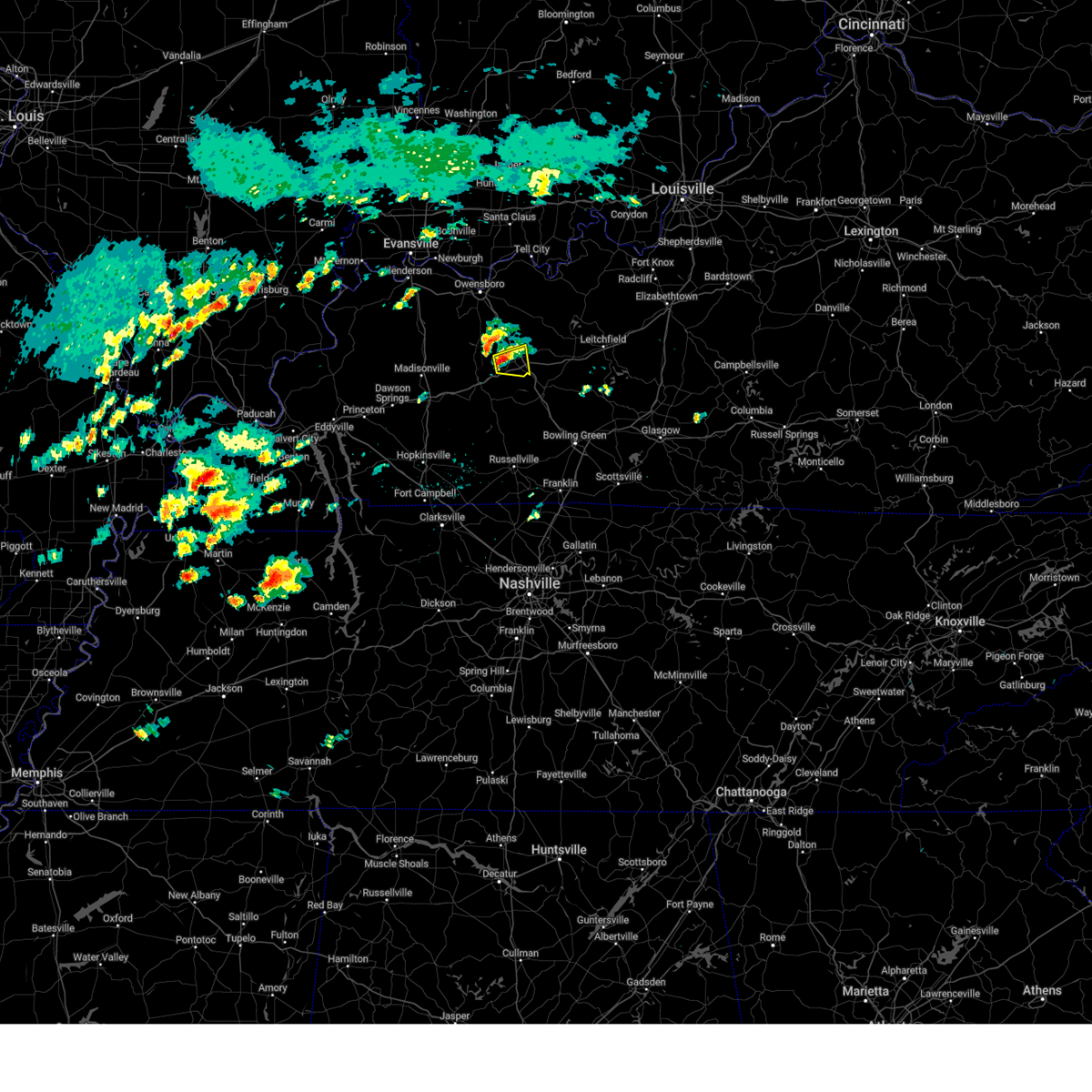 At 1224 pm cdt, a severe thunderstorm was located near hartford, moving east at 15 mph (radar indicated). Hazards include ping pong ball size hail and 60 mph wind gusts. People and animals outdoors will be injured. expect hail damage to roofs, siding, windows, and vehicles. expect wind damage to roofs, siding, and trees. Locations impacted include, hartford, beaver dam, centertown, mchenry, rockport, prentiss, simmons, rob roy, sandefur crossing, and cromwell. At 1224 pm cdt, a severe thunderstorm was located near hartford, moving east at 15 mph (radar indicated). Hazards include ping pong ball size hail and 60 mph wind gusts. People and animals outdoors will be injured. expect hail damage to roofs, siding, windows, and vehicles. expect wind damage to roofs, siding, and trees. Locations impacted include, hartford, beaver dam, centertown, mchenry, rockport, prentiss, simmons, rob roy, sandefur crossing, and cromwell.
|
| 5/8/2025 12:18 PM CDT |
 Svrlmk the national weather service in louisville has issued a * severe thunderstorm warning for, southwestern ohio county in central kentucky, * until 1245 pm cdt. * at 1217 pm cdt, a severe thunderstorm was located near hartford, moving east at 15 mph (radar indicated). Hazards include 60 mph wind gusts and quarter size hail. Hail damage to vehicles is expected. Expect wind damage to roofs, siding, and trees. Svrlmk the national weather service in louisville has issued a * severe thunderstorm warning for, southwestern ohio county in central kentucky, * until 1245 pm cdt. * at 1217 pm cdt, a severe thunderstorm was located near hartford, moving east at 15 mph (radar indicated). Hazards include 60 mph wind gusts and quarter size hail. Hail damage to vehicles is expected. Expect wind damage to roofs, siding, and trees.
|
| 5/2/2025 12:56 PM CDT |
 The storms which prompted the warning have moved out of the area. therefore, the warning will be allowed to expire. however, gusty winds are still possible with these thunderstorms. a severe thunderstorm watch remains in effect until 500 pm cdt for south central kentucky. The storms which prompted the warning have moved out of the area. therefore, the warning will be allowed to expire. however, gusty winds are still possible with these thunderstorms. a severe thunderstorm watch remains in effect until 500 pm cdt for south central kentucky.
|
| 5/2/2025 12:50 PM CDT | Svrlmk the national weather service in louisville has issued a * severe thunderstorm warning for, northwestern butler county in south central kentucky, ohio county in central kentucky, * until 130 pm cdt. * at 1250 pm cdt, severe thunderstorms were located along a line extending from near calhoun to near livermore to near powderly, moving northeast at 40 mph (radar indicated). Hazards include 60 mph wind gusts and quarter size hail. Hail damage to vehicles is expected. Expect wind damage to roofs, siding, and trees. |
| 5/2/2025 12:48 PM CDT | At 1248 pm cdt, severe thunderstorms were located along a line extending from graham to 8 miles northeast of elkton to 7 miles southwest of russellville, moving northeast at 35 mph (radar indicated). Hazards include 60 mph wind gusts. Expect damage to roofs, siding, and trees. locations impacted include, central city, powderly, dunmor, greenville, drakesboro, and rockport. This includes western kentucky parkway between mile markers 48 and 65. |
| 5/2/2025 12:48 PM CDT | the severe thunderstorm warning has been cancelled and is no longer in effect |
| 5/2/2025 12:37 PM CDT |
 At 1236 pm cdt, severe thunderstorms were located along a line extending from near nortonville to near elkton to 6 miles northeast of guthrie, moving northeast at 35 mph (radar indicated). Hazards include 60 mph wind gusts and nickel size hail. Expect damage to roofs, siding, and trees. locations impacted include, central city, elkton, powderly, greenville, weir, dunmor, graham, white plains, drakesboro, rockport, justice, everett, allensville, allegre, and clifty. This includes western kentucky parkway between mile markers 46 and 65. At 1236 pm cdt, severe thunderstorms were located along a line extending from near nortonville to near elkton to 6 miles northeast of guthrie, moving northeast at 35 mph (radar indicated). Hazards include 60 mph wind gusts and nickel size hail. Expect damage to roofs, siding, and trees. locations impacted include, central city, elkton, powderly, greenville, weir, dunmor, graham, white plains, drakesboro, rockport, justice, everett, allensville, allegre, and clifty. This includes western kentucky parkway between mile markers 46 and 65.
|
| 5/2/2025 12:26 PM CDT | At 1226 pm cdt, severe thunderstorms were located along a line extending from near nortonville to near elkton to near guthrie, moving northeast at 35 mph (radar indicated). Hazards include 60 mph wind gusts and nickel size hail. Expect damage to roofs, siding, and trees. locations impacted include, central city, elkton, guthrie, nortonville, powderly, greenville, weir, dunmor, white plains, drakesboro, trenton, rockport, justice, everett, allensville, allegre, and clifty. this includes the following highways, western kentucky parkway between mile markers 46 and 65. Pennyrile parkway between mile markers 25 and 32. |
| 5/2/2025 12:13 PM CDT | Svrpah the national weather service in paducah has issued a * severe thunderstorm warning for, muhlenberg county in south central kentucky, eastern christian county in south central kentucky, southeastern hopkins county in northwestern kentucky, todd county in south central kentucky, * until 100 pm cdt. * at 1213 pm cdt, severe thunderstorms were located along a line extending from near crofton to near pembroke to near guthrie, moving northeast at 35 mph (radar indicated). Hazards include 60 mph wind gusts and nickel size hail. expect damage to roofs, siding, and trees |
| 4/2/2025 9:53 PM CDT |
 Svrlmk the national weather service in louisville has issued a * severe thunderstorm warning for, northern logan county in south central kentucky, butler county in south central kentucky, western grayson county in central kentucky, northwestern warren county in south central kentucky, ohio county in central kentucky, northwestern edmonson county in south central kentucky, * until 1100 pm cdt. * at 952 pm cdt, severe thunderstorms were located along a line extending from near calhoun to near crofton, moving east at 45 mph (radar indicated). Hazards include 60 mph wind gusts. expect damage to roofs, siding, and trees Svrlmk the national weather service in louisville has issued a * severe thunderstorm warning for, northern logan county in south central kentucky, butler county in south central kentucky, western grayson county in central kentucky, northwestern warren county in south central kentucky, ohio county in central kentucky, northwestern edmonson county in south central kentucky, * until 1100 pm cdt. * at 952 pm cdt, severe thunderstorms were located along a line extending from near calhoun to near crofton, moving east at 45 mph (radar indicated). Hazards include 60 mph wind gusts. expect damage to roofs, siding, and trees
|
| 3/30/2025 9:36 PM CDT |
 the severe thunderstorm warning has been cancelled and is no longer in effect the severe thunderstorm warning has been cancelled and is no longer in effect
|
| 3/30/2025 9:36 PM CDT |
 At 936 pm cdt, severe thunderstorms were located along a line extending from 8 miles northwest of central city to near powderly to near weir, moving east at 50 mph (radar indicated). Hazards include 60 mph wind gusts and nickel size hail. Expect damage to roofs, siding, and trees. locations impacted include, drakesboro, clifty, central city, dunmor, south carrollton, powderly, rockport, and greenville. This includes western kentucky parkway between mile markers 56 and 65. At 936 pm cdt, severe thunderstorms were located along a line extending from 8 miles northwest of central city to near powderly to near weir, moving east at 50 mph (radar indicated). Hazards include 60 mph wind gusts and nickel size hail. Expect damage to roofs, siding, and trees. locations impacted include, drakesboro, clifty, central city, dunmor, south carrollton, powderly, rockport, and greenville. This includes western kentucky parkway between mile markers 56 and 65.
|
| 3/30/2025 9:18 PM CDT |
 the severe thunderstorm warning has been cancelled and is no longer in effect the severe thunderstorm warning has been cancelled and is no longer in effect
|
| 3/30/2025 9:18 PM CDT |
 At 918 pm cdt, severe thunderstorms were located along a line extending from madisonville to near graham to 6 miles southeast of crofton, moving east at 50 mph (radar indicated). Hazards include 60 mph wind gusts and nickel size hail. Expect damage to roofs, siding, and trees. locations impacted include, graham, greenville, white plains, central city, drakesboro, powderly, south carrollton, crofton, clifty, dunmor, weir, nortonville, rockport, and mortons gap. this includes the following highways, interstate 69 in kentucky between mile markers 106 and 108. western kentucky parkway between mile markers 39 and 65. Pennyrile parkway between mile markers 15 and 26, and between mile markers 32 and 34. At 918 pm cdt, severe thunderstorms were located along a line extending from madisonville to near graham to 6 miles southeast of crofton, moving east at 50 mph (radar indicated). Hazards include 60 mph wind gusts and nickel size hail. Expect damage to roofs, siding, and trees. locations impacted include, graham, greenville, white plains, central city, drakesboro, powderly, south carrollton, crofton, clifty, dunmor, weir, nortonville, rockport, and mortons gap. this includes the following highways, interstate 69 in kentucky between mile markers 106 and 108. western kentucky parkway between mile markers 39 and 65. Pennyrile parkway between mile markers 15 and 26, and between mile markers 32 and 34.
|
| 3/30/2025 8:58 PM CDT |
 Svrpah the national weather service in paducah has issued a * severe thunderstorm warning for, muhlenberg county in south central kentucky, northern christian county in south central kentucky, southeastern mclean county in northwestern kentucky, southern hopkins county in northwestern kentucky, northern todd county in south central kentucky, * until 945 pm cdt. * at 858 pm cdt, severe thunderstorms were located along a line extending from near olney to near dawson springs to 7 miles southeast of cobb, moving east at 50 mph (radar indicated). Hazards include 60 mph wind gusts and nickel size hail. expect damage to roofs, siding, and trees Svrpah the national weather service in paducah has issued a * severe thunderstorm warning for, muhlenberg county in south central kentucky, northern christian county in south central kentucky, southeastern mclean county in northwestern kentucky, southern hopkins county in northwestern kentucky, northern todd county in south central kentucky, * until 945 pm cdt. * at 858 pm cdt, severe thunderstorms were located along a line extending from near olney to near dawson springs to 7 miles southeast of cobb, moving east at 50 mph (radar indicated). Hazards include 60 mph wind gusts and nickel size hail. expect damage to roofs, siding, and trees
|
| 5/26/2024 9:46 PM CDT |
 Svrlmk the national weather service in louisville has issued a * severe thunderstorm warning for, logan county in south central kentucky, northwestern simpson county in south central kentucky, butler county in south central kentucky, northwestern warren county in south central kentucky, southern ohio county in central kentucky, * until 1015 pm cdt. * at 946 pm cdt, severe thunderstorms were located along a line extending from near hartford to near hopkinsville, moving southeast at 60 mph (radar indicated). Hazards include 60 mph wind gusts and quarter size hail. Hail damage to vehicles is expected. Expect wind damage to roofs, siding, and trees. Svrlmk the national weather service in louisville has issued a * severe thunderstorm warning for, logan county in south central kentucky, northwestern simpson county in south central kentucky, butler county in south central kentucky, northwestern warren county in south central kentucky, southern ohio county in central kentucky, * until 1015 pm cdt. * at 946 pm cdt, severe thunderstorms were located along a line extending from near hartford to near hopkinsville, moving southeast at 60 mph (radar indicated). Hazards include 60 mph wind gusts and quarter size hail. Hail damage to vehicles is expected. Expect wind damage to roofs, siding, and trees.
|
| 5/26/2024 9:32 AM CDT |
 At 931 am cdt, a severe thunderstorm was located near central city, moving east at 45 mph (radar indicated). Hazards include 70 mph wind gusts. Expect considerable tree damage. damage is likely to mobile homes, roofs, and outbuildings. Locations impacted include, bowling green, hartford, morgantown, plum springs, casey, lee, beaver dam, caneyville, centertown, and mchenry. At 931 am cdt, a severe thunderstorm was located near central city, moving east at 45 mph (radar indicated). Hazards include 70 mph wind gusts. Expect considerable tree damage. damage is likely to mobile homes, roofs, and outbuildings. Locations impacted include, bowling green, hartford, morgantown, plum springs, casey, lee, beaver dam, caneyville, centertown, and mchenry.
|
| 5/26/2024 9:18 AM CDT |
 Svrlmk the national weather service in louisville has issued a * severe thunderstorm warning for, northeastern logan county in south central kentucky, butler county in south central kentucky, western grayson county in central kentucky, northwestern warren county in south central kentucky, south central breckinridge county in central kentucky, ohio county in central kentucky, northwestern edmonson county in south central kentucky, * until 1015 am cdt. * at 917 am cdt, a severe thunderstorm was located near weir, moving east at 45 mph (radar indicated). Hazards include 70 mph wind gusts. Expect considerable tree damage. Damage is likely to mobile homes, roofs, and outbuildings. Svrlmk the national weather service in louisville has issued a * severe thunderstorm warning for, northeastern logan county in south central kentucky, butler county in south central kentucky, western grayson county in central kentucky, northwestern warren county in south central kentucky, south central breckinridge county in central kentucky, ohio county in central kentucky, northwestern edmonson county in south central kentucky, * until 1015 am cdt. * at 917 am cdt, a severe thunderstorm was located near weir, moving east at 45 mph (radar indicated). Hazards include 70 mph wind gusts. Expect considerable tree damage. Damage is likely to mobile homes, roofs, and outbuildings.
|
| 5/8/2024 6:21 PM CDT |
 Svrlmk the national weather service in louisville has issued a * severe thunderstorm warning for, southern ohio county in central kentucky, * until 645 pm cdt. * at 621 pm cdt, a severe thunderstorm was located 7 miles southeast of livermore, moving east at 40 mph (radar indicated). Hazards include 60 mph wind gusts and quarter size hail. Hail damage to vehicles is expected. Expect wind damage to roofs, siding, and trees. Svrlmk the national weather service in louisville has issued a * severe thunderstorm warning for, southern ohio county in central kentucky, * until 645 pm cdt. * at 621 pm cdt, a severe thunderstorm was located 7 miles southeast of livermore, moving east at 40 mph (radar indicated). Hazards include 60 mph wind gusts and quarter size hail. Hail damage to vehicles is expected. Expect wind damage to roofs, siding, and trees.
|
| 5/8/2024 2:46 PM CDT |
 Svrlmk the national weather service in louisville has issued a * severe thunderstorm warning for, northern butler county in south central kentucky, southeastern ohio county in central kentucky, * until 330 pm cdt. * at 245 pm cdt, a severe thunderstorm was located 9 miles north of dunmor, moving northeast at 40 mph (radar indicated). Hazards include half dollar size hail. damage to vehicles is expected Svrlmk the national weather service in louisville has issued a * severe thunderstorm warning for, northern butler county in south central kentucky, southeastern ohio county in central kentucky, * until 330 pm cdt. * at 245 pm cdt, a severe thunderstorm was located 9 miles north of dunmor, moving northeast at 40 mph (radar indicated). Hazards include half dollar size hail. damage to vehicles is expected
|
| 4/2/2024 4:20 PM CDT |
 The storm which prompted the warning has weakened below severe limits, and no longer poses an immediate threat to life or property. therefore, the warning will be allowed to expire. a tornado watch remains in effect until 600 pm cdt for south central kentucky. The storm which prompted the warning has weakened below severe limits, and no longer poses an immediate threat to life or property. therefore, the warning will be allowed to expire. a tornado watch remains in effect until 600 pm cdt for south central kentucky.
|
| 4/2/2024 4:14 PM CDT |
 the severe thunderstorm warning has been cancelled and is no longer in effect the severe thunderstorm warning has been cancelled and is no longer in effect
|
| 4/2/2024 4:14 PM CDT |
 At 414 pm cdt, a severe thunderstorm was located over powderly, or near central city, moving northeast at 55 mph (radar indicated). Hazards include 60 mph wind gusts and quarter size hail. Hail damage to vehicles is expected. expect wind damage to roofs, siding, and trees. locations impacted include, central city, powderly, greenville, drakesboro, rockport, and south carrollton. This includes western kentucky parkway between mile markers 50 and 65. At 414 pm cdt, a severe thunderstorm was located over powderly, or near central city, moving northeast at 55 mph (radar indicated). Hazards include 60 mph wind gusts and quarter size hail. Hail damage to vehicles is expected. expect wind damage to roofs, siding, and trees. locations impacted include, central city, powderly, greenville, drakesboro, rockport, and south carrollton. This includes western kentucky parkway between mile markers 50 and 65.
|
| 4/2/2024 4:04 PM CDT |
 Svrpah the national weather service in paducah has issued a * severe thunderstorm warning for, central muhlenberg county in south central kentucky, eastern hopkins county in northwestern kentucky, * until 430 pm cdt. * at 404 pm cdt, a severe thunderstorm was located near graham, or 11 miles southwest of central city, moving northeast at 55 mph (radar indicated). Hazards include 60 mph wind gusts and quarter size hail. Hail damage to vehicles is expected. Expect wind damage to roofs, siding, and trees. Svrpah the national weather service in paducah has issued a * severe thunderstorm warning for, central muhlenberg county in south central kentucky, eastern hopkins county in northwestern kentucky, * until 430 pm cdt. * at 404 pm cdt, a severe thunderstorm was located near graham, or 11 miles southwest of central city, moving northeast at 55 mph (radar indicated). Hazards include 60 mph wind gusts and quarter size hail. Hail damage to vehicles is expected. Expect wind damage to roofs, siding, and trees.
|
| 4/2/2024 6:48 AM CDT |
 At 648 am cdt, severe thunderstorms were located along a line extending from 9 miles southeast of whitesville to 6 miles southwest of hartford to near central city, moving east at 50 mph (radar indicated). Hazards include 60 mph wind gusts. Expect damage to roofs, siding, and trees. Locations impacted include, hartford, beaver dam, centertown, mchenry, rockport, horse branch, taffy, windy hill, magan, and jingo. At 648 am cdt, severe thunderstorms were located along a line extending from 9 miles southeast of whitesville to 6 miles southwest of hartford to near central city, moving east at 50 mph (radar indicated). Hazards include 60 mph wind gusts. Expect damage to roofs, siding, and trees. Locations impacted include, hartford, beaver dam, centertown, mchenry, rockport, horse branch, taffy, windy hill, magan, and jingo.
|
| 4/2/2024 6:27 AM CDT |
 Svrlmk the national weather service in louisville has issued a * severe thunderstorm warning for, ohio county in central kentucky, * until 700 am cdt. * at 627 am cdt, severe thunderstorms were located along a line extending from near livermore to 8 miles northwest of central city to near mortons gap, moving east at 50 mph (radar indicated). Hazards include 70 mph wind gusts and penny size hail. Expect considerable tree damage. Damage is likely to mobile homes, roofs, and outbuildings. Svrlmk the national weather service in louisville has issued a * severe thunderstorm warning for, ohio county in central kentucky, * until 700 am cdt. * at 627 am cdt, severe thunderstorms were located along a line extending from near livermore to 8 miles northwest of central city to near mortons gap, moving east at 50 mph (radar indicated). Hazards include 70 mph wind gusts and penny size hail. Expect considerable tree damage. Damage is likely to mobile homes, roofs, and outbuildings.
|
| 3/6/2024 10:06 AM EST |
 Torlmk the national weather service in louisville has issued a * this is a test message. tornado warning for, meade county in central kentucky, larue county in central kentucky, jessamine county in central kentucky, nicholas county in central kentucky, adair county in south central kentucky, bourbon county in central kentucky, warren county in south central kentucky, cumberland county in south central kentucky, henry county in central kentucky, russell county in south central kentucky, taylor county in central kentucky, jefferson county in central kentucky, hardin county in central kentucky, spencer county in central kentucky, scott county in central kentucky, hancock county in central kentucky, trimble county in central kentucky, monroe county in south central kentucky, metcalfe county in south central kentucky, shelby county in central kentucky, logan county in south central kentucky, nelson county in central kentucky, anderson county in central kentucky, clark county in central kentucky, marion county in central kentucky, simpson county in south central kentucky, grayson county in central kentucky, casey county in central kentucky, franklin county in central kentucky, edmonson county in south central kentucky, lincoln county in central kentucky, woodford county in central kentucky, butler county in south central kentucky, madison county in central kentucky, barren county in south central kentucky, ohio county in central kentucky, oldham county in central kentucky, garrard county in central kentucky, hart county in central kentucky, bullitt county in central kentucky, harrison county in central kentucky, mercer county in central kentucky, clinton county in south central kentucky, green county in central kentucky, allen county in south central kentucky, washington county in central kentucky, boyle county in central kentucky, breckinridge county in central kentucky, fayette county in central kentucky, * this is a test message. until 1030 am est/930 am cst/. * this is a test message. Torlmk the national weather service in louisville has issued a * this is a test message. tornado warning for, meade county in central kentucky, larue county in central kentucky, jessamine county in central kentucky, nicholas county in central kentucky, adair county in south central kentucky, bourbon county in central kentucky, warren county in south central kentucky, cumberland county in south central kentucky, henry county in central kentucky, russell county in south central kentucky, taylor county in central kentucky, jefferson county in central kentucky, hardin county in central kentucky, spencer county in central kentucky, scott county in central kentucky, hancock county in central kentucky, trimble county in central kentucky, monroe county in south central kentucky, metcalfe county in south central kentucky, shelby county in central kentucky, logan county in south central kentucky, nelson county in central kentucky, anderson county in central kentucky, clark county in central kentucky, marion county in central kentucky, simpson county in south central kentucky, grayson county in central kentucky, casey county in central kentucky, franklin county in central kentucky, edmonson county in south central kentucky, lincoln county in central kentucky, woodford county in central kentucky, butler county in south central kentucky, madison county in central kentucky, barren county in south central kentucky, ohio county in central kentucky, oldham county in central kentucky, garrard county in central kentucky, hart county in central kentucky, bullitt county in central kentucky, harrison county in central kentucky, mercer county in central kentucky, clinton county in south central kentucky, green county in central kentucky, allen county in south central kentucky, washington county in central kentucky, boyle county in central kentucky, breckinridge county in central kentucky, fayette county in central kentucky, * this is a test message. until 1030 am est/930 am cst/. * this is a test message.
|
| 12/9/2023 12:53 PM CST |
 At 1252 pm cst, a severe thunderstorm was located 10 miles south of hartford, moving northeast at 40 mph (radar indicated). Hazards include 60 mph wind gusts. expect damage to roofs, siding, and trees At 1252 pm cst, a severe thunderstorm was located 10 miles south of hartford, moving northeast at 40 mph (radar indicated). Hazards include 60 mph wind gusts. expect damage to roofs, siding, and trees
|
| 7/14/2023 6:29 PM CDT |
 At 628 pm cdt, a severe thunderstorm was located near livermore, moving southeast at 20 mph (radar indicated). Hazards include 60 mph wind gusts and nickel size hail. expect damage to roofs, siding, and trees At 628 pm cdt, a severe thunderstorm was located near livermore, moving southeast at 20 mph (radar indicated). Hazards include 60 mph wind gusts and nickel size hail. expect damage to roofs, siding, and trees
|
| 6/29/2023 10:32 AM CDT | Several trees down over roads in rockpor in ohio county KY, 0.6 miles SE of Rockport, KY |
| 6/29/2023 10:13 AM CDT |
 At 1011 am cdt, a severe thunderstorm was located near hartford, moving south at 35 mph (radar indicated). Hazards include 60 mph wind gusts and quarter size hail. Hail damage to vehicles is expected. Expect wind damage to roofs, siding, and trees. At 1011 am cdt, a severe thunderstorm was located near hartford, moving south at 35 mph (radar indicated). Hazards include 60 mph wind gusts and quarter size hail. Hail damage to vehicles is expected. Expect wind damage to roofs, siding, and trees.
|
| 6/29/2023 9:53 AM CDT |
 At 952 am cdt, a severe thunderstorm was located near whitesville, moving southeast at 25 mph (radar indicated). Hazards include 60 mph wind gusts and half dollar size hail. Hail damage to vehicles is expected. expect wind damage to roofs, siding, and trees. locations impacted include, hartford, beaver dam, fordsville, centertown, mchenry, rockport, rochester, ralph, shreve and flint springs. hail threat, radar indicated max hail size, 1. 25 in wind threat, radar indicated max wind gust, 60 mph. At 952 am cdt, a severe thunderstorm was located near whitesville, moving southeast at 25 mph (radar indicated). Hazards include 60 mph wind gusts and half dollar size hail. Hail damage to vehicles is expected. expect wind damage to roofs, siding, and trees. locations impacted include, hartford, beaver dam, fordsville, centertown, mchenry, rockport, rochester, ralph, shreve and flint springs. hail threat, radar indicated max hail size, 1. 25 in wind threat, radar indicated max wind gust, 60 mph.
|
| 6/29/2023 9:29 AM CDT |
 At 928 am cdt, a severe thunderstorm was located near whitesville, moving south southeast at 30 mph (radar indicated). Hazards include 60 mph wind gusts and quarter size hail. Hail damage to vehicles is expected. Expect wind damage to roofs, siding, and trees. At 928 am cdt, a severe thunderstorm was located near whitesville, moving south southeast at 30 mph (radar indicated). Hazards include 60 mph wind gusts and quarter size hail. Hail damage to vehicles is expected. Expect wind damage to roofs, siding, and trees.
|
| 6/25/2023 10:49 PM CDT |
 At 1049 pm cdt, severe thunderstorms were located along a line extending from near central city to near graham to near dawson springs, moving southeast at 35 mph (radar indicated). Hazards include 60 mph wind gusts and penny size hail. Expect damage to roofs, siding, and trees. locations impacted include, madisonville, central city, dawson springs, earlington, nortonville, mortons gap, crofton, powderly, graham, greenville, olney, weir, dunmor, white plains, drakesboro, st. charles, rockport, south carrollton, hawkins and fryer. this includes the following highways, interstate 69 in kentucky between mile markers 86 and 112. western kentucky parkway between mile markers 39 and 65. pennyrile parkway between mile markers 22 and 34. hail threat, radar indicated max hail size, 0. 75 in wind threat, radar indicated max wind gust, 60 mph. At 1049 pm cdt, severe thunderstorms were located along a line extending from near central city to near graham to near dawson springs, moving southeast at 35 mph (radar indicated). Hazards include 60 mph wind gusts and penny size hail. Expect damage to roofs, siding, and trees. locations impacted include, madisonville, central city, dawson springs, earlington, nortonville, mortons gap, crofton, powderly, graham, greenville, olney, weir, dunmor, white plains, drakesboro, st. charles, rockport, south carrollton, hawkins and fryer. this includes the following highways, interstate 69 in kentucky between mile markers 86 and 112. western kentucky parkway between mile markers 39 and 65. pennyrile parkway between mile markers 22 and 34. hail threat, radar indicated max hail size, 0. 75 in wind threat, radar indicated max wind gust, 60 mph.
|
| 6/25/2023 10:48 PM CDT |
 At 1048 pm cdt, severe thunderstorms were located along a line extending from 9 miles east of central city to 6 miles north of morgantown to near brownsville, moving southeast at 25 mph (radar indicated). Hazards include ping pong ball size hail and 60 mph wind gusts. People and animals outdoors will be injured. expect hail damage to roofs, siding, windows, and vehicles. expect wind damage to roofs, siding, and trees. locations impacted include, morgantown, brownsville, casey, lee, mchenry, rockport, rochester, roundhill, chalybeate and mining city. hail threat, radar indicated max hail size, 1. 50 in wind threat, radar indicated max wind gust, 60 mph. At 1048 pm cdt, severe thunderstorms were located along a line extending from 9 miles east of central city to 6 miles north of morgantown to near brownsville, moving southeast at 25 mph (radar indicated). Hazards include ping pong ball size hail and 60 mph wind gusts. People and animals outdoors will be injured. expect hail damage to roofs, siding, windows, and vehicles. expect wind damage to roofs, siding, and trees. locations impacted include, morgantown, brownsville, casey, lee, mchenry, rockport, rochester, roundhill, chalybeate and mining city. hail threat, radar indicated max hail size, 1. 50 in wind threat, radar indicated max wind gust, 60 mph.
|
| 6/25/2023 10:30 PM CDT |
 At 1029 pm cdt, severe thunderstorms were located along a line extending from 8 miles southwest of hartford to 11 miles north of morgantown to 8 miles northwest of brownsville, moving southeast at 25 mph (radar indicated). Hazards include two inch hail and 70 mph wind gusts. People and animals outdoors will be injured. expect hail damage to roofs, siding, windows, and vehicles. expect considerable tree damage. Wind damage is also likely to mobile homes, roofs, and outbuildings. At 1029 pm cdt, severe thunderstorms were located along a line extending from 8 miles southwest of hartford to 11 miles north of morgantown to 8 miles northwest of brownsville, moving southeast at 25 mph (radar indicated). Hazards include two inch hail and 70 mph wind gusts. People and animals outdoors will be injured. expect hail damage to roofs, siding, windows, and vehicles. expect considerable tree damage. Wind damage is also likely to mobile homes, roofs, and outbuildings.
|
| 6/25/2023 10:29 PM CDT |
 At 1029 pm cdt, severe thunderstorms were located along a line extending from 6 miles north of central city to madisonville to near olney, moving east southeast at 40 mph (radar indicated). Hazards include 60 mph wind gusts and quarter size hail. Hail damage to vehicles is expected. Expect wind damage to roofs, siding, and trees. At 1029 pm cdt, severe thunderstorms were located along a line extending from 6 miles north of central city to madisonville to near olney, moving east southeast at 40 mph (radar indicated). Hazards include 60 mph wind gusts and quarter size hail. Hail damage to vehicles is expected. Expect wind damage to roofs, siding, and trees.
|
| 4/5/2023 3:22 PM CDT |
 At 322 pm cdt, severe thunderstorms were located along a line extending from 16 miles west of leitchfield to 6 miles east of guthrie, moving east at 60 mph (radar indicated). Hazards include 60 mph wind gusts. Expect damage to roofs, siding, and trees. these severe thunderstorms will remain over mainly rural areas of logan, butler, western grayson, northwestern warren and ohio counties, including the following locations, steff, mining city, ralph, leetown, do stop, neafus, gilstrap, cave springs, ellmitch and keysburg. hail threat, radar indicated max hail size, <. 75 in wind threat, radar indicated max wind gust, 60 mph. At 322 pm cdt, severe thunderstorms were located along a line extending from 16 miles west of leitchfield to 6 miles east of guthrie, moving east at 60 mph (radar indicated). Hazards include 60 mph wind gusts. Expect damage to roofs, siding, and trees. these severe thunderstorms will remain over mainly rural areas of logan, butler, western grayson, northwestern warren and ohio counties, including the following locations, steff, mining city, ralph, leetown, do stop, neafus, gilstrap, cave springs, ellmitch and keysburg. hail threat, radar indicated max hail size, <. 75 in wind threat, radar indicated max wind gust, 60 mph.
|
| 4/5/2023 2:56 PM CDT |
 At 256 pm cdt, severe thunderstorms were located along a line extending from near livermore to near fort campbell north, moving east at 60 mph (radar indicated). Hazards include 60 mph wind gusts. Expect damage to roofs, siding, and trees. severe thunderstorms will be near, hartford around 305 pm cdt. hail threat, radar indicated max hail size, <. 75 in wind threat, radar indicated max wind gust, 60 mph. At 256 pm cdt, severe thunderstorms were located along a line extending from near livermore to near fort campbell north, moving east at 60 mph (radar indicated). Hazards include 60 mph wind gusts. Expect damage to roofs, siding, and trees. severe thunderstorms will be near, hartford around 305 pm cdt. hail threat, radar indicated max hail size, <. 75 in wind threat, radar indicated max wind gust, 60 mph.
|
| 3/3/2023 12:58 PM CST |
 The severe thunderstorm warning for northern logan, western butler and ohio counties will expire at 100 pm cst, the storms which prompted the warning have moved out of the area. therefore, the warning will be allowed to expire. a tornado watch remains in effect until 400 pm cst for south central and central kentucky. The severe thunderstorm warning for northern logan, western butler and ohio counties will expire at 100 pm cst, the storms which prompted the warning have moved out of the area. therefore, the warning will be allowed to expire. a tornado watch remains in effect until 400 pm cst for south central and central kentucky.
|
| 3/3/2023 12:32 PM CST |
 At 1232 pm cst, severe thunderstorms were located along a line extending from near calhoun to 6 miles northeast of elkton, moving northeast at 65 mph. these are destructive storms for logan, butler, and ohio counties (weather observing stations). Hazards include 80 mph wind gusts. Flying debris will be dangerous to those caught without shelter. mobile homes will be heavily damaged. expect considerable damage to roofs, windows, and vehicles. extensive tree damage and power outages are likely. Locations impacted include, russellville, hartford, morgantown, anderson, beaver dam, lewisburg, centertown, mchenry, rockport and rochester. At 1232 pm cst, severe thunderstorms were located along a line extending from near calhoun to 6 miles northeast of elkton, moving northeast at 65 mph. these are destructive storms for logan, butler, and ohio counties (weather observing stations). Hazards include 80 mph wind gusts. Flying debris will be dangerous to those caught without shelter. mobile homes will be heavily damaged. expect considerable damage to roofs, windows, and vehicles. extensive tree damage and power outages are likely. Locations impacted include, russellville, hartford, morgantown, anderson, beaver dam, lewisburg, centertown, mchenry, rockport and rochester.
|
| 3/3/2023 12:11 PM CST |
 At 1210 pm cst, severe thunderstorms were located along a line extending from near providence to near oak grove, moving northeast at 65 mph. these are destructive storms for logan, butler, and ohio counties (radar indicated). Hazards include 80 mph wind gusts. Flying debris will be dangerous to those caught without shelter. mobile homes will be heavily damaged. expect considerable damage to roofs, windows, and vehicles. Extensive tree damage and power outages are likely. At 1210 pm cst, severe thunderstorms were located along a line extending from near providence to near oak grove, moving northeast at 65 mph. these are destructive storms for logan, butler, and ohio counties (radar indicated). Hazards include 80 mph wind gusts. Flying debris will be dangerous to those caught without shelter. mobile homes will be heavily damaged. expect considerable damage to roofs, windows, and vehicles. Extensive tree damage and power outages are likely.
|
| 3/3/2023 11:27 AM CST |
 At 1127 am cst, severe thunderstorms were located along a line extending from near hartford to 9 miles north of dunmor, moving northeast at 55 mph (radar indicated). Hazards include 70 mph wind gusts. Expect considerable tree damage. damage is likely to mobile homes, roofs, and outbuildings. locations impacted include, drakesboro and rockport. this includes western kentucky parkway between mile markers 59 and 65. thunderstorm damage threat, considerable hail threat, radar indicated max hail size, <. 75 in wind threat, radar indicated max wind gust, 70 mph. At 1127 am cst, severe thunderstorms were located along a line extending from near hartford to 9 miles north of dunmor, moving northeast at 55 mph (radar indicated). Hazards include 70 mph wind gusts. Expect considerable tree damage. damage is likely to mobile homes, roofs, and outbuildings. locations impacted include, drakesboro and rockport. this includes western kentucky parkway between mile markers 59 and 65. thunderstorm damage threat, considerable hail threat, radar indicated max hail size, <. 75 in wind threat, radar indicated max wind gust, 70 mph.
|
| 3/3/2023 11:25 AM CST |
 At 1125 am cst, severe thunderstorms capable of producing both tornadoes and extensive straight line wind damage were located 10 miles east of central city, moving northeast at 85 mph (radar indicated rotation). Hazards include tornado. Flying debris will be dangerous to those caught without shelter. mobile homes will be damaged or destroyed. damage to roofs, windows, and vehicles will occur. tree damage is likely. These dangerous storms will be near, hartford around 1135 am cst. At 1125 am cst, severe thunderstorms capable of producing both tornadoes and extensive straight line wind damage were located 10 miles east of central city, moving northeast at 85 mph (radar indicated rotation). Hazards include tornado. Flying debris will be dangerous to those caught without shelter. mobile homes will be damaged or destroyed. damage to roofs, windows, and vehicles will occur. tree damage is likely. These dangerous storms will be near, hartford around 1135 am cst.
|
| 3/3/2023 11:19 AM CST |
 At 1119 am cst, severe thunderstorms were located along a line extending from near hartford to near central city to 7 miles south of dunmor, moving northeast at 90 mph (radar indicated). Hazards include 70 mph wind gusts. Expect considerable tree damage. damage is likely to mobile homes, roofs, and outbuildings. Locations impacted include, hartford, beaver dam, fordsville, centertown, mchenry, rockport, rochester, mining city, ralph and heflin. At 1119 am cst, severe thunderstorms were located along a line extending from near hartford to near central city to 7 miles south of dunmor, moving northeast at 90 mph (radar indicated). Hazards include 70 mph wind gusts. Expect considerable tree damage. damage is likely to mobile homes, roofs, and outbuildings. Locations impacted include, hartford, beaver dam, fordsville, centertown, mchenry, rockport, rochester, mining city, ralph and heflin.
|
| 3/3/2023 11:00 AM CST |
 At 1059 am cst, severe thunderstorms were located along a line extending from weir to 8 miles northwest of elkton to near clarksville, moving northeast at 90 mph (radar indicated). Hazards include 70 mph wind gusts. Expect considerable tree damage. Damage is likely to mobile homes, roofs, and outbuildings. At 1059 am cst, severe thunderstorms were located along a line extending from weir to 8 miles northwest of elkton to near clarksville, moving northeast at 90 mph (radar indicated). Hazards include 70 mph wind gusts. Expect considerable tree damage. Damage is likely to mobile homes, roofs, and outbuildings.
|
| 3/3/2023 10:59 AM CST |
 At 1059 am cst, severe thunderstorms were located along a line extending from near weir to 11 miles southeast of crofton, moving northeast at 55 mph (radar indicated). Hazards include 70 mph wind gusts. Expect considerable tree damage. Damage is likely to mobile homes, roofs, and outbuildings. At 1059 am cst, severe thunderstorms were located along a line extending from near weir to 11 miles southeast of crofton, moving northeast at 55 mph (radar indicated). Hazards include 70 mph wind gusts. Expect considerable tree damage. Damage is likely to mobile homes, roofs, and outbuildings.
|
| 1/3/2023 4:04 AM CST |
 At 404 am cst, a severe thunderstorm was located 7 miles east of central city, moving northeast at 55 mph (radar indicated). Hazards include 60 mph wind gusts and quarter size hail. Hail damage to vehicles is expected. expect wind damage to roofs, siding, and trees. This severe thunderstorm will remain over mainly rural areas of southeastern ohio county, including the following locations, horse branch, olaton, prentiss, horton, windy hill, nineteen, scottown, sandefur crossing, cromwell and arnold. At 404 am cst, a severe thunderstorm was located 7 miles east of central city, moving northeast at 55 mph (radar indicated). Hazards include 60 mph wind gusts and quarter size hail. Hail damage to vehicles is expected. expect wind damage to roofs, siding, and trees. This severe thunderstorm will remain over mainly rural areas of southeastern ohio county, including the following locations, horse branch, olaton, prentiss, horton, windy hill, nineteen, scottown, sandefur crossing, cromwell and arnold.
|
| 8/1/2022 9:07 PM CDT |
 The severe thunderstorm warning for southern ohio county will expire at 915 pm cdt, the storm which prompted the warning has weakened below severe limits, and no longer poses an immediate threat to life or property. therefore, the warning will be allowed to expire. a severe thunderstorm watch remains in effect until 1000 pm cdt for south central and central kentucky. The severe thunderstorm warning for southern ohio county will expire at 915 pm cdt, the storm which prompted the warning has weakened below severe limits, and no longer poses an immediate threat to life or property. therefore, the warning will be allowed to expire. a severe thunderstorm watch remains in effect until 1000 pm cdt for south central and central kentucky.
|
| 8/1/2022 8:44 PM CDT |
 At 843 pm cdt, a severe thunderstorm was located near hartford, moving southeast at 35 mph (radar indicated). Hazards include 60 mph wind gusts and quarter size hail. Hail damage to vehicles is expected. expect wind damage to roofs, siding, and trees. this severe thunderstorm will remain over mainly rural areas of southern ohio county, including the following locations, prentiss, shultztown, centertown, horton, nineteen, scottown, matanzas, sandefur crossing, cromwell and cool springs. hail threat, radar indicated max hail size, 1. 00 in wind threat, radar indicated max wind gust, 60 mph. At 843 pm cdt, a severe thunderstorm was located near hartford, moving southeast at 35 mph (radar indicated). Hazards include 60 mph wind gusts and quarter size hail. Hail damage to vehicles is expected. expect wind damage to roofs, siding, and trees. this severe thunderstorm will remain over mainly rural areas of southern ohio county, including the following locations, prentiss, shultztown, centertown, horton, nineteen, scottown, matanzas, sandefur crossing, cromwell and cool springs. hail threat, radar indicated max hail size, 1. 00 in wind threat, radar indicated max wind gust, 60 mph.
|
| 7/8/2022 2:48 PM CDT |
 At 248 pm cdt, a severe thunderstorm was located 9 miles south of hartford, moving east at 20 mph (radar indicated). Hazards include 60 mph wind gusts and penny size hail. Expect damage to roofs, siding, and trees. locations impacted include, beaver dam, mchenry, rockport, rochester, prentiss, shultztown, nineteen, scottown, cromwell and logansport. hail threat, radar indicated max hail size, 0. 75 in wind threat, radar indicated max wind gust, 60 mph. At 248 pm cdt, a severe thunderstorm was located 9 miles south of hartford, moving east at 20 mph (radar indicated). Hazards include 60 mph wind gusts and penny size hail. Expect damage to roofs, siding, and trees. locations impacted include, beaver dam, mchenry, rockport, rochester, prentiss, shultztown, nineteen, scottown, cromwell and logansport. hail threat, radar indicated max hail size, 0. 75 in wind threat, radar indicated max wind gust, 60 mph.
|
| 7/8/2022 2:34 PM CDT |
 At 234 pm cdt, a severe thunderstorm was located 8 miles south of hartford, moving east at 20 mph (radar indicated). Hazards include 60 mph wind gusts and penny size hail. Expect damage to roofs, siding, and trees. this severe thunderstorm will remain over mainly rural areas of northwestern butler and southern ohio counties, including the following locations, prentiss, shultztown, rochester, centertown, nineteen, scottown, cromwell, logansport, cool springs and pleasant hill. hail threat, radar indicated max hail size, 0. 75 in wind threat, radar indicated max wind gust, 60 mph. At 234 pm cdt, a severe thunderstorm was located 8 miles south of hartford, moving east at 20 mph (radar indicated). Hazards include 60 mph wind gusts and penny size hail. Expect damage to roofs, siding, and trees. this severe thunderstorm will remain over mainly rural areas of northwestern butler and southern ohio counties, including the following locations, prentiss, shultztown, rochester, centertown, nineteen, scottown, cromwell, logansport, cool springs and pleasant hill. hail threat, radar indicated max hail size, 0. 75 in wind threat, radar indicated max wind gust, 60 mph.
|
| 4/13/2022 5:49 PM CDT |
 At 548 pm cdt, severe thunderstorms were located along a line extending from 6 miles northwest of central city to near weir, moving northeast at 60 mph (radar indicated). Hazards include 70 mph wind gusts and penny size hail. Expect considerable tree damage. damage is likely to mobile homes, roofs, and outbuildings. Severe thunderstorms will be near, hartford around 605 pm cdt. At 548 pm cdt, severe thunderstorms were located along a line extending from 6 miles northwest of central city to near weir, moving northeast at 60 mph (radar indicated). Hazards include 70 mph wind gusts and penny size hail. Expect considerable tree damage. damage is likely to mobile homes, roofs, and outbuildings. Severe thunderstorms will be near, hartford around 605 pm cdt.
|
| 3/30/2022 7:09 PM CDT |
 At 708 pm cdt, a severe thunderstorm was located near livermore, moving northeast at 85 mph (radar indicated). Hazards include 70 mph wind gusts. Expect considerable tree damage. damage is likely to mobile homes, roofs, and outbuildings. This severe thunderstorm will remain over mainly rural areas of southwestern ohio county, including the following locations, centertown, nineteen, scottown, matanzas, buford, no creek, heflin, coffman, mchenry and rockport. At 708 pm cdt, a severe thunderstorm was located near livermore, moving northeast at 85 mph (radar indicated). Hazards include 70 mph wind gusts. Expect considerable tree damage. damage is likely to mobile homes, roofs, and outbuildings. This severe thunderstorm will remain over mainly rural areas of southwestern ohio county, including the following locations, centertown, nineteen, scottown, matanzas, buford, no creek, heflin, coffman, mchenry and rockport.
|
| 3/25/2021 8:21 PM CDT |
 At 820 pm cdt, a severe thunderstorm capable of producing a tornado was located 10 miles south of hartford, moving northeast at 50 mph (radar indicated rotation). Hazards include tornado. Flying debris will be dangerous to those caught without shelter. mobile homes will be damaged or destroyed. damage to roofs, windows, and vehicles will occur. tree damage is likely. Locations impacted include, hartford, casey, beaver dam, caneyville, mchenry, rockport, rochester, horse branch, steff and shreve. At 820 pm cdt, a severe thunderstorm capable of producing a tornado was located 10 miles south of hartford, moving northeast at 50 mph (radar indicated rotation). Hazards include tornado. Flying debris will be dangerous to those caught without shelter. mobile homes will be damaged or destroyed. damage to roofs, windows, and vehicles will occur. tree damage is likely. Locations impacted include, hartford, casey, beaver dam, caneyville, mchenry, rockport, rochester, horse branch, steff and shreve.
|
| 3/25/2021 8:08 PM CDT |
 At 808 pm cdt, a severe thunderstorm capable of producing a tornado was located 7 miles east of central city, moving northeast at 65 mph (radar indicated rotation). Hazards include tornado. Flying debris will be dangerous to those caught without shelter. mobile homes will be damaged or destroyed. damage to roofs, windows, and vehicles will occur. Tree damage is likely. At 808 pm cdt, a severe thunderstorm capable of producing a tornado was located 7 miles east of central city, moving northeast at 65 mph (radar indicated rotation). Hazards include tornado. Flying debris will be dangerous to those caught without shelter. mobile homes will be damaged or destroyed. damage to roofs, windows, and vehicles will occur. Tree damage is likely.
|
| 3/12/2020 5:31 PM CDT |
 At 531 pm cdt, a severe thunderstorm was located over central city, moving east at 50 mph (radar indicated). Hazards include 60 mph wind gusts and quarter size hail. Hail damage to vehicles is expected. Expect wind damage to roofs, siding, and trees. At 531 pm cdt, a severe thunderstorm was located over central city, moving east at 50 mph (radar indicated). Hazards include 60 mph wind gusts and quarter size hail. Hail damage to vehicles is expected. Expect wind damage to roofs, siding, and trees.
|
| 1/11/2020 8:17 AM CST |
 At 816 am cst, severe thunderstorms were located along a line extending from near rockport to hartford to 9 miles northeast of elkton, moving northeast at 55 mph (radar indicated). Hazards include 60 mph wind gusts. Expect damage to roofs, siding, and trees. Locations impacted include, hartford, beaver dam, lewisburg, centertown, mchenry, rockport, rochester, ralph, spa, and epleys. At 816 am cst, severe thunderstorms were located along a line extending from near rockport to hartford to 9 miles northeast of elkton, moving northeast at 55 mph (radar indicated). Hazards include 60 mph wind gusts. Expect damage to roofs, siding, and trees. Locations impacted include, hartford, beaver dam, lewisburg, centertown, mchenry, rockport, rochester, ralph, spa, and epleys.
|
| 1/11/2020 7:57 AM CST |
 At 756 am cst, severe thunderstorms were located along a line extending from near st. joseph to central city to near pembroke, moving northeast at 55 mph (radar indicated). Hazards include 60 mph wind gusts. expect damage to roofs, siding, and trees At 756 am cst, severe thunderstorms were located along a line extending from near st. joseph to central city to near pembroke, moving northeast at 55 mph (radar indicated). Hazards include 60 mph wind gusts. expect damage to roofs, siding, and trees
|
| 1/11/2020 7:31 AM CST |
 At 731 am cst, severe thunderstorms were located along a line extending from near madisonville to crofton to 6 miles west of fort campbell, moving northeast at 55 mph (radar indicated). Hazards include 60 mph wind gusts. expect damage to roofs, siding, and trees At 731 am cst, severe thunderstorms were located along a line extending from near madisonville to crofton to 6 miles west of fort campbell, moving northeast at 55 mph (radar indicated). Hazards include 60 mph wind gusts. expect damage to roofs, siding, and trees
|
| 10/26/2019 3:36 PM CDT |
 At 336 pm cdt, severe thunderstorms were located along a line extending from 7 miles southeast of central city to near dunmor to 10 miles north of russellville, moving northeast at 70 mph (kentucky mesonet). Hazards include 60 mph wind gusts. Expect damage to roofs, siding, and trees. Locations impacted include, russellville, anderson, lewisburg, rockport, rochester, insco, huntsville, epleys, wolf lick and cave springs. At 336 pm cdt, severe thunderstorms were located along a line extending from 7 miles southeast of central city to near dunmor to 10 miles north of russellville, moving northeast at 70 mph (kentucky mesonet). Hazards include 60 mph wind gusts. Expect damage to roofs, siding, and trees. Locations impacted include, russellville, anderson, lewisburg, rockport, rochester, insco, huntsville, epleys, wolf lick and cave springs.
|
| 10/26/2019 3:18 PM CDT |
 At 318 pm cdt, severe thunderstorms were located along a line extending from 10 miles south of weir to near elkton to 9 miles northeast of guthrie, moving northeast at 70 mph (kentucky mesonet). Hazards include 60 mph wind gusts. expect damage to roofs, siding, and trees At 318 pm cdt, severe thunderstorms were located along a line extending from 10 miles south of weir to near elkton to 9 miles northeast of guthrie, moving northeast at 70 mph (kentucky mesonet). Hazards include 60 mph wind gusts. expect damage to roofs, siding, and trees
|
| 8/20/2019 3:44 PM CDT |
 The national weather service in louisville has issued a * severe thunderstorm warning for. butler county in south central kentucky. southwestern grayson county in central kentucky. ohio county in central kentucky. Until 415 pm cdt. The national weather service in louisville has issued a * severe thunderstorm warning for. butler county in south central kentucky. southwestern grayson county in central kentucky. ohio county in central kentucky. Until 415 pm cdt.
|
| 6/30/2019 8:22 PM CDT |
 At 820 pm cdt, the leading edge of an area of strong, gusty winds was from 7 miles north of hartford to 16 miles north of morgantown to near leitchfield, moving south at 35 mph (radar indicated). Hazards include 60 mph wind gusts. expect damage to roofs, siding, and trees At 820 pm cdt, the leading edge of an area of strong, gusty winds was from 7 miles north of hartford to 16 miles north of morgantown to near leitchfield, moving south at 35 mph (radar indicated). Hazards include 60 mph wind gusts. expect damage to roofs, siding, and trees
|
| 6/23/2019 6:19 PM CDT |
 At 604 pm cdt, severe thunderstorms were located along a line extending from 6 miles south of sturgis to near providence to 6 miles north of cobb, moving northeast at 55 mph (radar indicated). Hazards include 60 mph wind gusts. expect damage to roofs, siding, and trees At 604 pm cdt, severe thunderstorms were located along a line extending from 6 miles south of sturgis to near providence to 6 miles north of cobb, moving northeast at 55 mph (radar indicated). Hazards include 60 mph wind gusts. expect damage to roofs, siding, and trees
|
| 6/23/2019 6:04 PM CDT |
 At 604 pm cdt, severe thunderstorms were located along a line extending from 6 miles south of sturgis to near providence to 6 miles north of cobb, moving northeast at 55 mph (radar indicated). Hazards include 60 mph wind gusts. expect damage to roofs, siding, and trees At 604 pm cdt, severe thunderstorms were located along a line extending from 6 miles south of sturgis to near providence to 6 miles north of cobb, moving northeast at 55 mph (radar indicated). Hazards include 60 mph wind gusts. expect damage to roofs, siding, and trees
|
| 12/31/2018 2:11 PM CST |
 The severe thunderstorm warning for logan, butler and southeastern ohio counties will expire at 215 pm cst, the storms which prompted the warning have moved out of the area. therefore, the warning will be allowed to expire. a severe thunderstorm watch remains in effect until 600 pm cst for south central and central kentucky. report severe weather to local law enforcement, post your report to the national weather service louisville facebook page, or tweet your report using hashtag l, m, k, spotter. The severe thunderstorm warning for logan, butler and southeastern ohio counties will expire at 215 pm cst, the storms which prompted the warning have moved out of the area. therefore, the warning will be allowed to expire. a severe thunderstorm watch remains in effect until 600 pm cst for south central and central kentucky. report severe weather to local law enforcement, post your report to the national weather service louisville facebook page, or tweet your report using hashtag l, m, k, spotter.
|
| 12/31/2018 1:33 PM CST |
 At 132 pm cst, severe thunderstorms were located along a line extending from 6 miles southeast of central city to guthrie, moving northeast at 65 mph (radar indicated). Hazards include 60 mph wind gusts. expect damage to roofs, siding, and trees At 132 pm cst, severe thunderstorms were located along a line extending from 6 miles southeast of central city to guthrie, moving northeast at 65 mph (radar indicated). Hazards include 60 mph wind gusts. expect damage to roofs, siding, and trees
|
| 6/26/2018 7:44 PM CDT |
 At 744 pm cdt, severe thunderstorms were located from near grandview to 9 miles northeast of whitesville to 7 miles south of hartford, moving east at 55 mph (radar indicated). Hazards include 60 mph wind gusts. Expect damage to roofs, siding, and trees. Locations impacted include, tell city, hartford, hawesville, beaver dam, lewisport, cannelton, fordsville, mchenry, rockport and goering. At 744 pm cdt, severe thunderstorms were located from near grandview to 9 miles northeast of whitesville to 7 miles south of hartford, moving east at 55 mph (radar indicated). Hazards include 60 mph wind gusts. Expect damage to roofs, siding, and trees. Locations impacted include, tell city, hartford, hawesville, beaver dam, lewisport, cannelton, fordsville, mchenry, rockport and goering.
|
| 6/26/2018 7:39 PM CDT |
 At 738 pm cdt, a severe thunderstorm capable of producing a tornado was located 9 miles south of hartford, moving east at 35 mph (radar indicated rotation). Hazards include tornado. Flying debris will be dangerous to those caught without shelter. mobile homes will be damaged or destroyed. damage to roofs, windows, and vehicles will occur. Tree damage is likely. At 738 pm cdt, a severe thunderstorm capable of producing a tornado was located 9 miles south of hartford, moving east at 35 mph (radar indicated rotation). Hazards include tornado. Flying debris will be dangerous to those caught without shelter. mobile homes will be damaged or destroyed. damage to roofs, windows, and vehicles will occur. Tree damage is likely.
|
| 6/26/2018 7:16 PM CDT |
 At 716 pm cdt, severe thunderstorms were located along a line extending from near newburgh to near masonville to 6 miles north of graham, moving east at 45 mph (radar indicated). Hazards include 60 mph wind gusts. expect damage to roofs, siding, and trees At 716 pm cdt, severe thunderstorms were located along a line extending from near newburgh to near masonville to 6 miles north of graham, moving east at 45 mph (radar indicated). Hazards include 60 mph wind gusts. expect damage to roofs, siding, and trees
|
| 6/26/2018 11:07 AM CDT |
 At 1107 am cdt, severe thunderstorms were located along a line extending from near rockport to near livermore to near graham, moving east at 50 mph (radar indicated). Hazards include 60 mph wind gusts. expect damage to roofs, siding, and trees At 1107 am cdt, severe thunderstorms were located along a line extending from near rockport to near livermore to near graham, moving east at 50 mph (radar indicated). Hazards include 60 mph wind gusts. expect damage to roofs, siding, and trees
|
| 5/31/2018 5:05 PM CDT |
 At 505 pm cdt, a severe thunderstorm was located 7 miles southeast of central city, moving east at 35 mph (radar indicated). Hazards include 60 mph wind gusts and half dollar size hail. Hail damage to vehicles is expected. Expect wind damage to roofs, siding, and trees. At 505 pm cdt, a severe thunderstorm was located 7 miles southeast of central city, moving east at 35 mph (radar indicated). Hazards include 60 mph wind gusts and half dollar size hail. Hail damage to vehicles is expected. Expect wind damage to roofs, siding, and trees.
|
| 4/3/2018 6:46 PM CDT |
 At 646 pm cdt, a severe thunderstorm was located 7 miles south of hartford, moving east at 60 mph (radar indicated). Hazards include 60 mph wind gusts and quarter size hail. Hail damage to vehicles is expected. Expect wind damage to roofs, siding, and trees. At 646 pm cdt, a severe thunderstorm was located 7 miles south of hartford, moving east at 60 mph (radar indicated). Hazards include 60 mph wind gusts and quarter size hail. Hail damage to vehicles is expected. Expect wind damage to roofs, siding, and trees.
|
| 11/18/2017 3:20 PM CST |
 At 320 pm cst, a severe thunderstorm was located 8 miles south of hartford, moving east at 55 mph (radar indicated). Hazards include 70 mph wind gusts and penny size hail. Expect considerable tree damage. Damage is likely to mobile homes, roofs, and outbuildings. At 320 pm cst, a severe thunderstorm was located 8 miles south of hartford, moving east at 55 mph (radar indicated). Hazards include 70 mph wind gusts and penny size hail. Expect considerable tree damage. Damage is likely to mobile homes, roofs, and outbuildings.
|
| 11/5/2017 10:26 PM CST |
 At 1026 pm cst, a severe thunderstorm was located near hartford, moving east at 55 mph (radar indicated). Hazards include 60 mph wind gusts. expect damage to roofs, siding, and trees At 1026 pm cst, a severe thunderstorm was located near hartford, moving east at 55 mph (radar indicated). Hazards include 60 mph wind gusts. expect damage to roofs, siding, and trees
|
| 5/27/2017 6:07 PM CDT |
 At 607 pm cdt, a severe thunderstorm was located over hartford, moving northeast at 40 mph (radar indicated). Hazards include 60 mph wind gusts and quarter size hail. Hail damage to vehicles is expected. Expect wind damage to roofs, siding, and trees. At 607 pm cdt, a severe thunderstorm was located over hartford, moving northeast at 40 mph (radar indicated). Hazards include 60 mph wind gusts and quarter size hail. Hail damage to vehicles is expected. Expect wind damage to roofs, siding, and trees.
|
| 5/27/2017 5:17 PM CDT |
 At 517 pm cdt, a severe thunderstorm was located over greenville, moving east at 20 mph (radar indicated). Hazards include 60 mph wind gusts and quarter size hail. Hail damage to vehicles is expected. Expect wind damage to roofs, siding, and trees. At 517 pm cdt, a severe thunderstorm was located over greenville, moving east at 20 mph (radar indicated). Hazards include 60 mph wind gusts and quarter size hail. Hail damage to vehicles is expected. Expect wind damage to roofs, siding, and trees.
|
| 3/27/2017 3:32 PM CDT |
 At 331 pm cdt, severe thunderstorms were located along a line extending from near livermore to 12 miles east of calhoun to 7 miles southwest of hartford, moving northeast at 45 mph (radar indicated). Hazards include 60 mph wind gusts. expect damage to roofs, siding, and trees At 331 pm cdt, severe thunderstorms were located along a line extending from near livermore to 12 miles east of calhoun to 7 miles southwest of hartford, moving northeast at 45 mph (radar indicated). Hazards include 60 mph wind gusts. expect damage to roofs, siding, and trees
|
| 3/1/2017 6:25 AM CST |
 At 725 am est/625 am cst/, severe thunderstorms were located along a line extending from near hodgenville to near morgantown, moving southeast at 55 mph (radar indicated). Hazards include 60 mph wind gusts and penny size hail. Expect damage to roofs, siding, and trees. locations impacted include, leitchfield, hodgenville, morgantown, munfordville, brownsville, casey, monroe, lee, beaver dam and horse cave. a tornado watch remains in effect until 900 am est/800 am cst/ for south central and central kentucky. A tornado watch also remains in effect until 1100 am est/1000 am cst/ for south central and central kentucky. At 725 am est/625 am cst/, severe thunderstorms were located along a line extending from near hodgenville to near morgantown, moving southeast at 55 mph (radar indicated). Hazards include 60 mph wind gusts and penny size hail. Expect damage to roofs, siding, and trees. locations impacted include, leitchfield, hodgenville, morgantown, munfordville, brownsville, casey, monroe, lee, beaver dam and horse cave. a tornado watch remains in effect until 900 am est/800 am cst/ for south central and central kentucky. A tornado watch also remains in effect until 1100 am est/1000 am cst/ for south central and central kentucky.
|
| 3/1/2017 6:08 AM CST |
 At 708 am est/608 am cst/, severe thunderstorms were located along a line extending from near elizabethtown to 10 miles south of hartford, moving southeast at 80 mph (radar indicated). Hazards include 65 mph wind gusts and nickel size hail. expect damage to roofs, siding, and trees At 708 am est/608 am cst/, severe thunderstorms were located along a line extending from near elizabethtown to 10 miles south of hartford, moving southeast at 80 mph (radar indicated). Hazards include 65 mph wind gusts and nickel size hail. expect damage to roofs, siding, and trees
|
| 12/17/2016 3:10 PM CST |
 At 309 pm cst, a severe thunderstorm capable of producing a tornado was located near hartford, moving northeast at 40 mph (radar indicated rotation). Hazards include tornado and quarter size hail. Flying debris will be dangerous to those caught without shelter. mobile homes will be damaged or destroyed. damage to roofs, windows, and vehicles will occur. tree damage is likely. Locations impacted include, hartford, beaver dam, centertown, mchenry, rockport, sandefur crossing, ken wye, no creek, simmons and heflin. At 309 pm cst, a severe thunderstorm capable of producing a tornado was located near hartford, moving northeast at 40 mph (radar indicated rotation). Hazards include tornado and quarter size hail. Flying debris will be dangerous to those caught without shelter. mobile homes will be damaged or destroyed. damage to roofs, windows, and vehicles will occur. tree damage is likely. Locations impacted include, hartford, beaver dam, centertown, mchenry, rockport, sandefur crossing, ken wye, no creek, simmons and heflin.
|
| 12/17/2016 3:02 PM CST |
 At 302 pm cst, a severe thunderstorm capable of producing a tornado was located near central city, moving northeast at 55 mph (radar indicated rotation). Hazards include tornado and quarter size hail. Flying debris will be dangerous to those caught without shelter. mobile homes will be damaged or destroyed. damage to roofs, windows, and vehicles will occur. Tree damage is likely. At 302 pm cst, a severe thunderstorm capable of producing a tornado was located near central city, moving northeast at 55 mph (radar indicated rotation). Hazards include tornado and quarter size hail. Flying debris will be dangerous to those caught without shelter. mobile homes will be damaged or destroyed. damage to roofs, windows, and vehicles will occur. Tree damage is likely.
|
| 12/17/2016 2:52 PM CST |
 At 251 pm cst, a severe thunderstorm was located 7 miles northwest of central city, moving northeast at 55 mph (radar indicated). Hazards include 60 mph wind gusts and penny size hail. expect damage to roofs, siding, and trees At 251 pm cst, a severe thunderstorm was located 7 miles northwest of central city, moving northeast at 55 mph (radar indicated). Hazards include 60 mph wind gusts and penny size hail. expect damage to roofs, siding, and trees
|
| 7/8/2016 8:48 PM CDT |
 At 848 pm cdt, a severe thunderstorm was located near morgantown, moving east at 50 mph (radar indicated). Hazards include 60 mph wind gusts. Expect damage to roofs. siding. and trees. Locations impacted include, bowling green, morgantown, brownsville, plum springs, delafield, mount victor, casey, lee, beaver dam and smiths grove. At 848 pm cdt, a severe thunderstorm was located near morgantown, moving east at 50 mph (radar indicated). Hazards include 60 mph wind gusts. Expect damage to roofs. siding. and trees. Locations impacted include, bowling green, morgantown, brownsville, plum springs, delafield, mount victor, casey, lee, beaver dam and smiths grove.
|
| 7/8/2016 8:35 PM CDT |
 At 835 pm cdt, a severe thunderstorm was located 9 miles west of morgantown, moving east at 50 mph (radar indicated). Hazards include 60 mph wind gusts. Expect damage to roofs. siding. And trees. At 835 pm cdt, a severe thunderstorm was located 9 miles west of morgantown, moving east at 50 mph (radar indicated). Hazards include 60 mph wind gusts. Expect damage to roofs. siding. And trees.
|
| 7/7/2016 2:25 PM CDT |
 At 225 pm cdt, severe thunderstorms were located along a line extending from near hartford to near weir, moving east at 60 mph (radar indicated). Hazards include 70 mph wind gusts. Expect considerable tree damage. Damage is likely to mobile homes, roofs, and outbuildings. At 225 pm cdt, severe thunderstorms were located along a line extending from near hartford to near weir, moving east at 60 mph (radar indicated). Hazards include 70 mph wind gusts. Expect considerable tree damage. Damage is likely to mobile homes, roofs, and outbuildings.
|
| 7/6/2016 2:50 PM CDT |
 At 249 pm cdt, severe thunderstorms were located along a line extending from near earlington to 6 miles south of crofton to 8 miles northeast of big rock, moving east at 60 mph (radar indicated). Hazards include 60-70 mph wind gusts. Expect damage to roofs. siding. And trees. At 249 pm cdt, severe thunderstorms were located along a line extending from near earlington to 6 miles south of crofton to 8 miles northeast of big rock, moving east at 60 mph (radar indicated). Hazards include 60-70 mph wind gusts. Expect damage to roofs. siding. And trees.
|
| 6/16/2016 5:33 PM CDT | Garage roof blown off at a residence near the intersection of hwy 1245 and sr 6 in ohio county KY, 0.7 miles WSW of Rockport, KY |
| 6/15/2016 2:18 PM CDT |
 At 216 pm cdt, a severe thunderstorm was located near livermore, moving southeast at 55 mph (radar indicated). Hazards include 60 mph wind gusts. Expect damage to roofs. siding. And trees. At 216 pm cdt, a severe thunderstorm was located near livermore, moving southeast at 55 mph (radar indicated). Hazards include 60 mph wind gusts. Expect damage to roofs. siding. And trees.
|
| 4/27/2016 6:48 PM CDT |
 At 647 pm cdt, a severe thunderstorm was located 7 miles east of hartford, moving northeast at 35 mph (radar indicated). Hazards include 70 mph wind gusts. Expect considerable tree damage. Damage is likely to mobile homes, roofs, and outbuildings. At 647 pm cdt, a severe thunderstorm was located 7 miles east of hartford, moving northeast at 35 mph (radar indicated). Hazards include 70 mph wind gusts. Expect considerable tree damage. Damage is likely to mobile homes, roofs, and outbuildings.
|
| 4/27/2016 5:23 PM CDT |
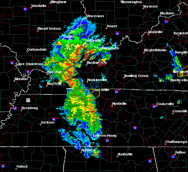 At 523 pm cdt, a severe thunderstorm capable of producing a tornado was located near central city, moving northeast at 20 mph. funnel clouds and damage have been reported with this storm! (radar indicated rotation). Hazards include tornado and golf ball size hail. Flying debris will be dangerous to those caught without shelter. mobile homes will be damaged or destroyed. damage to roofs, windows, and vehicles will occur. tree damage is likely. Locations impacted include, equality and ceralvo. At 523 pm cdt, a severe thunderstorm capable of producing a tornado was located near central city, moving northeast at 20 mph. funnel clouds and damage have been reported with this storm! (radar indicated rotation). Hazards include tornado and golf ball size hail. Flying debris will be dangerous to those caught without shelter. mobile homes will be damaged or destroyed. damage to roofs, windows, and vehicles will occur. tree damage is likely. Locations impacted include, equality and ceralvo.
|
| 4/27/2016 5:01 PM CDT |
 At 501 pm cdt, a severe thunderstorm capable of producing a tornado was located near central city, moving northeast at 25 mph. funnel clouds have been reported with this storm! (radar indicated rotation). Hazards include tornado and golf ball size hail. Flying debris will be dangerous to those caught without shelter. mobile homes will be damaged or destroyed. damage to roofs, windows, and vehicles will occur. Tree damage is likely. At 501 pm cdt, a severe thunderstorm capable of producing a tornado was located near central city, moving northeast at 25 mph. funnel clouds have been reported with this storm! (radar indicated rotation). Hazards include tornado and golf ball size hail. Flying debris will be dangerous to those caught without shelter. mobile homes will be damaged or destroyed. damage to roofs, windows, and vehicles will occur. Tree damage is likely.
|
| 3/31/2016 2:18 PM CDT |
 At 218 pm cdt, a severe thunderstorm was located 10 miles east of central city, moving northeast at 55 mph (radar indicated). Hazards include 60 mph wind gusts. Expect damage to roofs. siding. And trees. At 218 pm cdt, a severe thunderstorm was located 10 miles east of central city, moving northeast at 55 mph (radar indicated). Hazards include 60 mph wind gusts. Expect damage to roofs. siding. And trees.
|
| 12/23/2015 6:12 PM CST | At 612 pm cst, severe thunderstorms were located along a line extending from 10 miles west of leitchfield to 6 miles south of dunmor, moving northeast at 50 mph (radar indicated). Hazards include 60 mph wind gusts. Expect damage to roofs. Siding and trees. |
| 12/23/2015 5:27 PM CST | At 527 pm cst, severe thunderstorms were located along a line extending from 7 miles southeast of whitesville to 6 miles southeast of weir, moving northeast at 70 mph (radar indicated). Hazards include 60 mph wind gusts and penny size hail. Expect damage to roofs. Siding and trees. |
| 7/20/2015 10:48 PM CDT |
 At 1046 pm cdt, severe thunderstorms were located along a line extending from 5 miles southwest of livermore to 8 miles east of central city to 11 miles south of greenville, and moving east at 45 mph (radar indicated). Hazards include 60 mph wind gusts. Expect damage to roofs. Siding and trees. At 1046 pm cdt, severe thunderstorms were located along a line extending from 5 miles southwest of livermore to 8 miles east of central city to 11 miles south of greenville, and moving east at 45 mph (radar indicated). Hazards include 60 mph wind gusts. Expect damage to roofs. Siding and trees.
|
| 7/20/2015 10:44 PM CDT |
 At 1044 pm cdt, a severe thunderstorm was located over powderly, or over greenville, moving east at 35 mph (radar indicated). Hazards include 60 mph wind gusts. Expect damage to roofs. Siding and trees. At 1044 pm cdt, a severe thunderstorm was located over powderly, or over greenville, moving east at 35 mph (radar indicated). Hazards include 60 mph wind gusts. Expect damage to roofs. Siding and trees.
|
| 6/26/2015 2:13 PM CDT | At 212 pm cdt, severe thunderstorms were located along a line extending from 10 miles northwest of central city to 5 miles east of central city to 10 miles west of morgantown, and moving northeast at 35 mph (radar indicated). Hazards include 60 mph wind gusts and quarter size hail. Hail damage to vehicles is expected. Expect wind damage to roofs, siding and trees. |
| 6/21/2015 9:39 PM CDT |
 At 935 pm cdt, a severe thunderstorm was located near hartford, and moving southeast at 25 mph (radar indicated). Hazards include 60 mph wind gusts. Expect damage to roofs. siding and trees. Locations impacted include, rosine, rob roy, mount pleasant, prentiss, wysox, cool springs, horse branch, highview, windy hill, cromwell, oak grove, shultztown, select, flint springs, baizetown, arnold, dogwalk, white run, steff and jugville. At 935 pm cdt, a severe thunderstorm was located near hartford, and moving southeast at 25 mph (radar indicated). Hazards include 60 mph wind gusts. Expect damage to roofs. siding and trees. Locations impacted include, rosine, rob roy, mount pleasant, prentiss, wysox, cool springs, horse branch, highview, windy hill, cromwell, oak grove, shultztown, select, flint springs, baizetown, arnold, dogwalk, white run, steff and jugville.
|
| 6/21/2015 9:22 PM CDT |
 At 919 pm cdt, a severe thunderstorm was located near hartford, and moving southeast at 25 mph (radar indicated). Hazards include 60 mph wind gusts. Expect damage to roofs. Siding and trees. At 919 pm cdt, a severe thunderstorm was located near hartford, and moving southeast at 25 mph (radar indicated). Hazards include 60 mph wind gusts. Expect damage to roofs. Siding and trees.
|
Hail Maps for Rockport, KY


Connect with Interactive Hail Maps