

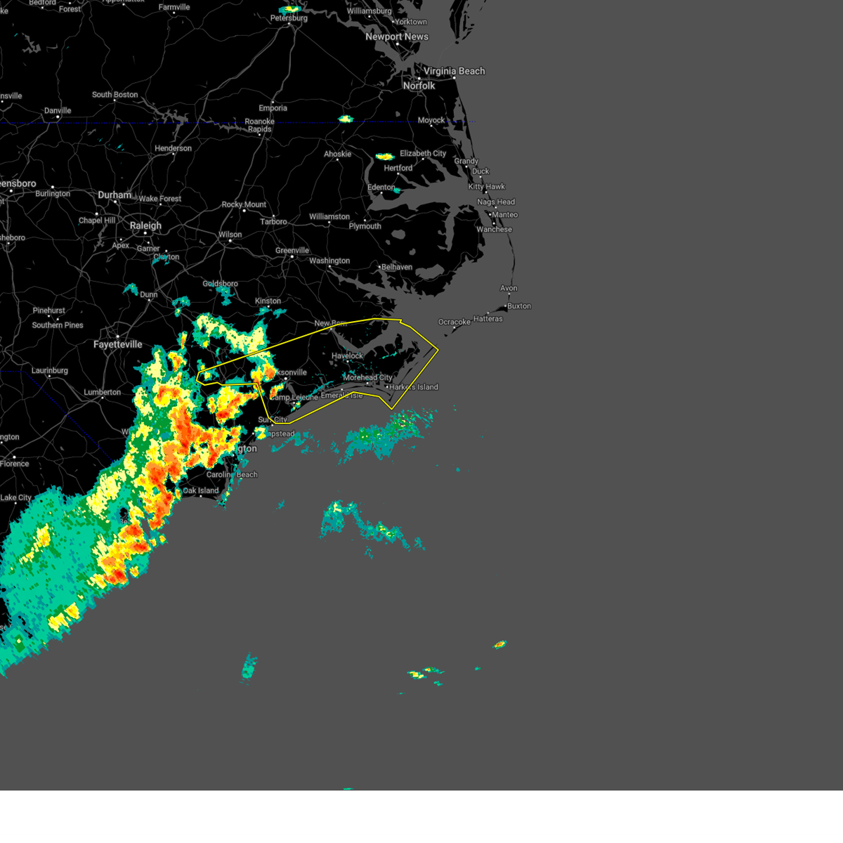
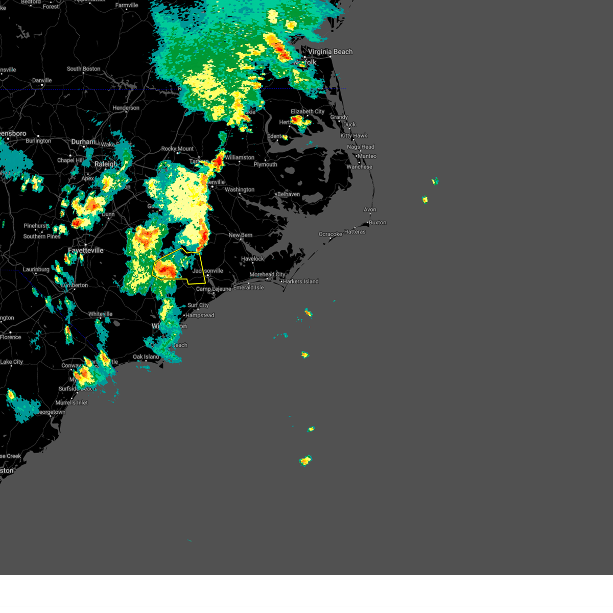
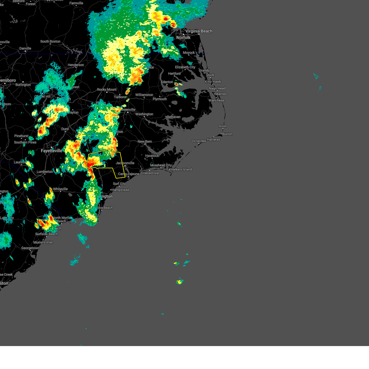
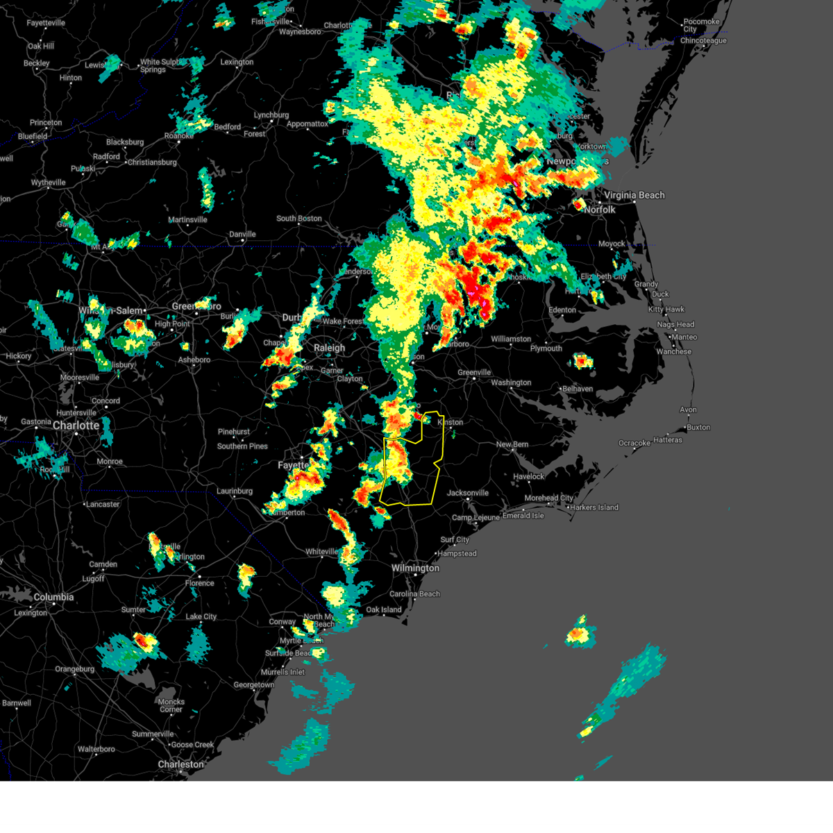
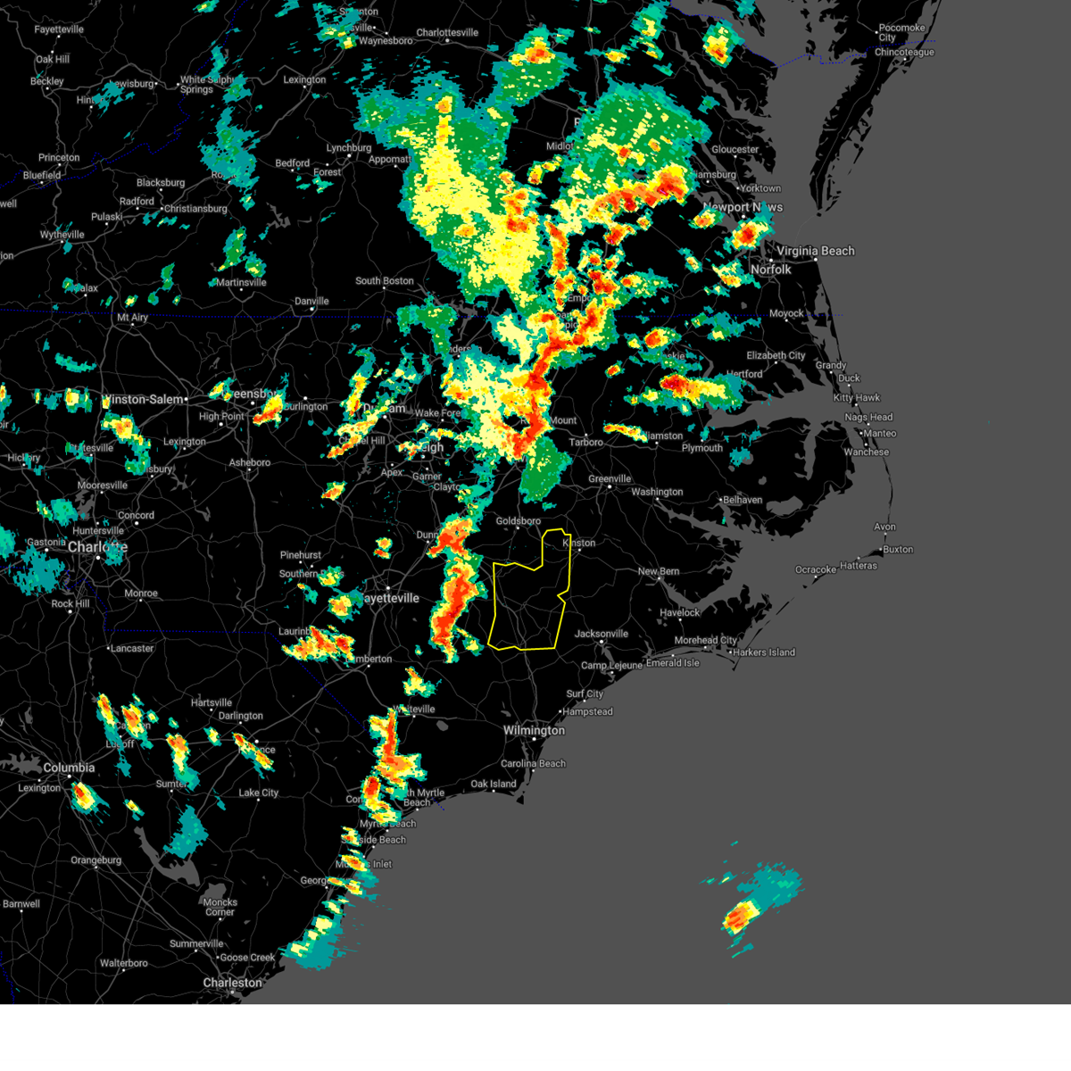
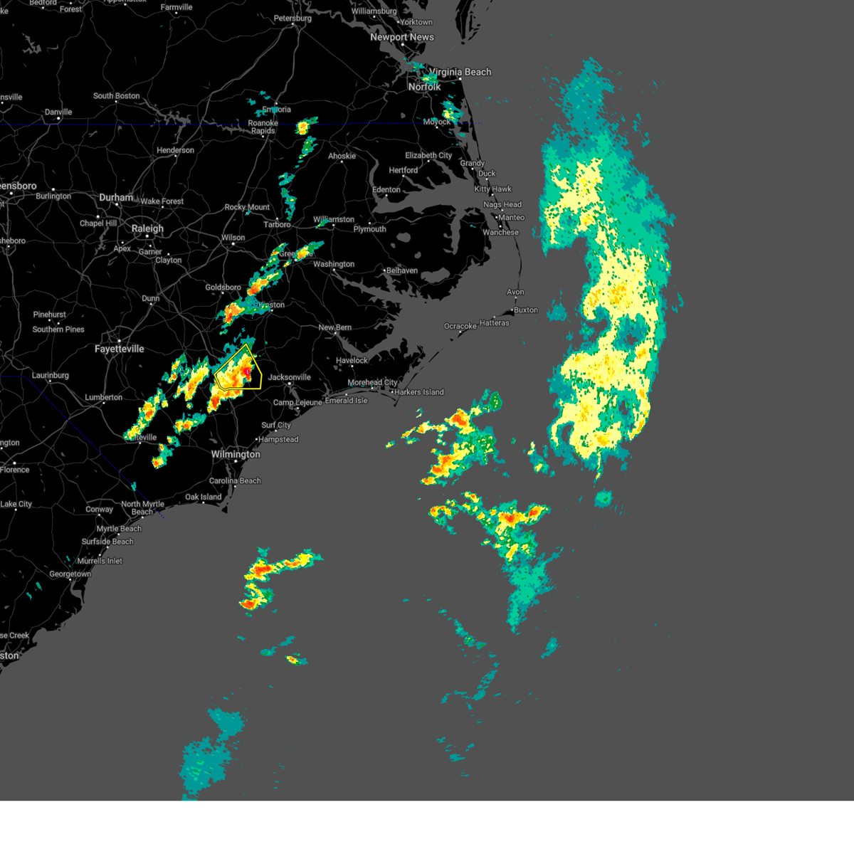
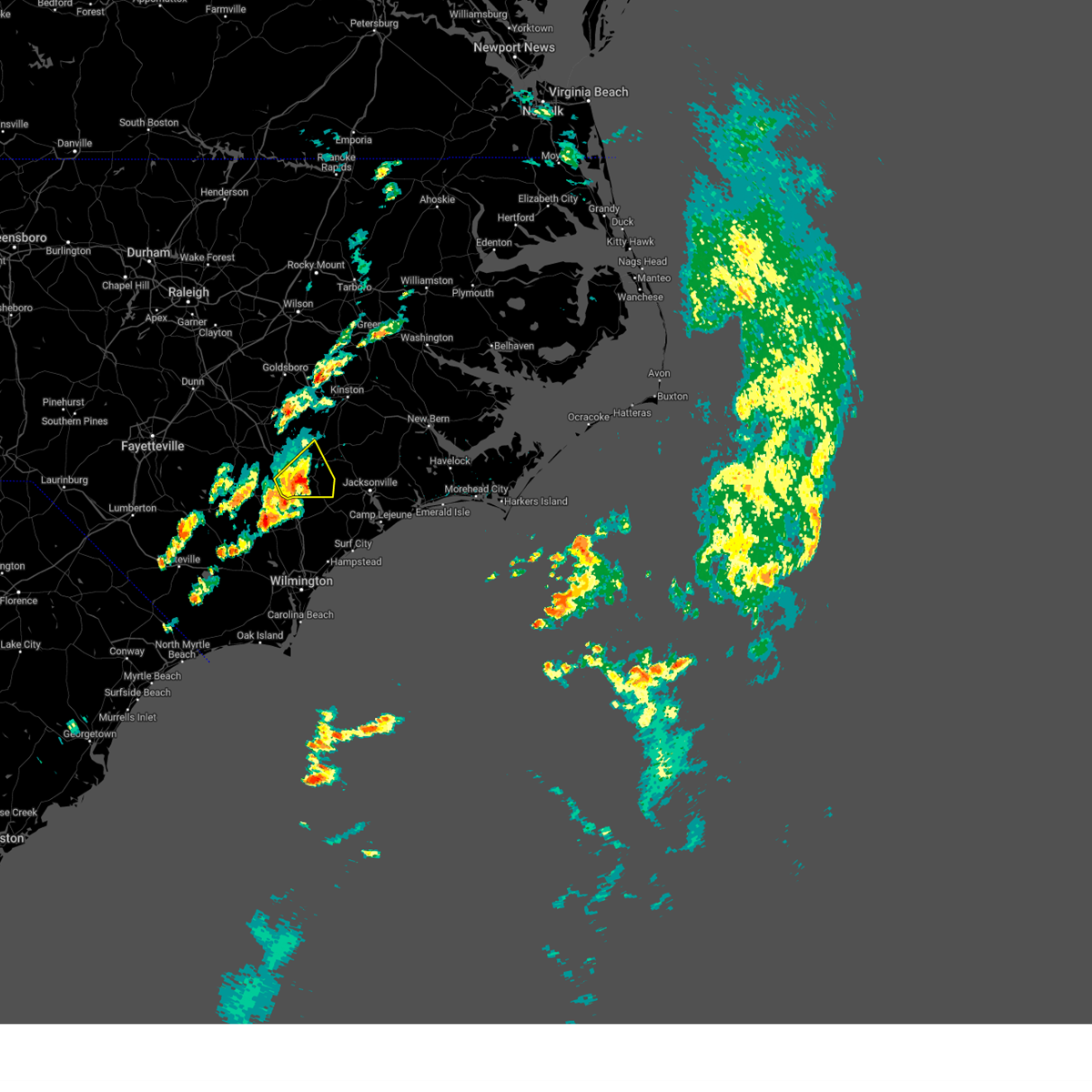
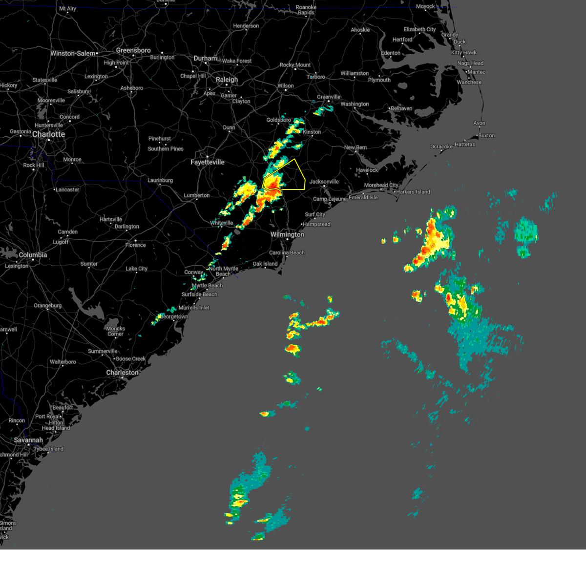
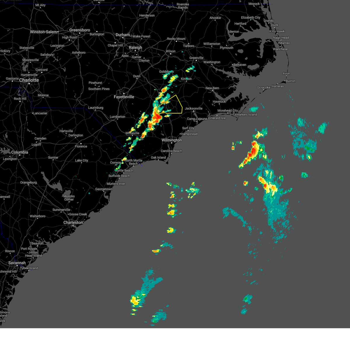
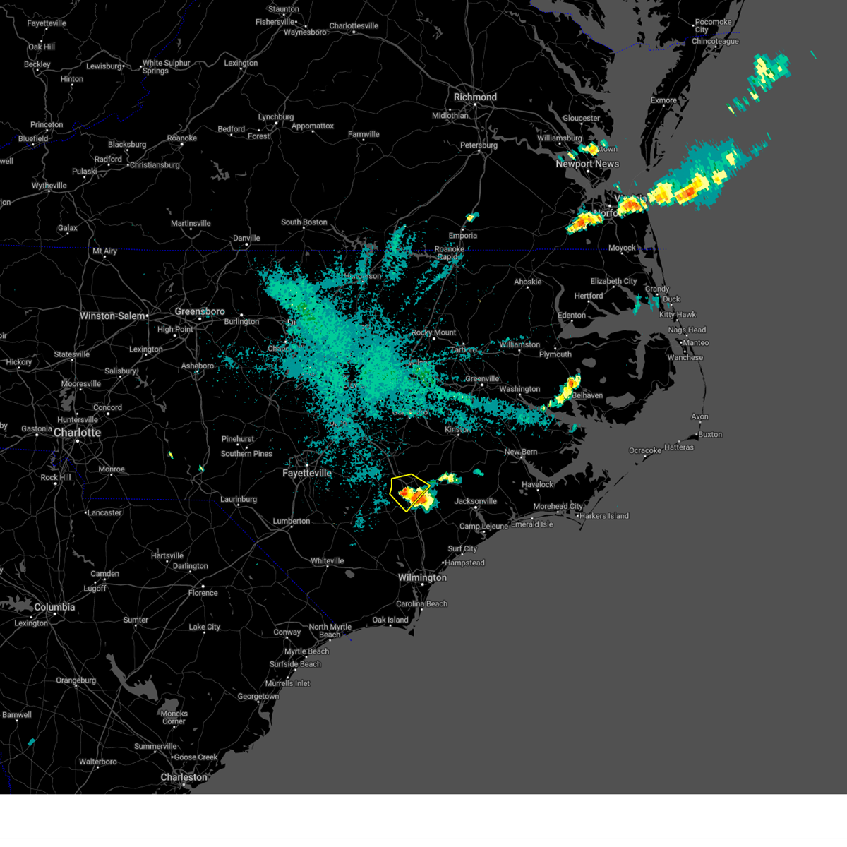
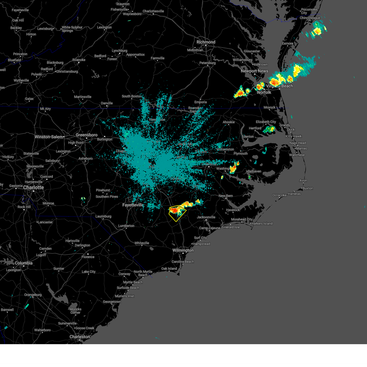
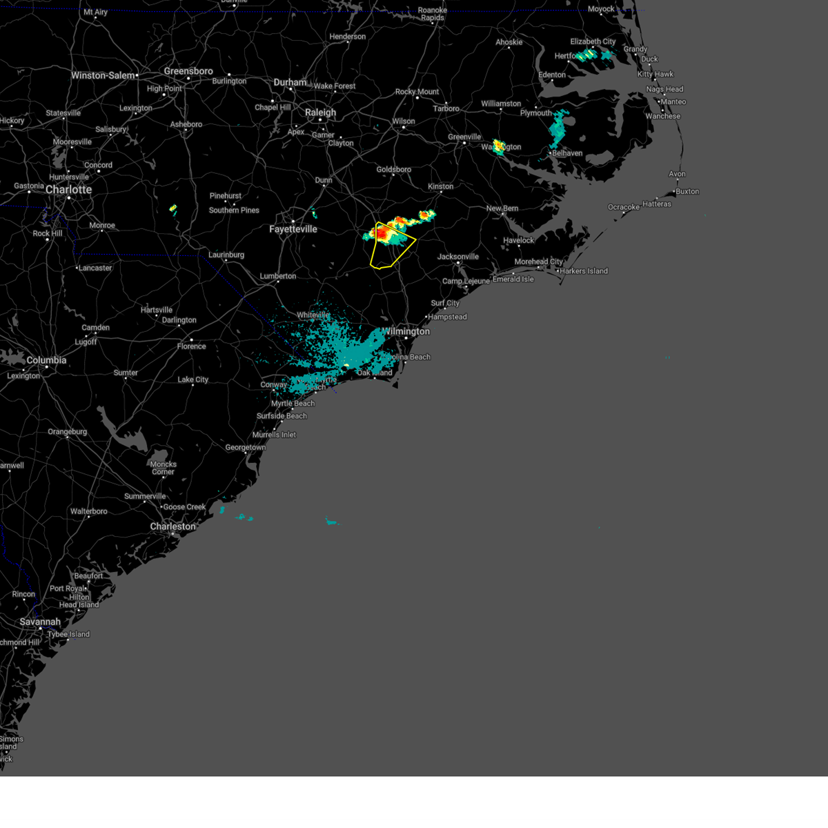
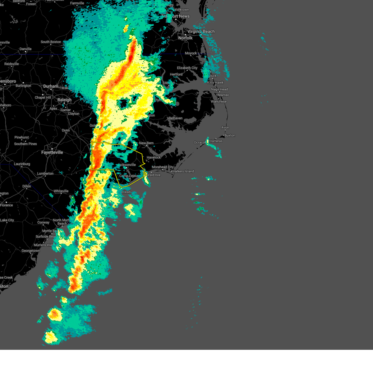
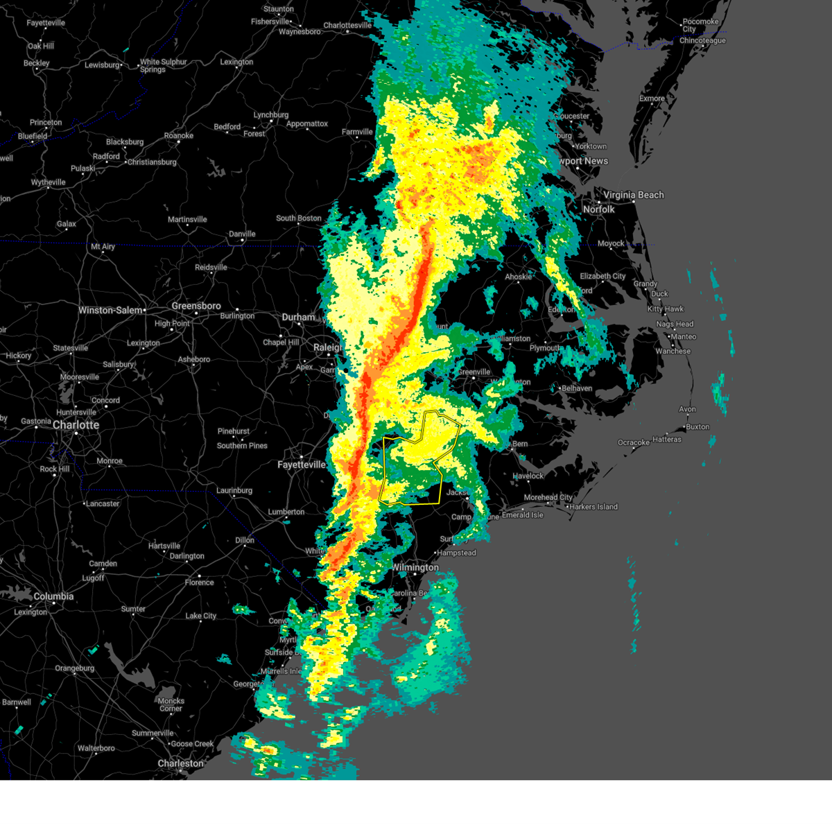
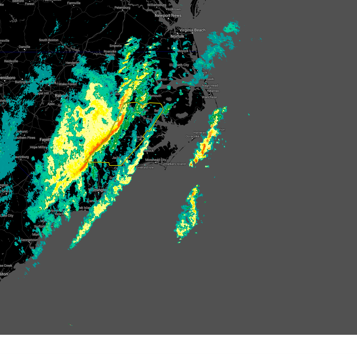
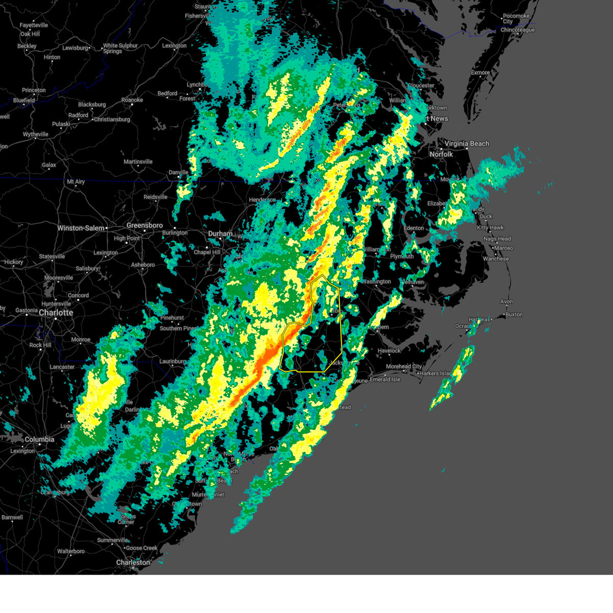
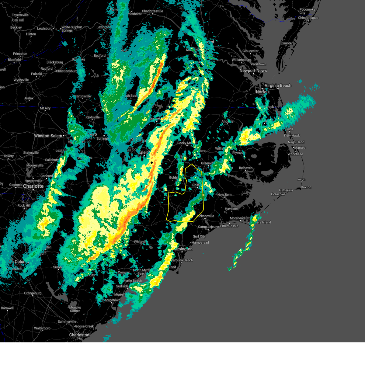
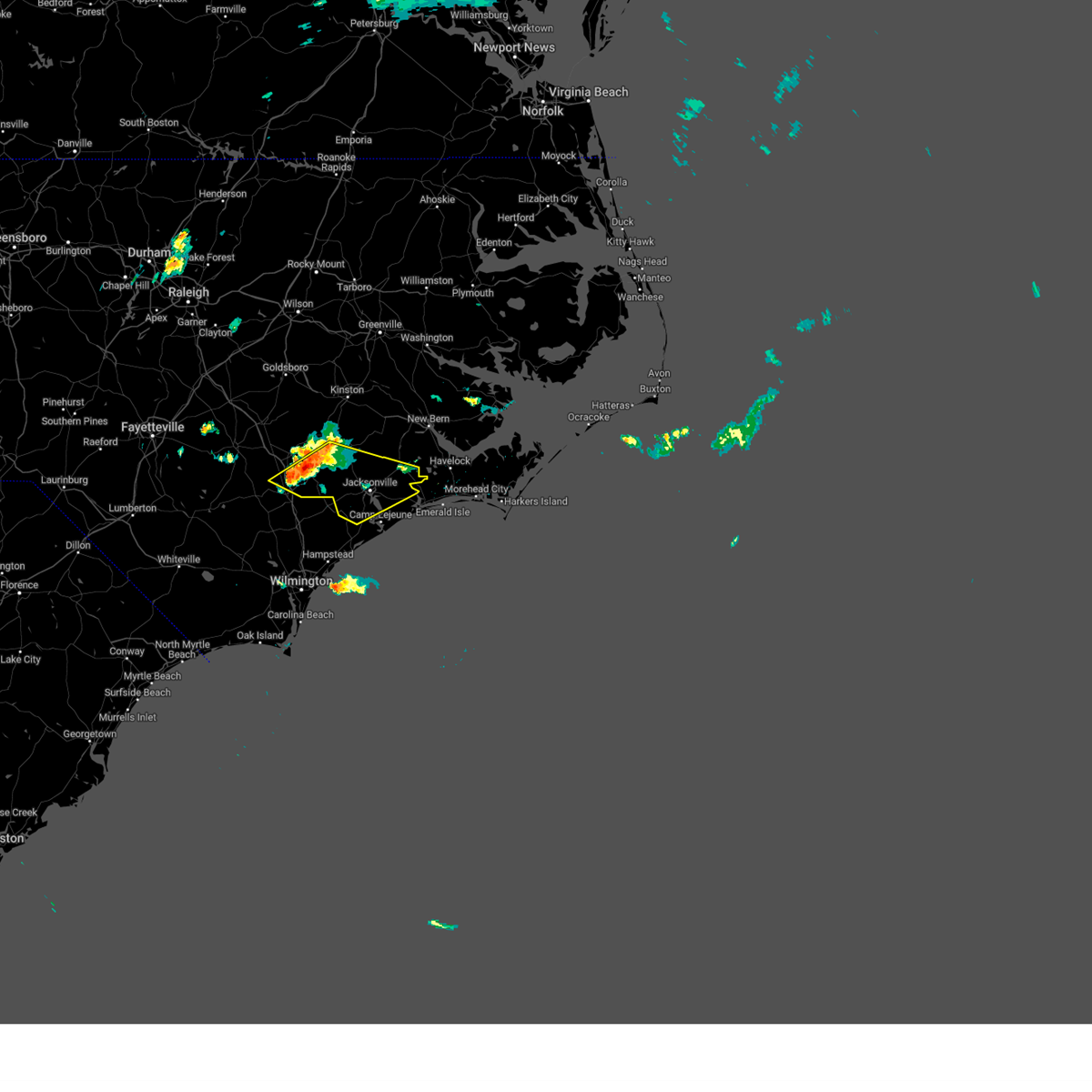
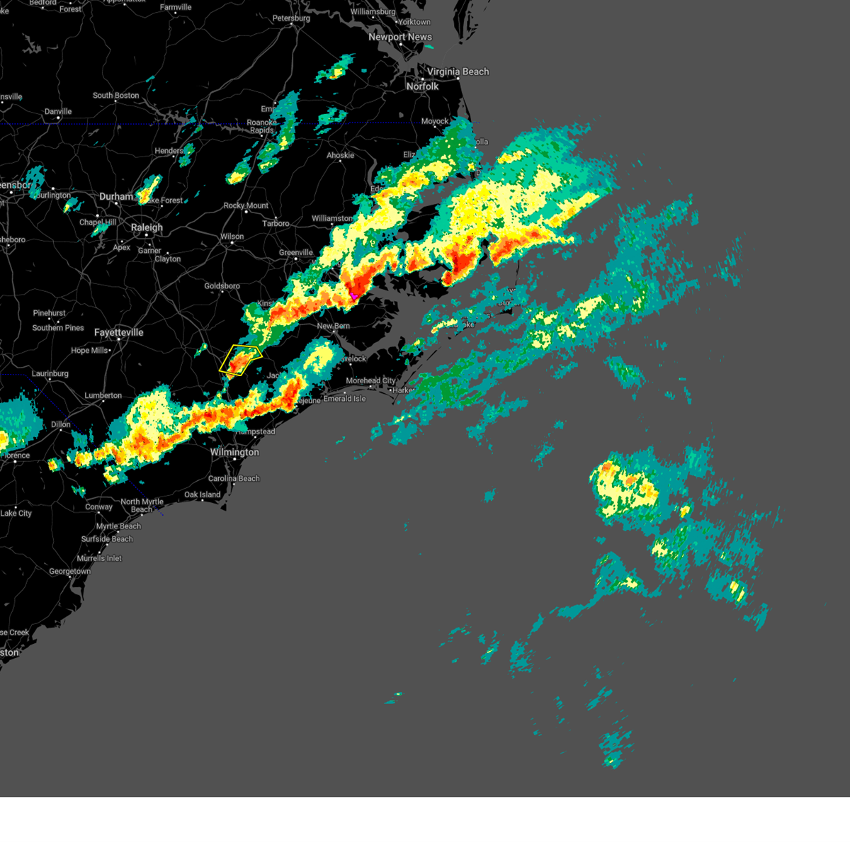
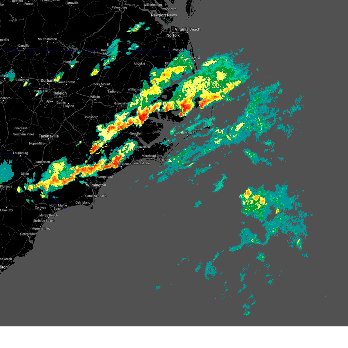
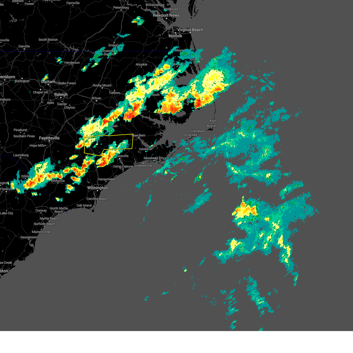
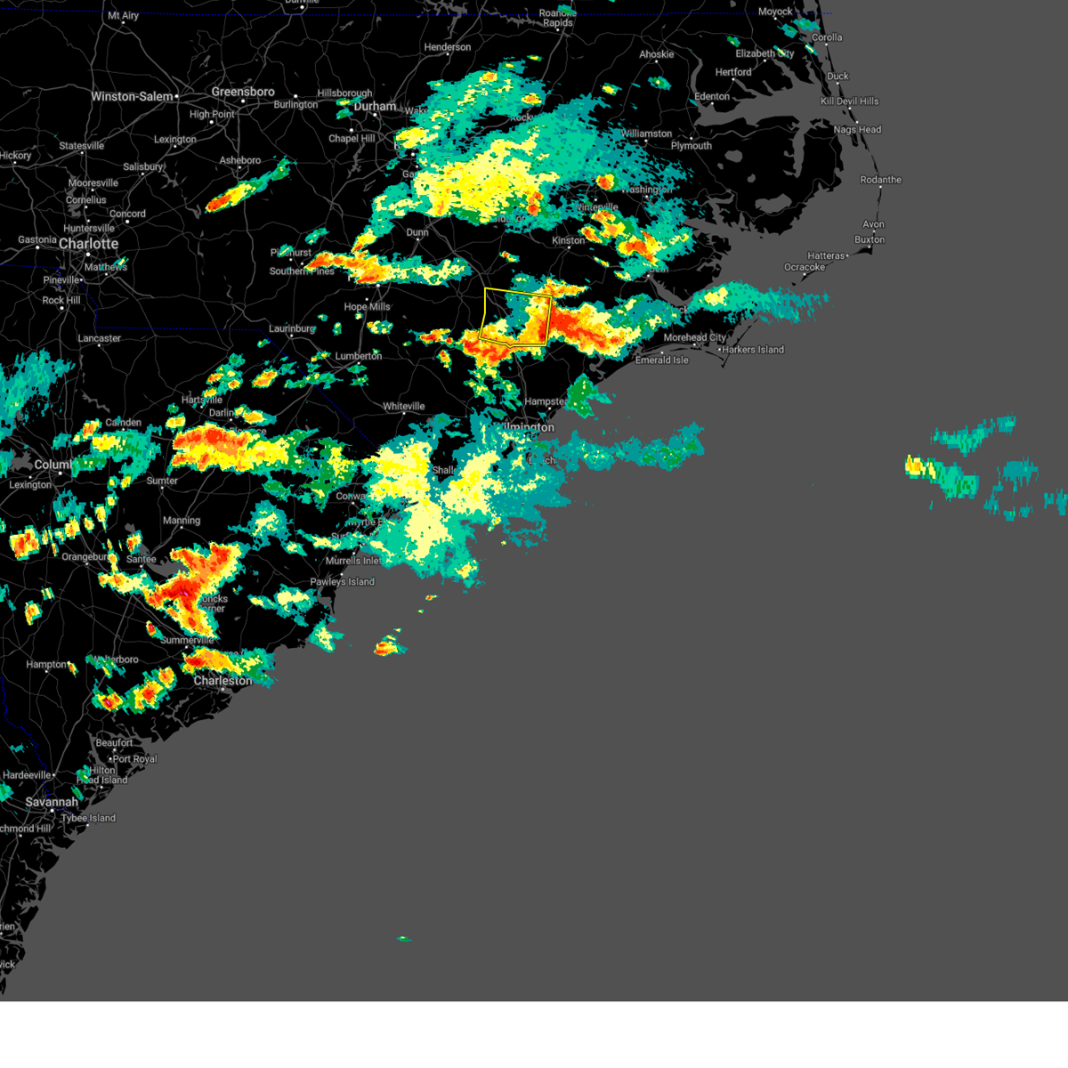
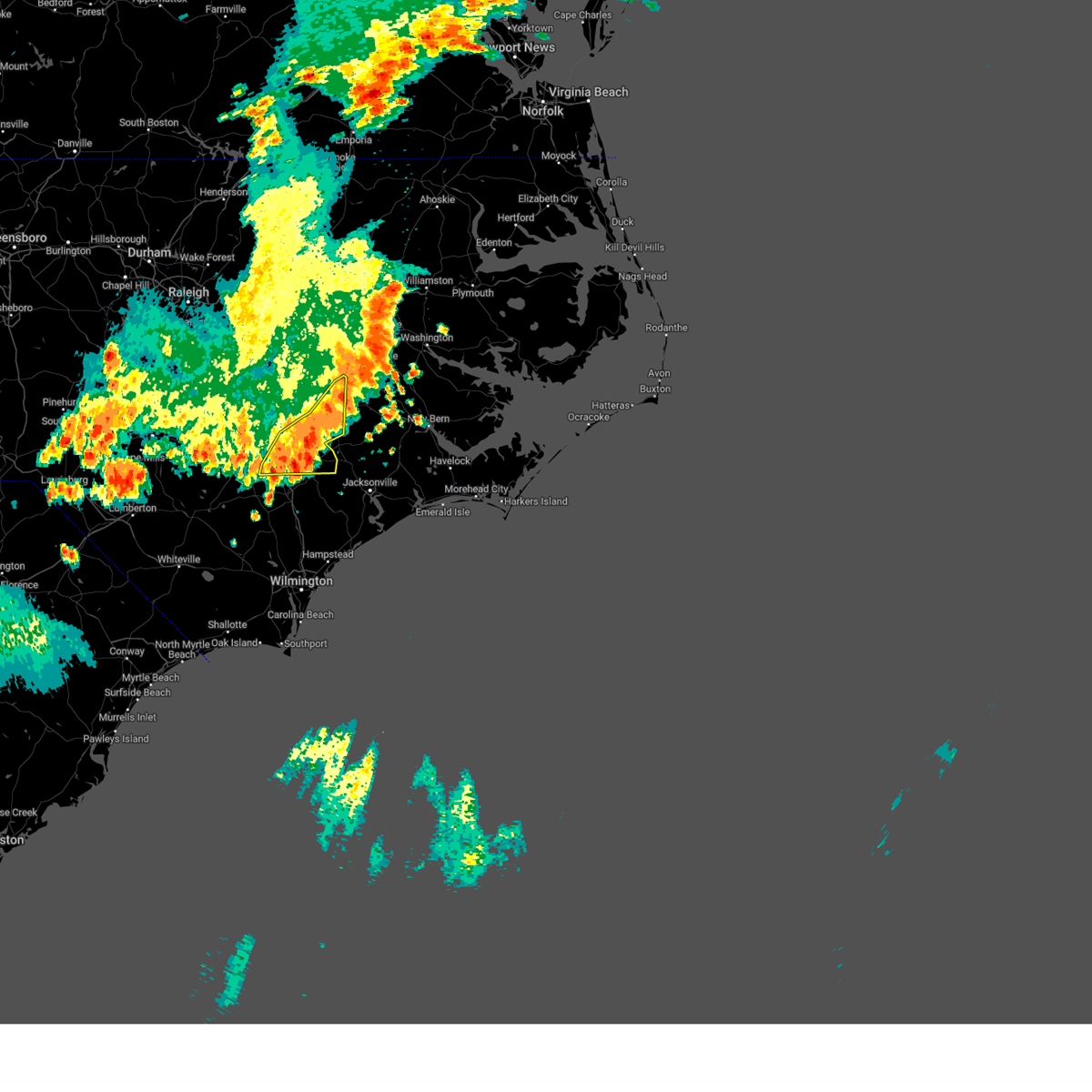
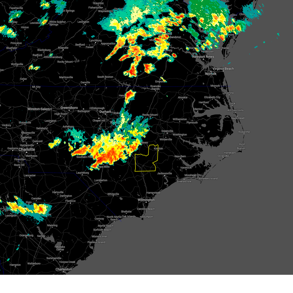
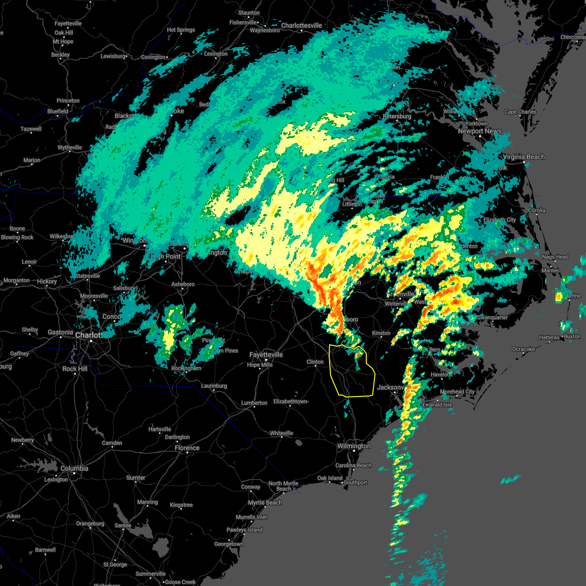
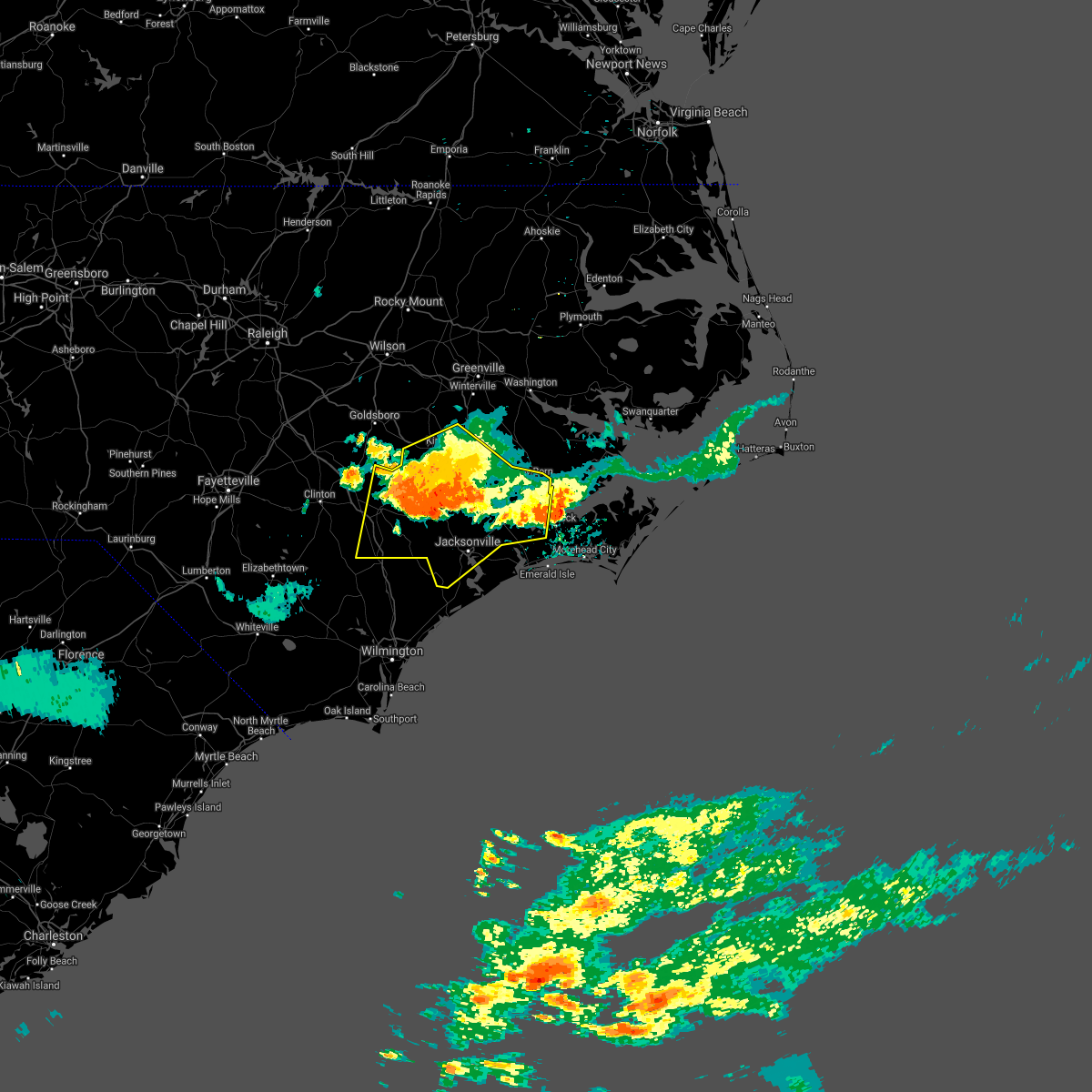
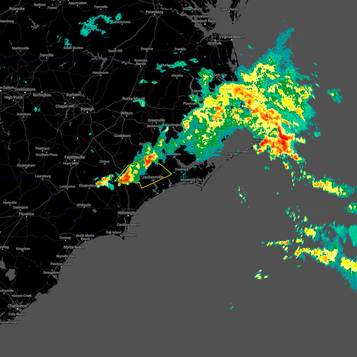
Hail Map for Rose Hill, NC
The Rose Hill, NC area has had 2 reports of on-the-ground hail by trained spotters, and has been under severe weather warnings 17 times during the past 12 months. Doppler radar has detected hail at or near Rose Hill, NC on 53 occasions, including 5 occasions during the past year.
| Name: | Rose Hill, NC |
| Where Located: | 41.1 miles N of Wilmington, NC |
| Map: | Google Map for Rose Hill, NC |
| Population: | 1626 |
| Housing Units: | 748 |
| More Info: | Search Google for Rose Hill, NC |
0
The Top Recent Hail Date for Rose Hill, NC is Wednesday, June 25, 2025 (31st out of 53)

Hail and Wind Damage Spotted near Rose Hill, NC
| Date / Time | Report Details |
|---|---|
| 6/8/2025 2:10 PM EDT |
 Svrmhx the national weather service in newport has issued a * severe thunderstorm warning for, southeastern jones county in eastern north carolina, southeastern craven county in eastern north carolina, onslow county in eastern north carolina, southern duplin county in eastern north carolina, carteret county in eastern north carolina, southern pamlico county in eastern north carolina, * until 330 pm edt. * at 209 pm edt, severe thunderstorms were located along a line extending from near maple hill to ogden, moving east at 55 mph (radar indicated). Hazards include 60 mph wind gusts and quarter size hail. Hail damage to vehicles is expected. Expect wind damage to roofs, siding, and trees. Svrmhx the national weather service in newport has issued a * severe thunderstorm warning for, southeastern jones county in eastern north carolina, southeastern craven county in eastern north carolina, onslow county in eastern north carolina, southern duplin county in eastern north carolina, carteret county in eastern north carolina, southern pamlico county in eastern north carolina, * until 330 pm edt. * at 209 pm edt, severe thunderstorms were located along a line extending from near maple hill to ogden, moving east at 55 mph (radar indicated). Hazards include 60 mph wind gusts and quarter size hail. Hail damage to vehicles is expected. Expect wind damage to roofs, siding, and trees.
|
| 5/14/2025 6:32 PM EDT |
 At 632 pm edt, severe thunderstorms were located along a line extending from near rose hill to near murray town, moving northeast at 30 mph (radar indicated). Hazards include 60 mph wind gusts and quarter size hail. Hail damage to vehicles is expected. expect wind damage to roofs, siding, and trees. Locations impacted include, jacksonville, wallace, rose hill, richlands, beulaville, cypress creek, catherine lake, chinquapin, potters hill, petersburg, albert j ellis airport, richlands south, greenevers, lyman, haws run, and teachey. At 632 pm edt, severe thunderstorms were located along a line extending from near rose hill to near murray town, moving northeast at 30 mph (radar indicated). Hazards include 60 mph wind gusts and quarter size hail. Hail damage to vehicles is expected. expect wind damage to roofs, siding, and trees. Locations impacted include, jacksonville, wallace, rose hill, richlands, beulaville, cypress creek, catherine lake, chinquapin, potters hill, petersburg, albert j ellis airport, richlands south, greenevers, lyman, haws run, and teachey.
|
| 5/14/2025 6:09 PM EDT |
 Svrmhx the national weather service in newport has issued a * severe thunderstorm warning for, western onslow county in eastern north carolina, duplin county in eastern north carolina, * until 715 pm edt. * at 609 pm edt, severe thunderstorms were located along a line extending from near harrells to near wards corner, moving northeast at 30 mph (radar indicated). Hazards include 60 mph wind gusts and quarter size hail. Hail damage to vehicles is expected. Expect wind damage to roofs, siding, and trees. Svrmhx the national weather service in newport has issued a * severe thunderstorm warning for, western onslow county in eastern north carolina, duplin county in eastern north carolina, * until 715 pm edt. * at 609 pm edt, severe thunderstorms were located along a line extending from near harrells to near wards corner, moving northeast at 30 mph (radar indicated). Hazards include 60 mph wind gusts and quarter size hail. Hail damage to vehicles is expected. Expect wind damage to roofs, siding, and trees.
|
| 5/14/2025 5:20 PM EDT |
 At 520 pm edt, severe thunderstorms were located along a line extending from 7 miles southwest of walnut creek to near harrells, moving east at 40 mph (radar indicated). Hazards include 60 mph wind gusts and quarter size hail. Hail damage to vehicles is expected. expect wind damage to roofs, siding, and trees. Locations impacted include, kinston, wallace, warsaw, la grange, mount olive, kornegay, rose hill, beulaville, deep run, bowdens, beautancus, kenansville, chinquapin, potters hill, institute, albertson, harrells, sarecta, faison, and magnolia. At 520 pm edt, severe thunderstorms were located along a line extending from 7 miles southwest of walnut creek to near harrells, moving east at 40 mph (radar indicated). Hazards include 60 mph wind gusts and quarter size hail. Hail damage to vehicles is expected. expect wind damage to roofs, siding, and trees. Locations impacted include, kinston, wallace, warsaw, la grange, mount olive, kornegay, rose hill, beulaville, deep run, bowdens, beautancus, kenansville, chinquapin, potters hill, institute, albertson, harrells, sarecta, faison, and magnolia.
|
| 5/14/2025 4:24 PM EDT |
 Svrmhx the national weather service in newport has issued a * severe thunderstorm warning for, western lenoir county in eastern north carolina, duplin county in eastern north carolina, * until 545 pm edt. * at 424 pm edt, severe thunderstorms were located along a line extending from 13 miles south of smithfield to 8 miles east of ammon, moving east at 30 mph (radar indicated). Hazards include 60 mph wind gusts and quarter size hail. Hail damage to vehicles is expected. Expect wind damage to roofs, siding, and trees. Svrmhx the national weather service in newport has issued a * severe thunderstorm warning for, western lenoir county in eastern north carolina, duplin county in eastern north carolina, * until 545 pm edt. * at 424 pm edt, severe thunderstorms were located along a line extending from 13 miles south of smithfield to 8 miles east of ammon, moving east at 30 mph (radar indicated). Hazards include 60 mph wind gusts and quarter size hail. Hail damage to vehicles is expected. Expect wind damage to roofs, siding, and trees.
|
| 5/4/2025 3:29 PM EDT |
 The storm which prompted the warning has weakened below severe limits, and no longer poses an immediate threat to life or property. therefore, the warning will be allowed to expire. however, small hail and gusty winds are still possible with this thunderstorm. The storm which prompted the warning has weakened below severe limits, and no longer poses an immediate threat to life or property. therefore, the warning will be allowed to expire. however, small hail and gusty winds are still possible with this thunderstorm.
|
| 5/4/2025 3:16 PM EDT |
 At 316 pm edt, a severe thunderstorm was located near chinquapin, or 9 miles northeast of wallace, moving northeast at 35 mph (radar indicated). Hazards include 60 mph wind gusts and nickel size hail. Expect damage to roofs, siding, and trees. Locations impacted include, wallace, cypress creek, chinquapin, teachey, beulaville, lyman, rose hill, greenevers, and sarecta. At 316 pm edt, a severe thunderstorm was located near chinquapin, or 9 miles northeast of wallace, moving northeast at 35 mph (radar indicated). Hazards include 60 mph wind gusts and nickel size hail. Expect damage to roofs, siding, and trees. Locations impacted include, wallace, cypress creek, chinquapin, teachey, beulaville, lyman, rose hill, greenevers, and sarecta.
|
| 5/4/2025 3:03 PM EDT |
 At 303 pm edt, a severe thunderstorm was located over wallace, moving northeast at 30 mph (radar indicated). Hazards include 60 mph wind gusts and quarter size hail. Hail damage to vehicles is expected. expect wind damage to roofs, siding, and trees. Locations impacted include, wallace, cypress creek, chinquapin, teachey, beulaville, lyman, rose hill, greenevers, sarecta, and harrells. At 303 pm edt, a severe thunderstorm was located over wallace, moving northeast at 30 mph (radar indicated). Hazards include 60 mph wind gusts and quarter size hail. Hail damage to vehicles is expected. expect wind damage to roofs, siding, and trees. Locations impacted include, wallace, cypress creek, chinquapin, teachey, beulaville, lyman, rose hill, greenevers, sarecta, and harrells.
|
| 5/4/2025 2:45 PM EDT |
 Svrmhx the national weather service in newport has issued a * severe thunderstorm warning for, southern duplin county in eastern north carolina, * until 330 pm edt. * at 245 pm edt, a severe thunderstorm was located near harrells, or 10 miles southwest of wallace, moving northeast at 25 mph (radar indicated). Hazards include 60 mph wind gusts and quarter size hail. Hail damage to vehicles is expected. Expect wind damage to roofs, siding, and trees. Svrmhx the national weather service in newport has issued a * severe thunderstorm warning for, southern duplin county in eastern north carolina, * until 330 pm edt. * at 245 pm edt, a severe thunderstorm was located near harrells, or 10 miles southwest of wallace, moving northeast at 25 mph (radar indicated). Hazards include 60 mph wind gusts and quarter size hail. Hail damage to vehicles is expected. Expect wind damage to roofs, siding, and trees.
|
| 4/26/2025 9:41 PM EDT |
 The storm which prompted the warning has weakened below severe limits, and no longer poses an immediate threat to life or property. therefore, the warning will be allowed to expire. to report severe weather, contact your nearest law enforcement agency. they will relay your report to the national weather service newport. The storm which prompted the warning has weakened below severe limits, and no longer poses an immediate threat to life or property. therefore, the warning will be allowed to expire. to report severe weather, contact your nearest law enforcement agency. they will relay your report to the national weather service newport.
|
| 4/26/2025 9:17 PM EDT |
 At 917 pm edt, a severe thunderstorm was located near rose hill, or 7 miles south of warsaw, moving southeast at 20 mph (radar indicated). Hazards include 60 mph wind gusts and quarter size hail. Hail damage to vehicles is expected. expect wind damage to roofs, siding, and trees. Locations impacted include, rose hill, teachey, magnolia, greenevers, kenansville, and wallace. At 917 pm edt, a severe thunderstorm was located near rose hill, or 7 miles south of warsaw, moving southeast at 20 mph (radar indicated). Hazards include 60 mph wind gusts and quarter size hail. Hail damage to vehicles is expected. expect wind damage to roofs, siding, and trees. Locations impacted include, rose hill, teachey, magnolia, greenevers, kenansville, and wallace.
|
| 4/26/2025 8:58 PM EDT |
 Svrmhx the national weather service in newport has issued a * severe thunderstorm warning for, southwestern duplin county in eastern north carolina, * until 945 pm edt. * at 858 pm edt, a severe thunderstorm was located near warsaw, moving southeast at 20 mph (radar indicated). Hazards include 60 mph wind gusts and quarter size hail. Hail damage to vehicles is expected. Expect wind damage to roofs, siding, and trees. Svrmhx the national weather service in newport has issued a * severe thunderstorm warning for, southwestern duplin county in eastern north carolina, * until 945 pm edt. * at 858 pm edt, a severe thunderstorm was located near warsaw, moving southeast at 20 mph (radar indicated). Hazards include 60 mph wind gusts and quarter size hail. Hail damage to vehicles is expected. Expect wind damage to roofs, siding, and trees.
|
| 3/5/2025 2:42 PM EST |
 Svrmhx the national weather service in newport has issued a * severe thunderstorm warning for, jones county in eastern north carolina, southwestern lenoir county in eastern north carolina, onslow county in eastern north carolina, duplin county in eastern north carolina, * until 345 pm est. * at 242 pm est, severe thunderstorms were located along a line extending from near kenansville to near mill creek, moving northeast at 80 mph (radar indicated). Hazards include 70 mph wind gusts. Expect considerable tree damage. Damage is likely to mobile homes, roofs, and outbuildings. Svrmhx the national weather service in newport has issued a * severe thunderstorm warning for, jones county in eastern north carolina, southwestern lenoir county in eastern north carolina, onslow county in eastern north carolina, duplin county in eastern north carolina, * until 345 pm est. * at 242 pm est, severe thunderstorms were located along a line extending from near kenansville to near mill creek, moving northeast at 80 mph (radar indicated). Hazards include 70 mph wind gusts. Expect considerable tree damage. Damage is likely to mobile homes, roofs, and outbuildings.
|
| 3/5/2025 2:06 PM EST |
 Svrmhx the national weather service in newport has issued a * severe thunderstorm warning for, lenoir county in eastern north carolina, duplin county in eastern north carolina, * until 245 pm est. * at 205 pm est, severe thunderstorms were located along a line extending from clinton to near lagoon, moving northeast at 75 mph (radar indicated). Hazards include 70 mph wind gusts. Expect considerable tree damage. Damage is likely to mobile homes, roofs, and outbuildings. Svrmhx the national weather service in newport has issued a * severe thunderstorm warning for, lenoir county in eastern north carolina, duplin county in eastern north carolina, * until 245 pm est. * at 205 pm est, severe thunderstorms were located along a line extending from clinton to near lagoon, moving northeast at 75 mph (radar indicated). Hazards include 70 mph wind gusts. Expect considerable tree damage. Damage is likely to mobile homes, roofs, and outbuildings.
|
| 2/16/2025 10:44 AM EST |
 Svrmhx the national weather service in newport has issued a * severe thunderstorm warning for, jones county in eastern north carolina, central lenoir county in eastern north carolina, craven county in eastern north carolina, central pitt county in eastern north carolina, northern onslow county in eastern north carolina, beaufort county in eastern north carolina, southern duplin county in eastern north carolina, * until 1130 am est. * at 1043 am est, severe thunderstorms were located along a line extending from dowdy ficklen stadium to near deep run to near harrells, moving east at 50 mph (trained weather spotters). Hazards include 60 mph wind gusts. expect damage to roofs, siding, and trees Svrmhx the national weather service in newport has issued a * severe thunderstorm warning for, jones county in eastern north carolina, central lenoir county in eastern north carolina, craven county in eastern north carolina, central pitt county in eastern north carolina, northern onslow county in eastern north carolina, beaufort county in eastern north carolina, southern duplin county in eastern north carolina, * until 1130 am est. * at 1043 am est, severe thunderstorms were located along a line extending from dowdy ficklen stadium to near deep run to near harrells, moving east at 50 mph (trained weather spotters). Hazards include 60 mph wind gusts. expect damage to roofs, siding, and trees
|
| 2/16/2025 10:26 AM EST |
 At 1025 am est, severe thunderstorms were located along a line extending from near snow hill to near kornegay to 6 miles northwest of harrells, moving east at 65 mph (radar indicated). Hazards include 60 mph wind gusts. Expect damage to roofs, siding, and trees. Locations impacted include, kinston, wallace, warsaw, la grange, mount olive, kornegay, rose hill, snow hill, richlands, beulaville, deep run, bowdens, cypress creek, beautancus, comfort, kenansville, chinquapin, dawson, potters hill, and graingers. At 1025 am est, severe thunderstorms were located along a line extending from near snow hill to near kornegay to 6 miles northwest of harrells, moving east at 65 mph (radar indicated). Hazards include 60 mph wind gusts. Expect damage to roofs, siding, and trees. Locations impacted include, kinston, wallace, warsaw, la grange, mount olive, kornegay, rose hill, snow hill, richlands, beulaville, deep run, bowdens, cypress creek, beautancus, comfort, kenansville, chinquapin, dawson, potters hill, and graingers.
|
| 2/16/2025 9:41 AM EST |
 Svrmhx the national weather service in newport has issued a * severe thunderstorm warning for, northwestern jones county in eastern north carolina, greene county in eastern north carolina, lenoir county in eastern north carolina, northwestern onslow county in eastern north carolina, duplin county in eastern north carolina, * until 1045 am est. * at 940 am est, severe thunderstorms were located along a line extending from 6 miles southeast of benson to near jerome to near fairmont, moving east at 55 mph (radar indicated). Hazards include 60 mph wind gusts. expect damage to roofs, siding, and trees Svrmhx the national weather service in newport has issued a * severe thunderstorm warning for, northwestern jones county in eastern north carolina, greene county in eastern north carolina, lenoir county in eastern north carolina, northwestern onslow county in eastern north carolina, duplin county in eastern north carolina, * until 1045 am est. * at 940 am est, severe thunderstorms were located along a line extending from 6 miles southeast of benson to near jerome to near fairmont, moving east at 55 mph (radar indicated). Hazards include 60 mph wind gusts. expect damage to roofs, siding, and trees
|
| 5/24/2024 4:31 PM EDT |
 Svrmhx the national weather service in newport has issued a * severe thunderstorm warning for, southern jones county in eastern north carolina, onslow county in eastern north carolina, southern duplin county in eastern north carolina, * until 530 pm edt. * at 430 pm edt, severe thunderstorms were located along a line extending from near potters hill to near wallace, moving east at 25 mph (radar indicated). Hazards include golf ball size hail and 60 mph wind gusts. People and animals outdoors will be injured. expect hail damage to roofs, siding, windows, and vehicles. Expect wind damage to roofs, siding, and trees. Svrmhx the national weather service in newport has issued a * severe thunderstorm warning for, southern jones county in eastern north carolina, onslow county in eastern north carolina, southern duplin county in eastern north carolina, * until 530 pm edt. * at 430 pm edt, severe thunderstorms were located along a line extending from near potters hill to near wallace, moving east at 25 mph (radar indicated). Hazards include golf ball size hail and 60 mph wind gusts. People and animals outdoors will be injured. expect hail damage to roofs, siding, windows, and vehicles. Expect wind damage to roofs, siding, and trees.
|
| 5/15/2024 6:13 PM EDT |
 the severe thunderstorm warning has been cancelled and is no longer in effect the severe thunderstorm warning has been cancelled and is no longer in effect
|
| 5/15/2024 6:05 PM EDT |
 At 604 pm edt, a severe thunderstorm was located 7 miles west of rose hill, or 11 miles northwest of wallace, moving southeast at 25 mph (radar indicated). Hazards include 60 mph wind gusts and quarter size hail. Hail damage to vehicles is expected. expect wind damage to roofs, siding, and trees. Locations impacted include, wallace, rose hill, harrells, and teachey. At 604 pm edt, a severe thunderstorm was located 7 miles west of rose hill, or 11 miles northwest of wallace, moving southeast at 25 mph (radar indicated). Hazards include 60 mph wind gusts and quarter size hail. Hail damage to vehicles is expected. expect wind damage to roofs, siding, and trees. Locations impacted include, wallace, rose hill, harrells, and teachey.
|
| 5/15/2024 5:34 PM EDT |
 Svrmhx the national weather service in newport has issued a * severe thunderstorm warning for, southern duplin county in eastern north carolina, * until 645 pm edt. * at 533 pm edt, a severe thunderstorm was located near clinton, moving southeast at 20 mph (radar indicated). Hazards include golf ball size hail and 70 mph wind gusts. People and animals outdoors will be injured. expect hail damage to roofs, siding, windows, and vehicles. expect considerable tree damage. Wind damage is also likely to mobile homes, roofs, and outbuildings. Svrmhx the national weather service in newport has issued a * severe thunderstorm warning for, southern duplin county in eastern north carolina, * until 645 pm edt. * at 533 pm edt, a severe thunderstorm was located near clinton, moving southeast at 20 mph (radar indicated). Hazards include golf ball size hail and 70 mph wind gusts. People and animals outdoors will be injured. expect hail damage to roofs, siding, windows, and vehicles. expect considerable tree damage. Wind damage is also likely to mobile homes, roofs, and outbuildings.
|
| 5/10/2024 6:00 PM EDT |
 the severe thunderstorm warning has been cancelled and is no longer in effect the severe thunderstorm warning has been cancelled and is no longer in effect
|
| 5/10/2024 5:50 PM EDT |
 At 550 pm edt, a severe thunderstorm was located near kornegay, or 14 miles east of warsaw, moving east at 35 mph (radar indicated). Hazards include 60 mph wind gusts and penny size hail. Expect damage to roofs, siding, and trees. Locations impacted include, beulaville, potters hill, sarecta, and greenevers. At 550 pm edt, a severe thunderstorm was located near kornegay, or 14 miles east of warsaw, moving east at 35 mph (radar indicated). Hazards include 60 mph wind gusts and penny size hail. Expect damage to roofs, siding, and trees. Locations impacted include, beulaville, potters hill, sarecta, and greenevers.
|
| 5/10/2024 5:50 PM EDT |
 the severe thunderstorm warning has been cancelled and is no longer in effect the severe thunderstorm warning has been cancelled and is no longer in effect
|
| 5/10/2024 5:25 PM EDT |
 Svrmhx the national weather service in newport has issued a * severe thunderstorm warning for, jones county in eastern north carolina, southwestern lenoir county in eastern north carolina, west central craven county in eastern north carolina, northwestern onslow county in eastern north carolina, duplin county in eastern north carolina, * until 645 pm edt. * at 525 pm edt, a severe thunderstorm was located over warsaw, moving east at 35 mph (radar indicated). Hazards include 60 mph wind gusts and quarter size hail. Hail damage to vehicles is expected. Expect wind damage to roofs, siding, and trees. Svrmhx the national weather service in newport has issued a * severe thunderstorm warning for, jones county in eastern north carolina, southwestern lenoir county in eastern north carolina, west central craven county in eastern north carolina, northwestern onslow county in eastern north carolina, duplin county in eastern north carolina, * until 645 pm edt. * at 525 pm edt, a severe thunderstorm was located over warsaw, moving east at 35 mph (radar indicated). Hazards include 60 mph wind gusts and quarter size hail. Hail damage to vehicles is expected. Expect wind damage to roofs, siding, and trees.
|
| 5/10/2024 4:25 PM EDT |
 Svrmhx the national weather service in newport has issued a * severe thunderstorm warning for, southern duplin county in eastern north carolina, * until 515 pm edt. * at 425 pm edt, a severe thunderstorm was located 7 miles west of harrells, or 16 miles south of clinton, moving east at 35 mph (radar indicated). Hazards include 60 mph wind gusts and quarter size hail. Hail damage to vehicles is expected. Expect wind damage to roofs, siding, and trees. Svrmhx the national weather service in newport has issued a * severe thunderstorm warning for, southern duplin county in eastern north carolina, * until 515 pm edt. * at 425 pm edt, a severe thunderstorm was located 7 miles west of harrells, or 16 miles south of clinton, moving east at 35 mph (radar indicated). Hazards include 60 mph wind gusts and quarter size hail. Hail damage to vehicles is expected. Expect wind damage to roofs, siding, and trees.
|
| 5/8/2024 7:50 PM EDT |
 At 750 pm edt, a severe thunderstorm was located near chinquapin, or 9 miles northeast of wallace, moving east at 30 mph (radar indicated). Hazards include 60 mph wind gusts and quarter size hail. Hail damage to vehicles is expected. expect wind damage to roofs, siding, and trees. Locations impacted include, wallace, rose hill, beulaville, cypress creek, kenansville, chinquapin, harrells, magnolia, greenevers, lyman, and teachey. At 750 pm edt, a severe thunderstorm was located near chinquapin, or 9 miles northeast of wallace, moving east at 30 mph (radar indicated). Hazards include 60 mph wind gusts and quarter size hail. Hail damage to vehicles is expected. expect wind damage to roofs, siding, and trees. Locations impacted include, wallace, rose hill, beulaville, cypress creek, kenansville, chinquapin, harrells, magnolia, greenevers, lyman, and teachey.
|
| 5/8/2024 7:29 PM EDT |
 Svrmhx the national weather service in newport has issued a * severe thunderstorm warning for, southern duplin county in eastern north carolina, * until 815 pm edt. * at 728 pm edt, a severe thunderstorm was located near warsaw, moving east at 25 mph (radar indicated). Hazards include 60 mph wind gusts and quarter size hail. Hail damage to vehicles is expected. Expect wind damage to roofs, siding, and trees. Svrmhx the national weather service in newport has issued a * severe thunderstorm warning for, southern duplin county in eastern north carolina, * until 815 pm edt. * at 728 pm edt, a severe thunderstorm was located near warsaw, moving east at 25 mph (radar indicated). Hazards include 60 mph wind gusts and quarter size hail. Hail damage to vehicles is expected. Expect wind damage to roofs, siding, and trees.
|
| 4/21/2024 12:25 AM EDT |
 The storm which prompted the warning has moved out of the area. therefore, the warning will be allowed to expire. The storm which prompted the warning has moved out of the area. therefore, the warning will be allowed to expire.
|
| 4/21/2024 12:09 AM EDT |
 At 1208 am edt, a severe thunderstorm was located near rose hill, or near wallace, moving southeast at 20 mph (radar indicated). Hazards include two inch hail and 60 mph wind gusts. People and animals outdoors will be injured. expect hail damage to roofs, siding, windows, and vehicles. expect wind damage to roofs, siding, and trees. Locations impacted include, wallace, harrells, and teachey. At 1208 am edt, a severe thunderstorm was located near rose hill, or near wallace, moving southeast at 20 mph (radar indicated). Hazards include two inch hail and 60 mph wind gusts. People and animals outdoors will be injured. expect hail damage to roofs, siding, windows, and vehicles. expect wind damage to roofs, siding, and trees. Locations impacted include, wallace, harrells, and teachey.
|
| 4/20/2024 11:58 PM EDT |
 At 1158 pm edt, a severe thunderstorm was located near harrells, or 10 miles west of wallace, moving southeast at 20 mph (radar indicated). Hazards include ping pong ball size hail and 60 mph wind gusts. People and animals outdoors will be injured. expect hail damage to roofs, siding, windows, and vehicles. expect wind damage to roofs, siding, and trees. Locations impacted include, wallace, rose hill, harrells, greenevers, and teachey. At 1158 pm edt, a severe thunderstorm was located near harrells, or 10 miles west of wallace, moving southeast at 20 mph (radar indicated). Hazards include ping pong ball size hail and 60 mph wind gusts. People and animals outdoors will be injured. expect hail damage to roofs, siding, windows, and vehicles. expect wind damage to roofs, siding, and trees. Locations impacted include, wallace, rose hill, harrells, greenevers, and teachey.
|
| 4/20/2024 11:42 PM EDT |
 Svrmhx the national weather service in newport has issued a * severe thunderstorm warning for, southwestern duplin county in eastern north carolina, * until 1230 am edt. * at 1142 pm edt, a severe thunderstorm was located 7 miles north of harrells, or 12 miles southeast of clinton, moving southeast at 20 mph (radar indicated). Hazards include two inch hail and 60 mph wind gusts. People and animals outdoors will be injured. expect hail damage to roofs, siding, windows, and vehicles. Expect wind damage to roofs, siding, and trees. Svrmhx the national weather service in newport has issued a * severe thunderstorm warning for, southwestern duplin county in eastern north carolina, * until 1230 am edt. * at 1142 pm edt, a severe thunderstorm was located 7 miles north of harrells, or 12 miles southeast of clinton, moving southeast at 20 mph (radar indicated). Hazards include two inch hail and 60 mph wind gusts. People and animals outdoors will be injured. expect hail damage to roofs, siding, windows, and vehicles. Expect wind damage to roofs, siding, and trees.
|
| 4/12/2024 8:05 PM EDT |
 The storms which prompted the warning have moved out of the area. therefore, the warning will be allowed to expire. however, gusty winds are still possible with these thunderstorms. The storms which prompted the warning have moved out of the area. therefore, the warning will be allowed to expire. however, gusty winds are still possible with these thunderstorms.
|
| 4/12/2024 7:47 PM EDT |
 At 746 pm edt, severe thunderstorms were located along a line extending from near deep run to beulaville to near murray town, moving east at 50 mph (automated weather stations. these thunderstorms have a history of producing 60 mph wind gusts and tree damage). Hazards include 60 mph wind gusts. Expect damage to roofs, siding, and trees. Locations impacted include, wallace, warsaw, kornegay, rose hill, beulaville, bowdens, cypress creek, beautancus, kenansville, chinquapin, potters hill, albertson, harrells, sarecta, faison, magnolia, greenevers, lyman, and teachey. At 746 pm edt, severe thunderstorms were located along a line extending from near deep run to beulaville to near murray town, moving east at 50 mph (automated weather stations. these thunderstorms have a history of producing 60 mph wind gusts and tree damage). Hazards include 60 mph wind gusts. Expect damage to roofs, siding, and trees. Locations impacted include, wallace, warsaw, kornegay, rose hill, beulaville, bowdens, cypress creek, beautancus, kenansville, chinquapin, potters hill, albertson, harrells, sarecta, faison, magnolia, greenevers, lyman, and teachey.
|
| 4/12/2024 7:12 PM EDT |
 Svrmhx the national weather service in newport has issued a * severe thunderstorm warning for, duplin county in eastern north carolina, * until 815 pm edt. * at 711 pm edt, severe thunderstorms were located along a line extending from near clinton to 12 miles northwest of harrells to near lagoon, moving east at 50 mph (automated weather sensors. these thunderstorms have a history of producing wind gusts in excess of 60 mph, and wind damage). Hazards include 60 mph wind gusts. expect damage to roofs, siding, and trees Svrmhx the national weather service in newport has issued a * severe thunderstorm warning for, duplin county in eastern north carolina, * until 815 pm edt. * at 711 pm edt, severe thunderstorms were located along a line extending from near clinton to 12 miles northwest of harrells to near lagoon, moving east at 50 mph (automated weather sensors. these thunderstorms have a history of producing wind gusts in excess of 60 mph, and wind damage). Hazards include 60 mph wind gusts. expect damage to roofs, siding, and trees
|
| 1/9/2024 6:54 PM EST |
 At 652 pm est, severe thunderstorms were located along a line extending from near smithfield to near clinton to near elizabethtown, moving east at 50 mph (radar indicated). Hazards include 70 mph wind gusts. these storms have a history of producing wind damage across central north carolina. Expect considerable tree damage. Damage is likely to mobile homes, roofs, and outbuildings. At 652 pm est, severe thunderstorms were located along a line extending from near smithfield to near clinton to near elizabethtown, moving east at 50 mph (radar indicated). Hazards include 70 mph wind gusts. these storms have a history of producing wind damage across central north carolina. Expect considerable tree damage. Damage is likely to mobile homes, roofs, and outbuildings.
|
| 12/17/2023 3:38 PM EST |
 The severe thunderstorm warning for duplin county will expire at 345 pm est, the storms which prompted the warning have weakened below severe limits, and no longer pose an immediate threat to life or property. therefore, the warning will be allowed to expire. however, gusty winds and heavy rain are still possible with these thunderstorms. a tornado watch remains in effect until 800 pm est for eastern north carolina. The severe thunderstorm warning for duplin county will expire at 345 pm est, the storms which prompted the warning have weakened below severe limits, and no longer pose an immediate threat to life or property. therefore, the warning will be allowed to expire. however, gusty winds and heavy rain are still possible with these thunderstorms. a tornado watch remains in effect until 800 pm est for eastern north carolina.
|
| 12/17/2023 3:05 PM EST |
 At 304 pm est, severe thunderstorms were located along a line extending from near harrells to 6 miles north of rowan to near kelly, moving northeast at 40 mph (radar indicated). Hazards include 60 mph wind gusts. expect damage to roofs, siding, and trees At 304 pm est, severe thunderstorms were located along a line extending from near harrells to 6 miles north of rowan to near kelly, moving northeast at 40 mph (radar indicated). Hazards include 60 mph wind gusts. expect damage to roofs, siding, and trees
|
| 8/7/2023 8:50 PM EDT |
 At 849 pm edt, severe thunderstorms were located along a line extending from near lizzie to 6 miles northwest of deep run to willard, moving east at 55 mph (radar indicated). Hazards include 60 mph wind gusts. expect damage to roofs, siding, and trees At 849 pm edt, severe thunderstorms were located along a line extending from near lizzie to 6 miles northwest of deep run to willard, moving east at 55 mph (radar indicated). Hazards include 60 mph wind gusts. expect damage to roofs, siding, and trees
|
| 8/7/2023 8:36 PM EDT |
 At 836 pm edt, severe thunderstorms were located along a line extending from goldsboro to near beautancus to near harrells, moving east at 55 mph (radar indicated). Hazards include 60 mph wind gusts. Expect damage to roofs, siding, and trees. locations impacted include, kinston, wallace, warsaw, la grange, mount olive, kornegay, rose hill, snow hill, beulaville, deep run, bowdens, beautancus, kenansville, chinquapin, dawson, potters hill, graingers, institute, jason and maury. hail threat, radar indicated max hail size, <. 75 in wind threat, observed max wind gust, 60 mph. At 836 pm edt, severe thunderstorms were located along a line extending from goldsboro to near beautancus to near harrells, moving east at 55 mph (radar indicated). Hazards include 60 mph wind gusts. Expect damage to roofs, siding, and trees. locations impacted include, kinston, wallace, warsaw, la grange, mount olive, kornegay, rose hill, snow hill, beulaville, deep run, bowdens, beautancus, kenansville, chinquapin, dawson, potters hill, graingers, institute, jason and maury. hail threat, radar indicated max hail size, <. 75 in wind threat, observed max wind gust, 60 mph.
|
| 8/7/2023 8:03 PM EDT |
 At 802 pm edt, severe thunderstorms were located along a line extending from near smithfield to 12 miles northwest of clinton to near ammon, moving east at 40 mph (radar indicated. at fayetteville 60 mph winds were reported at 735 pm edt). Hazards include 60 mph wind gusts. expect damage to roofs, siding, and trees At 802 pm edt, severe thunderstorms were located along a line extending from near smithfield to 12 miles northwest of clinton to near ammon, moving east at 40 mph (radar indicated. at fayetteville 60 mph winds were reported at 735 pm edt). Hazards include 60 mph wind gusts. expect damage to roofs, siding, and trees
|
| 7/14/2023 1:14 PM EDT |
 At 113 pm edt, a severe thunderstorm capable of producing a tornado was located near rose hill, or near wallace, moving east at 15 mph (radar indicated rotation). Hazards include tornado. Flying debris will be dangerous to those caught without shelter. mobile homes will be damaged or destroyed. damage to roofs, windows, and vehicles will occur. tree damage is likely. this dangerous storm will be near, rose hill around 125 pm edt. wallace around 140 pm edt. Other locations impacted by this tornadic thunderstorm include magnolia, greenevers and teachey. At 113 pm edt, a severe thunderstorm capable of producing a tornado was located near rose hill, or near wallace, moving east at 15 mph (radar indicated rotation). Hazards include tornado. Flying debris will be dangerous to those caught without shelter. mobile homes will be damaged or destroyed. damage to roofs, windows, and vehicles will occur. tree damage is likely. this dangerous storm will be near, rose hill around 125 pm edt. wallace around 140 pm edt. Other locations impacted by this tornadic thunderstorm include magnolia, greenevers and teachey.
|
| 7/14/2023 12:54 PM EDT |
 At 1253 pm edt, a severe thunderstorm capable of producing a tornado was located near harrells, or 11 miles northwest of wallace, moving northeast at 15 mph (radar indicated rotation). Hazards include tornado. Flying debris will be dangerous to those caught without shelter. mobile homes will be damaged or destroyed. damage to roofs, windows, and vehicles will occur. tree damage is likely. this dangerous storm will be near, rose hill around 130 pm edt. Other locations impacted by this tornadic thunderstorm include magnolia, greenevers and teachey. At 1253 pm edt, a severe thunderstorm capable of producing a tornado was located near harrells, or 11 miles northwest of wallace, moving northeast at 15 mph (radar indicated rotation). Hazards include tornado. Flying debris will be dangerous to those caught without shelter. mobile homes will be damaged or destroyed. damage to roofs, windows, and vehicles will occur. tree damage is likely. this dangerous storm will be near, rose hill around 130 pm edt. Other locations impacted by this tornadic thunderstorm include magnolia, greenevers and teachey.
|
| 7/14/2023 12:48 PM EDT |
 At 1248 pm edt, a severe thunderstorm was located near harrells, or 12 miles northwest of wallace, moving east at 15 mph (radar indicated). Hazards include 70 mph wind gusts and penny size hail. Expect considerable tree damage. Damage is likely to mobile homes, roofs, and outbuildings. At 1248 pm edt, a severe thunderstorm was located near harrells, or 12 miles northwest of wallace, moving east at 15 mph (radar indicated). Hazards include 70 mph wind gusts and penny size hail. Expect considerable tree damage. Damage is likely to mobile homes, roofs, and outbuildings.
|
| 7/9/2023 3:54 PM EDT | Tree down blocking the roa in duplin county NC, 5.4 miles W of Rose Hill, NC |
| 7/9/2023 3:47 PM EDT |
 At 347 pm edt, severe thunderstorms were located along a line extending from near la grange to near rose hill to near rowan, moving east at 45 mph (radar indicated). Hazards include 60 mph wind gusts and nickel size hail. expect damage to roofs, siding, and trees At 347 pm edt, severe thunderstorms were located along a line extending from near la grange to near rose hill to near rowan, moving east at 45 mph (radar indicated). Hazards include 60 mph wind gusts and nickel size hail. expect damage to roofs, siding, and trees
|
| 7/9/2023 3:30 PM EDT |
 At 330 pm edt, severe thunderstorms were located along a line extending from 7 miles northeast of tarboro to near institute to near harrells, moving southeast at 40 mph (radar indicated). Hazards include 60 mph wind gusts and nickel size hail. Expect damage to roofs, siding, and trees. Locations impacted include, greenville, kinston, winterville, ayden, farmville, wallace, warsaw, la grange, mount olive, bethel, grifton, kornegay, stokes, rose hill, snow hill, bell arthur, robersonville, beulaville, deep run and house. At 330 pm edt, severe thunderstorms were located along a line extending from 7 miles northeast of tarboro to near institute to near harrells, moving southeast at 40 mph (radar indicated). Hazards include 60 mph wind gusts and nickel size hail. Expect damage to roofs, siding, and trees. Locations impacted include, greenville, kinston, winterville, ayden, farmville, wallace, warsaw, la grange, mount olive, bethel, grifton, kornegay, stokes, rose hill, snow hill, bell arthur, robersonville, beulaville, deep run and house.
|
| 7/9/2023 2:52 PM EDT |
 At 251 pm edt, severe thunderstorms were located along a line extending from near dortches to near fremont to near clinton, moving east at 40 mph (radar indicated). Hazards include 60 mph wind gusts and nickel size hail. expect damage to roofs, siding, and trees At 251 pm edt, severe thunderstorms were located along a line extending from near dortches to near fremont to near clinton, moving east at 40 mph (radar indicated). Hazards include 60 mph wind gusts and nickel size hail. expect damage to roofs, siding, and trees
|
| 7/5/2023 4:40 PM EDT |
 The severe thunderstorm warning for duplin county will expire at 445 pm edt, the storm which prompted the warning has weakened below severe limits, and no longer poses an immediate threat to life or property. therefore, the warning will be allowed to expire. however heavy rain is still possible with this thunderstorm. The severe thunderstorm warning for duplin county will expire at 445 pm edt, the storm which prompted the warning has weakened below severe limits, and no longer poses an immediate threat to life or property. therefore, the warning will be allowed to expire. however heavy rain is still possible with this thunderstorm.
|
| 7/5/2023 4:33 PM EDT | Tree fallen on highway 50... blocking the roa in duplin county NC, 8.4 miles W of Rose Hill, NC |
| 7/5/2023 4:06 PM EDT | Tree fell and damaged roof of house west of rose hill. time estimated from rada in duplin county NC, 0.8 miles E of Rose Hill, NC |
| 7/5/2023 3:58 PM EDT |
 At 358 pm edt, a severe thunderstorm was located near rose hill, or 9 miles north of wallace, moving east at 15 mph (radar indicated). Hazards include 60 mph wind gusts and quarter size hail. Hail damage to vehicles is expected. Expect wind damage to roofs, siding, and trees. At 358 pm edt, a severe thunderstorm was located near rose hill, or 9 miles north of wallace, moving east at 15 mph (radar indicated). Hazards include 60 mph wind gusts and quarter size hail. Hail damage to vehicles is expected. Expect wind damage to roofs, siding, and trees.
|
| 6/27/2023 1:04 AM EDT |
 At 104 am edt, severe thunderstorms were located along a line extending from near yeatesville to kellum, moving east at 45 mph (radar indicated). Hazards include 60 mph wind gusts and quarter size hail. Hail damage to vehicles is expected. expect wind damage to roofs, siding, and trees. locations impacted include, jacksonville, new bern, washington, wallace, pumpkin center, piney green, new river station, river road, half moon, james city, trent woods, river bend, phillips crossroads, richlands, pinetown, beulaville, blounts creek, maysville, vanceboro and askins. hail threat, radar indicated max hail size, 1. 00 in wind threat, radar indicated max wind gust, 60 mph. At 104 am edt, severe thunderstorms were located along a line extending from near yeatesville to kellum, moving east at 45 mph (radar indicated). Hazards include 60 mph wind gusts and quarter size hail. Hail damage to vehicles is expected. expect wind damage to roofs, siding, and trees. locations impacted include, jacksonville, new bern, washington, wallace, pumpkin center, piney green, new river station, river road, half moon, james city, trent woods, river bend, phillips crossroads, richlands, pinetown, beulaville, blounts creek, maysville, vanceboro and askins. hail threat, radar indicated max hail size, 1. 00 in wind threat, radar indicated max wind gust, 60 mph.
|
| 6/27/2023 12:35 AM EDT |
 At 1235 am edt, severe thunderstorms were located along a line extending from near calico to near deep run, moving east at 50 mph (radar indicated). Hazards include 60 mph wind gusts and quarter size hail. Hail damage to vehicles is expected. expect wind damage to roofs, siding, and trees. locations impacted include, kinston, warsaw, kornegay, beulaville, deep run, kenansville, dawson, potters hill, albertson, kinston regional jetport, sarecta, magnolia, pink hill, lyman and sandy bottom. hail threat, radar indicated max hail size, 1. 00 in wind threat, radar indicated max wind gust, 60 mph. At 1235 am edt, severe thunderstorms were located along a line extending from near calico to near deep run, moving east at 50 mph (radar indicated). Hazards include 60 mph wind gusts and quarter size hail. Hail damage to vehicles is expected. expect wind damage to roofs, siding, and trees. locations impacted include, kinston, warsaw, kornegay, beulaville, deep run, kenansville, dawson, potters hill, albertson, kinston regional jetport, sarecta, magnolia, pink hill, lyman and sandy bottom. hail threat, radar indicated max hail size, 1. 00 in wind threat, radar indicated max wind gust, 60 mph.
|
| 6/27/2023 12:13 AM EDT |
 At 1212 am edt, severe thunderstorms were located along a line extending from near bell arthur to near rose hill, moving east at 45 mph (radar indicated). Hazards include 60 mph wind gusts and quarter size hail. Hail damage to vehicles is expected. Expect wind damage to roofs, siding, and trees. At 1212 am edt, severe thunderstorms were located along a line extending from near bell arthur to near rose hill, moving east at 45 mph (radar indicated). Hazards include 60 mph wind gusts and quarter size hail. Hail damage to vehicles is expected. Expect wind damage to roofs, siding, and trees.
|
| 6/26/2023 11:23 PM EDT |
 At 1123 pm edt, severe thunderstorms were located along a line extending from 9 miles northwest of mount olive to 9 miles east of fayetteville, moving east at 50 mph (radar indicated). Hazards include 60 mph wind gusts and quarter size hail. Hail damage to vehicles is expected. Expect wind damage to roofs, siding, and trees. At 1123 pm edt, severe thunderstorms were located along a line extending from 9 miles northwest of mount olive to 9 miles east of fayetteville, moving east at 50 mph (radar indicated). Hazards include 60 mph wind gusts and quarter size hail. Hail damage to vehicles is expected. Expect wind damage to roofs, siding, and trees.
|
| 8/1/2022 5:04 PM EDT |
 The national weather service in newport has issued a * severe thunderstorm warning for. jones county in eastern north carolina. southwestern lenoir county in eastern north carolina. onslow county in eastern north carolina. Southeastern duplin county in eastern north carolina. The national weather service in newport has issued a * severe thunderstorm warning for. jones county in eastern north carolina. southwestern lenoir county in eastern north carolina. onslow county in eastern north carolina. Southeastern duplin county in eastern north carolina.
|
| 7/10/2022 12:10 AM EDT |
 The severe thunderstorm warning for southwestern duplin county will expire at 1215 am edt, the storm which prompted the warning has weakened below severe limits, and no longer poses an immediate threat to life or property. therefore, the warning will be allowed to expire. however heavy rain is still possible with this thunderstorm. The severe thunderstorm warning for southwestern duplin county will expire at 1215 am edt, the storm which prompted the warning has weakened below severe limits, and no longer poses an immediate threat to life or property. therefore, the warning will be allowed to expire. however heavy rain is still possible with this thunderstorm.
|
| 7/10/2022 12:04 AM EDT |
 At 1204 am edt, a severe thunderstorm was located near wallace, moving east at 35 mph (radar indicated). Hazards include 60 mph wind gusts and penny size hail. Expect damage to roofs, siding, and trees. locations impacted include, wallace, warsaw, rose hill, kenansville, harrells, magnolia, greenevers and teachey. hail threat, radar indicated max hail size, 0. 75 in wind threat, radar indicated max wind gust, 60 mph. At 1204 am edt, a severe thunderstorm was located near wallace, moving east at 35 mph (radar indicated). Hazards include 60 mph wind gusts and penny size hail. Expect damage to roofs, siding, and trees. locations impacted include, wallace, warsaw, rose hill, kenansville, harrells, magnolia, greenevers and teachey. hail threat, radar indicated max hail size, 0. 75 in wind threat, radar indicated max wind gust, 60 mph.
|
| 7/9/2022 11:55 PM EDT |
 At 1155 pm edt, a severe thunderstorm was located near rose hill, or near wallace, moving east at 35 mph (radar indicated). Hazards include 60 mph wind gusts and penny size hail. Expect damage to roofs, siding, and trees. Locations impacted include, wallace, warsaw, rose hill, kenansville, harrells, magnolia, greenevers and teachey. At 1155 pm edt, a severe thunderstorm was located near rose hill, or near wallace, moving east at 35 mph (radar indicated). Hazards include 60 mph wind gusts and penny size hail. Expect damage to roofs, siding, and trees. Locations impacted include, wallace, warsaw, rose hill, kenansville, harrells, magnolia, greenevers and teachey.
|
| 7/9/2022 11:36 PM EDT |
 At 1136 pm edt, a severe thunderstorm was located near harrells, or 16 miles west of wallace, moving east at 35 mph (radar indicated). Hazards include 60 mph wind gusts and penny size hail. expect damage to roofs, siding, and trees At 1136 pm edt, a severe thunderstorm was located near harrells, or 16 miles west of wallace, moving east at 35 mph (radar indicated). Hazards include 60 mph wind gusts and penny size hail. expect damage to roofs, siding, and trees
|
| 6/17/2022 8:46 PM EDT |
 At 845 pm edt, severe thunderstorms were located along a line extending from near goose creek state park to 7 miles southwest of tuscarora to richlands to near wallace, moving southeast at 45 mph (radar indicated). Hazards include 60 mph wind gusts and quarter size hail. Hail damage to vehicles is expected. expect wind damage to roofs, siding, and trees. locations impacted include, jacksonville, new bern, washington, wallace, pumpkin center, piney green, new river station, river road, half moon, camp lejeune center, james city, trent woods, river bend, stella, swansboro, phillips crossroads, hubert, rose hill, richlands and beulaville. hail threat, radar indicated max hail size, 1. 00 in wind threat, radar indicated max wind gust, 60 mph. At 845 pm edt, severe thunderstorms were located along a line extending from near goose creek state park to 7 miles southwest of tuscarora to richlands to near wallace, moving southeast at 45 mph (radar indicated). Hazards include 60 mph wind gusts and quarter size hail. Hail damage to vehicles is expected. expect wind damage to roofs, siding, and trees. locations impacted include, jacksonville, new bern, washington, wallace, pumpkin center, piney green, new river station, river road, half moon, camp lejeune center, james city, trent woods, river bend, stella, swansboro, phillips crossroads, hubert, rose hill, richlands and beulaville. hail threat, radar indicated max hail size, 1. 00 in wind threat, radar indicated max wind gust, 60 mph.
|
| 6/17/2022 8:37 PM EDT |
 At 835 pm edt, severe thunderstorms were located along a line extending from near washington to near phillips crossroads to near potters hill to near harrells, moving southeast at 40 mph (radar indicated). Hazards include 60 mph wind gusts. Expect damage to roofs, siding, and trees. locations impacted include, jacksonville, new bern, washington, wallace, pumpkin center, piney green, new river station, river road, half moon, camp lejeune center, james city, trent woods, river bend, stella, swansboro, phillips crossroads, hubert, rose hill, richlands and beulaville. hail threat, radar indicated max hail size, <. 75 in wind threat, radar indicated max wind gust, 60 mph. At 835 pm edt, severe thunderstorms were located along a line extending from near washington to near phillips crossroads to near potters hill to near harrells, moving southeast at 40 mph (radar indicated). Hazards include 60 mph wind gusts. Expect damage to roofs, siding, and trees. locations impacted include, jacksonville, new bern, washington, wallace, pumpkin center, piney green, new river station, river road, half moon, camp lejeune center, james city, trent woods, river bend, stella, swansboro, phillips crossroads, hubert, rose hill, richlands and beulaville. hail threat, radar indicated max hail size, <. 75 in wind threat, radar indicated max wind gust, 60 mph.
|
| 6/17/2022 8:09 PM EDT |
 At 808 pm edt, severe thunderstorms were located along a line extending from pactolus to near wyse fork to near kornegay to near rose hill, moving southeast at 45 mph (radar indicated). Hazards include 60 mph wind gusts. expect damage to roofs, siding, and trees At 808 pm edt, severe thunderstorms were located along a line extending from pactolus to near wyse fork to near kornegay to near rose hill, moving southeast at 45 mph (radar indicated). Hazards include 60 mph wind gusts. expect damage to roofs, siding, and trees
|
| 6/17/2022 8:06 PM EDT |
 At 805 pm edt, severe thunderstorms were located along a line extending from near greenville to near kinston to near kenansville, moving southeast at 60 mph (radar indicated). Hazards include 60 mph wind gusts. Expect damage to roofs, siding, and trees. locations impacted include, greenville, kinston, washington, winterville, ayden, farmville, wallace, warsaw, la grange, mount olive, grifton, phillips crossroads, kornegay, rose hill, snow hill, bell arthur, beulaville, deep run, house and shelmerdine. hail threat, radar indicated max hail size, <. 75 in wind threat, radar indicated max wind gust, 60 mph. At 805 pm edt, severe thunderstorms were located along a line extending from near greenville to near kinston to near kenansville, moving southeast at 60 mph (radar indicated). Hazards include 60 mph wind gusts. Expect damage to roofs, siding, and trees. locations impacted include, greenville, kinston, washington, winterville, ayden, farmville, wallace, warsaw, la grange, mount olive, grifton, phillips crossroads, kornegay, rose hill, snow hill, bell arthur, beulaville, deep run, house and shelmerdine. hail threat, radar indicated max hail size, <. 75 in wind threat, radar indicated max wind gust, 60 mph.
|
| 6/17/2022 7:24 PM EDT |
 At 723 pm edt, severe thunderstorms were located along a line extending from 7 miles southeast of wilson to 6 miles northwest of goldsboro to 12 miles southeast of godwin, moving southeast at 50 mph (radar indicated). Hazards include 60 mph wind gusts. expect damage to roofs, siding, and trees At 723 pm edt, severe thunderstorms were located along a line extending from 7 miles southeast of wilson to 6 miles northwest of goldsboro to 12 miles southeast of godwin, moving southeast at 50 mph (radar indicated). Hazards include 60 mph wind gusts. expect damage to roofs, siding, and trees
|
| 4/26/2022 6:23 PM EDT |
 At 623 pm edt, severe thunderstorms were located along a line extending from near kinston to near willard, moving east at 45 mph (radar indicated). Hazards include 60 mph wind gusts and quarter size hail. Hail damage to vehicles is expected. expect wind damage to roofs, siding, and trees. locations impacted include, jacksonville, wallace, half moon, phillips crossroads, kornegay, rose hill, richlands, beulaville, catherine lake, cypress creek, comfort, kenansville, fort barnwell, chinquapin, potters hill, petersburg, pleasant hill, wyse fork, albertson and harrells. hail threat, radar indicated max hail size, 1. 00 in wind threat, radar indicated max wind gust, 60 mph. At 623 pm edt, severe thunderstorms were located along a line extending from near kinston to near willard, moving east at 45 mph (radar indicated). Hazards include 60 mph wind gusts and quarter size hail. Hail damage to vehicles is expected. expect wind damage to roofs, siding, and trees. locations impacted include, jacksonville, wallace, half moon, phillips crossroads, kornegay, rose hill, richlands, beulaville, catherine lake, cypress creek, comfort, kenansville, fort barnwell, chinquapin, potters hill, petersburg, pleasant hill, wyse fork, albertson and harrells. hail threat, radar indicated max hail size, 1. 00 in wind threat, radar indicated max wind gust, 60 mph.
|
| 4/26/2022 5:53 PM EDT |
 At 553 pm edt, severe thunderstorms were located along a line extending from near mount olive to 7 miles southwest of harrells, moving east at 45 mph (radar indicated). Hazards include 60 mph wind gusts and quarter size hail. Hail damage to vehicles is expected. Expect wind damage to roofs, siding, and trees. At 553 pm edt, severe thunderstorms were located along a line extending from near mount olive to 7 miles southwest of harrells, moving east at 45 mph (radar indicated). Hazards include 60 mph wind gusts and quarter size hail. Hail damage to vehicles is expected. Expect wind damage to roofs, siding, and trees.
|
| 3/12/2022 9:20 AM EST |
 At 919 am est, severe thunderstorms were located along a line extending from near plymouth to near blounts creek to near potters hill, moving northeast at 90 mph (radar indicated). Hazards include 70 mph wind gusts. Expect considerable tree damage. damage is likely to mobile homes, roofs, and outbuildings. locations impacted include, jacksonville, new bern, havelock, washington, wallace, pumpkin center, river road, half moon, james city, trent woods, river bend, phillips crossroads, belhaven, richlands, ransomville, pinetown, pungo, beulaville, blounts creek and pamlico beach. thunderstorm damage threat, considerable hail threat, radar indicated max hail size, <. 75 in wind threat, radar indicated max wind gust, 70 mph. At 919 am est, severe thunderstorms were located along a line extending from near plymouth to near blounts creek to near potters hill, moving northeast at 90 mph (radar indicated). Hazards include 70 mph wind gusts. Expect considerable tree damage. damage is likely to mobile homes, roofs, and outbuildings. locations impacted include, jacksonville, new bern, havelock, washington, wallace, pumpkin center, river road, half moon, james city, trent woods, river bend, phillips crossroads, belhaven, richlands, ransomville, pinetown, pungo, beulaville, blounts creek and pamlico beach. thunderstorm damage threat, considerable hail threat, radar indicated max hail size, <. 75 in wind threat, radar indicated max wind gust, 70 mph.
|
| 3/12/2022 9:01 AM EST |
 At 900 am est, severe thunderstorms were located along a line extending from near pactolus to near wyse fork to near wallace, moving northeast at 80 mph (radar indicated). Hazards include 60 mph wind gusts. expect damage to roofs, siding, and trees At 900 am est, severe thunderstorms were located along a line extending from near pactolus to near wyse fork to near wallace, moving northeast at 80 mph (radar indicated). Hazards include 60 mph wind gusts. expect damage to roofs, siding, and trees
|
| 3/12/2022 8:51 AM EST |
 At 850 am est, severe thunderstorms were located along a line extending from graingers to near chinquapin, moving east at 70 mph (radar indicated). Hazards include 60 mph wind gusts. Expect damage to roofs, siding, and trees. Locations impacted include, kinston, wallace, grifton, phillips crossroads, kornegay, rose hill, richlands, beulaville, deep run, cypress creek, comfort, kenansville, fort barnwell, chinquapin, dawson, potters hill, graingers, petersburg, pleasant hill and wyse fork. At 850 am est, severe thunderstorms were located along a line extending from graingers to near chinquapin, moving east at 70 mph (radar indicated). Hazards include 60 mph wind gusts. Expect damage to roofs, siding, and trees. Locations impacted include, kinston, wallace, grifton, phillips crossroads, kornegay, rose hill, richlands, beulaville, deep run, cypress creek, comfort, kenansville, fort barnwell, chinquapin, dawson, potters hill, graingers, petersburg, pleasant hill and wyse fork.
|
| 3/12/2022 8:27 AM EST |
 At 826 am est, severe thunderstorms were located along a line extending from 6 miles east of mount olive to near harrells, moving east at 70 mph (radar indicated). Hazards include 60 mph wind gusts. expect damage to roofs, siding, and trees At 826 am est, severe thunderstorms were located along a line extending from 6 miles east of mount olive to near harrells, moving east at 70 mph (radar indicated). Hazards include 60 mph wind gusts. expect damage to roofs, siding, and trees
|
| 1/3/2022 8:07 AM EST |
 The severe thunderstorm warning for duplin county will expire at 815 am est, the storms which prompted the warning have weakened below severe limits, and have exited the warned area. therefore, the warning will be allowed to expire. a tornado watch remains in effect until 1100 am est for eastern north carolina. The severe thunderstorm warning for duplin county will expire at 815 am est, the storms which prompted the warning have weakened below severe limits, and have exited the warned area. therefore, the warning will be allowed to expire. a tornado watch remains in effect until 1100 am est for eastern north carolina.
|
| 1/3/2022 7:46 AM EST |
 At 745 am est, severe thunderstorms were located along a line extending from 8 miles west of mount olive to near warsaw to near wallace, moving northeast at 55 mph (radar indicated). Hazards include 60 mph wind gusts. Expect damage to roofs, siding, and trees. locations impacted include, wallace, warsaw, mount olive, kornegay, rose hill, beulaville, bowdens, cypress creek, beautancus, kenansville, chinquapin, potters hill, albertson, sarecta, faison, magnolia, greenevers, calypso, lyman and teachey. hail threat, radar indicated max hail size, <. 75 in wind threat, radar indicated max wind gust, 60 mph. At 745 am est, severe thunderstorms were located along a line extending from 8 miles west of mount olive to near warsaw to near wallace, moving northeast at 55 mph (radar indicated). Hazards include 60 mph wind gusts. Expect damage to roofs, siding, and trees. locations impacted include, wallace, warsaw, mount olive, kornegay, rose hill, beulaville, bowdens, cypress creek, beautancus, kenansville, chinquapin, potters hill, albertson, sarecta, faison, magnolia, greenevers, calypso, lyman and teachey. hail threat, radar indicated max hail size, <. 75 in wind threat, radar indicated max wind gust, 60 mph.
|
| 1/3/2022 7:24 AM EST |
 At 724 am est, severe thunderstorms were located along a line extending from 7 miles southeast of godwin to 9 miles south of clinton to near kelly, moving east at 55 mph (radar indicated). Hazards include 60 mph wind gusts. expect damage to roofs, siding, and trees At 724 am est, severe thunderstorms were located along a line extending from 7 miles southeast of godwin to 9 miles south of clinton to near kelly, moving east at 55 mph (radar indicated). Hazards include 60 mph wind gusts. expect damage to roofs, siding, and trees
|
| 7/28/2021 7:17 PM EDT |
 At 717 pm edt, severe thunderstorms were located along a line extending from near potters hill to 6 miles southwest of tuscarora to near catfish lake, moving east at 30 mph (radar indicated). Hazards include 60 mph wind gusts and quarter size hail. Hail damage to vehicles is expected. expect wind damage to roofs, siding, and trees. Locations impacted include, jacksonville, new bern, kinston, havelock, wallace, pumpkin center, piney green, new river station, half moon, camp lejeune center, james city, trent woods, river bend, grifton, phillips crossroads, kornegay, rose hill, richlands, beulaville and deep run. At 717 pm edt, severe thunderstorms were located along a line extending from near potters hill to 6 miles southwest of tuscarora to near catfish lake, moving east at 30 mph (radar indicated). Hazards include 60 mph wind gusts and quarter size hail. Hail damage to vehicles is expected. expect wind damage to roofs, siding, and trees. Locations impacted include, jacksonville, new bern, kinston, havelock, wallace, pumpkin center, piney green, new river station, half moon, camp lejeune center, james city, trent woods, river bend, grifton, phillips crossroads, kornegay, rose hill, richlands, beulaville and deep run.
|
| 7/28/2021 6:39 PM EDT |
 At 638 pm edt, severe thunderstorms were located along a line extending from 6 miles south of la grange to near graingers to near river bend, moving south at 30 mph (radar indicated). Hazards include 60 mph wind gusts and quarter size hail. Hail damage to vehicles is expected. Expect wind damage to roofs, siding, and trees. At 638 pm edt, severe thunderstorms were located along a line extending from 6 miles south of la grange to near graingers to near river bend, moving south at 30 mph (radar indicated). Hazards include 60 mph wind gusts and quarter size hail. Hail damage to vehicles is expected. Expect wind damage to roofs, siding, and trees.
|
| 7/9/2021 7:01 PM EDT |
 At 701 pm edt, severe thunderstorms were located along a line extending from 6 miles north of mount olive to 12 miles north of clinton to 7 miles north of ammon, moving east at 30 mph (radar indicated). Hazards include 60 mph wind gusts and penny size hail. expect damage to roofs, siding, and trees At 701 pm edt, severe thunderstorms were located along a line extending from 6 miles north of mount olive to 12 miles north of clinton to 7 miles north of ammon, moving east at 30 mph (radar indicated). Hazards include 60 mph wind gusts and penny size hail. expect damage to roofs, siding, and trees
|
| 6/2/2021 5:31 PM EDT |
 At 528 pm edt, a confirmed tornado was located near rose hill, or 7 miles northeast of wallace, moving northeast at 20 mph (law enforcement confirmed tornado. at 515 pm, damage was reported near teachey). Hazards include damaging tornado. Flying debris will be dangerous to those caught without shelter. mobile homes will be damaged or destroyed. damage to roofs, windows, and vehicles will occur. tree damage is likely. Locations impacted include, beulaville, sarecta and greenevers. At 528 pm edt, a confirmed tornado was located near rose hill, or 7 miles northeast of wallace, moving northeast at 20 mph (law enforcement confirmed tornado. at 515 pm, damage was reported near teachey). Hazards include damaging tornado. Flying debris will be dangerous to those caught without shelter. mobile homes will be damaged or destroyed. damage to roofs, windows, and vehicles will occur. tree damage is likely. Locations impacted include, beulaville, sarecta and greenevers.
|
| 6/2/2021 5:14 PM EDT |
 At 514 pm edt, a confirmed tornado was located near wallace, moving northeast at 20 mph (law enforcement confirmed tornado). Hazards include damaging tornado. Flying debris will be dangerous to those caught without shelter. mobile homes will be damaged or destroyed. damage to roofs, windows, and vehicles will occur. Tree damage is likely. At 514 pm edt, a confirmed tornado was located near wallace, moving northeast at 20 mph (law enforcement confirmed tornado). Hazards include damaging tornado. Flying debris will be dangerous to those caught without shelter. mobile homes will be damaged or destroyed. damage to roofs, windows, and vehicles will occur. Tree damage is likely.
|
| 6/2/2021 5:00 PM EDT |
 At 459 pm edt, a confirmed tornado was located near wallace, moving northeast at 12 mph (law enforcement confirmed tornado). Hazards include damaging tornado. Flying debris will be dangerous to those caught without shelter. mobile homes will be damaged or destroyed. damage to roofs, windows, and vehicles will occur. tree damage is likely. Locations impacted include, wallace, rose hill, magnolia, greenevers and teachey. At 459 pm edt, a confirmed tornado was located near wallace, moving northeast at 12 mph (law enforcement confirmed tornado). Hazards include damaging tornado. Flying debris will be dangerous to those caught without shelter. mobile homes will be damaged or destroyed. damage to roofs, windows, and vehicles will occur. tree damage is likely. Locations impacted include, wallace, rose hill, magnolia, greenevers and teachey.
|
| 6/2/2021 4:45 PM EDT |
 At 444 pm edt, a severe thunderstorm capable of producing a tornado was located near wallace, moving northeast at 15 mph (radar indicated rotation). Hazards include tornado. Flying debris will be dangerous to those caught without shelter. mobile homes will be damaged or destroyed. damage to roofs, windows, and vehicles will occur. Tree damage is likely. At 444 pm edt, a severe thunderstorm capable of producing a tornado was located near wallace, moving northeast at 15 mph (radar indicated rotation). Hazards include tornado. Flying debris will be dangerous to those caught without shelter. mobile homes will be damaged or destroyed. damage to roofs, windows, and vehicles will occur. Tree damage is likely.
|
| 3/27/2021 8:37 PM EDT |
 At 837 pm edt, severe thunderstorms were located along a line extending from near comfort to beulaville to near wallace, moving east at 35 mph (radar indicated). Hazards include 60 mph wind gusts and quarter size hail. Hail damage to vehicles is expected. expect wind damage to roofs, siding, and trees. Locations impacted include, jacksonville, wallace, new river station, pumpkin center, piney green, half moon, rose hill, richlands, beulaville, maysville, catherine lake, kellum, cypress creek, comfort, chinquapin, belgrade, potters hill, petersburg, pleasant hill and albert j ellis airport. At 837 pm edt, severe thunderstorms were located along a line extending from near comfort to beulaville to near wallace, moving east at 35 mph (radar indicated). Hazards include 60 mph wind gusts and quarter size hail. Hail damage to vehicles is expected. expect wind damage to roofs, siding, and trees. Locations impacted include, jacksonville, wallace, new river station, pumpkin center, piney green, half moon, rose hill, richlands, beulaville, maysville, catherine lake, kellum, cypress creek, comfort, chinquapin, belgrade, potters hill, petersburg, pleasant hill and albert j ellis airport.
|
| 3/27/2021 8:20 PM EDT |
 At 819 pm edt, severe thunderstorms were located along a line extending from near pleasant hill to kenansville to near rose hill, moving east at 30 mph (radar indicated). Hazards include 60 mph wind gusts and quarter size hail. Hail damage to vehicles is expected. expect wind damage to roofs, siding, and trees. Locations impacted include, jacksonville, wallace, warsaw, new river station, pumpkin center, piney green, half moon, kornegay, rose hill, richlands, beulaville, maysville, catherine lake, kellum, cypress creek, comfort, kenansville, chinquapin, belgrade and potters hill. At 819 pm edt, severe thunderstorms were located along a line extending from near pleasant hill to kenansville to near rose hill, moving east at 30 mph (radar indicated). Hazards include 60 mph wind gusts and quarter size hail. Hail damage to vehicles is expected. expect wind damage to roofs, siding, and trees. Locations impacted include, jacksonville, wallace, warsaw, new river station, pumpkin center, piney green, half moon, kornegay, rose hill, richlands, beulaville, maysville, catherine lake, kellum, cypress creek, comfort, kenansville, chinquapin, belgrade and potters hill.
|
| 3/27/2021 8:09 PM EDT |
 At 809 pm edt, severe thunderstorms were located along a line extending from near fort barnwell to potters hill to 8 miles west of harrells, moving east at 35 mph (radar indicated). Hazards include 60 mph wind gusts and quarter size hail. Hail damage to vehicles is expected. expect wind damage to roofs, siding, and trees. Locations impacted include, jacksonville, new bern, kinston, wallace, warsaw, pumpkin center, piney green, new river station, half moon, james city, trent woods, river bend, grifton, phillips crossroads, kornegay, rose hill, richlands, beulaville, deep run and maysville. At 809 pm edt, severe thunderstorms were located along a line extending from near fort barnwell to potters hill to 8 miles west of harrells, moving east at 35 mph (radar indicated). Hazards include 60 mph wind gusts and quarter size hail. Hail damage to vehicles is expected. expect wind damage to roofs, siding, and trees. Locations impacted include, jacksonville, new bern, kinston, wallace, warsaw, pumpkin center, piney green, new river station, half moon, james city, trent woods, river bend, grifton, phillips crossroads, kornegay, rose hill, richlands, beulaville, deep run and maysville.
|
| 3/27/2021 7:44 PM EDT |
 At 743 pm edt, severe thunderstorms were located along a line extending from near kinston to near beautancus to near ammon, moving east at 35 mph (radar indicated). Hazards include two inch hail and 70 mph wind gusts. People and animals outdoors will be injured. expect hail damage to roofs, siding, windows, and vehicles. expect considerable tree damage. Wind damage is also likely to mobile homes, roofs, and outbuildings. At 743 pm edt, severe thunderstorms were located along a line extending from near kinston to near beautancus to near ammon, moving east at 35 mph (radar indicated). Hazards include two inch hail and 70 mph wind gusts. People and animals outdoors will be injured. expect hail damage to roofs, siding, windows, and vehicles. expect considerable tree damage. Wind damage is also likely to mobile homes, roofs, and outbuildings.
|
| 3/27/2021 6:48 PM EDT |
 At 647 pm edt, a severe thunderstorm was located near kenansville, or 10 miles north of wallace, moving northeast at 40 mph (trained weather spotters. at 645 pm, a trained spotter reported up to tennis ball size hail near rose hill). Hazards include tennis ball size hail and 60 mph wind gusts. People and animals outdoors will be injured. expect hail damage to roofs, siding, windows, and vehicles. expect wind damage to roofs, siding, and trees. Locations impacted include, wallace, kornegay, rose hill, beulaville, cypress creek, kenansville, chinquapin, potters hill, harrells, sarecta, magnolia, greenevers, lyman and teachey. At 647 pm edt, a severe thunderstorm was located near kenansville, or 10 miles north of wallace, moving northeast at 40 mph (trained weather spotters. at 645 pm, a trained spotter reported up to tennis ball size hail near rose hill). Hazards include tennis ball size hail and 60 mph wind gusts. People and animals outdoors will be injured. expect hail damage to roofs, siding, windows, and vehicles. expect wind damage to roofs, siding, and trees. Locations impacted include, wallace, kornegay, rose hill, beulaville, cypress creek, kenansville, chinquapin, potters hill, harrells, sarecta, magnolia, greenevers, lyman and teachey.
|
| 3/27/2021 6:41 PM EDT | Hen Egg sized hail reported 0.3 miles ESE of Rose Hill, NC |
| 3/27/2021 6:28 PM EDT |
 At 627 pm edt, a severe thunderstorm was located near harrells, or near wallace, moving northeast at 40 mph (radar indicated). Hazards include 60 mph wind gusts and quarter size hail. Hail damage to vehicles is expected. Expect wind damage to roofs, siding, and trees. At 627 pm edt, a severe thunderstorm was located near harrells, or near wallace, moving northeast at 40 mph (radar indicated). Hazards include 60 mph wind gusts and quarter size hail. Hail damage to vehicles is expected. Expect wind damage to roofs, siding, and trees.
|
| 12/24/2020 5:02 PM EST |
 The national weather service in newport has issued a * severe thunderstorm warning for. west central jones county in eastern north carolina. greene county in eastern north carolina. western lenoir county in eastern north carolina. Western pitt county in eastern north carolina. The national weather service in newport has issued a * severe thunderstorm warning for. west central jones county in eastern north carolina. greene county in eastern north carolina. western lenoir county in eastern north carolina. Western pitt county in eastern north carolina.
|
| 12/24/2020 5:02 PM EST |
 At 501 pm est, severe thunderstorms were located along a line extending from 6 miles southwest of mount olive to exum, moving northeast at 25 mph (radar indicated). Hazards include 60 mph wind gusts. expect damage to roofs, siding, and trees At 501 pm est, severe thunderstorms were located along a line extending from 6 miles southwest of mount olive to exum, moving northeast at 25 mph (radar indicated). Hazards include 60 mph wind gusts. expect damage to roofs, siding, and trees
|
| 5/22/2020 7:29 PM EDT |
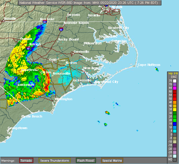 At 727 pm edt, severe thunderstorms were located along a line extending from 14 miles southeast of benson to rose hill to sandyfield, moving east at 45 mph (radar indicated). Hazards include 60 mph wind gusts. Expect damage to roofs, siding, and trees. Locations impacted include, jacksonville, kinston, wallace, warsaw, la grange, half moon, mount olive, phillips crossroads, kornegay, rose hill, richlands, beulaville, deep run, catherine lake, bowdens, cypress creek, beautancus, comfort, kenansville and chinquapin. At 727 pm edt, severe thunderstorms were located along a line extending from 14 miles southeast of benson to rose hill to sandyfield, moving east at 45 mph (radar indicated). Hazards include 60 mph wind gusts. Expect damage to roofs, siding, and trees. Locations impacted include, jacksonville, kinston, wallace, warsaw, la grange, half moon, mount olive, phillips crossroads, kornegay, rose hill, richlands, beulaville, deep run, catherine lake, bowdens, cypress creek, beautancus, comfort, kenansville and chinquapin.
|
| 5/22/2020 7:05 PM EDT |
 At 704 pm edt, severe thunderstorms were located along a line extending from 12 miles southeast of dunn to 8 miles northwest of harrells to near elkton, moving east at 50 mph (radar indicated). Hazards include 60 mph wind gusts. expect damage to roofs, siding, and trees At 704 pm edt, severe thunderstorms were located along a line extending from 12 miles southeast of dunn to 8 miles northwest of harrells to near elkton, moving east at 50 mph (radar indicated). Hazards include 60 mph wind gusts. expect damage to roofs, siding, and trees
|
| 4/13/2020 9:12 AM EDT |
 At 912 am edt, severe thunderstorms were located along a line extending from near stokes to near pleasant hill to near murray town, moving east at 30 mph (radar indicated). Hazards include 60 mph wind gusts. Expect damage to roofs, siding, and trees. locations impacted include, greenville, jacksonville, kinston, winterville, williamston, ayden, wallace, half moon, grifton, phillips crossroads, kornegay, stokes, rose hill, richlands, robersonville, beulaville, deep run, catherine lake, house and shelmerdine. A tornado watch remains in effect until noon edt for eastern north carolina. At 912 am edt, severe thunderstorms were located along a line extending from near stokes to near pleasant hill to near murray town, moving east at 30 mph (radar indicated). Hazards include 60 mph wind gusts. Expect damage to roofs, siding, and trees. locations impacted include, greenville, jacksonville, kinston, winterville, williamston, ayden, wallace, half moon, grifton, phillips crossroads, kornegay, stokes, rose hill, richlands, robersonville, beulaville, deep run, catherine lake, house and shelmerdine. A tornado watch remains in effect until noon edt for eastern north carolina.
|
| 4/13/2020 8:51 AM EDT |
 At 850 am edt, severe thunderstorms were located along a line extending from 9 miles southeast of wilson to near kenansville to near sandyfield, moving east at 50 mph (radar indicated). Hazards include 60 mph wind gusts. Expect damage to roofs, siding, and trees. locations impacted include, greenville, jacksonville, kinston, winterville, williamston, ayden, farmville, wallace, warsaw, la grange, half moon, mount olive, bethel, grifton, phillips crossroads, kornegay, stokes, rose hill, snow hill and richlands. A tornado watch remains in effect until noon edt for eastern north carolina. At 850 am edt, severe thunderstorms were located along a line extending from 9 miles southeast of wilson to near kenansville to near sandyfield, moving east at 50 mph (radar indicated). Hazards include 60 mph wind gusts. Expect damage to roofs, siding, and trees. locations impacted include, greenville, jacksonville, kinston, winterville, williamston, ayden, farmville, wallace, warsaw, la grange, half moon, mount olive, bethel, grifton, phillips crossroads, kornegay, stokes, rose hill, snow hill and richlands. A tornado watch remains in effect until noon edt for eastern north carolina.
|
| 4/13/2020 8:29 AM EDT |
 At 827 am edt, severe thunderstorms were located along a line extending from 7 miles west of fremont to near clinton to near abbottsburg, moving east at 40 mph (radar indicated). Hazards include 60 mph wind gusts. expect damage to roofs, siding, and trees At 827 am edt, severe thunderstorms were located along a line extending from 7 miles west of fremont to near clinton to near abbottsburg, moving east at 40 mph (radar indicated). Hazards include 60 mph wind gusts. expect damage to roofs, siding, and trees
|
| 4/6/2020 8:28 PM EDT |
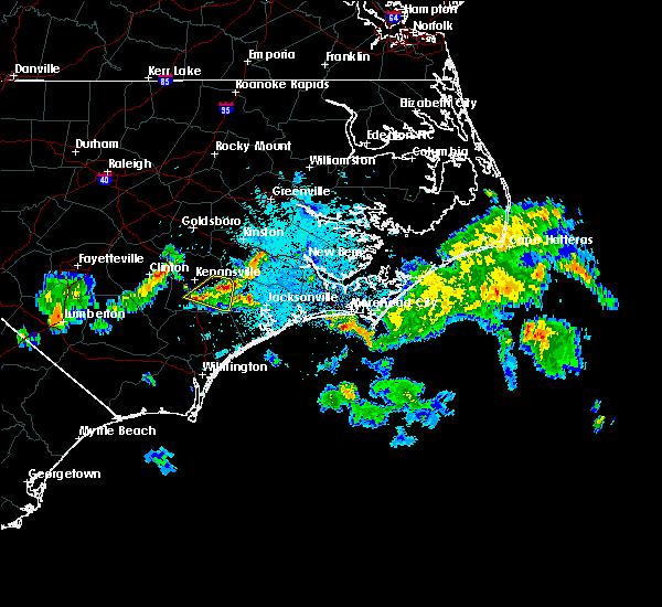 At 827 pm edt, a severe thunderstorm was located over beulaville, or 16 miles northeast of wallace, moving east at 30 mph (radar indicated). Hazards include 60 mph wind gusts and quarter size hail. Hail damage to vehicles is expected. expect wind damage to roofs, siding, and trees. Locations impacted include, rose hill, beulaville, cypress creek, chinquapin, potters hill, greenevers and lyman. At 827 pm edt, a severe thunderstorm was located over beulaville, or 16 miles northeast of wallace, moving east at 30 mph (radar indicated). Hazards include 60 mph wind gusts and quarter size hail. Hail damage to vehicles is expected. expect wind damage to roofs, siding, and trees. Locations impacted include, rose hill, beulaville, cypress creek, chinquapin, potters hill, greenevers and lyman.
|
| 4/6/2020 8:01 PM EDT |
 At 800 pm edt, a severe thunderstorm was located over kenansville, or near warsaw, moving southeast at 35 mph (radar indicated). Hazards include 60 mph wind gusts and quarter size hail. Hail damage to vehicles is expected. Expect wind damage to roofs, siding, and trees. At 800 pm edt, a severe thunderstorm was located over kenansville, or near warsaw, moving southeast at 35 mph (radar indicated). Hazards include 60 mph wind gusts and quarter size hail. Hail damage to vehicles is expected. Expect wind damage to roofs, siding, and trees.
|
| 1/12/2020 2:01 AM EST |
 At 201 am est, severe thunderstorms were located along a line extending from near mount olive to near ammon, moving northeast at 45 mph (radar indicated). Hazards include 60 mph wind gusts. expect damage to roofs, siding, and trees At 201 am est, severe thunderstorms were located along a line extending from near mount olive to near ammon, moving northeast at 45 mph (radar indicated). Hazards include 60 mph wind gusts. expect damage to roofs, siding, and trees
|
| 9/5/2019 11:17 AM EDT |
 At 1116 am edt, a severe thunderstorm capable of producing a tornado was located near chinquapin, or 9 miles east of wallace, moving northwest at 35 mph (radar indicated rotation). Hazards include tornado. Flying debris will be dangerous to those caught without shelter. mobile homes will be damaged or destroyed. damage to roofs, windows, and vehicles will occur. tree damage is likely. Locations impacted include, wallace, rose hill, beulaville, chinquapin, sarecta, greenevers and lyman. At 1116 am edt, a severe thunderstorm capable of producing a tornado was located near chinquapin, or 9 miles east of wallace, moving northwest at 35 mph (radar indicated rotation). Hazards include tornado. Flying debris will be dangerous to those caught without shelter. mobile homes will be damaged or destroyed. damage to roofs, windows, and vehicles will occur. tree damage is likely. Locations impacted include, wallace, rose hill, beulaville, chinquapin, sarecta, greenevers and lyman.
|
| 9/5/2019 10:49 AM EDT |
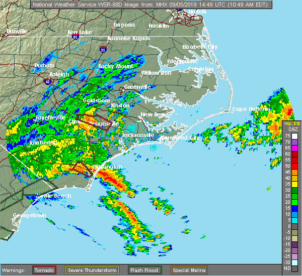 At 1047 am edt, a severe thunderstorm capable of producing a tornado was located near maple hill, or 9 miles southwest of new river station, moving northwest at 35 mph (radar indicated rotation). Hazards include tornado. Flying debris will be dangerous to those caught without shelter. mobile homes will be damaged or destroyed. damage to roofs, windows, and vehicles will occur. Tree damage is likely. At 1047 am edt, a severe thunderstorm capable of producing a tornado was located near maple hill, or 9 miles southwest of new river station, moving northwest at 35 mph (radar indicated rotation). Hazards include tornado. Flying debris will be dangerous to those caught without shelter. mobile homes will be damaged or destroyed. damage to roofs, windows, and vehicles will occur. Tree damage is likely.
|
| 9/5/2019 10:20 AM EDT |
 At 1019 am edt, a severe thunderstorm capable of producing a tornado was located near chinquapin, or 14 miles west of half moon, moving northwest at 20 mph (radar indicated rotation). Hazards include tornado. Flying debris will be dangerous to those caught without shelter. mobile homes will be damaged or destroyed. damage to roofs, windows, and vehicles will occur. tree damage is likely. Locations impacted include, beulaville, kenansville, chinquapin, sarecta, greenevers and lyman. At 1019 am edt, a severe thunderstorm capable of producing a tornado was located near chinquapin, or 14 miles west of half moon, moving northwest at 20 mph (radar indicated rotation). Hazards include tornado. Flying debris will be dangerous to those caught without shelter. mobile homes will be damaged or destroyed. damage to roofs, windows, and vehicles will occur. tree damage is likely. Locations impacted include, beulaville, kenansville, chinquapin, sarecta, greenevers and lyman.
|
| 9/5/2019 9:55 AM EDT |
 At 955 am edt, a severe thunderstorm capable of producing a tornado was located near catherine lake, or 7 miles west of new river station, moving northwest at 40 mph (radar indicated rotation). Hazards include tornado. Flying debris will be dangerous to those caught without shelter. mobile homes will be damaged or destroyed. damage to roofs, windows, and vehicles will occur. Tree damage is likely. At 955 am edt, a severe thunderstorm capable of producing a tornado was located near catherine lake, or 7 miles west of new river station, moving northwest at 40 mph (radar indicated rotation). Hazards include tornado. Flying debris will be dangerous to those caught without shelter. mobile homes will be damaged or destroyed. damage to roofs, windows, and vehicles will occur. Tree damage is likely.
|
| 8/22/2019 6:11 PM EDT |
 The national weather service in newport has issued a * severe thunderstorm warning for. southwestern lenoir county in eastern north carolina. duplin county in eastern north carolina. until 715 pm edt. At 611 pm edt, a severe thunderstorm was located 7 miles northwest. The national weather service in newport has issued a * severe thunderstorm warning for. southwestern lenoir county in eastern north carolina. duplin county in eastern north carolina. until 715 pm edt. At 611 pm edt, a severe thunderstorm was located 7 miles northwest.
|
| 5/30/2019 8:54 PM EDT |
 At 853 pm edt, severe thunderstorms were located along a line extending from near clinton to fort barnwell, moving east at 45 mph (radar indicated). Hazards include 60 mph wind gusts. expect damage to roofs, siding, and trees At 853 pm edt, severe thunderstorms were located along a line extending from near clinton to fort barnwell, moving east at 45 mph (radar indicated). Hazards include 60 mph wind gusts. expect damage to roofs, siding, and trees
|
| 4/19/2019 5:34 PM EDT |
 At 533 pm edt, severe thunderstorms were located along a line extending from 8 miles southwest of fremont to near lagoon, moving northeast at 60 mph (radar indicated). Hazards include 60 mph wind gusts and quarter size hail. Hail damage to vehicles is expected. Expect wind damage to roofs, siding, and trees. At 533 pm edt, severe thunderstorms were located along a line extending from 8 miles southwest of fremont to near lagoon, moving northeast at 60 mph (radar indicated). Hazards include 60 mph wind gusts and quarter size hail. Hail damage to vehicles is expected. Expect wind damage to roofs, siding, and trees.
|
| 9/16/2018 10:01 PM EDT |
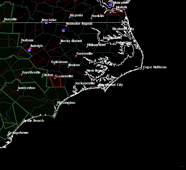 The national weather service in newport has issued a * tornado warning for. southwestern duplin county in eastern north carolina. until 1030 pm edt. at 1000 pm edt. a severe thunderstorm capable of producing a tornado was located near willard, or near wallace. Moving north at. The national weather service in newport has issued a * tornado warning for. southwestern duplin county in eastern north carolina. until 1030 pm edt. at 1000 pm edt. a severe thunderstorm capable of producing a tornado was located near willard, or near wallace. Moving north at.
|
| 4/15/2018 11:14 PM EDT |
 At 1114 pm edt, severe thunderstorms were located along a line extending from near mount olive to near kenansville to murray town, moving northeast at 35 mph (radar indicated). Hazards include 60 mph wind gusts. Expect damage to roofs, siding, and trees. locations impacted include, wallace, kornegay, beulaville, beautancus, kenansville, chinquapin, albertson, sarecta, greenevers and lyman. A tornado watch remains in effect until 300 am edt for eastern north carolina. At 1114 pm edt, severe thunderstorms were located along a line extending from near mount olive to near kenansville to murray town, moving northeast at 35 mph (radar indicated). Hazards include 60 mph wind gusts. Expect damage to roofs, siding, and trees. locations impacted include, wallace, kornegay, beulaville, beautancus, kenansville, chinquapin, albertson, sarecta, greenevers and lyman. A tornado watch remains in effect until 300 am edt for eastern north carolina.
|
| 4/15/2018 10:55 PM EDT |
 At 1054 pm edt, severe thunderstorms were located along a line extending from near mount olive to 6 miles northwest of rose hill to near wards corner, moving northeast at 45 mph (radar indicated). Hazards include 60 mph wind gusts. Expect damage to roofs, siding, and trees. locations impacted include, wallace, warsaw, mount olive, kornegay, rose hill, beulaville, bowdens, beautancus, kenansville, chinquapin, albertson, sarecta, faison, magnolia, greenevers, calypso, lyman and teachey. A tornado watch remains in effect until 300 am edt for eastern north carolina. At 1054 pm edt, severe thunderstorms were located along a line extending from near mount olive to 6 miles northwest of rose hill to near wards corner, moving northeast at 45 mph (radar indicated). Hazards include 60 mph wind gusts. Expect damage to roofs, siding, and trees. locations impacted include, wallace, warsaw, mount olive, kornegay, rose hill, beulaville, bowdens, beautancus, kenansville, chinquapin, albertson, sarecta, faison, magnolia, greenevers, calypso, lyman and teachey. A tornado watch remains in effect until 300 am edt for eastern north carolina.
|
| 4/15/2018 10:30 PM EDT |
 At 1029 pm edt, severe thunderstorms were located along a line extending from 12 miles north of clinton to 8 miles northwest of harrells to near rooks, moving northeast at 30 mph (radar indicated). Hazards include 60 mph wind gusts. expect damage to roofs, siding, and trees At 1029 pm edt, severe thunderstorms were located along a line extending from 12 miles north of clinton to 8 miles northwest of harrells to near rooks, moving northeast at 30 mph (radar indicated). Hazards include 60 mph wind gusts. expect damage to roofs, siding, and trees
|
| 3/1/2018 6:19 PM EST |
 At 619 pm est, severe thunderstorms were located along a line extending from near graingers to near deep run to near wallace, moving east at 60 mph (radar indicated). Hazards include 60 mph wind gusts and penny size hail. Expect damage to roofs, siding, and trees. Locations impacted include, jacksonville, kinston, wallace, half moon, grifton, phillips crossroads, kornegay, rose hill, richlands, beulaville, deep run, catherine lake, cypress creek, comfort, kenansville, fort barnwell, chinquapin, jasper, dawson and potters hill. At 619 pm est, severe thunderstorms were located along a line extending from near graingers to near deep run to near wallace, moving east at 60 mph (radar indicated). Hazards include 60 mph wind gusts and penny size hail. Expect damage to roofs, siding, and trees. Locations impacted include, jacksonville, kinston, wallace, half moon, grifton, phillips crossroads, kornegay, rose hill, richlands, beulaville, deep run, catherine lake, cypress creek, comfort, kenansville, fort barnwell, chinquapin, jasper, dawson and potters hill.
|
| 3/1/2018 5:56 PM EST |
 At 556 pm est, severe thunderstorms were located along a line extending from near walnut creek to beautancus to 7 miles west of harrells, moving east at 60 mph (radar indicated). Hazards include 60 mph wind gusts and quarter size hail. Hail damage to vehicles is expected. Expect wind damage to roofs, siding, and trees. At 556 pm est, severe thunderstorms were located along a line extending from near walnut creek to beautancus to 7 miles west of harrells, moving east at 60 mph (radar indicated). Hazards include 60 mph wind gusts and quarter size hail. Hail damage to vehicles is expected. Expect wind damage to roofs, siding, and trees.
|
| 8/23/2017 8:07 PM EDT |
 At 806 pm edt, a severe thunderstorm was located near rose hill, or 8 miles north of wallace, moving east at 40 mph (radar indicated). Hazards include quarter size hail. damage to vehicles is expected At 806 pm edt, a severe thunderstorm was located near rose hill, or 8 miles north of wallace, moving east at 40 mph (radar indicated). Hazards include quarter size hail. damage to vehicles is expected
|
| 6/24/2017 7:12 PM EDT |
 At 712 pm edt, severe thunderstorms were located along a line extending from near beulaville to near harrells, moving east at 40 mph (radar indicated). Hazards include 60 mph wind gusts and quarter size hail. Hail damage to vehicles is expected. Expect wind damage to roofs, siding, and trees. At 712 pm edt, severe thunderstorms were located along a line extending from near beulaville to near harrells, moving east at 40 mph (radar indicated). Hazards include 60 mph wind gusts and quarter size hail. Hail damage to vehicles is expected. Expect wind damage to roofs, siding, and trees.
|
| 5/30/2017 12:20 AM EDT |
 At 1219 am edt, a severe thunderstorm was located over wallace, moving east at 35 mph (radar indicated). Hazards include 60 mph wind gusts and quarter size hail. Hail damage to vehicles is expected. expect wind damage to roofs, siding, and trees. Locations impacted include, wallace, rose hill, greenevers and teachey. At 1219 am edt, a severe thunderstorm was located over wallace, moving east at 35 mph (radar indicated). Hazards include 60 mph wind gusts and quarter size hail. Hail damage to vehicles is expected. expect wind damage to roofs, siding, and trees. Locations impacted include, wallace, rose hill, greenevers and teachey.
|
| 5/29/2017 11:53 PM EDT |
 At 1152 pm edt, a severe thunderstorm was located 8 miles west of harrells, or 16 miles northeast of elizabethtown, moving east at 35 mph (radar indicated). Hazards include 60 mph wind gusts and quarter size hail. Hail damage to vehicles is expected. Expect wind damage to roofs, siding, and trees. At 1152 pm edt, a severe thunderstorm was located 8 miles west of harrells, or 16 miles northeast of elizabethtown, moving east at 35 mph (radar indicated). Hazards include 60 mph wind gusts and quarter size hail. Hail damage to vehicles is expected. Expect wind damage to roofs, siding, and trees.
|
| 7/15/2016 5:41 PM EDT |
 At 540 pm edt, a severe thunderstorm was located near kenansville, or 7 miles southeast of warsaw, moving east at 30 mph (radar indicated). Hazards include 60 mph wind gusts and nickel size hail. Expect damage to roofs. siding. and trees. Locations impacted include, wallace, warsaw, rose hill, beulaville, kenansville, harrells, magnolia, greenevers and teachey. At 540 pm edt, a severe thunderstorm was located near kenansville, or 7 miles southeast of warsaw, moving east at 30 mph (radar indicated). Hazards include 60 mph wind gusts and nickel size hail. Expect damage to roofs. siding. and trees. Locations impacted include, wallace, warsaw, rose hill, beulaville, kenansville, harrells, magnolia, greenevers and teachey.
|
| 7/15/2016 5:25 PM EDT |
 At 525 pm edt, a severe thunderstorm was located near kenansville, or 7 miles southeast of warsaw, moving east at 30 mph (radar indicated). Hazards include 60 mph wind gusts and quarter size hail. Hail damage to vehicles is expected. Expect wind damage to roofs, siding, and trees. At 525 pm edt, a severe thunderstorm was located near kenansville, or 7 miles southeast of warsaw, moving east at 30 mph (radar indicated). Hazards include 60 mph wind gusts and quarter size hail. Hail damage to vehicles is expected. Expect wind damage to roofs, siding, and trees.
|
| 7/8/2016 10:31 PM EDT |
 At 1030 pm edt, severe thunderstorms were located along a line extending from 7 miles northwest of ocracoke ferry terminal to 7 miles north of morehead city to near half moon, moving southeast at 45 mph (law enforcement indicated). Hazards include 60 mph wind gusts. Expect damage to roofs. siding. and trees. Locations impacted include, jacksonville, new bern, havelock, morehead city, newport, wallace, warsaw, camp lejeune center, pumpkin center, half moon, new river station, piney green, james city, mount olive, swansboro, cape carteret, rose hill, richlands, pine knoll shores and beulaville. At 1030 pm edt, severe thunderstorms were located along a line extending from 7 miles northwest of ocracoke ferry terminal to 7 miles north of morehead city to near half moon, moving southeast at 45 mph (law enforcement indicated). Hazards include 60 mph wind gusts. Expect damage to roofs. siding. and trees. Locations impacted include, jacksonville, new bern, havelock, morehead city, newport, wallace, warsaw, camp lejeune center, pumpkin center, half moon, new river station, piney green, james city, mount olive, swansboro, cape carteret, rose hill, richlands, pine knoll shores and beulaville.
|
| 7/8/2016 10:14 PM EDT |
 At 1012 pm edt, severe thunderstorms were located along a line extending from 7 miles east of swan quarter ferry terminal to near neuse forest to 8 miles north of richlands, moving southeast at 45 mph. a gust to 58 mph was recorded at the the coastal carolina regional airport in new bern (radar indicated). Hazards include 60 mph wind gusts. Expect damage to roofs. siding. and trees. Locations impacted include, jacksonville, new bern, havelock, morehead city, newport, wallace, warsaw, camp lejeune center, pumpkin center, half moon, new river station, piney green, james city, mount olive, trent woods, river bend, swansboro, cape carteret, rose hill and richlands. At 1012 pm edt, severe thunderstorms were located along a line extending from 7 miles east of swan quarter ferry terminal to near neuse forest to 8 miles north of richlands, moving southeast at 45 mph. a gust to 58 mph was recorded at the the coastal carolina regional airport in new bern (radar indicated). Hazards include 60 mph wind gusts. Expect damage to roofs. siding. and trees. Locations impacted include, jacksonville, new bern, havelock, morehead city, newport, wallace, warsaw, camp lejeune center, pumpkin center, half moon, new river station, piney green, james city, mount olive, trent woods, river bend, swansboro, cape carteret, rose hill and richlands.
|
| 7/8/2016 9:41 PM EDT |
 At 940 pm edt, severe thunderstorms were located along a line extending from 8 miles east of belhaven to 7 miles northwest of new bern to 6 miles south of walnut creek, moving southeast at 40 mph (radar indicated). Hazards include 60 mph wind gusts. Expect damage to roofs. siding. And trees. At 940 pm edt, severe thunderstorms were located along a line extending from 8 miles east of belhaven to 7 miles northwest of new bern to 6 miles south of walnut creek, moving southeast at 40 mph (radar indicated). Hazards include 60 mph wind gusts. Expect damage to roofs. siding. And trees.
|
| 4/7/2016 7:37 AM EDT |
 At 736 am edt, doppler radar indicated a severe thunderstorm capable of producing damaging winds in excess of 60 mph. this storm was located near penderlea, or 9 miles southwest of wallace, and moving northeast at 55 mph. At 736 am edt, doppler radar indicated a severe thunderstorm capable of producing damaging winds in excess of 60 mph. this storm was located near penderlea, or 9 miles southwest of wallace, and moving northeast at 55 mph.
|
| 2/16/2016 7:18 AM EST | Tree down in rose hill in duplin county NC, 0.8 miles E of Rose Hill, NC |
| 12/23/2015 8:58 AM EST | At 856 am est, doppler radar indicated a severe thunderstorm capable of producing damaging winds in excess of 60 mph. this storm was located near rose hill, moving northeast at 30 mph. |
| 12/23/2015 8:41 AM EST | At 840 am est, doppler radar indicated a severe thunderstorm capable of producing a tornado. this dangerous storm was located between harrells and rose hill, moving northeast at 30 mph. locations impacted include, wallace, warsaw, rose hill, beulaville, kenansville, harrells, magnolia, greenevers and teachey. |
| 12/23/2015 8:25 AM EST | At 822 am est, doppler radar indicated a severe thunderstorm capable of producing a tornado. the storm has weakened slightly but is still capable of producing strong wind gusts or a brief tornado. this dangerous storm was located near harrells, or near wallace, moving northeast at 40 mph. locations impacted include, wallace, warsaw, rose hill, beulaville, kenansville, harrells, magnolia, greenevers and teachey. |
| 12/23/2015 8:06 AM EST | At 805 am est, doppler radar indicated a severe thunderstorm capable of producing a tornado. this dangerous storm was located 7 miles southwest of harrells, or 17 miles west of wallace, and moving northeast at 40 mph. |
| 7/23/2015 1:33 PM EDT |
 At 131 pm edt, doppler radar indicated a line of severe thunderstorms capable of producing quarter size hail and destructive winds in excess of 70 mph. these storms were located along a line extending from 8 miles southeast of mount olive to rose hill, and moving east at 25 mph. At 131 pm edt, doppler radar indicated a line of severe thunderstorms capable of producing quarter size hail and destructive winds in excess of 70 mph. these storms were located along a line extending from 8 miles southeast of mount olive to rose hill, and moving east at 25 mph.
|
| 7/3/2014 4:37 PM EDT | Public reported several trees down in rose hil in duplin county NC, 0.8 miles E of Rose Hill, NC |
| 2/21/2014 2:10 PM EST | Tree on house in duplin county NC, 2 miles N of Rose Hill, NC |
| 3/25/2012 6:21 PM EDT | Quarter sized hail reported 0.8 miles SSE of Rose Hill, NC, nickel to quarter size hail in rose hill. |
| 1/1/0001 12:00 AM | Trees down on frank cottle rd in duplin county NC, 0.8 miles E of Rose Hill, NC |
| 1/1/0001 12:00 AM | Turkey barns and outbuildings damaged. trees down. near nc903 and halls pond r in duplin county NC, 1.6 miles WSW of Rose Hill, NC |
Hail Maps for Rose Hill, NC


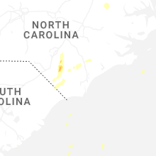


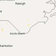


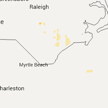


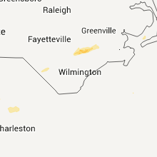


Connect with Interactive Hail Maps