

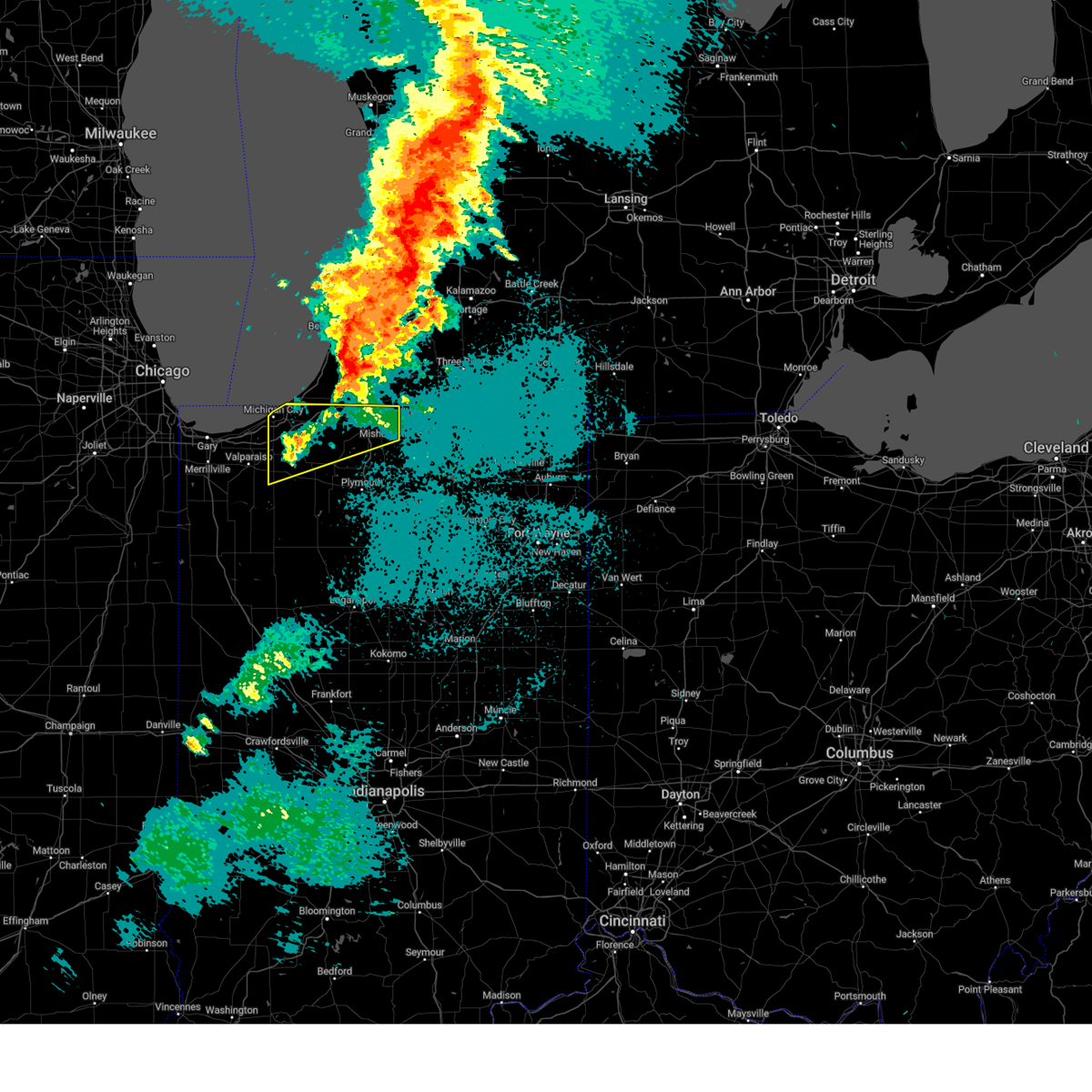
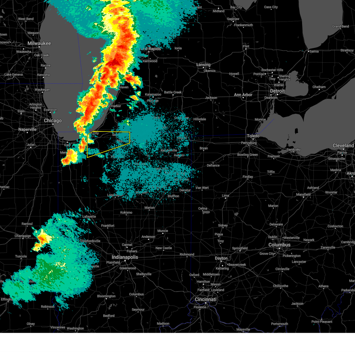
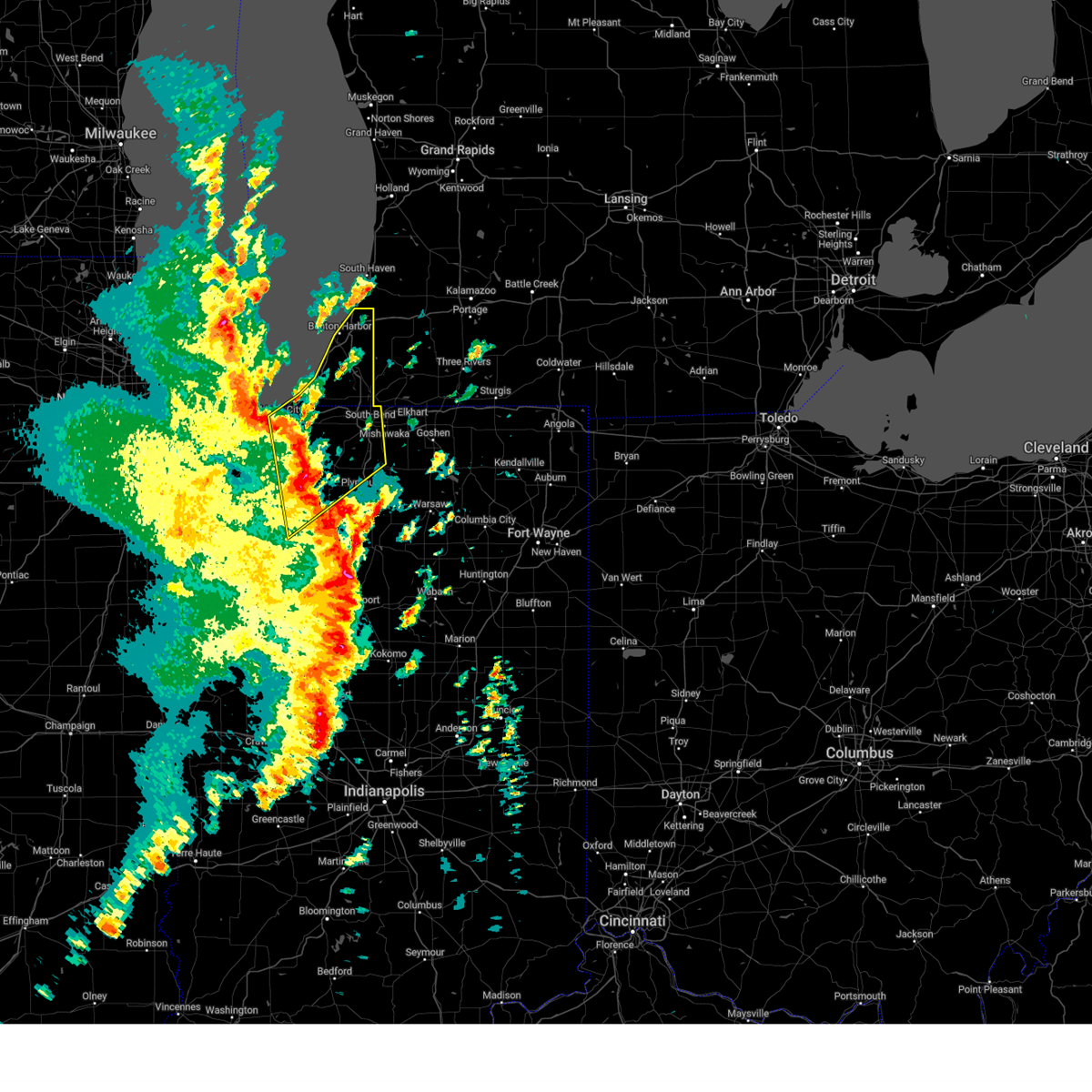
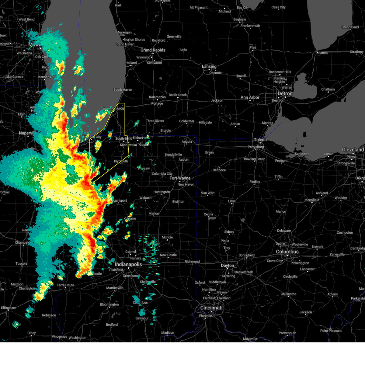
Hail Map for Roseland, IN
The Roseland, IN area has had 0 reports of on-the-ground hail by trained spotters, and has been under severe weather warnings 19 times during the past 12 months. Doppler radar has detected hail at or near Roseland, IN on 47 occasions, including 3 occasions during the past year.
| Name: | Roseland, IN |
| Where Located: | 72.3 miles E of Chicago, IL |
| Map: | Google Map for Roseland, IN |
| Population: | 630 |
| Housing Units: | 348 |
| More Info: | Search Google for Roseland, IN |
2
The Top Recent Hail Date for Roseland, IN is Tuesday, August 27, 2024 (10th out of 47)

Hail and Wind Damage Spotted near Roseland, IN
| Date / Time | Report Details |
|---|---|
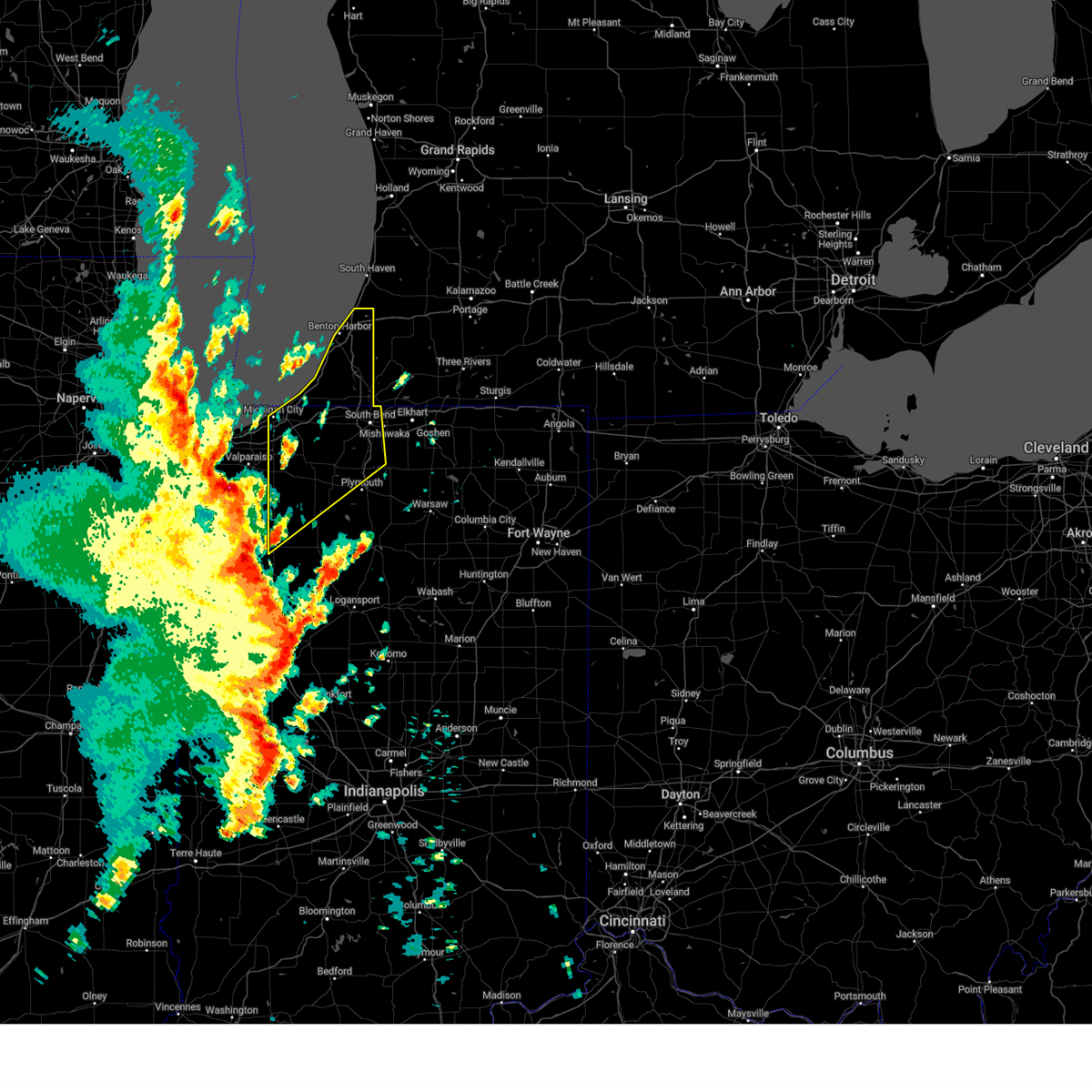
| 6/18/2025 3:52 PM EDT | Svriwx the national weather service in northern indiana has issued a * severe thunderstorm warning for, northwestern st. joseph county in north central indiana, northern la porte county in northwestern indiana, berrien county in southwestern michigan, * until 430 pm edt/330 pm cdt/. * at 352 pm edt/252 pm cdt/, severe thunderstorms were located along a line extending from near chesterton to near la porte to near knox, moving north at 65 mph (radar indicated). Hazards include 60 mph wind gusts. expect damage to roofs, siding, and trees |
| 5/15/2025 9:31 PM CDT |
 the severe thunderstorm warning has been cancelled and is no longer in effect the severe thunderstorm warning has been cancelled and is no longer in effect
|
| 5/15/2025 8:57 PM CDT |
 Svriwx the national weather service in northern indiana has issued a * severe thunderstorm warning for, st. joseph county in north central indiana, la porte county in northwestern indiana, southwestern berrien county in southwestern michigan, * until 1115 pm edt/1015 pm cdt/. * at 956 pm edt/856 pm cdt/, severe thunderstorms were located along a line extending from near westville to near hebron, moving east at 40 mph (radar indicated). Hazards include 60 mph wind gusts and quarter size hail. Hail damage to vehicles is expected. Expect wind damage to roofs, siding, and trees. Svriwx the national weather service in northern indiana has issued a * severe thunderstorm warning for, st. joseph county in north central indiana, la porte county in northwestern indiana, southwestern berrien county in southwestern michigan, * until 1115 pm edt/1015 pm cdt/. * at 956 pm edt/856 pm cdt/, severe thunderstorms were located along a line extending from near westville to near hebron, moving east at 40 mph (radar indicated). Hazards include 60 mph wind gusts and quarter size hail. Hail damage to vehicles is expected. Expect wind damage to roofs, siding, and trees.
|
| 3/30/2025 4:41 PM EDT | Svriwx the national weather service in northern indiana has issued a * severe thunderstorm warning for, elkhart county in north central indiana, st. joseph county in north central indiana, northwestern lagrange county in northeastern indiana, northeastern marshall county in north central indiana, cass county in southwestern michigan, st. joseph county in southwestern michigan, western branch county in southwestern michigan, southeastern berrien county in southwestern michigan, * until 530 pm edt. * at 440 pm edt, severe thunderstorms were located along a line extending from near bridgman to near lakeville, moving northeast at 55 mph (radar indicated). Hazards include 70 mph wind gusts and nickel size hail. Expect considerable tree damage. Damage is likely to mobile homes, roofs, and outbuildings. |
| 3/30/2025 4:37 PM EDT | At 436 pm edt/336 pm cdt/, severe thunderstorms were located along a line extending from near three oaks to near walkerton, moving northeast at 55 mph. there was been damage and power outages reported in michigan city and wanatah at 425 pm (emergency management). Hazards include 70 mph wind gusts and nickel size hail. Expect considerable tree damage. damage is likely to mobile homes, roofs, and outbuildings. locations impacted include, north liberty, harbert, bertrand, fish lake, shorewood-tower hill, crumstown, paw paw lake, tyner, lakeside in berrien county, millburg, new carlisle, linkville, lake michigan beach, gulivoire park, byron, niles, roseland, rolling prarie, walkerton, and turner shores. this includes the following highways, interstate 196 between mile markers 0 and 7. interstate 80 in indiana between mile markers 54 and 80. Interstate 94 in michigan between mile markers 4 and 42. |
| 3/30/2025 4:37 PM EDT | the severe thunderstorm warning has been cancelled and is no longer in effect |
| 3/30/2025 4:20 PM EDT |
 At 419 pm edt/319 pm cdt/, severe thunderstorms were located along a line extending from near trail creek to knox, moving northeast at 65 mph (emergency management). Hazards include 70 mph wind gusts and nickel size hail. Expect considerable tree damage. damage is likely to mobile homes, roofs, and outbuildings. locations impacted include, harbert, shorewood-tower hill, paw paw lake, tyner, new carlisle, lake michigan beach, north judson, grovertown, byron, grand beach, niles, oak grove, roseland, walkerton, union mills, buchanan, watervliet, springville, hamlet, and coloma. this includes the following highways, interstate 196 between mile markers 0 and 7. interstate 80 in indiana between mile markers 39 and 80. interstate 94 in indiana between mile markers 34 and 45. Interstate 94 in michigan between mile markers 0 and 42. At 419 pm edt/319 pm cdt/, severe thunderstorms were located along a line extending from near trail creek to knox, moving northeast at 65 mph (emergency management). Hazards include 70 mph wind gusts and nickel size hail. Expect considerable tree damage. damage is likely to mobile homes, roofs, and outbuildings. locations impacted include, harbert, shorewood-tower hill, paw paw lake, tyner, new carlisle, lake michigan beach, north judson, grovertown, byron, grand beach, niles, oak grove, roseland, walkerton, union mills, buchanan, watervliet, springville, hamlet, and coloma. this includes the following highways, interstate 196 between mile markers 0 and 7. interstate 80 in indiana between mile markers 39 and 80. interstate 94 in indiana between mile markers 34 and 45. Interstate 94 in michigan between mile markers 0 and 42.
|
| 3/30/2025 4:03 PM EDT |
 At 403 pm edt/303 pm cdt/, severe thunderstorms were located along a line extending from near porter to 6 miles west of medaryville, moving northeast at 60 mph (radar indicated). Hazards include 70 mph wind gusts and nickel size hail. Expect considerable tree damage. damage is likely to mobile homes, roofs, and outbuildings. locations impacted include, harbert, la crosse, shorewood-tower hill, paw paw lake, tyner, clarks, medaryville, new carlisle, lake michigan beach, haskell, north judson, grovertown, byron, grand beach, niles, oak grove, roseland, walkerton, union mills, and buchanan. this includes the following highways, interstate 196 between mile markers 0 and 7. interstate 80 in indiana between mile markers 38 and 80. interstate 94 in indiana between mile markers 33 and 45. Interstate 94 in michigan between mile markers 0 and 42. At 403 pm edt/303 pm cdt/, severe thunderstorms were located along a line extending from near porter to 6 miles west of medaryville, moving northeast at 60 mph (radar indicated). Hazards include 70 mph wind gusts and nickel size hail. Expect considerable tree damage. damage is likely to mobile homes, roofs, and outbuildings. locations impacted include, harbert, la crosse, shorewood-tower hill, paw paw lake, tyner, clarks, medaryville, new carlisle, lake michigan beach, haskell, north judson, grovertown, byron, grand beach, niles, oak grove, roseland, walkerton, union mills, and buchanan. this includes the following highways, interstate 196 between mile markers 0 and 7. interstate 80 in indiana between mile markers 38 and 80. interstate 94 in indiana between mile markers 33 and 45. Interstate 94 in michigan between mile markers 0 and 42.
|
| 3/30/2025 3:51 PM EDT |
 Svriwx the national weather service in northern indiana has issued a * severe thunderstorm warning for, st. joseph county in north central indiana, northwestern pulaski county in northwestern indiana, starke county in northwestern indiana, northwestern marshall county in north central indiana, la porte county in northwestern indiana, berrien county in southwestern michigan, * until 500 pm edt/400 pm cdt/. * at 351 pm edt/251 pm cdt/, severe thunderstorms were located along a line extending from near portage to rensselaer, moving northeast at 60 mph (radar indicated). Hazards include 60 mph wind gusts and nickel size hail. expect damage to roofs, siding, and trees Svriwx the national weather service in northern indiana has issued a * severe thunderstorm warning for, st. joseph county in north central indiana, northwestern pulaski county in northwestern indiana, starke county in northwestern indiana, northwestern marshall county in north central indiana, la porte county in northwestern indiana, berrien county in southwestern michigan, * until 500 pm edt/400 pm cdt/. * at 351 pm edt/251 pm cdt/, severe thunderstorms were located along a line extending from near portage to rensselaer, moving northeast at 60 mph (radar indicated). Hazards include 60 mph wind gusts and nickel size hail. expect damage to roofs, siding, and trees
|
| 3/19/2025 7:54 PM EDT |
 Svriwx the national weather service in northern indiana has issued a * severe thunderstorm warning for, northern st. joseph county in north central indiana, western cass county in southwestern michigan, berrien county in southwestern michigan, * until 830 pm edt. * at 753 pm edt, severe thunderstorms were located along a line extending from near st. joseph to near berrien springs to near new carlisle, moving northeast at 55 mph (radar indicated). Hazards include 60 mph wind gusts and penny size hail. expect damage to roofs, siding, and trees Svriwx the national weather service in northern indiana has issued a * severe thunderstorm warning for, northern st. joseph county in north central indiana, western cass county in southwestern michigan, berrien county in southwestern michigan, * until 830 pm edt. * at 753 pm edt, severe thunderstorms were located along a line extending from near st. joseph to near berrien springs to near new carlisle, moving northeast at 55 mph (radar indicated). Hazards include 60 mph wind gusts and penny size hail. expect damage to roofs, siding, and trees
|
| 3/15/2025 4:10 AM EDT | The storms which prompted the warning have weakened below severe limits, and no longer pose an immediate threat to life or property. therefore, the warning will be allowed to expire. however, gusty winds are still possible with these thunderstorms. a severe thunderstorm watch remains in effect until 900 am edt for north central indiana, and southwestern michigan. to report severe weather, contact your nearest law enforcement agency. they will relay your report to the national weather service northern indiana. |
| 3/15/2025 4:03 AM EDT | the severe thunderstorm warning has been cancelled and is no longer in effect |
| 3/15/2025 4:03 AM EDT | At 403 am edt, severe thunderstorms were located along a line extending from near berrien springs to niles to near gulivoire park, moving northeast at 60 mph (radar indicated). Hazards include 60 mph wind gusts. Expect damage to roofs, siding, and trees. locations impacted include, magician lake, dewey lake, dowagiac, berrien springs, edwardsburg, sodus, cassopolis, la grange, adamsville, bertrand, chain-o-lakes, juno lake, indian lake, woodland, lydick, osceola, elkhart, diamond lake, pokagon, and gulivoire park. this includes the following highways, interstate 80 in indiana between mile markers 68 and 93. Interstate 94 in michigan near mile marker 29. |
| 3/15/2025 3:44 AM EDT | Svriwx the national weather service in northern indiana has issued a * severe thunderstorm warning for, northwestern elkhart county in north central indiana, st. joseph county in north central indiana, northeastern starke county in northwestern indiana, northwestern marshall county in north central indiana, northeastern la porte county in northwestern indiana, cass county in southwestern michigan, berrien county in southwestern michigan, * until 415 am edt/315 am cdt/. * at 344 am edt/244 am cdt/, severe thunderstorms were located along a line extending from near three oaks to new carlisle to koontz lake, moving northeast at 55 mph (radar indicated). Hazards include 60 mph wind gusts. expect damage to roofs, siding, and trees |
| 8/27/2024 9:49 PM EDT |
 At 949 pm edt/849 pm cdt/, severe thunderstorms were located along a line extending from roseland to near lakeville to near koontz lake, moving southeast at 35 mph. strong outflow winds will also precede this line of severe thunderstorms (radar indicated). Hazards include 60 mph wind gusts. Expect damage to roofs, siding, and trees. locations impacted include, south bend, elkhart, mishawaka, goshen, plymouth, nappanee, bremen, syracuse, gulivoire park, granger, dunlap, simonton lake, osceola, walkerton, north liberty, bourbon, wakarusa, bristol, milford, and lakeville. This includes interstate 80 in indiana between mile markers 72 and 104. At 949 pm edt/849 pm cdt/, severe thunderstorms were located along a line extending from roseland to near lakeville to near koontz lake, moving southeast at 35 mph. strong outflow winds will also precede this line of severe thunderstorms (radar indicated). Hazards include 60 mph wind gusts. Expect damage to roofs, siding, and trees. locations impacted include, south bend, elkhart, mishawaka, goshen, plymouth, nappanee, bremen, syracuse, gulivoire park, granger, dunlap, simonton lake, osceola, walkerton, north liberty, bourbon, wakarusa, bristol, milford, and lakeville. This includes interstate 80 in indiana between mile markers 72 and 104.
|
| 8/27/2024 9:21 PM EDT |
 Svriwx the national weather service in northern indiana has issued a * severe thunderstorm warning for, elkhart county in north central indiana, st. joseph county in north central indiana, northwestern kosciusko county in north central indiana, northern marshall county in north central indiana, east central la porte county in northwestern indiana, southwestern cass county in southwestern michigan, southeastern berrien county in southwestern michigan, * until 1000 pm edt/900 pm cdt/. * at 921 pm edt/821 pm cdt/, severe thunderstorms were located along a line extending from near three oaks to new carlisle to near la porte, moving southeast at 55 mph (radar indicated). Hazards include 70 mph wind gusts. Expect considerable tree damage. Damage is likely to mobile homes, roofs, and outbuildings. Svriwx the national weather service in northern indiana has issued a * severe thunderstorm warning for, elkhart county in north central indiana, st. joseph county in north central indiana, northwestern kosciusko county in north central indiana, northern marshall county in north central indiana, east central la porte county in northwestern indiana, southwestern cass county in southwestern michigan, southeastern berrien county in southwestern michigan, * until 1000 pm edt/900 pm cdt/. * at 921 pm edt/821 pm cdt/, severe thunderstorms were located along a line extending from near three oaks to new carlisle to near la porte, moving southeast at 55 mph (radar indicated). Hazards include 70 mph wind gusts. Expect considerable tree damage. Damage is likely to mobile homes, roofs, and outbuildings.
|
| 7/16/2024 12:13 AM EDT |
 At 1213 am edt, a severe squall line capable of producing both tornadoes and extensive straight line wind damage was located along a line extending from near edwardsburg to near osceola to wakarusa to near mentone, moving east at 60 mph (radar indicated rotation). Hazards include tornado and 70 mph wind gusts. Flying debris will be dangerous to those caught without shelter. mobile homes will be damaged or destroyed. damage to roofs, windows, and vehicles will occur. tree damage is likely. these dangerous storms will be near, elkhart, goshen, dunlap, and simonton lake around 1220 am edt. other locations impacted by these tornadic storms include etna green, hoffman lake, indian village, inwood, atwood, adamsville, hastings, bertrand, woodland, and palestine. This includes interstate 80 in indiana between mile markers 70 and 96. At 1213 am edt, a severe squall line capable of producing both tornadoes and extensive straight line wind damage was located along a line extending from near edwardsburg to near osceola to wakarusa to near mentone, moving east at 60 mph (radar indicated rotation). Hazards include tornado and 70 mph wind gusts. Flying debris will be dangerous to those caught without shelter. mobile homes will be damaged or destroyed. damage to roofs, windows, and vehicles will occur. tree damage is likely. these dangerous storms will be near, elkhart, goshen, dunlap, and simonton lake around 1220 am edt. other locations impacted by these tornadic storms include etna green, hoffman lake, indian village, inwood, atwood, adamsville, hastings, bertrand, woodland, and palestine. This includes interstate 80 in indiana between mile markers 70 and 96.
|
| 7/15/2024 11:59 PM EDT |
 At 1158 pm edt, a severe squall line capable of producing both tornadoes and extensive straight line wind damage was located along a line extending from near buchanan to near gulivoire park to near lakeville to near argos, moving east at 65 mph (radar indicated rotation). Hazards include tornado and 70 mph wind gusts. Flying debris will be dangerous to those caught without shelter. mobile homes will be damaged or destroyed. damage to roofs, windows, and vehicles will occur. tree damage is likely. these dangerous storms will be near, south bend, mishawaka, niles, nappanee, bremen, georgetown, granger, gulivoire park, osceola, and bourbon around 1205 am edt. elkhart and simonton lake around 1210 am edt. goshen and dunlap around 1215 am edt. other locations impacted by these tornadic storms include etna green, hoffman lake, atwood, teegarden, adamsville, bertrand, chain-o-lakes, crumstown, tyner, and woodland. This includes interstate 80 in indiana between mile markers 67 and 96. At 1158 pm edt, a severe squall line capable of producing both tornadoes and extensive straight line wind damage was located along a line extending from near buchanan to near gulivoire park to near lakeville to near argos, moving east at 65 mph (radar indicated rotation). Hazards include tornado and 70 mph wind gusts. Flying debris will be dangerous to those caught without shelter. mobile homes will be damaged or destroyed. damage to roofs, windows, and vehicles will occur. tree damage is likely. these dangerous storms will be near, south bend, mishawaka, niles, nappanee, bremen, georgetown, granger, gulivoire park, osceola, and bourbon around 1205 am edt. elkhart and simonton lake around 1210 am edt. goshen and dunlap around 1215 am edt. other locations impacted by these tornadic storms include etna green, hoffman lake, atwood, teegarden, adamsville, bertrand, chain-o-lakes, crumstown, tyner, and woodland. This includes interstate 80 in indiana between mile markers 67 and 96.
|
| 7/15/2024 11:35 PM EDT |
 Toriwx the national weather service in northern indiana has issued a * tornado warning for, western elkhart county in north central indiana, st. joseph county in north central indiana, northwestern kosciusko county in north central indiana, marshall county in north central indiana, southwestern cass county in southwestern michigan, southeastern berrien county in southwestern michigan, * until 1230 am edt. * at 1134 pm edt, severe thunderstorms capable of producing both tornadoes and extensive straight line wind damage were located along a line extending from near trail creek to near kingsford heights to 7 miles east of wanatah to north judson, moving east at 60 mph. wind gusts up to 80 mph and isolated tornadoes are possible with this line of thunderstorms! (radar indicated rotation). Hazards include tornado. Flying debris will be dangerous to those caught without shelter. mobile homes will be damaged or destroyed. damage to roofs, windows, and vehicles will occur. tree damage is likely. these dangerous storms will be near, plymouth, north liberty, and culver around 1150 pm edt. south bend, niles, buchanan, and lakeville around 1155 pm edt. mishawaka, bremen, georgetown, granger, gulivoire park, argos, and roseland around 1200 am edt. osceola, bourbon, wakarusa, and edwardsburg around 1205 am edt. elkhart, nappanee, and simonton lake around 1210 am edt. goshen and dunlap around 1215 am edt. other locations impacted by these tornadic storms include etna green, hoffman lake, atwood, teegarden, adamsville, bertrand, chain-o-lakes, crumstown, tyner, and woodland. This includes interstate 80 in indiana between mile markers 67 and 96. Toriwx the national weather service in northern indiana has issued a * tornado warning for, western elkhart county in north central indiana, st. joseph county in north central indiana, northwestern kosciusko county in north central indiana, marshall county in north central indiana, southwestern cass county in southwestern michigan, southeastern berrien county in southwestern michigan, * until 1230 am edt. * at 1134 pm edt, severe thunderstorms capable of producing both tornadoes and extensive straight line wind damage were located along a line extending from near trail creek to near kingsford heights to 7 miles east of wanatah to north judson, moving east at 60 mph. wind gusts up to 80 mph and isolated tornadoes are possible with this line of thunderstorms! (radar indicated rotation). Hazards include tornado. Flying debris will be dangerous to those caught without shelter. mobile homes will be damaged or destroyed. damage to roofs, windows, and vehicles will occur. tree damage is likely. these dangerous storms will be near, plymouth, north liberty, and culver around 1150 pm edt. south bend, niles, buchanan, and lakeville around 1155 pm edt. mishawaka, bremen, georgetown, granger, gulivoire park, argos, and roseland around 1200 am edt. osceola, bourbon, wakarusa, and edwardsburg around 1205 am edt. elkhart, nappanee, and simonton lake around 1210 am edt. goshen and dunlap around 1215 am edt. other locations impacted by these tornadic storms include etna green, hoffman lake, atwood, teegarden, adamsville, bertrand, chain-o-lakes, crumstown, tyner, and woodland. This includes interstate 80 in indiana between mile markers 67 and 96.
|
| 5/20/2024 7:53 PM EDT |
 The storms which prompted the warning have weakened below severe limits. therefore, the warning will be allowed to expire. however, gusty winds are still possible with these thunderstorms. The storms which prompted the warning have weakened below severe limits. therefore, the warning will be allowed to expire. however, gusty winds are still possible with these thunderstorms.
|
| 5/20/2024 7:33 PM EDT |
 At 733 pm edt, severe thunderstorms were located along a line extending from simonton lake to lakeville, moving east at 35 mph (radar indicated). Hazards include 60 mph wind gusts and penny size hail. Expect damage to roofs, siding, and trees. locations impacted include, south bend, elkhart, mishawaka, goshen, nappanee, bremen, gulivoire park, simonton lake, granger, dunlap, middlebury, osceola, wakarusa, bristol, millersburg, lakeville, roseland, new paris, benton, and locke. This includes interstate 80 in indiana between mile markers 77 and 108. At 733 pm edt, severe thunderstorms were located along a line extending from simonton lake to lakeville, moving east at 35 mph (radar indicated). Hazards include 60 mph wind gusts and penny size hail. Expect damage to roofs, siding, and trees. locations impacted include, south bend, elkhart, mishawaka, goshen, nappanee, bremen, gulivoire park, simonton lake, granger, dunlap, middlebury, osceola, wakarusa, bristol, millersburg, lakeville, roseland, new paris, benton, and locke. This includes interstate 80 in indiana between mile markers 77 and 108.
|
| 5/20/2024 6:20 PM CDT |
 The storms which prompted the warning have moved out of the area. therefore, the warning will be allowed to expire. The storms which prompted the warning have moved out of the area. therefore, the warning will be allowed to expire.
|
| 5/20/2024 7:09 PM EDT |
 Svriwx the national weather service in northern indiana has issued a * severe thunderstorm warning for, elkhart county in north central indiana, st. joseph county in north central indiana, northeastern marshall county in north central indiana, * until 800 pm edt. * at 709 pm edt, a severe thunderstorm was located over gulivoire park, moving east at 35 mph (radar indicated). Hazards include 60 mph wind gusts and penny size hail. expect damage to roofs, siding, and trees Svriwx the national weather service in northern indiana has issued a * severe thunderstorm warning for, elkhart county in north central indiana, st. joseph county in north central indiana, northeastern marshall county in north central indiana, * until 800 pm edt. * at 709 pm edt, a severe thunderstorm was located over gulivoire park, moving east at 35 mph (radar indicated). Hazards include 60 mph wind gusts and penny size hail. expect damage to roofs, siding, and trees
|
| 5/20/2024 6:01 PM CDT |
 At 700 pm edt/600 pm cdt/, severe thunderstorms were located along a line extending from near roseland to near walkerton, moving east at 45 mph (emergency management). Hazards include 70 mph wind gusts and quarter size hail. Hail damage to vehicles is expected. expect considerable tree damage. wind damage is also likely to mobile homes, roofs, and outbuildings. locations impacted include, south bend, mishawaka, la porte, gulivoire park, granger, walkerton, north liberty, new carlisle, kingsford heights, wanatah, hamlet, lakeville, roseland, koontz lake, hanna, la paz, kingsbury, indian village, teegarden, and salem heights. This includes interstate 80 in indiana between mile markers 53 and 63, and between mile markers 67 and 79. At 700 pm edt/600 pm cdt/, severe thunderstorms were located along a line extending from near roseland to near walkerton, moving east at 45 mph (emergency management). Hazards include 70 mph wind gusts and quarter size hail. Hail damage to vehicles is expected. expect considerable tree damage. wind damage is also likely to mobile homes, roofs, and outbuildings. locations impacted include, south bend, mishawaka, la porte, gulivoire park, granger, walkerton, north liberty, new carlisle, kingsford heights, wanatah, hamlet, lakeville, roseland, koontz lake, hanna, la paz, kingsbury, indian village, teegarden, and salem heights. This includes interstate 80 in indiana between mile markers 53 and 63, and between mile markers 67 and 79.
|
| 5/20/2024 5:39 PM CDT |
 Svriwx the national weather service in northern indiana has issued a * severe thunderstorm warning for, st. joseph county in north central indiana, northeastern starke county in northwestern indiana, northwestern marshall county in north central indiana, central la porte county in northwestern indiana, * until 730 pm edt/630 pm cdt/. * at 638 pm edt/538 pm cdt/, severe thunderstorms were located along a line extending from near new carlisle to near wanatah, moving east at 45 mph (radar indicated). Hazards include 60 mph wind gusts and quarter size hail. Hail damage to vehicles is expected. Expect wind damage to roofs, siding, and trees. Svriwx the national weather service in northern indiana has issued a * severe thunderstorm warning for, st. joseph county in north central indiana, northeastern starke county in northwestern indiana, northwestern marshall county in north central indiana, central la porte county in northwestern indiana, * until 730 pm edt/630 pm cdt/. * at 638 pm edt/538 pm cdt/, severe thunderstorms were located along a line extending from near new carlisle to near wanatah, moving east at 45 mph (radar indicated). Hazards include 60 mph wind gusts and quarter size hail. Hail damage to vehicles is expected. Expect wind damage to roofs, siding, and trees.
|
| 7/29/2023 1:53 AM EDT |
 The severe thunderstorm warning for st. joseph, northeastern la porte, western cass and southeastern berrien counties will expire at 200 am edt/100 am cdt/, the storms which prompted the warning have moved out of the area. therefore, the warning will be allowed to expire. a severe thunderstorm watch remains in effect until 500 am edt/400 am cdt/ for north central and northwestern indiana, and southwestern michigan. The severe thunderstorm warning for st. joseph, northeastern la porte, western cass and southeastern berrien counties will expire at 200 am edt/100 am cdt/, the storms which prompted the warning have moved out of the area. therefore, the warning will be allowed to expire. a severe thunderstorm watch remains in effect until 500 am edt/400 am cdt/ for north central and northwestern indiana, and southwestern michigan.
|
| 7/29/2023 1:30 AM EDT |
 At 130 am edt/1230 am cdt/, severe thunderstorms were located along a line extending from near bangor to near niles to near south bend to koontz lake, moving east at 45 mph (radar indicated). Hazards include 70 mph wind gusts. Expect considerable tree damage. damage is likely to mobile homes, roofs, and outbuildings. locations impacted include, south bend, mishawaka, niles, dowagiac, buchanan, gulivoire park, granger, walkerton, north liberty, new carlisle, berrien springs, lakeville, roseland, koontz lake, bertrand, pokagon, dayton, eau claire, galien, and indian village. This includes interstate 80 in indiana between mile markers 60 and 83. At 130 am edt/1230 am cdt/, severe thunderstorms were located along a line extending from near bangor to near niles to near south bend to koontz lake, moving east at 45 mph (radar indicated). Hazards include 70 mph wind gusts. Expect considerable tree damage. damage is likely to mobile homes, roofs, and outbuildings. locations impacted include, south bend, mishawaka, niles, dowagiac, buchanan, gulivoire park, granger, walkerton, north liberty, new carlisle, berrien springs, lakeville, roseland, koontz lake, bertrand, pokagon, dayton, eau claire, galien, and indian village. This includes interstate 80 in indiana between mile markers 60 and 83.
|
| 7/29/2023 1:04 AM EDT |
 At 104 am edt/1204 am cdt/, severe thunderstorms were located along a line extending from 10 miles west of van buren sp to near shorewood-tower hills-harbert to near la porte to wanatah, moving east at 55 mph (radar indicated). Hazards include 70 mph wind gusts. Expect considerable tree damage. damage is likely to mobile homes, roofs, and outbuildings. locations impacted include, south bend, mishawaka, michigan city, la porte, niles, benton harbor, st. joseph, dowagiac, westville, buchanan, trail creek, gulivoire park, granger, benton heights, fair plain, bridgman, walkerton, north liberty, new buffalo, and new carlisle. this includes the following highways, interstate 196 between mile markers 0 and 7. interstate 80 in indiana between mile markers 38 and 83. interstate 94 in indiana between mile markers 33 and 45. Interstate 94 in michigan between mile markers 0 and 42. At 104 am edt/1204 am cdt/, severe thunderstorms were located along a line extending from 10 miles west of van buren sp to near shorewood-tower hills-harbert to near la porte to wanatah, moving east at 55 mph (radar indicated). Hazards include 70 mph wind gusts. Expect considerable tree damage. damage is likely to mobile homes, roofs, and outbuildings. locations impacted include, south bend, mishawaka, michigan city, la porte, niles, benton harbor, st. joseph, dowagiac, westville, buchanan, trail creek, gulivoire park, granger, benton heights, fair plain, bridgman, walkerton, north liberty, new buffalo, and new carlisle. this includes the following highways, interstate 196 between mile markers 0 and 7. interstate 80 in indiana between mile markers 38 and 83. interstate 94 in indiana between mile markers 33 and 45. Interstate 94 in michigan between mile markers 0 and 42.
|
| 7/29/2023 12:54 AM EDT |
 At 1254 am edt/1154 pm cdt/, severe thunderstorms were located along a line extending from 17 miles west of van buren sp to near new buffalo to near trail creek to near valparaiso, moving east at 45 mph (radar indicated). Hazards include 70 mph wind gusts. Expect considerable tree damage. Damage is likely to mobile homes, roofs, and outbuildings. At 1254 am edt/1154 pm cdt/, severe thunderstorms were located along a line extending from 17 miles west of van buren sp to near new buffalo to near trail creek to near valparaiso, moving east at 45 mph (radar indicated). Hazards include 70 mph wind gusts. Expect considerable tree damage. Damage is likely to mobile homes, roofs, and outbuildings.
|
| 7/29/2023 12:26 AM EDT |
 The severe thunderstorm warning for st. joseph county will expire at 1230 am edt, the storm which prompted the warning has weakened below severe limits, and no longer poses an immediate threat to life or property. therefore, the warning will be allowed to expire. however, small hail, gusty winds to 40 mph, and heavy rain are still possible with this thunderstorm through 100 am edt. a severe thunderstorm watch remains in effect until 500 am edt for north central indiana. The severe thunderstorm warning for st. joseph county will expire at 1230 am edt, the storm which prompted the warning has weakened below severe limits, and no longer poses an immediate threat to life or property. therefore, the warning will be allowed to expire. however, small hail, gusty winds to 40 mph, and heavy rain are still possible with this thunderstorm through 100 am edt. a severe thunderstorm watch remains in effect until 500 am edt for north central indiana.
|
| 7/29/2023 12:07 AM EDT |
 At 1207 am edt, a severe thunderstorm was located over mishawaka, moving east at 35 mph (radar indicated). Hazards include 60 mph wind gusts. Expect damage to roofs, siding, and trees. locations impacted include, south bend, mishawaka, granger, gulivoire park, osceola, lakeville, roseland, indian village, lydick, crumstown, wyatt, and woodland. this includes interstate 80 in indiana between mile markers 75 and 87. hail threat, radar indicated max hail size, <. 75 in wind threat, radar indicated max wind gust, 60 mph. At 1207 am edt, a severe thunderstorm was located over mishawaka, moving east at 35 mph (radar indicated). Hazards include 60 mph wind gusts. Expect damage to roofs, siding, and trees. locations impacted include, south bend, mishawaka, granger, gulivoire park, osceola, lakeville, roseland, indian village, lydick, crumstown, wyatt, and woodland. this includes interstate 80 in indiana between mile markers 75 and 87. hail threat, radar indicated max hail size, <. 75 in wind threat, radar indicated max wind gust, 60 mph.
|
| 7/28/2023 11:45 PM EDT |
 At 1145 pm edt, a severe thunderstorm was located near north liberty, or 8 miles west of gulivoire park, moving east at 35 mph (radar indicated). Hazards include 60 mph wind gusts and quarter size hail. Hail damage to vehicles is expected. Expect wind damage to roofs, siding, and trees. At 1145 pm edt, a severe thunderstorm was located near north liberty, or 8 miles west of gulivoire park, moving east at 35 mph (radar indicated). Hazards include 60 mph wind gusts and quarter size hail. Hail damage to vehicles is expected. Expect wind damage to roofs, siding, and trees.
|
| 7/20/2023 3:04 PM EDT |
 At 304 pm edt, a severe thunderstorm was located over south bend, moving southeast at 30 mph (radar indicated). Hazards include two inch hail and 60 mph wind gusts. People and animals outdoors will be injured. expect hail damage to roofs, siding, windows, and vehicles. expect wind damage to roofs, siding, and trees. locations impacted include, south bend, elkhart, mishawaka, goshen, nappanee, dunlap, gulivoire park, granger, osceola, wakarusa, roseland, locke, indian village, woodland, jimtown, southwest, and wyatt. this includes interstate 80 in indiana between mile markers 77 and 81. thunderstorm damage threat, considerable hail threat, radar indicated max hail size, 2. 00 in wind threat, radar indicated max wind gust, 60 mph. At 304 pm edt, a severe thunderstorm was located over south bend, moving southeast at 30 mph (radar indicated). Hazards include two inch hail and 60 mph wind gusts. People and animals outdoors will be injured. expect hail damage to roofs, siding, windows, and vehicles. expect wind damage to roofs, siding, and trees. locations impacted include, south bend, elkhart, mishawaka, goshen, nappanee, dunlap, gulivoire park, granger, osceola, wakarusa, roseland, locke, indian village, woodland, jimtown, southwest, and wyatt. this includes interstate 80 in indiana between mile markers 77 and 81. thunderstorm damage threat, considerable hail threat, radar indicated max hail size, 2. 00 in wind threat, radar indicated max wind gust, 60 mph.
|
| 7/20/2023 2:50 PM EDT |
 At 249 pm edt, a severe thunderstorm was located near new carlisle, or near south bend, moving east at 25 mph (radar indicated). Hazards include two inch hail and 60 mph wind gusts. People and animals outdoors will be injured. expect hail damage to roofs, siding, windows, and vehicles. Expect wind damage to roofs, siding, and trees. At 249 pm edt, a severe thunderstorm was located near new carlisle, or near south bend, moving east at 25 mph (radar indicated). Hazards include two inch hail and 60 mph wind gusts. People and animals outdoors will be injured. expect hail damage to roofs, siding, windows, and vehicles. Expect wind damage to roofs, siding, and trees.
|
| 4/5/2023 10:54 AM EDT |
 At 1054 am edt/954 am cdt/, severe thunderstorms were located along a line extending from near mattawan to near niles to koontz lake, moving east at 50 mph (radar indicated). Hazards include 60 mph wind gusts and penny size hail. Expect damage to roofs, siding, and trees. locations impacted include, elkhart, simonton lake, cassopolis, lakeville, bremen, wakarusa, white pigeon, three rivers, constantine, dunlap, new paris, goshen, middlebury and millersburg. this includes interstate 80 in indiana between mile markers 74 and 111. hail threat, radar indicated max hail size, 0. 75 in wind threat, radar indicated max wind gust, 60 mph. At 1054 am edt/954 am cdt/, severe thunderstorms were located along a line extending from near mattawan to near niles to koontz lake, moving east at 50 mph (radar indicated). Hazards include 60 mph wind gusts and penny size hail. Expect damage to roofs, siding, and trees. locations impacted include, elkhart, simonton lake, cassopolis, lakeville, bremen, wakarusa, white pigeon, three rivers, constantine, dunlap, new paris, goshen, middlebury and millersburg. this includes interstate 80 in indiana between mile markers 74 and 111. hail threat, radar indicated max hail size, 0. 75 in wind threat, radar indicated max wind gust, 60 mph.
|
| 4/5/2023 9:40 AM CDT |
 The severe thunderstorm warning for western st. joseph, northwestern fulton, pulaski, starke, western marshall, la porte and berrien counties will expire at 1045 am edt/945 am cdt/, the storms which prompted the warning have moved out of the area. therefore, the warning will be allowed to expire. a tornado watch remains in effect until 400 pm edt/300 pm cdt/ for north central and northwestern indiana, and southwestern michigan. The severe thunderstorm warning for western st. joseph, northwestern fulton, pulaski, starke, western marshall, la porte and berrien counties will expire at 1045 am edt/945 am cdt/, the storms which prompted the warning have moved out of the area. therefore, the warning will be allowed to expire. a tornado watch remains in effect until 400 pm edt/300 pm cdt/ for north central and northwestern indiana, and southwestern michigan.
|
| 4/5/2023 10:36 AM EDT |
 At 1035 am edt/935 am cdt/, severe thunderstorms were located along a line extending from near hartford to new carlisle to 7 miles east of la crosse, moving east at 50 mph (radar indicated). Hazards include 60 mph wind gusts and penny size hail. Expect damage to roofs, siding, and trees. severe thunderstorms will be near, south bend around 1045 am edt. georgetown and roseland around 1050 am edt. mishawaka, niles, walkerton and koontz lake around 1055 am edt. other locations in the path of these severe thunderstorms include plymouth, granger, north liberty, edwardsburg, elkhart, simonton lake, cassopolis, lakeville, bremen, nappanee, wakarusa and white pigeon. this includes interstate 80 in indiana between mile markers 72 and 111. hail threat, radar indicated max hail size, 0. 75 in wind threat, radar indicated max wind gust, 60 mph. At 1035 am edt/935 am cdt/, severe thunderstorms were located along a line extending from near hartford to new carlisle to 7 miles east of la crosse, moving east at 50 mph (radar indicated). Hazards include 60 mph wind gusts and penny size hail. Expect damage to roofs, siding, and trees. severe thunderstorms will be near, south bend around 1045 am edt. georgetown and roseland around 1050 am edt. mishawaka, niles, walkerton and koontz lake around 1055 am edt. other locations in the path of these severe thunderstorms include plymouth, granger, north liberty, edwardsburg, elkhart, simonton lake, cassopolis, lakeville, bremen, nappanee, wakarusa and white pigeon. this includes interstate 80 in indiana between mile markers 72 and 111. hail threat, radar indicated max hail size, 0. 75 in wind threat, radar indicated max wind gust, 60 mph.
|
| 4/5/2023 9:17 AM CDT |
 At 1017 am edt/917 am cdt/, severe thunderstorms were located along a line extending from benton heights to near three oaks to la crosse, moving east at 50 mph (radar indicated). Hazards include 60 mph wind gusts and penny size hail. Expect damage to roofs, siding, and trees. these severe storms will be near, benton harbor, st. joseph, benton heights and fair plain around 1020 am edt. other locations in the path of these severe thunderstorms include buchanan, watervliet, coloma, berrien springs, paw paw lake, knox, georgetown, hamlet, niles, walkerton, koontz lake and plymouth. this includes the following highways, interstate 196 between mile markers 0 and 7. interstate 80 in indiana between mile markers 38 and 77. interstate 94 in indiana between mile markers 33 and 45. interstate 94 in michigan between mile markers 0 and 42. hail threat, radar indicated max hail size, 0. 75 in wind threat, radar indicated max wind gust, 60 mph. At 1017 am edt/917 am cdt/, severe thunderstorms were located along a line extending from benton heights to near three oaks to la crosse, moving east at 50 mph (radar indicated). Hazards include 60 mph wind gusts and penny size hail. Expect damage to roofs, siding, and trees. these severe storms will be near, benton harbor, st. joseph, benton heights and fair plain around 1020 am edt. other locations in the path of these severe thunderstorms include buchanan, watervliet, coloma, berrien springs, paw paw lake, knox, georgetown, hamlet, niles, walkerton, koontz lake and plymouth. this includes the following highways, interstate 196 between mile markers 0 and 7. interstate 80 in indiana between mile markers 38 and 77. interstate 94 in indiana between mile markers 33 and 45. interstate 94 in michigan between mile markers 0 and 42. hail threat, radar indicated max hail size, 0. 75 in wind threat, radar indicated max wind gust, 60 mph.
|
| 4/5/2023 9:02 AM CDT |
 At 1002 am edt/902 am cdt/, severe thunderstorms were located along a line extending from 7 miles west of st. joseph to new buffalo to near hebron, moving east at 50 mph (radar indicated). Hazards include 60 mph wind gusts and penny size hail. expect damage to roofs, siding, and trees At 1002 am edt/902 am cdt/, severe thunderstorms were located along a line extending from 7 miles west of st. joseph to new buffalo to near hebron, moving east at 50 mph (radar indicated). Hazards include 60 mph wind gusts and penny size hail. expect damage to roofs, siding, and trees
|
| 8/29/2022 3:37 PM EDT |
 At 336 pm edt, severe thunderstorms were located along a line extending from cassopolis to lakeville, moving east at 45 mph (radar indicated). Hazards include 60 mph wind gusts. expect damage to roofs, siding, and trees At 336 pm edt, severe thunderstorms were located along a line extending from cassopolis to lakeville, moving east at 45 mph (radar indicated). Hazards include 60 mph wind gusts. expect damage to roofs, siding, and trees
|
| 8/29/2022 3:27 PM EDT |
 At 326 pm edt/226 pm cdt/, severe thunderstorms were located along a line extending from near dowagiac to granger to north liberty, moving east at 40 mph (radar indicated). Hazards include 70 mph wind gusts. Expect considerable tree damage. damage is likely to mobile homes, roofs, and outbuildings. locations impacted include, south bend, mishawaka, la porte, niles, dowagiac, buchanan, georgetown, gulivoire park, granger, osceola, walkerton, north liberty, new carlisle, berrien springs, kingsford heights, edwardsburg, lakeville, roseland, bertrand and pokagon. this includes interstate 80 in indiana between mile markers 52 and 87. thunderstorm damage threat, considerable hail threat, radar indicated max hail size, <. 75 in wind threat, radar indicated max wind gust, 70 mph. At 326 pm edt/226 pm cdt/, severe thunderstorms were located along a line extending from near dowagiac to granger to north liberty, moving east at 40 mph (radar indicated). Hazards include 70 mph wind gusts. Expect considerable tree damage. damage is likely to mobile homes, roofs, and outbuildings. locations impacted include, south bend, mishawaka, la porte, niles, dowagiac, buchanan, georgetown, gulivoire park, granger, osceola, walkerton, north liberty, new carlisle, berrien springs, kingsford heights, edwardsburg, lakeville, roseland, bertrand and pokagon. this includes interstate 80 in indiana between mile markers 52 and 87. thunderstorm damage threat, considerable hail threat, radar indicated max hail size, <. 75 in wind threat, radar indicated max wind gust, 70 mph.
|
| 8/29/2022 3:05 PM EDT | At 305 pm edt/205 pm cdt/, severe thunderstorms were located along a line extending from benton heights to near buchanan to near westville, moving east at 45 mph (radar indicated). Hazards include 70 mph wind gusts and penny size hail. Expect considerable tree damage. damage is likely to mobile homes, roofs, and outbuildings. locations impacted include, south bend, mishawaka, michigan city, la porte, niles, benton harbor, st. joseph, dowagiac, westville, buchanan, georgetown, trail creek, gulivoire park, granger, benton heights, fair plain, osceola, bridgman, walkerton and north liberty. this includes the following highways, interstate 196 between mile markers 0 and 7. interstate 80 in indiana between mile markers 38 and 87. interstate 94 in indiana between mile markers 33 and 45. interstate 94 in michigan between mile markers 0 and 42. thunderstorm damage threat, considerable hail threat, radar indicated max hail size, 0. 75 in wind threat, radar indicated max wind gust, 70 mph. |
| 8/29/2022 3:05 PM EDT | At 305 pm edt/205 pm cdt/, severe thunderstorms were located along a line extending from benton heights to near buchanan to near westville, moving east at 45 mph (radar indicated). Hazards include 70 mph wind gusts and penny size hail. Expect considerable tree damage. damage is likely to mobile homes, roofs, and outbuildings. locations impacted include, south bend, mishawaka, michigan city, la porte, niles, benton harbor, st. joseph, dowagiac, westville, buchanan, georgetown, trail creek, gulivoire park, granger, benton heights, fair plain, osceola, bridgman, walkerton and north liberty. this includes the following highways, interstate 196 between mile markers 0 and 7. interstate 80 in indiana between mile markers 38 and 87. interstate 94 in indiana between mile markers 33 and 45. interstate 94 in michigan between mile markers 0 and 42. thunderstorm damage threat, considerable hail threat, radar indicated max hail size, 0. 75 in wind threat, radar indicated max wind gust, 70 mph. |
| 8/29/2022 2:39 PM EDT | At 238 pm edt/138 pm cdt/, severe thunderstorms were located along a line extending from 16 miles northwest of st. joseph to near new buffalo to near lake station, moving east at 40 mph (radar indicated). Hazards include 60 mph wind gusts and quarter size hail. Hail damage to vehicles is expected. Expect wind damage to roofs, siding, and trees. |
| 8/29/2022 2:39 PM EDT | At 238 pm edt/138 pm cdt/, severe thunderstorms were located along a line extending from 16 miles northwest of st. joseph to near new buffalo to near lake station, moving east at 40 mph (radar indicated). Hazards include 60 mph wind gusts and quarter size hail. Hail damage to vehicles is expected. Expect wind damage to roofs, siding, and trees. |
| 8/3/2022 4:54 PM EDT |
 At 453 pm edt, severe thunderstorms were located along a line extending from near niles to near plymouth, moving east at 25 mph (radar indicated). Hazards include 60 mph wind gusts. expect damage to roofs, siding, and trees At 453 pm edt, severe thunderstorms were located along a line extending from near niles to near plymouth, moving east at 25 mph (radar indicated). Hazards include 60 mph wind gusts. expect damage to roofs, siding, and trees
|
| 8/3/2022 4:04 PM EDT |
 At 404 pm edt/304 pm cdt/, severe thunderstorms were located along a line extending from near new buffalo to near la crosse, moving east at 35 mph (radar indicated). Hazards include 60 mph wind gusts and penny size hail. expect damage to roofs, siding, and trees At 404 pm edt/304 pm cdt/, severe thunderstorms were located along a line extending from near new buffalo to near la crosse, moving east at 35 mph (radar indicated). Hazards include 60 mph wind gusts and penny size hail. expect damage to roofs, siding, and trees
|
| 7/23/2022 7:05 AM EDT |
 At 705 am edt, severe thunderstorms were located along a line extending from near edwardsburg to near osceola to near bremen, moving east at 50 mph (radar indicated). Hazards include 70 mph wind gusts and penny size hail. Expect considerable tree damage. damage is likely to mobile homes, roofs, and outbuildings. locations impacted include, south bend, elkhart, mishawaka, goshen, niles, sturgis, nappanee, bremen, ligonier, georgetown, syracuse, lagrange, gulivoire park, granger, dunlap, simonton lake, middlebury, osceola, constantine and wakarusa. this includes interstate 80 in indiana between mile markers 72 and 121. thunderstorm damage threat, considerable hail threat, radar indicated max hail size, 0. 75 in wind threat, radar indicated max wind gust, 70 mph. At 705 am edt, severe thunderstorms were located along a line extending from near edwardsburg to near osceola to near bremen, moving east at 50 mph (radar indicated). Hazards include 70 mph wind gusts and penny size hail. Expect considerable tree damage. damage is likely to mobile homes, roofs, and outbuildings. locations impacted include, south bend, elkhart, mishawaka, goshen, niles, sturgis, nappanee, bremen, ligonier, georgetown, syracuse, lagrange, gulivoire park, granger, dunlap, simonton lake, middlebury, osceola, constantine and wakarusa. this includes interstate 80 in indiana between mile markers 72 and 121. thunderstorm damage threat, considerable hail threat, radar indicated max hail size, 0. 75 in wind threat, radar indicated max wind gust, 70 mph.
|
| 7/23/2022 6:57 AM EDT |
 At 657 am edt, severe thunderstorms were located along a line extending from near edwardsburg to near osceola to near bremen, moving east at 50 mph (radar indicated). Hazards include 60 mph wind gusts and penny size hail. expect damage to roofs, siding, and trees At 657 am edt, severe thunderstorms were located along a line extending from near edwardsburg to near osceola to near bremen, moving east at 50 mph (radar indicated). Hazards include 60 mph wind gusts and penny size hail. expect damage to roofs, siding, and trees
|
| 10/11/2021 6:57 PM EDT |
 At 656 pm edt, a severe thunderstorm was located over south bend, moving northeast at 55 mph (radar indicated). Hazards include 60 mph wind gusts. Expect damage to roofs, siding, and trees. locations impacted include, south bend, mishawaka, georgetown, granger, gulivoire park, osceola, new carlisle, lakeville, roseland, indian village, chain-o-lakes, crumstown, woodland, lydick and wyatt. This includes interstate 80 in indiana between mile markers 62 and 86. At 656 pm edt, a severe thunderstorm was located over south bend, moving northeast at 55 mph (radar indicated). Hazards include 60 mph wind gusts. Expect damage to roofs, siding, and trees. locations impacted include, south bend, mishawaka, georgetown, granger, gulivoire park, osceola, new carlisle, lakeville, roseland, indian village, chain-o-lakes, crumstown, woodland, lydick and wyatt. This includes interstate 80 in indiana between mile markers 62 and 86.
|
| 10/11/2021 5:42 PM CDT |
 At 638 pm edt/538 pm cdt/, a severe thunderstorm was located over north liberty, or 11 miles northwest of plymouth, moving northeast at 60 mph (radar indicated. at 623 pm edt a 75 mph wind gust was reported just west of knox). Hazards include 70 mph wind gusts. Expect considerable tree damage. damage is likely to mobile homes, roofs, and outbuildings. locations impacted include, south bend, mishawaka, michigan city, la porte, plymouth, westville, bremen, georgetown, trail creek, gulivoire park, granger, osceola, walkerton, north liberty, new carlisle, argos, kingsford heights, long beach, wanatah and lakeville. this includes the following highways, interstate 80 in indiana between mile markers 38 and 86. interstate 94 in indiana between mile markers 33 and 45. Interstate 94 in michigan near mile marker 0. At 638 pm edt/538 pm cdt/, a severe thunderstorm was located over north liberty, or 11 miles northwest of plymouth, moving northeast at 60 mph (radar indicated. at 623 pm edt a 75 mph wind gust was reported just west of knox). Hazards include 70 mph wind gusts. Expect considerable tree damage. damage is likely to mobile homes, roofs, and outbuildings. locations impacted include, south bend, mishawaka, michigan city, la porte, plymouth, westville, bremen, georgetown, trail creek, gulivoire park, granger, osceola, walkerton, north liberty, new carlisle, argos, kingsford heights, long beach, wanatah and lakeville. this includes the following highways, interstate 80 in indiana between mile markers 38 and 86. interstate 94 in indiana between mile markers 33 and 45. Interstate 94 in michigan near mile marker 0.
|
| 10/11/2021 5:29 PM CDT |
 At 628 pm edt/528 pm cdt/, a severe thunderstorm was located near koontz lake, or 8 miles northeast of knox, moving northeast at 60 mph (public). Hazards include 70 mph wind gusts. Expect considerable tree damage. Damage is likely to mobile homes, roofs, and outbuildings. At 628 pm edt/528 pm cdt/, a severe thunderstorm was located near koontz lake, or 8 miles northeast of knox, moving northeast at 60 mph (public). Hazards include 70 mph wind gusts. Expect considerable tree damage. Damage is likely to mobile homes, roofs, and outbuildings.
|
| 8/24/2021 9:02 PM EDT |
 At 901 pm edt, severe thunderstorms were located along a line extending from 6 miles south of decatur to near lakeville, moving east at 40 mph (radar indicated). Hazards include 60 mph wind gusts. expect damage to roofs, siding, and trees At 901 pm edt, severe thunderstorms were located along a line extending from 6 miles south of decatur to near lakeville, moving east at 40 mph (radar indicated). Hazards include 60 mph wind gusts. expect damage to roofs, siding, and trees
|
| 8/10/2021 10:18 PM EDT |
 At 1018 pm edt/918 pm cdt/, a severe thunderstorm was located near kingsford heights, or 9 miles southeast of westville, moving northeast at 35 mph (radar indicated). Hazards include 60 mph wind gusts and quarter size hail. Hail damage to vehicles is expected. Expect wind damage to roofs, siding, and trees. At 1018 pm edt/918 pm cdt/, a severe thunderstorm was located near kingsford heights, or 9 miles southeast of westville, moving northeast at 35 mph (radar indicated). Hazards include 60 mph wind gusts and quarter size hail. Hail damage to vehicles is expected. Expect wind damage to roofs, siding, and trees.
|
| 7/29/2021 4:42 AM EDT |
 At 442 am edt, severe thunderstorms were located along a line extending from roseland to walkerton, moving east at 55 mph (radar indicated). Hazards include 60 mph wind gusts. Expect damage to roofs, siding, and trees. Locations impacted include, south bend, elkhart, mishawaka, goshen, plymouth, nappanee, bremen, georgetown, gulivoire park, simonton lake, granger, dunlap, middlebury, osceola, walkerton, north liberty, wakarusa, bristol, lakeville and roseland. At 442 am edt, severe thunderstorms were located along a line extending from roseland to walkerton, moving east at 55 mph (radar indicated). Hazards include 60 mph wind gusts. Expect damage to roofs, siding, and trees. Locations impacted include, south bend, elkhart, mishawaka, goshen, plymouth, nappanee, bremen, georgetown, gulivoire park, simonton lake, granger, dunlap, middlebury, osceola, walkerton, north liberty, wakarusa, bristol, lakeville and roseland.
|
| 7/29/2021 4:23 AM EDT |
 At 423 am edt/323 am cdt/, severe thunderstorms were located along a line extending from near new carlisle to near kingsford heights, moving east at 55 mph (radar indicated). Hazards include 60 mph wind gusts. expect damage to roofs, siding, and trees At 423 am edt/323 am cdt/, severe thunderstorms were located along a line extending from near new carlisle to near kingsford heights, moving east at 55 mph (radar indicated). Hazards include 60 mph wind gusts. expect damage to roofs, siding, and trees
|
| 7/24/2021 7:32 PM EDT |
 At 731 pm edt, a severe thunderstorm was located over georgetown, moving southeast at 30 mph (radar indicated). Hazards include 60 mph wind gusts. Expect damage to roofs, siding, and trees. Locations impacted include, south bend, elkhart, mishawaka, georgetown, granger, gulivoire park, simonton lake, osceola, wakarusa, edwardsburg, lakeville, roseland, indian village, adamsville, chain-o-lakes, woodland, jimtown, lydick and eagle lake. At 731 pm edt, a severe thunderstorm was located over georgetown, moving southeast at 30 mph (radar indicated). Hazards include 60 mph wind gusts. Expect damage to roofs, siding, and trees. Locations impacted include, south bend, elkhart, mishawaka, georgetown, granger, gulivoire park, simonton lake, osceola, wakarusa, edwardsburg, lakeville, roseland, indian village, adamsville, chain-o-lakes, woodland, jimtown, lydick and eagle lake.
|
| 7/24/2021 7:17 PM EDT |
 At 717 pm edt, a severe thunderstorm was located near buchanan, moving southeast at 25 mph (radar indicated). Hazards include 60 mph wind gusts. expect damage to roofs, siding, and trees At 717 pm edt, a severe thunderstorm was located near buchanan, moving southeast at 25 mph (radar indicated). Hazards include 60 mph wind gusts. expect damage to roofs, siding, and trees
|
| 6/29/2021 6:57 PM EDT |
 The severe thunderstorm warning for north central st. joseph county will expire at 700 pm edt, the storm which prompted the warning has weakened below severe limits, and no longer poses an immediate threat to life or property. therefore, the warning will be allowed to expire. however gusty winds to 40 mph and heavy rain are still possible with this thunderstorm and a new storm moving in from the west. The severe thunderstorm warning for north central st. joseph county will expire at 700 pm edt, the storm which prompted the warning has weakened below severe limits, and no longer poses an immediate threat to life or property. therefore, the warning will be allowed to expire. however gusty winds to 40 mph and heavy rain are still possible with this thunderstorm and a new storm moving in from the west.
|
| 6/29/2021 6:42 PM EDT |
 At 641 pm edt, a severe thunderstorm was located over roseland, or over south bend, moving east at 25 mph (radar indicated). Hazards include 60 mph wind gusts and penny size hail. Expect damage to roofs, siding, and trees. this severe storm will be near, georgetown around 650 pm edt. mishawaka around 655 pm edt. granger around 700 pm edt. Other locations impacted by this severe thunderstorm include indian village. At 641 pm edt, a severe thunderstorm was located over roseland, or over south bend, moving east at 25 mph (radar indicated). Hazards include 60 mph wind gusts and penny size hail. Expect damage to roofs, siding, and trees. this severe storm will be near, georgetown around 650 pm edt. mishawaka around 655 pm edt. granger around 700 pm edt. Other locations impacted by this severe thunderstorm include indian village.
|
| 6/29/2021 6:27 PM EDT |
 At 627 pm edt, a severe thunderstorm was located near south bend, moving east at 25 mph (radar indicated). Hazards include 60 mph wind gusts and quarter size hail. Hail damage to vehicles is expected. expect wind damage to roofs, siding, and trees. this severe thunderstorm will be near, south bend around 635 pm edt. georgetown and roseland around 645 pm edt. mishawaka and granger around 655 pm edt. other locations impacted by this severe thunderstorm include chain-o-lakes, indian village and lydick. This includes interstate 80 in indiana between mile markers 68 and 81. At 627 pm edt, a severe thunderstorm was located near south bend, moving east at 25 mph (radar indicated). Hazards include 60 mph wind gusts and quarter size hail. Hail damage to vehicles is expected. expect wind damage to roofs, siding, and trees. this severe thunderstorm will be near, south bend around 635 pm edt. georgetown and roseland around 645 pm edt. mishawaka and granger around 655 pm edt. other locations impacted by this severe thunderstorm include chain-o-lakes, indian village and lydick. This includes interstate 80 in indiana between mile markers 68 and 81.
|
| 6/26/2021 7:42 PM EDT |
 At 742 pm edt, severe thunderstorms were located along a line extending from new carlisle to lakeville to near plymouth to near culver, moving east at 55 mph (radar indicated). Hazards include 60 mph wind gusts. Expect damage to roofs, siding, and trees. Locations impacted include, south bend, mishawaka, plymouth, bremen, georgetown, gulivoire park, granger, walkerton, north liberty, new carlisle, bourbon, argos, culver, lakeville, roseland, koontz lake, la paz, indian village, teegarden and chain-o-lakes. At 742 pm edt, severe thunderstorms were located along a line extending from new carlisle to lakeville to near plymouth to near culver, moving east at 55 mph (radar indicated). Hazards include 60 mph wind gusts. Expect damage to roofs, siding, and trees. Locations impacted include, south bend, mishawaka, plymouth, bremen, georgetown, gulivoire park, granger, walkerton, north liberty, new carlisle, bourbon, argos, culver, lakeville, roseland, koontz lake, la paz, indian village, teegarden and chain-o-lakes.
|
| 6/26/2021 7:20 PM EDT |
 At 720 pm edt/620 pm cdt/, severe thunderstorms were located along a line extending from near three oaks to kingsford heights to near hamlet to 6 miles south of knox, moving northeast at 60 mph (radar indicated). Hazards include 70 mph wind gusts. Expect considerable tree damage. Damage is likely to mobile homes, roofs, and outbuildings. At 720 pm edt/620 pm cdt/, severe thunderstorms were located along a line extending from near three oaks to kingsford heights to near hamlet to 6 miles south of knox, moving northeast at 60 mph (radar indicated). Hazards include 70 mph wind gusts. Expect considerable tree damage. Damage is likely to mobile homes, roofs, and outbuildings.
|
| 6/26/2021 4:50 PM EDT |
 At 449 pm edt, a severe thunderstorm was located near south bend, moving northeast at 40 mph (radar indicated). Hazards include 60 mph wind gusts. Expect damage to roofs, siding, and trees. Locations impacted include, south bend, niles, georgetown, gulivoire park, new carlisle, roseland, bertrand, indian village, lydick, chain-o-lakes and crumstown. At 449 pm edt, a severe thunderstorm was located near south bend, moving northeast at 40 mph (radar indicated). Hazards include 60 mph wind gusts. Expect damage to roofs, siding, and trees. Locations impacted include, south bend, niles, georgetown, gulivoire park, new carlisle, roseland, bertrand, indian village, lydick, chain-o-lakes and crumstown.
|
| 6/26/2021 4:50 PM EDT |
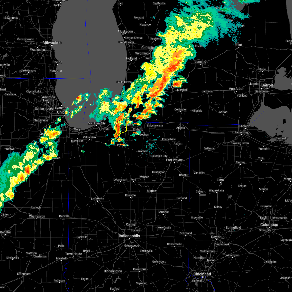 At 449 pm edt, a severe thunderstorm was located near south bend, moving northeast at 40 mph (radar indicated). Hazards include 60 mph wind gusts. Expect damage to roofs, siding, and trees. Locations impacted include, south bend, niles, georgetown, gulivoire park, new carlisle, roseland, bertrand, indian village, lydick, chain-o-lakes and crumstown. At 449 pm edt, a severe thunderstorm was located near south bend, moving northeast at 40 mph (radar indicated). Hazards include 60 mph wind gusts. Expect damage to roofs, siding, and trees. Locations impacted include, south bend, niles, georgetown, gulivoire park, new carlisle, roseland, bertrand, indian village, lydick, chain-o-lakes and crumstown.
|
| 6/26/2021 4:38 PM EDT |
 At 437 pm edt/337 pm cdt/, a severe thunderstorm was located near new carlisle, or 11 miles east of la porte, moving northeast at 50 mph (radar indicated). Hazards include 60 mph wind gusts. expect damage to roofs, siding, and trees At 437 pm edt/337 pm cdt/, a severe thunderstorm was located near new carlisle, or 11 miles east of la porte, moving northeast at 50 mph (radar indicated). Hazards include 60 mph wind gusts. expect damage to roofs, siding, and trees
|
| 6/26/2021 4:38 PM EDT |
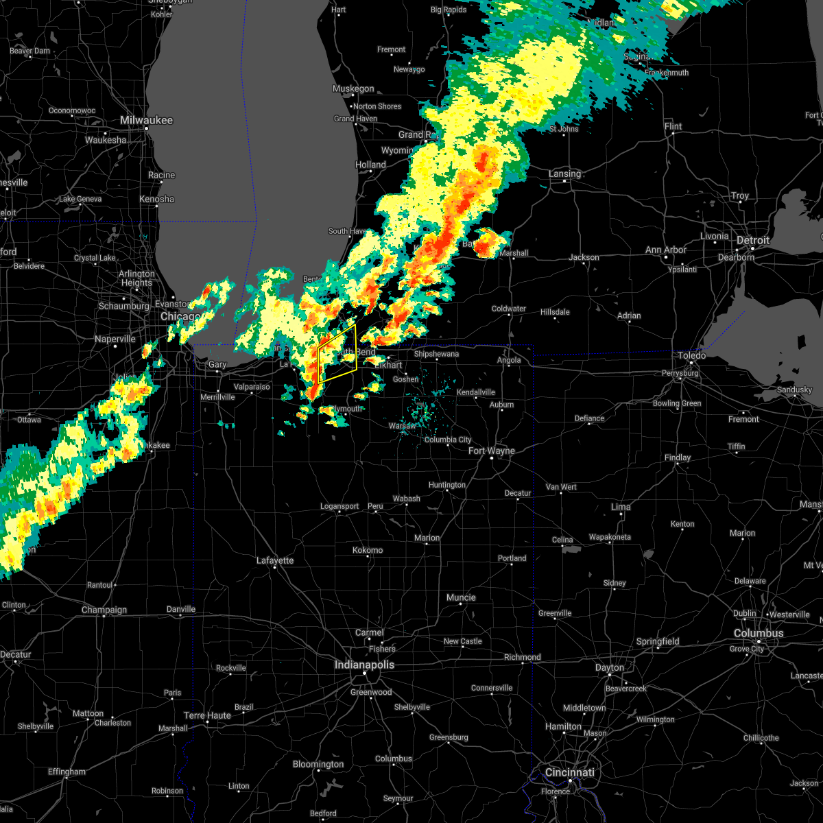 At 437 pm edt/337 pm cdt/, a severe thunderstorm was located near new carlisle, or 11 miles east of la porte, moving northeast at 50 mph (radar indicated). Hazards include 60 mph wind gusts. expect damage to roofs, siding, and trees At 437 pm edt/337 pm cdt/, a severe thunderstorm was located near new carlisle, or 11 miles east of la porte, moving northeast at 50 mph (radar indicated). Hazards include 60 mph wind gusts. expect damage to roofs, siding, and trees
|
| 6/26/2021 4:16 PM EDT |
 At 416 pm edt, a severe thunderstorm capable of producing a tornado was located over south bend, moving northeast at 35 mph (radar indicated rotation). Hazards include tornado. Flying debris will be dangerous to those caught without shelter. mobile homes will be damaged or destroyed. damage to roofs, windows, and vehicles will occur. tree damage is likely. this dangerous storm will be near, mishawaka and georgetown around 425 pm edt. Other locations in the path of this tornadic thunderstorm include granger and osceola. At 416 pm edt, a severe thunderstorm capable of producing a tornado was located over south bend, moving northeast at 35 mph (radar indicated rotation). Hazards include tornado. Flying debris will be dangerous to those caught without shelter. mobile homes will be damaged or destroyed. damage to roofs, windows, and vehicles will occur. tree damage is likely. this dangerous storm will be near, mishawaka and georgetown around 425 pm edt. Other locations in the path of this tornadic thunderstorm include granger and osceola.
|
| 6/26/2021 4:09 PM EDT |
 At 409 pm edt, a severe thunderstorm capable of producing a tornado was located near gulivoire park, moving northeast at 35 mph (radar indicated rotation). Hazards include tornado. Flying debris will be dangerous to those caught without shelter. mobile homes will be damaged or destroyed. damage to roofs, windows, and vehicles will occur. tree damage is likely. this dangerous storm will be near, south bend around 415 pm edt. mishawaka, georgetown and roseland around 425 pm edt. other locations in the path of this tornadic thunderstorm include osceola and granger. This includes interstate 80 in indiana between mile markers 76 and 87. At 409 pm edt, a severe thunderstorm capable of producing a tornado was located near gulivoire park, moving northeast at 35 mph (radar indicated rotation). Hazards include tornado. Flying debris will be dangerous to those caught without shelter. mobile homes will be damaged or destroyed. damage to roofs, windows, and vehicles will occur. tree damage is likely. this dangerous storm will be near, south bend around 415 pm edt. mishawaka, georgetown and roseland around 425 pm edt. other locations in the path of this tornadic thunderstorm include osceola and granger. This includes interstate 80 in indiana between mile markers 76 and 87.
|
| 6/21/2021 1:55 AM EDT |
 At 155 am edt/1255 am cdt/, severe thunderstorms were located along a line extending from near georgetown to near knox to near north judson to gifford, moving east at 45 mph (radar indicated). Hazards include 60 mph wind gusts and quarter size hail. Hail damage to vehicles is expected. expect wind damage to roofs, siding, and trees. Locations impacted include, south bend, elkhart, mishawaka, niles, plymouth, nappanee, rochester, bremen, knox, georgetown, winamac, gulivoire park, granger, simonton lake, osceola, walkerton, north liberty, bourbon, wakarusa and argos. At 155 am edt/1255 am cdt/, severe thunderstorms were located along a line extending from near georgetown to near knox to near north judson to gifford, moving east at 45 mph (radar indicated). Hazards include 60 mph wind gusts and quarter size hail. Hail damage to vehicles is expected. expect wind damage to roofs, siding, and trees. Locations impacted include, south bend, elkhart, mishawaka, niles, plymouth, nappanee, rochester, bremen, knox, georgetown, winamac, gulivoire park, granger, simonton lake, osceola, walkerton, north liberty, bourbon, wakarusa and argos.
|
| 6/21/2021 1:30 AM EDT |
 At 130 am edt/1230 am cdt/, severe thunderstorms were located along a line extending from new buffalo to near moody, moving east at 60 mph (radar indicated). Hazards include 70 mph wind gusts and quarter size hail. Hail damage to vehicles is expected. expect considerable tree damage. Wind damage is also likely to mobile homes, roofs, and outbuildings. At 130 am edt/1230 am cdt/, severe thunderstorms were located along a line extending from new buffalo to near moody, moving east at 60 mph (radar indicated). Hazards include 70 mph wind gusts and quarter size hail. Hail damage to vehicles is expected. expect considerable tree damage. Wind damage is also likely to mobile homes, roofs, and outbuildings.
|
| 11/10/2020 9:27 PM EST |
 The severe thunderstorm warning for st. joseph, northeastern starke, northwestern marshall, western cass and southeastern berrien counties will expire at 930 pm est/830 pm cst/, the storms which prompted the warning have weakened below severe limits, and no longer pose an immediate threat to life or property. therefore, the warning will be allowed to expire. however gusty winds are still possible with these thunderstorms. a severe thunderstorm watch remains in effect until midnight est/1100 pm cst/ for north central and northwestern indiana, and southwestern michigan. The severe thunderstorm warning for st. joseph, northeastern starke, northwestern marshall, western cass and southeastern berrien counties will expire at 930 pm est/830 pm cst/, the storms which prompted the warning have weakened below severe limits, and no longer pose an immediate threat to life or property. therefore, the warning will be allowed to expire. however gusty winds are still possible with these thunderstorms. a severe thunderstorm watch remains in effect until midnight est/1100 pm cst/ for north central and northwestern indiana, and southwestern michigan.
|
| 11/10/2020 9:14 PM EST |
 At 913 pm est/813 pm cst/, severe thunderstorms were located along a line extending from near watervliet to near hamlet, moving east at 35 mph (radar indicated). Hazards include 60 mph wind gusts. Expect damage to roofs, siding, and trees. Locations impacted include, south bend, mishawaka, niles, plymouth, dowagiac, buchanan, georgetown, gulivoire park, granger, osceola, walkerton, north liberty, new carlisle, berrien springs, cassopolis, watervliet, edwardsburg, hamlet, lakeville and roseland. At 913 pm est/813 pm cst/, severe thunderstorms were located along a line extending from near watervliet to near hamlet, moving east at 35 mph (radar indicated). Hazards include 60 mph wind gusts. Expect damage to roofs, siding, and trees. Locations impacted include, south bend, mishawaka, niles, plymouth, dowagiac, buchanan, georgetown, gulivoire park, granger, osceola, walkerton, north liberty, new carlisle, berrien springs, cassopolis, watervliet, edwardsburg, hamlet, lakeville and roseland.
|
| 11/10/2020 8:42 PM EST |
 The national weather service in northern indiana has issued a * severe thunderstorm warning for. st. joseph county in north central indiana. northeastern starke county in northwestern indiana. northwestern marshall county in north central indiana. La porte county in northwestern indiana. The national weather service in northern indiana has issued a * severe thunderstorm warning for. st. joseph county in north central indiana. northeastern starke county in northwestern indiana. northwestern marshall county in north central indiana. La porte county in northwestern indiana.
|
| 11/10/2020 8:42 PM EST |
 At 842 pm est/742 pm cst/, severe thunderstorms were located along a line extending from near benton harbor to wanatah, moving east at 45 mph (radar indicated). Hazards include 60 mph wind gusts. expect damage to roofs, siding, and trees At 842 pm est/742 pm cst/, severe thunderstorms were located along a line extending from near benton harbor to wanatah, moving east at 45 mph (radar indicated). Hazards include 60 mph wind gusts. expect damage to roofs, siding, and trees
|
| 8/29/2020 1:23 AM EDT |
 The severe thunderstorm warning for northern elkhart, northeastern st. joseph, southern cass, southwestern st. joseph and southeastern berrien counties will expire at 130 am edt, the storms which prompted the warning have weakened below severe limits. therefore, the warning will be allowed to expire at 130 am edt. however gusty winds of 40 to 50 mph are still possible with these thunderstorms as they track southeast across st. joseph indiana and elkhart counties. The severe thunderstorm warning for northern elkhart, northeastern st. joseph, southern cass, southwestern st. joseph and southeastern berrien counties will expire at 130 am edt, the storms which prompted the warning have weakened below severe limits. therefore, the warning will be allowed to expire at 130 am edt. however gusty winds of 40 to 50 mph are still possible with these thunderstorms as they track southeast across st. joseph indiana and elkhart counties.
|
| 8/29/2020 1:02 AM EDT |
 At 101 am edt, severe thunderstorms were located along a line extending from centreville to near bristol to near roseland, moving east at 45 mph (radar indicated). Hazards include 60 mph wind gusts. Expect damage to roofs, siding, and trees. Locations impacted include, south bend, elkhart, mishawaka, niles, three rivers, buchanan, georgetown, simonton lake, granger, constantine, cassopolis, bristol, white pigeon, centreville, edwardsburg, roseland, shorewood-tower hills-harbert, union, bertrand and pokagon. At 101 am edt, severe thunderstorms were located along a line extending from centreville to near bristol to near roseland, moving east at 45 mph (radar indicated). Hazards include 60 mph wind gusts. Expect damage to roofs, siding, and trees. Locations impacted include, south bend, elkhart, mishawaka, niles, three rivers, buchanan, georgetown, simonton lake, granger, constantine, cassopolis, bristol, white pigeon, centreville, edwardsburg, roseland, shorewood-tower hills-harbert, union, bertrand and pokagon.
|
| 8/29/2020 12:39 AM EDT |
 At 1239 am edt, severe thunderstorms were located along a line extending from marcellus to near edwardsburg to near three oaks, moving east at 45 mph (radar indicated). Hazards include 60 mph wind gusts. expect damage to roofs, siding, and trees At 1239 am edt, severe thunderstorms were located along a line extending from marcellus to near edwardsburg to near three oaks, moving east at 45 mph (radar indicated). Hazards include 60 mph wind gusts. expect damage to roofs, siding, and trees
|
| 8/10/2020 6:24 PM EDT |
 At 623 pm edt, severe thunderstorms were located along a line extending from near dowagiac to near south bend to near plymouth to argos, moving east at 45 mph. these are very dangerous storms (radar indicated). Hazards include 80 mph wind gusts and quarter size hail. Flying debris will be dangerous to those caught without shelter. mobile homes will be heavily damaged. expect considerable damage to roofs, windows, and vehicles. extensive tree damage and power outages are likely. severe thunderstorms will be near, mishawaka and dowagiac around 630 pm edt. bremen, granger, bourbon and cassopolis around 635 pm edt. osceola and mentone around 640 pm edt. elkhart, simonton lake, wakarusa and marcellus around 645 pm edt. nappanee and dunlap around 650 pm edt. warsaw, winona lake, bristol, milford and new paris around 655 pm edt. goshen, three rivers, syracuse and pierceton around 700 pm edt. middlebury, centreville, north webster and millersburg around 705 pm edt. This includes interstate 80 in indiana between mile markers 73 and 124. At 623 pm edt, severe thunderstorms were located along a line extending from near dowagiac to near south bend to near plymouth to argos, moving east at 45 mph. these are very dangerous storms (radar indicated). Hazards include 80 mph wind gusts and quarter size hail. Flying debris will be dangerous to those caught without shelter. mobile homes will be heavily damaged. expect considerable damage to roofs, windows, and vehicles. extensive tree damage and power outages are likely. severe thunderstorms will be near, mishawaka and dowagiac around 630 pm edt. bremen, granger, bourbon and cassopolis around 635 pm edt. osceola and mentone around 640 pm edt. elkhart, simonton lake, wakarusa and marcellus around 645 pm edt. nappanee and dunlap around 650 pm edt. warsaw, winona lake, bristol, milford and new paris around 655 pm edt. goshen, three rivers, syracuse and pierceton around 700 pm edt. middlebury, centreville, north webster and millersburg around 705 pm edt. This includes interstate 80 in indiana between mile markers 73 and 124.
|
| 8/10/2020 6:19 PM EDT |
 At 618 pm edt/518 pm cdt/, severe thunderstorms were located along a line extending from near dowagiac to near gulivoire park to near bremen to near culver, moving east at 60 mph. these are very dangerous storms (trained weather spotters quarter sized hail and tree branches down in baroda, michigan). Hazards include 80 mph wind gusts and quarter size hail. Flying debris will be dangerous to those caught without shelter. mobile homes will be heavily damaged. expect considerable damage to roofs, windows, and vehicles. extensive tree damage and power outages are likely. these severe storms will be near, dowagiac around 625 pm edt. osceola and bourbon around 630 pm edt. Other locations impacted by these severe thunderstorms include dewey lake, harbert, bertrand, fish lake, brems, crumstown, tyner, millburg, hibbard and tippecanoe. At 618 pm edt/518 pm cdt/, severe thunderstorms were located along a line extending from near dowagiac to near gulivoire park to near bremen to near culver, moving east at 60 mph. these are very dangerous storms (trained weather spotters quarter sized hail and tree branches down in baroda, michigan). Hazards include 80 mph wind gusts and quarter size hail. Flying debris will be dangerous to those caught without shelter. mobile homes will be heavily damaged. expect considerable damage to roofs, windows, and vehicles. extensive tree damage and power outages are likely. these severe storms will be near, dowagiac around 625 pm edt. osceola and bourbon around 630 pm edt. Other locations impacted by these severe thunderstorms include dewey lake, harbert, bertrand, fish lake, brems, crumstown, tyner, millburg, hibbard and tippecanoe.
|
| 8/10/2020 6:11 PM EDT |
 At 610 pm edt/510 pm cdt/, severe thunderstorms were located along a line extending from berrien springs to 6 miles southeast of new carlisle to 6 miles northwest of plymouth to near culver, moving east at 60 mph. these are very dangerous storms (trained weather spotters quarter sized hail and tree branches down in baroda, michigan). Hazards include 80 mph wind gusts and quarter size hail. Flying debris will be dangerous to those caught without shelter. mobile homes will be heavily damaged. expect considerable damage to roofs, windows, and vehicles. extensive tree damage and power outages are likely. these severe storms will be near, south bend and plymouth around 615 pm edt. niles, gulivoire park, lakeville and roseland around 620 pm edt. mishawaka, dowagiac, bremen and argos around 625 pm edt. osceola and bourbon around 630 pm edt. Other locations impacted by these severe thunderstorms include dewey lake, lomax, waterford, michiana shores, harbert, bertrand, fish lake, brems, crumstown and tyner. At 610 pm edt/510 pm cdt/, severe thunderstorms were located along a line extending from berrien springs to 6 miles southeast of new carlisle to 6 miles northwest of plymouth to near culver, moving east at 60 mph. these are very dangerous storms (trained weather spotters quarter sized hail and tree branches down in baroda, michigan). Hazards include 80 mph wind gusts and quarter size hail. Flying debris will be dangerous to those caught without shelter. mobile homes will be heavily damaged. expect considerable damage to roofs, windows, and vehicles. extensive tree damage and power outages are likely. these severe storms will be near, south bend and plymouth around 615 pm edt. niles, gulivoire park, lakeville and roseland around 620 pm edt. mishawaka, dowagiac, bremen and argos around 625 pm edt. osceola and bourbon around 630 pm edt. Other locations impacted by these severe thunderstorms include dewey lake, lomax, waterford, michiana shores, harbert, bertrand, fish lake, brems, crumstown and tyner.
|
| 8/10/2020 5:42 PM EDT |
 At 541 pm edt/441 pm cdt/, severe thunderstorms were located along a line extending from 9 miles northwest of new buffalo to near westville to wanatah to near dunns bridge, moving east at 60 mph. these are very dangerous storms (radar indicated). Hazards include 80 mph wind gusts and quarter size hail. Flying debris will be dangerous to those caught without shelter. mobile homes will be heavily damaged. expect considerable damage to roofs, windows, and vehicles. extensive tree damage and power outages are likely. these severe storms will be near, trail creek around 545 pm edt. new buffalo and kingsford heights around 550 pm edt. la porte, bridgman, north judson, shorewood-tower hills-harbert and shorewood-tower hill around 555 pm edt. knox, stevensville and hamlet around 600 pm edt. buchanan, walkerton, new carlisle and koontz lake around 605 pm edt. plymouth, north liberty and berrien springs around 610 pm edt. south bend, niles and culver around 615 pm edt. bremen, georgetown, gulivoire park, lakeville and roseland around 620 pm edt. Other locations impacted by these severe thunderstorms include dewey lake, lomax, waterford, michiana shores, harbert, bertrand, fish lake, brems, crumstown and tyner. At 541 pm edt/441 pm cdt/, severe thunderstorms were located along a line extending from 9 miles northwest of new buffalo to near westville to wanatah to near dunns bridge, moving east at 60 mph. these are very dangerous storms (radar indicated). Hazards include 80 mph wind gusts and quarter size hail. Flying debris will be dangerous to those caught without shelter. mobile homes will be heavily damaged. expect considerable damage to roofs, windows, and vehicles. extensive tree damage and power outages are likely. these severe storms will be near, trail creek around 545 pm edt. new buffalo and kingsford heights around 550 pm edt. la porte, bridgman, north judson, shorewood-tower hills-harbert and shorewood-tower hill around 555 pm edt. knox, stevensville and hamlet around 600 pm edt. buchanan, walkerton, new carlisle and koontz lake around 605 pm edt. plymouth, north liberty and berrien springs around 610 pm edt. south bend, niles and culver around 615 pm edt. bremen, georgetown, gulivoire park, lakeville and roseland around 620 pm edt. Other locations impacted by these severe thunderstorms include dewey lake, lomax, waterford, michiana shores, harbert, bertrand, fish lake, brems, crumstown and tyner.
|
| 8/10/2020 5:19 PM EDT |
 At 517 pm edt/417 pm cdt/, severe thunderstorms were located along a line extending from 16 miles northeast of hyde park to near gary to near crown point to near lake village, moving east at 55 mph. these are very dangerous storms (radar indicated). Hazards include 80 mph wind gusts and quarter size hail. Flying debris will be dangerous to those caught without shelter. mobile homes will be heavily damaged. expect considerable damage to roofs, windows, and vehicles. extensive tree damage and power outages are likely. severe thunderstorms will be near, wanatah and la crosse around 540 pm edt. westville and trail creek around 545 pm edt. new buffalo and kingsford heights around 550 pm edt. la porte, knox, bridgman, north judson, three oaks, hamlet, shorewood-tower hills-harbert and shorewood-tower hill around 555 pm edt. stevensville around 600 pm edt. buchanan, walkerton, new carlisle and koontz lake around 605 pm edt. plymouth, north liberty and berrien springs around 610 pm edt. south bend, niles and culver around 615 pm edt. this includes the following highways, interstate 196 between mile markers 0 and 7. interstate 80 in indiana between mile markers 38 and 87. interstate 94 in indiana between mile markers 33 and 45. Interstate 94 in michigan between mile markers 0 and 42. At 517 pm edt/417 pm cdt/, severe thunderstorms were located along a line extending from 16 miles northeast of hyde park to near gary to near crown point to near lake village, moving east at 55 mph. these are very dangerous storms (radar indicated). Hazards include 80 mph wind gusts and quarter size hail. Flying debris will be dangerous to those caught without shelter. mobile homes will be heavily damaged. expect considerable damage to roofs, windows, and vehicles. extensive tree damage and power outages are likely. severe thunderstorms will be near, wanatah and la crosse around 540 pm edt. westville and trail creek around 545 pm edt. new buffalo and kingsford heights around 550 pm edt. la porte, knox, bridgman, north judson, three oaks, hamlet, shorewood-tower hills-harbert and shorewood-tower hill around 555 pm edt. stevensville around 600 pm edt. buchanan, walkerton, new carlisle and koontz lake around 605 pm edt. plymouth, north liberty and berrien springs around 610 pm edt. south bend, niles and culver around 615 pm edt. this includes the following highways, interstate 196 between mile markers 0 and 7. interstate 80 in indiana between mile markers 38 and 87. interstate 94 in indiana between mile markers 33 and 45. Interstate 94 in michigan between mile markers 0 and 42.
|
| 6/26/2020 10:27 PM EDT |
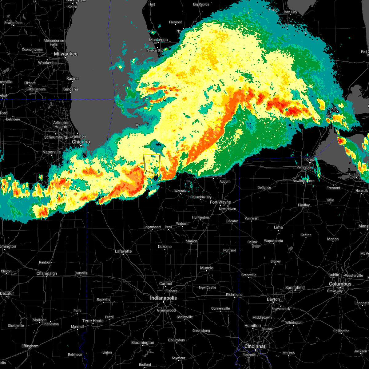 The severe thunderstorm warning for western st. joseph county will expire at 1030 pm edt, the storm which prompted the warning has moved out of the area. therefore, the warning will be allowed to expire. a severe thunderstorm watch remains in effect until 500 am edt for north central and northwestern indiana, and southwestern michigan. The severe thunderstorm warning for western st. joseph county will expire at 1030 pm edt, the storm which prompted the warning has moved out of the area. therefore, the warning will be allowed to expire. a severe thunderstorm watch remains in effect until 500 am edt for north central and northwestern indiana, and southwestern michigan.
|
| 6/26/2020 10:16 PM EDT |
 At 1016 pm edt, a severe thunderstorm was located over gulivoire park, moving east at 55 mph (radar indicated). Hazards include 70 mph wind gusts. Expect considerable tree damage. damage is likely to mobile homes, roofs, and outbuildings. Locations impacted include, south bend, georgetown, gulivoire park, north liberty, new carlisle, lakeville, roseland, indian village, lydick, chain-o-lakes and crumstown. At 1016 pm edt, a severe thunderstorm was located over gulivoire park, moving east at 55 mph (radar indicated). Hazards include 70 mph wind gusts. Expect considerable tree damage. damage is likely to mobile homes, roofs, and outbuildings. Locations impacted include, south bend, georgetown, gulivoire park, north liberty, new carlisle, lakeville, roseland, indian village, lydick, chain-o-lakes and crumstown.
|
| 6/26/2020 8:54 PM CDT |
 At 953 pm edt/853 pm cdt/, a severe thunderstorm was located near new carlisle, or 9 miles northeast of la porte, moving east at 55 mph (radar indicated). Hazards include 70 mph wind gusts. Expect considerable tree damage. Damage is likely to mobile homes, roofs, and outbuildings. At 953 pm edt/853 pm cdt/, a severe thunderstorm was located near new carlisle, or 9 miles northeast of la porte, moving east at 55 mph (radar indicated). Hazards include 70 mph wind gusts. Expect considerable tree damage. Damage is likely to mobile homes, roofs, and outbuildings.
|
| 6/26/2020 9:34 PM EDT |
 At 933 pm edt/833 pm cdt/, a severe thunderstorm was located near three oaks, or 10 miles northeast of la porte, moving east at 50 mph (radar indicated). Hazards include 70 mph wind gusts. Expect considerable tree damage. damage is likely to mobile homes, roofs, and outbuildings. Locations impacted include, south bend, michigan city, la porte, niles, buchanan, georgetown, trail creek, gulivoire park, bridgman, north liberty, new buffalo, new carlisle, berrien springs, three oaks, stevensville, lakeville, roseland, pottawattamie park, shorewood-tower hills-harbert and bertrand. At 933 pm edt/833 pm cdt/, a severe thunderstorm was located near three oaks, or 10 miles northeast of la porte, moving east at 50 mph (radar indicated). Hazards include 70 mph wind gusts. Expect considerable tree damage. damage is likely to mobile homes, roofs, and outbuildings. Locations impacted include, south bend, michigan city, la porte, niles, buchanan, georgetown, trail creek, gulivoire park, bridgman, north liberty, new buffalo, new carlisle, berrien springs, three oaks, stevensville, lakeville, roseland, pottawattamie park, shorewood-tower hills-harbert and bertrand.
|
| 6/26/2020 9:04 PM EDT |
 At 904 pm edt/804 pm cdt/, a severe thunderstorm was located 8 miles north of beverly shores, or 9 miles northwest of michigan city, moving east at 40 mph (radar indicated). Hazards include 70 mph wind gusts. Expect considerable tree damage. Damage is likely to mobile homes, roofs, and outbuildings. At 904 pm edt/804 pm cdt/, a severe thunderstorm was located 8 miles north of beverly shores, or 9 miles northwest of michigan city, moving east at 40 mph (radar indicated). Hazards include 70 mph wind gusts. Expect considerable tree damage. Damage is likely to mobile homes, roofs, and outbuildings.
|
| 5/23/2020 8:27 PM EDT |
 The severe thunderstorm warning for northwestern elkhart and northeastern st. joseph counties will expire at 830 pm edt, the storms which prompted the warning have weakened. therefore, the warning will be allowed to expire. a tornado watch remains in effect until 1000 pm edt for north central indiana. The severe thunderstorm warning for northwestern elkhart and northeastern st. joseph counties will expire at 830 pm edt, the storms which prompted the warning have weakened. therefore, the warning will be allowed to expire. a tornado watch remains in effect until 1000 pm edt for north central indiana.
|
| 5/23/2020 7:57 PM EDT |
 At 756 pm edt, severe thunderstorms were located along a line extending from georgetown to mishawaka to near gulivoire park, moving east at 30 mph. at 748 pm, the south bend regional airport recorded a 56 mph wind gust (radar indicated). Hazards include 60 mph wind gusts and nickel size hail. Expect damage to roofs, siding, and trees. Locations impacted include, south bend, elkhart, mishawaka, goshen, georgetown, granger, dunlap, gulivoire park, simonton lake, osceola, roseland, indian village and jimtown. At 756 pm edt, severe thunderstorms were located along a line extending from georgetown to mishawaka to near gulivoire park, moving east at 30 mph. at 748 pm, the south bend regional airport recorded a 56 mph wind gust (radar indicated). Hazards include 60 mph wind gusts and nickel size hail. Expect damage to roofs, siding, and trees. Locations impacted include, south bend, elkhart, mishawaka, goshen, georgetown, granger, dunlap, gulivoire park, simonton lake, osceola, roseland, indian village and jimtown.
|
| 5/23/2020 7:42 PM EDT |
 At 742 pm edt, severe thunderstorms were located along a line extending from 6 miles west of roseland to near south bend to near north liberty, moving east at 30 mph (radar indicated). Hazards include 60 mph wind gusts and nickel size hail. expect damage to roofs, siding, and trees At 742 pm edt, severe thunderstorms were located along a line extending from 6 miles west of roseland to near south bend to near north liberty, moving east at 30 mph (radar indicated). Hazards include 60 mph wind gusts and nickel size hail. expect damage to roofs, siding, and trees
|
| 4/7/2020 10:13 PM EDT |
 The severe thunderstorm warning for northwestern st. joseph, northern la porte and southeastern berrien counties will expire at 1015 pm edt/915 pm cdt/, the storms which prompted the warning have weakened below severe limits, and no longer pose an immediate threat to life or property. therefore, the warning will be allowed to expire. however small hail and heavy rain are still possible with these thunderstorms. a severe thunderstorm watch remains in effect until 300 am edt/200 am cdt/ for north central and northwestern indiana, and southwestern michigan. The severe thunderstorm warning for northwestern st. joseph, northern la porte and southeastern berrien counties will expire at 1015 pm edt/915 pm cdt/, the storms which prompted the warning have weakened below severe limits, and no longer pose an immediate threat to life or property. therefore, the warning will be allowed to expire. however small hail and heavy rain are still possible with these thunderstorms. a severe thunderstorm watch remains in effect until 300 am edt/200 am cdt/ for north central and northwestern indiana, and southwestern michigan.
|
| 4/7/2020 9:56 PM EDT |
 At 955 pm edt/855 pm cdt/, severe thunderstorms were located along a line extending from near buchanan to la porte, moving east at 30 mph (radar indicated). Hazards include 60 mph wind gusts and quarter size hail. Hail damage to vehicles is expected. expect wind damage to roofs, siding, and trees. Locations impacted include, south bend, la porte, georgetown, granger, new carlisle, roseland, bertrand, dayton, galien, indian village, byron, hudson lake, chain-o-lakes, rolling prarie, crumstown, lydick and springville. At 955 pm edt/855 pm cdt/, severe thunderstorms were located along a line extending from near buchanan to la porte, moving east at 30 mph (radar indicated). Hazards include 60 mph wind gusts and quarter size hail. Hail damage to vehicles is expected. expect wind damage to roofs, siding, and trees. Locations impacted include, south bend, la porte, georgetown, granger, new carlisle, roseland, bertrand, dayton, galien, indian village, byron, hudson lake, chain-o-lakes, rolling prarie, crumstown, lydick and springville.
|
| 4/7/2020 9:36 PM EDT |
 At 935 pm edt/835 pm cdt/, severe thunderstorms were located along a line extending from near three oaks to near trail creek, moving east at 35 mph (radar indicated). Hazards include 60 mph wind gusts and quarter size hail. Hail damage to vehicles is expected. Expect wind damage to roofs, siding, and trees. At 935 pm edt/835 pm cdt/, severe thunderstorms were located along a line extending from near three oaks to near trail creek, moving east at 35 mph (radar indicated). Hazards include 60 mph wind gusts and quarter size hail. Hail damage to vehicles is expected. Expect wind damage to roofs, siding, and trees.
|
| 9/27/2019 10:55 PM EDT |
 The severe thunderstorm warning for western elkhart and eastern st. joseph counties will expire at 1100 pm edt, the storms which prompted the warning have moved out of the area. therefore, the warning will be allowed to expire. a severe thunderstorm warning remains in effect for central and southeast portions of elkhart county until 1130 pm edt however. The severe thunderstorm warning for western elkhart and eastern st. joseph counties will expire at 1100 pm edt, the storms which prompted the warning have moved out of the area. therefore, the warning will be allowed to expire. a severe thunderstorm warning remains in effect for central and southeast portions of elkhart county until 1130 pm edt however.
|
| 9/27/2019 10:27 PM EDT |
 At 1027 pm edt, severe thunderstorms were located along a line extending from near granger to near osceola to near lakeville, moving east at 50 mph (radar indicated). Hazards include 60 mph wind gusts. Expect damage to roofs, siding, and trees. Locations impacted include, south bend, elkhart, mishawaka, goshen, georgetown, dunlap, gulivoire park, granger, osceola, wakarusa, bristol, lakeville, roseland, indian village, woodland, jimtown, southwest, foraker and wyatt. At 1027 pm edt, severe thunderstorms were located along a line extending from near granger to near osceola to near lakeville, moving east at 50 mph (radar indicated). Hazards include 60 mph wind gusts. Expect damage to roofs, siding, and trees. Locations impacted include, south bend, elkhart, mishawaka, goshen, georgetown, dunlap, gulivoire park, granger, osceola, wakarusa, bristol, lakeville, roseland, indian village, woodland, jimtown, southwest, foraker and wyatt.
|
| 9/27/2019 10:09 PM EDT |
 At 1009 pm edt, severe thunderstorms were located along a line extending from 6 miles west of roseland to near gulivoire park to walkerton, moving east at 45 mph (radar indicated). Hazards include 60 mph wind gusts. expect damage to roofs, siding, and trees At 1009 pm edt, severe thunderstorms were located along a line extending from 6 miles west of roseland to near gulivoire park to walkerton, moving east at 45 mph (radar indicated). Hazards include 60 mph wind gusts. expect damage to roofs, siding, and trees
|
| 6/25/2019 7:53 PM EDT |
 At 753 pm edt/653 pm cdt/, a severe thunderstorm was located near gulivoire park, moving east at 35 mph (radar indicated). Hazards include ping pong ball size hail and 60 mph wind gusts. People and animals outdoors will be injured. expect hail damage to roofs, siding, windows, and vehicles. expect wind damage to roofs, siding, and trees. Locations impacted include, south bend, mishawaka, georgetown, gulivoire park, granger, north liberty, new carlisle, lakeville, roseland, indian village, hudson lake, chain-o-lakes, crumstown and lydick. At 753 pm edt/653 pm cdt/, a severe thunderstorm was located near gulivoire park, moving east at 35 mph (radar indicated). Hazards include ping pong ball size hail and 60 mph wind gusts. People and animals outdoors will be injured. expect hail damage to roofs, siding, windows, and vehicles. expect wind damage to roofs, siding, and trees. Locations impacted include, south bend, mishawaka, georgetown, gulivoire park, granger, north liberty, new carlisle, lakeville, roseland, indian village, hudson lake, chain-o-lakes, crumstown and lydick.
|
| 6/25/2019 7:39 PM EDT |
 At 739 pm edt/639 pm cdt/, a severe thunderstorm was located near new carlisle, or 11 miles west of south bend, moving east at 35 mph (radar indicated). Hazards include ping pong ball size hail and 60 mph wind gusts. People and animals outdoors will be injured. expect hail damage to roofs, siding, windows, and vehicles. expect wind damage to roofs, siding, and trees. Locations impacted include, south bend, mishawaka, la porte, georgetown, granger, gulivoire park, north liberty, new carlisle, lakeville, roseland, galien, indian village, byron, hudson lake, chain-o-lakes, rolling prarie, crumstown and lydick. At 739 pm edt/639 pm cdt/, a severe thunderstorm was located near new carlisle, or 11 miles west of south bend, moving east at 35 mph (radar indicated). Hazards include ping pong ball size hail and 60 mph wind gusts. People and animals outdoors will be injured. expect hail damage to roofs, siding, windows, and vehicles. expect wind damage to roofs, siding, and trees. Locations impacted include, south bend, mishawaka, la porte, georgetown, granger, gulivoire park, north liberty, new carlisle, lakeville, roseland, galien, indian village, byron, hudson lake, chain-o-lakes, rolling prarie, crumstown and lydick.
|
| 6/25/2019 7:24 PM EDT |
 At 724 pm edt/624 pm cdt/, a severe thunderstorm was located near three oaks, or 7 miles northeast of la porte, moving east at 35 mph (radar indicated). Hazards include 60 mph wind gusts and quarter size hail. Hail damage to vehicles is expected. Expect wind damage to roofs, siding, and trees. At 724 pm edt/624 pm cdt/, a severe thunderstorm was located near three oaks, or 7 miles northeast of la porte, moving east at 35 mph (radar indicated). Hazards include 60 mph wind gusts and quarter size hail. Hail damage to vehicles is expected. Expect wind damage to roofs, siding, and trees.
|
| 5/27/2019 6:32 PM EDT |
 At 631 pm edt, a severe thunderstorm capable of producing a tornado was located over osceola, or near mishawaka, moving east at 30 mph (weather spotters reported a funnel cloud). Hazards include tornado and quarter size hail. Flying debris will be dangerous to those caught without shelter. mobile homes will be damaged or destroyed. damage to roofs, windows, and vehicles will occur. tree damage is likely. this dangerous storm will be near, edwardsburg around 640 pm edt. Other locations impacted by this tornadic thunderstorm include indian village. At 631 pm edt, a severe thunderstorm capable of producing a tornado was located over osceola, or near mishawaka, moving east at 30 mph (weather spotters reported a funnel cloud). Hazards include tornado and quarter size hail. Flying debris will be dangerous to those caught without shelter. mobile homes will be damaged or destroyed. damage to roofs, windows, and vehicles will occur. tree damage is likely. this dangerous storm will be near, edwardsburg around 640 pm edt. Other locations impacted by this tornadic thunderstorm include indian village.
|
| 5/27/2019 6:18 PM EDT |
 At 616 pm edt, a severe thunderstorm capable of producing a tornado was located over south bend, moving east at 30 mph (weather spotters reported a funnel cloud from mishawaka and south bend). Hazards include tornado and quarter size hail. Flying debris will be dangerous to those caught without shelter. mobile homes will be damaged or destroyed. damage to roofs, windows, and vehicles will occur. tree damage is likely. this dangerous storm will be near, mishawaka and georgetown around 625 pm edt. granger and osceola around 635 pm edt. edwardsburg around 640 pm edt. Other locations impacted by this tornadic thunderstorm include barron lake, bertrand, lydick, chain-o-lakes and indian village. At 616 pm edt, a severe thunderstorm capable of producing a tornado was located over south bend, moving east at 30 mph (weather spotters reported a funnel cloud from mishawaka and south bend). Hazards include tornado and quarter size hail. Flying debris will be dangerous to those caught without shelter. mobile homes will be damaged or destroyed. damage to roofs, windows, and vehicles will occur. tree damage is likely. this dangerous storm will be near, mishawaka and georgetown around 625 pm edt. granger and osceola around 635 pm edt. edwardsburg around 640 pm edt. Other locations impacted by this tornadic thunderstorm include barron lake, bertrand, lydick, chain-o-lakes and indian village.
|
| 5/27/2019 5:59 PM EDT |
 At 559 pm edt/459 pm cdt/, a severe thunderstorm capable of producing a tornado was located near new carlisle, or 8 miles west of south bend, moving east at 30 mph (radar indicated rotation). Hazards include tornado. Flying debris will be dangerous to those caught without shelter. mobile homes will be damaged or destroyed. damage to roofs, windows, and vehicles will occur. tree damage is likely. this dangerous storm will be near, south bend around 610 pm edt. gulivoire park and roseland around 620 pm edt. mishawaka and georgetown around 625 pm edt. granger and osceola around 635 pm edt. edwardsburg around 640 pm edt. Other locations impacted by this tornadic thunderstorm include hudson lake, lydick, indian village, barron lake, bertrand, chain-o-lakes and crumstown. At 559 pm edt/459 pm cdt/, a severe thunderstorm capable of producing a tornado was located near new carlisle, or 8 miles west of south bend, moving east at 30 mph (radar indicated rotation). Hazards include tornado. Flying debris will be dangerous to those caught without shelter. mobile homes will be damaged or destroyed. damage to roofs, windows, and vehicles will occur. tree damage is likely. this dangerous storm will be near, south bend around 610 pm edt. gulivoire park and roseland around 620 pm edt. mishawaka and georgetown around 625 pm edt. granger and osceola around 635 pm edt. edwardsburg around 640 pm edt. Other locations impacted by this tornadic thunderstorm include hudson lake, lydick, indian village, barron lake, bertrand, chain-o-lakes and crumstown.
|
| 3/14/2019 4:58 PM EDT |
 At 457 pm edt, severe thunderstorms were located along a line extending from marcellus to 7 miles east of cassopolis to near edwardsburg, moving northeast at 50 mph (radar indicated). Hazards include 60 mph wind gusts and quarter size hail. Hail damage to vehicles is expected. Expect wind damage to roofs, siding, and trees. At 457 pm edt, severe thunderstorms were located along a line extending from marcellus to 7 miles east of cassopolis to near edwardsburg, moving northeast at 50 mph (radar indicated). Hazards include 60 mph wind gusts and quarter size hail. Hail damage to vehicles is expected. Expect wind damage to roofs, siding, and trees.
|
| 3/14/2019 4:31 PM EDT |
 At 431 pm edt, a severe thunderstorm was located over mishawaka, moving northeast at 70 mph (radar indicated). Hazards include 60 mph wind gusts and quarter size hail. Hail damage to vehicles is expected. Expect wind damage to roofs, siding, and trees. At 431 pm edt, a severe thunderstorm was located over mishawaka, moving northeast at 70 mph (radar indicated). Hazards include 60 mph wind gusts and quarter size hail. Hail damage to vehicles is expected. Expect wind damage to roofs, siding, and trees.
|
| 3/14/2019 4:23 PM EDT |
 At 423 pm edt, a severe thunderstorm was located near roseland, or near georgetown, moving northeast at 45 mph (radar indicated). Hazards include 60 mph wind gusts and quarter size hail. Hail damage to vehicles is expected. Expect wind damage to roofs, siding, and trees. At 423 pm edt, a severe thunderstorm was located near roseland, or near georgetown, moving northeast at 45 mph (radar indicated). Hazards include 60 mph wind gusts and quarter size hail. Hail damage to vehicles is expected. Expect wind damage to roofs, siding, and trees.
|
| 3/14/2019 4:07 PM EDT |
 At 405 pm edt, a severe thunderstorm was located near new carlisle, or near buchanan, moving northeast at 50 mph (trained weather spotters reported golf ball sized hail in la porte at 348 pm edt). Hazards include golf ball size hail and 60 mph wind gusts. People and animals outdoors will be injured. expect hail damage to roofs, siding, windows, and vehicles. expect wind damage to roofs, siding, and trees. Locations impacted include, south bend, niles, buchanan, georgetown, granger, new carlisle, berrien springs, roseland, bertrand, dayton, galien, indian village, glendora, chain-o-lakes and lydick. At 405 pm edt, a severe thunderstorm was located near new carlisle, or near buchanan, moving northeast at 50 mph (trained weather spotters reported golf ball sized hail in la porte at 348 pm edt). Hazards include golf ball size hail and 60 mph wind gusts. People and animals outdoors will be injured. expect hail damage to roofs, siding, windows, and vehicles. expect wind damage to roofs, siding, and trees. Locations impacted include, south bend, niles, buchanan, georgetown, granger, new carlisle, berrien springs, roseland, bertrand, dayton, galien, indian village, glendora, chain-o-lakes and lydick.
|
| 3/14/2019 3:55 PM EDT |
 At 354 pm edt/254 pm cdt/, a severe thunderstorm was located near new carlisle, or 8 miles northeast of la porte, moving northeast at 50 mph (trained weather spotters reported golf ball sized hail at 348 pm edt in la porte). Hazards include golf ball size hail and 60 mph wind gusts. People and animals outdoors will be injured. expect hail damage to roofs, siding, windows, and vehicles. Expect wind damage to roofs, siding, and trees. At 354 pm edt/254 pm cdt/, a severe thunderstorm was located near new carlisle, or 8 miles northeast of la porte, moving northeast at 50 mph (trained weather spotters reported golf ball sized hail at 348 pm edt in la porte). Hazards include golf ball size hail and 60 mph wind gusts. People and animals outdoors will be injured. expect hail damage to roofs, siding, windows, and vehicles. Expect wind damage to roofs, siding, and trees.
|
| 9/25/2018 9:05 PM EDT |
 At 905 pm edt/805 pm cdt/, severe thunderstorms were located along a line extending from 7 miles south of decatur to near osceola to near koontz lake, moving east at 30 mph (radar indicated). Hazards include 60 mph wind gusts. Expect damage to roofs, siding, and trees. Locations impacted include, south bend, elkhart, mishawaka, plymouth, georgetown, gulivoire park, simonton lake, granger, osceola, walkerton, north liberty, cassopolis, edwardsburg, hamlet, lakeville, roseland, koontz lake, penn, oak grove and la paz. At 905 pm edt/805 pm cdt/, severe thunderstorms were located along a line extending from 7 miles south of decatur to near osceola to near koontz lake, moving east at 30 mph (radar indicated). Hazards include 60 mph wind gusts. Expect damage to roofs, siding, and trees. Locations impacted include, south bend, elkhart, mishawaka, plymouth, georgetown, gulivoire park, simonton lake, granger, osceola, walkerton, north liberty, cassopolis, edwardsburg, hamlet, lakeville, roseland, koontz lake, penn, oak grove and la paz.
|
| 9/25/2018 8:50 PM EDT |
 At 849 pm edt/749 pm cdt/, severe thunderstorms were located along a line extending from near dowagiac to georgetown to hamlet, moving east at 30 mph (radar indicated). Hazards include 60 mph wind gusts and penny size hail. Expect damage to roofs, siding, and trees. Locations impacted include, south bend, elkhart, mishawaka, niles, plymouth, dowagiac, buchanan, georgetown, gulivoire park, granger, simonton lake, osceola, walkerton, north liberty, new carlisle, cassopolis, kingsford heights, edwardsburg, hamlet and lakeville. At 849 pm edt/749 pm cdt/, severe thunderstorms were located along a line extending from near dowagiac to georgetown to hamlet, moving east at 30 mph (radar indicated). Hazards include 60 mph wind gusts and penny size hail. Expect damage to roofs, siding, and trees. Locations impacted include, south bend, elkhart, mishawaka, niles, plymouth, dowagiac, buchanan, georgetown, gulivoire park, granger, simonton lake, osceola, walkerton, north liberty, new carlisle, cassopolis, kingsford heights, edwardsburg, hamlet and lakeville.
|
| 9/25/2018 8:32 PM EDT |
 At 831 pm edt/731 pm cdt/, severe thunderstorms were located along a line extending from 7 miles northeast of berrien springs to near new carlisle to 6 miles southwest of kingsford heights, moving east at 30 mph (radar indicated). Hazards include 60 mph wind gusts and penny size hail. expect damage to roofs, siding, and trees At 831 pm edt/731 pm cdt/, severe thunderstorms were located along a line extending from 7 miles northeast of berrien springs to near new carlisle to 6 miles southwest of kingsford heights, moving east at 30 mph (radar indicated). Hazards include 60 mph wind gusts and penny size hail. expect damage to roofs, siding, and trees
|
| 9/20/2018 5:03 PM EDT |
 At 502 pm edt, a severe thunderstorm was located over mishawaka, moving east at 30 mph. at 454 pm, a wind gust of 60 mph was reported at the south bend airport (radar indicated). Hazards include 60 mph wind gusts. expect damage to roofs, siding, and trees At 502 pm edt, a severe thunderstorm was located over mishawaka, moving east at 30 mph. at 454 pm, a wind gust of 60 mph was reported at the south bend airport (radar indicated). Hazards include 60 mph wind gusts. expect damage to roofs, siding, and trees
|
| 8/6/2018 7:03 PM EDT |
 At 702 pm edt, a severe thunderstorm was located over georgetown, moving east at 25 mph (radar indicated). Hazards include 60 mph wind gusts and penny size hail. Expect damage to roofs, siding, and trees. this severe thunderstorm will be near, granger around 715 pm edt. osceola and edwardsburg around 720 pm edt. elkhart and simonton lake around 730 pm edt. dunlap around 735 pm edt. bristol around 745 pm edt. other locations impacted by this severe thunderstorm include adamsville, juno lake, indian village, union and eagle lake. This includes interstate 80 in indiana between mile markers 77 and 100. At 702 pm edt, a severe thunderstorm was located over georgetown, moving east at 25 mph (radar indicated). Hazards include 60 mph wind gusts and penny size hail. Expect damage to roofs, siding, and trees. this severe thunderstorm will be near, granger around 715 pm edt. osceola and edwardsburg around 720 pm edt. elkhart and simonton lake around 730 pm edt. dunlap around 735 pm edt. bristol around 745 pm edt. other locations impacted by this severe thunderstorm include adamsville, juno lake, indian village, union and eagle lake. This includes interstate 80 in indiana between mile markers 77 and 100.
|
| 7/20/2018 2:24 PM EDT |
 At 223 pm edt, a line of severe thunderstorms was located near from near south bend tp nappanee moving northeast at 40 mph (radar indicated). Hazards include 70 mph wind gusts and quarter size hail. Hail damage to vehicles is expected. expect considerable tree damage. Wind damage is also likely to mobile homes, roofs, and outbuildings. At 223 pm edt, a line of severe thunderstorms was located near from near south bend tp nappanee moving northeast at 40 mph (radar indicated). Hazards include 70 mph wind gusts and quarter size hail. Hail damage to vehicles is expected. expect considerable tree damage. Wind damage is also likely to mobile homes, roofs, and outbuildings.
|
| 5/9/2018 8:54 PM EDT |
 The severe thunderstorm warning for northern st. joseph and southeastern berrien counties will expire at 900 pm edt, the storms which prompted the warning have weakened below severe limits, and have exited the warned area. therefore the warning will be allowed to expire. The severe thunderstorm warning for northern st. joseph and southeastern berrien counties will expire at 900 pm edt, the storms which prompted the warning have weakened below severe limits, and have exited the warned area. therefore the warning will be allowed to expire.
|
| 5/9/2018 8:39 PM EDT |
 At 839 pm edt, severe thunderstorms were located along a line extending from near berrien springs to near south bend, moving northeast at 45 mph (radar indicated). Hazards include 60 mph wind gusts and penny size hail. Expect damage to roofs, siding, and trees. Locations impacted include, south bend, mishawaka, niles, buchanan, georgetown, granger, gulivoire park, roseland, bertrand, indian village, chain-o-lakes, crumstown and lydick. At 839 pm edt, severe thunderstorms were located along a line extending from near berrien springs to near south bend, moving northeast at 45 mph (radar indicated). Hazards include 60 mph wind gusts and penny size hail. Expect damage to roofs, siding, and trees. Locations impacted include, south bend, mishawaka, niles, buchanan, georgetown, granger, gulivoire park, roseland, bertrand, indian village, chain-o-lakes, crumstown and lydick.
|
| 5/9/2018 8:16 PM EDT |
 At 815 pm edt/715 pm cdt/, severe thunderstorms were located along a line extending from near three oaks to near kingsford heights, moving northeast at 45 mph (radar indicated). Hazards include 60 mph wind gusts and quarter size hail. Hail damage to vehicles is expected. Expect wind damage to roofs, siding, and trees. At 815 pm edt/715 pm cdt/, severe thunderstorms were located along a line extending from near three oaks to near kingsford heights, moving northeast at 45 mph (radar indicated). Hazards include 60 mph wind gusts and quarter size hail. Hail damage to vehicles is expected. Expect wind damage to roofs, siding, and trees.
|
| 5/2/2018 10:05 PM EDT |
 The national weather service in northern indiana has issued a * severe thunderstorm warning for. northwestern st. joseph county in north central indiana. northern la porte county in northwestern indiana. berrien county in southwestern michigan. Until 1045 pm edt/945 pm cdt/. The national weather service in northern indiana has issued a * severe thunderstorm warning for. northwestern st. joseph county in north central indiana. northern la porte county in northwestern indiana. berrien county in southwestern michigan. Until 1045 pm edt/945 pm cdt/.
|
| 5/2/2018 8:05 PM EDT |
 At 802 pm edt, a severe thunderstorm was located near edwardsburg, or near niles, moving east at 50 mph (at about 800 pm edt the public reported numerous tree branches down in south bend. at 756 pm edt, south bend asos reported a 70 mph wind gust). Hazards include 70 mph wind gusts and quarter size hail. Hail damage to vehicles is expected. expect considerable tree damage. wind damage is also likely to mobile homes, roofs, and outbuildings. Locations impacted include, south bend, elkhart, mishawaka, niles, buchanan, georgetown, cassopolis, pokagon, la grange, and chain-o-lakes. At 802 pm edt, a severe thunderstorm was located near edwardsburg, or near niles, moving east at 50 mph (at about 800 pm edt the public reported numerous tree branches down in south bend. at 756 pm edt, south bend asos reported a 70 mph wind gust). Hazards include 70 mph wind gusts and quarter size hail. Hail damage to vehicles is expected. expect considerable tree damage. wind damage is also likely to mobile homes, roofs, and outbuildings. Locations impacted include, south bend, elkhart, mishawaka, niles, buchanan, georgetown, cassopolis, pokagon, la grange, and chain-o-lakes.
|
| 5/2/2018 7:39 PM EDT |
 At 737 pm edt/637 pm cdt/, a severe thunderstorm was located near new carlisle, or 10 miles southwest of buchanan, moving east at 50 mph (radar indicated). Hazards include 60 mph wind gusts and quarter size hail. Hail damage to vehicles is expected. Expect wind damage to roofs, siding, and trees. At 737 pm edt/637 pm cdt/, a severe thunderstorm was located near new carlisle, or 10 miles southwest of buchanan, moving east at 50 mph (radar indicated). Hazards include 60 mph wind gusts and quarter size hail. Hail damage to vehicles is expected. Expect wind damage to roofs, siding, and trees.
|
| 8/10/2017 10:37 PM EDT |
 At 1036 pm edt, a severe thunderstorm was located over south bend, moving east at 35 mph (radar indicated). Hazards include 60 mph wind gusts and penny size hail. Expect damage to roofs, siding, and trees. Locations impacted include, south bend, mishawaka, georgetown, granger, gulivoire park, osceola, roseland, indian village, wyatt and woodland. At 1036 pm edt, a severe thunderstorm was located over south bend, moving east at 35 mph (radar indicated). Hazards include 60 mph wind gusts and penny size hail. Expect damage to roofs, siding, and trees. Locations impacted include, south bend, mishawaka, georgetown, granger, gulivoire park, osceola, roseland, indian village, wyatt and woodland.
|
| 8/10/2017 10:20 PM EDT |
 At 1020 pm edt, a severe thunderstorm was located near new carlisle, or 9 miles west of south bend, moving east at 35 mph (radar indicated). Hazards include 60 mph wind gusts and penny size hail. expect damage to roofs, siding, and trees At 1020 pm edt, a severe thunderstorm was located near new carlisle, or 9 miles west of south bend, moving east at 35 mph (radar indicated). Hazards include 60 mph wind gusts and penny size hail. expect damage to roofs, siding, and trees
|
| 7/7/2017 4:22 AM EDT |
 At 421 am edt, a severe thunderstorm was located over georgetown, moving southeast at 45 mph (radar indicated). Hazards include 60 mph wind gusts and quarter size hail. Hail damage to vehicles is expected. Expect wind damage to roofs, siding, and trees. At 421 am edt, a severe thunderstorm was located over georgetown, moving southeast at 45 mph (radar indicated). Hazards include 60 mph wind gusts and quarter size hail. Hail damage to vehicles is expected. Expect wind damage to roofs, siding, and trees.
|
| 3/1/2017 1:39 AM EST |
 The severe thunderstorm warning for northern st. joseph, northeastern la porte, western cass and berrien counties will expire at 145 am est/1245 am cst/, the storms which prompted the warning have moved out of the area. therefore the warning will be allowed to expire. however gusty winds and heavy rain are still possible with these thunderstorms. a tornado watch remains in effect until 700 am est/600 am cst/ for north central and northwestern indiana. a severe thunderstorm watch remains in effect until 400 am est/300 am cst/ for southwestern michigan. The severe thunderstorm warning for northern st. joseph, northeastern la porte, western cass and berrien counties will expire at 145 am est/1245 am cst/, the storms which prompted the warning have moved out of the area. therefore the warning will be allowed to expire. however gusty winds and heavy rain are still possible with these thunderstorms. a tornado watch remains in effect until 700 am est/600 am cst/ for north central and northwestern indiana. a severe thunderstorm watch remains in effect until 400 am est/300 am cst/ for southwestern michigan.
|
| 3/1/2017 1:05 AM EST |
 At 104 am est/1204 am cst/, severe thunderstorms were located along a line extending from near fair plain to near buchanan to new carlisle, moving east at 65 mph (radar indicated). Hazards include 60 mph wind gusts and quarter size hail. Hail damage to vehicles is expected. expect wind damage to roofs, siding, and trees. trained spotters have reported quarter sized hail with this line of thunderstorms at union pier and new buffalo. locations impacted include, south bend, mishawaka, niles, dowagiac, buchanan, georgetown, granger, fair plain, new carlisle, berrien springs, cassopolis, edwardsburg, stevensville, roseland, bertrand, pokagon, dayton, sodus, penn and baroda. this includes the following highways, interstate 80 in indiana between mile markers 57 and 87. interstate 94 in michigan between mile markers 23 and 27. A tornado watch remains in effect until 700 am est/600 am cst/ for north central and northwestern indiana. At 104 am est/1204 am cst/, severe thunderstorms were located along a line extending from near fair plain to near buchanan to new carlisle, moving east at 65 mph (radar indicated). Hazards include 60 mph wind gusts and quarter size hail. Hail damage to vehicles is expected. expect wind damage to roofs, siding, and trees. trained spotters have reported quarter sized hail with this line of thunderstorms at union pier and new buffalo. locations impacted include, south bend, mishawaka, niles, dowagiac, buchanan, georgetown, granger, fair plain, new carlisle, berrien springs, cassopolis, edwardsburg, stevensville, roseland, bertrand, pokagon, dayton, sodus, penn and baroda. this includes the following highways, interstate 80 in indiana between mile markers 57 and 87. interstate 94 in michigan between mile markers 23 and 27. A tornado watch remains in effect until 700 am est/600 am cst/ for north central and northwestern indiana.
|
| 3/1/2017 12:40 AM EST |
 At 1240 am est/1140 pm cst/, severe thunderstorms were located along a line extending from 12 miles northwest of new buffalo to near long beach to near beverly shores, moving east at 65 mph (radar indicated). Hazards include 60 mph wind gusts and half dollar size hail. Hail damage to vehicles is expected. Expect wind damage to roofs, siding, and trees. At 1240 am est/1140 pm cst/, severe thunderstorms were located along a line extending from 12 miles northwest of new buffalo to near long beach to near beverly shores, moving east at 65 mph (radar indicated). Hazards include 60 mph wind gusts and half dollar size hail. Hail damage to vehicles is expected. Expect wind damage to roofs, siding, and trees.
|
| 2/28/2017 10:05 PM EST |
 At 1004 pm est, a severe thunderstorm was located over osceola, or near granger, moving east at 60 mph (radar indicated). Hazards include 60 mph wind gusts and half dollar size hail. Hail damage to vehicles is expected. expect wind damage to roofs, siding, and trees. locations impacted include, south bend, elkhart, mishawaka, goshen, georgetown, granger, dunlap, gulivoire park, simonton lake, osceola, roseland, indian village and jimtown. This includes interstate 80 in indiana between mile markers 77 and 92. At 1004 pm est, a severe thunderstorm was located over osceola, or near granger, moving east at 60 mph (radar indicated). Hazards include 60 mph wind gusts and half dollar size hail. Hail damage to vehicles is expected. expect wind damage to roofs, siding, and trees. locations impacted include, south bend, elkhart, mishawaka, goshen, georgetown, granger, dunlap, gulivoire park, simonton lake, osceola, roseland, indian village and jimtown. This includes interstate 80 in indiana between mile markers 77 and 92.
|
| 2/28/2017 9:45 PM EST |
 At 945 pm est/845 pm cst/, a severe thunderstorm was located near new carlisle, or 8 miles west of south bend, moving east at 60 mph (radar indicated). Hazards include 60 mph wind gusts and quarter size hail. Hail damage to vehicles is expected. Expect wind damage to roofs, siding, and trees. At 945 pm est/845 pm cst/, a severe thunderstorm was located near new carlisle, or 8 miles west of south bend, moving east at 60 mph (radar indicated). Hazards include 60 mph wind gusts and quarter size hail. Hail damage to vehicles is expected. Expect wind damage to roofs, siding, and trees.
|
| 2/28/2017 9:06 PM EST |
 At 906 pm est/806 pm cst/, severe thunderstorms were located along a line extending from near marcellus to 6 miles north of simonton lake to near south bend, moving east at 50 mph (radar indicated). Hazards include 60 mph wind gusts and nickel size hail. Expect damage to roofs, siding, and trees. locations impacted include, south bend, elkhart, mishawaka, la porte, niles, sturgis, three rivers, dowagiac, buchanan, georgetown, granger, simonton lake, constantine, new carlisle, cassopolis, bristol, white pigeon, centreville, edwardsburg and marcellus. This includes interstate 80 in indiana between mile markers 66 and 108. At 906 pm est/806 pm cst/, severe thunderstorms were located along a line extending from near marcellus to 6 miles north of simonton lake to near south bend, moving east at 50 mph (radar indicated). Hazards include 60 mph wind gusts and nickel size hail. Expect damage to roofs, siding, and trees. locations impacted include, south bend, elkhart, mishawaka, la porte, niles, sturgis, three rivers, dowagiac, buchanan, georgetown, granger, simonton lake, constantine, new carlisle, cassopolis, bristol, white pigeon, centreville, edwardsburg and marcellus. This includes interstate 80 in indiana between mile markers 66 and 108.
|
| 2/28/2017 8:52 PM EST |
 At 852 pm est/752 pm cst/, severe thunderstorms were located along a line extending from near dowagiac to near edwardsburg to near roseland, moving east at 50 mph (radar indicated). Hazards include 60 mph wind gusts and quarter size hail. Hail damage to vehicles is expected. expect wind damage to roofs, siding, and trees. These thunderstorms have a history of producing quarter sized hail and wind gusts to 60 mph. At 852 pm est/752 pm cst/, severe thunderstorms were located along a line extending from near dowagiac to near edwardsburg to near roseland, moving east at 50 mph (radar indicated). Hazards include 60 mph wind gusts and quarter size hail. Hail damage to vehicles is expected. expect wind damage to roofs, siding, and trees. These thunderstorms have a history of producing quarter sized hail and wind gusts to 60 mph.
|
| 6/22/2016 10:38 PM EDT |
 At 1038 pm edt, a severe thunderstorm was located over south bend, moving southeast at 35 mph (radar indicated). Hazards include 60 mph wind gusts and quarter size hail. Hail damage to vehicles is expected. expect wind damage to roofs, siding and trees. this severe storm will be near, osceola around 1050 pm edt. other locations impacted by this severe thunderstorm include woodland and indian village. this includes interstate 80 in indiana between mile markers 76 and 86. A tornado watch remains in effect until 500 am edt for north central indiana. At 1038 pm edt, a severe thunderstorm was located over south bend, moving southeast at 35 mph (radar indicated). Hazards include 60 mph wind gusts and quarter size hail. Hail damage to vehicles is expected. expect wind damage to roofs, siding and trees. this severe storm will be near, osceola around 1050 pm edt. other locations impacted by this severe thunderstorm include woodland and indian village. this includes interstate 80 in indiana between mile markers 76 and 86. A tornado watch remains in effect until 500 am edt for north central indiana.
|
| 6/22/2016 10:20 PM EDT |
 At 1020 pm edt, a severe thunderstorm was located near buchanan, moving southeast at 35 mph (radar indicated). Hazards include 60 mph wind gusts and quarter size hail. Hail damage to vehicles is expected. expect wind damage to roofs, siding and trees. this severe thunderstorm will be near, south bend around 1025 pm edt. georgetown and roseland around 1030 pm edt. gulivoire park around 1035 pm edt. mishawaka and granger around 1040 pm edt. osceola around 1045 pm edt. other locations impacted by this severe thunderstorm include woodland, chain-o-lakes, indian village and lydick. This includes interstate 80 in indiana between mile markers 64 and 86. At 1020 pm edt, a severe thunderstorm was located near buchanan, moving southeast at 35 mph (radar indicated). Hazards include 60 mph wind gusts and quarter size hail. Hail damage to vehicles is expected. expect wind damage to roofs, siding and trees. this severe thunderstorm will be near, south bend around 1025 pm edt. georgetown and roseland around 1030 pm edt. gulivoire park around 1035 pm edt. mishawaka and granger around 1040 pm edt. osceola around 1045 pm edt. other locations impacted by this severe thunderstorm include woodland, chain-o-lakes, indian village and lydick. This includes interstate 80 in indiana between mile markers 64 and 86.
|
| 6/20/2016 3:03 PM EDT |
 At 303 pm edt, a severe thunderstorm was located near elkhart, moving southeast at 40 mph (radar indicated). Hazards include 60 mph wind gusts and quarter size hail. Hail damage to vehicles is expected. expect wind damage to roofs, siding and trees. this severe storm will be near, new paris around 320 pm edt. goshen around 325 pm edt. millersburg around 330 pm edt. other locations impacted by this severe thunderstorm include jimtown, benton, indian village, waterford mills, foraker, locke and southwest. This includes interstate 80 in indiana between mile markers 73 and 90. At 303 pm edt, a severe thunderstorm was located near elkhart, moving southeast at 40 mph (radar indicated). Hazards include 60 mph wind gusts and quarter size hail. Hail damage to vehicles is expected. expect wind damage to roofs, siding and trees. this severe storm will be near, new paris around 320 pm edt. goshen around 325 pm edt. millersburg around 330 pm edt. other locations impacted by this severe thunderstorm include jimtown, benton, indian village, waterford mills, foraker, locke and southwest. This includes interstate 80 in indiana between mile markers 73 and 90.
|
| 6/20/2016 2:45 PM EDT |
 At 245 pm edt, a severe thunderstorm was located over granger, moving southeast at 40 mph (radar indicated). Hazards include 60 mph wind gusts and quarter size hail. Hail damage to vehicles is expected. expect wind damage to roofs, siding and trees. this severe thunderstorm will be near, elkhart and osceola around 255 pm edt. dunlap around 305 pm edt. wakarusa around 310 pm edt. new paris around 320 pm edt. goshen around 325 pm edt. millersburg around 330 pm edt. other locations impacted by this severe thunderstorm include jimtown, benton, indian village, waterford mills, foraker, locke and southwest. This includes interstate 80 in indiana between mile markers 73 and 90. At 245 pm edt, a severe thunderstorm was located over granger, moving southeast at 40 mph (radar indicated). Hazards include 60 mph wind gusts and quarter size hail. Hail damage to vehicles is expected. expect wind damage to roofs, siding and trees. this severe thunderstorm will be near, elkhart and osceola around 255 pm edt. dunlap around 305 pm edt. wakarusa around 310 pm edt. new paris around 320 pm edt. goshen around 325 pm edt. millersburg around 330 pm edt. other locations impacted by this severe thunderstorm include jimtown, benton, indian village, waterford mills, foraker, locke and southwest. This includes interstate 80 in indiana between mile markers 73 and 90.
|
| 7/13/2015 8:57 AM EDT |
 At 857 am edt, a severe thunderstorm was located near niles, moving east southeast at 55 mph (radar indicated). Hazards include 60 mph wind gusts. Expect damage to roofs. siding and trees. this severe storm will be near, granger around 900 am edt. cassopolis and edwardsburg around 905 am edt. elkhart and simonton lake around 910 am edt. bristol around 920 am edt. middlebury, constantine and white pigeon around 925 am edt. other locations impacted by this severe thunderstorm include paradise lake, klinger lake, eagle lake, clear lake, diamond lake, adamsville, mottville, donnell lake, juno lake and shavehead lake. This includes interstate 80 in indiana between mile markers 74 and 113. At 857 am edt, a severe thunderstorm was located near niles, moving east southeast at 55 mph (radar indicated). Hazards include 60 mph wind gusts. Expect damage to roofs. siding and trees. this severe storm will be near, granger around 900 am edt. cassopolis and edwardsburg around 905 am edt. elkhart and simonton lake around 910 am edt. bristol around 920 am edt. middlebury, constantine and white pigeon around 925 am edt. other locations impacted by this severe thunderstorm include paradise lake, klinger lake, eagle lake, clear lake, diamond lake, adamsville, mottville, donnell lake, juno lake and shavehead lake. This includes interstate 80 in indiana between mile markers 74 and 113.
|
| 7/13/2015 8:45 AM EDT |
 At 845 am edt, a severe thunderstorm was located near buchanan, moving east southeast at 55 mph (radar indicated). Hazards include 60 mph wind gusts. Expect damage to roofs. siding and trees. this severe thunderstorm will be near, niles and georgetown around 855 am edt. granger and edwardsburg around 900 am edt. elkhart, simonton lake and cassopolis around 905 am edt. bristol around 915 am edt. middlebury, constantine and white pigeon around 925 am edt. other locations impacted by this severe thunderstorm include klinger lake, clear lake, donnell lake, juno lake, shavehead lake, sumnerville, bertrand, waterford mills, calvin center and lydick. This includes interstate 80 in indiana between mile markers 68 and 113. At 845 am edt, a severe thunderstorm was located near buchanan, moving east southeast at 55 mph (radar indicated). Hazards include 60 mph wind gusts. Expect damage to roofs. siding and trees. this severe thunderstorm will be near, niles and georgetown around 855 am edt. granger and edwardsburg around 900 am edt. elkhart, simonton lake and cassopolis around 905 am edt. bristol around 915 am edt. middlebury, constantine and white pigeon around 925 am edt. other locations impacted by this severe thunderstorm include klinger lake, clear lake, donnell lake, juno lake, shavehead lake, sumnerville, bertrand, waterford mills, calvin center and lydick. This includes interstate 80 in indiana between mile markers 68 and 113.
|
| 4/9/2015 1:43 AM EDT | The severe thunderstorm warning for northern st. joseph county will expire at 145 am edt/1245 am cdt/. The line of storms which prompted the warning has weakened and moved out of the warned area. |
| 4/9/2015 1:19 AM EDT | A severe thunderstorm warning remains in effect for northern st. joseph county until 145 am edt. at 115 am edt. severe thunderstorms were located along a line extending from new carlisle to 6 miles west of south bend to mishawaka. and moving northeast at 35 mph. hazard. Quarter size hail. |
| 4/9/2015 12:57 AM EDT | The national weather service in northern indiana has issued a * severe thunderstorm warning for. northern la porte county in northwest indiana. st. joseph county in north central indiana. until 145 am edt/1245 am cdt/ * at 1154 pm cdt/1254 am edt/. Severe thunderstorms were located. |
| 11/17/2013 3:20 PM EST | Tops of tress blown off in st. joseph county IN, 0.2 miles S of Roseland, IN |
| 11/17/2013 3:10 PM EST | Tops of tress blown off. time estimated from rada in st. joseph county IN, 0.2 miles S of Roseland, IN |
Hail Maps for Roseland, IN


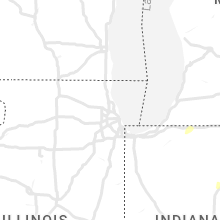


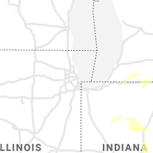


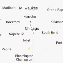


Connect with Interactive Hail Maps