

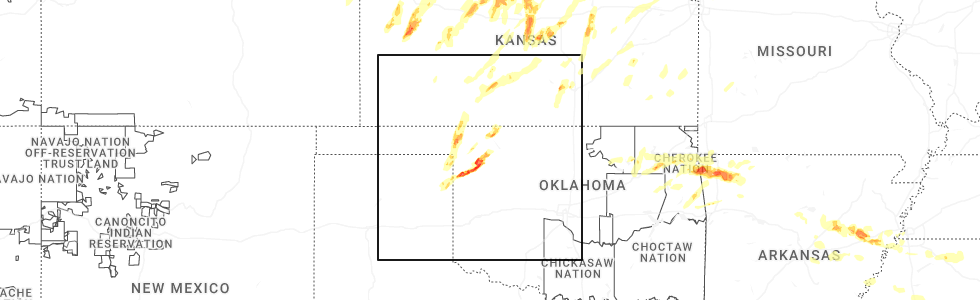
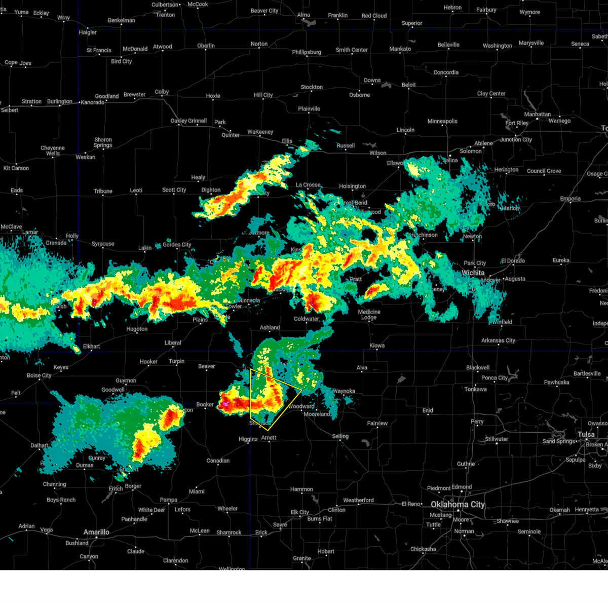
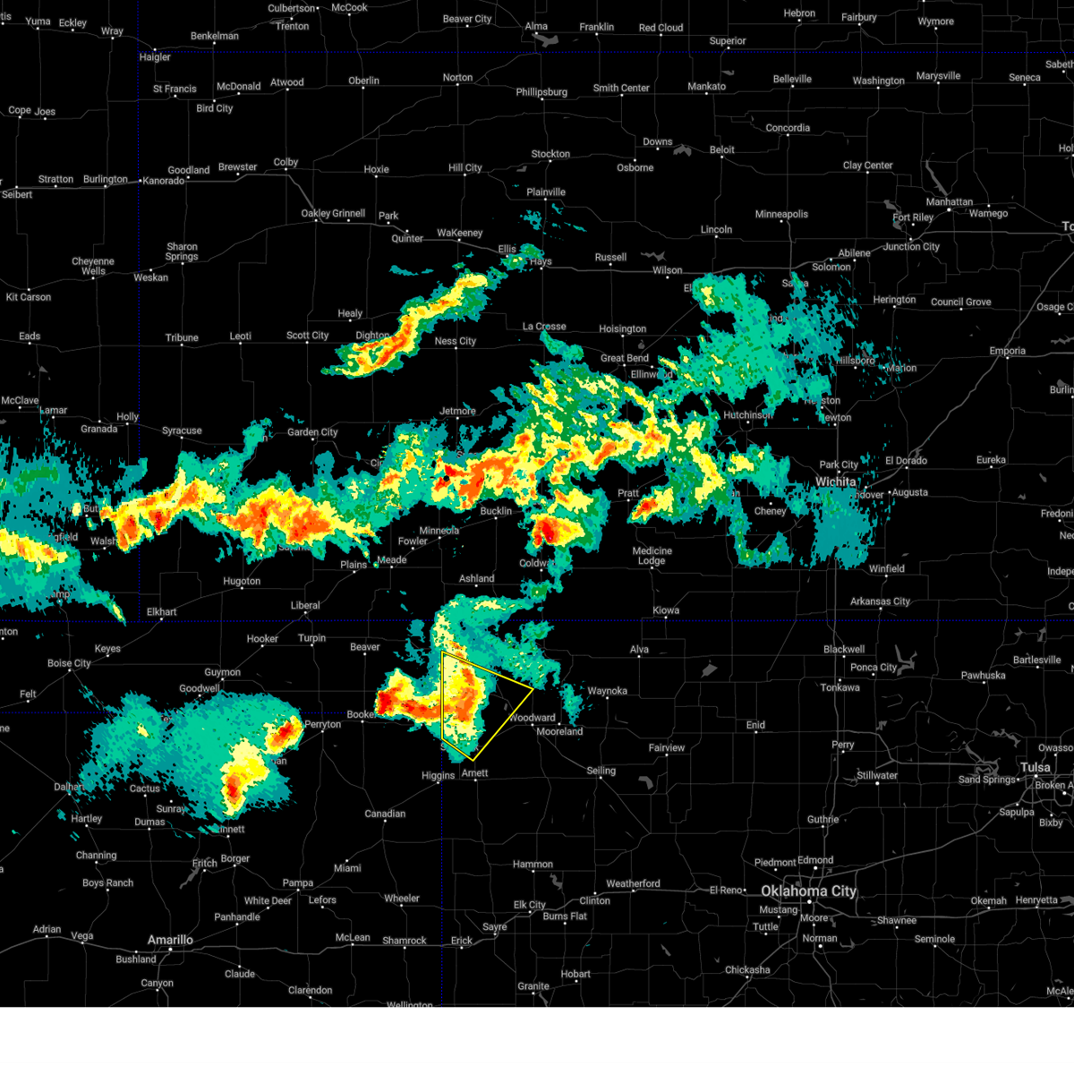
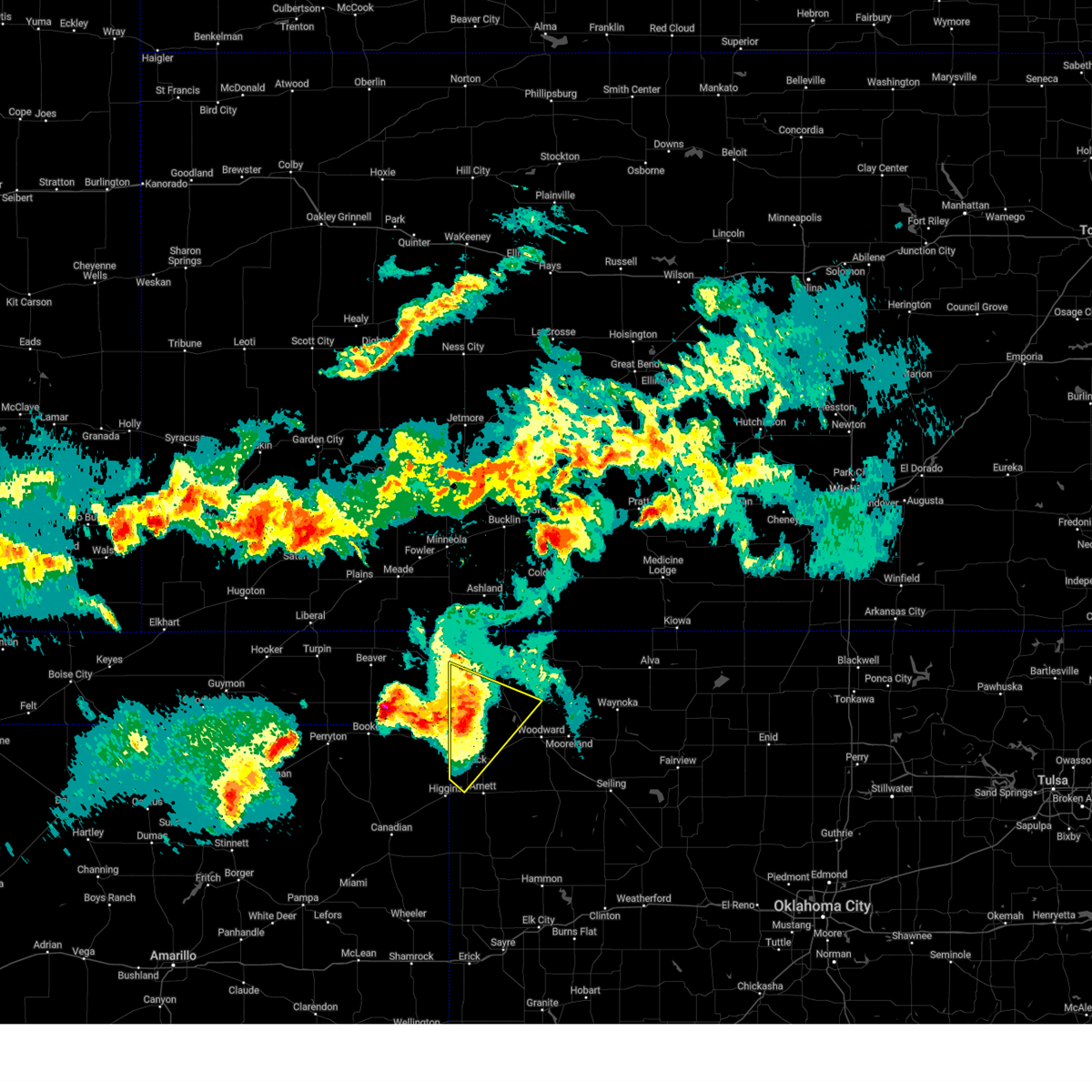
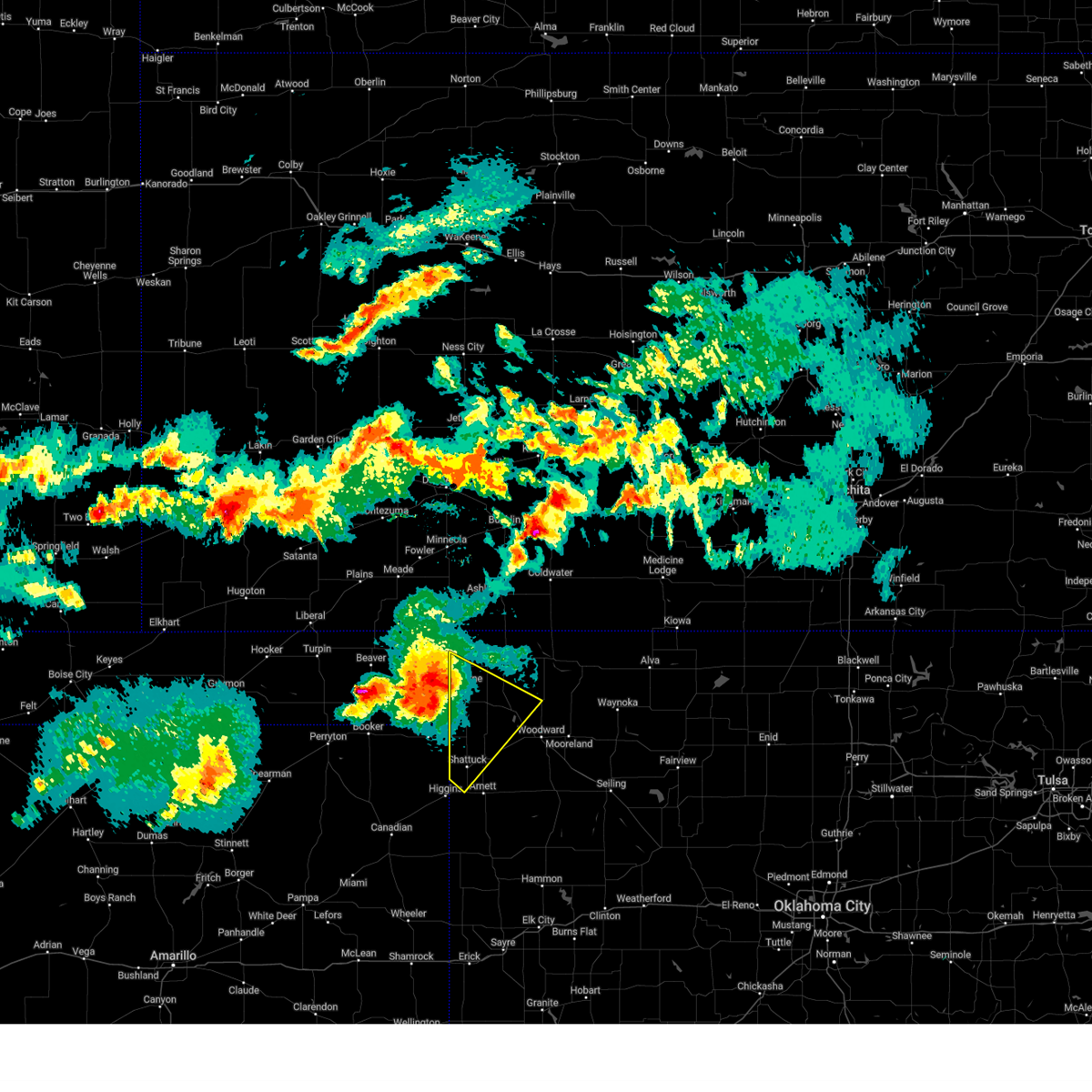
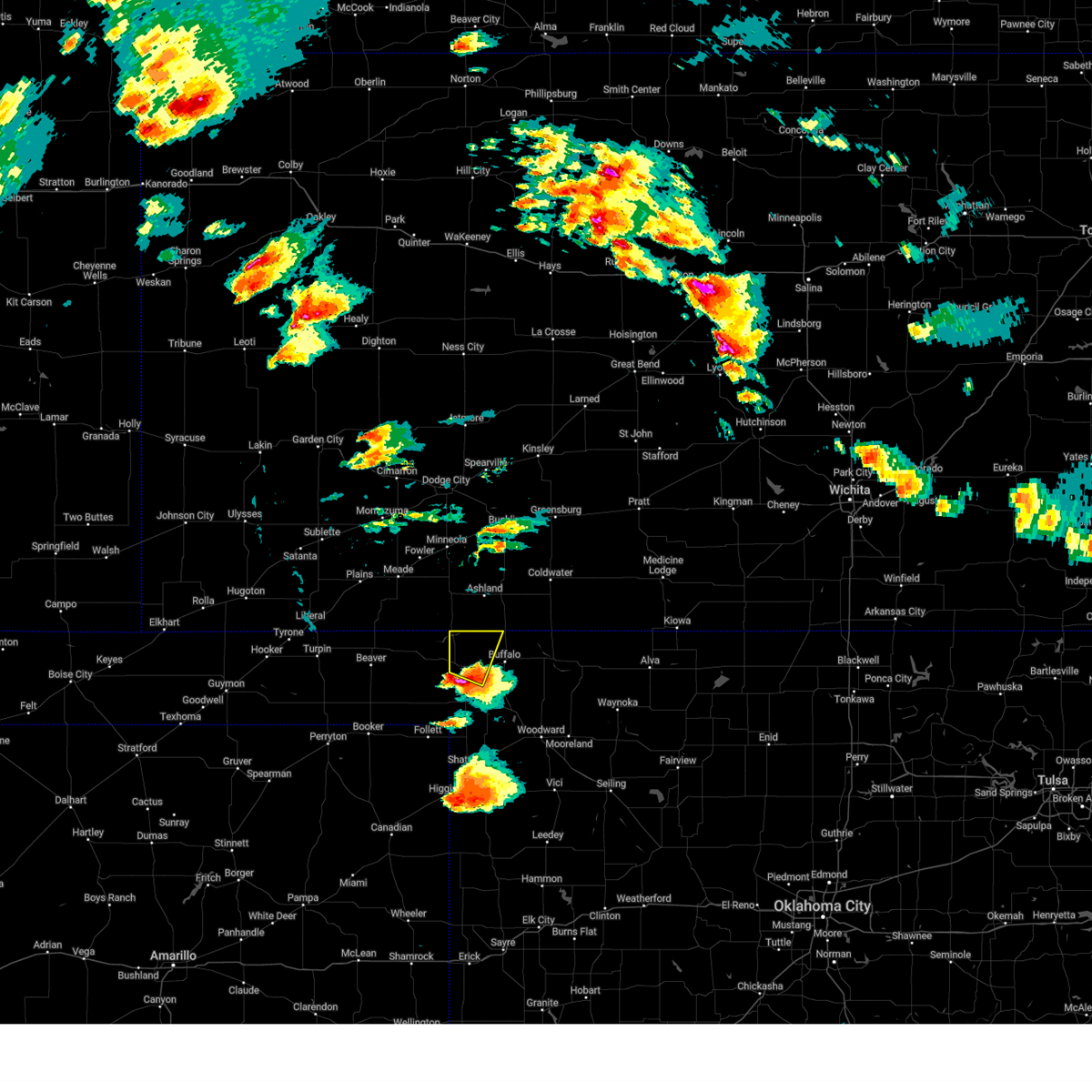
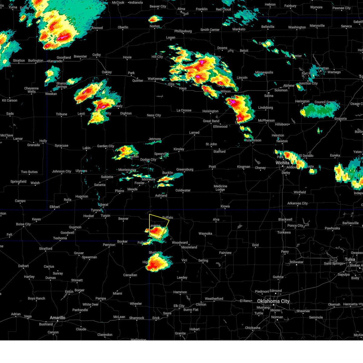
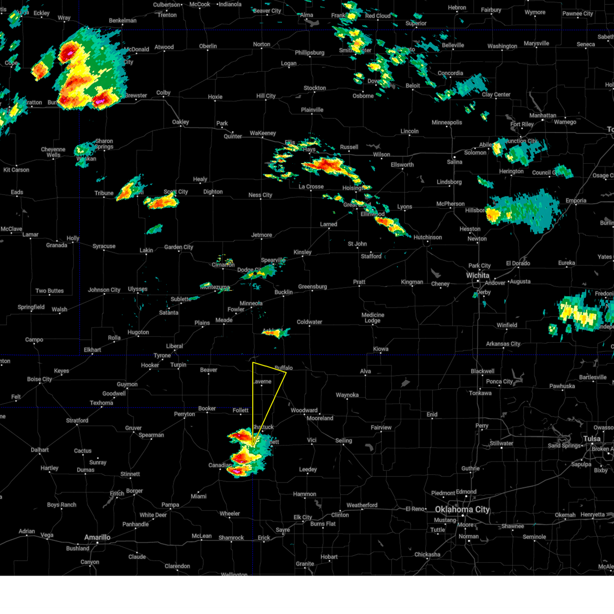
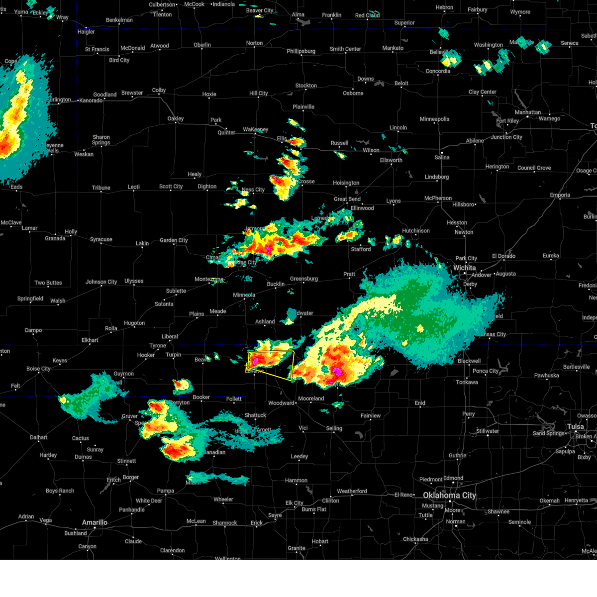
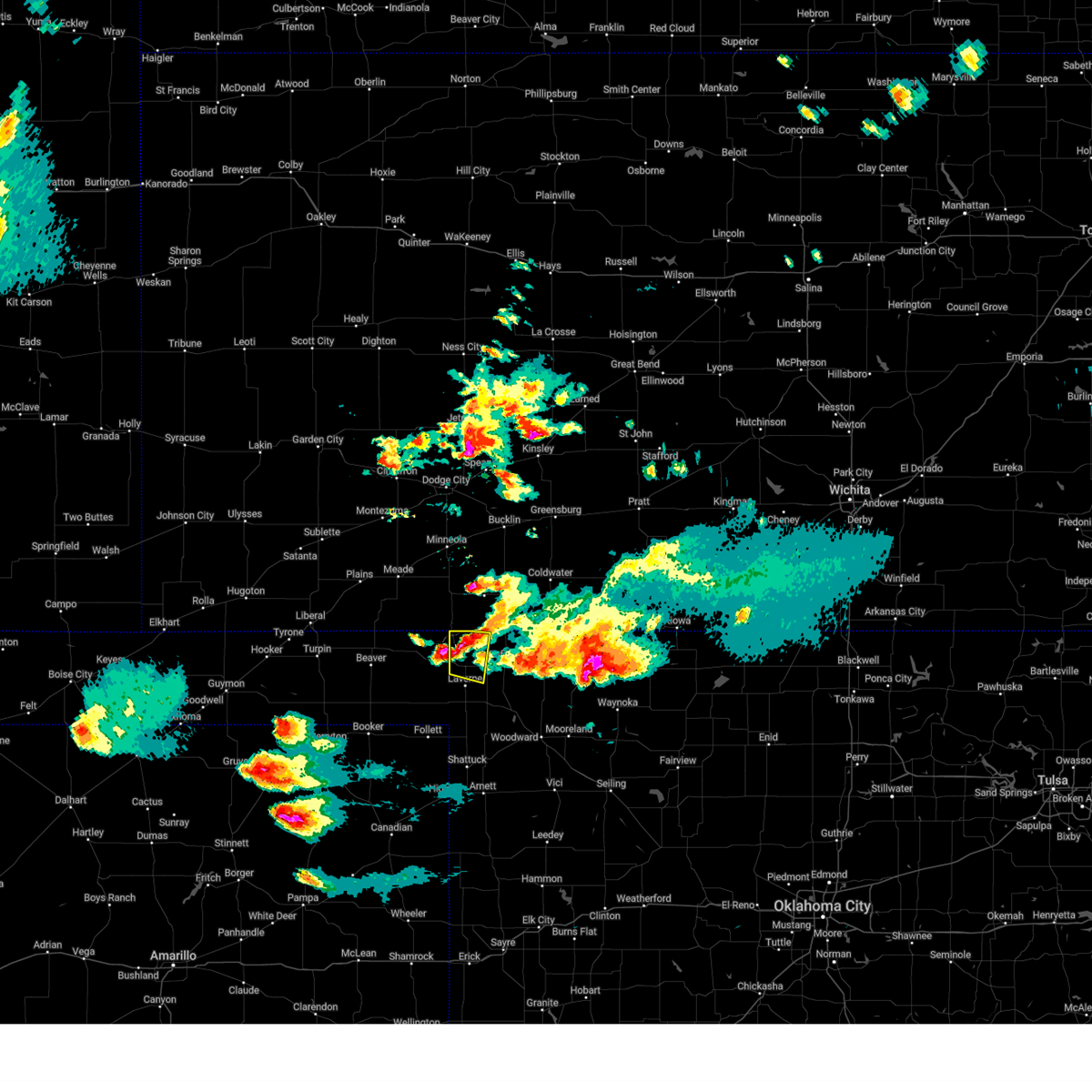
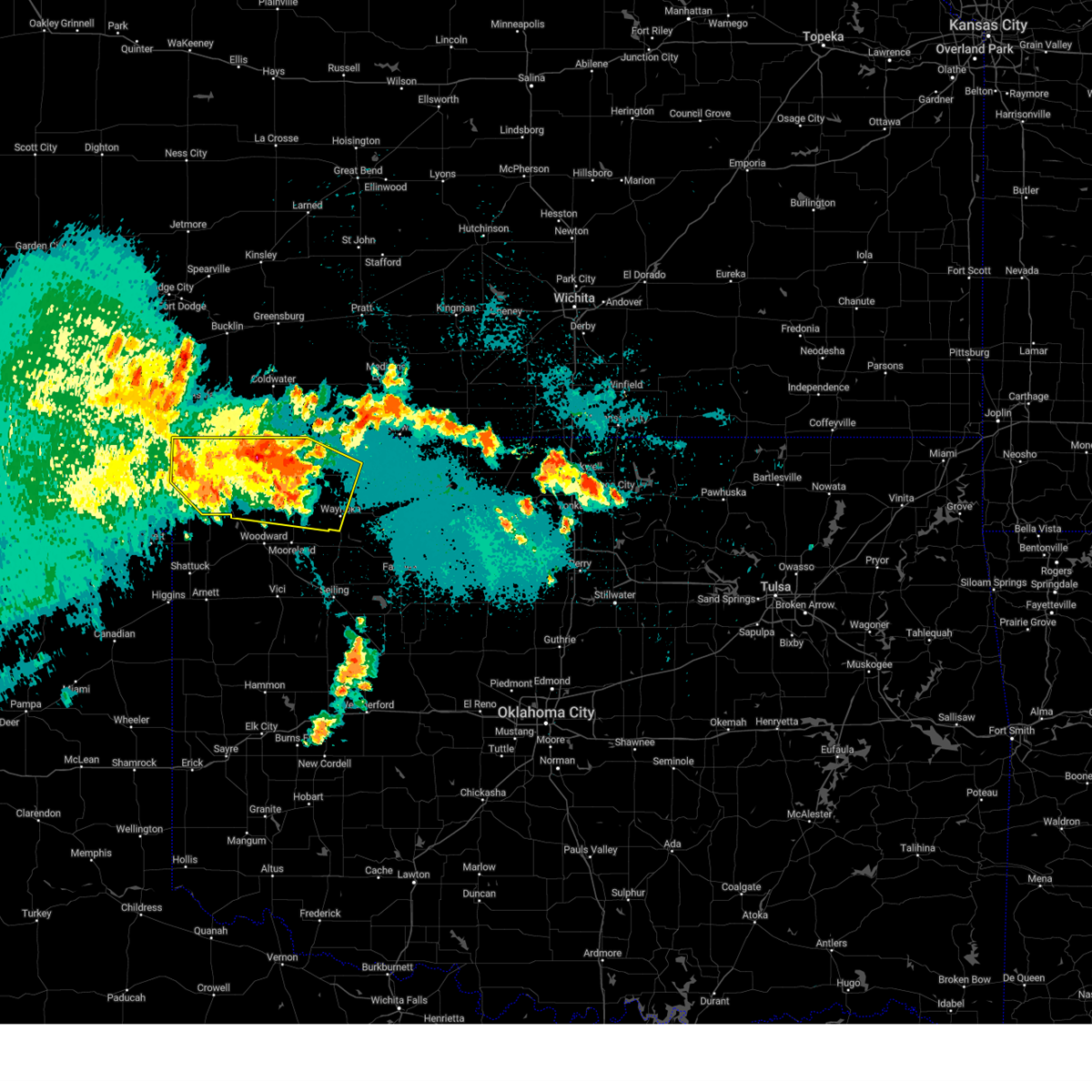
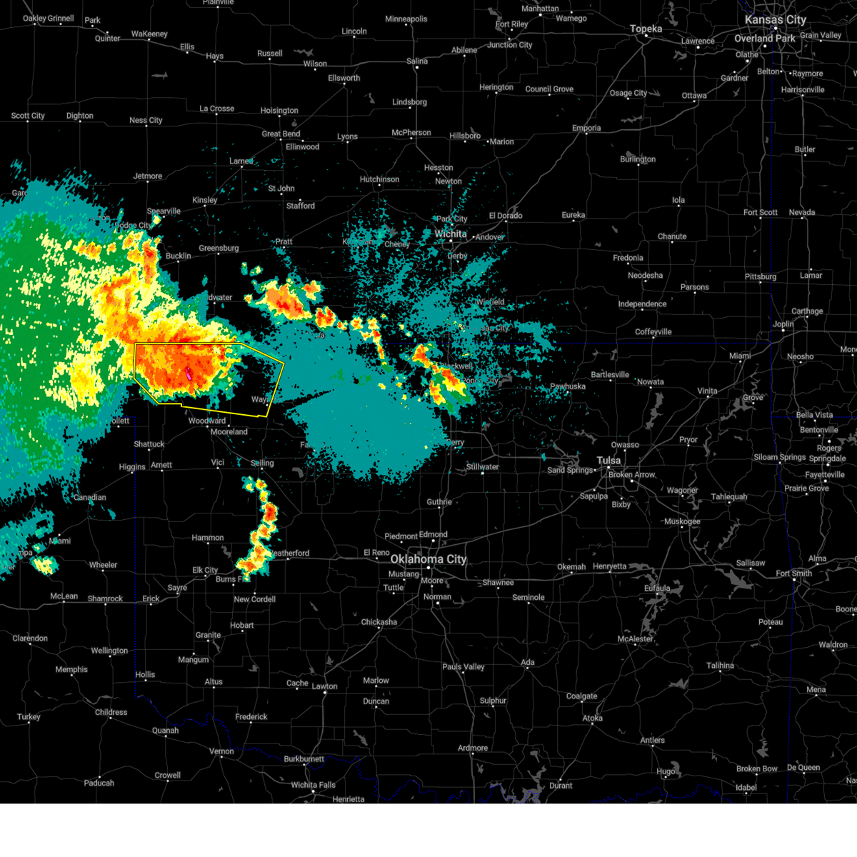
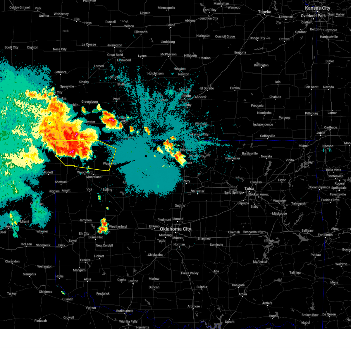
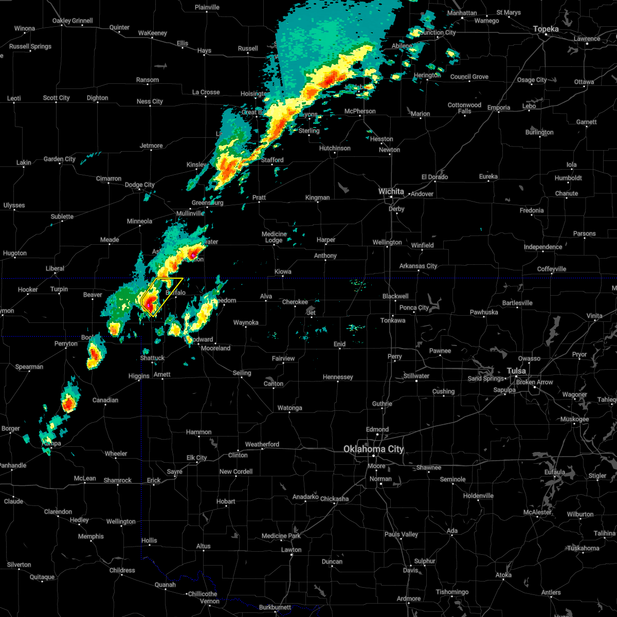
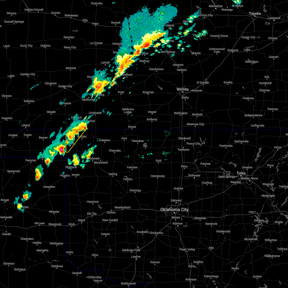
Hail Map for Rosston, OK
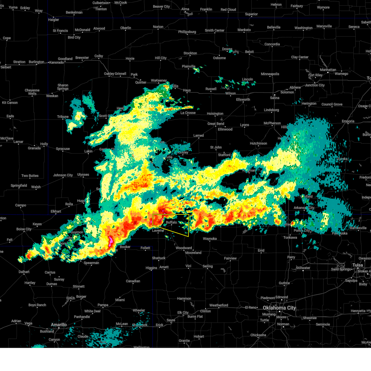
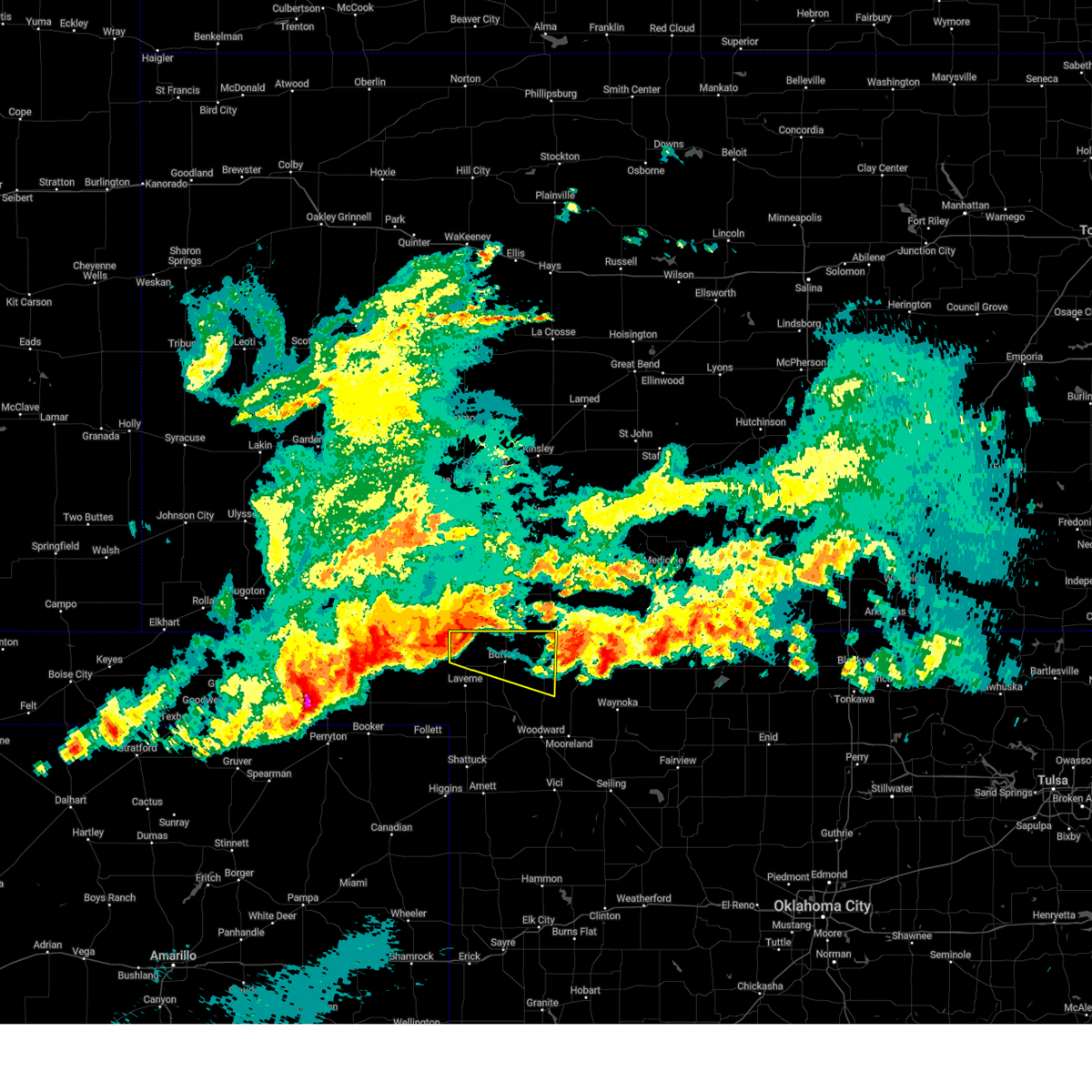
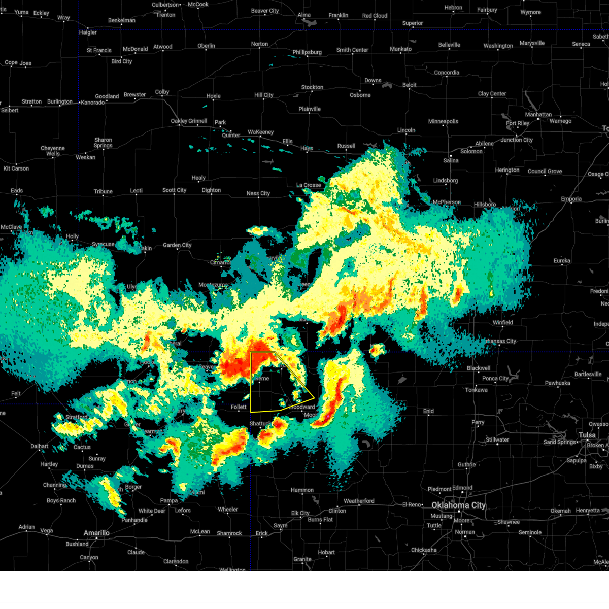
The Rosston, OK area has had 6 reports of on-the-ground hail by trained spotters, and has been under severe weather warnings 22 times during the past 12 months. Doppler radar has detected hail at or near Rosston, OK on 73 occasions, including 5 occasions during the past year.
| Name: | Rosston, OK |
| Where Located: | 39.5 miles NW of Woodward, OK |
| Map: | Google Map for Rosston, OK |
| Population: | 31 |
| Housing Units: | 27 |
| More Info: | Search Google for Rosston, OK |
2
The Top Recent Hail Date for Rosston, OK is Sunday, May 18, 2025 (4th out of 73)
Hail and Wind Damage Spotted near Rosston, OK
| Date / Time | Report Details |
|---|---|
| 6/7/2025 12:00 AM CDT | Svroun the national weather service in norman has issued a * severe thunderstorm warning for, north central ellis county in northwestern oklahoma, northwestern woods county in northwestern oklahoma, harper county in northwestern oklahoma, central woodward county in northwestern oklahoma, * until 1245 am cdt. * at 1200 am cdt, a severe thunderstorm was located 5 miles southeast of englewood, moving southeast at 55 mph (radar indicated). Hazards include 60 mph wind gusts and half dollar size hail. Hail damage to vehicles is expected. Expect wind damage to roofs, siding, and trees. |
| 6/6/2025 12:26 AM CDT |
 At 1225 am cdt, a severe thunderstorm was located 10 miles northwest of buffalo, or 11 miles southeast of acres, moving east at 30 mph (radar indicated). Hazards include ping pong ball size hail and 60 mph wind gusts. People and animals outdoors will be injured. expect hail damage to roofs, siding, windows, and vehicles. expect wind damage to roofs, siding, and trees. Locations impacted include, selman, rosston, and buffalo. At 1225 am cdt, a severe thunderstorm was located 10 miles northwest of buffalo, or 11 miles southeast of acres, moving east at 30 mph (radar indicated). Hazards include ping pong ball size hail and 60 mph wind gusts. People and animals outdoors will be injured. expect hail damage to roofs, siding, windows, and vehicles. expect wind damage to roofs, siding, and trees. Locations impacted include, selman, rosston, and buffalo.
|
| 6/6/2025 12:18 AM CDT |
 Svroun the national weather service in norman has issued a * severe thunderstorm warning for, northwestern woods county in northwestern oklahoma, harper county in northwestern oklahoma, * until 115 am cdt. * at 1218 am cdt, a severe thunderstorm was located 9 miles south of acres, moving east at 35 mph (radar indicated). Hazards include 60 mph wind gusts and quarter size hail. Hail damage to vehicles is expected. Expect wind damage to roofs, siding, and trees. Svroun the national weather service in norman has issued a * severe thunderstorm warning for, northwestern woods county in northwestern oklahoma, harper county in northwestern oklahoma, * until 115 am cdt. * at 1218 am cdt, a severe thunderstorm was located 9 miles south of acres, moving east at 35 mph (radar indicated). Hazards include 60 mph wind gusts and quarter size hail. Hail damage to vehicles is expected. Expect wind damage to roofs, siding, and trees.
|
| 5/28/2025 10:21 PM CDT |
 At 1021 pm cdt, severe thunderstorms were located along a line extending from 7 miles southeast of slapout to near may to near selman, moving southeast at 35 mph (radar indicated). Hazards include 60 mph wind gusts. Expect damage to roofs, siding, and trees. Locations impacted include, laverne, buffalo, fort supply, may, rosston, and catesby. At 1021 pm cdt, severe thunderstorms were located along a line extending from 7 miles southeast of slapout to near may to near selman, moving southeast at 35 mph (radar indicated). Hazards include 60 mph wind gusts. Expect damage to roofs, siding, and trees. Locations impacted include, laverne, buffalo, fort supply, may, rosston, and catesby.
|
| 5/28/2025 9:52 PM CDT |
 Svroun the national weather service in norman has issued a * severe thunderstorm warning for, northwestern ellis county in northwestern oklahoma, harper county in northwestern oklahoma, west central woodward county in northwestern oklahoma, * until 1030 pm cdt. * at 951 pm cdt, severe thunderstorms were located along a line extending from 11 miles southwest of knowles to 4 miles southwest of rosston to 10 miles northwest of buffalo, moving southeast at 55 mph (radar indicated). Hazards include 60 mph wind gusts and penny size hail. expect damage to roofs, siding, and trees Svroun the national weather service in norman has issued a * severe thunderstorm warning for, northwestern ellis county in northwestern oklahoma, harper county in northwestern oklahoma, west central woodward county in northwestern oklahoma, * until 1030 pm cdt. * at 951 pm cdt, severe thunderstorms were located along a line extending from 11 miles southwest of knowles to 4 miles southwest of rosston to 10 miles northwest of buffalo, moving southeast at 55 mph (radar indicated). Hazards include 60 mph wind gusts and penny size hail. expect damage to roofs, siding, and trees
|
| 5/28/2025 8:24 PM CDT |
 The storm which prompted the warning has weakened below severe limits, therefore the warning will be allowed to expire. however, small hail and gusty winds are still possible with this thunderstorm. The storm which prompted the warning has weakened below severe limits, therefore the warning will be allowed to expire. however, small hail and gusty winds are still possible with this thunderstorm.
|
| 5/28/2025 8:13 PM CDT |
 At 813 pm cdt, a severe thunderstorm was located 5 miles southwest of may, moving southeast at 30 mph (radar indicated). Hazards include 60 mph wind gusts and penny size hail. Expect damage to roofs, siding, and trees. Locations impacted include, laverne, gage, fort supply, may, and catesby. At 813 pm cdt, a severe thunderstorm was located 5 miles southwest of may, moving southeast at 30 mph (radar indicated). Hazards include 60 mph wind gusts and penny size hail. Expect damage to roofs, siding, and trees. Locations impacted include, laverne, gage, fort supply, may, and catesby.
|
| 5/28/2025 8:07 PM CDT |
 At 807 pm cdt, a severe thunderstorm was located 8 miles west of may, moving southeast at 30 mph (radar indicated). Hazards include 70 mph wind gusts and penny size hail. Expect considerable tree damage. damage is likely to mobile homes, roofs, and outbuildings. Locations impacted include, shattuck, laverne, gage, fort supply, may, and catesby. At 807 pm cdt, a severe thunderstorm was located 8 miles west of may, moving southeast at 30 mph (radar indicated). Hazards include 70 mph wind gusts and penny size hail. Expect considerable tree damage. damage is likely to mobile homes, roofs, and outbuildings. Locations impacted include, shattuck, laverne, gage, fort supply, may, and catesby.
|
| 5/28/2025 7:38 PM CDT |
 Svroun the national weather service in norman has issued a * severe thunderstorm warning for, northwestern ellis county in northwestern oklahoma, southwestern harper county in northwestern oklahoma, west central woodward county in northwestern oklahoma, * until 830 pm cdt. * at 738 pm cdt, a severe thunderstorm was located 5 miles northwest of slapout, moving southeast at 30 mph (radar indicated). Hazards include 70 mph wind gusts and quarter size hail. Hail damage to vehicles is expected. expect considerable tree damage. Wind damage is also likely to mobile homes, roofs, and outbuildings. Svroun the national weather service in norman has issued a * severe thunderstorm warning for, northwestern ellis county in northwestern oklahoma, southwestern harper county in northwestern oklahoma, west central woodward county in northwestern oklahoma, * until 830 pm cdt. * at 738 pm cdt, a severe thunderstorm was located 5 miles northwest of slapout, moving southeast at 30 mph (radar indicated). Hazards include 70 mph wind gusts and quarter size hail. Hail damage to vehicles is expected. expect considerable tree damage. Wind damage is also likely to mobile homes, roofs, and outbuildings.
|
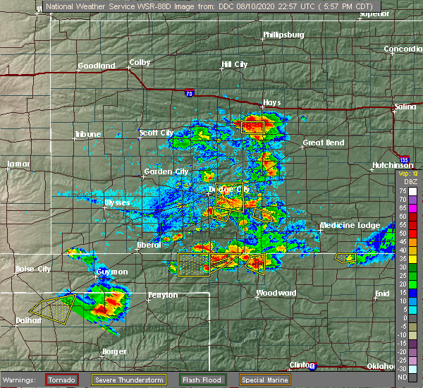
| 5/18/2025 5:54 PM CDT | The storm which prompted the warning has moved out of the area. therefore, the warning will be allowed to expire. |
| 5/18/2025 5:42 PM CDT | At 541 pm cdt, a severe thunderstorm was located near rosston, moving north at 50 mph (trained weather spotters reported quater hail 2 miles east of rosston). Hazards include golf ball size hail and 60 mph wind gusts. People and animals outdoors will be injured. expect hail damage to roofs, siding, windows, and vehicles. expect wind damage to roofs, siding, and trees. Locations impacted include, rosston. |
| 5/18/2025 5:36 PM CDT |
 Svroun the national weather service in norman has issued a * severe thunderstorm warning for, northwestern harper county in northwestern oklahoma, * until 600 pm cdt. * at 536 pm cdt, a severe thunderstorm was located near rosston, moving north at 50 mph (radar indicated). Hazards include golf ball size hail and 60 mph wind gusts. People and animals outdoors will be injured. expect hail damage to roofs, siding, windows, and vehicles. Expect wind damage to roofs, siding, and trees. Svroun the national weather service in norman has issued a * severe thunderstorm warning for, northwestern harper county in northwestern oklahoma, * until 600 pm cdt. * at 536 pm cdt, a severe thunderstorm was located near rosston, moving north at 50 mph (radar indicated). Hazards include golf ball size hail and 60 mph wind gusts. People and animals outdoors will be injured. expect hail damage to roofs, siding, windows, and vehicles. Expect wind damage to roofs, siding, and trees.
|
| 5/18/2025 5:35 PM CDT | Baseball sized hail reported 0.2 miles NNW of Rosston, OK, delayed report. relayed by emergency management. time is estimated from radar. |
| 5/18/2025 5:31 PM CDT |
 At 531 pm cdt, a severe thunderstorm was located near laverne, moving northeast at 55 mph (radar indicated). Hazards include golf ball size hail and 60 mph wind gusts. People and animals outdoors will be injured. expect hail damage to roofs, siding, windows, and vehicles. expect wind damage to roofs, siding, and trees. Locations impacted include, laverne, buffalo, may, and rosston. At 531 pm cdt, a severe thunderstorm was located near laverne, moving northeast at 55 mph (radar indicated). Hazards include golf ball size hail and 60 mph wind gusts. People and animals outdoors will be injured. expect hail damage to roofs, siding, windows, and vehicles. expect wind damage to roofs, siding, and trees. Locations impacted include, laverne, buffalo, may, and rosston.
|
| 5/18/2025 4:53 PM CDT |
 Svroun the national weather service in norman has issued a * severe thunderstorm warning for, northwestern ellis county in northwestern oklahoma, southwestern harper county in northwestern oklahoma, * until 545 pm cdt. * at 453 pm cdt, a severe thunderstorm was located 6 miles northeast of lipscomb, moving northeast at 60 mph (radar indicated). Hazards include ping pong ball size hail and 60 mph wind gusts. People and animals outdoors will be injured. expect hail damage to roofs, siding, windows, and vehicles. Expect wind damage to roofs, siding, and trees. Svroun the national weather service in norman has issued a * severe thunderstorm warning for, northwestern ellis county in northwestern oklahoma, southwestern harper county in northwestern oklahoma, * until 545 pm cdt. * at 453 pm cdt, a severe thunderstorm was located 6 miles northeast of lipscomb, moving northeast at 60 mph (radar indicated). Hazards include ping pong ball size hail and 60 mph wind gusts. People and animals outdoors will be injured. expect hail damage to roofs, siding, windows, and vehicles. Expect wind damage to roofs, siding, and trees.
|
| 4/24/2025 8:24 PM CDT |
 Svroun the national weather service in norman has issued a * severe thunderstorm warning for, central harper county in northwestern oklahoma, * until 915 pm cdt. * at 824 pm cdt, a severe thunderstorm was located 4 miles northeast of rosston, moving east at 25 mph (radar indicated). Hazards include 60 mph wind gusts and half dollar size hail. Hail damage to vehicles is expected. Expect wind damage to roofs, siding, and trees. Svroun the national weather service in norman has issued a * severe thunderstorm warning for, central harper county in northwestern oklahoma, * until 915 pm cdt. * at 824 pm cdt, a severe thunderstorm was located 4 miles northeast of rosston, moving east at 25 mph (radar indicated). Hazards include 60 mph wind gusts and half dollar size hail. Hail damage to vehicles is expected. Expect wind damage to roofs, siding, and trees.
|
| 4/24/2025 7:50 PM CDT |
 Svroun the national weather service in norman has issued a * severe thunderstorm warning for, northwestern harper county in northwestern oklahoma, * until 830 pm cdt. * at 750 pm cdt, a severe thunderstorm was located near gate, moving east at 10 mph (radar indicated). Hazards include 60 mph wind gusts and quarter size hail. Hail damage to vehicles is expected. Expect wind damage to roofs, siding, and trees. Svroun the national weather service in norman has issued a * severe thunderstorm warning for, northwestern harper county in northwestern oklahoma, * until 830 pm cdt. * at 750 pm cdt, a severe thunderstorm was located near gate, moving east at 10 mph (radar indicated). Hazards include 60 mph wind gusts and quarter size hail. Hail damage to vehicles is expected. Expect wind damage to roofs, siding, and trees.
|
| 8/25/2024 4:54 PM CDT |
 The storms which prompted the warning have weakened below severe limits, therefore the warning will be allowed to expire. however, gusty winds of around 50 mph are still possible with these thunderstorms. The storms which prompted the warning have weakened below severe limits, therefore the warning will be allowed to expire. however, gusty winds of around 50 mph are still possible with these thunderstorms.
|
| 8/25/2024 4:34 PM CDT |
 At 433 pm cdt, severe thunderstorms were located near laverne, 10 miles east of rosston, and 6 miles north of buffalo, moving north at 15 mph (radar indicated). Hazards include 60 mph wind gusts and nickel size hail. Expect damage to roofs, siding, and trees. Locations impacted include, laverne, buffalo, may, rosston, and selman. At 433 pm cdt, severe thunderstorms were located near laverne, 10 miles east of rosston, and 6 miles north of buffalo, moving north at 15 mph (radar indicated). Hazards include 60 mph wind gusts and nickel size hail. Expect damage to roofs, siding, and trees. Locations impacted include, laverne, buffalo, may, rosston, and selman.
|
| 8/25/2024 4:15 PM CDT |
 Svroun the national weather service in norman has issued a * severe thunderstorm warning for, harper county in northwestern oklahoma, * until 500 pm cdt. * at 415 pm cdt, severe thunderstorms were located 5 miles southwest of laverne and near buffalo, moving north at 15 mph (radar indicated). Hazards include 60 mph wind gusts and quarter size hail. Hail damage to vehicles is expected. Expect wind damage to roofs, siding, and trees. Svroun the national weather service in norman has issued a * severe thunderstorm warning for, harper county in northwestern oklahoma, * until 500 pm cdt. * at 415 pm cdt, severe thunderstorms were located 5 miles southwest of laverne and near buffalo, moving north at 15 mph (radar indicated). Hazards include 60 mph wind gusts and quarter size hail. Hail damage to vehicles is expected. Expect wind damage to roofs, siding, and trees.
|
| 8/2/2024 1:16 AM CDT |
 The storms which prompted the warning have weakened below severe limits, therefore the warning has been allowed to expire. however, gusty winds of 50 mph and small hail are still possible with these thunderstorms. The storms which prompted the warning have weakened below severe limits, therefore the warning has been allowed to expire. however, gusty winds of 50 mph and small hail are still possible with these thunderstorms.
|
| 8/2/2024 12:56 AM CDT |
 At 1255 am cdt, severe thunderstorms were located along a line extending from 8 miles north of freedom to 5 miles northeast of fort supply, moving southeast at 20 mph. the mesonet station near buffalo measured a wind gust of 56 mph at 1230 am (radar indicated). Hazards include 60 mph wind gusts and quarter size hail. Hail damage to vehicles is expected. expect wind damage to roofs, siding, and trees. Locations impacted include, laverne, buffalo, waynoka, fort supply, freedom, may, rosston, alabaster caverns state park, selman, and camp houston. At 1255 am cdt, severe thunderstorms were located along a line extending from 8 miles north of freedom to 5 miles northeast of fort supply, moving southeast at 20 mph. the mesonet station near buffalo measured a wind gust of 56 mph at 1230 am (radar indicated). Hazards include 60 mph wind gusts and quarter size hail. Hail damage to vehicles is expected. expect wind damage to roofs, siding, and trees. Locations impacted include, laverne, buffalo, waynoka, fort supply, freedom, may, rosston, alabaster caverns state park, selman, and camp houston.
|
| 8/2/2024 12:32 AM CDT |
 Svroun the national weather service in norman has issued a * severe thunderstorm warning for, northeastern woods county in northwestern oklahoma, harper county in northwestern oklahoma, northern woodward county in northwestern oklahoma, * until 115 am cdt. * at 1231 am cdt, severe thunderstorms were located along a line extending from 11 miles southeast of buttermilk to 9 miles southeast of selman to 3 miles south of rosston, moving southeast at 25 mph. winds to near 60 mph were measured near the kansas border northwest of freedom (radar indicated). Hazards include 60 mph wind gusts and quarter size hail. Hail damage to vehicles is expected. Expect wind damage to roofs, siding, and trees. Svroun the national weather service in norman has issued a * severe thunderstorm warning for, northeastern woods county in northwestern oklahoma, harper county in northwestern oklahoma, northern woodward county in northwestern oklahoma, * until 115 am cdt. * at 1231 am cdt, severe thunderstorms were located along a line extending from 11 miles southeast of buttermilk to 9 miles southeast of selman to 3 miles south of rosston, moving southeast at 25 mph. winds to near 60 mph were measured near the kansas border northwest of freedom (radar indicated). Hazards include 60 mph wind gusts and quarter size hail. Hail damage to vehicles is expected. Expect wind damage to roofs, siding, and trees.
|
| 6/13/2024 8:58 PM CDT |
 The storms which prompted the warning have weakened below severe limits, therefore the warning will be allowed to expire. however, gusty winds of 50 mph are still possible with these thunderstorms, and residents of the area should continue to monitor in case the storms increase again. The storms which prompted the warning have weakened below severe limits, therefore the warning will be allowed to expire. however, gusty winds of 50 mph are still possible with these thunderstorms, and residents of the area should continue to monitor in case the storms increase again.
|
| 6/13/2024 8:34 PM CDT |
 At 833 pm cdt, the leading edge of winds from severe thunderstorms was located along a line extending from near hardtner kansas to 6 miles north of freedom to near buffalo and rosston, moving southeast at 45 mph. strong winds will occur well ahead of the thunderstorms themselves (radar indicated). Hazards include 60 mph wind gusts and penny size hail. Expect damage to roofs, siding, and trees. Locations impacted include, alva, laverne, buffalo, freedom, burlington, may, rosston, alabaster caverns state park, selman, capron, and camp houston. At 833 pm cdt, the leading edge of winds from severe thunderstorms was located along a line extending from near hardtner kansas to 6 miles north of freedom to near buffalo and rosston, moving southeast at 45 mph. strong winds will occur well ahead of the thunderstorms themselves (radar indicated). Hazards include 60 mph wind gusts and penny size hail. Expect damage to roofs, siding, and trees. Locations impacted include, alva, laverne, buffalo, freedom, burlington, may, rosston, alabaster caverns state park, selman, capron, and camp houston.
|
| 6/13/2024 8:11 PM CDT |
 Svroun the national weather service in norman has issued a * severe thunderstorm warning for, woods county in northwestern oklahoma, harper county in northwestern oklahoma, northwestern alfalfa county in northwestern oklahoma, northeastern woodward county in northwestern oklahoma, * until 900 pm cdt. * at 809 pm cdt, the leading edge of winds from a line of severe thunderstorms was located along a line extending from near medicine lodge kansas to the oklahoma state line south of buttermilk kansas to 4 miles north of rosston oklahoma, moving southeast at 35 mph. these winds will occur well ahead of the thunderstorms themselves which will move into northwest oklahoma later (radar indicated). Hazards include 60 mph wind gusts and penny size hail. expect damage to roofs, siding, and trees Svroun the national weather service in norman has issued a * severe thunderstorm warning for, woods county in northwestern oklahoma, harper county in northwestern oklahoma, northwestern alfalfa county in northwestern oklahoma, northeastern woodward county in northwestern oklahoma, * until 900 pm cdt. * at 809 pm cdt, the leading edge of winds from a line of severe thunderstorms was located along a line extending from near medicine lodge kansas to the oklahoma state line south of buttermilk kansas to 4 miles north of rosston oklahoma, moving southeast at 35 mph. these winds will occur well ahead of the thunderstorms themselves which will move into northwest oklahoma later (radar indicated). Hazards include 60 mph wind gusts and penny size hail. expect damage to roofs, siding, and trees
|
| 6/3/2024 5:39 AM CDT |
 Svroun the national weather service in norman has issued a * severe thunderstorm warning for, northwestern ellis county in northwestern oklahoma, northern woods county in northwestern oklahoma, harper county in northwestern oklahoma, central woodward county in northwestern oklahoma, * until 630 am cdt. * at 538 am cdt, severe thunderstorms were located along a line extending from 9 miles north of aetna to 5 miles north of buffalo to 3 miles southwest of slapout, moving east at 35 mph (radar indicated). Hazards include 60 mph wind gusts and penny size hail. expect damage to roofs, siding, and trees Svroun the national weather service in norman has issued a * severe thunderstorm warning for, northwestern ellis county in northwestern oklahoma, northern woods county in northwestern oklahoma, harper county in northwestern oklahoma, central woodward county in northwestern oklahoma, * until 630 am cdt. * at 538 am cdt, severe thunderstorms were located along a line extending from 9 miles north of aetna to 5 miles north of buffalo to 3 miles southwest of slapout, moving east at 35 mph (radar indicated). Hazards include 60 mph wind gusts and penny size hail. expect damage to roofs, siding, and trees
|
| 6/3/2024 4:47 AM CDT |
 Svroun the national weather service in norman has issued a * severe thunderstorm warning for, northwestern harper county in northwestern oklahoma, * until 545 am cdt. * at 447 am cdt, severe thunderstorms were located along a line extending from near clark state lake to 4 miles northwest of acres to 4 miles northwest of knowles, moving east at 30 mph (radar indicated). Hazards include 60 mph wind gusts and quarter size hail. Hail damage to vehicles is expected. Expect wind damage to roofs, siding, and trees. Svroun the national weather service in norman has issued a * severe thunderstorm warning for, northwestern harper county in northwestern oklahoma, * until 545 am cdt. * at 447 am cdt, severe thunderstorms were located along a line extending from near clark state lake to 4 miles northwest of acres to 4 miles northwest of knowles, moving east at 30 mph (radar indicated). Hazards include 60 mph wind gusts and quarter size hail. Hail damage to vehicles is expected. Expect wind damage to roofs, siding, and trees.
|
| 7/21/2023 1:29 AM CDT |
 At 128 am cdt, severe thunderstorms were located along a line extending from 7 miles south of protection to 8 miles southwest of buffalo to 6 miles southeast of follett, moving east at 50 mph (radar indicated). Hazards include 70 mph wind gusts. Expect considerable tree damage. Damage is likely to mobile homes, roofs, and outbuildings. At 128 am cdt, severe thunderstorms were located along a line extending from 7 miles south of protection to 8 miles southwest of buffalo to 6 miles southeast of follett, moving east at 50 mph (radar indicated). Hazards include 70 mph wind gusts. Expect considerable tree damage. Damage is likely to mobile homes, roofs, and outbuildings.
|
| 7/21/2023 1:17 AM CDT |
 At 117 am cdt, severe thunderstorms were located along a line extending from 6 miles north of protection to near rosston to 5 miles north of follett, moving east at 35 mph (radar indicated). Hazards include 70 mph wind gusts. Expect considerable tree damage. damage is likely to mobile homes, roofs, and outbuildings. locations impacted include, laverne, buffalo, rosston, and catesby. thunderstorm damage threat, considerable hail threat, radar indicated max hail size, <. 75 in wind threat, radar indicated max wind gust, 70 mph. At 117 am cdt, severe thunderstorms were located along a line extending from 6 miles north of protection to near rosston to 5 miles north of follett, moving east at 35 mph (radar indicated). Hazards include 70 mph wind gusts. Expect considerable tree damage. damage is likely to mobile homes, roofs, and outbuildings. locations impacted include, laverne, buffalo, rosston, and catesby. thunderstorm damage threat, considerable hail threat, radar indicated max hail size, <. 75 in wind threat, radar indicated max wind gust, 70 mph.
|
| 7/21/2023 12:50 AM CDT |
 At 1250 am cdt, severe thunderstorms were located along a line extending from 4 miles south of clark state lake to near knowles to 6 miles southeast of elmwood, moving east at 35 mph (radar indicated). Hazards include 70 mph wind gusts. Expect considerable tree damage. Damage is likely to mobile homes, roofs, and outbuildings. At 1250 am cdt, severe thunderstorms were located along a line extending from 4 miles south of clark state lake to near knowles to 6 miles southeast of elmwood, moving east at 35 mph (radar indicated). Hazards include 70 mph wind gusts. Expect considerable tree damage. Damage is likely to mobile homes, roofs, and outbuildings.
|
| 6/27/2023 9:22 PM CDT |
 At 921 pm cdt, severe thunderstorms were located along a line extending from 8 miles south of acres to near buffalo to 4 miles northwest of fort supply, moving east at 45 mph (radar indicated). Hazards include 60 mph wind gusts and quarter size hail. Hail damage to vehicles is expected. expect wind damage to roofs, siding, and trees. locations impacted include, laverne, buffalo, fort supply, freedom, may, rosston, selman, alabaster caverns state park, and camp houston. hail threat, radar indicated max hail size, 1. 00 in wind threat, radar indicated max wind gust, 60 mph. At 921 pm cdt, severe thunderstorms were located along a line extending from 8 miles south of acres to near buffalo to 4 miles northwest of fort supply, moving east at 45 mph (radar indicated). Hazards include 60 mph wind gusts and quarter size hail. Hail damage to vehicles is expected. expect wind damage to roofs, siding, and trees. locations impacted include, laverne, buffalo, fort supply, freedom, may, rosston, selman, alabaster caverns state park, and camp houston. hail threat, radar indicated max hail size, 1. 00 in wind threat, radar indicated max wind gust, 60 mph.
|
| 6/27/2023 8:53 PM CDT |
 At 853 pm cdt, severe thunderstorms were located along a line extending from 11 miles south of sitka to 8 miles southwest of buffalo to 4 miles southeast of slapout, moving east at 45 mph (radar indicated). Hazards include 60 mph wind gusts and quarter size hail. Hail damage to vehicles is expected. Expect wind damage to roofs, siding, and trees. At 853 pm cdt, severe thunderstorms were located along a line extending from 11 miles south of sitka to 8 miles southwest of buffalo to 4 miles southeast of slapout, moving east at 45 mph (radar indicated). Hazards include 60 mph wind gusts and quarter size hail. Hail damage to vehicles is expected. Expect wind damage to roofs, siding, and trees.
|
| 6/27/2023 8:43 PM CDT |
 At 842 pm cdt, severe thunderstorms were located along a line extending from 4 miles east of acres to 11 miles northwest of buffalo to 4 miles northeast of rosston, moving east at 60 mph (radar indicated). Hazards include 70 mph wind gusts and quarter size hail. Hail damage to vehicles is expected. expect considerable tree damage. wind damage is also likely to mobile homes, roofs, and outbuildings. locations impacted include, buffalo and rosston. thunderstorm damage threat, considerable hail threat, radar indicated max hail size, 1. 00 in wind threat, radar indicated max wind gust, 70 mph. At 842 pm cdt, severe thunderstorms were located along a line extending from 4 miles east of acres to 11 miles northwest of buffalo to 4 miles northeast of rosston, moving east at 60 mph (radar indicated). Hazards include 70 mph wind gusts and quarter size hail. Hail damage to vehicles is expected. expect considerable tree damage. wind damage is also likely to mobile homes, roofs, and outbuildings. locations impacted include, buffalo and rosston. thunderstorm damage threat, considerable hail threat, radar indicated max hail size, 1. 00 in wind threat, radar indicated max wind gust, 70 mph.
|
| 6/27/2023 8:13 PM CDT |
 At 812 pm cdt, severe thunderstorms were located along a line extending from 7 miles southeast of meade state park to 8 miles northwest of knowles to 10 miles east of beaver, moving east at 65 mph (trained weather spotters). Hazards include 70 mph wind gusts and quarter size hail. Hail damage to vehicles is expected. expect considerable tree damage. Wind damage is also likely to mobile homes, roofs, and outbuildings. At 812 pm cdt, severe thunderstorms were located along a line extending from 7 miles southeast of meade state park to 8 miles northwest of knowles to 10 miles east of beaver, moving east at 65 mph (trained weather spotters). Hazards include 70 mph wind gusts and quarter size hail. Hail damage to vehicles is expected. expect considerable tree damage. Wind damage is also likely to mobile homes, roofs, and outbuildings.
|
| 6/15/2023 5:36 PM CDT |
 At 535 pm cdt, severe thunderstorms were located along a line extending from 8 miles north of acres to 4 miles east of englewood to 7 miles northwest of follett, moving east at 45 mph (radar indicated). Hazards include 60 mph wind gusts and quarter size hail. Hail damage to vehicles is expected. Expect wind damage to roofs, siding, and trees. At 535 pm cdt, severe thunderstorms were located along a line extending from 8 miles north of acres to 4 miles east of englewood to 7 miles northwest of follett, moving east at 45 mph (radar indicated). Hazards include 60 mph wind gusts and quarter size hail. Hail damage to vehicles is expected. Expect wind damage to roofs, siding, and trees.
|
| 5/31/2023 12:43 AM CDT |
 The severe thunderstorm warning for northwestern ellis, harper and west central woodward counties will expire at 1245 am cdt, the storms which prompted the warning have weakened below severe limits, therefore the warning will be allowed to expire. however, gusty winds are still possible with these thunderstorms. The severe thunderstorm warning for northwestern ellis, harper and west central woodward counties will expire at 1245 am cdt, the storms which prompted the warning have weakened below severe limits, therefore the warning will be allowed to expire. however, gusty winds are still possible with these thunderstorms.
|
| 5/30/2023 11:59 PM CDT |
 At 1158 pm cdt, severe thunderstorms were located along a line extending from 3 miles south of englewood to 3 miles northeast of slapout to 5 miles northeast of darrouzett, moving east at 50 mph (radar indicated). Hazards include 70 mph wind gusts. Expect considerable tree damage. Damage is likely to mobile homes, roofs, and outbuildings. At 1158 pm cdt, severe thunderstorms were located along a line extending from 3 miles south of englewood to 3 miles northeast of slapout to 5 miles northeast of darrouzett, moving east at 50 mph (radar indicated). Hazards include 70 mph wind gusts. Expect considerable tree damage. Damage is likely to mobile homes, roofs, and outbuildings.
|
| 2/26/2023 6:29 PM CST |
 At 628 pm cst, a severe thunderstorm was located 6 miles northeast of slapout, moving northeast at 65 mph (radar indicated). Hazards include 70 mph wind gusts and nickel size hail. Expect considerable tree damage. Damage is likely to mobile homes, roofs, and outbuildings. At 628 pm cst, a severe thunderstorm was located 6 miles northeast of slapout, moving northeast at 65 mph (radar indicated). Hazards include 70 mph wind gusts and nickel size hail. Expect considerable tree damage. Damage is likely to mobile homes, roofs, and outbuildings.
|
| 11/4/2022 3:31 AM CDT |
 At 330 am cdt, a severe thunderstorm was located near rosston, moving northeast at 65 mph (radar indicated). Hazards include 60 mph wind gusts and quarter size hail. Hail damage to vehicles is expected. expect wind damage to roofs, siding, and trees. locations impacted include, laverne and rosston. hail threat, radar indicated max hail size, 1. 00 in wind threat, radar indicated max wind gust, 60 mph. At 330 am cdt, a severe thunderstorm was located near rosston, moving northeast at 65 mph (radar indicated). Hazards include 60 mph wind gusts and quarter size hail. Hail damage to vehicles is expected. expect wind damage to roofs, siding, and trees. locations impacted include, laverne and rosston. hail threat, radar indicated max hail size, 1. 00 in wind threat, radar indicated max wind gust, 60 mph.
|
| 11/4/2022 3:18 AM CDT |
 At 318 am cdt, a severe thunderstorm was located near slapout, moving northeast at 70 mph (radar indicated). Hazards include 60 mph wind gusts and quarter size hail. Hail damage to vehicles is expected. Expect wind damage to roofs, siding, and trees. At 318 am cdt, a severe thunderstorm was located near slapout, moving northeast at 70 mph (radar indicated). Hazards include 60 mph wind gusts and quarter size hail. Hail damage to vehicles is expected. Expect wind damage to roofs, siding, and trees.
|
| 7/6/2022 4:10 PM CDT | Storm damage reported in harper county OK, 0.2 miles NNW of Rosston, OK |
| 5/18/2022 11:23 PM CDT |
 At 1122 pm cdt, severe thunderstorms were located along a line extending from 3 miles south of englewood to near slapout to 5 miles southwest of darrouzett, moving southeast at 40 mph (texas emergency management has reported tree damage with this line of storms. in addition, several mesonet stations have recorded wind gusts over 60 mph). Hazards include 70 mph wind gusts and quarter size hail. Hail damage to vehicles is expected. expect considerable tree damage. wind damage is also likely to mobile homes, roofs, and outbuildings. locations impacted include, shattuck, laverne, buffalo, may, rosston and catesby. thunderstorm damage threat, considerable hail threat, radar indicated max hail size, 1. 00 in wind threat, radar indicated max wind gust, 70 mph. At 1122 pm cdt, severe thunderstorms were located along a line extending from 3 miles south of englewood to near slapout to 5 miles southwest of darrouzett, moving southeast at 40 mph (texas emergency management has reported tree damage with this line of storms. in addition, several mesonet stations have recorded wind gusts over 60 mph). Hazards include 70 mph wind gusts and quarter size hail. Hail damage to vehicles is expected. expect considerable tree damage. wind damage is also likely to mobile homes, roofs, and outbuildings. locations impacted include, shattuck, laverne, buffalo, may, rosston and catesby. thunderstorm damage threat, considerable hail threat, radar indicated max hail size, 1. 00 in wind threat, radar indicated max wind gust, 70 mph.
|
| 5/18/2022 11:09 PM CDT |
 At 1108 pm cdt, severe thunderstorms were located along a line extending from 11 miles north of englewood to 4 miles north of knowles to 5 miles southeast of elmwood, moving east at 35 mph (radar indicated). Hazards include 70 mph wind gusts and penny size hail. Expect considerable tree damage. Damage is likely to mobile homes, roofs, and outbuildings. At 1108 pm cdt, severe thunderstorms were located along a line extending from 11 miles north of englewood to 4 miles north of knowles to 5 miles southeast of elmwood, moving east at 35 mph (radar indicated). Hazards include 70 mph wind gusts and penny size hail. Expect considerable tree damage. Damage is likely to mobile homes, roofs, and outbuildings.
|
| 5/14/2022 7:45 PM CDT | Ping Pong Ball sized hail reported 10.2 miles W of Rosston, OK |
| 5/14/2022 7:30 PM CDT |
 At 729 pm cdt, a severe thunderstorm was located 10 miles southeast of englewood, moving southeast at 25 mph (trained weather spotters near the oklahoma-kansas border reported 2 inch diamater hail earilier with this thunderstorm). Hazards include two inch hail and 70 mph wind gusts. People and animals outdoors will be injured. expect hail damage to roofs, siding, windows, and vehicles. expect considerable tree damage. wind damage is also likely to mobile homes, roofs, and outbuildings. locations impacted include, buffalo and rosston. thunderstorm damage threat, considerable hail threat, observed max hail size, 2. 00 in wind threat, radar indicated max wind gust, 70 mph. At 729 pm cdt, a severe thunderstorm was located 10 miles southeast of englewood, moving southeast at 25 mph (trained weather spotters near the oklahoma-kansas border reported 2 inch diamater hail earilier with this thunderstorm). Hazards include two inch hail and 70 mph wind gusts. People and animals outdoors will be injured. expect hail damage to roofs, siding, windows, and vehicles. expect considerable tree damage. wind damage is also likely to mobile homes, roofs, and outbuildings. locations impacted include, buffalo and rosston. thunderstorm damage threat, considerable hail threat, observed max hail size, 2. 00 in wind threat, radar indicated max wind gust, 70 mph.
|
| 5/14/2022 7:05 PM CDT | Hen Egg sized hail reported 13.2 miles SSE of Rosston, OK |
| 5/14/2022 7:05 PM CDT |
 At 705 pm cdt, a severe thunderstorm was located near englewood, moving southeast at 25 mph (trained weather spotters reported 2 inch diamater hail north of englewood, kansas). Hazards include two inch hail and 60 mph wind gusts. People and animals outdoors will be injured. expect hail damage to roofs, siding, windows, and vehicles. expect wind damage to roofs, siding, and trees. locations impacted include, buffalo and rosston. thunderstorm damage threat, considerable hail threat, observed max hail size, 2. 00 in wind threat, radar indicated max wind gust, 60 mph. At 705 pm cdt, a severe thunderstorm was located near englewood, moving southeast at 25 mph (trained weather spotters reported 2 inch diamater hail north of englewood, kansas). Hazards include two inch hail and 60 mph wind gusts. People and animals outdoors will be injured. expect hail damage to roofs, siding, windows, and vehicles. expect wind damage to roofs, siding, and trees. locations impacted include, buffalo and rosston. thunderstorm damage threat, considerable hail threat, observed max hail size, 2. 00 in wind threat, radar indicated max wind gust, 60 mph.
|
| 5/14/2022 6:54 PM CDT |
 At 654 pm cdt, a severe thunderstorm was located near acres, moving southeast at 25 mph (radar indicated). Hazards include golf ball size hail and 60 mph wind gusts. People and animals outdoors will be injured. expect hail damage to roofs, siding, windows, and vehicles. Expect wind damage to roofs, siding, and trees. At 654 pm cdt, a severe thunderstorm was located near acres, moving southeast at 25 mph (radar indicated). Hazards include golf ball size hail and 60 mph wind gusts. People and animals outdoors will be injured. expect hail damage to roofs, siding, windows, and vehicles. Expect wind damage to roofs, siding, and trees.
|
| 5/12/2022 9:30 PM CDT |
 At 929 pm cdt, severe thunderstorms were located along a line extending from 5 miles east of laverne to 8 miles southwest of may, moving northeast at 65 mph (radar indicated). Hazards include 60 mph wind gusts and quarter size hail. Hail damage to vehicles is expected. Expect wind damage to roofs, siding, and trees. At 929 pm cdt, severe thunderstorms were located along a line extending from 5 miles east of laverne to 8 miles southwest of may, moving northeast at 65 mph (radar indicated). Hazards include 60 mph wind gusts and quarter size hail. Hail damage to vehicles is expected. Expect wind damage to roofs, siding, and trees.
|
| 4/23/2022 4:37 AM CDT |
 At 437 am cdt, a severe thunderstorm was located 5 miles west of buffalo, moving northeast at 70 mph (radar indicated). Hazards include 60 mph wind gusts and nickel size hail. Expect damage to roofs, siding, and trees. locations impacted include, laverne, buffalo, rosston and selman. hail threat, radar indicated max hail size, 0. 88 in wind threat, radar indicated max wind gust, 60 mph. At 437 am cdt, a severe thunderstorm was located 5 miles west of buffalo, moving northeast at 70 mph (radar indicated). Hazards include 60 mph wind gusts and nickel size hail. Expect damage to roofs, siding, and trees. locations impacted include, laverne, buffalo, rosston and selman. hail threat, radar indicated max hail size, 0. 88 in wind threat, radar indicated max wind gust, 60 mph.
|
| 4/23/2022 4:17 AM CDT |
 At 417 am cdt, a severe thunderstorm was located 4 miles northeast of slapout, moving northeast at 70 mph (radar indicated). Hazards include 70 mph wind gusts and quarter size hail. Hail damage to vehicles is expected. expect considerable tree damage. Wind damage is also likely to mobile homes, roofs, and outbuildings. At 417 am cdt, a severe thunderstorm was located 4 miles northeast of slapout, moving northeast at 70 mph (radar indicated). Hazards include 70 mph wind gusts and quarter size hail. Hail damage to vehicles is expected. expect considerable tree damage. Wind damage is also likely to mobile homes, roofs, and outbuildings.
|
| 10/12/2021 11:51 PM CDT |
 At 1150 pm cdt, severe thunderstorms were located along a line extending from near sitka to 3 miles west of buffalo to 10 miles east of follett, moving east at 45 mph (radar indicated). Hazards include 70 mph wind gusts and ping pong ball size hail. People and animals outdoors will be injured. expect hail damage to roofs, siding, windows, and vehicles. expect considerable tree damage. wind damage is also likely to mobile homes, roofs, and outbuildings. locations impacted include, woodward, laverne, buffalo, gage, fargo, fort supply, may, rosston, selman, tangier and catesby. the most damaging wind gusts will impact areas near laverne and may. thunderstorm damage threat, considerable hail threat, radar indicated max hail size, 1. 50 in wind threat, radar indicated max wind gust, 70 mph. At 1150 pm cdt, severe thunderstorms were located along a line extending from near sitka to 3 miles west of buffalo to 10 miles east of follett, moving east at 45 mph (radar indicated). Hazards include 70 mph wind gusts and ping pong ball size hail. People and animals outdoors will be injured. expect hail damage to roofs, siding, windows, and vehicles. expect considerable tree damage. wind damage is also likely to mobile homes, roofs, and outbuildings. locations impacted include, woodward, laverne, buffalo, gage, fargo, fort supply, may, rosston, selman, tangier and catesby. the most damaging wind gusts will impact areas near laverne and may. thunderstorm damage threat, considerable hail threat, radar indicated max hail size, 1. 50 in wind threat, radar indicated max wind gust, 70 mph.
|
| 10/12/2021 11:32 PM CDT |
 At 1132 pm cdt, severe thunderstorms were located along a line extending from near acres to near rosston to near follett, moving east at 45 mph (radar indicated). Hazards include 70 mph wind gusts and quarter size hail. Hail damage to vehicles is expected. expect considerable tree damage. wind damage is also likely to mobile homes, roofs, and outbuildings. locations impacted include, woodward, shattuck, laverne, buffalo, arnett, gage, fargo, fort supply, may, rosston, selman, harmon, tangier and catesby. thunderstorm damage threat, considerable hail threat, radar indicated max hail size, 1. 00 in wind threat, radar indicated max wind gust, 70 mph. At 1132 pm cdt, severe thunderstorms were located along a line extending from near acres to near rosston to near follett, moving east at 45 mph (radar indicated). Hazards include 70 mph wind gusts and quarter size hail. Hail damage to vehicles is expected. expect considerable tree damage. wind damage is also likely to mobile homes, roofs, and outbuildings. locations impacted include, woodward, shattuck, laverne, buffalo, arnett, gage, fargo, fort supply, may, rosston, selman, harmon, tangier and catesby. thunderstorm damage threat, considerable hail threat, radar indicated max hail size, 1. 00 in wind threat, radar indicated max wind gust, 70 mph.
|
| 10/12/2021 10:58 PM CDT |
 At 1057 pm cdt, severe thunderstorms were located along a line extending from 9 miles northwest of englewood to near booker, moving east at 30 mph (radar indicated). Hazards include 70 mph wind gusts and nickel size hail. Expect considerable tree damage. Damage is likely to mobile homes, roofs, and outbuildings. At 1057 pm cdt, severe thunderstorms were located along a line extending from 9 miles northwest of englewood to near booker, moving east at 30 mph (radar indicated). Hazards include 70 mph wind gusts and nickel size hail. Expect considerable tree damage. Damage is likely to mobile homes, roofs, and outbuildings.
|
| 9/17/2021 7:20 PM CDT |
 At 719 pm cdt, a severe thunderstorm was located near rosston, moving south at 10 mph. this is a destructive storm for rosston and laverne (broadcast media). Hazards include 80 mph wind gusts and quarter size hail. Flying debris will be dangerous to those caught without shelter. mobile homes will be heavily damaged. expect considerable damage to roofs, windows, and vehicles. extensive tree damage and power outages are likely. locations impacted include, laverne, buffalo and rosston. thunderstorm damage threat, destructive hail threat, observed max hail size, 1. 00 in wind threat, observed max wind gust, 80 mph. At 719 pm cdt, a severe thunderstorm was located near rosston, moving south at 10 mph. this is a destructive storm for rosston and laverne (broadcast media). Hazards include 80 mph wind gusts and quarter size hail. Flying debris will be dangerous to those caught without shelter. mobile homes will be heavily damaged. expect considerable damage to roofs, windows, and vehicles. extensive tree damage and power outages are likely. locations impacted include, laverne, buffalo and rosston. thunderstorm damage threat, destructive hail threat, observed max hail size, 1. 00 in wind threat, observed max wind gust, 80 mph.
|
| 9/17/2021 7:14 PM CDT |
 At 713 pm cdt, a severe thunderstorm was located 4 miles east of rosston, moving southeast at 15 mph. this is a destructive storm for laverne (broadcast media). Hazards include 80 mph wind gusts and quarter size hail. Flying debris will be dangerous to those caught without shelter. mobile homes will be heavily damaged. expect considerable damage to roofs, windows, and vehicles. extensive tree damage and power outages are likely. locations impacted include, laverne, buffalo and rosston. thunderstorm damage threat, destructive hail threat, radar indicated max hail size, 1. 00 in wind threat, radar indicated max wind gust, 80 mph. At 713 pm cdt, a severe thunderstorm was located 4 miles east of rosston, moving southeast at 15 mph. this is a destructive storm for laverne (broadcast media). Hazards include 80 mph wind gusts and quarter size hail. Flying debris will be dangerous to those caught without shelter. mobile homes will be heavily damaged. expect considerable damage to roofs, windows, and vehicles. extensive tree damage and power outages are likely. locations impacted include, laverne, buffalo and rosston. thunderstorm damage threat, destructive hail threat, radar indicated max hail size, 1. 00 in wind threat, radar indicated max wind gust, 80 mph.
|
| 9/17/2021 7:00 PM CDT | Storm damage reported in harper county OK, 3.9 miles S of Rosston, OK |
| 9/17/2021 7:00 PM CDT | Quarter sized hail reported 3.3 miles S of Rosston, OK |
| 9/17/2021 7:00 PM CDT | Back window blown out of vehicle blown out and multiple power lines downe in harper county OK, 3.3 miles S of Rosston, OK |
| 9/17/2021 7:00 PM CDT | Storm damage reported in harper county OK, 2.6 miles S of Rosston, OK |
| 9/17/2021 6:53 PM CDT |
 At 653 pm cdt, a severe thunderstorm was located 4 miles northeast of rosston, moving southeast at 15 mph (radar indicated). Hazards include 60 mph wind gusts and penny size hail. expect damage to roofs, siding, and trees At 653 pm cdt, a severe thunderstorm was located 4 miles northeast of rosston, moving southeast at 15 mph (radar indicated). Hazards include 60 mph wind gusts and penny size hail. expect damage to roofs, siding, and trees
|
| 8/29/2021 1:57 PM CDT |
 At 156 pm cdt, severe thunderstorms were located along a line extending from 9 miles northwest of avard to 4 miles southwest of laverne, moving south at 10 mph (radar indicated). Hazards include 60 mph wind gusts. expect damage to roofs, siding, and trees At 156 pm cdt, severe thunderstorms were located along a line extending from 9 miles northwest of avard to 4 miles southwest of laverne, moving south at 10 mph (radar indicated). Hazards include 60 mph wind gusts. expect damage to roofs, siding, and trees
|
| 8/29/2021 1:26 PM CDT |
 At 126 pm cdt, severe thunderstorms were located along a line extending from 9 miles southeast of aetna to 6 miles northeast of freedom to 6 miles northeast of rosston, moving south at 10 mph (radar indicated). Hazards include 70 mph wind gusts and penny size hail. Expect considerable tree damage. Damage is likely to mobile homes, roofs, and outbuildings. At 126 pm cdt, severe thunderstorms were located along a line extending from 9 miles southeast of aetna to 6 miles northeast of freedom to 6 miles northeast of rosston, moving south at 10 mph (radar indicated). Hazards include 70 mph wind gusts and penny size hail. Expect considerable tree damage. Damage is likely to mobile homes, roofs, and outbuildings.
|
| 5/26/2021 9:13 PM CDT |
 At 913 pm cdt, severe thunderstorms were located along a line extending from 8 miles northwest of freedom to near selman to 7 miles northeast of laverne, moving east at 35 mph (radar indicated). Hazards include 70 mph wind gusts and quarter size hail. Hail damage to vehicles is expected. expect considerable tree damage. wind damage is also likely to mobile homes, roofs, and outbuildings. Locations impacted include, laverne, buffalo, freedom, may, rosston, alabaster caverns state park, selman and camp houston. At 913 pm cdt, severe thunderstorms were located along a line extending from 8 miles northwest of freedom to near selman to 7 miles northeast of laverne, moving east at 35 mph (radar indicated). Hazards include 70 mph wind gusts and quarter size hail. Hail damage to vehicles is expected. expect considerable tree damage. wind damage is also likely to mobile homes, roofs, and outbuildings. Locations impacted include, laverne, buffalo, freedom, may, rosston, alabaster caverns state park, selman and camp houston.
|
| 5/26/2021 8:51 PM CDT |
 At 851 pm cdt, severe thunderstorms were located along a line extending from 3 miles east of selman to 8 miles north of may to 4 miles west of laverne, moving east at 35 mph (radar indicated). Hazards include 60 mph wind gusts and quarter size hail. Hail damage to vehicles is expected. Expect wind damage to roofs, siding, and trees. At 851 pm cdt, severe thunderstorms were located along a line extending from 3 miles east of selman to 8 miles north of may to 4 miles west of laverne, moving east at 35 mph (radar indicated). Hazards include 60 mph wind gusts and quarter size hail. Hail damage to vehicles is expected. Expect wind damage to roofs, siding, and trees.
|
| 5/26/2021 8:13 PM CDT |
 At 812 pm cdt, a severe thunderstorm was located 4 miles northeast of laverne, moving east at 30 mph (radar indicated). Hazards include 60 mph wind gusts and quarter size hail. Hail damage to vehicles is expected. Expect wind damage to roofs, siding, and trees. At 812 pm cdt, a severe thunderstorm was located 4 miles northeast of laverne, moving east at 30 mph (radar indicated). Hazards include 60 mph wind gusts and quarter size hail. Hail damage to vehicles is expected. Expect wind damage to roofs, siding, and trees.
|
| 5/5/2021 6:48 PM CDT |
 At 648 pm cdt, a severe thunderstorm was located 11 miles north of buffalo, moving east at 50 mph (radar indicated). Hazards include 60 mph wind gusts and nickel size hail. expect damage to roofs, siding, and trees At 648 pm cdt, a severe thunderstorm was located 11 miles north of buffalo, moving east at 50 mph (radar indicated). Hazards include 60 mph wind gusts and nickel size hail. expect damage to roofs, siding, and trees
|
| 8/10/2020 6:19 PM CDT |
 At 619 pm cdt, severe thunderstorms were located along a line extending from 10 miles northwest of buffalo to 3 miles southwest of rosston, moving east at 5 mph (radar indicated). Hazards include 60 mph wind gusts and quarter size hail. Hail damage to vehicles is expected. expect wind damage to roofs, siding, and trees. Locations impacted include, rosston. At 619 pm cdt, severe thunderstorms were located along a line extending from 10 miles northwest of buffalo to 3 miles southwest of rosston, moving east at 5 mph (radar indicated). Hazards include 60 mph wind gusts and quarter size hail. Hail damage to vehicles is expected. expect wind damage to roofs, siding, and trees. Locations impacted include, rosston.
|
| 8/10/2020 5:55 PM CDT |
 At 555 pm cdt, severe thunderstorms were located along a line extending from 9 miles southeast of acres to 4 miles south of gate, and are nearly stationary (radar indicated). Hazards include 60 mph wind gusts and quarter size hail. Hail damage to vehicles is expected. Expect wind damage to roofs, siding, and trees. At 555 pm cdt, severe thunderstorms were located along a line extending from 9 miles southeast of acres to 4 miles south of gate, and are nearly stationary (radar indicated). Hazards include 60 mph wind gusts and quarter size hail. Hail damage to vehicles is expected. Expect wind damage to roofs, siding, and trees.
|
| 7/13/2020 1:34 AM CDT |
 At 133 am cdt, a severe thunderstorm was located 4 miles southwest of buffalo, moving east at 50 mph (radar indicated). Hazards include 60 mph wind gusts. expect damage to roofs, siding, and trees At 133 am cdt, a severe thunderstorm was located 4 miles southwest of buffalo, moving east at 50 mph (radar indicated). Hazards include 60 mph wind gusts. expect damage to roofs, siding, and trees
|
| 7/11/2020 9:03 PM CDT |
 At 903 pm cdt, a severe thunderstorm was located 5 miles north of may, moving east at 25 mph (radar indicated). Hazards include 70 mph wind gusts and quarter size hail. Hail damage to vehicles is expected. expect considerable tree damage. wind damage is also likely to mobile homes, roofs, and outbuildings. Locations impacted include, laverne, buffalo, may, rosston and selman. At 903 pm cdt, a severe thunderstorm was located 5 miles north of may, moving east at 25 mph (radar indicated). Hazards include 70 mph wind gusts and quarter size hail. Hail damage to vehicles is expected. expect considerable tree damage. wind damage is also likely to mobile homes, roofs, and outbuildings. Locations impacted include, laverne, buffalo, may, rosston and selman.
|
| 7/11/2020 8:44 PM CDT |
 At 844 pm cdt, a severe thunderstorm was located near laverne, moving east at 25 mph (radar indicated). Hazards include 70 mph wind gusts and ping pong ball size hail. People and animals outdoors will be injured. expect hail damage to roofs, siding, windows, and vehicles. expect considerable tree damage. Wind damage is also likely to mobile homes, roofs, and outbuildings. At 844 pm cdt, a severe thunderstorm was located near laverne, moving east at 25 mph (radar indicated). Hazards include 70 mph wind gusts and ping pong ball size hail. People and animals outdoors will be injured. expect hail damage to roofs, siding, windows, and vehicles. expect considerable tree damage. Wind damage is also likely to mobile homes, roofs, and outbuildings.
|
| 7/11/2020 8:06 PM CDT |
 At 806 pm cdt, a severe thunderstorm was located near slapout, moving east at 20 mph (radar indicated). Hazards include ping pong ball size hail and 60 mph wind gusts. People and animals outdoors will be injured. expect hail damage to roofs, siding, windows, and vehicles. Expect wind damage to roofs, siding, and trees. At 806 pm cdt, a severe thunderstorm was located near slapout, moving east at 20 mph (radar indicated). Hazards include ping pong ball size hail and 60 mph wind gusts. People and animals outdoors will be injured. expect hail damage to roofs, siding, windows, and vehicles. Expect wind damage to roofs, siding, and trees.
|
| 6/21/2020 7:53 PM CDT |
 At 752 pm cdt, severe thunderstorms were located along a line extending from 9 miles southeast of sitka to 13 miles southeast of acres to 6 miles west of buffalo to 4 miles west of laverne, moving southeast at 35 mph (radar indicated). Hazards include 70 mph wind gusts and ping pong ball size hail. People and animals outdoors will be injured. expect hail damage to roofs, siding, windows, and vehicles. expect considerable tree damage. wind damage is also likely to mobile homes, roofs, and outbuildings. Locations impacted include, laverne, buffalo, rosston and selman. At 752 pm cdt, severe thunderstorms were located along a line extending from 9 miles southeast of sitka to 13 miles southeast of acres to 6 miles west of buffalo to 4 miles west of laverne, moving southeast at 35 mph (radar indicated). Hazards include 70 mph wind gusts and ping pong ball size hail. People and animals outdoors will be injured. expect hail damage to roofs, siding, windows, and vehicles. expect considerable tree damage. wind damage is also likely to mobile homes, roofs, and outbuildings. Locations impacted include, laverne, buffalo, rosston and selman.
|
| 6/21/2020 7:20 PM CDT |
 At 719 pm cdt, severe thunderstorms were located along a line extending from near ashland to 4 miles northwest of knowles, moving southeast at 30 mph (radar indicated). Hazards include 70 mph wind gusts and ping pong ball size hail. People and animals outdoors will be injured. expect hail damage to roofs, siding, windows, and vehicles. expect considerable tree damage. Wind damage is also likely to mobile homes, roofs, and outbuildings. At 719 pm cdt, severe thunderstorms were located along a line extending from near ashland to 4 miles northwest of knowles, moving southeast at 30 mph (radar indicated). Hazards include 70 mph wind gusts and ping pong ball size hail. People and animals outdoors will be injured. expect hail damage to roofs, siding, windows, and vehicles. expect considerable tree damage. Wind damage is also likely to mobile homes, roofs, and outbuildings.
|
| 6/4/2020 4:47 PM CDT |
 At 447 pm cdt, severe thunderstorms were located along a line extending from near rosston to 6 miles northwest of gage to 9 miles southwest of arnett, moving east at 25 mph (radar indicated). Hazards include 60 mph wind gusts and quarter size hail. Hail damage to vehicles is expected. Expect wind damage to roofs, siding, and trees. At 447 pm cdt, severe thunderstorms were located along a line extending from near rosston to 6 miles northwest of gage to 9 miles southwest of arnett, moving east at 25 mph (radar indicated). Hazards include 60 mph wind gusts and quarter size hail. Hail damage to vehicles is expected. Expect wind damage to roofs, siding, and trees.
|
| 4/19/2020 5:05 PM CDT |
 At 505 pm cdt, a severe thunderstorm was located 7 miles east of rosston, moving southeast at 25 mph (radar indicated). Hazards include quarter size hail. Damage to vehicles is expected. Locations impacted include, rosston. At 505 pm cdt, a severe thunderstorm was located 7 miles east of rosston, moving southeast at 25 mph (radar indicated). Hazards include quarter size hail. Damage to vehicles is expected. Locations impacted include, rosston.
|
| 4/19/2020 4:44 PM CDT |
 At 444 pm cdt, a severe thunderstorm was located 4 miles north of rosston, moving southeast at 25 mph (radar indicated). Hazards include 60 mph wind gusts and quarter size hail. Hail damage to vehicles is expected. Expect wind damage to roofs, siding, and trees. At 444 pm cdt, a severe thunderstorm was located 4 miles north of rosston, moving southeast at 25 mph (radar indicated). Hazards include 60 mph wind gusts and quarter size hail. Hail damage to vehicles is expected. Expect wind damage to roofs, siding, and trees.
|
| 8/24/2019 11:21 PM CDT |
 At 1121 pm cdt, a severe thunderstorm was located 5 miles east of rosston, moving southeast at 30 mph (radar indicated). Hazards include 60 mph wind gusts and penny size hail. Expect damage to roofs, siding, and trees. Locations impacted include, laverne, buffalo, rosston and selman. At 1121 pm cdt, a severe thunderstorm was located 5 miles east of rosston, moving southeast at 30 mph (radar indicated). Hazards include 60 mph wind gusts and penny size hail. Expect damage to roofs, siding, and trees. Locations impacted include, laverne, buffalo, rosston and selman.
|
| 8/24/2019 11:07 PM CDT |
 At 1106 pm cdt, a severe thunderstorm was located near rosston, moving east at 30 mph (radar indicated). Hazards include 70 mph wind gusts and quarter size hail. Hail damage to vehicles is expected. expect considerable tree damage. Wind damage is also likely to mobile homes, roofs, and outbuildings. At 1106 pm cdt, a severe thunderstorm was located near rosston, moving east at 30 mph (radar indicated). Hazards include 70 mph wind gusts and quarter size hail. Hail damage to vehicles is expected. expect considerable tree damage. Wind damage is also likely to mobile homes, roofs, and outbuildings.
|
| 8/20/2019 4:26 PM CDT |
 The severe thunderstorm warning for western harper county will expire at 430 pm cdt. the storms which prompted the warning have weakened below severe limits, and no longer pose an immediate threat to life or property. Therefore, the warning will be allowed to expire. The severe thunderstorm warning for western harper county will expire at 430 pm cdt. the storms which prompted the warning have weakened below severe limits, and no longer pose an immediate threat to life or property. Therefore, the warning will be allowed to expire.
|
| 8/20/2019 4:17 PM CDT |
 At 415 pm cdt, severe thunderstorms were located along a line extending from 7 miles east of rosston to near may, moving northeast at 20 mph (radar indicated). Hazards include 60 mph wind gusts and nickel size hail. Expect damage to roofs, siding, and trees. Locations impacted include, laverne and rosston. At 415 pm cdt, severe thunderstorms were located along a line extending from 7 miles east of rosston to near may, moving northeast at 20 mph (radar indicated). Hazards include 60 mph wind gusts and nickel size hail. Expect damage to roofs, siding, and trees. Locations impacted include, laverne and rosston.
|
| 8/20/2019 3:43 PM CDT |
 At 343 pm cdt, severe thunderstorms were located along a line extending from 3 miles south of laverne to 8 miles southwest of may, moving northeast at 20 mph (radar indicated). Hazards include 60 mph wind gusts and quarter size hail. Hail damage to vehicles is expected. Expect wind damage to roofs, siding, and trees. At 343 pm cdt, severe thunderstorms were located along a line extending from 3 miles south of laverne to 8 miles southwest of may, moving northeast at 20 mph (radar indicated). Hazards include 60 mph wind gusts and quarter size hail. Hail damage to vehicles is expected. Expect wind damage to roofs, siding, and trees.
|
| 8/16/2019 8:21 PM CDT |
 At 821 pm cdt, a severe thunderstorm was located near rosston, and is nearly stationary (radar indicated). Hazards include two inch hail and 70 mph wind gusts. People and animals outdoors will be injured. expect hail damage to roofs, siding, windows, and vehicles. expect considerable tree damage. wind damage is also likely to mobile homes, roofs, and outbuildings. Locations impacted include, buffalo and rosston. At 821 pm cdt, a severe thunderstorm was located near rosston, and is nearly stationary (radar indicated). Hazards include two inch hail and 70 mph wind gusts. People and animals outdoors will be injured. expect hail damage to roofs, siding, windows, and vehicles. expect considerable tree damage. wind damage is also likely to mobile homes, roofs, and outbuildings. Locations impacted include, buffalo and rosston.
|
| 8/16/2019 8:14 PM CDT |
 The national weather service in norman has issued a * severe thunderstorm warning for. western harper county in northwestern oklahoma. until 900 pm cdt. At 813 pm cdt, a severe thunderstorm was located near rosston, and is nearly stationary. The national weather service in norman has issued a * severe thunderstorm warning for. western harper county in northwestern oklahoma. until 900 pm cdt. At 813 pm cdt, a severe thunderstorm was located near rosston, and is nearly stationary.
|
| 8/16/2019 7:47 PM CDT |
 At 746 pm cdt, a severe thunderstorm was located near rosston, moving east at 5 mph (radar indicated). Hazards include 70 mph wind gusts and ping pong ball size hail. People and animals outdoors will be injured. expect hail damage to roofs, siding, windows, and vehicles. expect considerable tree damage. wind damage is also likely to mobile homes, roofs, and outbuildings. Locations impacted include, laverne and rosston. At 746 pm cdt, a severe thunderstorm was located near rosston, moving east at 5 mph (radar indicated). Hazards include 70 mph wind gusts and ping pong ball size hail. People and animals outdoors will be injured. expect hail damage to roofs, siding, windows, and vehicles. expect considerable tree damage. wind damage is also likely to mobile homes, roofs, and outbuildings. Locations impacted include, laverne and rosston.
|
| 8/16/2019 7:29 PM CDT |
 The national weather service in norman has issued a * severe thunderstorm warning for. western harper county in northwestern oklahoma. until 815 pm cdt. At 728 pm cdt, a severe thunderstorm was located near rosston, moving east at 5 mph. The national weather service in norman has issued a * severe thunderstorm warning for. western harper county in northwestern oklahoma. until 815 pm cdt. At 728 pm cdt, a severe thunderstorm was located near rosston, moving east at 5 mph.
|
| 8/16/2019 7:17 PM CDT |
 A severe thunderstorm warning remains in effect until 730 pm cdt for western harper county. at 717 pm cdt, a severe thunderstorm was located 4 miles east of rosston, moving east at 5 mph. hazard. 70 mph wind gusts and ping pong ball size hail. source. Radar indicated. A severe thunderstorm warning remains in effect until 730 pm cdt for western harper county. at 717 pm cdt, a severe thunderstorm was located 4 miles east of rosston, moving east at 5 mph. hazard. 70 mph wind gusts and ping pong ball size hail. source. Radar indicated.
|
| 8/16/2019 6:56 PM CDT |
 At 655 pm cdt, a severe thunderstorm was located 4 miles east of rosston, moving east at 10 mph (radar indicated). Hazards include 70 mph wind gusts and quarter size hail. Hail damage to vehicles is expected. expect considerable tree damage. Wind damage is also likely to mobile homes, roofs, and outbuildings. At 655 pm cdt, a severe thunderstorm was located 4 miles east of rosston, moving east at 10 mph (radar indicated). Hazards include 70 mph wind gusts and quarter size hail. Hail damage to vehicles is expected. expect considerable tree damage. Wind damage is also likely to mobile homes, roofs, and outbuildings.
|
| 8/16/2019 6:34 PM CDT |
 At 634 pm cdt, a severe thunderstorm was located near rosston, moving east at 15 mph (radar indicated). Hazards include 70 mph wind gusts and ping pong ball size hail. People and animals outdoors will be injured. expect hail damage to roofs, siding, windows, and vehicles. expect considerable tree damage. wind damage is also likely to mobile homes, roofs, and outbuildings. Locations impacted include, buffalo and rosston. At 634 pm cdt, a severe thunderstorm was located near rosston, moving east at 15 mph (radar indicated). Hazards include 70 mph wind gusts and ping pong ball size hail. People and animals outdoors will be injured. expect hail damage to roofs, siding, windows, and vehicles. expect considerable tree damage. wind damage is also likely to mobile homes, roofs, and outbuildings. Locations impacted include, buffalo and rosston.
|
| 8/16/2019 6:01 PM CDT |
 At 601 pm cdt, a severe thunderstorm was located 4 miles east of rosston, moving east at 15 mph (radar indicated). Hazards include 60 mph wind gusts and quarter size hail. Hail damage to vehicles is expected. expect wind damage to roofs, siding, and trees. Locations impacted include, buffalo and rosston. At 601 pm cdt, a severe thunderstorm was located 4 miles east of rosston, moving east at 15 mph (radar indicated). Hazards include 60 mph wind gusts and quarter size hail. Hail damage to vehicles is expected. expect wind damage to roofs, siding, and trees. Locations impacted include, buffalo and rosston.
|
| 8/16/2019 5:47 PM CDT |
 At 547 pm cdt, a severe thunderstorm was located near rosston, moving east at 15 mph (radar indicated). Hazards include 60 mph wind gusts and penny size hail. expect damage to roofs, siding, and trees At 547 pm cdt, a severe thunderstorm was located near rosston, moving east at 15 mph (radar indicated). Hazards include 60 mph wind gusts and penny size hail. expect damage to roofs, siding, and trees
|
| 8/13/2019 9:45 PM CDT |
 At 945 pm cdt, severe thunderstorms were located along a line extending from 7 miles northeast of aetna to 8 miles east of selman to 4 miles south of gate, moving southeast at 45 mph (radar indicated). Hazards include 60 mph wind gusts and nickel size hail. expect damage to roofs, siding, and trees At 945 pm cdt, severe thunderstorms were located along a line extending from 7 miles northeast of aetna to 8 miles east of selman to 4 miles south of gate, moving southeast at 45 mph (radar indicated). Hazards include 60 mph wind gusts and nickel size hail. expect damage to roofs, siding, and trees
|
| 7/16/2019 6:14 PM CDT |
 At 613 pm cdt, a severe thunderstorm was located 5 miles north of rosston, moving northeast at 10 mph. another strong to severe storm was 5 miles southeast of laverne, also moving slowly northeast (radar indicated). Hazards include 70 mph wind gusts and quarter size hail. Hail damage to vehicles is expected. expect considerable tree damage. wind damage is also likely to mobile homes, roofs, and outbuildings. Locations impacted include, laverne, buffalo and rosston. At 613 pm cdt, a severe thunderstorm was located 5 miles north of rosston, moving northeast at 10 mph. another strong to severe storm was 5 miles southeast of laverne, also moving slowly northeast (radar indicated). Hazards include 70 mph wind gusts and quarter size hail. Hail damage to vehicles is expected. expect considerable tree damage. wind damage is also likely to mobile homes, roofs, and outbuildings. Locations impacted include, laverne, buffalo and rosston.
|
| 7/16/2019 5:50 PM CDT |
 At 549 pm cdt, a severe thunderstorm was located near laverne, moving northeast at 5 mph. another strong to severe storm was located about 5 miles northwest of rosston, also moving northeast at 5 mph (radar indicated). Hazards include 70 mph wind gusts and quarter size hail. Hail damage to vehicles is expected. expect considerable tree damage. Wind damage is also likely to mobile homes, roofs, and outbuildings. At 549 pm cdt, a severe thunderstorm was located near laverne, moving northeast at 5 mph. another strong to severe storm was located about 5 miles northwest of rosston, also moving northeast at 5 mph (radar indicated). Hazards include 70 mph wind gusts and quarter size hail. Hail damage to vehicles is expected. expect considerable tree damage. Wind damage is also likely to mobile homes, roofs, and outbuildings.
|
| 6/23/2019 3:32 AM CDT |
 At 332 am cdt, a severe thunderstorm was located 8 miles east of slapout, moving northeast at 60 mph (radar indicated). Hazards include 70 mph wind gusts and ping pong ball size hail. People and animals outdoors will be injured. expect hail damage to roofs, siding, windows, and vehicles. expect considerable tree damage. Wind damage is also likely to mobile homes, roofs, and outbuildings. At 332 am cdt, a severe thunderstorm was located 8 miles east of slapout, moving northeast at 60 mph (radar indicated). Hazards include 70 mph wind gusts and ping pong ball size hail. People and animals outdoors will be injured. expect hail damage to roofs, siding, windows, and vehicles. expect considerable tree damage. Wind damage is also likely to mobile homes, roofs, and outbuildings.
|
| 6/18/2019 10:46 PM CDT |
 At 1045 pm cdt, severe thunderstorms were located along a line extending from near englewood to 7 miles west of buffalo to near follett, moving east at 40 mph (radar indicated). Hazards include 70 mph wind gusts and nickel size hail. Expect considerable tree damage. damage is likely to mobile homes, roofs, and outbuildings. Locations impacted include, laverne, buffalo, may, rosston, selman and catesby. At 1045 pm cdt, severe thunderstorms were located along a line extending from near englewood to 7 miles west of buffalo to near follett, moving east at 40 mph (radar indicated). Hazards include 70 mph wind gusts and nickel size hail. Expect considerable tree damage. damage is likely to mobile homes, roofs, and outbuildings. Locations impacted include, laverne, buffalo, may, rosston, selman and catesby.
|
| 6/18/2019 10:18 PM CDT |
 At 1018 pm cdt, severe thunderstorms were located along a line extending from 3 miles east of meade to 3 miles west of gate to 5 miles east of perryton, moving east at 40 mph (radar indicated). Hazards include 70 mph wind gusts and nickel size hail. Expect considerable tree damage. Damage is likely to mobile homes, roofs, and outbuildings. At 1018 pm cdt, severe thunderstorms were located along a line extending from 3 miles east of meade to 3 miles west of gate to 5 miles east of perryton, moving east at 40 mph (radar indicated). Hazards include 70 mph wind gusts and nickel size hail. Expect considerable tree damage. Damage is likely to mobile homes, roofs, and outbuildings.
|
| 6/14/2019 11:34 PM CDT |
 At 1134 pm cdt, a severe thunderstorm was located 8 miles north of rosston, moving east at 40 mph (radar indicated). Hazards include 60 mph wind gusts and quarter size hail. Hail damage to vehicles is expected. Expect wind damage to roofs, siding, and trees. At 1134 pm cdt, a severe thunderstorm was located 8 miles north of rosston, moving east at 40 mph (radar indicated). Hazards include 60 mph wind gusts and quarter size hail. Hail damage to vehicles is expected. Expect wind damage to roofs, siding, and trees.
|
| 6/1/2019 8:23 AM CDT |
 At 822 am cdt, a severe thunderstorm was located 5 miles northwest of rosston, moving southeast at 30 mph (radar indicated). Hazards include ping pong ball size hail. People and animals outdoors will be injured. Expect damage to roofs, siding, windows, and vehicles. At 822 am cdt, a severe thunderstorm was located 5 miles northwest of rosston, moving southeast at 30 mph (radar indicated). Hazards include ping pong ball size hail. People and animals outdoors will be injured. Expect damage to roofs, siding, windows, and vehicles.
|
| 5/26/2019 11:49 PM CDT |
 At 1149 pm cdt, severe thunderstorms were located along a line extending from 12 miles north of freedom to 11 miles west of alabaster caverns state park to 3 miles southwest of gage, moving northeast at 55 mph (radar indicated). Hazards include 70 mph wind gusts and penny size hail. Expect considerable tree damage. damage is likely to mobile homes, roofs, and outbuildings. Locations impacted include, woodward, shattuck, laverne, buffalo, mooreland, gage, fargo, fort supply, freedom, may, rosston, alabaster caverns state park, selman, quinlan, tangier, catesby and camp houston. At 1149 pm cdt, severe thunderstorms were located along a line extending from 12 miles north of freedom to 11 miles west of alabaster caverns state park to 3 miles southwest of gage, moving northeast at 55 mph (radar indicated). Hazards include 70 mph wind gusts and penny size hail. Expect considerable tree damage. damage is likely to mobile homes, roofs, and outbuildings. Locations impacted include, woodward, shattuck, laverne, buffalo, mooreland, gage, fargo, fort supply, freedom, may, rosston, alabaster caverns state park, selman, quinlan, tangier, catesby and camp houston.
|
| 5/26/2019 11:24 PM CDT |
 The national weather service in norman has issued a * severe thunderstorm warning for. northwestern ellis county in northwestern oklahoma. western woods county in northwestern oklahoma. harper county in northwestern oklahoma. Woodward county in northwestern oklahoma. The national weather service in norman has issued a * severe thunderstorm warning for. northwestern ellis county in northwestern oklahoma. western woods county in northwestern oklahoma. harper county in northwestern oklahoma. Woodward county in northwestern oklahoma.
|
| 5/26/2019 10:53 PM CDT |
 At 1052 pm cdt, severe thunderstorms were located along a line extending from 3 miles southwest of englewood to 3 miles north of slapout to 5 miles southeast of darrouzett, moving northeast at 65 mph (radar indicated). Hazards include 60 mph wind gusts and quarter size hail. Hail damage to vehicles is expected. Expect wind damage to roofs, siding, and trees. At 1052 pm cdt, severe thunderstorms were located along a line extending from 3 miles southwest of englewood to 3 miles north of slapout to 5 miles southeast of darrouzett, moving northeast at 65 mph (radar indicated). Hazards include 60 mph wind gusts and quarter size hail. Hail damage to vehicles is expected. Expect wind damage to roofs, siding, and trees.
|
| 5/25/2019 4:35 PM CDT |
 At 435 pm cdt, a severe thunderstorm was located near gate, moving north at 25 mph (radar indicated). Hazards include 60 mph wind gusts and quarter size hail. Hail damage to vehicles is expected. Expect wind damage to roofs, siding, and trees. At 435 pm cdt, a severe thunderstorm was located near gate, moving north at 25 mph (radar indicated). Hazards include 60 mph wind gusts and quarter size hail. Hail damage to vehicles is expected. Expect wind damage to roofs, siding, and trees.
|
| 5/23/2019 10:31 PM CDT |
 At 1031 pm cdt, severe thunderstorms were located along a line extending from 12 miles southwest of buttermilk to near laverne, moving northeast at 40 mph (radar indicated). Hazards include 70 mph wind gusts and quarter size hail. Hail damage to vehicles is expected. expect considerable tree damage. Wind damage is also likely to mobile homes, roofs, and outbuildings. At 1031 pm cdt, severe thunderstorms were located along a line extending from 12 miles southwest of buttermilk to near laverne, moving northeast at 40 mph (radar indicated). Hazards include 70 mph wind gusts and quarter size hail. Hail damage to vehicles is expected. expect considerable tree damage. Wind damage is also likely to mobile homes, roofs, and outbuildings.
|
| 5/23/2019 10:17 PM CDT |
 At 1016 pm cdt, severe thunderstorms were located along a line extending from 6 miles north of buffalo to 9 miles north of may, moving northeast at 25 mph. another line of strong to severe storms extended from rosston to 6 miles west of laverne (radar indicated). Hazards include 60 mph wind gusts and quarter size hail. Hail damage to vehicles is expected. expect wind damage to roofs, siding, and trees. Locations impacted include, laverne, buffalo, rosston and selman. At 1016 pm cdt, severe thunderstorms were located along a line extending from 6 miles north of buffalo to 9 miles north of may, moving northeast at 25 mph. another line of strong to severe storms extended from rosston to 6 miles west of laverne (radar indicated). Hazards include 60 mph wind gusts and quarter size hail. Hail damage to vehicles is expected. expect wind damage to roofs, siding, and trees. Locations impacted include, laverne, buffalo, rosston and selman.
|
| 5/23/2019 9:38 PM CDT |
 At 938 pm cdt, severe thunderstorms were located along a line extending from 4 miles west of laverne to 9 miles east of follett texas, moving northeast at 50 mph (radar indicated). Hazards include golf ball size hail and 70 mph wind gusts. People and animals outdoors will be injured. expect hail damage to roofs, siding, windows, and vehicles. expect considerable tree damage. Wind damage is also likely to mobile homes, roofs, and outbuildings. At 938 pm cdt, severe thunderstorms were located along a line extending from 4 miles west of laverne to 9 miles east of follett texas, moving northeast at 50 mph (radar indicated). Hazards include golf ball size hail and 70 mph wind gusts. People and animals outdoors will be injured. expect hail damage to roofs, siding, windows, and vehicles. expect considerable tree damage. Wind damage is also likely to mobile homes, roofs, and outbuildings.
|
| 5/20/2019 7:56 AM CDT |
 At 755 am cdt, a severe thunderstorm was located 4 miles southwest of laverne, moving east at 40 mph (radar indicated). Hazards include 60 mph wind gusts and quarter size hail. Hail damage to vehicles is expected. Expect wind damage to roofs, siding, and trees. At 755 am cdt, a severe thunderstorm was located 4 miles southwest of laverne, moving east at 40 mph (radar indicated). Hazards include 60 mph wind gusts and quarter size hail. Hail damage to vehicles is expected. Expect wind damage to roofs, siding, and trees.
|
| 7/28/2018 1:11 AM CDT |
 The severe thunderstorm warning for northwestern ellis, northwestern woods, harper and western woodward counties will expire at 115 am cdt, the storms which prompted the warning have weakened below severe limits, and no longer pose an immediate threat to life or property. therefore, the warning will be allowed to expire. however gusty winds are still possible with these thunderstorms. The severe thunderstorm warning for northwestern ellis, northwestern woods, harper and western woodward counties will expire at 115 am cdt, the storms which prompted the warning have weakened below severe limits, and no longer pose an immediate threat to life or property. therefore, the warning will be allowed to expire. however gusty winds are still possible with these thunderstorms.
|
| 7/28/2018 12:47 AM CDT |
 At 1247 am cdt, severe thunderstorms were located along a line extending from 9 miles southeast of acres to 7 miles north of may to 10 miles northwest of gage, moving east at 30 mph (radar indicated). Hazards include 60 mph wind gusts. Expect damage to roofs, siding, and trees. Locations impacted include, woodward, shattuck, laverne, buffalo, gage, fargo, fort supply, may, rosston, selman, tangier and catesby. At 1247 am cdt, severe thunderstorms were located along a line extending from 9 miles southeast of acres to 7 miles north of may to 10 miles northwest of gage, moving east at 30 mph (radar indicated). Hazards include 60 mph wind gusts. Expect damage to roofs, siding, and trees. Locations impacted include, woodward, shattuck, laverne, buffalo, gage, fargo, fort supply, may, rosston, selman, tangier and catesby.
|
| 7/28/2018 12:20 AM CDT |
 At 1219 am cdt, severe thunderstorms were located along a line extending from 5 miles west of acres to near rosston to 5 miles north of follett, moving east at 35 mph. these storms have a history of wind damage over the oklahoma panhandle (radar indicated). Hazards include 65 mph wind gusts. Expect damage to roofs, siding, and trees. Locations impacted include, woodward, shattuck, laverne, buffalo, gage, fargo, fort supply, may, rosston, selman, tangier and catesby. At 1219 am cdt, severe thunderstorms were located along a line extending from 5 miles west of acres to near rosston to 5 miles north of follett, moving east at 35 mph. these storms have a history of wind damage over the oklahoma panhandle (radar indicated). Hazards include 65 mph wind gusts. Expect damage to roofs, siding, and trees. Locations impacted include, woodward, shattuck, laverne, buffalo, gage, fargo, fort supply, may, rosston, selman, tangier and catesby.
|
| 7/28/2018 12:09 AM CDT |
 At 1208 am cdt, severe thunderstorms were located along a line extending from 12 miles northwest of englewood to near gate to 8 miles southwest of slapout, moving east at 35 mph (radar indicated). Hazards include 65 mph wind gusts. expect damage to roofs, siding, and trees At 1208 am cdt, severe thunderstorms were located along a line extending from 12 miles northwest of englewood to near gate to 8 miles southwest of slapout, moving east at 35 mph (radar indicated). Hazards include 65 mph wind gusts. expect damage to roofs, siding, and trees
|
| 7/17/2018 8:55 PM CDT |
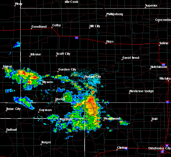 The severe thunderstorm warning for northwestern ellis and western harper counties will expire at 900 pm cdt, the storms which prompted the warning have weakened below severe limits, and no longer pose an immediate threat to life or property. therefore, the warning will be allowed to expire. however, gusty winds and heavy rain are still possible with these thunderstorms. The severe thunderstorm warning for northwestern ellis and western harper counties will expire at 900 pm cdt, the storms which prompted the warning have weakened below severe limits, and no longer pose an immediate threat to life or property. therefore, the warning will be allowed to expire. however, gusty winds and heavy rain are still possible with these thunderstorms.
|
| 7/17/2018 8:33 PM CDT |
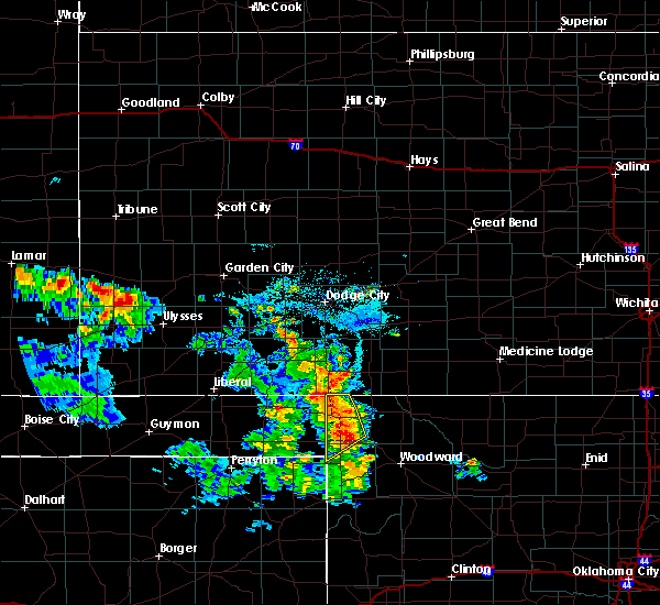 At 833 pm cdt, severe thunderstorms were located along a line extending from 8 miles southeast of englewood to 8 miles southwest of buffalo to near may, moving east at 25 mph (radar indicated). Hazards include 60 mph wind gusts and quarter size hail. Hail damage to vehicles is expected. expect wind damage to roofs, siding, and trees. Locations impacted include, laverne, may, rosston and catesby. At 833 pm cdt, severe thunderstorms were located along a line extending from 8 miles southeast of englewood to 8 miles southwest of buffalo to near may, moving east at 25 mph (radar indicated). Hazards include 60 mph wind gusts and quarter size hail. Hail damage to vehicles is expected. expect wind damage to roofs, siding, and trees. Locations impacted include, laverne, may, rosston and catesby.
|
| 7/17/2018 7:59 PM CDT |
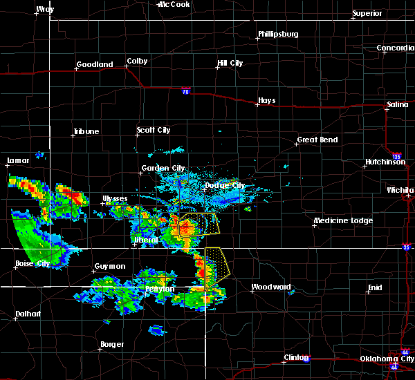 The national weather service in norman has issued a * severe thunderstorm warning for. northwestern ellis county in northwestern oklahoma. western harper county in northwestern oklahoma. until 900 pm cdt. At 758 pm cdt, severe thunderstorms were located along a line. The national weather service in norman has issued a * severe thunderstorm warning for. northwestern ellis county in northwestern oklahoma. western harper county in northwestern oklahoma. until 900 pm cdt. At 758 pm cdt, severe thunderstorms were located along a line.
|
| 6/24/2018 11:11 PM CDT |
 At 1110 pm cdt, severe thunderstorms were located along a line extending from 5 miles southeast of buttermilk to 7 miles northwest of higgins, moving southeast at 35 mph. these are very dangerous storms. the largest hail and strongest wind are expected between catesby and shattuck (radar indicated). Hazards include 80 mph wind gusts and tennis ball size hail. Flying debris will be dangerous to those caught without shelter. mobile homes will be heavily damaged. expect considerable damage to roofs, windows, and vehicles. Extensive tree damage and power outages are likely. At 1110 pm cdt, severe thunderstorms were located along a line extending from 5 miles southeast of buttermilk to 7 miles northwest of higgins, moving southeast at 35 mph. these are very dangerous storms. the largest hail and strongest wind are expected between catesby and shattuck (radar indicated). Hazards include 80 mph wind gusts and tennis ball size hail. Flying debris will be dangerous to those caught without shelter. mobile homes will be heavily damaged. expect considerable damage to roofs, windows, and vehicles. Extensive tree damage and power outages are likely.
|
| 6/24/2018 10:54 PM CDT |
 At 1052 pm cdt, severe thunderstorms were located along a line extending from 4 miles southeast of protection to 10 miles northeast of rosston to 4 miles north of follett, moving southeast at 35 mph. these are very dangerous storms. the strongest wind and largest hail will likely affect laverne and may (radar indicated). Hazards include 80 mph wind gusts and two inch hail. Flying debris will be dangerous to those caught without shelter. mobile homes will be heavily damaged. expect considerable damage to roofs, windows, and vehicles. extensive tree damage and power outages are likely. Locations impacted include, laverne, buffalo, fargo, fort supply, may, rosston, selman, tangier and catesby. At 1052 pm cdt, severe thunderstorms were located along a line extending from 4 miles southeast of protection to 10 miles northeast of rosston to 4 miles north of follett, moving southeast at 35 mph. these are very dangerous storms. the strongest wind and largest hail will likely affect laverne and may (radar indicated). Hazards include 80 mph wind gusts and two inch hail. Flying debris will be dangerous to those caught without shelter. mobile homes will be heavily damaged. expect considerable damage to roofs, windows, and vehicles. extensive tree damage and power outages are likely. Locations impacted include, laverne, buffalo, fargo, fort supply, may, rosston, selman, tangier and catesby.
|
| 6/24/2018 10:42 PM CDT |
 At 1040 pm cdt, severe thunderstorms were located along a line extending from near protection to 8 miles south of acres to 4 miles south of slapout, moving east at 35 mph. the largest hail is expected to affect laverne and may (radar indicated). Hazards include tennis ball size hail and 70 mph wind gusts. People and animals outdoors will be injured. expect hail damage to roofs, siding, windows, and vehicles. expect considerable tree damage. wind damage is also likely to mobile homes, roofs, and outbuildings. Locations impacted include, laverne, buffalo, fargo, fort supply, may, rosston, selman, tangier and catesby. At 1040 pm cdt, severe thunderstorms were located along a line extending from near protection to 8 miles south of acres to 4 miles south of slapout, moving east at 35 mph. the largest hail is expected to affect laverne and may (radar indicated). Hazards include tennis ball size hail and 70 mph wind gusts. People and animals outdoors will be injured. expect hail damage to roofs, siding, windows, and vehicles. expect considerable tree damage. wind damage is also likely to mobile homes, roofs, and outbuildings. Locations impacted include, laverne, buffalo, fargo, fort supply, may, rosston, selman, tangier and catesby.
|
| 6/24/2018 10:32 PM CDT |
 At 1032 pm cdt, severe thunderstorms were located along a line extending from 3 miles northeast of protection to 8 miles south of acres to 4 miles south of slapout, moving east at 40 mph (radar indicated). Hazards include two inch hail and 70 mph wind gusts. People and animals outdoors will be injured. expect hail damage to roofs, siding, windows, and vehicles. expect considerable tree damage. Wind damage is also likely to mobile homes, roofs, and outbuildings. At 1032 pm cdt, severe thunderstorms were located along a line extending from 3 miles northeast of protection to 8 miles south of acres to 4 miles south of slapout, moving east at 40 mph (radar indicated). Hazards include two inch hail and 70 mph wind gusts. People and animals outdoors will be injured. expect hail damage to roofs, siding, windows, and vehicles. expect considerable tree damage. Wind damage is also likely to mobile homes, roofs, and outbuildings.
|
| 6/24/2018 12:42 AM CDT |
 At 1242 am cdt, severe thunderstorms were located along a line extending from near buttermilk to 3 miles north of selman to 6 miles east of slapout, moving east at 45 mph (radar indicated). Hazards include 60 mph wind gusts and quarter size hail. Hail damage to vehicles is expected. Expect wind damage to roofs, siding, and trees. At 1242 am cdt, severe thunderstorms were located along a line extending from near buttermilk to 3 miles north of selman to 6 miles east of slapout, moving east at 45 mph (radar indicated). Hazards include 60 mph wind gusts and quarter size hail. Hail damage to vehicles is expected. Expect wind damage to roofs, siding, and trees.
|
| 6/22/2018 8:12 PM CDT |
 At 811 pm cdt, severe thunderstorms were located along a line extending from 3 miles northwest of aetna to 4 miles southwest of selman to 3 miles south of higgins, moving southeast at 50 mph (radar indicated). Hazards include 70 mph wind gusts and quarter size hail. Hail damage to vehicles is expected. expect considerable tree damage. Wind damage is also likely to mobile homes, roofs, and outbuildings. At 811 pm cdt, severe thunderstorms were located along a line extending from 3 miles northwest of aetna to 4 miles southwest of selman to 3 miles south of higgins, moving southeast at 50 mph (radar indicated). Hazards include 70 mph wind gusts and quarter size hail. Hail damage to vehicles is expected. expect considerable tree damage. Wind damage is also likely to mobile homes, roofs, and outbuildings.
|
| 6/22/2018 7:52 PM CDT |
 At 752 pm cdt, a severe thunderstorm was located over laverne, moving east at 55 mph (radar indicated). Hazards include 70 mph wind gusts and quarter size hail. Hail damage to vehicles is expected. expect considerable tree damage. wind damage is also likely to mobile homes, roofs, and outbuildings. Locations impacted include, woodward, laverne, buffalo, fort supply, may, rosston, selman, tangier and catesby. At 752 pm cdt, a severe thunderstorm was located over laverne, moving east at 55 mph (radar indicated). Hazards include 70 mph wind gusts and quarter size hail. Hail damage to vehicles is expected. expect considerable tree damage. wind damage is also likely to mobile homes, roofs, and outbuildings. Locations impacted include, woodward, laverne, buffalo, fort supply, may, rosston, selman, tangier and catesby.
|
| 6/22/2018 7:37 PM CDT |
 The national weather service in norman has issued a * severe thunderstorm warning for. northwestern ellis county in northwestern oklahoma. northwestern woods county in northwestern oklahoma. harper county in northwestern oklahoma. Northwestern woodward county in northwestern oklahoma. The national weather service in norman has issued a * severe thunderstorm warning for. northwestern ellis county in northwestern oklahoma. northwestern woods county in northwestern oklahoma. harper county in northwestern oklahoma. Northwestern woodward county in northwestern oklahoma.
|
| 6/12/2018 7:57 PM CDT |
 At 756 pm cdt, a severe thunderstorm was located near rosston, moving south at 15 mph (radar indicated). Hazards include 70 mph wind gusts and quarter size hail. Hail damage to vehicles is expected. expect considerable tree damage. wind damage is also likely to mobile homes, roofs, and outbuildings. Locations impacted include, laverne, may and rosston. At 756 pm cdt, a severe thunderstorm was located near rosston, moving south at 15 mph (radar indicated). Hazards include 70 mph wind gusts and quarter size hail. Hail damage to vehicles is expected. expect considerable tree damage. wind damage is also likely to mobile homes, roofs, and outbuildings. Locations impacted include, laverne, may and rosston.
|
| 6/12/2018 7:39 PM CDT | Estimated with tree debris on roa in harper county OK, 2 miles SE of Rosston, OK |
| 6/12/2018 7:39 PM CDT |
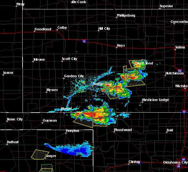 At 737 pm cdt, a severe thunderstorm was located near rosston, moving south at 10 mph. this is a very dangerous storm (trained weather spotters have reported numerous power poles downed and tree damage due to the extremely strong winds associated with this storm). Hazards include 80 mph wind gusts and golf ball size hail. Flying debris will be dangerous to those caught without shelter. mobile homes will be heavily damaged. expect considerable damage to roofs, windows, and vehicles. extensive tree damage and power outages are likely. Locations impacted include, laverne, may and rosston. At 737 pm cdt, a severe thunderstorm was located near rosston, moving south at 10 mph. this is a very dangerous storm (trained weather spotters have reported numerous power poles downed and tree damage due to the extremely strong winds associated with this storm). Hazards include 80 mph wind gusts and golf ball size hail. Flying debris will be dangerous to those caught without shelter. mobile homes will be heavily damaged. expect considerable damage to roofs, windows, and vehicles. extensive tree damage and power outages are likely. Locations impacted include, laverne, may and rosston.
|
| 6/12/2018 7:34 PM CDT | Ping Pong Ball sized hail reported 2 miles SE of Rosston, OK |
| 6/12/2018 7:26 PM CDT | Utility pole snappe in harper county OK, 3.4 miles SSE of Rosston, OK |
| 6/12/2018 7:21 PM CDT | Utility pole downed on an angl in harper county OK, 6 miles S of Rosston, OK |
| 6/12/2018 7:16 PM CDT | Quarter sized hail reported 10.2 miles S of Rosston, OK |
| 6/12/2018 7:15 PM CDT |
 At 715 pm cdt, a severe thunderstorm was located near rosston, moving south at 15 mph. this is a very dangerous storm (radar indicated). Hazards include 80 mph wind gusts and two inch hail. Flying debris will be dangerous to those caught without shelter. mobile homes will be heavily damaged. expect considerable damage to roofs, windows, and vehicles. Extensive tree damage and power outages are likely. At 715 pm cdt, a severe thunderstorm was located near rosston, moving south at 15 mph. this is a very dangerous storm (radar indicated). Hazards include 80 mph wind gusts and two inch hail. Flying debris will be dangerous to those caught without shelter. mobile homes will be heavily damaged. expect considerable damage to roofs, windows, and vehicles. Extensive tree damage and power outages are likely.
|
| 6/12/2018 6:46 PM CDT |
 At 645 pm cdt, a severe thunderstorm was located 8 miles northeast of rosston, moving southeast at 10 mph. this is a very dangerous storm (radar indicated). Hazards include 80 mph wind gusts and baseball size hail. Flying debris will be dangerous to those caught without shelter. mobile homes will be heavily damaged. expect considerable damage to roofs, windows, and vehicles. extensive tree damage and power outages are likely. Locations impacted include, buffalo and rosston. At 645 pm cdt, a severe thunderstorm was located 8 miles northeast of rosston, moving southeast at 10 mph. this is a very dangerous storm (radar indicated). Hazards include 80 mph wind gusts and baseball size hail. Flying debris will be dangerous to those caught without shelter. mobile homes will be heavily damaged. expect considerable damage to roofs, windows, and vehicles. extensive tree damage and power outages are likely. Locations impacted include, buffalo and rosston.
|
| 6/12/2018 6:38 PM CDT |
 At 638 pm cdt, a severe thunderstorm was located 8 miles northeast of rosston, moving southeast at 10 mph (radar indicated). Hazards include tennis ball size hail and 70 mph wind gusts. People and animals outdoors will be injured. expect hail damage to roofs, siding, windows, and vehicles. expect considerable tree damage. wind damage is also likely to mobile homes, roofs, and outbuildings. Locations impacted include, buffalo and rosston. At 638 pm cdt, a severe thunderstorm was located 8 miles northeast of rosston, moving southeast at 10 mph (radar indicated). Hazards include tennis ball size hail and 70 mph wind gusts. People and animals outdoors will be injured. expect hail damage to roofs, siding, windows, and vehicles. expect considerable tree damage. wind damage is also likely to mobile homes, roofs, and outbuildings. Locations impacted include, buffalo and rosston.
|
| 6/12/2018 6:29 PM CDT |
 At 629 pm cdt, a severe thunderstorm was located 9 miles northwest of buffalo, moving southwest at 10 mph (radar indicated). Hazards include golf ball size hail and 70 mph wind gusts. People and animals outdoors will be injured. expect hail damage to roofs, siding, windows, and vehicles. expect considerable tree damage. Wind damage is also likely to mobile homes, roofs, and outbuildings. At 629 pm cdt, a severe thunderstorm was located 9 miles northwest of buffalo, moving southwest at 10 mph (radar indicated). Hazards include golf ball size hail and 70 mph wind gusts. People and animals outdoors will be injured. expect hail damage to roofs, siding, windows, and vehicles. expect considerable tree damage. Wind damage is also likely to mobile homes, roofs, and outbuildings.
|
| 5/30/2018 10:28 PM CDT |
 At 1026 pm cdt, severe thunderstorms were located along a line extending from 7 miles southeast of englewood to 6 miles west of may to 3 miles northeast of higgins, moving east at 40 mph. these are very dangerous storms (radar indicated). Hazards include 80 mph wind gusts and tennis ball size hail. strongest wind approaching may and fort supply. largest hail approaching arnett. Flying debris will be dangerous to those caught without shelter. mobile homes will be heavily damaged. expect considerable damage to roofs, windows, and vehicles. extensive tree damage and power outages are likely. Locations impacted include, woodward, shattuck, laverne, buffalo, arnett, gage, fargo, fort supply, may, rosston, selman, harmon, tangier and catesby. At 1026 pm cdt, severe thunderstorms were located along a line extending from 7 miles southeast of englewood to 6 miles west of may to 3 miles northeast of higgins, moving east at 40 mph. these are very dangerous storms (radar indicated). Hazards include 80 mph wind gusts and tennis ball size hail. strongest wind approaching may and fort supply. largest hail approaching arnett. Flying debris will be dangerous to those caught without shelter. mobile homes will be heavily damaged. expect considerable damage to roofs, windows, and vehicles. extensive tree damage and power outages are likely. Locations impacted include, woodward, shattuck, laverne, buffalo, arnett, gage, fargo, fort supply, may, rosston, selman, harmon, tangier and catesby.
|
| 5/30/2018 10:21 PM CDT |
 At 1021 pm cdt, severe thunderstorms were located along a line extending from 7 miles southeast of englewood to 6 miles west of may to 3 miles northeast of higgins, moving east at 40 mph (radar indicated). Hazards include 70 mph wind gusts and ping pong ball size hail. People and animals outdoors will be injured. expect hail damage to roofs, siding, windows, and vehicles. expect considerable tree damage. wind damage is also likely to mobile homes, roofs, and outbuildings. Locations impacted include, woodward, shattuck, laverne, buffalo, arnett, gage, fargo, fort supply, may, rosston, selman, harmon, tangier and catesby. At 1021 pm cdt, severe thunderstorms were located along a line extending from 7 miles southeast of englewood to 6 miles west of may to 3 miles northeast of higgins, moving east at 40 mph (radar indicated). Hazards include 70 mph wind gusts and ping pong ball size hail. People and animals outdoors will be injured. expect hail damage to roofs, siding, windows, and vehicles. expect considerable tree damage. wind damage is also likely to mobile homes, roofs, and outbuildings. Locations impacted include, woodward, shattuck, laverne, buffalo, arnett, gage, fargo, fort supply, may, rosston, selman, harmon, tangier and catesby.
|
| 5/30/2018 10:06 PM CDT |
 At 1006 pm cdt, severe thunderstorms were located along a line extending from 7 miles southwest of englewood to 4 miles southeast of slapout to 7 miles west of higgins, moving east at 40 mph (radar indicated). Hazards include golf ball size hail and 70 mph wind gusts. People and animals outdoors will be injured. expect hail damage to roofs, siding, windows, and vehicles. expect considerable tree damage. Wind damage is also likely to mobile homes, roofs, and outbuildings. At 1006 pm cdt, severe thunderstorms were located along a line extending from 7 miles southwest of englewood to 4 miles southeast of slapout to 7 miles west of higgins, moving east at 40 mph (radar indicated). Hazards include golf ball size hail and 70 mph wind gusts. People and animals outdoors will be injured. expect hail damage to roofs, siding, windows, and vehicles. expect considerable tree damage. Wind damage is also likely to mobile homes, roofs, and outbuildings.
|
| 5/29/2018 6:45 PM CDT |
 At 644 pm cdt, severe thunderstorms were located along a line extending from 5 miles north of buffalo to near rosston, moving northeast at 35 mph. another severe storm was located 6 miles east of selman (radar indicated). Hazards include golf ball size hail and 60 mph wind gusts. People and animals outdoors will be injured. expect hail damage to roofs, siding, windows, and vehicles. Expect wind damage to roofs, siding, and trees. At 644 pm cdt, severe thunderstorms were located along a line extending from 5 miles north of buffalo to near rosston, moving northeast at 35 mph. another severe storm was located 6 miles east of selman (radar indicated). Hazards include golf ball size hail and 60 mph wind gusts. People and animals outdoors will be injured. expect hail damage to roofs, siding, windows, and vehicles. Expect wind damage to roofs, siding, and trees.
|
| 5/29/2018 6:35 PM CDT |
 At 634 pm cdt, a severe thunderstorm was located near rosston, moving northeast at 30 mph. another severe storm is near the woods and woodward county line east of selman (radar indicated). Hazards include golf ball size hail and 60 mph wind gusts. People and animals outdoors will be injured. expect hail damage to roofs, siding, windows, and vehicles. expect wind damage to roofs, siding, and trees. Locations impacted include, laverne, buffalo, may, rosston and selman. At 634 pm cdt, a severe thunderstorm was located near rosston, moving northeast at 30 mph. another severe storm is near the woods and woodward county line east of selman (radar indicated). Hazards include golf ball size hail and 60 mph wind gusts. People and animals outdoors will be injured. expect hail damage to roofs, siding, windows, and vehicles. expect wind damage to roofs, siding, and trees. Locations impacted include, laverne, buffalo, may, rosston and selman.
|
| 5/29/2018 6:21 PM CDT |
 At 619 pm cdt, a severe thunderstorms was located 6 miles east of selman moving east-northeast at 20 mph. another severe storm is located 3 miles northwest of laverne, moving northeast at 45 mph (radar indicated). Hazards include golf ball size hail and 60 mph wind gusts. People and animals outdoors will be injured. expect hail damage to roofs, siding, windows, and vehicles. expect wind damage to roofs, siding, and trees. Locations impacted include, laverne, buffalo, may, rosston and selman. At 619 pm cdt, a severe thunderstorms was located 6 miles east of selman moving east-northeast at 20 mph. another severe storm is located 3 miles northwest of laverne, moving northeast at 45 mph (radar indicated). Hazards include golf ball size hail and 60 mph wind gusts. People and animals outdoors will be injured. expect hail damage to roofs, siding, windows, and vehicles. expect wind damage to roofs, siding, and trees. Locations impacted include, laverne, buffalo, may, rosston and selman.
|
| 5/29/2018 6:04 PM CDT |
 The national weather service in norman has issued a * severe thunderstorm warning for. harper county in northwestern oklahoma. until 645 pm cdt * at 603 pm cdt, a severe thunderstorm was located 5 miles northeast of slapout, moving northeast at 45 mph. Winds of 58 mph and hail. The national weather service in norman has issued a * severe thunderstorm warning for. harper county in northwestern oklahoma. until 645 pm cdt * at 603 pm cdt, a severe thunderstorm was located 5 miles northeast of slapout, moving northeast at 45 mph. Winds of 58 mph and hail.
|
| 5/18/2018 6:55 PM CDT |
 At 655 pm cdt, a severe thunderstorm was located near laverne, moving north-northeast at 30 mph. another severe storm was developing about 6 miles south of laverne near log cabin corner (radar indicated). Hazards include 60 mph wind gusts and quarter size hail. Hail damage to vehicles is expected. Expect wind damage to roofs, siding, and trees. At 655 pm cdt, a severe thunderstorm was located near laverne, moving north-northeast at 30 mph. another severe storm was developing about 6 miles south of laverne near log cabin corner (radar indicated). Hazards include 60 mph wind gusts and quarter size hail. Hail damage to vehicles is expected. Expect wind damage to roofs, siding, and trees.
|
| 5/13/2018 7:41 PM CDT |
 At 740 pm cdt, a severe thunderstorm was located near buffalo, moving northeast at 35 mph. another severe thunderstorm was also located 9 miles west southwest of laverne moving northeast at 35 mph (radar indicated). Hazards include 70 mph wind gusts and quarter size hail. Hail damage to vehicles is expected. expect considerable tree damage. wind damage is also likely to mobile homes, roofs, and outbuildings. Locations impacted include, laverne, buffalo, may and rosston. At 740 pm cdt, a severe thunderstorm was located near buffalo, moving northeast at 35 mph. another severe thunderstorm was also located 9 miles west southwest of laverne moving northeast at 35 mph (radar indicated). Hazards include 70 mph wind gusts and quarter size hail. Hail damage to vehicles is expected. expect considerable tree damage. wind damage is also likely to mobile homes, roofs, and outbuildings. Locations impacted include, laverne, buffalo, may and rosston.
|
| 5/13/2018 7:24 PM CDT |
 At 723 pm cdt, a severe thunderstorm was located near laverne, moving northeast at 30 mph (radar indicated). Hazards include 70 mph wind gusts and quarter size hail. Hail damage to vehicles is expected. expect considerable tree damage. Wind damage is also likely to mobile homes, roofs, and outbuildings. At 723 pm cdt, a severe thunderstorm was located near laverne, moving northeast at 30 mph (radar indicated). Hazards include 70 mph wind gusts and quarter size hail. Hail damage to vehicles is expected. expect considerable tree damage. Wind damage is also likely to mobile homes, roofs, and outbuildings.
|
| 3/18/2018 9:15 PM CDT |
 At 915 pm cdt, a severe thunderstorm was located 7 miles east of rosston, moving northeast at 45 mph (radar indicated). Hazards include 60 mph wind gusts and quarter size hail. Hail damage to vehicles is expected. Expect wind damage to roofs, siding, and trees. At 915 pm cdt, a severe thunderstorm was located 7 miles east of rosston, moving northeast at 45 mph (radar indicated). Hazards include 60 mph wind gusts and quarter size hail. Hail damage to vehicles is expected. Expect wind damage to roofs, siding, and trees.
|
| 10/6/2017 9:27 PM CDT |
 At 926 pm cdt, a severe thunderstorm was located 5 miles east of laverne, moving east at 55 mph. public reported wind gusts to 65 mph in laverne at 924pm (radar indicated). Hazards include 70 mph wind gusts and half dollar size hail. Hail damage to vehicles is expected. expect considerable tree damage. wind damage is also likely to mobile homes, roofs, and outbuildings. Locations impacted include, laverne, buffalo, may, rosston and selman. At 926 pm cdt, a severe thunderstorm was located 5 miles east of laverne, moving east at 55 mph. public reported wind gusts to 65 mph in laverne at 924pm (radar indicated). Hazards include 70 mph wind gusts and half dollar size hail. Hail damage to vehicles is expected. expect considerable tree damage. wind damage is also likely to mobile homes, roofs, and outbuildings. Locations impacted include, laverne, buffalo, may, rosston and selman.
|
| 10/6/2017 9:12 PM CDT |
 At 912 pm cdt, a severe thunderstorm was located 6 miles northeast of slapout, moving east at 60 mph (radar indicated). Hazards include 70 mph wind gusts and quarter size hail. Hail damage to vehicles is expected. expect considerable tree damage. Wind damage is also likely to mobile homes, roofs, and outbuildings. At 912 pm cdt, a severe thunderstorm was located 6 miles northeast of slapout, moving east at 60 mph (radar indicated). Hazards include 70 mph wind gusts and quarter size hail. Hail damage to vehicles is expected. expect considerable tree damage. Wind damage is also likely to mobile homes, roofs, and outbuildings.
|
| 7/3/2017 4:40 PM CDT |
 At 440 pm cdt, a severe thunderstorm was located near buffalo, moving east at 30 mph (radar indicated). Hazards include tennis ball size hail and 70 mph wind gusts. People and animals outdoors wilminorl be injured. expect hail damage to roofs, siding, windows, and vehicles. expect considerable tree damage. wind damage is also likely to mobile homes, roofs, and outbuildings. Locations impacted include, buffalo, rosston and selman. At 440 pm cdt, a severe thunderstorm was located near buffalo, moving east at 30 mph (radar indicated). Hazards include tennis ball size hail and 70 mph wind gusts. People and animals outdoors wilminorl be injured. expect hail damage to roofs, siding, windows, and vehicles. expect considerable tree damage. wind damage is also likely to mobile homes, roofs, and outbuildings. Locations impacted include, buffalo, rosston and selman.
|
| 7/3/2017 4:23 PM CDT |
 At 422 pm cdt, a severe thunderstorm was located 8 miles northeast of rosston, moving southeast at 15 mph (radar indicated). Hazards include golf ball size hail and 70 mph wind gusts. People and animals outdoors will be injured. expect hail damage to roofs, siding, windows, and vehicles. expect considerable tree damage. Wind damage is also likely to mobile homes, roofs, and outbuildings. At 422 pm cdt, a severe thunderstorm was located 8 miles northeast of rosston, moving southeast at 15 mph (radar indicated). Hazards include golf ball size hail and 70 mph wind gusts. People and animals outdoors will be injured. expect hail damage to roofs, siding, windows, and vehicles. expect considerable tree damage. Wind damage is also likely to mobile homes, roofs, and outbuildings.
|
| 7/3/2017 3:55 PM CDT |
 At 355 pm cdt, a severe thunderstorm was located 6 miles north of rosston, moving east at 10 mph (radar indicated). Hazards include tennis ball size hail and 70 mph wind gusts. People and animals outdoors will be injured. expect hail damage to roofs, siding, windows, and vehicles. expect considerable tree damage. wind damage is also likely to mobile homes, roofs, and outbuildings. Locations impacted include, buffalo, rosston and selman. At 355 pm cdt, a severe thunderstorm was located 6 miles north of rosston, moving east at 10 mph (radar indicated). Hazards include tennis ball size hail and 70 mph wind gusts. People and animals outdoors will be injured. expect hail damage to roofs, siding, windows, and vehicles. expect considerable tree damage. wind damage is also likely to mobile homes, roofs, and outbuildings. Locations impacted include, buffalo, rosston and selman.
|
| 7/3/2017 3:37 PM CDT |
 At 337 pm cdt, a severe thunderstorm was located 8 miles northeast of rosston, moving east at 25 mph (radar indicated). Hazards include golf ball size hail and 60 mph wind gusts. People and animals outdoors will be injured. expect hail damage to roofs, siding, windows, and vehicles. Expect wind damage to roofs, siding, and trees. At 337 pm cdt, a severe thunderstorm was located 8 miles northeast of rosston, moving east at 25 mph (radar indicated). Hazards include golf ball size hail and 60 mph wind gusts. People and animals outdoors will be injured. expect hail damage to roofs, siding, windows, and vehicles. Expect wind damage to roofs, siding, and trees.
|
| 6/21/2017 9:25 PM CDT |
 The severe thunderstorm warning for northwestern ellis and western harper counties will expire at 930 pm cdt, the storms which prompted the warning have weakened below severe limits, and no longer pose an immediate threat to life or property. therefore the warning will be allowed to expire. however gusty winds are still possible with these thunderstorms. The severe thunderstorm warning for northwestern ellis and western harper counties will expire at 930 pm cdt, the storms which prompted the warning have weakened below severe limits, and no longer pose an immediate threat to life or property. therefore the warning will be allowed to expire. however gusty winds are still possible with these thunderstorms.
|
| 6/21/2017 8:59 PM CDT |
 At 859 pm cdt, severe thunderstorms were located along a line extending from 7 miles southeast of englewood to 8 miles northwest of slapout to near booker, moving southeast at 40 mph (radar indicated). Hazards include 70 mph wind gusts and penny size hail. Expect considerable tree damage. damage is likely to mobile homes, roofs, and outbuildings. Locations impacted include, laverne, may, rosston and catesby. At 859 pm cdt, severe thunderstorms were located along a line extending from 7 miles southeast of englewood to 8 miles northwest of slapout to near booker, moving southeast at 40 mph (radar indicated). Hazards include 70 mph wind gusts and penny size hail. Expect considerable tree damage. damage is likely to mobile homes, roofs, and outbuildings. Locations impacted include, laverne, may, rosston and catesby.
|
| 6/21/2017 8:52 PM CDT |
 At 852 pm cdt, severe thunderstorms were located along a line extending from 3 miles south of englewood to 11 miles southwest of knowles to 4 miles north of booker, moving southeast at 40 mph (radar indicated). Hazards include 60 mph wind gusts and penny size hail. expect damage to roofs, siding, and trees At 852 pm cdt, severe thunderstorms were located along a line extending from 3 miles south of englewood to 11 miles southwest of knowles to 4 miles north of booker, moving southeast at 40 mph (radar indicated). Hazards include 60 mph wind gusts and penny size hail. expect damage to roofs, siding, and trees
|
| 6/13/2017 7:24 PM CDT |
 The national weather service in norman has issued a * severe thunderstorm warning for. western harper county in northwestern oklahoma. Until 815 pm cdt * at 724 pm cdt, a severe thunderstorm was located 5 miles northeast of slapout, moving northeast at 50 mph. The national weather service in norman has issued a * severe thunderstorm warning for. western harper county in northwestern oklahoma. Until 815 pm cdt * at 724 pm cdt, a severe thunderstorm was located 5 miles northeast of slapout, moving northeast at 50 mph.
|
| 5/27/2017 9:53 PM CDT |
 At 953 pm cdt, a severe thunderstorm was located 5 miles west of slapout, moving east at 50 mph. this is a very dangerous storm (radar indicated). Hazards include baseball size hail and 70 mph wind gusts. People and animals outdoors will be severely injured. Expect shattered windows, extensive damage to roofs, siding, and vehicles. At 953 pm cdt, a severe thunderstorm was located 5 miles west of slapout, moving east at 50 mph. this is a very dangerous storm (radar indicated). Hazards include baseball size hail and 70 mph wind gusts. People and animals outdoors will be severely injured. Expect shattered windows, extensive damage to roofs, siding, and vehicles.
|
| 4/21/2017 5:27 AM CDT |
 At 526 am cdt, severe thunderstorms were located along a line extending from near rosston to catesby to 8 miles east of follett, moving northeast at 25 mph (radar indicated). Hazards include 60 mph wind gusts and half dollar size hail. Hail damage to vehicles is expected. expect wind damage to roofs, siding, and trees. Locations impacted include, laverne, may, rosston and catesby. At 526 am cdt, severe thunderstorms were located along a line extending from near rosston to catesby to 8 miles east of follett, moving northeast at 25 mph (radar indicated). Hazards include 60 mph wind gusts and half dollar size hail. Hail damage to vehicles is expected. expect wind damage to roofs, siding, and trees. Locations impacted include, laverne, may, rosston and catesby.
|
| 4/21/2017 5:11 AM CDT |
 At 511 am cdt, severe thunderstorms were located along a line extending from 8 miles west of laverne to 6 miles south of slapout to 10 miles east of follett, moving northeast at 30 mph (radar indicated). Hazards include 60 mph wind gusts and half dollar size hail. Hail damage to vehicles is expected. Expect wind damage to roofs, siding, and trees. At 511 am cdt, severe thunderstorms were located along a line extending from 8 miles west of laverne to 6 miles south of slapout to 10 miles east of follett, moving northeast at 30 mph (radar indicated). Hazards include 60 mph wind gusts and half dollar size hail. Hail damage to vehicles is expected. Expect wind damage to roofs, siding, and trees.
|
| 9/9/2016 6:45 PM CDT |
 At 645 pm cdt, a severe thunderstorm was located 5 miles south of laverne, moving east at 15 mph (radar indicated). Hazards include 60 mph wind gusts and quarter size hail. Hail damage to vehicles is expected. Expect wind damage to roofs, siding, and trees. At 645 pm cdt, a severe thunderstorm was located 5 miles south of laverne, moving east at 15 mph (radar indicated). Hazards include 60 mph wind gusts and quarter size hail. Hail damage to vehicles is expected. Expect wind damage to roofs, siding, and trees.
|
| 9/9/2016 6:28 PM CDT |
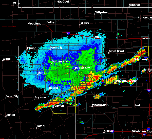 At 628 pm cdt, a severe thunderstorm was located 11 miles northeast of rosston, moving northeast at 30 mph (radar indicated). Hazards include 60 mph wind gusts and half dollar size hail. Hail damage to vehicles is expected. Expect wind damage to roofs, siding, and trees. At 628 pm cdt, a severe thunderstorm was located 11 miles northeast of rosston, moving northeast at 30 mph (radar indicated). Hazards include 60 mph wind gusts and half dollar size hail. Hail damage to vehicles is expected. Expect wind damage to roofs, siding, and trees.
|
| 7/15/2016 8:02 PM CDT |
 At 800 pm cdt, severe thunderstorms were located along a line extending from 9 miles north of buffalo kansas to near catesby, moving east-southeast at 20 mph (radar indicated). Hazards include 70 mph wind gusts and penny size hail. Expect considerable tree damage. Damage is likely to mobile homes, roofs, and outbuildings. At 800 pm cdt, severe thunderstorms were located along a line extending from 9 miles north of buffalo kansas to near catesby, moving east-southeast at 20 mph (radar indicated). Hazards include 70 mph wind gusts and penny size hail. Expect considerable tree damage. Damage is likely to mobile homes, roofs, and outbuildings.
|
| 7/15/2016 7:53 PM CDT |
 At 752 pm cdt, severe thunderstorms were located along a line extending from 10 miles northwest of buffalo to 5 miles west of laverne, moving east at 50 mph. winds of 65 mph have just been measured near slapout in beaver county (radar indicated). Hazards include 70 mph wind gusts. Expect considerable tree damage. damage is likely to mobile homes, roofs, and outbuildings. Locations impacted include, laverne and rosston. At 752 pm cdt, severe thunderstorms were located along a line extending from 10 miles northwest of buffalo to 5 miles west of laverne, moving east at 50 mph. winds of 65 mph have just been measured near slapout in beaver county (radar indicated). Hazards include 70 mph wind gusts. Expect considerable tree damage. damage is likely to mobile homes, roofs, and outbuildings. Locations impacted include, laverne and rosston.
|
| 7/15/2016 7:25 PM CDT |
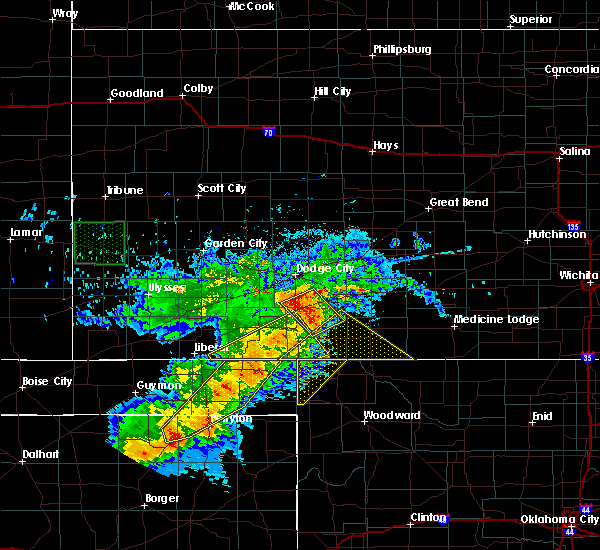 At 724 pm cdt, severe thunderstorms were located along a line extending from 3 miles west of acres kansas to 7 miles east of perryton texas, moving east at 35 mph (radar indicated). Hazards include 60 mph wind gusts and penny size hail. Expect damage to roofs. siding. And trees. At 724 pm cdt, severe thunderstorms were located along a line extending from 3 miles west of acres kansas to 7 miles east of perryton texas, moving east at 35 mph (radar indicated). Hazards include 60 mph wind gusts and penny size hail. Expect damage to roofs. siding. And trees.
|
| 6/28/2016 4:51 PM CDT |
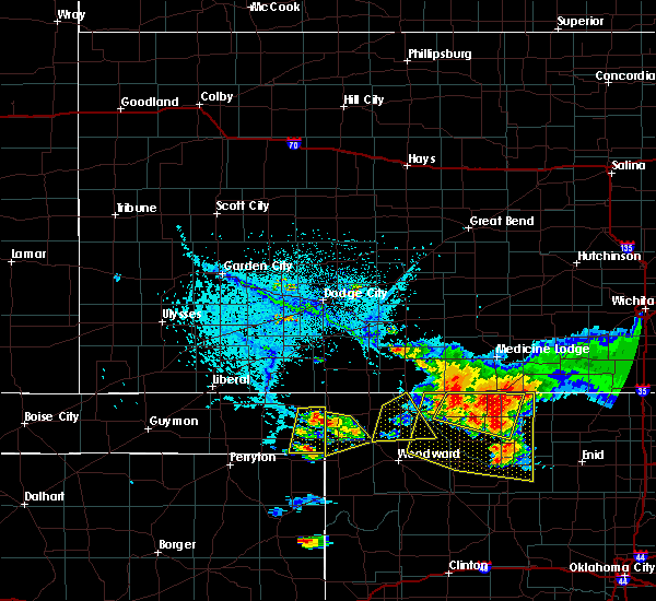 At 451 pm cdt, a severe thunderstorm was located near laverne, moving southeast at 20 mph (radar indicated). Hazards include 60 mph wind gusts and half dollar size hail. Hail damage to vehicles is expected. expect wind damage to roofs, siding, and trees. Locations impacted include, laverne, may, rosston and catesby. At 451 pm cdt, a severe thunderstorm was located near laverne, moving southeast at 20 mph (radar indicated). Hazards include 60 mph wind gusts and half dollar size hail. Hail damage to vehicles is expected. expect wind damage to roofs, siding, and trees. Locations impacted include, laverne, may, rosston and catesby.
|
| 6/28/2016 4:32 PM CDT |
 At 432 pm cdt, a severe thunderstorm was located near rosston, moving southeast at 15 mph (radar indicated). Hazards include 60 mph wind gusts and half dollar size hail. Hail damage to vehicles is expected. Expect wind damage to roofs, siding, and trees. At 432 pm cdt, a severe thunderstorm was located near rosston, moving southeast at 15 mph (radar indicated). Hazards include 60 mph wind gusts and half dollar size hail. Hail damage to vehicles is expected. Expect wind damage to roofs, siding, and trees.
|
| 6/18/2016 3:12 AM CDT |
 At 311 am cdt, severe thunderstorms were located along a line extending from 9 miles south of aetna to 3 miles northwest of alabaster caverns state park to 4 miles north of may, moving southeast at 35 mph. these are very dangerous storms. winds of 81 mph were measured 3 miles south-southwest of freedom in northern woodward county (radar indicated). Hazards include 80 mph wind gusts and ping pong ball size hail. Flying debris will be dangerous to those caught without shelter. mobile homes will be heavily damaged. expect considerable damage to roofs, windows, and vehicles. extensive tree damage and power outages are likely. Locations impacted include, laverne, buffalo, fort supply, freedom, may, rosston, alabaster caverns state park, selman and camp houston. At 311 am cdt, severe thunderstorms were located along a line extending from 9 miles south of aetna to 3 miles northwest of alabaster caverns state park to 4 miles north of may, moving southeast at 35 mph. these are very dangerous storms. winds of 81 mph were measured 3 miles south-southwest of freedom in northern woodward county (radar indicated). Hazards include 80 mph wind gusts and ping pong ball size hail. Flying debris will be dangerous to those caught without shelter. mobile homes will be heavily damaged. expect considerable damage to roofs, windows, and vehicles. extensive tree damage and power outages are likely. Locations impacted include, laverne, buffalo, fort supply, freedom, may, rosston, alabaster caverns state park, selman and camp houston.
|
| 6/18/2016 3:06 AM CDT |
 At 306 am cdt, severe thunderstorms were located along a line extending from 8 miles south of aetna to 4 miles northwest of alabaster caverns state park to 6 miles north of may, moving southeast at 30 mph (radar indicated). Hazards include ping pong ball size hail and 60 mph wind gusts. People and animals outdoors will be injured. expect hail damage to roofs, siding, windows, and vehicles. expect wind damage to roofs, siding, and trees. Locations impacted include, laverne, buffalo, fort supply, freedom, may, rosston, alabaster caverns state park, selman and camp houston. At 306 am cdt, severe thunderstorms were located along a line extending from 8 miles south of aetna to 4 miles northwest of alabaster caverns state park to 6 miles north of may, moving southeast at 30 mph (radar indicated). Hazards include ping pong ball size hail and 60 mph wind gusts. People and animals outdoors will be injured. expect hail damage to roofs, siding, windows, and vehicles. expect wind damage to roofs, siding, and trees. Locations impacted include, laverne, buffalo, fort supply, freedom, may, rosston, alabaster caverns state park, selman and camp houston.
|
| 6/18/2016 2:40 AM CDT |
 At 239 am cdt, severe thunderstorms were located along a line extending from 15 miles northwest of freedom to 6 miles north of selman to 6 miles north of rosston, moving southeast at 35 mph (radar indicated). Hazards include ping pong ball size hail and 60 mph wind gusts. People and animals outdoors will be injured. expect hail damage to roofs, siding, windows, and vehicles. Expect wind damage to roofs, siding, and trees. At 239 am cdt, severe thunderstorms were located along a line extending from 15 miles northwest of freedom to 6 miles north of selman to 6 miles north of rosston, moving southeast at 35 mph (radar indicated). Hazards include ping pong ball size hail and 60 mph wind gusts. People and animals outdoors will be injured. expect hail damage to roofs, siding, windows, and vehicles. Expect wind damage to roofs, siding, and trees.
|
| 5/29/2016 9:54 AM CDT |
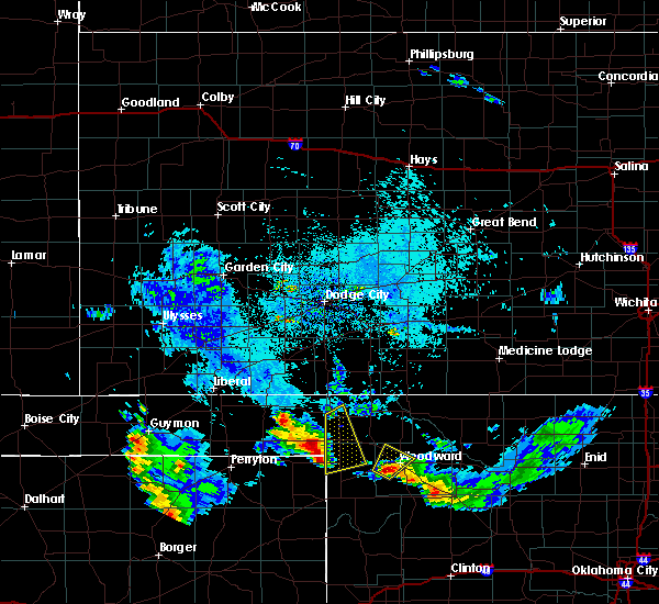 At 954 am cdt, severe thunderstorms were located along a line extending from near slapout to 5 miles east of follett, moving northeast at 15 mph (radar indicated). Hazards include 60 mph wind gusts and half dollar size hail. Hail damage to vehicles is expected. Expect wind damage to roofs, siding, and trees. At 954 am cdt, severe thunderstorms were located along a line extending from near slapout to 5 miles east of follett, moving northeast at 15 mph (radar indicated). Hazards include 60 mph wind gusts and half dollar size hail. Hail damage to vehicles is expected. Expect wind damage to roofs, siding, and trees.
|
| 5/26/2016 8:10 PM CDT |
 At 810 pm cdt, severe thunderstorms were located along a line extending from 6 miles north of selman to 9 miles east of slapout, moving northeast at 45 mph (radar indicated). Hazards include 70 mph wind gusts and half dollar size hail. Hail damage to vehicles is expected. expect considerable tree damage. Wind damage is also likely to mobile homes, roofs, and outbuildings. At 810 pm cdt, severe thunderstorms were located along a line extending from 6 miles north of selman to 9 miles east of slapout, moving northeast at 45 mph (radar indicated). Hazards include 70 mph wind gusts and half dollar size hail. Hail damage to vehicles is expected. expect considerable tree damage. Wind damage is also likely to mobile homes, roofs, and outbuildings.
|
| 5/26/2016 7:33 PM CDT |
 At 733 pm cdt, a severe thunderstorm was located 4 miles west of may, moving northeast at 35 mph (radar indicated). Hazards include 60 mph wind gusts and half dollar size hail. Hail damage to vehicles is expected. Expect wind damage to roofs, siding, and trees. At 733 pm cdt, a severe thunderstorm was located 4 miles west of may, moving northeast at 35 mph (radar indicated). Hazards include 60 mph wind gusts and half dollar size hail. Hail damage to vehicles is expected. Expect wind damage to roofs, siding, and trees.
|
| 5/26/2016 1:58 PM CDT |
 At 158 pm cdt, a severe thunderstorm was located 5 miles west of may, moving northeast at 25 mph (radar indicated). Hazards include tennis ball size hail and 60 mph wind gusts. People and animals outdoors will be injured. expect hail damage to roofs, siding, windows, and vehicles. expect wind damage to roofs, siding, and trees. Locations impacted include, laverne, buffalo, may, rosston and catesby. At 158 pm cdt, a severe thunderstorm was located 5 miles west of may, moving northeast at 25 mph (radar indicated). Hazards include tennis ball size hail and 60 mph wind gusts. People and animals outdoors will be injured. expect hail damage to roofs, siding, windows, and vehicles. expect wind damage to roofs, siding, and trees. Locations impacted include, laverne, buffalo, may, rosston and catesby.
|
| 5/26/2016 1:46 PM CDT |
 At 145 pm cdt, severe thunderstorms were located 9 miles northeast of rosston with another severe thunderstorm 11 miles southwest of may, moving northeast at 30 mph (radar indicated). Hazards include golf ball size hail and 60 mph wind gusts. People and animals outdoors will be injured. expect hail damage to roofs, siding, windows, and vehicles. expect wind damage to roofs, siding, and trees. Locations impacted include, laverne, buffalo, may, rosston and catesby. At 145 pm cdt, severe thunderstorms were located 9 miles northeast of rosston with another severe thunderstorm 11 miles southwest of may, moving northeast at 30 mph (radar indicated). Hazards include golf ball size hail and 60 mph wind gusts. People and animals outdoors will be injured. expect hail damage to roofs, siding, windows, and vehicles. expect wind damage to roofs, siding, and trees. Locations impacted include, laverne, buffalo, may, rosston and catesby.
|
| 5/26/2016 1:25 PM CDT |
 At 125 pm cdt, severe thunderstorms were located near rosston and 4 miles east of follett texas, both moving northeast at 40 mph (radar indicated). Hazards include 60 mph wind gusts and half dollar size hail. Hail damage to vehicles is expected. Expect wind damage to roofs, siding, and trees. At 125 pm cdt, severe thunderstorms were located near rosston and 4 miles east of follett texas, both moving northeast at 40 mph (radar indicated). Hazards include 60 mph wind gusts and half dollar size hail. Hail damage to vehicles is expected. Expect wind damage to roofs, siding, and trees.
|
| 11/16/2015 10:23 PM CST |
 At 1022 pm cst, a severe thunderstorm capable of producing a tornado was located 6 miles west of buffalo, moving northeast at 45 mph. this is part of a line of severe thunderstorms extending from 20 miles northwest of buffalo to 6 miles west of buffalo to 5 miles west of laverne (radar indicated rotation). Hazards include tornado and half dollar size hail. Flying debris will be dangerous to those caught without shelter. mobile homes will be damaged or destroyed. damage to roofs, windows and vehicles will occur. tree damage is likely. Locations impacted include, laverne, buffalo and rosston. At 1022 pm cst, a severe thunderstorm capable of producing a tornado was located 6 miles west of buffalo, moving northeast at 45 mph. this is part of a line of severe thunderstorms extending from 20 miles northwest of buffalo to 6 miles west of buffalo to 5 miles west of laverne (radar indicated rotation). Hazards include tornado and half dollar size hail. Flying debris will be dangerous to those caught without shelter. mobile homes will be damaged or destroyed. damage to roofs, windows and vehicles will occur. tree damage is likely. Locations impacted include, laverne, buffalo and rosston.
|
| 11/16/2015 9:56 PM CST |
 At 955 pm cst, a severe thunderstorm capable of producing a tornado was located 6 miles south of gate, moving northeast at 35 mph. this is part of a line of severe thunderstorms extending from 8 miles west of laverne to near gate. this tornado warning is in addition to the tornado warning for northeastern harper county for a storm north of selman (radar indicated rotation). Hazards include tornado and half dollar size hail. Flying debris will be dangerous to those caught without shelter. mobile homes will be damaged or destroyed. damage to roofs, windows and vehicles will occur. Tree damage is likely. At 955 pm cst, a severe thunderstorm capable of producing a tornado was located 6 miles south of gate, moving northeast at 35 mph. this is part of a line of severe thunderstorms extending from 8 miles west of laverne to near gate. this tornado warning is in addition to the tornado warning for northeastern harper county for a storm north of selman (radar indicated rotation). Hazards include tornado and half dollar size hail. Flying debris will be dangerous to those caught without shelter. mobile homes will be damaged or destroyed. damage to roofs, windows and vehicles will occur. Tree damage is likely.
|
| 7/2/2015 5:33 PM CDT |
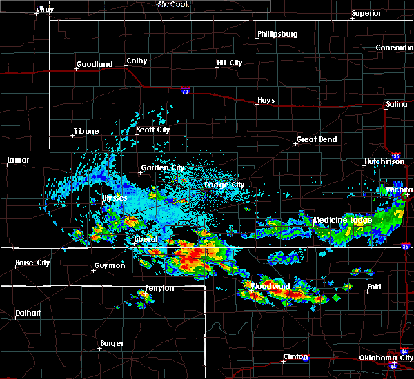 At 532 pm cdt, a severe thunderstorm was located near the harper- beaver county line near gate, moving south at 30 mph. the strongest part of the storm remains in far eastern beaver county, but strong winds associated with this storm may affect western harper county (radar indicated). Hazards include 60 mph wind gusts and nickel size hail. Expect damage to roofs. siding and trees. Locations impacted include, rosston. At 532 pm cdt, a severe thunderstorm was located near the harper- beaver county line near gate, moving south at 30 mph. the strongest part of the storm remains in far eastern beaver county, but strong winds associated with this storm may affect western harper county (radar indicated). Hazards include 60 mph wind gusts and nickel size hail. Expect damage to roofs. siding and trees. Locations impacted include, rosston.
|
| 7/2/2015 5:13 PM CDT |
 At 513 pm cdt, a severe thunderstorm was located near englewood kansas, moving south-southeast at 20 mph (radar indicated). Hazards include golf ball size hail and 60 mph wind gusts. People and animals outdoors will be injured. expect hail damage to roofs, siding, windows and vehicles. Expect wind damage to roofs, siding and trees. At 513 pm cdt, a severe thunderstorm was located near englewood kansas, moving south-southeast at 20 mph (radar indicated). Hazards include golf ball size hail and 60 mph wind gusts. People and animals outdoors will be injured. expect hail damage to roofs, siding, windows and vehicles. Expect wind damage to roofs, siding and trees.
|
| 6/7/2015 6:12 PM CDT | At 611 pm cdt, severe thunderstorms were located along a line extending from 3 miles northeast of rosston to 3 miles south of laverne to near catesby, moving east at 40 mph (radar indicated). Hazards include 60 mph wind gusts and nickel size hail. Expect damage to roofs. siding and trees. Locations impacted include, laverne, buffalo, gage, fargo, may, rosston and catesby. |
| 6/7/2015 5:49 PM CDT | At 548 pm cdt, severe thunderstorms were located along a line extending from 5 miles southwest of rosston to 4 miles west of follett, moving east at 35 mph (radar indicated). Hazards include 60 mph wind gusts and penny size hail. Expect damage to roofs. Siding and trees. |
| 5/3/2015 9:58 PM CDT | At 957 pm cdt, a severe thunderstorm was located 4 miles east of slapout, moving northeast at 35 mph. this storm produced severe winds in and near slapout (radar indicated). Hazards include 60 mph wind gusts and nickel size hail. Expect damage to roofs. Siding and trees. |
Hail Maps for Rosston, OK
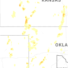
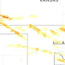
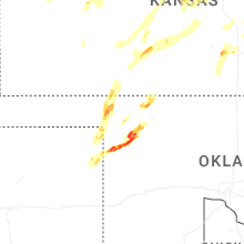
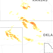


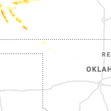


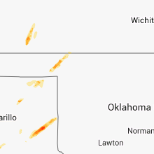


Connect with Interactive Hail Maps