

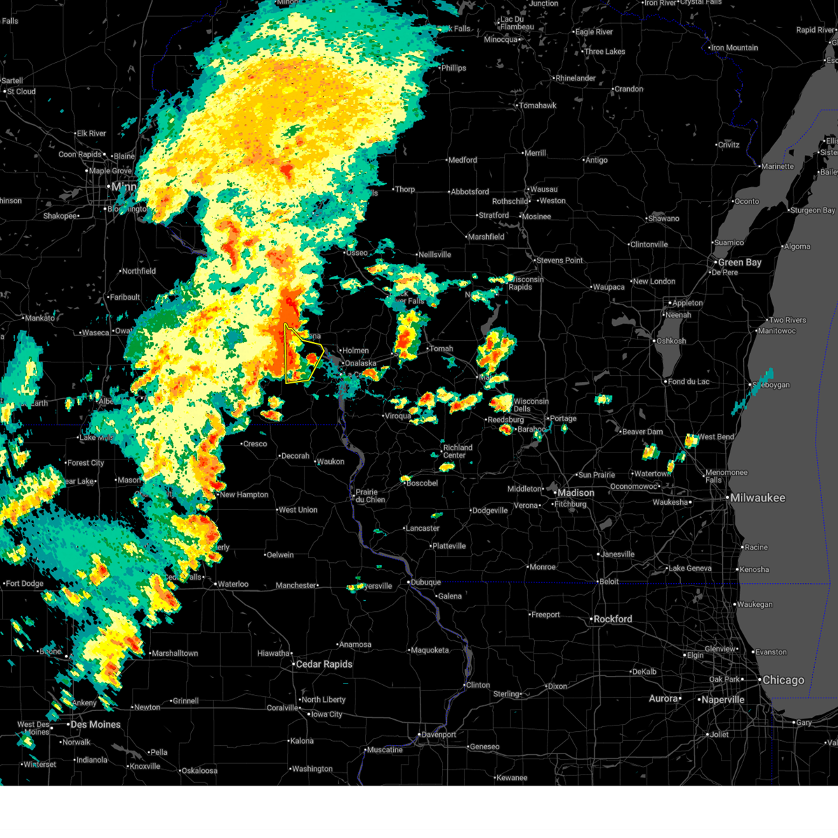
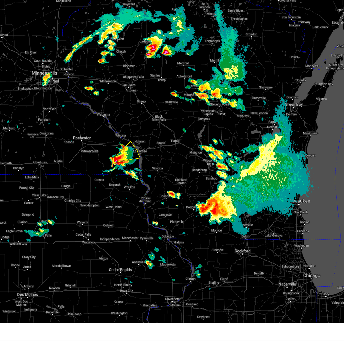
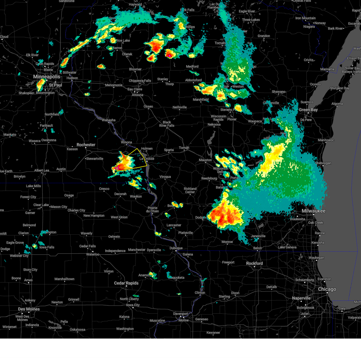
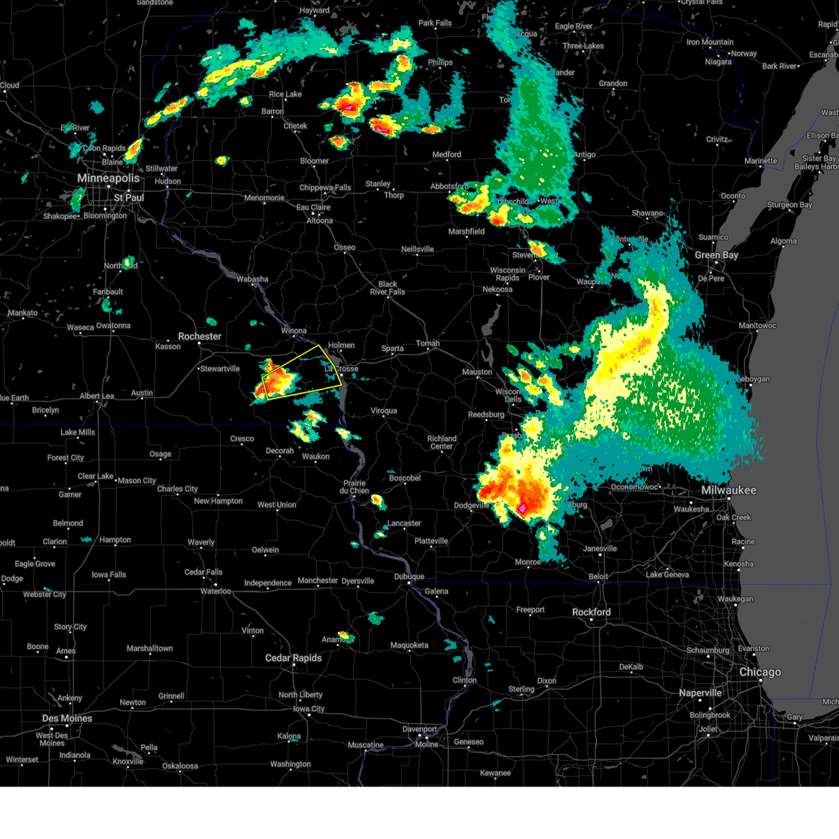
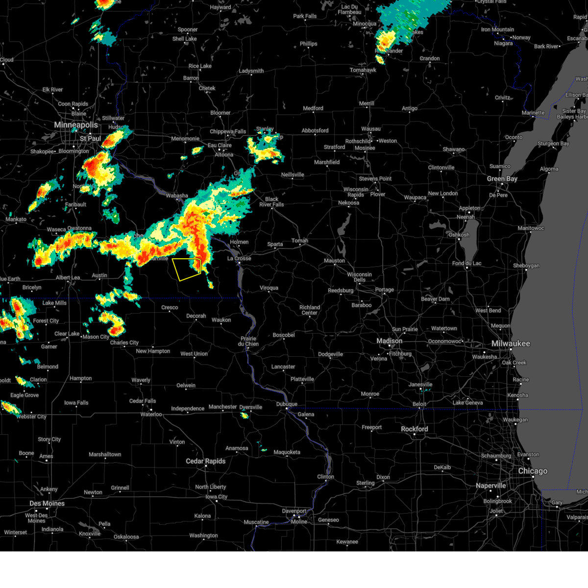
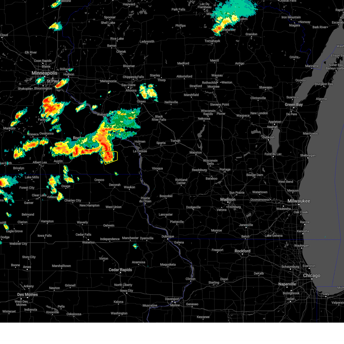
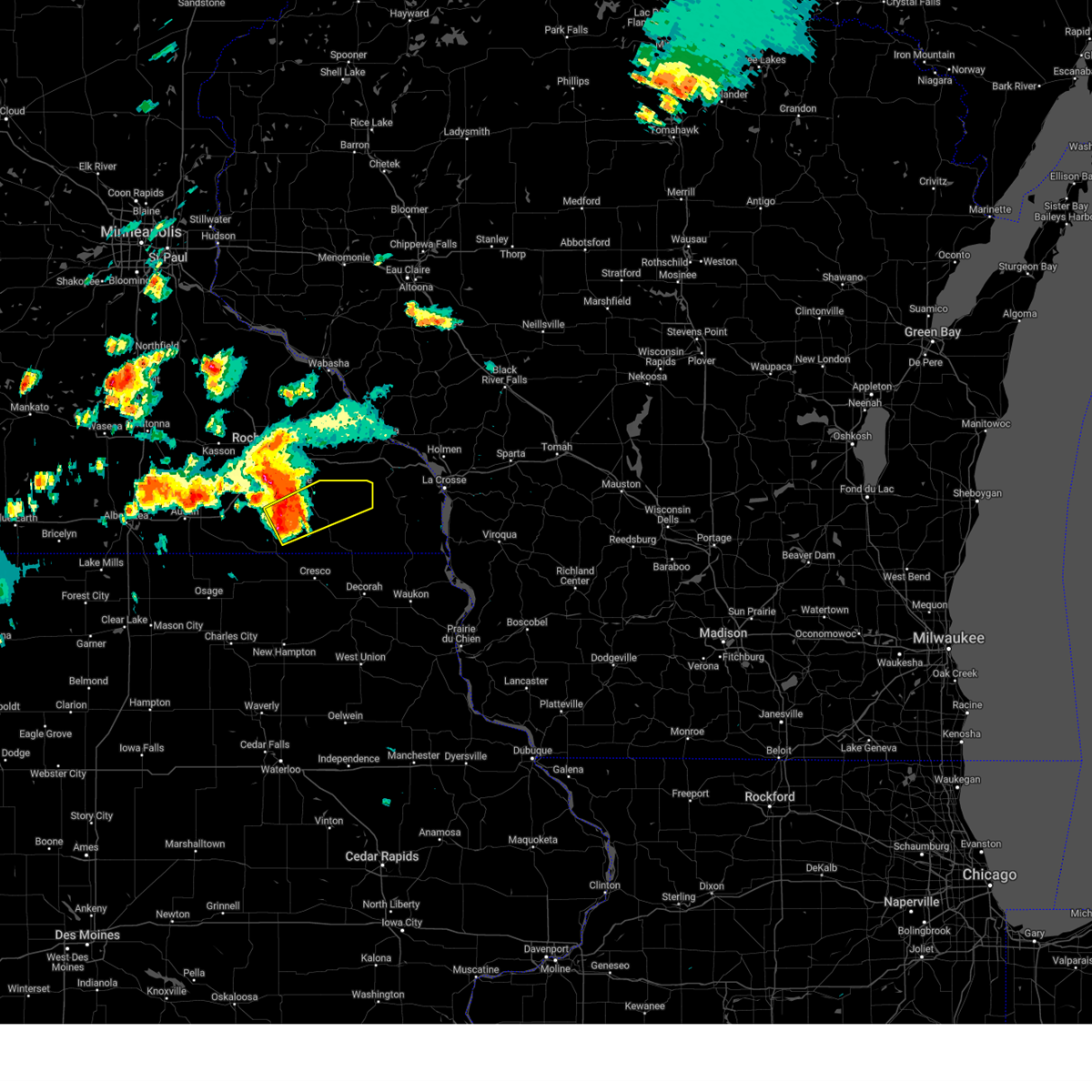
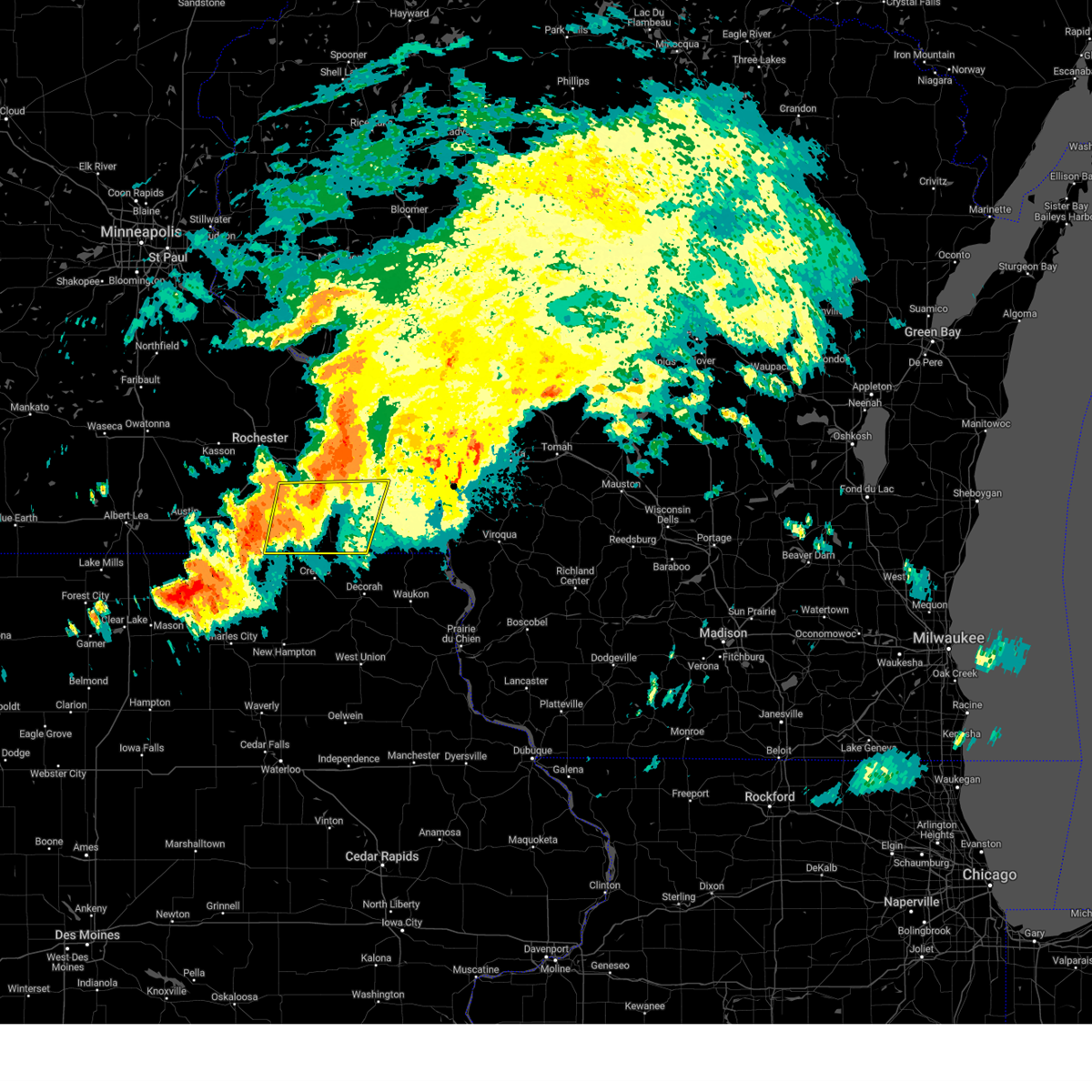
Hail Map for Rushford Village, MN
The Rushford Village, MN area has had 0 reports of on-the-ground hail by trained spotters, and has been under severe weather warnings 24 times during the past 12 months. Doppler radar has detected hail at or near Rushford Village, MN on 75 occasions, including 6 occasions during the past year.
| Name: | Rushford Village, MN |
| Where Located: | 26.6 miles W of La Crosse, WI |
| Map: | Google Map for Rushford Village, MN |
| Population: | 807 |
| Housing Units: | 325 |
| More Info: | Search Google for Rushford Village, MN |
2
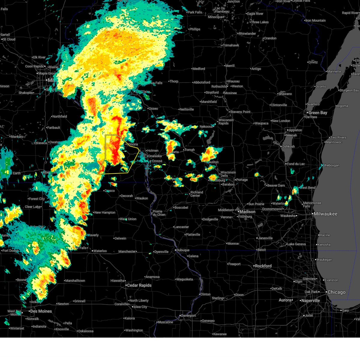
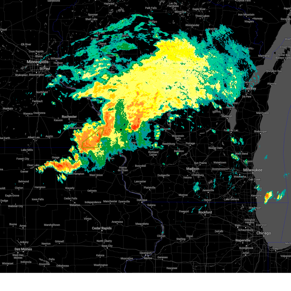
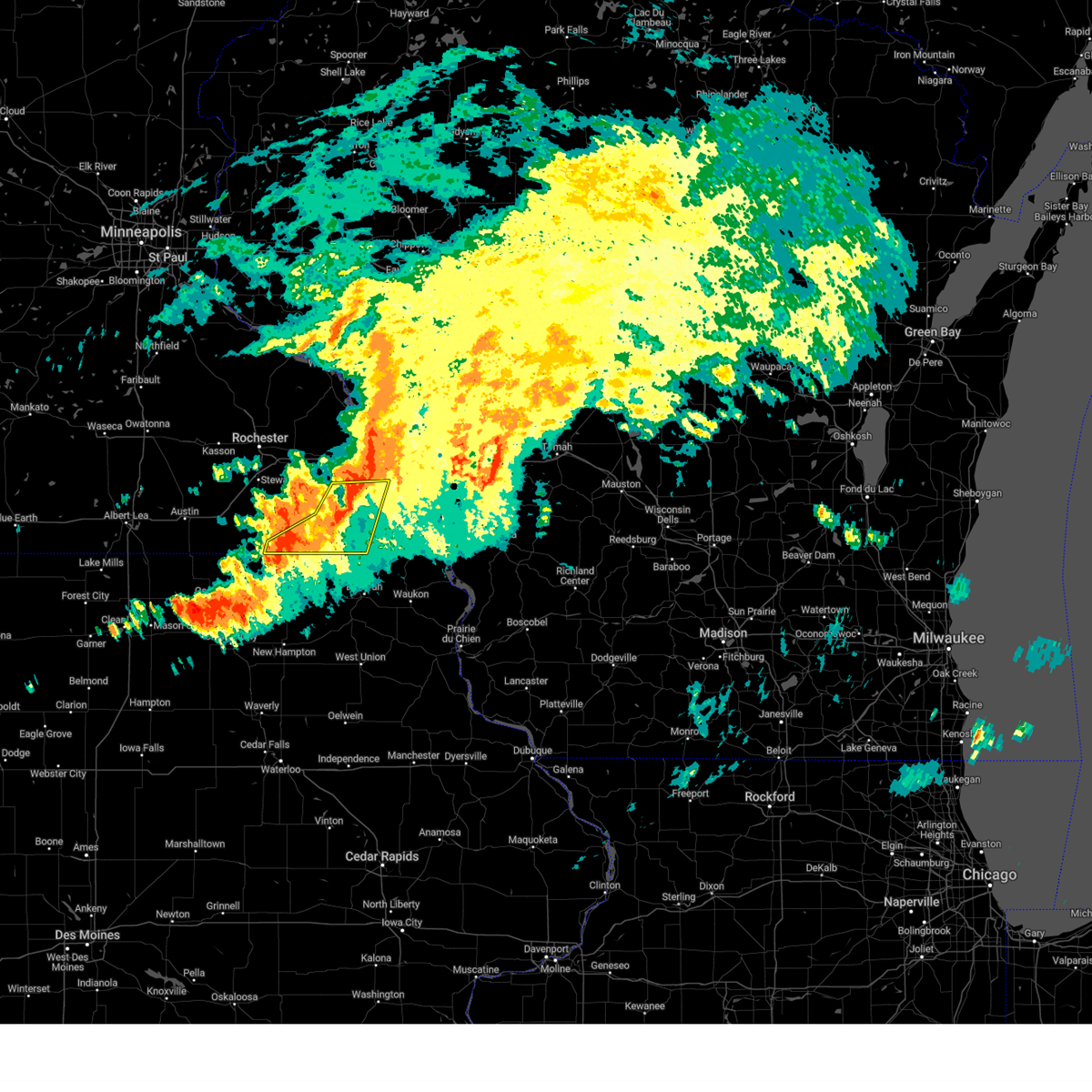
The Top Recent Hail Date for Rushford Village, MN is Thursday, September 19, 2024 (5th out of 75)

Hail and Wind Damage Spotted near Rushford Village, MN
| Date / Time | Report Details |
|---|---|
| 6/26/2025 4:12 PM CDT | The storms which prompted the warning have weakened below severe limits, and no longer pose an immediate threat to life or property. therefore, the warning will be allowed to expire. however, gusty winds and heavy rain are still possible with these thunderstorms. a tornado watch remains in effect until 800 pm cdt for southeastern minnesota, and west central wisconsin. |
| 6/26/2025 3:57 PM CDT |
 At 357 pm cdt, severe thunderstorms were located along a line extending from winona to 7 miles north of houston, moving east at 45 mph (radar indicated). Hazards include 60 mph wind gusts. Expect damage to roofs, siding, and trees. these severe storms will be near, winona around 400 pm cdt. trempealeau around 405 pm cdt. other locations impacted by these severe thunderstorms include witoka, lock and dam 5 a, perkins, wilson, nodine, ridgeway, and county 9 and sather valley road. This includes interstate 90 in minnesota between mile markers 251 and 268. At 357 pm cdt, severe thunderstorms were located along a line extending from winona to 7 miles north of houston, moving east at 45 mph (radar indicated). Hazards include 60 mph wind gusts. Expect damage to roofs, siding, and trees. these severe storms will be near, winona around 400 pm cdt. trempealeau around 405 pm cdt. other locations impacted by these severe thunderstorms include witoka, lock and dam 5 a, perkins, wilson, nodine, ridgeway, and county 9 and sather valley road. This includes interstate 90 in minnesota between mile markers 251 and 268.
|
| 6/26/2025 3:57 PM CDT |
 the severe thunderstorm warning has been cancelled and is no longer in effect the severe thunderstorm warning has been cancelled and is no longer in effect
|
| 6/26/2025 3:44 PM CDT |
 At 343 pm cdt, severe thunderstorms were located along a line extending from near fountain city to near rushford to preston, moving northeast at 55 mph (radar indicated). Hazards include 60 mph wind gusts. Expect damage to roofs, siding, and trees. these severe storms will be near, winona, goodview, rushford, fountain city, and lanesboro around 350 pm cdt. trempealeau around 400 pm cdt. other locations impacted by these severe thunderstorms include forestville state park, whitewater state park, choice, lock and dam 5 a, county roads 6 and 33, wyattville, and isinours. This includes interstate 90 in minnesota between mile markers 233 and 268. At 343 pm cdt, severe thunderstorms were located along a line extending from near fountain city to near rushford to preston, moving northeast at 55 mph (radar indicated). Hazards include 60 mph wind gusts. Expect damage to roofs, siding, and trees. these severe storms will be near, winona, goodview, rushford, fountain city, and lanesboro around 350 pm cdt. trempealeau around 400 pm cdt. other locations impacted by these severe thunderstorms include forestville state park, whitewater state park, choice, lock and dam 5 a, county roads 6 and 33, wyattville, and isinours. This includes interstate 90 in minnesota between mile markers 233 and 268.
|
| 6/26/2025 3:44 PM CDT |
 the severe thunderstorm warning has been cancelled and is no longer in effect the severe thunderstorm warning has been cancelled and is no longer in effect
|
| 6/26/2025 3:24 PM CDT |
 Svrarx the national weather service in la crosse has issued a * severe thunderstorm warning for, winona county in southeastern minnesota, southeastern olmsted county in southeastern minnesota, northwestern houston county in southeastern minnesota, fillmore county in southeastern minnesota, * until 415 pm cdt. * at 324 pm cdt, severe thunderstorms were located along a line extending from near buffalo to near fountain to near lime springs, moving northeast at 50 mph (radar indicated). Hazards include 60 mph wind gusts. Expect damage to roofs, siding, and trees. severe thunderstorms will be near, preston, lewiston, lanesboro, rollingstone, altura, and fountain around 330 pm cdt. stockton around 335 pm cdt. winona, goodview, and fountain city around 340 pm cdt. rushford around 345 pm cdt. trempealeau around 405 pm cdt. other locations impacted by these severe thunderstorms include forestville state park, choice, county roads 9 and 10, isinours, hutton, fillmore, and ridgeway. This includes interstate 90 in minnesota between mile markers 222 and 268. Svrarx the national weather service in la crosse has issued a * severe thunderstorm warning for, winona county in southeastern minnesota, southeastern olmsted county in southeastern minnesota, northwestern houston county in southeastern minnesota, fillmore county in southeastern minnesota, * until 415 pm cdt. * at 324 pm cdt, severe thunderstorms were located along a line extending from near buffalo to near fountain to near lime springs, moving northeast at 50 mph (radar indicated). Hazards include 60 mph wind gusts. Expect damage to roofs, siding, and trees. severe thunderstorms will be near, preston, lewiston, lanesboro, rollingstone, altura, and fountain around 330 pm cdt. stockton around 335 pm cdt. winona, goodview, and fountain city around 340 pm cdt. rushford around 345 pm cdt. trempealeau around 405 pm cdt. other locations impacted by these severe thunderstorms include forestville state park, choice, county roads 9 and 10, isinours, hutton, fillmore, and ridgeway. This includes interstate 90 in minnesota between mile markers 222 and 268.
|
| 5/19/2025 7:11 PM CDT |
 Svrarx the national weather service in la crosse has issued a * severe thunderstorm warning for, western fillmore county in southeastern minnesota, southeastern olmsted county in southeastern minnesota, southwestern winona county in southeastern minnesota, * until 745 pm cdt. * at 711 pm cdt, a severe thunderstorm was located 6 miles east of le roy, or 18 miles southwest of preston, moving northeast at 65 mph (radar indicated). Hazards include quarter size hail. damage to vehicles is expected Svrarx the national weather service in la crosse has issued a * severe thunderstorm warning for, western fillmore county in southeastern minnesota, southeastern olmsted county in southeastern minnesota, southwestern winona county in southeastern minnesota, * until 745 pm cdt. * at 711 pm cdt, a severe thunderstorm was located 6 miles east of le roy, or 18 miles southwest of preston, moving northeast at 65 mph (radar indicated). Hazards include quarter size hail. damage to vehicles is expected
|
| 9/21/2024 3:50 PM CDT |
 At 350 pm cdt, a severe thunderstorm was located near rushford, or 13 miles northwest of caledonia, moving east at 20 mph (radar indicated). Hazards include golf ball size hail and 60 mph wind gusts. People and animals outdoors will be injured. expect hail damage to roofs, siding, windows, and vehicles. expect wind damage to roofs, siding, and trees. this severe storm will be near, houston around 405 pm cdt. other locations impacted by this severe thunderstorm include bratsberg, perkins, mound prairie, nodine, ridgeway, county 9 and sather valley road, and money creek. People attending la crescent applefest should seek safe shelter! this includes interstate 90 in minnesota between mile markers 260 and 271, and near mile marker 274. At 350 pm cdt, a severe thunderstorm was located near rushford, or 13 miles northwest of caledonia, moving east at 20 mph (radar indicated). Hazards include golf ball size hail and 60 mph wind gusts. People and animals outdoors will be injured. expect hail damage to roofs, siding, windows, and vehicles. expect wind damage to roofs, siding, and trees. this severe storm will be near, houston around 405 pm cdt. other locations impacted by this severe thunderstorm include bratsberg, perkins, mound prairie, nodine, ridgeway, county 9 and sather valley road, and money creek. People attending la crescent applefest should seek safe shelter! this includes interstate 90 in minnesota between mile markers 260 and 271, and near mile marker 274.
|
| 9/21/2024 3:43 PM CDT |
 At 343 pm cdt, a severe thunderstorm was located near rushford, or 13 miles east of preston, moving east at 25 mph (radar indicated). Hazards include golf ball size hail and 60 mph wind gusts. People and animals outdoors will be injured. expect hail damage to roofs, siding, windows, and vehicles. expect wind damage to roofs, siding, and trees. this severe storm will be near, houston around 405 pm cdt. hokah around 430 pm cdt. other locations impacted by this severe thunderstorm include bratsberg, rushford village, perkins, mound prairie, nodine, ridgeway, and county 9 and sather valley road. People attending la crescent applefest should seek safe shelter! this includes interstate 90 in minnesota between mile markers 259 and 271, and near mile marker 274. At 343 pm cdt, a severe thunderstorm was located near rushford, or 13 miles east of preston, moving east at 25 mph (radar indicated). Hazards include golf ball size hail and 60 mph wind gusts. People and animals outdoors will be injured. expect hail damage to roofs, siding, windows, and vehicles. expect wind damage to roofs, siding, and trees. this severe storm will be near, houston around 405 pm cdt. hokah around 430 pm cdt. other locations impacted by this severe thunderstorm include bratsberg, rushford village, perkins, mound prairie, nodine, ridgeway, and county 9 and sather valley road. People attending la crescent applefest should seek safe shelter! this includes interstate 90 in minnesota between mile markers 259 and 271, and near mile marker 274.
|
| 9/21/2024 3:33 PM CDT |
 Svrarx the national weather service in la crosse has issued a * severe thunderstorm warning for, southeastern winona county in southeastern minnesota, northern houston county in southeastern minnesota, northeastern fillmore county in southeastern minnesota, * until 430 pm cdt. * at 332 pm cdt, a severe thunderstorm was located near lanesboro, or 11 miles northeast of preston, moving east at 30 mph (radar indicated). Hazards include 60 mph wind gusts and half dollar size hail. Hail damage to vehicles is expected. expect wind damage to roofs, siding, and trees. this severe thunderstorm will be near, rushford around 340 pm cdt. other locations impacted by this severe thunderstorm include perkins, mound prairie, ridgeway, peterson, money creek, new hartford, and bratsberg. people attending la crescent applefest should seek safe shelter. This includes interstate 90 in minnesota between mile markers 257 and 271, and near mile marker 274. Svrarx the national weather service in la crosse has issued a * severe thunderstorm warning for, southeastern winona county in southeastern minnesota, northern houston county in southeastern minnesota, northeastern fillmore county in southeastern minnesota, * until 430 pm cdt. * at 332 pm cdt, a severe thunderstorm was located near lanesboro, or 11 miles northeast of preston, moving east at 30 mph (radar indicated). Hazards include 60 mph wind gusts and half dollar size hail. Hail damage to vehicles is expected. expect wind damage to roofs, siding, and trees. this severe thunderstorm will be near, rushford around 340 pm cdt. other locations impacted by this severe thunderstorm include perkins, mound prairie, ridgeway, peterson, money creek, new hartford, and bratsberg. people attending la crescent applefest should seek safe shelter. This includes interstate 90 in minnesota between mile markers 257 and 271, and near mile marker 274.
|
| 9/19/2024 4:54 PM CDT |
 the severe thunderstorm warning has been cancelled and is no longer in effect the severe thunderstorm warning has been cancelled and is no longer in effect
|
| 9/19/2024 4:38 PM CDT |
 At 437 pm cdt, a severe thunderstorm was located near lanesboro, or 11 miles northeast of preston, moving east at 45 mph (radar indicated). Hazards include 60 mph wind gusts and nickel size hail. Expect damage to roofs, siding, and trees. this severe storm will be near, rushford around 445 pm cdt. Other locations impacted by this severe thunderstorm include arendahl, bratsberg, rushford village, whalan, pilot mound, peterson, and highland. At 437 pm cdt, a severe thunderstorm was located near lanesboro, or 11 miles northeast of preston, moving east at 45 mph (radar indicated). Hazards include 60 mph wind gusts and nickel size hail. Expect damage to roofs, siding, and trees. this severe storm will be near, rushford around 445 pm cdt. Other locations impacted by this severe thunderstorm include arendahl, bratsberg, rushford village, whalan, pilot mound, peterson, and highland.
|
| 9/19/2024 4:26 PM CDT |
 At 425 pm cdt, a severe thunderstorm was located over preston, moving east at 40 mph (radar indicated). Hazards include 60 mph wind gusts and penny size hail. Expect damage to roofs, siding, and trees. this severe storm will be near, lanesboro around 430 pm cdt. rushford around 445 pm cdt. Other locations impacted by this severe thunderstorm include forestville state park, arendahl, bratsberg, rushford village, carimona, whalan, and pilot mound. At 425 pm cdt, a severe thunderstorm was located over preston, moving east at 40 mph (radar indicated). Hazards include 60 mph wind gusts and penny size hail. Expect damage to roofs, siding, and trees. this severe storm will be near, lanesboro around 430 pm cdt. rushford around 445 pm cdt. Other locations impacted by this severe thunderstorm include forestville state park, arendahl, bratsberg, rushford village, carimona, whalan, and pilot mound.
|
| 9/19/2024 4:09 PM CDT |
 Svrarx the national weather service in la crosse has issued a * severe thunderstorm warning for, central fillmore county in southeastern minnesota, * until 515 pm cdt. * at 408 pm cdt, a severe thunderstorm was located near wykoff, or 10 miles west of preston, moving east at 45 mph (law enforcement. a semi-trailer was blown over on highway 63 at 405 pm). Hazards include 60 mph wind gusts and penny size hail. Expect damage to roofs, siding, and trees. this severe thunderstorm will be near, preston and fountain around 415 pm cdt. lanesboro around 425 pm cdt. rushford around 440 pm cdt. Other locations impacted by this severe thunderstorm include forestville state park, etna, carimona, cherry grove, old barn campground, isinours, and fillmore. Svrarx the national weather service in la crosse has issued a * severe thunderstorm warning for, central fillmore county in southeastern minnesota, * until 515 pm cdt. * at 408 pm cdt, a severe thunderstorm was located near wykoff, or 10 miles west of preston, moving east at 45 mph (law enforcement. a semi-trailer was blown over on highway 63 at 405 pm). Hazards include 60 mph wind gusts and penny size hail. Expect damage to roofs, siding, and trees. this severe thunderstorm will be near, preston and fountain around 415 pm cdt. lanesboro around 425 pm cdt. rushford around 440 pm cdt. Other locations impacted by this severe thunderstorm include forestville state park, etna, carimona, cherry grove, old barn campground, isinours, and fillmore.
|
| 8/5/2024 9:36 PM CDT |
 The storms which prompted the warning have weakened below severe limits, and no longer pose an immediate threat to life or property. therefore, the warning will be allowed to expire. however, gusty winds are still possible with these thunderstorms. a tornado watch remains in effect until midnight cdt for northeastern iowa, and southeastern minnesota. The storms which prompted the warning have weakened below severe limits, and no longer pose an immediate threat to life or property. therefore, the warning will be allowed to expire. however, gusty winds are still possible with these thunderstorms. a tornado watch remains in effect until midnight cdt for northeastern iowa, and southeastern minnesota.
|
| 8/5/2024 9:33 PM CDT |
 At 933 pm cdt, severe thunderstorms were located along a line extending from 6 miles northeast of houston to 6 miles north of spring grove to near canton, moving east at 40 mph (radar indicated). Hazards include 60 mph wind gusts. Expect damage to roofs, siding, and trees. these severe storms will be near, mabel and canton around 940 pm cdt. Other locations impacted by these severe thunderstorms include henrytown, choice, perkins, hutton, granger, newburg, and bratsberg. At 933 pm cdt, severe thunderstorms were located along a line extending from 6 miles northeast of houston to 6 miles north of spring grove to near canton, moving east at 40 mph (radar indicated). Hazards include 60 mph wind gusts. Expect damage to roofs, siding, and trees. these severe storms will be near, mabel and canton around 940 pm cdt. Other locations impacted by these severe thunderstorms include henrytown, choice, perkins, hutton, granger, newburg, and bratsberg.
|
| 8/5/2024 9:15 PM CDT |
 At 915 pm cdt, severe thunderstorms were located along a line extending from near rushford to 6 miles southeast of lanesboro to near lime springs, moving east at 35 mph (radar indicated). Hazards include 60 mph wind gusts. Expect damage to roofs, siding, and trees. these severe storms will be near, harmony and canton around 920 pm cdt. mabel around 935 pm cdt. Other locations impacted by these severe thunderstorms include forestville state park, choice, york, isinours, hutton, peterson, and rushford village. At 915 pm cdt, severe thunderstorms were located along a line extending from near rushford to 6 miles southeast of lanesboro to near lime springs, moving east at 35 mph (radar indicated). Hazards include 60 mph wind gusts. Expect damage to roofs, siding, and trees. these severe storms will be near, harmony and canton around 920 pm cdt. mabel around 935 pm cdt. Other locations impacted by these severe thunderstorms include forestville state park, choice, york, isinours, hutton, peterson, and rushford village.
|
| 8/5/2024 8:54 PM CDT |
 Svrarx the national weather service in la crosse has issued a * severe thunderstorm warning for, northwestern houston county in southeastern minnesota, fillmore county in southeastern minnesota, * until 945 pm cdt. * at 853 pm cdt, severe thunderstorms were located along a line extending from near chatfield to near le roy, moving east at 40 mph (radar indicated). Hazards include 60 mph wind gusts. Expect damage to roofs, siding, and trees. severe thunderstorms will be near, preston and fountain around 900 pm cdt. lanesboro around 905 pm cdt. rushford and harmony around 915 pm cdt. canton around 925 pm cdt. Other locations impacted by these severe thunderstorms include forestville state park, choice, york, isinours, hutton, fillmore, and peterson. Svrarx the national weather service in la crosse has issued a * severe thunderstorm warning for, northwestern houston county in southeastern minnesota, fillmore county in southeastern minnesota, * until 945 pm cdt. * at 853 pm cdt, severe thunderstorms were located along a line extending from near chatfield to near le roy, moving east at 40 mph (radar indicated). Hazards include 60 mph wind gusts. Expect damage to roofs, siding, and trees. severe thunderstorms will be near, preston and fountain around 900 pm cdt. lanesboro around 905 pm cdt. rushford and harmony around 915 pm cdt. canton around 925 pm cdt. Other locations impacted by these severe thunderstorms include forestville state park, choice, york, isinours, hutton, fillmore, and peterson.
|
| 7/13/2024 8:08 PM CDT |
 At 807 pm cdt, severe thunderstorms were located along a line extending from near spring grove to 7 miles southeast of canton to near cresco, moving southeast at 40 mph (radar indicated). Hazards include 60 mph wind gusts. Expect damage to roofs, siding, and trees. these severe storms will be near, cresco, spring grove, mabel, and ridgeway around 810 pm cdt. Other locations impacted by these severe thunderstorms include vernon springs county park, choice, vernon springs, county roads v 58 and a 46, hutton, quandahl, and riceford. At 807 pm cdt, severe thunderstorms were located along a line extending from near spring grove to 7 miles southeast of canton to near cresco, moving southeast at 40 mph (radar indicated). Hazards include 60 mph wind gusts. Expect damage to roofs, siding, and trees. these severe storms will be near, cresco, spring grove, mabel, and ridgeway around 810 pm cdt. Other locations impacted by these severe thunderstorms include vernon springs county park, choice, vernon springs, county roads v 58 and a 46, hutton, quandahl, and riceford.
|
| 7/13/2024 7:57 PM CDT |
 At 757 pm cdt, severe thunderstorms were located along a line extending from 8 miles northwest of spring grove to near canton to near lime springs, moving southeast at 45 mph (public). Hazards include 60 mph wind gusts. Expect damage to roofs, siding, and trees. these severe storms will be near, cresco, spring grove, and mabel around 800 pm cdt. ridgeway around 805 pm cdt. Other locations impacted by these severe thunderstorms include vernon springs county park, choice, vernon springs, county roads v 58 and a 46, hutton, quandahl, and riceford. At 757 pm cdt, severe thunderstorms were located along a line extending from 8 miles northwest of spring grove to near canton to near lime springs, moving southeast at 45 mph (public). Hazards include 60 mph wind gusts. Expect damage to roofs, siding, and trees. these severe storms will be near, cresco, spring grove, and mabel around 800 pm cdt. ridgeway around 805 pm cdt. Other locations impacted by these severe thunderstorms include vernon springs county park, choice, vernon springs, county roads v 58 and a 46, hutton, quandahl, and riceford.
|
| 7/13/2024 7:44 PM CDT |
 Svrarx the national weather service in la crosse has issued a * severe thunderstorm warning for, northeastern howard county in northeastern iowa, northwestern allamakee county in northeastern iowa, northern winneshiek county in northeastern iowa, houston county in southeastern minnesota, southeastern fillmore county in southeastern minnesota, * until 845 pm cdt. * at 743 pm cdt, severe thunderstorms were located along a line extending from near rushford to near preston to near le roy, moving southeast at 30 mph (radar indicated). Hazards include 60 mph wind gusts. Expect damage to roofs, siding, and trees. severe thunderstorms will be near, rushford and harmony around 750 pm cdt. lime springs and canton around 755 pm cdt. mabel around 810 pm cdt. cresco and spring grove around 815 pm cdt. caledonia around 820 pm cdt. Other locations impacted by these severe thunderstorms include vernon springs county park, choice, vernon springs, county roads v 58 and a 46, hutton, quandahl, and riceford. Svrarx the national weather service in la crosse has issued a * severe thunderstorm warning for, northeastern howard county in northeastern iowa, northwestern allamakee county in northeastern iowa, northern winneshiek county in northeastern iowa, houston county in southeastern minnesota, southeastern fillmore county in southeastern minnesota, * until 845 pm cdt. * at 743 pm cdt, severe thunderstorms were located along a line extending from near rushford to near preston to near le roy, moving southeast at 30 mph (radar indicated). Hazards include 60 mph wind gusts. Expect damage to roofs, siding, and trees. severe thunderstorms will be near, rushford and harmony around 750 pm cdt. lime springs and canton around 755 pm cdt. mabel around 810 pm cdt. cresco and spring grove around 815 pm cdt. caledonia around 820 pm cdt. Other locations impacted by these severe thunderstorms include vernon springs county park, choice, vernon springs, county roads v 58 and a 46, hutton, quandahl, and riceford.
|
| 7/13/2024 7:22 PM CDT |
 At 721 pm cdt, severe thunderstorms were located along a line extending from near fountain to near spring valley to 6 miles east of brownsdale, moving southeast at 35 mph (radar indicated). Hazards include 70 mph wind gusts and nickel size hail. Expect considerable tree damage. damage is likely to mobile homes, roofs, and outbuildings. these severe storms will be near, preston, spring valley, grand meadow, and fountain around 725 pm cdt. lanesboro around 730 pm cdt. harmony and le roy around 740 pm cdt. canton around 750 pm cdt. other locations impacted by these severe thunderstorms include forestville state park, choice, county roads 6 and 33, york, isinours, hutton, and fillmore. This includes interstate 90 in minnesota between mile markers 191 and 202, and between mile markers 227 and 232. At 721 pm cdt, severe thunderstorms were located along a line extending from near fountain to near spring valley to 6 miles east of brownsdale, moving southeast at 35 mph (radar indicated). Hazards include 70 mph wind gusts and nickel size hail. Expect considerable tree damage. damage is likely to mobile homes, roofs, and outbuildings. these severe storms will be near, preston, spring valley, grand meadow, and fountain around 725 pm cdt. lanesboro around 730 pm cdt. harmony and le roy around 740 pm cdt. canton around 750 pm cdt. other locations impacted by these severe thunderstorms include forestville state park, choice, county roads 6 and 33, york, isinours, hutton, and fillmore. This includes interstate 90 in minnesota between mile markers 191 and 202, and between mile markers 227 and 232.
|
| 7/13/2024 7:22 PM CDT |
 the severe thunderstorm warning has been cancelled and is no longer in effect the severe thunderstorm warning has been cancelled and is no longer in effect
|
| 7/13/2024 7:06 PM CDT |
 Svrarx the national weather service in la crosse has issued a * severe thunderstorm warning for, southwestern winona county in southeastern minnesota, southeastern olmsted county in southeastern minnesota, eastern mower county in southeastern minnesota, south central dodge county in southeastern minnesota, fillmore county in southeastern minnesota, * until 745 pm cdt. * at 706 pm cdt, severe thunderstorms were located along a line extending from near chatfield to near spring valley to near hayfield, moving southeast at 45 mph (trained weather spotters). Hazards include 70 mph wind gusts and penny size hail. Expect considerable tree damage. damage is likely to mobile homes, roofs, and outbuildings. severe thunderstorms will be near, chatfield, spring valley, and wykoff around 710 pm cdt. grand meadow and fountain around 715 pm cdt. preston and lanesboro around 720 pm cdt. harmony around 735 pm cdt. other locations impacted by these severe thunderstorms include forestville state park, choice, isinours, hutton, fillmore, waltham, and rushford village. This includes interstate 90 in minnesota between mile markers 190 and 202, and between mile markers 227 and 232. Svrarx the national weather service in la crosse has issued a * severe thunderstorm warning for, southwestern winona county in southeastern minnesota, southeastern olmsted county in southeastern minnesota, eastern mower county in southeastern minnesota, south central dodge county in southeastern minnesota, fillmore county in southeastern minnesota, * until 745 pm cdt. * at 706 pm cdt, severe thunderstorms were located along a line extending from near chatfield to near spring valley to near hayfield, moving southeast at 45 mph (trained weather spotters). Hazards include 70 mph wind gusts and penny size hail. Expect considerable tree damage. damage is likely to mobile homes, roofs, and outbuildings. severe thunderstorms will be near, chatfield, spring valley, and wykoff around 710 pm cdt. grand meadow and fountain around 715 pm cdt. preston and lanesboro around 720 pm cdt. harmony around 735 pm cdt. other locations impacted by these severe thunderstorms include forestville state park, choice, isinours, hutton, fillmore, waltham, and rushford village. This includes interstate 90 in minnesota between mile markers 190 and 202, and between mile markers 227 and 232.
|
| 6/4/2024 9:22 PM CDT |
 The storms which prompted the warning have weakened below severe limits, and no longer pose an immediate threat to life or property. therefore, the warning will be allowed to expire. however, gusty winds and heavy rain are still possible with these thunderstorms. The storms which prompted the warning have weakened below severe limits, and no longer pose an immediate threat to life or property. therefore, the warning will be allowed to expire. however, gusty winds and heavy rain are still possible with these thunderstorms.
|
| 6/4/2024 9:16 PM CDT |
 At 915 pm cdt, severe thunderstorms were located along a line extending from near lewiston to near rushford to 9 miles northwest of spring grove, moving northeast at 35 mph (radar indicated). Hazards include 60 mph wind gusts. Expect damage to roofs, siding, and trees. these severe storms will be near, rushford around 920 pm cdt. other locations impacted by these severe thunderstorms include arendahl, bratsberg, choice, rushford village, perkins, yucatan, and wyattville. This includes interstate 90 in minnesota between mile markers 243 and 251. At 915 pm cdt, severe thunderstorms were located along a line extending from near lewiston to near rushford to 9 miles northwest of spring grove, moving northeast at 35 mph (radar indicated). Hazards include 60 mph wind gusts. Expect damage to roofs, siding, and trees. these severe storms will be near, rushford around 920 pm cdt. other locations impacted by these severe thunderstorms include arendahl, bratsberg, choice, rushford village, perkins, yucatan, and wyattville. This includes interstate 90 in minnesota between mile markers 243 and 251.
|
| 6/4/2024 9:07 PM CDT |
 At 906 pm cdt, severe thunderstorms were located along a line extending from near st. charles to near lanesboro to near mabel, moving northeast at 35 mph (radar indicated). Hazards include 60 mph wind gusts. Expect damage to roofs, siding, and trees. these severe storms will be near, rushford around 910 pm cdt. other locations impacted by these severe thunderstorms include choice, perkins, county roads 6 and 33, wyattville, riceford, peterson, and newburg. This includes interstate 90 in minnesota between mile markers 243 and 251. At 906 pm cdt, severe thunderstorms were located along a line extending from near st. charles to near lanesboro to near mabel, moving northeast at 35 mph (radar indicated). Hazards include 60 mph wind gusts. Expect damage to roofs, siding, and trees. these severe storms will be near, rushford around 910 pm cdt. other locations impacted by these severe thunderstorms include choice, perkins, county roads 6 and 33, wyattville, riceford, peterson, and newburg. This includes interstate 90 in minnesota between mile markers 243 and 251.
|
| 6/4/2024 9:07 PM CDT |
 the severe thunderstorm warning has been cancelled and is no longer in effect the severe thunderstorm warning has been cancelled and is no longer in effect
|
| 6/4/2024 8:50 PM CDT |
 Svrarx the national weather service in la crosse has issued a * severe thunderstorm warning for, northeastern winneshiek county in northeastern iowa, southwestern winona county in southeastern minnesota, western houston county in southeastern minnesota, eastern fillmore county in southeastern minnesota, * until 930 pm cdt. * at 849 pm cdt, severe thunderstorms were located along a line extending from near fountain to near decorah to near spillville, moving northeast at 35 mph (radar indicated). Hazards include 60 mph wind gusts. Expect damage to roofs, siding, and trees. severe thunderstorms will be near, decorah, lanesboro, and canton around 855 pm cdt. mabel around 900 pm cdt. spring grove around 910 pm cdt. rushford around 915 pm cdt. other locations impacted by these severe thunderstorms include choice, hesper, county roads 6 and 33, highlandville, wyattville, riceford, and peterson. This includes interstate 90 in minnesota between mile markers 243 and 251. Svrarx the national weather service in la crosse has issued a * severe thunderstorm warning for, northeastern winneshiek county in northeastern iowa, southwestern winona county in southeastern minnesota, western houston county in southeastern minnesota, eastern fillmore county in southeastern minnesota, * until 930 pm cdt. * at 849 pm cdt, severe thunderstorms were located along a line extending from near fountain to near decorah to near spillville, moving northeast at 35 mph (radar indicated). Hazards include 60 mph wind gusts. Expect damage to roofs, siding, and trees. severe thunderstorms will be near, decorah, lanesboro, and canton around 855 pm cdt. mabel around 900 pm cdt. spring grove around 910 pm cdt. rushford around 915 pm cdt. other locations impacted by these severe thunderstorms include choice, hesper, county roads 6 and 33, highlandville, wyattville, riceford, and peterson. This includes interstate 90 in minnesota between mile markers 243 and 251.
|
| 6/4/2024 6:51 PM CDT |
 Svrarx the national weather service in la crosse has issued a * severe thunderstorm warning for, southwestern winona county in southeastern minnesota, southeastern olmsted county in southeastern minnesota, northern fillmore county in southeastern minnesota, * until 715 pm cdt. * at 650 pm cdt, a severe thunderstorm was located near fountain, or 8 miles northwest of preston, moving north at 35 mph (trained weather spotters. a wind gust of 64 mph was measured near wykoff). Hazards include 60 mph wind gusts. Expect damage to roofs, siding, and trees. this severe thunderstorm will be near, chatfield around 655 pm cdt. dover around 710 pm cdt. other locations impacted by this severe thunderstorm include saratoga, county roads 6 and 33, wyattville, old barn campground, isinours, county roads 137 and 136, and fillmore. This includes interstate 90 in minnesota between mile markers 222 and 250. Svrarx the national weather service in la crosse has issued a * severe thunderstorm warning for, southwestern winona county in southeastern minnesota, southeastern olmsted county in southeastern minnesota, northern fillmore county in southeastern minnesota, * until 715 pm cdt. * at 650 pm cdt, a severe thunderstorm was located near fountain, or 8 miles northwest of preston, moving north at 35 mph (trained weather spotters. a wind gust of 64 mph was measured near wykoff). Hazards include 60 mph wind gusts. Expect damage to roofs, siding, and trees. this severe thunderstorm will be near, chatfield around 655 pm cdt. dover around 710 pm cdt. other locations impacted by this severe thunderstorm include saratoga, county roads 6 and 33, wyattville, old barn campground, isinours, county roads 137 and 136, and fillmore. This includes interstate 90 in minnesota between mile markers 222 and 250.
|
| 5/21/2024 7:05 PM CDT |
 At 705 pm cdt, severe thunderstorms were located along a line extending from 6 miles east of rushford to near hokah to near stoddard to near waukon, moving northeast at 50 mph (radar indicated). Hazards include 70 mph wind gusts and penny size hail. Expect considerable tree damage. damage is likely to mobile homes, roofs, and outbuildings. locations impacted include, la crescent, lansing, hokah, new albin, brownsville and dakota. This includes interstate 90 in minnesota between mile markers 257 and 276. At 705 pm cdt, severe thunderstorms were located along a line extending from 6 miles east of rushford to near hokah to near stoddard to near waukon, moving northeast at 50 mph (radar indicated). Hazards include 70 mph wind gusts and penny size hail. Expect considerable tree damage. damage is likely to mobile homes, roofs, and outbuildings. locations impacted include, la crescent, lansing, hokah, new albin, brownsville and dakota. This includes interstate 90 in minnesota between mile markers 257 and 276.
|
| 5/21/2024 6:28 PM CDT |
 Svrarx the national weather service in la crosse has issued a * severe thunderstorm warning for, northwestern allamakee county in northeastern iowa, winneshiek county in northeastern iowa, winona county in southeastern minnesota, houston county in southeastern minnesota, eastern fillmore county in southeastern minnesota, * until 730 pm cdt. * at 627 pm cdt, severe thunderstorms were located along a line extending from near lanesboro to 7 miles south of rushford to near spring grove to fort atkinson, moving northeast at 50 mph (radar indicated). Hazards include 70 mph wind gusts and penny size hail. Expect considerable tree damage. damage is likely to mobile homes, roofs, and outbuildings. severe thunderstorms will be near, decorah, caledonia, rushford, and houston around 635 pm cdt. hokah around 645 pm cdt. la crescent and brownsville around 650 pm cdt. la crosse, new albin, and dakota around 655 pm cdt. Lansing around 710 pm cdt. Svrarx the national weather service in la crosse has issued a * severe thunderstorm warning for, northwestern allamakee county in northeastern iowa, winneshiek county in northeastern iowa, winona county in southeastern minnesota, houston county in southeastern minnesota, eastern fillmore county in southeastern minnesota, * until 730 pm cdt. * at 627 pm cdt, severe thunderstorms were located along a line extending from near lanesboro to 7 miles south of rushford to near spring grove to fort atkinson, moving northeast at 50 mph (radar indicated). Hazards include 70 mph wind gusts and penny size hail. Expect considerable tree damage. damage is likely to mobile homes, roofs, and outbuildings. severe thunderstorms will be near, decorah, caledonia, rushford, and houston around 635 pm cdt. hokah around 645 pm cdt. la crescent and brownsville around 650 pm cdt. la crosse, new albin, and dakota around 655 pm cdt. Lansing around 710 pm cdt.
|
| 5/21/2024 6:19 PM CDT |
 At 619 pm cdt, severe thunderstorms were located along a line extending from near kellogg to fountain city to near houston to decorah, moving northeast at 60 mph (radar indicated). Hazards include 70 mph wind gusts and penny size hail. Expect considerable tree damage. damage is likely to mobile homes, roofs, and outbuildings. locations impacted include, winona, decorah, caledonia, alma, spring grove, buffalo city, houston, kellogg, dakota and la crescent. This includes interstate 90 in minnesota between mile markers 233 and 276. At 619 pm cdt, severe thunderstorms were located along a line extending from near kellogg to fountain city to near houston to decorah, moving northeast at 60 mph (radar indicated). Hazards include 70 mph wind gusts and penny size hail. Expect considerable tree damage. damage is likely to mobile homes, roofs, and outbuildings. locations impacted include, winona, decorah, caledonia, alma, spring grove, buffalo city, houston, kellogg, dakota and la crescent. This includes interstate 90 in minnesota between mile markers 233 and 276.
|
| 5/21/2024 5:51 PM CDT |
 Svrarx the national weather service in la crosse has issued a * severe thunderstorm warning for, winneshiek county in northeastern iowa, winona county in southeastern minnesota, wabasha county in southeastern minnesota, western houston county in southeastern minnesota, eastern fillmore county in southeastern minnesota, * until 630 pm cdt. * at 551 pm cdt, severe thunderstorms were located along a line extending from near oronoco to near dover to near preston to near jerico, moving northeast at 70 mph (radar indicated). Hazards include 70 mph wind gusts and penny size hail. Expect considerable tree damage. damage is likely to mobile homes, roofs, and outbuildings. severe thunderstorms will be near, preston, st. charles, plainview, elgin, harmony, and lanesboro around 555 pm cdt. lewiston, altura, canton, and ridgeway around 600 pm cdt. Wabasha, alma, rushford, buffalo city, stockton, rollingstone, and kellogg around 605 pm cdt. Svrarx the national weather service in la crosse has issued a * severe thunderstorm warning for, winneshiek county in northeastern iowa, winona county in southeastern minnesota, wabasha county in southeastern minnesota, western houston county in southeastern minnesota, eastern fillmore county in southeastern minnesota, * until 630 pm cdt. * at 551 pm cdt, severe thunderstorms were located along a line extending from near oronoco to near dover to near preston to near jerico, moving northeast at 70 mph (radar indicated). Hazards include 70 mph wind gusts and penny size hail. Expect considerable tree damage. damage is likely to mobile homes, roofs, and outbuildings. severe thunderstorms will be near, preston, st. charles, plainview, elgin, harmony, and lanesboro around 555 pm cdt. lewiston, altura, canton, and ridgeway around 600 pm cdt. Wabasha, alma, rushford, buffalo city, stockton, rollingstone, and kellogg around 605 pm cdt.
|
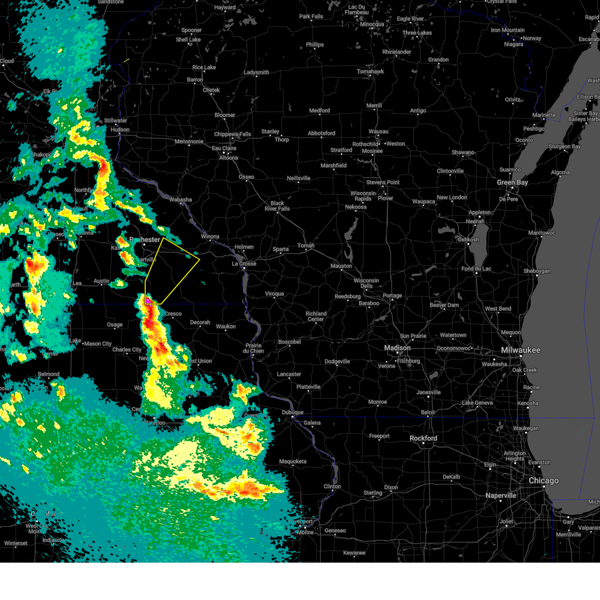
| 7/23/2022 3:12 PM CDT |
 The severe thunderstorm warning for fillmore county will expire at 315 pm cdt, the storms which prompted the warning have moved out of the area. therefore, the warning will be allowed to expire. however heavy rain is still possible with these thunderstorms. a severe thunderstorm watch remains in effect until 700 pm cdt for northeastern iowa, and southeastern minnesota. The severe thunderstorm warning for fillmore county will expire at 315 pm cdt, the storms which prompted the warning have moved out of the area. therefore, the warning will be allowed to expire. however heavy rain is still possible with these thunderstorms. a severe thunderstorm watch remains in effect until 700 pm cdt for northeastern iowa, and southeastern minnesota.
|
| 7/23/2022 2:50 PM CDT |
 At 249 pm cdt, severe thunderstorms were located along a line extending from 7 miles northwest of rushford to 7 miles west of harmony, moving east at 35 mph (law enforcement reported 60 mph wind gusts). Hazards include 70 mph wind gusts and quarter size hail. Hail damage to vehicles is expected. expect considerable tree damage. wind damage is also likely to mobile homes, roofs, and outbuildings. other locations impacted by these severe thunderstorms include henrytown, forestville state park, choice, carimona, old barn campground, isinours and hutton. people attending the fillmore county fairgrounds should seek safe shelter immediately! thunderstorm damage threat, considerable hail threat, radar indicated max hail size, 1. 00 in wind threat, observed max wind gust, 70 mph. At 249 pm cdt, severe thunderstorms were located along a line extending from 7 miles northwest of rushford to 7 miles west of harmony, moving east at 35 mph (law enforcement reported 60 mph wind gusts). Hazards include 70 mph wind gusts and quarter size hail. Hail damage to vehicles is expected. expect considerable tree damage. wind damage is also likely to mobile homes, roofs, and outbuildings. other locations impacted by these severe thunderstorms include henrytown, forestville state park, choice, carimona, old barn campground, isinours and hutton. people attending the fillmore county fairgrounds should seek safe shelter immediately! thunderstorm damage threat, considerable hail threat, radar indicated max hail size, 1. 00 in wind threat, observed max wind gust, 70 mph.
|
| 7/23/2022 2:32 PM CDT |
 At 231 pm cdt, severe thunderstorms were located along a line extending from near chatfield to 6 miles northwest of lime springs, moving east at 35 mph (law enforcement). Hazards include 70 mph wind gusts and quarter size hail. Hail damage to vehicles is expected. expect considerable tree damage. wind damage is also likely to mobile homes, roofs, and outbuildings. these severe storms will be near, rushford and harmony around 300 pm cdt. canton around 305 pm cdt. mabel around 320 pm cdt. other locations impacted by these severe thunderstorms include forestville state park, choice, york, isinours, hutton, fillmore and peterson. people attending the fillmore county fairgrounds should seek safe shelter immediately! thunderstorm damage threat, considerable hail threat, radar indicated max hail size, 1. 00 in wind threat, observed max wind gust, 70 mph. At 231 pm cdt, severe thunderstorms were located along a line extending from near chatfield to 6 miles northwest of lime springs, moving east at 35 mph (law enforcement). Hazards include 70 mph wind gusts and quarter size hail. Hail damage to vehicles is expected. expect considerable tree damage. wind damage is also likely to mobile homes, roofs, and outbuildings. these severe storms will be near, rushford and harmony around 300 pm cdt. canton around 305 pm cdt. mabel around 320 pm cdt. other locations impacted by these severe thunderstorms include forestville state park, choice, york, isinours, hutton, fillmore and peterson. people attending the fillmore county fairgrounds should seek safe shelter immediately! thunderstorm damage threat, considerable hail threat, radar indicated max hail size, 1. 00 in wind threat, observed max wind gust, 70 mph.
|
| 7/23/2022 2:06 PM CDT |
 At 205 pm cdt, severe thunderstorms were located along a line extending from near stewartville to near adams, moving east at 35 mph (law enforcement reported 70+ mph wind gusts). Hazards include 70 mph wind gusts and quarter size hail. Hail damage to vehicles is expected. expect considerable tree damage. wind damage is also likely to mobile homes, roofs, and outbuildings. other locations impacted by these severe thunderstorms include forestville state park, choice, york, isinours, hutton, fillmore and peterson. people attending the fillmore county fairgrounds should seek safe shelter immediately! thunderstorm damage threat, considerable hail threat, radar indicated max hail size, 1. 00 in wind threat, observed max wind gust, 70 mph. At 205 pm cdt, severe thunderstorms were located along a line extending from near stewartville to near adams, moving east at 35 mph (law enforcement reported 70+ mph wind gusts). Hazards include 70 mph wind gusts and quarter size hail. Hail damage to vehicles is expected. expect considerable tree damage. wind damage is also likely to mobile homes, roofs, and outbuildings. other locations impacted by these severe thunderstorms include forestville state park, choice, york, isinours, hutton, fillmore and peterson. people attending the fillmore county fairgrounds should seek safe shelter immediately! thunderstorm damage threat, considerable hail threat, radar indicated max hail size, 1. 00 in wind threat, observed max wind gust, 70 mph.
|
| 6/28/2022 6:58 PM CDT |
 The severe thunderstorm warning for southwestern winona and northeastern fillmore counties will expire at 700 pm cdt, the storm which prompted the warning has weakened below severe limits, and no longer poses an immediate threat to life or property. therefore, the warning will be allowed to expire. however gusty winds and heavy rain are still possible with this thunderstorm. a severe thunderstorm watch remains in effect until 900 pm cdt for southeastern minnesota. remember, a severe thunderstorm warning still remains in effect for southern fillmore until 745 pm cdt. The severe thunderstorm warning for southwestern winona and northeastern fillmore counties will expire at 700 pm cdt, the storm which prompted the warning has weakened below severe limits, and no longer poses an immediate threat to life or property. therefore, the warning will be allowed to expire. however gusty winds and heavy rain are still possible with this thunderstorm. a severe thunderstorm watch remains in effect until 900 pm cdt for southeastern minnesota. remember, a severe thunderstorm warning still remains in effect for southern fillmore until 745 pm cdt.
|
| 6/28/2022 6:11 PM CDT |
 At 611 pm cdt, a severe thunderstorm was located near chatfield, or 14 miles north of preston, moving southeast at 30 mph (trained weather spotters). Hazards include 60 mph wind gusts and quarter size hail. Hail damage to vehicles is expected. expect wind damage to roofs, siding, and trees. this severe thunderstorm will be near, lanesboro around 635 pm cdt. rushford around 645 pm cdt. other locations impacted by this severe thunderstorm include saratoga, choice, peterson, troy and arendahl. this includes interstate 90 in minnesota between mile markers 233 and 243. hail threat, radar indicated max hail size, 1. 00 in wind threat, observed max wind gust, 60 mph. At 611 pm cdt, a severe thunderstorm was located near chatfield, or 14 miles north of preston, moving southeast at 30 mph (trained weather spotters). Hazards include 60 mph wind gusts and quarter size hail. Hail damage to vehicles is expected. expect wind damage to roofs, siding, and trees. this severe thunderstorm will be near, lanesboro around 635 pm cdt. rushford around 645 pm cdt. other locations impacted by this severe thunderstorm include saratoga, choice, peterson, troy and arendahl. this includes interstate 90 in minnesota between mile markers 233 and 243. hail threat, radar indicated max hail size, 1. 00 in wind threat, observed max wind gust, 60 mph.
|
| 6/15/2022 4:34 AM CDT |
 At 433 am cdt, a severe thunderstorm was located 8 miles south of rushford, or 11 miles west of caledonia, moving northeast at 35 mph (radar indicated). Hazards include 60 mph wind gusts. Expect damage to roofs, siding, and trees. locations impacted include, preston, lanesboro, rushford village, highland, amherst, peterson, whalan, henrytown, bratsberg, choice, old barn campground and isinours. hail threat, radar indicated max hail size, <. 75 in wind threat, radar indicated max wind gust, 60 mph. At 433 am cdt, a severe thunderstorm was located 8 miles south of rushford, or 11 miles west of caledonia, moving northeast at 35 mph (radar indicated). Hazards include 60 mph wind gusts. Expect damage to roofs, siding, and trees. locations impacted include, preston, lanesboro, rushford village, highland, amherst, peterson, whalan, henrytown, bratsberg, choice, old barn campground and isinours. hail threat, radar indicated max hail size, <. 75 in wind threat, radar indicated max wind gust, 60 mph.
|
| 6/15/2022 4:22 AM CDT |
 At 422 am cdt, a severe thunderstorm was located near lanesboro, or 8 miles east of preston, moving northeast at 40 mph (radar indicated). Hazards include 60 mph wind gusts. Expect damage to roofs, siding, and trees. this severe thunderstorm will remain over mainly rural areas of eastern fillmore county, including the following locations, henrytown, choice, old barn campground, isinours, hutton, greenleafton and peterson. hail threat, radar indicated max hail size, <. 75 in wind threat, radar indicated max wind gust, 60 mph. At 422 am cdt, a severe thunderstorm was located near lanesboro, or 8 miles east of preston, moving northeast at 40 mph (radar indicated). Hazards include 60 mph wind gusts. Expect damage to roofs, siding, and trees. this severe thunderstorm will remain over mainly rural areas of eastern fillmore county, including the following locations, henrytown, choice, old barn campground, isinours, hutton, greenleafton and peterson. hail threat, radar indicated max hail size, <. 75 in wind threat, radar indicated max wind gust, 60 mph.
|
| 6/15/2022 4:09 AM CDT |
 At 409 am cdt, a severe thunderstorm was located near preston, moving northeast at 30 mph (radar indicated). Hazards include 60 mph wind gusts. Expect damage to roofs, siding, and trees. this severe thunderstorm will be near, harmony around 415 am cdt. preston around 420 am cdt. lanesboro around 435 am cdt. other locations impacted by this severe thunderstorm include henrytown, choice, old barn campground, isinours, hutton, greenleafton and peterson. hail threat, radar indicated max hail size, <. 75 in wind threat, radar indicated max wind gust, 60 mph. At 409 am cdt, a severe thunderstorm was located near preston, moving northeast at 30 mph (radar indicated). Hazards include 60 mph wind gusts. Expect damage to roofs, siding, and trees. this severe thunderstorm will be near, harmony around 415 am cdt. preston around 420 am cdt. lanesboro around 435 am cdt. other locations impacted by this severe thunderstorm include henrytown, choice, old barn campground, isinours, hutton, greenleafton and peterson. hail threat, radar indicated max hail size, <. 75 in wind threat, radar indicated max wind gust, 60 mph.
|
| 5/31/2022 1:20 AM CDT |
 At 120 am cdt, severe thunderstorms were located along a line extending from near rushford to near mabel, moving east at 50 mph (radar indicated). Hazards include 60 mph wind gusts. Expect damage to roofs, siding, and trees. these severe thunderstorms will remain over mainly rural areas of south central winona, northwestern houston and eastern fillmore counties, including the following locations, choice, perkins, wyattville, wilson, riceford, peterson and newburg. this includes interstate 90 in minnesota between mile markers 245 and 255. hail threat, radar indicated max hail size, <. 75 in wind threat, radar indicated max wind gust, 60 mph. At 120 am cdt, severe thunderstorms were located along a line extending from near rushford to near mabel, moving east at 50 mph (radar indicated). Hazards include 60 mph wind gusts. Expect damage to roofs, siding, and trees. these severe thunderstorms will remain over mainly rural areas of south central winona, northwestern houston and eastern fillmore counties, including the following locations, choice, perkins, wyattville, wilson, riceford, peterson and newburg. this includes interstate 90 in minnesota between mile markers 245 and 255. hail threat, radar indicated max hail size, <. 75 in wind threat, radar indicated max wind gust, 60 mph.
|
| 5/31/2022 1:02 AM CDT |
 At 102 am cdt, severe thunderstorms were located along a line extending from 6 miles north of lanesboro to near canton, moving northeast at 50 mph (radar indicated). Hazards include 60 mph wind gusts. Expect damage to roofs, siding, and trees. these severe storms will be near, rushford around 110 am cdt. other locations impacted by these severe thunderstorms include choice, wyattville, isinours, hutton, riceford, peterson and rushford village. this includes interstate 90 in minnesota between mile markers 244 and 255. hail threat, radar indicated max hail size, <. 75 in wind threat, radar indicated max wind gust, 60 mph. At 102 am cdt, severe thunderstorms were located along a line extending from 6 miles north of lanesboro to near canton, moving northeast at 50 mph (radar indicated). Hazards include 60 mph wind gusts. Expect damage to roofs, siding, and trees. these severe storms will be near, rushford around 110 am cdt. other locations impacted by these severe thunderstorms include choice, wyattville, isinours, hutton, riceford, peterson and rushford village. this includes interstate 90 in minnesota between mile markers 244 and 255. hail threat, radar indicated max hail size, <. 75 in wind threat, radar indicated max wind gust, 60 mph.
|
| 5/31/2022 12:51 AM CDT |
 At 1251 am cdt, severe thunderstorms were located along a line extending from near fountain to near harmony, moving east at 55 mph (radar indicated). Hazards include 60 mph wind gusts. Expect damage to roofs, siding, and trees. these severe storms will be near, lanesboro around 1255 am cdt. canton around 100 am cdt. rushford around 110 am cdt. other locations impacted by these severe thunderstorms include choice, wyattville, isinours, hutton, riceford, peterson and rushford village. this includes interstate 90 in minnesota between mile markers 244 and 255. hail threat, radar indicated max hail size, <. 75 in wind threat, radar indicated max wind gust, 60 mph. At 1251 am cdt, severe thunderstorms were located along a line extending from near fountain to near harmony, moving east at 55 mph (radar indicated). Hazards include 60 mph wind gusts. Expect damage to roofs, siding, and trees. these severe storms will be near, lanesboro around 1255 am cdt. canton around 100 am cdt. rushford around 110 am cdt. other locations impacted by these severe thunderstorms include choice, wyattville, isinours, hutton, riceford, peterson and rushford village. this includes interstate 90 in minnesota between mile markers 244 and 255. hail threat, radar indicated max hail size, <. 75 in wind threat, radar indicated max wind gust, 60 mph.
|
| 5/31/2022 12:39 AM CDT |
 At 1238 am cdt, severe thunderstorms were located along a line extending from near wykoff to lime springs, moving northeast at 50 mph (trained weather spotters estimated wind gusts of 55 to 60 mph near spring valley at 12:35 am). Hazards include 60 mph wind gusts. Expect damage to roofs, siding, and trees. severe thunderstorms will be near, wykoff around 1245 am cdt. preston and fountain around 1250 am cdt. harmony, lanesboro and canton around 100 am cdt. rushford around 110 am cdt. other locations impacted by these severe thunderstorms include forestville state park, choice, york, wyattville, isinours, hutton and riceford. this includes interstate 90 in minnesota between mile markers 244 and 255. hail threat, radar indicated max hail size, <. 75 in wind threat, radar indicated max wind gust, 60 mph. At 1238 am cdt, severe thunderstorms were located along a line extending from near wykoff to lime springs, moving northeast at 50 mph (trained weather spotters estimated wind gusts of 55 to 60 mph near spring valley at 12:35 am). Hazards include 60 mph wind gusts. Expect damage to roofs, siding, and trees. severe thunderstorms will be near, wykoff around 1245 am cdt. preston and fountain around 1250 am cdt. harmony, lanesboro and canton around 100 am cdt. rushford around 110 am cdt. other locations impacted by these severe thunderstorms include forestville state park, choice, york, wyattville, isinours, hutton and riceford. this includes interstate 90 in minnesota between mile markers 244 and 255. hail threat, radar indicated max hail size, <. 75 in wind threat, radar indicated max wind gust, 60 mph.
|
| 5/30/2022 9:55 PM CDT |
 The severe thunderstorm warning for central fillmore county will expire at 1000 pm cdt, the storm which prompted the warning has weakened below severe limits, and no longer poses an immediate threat to life or property. therefore, the warning will be allowed to expire. a severe thunderstorm watch remains in effect until 200 am cdt for southeastern minnesota. The severe thunderstorm warning for central fillmore county will expire at 1000 pm cdt, the storm which prompted the warning has weakened below severe limits, and no longer poses an immediate threat to life or property. therefore, the warning will be allowed to expire. a severe thunderstorm watch remains in effect until 200 am cdt for southeastern minnesota.
|
| 5/30/2022 9:50 PM CDT |
 At 950 pm cdt, a severe thunderstorm was located near preston, moving northeast at 50 mph (radar indicated). Hazards include 60 mph wind gusts. Expect damage to roofs, siding, and trees. this severe storm will be near, lanesboro around 1005 pm cdt. other locations in the path of this severe thunderstorm include rushford. hail threat, radar indicated max hail size, <. 75 in wind threat, radar indicated max wind gust, 60 mph. At 950 pm cdt, a severe thunderstorm was located near preston, moving northeast at 50 mph (radar indicated). Hazards include 60 mph wind gusts. Expect damage to roofs, siding, and trees. this severe storm will be near, lanesboro around 1005 pm cdt. other locations in the path of this severe thunderstorm include rushford. hail threat, radar indicated max hail size, <. 75 in wind threat, radar indicated max wind gust, 60 mph.
|
| 5/30/2022 9:46 PM CDT |
 At 946 pm cdt, a severe thunderstorm was located near harmony, or 7 miles southwest of preston, moving northeast at 50 mph (radar indicated). Hazards include 60 mph wind gusts. Expect damage to roofs, siding, and trees. this severe storm will be near, harmony around 950 pm cdt. preston around 955 pm cdt. hail threat, radar indicated max hail size, <. 75 in wind threat, radar indicated max wind gust, 60 mph. At 946 pm cdt, a severe thunderstorm was located near harmony, or 7 miles southwest of preston, moving northeast at 50 mph (radar indicated). Hazards include 60 mph wind gusts. Expect damage to roofs, siding, and trees. this severe storm will be near, harmony around 950 pm cdt. preston around 955 pm cdt. hail threat, radar indicated max hail size, <. 75 in wind threat, radar indicated max wind gust, 60 mph.
|
| 5/30/2022 9:41 PM CDT |
 At 941 pm cdt, a severe thunderstorm was located near preston, moving northeast at 50 mph (radar indicated). Hazards include 60 mph wind gusts. Expect damage to roofs, siding, and trees. this severe storm will be near, harmony around 945 pm cdt. preston and fountain around 950 pm cdt. lanesboro around 955 pm cdt. hail threat, radar indicated max hail size, <. 75 in wind threat, radar indicated max wind gust, 60 mph. At 941 pm cdt, a severe thunderstorm was located near preston, moving northeast at 50 mph (radar indicated). Hazards include 60 mph wind gusts. Expect damage to roofs, siding, and trees. this severe storm will be near, harmony around 945 pm cdt. preston and fountain around 950 pm cdt. lanesboro around 955 pm cdt. hail threat, radar indicated max hail size, <. 75 in wind threat, radar indicated max wind gust, 60 mph.
|
| 5/30/2022 9:35 PM CDT |
 At 935 pm cdt, a severe thunderstorm was located near wykoff, or near preston, moving northeast at 60 mph (radar indicated). Hazards include 60 mph wind gusts. Expect damage to roofs, siding, and trees. this severe storm will be near, lanesboro around 945 pm cdt. hail threat, radar indicated max hail size, <. 75 in wind threat, radar indicated max wind gust, 60 mph. At 935 pm cdt, a severe thunderstorm was located near wykoff, or near preston, moving northeast at 60 mph (radar indicated). Hazards include 60 mph wind gusts. Expect damage to roofs, siding, and trees. this severe storm will be near, lanesboro around 945 pm cdt. hail threat, radar indicated max hail size, <. 75 in wind threat, radar indicated max wind gust, 60 mph.
|
| 5/30/2022 9:26 PM CDT |
 At 926 pm cdt, a severe thunderstorm was located 8 miles southeast of spring valley, or 13 miles southwest of preston, moving northeast at 60 mph (radar indicated). Hazards include 60 mph wind gusts. Expect damage to roofs, siding, and trees. this severe storm will be near, wykoff around 935 pm cdt. preston and fountain around 940 pm cdt. chatfield and lanesboro around 945 pm cdt. hail threat, radar indicated max hail size, <. 75 in wind threat, radar indicated max wind gust, 60 mph. At 926 pm cdt, a severe thunderstorm was located 8 miles southeast of spring valley, or 13 miles southwest of preston, moving northeast at 60 mph (radar indicated). Hazards include 60 mph wind gusts. Expect damage to roofs, siding, and trees. this severe storm will be near, wykoff around 935 pm cdt. preston and fountain around 940 pm cdt. chatfield and lanesboro around 945 pm cdt. hail threat, radar indicated max hail size, <. 75 in wind threat, radar indicated max wind gust, 60 mph.
|
| 5/30/2022 9:19 PM CDT |
 At 918 pm cdt, a severe thunderstorm was located near le roy, or 17 miles northwest of cresco, moving northeast at 60 mph (radar indicated). Hazards include 60 mph wind gusts. Expect damage to roofs, siding, and trees. this severe thunderstorm will be near, wykoff around 935 pm cdt. preston and fountain around 940 pm cdt. lanesboro around 945 pm cdt. hail threat, radar indicated max hail size, <. 75 in wind threat, radar indicated max wind gust, 60 mph. At 918 pm cdt, a severe thunderstorm was located near le roy, or 17 miles northwest of cresco, moving northeast at 60 mph (radar indicated). Hazards include 60 mph wind gusts. Expect damage to roofs, siding, and trees. this severe thunderstorm will be near, wykoff around 935 pm cdt. preston and fountain around 940 pm cdt. lanesboro around 945 pm cdt. hail threat, radar indicated max hail size, <. 75 in wind threat, radar indicated max wind gust, 60 mph.
|
| 5/19/2022 9:51 PM CDT |
 At 951 pm cdt, severe thunderstorms were located along a line extending from stewartville to trempealeau, moving east at 30 mph (radar indicated). Hazards include quarter size hail. Damage to vehicles is expected. severe thunderstorms will be near, trempealeau and dakota around 955 pm cdt. galesville and brice prairie around 1000 pm cdt. onalaska and holmen around 1010 pm cdt. chatfield around 1025 pm cdt. dover around 1030 pm cdt. other locations impacted by these severe thunderstorms include north side of la crosse, lock and dam 5 a, camp decorah, county roads 6 and 33, wyattville, perrot state park and ridgeway. this includes the following highways, interstate 90 in minnesota between mile markers 213 and 276. interstate 90 in wisconsin between mile markers 1 and 6. hail threat, radar indicated max hail size, 1. 00 in wind threat, radar indicated max wind gust, <50 mph. At 951 pm cdt, severe thunderstorms were located along a line extending from stewartville to trempealeau, moving east at 30 mph (radar indicated). Hazards include quarter size hail. Damage to vehicles is expected. severe thunderstorms will be near, trempealeau and dakota around 955 pm cdt. galesville and brice prairie around 1000 pm cdt. onalaska and holmen around 1010 pm cdt. chatfield around 1025 pm cdt. dover around 1030 pm cdt. other locations impacted by these severe thunderstorms include north side of la crosse, lock and dam 5 a, camp decorah, county roads 6 and 33, wyattville, perrot state park and ridgeway. this includes the following highways, interstate 90 in minnesota between mile markers 213 and 276. interstate 90 in wisconsin between mile markers 1 and 6. hail threat, radar indicated max hail size, 1. 00 in wind threat, radar indicated max wind gust, <50 mph.
|
| 5/19/2022 8:06 PM CDT |
 At 805 pm cdt, a severe thunderstorm was located near houston, or 13 miles northwest of caledonia, moving east at 45 mph (radar indicated). Hazards include ping pong ball size hail and 60 mph wind gusts. People and animals outdoors will be injured. expect hail damage to roofs, siding, windows, and vehicles. this severe thunderstorm will remain over mainly rural areas of northeastern fillmore county, including the following locations, arendahl, bratsberg, rushford village, peterson, whalan and highland. hail threat, radar indicated max hail size, 1. 50 in wind threat, radar indicated max wind gust, 60 mph. At 805 pm cdt, a severe thunderstorm was located near houston, or 13 miles northwest of caledonia, moving east at 45 mph (radar indicated). Hazards include ping pong ball size hail and 60 mph wind gusts. People and animals outdoors will be injured. expect hail damage to roofs, siding, windows, and vehicles. this severe thunderstorm will remain over mainly rural areas of northeastern fillmore county, including the following locations, arendahl, bratsberg, rushford village, peterson, whalan and highland. hail threat, radar indicated max hail size, 1. 50 in wind threat, radar indicated max wind gust, 60 mph.
|
| 5/19/2022 7:53 PM CDT |
 At 753 pm cdt, a severe thunderstorm was located near rushford, or 13 miles northeast of preston, moving east at 45 mph (radar indicated). Hazards include ping pong ball size hail and 60 mph wind gusts. People and animals outdoors will be injured. expect hail damage to roofs, siding, windows, and vehicles. this severe storm will be near, rushford around 800 pm cdt. other locations impacted by this severe thunderstorm include arendahl, bratsberg, rushford village, whalan, pilot mound, old barn campground and isinours. hail threat, radar indicated max hail size, 1. 50 in wind threat, radar indicated max wind gust, 60 mph. At 753 pm cdt, a severe thunderstorm was located near rushford, or 13 miles northeast of preston, moving east at 45 mph (radar indicated). Hazards include ping pong ball size hail and 60 mph wind gusts. People and animals outdoors will be injured. expect hail damage to roofs, siding, windows, and vehicles. this severe storm will be near, rushford around 800 pm cdt. other locations impacted by this severe thunderstorm include arendahl, bratsberg, rushford village, whalan, pilot mound, old barn campground and isinours. hail threat, radar indicated max hail size, 1. 50 in wind threat, radar indicated max wind gust, 60 mph.
|
| 5/19/2022 7:34 PM CDT |
 At 734 pm cdt, a severe thunderstorm was located over fountain, or 7 miles northwest of preston, moving east at 45 mph (radar indicated). Hazards include 60 mph wind gusts and quarter size hail. Hail damage to vehicles is expected. expect wind damage to roofs, siding, and trees. this severe thunderstorm will be near, lanesboro around 745 pm cdt. rushford around 800 pm cdt. other locations impacted by this severe thunderstorm include arendahl, bratsberg, rushford village, whalan, pilot mound, old barn campground and isinours. hail threat, radar indicated max hail size, 1. 00 in wind threat, radar indicated max wind gust, 60 mph. At 734 pm cdt, a severe thunderstorm was located over fountain, or 7 miles northwest of preston, moving east at 45 mph (radar indicated). Hazards include 60 mph wind gusts and quarter size hail. Hail damage to vehicles is expected. expect wind damage to roofs, siding, and trees. this severe thunderstorm will be near, lanesboro around 745 pm cdt. rushford around 800 pm cdt. other locations impacted by this severe thunderstorm include arendahl, bratsberg, rushford village, whalan, pilot mound, old barn campground and isinours. hail threat, radar indicated max hail size, 1. 00 in wind threat, radar indicated max wind gust, 60 mph.
|
| 4/12/2022 11:48 PM CDT |
 At 1148 pm cdt, severe thunderstorms were located along a line extending from near lewiston to near houston to mabel, moving east at 50 mph (radar indicated). Hazards include 70 mph wind gusts. Expect considerable tree damage. damage is likely to mobile homes, roofs, and outbuildings. these severe storms will be near, winona around 1200 am cdt. other locations impacted by these severe thunderstorms include choice, wyattville, wilson, riceford, utica, peterson and newhouse. This includes interstate 90 in minnesota between mile markers 237 and 253. At 1148 pm cdt, severe thunderstorms were located along a line extending from near lewiston to near houston to mabel, moving east at 50 mph (radar indicated). Hazards include 70 mph wind gusts. Expect considerable tree damage. damage is likely to mobile homes, roofs, and outbuildings. these severe storms will be near, winona around 1200 am cdt. other locations impacted by these severe thunderstorms include choice, wyattville, wilson, riceford, utica, peterson and newhouse. This includes interstate 90 in minnesota between mile markers 237 and 253.
|
| 4/12/2022 11:43 PM CDT |
 At 1142 pm cdt, severe thunderstorms were located along a line extending from 6 miles southwest of lewiston to near rushford to 7 miles south of canton, moving east at 60 mph (radar indicated). Hazards include 60 mph wind gusts. Expect damage to roofs, siding, and trees. severe thunderstorms will be near, rushford around 1145 pm cdt. winona around 1155 pm cdt. la crescent, dakota and brice prairie around 1205 am cdt. la crosse around 1210 am cdt. bangor and stoddard around 1220 am cdt. other locations impacted by these severe thunderstorms include county roads g and h, north side of la crosse, camp decorah, south side of la crosse, stevenstown, riceford and rockland. this includes the following highways, interstate 90 in minnesota between mile markers 243 and 276. interstate 90 in wisconsin between mile markers 1 and 20. hail threat, radar indicated max hail size, <. 75 in wind threat, radar indicated max wind gust, 60 mph. At 1142 pm cdt, severe thunderstorms were located along a line extending from 6 miles southwest of lewiston to near rushford to 7 miles south of canton, moving east at 60 mph (radar indicated). Hazards include 60 mph wind gusts. Expect damage to roofs, siding, and trees. severe thunderstorms will be near, rushford around 1145 pm cdt. winona around 1155 pm cdt. la crescent, dakota and brice prairie around 1205 am cdt. la crosse around 1210 am cdt. bangor and stoddard around 1220 am cdt. other locations impacted by these severe thunderstorms include county roads g and h, north side of la crosse, camp decorah, south side of la crosse, stevenstown, riceford and rockland. this includes the following highways, interstate 90 in minnesota between mile markers 243 and 276. interstate 90 in wisconsin between mile markers 1 and 20. hail threat, radar indicated max hail size, <. 75 in wind threat, radar indicated max wind gust, 60 mph.
|
| 4/12/2022 11:36 PM CDT |
 At 1136 pm cdt, severe thunderstorms capable of producing tornadoes were located along a line extending from 6 miles south of st. charles to near rushford, moving northeast at 60 mph (radar indicated rotation). Hazards include tornado. Flying debris will be dangerous to those caught without shelter. mobile homes will be damaged or destroyed. damage to roofs, windows, and vehicles will occur. tree damage is likely. these dangerous storms will be near, rushford around 1140 pm cdt. lewiston around 1150 pm cdt. other locations impacted by these tornadic storms include saratoga, arendahl, rushford village, county roads 6 and 33, utica, peterson and fremont. This includes interstate 90 in minnesota between mile markers 236 and 245. At 1136 pm cdt, severe thunderstorms capable of producing tornadoes were located along a line extending from 6 miles south of st. charles to near rushford, moving northeast at 60 mph (radar indicated rotation). Hazards include tornado. Flying debris will be dangerous to those caught without shelter. mobile homes will be damaged or destroyed. damage to roofs, windows, and vehicles will occur. tree damage is likely. these dangerous storms will be near, rushford around 1140 pm cdt. lewiston around 1150 pm cdt. other locations impacted by these tornadic storms include saratoga, arendahl, rushford village, county roads 6 and 33, utica, peterson and fremont. This includes interstate 90 in minnesota between mile markers 236 and 245.
|
| 4/12/2022 11:34 PM CDT |
 At 1134 pm cdt, severe thunderstorms were located along a line extending from near st. charles to near rushford to near canton, moving east at 55 mph (radar indicated). Hazards include 70 mph wind gusts. Expect considerable tree damage. damage is likely to mobile homes, roofs, and outbuildings. these severe storms will be near, rushford and lewiston around 1140 pm cdt. stockton around 1145 pm cdt. winona and goodview around 1150 pm cdt. spring grove around 1155 pm cdt. other locations impacted by these severe thunderstorms include choice, county roads 6 and 33, wyattville, isinours, hutton, riceford and utica. This includes interstate 90 in minnesota between mile markers 233 and 253. At 1134 pm cdt, severe thunderstorms were located along a line extending from near st. charles to near rushford to near canton, moving east at 55 mph (radar indicated). Hazards include 70 mph wind gusts. Expect considerable tree damage. damage is likely to mobile homes, roofs, and outbuildings. these severe storms will be near, rushford and lewiston around 1140 pm cdt. stockton around 1145 pm cdt. winona and goodview around 1150 pm cdt. spring grove around 1155 pm cdt. other locations impacted by these severe thunderstorms include choice, county roads 6 and 33, wyattville, isinours, hutton, riceford and utica. This includes interstate 90 in minnesota between mile markers 233 and 253.
|
| 4/12/2022 11:30 PM CDT |
 At 1129 pm cdt, severe thunderstorms capable of producing tornadoes were located along a line extending from chatfield to lanesboro, moving northeast at 60 mph (radar indicated rotation). Hazards include tornado. Flying debris will be dangerous to those caught without shelter. mobile homes will be damaged or destroyed. damage to roofs, windows, and vehicles will occur. tree damage is likely. these dangerous storms will be near, rushford around 1140 pm cdt. lewiston around 1150 pm cdt. other locations impacted by these tornadic storms include saratoga, arendahl, rushford village, whalan, county roads 6 and 33, pilot mound and highway 30 and county 74. This includes interstate 90 in minnesota between mile markers 235 and 245. At 1129 pm cdt, severe thunderstorms capable of producing tornadoes were located along a line extending from chatfield to lanesboro, moving northeast at 60 mph (radar indicated rotation). Hazards include tornado. Flying debris will be dangerous to those caught without shelter. mobile homes will be damaged or destroyed. damage to roofs, windows, and vehicles will occur. tree damage is likely. these dangerous storms will be near, rushford around 1140 pm cdt. lewiston around 1150 pm cdt. other locations impacted by these tornadic storms include saratoga, arendahl, rushford village, whalan, county roads 6 and 33, pilot mound and highway 30 and county 74. This includes interstate 90 in minnesota between mile markers 235 and 245.
|
| 4/12/2022 11:23 PM CDT |
 At 1123 pm cdt, a severe thunderstorm capable of producing a tornado was located near fountain, or 8 miles northwest of preston, moving northeast at 60 mph (radar indicated rotation). Hazards include tornado. Flying debris will be dangerous to those caught without shelter. mobile homes will be damaged or destroyed. damage to roofs, windows, and vehicles will occur. tree damage is likely. this dangerous storm will be near, rushford and lewiston around 1145 pm cdt. other locations impacted by this tornadic thunderstorm include saratoga, county roads 6 and 33, old barn campground, isinours, fillmore, highway 30 and county 74 and utica. This includes interstate 90 in minnesota between mile markers 235 and 245. At 1123 pm cdt, a severe thunderstorm capable of producing a tornado was located near fountain, or 8 miles northwest of preston, moving northeast at 60 mph (radar indicated rotation). Hazards include tornado. Flying debris will be dangerous to those caught without shelter. mobile homes will be damaged or destroyed. damage to roofs, windows, and vehicles will occur. tree damage is likely. this dangerous storm will be near, rushford and lewiston around 1145 pm cdt. other locations impacted by this tornadic thunderstorm include saratoga, county roads 6 and 33, old barn campground, isinours, fillmore, highway 30 and county 74 and utica. This includes interstate 90 in minnesota between mile markers 235 and 245.
|
| 4/12/2022 11:19 PM CDT |
 At 1118 pm cdt, severe thunderstorms were located along a line extending from near dover to 6 miles northeast of lime springs, moving northeast at 50 mph (radar indicated). Hazards include 70 mph wind gusts. Expect considerable tree damage. damage is likely to mobile homes, roofs, and outbuildings. severe thunderstorms will be near, st. charles and dover around 1125 pm cdt. harmony around 1130 pm cdt. lewiston and canton around 1135 pm cdt. lanesboro around 1140 pm cdt. stockton around 1145 pm cdt. winona and goodview around 1150 pm cdt. other locations impacted by these severe thunderstorms include forestville state park, choice, county roads 6 and 33, york, wyattville, isinours and hutton. This includes interstate 90 in minnesota between mile markers 223 and 253. At 1118 pm cdt, severe thunderstorms were located along a line extending from near dover to 6 miles northeast of lime springs, moving northeast at 50 mph (radar indicated). Hazards include 70 mph wind gusts. Expect considerable tree damage. damage is likely to mobile homes, roofs, and outbuildings. severe thunderstorms will be near, st. charles and dover around 1125 pm cdt. harmony around 1130 pm cdt. lewiston and canton around 1135 pm cdt. lanesboro around 1140 pm cdt. stockton around 1145 pm cdt. winona and goodview around 1150 pm cdt. other locations impacted by these severe thunderstorms include forestville state park, choice, county roads 6 and 33, york, wyattville, isinours and hutton. This includes interstate 90 in minnesota between mile markers 223 and 253.
|
| 4/12/2022 2:48 PM CDT |
 At 247 pm cdt, a severe thunderstorm was located near lewiston, or 11 miles southwest of winona, moving east at 60 mph (public reported 1 inch hail at 230 pm). Hazards include 60 mph wind gusts and quarter size hail. Hail damage to vehicles is expected. expect wind damage to roofs, siding, and trees. this severe storm will be near, winona and goodview around 255 pm cdt. other locations impacted by this severe thunderstorm include saratoga, county roads 6 and 33, wyattville, wilson, county roads 137 and 136, highway 30 and county 74 and utica. this includes interstate 90 in minnesota between mile markers 232 and 255. hail threat, radar indicated max hail size, 1. 00 in wind threat, radar indicated max wind gust, 60 mph. At 247 pm cdt, a severe thunderstorm was located near lewiston, or 11 miles southwest of winona, moving east at 60 mph (public reported 1 inch hail at 230 pm). Hazards include 60 mph wind gusts and quarter size hail. Hail damage to vehicles is expected. expect wind damage to roofs, siding, and trees. this severe storm will be near, winona and goodview around 255 pm cdt. other locations impacted by this severe thunderstorm include saratoga, county roads 6 and 33, wyattville, wilson, county roads 137 and 136, highway 30 and county 74 and utica. this includes interstate 90 in minnesota between mile markers 232 and 255. hail threat, radar indicated max hail size, 1. 00 in wind threat, radar indicated max wind gust, 60 mph.
|
| 4/12/2022 2:34 PM CDT |
 At 234 pm cdt, a severe thunderstorm was located near chatfield, or 14 miles north of preston, moving east at 60 mph (radar indicated). Hazards include 60 mph wind gusts and quarter size hail. Hail damage to vehicles is expected. expect wind damage to roofs, siding, and trees. this severe thunderstorm will be near, lewiston around 245 pm cdt. stockton around 250 pm cdt. winona and goodview around 255 pm cdt. other locations impacted by this severe thunderstorm include saratoga, county roads 6 and 33, wyattville, wilson, county roads 137 and 136, highway 30 and county 74 and utica. this includes interstate 90 in minnesota between mile markers 232 and 255. hail threat, radar indicated max hail size, 1. 00 in wind threat, radar indicated max wind gust, 60 mph. At 234 pm cdt, a severe thunderstorm was located near chatfield, or 14 miles north of preston, moving east at 60 mph (radar indicated). Hazards include 60 mph wind gusts and quarter size hail. Hail damage to vehicles is expected. expect wind damage to roofs, siding, and trees. this severe thunderstorm will be near, lewiston around 245 pm cdt. stockton around 250 pm cdt. winona and goodview around 255 pm cdt. other locations impacted by this severe thunderstorm include saratoga, county roads 6 and 33, wyattville, wilson, county roads 137 and 136, highway 30 and county 74 and utica. this includes interstate 90 in minnesota between mile markers 232 and 255. hail threat, radar indicated max hail size, 1. 00 in wind threat, radar indicated max wind gust, 60 mph.
|
| 12/15/2021 7:38 PM CST |
 At 737 pm cst, severe thunderstorms capable of producing both tornadoes and extensive straight line wind damage were located near cresco, moving northeast at 75 mph (radar indicated rotation). Hazards include tornado. Flying debris will be dangerous to those caught without shelter. mobile homes will be damaged or destroyed. damage to roofs, windows, and vehicles will occur. tree damage is likely. these dangerous storms will be near, canton around 745 pm cst. preston around 750 pm cst. lanesboro around 755 pm cst. rushford around 800 pm cst. Other locations impacted by this tornadic thunderstorm include choice, york, isinours, hutton, peterson, county roads w 14 and a 34 and rushford village. At 737 pm cst, severe thunderstorms capable of producing both tornadoes and extensive straight line wind damage were located near cresco, moving northeast at 75 mph (radar indicated rotation). Hazards include tornado. Flying debris will be dangerous to those caught without shelter. mobile homes will be damaged or destroyed. damage to roofs, windows, and vehicles will occur. tree damage is likely. these dangerous storms will be near, canton around 745 pm cst. preston around 750 pm cst. lanesboro around 755 pm cst. rushford around 800 pm cst. Other locations impacted by this tornadic thunderstorm include choice, york, isinours, hutton, peterson, county roads w 14 and a 34 and rushford village.
|
| 5/15/2021 6:12 PM CDT |
 The severe thunderstorm warning for northeastern fillmore county will expire at 615 pm cdt, the storm which prompted the warning has weakened below severe limits, and no longer poses an immediate threat to life or property. therefore, the warning will be allowed to expire. however small hail is still possible with this thunderstorm. The severe thunderstorm warning for northeastern fillmore county will expire at 615 pm cdt, the storm which prompted the warning has weakened below severe limits, and no longer poses an immediate threat to life or property. therefore, the warning will be allowed to expire. however small hail is still possible with this thunderstorm.
|
| 5/15/2021 6:02 PM CDT |
 At 600 pm cdt, a severe thunderstorm was located just north of lanesboro, or 8 miles north of preston, moving southeast at 20 mph (radar indicated). Hazards include quarter size hail. Damage to vehicles is expected. this severe storm will be near, lanesboro around 610 pm cdt. Other locations impacted by this severe thunderstorm include arendahl, whalan, pilot mound, peterson, highland, old barn campground and rushford village. At 600 pm cdt, a severe thunderstorm was located just north of lanesboro, or 8 miles north of preston, moving southeast at 20 mph (radar indicated). Hazards include quarter size hail. Damage to vehicles is expected. this severe storm will be near, lanesboro around 610 pm cdt. Other locations impacted by this severe thunderstorm include arendahl, whalan, pilot mound, peterson, highland, old barn campground and rushford village.
|
| 5/15/2021 5:50 PM CDT |
 At 549 pm cdt, a severe thunderstorm was located near pilot mound, or 10 miles north of preston, moving southeast at 20 mph (radar indicated). Hazards include quarter size hail. Damage to vehicles is expected. this severe storm will be near, lanesboro around 600 pm cdt. rushford around 615 pm cdt. other locations impacted by this severe thunderstorm include saratoga, arendahl, rushford village, whalan, county roads 6 and 33, pilot mound and highway 30 and county 74. This includes interstate 90 in minnesota between mile markers 235 and 236. At 549 pm cdt, a severe thunderstorm was located near pilot mound, or 10 miles north of preston, moving southeast at 20 mph (radar indicated). Hazards include quarter size hail. Damage to vehicles is expected. this severe storm will be near, lanesboro around 600 pm cdt. rushford around 615 pm cdt. other locations impacted by this severe thunderstorm include saratoga, arendahl, rushford village, whalan, county roads 6 and 33, pilot mound and highway 30 and county 74. This includes interstate 90 in minnesota between mile markers 235 and 236.
|
| 5/15/2021 5:31 PM CDT |
 At 530 pm cdt, a severe thunderstorm was located near chatfield, or 12 miles north of preston, moving southeast at 20 mph (radar indicated). Hazards include quarter size hail. Damage to vehicles is expected. this severe thunderstorm will be near, lanesboro around 555 pm cdt. rushford around 605 pm cdt. other locations impacted by this severe thunderstorm include saratoga, arendahl, rushford village, whalan, county roads 6 and 33, pilot mound and highway 30 and county 74. This includes interstate 90 in minnesota between mile markers 232 and 237. At 530 pm cdt, a severe thunderstorm was located near chatfield, or 12 miles north of preston, moving southeast at 20 mph (radar indicated). Hazards include quarter size hail. Damage to vehicles is expected. this severe thunderstorm will be near, lanesboro around 555 pm cdt. rushford around 605 pm cdt. other locations impacted by this severe thunderstorm include saratoga, arendahl, rushford village, whalan, county roads 6 and 33, pilot mound and highway 30 and county 74. This includes interstate 90 in minnesota between mile markers 232 and 237.
|
| 5/2/2021 5:23 PM CDT |
 At 523 pm cdt, a severe thunderstorm was located near fountain, or 7 miles north of preston, moving northeast at 25 mph (radar indicated). Hazards include quarter size hail. Damage to vehicles is expected. This severe thunderstorm will remain over mainly rural areas of northeastern fillmore county, including the following locations, arendahl, whalan, pilot mound, old barn campground, isinours, peterson and rushford village. At 523 pm cdt, a severe thunderstorm was located near fountain, or 7 miles north of preston, moving northeast at 25 mph (radar indicated). Hazards include quarter size hail. Damage to vehicles is expected. This severe thunderstorm will remain over mainly rural areas of northeastern fillmore county, including the following locations, arendahl, whalan, pilot mound, old barn campground, isinours, peterson and rushford village.
|
| 5/2/2021 5:16 PM CDT |
 At 516 pm cdt, a severe thunderstorm was located over fountain, or near preston, moving northeast at 25 mph (radar indicated). Hazards include quarter size hail. Damage to vehicles is expected. this severe thunderstorm will be near, lanesboro around 525 pm cdt. Other locations impacted by this severe thunderstorm include arendahl, whalan, pilot mound, old barn campground, isinours, peterson and rushford village. At 516 pm cdt, a severe thunderstorm was located over fountain, or near preston, moving northeast at 25 mph (radar indicated). Hazards include quarter size hail. Damage to vehicles is expected. this severe thunderstorm will be near, lanesboro around 525 pm cdt. Other locations impacted by this severe thunderstorm include arendahl, whalan, pilot mound, old barn campground, isinours, peterson and rushford village.
|
| 8/10/2020 6:37 AM CDT |
 At 637 am cdt, a severe thunderstorm was located over brice prairie, or near la crescent, moving east at 45 mph (radar indicated). Hazards include golf ball size hail and 60 mph wind gusts. People and animals outdoors will be injured. expect hail damage to roofs, siding, windows, and vehicles. expect wind damage to roofs, siding, and trees. This severe thunderstorm will remain over mainly rural areas of southeastern winona and northern houston counties, including the following locations, perkins, mound prairie, i 90 exit 257, wilson, ridgeway, i 90 exit 275 and pickwick. At 637 am cdt, a severe thunderstorm was located over brice prairie, or near la crescent, moving east at 45 mph (radar indicated). Hazards include golf ball size hail and 60 mph wind gusts. People and animals outdoors will be injured. expect hail damage to roofs, siding, windows, and vehicles. expect wind damage to roofs, siding, and trees. This severe thunderstorm will remain over mainly rural areas of southeastern winona and northern houston counties, including the following locations, perkins, mound prairie, i 90 exit 257, wilson, ridgeway, i 90 exit 275 and pickwick.
|
| 8/10/2020 6:26 AM CDT |
 At 625 am cdt, a severe thunderstorm was located near dakota, or 10 miles northwest of la crescent, moving east at 35 mph (radar indicated). Hazards include 60 mph wind gusts and quarter size hail. Hail damage to vehicles is expected. expect wind damage to roofs, siding, and trees. this severe storm will be near, dakota around 635 am cdt. la crescent around 640 am cdt. la crosse around 645 am cdt. Other locations impacted by this severe thunderstorm include perkins, mound prairie, i 90 exit 257, wilson, ridgeway, i 90 exit 275 and pickwick. At 625 am cdt, a severe thunderstorm was located near dakota, or 10 miles northwest of la crescent, moving east at 35 mph (radar indicated). Hazards include 60 mph wind gusts and quarter size hail. Hail damage to vehicles is expected. expect wind damage to roofs, siding, and trees. this severe storm will be near, dakota around 635 am cdt. la crescent around 640 am cdt. la crosse around 645 am cdt. Other locations impacted by this severe thunderstorm include perkins, mound prairie, i 90 exit 257, wilson, ridgeway, i 90 exit 275 and pickwick.
|
| 8/10/2020 5:56 AM CDT |
 At 556 am cdt, a severe thunderstorm was located near lewiston, or 14 miles southwest of winona, moving east at 45 mph (radar indicated). Hazards include 60 mph wind gusts and quarter size hail. Hail damage to vehicles is expected. expect wind damage to roofs, siding, and trees. this severe thunderstorm will be near, trempealeau around 630 am cdt. dakota around 635 am cdt. Other locations impacted by this severe thunderstorm include county roads 6 and 33, wyattville, i 90 exit 257, ridgeway, i 90 exit 275, utica and peterson. At 556 am cdt, a severe thunderstorm was located near lewiston, or 14 miles southwest of winona, moving east at 45 mph (radar indicated). Hazards include 60 mph wind gusts and quarter size hail. Hail damage to vehicles is expected. expect wind damage to roofs, siding, and trees. this severe thunderstorm will be near, trempealeau around 630 am cdt. dakota around 635 am cdt. Other locations impacted by this severe thunderstorm include county roads 6 and 33, wyattville, i 90 exit 257, ridgeway, i 90 exit 275, utica and peterson.
|
| 6/2/2020 8:18 PM CDT |
 At 817 pm cdt, severe thunderstorms were located along a line extending from near eyota to chatfield to near harmony, moving east at 40 mph (trained weather spotters. at 809 pm, a 60 mph wind gust was recorded 5 miles west of chatfield). Hazards include 60 mph wind gusts. Expect damage to roofs, siding, and trees. severe thunderstorms will be near, preston around 820 pm cdt. harmony around 825 pm cdt. canton around 830 pm cdt. st. charles around 835 pm cdt. rushford, lewiston and altura around 850 pm cdt. spring grove around 855 pm cdt. houston, stockton and rollingstone around 900 pm cdt. winona, caledonia, goodview and fountain city around 905 pm cdt. Other locations impacted by these severe thunderstorms include choice, isinours, i 90 exit 257, hutton, riceford, ridgeway and county roads 28 and 31. At 817 pm cdt, severe thunderstorms were located along a line extending from near eyota to chatfield to near harmony, moving east at 40 mph (trained weather spotters. at 809 pm, a 60 mph wind gust was recorded 5 miles west of chatfield). Hazards include 60 mph wind gusts. Expect damage to roofs, siding, and trees. severe thunderstorms will be near, preston around 820 pm cdt. harmony around 825 pm cdt. canton around 830 pm cdt. st. charles around 835 pm cdt. rushford, lewiston and altura around 850 pm cdt. spring grove around 855 pm cdt. houston, stockton and rollingstone around 900 pm cdt. winona, caledonia, goodview and fountain city around 905 pm cdt. Other locations impacted by these severe thunderstorms include choice, isinours, i 90 exit 257, hutton, riceford, ridgeway and county roads 28 and 31.
|
| 6/2/2020 6:42 PM CDT |
 At 642 pm cdt, severe thunderstorms were located along a line extending from near sparta to 6 miles north of spring grove, moving southeast at 65 mph (trained weather spotters). Hazards include two inch hail and 70 mph wind gusts. People and animals outdoors will be injured. expect hail damage to roofs, siding, windows, and vehicles. expect considerable tree damage. wind damage is also likely to mobile homes, roofs, and outbuildings. these severe storms will be near, cashton around 645 pm cdt. new albin around 700 pm cdt. Other locations impacted by these severe thunderstorms include wildcat mountain state park, county roads g and h, brinkman ridge, jersey valley county park, irish hill, north side of la crosse and south side of la crosse. At 642 pm cdt, severe thunderstorms were located along a line extending from near sparta to 6 miles north of spring grove, moving southeast at 65 mph (trained weather spotters). Hazards include two inch hail and 70 mph wind gusts. People and animals outdoors will be injured. expect hail damage to roofs, siding, windows, and vehicles. expect considerable tree damage. wind damage is also likely to mobile homes, roofs, and outbuildings. these severe storms will be near, cashton around 645 pm cdt. new albin around 700 pm cdt. Other locations impacted by these severe thunderstorms include wildcat mountain state park, county roads g and h, brinkman ridge, jersey valley county park, irish hill, north side of la crosse and south side of la crosse.
|
| 6/2/2020 6:34 PM CDT |
 At 633 pm cdt, severe thunderstorms were located along a line extending from near west salem to near lanesboro, moving southeast at 25 mph. at 535 pm golf ball sized hail was reported near holmen (trained weather spotters). Hazards include golf ball size hail and 70 mph wind gusts. People and animals outdoors will be injured. expect hail damage to roofs, siding, windows, and vehicles. expect considerable tree damage. wind damage is also likely to mobile homes, roofs, and outbuildings. these severe storms will be near, west salem and bangor around 640 pm cdt. coon valley around 700 pm cdt. Other locations impacted by these severe thunderstorms include wildcat mountain state park, county roads g and h, brinkman ridge, jersey valley county park, irish hill, north side of la crosse and south side of la crosse. At 633 pm cdt, severe thunderstorms were located along a line extending from near west salem to near lanesboro, moving southeast at 25 mph. at 535 pm golf ball sized hail was reported near holmen (trained weather spotters). Hazards include golf ball size hail and 70 mph wind gusts. People and animals outdoors will be injured. expect hail damage to roofs, siding, windows, and vehicles. expect considerable tree damage. wind damage is also likely to mobile homes, roofs, and outbuildings. these severe storms will be near, west salem and bangor around 640 pm cdt. coon valley around 700 pm cdt. Other locations impacted by these severe thunderstorms include wildcat mountain state park, county roads g and h, brinkman ridge, jersey valley county park, irish hill, north side of la crosse and south side of la crosse.
|
| 6/2/2020 6:32 PM CDT |
 At 632 pm cdt, severe thunderstorms were located along a line extending from near west salem to near lanesboro, moving southeast at 25 mph (radar indicated). Hazards include 70 mph wind gusts and ping pong ball size hail. People and animals outdoors will be injured. expect hail damage to roofs, siding, windows, and vehicles. expect considerable tree damage. wind damage is also likely to mobile homes, roofs, and outbuildings. severe thunderstorms will be near, west salem and bangor around 640 pm cdt. coon valley around 700 pm cdt. viroqua and westby around 715 pm cdt. Other locations impacted by these severe thunderstorms include wildcat mountain state park, county roads g and h, brinkman ridge, jersey valley county park, irish hill, north side of la crosse and south side of la crosse. At 632 pm cdt, severe thunderstorms were located along a line extending from near west salem to near lanesboro, moving southeast at 25 mph (radar indicated). Hazards include 70 mph wind gusts and ping pong ball size hail. People and animals outdoors will be injured. expect hail damage to roofs, siding, windows, and vehicles. expect considerable tree damage. wind damage is also likely to mobile homes, roofs, and outbuildings. severe thunderstorms will be near, west salem and bangor around 640 pm cdt. coon valley around 700 pm cdt. viroqua and westby around 715 pm cdt. Other locations impacted by these severe thunderstorms include wildcat mountain state park, county roads g and h, brinkman ridge, jersey valley county park, irish hill, north side of la crosse and south side of la crosse.
|
| 9/11/2019 5:36 AM CDT |
 At 535 am cdt, a severe thunderstorm was located near rochester, moving northeast at 60 mph (radar indicated). Hazards include 60 mph wind gusts and penny size hail. Expect damage to roofs, siding, and trees. this severe thunderstorm will be near, eyota around 550 am cdt. st. charles, elgin and dover around 555 am cdt. plainview around 600 am cdt. Other locations impacted by this severe thunderstorm include whitewater state park, county roads 9 and 10, county roads 6 and 33, i 90 exit 218, county roads 3 and 108, county roads 6 and 15 and salem corners. At 535 am cdt, a severe thunderstorm was located near rochester, moving northeast at 60 mph (radar indicated). Hazards include 60 mph wind gusts and penny size hail. Expect damage to roofs, siding, and trees. this severe thunderstorm will be near, eyota around 550 am cdt. st. charles, elgin and dover around 555 am cdt. plainview around 600 am cdt. Other locations impacted by this severe thunderstorm include whitewater state park, county roads 9 and 10, county roads 6 and 33, i 90 exit 218, county roads 3 and 108, county roads 6 and 15 and salem corners.
|
| 8/5/2019 5:29 PM CDT |
 The national weather service in la crosse has issued a * severe thunderstorm warning for. southern winona county in southeastern minnesota. northern houston county in southeastern minnesota. northeastern fillmore county in southeastern minnesota. Until 615 pm cdt. The national weather service in la crosse has issued a * severe thunderstorm warning for. southern winona county in southeastern minnesota. northern houston county in southeastern minnesota. northeastern fillmore county in southeastern minnesota. Until 615 pm cdt.
|
| 7/20/2019 12:03 PM CDT |
 At 1202 pm cdt, severe thunderstorms were located along a line extending from 6 miles northeast of buffalo city to near harmony, moving east at 65 mph (radar indicated. this storm has a history of producing 60 to 65 mph wind gusts). Hazards include 70 mph wind gusts. Expect considerable tree damage. damage is likely to mobile homes, roofs, and outbuildings. these severe storms will be near, spring grove around 1225 pm cdt. caledonia around 1230 pm cdt. Other locations impacted by these severe thunderstorms include forestville state park, choice, county roads 9 and 10, isinours, i 90 exit 257, hutton and riceford. At 1202 pm cdt, severe thunderstorms were located along a line extending from 6 miles northeast of buffalo city to near harmony, moving east at 65 mph (radar indicated. this storm has a history of producing 60 to 65 mph wind gusts). Hazards include 70 mph wind gusts. Expect considerable tree damage. damage is likely to mobile homes, roofs, and outbuildings. these severe storms will be near, spring grove around 1225 pm cdt. caledonia around 1230 pm cdt. Other locations impacted by these severe thunderstorms include forestville state park, choice, county roads 9 and 10, isinours, i 90 exit 257, hutton and riceford.
|
| 7/20/2019 11:36 AM CDT |
 At 1134 am cdt, severe thunderstorms were located along a line extending from near wabasha to near adams, moving east at 65 mph (radar indicated. this storm has a history of producing 60 to 65 mph wind gusts). Hazards include 70 mph wind gusts. Expect considerable tree damage. damage is likely to mobile homes, roofs, and outbuildings. severe thunderstorms will be near, harmony around 1205 pm cdt. canton around 1210 pm cdt. mabel around 1215 pm cdt. other locations impacted by these severe thunderstorms include forestville state park, potsdam, isinours, i 90 exit 257, riceford, fillmore and county roads 28 and 31. People attending the fillmore county fair, and rushford days should seek safe shelter immediately!. At 1134 am cdt, severe thunderstorms were located along a line extending from near wabasha to near adams, moving east at 65 mph (radar indicated. this storm has a history of producing 60 to 65 mph wind gusts). Hazards include 70 mph wind gusts. Expect considerable tree damage. damage is likely to mobile homes, roofs, and outbuildings. severe thunderstorms will be near, harmony around 1205 pm cdt. canton around 1210 pm cdt. mabel around 1215 pm cdt. other locations impacted by these severe thunderstorms include forestville state park, potsdam, isinours, i 90 exit 257, riceford, fillmore and county roads 28 and 31. People attending the fillmore county fair, and rushford days should seek safe shelter immediately!.
|
| 7/1/2019 7:36 PM CDT |
 The severe thunderstorm warning for northeastern fillmore county will expire at 745 pm cdt, the storm which prompted the warning has weakened below severe limits, and has exited the warned area. therefore, the warning will be allowed to expire. however heavy rain is still possible with this thunderstorm. a severe thunderstorm watch remains in effect until 800 pm cdt for southeastern minnesota. to report severe weather, contact your nearest law enforcement agency. they will relay your report to the national weather service la crosse. The severe thunderstorm warning for northeastern fillmore county will expire at 745 pm cdt, the storm which prompted the warning has weakened below severe limits, and has exited the warned area. therefore, the warning will be allowed to expire. however heavy rain is still possible with this thunderstorm. a severe thunderstorm watch remains in effect until 800 pm cdt for southeastern minnesota. to report severe weather, contact your nearest law enforcement agency. they will relay your report to the national weather service la crosse.
|
| 7/1/2019 7:25 PM CDT |
 At 724 pm cdt, a severe thunderstorm was located near rushford, or 13 miles east of preston, moving east at 35 mph (radar indicated). Hazards include 60 mph wind gusts and penny size hail. Expect damage to roofs, siding, and trees. this severe storm will be near, rushford around 730 pm cdt. Other locations impacted by this severe thunderstorm include arendahl, bratsberg, rushford village, whalan, old barn campground, isinours and peterson. At 724 pm cdt, a severe thunderstorm was located near rushford, or 13 miles east of preston, moving east at 35 mph (radar indicated). Hazards include 60 mph wind gusts and penny size hail. Expect damage to roofs, siding, and trees. this severe storm will be near, rushford around 730 pm cdt. Other locations impacted by this severe thunderstorm include arendahl, bratsberg, rushford village, whalan, old barn campground, isinours and peterson.
|
| 7/1/2019 7:09 PM CDT |
 A severe thunderstorm warning remains in effect until 745 pm cdt for southwestern winona and northeastern fillmore counties. at 708 pm cdt, a severe thunderstorm was located near lanesboro, or 10 miles northeast of preston, moving east at 30 mph. hazard. 60 mph wind gusts and penny size hail. source. Radar indicated. A severe thunderstorm warning remains in effect until 745 pm cdt for southwestern winona and northeastern fillmore counties. at 708 pm cdt, a severe thunderstorm was located near lanesboro, or 10 miles northeast of preston, moving east at 30 mph. hazard. 60 mph wind gusts and penny size hail. source. Radar indicated.
|
| 7/1/2019 6:54 PM CDT |
 At 654 pm cdt, a severe thunderstorm was located over chatfield, or 10 miles north of preston, moving east at 30 mph (radar indicated). Hazards include 60 mph wind gusts and penny size hail. Expect damage to roofs, siding, and trees. this severe thunderstorm will be near, lanesboro around 710 pm cdt. rushford around 730 pm cdt. Other locations impacted by this severe thunderstorm include saratoga, county roads 6 and 33, old barn campground, isinours, county roads 137 and 136, fillmore and highway 30 and county 74. At 654 pm cdt, a severe thunderstorm was located over chatfield, or 10 miles north of preston, moving east at 30 mph (radar indicated). Hazards include 60 mph wind gusts and penny size hail. Expect damage to roofs, siding, and trees. this severe thunderstorm will be near, lanesboro around 710 pm cdt. rushford around 730 pm cdt. Other locations impacted by this severe thunderstorm include saratoga, county roads 6 and 33, old barn campground, isinours, county roads 137 and 136, fillmore and highway 30 and county 74.
|
| 6/28/2019 3:36 AM CDT |
 At 336 am cdt, a severe thunderstorm was located over lanesboro, or 7 miles northeast of preston, moving east at 20 mph (radar indicated). Hazards include quarter size hail. Damage to vehicles is expected. This severe thunderstorm will remain over mainly rural areas of eastern fillmore county, including the following locations, arendahl, bratsberg, choice, rushford village, whalan, pilot mound and old barn campground. At 336 am cdt, a severe thunderstorm was located over lanesboro, or 7 miles northeast of preston, moving east at 20 mph (radar indicated). Hazards include quarter size hail. Damage to vehicles is expected. This severe thunderstorm will remain over mainly rural areas of eastern fillmore county, including the following locations, arendahl, bratsberg, choice, rushford village, whalan, pilot mound and old barn campground.
|
| 6/28/2019 3:10 AM CDT |
 At 310 am cdt, a severe thunderstorm was located over fountain, or just north of preston, moving east at 20 mph (radar indicated). Hazards include ping pong ball size hail. People and animals outdoors will be injured. expect damage to roofs, siding, windows, and vehicles. this severe storm will be near, preston around 315 am cdt. lanesboro around 335 am cdt. Other locations impacted by this severe thunderstorm include choice, carimona, old barn campground, isinours, fillmore, highway 30 and county 74 and peterson. At 310 am cdt, a severe thunderstorm was located over fountain, or just north of preston, moving east at 20 mph (radar indicated). Hazards include ping pong ball size hail. People and animals outdoors will be injured. expect damage to roofs, siding, windows, and vehicles. this severe storm will be near, preston around 315 am cdt. lanesboro around 335 am cdt. Other locations impacted by this severe thunderstorm include choice, carimona, old barn campground, isinours, fillmore, highway 30 and county 74 and peterson.
|
| 6/28/2019 2:56 AM CDT |
 At 255 am cdt, a severe thunderstorm was located near fountain, or 8 miles northwest of preston, moving east at 20 mph (radar indicated). Hazards include half dollar size hail. Damage to vehicles is expected. this severe thunderstorm will be near, fountain around 305 am cdt. preston around 310 am cdt. lanesboro around 330 am cdt. Other locations impacted by this severe thunderstorm include choice, carimona, old barn campground, isinours, fillmore, highway 30 and county 74 and peterson. At 255 am cdt, a severe thunderstorm was located near fountain, or 8 miles northwest of preston, moving east at 20 mph (radar indicated). Hazards include half dollar size hail. Damage to vehicles is expected. this severe thunderstorm will be near, fountain around 305 am cdt. preston around 310 am cdt. lanesboro around 330 am cdt. Other locations impacted by this severe thunderstorm include choice, carimona, old barn campground, isinours, fillmore, highway 30 and county 74 and peterson.
|
| 6/4/2019 7:07 PM CDT |
 At 706 pm cdt, severe thunderstorms were located along a line extending from near trempealeau to 7 miles southwest of houston, moving east at 50 mph (trained weather spotters. these storms have a history of producing 70 mph winds). Hazards include 70 mph wind gusts and quarter size hail. Hail damage to vehicles is expected. expect considerable tree damage. wind damage is also likely to mobile homes, roofs, and outbuildings. these severe storms will be near, trempealeau around 710 pm cdt. caledonia around 720 pm cdt. hokah around 725 pm cdt. brownsville around 730 pm cdt. Other locations impacted by these severe thunderstorms include lock and dam 5 a, dodge, perrot state park, i 90 exit 257, ridgeway, i 90 exit 275 and new hartford. At 706 pm cdt, severe thunderstorms were located along a line extending from near trempealeau to 7 miles southwest of houston, moving east at 50 mph (trained weather spotters. these storms have a history of producing 70 mph winds). Hazards include 70 mph wind gusts and quarter size hail. Hail damage to vehicles is expected. expect considerable tree damage. wind damage is also likely to mobile homes, roofs, and outbuildings. these severe storms will be near, trempealeau around 710 pm cdt. caledonia around 720 pm cdt. hokah around 725 pm cdt. brownsville around 730 pm cdt. Other locations impacted by these severe thunderstorms include lock and dam 5 a, dodge, perrot state park, i 90 exit 257, ridgeway, i 90 exit 275 and new hartford.
|
| 6/4/2019 7:05 PM CDT |
 At 705 pm cdt, severe thunderstorms were located along a line extending from near rushford to near cresco, moving southeast at 45 mph (trained weather spotters. these storms have a history of producing damaging winds). Hazards include 60 mph wind gusts and penny size hail. Expect damage to roofs, siding, and trees. These severe thunderstorms will remain over mainly rural areas of southwestern houston and southeastern fillmore counties, including the following locations, henrytown, choice, york, cherry grove, hutton, riceford and greenleafton. At 705 pm cdt, severe thunderstorms were located along a line extending from near rushford to near cresco, moving southeast at 45 mph (trained weather spotters. these storms have a history of producing damaging winds). Hazards include 60 mph wind gusts and penny size hail. Expect damage to roofs, siding, and trees. These severe thunderstorms will remain over mainly rural areas of southwestern houston and southeastern fillmore counties, including the following locations, henrytown, choice, york, cherry grove, hutton, riceford and greenleafton.
|
| 6/4/2019 6:54 PM CDT |
 At 653 pm cdt, severe thunderstorms were located along a line extending from near stockton to near lanesboro, moving east at 35 mph (trained weather spotters. this storm has a history of producing 70 mph wind gusts). Hazards include 70 mph wind gusts and quarter size hail. Hail damage to vehicles is expected. expect considerable tree damage. wind damage is also likely to mobile homes, roofs, and outbuildings. These severe thunderstorms will remain over mainly rural areas of western winona and northeastern fillmore counties, including the following locations, saratoga, whitewater state park, county roads 6 and 33, elba, wyattville, county roads 28 and 31 and i 90 exit 249. At 653 pm cdt, severe thunderstorms were located along a line extending from near stockton to near lanesboro, moving east at 35 mph (trained weather spotters. this storm has a history of producing 70 mph wind gusts). Hazards include 70 mph wind gusts and quarter size hail. Hail damage to vehicles is expected. expect considerable tree damage. wind damage is also likely to mobile homes, roofs, and outbuildings. These severe thunderstorms will remain over mainly rural areas of western winona and northeastern fillmore counties, including the following locations, saratoga, whitewater state park, county roads 6 and 33, elba, wyattville, county roads 28 and 31 and i 90 exit 249.
|
| 6/4/2019 6:50 PM CDT |
 At 649 pm cdt, severe thunderstorms were located along a line extending from near buffalo city to 6 miles west of rushford, moving east at 30 mph (trained weather spotters. these storms has a history of producing 70 mph wind gusts near chatfield). Hazards include 70 mph wind gusts and quarter size hail. Hail damage to vehicles is expected. expect considerable tree damage. wind damage is also likely to mobile homes, roofs, and outbuildings. severe thunderstorms will be near, winona, goodview and fountain city around 700 pm cdt. houston around 720 pm cdt. arcadia around 725 pm cdt. hokah and dakota around 745 pm cdt. la crescent around 750 pm cdt. Other locations impacted by these severe thunderstorms include lock and dam 5 a, dodge, perrot state park, i 90 exit 257, ridgeway, i 90 exit 275 and new hartford. At 649 pm cdt, severe thunderstorms were located along a line extending from near buffalo city to 6 miles west of rushford, moving east at 30 mph (trained weather spotters. these storms has a history of producing 70 mph wind gusts near chatfield). Hazards include 70 mph wind gusts and quarter size hail. Hail damage to vehicles is expected. expect considerable tree damage. wind damage is also likely to mobile homes, roofs, and outbuildings. severe thunderstorms will be near, winona, goodview and fountain city around 700 pm cdt. houston around 720 pm cdt. arcadia around 725 pm cdt. hokah and dakota around 745 pm cdt. la crescent around 750 pm cdt. Other locations impacted by these severe thunderstorms include lock and dam 5 a, dodge, perrot state park, i 90 exit 257, ridgeway, i 90 exit 275 and new hartford.
|
| 6/4/2019 6:30 PM CDT |
 At 629 pm cdt, severe thunderstorms were located along a line extending from near st. charles to near spring valley, moving southeast at 30 mph (trained weather spotters. at 625 pm, 70 mph wind gusts were reported 4 miles west of chatfield). Hazards include 70 mph wind gusts and quarter size hail. Hail damage to vehicles is expected. expect considerable tree damage. wind damage is also likely to mobile homes, roofs, and outbuildings. these severe storms will be near, wykoff around 640 pm cdt. harmony around 710 pm cdt. canton around 720 pm cdt. mabel around 735 pm cdt. Other locations impacted by these severe thunderstorms include henrytown, forestville state park, choice, etna, carimona, york and cherry grove. At 629 pm cdt, severe thunderstorms were located along a line extending from near st. charles to near spring valley, moving southeast at 30 mph (trained weather spotters. at 625 pm, 70 mph wind gusts were reported 4 miles west of chatfield). Hazards include 70 mph wind gusts and quarter size hail. Hail damage to vehicles is expected. expect considerable tree damage. wind damage is also likely to mobile homes, roofs, and outbuildings. these severe storms will be near, wykoff around 640 pm cdt. harmony around 710 pm cdt. canton around 720 pm cdt. mabel around 735 pm cdt. Other locations impacted by these severe thunderstorms include henrytown, forestville state park, choice, etna, carimona, york and cherry grove.
|
| 6/4/2019 6:29 PM CDT |
 At 627 pm cdt, severe thunderstorms were located along a line extending from near altura to near fountain, moving east at 35 mph (trained weather spotters. at 625 pm cdt, 70 mph wind gusts were reported 4 miles west of chatfield). Hazards include 70 mph wind gusts and quarter size hail. Hail damage to vehicles is expected. expect considerable tree damage. wind damage is also likely to mobile homes, roofs, and outbuildings. these severe storms will be near, altura around 635 pm cdt. lewiston around 640 pm cdt. rollingstone around 645 pm cdt. stockton around 650 pm cdt. goodview around 655 pm cdt. Other locations impacted by these severe thunderstorms include whitewater state park, county roads 9 and 10, county roads 6 and 33, wyattville, county roads 28 and 31, utica and peterson. At 627 pm cdt, severe thunderstorms were located along a line extending from near altura to near fountain, moving east at 35 mph (trained weather spotters. at 625 pm cdt, 70 mph wind gusts were reported 4 miles west of chatfield). Hazards include 70 mph wind gusts and quarter size hail. Hail damage to vehicles is expected. expect considerable tree damage. wind damage is also likely to mobile homes, roofs, and outbuildings. these severe storms will be near, altura around 635 pm cdt. lewiston around 640 pm cdt. rollingstone around 645 pm cdt. stockton around 650 pm cdt. goodview around 655 pm cdt. Other locations impacted by these severe thunderstorms include whitewater state park, county roads 9 and 10, county roads 6 and 33, wyattville, county roads 28 and 31, utica and peterson.
|
| 6/4/2019 6:20 PM CDT |
 At 619 pm cdt, severe thunderstorms were located along a line extending from 6 miles north of dover to near grand meadow, moving southeast at 30 mph (trained weather spotters. these storms have a history of producing wind gusts greater than 60 mph). Hazards include 60 mph wind gusts and quarter size hail. Hail damage to vehicles is expected. expect wind damage to roofs, siding, and trees. severe thunderstorms will be near, wykoff around 640 pm cdt. harmony around 710 pm cdt. canton around 715 pm cdt. mabel around 730 pm cdt. Other locations impacted by these severe thunderstorms include henrytown, forestville state park, choice, etna, carimona, york and cherry grove. At 619 pm cdt, severe thunderstorms were located along a line extending from 6 miles north of dover to near grand meadow, moving southeast at 30 mph (trained weather spotters. these storms have a history of producing wind gusts greater than 60 mph). Hazards include 60 mph wind gusts and quarter size hail. Hail damage to vehicles is expected. expect wind damage to roofs, siding, and trees. severe thunderstorms will be near, wykoff around 640 pm cdt. harmony around 710 pm cdt. canton around 715 pm cdt. mabel around 730 pm cdt. Other locations impacted by these severe thunderstorms include henrytown, forestville state park, choice, etna, carimona, york and cherry grove.
|
| 6/4/2019 6:04 PM CDT |
 At 603 pm cdt, severe thunderstorms were located along a line extending from near wabasha to 6 miles northeast of stewartville, moving east at 35 mph (radar indicated). Hazards include 60 mph wind gusts and quarter size hail. Hail damage to vehicles is expected. expect wind damage to roofs, siding, and trees. severe thunderstorms will be near, chatfield and dover around 620 pm cdt. rushford around 655 pm cdt. Other locations impacted by these severe thunderstorms include whitewater state park, county roads 9 and 10, county roads 6 and 33, wyattville, county roads 28 and 31, utica and peterson. At 603 pm cdt, severe thunderstorms were located along a line extending from near wabasha to 6 miles northeast of stewartville, moving east at 35 mph (radar indicated). Hazards include 60 mph wind gusts and quarter size hail. Hail damage to vehicles is expected. expect wind damage to roofs, siding, and trees. severe thunderstorms will be near, chatfield and dover around 620 pm cdt. rushford around 655 pm cdt. Other locations impacted by these severe thunderstorms include whitewater state park, county roads 9 and 10, county roads 6 and 33, wyattville, county roads 28 and 31, utica and peterson.
|
| 9/20/2018 9:06 PM CDT |
 At 857 pm cdt, a severe thunderstorm was located over rushford, or 15 miles south of winona, moving northeast at 75 mph (radar indicated. wind gusts of 40 to 50 mph have been reported with this storm so far). Hazards include 60 mph wind gusts. Expect damage to roofs, siding, and trees. this severe thunderstorm will remain over mainly rural areas of eastern fillmore county, including the following locations, rushford village, highland, amherst, arendahl and peterson. A tornado watch remains in effect until midnight cdt for southeastern minnesota. At 857 pm cdt, a severe thunderstorm was located over rushford, or 15 miles south of winona, moving northeast at 75 mph (radar indicated. wind gusts of 40 to 50 mph have been reported with this storm so far). Hazards include 60 mph wind gusts. Expect damage to roofs, siding, and trees. this severe thunderstorm will remain over mainly rural areas of eastern fillmore county, including the following locations, rushford village, highland, amherst, arendahl and peterson. A tornado watch remains in effect until midnight cdt for southeastern minnesota.
|
| 9/20/2018 8:57 PM CDT |
 At 857 pm cdt, a severe thunderstorm was located over rushford, or 15 miles south of winona, moving northeast at 75 mph (radar indicated. wind gusts of 40 to 50 mph have been reported with this storm so far). Hazards include 60 mph wind gusts. Expect damage to roofs, siding, and trees. this severe thunderstorm will remain over mainly rural areas of eastern fillmore county, including the following locations, rushford village, highland, amherst, arendahl and peterson. A tornado watch remains in effect until midnight cdt for southeastern minnesota. At 857 pm cdt, a severe thunderstorm was located over rushford, or 15 miles south of winona, moving northeast at 75 mph (radar indicated. wind gusts of 40 to 50 mph have been reported with this storm so far). Hazards include 60 mph wind gusts. Expect damage to roofs, siding, and trees. this severe thunderstorm will remain over mainly rural areas of eastern fillmore county, including the following locations, rushford village, highland, amherst, arendahl and peterson. A tornado watch remains in effect until midnight cdt for southeastern minnesota.
|
| 9/20/2018 8:33 PM CDT |
 At 833 pm cdt, a severe thunderstorm was located 7 miles northeast of lime springs, or 10 miles southwest of preston, moving northeast at 75 mph (radar indicated). Hazards include 60 mph wind gusts. Expect damage to roofs, siding, and trees. this severe thunderstorm will be near, preston and harmony around 840 pm cdt. lanesboro around 850 pm cdt. rushford around 855 pm cdt. other locations impacted by this severe thunderstorm include rushford village, highland, cherry grove, bristol and amherst. A tornado watch remains in effect until midnight cdt for northeastern iowa, and southeastern minnesota. At 833 pm cdt, a severe thunderstorm was located 7 miles northeast of lime springs, or 10 miles southwest of preston, moving northeast at 75 mph (radar indicated). Hazards include 60 mph wind gusts. Expect damage to roofs, siding, and trees. this severe thunderstorm will be near, preston and harmony around 840 pm cdt. lanesboro around 850 pm cdt. rushford around 855 pm cdt. other locations impacted by this severe thunderstorm include rushford village, highland, cherry grove, bristol and amherst. A tornado watch remains in effect until midnight cdt for northeastern iowa, and southeastern minnesota.
|
| 7/4/2018 3:36 PM CDT |
 At 336 pm cdt, severe thunderstorms were located along a line extending from near fountain city to 6 miles east of lanesboro, moving east at 40 mph (radar indicated). Hazards include 60 mph wind gusts. Expect damage to roofs, siding, and trees. these severe storms will be near, goodview around 340 pm cdt. Other locations impacted by these severe thunderstorms include rushford village, hart, fremont, pilot mound and arendahl. At 336 pm cdt, severe thunderstorms were located along a line extending from near fountain city to 6 miles east of lanesboro, moving east at 40 mph (radar indicated). Hazards include 60 mph wind gusts. Expect damage to roofs, siding, and trees. these severe storms will be near, goodview around 340 pm cdt. Other locations impacted by these severe thunderstorms include rushford village, hart, fremont, pilot mound and arendahl.
|
| 7/4/2018 3:28 PM CDT |
 At 328 pm cdt, severe thunderstorms were located along a line extending from near rollingstone to lanesboro, moving east at 40 mph (radar indicated). Hazards include 60 mph wind gusts. Expect damage to roofs, siding, and trees. these severe storms will be near, rollingstone and stockton around 335 pm cdt. goodview around 340 pm cdt. rushford around 345 pm cdt. Other locations impacted by these severe thunderstorms include rushford village, saratoga, hart, fremont and pilot mound. At 328 pm cdt, severe thunderstorms were located along a line extending from near rollingstone to lanesboro, moving east at 40 mph (radar indicated). Hazards include 60 mph wind gusts. Expect damage to roofs, siding, and trees. these severe storms will be near, rollingstone and stockton around 335 pm cdt. goodview around 340 pm cdt. rushford around 345 pm cdt. Other locations impacted by these severe thunderstorms include rushford village, saratoga, hart, fremont and pilot mound.
|
| 7/4/2018 3:21 PM CDT |
 At 320 pm cdt, severe thunderstorms were located along a line extending from near altura to near preston, moving east at 40 mph (radar indicated). Hazards include 60 mph wind gusts. Expect damage to roofs, siding, and trees. these severe storms will be near, altura around 325 pm cdt. rollingstone and lewiston around 330 pm cdt. stockton around 335 pm cdt. goodview and rushford around 340 pm cdt. Other locations impacted by these severe thunderstorms include marion, rushford village, pleasant grove, washington and saratoga. At 320 pm cdt, severe thunderstorms were located along a line extending from near altura to near preston, moving east at 40 mph (radar indicated). Hazards include 60 mph wind gusts. Expect damage to roofs, siding, and trees. these severe storms will be near, altura around 325 pm cdt. rollingstone and lewiston around 330 pm cdt. stockton around 335 pm cdt. goodview and rushford around 340 pm cdt. Other locations impacted by these severe thunderstorms include marion, rushford village, pleasant grove, washington and saratoga.
|
| 7/4/2018 3:14 PM CDT |
 At 314 pm cdt, a severe thunderstorm was located near chatfield, or 10 miles north of preston, moving east at 35 mph (radar indicated). Hazards include 60 mph wind gusts. Expect damage to roofs, siding, and trees. this severe storm will be near, lewiston around 335 pm cdt. rushford around 340 pm cdt. Other locations impacted by this severe thunderstorm include marion, rushford village, pleasant grove, washington and saratoga. At 314 pm cdt, a severe thunderstorm was located near chatfield, or 10 miles north of preston, moving east at 35 mph (radar indicated). Hazards include 60 mph wind gusts. Expect damage to roofs, siding, and trees. this severe storm will be near, lewiston around 335 pm cdt. rushford around 340 pm cdt. Other locations impacted by this severe thunderstorm include marion, rushford village, pleasant grove, washington and saratoga.
|
| 7/4/2018 3:04 PM CDT |
 The national weather service in la crosse has issued a * severe thunderstorm warning for. winona county in southeastern minnesota. eastern olmsted county in southeastern minnesota. northern fillmore county in southeastern minnesota. Until 400 pm cdt. The national weather service in la crosse has issued a * severe thunderstorm warning for. winona county in southeastern minnesota. eastern olmsted county in southeastern minnesota. northern fillmore county in southeastern minnesota. Until 400 pm cdt.
|
| 6/30/2018 7:56 PM CDT |
 The severe thunderstorm warning for southern winona, northern houston and northeastern fillmore counties will expire at 800 pm cdt, the storms which prompted the warning have weakened below severe limits, and have exited the warned area. therefore the warning will be allowed to expire. a severe thunderstorm watch remains in effect until 900 pm cdt for southeastern minnesota, and west central wisconsin. to report severe weather, contact your nearest law enforcement agency. they will relay your report to the national weather service la crosse. The severe thunderstorm warning for southern winona, northern houston and northeastern fillmore counties will expire at 800 pm cdt, the storms which prompted the warning have weakened below severe limits, and have exited the warned area. therefore the warning will be allowed to expire. a severe thunderstorm watch remains in effect until 900 pm cdt for southeastern minnesota, and west central wisconsin. to report severe weather, contact your nearest law enforcement agency. they will relay your report to the national weather service la crosse.
|
| 6/30/2018 7:45 PM CDT |
 At 745 pm cdt, severe thunderstorms were located along a line extending from near winona to near dakota to near caledonia, moving east at 50 mph (radar indicated). Hazards include 70 mph wind gusts. Expect considerable tree damage. damage is likely to mobile homes, roofs, and outbuildings. these severe storms will be near, la crescent, dakota and hokah around 750 pm cdt. la crosse around 755 pm cdt. Other locations impacted by these severe thunderstorms include new hartford, rushford village, wilson, saratoga and mound prairie. At 745 pm cdt, severe thunderstorms were located along a line extending from near winona to near dakota to near caledonia, moving east at 50 mph (radar indicated). Hazards include 70 mph wind gusts. Expect considerable tree damage. damage is likely to mobile homes, roofs, and outbuildings. these severe storms will be near, la crescent, dakota and hokah around 750 pm cdt. la crosse around 755 pm cdt. Other locations impacted by these severe thunderstorms include new hartford, rushford village, wilson, saratoga and mound prairie.
|
| 6/30/2018 7:29 PM CDT |
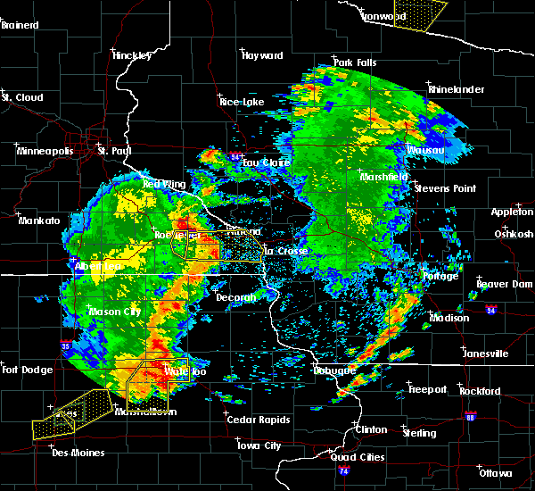 At 728 pm cdt, severe thunderstorms were located along a line extending from lewiston to near rushford to near spring grove, moving east at 50 mph (radar indicated). Hazards include 70 mph wind gusts. Expect considerable tree damage. damage is likely to mobile homes, roofs, and outbuildings. these severe storms will be near, houston around 735 pm cdt. dakota and hokah around 750 pm cdt. la crosse, la crescent and brownsville around 755 pm cdt. Other locations impacted by these severe thunderstorms include new hartford, rushford village, wilson, saratoga and mound prairie. At 728 pm cdt, severe thunderstorms were located along a line extending from lewiston to near rushford to near spring grove, moving east at 50 mph (radar indicated). Hazards include 70 mph wind gusts. Expect considerable tree damage. damage is likely to mobile homes, roofs, and outbuildings. these severe storms will be near, houston around 735 pm cdt. dakota and hokah around 750 pm cdt. la crosse, la crescent and brownsville around 755 pm cdt. Other locations impacted by these severe thunderstorms include new hartford, rushford village, wilson, saratoga and mound prairie.
|
| 6/30/2018 7:24 PM CDT |
 At 724 pm cdt, severe thunderstorms were located along a line extending from near st. charles to near rushford to 6 miles north of mabel, moving east at 55 mph (radar indicated). Hazards include 70 mph wind gusts. Expect considerable tree damage. damage is likely to mobile homes, roofs, and outbuildings. these severe storms will be near, caledonia and houston around 740 pm cdt. la crescent and dakota around 750 pm cdt. la crosse, brownsville and hokah around 755 pm cdt. Other locations impacted by these severe thunderstorms include new hartford, rushford village, wilson, saratoga and mound prairie. At 724 pm cdt, severe thunderstorms were located along a line extending from near st. charles to near rushford to 6 miles north of mabel, moving east at 55 mph (radar indicated). Hazards include 70 mph wind gusts. Expect considerable tree damage. damage is likely to mobile homes, roofs, and outbuildings. these severe storms will be near, caledonia and houston around 740 pm cdt. la crescent and dakota around 750 pm cdt. la crosse, brownsville and hokah around 755 pm cdt. Other locations impacted by these severe thunderstorms include new hartford, rushford village, wilson, saratoga and mound prairie.
|
| 6/30/2018 7:03 PM CDT |
 At 703 pm cdt, severe thunderstorms were located along a line extending from 6 miles southwest of eyota to fountain to 7 miles southwest of preston, moving east at 50 mph (trained weather spotters. wind damage has been reported across mower county, and the rochester airport gusted to 69 mph with these storms). Hazards include 70 mph wind gusts. Expect considerable tree damage. damage is likely to mobile homes, roofs, and outbuildings. severe thunderstorms will be near, lanesboro and st. charles around 715 pm cdt. rushford around 725 pm cdt. lewiston around 730 pm cdt. houston around 740 pm cdt. caledonia around 745 pm cdt. hokah around 750 pm cdt. la crescent and brownsville around 755 pm cdt. la crosse and dakota around 800 pm cdt. Other locations impacted by these severe thunderstorms include new hartford, rushford village, wilson, saratoga and mound prairie. At 703 pm cdt, severe thunderstorms were located along a line extending from 6 miles southwest of eyota to fountain to 7 miles southwest of preston, moving east at 50 mph (trained weather spotters. wind damage has been reported across mower county, and the rochester airport gusted to 69 mph with these storms). Hazards include 70 mph wind gusts. Expect considerable tree damage. damage is likely to mobile homes, roofs, and outbuildings. severe thunderstorms will be near, lanesboro and st. charles around 715 pm cdt. rushford around 725 pm cdt. lewiston around 730 pm cdt. houston around 740 pm cdt. caledonia around 745 pm cdt. hokah around 750 pm cdt. la crescent and brownsville around 755 pm cdt. la crosse and dakota around 800 pm cdt. Other locations impacted by these severe thunderstorms include new hartford, rushford village, wilson, saratoga and mound prairie.
|
| 5/25/2018 9:28 PM CDT |
 At 928 pm cdt, severe thunderstorms were located along a line extending from 6 miles southeast of lewiston to rushford to 6 miles southeast of lanesboro, moving east at 35 mph (radar indicated). Hazards include 60 mph wind gusts. Expect damage to roofs, siding, and trees. These severe thunderstorms will remain over mainly rural areas of southwestern winona and northeastern fillmore counties, including the following locations: rushford village, highland, hart, fremont and arendahl. At 928 pm cdt, severe thunderstorms were located along a line extending from 6 miles southeast of lewiston to rushford to 6 miles southeast of lanesboro, moving east at 35 mph (radar indicated). Hazards include 60 mph wind gusts. Expect damage to roofs, siding, and trees. These severe thunderstorms will remain over mainly rural areas of southwestern winona and northeastern fillmore counties, including the following locations: rushford village, highland, hart, fremont and arendahl.
|
| 5/25/2018 9:14 PM CDT |
 At 913 pm cdt, severe thunderstorms were located along a line extending from near lewiston to 9 miles southeast of st. charles to lanesboro, moving east at 35 mph (radar indicated). Hazards include 60 mph wind gusts. Expect damage to roofs, siding, and trees. these severe storms will be near, rushford around 930 pm cdt. Other locations impacted by these severe thunderstorms include rushford village, saratoga, highland, hart and fremont. At 913 pm cdt, severe thunderstorms were located along a line extending from near lewiston to 9 miles southeast of st. charles to lanesboro, moving east at 35 mph (radar indicated). Hazards include 60 mph wind gusts. Expect damage to roofs, siding, and trees. these severe storms will be near, rushford around 930 pm cdt. Other locations impacted by these severe thunderstorms include rushford village, saratoga, highland, hart and fremont.
|
| 5/25/2018 8:53 PM CDT |
 At 852 pm cdt, severe thunderstorms were located along a line extending from near eyota to near dover to near wykoff, moving east at 35 mph (law enforcement. wind gusts to 60 mph have been reported with these storms). Hazards include 60 mph wind gusts and penny size hail. Expect damage to roofs, siding, and trees. severe thunderstorms will be near, st. charles around 900 pm cdt. fountain around 905 pm cdt. lanesboro around 915 pm cdt. rushford around 925 pm cdt. Other locations impacted by these severe thunderstorms include fillmore, rushford village, saratoga, highland and hart. At 852 pm cdt, severe thunderstorms were located along a line extending from near eyota to near dover to near wykoff, moving east at 35 mph (law enforcement. wind gusts to 60 mph have been reported with these storms). Hazards include 60 mph wind gusts and penny size hail. Expect damage to roofs, siding, and trees. severe thunderstorms will be near, st. charles around 900 pm cdt. fountain around 905 pm cdt. lanesboro around 915 pm cdt. rushford around 925 pm cdt. Other locations impacted by these severe thunderstorms include fillmore, rushford village, saratoga, highland and hart.
|
| 7/19/2017 5:54 PM CDT |
 The severe thunderstorm warning for western winona, southeastern olmsted, south central wabasha and fillmore counties will expire at 600 pm cdt, the storms which prompted the warning have moved out of the area. therefore the warning will be allowed to expire. a severe thunderstorm watch remains in effect until 900 pm cdt for northeastern iowa, southeastern minnesota, and west central wisconsin. The severe thunderstorm warning for western winona, southeastern olmsted, south central wabasha and fillmore counties will expire at 600 pm cdt, the storms which prompted the warning have moved out of the area. therefore the warning will be allowed to expire. a severe thunderstorm watch remains in effect until 900 pm cdt for northeastern iowa, southeastern minnesota, and west central wisconsin.
|
| 7/19/2017 5:41 PM CDT |
 At 541 pm cdt, a severe squall line capable of producing both tornadoes and extensive straight line wind damage was located over lanesboro, or 7 miles northeast of preston, moving east at 45 mph (radar indicated rotation). Hazards include tornado. Flying debris will be dangerous to those caught without shelter. mobile homes will be damaged or destroyed. damage to roofs, windows, and vehicles will occur. tree damage is likely. This tornadic thunderstorm will remain over mainly rural areas of northeastern fillmore county, including the following locations: rushford village, whalan, old barn campground and isinours. At 541 pm cdt, a severe squall line capable of producing both tornadoes and extensive straight line wind damage was located over lanesboro, or 7 miles northeast of preston, moving east at 45 mph (radar indicated rotation). Hazards include tornado. Flying debris will be dangerous to those caught without shelter. mobile homes will be damaged or destroyed. damage to roofs, windows, and vehicles will occur. tree damage is likely. This tornadic thunderstorm will remain over mainly rural areas of northeastern fillmore county, including the following locations: rushford village, whalan, old barn campground and isinours.
|
| 7/19/2017 5:38 PM CDT |
 At 537 pm cdt, severe thunderstorms were located along a line extending from near lewiston to near harmony, moving east at 50 mph (trained weather spotters). Hazards include 70 mph wind gusts. Expect considerable tree damage. damage is likely to mobile homes, roofs, and outbuildings. these severe storms will be near, stockton around 540 pm cdt. houston around 555 pm cdt. spring grove around 600 pm cdt. dakota around 605 pm cdt. la crescent and hokah around 610 pm cdt. brownsville around 615 pm cdt. New albin around 620 pm cdt. At 537 pm cdt, severe thunderstorms were located along a line extending from near lewiston to near harmony, moving east at 50 mph (trained weather spotters). Hazards include 70 mph wind gusts. Expect considerable tree damage. damage is likely to mobile homes, roofs, and outbuildings. these severe storms will be near, stockton around 540 pm cdt. houston around 555 pm cdt. spring grove around 600 pm cdt. dakota around 605 pm cdt. la crescent and hokah around 610 pm cdt. brownsville around 615 pm cdt. New albin around 620 pm cdt.
|
| 7/19/2017 5:33 PM CDT |
 At 533 pm cdt, a severe thunderstorm capable of producing a tornado was located over fountain, or near preston, moving east at 45 mph (radar indicated rotation). Hazards include tornado. Flying debris will be dangerous to those caught without shelter. mobile homes will be damaged or destroyed. damage to roofs, windows, and vehicles will occur. tree damage is likely. this dangerous storm will be near, lanesboro around 540 pm cdt. Other locations impacted by this tornadic thunderstorm include rushford village, pilot mound, arendahl, peterson and whalan. At 533 pm cdt, a severe thunderstorm capable of producing a tornado was located over fountain, or near preston, moving east at 45 mph (radar indicated rotation). Hazards include tornado. Flying debris will be dangerous to those caught without shelter. mobile homes will be damaged or destroyed. damage to roofs, windows, and vehicles will occur. tree damage is likely. this dangerous storm will be near, lanesboro around 540 pm cdt. Other locations impacted by this tornadic thunderstorm include rushford village, pilot mound, arendahl, peterson and whalan.
|
| 7/19/2017 5:29 PM CDT |
 At 527 pm cdt, severe thunderstorms were located along a line extending from near lewiston to near lime springs, moving east at 50 mph (trained weather spotters. these storms have a history of winds in the 55 to 70 mph, trees downed, and power outage). Hazards include 70 mph wind gusts. Expect considerable tree damage. damage is likely to mobile homes, roofs, and outbuildings. these severe storms will be near, lewiston, stockton and rollingstone around 535 pm cdt. harmony and rushford around 540 pm cdt. canton around 545 pm cdt. Mabel around 555 pm cdt. At 527 pm cdt, severe thunderstorms were located along a line extending from near lewiston to near lime springs, moving east at 50 mph (trained weather spotters. these storms have a history of winds in the 55 to 70 mph, trees downed, and power outage). Hazards include 70 mph wind gusts. Expect considerable tree damage. damage is likely to mobile homes, roofs, and outbuildings. these severe storms will be near, lewiston, stockton and rollingstone around 535 pm cdt. harmony and rushford around 540 pm cdt. canton around 545 pm cdt. Mabel around 555 pm cdt.
|
| 7/19/2017 5:19 PM CDT |
 At 519 pm cdt, severe thunderstorms were located along a line extending from st. charles to near le roy, moving east at 50 mph (trained weather spotters). Hazards include 70 mph wind gusts. Expect considerable tree damage. damage is likely to mobile homes, roofs, and outbuildings. severe thunderstorms will be near, stockton around 535 pm cdt. winona around 540 pm cdt. houston around 550 pm cdt. dakota around 600 pm cdt. la crescent and hokah around 605 pm cdt. la crosse around 610 pm cdt. new albin around 625 pm cdt. Other locations impacted by these severe thunderstorms include new hartford, wilson, mound prairie, money creek and dresbach. At 519 pm cdt, severe thunderstorms were located along a line extending from st. charles to near le roy, moving east at 50 mph (trained weather spotters). Hazards include 70 mph wind gusts. Expect considerable tree damage. damage is likely to mobile homes, roofs, and outbuildings. severe thunderstorms will be near, stockton around 535 pm cdt. winona around 540 pm cdt. houston around 550 pm cdt. dakota around 600 pm cdt. la crescent and hokah around 605 pm cdt. la crosse around 610 pm cdt. new albin around 625 pm cdt. Other locations impacted by these severe thunderstorms include new hartford, wilson, mound prairie, money creek and dresbach.
|
| 7/19/2017 5:06 PM CDT |
 At 504 pm cdt, severe thunderstorms were located along a line extending from near elgin to near stewartville to adams, moving east at 50 mph (trained weather spotters reported 60 to 65 mph winds and numerous trees downed and power outages in dodge and olmsted county). Hazards include 70 mph wind gusts. Expect considerable tree damage. damage is likely to mobile homes, roofs, and outbuildings. these severe storms will be near, elgin around 510 pm cdt. plainview and eyota around 515 pm cdt. chatfield and dover around 520 pm cdt. st. charles and spring valley around 525 pm cdt. altura around 530 pm cdt. rollingstone around 535 pm cdt. stockton and lewiston around 540 pm cdt. Preston and rushford around 545 pm cdt. At 504 pm cdt, severe thunderstorms were located along a line extending from near elgin to near stewartville to adams, moving east at 50 mph (trained weather spotters reported 60 to 65 mph winds and numerous trees downed and power outages in dodge and olmsted county). Hazards include 70 mph wind gusts. Expect considerable tree damage. damage is likely to mobile homes, roofs, and outbuildings. these severe storms will be near, elgin around 510 pm cdt. plainview and eyota around 515 pm cdt. chatfield and dover around 520 pm cdt. st. charles and spring valley around 525 pm cdt. altura around 530 pm cdt. rollingstone around 535 pm cdt. stockton and lewiston around 540 pm cdt. Preston and rushford around 545 pm cdt.
|
| 7/19/2017 4:50 PM CDT |
 At 448 pm cdt, severe thunderstorms were located along a line extending from near oronoco to 6 miles south of byron to near lyle, moving east at 50 mph (law enforcement. wind damage reports have been received in dodge county with these storms. buildings have been damaged). Hazards include 70 mph wind gusts. Expect considerable tree damage. damage is likely to mobile homes, roofs, and outbuildings. severe thunderstorms will be near, rochester around 500 pm cdt. elgin around 505 pm cdt. eyota around 510 pm cdt. chatfield and plainview around 515 pm cdt. dover, spring valley and fountain around 520 pm cdt. st. charles around 525 pm cdt. lanesboro around 530 pm cdt. lewiston around 535 pm cdt. Other locations impacted by these severe thunderstorms include fillmore, marion, rushford village, pleasant grove and washington. At 448 pm cdt, severe thunderstorms were located along a line extending from near oronoco to 6 miles south of byron to near lyle, moving east at 50 mph (law enforcement. wind damage reports have been received in dodge county with these storms. buildings have been damaged). Hazards include 70 mph wind gusts. Expect considerable tree damage. damage is likely to mobile homes, roofs, and outbuildings. severe thunderstorms will be near, rochester around 500 pm cdt. elgin around 505 pm cdt. eyota around 510 pm cdt. chatfield and plainview around 515 pm cdt. dover, spring valley and fountain around 520 pm cdt. st. charles around 525 pm cdt. lanesboro around 530 pm cdt. lewiston around 535 pm cdt. Other locations impacted by these severe thunderstorms include fillmore, marion, rushford village, pleasant grove and washington.
|
| 6/22/2017 10:25 PM CDT |
 The severe thunderstorm warning for northeastern fillmore county will expire at 1030 pm cdt, the storm which prompted the warning has moved out of the area. therefore the warning will be allowed to expire. The severe thunderstorm warning for northeastern fillmore county will expire at 1030 pm cdt, the storm which prompted the warning has moved out of the area. therefore the warning will be allowed to expire.
|
| 6/22/2017 10:08 PM CDT |
 At 1007 pm cdt, a severe thunderstorm was located near lanesboro, or 10 miles east of preston, moving northeast at 35 mph (radar indicated). Hazards include quarter size hail. Damage to vehicles is expected. this severe storm will be near, rushford around 1020 pm cdt. Other locations impacted by this severe thunderstorm include rushford village, highland, peterson, whalan and bratsberg. At 1007 pm cdt, a severe thunderstorm was located near lanesboro, or 10 miles east of preston, moving northeast at 35 mph (radar indicated). Hazards include quarter size hail. Damage to vehicles is expected. this severe storm will be near, rushford around 1020 pm cdt. Other locations impacted by this severe thunderstorm include rushford village, highland, peterson, whalan and bratsberg.
|
| 6/22/2017 9:56 PM CDT |
 At 956 pm cdt, a severe thunderstorm was located near preston, moving northeast at 35 mph (radar indicated). Hazards include quarter size hail. Damage to vehicles is expected. this severe storm will be near, lanesboro around 1005 pm cdt. rushford around 1025 pm cdt. Other locations impacted by this severe thunderstorm include rushford village, highland, amherst, pilot mound and arendahl. At 956 pm cdt, a severe thunderstorm was located near preston, moving northeast at 35 mph (radar indicated). Hazards include quarter size hail. Damage to vehicles is expected. this severe storm will be near, lanesboro around 1005 pm cdt. rushford around 1025 pm cdt. Other locations impacted by this severe thunderstorm include rushford village, highland, amherst, pilot mound and arendahl.
|
| 6/22/2017 9:47 PM CDT |
 At 946 pm cdt, a severe thunderstorm was located near bristol, moving northeast at 35 mph (radar indicated). Hazards include quarter size hail. Damage to vehicles is expected. this severe thunderstorm will be near, harmony around 950 pm cdt. preston and fountain around 955 pm cdt. lanesboro around 1005 pm cdt. rushford around 1025 pm cdt. Other locations impacted by this severe thunderstorm include rushford village, highland, cherry grove, bristol and amherst. At 946 pm cdt, a severe thunderstorm was located near bristol, moving northeast at 35 mph (radar indicated). Hazards include quarter size hail. Damage to vehicles is expected. this severe thunderstorm will be near, harmony around 950 pm cdt. preston and fountain around 955 pm cdt. lanesboro around 1005 pm cdt. rushford around 1025 pm cdt. Other locations impacted by this severe thunderstorm include rushford village, highland, cherry grove, bristol and amherst.
|
| 6/16/2017 7:08 PM CDT |
 The severe thunderstorm warning for southwestern winona, northwestern houston and northeastern fillmore counties will expire at 715 pm cdt, the storm which prompted the warning has moved out of the area. therefore the warning will be allowed to expire. a severe thunderstorm watch remains in effect until 1000 pm cdt for southeastern minnesota. The severe thunderstorm warning for southwestern winona, northwestern houston and northeastern fillmore counties will expire at 715 pm cdt, the storm which prompted the warning has moved out of the area. therefore the warning will be allowed to expire. a severe thunderstorm watch remains in effect until 1000 pm cdt for southeastern minnesota.
|
| 6/16/2017 6:28 PM CDT |
 At 628 pm cdt, a severe thunderstorm was located near houston, or 8 miles northwest of caledonia, moving east at 20 mph (public reported multiple trees down in highland). Hazards include 70 mph wind gusts and quarter size hail. Hail damage to vehicles is expected. expect considerable tree damage. wind damage is also likely to mobile homes, roofs, and outbuildings. This severe thunderstorm will remain over mainly rural areas of southwestern winona, northwestern houston and northeastern fillmore counties, including the following locations: rushford village, money creek, highland, hart and fremont. At 628 pm cdt, a severe thunderstorm was located near houston, or 8 miles northwest of caledonia, moving east at 20 mph (public reported multiple trees down in highland). Hazards include 70 mph wind gusts and quarter size hail. Hail damage to vehicles is expected. expect considerable tree damage. wind damage is also likely to mobile homes, roofs, and outbuildings. This severe thunderstorm will remain over mainly rural areas of southwestern winona, northwestern houston and northeastern fillmore counties, including the following locations: rushford village, money creek, highland, hart and fremont.
|
| 6/16/2017 6:09 PM CDT |
 At 608 pm cdt, a severe thunderstorm was located 9 miles south of rushford, or 14 miles east of preston, moving east at 30 mph (public. there is a history of large hail and damaging winds with this storm). Hazards include 70 mph wind gusts and ping pong ball size hail. People and animals outdoors will be injured. expect hail damage to roofs, siding, windows, and vehicles. expect considerable tree damage. wind damage is also likely to mobile homes, roofs, and outbuildings. Locations impacted include, preston, rushford, lanesboro, fountain, rushford village, saratoga, money creek, highland, hart, fremont, pilot mound, arendahl, yucatan, troy, sheldon, peterson, whalan, choice, isinours and county roads 15 and 4. At 608 pm cdt, a severe thunderstorm was located 9 miles south of rushford, or 14 miles east of preston, moving east at 30 mph (public. there is a history of large hail and damaging winds with this storm). Hazards include 70 mph wind gusts and ping pong ball size hail. People and animals outdoors will be injured. expect hail damage to roofs, siding, windows, and vehicles. expect considerable tree damage. wind damage is also likely to mobile homes, roofs, and outbuildings. Locations impacted include, preston, rushford, lanesboro, fountain, rushford village, saratoga, money creek, highland, hart, fremont, pilot mound, arendahl, yucatan, troy, sheldon, peterson, whalan, choice, isinours and county roads 15 and 4.
|
| 6/16/2017 6:04 PM CDT |
 At 603 pm cdt, a severe thunderstorm was located over rushford, or 16 miles northwest of caledonia, moving east at 20 mph (public. there is history of large hail and damaging winds with this storm). Hazards include 70 mph wind gusts and ping pong ball size hail. People and animals outdoors will be injured. expect hail damage to roofs, siding, windows, and vehicles. expect considerable tree damage. wind damage is also likely to mobile homes, roofs, and outbuildings. Locations impacted include, preston, rushford, lanesboro, fountain, rushford village, saratoga, money creek, highland, hart, fremont, pilot mound, arendahl, yucatan, troy, sheldon, peterson, whalan, choice, isinours and county roads 15 and 4. At 603 pm cdt, a severe thunderstorm was located over rushford, or 16 miles northwest of caledonia, moving east at 20 mph (public. there is history of large hail and damaging winds with this storm). Hazards include 70 mph wind gusts and ping pong ball size hail. People and animals outdoors will be injured. expect hail damage to roofs, siding, windows, and vehicles. expect considerable tree damage. wind damage is also likely to mobile homes, roofs, and outbuildings. Locations impacted include, preston, rushford, lanesboro, fountain, rushford village, saratoga, money creek, highland, hart, fremont, pilot mound, arendahl, yucatan, troy, sheldon, peterson, whalan, choice, isinours and county roads 15 and 4.
|
| 6/16/2017 5:59 PM CDT |
 At 558 pm cdt, a severe thunderstorm was located over rushford, or 17 miles northeast of preston, moving east at 20 mph (public reported trees down in lanesboro at 556 pm). Hazards include ping pong ball size hail and 60 mph wind gusts. People and animals outdoors will be injured. expect hail damage to roofs, siding, windows, and vehicles. expect wind damage to roofs, siding, and trees. This severe thunderstorm will remain over mainly rural areas of southwestern winona, northwestern houston and northeastern fillmore counties, including the following locations: rushford village, saratoga, money creek, highland and hart. At 558 pm cdt, a severe thunderstorm was located over rushford, or 17 miles northeast of preston, moving east at 20 mph (public reported trees down in lanesboro at 556 pm). Hazards include ping pong ball size hail and 60 mph wind gusts. People and animals outdoors will be injured. expect hail damage to roofs, siding, windows, and vehicles. expect wind damage to roofs, siding, and trees. This severe thunderstorm will remain over mainly rural areas of southwestern winona, northwestern houston and northeastern fillmore counties, including the following locations: rushford village, saratoga, money creek, highland and hart.
|
| 6/16/2017 5:44 PM CDT |
 At 544 pm cdt, a severe thunderstorm was located 7 miles northeast of lanesboro, or 13 miles northeast of preston, moving east at 20 mph (public. this storm has a history of producing golf ball sized hail). Hazards include ping pong ball size hail and 60 mph wind gusts. People and animals outdoors will be injured. expect hail damage to roofs, siding, windows, and vehicles. expect wind damage to roofs, siding, and trees. this severe thunderstorm will be near, rushford around 610 pm cdt. Other locations impacted by this severe thunderstorm include rushford village, saratoga, money creek, highland and hart. At 544 pm cdt, a severe thunderstorm was located 7 miles northeast of lanesboro, or 13 miles northeast of preston, moving east at 20 mph (public. this storm has a history of producing golf ball sized hail). Hazards include ping pong ball size hail and 60 mph wind gusts. People and animals outdoors will be injured. expect hail damage to roofs, siding, windows, and vehicles. expect wind damage to roofs, siding, and trees. this severe thunderstorm will be near, rushford around 610 pm cdt. Other locations impacted by this severe thunderstorm include rushford village, saratoga, money creek, highland and hart.
|
| 6/16/2017 5:34 PM CDT |
 At 533 pm cdt, a severe thunderstorm was located near lanesboro, or 10 miles northeast of preston, moving northeast at 20 mph (public reported ping pong sized hail with this storm). Hazards include ping pong ball size hail and 60 mph wind gusts. People and animals outdoors will be injured. expect hail damage to roofs, siding, windows, and vehicles. expect wind damage to roofs, siding, and trees. this severe storm will be near, rushford around 545 pm cdt. Other locations impacted by this severe thunderstorm include rushford village, highland, pilot mound, arendahl and peterson. At 533 pm cdt, a severe thunderstorm was located near lanesboro, or 10 miles northeast of preston, moving northeast at 20 mph (public reported ping pong sized hail with this storm). Hazards include ping pong ball size hail and 60 mph wind gusts. People and animals outdoors will be injured. expect hail damage to roofs, siding, windows, and vehicles. expect wind damage to roofs, siding, and trees. this severe storm will be near, rushford around 545 pm cdt. Other locations impacted by this severe thunderstorm include rushford village, highland, pilot mound, arendahl and peterson.
|
| 6/16/2017 5:32 PM CDT |
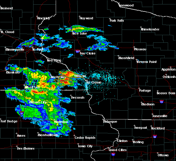 At 531 pm cdt, a severe thunderstorm was located near chatfield, or 10 miles north of preston, moving east at 25 mph (public has reported ping pong sized hail with this storm). Hazards include ping pong ball size hail and 60 mph wind gusts. People and animals outdoors will be injured. expect hail damage to roofs, siding, windows, and vehicles. expect wind damage to roofs, siding, and trees. This severe thunderstorm will remain over mainly rural areas of southwestern winona, southeastern olmsted and northeastern fillmore counties, including the following locations: rushford village, saratoga, fremont, pilot mound and arendahl. At 531 pm cdt, a severe thunderstorm was located near chatfield, or 10 miles north of preston, moving east at 25 mph (public has reported ping pong sized hail with this storm). Hazards include ping pong ball size hail and 60 mph wind gusts. People and animals outdoors will be injured. expect hail damage to roofs, siding, windows, and vehicles. expect wind damage to roofs, siding, and trees. This severe thunderstorm will remain over mainly rural areas of southwestern winona, southeastern olmsted and northeastern fillmore counties, including the following locations: rushford village, saratoga, fremont, pilot mound and arendahl.
|
| 6/16/2017 5:18 PM CDT |
 At 517 pm cdt, a severe thunderstorm was located over chatfield, or 15 miles northwest of preston, moving east at 25 mph (amateur radio reported ping pong sized hail 8 miles west of chatfield at 510 pm). Hazards include ping pong ball size hail and 60 mph wind gusts. People and animals outdoors will be injured. expect hail damage to roofs, siding, windows, and vehicles. expect wind damage to roofs, siding, and trees. this severe storm will be near, chatfield around 520 pm cdt. dover around 535 pm cdt. st. charles around 540 pm cdt. Other locations impacted by this severe thunderstorm include rushford village, saratoga, fremont, pilot mound and arendahl. At 517 pm cdt, a severe thunderstorm was located over chatfield, or 15 miles northwest of preston, moving east at 25 mph (amateur radio reported ping pong sized hail 8 miles west of chatfield at 510 pm). Hazards include ping pong ball size hail and 60 mph wind gusts. People and animals outdoors will be injured. expect hail damage to roofs, siding, windows, and vehicles. expect wind damage to roofs, siding, and trees. this severe storm will be near, chatfield around 520 pm cdt. dover around 535 pm cdt. st. charles around 540 pm cdt. Other locations impacted by this severe thunderstorm include rushford village, saratoga, fremont, pilot mound and arendahl.
|
| 6/16/2017 5:14 PM CDT |
 At 513 pm cdt, a severe thunderstorm was located near lanesboro, or 8 miles northeast of preston, moving east at 30 mph (public reported ping pong sized hail 3 miles northwest of wykoff at 456 pm). Hazards include ping pong ball size hail and 60 mph wind gusts. People and animals outdoors will be injured. expect hail damage to roofs, siding, windows, and vehicles. expect wind damage to roofs, siding, and trees. this severe storm will be near, rushford around 540 pm cdt. Other locations impacted by this severe thunderstorm include rushford village, highland, pilot mound, arendahl and carimona. At 513 pm cdt, a severe thunderstorm was located near lanesboro, or 8 miles northeast of preston, moving east at 30 mph (public reported ping pong sized hail 3 miles northwest of wykoff at 456 pm). Hazards include ping pong ball size hail and 60 mph wind gusts. People and animals outdoors will be injured. expect hail damage to roofs, siding, windows, and vehicles. expect wind damage to roofs, siding, and trees. this severe storm will be near, rushford around 540 pm cdt. Other locations impacted by this severe thunderstorm include rushford village, highland, pilot mound, arendahl and carimona.
|
| 6/16/2017 5:10 PM CDT |
 At 509 pm cdt, a severe thunderstorm was located near chatfield, or 15 miles southeast of rochester, moving east at 25 mph (radar indicated). Hazards include 60 mph wind gusts and quarter size hail. Hail damage to vehicles is expected. expect wind damage to roofs, siding, and trees. this severe storm will be near, chatfield around 515 pm cdt. dover around 530 pm cdt. st. charles around 535 pm cdt. Other locations impacted by this severe thunderstorm include rushford village, pleasant grove, washington, saratoga and fremont. At 509 pm cdt, a severe thunderstorm was located near chatfield, or 15 miles southeast of rochester, moving east at 25 mph (radar indicated). Hazards include 60 mph wind gusts and quarter size hail. Hail damage to vehicles is expected. expect wind damage to roofs, siding, and trees. this severe storm will be near, chatfield around 515 pm cdt. dover around 530 pm cdt. st. charles around 535 pm cdt. Other locations impacted by this severe thunderstorm include rushford village, pleasant grove, washington, saratoga and fremont.
|
| 6/16/2017 4:57 PM CDT |
 At 457 pm cdt, a severe thunderstorm was located near chatfield, or 13 miles southeast of rochester, moving east at 30 mph (radar indicated). Hazards include 60 mph wind gusts and quarter size hail. Hail damage to vehicles is expected. expect wind damage to roofs, siding, and trees. this severe thunderstorm will be near, chatfield around 505 pm cdt. dover around 520 pm cdt. st. charles around 525 pm cdt. Other locations impacted by this severe thunderstorm include rushford village, pleasant grove, washington, saratoga and fremont. At 457 pm cdt, a severe thunderstorm was located near chatfield, or 13 miles southeast of rochester, moving east at 30 mph (radar indicated). Hazards include 60 mph wind gusts and quarter size hail. Hail damage to vehicles is expected. expect wind damage to roofs, siding, and trees. this severe thunderstorm will be near, chatfield around 505 pm cdt. dover around 520 pm cdt. st. charles around 525 pm cdt. Other locations impacted by this severe thunderstorm include rushford village, pleasant grove, washington, saratoga and fremont.
|
| 6/16/2017 4:54 PM CDT |
 At 454 pm cdt, a severe thunderstorm was located over fountain, or near preston, moving east at 30 mph (radar indicated). Hazards include 60 mph wind gusts and quarter size hail. Hail damage to vehicles is expected. expect wind damage to roofs, siding, and trees. this severe thunderstorm will be near, preston around 500 pm cdt. lanesboro around 515 pm cdt. rushford around 540 pm cdt. Other locations impacted by this severe thunderstorm include fillmore, rushford village, highland, pilot mound and arendahl. At 454 pm cdt, a severe thunderstorm was located over fountain, or near preston, moving east at 30 mph (radar indicated). Hazards include 60 mph wind gusts and quarter size hail. Hail damage to vehicles is expected. expect wind damage to roofs, siding, and trees. this severe thunderstorm will be near, preston around 500 pm cdt. lanesboro around 515 pm cdt. rushford around 540 pm cdt. Other locations impacted by this severe thunderstorm include fillmore, rushford village, highland, pilot mound and arendahl.
|
| 6/12/2017 3:04 PM CDT |
 At 303 pm cdt, a severe thunderstorm was located near lanesboro, or 11 miles northeast of preston, moving east at 25 mph (public). Hazards include 60 mph wind gusts and quarter size hail. Hail damage to vehicles is expected. expect wind damage to roofs, siding, and trees. Locations impacted include, preston, lanesboro, rushford village, saratoga, highland, pilot mound, arendahl, troy, peterson, whalan, isinours, old barn campground and highway 30 and county 74. At 303 pm cdt, a severe thunderstorm was located near lanesboro, or 11 miles northeast of preston, moving east at 25 mph (public). Hazards include 60 mph wind gusts and quarter size hail. Hail damage to vehicles is expected. expect wind damage to roofs, siding, and trees. Locations impacted include, preston, lanesboro, rushford village, saratoga, highland, pilot mound, arendahl, troy, peterson, whalan, isinours, old barn campground and highway 30 and county 74.
|
| 6/12/2017 2:53 PM CDT |
 At 252 pm cdt, a severe thunderstorm was located near lanesboro, or 7 miles northeast of preston, moving east at 25 mph (public. at around 240 pm cdt, quarter size hail was reported in chatfield). Hazards include 60 mph wind gusts and quarter size hail. Hail damage to vehicles is expected. expect wind damage to roofs, siding, and trees. This severe thunderstorm will remain over mainly rural areas of southwestern winona, southeastern olmsted and northeastern fillmore counties, including the following locations: rushford village, saratoga, highland, pilot mound and arendahl. At 252 pm cdt, a severe thunderstorm was located near lanesboro, or 7 miles northeast of preston, moving east at 25 mph (public. at around 240 pm cdt, quarter size hail was reported in chatfield). Hazards include 60 mph wind gusts and quarter size hail. Hail damage to vehicles is expected. expect wind damage to roofs, siding, and trees. This severe thunderstorm will remain over mainly rural areas of southwestern winona, southeastern olmsted and northeastern fillmore counties, including the following locations: rushford village, saratoga, highland, pilot mound and arendahl.
|
| 6/12/2017 2:33 PM CDT |
 At 233 pm cdt, a severe thunderstorm was located over fountain, or 7 miles northwest of preston, moving east at 25 mph (radar indicated). Hazards include 60 mph wind gusts and half dollar size hail. Hail damage to vehicles is expected. expect wind damage to roofs, siding, and trees. this severe thunderstorm will be near, preston around 240 pm cdt. lanesboro around 300 pm cdt. Other locations impacted by this severe thunderstorm include fillmore, rushford village, saratoga, highland and pilot mound. At 233 pm cdt, a severe thunderstorm was located over fountain, or 7 miles northwest of preston, moving east at 25 mph (radar indicated). Hazards include 60 mph wind gusts and half dollar size hail. Hail damage to vehicles is expected. expect wind damage to roofs, siding, and trees. this severe thunderstorm will be near, preston around 240 pm cdt. lanesboro around 300 pm cdt. Other locations impacted by this severe thunderstorm include fillmore, rushford village, saratoga, highland and pilot mound.
|
| 5/17/2017 7:25 PM CDT |
 The severe thunderstorm warning for winneshiek and eastern fillmore counties will expire at 730 pm cdt, the storm which prompted the warning has moved out of the area. therefore the warning will be allowed to expire. a tornado watch remains in effect until 1100 pm cdt for northeastern iowa, and southeastern minnesota. The severe thunderstorm warning for winneshiek and eastern fillmore counties will expire at 730 pm cdt, the storm which prompted the warning has moved out of the area. therefore the warning will be allowed to expire. a tornado watch remains in effect until 1100 pm cdt for northeastern iowa, and southeastern minnesota.
|
| 5/17/2017 7:13 PM CDT |
 At 712 pm cdt, a severe thunderstorm was located near lanesboro, or 10 miles east of preston, moving northeast at 35 mph (trained weather spotters. this storm has a history of damaging winds). Hazards include 70 mph wind gusts. Expect considerable tree damage. damage is likely to mobile homes, roofs, and outbuildings. this severe storm will be near, rushford around 730 pm cdt. other locations impacted by this severe thunderstorm include rushford village, highland, newburg, amherst and pilot mound. A tornado watch remains in effect until 1100 pm cdt for northeastern iowa, and southeastern minnesota. At 712 pm cdt, a severe thunderstorm was located near lanesboro, or 10 miles east of preston, moving northeast at 35 mph (trained weather spotters. this storm has a history of damaging winds). Hazards include 70 mph wind gusts. Expect considerable tree damage. damage is likely to mobile homes, roofs, and outbuildings. this severe storm will be near, rushford around 730 pm cdt. other locations impacted by this severe thunderstorm include rushford village, highland, newburg, amherst and pilot mound. A tornado watch remains in effect until 1100 pm cdt for northeastern iowa, and southeastern minnesota.
|
| 5/17/2017 6:49 PM CDT |
 At 649 pm cdt, a severe thunderstorm was located 7 miles northeast of cresco, moving north at 60 mph (trained weather spotters reported 70 mph winds in ridgeway). Hazards include 70 mph wind gusts. Expect considerable tree damage. damage is likely to mobile homes, roofs, and outbuildings. this severe storm will be near, canton and mabel around 655 pm cdt. harmony around 700 pm cdt. preston around 705 pm cdt. lanesboro around 710 pm cdt. rushford around 720 pm cdt. other locations impacted by this severe thunderstorm include rushford village, highland, newburg, amherst and pilot mound. A tornado watch remains in effect until 1100 pm cdt for northeastern iowa, and southeastern minnesota. At 649 pm cdt, a severe thunderstorm was located 7 miles northeast of cresco, moving north at 60 mph (trained weather spotters reported 70 mph winds in ridgeway). Hazards include 70 mph wind gusts. Expect considerable tree damage. damage is likely to mobile homes, roofs, and outbuildings. this severe storm will be near, canton and mabel around 655 pm cdt. harmony around 700 pm cdt. preston around 705 pm cdt. lanesboro around 710 pm cdt. rushford around 720 pm cdt. other locations impacted by this severe thunderstorm include rushford village, highland, newburg, amherst and pilot mound. A tornado watch remains in effect until 1100 pm cdt for northeastern iowa, and southeastern minnesota.
|
| 5/17/2017 6:44 PM CDT |
 At 644 pm cdt, a severe thunderstorm was located near ridgeway, or near cresco, moving north at 60 mph (radar indicated). Hazards include 70 mph wind gusts. Expect considerable tree damage. damage is likely to mobile homes, roofs, and outbuildings. this severe thunderstorm will be near, canton around 655 pm cdt. harmony and mabel around 700 pm cdt. preston around 705 pm cdt. lanesboro around 710 pm cdt. rushford around 720 pm cdt. other locations impacted by this severe thunderstorm include rushford village, highland, newburg, amherst and pilot mound. A tornado watch remains in effect until 1100 pm cdt for northeastern iowa, and southeastern minnesota. At 644 pm cdt, a severe thunderstorm was located near ridgeway, or near cresco, moving north at 60 mph (radar indicated). Hazards include 70 mph wind gusts. Expect considerable tree damage. damage is likely to mobile homes, roofs, and outbuildings. this severe thunderstorm will be near, canton around 655 pm cdt. harmony and mabel around 700 pm cdt. preston around 705 pm cdt. lanesboro around 710 pm cdt. rushford around 720 pm cdt. other locations impacted by this severe thunderstorm include rushford village, highland, newburg, amherst and pilot mound. A tornado watch remains in effect until 1100 pm cdt for northeastern iowa, and southeastern minnesota.
|
| 5/17/2017 4:29 PM CDT |
 At 429 pm cdt, a severe thunderstorm was located over houston, or 8 miles northwest of caledonia, moving northeast at 40 mph (radar indicated). Hazards include 60 mph wind gusts and quarter size hail. Hail damage to vehicles is expected. expect wind damage to roofs, siding, and trees. this severe thunderstorm will remain over mainly rural areas of western houston and eastern fillmore counties, including the following locations: rushford village, mound prairie, money creek, highland and newburg. A tornado watch remains in effect until 1100 pm cdt for northeastern iowa, and southeastern minnesota. At 429 pm cdt, a severe thunderstorm was located over houston, or 8 miles northwest of caledonia, moving northeast at 40 mph (radar indicated). Hazards include 60 mph wind gusts and quarter size hail. Hail damage to vehicles is expected. expect wind damage to roofs, siding, and trees. this severe thunderstorm will remain over mainly rural areas of western houston and eastern fillmore counties, including the following locations: rushford village, mound prairie, money creek, highland and newburg. A tornado watch remains in effect until 1100 pm cdt for northeastern iowa, and southeastern minnesota.
|
| 5/17/2017 4:12 PM CDT |
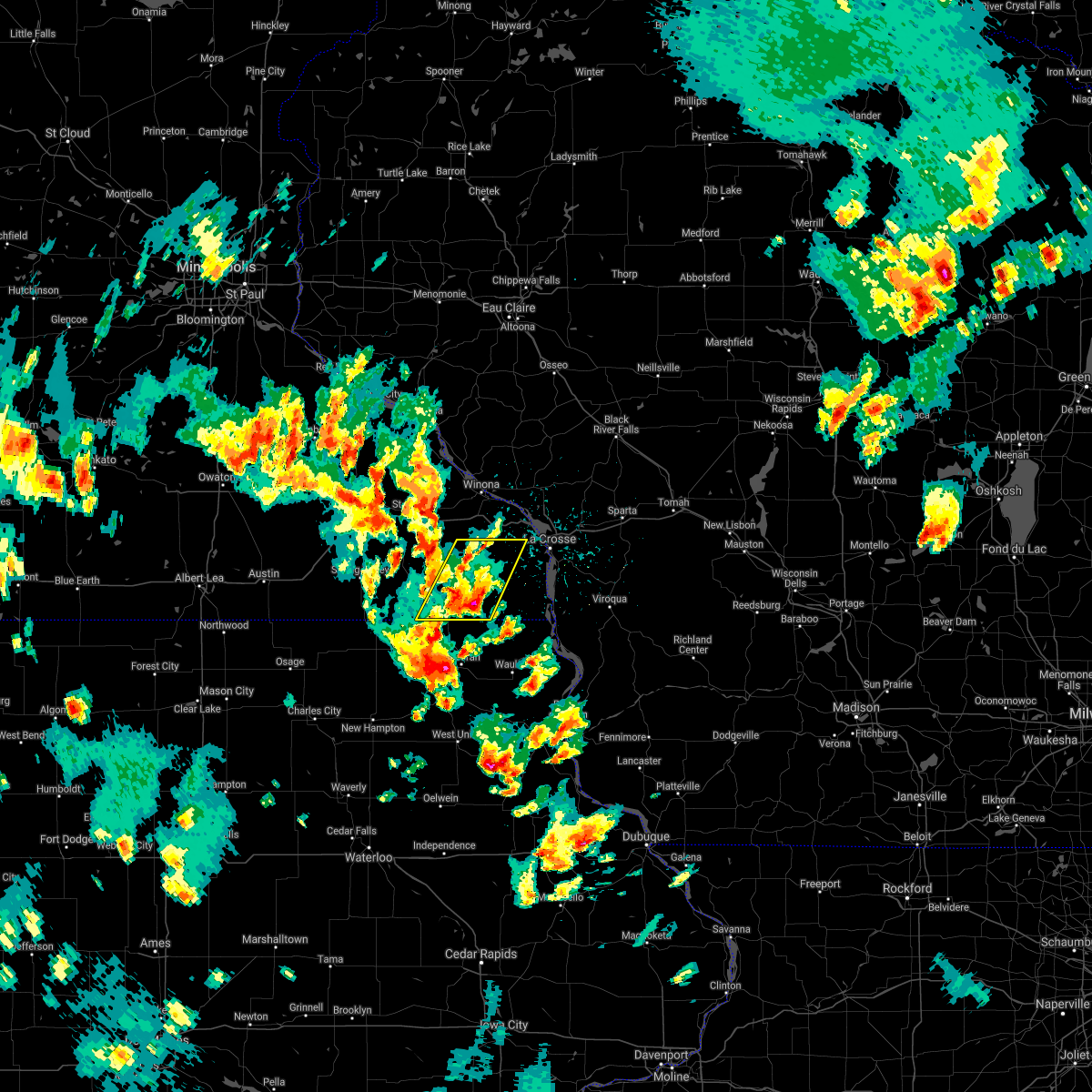 At 412 pm cdt, a severe thunderstorm was located over spring grove, or 10 miles west of caledonia, moving northeast at 40 mph (radar indicated). Hazards include 60 mph wind gusts and quarter size hail. Hail damage to vehicles is expected. expect wind damage to roofs, siding, and trees. this severe thunderstorm will be near, houston and rushford around 435 pm cdt. other locations impacted by this severe thunderstorm include rushford village, mound prairie, money creek, highland and newburg. A tornado watch remains in effect until 1100 pm cdt for northeastern iowa, and southeastern minnesota. At 412 pm cdt, a severe thunderstorm was located over spring grove, or 10 miles west of caledonia, moving northeast at 40 mph (radar indicated). Hazards include 60 mph wind gusts and quarter size hail. Hail damage to vehicles is expected. expect wind damage to roofs, siding, and trees. this severe thunderstorm will be near, houston and rushford around 435 pm cdt. other locations impacted by this severe thunderstorm include rushford village, mound prairie, money creek, highland and newburg. A tornado watch remains in effect until 1100 pm cdt for northeastern iowa, and southeastern minnesota.
|
| 5/16/2017 11:33 PM CDT |
 At 1133 pm cdt, severe thunderstorms were located along a line extending from 6 miles southeast of spring valley to 6 miles southwest of harmony, moving northeast at 45 mph (law enforcement. these storms have had a history of producing wind damage and gusts to 60 mph in northeast iowa). Hazards include 60 mph wind gusts. Expect damage to roofs, siding, and trees. these severe storms will be near, preston and wykoff around 1145 pm cdt. fountain around 1150 pm cdt. lanesboro and chatfield around 1155 pm cdt. Other locations impacted by these severe thunderstorms include fillmore, rushford village, washington, cherry grove and bristol. At 1133 pm cdt, severe thunderstorms were located along a line extending from 6 miles southeast of spring valley to 6 miles southwest of harmony, moving northeast at 45 mph (law enforcement. these storms have had a history of producing wind damage and gusts to 60 mph in northeast iowa). Hazards include 60 mph wind gusts. Expect damage to roofs, siding, and trees. these severe storms will be near, preston and wykoff around 1145 pm cdt. fountain around 1150 pm cdt. lanesboro and chatfield around 1155 pm cdt. Other locations impacted by these severe thunderstorms include fillmore, rushford village, washington, cherry grove and bristol.
|
| 5/16/2017 11:12 PM CDT |
 At 1111 pm cdt, severe thunderstorms were located along a line extending from near riceville to 8 miles northeast of elma, moving northeast at 50 mph (law enforcement. these storms have had a history of producing wind damage and gusts to 60 mph in northeast iowa). Hazards include 60 mph wind gusts and nickel size hail. Expect damage to roofs, siding, and trees. severe thunderstorms will be near, spring valley around 1135 pm cdt. wykoff around 1140 pm cdt. preston and fountain around 1145 pm cdt. lanesboro and chatfield around 1150 pm cdt. Other locations impacted by these severe thunderstorms include fillmore, rushford village, washington, cherry grove and bristol. At 1111 pm cdt, severe thunderstorms were located along a line extending from near riceville to 8 miles northeast of elma, moving northeast at 50 mph (law enforcement. these storms have had a history of producing wind damage and gusts to 60 mph in northeast iowa). Hazards include 60 mph wind gusts and nickel size hail. Expect damage to roofs, siding, and trees. severe thunderstorms will be near, spring valley around 1135 pm cdt. wykoff around 1140 pm cdt. preston and fountain around 1145 pm cdt. lanesboro and chatfield around 1150 pm cdt. Other locations impacted by these severe thunderstorms include fillmore, rushford village, washington, cherry grove and bristol.
|
| 5/15/2017 11:02 PM CDT |
 At 1102 pm cdt, a severe thunderstorm was located near rushford, or 12 miles northwest of caledonia, moving east at 25 mph (radar indicated). Hazards include quarter size hail. Damage to vehicles is expected. this severe storm will be near, houston and hokah around 1115 pm cdt. Other locations impacted by this severe thunderstorm include new hartford, rushford village, mound prairie, money creek and dresbach. At 1102 pm cdt, a severe thunderstorm was located near rushford, or 12 miles northwest of caledonia, moving east at 25 mph (radar indicated). Hazards include quarter size hail. Damage to vehicles is expected. this severe storm will be near, houston and hokah around 1115 pm cdt. Other locations impacted by this severe thunderstorm include new hartford, rushford village, mound prairie, money creek and dresbach.
|
| 5/15/2017 10:54 PM CDT |
 At 1053 pm cdt, a severe thunderstorm was located near houston, or 14 miles northwest of caledonia, moving east at 45 mph (radar indicated). Hazards include ping pong ball size hail. People and animals outdoors will be injured. expect damage to roofs, siding, windows, and vehicles. this severe storm will be near, hokah around 1110 pm cdt. Other locations impacted by this severe thunderstorm include new hartford, rushford village, mound prairie, money creek and dresbach. At 1053 pm cdt, a severe thunderstorm was located near houston, or 14 miles northwest of caledonia, moving east at 45 mph (radar indicated). Hazards include ping pong ball size hail. People and animals outdoors will be injured. expect damage to roofs, siding, windows, and vehicles. this severe storm will be near, hokah around 1110 pm cdt. Other locations impacted by this severe thunderstorm include new hartford, rushford village, mound prairie, money creek and dresbach.
|
| 5/15/2017 10:48 PM CDT |
 At 1047 pm cdt, a severe thunderstorm was located over rushford, or 16 miles northwest of caledonia, moving east at 45 mph (radar indicated). Hazards include ping pong ball size hail. People and animals outdoors will be injured. expect damage to roofs, siding, windows, and vehicles. this severe storm will be near, houston around 1100 pm cdt. hokah around 1110 pm cdt. Other locations impacted by this severe thunderstorm include new hartford, rushford village, mound prairie, money creek and highland. At 1047 pm cdt, a severe thunderstorm was located over rushford, or 16 miles northwest of caledonia, moving east at 45 mph (radar indicated). Hazards include ping pong ball size hail. People and animals outdoors will be injured. expect damage to roofs, siding, windows, and vehicles. this severe storm will be near, houston around 1100 pm cdt. hokah around 1110 pm cdt. Other locations impacted by this severe thunderstorm include new hartford, rushford village, mound prairie, money creek and highland.
|
| 5/15/2017 10:42 PM CDT |
 At 1042 pm cdt, a severe thunderstorm was located near rushford, or 14 miles northeast of preston, moving east at 25 mph (radar indicated). Hazards include half dollar size hail. Damage to vehicles is expected. this severe storm will be near, rushford around 1050 pm cdt. houston around 1110 pm cdt. Hokah around 1115 pm cdt. At 1042 pm cdt, a severe thunderstorm was located near rushford, or 14 miles northeast of preston, moving east at 25 mph (radar indicated). Hazards include half dollar size hail. Damage to vehicles is expected. this severe storm will be near, rushford around 1050 pm cdt. houston around 1110 pm cdt. Hokah around 1115 pm cdt.
|
| 5/15/2017 10:34 PM CDT |
 At 1034 pm cdt, a severe thunderstorm was located near rushford, or 13 miles south of winona, moving northeast at 45 mph (radar indicated). Hazards include quarter size hail. Damage to vehicles is expected. this severe storm will be near, houston around 1040 pm cdt. Other locations impacted by this severe thunderstorm include new hartford, rushford village, mound prairie, money creek and highland. At 1034 pm cdt, a severe thunderstorm was located near rushford, or 13 miles south of winona, moving northeast at 45 mph (radar indicated). Hazards include quarter size hail. Damage to vehicles is expected. this severe storm will be near, houston around 1040 pm cdt. Other locations impacted by this severe thunderstorm include new hartford, rushford village, mound prairie, money creek and highland.
|
| 5/15/2017 10:27 PM CDT |
 At 1027 pm cdt, a severe thunderstorm was located over rushford, or 17 miles south of winona, moving east at 45 mph (radar indicated). Hazards include quarter size hail. Damage to vehicles is expected. this severe storm will be near, houston around 1035 pm cdt. hokah around 1050 pm cdt. la crescent and dakota around 1055 pm cdt. la crosse around 1100 pm cdt. Other locations impacted by this severe thunderstorm include new hartford, rushford village, mound prairie, money creek and highland. At 1027 pm cdt, a severe thunderstorm was located over rushford, or 17 miles south of winona, moving east at 45 mph (radar indicated). Hazards include quarter size hail. Damage to vehicles is expected. this severe storm will be near, houston around 1035 pm cdt. hokah around 1050 pm cdt. la crescent and dakota around 1055 pm cdt. la crosse around 1100 pm cdt. Other locations impacted by this severe thunderstorm include new hartford, rushford village, mound prairie, money creek and highland.
|
| 5/15/2017 10:18 PM CDT |
 At 1018 pm cdt, a severe thunderstorm was located near lanesboro, or 11 miles northeast of preston, moving east at 45 mph (radar indicated). Hazards include quarter size hail. Damage to vehicles is expected. this severe storm will be near, rushford around 1025 pm cdt. houston around 1040 pm cdt. hokah around 1050 pm cdt. Other locations impacted by this severe thunderstorm include new hartford, rushford village, mound prairie, money creek and highland. At 1018 pm cdt, a severe thunderstorm was located near lanesboro, or 11 miles northeast of preston, moving east at 45 mph (radar indicated). Hazards include quarter size hail. Damage to vehicles is expected. this severe storm will be near, rushford around 1025 pm cdt. houston around 1040 pm cdt. hokah around 1050 pm cdt. Other locations impacted by this severe thunderstorm include new hartford, rushford village, mound prairie, money creek and highland.
|
| 5/15/2017 10:08 PM CDT |
 At 1007 pm cdt, a severe thunderstorm was located near fountain, or near preston, moving east at 45 mph (radar indicated). Hazards include quarter size hail. Damage to vehicles is expected. this severe thunderstorm will be near, rushford around 1030 pm cdt. houston around 1040 pm cdt. hokah around 1050 pm cdt. Other locations impacted by this severe thunderstorm include new hartford, rushford village, mound prairie, money creek and highland. At 1007 pm cdt, a severe thunderstorm was located near fountain, or near preston, moving east at 45 mph (radar indicated). Hazards include quarter size hail. Damage to vehicles is expected. this severe thunderstorm will be near, rushford around 1030 pm cdt. houston around 1040 pm cdt. hokah around 1050 pm cdt. Other locations impacted by this severe thunderstorm include new hartford, rushford village, mound prairie, money creek and highland.
|
| 4/9/2017 10:54 PM CDT |
 At 1054 pm cdt, a severe thunderstorm was located over lanesboro, or near preston, moving northeast at 55 mph (radar indicated). Hazards include quarter size hail. Damage to vehicles is expected. This severe thunderstorm will remain over mainly rural areas of fillmore county, including the following locations: fillmore, rushford village, washington, cherry grove and pilot mound. At 1054 pm cdt, a severe thunderstorm was located over lanesboro, or near preston, moving northeast at 55 mph (radar indicated). Hazards include quarter size hail. Damage to vehicles is expected. This severe thunderstorm will remain over mainly rural areas of fillmore county, including the following locations: fillmore, rushford village, washington, cherry grove and pilot mound.
|
| 4/9/2017 10:43 PM CDT |
 At 1042 pm cdt, a severe thunderstorm was located over wykoff, or 7 miles west of preston, moving northeast at 50 mph (radar indicated). Hazards include quarter size hail. Damage to vehicles is expected. this severe storm will be near, chatfield around 1050 pm cdt. lanesboro around 1055 pm cdt. rushford around 1100 pm cdt. Other locations impacted by this severe thunderstorm include fillmore, rushford village, washington, cherry grove and pilot mound. At 1042 pm cdt, a severe thunderstorm was located over wykoff, or 7 miles west of preston, moving northeast at 50 mph (radar indicated). Hazards include quarter size hail. Damage to vehicles is expected. this severe storm will be near, chatfield around 1050 pm cdt. lanesboro around 1055 pm cdt. rushford around 1100 pm cdt. Other locations impacted by this severe thunderstorm include fillmore, rushford village, washington, cherry grove and pilot mound.
|
| 4/9/2017 10:26 PM CDT |
 At 1026 pm cdt, a severe thunderstorm was located near le roy, or 17 miles west of preston, moving northeast at 45 mph (radar indicated). Hazards include ping pong ball size hail. People and animals outdoors will be injured. expect damage to roofs, siding, windows, and vehicles. this severe storm will be near, spring valley around 1030 pm cdt. wykoff around 1040 pm cdt. preston, fountain and chatfield around 1050 pm cdt. lanesboro around 1055 pm cdt. rushford around 1100 pm cdt. Other locations impacted by this severe thunderstorm include fillmore, rushford village, washington, racine and cherry grove. At 1026 pm cdt, a severe thunderstorm was located near le roy, or 17 miles west of preston, moving northeast at 45 mph (radar indicated). Hazards include ping pong ball size hail. People and animals outdoors will be injured. expect damage to roofs, siding, windows, and vehicles. this severe storm will be near, spring valley around 1030 pm cdt. wykoff around 1040 pm cdt. preston, fountain and chatfield around 1050 pm cdt. lanesboro around 1055 pm cdt. rushford around 1100 pm cdt. Other locations impacted by this severe thunderstorm include fillmore, rushford village, washington, racine and cherry grove.
|
| 4/9/2017 10:15 PM CDT |
 At 1015 pm cdt, a severe thunderstorm was located near le roy, or 22 miles west of preston, moving northeast at 55 mph (radar indicated). Hazards include ping pong ball size hail. People and animals outdoors will be injured. expect damage to roofs, siding, windows, and vehicles. this severe thunderstorm will be near, spring valley around 1025 pm cdt. wykoff around 1030 pm cdt. preston, fountain and chatfield around 1040 pm cdt. lanesboro around 1045 pm cdt. rushford around 1100 pm cdt. Other locations impacted by this severe thunderstorm include fillmore, rushford village, washington, racine and cherry grove. At 1015 pm cdt, a severe thunderstorm was located near le roy, or 22 miles west of preston, moving northeast at 55 mph (radar indicated). Hazards include ping pong ball size hail. People and animals outdoors will be injured. expect damage to roofs, siding, windows, and vehicles. this severe thunderstorm will be near, spring valley around 1025 pm cdt. wykoff around 1030 pm cdt. preston, fountain and chatfield around 1040 pm cdt. lanesboro around 1045 pm cdt. rushford around 1100 pm cdt. Other locations impacted by this severe thunderstorm include fillmore, rushford village, washington, racine and cherry grove.
|
| 3/6/2017 8:16 PM CST |
 At 814 pm cst, severe thunderstorms were located along a line extending from near rushford to near spring grove, moving northeast at 55 mph (law enforcement. small hail covering the ground in harmony was reported at 745 pm. winds in the 50 to 55 mph range were also reported there). Hazards include 60 mph wind gusts and half dollar size hail. Hail damage to vehicles is expected. expect wind damage to roofs, siding, and trees. these severe storms will be near, houston around 820 pm cst. caledonia around 825 pm cst. la crescent, dakota and new albin around 830 pm cst. brownsville and hokah around 840 pm cst. other locations impacted by these severe thunderstorms include new hartford, mound prairie, money creek, dresbach and wilmington. A tornado watch also remains in effect until 1000 pm cst for southeastern minnesota. At 814 pm cst, severe thunderstorms were located along a line extending from near rushford to near spring grove, moving northeast at 55 mph (law enforcement. small hail covering the ground in harmony was reported at 745 pm. winds in the 50 to 55 mph range were also reported there). Hazards include 60 mph wind gusts and half dollar size hail. Hail damage to vehicles is expected. expect wind damage to roofs, siding, and trees. these severe storms will be near, houston around 820 pm cst. caledonia around 825 pm cst. la crescent, dakota and new albin around 830 pm cst. brownsville and hokah around 840 pm cst. other locations impacted by these severe thunderstorms include new hartford, mound prairie, money creek, dresbach and wilmington. A tornado watch also remains in effect until 1000 pm cst for southeastern minnesota.
|
| 3/6/2017 8:01 PM CST |
 At 759 pm cst, severe thunderstorms were located along a line extending from near lanesboro to near canton, moving northeast at 55 mph (law enforcement. in harmony, 56 mph winds were reported at 747 pm). Hazards include 60 mph wind gusts and nickel size hail. Expect damage to roofs, siding, and trees. severe thunderstorms will be near, spring grove around 805 pm cst. rushford around 810 pm cst. houston around 820 pm cst. la crescent, la crosse and dakota around 835 pm cst. other locations impacted by these severe thunderstorms include new hartford, rushford village, mound prairie, money creek and dresbach. a tornado watch remains in effect until 1000 pm cst for northeastern iowa. A tornado watch also remains in effect until 1000 pm cst for southeastern minnesota. At 759 pm cst, severe thunderstorms were located along a line extending from near lanesboro to near canton, moving northeast at 55 mph (law enforcement. in harmony, 56 mph winds were reported at 747 pm). Hazards include 60 mph wind gusts and nickel size hail. Expect damage to roofs, siding, and trees. severe thunderstorms will be near, spring grove around 805 pm cst. rushford around 810 pm cst. houston around 820 pm cst. la crescent, la crosse and dakota around 835 pm cst. other locations impacted by these severe thunderstorms include new hartford, rushford village, mound prairie, money creek and dresbach. a tornado watch remains in effect until 1000 pm cst for northeastern iowa. A tornado watch also remains in effect until 1000 pm cst for southeastern minnesota.
|
| 3/6/2017 7:40 PM CST |
 At 737 pm cst, severe thunderstorms were located along a line extending from near chatfield to near lawler, moving east at 50 mph (law enforcement. these storms have a history of producing wind damage in northeast iowa, north of charles city iowa). Hazards include 60 mph wind gusts and penny size hail. Expect damage to roofs, siding, and trees. these severe storms will be near, preston, fountain and chatfield around 740 pm cst. lanesboro around 745 pm cst. ridgeway around 750 pm cst. rushford around 800 pm cst. the most intense portion of the storms is near lime springs and moving northeast toward southern minnesota and southern fillmore county. a tornado watch remains in effect until 1000 pm cst for northeastern iowa. A tornado watch also remains in effect until 1000 pm cst for southeastern minnesota. At 737 pm cst, severe thunderstorms were located along a line extending from near chatfield to near lawler, moving east at 50 mph (law enforcement. these storms have a history of producing wind damage in northeast iowa, north of charles city iowa). Hazards include 60 mph wind gusts and penny size hail. Expect damage to roofs, siding, and trees. these severe storms will be near, preston, fountain and chatfield around 740 pm cst. lanesboro around 745 pm cst. ridgeway around 750 pm cst. rushford around 800 pm cst. the most intense portion of the storms is near lime springs and moving northeast toward southern minnesota and southern fillmore county. a tornado watch remains in effect until 1000 pm cst for northeastern iowa. A tornado watch also remains in effect until 1000 pm cst for southeastern minnesota.
|
| 3/6/2017 7:37 PM CST |
 At 721 pm cst, severe thunderstorms were located along a line extending from near stewartville to near elma iowa and into ionia, moving northeast at 70 mph (law enforcement has reported isolated pockets of large hail and winds to 70 mph over the past hour with these storms). Hazards include 70 mph wind gusts and quarter size hail. Hail damage to vehicles is expected. expect considerable tree damage. wind damage is also likely to mobile homes, roofs, and outbuildings. these severe storms will be near, chatfield around 725 pm cst. protivin around 735 pm cst. cresco, lime springs and ridgeway around 740 pm cst. canton and harmony around 750 pm cst. lanesboro around 800 pm cst. rushford around 810 pm cst. most can expect to see 50 mph winds, however pockets of very strong winds can develop anywhere on this line of storms. seek shelter as storms approach. a tornado watch remains in effect until 1000 pm cst for northeastern iowa. A tornado watch also remains in effect until 1000 pm cst for southeastern minnesota. At 721 pm cst, severe thunderstorms were located along a line extending from near stewartville to near elma iowa and into ionia, moving northeast at 70 mph (law enforcement has reported isolated pockets of large hail and winds to 70 mph over the past hour with these storms). Hazards include 70 mph wind gusts and quarter size hail. Hail damage to vehicles is expected. expect considerable tree damage. wind damage is also likely to mobile homes, roofs, and outbuildings. these severe storms will be near, chatfield around 725 pm cst. protivin around 735 pm cst. cresco, lime springs and ridgeway around 740 pm cst. canton and harmony around 750 pm cst. lanesboro around 800 pm cst. rushford around 810 pm cst. most can expect to see 50 mph winds, however pockets of very strong winds can develop anywhere on this line of storms. seek shelter as storms approach. a tornado watch remains in effect until 1000 pm cst for northeastern iowa. A tornado watch also remains in effect until 1000 pm cst for southeastern minnesota.
|
| 3/6/2017 7:13 PM CST |
 At 710 pm cst, severe thunderstorms were located along a line extending from near chalres city to new hampton iowa, to east of austin minnesota, moving northeast at 60 mph (law enforcement has reported pockets of damaging winds with this line of storms over the past 30 minutes. hail damage to vehicles is expected. expect considerable tree damage. wind damage is also likely to mobile homes, roofs, and outbuildings. * severe thunderstorms will be near, lime springs around 720 pm cst. new hampton and spring valley around 725 pm cst. preston and harmony around 735 pm cst. fountain and chatfield around 740 pm cst. cresco and lanesboro around 745 pm cst. rushford around 755 pm cst. a tornado watch remains in effect until 1000 pm cst for northeastern iowa. a tornado watch also remains in effect until 1000 pm cst for southeastern minnesota). Hazards include 70 mph wind gusts and quarter size hail. At 710 pm cst, severe thunderstorms were located along a line extending from near chalres city to new hampton iowa, to east of austin minnesota, moving northeast at 60 mph (law enforcement has reported pockets of damaging winds with this line of storms over the past 30 minutes. hail damage to vehicles is expected. expect considerable tree damage. wind damage is also likely to mobile homes, roofs, and outbuildings. * severe thunderstorms will be near, lime springs around 720 pm cst. new hampton and spring valley around 725 pm cst. preston and harmony around 735 pm cst. fountain and chatfield around 740 pm cst. cresco and lanesboro around 745 pm cst. rushford around 755 pm cst. a tornado watch remains in effect until 1000 pm cst for northeastern iowa. a tornado watch also remains in effect until 1000 pm cst for southeastern minnesota). Hazards include 70 mph wind gusts and quarter size hail.
|
| 8/18/2016 6:45 PM CDT |
 At 644 pm cdt, severe thunderstorms were located along a line extending from near dakota to stoddard to near new albin, moving east at 45 mph (trained weather spotters have been reported isolated wind damage through central fillmore county when these storms moved through). Hazards include 60 mph wind gusts. Expect damage to roofs. siding. and trees. There have been no reports of wind damage in the last 30 minutes. At 644 pm cdt, severe thunderstorms were located along a line extending from near dakota to stoddard to near new albin, moving east at 45 mph (trained weather spotters have been reported isolated wind damage through central fillmore county when these storms moved through). Hazards include 60 mph wind gusts. Expect damage to roofs. siding. and trees. There have been no reports of wind damage in the last 30 minutes.
|
| 8/18/2016 6:19 PM CDT |
 At 616 pm cdt, severe thunderstorms were located along a line extending from 6 miles south of lewiston to rushford to near mabel, moving east at 35 mph (trained weather spotters reported winds in the 60 to 70 mph range near preston at 615 pm). Hazards include 60 mph wind gusts. Expect damage to roofs. siding. and trees. these severe storms will be near, houston and spring grove around 625 pm cdt. caledonia around 635 pm cdt. hokah around 645 pm cdt. brownsville around 650 pm cdt. New albin around 655 pm cdt. At 616 pm cdt, severe thunderstorms were located along a line extending from 6 miles south of lewiston to rushford to near mabel, moving east at 35 mph (trained weather spotters reported winds in the 60 to 70 mph range near preston at 615 pm). Hazards include 60 mph wind gusts. Expect damage to roofs. siding. and trees. these severe storms will be near, houston and spring grove around 625 pm cdt. caledonia around 635 pm cdt. hokah around 645 pm cdt. brownsville around 650 pm cdt. New albin around 655 pm cdt.
|
| 8/18/2016 5:50 PM CDT |
 At 547 pm cdt, severe thunderstorms were located along a line extending from near eyota to near fountain to 6 miles west of harmony, moving east at 40 mph (trained spotters have reported winds in the 50 to 60 mph range). Hazards include 60 mph wind gusts. Expect damage to roofs. siding. and trees. severe thunderstorms will be near, preston around 550 pm cdt. harmony and lanesboro around 555 pm cdt. st. charles around 605 pm cdt. rushford around 610 pm cdt. mabel around 615 pm cdt. houston and spring grove around 625 pm cdt. Caledonia around 635 pm cdt. At 547 pm cdt, severe thunderstorms were located along a line extending from near eyota to near fountain to 6 miles west of harmony, moving east at 40 mph (trained spotters have reported winds in the 50 to 60 mph range). Hazards include 60 mph wind gusts. Expect damage to roofs. siding. and trees. severe thunderstorms will be near, preston around 550 pm cdt. harmony and lanesboro around 555 pm cdt. st. charles around 605 pm cdt. rushford around 610 pm cdt. mabel around 615 pm cdt. houston and spring grove around 625 pm cdt. Caledonia around 635 pm cdt.
|
| 7/7/2016 4:34 AM CDT |
 At 434 am cdt, severe thunderstorms were located along a line extending from 7 miles northeast of rushford to caledonia to 6 miles north of waukon, moving east at 55 mph (radar indicated). Hazards include 60 mph wind gusts and penny size hail. Expect damage to roofs. siding. and trees. these severe storms will be near, brownsville and hokah around 445 am cdt. lansing, dakota and new albin around 450 am cdt. la crosse and la crescent around 455 am cdt. Other locations impacted by these severe thunderstorms include new hartford, rushford village, mound prairie, money creek and dresbach. At 434 am cdt, severe thunderstorms were located along a line extending from 7 miles northeast of rushford to caledonia to 6 miles north of waukon, moving east at 55 mph (radar indicated). Hazards include 60 mph wind gusts and penny size hail. Expect damage to roofs. siding. and trees. these severe storms will be near, brownsville and hokah around 445 am cdt. lansing, dakota and new albin around 450 am cdt. la crosse and la crescent around 455 am cdt. Other locations impacted by these severe thunderstorms include new hartford, rushford village, mound prairie, money creek and dresbach.
|
| 7/7/2016 4:11 AM CDT |
 At 409 am cdt, severe thunderstorms were located along a line extending from 9 miles north of lanesboro to near decorah, moving east at 35 mph (trained weather spotters). Hazards include 60 mph wind gusts and penny size hail. Expect damage to roofs. siding. and trees. severe thunderstorms will be near, rushford around 425 am cdt. waukon around 435 am cdt. houston around 440 am cdt. new albin around 455 am cdt. lansing, la crescent and dakota around 500 am cdt. la crosse around 505 am cdt. other locations impacted by these severe thunderstorms include new hartford, rushford village, mound prairie, money creek and highland. Wind gusts near 60 mph have been reported along this line, including a wind gust of 62 mph at preston minnesota. At 409 am cdt, severe thunderstorms were located along a line extending from 9 miles north of lanesboro to near decorah, moving east at 35 mph (trained weather spotters). Hazards include 60 mph wind gusts and penny size hail. Expect damage to roofs. siding. and trees. severe thunderstorms will be near, rushford around 425 am cdt. waukon around 435 am cdt. houston around 440 am cdt. new albin around 455 am cdt. lansing, la crescent and dakota around 500 am cdt. la crosse around 505 am cdt. other locations impacted by these severe thunderstorms include new hartford, rushford village, mound prairie, money creek and highland. Wind gusts near 60 mph have been reported along this line, including a wind gust of 62 mph at preston minnesota.
|
| 5/26/2016 4:50 AM CDT |
 At 449 am cdt, a severe thunderstorm was located 8 miles southwest of trempealeau, or 8 miles southeast of winona, moving northeast at 50 mph. this storm will be moving out of fillmore county by 5 am. nickel sized hail has been reported with this storm but no wind damage (radar indicated). Hazards include 60 mph wind gusts and penny size hail. Expect damage to roofs. siding. and trees. This severe thunderstorm will remain over mainly rural areas of northeastern fillmore county, including the following locations: rushford village, peterson and bratsberg. At 449 am cdt, a severe thunderstorm was located 8 miles southwest of trempealeau, or 8 miles southeast of winona, moving northeast at 50 mph. this storm will be moving out of fillmore county by 5 am. nickel sized hail has been reported with this storm but no wind damage (radar indicated). Hazards include 60 mph wind gusts and penny size hail. Expect damage to roofs. siding. and trees. This severe thunderstorm will remain over mainly rural areas of northeastern fillmore county, including the following locations: rushford village, peterson and bratsberg.
|
| 5/26/2016 4:16 AM CDT |
 At 416 am cdt, a severe thunderstorm was located near lanesboro, or near preston, moving northeast at 50 mph (radar indicated). Hazards include 60 mph wind gusts and quarter size hail. Hail damage to vehicles is expected. expect wind damage to roofs, siding, and trees. this severe thunderstorm will be near, rushford around 435 am cdt. Other locations impacted by this severe thunderstorm include rushford village, highland, pilot mound, arendahl and peterson. At 416 am cdt, a severe thunderstorm was located near lanesboro, or near preston, moving northeast at 50 mph (radar indicated). Hazards include 60 mph wind gusts and quarter size hail. Hail damage to vehicles is expected. expect wind damage to roofs, siding, and trees. this severe thunderstorm will be near, rushford around 435 am cdt. Other locations impacted by this severe thunderstorm include rushford village, highland, pilot mound, arendahl and peterson.
|
| 5/3/2012 7:01 AM CDT | Large pine tree down blocking state highway 4 in fillmore county MN, 5.2 miles N of Rushford Village, MN |
Hail Maps for Rushford Village, MN

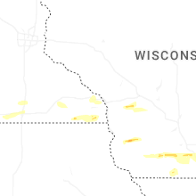


Connect with Interactive Hail Maps