

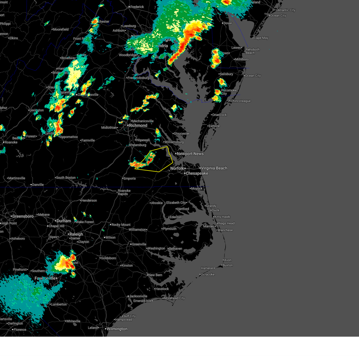
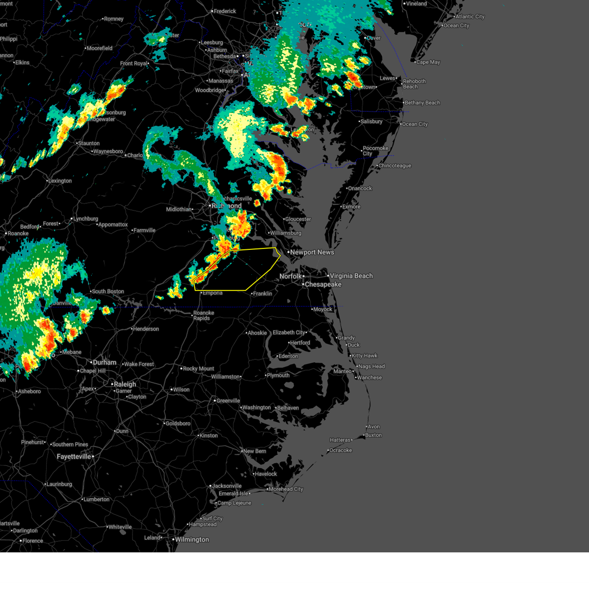
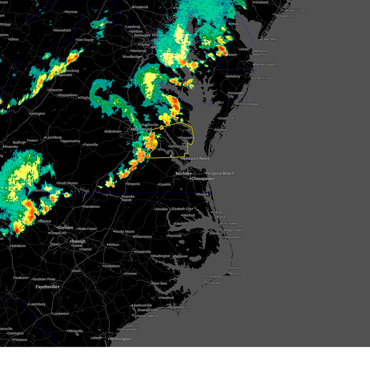
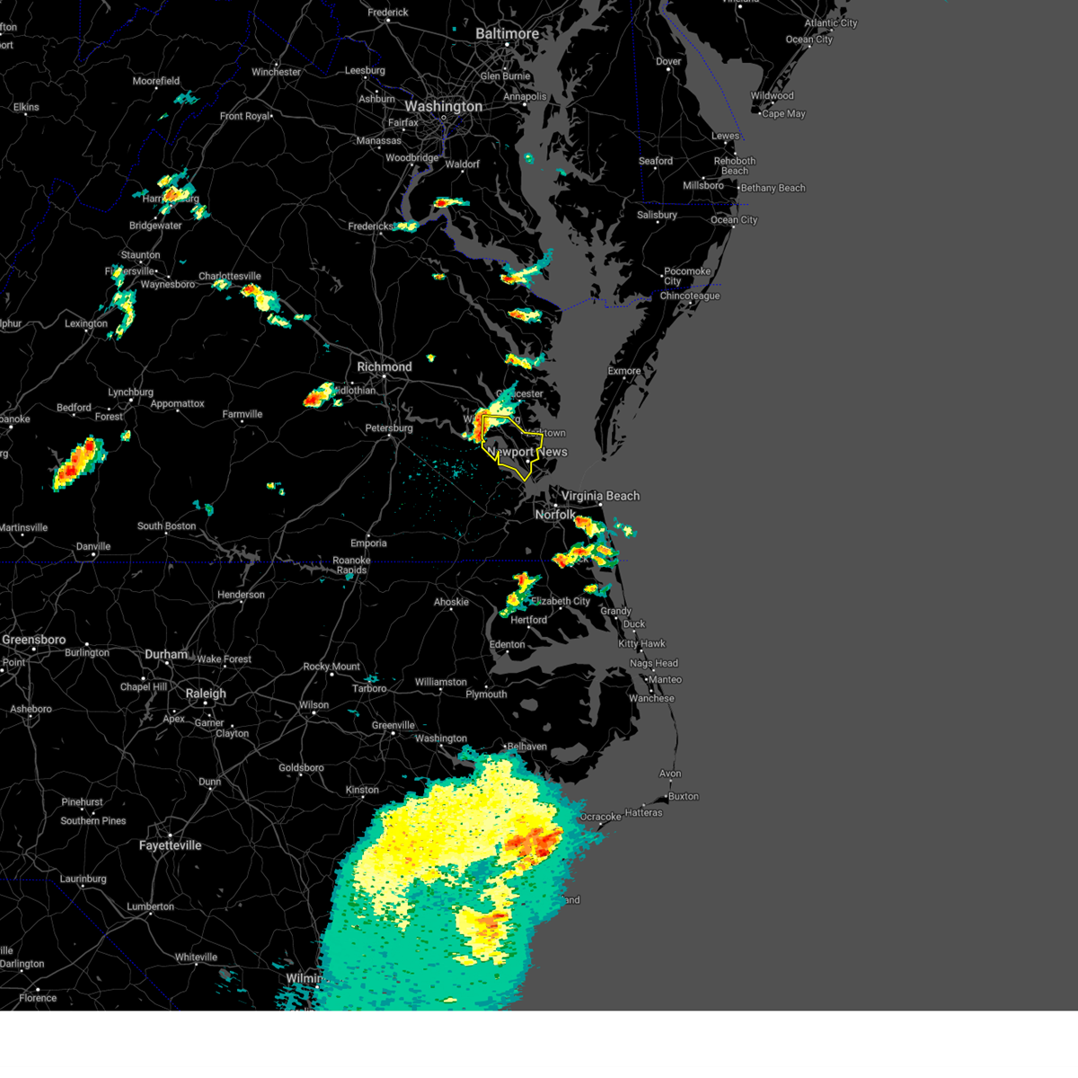
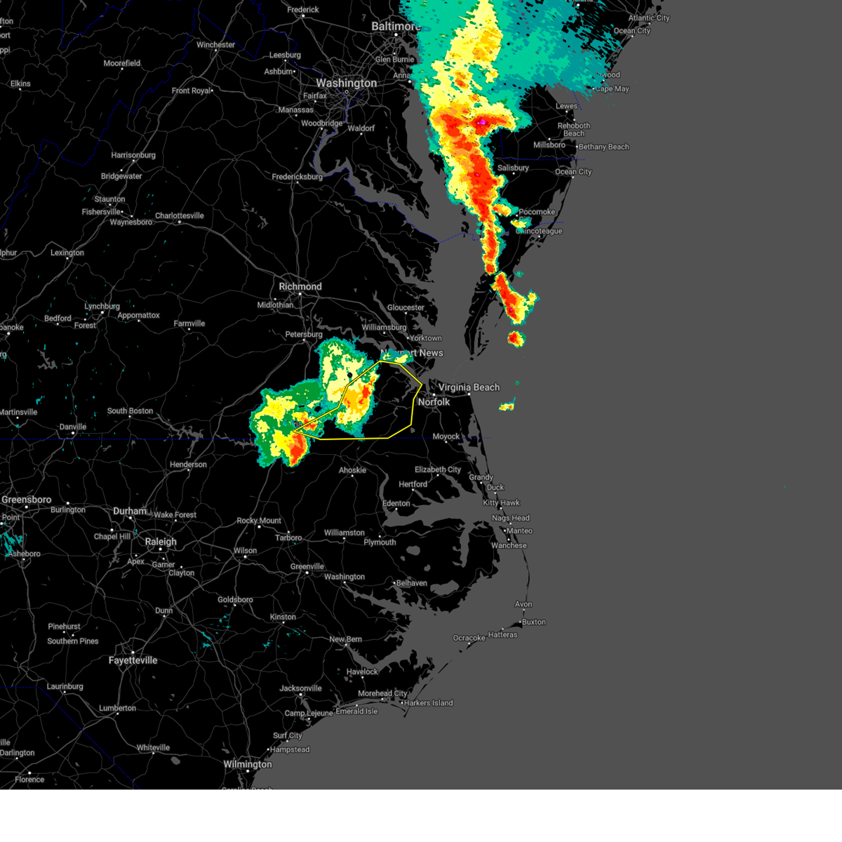
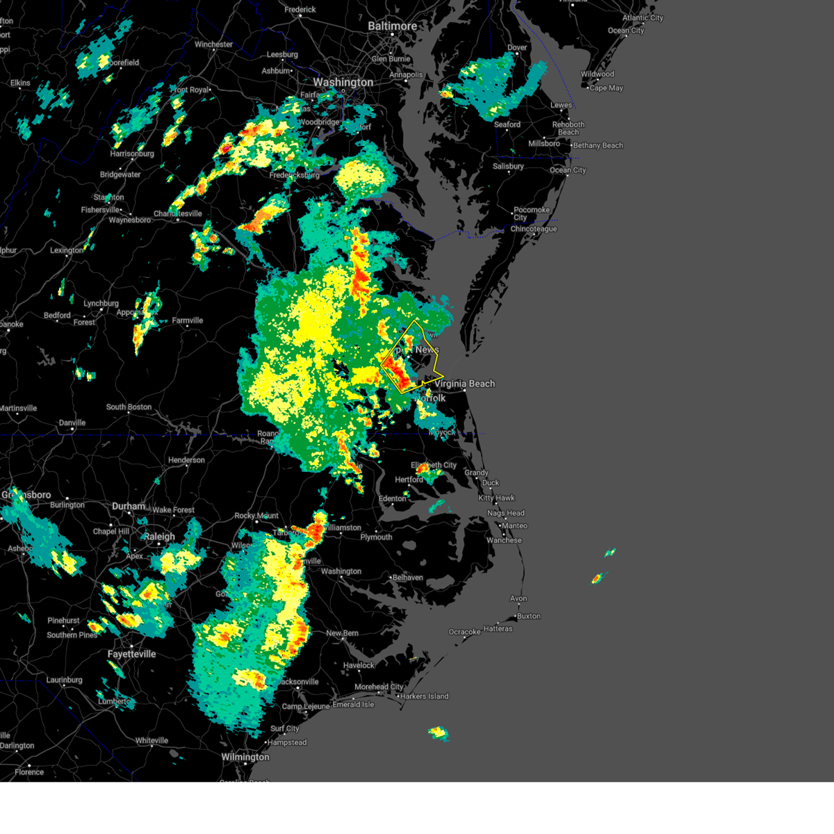
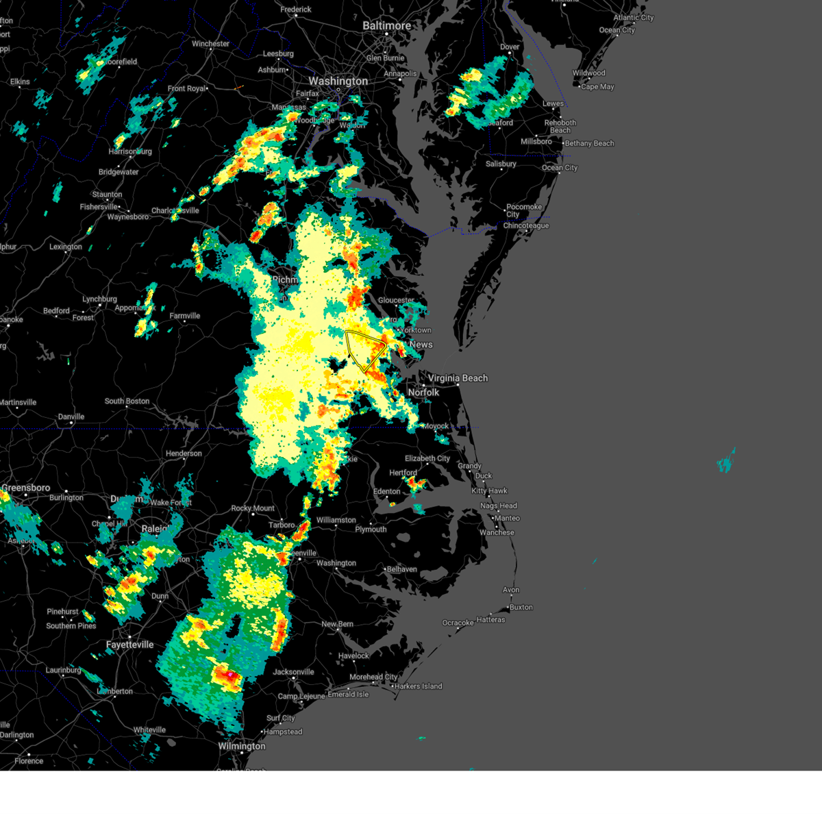
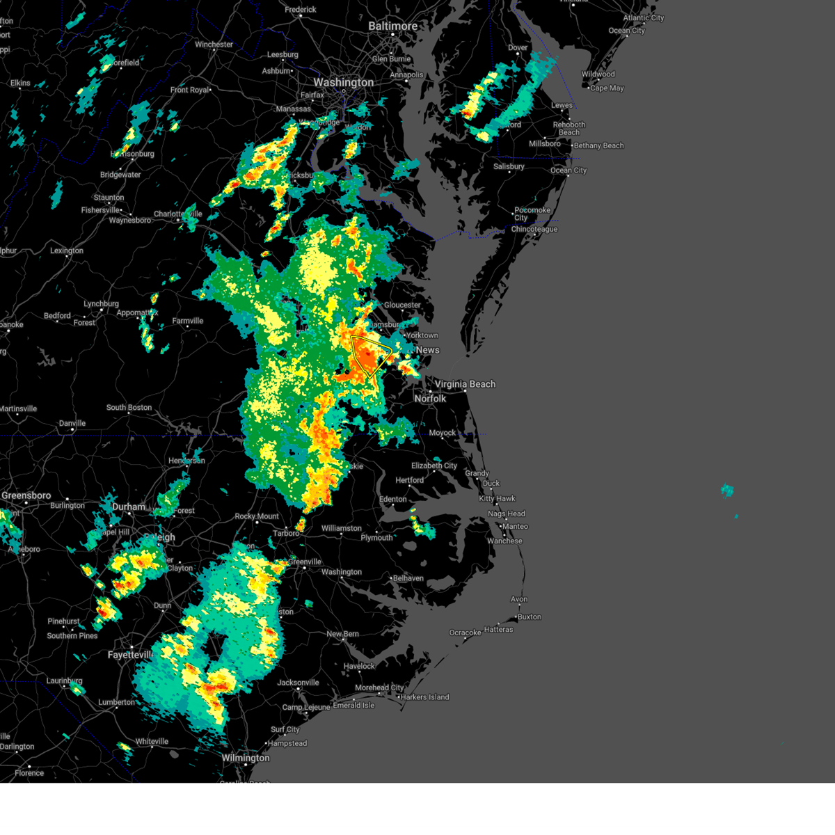
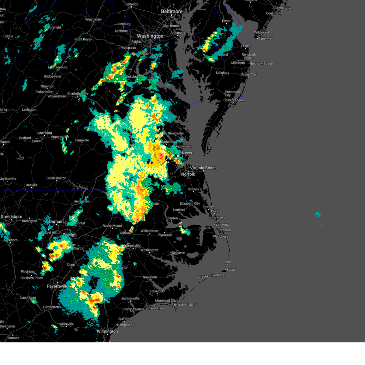
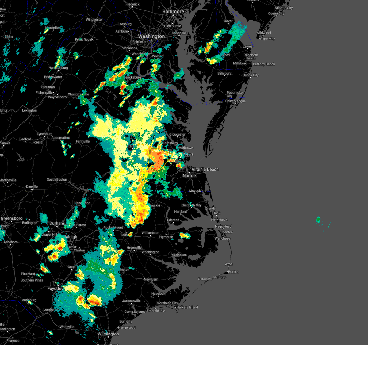
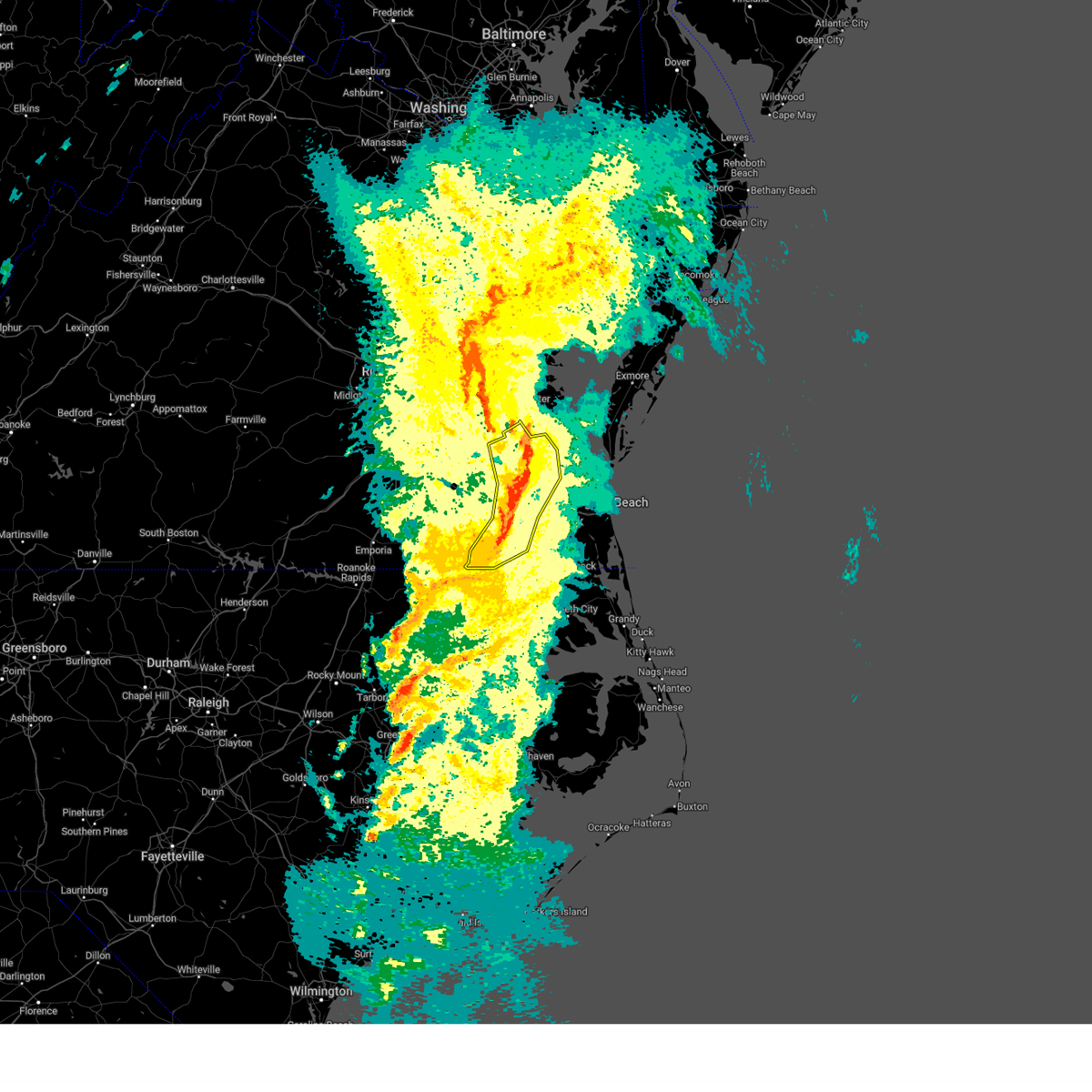
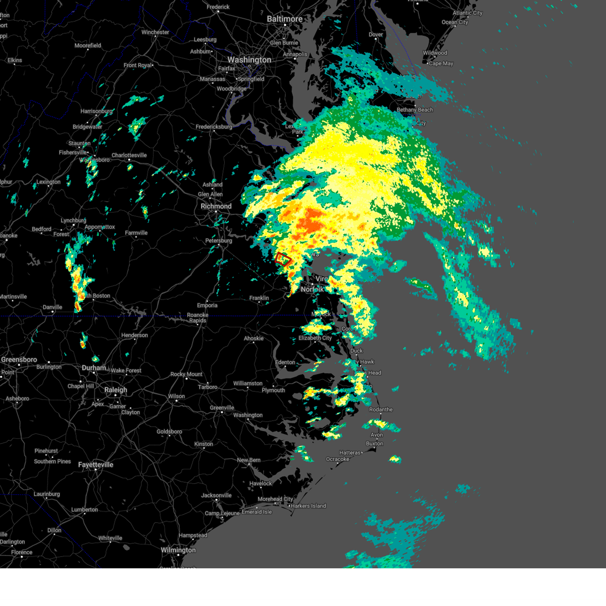
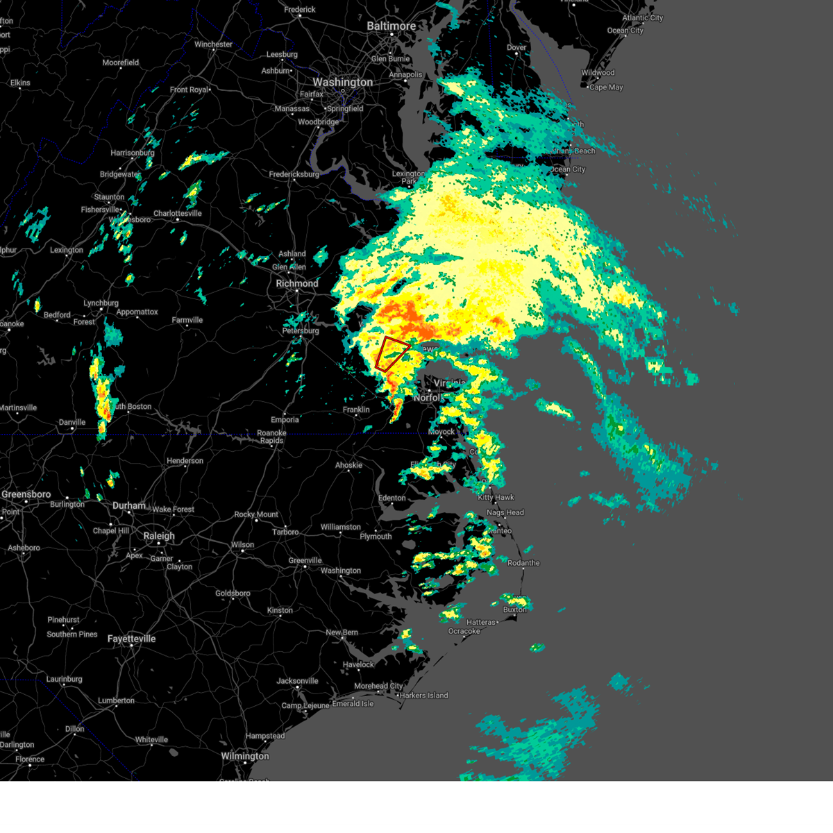
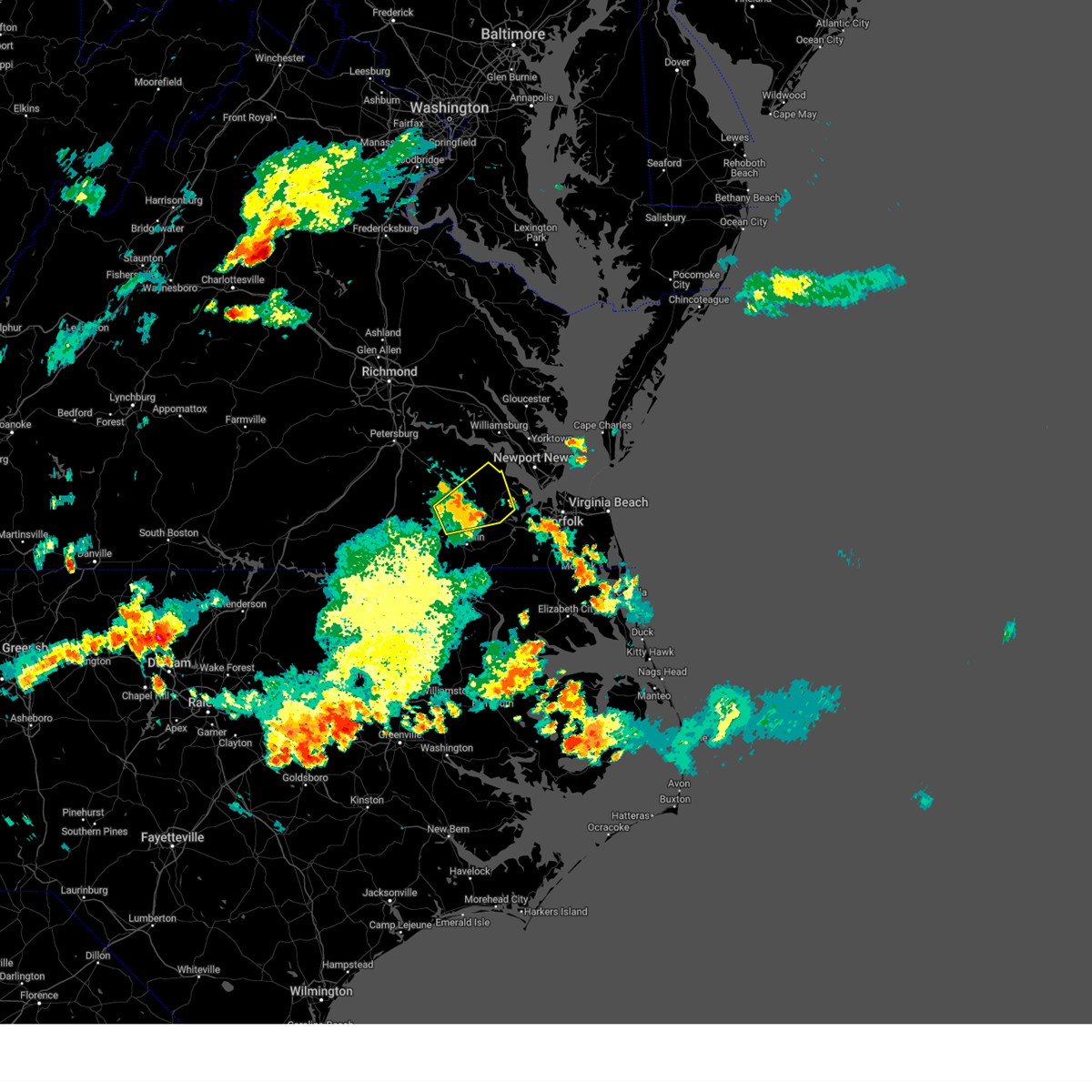
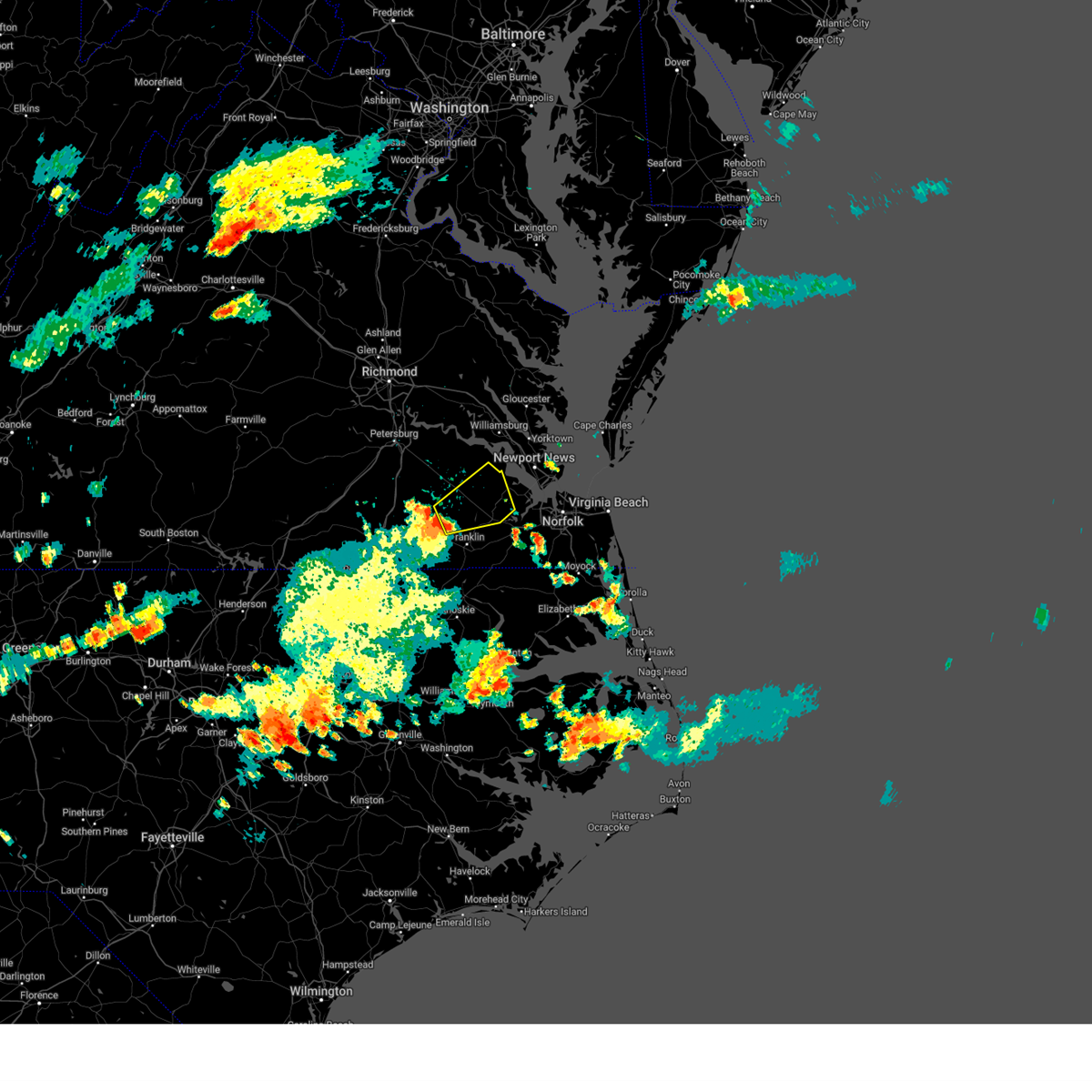
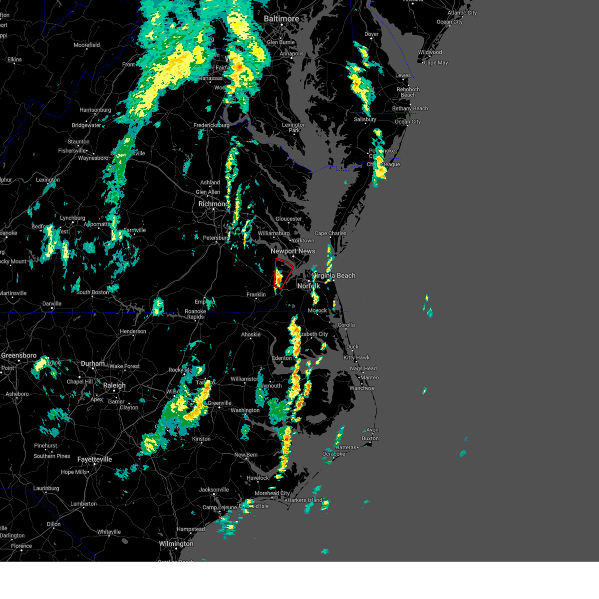
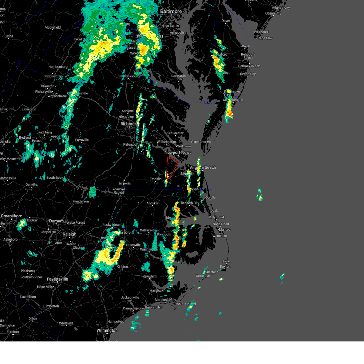
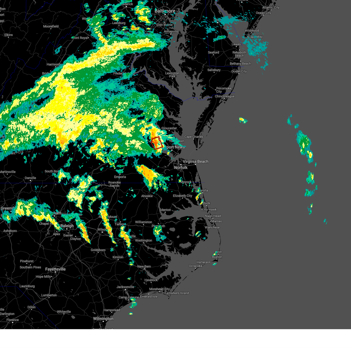
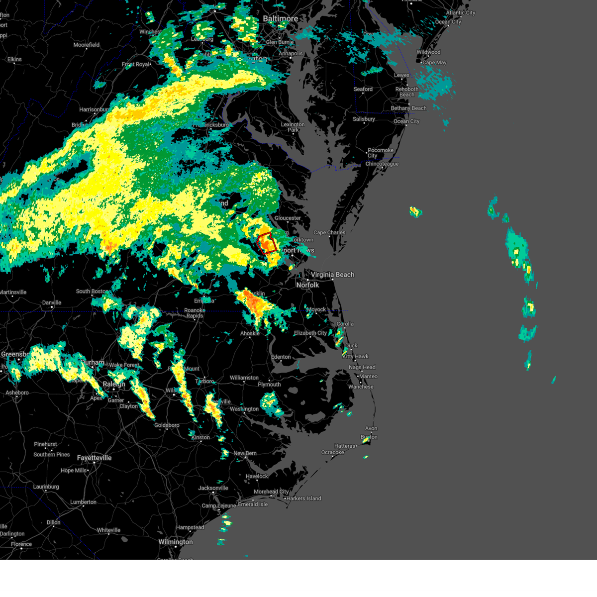
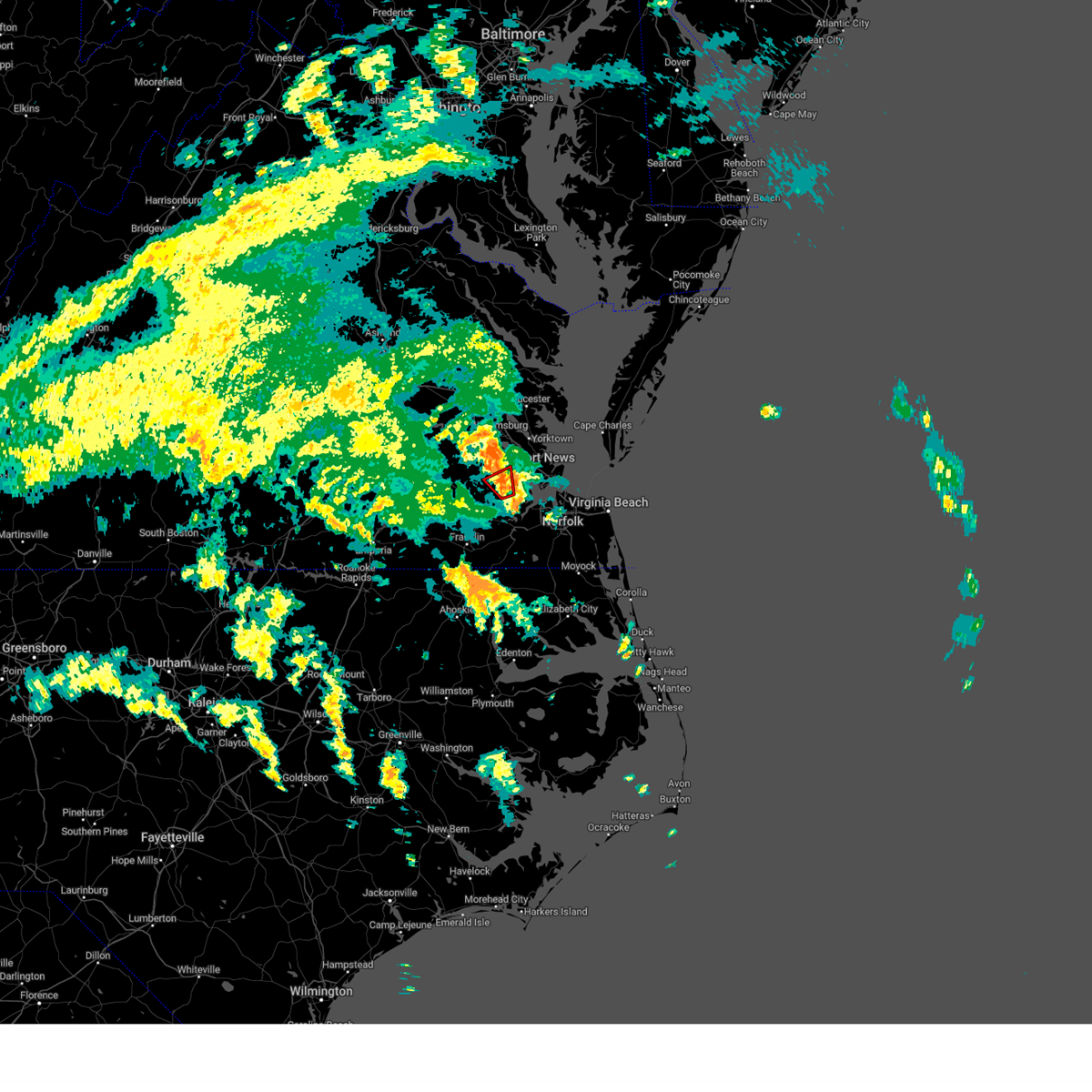
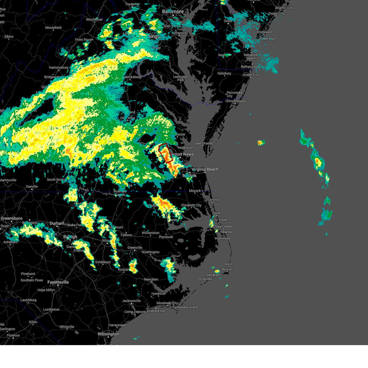
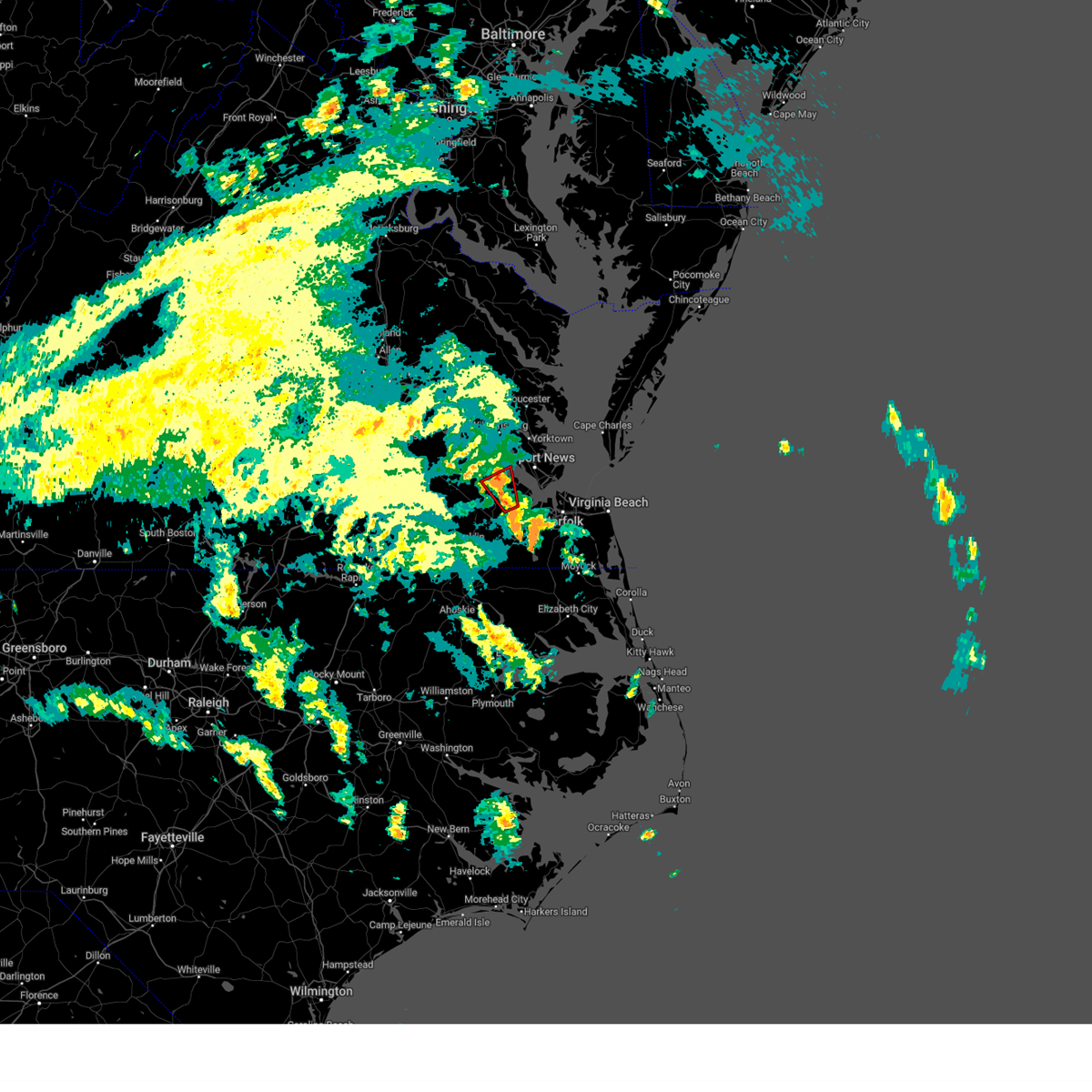
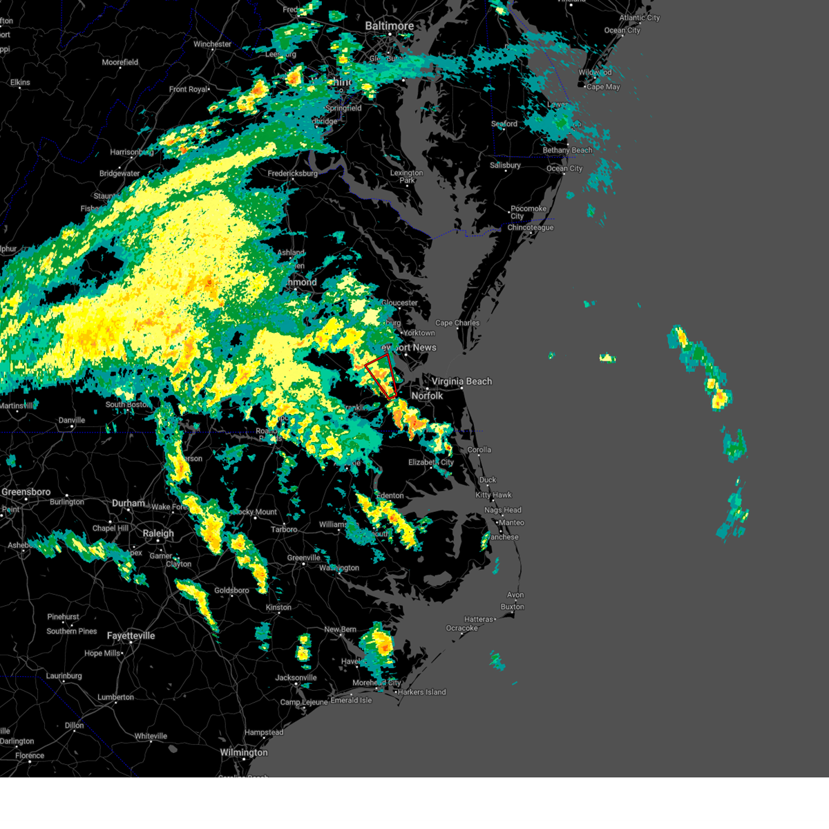
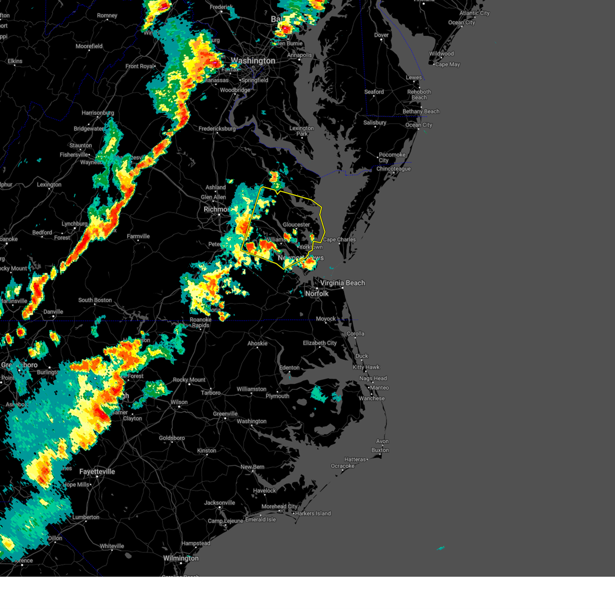
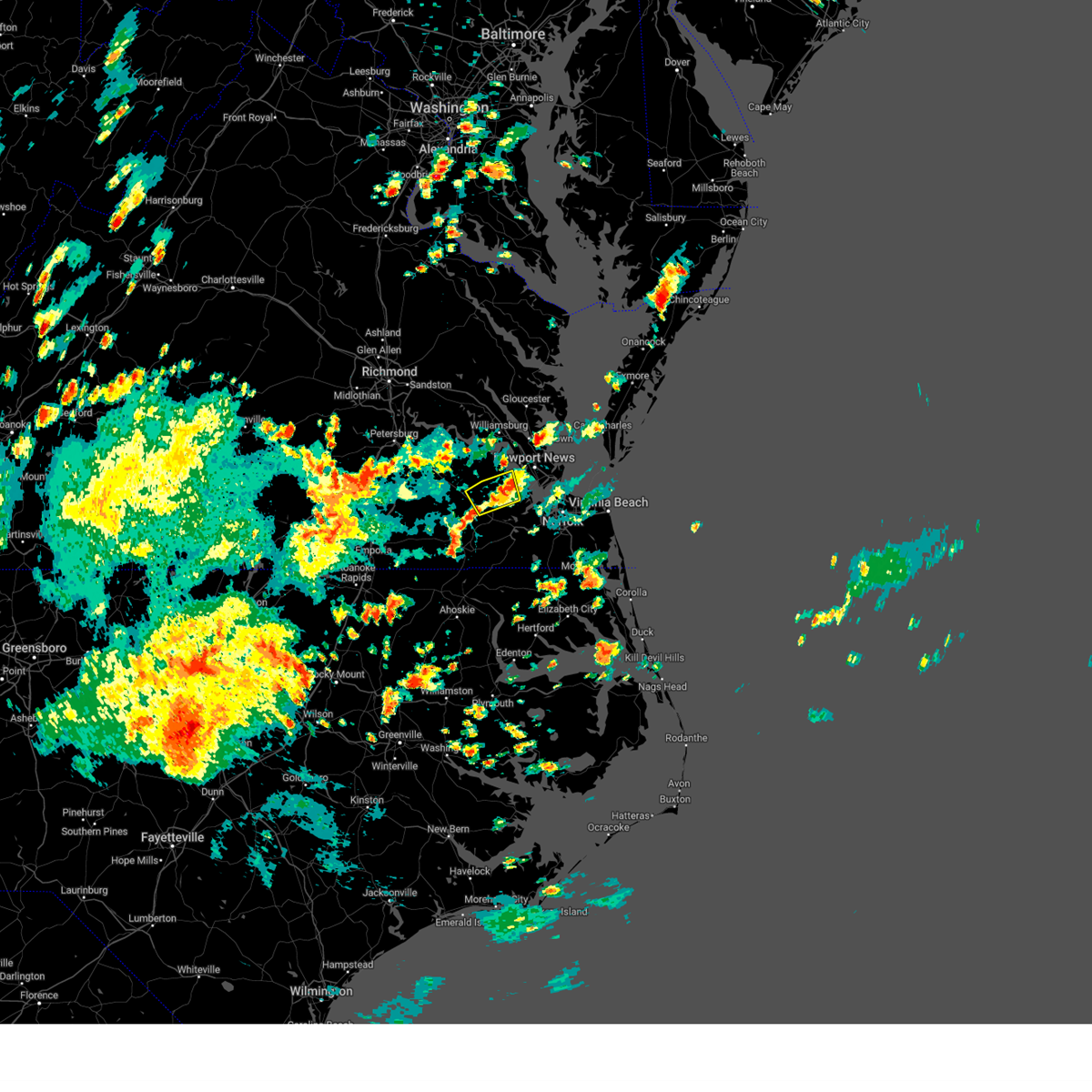
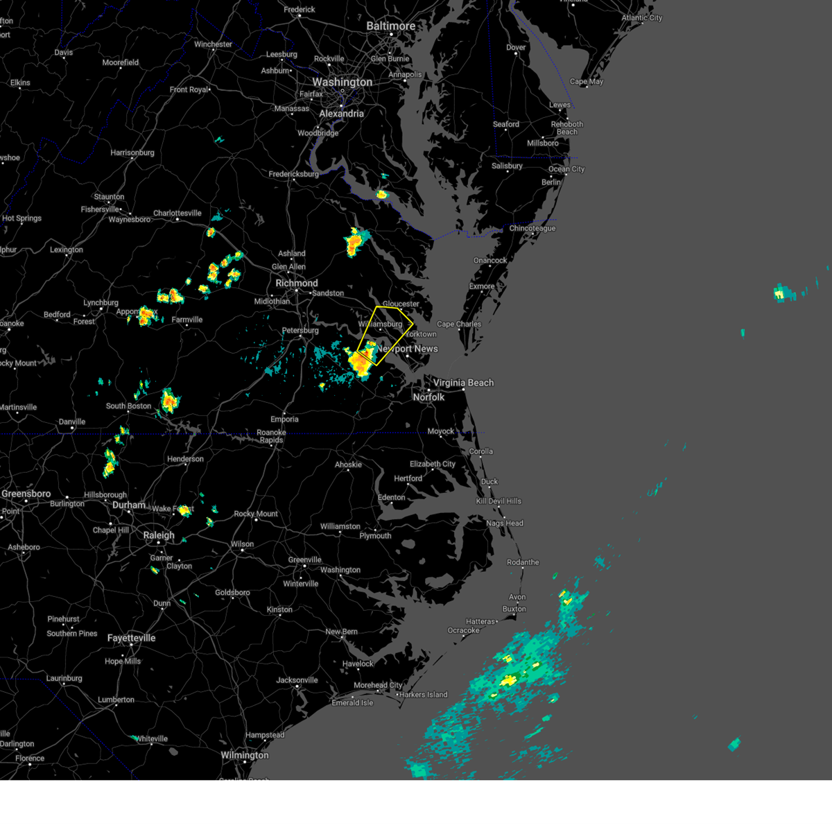
Hail Map for Rushmere, VA
The Rushmere, VA area has had 0 reports of on-the-ground hail by trained spotters, and has been under severe weather warnings 48 times during the past 12 months. Doppler radar has detected hail at or near Rushmere, VA on 49 occasions, including 1 occasion during the past year.
| Name: | Rushmere, VA |
| Where Located: | 41.1 miles NW of Virginia Beach, VA |
| Map: | Google Map for Rushmere, VA |
| Population: | 1018 |
| Housing Units: | 533 |
| More Info: | Search Google for Rushmere, VA |
0
The Top Recent Hail Date for Rushmere, VA is Tuesday, July 23, 2024 (49th out of 49)

Hail and Wind Damage Spotted near Rushmere, VA
| Date / Time | Report Details |
|---|---|
| 7/8/2025 6:55 PM EDT |
 Svrakq the national weather service in wakefield has issued a * severe thunderstorm warning for, northeastern southampton county in southeastern virginia, isle of wight county in southeastern virginia, northeastern sussex county in southeastern virginia, central surry county in southeastern virginia, * until 745 pm edt. * at 655 pm edt, severe thunderstorms were located along a line extending from surry to near ivor to 8 miles northwest of sedley, moving east at 15 mph (radar indicated). Hazards include 60 mph wind gusts. Expect damage to trees and powerlines. severe thunderstorms will be near, surry and ivor around 700 pm edt. smithfield around 725 pm edt. Other locations impacted by these severe thunderstorms include vicksville, rushmere, booth fork, pons, carsley, carrollton, chippokes state park, benns church, yale, and bethel church. Svrakq the national weather service in wakefield has issued a * severe thunderstorm warning for, northeastern southampton county in southeastern virginia, isle of wight county in southeastern virginia, northeastern sussex county in southeastern virginia, central surry county in southeastern virginia, * until 745 pm edt. * at 655 pm edt, severe thunderstorms were located along a line extending from surry to near ivor to 8 miles northwest of sedley, moving east at 15 mph (radar indicated). Hazards include 60 mph wind gusts. Expect damage to trees and powerlines. severe thunderstorms will be near, surry and ivor around 700 pm edt. smithfield around 725 pm edt. Other locations impacted by these severe thunderstorms include vicksville, rushmere, booth fork, pons, carsley, carrollton, chippokes state park, benns church, yale, and bethel church.
|
| 6/19/2025 6:58 PM EDT |
 The storms which prompted the warning have weakened below severe limits, and no longer pose an immediate threat to life or property. therefore, the warning will be allowed to expire. however, gusty winds and heavy rain are still possible with these thunderstorms. a severe thunderstorm watch remains in effect until 900 pm edt for southeastern virginia. The storms which prompted the warning have weakened below severe limits, and no longer pose an immediate threat to life or property. therefore, the warning will be allowed to expire. however, gusty winds and heavy rain are still possible with these thunderstorms. a severe thunderstorm watch remains in effect until 900 pm edt for southeastern virginia.
|
| 6/19/2025 6:57 PM EDT |
 Svrakq the national weather service in wakefield has issued a * severe thunderstorm warning for, the city of poquoson in southeastern virginia, southern gloucester county in eastern virginia, york county in southeastern virginia, central mathews county in eastern virginia, the northern city of newport news in southeastern virginia, southeastern james city county in southeastern virginia, * until 745 pm edt. * at 657 pm edt, severe thunderstorms were located along a line extending from near hayes to virginia institute for marine sciences to fort eustis, moving east at 40 mph (radar indicated). Hazards include 60 mph wind gusts. Expect damage to trees and powerlines. severe thunderstorms will be near, newport news, gloucester courthouse, virginia institute for marine sciences, gloucester point, patrick henry field, seaford, fort eustis, lee hall, hayes, and denbigh around 700 pm edt. tabb and mobjack around 705 pm edt. mathews and bavon around 710 pm edt. Other locations impacted by these severe thunderstorms include lackey, beulah, ruff, moon, camp peary, laban, glass, naxera, oriana, and newport news golf course. Svrakq the national weather service in wakefield has issued a * severe thunderstorm warning for, the city of poquoson in southeastern virginia, southern gloucester county in eastern virginia, york county in southeastern virginia, central mathews county in eastern virginia, the northern city of newport news in southeastern virginia, southeastern james city county in southeastern virginia, * until 745 pm edt. * at 657 pm edt, severe thunderstorms were located along a line extending from near hayes to virginia institute for marine sciences to fort eustis, moving east at 40 mph (radar indicated). Hazards include 60 mph wind gusts. Expect damage to trees and powerlines. severe thunderstorms will be near, newport news, gloucester courthouse, virginia institute for marine sciences, gloucester point, patrick henry field, seaford, fort eustis, lee hall, hayes, and denbigh around 700 pm edt. tabb and mobjack around 705 pm edt. mathews and bavon around 710 pm edt. Other locations impacted by these severe thunderstorms include lackey, beulah, ruff, moon, camp peary, laban, glass, naxera, oriana, and newport news golf course.
|
| 6/19/2025 6:41 PM EDT |
 the severe thunderstorm warning has been cancelled and is no longer in effect the severe thunderstorm warning has been cancelled and is no longer in effect
|
| 6/19/2025 6:41 PM EDT |
 At 640 pm edt, severe thunderstorms were located along a line extending from elberon to 6 miles southeast of homeville to 9 miles south of sussex, moving east at 30 mph (radar indicated). Hazards include 60 mph wind gusts and penny size hail. Expect damage to trees and powerlines. these severe storms will be near, wakefield, dendron, and elberon around 645 pm edt. ivor around 650 pm edt. courtland around 655 pm edt. zuni and sedley around 700 pm edt. smithfield around 705 pm edt. isle of wight around 710 pm edt. Other locations impacted by these severe thunderstorms include vicksville, rushmere, booth fork, pons, carsley, booker, yale, bethel church, lumberton, and ellis fork. At 640 pm edt, severe thunderstorms were located along a line extending from elberon to 6 miles southeast of homeville to 9 miles south of sussex, moving east at 30 mph (radar indicated). Hazards include 60 mph wind gusts and penny size hail. Expect damage to trees and powerlines. these severe storms will be near, wakefield, dendron, and elberon around 645 pm edt. ivor around 650 pm edt. courtland around 655 pm edt. zuni and sedley around 700 pm edt. smithfield around 705 pm edt. isle of wight around 710 pm edt. Other locations impacted by these severe thunderstorms include vicksville, rushmere, booth fork, pons, carsley, booker, yale, bethel church, lumberton, and ellis fork.
|
| 6/19/2025 6:39 PM EDT | the severe thunderstorm warning has been cancelled and is no longer in effect |
| 6/19/2025 6:39 PM EDT | At 638 pm edt, severe thunderstorms were located along a line extending from near glenns to near wicomico to grove, moving east at 50 mph (radar indicated). Hazards include 60 mph wind gusts and penny size hail. Expect damage to trees and powerlines. these severe storms will be near, newport news, gloucester courthouse, virginia institute for marine sciences, gloucester point, seaford, blakes, achilles, wicomico, and hartfield around 645 pm edt. mathews, deltaville, gwynn, mobjack, and bavon around 650 pm edt. Other locations impacted by these severe thunderstorms include eltham, croaker, lackey, chippokes state park, beulah, moon, laban, camp peary, naxera, and oriana. |
| 6/19/2025 6:16 PM EDT |
 Svrakq the national weather service in wakefield has issued a * severe thunderstorm warning for, north central greensville county in southeastern virginia, northern southampton county in southeastern virginia, central isle of wight county in southeastern virginia, sussex county in southeastern virginia, central surry county in southeastern virginia, * until 700 pm edt. * at 616 pm edt, severe thunderstorms were located along a line extending from near waverly to near sussex to near green plain, moving east at 35 mph (radar indicated). Hazards include 60 mph wind gusts. Expect damage to trees and powerlines. severe thunderstorms will be near, waverly, sussex, and homeville around 620 pm edt. wakefield and dendron around 630 pm edt. elberon around 635 pm edt. ivor around 645 pm edt. Other locations impacted by these severe thunderstorms include vicksville, rushmere, booth fork, pons, carsley, grizzard, bufford crossroads, booker, yale, and bethel church. Svrakq the national weather service in wakefield has issued a * severe thunderstorm warning for, north central greensville county in southeastern virginia, northern southampton county in southeastern virginia, central isle of wight county in southeastern virginia, sussex county in southeastern virginia, central surry county in southeastern virginia, * until 700 pm edt. * at 616 pm edt, severe thunderstorms were located along a line extending from near waverly to near sussex to near green plain, moving east at 35 mph (radar indicated). Hazards include 60 mph wind gusts. Expect damage to trees and powerlines. severe thunderstorms will be near, waverly, sussex, and homeville around 620 pm edt. wakefield and dendron around 630 pm edt. elberon around 635 pm edt. ivor around 645 pm edt. Other locations impacted by these severe thunderstorms include vicksville, rushmere, booth fork, pons, carsley, grizzard, bufford crossroads, booker, yale, and bethel church.
|
| 6/19/2025 6:13 PM EDT |
 Svrakq the national weather service in wakefield has issued a * severe thunderstorm warning for, gloucester county in eastern virginia, southern middlesex county in eastern virginia, southeastern king and queen county in east central virginia, eastern charles city county in east central virginia, york county in southeastern virginia, eastern new kent county in east central virginia, mathews county in eastern virginia, southeastern king william county in east central virginia, the northern city of newport news in southeastern virginia, james city county in southeastern virginia, surry county in southeastern virginia, the city of williamsburg in southeastern virginia, * until 700 pm edt. * at 613 pm edt, severe thunderstorms were located along a line extending from new kent to rustic to cabin point, moving east at 50 mph (radar indicated). Hazards include 60 mph wind gusts and penny size hail. Expect damage to trees and powerlines. severe thunderstorms will be near, williamsburg, west point, surry, toano, norge, and barhamsville around 620 pm edt. queens lake, college of william and mary, jamestown, scotland, kings point, and shacklefords around 625 pm edt. grove, york terrace, carver gardens, busch gardens, and glenns around 630 pm edt. newport news, gloucester courthouse, gloucester point, lee hall, hayes, and wicomico around 635 pm edt. virginia institute for marine sciences and hartfield around 640 pm edt. seaford, blakes, achilles, and mobjack around 645 pm edt. mathews, deltaville, and bavon around 650 pm edt. Other locations impacted by these severe thunderstorms include eltham, croaker, lackey, chippokes state park, beulah, moon, laban, camp peary, naxera, and oriana. Svrakq the national weather service in wakefield has issued a * severe thunderstorm warning for, gloucester county in eastern virginia, southern middlesex county in eastern virginia, southeastern king and queen county in east central virginia, eastern charles city county in east central virginia, york county in southeastern virginia, eastern new kent county in east central virginia, mathews county in eastern virginia, southeastern king william county in east central virginia, the northern city of newport news in southeastern virginia, james city county in southeastern virginia, surry county in southeastern virginia, the city of williamsburg in southeastern virginia, * until 700 pm edt. * at 613 pm edt, severe thunderstorms were located along a line extending from new kent to rustic to cabin point, moving east at 50 mph (radar indicated). Hazards include 60 mph wind gusts and penny size hail. Expect damage to trees and powerlines. severe thunderstorms will be near, williamsburg, west point, surry, toano, norge, and barhamsville around 620 pm edt. queens lake, college of william and mary, jamestown, scotland, kings point, and shacklefords around 625 pm edt. grove, york terrace, carver gardens, busch gardens, and glenns around 630 pm edt. newport news, gloucester courthouse, gloucester point, lee hall, hayes, and wicomico around 635 pm edt. virginia institute for marine sciences and hartfield around 640 pm edt. seaford, blakes, achilles, and mobjack around 645 pm edt. mathews, deltaville, and bavon around 650 pm edt. Other locations impacted by these severe thunderstorms include eltham, croaker, lackey, chippokes state park, beulah, moon, laban, camp peary, naxera, and oriana.
|
| 6/8/2025 3:51 PM EDT |
 Svrakq the national weather service in wakefield has issued a * severe thunderstorm warning for, york county in southeastern virginia, the city of newport news in southeastern virginia, southeastern james city county in southeastern virginia, northeastern surry county in southeastern virginia, the city of williamsburg in southeastern virginia, * until 430 pm edt. * at 351 pm edt, a severe thunderstorm was located over jamestown, or over college of william and mary, moving east at 30 mph (radar indicated). Hazards include 60 mph wind gusts. Expect damage to trees and powerlines. this severe thunderstorm will be near, williamsburg, college of william and mary, kings point, york terrace, carver gardens, and busch gardens around 355 pm edt. newport news and grove around 400 pm edt. lee hall around 405 pm edt. gloucester point around 415 pm edt. virginia institute for marine sciences, patrick henry field, and seaford around 420 pm edt. tabb around 425 pm edt. other locations impacted by this severe thunderstorm include lackey, chippokes state park, water country u. s. a. Camp peary, oriana, hilton village, dare, newport news golf course, oyster point, and hog island game reserve. Svrakq the national weather service in wakefield has issued a * severe thunderstorm warning for, york county in southeastern virginia, the city of newport news in southeastern virginia, southeastern james city county in southeastern virginia, northeastern surry county in southeastern virginia, the city of williamsburg in southeastern virginia, * until 430 pm edt. * at 351 pm edt, a severe thunderstorm was located over jamestown, or over college of william and mary, moving east at 30 mph (radar indicated). Hazards include 60 mph wind gusts. Expect damage to trees and powerlines. this severe thunderstorm will be near, williamsburg, college of william and mary, kings point, york terrace, carver gardens, and busch gardens around 355 pm edt. newport news and grove around 400 pm edt. lee hall around 405 pm edt. gloucester point around 415 pm edt. virginia institute for marine sciences, patrick henry field, and seaford around 420 pm edt. tabb around 425 pm edt. other locations impacted by this severe thunderstorm include lackey, chippokes state park, water country u. s. a. Camp peary, oriana, hilton village, dare, newport news golf course, oyster point, and hog island game reserve.
|
| 5/16/2025 6:47 PM EDT |
 the severe thunderstorm warning has been cancelled and is no longer in effect the severe thunderstorm warning has been cancelled and is no longer in effect
|
| 5/16/2025 6:47 PM EDT |
 At 647 pm edt, severe thunderstorms were located along a line extending from 7 miles northwest of isle of wight to carrsville to near claresville, moving east at 60 mph (radar indicated). Hazards include 70 mph wind gusts and quarter size hail. Minor damage to vehicles is possible. expect considerable tree damage. wind damage is also likely to mobile homes, roofs, and outbuildings. these severe storms will be near, franklin, smithfield, windsor, boykins, holland, suffolk, newsoms, rescue, kings fork, and carrsville around 655 pm edt. downtown suffolk, driver, and crittenden around 700 pm edt. whaleyville around 705 pm edt. Other locations impacted by these severe thunderstorms include vicksville, pons, carrollton, longview, benns church, suffolk airport, huntersville, bethel church, bryants corner, and chuckatuck. At 647 pm edt, severe thunderstorms were located along a line extending from 7 miles northwest of isle of wight to carrsville to near claresville, moving east at 60 mph (radar indicated). Hazards include 70 mph wind gusts and quarter size hail. Minor damage to vehicles is possible. expect considerable tree damage. wind damage is also likely to mobile homes, roofs, and outbuildings. these severe storms will be near, franklin, smithfield, windsor, boykins, holland, suffolk, newsoms, rescue, kings fork, and carrsville around 655 pm edt. downtown suffolk, driver, and crittenden around 700 pm edt. whaleyville around 705 pm edt. Other locations impacted by these severe thunderstorms include vicksville, pons, carrollton, longview, benns church, suffolk airport, huntersville, bethel church, bryants corner, and chuckatuck.
|
| 5/16/2025 6:28 PM EDT | Svrakq the national weather service in wakefield has issued a * severe thunderstorm warning for, southeastern greensville county in southeastern virginia, the city of franklin in southeastern virginia, southampton county in southeastern virginia, isle of wight county in southeastern virginia, the city of suffolk in southeastern virginia, east central sussex county in southeastern virginia, southeastern surry county in southeastern virginia, * until 715 pm edt. * at 628 pm edt, severe thunderstorms were located along a line extending from near waverly to 6 miles south of sussex to 6 miles northwest of dahlia, moving east at 50 mph (radar indicated). Hazards include 60 mph wind gusts and quarter size hail. Minor damage to vehicles is possible. expect wind damage to trees and powerlines. severe thunderstorms will be near, wakefield, dendron, and elberon around 635 pm edt. courtland, ivor, and sedley around 640 pm edt. boykins, newsoms, and zuni around 645 pm edt. franklin, smithfield, isle of wight, and hunterdale around 650 pm edt. windsor, suffolk, rescue, and carrsville around 655 pm edt. holland, kings fork, and crittenden around 700 pm edt. Other locations impacted by these severe thunderstorms include vicksville, pons, carrollton, longview, huntersville, chuckatuck, wilroy, dory, lees mill, and riverdale. |
| 5/14/2025 6:47 PM EDT |
 Svrakq the national weather service in wakefield has issued a * severe thunderstorm warning for, the northern city of norfolk in southeastern virginia, the city of poquoson in southeastern virginia, southeastern gloucester county in eastern virginia, the northwestern city of portsmouth in southeastern virginia, northeastern isle of wight county in southeastern virginia, the northeastern city of suffolk in southeastern virginia, southeastern york county in southeastern virginia, the city of hampton in southeastern virginia, the city of newport news in southeastern virginia, * until 730 pm edt. * at 647 pm edt, a severe thunderstorm was located near rescue, or near christopher newport university, moving northeast at 20 mph (radar indicated). Hazards include 60 mph wind gusts. Expect damage to trees and powerlines. this severe thunderstorm will be near, newport news and hampton around 650 pm edt. northampton around 655 pm edt. beaconsdale around 700 pm edt. hampton university and langley afb around 705 pm edt. grand view and buckroe beach around 720 pm edt. Other locations impacted by this severe thunderstorm include carrollton, benns church, oriana, huntersville, hilton village, newport news golf course, wards corner, oyster point, messick, and mogarts beach. Svrakq the national weather service in wakefield has issued a * severe thunderstorm warning for, the northern city of norfolk in southeastern virginia, the city of poquoson in southeastern virginia, southeastern gloucester county in eastern virginia, the northwestern city of portsmouth in southeastern virginia, northeastern isle of wight county in southeastern virginia, the northeastern city of suffolk in southeastern virginia, southeastern york county in southeastern virginia, the city of hampton in southeastern virginia, the city of newport news in southeastern virginia, * until 730 pm edt. * at 647 pm edt, a severe thunderstorm was located near rescue, or near christopher newport university, moving northeast at 20 mph (radar indicated). Hazards include 60 mph wind gusts. Expect damage to trees and powerlines. this severe thunderstorm will be near, newport news and hampton around 650 pm edt. northampton around 655 pm edt. beaconsdale around 700 pm edt. hampton university and langley afb around 705 pm edt. grand view and buckroe beach around 720 pm edt. Other locations impacted by this severe thunderstorm include carrollton, benns church, oriana, huntersville, hilton village, newport news golf course, wards corner, oyster point, messick, and mogarts beach.
|
| 5/14/2025 6:20 PM EDT |
 The storm which prompted the warning has weakened below severe limits, and no longer poses an immediate threat to life or property. therefore, the warning has been allowed to expire. however, heavy rain is still possible with this thunderstorm. The storm which prompted the warning has weakened below severe limits, and no longer poses an immediate threat to life or property. therefore, the warning has been allowed to expire. however, heavy rain is still possible with this thunderstorm.
|
| 5/14/2025 6:07 PM EDT |
 At 607 pm edt, a severe thunderstorm was located near scotland, or near surry, moving northeast at 20 mph (radar indicated). Hazards include 60 mph wind gusts. Expect damage to trees and powerlines. Locations impacted include, claremont, surry, scotland, elberon, rushmere, pons, chippokes state park, delk crossroads, bacons castle, poolesville, moonlight, alliance, runnymede, and beachland. At 607 pm edt, a severe thunderstorm was located near scotland, or near surry, moving northeast at 20 mph (radar indicated). Hazards include 60 mph wind gusts. Expect damage to trees and powerlines. Locations impacted include, claremont, surry, scotland, elberon, rushmere, pons, chippokes state park, delk crossroads, bacons castle, poolesville, moonlight, alliance, runnymede, and beachland.
|
| 5/14/2025 6:07 PM EDT |
 the severe thunderstorm warning has been cancelled and is no longer in effect the severe thunderstorm warning has been cancelled and is no longer in effect
|
| 5/14/2025 5:48 PM EDT |
 At 547 pm edt, a severe thunderstorm was located near surry, moving northeast at 25 mph (radar indicated). Hazards include 60 mph wind gusts and penny size hail. Expect damage to trees and powerlines. This severe thunderstorm will remain over mainly rural areas of northeastern southampton, east central prince george, northwestern isle of wight, northeastern sussex and surry counties, including the following locations, rushmere, taylors corner, booth fork, carsley, pons, chippokes state park, spring grove, ellis fork, delk crossroads, and bacons castle. At 547 pm edt, a severe thunderstorm was located near surry, moving northeast at 25 mph (radar indicated). Hazards include 60 mph wind gusts and penny size hail. Expect damage to trees and powerlines. This severe thunderstorm will remain over mainly rural areas of northeastern southampton, east central prince george, northwestern isle of wight, northeastern sussex and surry counties, including the following locations, rushmere, taylors corner, booth fork, carsley, pons, chippokes state park, spring grove, ellis fork, delk crossroads, and bacons castle.
|
| 5/14/2025 5:28 PM EDT |
 Svrakq the national weather service in wakefield has issued a * severe thunderstorm warning for, northeastern southampton county in southeastern virginia, central prince george county in south central virginia, northwestern isle of wight county in southeastern virginia, northeastern sussex county in southeastern virginia, surry county in southeastern virginia, * until 615 pm edt. * at 528 pm edt, a severe thunderstorm was located over wakefield, moving north at 15 mph (radar indicated). Hazards include 60 mph wind gusts. Expect damage to trees and powerlines. this severe thunderstorm will be near, dendron around 535 pm edt. elberon around 545 pm edt. Other locations impacted by this severe thunderstorm include rushmere, taylors corner, booth fork, carsley, pons, chippokes state park, spring grove, ellis fork, delk crossroads, and barham. Svrakq the national weather service in wakefield has issued a * severe thunderstorm warning for, northeastern southampton county in southeastern virginia, central prince george county in south central virginia, northwestern isle of wight county in southeastern virginia, northeastern sussex county in southeastern virginia, surry county in southeastern virginia, * until 615 pm edt. * at 528 pm edt, a severe thunderstorm was located over wakefield, moving north at 15 mph (radar indicated). Hazards include 60 mph wind gusts. Expect damage to trees and powerlines. this severe thunderstorm will be near, dendron around 535 pm edt. elberon around 545 pm edt. Other locations impacted by this severe thunderstorm include rushmere, taylors corner, booth fork, carsley, pons, chippokes state park, spring grove, ellis fork, delk crossroads, and barham.
|
| 3/17/2025 12:30 AM EDT |
 the severe thunderstorm warning has been cancelled and is no longer in effect the severe thunderstorm warning has been cancelled and is no longer in effect
|
| 3/17/2025 12:30 AM EDT |
 At 1229 am edt, severe thunderstorms were located along a line extending from saluda to near gloucester courthouse to near fort eustis, moving east at 65 mph (radar indicated). Hazards include 60 mph wind gusts. Expect damage to trees and powerlines. these severe storms will be near, gloucester point, gloucester courthouse, hartfield, hayes, and wicomico around 1235 am edt. Other locations impacted by these severe thunderstorms include lackey, beulah, camp peary, senora, glass, naxera, harmony village, bertrand, grafton, and harcum. At 1229 am edt, severe thunderstorms were located along a line extending from saluda to near gloucester courthouse to near fort eustis, moving east at 65 mph (radar indicated). Hazards include 60 mph wind gusts. Expect damage to trees and powerlines. these severe storms will be near, gloucester point, gloucester courthouse, hartfield, hayes, and wicomico around 1235 am edt. Other locations impacted by these severe thunderstorms include lackey, beulah, camp peary, senora, glass, naxera, harmony village, bertrand, grafton, and harcum.
|
| 3/17/2025 12:16 AM EDT |
 Svrakq the national weather service in wakefield has issued a * severe thunderstorm warning for, gloucester county in eastern virginia, southeastern king and queen county in east central virginia, southwestern middlesex county in eastern virginia, northwestern york county in southeastern virginia, northwestern mathews county in eastern virginia, east central new kent county in east central virginia, the northern city of newport news in southeastern virginia, james city county in southeastern virginia, eastern surry county in southeastern virginia, the city of williamsburg in southeastern virginia, south central lancaster county in eastern virginia, * until 100 am edt. * at 1215 am edt, severe thunderstorms were located along a line extending from near west point to near college of william and mary to near dendron, moving northeast at 50 mph (radar indicated). Hazards include 60 mph wind gusts. Expect damage to trees and powerlines. severe thunderstorms will be near, queens lake, jamestown, williamsburg, college of william and mary, scotland, kings point, york terrace, carver gardens, busch gardens, and norge around 1220 am edt. grove, saluda, gloucester courthouse, newport news, urbanna, and glenns around 1225 am edt. gloucester point, hayes, and wicomico around 1230 am edt. hartfield around 1235 am edt. Other locations impacted by these severe thunderstorms include croaker, lackey, chippokes state park, beulah, camp peary, naxera, bertrand, grafton, millenbeck, and ewell. Svrakq the national weather service in wakefield has issued a * severe thunderstorm warning for, gloucester county in eastern virginia, southeastern king and queen county in east central virginia, southwestern middlesex county in eastern virginia, northwestern york county in southeastern virginia, northwestern mathews county in eastern virginia, east central new kent county in east central virginia, the northern city of newport news in southeastern virginia, james city county in southeastern virginia, eastern surry county in southeastern virginia, the city of williamsburg in southeastern virginia, south central lancaster county in eastern virginia, * until 100 am edt. * at 1215 am edt, severe thunderstorms were located along a line extending from near west point to near college of william and mary to near dendron, moving northeast at 50 mph (radar indicated). Hazards include 60 mph wind gusts. Expect damage to trees and powerlines. severe thunderstorms will be near, queens lake, jamestown, williamsburg, college of william and mary, scotland, kings point, york terrace, carver gardens, busch gardens, and norge around 1220 am edt. grove, saluda, gloucester courthouse, newport news, urbanna, and glenns around 1225 am edt. gloucester point, hayes, and wicomico around 1230 am edt. hartfield around 1235 am edt. Other locations impacted by these severe thunderstorms include croaker, lackey, chippokes state park, beulah, camp peary, naxera, bertrand, grafton, millenbeck, and ewell.
|
| 3/5/2025 3:39 PM EST |
 the severe thunderstorm warning has been cancelled and is no longer in effect the severe thunderstorm warning has been cancelled and is no longer in effect
|
| 3/5/2025 3:39 PM EST |
 At 338 pm est, severe thunderstorms were located along a line extending from achilles to near tabb to near northampton to near downtown suffolk, moving east at 55 mph (radar indicated). Hazards include 70 mph wind gusts. Expect considerable tree damage. damage is likely to mobile homes, roofs, and outbuildings. these severe storms will be near, hampton university, newport news, langley afb, portsmouth, suffolk, and hampton around 345 pm est. Other locations impacted by these severe thunderstorms include rushmere, carrollton, lackey, chippokes state park, longview, benns church, suffolk airport, oriana, huntersville, and bethel church. At 338 pm est, severe thunderstorms were located along a line extending from achilles to near tabb to near northampton to near downtown suffolk, moving east at 55 mph (radar indicated). Hazards include 70 mph wind gusts. Expect considerable tree damage. damage is likely to mobile homes, roofs, and outbuildings. these severe storms will be near, hampton university, newport news, langley afb, portsmouth, suffolk, and hampton around 345 pm est. Other locations impacted by these severe thunderstorms include rushmere, carrollton, lackey, chippokes state park, longview, benns church, suffolk airport, oriana, huntersville, and bethel church.
|
| 3/5/2025 3:27 PM EST |
 the severe thunderstorm warning has been cancelled and is no longer in effect the severe thunderstorm warning has been cancelled and is no longer in effect
|
| 3/5/2025 3:27 PM EST |
 At 326 pm est, severe thunderstorms were located along a line extending from near lee hall to near rescue to near isle of wight to holland, moving northeast at 60 mph (radar indicated). Hazards include 60 mph wind gusts. Expect damage to trees and powerlines. these severe storms will be near, downtown suffolk, virginia institute for marine sciences, christopher newport university, gloucester point, rescue, tabb, kings fork, newport news, lee hall, and patrick henry field around 330 pm est. northampton, driver, and langley afb around 335 pm est. hampton university and portsmouth around 340 pm est. Other locations impacted by these severe thunderstorms include pons, carrollton, lackey, chippokes state park, longview, oriana, huntersville, chuckatuck, wilroy, and lees mill. At 326 pm est, severe thunderstorms were located along a line extending from near lee hall to near rescue to near isle of wight to holland, moving northeast at 60 mph (radar indicated). Hazards include 60 mph wind gusts. Expect damage to trees and powerlines. these severe storms will be near, downtown suffolk, virginia institute for marine sciences, christopher newport university, gloucester point, rescue, tabb, kings fork, newport news, lee hall, and patrick henry field around 330 pm est. northampton, driver, and langley afb around 335 pm est. hampton university and portsmouth around 340 pm est. Other locations impacted by these severe thunderstorms include pons, carrollton, lackey, chippokes state park, longview, oriana, huntersville, chuckatuck, wilroy, and lees mill.
|
| 3/5/2025 3:05 PM EST |
 Svrakq the national weather service in wakefield has issued a * severe thunderstorm warning for, northwestern gates county in northeastern north carolina, northwestern hertford county in northeastern north carolina, the city of poquoson in southeastern virginia, isle of wight county in southeastern virginia, eastern southampton county in southeastern virginia, york county in southeastern virginia, the city of hampton in southeastern virginia, the city of newport news in southeastern virginia, east central sussex county in southeastern virginia, southeastern james city county in southeastern virginia, the city of franklin in southeastern virginia, the city of suffolk in southeastern virginia, central surry county in southeastern virginia, * until 400 pm est. * at 304 pm est, severe thunderstorms were located along a line extending from near waverly to near wakefield to near sedley to near como, moving northeast at 50 mph (radar indicated). Hazards include 60 mph wind gusts. Expect damage to trees and powerlines. severe thunderstorms will be near, ivor, franklin, hunterdale, dendron, zuni, carrsville, elberon, and suffolk around 310 pm est. isle of wight, windsor, holland, and surry around 315 pm est. scotland and smithfield around 320 pm est. kings fork and newport news around 325 pm est. grove, williamsburg, fort eustis, rescue, york terrace, lee hall, denbigh, carver gardens, crittenden, and busch gardens around 330 pm est. downtown suffolk, northampton, virginia institute for marine sciences, driver, christopher newport university, gloucester point, tabb, patrick henry field, beaconsdale, and hampton around 335 pm est. langley afb, portsmouth, and seaford around 340 pm est. hampton university around 345 pm est. Other locations impacted by these severe thunderstorms include pons, carrollton, lackey, chippokes state park, longview, topsy, oriana, huntersville, dort, and chuckatuck. Svrakq the national weather service in wakefield has issued a * severe thunderstorm warning for, northwestern gates county in northeastern north carolina, northwestern hertford county in northeastern north carolina, the city of poquoson in southeastern virginia, isle of wight county in southeastern virginia, eastern southampton county in southeastern virginia, york county in southeastern virginia, the city of hampton in southeastern virginia, the city of newport news in southeastern virginia, east central sussex county in southeastern virginia, southeastern james city county in southeastern virginia, the city of franklin in southeastern virginia, the city of suffolk in southeastern virginia, central surry county in southeastern virginia, * until 400 pm est. * at 304 pm est, severe thunderstorms were located along a line extending from near waverly to near wakefield to near sedley to near como, moving northeast at 50 mph (radar indicated). Hazards include 60 mph wind gusts. Expect damage to trees and powerlines. severe thunderstorms will be near, ivor, franklin, hunterdale, dendron, zuni, carrsville, elberon, and suffolk around 310 pm est. isle of wight, windsor, holland, and surry around 315 pm est. scotland and smithfield around 320 pm est. kings fork and newport news around 325 pm est. grove, williamsburg, fort eustis, rescue, york terrace, lee hall, denbigh, carver gardens, crittenden, and busch gardens around 330 pm est. downtown suffolk, northampton, virginia institute for marine sciences, driver, christopher newport university, gloucester point, tabb, patrick henry field, beaconsdale, and hampton around 335 pm est. langley afb, portsmouth, and seaford around 340 pm est. hampton university around 345 pm est. Other locations impacted by these severe thunderstorms include pons, carrollton, lackey, chippokes state park, longview, topsy, oriana, huntersville, dort, and chuckatuck.
|
| 9/27/2024 5:56 PM EDT |
 The storm which prompted the warning has weakened below severe limits, and no longer appears capable of producing a tornado. therefore, the warning will be allowed to expire. however, heavy rain is still possible with this thunderstorm. a tornado watch remains in effect until 800 pm edt for southeastern virginia. The storm which prompted the warning has weakened below severe limits, and no longer appears capable of producing a tornado. therefore, the warning will be allowed to expire. however, heavy rain is still possible with this thunderstorm. a tornado watch remains in effect until 800 pm edt for southeastern virginia.
|
| 9/27/2024 5:50 PM EDT |
 At 549 pm edt, a severe thunderstorm capable of producing a tornado was located near fort eustis, or near smithfield, moving north at 15 mph (radar indicated rotation). Hazards include tornado. Flying debris will be dangerous to those caught without shelter. mobile homes will be damaged or destroyed. damage to roofs, windows, and vehicles will occur. tree damage is likely. this dangerous storm will be near, newport news around 555 pm edt. Other locations impacted by this tornadic thunderstorm include rushmere. At 549 pm edt, a severe thunderstorm capable of producing a tornado was located near fort eustis, or near smithfield, moving north at 15 mph (radar indicated rotation). Hazards include tornado. Flying debris will be dangerous to those caught without shelter. mobile homes will be damaged or destroyed. damage to roofs, windows, and vehicles will occur. tree damage is likely. this dangerous storm will be near, newport news around 555 pm edt. Other locations impacted by this tornadic thunderstorm include rushmere.
|
| 9/27/2024 5:50 PM EDT |
 the tornado warning has been cancelled and is no longer in effect the tornado warning has been cancelled and is no longer in effect
|
| 9/27/2024 5:37 PM EDT |
 Torakq the national weather service in wakefield has issued a * tornado warning for, north central isle of wight county in southeastern virginia, southeastern york county in southeastern virginia, the northern city of newport news in southeastern virginia, southeastern james city county in southeastern virginia, east central surry county in southeastern virginia, * until 600 pm edt. * at 537 pm edt, a severe thunderstorm capable of producing a tornado was located near smithfield, moving northeast at 30 mph (radar indicated rotation). Hazards include tornado. Flying debris will be dangerous to those caught without shelter. mobile homes will be damaged or destroyed. damage to roofs, windows, and vehicles will occur. tree damage is likely. this dangerous storm will be near, newport news and fort eustis around 545 pm edt. denbigh around 555 pm edt. Other locations impacted by this tornadic thunderstorm include oriana, rushmere, newport news golf course, moonlight, and lawson. Torakq the national weather service in wakefield has issued a * tornado warning for, north central isle of wight county in southeastern virginia, southeastern york county in southeastern virginia, the northern city of newport news in southeastern virginia, southeastern james city county in southeastern virginia, east central surry county in southeastern virginia, * until 600 pm edt. * at 537 pm edt, a severe thunderstorm capable of producing a tornado was located near smithfield, moving northeast at 30 mph (radar indicated rotation). Hazards include tornado. Flying debris will be dangerous to those caught without shelter. mobile homes will be damaged or destroyed. damage to roofs, windows, and vehicles will occur. tree damage is likely. this dangerous storm will be near, newport news and fort eustis around 545 pm edt. denbigh around 555 pm edt. Other locations impacted by this tornadic thunderstorm include oriana, rushmere, newport news golf course, moonlight, and lawson.
|
| 9/1/2024 5:24 PM EDT |
 The storm which prompted the warning has weakened below severe limits, and no longer poses an immediate threat to life or property. therefore, the warning will be allowed to expire. however, gusty winds to 40 mph and heavy rainfall are still possible with this thunderstorm. to report severe weather, contact your nearest law enforcement agency. they will relay your report to the national weather service wakefield. The storm which prompted the warning has weakened below severe limits, and no longer poses an immediate threat to life or property. therefore, the warning will be allowed to expire. however, gusty winds to 40 mph and heavy rainfall are still possible with this thunderstorm. to report severe weather, contact your nearest law enforcement agency. they will relay your report to the national weather service wakefield.
|
| 9/1/2024 4:59 PM EDT |
 Svrakq the national weather service in wakefield has issued a * severe thunderstorm warning for, isle of wight county in southeastern virginia, northeastern southampton county in southeastern virginia, east central sussex county in southeastern virginia, southeastern surry county in southeastern virginia, * until 530 pm edt. * at 458 pm edt, a severe thunderstorm was located near sedley, or 8 miles north of courtland, moving northeast at 35 mph (radar indicated). Hazards include 60 mph wind gusts. expect damage to trees and powerlines Svrakq the national weather service in wakefield has issued a * severe thunderstorm warning for, isle of wight county in southeastern virginia, northeastern southampton county in southeastern virginia, east central sussex county in southeastern virginia, southeastern surry county in southeastern virginia, * until 530 pm edt. * at 458 pm edt, a severe thunderstorm was located near sedley, or 8 miles north of courtland, moving northeast at 35 mph (radar indicated). Hazards include 60 mph wind gusts. expect damage to trees and powerlines
|
| 8/9/2024 6:43 AM EDT |
 At 643 am edt, a severe thunderstorm capable of producing a tornado was located near kings fork, or near windsor, moving north at 40 mph (radar indicated rotation). Hazards include tornado. Flying debris will be dangerous to those caught without shelter. mobile homes will be damaged or destroyed. damage to roofs, windows, and vehicles will occur. tree damage is likely. this dangerous storm will be near, smithfield around 650 am edt. rescue around 655 am edt. Other locations impacted by this tornadic thunderstorm include carrollton, longview, benns church, wills corner, mogarts beach, chuckatuck, indika, lawson, and rushmere. At 643 am edt, a severe thunderstorm capable of producing a tornado was located near kings fork, or near windsor, moving north at 40 mph (radar indicated rotation). Hazards include tornado. Flying debris will be dangerous to those caught without shelter. mobile homes will be damaged or destroyed. damage to roofs, windows, and vehicles will occur. tree damage is likely. this dangerous storm will be near, smithfield around 650 am edt. rescue around 655 am edt. Other locations impacted by this tornadic thunderstorm include carrollton, longview, benns church, wills corner, mogarts beach, chuckatuck, indika, lawson, and rushmere.
|
| 8/9/2024 6:35 AM EDT |
 Torakq the national weather service in wakefield has issued a * tornado warning for, northeastern isle of wight county in southeastern virginia, the north central city of suffolk in southeastern virginia, * until 700 am edt. * at 635 am edt, a severe thunderstorm capable of producing a tornado was located over kings fork, or near windsor, moving north at 40 mph (radar indicated rotation). Hazards include tornado. Flying debris will be dangerous to those caught without shelter. mobile homes will be damaged or destroyed. damage to roofs, windows, and vehicles will occur. tree damage is likely. this dangerous storm will be near, suffolk and kings fork around 640 am edt. smithfield around 650 am edt. rescue around 655 am edt. Other locations impacted by this tornadic thunderstorm include carrollton, longview, benns church, wills corner, mogarts beach, chuckatuck, indika, lawson, and rushmere. Torakq the national weather service in wakefield has issued a * tornado warning for, northeastern isle of wight county in southeastern virginia, the north central city of suffolk in southeastern virginia, * until 700 am edt. * at 635 am edt, a severe thunderstorm capable of producing a tornado was located over kings fork, or near windsor, moving north at 40 mph (radar indicated rotation). Hazards include tornado. Flying debris will be dangerous to those caught without shelter. mobile homes will be damaged or destroyed. damage to roofs, windows, and vehicles will occur. tree damage is likely. this dangerous storm will be near, suffolk and kings fork around 640 am edt. smithfield around 650 am edt. rescue around 655 am edt. Other locations impacted by this tornadic thunderstorm include carrollton, longview, benns church, wills corner, mogarts beach, chuckatuck, indika, lawson, and rushmere.
|
| 8/8/2024 4:35 PM EDT |
 The storm which prompted the warning has weakened below severe limits, and no longer appears capable of producing a tornado. therefore, the warning will be allowed to expire. however, heavy rain is still possible with this thunderstorm. a tornado watch remains in effect until 800 pm edt for southeastern and east central virginia. The storm which prompted the warning has weakened below severe limits, and no longer appears capable of producing a tornado. therefore, the warning will be allowed to expire. however, heavy rain is still possible with this thunderstorm. a tornado watch remains in effect until 800 pm edt for southeastern and east central virginia.
|
| 8/8/2024 4:26 PM EDT |
 At 426 pm edt, a severe thunderstorm capable of producing a tornado was located over scotland, or near surry, moving northwest at 30 mph (radar indicated rotation). Hazards include tornado. Flying debris will be dangerous to those caught without shelter. mobile homes will be damaged or destroyed. damage to roofs, windows, and vehicles will occur. tree damage is likely. this dangerous storm will be near, surry, jamestown, and scotland around 430 pm edt. Other locations impacted by this tornadic thunderstorm include hog island game reserve, alliance, chippokes state park, williamsburg airport, governors land, and rushmere. At 426 pm edt, a severe thunderstorm capable of producing a tornado was located over scotland, or near surry, moving northwest at 30 mph (radar indicated rotation). Hazards include tornado. Flying debris will be dangerous to those caught without shelter. mobile homes will be damaged or destroyed. damage to roofs, windows, and vehicles will occur. tree damage is likely. this dangerous storm will be near, surry, jamestown, and scotland around 430 pm edt. Other locations impacted by this tornadic thunderstorm include hog island game reserve, alliance, chippokes state park, williamsburg airport, governors land, and rushmere.
|
| 8/8/2024 4:26 PM EDT |
 the tornado warning has been cancelled and is no longer in effect the tornado warning has been cancelled and is no longer in effect
|
| 8/8/2024 4:15 PM EDT |
 The tornado warning that was previously in effect has been reissued for a part of isle of wight county and is in effect until 445 pm. please refer to that bulletin for the latest severe weather information. a tornado watch remains in effect until 800 pm edt for southeastern virginia. The tornado warning that was previously in effect has been reissued for a part of isle of wight county and is in effect until 445 pm. please refer to that bulletin for the latest severe weather information. a tornado watch remains in effect until 800 pm edt for southeastern virginia.
|
| 8/8/2024 4:11 PM EDT |
 Torakq the national weather service in wakefield has issued a * tornado warning for, north central isle of wight county in southeastern virginia, southwestern james city county in southeastern virginia, northeastern surry county in southeastern virginia, * until 445 pm edt. * at 411 pm edt, a severe thunderstorm capable of producing a tornado was located near smithfield, moving north northwest at 35 mph (radar indicated rotation). Hazards include tornado. Flying debris will be dangerous to those caught without shelter. mobile homes will be damaged or destroyed. damage to roofs, windows, and vehicles will occur. tree damage is likely. this dangerous storm will be near, scotland around 420 pm edt. surry and jamestown around 425 pm edt. williamsburg around 435 pm edt. Other locations impacted by this tornadic thunderstorm include rushmere, bacons castle, chippokes state park, poolesville, governors land, moonlight, hog island game reserve, alliance, and williamsburg airport. Torakq the national weather service in wakefield has issued a * tornado warning for, north central isle of wight county in southeastern virginia, southwestern james city county in southeastern virginia, northeastern surry county in southeastern virginia, * until 445 pm edt. * at 411 pm edt, a severe thunderstorm capable of producing a tornado was located near smithfield, moving north northwest at 35 mph (radar indicated rotation). Hazards include tornado. Flying debris will be dangerous to those caught without shelter. mobile homes will be damaged or destroyed. damage to roofs, windows, and vehicles will occur. tree damage is likely. this dangerous storm will be near, scotland around 420 pm edt. surry and jamestown around 425 pm edt. williamsburg around 435 pm edt. Other locations impacted by this tornadic thunderstorm include rushmere, bacons castle, chippokes state park, poolesville, governors land, moonlight, hog island game reserve, alliance, and williamsburg airport.
|
| 8/8/2024 4:01 PM EDT |
 At 401 pm edt, a severe thunderstorm capable of producing a tornado was located over smithfield, moving north northwest at 35 mph (radar indicated rotation). Hazards include tornado. Flying debris will be dangerous to those caught without shelter. mobile homes will be damaged or destroyed. damage to roofs, windows, and vehicles will occur. tree damage is likely. this dangerous storm will be near, smithfield around 405 pm edt. Other locations impacted by this tornadic thunderstorm include bethel church, comet, moonlight, lawson, and rushmere. At 401 pm edt, a severe thunderstorm capable of producing a tornado was located over smithfield, moving north northwest at 35 mph (radar indicated rotation). Hazards include tornado. Flying debris will be dangerous to those caught without shelter. mobile homes will be damaged or destroyed. damage to roofs, windows, and vehicles will occur. tree damage is likely. this dangerous storm will be near, smithfield around 405 pm edt. Other locations impacted by this tornadic thunderstorm include bethel church, comet, moonlight, lawson, and rushmere.
|
| 8/8/2024 3:54 PM EDT |
 At 354 pm edt, a severe thunderstorm capable of producing a tornado was located near isle of wight, or near smithfield, moving north northwest at 35 mph (radar indicated rotation). Hazards include tornado. Flying debris will be dangerous to those caught without shelter. mobile homes will be damaged or destroyed. damage to roofs, windows, and vehicles will occur. tree damage is likely. this dangerous storm will be near, smithfield around 400 pm edt. Other locations impacted by this tornadic thunderstorm include pons, comet, longview, moonlight, wills corner, bethel church, lawson, and rushmere. At 354 pm edt, a severe thunderstorm capable of producing a tornado was located near isle of wight, or near smithfield, moving north northwest at 35 mph (radar indicated rotation). Hazards include tornado. Flying debris will be dangerous to those caught without shelter. mobile homes will be damaged or destroyed. damage to roofs, windows, and vehicles will occur. tree damage is likely. this dangerous storm will be near, smithfield around 400 pm edt. Other locations impacted by this tornadic thunderstorm include pons, comet, longview, moonlight, wills corner, bethel church, lawson, and rushmere.
|
| 8/8/2024 3:54 PM EDT |
 the tornado warning has been cancelled and is no longer in effect the tornado warning has been cancelled and is no longer in effect
|
| 8/8/2024 3:44 PM EDT |
 Torakq the national weather service in wakefield has issued a * tornado warning for, central isle of wight county in southeastern virginia, the north central city of suffolk in southeastern virginia, * until 415 pm edt. * at 343 pm edt, a severe thunderstorm capable of producing a tornado was located over kings fork, or near downtown suffolk, moving north northwest at 35 mph (radar indicated rotation). Hazards include tornado. Flying debris will be dangerous to those caught without shelter. mobile homes will be damaged or destroyed. damage to roofs, windows, and vehicles will occur. tree damage is likely. this dangerous storm will be near, isle of wight around 350 pm edt. smithfield around 355 pm edt. Other locations impacted by this tornadic thunderstorm include pons, comet, longview, moonlight, wills corner, bethel church, chuckatuck, lawson, benns church, and central hill. Torakq the national weather service in wakefield has issued a * tornado warning for, central isle of wight county in southeastern virginia, the north central city of suffolk in southeastern virginia, * until 415 pm edt. * at 343 pm edt, a severe thunderstorm capable of producing a tornado was located over kings fork, or near downtown suffolk, moving north northwest at 35 mph (radar indicated rotation). Hazards include tornado. Flying debris will be dangerous to those caught without shelter. mobile homes will be damaged or destroyed. damage to roofs, windows, and vehicles will occur. tree damage is likely. this dangerous storm will be near, isle of wight around 350 pm edt. smithfield around 355 pm edt. Other locations impacted by this tornadic thunderstorm include pons, comet, longview, moonlight, wills corner, bethel church, chuckatuck, lawson, benns church, and central hill.
|
| 8/3/2024 5:34 PM EDT |
 Svrakq the national weather service in wakefield has issued a * severe thunderstorm warning for, middlesex county in eastern virginia, northern isle of wight county in southeastern virginia, york county in southeastern virginia, the northern city of newport news in southeastern virginia, james city county in southeastern virginia, gloucester county in eastern virginia, king and queen county in east central virginia, charles city county in east central virginia, northeastern prince george county in south central virginia, mathews county in eastern virginia, new kent county in east central virginia, southeastern king william county in east central virginia, northern surry county in southeastern virginia, the city of williamsburg in southeastern virginia, southern lancaster county in eastern virginia, * until 615 pm edt. * at 534 pm edt, severe thunderstorms were located along a line extending from near ruthville to near carver gardens to patrick henry field, moving northeast at 40 mph (radar indicated). Hazards include 60 mph wind gusts. Expect damage to trees and powerlines. severe thunderstorms will be near, virginia institute for marine sciences, toano, gloucester point, seaford, norge, holdcroft, achilles, and wicomico around 540 pm edt. gloucester courthouse, hayes, and barhamsville around 545 pm edt. west point around 550 pm edt. mobjack, bavon, and shacklefords around 555 pm edt. mathews, hartfield, little plymouth, blakes, and glenns around 600 pm edt. saluda around 605 pm edt. Other locations impacted by these severe thunderstorms include eltham, croaker, lackey, moon, laban, camp peary, oriana, grafton, amburg, and rose garden. Svrakq the national weather service in wakefield has issued a * severe thunderstorm warning for, middlesex county in eastern virginia, northern isle of wight county in southeastern virginia, york county in southeastern virginia, the northern city of newport news in southeastern virginia, james city county in southeastern virginia, gloucester county in eastern virginia, king and queen county in east central virginia, charles city county in east central virginia, northeastern prince george county in south central virginia, mathews county in eastern virginia, new kent county in east central virginia, southeastern king william county in east central virginia, northern surry county in southeastern virginia, the city of williamsburg in southeastern virginia, southern lancaster county in eastern virginia, * until 615 pm edt. * at 534 pm edt, severe thunderstorms were located along a line extending from near ruthville to near carver gardens to patrick henry field, moving northeast at 40 mph (radar indicated). Hazards include 60 mph wind gusts. Expect damage to trees and powerlines. severe thunderstorms will be near, virginia institute for marine sciences, toano, gloucester point, seaford, norge, holdcroft, achilles, and wicomico around 540 pm edt. gloucester courthouse, hayes, and barhamsville around 545 pm edt. west point around 550 pm edt. mobjack, bavon, and shacklefords around 555 pm edt. mathews, hartfield, little plymouth, blakes, and glenns around 600 pm edt. saluda around 605 pm edt. Other locations impacted by these severe thunderstorms include eltham, croaker, lackey, moon, laban, camp peary, oriana, grafton, amburg, and rose garden.
|
| 8/3/2024 5:15 PM EDT |
 At 515 pm edt, severe thunderstorms were located along a line extending from waverly to near dendron to isle of wight, moving northeast at 40 mph (radar indicated). Hazards include 60 mph wind gusts. Expect damage to trees and powerlines. these severe storms will be near, dendron and elberon around 520 pm edt. surry and cabin point around 525 pm edt. claremont and scotland around 530 pm edt. Other locations impacted by these severe thunderstorms include taylors corner, booth fork, carsley, pons, chippokes state park, spring grove, bethel church, ellis fork, poolesville, and gwaltney corner. At 515 pm edt, severe thunderstorms were located along a line extending from waverly to near dendron to isle of wight, moving northeast at 40 mph (radar indicated). Hazards include 60 mph wind gusts. Expect damage to trees and powerlines. these severe storms will be near, dendron and elberon around 520 pm edt. surry and cabin point around 525 pm edt. claremont and scotland around 530 pm edt. Other locations impacted by these severe thunderstorms include taylors corner, booth fork, carsley, pons, chippokes state park, spring grove, bethel church, ellis fork, poolesville, and gwaltney corner.
|
| 8/3/2024 5:15 PM EDT |
 the severe thunderstorm warning has been cancelled and is no longer in effect the severe thunderstorm warning has been cancelled and is no longer in effect
|
| 8/3/2024 4:52 PM EDT |
 Svrakq the national weather service in wakefield has issued a * severe thunderstorm warning for, western isle of wight county in southeastern virginia, northeastern southampton county in southeastern virginia, northeastern prince george county in south central virginia, the southwestern city of suffolk in southeastern virginia, eastern sussex county in southeastern virginia, surry county in southeastern virginia, * until 530 pm edt. * at 451 pm edt, severe thunderstorms were located along a line extending from 6 miles south of homeville to sedley to carrsville, moving north at 45 mph (radar indicated). Hazards include 60 mph wind gusts. Expect damage to trees and powerlines. severe thunderstorms will be near, homeville around 455 pm edt. wakefield, ivor, and zuni around 500 pm edt. waverly around 505 pm edt. dendron around 510 pm edt. elberon around 515 pm edt. surry and cabin point around 520 pm edt. burrowsville around 525 pm edt. Other locations impacted by these severe thunderstorms include vicksville, taylors corner, booth fork, carsley, pons, chippokes state park, spring grove, bethel church, lumberton, and ellis fork. Svrakq the national weather service in wakefield has issued a * severe thunderstorm warning for, western isle of wight county in southeastern virginia, northeastern southampton county in southeastern virginia, northeastern prince george county in south central virginia, the southwestern city of suffolk in southeastern virginia, eastern sussex county in southeastern virginia, surry county in southeastern virginia, * until 530 pm edt. * at 451 pm edt, severe thunderstorms were located along a line extending from 6 miles south of homeville to sedley to carrsville, moving north at 45 mph (radar indicated). Hazards include 60 mph wind gusts. Expect damage to trees and powerlines. severe thunderstorms will be near, homeville around 455 pm edt. wakefield, ivor, and zuni around 500 pm edt. waverly around 505 pm edt. dendron around 510 pm edt. elberon around 515 pm edt. surry and cabin point around 520 pm edt. burrowsville around 525 pm edt. Other locations impacted by these severe thunderstorms include vicksville, taylors corner, booth fork, carsley, pons, chippokes state park, spring grove, bethel church, lumberton, and ellis fork.
|
| 5/27/2024 5:20 PM EDT |
 Svrakq the national weather service in wakefield has issued a * severe thunderstorm warning for, the city of poquoson in southeastern virginia, central isle of wight county in southeastern virginia, the north central city of suffolk in southeastern virginia, southeastern york county in southeastern virginia, the city of hampton in southeastern virginia, the city of newport news in southeastern virginia, * until 600 pm edt. * at 519 pm edt, a severe thunderstorm was located over isle of wight, or near windsor, moving northeast at 30 mph (radar indicated). Hazards include 60 mph wind gusts. Expect damage to trees and powerlines. this severe thunderstorm will be near, smithfield and isle of wight around 525 pm edt. rescue around 535 pm edt. newport news, hampton, christopher newport university, and beaconsdale around 550 pm edt. Other locations impacted by this severe thunderstorm include pons, carrollton, longview, benns church, oriana, bethel church, hilton village, chuckatuck, oyster point, and messick. Svrakq the national weather service in wakefield has issued a * severe thunderstorm warning for, the city of poquoson in southeastern virginia, central isle of wight county in southeastern virginia, the north central city of suffolk in southeastern virginia, southeastern york county in southeastern virginia, the city of hampton in southeastern virginia, the city of newport news in southeastern virginia, * until 600 pm edt. * at 519 pm edt, a severe thunderstorm was located over isle of wight, or near windsor, moving northeast at 30 mph (radar indicated). Hazards include 60 mph wind gusts. Expect damage to trees and powerlines. this severe thunderstorm will be near, smithfield and isle of wight around 525 pm edt. rescue around 535 pm edt. newport news, hampton, christopher newport university, and beaconsdale around 550 pm edt. Other locations impacted by this severe thunderstorm include pons, carrollton, longview, benns church, oriana, bethel church, hilton village, chuckatuck, oyster point, and messick.
|
| 1/9/2024 8:40 PM EST |
 At 840 pm est, severe thunderstorms were located along a line extending from near shacklefords to 7 miles southeast of surry, moving northeast at 45 mph (radar indicated). Hazards include 60 mph wind gusts. Expect damage to trees and powerlines. these severe storms will be near, newport news, williamsburg, gloucester courthouse, queens lake, grove, kings point, york terrace, carver gardens, glenns, and busch gardens around 845 pm est. gloucester point, lee hall, hayes, and wicomico around 850 pm est. virginia institute for marine sciences around 855 pm est. achilles around 900 pm est. other locations impacted by these severe thunderstorms include croaker, lackey, chippokes state park, beulah, camp peary, naxera, ewell, poolesville, allmondsville, and fort nonsense. hail threat, radar indicated max hail size, <. 75 in wind threat, radar indicated max wind gust, 60 mph. At 840 pm est, severe thunderstorms were located along a line extending from near shacklefords to 7 miles southeast of surry, moving northeast at 45 mph (radar indicated). Hazards include 60 mph wind gusts. Expect damage to trees and powerlines. these severe storms will be near, newport news, williamsburg, gloucester courthouse, queens lake, grove, kings point, york terrace, carver gardens, glenns, and busch gardens around 845 pm est. gloucester point, lee hall, hayes, and wicomico around 850 pm est. virginia institute for marine sciences around 855 pm est. achilles around 900 pm est. other locations impacted by these severe thunderstorms include croaker, lackey, chippokes state park, beulah, camp peary, naxera, ewell, poolesville, allmondsville, and fort nonsense. hail threat, radar indicated max hail size, <. 75 in wind threat, radar indicated max wind gust, 60 mph.
|
| 1/9/2024 8:39 PM EST |
 At 838 pm est, severe thunderstorms were located along a line extending from near fort eustis to near isle of wight to near holland, moving northeast at 60 mph (radar indicated). Hazards include 60 mph wind gusts. Expect damage to trees and powerlines. these severe storms will be near, newport news, smithfield, windsor, suffolk, fort eustis, rescue, kings fork, and denbigh around 845 pm est. hampton, christopher newport university, patrick henry field, tabb, beaconsdale, and crittenden around 850 pm est. seaford and northampton around 855 pm est. other locations impacted by these severe thunderstorms include rushmere, pons, carrollton, longview, benns church, oriana, bethel church, hilton village, chuckatuck, and lees mill. hail threat, radar indicated max hail size, <. 75 in wind threat, radar indicated max wind gust, 60 mph. At 838 pm est, severe thunderstorms were located along a line extending from near fort eustis to near isle of wight to near holland, moving northeast at 60 mph (radar indicated). Hazards include 60 mph wind gusts. Expect damage to trees and powerlines. these severe storms will be near, newport news, smithfield, windsor, suffolk, fort eustis, rescue, kings fork, and denbigh around 845 pm est. hampton, christopher newport university, patrick henry field, tabb, beaconsdale, and crittenden around 850 pm est. seaford and northampton around 855 pm est. other locations impacted by these severe thunderstorms include rushmere, pons, carrollton, longview, benns church, oriana, bethel church, hilton village, chuckatuck, and lees mill. hail threat, radar indicated max hail size, <. 75 in wind threat, radar indicated max wind gust, 60 mph.
|
| 1/9/2024 8:20 PM EST |
 At 819 pm est, severe thunderstorms were located along a line extending from near barhamsville to near wakefield, moving northeast at 40 mph (radar indicated). Hazards include 60 mph wind gusts. Expect damage to trees and powerlines. severe thunderstorms will be near, west point, surry, toano, norge, dendron, scotland, elberon, and barhamsville around 825 pm est. williamsburg and jamestown around 830 pm est. college of william and mary, kings point, and shacklefords around 835 pm est. queens lake, grove, york terrace, carver gardens, glenns, and busch gardens around 840 pm est. newport news and gloucester courthouse around 845 pm est. gloucester point and lee hall around 850 pm est. other locations impacted by these severe thunderstorms include croaker, lackey, chippokes state park, beulah, camp peary, naxera, mattaponi, ewell, poolesville, and allmondsville. hail threat, radar indicated max hail size, <. 75 in wind threat, radar indicated max wind gust, 60 mph. At 819 pm est, severe thunderstorms were located along a line extending from near barhamsville to near wakefield, moving northeast at 40 mph (radar indicated). Hazards include 60 mph wind gusts. Expect damage to trees and powerlines. severe thunderstorms will be near, west point, surry, toano, norge, dendron, scotland, elberon, and barhamsville around 825 pm est. williamsburg and jamestown around 830 pm est. college of william and mary, kings point, and shacklefords around 835 pm est. queens lake, grove, york terrace, carver gardens, glenns, and busch gardens around 840 pm est. newport news and gloucester courthouse around 845 pm est. gloucester point and lee hall around 850 pm est. other locations impacted by these severe thunderstorms include croaker, lackey, chippokes state park, beulah, camp peary, naxera, mattaponi, ewell, poolesville, and allmondsville. hail threat, radar indicated max hail size, <. 75 in wind threat, radar indicated max wind gust, 60 mph.
|
| 1/9/2024 8:15 PM EST |
 At 813 pm est, severe thunderstorms were located along a line extending from 6 miles southwest of wakefield to near courtland to near chowan university, moving northeast at 60 mph (radar indicated). Hazards include 60 mph wind gusts. Expect damage to trees and powerlines. severe thunderstorms will be near, franklin, murfreesboro, suffolk, ivor, como, hunterdale, and sedley around 820 pm est. zuni and carrsville around 825 pm est. windsor, holland, and isle of wight around 830 pm est. smithfield around 835 pm est. newport news and fort eustis around 840 pm est. rescue, kings fork, and denbigh around 845 pm est. hampton, christopher newport university, patrick henry field, tabb, beaconsdale, and crittenden around 850 pm est. other locations impacted by these severe thunderstorms include eagletown, vicksville, pons, carrollton, longview, menola, oriana, dort, chuckatuck, and dory. hail threat, radar indicated max hail size, <. 75 in wind threat, radar indicated max wind gust, 60 mph. At 813 pm est, severe thunderstorms were located along a line extending from 6 miles southwest of wakefield to near courtland to near chowan university, moving northeast at 60 mph (radar indicated). Hazards include 60 mph wind gusts. Expect damage to trees and powerlines. severe thunderstorms will be near, franklin, murfreesboro, suffolk, ivor, como, hunterdale, and sedley around 820 pm est. zuni and carrsville around 825 pm est. windsor, holland, and isle of wight around 830 pm est. smithfield around 835 pm est. newport news and fort eustis around 840 pm est. rescue, kings fork, and denbigh around 845 pm est. hampton, christopher newport university, patrick henry field, tabb, beaconsdale, and crittenden around 850 pm est. other locations impacted by these severe thunderstorms include eagletown, vicksville, pons, carrollton, longview, menola, oriana, dort, chuckatuck, and dory. hail threat, radar indicated max hail size, <. 75 in wind threat, radar indicated max wind gust, 60 mph.
|
| 9/9/2023 1:51 PM EDT |
 At 151 pm edt, severe thunderstorms were located along a line extending from near zuni to smithfield, moving northwest at 15 mph (radar indicated). Hazards include 60 mph wind gusts. Expect damage to trees and powerlines. these severe storms will be near, ivor around 155 pm edt. other locations impacted by these severe thunderstorms include central hill, whitley, pons, comet, benns church, moonlight, bethel church, raynor, lawson, and rushmere. hail threat, radar indicated max hail size, <. 75 in wind threat, radar indicated max wind gust, 60 mph. At 151 pm edt, severe thunderstorms were located along a line extending from near zuni to smithfield, moving northwest at 15 mph (radar indicated). Hazards include 60 mph wind gusts. Expect damage to trees and powerlines. these severe storms will be near, ivor around 155 pm edt. other locations impacted by these severe thunderstorms include central hill, whitley, pons, comet, benns church, moonlight, bethel church, raynor, lawson, and rushmere. hail threat, radar indicated max hail size, <. 75 in wind threat, radar indicated max wind gust, 60 mph.
|
| 9/9/2023 1:33 PM EDT |
 At 132 pm edt, severe thunderstorms were located along a line extending from near windsor to near smithfield, moving northwest at 20 mph (radar indicated). Hazards include 60 mph wind gusts and penny size hail. Expect damage to trees and powerlines. these severe storms will be near, smithfield, isle of wight, and zuni around 140 pm edt. ivor around 145 pm edt. other locations impacted by these severe thunderstorms include pons, longview, benns church, wills corner, bethel church, indika, lawson, central hill, whitley, and comet. hail threat, radar indicated max hail size, 0. 75 in wind threat, radar indicated max wind gust, 60 mph. At 132 pm edt, severe thunderstorms were located along a line extending from near windsor to near smithfield, moving northwest at 20 mph (radar indicated). Hazards include 60 mph wind gusts and penny size hail. Expect damage to trees and powerlines. these severe storms will be near, smithfield, isle of wight, and zuni around 140 pm edt. ivor around 145 pm edt. other locations impacted by these severe thunderstorms include pons, longview, benns church, wills corner, bethel church, indika, lawson, central hill, whitley, and comet. hail threat, radar indicated max hail size, 0. 75 in wind threat, radar indicated max wind gust, 60 mph.
|
| 9/9/2023 1:19 PM EDT |
 At 119 pm edt, a severe thunderstorm was located near windsor, moving north at 15 mph (radar indicated). Hazards include 60 mph wind gusts. Expect damage to trees and powerlines. this severe thunderstorm will be near, windsor and isle of wight around 125 pm edt. other locations impacted by this severe thunderstorm include pons, longview, benns church, wills corner, bethel church, chuckatuck, indika, lawson, central hill, and whitley. hail threat, radar indicated max hail size, <. 75 in wind threat, radar indicated max wind gust, 60 mph. At 119 pm edt, a severe thunderstorm was located near windsor, moving north at 15 mph (radar indicated). Hazards include 60 mph wind gusts. Expect damage to trees and powerlines. this severe thunderstorm will be near, windsor and isle of wight around 125 pm edt. other locations impacted by this severe thunderstorm include pons, longview, benns church, wills corner, bethel church, chuckatuck, indika, lawson, central hill, and whitley. hail threat, radar indicated max hail size, <. 75 in wind threat, radar indicated max wind gust, 60 mph.
|
| 8/17/2023 8:44 PM EDT |
 At 844 pm edt, a severe thunderstorm was located over scotland, or near surry, moving northeast at 35 mph (radar indicated). Hazards include 60 mph wind gusts. Expect damage to trees and powerlines. this severe thunderstorm will be near, williamsburg, college of william and mary, jamestown, kings point, york terrace, carver gardens, and busch gardens around 850 pm edt. queens lake and grove around 855 pm edt. other locations impacted by this severe thunderstorm include rushmere, croaker, lackey, chippokes state park, camp peary, glass, ewell, poolesville, allmondsville, and hog island game reserve. hail threat, radar indicated max hail size, <. 75 in wind threat, radar indicated max wind gust, 60 mph. At 844 pm edt, a severe thunderstorm was located over scotland, or near surry, moving northeast at 35 mph (radar indicated). Hazards include 60 mph wind gusts. Expect damage to trees and powerlines. this severe thunderstorm will be near, williamsburg, college of william and mary, jamestown, kings point, york terrace, carver gardens, and busch gardens around 850 pm edt. queens lake and grove around 855 pm edt. other locations impacted by this severe thunderstorm include rushmere, croaker, lackey, chippokes state park, camp peary, glass, ewell, poolesville, allmondsville, and hog island game reserve. hail threat, radar indicated max hail size, <. 75 in wind threat, radar indicated max wind gust, 60 mph.
|
| 8/15/2023 4:37 PM EDT |
 At 437 pm edt, a severe thunderstorm was located over smithfield, moving northeast at 25 mph (radar indicated). Hazards include 60 mph wind gusts. Expect damage to trees and powerlines. this severe thunderstorm will be near, smithfield and rescue around 440 pm edt. newport news and christopher newport university around 450 pm edt. beaconsdale around 455 pm edt. hampton, patrick henry field, and denbigh around 500 pm edt. tabb around 505 pm edt. other locations impacted by this severe thunderstorm include carrollton, lackey, langley view, longview, benns church, oriana, wills corner, bethel church, hilton village, and chuckatuck. hail threat, radar indicated max hail size, <. 75 in wind threat, radar indicated max wind gust, 60 mph. At 437 pm edt, a severe thunderstorm was located over smithfield, moving northeast at 25 mph (radar indicated). Hazards include 60 mph wind gusts. Expect damage to trees and powerlines. this severe thunderstorm will be near, smithfield and rescue around 440 pm edt. newport news and christopher newport university around 450 pm edt. beaconsdale around 455 pm edt. hampton, patrick henry field, and denbigh around 500 pm edt. tabb around 505 pm edt. other locations impacted by this severe thunderstorm include carrollton, lackey, langley view, longview, benns church, oriana, wills corner, bethel church, hilton village, and chuckatuck. hail threat, radar indicated max hail size, <. 75 in wind threat, radar indicated max wind gust, 60 mph.
|
| 7/19/2023 3:05 PM EDT |
 At 305 pm edt, a severe thunderstorm was located near crittenden, or near smithfield, moving northeast at 30 mph (radar indicated). Hazards include 60 mph wind gusts. Expect damage to trees and powerlines. this severe storm will be near, crittenden around 310 pm edt. rescue around 315 pm edt. other locations impacted by this severe thunderstorm include central hill, hobson, carrollton, longview, benns church, wills corner, bethel church, mogarts beach, chuckatuck and lawson. hail threat, radar indicated max hail size, <. 75 in wind threat, radar indicated max wind gust, 60 mph. At 305 pm edt, a severe thunderstorm was located near crittenden, or near smithfield, moving northeast at 30 mph (radar indicated). Hazards include 60 mph wind gusts. Expect damage to trees and powerlines. this severe storm will be near, crittenden around 310 pm edt. rescue around 315 pm edt. other locations impacted by this severe thunderstorm include central hill, hobson, carrollton, longview, benns church, wills corner, bethel church, mogarts beach, chuckatuck and lawson. hail threat, radar indicated max hail size, <. 75 in wind threat, radar indicated max wind gust, 60 mph.
|
| 7/19/2023 2:48 PM EDT |
 At 248 pm edt, a severe thunderstorm was located near isle of wight, or near windsor, moving northeast at 35 mph (radar indicated). Hazards include 60 mph wind gusts. Expect damage to trees and powerlines. this severe thunderstorm will be near, smithfield around 300 pm edt. suffolk and crittenden around 305 pm edt. rescue around 310 pm edt. Other locations impacted by this severe thunderstorm include central hill, hobson, carrollton, longview, benns church, wills corner, bethel church, mogarts beach, chuckatuck and lawson. At 248 pm edt, a severe thunderstorm was located near isle of wight, or near windsor, moving northeast at 35 mph (radar indicated). Hazards include 60 mph wind gusts. Expect damage to trees and powerlines. this severe thunderstorm will be near, smithfield around 300 pm edt. suffolk and crittenden around 305 pm edt. rescue around 310 pm edt. Other locations impacted by this severe thunderstorm include central hill, hobson, carrollton, longview, benns church, wills corner, bethel church, mogarts beach, chuckatuck and lawson.
|
| 7/8/2023 4:57 PM EDT |
 The severe thunderstorm warning for northern isle of wight and southeastern surry counties will expire at 500 pm edt, the storm which prompted the warning has weakened below severe limits, and no longer poses an immediate threat to life or property. therefore, the warning will be allowed to expire. however, gusty winds and heavy rain are still possible with this thunderstorm. to report severe weather, contact your nearest law enforcement agency. they will relay your report to the national weather service wakefield. The severe thunderstorm warning for northern isle of wight and southeastern surry counties will expire at 500 pm edt, the storm which prompted the warning has weakened below severe limits, and no longer poses an immediate threat to life or property. therefore, the warning will be allowed to expire. however, gusty winds and heavy rain are still possible with this thunderstorm. to report severe weather, contact your nearest law enforcement agency. they will relay your report to the national weather service wakefield.
|
| 7/8/2023 4:17 PM EDT |
 At 417 pm edt, a severe thunderstorm was located near elberon, or near surry, moving southeast at 15 mph (radar indicated). Hazards include 60 mph wind gusts and penny size hail. Expect damage to trees and powerlines. this severe thunderstorm will be near, smithfield around 450 pm edt. other locations impacted by this severe thunderstorm include rushmere, pons, chippokes state park, bethel church, ellis fork, delk crossroads, lawson, bacons castle, comet and poolesville. hail threat, radar indicated max hail size, 0. 75 in wind threat, radar indicated max wind gust, 60 mph. At 417 pm edt, a severe thunderstorm was located near elberon, or near surry, moving southeast at 15 mph (radar indicated). Hazards include 60 mph wind gusts and penny size hail. Expect damage to trees and powerlines. this severe thunderstorm will be near, smithfield around 450 pm edt. other locations impacted by this severe thunderstorm include rushmere, pons, chippokes state park, bethel church, ellis fork, delk crossroads, lawson, bacons castle, comet and poolesville. hail threat, radar indicated max hail size, 0. 75 in wind threat, radar indicated max wind gust, 60 mph.
|
| 6/27/2023 1:23 AM EDT |
 At 123 am edt, severe thunderstorms were located along a line extending from near fort eustis to near smithfield to near isle of wight, moving east at 35 mph (radar indicated). Hazards include 60 mph wind gusts and nickel size hail. Expect damage to trees and powerlines. these severe storms will be near, newport news and rescue around 130 am edt. patrick henry field and denbigh around 135 am edt. christopher newport university, crittenden, beaconsdale and tabb around 140 am edt. hampton and northampton around 145 am edt. langley afb, hampton university, portsmouth and fort monroe around 150 am edt. old dominion university and norfolk nas around 155 am edt. downtown norfolk, ocean view, norfolk state university, downtown portsmouth, grand view, ghent, norview and buckroe beach around 200 am edt. norfolk around 205 am edt. other locations impacted by these severe thunderstorms include rushmere, pons, carrollton, chippokes state park, longview, benns church, oriana, huntersville, bethel church and hilton village. hail threat, radar indicated max hail size, 0. 88 in wind threat, radar indicated max wind gust, 60 mph. At 123 am edt, severe thunderstorms were located along a line extending from near fort eustis to near smithfield to near isle of wight, moving east at 35 mph (radar indicated). Hazards include 60 mph wind gusts and nickel size hail. Expect damage to trees and powerlines. these severe storms will be near, newport news and rescue around 130 am edt. patrick henry field and denbigh around 135 am edt. christopher newport university, crittenden, beaconsdale and tabb around 140 am edt. hampton and northampton around 145 am edt. langley afb, hampton university, portsmouth and fort monroe around 150 am edt. old dominion university and norfolk nas around 155 am edt. downtown norfolk, ocean view, norfolk state university, downtown portsmouth, grand view, ghent, norview and buckroe beach around 200 am edt. norfolk around 205 am edt. other locations impacted by these severe thunderstorms include rushmere, pons, carrollton, chippokes state park, longview, benns church, oriana, huntersville, bethel church and hilton village. hail threat, radar indicated max hail size, 0. 88 in wind threat, radar indicated max wind gust, 60 mph.
|
| 6/27/2023 1:14 AM EDT |
 At 113 am edt, severe thunderstorms were located along a line extending from near scotland to near smithfield to near isle of wight, moving east at 35 mph (radar indicated). Hazards include 60 mph wind gusts. Expect damage to trees and powerlines. severe thunderstorms will be near, smithfield around 120 am edt. fort eustis around 125 am edt. newport news and rescue around 130 am edt. patrick henry field and denbigh around 135 am edt. christopher newport university, suffolk, crittenden, beaconsdale and tabb around 140 am edt. hampton and northampton around 145 am edt. langley afb, churchland, hampton university, portsmouth and fort monroe around 150 am edt. old dominion university, norfolk nas and buckroe beach around 155 am edt. other locations impacted by these severe thunderstorms include rushmere, pons, carrollton, chippokes state park, longview, benns church, oriana, huntersville, bethel church and hilton village. hail threat, radar indicated max hail size, <. 75 in wind threat, radar indicated max wind gust, 60 mph. At 113 am edt, severe thunderstorms were located along a line extending from near scotland to near smithfield to near isle of wight, moving east at 35 mph (radar indicated). Hazards include 60 mph wind gusts. Expect damage to trees and powerlines. severe thunderstorms will be near, smithfield around 120 am edt. fort eustis around 125 am edt. newport news and rescue around 130 am edt. patrick henry field and denbigh around 135 am edt. christopher newport university, suffolk, crittenden, beaconsdale and tabb around 140 am edt. hampton and northampton around 145 am edt. langley afb, churchland, hampton university, portsmouth and fort monroe around 150 am edt. old dominion university, norfolk nas and buckroe beach around 155 am edt. other locations impacted by these severe thunderstorms include rushmere, pons, carrollton, chippokes state park, longview, benns church, oriana, huntersville, bethel church and hilton village. hail threat, radar indicated max hail size, <. 75 in wind threat, radar indicated max wind gust, 60 mph.
|
| 6/16/2023 4:47 PM EDT |
 At 447 pm edt, a severe thunderstorm was located over denbigh, or over patrick henry field, moving east at 30 mph (radar indicated). Hazards include 70 mph wind gusts and ping pong ball size hail. People and animals outdoors will be injured. expect hail damage to roofs, siding, windows, and vehicles. expect considerable tree damage. wind damage is also likely to mobile homes, roofs, and outbuildings. this severe storm will be near, patrick henry field and christopher newport university around 450 pm edt. seaford, tabb and beaconsdale around 455 pm edt. hampton and northampton around 500 pm edt. langley afb around 505 pm edt. hampton university around 510 pm edt. grand view and buckroe beach around 515 pm edt. other locations impacted by this severe thunderstorm include fox hill, carrollton, lackey, phoebus, langley view, oriana, hilton village, lawson, raleigh terrace and dare. thunderstorm damage threat, considerable hail threat, radar indicated max hail size, 1. 50 in wind threat, radar indicated max wind gust, 70 mph. At 447 pm edt, a severe thunderstorm was located over denbigh, or over patrick henry field, moving east at 30 mph (radar indicated). Hazards include 70 mph wind gusts and ping pong ball size hail. People and animals outdoors will be injured. expect hail damage to roofs, siding, windows, and vehicles. expect considerable tree damage. wind damage is also likely to mobile homes, roofs, and outbuildings. this severe storm will be near, patrick henry field and christopher newport university around 450 pm edt. seaford, tabb and beaconsdale around 455 pm edt. hampton and northampton around 500 pm edt. langley afb around 505 pm edt. hampton university around 510 pm edt. grand view and buckroe beach around 515 pm edt. other locations impacted by this severe thunderstorm include fox hill, carrollton, lackey, phoebus, langley view, oriana, hilton village, lawson, raleigh terrace and dare. thunderstorm damage threat, considerable hail threat, radar indicated max hail size, 1. 50 in wind threat, radar indicated max wind gust, 70 mph.
|
| 6/16/2023 4:41 PM EDT |
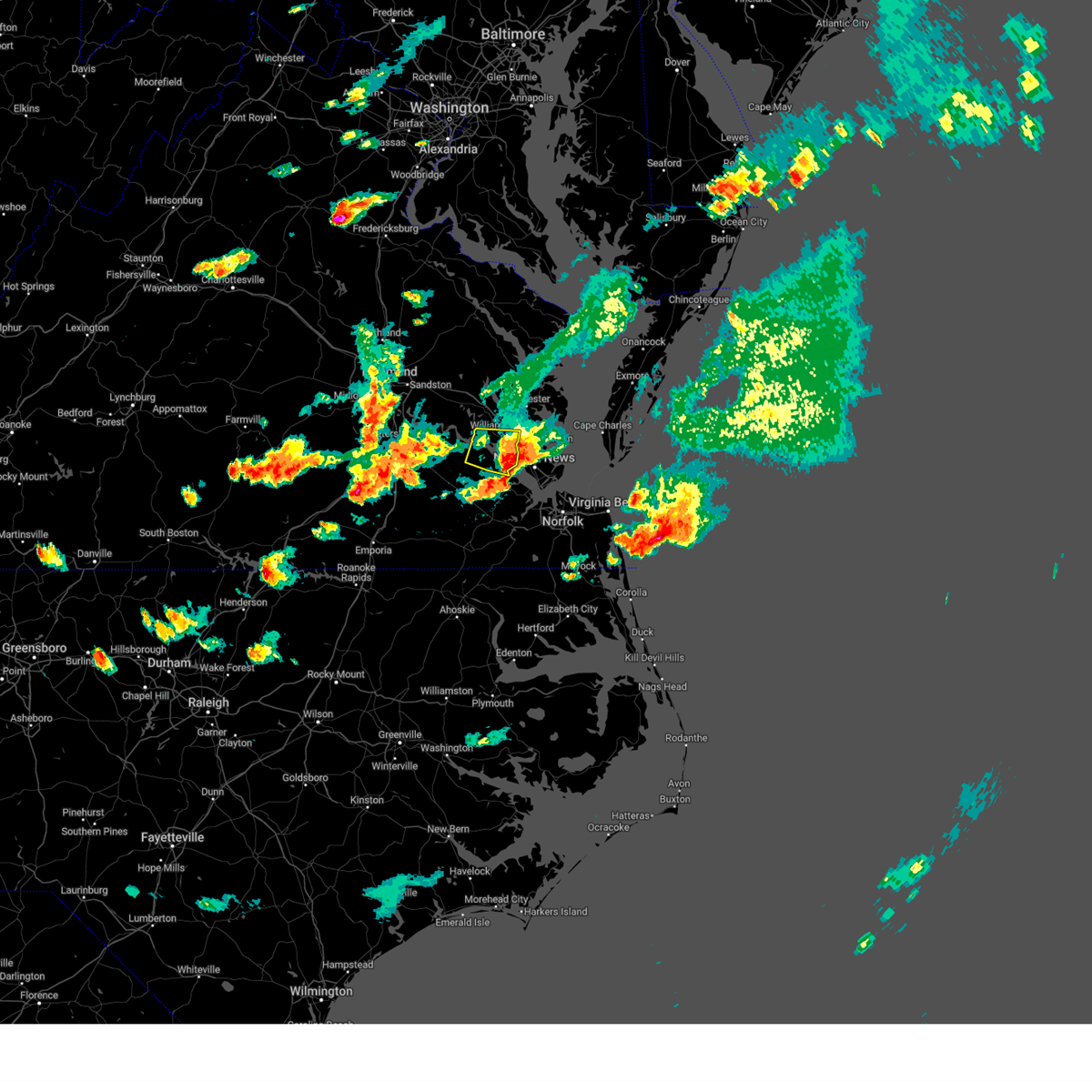 The severe thunderstorm warning for northern isle of wight, west central york, southern james city, and northeastern surry counties, the northern city of newport news and the city of williamsburg will expire at 445 pm edt, the storm which prompted the warning has moved out of the area. therefore, the warning will be allowed to expire. a severe thunderstorm watch remains in effect until 900 pm edt for southeastern and east central virginia. The severe thunderstorm warning for northern isle of wight, west central york, southern james city, and northeastern surry counties, the northern city of newport news and the city of williamsburg will expire at 445 pm edt, the storm which prompted the warning has moved out of the area. therefore, the warning will be allowed to expire. a severe thunderstorm watch remains in effect until 900 pm edt for southeastern and east central virginia.
|
| 6/16/2023 4:36 PM EDT |
 At 436 pm edt, a severe thunderstorm capable of producing a tornado was located over smithfield, moving east at 25 mph (radar indicated rotation). Hazards include tornado and quarter size hail. Flying debris will be dangerous to those caught without shelter. mobile homes will be damaged or destroyed. damage to roofs, windows, and vehicles will occur. tree damage is likely. this dangerous storm will be near, smithfield around 440 pm edt. rescue around 450 pm edt. Other locations impacted by this tornadic thunderstorm include mogarts beach, carrollton, benns church, lawson, hilton village and rushmere. At 436 pm edt, a severe thunderstorm capable of producing a tornado was located over smithfield, moving east at 25 mph (radar indicated rotation). Hazards include tornado and quarter size hail. Flying debris will be dangerous to those caught without shelter. mobile homes will be damaged or destroyed. damage to roofs, windows, and vehicles will occur. tree damage is likely. this dangerous storm will be near, smithfield around 440 pm edt. rescue around 450 pm edt. Other locations impacted by this tornadic thunderstorm include mogarts beach, carrollton, benns church, lawson, hilton village and rushmere.
|
| 6/16/2023 4:30 PM EDT |
 At 430 pm edt, a severe thunderstorm was located near busch gardens, or near williamsburg, moving east at 30 mph (radar indicated). Hazards include 60 mph wind gusts and quarter size hail. Minor damage to vehicles is possible. expect wind damage to trees and powerlines. this severe thunderstorm will be near, grove around 435 pm edt. lee hall and fort eustis around 440 pm edt. newport news around 445 pm edt. patrick henry field, virginia institute for marine sciences and denbigh around 450 pm edt. seaford, christopher newport university, tabb and beaconsdale around 455 pm edt. northampton around 500 pm edt. hampton and langley afb around 505 pm edt. hampton university around 510 pm edt. other locations impacted by this severe thunderstorm include rushmere, carrollton, lackey, oriana, hilton village, newport news golf course, poolesville, oyster point, hog island game reserve and messick. hail threat, radar indicated max hail size, 1. 00 in wind threat, radar indicated max wind gust, 60 mph. At 430 pm edt, a severe thunderstorm was located near busch gardens, or near williamsburg, moving east at 30 mph (radar indicated). Hazards include 60 mph wind gusts and quarter size hail. Minor damage to vehicles is possible. expect wind damage to trees and powerlines. this severe thunderstorm will be near, grove around 435 pm edt. lee hall and fort eustis around 440 pm edt. newport news around 445 pm edt. patrick henry field, virginia institute for marine sciences and denbigh around 450 pm edt. seaford, christopher newport university, tabb and beaconsdale around 455 pm edt. northampton around 500 pm edt. hampton and langley afb around 505 pm edt. hampton university around 510 pm edt. other locations impacted by this severe thunderstorm include rushmere, carrollton, lackey, oriana, hilton village, newport news golf course, poolesville, oyster point, hog island game reserve and messick. hail threat, radar indicated max hail size, 1. 00 in wind threat, radar indicated max wind gust, 60 mph.
|
| 6/16/2023 4:17 PM EDT |
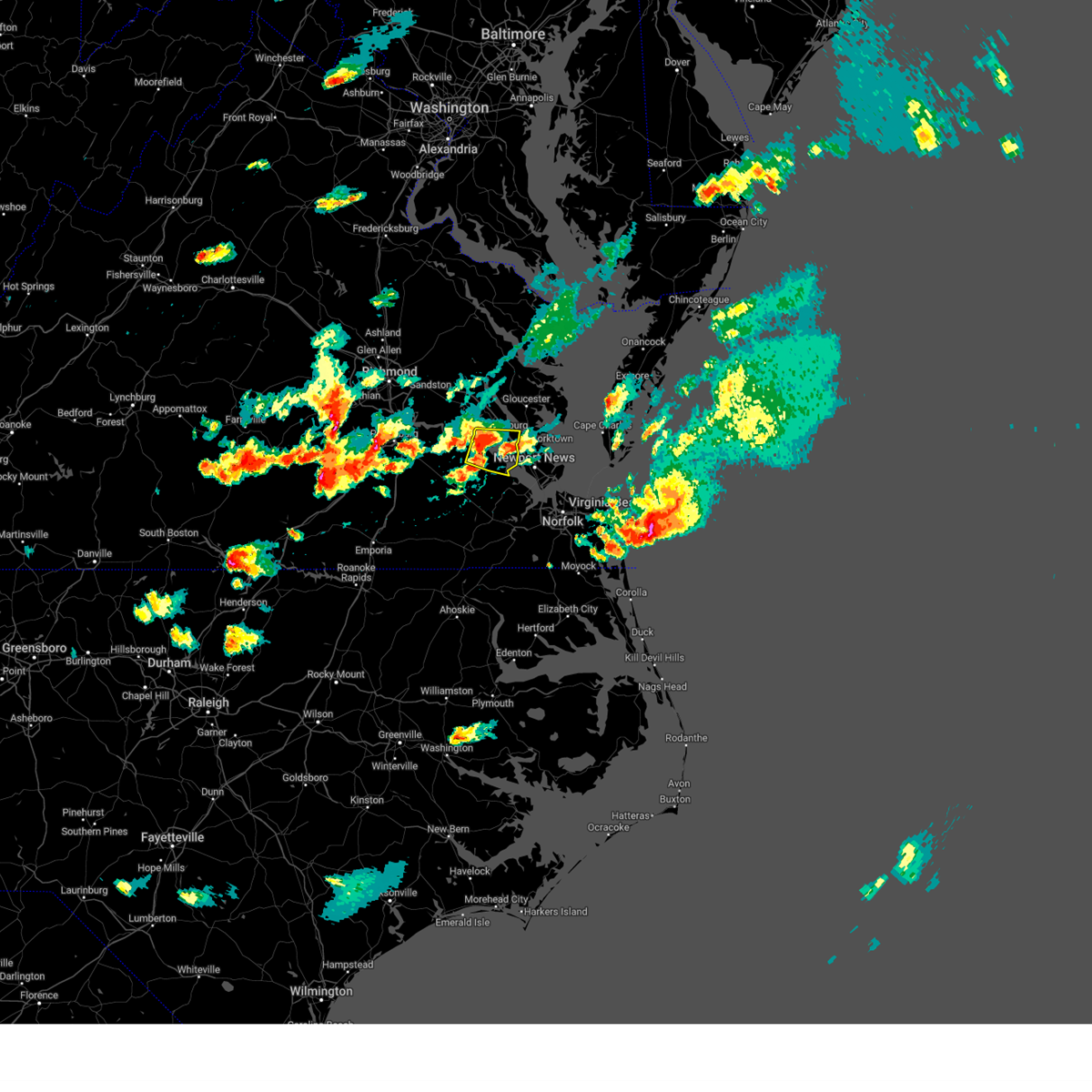 At 417 pm edt, a severe thunderstorm was located over scotland, or near surry, moving east at 30 mph (radar indicated). Hazards include 70 mph wind gusts and half dollar size hail. Minor damage to vehicles is possible. expect considerable tree damage. wind damage is also likely to mobile homes, roofs, and outbuildings. this severe storm will be near, college of william and mary and kings point around 425 pm edt. carver gardens and york terrace around 430 pm edt. busch gardens and grove around 435 pm edt. fort eustis around 440 pm edt. newport news around 445 pm edt. other locations impacted by this severe thunderstorm include rushmere, bacons castle, chippokes state park, water country u. s. a. poolesville, governors land, hog island game reserve, alliance, williamsburg airport and u. s. naval weapons. thunderstorm damage threat, considerable hail threat, radar indicated max hail size, 1. 25 in wind threat, radar indicated max wind gust, 70 mph. At 417 pm edt, a severe thunderstorm was located over scotland, or near surry, moving east at 30 mph (radar indicated). Hazards include 70 mph wind gusts and half dollar size hail. Minor damage to vehicles is possible. expect considerable tree damage. wind damage is also likely to mobile homes, roofs, and outbuildings. this severe storm will be near, college of william and mary and kings point around 425 pm edt. carver gardens and york terrace around 430 pm edt. busch gardens and grove around 435 pm edt. fort eustis around 440 pm edt. newport news around 445 pm edt. other locations impacted by this severe thunderstorm include rushmere, bacons castle, chippokes state park, water country u. s. a. poolesville, governors land, hog island game reserve, alliance, williamsburg airport and u. s. naval weapons. thunderstorm damage threat, considerable hail threat, radar indicated max hail size, 1. 25 in wind threat, radar indicated max wind gust, 70 mph.
|
| 6/16/2023 3:57 PM EDT |
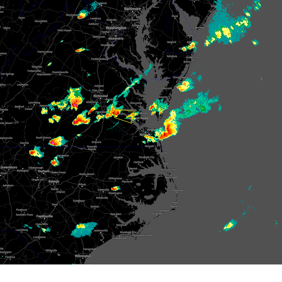 At 357 pm edt, a severe thunderstorm was located over claremont, moving east at 30 mph (radar indicated). Hazards include 70 mph wind gusts and half dollar size hail. Minor damage to vehicles is possible. expect considerable tree damage. wind damage is also likely to mobile homes, roofs, and outbuildings. this severe thunderstorm will be near, rustic around 400 pm edt. claremont around 405 pm edt. surry around 415 pm edt. scotland and jamestown around 420 pm edt. college of william and mary and kings point around 425 pm edt. carver gardens and york terrace around 430 pm edt. busch gardens and grove around 435 pm edt. fort eustis around 440 pm edt. other locations impacted by this severe thunderstorm include rushmere, taylors corner, chippokes state park, water country u. s. a. spring grove, brandon, bacons castle, poolesville, governors land and hog island game reserve. thunderstorm damage threat, considerable hail threat, radar indicated max hail size, 1. 25 in wind threat, radar indicated max wind gust, 70 mph. At 357 pm edt, a severe thunderstorm was located over claremont, moving east at 30 mph (radar indicated). Hazards include 70 mph wind gusts and half dollar size hail. Minor damage to vehicles is possible. expect considerable tree damage. wind damage is also likely to mobile homes, roofs, and outbuildings. this severe thunderstorm will be near, rustic around 400 pm edt. claremont around 405 pm edt. surry around 415 pm edt. scotland and jamestown around 420 pm edt. college of william and mary and kings point around 425 pm edt. carver gardens and york terrace around 430 pm edt. busch gardens and grove around 435 pm edt. fort eustis around 440 pm edt. other locations impacted by this severe thunderstorm include rushmere, taylors corner, chippokes state park, water country u. s. a. spring grove, brandon, bacons castle, poolesville, governors land and hog island game reserve. thunderstorm damage threat, considerable hail threat, radar indicated max hail size, 1. 25 in wind threat, radar indicated max wind gust, 70 mph.
|
| 10/17/2022 8:03 PM EDT |
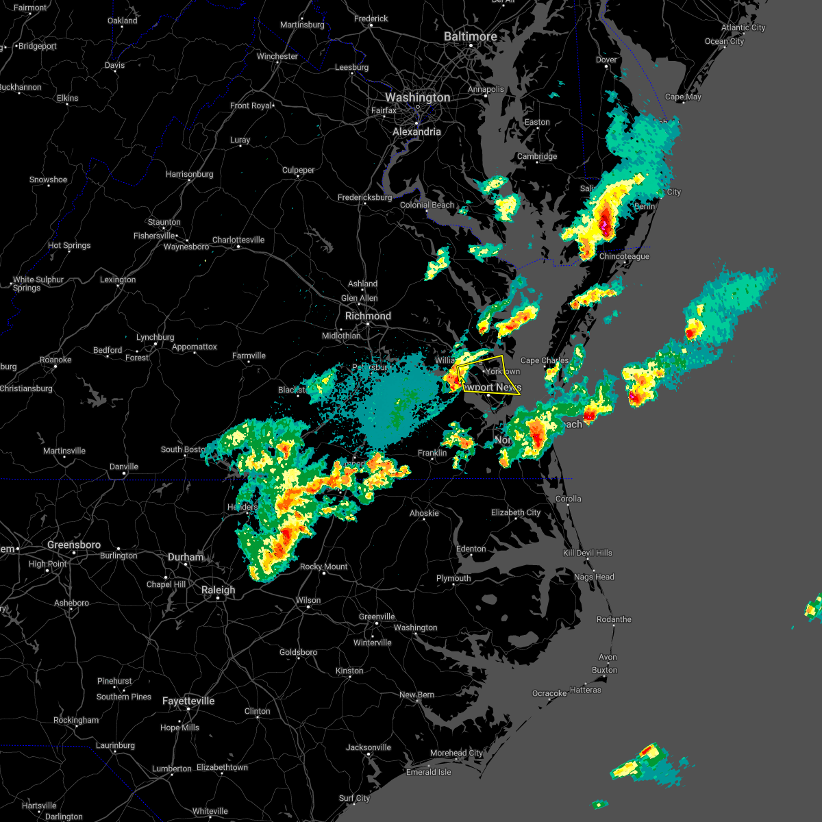 At 803 pm edt, a severe thunderstorm was located over lee hall, or near patrick henry field, moving east at 30 mph (radar indicated). Hazards include 60 mph wind gusts and quarter size hail. Minor damage to vehicles is possible. expect wind damage to trees and powerlines. this severe storm will be near, newport news around 810 pm edt. virginia institute for marine sciences, patrick henry field, gloucester point, tabb and wicomico around 815 pm edt. seaford and achilles around 820 pm edt. hampton around 825 pm edt. other locations impacted by this severe thunderstorm include lackey, water country u. s. a. Glass, oriana, maryus, dare, newport news golf course, severn, oyster point and messick. At 803 pm edt, a severe thunderstorm was located over lee hall, or near patrick henry field, moving east at 30 mph (radar indicated). Hazards include 60 mph wind gusts and quarter size hail. Minor damage to vehicles is possible. expect wind damage to trees and powerlines. this severe storm will be near, newport news around 810 pm edt. virginia institute for marine sciences, patrick henry field, gloucester point, tabb and wicomico around 815 pm edt. seaford and achilles around 820 pm edt. hampton around 825 pm edt. other locations impacted by this severe thunderstorm include lackey, water country u. s. a. Glass, oriana, maryus, dare, newport news golf course, severn, oyster point and messick.
|
| 10/17/2022 7:49 PM EDT |
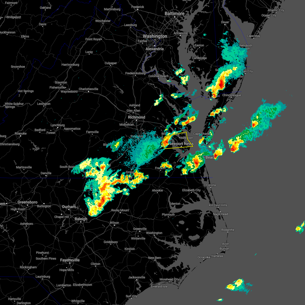 At 748 pm edt, a severe thunderstorm was located over scotland, or near surry, moving east at 30 mph (radar indicated). Hazards include 60 mph wind gusts and quarter size hail. Minor damage to vehicles is possible. expect wind damage to trees and powerlines. this severe thunderstorm will be near, busch gardens, carver gardens and york terrace around 800 pm edt. lee hall, fort eustis and grove around 805 pm edt. newport news and denbigh around 810 pm edt. virginia institute for marine sciences, patrick henry field, gloucester point and wicomico around 815 pm edt. seaford and tabb around 820 pm edt. hampton and achilles around 825 pm edt. other locations impacted by this severe thunderstorm include rushmere, lackey, chippokes state park, water country u. s. a. glass, oriana, maryus, bacons castle, dare and newport news golf course. hail threat, radar indicated max hail size, 1. 00 in wind threat, radar indicated max wind gust, 60 mph. At 748 pm edt, a severe thunderstorm was located over scotland, or near surry, moving east at 30 mph (radar indicated). Hazards include 60 mph wind gusts and quarter size hail. Minor damage to vehicles is possible. expect wind damage to trees and powerlines. this severe thunderstorm will be near, busch gardens, carver gardens and york terrace around 800 pm edt. lee hall, fort eustis and grove around 805 pm edt. newport news and denbigh around 810 pm edt. virginia institute for marine sciences, patrick henry field, gloucester point and wicomico around 815 pm edt. seaford and tabb around 820 pm edt. hampton and achilles around 825 pm edt. other locations impacted by this severe thunderstorm include rushmere, lackey, chippokes state park, water country u. s. a. glass, oriana, maryus, bacons castle, dare and newport news golf course. hail threat, radar indicated max hail size, 1. 00 in wind threat, radar indicated max wind gust, 60 mph.
|
| 9/25/2022 5:19 PM EDT |
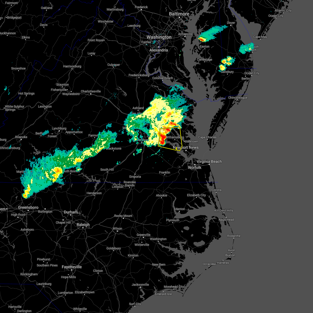 At 518 pm edt, severe thunderstorms were located along a line extending from barhamsville to rustic to near cabin point, moving east at 60 mph (radar indicated). Hazards include 60 mph wind gusts and penny size hail. Expect damage to trees and powerlines. these severe storms will be near, toano and barhamsville around 525 pm edt. williamsburg and norge around 530 pm edt. college of william and mary, kings point, york terrace, carver gardens and busch gardens around 535 pm edt. newport news, queens lake, grove and lee hall around 540 pm edt. other locations impacted by these severe thunderstorms include taylors corner, chickahominy shore, croaker, chippokes state park, camp peary, spring grove, lanexa, ewell, warren mill and allmondsville. hail threat, radar indicated max hail size, 0. 75 in wind threat, radar indicated max wind gust, 60 mph. At 518 pm edt, severe thunderstorms were located along a line extending from barhamsville to rustic to near cabin point, moving east at 60 mph (radar indicated). Hazards include 60 mph wind gusts and penny size hail. Expect damage to trees and powerlines. these severe storms will be near, toano and barhamsville around 525 pm edt. williamsburg and norge around 530 pm edt. college of william and mary, kings point, york terrace, carver gardens and busch gardens around 535 pm edt. newport news, queens lake, grove and lee hall around 540 pm edt. other locations impacted by these severe thunderstorms include taylors corner, chickahominy shore, croaker, chippokes state park, camp peary, spring grove, lanexa, ewell, warren mill and allmondsville. hail threat, radar indicated max hail size, 0. 75 in wind threat, radar indicated max wind gust, 60 mph.
|
| 9/25/2022 4:55 PM EDT |
 At 455 pm edt, severe thunderstorms were located along a line extending from near hopewell to prince george to near carson, moving east at 50 mph (radar indicated). Hazards include 60 mph wind gusts and penny size hail. Expect damage to trees and powerlines. severe thunderstorms will be near, jordans point around 500 pm edt. disputanta and garysville around 505 pm edt. charles city, burrowsville, cabin point, ruthville and adkins store around 510 pm edt. waverly around 515 pm edt. claremont, rustic and holdcroft around 520 pm edt. surry, toano and dendron around 525 pm edt. norge, scotland, elberon and jamestown around 530 pm edt. williamsburg, queens lake, college of william and mary, york terrace, carver gardens and kings point around 535 pm edt. other locations impacted by these severe thunderstorms include pons, croaker, chippokes state park, wayside, camp peary, ewell, meadowville, poolesville, allmondsville and gwaltney corner. hail threat, radar indicated max hail size, 0. 75 in wind threat, radar indicated max wind gust, 60 mph. At 455 pm edt, severe thunderstorms were located along a line extending from near hopewell to prince george to near carson, moving east at 50 mph (radar indicated). Hazards include 60 mph wind gusts and penny size hail. Expect damage to trees and powerlines. severe thunderstorms will be near, jordans point around 500 pm edt. disputanta and garysville around 505 pm edt. charles city, burrowsville, cabin point, ruthville and adkins store around 510 pm edt. waverly around 515 pm edt. claremont, rustic and holdcroft around 520 pm edt. surry, toano and dendron around 525 pm edt. norge, scotland, elberon and jamestown around 530 pm edt. williamsburg, queens lake, college of william and mary, york terrace, carver gardens and kings point around 535 pm edt. other locations impacted by these severe thunderstorms include pons, croaker, chippokes state park, wayside, camp peary, ewell, meadowville, poolesville, allmondsville and gwaltney corner. hail threat, radar indicated max hail size, 0. 75 in wind threat, radar indicated max wind gust, 60 mph.
|
| 6/12/2022 12:17 PM EDT |
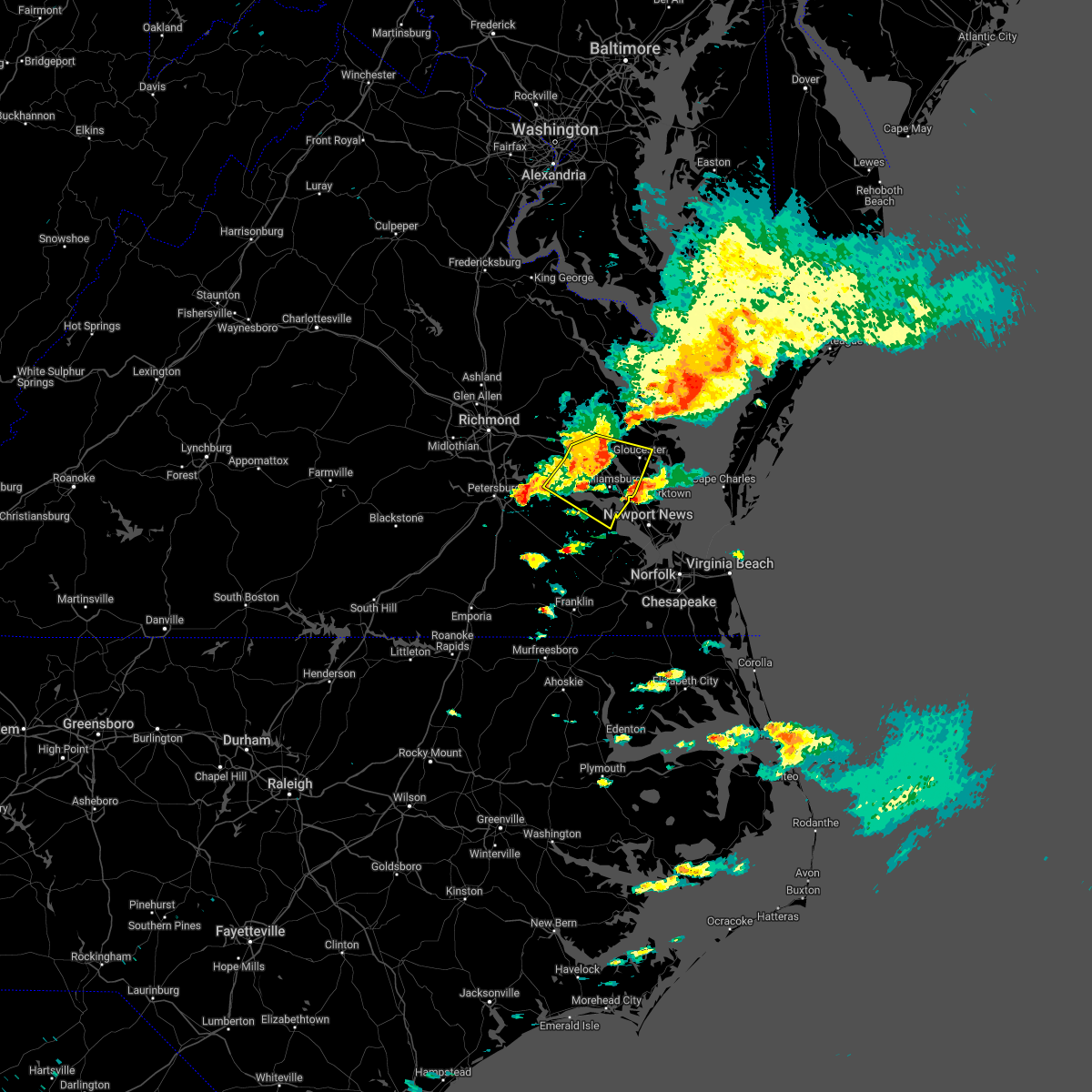 At 1216 pm edt, severe thunderstorms were located along a line extending from near shacklefords to near norge to near claremont, moving east at 30 mph (radar indicated). Hazards include 60 mph wind gusts and penny size hail. Expect damage to trees and powerlines. these severe storms will be near, williamsburg around 1220 pm edt. queens lake around 1225 pm edt. surry around 1230 pm edt. jamestown and scotland around 1235 pm edt. gloucester courthouse, gloucester point, college of william and mary, kings point and hayes around 1240 pm edt. carver gardens and york terrace around 1245 pm edt. busch gardens and grove around 1250 pm edt. other locations impacted by these severe thunderstorms include chickahominy shore, croaker, chippokes state park, camp peary, lanexa, ewell, poolesville, warren mill, allmondsville and hog island game reserve. hail threat, radar indicated max hail size, 0. 75 in wind threat, radar indicated max wind gust, 60 mph. At 1216 pm edt, severe thunderstorms were located along a line extending from near shacklefords to near norge to near claremont, moving east at 30 mph (radar indicated). Hazards include 60 mph wind gusts and penny size hail. Expect damage to trees and powerlines. these severe storms will be near, williamsburg around 1220 pm edt. queens lake around 1225 pm edt. surry around 1230 pm edt. jamestown and scotland around 1235 pm edt. gloucester courthouse, gloucester point, college of william and mary, kings point and hayes around 1240 pm edt. carver gardens and york terrace around 1245 pm edt. busch gardens and grove around 1250 pm edt. other locations impacted by these severe thunderstorms include chickahominy shore, croaker, chippokes state park, camp peary, lanexa, ewell, poolesville, warren mill, allmondsville and hog island game reserve. hail threat, radar indicated max hail size, 0. 75 in wind threat, radar indicated max wind gust, 60 mph.
|
| 6/12/2022 11:46 AM EDT |
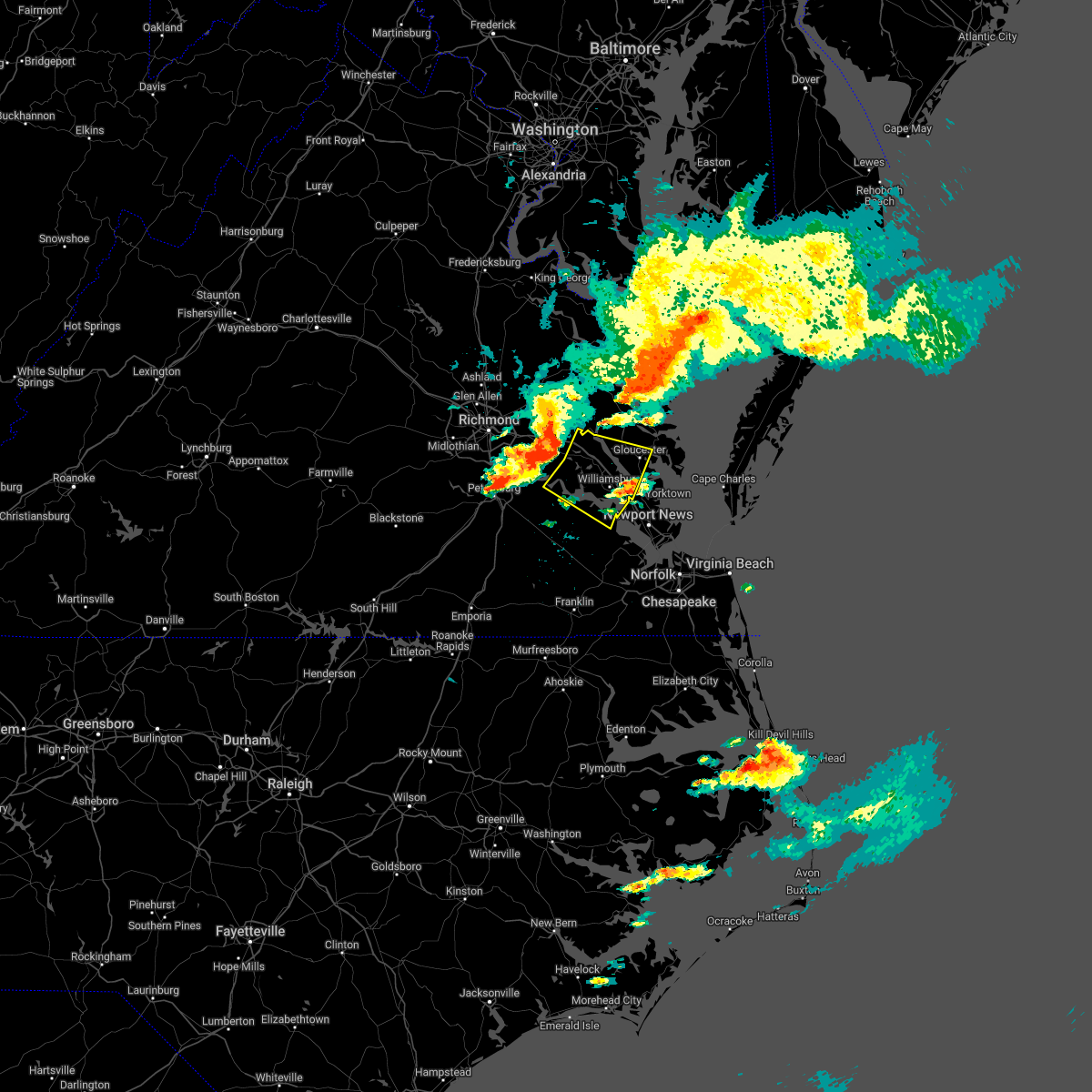 At 1146 am edt, severe thunderstorms were located along a line extending from new kent to near holdcroft to near charles city, moving east at 40 mph (radar indicated). Hazards include 60 mph wind gusts and penny size hail. Expect damage to trees and powerlines. severe thunderstorms will be near, holdcroft around 1150 am edt. toano, rustic and barhamsville around 1200 pm edt. claremont and norge around 1205 pm edt. williamsburg and college of william and mary around 1210 pm edt. surry, queens lake and york terrace around 1215 pm edt. jamestown and scotland around 1220 pm edt. gloucester courthouse, kings point and carver gardens around 1225 pm edt. gloucester point, hayes, busch gardens and grove around 1230 pm edt. other locations impacted by these severe thunderstorms include eltham, chickahominy shore, croaker, chippokes state park, camp peary, lanexa, ewell, poolesville, warren mill and allmondsville. hail threat, radar indicated max hail size, 0. 75 in wind threat, radar indicated max wind gust, 60 mph. At 1146 am edt, severe thunderstorms were located along a line extending from new kent to near holdcroft to near charles city, moving east at 40 mph (radar indicated). Hazards include 60 mph wind gusts and penny size hail. Expect damage to trees and powerlines. severe thunderstorms will be near, holdcroft around 1150 am edt. toano, rustic and barhamsville around 1200 pm edt. claremont and norge around 1205 pm edt. williamsburg and college of william and mary around 1210 pm edt. surry, queens lake and york terrace around 1215 pm edt. jamestown and scotland around 1220 pm edt. gloucester courthouse, kings point and carver gardens around 1225 pm edt. gloucester point, hayes, busch gardens and grove around 1230 pm edt. other locations impacted by these severe thunderstorms include eltham, chickahominy shore, croaker, chippokes state park, camp peary, lanexa, ewell, poolesville, warren mill and allmondsville. hail threat, radar indicated max hail size, 0. 75 in wind threat, radar indicated max wind gust, 60 mph.
|
| 6/2/2022 8:22 PM EDT |
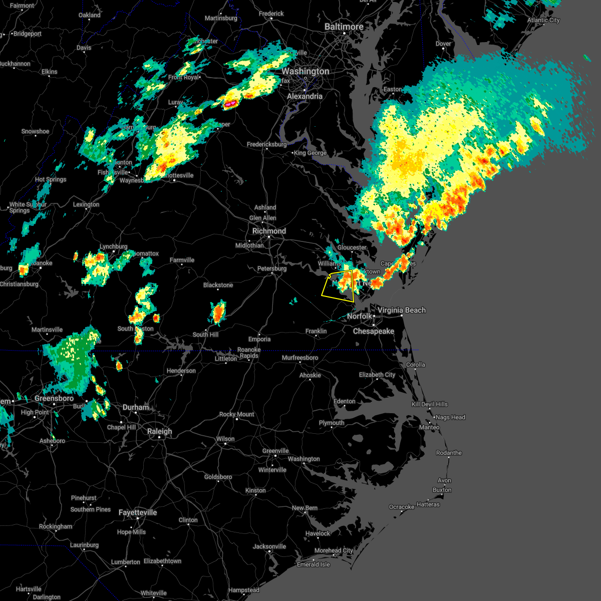 The severe thunderstorm warning for northeastern isle of wight, central york, southeastern james city and northeastern surry counties and the northern city of newport news will expire at 830 pm edt, the storm which prompted the warning has moved out of the area. therefore, the warning will be allowed to expire. a severe thunderstorm watch remains in effect until 900 pm edt for southeastern virginia. The severe thunderstorm warning for northeastern isle of wight, central york, southeastern james city and northeastern surry counties and the northern city of newport news will expire at 830 pm edt, the storm which prompted the warning has moved out of the area. therefore, the warning will be allowed to expire. a severe thunderstorm watch remains in effect until 900 pm edt for southeastern virginia.
|
| 6/2/2022 8:07 PM EDT |
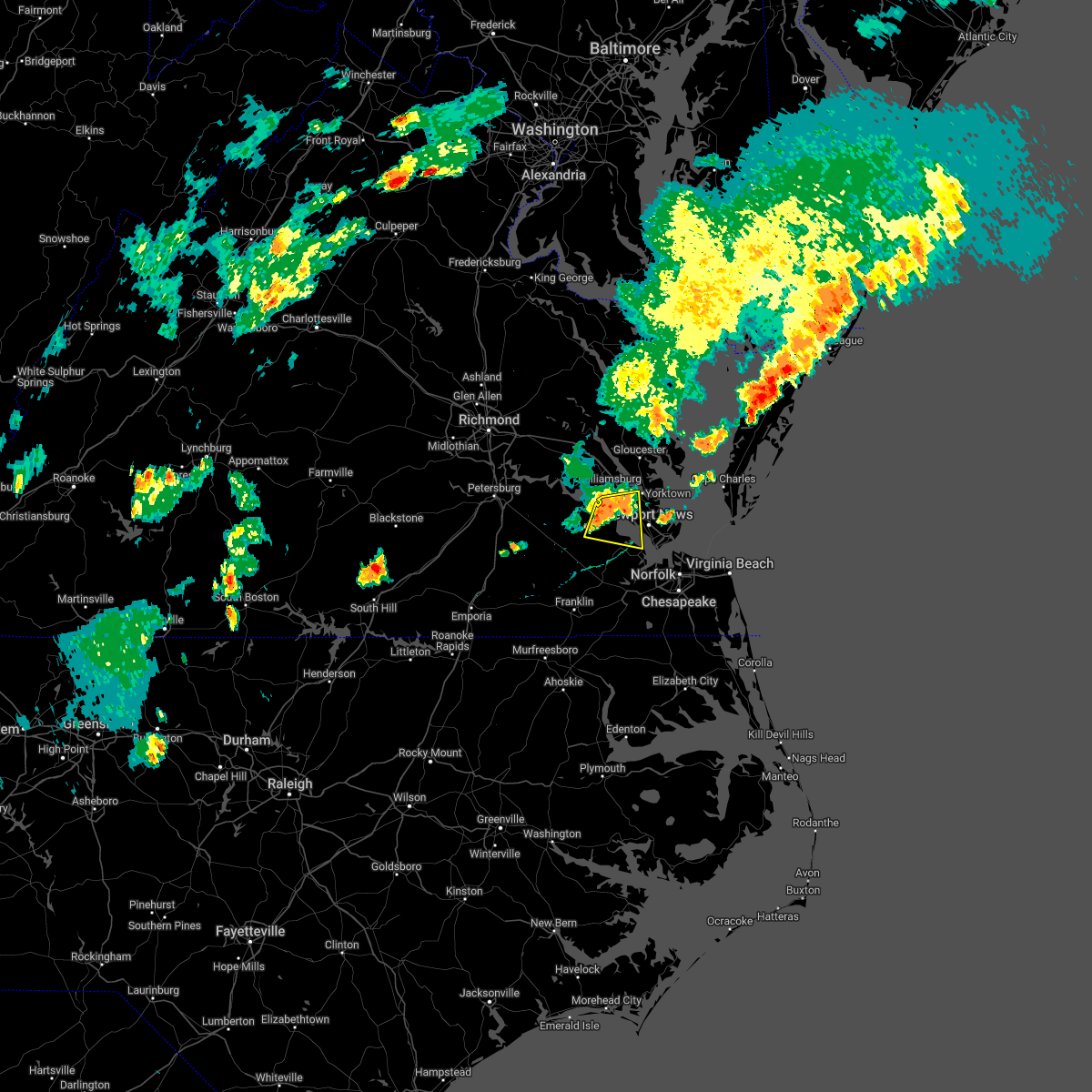 At 807 pm edt, a severe thunderstorm was located near surry, moving east at 35 mph (radar indicated). Hazards include 60 mph wind gusts. Expect damage to trees and powerlines. this severe storm will be near, fort eustis around 820 pm edt. lee hall around 825 pm edt. newport news and denbigh around 830 pm edt. other locations impacted by this severe thunderstorm include rushmere, lackey, chippokes state park, oriana, delk crossroads, lawson, bacons castle, newport news golf course, poolesville and moonlight. hail threat, radar indicated max hail size, <. 75 in wind threat, radar indicated max wind gust, 60 mph. At 807 pm edt, a severe thunderstorm was located near surry, moving east at 35 mph (radar indicated). Hazards include 60 mph wind gusts. Expect damage to trees and powerlines. this severe storm will be near, fort eustis around 820 pm edt. lee hall around 825 pm edt. newport news and denbigh around 830 pm edt. other locations impacted by this severe thunderstorm include rushmere, lackey, chippokes state park, oriana, delk crossroads, lawson, bacons castle, newport news golf course, poolesville and moonlight. hail threat, radar indicated max hail size, <. 75 in wind threat, radar indicated max wind gust, 60 mph.
|
| 6/2/2022 7:58 PM EDT |
 At 758 pm edt, a severe thunderstorm was located near surry, moving east at 35 mph (radar indicated). Hazards include 60 mph wind gusts. Expect damage to trees and powerlines. this severe thunderstorm will be near, fort eustis around 820 pm edt. lee hall around 825 pm edt. newport news and denbigh around 830 pm edt. other locations impacted by this severe thunderstorm include rushmere, pons, carrollton, lackey, chippokes state park, oriana, bethel church, ellis fork, delk crossroads and lawson. hail threat, radar indicated max hail size, <. 75 in wind threat, radar indicated max wind gust, 60 mph. At 758 pm edt, a severe thunderstorm was located near surry, moving east at 35 mph (radar indicated). Hazards include 60 mph wind gusts. Expect damage to trees and powerlines. this severe thunderstorm will be near, fort eustis around 820 pm edt. lee hall around 825 pm edt. newport news and denbigh around 830 pm edt. other locations impacted by this severe thunderstorm include rushmere, pons, carrollton, lackey, chippokes state park, oriana, bethel church, ellis fork, delk crossroads and lawson. hail threat, radar indicated max hail size, <. 75 in wind threat, radar indicated max wind gust, 60 mph.
|
| 5/21/2022 8:41 PM EDT |
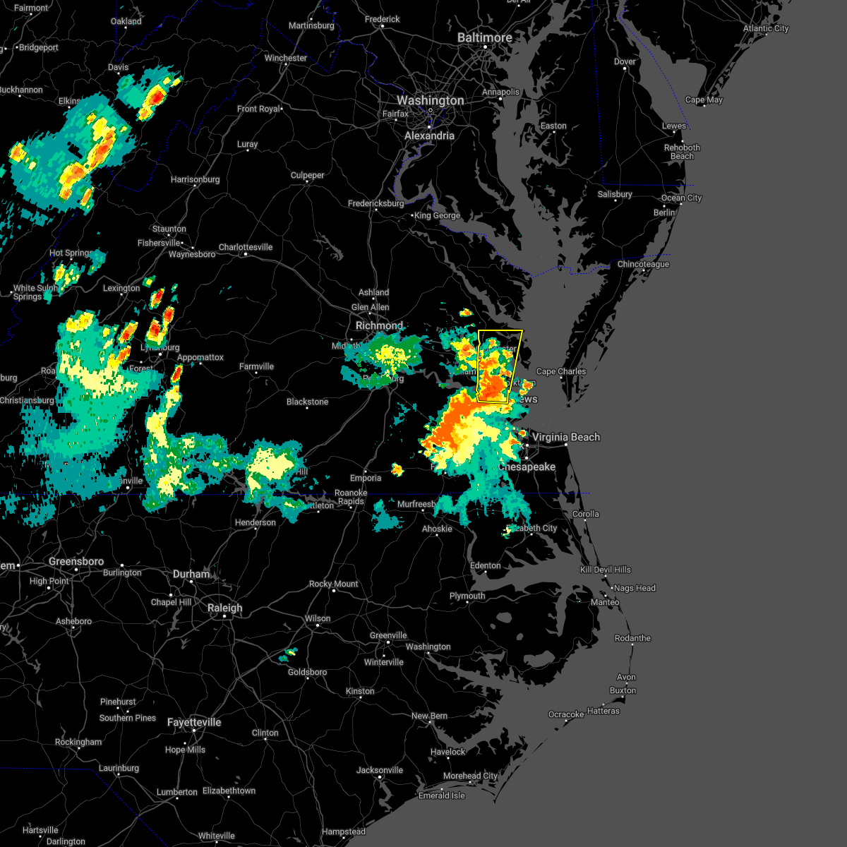 At 841 pm edt, a severe thunderstorm was located over lee hall, or near virginia institute for marine sciences, moving north at 25 mph (radar indicated). Hazards include 60 mph wind gusts and quarter size hail. Minor damage to vehicles is possible. expect wind damage to trees and powerlines. this severe thunderstorm will be near, carver gardens around 845 pm edt. virginia institute for marine sciences, queens lake and york terrace around 850 pm edt. gloucester point, wicomico and achilles around 855 pm edt. hayes around 910 pm edt. gloucester courthouse around 915 pm edt. hartfield and blakes around 930 pm edt. other locations impacted by this severe thunderstorm include lackey, beulah, camp peary, glass, naxera, oriana, grafton, harcum, cash and amburg. hail threat, radar indicated max hail size, 1. 00 in wind threat, radar indicated max wind gust, 60 mph. At 841 pm edt, a severe thunderstorm was located over lee hall, or near virginia institute for marine sciences, moving north at 25 mph (radar indicated). Hazards include 60 mph wind gusts and quarter size hail. Minor damage to vehicles is possible. expect wind damage to trees and powerlines. this severe thunderstorm will be near, carver gardens around 845 pm edt. virginia institute for marine sciences, queens lake and york terrace around 850 pm edt. gloucester point, wicomico and achilles around 855 pm edt. hayes around 910 pm edt. gloucester courthouse around 915 pm edt. hartfield and blakes around 930 pm edt. other locations impacted by this severe thunderstorm include lackey, beulah, camp peary, glass, naxera, oriana, grafton, harcum, cash and amburg. hail threat, radar indicated max hail size, 1. 00 in wind threat, radar indicated max wind gust, 60 mph.
|
| 5/6/2022 5:52 PM EDT |
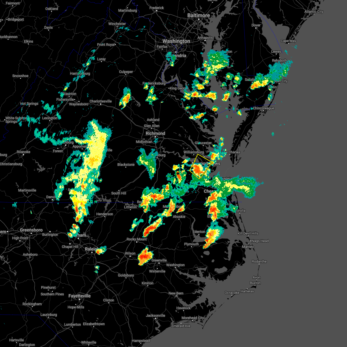 At 551 pm edt, a severe thunderstorm was located near smithfield, moving northeast at 40 mph (radar indicated). Hazards include 60 mph wind gusts. Expect damage to trees and powerlines. this severe storm will be near, christopher newport university, fort eustis and beaconsdale around 600 pm edt. patrick henry field, denbigh and lee hall around 605 pm edt. newport news, hampton and tabb around 610 pm edt. other locations impacted by this severe thunderstorm include rushmere, carrollton, lackey, water country u. s. a. benns church, oriana, lawson, bacons castle, dare and newport news golf course. hail threat, radar indicated max hail size, <. 75 in wind threat, radar indicated max wind gust, 60 mph. At 551 pm edt, a severe thunderstorm was located near smithfield, moving northeast at 40 mph (radar indicated). Hazards include 60 mph wind gusts. Expect damage to trees and powerlines. this severe storm will be near, christopher newport university, fort eustis and beaconsdale around 600 pm edt. patrick henry field, denbigh and lee hall around 605 pm edt. newport news, hampton and tabb around 610 pm edt. other locations impacted by this severe thunderstorm include rushmere, carrollton, lackey, water country u. s. a. benns church, oriana, lawson, bacons castle, dare and newport news golf course. hail threat, radar indicated max hail size, <. 75 in wind threat, radar indicated max wind gust, 60 mph.
|
| 5/6/2022 5:25 PM EDT |
 At 524 pm edt, a severe thunderstorm was located over zuni, or 8 miles northwest of windsor, moving northeast at 40 mph (radar indicated). Hazards include 60 mph wind gusts and quarter size hail. Minor damage to vehicles is possible. expect wind damage to trees and powerlines. this severe thunderstorm will be near, isle of wight around 530 pm edt. smithfield around 540 pm edt. surry around 545 pm edt. fort eustis and scotland around 555 pm edt. patrick henry field, kings point, denbigh and jamestown around 600 pm edt. newport news, college of william and mary, grove, lee hall, busch gardens, carver gardens and york terrace around 605 pm edt. queens lake around 610 pm edt. other locations impacted by this severe thunderstorm include rushmere, pons, carrollton, lackey, chippokes state park, longview, benns church, oriana, bethel church and ewell. hail threat, radar indicated max hail size, 1. 00 in wind threat, radar indicated max wind gust, 60 mph. At 524 pm edt, a severe thunderstorm was located over zuni, or 8 miles northwest of windsor, moving northeast at 40 mph (radar indicated). Hazards include 60 mph wind gusts and quarter size hail. Minor damage to vehicles is possible. expect wind damage to trees and powerlines. this severe thunderstorm will be near, isle of wight around 530 pm edt. smithfield around 540 pm edt. surry around 545 pm edt. fort eustis and scotland around 555 pm edt. patrick henry field, kings point, denbigh and jamestown around 600 pm edt. newport news, college of william and mary, grove, lee hall, busch gardens, carver gardens and york terrace around 605 pm edt. queens lake around 610 pm edt. other locations impacted by this severe thunderstorm include rushmere, pons, carrollton, lackey, chippokes state park, longview, benns church, oriana, bethel church and ewell. hail threat, radar indicated max hail size, 1. 00 in wind threat, radar indicated max wind gust, 60 mph.
|
| 5/4/2022 3:42 PM EDT |
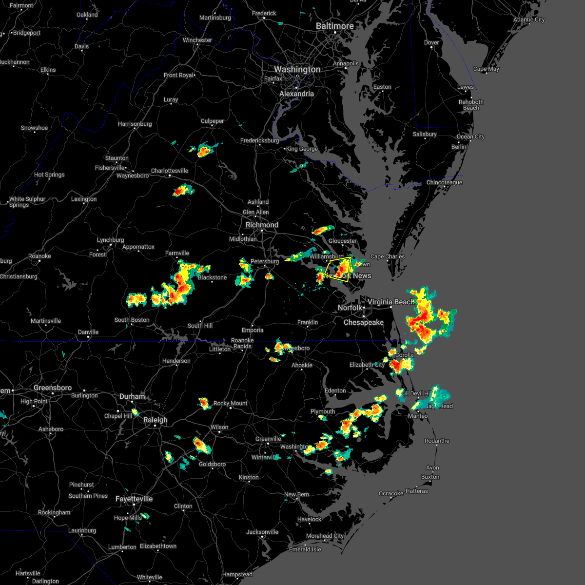 The severe thunderstorm warning for southeastern gloucester, central york, southeastern james city and east central surry counties and the city of newport news will expire at 345 pm edt, the storm which prompted the warning has weakened below severe limits, and no longer poses an immediate threat to life or property. therefore, the warning will be allowed to expire. however small hail, gusty winds and heavy rain are still possible with this thunderstorm. The severe thunderstorm warning for southeastern gloucester, central york, southeastern james city and east central surry counties and the city of newport news will expire at 345 pm edt, the storm which prompted the warning has weakened below severe limits, and no longer poses an immediate threat to life or property. therefore, the warning will be allowed to expire. however small hail, gusty winds and heavy rain are still possible with this thunderstorm.
|
| 5/4/2022 3:22 PM EDT |
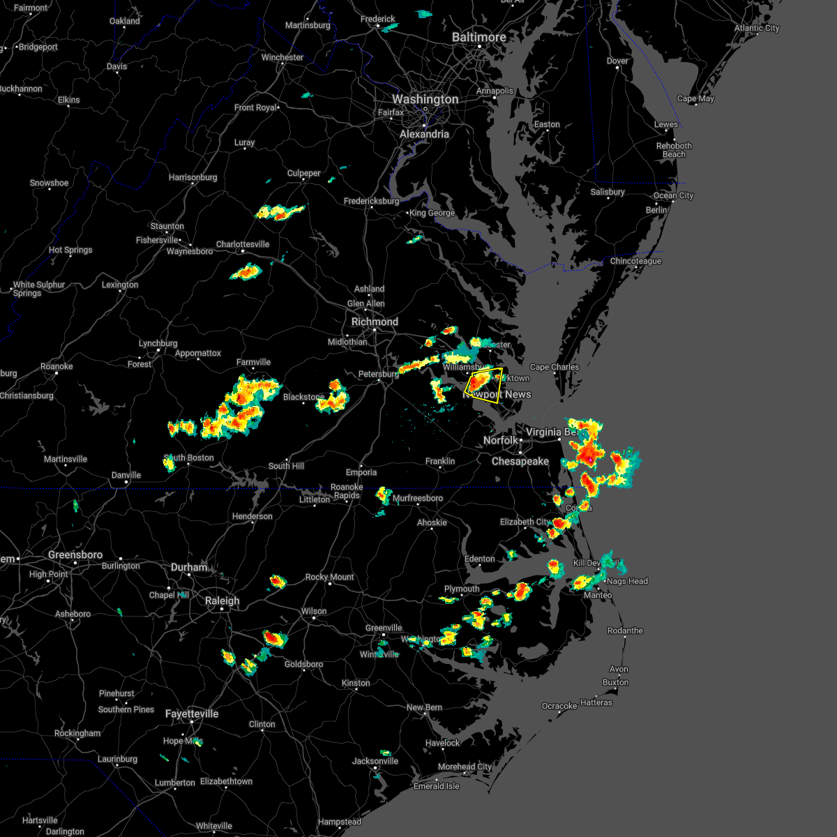 At 322 pm edt, a severe thunderstorm was located over busch gardens, or near queens lake, moving east at 25 mph (radar indicated). Hazards include 60 mph wind gusts and quarter size hail. Minor damage to vehicles is possible. expect wind damage to trees and powerlines. this severe storm will be near, lee hall and fort eustis around 330 pm edt. newport news and denbigh around 335 pm edt. virginia institute for marine sciences, patrick henry field, gloucester point and wicomico around 340 pm edt. achilles around 350 pm edt. other locations impacted by this severe thunderstorm include newport news golf course, lackey, water country u. s. a. oyster point, oriana, hog island game reserve, hornsbyville, harris grove, u. s. naval weapons and menchville. hail threat, radar indicated max hail size, 1. 00 in wind threat, radar indicated max wind gust, 60 mph. At 322 pm edt, a severe thunderstorm was located over busch gardens, or near queens lake, moving east at 25 mph (radar indicated). Hazards include 60 mph wind gusts and quarter size hail. Minor damage to vehicles is possible. expect wind damage to trees and powerlines. this severe storm will be near, lee hall and fort eustis around 330 pm edt. newport news and denbigh around 335 pm edt. virginia institute for marine sciences, patrick henry field, gloucester point and wicomico around 340 pm edt. achilles around 350 pm edt. other locations impacted by this severe thunderstorm include newport news golf course, lackey, water country u. s. a. oyster point, oriana, hog island game reserve, hornsbyville, harris grove, u. s. naval weapons and menchville. hail threat, radar indicated max hail size, 1. 00 in wind threat, radar indicated max wind gust, 60 mph.
|
| 5/4/2022 3:04 PM EDT |
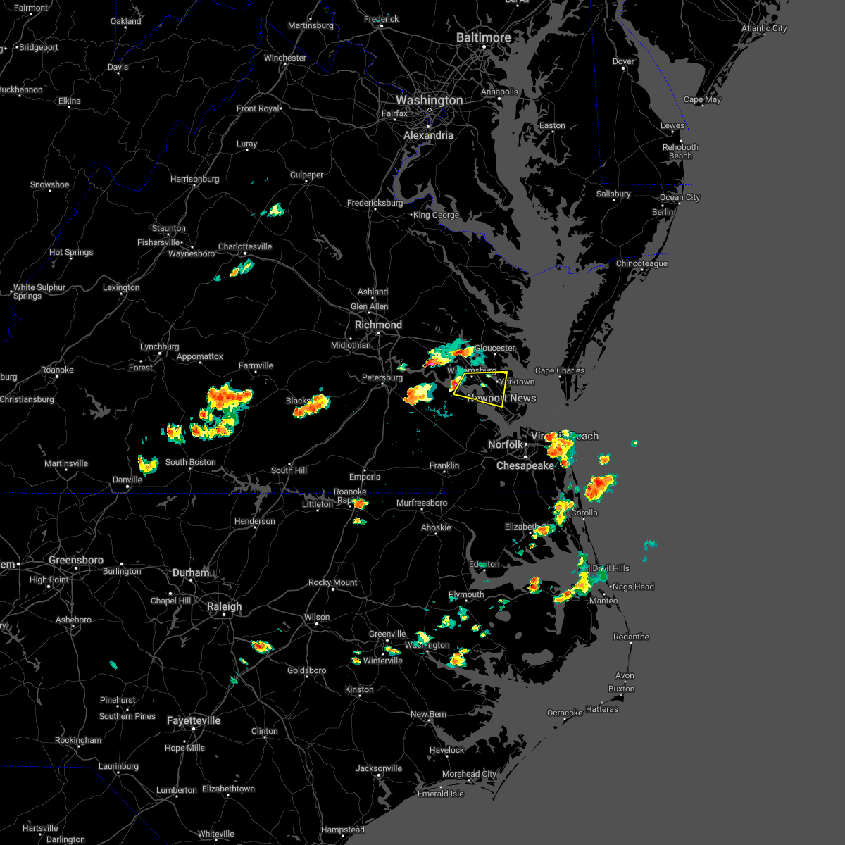 At 304 pm edt, a severe thunderstorm was located over jamestown, or near college of william and mary, moving east at 25 mph (radar indicated). Hazards include 60 mph wind gusts and quarter size hail. Minor damage to vehicles is possible. expect wind damage to trees and powerlines. this severe thunderstorm will be near, kings point around 310 pm edt. queens lake, carver gardens and york terrace around 315 pm edt. grove and busch gardens around 320 pm edt. lee hall and fort eustis around 325 pm edt. newport news around 330 pm edt. virginia institute for marine sciences, patrick henry field, gloucester point, denbigh and wicomico around 335 pm edt. achilles around 345 pm edt. other locations impacted by this severe thunderstorm include lackey, water country u. s. a. oriana, newport news golf course, oyster point, hog island game reserve, hornsbyville, harris grove, williamsburg airport and u. s. naval weapons. hail threat, radar indicated max hail size, 1. 00 in wind threat, radar indicated max wind gust, 60 mph. At 304 pm edt, a severe thunderstorm was located over jamestown, or near college of william and mary, moving east at 25 mph (radar indicated). Hazards include 60 mph wind gusts and quarter size hail. Minor damage to vehicles is possible. expect wind damage to trees and powerlines. this severe thunderstorm will be near, kings point around 310 pm edt. queens lake, carver gardens and york terrace around 315 pm edt. grove and busch gardens around 320 pm edt. lee hall and fort eustis around 325 pm edt. newport news around 330 pm edt. virginia institute for marine sciences, patrick henry field, gloucester point, denbigh and wicomico around 335 pm edt. achilles around 345 pm edt. other locations impacted by this severe thunderstorm include lackey, water country u. s. a. oriana, newport news golf course, oyster point, hog island game reserve, hornsbyville, harris grove, williamsburg airport and u. s. naval weapons. hail threat, radar indicated max hail size, 1. 00 in wind threat, radar indicated max wind gust, 60 mph.
|
| 4/7/2022 6:21 PM EDT |
 At 621 pm edt, a severe thunderstorm was located over northampton, or near christopher newport university, moving east at 35 mph (radar indicated). Hazards include 60 mph wind gusts and penny size hail. Expect damage to trees and powerlines. this severe storm will be near, hampton around 625 pm edt. langley afb, hampton university and fort monroe around 630 pm edt. grand view and buckroe beach around 635 pm edt. other locations impacted by this severe thunderstorm include rushmere, pons, carrollton, chippokes state park, longview, benns church, oriana, bethel church, ellis fork and hilton village. hail threat, radar indicated max hail size, 0. 75 in wind threat, radar indicated max wind gust, 60 mph. At 621 pm edt, a severe thunderstorm was located over northampton, or near christopher newport university, moving east at 35 mph (radar indicated). Hazards include 60 mph wind gusts and penny size hail. Expect damage to trees and powerlines. this severe storm will be near, hampton around 625 pm edt. langley afb, hampton university and fort monroe around 630 pm edt. grand view and buckroe beach around 635 pm edt. other locations impacted by this severe thunderstorm include rushmere, pons, carrollton, chippokes state park, longview, benns church, oriana, bethel church, ellis fork and hilton village. hail threat, radar indicated max hail size, 0. 75 in wind threat, radar indicated max wind gust, 60 mph.
|
| 4/7/2022 5:50 PM EDT |
 At 550 pm edt, a severe thunderstorm was located near ivor, or 8 miles east of wakefield, moving east at 50 mph (radar indicated). Hazards include 60 mph wind gusts and penny size hail. Expect damage to trees and powerlines. this severe thunderstorm will be near, isle of wight around 555 pm edt. smithfield around 600 pm edt. rescue and fort eustis around 610 pm edt. christopher newport university, patrick henry field, beaconsdale and denbigh around 615 pm edt. hampton, northampton and tabb around 620 pm edt. langley afb, hampton university, buckroe beach and fort monroe around 625 pm edt. grand view around 630 pm edt. other locations impacted by this severe thunderstorm include rushmere, pons, carrollton, chippokes state park, longview, benns church, oriana, bethel church, ellis fork and hilton village. hail threat, radar indicated max hail size, 0. 75 in wind threat, radar indicated max wind gust, 60 mph. At 550 pm edt, a severe thunderstorm was located near ivor, or 8 miles east of wakefield, moving east at 50 mph (radar indicated). Hazards include 60 mph wind gusts and penny size hail. Expect damage to trees and powerlines. this severe thunderstorm will be near, isle of wight around 555 pm edt. smithfield around 600 pm edt. rescue and fort eustis around 610 pm edt. christopher newport university, patrick henry field, beaconsdale and denbigh around 615 pm edt. hampton, northampton and tabb around 620 pm edt. langley afb, hampton university, buckroe beach and fort monroe around 625 pm edt. grand view around 630 pm edt. other locations impacted by this severe thunderstorm include rushmere, pons, carrollton, chippokes state park, longview, benns church, oriana, bethel church, ellis fork and hilton village. hail threat, radar indicated max hail size, 0. 75 in wind threat, radar indicated max wind gust, 60 mph.
|
| 9/8/2021 5:16 PM EDT |
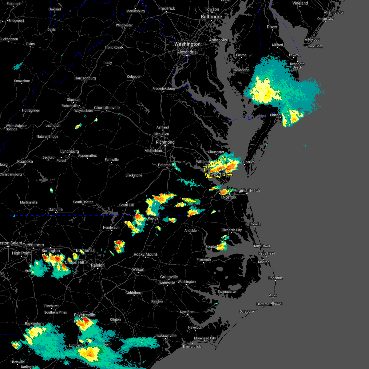 At 516 pm edt, a severe thunderstorm was located near fort eustis, or 7 miles northwest of newport news, moving east at 20 mph (radar indicated). Hazards include 60 mph wind gusts and quarter size hail. Minor damage to vehicles is possible. expect wind damage to trees and powerlines. this severe thunderstorm will be near, fort eustis, grove and busch gardens around 525 pm edt. lee hall around 530 pm edt. denbigh around 535 pm edt. newport news and patrick henry field around 540 pm edt. tabb around 545 pm edt. virginia institute for marine sciences, gloucester point and wicomico around 550 pm edt. seaford around 555 pm edt. achilles around 600 pm edt. other locations impacted by this severe thunderstorm include lackey, glass, naxera, oriana, maryus, dare, newport news golf course, severn, oyster point and hog island game reserve. hail threat, radar indicated max hail size, 1. 00 in wind threat, radar indicated max wind gust, 60 mph. At 516 pm edt, a severe thunderstorm was located near fort eustis, or 7 miles northwest of newport news, moving east at 20 mph (radar indicated). Hazards include 60 mph wind gusts and quarter size hail. Minor damage to vehicles is possible. expect wind damage to trees and powerlines. this severe thunderstorm will be near, fort eustis, grove and busch gardens around 525 pm edt. lee hall around 530 pm edt. denbigh around 535 pm edt. newport news and patrick henry field around 540 pm edt. tabb around 545 pm edt. virginia institute for marine sciences, gloucester point and wicomico around 550 pm edt. seaford around 555 pm edt. achilles around 600 pm edt. other locations impacted by this severe thunderstorm include lackey, glass, naxera, oriana, maryus, dare, newport news golf course, severn, oyster point and hog island game reserve. hail threat, radar indicated max hail size, 1. 00 in wind threat, radar indicated max wind gust, 60 mph.
|
| 8/22/2021 2:56 PM EDT |
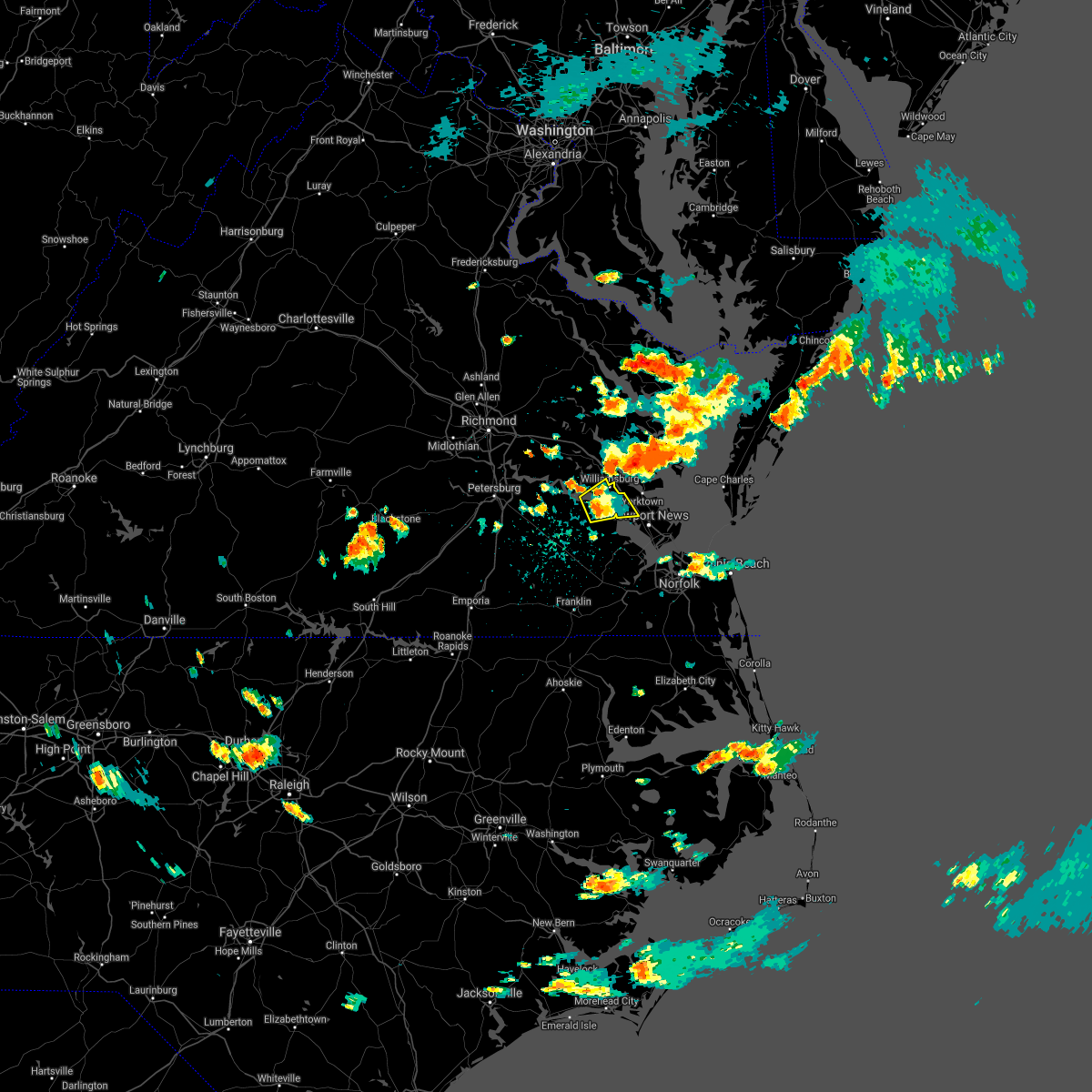 The severe thunderstorm warning for northeastern surry, and southern james city counties, the northern city of newport news and the city of williamsburg will expire at 300 pm edt, the storm which prompted the warning has weakened below severe limits, and no longer poses an immediate threat to life or property. therefore, the warning will be allowed to expire. however gusty winds and heavy rain are still possible with this thunderstorm. The severe thunderstorm warning for northeastern surry, and southern james city counties, the northern city of newport news and the city of williamsburg will expire at 300 pm edt, the storm which prompted the warning has weakened below severe limits, and no longer poses an immediate threat to life or property. therefore, the warning will be allowed to expire. however gusty winds and heavy rain are still possible with this thunderstorm.
|
| 8/22/2021 2:22 PM EDT |
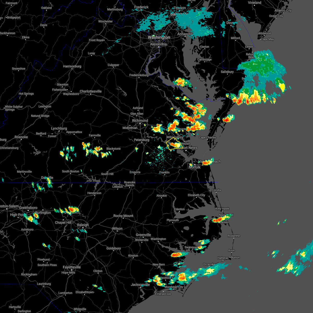 At 222 pm edt, a severe thunderstorm was located over jamestown, or near college of william and mary, and is nearly stationary (radar indicated). Hazards include 60 mph wind gusts and quarter size hail. Minor damage to vehicles is possible. Expect wind damage to trees and powerlines. At 222 pm edt, a severe thunderstorm was located over jamestown, or near college of william and mary, and is nearly stationary (radar indicated). Hazards include 60 mph wind gusts and quarter size hail. Minor damage to vehicles is possible. Expect wind damage to trees and powerlines.
|
| 8/14/2021 6:56 PM EDT |
 The severe thunderstorm warning for northeastern isle of wight , the city of norfolk, the northern city of portsmouth, the northeastern city of suffolk, the city of hampton and the southern city of newport news will expire at 700 pm edt, the storm which prompted the warning has weakened below severe limits, and no longer poses an immediate threat to life or property. therefore, the warning will be allowed to expire. however heavy rain is still possible with this thunderstorm. The severe thunderstorm warning for northeastern isle of wight , the city of norfolk, the northern city of portsmouth, the northeastern city of suffolk, the city of hampton and the southern city of newport news will expire at 700 pm edt, the storm which prompted the warning has weakened below severe limits, and no longer poses an immediate threat to life or property. therefore, the warning will be allowed to expire. however heavy rain is still possible with this thunderstorm.
|
| 8/14/2021 6:25 PM EDT |
 At 625 pm edt, a severe thunderstorm was located over rescue, or near smithfield, moving east at 10 mph (radar indicated). Hazards include 60 mph wind gusts. Expect damage to trees and powerlines. locations impacted include, newport news, hampton, smithfield, hampton university, old dominion university, ocean view, norfolk, portsmouth, northampton, rescue, buckroe beach, ghent, norfolk nas, norview, crittenden, fort monroe, carrollton, benns church, huntersville and hilton village. hail threat, radar indicated max hail size, <. 75 in wind threat, radar indicated max wind gust, 60 mph. At 625 pm edt, a severe thunderstorm was located over rescue, or near smithfield, moving east at 10 mph (radar indicated). Hazards include 60 mph wind gusts. Expect damage to trees and powerlines. locations impacted include, newport news, hampton, smithfield, hampton university, old dominion university, ocean view, norfolk, portsmouth, northampton, rescue, buckroe beach, ghent, norfolk nas, norview, crittenden, fort monroe, carrollton, benns church, huntersville and hilton village. hail threat, radar indicated max hail size, <. 75 in wind threat, radar indicated max wind gust, 60 mph.
|
| 8/14/2021 6:11 PM EDT |
 At 611 pm edt, a severe thunderstorm was located over smithfield, moving east at 10 mph (radar indicated). Hazards include 60 mph wind gusts. expect damage to trees and powerlines At 611 pm edt, a severe thunderstorm was located over smithfield, moving east at 10 mph (radar indicated). Hazards include 60 mph wind gusts. expect damage to trees and powerlines
|
| 7/29/2021 7:47 PM EDT |
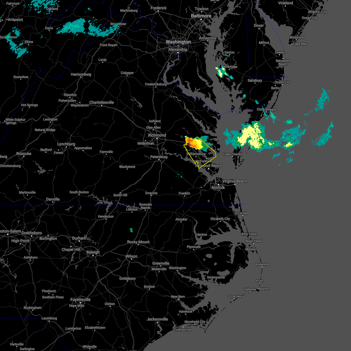 At 746 pm edt, a severe thunderstorm was located near norge, moving southeast at 30 mph (radar indicated). Hazards include 60 mph wind gusts and quarter size hail. Minor damage to vehicles is possible. expect wind damage to trees and powerlines. Locations impacted include, newport news, williamsburg, gloucester courthouse, queens lake, virginia institute for marine sciences, norge, toano, gloucester point, college of william and mary, busch gardens, hayes, carver gardens, kings point, jamestown, wicomico, achilles, york terrace, lee hall, grove and barhamsville. At 746 pm edt, a severe thunderstorm was located near norge, moving southeast at 30 mph (radar indicated). Hazards include 60 mph wind gusts and quarter size hail. Minor damage to vehicles is possible. expect wind damage to trees and powerlines. Locations impacted include, newport news, williamsburg, gloucester courthouse, queens lake, virginia institute for marine sciences, norge, toano, gloucester point, college of william and mary, busch gardens, hayes, carver gardens, kings point, jamestown, wicomico, achilles, york terrace, lee hall, grove and barhamsville.
|
| 7/29/2021 7:26 PM EDT |
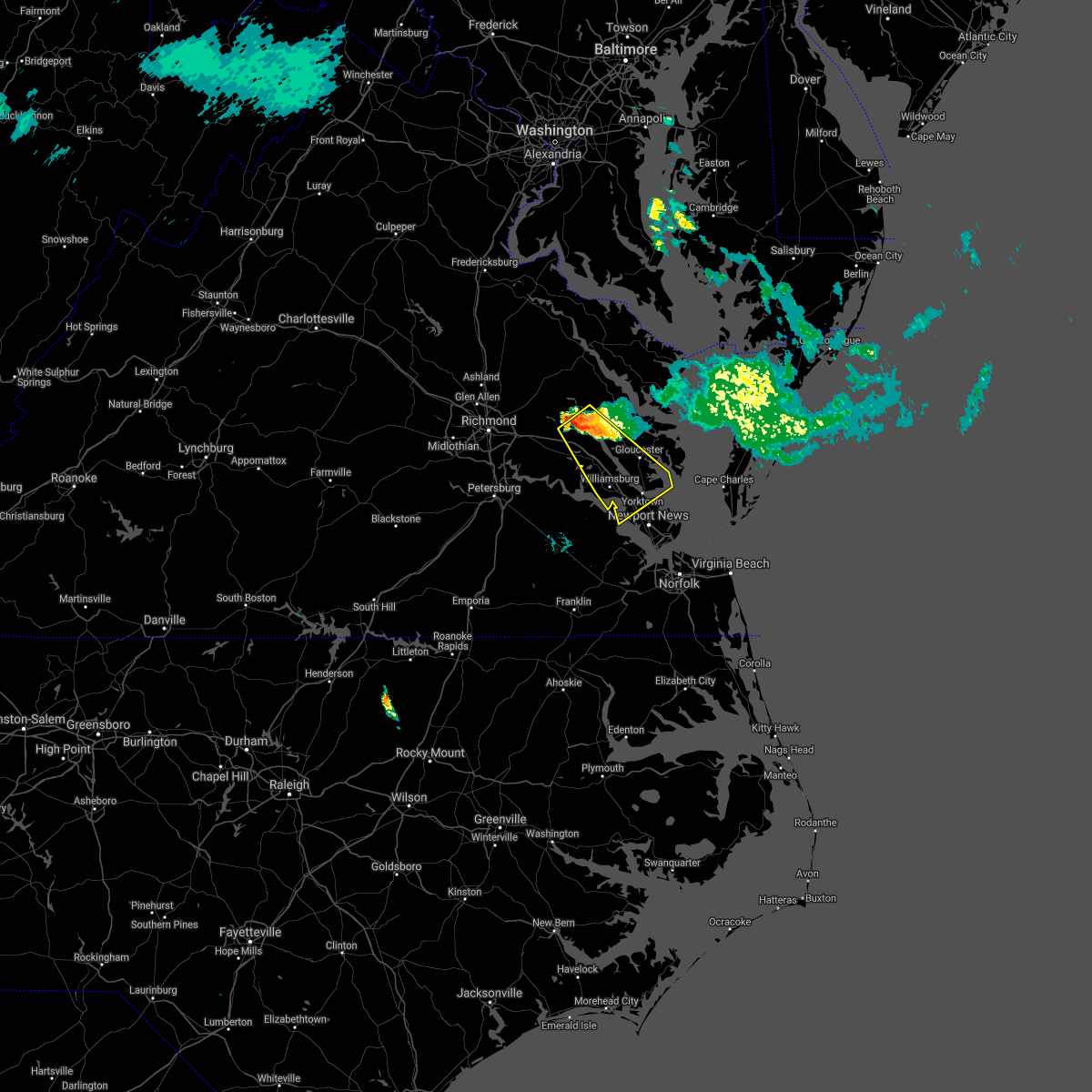 At 726 pm edt, a severe thunderstorm was located near west point, moving southeast at 30 mph (radar indicated). Hazards include golf ball size hail and 70 mph wind gusts. People and animals outdoors will be injured. expect hail damage to roofs, siding, windows, and vehicles. expect considerable tree damage. Wind damage is also likely to mobile homes, roofs, and outbuildings. At 726 pm edt, a severe thunderstorm was located near west point, moving southeast at 30 mph (radar indicated). Hazards include golf ball size hail and 70 mph wind gusts. People and animals outdoors will be injured. expect hail damage to roofs, siding, windows, and vehicles. expect considerable tree damage. Wind damage is also likely to mobile homes, roofs, and outbuildings.
|
| 7/26/2021 5:01 PM EDT |
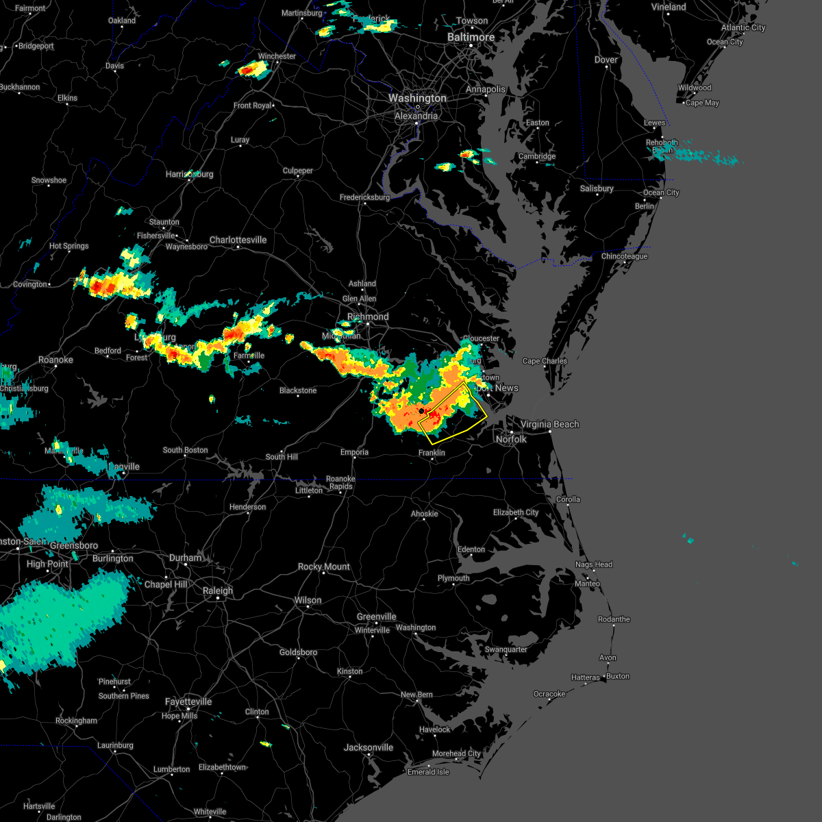 At 500 pm edt, a severe thunderstorm was located near isle of wight, or near windsor, moving southeast at 45 mph (radar indicated). Hazards include 60 mph wind gusts and quarter size hail. Minor damage to vehicles is possible. expect wind damage to trees and powerlines. this severe storm will be near, smithfield around 505 pm edt. Other locations impacted by this severe thunderstorm include rushmere, pons, carrollton, longview, benns church, berlin, bethel church, delk crossroads, lawson and central hill. At 500 pm edt, a severe thunderstorm was located near isle of wight, or near windsor, moving southeast at 45 mph (radar indicated). Hazards include 60 mph wind gusts and quarter size hail. Minor damage to vehicles is possible. expect wind damage to trees and powerlines. this severe storm will be near, smithfield around 505 pm edt. Other locations impacted by this severe thunderstorm include rushmere, pons, carrollton, longview, benns church, berlin, bethel church, delk crossroads, lawson and central hill.
|
| 7/26/2021 4:33 PM EDT |
 At 432 pm edt, a severe thunderstorm was located over elberon, or over surry, moving southeast at 40 mph (radar indicated). Hazards include 60 mph wind gusts and quarter size hail. Minor damage to vehicles is possible. expect wind damage to trees and powerlines. this severe thunderstorm will be near, smithfield around 450 pm edt. isle of wight around 455 pm edt. rescue around 500 pm edt. Other locations impacted by this severe thunderstorm include rushmere, booth fork, carsley, pons, carrollton, chippokes state park, longview, benns church, oriana and spring grove. At 432 pm edt, a severe thunderstorm was located over elberon, or over surry, moving southeast at 40 mph (radar indicated). Hazards include 60 mph wind gusts and quarter size hail. Minor damage to vehicles is possible. expect wind damage to trees and powerlines. this severe thunderstorm will be near, smithfield around 450 pm edt. isle of wight around 455 pm edt. rescue around 500 pm edt. Other locations impacted by this severe thunderstorm include rushmere, booth fork, carsley, pons, carrollton, chippokes state park, longview, benns church, oriana and spring grove.
|
| 7/8/2021 6:17 PM EDT |
 At 617 pm edt, a severe thunderstorm capable of producing a tornado was located near driver, or near downtown suffolk, moving north at 55 mph (radar indicated rotation). Hazards include tornado. Flying debris will be dangerous to those caught without shelter. mobile homes will be damaged or destroyed. damage to roofs, windows, and vehicles will occur. tree damage is likely. this dangerous storm will be near, smithfield and rescue around 630 pm edt. fort eustis and denbigh around 640 pm edt. newport news around 645 pm edt. Other locations impacted by this tornadic thunderstorm include rushmere, carrollton, chippokes state park, longview, benns church, oriana, wills corner, chuckatuck, lawson and bacons castle. At 617 pm edt, a severe thunderstorm capable of producing a tornado was located near driver, or near downtown suffolk, moving north at 55 mph (radar indicated rotation). Hazards include tornado. Flying debris will be dangerous to those caught without shelter. mobile homes will be damaged or destroyed. damage to roofs, windows, and vehicles will occur. tree damage is likely. this dangerous storm will be near, smithfield and rescue around 630 pm edt. fort eustis and denbigh around 640 pm edt. newport news around 645 pm edt. Other locations impacted by this tornadic thunderstorm include rushmere, carrollton, chippokes state park, longview, benns church, oriana, wills corner, chuckatuck, lawson and bacons castle.
|
| 6/4/2021 6:53 PM EDT |
 The severe thunderstorm warning for northeastern isle of wight , the city of poquoson, the city of hampton and the city of newport news will expire at 700 pm edt, the storms which prompted the warning have weakened. therefore, the warning will be allowed to expire. however gusty winds to 45 mph and heavy rain are still possible with these thunderstorms. a severe thunderstorm watch remains in effect until 900 pm edt for southeastern virginia. The severe thunderstorm warning for northeastern isle of wight , the city of poquoson, the city of hampton and the city of newport news will expire at 700 pm edt, the storms which prompted the warning have weakened. therefore, the warning will be allowed to expire. however gusty winds to 45 mph and heavy rain are still possible with these thunderstorms. a severe thunderstorm watch remains in effect until 900 pm edt for southeastern virginia.
|
| 6/4/2021 6:36 PM EDT |
 At 635 pm edt, severe thunderstorms were located along a line extending from langley afb to christopher newport university to near smithfield, moving east at 15 mph (radar indicated). Hazards include 60 mph wind gusts. Expect damage to trees and powerlines. these severe storms will be near, hampton, christopher newport university, langley afb, patrick henry field and beaconsdale around 640 pm edt. northampton around 650 pm edt. grand view around 655 pm edt. hampton university around 710 pm edt. buckroe beach and fort monroe around 720 pm edt. Other locations impacted by these severe thunderstorms include rushmere, fox hill, carrollton, phoebus, langley view, benns church, oriana, hilton village, lawson and raleigh terrace. At 635 pm edt, severe thunderstorms were located along a line extending from langley afb to christopher newport university to near smithfield, moving east at 15 mph (radar indicated). Hazards include 60 mph wind gusts. Expect damage to trees and powerlines. these severe storms will be near, hampton, christopher newport university, langley afb, patrick henry field and beaconsdale around 640 pm edt. northampton around 650 pm edt. grand view around 655 pm edt. hampton university around 710 pm edt. buckroe beach and fort monroe around 720 pm edt. Other locations impacted by these severe thunderstorms include rushmere, fox hill, carrollton, phoebus, langley view, benns church, oriana, hilton village, lawson and raleigh terrace.
|
| 6/4/2021 6:09 PM EDT |
 At 609 pm edt, severe thunderstorms were located along a line extending from near seaford to denbigh to near surry, moving southeast at 25 mph (radar indicated). Hazards include 60 mph wind gusts. Expect damage to trees and powerlines. these severe storms will be near, newport news, seaford, patrick henry field, virginia institute for marine sciences and denbigh around 615 pm edt. tabb around 620 pm edt. christopher newport university and beaconsdale around 625 pm edt. hampton, smithfield and northampton around 630 pm edt. langley afb around 635 pm edt. rescue and grand view around 640 pm edt. hampton university and buckroe beach around 645 pm edt. fort monroe around 650 pm edt. Other locations impacted by these severe thunderstorms include rushmere, carrollton, chippokes state park, lackey, benns church, oriana, hilton village, newport news golf course, poolesville and oyster point. At 609 pm edt, severe thunderstorms were located along a line extending from near seaford to denbigh to near surry, moving southeast at 25 mph (radar indicated). Hazards include 60 mph wind gusts. Expect damage to trees and powerlines. these severe storms will be near, newport news, seaford, patrick henry field, virginia institute for marine sciences and denbigh around 615 pm edt. tabb around 620 pm edt. christopher newport university and beaconsdale around 625 pm edt. hampton, smithfield and northampton around 630 pm edt. langley afb around 635 pm edt. rescue and grand view around 640 pm edt. hampton university and buckroe beach around 645 pm edt. fort monroe around 650 pm edt. Other locations impacted by these severe thunderstorms include rushmere, carrollton, chippokes state park, lackey, benns church, oriana, hilton village, newport news golf course, poolesville and oyster point.
|
| 6/4/2021 5:59 PM EDT |
 At 558 pm edt, severe thunderstorms were located along a line extending from wicomico to near busch gardens to surry, moving southeast at 15 mph (radar indicated). Hazards include 60 mph wind gusts. Expect damage to trees and powerlines. severe thunderstorms will be near, gloucester point around 605 pm edt. virginia institute for marine sciences and lee hall around 610 pm edt. newport news and fort eustis around 615 pm edt. denbigh around 625 pm edt. seaford and patrick henry field around 630 pm edt. tabb around 635 pm edt. christopher newport university and beaconsdale around 645 pm edt. hampton and smithfield around 650 pm edt. Other locations impacted by these severe thunderstorms include rushmere, carrollton, chippokes state park, lackey, benns church, oriana, hilton village, newport news golf course, poolesville and oyster point. At 558 pm edt, severe thunderstorms were located along a line extending from wicomico to near busch gardens to surry, moving southeast at 15 mph (radar indicated). Hazards include 60 mph wind gusts. Expect damage to trees and powerlines. severe thunderstorms will be near, gloucester point around 605 pm edt. virginia institute for marine sciences and lee hall around 610 pm edt. newport news and fort eustis around 615 pm edt. denbigh around 625 pm edt. seaford and patrick henry field around 630 pm edt. tabb around 635 pm edt. christopher newport university and beaconsdale around 645 pm edt. hampton and smithfield around 650 pm edt. Other locations impacted by these severe thunderstorms include rushmere, carrollton, chippokes state park, lackey, benns church, oriana, hilton village, newport news golf course, poolesville and oyster point.
|
| 5/4/2021 6:58 PM EDT |
 At 658 pm edt, severe thunderstorms were located along a line extending from college of william and mary to fort eustis to isle of wight, moving east at 45 mph (radar indicated). Hazards include 60 mph wind gusts. Expect damage to trees and powerlines. these severe storms will be near, newport news, patrick henry field, christopher newport university, denbigh, beaconsdale and lee hall around 705 pm edt. hampton, seaford and tabb around 710 pm edt. gloucester point and langley afb around 715 pm edt. northampton around 720 pm edt. hampton university around 725 pm edt. buckroe beach, fort monroe and grand view around 730 pm edt. Other locations impacted by these severe thunderstorms include rushmere, carrollton, chippokes state park, lackey, longview, benns church, oriana, huntersville, bethel church and hilton village. At 658 pm edt, severe thunderstorms were located along a line extending from college of william and mary to fort eustis to isle of wight, moving east at 45 mph (radar indicated). Hazards include 60 mph wind gusts. Expect damage to trees and powerlines. these severe storms will be near, newport news, patrick henry field, christopher newport university, denbigh, beaconsdale and lee hall around 705 pm edt. hampton, seaford and tabb around 710 pm edt. gloucester point and langley afb around 715 pm edt. northampton around 720 pm edt. hampton university around 725 pm edt. buckroe beach, fort monroe and grand view around 730 pm edt. Other locations impacted by these severe thunderstorms include rushmere, carrollton, chippokes state park, lackey, longview, benns church, oriana, huntersville, bethel church and hilton village.
|
| 5/4/2021 6:39 PM EDT |
 At 639 pm edt, severe thunderstorms were located along a line extending from claremont to near elberon to near ivor, moving east at 45 mph (radar indicated). Hazards include 60 mph wind gusts. Expect damage to trees and powerlines. severe thunderstorms will be near, scotland around 650 pm edt. isle of wight, fort eustis, kings point and jamestown around 655 pm edt. williamsburg, smithfield, christopher newport university, denbigh, york terrace, carver gardens, busch gardens and lee hall around 700 pm edt. newport news, patrick henry field, tabb, beaconsdale and grove around 705 pm edt. hampton, seaford, langley afb, suffolk, crittenden and rescue around 710 pm edt. gloucester point, hampton university, northampton and grand view around 715 pm edt. Other locations impacted by these severe thunderstorms include rushmere, pons, carrollton, chippokes state park, lackey, longview, benns church, oriana, huntersville and bethel church. At 639 pm edt, severe thunderstorms were located along a line extending from claremont to near elberon to near ivor, moving east at 45 mph (radar indicated). Hazards include 60 mph wind gusts. Expect damage to trees and powerlines. severe thunderstorms will be near, scotland around 650 pm edt. isle of wight, fort eustis, kings point and jamestown around 655 pm edt. williamsburg, smithfield, christopher newport university, denbigh, york terrace, carver gardens, busch gardens and lee hall around 700 pm edt. newport news, patrick henry field, tabb, beaconsdale and grove around 705 pm edt. hampton, seaford, langley afb, suffolk, crittenden and rescue around 710 pm edt. gloucester point, hampton university, northampton and grand view around 715 pm edt. Other locations impacted by these severe thunderstorms include rushmere, pons, carrollton, chippokes state park, lackey, longview, benns church, oriana, huntersville and bethel church.
|
| 5/4/2021 6:32 PM EDT |
 At 632 pm edt, severe thunderstorms were located along a line extending from near claremont to near wakefield, moving northeast at 40 mph (radar indicated). Hazards include 60 mph wind gusts and penny size hail. Expect damage to trees and powerlines. these severe storms will be near, dendron and scotland around 645 pm edt. elberon around 650 pm edt. surry around 655 pm edt. Other locations impacted by these severe thunderstorms include booth fork, carsley, pons, chippokes state park, spring grove, bethel church, ellis fork, dory, poolesville and gwaltney corner. At 632 pm edt, severe thunderstorms were located along a line extending from near claremont to near wakefield, moving northeast at 40 mph (radar indicated). Hazards include 60 mph wind gusts and penny size hail. Expect damage to trees and powerlines. these severe storms will be near, dendron and scotland around 645 pm edt. elberon around 650 pm edt. surry around 655 pm edt. Other locations impacted by these severe thunderstorms include booth fork, carsley, pons, chippokes state park, spring grove, bethel church, ellis fork, dory, poolesville and gwaltney corner.
|
| 5/4/2021 6:12 PM EDT |
 At 612 pm edt, severe thunderstorms were located along a line extending from near disputanta to 8 miles southeast of sussex, moving northeast at 40 mph (radar indicated). Hazards include 60 mph wind gusts and penny size hail. Expect damage to trees and powerlines. severe thunderstorms will be near, waverly around 615 pm edt. wakefield and ivor around 635 pm edt. surry around 640 pm edt. dendron, scotland and elberon around 645 pm edt. Other locations impacted by these severe thunderstorms include booth fork, carsley, pons, chippokes state park, spring grove, bethel church, lumberton, ellis fork, dory and poolesville. At 612 pm edt, severe thunderstorms were located along a line extending from near disputanta to 8 miles southeast of sussex, moving northeast at 40 mph (radar indicated). Hazards include 60 mph wind gusts and penny size hail. Expect damage to trees and powerlines. severe thunderstorms will be near, waverly around 615 pm edt. wakefield and ivor around 635 pm edt. surry around 640 pm edt. dendron, scotland and elberon around 645 pm edt. Other locations impacted by these severe thunderstorms include booth fork, carsley, pons, chippokes state park, spring grove, bethel church, lumberton, ellis fork, dory and poolesville.
|
| 4/9/2021 5:09 PM EDT |
 At 509 pm edt, a severe thunderstorm was located over rescue, or near smithfield, moving east at 20 mph (radar indicated). Hazards include 60 mph wind gusts and quarter size hail. Minor damage to vehicles is possible. expect wind damage to trees and powerlines. Locations impacted include, newport news, hampton, smithfield, christopher newport university, northampton, rescue, denbigh, beaconsdale, hilton village, lawson, oyster point, mogarts beach, menchville and rushmere. At 509 pm edt, a severe thunderstorm was located over rescue, or near smithfield, moving east at 20 mph (radar indicated). Hazards include 60 mph wind gusts and quarter size hail. Minor damage to vehicles is possible. expect wind damage to trees and powerlines. Locations impacted include, newport news, hampton, smithfield, christopher newport university, northampton, rescue, denbigh, beaconsdale, hilton village, lawson, oyster point, mogarts beach, menchville and rushmere.
|
| 4/9/2021 4:45 PM EDT |
 At 444 pm edt, a severe thunderstorm was located near smithfield, moving east at 20 mph (radar indicated). Hazards include 60 mph wind gusts and quarter size hail. Minor damage to vehicles is possible. Expect wind damage to trees and powerlines. At 444 pm edt, a severe thunderstorm was located near smithfield, moving east at 20 mph (radar indicated). Hazards include 60 mph wind gusts and quarter size hail. Minor damage to vehicles is possible. Expect wind damage to trees and powerlines.
|
| 3/18/2021 8:33 PM EDT |
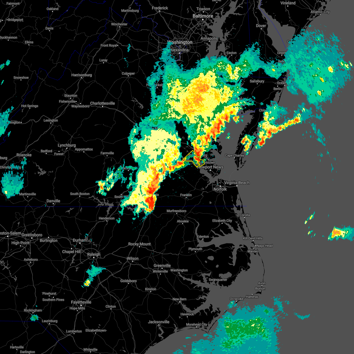 At 832 pm edt, a severe thunderstorm was located over jamestown, or near college of william and mary, moving northeast at 35 mph (radar indicated). Hazards include 60 mph wind gusts and quarter size hail. Minor damage to vehicles is possible. expect wind damage to trees and powerlines. this severe storm will be near, busch gardens and grove around 845 pm edt. Other locations impacted by this severe thunderstorm include ewell, lightfoot, williamsburg airport, governors land, centerville and chippokes state park. At 832 pm edt, a severe thunderstorm was located over jamestown, or near college of william and mary, moving northeast at 35 mph (radar indicated). Hazards include 60 mph wind gusts and quarter size hail. Minor damage to vehicles is possible. expect wind damage to trees and powerlines. this severe storm will be near, busch gardens and grove around 845 pm edt. Other locations impacted by this severe thunderstorm include ewell, lightfoot, williamsburg airport, governors land, centerville and chippokes state park.
|
| 3/18/2021 8:15 PM EDT |
 At 815 pm edt, a severe thunderstorm was located near surry, moving northeast at 35 mph (radar indicated). Hazards include 60 mph wind gusts and half dollar size hail. Minor damage to vehicles is possible. expect wind damage to trees and powerlines. this severe storm will be near, surry around 820 pm edt. scotland around 825 pm edt. jamestown around 830 pm edt. williamsburg, college of william and mary and kings point around 840 pm edt. busch gardens and grove around 845 pm edt. Other locations impacted by this severe thunderstorm include ewell, chippokes state park, governors land, spring grove, hog island game reserve, alliance, lightfoot, williamsburg airport, beachland and centerville. At 815 pm edt, a severe thunderstorm was located near surry, moving northeast at 35 mph (radar indicated). Hazards include 60 mph wind gusts and half dollar size hail. Minor damage to vehicles is possible. expect wind damage to trees and powerlines. this severe storm will be near, surry around 820 pm edt. scotland around 825 pm edt. jamestown around 830 pm edt. williamsburg, college of william and mary and kings point around 840 pm edt. busch gardens and grove around 845 pm edt. Other locations impacted by this severe thunderstorm include ewell, chippokes state park, governors land, spring grove, hog island game reserve, alliance, lightfoot, williamsburg airport, beachland and centerville.
|
| 3/18/2021 8:03 PM EDT |
 At 803 pm edt, a severe thunderstorm was located near cabin point, or 7 miles northeast of waverly, moving northeast at 40 mph (radar indicated). Hazards include 60 mph wind gusts and half dollar size hail. Minor damage to vehicles is possible. expect wind damage to trees and powerlines. this severe thunderstorm will be near, elberon around 810 pm edt. claremont and surry around 815 pm edt. scotland and rustic around 820 pm edt. jamestown around 825 pm edt. college of william and mary and kings point around 830 pm edt. williamsburg, busch gardens and grove around 835 pm edt. other locations impacted by this severe thunderstorm include ewell, chippokes state park, governors land, spring grove, hog island game reserve, alliance, lightfoot, williamsburg airport, beachland and centerville. A tornado watch remains in effect until 900 pm edt for southeastern virginia. At 803 pm edt, a severe thunderstorm was located near cabin point, or 7 miles northeast of waverly, moving northeast at 40 mph (radar indicated). Hazards include 60 mph wind gusts and half dollar size hail. Minor damage to vehicles is possible. expect wind damage to trees and powerlines. this severe thunderstorm will be near, elberon around 810 pm edt. claremont and surry around 815 pm edt. scotland and rustic around 820 pm edt. jamestown around 825 pm edt. college of william and mary and kings point around 830 pm edt. williamsburg, busch gardens and grove around 835 pm edt. other locations impacted by this severe thunderstorm include ewell, chippokes state park, governors land, spring grove, hog island game reserve, alliance, lightfoot, williamsburg airport, beachland and centerville. A tornado watch remains in effect until 900 pm edt for southeastern virginia.
|
| 3/18/2021 6:42 PM EDT |
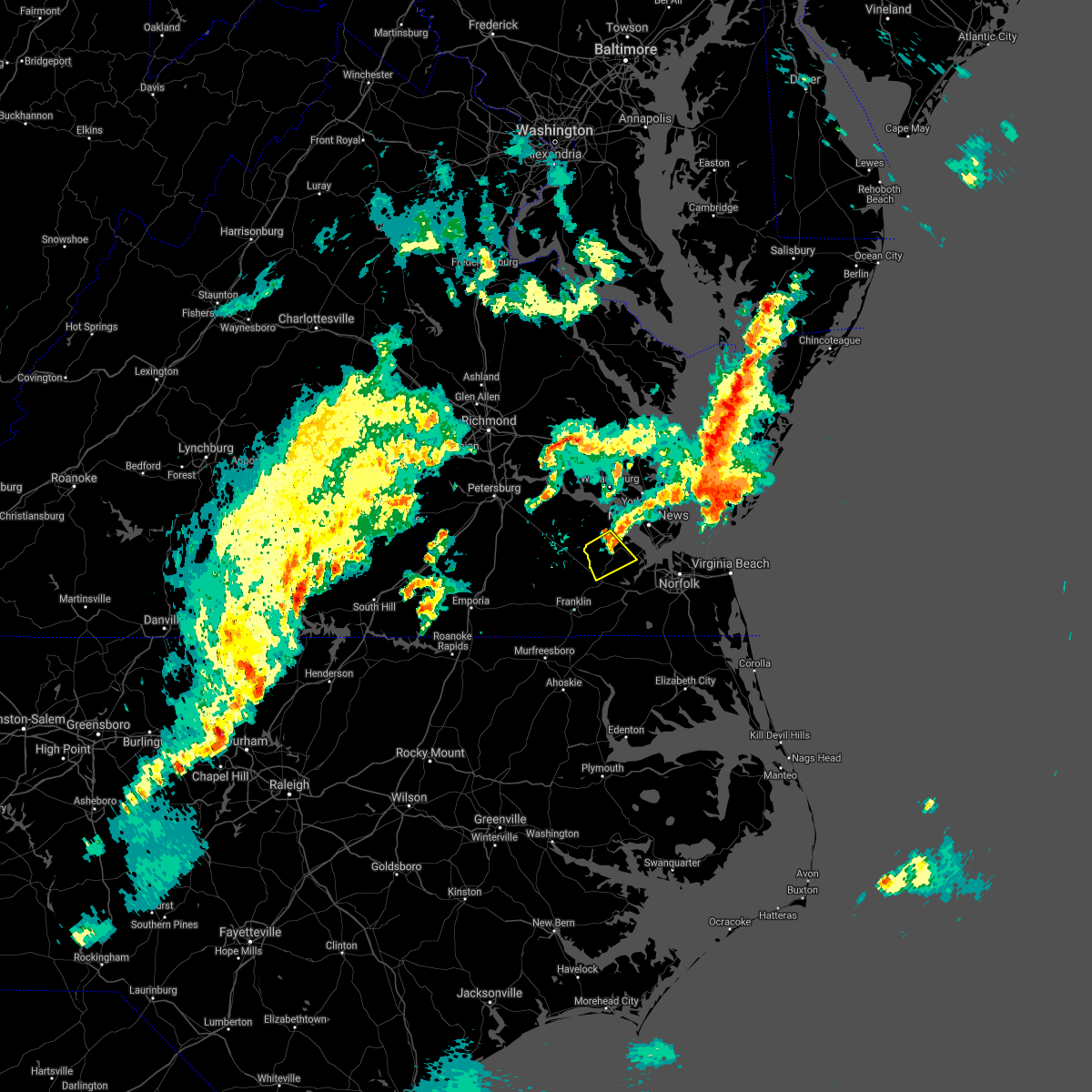 The severe thunderstorm warning for central isle of wight county will expire at 645 pm edt, the storm which prompted the warning has weakened below severe limits, and has exited the warned area. therefore, the warning will be allowed to expire. however gusty winds and heavy rain are still possible with this thunderstorm. a tornado watch remains in effect until 900 pm edt for southeastern virginia. The severe thunderstorm warning for central isle of wight county will expire at 645 pm edt, the storm which prompted the warning has weakened below severe limits, and has exited the warned area. therefore, the warning will be allowed to expire. however gusty winds and heavy rain are still possible with this thunderstorm. a tornado watch remains in effect until 900 pm edt for southeastern virginia.
|
| 3/18/2021 6:31 PM EDT |
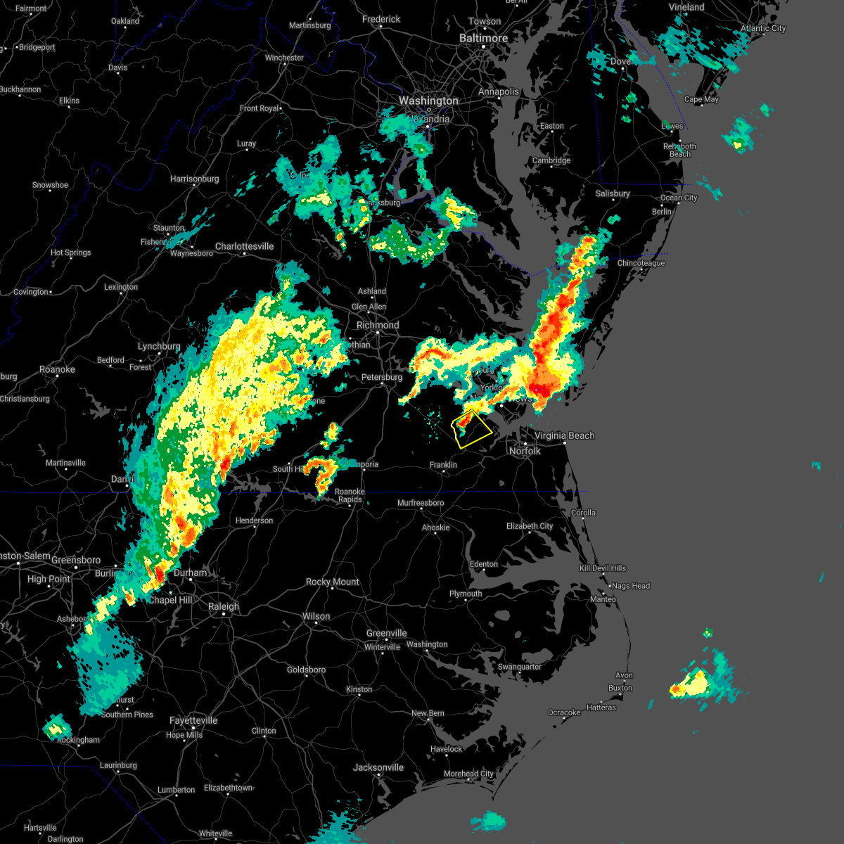 At 630 pm edt, a severe thunderstorm was located near isle of wight, or near smithfield, moving northeast at 60 mph (radar indicated). Hazards include 60 mph wind gusts and nickel size hail. Expect damage to trees and powerlines. this severe storm will be near, smithfield around 635 pm edt. Other locations impacted by this severe thunderstorm include central hill, whitley, pons, comet, benns church, moonlight, bethel church, raynor and rushmere. At 630 pm edt, a severe thunderstorm was located near isle of wight, or near smithfield, moving northeast at 60 mph (radar indicated). Hazards include 60 mph wind gusts and nickel size hail. Expect damage to trees and powerlines. this severe storm will be near, smithfield around 635 pm edt. Other locations impacted by this severe thunderstorm include central hill, whitley, pons, comet, benns church, moonlight, bethel church, raynor and rushmere.
|
| 3/18/2021 6:17 PM EDT |
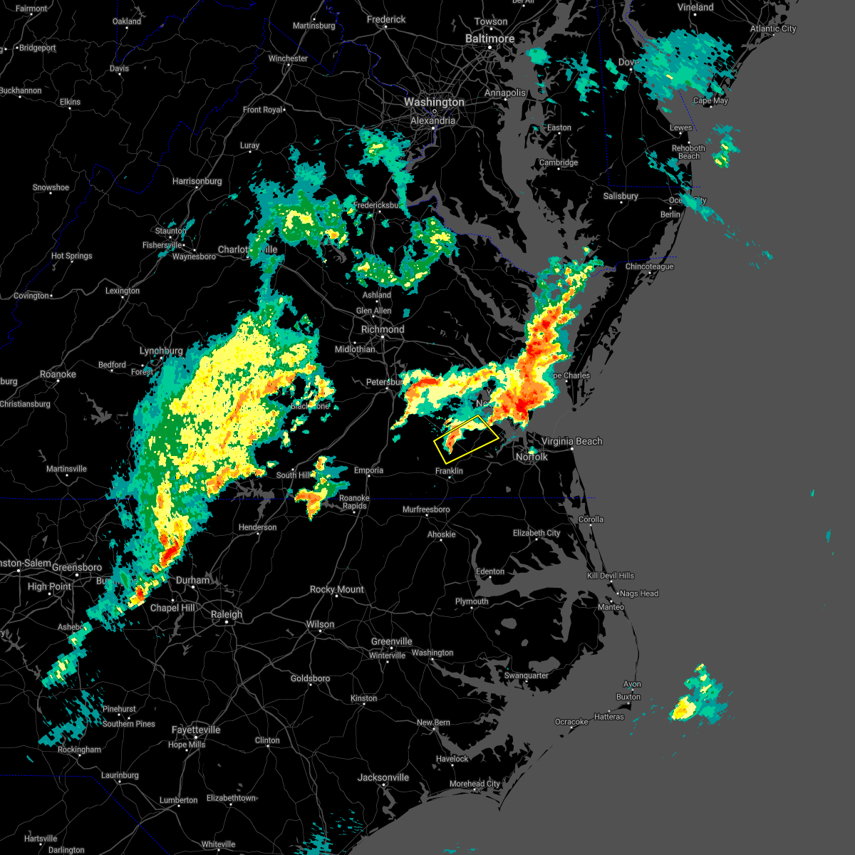 At 616 pm edt, a severe thunderstorm was located over ivor, or 7 miles southeast of wakefield, moving northeast at 40 mph (radar indicated). Hazards include 60 mph wind gusts and quarter size hail. Minor damage to vehicles is possible. expect wind damage to trees and powerlines. this severe thunderstorm will be near, zuni around 620 pm edt. isle of wight around 630 pm edt. smithfield around 635 pm edt. other locations impacted by this severe thunderstorm include central hill, whitley, pons, comet, benns church, moonlight, berlin, bethel church, raynor and manry. A tornado watch remains in effect until 900 pm edt for southeastern virginia. At 616 pm edt, a severe thunderstorm was located over ivor, or 7 miles southeast of wakefield, moving northeast at 40 mph (radar indicated). Hazards include 60 mph wind gusts and quarter size hail. Minor damage to vehicles is possible. expect wind damage to trees and powerlines. this severe thunderstorm will be near, zuni around 620 pm edt. isle of wight around 630 pm edt. smithfield around 635 pm edt. other locations impacted by this severe thunderstorm include central hill, whitley, pons, comet, benns church, moonlight, berlin, bethel church, raynor and manry. A tornado watch remains in effect until 900 pm edt for southeastern virginia.
|
| 3/18/2021 5:37 PM EDT |
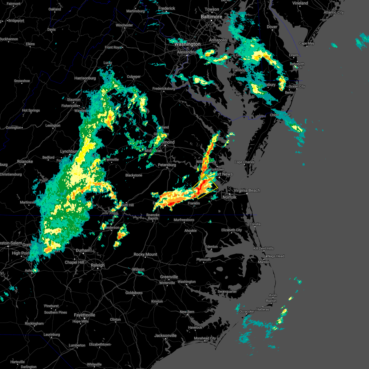 At 536 pm edt, a severe thunderstorm was located over zuni, or 7 miles northwest of windsor, moving northeast at 35 mph (radar indicated). Hazards include 60 mph wind gusts and quarter size hail. Minor damage to vehicles is possible. expect wind damage to trees and powerlines. this severe thunderstorm will be near, isle of wight around 550 pm edt. smithfield around 600 pm edt. other locations impacted by this severe thunderstorm include rushmere, pons, carrollton, benns church, bethel church, delk crossroads, lawson, central hill, bacons castle and whitley. A tornado watch remains in effect until 900 pm edt for southeastern virginia. At 536 pm edt, a severe thunderstorm was located over zuni, or 7 miles northwest of windsor, moving northeast at 35 mph (radar indicated). Hazards include 60 mph wind gusts and quarter size hail. Minor damage to vehicles is possible. expect wind damage to trees and powerlines. this severe thunderstorm will be near, isle of wight around 550 pm edt. smithfield around 600 pm edt. other locations impacted by this severe thunderstorm include rushmere, pons, carrollton, benns church, bethel church, delk crossroads, lawson, central hill, bacons castle and whitley. A tornado watch remains in effect until 900 pm edt for southeastern virginia.
|
| 2/22/2021 2:21 PM EST |
 At 221 pm est, severe thunderstorms were located along a line extending from near bavon to near conway, moving east at 40 mph (radar indicated). Hazards include 60 mph wind gusts. Expect damage to trees and powerlines. these severe storms will be near, murfreesboro and chowan university around 240 pm est. ahoskie, winton and cofield around 250 pm est. roduco around 300 pm est. gates around 305 pm est. Other locations impacted by these severe thunderstorms include eagletown, vicksville, milwaukee, tunis, pons, carrollton, lackey, longview, chowan beach and oriana. At 221 pm est, severe thunderstorms were located along a line extending from near bavon to near conway, moving east at 40 mph (radar indicated). Hazards include 60 mph wind gusts. Expect damage to trees and powerlines. these severe storms will be near, murfreesboro and chowan university around 240 pm est. ahoskie, winton and cofield around 250 pm est. roduco around 300 pm est. gates around 305 pm est. Other locations impacted by these severe thunderstorms include eagletown, vicksville, milwaukee, tunis, pons, carrollton, lackey, longview, chowan beach and oriana.
|
| 2/22/2021 1:57 PM EST |
 The national weather service in wakefield has issued a * severe thunderstorm warning for. northampton county in northeastern north carolina. northwestern gates county in northeastern north carolina. hertford county in northeastern north carolina. The city of poquoson in southeastern virginia. The national weather service in wakefield has issued a * severe thunderstorm warning for. northampton county in northeastern north carolina. northwestern gates county in northeastern north carolina. hertford county in northeastern north carolina. The city of poquoson in southeastern virginia.
|
| 12/24/2020 11:43 PM EST |
 At 1142 pm est, severe thunderstorms were located along a line extending from queens lake to near rescue to near kings fork, moving east at 50 mph (radar indicated). Hazards include 60 mph wind gusts. Expect damage to trees and powerlines. these severe storms will be near, christopher newport university, gloucester point, patrick henry field and beaconsdale around 1150 pm est. hampton, virginia institute for marine sciences, northampton, achilles, hayes and tabb around 1155 pm est. langley afb around 1200 am est. Other locations impacted by these severe thunderstorms include carrollton, lackey, beulah, longview, benns church, camp peary, glass, naxera, oriana and hilton village. At 1142 pm est, severe thunderstorms were located along a line extending from queens lake to near rescue to near kings fork, moving east at 50 mph (radar indicated). Hazards include 60 mph wind gusts. Expect damage to trees and powerlines. these severe storms will be near, christopher newport university, gloucester point, patrick henry field and beaconsdale around 1150 pm est. hampton, virginia institute for marine sciences, northampton, achilles, hayes and tabb around 1155 pm est. langley afb around 1200 am est. Other locations impacted by these severe thunderstorms include carrollton, lackey, beulah, longview, benns church, camp peary, glass, naxera, oriana and hilton village.
|
| 12/24/2020 11:30 PM EST |
 At 1130 pm est, severe thunderstorms were located along a line extending from near jamestown to near isle of wight to near holland, moving northeast at 50 mph (radar indicated). Hazards include 60 mph wind gusts. Expect damage to trees and powerlines. severe thunderstorms will be near, williamsburg, smithfield, college of william and mary, kings point, jamestown and scotland around 1135 pm est. queens lake, york terrace, carver gardens, rescue, busch gardens and grove around 1140 pm est. fort eustis and wicomico around 1145 pm est. newport news, gloucester courthouse, patrick henry field, christopher newport university, gloucester point, northampton, hayes, denbigh, beaconsdale and crittenden around 1150 pm est. hampton, seaford, langley afb, suffolk and tabb around 1155 pm est. Other locations impacted by these severe thunderstorms include pons, carrollton, chippokes state park, lackey, beulah, longview, camp peary, naxera, oriana and chuckatuck. At 1130 pm est, severe thunderstorms were located along a line extending from near jamestown to near isle of wight to near holland, moving northeast at 50 mph (radar indicated). Hazards include 60 mph wind gusts. Expect damage to trees and powerlines. severe thunderstorms will be near, williamsburg, smithfield, college of william and mary, kings point, jamestown and scotland around 1135 pm est. queens lake, york terrace, carver gardens, rescue, busch gardens and grove around 1140 pm est. fort eustis and wicomico around 1145 pm est. newport news, gloucester courthouse, patrick henry field, christopher newport university, gloucester point, northampton, hayes, denbigh, beaconsdale and crittenden around 1150 pm est. hampton, seaford, langley afb, suffolk and tabb around 1155 pm est. Other locations impacted by these severe thunderstorms include pons, carrollton, chippokes state park, lackey, beulah, longview, camp peary, naxera, oriana and chuckatuck.
|
| 12/24/2020 11:18 PM EST |
 At 1118 pm est, severe thunderstorms were located along a line extending from near wakefield to near ivor to near franklin, moving northeast at 60 mph (radar indicated). Hazards include 60 mph wind gusts. Expect damage to trees and powerlines. these severe storms will be near, dendron and elberon around 1125 pm est. surry around 1130 pm est. isle of wight and scotland around 1135 pm est. suffolk around 1145 pm est. Other locations impacted by these severe thunderstorms include booth fork, pons, berlin, bethel church, ellis fork, delk crossroads, central hill, bacons castle, whitley and collosse. At 1118 pm est, severe thunderstorms were located along a line extending from near wakefield to near ivor to near franklin, moving northeast at 60 mph (radar indicated). Hazards include 60 mph wind gusts. Expect damage to trees and powerlines. these severe storms will be near, dendron and elberon around 1125 pm est. surry around 1130 pm est. isle of wight and scotland around 1135 pm est. suffolk around 1145 pm est. Other locations impacted by these severe thunderstorms include booth fork, pons, berlin, bethel church, ellis fork, delk crossroads, central hill, bacons castle, whitley and collosse.
|
| 12/24/2020 11:04 PM EST |
 At 1103 pm est, severe thunderstorms were located along a line extending from 7 miles southeast of homeville to courtland to near como, moving northeast at 60 mph (radar indicated). Hazards include 60 mph wind gusts. Expect damage to trees and powerlines. severe thunderstorms will be near, sedley around 1110 pm est. wakefield around 1115 pm est. holland, ivor, dendron, carrsville and zuni around 1120 pm est. elberon around 1125 pm est. windsor, surry, isle of wight and scotland around 1130 pm est. other locations impacted by these severe thunderstorms include vicksville, booth fork, pons, bethel church, ellis fork, dory, sunbeam, lees mill, poolesville and riverdale. A tornado watch remains in effect until 300 am est for northeastern north carolina. At 1103 pm est, severe thunderstorms were located along a line extending from 7 miles southeast of homeville to courtland to near como, moving northeast at 60 mph (radar indicated). Hazards include 60 mph wind gusts. Expect damage to trees and powerlines. severe thunderstorms will be near, sedley around 1110 pm est. wakefield around 1115 pm est. holland, ivor, dendron, carrsville and zuni around 1120 pm est. elberon around 1125 pm est. windsor, surry, isle of wight and scotland around 1130 pm est. other locations impacted by these severe thunderstorms include vicksville, booth fork, pons, bethel church, ellis fork, dory, sunbeam, lees mill, poolesville and riverdale. A tornado watch remains in effect until 300 am est for northeastern north carolina.
|
| 8/27/2020 10:20 PM EDT |
 At 1018 pm edt, severe thunderstorms were located along a line extending from near bavon to near tabb to near elberon, moving southeast at 30 mph (radar indicated). Hazards include 60 mph wind gusts and nickel size hail. Expect damage to trees and powerlines. these severe storms will be near, hampton, seaford, patrick henry field, tabb, beaconsdale and denbigh around 1025 pm edt. langley afb and northampton around 1030 pm edt. hampton university, grand view, buckroe beach and fort monroe around 1040 pm edt. smithfield around 1050 pm edt. rescue around 1100 pm edt. Other locations impacted by these severe thunderstorms include rushmere, capeville, kiptopeke state park, carsley, pons, carrollton, chippokes state park, benns church, oriana and bethel church. At 1018 pm edt, severe thunderstorms were located along a line extending from near bavon to near tabb to near elberon, moving southeast at 30 mph (radar indicated). Hazards include 60 mph wind gusts and nickel size hail. Expect damage to trees and powerlines. these severe storms will be near, hampton, seaford, patrick henry field, tabb, beaconsdale and denbigh around 1025 pm edt. langley afb and northampton around 1030 pm edt. hampton university, grand view, buckroe beach and fort monroe around 1040 pm edt. smithfield around 1050 pm edt. rescue around 1100 pm edt. Other locations impacted by these severe thunderstorms include rushmere, capeville, kiptopeke state park, carsley, pons, carrollton, chippokes state park, benns church, oriana and bethel church.
|
| 8/27/2020 9:50 PM EDT |
 At 949 pm edt, severe thunderstorms were located along a line extending from hayes to york terrace to near burrowsville, moving southeast at 30 mph (radar indicated). Hazards include 60 mph wind gusts and nickel size hail. Expect damage to trees and powerlines. severe thunderstorms will be near, williamsburg, gloucester courthouse, queens lake, gloucester point, college of william and mary, grove, busch gardens, hayes, carver gardens and york terrace around 955 pm edt. wicomico around 1000 pm edt. newport news, virginia institute for marine sciences, lee hall, achilles, mobjack and fort eustis around 1005 pm edt. denbigh around 1010 pm edt. seaford, patrick henry field and bavon around 1015 pm edt. christopher newport university, dendron, elberon, tabb and beaconsdale around 1020 pm edt. hampton, surry, northampton and scotland around 1025 pm edt. langley afb, hampton university, grand view, buckroe beach and fort monroe around 1030 pm edt. Other locations impacted by these severe thunderstorms include pons, carrollton, chippokes state park, lackey, beulah, camp peary, naxera, oriana, ewell and poolesville. At 949 pm edt, severe thunderstorms were located along a line extending from hayes to york terrace to near burrowsville, moving southeast at 30 mph (radar indicated). Hazards include 60 mph wind gusts and nickel size hail. Expect damage to trees and powerlines. severe thunderstorms will be near, williamsburg, gloucester courthouse, queens lake, gloucester point, college of william and mary, grove, busch gardens, hayes, carver gardens and york terrace around 955 pm edt. wicomico around 1000 pm edt. newport news, virginia institute for marine sciences, lee hall, achilles, mobjack and fort eustis around 1005 pm edt. denbigh around 1010 pm edt. seaford, patrick henry field and bavon around 1015 pm edt. christopher newport university, dendron, elberon, tabb and beaconsdale around 1020 pm edt. hampton, surry, northampton and scotland around 1025 pm edt. langley afb, hampton university, grand view, buckroe beach and fort monroe around 1030 pm edt. Other locations impacted by these severe thunderstorms include pons, carrollton, chippokes state park, lackey, beulah, camp peary, naxera, oriana, ewell and poolesville.
|
| 8/4/2020 4:12 AM EDT |
 At 411 am edt, a severe thunderstorm capable of producing a tornado was located near isle of wight, or near smithfield, moving north at 65 mph (radar indicated rotation). Hazards include tornado. Flying debris will be dangerous to those caught without shelter. mobile homes will be damaged or destroyed. damage to roofs, windows, and vehicles will occur. tree damage is likely. This tornadic thunderstorm will remain over mainly rural areas of central isle of wight county, including the following locations, central hill, rushmere, whitley, pons, comet, longview, moonlight, bethel church, raynor and lawson. At 411 am edt, a severe thunderstorm capable of producing a tornado was located near isle of wight, or near smithfield, moving north at 65 mph (radar indicated rotation). Hazards include tornado. Flying debris will be dangerous to those caught without shelter. mobile homes will be damaged or destroyed. damage to roofs, windows, and vehicles will occur. tree damage is likely. This tornadic thunderstorm will remain over mainly rural areas of central isle of wight county, including the following locations, central hill, rushmere, whitley, pons, comet, longview, moonlight, bethel church, raynor and lawson.
|
| 8/4/2020 4:00 AM EDT |
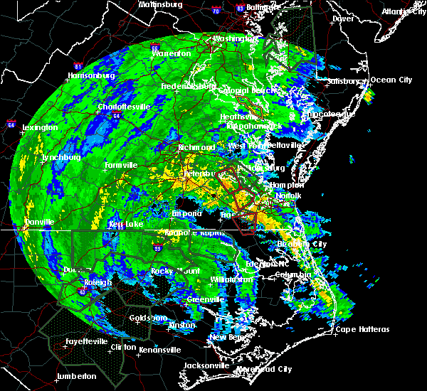 At 400 am edt, a severe thunderstorm capable of producing a tornado was located over surry, moving northwest at 45 mph (radar indicated rotation). Hazards include tornado. Flying debris will be dangerous to those caught without shelter. mobile homes will be damaged or destroyed. damage to roofs, windows, and vehicles will occur. tree damage is likely. this dangerous storm will be near, claremont around 410 am edt. Other locations impacted by this tornadic thunderstorm include bacons castle, chippokes state park, poolesville, governors land, alliance, beachland, delk crossroads, centerville and rushmere. At 400 am edt, a severe thunderstorm capable of producing a tornado was located over surry, moving northwest at 45 mph (radar indicated rotation). Hazards include tornado. Flying debris will be dangerous to those caught without shelter. mobile homes will be damaged or destroyed. damage to roofs, windows, and vehicles will occur. tree damage is likely. this dangerous storm will be near, claremont around 410 am edt. Other locations impacted by this tornadic thunderstorm include bacons castle, chippokes state park, poolesville, governors land, alliance, beachland, delk crossroads, centerville and rushmere.
|
| 8/4/2020 3:59 AM EDT |
 The national weather service in wakefield has issued a * tornado warning for. central isle of wight county in southeastern virginia. the central city of suffolk in southeastern virginia. until 430 am edt. At 358 am edt, a severe thunderstorm capable of producing a tornado. The national weather service in wakefield has issued a * tornado warning for. central isle of wight county in southeastern virginia. the central city of suffolk in southeastern virginia. until 430 am edt. At 358 am edt, a severe thunderstorm capable of producing a tornado.
|
| 8/4/2020 3:49 AM EDT |
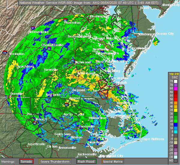 At 349 am edt, a severe thunderstorm capable of producing a tornado was located near surry, moving northwest at 45 mph (radar indicated rotation). Hazards include tornado. Flying debris will be dangerous to those caught without shelter. mobile homes will be damaged or destroyed. damage to roofs, windows, and vehicles will occur. tree damage is likely. this dangerous storm will be near, surry and scotland around 400 am edt. jamestown around 405 am edt. claremont around 410 am edt. Other locations impacted by this tornadic thunderstorm include bacons castle, chippokes state park, poolesville, governors land, alliance, beachland, delk crossroads, centerville and rushmere. At 349 am edt, a severe thunderstorm capable of producing a tornado was located near surry, moving northwest at 45 mph (radar indicated rotation). Hazards include tornado. Flying debris will be dangerous to those caught without shelter. mobile homes will be damaged or destroyed. damage to roofs, windows, and vehicles will occur. tree damage is likely. this dangerous storm will be near, surry and scotland around 400 am edt. jamestown around 405 am edt. claremont around 410 am edt. Other locations impacted by this tornadic thunderstorm include bacons castle, chippokes state park, poolesville, governors land, alliance, beachland, delk crossroads, centerville and rushmere.
|
| 8/4/2020 3:38 AM EDT |
 At 337 am edt, a severe thunderstorm capable of producing a tornado was located near isle of wight, or near smithfield, moving north at 35 mph (radar indicated rotation). Hazards include tornado. Flying debris will be dangerous to those caught without shelter. mobile homes will be damaged or destroyed. damage to roofs, windows, and vehicles will occur. tree damage is likely. This tornadic thunderstorm will remain over mainly rural areas of central isle of wight county, including the following locations, carrollton, comet, longview, benns church, moonlight, wills corner, bethel church, mogarts beach, indika and lawson. At 337 am edt, a severe thunderstorm capable of producing a tornado was located near isle of wight, or near smithfield, moving north at 35 mph (radar indicated rotation). Hazards include tornado. Flying debris will be dangerous to those caught without shelter. mobile homes will be damaged or destroyed. damage to roofs, windows, and vehicles will occur. tree damage is likely. This tornadic thunderstorm will remain over mainly rural areas of central isle of wight county, including the following locations, carrollton, comet, longview, benns church, moonlight, wills corner, bethel church, mogarts beach, indika and lawson.
|
| 8/4/2020 3:25 AM EDT |
 At 324 am edt, a tornado producing storm was located over kings fork, or just north of downtown suffolk, moving north at 35 mph (radar confirmed tornado). Hazards include damaging tornado. Flying debris will be dangerous to those caught without shelter. mobile homes will be damaged or destroyed. damage to roofs, windows, and vehicles will occur. tree damage is likely. this tornadic storm will be near, suffolk and crittenden around 335 am edt. isle of wight around 340 am edt. smithfield and rescue around 345 am edt. Other locations impacted by this tornadic thunderstorm include carrollton, longview, benns church, wills corner, bethel church, chuckatuck, indika, lawson, hobson and comet. At 324 am edt, a tornado producing storm was located over kings fork, or just north of downtown suffolk, moving north at 35 mph (radar confirmed tornado). Hazards include damaging tornado. Flying debris will be dangerous to those caught without shelter. mobile homes will be damaged or destroyed. damage to roofs, windows, and vehicles will occur. tree damage is likely. this tornadic storm will be near, suffolk and crittenden around 335 am edt. isle of wight around 340 am edt. smithfield and rescue around 345 am edt. Other locations impacted by this tornadic thunderstorm include carrollton, longview, benns church, wills corner, bethel church, chuckatuck, indika, lawson, hobson and comet.
|
| 7/1/2020 4:53 PM EDT |
 At 453 pm edt, a severe thunderstorm was located near rescue, or near smithfield, moving southeast at 25 mph (radar indicated). Hazards include ping pong ball size hail and 60 mph wind gusts. People and animals outdoors will be injured. expect hail damage to roofs, siding, windows, and vehicles. expect wind damage to trees and powerlines. this severe thunderstorm will be near, christopher newport university, rescue and beaconsdale around 505 pm edt. northampton around 515 pm edt. hampton university around 525 pm edt. fort monroe around 530 pm edt. Other locations impacted by this severe thunderstorm include carrollton, phoebus, langley view, oyster point, mogarts beach, hilton village, menchville, lawson and raleigh terrace. At 453 pm edt, a severe thunderstorm was located near rescue, or near smithfield, moving southeast at 25 mph (radar indicated). Hazards include ping pong ball size hail and 60 mph wind gusts. People and animals outdoors will be injured. expect hail damage to roofs, siding, windows, and vehicles. expect wind damage to trees and powerlines. this severe thunderstorm will be near, christopher newport university, rescue and beaconsdale around 505 pm edt. northampton around 515 pm edt. hampton university around 525 pm edt. fort monroe around 530 pm edt. Other locations impacted by this severe thunderstorm include carrollton, phoebus, langley view, oyster point, mogarts beach, hilton village, menchville, lawson and raleigh terrace.
|
| 6/25/2020 11:28 PM EDT |
 At 1127 pm edt, a severe thunderstorm was located near dendron, or 7 miles northeast of waverly, moving southeast at 30 mph (radar indicated). Hazards include 60 mph wind gusts and nickel size hail. Expect damage to trees and powerlines. this severe storm will be near, surry, dendron and elberon around 1135 pm edt. ivor around 1145 pm edt. smithfield and isle of wight around 1200 am edt. Other locations impacted by this severe thunderstorm include rushmere, booth fork, carsley, pons, spring grove, bethel church, ellis fork, delk crossroads, barham and lawson. At 1127 pm edt, a severe thunderstorm was located near dendron, or 7 miles northeast of waverly, moving southeast at 30 mph (radar indicated). Hazards include 60 mph wind gusts and nickel size hail. Expect damage to trees and powerlines. this severe storm will be near, surry, dendron and elberon around 1135 pm edt. ivor around 1145 pm edt. smithfield and isle of wight around 1200 am edt. Other locations impacted by this severe thunderstorm include rushmere, booth fork, carsley, pons, spring grove, bethel church, ellis fork, delk crossroads, barham and lawson.
|
| 6/25/2020 11:11 PM EDT |
 At 1111 pm edt, a severe thunderstorm was located near burrowsville, or 7 miles east of disputanta, moving southeast at 30 mph (radar indicated). Hazards include 60 mph wind gusts and nickel size hail. Expect damage to trees and powerlines. this severe thunderstorm will be near, cabin point around 1115 pm edt. waverly around 1120 pm edt. wakefield, surry, dendron and elberon around 1135 pm edt. ivor around 1145 pm edt. Other locations impacted by this severe thunderstorm include rushmere, taylors corner, booth fork, carsley, pons, spring grove, bethel church, ellis fork, poolesville and gwaltney corner. At 1111 pm edt, a severe thunderstorm was located near burrowsville, or 7 miles east of disputanta, moving southeast at 30 mph (radar indicated). Hazards include 60 mph wind gusts and nickel size hail. Expect damage to trees and powerlines. this severe thunderstorm will be near, cabin point around 1115 pm edt. waverly around 1120 pm edt. wakefield, surry, dendron and elberon around 1135 pm edt. ivor around 1145 pm edt. Other locations impacted by this severe thunderstorm include rushmere, taylors corner, booth fork, carsley, pons, spring grove, bethel church, ellis fork, poolesville and gwaltney corner.
|
| 6/22/2020 4:05 PM EDT |
 The severe thunderstorm warning for isle of wight, northeastern southampton and southeastern surry counties and the north central city of suffolk will expire at 415 pm edt, the storms which prompted the warning have weakened below severe limits, and have exited the warned area. therefore, the warning will be allowed to expire. The severe thunderstorm warning for isle of wight, northeastern southampton and southeastern surry counties and the north central city of suffolk will expire at 415 pm edt, the storms which prompted the warning have weakened below severe limits, and have exited the warned area. therefore, the warning will be allowed to expire.
|
| 6/22/2020 3:45 PM EDT |
 At 345 pm edt, severe thunderstorms were located along a line extending from near elberon to near isle of wight to near carrsville, moving east at 20 mph (radar indicated). Hazards include 60 mph wind gusts. Expect damage to trees and powerlines. these severe storms will be near, isle of wight around 350 pm edt. smithfield around 400 pm edt. suffolk around 425 pm edt. Other locations impacted by these severe thunderstorms include rushmere, booth fork, pons, chippokes state park, longview, benns church, bethel church, ellis fork, delk crossroads and indika. At 345 pm edt, severe thunderstorms were located along a line extending from near elberon to near isle of wight to near carrsville, moving east at 20 mph (radar indicated). Hazards include 60 mph wind gusts. Expect damage to trees and powerlines. these severe storms will be near, isle of wight around 350 pm edt. smithfield around 400 pm edt. suffolk around 425 pm edt. Other locations impacted by these severe thunderstorms include rushmere, booth fork, pons, chippokes state park, longview, benns church, bethel church, ellis fork, delk crossroads and indika.
|
| 6/22/2020 3:27 PM EDT |
 At 327 pm edt, severe thunderstorms were located along a line extending from near dendron to zuni to near hunterdale, moving northeast at 30 mph (radar indicated). Hazards include 60 mph wind gusts. Expect damage to trees and powerlines. severe thunderstorms will be near, dendron and zuni around 330 pm edt. windsor around 350 pm edt. isle of wight around 405 pm edt. smithfield around 415 pm edt. Other locations impacted by these severe thunderstorms include vicksville, rushmere, booth fork, pons, chippokes state park, longview, benns church, bethel church, ellis fork and dory. At 327 pm edt, severe thunderstorms were located along a line extending from near dendron to zuni to near hunterdale, moving northeast at 30 mph (radar indicated). Hazards include 60 mph wind gusts. Expect damage to trees and powerlines. severe thunderstorms will be near, dendron and zuni around 330 pm edt. windsor around 350 pm edt. isle of wight around 405 pm edt. smithfield around 415 pm edt. Other locations impacted by these severe thunderstorms include vicksville, rushmere, booth fork, pons, chippokes state park, longview, benns church, bethel church, ellis fork and dory.
|
| 4/24/2020 6:22 PM EDT |
 The severe thunderstorm warning for central isle of wight , the northeastern city of suffolk and the city of newport news will expire at 630 pm edt, the storm which prompted the warning has weakened below severe limits, and has exited the warned area. therefore, the warning will be allowed to expire. The severe thunderstorm warning for central isle of wight , the northeastern city of suffolk and the city of newport news will expire at 630 pm edt, the storm which prompted the warning has weakened below severe limits, and has exited the warned area. therefore, the warning will be allowed to expire.
|
| 4/24/2020 6:06 PM EDT |
 At 605 pm edt, a severe thunderstorm was located over smithfield, moving southeast at 35 mph (radar indicated). Hazards include 60 mph wind gusts. Expect damage to trees and powerlines. this severe storm will be near, christopher newport university and rescue around 610 pm edt. suffolk and crittenden around 620 pm edt. Other locations impacted by this severe thunderstorm include rushmere, carrollton, longview, benns church, oriana, wills corner, bethel church, hilton village, chuckatuck and indika. At 605 pm edt, a severe thunderstorm was located over smithfield, moving southeast at 35 mph (radar indicated). Hazards include 60 mph wind gusts. Expect damage to trees and powerlines. this severe storm will be near, christopher newport university and rescue around 610 pm edt. suffolk and crittenden around 620 pm edt. Other locations impacted by this severe thunderstorm include rushmere, carrollton, longview, benns church, oriana, wills corner, bethel church, hilton village, chuckatuck and indika.
|
| 4/24/2020 5:48 PM EDT |
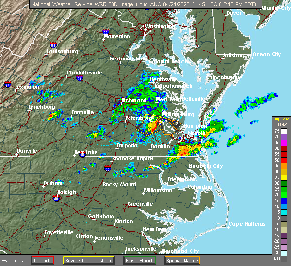 At 548 pm edt, a severe thunderstorm was located near elberon, or near surry, moving southeast at 35 mph (radar indicated). Hazards include 60 mph wind gusts and nickel size hail. Expect damage to trees and powerlines. this severe thunderstorm will be near, smithfield and isle of wight around 605 pm edt. christopher newport university and rescue around 615 pm edt. suffolk and crittenden around 625 pm edt. other locations impacted by this severe thunderstorm include rushmere, pons, carrollton, chippokes state park, longview, benns church, oriana, bethel church, ellis fork and hilton village. People at port warwick, obici hospital, belle harbour hospital, and bon secours mary immaculate should seek safe shelter immediately!. At 548 pm edt, a severe thunderstorm was located near elberon, or near surry, moving southeast at 35 mph (radar indicated). Hazards include 60 mph wind gusts and nickel size hail. Expect damage to trees and powerlines. this severe thunderstorm will be near, smithfield and isle of wight around 605 pm edt. christopher newport university and rescue around 615 pm edt. suffolk and crittenden around 625 pm edt. other locations impacted by this severe thunderstorm include rushmere, pons, carrollton, chippokes state park, longview, benns church, oriana, bethel church, ellis fork and hilton village. People at port warwick, obici hospital, belle harbour hospital, and bon secours mary immaculate should seek safe shelter immediately!.
|
| 10/31/2019 11:58 PM EDT |
 The national weather service in wakefield has issued a * severe thunderstorm warning for. the city of poquoson in southeastern virginia. the city of norfolk in southeastern virginia. the northwestern city of chesapeake in southeastern virginia. Isle of wight county in southeastern virginia. The national weather service in wakefield has issued a * severe thunderstorm warning for. the city of poquoson in southeastern virginia. the city of norfolk in southeastern virginia. the northwestern city of chesapeake in southeastern virginia. Isle of wight county in southeastern virginia.
|
| 8/20/2019 7:25 PM EDT |
 At 725 pm edt, severe thunderstorms were located along a line extending from near elberon to near dendron to near wakefield, moving east at 10 mph (radar indicated). Hazards include 60 mph wind gusts and penny size hail. Expect damage to trees and powerlines. Locations impacted include, wakefield, surry, ivor, dendron, elberon, zuni, booth fork, pons, chippokes state park, berlin, ellis fork, manry, delk crossroads, bacons castle, whitley, dory, comet, poolesville, moonlight and alliance. At 725 pm edt, severe thunderstorms were located along a line extending from near elberon to near dendron to near wakefield, moving east at 10 mph (radar indicated). Hazards include 60 mph wind gusts and penny size hail. Expect damage to trees and powerlines. Locations impacted include, wakefield, surry, ivor, dendron, elberon, zuni, booth fork, pons, chippokes state park, berlin, ellis fork, manry, delk crossroads, bacons castle, whitley, dory, comet, poolesville, moonlight and alliance.
|
| 8/20/2019 7:08 PM EDT |
 At 708 pm edt, severe thunderstorms were located along a line extending from near elberon to near wakefield to near homeville, moving east at 10 mph (radar indicated). Hazards include 60 mph wind gusts and quarter size hail. Minor damage to vehicles is possible. Expect wind damage to trees and powerlines. At 708 pm edt, severe thunderstorms were located along a line extending from near elberon to near wakefield to near homeville, moving east at 10 mph (radar indicated). Hazards include 60 mph wind gusts and quarter size hail. Minor damage to vehicles is possible. Expect wind damage to trees and powerlines.
|
| 8/15/2019 5:56 PM EDT |
 At 555 pm edt, severe thunderstorms were located along a line extending from near virginia institute for marine sciences to denbigh to smithfield, moving east at 20 mph (radar indicated). Hazards include 60 mph wind gusts. Expect damage to trees and powerlines. these severe storms will be near, newport news and patrick henry field around 600 pm edt. christopher newport university, tabb and beaconsdale around 605 pm edt. hampton, seaford and northampton around 615 pm edt. Other locations impacted by these severe thunderstorms include dare, newport news golf course, lackey, oyster point, oriana, hornsbyville, hilton village, harris grove, menchville and yorktown. At 555 pm edt, severe thunderstorms were located along a line extending from near virginia institute for marine sciences to denbigh to smithfield, moving east at 20 mph (radar indicated). Hazards include 60 mph wind gusts. Expect damage to trees and powerlines. these severe storms will be near, newport news and patrick henry field around 600 pm edt. christopher newport university, tabb and beaconsdale around 605 pm edt. hampton, seaford and northampton around 615 pm edt. Other locations impacted by these severe thunderstorms include dare, newport news golf course, lackey, oyster point, oriana, hornsbyville, hilton village, harris grove, menchville and yorktown.
|
| 8/15/2019 5:32 PM EDT |
 At 532 pm edt, severe thunderstorms were located along a line extending from near queens lake to near busch gardens to 6 miles east of elberon, moving east at 20 mph (radar indicated). Hazards include 60 mph wind gusts. Expect damage to trees and powerlines. severe thunderstorms will be near, busch gardens and grove around 535 pm edt. newport news, lee hall and fort eustis around 550 pm edt. gloucester point, wicomico and denbigh around 600 pm edt. patrick henry field and virginia institute for marine sciences around 605 pm edt. seaford and tabb around 610 pm edt. hampton, christopher newport university, northampton, achilles and beaconsdale around 615 pm edt. other locations impacted by these severe thunderstorms include lackey, water country u. s. a. Glass, oriana, maryus, hilton village, dare, newport news golf course, severn and oyster point. At 532 pm edt, severe thunderstorms were located along a line extending from near queens lake to near busch gardens to 6 miles east of elberon, moving east at 20 mph (radar indicated). Hazards include 60 mph wind gusts. Expect damage to trees and powerlines. severe thunderstorms will be near, busch gardens and grove around 535 pm edt. newport news, lee hall and fort eustis around 550 pm edt. gloucester point, wicomico and denbigh around 600 pm edt. patrick henry field and virginia institute for marine sciences around 605 pm edt. seaford and tabb around 610 pm edt. hampton, christopher newport university, northampton, achilles and beaconsdale around 615 pm edt. other locations impacted by these severe thunderstorms include lackey, water country u. s. a. Glass, oriana, maryus, hilton village, dare, newport news golf course, severn and oyster point.
|
| 8/15/2019 5:21 PM EDT |
 At 521 pm edt, severe thunderstorms were located along a line extending from norge to jamestown to near elberon, moving east at 20 mph (radar indicated). Hazards include 60 mph wind gusts. Expect damage to trees and powerlines. these severe storms will be near, jamestown around 525 pm edt. williamsburg and kings point around 530 pm edt. college of william and mary and carver gardens around 535 pm edt. busch gardens around 540 pm edt. queens lake, grove and york terrace around 545 pm edt. other locations impacted by these severe thunderstorms include chippokes state park, barlows corner, water country u. s. a. Camp peary, delk crossroads, centerville, ewell, bacons castle, poolesville and governors land. At 521 pm edt, severe thunderstorms were located along a line extending from norge to jamestown to near elberon, moving east at 20 mph (radar indicated). Hazards include 60 mph wind gusts. Expect damage to trees and powerlines. these severe storms will be near, jamestown around 525 pm edt. williamsburg and kings point around 530 pm edt. college of william and mary and carver gardens around 535 pm edt. busch gardens around 540 pm edt. queens lake, grove and york terrace around 545 pm edt. other locations impacted by these severe thunderstorms include chippokes state park, barlows corner, water country u. s. a. Camp peary, delk crossroads, centerville, ewell, bacons castle, poolesville and governors land.
|
| 8/15/2019 4:57 PM EDT |
 At 457 pm edt, severe thunderstorms were located along a line extending from holdcroft to near rustic to near dendron, moving east at 20 mph (radar indicated). Hazards include 60 mph wind gusts. Expect damage to trees and powerlines. severe thunderstorms will be near, surry around 515 pm edt. norge, jamestown and scotland around 520 pm edt. williamsburg and kings point around 530 pm edt. college of william and mary and carver gardens around 535 pm edt. busch gardens and grove around 540 pm edt. queens lake and york terrace around 545 pm edt. other locations impacted by these severe thunderstorms include chippokes state park, barlows corner, water country u. s. a. Camp peary, spring grove, delk crossroads, centerville, ewell, bacons castle and poolesville. At 457 pm edt, severe thunderstorms were located along a line extending from holdcroft to near rustic to near dendron, moving east at 20 mph (radar indicated). Hazards include 60 mph wind gusts. Expect damage to trees and powerlines. severe thunderstorms will be near, surry around 515 pm edt. norge, jamestown and scotland around 520 pm edt. williamsburg and kings point around 530 pm edt. college of william and mary and carver gardens around 535 pm edt. busch gardens and grove around 540 pm edt. queens lake and york terrace around 545 pm edt. other locations impacted by these severe thunderstorms include chippokes state park, barlows corner, water country u. s. a. Camp peary, spring grove, delk crossroads, centerville, ewell, bacons castle and poolesville.
|
| 7/17/2019 8:07 PM EDT |
 At 807 pm edt, a severe thunderstorm was located over jamestown, or near college of william and mary, moving northeast at 35 mph (radar indicated). Hazards include 60 mph wind gusts. Expect damage to trees and powerlines. this severe storm will be near, queens lake, carver gardens, york terrace, busch gardens, grove and lee hall around 820 pm edt. newport news around 825 pm edt. other locations impacted by this severe thunderstorm include chippokes state park, lackey, water country u. s. a. Camp peary, bacons castle, newport news golf course, poolesville, governors land, alliance and hog island game reserve. At 807 pm edt, a severe thunderstorm was located over jamestown, or near college of william and mary, moving northeast at 35 mph (radar indicated). Hazards include 60 mph wind gusts. Expect damage to trees and powerlines. this severe storm will be near, queens lake, carver gardens, york terrace, busch gardens, grove and lee hall around 820 pm edt. newport news around 825 pm edt. other locations impacted by this severe thunderstorm include chippokes state park, lackey, water country u. s. a. Camp peary, bacons castle, newport news golf course, poolesville, governors land, alliance and hog island game reserve.
|
| 7/17/2019 7:53 PM EDT |
 At 753 pm edt, a severe thunderstorm was located over surry, moving northeast at 35 mph (radar indicated). Hazards include 60 mph wind gusts and penny size hail. Expect damage to trees and powerlines. this severe thunderstorm will be near, scotland around 805 pm edt. jamestown around 810 pm edt. williamsburg, college of william and mary and kings point around 815 pm edt. queens lake, carver gardens, york terrace, busch gardens, grove and lee hall around 820 pm edt. newport news around 825 pm edt. other locations impacted by this severe thunderstorm include carsley, chippokes state park, lackey, water country u. s. a. Camp peary, spring grove, bacons castle, newport news golf course, poolesville and governors land. At 753 pm edt, a severe thunderstorm was located over surry, moving northeast at 35 mph (radar indicated). Hazards include 60 mph wind gusts and penny size hail. Expect damage to trees and powerlines. this severe thunderstorm will be near, scotland around 805 pm edt. jamestown around 810 pm edt. williamsburg, college of william and mary and kings point around 815 pm edt. queens lake, carver gardens, york terrace, busch gardens, grove and lee hall around 820 pm edt. newport news around 825 pm edt. other locations impacted by this severe thunderstorm include carsley, chippokes state park, lackey, water country u. s. a. Camp peary, spring grove, bacons castle, newport news golf course, poolesville and governors land.
|
| 6/5/2019 6:02 PM EDT |
 At 602 pm edt, severe thunderstorms were located along a line extending from near newport news to near crittenden to near suffolk, moving northeast at 50 mph (radar indicated). Hazards include 60 mph wind gusts. Expect damage to trees and powerlines. these severe storms will be near, christopher newport university, churchland, northampton, crittenden and beaconsdale around 610 pm edt. hampton, langley afb, hampton university, old dominion university, portsmouth, norfolk nas, fort monroe, bowers hill and buckroe beach around 615 pm edt. Other locations impacted by these severe thunderstorms include carrollton, longview, benns church, huntersville, suffolk airport, bethel church, hilton village, chuckatuck, wilroy and lees mill. At 602 pm edt, severe thunderstorms were located along a line extending from near newport news to near crittenden to near suffolk, moving northeast at 50 mph (radar indicated). Hazards include 60 mph wind gusts. Expect damage to trees and powerlines. these severe storms will be near, christopher newport university, churchland, northampton, crittenden and beaconsdale around 610 pm edt. hampton, langley afb, hampton university, old dominion university, portsmouth, norfolk nas, fort monroe, bowers hill and buckroe beach around 615 pm edt. Other locations impacted by these severe thunderstorms include carrollton, longview, benns church, huntersville, suffolk airport, bethel church, hilton village, chuckatuck, wilroy and lees mill.
|
| 6/5/2019 5:58 PM EDT |
 The national weather service in wakefield has issued a * severe thunderstorm warning for. the city of poquoson in southeastern virginia. southern accomack county in southeastern virginia. gloucester county in eastern virginia. Southeastern middlesex county in eastern virginia. The national weather service in wakefield has issued a * severe thunderstorm warning for. the city of poquoson in southeastern virginia. southern accomack county in southeastern virginia. gloucester county in eastern virginia. Southeastern middlesex county in eastern virginia.
|
| 6/5/2019 5:43 PM EDT |
 At 543 pm edt, severe thunderstorms were located along a line extending from near rustic to scotland to 7 miles northwest of isle of wight, moving east at 40 mph (radar indicated). Hazards include 60 mph wind gusts. Expect damage to trees and powerlines. these severe storms will be near, williamsburg, norge, college of william and mary and kings point around 550 pm edt. queens lake, busch gardens, carver gardens, grove and york terrace around 555 pm edt. newport news, gloucester courthouse, virginia institute for marine sciences, gloucester point, patrick henry field, lee hall, wicomico, fort eustis and denbigh around 600 pm edt. Other locations impacted by these severe thunderstorms include rushmere, booth fork, pons, croaker, chippokes state park, lackey, camp peary, oriana, ellis fork and ewell. At 543 pm edt, severe thunderstorms were located along a line extending from near rustic to scotland to 7 miles northwest of isle of wight, moving east at 40 mph (radar indicated). Hazards include 60 mph wind gusts. Expect damage to trees and powerlines. these severe storms will be near, williamsburg, norge, college of william and mary and kings point around 550 pm edt. queens lake, busch gardens, carver gardens, grove and york terrace around 555 pm edt. newport news, gloucester courthouse, virginia institute for marine sciences, gloucester point, patrick henry field, lee hall, wicomico, fort eustis and denbigh around 600 pm edt. Other locations impacted by these severe thunderstorms include rushmere, booth fork, pons, croaker, chippokes state park, lackey, camp peary, oriana, ellis fork and ewell.
|
| 6/5/2019 5:31 PM EDT |
 At 530 pm edt, severe thunderstorms were located along a line extending from near wakefield to sedley to near newsoms, moving northeast at 50 mph (radar indicated). Hazards include 60 mph wind gusts. Expect damage to trees and powerlines. severe thunderstorms will be near, ivor and sedley around 535 pm edt. franklin and zuni around 545 pm edt. windsor around 550 pm edt. smithfield, holland, isle of wight and carrsville around 555 pm edt. rescue around 600 pm edt. christopher newport university and crittenden around 605 pm edt. downtown suffolk, churchland, suffolk, northampton, kings fork and beaconsdale around 610 pm edt. hampton, langley afb, hampton university, old dominion university, chesapeake, portsmouth, driver, norfolk nas, fort monroe and bowers hill around 615 pm edt. Other locations impacted by these severe thunderstorms include vicksville, south norfolk, carrollton, longview, benns church, huntersville, suffolk airport, bethel church, hilton village and chuckatuck. At 530 pm edt, severe thunderstorms were located along a line extending from near wakefield to sedley to near newsoms, moving northeast at 50 mph (radar indicated). Hazards include 60 mph wind gusts. Expect damage to trees and powerlines. severe thunderstorms will be near, ivor and sedley around 535 pm edt. franklin and zuni around 545 pm edt. windsor around 550 pm edt. smithfield, holland, isle of wight and carrsville around 555 pm edt. rescue around 600 pm edt. christopher newport university and crittenden around 605 pm edt. downtown suffolk, churchland, suffolk, northampton, kings fork and beaconsdale around 610 pm edt. hampton, langley afb, hampton university, old dominion university, chesapeake, portsmouth, driver, norfolk nas, fort monroe and bowers hill around 615 pm edt. Other locations impacted by these severe thunderstorms include vicksville, south norfolk, carrollton, longview, benns church, huntersville, suffolk airport, bethel church, hilton village and chuckatuck.
|
| 6/5/2019 5:13 PM EDT |
 The national weather service in wakefield has issued a * severe thunderstorm warning for. central gloucester county in eastern virginia. northwestern isle of wight county in southeastern virginia. northeastern southampton county in southeastern virginia. Southeastern charles city county in east central virginia. The national weather service in wakefield has issued a * severe thunderstorm warning for. central gloucester county in eastern virginia. northwestern isle of wight county in southeastern virginia. northeastern southampton county in southeastern virginia. Southeastern charles city county in east central virginia.
|
| 5/31/2019 8:22 PM EDT |
 The severe thunderstorm warning for isle of wight and northeastern southampton counties will expire at 830 pm edt, the storm which prompted the warning has weakened below severe limits, and no longer poses an immediate threat to life or property. therefore, the warning will be allowed to expire. however small hail and gusty winds are still possible with this thunderstorm. a severe thunderstorm watch remains in effect until 1100 pm edt for southeastern virginia. The severe thunderstorm warning for isle of wight and northeastern southampton counties will expire at 830 pm edt, the storm which prompted the warning has weakened below severe limits, and no longer poses an immediate threat to life or property. therefore, the warning will be allowed to expire. however small hail and gusty winds are still possible with this thunderstorm. a severe thunderstorm watch remains in effect until 1100 pm edt for southeastern virginia.
|
| 5/31/2019 8:13 PM EDT |
 At 812 pm edt, a severe thunderstorm was located over isle of wight, or near windsor, moving northeast at 20 mph (radar indicated). Hazards include 60 mph wind gusts and quarter size hail. Minor damage to vehicles is possible. expect wind damage to trees and powerlines. this severe storm will be near, isle of wight around 820 pm edt. smithfield around 830 pm edt. Other locations impacted by this severe thunderstorm include pons, bethel church, lawson, central hill, whitley, collosse, comet, moonlight, walters and boaz. At 812 pm edt, a severe thunderstorm was located over isle of wight, or near windsor, moving northeast at 20 mph (radar indicated). Hazards include 60 mph wind gusts and quarter size hail. Minor damage to vehicles is possible. expect wind damage to trees and powerlines. this severe storm will be near, isle of wight around 820 pm edt. smithfield around 830 pm edt. Other locations impacted by this severe thunderstorm include pons, bethel church, lawson, central hill, whitley, collosse, comet, moonlight, walters and boaz.
|
| 5/31/2019 7:39 PM EDT |
 At 739 pm edt, a severe thunderstorm was located over sedley, or near franklin, moving north at 20 mph (radar indicated). Hazards include golf ball size hail and 70 mph wind gusts. People and animals outdoors will be injured. expect hail damage to roofs, siding, windows, and vehicles. expect considerable tree damage. wind damage is also likely to mobile homes, roofs, and outbuildings. this severe thunderstorm will be near, zuni around 800 pm edt. ivor around 810 pm edt. wakefield around 815 pm edt. dendron and elberon around 830 pm edt. Other locations impacted by this severe thunderstorm include vicksville, booth fork, pons, carsley, berlin, bethel church, ellis fork, manry, delk crossroads and lawson. At 739 pm edt, a severe thunderstorm was located over sedley, or near franklin, moving north at 20 mph (radar indicated). Hazards include golf ball size hail and 70 mph wind gusts. People and animals outdoors will be injured. expect hail damage to roofs, siding, windows, and vehicles. expect considerable tree damage. wind damage is also likely to mobile homes, roofs, and outbuildings. this severe thunderstorm will be near, zuni around 800 pm edt. ivor around 810 pm edt. wakefield around 815 pm edt. dendron and elberon around 830 pm edt. Other locations impacted by this severe thunderstorm include vicksville, booth fork, pons, carsley, berlin, bethel church, ellis fork, manry, delk crossroads and lawson.
|
| 4/26/2019 12:12 PM EDT |
 At 1211 pm edt, severe thunderstorms were located along a line extending from near isle of wight to near kings fork to corapeake, moving northeast at 45 mph (radar indicated). Hazards include 60 mph wind gusts and penny size hail. Expect damage to trees and powerlines. these severe storms will be near, smithfield and driver around 1215 pm edt. crittenden and rescue around 1220 pm edt. churchland around 1225 pm edt. newport news, christopher newport university, hampton university, deep creek, portsmouth, northampton, denbigh, fort eustis, beaconsdale and fort monroe around 1230 pm edt. Other locations impacted by these severe thunderstorms include south norfolk, portlock, carrollton, longview, benns church, savage, huntersville, suffolk airport, bethel church and buckland. At 1211 pm edt, severe thunderstorms were located along a line extending from near isle of wight to near kings fork to corapeake, moving northeast at 45 mph (radar indicated). Hazards include 60 mph wind gusts and penny size hail. Expect damage to trees and powerlines. these severe storms will be near, smithfield and driver around 1215 pm edt. crittenden and rescue around 1220 pm edt. churchland around 1225 pm edt. newport news, christopher newport university, hampton university, deep creek, portsmouth, northampton, denbigh, fort eustis, beaconsdale and fort monroe around 1230 pm edt. Other locations impacted by these severe thunderstorms include south norfolk, portlock, carrollton, longview, benns church, savage, huntersville, suffolk airport, bethel church and buckland.
|
| 4/26/2019 11:51 AM EDT |
 At 1151 am edt, severe thunderstorms were located along a line extending from near sedley to near holland to near cofield, moving northeast at 50 mph (radar indicated). Hazards include 60 mph wind gusts and quarter size hail. Minor damage to vehicles is possible. expect wind damage to trees and powerlines. severe thunderstorms will be near, holland and carrsville around 1155 am edt. zuni around 1200 pm edt. windsor, downtown suffolk and isle of wight around 1205 pm edt. kings fork, whaleyville and corapeake around 1210 pm edt. smithfield and driver around 1215 pm edt. crittenden and rescue around 1220 pm edt. christopher newport university, churchland, suffolk, denbigh, fort eustis and beaconsdale around 1225 pm edt. newport news, hampton, hampton university, deep creek, chesapeake, portsmouth, northampton, bowers hill, fort monroe and western branch around 1230 pm edt. Other locations impacted by these severe thunderstorms include south norfolk, portlock, carrollton, longview, savage, huntersville, topsy, dort, chuckatuck and wilroy. At 1151 am edt, severe thunderstorms were located along a line extending from near sedley to near holland to near cofield, moving northeast at 50 mph (radar indicated). Hazards include 60 mph wind gusts and quarter size hail. Minor damage to vehicles is possible. expect wind damage to trees and powerlines. severe thunderstorms will be near, holland and carrsville around 1155 am edt. zuni around 1200 pm edt. windsor, downtown suffolk and isle of wight around 1205 pm edt. kings fork, whaleyville and corapeake around 1210 pm edt. smithfield and driver around 1215 pm edt. crittenden and rescue around 1220 pm edt. christopher newport university, churchland, suffolk, denbigh, fort eustis and beaconsdale around 1225 pm edt. newport news, hampton, hampton university, deep creek, chesapeake, portsmouth, northampton, bowers hill, fort monroe and western branch around 1230 pm edt. Other locations impacted by these severe thunderstorms include south norfolk, portlock, carrollton, longview, savage, huntersville, topsy, dort, chuckatuck and wilroy.
|
| 4/19/2019 8:04 PM EDT |
 At 803 pm edt, a severe squall line capable of producing both tornadoes and extensive straight line wind damage was located over newport news, moving northeast at 70 mph. this line extends southward into smithfield. anywhere along the line has the potenial for a tornado (radar indicated rotation). Hazards include tornado. Flying debris will be dangerous to those caught without shelter. mobile homes will be damaged or destroyed. damage to roofs, windows, and vehicles will occur. tree damage is likely. these dangerous storms will be near, hampton and seaford around 810 pm edt. Other locations impacted by this tornadic thunderstorm include fox hill, carrollton, phoebus, langley view, longview, benns church, oriana, wills corner, hilton village and lawson. At 803 pm edt, a severe squall line capable of producing both tornadoes and extensive straight line wind damage was located over newport news, moving northeast at 70 mph. this line extends southward into smithfield. anywhere along the line has the potenial for a tornado (radar indicated rotation). Hazards include tornado. Flying debris will be dangerous to those caught without shelter. mobile homes will be damaged or destroyed. damage to roofs, windows, and vehicles will occur. tree damage is likely. these dangerous storms will be near, hampton and seaford around 810 pm edt. Other locations impacted by this tornadic thunderstorm include fox hill, carrollton, phoebus, langley view, longview, benns church, oriana, wills corner, hilton village and lawson.
|
| 4/19/2019 7:56 PM EDT |
 The tornado warning for surry county will expire at 800 pm edt, the storms which prompted the warning have moved out of the area. therefore, the warning will be allowed to expire. a tornado watch remains in effect until midnight edt for southeastern and east central virginia. The tornado warning for surry county will expire at 800 pm edt, the storms which prompted the warning have moved out of the area. therefore, the warning will be allowed to expire. a tornado watch remains in effect until midnight edt for southeastern and east central virginia.
|
| 4/19/2019 7:55 PM EDT |
 At 755 pm edt, a severe thunderstorm capable of producing a tornado was located over smithfield, moving northeast at 50 mph (radar indicated rotation). Hazards include tornado. Flying debris will be dangerous to those caught without shelter. mobile homes will be damaged or destroyed. damage to roofs, windows, and vehicles will occur. tree damage is likely. this dangerous storm will be near, christopher newport university, beaconsdale, denbigh and fort eustis around 805 pm edt. patrick henry field, hampton university, northampton and tabb around 810 pm edt. hampton, langley afb, seaford and buckroe beach around 815 pm edt. grand view around 820 pm edt. Other locations impacted by this tornadic thunderstorm include fox hill, carrollton, phoebus, langley view, longview, benns church, oriana, wills corner, hilton village and lawson. At 755 pm edt, a severe thunderstorm capable of producing a tornado was located over smithfield, moving northeast at 50 mph (radar indicated rotation). Hazards include tornado. Flying debris will be dangerous to those caught without shelter. mobile homes will be damaged or destroyed. damage to roofs, windows, and vehicles will occur. tree damage is likely. this dangerous storm will be near, christopher newport university, beaconsdale, denbigh and fort eustis around 805 pm edt. patrick henry field, hampton university, northampton and tabb around 810 pm edt. hampton, langley afb, seaford and buckroe beach around 815 pm edt. grand view around 820 pm edt. Other locations impacted by this tornadic thunderstorm include fox hill, carrollton, phoebus, langley view, longview, benns church, oriana, wills corner, hilton village and lawson.
|
| 4/19/2019 7:50 PM EDT |
 At 749 pm edt, a severe squall line capable of producing both tornadoes and extensive straight line wind damage was located along a line extending from 7 miles northwest of smithfield to near isle of wight to near carrsville, moving northeast at 55 mph (radar indicated rotation). Hazards include tornado. Flying debris will be dangerous to those caught without shelter. mobile homes will be damaged or destroyed. damage to roofs, windows, and vehicles will occur. tree damage is likely. these dangerous storms will be near, smithfield around 755 pm edt. rescue around 800 pm edt. Other locations impacted by these tornadic storms include pons, carrollton, longview, benns church, wills corner, bethel church, indika, lawson, central hill and whitley. At 749 pm edt, a severe squall line capable of producing both tornadoes and extensive straight line wind damage was located along a line extending from 7 miles northwest of smithfield to near isle of wight to near carrsville, moving northeast at 55 mph (radar indicated rotation). Hazards include tornado. Flying debris will be dangerous to those caught without shelter. mobile homes will be damaged or destroyed. damage to roofs, windows, and vehicles will occur. tree damage is likely. these dangerous storms will be near, smithfield around 755 pm edt. rescue around 800 pm edt. Other locations impacted by these tornadic storms include pons, carrollton, longview, benns church, wills corner, bethel church, indika, lawson, central hill and whitley.
|
| 4/19/2019 7:48 PM EDT |
 At 747 pm edt, severe thunderstorms were located along a line extending from rustic to 6 miles west of smithfield, moving northeast at 50 mph (radar indicated). Hazards include 60 mph wind gusts. Expect damage to trees and powerlines. severe thunderstorms will be near, williamsburg, toano, norge and fort eustis around 800 pm edt. newport news, denbigh and lee hall around 805 pm edt. virginia institute for marine sciences around 810 pm edt. gloucester courthouse, seaford and achilles around 815 pm edt. other locations impacted by these severe thunderstorms include croaker, chippokes state park, lackey, camp peary, glass, naxera, oriana, ewell, newport news golf course and warren mill. A tornado watch remains in effect until midnight edt for eastern, southeastern and east central virginia. At 747 pm edt, severe thunderstorms were located along a line extending from rustic to 6 miles west of smithfield, moving northeast at 50 mph (radar indicated). Hazards include 60 mph wind gusts. Expect damage to trees and powerlines. severe thunderstorms will be near, williamsburg, toano, norge and fort eustis around 800 pm edt. newport news, denbigh and lee hall around 805 pm edt. virginia institute for marine sciences around 810 pm edt. gloucester courthouse, seaford and achilles around 815 pm edt. other locations impacted by these severe thunderstorms include croaker, chippokes state park, lackey, camp peary, glass, naxera, oriana, ewell, newport news golf course and warren mill. A tornado watch remains in effect until midnight edt for eastern, southeastern and east central virginia.
|
| 4/19/2019 7:40 PM EDT |
 At 740 pm edt, a severe squall line capable of producing both tornadoes and extensive straight line wind damage was located along a line extending from near charles city to 6 miles northwest of isle of wight, moving northeast at 50 mph (radar indicated rotation). Hazards include tornado. Flying debris will be dangerous to those caught without shelter. mobile homes will be damaged or destroyed. damage to roofs, windows, and vehicles will occur. tree damage is likely. These tornadic storms will remain over mainly rural areas of surry county, including the following locations, booth fork, carsley, chippokes state park, spring grove, ellis fork, delk crossroads, bacons castle, poolesville, alliance and gwaltney corner. At 740 pm edt, a severe squall line capable of producing both tornadoes and extensive straight line wind damage was located along a line extending from near charles city to 6 miles northwest of isle of wight, moving northeast at 50 mph (radar indicated rotation). Hazards include tornado. Flying debris will be dangerous to those caught without shelter. mobile homes will be damaged or destroyed. damage to roofs, windows, and vehicles will occur. tree damage is likely. These tornadic storms will remain over mainly rural areas of surry county, including the following locations, booth fork, carsley, chippokes state park, spring grove, ellis fork, delk crossroads, bacons castle, poolesville, alliance and gwaltney corner.
|
| 4/19/2019 7:31 PM EDT |
 At 730 pm edt, a severe thunderstorm capable of producing a tornado was located near zuni, or near windsor, moving northeast at 70 mph (radar indicated rotation). Hazards include tornado. Flying debris will be dangerous to those caught without shelter. mobile homes will be damaged or destroyed. damage to roofs, windows, and vehicles will occur. tree damage is likely. this dangerous storm will be near, isle of wight around 740 pm edt. smithfield around 745 pm edt. Other locations impacted by this tornadic thunderstorm include pons, carrollton, longview, benns church, wills corner, bethel church, indika, lawson, central hill and whitley. At 730 pm edt, a severe thunderstorm capable of producing a tornado was located near zuni, or near windsor, moving northeast at 70 mph (radar indicated rotation). Hazards include tornado. Flying debris will be dangerous to those caught without shelter. mobile homes will be damaged or destroyed. damage to roofs, windows, and vehicles will occur. tree damage is likely. this dangerous storm will be near, isle of wight around 740 pm edt. smithfield around 745 pm edt. Other locations impacted by this tornadic thunderstorm include pons, carrollton, longview, benns church, wills corner, bethel church, indika, lawson, central hill and whitley.
|
| 4/19/2019 7:23 PM EDT |
 At 723 pm edt, a severe thunderstorm capable of producing a tornado was located near waverly, moving northeast at 70 mph (radar indicated rotation). Hazards include tornado. Flying debris will be dangerous to those caught without shelter. mobile homes will be damaged or destroyed. damage to roofs, windows, and vehicles will occur. tree damage is likely. this dangerous storm will be near, dendron around 730 pm edt. elberon around 735 pm edt. claremont around 740 pm edt. Other locations impacted by this tornadic thunderstorm include booth fork, carsley, newville, chippokes state park, spring grove, ellis fork, delk crossroads, bacons castle, poolesville and alliance. At 723 pm edt, a severe thunderstorm capable of producing a tornado was located near waverly, moving northeast at 70 mph (radar indicated rotation). Hazards include tornado. Flying debris will be dangerous to those caught without shelter. mobile homes will be damaged or destroyed. damage to roofs, windows, and vehicles will occur. tree damage is likely. this dangerous storm will be near, dendron around 730 pm edt. elberon around 735 pm edt. claremont around 740 pm edt. Other locations impacted by this tornadic thunderstorm include booth fork, carsley, newville, chippokes state park, spring grove, ellis fork, delk crossroads, bacons castle, poolesville and alliance.
|
| 4/15/2019 3:06 AM EDT |
 At 305 am edt, severe thunderstorms were located along a line extending from dendron to near zuni to hunterdale, moving northeast at 80 mph (radar indicated). Hazards include 60 mph wind gusts. Expect damage to trees and powerlines. severe thunderstorms will be near, dendron and elberon around 310 am edt. windsor, surry and scotland around 315 am edt. williamsburg, isle of wight, kings point, jamestown, york terrace and carver gardens around 320 am edt. smithfield, lee hall, grove and busch gardens around 325 am edt. newport news and rescue around 330 am edt. gloucester point, patrick henry field, christopher newport university, fort eustis, denbigh, tabb and beaconsdale around 335 am edt. virginia institute for marine sciences and seaford around 340 am edt. other locations impacted by these severe thunderstorms include vicksville, pons, carrollton, chippokes state park, lackey, longview, oriana, chuckatuck, dory and lees mill. A tornado watch remains in effect until 700 am edt for northeastern north carolina, and eastern and southeastern virginia. At 305 am edt, severe thunderstorms were located along a line extending from dendron to near zuni to hunterdale, moving northeast at 80 mph (radar indicated). Hazards include 60 mph wind gusts. Expect damage to trees and powerlines. severe thunderstorms will be near, dendron and elberon around 310 am edt. windsor, surry and scotland around 315 am edt. williamsburg, isle of wight, kings point, jamestown, york terrace and carver gardens around 320 am edt. smithfield, lee hall, grove and busch gardens around 325 am edt. newport news and rescue around 330 am edt. gloucester point, patrick henry field, christopher newport university, fort eustis, denbigh, tabb and beaconsdale around 335 am edt. virginia institute for marine sciences and seaford around 340 am edt. other locations impacted by these severe thunderstorms include vicksville, pons, carrollton, chippokes state park, lackey, longview, oriana, chuckatuck, dory and lees mill. A tornado watch remains in effect until 700 am edt for northeastern north carolina, and eastern and southeastern virginia.
|
| 4/15/2019 2:36 AM EDT |
 At 236 am edt, a severe thunderstorm was located near cabin point, or near claremont, moving northeast at 60 mph (radar indicated). Hazards include 60 mph wind gusts and quarter size hail. Minor damage to vehicles is possible. expect wind damage to trees and powerlines. this severe storm will be near, surry, scotland and rustic around 245 am edt. jamestown around 250 am edt. williamsburg and kings point around 255 am edt. other locations impacted by this severe thunderstorm include taylors corner, booth fork, carsley, chickahominy shore, chippokes state park, birchett estate, booker, spring grove, ellis fork and jordan point country club. A tornado watch remains in effect until 700 am edt for south central, southeastern and east central virginia. At 236 am edt, a severe thunderstorm was located near cabin point, or near claremont, moving northeast at 60 mph (radar indicated). Hazards include 60 mph wind gusts and quarter size hail. Minor damage to vehicles is possible. expect wind damage to trees and powerlines. this severe storm will be near, surry, scotland and rustic around 245 am edt. jamestown around 250 am edt. williamsburg and kings point around 255 am edt. other locations impacted by this severe thunderstorm include taylors corner, booth fork, carsley, chickahominy shore, chippokes state park, birchett estate, booker, spring grove, ellis fork and jordan point country club. A tornado watch remains in effect until 700 am edt for south central, southeastern and east central virginia.
|
| 4/15/2019 2:08 AM EDT |
 At 208 am edt, a severe thunderstorm was located over stony creek, or 12 miles northeast of purdy, moving northeast at 60 mph (radar indicated). Hazards include 60 mph wind gusts and quarter size hail. Minor damage to vehicles is possible. expect wind damage to trees and powerlines. this severe thunderstorm will be near, homeville around 220 am edt. disputanta around 225 am edt. waverly around 230 am edt. dendron and cabin point around 235 am edt. claremont and elberon around 240 am edt. surry around 245 am edt. jamestown and scotland around 250 am edt. williamsburg and kings point around 255 am edt. other locations impacted by this severe thunderstorm include taylors corner, booth fork, carsley, chickahominy shore, chippokes state park, birchett estate, booker, spring grove, lumberton and ellis fork. A tornado watch remains in effect until 700 am edt for south central, southeastern and east central virginia. At 208 am edt, a severe thunderstorm was located over stony creek, or 12 miles northeast of purdy, moving northeast at 60 mph (radar indicated). Hazards include 60 mph wind gusts and quarter size hail. Minor damage to vehicles is possible. expect wind damage to trees and powerlines. this severe thunderstorm will be near, homeville around 220 am edt. disputanta around 225 am edt. waverly around 230 am edt. dendron and cabin point around 235 am edt. claremont and elberon around 240 am edt. surry around 245 am edt. jamestown and scotland around 250 am edt. williamsburg and kings point around 255 am edt. other locations impacted by this severe thunderstorm include taylors corner, booth fork, carsley, chickahominy shore, chippokes state park, birchett estate, booker, spring grove, lumberton and ellis fork. A tornado watch remains in effect until 700 am edt for south central, southeastern and east central virginia.
|
| 7/22/2018 2:53 PM EDT |
 At 253 pm edt, a severe thunderstorm was located over isle of wight, or near windsor, moving northeast at 25 mph (radar indicated). Hazards include 60 mph wind gusts and quarter size hail. Minor damage to vehicles is possible. expect wind damage to trees and powerlines. Locations impacted include, smithfield, windsor, surry, isle of wight, ivor, rescue, zuni, rushmere, pons, carrollton, chippokes state park, longview, benns church, bethel church, poolesville, walters, alliance, mogarts beach, runnymede and delk crossroads. At 253 pm edt, a severe thunderstorm was located over isle of wight, or near windsor, moving northeast at 25 mph (radar indicated). Hazards include 60 mph wind gusts and quarter size hail. Minor damage to vehicles is possible. expect wind damage to trees and powerlines. Locations impacted include, smithfield, windsor, surry, isle of wight, ivor, rescue, zuni, rushmere, pons, carrollton, chippokes state park, longview, benns church, bethel church, poolesville, walters, alliance, mogarts beach, runnymede and delk crossroads.
|
| 7/22/2018 2:34 PM EDT |
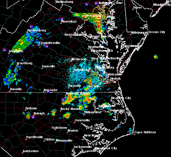 At 234 pm edt, a severe thunderstorm was located over zuni, or near windsor, moving northeast at 25 mph (radar indicated). Hazards include 60 mph wind gusts and quarter size hail. Minor damage to vehicles is possible. Expect wind damage to trees and powerlines. At 234 pm edt, a severe thunderstorm was located over zuni, or near windsor, moving northeast at 25 mph (radar indicated). Hazards include 60 mph wind gusts and quarter size hail. Minor damage to vehicles is possible. Expect wind damage to trees and powerlines.
|
| 6/24/2018 7:37 PM EDT |
 At 736 pm edt, severe thunderstorms were located along a line extending from rescue to isle of wight to near zuni, moving southeast at 40 mph (radar indicated). Hazards include 60 mph wind gusts. Expect damage to trees and powerlines. Locations impacted include, smithfield, windsor, downtown suffolk, suffolk, isle of wight, ivor, rescue, driver, crittenden, kings fork, zuni, rushmere, pons, carrollton, longview, benns church, bethel church, chuckatuck, wilroy and dory. At 736 pm edt, severe thunderstorms were located along a line extending from rescue to isle of wight to near zuni, moving southeast at 40 mph (radar indicated). Hazards include 60 mph wind gusts. Expect damage to trees and powerlines. Locations impacted include, smithfield, windsor, downtown suffolk, suffolk, isle of wight, ivor, rescue, driver, crittenden, kings fork, zuni, rushmere, pons, carrollton, longview, benns church, bethel church, chuckatuck, wilroy and dory.
|
| 6/24/2018 7:25 PM EDT |
 At 725 pm edt, severe thunderstorms were located along a line extending from near smithfield to near isle of wight to near ivor, moving east at 40 mph (radar indicated). Hazards include 60 mph wind gusts. Expect damage to trees and powerlines. Locations impacted include, smithfield, windsor, wakefield, surry, downtown suffolk, suffolk, isle of wight, ivor, dendron, rescue, elberon, driver, crittenden, kings fork, zuni, pons, carrollton, chippokes state park, longview and chuckatuck. At 725 pm edt, severe thunderstorms were located along a line extending from near smithfield to near isle of wight to near ivor, moving east at 40 mph (radar indicated). Hazards include 60 mph wind gusts. Expect damage to trees and powerlines. Locations impacted include, smithfield, windsor, wakefield, surry, downtown suffolk, suffolk, isle of wight, ivor, dendron, rescue, elberon, driver, crittenden, kings fork, zuni, pons, carrollton, chippokes state park, longview and chuckatuck.
|
| 6/24/2018 6:58 PM EDT |
 At 658 pm edt, severe thunderstorms were located along a line extending from near claremont to waverly to near sussex, moving southeast at 40 mph (radar indicated). Hazards include 60 mph wind gusts. Expect damage to trees and powerlines. severe thunderstorms will be near, wakefield and elberon around 705 pm edt. surry and dendron around 710 pm edt. ivor around 725 pm edt. smithfield, isle of wight and rescue around 730 pm edt. zuni around 735 pm edt. windsor around 740 pm edt. suffolk, driver, crittenden and kings fork around 745 pm edt. Other locations impacted by these severe thunderstorms include rushmere, booth fork, carsley, pons, carrollton, chippokes state park, longview, benns church, spring grove and bethel church. At 658 pm edt, severe thunderstorms were located along a line extending from near claremont to waverly to near sussex, moving southeast at 40 mph (radar indicated). Hazards include 60 mph wind gusts. Expect damage to trees and powerlines. severe thunderstorms will be near, wakefield and elberon around 705 pm edt. surry and dendron around 710 pm edt. ivor around 725 pm edt. smithfield, isle of wight and rescue around 730 pm edt. zuni around 735 pm edt. windsor around 740 pm edt. suffolk, driver, crittenden and kings fork around 745 pm edt. Other locations impacted by these severe thunderstorms include rushmere, booth fork, carsley, pons, carrollton, chippokes state park, longview, benns church, spring grove and bethel church.
|
| 6/22/2018 8:54 PM EDT |
 The severe thunderstorm warning for northeastern isle of wight, southeastern james city and northeastern surry counties, the city of hampton and the city of newport news will expire at 900 pm edt, the storms which prompted the warning have moved out of the warned area. therefore, the warning will be allowed to expire. to report severe weather, contact your nearest law enforcement agency. they will relay your report to the national weather service wakefield. The severe thunderstorm warning for northeastern isle of wight, southeastern james city and northeastern surry counties, the city of hampton and the city of newport news will expire at 900 pm edt, the storms which prompted the warning have moved out of the warned area. therefore, the warning will be allowed to expire. to report severe weather, contact your nearest law enforcement agency. they will relay your report to the national weather service wakefield.
|
| 6/22/2018 8:14 PM EDT |
 At 813 pm edt, severe thunderstorms were located along a line extending from near surry to 8 miles southwest of fort eustis to near smithfield, moving east at 30 mph (radar indicated). Hazards include 60 mph wind gusts. Expect damage to trees and powerlines. severe thunderstorms will be near, smithfield around 820 pm edt. rescue, busch gardens and grove around 830 pm edt. fort eustis and lee hall around 835 pm edt. newport news, christopher newport university, beaconsdale and denbigh around 840 pm edt. patrick henry field and northampton around 845 pm edt. hampton around 855 pm edt. Other locations impacted by these severe thunderstorms include rushmere, carrollton, chippokes state park, benns church, oriana, wills corner, hilton village, lawson, bacons castle and newport news golf course. At 813 pm edt, severe thunderstorms were located along a line extending from near surry to 8 miles southwest of fort eustis to near smithfield, moving east at 30 mph (radar indicated). Hazards include 60 mph wind gusts. Expect damage to trees and powerlines. severe thunderstorms will be near, smithfield around 820 pm edt. rescue, busch gardens and grove around 830 pm edt. fort eustis and lee hall around 835 pm edt. newport news, christopher newport university, beaconsdale and denbigh around 840 pm edt. patrick henry field and northampton around 845 pm edt. hampton around 855 pm edt. Other locations impacted by these severe thunderstorms include rushmere, carrollton, chippokes state park, benns church, oriana, wills corner, hilton village, lawson, bacons castle and newport news golf course.
|
| 6/22/2018 7:40 PM EDT |
 At 739 pm edt, severe thunderstorms were located along a line extending from near waverly to near wakefield to near sedley, moving northeast at 35 mph (radar indicated). Hazards include 60 mph wind gusts. Expect damage to trees and powerlines. these severe storms will be near, dendron and elberon around 750 pm edt. ivor around 755 pm edt. surry and zuni around 80 pm edt. scotland around 805 pm edt. smithfield and isle of wight around 810 pm edt. Other locations impacted by these severe thunderstorms include vicksville, rushmere, booth fork, carsley, pons, chippokes state park, longview, benns church, spring grove and bethel church. At 739 pm edt, severe thunderstorms were located along a line extending from near waverly to near wakefield to near sedley, moving northeast at 35 mph (radar indicated). Hazards include 60 mph wind gusts. Expect damage to trees and powerlines. these severe storms will be near, dendron and elberon around 750 pm edt. ivor around 755 pm edt. surry and zuni around 80 pm edt. scotland around 805 pm edt. smithfield and isle of wight around 810 pm edt. Other locations impacted by these severe thunderstorms include vicksville, rushmere, booth fork, carsley, pons, chippokes state park, longview, benns church, spring grove and bethel church.
|
| 6/22/2018 7:18 PM EDT |
 At 716 pm edt, severe thunderstorms were located along a line extending from near sussex to sebrell to jsut west of courtland, moving northeast at 35 mph (radar indicated). Hazards include 60 mph wind gusts and penny size hail. Expect damage to trees and powerlines. severe thunderstorms will be near, homeville around 720 pm edt. waverly around 735 pm edt. wakefield around 740 pm edt. sedley around 745 pm edt. dendron around 750 pm edt. elberon around 755 pm edt. surry and ivor around 800 pm edt. scotland and zuni around 805 pm edt. Other locations impacted by these severe thunderstorms include vicksville, rushmere, booth fork, carsley, pons, chippokes state park, longview, benns church, booker and spring grove. At 716 pm edt, severe thunderstorms were located along a line extending from near sussex to sebrell to jsut west of courtland, moving northeast at 35 mph (radar indicated). Hazards include 60 mph wind gusts and penny size hail. Expect damage to trees and powerlines. severe thunderstorms will be near, homeville around 720 pm edt. waverly around 735 pm edt. wakefield around 740 pm edt. sedley around 745 pm edt. dendron around 750 pm edt. elberon around 755 pm edt. surry and ivor around 800 pm edt. scotland and zuni around 805 pm edt. Other locations impacted by these severe thunderstorms include vicksville, rushmere, booth fork, carsley, pons, chippokes state park, longview, benns church, booker and spring grove.
|
| 5/14/2018 8:42 PM EDT |
 At 841 pm edt, severe thunderstorms were located along a line extending from near virginia institute for marine sciences to near stony creek, moving southeast at 50 mph (radar indicated). Hazards include 60 mph wind gusts and quarter size hail. Minor damage to vehicles is possible. expect wind damage to trees and powerlines. severe thunderstorms will be near, newport news, lee hall and fort eustis around 845 pm edt. seaford, patrick henry field, tabb, denbigh and homeville around 850 pm edt. hampton, langley afb, christopher newport university, northampton and beaconsdale around 855 pm edt. hampton university around 905 pm edt. courtland and sedley around 910 pm edt. Other locations impacted by these severe thunderstorms include vicksville, pons, carrollton, chippokes state park, booker, oriana, yale, lumberton, hilda and dory. At 841 pm edt, severe thunderstorms were located along a line extending from near virginia institute for marine sciences to near stony creek, moving southeast at 50 mph (radar indicated). Hazards include 60 mph wind gusts and quarter size hail. Minor damage to vehicles is possible. expect wind damage to trees and powerlines. severe thunderstorms will be near, newport news, lee hall and fort eustis around 845 pm edt. seaford, patrick henry field, tabb, denbigh and homeville around 850 pm edt. hampton, langley afb, christopher newport university, northampton and beaconsdale around 855 pm edt. hampton university around 905 pm edt. courtland and sedley around 910 pm edt. Other locations impacted by these severe thunderstorms include vicksville, pons, carrollton, chippokes state park, booker, oriana, yale, lumberton, hilda and dory.
|
| 5/14/2018 8:26 PM EDT |
 At 826 pm edt, severe thunderstorms were located along a line extending from near hartfield to near petersburg, moving southeast at 45 mph (radar indicated. radar indicated. at 822 pm, 1 inch hail was reported in prince george). Hazards include 60 mph wind gusts and quarter size hail. Minor damage to vehicles is possible. expect wind damage to trees and powerlines. Locations impacted include, newport news, petersburg, hopewell, colonial heights, williamsburg, mathews, charles city, gloucester courthouse, west point, waverly, claremont, surry, queens lake, disputanta, norge, fort lee, virginia state university, toano, college of william and mary and gloucester point. At 826 pm edt, severe thunderstorms were located along a line extending from near hartfield to near petersburg, moving southeast at 45 mph (radar indicated. radar indicated. at 822 pm, 1 inch hail was reported in prince george). Hazards include 60 mph wind gusts and quarter size hail. Minor damage to vehicles is possible. expect wind damage to trees and powerlines. Locations impacted include, newport news, petersburg, hopewell, colonial heights, williamsburg, mathews, charles city, gloucester courthouse, west point, waverly, claremont, surry, queens lake, disputanta, norge, fort lee, virginia state university, toano, college of william and mary and gloucester point.
|
| 5/14/2018 8:15 PM EDT |
 At 814 pm edt, severe thunderstorms were located along a line extending from near glenns to near sutherland, moving southeast at 45 mph (radar indicated). Hazards include 60 mph wind gusts and quarter size hail. Minor damage to vehicles is possible. expect wind damage to trees and powerlines. severe thunderstorms will be near, glenns around 820 pm edt. gloucester courthouse and hartfield around 825 pm edt. blakes and carson around 830 pm edt. disputanta around 835 pm edt. mathews and mobjack around 840 pm edt. bavon around 845 pm edt. waverly and homeville around 850 pm edt. other locations impacted by these severe thunderstorms include eltham, croaker, lackey, moon, laban, camp peary, grafton, richard bland college, clay bank and port haywood. People attending the lpga at kingsmill should seek safe shelter immediately!. At 814 pm edt, severe thunderstorms were located along a line extending from near glenns to near sutherland, moving southeast at 45 mph (radar indicated). Hazards include 60 mph wind gusts and quarter size hail. Minor damage to vehicles is possible. expect wind damage to trees and powerlines. severe thunderstorms will be near, glenns around 820 pm edt. gloucester courthouse and hartfield around 825 pm edt. blakes and carson around 830 pm edt. disputanta around 835 pm edt. mathews and mobjack around 840 pm edt. bavon around 845 pm edt. waverly and homeville around 850 pm edt. other locations impacted by these severe thunderstorms include eltham, croaker, lackey, moon, laban, camp peary, grafton, richard bland college, clay bank and port haywood. People attending the lpga at kingsmill should seek safe shelter immediately!.
|
| 5/10/2018 6:31 PM EDT |
 At 631 pm edt, a severe thunderstorm was located near ivor, or near wakefield, moving east at 45 mph (radar indicated). Hazards include 60 mph wind gusts and penny size hail. Expect damage to trees and powerlines. this severe storm will be near, zuni around 640 pm edt. Other locations impacted by this severe thunderstorm include vicksville, booth fork, carsley, pons, chippokes state park, booker, spring grove, lumberton, ellis fork and dory. At 631 pm edt, a severe thunderstorm was located near ivor, or near wakefield, moving east at 45 mph (radar indicated). Hazards include 60 mph wind gusts and penny size hail. Expect damage to trees and powerlines. this severe storm will be near, zuni around 640 pm edt. Other locations impacted by this severe thunderstorm include vicksville, booth fork, carsley, pons, chippokes state park, booker, spring grove, lumberton, ellis fork and dory.
|
| 5/10/2018 6:08 PM EDT |
 At 607 pm edt, a severe thunderstorm was located near carson, or 9 miles southwest of disputanta, moving east at 40 mph (radar indicated). Hazards include 70 mph wind gusts and penny size hail. Expect considerable tree damage. damage is likely to mobile homes, roofs, and outbuildings. this severe thunderstorm will be near, homeville around 620 pm edt. waverly around 625 pm edt. wakefield around 635 pm edt. ivor around 640 pm edt. zuni around 650 pm edt. Other locations impacted by this severe thunderstorm include vicksville, booth fork, carsley, pons, chippokes state park, booker, spring grove, lumberton, ellis fork and dory. At 607 pm edt, a severe thunderstorm was located near carson, or 9 miles southwest of disputanta, moving east at 40 mph (radar indicated). Hazards include 70 mph wind gusts and penny size hail. Expect considerable tree damage. damage is likely to mobile homes, roofs, and outbuildings. this severe thunderstorm will be near, homeville around 620 pm edt. waverly around 625 pm edt. wakefield around 635 pm edt. ivor around 640 pm edt. zuni around 650 pm edt. Other locations impacted by this severe thunderstorm include vicksville, booth fork, carsley, pons, chippokes state park, booker, spring grove, lumberton, ellis fork and dory.
|
| 5/6/2018 9:48 PM EDT |
 At 947 pm edt, severe thunderstorms were located along a line extending from 6 miles northeast of norge to queens lake to scotland, moving east at 25 mph (radar indicated). Hazards include 60 mph wind gusts. Expect damage to trees and powerlines. severe thunderstorms will be near, queens lake around 955 pm edt. gloucester courthouse around 1000 pm edt. wicomico around 1005 pm edt. gloucester point, hayes, busch gardens and grove around 1010 pm edt. fort eustis and achilles around 1015 pm edt. newport news, lee hall and denbigh around 1020 pm edt. patrick henry field around 1025 pm edt. hampton, mathews, mobjack, bavon, tabb and gwynn around 1030 pm edt. Other locations impacted by these severe thunderstorms include chippokes state park, lackey, beulah, moon, camp peary, naxera, oriana, poolesville, allmondsville and fort nonsense. At 947 pm edt, severe thunderstorms were located along a line extending from 6 miles northeast of norge to queens lake to scotland, moving east at 25 mph (radar indicated). Hazards include 60 mph wind gusts. Expect damage to trees and powerlines. severe thunderstorms will be near, queens lake around 955 pm edt. gloucester courthouse around 1000 pm edt. wicomico around 1005 pm edt. gloucester point, hayes, busch gardens and grove around 1010 pm edt. fort eustis and achilles around 1015 pm edt. newport news, lee hall and denbigh around 1020 pm edt. patrick henry field around 1025 pm edt. hampton, mathews, mobjack, bavon, tabb and gwynn around 1030 pm edt. Other locations impacted by these severe thunderstorms include chippokes state park, lackey, beulah, moon, camp peary, naxera, oriana, poolesville, allmondsville and fort nonsense.
|
| 4/16/2018 2:51 AM EDT |
 At 251 am edt, severe thunderstorms were located along a line extending from near college of william and mary to holland, moving north at 50 mph (radar indicated). Hazards include 60 mph wind gusts. Expect damage to trees and powerlines. these severe storms will be near, williamsburg, college of william and mary, queens lake, kings point, jamestown, york terrace and carver gardens around 255 am edt. norge around 300 am edt. kings fork and zuni around 305 am edt. isle of wight around 310 am edt. smithfield and glenns around 315 am edt. Other locations impacted by these severe thunderstorms include pons, carrollton, croaker, chippokes state park, lackey, longview, camp peary, chuckatuck, ewell and wilroy. At 251 am edt, severe thunderstorms were located along a line extending from near college of william and mary to holland, moving north at 50 mph (radar indicated). Hazards include 60 mph wind gusts. Expect damage to trees and powerlines. these severe storms will be near, williamsburg, college of william and mary, queens lake, kings point, jamestown, york terrace and carver gardens around 255 am edt. norge around 300 am edt. kings fork and zuni around 305 am edt. isle of wight around 310 am edt. smithfield and glenns around 315 am edt. Other locations impacted by these severe thunderstorms include pons, carrollton, croaker, chippokes state park, lackey, longview, camp peary, chuckatuck, ewell and wilroy.
|
| 4/16/2018 2:37 AM EDT |
 At 237 am edt, severe thunderstorms were located along a line extending from surry to near gates, moving north at 50 mph (radar indicated). Hazards include 60 mph wind gusts. Expect damage to trees and powerlines. severe thunderstorms will be near, surry and scotland around 240 am edt. jamestown around 245 am edt. williamsburg, college of william and mary, queens lake, carrsville, kings point, york terrace and carver gardens around 250 am edt. norge around 255 am edt. windsor, kings fork and zuni around 300 am edt. isle of wight around 305 am edt. smithfield, glenns and rescue around 315 am edt. Other locations impacted by these severe thunderstorms include pons, carrollton, croaker, chippokes state park, lackey, longview, camp peary, chuckatuck, ewell and wilroy. At 237 am edt, severe thunderstorms were located along a line extending from surry to near gates, moving north at 50 mph (radar indicated). Hazards include 60 mph wind gusts. Expect damage to trees and powerlines. severe thunderstorms will be near, surry and scotland around 240 am edt. jamestown around 245 am edt. williamsburg, college of william and mary, queens lake, carrsville, kings point, york terrace and carver gardens around 250 am edt. norge around 255 am edt. windsor, kings fork and zuni around 300 am edt. isle of wight around 305 am edt. smithfield, glenns and rescue around 315 am edt. Other locations impacted by these severe thunderstorms include pons, carrollton, croaker, chippokes state park, lackey, longview, camp peary, chuckatuck, ewell and wilroy.
|
| 8/23/2017 4:06 PM EDT |
 At 405 pm edt, severe thunderstorms were located along a line extending from near elberon to zuni to sedley, moving east at 20 mph (radar indicated). Hazards include 70 mph wind gusts and penny size hail. Expect considerable tree damage. damage is likely to mobile homes, roofs, and outbuildings. these severe storms will be near, zuni around 410 pm edt. smithfield, windsor, isle of wight and carrsville around 415 pm edt. Other locations impacted by these severe thunderstorms include vicksville, booth fork, pons, longview, benns church, bethel church, ellis fork, dory, walters and runnymede. At 405 pm edt, severe thunderstorms were located along a line extending from near elberon to zuni to sedley, moving east at 20 mph (radar indicated). Hazards include 70 mph wind gusts and penny size hail. Expect considerable tree damage. damage is likely to mobile homes, roofs, and outbuildings. these severe storms will be near, zuni around 410 pm edt. smithfield, windsor, isle of wight and carrsville around 415 pm edt. Other locations impacted by these severe thunderstorms include vicksville, booth fork, pons, longview, benns church, bethel church, ellis fork, dory, walters and runnymede.
|
| 8/23/2017 3:51 PM EDT |
 At 350 pm edt, severe thunderstorms were located along a line extending from near elberon to ivor to 6 miles north of courtland, moving east at 25 mph (radar indicated). Hazards include 60 mph wind gusts and penny size hail. Expect damage to trees and powerlines. these severe storms will be near, ivor and elberon around 355 pm edt. zuni around 400 pm edt. windsor and isle of wight around 410 pm edt. smithfield and carrsville around 415 pm edt. Other locations impacted by these severe thunderstorms include vicksville, booth fork, pons, longview, benns church, bethel church, ellis fork, dory, walters and runnymede. At 350 pm edt, severe thunderstorms were located along a line extending from near elberon to ivor to 6 miles north of courtland, moving east at 25 mph (radar indicated). Hazards include 60 mph wind gusts and penny size hail. Expect damage to trees and powerlines. these severe storms will be near, ivor and elberon around 355 pm edt. zuni around 400 pm edt. windsor and isle of wight around 410 pm edt. smithfield and carrsville around 415 pm edt. Other locations impacted by these severe thunderstorms include vicksville, booth fork, pons, longview, benns church, bethel church, ellis fork, dory, walters and runnymede.
|
| 8/23/2017 3:19 PM EDT |
 At 317 pm edt, severe thunderstorms were located along a line extending from near waverly to near homeville to near sussex, moving east at 30 mph (radar indicated). Hazards include 60 mph wind gusts and quarter size hail. Minor damage to vehicles is possible. expect wind damage to trees and powerlines. severe thunderstorms will be near, wakefield around 330 pm edt. dendron around 335 pm edt. ivor and elberon around 340 pm edt. sedley around 350 pm edt. zuni around 355 pm edt. windsor and isle of wight around 405 pm edt. smithfield and carrsville around 410 pm edt. Other locations impacted by these severe thunderstorms include vicksville, booth fork, pons, longview, benns church, bethel church, ellis fork, dory, walters and runnymede. At 317 pm edt, severe thunderstorms were located along a line extending from near waverly to near homeville to near sussex, moving east at 30 mph (radar indicated). Hazards include 60 mph wind gusts and quarter size hail. Minor damage to vehicles is possible. expect wind damage to trees and powerlines. severe thunderstorms will be near, wakefield around 330 pm edt. dendron around 335 pm edt. ivor and elberon around 340 pm edt. sedley around 350 pm edt. zuni around 355 pm edt. windsor and isle of wight around 405 pm edt. smithfield and carrsville around 410 pm edt. Other locations impacted by these severe thunderstorms include vicksville, booth fork, pons, longview, benns church, bethel church, ellis fork, dory, walters and runnymede.
|
| 8/7/2017 6:37 PM EDT |
 At 637 pm edt, a severe thunderstorm was located over christopher newport university, moving northeast at 30 mph (radar indicated). Hazards include 60 mph wind gusts and penny size hail. Expect damage to trees and powerlines. Locations impacted include, newport news, hampton, smithfield, hampton university, langley afb, christopher newport university, patrick henry field, northampton, rescue, denbigh, tabb, fort monroe, beaconsdale, carrollton, benns church, hilton village, oyster point, menchville, phoebus and langley view. At 637 pm edt, a severe thunderstorm was located over christopher newport university, moving northeast at 30 mph (radar indicated). Hazards include 60 mph wind gusts and penny size hail. Expect damage to trees and powerlines. Locations impacted include, newport news, hampton, smithfield, hampton university, langley afb, christopher newport university, patrick henry field, northampton, rescue, denbigh, tabb, fort monroe, beaconsdale, carrollton, benns church, hilton village, oyster point, menchville, phoebus and langley view.
|
| 8/7/2017 6:26 PM EDT |
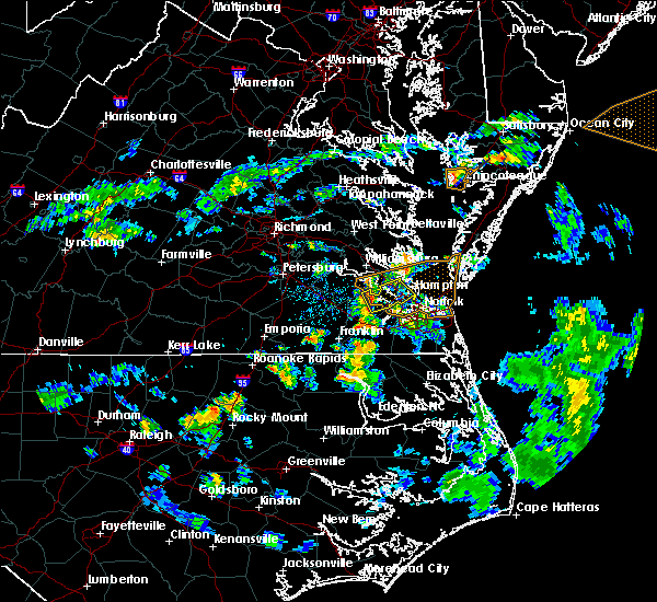 At 625 pm edt, a severe thunderstorm was located over smithfield, moving east at 35 mph (radar indicated). Hazards include 60 mph wind gusts and penny size hail. Expect damage to trees and powerlines. this severe thunderstorm will be near, rescue around 630 pm edt. christopher newport university around 635 pm edt. beaconsdale around 640 pm edt. northampton around 645 pm edt. hampton, hampton university and langley afb around 650 pm edt. fort monroe around 655 pm edt. Other locations impacted by this severe thunderstorm include carrollton, phoebus, langley view, benns church, oyster point, hilton village, menchville, lawson, raleigh terrace and moonlight. At 625 pm edt, a severe thunderstorm was located over smithfield, moving east at 35 mph (radar indicated). Hazards include 60 mph wind gusts and penny size hail. Expect damage to trees and powerlines. this severe thunderstorm will be near, rescue around 630 pm edt. christopher newport university around 635 pm edt. beaconsdale around 640 pm edt. northampton around 645 pm edt. hampton, hampton university and langley afb around 650 pm edt. fort monroe around 655 pm edt. Other locations impacted by this severe thunderstorm include carrollton, phoebus, langley view, benns church, oyster point, hilton village, menchville, lawson, raleigh terrace and moonlight.
|
| 6/19/2017 6:04 PM EDT |
 At 603 pm edt, severe thunderstorms were located along a line extending from near cabin point to scotland to near fort eustis, moving northeast at 45 mph (radar indicated). Hazards include 60 mph wind gusts. Expect damage to trees and powerlines. these severe storms will be near, jamestown and kings point around 610 pm edt. williamsburg and college of william and mary around 615 pm edt. Other locations impacted by these severe thunderstorms include rushmere, bacons castle, chippokes state park, poolesville, governors land, hog island game reserve, alliance, williamsburg airport and beachland. At 603 pm edt, severe thunderstorms were located along a line extending from near cabin point to scotland to near fort eustis, moving northeast at 45 mph (radar indicated). Hazards include 60 mph wind gusts. Expect damage to trees and powerlines. these severe storms will be near, jamestown and kings point around 610 pm edt. williamsburg and college of william and mary around 615 pm edt. Other locations impacted by these severe thunderstorms include rushmere, bacons castle, chippokes state park, poolesville, governors land, hog island game reserve, alliance, williamsburg airport and beachland.
|
| 6/19/2017 5:33 PM EDT |
 At 532 pm edt, severe thunderstorms were located along a line extending from 6 miles northwest of sedley to near ivor to near windsor, moving north at 50 mph (radar indicated). Hazards include 60 mph wind gusts. Expect damage to trees and powerlines. severe thunderstorms will be near, wakefield around 540 pm edt. waverly, dendron and elberon around 550 pm edt. surry around 555 pm edt. claremont around 600 pm edt. cabin point and scotland around 605 pm edt. kings point, jamestown and rustic around 610 pm edt. williamsburg and college of william and mary around 615 pm edt. Other locations impacted by these severe thunderstorms include vicksville, rushmere, booth fork, carsley, pons, chippokes state park, spring grove, ellis fork, dory and poolesville. At 532 pm edt, severe thunderstorms were located along a line extending from 6 miles northwest of sedley to near ivor to near windsor, moving north at 50 mph (radar indicated). Hazards include 60 mph wind gusts. Expect damage to trees and powerlines. severe thunderstorms will be near, wakefield around 540 pm edt. waverly, dendron and elberon around 550 pm edt. surry around 555 pm edt. claremont around 600 pm edt. cabin point and scotland around 605 pm edt. kings point, jamestown and rustic around 610 pm edt. williamsburg and college of william and mary around 615 pm edt. Other locations impacted by these severe thunderstorms include vicksville, rushmere, booth fork, carsley, pons, chippokes state park, spring grove, ellis fork, dory and poolesville.
|
| 6/16/2017 5:55 PM EDT |
 At 554 pm edt, a severe thunderstorm was located near scotland, or 7 miles east of surry, moving northeast at 20 mph (radar indicated). Hazards include 60 mph wind gusts and quarter size hail. Minor damage to vehicles is possible. expect wind damage to trees and powerlines. This severe thunderstorm will remain over mainly rural areas of north central isle of wight and northeastern surry counties, including the following locations: rushmere, bacons castle, chippokes state park, poolesville, moonlight, hog island game reserve, alliance, beachland and delk crossroads. At 554 pm edt, a severe thunderstorm was located near scotland, or 7 miles east of surry, moving northeast at 20 mph (radar indicated). Hazards include 60 mph wind gusts and quarter size hail. Minor damage to vehicles is possible. expect wind damage to trees and powerlines. This severe thunderstorm will remain over mainly rural areas of north central isle of wight and northeastern surry counties, including the following locations: rushmere, bacons castle, chippokes state park, poolesville, moonlight, hog island game reserve, alliance, beachland and delk crossroads.
|
| 6/16/2017 5:43 PM EDT |
 At 543 pm edt, a severe thunderstorm was located near surry, moving northeast at 20 mph (radar indicated). Hazards include 60 mph wind gusts and quarter size hail. Minor damage to vehicles is possible. expect wind damage to trees and powerlines. this severe thunderstorm will be near, scotland around 555 pm edt. Other locations impacted by this severe thunderstorm include rushmere, bacons castle, pons, chippokes state park, comet, poolesville, moonlight, hog island game reserve, alliance and runnymede. At 543 pm edt, a severe thunderstorm was located near surry, moving northeast at 20 mph (radar indicated). Hazards include 60 mph wind gusts and quarter size hail. Minor damage to vehicles is possible. expect wind damage to trees and powerlines. this severe thunderstorm will be near, scotland around 555 pm edt. Other locations impacted by this severe thunderstorm include rushmere, bacons castle, pons, chippokes state park, comet, poolesville, moonlight, hog island game reserve, alliance and runnymede.
|
| 5/27/2017 8:31 PM EDT |
 At 831 pm edt, severe thunderstorms were located along a line extending from prince george to near rice, moving southeast at 25 mph (radar indicated). Hazards include 60 mph wind gusts and quarter size hail. Minor damage to vehicles is possible. expect wind damage to trees and powerlines. these severe storms will be near, petersburg, hopewell, fort lee, prince george and jordans point around 835 pm edt. garysville around 840 pm edt. burrowsville around 845 pm edt. Other locations impacted by these severe thunderstorms include north wellville, chippokes state park, wayside, ammon, pocahontas state park, skinquarter, beach, richard bland college, meadowville and new hope. At 831 pm edt, severe thunderstorms were located along a line extending from prince george to near rice, moving southeast at 25 mph (radar indicated). Hazards include 60 mph wind gusts and quarter size hail. Minor damage to vehicles is possible. expect wind damage to trees and powerlines. these severe storms will be near, petersburg, hopewell, fort lee, prince george and jordans point around 835 pm edt. garysville around 840 pm edt. burrowsville around 845 pm edt. Other locations impacted by these severe thunderstorms include north wellville, chippokes state park, wayside, ammon, pocahontas state park, skinquarter, beach, richard bland college, meadowville and new hope.
|
| 5/27/2017 8:13 PM EDT |
 At 813 pm edt, severe thunderstorms were located along a line extending from near hopewell to near rice, moving southeast at 25 mph (radar indicated). Hazards include 60 mph wind gusts and quarter size hail. Minor damage to vehicles is possible. expect wind damage to trees and powerlines. these severe storms will be near, petersburg, hopewell, colonial heights, fort lee, virginia state university, ettrick and matoaca around 820 pm edt. jordans point around 825 pm edt. prince george around 830 pm edt. burkeville around 835 pm edt. crewe and garysville around 840 pm edt. burrowsville around 845 pm edt. Other locations impacted by these severe thunderstorms include north wellville, angola, chippokes state park, wayside, ammon, glendale, pocahontas state park, skinquarter, beach and richard bland college. At 813 pm edt, severe thunderstorms were located along a line extending from near hopewell to near rice, moving southeast at 25 mph (radar indicated). Hazards include 60 mph wind gusts and quarter size hail. Minor damage to vehicles is possible. expect wind damage to trees and powerlines. these severe storms will be near, petersburg, hopewell, colonial heights, fort lee, virginia state university, ettrick and matoaca around 820 pm edt. jordans point around 825 pm edt. prince george around 830 pm edt. burkeville around 835 pm edt. crewe and garysville around 840 pm edt. burrowsville around 845 pm edt. Other locations impacted by these severe thunderstorms include north wellville, angola, chippokes state park, wayside, ammon, glendale, pocahontas state park, skinquarter, beach and richard bland college.
|
| 5/27/2017 8:09 PM EDT |
 At 806 pm edt, severe thunderstorms were located along a line extending from near chester to near guinea mills, moving southeast at 25 mph (radar indicated). Hazards include 60 mph wind gusts and quarter size hail. Minor damage to vehicles is possible. expect wind damage to trees and powerlines. severe thunderstorms will be near, colonial heights and chester around 810 pm edt. hopewell, fort lee, virginia state university, ettrick and matoaca around 815 pm edt. petersburg around 820 pm edt. jordans point around 825 pm edt. prince george around 830 pm edt. jetersville around 835 pm edt. burkeville and garysville around 840 pm edt. crewe and burrowsville around 845 pm edt. Other locations impacted by these severe thunderstorms include north wellville, angola, chippokes state park, wayside, ammon, glendale, pocahontas state park, skinquarter, beach and richard bland college. At 806 pm edt, severe thunderstorms were located along a line extending from near chester to near guinea mills, moving southeast at 25 mph (radar indicated). Hazards include 60 mph wind gusts and quarter size hail. Minor damage to vehicles is possible. expect wind damage to trees and powerlines. severe thunderstorms will be near, colonial heights and chester around 810 pm edt. hopewell, fort lee, virginia state university, ettrick and matoaca around 815 pm edt. petersburg around 820 pm edt. jordans point around 825 pm edt. prince george around 830 pm edt. jetersville around 835 pm edt. burkeville and garysville around 840 pm edt. crewe and burrowsville around 845 pm edt. Other locations impacted by these severe thunderstorms include north wellville, angola, chippokes state park, wayside, ammon, glendale, pocahontas state park, skinquarter, beach and richard bland college.
|
| 5/5/2017 8:05 PM EDT |
 At 804 pm edt, a severe thunderstorm capable of producing a tornado was located near ivor, or near wakefield, moving northeast at 25 mph (radar indicated rotation). Hazards include tornado. Flying debris will be dangerous to those caught without shelter. mobile homes will be damaged or destroyed. damage to roofs, windows, and vehicles will occur. tree damage is likely. this dangerous storm will be near, dendron around 815 pm edt. elberon around 820 pm edt. surry around 830 pm edt. Other locations impacted by this tornadic thunderstorm include rushmere, bacons castle, booth fork, pons, chippokes state park, poolesville, moonlight, alliance, ellis fork and runnymede. At 804 pm edt, a severe thunderstorm capable of producing a tornado was located near ivor, or near wakefield, moving northeast at 25 mph (radar indicated rotation). Hazards include tornado. Flying debris will be dangerous to those caught without shelter. mobile homes will be damaged or destroyed. damage to roofs, windows, and vehicles will occur. tree damage is likely. this dangerous storm will be near, dendron around 815 pm edt. elberon around 820 pm edt. surry around 830 pm edt. Other locations impacted by this tornadic thunderstorm include rushmere, bacons castle, booth fork, pons, chippokes state park, poolesville, moonlight, alliance, ellis fork and runnymede.
|
| 7/19/2016 6:33 PM EDT |
 At 632 pm edt, a severe thunderstorm was located near wakefield, moving southeast at 25 mph (radar indicated). Hazards include 70 mph wind gusts and quarter size hail. Hail damage to vehicles is expected. expect considerable tree damage. wind damage is also likely to mobile homes, roofs, and outbuildings. this severe storm will be near, wakefield around 640 pm edt. other locations impacted by this severe thunderstorm include carsley, booker, booth fork, gwaltney corner, yale, barham, bacons castle, littleton, spring grove and newville. precautionary/preparedness actions, for your protection move to an interior room on the lowest floor of a building. please send your reports of hail and or wind damage, including trees or large limbs downed, by calling noaa`s national weather service in wakefield at , 7 5 7, 8 9 9, 2 4 1 5. At 632 pm edt, a severe thunderstorm was located near wakefield, moving southeast at 25 mph (radar indicated). Hazards include 70 mph wind gusts and quarter size hail. Hail damage to vehicles is expected. expect considerable tree damage. wind damage is also likely to mobile homes, roofs, and outbuildings. this severe storm will be near, wakefield around 640 pm edt. other locations impacted by this severe thunderstorm include carsley, booker, booth fork, gwaltney corner, yale, barham, bacons castle, littleton, spring grove and newville. precautionary/preparedness actions, for your protection move to an interior room on the lowest floor of a building. please send your reports of hail and or wind damage, including trees or large limbs downed, by calling noaa`s national weather service in wakefield at , 7 5 7, 8 9 9, 2 4 1 5.
|
| 7/19/2016 6:06 PM EDT |
 At 605 pm edt, a severe thunderstorm was located near disputanta, moving southeast at 15 mph (radar indicated). Hazards include 60 mph wind gusts and quarter size hail. Hail damage to vehicles is expected. expect wind damage to roofs, siding, and trees. this severe storm will be near, cabin point around 620 pm edt. waverly around 640 pm edt. wakefield and dendron around 645 pm edt. other locations impacted by this severe thunderstorm include bacons castle, newville, spring grove, delk crossroads, alliance, prince george golf, new bohemia, templeton, poolesville and brandon. precautionary/preparedness actions, for your protection move to an interior room on the lowest floor of a building. please send your reports of hail and or wind damage, including trees or large limbs downed, by calling noaa`s national weather service in wakefield at , 7 5 7, 8 9 9, 2 4 1 5. At 605 pm edt, a severe thunderstorm was located near disputanta, moving southeast at 15 mph (radar indicated). Hazards include 60 mph wind gusts and quarter size hail. Hail damage to vehicles is expected. expect wind damage to roofs, siding, and trees. this severe storm will be near, cabin point around 620 pm edt. waverly around 640 pm edt. wakefield and dendron around 645 pm edt. other locations impacted by this severe thunderstorm include bacons castle, newville, spring grove, delk crossroads, alliance, prince george golf, new bohemia, templeton, poolesville and brandon. precautionary/preparedness actions, for your protection move to an interior room on the lowest floor of a building. please send your reports of hail and or wind damage, including trees or large limbs downed, by calling noaa`s national weather service in wakefield at , 7 5 7, 8 9 9, 2 4 1 5.
|
| 7/19/2016 5:57 PM EDT |
 At 557 pm edt, a severe thunderstorm was located near disputanta, moving southeast at 25 mph (radar indicated). Hazards include 60 mph wind gusts and quarter size hail. Hail damage to vehicles is expected. expect wind damage to roofs, siding, and trees. this severe thunderstorm will be near, cabin point around 605 pm edt. waverly around 620 pm edt. dendron around 630 pm edt. wakefield around 635 pm edt. Other locations impacted by this severe thunderstorm include jordan point country club, bacons castle, richard bland college, spring grove, newville, alliance, delk crossroads, prince george golf, new bohemia and templeton. At 557 pm edt, a severe thunderstorm was located near disputanta, moving southeast at 25 mph (radar indicated). Hazards include 60 mph wind gusts and quarter size hail. Hail damage to vehicles is expected. expect wind damage to roofs, siding, and trees. this severe thunderstorm will be near, cabin point around 605 pm edt. waverly around 620 pm edt. dendron around 630 pm edt. wakefield around 635 pm edt. Other locations impacted by this severe thunderstorm include jordan point country club, bacons castle, richard bland college, spring grove, newville, alliance, delk crossroads, prince george golf, new bohemia and templeton.
|
| 6/30/2016 9:06 PM EDT |
 At 905 pm edt, a severe thunderstorm was located near carrsville, or near franklin, moving east at 10 mph (radar indicated). Hazards include 60 mph wind gusts and quarter size hail. Hail damage to vehicles is expected. expect wind damage to roofs, siding, and trees. this severe storm will be near, carrsville around 920 pm edt. windsor around 930 pm edt. other locations impacted by this severe thunderstorm include indika, lees mill, lawson, chuckatuck, collosse, raynor, moonlight, benns church, boaz and story. precautionary/preparedness actions, for your protection move to an interior room on the lowest floor of a building. please send your reports of hail and or wind damage, including trees or large limbs downed, by calling noaa`s national weather service in wakefield at , 7 5 7, 8 9 9, 2 4 1 5. At 905 pm edt, a severe thunderstorm was located near carrsville, or near franklin, moving east at 10 mph (radar indicated). Hazards include 60 mph wind gusts and quarter size hail. Hail damage to vehicles is expected. expect wind damage to roofs, siding, and trees. this severe storm will be near, carrsville around 920 pm edt. windsor around 930 pm edt. other locations impacted by this severe thunderstorm include indika, lees mill, lawson, chuckatuck, collosse, raynor, moonlight, benns church, boaz and story. precautionary/preparedness actions, for your protection move to an interior room on the lowest floor of a building. please send your reports of hail and or wind damage, including trees or large limbs downed, by calling noaa`s national weather service in wakefield at , 7 5 7, 8 9 9, 2 4 1 5.
|
| 6/30/2016 8:43 PM EDT |
 At 842 pm edt, a severe thunderstorm was located near zuni, or 7 miles west of windsor, moving east at 25 mph (radar indicated). Hazards include 60 mph wind gusts and quarter size hail. Hail damage to vehicles is expected. expect wind damage to roofs, siding, and trees. this severe thunderstorm will be near, zuni around 850 pm edt. windsor around 855 pm edt. isle of wight around 910 pm edt. smithfield around 920 pm edt. suffolk around 930 pm edt. Other locations impacted by this severe thunderstorm include indika, lees mill, lawson, chuckatuck, raynor, collosse, moonlight, benns church, boaz and story. At 842 pm edt, a severe thunderstorm was located near zuni, or 7 miles west of windsor, moving east at 25 mph (radar indicated). Hazards include 60 mph wind gusts and quarter size hail. Hail damage to vehicles is expected. expect wind damage to roofs, siding, and trees. this severe thunderstorm will be near, zuni around 850 pm edt. windsor around 855 pm edt. isle of wight around 910 pm edt. smithfield around 920 pm edt. suffolk around 930 pm edt. Other locations impacted by this severe thunderstorm include indika, lees mill, lawson, chuckatuck, raynor, collosse, moonlight, benns church, boaz and story.
|
| 6/23/2016 8:06 AM EDT |
 At 805 am edt, a severe thunderstorm was located over busch gardens, or near williamsburg, moving east at 45 mph (radar indicated). Hazards include 60 mph wind gusts and quarter size hail. Hail damage to vehicles is expected. expect wind damage to roofs, siding, and trees. this severe storm will be near, newport news, virginia institute for marine sciences, lee hall and fort eustis around 815 am edt. patrick henry field, seaford, tabb and denbigh around 820 am edt. hampton and beaconsdale around 825 am edt. langley afb around 830 am edt. other locations impacted by this severe thunderstorm include ruff, belroi, harcum, hog island game reserve, adner, bacons castle, ark, hornsbyville, harris grove and selden. precautionary/preparedness actions, for your protection move to an interior room on the lowest floor of a building. continuous cloud to ground lightning is occurring with this storm. move indoors immediately. lightning is one of nature`s leading killers. remember, if you can hear thunder, you are close enough to be struck by lightning. please send your reports of hail and or wind damage, including trees or large limbs downed, by calling noaa`s national weather service in wakefield at , 7 5 7, 8 9 9, 2 4 1 5. At 805 am edt, a severe thunderstorm was located over busch gardens, or near williamsburg, moving east at 45 mph (radar indicated). Hazards include 60 mph wind gusts and quarter size hail. Hail damage to vehicles is expected. expect wind damage to roofs, siding, and trees. this severe storm will be near, newport news, virginia institute for marine sciences, lee hall and fort eustis around 815 am edt. patrick henry field, seaford, tabb and denbigh around 820 am edt. hampton and beaconsdale around 825 am edt. langley afb around 830 am edt. other locations impacted by this severe thunderstorm include ruff, belroi, harcum, hog island game reserve, adner, bacons castle, ark, hornsbyville, harris grove and selden. precautionary/preparedness actions, for your protection move to an interior room on the lowest floor of a building. continuous cloud to ground lightning is occurring with this storm. move indoors immediately. lightning is one of nature`s leading killers. remember, if you can hear thunder, you are close enough to be struck by lightning. please send your reports of hail and or wind damage, including trees or large limbs downed, by calling noaa`s national weather service in wakefield at , 7 5 7, 8 9 9, 2 4 1 5.
|
| 6/23/2016 7:38 AM EDT |
 At 738 am edt, a severe thunderstorm was located near charles city, moving east at 45 mph (radar indicated). Hazards include 60 mph wind gusts and quarter size hail. Hail damage to vehicles is expected. expect wind damage to roofs, siding, and trees. this severe thunderstorm will be near, rustic and holdcroft around 745 am edt. claremont around 750 am edt. williamsburg, surry, college of william and mary, jamestown and scotland around 800 am edt. queens lake, kings point, carver gardens and york terrace around 805 am edt. busch gardens and grove around 810 am edt. newport news, virginia institute for marine sciences, lee hall and fort eustis around 815 am edt. patrick henry field and denbigh around 820 am edt. seaford, tabb and beaconsdale around 825 am edt. Other locations impacted by this severe thunderstorm include ruff, belroi, harcum, hog island game reserve, sandybottom, adner, bacons castle, new hope, ark and hornsbyville. At 738 am edt, a severe thunderstorm was located near charles city, moving east at 45 mph (radar indicated). Hazards include 60 mph wind gusts and quarter size hail. Hail damage to vehicles is expected. expect wind damage to roofs, siding, and trees. this severe thunderstorm will be near, rustic and holdcroft around 745 am edt. claremont around 750 am edt. williamsburg, surry, college of william and mary, jamestown and scotland around 800 am edt. queens lake, kings point, carver gardens and york terrace around 805 am edt. busch gardens and grove around 810 am edt. newport news, virginia institute for marine sciences, lee hall and fort eustis around 815 am edt. patrick henry field and denbigh around 820 am edt. seaford, tabb and beaconsdale around 825 am edt. Other locations impacted by this severe thunderstorm include ruff, belroi, harcum, hog island game reserve, sandybottom, adner, bacons castle, new hope, ark and hornsbyville.
|
| 6/16/2016 11:11 PM EDT |
 At 1111 pm edt, severe thunderstorms were located along a line extending from fort eustis to near waverly, moving southeast at 50 mph (radar indicated). Hazards include 60 mph wind gusts and quarter size hail. Hail damage to vehicles is expected. expect wind damage to roofs, siding, and trees. these severe storms will be near, patrick henry field, denbigh, fort eustis and lee hall around 1115 pm edt. tabb around 1120 pm edt. other locations impacted by these severe thunderstorms include carsley, hog island game reserve, gwaltney corner, newport news golf course, oyster point, bacons castle, newville, hornsbyville, alliance and delk crossroads. precautionary/preparedness actions, for your protection move to an interior room on the lowest floor of a building. please send your reports of hail and or wind damage, including trees or large limbs downed, by calling noaa`s national weather service in wakefield at , 7 5 7, 8 9 9, 2 4 1 5. At 1111 pm edt, severe thunderstorms were located along a line extending from fort eustis to near waverly, moving southeast at 50 mph (radar indicated). Hazards include 60 mph wind gusts and quarter size hail. Hail damage to vehicles is expected. expect wind damage to roofs, siding, and trees. these severe storms will be near, patrick henry field, denbigh, fort eustis and lee hall around 1115 pm edt. tabb around 1120 pm edt. other locations impacted by these severe thunderstorms include carsley, hog island game reserve, gwaltney corner, newport news golf course, oyster point, bacons castle, newville, hornsbyville, alliance and delk crossroads. precautionary/preparedness actions, for your protection move to an interior room on the lowest floor of a building. please send your reports of hail and or wind damage, including trees or large limbs downed, by calling noaa`s national weather service in wakefield at , 7 5 7, 8 9 9, 2 4 1 5.
|
| 6/16/2016 10:46 PM EDT |
 At 1046 pm edt, severe thunderstorms were located along a line extending from near rustic to near petersburg, moving southeast at 40 mph (radar indicated). Hazards include 60 mph wind gusts and quarter size hail. Hail damage to vehicles is expected. expect wind damage to roofs, siding, and trees. severe thunderstorms will be near, claremont around 1050 pm edt. surry, jamestown and scotland around 1055 pm edt. disputanta and kings point around 1100 pm edt. busch gardens and grove around 1105 pm edt. newport news, lee hall and fort eustis around 1110 pm edt. waverly, denbigh and homeville around 1115 pm edt. patrick henry field, seaford and tabb around 1120 pm edt. dendron around 1125 pm edt. Other locations impacted by these severe thunderstorms include addison, hog island game reserve, newport news golf course, jordan point country club, bacons castle, richard bland college, spring grove, newville, hornsbyville and alliance. At 1046 pm edt, severe thunderstorms were located along a line extending from near rustic to near petersburg, moving southeast at 40 mph (radar indicated). Hazards include 60 mph wind gusts and quarter size hail. Hail damage to vehicles is expected. expect wind damage to roofs, siding, and trees. severe thunderstorms will be near, claremont around 1050 pm edt. surry, jamestown and scotland around 1055 pm edt. disputanta and kings point around 1100 pm edt. busch gardens and grove around 1105 pm edt. newport news, lee hall and fort eustis around 1110 pm edt. waverly, denbigh and homeville around 1115 pm edt. patrick henry field, seaford and tabb around 1120 pm edt. dendron around 1125 pm edt. Other locations impacted by these severe thunderstorms include addison, hog island game reserve, newport news golf course, jordan point country club, bacons castle, richard bland college, spring grove, newville, hornsbyville and alliance.
|
| 5/2/2016 8:36 PM EDT |
 At 836 pm edt, a severe thunderstorm was located near newport news, moving northeast at 45 mph (radar indicated). Hazards include 60 mph wind gusts and quarter size hail. Hail damage to vehicles is expected. expect wind damage to roofs, siding, and trees. this severe storm will be near, christopher newport university, northampton and beaconsdale around 840 pm edt. newport news, hampton, patrick henry field, denbigh, tabb and lee hall around 845 pm edt. other locations impacted by this severe thunderstorm include rushmere, newport news golf course, oyster point, hilton village, mogarts beach, lawson, menchville, carrollton, oriana and langley view. precautionary/preparedness actions, for your protection move to an interior room on the lowest floor of a building. please send your reports of hail and or wind damage, including trees or large limbs downed, by calling noaa`s national weather service in wakefield at , 7 5 7, 8 9 9, 2 4 1 5. At 836 pm edt, a severe thunderstorm was located near newport news, moving northeast at 45 mph (radar indicated). Hazards include 60 mph wind gusts and quarter size hail. Hail damage to vehicles is expected. expect wind damage to roofs, siding, and trees. this severe storm will be near, christopher newport university, northampton and beaconsdale around 840 pm edt. newport news, hampton, patrick henry field, denbigh, tabb and lee hall around 845 pm edt. other locations impacted by this severe thunderstorm include rushmere, newport news golf course, oyster point, hilton village, mogarts beach, lawson, menchville, carrollton, oriana and langley view. precautionary/preparedness actions, for your protection move to an interior room on the lowest floor of a building. please send your reports of hail and or wind damage, including trees or large limbs downed, by calling noaa`s national weather service in wakefield at , 7 5 7, 8 9 9, 2 4 1 5.
|
| 5/2/2016 8:22 PM EDT |
 At 822 pm edt, a severe thunderstorm was located near isle of wight, or near smithfield, moving northeast at 45 mph (radar indicated). Hazards include 60 mph wind gusts and quarter size hail. Hail damage to vehicles is expected. expect wind damage to roofs, siding, and trees. this severe thunderstorm will be near, smithfield around 825 pm edt. rescue around 830 pm edt. christopher newport university, northampton, fort eustis and beaconsdale around 840 pm edt. newport news, hampton, patrick henry field, denbigh, tabb and lee hall around 845 pm edt. Other locations impacted by this severe thunderstorm include newport news golf course, oyster point, longview, indika, lawson, raynor, moonlight, benns church, comet and rushmere. At 822 pm edt, a severe thunderstorm was located near isle of wight, or near smithfield, moving northeast at 45 mph (radar indicated). Hazards include 60 mph wind gusts and quarter size hail. Hail damage to vehicles is expected. expect wind damage to roofs, siding, and trees. this severe thunderstorm will be near, smithfield around 825 pm edt. rescue around 830 pm edt. christopher newport university, northampton, fort eustis and beaconsdale around 840 pm edt. newport news, hampton, patrick henry field, denbigh, tabb and lee hall around 845 pm edt. Other locations impacted by this severe thunderstorm include newport news golf course, oyster point, longview, indika, lawson, raynor, moonlight, benns church, comet and rushmere.
|
| 5/2/2016 6:08 PM EDT |
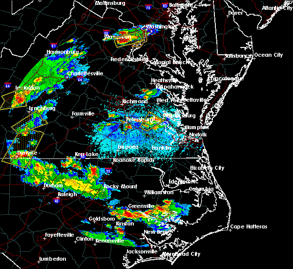 At 607 pm edt, severe thunderstorms were located along a line extending from garysville to near rustic to near surry, moving northeast at 30 mph (radar indicated). Hazards include 60 mph wind gusts and quarter size hail. Hail damage to vehicles is expected. expect wind damage to roofs, siding, and trees. severe thunderstorms will be near, scotland around 615 pm edt. williamsburg, norge, toano and jamestown around 620 pm edt. college of william and mary and kings point around 625 pm edt. busch gardens, grove, carver gardens, york terrace and rustic around 630 pm edt. newport news, queens lake, holdcroft, providence forge and lee hall around 635 pm edt. new kent, gloucester courthouse, virginia institute for marine sciences and wicomico around 645 pm edt. gloucester point and achilles around 650 pm edt. barhamsville and hayes around 655 pm edt. Other locations impacted by these severe thunderstorms include belroi, hog island game reserve, sandybottom, adner, bacons castle, new hope, ark, selden, severn and camp peary. At 607 pm edt, severe thunderstorms were located along a line extending from garysville to near rustic to near surry, moving northeast at 30 mph (radar indicated). Hazards include 60 mph wind gusts and quarter size hail. Hail damage to vehicles is expected. expect wind damage to roofs, siding, and trees. severe thunderstorms will be near, scotland around 615 pm edt. williamsburg, norge, toano and jamestown around 620 pm edt. college of william and mary and kings point around 625 pm edt. busch gardens, grove, carver gardens, york terrace and rustic around 630 pm edt. newport news, queens lake, holdcroft, providence forge and lee hall around 635 pm edt. new kent, gloucester courthouse, virginia institute for marine sciences and wicomico around 645 pm edt. gloucester point and achilles around 650 pm edt. barhamsville and hayes around 655 pm edt. Other locations impacted by these severe thunderstorms include belroi, hog island game reserve, sandybottom, adner, bacons castle, new hope, ark, selden, severn and camp peary.
|
| 6/25/2015 11:48 PM EDT |
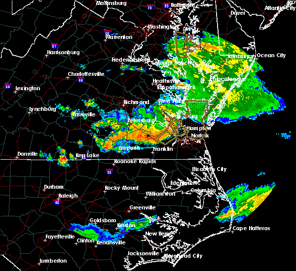 At 1146 pm edt, doppler radar indicated a line of severe thunderstorms capable of producing damaging winds in excess of 60 mph. these storms were located along a line extending from near hayes to tabb to near isle of wight, moving east, southeast at 35 mph. these severe storms will be near, patrick henry field, christopher newport university, seaford, tabb and beaconsdale around 1150 pm edt. hampton, langley afb and northampton around 1155 pm edt. other locations impacted by these severe thunderstorms include newport news golf course, oyster point, longview, lawson, raynor, benns church, langley view, hornsbyville, dare and comet. At 1146 pm edt, doppler radar indicated a line of severe thunderstorms capable of producing damaging winds in excess of 60 mph. these storms were located along a line extending from near hayes to tabb to near isle of wight, moving east, southeast at 35 mph. these severe storms will be near, patrick henry field, christopher newport university, seaford, tabb and beaconsdale around 1150 pm edt. hampton, langley afb and northampton around 1155 pm edt. other locations impacted by these severe thunderstorms include newport news golf course, oyster point, longview, lawson, raynor, benns church, langley view, hornsbyville, dare and comet.
|
| 6/25/2015 11:10 PM EDT |
 At 1109 pm edt, doppler radar indicated a line of severe thunderstorms capable of producing destructive winds in excess of 70 mph. these storms were located along a line extending from near barhamsville to near scotland to waverly, and moving east at 35 mph. * severe thunderstorms will be near, surry, scotland and jamestown around 1115 pm edt. toano, college of william and mary and kings point around 1120 pm edt. norge, elberon, busch gardens, carver gardens and york terrace around 1125 pm edt. williamsburg and grove around 1130 pm edt. newport news and lee hall around 1135 pm edt. queens lake and denbigh around 1140 pm edt. gloucester courthouse, patrick henry field, christopher newport university, seaford, isle of wight, tabb and beaconsdale around 1145 pm edt. smithfield, gloucester point, northampton and hayes around 1150 pm edt. other locations impacted by these severe thunderstorms include belroi, bacons castle, raynor, hornsbyville, harris grove, selden, severn, camp peary, clay bank and lackey. At 1109 pm edt, doppler radar indicated a line of severe thunderstorms capable of producing destructive winds in excess of 70 mph. these storms were located along a line extending from near barhamsville to near scotland to waverly, and moving east at 35 mph. * severe thunderstorms will be near, surry, scotland and jamestown around 1115 pm edt. toano, college of william and mary and kings point around 1120 pm edt. norge, elberon, busch gardens, carver gardens and york terrace around 1125 pm edt. williamsburg and grove around 1130 pm edt. newport news and lee hall around 1135 pm edt. queens lake and denbigh around 1140 pm edt. gloucester courthouse, patrick henry field, christopher newport university, seaford, isle of wight, tabb and beaconsdale around 1145 pm edt. smithfield, gloucester point, northampton and hayes around 1150 pm edt. other locations impacted by these severe thunderstorms include belroi, bacons castle, raynor, hornsbyville, harris grove, selden, severn, camp peary, clay bank and lackey.
|
| 6/20/2015 11:10 PM EDT | Trees and power lines down in the rushmere and burwell bay area. a trampoline was blocking a portion of route 10 after being blown into the roa in isle of wight county VA, 0.7 miles NNW of Rushmere, VA |
| 6/20/2015 11:07 PM EDT |
 At 1106 pm edt, doppler radar indicated a severe thunderstorm capable of producing damaging winds in excess of 60 mph. this storm was located near fort eustis, or 8 miles east of surry, and moving northeast at 50 mph. penny size hail may also accompany the damaging winds. * this severe thunderstorm will be near, grove, busch gardens, carver gardens and york terrace around 1110 pm edt. newport news, patrick henry field, lee hall, denbigh and tabb around 1115 pm edt. virginia institute for marine sciences, seaford, gloucester point and wicomico around 1120 pm edt. achilles around 1125 pm edt. mobjack around 1130 pm edt. bavon around 1135 pm edt. other locations impacted by this severe thunderstorm include ruff, belroi, hog island game reserve, diggs, bacons castle, raynor, hornsbyville, harris grove, selden and severn. At 1106 pm edt, doppler radar indicated a severe thunderstorm capable of producing damaging winds in excess of 60 mph. this storm was located near fort eustis, or 8 miles east of surry, and moving northeast at 50 mph. penny size hail may also accompany the damaging winds. * this severe thunderstorm will be near, grove, busch gardens, carver gardens and york terrace around 1110 pm edt. newport news, patrick henry field, lee hall, denbigh and tabb around 1115 pm edt. virginia institute for marine sciences, seaford, gloucester point and wicomico around 1120 pm edt. achilles around 1125 pm edt. mobjack around 1130 pm edt. bavon around 1135 pm edt. other locations impacted by this severe thunderstorm include ruff, belroi, hog island game reserve, diggs, bacons castle, raynor, hornsbyville, harris grove, selden and severn.
|
| 6/20/2015 10:58 PM EDT |
 At 1057 pm edt, doppler radar indicated a severe thunderstorm capable of producing damaging winds in excess of 60 mph. this storm was located near elberon, or 8 miles south of surry, moving northeast at 50 mph. penny size hail may also accompany the damaging winds. this severe storm will be near, smithfield around 1105 pm edt. other locations impacted by this severe thunderstorm include indika, bacons castle, chuckatuck, raynor, spring grove, collosse, moonlight, benns church, alliance and delk crossroads. At 1057 pm edt, doppler radar indicated a severe thunderstorm capable of producing damaging winds in excess of 60 mph. this storm was located near elberon, or 8 miles south of surry, moving northeast at 50 mph. penny size hail may also accompany the damaging winds. this severe storm will be near, smithfield around 1105 pm edt. other locations impacted by this severe thunderstorm include indika, bacons castle, chuckatuck, raynor, spring grove, collosse, moonlight, benns church, alliance and delk crossroads.
|
| 6/20/2015 10:30 PM EDT |
 At 1029 pm edt, doppler radar indicated a severe thunderstorm capable of producing quarter size hail and damaging winds in excess of 60 mph. this storm was located 7 miles southeast of sussex, or 11 miles northwest of courtland, and moving northeast at 50 mph. * this severe thunderstorm will be near, wakefield around 1045 pm edt. ivor around 1050 pm edt. dendron and elberon around 1055 pm edt. smithfield around 1105 pm edt. other locations impacted by this severe thunderstorm include bacons castle, chuckatuck, raynor, boaz, sebrell, wills corner, burdette, bethel church, worrell and lumberton. At 1029 pm edt, doppler radar indicated a severe thunderstorm capable of producing quarter size hail and damaging winds in excess of 60 mph. this storm was located 7 miles southeast of sussex, or 11 miles northwest of courtland, and moving northeast at 50 mph. * this severe thunderstorm will be near, wakefield around 1045 pm edt. ivor around 1050 pm edt. dendron and elberon around 1055 pm edt. smithfield around 1105 pm edt. other locations impacted by this severe thunderstorm include bacons castle, chuckatuck, raynor, boaz, sebrell, wills corner, burdette, bethel church, worrell and lumberton.
|
| 2/2/2015 12:20 PM EST | Trees snapped and uproote in isle of wight county VA, 5.7 miles NNE of Rushmere, VA |
Hail Maps for Rushmere, VA


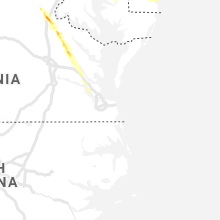


Connect with Interactive Hail Maps