

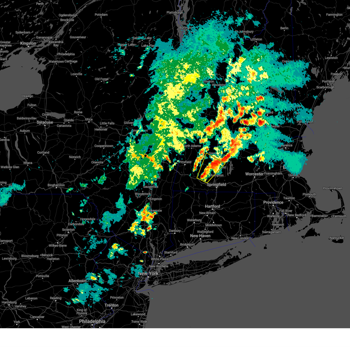
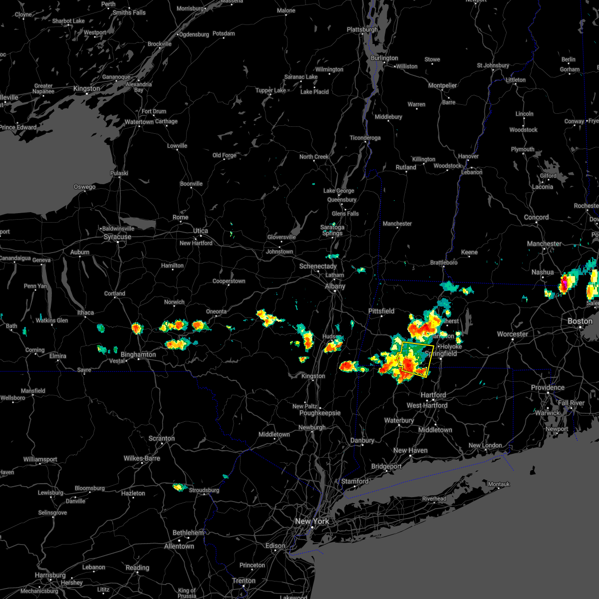
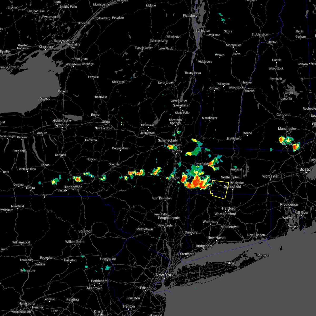
Hail Map for Russell, MA
The Russell, MA area has had 2 reports of on-the-ground hail by trained spotters, and has been under severe weather warnings 9 times during the past 12 months. Doppler radar has detected hail at or near Russell, MA on 25 occasions, including 4 occasions during the past year.
| Name: | Russell, MA |
| Where Located: | 69.8 miles SE of Schenectady, NY |
| Map: | Google Map for Russell, MA |
| Population: | 786 |
| Housing Units: | 328 |
| More Info: | Search Google for Russell, MA |
2
The Top Recent Hail Date for Russell, MA is Friday, August 2, 2024 (8th out of 25)

Hail and Wind Damage Spotted near Russell, MA
| Date / Time | Report Details |
|---|---|
| 6/6/2025 4:52 PM EDT |
 Svrbox the national weather service in boston/norton has issued a * severe thunderstorm warning for, western hampshire county in western massachusetts, central franklin county in western massachusetts, northwestern hampden county in western massachusetts, * until 545 pm edt. * at 452 pm edt, a severe thunderstorm was located over huntington, or 11 miles west of northampton, moving northeast at 25 mph (radar indicated). Hazards include 60 mph wind gusts and quarter size hail. Hail damage to vehicles is expected. Expect wind damage to trees and power lines. Svrbox the national weather service in boston/norton has issued a * severe thunderstorm warning for, western hampshire county in western massachusetts, central franklin county in western massachusetts, northwestern hampden county in western massachusetts, * until 545 pm edt. * at 452 pm edt, a severe thunderstorm was located over huntington, or 11 miles west of northampton, moving northeast at 25 mph (radar indicated). Hazards include 60 mph wind gusts and quarter size hail. Hail damage to vehicles is expected. Expect wind damage to trees and power lines.
|
| 8/26/2024 1:52 PM EDT |
 Svrbox the national weather service in boston/norton has issued a * severe thunderstorm warning for, western hampshire county in western massachusetts, west central franklin county in western massachusetts, northwestern hampden county in western massachusetts, * until 230 pm edt. * at 152 pm edt, a severe thunderstorm was located over cummington, or 15 miles northwest of northampton, moving southeast at 15 mph (radar indicated). Hazards include 60 mph wind gusts and quarter size hail. Hail damage to vehicles is expected. Expect wind damage to trees and power lines. Svrbox the national weather service in boston/norton has issued a * severe thunderstorm warning for, western hampshire county in western massachusetts, west central franklin county in western massachusetts, northwestern hampden county in western massachusetts, * until 230 pm edt. * at 152 pm edt, a severe thunderstorm was located over cummington, or 15 miles northwest of northampton, moving southeast at 15 mph (radar indicated). Hazards include 60 mph wind gusts and quarter size hail. Hail damage to vehicles is expected. Expect wind damage to trees and power lines.
|
| 8/2/2024 3:34 PM EDT |
 the severe thunderstorm warning has been cancelled and is no longer in effect the severe thunderstorm warning has been cancelled and is no longer in effect
|
| 8/2/2024 3:08 PM EDT |
 Svrbox the national weather service in boston/norton has issued a * severe thunderstorm warning for, hampshire county in western massachusetts, south central franklin county in western massachusetts, northwestern hampden county in western massachusetts, * until 415 pm edt. * at 308 pm edt, a severe thunderstorm was located over southampton, or 7 miles west of holyoke, moving northeast at 20 mph (radar indicated). Hazards include 60 mph wind gusts and penny size hail. expect damage to trees and power lines Svrbox the national weather service in boston/norton has issued a * severe thunderstorm warning for, hampshire county in western massachusetts, south central franklin county in western massachusetts, northwestern hampden county in western massachusetts, * until 415 pm edt. * at 308 pm edt, a severe thunderstorm was located over southampton, or 7 miles west of holyoke, moving northeast at 20 mph (radar indicated). Hazards include 60 mph wind gusts and penny size hail. expect damage to trees and power lines
|
| 7/17/2024 5:13 PM EDT | At 513 pm edt, a severe thunderstorm was located over hadley, or near northampton, moving east at 30 mph (trained weather spotters). Hazards include 60 mph wind gusts and penny size hail. Expect damage to roofs, siding, and trees. Locations impacted include, springfield, chicopee, westfield, holyoke, amherst, northampton, west springfield, ludlow, south hadley, easthampton, belchertown, wilbraham, palmer, monson, granby, southampton, hadley, hatfield, williamsburg, and huntington. |
| 7/17/2024 5:06 PM EDT | At 506 pm edt, a severe thunderstorm was located over northampton, moving east at 30 mph (trained weather spotters). Hazards include 60 mph wind gusts and penny size hail. Expect damage to roofs, siding, and trees. Locations impacted include, springfield, chicopee, westfield, holyoke, amherst, northampton, west springfield, ludlow, south hadley, easthampton, belchertown, wilbraham, palmer, monson, granby, southampton, hadley, hatfield, williamsburg, and huntington. |
| 7/17/2024 4:47 PM EDT |
 Svrbox the national weather service in boston/norton has issued a * severe thunderstorm warning for, hampshire county in western massachusetts, southeastern franklin county in western massachusetts, northwestern hampden county in western massachusetts, * until 545 pm edt. * at 447 pm edt, a severe thunderstorm was located over chesterfield, or 8 miles west of northampton, moving east at 30 mph (radar indicated). Hazards include 60 mph wind gusts and penny size hail. expect damage to roofs, siding, and trees Svrbox the national weather service in boston/norton has issued a * severe thunderstorm warning for, hampshire county in western massachusetts, southeastern franklin county in western massachusetts, northwestern hampden county in western massachusetts, * until 545 pm edt. * at 447 pm edt, a severe thunderstorm was located over chesterfield, or 8 miles west of northampton, moving east at 30 mph (radar indicated). Hazards include 60 mph wind gusts and penny size hail. expect damage to roofs, siding, and trees
|
| 7/16/2024 7:43 PM EDT |
 At 743 pm edt, a severe thunderstorm was located over chester, or 13 miles west of northampton, moving east at 45 mph (radar indicated). Hazards include 60 mph wind gusts and penny size hail. Expect damage to roofs, siding, and trees. Locations impacted include, chicopee, holyoke, amherst, northampton, ludlow, south hadley, easthampton, belchertown, wilbraham, palmer, ware, monson, granby, southampton, hadley, sunderland, hatfield, hardwick, williamsburg, and huntington. At 743 pm edt, a severe thunderstorm was located over chester, or 13 miles west of northampton, moving east at 45 mph (radar indicated). Hazards include 60 mph wind gusts and penny size hail. Expect damage to roofs, siding, and trees. Locations impacted include, chicopee, holyoke, amherst, northampton, ludlow, south hadley, easthampton, belchertown, wilbraham, palmer, ware, monson, granby, southampton, hadley, sunderland, hatfield, hardwick, williamsburg, and huntington.
|
| 7/16/2024 7:36 PM EDT |
 Svrbox the national weather service in boston/norton has issued a * severe thunderstorm warning for, west central worcester county in central massachusetts, hampshire county in western massachusetts, southeastern franklin county in western massachusetts, northern hampden county in western massachusetts, * until 815 pm edt. * at 735 pm edt, a severe thunderstorm was located over becket, or 13 miles southeast of pittsfield, moving east at 45 mph (radar indicated). Hazards include 60 mph wind gusts and penny size hail. expect damage to roofs, siding, and trees Svrbox the national weather service in boston/norton has issued a * severe thunderstorm warning for, west central worcester county in central massachusetts, hampshire county in western massachusetts, southeastern franklin county in western massachusetts, northern hampden county in western massachusetts, * until 815 pm edt. * at 735 pm edt, a severe thunderstorm was located over becket, or 13 miles southeast of pittsfield, moving east at 45 mph (radar indicated). Hazards include 60 mph wind gusts and penny size hail. expect damage to roofs, siding, and trees
|
| 6/21/2024 4:29 PM EDT |
 Svrbox the national weather service in boston/norton has issued a * severe thunderstorm warning for, hampshire county in western massachusetts, southeastern franklin county in western massachusetts, central hampden county in western massachusetts, * until 530 pm edt. * at 429 pm edt, a severe thunderstorm was located over chester, or 12 miles northwest of westfield, moving east at 30 mph (radar indicated). Hazards include 60 mph wind gusts and nickel size hail. expect damage to roofs, siding, and trees Svrbox the national weather service in boston/norton has issued a * severe thunderstorm warning for, hampshire county in western massachusetts, southeastern franklin county in western massachusetts, central hampden county in western massachusetts, * until 530 pm edt. * at 429 pm edt, a severe thunderstorm was located over chester, or 12 miles northwest of westfield, moving east at 30 mph (radar indicated). Hazards include 60 mph wind gusts and nickel size hail. expect damage to roofs, siding, and trees
|
| 6/19/2024 5:59 PM EDT |
 the severe thunderstorm warning has been cancelled and is no longer in effect the severe thunderstorm warning has been cancelled and is no longer in effect
|
| 6/19/2024 5:59 PM EDT |
 At 558 pm edt, a severe thunderstorm was located over easthampton, or near northampton, moving southeast at 10 mph (trained weather spotters). Hazards include 60 mph wind gusts and nickel size hail. Expect damage to roofs, siding, and trees. Locations impacted include, chicopee, westfield, holyoke, northampton, ludlow, south hadley, easthampton, granby, southampton, hadley, hatfield, huntington, russell, westhampton, and montgomery. At 558 pm edt, a severe thunderstorm was located over easthampton, or near northampton, moving southeast at 10 mph (trained weather spotters). Hazards include 60 mph wind gusts and nickel size hail. Expect damage to roofs, siding, and trees. Locations impacted include, chicopee, westfield, holyoke, northampton, ludlow, south hadley, easthampton, granby, southampton, hadley, hatfield, huntington, russell, westhampton, and montgomery.
|
| 6/19/2024 5:33 PM EDT |
 Svrbox the national weather service in boston/norton has issued a * severe thunderstorm warning for, southwestern hampshire county in western massachusetts, southwestern franklin county in western massachusetts, northwestern hampden county in western massachusetts, * until 615 pm edt. * at 533 pm edt, a severe thunderstorm was located over westhampton, or near northampton, moving southeast at 15 mph (radar indicated). Hazards include 60 mph wind gusts and nickel size hail. expect damage to roofs, siding, and trees Svrbox the national weather service in boston/norton has issued a * severe thunderstorm warning for, southwestern hampshire county in western massachusetts, southwestern franklin county in western massachusetts, northwestern hampden county in western massachusetts, * until 615 pm edt. * at 533 pm edt, a severe thunderstorm was located over westhampton, or near northampton, moving southeast at 15 mph (radar indicated). Hazards include 60 mph wind gusts and nickel size hail. expect damage to roofs, siding, and trees
|
| 5/8/2024 3:30 PM EDT | Quarter sized hail reported 2.6 miles NNW of Russell, MA, time estimated by radar. hailstones covering ground along rte 23. |
| 5/8/2024 3:28 PM EDT |
 At 328 pm edt, a severe thunderstorm was located over easthampton, or near northampton, moving east at 35 mph (radar indicated). Hazards include 60 mph wind gusts and quarter size hail. Minor hail damage to vehicles is possible. expect wind damage to trees and power lines. This severe thunderstorm will remain over mainly rural areas of southwestern hampshire and northwestern hampden counties. At 328 pm edt, a severe thunderstorm was located over easthampton, or near northampton, moving east at 35 mph (radar indicated). Hazards include 60 mph wind gusts and quarter size hail. Minor hail damage to vehicles is possible. expect wind damage to trees and power lines. This severe thunderstorm will remain over mainly rural areas of southwestern hampshire and northwestern hampden counties.
|
| 5/8/2024 3:02 PM EDT |
 Svrbox the national weather service in norton has issued a * severe thunderstorm warning for, southwestern hampshire county in western massachusetts, northwestern hampden county in western massachusetts, * until 345 pm edt. * at 302 pm edt, a severe thunderstorm was located near blandford, or 13 miles northwest of westfield, moving east at 35 mph (radar indicated). Hazards include 60 mph wind gusts and quarter size hail. Minor hail damage to vehicles is possible. expect wind damage to trees and power lines. this severe thunderstorm will be near, southampton and huntington around 310 pm edt. northampton and easthampton around 320 pm edt. Holyoke around 325 pm edt. Svrbox the national weather service in norton has issued a * severe thunderstorm warning for, southwestern hampshire county in western massachusetts, northwestern hampden county in western massachusetts, * until 345 pm edt. * at 302 pm edt, a severe thunderstorm was located near blandford, or 13 miles northwest of westfield, moving east at 35 mph (radar indicated). Hazards include 60 mph wind gusts and quarter size hail. Minor hail damage to vehicles is possible. expect wind damage to trees and power lines. this severe thunderstorm will be near, southampton and huntington around 310 pm edt. northampton and easthampton around 320 pm edt. Holyoke around 325 pm edt.
|
| 9/8/2023 6:06 PM EDT |
 At 606 pm edt, a severe thunderstorm was located over southampton, or near holyoke, moving northeast at 30 mph (radar indicated). Hazards include 60 mph wind gusts and quarter size hail. Hail damage to vehicles is expected. Expect wind damage to roofs, siding, and trees. At 606 pm edt, a severe thunderstorm was located over southampton, or near holyoke, moving northeast at 30 mph (radar indicated). Hazards include 60 mph wind gusts and quarter size hail. Hail damage to vehicles is expected. Expect wind damage to roofs, siding, and trees.
|
| 9/8/2023 5:49 PM EDT |
 At 548 pm edt, an area of severe thunderstorms were located over hartland, and blandford moving northeast at 20 mph (radar indicated). Hazards include 60 mph wind gusts and quarter size hail. Hail damage to vehicles is expected. expect wind damage to roofs, siding, and trees. locations impacted include, springfield, chicopee, enfield, westfield, holyoke, windsor, agawam, west springfield, simsbury, bloomfield, longmeadow, suffield, east longmeadow, ellington, windsor locks, somers, granby, east windsor, canton, and southwick. hail threat, radar indicated max hail size, 1. 00 in wind threat, radar indicated max wind gust, 60 mph. At 548 pm edt, an area of severe thunderstorms were located over hartland, and blandford moving northeast at 20 mph (radar indicated). Hazards include 60 mph wind gusts and quarter size hail. Hail damage to vehicles is expected. expect wind damage to roofs, siding, and trees. locations impacted include, springfield, chicopee, enfield, westfield, holyoke, windsor, agawam, west springfield, simsbury, bloomfield, longmeadow, suffield, east longmeadow, ellington, windsor locks, somers, granby, east windsor, canton, and southwick. hail threat, radar indicated max hail size, 1. 00 in wind threat, radar indicated max wind gust, 60 mph.
|
| 9/8/2023 5:31 PM EDT |
 At 530 pm edt, an area of severe thunderstorms were located over torrington, norfolk and westfield and were moving northeast at 35 mph (radar indicated). Hazards include 60 mph wind gusts and quarter size hail. Hail damage to vehicles is expected. Expect wind damage to roofs, siding, and trees. At 530 pm edt, an area of severe thunderstorms were located over torrington, norfolk and westfield and were moving northeast at 35 mph (radar indicated). Hazards include 60 mph wind gusts and quarter size hail. Hail damage to vehicles is expected. Expect wind damage to roofs, siding, and trees.
|
| 9/7/2023 9:28 PM EDT | Tree down near dickinson hill rd in russell. relayed by amateur radi in hampden county MA, 0.7 miles ESE of Russell, MA |
| 9/7/2023 9:03 PM EDT |
 At 902 pm edt, severe thunderstorms were located along a line extending from near berlin to near east windsor to near blandford, moving northeast at 50 mph (radar indicated. these storms have a history of producing downed trees in richmond and pittsfield, ma as of 845 pm). Hazards include 60 mph wind gusts. expect damage to roofs, siding, and trees At 902 pm edt, severe thunderstorms were located along a line extending from near berlin to near east windsor to near blandford, moving northeast at 50 mph (radar indicated. these storms have a history of producing downed trees in richmond and pittsfield, ma as of 845 pm). Hazards include 60 mph wind gusts. expect damage to roofs, siding, and trees
|
| 7/27/2023 4:29 PM EDT |
 At 428 pm edt, a severe thunderstorm was located over palmer, or 12 miles east of springfield, moving east at 35 mph (trained weather spotters have reported a history of wind damage with these storms). Hazards include 60 mph wind gusts and penny size hail. Expect damage to trees and power lines. locations impacted include, worcester, springfield, chicopee, enfield, westfield, holyoke, amherst, agawam, west springfield, ludlow, south hadley, holden, webster, southbridge, auburn, easthampton, longmeadow, suffield, east longmeadow and ellington. hail threat, radar indicated max hail size, 0. 75 in wind threat, observed max wind gust, 60 mph. At 428 pm edt, a severe thunderstorm was located over palmer, or 12 miles east of springfield, moving east at 35 mph (trained weather spotters have reported a history of wind damage with these storms). Hazards include 60 mph wind gusts and penny size hail. Expect damage to trees and power lines. locations impacted include, worcester, springfield, chicopee, enfield, westfield, holyoke, amherst, agawam, west springfield, ludlow, south hadley, holden, webster, southbridge, auburn, easthampton, longmeadow, suffield, east longmeadow and ellington. hail threat, radar indicated max hail size, 0. 75 in wind threat, observed max wind gust, 60 mph.
|
| 7/27/2023 4:19 PM EDT |
 At 417 pm edt, a severe thunderstorm was located over ludlow, or near springfield, moving east at 35 mph (trained weather spotters that these storms have resulted in wind damage. this is particularly true in the westfield area where the asos recorded a 66 mph wind gusts as the storms moved across the region). Hazards include 60 mph wind gusts and penny size hail. Expect damage to trees and power lines. locations impacted include, worcester, springfield, chicopee, enfield, westfield, holyoke, amherst, northampton, agawam, west springfield, ludlow, south hadley, holden, webster, southbridge, auburn, easthampton, longmeadow, suffield and east longmeadow. hail threat, radar indicated max hail size, 0. 75 in wind threat, observed max wind gust, 60 mph. At 417 pm edt, a severe thunderstorm was located over ludlow, or near springfield, moving east at 35 mph (trained weather spotters that these storms have resulted in wind damage. this is particularly true in the westfield area where the asos recorded a 66 mph wind gusts as the storms moved across the region). Hazards include 60 mph wind gusts and penny size hail. Expect damage to trees and power lines. locations impacted include, worcester, springfield, chicopee, enfield, westfield, holyoke, amherst, northampton, agawam, west springfield, ludlow, south hadley, holden, webster, southbridge, auburn, easthampton, longmeadow, suffield and east longmeadow. hail threat, radar indicated max hail size, 0. 75 in wind threat, observed max wind gust, 60 mph.
|
| 7/27/2023 4:03 PM EDT |
 At 400 pm edt, a severe thunderstorm was located over west springfield, moving east at 35 mph (the westfield asos just reported a wind gusts of 66 mph. these are dangerous storms that will produced wind damage). Hazards include 60 mph wind gusts and penny size hail. expect damage to trees and power lines At 400 pm edt, a severe thunderstorm was located over west springfield, moving east at 35 mph (the westfield asos just reported a wind gusts of 66 mph. these are dangerous storms that will produced wind damage). Hazards include 60 mph wind gusts and penny size hail. expect damage to trees and power lines
|
| 7/27/2023 3:53 PM EDT |
 At 352 pm edt, a severe thunderstorm was located over westfield, moving east at 35 mph (radar indicated). Hazards include 60 mph wind gusts and penny size hail. Expect damage to trees and power lines. Locations impacted include, springfield, chicopee, enfield, westfield, holyoke, northampton, agawam, west springfield, south hadley, easthampton, longmeadow, suffield, east longmeadow, granby, southwick, southampton, hadley, east granby, hatfield and huntington. At 352 pm edt, a severe thunderstorm was located over westfield, moving east at 35 mph (radar indicated). Hazards include 60 mph wind gusts and penny size hail. Expect damage to trees and power lines. Locations impacted include, springfield, chicopee, enfield, westfield, holyoke, northampton, agawam, west springfield, south hadley, easthampton, longmeadow, suffield, east longmeadow, granby, southwick, southampton, hadley, east granby, hatfield and huntington.
|
| 7/27/2023 3:41 PM EDT |
 At 341 pm edt, a severe thunderstorm was located near blandford, or 8 miles west of westfield, moving east at 35 mph (radar indicated). Hazards include 60 mph wind gusts and penny size hail. Expect damage to trees and power lines. Locations impacted include, springfield, chicopee, enfield, westfield, holyoke, northampton, agawam, west springfield, south hadley, easthampton, longmeadow, suffield, east longmeadow, granby, southwick, southampton, hadley, east granby, hatfield and huntington. At 341 pm edt, a severe thunderstorm was located near blandford, or 8 miles west of westfield, moving east at 35 mph (radar indicated). Hazards include 60 mph wind gusts and penny size hail. Expect damage to trees and power lines. Locations impacted include, springfield, chicopee, enfield, westfield, holyoke, northampton, agawam, west springfield, south hadley, easthampton, longmeadow, suffield, east longmeadow, granby, southwick, southampton, hadley, east granby, hatfield and huntington.
|
| 7/27/2023 3:36 PM EDT |
 At 335 pm edt, a severe thunderstorm was located near tolland, or 11 miles west of westfield, moving east at 35 mph (radar indicated). Hazards include 60 mph wind gusts and penny size hail. Expect damage to trees and power lines. locations impacted include, springfield, chicopee, enfield, westfield, holyoke, northampton, agawam, west springfield, south hadley, easthampton, longmeadow, suffield, east longmeadow, granby, southwick, southampton, hadley, east granby, hatfield and huntington. hail threat, radar indicated max hail size, 0. 75 in wind threat, radar indicated max wind gust, 60 mph. At 335 pm edt, a severe thunderstorm was located near tolland, or 11 miles west of westfield, moving east at 35 mph (radar indicated). Hazards include 60 mph wind gusts and penny size hail. Expect damage to trees and power lines. locations impacted include, springfield, chicopee, enfield, westfield, holyoke, northampton, agawam, west springfield, south hadley, easthampton, longmeadow, suffield, east longmeadow, granby, southwick, southampton, hadley, east granby, hatfield and huntington. hail threat, radar indicated max hail size, 0. 75 in wind threat, radar indicated max wind gust, 60 mph.
|
| 7/27/2023 3:21 PM EDT |
 At 320 pm edt, a severe thunderstorm was located near sandisfield, or 8 miles southeast of great barrington, moving east at 35 mph (radar indicated). Hazards include 60 mph wind gusts and penny size hail. Expect damage to trees and power lines. locations impacted include, springfield, chicopee, enfield, westfield, holyoke, northampton, agawam, west springfield, south hadley, easthampton, longmeadow, suffield, east longmeadow, granby, southwick, southampton, hadley, east granby, hatfield and huntington. hail threat, radar indicated max hail size, 0. 75 in wind threat, radar indicated max wind gust, 60 mph. At 320 pm edt, a severe thunderstorm was located near sandisfield, or 8 miles southeast of great barrington, moving east at 35 mph (radar indicated). Hazards include 60 mph wind gusts and penny size hail. Expect damage to trees and power lines. locations impacted include, springfield, chicopee, enfield, westfield, holyoke, northampton, agawam, west springfield, south hadley, easthampton, longmeadow, suffield, east longmeadow, granby, southwick, southampton, hadley, east granby, hatfield and huntington. hail threat, radar indicated max hail size, 0. 75 in wind threat, radar indicated max wind gust, 60 mph.
|
| 7/27/2023 3:10 PM EDT |
 At 309 pm edt, a severe thunderstorm was located over sheffield, or near great barrington, moving east at 35 mph (radar indicated). Hazards include 60 mph wind gusts and penny size hail. expect damage to trees and power lines At 309 pm edt, a severe thunderstorm was located over sheffield, or near great barrington, moving east at 35 mph (radar indicated). Hazards include 60 mph wind gusts and penny size hail. expect damage to trees and power lines
|
| 7/13/2023 10:09 PM EDT |
 The severe thunderstorm warning for southern hampshire and northwestern hampden counties will expire at 1015 pm edt, the storm which prompted the warning has weakened below severe limits, and no longer poses an immediate threat to life or property. therefore, the warning will be allowed to expire. however gusty winds are still possible with this thunderstorm. The severe thunderstorm warning for southern hampshire and northwestern hampden counties will expire at 1015 pm edt, the storm which prompted the warning has weakened below severe limits, and no longer poses an immediate threat to life or property. therefore, the warning will be allowed to expire. however gusty winds are still possible with this thunderstorm.
|
| 7/13/2023 9:51 PM EDT |
 At 950 pm edt, a severe thunderstorm was located over southampton, or near holyoke, moving east at 35 mph (radar indicated). Hazards include 60 mph wind gusts and penny size hail. Expect damage to trees and power lines. locations impacted include, springfield, chicopee, westfield, holyoke, amherst, northampton, west springfield, ludlow, south hadley, easthampton, belchertown, wilbraham, palmer, southwick, granby, southampton, hadley, hatfield, huntington and russell. hail threat, radar indicated max hail size, 0. 75 in wind threat, radar indicated max wind gust, 60 mph. At 950 pm edt, a severe thunderstorm was located over southampton, or near holyoke, moving east at 35 mph (radar indicated). Hazards include 60 mph wind gusts and penny size hail. Expect damage to trees and power lines. locations impacted include, springfield, chicopee, westfield, holyoke, amherst, northampton, west springfield, ludlow, south hadley, easthampton, belchertown, wilbraham, palmer, southwick, granby, southampton, hadley, hatfield, huntington and russell. hail threat, radar indicated max hail size, 0. 75 in wind threat, radar indicated max wind gust, 60 mph.
|
| 7/13/2023 9:15 PM EDT |
 At 914 pm edt, a severe thunderstorm was located near sandisfield, or 7 miles east of great barrington, moving east at 40 mph (radar indicated). Hazards include 60 mph wind gusts and penny size hail. expect damage to trees and power lines At 914 pm edt, a severe thunderstorm was located near sandisfield, or 7 miles east of great barrington, moving east at 40 mph (radar indicated). Hazards include 60 mph wind gusts and penny size hail. expect damage to trees and power lines
|
| 6/26/2023 7:15 PM EDT | Tree down on blanford road blocking roa in hampden county MA, 1.1 miles NNW of Russell, MA |
| 6/26/2023 6:51 PM EDT |
 At 649 pm edt, a severe thunderstorm was located near blandford, or 10 miles west of westfield, moving north at 25 mph (radar indicated). Hazards include 60 mph wind gusts and quarter size hail. Expect wind damage to trees and power lines. Minor hail damage to vehicles is possible. At 649 pm edt, a severe thunderstorm was located near blandford, or 10 miles west of westfield, moving north at 25 mph (radar indicated). Hazards include 60 mph wind gusts and quarter size hail. Expect wind damage to trees and power lines. Minor hail damage to vehicles is possible.
|
| 9/22/2022 7:43 AM EDT |
 The severe thunderstorm warning for southwestern hampshire and western hampden counties will expire at 745 am edt, the storms which prompted the warning have weakened below severe limits, and no longer pose an immediate threat to life or property. therefore, the warning will be allowed to expire. however heavy rain may result in minor flooding of roadways and other poor drainage areas this morning. &&. The severe thunderstorm warning for southwestern hampshire and western hampden counties will expire at 745 am edt, the storms which prompted the warning have weakened below severe limits, and no longer pose an immediate threat to life or property. therefore, the warning will be allowed to expire. however heavy rain may result in minor flooding of roadways and other poor drainage areas this morning. &&.
|
| 9/22/2022 7:11 AM EDT |
 At 710 am edt, severe thunderstorms were located along a line extending from near westhampton to granville, moving east at 25 mph (radar indicated). Hazards include 60 mph wind gusts and quarter size hail. Expect wind damage to trees and power lines. minor hail damage to vehicles is possible. these severe storms will be near, westhampton and chesterfield around 715 am edt. southampton around 720 am edt. easthampton around 725 am edt. northampton and williamsburg around 730 am edt. westfield and agawam around 735 am edt. west springfield, south hadley, longmeadow and hatfield around 740 am edt. hadley, holyoke, and granby around 745 am edt. hail threat, radar indicated max hail size, 1. 00 in wind threat, radar indicated max wind gust, 60 mph. At 710 am edt, severe thunderstorms were located along a line extending from near westhampton to granville, moving east at 25 mph (radar indicated). Hazards include 60 mph wind gusts and quarter size hail. Expect wind damage to trees and power lines. minor hail damage to vehicles is possible. these severe storms will be near, westhampton and chesterfield around 715 am edt. southampton around 720 am edt. easthampton around 725 am edt. northampton and williamsburg around 730 am edt. westfield and agawam around 735 am edt. west springfield, south hadley, longmeadow and hatfield around 740 am edt. hadley, holyoke, and granby around 745 am edt. hail threat, radar indicated max hail size, 1. 00 in wind threat, radar indicated max wind gust, 60 mph.
|
| 9/22/2022 6:48 AM EDT |
 At 647 am edt, severe thunderstorms were located along a line extending from near chester to near tolland, moving east at 25 mph (radar indicated). Hazards include 60 mph wind gusts and quarter size hail. Expect wind damage to trees and power lines. minor hail damage to vehicles is possible. severe thunderstorms will be near, chester, blandford and middlefield around 655 am edt. montgomery around 705 am edt. huntington around 710 am edt. granby, westhampton, granville and chesterfield around 715 am edt. southampton and russell around 720 am edt. easthampton and southwick around 725 am edt. northampton and williamsburg around 730 am edt. westfield and agawam around 735 am edt. hail threat, radar indicated max hail size, 1. 00 in wind threat, radar indicated max wind gust, 60 mph. At 647 am edt, severe thunderstorms were located along a line extending from near chester to near tolland, moving east at 25 mph (radar indicated). Hazards include 60 mph wind gusts and quarter size hail. Expect wind damage to trees and power lines. minor hail damage to vehicles is possible. severe thunderstorms will be near, chester, blandford and middlefield around 655 am edt. montgomery around 705 am edt. huntington around 710 am edt. granby, westhampton, granville and chesterfield around 715 am edt. southampton and russell around 720 am edt. easthampton and southwick around 725 am edt. northampton and williamsburg around 730 am edt. westfield and agawam around 735 am edt. hail threat, radar indicated max hail size, 1. 00 in wind threat, radar indicated max wind gust, 60 mph.
|
| 9/13/2022 5:43 PM EDT |
 At 543 pm edt, a severe thunderstorm was located near otis, or 13 miles east of great barrington, moving east at 30 mph (radar indicated). Hazards include 60 mph wind gusts and quarter size hail. Expect wind damage to trees and power lines. Minor hail damage to vehicles is possible. At 543 pm edt, a severe thunderstorm was located near otis, or 13 miles east of great barrington, moving east at 30 mph (radar indicated). Hazards include 60 mph wind gusts and quarter size hail. Expect wind damage to trees and power lines. Minor hail damage to vehicles is possible.
|
| 7/28/2022 7:02 PM EDT |
 At 702 pm edt, a severe thunderstorm was located over huntington, or 8 miles southwest of northampton, moving east at 30 mph (radar indicated). Hazards include 60 mph wind gusts. Expect damage to trees and power lines. this severe thunderstorm will be near, southampton around 710 pm edt. westfield, northampton and easthampton around 720 pm edt. holyoke around 725 pm edt. south hadley around 730 pm edt. springfield, chicopee and granby around 735 pm edt. ludlow and wilbraham around 745 pm edt. monson and hampden around 750 pm edt. Palmer, warren, west brookfield and brimfield around 800 pm edt. At 702 pm edt, a severe thunderstorm was located over huntington, or 8 miles southwest of northampton, moving east at 30 mph (radar indicated). Hazards include 60 mph wind gusts. Expect damage to trees and power lines. this severe thunderstorm will be near, southampton around 710 pm edt. westfield, northampton and easthampton around 720 pm edt. holyoke around 725 pm edt. south hadley around 730 pm edt. springfield, chicopee and granby around 735 pm edt. ludlow and wilbraham around 745 pm edt. monson and hampden around 750 pm edt. Palmer, warren, west brookfield and brimfield around 800 pm edt.
|
| 7/12/2022 5:52 PM EDT |
 The severe thunderstorm warning for hampshire and hampden counties will expire at 600 pm edt, the storms which prompted the warning have moved out of the area. therefore, the warning will be allowed to expire. however gusty winds are still possible with these thunderstorms. The severe thunderstorm warning for hampshire and hampden counties will expire at 600 pm edt, the storms which prompted the warning have moved out of the area. therefore, the warning will be allowed to expire. however gusty winds are still possible with these thunderstorms.
|
| 7/12/2022 5:26 PM EDT |
 At 525 pm edt, severe thunderstorms were located along a line extending from greenfield to near norfolk, moving east at 50 mph (radar indicated. amateur radio reported several trees down in lenox, ma). Hazards include 60 mph wind gusts and quarter size hail. Expect wind damage to trees and power lines. minor hail damage to vehicles is possible. locations impacted include, springfield, chicopee, westfield, holyoke, amherst, northampton, agawam, west springfield, ludlow, south hadley, easthampton, longmeadow, east longmeadow, belchertown, wilbraham, palmer, ware, southwick, monson and granby. hail threat, radar indicated max hail size, 1. 00 in wind threat, observed max wind gust, 60 mph. At 525 pm edt, severe thunderstorms were located along a line extending from greenfield to near norfolk, moving east at 50 mph (radar indicated. amateur radio reported several trees down in lenox, ma). Hazards include 60 mph wind gusts and quarter size hail. Expect wind damage to trees and power lines. minor hail damage to vehicles is possible. locations impacted include, springfield, chicopee, westfield, holyoke, amherst, northampton, agawam, west springfield, ludlow, south hadley, easthampton, longmeadow, east longmeadow, belchertown, wilbraham, palmer, ware, southwick, monson and granby. hail threat, radar indicated max hail size, 1. 00 in wind threat, observed max wind gust, 60 mph.
|
| 7/12/2022 5:05 PM EDT |
 At 505 pm edt, severe thunderstorms were located along a line extending from hawley to near millerton, moving east at 50 mph (radar indicated). Hazards include 60 mph wind gusts and quarter size hail. Expect wind damage to trees and power lines. Minor hail damage to vehicles is possible. At 505 pm edt, severe thunderstorms were located along a line extending from hawley to near millerton, moving east at 50 mph (radar indicated). Hazards include 60 mph wind gusts and quarter size hail. Expect wind damage to trees and power lines. Minor hail damage to vehicles is possible.
|
| 5/22/2022 6:56 PM EDT |
 At 655 pm edt, a severe thunderstorm was located near becket, or 7 miles southeast of pittsfield, moving east at 45 mph (radar indicated). Hazards include 60 mph wind gusts and quarter size hail. Expect wind damage to trees and power lines. Minor hail damage to vehicles is possible. At 655 pm edt, a severe thunderstorm was located near becket, or 7 miles southeast of pittsfield, moving east at 45 mph (radar indicated). Hazards include 60 mph wind gusts and quarter size hail. Expect wind damage to trees and power lines. Minor hail damage to vehicles is possible.
|
| 5/16/2022 6:10 PM EDT |
 At 610 pm edt, a severe thunderstorm was located over east granby, or near windsor, moving northeast at 45 mph (radar indicated). Hazards include 60 mph wind gusts. Expect damage to trees and power lines. locations impacted include, hartford, new britain, west hartford, bristol, manchester, east hartford, enfield, southington, westfield, glastonbury, newington, windsor, agawam, west springfield, wethersfield, south windsor, farmington, simsbury, bloomfield and berlin. hail threat, radar indicated max hail size, <. 75 in wind threat, radar indicated max wind gust, 60 mph. At 610 pm edt, a severe thunderstorm was located over east granby, or near windsor, moving northeast at 45 mph (radar indicated). Hazards include 60 mph wind gusts. Expect damage to trees and power lines. locations impacted include, hartford, new britain, west hartford, bristol, manchester, east hartford, enfield, southington, westfield, glastonbury, newington, windsor, agawam, west springfield, wethersfield, south windsor, farmington, simsbury, bloomfield and berlin. hail threat, radar indicated max hail size, <. 75 in wind threat, radar indicated max wind gust, 60 mph.
|
| 5/16/2022 5:46 PM EDT |
 At 546 pm edt, a severe thunderstorm was located over new hartford center, or 7 miles northeast of torrington, moving northeast at 45 mph (radar indicated). Hazards include 60 mph wind gusts. Expect damage to trees and power lines. locations impacted include, hartford, new britain, west hartford, bristol, manchester, east hartford, enfield, southington, westfield, glastonbury, newington, windsor, northampton, agawam, west springfield, wethersfield, south windsor, farmington, simsbury and bloomfield. hail threat, radar indicated max hail size, <. 75 in wind threat, radar indicated max wind gust, 60 mph. At 546 pm edt, a severe thunderstorm was located over new hartford center, or 7 miles northeast of torrington, moving northeast at 45 mph (radar indicated). Hazards include 60 mph wind gusts. Expect damage to trees and power lines. locations impacted include, hartford, new britain, west hartford, bristol, manchester, east hartford, enfield, southington, westfield, glastonbury, newington, windsor, northampton, agawam, west springfield, wethersfield, south windsor, farmington, simsbury and bloomfield. hail threat, radar indicated max hail size, <. 75 in wind threat, radar indicated max wind gust, 60 mph.
|
| 5/16/2022 5:35 PM EDT |
 At 534 pm edt, a severe thunderstorm was located over torrington, moving northeast at 45 mph (radar indicated). Hazards include 60 mph wind gusts. expect damage to trees and power lines At 534 pm edt, a severe thunderstorm was located over torrington, moving northeast at 45 mph (radar indicated). Hazards include 60 mph wind gusts. expect damage to trees and power lines
|
| 3/7/2022 9:24 PM EST |
 The severe thunderstorm warning for northwestern tolland, northwestern worcester, hampshire, franklin and hampden counties will expire at 930 pm est, the storms which prompted the warning have moved out of the area. therefore, the warning will be allowed to expire. however gusty winds are still possible with these thunderstorms. The severe thunderstorm warning for northwestern tolland, northwestern worcester, hampshire, franklin and hampden counties will expire at 930 pm est, the storms which prompted the warning have moved out of the area. therefore, the warning will be allowed to expire. however gusty winds are still possible with these thunderstorms.
|
| 3/7/2022 9:23 PM EST |
 At 923 pm est, severe thunderstorms were located along a line extending from nelson to near whately to near norfolk, moving east at 75 mph (radar indicated). Hazards include 60 mph wind gusts. expect damage to trees and power lines At 923 pm est, severe thunderstorms were located along a line extending from nelson to near whately to near norfolk, moving east at 75 mph (radar indicated). Hazards include 60 mph wind gusts. expect damage to trees and power lines
|
| 3/7/2022 8:47 PM EST |
 At 847 pm est, severe thunderstorms were located along a line extending from 6 miles northwest of townshend to williamstown to catskill, moving east at 70 mph (radar indicated). Hazards include 60 mph wind gusts. expect damage to trees and power lines At 847 pm est, severe thunderstorms were located along a line extending from 6 miles northwest of townshend to williamstown to catskill, moving east at 70 mph (radar indicated). Hazards include 60 mph wind gusts. expect damage to trees and power lines
|
| 8/12/2021 5:30 PM EDT | Tree down on rte 23 at rte 20 intersection in hampden county MA, 1.1 miles NNW of Russell, MA |
| 8/12/2021 5:27 PM EDT |
 At 525 pm edt, a severe thunderstorm was located over westhampton, or near northampton, moving east at 30 mph (radar indicated). Hazards include 70 mph wind gusts. Expect considerable damage to trees and power lines. damage is likely to mobile homes and outbuildings. locations impacted include, springfield, chicopee, westfield, holyoke, amherst, northampton, agawam, west springfield, ludlow, south hadley, easthampton, east longmeadow, belchertown, wilbraham, palmer, ware, monson, granby, southampton and hadley. thunderstorm damage threat, considerable hail threat, radar indicated max hail size, <. 75 in wind threat, radar indicated max wind gust, 70 mph. At 525 pm edt, a severe thunderstorm was located over westhampton, or near northampton, moving east at 30 mph (radar indicated). Hazards include 70 mph wind gusts. Expect considerable damage to trees and power lines. damage is likely to mobile homes and outbuildings. locations impacted include, springfield, chicopee, westfield, holyoke, amherst, northampton, agawam, west springfield, ludlow, south hadley, easthampton, east longmeadow, belchertown, wilbraham, palmer, ware, monson, granby, southampton and hadley. thunderstorm damage threat, considerable hail threat, radar indicated max hail size, <. 75 in wind threat, radar indicated max wind gust, 70 mph.
|
| 8/12/2021 5:02 PM EDT |
 At 502 pm edt, a severe thunderstorm was located near middlefield, or 16 miles southeast of pittsfield, moving east at 30 mph (radar indicated). Hazards include 60 mph wind gusts. expect damage to trees and power lines At 502 pm edt, a severe thunderstorm was located near middlefield, or 16 miles southeast of pittsfield, moving east at 30 mph (radar indicated). Hazards include 60 mph wind gusts. expect damage to trees and power lines
|
| 7/27/2021 6:26 PM EDT |
 The severe thunderstorm warning for northern hartford, hampshire, south central franklin and hampden counties will expire at 630 pm edt, the storms which prompted the warning have weakened below severe limits, and no longer pose an immediate threat to life or property. therefore, the warning will be allowed to expire. however gusty winds are still possible with these thunderstorms. a severe thunderstorm watch remains in effect until 1000 pm edt for northern connecticut, and western massachusetts. The severe thunderstorm warning for northern hartford, hampshire, south central franklin and hampden counties will expire at 630 pm edt, the storms which prompted the warning have weakened below severe limits, and no longer pose an immediate threat to life or property. therefore, the warning will be allowed to expire. however gusty winds are still possible with these thunderstorms. a severe thunderstorm watch remains in effect until 1000 pm edt for northern connecticut, and western massachusetts.
|
| 7/27/2021 6:13 PM EDT | Tree down near 185 huntington road (route 20). relayed by amateur radi in hampden county MA, 1.1 miles NNW of Russell, MA |
| 7/27/2021 6:11 PM EDT |
 At 610 pm edt, severe thunderstorms were located along a line extending from near cummington to near montgomery to near tolland, moving southeast at 35 mph (radar indicated). Hazards include 60 mph wind gusts and quarter size hail. Expect wind damage to trees and power lines. minor hail damage to vehicles is possible. Locations impacted include, springfield, chicopee, enfield, westfield, holyoke, amherst, northampton, agawam, west springfield, ludlow, south hadley, easthampton, longmeadow, suffield, east longmeadow, belchertown, wilbraham, windsor locks, somers and east windsor. At 610 pm edt, severe thunderstorms were located along a line extending from near cummington to near montgomery to near tolland, moving southeast at 35 mph (radar indicated). Hazards include 60 mph wind gusts and quarter size hail. Expect wind damage to trees and power lines. minor hail damage to vehicles is possible. Locations impacted include, springfield, chicopee, enfield, westfield, holyoke, amherst, northampton, agawam, west springfield, ludlow, south hadley, easthampton, longmeadow, suffield, east longmeadow, belchertown, wilbraham, windsor locks, somers and east windsor.
|
| 7/27/2021 5:34 PM EDT |
 At 534 pm edt, severe thunderstorms were located along a line extending from near cheshire to near lee to sheffield, moving southeast at 35 mph (radar indicated). Hazards include 60 mph wind gusts and quarter size hail. Expect wind damage to trees and power lines. Minor hail damage to vehicles is possible. At 534 pm edt, severe thunderstorms were located along a line extending from near cheshire to near lee to sheffield, moving southeast at 35 mph (radar indicated). Hazards include 60 mph wind gusts and quarter size hail. Expect wind damage to trees and power lines. Minor hail damage to vehicles is possible.
|
| 7/7/2021 4:42 PM EDT |
 At 440 pm edt, a severe thunderstorm was located near granville, or 10 miles west of westfield, moving east at 20 mph (radar indicated. this storm has a history of producing tree damage near egremont and monterey, massachusetts). Hazards include 60 mph wind gusts and penny size hail. Expect damage to trees and power lines. Locations impacted include, westfield, holyoke, suffield, granby, southwick, southampton, east granby, huntington, hartland, russell, granville, blandford, montgomery and tolland. At 440 pm edt, a severe thunderstorm was located near granville, or 10 miles west of westfield, moving east at 20 mph (radar indicated. this storm has a history of producing tree damage near egremont and monterey, massachusetts). Hazards include 60 mph wind gusts and penny size hail. Expect damage to trees and power lines. Locations impacted include, westfield, holyoke, suffield, granby, southwick, southampton, east granby, huntington, hartland, russell, granville, blandford, montgomery and tolland.
|
| 7/7/2021 4:00 PM EDT |
 At 400 pm edt, a severe thunderstorm was located near sandisfield, or near great barrington, moving east at 20 mph (radar indicated). Hazards include 60 mph wind gusts and penny size hail. expect damage to trees and power lines At 400 pm edt, a severe thunderstorm was located near sandisfield, or near great barrington, moving east at 20 mph (radar indicated). Hazards include 60 mph wind gusts and penny size hail. expect damage to trees and power lines
|
| 7/6/2021 5:23 PM EDT | Tree and wires down on rte 23 at rte 20 in hampden county MA, 1.1 miles NNW of Russell, MA |
| 7/6/2021 5:14 PM EDT |
 At 513 pm edt, a severe thunderstorm was located over southampton, or near westfield, moving east at 30 mph (radar indicated). Hazards include 60 mph wind gusts. Expect damage to trees and power lines. Locations impacted include, springfield, chicopee, westfield, holyoke, amherst, northampton, west springfield, ludlow, south hadley, easthampton, belchertown, wilbraham, palmer, ware, monson, granby, southampton, hadley, hardwick and huntington. At 513 pm edt, a severe thunderstorm was located over southampton, or near westfield, moving east at 30 mph (radar indicated). Hazards include 60 mph wind gusts. Expect damage to trees and power lines. Locations impacted include, springfield, chicopee, westfield, holyoke, amherst, northampton, west springfield, ludlow, south hadley, easthampton, belchertown, wilbraham, palmer, ware, monson, granby, southampton, hadley, hardwick and huntington.
|
| 7/6/2021 4:53 PM EDT |
 At 453 pm edt, a severe thunderstorm was located over chester, or 14 miles northwest of westfield, moving east at 30 mph. this is a dangerous storm (radar indicated). Hazards include 70 mph wind gusts and half dollar size hail. Expect considerable damage to trees and power lines. wind damage is also likely to mobile homes, roofs, and outbuildings. minor hail damage to vehicles is possible. Locations impacted include, springfield, chicopee, westfield, holyoke, amherst, northampton, west springfield, ludlow, south hadley, easthampton, belchertown, wilbraham, palmer, ware, monson, granby, southampton, hadley, hardwick and huntington. At 453 pm edt, a severe thunderstorm was located over chester, or 14 miles northwest of westfield, moving east at 30 mph. this is a dangerous storm (radar indicated). Hazards include 70 mph wind gusts and half dollar size hail. Expect considerable damage to trees and power lines. wind damage is also likely to mobile homes, roofs, and outbuildings. minor hail damage to vehicles is possible. Locations impacted include, springfield, chicopee, westfield, holyoke, amherst, northampton, west springfield, ludlow, south hadley, easthampton, belchertown, wilbraham, palmer, ware, monson, granby, southampton, hadley, hardwick and huntington.
|
| 7/6/2021 4:51 PM EDT |
 At 451 pm edt, a severe thunderstorm was located near chester, or 15 miles northwest of westfield, moving east at 30 mph (radar indicated). Hazards include 60 mph wind gusts and quarter size hail. Expect wind damage to trees and power lines. Minor hail damage to vehicles is possible. At 451 pm edt, a severe thunderstorm was located near chester, or 15 miles northwest of westfield, moving east at 30 mph (radar indicated). Hazards include 60 mph wind gusts and quarter size hail. Expect wind damage to trees and power lines. Minor hail damage to vehicles is possible.
|
| 7/6/2021 4:38 PM EDT |
 At 437 pm edt, severe thunderstorm was located from suffield to granville, moving east at 30 mph (trained weather spotters. trees and wires were downed in southwick at 430 pm from these severe thunderstorms). Hazards include 60 mph wind gusts and penny size hail. Expect damage to trees and power lines. Locations impacted include, springfield, chicopee, enfield, westfield, holyoke, windsor, agawam, west springfield, simsbury, ludlow, bloomfield, longmeadow, suffield, east longmeadow, ellington, wilbraham, windsor locks, palmer, stafford and somers. At 437 pm edt, severe thunderstorm was located from suffield to granville, moving east at 30 mph (trained weather spotters. trees and wires were downed in southwick at 430 pm from these severe thunderstorms). Hazards include 60 mph wind gusts and penny size hail. Expect damage to trees and power lines. Locations impacted include, springfield, chicopee, enfield, westfield, holyoke, windsor, agawam, west springfield, simsbury, ludlow, bloomfield, longmeadow, suffield, east longmeadow, ellington, wilbraham, windsor locks, palmer, stafford and somers.
|
| 7/6/2021 4:20 PM EDT |
 At 419 pm edt, a severe thunderstorm was located over granville, or 9 miles southwest of westfield. additional severe storms were located between tolland and sheffield. theses storms were moving east at 30 mph (radar indicated). Hazards include 60 mph wind gusts and penny size hail. expect damage to trees and power lines At 419 pm edt, a severe thunderstorm was located over granville, or 9 miles southwest of westfield. additional severe storms were located between tolland and sheffield. theses storms were moving east at 30 mph (radar indicated). Hazards include 60 mph wind gusts and penny size hail. expect damage to trees and power lines
|
| 6/30/2021 3:52 PM EDT |
 At 352 pm edt, a severe thunderstorm was located near lenox, or near pittsfield, moving east at 35 mph (radar indicated). Hazards include golf ball size hail and 70 mph wind gusts. Large hail may injure people caught outdoors. expect hail damage to roofs, siding, windows, and vehicles. expect considerable damage to trees and power lines. wind damage is also likely to mobile homes, roofs, and outbuildings. Locations impacted include, chicopee, westfield, holyoke, northampton, west springfield, deerfield, south hadley, easthampton, southampton, hadley, sunderland, hatfield, williamsburg, huntington, conway, russell, ashfield, westhampton, whately and chester. At 352 pm edt, a severe thunderstorm was located near lenox, or near pittsfield, moving east at 35 mph (radar indicated). Hazards include golf ball size hail and 70 mph wind gusts. Large hail may injure people caught outdoors. expect hail damage to roofs, siding, windows, and vehicles. expect considerable damage to trees and power lines. wind damage is also likely to mobile homes, roofs, and outbuildings. Locations impacted include, chicopee, westfield, holyoke, northampton, west springfield, deerfield, south hadley, easthampton, southampton, hadley, sunderland, hatfield, williamsburg, huntington, conway, russell, ashfield, westhampton, whately and chester.
|
| 6/30/2021 3:48 PM EDT |
 At 347 pm edt, a severe thunderstorm was located over lenox, or near pittsfield, moving east at 35 mph (radar indicated). Hazards include 60 mph wind gusts and quarter size hail. Expect wind damage to trees and power lines. Minor hail damage to vehicles is possible. At 347 pm edt, a severe thunderstorm was located over lenox, or near pittsfield, moving east at 35 mph (radar indicated). Hazards include 60 mph wind gusts and quarter size hail. Expect wind damage to trees and power lines. Minor hail damage to vehicles is possible.
|
| 6/29/2021 6:59 PM EDT |
 At 658 pm edt, severe thunderstorms were clustered over southwick, or near westfield, moving east at 15 mph (radar indicated). Hazards include 60 mph wind gusts and penny size hail. expect damage to trees and power lines At 658 pm edt, severe thunderstorms were clustered over southwick, or near westfield, moving east at 15 mph (radar indicated). Hazards include 60 mph wind gusts and penny size hail. expect damage to trees and power lines
|
| 6/29/2021 6:59 PM EDT |
 The national weather service in boston/norton has issued a * severe thunderstorm warning for. northwestern tolland county in northern connecticut. northeastern hartford county in northern connecticut. south central hampshire county in western massachusetts. Southern hampden county in western massachusetts. The national weather service in boston/norton has issued a * severe thunderstorm warning for. northwestern tolland county in northern connecticut. northeastern hartford county in northern connecticut. south central hampshire county in western massachusetts. Southern hampden county in western massachusetts.
|
| 5/26/2021 6:50 PM EDT |
 At 648 pm edt, severe thunderstorms were located along a line extending from hubbardston to near granby, moving east at 30 mph (trained weather spotters. at 640 pm edt trees down in pelham, ma on amherst and jones roads). Hazards include 60 mph wind gusts. Expect damage to trees and power lines. Locations impacted include, worcester, springfield, chicopee, westfield, leominster, holyoke, amherst, shrewsbury, northampton, west springfield, ludlow, south hadley, holden, southbridge, auburn, easthampton, belchertown, wilbraham, northborough and oxford. At 648 pm edt, severe thunderstorms were located along a line extending from hubbardston to near granby, moving east at 30 mph (trained weather spotters. at 640 pm edt trees down in pelham, ma on amherst and jones roads). Hazards include 60 mph wind gusts. Expect damage to trees and power lines. Locations impacted include, worcester, springfield, chicopee, westfield, leominster, holyoke, amherst, shrewsbury, northampton, west springfield, ludlow, south hadley, holden, southbridge, auburn, easthampton, belchertown, wilbraham, northborough and oxford.
|
| 5/26/2021 6:39 PM EDT |
 At 638 pm edt, severe thunderstorms were located along a line extending from near templeton to near south hadley, moving east at 30 mph (radar indicated). Hazards include 60 mph wind gusts. expect damage to trees and power lines At 638 pm edt, severe thunderstorms were located along a line extending from near templeton to near south hadley, moving east at 30 mph (radar indicated). Hazards include 60 mph wind gusts. expect damage to trees and power lines
|
| 4/21/2021 4:23 PM EDT | Two trees down across general knox roa in hampden county MA, 1.1 miles NNW of Russell, MA |
| 4/21/2021 4:09 PM EDT |
 The severe thunderstorm warning for north central hartford, south central hampshire and eastern hampden counties will expire at 415 pm edt, the storms which prompted the warning have weakened below severe limits, so the warning will be allowed to expire at 415 pm. however, strong winds gusting to 40 mph may cause minor damage such as a downed tree limbs. pea sized hail is also possible. a severe thunderstorm watch remains in effect until 600 pm edt for northern connecticut, and western massachusetts. &&. The severe thunderstorm warning for north central hartford, south central hampshire and eastern hampden counties will expire at 415 pm edt, the storms which prompted the warning have weakened below severe limits, so the warning will be allowed to expire at 415 pm. however, strong winds gusting to 40 mph may cause minor damage such as a downed tree limbs. pea sized hail is also possible. a severe thunderstorm watch remains in effect until 600 pm edt for northern connecticut, and western massachusetts. &&.
|
| 4/21/2021 3:59 PM EDT |
 At 358 pm edt, severe thunderstorms were located along a line extending from southampton to near west springfield to longmeadow, moving northeast at 45 mph (radar indicated). Hazards include 60 mph wind gusts and penny size hail. Expect damage to trees and power lines. these severe storms will be near, ludlow, south hadley, wilbraham and hampden around 410 pm edt. Monson and granby around 415 pm edt. At 358 pm edt, severe thunderstorms were located along a line extending from southampton to near west springfield to longmeadow, moving northeast at 45 mph (radar indicated). Hazards include 60 mph wind gusts and penny size hail. Expect damage to trees and power lines. these severe storms will be near, ludlow, south hadley, wilbraham and hampden around 410 pm edt. Monson and granby around 415 pm edt.
|
| 4/21/2021 3:58 PM EDT | Two trees down on general knox roa in hampden county MA, 1.1 miles NNW of Russell, MA |
| 4/21/2021 3:43 PM EDT |
 At 342 pm edt, severe thunderstorms were located along a line extending from near blandford to near southwick to near east granby, moving northeast at 40 mph. the strongest storm along the line was near granby (radar indicated). Hazards include 60 mph wind gusts and penny size hail. Expect damage to trees and power lines. these severe storms will be near, southwick around 350 pm edt. windsor, agawam, suffield and windsor locks around 355 pm edt. westfield, west springfield, longmeadow and montgomery around 400 pm edt. southampton and westhampton around 405 pm edt. chicopee, enfield and somers around 410 pm edt. springfield, holyoke, northampton, easthampton and east longmeadow around 415 pm edt. ludlow, south hadley, wilbraham and hampden around 420 pm edt. Monson and hatfield around 425 pm edt. At 342 pm edt, severe thunderstorms were located along a line extending from near blandford to near southwick to near east granby, moving northeast at 40 mph. the strongest storm along the line was near granby (radar indicated). Hazards include 60 mph wind gusts and penny size hail. Expect damage to trees and power lines. these severe storms will be near, southwick around 350 pm edt. windsor, agawam, suffield and windsor locks around 355 pm edt. westfield, west springfield, longmeadow and montgomery around 400 pm edt. southampton and westhampton around 405 pm edt. chicopee, enfield and somers around 410 pm edt. springfield, holyoke, northampton, easthampton and east longmeadow around 415 pm edt. ludlow, south hadley, wilbraham and hampden around 420 pm edt. Monson and hatfield around 425 pm edt.
|
| 4/21/2021 3:17 PM EDT |
 At 317 pm edt, severe thunderstorms were located along a line extending from near canaan to near winsted to torrington, moving northeast at 50 mph (radar indicated). Hazards include 60 mph wind gusts and penny size hail. Expect damage to trees and power lines. severe thunderstorms will be near, burlington around 325 pm edt. canton, hartland and tolland around 330 pm edt. granby around 335 pm edt. simsbury, granville and blandford around 340 pm edt. windsor, windsor locks, southwick, east granby and russell around 345 pm edt. westfield, agawam, west springfield, suffield and montgomery around 350 pm edt. holyoke, longmeadow, southampton, huntington and westhampton around 355 pm edt. Springfield, chicopee, enfield, easthampton and somers around 400 pm edt. At 317 pm edt, severe thunderstorms were located along a line extending from near canaan to near winsted to torrington, moving northeast at 50 mph (radar indicated). Hazards include 60 mph wind gusts and penny size hail. Expect damage to trees and power lines. severe thunderstorms will be near, burlington around 325 pm edt. canton, hartland and tolland around 330 pm edt. granby around 335 pm edt. simsbury, granville and blandford around 340 pm edt. windsor, windsor locks, southwick, east granby and russell around 345 pm edt. westfield, agawam, west springfield, suffield and montgomery around 350 pm edt. holyoke, longmeadow, southampton, huntington and westhampton around 355 pm edt. Springfield, chicopee, enfield, easthampton and somers around 400 pm edt.
|
| 11/15/2020 9:29 PM EST |
 At 928 pm est, severe thunderstorms were located along a line extending from near goshen to westfield to near granby, moving east at 45 mph (radar indicated). Hazards include 60 mph wind gusts. expect damage to trees and power lines At 928 pm est, severe thunderstorms were located along a line extending from near goshen to westfield to near granby, moving east at 45 mph (radar indicated). Hazards include 60 mph wind gusts. expect damage to trees and power lines
|
| 10/7/2020 5:39 PM EDT |
 The severe thunderstorm warning for southeastern hampshire and central hampden counties will expire at 545 pm edt, the storms which prompted the warning have moved out of the area. therefore, the warning will be allowed to expire. The severe thunderstorm warning for southeastern hampshire and central hampden counties will expire at 545 pm edt, the storms which prompted the warning have moved out of the area. therefore, the warning will be allowed to expire.
|
| 10/7/2020 5:15 PM EDT |
 At 514 pm edt, severe thunderstorms were located along a line extending from near belchertown to near southampton, moving east at 65 mph (radar indicated). Hazards include 60 mph wind gusts. Expect damage to trees and power lines. Locations impacted include, springfield, chicopee, westfield, holyoke, agawam, west springfield, ludlow, south hadley, easthampton, longmeadow, east longmeadow, belchertown, wilbraham, palmer, ware, southwick, monson, granby, southampton and hampden. At 514 pm edt, severe thunderstorms were located along a line extending from near belchertown to near southampton, moving east at 65 mph (radar indicated). Hazards include 60 mph wind gusts. Expect damage to trees and power lines. Locations impacted include, springfield, chicopee, westfield, holyoke, agawam, west springfield, ludlow, south hadley, easthampton, longmeadow, east longmeadow, belchertown, wilbraham, palmer, ware, southwick, monson, granby, southampton and hampden.
|
| 10/7/2020 4:38 PM EDT |
 At 438 pm edt, severe thunderstorms were located along a line extending from near east windsor to near austerlitz, moving east at 65 mph (radar indicated). Hazards include 60 mph wind gusts. expect damage to trees and power lines At 438 pm edt, severe thunderstorms were located along a line extending from near east windsor to near austerlitz, moving east at 65 mph (radar indicated). Hazards include 60 mph wind gusts. expect damage to trees and power lines
|
| 8/2/2020 7:56 PM EDT |
 The tornado warning for southwestern hampshire and northwestern hampden counties will expire at 800 pm edt, the tornado threat has diminished to weak and broad rotation and the tornado warning will be allowed to expire. however, damaging winds remain likely and a severe thunderstorm warning remains in effect for the area. a tornado watch remains in effect until 1000 pm edt for western massachusetts. The tornado warning for southwestern hampshire and northwestern hampden counties will expire at 800 pm edt, the tornado threat has diminished to weak and broad rotation and the tornado warning will be allowed to expire. however, damaging winds remain likely and a severe thunderstorm warning remains in effect for the area. a tornado watch remains in effect until 1000 pm edt for western massachusetts.
|
| 8/2/2020 7:44 PM EDT |
 At 743 pm edt, a severe thunderstorm capable of producing a tornado was located over montgomery, or 7 miles north of westfield, moving northeast at 25 mph (radar indicated rotation. this storm has a history of producing tree damage in tolland as well as damage in sandisfield in berkshire county, massachusetts). Hazards include tornado. Flying debris will be dangerous to those caught without shelter. mobile homes will be damaged or destroyed. damage to roofs, windows, and vehicles will occur. tree damage is likely. Locations impacted include, northampton, easthampton, southampton, hadley, williamsburg, huntington, russell, westhampton, chester, blandford, chesterfield and montgomery. At 743 pm edt, a severe thunderstorm capable of producing a tornado was located over montgomery, or 7 miles north of westfield, moving northeast at 25 mph (radar indicated rotation. this storm has a history of producing tree damage in tolland as well as damage in sandisfield in berkshire county, massachusetts). Hazards include tornado. Flying debris will be dangerous to those caught without shelter. mobile homes will be damaged or destroyed. damage to roofs, windows, and vehicles will occur. tree damage is likely. Locations impacted include, northampton, easthampton, southampton, hadley, williamsburg, huntington, russell, westhampton, chester, blandford, chesterfield and montgomery.
|
| 8/2/2020 7:28 PM EDT |
 At 726 pm edt, a tornado producing storm was located over blandford, or 8 miles northwest of westfield, moving northeast at 25 mph (radar confirmed tornado. in addition, law enforcement in sandisfield reported a tornado producing damage on south main street in sandisfield). Hazards include damaging tornado. Flying debris will be dangerous to those caught without shelter. mobile homes will be damaged or destroyed. damage to roofs, windows, and vehicles will occur. tree damage is likely. this tornadic storm will be near, montgomery around 740 pm edt. southampton, huntington and westhampton around 750 pm edt. easthampton around 755 pm edt. Northampton and south hadley around 800 pm edt. At 726 pm edt, a tornado producing storm was located over blandford, or 8 miles northwest of westfield, moving northeast at 25 mph (radar confirmed tornado. in addition, law enforcement in sandisfield reported a tornado producing damage on south main street in sandisfield). Hazards include damaging tornado. Flying debris will be dangerous to those caught without shelter. mobile homes will be damaged or destroyed. damage to roofs, windows, and vehicles will occur. tree damage is likely. this tornadic storm will be near, montgomery around 740 pm edt. southampton, huntington and westhampton around 750 pm edt. easthampton around 755 pm edt. Northampton and south hadley around 800 pm edt.
|
| 8/2/2020 7:20 PM EDT |
 At 719 pm edt, a confirmed tornado was located over blandford, or 9 miles west of westfield, moving northeast at 25 mph (radar confirmed tornado). Hazards include damaging tornado and quarter size hail. Flying debris will be dangerous to those caught without shelter. mobile homes will be damaged or destroyed. damage to roofs, windows, and vehicles will occur. tree damage is likely. this tornado will be near, russell around 730 pm edt. montgomery around 735 pm edt. huntington and westhampton around 745 pm edt. southampton around 750 pm edt. easthampton around 755 pm edt. Northampton around 800 pm edt. At 719 pm edt, a confirmed tornado was located over blandford, or 9 miles west of westfield, moving northeast at 25 mph (radar confirmed tornado). Hazards include damaging tornado and quarter size hail. Flying debris will be dangerous to those caught without shelter. mobile homes will be damaged or destroyed. damage to roofs, windows, and vehicles will occur. tree damage is likely. this tornado will be near, russell around 730 pm edt. montgomery around 735 pm edt. huntington and westhampton around 745 pm edt. southampton around 750 pm edt. easthampton around 755 pm edt. Northampton around 800 pm edt.
|
| 8/2/2020 6:55 PM EDT |
 At 655 pm edt, a severe thunderstorm capable of producing a tornado was located over sandisfield, or 15 miles southeast of great barrington, moving northeast at 30 mph (radar indicated rotation). Hazards include tornado and quarter size hail. Flying debris will be dangerous to those caught without shelter. mobile homes will be damaged or destroyed. damage to roofs, windows, and vehicles will occur. tree damage is likely. this dangerous storm will be near, tolland around 705 pm edt. blandford around 720 pm edt. russell around 725 pm edt. Southampton, huntington, westhampton, chester, montgomery and middlefield around 730 pm edt. At 655 pm edt, a severe thunderstorm capable of producing a tornado was located over sandisfield, or 15 miles southeast of great barrington, moving northeast at 30 mph (radar indicated rotation). Hazards include tornado and quarter size hail. Flying debris will be dangerous to those caught without shelter. mobile homes will be damaged or destroyed. damage to roofs, windows, and vehicles will occur. tree damage is likely. this dangerous storm will be near, tolland around 705 pm edt. blandford around 720 pm edt. russell around 725 pm edt. Southampton, huntington, westhampton, chester, montgomery and middlefield around 730 pm edt.
|
| 8/2/2020 6:46 PM EDT |
 At 644 pm edt, a severe thunderstorm was located over sandisfield, or 13 miles southeast of great barrington, moving northeast at 30 mph (radar indicated. this storm has a history of producing wind damage in the sharon and canaan, ct area). Hazards include 60 mph wind gusts and quarter size hail. Expect wind damage to trees and power lines. Minor hail damage to vehicles is possible. At 644 pm edt, a severe thunderstorm was located over sandisfield, or 13 miles southeast of great barrington, moving northeast at 30 mph (radar indicated. this storm has a history of producing wind damage in the sharon and canaan, ct area). Hazards include 60 mph wind gusts and quarter size hail. Expect wind damage to trees and power lines. Minor hail damage to vehicles is possible.
|
| 7/13/2020 8:50 PM EDT |
 At 847 pm edt, a severe thunderstorm was located over blandford, or 11 miles west of westfield, moving east at 20 mph (radar indicated. also, there were reports of power lines down in monterey, massachusetts at around 810 pm). Hazards include 60 mph wind gusts and quarter size hail. Expect wind damage to trees and power lines. minor hail damage to vehicles is possible. Locations impacted include, chicopee, westfield, holyoke, agawam, west springfield, south hadley, easthampton, southwick, southampton, huntington, russell, westhampton, granville, chester, blandford, montgomery and tolland. At 847 pm edt, a severe thunderstorm was located over blandford, or 11 miles west of westfield, moving east at 20 mph (radar indicated. also, there were reports of power lines down in monterey, massachusetts at around 810 pm). Hazards include 60 mph wind gusts and quarter size hail. Expect wind damage to trees and power lines. minor hail damage to vehicles is possible. Locations impacted include, chicopee, westfield, holyoke, agawam, west springfield, south hadley, easthampton, southwick, southampton, huntington, russell, westhampton, granville, chester, blandford, montgomery and tolland.
|
| 7/13/2020 8:31 PM EDT |
 At 830 pm edt, a severe thunderstorm was located over otis, or 13 miles east of great barrington, moving east at 20 mph (radar indicated). Hazards include 60 mph wind gusts and quarter size hail. Expect wind damage to trees and power lines. Minor hail damage to vehicles is possible. At 830 pm edt, a severe thunderstorm was located over otis, or 13 miles east of great barrington, moving east at 20 mph (radar indicated). Hazards include 60 mph wind gusts and quarter size hail. Expect wind damage to trees and power lines. Minor hail damage to vehicles is possible.
|
| 5/15/2020 7:57 PM EDT |
 At 735 pm edt, a severe thunderstorm was located near otis, or 16 miles east of great barrington, moving east at 55 mph (radar indicated). Hazards include 60 mph wind gusts and quarter size hail. Expect wind damage to trees and power lines. minor hail damage to vehicles is possible. Locations impacted include, springfield, chicopee, enfield, westfield, holyoke, amherst, northampton, agawam, west springfield, ludlow, south hadley, easthampton, longmeadow, suffield, east longmeadow, belchertown, southwick, granby, southampton and hadley. At 735 pm edt, a severe thunderstorm was located near otis, or 16 miles east of great barrington, moving east at 55 mph (radar indicated). Hazards include 60 mph wind gusts and quarter size hail. Expect wind damage to trees and power lines. minor hail damage to vehicles is possible. Locations impacted include, springfield, chicopee, enfield, westfield, holyoke, amherst, northampton, agawam, west springfield, ludlow, south hadley, easthampton, longmeadow, suffield, east longmeadow, belchertown, southwick, granby, southampton and hadley.
|
| 5/15/2020 7:35 PM EDT |
 At 735 pm edt, a severe thunderstorm was located near otis, or 16 miles east of great barrington, moving east at 55 mph (radar indicated). Hazards include 60 mph wind gusts and quarter size hail. Expect wind damage to trees and power lines. minor hail damage to vehicles is possible. Locations impacted include, springfield, chicopee, enfield, westfield, holyoke, amherst, northampton, agawam, west springfield, ludlow, south hadley, easthampton, longmeadow, suffield, east longmeadow, belchertown, southwick, granby, southampton and hadley. At 735 pm edt, a severe thunderstorm was located near otis, or 16 miles east of great barrington, moving east at 55 mph (radar indicated). Hazards include 60 mph wind gusts and quarter size hail. Expect wind damage to trees and power lines. minor hail damage to vehicles is possible. Locations impacted include, springfield, chicopee, enfield, westfield, holyoke, amherst, northampton, agawam, west springfield, ludlow, south hadley, easthampton, longmeadow, suffield, east longmeadow, belchertown, southwick, granby, southampton and hadley.
|
| 5/15/2020 7:26 PM EDT |
 At 726 pm edt, a severe thunderstorm was located over lee, or 9 miles northeast of great barrington, moving east at 50 mph (radar indicated). Hazards include 60 mph wind gusts. Expect damage to trees and power lines. Locations impacted include, springfield, chicopee, enfield, westfield, holyoke, amherst, northampton, agawam, west springfield, ludlow, south hadley, easthampton, longmeadow, suffield, east longmeadow, belchertown, southwick, granby, southampton and hadley. At 726 pm edt, a severe thunderstorm was located over lee, or 9 miles northeast of great barrington, moving east at 50 mph (radar indicated). Hazards include 60 mph wind gusts. Expect damage to trees and power lines. Locations impacted include, springfield, chicopee, enfield, westfield, holyoke, amherst, northampton, agawam, west springfield, ludlow, south hadley, easthampton, longmeadow, suffield, east longmeadow, belchertown, southwick, granby, southampton and hadley.
|
| 5/15/2020 7:17 PM EDT |
 At 717 pm edt, a severe thunderstorm was located near great barrington, moving east at 55 mph (radar indicated). Hazards include 60 mph wind gusts. expect damage to trees and power lines At 717 pm edt, a severe thunderstorm was located near great barrington, moving east at 55 mph (radar indicated). Hazards include 60 mph wind gusts. expect damage to trees and power lines
|
| 8/21/2019 6:34 PM EDT |
 At 634 pm edt, severe thunderstorms were located along a line extending from near east windsor to falls village, moving east at 40 mph (radar indicated). Hazards include 60 mph wind gusts. expect damage to trees and power lines At 634 pm edt, severe thunderstorms were located along a line extending from near east windsor to falls village, moving east at 40 mph (radar indicated). Hazards include 60 mph wind gusts. expect damage to trees and power lines
|
| 8/8/2019 6:55 PM EDT |
 The severe thunderstorm warning for hampshire, franklin and western hampden counties will expire at 700 pm edt, the storms which prompted the warning have moved out of the area. therefore, the warning will be allowed to expire. however gusty winds are still possible behind the line of thunderstorms. a severe thunderstorm watch remains in effect until midnight edt for western massachusetts. remember, a severe thunderstorm warning still remains in effect for eastern franklin county ma until 730 pm. The severe thunderstorm warning for hampshire, franklin and western hampden counties will expire at 700 pm edt, the storms which prompted the warning have moved out of the area. therefore, the warning will be allowed to expire. however gusty winds are still possible behind the line of thunderstorms. a severe thunderstorm watch remains in effect until midnight edt for western massachusetts. remember, a severe thunderstorm warning still remains in effect for eastern franklin county ma until 730 pm.
|
| 8/8/2019 6:33 PM EDT |
 At 631 pm edt, a line of severe thunderstorms continued to progress east at 40 mph across western massachusetts. already trained weather spotters have reported wind gusts as high as 63 mph at west stockbridge ma and 55 mph at cheshire ma with accompanying reports of downed tree and tree limbs as well as power lines (trained weather spotters). Hazards include 60 mph wind gusts. Expect damage to trees and power lines. Locations impacted include, westfield, holyoke, amherst, northampton, agawam, west springfield, greenfield, deerfield, south hadley, easthampton, monroe, southwick, montague, southampton, hadley, sunderland, hatfield, northfield, williamsburg and huntington. At 631 pm edt, a line of severe thunderstorms continued to progress east at 40 mph across western massachusetts. already trained weather spotters have reported wind gusts as high as 63 mph at west stockbridge ma and 55 mph at cheshire ma with accompanying reports of downed tree and tree limbs as well as power lines (trained weather spotters). Hazards include 60 mph wind gusts. Expect damage to trees and power lines. Locations impacted include, westfield, holyoke, amherst, northampton, agawam, west springfield, greenfield, deerfield, south hadley, easthampton, monroe, southwick, montague, southampton, hadley, sunderland, hatfield, northfield, williamsburg and huntington.
|
| 8/8/2019 6:08 PM EDT |
 At 605 pm edt, a north to south line of severe thunderstorms across berkshire county ma, from williamstown down south to sheffield, was moving east at 40 mph (radar indicated). Hazards include 60 mph wind gusts. expect damage to trees and power lines At 605 pm edt, a north to south line of severe thunderstorms across berkshire county ma, from williamstown down south to sheffield, was moving east at 40 mph (radar indicated). Hazards include 60 mph wind gusts. expect damage to trees and power lines
|
| 8/7/2019 6:36 PM EDT |
 At 625 pm edt, severe thunderstorms were located along a line extending from near chesterfield to near montgomery, moving east at 25 mph. a wind gust to 43 mph was recently reported in chester (radar indicated). Hazards include 60 mph wind gusts. Expect damage to trees and power lines. these severe storms will be near, chesterfield and goshen around 630 pm edt. Easthampton, southampton, hatfield, williamsburg, conway, ashfield, westhampton and whately around 645 pm edt. At 625 pm edt, severe thunderstorms were located along a line extending from near chesterfield to near montgomery, moving east at 25 mph. a wind gust to 43 mph was recently reported in chester (radar indicated). Hazards include 60 mph wind gusts. Expect damage to trees and power lines. these severe storms will be near, chesterfield and goshen around 630 pm edt. Easthampton, southampton, hatfield, williamsburg, conway, ashfield, westhampton and whately around 645 pm edt.
|
| 8/7/2019 6:25 PM EDT |
 At 625 pm edt, severe thunderstorms were located along a line extending from near chesterfield to near montgomery, moving east at 25 mph. a wind gust to 43 mph was recently reported in chester (radar indicated). Hazards include 60 mph wind gusts. Expect damage to trees and power lines. these severe storms will be near, chesterfield and goshen around 630 pm edt. Easthampton, southampton, hatfield, williamsburg, conway, ashfield, westhampton and whately around 645 pm edt. At 625 pm edt, severe thunderstorms were located along a line extending from near chesterfield to near montgomery, moving east at 25 mph. a wind gust to 43 mph was recently reported in chester (radar indicated). Hazards include 60 mph wind gusts. Expect damage to trees and power lines. these severe storms will be near, chesterfield and goshen around 630 pm edt. Easthampton, southampton, hatfield, williamsburg, conway, ashfield, westhampton and whately around 645 pm edt.
|
| 8/7/2019 6:18 PM EDT |
 At 618 pm edt, severe thunderstorms were located along a line extending from worthington to blandford, moving east at 25 mph (radar indicated). Hazards include 60 mph wind gusts. Expect damage to trees and power lines. these severe storms will be near, huntington around 625 pm edt. chesterfield and goshen around 630 pm edt. montgomery around 635 pm edt. Easthampton, southampton, hatfield, williamsburg, conway, ashfield, westhampton and whately around 645 pm edt. At 618 pm edt, severe thunderstorms were located along a line extending from worthington to blandford, moving east at 25 mph (radar indicated). Hazards include 60 mph wind gusts. Expect damage to trees and power lines. these severe storms will be near, huntington around 625 pm edt. chesterfield and goshen around 630 pm edt. montgomery around 635 pm edt. Easthampton, southampton, hatfield, williamsburg, conway, ashfield, westhampton and whately around 645 pm edt.
|
| 8/7/2019 6:00 PM EDT |
 At 600 pm edt, severe thunderstorms were located along a line extending from near middlefield to near tolland, moving northeast at 30 mph (radar indicated). Hazards include 60 mph wind gusts. Expect damage to trees and power lines. severe thunderstorms will be near, cummington and east windsor around 615 pm edt. goshen around 620 pm edt. russell and plainfield around 625 pm edt. montgomery around 630 pm edt. ashfield, chester and middlefield around 635 pm edt. huntington around 640 pm edt. Buckland, chesterfield and worthington around 645 pm edt. At 600 pm edt, severe thunderstorms were located along a line extending from near middlefield to near tolland, moving northeast at 30 mph (radar indicated). Hazards include 60 mph wind gusts. Expect damage to trees and power lines. severe thunderstorms will be near, cummington and east windsor around 615 pm edt. goshen around 620 pm edt. russell and plainfield around 625 pm edt. montgomery around 630 pm edt. ashfield, chester and middlefield around 635 pm edt. huntington around 640 pm edt. Buckland, chesterfield and worthington around 645 pm edt.
|
| 8/7/2019 2:36 PM EDT |
 At 236 pm edt, a severe thunderstorm was located over southampton, or near holyoke, moving northeast at 25 mph (radar indicated). Hazards include 60 mph wind gusts and quarter size hail. Hail damage to vehicles is possible. expect damage to trees and power lines. this severe storm will be near, holyoke around 245 pm edt. easthampton around 250 pm edt. northampton around 255 pm edt. south hadley around 300 pm edt. granby and hatfield around 305 pm edt. sunderland around 310 pm edt. amherst, belchertown, hadley and leverett around 315 pm edt. Pelham around 325 pm edt. At 236 pm edt, a severe thunderstorm was located over southampton, or near holyoke, moving northeast at 25 mph (radar indicated). Hazards include 60 mph wind gusts and quarter size hail. Hail damage to vehicles is possible. expect damage to trees and power lines. this severe storm will be near, holyoke around 245 pm edt. easthampton around 250 pm edt. northampton around 255 pm edt. south hadley around 300 pm edt. granby and hatfield around 305 pm edt. sunderland around 310 pm edt. amherst, belchertown, hadley and leverett around 315 pm edt. Pelham around 325 pm edt.
|
| 8/7/2019 2:26 PM EDT |
 At 225 pm edt, a severe thunderstorm was located near westfield, moving northeast at 25 mph (radar indicated). Hazards include 60 mph wind gusts and quarter size hail. Hail damage to vehicles is possible. expect damage to trees and power lines. this severe thunderstorm will be near, southampton and westhampton around 240 pm edt. holyoke around 245 pm edt. easthampton around 250 pm edt. northampton around 255 pm edt. south hadley around 300 pm edt. granby around 305 pm edt. sunderland and hatfield around 310 pm edt. Amherst, belchertown and hadley around 315 pm edt. At 225 pm edt, a severe thunderstorm was located near westfield, moving northeast at 25 mph (radar indicated). Hazards include 60 mph wind gusts and quarter size hail. Hail damage to vehicles is possible. expect damage to trees and power lines. this severe thunderstorm will be near, southampton and westhampton around 240 pm edt. holyoke around 245 pm edt. easthampton around 250 pm edt. northampton around 255 pm edt. south hadley around 300 pm edt. granby around 305 pm edt. sunderland and hatfield around 310 pm edt. Amherst, belchertown and hadley around 315 pm edt.
|
| 8/3/2019 4:49 PM EDT |
 At 448 pm edt, a severe thunderstorm was located near granville, or near westfield, moving southeast at 15 mph (radar indicated). Hazards include 60 mph wind gusts and quarter size hail. Hail damage to vehicles is possible. expect damage to trees and power lines. Locations impacted include, springfield, westfield, agawam, west springfield, southwick, russell, granville, blandford, montgomery and tolland. At 448 pm edt, a severe thunderstorm was located near granville, or near westfield, moving southeast at 15 mph (radar indicated). Hazards include 60 mph wind gusts and quarter size hail. Hail damage to vehicles is possible. expect damage to trees and power lines. Locations impacted include, springfield, westfield, agawam, west springfield, southwick, russell, granville, blandford, montgomery and tolland.
|
| 8/3/2019 4:27 PM EDT |
 At 425 pm edt, a severe thunderstorm was located near blandford, or 8 miles west of westfield, moving southeast at 10 mph (radar indicated. at 422 pm edt tree damage was reported in blandford along route 23. quarter sized hail was also reported in blandford). Hazards include 60 mph wind gusts and quarter size hail. Hail damage to vehicles is possible. expect damage to trees and power lines. Locations impacted include, springfield, westfield, agawam, west springfield, southwick, huntington, russell, granville, chester, blandford, montgomery and tolland. At 425 pm edt, a severe thunderstorm was located near blandford, or 8 miles west of westfield, moving southeast at 10 mph (radar indicated. at 422 pm edt tree damage was reported in blandford along route 23. quarter sized hail was also reported in blandford). Hazards include 60 mph wind gusts and quarter size hail. Hail damage to vehicles is possible. expect damage to trees and power lines. Locations impacted include, springfield, westfield, agawam, west springfield, southwick, huntington, russell, granville, chester, blandford, montgomery and tolland.
|
| 8/3/2019 4:18 PM EDT |
 At 417 pm edt, a severe thunderstorm was located over blandford, or 9 miles west of westfield, moving southeast at 10 mph (radar indicated). Hazards include 60 mph wind gusts. expect damage to trees and power lines At 417 pm edt, a severe thunderstorm was located over blandford, or 9 miles west of westfield, moving southeast at 10 mph (radar indicated). Hazards include 60 mph wind gusts. expect damage to trees and power lines
|
| 8/3/2019 1:33 PM EDT |
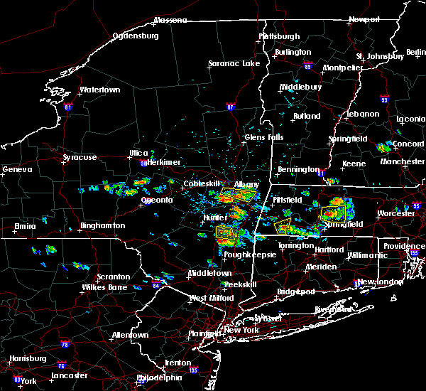 At 133 pm edt, a severe thunderstorm was located near sandisfield, or 13 miles east of great barrington, moving east at 10 mph (radar indicated). Hazards include 60 mph wind gusts and penny size hail. expect damage to trees and power lines At 133 pm edt, a severe thunderstorm was located near sandisfield, or 13 miles east of great barrington, moving east at 10 mph (radar indicated). Hazards include 60 mph wind gusts and penny size hail. expect damage to trees and power lines
|
| 7/17/2019 3:37 PM EDT |
 The severe thunderstorm warning for southwestern hampshire and northwestern hampden counties will expire at 345 pm edt, the storms which prompted the warning have weakened below severe limits, and no longer pose an immediate threat to life or property. therefore, the warning will be allowed to expire. heavy rain is still possible with these thunderstorms. another severe thunderstorm was approaching berkshire county and could reach hampshire and hampden counties around 415 pm. stay tuned for possible warnings. a severe thunderstorm watch remains in effect until 1000 pm edt for western massachusetts. &&. The severe thunderstorm warning for southwestern hampshire and northwestern hampden counties will expire at 345 pm edt, the storms which prompted the warning have weakened below severe limits, and no longer pose an immediate threat to life or property. therefore, the warning will be allowed to expire. heavy rain is still possible with these thunderstorms. another severe thunderstorm was approaching berkshire county and could reach hampshire and hampden counties around 415 pm. stay tuned for possible warnings. a severe thunderstorm watch remains in effect until 1000 pm edt for western massachusetts. &&.
|
| 7/17/2019 3:14 PM EDT |
 At 314 pm edt, severe thunderstorms were located along a line extending from near chesterfield to chester to near otis, moving east at 30 mph (radar indicated). Hazards include 60 mph wind gusts. Expect damage to trees and power lines. these severe storms will be near, chesterfield around 320 pm edt. huntington around 325 pm edt. montgomery around 330 pm edt. southampton and westhampton around 335 pm edt. northampton and russell around 340 pm edt. Westfield, holyoke and easthampton around 345 pm edt. At 314 pm edt, severe thunderstorms were located along a line extending from near chesterfield to chester to near otis, moving east at 30 mph (radar indicated). Hazards include 60 mph wind gusts. Expect damage to trees and power lines. these severe storms will be near, chesterfield around 320 pm edt. huntington around 325 pm edt. montgomery around 330 pm edt. southampton and westhampton around 335 pm edt. northampton and russell around 340 pm edt. Westfield, holyoke and easthampton around 345 pm edt.
|
| 7/17/2019 2:44 PM EDT |
 At 244 pm edt, severe thunderstorms were located along a line extending from 7 miles east of pittsfield to near becket to near lee, moving east at 30 mph (radar indicated). Hazards include 60 mph wind gusts and penny size hail. Expect damage to trees and power lines. severe thunderstorms will be near, chester and middlefield around 305 pm edt. worthington around 310 pm edt. chesterfield around 315 pm edt. huntington and blandford around 320 pm edt. montgomery around 325 pm edt. southampton, russell and westhampton around 335 pm edt. northampton and easthampton around 340 pm edt. Westfield and holyoke around 345 pm edt. At 244 pm edt, severe thunderstorms were located along a line extending from 7 miles east of pittsfield to near becket to near lee, moving east at 30 mph (radar indicated). Hazards include 60 mph wind gusts and penny size hail. Expect damage to trees and power lines. severe thunderstorms will be near, chester and middlefield around 305 pm edt. worthington around 310 pm edt. chesterfield around 315 pm edt. huntington and blandford around 320 pm edt. montgomery around 325 pm edt. southampton, russell and westhampton around 335 pm edt. northampton and easthampton around 340 pm edt. Westfield and holyoke around 345 pm edt.
|
| 5/23/2019 10:49 PM EDT |
 At 1049 pm edt, a severe thunderstorm was located near becket, or 13 miles southeast of pittsfield, moving southeast at 45 mph (radar indicated). Hazards include 60 mph wind gusts. expect damage to trees and power lines At 1049 pm edt, a severe thunderstorm was located near becket, or 13 miles southeast of pittsfield, moving southeast at 45 mph (radar indicated). Hazards include 60 mph wind gusts. expect damage to trees and power lines
|
| 4/15/2019 5:24 AM EDT |
 At 523 am edt, severe thunderstorms were located along a line extending from near otis to granville, moving east at 50 mph (radar indicated). Hazards include 60 mph wind gusts. Expect damage to trees and power lines. Locations impacted include, springfield, chicopee, westfield, holyoke, amherst, northampton, agawam, west springfield, greenfield, orange, deerfield, ludlow, south hadley, easthampton, longmeadow, belchertown, southwick, montague, granby and southampton. At 523 am edt, severe thunderstorms were located along a line extending from near otis to granville, moving east at 50 mph (radar indicated). Hazards include 60 mph wind gusts. Expect damage to trees and power lines. Locations impacted include, springfield, chicopee, westfield, holyoke, amherst, northampton, agawam, west springfield, greenfield, orange, deerfield, ludlow, south hadley, easthampton, longmeadow, belchertown, southwick, montague, granby and southampton.
|
| 4/15/2019 5:02 AM EDT |
 At 502 am edt, severe thunderstorms were located along a line extending from near middlefield to near cornwall bridge, moving east at 45 mph (radar indicated). Hazards include 60 mph wind gusts. expect damage to trees and power lines At 502 am edt, severe thunderstorms were located along a line extending from near middlefield to near cornwall bridge, moving east at 45 mph (radar indicated). Hazards include 60 mph wind gusts. expect damage to trees and power lines
|
| 9/6/2018 3:22 PM EDT |
 At 321 pm edt, severe thunderstorms were located along a line extending from near westhampton to near granville and hartland, moving east at 25 mph (radar indicated). Hazards include 60 mph wind gusts. Expect damage to trees and power lines. Locations impacted include, springfield, chicopee, westfield, holyoke, agawam, west springfield, simsbury, ludlow, south hadley, easthampton, suffield, granby, canton, southwick, southampton, east granby, huntington, hartland, russell and westhampton. At 321 pm edt, severe thunderstorms were located along a line extending from near westhampton to near granville and hartland, moving east at 25 mph (radar indicated). Hazards include 60 mph wind gusts. Expect damage to trees and power lines. Locations impacted include, springfield, chicopee, westfield, holyoke, agawam, west springfield, simsbury, ludlow, south hadley, easthampton, suffield, granby, canton, southwick, southampton, east granby, huntington, hartland, russell and westhampton.
|
| 9/6/2018 2:59 PM EDT |
 At 259 pm edt, severe thunderstorms were located along a line extending from near chester to otis and sandisfield in the berkshires, moving east at 25 mph (radar indicated). Hazards include 60 mph wind gusts and penny size hail. expect damage to trees and power lines At 259 pm edt, severe thunderstorms were located along a line extending from near chester to otis and sandisfield in the berkshires, moving east at 25 mph (radar indicated). Hazards include 60 mph wind gusts and penny size hail. expect damage to trees and power lines
|
| 8/17/2018 10:44 PM EDT |
 The national weather service in boston/norton has issued a * severe thunderstorm warning for. northwestern hartford county in northern connecticut. south central hampshire county in western massachusetts. western hampden county in western massachusetts. Until 1145 pm edt. The national weather service in boston/norton has issued a * severe thunderstorm warning for. northwestern hartford county in northern connecticut. south central hampshire county in western massachusetts. western hampden county in western massachusetts. Until 1145 pm edt.
|
| 8/17/2018 10:44 PM EDT |
 At 1043 pm edt, severe thunderstorms were located along a line extending from near sandisfield to near new preston, moving northeast at 40 mph (radar indicated). Hazards include 60 mph wind gusts. expect damage to trees and power lines At 1043 pm edt, severe thunderstorms were located along a line extending from near sandisfield to near new preston, moving northeast at 40 mph (radar indicated). Hazards include 60 mph wind gusts. expect damage to trees and power lines
|
| 5/15/2018 3:06 PM EDT |
 At 305 pm edt, a severe thunderstorm was located near copake, or 12 miles southwest of great barrington, moving east at 40 mph (trained weather spotters). Hazards include up to two inch hail and 60 mph wind gusts. People and animals outdoors will be injured. expect hail damage to roofs, siding, windows, and vehicles. Expect damage to trees and power lines. At 305 pm edt, a severe thunderstorm was located near copake, or 12 miles southwest of great barrington, moving east at 40 mph (trained weather spotters). Hazards include up to two inch hail and 60 mph wind gusts. People and animals outdoors will be injured. expect hail damage to roofs, siding, windows, and vehicles. Expect damage to trees and power lines.
|
| 5/15/2018 3:06 PM EDT |
 The national weather service in boston/norton has issued a * severe thunderstorm warning for. northwestern hartford county in northern connecticut. southwestern hampshire county in western massachusetts. southwestern hampden county in western massachusetts. Until 400 pm edt. The national weather service in boston/norton has issued a * severe thunderstorm warning for. northwestern hartford county in northern connecticut. southwestern hampshire county in western massachusetts. southwestern hampden county in western massachusetts. Until 400 pm edt.
|
| 5/4/2018 9:35 PM EDT |
 At 934 pm edt, a line of strong to severe thunderstorms were sweeping into western massachusetts moving east at 50 mph (radar indicated). Hazards include 60 mph wind gusts. expect damage to trees and power lines At 934 pm edt, a line of strong to severe thunderstorms were sweeping into western massachusetts moving east at 50 mph (radar indicated). Hazards include 60 mph wind gusts. expect damage to trees and power lines
|
| 8/2/2017 3:10 PM EDT |
 At 310 pm edt, a severe thunderstorm was located over granby, or 9 miles southwest of agawam, moving northeast at 25 mph (radar indicated). Hazards include 60 mph wind gusts and quarter size hail. Hail damage to vehicles is possible. Expect damage to trees and power lines. At 310 pm edt, a severe thunderstorm was located over granby, or 9 miles southwest of agawam, moving northeast at 25 mph (radar indicated). Hazards include 60 mph wind gusts and quarter size hail. Hail damage to vehicles is possible. Expect damage to trees and power lines.
|
| 8/2/2017 2:56 PM EDT |
 The severe thunderstorm warning for southwestern hampshire and northwestern hampden counties will expire at 300 pm edt, the storm which prompted the warning has weakened below severe limits, and no longer poses an immediate threat to life or property. therefore the warning will be allowed to expire. The severe thunderstorm warning for southwestern hampshire and northwestern hampden counties will expire at 300 pm edt, the storm which prompted the warning has weakened below severe limits, and no longer poses an immediate threat to life or property. therefore the warning will be allowed to expire.
|
| 8/2/2017 2:22 PM EDT |
 At 222 pm edt, a severe thunderstorm was located over chester, or 13 miles northwest of westfield, remaining nearly stationary (radar indicated). Hazards include 60 mph wind gusts and penny size hail. expect damage to trees and power lines At 222 pm edt, a severe thunderstorm was located over chester, or 13 miles northwest of westfield, remaining nearly stationary (radar indicated). Hazards include 60 mph wind gusts and penny size hail. expect damage to trees and power lines
|
| 6/30/2017 5:52 PM EDT |
 At 549 pm edt, a severe thunderstorm was locateed near new hartford in eastern litchfield county, moving east at 35 mph. this storm may produce large hail and damaging winds from simsbury to canton and burlington connecticut. other strong storms extended along a line from westhampton massachusetts to new preston connecticut (radar indicated). Hazards include 60 mph wind gusts and quarter size hail. Hail damage to vehicles is possible. expect damage to trees and power lines. Locations impacted include, springfield, west hartford, bristol, chicopee, enfield, southington, westfield, holyoke, windsor, northampton, agawam, west springfield, farmington, wolcott, simsbury, ludlow, bloomfield, avon, plainville and south hadley. At 549 pm edt, a severe thunderstorm was locateed near new hartford in eastern litchfield county, moving east at 35 mph. this storm may produce large hail and damaging winds from simsbury to canton and burlington connecticut. other strong storms extended along a line from westhampton massachusetts to new preston connecticut (radar indicated). Hazards include 60 mph wind gusts and quarter size hail. Hail damage to vehicles is possible. expect damage to trees and power lines. Locations impacted include, springfield, west hartford, bristol, chicopee, enfield, southington, westfield, holyoke, windsor, northampton, agawam, west springfield, farmington, wolcott, simsbury, ludlow, bloomfield, avon, plainville and south hadley.
|
| 6/30/2017 5:31 PM EDT |
 At 530 pm edt, severe thunderstorms were located along a line extending from near blandford massachusetts to near new milford, connecticut, moving east at 20 mph (radar indicated). Hazards include 60 mph wind gusts. expect damage to trees and power lines At 530 pm edt, severe thunderstorms were located along a line extending from near blandford massachusetts to near new milford, connecticut, moving east at 20 mph (radar indicated). Hazards include 60 mph wind gusts. expect damage to trees and power lines
|
| 6/19/2017 4:29 PM EDT |
 At 429 pm edt, severe thunderstorms were located along a line extending from near lenox to near norfolk to near litchfield, moving northeast at 30 mph (radar indicated). Hazards include 60 mph wind gusts and penny size hail. expect damage to trees and power lines At 429 pm edt, severe thunderstorms were located along a line extending from near lenox to near norfolk to near litchfield, moving northeast at 30 mph (radar indicated). Hazards include 60 mph wind gusts and penny size hail. expect damage to trees and power lines
|
| 5/31/2017 6:59 PM EDT |
 At 659 pm edt, severe thunderstorms were located along a line extending from near wendell to easthampton to ashley falls, moving southeast at 15 mph (radar indicated. though numerous reports north across the connecticut river valley in massachusetts of dime to nickel sized hail). Hazards include 60 mph wind gusts. expect damage to trees and power lines At 659 pm edt, severe thunderstorms were located along a line extending from near wendell to easthampton to ashley falls, moving southeast at 15 mph (radar indicated. though numerous reports north across the connecticut river valley in massachusetts of dime to nickel sized hail). Hazards include 60 mph wind gusts. expect damage to trees and power lines
|
| 5/31/2017 6:26 PM EDT |
 At 625 pm edt, severe thunderstorms were located along a line extending from hinsdale to near deerfield to near otis, moving east at 35 mph (radar indicated. though spotters have reported hail up to the size of nickels with wind gusts as high as 45 mph). Hazards include 60 mph wind gusts and quarter size hail. Hail damage to vehicles is possible. expect damage to trees and power lines. Locations impacted include, westfield, holyoke, amherst, northampton, greenfield, orange, deerfield, south hadley, easthampton, montague, southampton, hadley, sunderland, hatfield, northfield, williamsburg, huntington, bernardston, buckland and conway. At 625 pm edt, severe thunderstorms were located along a line extending from hinsdale to near deerfield to near otis, moving east at 35 mph (radar indicated. though spotters have reported hail up to the size of nickels with wind gusts as high as 45 mph). Hazards include 60 mph wind gusts and quarter size hail. Hail damage to vehicles is possible. expect damage to trees and power lines. Locations impacted include, westfield, holyoke, amherst, northampton, greenfield, orange, deerfield, south hadley, easthampton, montague, southampton, hadley, sunderland, hatfield, northfield, williamsburg, huntington, bernardston, buckland and conway.
|
| 5/31/2017 6:12 PM EDT |
 At 611 pm edt, severe thunderstorms were located along a line extending from near guilford center to ashfield to near lee, moving east at 35 mph (radar indicated). Hazards include 60 mph wind gusts and half dollar size hail. Hail damage to vehicles is possible. Expect damage to trees and power lines. At 611 pm edt, severe thunderstorms were located along a line extending from near guilford center to ashfield to near lee, moving east at 35 mph (radar indicated). Hazards include 60 mph wind gusts and half dollar size hail. Hail damage to vehicles is possible. Expect damage to trees and power lines.
|
| 10/23/2016 11:22 AM EDT | Tree down blocking road in hampden county MA, 1.1 miles NNW of Russell, MA |
| 9/11/2016 8:11 AM EDT |
 At 811 am edt, severe thunderstorms were located along a line extending from near claremont to near putney to charlemont to near middlefield to near amenia, moving northeast at 45 mph (radar indicated). Hazards include 60 mph wind gusts. Expect damage to roofs. siding. And trees. At 811 am edt, severe thunderstorms were located along a line extending from near claremont to near putney to charlemont to near middlefield to near amenia, moving northeast at 45 mph (radar indicated). Hazards include 60 mph wind gusts. Expect damage to roofs. siding. And trees.
|
| 8/13/2016 9:29 PM EDT |
 At 927 pm edt, severe thunderstorms were located along a line extending from near guilford center to plainfield to near blandford to 6 miles south of norfolk, moving east at 45 mph (radar indicated). Hazards include 60 mph wind gusts. Expect damage to roofs. siding. And trees. At 927 pm edt, severe thunderstorms were located along a line extending from near guilford center to plainfield to near blandford to 6 miles south of norfolk, moving east at 45 mph (radar indicated). Hazards include 60 mph wind gusts. Expect damage to roofs. siding. And trees.
|
| 8/13/2016 8:37 PM EDT |
 At 836 pm edt, severe thunderstorms were located along a line extending from near pownal to near nassau to near livingston to port ewen, moving east at 25 mph (radar indicated). Hazards include 60 mph wind gusts. Expect damage to roofs. siding. And trees. At 836 pm edt, severe thunderstorms were located along a line extending from near pownal to near nassau to near livingston to port ewen, moving east at 25 mph (radar indicated). Hazards include 60 mph wind gusts. Expect damage to roofs. siding. And trees.
|
| 8/12/2016 5:52 PM EDT |
 The severe thunderstorm warning for western hampshire, northwestern hampden and west central franklin counties will expire at 600 pm edt, the storms which prompted the warning have weakened below severe limits, and no longer pose an immediate threat to life or property. therefore, the warning will be allowed to expire. The severe thunderstorm warning for western hampshire, northwestern hampden and west central franklin counties will expire at 600 pm edt, the storms which prompted the warning have weakened below severe limits, and no longer pose an immediate threat to life or property. therefore, the warning will be allowed to expire.
|
| 8/12/2016 5:17 PM EDT |
 At 516 pm edt, severe thunderstorms were located along a line extending from adams to near pittsfield to near new lebanon to chatham, moving east at 30 mph (radar indicated). Hazards include 60 mph wind gusts. Expect damage to roofs. siding. And trees. At 516 pm edt, severe thunderstorms were located along a line extending from adams to near pittsfield to near new lebanon to chatham, moving east at 30 mph (radar indicated). Hazards include 60 mph wind gusts. Expect damage to roofs. siding. And trees.
|
| 8/12/2016 2:57 PM EDT |
 At 256 pm edt, severe thunderstorms were located along a line extending from easthampton to near southampton to near montgomery, moving southeast at 25 mph (radar indicated). Hazards include 60 mph wind gusts. Expect damage to roofs. siding. And trees. At 256 pm edt, severe thunderstorms were located along a line extending from easthampton to near southampton to near montgomery, moving southeast at 25 mph (radar indicated). Hazards include 60 mph wind gusts. Expect damage to roofs. siding. And trees.
|
| 7/23/2016 8:06 PM EDT |
 The severe thunderstorm warning for hampshire, northern hampden, northwestern worcester and franklin counties will expire at 815 pm edt, the severe thunderstorm which prompted the warning has weakened. however, brief wind gusts to 45 mph from weakening showers may still result in a few downed trees and isolated power outages. a severe thunderstorm watch remains in effect until 1000 pm edt for western and central massachusetts. The severe thunderstorm warning for hampshire, northern hampden, northwestern worcester and franklin counties will expire at 815 pm edt, the severe thunderstorm which prompted the warning has weakened. however, brief wind gusts to 45 mph from weakening showers may still result in a few downed trees and isolated power outages. a severe thunderstorm watch remains in effect until 1000 pm edt for western and central massachusetts.
|
| 7/23/2016 7:15 PM EDT |
 At 713 pm edt, a line of severe thunderstorms with a history of damaging wind gusts will drop south into much of western massachusetts. the strongest winds may occur well out ahead of the thunderstorms (radar indicated). Hazards include 60 mph wind gusts. Expect damage to roofs. siding. And trees. At 713 pm edt, a line of severe thunderstorms with a history of damaging wind gusts will drop south into much of western massachusetts. the strongest winds may occur well out ahead of the thunderstorms (radar indicated). Hazards include 60 mph wind gusts. Expect damage to roofs. siding. And trees.
|
| 7/22/2016 7:39 PM EDT |
 At 737 pm edt, a severe thunderstorm was located over tolland, or 12 miles west of westfield, moving east at 35 mph. another strong storm with the potential to become severe was located near new marlboro in southern berkshire county (radar indicated). Hazards include 60 mph wind gusts and penny size hail. Expect damage to roofs. siding. And trees. At 737 pm edt, a severe thunderstorm was located over tolland, or 12 miles west of westfield, moving east at 35 mph. another strong storm with the potential to become severe was located near new marlboro in southern berkshire county (radar indicated). Hazards include 60 mph wind gusts and penny size hail. Expect damage to roofs. siding. And trees.
|
| 7/22/2016 6:25 PM EDT |
 At 625 pm edt, a severe thunderstorm was located over westhampton, or over northampton, moving east at 35 mph (radar indicated). Hazards include 60 mph wind gusts and penny size hail. Expect damage to roofs. siding. and trees. Locations impacted include, westfield, holyoke, northampton, agawam, west springfield, south hadley, easthampton, southampton, hadley, hatfield, williamsburg, huntington, russell, westhampton, blandford, chesterfield, goshen and montgomery. At 625 pm edt, a severe thunderstorm was located over westhampton, or over northampton, moving east at 35 mph (radar indicated). Hazards include 60 mph wind gusts and penny size hail. Expect damage to roofs. siding. and trees. Locations impacted include, westfield, holyoke, northampton, agawam, west springfield, south hadley, easthampton, southampton, hadley, hatfield, williamsburg, huntington, russell, westhampton, blandford, chesterfield, goshen and montgomery.
|
| 7/22/2016 6:14 PM EDT |
 At 613 pm edt, a severe thunderstorm was located over chesterfield, or 9 miles west of northampton, moving southeast at 30 mph (radar indicated). Hazards include 60 mph wind gusts and penny size hail. Expect damage to roofs. siding. and trees. Locations impacted include, westfield, holyoke, northampton, agawam, west springfield, south hadley, easthampton, southwick, southampton, hadley, hatfield, williamsburg, huntington, russell, westhampton, granville, chester, blandford, chesterfield and worthington. At 613 pm edt, a severe thunderstorm was located over chesterfield, or 9 miles west of northampton, moving southeast at 30 mph (radar indicated). Hazards include 60 mph wind gusts and penny size hail. Expect damage to roofs. siding. and trees. Locations impacted include, westfield, holyoke, northampton, agawam, west springfield, south hadley, easthampton, southwick, southampton, hadley, hatfield, williamsburg, huntington, russell, westhampton, granville, chester, blandford, chesterfield and worthington.
|
| 7/22/2016 5:54 PM EDT |
 At 553 pm edt, a severe thunderstorm was located near becket, or 14 miles east of great barrington, moving east at 35 mph (radar indicated). Hazards include 60 mph wind gusts and quarter size hail. Hail damage to vehicles is expected. Expect wind damage to roofs, siding, and trees. At 553 pm edt, a severe thunderstorm was located near becket, or 14 miles east of great barrington, moving east at 35 mph (radar indicated). Hazards include 60 mph wind gusts and quarter size hail. Hail damage to vehicles is expected. Expect wind damage to roofs, siding, and trees.
|
| 2/25/2016 12:56 AM EST |
 The severe thunderstorm warning for northwestern hartford, hampshire, western hampden and franklin counties will expire at 100 am est, a new severe thunderstorm warning has been issued. The severe thunderstorm warning for northwestern hartford, hampshire, western hampden and franklin counties will expire at 100 am est, a new severe thunderstorm warning has been issued.
|
| 2/25/2016 12:55 AM EST |
 At 1254 am est, doppler radar indicated a line of severe thunderstorms capable of producing destructive winds in excess of 70 mph. these storms were located along a line extending from near newfane to near ashfield to near hartland, and was moving northeast at 45 mph. At 1254 am est, doppler radar indicated a line of severe thunderstorms capable of producing destructive winds in excess of 70 mph. these storms were located along a line extending from near newfane to near ashfield to near hartland, and was moving northeast at 45 mph.
|
| 2/25/2016 12:19 AM EST |
 At 1218 am est, doppler radar indicated a severe thunderstorm capable of producing destructive winds in excess of 70 mph. this storm was located near tolland, or 14 miles north of torrington, and was moving northeast at 45 mph. At 1218 am est, doppler radar indicated a severe thunderstorm capable of producing destructive winds in excess of 70 mph. this storm was located near tolland, or 14 miles north of torrington, and was moving northeast at 45 mph.
|
| 8/4/2015 2:17 PM EDT |
 At 216 pm edt, doppler radar indicated a severe thunderstorm capable of producing quarter size hail and damaging winds in excess of 60 mph. this storm was located over blandford, or 12 miles northwest of westfield, and was moving east at 35 mph. * some locations impacted include, springfield, chicopee, westfield, holyoke, amherst, northampton, agawam, west springfield, ludlow, south hadley, southbridge, easthampton, longmeadow, east longmeadow, belchertown, wilbraham, palmer, spencer, ware and southwick. At 216 pm edt, doppler radar indicated a severe thunderstorm capable of producing quarter size hail and damaging winds in excess of 60 mph. this storm was located over blandford, or 12 miles northwest of westfield, and was moving east at 35 mph. * some locations impacted include, springfield, chicopee, westfield, holyoke, amherst, northampton, agawam, west springfield, ludlow, south hadley, southbridge, easthampton, longmeadow, east longmeadow, belchertown, wilbraham, palmer, spencer, ware and southwick.
|
| 7/27/2015 6:38 PM EDT |
 At 637 pm edt, trained weather spotters reported a severe thunderstorm producing quarter size hail. this storm was located over westfield, moving southeast at 10 mph. locations impacted include, springfield, chicopee, westfield, holyoke, agawam, west springfield, longmeadow, suffield, east longmeadow, granby, southwick, russell, granville, blandford and montgomery. At 637 pm edt, trained weather spotters reported a severe thunderstorm producing quarter size hail. this storm was located over westfield, moving southeast at 10 mph. locations impacted include, springfield, chicopee, westfield, holyoke, agawam, west springfield, longmeadow, suffield, east longmeadow, granby, southwick, russell, granville, blandford and montgomery.
|
| 7/27/2015 6:17 PM EDT | Quarter sized hail reported 0.3 miles N of Russell, MA, nickel to quarter size hail on woodland way |
| 7/27/2015 6:15 PM EDT |
 At 614 pm edt, doppler radar indicated a severe thunderstorm capable of producing quarter size hail and damaging winds in excess of 60 mph. this storm was located over russell, or near westfield, and was moving southeast at 10 mph. * some locations impacted include, springfield, chicopee, westfield, holyoke, agawam, west springfield, longmeadow, suffield, east longmeadow, granby, southwick, southampton, huntington, russell, granville, blandford, montgomery and tolland. At 614 pm edt, doppler radar indicated a severe thunderstorm capable of producing quarter size hail and damaging winds in excess of 60 mph. this storm was located over russell, or near westfield, and was moving southeast at 10 mph. * some locations impacted include, springfield, chicopee, westfield, holyoke, agawam, west springfield, longmeadow, suffield, east longmeadow, granby, southwick, southampton, huntington, russell, granville, blandford, montgomery and tolland.
|
| 7/26/2015 6:56 PM EDT |
 The severe thunderstorm warning for south central hampshire and west central hampden counties will expire at 700 pm edt, the storm which prompted the warning has weakened below severe limits and exited the warned area. therefore the warning will be allowed to expire. The severe thunderstorm warning for south central hampshire and west central hampden counties will expire at 700 pm edt, the storm which prompted the warning has weakened below severe limits and exited the warned area. therefore the warning will be allowed to expire.
|
| 7/26/2015 6:42 PM EDT |
 At 642 pm edt, doppler radar indicated a severe thunderstorm capable of producing damaging winds in excess of 60 mph. this storm was located over westfield, moving east at 15 mph. locations impacted include, westfield, northampton, easthampton, southampton, huntington, russell, westhampton, blandford and montgomery. At 642 pm edt, doppler radar indicated a severe thunderstorm capable of producing damaging winds in excess of 60 mph. this storm was located over westfield, moving east at 15 mph. locations impacted include, westfield, northampton, easthampton, southampton, huntington, russell, westhampton, blandford and montgomery.
|
| 7/26/2015 6:30 PM EDT |
 At 629 pm edt, doppler radar indicated a severe thunderstorm capable of producing quarter size hail and damaging winds in excess of 60 mph. this storm was located over russell, or near westfield, moving east at 15 mph. locations impacted include, westfield, northampton, easthampton, southwick, southampton, huntington, russell, westhampton, granville, chester, blandford, montgomery and tolland. At 629 pm edt, doppler radar indicated a severe thunderstorm capable of producing quarter size hail and damaging winds in excess of 60 mph. this storm was located over russell, or near westfield, moving east at 15 mph. locations impacted include, westfield, northampton, easthampton, southwick, southampton, huntington, russell, westhampton, granville, chester, blandford, montgomery and tolland.
|
| 7/26/2015 6:18 PM EDT |
 At 616 pm edt, trained weather spotters reported a severe thunderstorm producing quarter size hail in blandford. this storm also has a history of producing damaging winds in excess of 60 mph. this storm was located over blandford, or 10 miles west of westfield, moving east at 20 mph. locations impacted include, westfield, northampton, easthampton, granby, southwick, southampton, huntington, hartland, russell, westhampton, granville, chester, blandford, worthington, montgomery, middlefield and tolland. At 616 pm edt, trained weather spotters reported a severe thunderstorm producing quarter size hail in blandford. this storm also has a history of producing damaging winds in excess of 60 mph. this storm was located over blandford, or 10 miles west of westfield, moving east at 20 mph. locations impacted include, westfield, northampton, easthampton, granby, southwick, southampton, huntington, hartland, russell, westhampton, granville, chester, blandford, worthington, montgomery, middlefield and tolland.
|
| 7/26/2015 5:55 PM EDT |
 At 554 pm edt, doppler radar indicated a severe thunderstorm capable of producing quarter size hail and damaging winds in excess of 60 mph. this storm was located near otis, or 11 miles east of great barrington, and was moving east at 15 mph. * some locations impacted include, westfield, northampton, easthampton, granby, southwick, southampton, huntington, hartland, russell, westhampton, granville, chester, blandford, worthington, montgomery, middlefield and tolland. At 554 pm edt, doppler radar indicated a severe thunderstorm capable of producing quarter size hail and damaging winds in excess of 60 mph. this storm was located near otis, or 11 miles east of great barrington, and was moving east at 15 mph. * some locations impacted include, westfield, northampton, easthampton, granby, southwick, southampton, huntington, hartland, russell, westhampton, granville, chester, blandford, worthington, montgomery, middlefield and tolland.
|
| 6/23/2015 7:41 PM EDT |
 At 740 pm edt, doppler radar indicated a line of severe thunderstorms capable of producing damaging winds in excess of 60 mph. these storms were located along a line extending from ludlow to near granville, moving southeast at 20 mph. in addition, at 738 pm, trees and wires were reported downed in westfield. locations impacted include, springfield, chicopee, enfield, westfield, holyoke, windsor, agawam, west springfield, south windsor, simsbury, ludlow, bloomfield, south hadley, easthampton, longmeadow, suffield, east longmeadow, ellington, wilbraham and windsor locks. At 740 pm edt, doppler radar indicated a line of severe thunderstorms capable of producing damaging winds in excess of 60 mph. these storms were located along a line extending from ludlow to near granville, moving southeast at 20 mph. in addition, at 738 pm, trees and wires were reported downed in westfield. locations impacted include, springfield, chicopee, enfield, westfield, holyoke, windsor, agawam, west springfield, south windsor, simsbury, ludlow, bloomfield, south hadley, easthampton, longmeadow, suffield, east longmeadow, ellington, wilbraham and windsor locks.
|
| 6/23/2015 7:29 PM EDT | Tree down on route 20 in hampden county MA, 0.3 miles N of Russell, MA |
| 6/23/2015 7:19 PM EDT |
 At 718 pm edt, doppler radar indicated a line of severe thunderstorms capable of producing damaging winds in excess of 60 mph. these storms were located along a line extending from south hadley to near otis, and was moving east at 40 mph. * some locations impacted include, springfield, chicopee, enfield, westfield, holyoke, windsor, agawam, west springfield, south windsor, simsbury, ludlow, bloomfield, south hadley, easthampton, longmeadow, suffield, east longmeadow, ellington, wilbraham and windsor locks. At 718 pm edt, doppler radar indicated a line of severe thunderstorms capable of producing damaging winds in excess of 60 mph. these storms were located along a line extending from south hadley to near otis, and was moving east at 40 mph. * some locations impacted include, springfield, chicopee, enfield, westfield, holyoke, windsor, agawam, west springfield, south windsor, simsbury, ludlow, bloomfield, south hadley, easthampton, longmeadow, suffield, east longmeadow, ellington, wilbraham and windsor locks.
|
| 6/12/2015 10:30 PM EDT |
 At 1029 pm edt, doppler radar indicated a line of strong and potentially severe thunderstorms capable of producing damaging winds of 50 to 60 mph. these storms were located from near worthington to otis to near sheffield, moving east at 45 mph. locations impacted include, westfield, northampton, easthampton, southampton, williamsburg, huntington, russell, westhampton, granville, chester, blandford, chesterfield, worthington, montgomery, middlefield and tolland. At 1029 pm edt, doppler radar indicated a line of strong and potentially severe thunderstorms capable of producing damaging winds of 50 to 60 mph. these storms were located from near worthington to otis to near sheffield, moving east at 45 mph. locations impacted include, westfield, northampton, easthampton, southampton, williamsburg, huntington, russell, westhampton, granville, chester, blandford, chesterfield, worthington, montgomery, middlefield and tolland.
|
| 6/12/2015 10:09 PM EDT |
 At 1008 pm edt, doppler radar indicated a line of severe thunderstorms capable of producing damaging winds in excess of 60 mph. these storms were located from pittsfield massachusetts to housatonic new york to livingston new york, and was moving east at 45 mph. * some locations impacted include, westfield, northampton, easthampton, southampton, williamsburg, huntington, russell, westhampton, granville, chester, blandford, chesterfield, worthington, montgomery, middlefield and tolland. At 1008 pm edt, doppler radar indicated a line of severe thunderstorms capable of producing damaging winds in excess of 60 mph. these storms were located from pittsfield massachusetts to housatonic new york to livingston new york, and was moving east at 45 mph. * some locations impacted include, westfield, northampton, easthampton, southampton, williamsburg, huntington, russell, westhampton, granville, chester, blandford, chesterfield, worthington, montgomery, middlefield and tolland.
|
| 5/27/2015 7:01 PM EDT | At 700 pm edt, doppler radar indicated a line of severe thunderstorms capable of producing damaging winds in excess of 60 mph. these storms were located along a line extending from near russell to near granville to hartland, moving northeast at 50 mph. locations impacted include, springfield, chicopee, westfield, holyoke, agawam, west springfield, ludlow, south hadley, easthampton, longmeadow, suffield, southwick, granby, southampton, east granby, hartland, russell, granville, blandford and montgomery. |
| 5/27/2015 7:01 PM EDT | At 700 pm edt, doppler radar indicated a line of severe thunderstorms capable of producing damaging winds in excess of 60 mph. these storms were located along a line extending from near russell to near granville to hartland, moving northeast at 50 mph. locations impacted include, springfield, chicopee, westfield, holyoke, agawam, west springfield, ludlow, south hadley, easthampton, longmeadow, suffield, southwick, granby, southampton, east granby, hartland, russell, granville, blandford and montgomery. |
| 5/27/2015 6:42 PM EDT | At 642 pm edt, doppler radar indicated a line of severe thunderstorms capable of producing damaging winds in excess of 60 mph. these storms were located along a line extending from near sandisfield to near norfolk to near torrington, and was moving northeast at 45 mph. * some locations impacted include, springfield, chicopee, westfield, holyoke, agawam, west springfield, ludlow, south hadley, easthampton, longmeadow, suffield, belchertown, southwick, granby, southampton, east granby, hartland, russell, granville and blandford. |
| 5/27/2015 6:42 PM EDT | At 642 pm edt, doppler radar indicated a line of severe thunderstorms capable of producing damaging winds in excess of 60 mph. these storms were located along a line extending from near sandisfield to near norfolk to near torrington, and was moving northeast at 45 mph. * some locations impacted include, springfield, chicopee, westfield, holyoke, agawam, west springfield, ludlow, south hadley, easthampton, longmeadow, suffield, belchertown, southwick, granby, southampton, east granby, hartland, russell, granville and blandford. |
| 5/27/2015 6:19 PM EDT | At 618 pm edt, doppler radar indicated a line of severe thunderstorms capable of producing damaging winds in excess of 60 mph. these storms were located along a line extending from near charlemont to near chester, moving east at 30 mph. locations impacted include, northampton, greenfield, deerfield, montague, southampton, sunderland, hatfield, northfield, williamsburg, huntington, bernardston, buckland, conway, shelburne, erving, russell, ashfield, colrain, westhampton and gill. |
| 5/27/2015 5:52 PM EDT | At 551 pm edt, doppler radar indicated a line of severe thunderstorms capable of producing quarter size hail and damaging winds in excess of 60 mph. these storms were located along a line extending from near wilmington vermont to near ashley falls massachusetts, moving east at 35 mph. locations impacted include, westfield, northampton, greenfield, deerfield, easthampton, monroe, montague, southampton, sunderland, hatfield, northfield, williamsburg, huntington, bernardston, buckland, conway, shelburne, erving, russell and ashfield. |
| 5/27/2015 5:29 PM EDT | At 527 pm edt, doppler radar indicated a line of severe thunderstorms capable of producing damaging winds in excess of 60 mph and hail as large as quarters. these storms were located along a line extending from southwest vermont into eastern new york, and were moving east at 35 mph. * some locations impacted include, westfield, northampton, greenfield, deerfield, easthampton, monroe, montague, southampton, sunderland, hatfield, northfield, williamsburg, huntington, bernardston, buckland, conway, shelburne, erving, russell and ashfield. |
| 5/19/2015 9:13 PM EDT | At 912 pm edt, doppler radar indicated a severe thunderstorm capable of producing damaging winds in excess of 60 mph. this storm was located over west springfield, moving southeast at 35 mph. in addition, pea sized hail was reported at blandford with this storm. locations impacted include, springfield, chicopee, westfield, holyoke, northampton, agawam, west springfield, ludlow, south hadley, easthampton, southwick, granby, southampton, huntington, russell, westhampton, granville, chester, blandford and chesterfield. |
| 5/19/2015 8:45 PM EDT | At 844 pm edt, doppler radar indicated a severe thunderstorm capable of producing damaging winds in excess of 60 mph. this storm was located near blandford, or 12 miles northwest of westfield, and was moving southeast at 35 mph. * some locations impacted include, springfield, chicopee, westfield, holyoke, northampton, agawam, west springfield, ludlow, south hadley, easthampton, southwick, granby, southampton, huntington, russell, westhampton, granville, chester, blandford and chesterfield. |
| 7/3/2014 8:08 PM EDT | Tree and wires down on woronoco street in hampden county MA, 1.1 miles NNW of Russell, MA |
| 6/18/2014 2:17 AM EDT | Tree down on wires on south quarter roa in hampden county MA, 1.1 miles NNW of Russell, MA |
| 9/8/2012 6:35 PM EDT | Tree and wires down on route 20 near the mobile home park in hampden county MA, 1.1 miles NNW of Russell, MA |
Hail Maps for Russell, MA
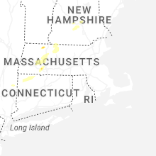


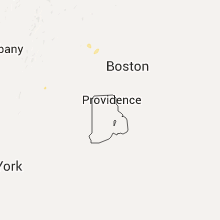


Connect with Interactive Hail Maps