

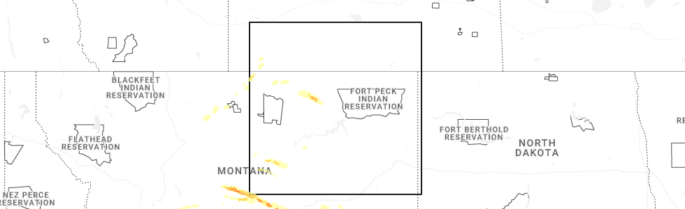
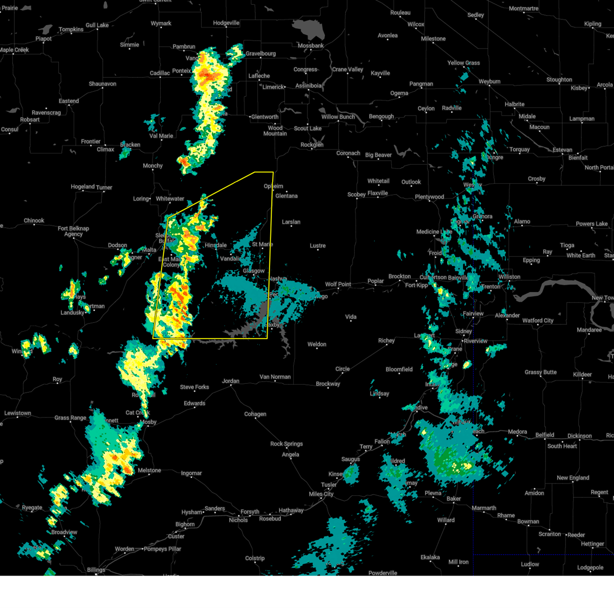
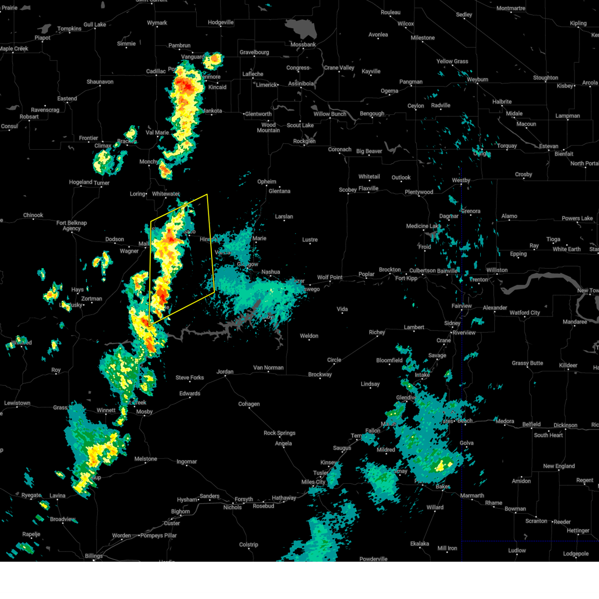
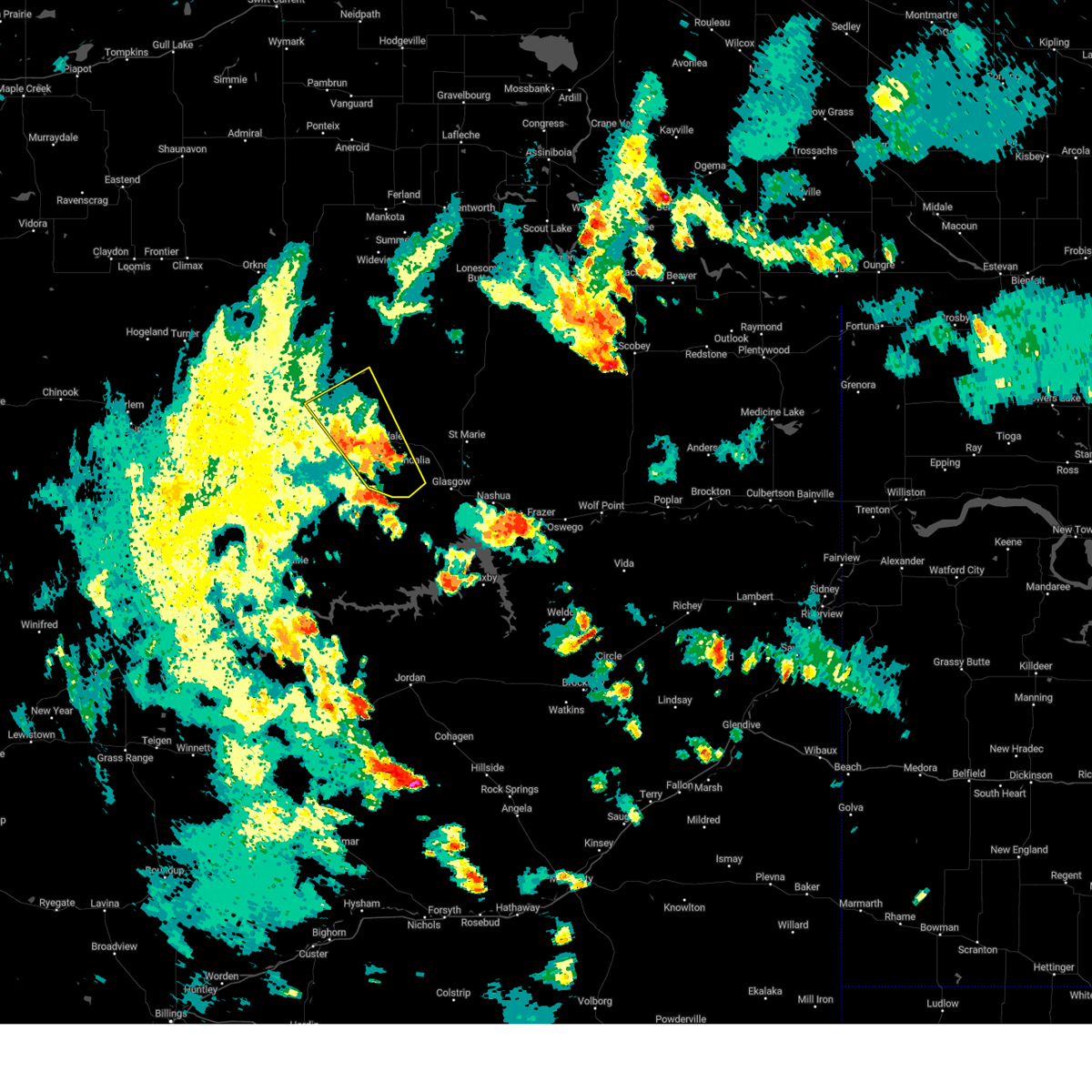
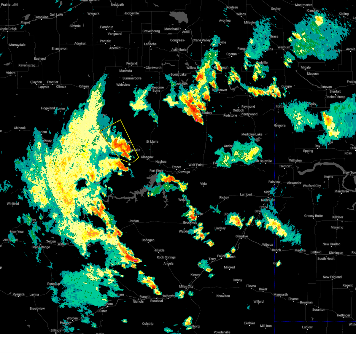
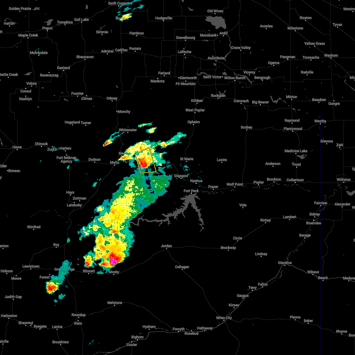
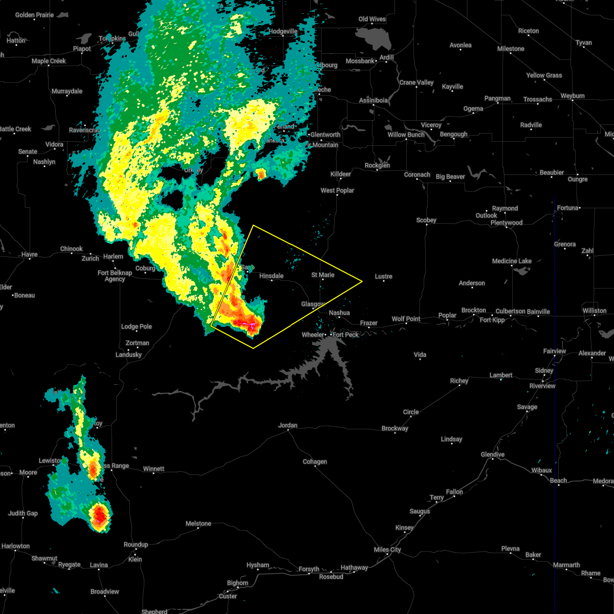
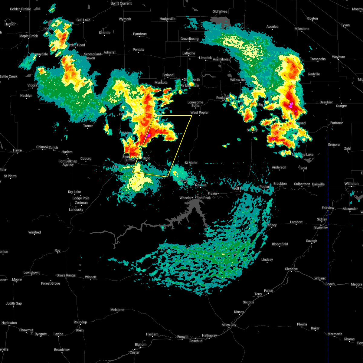
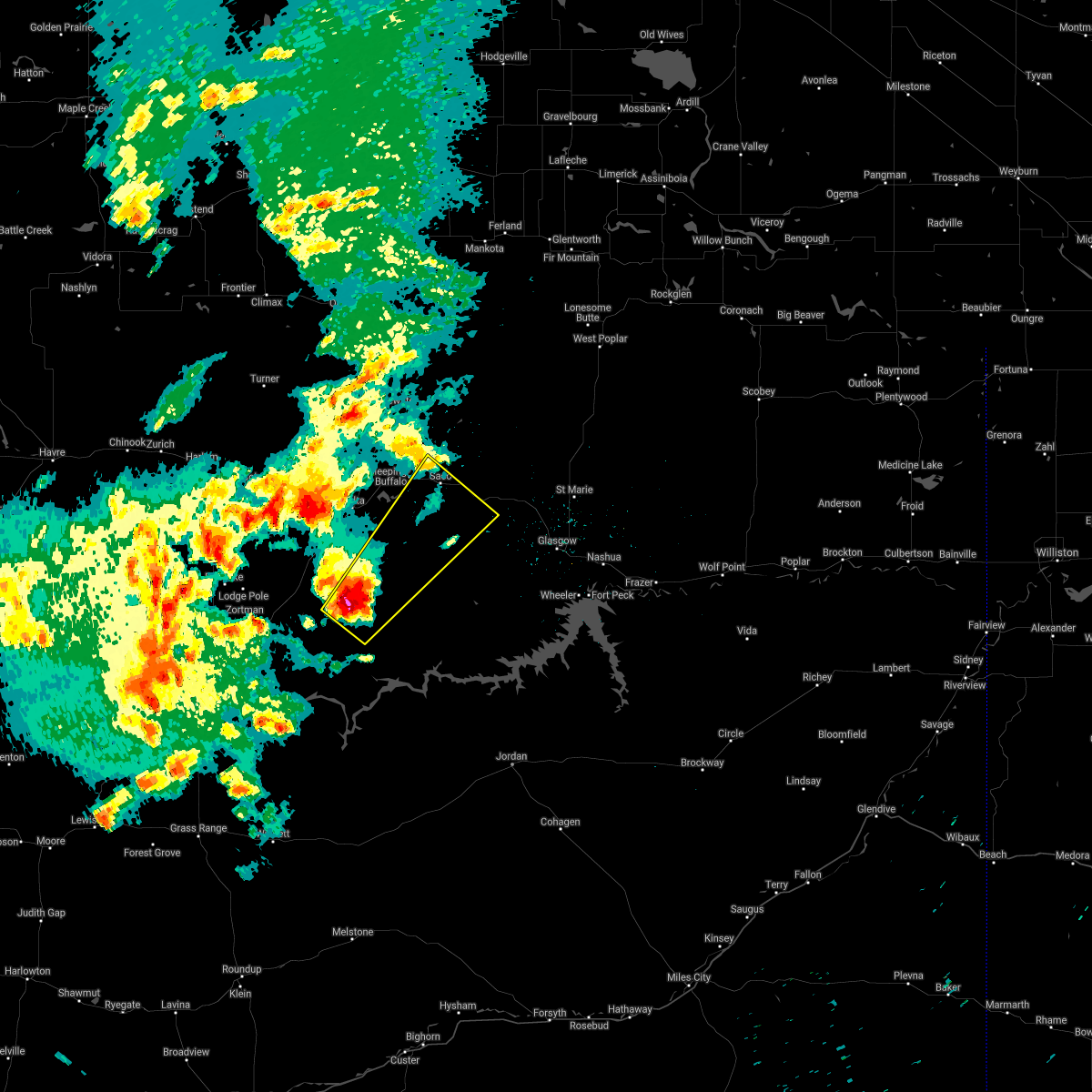
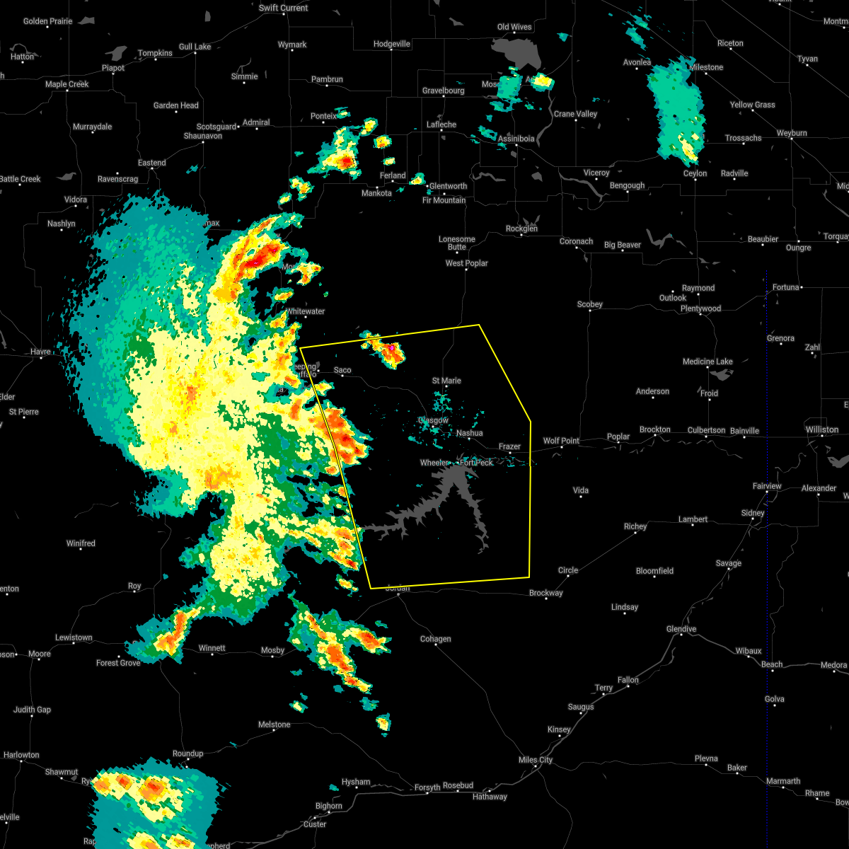
Hail Map for Saco, MT
The Saco, MT area has had 16 reports of on-the-ground hail by trained spotters, and has been under severe weather warnings 11 times during the past 12 months. Doppler radar has detected hail at or near Saco, MT on 26 occasions, including 3 occasions during the past year.
| Name: | Saco, MT |
| Where Located: | 37.3 miles WNW of Glasgow, MT |
| Map: | Google Map for Saco, MT |
| Population: | 197 |
| Housing Units: | 127 |
| More Info: | Search Google for Saco, MT |
2
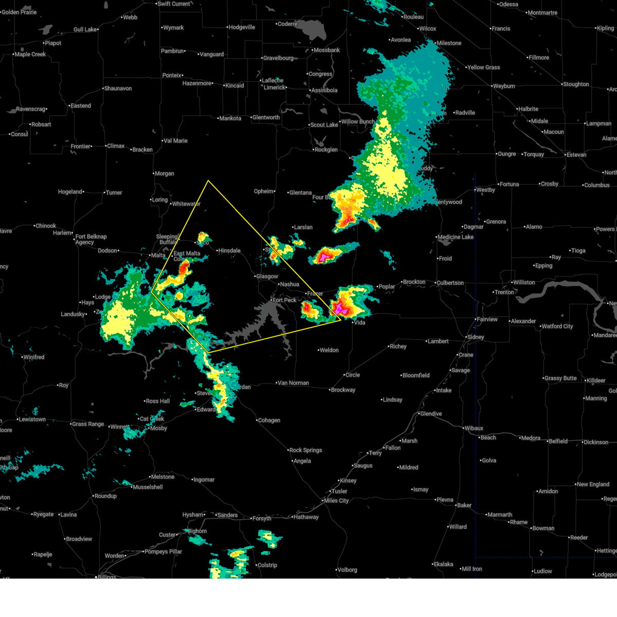
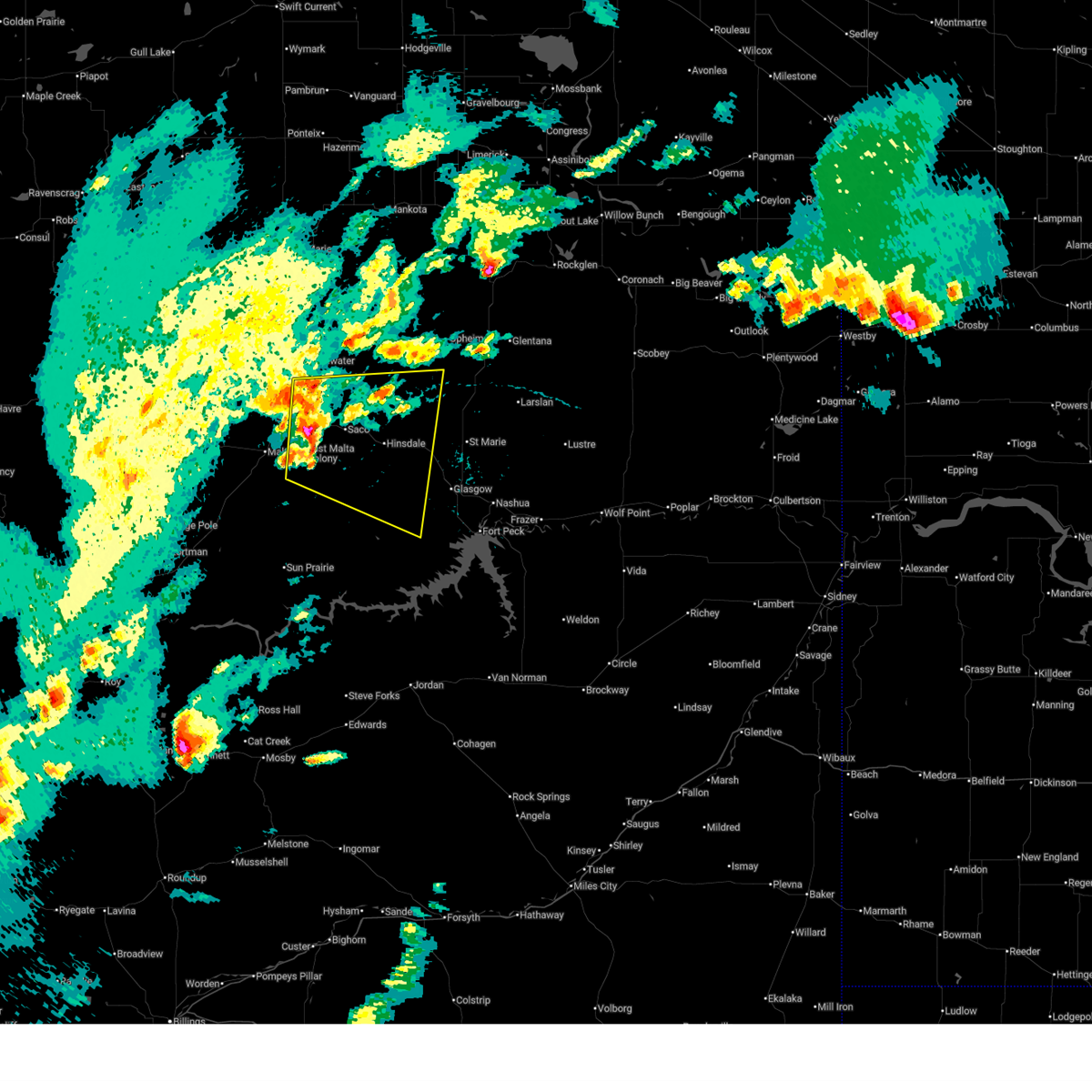
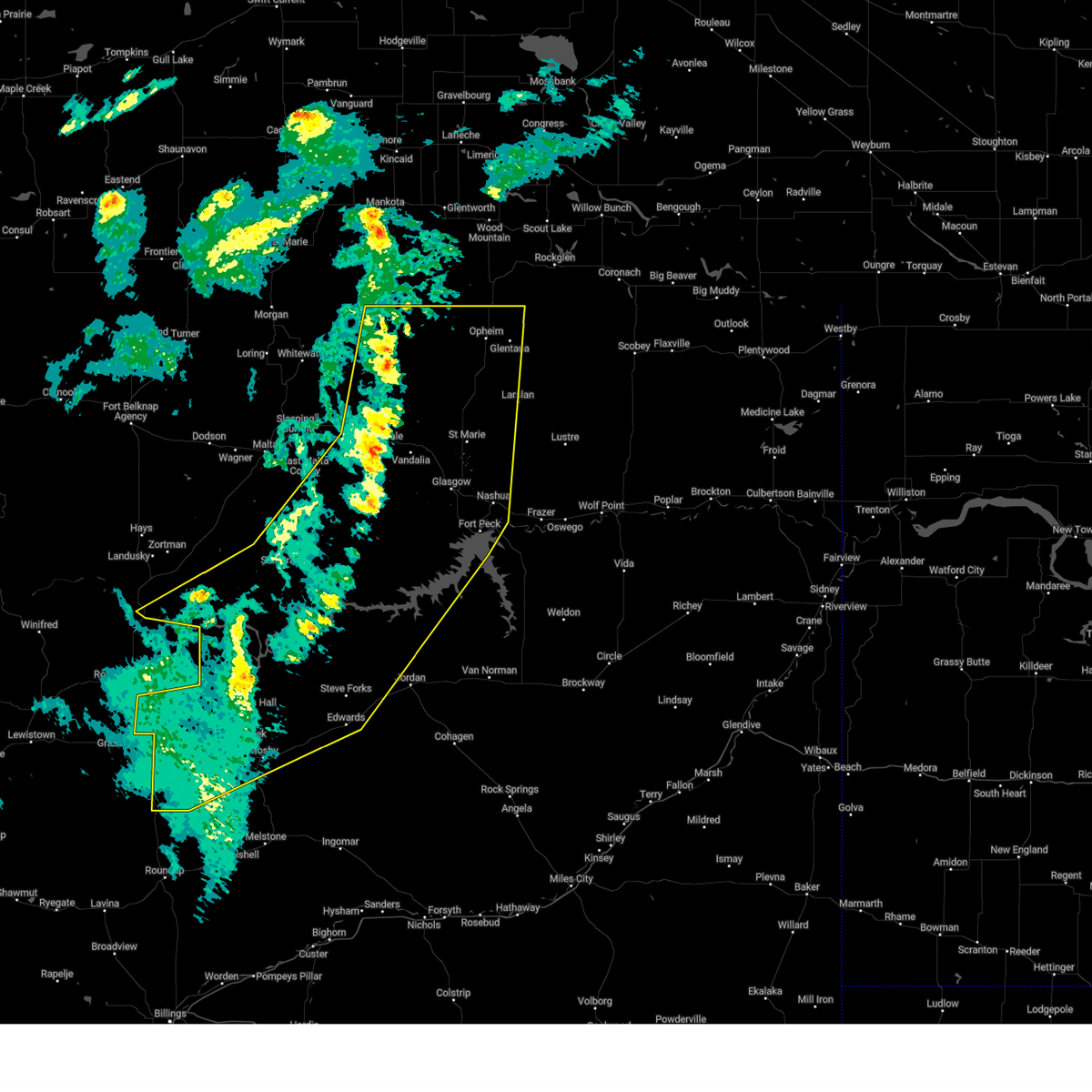
The Top Recent Hail Date for Saco, MT is Friday, June 13, 2025 (2nd out of 26)
Hail and Wind Damage Spotted near Saco, MT
| Date / Time | Report Details |
|---|---|
| 7/2/2025 8:09 PM MDT |
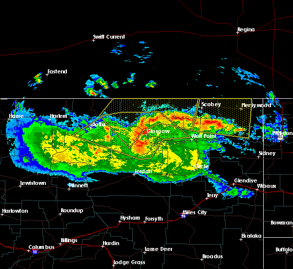
 Svrggw the national weather service in glasgow has issued a * severe thunderstorm warning for, east central phillips county in northeastern montana, northeastern garfield county in northeastern montana, valley county in northeastern montana, northwestern mccone county in northeastern montana, * until 915 pm mdt. * at 808 pm mdt, severe thunderstorms were located along a line extending from 9 miles east of malta to hell creek rec area, moving northeast at 50 mph (radar indicated). Hazards include 70 mph wind gusts. Expect considerable tree damage. Damage is likely to mobile homes, roofs, and outbuildings. Svrggw the national weather service in glasgow has issued a * severe thunderstorm warning for, east central phillips county in northeastern montana, northeastern garfield county in northeastern montana, valley county in northeastern montana, northwestern mccone county in northeastern montana, * until 915 pm mdt. * at 808 pm mdt, severe thunderstorms were located along a line extending from 9 miles east of malta to hell creek rec area, moving northeast at 50 mph (radar indicated). Hazards include 70 mph wind gusts. Expect considerable tree damage. Damage is likely to mobile homes, roofs, and outbuildings.
|
| 6/15/2025 6:50 PM MDT | Montana mesonet near sac in phillips county MT, 0.3 miles SW of Saco, MT |
| 6/15/2025 6:38 PM MDT |
 Svrggw the national weather service in glasgow has issued a * severe thunderstorm warning for, northeastern phillips county in northeastern montana, northwestern valley county in northeastern montana, * until 745 pm mdt. * at 637 pm mdt, severe thunderstorms were located along a line extending from 10 miles southeast of whitewater to 13 miles southwest of saco, moving east at 35 mph (radar indicated). Hazards include 60 mph wind gusts and quarter size hail. Hail damage to vehicles is expected. Expect wind damage to roofs, siding, and trees. Svrggw the national weather service in glasgow has issued a * severe thunderstorm warning for, northeastern phillips county in northeastern montana, northwestern valley county in northeastern montana, * until 745 pm mdt. * at 637 pm mdt, severe thunderstorms were located along a line extending from 10 miles southeast of whitewater to 13 miles southwest of saco, moving east at 35 mph (radar indicated). Hazards include 60 mph wind gusts and quarter size hail. Hail damage to vehicles is expected. Expect wind damage to roofs, siding, and trees.
|
| 5/10/2025 8:17 PM MDT |
 At 817 pm mdt, severe thunderstorms were located along a line extending from 22 miles northwest of port of opheim to 20 miles southwest of opheim to 17 miles northwest of the pines rec area to 9 miles south of mosby, moving east at 40 mph (public). Hazards include 60 mph wind gusts. Expect damage to roofs, siding, and trees. locations impacted include, sand springs, vandalia, fourchette, u l bend rec area, park grove, the bentonite plant, duck creek rec area, glasgow, frenchman reservoir, opheim, nashua, hell creek rec area, sun prairie, st. Marie, brusett, winnett, the pines rec area, petrolia lake, tampico, and hinsdale. At 817 pm mdt, severe thunderstorms were located along a line extending from 22 miles northwest of port of opheim to 20 miles southwest of opheim to 17 miles northwest of the pines rec area to 9 miles south of mosby, moving east at 40 mph (public). Hazards include 60 mph wind gusts. Expect damage to roofs, siding, and trees. locations impacted include, sand springs, vandalia, fourchette, u l bend rec area, park grove, the bentonite plant, duck creek rec area, glasgow, frenchman reservoir, opheim, nashua, hell creek rec area, sun prairie, st. Marie, brusett, winnett, the pines rec area, petrolia lake, tampico, and hinsdale.
|
| 5/10/2025 7:50 PM MDT |
 Svrggw the national weather service in glasgow has issued a * severe thunderstorm warning for, central phillips county in northeastern montana, petroleum county in northeastern montana, western garfield county in northeastern montana, valley county in northeastern montana, northwestern mccone county in northeastern montana, * until 845 pm mdt. * at 750 pm mdt, severe thunderstorms were located along a line extending from 35 miles northeast of port of morgan to 9 miles north of hinsdale to 20 miles northeast of devils creek rec area to 12 miles east of flatwillow, moving northeast at 65 mph (public). Hazards include 60 mph wind gusts. expect damage to roofs, siding, and trees Svrggw the national weather service in glasgow has issued a * severe thunderstorm warning for, central phillips county in northeastern montana, petroleum county in northeastern montana, western garfield county in northeastern montana, valley county in northeastern montana, northwestern mccone county in northeastern montana, * until 845 pm mdt. * at 750 pm mdt, severe thunderstorms were located along a line extending from 35 miles northeast of port of morgan to 9 miles north of hinsdale to 20 miles northeast of devils creek rec area to 12 miles east of flatwillow, moving northeast at 65 mph (public). Hazards include 60 mph wind gusts. expect damage to roofs, siding, and trees
|
| 8/20/2024 9:45 PM MDT |
 the severe thunderstorm warning has been cancelled and is no longer in effect the severe thunderstorm warning has been cancelled and is no longer in effect
|
| 8/20/2024 9:45 PM MDT |
 At 944 pm mdt, severe thunderstorms were located along a line extending from 8 miles south of saco to tampico to near glasgow, moving north at 30 mph (radar indicated). Hazards include 60 mph wind gusts and penny size hail. Expect damage to roofs, siding, and trees. locations impacted include, glasgow, saco, tampico, hinsdale, st. Marie, vandalia, and whatley. At 944 pm mdt, severe thunderstorms were located along a line extending from 8 miles south of saco to tampico to near glasgow, moving north at 30 mph (radar indicated). Hazards include 60 mph wind gusts and penny size hail. Expect damage to roofs, siding, and trees. locations impacted include, glasgow, saco, tampico, hinsdale, st. Marie, vandalia, and whatley.
|
| 8/20/2024 9:16 PM MDT |
 Svrggw the national weather service in glasgow has issued a * severe thunderstorm warning for, east central phillips county in northeastern montana, central valley county in northeastern montana, northwestern mccone county in northeastern montana, * until 1015 pm mdt. * at 915 pm mdt, severe thunderstorms were located along a line extending from 24 miles southeast of malta to 19 miles southwest of tampico to 13 miles northwest of the pines rec area, moving northeast at 45 mph (radar indicated). Hazards include 60 mph wind gusts and nickel size hail. expect damage to roofs, siding, and trees Svrggw the national weather service in glasgow has issued a * severe thunderstorm warning for, east central phillips county in northeastern montana, central valley county in northeastern montana, northwestern mccone county in northeastern montana, * until 1015 pm mdt. * at 915 pm mdt, severe thunderstorms were located along a line extending from 24 miles southeast of malta to 19 miles southwest of tampico to 13 miles northwest of the pines rec area, moving northeast at 45 mph (radar indicated). Hazards include 60 mph wind gusts and nickel size hail. expect damage to roofs, siding, and trees
|
| 7/25/2024 8:03 PM MDT |
 The storms which prompted the warning have weakened below severe limits, and have exited the warned area. therefore, the warning has been allowed to expire. however, gusty winds are still possible with these thunderstorms. a severe thunderstorm watch remains in effect until 1100 pm mdt for northeastern montana. The storms which prompted the warning have weakened below severe limits, and have exited the warned area. therefore, the warning has been allowed to expire. however, gusty winds are still possible with these thunderstorms. a severe thunderstorm watch remains in effect until 1100 pm mdt for northeastern montana.
|
| 7/25/2024 6:55 PM MDT |
 Svrggw the national weather service in glasgow has issued a * severe thunderstorm warning for, eastern phillips county in northeastern montana, northeastern garfield county in northeastern montana, valley county in northeastern montana, * until 800 pm mdt. * at 654 pm mdt, severe thunderstorms were located along a line extending from 10 miles southeast of whitewater to 9 miles northeast of devils creek rec area, moving northeast at 50 mph (radar indicated). Hazards include 70 mph wind gusts and penny size hail. Expect considerable tree damage. Damage is likely to mobile homes, roofs, and outbuildings. Svrggw the national weather service in glasgow has issued a * severe thunderstorm warning for, eastern phillips county in northeastern montana, northeastern garfield county in northeastern montana, valley county in northeastern montana, * until 800 pm mdt. * at 654 pm mdt, severe thunderstorms were located along a line extending from 10 miles southeast of whitewater to 9 miles northeast of devils creek rec area, moving northeast at 50 mph (radar indicated). Hazards include 70 mph wind gusts and penny size hail. Expect considerable tree damage. Damage is likely to mobile homes, roofs, and outbuildings.
|
| 7/25/2024 6:46 PM MDT | Mesonet station mtsco 1.9 e saco (mt dot in phillips county MT, 2.1 miles WNW of Saco, MT |
| 7/25/2024 6:35 PM MDT |
 At 635 pm mdt, severe thunderstorms were located along a line extending from 12 miles northeast of malta to 23 miles north of devils creek rec area, moving northeast at 35 mph (radar indicated). Hazards include 70 mph wind gusts and penny size hail. Expect considerable tree damage. damage is likely to mobile homes, roofs, and outbuildings. Locations impacted include, saco, hinsdale, sleeping buffalo, content, sun prairie, frenchman reservoir, and bowdoin. At 635 pm mdt, severe thunderstorms were located along a line extending from 12 miles northeast of malta to 23 miles north of devils creek rec area, moving northeast at 35 mph (radar indicated). Hazards include 70 mph wind gusts and penny size hail. Expect considerable tree damage. damage is likely to mobile homes, roofs, and outbuildings. Locations impacted include, saco, hinsdale, sleeping buffalo, content, sun prairie, frenchman reservoir, and bowdoin.
|
| 7/25/2024 6:03 PM MDT |
 Svrggw the national weather service in glasgow has issued a * severe thunderstorm warning for, southeastern phillips county in northeastern montana, northwestern valley county in northeastern montana, * until 700 pm mdt. * at 602 pm mdt, severe thunderstorms were located along a line extending from near malta to 10 miles northeast of fourchette, moving northeast at 35 mph (radar indicated). Hazards include 70 mph wind gusts and penny size hail. Expect considerable tree damage. Damage is likely to mobile homes, roofs, and outbuildings. Svrggw the national weather service in glasgow has issued a * severe thunderstorm warning for, southeastern phillips county in northeastern montana, northwestern valley county in northeastern montana, * until 700 pm mdt. * at 602 pm mdt, severe thunderstorms were located along a line extending from near malta to 10 miles northeast of fourchette, moving northeast at 35 mph (radar indicated). Hazards include 70 mph wind gusts and penny size hail. Expect considerable tree damage. Damage is likely to mobile homes, roofs, and outbuildings.
|
| 6/6/2023 3:51 PM MDT |
 The severe thunderstorm warning for northeastern phillips and northwestern valley counties will expire at 400 pm mdt, the storm which prompted the warning has weakened below severe limits, and no longer poses an immediate threat to life or property. therefore, the warning will be allowed to expire. however gusty winds and heavy rain are still possible with this thunderstorm. The severe thunderstorm warning for northeastern phillips and northwestern valley counties will expire at 400 pm mdt, the storm which prompted the warning has weakened below severe limits, and no longer poses an immediate threat to life or property. therefore, the warning will be allowed to expire. however gusty winds and heavy rain are still possible with this thunderstorm.
|
| 6/6/2023 3:25 PM MDT |
 At 324 pm mdt, a severe thunderstorm was located 7 miles east of whitewater, moving east at 15 mph (trained weather spotters). Hazards include 60 mph wind gusts and quarter size hail. Hail damage to vehicles is expected. expect wind damage to roofs, siding, and trees. locations impacted include, whitewater, saco, frenchman reservoir and sleeping buffalo. hail threat, radar indicated max hail size, 1. 00 in wind threat, radar indicated max wind gust, 60 mph. At 324 pm mdt, a severe thunderstorm was located 7 miles east of whitewater, moving east at 15 mph (trained weather spotters). Hazards include 60 mph wind gusts and quarter size hail. Hail damage to vehicles is expected. expect wind damage to roofs, siding, and trees. locations impacted include, whitewater, saco, frenchman reservoir and sleeping buffalo. hail threat, radar indicated max hail size, 1. 00 in wind threat, radar indicated max wind gust, 60 mph.
|
| 6/6/2023 2:55 PM MDT |
 At 254 pm mdt, a severe thunderstorm was located over whitewater, moving east at 15 mph (radar indicated). Hazards include ping pong ball size hail and 60 mph wind gusts. People and animals outdoors will be injured. expect hail damage to roofs, siding, windows, and vehicles. Expect wind damage to roofs, siding, and trees. At 254 pm mdt, a severe thunderstorm was located over whitewater, moving east at 15 mph (radar indicated). Hazards include ping pong ball size hail and 60 mph wind gusts. People and animals outdoors will be injured. expect hail damage to roofs, siding, windows, and vehicles. Expect wind damage to roofs, siding, and trees.
|
| 6/2/2023 7:10 PM MDT |
 The severe thunderstorm warning for east central phillips and west central valley counties will expire at 715 pm mdt, the storm which prompted the warning has weakened below severe limits, and no longer poses an immediate threat to life or property. therefore, the warning will be allowed to expire. however heavy rain is still possible with this thunderstorm. The severe thunderstorm warning for east central phillips and west central valley counties will expire at 715 pm mdt, the storm which prompted the warning has weakened below severe limits, and no longer poses an immediate threat to life or property. therefore, the warning will be allowed to expire. however heavy rain is still possible with this thunderstorm.
|
| 6/2/2023 6:45 PM MDT |
 At 644 pm mdt, a severe thunderstorm was located near hinsdale, or 27 miles northwest of glasgow, moving northwest at 30 mph (the mesonet site at king coulee recorded a wind gust of 67 mph at 5:44 pm). Hazards include 60 mph wind gusts and penny size hail. Expect damage to roofs, siding, and trees. locations impacted include, saco, hinsdale, vandalia and frenchman reservoir. hail threat, radar indicated max hail size, 0. 75 in wind threat, radar indicated max wind gust, 60 mph. At 644 pm mdt, a severe thunderstorm was located near hinsdale, or 27 miles northwest of glasgow, moving northwest at 30 mph (the mesonet site at king coulee recorded a wind gust of 67 mph at 5:44 pm). Hazards include 60 mph wind gusts and penny size hail. Expect damage to roofs, siding, and trees. locations impacted include, saco, hinsdale, vandalia and frenchman reservoir. hail threat, radar indicated max hail size, 0. 75 in wind threat, radar indicated max wind gust, 60 mph.
|
| 6/2/2023 6:23 PM MDT |
 At 622 pm mdt, a severe thunderstorm was located 7 miles west of tampico, or 17 miles west of glasgow, moving northwest at 30 mph (mesonet site at king coulee recorded a wind gust of 67 mph at 5:44 pm). Hazards include 60 mph wind gusts and penny size hail. expect damage to roofs, siding, and trees At 622 pm mdt, a severe thunderstorm was located 7 miles west of tampico, or 17 miles west of glasgow, moving northwest at 30 mph (mesonet site at king coulee recorded a wind gust of 67 mph at 5:44 pm). Hazards include 60 mph wind gusts and penny size hail. expect damage to roofs, siding, and trees
|
| 7/18/2022 4:32 PM MDT |
 At 431 pm mdt, a severe thunderstorm was located 13 miles west of saco, or 14 miles northeast of malta, moving northeast at 55 mph (radar indicated). Hazards include 60 mph wind gusts and nickel size hail. Expect damage to roofs, siding, and trees. locations impacted include, saco, frenchman reservoir, bowdoin and sleeping buffalo. hail threat, radar indicated max hail size, 0. 88 in wind threat, radar indicated max wind gust, 60 mph. At 431 pm mdt, a severe thunderstorm was located 13 miles west of saco, or 14 miles northeast of malta, moving northeast at 55 mph (radar indicated). Hazards include 60 mph wind gusts and nickel size hail. Expect damage to roofs, siding, and trees. locations impacted include, saco, frenchman reservoir, bowdoin and sleeping buffalo. hail threat, radar indicated max hail size, 0. 88 in wind threat, radar indicated max wind gust, 60 mph.
|
| 7/18/2022 4:29 PM MDT |
 At 429 pm mdt, a severe thunderstorm was located 18 miles southeast of malta, moving east at 60 mph (radar indicated). Hazards include 70 mph wind gusts and nickel size hail. Expect considerable tree damage. Damage is likely to mobile homes, roofs, and outbuildings. At 429 pm mdt, a severe thunderstorm was located 18 miles southeast of malta, moving east at 60 mph (radar indicated). Hazards include 70 mph wind gusts and nickel size hail. Expect considerable tree damage. Damage is likely to mobile homes, roofs, and outbuildings.
|
| 7/18/2022 4:01 PM MDT |
 At 400 pm mdt, a severe thunderstorm was located 12 miles southeast of dodson, or 14 miles southwest of malta, moving northeast at 55 mph (radar indicated). Hazards include 60 mph wind gusts and nickel size hail. expect damage to roofs, siding, and trees At 400 pm mdt, a severe thunderstorm was located 12 miles southeast of dodson, or 14 miles southwest of malta, moving northeast at 55 mph (radar indicated). Hazards include 60 mph wind gusts and nickel size hail. expect damage to roofs, siding, and trees
|
| 7/9/2022 9:06 PM MDT | Via saco mt dot sit in phillips county MT, 2.1 miles WNW of Saco, MT |
| 7/9/2022 8:49 PM MDT |
 At 848 pm mdt, a severe thunderstorm was located 7 miles north of malta, moving east at 35 mph (radar indicated. this storm has a history of 78 mph winds). Hazards include 70 mph wind gusts and quarter size hail. Hail damage to vehicles is expected. expect considerable tree damage. Wind damage is also likely to mobile homes, roofs, and outbuildings. At 848 pm mdt, a severe thunderstorm was located 7 miles north of malta, moving east at 35 mph (radar indicated. this storm has a history of 78 mph winds). Hazards include 70 mph wind gusts and quarter size hail. Hail damage to vehicles is expected. expect considerable tree damage. Wind damage is also likely to mobile homes, roofs, and outbuildings.
|
| 7/9/2022 7:53 PM MDT |
 At 753 pm mdt, severe thunderstorms were located along a line extending from 20 miles northeast of chinook to near harlem to 17 miles south of fort belknap, moving east at 45 mph (radar indicated). Hazards include 60 mph wind gusts and quarter size hail. Hail damage to vehicles is expected. Expect wind damage to roofs, siding, and trees. At 753 pm mdt, severe thunderstorms were located along a line extending from 20 miles northeast of chinook to near harlem to 17 miles south of fort belknap, moving east at 45 mph (radar indicated). Hazards include 60 mph wind gusts and quarter size hail. Hail damage to vehicles is expected. Expect wind damage to roofs, siding, and trees.
|
| 7/8/2022 10:12 PM MDT |
 The severe thunderstorm warning for northeastern phillips and northwestern valley counties will expire at 1015 pm mdt, the storm which prompted the warning has weakened below severe limits, and no longer poses an immediate threat to life or property. therefore, the warning will be allowed to expire. however gusty winds are still possible with this thunderstorm. a severe thunderstorm watch remains in effect until 300 am mdt for northeastern montana. The severe thunderstorm warning for northeastern phillips and northwestern valley counties will expire at 1015 pm mdt, the storm which prompted the warning has weakened below severe limits, and no longer poses an immediate threat to life or property. therefore, the warning will be allowed to expire. however gusty winds are still possible with this thunderstorm. a severe thunderstorm watch remains in effect until 300 am mdt for northeastern montana.
|
| 7/8/2022 10:07 PM MDT |
 At 1004 pm mdt, severe thunderstorms were located along a line extending from near hinsdale to 12 miles west of the pines rec area, moving east at 65 mph. these are destructive storms for central valley county including the city of glasgow and hinsdale (radar indicated). Hazards include 80 mph wind gusts and penny size hail. Flying debris will be dangerous to those caught without shelter. mobile homes will be heavily damaged. expect considerable damage to roofs, windows, and vehicles. Extensive tree damage and power outages are likely. At 1004 pm mdt, severe thunderstorms were located along a line extending from near hinsdale to 12 miles west of the pines rec area, moving east at 65 mph. these are destructive storms for central valley county including the city of glasgow and hinsdale (radar indicated). Hazards include 80 mph wind gusts and penny size hail. Flying debris will be dangerous to those caught without shelter. mobile homes will be heavily damaged. expect considerable damage to roofs, windows, and vehicles. Extensive tree damage and power outages are likely.
|
| 7/8/2022 9:49 PM MDT |
 At 947 pm mdt, a severe thunderstorm was located 29 miles northeast of devils creek rec area, or 34 miles southwest of glasgow, moving east at 50 mph. this is a destructive storm for southwest valley county (radar indicated). Hazards include 80 mph wind gusts and penny size hail. Flying debris will be dangerous to those caught without shelter. mobile homes will be heavily damaged. expect considerable damage to roofs, windows, and vehicles. extensive tree damage and power outages are likely. locations impacted include, saco, devils creek rec area, hell creek rec area, hinsdale, content, sun prairie and the bentonite plant. thunderstorm damage threat, destructive hail threat, radar indicated max hail size, 0. 75 in wind threat, radar indicated max wind gust, 80 mph. At 947 pm mdt, a severe thunderstorm was located 29 miles northeast of devils creek rec area, or 34 miles southwest of glasgow, moving east at 50 mph. this is a destructive storm for southwest valley county (radar indicated). Hazards include 80 mph wind gusts and penny size hail. Flying debris will be dangerous to those caught without shelter. mobile homes will be heavily damaged. expect considerable damage to roofs, windows, and vehicles. extensive tree damage and power outages are likely. locations impacted include, saco, devils creek rec area, hell creek rec area, hinsdale, content, sun prairie and the bentonite plant. thunderstorm damage threat, destructive hail threat, radar indicated max hail size, 0. 75 in wind threat, radar indicated max wind gust, 80 mph.
|
| 7/8/2022 9:15 PM MDT |
 At 914 pm mdt, a severe thunderstorm was located 8 miles northwest of dodson, or 24 miles northwest of malta, moving east at 50 mph. this is a destructive storm for dodson and surrounding areas (radar indicated). Hazards include 80 mph wind gusts and nickel size hail. Flying debris will be dangerous to those caught without shelter. mobile homes will be heavily damaged. expect considerable damage to roofs, windows, and vehicles. Extensive tree damage and power outages are likely. At 914 pm mdt, a severe thunderstorm was located 8 miles northwest of dodson, or 24 miles northwest of malta, moving east at 50 mph. this is a destructive storm for dodson and surrounding areas (radar indicated). Hazards include 80 mph wind gusts and nickel size hail. Flying debris will be dangerous to those caught without shelter. mobile homes will be heavily damaged. expect considerable damage to roofs, windows, and vehicles. Extensive tree damage and power outages are likely.
|
| 7/8/2022 9:11 PM MDT |
 At 910 pm mdt, a severe thunderstorm was located near fourchette, or 28 miles east of zortman, moving east at 50 mph (radar indicated). Hazards include 60 mph wind gusts and quarter size hail. Hail damage to vehicles is expected. Expect wind damage to roofs, siding, and trees. At 910 pm mdt, a severe thunderstorm was located near fourchette, or 28 miles east of zortman, moving east at 50 mph (radar indicated). Hazards include 60 mph wind gusts and quarter size hail. Hail damage to vehicles is expected. Expect wind damage to roofs, siding, and trees.
|
| 7/5/2022 5:02 PM MDT |
 At 502 pm mdt, a severe thunderstorm was located near saco, or 26 miles east of malta, moving east at 30 mph (radar indicated). Hazards include 60 mph wind gusts and quarter size hail. Hail damage to vehicles is expected. expect wind damage to roofs, siding, and trees. locations impacted include, saco. hail threat, radar indicated max hail size, 1. 00 in wind threat, radar indicated max wind gust, 60 mph. At 502 pm mdt, a severe thunderstorm was located near saco, or 26 miles east of malta, moving east at 30 mph (radar indicated). Hazards include 60 mph wind gusts and quarter size hail. Hail damage to vehicles is expected. expect wind damage to roofs, siding, and trees. locations impacted include, saco. hail threat, radar indicated max hail size, 1. 00 in wind threat, radar indicated max wind gust, 60 mph.
|
| 7/5/2022 4:45 PM MDT |
 At 445 pm mdt, a severe thunderstorm was located 10 miles southwest of saco, or 17 miles east of malta, moving east at 30 mph (radar indicated). Hazards include 60 mph wind gusts and quarter size hail. Hail damage to vehicles is expected. expect wind damage to roofs, siding, and trees. Locations impacted include, saco, bowdoin and sleeping buffalo. At 445 pm mdt, a severe thunderstorm was located 10 miles southwest of saco, or 17 miles east of malta, moving east at 30 mph (radar indicated). Hazards include 60 mph wind gusts and quarter size hail. Hail damage to vehicles is expected. expect wind damage to roofs, siding, and trees. Locations impacted include, saco, bowdoin and sleeping buffalo.
|
| 7/5/2022 4:32 PM MDT |
 At 432 pm mdt, a severe thunderstorm was located 11 miles east of malta, moving east at 30 mph (radar indicated). Hazards include 60 mph wind gusts and quarter size hail. Hail damage to vehicles is expected. expect wind damage to roofs, siding, and trees. Locations impacted include, saco, bowdoin and sleeping buffalo. At 432 pm mdt, a severe thunderstorm was located 11 miles east of malta, moving east at 30 mph (radar indicated). Hazards include 60 mph wind gusts and quarter size hail. Hail damage to vehicles is expected. expect wind damage to roofs, siding, and trees. Locations impacted include, saco, bowdoin and sleeping buffalo.
|
| 7/5/2022 4:18 PM MDT |
 At 417 pm mdt, a severe thunderstorm was located near malta, moving east at 30 mph (trained weather spotters). Hazards include 60 mph wind gusts and quarter size hail. Hail damage to vehicles is expected. Expect wind damage to roofs, siding, and trees. At 417 pm mdt, a severe thunderstorm was located near malta, moving east at 30 mph (trained weather spotters). Hazards include 60 mph wind gusts and quarter size hail. Hail damage to vehicles is expected. Expect wind damage to roofs, siding, and trees.
|
| 6/23/2022 5:44 PM MDT |
 At 543 pm mdt, a severe thunderstorm was located near hinsdale, or 27 miles northwest of glasgow, moving northeast at 55 mph (radar indicated). Hazards include 60 mph wind gusts and quarter size hail. Hail damage to vehicles is expected. expect wind damage to roofs, siding, and trees. locations impacted include, saco, hinsdale and vandalia. hail threat, radar indicated max hail size, 1. 00 in wind threat, radar indicated max wind gust, 60 mph. At 543 pm mdt, a severe thunderstorm was located near hinsdale, or 27 miles northwest of glasgow, moving northeast at 55 mph (radar indicated). Hazards include 60 mph wind gusts and quarter size hail. Hail damage to vehicles is expected. expect wind damage to roofs, siding, and trees. locations impacted include, saco, hinsdale and vandalia. hail threat, radar indicated max hail size, 1. 00 in wind threat, radar indicated max wind gust, 60 mph.
|
| 6/23/2022 5:12 PM MDT |
 At 512 pm mdt, a severe thunderstorm was located 12 miles southeast of malta, moving northeast at 55 mph (radar indicated). Hazards include 60 mph wind gusts and quarter size hail. Hail damage to vehicles is expected. Expect wind damage to roofs, siding, and trees. At 512 pm mdt, a severe thunderstorm was located 12 miles southeast of malta, moving northeast at 55 mph (radar indicated). Hazards include 60 mph wind gusts and quarter size hail. Hail damage to vehicles is expected. Expect wind damage to roofs, siding, and trees.
|
| 6/19/2022 12:07 AM MDT |
 At 1206 am mdt, a severe thunderstorm was located 12 miles southwest of hinsdale, or 26 miles west of glasgow, moving northeast at 35 mph (radar indicated). Hazards include 70 mph wind gusts and half dollar size hail. Hail damage to vehicles is expected. expect considerable tree damage. Wind damage is also likely to mobile homes, roofs, and outbuildings. At 1206 am mdt, a severe thunderstorm was located 12 miles southwest of hinsdale, or 26 miles west of glasgow, moving northeast at 35 mph (radar indicated). Hazards include 70 mph wind gusts and half dollar size hail. Hail damage to vehicles is expected. expect considerable tree damage. Wind damage is also likely to mobile homes, roofs, and outbuildings.
|
| 7/8/2021 2:42 PM MDT |
 At 242 pm mdt, severe thunderstorms were located along a line extending from 18 miles west of opheim to near hinsdale, moving southeast at 40 mph (radar indicated). Hazards include 70 mph wind gusts and quarter size hail. Hail damage to vehicles is expected. expect considerable tree damage. wind damage is also likely to mobile homes, roofs, and outbuildings. Locations impacted include, saco, hinsdale, vandalia and frenchman reservoir. At 242 pm mdt, severe thunderstorms were located along a line extending from 18 miles west of opheim to near hinsdale, moving southeast at 40 mph (radar indicated). Hazards include 70 mph wind gusts and quarter size hail. Hail damage to vehicles is expected. expect considerable tree damage. wind damage is also likely to mobile homes, roofs, and outbuildings. Locations impacted include, saco, hinsdale, vandalia and frenchman reservoir.
|
| 7/8/2021 2:29 PM MDT | Ping Pong Ball sized hail reported 0.3 miles SW of Saco, MT, quarter to ping-pong ball sized hail reported on social media. time estimated from radar. |
| 7/8/2021 2:27 PM MDT | Quarter sized hail reported 18.1 miles SSW of Saco, MT |
| 7/8/2021 2:26 PM MDT | Quarter sized hail reported 2.1 miles E of Saco, MT, quarter sized hail report from social media. time estimated from radar. |
| 7/8/2021 2:26 PM MDT | Quarter sized hail reported 0.9 miles SSE of Saco, MT, cooperative observer reports quarter size hail. |
| 7/8/2021 2:11 PM MDT |
 At 211 pm mdt, severe thunderstorms were located along a line extending from 27 miles northeast of whitewater to 7 miles southwest of saco, moving east at 15 mph (radar indicated). Hazards include 60 mph wind gusts and quarter size hail. Hail damage to vehicles is expected. Expect wind damage to roofs, siding, and trees. At 211 pm mdt, severe thunderstorms were located along a line extending from 27 miles northeast of whitewater to 7 miles southwest of saco, moving east at 15 mph (radar indicated). Hazards include 60 mph wind gusts and quarter size hail. Hail damage to vehicles is expected. Expect wind damage to roofs, siding, and trees.
|
| 7/8/2021 2:10 PM MDT | Quarter sized hail reported 18.9 miles S of Saco, MT, most of the hail is pea size... but there are a few up to the size of quarters. |
| 6/9/2021 11:28 PM MDT |
 At 1128 pm mdt, a severe thunderstorm was located 16 miles north of fourchette, or 27 miles south of malta, moving northeast at 40 mph (radar indicated). Hazards include ping pong ball size hail and 60 mph wind gusts. People and animals outdoors will be injured. expect hail damage to roofs, siding, windows, and vehicles. Expect wind damage to roofs, siding, and trees. At 1128 pm mdt, a severe thunderstorm was located 16 miles north of fourchette, or 27 miles south of malta, moving northeast at 40 mph (radar indicated). Hazards include ping pong ball size hail and 60 mph wind gusts. People and animals outdoors will be injured. expect hail damage to roofs, siding, windows, and vehicles. Expect wind damage to roofs, siding, and trees.
|
| 6/8/2021 6:43 PM MDT |
 At 642 pm mdt, a severe thunderstorm was located 11 miles southeast of whitewater, moving north at 45 mph (radar indicated). Hazards include 60 mph wind gusts and quarter size hail. Hail damage to vehicles is expected. expect wind damage to roofs, siding, and trees. Locations impacted include, whitewater, saco, loring, frenchman reservoir and sleeping buffalo. At 642 pm mdt, a severe thunderstorm was located 11 miles southeast of whitewater, moving north at 45 mph (radar indicated). Hazards include 60 mph wind gusts and quarter size hail. Hail damage to vehicles is expected. expect wind damage to roofs, siding, and trees. Locations impacted include, whitewater, saco, loring, frenchman reservoir and sleeping buffalo.
|
| 6/8/2021 6:16 PM MDT |
 At 615 pm mdt, a severe thunderstorm was located 13 miles southwest of hinsdale, or 28 miles west of glasgow, moving north at 45 mph (radar indicated). Hazards include 60 mph wind gusts and quarter size hail. Hail damage to vehicles is expected. Expect wind damage to roofs, siding, and trees. At 615 pm mdt, a severe thunderstorm was located 13 miles southwest of hinsdale, or 28 miles west of glasgow, moving north at 45 mph (radar indicated). Hazards include 60 mph wind gusts and quarter size hail. Hail damage to vehicles is expected. Expect wind damage to roofs, siding, and trees.
|
| 8/20/2020 9:21 PM MDT |
 At 921 pm mdt, severe thunderstorms were located along a line extending from 17 miles north of hinsdale to near glasgow to 13 miles northwest of flowing wells rest area, moving east at 40 mph (radar indicated). Hazards include 70 mph wind gusts. Expect considerable tree damage. damage is likely to mobile homes, roofs, and outbuildings. locations impacted include, glasgow, nashua, fort peck, saco, the pines rec area, tampico, hinsdale, duck creek rec area, fort peck marina, hell creek rec area, frazer, nelson creek rec area, st. Marie, rock creek rec area, vandalia, sleeping buffalo, park grove, the bentonite plant, haxby and weldon. At 921 pm mdt, severe thunderstorms were located along a line extending from 17 miles north of hinsdale to near glasgow to 13 miles northwest of flowing wells rest area, moving east at 40 mph (radar indicated). Hazards include 70 mph wind gusts. Expect considerable tree damage. damage is likely to mobile homes, roofs, and outbuildings. locations impacted include, glasgow, nashua, fort peck, saco, the pines rec area, tampico, hinsdale, duck creek rec area, fort peck marina, hell creek rec area, frazer, nelson creek rec area, st. Marie, rock creek rec area, vandalia, sleeping buffalo, park grove, the bentonite plant, haxby and weldon.
|
| 8/20/2020 9:03 PM MDT | Mesonet station 269005 1 e sac in phillips county MT, 2.1 miles WNW of Saco, MT |
| 8/20/2020 8:49 PM MDT |
 At 847 pm mdt, severe thunderstorms were located along a line extending from 7 miles northwest of saco to 14 miles southwest of tampico to 9 miles northwest of jordan, moving east at 50 mph (radar indicated). Hazards include 60 mph wind gusts and penny size hail. expect damage to roofs, siding, and trees At 847 pm mdt, severe thunderstorms were located along a line extending from 7 miles northwest of saco to 14 miles southwest of tampico to 9 miles northwest of jordan, moving east at 50 mph (radar indicated). Hazards include 60 mph wind gusts and penny size hail. expect damage to roofs, siding, and trees
|
| 7/25/2020 1:47 AM MDT |
 At 147 am mdt, severe thunderstorms were located along a line extending from 7 miles northwest of saco to 14 miles northeast of devils creek rec area, moving east at 50 mph (radar indicated). Hazards include 60 mph wind gusts. Expect damage to roofs, siding, and trees. Locations impacted include, saco, tampico, hinsdale, vandalia, sleeping buffalo, content, the bentonite plant and bowdoin. At 147 am mdt, severe thunderstorms were located along a line extending from 7 miles northwest of saco to 14 miles northeast of devils creek rec area, moving east at 50 mph (radar indicated). Hazards include 60 mph wind gusts. Expect damage to roofs, siding, and trees. Locations impacted include, saco, tampico, hinsdale, vandalia, sleeping buffalo, content, the bentonite plant and bowdoin.
|
| 7/25/2020 1:18 AM MDT |
 At 117 am mdt, severe thunderstorms were located along a line extending from 9 miles north of malta to fourchette, moving east at 50 mph (radar indicated). Hazards include 60 mph wind gusts. expect damage to roofs, siding, and trees At 117 am mdt, severe thunderstorms were located along a line extending from 9 miles north of malta to fourchette, moving east at 50 mph (radar indicated). Hazards include 60 mph wind gusts. expect damage to roofs, siding, and trees
|
| 7/7/2020 5:25 PM MDT | Siding and shingles peeled off hous in phillips county MT, 18.1 miles SSW of Saco, MT |
| 7/7/2020 5:24 PM MDT | Wind pushed harrow 200 feet and picked up a grain bin and carried it over a wind break. wind also carried a few bulls... some other buildings... and a junk pile 300 yar in phillips county MT, 0.9 miles S of Saco, MT |
| 7/7/2020 5:18 PM MDT | Mesonet station mtsco 1.9 e saco (mt dot in phillips county MT, 2.1 miles WNW of Saco, MT |
| 7/7/2020 5:12 PM MDT |
 At 511 pm mdt, severe thunderstorms were located along a line extending from 14 miles west of port of morgan to 11 miles northwest of saco to 12 miles southwest of hinsdale, moving east at 60 mph. these are very dangerous storms (awos mesonet). Hazards include 90 mph wind gusts and half dollar size hail. You are in a life-threatening situation. flying debris may be deadly to those caught without shelter. mobile homes will be heavily damaged or destroyed. homes and businesses will have substantial roof and window damage. Expect extensive tree damage and power outages. At 511 pm mdt, severe thunderstorms were located along a line extending from 14 miles west of port of morgan to 11 miles northwest of saco to 12 miles southwest of hinsdale, moving east at 60 mph. these are very dangerous storms (awos mesonet). Hazards include 90 mph wind gusts and half dollar size hail. You are in a life-threatening situation. flying debris may be deadly to those caught without shelter. mobile homes will be heavily damaged or destroyed. homes and businesses will have substantial roof and window damage. Expect extensive tree damage and power outages.
|
| 7/7/2020 5:05 PM MDT |
 At 504 pm mdt, a severe thunderstorm was located over malta, moving northeast at 45 mph. this is a very dangerous storm (awos mesonet). Hazards include 90 mph wind gusts and half dollar size hail. You are in a life-threatening situation. flying debris may be deadly to those caught without shelter. mobile homes will be heavily damaged or destroyed. homes and businesses will have substantial roof and window damage. expect extensive tree damage and power outages. Locations impacted include, malta, saco, dodson, bowdoin, sleeping buffalo and wagner. At 504 pm mdt, a severe thunderstorm was located over malta, moving northeast at 45 mph. this is a very dangerous storm (awos mesonet). Hazards include 90 mph wind gusts and half dollar size hail. You are in a life-threatening situation. flying debris may be deadly to those caught without shelter. mobile homes will be heavily damaged or destroyed. homes and businesses will have substantial roof and window damage. expect extensive tree damage and power outages. Locations impacted include, malta, saco, dodson, bowdoin, sleeping buffalo and wagner.
|
| 7/7/2020 4:33 PM MDT |
 At 433 pm mdt, a severe thunderstorm was located 15 miles south of dodson, or 20 miles north of zortman, moving northeast at 45 mph (radar indicated). Hazards include 70 mph wind gusts and half dollar size hail. Hail damage to vehicles is expected. expect considerable tree damage. Wind damage is also likely to mobile homes, roofs, and outbuildings. At 433 pm mdt, a severe thunderstorm was located 15 miles south of dodson, or 20 miles north of zortman, moving northeast at 45 mph (radar indicated). Hazards include 70 mph wind gusts and half dollar size hail. Hail damage to vehicles is expected. expect considerable tree damage. Wind damage is also likely to mobile homes, roofs, and outbuildings.
|
| 6/27/2020 8:03 PM MDT | Some fences were blown away by strong winds. saco us-2 station reported a wind gust of 55 mph. report of damages from social medi in phillips county MT, 3.1 miles E of Saco, MT |
| 5/20/2020 10:07 PM MDT |
 At 1006 pm mdt, severe thunderstorms were located along a line extending from 6 miles west of tampico to 24 miles southwest of port of opheim to near opheim to 8 miles northeast of peerless, moving north at 35 mph (radar indicated). Hazards include 60 mph wind gusts. Expect damage to roofs, siding, and trees. Locations impacted include, opheim, richland, saco, hinsdale, port of opheim, peerless, vandalia, thoeny, four buttes, frenchman reservoir and glentana. At 1006 pm mdt, severe thunderstorms were located along a line extending from 6 miles west of tampico to 24 miles southwest of port of opheim to near opheim to 8 miles northeast of peerless, moving north at 35 mph (radar indicated). Hazards include 60 mph wind gusts. Expect damage to roofs, siding, and trees. Locations impacted include, opheim, richland, saco, hinsdale, port of opheim, peerless, vandalia, thoeny, four buttes, frenchman reservoir and glentana.
|
| 5/20/2020 9:42 PM MDT |
 At 941 pm mdt, severe thunderstorms were located along a line extending from 24 miles southwest of tampico to 7 miles south of hinsdale to 15 miles south of opheim, moving northwest at 60 mph (trained weather spotters). Hazards include 70 mph wind gusts. Expect considerable tree damage. damage is likely to mobile homes, roofs, and outbuildings. locations impacted include, glasgow, saco, tampico, hinsdale, st. Marie, vandalia, the bentonite plant, baylor and larslan. At 941 pm mdt, severe thunderstorms were located along a line extending from 24 miles southwest of tampico to 7 miles south of hinsdale to 15 miles south of opheim, moving northwest at 60 mph (trained weather spotters). Hazards include 70 mph wind gusts. Expect considerable tree damage. damage is likely to mobile homes, roofs, and outbuildings. locations impacted include, glasgow, saco, tampico, hinsdale, st. Marie, vandalia, the bentonite plant, baylor and larslan.
|
| 5/20/2020 9:33 PM MDT |
 At 932 pm mdt, severe thunderstorms were located along a line extending from 18 miles southwest of glasgow to 11 miles north of tampico to 14 miles northeast of st. marie to 14 miles northeast of lustre, moving north at 35 mph (radar indicated). Hazards include 70 mph wind gusts. Expect considerable tree damage. Damage is likely to mobile homes, roofs, and outbuildings. At 932 pm mdt, severe thunderstorms were located along a line extending from 18 miles southwest of glasgow to 11 miles north of tampico to 14 miles northeast of st. marie to 14 miles northeast of lustre, moving north at 35 mph (radar indicated). Hazards include 70 mph wind gusts. Expect considerable tree damage. Damage is likely to mobile homes, roofs, and outbuildings.
|
| 5/20/2020 9:29 PM MDT |
 At 929 pm mdt, severe thunderstorms were located along a line extending from 17 miles west of the pines rec area to 15 miles west of glasgow to 9 miles northeast of tampico to 14 miles northeast of st. marie, moving northwest at 60 mph (trained weather spotters). Hazards include 70 mph wind gusts. Expect considerable tree damage. damage is likely to mobile homes, roofs, and outbuildings. locations impacted include, glasgow, malta, nashua, fort peck, saco, the pines rec area, tampico, hinsdale, duck creek rec area, fort peck marina, st. Marie, vandalia, sleeping buffalo, park grove, the bentonite plant, content, baylor, bowdoin, larslan and whatley. At 929 pm mdt, severe thunderstorms were located along a line extending from 17 miles west of the pines rec area to 15 miles west of glasgow to 9 miles northeast of tampico to 14 miles northeast of st. marie, moving northwest at 60 mph (trained weather spotters). Hazards include 70 mph wind gusts. Expect considerable tree damage. damage is likely to mobile homes, roofs, and outbuildings. locations impacted include, glasgow, malta, nashua, fort peck, saco, the pines rec area, tampico, hinsdale, duck creek rec area, fort peck marina, st. Marie, vandalia, sleeping buffalo, park grove, the bentonite plant, content, baylor, bowdoin, larslan and whatley.
|
| 5/20/2020 9:13 PM MDT |
 At 912 pm mdt, severe thunderstorms were located along a line extending from 19 miles northeast of devils creek rec area to 16 miles southwest of glasgow to near nashua to 6 miles northeast of frazer, moving northwest at 60 mph. these are very dangerous storms (trained weather spotters). Hazards include 80 mph wind gusts. Flying debris will be dangerous to those caught without shelter. mobile homes will be heavily damaged. expect considerable damage to roofs, windows, and vehicles. extensive tree damage and power outages are likely. locations impacted include, glasgow, wolf point, malta, nashua, fort peck, saco, duck creek rec area, hell creek rec area, st. Marie, the pines rec area, tampico, hinsdale, fort peck marina, frazer, vandalia, park grove, the bentonite plant, bowdoin, larslan and oswego. At 912 pm mdt, severe thunderstorms were located along a line extending from 19 miles northeast of devils creek rec area to 16 miles southwest of glasgow to near nashua to 6 miles northeast of frazer, moving northwest at 60 mph. these are very dangerous storms (trained weather spotters). Hazards include 80 mph wind gusts. Flying debris will be dangerous to those caught without shelter. mobile homes will be heavily damaged. expect considerable damage to roofs, windows, and vehicles. extensive tree damage and power outages are likely. locations impacted include, glasgow, wolf point, malta, nashua, fort peck, saco, duck creek rec area, hell creek rec area, st. Marie, the pines rec area, tampico, hinsdale, fort peck marina, frazer, vandalia, park grove, the bentonite plant, bowdoin, larslan and oswego.
|
| 5/20/2020 8:44 PM MDT |
 At 844 pm mdt, severe thunderstorms were located along a line extending from 10 miles southwest of hell creek rec area to 6 miles south of the pines rec area to 8 miles east of rock creek rec area to near vida, moving northwest at 60 mph. these are very dangerous storms (trained weather spotters). Hazards include 80 mph wind gusts. Flying debris will be dangerous to those caught without shelter. mobile homes will be heavily damaged. expect considerable damage to roofs, windows, and vehicles. Extensive tree damage and power outages are likely. At 844 pm mdt, severe thunderstorms were located along a line extending from 10 miles southwest of hell creek rec area to 6 miles south of the pines rec area to 8 miles east of rock creek rec area to near vida, moving northwest at 60 mph. these are very dangerous storms (trained weather spotters). Hazards include 80 mph wind gusts. Flying debris will be dangerous to those caught without shelter. mobile homes will be heavily damaged. expect considerable damage to roofs, windows, and vehicles. Extensive tree damage and power outages are likely.
|
| 7/16/2019 2:36 PM MDT |
 At 235 pm mdt, a severe thunderstorm was located near hinsdale, or 28 miles northwest of glasgow, moving east at 30 mph (radar indicated). Hazards include 60 mph wind gusts and quarter size hail. Hail damage to vehicles is expected. expect wind damage to roofs, siding, and trees. locations impacted include, saco, hinsdale, st. Marie and vandalia. At 235 pm mdt, a severe thunderstorm was located near hinsdale, or 28 miles northwest of glasgow, moving east at 30 mph (radar indicated). Hazards include 60 mph wind gusts and quarter size hail. Hail damage to vehicles is expected. expect wind damage to roofs, siding, and trees. locations impacted include, saco, hinsdale, st. Marie and vandalia.
|
| 7/16/2019 2:14 PM MDT |
 The national weather service in glasgow has issued a * severe thunderstorm warning for. east central phillips county in northeastern montana. west central valley county in northeastern montana. until 315 pm mdt. At 213 pm mdt, a severe thunderstorm was located over saco, or 23. The national weather service in glasgow has issued a * severe thunderstorm warning for. east central phillips county in northeastern montana. west central valley county in northeastern montana. until 315 pm mdt. At 213 pm mdt, a severe thunderstorm was located over saco, or 23.
|
| 7/13/2019 7:11 PM MDT |
 At 711 pm mdt, severe thunderstorms were located along a line extending from 17 miles southeast of malta to 19 miles northwest of hell creek rec area, moving northeast at 50 mph (radar indicated). Hazards include 70 mph wind gusts. Expect considerable tree damage. damage is likely to mobile homes, roofs, and outbuildings. locations impacted include, glasgow, fort peck, saco, fort peck marina, tampico, hinsdale, duck creek rec area, st. Marie, vandalia, park grove, the bentonite plant and whatley. At 711 pm mdt, severe thunderstorms were located along a line extending from 17 miles southeast of malta to 19 miles northwest of hell creek rec area, moving northeast at 50 mph (radar indicated). Hazards include 70 mph wind gusts. Expect considerable tree damage. damage is likely to mobile homes, roofs, and outbuildings. locations impacted include, glasgow, fort peck, saco, fort peck marina, tampico, hinsdale, duck creek rec area, st. Marie, vandalia, park grove, the bentonite plant and whatley.
|
| 7/13/2019 6:56 PM MDT |
 At 656 pm mdt, severe thunderstorms were located along a line extending from 18 miles south of malta to 29 miles northeast of fourchette to 17 miles northeast of devils creek rec area, moving northeast at 50 mph (radar indicated). Hazards include 60 mph wind gusts. expect damage to roofs, siding, and trees At 656 pm mdt, severe thunderstorms were located along a line extending from 18 miles south of malta to 29 miles northeast of fourchette to 17 miles northeast of devils creek rec area, moving northeast at 50 mph (radar indicated). Hazards include 60 mph wind gusts. expect damage to roofs, siding, and trees
|
| 7/1/2019 6:12 PM MDT | Quarter sized hail reported 1.9 miles SW of Saco, MT, estimated 1 inch hail / heavy rain |
| 6/28/2019 9:10 PM MDT | Multiple 6 inch diameter limbs broken off trees. 3 inches of rain in half an hour in phillips county MT, 2.3 miles S of Saco, MT |
| 6/28/2019 9:09 PM MDT |
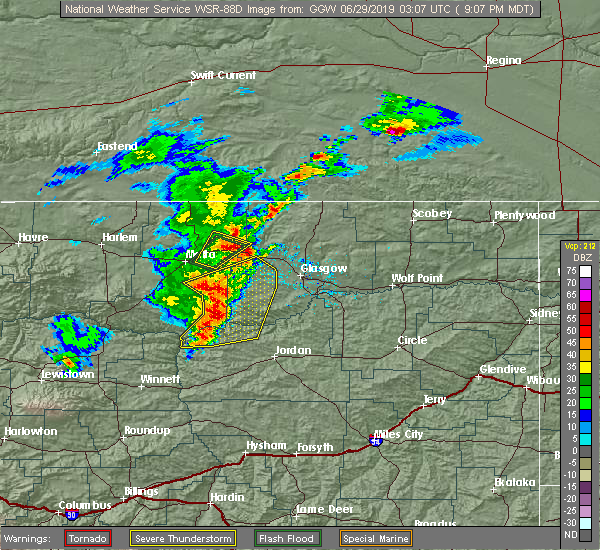 At 908 pm mdt, a severe thunderstorm was located near saco, or 20 miles southeast of whitewater, moving northeast at 20 mph (radar indicated). Hazards include 60 mph wind gusts and quarter size hail. Hail damage to vehicles is expected. Expect wind damage to roofs, siding, and trees. At 908 pm mdt, a severe thunderstorm was located near saco, or 20 miles southeast of whitewater, moving northeast at 20 mph (radar indicated). Hazards include 60 mph wind gusts and quarter size hail. Hail damage to vehicles is expected. Expect wind damage to roofs, siding, and trees.
|
| 6/28/2019 9:03 PM MDT | Saco dot in valley county MT, 2 miles W of Saco, MT |
| 6/28/2019 8:37 PM MDT |
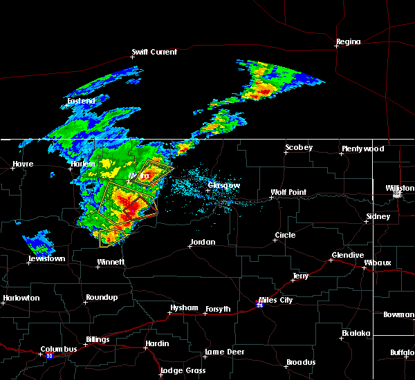 At 836 pm mdt, a severe thunderstorm was located 10 miles west of saco, or 14 miles northeast of malta, moving northeast at 20 mph (radar indicated). Hazards include 70 mph wind gusts and ping pong ball size hail. People and animals outdoors will be injured. expect hail damage to roofs, siding, windows, and vehicles. expect considerable tree damage. wind damage is also likely to mobile homes, roofs, and outbuildings. Locations impacted include, saco, bowdoin and sleeping buffalo. At 836 pm mdt, a severe thunderstorm was located 10 miles west of saco, or 14 miles northeast of malta, moving northeast at 20 mph (radar indicated). Hazards include 70 mph wind gusts and ping pong ball size hail. People and animals outdoors will be injured. expect hail damage to roofs, siding, windows, and vehicles. expect considerable tree damage. wind damage is also likely to mobile homes, roofs, and outbuildings. Locations impacted include, saco, bowdoin and sleeping buffalo.
|
| 6/28/2019 8:13 PM MDT |
 At 813 pm mdt, a severe thunderstorm was located 8 miles east of malta, moving northeast at 20 mph (radar indicated). Hazards include 70 mph wind gusts and half dollar size hail. Hail damage to vehicles is expected. expect considerable tree damage. Wind damage is also likely to mobile homes, roofs, and outbuildings. At 813 pm mdt, a severe thunderstorm was located 8 miles east of malta, moving northeast at 20 mph (radar indicated). Hazards include 70 mph wind gusts and half dollar size hail. Hail damage to vehicles is expected. expect considerable tree damage. Wind damage is also likely to mobile homes, roofs, and outbuildings.
|
| 6/27/2019 8:15 PM MDT |
 At 815 pm mdt, severe thunderstorms were located along a line extending from near port of morgan to 23 miles southeast of malta, moving northeast at 40 mph (radar indicated). Hazards include 60 mph wind gusts. Expect damage to roofs, siding, and trees. Locations impacted include, whitewater, saco, fourchette, sleeping buffalo, content, sun prairie, frenchman reservoir and bowdoin. At 815 pm mdt, severe thunderstorms were located along a line extending from near port of morgan to 23 miles southeast of malta, moving northeast at 40 mph (radar indicated). Hazards include 60 mph wind gusts. Expect damage to roofs, siding, and trees. Locations impacted include, whitewater, saco, fourchette, sleeping buffalo, content, sun prairie, frenchman reservoir and bowdoin.
|
| 6/27/2019 7:37 PM MDT |
 At 737 pm mdt, severe thunderstorms were located along a line extending from 6 miles northeast of turner to 14 miles northwest of fourchette, moving northeast at 40 mph. these are very dangerous storms (radar indicated). Hazards include 80 mph wind gusts. Flying debris will be dangerous to those caught without shelter. mobile homes will be heavily damaged. expect considerable damage to roofs, windows, and vehicles. Extensive tree damage and power outages are likely. At 737 pm mdt, severe thunderstorms were located along a line extending from 6 miles northeast of turner to 14 miles northwest of fourchette, moving northeast at 40 mph. these are very dangerous storms (radar indicated). Hazards include 80 mph wind gusts. Flying debris will be dangerous to those caught without shelter. mobile homes will be heavily damaged. expect considerable damage to roofs, windows, and vehicles. Extensive tree damage and power outages are likely.
|
| 6/19/2019 2:10 PM MDT | Quarter sized hail reported 5.1 miles WNW of Saco, MT, lots of pea size hail... but some definitely as large as quarters. also estimated 1 inch of rainfall so far |
| 6/19/2019 1:55 PM MDT |
 At 155 pm mdt, a severe thunderstorm was located near saco, or 25 miles east of malta, moving northeast at 15 mph (radar indicated). Hazards include 60 mph wind gusts and quarter size hail. Hail damage to vehicles is expected. Expect wind damage to roofs, siding, and trees. At 155 pm mdt, a severe thunderstorm was located near saco, or 25 miles east of malta, moving northeast at 15 mph (radar indicated). Hazards include 60 mph wind gusts and quarter size hail. Hail damage to vehicles is expected. Expect wind damage to roofs, siding, and trees.
|
| 7/10/2018 5:37 PM MDT | Winds gusted from 532 to 537 pm at 60 mp in valley county MT, 2 miles W of Saco, MT |
| 7/10/2018 5:34 PM MDT |
 At 534 pm mdt, severe thunderstorms were located along a line extending from 7 miles northeast of saco to 15 miles southwest of hinsdale, moving east at 50 mph. these are very dangerous storms (radar indicated). Hazards include 80 mph wind gusts and quarter size hail. Flying debris will be dangerous to those caught without shelter. mobile homes will be heavily damaged. expect considerable damage to roofs, windows, and vehicles. Extensive tree damage and power outages are likely. At 534 pm mdt, severe thunderstorms were located along a line extending from 7 miles northeast of saco to 15 miles southwest of hinsdale, moving east at 50 mph. these are very dangerous storms (radar indicated). Hazards include 80 mph wind gusts and quarter size hail. Flying debris will be dangerous to those caught without shelter. mobile homes will be heavily damaged. expect considerable damage to roofs, windows, and vehicles. Extensive tree damage and power outages are likely.
|
| 7/10/2018 4:57 PM MDT |
 At 457 pm mdt, a severe thunderstorm was located near malta, moving northeast at 55 mph (radar indicated). Hazards include 60 mph wind gusts. expect damage to roofs, siding, and trees At 457 pm mdt, a severe thunderstorm was located near malta, moving northeast at 55 mph (radar indicated). Hazards include 60 mph wind gusts. expect damage to roofs, siding, and trees
|
| 7/10/2017 4:43 PM MDT |
 At 441 pm mdt, strong winds associated with a thunderstorm gust front were located along a line extending from 6 miles south of saco to 16 miles south of tampico to 7 miles west of the pines rec area to 12 miles east of hell creek rec area to 11 miles northeast of cohagen, moving northeast at 60 mph (radar indicated). Hazards include 70 mph wind gusts. Expect considerable tree damage. Damage is likely to mobile homes, roofs, and outbuildings. At 441 pm mdt, strong winds associated with a thunderstorm gust front were located along a line extending from 6 miles south of saco to 16 miles south of tampico to 7 miles west of the pines rec area to 12 miles east of hell creek rec area to 11 miles northeast of cohagen, moving northeast at 60 mph (radar indicated). Hazards include 70 mph wind gusts. Expect considerable tree damage. Damage is likely to mobile homes, roofs, and outbuildings.
|
| 6/1/2017 9:40 PM MDT | Saco us-2 dot site in valley county MT, 2.1 miles WNW of Saco, MT |
| 7/9/2016 7:31 PM MDT |
 At 730 pm mdt, severe thunderstorms were located along a line extending from 6 miles north of saco to 13 miles northwest of the pines rec area, moving northeast at 60 mph (radar indicated). Hazards include 70 mph wind gusts. Expect considerable tree damage. damage is likely to mobile homes, roofs, and outbuildings. Locations impacted include, glasgow, malta, saco, tampico, hinsdale, frenchman reservoir, whatley, vandalia, sleeping buffalo, bowdoin, and the bentonite plant. At 730 pm mdt, severe thunderstorms were located along a line extending from 6 miles north of saco to 13 miles northwest of the pines rec area, moving northeast at 60 mph (radar indicated). Hazards include 70 mph wind gusts. Expect considerable tree damage. damage is likely to mobile homes, roofs, and outbuildings. Locations impacted include, glasgow, malta, saco, tampico, hinsdale, frenchman reservoir, whatley, vandalia, sleeping buffalo, bowdoin, and the bentonite plant.
|
| 7/9/2016 7:04 PM MDT |
 At 702 pm mdt, severe thunderstorms were located along a line extending from 6 miles northwest of malta to 21 miles northeast of devils creek rec area, moving northeast at 50 mph (radar indicated). Hazards include 60 mph wind gusts. Expect damage to roofs. siding. And trees. At 702 pm mdt, severe thunderstorms were located along a line extending from 6 miles northwest of malta to 21 miles northeast of devils creek rec area, moving northeast at 50 mph (radar indicated). Hazards include 60 mph wind gusts. Expect damage to roofs. siding. And trees.
|
| 7/3/2016 3:10 AM MDT |
 The severe thunderstorm warning for western valley and eastern phillips counties will expire at 315 am mdt, the storm which prompted the warning has weakened below severe limits, and no longer pose an immediate threat to life or property. therefore, the warning will be allowed to expire. however gusty winds are still possible with this thunderstorm. The severe thunderstorm warning for western valley and eastern phillips counties will expire at 315 am mdt, the storm which prompted the warning has weakened below severe limits, and no longer pose an immediate threat to life or property. therefore, the warning will be allowed to expire. however gusty winds are still possible with this thunderstorm.
|
| 7/3/2016 2:56 AM MDT |
 At 255 am mdt, a severe thunderstorm was located near tampico, or 8 miles west of glasgow, moving east at 45 mph (radar indicated). Hazards include 60 mph wind gusts. Expect damage to roofs. siding. and trees. locations impacted include, glasgow, saco, st. Marie, hinsdale, tampico, the pines rec area, whatley, the bentonite plant, vandalia and content. At 255 am mdt, a severe thunderstorm was located near tampico, or 8 miles west of glasgow, moving east at 45 mph (radar indicated). Hazards include 60 mph wind gusts. Expect damage to roofs. siding. and trees. locations impacted include, glasgow, saco, st. Marie, hinsdale, tampico, the pines rec area, whatley, the bentonite plant, vandalia and content.
|
| 7/3/2016 2:17 AM MDT |
 At 216 am mdt, a severe thunderstorm was located 13 miles southwest of saco, or 17 miles east of malta, moving east at 45 mph (radar indicated). Hazards include 60 mph wind gusts. Expect damage to roofs. siding. And trees. At 216 am mdt, a severe thunderstorm was located 13 miles southwest of saco, or 17 miles east of malta, moving east at 45 mph (radar indicated). Hazards include 60 mph wind gusts. Expect damage to roofs. siding. And trees.
|
| 6/21/2016 4:47 PM MDT |
 At 446 pm mdt, a severe thunderstorm was located over saco, or 25 miles east of malta, moving east at 55 mph (radar indicated). Hazards include 60 mph wind gusts and quarter size hail. Hail damage to vehicles is expected. expect wind damage to roofs, siding, and trees. Locations impacted include, saco, hinsdale, tampico, bowdoin, vandalia, the bentonite plant and sleeping buffalo. At 446 pm mdt, a severe thunderstorm was located over saco, or 25 miles east of malta, moving east at 55 mph (radar indicated). Hazards include 60 mph wind gusts and quarter size hail. Hail damage to vehicles is expected. expect wind damage to roofs, siding, and trees. Locations impacted include, saco, hinsdale, tampico, bowdoin, vandalia, the bentonite plant and sleeping buffalo.
|
| 6/21/2016 4:15 PM MDT |
 At 414 pm mdt, a severe thunderstorm was located 9 miles northwest of malta, moving east at 55 mph (radar indicated). Hazards include 60 mph wind gusts and quarter size hail. Hail damage to vehicles is expected. Expect wind damage to roofs, siding, and trees. At 414 pm mdt, a severe thunderstorm was located 9 miles northwest of malta, moving east at 55 mph (radar indicated). Hazards include 60 mph wind gusts and quarter size hail. Hail damage to vehicles is expected. Expect wind damage to roofs, siding, and trees.
|
| 6/18/2016 8:00 PM MDT | Measured by department of transportation sensor mtsco in valley county MT, 2.1 miles WNW of Saco, MT |
| 6/18/2016 7:45 PM MDT | Storm damage reported in phillips county MT, 7.9 miles WSW of Saco, MT |
| 6/18/2016 7:45 PM MDT | Golf Ball sized hail reported 0.5 miles NNW of Saco, MT |
| 6/18/2016 7:45 PM MDT | Very strong winds along with large hail. some of the siding of his house was blown of in phillips county MT, 0.5 miles NNW of Saco, MT |
| 6/18/2016 7:44 PM MDT |
 At 744 pm mdt, severe thunderstorms were located along a line extending from 11 miles northwest of opheim to 15 miles northeast of hinsdale to 25 miles south of saco, moving east at 85 mph (trained weather spotters). Hazards include 70 mph wind gusts and ping pong ball size hail. People and animals outdoors will be injured. expect hail damage to roofs, siding, windows, and vehicles. expect considerable tree damage. wind damage is also likely to mobile homes, roofs, and outbuildings. locations impacted include, glasgow, opheim, whitewater, saco, st. Marie, port of opheim, tampico, hinsdale, frenchman reservoir, baylor, vandalia, glentana, sleeping buffalo, bowdoin, thoeny and the bentonite plant. At 744 pm mdt, severe thunderstorms were located along a line extending from 11 miles northwest of opheim to 15 miles northeast of hinsdale to 25 miles south of saco, moving east at 85 mph (trained weather spotters). Hazards include 70 mph wind gusts and ping pong ball size hail. People and animals outdoors will be injured. expect hail damage to roofs, siding, windows, and vehicles. expect considerable tree damage. wind damage is also likely to mobile homes, roofs, and outbuildings. locations impacted include, glasgow, opheim, whitewater, saco, st. Marie, port of opheim, tampico, hinsdale, frenchman reservoir, baylor, vandalia, glentana, sleeping buffalo, bowdoin, thoeny and the bentonite plant.
|
| 6/18/2016 7:40 PM MDT | Storm damage reported in phillips county MT, 0.9 miles SSE of Saco, MT |
| 6/18/2016 7:40 PM MDT | Storm damage reported in phillips county MT, 0.9 miles SSE of Saco, MT |
| 6/18/2016 7:38 PM MDT | Hen Egg sized hail reported 8.7 miles E of Saco, MT |
| 6/18/2016 7:22 PM MDT |
 At 721 pm mdt, severe thunderstorms were located along a line extending from 17 miles east of whitewater to 7 miles west of saco to 18 miles south of malta, moving east at 75 mph (trained weather spotters). Hazards include 70 mph wind gusts and quarter size hail. Hail damage to vehicles is expected. expect considerable tree damage. Wind damage is also likely to mobile homes, roofs, and outbuildings. At 721 pm mdt, severe thunderstorms were located along a line extending from 17 miles east of whitewater to 7 miles west of saco to 18 miles south of malta, moving east at 75 mph (trained weather spotters). Hazards include 70 mph wind gusts and quarter size hail. Hail damage to vehicles is expected. expect considerable tree damage. Wind damage is also likely to mobile homes, roofs, and outbuildings.
|
| 6/18/2016 7:03 PM MDT |
 At 703 pm mdt, severe thunderstorms were located along a line extending from 11 miles north of malta to 17 miles northeast of zortman, moving east at 50 mph (radar indicated). Hazards include two inch hail and 70 mph wind gusts. People and animals outdoors will be injured. expect hail damage to roofs, siding, windows, and vehicles. expect considerable tree damage. wind damage is also likely to mobile homes, roofs, and outbuildings. Locations impacted include, malta, saco, dodson, phillips, wagner, bowdoin and sleeping buffalo. At 703 pm mdt, severe thunderstorms were located along a line extending from 11 miles north of malta to 17 miles northeast of zortman, moving east at 50 mph (radar indicated). Hazards include two inch hail and 70 mph wind gusts. People and animals outdoors will be injured. expect hail damage to roofs, siding, windows, and vehicles. expect considerable tree damage. wind damage is also likely to mobile homes, roofs, and outbuildings. Locations impacted include, malta, saco, dodson, phillips, wagner, bowdoin and sleeping buffalo.
|
| 6/18/2016 6:33 PM MDT |
 At 633 pm mdt, severe thunderstorms were located along a line extending from 9 miles northwest of dodson to 6 miles northwest of hays, moving east at 55 mph (radar indicated). Hazards include two inch hail and 70 mph wind gusts. People and animals outdoors will be injured. expect hail damage to roofs, siding, windows, and vehicles. expect considerable tree damage. Wind damage is also likely to mobile homes, roofs, and outbuildings. At 633 pm mdt, severe thunderstorms were located along a line extending from 9 miles northwest of dodson to 6 miles northwest of hays, moving east at 55 mph (radar indicated). Hazards include two inch hail and 70 mph wind gusts. People and animals outdoors will be injured. expect hail damage to roofs, siding, windows, and vehicles. expect considerable tree damage. Wind damage is also likely to mobile homes, roofs, and outbuildings.
|
| 6/14/2016 6:28 PM MDT |
 At 627 pm mdt, severe thunderstorms were located along a line extending from 34 miles north of port of morgan to 18 miles east of whitewater to 13 miles south of hinsdale, moving northeast at 35 mph (radar indicated). Hazards include 70 mph wind gusts and quarter size hail. Hail damage to vehicles is expected. expect considerable tree damage. wind damage is also likely to mobile homes, roofs, and outbuildings. locations impacted include, glasgow, opheim, whitewater, nashua, fort peck, saco, st. Marie, fort peck marina, duck creek rec area, tampico, port of morgan, hinsdale, the pines rec area, frenchman reservoir, park grove, whatley, baylor, vandalia, glentana and sleeping buffalo. At 627 pm mdt, severe thunderstorms were located along a line extending from 34 miles north of port of morgan to 18 miles east of whitewater to 13 miles south of hinsdale, moving northeast at 35 mph (radar indicated). Hazards include 70 mph wind gusts and quarter size hail. Hail damage to vehicles is expected. expect considerable tree damage. wind damage is also likely to mobile homes, roofs, and outbuildings. locations impacted include, glasgow, opheim, whitewater, nashua, fort peck, saco, st. Marie, fort peck marina, duck creek rec area, tampico, port of morgan, hinsdale, the pines rec area, frenchman reservoir, park grove, whatley, baylor, vandalia, glentana and sleeping buffalo.
|
| 6/14/2016 5:56 PM MDT |
 At 555 pm mdt, severe thunderstorms were located along a line extending from 25 miles northwest of port of morgan to 12 miles northwest of saco to 28 miles northeast of devils creek rec area, moving northeast at 35 mph (radar indicated). Hazards include 70 mph wind gusts and quarter size hail. Hail damage to vehicles is expected. expect considerable tree damage. Wind damage is also likely to mobile homes, roofs, and outbuildings. At 555 pm mdt, severe thunderstorms were located along a line extending from 25 miles northwest of port of morgan to 12 miles northwest of saco to 28 miles northeast of devils creek rec area, moving northeast at 35 mph (radar indicated). Hazards include 70 mph wind gusts and quarter size hail. Hail damage to vehicles is expected. expect considerable tree damage. Wind damage is also likely to mobile homes, roofs, and outbuildings.
|
| 6/14/2016 5:34 PM MDT |
 At 533 pm mdt, severe thunderstorms were located along a line extending from 6 miles northwest of turner to near malta to 6 miles east of fourchette, moving northeast at 50 mph (trained weather spotters reported 70 mph wind gusts in the dodson area). Hazards include 70 mph wind gusts. Expect considerable tree damage. damage is likely to mobile homes, roofs, and outbuildings. Locations impacted include, malta, whitewater, saco, dodson, loring, devils creek rec area, hinsdale, u l bend rec area, fourchette, phillips, wagner, sun prairie, frenchman reservoir, chapman, sleeping buffalo, bowdoin, the bentonite plant and content. At 533 pm mdt, severe thunderstorms were located along a line extending from 6 miles northwest of turner to near malta to 6 miles east of fourchette, moving northeast at 50 mph (trained weather spotters reported 70 mph wind gusts in the dodson area). Hazards include 70 mph wind gusts. Expect considerable tree damage. damage is likely to mobile homes, roofs, and outbuildings. Locations impacted include, malta, whitewater, saco, dodson, loring, devils creek rec area, hinsdale, u l bend rec area, fourchette, phillips, wagner, sun prairie, frenchman reservoir, chapman, sleeping buffalo, bowdoin, the bentonite plant and content.
|
| 6/14/2016 5:09 PM MDT |
 At 507 pm mdt, severe thunderstorms were located along a line extending from 12 miles southeast of turner to 6 miles northeast of devils creek rec area, moving northeast at 40 mph (trained weather spotters. at 5:00 pm 70 mph wind gust and wind damage was reported 10 miles south of dodson). Hazards include 70 mph wind gusts. Expect considerable tree damage. Damage is likely to mobile homes, roofs, and outbuildings. At 507 pm mdt, severe thunderstorms were located along a line extending from 12 miles southeast of turner to 6 miles northeast of devils creek rec area, moving northeast at 40 mph (trained weather spotters. at 5:00 pm 70 mph wind gust and wind damage was reported 10 miles south of dodson). Hazards include 70 mph wind gusts. Expect considerable tree damage. Damage is likely to mobile homes, roofs, and outbuildings.
|
| 6/11/2016 12:09 AM MDT |
 The severe thunderstorm warning for southwestern valley and southern phillips counties will expire at 1215 am mdt, the storms which prompted the warning have weakened below severe limits, and no longer pose an immediate threat to life or property. therefore the warning will be allowed to expire. however gusty winds and heavy rain are still possible with these thunderstorms. a severe thunderstorm watch remains in effect until 200 am mdt for northeastern montana. The severe thunderstorm warning for southwestern valley and southern phillips counties will expire at 1215 am mdt, the storms which prompted the warning have weakened below severe limits, and no longer pose an immediate threat to life or property. therefore the warning will be allowed to expire. however gusty winds and heavy rain are still possible with these thunderstorms. a severe thunderstorm watch remains in effect until 200 am mdt for northeastern montana.
|
| 6/10/2016 11:36 PM MDT |
 At 1135 pm mdt, severe thunderstorms were located along a line extending from 12 miles east of zortman to 14 miles southwest of hinsdale, moving east at 55 mph (radar indicated). Hazards include 60 mph wind gusts and quarter size hail. Hail damage to vehicles is expected. expect wind damage to roofs, siding, and trees. Locations impacted include, malta, zortman, saco, dodson, tampico, hinsdale, fourchette, phillips, wagner, sun prairie, vandalia, fred robinson bridge, bowdoin, the bentonite plant, content and landusky. At 1135 pm mdt, severe thunderstorms were located along a line extending from 12 miles east of zortman to 14 miles southwest of hinsdale, moving east at 55 mph (radar indicated). Hazards include 60 mph wind gusts and quarter size hail. Hail damage to vehicles is expected. expect wind damage to roofs, siding, and trees. Locations impacted include, malta, zortman, saco, dodson, tampico, hinsdale, fourchette, phillips, wagner, sun prairie, vandalia, fred robinson bridge, bowdoin, the bentonite plant, content and landusky.
|
| 6/10/2016 11:09 PM MDT |
 At 1108 pm mdt, severe thunderstorms were located along a line extending from 12 miles southwest of hays to 16 miles south of malta, moving east at 55 mph (radar indicated). Hazards include 60 mph wind gusts and quarter size hail. Hail damage to vehicles is expected. Expect wind damage to roofs, siding, and trees. At 1108 pm mdt, severe thunderstorms were located along a line extending from 12 miles southwest of hays to 16 miles south of malta, moving east at 55 mph (radar indicated). Hazards include 60 mph wind gusts and quarter size hail. Hail damage to vehicles is expected. Expect wind damage to roofs, siding, and trees.
|
| 6/9/2016 5:22 PM MDT |
 At 521 pm mdt, a severe thunderstorm was located 7 miles north of hinsdale, or 28 miles southeast of whitewater, moving east at 50 mph (trained weather spotters). Hazards include 60 mph wind gusts. Expect damage to roofs. siding. And trees. At 521 pm mdt, a severe thunderstorm was located 7 miles north of hinsdale, or 28 miles southeast of whitewater, moving east at 50 mph (trained weather spotters). Hazards include 60 mph wind gusts. Expect damage to roofs. siding. And trees.
|
| 5/21/2016 6:35 PM MDT | 60 mph wind gust... heavy rain visibility less than 50 feet... and quarter sized hail in valley county MT, 5.2 miles W of Saco, MT |
| 5/21/2016 6:35 PM MDT | Quarter sized hail reported 5.2 miles W of Saco, MT |
| 7/27/2015 6:07 PM MDT |
 At 605 pm mdt, a severe thunderstorm was located 6 miles west of hinsdale, and moving north at 30 mph (trained weather spotters). Hazards include golf ball size hail and 60 mph wind gusts. People and animals outdoors will be injured. expect hail damage to roofs, siding, windows and vehicles. expect wind damage to roofs, siding and trees. Locations impacted include, hinsdale, whitewater, saco, sleeping buffalo and frenchman reservoir. At 605 pm mdt, a severe thunderstorm was located 6 miles west of hinsdale, and moving north at 30 mph (trained weather spotters). Hazards include golf ball size hail and 60 mph wind gusts. People and animals outdoors will be injured. expect hail damage to roofs, siding, windows and vehicles. expect wind damage to roofs, siding and trees. Locations impacted include, hinsdale, whitewater, saco, sleeping buffalo and frenchman reservoir.
|
| 7/27/2015 6:03 PM MDT |
 At 557 pm mdt, a severe thunderstorm was located 7 miles west of hinsdale, and moving north at 30 mph (trained weather spotters). Hazards include spotter reported quarter size hail near hinsdale...in addition, 60 mph wind gusts are possible. Hail damage to crops and plants is expected. some damage to vehicles is possible. expect wind damage to roofs, siding and trees. Locations impacted include, whitewater, hinsdale, saco, sleeping buffalo and frenchman reservoir. At 557 pm mdt, a severe thunderstorm was located 7 miles west of hinsdale, and moving north at 30 mph (trained weather spotters). Hazards include spotter reported quarter size hail near hinsdale...in addition, 60 mph wind gusts are possible. Hail damage to crops and plants is expected. some damage to vehicles is possible. expect wind damage to roofs, siding and trees. Locations impacted include, whitewater, hinsdale, saco, sleeping buffalo and frenchman reservoir.
|
| 7/27/2015 5:34 PM MDT |
 At 533 pm mdt, a severe thunderstorm was located 17 miles southwest of hinsdale, and moving north at 30 mph (radar indicated). Hazards include 60 mph wind gusts and quarter size hail. Hail damage to crops and plants is expected. some damage to vehicles is possible. expect wind damage to roofs, siding and trees. The severe thunderstorm will be near, hinsdale and saco around 605 pm mdt. At 533 pm mdt, a severe thunderstorm was located 17 miles southwest of hinsdale, and moving north at 30 mph (radar indicated). Hazards include 60 mph wind gusts and quarter size hail. Hail damage to crops and plants is expected. some damage to vehicles is possible. expect wind damage to roofs, siding and trees. The severe thunderstorm will be near, hinsdale and saco around 605 pm mdt.
|
| 7/27/2015 2:38 AM MDT |
 At 235 am mdt, a severe thunderstorm was located 9 miles southeast of malta, and moving northeast at 45 mph (radar indicated). Hazards include quarter size hail. Damage to crops and plants is expected. some damage to vehicles is possible. the severe thunderstorm will be near, saco around 305 am mdt. Other locations in the warning include bowdoin. At 235 am mdt, a severe thunderstorm was located 9 miles southeast of malta, and moving northeast at 45 mph (radar indicated). Hazards include quarter size hail. Damage to crops and plants is expected. some damage to vehicles is possible. the severe thunderstorm will be near, saco around 305 am mdt. Other locations in the warning include bowdoin.
|
| 7/5/2015 12:24 AM MDT |
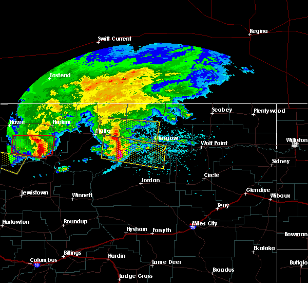 At 1219 am mdt, a severe thunderstorm was located near saco, and moving east at 40 mph (radar indicated). Hazards include 60 mph wind gusts and nickel size hail. Expect damage to roofs. siding and trees. the severe thunderstorm will be near, hinsdale around 1235 am mdt. Other locations in the warning include vandalia. At 1219 am mdt, a severe thunderstorm was located near saco, and moving east at 40 mph (radar indicated). Hazards include 60 mph wind gusts and nickel size hail. Expect damage to roofs. siding and trees. the severe thunderstorm will be near, hinsdale around 1235 am mdt. Other locations in the warning include vandalia.
|
| 7/4/2015 11:57 PM MDT |
 At 1156 pm mdt, a severe thunderstorm was located 12 miles northeast of malta, and moving east at 40 mph (radar indicated). Hazards include 60 mph wind gusts and nickel size hail. Expect damage to roofs. siding and trees. the severe thunderstorm will be near, saco around 1220 am mdt. hinsdale around 1235 am mdt. Other locations in the warning include sleeping buffalo and vandalia. At 1156 pm mdt, a severe thunderstorm was located 12 miles northeast of malta, and moving east at 40 mph (radar indicated). Hazards include 60 mph wind gusts and nickel size hail. Expect damage to roofs. siding and trees. the severe thunderstorm will be near, saco around 1220 am mdt. hinsdale around 1235 am mdt. Other locations in the warning include sleeping buffalo and vandalia.
|
| 6/19/2015 5:18 PM MDT |
 At 512 pm mdt, a severe thunderstorm was located 12 miles northeast of whitewater, and moving southeast at 50 mph (radar indicated). Hazards include 60 mph wind gusts and quarter size hail. Hail damage to crops and plants is expected. some damage to vehicles is possible. expect wind damage to roofs, siding and trees. Locations impacted include, saco, hinsdale, sleeping buffalo, frenchman reservoir and thoeny. At 512 pm mdt, a severe thunderstorm was located 12 miles northeast of whitewater, and moving southeast at 50 mph (radar indicated). Hazards include 60 mph wind gusts and quarter size hail. Hail damage to crops and plants is expected. some damage to vehicles is possible. expect wind damage to roofs, siding and trees. Locations impacted include, saco, hinsdale, sleeping buffalo, frenchman reservoir and thoeny.
|
| 6/19/2015 4:47 PM MDT |
 At 439 pm mdt, a severe thunderstorm was located 6 miles northwest of port of morgan, and moving southeast at 50 mph (radar indicated). Hazards include 60 mph wind gusts and half dollar size hail. Hail damage to vehicles is expected. expect wind damage to roofs, siding and trees. The severe thunderstorm will affect mainly rural areas of northeastern phillips and northwestern valley counties. At 439 pm mdt, a severe thunderstorm was located 6 miles northwest of port of morgan, and moving southeast at 50 mph (radar indicated). Hazards include 60 mph wind gusts and half dollar size hail. Hail damage to vehicles is expected. expect wind damage to roofs, siding and trees. The severe thunderstorm will affect mainly rural areas of northeastern phillips and northwestern valley counties.
|
| 7/24/2014 4:30 PM MDT | Quarter sized hail reported 18.4 miles SSW of Saco, MT, with heavy rain. |
| 7/24/2014 4:15 PM MDT | Quarter sized hail reported 16.8 miles S of Saco, MT, with 60 mph winds. |
| 7/24/2013 4:45 PM MDT | Quarter sized hail reported 5 miles WSW of Saco, MT |
| 7/24/2013 4:45 PM MDT | Golf Ball sized hail reported 5.6 miles WSW of Saco, MT, hail ended at 500pm |
| 6/24/2013 11:00 PM MDT | Very strong winds with 0.6 inches of rain...no hail to report in phillips county MT, 1.9 miles SW of Saco, MT |
| 6/19/2013 11:15 PM MDT | A roof was blown off of a shed and thrown about 75 yards into a field northeast of the shed location. the shed was open faced towards the south...and side walls are sti in phillips county MT, 2.3 miles S of Saco, MT |
| 1/1/0001 12:00 AM | Storm damage reported in phillips county MT, 4.3 miles S of Saco, MT |
| 1/1/0001 12:00 AM | Estimated 61 mph winds in valley county MT, 5.2 miles W of Saco, MT |
| 1/1/0001 12:00 AM | Quarter sized hail reported 3.8 miles SSW of Saco, MT, estimated quarter sized hail. 65 mph wind. |
| 1/1/0001 12:00 AM | Quarter sized hail reported 12 miles SE of Saco, MT, estimated quarter sized hail. 70 mph wind. visibility less than 50 feet. |
| 1/1/0001 12:00 AM | 65 mph gust recorded at this location. winds got stronger destroying the wind gage. the winds knocked down trees and damaged two 50 year old garages. the winds blew awa in phillips county MT, 3.8 miles SSW of Saco, MT |
| 1/1/0001 12:00 AM | Storm damage reported in phillips county MT, 12 miles SE of Saco, MT |
Hail Maps for Saco, MT
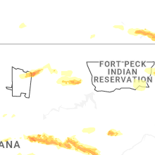
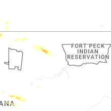


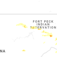


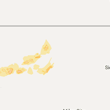


Connect with Interactive Hail Maps