

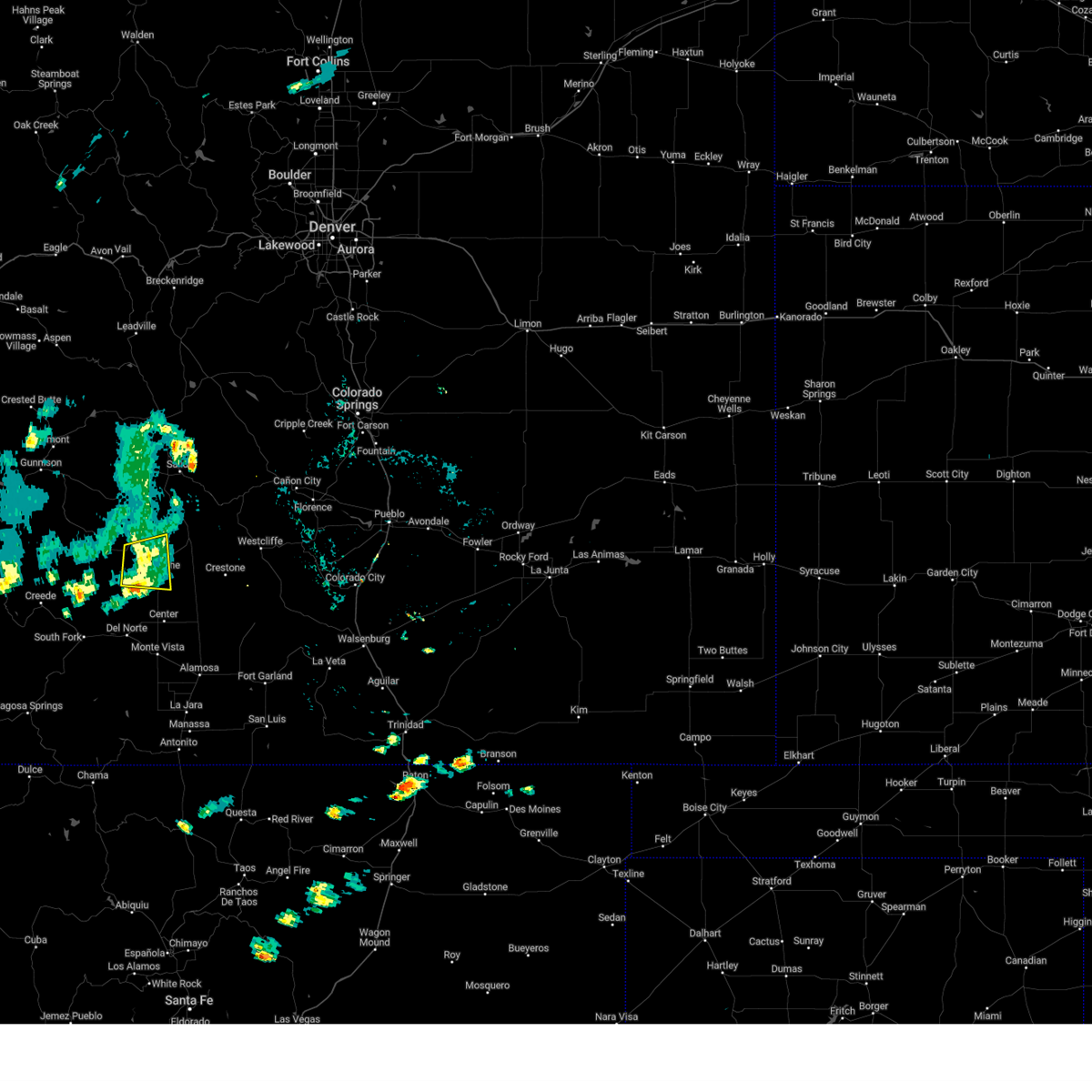
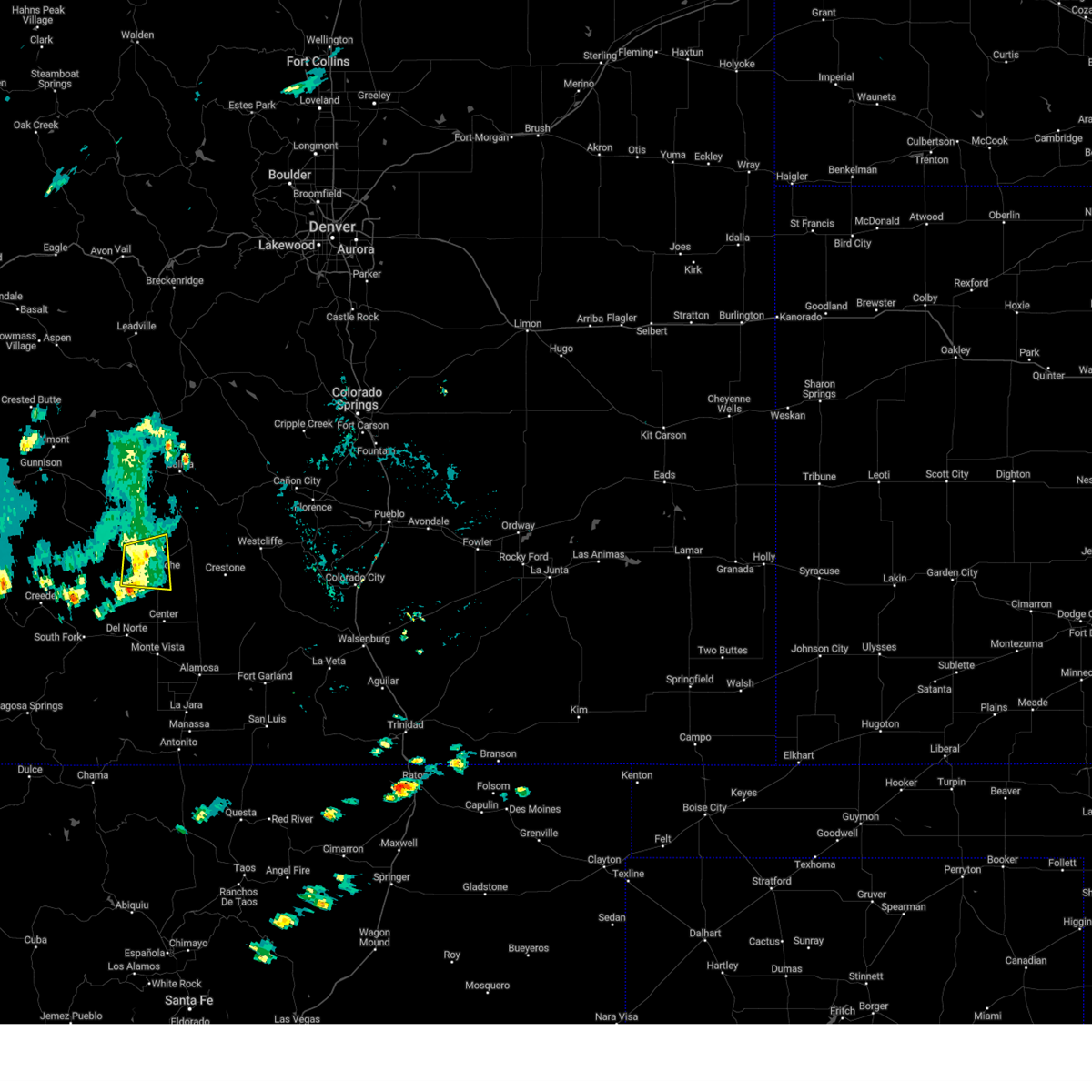
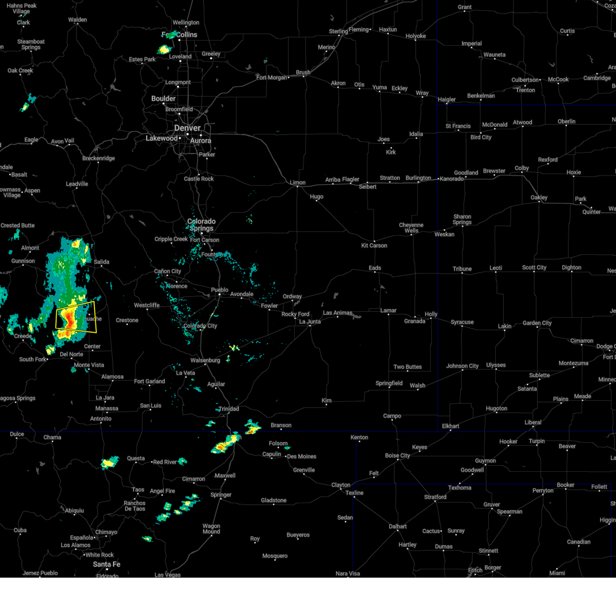
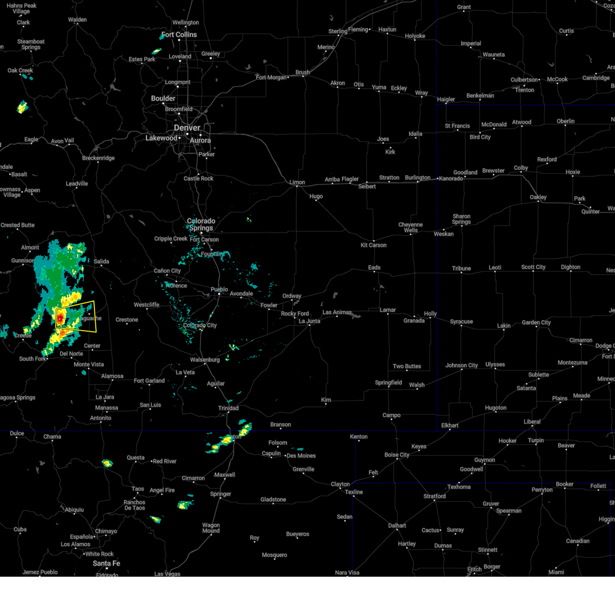
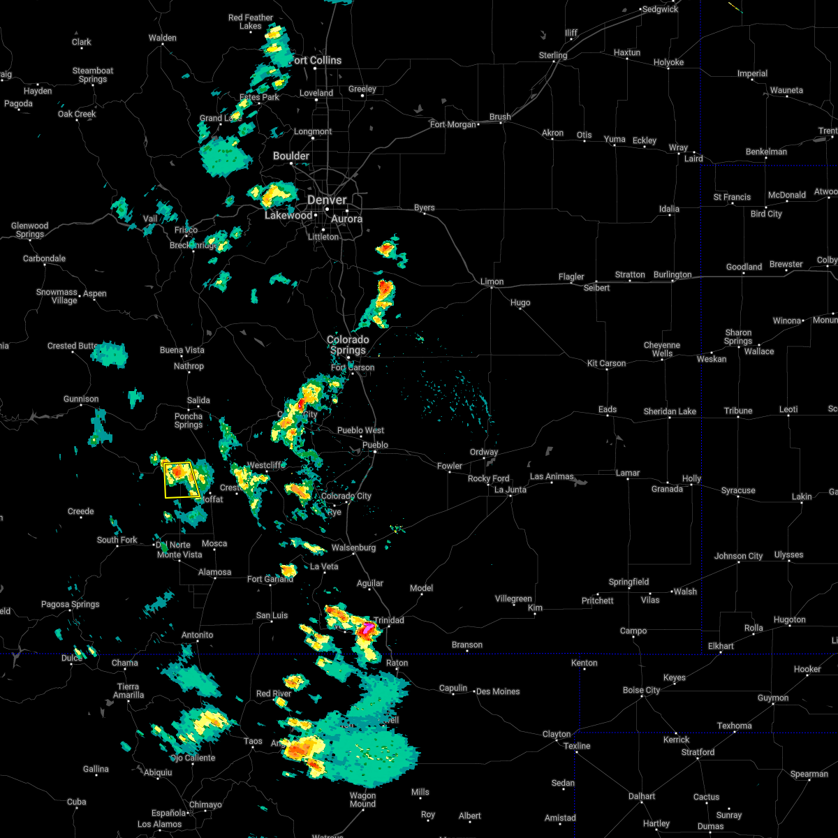
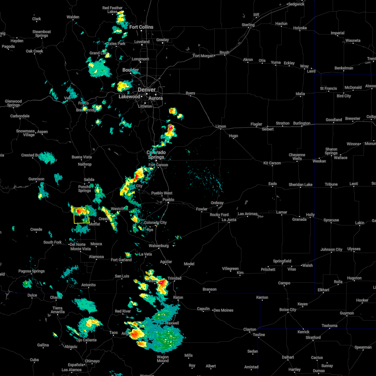
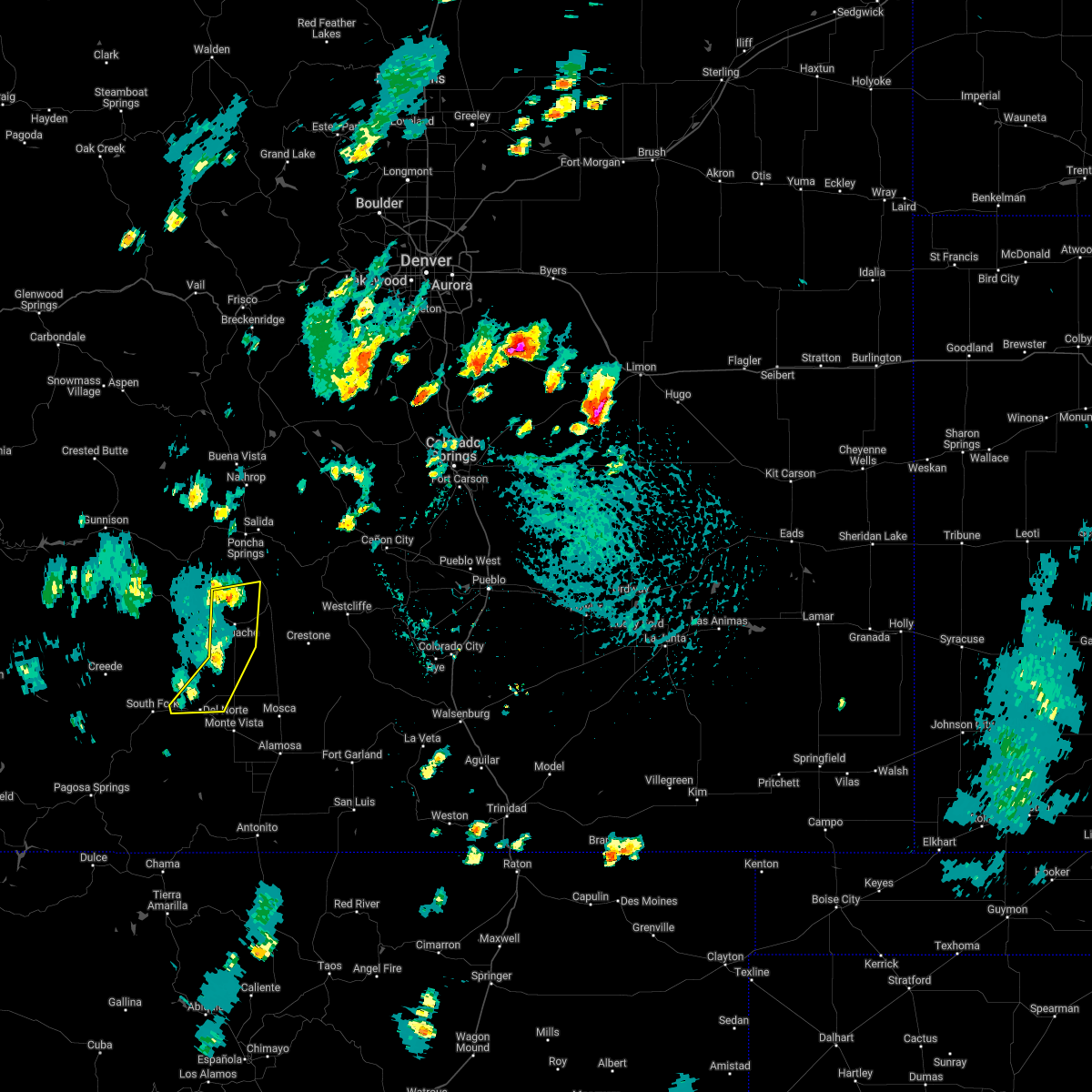
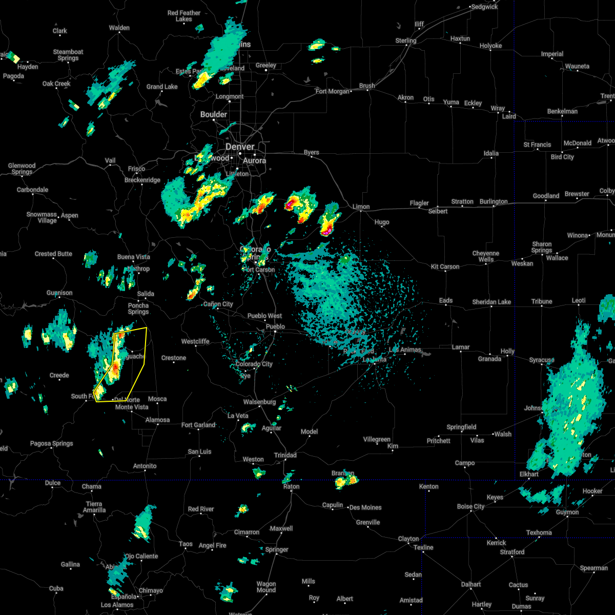
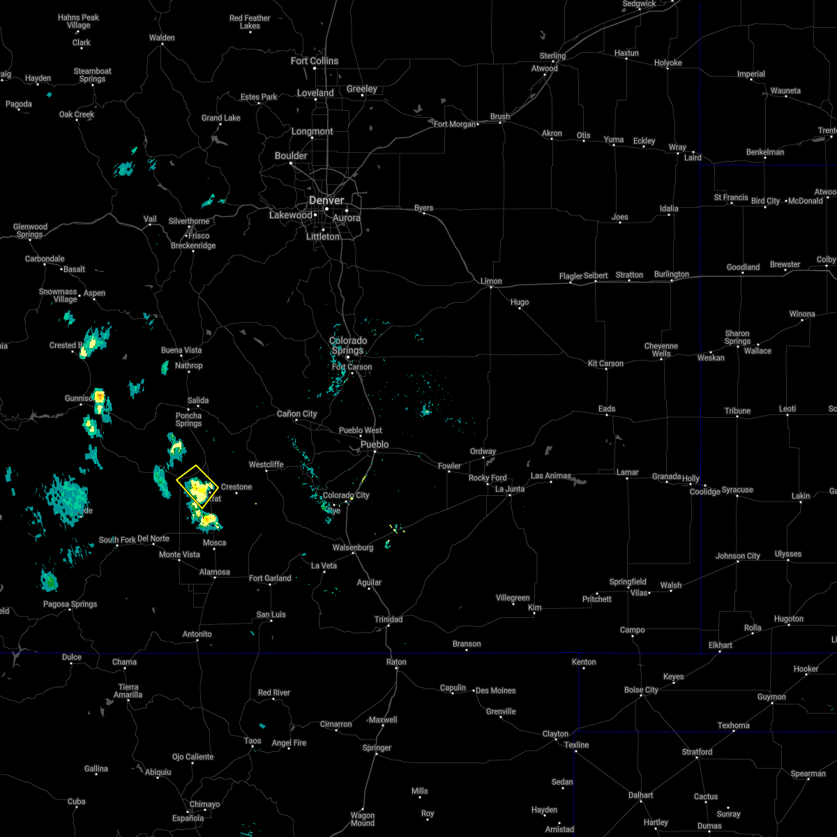
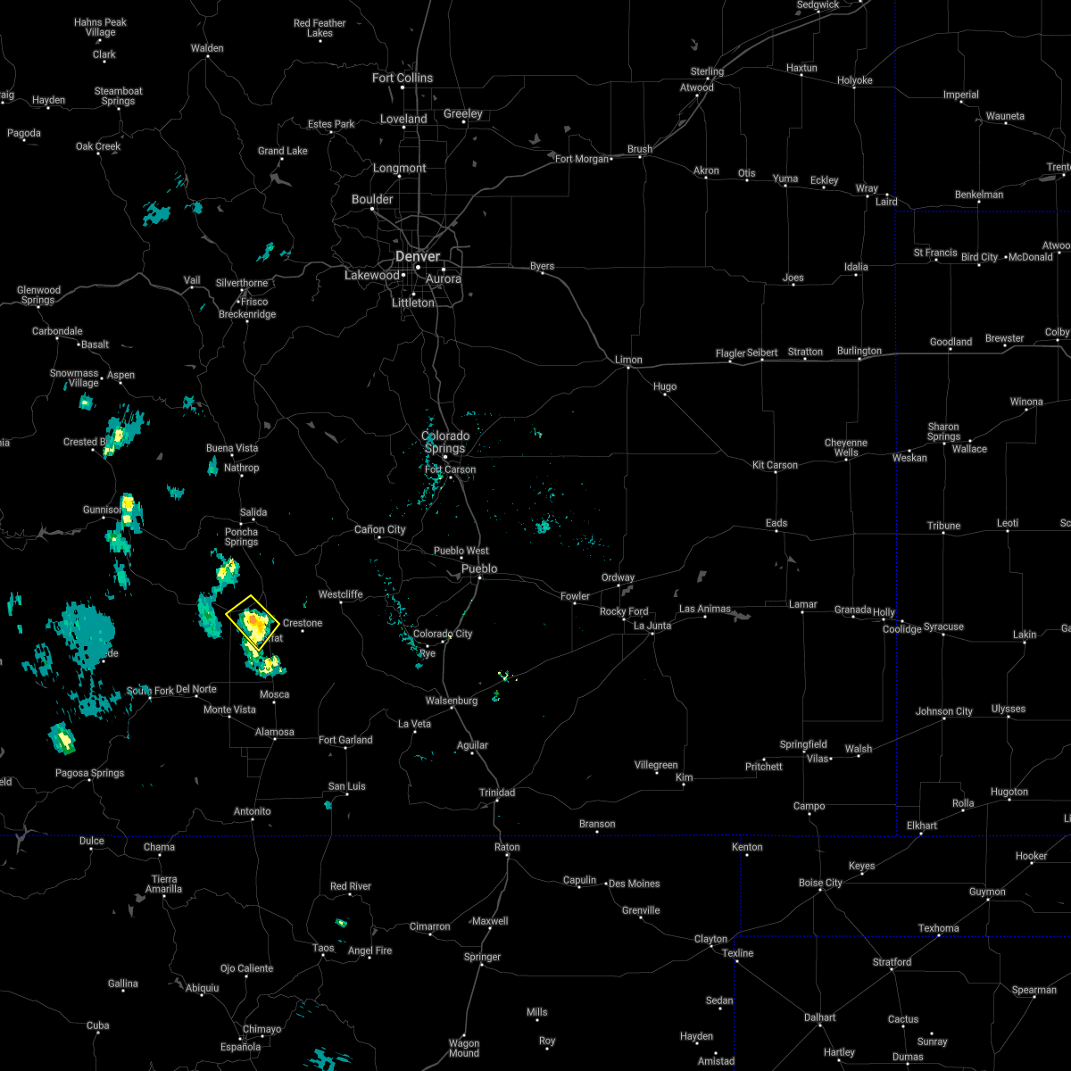
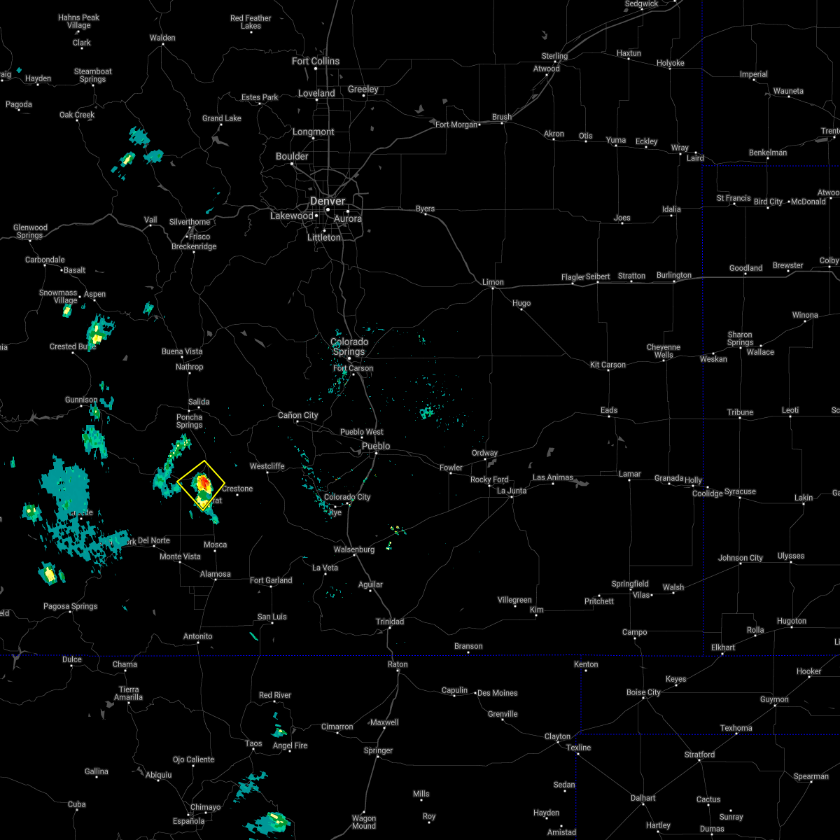
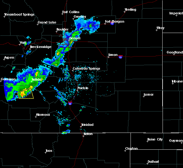
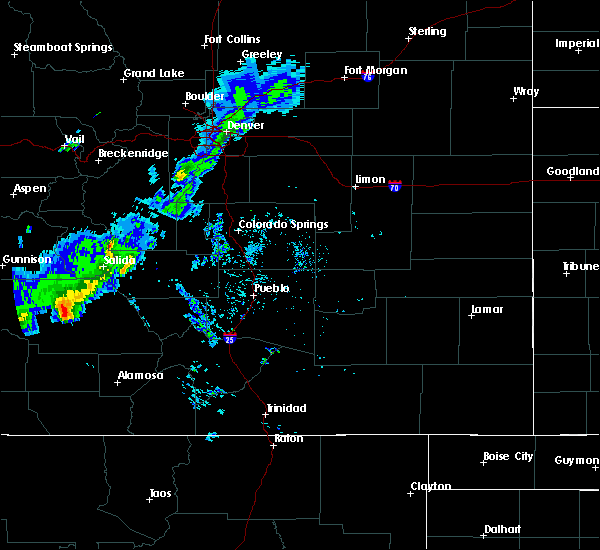
Hail Map for Saguache, CO
The Saguache, CO area has had 0 reports of on-the-ground hail by trained spotters, and has been under severe weather warnings 5 times during the past 12 months. Doppler radar has detected hail at or near Saguache, CO on 6 occasions, including 1 occasion during the past year.
| Name: | Saguache, CO |
| Where Located: | 84.2 miles W of Pueblo, CO |
| Map: | Google Map for Saguache, CO |
| Population: | 485 |
| Housing Units: | 345 |
| More Info: | Search Google for Saguache, CO |
0
The Top Recent Hail Date for Saguache, CO is Monday, August 19, 2024 (3rd out of 6)

Hail and Wind Damage Spotted near Saguache, CO
| Date / Time | Report Details |
|---|---|
| 8/21/2024 2:31 PM MDT |
 the severe thunderstorm warning has been cancelled and is no longer in effect the severe thunderstorm warning has been cancelled and is no longer in effect
|
| 8/21/2024 2:24 PM MDT |
 At 224 pm mdt, severe thunderstorms were located along a line extending from 9 miles west of saguache to 11 miles north of la garita, moving east at 30 mph (radar indicated). Hazards include 60 mph wind gusts. Expect damage to roofs, siding, and trees. Locations impacted include, saguache. At 224 pm mdt, severe thunderstorms were located along a line extending from 9 miles west of saguache to 11 miles north of la garita, moving east at 30 mph (radar indicated). Hazards include 60 mph wind gusts. Expect damage to roofs, siding, and trees. Locations impacted include, saguache.
|
| 8/21/2024 2:08 PM MDT |
 At 207 pm mdt, severe thunderstorms were located along a line extending from 10 miles southeast of north pass to 12 miles northwest of la garita, moving east at 30 mph (radar indicated). Hazards include 60 mph wind gusts and quarter size hail. Hail damage to vehicles is expected. expect wind damage to roofs, siding, and trees. Locations impacted include, saguache. At 207 pm mdt, severe thunderstorms were located along a line extending from 10 miles southeast of north pass to 12 miles northwest of la garita, moving east at 30 mph (radar indicated). Hazards include 60 mph wind gusts and quarter size hail. Hail damage to vehicles is expected. expect wind damage to roofs, siding, and trees. Locations impacted include, saguache.
|
| 8/21/2024 2:06 PM MDT |
 At 205 pm mdt, severe thunderstorms were located along a line extending from 10 miles southeast of north pass to 12 miles northwest of la garita, moving east at 25 mph (radar indicated). Hazards include 60 mph wind gusts and quarter size hail. Hail damage to vehicles is expected. expect wind damage to roofs, siding, and trees. Locations impacted include, saguache. At 205 pm mdt, severe thunderstorms were located along a line extending from 10 miles southeast of north pass to 12 miles northwest of la garita, moving east at 25 mph (radar indicated). Hazards include 60 mph wind gusts and quarter size hail. Hail damage to vehicles is expected. expect wind damage to roofs, siding, and trees. Locations impacted include, saguache.
|
| 8/21/2024 1:55 PM MDT |
 Svrpub the national weather service in pueblo has issued a * severe thunderstorm warning for, central saguache county in central colorado, * until 245 pm mdt. * at 155 pm mdt, a severe thunderstorm was located 12 miles southeast of north pass, or 42 miles southeast of gunnison, moving east at 30 mph (radar indicated). Hazards include 60 mph wind gusts and quarter size hail. Hail damage to vehicles is expected. Expect wind damage to roofs, siding, and trees. Svrpub the national weather service in pueblo has issued a * severe thunderstorm warning for, central saguache county in central colorado, * until 245 pm mdt. * at 155 pm mdt, a severe thunderstorm was located 12 miles southeast of north pass, or 42 miles southeast of gunnison, moving east at 30 mph (radar indicated). Hazards include 60 mph wind gusts and quarter size hail. Hail damage to vehicles is expected. Expect wind damage to roofs, siding, and trees.
|
| 7/12/2022 3:04 PM MDT |
 At 304 pm mdt, a severe thunderstorm was located over saguache, or 25 miles south of decker burn scar, moving south at 10 mph (radar indicated). Hazards include 60 mph wind gusts and half dollar size hail. Hail damage to vehicles is expected. expect wind damage to roofs, siding, and trees. locations impacted include, saguache. hail threat, radar indicated max hail size, 1. 25 in wind threat, radar indicated max wind gust, 60 mph. At 304 pm mdt, a severe thunderstorm was located over saguache, or 25 miles south of decker burn scar, moving south at 10 mph (radar indicated). Hazards include 60 mph wind gusts and half dollar size hail. Hail damage to vehicles is expected. expect wind damage to roofs, siding, and trees. locations impacted include, saguache. hail threat, radar indicated max hail size, 1. 25 in wind threat, radar indicated max wind gust, 60 mph.
|
| 7/12/2022 2:49 PM MDT |
 At 248 pm mdt, a severe thunderstorm was located near saguache, or 23 miles southwest of decker burn scar, moving south at 10 mph (radar indicated). Hazards include 60 mph wind gusts and quarter size hail. Hail damage to vehicles is expected. Expect wind damage to roofs, siding, and trees. At 248 pm mdt, a severe thunderstorm was located near saguache, or 23 miles southwest of decker burn scar, moving south at 10 mph (radar indicated). Hazards include 60 mph wind gusts and quarter size hail. Hail damage to vehicles is expected. Expect wind damage to roofs, siding, and trees.
|
| 7/6/2022 2:27 PM MDT |
 At 227 pm mdt, severe thunderstorms were located along a line extending from near bonanza to near la garita to near del norte, moving east at 15 mph (radar indicated). Hazards include 60 mph wind gusts and quarter size hail. Hail damage to vehicles is expected. expect wind damage to roofs, siding, and trees. locations impacted include, del norte, saguache and la garita. hail threat, radar indicated max hail size, 1. 00 in wind threat, radar indicated max wind gust, 60 mph. At 227 pm mdt, severe thunderstorms were located along a line extending from near bonanza to near la garita to near del norte, moving east at 15 mph (radar indicated). Hazards include 60 mph wind gusts and quarter size hail. Hail damage to vehicles is expected. expect wind damage to roofs, siding, and trees. locations impacted include, del norte, saguache and la garita. hail threat, radar indicated max hail size, 1. 00 in wind threat, radar indicated max wind gust, 60 mph.
|
| 7/6/2022 2:07 PM MDT |
 At 206 pm mdt, severe thunderstorms were located along a line extending from 7 miles southwest of bonanza to near la garita to 8 miles northeast of south fork, moving east at 10 mph (radar indicated). Hazards include 60 mph wind gusts and quarter size hail. Hail damage to vehicles is expected. Expect wind damage to roofs, siding, and trees. At 206 pm mdt, severe thunderstorms were located along a line extending from 7 miles southwest of bonanza to near la garita to 8 miles northeast of south fork, moving east at 10 mph (radar indicated). Hazards include 60 mph wind gusts and quarter size hail. Hail damage to vehicles is expected. Expect wind damage to roofs, siding, and trees.
|
| 6/4/2021 6:37 PM MDT |
 The severe thunderstorm warning for central saguache county will expire at 645 pm mdt, the storm which prompted the warning has weakened below severe limits, and no longer poses an immediate threat to life or property. therefore, the warning will be allowed to expire. however gusty winds are still possible with this thunderstorm. The severe thunderstorm warning for central saguache county will expire at 645 pm mdt, the storm which prompted the warning has weakened below severe limits, and no longer poses an immediate threat to life or property. therefore, the warning will be allowed to expire. however gusty winds are still possible with this thunderstorm.
|
| 6/4/2021 6:30 PM MDT |
 At 630 pm mdt, a severe thunderstorm was located near moffat, or 19 miles southwest of hayden pass burn scar, and is nearly stationary (radar indicated). Hazards include 60 mph wind gusts and penny size hail. Expect damage to roofs, siding, and trees. Locations impacted include, saguache and moffat. At 630 pm mdt, a severe thunderstorm was located near moffat, or 19 miles southwest of hayden pass burn scar, and is nearly stationary (radar indicated). Hazards include 60 mph wind gusts and penny size hail. Expect damage to roofs, siding, and trees. Locations impacted include, saguache and moffat.
|
| 6/4/2021 6:14 PM MDT |
 At 614 pm mdt, a severe thunderstorm was located near moffat, or 18 miles southwest of hayden pass burn scar, and is nearly stationary (radar indicated). Hazards include 60 mph wind gusts and quarter size hail. Hail damage to vehicles is expected. Expect wind damage to roofs, siding, and trees. At 614 pm mdt, a severe thunderstorm was located near moffat, or 18 miles southwest of hayden pass burn scar, and is nearly stationary (radar indicated). Hazards include 60 mph wind gusts and quarter size hail. Hail damage to vehicles is expected. Expect wind damage to roofs, siding, and trees.
|
| 6/19/2020 12:53 PM MDT |
 The severe thunderstorm warning for central saguache county will expire at 100 pm mdt, the storm which prompted the warning has weakened below severe limits, and no longer poses an immediate threat to life or property. therefore, the warning will be allowed to expire. however gusty winds are still possible with this thunderstorm. The severe thunderstorm warning for central saguache county will expire at 100 pm mdt, the storm which prompted the warning has weakened below severe limits, and no longer poses an immediate threat to life or property. therefore, the warning will be allowed to expire. however gusty winds are still possible with this thunderstorm.
|
| 6/19/2020 12:42 PM MDT |
 At 1241 pm mdt, a severe thunderstorm was located 7 miles northwest of saguache, or 25 miles southwest of decker burn scar, moving east at 10 mph (radar indicated). Hazards include 60 mph wind gusts and quarter size hail. Hail damage to vehicles is expected. expect wind damage to roofs, siding, and trees. Locations impacted include, saguache. At 1241 pm mdt, a severe thunderstorm was located 7 miles northwest of saguache, or 25 miles southwest of decker burn scar, moving east at 10 mph (radar indicated). Hazards include 60 mph wind gusts and quarter size hail. Hail damage to vehicles is expected. expect wind damage to roofs, siding, and trees. Locations impacted include, saguache.
|
| 6/19/2020 12:28 PM MDT |
 At 1227 pm mdt, a severe thunderstorm was located 11 miles west of saguache, or 28 miles southwest of decker burn scar, moving east at 30 mph (radar indicated). Hazards include 60 mph wind gusts and quarter size hail. Hail damage to vehicles is expected. Expect wind damage to roofs, siding, and trees. At 1227 pm mdt, a severe thunderstorm was located 11 miles west of saguache, or 28 miles southwest of decker burn scar, moving east at 30 mph (radar indicated). Hazards include 60 mph wind gusts and quarter size hail. Hail damage to vehicles is expected. Expect wind damage to roofs, siding, and trees.
|
| 7/29/2019 5:22 PM MDT |
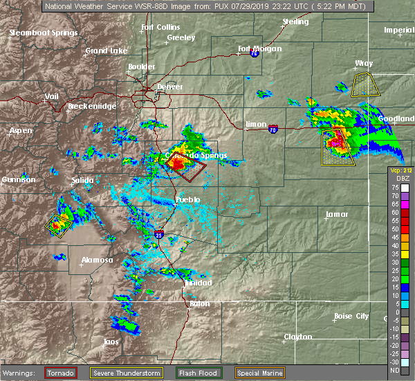 At 522 pm mdt, a severe thunderstorm was located near saguache, or 30 miles southwest of hayden pass burn scar, moving southeast at 15 mph (radar indicated). Hazards include 60 mph wind gusts and half dollar size hail. Hail damage to vehicles is expected. expect wind damage to roofs, siding, and trees. Locations impacted include, saguache. At 522 pm mdt, a severe thunderstorm was located near saguache, or 30 miles southwest of hayden pass burn scar, moving southeast at 15 mph (radar indicated). Hazards include 60 mph wind gusts and half dollar size hail. Hail damage to vehicles is expected. expect wind damage to roofs, siding, and trees. Locations impacted include, saguache.
|
| 7/29/2019 5:16 PM MDT |
 At 515 pm mdt, a severe thunderstorm was located near saguache, or 30 miles southwest of hayden pass burn scar, moving southeast at 15 mph (radar indicated). Hazards include 60 mph wind gusts and quarter size hail. Hail damage to vehicles is expected. Expect wind damage to roofs, siding, and trees. At 515 pm mdt, a severe thunderstorm was located near saguache, or 30 miles southwest of hayden pass burn scar, moving southeast at 15 mph (radar indicated). Hazards include 60 mph wind gusts and quarter size hail. Hail damage to vehicles is expected. Expect wind damage to roofs, siding, and trees.
|
| 1/1/0001 12:00 AM | Saguache municipal airport in saguache county CO, 1.8 miles ESE of Saguache, CO |
Hail Maps for Saguache, CO


Connect with Interactive Hail Maps