

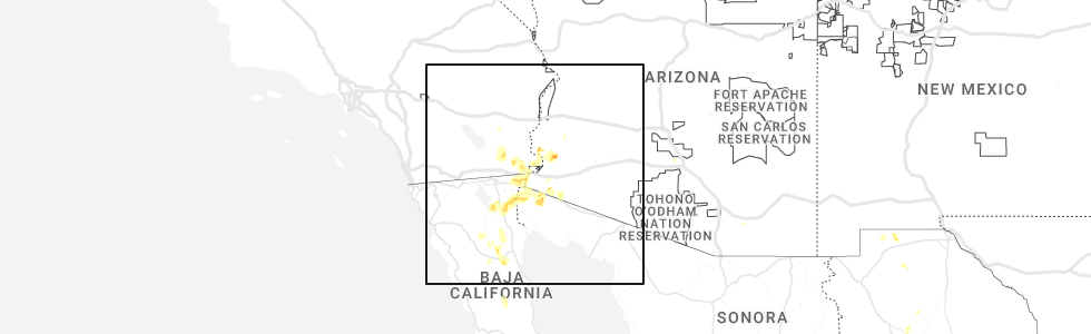
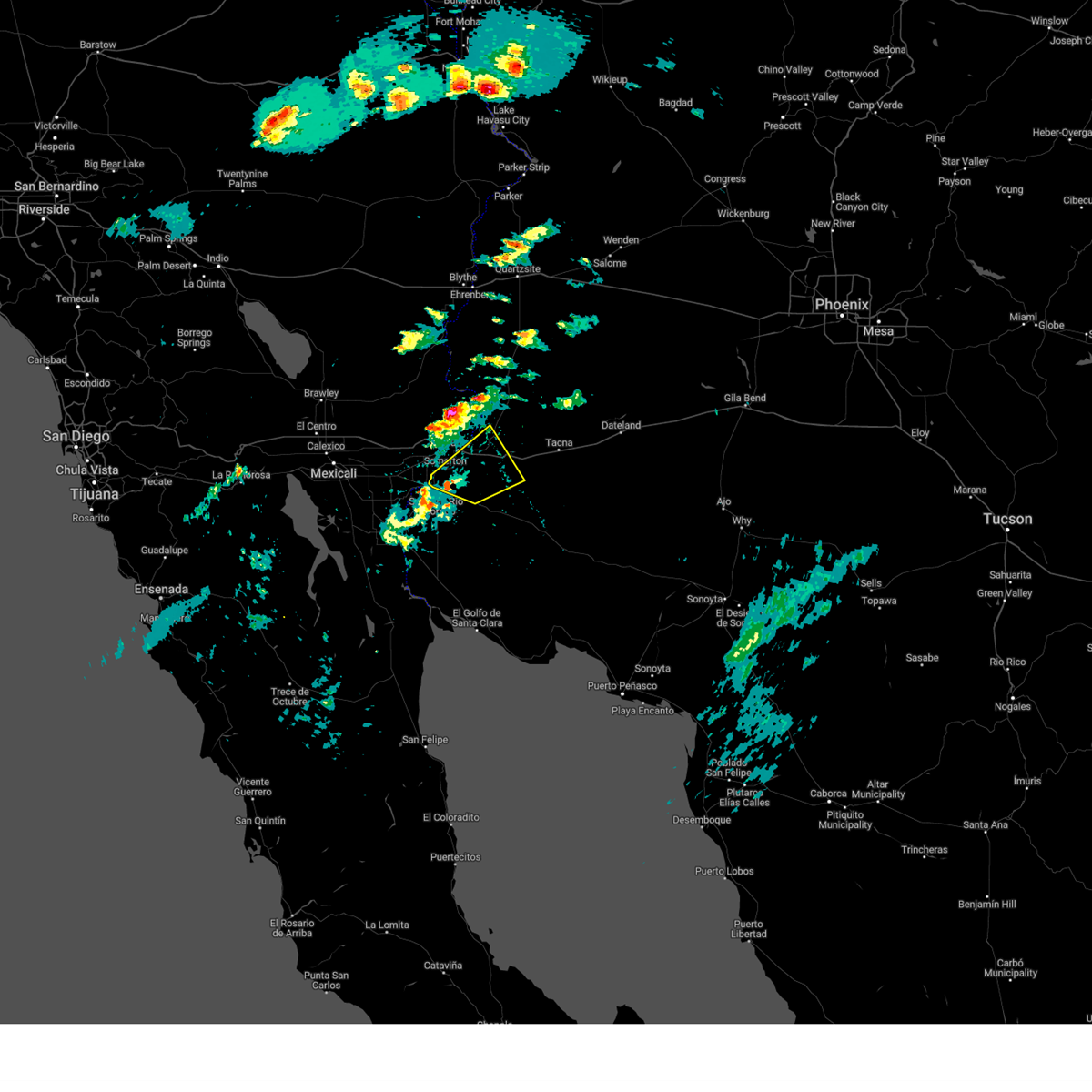
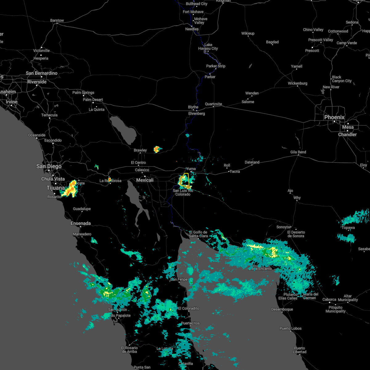
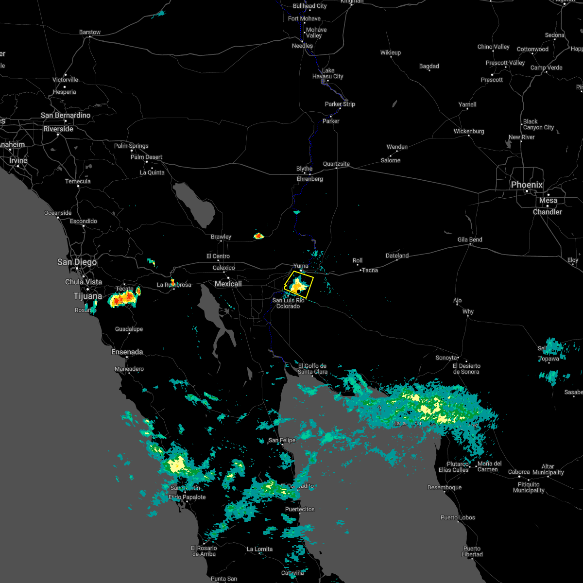
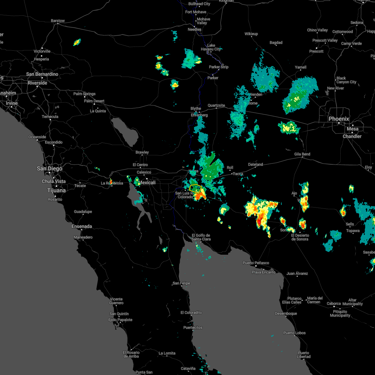
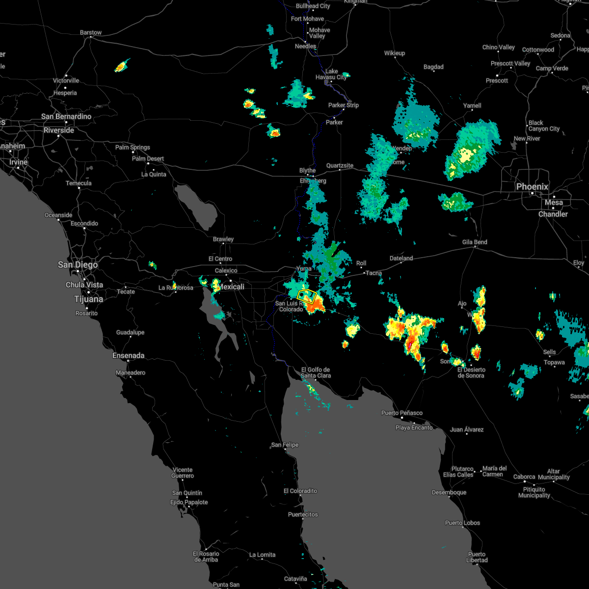
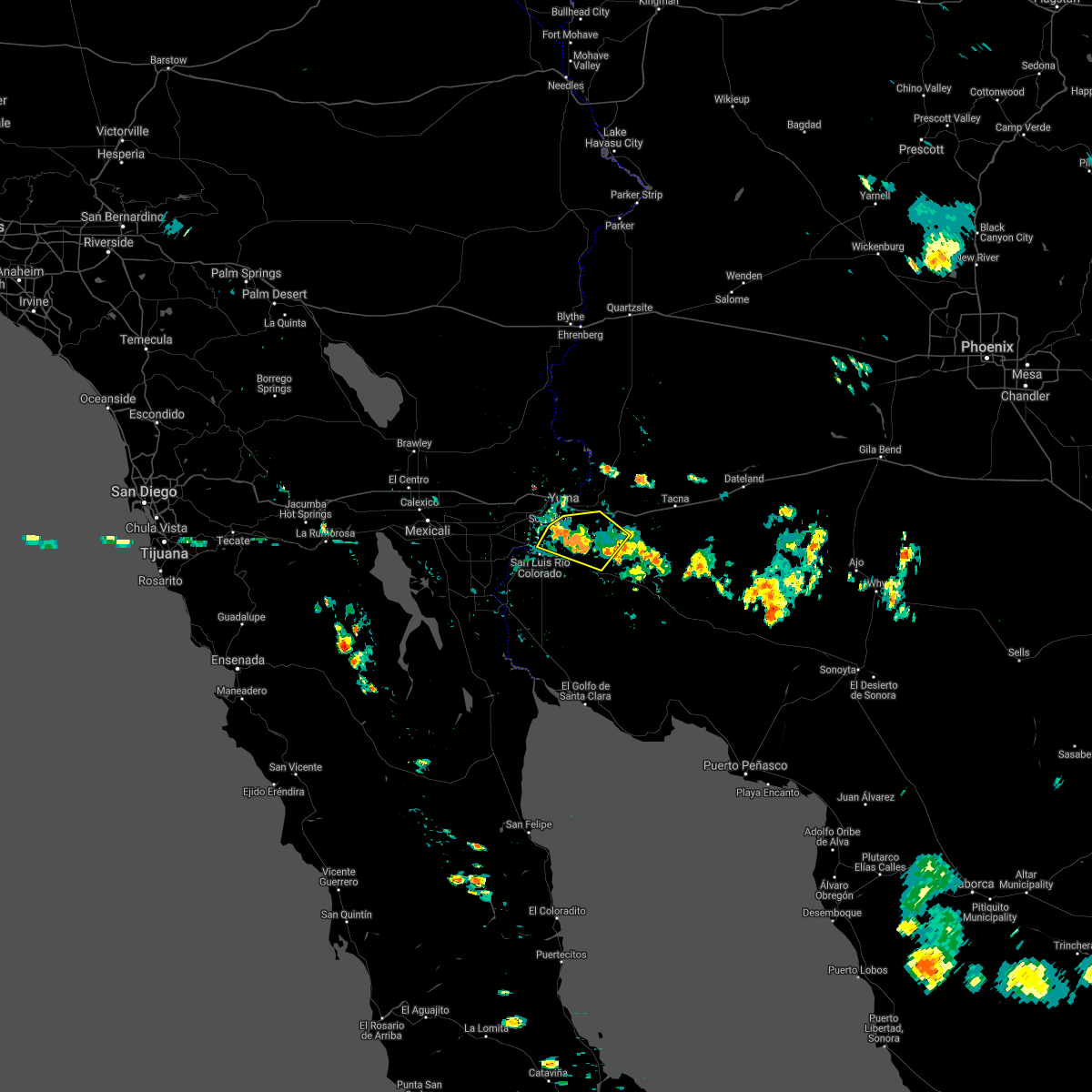
Hail Map for San Luis, AZ
The San Luis, AZ area has had 0 reports of on-the-ground hail by trained spotters, and has been under severe weather warnings 0 times during the past 12 months. Doppler radar has detected hail at or near San Luis, AZ on 3 occasions.
| Name: | San Luis, AZ |
| Where Located: | 14.3 miles SSW of Yuma, AZ |
| Map: | Google Map for San Luis, AZ |
| Population: | 25505 |
| Housing Units: | 6525 |
| More Info: | Search Google for San Luis, AZ |
5
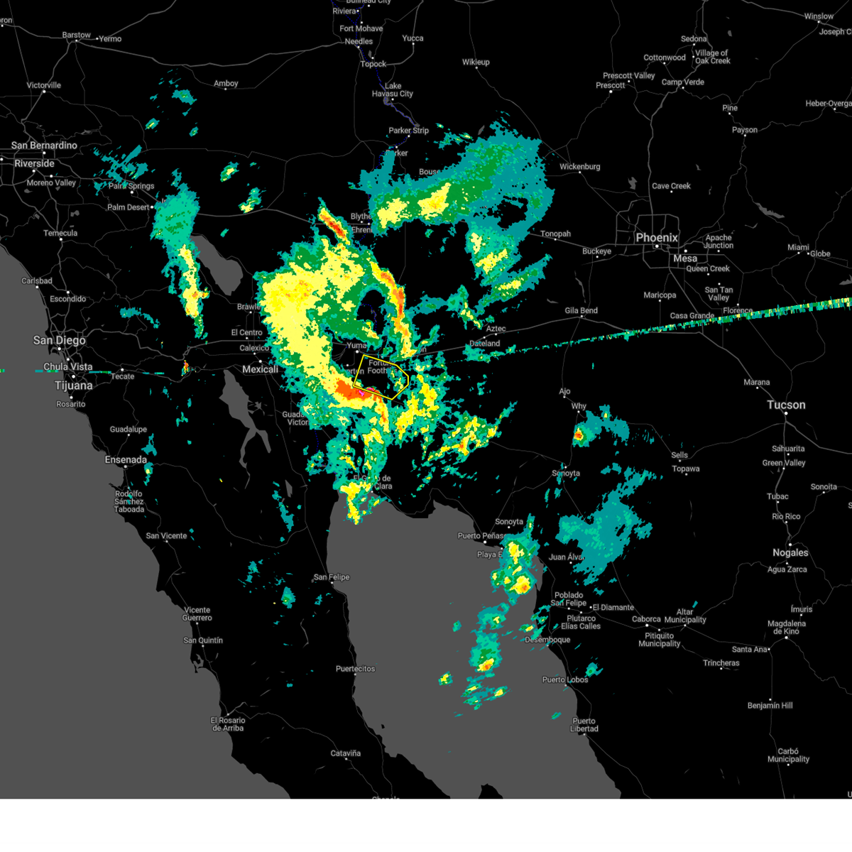
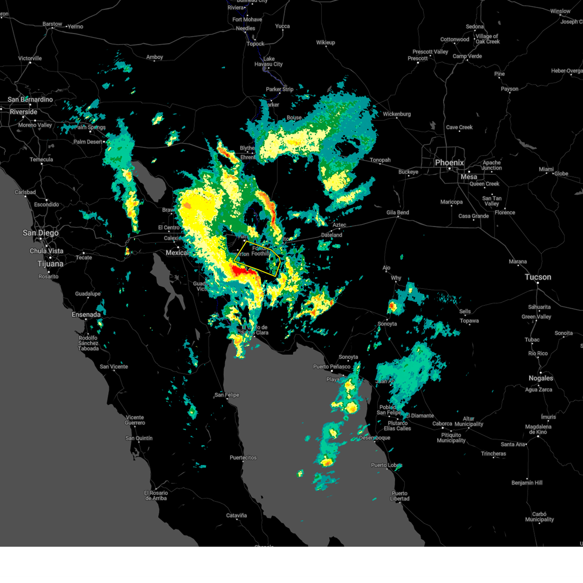
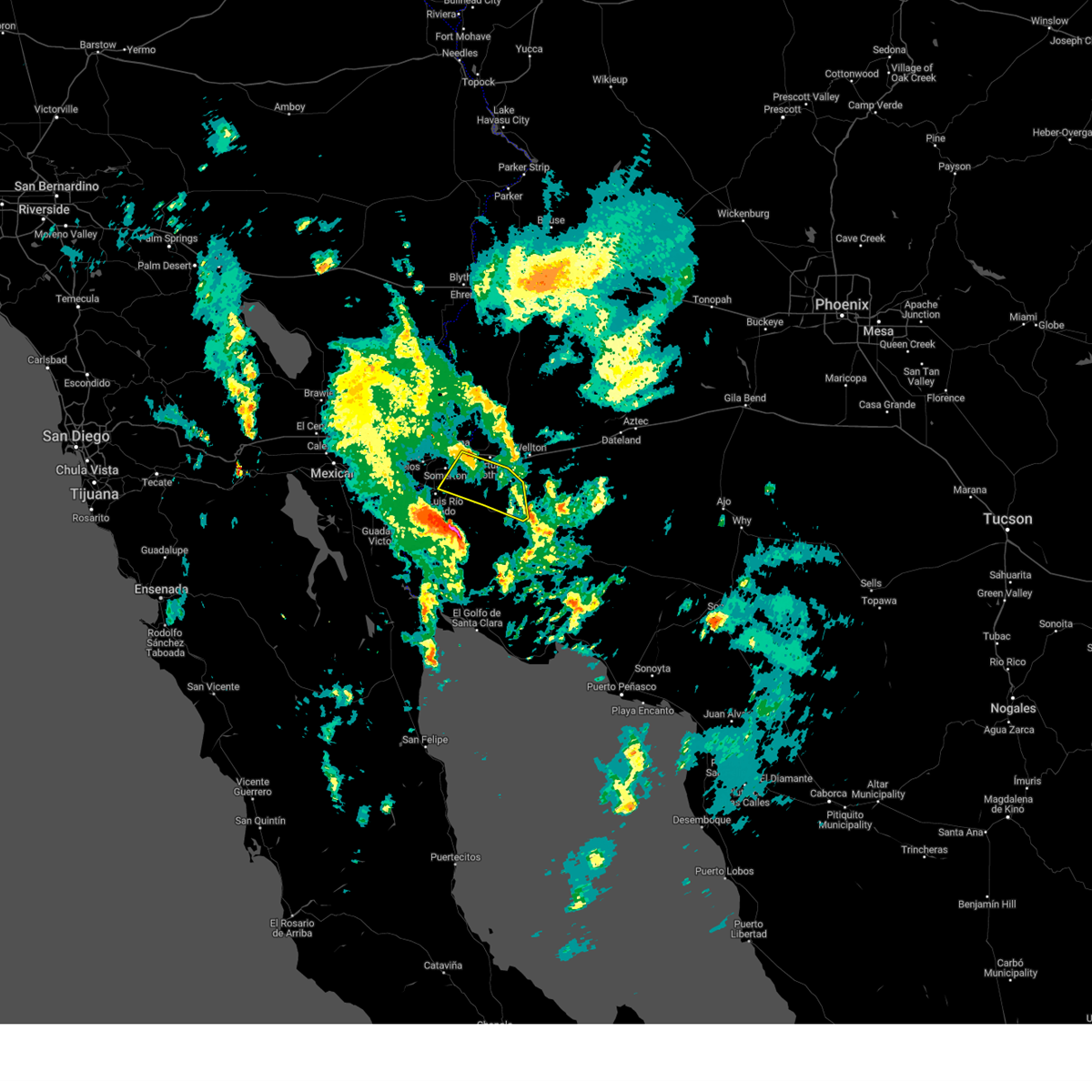
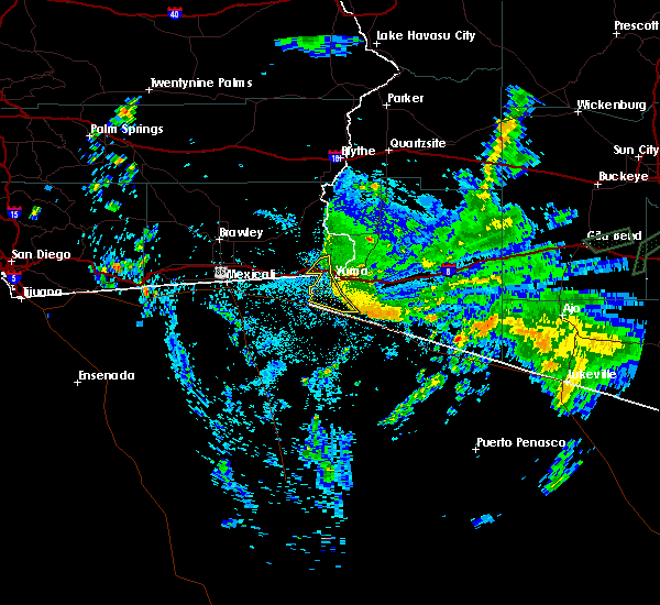
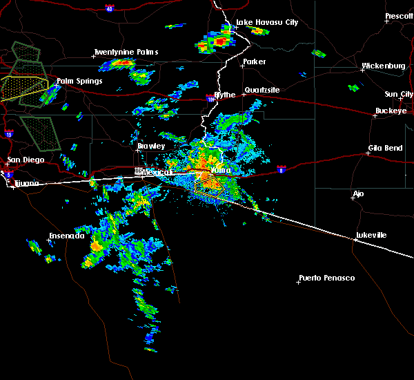
The Top Recent Hail Date for San Luis, AZ is Thursday, October 6, 2022 (1st out of 3)
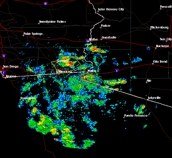
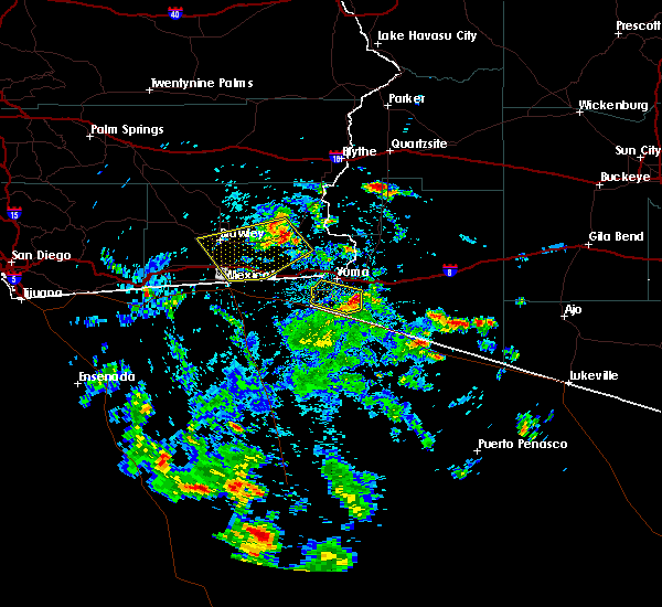
Hail and Wind Damage Spotted near San Luis, AZ
| Date / Time | Report Details |
|---|---|
| 12/22/2023 3:03 PM MST |
 At 303 pm mst, severe thunderstorms were located along a line extending from 6 miles southwest of yuma to 11 miles south of fortuna foothills to 16 miles south of ligurta to 22 miles southwest of wellton, moving northeast at 30 mph (radar indicated). Hazards include 60 mph wind gusts and quarter size hail. Hail damage to vehicles is expected. expect wind damage to roofs, siding, and trees. locations impacted include, yuma and fortuna foothills. this includes az route 195 between mile markers 10 and 26. hail threat, radar indicated max hail size, 1. 00 in wind threat, radar indicated max wind gust, 60 mph. At 303 pm mst, severe thunderstorms were located along a line extending from 6 miles southwest of yuma to 11 miles south of fortuna foothills to 16 miles south of ligurta to 22 miles southwest of wellton, moving northeast at 30 mph (radar indicated). Hazards include 60 mph wind gusts and quarter size hail. Hail damage to vehicles is expected. expect wind damage to roofs, siding, and trees. locations impacted include, yuma and fortuna foothills. this includes az route 195 between mile markers 10 and 26. hail threat, radar indicated max hail size, 1. 00 in wind threat, radar indicated max wind gust, 60 mph.
|
| 12/22/2023 2:48 PM MST |
 At 248 pm mst, severe thunderstorms were located along a line extending from near san luis to 13 miles south of yuma to 21 miles south of fortuna foothills, moving northeast at 30 mph (radar indicated). Hazards include 60 mph wind gusts and quarter size hail. Hail damage to vehicles is expected. expect wind damage to roofs, siding, and trees. locations impacted include, yuma and fortuna foothills. This includes az route 195 between mile markers 5 and 26. At 248 pm mst, severe thunderstorms were located along a line extending from near san luis to 13 miles south of yuma to 21 miles south of fortuna foothills, moving northeast at 30 mph (radar indicated). Hazards include 60 mph wind gusts and quarter size hail. Hail damage to vehicles is expected. expect wind damage to roofs, siding, and trees. locations impacted include, yuma and fortuna foothills. This includes az route 195 between mile markers 5 and 26.
|
| 12/22/2023 2:30 PM MST |
 At 230 pm mst, severe thunderstorms were located along a line extending from 6 miles south of san luis to 17 miles southeast of gadsden to 23 miles south of yuma, moving northeast at 30 mph (radar indicated). Hazards include 60 mph wind gusts and quarter size hail. Hail damage to vehicles is expected. Expect wind damage to roofs, siding, and trees. At 230 pm mst, severe thunderstorms were located along a line extending from 6 miles south of san luis to 17 miles southeast of gadsden to 23 miles south of yuma, moving northeast at 30 mph (radar indicated). Hazards include 60 mph wind gusts and quarter size hail. Hail damage to vehicles is expected. Expect wind damage to roofs, siding, and trees.
|
| 3/15/2023 5:02 PM MST |
 At 502 pm mst, a severe thunderstorm was located 7 miles south of yuma, moving east at 45 mph (radar indicated). Hazards include 60 mph wind gusts and penny size hail. Expect damage to roofs, siding, and trees. locations impacted include, yuma, somerton, fortuna foothills, san luis, blaisdell, kinter, ligurta and araby. this includes the following highways, az interstate 8 between mile markers 5 and 22. az route 95 between mile markers 29 and 41. az route 195 between mile markers 5 and 26. hail threat, radar indicated max hail size, 0. 75 in wind threat, radar indicated max wind gust, 60 mph. At 502 pm mst, a severe thunderstorm was located 7 miles south of yuma, moving east at 45 mph (radar indicated). Hazards include 60 mph wind gusts and penny size hail. Expect damage to roofs, siding, and trees. locations impacted include, yuma, somerton, fortuna foothills, san luis, blaisdell, kinter, ligurta and araby. this includes the following highways, az interstate 8 between mile markers 5 and 22. az route 95 between mile markers 29 and 41. az route 195 between mile markers 5 and 26. hail threat, radar indicated max hail size, 0. 75 in wind threat, radar indicated max wind gust, 60 mph.
|
| 3/15/2023 4:51 PM MST |
 At 451 pm mst, a severe thunderstorm was located near san luis, or 7 miles southeast of gadsden, moving northeast at 40 mph (radar indicated). Hazards include 60 mph wind gusts and penny size hail. expect damage to roofs, siding, and trees At 451 pm mst, a severe thunderstorm was located near san luis, or 7 miles southeast of gadsden, moving northeast at 40 mph (radar indicated). Hazards include 60 mph wind gusts and penny size hail. expect damage to roofs, siding, and trees
|
| 10/6/2022 2:47 PM MST |
 At 247 pm mst/247 pm pdt/, a severe thunderstorm was located over somerton, moving northwest at 30 mph (radar indicated). Hazards include 60 mph wind gusts and quarter size hail. Hail damage to vehicles is expected. expect wind damage to roofs, siding, and trees. locations impacted include, yuma, somerton, gadsden, san luis, andrade and winterhaven. this includes the following highways, az interstate 8 between mile markers 1 and 5. ca interstate 8 between mile markers 88 and 96. az route 195 between mile markers 5 and 22. hail threat, radar indicated max hail size, 1. 00 in wind threat, radar indicated max wind gust, 60 mph. At 247 pm mst/247 pm pdt/, a severe thunderstorm was located over somerton, moving northwest at 30 mph (radar indicated). Hazards include 60 mph wind gusts and quarter size hail. Hail damage to vehicles is expected. expect wind damage to roofs, siding, and trees. locations impacted include, yuma, somerton, gadsden, san luis, andrade and winterhaven. this includes the following highways, az interstate 8 between mile markers 1 and 5. ca interstate 8 between mile markers 88 and 96. az route 195 between mile markers 5 and 22. hail threat, radar indicated max hail size, 1. 00 in wind threat, radar indicated max wind gust, 60 mph.
|
| 10/6/2022 2:35 PM MST |
 At 234 pm mst/234 pm pdt/, a severe thunderstorm was located near somerton, moving northwest at 25 mph (radar indicated). Hazards include 60 mph wind gusts and quarter size hail. Hail damage to vehicles is expected. expect wind damage to roofs, siding, and trees. locations impacted include, yuma, somerton, gadsden, san luis, andrade, winterhaven and araby. this includes the following highways, az interstate 8 between mile markers 1 and 11. ca interstate 8 between mile markers 88 and 96. az route 95 between mile markers 29 and 31. hail threat, radar indicated max hail size, 1. 00 in wind threat, radar indicated max wind gust, 60 mph. At 234 pm mst/234 pm pdt/, a severe thunderstorm was located near somerton, moving northwest at 25 mph (radar indicated). Hazards include 60 mph wind gusts and quarter size hail. Hail damage to vehicles is expected. expect wind damage to roofs, siding, and trees. locations impacted include, yuma, somerton, gadsden, san luis, andrade, winterhaven and araby. this includes the following highways, az interstate 8 between mile markers 1 and 11. ca interstate 8 between mile markers 88 and 96. az route 95 between mile markers 29 and 31. hail threat, radar indicated max hail size, 1. 00 in wind threat, radar indicated max wind gust, 60 mph.
|
| 10/6/2022 2:23 PM MST |
 At 223 pm mst/223 pm pdt/, a severe thunderstorm was located 8 miles southeast of somerton, moving west at 20 mph (radar indicated). Hazards include 70 mph wind gusts and quarter size hail. Hail damage to vehicles is expected. expect considerable tree damage. wind damage is also likely to mobile homes, roofs, and outbuildings. locations impacted include, yuma, somerton, gadsden, fortuna foothills, san luis, andrade, winterhaven and araby. this includes the following highways, az interstate 8 between mile markers 1 and 11. ca interstate 8 between mile markers 88 and 96. az route 95 between mile markers 29 and 31. thunderstorm damage threat, considerable hail threat, radar indicated max hail size, 1. 00 in wind threat, radar indicated max wind gust, 70 mph. At 223 pm mst/223 pm pdt/, a severe thunderstorm was located 8 miles southeast of somerton, moving west at 20 mph (radar indicated). Hazards include 70 mph wind gusts and quarter size hail. Hail damage to vehicles is expected. expect considerable tree damage. wind damage is also likely to mobile homes, roofs, and outbuildings. locations impacted include, yuma, somerton, gadsden, fortuna foothills, san luis, andrade, winterhaven and araby. this includes the following highways, az interstate 8 between mile markers 1 and 11. ca interstate 8 between mile markers 88 and 96. az route 95 between mile markers 29 and 31. thunderstorm damage threat, considerable hail threat, radar indicated max hail size, 1. 00 in wind threat, radar indicated max wind gust, 70 mph.
|
| 10/6/2022 2:13 PM MST |
 At 213 pm mst/213 pm pdt/, a severe thunderstorm was located 10 miles southeast of san luis, or 12 miles southeast of somerton, moving northwest at 35 mph (radar indicated). Hazards include 60 mph wind gusts and quarter size hail. Hail damage to vehicles is expected. Expect wind damage to roofs, siding, and trees. At 213 pm mst/213 pm pdt/, a severe thunderstorm was located 10 miles southeast of san luis, or 12 miles southeast of somerton, moving northwest at 35 mph (radar indicated). Hazards include 60 mph wind gusts and quarter size hail. Hail damage to vehicles is expected. Expect wind damage to roofs, siding, and trees.
|
| 9/3/2022 6:10 PM MST |
 The severe thunderstorm warning for west central yuma county will expire at 615 pm mst, the storm which prompted the warning has moved out of the area. therefore, the warning will be allowed to expire. however gusty winds are still possible with this thunderstorm. The severe thunderstorm warning for west central yuma county will expire at 615 pm mst, the storm which prompted the warning has moved out of the area. therefore, the warning will be allowed to expire. however gusty winds are still possible with this thunderstorm.
|
| 9/3/2022 5:56 PM MST |
 At 556 pm mst, a severe thunderstorm was located over gadsden, moving northwest at 25 mph (radar indicated). Hazards include 60 mph wind gusts. expect damage to roofs, siding, and trees At 556 pm mst, a severe thunderstorm was located over gadsden, moving northwest at 25 mph (radar indicated). Hazards include 60 mph wind gusts. expect damage to roofs, siding, and trees
|
| 9/3/2022 5:48 PM MST |
 At 548 pm mst, a severe thunderstorm was located near somerton, moving northwest at 25 mph (radar indicated). Hazards include 60 mph wind gusts. Expect damage to roofs, siding, and trees. locations impacted include, yuma, somerton and gadsden. this includes az route 195 between mile markers 5 and 24. hail threat, radar indicated max hail size, <. 75 in wind threat, radar indicated max wind gust, 60 mph. At 548 pm mst, a severe thunderstorm was located near somerton, moving northwest at 25 mph (radar indicated). Hazards include 60 mph wind gusts. Expect damage to roofs, siding, and trees. locations impacted include, yuma, somerton and gadsden. this includes az route 195 between mile markers 5 and 24. hail threat, radar indicated max hail size, <. 75 in wind threat, radar indicated max wind gust, 60 mph.
|
| 9/3/2022 5:30 PM MST |
 At 530 pm mst, a severe thunderstorm was located 9 miles southeast of somerton, moving northwest at 25 mph (radar indicated). Hazards include 60 mph wind gusts. expect damage to roofs, siding, and trees At 530 pm mst, a severe thunderstorm was located 9 miles southeast of somerton, moving northwest at 25 mph (radar indicated). Hazards include 60 mph wind gusts. expect damage to roofs, siding, and trees
|
| 8/22/2022 1:50 AM MST | At 150 am mst/150 am pdt/, severe thunderstorms were located along a line extending from araby to near winterhaven to near algodones dunes, and are nearly stationary (radar indicated). Hazards include 60 mph wind gusts. Expect damage to roofs, siding, and trees. locations impacted include, yuma, somerton, gadsden, fortuna foothills, san luis, blaisdell, algodones dunes, kinter, andrade, winterhaven and araby. this includes the following highways, az interstate 8 between mile markers 1 and 17. ca interstate 8 between mile markers 78 and 96. az route 95 between mile markers 29 and 56. hail threat, radar indicated max hail size, <. 75 in wind threat, radar indicated max wind gust, 60 mph. |
| 8/22/2022 1:50 AM MST | At 150 am mst/150 am pdt/, severe thunderstorms were located along a line extending from araby to near winterhaven to near algodones dunes, and are nearly stationary (radar indicated). Hazards include 60 mph wind gusts. Expect damage to roofs, siding, and trees. locations impacted include, yuma, somerton, gadsden, fortuna foothills, san luis, blaisdell, algodones dunes, kinter, andrade, winterhaven and araby. this includes the following highways, az interstate 8 between mile markers 1 and 17. ca interstate 8 between mile markers 78 and 96. az route 95 between mile markers 29 and 56. hail threat, radar indicated max hail size, <. 75 in wind threat, radar indicated max wind gust, 60 mph. |
| 8/22/2022 1:27 AM MST | At 127 am mst/127 am pdt/, severe thunderstorms were located along a line extending from near kinter to near winterhaven to near algodones dunes, moving southwest at 30 mph (radar indicated). Hazards include 60 mph wind gusts. expect damage to roofs, siding, and trees |
| 8/22/2022 1:27 AM MST | At 127 am mst/127 am pdt/, severe thunderstorms were located along a line extending from near kinter to near winterhaven to near algodones dunes, moving southwest at 30 mph (radar indicated). Hazards include 60 mph wind gusts. expect damage to roofs, siding, and trees |
| 8/22/2022 1:11 AM PDT | At 109 am mst/109 am pdt/, severe thunderstorms were located along a line extending from 21 miles northeast of brawley to 22 miles north of gordon`s well to 17 miles north of algodones dunes to near martinez lake, moving southwest at 25 mph (radar indicated). Hazards include 70 mph wind gusts. Expect considerable tree damage. damage is likely to mobile homes, roofs, and outbuildings. locations impacted include, yuma, somerton, martinez lake, gadsden, fortuna foothills, wellton, gordon`s well, algodones dunes, kinter, andrade, winterhaven, araby, yuma proving ground, blaisdell and ligurta. this includes the following highways, az interstate 8 between mile markers 1 and 32. ca interstate 8 between mile markers 55 and 96. az route 95 between mile markers 29 and 79. thunderstorm damage threat, considerable hail threat, radar indicated max hail size, <. 75 in wind threat, radar indicated max wind gust, 70 mph. |
| 8/22/2022 1:11 AM PDT | At 109 am mst/109 am pdt/, severe thunderstorms were located along a line extending from 21 miles northeast of brawley to 22 miles north of gordon`s well to 17 miles north of algodones dunes to near martinez lake, moving southwest at 25 mph (radar indicated). Hazards include 70 mph wind gusts. Expect considerable tree damage. damage is likely to mobile homes, roofs, and outbuildings. locations impacted include, yuma, somerton, martinez lake, gadsden, fortuna foothills, wellton, gordon`s well, algodones dunes, kinter, andrade, winterhaven, araby, yuma proving ground, blaisdell and ligurta. this includes the following highways, az interstate 8 between mile markers 1 and 32. ca interstate 8 between mile markers 55 and 96. az route 95 between mile markers 29 and 79. thunderstorm damage threat, considerable hail threat, radar indicated max hail size, <. 75 in wind threat, radar indicated max wind gust, 70 mph. |
| 8/22/2022 12:44 AM PDT | At 1243 am mst/1243 am pdt/, severe thunderstorms were located along a line extending from 22 miles west of palo verde to 12 miles south of cibola to 7 miles east of yuma proving ground, moving southwest at 30 mph (radar indicated). Hazards include 70 mph wind gusts. Expect considerable tree damage. damage is likely to mobile homes, roofs, and outbuildings. locations impacted include, yuma, somerton, martinez lake, gadsden, fortuna foothills, wellton, cibola, palo verde, gordon`s well, algodones dunes, kinter, andrade, winterhaven, araby and yuma proving ground. this includes the following highways, az interstate 8 between mile markers 1 and 32. ca interstate 8 between mile markers 55 and 96. az route 95 between mile markers 29 and 90. thunderstorm damage threat, considerable hail threat, radar indicated max hail size, <. 75 in wind threat, radar indicated max wind gust, 70 mph. |
| 8/22/2022 12:44 AM PDT | At 1243 am mst/1243 am pdt/, severe thunderstorms were located along a line extending from 22 miles west of palo verde to 12 miles south of cibola to 7 miles east of yuma proving ground, moving southwest at 30 mph (radar indicated). Hazards include 70 mph wind gusts. Expect considerable tree damage. damage is likely to mobile homes, roofs, and outbuildings. locations impacted include, yuma, somerton, martinez lake, gadsden, fortuna foothills, wellton, cibola, palo verde, gordon`s well, algodones dunes, kinter, andrade, winterhaven, araby and yuma proving ground. this includes the following highways, az interstate 8 between mile markers 1 and 32. ca interstate 8 between mile markers 55 and 96. az route 95 between mile markers 29 and 90. thunderstorm damage threat, considerable hail threat, radar indicated max hail size, <. 75 in wind threat, radar indicated max wind gust, 70 mph. |
| 8/22/2022 12:34 AM PDT | At 1234 am mst/1234 am pdt/, severe thunderstorms were located along a line extending from 20 miles west of palo verde to 9 miles south of cibola to 11 miles northeast of yuma proving ground, moving southwest at 30 mph (radar indicated). Hazards include 70 mph wind gusts. Expect considerable tree damage. Damage is likely to mobile homes, roofs, and outbuildings. |
| 8/22/2022 12:34 AM PDT | At 1234 am mst/1234 am pdt/, severe thunderstorms were located along a line extending from 20 miles west of palo verde to 9 miles south of cibola to 11 miles northeast of yuma proving ground, moving southwest at 30 mph (radar indicated). Hazards include 70 mph wind gusts. Expect considerable tree damage. Damage is likely to mobile homes, roofs, and outbuildings. |
| 8/10/2022 7:41 PM MST |
 The severe thunderstorm warning for southwestern yuma county will expire at 745 pm mst, the storm which prompted the warning has weakened below severe limits, and no longer poses an immediate threat to life or property. therefore, the warning will be allowed to expire. however gusty winds and heavy rain are still possible with this thunderstorm. The severe thunderstorm warning for southwestern yuma county will expire at 745 pm mst, the storm which prompted the warning has weakened below severe limits, and no longer poses an immediate threat to life or property. therefore, the warning will be allowed to expire. however gusty winds and heavy rain are still possible with this thunderstorm.
|
| 8/10/2022 7:35 PM MST |
 At 734 pm mst, a severe thunderstorm was located 10 miles east of san luis, or 10 miles southeast of somerton, and is nearly stationary (radar indicated). Hazards include 60 mph wind gusts and penny size hail. Expect damage to roofs, siding, and trees. locations impacted include, yuma. this includes az route 195 between mile markers 7 and 16. hail threat, radar indicated max hail size, 0. 75 in wind threat, radar indicated max wind gust, 60 mph. At 734 pm mst, a severe thunderstorm was located 10 miles east of san luis, or 10 miles southeast of somerton, and is nearly stationary (radar indicated). Hazards include 60 mph wind gusts and penny size hail. Expect damage to roofs, siding, and trees. locations impacted include, yuma. this includes az route 195 between mile markers 7 and 16. hail threat, radar indicated max hail size, 0. 75 in wind threat, radar indicated max wind gust, 60 mph.
|
| 8/10/2022 6:57 PM MST |
 At 657 pm mst, a severe thunderstorm was located near somerton, moving north at 10 mph (radar indicated). Hazards include 70 mph wind gusts and penny size hail. Expect considerable tree damage. damage is likely to mobile homes, roofs, and outbuildings. locations impacted include, yuma, somerton, gadsden and san luis. this includes az route 195 between mile markers 5 and 23. thunderstorm damage threat, considerable hail threat, radar indicated max hail size, 0. 75 in wind threat, radar indicated max wind gust, 70 mph. At 657 pm mst, a severe thunderstorm was located near somerton, moving north at 10 mph (radar indicated). Hazards include 70 mph wind gusts and penny size hail. Expect considerable tree damage. damage is likely to mobile homes, roofs, and outbuildings. locations impacted include, yuma, somerton, gadsden and san luis. this includes az route 195 between mile markers 5 and 23. thunderstorm damage threat, considerable hail threat, radar indicated max hail size, 0. 75 in wind threat, radar indicated max wind gust, 70 mph.
|
| 8/10/2022 6:56 PM MST |
 At 656 pm mst, a severe thunderstorm was located near somerton, moving north at 10 mph (radar indicated). Hazards include 60 mph wind gusts and penny size hail. expect damage to roofs, siding, and trees At 656 pm mst, a severe thunderstorm was located near somerton, moving north at 10 mph (radar indicated). Hazards include 60 mph wind gusts and penny size hail. expect damage to roofs, siding, and trees
|
| 8/11/2021 2:46 PM MST |
 At 245 pm mst, a severe thunderstorm was located near san luis, or 7 miles south of somerton, moving west at 10 mph (radar indicated). Hazards include 60 mph wind gusts. ares of dense blowing dust and sand. Expect damage to roofs, siding, and trees. dangerous driving conditions. locations impacted include, yuma, somerton, fortuna foothills and san luis. This includes az route 195 between mile markers 5 and 26. At 245 pm mst, a severe thunderstorm was located near san luis, or 7 miles south of somerton, moving west at 10 mph (radar indicated). Hazards include 60 mph wind gusts. ares of dense blowing dust and sand. Expect damage to roofs, siding, and trees. dangerous driving conditions. locations impacted include, yuma, somerton, fortuna foothills and san luis. This includes az route 195 between mile markers 5 and 26.
|
| 8/11/2021 2:17 PM MST |
 At 215 pm mst, a severe thunderstorm was located 9 miles southeast of somerton, moving west at 10 mph (radar indicated). Hazards include 60 mph wind gusts. ares of dense blowing dust and sand. Expect damage to roofs, siding, and trees. Dangerous driving conditions. At 215 pm mst, a severe thunderstorm was located 9 miles southeast of somerton, moving west at 10 mph (radar indicated). Hazards include 60 mph wind gusts. ares of dense blowing dust and sand. Expect damage to roofs, siding, and trees. Dangerous driving conditions.
|
| 7/30/2021 6:00 PM MST |
 At 600 pm mst/600 pm pdt/, a severe thunderstorm was located over gadsden, moving west at 10 mph (radar indicated). Hazards include 60 mph wind gusts and penny size hail. Expect damage to roofs, siding, and trees. locations impacted include, yuma, somerton, gadsden, san luis and winterhaven. this includes the following highways, az interstate 8 between mile markers 1 and 3. ca interstate 8 between mile markers 94 and 96. Az route 195 between mile markers 5 and 21. At 600 pm mst/600 pm pdt/, a severe thunderstorm was located over gadsden, moving west at 10 mph (radar indicated). Hazards include 60 mph wind gusts and penny size hail. Expect damage to roofs, siding, and trees. locations impacted include, yuma, somerton, gadsden, san luis and winterhaven. this includes the following highways, az interstate 8 between mile markers 1 and 3. ca interstate 8 between mile markers 94 and 96. Az route 195 between mile markers 5 and 21.
|
| 7/30/2021 5:29 PM MST |
 At 529 pm mst/529 pm pdt/, a severe thunderstorm was located near somerton, moving west at 10 mph (radar indicated). Hazards include 60 mph wind gusts and penny size hail. expect damage to roofs, siding, and trees At 529 pm mst/529 pm pdt/, a severe thunderstorm was located near somerton, moving west at 10 mph (radar indicated). Hazards include 60 mph wind gusts and penny size hail. expect damage to roofs, siding, and trees
|
| 9/25/2019 2:37 PM MST |
 At 237 pm mst, a severe thunderstorm was located near somerton, moving west at 20 mph (radar indicated). Hazards include 60 mph wind gusts and penny size hail. Expect damage to roofs, siding, and trees. locations impacted include, yuma, somerton, gadsden and san luis. This includes az route 195 between mile markers 5 and 23. At 237 pm mst, a severe thunderstorm was located near somerton, moving west at 20 mph (radar indicated). Hazards include 60 mph wind gusts and penny size hail. Expect damage to roofs, siding, and trees. locations impacted include, yuma, somerton, gadsden and san luis. This includes az route 195 between mile markers 5 and 23.
|
| 9/25/2019 2:12 PM MST |
 At 212 pm mst, a severe thunderstorm was located 9 miles south of araby, or 9 miles southwest of fortuna foothills, moving west at 20 mph (radar indicated). Hazards include 60 mph wind gusts and quarter size hail. Hail damage to vehicles is expected. Expect wind damage to roofs, siding, and trees. At 212 pm mst, a severe thunderstorm was located 9 miles south of araby, or 9 miles southwest of fortuna foothills, moving west at 20 mph (radar indicated). Hazards include 60 mph wind gusts and quarter size hail. Hail damage to vehicles is expected. Expect wind damage to roofs, siding, and trees.
|
| 7/9/2018 8:44 PM MST |
 At 843 pm mst/843 pm pdt/, severe thunderstorms were located along a line extending from 10 miles northwest of winterhaven to andrade to near somerton to 11 miles east of san luis to 16 miles south of fortuna foothills, moving west at 40 mph (radar indicated). Hazards include 60 mph wind gusts. expect damage to roofs, siding, and trees At 843 pm mst/843 pm pdt/, severe thunderstorms were located along a line extending from 10 miles northwest of winterhaven to andrade to near somerton to 11 miles east of san luis to 16 miles south of fortuna foothills, moving west at 40 mph (radar indicated). Hazards include 60 mph wind gusts. expect damage to roofs, siding, and trees
|
| 7/9/2018 8:36 PM MST |
 At 835 pm mst/835 pm pdt/, severe thunderstorms were located along a line extending from 7 miles southwest of martinez lake to 7 miles south of araby to 16 miles south of ligurta, moving southwest at 45 mph (radar indicated). Hazards include 60 mph wind gusts. Expect damage to roofs, siding, and trees. locations impacted include, yuma, somerton, fortuna foothills, wellton, blaisdell, kinter, ligurta, winterhaven and araby. this includes the following highways, az interstate 8 between mile markers 1 and 32. ca interstate 8 between mile markers 91 and 96. Az route 95 between mile markers 29 and 56. At 835 pm mst/835 pm pdt/, severe thunderstorms were located along a line extending from 7 miles southwest of martinez lake to 7 miles south of araby to 16 miles south of ligurta, moving southwest at 45 mph (radar indicated). Hazards include 60 mph wind gusts. Expect damage to roofs, siding, and trees. locations impacted include, yuma, somerton, fortuna foothills, wellton, blaisdell, kinter, ligurta, winterhaven and araby. this includes the following highways, az interstate 8 between mile markers 1 and 32. ca interstate 8 between mile markers 91 and 96. Az route 95 between mile markers 29 and 56.
|
| 7/9/2018 8:08 PM MST |
 At 808 pm mst/808 pm pdt/, severe thunderstorms were located along a line extending from 9 miles southeast of yuma proving ground to near ligurta to 9 miles south of tacna, moving southwest at 45 mph (radar indicated). Hazards include 60 mph wind gusts. expect damage to roofs, siding, and trees At 808 pm mst/808 pm pdt/, severe thunderstorms were located along a line extending from 9 miles southeast of yuma proving ground to near ligurta to 9 miles south of tacna, moving southwest at 45 mph (radar indicated). Hazards include 60 mph wind gusts. expect damage to roofs, siding, and trees
|
| 9/8/2017 4:20 PM MST |
 At 420 pm mst/420 pm pdt/, a severe thunderstorm was located over somerton, moving east at 15 mph (radar indicated). Hazards include 60 mph wind gusts. Expect damage to roofs, siding, and trees. Locations impacted include, yuma, somerton, winterhaven and andrade. At 420 pm mst/420 pm pdt/, a severe thunderstorm was located over somerton, moving east at 15 mph (radar indicated). Hazards include 60 mph wind gusts. Expect damage to roofs, siding, and trees. Locations impacted include, yuma, somerton, winterhaven and andrade.
|
| 9/8/2017 4:07 PM MST |
 At 407 pm mst/407 pm pdt/, a severe thunderstorm was located over somerton, moving east at 15 mph (radar indicated). Hazards include 60 mph wind gusts and penny size hail. expect damage to roofs, siding, and trees At 407 pm mst/407 pm pdt/, a severe thunderstorm was located over somerton, moving east at 15 mph (radar indicated). Hazards include 60 mph wind gusts and penny size hail. expect damage to roofs, siding, and trees
|
| 8/2/2017 5:54 PM MST |
 At 552 pm mst/552 pm pdt/, a severe thunderstorm was located over san luis, or near gadsden, moving northwest at 15 mph. the storm appears to be weakening, but still remains strong (radar indicated). Hazards include 60 mph wind gusts and nickel size hail. Expect damage to roofs, siding, and trees. Locations impacted include, yuma, somerton, gadsden, san luis, algodones dunes, andrade and winterhaven. At 552 pm mst/552 pm pdt/, a severe thunderstorm was located over san luis, or near gadsden, moving northwest at 15 mph. the storm appears to be weakening, but still remains strong (radar indicated). Hazards include 60 mph wind gusts and nickel size hail. Expect damage to roofs, siding, and trees. Locations impacted include, yuma, somerton, gadsden, san luis, algodones dunes, andrade and winterhaven.
|
| 8/2/2017 5:33 PM MST |
 At 533 pm mst/533 pm pdt/, a severe thunderstorm was located 7 miles southeast of san luis, or 10 miles southeast of gadsden, moving northwest at 15 mph (radar indicated). Hazards include 60 mph wind gusts and nickel size hail. expect damage to roofs, siding, and trees At 533 pm mst/533 pm pdt/, a severe thunderstorm was located 7 miles southeast of san luis, or 10 miles southeast of gadsden, moving northwest at 15 mph (radar indicated). Hazards include 60 mph wind gusts and nickel size hail. expect damage to roofs, siding, and trees
|
| 9/8/2015 5:18 PM MST |
 At 515 pm mst, doppler radar indicated a severe thunderstorm capable of producing quarter size hail and destructive winds in excess of 70 mph, remains south of yuma. local law enforcement reported damage to power lines in the nearby area due to this thunderstorm. this storm was located 7 miles southeast of somerton, moving southwest at 10 mph. locations impacted include, yuma, somerton, gadsden and san luis. At 515 pm mst, doppler radar indicated a severe thunderstorm capable of producing quarter size hail and destructive winds in excess of 70 mph, remains south of yuma. local law enforcement reported damage to power lines in the nearby area due to this thunderstorm. this storm was located 7 miles southeast of somerton, moving southwest at 10 mph. locations impacted include, yuma, somerton, gadsden and san luis.
|
| 9/8/2015 4:58 PM MST |
 At 458 pm mst, doppler radar indicated a severe thunderstorm capable of producing quarter size hail and destructive winds in excess of 70 mph. this storm was located 7 miles southeast of somerton, and moving southwest at 10 mph. At 458 pm mst, doppler radar indicated a severe thunderstorm capable of producing quarter size hail and destructive winds in excess of 70 mph. this storm was located 7 miles southeast of somerton, and moving southwest at 10 mph.
|
Hail Maps for San Luis, AZ


Connect with Interactive Hail Maps