

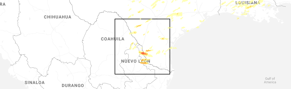
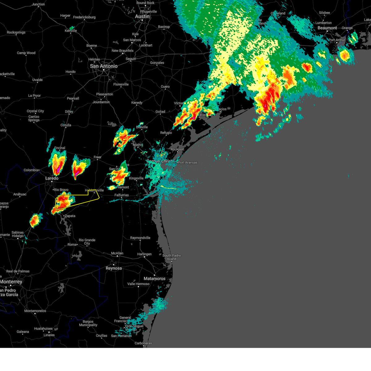
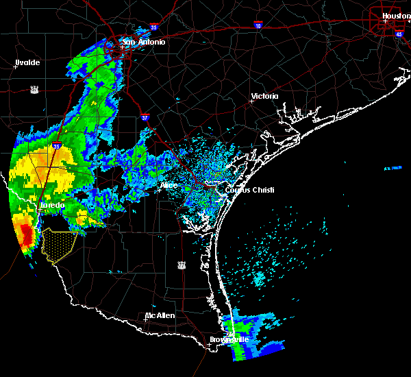
Hail Map for San Ygnacio, TX
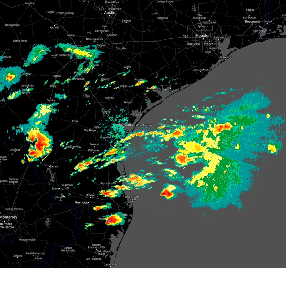
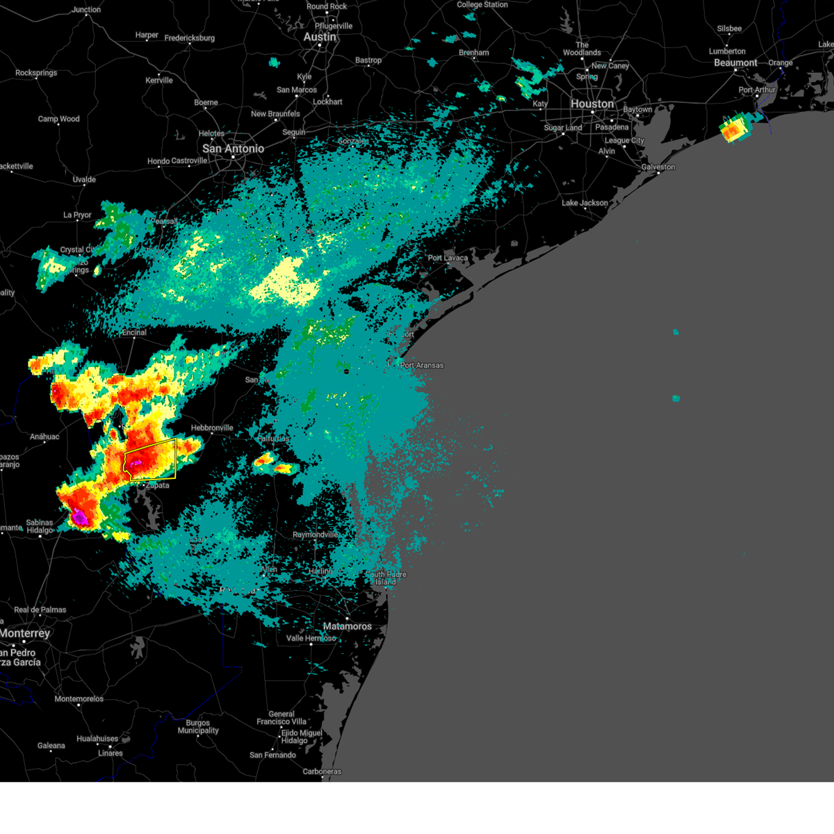
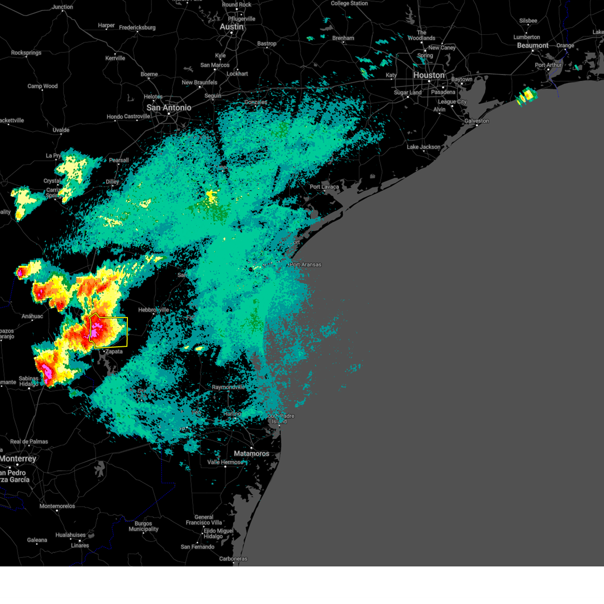
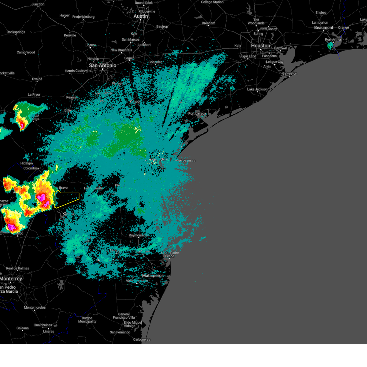
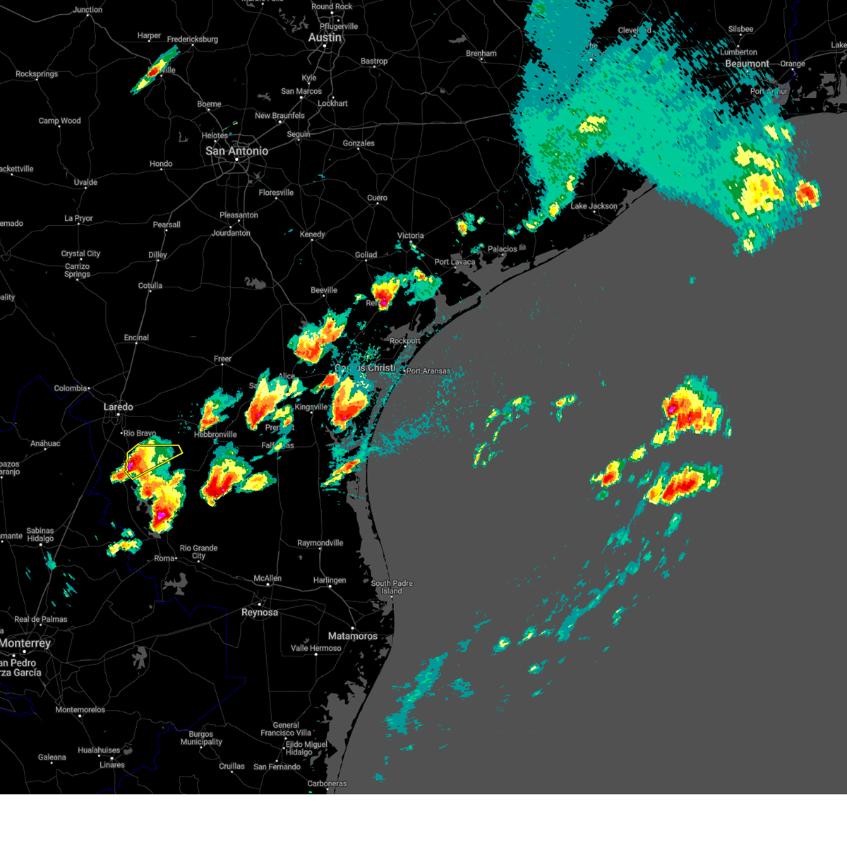
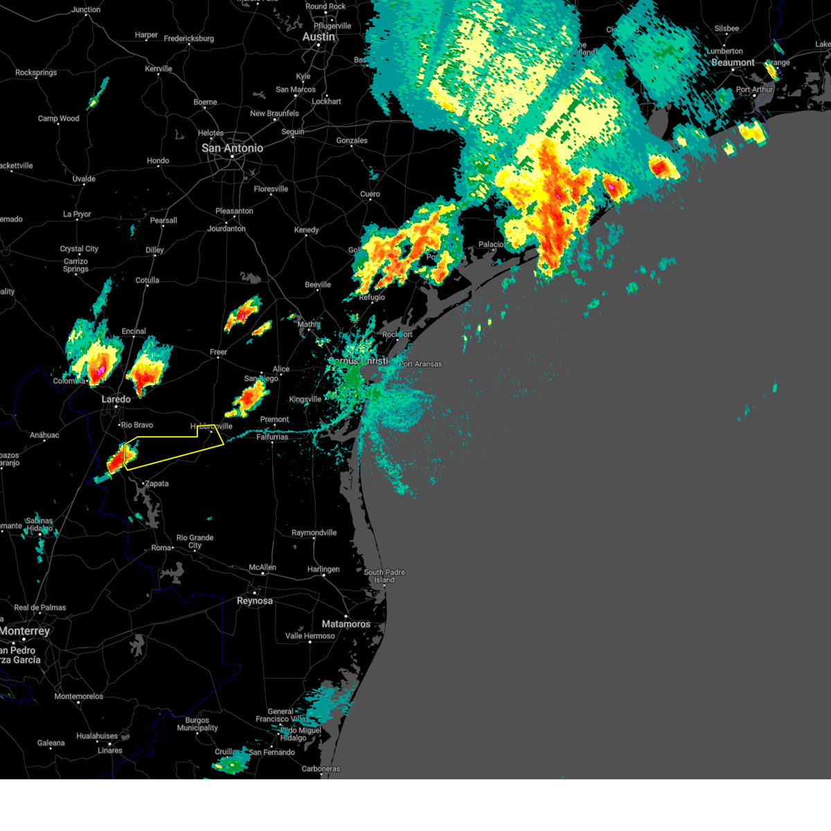
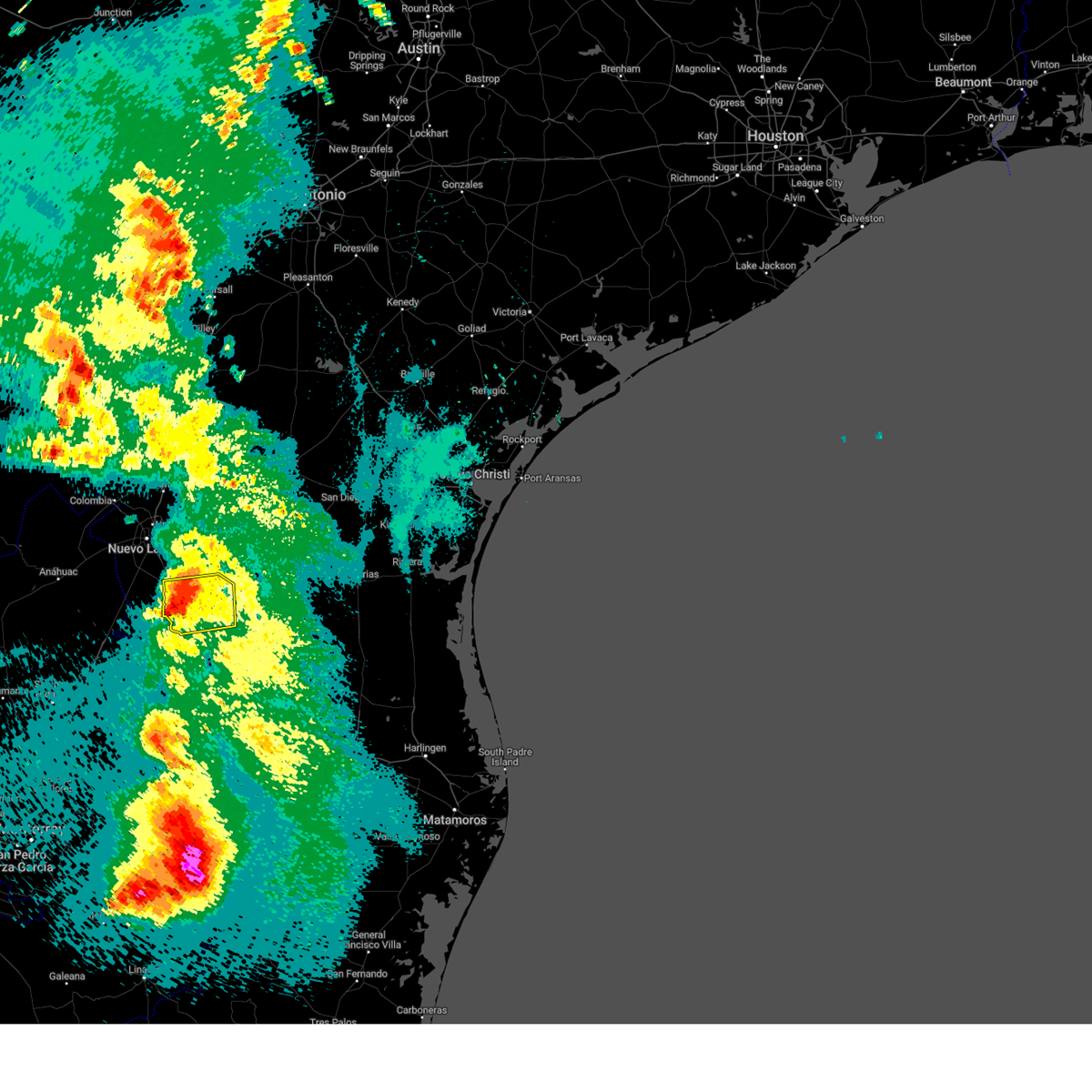
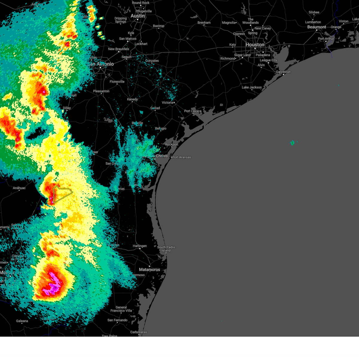
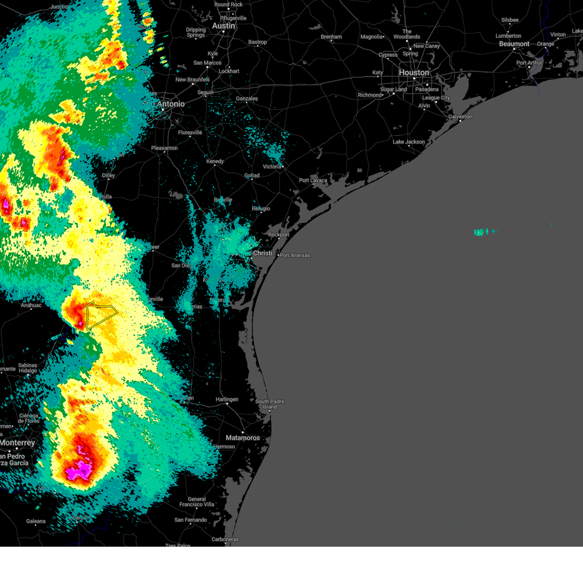
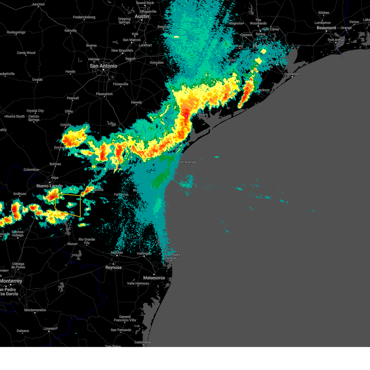
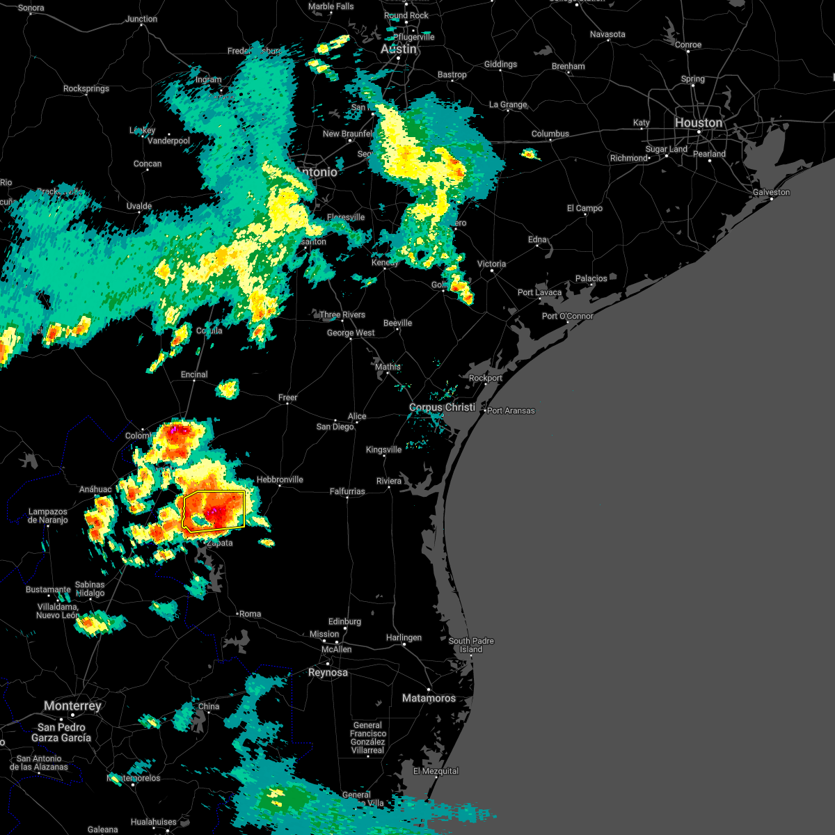
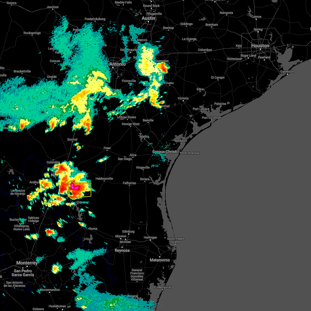
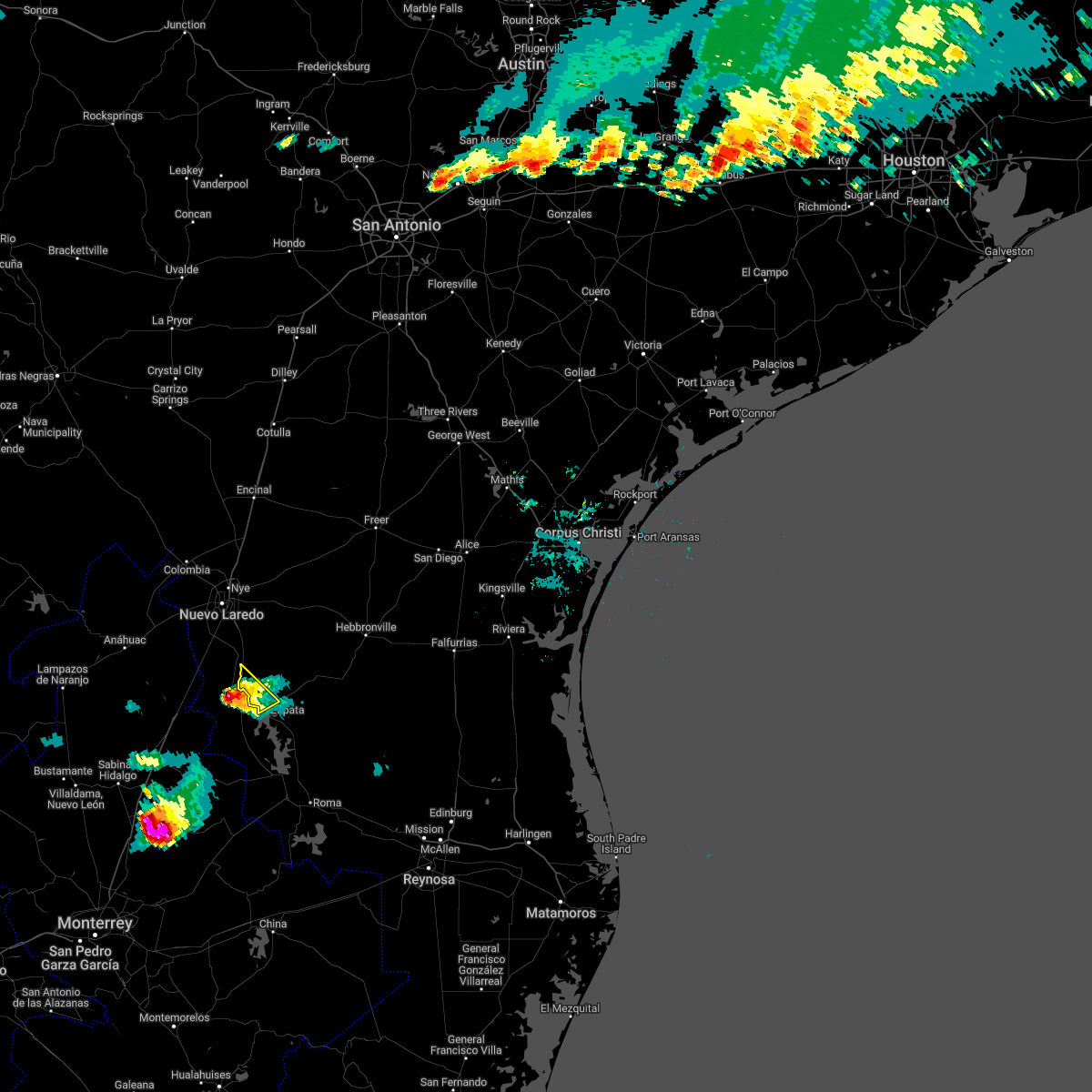
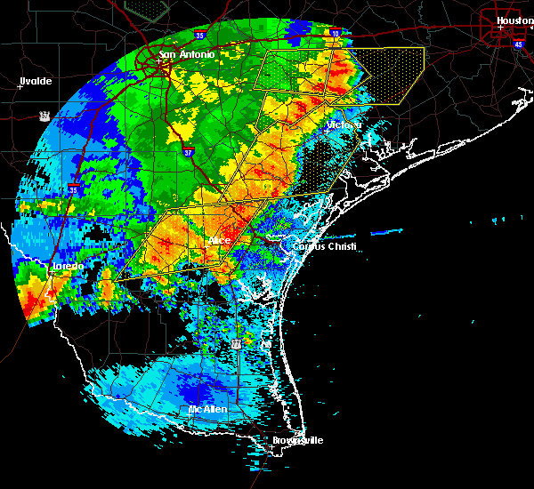
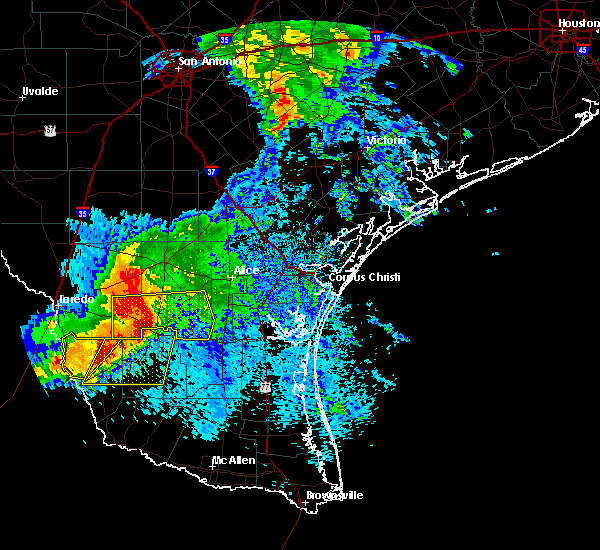
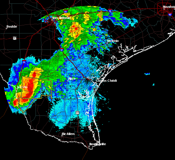
The San Ygnacio, TX area has had 3 reports of on-the-ground hail by trained spotters, and has been under severe weather warnings 9 times during the past 12 months. Doppler radar has detected hail at or near San Ygnacio, TX on 43 occasions, including 2 occasions during the past year.
| Name: | San Ygnacio, TX |
| Where Located: | 33.4 miles S of Laredo, TX |
| Map: | Google Map for San Ygnacio, TX |
| Population: | 667 |
| Housing Units: | 366 |
| More Info: | Search Google for San Ygnacio, TX |
5
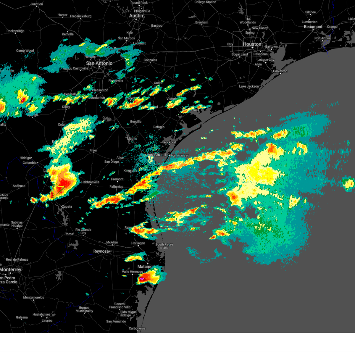
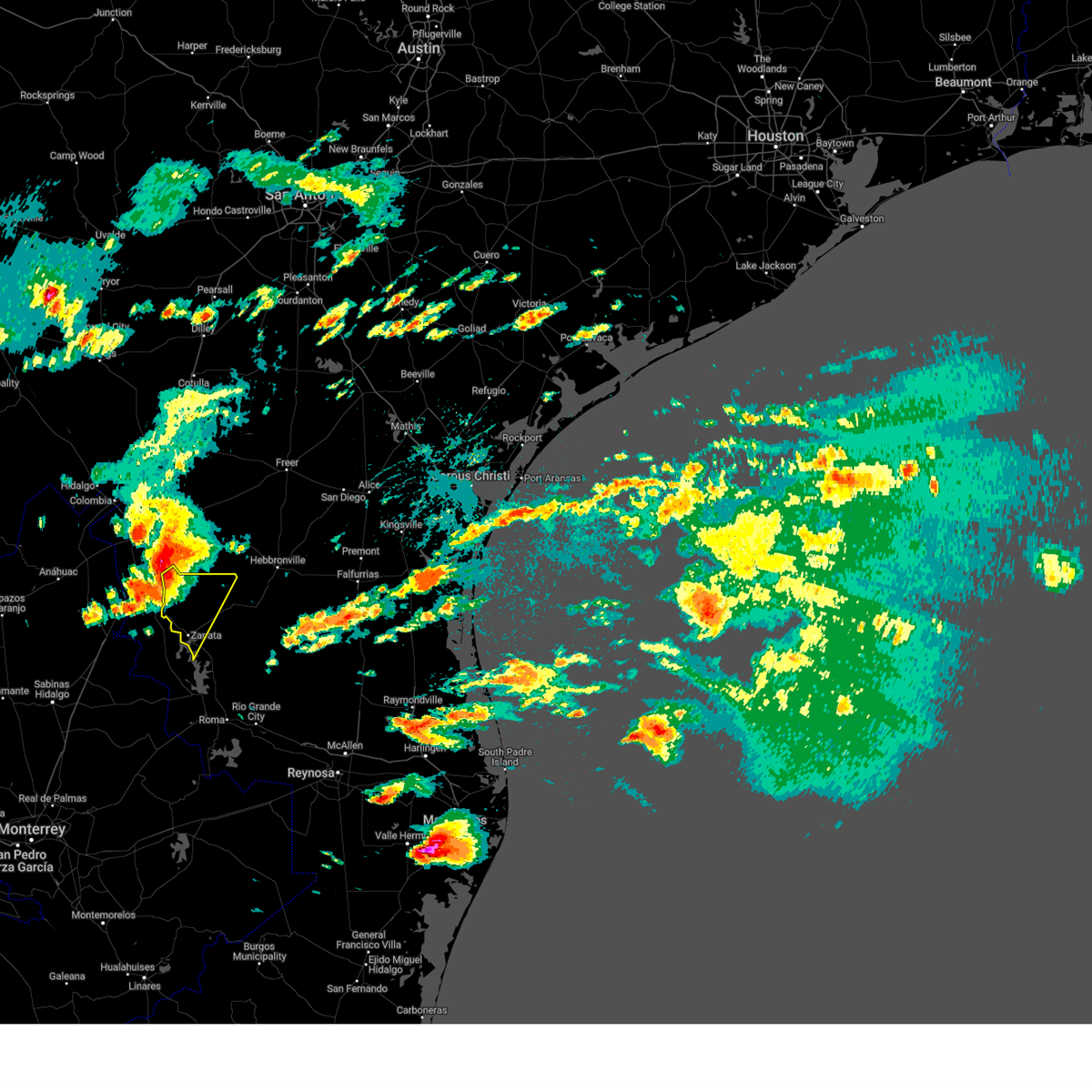
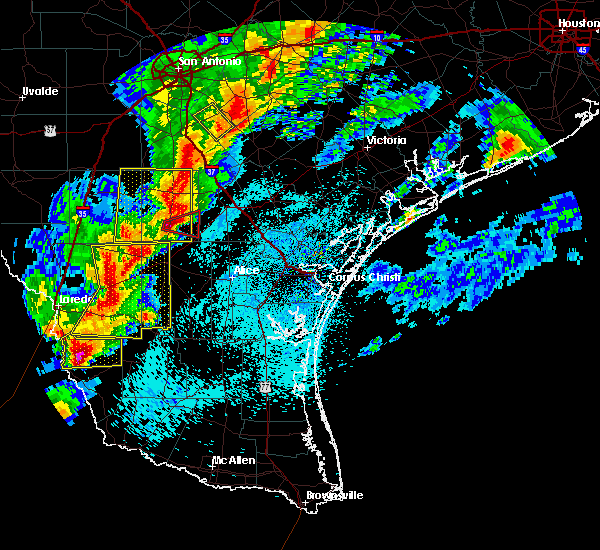
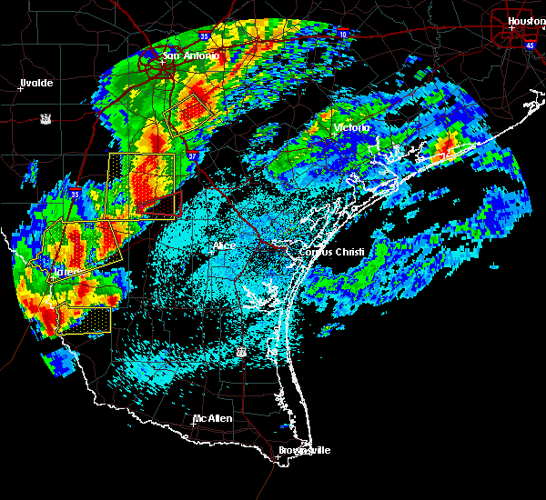
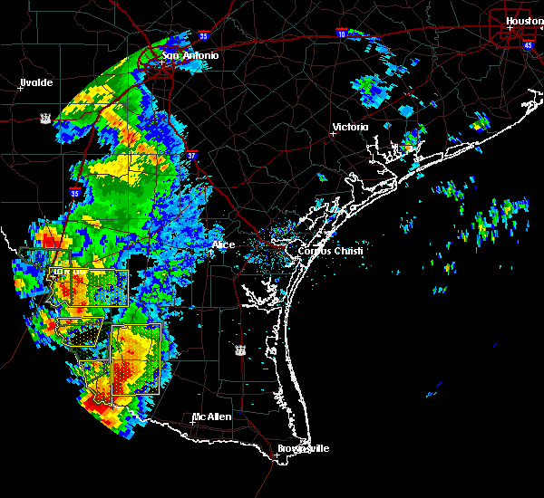
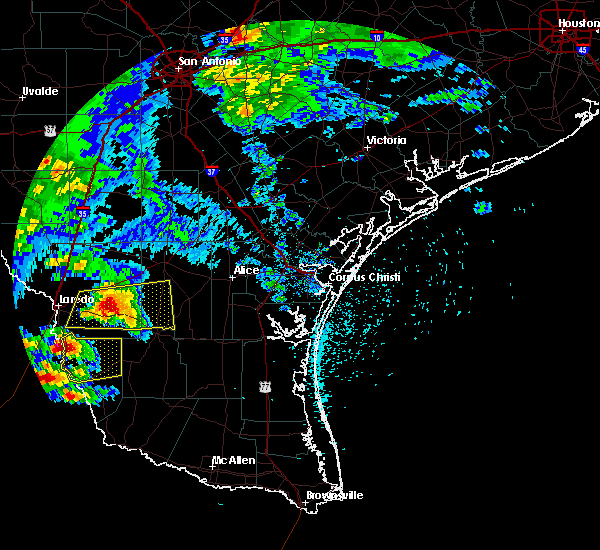
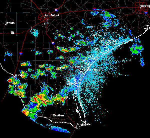
The Top Recent Hail Date for San Ygnacio, TX is Tuesday, May 6, 2025 (1st out of 43)
Hail and Wind Damage Spotted near San Ygnacio, TX
| Date / Time | Report Details |
|---|---|
| 5/8/2025 4:13 PM CDT | At 413 pm cdt, a severe thunderstorm was located 11 miles west of thompsonville, or 14 miles north of bustamante, moving east at 30 mph (radar indicated). Hazards include 60 mph wind gusts and half dollar size hail. Hail damage to vehicles is expected. expect wind damage to roofs, siding, and trees. locations impacted include, zapata high school, black bass, zapata county fire department, zapata middle school, siesta shores, romeo t. Flores park, zapata county public library, las palmas, zapata--medina, and medina. |
| 5/8/2025 4:12 PM CDT |
 The storm which prompted the warning has moved out of the area. therefore, the warning will be allowed to expire. a severe thunderstorm watch remains in effect until 1100 pm cdt for deep south texas. The storm which prompted the warning has moved out of the area. therefore, the warning will be allowed to expire. a severe thunderstorm watch remains in effect until 1100 pm cdt for deep south texas.
|
| 5/8/2025 4:09 PM CDT |
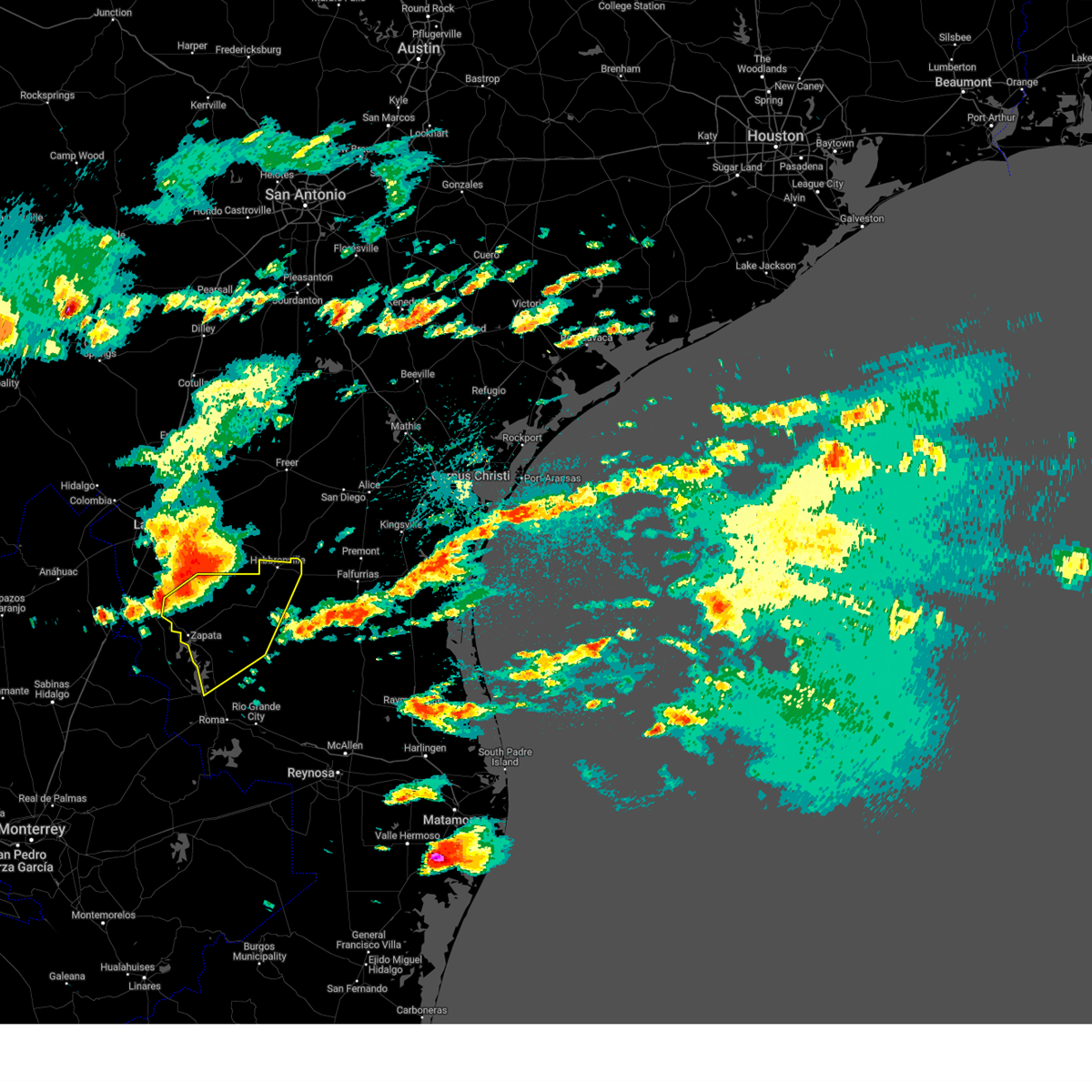 Svrbro the national weather service in brownsville has issued a * severe thunderstorm warning for, jim hogg county in deep south texas, northwestern starr county in deep south texas, zapata county in deep south texas, * until 500 pm cdt. * at 409 pm cdt, severe thunderstorms were located along a line extending from 7 miles northwest of thompsonville to 6 miles northwest of bustamante to 9 miles southwest of san ygnacio, moving southeast at 30 mph (radar indicated). Hazards include 60 mph wind gusts and half dollar size hail. Hail damage to vehicles is expected. Expect wind damage to roofs, siding, and trees. Svrbro the national weather service in brownsville has issued a * severe thunderstorm warning for, jim hogg county in deep south texas, northwestern starr county in deep south texas, zapata county in deep south texas, * until 500 pm cdt. * at 409 pm cdt, severe thunderstorms were located along a line extending from 7 miles northwest of thompsonville to 6 miles northwest of bustamante to 9 miles southwest of san ygnacio, moving southeast at 30 mph (radar indicated). Hazards include 60 mph wind gusts and half dollar size hail. Hail damage to vehicles is expected. Expect wind damage to roofs, siding, and trees.
|
| 5/8/2025 4:02 PM CDT | At 402 pm cdt, a severe thunderstorm was located 16 miles northwest of escobas, or 16 miles north of bustamante, moving east at 30 mph (radar indicated). Hazards include 60 mph wind gusts and half dollar size hail. Hail damage to vehicles is expected. expect wind damage to roofs, siding, and trees. locations impacted include, zapata high school, black bass, zapata county fire department, zapata middle school, siesta shores, romeo t. Flores park, zapata county public library, las palmas, zapata--medina, and medina. |
| 5/8/2025 3:40 PM CDT |
 Svrbro the national weather service in brownsville has issued a * severe thunderstorm warning for, zapata county in deep south texas, * until 430 pm cdt. * at 340 pm cdt, a severe thunderstorm was located 9 miles east of el cenizo, or 17 miles north of san ygnacio, moving east at 25 mph (radar indicated). Hazards include 60 mph wind gusts and half dollar size hail. Hail damage to vehicles is expected. Expect wind damage to roofs, siding, and trees. Svrbro the national weather service in brownsville has issued a * severe thunderstorm warning for, zapata county in deep south texas, * until 430 pm cdt. * at 340 pm cdt, a severe thunderstorm was located 9 miles east of el cenizo, or 17 miles north of san ygnacio, moving east at 25 mph (radar indicated). Hazards include 60 mph wind gusts and half dollar size hail. Hail damage to vehicles is expected. Expect wind damage to roofs, siding, and trees.
|
| 5/8/2025 3:25 PM CDT |
 Svrbro the national weather service in brownsville has issued a * severe thunderstorm warning for, northwestern zapata county in deep south texas, * until 415 pm cdt. * at 324 pm cdt, a severe thunderstorm was located 14 miles southwest of el cenizo, or 18 miles northwest of san ygnacio, moving east at 10 mph (radar indicated). Hazards include 60 mph wind gusts and half dollar size hail. Hail damage to vehicles is expected. expect wind damage to roofs, siding, and trees. This severe thunderstorm will remain over mainly rural areas of northwestern zapata county. Svrbro the national weather service in brownsville has issued a * severe thunderstorm warning for, northwestern zapata county in deep south texas, * until 415 pm cdt. * at 324 pm cdt, a severe thunderstorm was located 14 miles southwest of el cenizo, or 18 miles northwest of san ygnacio, moving east at 10 mph (radar indicated). Hazards include 60 mph wind gusts and half dollar size hail. Hail damage to vehicles is expected. expect wind damage to roofs, siding, and trees. This severe thunderstorm will remain over mainly rural areas of northwestern zapata county.
|
| 5/7/2025 2:23 AM CDT | Softball sized hail reported 0.9 miles NE of San Ygnacio, TX, zapata county sheriffs office stated public reported hail generally the size of golf balls with some hail the size of softballs in the city of san ygnacio. |
| 5/7/2025 2:23 AM CDT |
 At 223 am cdt, a severe thunderstorm was located 7 miles northwest of zapata county airport, or 8 miles east of san ygnacio, moving east at 35 mph (radar indicated). Hazards include ping pong ball size hail and 60 mph wind gusts. People and animals outdoors will be injured. expect hail damage to roofs, siding, windows, and vehicles. expect wind damage to roofs, siding, and trees. Locations impacted include, zapata county airport, escobas, san ygnacio, las palmas, and bustamante. At 223 am cdt, a severe thunderstorm was located 7 miles northwest of zapata county airport, or 8 miles east of san ygnacio, moving east at 35 mph (radar indicated). Hazards include ping pong ball size hail and 60 mph wind gusts. People and animals outdoors will be injured. expect hail damage to roofs, siding, windows, and vehicles. expect wind damage to roofs, siding, and trees. Locations impacted include, zapata county airport, escobas, san ygnacio, las palmas, and bustamante.
|
| 5/7/2025 2:13 AM CDT |
 Svrbro the national weather service in brownsville has issued a * severe thunderstorm warning for, northern zapata county in deep south texas, * until 300 am cdt. * at 212 am cdt, a severe thunderstorm was located near san ygnacio, moving east at 35 mph (radar indicated). Hazards include two inch hail and 60 mph wind gusts. People and animals outdoors will be injured. expect hail damage to roofs, siding, windows, and vehicles. Expect wind damage to roofs, siding, and trees. Svrbro the national weather service in brownsville has issued a * severe thunderstorm warning for, northern zapata county in deep south texas, * until 300 am cdt. * at 212 am cdt, a severe thunderstorm was located near san ygnacio, moving east at 35 mph (radar indicated). Hazards include two inch hail and 60 mph wind gusts. People and animals outdoors will be injured. expect hail damage to roofs, siding, windows, and vehicles. Expect wind damage to roofs, siding, and trees.
|
| 5/7/2025 1:34 AM CDT |
 Svrbro the national weather service in brownsville has issued a * severe thunderstorm warning for, northern zapata county in deep south texas, * until 215 am cdt. * at 134 am cdt, a severe thunderstorm was located near san ygnacio, moving northeast at 40 mph (radar indicated). Hazards include two inch hail and 60 mph wind gusts. People and animals outdoors will be injured. expect hail damage to roofs, siding, windows, and vehicles. Expect wind damage to roofs, siding, and trees. Svrbro the national weather service in brownsville has issued a * severe thunderstorm warning for, northern zapata county in deep south texas, * until 215 am cdt. * at 134 am cdt, a severe thunderstorm was located near san ygnacio, moving northeast at 40 mph (radar indicated). Hazards include two inch hail and 60 mph wind gusts. People and animals outdoors will be injured. expect hail damage to roofs, siding, windows, and vehicles. Expect wind damage to roofs, siding, and trees.
|
| 5/28/2024 10:34 PM CDT |
 The storm which prompted the warning has moved out of the area. therefore, the warning has been allowed to expire. however, gusty winds are still possible with this thunderstorm. a severe thunderstorm watch remains in effect until 200 am cdt for deep south texas. to report severe weather, contact your nearest law enforcement agency. they will relay your report to the national weather service brownsville. remember, a severe thunderstorm warning still remains in effect for jim hogg county in deep south texas, northwestern starr county in deep south texas, and zapata county in deep south texas, until 1115 pm cdt. The storm which prompted the warning has moved out of the area. therefore, the warning has been allowed to expire. however, gusty winds are still possible with this thunderstorm. a severe thunderstorm watch remains in effect until 200 am cdt for deep south texas. to report severe weather, contact your nearest law enforcement agency. they will relay your report to the national weather service brownsville. remember, a severe thunderstorm warning still remains in effect for jim hogg county in deep south texas, northwestern starr county in deep south texas, and zapata county in deep south texas, until 1115 pm cdt.
|
| 5/28/2024 10:16 PM CDT |
 At 1014 pm cdt, a severe thunderstorm was located near bustamante, moving southeast at 45 mph (radar indicated). Hazards include 60 mph wind gusts and quarter size hail. Hail damage to vehicles is expected. expect wind damage to roofs, siding, and trees. Locations impacted include, zapata, san ygnacio, bustamante, medina, zapata high school, zapata county fire department, escobas, zapata middle school, siesta shores, and zapata county public library. At 1014 pm cdt, a severe thunderstorm was located near bustamante, moving southeast at 45 mph (radar indicated). Hazards include 60 mph wind gusts and quarter size hail. Hail damage to vehicles is expected. expect wind damage to roofs, siding, and trees. Locations impacted include, zapata, san ygnacio, bustamante, medina, zapata high school, zapata county fire department, escobas, zapata middle school, siesta shores, and zapata county public library.
|
| 5/28/2024 9:49 PM CDT |
 Svrbro the national weather service in brownsville has issued a * severe thunderstorm warning for, northwestern jim hogg county in deep south texas, zapata county in deep south texas, * until 1030 pm cdt. * at 948 pm cdt, a severe thunderstorm was located 9 miles south of el cenizo, or 10 miles north of san ygnacio, moving southeast at 35 mph (radar indicated). Hazards include 60 mph wind gusts and quarter size hail. Hail damage to vehicles is expected. Expect wind damage to roofs, siding, and trees. Svrbro the national weather service in brownsville has issued a * severe thunderstorm warning for, northwestern jim hogg county in deep south texas, zapata county in deep south texas, * until 1030 pm cdt. * at 948 pm cdt, a severe thunderstorm was located 9 miles south of el cenizo, or 10 miles north of san ygnacio, moving southeast at 35 mph (radar indicated). Hazards include 60 mph wind gusts and quarter size hail. Hail damage to vehicles is expected. Expect wind damage to roofs, siding, and trees.
|
| 5/13/2024 5:59 PM CDT |
 Svrbro the national weather service in brownsville has issued a * severe thunderstorm warning for, northern zapata county in deep south texas, * until 645 pm cdt. * at 558 pm cdt, a severe thunderstorm was located 8 miles northeast of san ygnacio, moving northeast at 25 mph (radar indicated). Hazards include tennis ball size hail and 60 mph wind gusts. People and animals outdoors will be injured. expect hail damage to roofs, siding, windows, and vehicles. expect wind damage to roofs, siding, and trees. This severe thunderstorm will remain over mainly rural areas of northern zapata county. Svrbro the national weather service in brownsville has issued a * severe thunderstorm warning for, northern zapata county in deep south texas, * until 645 pm cdt. * at 558 pm cdt, a severe thunderstorm was located 8 miles northeast of san ygnacio, moving northeast at 25 mph (radar indicated). Hazards include tennis ball size hail and 60 mph wind gusts. People and animals outdoors will be injured. expect hail damage to roofs, siding, windows, and vehicles. expect wind damage to roofs, siding, and trees. This severe thunderstorm will remain over mainly rural areas of northern zapata county.
|
| 5/13/2024 5:50 PM CDT | Baseball sized hail reported 0.1 miles WSW of San Ygnacio, TX, relayed through zapata s.o. |
| 5/13/2024 5:47 PM CDT |
 At 545 pm cdt, a severe thunderstorm was located near san ygnacio, moving northeast at 25 mph. this is a destructive storm for northwestern zapata county (radar indicated). Hazards include softball size hail and 70 mph wind gusts. People and animals outdoors will be severely injured. expect shattered windows, extensive damage to roofs, siding, and vehicles. Locations impacted include, san ygnacio. At 545 pm cdt, a severe thunderstorm was located near san ygnacio, moving northeast at 25 mph. this is a destructive storm for northwestern zapata county (radar indicated). Hazards include softball size hail and 70 mph wind gusts. People and animals outdoors will be severely injured. expect shattered windows, extensive damage to roofs, siding, and vehicles. Locations impacted include, san ygnacio.
|
| 5/13/2024 5:34 PM CDT |
 Svrbro the national weather service in brownsville has issued a * severe thunderstorm warning for, northwestern zapata county in deep south texas, * until 600 pm cdt. * at 533 pm cdt, a severe thunderstorm was located near san ygnacio, moving northeast at 45 mph (radar indicated). Hazards include ping pong ball size hail and 60 mph wind gusts. People and animals outdoors will be injured. expect hail damage to roofs, siding, windows, and vehicles. Expect wind damage to roofs, siding, and trees. Svrbro the national weather service in brownsville has issued a * severe thunderstorm warning for, northwestern zapata county in deep south texas, * until 600 pm cdt. * at 533 pm cdt, a severe thunderstorm was located near san ygnacio, moving northeast at 45 mph (radar indicated). Hazards include ping pong ball size hail and 60 mph wind gusts. People and animals outdoors will be injured. expect hail damage to roofs, siding, windows, and vehicles. Expect wind damage to roofs, siding, and trees.
|
| 5/13/2024 5:02 PM CDT |
 The storm which prompted the warning has weakened below severe limits, and no longer poses an immediate threat to life or property. therefore, the warning has been allowed to expire. however, small hail is still possible with this thunderstorm. a severe thunderstorm watch remains in effect until 1000 pm cdt for deep south texas. remember, a severe thunderstorm warning still remains in effect for jim hogg and zapata. The storm which prompted the warning has weakened below severe limits, and no longer poses an immediate threat to life or property. therefore, the warning has been allowed to expire. however, small hail is still possible with this thunderstorm. a severe thunderstorm watch remains in effect until 1000 pm cdt for deep south texas. remember, a severe thunderstorm warning still remains in effect for jim hogg and zapata.
|
| 5/13/2024 4:41 PM CDT |
 At 440 pm cdt, a severe thunderstorm was located near bruni, or 11 miles west of hebbronville, moving northeast at 70 mph (radar indicated). Hazards include golf ball size hail and 70 mph wind gusts. People and animals outdoors will be injured. expect hail damage to roofs, siding, windows, and vehicles. expect considerable tree damage. wind damage is also likely to mobile homes, roofs, and outbuildings. Locations impacted include, hebbronville, las lomitas, gruy stadium, thompsonville, jim hogg county airport, hebbronville high school, south fork estates, and hebbronville border patrol station. At 440 pm cdt, a severe thunderstorm was located near bruni, or 11 miles west of hebbronville, moving northeast at 70 mph (radar indicated). Hazards include golf ball size hail and 70 mph wind gusts. People and animals outdoors will be injured. expect hail damage to roofs, siding, windows, and vehicles. expect considerable tree damage. wind damage is also likely to mobile homes, roofs, and outbuildings. Locations impacted include, hebbronville, las lomitas, gruy stadium, thompsonville, jim hogg county airport, hebbronville high school, south fork estates, and hebbronville border patrol station.
|
| 5/13/2024 4:12 PM CDT |
 Svrbro the national weather service in brownsville has issued a * severe thunderstorm warning for, northwestern jim hogg county in deep south texas, northern zapata county in deep south texas, * until 500 pm cdt. * at 412 pm cdt, a severe thunderstorm was located 8 miles northeast of san ygnacio, moving northeast at 70 mph (radar indicated). Hazards include 70 mph wind gusts and quarter size hail. Hail damage to vehicles is expected. expect considerable tree damage. Wind damage is also likely to mobile homes, roofs, and outbuildings. Svrbro the national weather service in brownsville has issued a * severe thunderstorm warning for, northwestern jim hogg county in deep south texas, northern zapata county in deep south texas, * until 500 pm cdt. * at 412 pm cdt, a severe thunderstorm was located 8 miles northeast of san ygnacio, moving northeast at 70 mph (radar indicated). Hazards include 70 mph wind gusts and quarter size hail. Hail damage to vehicles is expected. expect considerable tree damage. Wind damage is also likely to mobile homes, roofs, and outbuildings.
|
| 5/12/2023 11:17 PM CDT |
 At 1117 pm cdt, a severe thunderstorm was located 7 miles east of san ygnacio, moving east at 15 mph (radar indicated). Hazards include 60 mph wind gusts and quarter size hail. Hail damage to vehicles is expected. Expect wind damage to roofs, siding, and trees. At 1117 pm cdt, a severe thunderstorm was located 7 miles east of san ygnacio, moving east at 15 mph (radar indicated). Hazards include 60 mph wind gusts and quarter size hail. Hail damage to vehicles is expected. Expect wind damage to roofs, siding, and trees.
|
| 5/12/2023 10:40 PM CDT |
 At 1040 pm cdt, a severe thunderstorm was located near san ygnacio, moving northeast at 20 mph (radar indicated). Hazards include 60 mph wind gusts and quarter size hail. Hail damage to vehicles is expected. expect wind damage to roofs, siding, and trees. this severe thunderstorm will remain over mainly rural areas of northwestern zapata county. hail threat, radar indicated max hail size, 1. 00 in wind threat, radar indicated max wind gust, 60 mph. At 1040 pm cdt, a severe thunderstorm was located near san ygnacio, moving northeast at 20 mph (radar indicated). Hazards include 60 mph wind gusts and quarter size hail. Hail damage to vehicles is expected. expect wind damage to roofs, siding, and trees. this severe thunderstorm will remain over mainly rural areas of northwestern zapata county. hail threat, radar indicated max hail size, 1. 00 in wind threat, radar indicated max wind gust, 60 mph.
|
| 5/12/2023 10:26 PM CDT |
 At 1025 pm cdt, a severe thunderstorm was located near san ygnacio, moving northeast at 20 mph (radar indicated). Hazards include 60 mph wind gusts and quarter size hail. Hail damage to vehicles is expected. expect wind damage to roofs, siding, and trees. this severe thunderstorm will be near, san ygnacio around 1030 pm cdt. hail threat, radar indicated max hail size, 1. 00 in wind threat, radar indicated max wind gust, 60 mph. At 1025 pm cdt, a severe thunderstorm was located near san ygnacio, moving northeast at 20 mph (radar indicated). Hazards include 60 mph wind gusts and quarter size hail. Hail damage to vehicles is expected. expect wind damage to roofs, siding, and trees. this severe thunderstorm will be near, san ygnacio around 1030 pm cdt. hail threat, radar indicated max hail size, 1. 00 in wind threat, radar indicated max wind gust, 60 mph.
|
| 4/28/2023 9:23 PM CDT |
 At 923 pm cdt, a severe thunderstorm was located 10 miles south of el cenizo, or 10 miles north of san ygnacio, moving southeast at 35 mph (radar indicated). Hazards include 60 mph wind gusts and half dollar size hail. Hail damage to vehicles is expected. Expect wind damage to roofs, siding, and trees. At 923 pm cdt, a severe thunderstorm was located 10 miles south of el cenizo, or 10 miles north of san ygnacio, moving southeast at 35 mph (radar indicated). Hazards include 60 mph wind gusts and half dollar size hail. Hail damage to vehicles is expected. Expect wind damage to roofs, siding, and trees.
|
| 4/5/2023 10:24 PM CDT |
 The severe thunderstorm warning for northern zapata county will expire at 1030 pm cdt, the storm which prompted the warning has weakened below severe limits, and has exited the warned area. therefore, the warning will be allowed to expire. The severe thunderstorm warning for northern zapata county will expire at 1030 pm cdt, the storm which prompted the warning has weakened below severe limits, and has exited the warned area. therefore, the warning will be allowed to expire.
|
| 4/5/2023 10:07 PM CDT |
 At 1006 pm cdt, a severe thunderstorm was located 14 miles southwest of aguilares, or 20 miles north of bustamante, moving northeast at 35 mph (radar indicated). Hazards include quarter size hail. Damage to vehicles is expected. locations impacted include, san ygnacio. hail threat, radar indicated max hail size, 1. 00 in wind threat, radar indicated max wind gust, <50 mph. At 1006 pm cdt, a severe thunderstorm was located 14 miles southwest of aguilares, or 20 miles north of bustamante, moving northeast at 35 mph (radar indicated). Hazards include quarter size hail. Damage to vehicles is expected. locations impacted include, san ygnacio. hail threat, radar indicated max hail size, 1. 00 in wind threat, radar indicated max wind gust, <50 mph.
|
| 4/5/2023 9:44 PM CDT |
 At 944 pm cdt, a severe thunderstorm was located 7 miles northeast of san ygnacio, moving northeast at 35 mph (radar indicated). Hazards include quarter size hail. damage to vehicles is expected At 944 pm cdt, a severe thunderstorm was located 7 miles northeast of san ygnacio, moving northeast at 35 mph (radar indicated). Hazards include quarter size hail. damage to vehicles is expected
|
| 5/23/2022 8:09 PM CDT |
 The severe thunderstorm warning for northern zapata county will expire at 815 pm cdt, the severe thunderstorm which prompted the warning continues for zapata county and has been replaced by the latest warning. a severe thunderstorm watch remains in effect until midnight cdt for deep south texas. remember, a severe thunderstorm warning still remains in effect for central and northwestern zapata county. The severe thunderstorm warning for northern zapata county will expire at 815 pm cdt, the severe thunderstorm which prompted the warning continues for zapata county and has been replaced by the latest warning. a severe thunderstorm watch remains in effect until midnight cdt for deep south texas. remember, a severe thunderstorm warning still remains in effect for central and northwestern zapata county.
|
| 5/23/2022 8:07 PM CDT |
 At 806 pm cdt, a severe thunderstorm was located near bustamante, moving east at 20 mph (radar indicated). Hazards include golf ball size hail and 60 mph wind gusts. People and animals outdoors will be injured. expect hail damage to roofs, siding, windows, and vehicles. Expect wind damage to roofs, siding, and trees. At 806 pm cdt, a severe thunderstorm was located near bustamante, moving east at 20 mph (radar indicated). Hazards include golf ball size hail and 60 mph wind gusts. People and animals outdoors will be injured. expect hail damage to roofs, siding, windows, and vehicles. Expect wind damage to roofs, siding, and trees.
|
| 5/23/2022 7:58 PM CDT |
 At 758 pm cdt, a severe thunderstorm was located over escobas, or near bustamante, moving east at 25 mph (radar indicated). Hazards include ping pong ball size hail and 60 mph wind gusts. People and animals outdoors will be injured. expect hail damage to roofs, siding, windows, and vehicles. expect wind damage to roofs, siding, and trees. locations impacted include, escobas. hail threat, radar indicated max hail size, 1. 50 in wind threat, radar indicated max wind gust, 60 mph. At 758 pm cdt, a severe thunderstorm was located over escobas, or near bustamante, moving east at 25 mph (radar indicated). Hazards include ping pong ball size hail and 60 mph wind gusts. People and animals outdoors will be injured. expect hail damage to roofs, siding, windows, and vehicles. expect wind damage to roofs, siding, and trees. locations impacted include, escobas. hail threat, radar indicated max hail size, 1. 50 in wind threat, radar indicated max wind gust, 60 mph.
|
| 5/23/2022 7:44 PM CDT |
 At 743 pm cdt, a severe thunderstorm was located near bustamante, moving east at 25 mph (radar indicated). Hazards include ping pong ball size hail and 60 mph wind gusts. People and animals outdoors will be injured. expect hail damage to roofs, siding, windows, and vehicles. expect wind damage to roofs, siding, and trees. locations impacted include, escobas. hail threat, radar indicated max hail size, 1. 50 in wind threat, radar indicated max wind gust, 60 mph. At 743 pm cdt, a severe thunderstorm was located near bustamante, moving east at 25 mph (radar indicated). Hazards include ping pong ball size hail and 60 mph wind gusts. People and animals outdoors will be injured. expect hail damage to roofs, siding, windows, and vehicles. expect wind damage to roofs, siding, and trees. locations impacted include, escobas. hail threat, radar indicated max hail size, 1. 50 in wind threat, radar indicated max wind gust, 60 mph.
|
| 5/23/2022 7:28 PM CDT |
 At 727 pm cdt, a severe thunderstorm was located 13 miles north of zapata county airport, or 13 miles northwest of bustamante, moving east at 35 mph (radar indicated). Hazards include golf ball size hail and 60 mph wind gusts. People and animals outdoors will be injured. expect hail damage to roofs, siding, windows, and vehicles. Expect wind damage to roofs, siding, and trees. At 727 pm cdt, a severe thunderstorm was located 13 miles north of zapata county airport, or 13 miles northwest of bustamante, moving east at 35 mph (radar indicated). Hazards include golf ball size hail and 60 mph wind gusts. People and animals outdoors will be injured. expect hail damage to roofs, siding, windows, and vehicles. Expect wind damage to roofs, siding, and trees.
|
| 5/22/2022 11:14 AM CDT |
 At 1114 am cdt, a severe thunderstorm was located near bustamante, moving southeast at 20 mph (radar indicated). Hazards include 60 mph wind gusts and quarter size hail. Hail damage to vehicles is expected. expect wind damage to roofs, siding, and trees. locations impacted include, zapata, bustamante, medina, zapata high school, zapata county fire department, escobas, zapata middle school, zapata county public library, las palmas and zapata county airport. hail threat, radar indicated max hail size, 1. 00 in wind threat, radar indicated max wind gust, 60 mph. At 1114 am cdt, a severe thunderstorm was located near bustamante, moving southeast at 20 mph (radar indicated). Hazards include 60 mph wind gusts and quarter size hail. Hail damage to vehicles is expected. expect wind damage to roofs, siding, and trees. locations impacted include, zapata, bustamante, medina, zapata high school, zapata county fire department, escobas, zapata middle school, zapata county public library, las palmas and zapata county airport. hail threat, radar indicated max hail size, 1. 00 in wind threat, radar indicated max wind gust, 60 mph.
|
| 5/22/2022 10:57 AM CDT |
 At 1056 am cdt, a severe thunderstorm was located 10 miles north of zapata county airport, or 11 miles northwest of bustamante, moving southeast at 20 mph (radar indicated). Hazards include 60 mph wind gusts and quarter size hail. Hail damage to vehicles is expected. Expect wind damage to roofs, siding, and trees. At 1056 am cdt, a severe thunderstorm was located 10 miles north of zapata county airport, or 11 miles northwest of bustamante, moving southeast at 20 mph (radar indicated). Hazards include 60 mph wind gusts and quarter size hail. Hail damage to vehicles is expected. Expect wind damage to roofs, siding, and trees.
|
| 5/5/2022 7:42 PM CDT |
 At 741 pm cdt, a severe thunderstorm was located 14 miles west of las palmas, or 16 miles west of zapata, moving northeast at 25 mph (radar indicated). Hazards include 60 mph wind gusts and quarter size hail. Hail damage to vehicles is expected. Expect wind damage to roofs, siding, and trees. At 741 pm cdt, a severe thunderstorm was located 14 miles west of las palmas, or 16 miles west of zapata, moving northeast at 25 mph (radar indicated). Hazards include 60 mph wind gusts and quarter size hail. Hail damage to vehicles is expected. Expect wind damage to roofs, siding, and trees.
|
| 5/26/2020 12:40 AM CDT |
 At 1240 am cdt, a severe thunderstorm was located over zapata county airport, or near zapata, moving east at 35 mph (radar indicated). Hazards include ping pong ball size hail and 60 mph wind gusts. People and animals outdoors will be injured. expect hail damage to roofs, siding, windows, and vehicles. expect wind damage to roofs, siding, and trees. Locations impacted include, zapata, bustamante, medina, zapata high school, zapata county fire department, escobas, zapata middle school, siesta shores, zapata county public library and las palmas. At 1240 am cdt, a severe thunderstorm was located over zapata county airport, or near zapata, moving east at 35 mph (radar indicated). Hazards include ping pong ball size hail and 60 mph wind gusts. People and animals outdoors will be injured. expect hail damage to roofs, siding, windows, and vehicles. expect wind damage to roofs, siding, and trees. Locations impacted include, zapata, bustamante, medina, zapata high school, zapata county fire department, escobas, zapata middle school, siesta shores, zapata county public library and las palmas.
|
| 5/26/2020 12:20 AM CDT |
 At 1218 am cdt, a severe thunderstorm was located 9 miles northwest of las palmas, or 12 miles northwest of zapata, moving east at 35 mph (radar indicated). Hazards include 60 mph wind gusts and quarter size hail. Hail damage to vehicles is expected. Expect wind damage to roofs, siding, and trees. At 1218 am cdt, a severe thunderstorm was located 9 miles northwest of las palmas, or 12 miles northwest of zapata, moving east at 35 mph (radar indicated). Hazards include 60 mph wind gusts and quarter size hail. Hail damage to vehicles is expected. Expect wind damage to roofs, siding, and trees.
|
| 5/21/2020 7:52 AM CDT | At least 3 power poles broken 1 mile north of san ygnacio on us83 and some tree damage reported in the town of san ygnacio. time estimated via rada in zapata county TX, 0.7 miles S of San Ygnacio, TX |
| 5/21/2020 7:46 AM CDT |
 At 746 am cdt, a severe thunderstorm was located 11 miles north of zapata county airport, or 14 miles northwest of bustamante, moving southeast at 25 mph (radar indicated). Hazards include 60 mph wind gusts and half dollar size hail. Hail damage to vehicles is expected. expect wind damage to roofs, siding, and trees. Locations impacted include, zapata, medina, zapata high school, las palmas, zapata county fire department, falcon mesa, zapata county airport, zapata middle school, zapata county public library and zapata--medina. At 746 am cdt, a severe thunderstorm was located 11 miles north of zapata county airport, or 14 miles northwest of bustamante, moving southeast at 25 mph (radar indicated). Hazards include 60 mph wind gusts and half dollar size hail. Hail damage to vehicles is expected. expect wind damage to roofs, siding, and trees. Locations impacted include, zapata, medina, zapata high school, las palmas, zapata county fire department, falcon mesa, zapata county airport, zapata middle school, zapata county public library and zapata--medina.
|
| 5/21/2020 7:14 AM CDT |
 At 714 am cdt, a severe thunderstorm was located near el cenizo, or 16 miles south of laredo, moving southeast at 25 mph (radar indicated). Hazards include 60 mph wind gusts and half dollar size hail. Hail damage to vehicles is expected. Expect wind damage to roofs, siding, and trees. At 714 am cdt, a severe thunderstorm was located near el cenizo, or 16 miles south of laredo, moving southeast at 25 mph (radar indicated). Hazards include 60 mph wind gusts and half dollar size hail. Hail damage to vehicles is expected. Expect wind damage to roofs, siding, and trees.
|
| 5/16/2020 2:01 AM CDT |
 At 201 am cdt, a severe thunderstorm was located 9 miles northwest of las palmas, or 13 miles northwest of zapata, moving southeast at 25 mph (radar indicated). Hazards include 60 mph wind gusts and quarter size hail. Hail damage to vehicles is expected. expect wind damage to roofs, siding, and trees. Locations impacted include, las palmas. At 201 am cdt, a severe thunderstorm was located 9 miles northwest of las palmas, or 13 miles northwest of zapata, moving southeast at 25 mph (radar indicated). Hazards include 60 mph wind gusts and quarter size hail. Hail damage to vehicles is expected. expect wind damage to roofs, siding, and trees. Locations impacted include, las palmas.
|
| 5/16/2020 1:35 AM CDT |
 At 134 am cdt, a severe thunderstorm was located 10 miles south of el cenizo, or 24 miles northwest of zapata, moving southeast at 25 mph (radar indicated). Hazards include 60 mph wind gusts and half dollar size hail. Hail damage to vehicles is expected. Expect wind damage to roofs, siding, and trees. At 134 am cdt, a severe thunderstorm was located 10 miles south of el cenizo, or 24 miles northwest of zapata, moving southeast at 25 mph (radar indicated). Hazards include 60 mph wind gusts and half dollar size hail. Hail damage to vehicles is expected. Expect wind damage to roofs, siding, and trees.
|
| 4/10/2020 2:10 AM CDT |
 At 210 am cdt, a severe thunderstorm was located 10 miles north of bustamante, moving east at 45 mph (radar indicated). Hazards include two inch hail and 60 mph wind gusts. People and animals outdoors will be injured. expect hail damage to roofs, siding, windows, and vehicles. expect wind damage to roofs, siding, and trees. Locations impacted include, escobas. At 210 am cdt, a severe thunderstorm was located 10 miles north of bustamante, moving east at 45 mph (radar indicated). Hazards include two inch hail and 60 mph wind gusts. People and animals outdoors will be injured. expect hail damage to roofs, siding, windows, and vehicles. expect wind damage to roofs, siding, and trees. Locations impacted include, escobas.
|
| 4/10/2020 1:58 AM CDT |
 At 157 am cdt, a severe thunderstorm was located 13 miles north of zapata county airport, or 16 miles northwest of bustamante, moving east at 45 mph (radar indicated). Hazards include 60 mph wind gusts and quarter size hail. Hail damage to vehicles is expected. Expect wind damage to roofs, siding, and trees. At 157 am cdt, a severe thunderstorm was located 13 miles north of zapata county airport, or 16 miles northwest of bustamante, moving east at 45 mph (radar indicated). Hazards include 60 mph wind gusts and quarter size hail. Hail damage to vehicles is expected. Expect wind damage to roofs, siding, and trees.
|
| 5/3/2019 7:27 AM CDT |
 At 727 am cdt, a severe thunderstorm was located 8 miles southwest of santa catarina, or 12 miles east of el sauz, moving southeast at 30 mph (radar indicated). Hazards include 60 mph wind gusts and quarter size hail. Hail damage to vehicles is expected. expect wind damage to roofs, siding, and trees. Locations impacted include, zapata county airport and las palmas. At 727 am cdt, a severe thunderstorm was located 8 miles southwest of santa catarina, or 12 miles east of el sauz, moving southeast at 30 mph (radar indicated). Hazards include 60 mph wind gusts and quarter size hail. Hail damage to vehicles is expected. expect wind damage to roofs, siding, and trees. Locations impacted include, zapata county airport and las palmas.
|
| 5/3/2019 7:00 AM CDT |
 At 659 am cdt, a severe thunderstorm was located over bustamante, moving southeast at 30 mph (radar indicated). Hazards include 60 mph wind gusts and quarter size hail. Hail damage to vehicles is expected. Expect wind damage to roofs, siding, and trees. At 659 am cdt, a severe thunderstorm was located over bustamante, moving southeast at 30 mph (radar indicated). Hazards include 60 mph wind gusts and quarter size hail. Hail damage to vehicles is expected. Expect wind damage to roofs, siding, and trees.
|
| 5/3/2019 6:31 AM CDT |
 At 630 am cdt, a severe thunderstorm was located 12 miles north of zapata county airport, or 14 miles northwest of bustamante, moving southeast at 30 mph (radar indicated). Hazards include 60 mph wind gusts and quarter size hail. Hail damage to vehicles is expected. expect wind damage to roofs, siding, and trees. Locations impacted include, medina, zapata county airport, las palmas, zapata county fire department, zapata middle school and zapata--medina. At 630 am cdt, a severe thunderstorm was located 12 miles north of zapata county airport, or 14 miles northwest of bustamante, moving southeast at 30 mph (radar indicated). Hazards include 60 mph wind gusts and quarter size hail. Hail damage to vehicles is expected. expect wind damage to roofs, siding, and trees. Locations impacted include, medina, zapata county airport, las palmas, zapata county fire department, zapata middle school and zapata--medina.
|
| 5/3/2019 6:00 AM CDT |
 At 558 am cdt, a severe thunderstorm was located over el cenizo, or 15 miles south of laredo, moving southeast at 30 mph (radar indicated). Hazards include 60 mph wind gusts and quarter size hail. Hail damage to vehicles is expected. Expect wind damage to roofs, siding, and trees. At 558 am cdt, a severe thunderstorm was located over el cenizo, or 15 miles south of laredo, moving southeast at 30 mph (radar indicated). Hazards include 60 mph wind gusts and quarter size hail. Hail damage to vehicles is expected. Expect wind damage to roofs, siding, and trees.
|
| 3/29/2018 12:49 AM CDT |
 At 1248 am cdt, a severe thunderstorm was located 12 miles southeast of el cenizo, or 21 miles northwest of zapata, moving east at 55 mph (radar indicated). Hazards include 60 mph wind gusts and quarter size hail. Hail damage to vehicles is expected. expect wind damage to roofs, siding, and trees. this severe thunderstorm will remain over mainly rural areas of northern zapata county. This includes us highway 83 between mile markers 738 and 750. At 1248 am cdt, a severe thunderstorm was located 12 miles southeast of el cenizo, or 21 miles northwest of zapata, moving east at 55 mph (radar indicated). Hazards include 60 mph wind gusts and quarter size hail. Hail damage to vehicles is expected. expect wind damage to roofs, siding, and trees. this severe thunderstorm will remain over mainly rural areas of northern zapata county. This includes us highway 83 between mile markers 738 and 750.
|
| 3/28/2018 11:16 PM CDT |
 At 1115 pm cdt, a severe thunderstorm was located 10 miles north of zapata county airport, or 12 miles northwest of bustamante, moving east at 50 mph (radar indicated). Hazards include two inch hail and 70 mph wind gusts. People and animals outdoors will be injured. expect hail damage to roofs, siding, windows, and vehicles. expect considerable tree damage. wind damage is also likely to mobile homes, roofs, and outbuildings. Locations impacted include, escobas. At 1115 pm cdt, a severe thunderstorm was located 10 miles north of zapata county airport, or 12 miles northwest of bustamante, moving east at 50 mph (radar indicated). Hazards include two inch hail and 70 mph wind gusts. People and animals outdoors will be injured. expect hail damage to roofs, siding, windows, and vehicles. expect considerable tree damage. wind damage is also likely to mobile homes, roofs, and outbuildings. Locations impacted include, escobas.
|
| 3/28/2018 11:00 PM CDT |
 At 1100 pm cdt, a severe thunderstorm was located 9 miles south of el cenizo, or 24 miles south of laredo, moving east at 50 mph (radar indicated). Hazards include golf ball size hail and 60 mph wind gusts. People and animals outdoors will be injured. expect hail damage to roofs, siding, windows, and vehicles. Expect wind damage to roofs, siding, and trees. At 1100 pm cdt, a severe thunderstorm was located 9 miles south of el cenizo, or 24 miles south of laredo, moving east at 50 mph (radar indicated). Hazards include golf ball size hail and 60 mph wind gusts. People and animals outdoors will be injured. expect hail damage to roofs, siding, windows, and vehicles. Expect wind damage to roofs, siding, and trees.
|
| 5/28/2017 11:25 PM CDT |
 At 1124 pm cdt, severe thunderstorms were located along a line extending from 10 miles northwest of escobas to siesta shores, moving east at 30 mph (radar indicated). Hazards include 60 mph wind gusts and quarter size hail. Hail damage to vehicles. including cracked windshields and minor exterior dents can expected. some damage to crops and trees is expected. expect minor wind damage to mobile homes, some roofs, siding and some fences. tree limbs will blow down and small trees will be uprooted. Damage to power lines and some power poles is expected. At 1124 pm cdt, severe thunderstorms were located along a line extending from 10 miles northwest of escobas to siesta shores, moving east at 30 mph (radar indicated). Hazards include 60 mph wind gusts and quarter size hail. Hail damage to vehicles. including cracked windshields and minor exterior dents can expected. some damage to crops and trees is expected. expect minor wind damage to mobile homes, some roofs, siding and some fences. tree limbs will blow down and small trees will be uprooted. Damage to power lines and some power poles is expected.
|
| 5/21/2017 7:54 PM CDT |
 At 753 pm cdt, a severe thunderstorm was located 16 miles northwest of las palmas, or 19 miles northwest of zapata, moving east at 30 mph (radar indicated). Hazards include 60 mph wind gusts and quarter size hail. Hail damage to vehicles. including cracked windshields and minor exterior dents can expected. some damage to crops and trees is expected. expect minor wind damage to mobile homes, some roofs, siding and some fences. tree limbs will blow down and small trees will be uprooted. Damage to power lines and some power poles is expected. At 753 pm cdt, a severe thunderstorm was located 16 miles northwest of las palmas, or 19 miles northwest of zapata, moving east at 30 mph (radar indicated). Hazards include 60 mph wind gusts and quarter size hail. Hail damage to vehicles. including cracked windshields and minor exterior dents can expected. some damage to crops and trees is expected. expect minor wind damage to mobile homes, some roofs, siding and some fences. tree limbs will blow down and small trees will be uprooted. Damage to power lines and some power poles is expected.
|
| 5/21/2017 6:43 PM CDT |
 At 643 pm cdt, a severe thunderstorm was located near las palmas, or near zapata, moving east at 15 mph (radar indicated). Hazards include ping pong ball size hail and 60 mph wind gusts. People and animals outdoors will be injured. expect hail damage to roofs, siding, windows and property. vehicle damage will include cracked or shattered windshields and major dents requiring significant repairs. expect minor wind damage to mobile homes, some roofs, siding and some fences. tree limbs will blow down and small trees will be uprooted. Damage to power lines and some power poles is expected. At 643 pm cdt, a severe thunderstorm was located near las palmas, or near zapata, moving east at 15 mph (radar indicated). Hazards include ping pong ball size hail and 60 mph wind gusts. People and animals outdoors will be injured. expect hail damage to roofs, siding, windows and property. vehicle damage will include cracked or shattered windshields and major dents requiring significant repairs. expect minor wind damage to mobile homes, some roofs, siding and some fences. tree limbs will blow down and small trees will be uprooted. Damage to power lines and some power poles is expected.
|
| 5/21/2017 6:32 PM CDT |
 At 632 pm cdt, a severe thunderstorm was located near las palmas, or 9 miles northwest of zapata, moving east at 20 mph (radar indicated). Hazards include golf ball size hail and 60 mph wind gusts. People and animals outdoors will be injured. expect hail damage to roofs, siding, windows and property. vehicle damage will include cracked or shattered windshields and major dents requiring significant repairs. expect minor wind damage to mobile homes, some roofs, siding and some fences. tree limbs will blow down and small trees will be uprooted. damage to power lines and some power poles is expected. Locations impacted include, bustamante, medina, zapata high school, las palmas, zapata county airport, escobas and zapata--medina. At 632 pm cdt, a severe thunderstorm was located near las palmas, or 9 miles northwest of zapata, moving east at 20 mph (radar indicated). Hazards include golf ball size hail and 60 mph wind gusts. People and animals outdoors will be injured. expect hail damage to roofs, siding, windows and property. vehicle damage will include cracked or shattered windshields and major dents requiring significant repairs. expect minor wind damage to mobile homes, some roofs, siding and some fences. tree limbs will blow down and small trees will be uprooted. damage to power lines and some power poles is expected. Locations impacted include, bustamante, medina, zapata high school, las palmas, zapata county airport, escobas and zapata--medina.
|
| 5/21/2017 6:06 PM CDT | Golf Ball sized hail reported 4.4 miles SSW of San Ygnacio, TX, employee at pepes grocery store in san ygnacio states customer reported hail the size of golf balls 5 miles nne of san ygnacio. |
| 5/21/2017 5:50 PM CDT |
 At 549 pm cdt, a severe thunderstorms were located 16 miles west of las palmas, or 17 miles west of zapata, moving northeast at 25 mph (radar indicated). Hazards include 60 mph wind gusts and half dollar size hail. Hail damage to vehicles. including cracked windshields and minor exterior dents can expected. some damage to crops and trees is expected. expect minor wind damage to mobile homes, some roofs, siding and some fences. tree limbs will blow down and small trees will be uprooted. Damage to power lines and some power poles is expected. At 549 pm cdt, a severe thunderstorms were located 16 miles west of las palmas, or 17 miles west of zapata, moving northeast at 25 mph (radar indicated). Hazards include 60 mph wind gusts and half dollar size hail. Hail damage to vehicles. including cracked windshields and minor exterior dents can expected. some damage to crops and trees is expected. expect minor wind damage to mobile homes, some roofs, siding and some fences. tree limbs will blow down and small trees will be uprooted. Damage to power lines and some power poles is expected.
|
| 4/17/2017 8:37 PM CDT |
 At 836 pm cdt, a severe thunderstorm was located 7 miles west of las palmas, or 9 miles northwest of zapata, moving southeast at 5 mph (radar indicated). Hazards include 60 mph wind gusts and quarter size hail. Hail damage to vehicles. including cracked windshields and minor exterior dents can expected. some damage to crops and trees is expected. expect minor wind damage to mobile homes, some roofs, siding and some fences. tree limbs will blow down and small trees will be uprooted. damage to power lines and some power poles is expected. Locations impacted include, las palmas. At 836 pm cdt, a severe thunderstorm was located 7 miles west of las palmas, or 9 miles northwest of zapata, moving southeast at 5 mph (radar indicated). Hazards include 60 mph wind gusts and quarter size hail. Hail damage to vehicles. including cracked windshields and minor exterior dents can expected. some damage to crops and trees is expected. expect minor wind damage to mobile homes, some roofs, siding and some fences. tree limbs will blow down and small trees will be uprooted. damage to power lines and some power poles is expected. Locations impacted include, las palmas.
|
| 4/17/2017 8:12 PM CDT |
 At 812 pm cdt, a severe thunderstorm was located 9 miles northwest of las palmas, or 11 miles northwest of zapata, moving southeast at 5 mph (radar indicated). Hazards include ping pong ball size hail and 60 mph wind gusts. People and animals outdoors will be injured. expect hail damage to roofs, siding, windows and property. vehicle damage will include cracked or shattered windshields and major dents requiring significant repairs. expect minor wind damage to mobile homes, some roofs, siding and some fences. tree limbs will blow down and small trees will be uprooted. Damage to power lines and some power poles is expected. At 812 pm cdt, a severe thunderstorm was located 9 miles northwest of las palmas, or 11 miles northwest of zapata, moving southeast at 5 mph (radar indicated). Hazards include ping pong ball size hail and 60 mph wind gusts. People and animals outdoors will be injured. expect hail damage to roofs, siding, windows and property. vehicle damage will include cracked or shattered windshields and major dents requiring significant repairs. expect minor wind damage to mobile homes, some roofs, siding and some fences. tree limbs will blow down and small trees will be uprooted. Damage to power lines and some power poles is expected.
|
| 4/17/2017 3:54 AM CDT |
 The severe thunderstorm warning for northern zapata county will expire at 400 am cdt, the storm which prompted the warning has weakened below severe limits, and has exited the warned area. therefore, the warning will be allowed to expire. however heavy rain is still possible with this thunderstorm. The severe thunderstorm warning for northern zapata county will expire at 400 am cdt, the storm which prompted the warning has weakened below severe limits, and has exited the warned area. therefore, the warning will be allowed to expire. however heavy rain is still possible with this thunderstorm.
|
| 4/17/2017 3:31 AM CDT |
 At 331 am cdt, a severe thunderstorm was located near aguilares, or 24 miles southeast of laredo, moving northeast at 55 mph (radar indicated). Hazards include 60 mph wind gusts and quarter size hail. Hail damage to vehicles. including cracked windshields and minor exterior dents can expected. some damage to crops and trees is expected. expect minor wind damage to mobile homes, some roofs, siding and some fences. tree limbs will blow down and small trees will be uprooted. damage to power lines and some power poles is expected. This severe thunderstorm will remain over mainly rural areas of northern zapata county. At 331 am cdt, a severe thunderstorm was located near aguilares, or 24 miles southeast of laredo, moving northeast at 55 mph (radar indicated). Hazards include 60 mph wind gusts and quarter size hail. Hail damage to vehicles. including cracked windshields and minor exterior dents can expected. some damage to crops and trees is expected. expect minor wind damage to mobile homes, some roofs, siding and some fences. tree limbs will blow down and small trees will be uprooted. damage to power lines and some power poles is expected. This severe thunderstorm will remain over mainly rural areas of northern zapata county.
|
| 4/17/2017 3:08 AM CDT |
 At 307 am cdt, a severe thunderstorm was located 13 miles north of zapata county airport, or 16 miles northwest of bustamante, moving northeast at 55 mph (radar indicated). Hazards include 60 mph wind gusts and quarter size hail. Hail damage to vehicles. including cracked windshields and minor exterior dents can expected. some damage to crops and trees is expected. expect minor wind damage to mobile homes, some roofs, siding and some fences. tree limbs will blow down and small trees will be uprooted. damage to power lines and some power poles is expected. this severe thunderstorm will remain over mainly rural areas of northern zapata county. This includes us highway 83 between mile markers 738 and 758. At 307 am cdt, a severe thunderstorm was located 13 miles north of zapata county airport, or 16 miles northwest of bustamante, moving northeast at 55 mph (radar indicated). Hazards include 60 mph wind gusts and quarter size hail. Hail damage to vehicles. including cracked windshields and minor exterior dents can expected. some damage to crops and trees is expected. expect minor wind damage to mobile homes, some roofs, siding and some fences. tree limbs will blow down and small trees will be uprooted. damage to power lines and some power poles is expected. this severe thunderstorm will remain over mainly rural areas of northern zapata county. This includes us highway 83 between mile markers 738 and 758.
|
| 4/11/2017 8:59 PM CDT |
 The national weather service in brownsville has issued a * severe thunderstorm warning for. northwestern zapata county in deep south texas. Until 945 pm cdt * at 858 pm cdt, a severe thunderstorm was located 13 miles southeast of el cenizo, or 20 miles northwest of zapata, moving south at 10. The national weather service in brownsville has issued a * severe thunderstorm warning for. northwestern zapata county in deep south texas. Until 945 pm cdt * at 858 pm cdt, a severe thunderstorm was located 13 miles southeast of el cenizo, or 20 miles northwest of zapata, moving south at 10.
|
| 4/11/2017 8:51 PM CDT |
 At 850 pm cdt, a severe thunderstorm was located 11 miles south of el cenizo, or 22 miles northwest of zapata, moving south at 20 mph (radar indicated). Hazards include ping pong ball size hail. People and animals outdoors will be injured. expect damage to roofs, siding, windows and property. vehicle damage will include cracked or shattered windshields and major dents requiring significant repairs. This severe thunderstorm will remain over mainly rural areas of northwestern zapata county. At 850 pm cdt, a severe thunderstorm was located 11 miles south of el cenizo, or 22 miles northwest of zapata, moving south at 20 mph (radar indicated). Hazards include ping pong ball size hail. People and animals outdoors will be injured. expect damage to roofs, siding, windows and property. vehicle damage will include cracked or shattered windshields and major dents requiring significant repairs. This severe thunderstorm will remain over mainly rural areas of northwestern zapata county.
|
| 4/11/2017 8:27 PM CDT |
 At 825 pm cdt, a severe thunderstorm was located 9 miles southeast of rio bravo, or 18 miles southeast of laredo, moving southwest at 10 mph (radar indicated). Hazards include quarter size hail. Damage to vehicles. including cracked windshields and minor exterior dents can expected. some damage to crops and trees is expected. this severe thunderstorm will remain over mainly rural areas of northwestern zapata county. This includes us highway 83 between mile markers 738 and 754. At 825 pm cdt, a severe thunderstorm was located 9 miles southeast of rio bravo, or 18 miles southeast of laredo, moving southwest at 10 mph (radar indicated). Hazards include quarter size hail. Damage to vehicles. including cracked windshields and minor exterior dents can expected. some damage to crops and trees is expected. this severe thunderstorm will remain over mainly rural areas of northwestern zapata county. This includes us highway 83 between mile markers 738 and 754.
|
| 4/11/2017 8:15 PM CDT |
 At 815 pm cdt, a severe thunderstorm was located 12 miles south of el cenizo, or 21 miles northwest of zapata, moving southwest at 20 mph (radar indicated). Hazards include half dollar size hail. Damage to vehicles. including cracked windshields and minor exterior dents can expected. some damage to crops and trees is expected. This severe thunderstorm will remain over mainly rural areas of northwestern zapata county. At 815 pm cdt, a severe thunderstorm was located 12 miles south of el cenizo, or 21 miles northwest of zapata, moving southwest at 20 mph (radar indicated). Hazards include half dollar size hail. Damage to vehicles. including cracked windshields and minor exterior dents can expected. some damage to crops and trees is expected. This severe thunderstorm will remain over mainly rural areas of northwestern zapata county.
|
| 4/11/2017 7:40 PM CDT |
 At 739 pm cdt, a severe thunderstorm was located 7 miles east of la presa, or 14 miles southeast of laredo, moving southwest at 20 mph (radar indicated). Hazards include half dollar size hail. Damage to vehicles. including cracked windshields and minor exterior dents can expected. some damage to crops and trees is expected. this severe thunderstorm will remain over mainly rural areas of northwestern zapata county. This includes us highway 83 between mile markers 738 and 758. At 739 pm cdt, a severe thunderstorm was located 7 miles east of la presa, or 14 miles southeast of laredo, moving southwest at 20 mph (radar indicated). Hazards include half dollar size hail. Damage to vehicles. including cracked windshields and minor exterior dents can expected. some damage to crops and trees is expected. this severe thunderstorm will remain over mainly rural areas of northwestern zapata county. This includes us highway 83 between mile markers 738 and 758.
|
| 2/19/2017 8:14 PM CST |
 At 813 pm cst, severe thunderstorms were located along a line extending from 6 miles southeast of rio bravo to 8 miles southwest of falcon mesa, moving northeast at 40 mph (radar indicated). Hazards include 60 mph wind gusts and quarter size hail. Hail damage to vehicles. including cracked windshields and minor exterior dents can expected. some damage to crops and trees is expected. expect minor wind damage to mobile homes, some roofs, siding and some fences. tree limbs will blow down and small trees will be uprooted. Damage to power lines and some power poles is expected. At 813 pm cst, severe thunderstorms were located along a line extending from 6 miles southeast of rio bravo to 8 miles southwest of falcon mesa, moving northeast at 40 mph (radar indicated). Hazards include 60 mph wind gusts and quarter size hail. Hail damage to vehicles. including cracked windshields and minor exterior dents can expected. some damage to crops and trees is expected. expect minor wind damage to mobile homes, some roofs, siding and some fences. tree limbs will blow down and small trees will be uprooted. Damage to power lines and some power poles is expected.
|
| 5/18/2016 12:37 PM CDT |
 At 1236 pm cdt, severe thunderstorms were located along a line extending from 11 miles southeast of rio bravo to 11 miles northwest of zapata county airport to 9 miles west of las palmas, moving east at 30 mph (radar indicated). Hazards include 70 mph wind gusts and quarter size hail. Hail damage to vehicles. including cracked windshields and minor exterior dents can expected. some damage to crops and trees is expected. expect considerable tree damage. wind damage is also likely to mobile homes, roofs, outbuildings and some windows. power outages are likely. Locations impacted include, medina, san ygnacio, las palmas, zapata county airport and zapata--medina. At 1236 pm cdt, severe thunderstorms were located along a line extending from 11 miles southeast of rio bravo to 11 miles northwest of zapata county airport to 9 miles west of las palmas, moving east at 30 mph (radar indicated). Hazards include 70 mph wind gusts and quarter size hail. Hail damage to vehicles. including cracked windshields and minor exterior dents can expected. some damage to crops and trees is expected. expect considerable tree damage. wind damage is also likely to mobile homes, roofs, outbuildings and some windows. power outages are likely. Locations impacted include, medina, san ygnacio, las palmas, zapata county airport and zapata--medina.
|
| 5/18/2016 12:02 PM CDT |
 At 1202 pm cdt, severe thunderstorms were located along a line extending from near el cenizo to 18 miles south of rio bravo to 27 miles west of falcon mesa, moving east at 30 mph (radar indicated). Hazards include 70 mph wind gusts and ping pong ball size hail. People and animals outdoors will be injured. expect hail damage to roofs, siding, windows and property. vehicle damage will include cracked or shattered windshields and major dents requiring significant repairs. expect considerable tree damage. wind damage is also likely to mobile homes, roofs, outbuildings and some windows. Power outages are likely. At 1202 pm cdt, severe thunderstorms were located along a line extending from near el cenizo to 18 miles south of rio bravo to 27 miles west of falcon mesa, moving east at 30 mph (radar indicated). Hazards include 70 mph wind gusts and ping pong ball size hail. People and animals outdoors will be injured. expect hail damage to roofs, siding, windows and property. vehicle damage will include cracked or shattered windshields and major dents requiring significant repairs. expect considerable tree damage. wind damage is also likely to mobile homes, roofs, outbuildings and some windows. Power outages are likely.
|
| 5/17/2016 10:55 PM CDT |
 At 1054 pm cdt, a severe thunderstorm was located over las palmas, or near zapata, moving northeast at 10 mph. a second severe thunderstorm was located near falcon dam (radar indicated). Hazards include 60 mph wind gusts and quarter size hail. Hail damage to vehicles. including cracked windshields and minor exterior dents can expected. some damage to crops and trees is expected. expect minor wind damage to mobile homes, some roofs, siding and some fences. tree limbs will blow down and small trees will be uprooted. damage to power lines and some power poles is expected. Locations impacted include, zapata, lopeno, bustamante, medina and falcon lake estates. At 1054 pm cdt, a severe thunderstorm was located over las palmas, or near zapata, moving northeast at 10 mph. a second severe thunderstorm was located near falcon dam (radar indicated). Hazards include 60 mph wind gusts and quarter size hail. Hail damage to vehicles. including cracked windshields and minor exterior dents can expected. some damage to crops and trees is expected. expect minor wind damage to mobile homes, some roofs, siding and some fences. tree limbs will blow down and small trees will be uprooted. damage to power lines and some power poles is expected. Locations impacted include, zapata, lopeno, bustamante, medina and falcon lake estates.
|
| 5/17/2016 10:36 PM CDT |
 At 1036 pm cdt, a severe thunderstorm was located near falcon mesa, or near zapata, moving east at 10 mph (radar indicated). Hazards include ping pong ball size hail and 60 mph wind gusts. People and animals outdoors will be injured. expect hail damage to roofs, siding, windows and property. vehicle damage will include cracked or shattered windshields and major dents requiring significant repairs. expect minor wind damage to mobile homes, some roofs, siding and some fences. tree limbs will blow down and small trees will be uprooted. damage to power lines and some power poles is expected. Locations impacted include, zapata, lopeno, bustamante, medina, zapata middle school, morales-sanchez, las palmas, zapata high school, falcon lake estates and zapata county public library. At 1036 pm cdt, a severe thunderstorm was located near falcon mesa, or near zapata, moving east at 10 mph (radar indicated). Hazards include ping pong ball size hail and 60 mph wind gusts. People and animals outdoors will be injured. expect hail damage to roofs, siding, windows and property. vehicle damage will include cracked or shattered windshields and major dents requiring significant repairs. expect minor wind damage to mobile homes, some roofs, siding and some fences. tree limbs will blow down and small trees will be uprooted. damage to power lines and some power poles is expected. Locations impacted include, zapata, lopeno, bustamante, medina, zapata middle school, morales-sanchez, las palmas, zapata high school, falcon lake estates and zapata county public library.
|
| 5/17/2016 10:16 PM CDT |
 At 1015 pm cdt, a severe thunderstorm was located over medina, or over zapata, moving northeast at 10 mph (radar indicated). Hazards include 60 mph wind gusts and quarter size hail. Hail damage to vehicles. including cracked windshields and minor exterior dents can expected. some damage to crops and trees is expected. expect minor wind damage to mobile homes, some roofs, siding and some fences. tree limbs will blow down and small trees will be uprooted. Damage to power lines and some power poles is expected. At 1015 pm cdt, a severe thunderstorm was located over medina, or over zapata, moving northeast at 10 mph (radar indicated). Hazards include 60 mph wind gusts and quarter size hail. Hail damage to vehicles. including cracked windshields and minor exterior dents can expected. some damage to crops and trees is expected. expect minor wind damage to mobile homes, some roofs, siding and some fences. tree limbs will blow down and small trees will be uprooted. Damage to power lines and some power poles is expected.
|
| 4/20/2016 9:46 PM CDT |
 At 946 pm cdt, a severe thunderstorm was located over siesta shores, or near zapata, moving southeast at 25 mph (radar indicated). Hazards include 60 mph wind gusts and half dollar size hail. Hail damage to vehicles. including cracked windshields and minor exterior dents can expected. some damage to crops and trees is expected. expect minor wind damage to mobile homes, some roofs, siding and some fences. tree limbs will blow down and small trees will be uprooted. damage to power lines and some power poles is expected. Locations impacted include, zapata, bustamante, medina, zapata middle school, las palmas, zapata high school, falcon lake estates, zapata county public library, falcon shores and zapata county fire department. At 946 pm cdt, a severe thunderstorm was located over siesta shores, or near zapata, moving southeast at 25 mph (radar indicated). Hazards include 60 mph wind gusts and half dollar size hail. Hail damage to vehicles. including cracked windshields and minor exterior dents can expected. some damage to crops and trees is expected. expect minor wind damage to mobile homes, some roofs, siding and some fences. tree limbs will blow down and small trees will be uprooted. damage to power lines and some power poles is expected. Locations impacted include, zapata, bustamante, medina, zapata middle school, las palmas, zapata high school, falcon lake estates, zapata county public library, falcon shores and zapata county fire department.
|
| 4/20/2016 9:26 PM CDT |
 At 925 pm cdt, severe thunderstorms were located along a line extending from near las palmas to falcon lake estates, and are nearly stationary (radar indicated). Hazards include 60 mph wind gusts and half dollar size hail. Hail damage to vehicles. including cracked windshields and minor exterior dents can expected. some damage to crops and trees is expected. expect minor wind damage to mobile homes, some roofs, siding and some fences. tree limbs will blow down and small trees will be uprooted. damage to power lines and some power poles is expected. Locations impacted include, zapata, bustamante, medina, zapata middle school, las palmas, zapata high school, falcon lake estates, zapata county public library, falcon shores and zapata county fire department. At 925 pm cdt, severe thunderstorms were located along a line extending from near las palmas to falcon lake estates, and are nearly stationary (radar indicated). Hazards include 60 mph wind gusts and half dollar size hail. Hail damage to vehicles. including cracked windshields and minor exterior dents can expected. some damage to crops and trees is expected. expect minor wind damage to mobile homes, some roofs, siding and some fences. tree limbs will blow down and small trees will be uprooted. damage to power lines and some power poles is expected. Locations impacted include, zapata, bustamante, medina, zapata middle school, las palmas, zapata high school, falcon lake estates, zapata county public library, falcon shores and zapata county fire department.
|
| 4/20/2016 9:08 PM CDT |
 At 907 pm cdt, national weather service doppler radar indicated a severe thunderstorm over zapata, moving east at 10 mph (radar indicated). Hazards include 60 mph wind gusts and half dollar size hail. Hail damage to vehicles. including cracked windshields and minor exterior dents can expected. some damage to crops and trees is expected. expect minor wind damage to mobile homes, some roofs, siding and some fences. tree limbs will blow down and small trees will be uprooted. Damage to power lines and some power poles is expected. At 907 pm cdt, national weather service doppler radar indicated a severe thunderstorm over zapata, moving east at 10 mph (radar indicated). Hazards include 60 mph wind gusts and half dollar size hail. Hail damage to vehicles. including cracked windshields and minor exterior dents can expected. some damage to crops and trees is expected. expect minor wind damage to mobile homes, some roofs, siding and some fences. tree limbs will blow down and small trees will be uprooted. Damage to power lines and some power poles is expected.
|
| 4/18/2016 10:36 PM CDT |
 At 1036 pm cdt, a severe thunderstorm was located near zapata county airport, or 8 miles north of zapata, moving northeast at 15 mph (radar indicated). Hazards include 60 mph wind gusts and half dollar size hail. Hail damage to vehicles. including cracked windshields and minor exterior dents can expected. some damage to crops and trees is expected. expect minor wind damage to mobile homes, some roofs, siding and some fences. tree limbs will blow down and small trees will be uprooted. damage to power lines and some power poles is expected. Locations impacted include, zapata, bustamante, medina, zapata middle school, las palmas, zapata high school, falcon lake estates, zapata county public library, falcon shores and zapata county fire department. At 1036 pm cdt, a severe thunderstorm was located near zapata county airport, or 8 miles north of zapata, moving northeast at 15 mph (radar indicated). Hazards include 60 mph wind gusts and half dollar size hail. Hail damage to vehicles. including cracked windshields and minor exterior dents can expected. some damage to crops and trees is expected. expect minor wind damage to mobile homes, some roofs, siding and some fences. tree limbs will blow down and small trees will be uprooted. damage to power lines and some power poles is expected. Locations impacted include, zapata, bustamante, medina, zapata middle school, las palmas, zapata high school, falcon lake estates, zapata county public library, falcon shores and zapata county fire department.
|
| 4/18/2016 10:14 PM CDT |
 At 1014 pm cdt, a severe thunderstorm was located near las palmas, or near zapata, moving northeast at 15 mph (radar indicated). Hazards include 60 mph wind gusts and quarter size hail. Hail damage to vehicles. including cracked windshields and minor exterior dents can expected. some damage to crops and trees is expected. expect minor wind damage to mobile homes, some roofs, siding and some fences. tree limbs will blow down and small trees will be uprooted. Damage to power lines and some power poles is expected. At 1014 pm cdt, a severe thunderstorm was located near las palmas, or near zapata, moving northeast at 15 mph (radar indicated). Hazards include 60 mph wind gusts and quarter size hail. Hail damage to vehicles. including cracked windshields and minor exterior dents can expected. some damage to crops and trees is expected. expect minor wind damage to mobile homes, some roofs, siding and some fences. tree limbs will blow down and small trees will be uprooted. Damage to power lines and some power poles is expected.
|
| 4/18/2016 9:34 PM CDT |
 At 933 pm cdt, a severe thunderstorm was located 12 miles northwest of las palmas, or 15 miles northwest of zapata, moving northeast at 20 mph (radar indicated). Hazards include ping pong ball size hail and 60 mph wind gusts. People and animals outdoors will be injured. expect hail damage to roofs, siding, windows and property. vehicle damage will include cracked or shattered windshields and major dents requiring significant repairs. expect minor wind damage to mobile homes, some roofs, siding and some fences. tree limbs will blow down and small trees will be uprooted. damage to power lines and some power poles is expected. This severe thunderstorm will remain over mainly rural areas of northern zapata county. At 933 pm cdt, a severe thunderstorm was located 12 miles northwest of las palmas, or 15 miles northwest of zapata, moving northeast at 20 mph (radar indicated). Hazards include ping pong ball size hail and 60 mph wind gusts. People and animals outdoors will be injured. expect hail damage to roofs, siding, windows and property. vehicle damage will include cracked or shattered windshields and major dents requiring significant repairs. expect minor wind damage to mobile homes, some roofs, siding and some fences. tree limbs will blow down and small trees will be uprooted. damage to power lines and some power poles is expected. This severe thunderstorm will remain over mainly rural areas of northern zapata county.
|
| 3/18/2016 10:30 PM CDT |
 At 1028 pm cdt, a severe thunderstorm was located near san ygnacio, las palmas, or near zapata, moving southeast at 40 mph (radar indicated). Hazards include 70 mph wind gusts and half dollar size hail. Hail damage to vehicles. including cracked windshields and minor exterior dents can expected. some damage to crops and trees is expected. expect considerable tree damage. wind damage is also likely to mobile homes, roofs, outbuildings and some windows. power outages are likely. this severe thunderstorm will be near, zapata, medina, zapata middle school, zapata high school, zapata county fire department, zapata county public library and falcon mesa around 1035 pm cdt. falcon shores, falcon lake estates and siesta shores around 1040 pm cdt. morales-sanchez around 1055 pm cdt. lopeno around 1100 pm cdt. other locations impacted by this severe thunderstorm include zapata--medina, black bass and romeo t. Flores park. At 1028 pm cdt, a severe thunderstorm was located near san ygnacio, las palmas, or near zapata, moving southeast at 40 mph (radar indicated). Hazards include 70 mph wind gusts and half dollar size hail. Hail damage to vehicles. including cracked windshields and minor exterior dents can expected. some damage to crops and trees is expected. expect considerable tree damage. wind damage is also likely to mobile homes, roofs, outbuildings and some windows. power outages are likely. this severe thunderstorm will be near, zapata, medina, zapata middle school, zapata high school, zapata county fire department, zapata county public library and falcon mesa around 1035 pm cdt. falcon shores, falcon lake estates and siesta shores around 1040 pm cdt. morales-sanchez around 1055 pm cdt. lopeno around 1100 pm cdt. other locations impacted by this severe thunderstorm include zapata--medina, black bass and romeo t. Flores park.
|
| 3/18/2016 9:57 PM CDT |
 At 956 pm cdt, a severe thunderstorm was located 15 miles northwest of san ygnacio and las palmas, or 18 miles northwest of zapata, moving southeast at 50 mph (radar indicated). Hazards include 70 mph wind gusts and ping pong ball size hail. People and animals outdoors will be injured. expect hail damage to roofs, siding, windows and property. vehicle damage will include cracked or shattered windshields and major dents requiring significant repairs. expect considerable tree damage. wind damage is also likely to mobile homes, roofs, outbuildings and some windows. power outages are likely. this severe thunderstorm will be near, medina, zapata middle school, zapata county fire department, las palmas, zapata county public library, zapata high school, zapata county airport and falcon mesa around 1015 pm cdt. zapata, falcon shores, falcon lake estates and siesta shores around 1020 pm cdt. lopeno and morales-sanchez around 1030 pm cdt. other locations impacted by this severe thunderstorm include zapata--medina, black bass and romeo t. Flores park. At 956 pm cdt, a severe thunderstorm was located 15 miles northwest of san ygnacio and las palmas, or 18 miles northwest of zapata, moving southeast at 50 mph (radar indicated). Hazards include 70 mph wind gusts and ping pong ball size hail. People and animals outdoors will be injured. expect hail damage to roofs, siding, windows and property. vehicle damage will include cracked or shattered windshields and major dents requiring significant repairs. expect considerable tree damage. wind damage is also likely to mobile homes, roofs, outbuildings and some windows. power outages are likely. this severe thunderstorm will be near, medina, zapata middle school, zapata county fire department, las palmas, zapata county public library, zapata high school, zapata county airport and falcon mesa around 1015 pm cdt. zapata, falcon shores, falcon lake estates and siesta shores around 1020 pm cdt. lopeno and morales-sanchez around 1030 pm cdt. other locations impacted by this severe thunderstorm include zapata--medina, black bass and romeo t. Flores park.
|
| 3/8/2016 7:31 PM CST |
 At 730 pm cst, a severe thunderstorm was located 13 miles west of las palmas, or 15 miles west of zapata, moving north at 40 mph (radar indicated). Hazards include quarter size hail. Damage to vehicles. including cracked windshields and minor exterior dents can expected. some damage to crops and trees is expected. This severe thunderstorm will remain over mainly rural areas of northwestern zapata county. At 730 pm cst, a severe thunderstorm was located 13 miles west of las palmas, or 15 miles west of zapata, moving north at 40 mph (radar indicated). Hazards include quarter size hail. Damage to vehicles. including cracked windshields and minor exterior dents can expected. some damage to crops and trees is expected. This severe thunderstorm will remain over mainly rural areas of northwestern zapata county.
|
| 5/21/2015 8:23 AM CDT | At 821 am cdt, national weather service doppler radar indicated a line of severe thunderstorms capable of producing large damaging hail up to golf ball size and damaging winds in excess of 60 mph. these storms were located along a line extending from 6 miles northwest of bustamante to near the zapata county fire department, moving southeast at 30 mph. locations impacted include, zapata, bustamante, zapata county airport, medina, zapata middle school, lopeno, morales-sanchez, las palmas, zapata high school, zapata county public library, falcon lake estates, zapata county fire department, falcon shores, falcon mesa, new falcon, siesta shores, medina, black bass and romeo t. flores park. |
| 5/21/2015 8:03 AM CDT | At 802 am cdt, national weather service doppler radar indicated a line of severe thunderstorms capable of producing large damaging hail up to golf ball size and damaging winds in excess of 60 mph. these storms were located along a line extending from 12 miles north of zapata county airport to 11 miles west of las palmas, moving southeast at 30 mph. locations impacted include, zapata, bustamante, zapata county airport, medina, zapata middle school, lopeno, morales-sanchez, las palmas, zapata high school, zapata county public library, falcon lake estates, zapata county fire department, falcon shores, falcon mesa, new falcon, siesta shores, medina, black bass and romeo t. flores park. |
| 5/21/2015 7:48 AM CDT | At 746 am cdt, national weather service meteorologists detected a line of severe thunderstorms capable of producing large damaging hail up to golf ball size and damaging winds in excess of 60 mph. these storms were located along a line extending from 11 miles southeast of el cenizo to 18 miles northwest of las palmas, moving southeast at 25 mph. locations impacted include, zapata, bustamante, zapata county airport, medina, zapata middle school, lopeno, morales-sanchez, las palmas, zapata high school, zapata county public library, falcon lake estates, zapata county fire department, falcon shores, falcon mesa, new falcon, siesta shores, medina, black bass and romeo t. flores park. |
| 5/21/2015 7:32 AM CDT | At 731 am cdt, doppler radar indicated a line of severe thunderstorms capable of producing large damaging hail up to golf ball size and damaging winds in excess of 60 mph. these storms were located along a line extending from el cenizo to 17 miles southwest of rio bravo, and moving southeast at 40 mph. |
| 4/13/2015 3:57 PM CDT | The national weather service in brownsville has issued a * severe thunderstorm warning for. northern zapata county in deep south texas. until 445 pm cdt * at 356 pm cdt. Doppler radar indicated a severe thunderstorm capable of producing large hail up to ping pong ball size and. |
| 4/13/2015 3:34 PM CDT | A severe thunderstorm warning remains in effect until 400 pm cdt for northwestern zapata county. at 334 pm cdt. doppler radar indicated a severe thunderstorm capable of producing large hail up to ping pong ball size and destructive winds in excess of 70 mph. this storm was located 10 miles northwest of zapata county airport. Moving northeast at 15 mph. |
| 4/13/2015 3:29 PM CDT | A severe thunderstorm warning remains in effect until 400 pm cdt for northwestern zapata county. at 329 pm cdt. doppler radar indicated a severe thunderstorm capable of producing half dollar size hail and damaging winds in excess of 60 mph. this storm was located 10 miles northwest of las palmas. or 10 miles northwest of zapata county airport. Moving northeast at 15. |
| 4/13/2015 3:22 PM CDT | The national weather service in brownsville has issued a * severe thunderstorm warning for. northwestern zapata county in deep south texas. until 400 pm cdt * at 321 pm cdt. Doppler radar indicated a severe thunderstorm capable of producing quarter size hail and damaging winds in excess. |
| 4/12/2015 9:14 PM CDT | A severe thunderstorm warning remains in effect until 930 pm cdt for western jim hogg. zapata and western starr counties. at 912 pm cdt. doppler radar indicated a line of severe thunderstorms capable of producing quarter size hail and destructive winds in excess of 80 mph. These storms were located along a line extending from 16 miles southeast of la presa to falcon lake estates. |
| 4/12/2015 8:50 PM CDT | A severe thunderstorm warning remains in effect until 930 pm cdt for western jim hogg. zapata and western starr counties. at 847 pm cdt. doppler radar indicated a line of severe thunderstorms capable of producing quarter size hail and destructive winds in excess of 70 mph. These storms were located along a line extending from near el cenizo to 32 miles west of falcon dam. |
| 4/12/2015 8:33 PM CDT | The national weather service in brownsville has issued a * severe thunderstorm warning for. western jim hogg county in deep south texas. zapata county in deep south texas. western starr county in deep south texas. Until 930 pm cdt. |
| 7/27/2013 5:25 PM CDT | Spotter called with second hand report of roofs of a home and a small business damaged or blown of in zapata county TX, 1.8 miles NE of San Ygnacio, TX |
| 7/27/2013 5:25 PM CDT | Manager of san ygnacio rv trailer park reports a number of trailers blown over and a small shed on top of a tre in zapata county TX, 0.9 miles NE of San Ygnacio, TX |
| 7/27/2013 5:15 PM CDT | Spotter reported roofs of a home and a small business damaged or blown of in zapata county TX, 1.8 miles NE of San Ygnacio, TX |
| 5/14/2013 11:45 PM CDT | Spotter reports tree down across highway 83 between zapata and laredo. estimated winds at 50 mph when damage occurre in zapata county TX, 9.7 miles S of San Ygnacio, TX |
| 5/8/2012 12:38 PM CDT | Three to four homes with roof damage in san ygnacio as well as one mobile home destroye in zapata county TX, 0.1 miles WSW of San Ygnacio, TX |
| 5/8/2012 12:00 PM CDT | Zapata county emergency manager reports thunderstorm wind gusts of 60 to 65 mph occurred in san ygnaci in zapata county TX, 1.8 miles NE of San Ygnacio, TX |
| 5/8/2012 12:00 PM CDT | Three to four homes with roof damage in san ygnacio as well as one mobile home destroye in zapata county TX, 1.8 miles NE of San Ygnacio, TX |
Hail Maps for San Ygnacio, TX


Connect with Interactive Hail Maps