

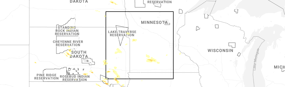
Hail Map for Sanborn, MN
The Sanborn, MN area has had 5 reports of on-the-ground hail by trained spotters, and has been under severe weather warnings 4 times during the past 12 months. Doppler radar has detected hail at or near Sanborn, MN on 52 occasions, including 6 occasions during the past year.
| Name: | Sanborn, MN |
| Where Located: | 59 miles SSE of Montevideo, MN |
| Map: | Google Map for Sanborn, MN |
| Population: | 339 |
| Housing Units: | 193 |
| More Info: | Search Google for Sanborn, MN |
1
The Top Recent Hail Date for Sanborn, MN is Monday, July 7, 2025 (15th out of 52)
Hail and Wind Damage Spotted near Sanborn, MN
| Date / Time | Report Details |
|---|---|
| 6/28/2025 11:57 PM CDT |
 The storms which prompted the warning have weakened below severe limits, and no longer pose an immediate threat to life or property. therefore, the warning will be allowed to expire. however, heavy rain is still possible with these thunderstorms. a tornado watch remains in effect until 100 am cdt for portions of central, south central, and southwest minnesota. The storms which prompted the warning have weakened below severe limits, and no longer pose an immediate threat to life or property. therefore, the warning will be allowed to expire. however, heavy rain is still possible with these thunderstorms. a tornado watch remains in effect until 100 am cdt for portions of central, south central, and southwest minnesota.
|
| 6/28/2025 11:48 PM CDT |
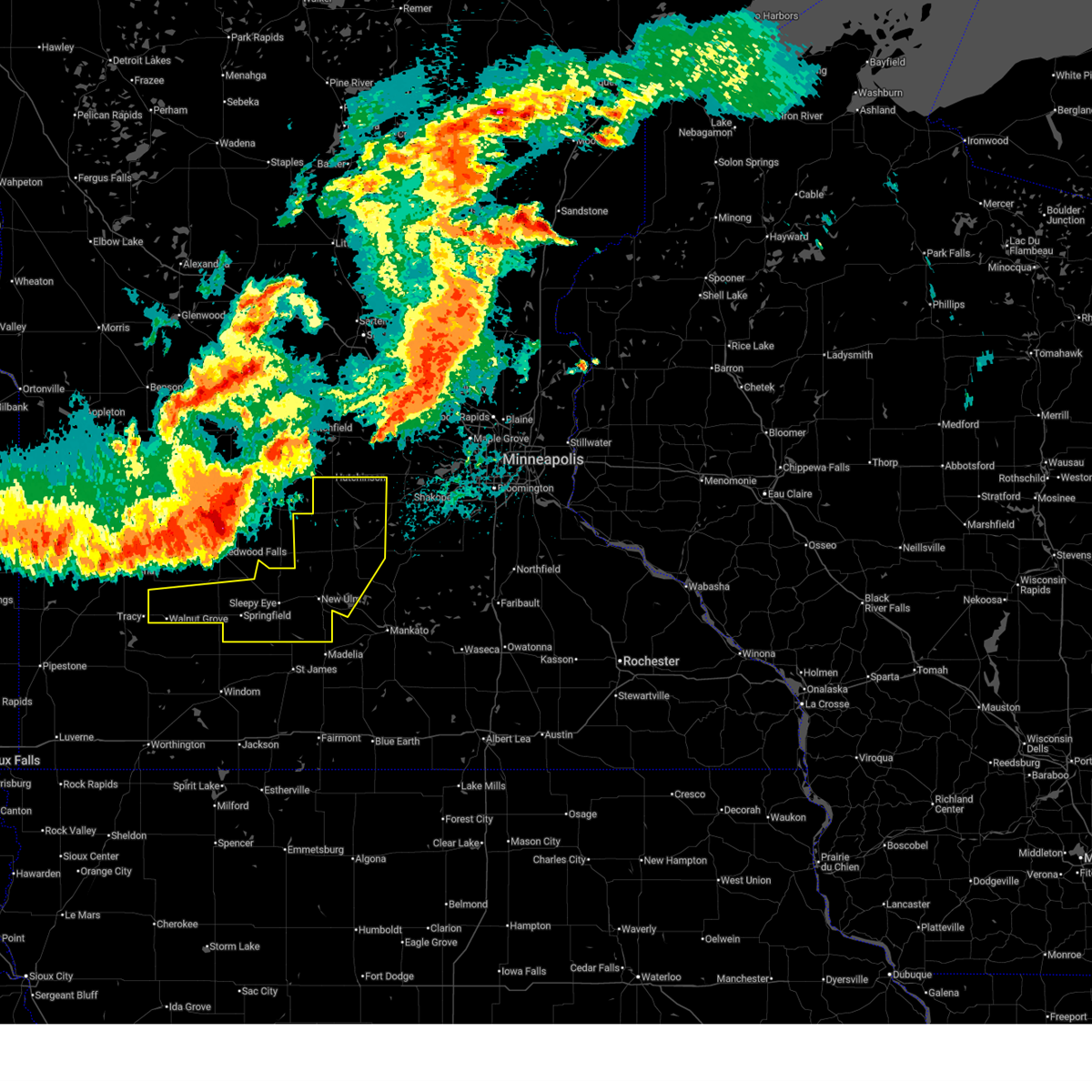
 At 1148 pm cdt, severe thunderstorms were located along a line from near brownton to near springfield, or along a line from 15 miles south of hutchinson to 23 miles south of redwood falls, moving southeast at 30 mph (radar indicated). Hazards include 60 mph wind gusts and small hail. Expect damage to roofs, siding, and trees. Locations impacted include, hutchinson, new ulm, glencoe, sleepy eye, gaylord, arlington, springfield, lester prairie, winthrop, morgan, walnut grove, lamberton, gibbon, brownton, courtland, stewart, lafayette, hanska, comfrey and sumter. At 1148 pm cdt, severe thunderstorms were located along a line from near brownton to near springfield, or along a line from 15 miles south of hutchinson to 23 miles south of redwood falls, moving southeast at 30 mph (radar indicated). Hazards include 60 mph wind gusts and small hail. Expect damage to roofs, siding, and trees. Locations impacted include, hutchinson, new ulm, glencoe, sleepy eye, gaylord, arlington, springfield, lester prairie, winthrop, morgan, walnut grove, lamberton, gibbon, brownton, courtland, stewart, lafayette, hanska, comfrey and sumter.
|
| 6/28/2025 11:25 PM CDT |
 At 1125 pm cdt, severe thunderstorms were located along a line from over stewart to near lamberton, or along a line from 15 miles south of hutchinson to 20 miles south of redwood falls, moving east at 45 mph (radar indicated). Hazards include 60 mph wind gusts and small hail. Expect damage to roofs, siding, and trees. Locations impacted include, hutchinson, new ulm, glencoe, sleepy eye, gaylord, arlington, springfield, lester prairie, winthrop, morgan, walnut grove, lamberton, gibbon, brownton, courtland, stewart, lafayette, hanska, comfrey and sumter. At 1125 pm cdt, severe thunderstorms were located along a line from over stewart to near lamberton, or along a line from 15 miles south of hutchinson to 20 miles south of redwood falls, moving east at 45 mph (radar indicated). Hazards include 60 mph wind gusts and small hail. Expect damage to roofs, siding, and trees. Locations impacted include, hutchinson, new ulm, glencoe, sleepy eye, gaylord, arlington, springfield, lester prairie, winthrop, morgan, walnut grove, lamberton, gibbon, brownton, courtland, stewart, lafayette, hanska, comfrey and sumter.
|
| 6/28/2025 11:07 PM CDT |
 Svrmpx the national weather service in the twin cities has issued a * severe thunderstorm warning for, mcleod county in central minnesota, sibley county in central minnesota, brown county in south central minnesota, northwestern nicollet county in south central minnesota, southern redwood county in southwestern minnesota, * until midnight cdt. * at 1107 pm cdt, severe thunderstorms were located along a line from over hector to 12 miles north of walnut grove, or along a line from 21 miles southwest of hutchinson to 23 miles southwest of redwood falls, moving east at 45 mph (radar indicated). Hazards include 60 mph wind gusts and small hail. expect damage to roofs, siding, and trees Svrmpx the national weather service in the twin cities has issued a * severe thunderstorm warning for, mcleod county in central minnesota, sibley county in central minnesota, brown county in south central minnesota, northwestern nicollet county in south central minnesota, southern redwood county in southwestern minnesota, * until midnight cdt. * at 1107 pm cdt, severe thunderstorms were located along a line from over hector to 12 miles north of walnut grove, or along a line from 21 miles southwest of hutchinson to 23 miles southwest of redwood falls, moving east at 45 mph (radar indicated). Hazards include 60 mph wind gusts and small hail. expect damage to roofs, siding, and trees
|
| 10/24/2023 1:10 PM CDT | Hen Egg sized hail reported 0.3 miles SSW of Sanborn, MN, report with photo sent via facebook messenger. |
| 10/24/2023 12:46 PM CDT |
 At 1245 pm cdt, a severe thunderstorm was located near lamberton, or 21 miles north of windom, moving east at 45 mph (radar indicated). Hazards include half dollar size hail. Damage to vehicles is expected. locations impacted include, springfield, lamberton, comfrey, and sanborn. hail threat, radar indicated max hail size, 1. 25 in wind threat, radar indicated max wind gust, <50 mph. At 1245 pm cdt, a severe thunderstorm was located near lamberton, or 21 miles north of windom, moving east at 45 mph (radar indicated). Hazards include half dollar size hail. Damage to vehicles is expected. locations impacted include, springfield, lamberton, comfrey, and sanborn. hail threat, radar indicated max hail size, 1. 25 in wind threat, radar indicated max wind gust, <50 mph.
|
| 10/24/2023 12:32 PM CDT |
 At 1232 pm cdt, a severe thunderstorm was located near walnut grove, or 20 miles northeast of slayton, moving northeast at 50 mph (radar indicated). Hazards include half dollar size hail. damage to vehicles is expected At 1232 pm cdt, a severe thunderstorm was located near walnut grove, or 20 miles northeast of slayton, moving northeast at 50 mph (radar indicated). Hazards include half dollar size hail. damage to vehicles is expected
|
| 9/29/2023 5:45 PM CDT |
 At 545 pm cdt, a severe thunderstorm was located over walnut grove, or 22 miles northeast of slayton, moving northeast at 35 mph (radar indicated). Hazards include ping pong ball size hail and 60 mph wind gusts. People and animals outdoors will be injured. expect hail damage to roofs, siding, windows, and vehicles. expect wind damage to roofs, siding, and trees. locations impacted include, walnut grove, lamberton, sanborn, and revere. hail threat, radar indicated max hail size, 1. 50 in wind threat, radar indicated max wind gust, 60 mph. At 545 pm cdt, a severe thunderstorm was located over walnut grove, or 22 miles northeast of slayton, moving northeast at 35 mph (radar indicated). Hazards include ping pong ball size hail and 60 mph wind gusts. People and animals outdoors will be injured. expect hail damage to roofs, siding, windows, and vehicles. expect wind damage to roofs, siding, and trees. locations impacted include, walnut grove, lamberton, sanborn, and revere. hail threat, radar indicated max hail size, 1. 50 in wind threat, radar indicated max wind gust, 60 mph.
|
| 9/29/2023 5:17 PM CDT |
 At 517 pm cdt, a severe thunderstorm was located over lake shetek state park, or 7 miles northeast of slayton, moving northeast at 35 mph (radar indicated). Hazards include ping pong ball size hail and 60 mph wind gusts. People and animals outdoors will be injured. expect hail damage to roofs, siding, windows, and vehicles. Expect wind damage to roofs, siding, and trees. At 517 pm cdt, a severe thunderstorm was located over lake shetek state park, or 7 miles northeast of slayton, moving northeast at 35 mph (radar indicated). Hazards include ping pong ball size hail and 60 mph wind gusts. People and animals outdoors will be injured. expect hail damage to roofs, siding, windows, and vehicles. Expect wind damage to roofs, siding, and trees.
|
| 10/23/2022 9:06 PM CDT |
 At 906 pm cdt, a severe thunderstorm was located 8 miles northwest of springfield, or 15 miles south of redwood falls, moving northeast at 50 mph (radar indicated). Hazards include 60 mph wind gusts. Expect damage to roofs, siding, and trees. locations impacted include, morgan. hail threat, radar indicated max hail size, <. 75 in wind threat, radar indicated max wind gust, 60 mph. At 906 pm cdt, a severe thunderstorm was located 8 miles northwest of springfield, or 15 miles south of redwood falls, moving northeast at 50 mph (radar indicated). Hazards include 60 mph wind gusts. Expect damage to roofs, siding, and trees. locations impacted include, morgan. hail threat, radar indicated max hail size, <. 75 in wind threat, radar indicated max wind gust, 60 mph.
|
| 10/23/2022 8:46 PM CDT |
 At 846 pm cdt, a severe thunderstorm was located near lamberton, or 22 miles north of windom, moving northeast at 75 mph (radar indicated). Hazards include 60 mph wind gusts. Expect damage to roofs, siding, and trees. this severe thunderstorm will be near, springfield around 855 pm cdt. morgan around 905 pm cdt. hail threat, radar indicated max hail size, <. 75 in wind threat, radar indicated max wind gust, 60 mph. At 846 pm cdt, a severe thunderstorm was located near lamberton, or 22 miles north of windom, moving northeast at 75 mph (radar indicated). Hazards include 60 mph wind gusts. Expect damage to roofs, siding, and trees. this severe thunderstorm will be near, springfield around 855 pm cdt. morgan around 905 pm cdt. hail threat, radar indicated max hail size, <. 75 in wind threat, radar indicated max wind gust, 60 mph.
|
| 8/2/2022 10:29 PM CDT |
 At 1029 pm cdt, severe thunderstorms were located along a line extending from 5 miles southeast of montevideo to wood lake to 8 miles north of walnut grove, moving east at 60 mph (radar indicated). Hazards include 70 mph wind gusts. Expect considerable tree damage. damage is likely to mobile homes, roofs, and outbuildings. locations impacted include, echo, wabasso, sacred heart, maynard, clara city, renville, redwood falls, olivia, morgan, morton and franklin. thunderstorm damage threat, considerable hail threat, radar indicated max hail size, <. 75 in wind threat, radar indicated max wind gust, 70 mph. At 1029 pm cdt, severe thunderstorms were located along a line extending from 5 miles southeast of montevideo to wood lake to 8 miles north of walnut grove, moving east at 60 mph (radar indicated). Hazards include 70 mph wind gusts. Expect considerable tree damage. damage is likely to mobile homes, roofs, and outbuildings. locations impacted include, echo, wabasso, sacred heart, maynard, clara city, renville, redwood falls, olivia, morgan, morton and franklin. thunderstorm damage threat, considerable hail threat, radar indicated max hail size, <. 75 in wind threat, radar indicated max wind gust, 70 mph.
|
| 8/2/2022 10:13 PM CDT |
 At 1012 pm cdt, severe thunderstorms were located along a line extending from near boyd to 6 miles northeast of ghent to 7 miles northwest of tracy, moving east at 60 mph (radar indicated). Hazards include 70 mph wind gusts. a 74 mph gust was reported at marshall airport. Expect considerable tree damage. damage is likely to mobile homes, roofs, and outbuildings. severe thunderstorms will be near, clarkfield around 1020 pm cdt. montevideo, wood lake and hanley falls around 1025 pm cdt. granite falls and echo around 1030 pm cdt. wabasso, sacred heart and maynard around 1035 pm cdt. clara city around 1040 pm cdt. redwood falls and renville around 1045 pm cdt. thunderstorm damage threat, considerable hail threat, radar indicated max hail size, <. 75 in wind threat, observed max wind gust, 70 mph. At 1012 pm cdt, severe thunderstorms were located along a line extending from near boyd to 6 miles northeast of ghent to 7 miles northwest of tracy, moving east at 60 mph (radar indicated). Hazards include 70 mph wind gusts. a 74 mph gust was reported at marshall airport. Expect considerable tree damage. damage is likely to mobile homes, roofs, and outbuildings. severe thunderstorms will be near, clarkfield around 1020 pm cdt. montevideo, wood lake and hanley falls around 1025 pm cdt. granite falls and echo around 1030 pm cdt. wabasso, sacred heart and maynard around 1035 pm cdt. clara city around 1040 pm cdt. redwood falls and renville around 1045 pm cdt. thunderstorm damage threat, considerable hail threat, radar indicated max hail size, <. 75 in wind threat, observed max wind gust, 70 mph.
|
| 7/5/2022 4:01 PM CDT |
 At 401 pm cdt, a severe thunderstorm was located over lamberton, or 22 miles south of redwood falls, moving northeast at 15 mph (radar indicated). Hazards include 60 mph wind gusts and quarter size hail. Hail damage to vehicles is expected. expect wind damage to roofs, siding, and trees. locations impacted include, springfield, walnut grove, lamberton, sanborn and revere. hail threat, radar indicated max hail size, 1. 00 in wind threat, radar indicated max wind gust, 60 mph. At 401 pm cdt, a severe thunderstorm was located over lamberton, or 22 miles south of redwood falls, moving northeast at 15 mph (radar indicated). Hazards include 60 mph wind gusts and quarter size hail. Hail damage to vehicles is expected. expect wind damage to roofs, siding, and trees. locations impacted include, springfield, walnut grove, lamberton, sanborn and revere. hail threat, radar indicated max hail size, 1. 00 in wind threat, radar indicated max wind gust, 60 mph.
|
| 7/5/2022 3:38 PM CDT |
 At 338 pm cdt, a severe thunderstorm was located near lamberton, or 24 miles northwest of windom, moving northeast at 10 mph (radar indicated). Hazards include 60 mph wind gusts and half dollar size hail. Hail damage to vehicles is expected. Expect wind damage to roofs, siding, and trees. At 338 pm cdt, a severe thunderstorm was located near lamberton, or 24 miles northwest of windom, moving northeast at 10 mph (radar indicated). Hazards include 60 mph wind gusts and half dollar size hail. Hail damage to vehicles is expected. Expect wind damage to roofs, siding, and trees.
|
| 6/20/2022 10:10 PM CDT |
 The severe thunderstorm warning for central redwood, southwestern kandiyohi and northwestern renville counties will expire at 1015 pm cdt, the storms which prompted the warning have weakened below severe limits, and have exited the warned area. therefore, the warning will be allowed to expire. a severe thunderstorm watch remains in effect until 400 am cdt for south central, central, southwestern and west central minnesota. to report severe weather, contact your nearest law enforcement agency. they will relay your report to the national weather service the twin cities. The severe thunderstorm warning for central redwood, southwestern kandiyohi and northwestern renville counties will expire at 1015 pm cdt, the storms which prompted the warning have weakened below severe limits, and have exited the warned area. therefore, the warning will be allowed to expire. a severe thunderstorm watch remains in effect until 400 am cdt for south central, central, southwestern and west central minnesota. to report severe weather, contact your nearest law enforcement agency. they will relay your report to the national weather service the twin cities.
|
| 6/20/2022 10:00 PM CDT |
 At 1000 pm cdt, severe thunderstorms were located along a line extending from 5 miles south of prinsburg to 6 miles southeast of renville to 5 miles west of wabasso to near lamberton, moving northeast at 50 mph (radar indicated). Hazards include 60 mph wind gusts. Expect damage to roofs, siding, and trees. locations impacted include, redwood falls, olivia, renville, walnut grove, lamberton, wabasso, sacred heart, prinsburg, danube, belview, sanborn and lucan. hail threat, radar indicated max hail size, <. 75 in wind threat, radar indicated max wind gust, 60 mph. At 1000 pm cdt, severe thunderstorms were located along a line extending from 5 miles south of prinsburg to 6 miles southeast of renville to 5 miles west of wabasso to near lamberton, moving northeast at 50 mph (radar indicated). Hazards include 60 mph wind gusts. Expect damage to roofs, siding, and trees. locations impacted include, redwood falls, olivia, renville, walnut grove, lamberton, wabasso, sacred heart, prinsburg, danube, belview, sanborn and lucan. hail threat, radar indicated max hail size, <. 75 in wind threat, radar indicated max wind gust, 60 mph.
|
| 6/20/2022 9:47 PM CDT |
 At 947 pm cdt, severe thunderstorms were located along a line extending from sacred heart to 5 miles east of echo to 13 miles west of wabasso to walnut grove, moving northeast at 45 mph (radar indicated). Hazards include 60 mph wind gusts. Expect damage to roofs, siding, and trees. these severe storms will be near, renville and sacred heart around 955 pm cdt. prinsburg around 1005 pm cdt. wabasso around 1010 pm cdt. redwood falls and olivia around 1015 pm cdt. other locations impacted by these severe thunderstorms include bechyn, seaforth, delhi, lucan, revere, redwood falls airport, blomkest, minnesota falls, sanborn and belview. hail threat, radar indicated max hail size, <. 75 in wind threat, radar indicated max wind gust, 60 mph. At 947 pm cdt, severe thunderstorms were located along a line extending from sacred heart to 5 miles east of echo to 13 miles west of wabasso to walnut grove, moving northeast at 45 mph (radar indicated). Hazards include 60 mph wind gusts. Expect damage to roofs, siding, and trees. these severe storms will be near, renville and sacred heart around 955 pm cdt. prinsburg around 1005 pm cdt. wabasso around 1010 pm cdt. redwood falls and olivia around 1015 pm cdt. other locations impacted by these severe thunderstorms include bechyn, seaforth, delhi, lucan, revere, redwood falls airport, blomkest, minnesota falls, sanborn and belview. hail threat, radar indicated max hail size, <. 75 in wind threat, radar indicated max wind gust, 60 mph.
|
| 6/20/2022 9:25 PM CDT |
 At 924 pm cdt, severe thunderstorms were located along a line extending from 5 miles southeast of montevideo to 7 miles east of marshall to 6 miles northeast of balaton to near chandler, moving northeast at 50 mph (radar indicated. at 921 pm, a 58 mph gust was measured at granite falls airport). Hazards include 60 mph wind gusts. Expect damage to roofs, siding, and trees. severe thunderstorms will be near, montevideo around 930 pm cdt. maynard around 935 pm cdt. clara city and echo around 940 pm cdt. raymond and sacred heart around 950 pm cdt. walnut grove around 955 pm cdt. renville around 1000 pm cdt. willmar, redwood falls, olivia and lamberton around 1005 pm cdt. wabasso around 1015 pm cdt. other locations impacted by these severe thunderstorms include bechyn, seaforth, asbury, delhi, lucan, willmar airport, revere, redwood falls airport, blomkest and montevideo airport. hail threat, radar indicated max hail size, <. 75 in wind threat, observed max wind gust, 60 mph. At 924 pm cdt, severe thunderstorms were located along a line extending from 5 miles southeast of montevideo to 7 miles east of marshall to 6 miles northeast of balaton to near chandler, moving northeast at 50 mph (radar indicated. at 921 pm, a 58 mph gust was measured at granite falls airport). Hazards include 60 mph wind gusts. Expect damage to roofs, siding, and trees. severe thunderstorms will be near, montevideo around 930 pm cdt. maynard around 935 pm cdt. clara city and echo around 940 pm cdt. raymond and sacred heart around 950 pm cdt. walnut grove around 955 pm cdt. renville around 1000 pm cdt. willmar, redwood falls, olivia and lamberton around 1005 pm cdt. wabasso around 1015 pm cdt. other locations impacted by these severe thunderstorms include bechyn, seaforth, asbury, delhi, lucan, willmar airport, revere, redwood falls airport, blomkest and montevideo airport. hail threat, radar indicated max hail size, <. 75 in wind threat, observed max wind gust, 60 mph.
|
| 6/13/2022 9:35 AM CDT |
 At 934 am cdt, a severe thunderstorm was located near bingham lake, or 9 miles northeast of windom, moving east at 25 mph (radar indicated). Hazards include 60 mph wind gusts and half dollar size hail. Hail damage to vehicles is expected. expect wind damage to roofs, siding, and trees. this severe storm will be near, mountain lake around 945 am cdt. other locations impacted by this severe thunderstorm include delft and wilder. hail threat, radar indicated max hail size, 1. 25 in wind threat, radar indicated max wind gust, 60 mph. At 934 am cdt, a severe thunderstorm was located near bingham lake, or 9 miles northeast of windom, moving east at 25 mph (radar indicated). Hazards include 60 mph wind gusts and half dollar size hail. Hail damage to vehicles is expected. expect wind damage to roofs, siding, and trees. this severe storm will be near, mountain lake around 945 am cdt. other locations impacted by this severe thunderstorm include delft and wilder. hail threat, radar indicated max hail size, 1. 25 in wind threat, radar indicated max wind gust, 60 mph.
|
| 6/13/2022 9:19 AM CDT |
 At 919 am cdt, two severe thunderstorms were located near jeffers and northeast of dundee, or 8 miles north of windom, moving northeast at 30 mph (radar indicated). Hazards include half dollar size hail. Damage to vehicles is expected. this severe storm will be near, mountain lake around 935 am cdt. other locations impacted by this severe thunderstorm include kinbrae, wilder, dundee and delft. hail threat, radar indicated max hail size, 1. 25 in wind threat, radar indicated max wind gust, <50 mph. At 919 am cdt, two severe thunderstorms were located near jeffers and northeast of dundee, or 8 miles north of windom, moving northeast at 30 mph (radar indicated). Hazards include half dollar size hail. Damage to vehicles is expected. this severe storm will be near, mountain lake around 935 am cdt. other locations impacted by this severe thunderstorm include kinbrae, wilder, dundee and delft. hail threat, radar indicated max hail size, 1. 25 in wind threat, radar indicated max wind gust, <50 mph.
|
| 6/13/2022 9:06 AM CDT |
 At 906 am cdt, a severe thunderstorm was located near jeffers, or 9 miles northwest of windom, moving northeast at 30 mph (radar indicated). Hazards include quarter size hail. Damage to vehicles is expected. this severe thunderstorm will be near, windom around 910 am cdt. jeffers around 915 am cdt. bingham lake around 920 am cdt. mountain lake around 930 am cdt. other locations impacted by this severe thunderstorm include kinbrae, wilder, dundee, avoca and delft. hail threat, radar indicated max hail size, 1. 00 in wind threat, radar indicated max wind gust, <50 mph. At 906 am cdt, a severe thunderstorm was located near jeffers, or 9 miles northwest of windom, moving northeast at 30 mph (radar indicated). Hazards include quarter size hail. Damage to vehicles is expected. this severe thunderstorm will be near, windom around 910 am cdt. jeffers around 915 am cdt. bingham lake around 920 am cdt. mountain lake around 930 am cdt. other locations impacted by this severe thunderstorm include kinbrae, wilder, dundee, avoca and delft. hail threat, radar indicated max hail size, 1. 00 in wind threat, radar indicated max wind gust, <50 mph.
|
| 5/30/2022 5:06 PM CDT |
 At 505 pm cdt, severe thunderstorms were located along a line extending from 7 miles northeast of jeffers to mountain lake to near jackson in jackson county, moving northeast at 70 mph (radar indicated). Hazards include 70 mph wind gusts and half dollar size hail. Hail damage to vehicles is expected. expect considerable tree damage. wind damage is also likely to mobile homes, roofs, and outbuildings. severe thunderstorms will be near, springfield and comfrey around 515 pm cdt. trimont around 520 pm cdt. sleepy eye and morgan around 525 pm cdt. other locations in the path of these severe thunderstorms include butterfield, franklin, new ulm, st. James, fairfax, lafayette, winthrop, hector, gibbon, buffalo lake and hanska. At 505 pm cdt, severe thunderstorms were located along a line extending from 7 miles northeast of jeffers to mountain lake to near jackson in jackson county, moving northeast at 70 mph (radar indicated). Hazards include 70 mph wind gusts and half dollar size hail. Hail damage to vehicles is expected. expect considerable tree damage. wind damage is also likely to mobile homes, roofs, and outbuildings. severe thunderstorms will be near, springfield and comfrey around 515 pm cdt. trimont around 520 pm cdt. sleepy eye and morgan around 525 pm cdt. other locations in the path of these severe thunderstorms include butterfield, franklin, new ulm, st. James, fairfax, lafayette, winthrop, hector, gibbon, buffalo lake and hanska.
|
| 5/30/2022 5:05 PM CDT | Reported by mndot weather sensor at hwy 7 in redwood county MN, 2.4 miles S of Sanborn, MN |
| 5/30/2022 3:29 AM CDT |
 At 329 am cdt, severe thunderstorms were located along a line extending from 7 miles southwest of echo to near jackson in jackson county, moving northeast at 60 mph (radar indicated). Hazards include 60 mph wind gusts. Expect damage to roofs, siding, and trees. locations impacted include, redwood falls, st. James, sleepy eye, springfield, sherburn, truman, morgan, lamberton, trimont, wabasso, welcome and butterfield. At 329 am cdt, severe thunderstorms were located along a line extending from 7 miles southwest of echo to near jackson in jackson county, moving northeast at 60 mph (radar indicated). Hazards include 60 mph wind gusts. Expect damage to roofs, siding, and trees. locations impacted include, redwood falls, st. James, sleepy eye, springfield, sherburn, truman, morgan, lamberton, trimont, wabasso, welcome and butterfield.
|
| 5/30/2022 3:02 AM CDT |
 At 301 am cdt, severe thunderstorms were located along a line extending from near camden state park to round lake, moving northeast at 60 mph (radar indicated). Hazards include 70 mph wind gusts. Expect considerable tree damage. Damage is likely to mobile homes, roofs, and outbuildings. At 301 am cdt, severe thunderstorms were located along a line extending from near camden state park to round lake, moving northeast at 60 mph (radar indicated). Hazards include 70 mph wind gusts. Expect considerable tree damage. Damage is likely to mobile homes, roofs, and outbuildings.
|
| 5/29/2022 5:36 AM CDT |
 At 536 am cdt, a severe thunderstorm was located over tracy, or 18 miles southeast of marshall, moving northeast at 55 mph (radar indicated). Hazards include 60 mph wind gusts and quarter size hail. Hail damage to vehicles is expected. expect wind damage to roofs, siding, and trees. this severe thunderstorm will be near, walnut grove around 540 am cdt. Wabasso around 555 am cdt. At 536 am cdt, a severe thunderstorm was located over tracy, or 18 miles southeast of marshall, moving northeast at 55 mph (radar indicated). Hazards include 60 mph wind gusts and quarter size hail. Hail damage to vehicles is expected. expect wind damage to roofs, siding, and trees. this severe thunderstorm will be near, walnut grove around 540 am cdt. Wabasso around 555 am cdt.
|
| 5/12/2022 9:26 PM CDT |
 The severe thunderstorm warning for redwood and brown counties will expire at 930 pm cdt, the storm which prompted the warning has weakened below severe limits, and no longer poses an immediate threat to life or property. therefore, the warning will be allowed to expire. however gusty winds and heavy rain are still possible with this thunderstorm. a tornado watch remains in effect until midnight cdt for south central, central and southwestern minnesota. The severe thunderstorm warning for redwood and brown counties will expire at 930 pm cdt, the storm which prompted the warning has weakened below severe limits, and no longer poses an immediate threat to life or property. therefore, the warning will be allowed to expire. however gusty winds and heavy rain are still possible with this thunderstorm. a tornado watch remains in effect until midnight cdt for south central, central and southwestern minnesota.
|
| 5/12/2022 9:03 PM CDT |
 At 903 pm cdt, a severe thunderstorm was located near lamberton, or 20 miles north of windom, moving northeast at 65 mph (radar indicated). Hazards include 60 mph wind gusts and quarter size hail. Hail damage to vehicles is expected. expect wind damage to roofs, siding, and trees. this severe thunderstorm will be near, springfield around 915 pm cdt. other locations in the path of this severe thunderstorm include morgan. hail threat, radar indicated max hail size, 1. 00 in wind threat, radar indicated max wind gust, 60 mph. At 903 pm cdt, a severe thunderstorm was located near lamberton, or 20 miles north of windom, moving northeast at 65 mph (radar indicated). Hazards include 60 mph wind gusts and quarter size hail. Hail damage to vehicles is expected. expect wind damage to roofs, siding, and trees. this severe thunderstorm will be near, springfield around 915 pm cdt. other locations in the path of this severe thunderstorm include morgan. hail threat, radar indicated max hail size, 1. 00 in wind threat, radar indicated max wind gust, 60 mph.
|
| 5/12/2022 6:52 PM CDT |
 At 651 pm cdt, severe thunderstorms were located along a line extending from near bird island to near sleepy eye to near st. james, moving east at 55 mph (radar indicated). Hazards include 70 mph wind gusts. Expect considerable tree damage. damage is likely to mobile homes, roofs, and outbuildings. severe thunderstorms will be near, hector around 700 pm cdt. new ulm and buffalo lake around 705 pm cdt. courtland and lafayette around 715 pm cdt. hutchinson and nicollet around 720 pm cdt. thunderstorm damage threat, considerable hail threat, radar indicated max hail size, <. 75 in wind threat, observed max wind gust, 70 mph. At 651 pm cdt, severe thunderstorms were located along a line extending from near bird island to near sleepy eye to near st. james, moving east at 55 mph (radar indicated). Hazards include 70 mph wind gusts. Expect considerable tree damage. damage is likely to mobile homes, roofs, and outbuildings. severe thunderstorms will be near, hector around 700 pm cdt. new ulm and buffalo lake around 705 pm cdt. courtland and lafayette around 715 pm cdt. hutchinson and nicollet around 720 pm cdt. thunderstorm damage threat, considerable hail threat, radar indicated max hail size, <. 75 in wind threat, observed max wind gust, 70 mph.
|
| 5/12/2022 6:20 PM CDT |
 At 620 pm cdt, severe thunderstorms were located along a line extending from near echo to near storden to near spirit lake, moving northeast at 70 mph (radar indicated). Hazards include 70 mph wind gusts. Expect considerable tree damage. damage is likely to mobile homes, roofs, and outbuildings. these severe storms will be near, echo around 625 pm cdt. sacred heart around 630 pm cdt. renville and comfrey around 635 pm cdt. springfield around 640 pm cdt. sherburn around 645 pm cdt. sleepy eye and trimont around 650 pm cdt. truman around 700 pm cdt. lewisville around 705 pm cdt. thunderstorm damage threat, considerable hail threat, radar indicated max hail size, <. 75 in wind threat, radar indicated max wind gust, 70 mph. At 620 pm cdt, severe thunderstorms were located along a line extending from near echo to near storden to near spirit lake, moving northeast at 70 mph (radar indicated). Hazards include 70 mph wind gusts. Expect considerable tree damage. damage is likely to mobile homes, roofs, and outbuildings. these severe storms will be near, echo around 625 pm cdt. sacred heart around 630 pm cdt. renville and comfrey around 635 pm cdt. springfield around 640 pm cdt. sherburn around 645 pm cdt. sleepy eye and trimont around 650 pm cdt. truman around 700 pm cdt. lewisville around 705 pm cdt. thunderstorm damage threat, considerable hail threat, radar indicated max hail size, <. 75 in wind threat, radar indicated max wind gust, 70 mph.
|
| 5/12/2022 6:02 PM CDT |
 At 602 pm cdt, severe thunderstorms were located along a line extending from near camden state park to 5 miles south of fulda to 6 miles southeast of ocheyedan, moving northeast at 75 mph (radar indicated). Hazards include 70 mph wind gusts and quarter size hail. Hail damage to vehicles is expected. expect considerable tree damage. wind damage is also likely to mobile homes, roofs, and outbuildings. severe thunderstorms will be near, wood lake and echo around 625 pm cdt. springfield, sherburn, sacred heart and comfrey around 635 pm cdt. renville and trimont around 640 pm cdt. sleepy eye and olivia around 645 pm cdt. new ulm, truman and lewisville around 655 pm cdt. madelia around 700 pm cdt. thunderstorm damage threat, considerable hail threat, radar indicated max hail size, 1. 00 in wind threat, radar indicated max wind gust, 70 mph. At 602 pm cdt, severe thunderstorms were located along a line extending from near camden state park to 5 miles south of fulda to 6 miles southeast of ocheyedan, moving northeast at 75 mph (radar indicated). Hazards include 70 mph wind gusts and quarter size hail. Hail damage to vehicles is expected. expect considerable tree damage. wind damage is also likely to mobile homes, roofs, and outbuildings. severe thunderstorms will be near, wood lake and echo around 625 pm cdt. springfield, sherburn, sacred heart and comfrey around 635 pm cdt. renville and trimont around 640 pm cdt. sleepy eye and olivia around 645 pm cdt. new ulm, truman and lewisville around 655 pm cdt. madelia around 700 pm cdt. thunderstorm damage threat, considerable hail threat, radar indicated max hail size, 1. 00 in wind threat, radar indicated max wind gust, 70 mph.
|
| 5/11/2022 6:34 PM CDT |
 At 633 pm cdt, severe thunderstorms were located along a line extending from 6 miles north of redwood falls to 8 miles west of hanska, moving northeast at 45 mph (radar indicated). Hazards include 70 mph wind gusts and quarter size hail. Hail damage to vehicles is expected. expect considerable tree damage. wind damage is also likely to mobile homes, roofs, and outbuildings. Locations impacted include, new ulm, redwood falls, sleepy eye, springfield, morgan, wabasso, franklin, morton, comfrey, sanborn, clements and seaforth. At 633 pm cdt, severe thunderstorms were located along a line extending from 6 miles north of redwood falls to 8 miles west of hanska, moving northeast at 45 mph (radar indicated). Hazards include 70 mph wind gusts and quarter size hail. Hail damage to vehicles is expected. expect considerable tree damage. wind damage is also likely to mobile homes, roofs, and outbuildings. Locations impacted include, new ulm, redwood falls, sleepy eye, springfield, morgan, wabasso, franklin, morton, comfrey, sanborn, clements and seaforth.
|
| 5/11/2022 6:23 PM CDT |
 At 623 pm cdt, a severe thunderstorm capable of producing a tornado was located 6 miles east of wabasso, or 11 miles south of redwood falls, moving northeast at 45 mph (radar indicated rotation). Hazards include tornado and ping pong ball size hail. Flying debris will be dangerous to those caught without shelter. mobile homes will be damaged or destroyed. damage to roofs, windows, and vehicles will occur. tree damage is likely. Locations impacted include, redwood falls, morgan and morton. At 623 pm cdt, a severe thunderstorm capable of producing a tornado was located 6 miles east of wabasso, or 11 miles south of redwood falls, moving northeast at 45 mph (radar indicated rotation). Hazards include tornado and ping pong ball size hail. Flying debris will be dangerous to those caught without shelter. mobile homes will be damaged or destroyed. damage to roofs, windows, and vehicles will occur. tree damage is likely. Locations impacted include, redwood falls, morgan and morton.
|
| 5/11/2022 6:21 PM CDT |
 At 621 pm cdt, severe thunderstorms were located along a line extending from 7 miles north of wabasso to near butterfield, moving northeast at 25 mph (radar indicated). Hazards include 70 mph wind gusts and quarter size hail. Hail damage to vehicles is expected. expect considerable tree damage. wind damage is also likely to mobile homes, roofs, and outbuildings. Locations impacted include, new ulm, redwood falls, sleepy eye, springfield, morgan, lamberton, wabasso, franklin, morton, comfrey, sanborn and lucan. At 621 pm cdt, severe thunderstorms were located along a line extending from 7 miles north of wabasso to near butterfield, moving northeast at 25 mph (radar indicated). Hazards include 70 mph wind gusts and quarter size hail. Hail damage to vehicles is expected. expect considerable tree damage. wind damage is also likely to mobile homes, roofs, and outbuildings. Locations impacted include, new ulm, redwood falls, sleepy eye, springfield, morgan, lamberton, wabasso, franklin, morton, comfrey, sanborn and lucan.
|
| 5/11/2022 6:11 PM CDT |
 At 611 pm cdt, a severe thunderstorm capable of producing a tornado was located near lamberton, or 20 miles south of redwood falls, moving northeast at 45 mph (radar indicated rotation). Hazards include tornado and ping pong ball size hail. Flying debris will be dangerous to those caught without shelter. mobile homes will be damaged or destroyed. damage to roofs, windows, and vehicles will occur. tree damage is likely. this dangerous storm will be near, springfield around 620 pm cdt. Other locations in the path of this tornadic thunderstorm include morgan and morton. At 611 pm cdt, a severe thunderstorm capable of producing a tornado was located near lamberton, or 20 miles south of redwood falls, moving northeast at 45 mph (radar indicated rotation). Hazards include tornado and ping pong ball size hail. Flying debris will be dangerous to those caught without shelter. mobile homes will be damaged or destroyed. damage to roofs, windows, and vehicles will occur. tree damage is likely. this dangerous storm will be near, springfield around 620 pm cdt. Other locations in the path of this tornadic thunderstorm include morgan and morton.
|
| 5/11/2022 6:05 PM CDT | Shed and power lines down on west side of sanbor in redwood county MN, 0.4 miles SE of Sanborn, MN |
| 5/11/2022 6:04 PM CDT |
 At 604 pm cdt, severe thunderstorms were located along a line extending from 8 miles west of wabasso to mountain lake, moving northeast at 45 mph (radar indicated). Hazards include 60 mph wind gusts and quarter size hail. Hail damage to vehicles is expected. expect wind damage to roofs, siding, and trees. Locations impacted include, comfrey, redwood falls and new ulm. At 604 pm cdt, severe thunderstorms were located along a line extending from 8 miles west of wabasso to mountain lake, moving northeast at 45 mph (radar indicated). Hazards include 60 mph wind gusts and quarter size hail. Hail damage to vehicles is expected. expect wind damage to roofs, siding, and trees. Locations impacted include, comfrey, redwood falls and new ulm.
|
| 5/11/2022 5:55 PM CDT |
 At 555 pm cdt, severe thunderstorms were located along a line extending from tracy to near lakefield, moving northeast at 25 mph (radar indicated). Hazards include 60 mph wind gusts and quarter size hail. Hail damage to vehicles is expected. expect wind damage to roofs, siding, and trees. severe thunderstorms will be near, walnut grove around 610 pm cdt. other locations in the path of these severe thunderstorms include wabasso and redwood falls. hail threat, radar indicated max hail size, 1. 00 in wind threat, radar indicated max wind gust, 60 mph. At 555 pm cdt, severe thunderstorms were located along a line extending from tracy to near lakefield, moving northeast at 25 mph (radar indicated). Hazards include 60 mph wind gusts and quarter size hail. Hail damage to vehicles is expected. expect wind damage to roofs, siding, and trees. severe thunderstorms will be near, walnut grove around 610 pm cdt. other locations in the path of these severe thunderstorms include wabasso and redwood falls. hail threat, radar indicated max hail size, 1. 00 in wind threat, radar indicated max wind gust, 60 mph.
|
| 9/17/2021 1:51 AM CDT |
 The severe thunderstorm warning for southeastern redwood, central brown and south central renville counties will expire at 200 am cdt, the storm which prompted the warning has weakened below severe limits, and has exited the warned area. therefore, the warning will be allowed to expire. however gusty winds are still possible with this thunderstorm. The severe thunderstorm warning for southeastern redwood, central brown and south central renville counties will expire at 200 am cdt, the storm which prompted the warning has weakened below severe limits, and has exited the warned area. therefore, the warning will be allowed to expire. however gusty winds are still possible with this thunderstorm.
|
| 9/17/2021 1:42 AM CDT |
 At 141 am cdt, a severe thunderstorm was located over morgan, or 11 miles southeast of redwood falls, moving northeast at 60 mph (radar indicated). Hazards include 60 mph wind gusts. Expect damage to roofs, siding, and trees. locations impacted include, franklin. hail threat, radar indicated max hail size, <. 75 in wind threat, radar indicated max wind gust, 60 mph. At 141 am cdt, a severe thunderstorm was located over morgan, or 11 miles southeast of redwood falls, moving northeast at 60 mph (radar indicated). Hazards include 60 mph wind gusts. Expect damage to roofs, siding, and trees. locations impacted include, franklin. hail threat, radar indicated max hail size, <. 75 in wind threat, radar indicated max wind gust, 60 mph.
|
| 9/17/2021 1:29 AM CDT |
 At 128 am cdt, a severe thunderstorm was located 6 miles southeast of wabasso, or 15 miles south of redwood falls, moving northeast at 60 mph (radar indicated). Hazards include 60 mph wind gusts. Expect damage to roofs, siding, and trees. this severe thunderstorm will be near, morgan around 145 am cdt. other locations in the path of this severe thunderstorm include franklin. hail threat, radar indicated max hail size, <. 75 in wind threat, radar indicated max wind gust, 60 mph. At 128 am cdt, a severe thunderstorm was located 6 miles southeast of wabasso, or 15 miles south of redwood falls, moving northeast at 60 mph (radar indicated). Hazards include 60 mph wind gusts. Expect damage to roofs, siding, and trees. this severe thunderstorm will be near, morgan around 145 am cdt. other locations in the path of this severe thunderstorm include franklin. hail threat, radar indicated max hail size, <. 75 in wind threat, radar indicated max wind gust, 60 mph.
|
| 8/28/2021 7:40 PM CDT |
 At 740 pm cdt, a severe thunderstorm was located near tracy, or 17 miles northeast of slayton, moving northeast at 35 mph (radar indicated). Hazards include 60 mph wind gusts and half dollar size hail. Hail damage to vehicles is expected. expect wind damage to roofs, siding, and trees. this severe thunderstorm will be near, walnut grove around 750 pm cdt. other locations in the path of this severe thunderstorm include lamberton and wabasso. hail threat, radar indicated max hail size, 1. 25 in wind threat, radar indicated max wind gust, 60 mph. At 740 pm cdt, a severe thunderstorm was located near tracy, or 17 miles northeast of slayton, moving northeast at 35 mph (radar indicated). Hazards include 60 mph wind gusts and half dollar size hail. Hail damage to vehicles is expected. expect wind damage to roofs, siding, and trees. this severe thunderstorm will be near, walnut grove around 750 pm cdt. other locations in the path of this severe thunderstorm include lamberton and wabasso. hail threat, radar indicated max hail size, 1. 25 in wind threat, radar indicated max wind gust, 60 mph.
|
| 8/28/2021 6:33 PM CDT |
 At 633 pm cdt, a severe thunderstorm capable of producing a tornado was located over sleepy eye, or 13 miles west of new ulm, moving northeast at 65 mph (radar indicated rotation). Hazards include tornado. Flying debris will be dangerous to those caught without shelter. mobile homes will be damaged or destroyed. damage to roofs, windows, and vehicles will occur. tree damage is likely. Locations impacted include, new ulm. At 633 pm cdt, a severe thunderstorm capable of producing a tornado was located over sleepy eye, or 13 miles west of new ulm, moving northeast at 65 mph (radar indicated rotation). Hazards include tornado. Flying debris will be dangerous to those caught without shelter. mobile homes will be damaged or destroyed. damage to roofs, windows, and vehicles will occur. tree damage is likely. Locations impacted include, new ulm.
|
| 8/28/2021 6:31 PM CDT |
 At 630 pm cdt, severe thunderstorms were located along a line extending from near wabasso to near comfrey, moving east at 55 mph (radar indicated). Hazards include 70 mph wind gusts. Expect considerable tree damage. damage is likely to mobile homes, roofs, and outbuildings. Locations impacted include, comfrey, morgan, franklin, hanska and new ulm. At 630 pm cdt, severe thunderstorms were located along a line extending from near wabasso to near comfrey, moving east at 55 mph (radar indicated). Hazards include 70 mph wind gusts. Expect considerable tree damage. damage is likely to mobile homes, roofs, and outbuildings. Locations impacted include, comfrey, morgan, franklin, hanska and new ulm.
|
| 8/28/2021 6:19 PM CDT |
 At 618 pm cdt, a severe thunderstorm capable of producing a tornado was located near springfield, or 20 miles north of windom, moving northeast at 65 mph (radar indicated rotation). Hazards include tornado. Flying debris will be dangerous to those caught without shelter. mobile homes will be damaged or destroyed. damage to roofs, windows, and vehicles will occur. tree damage is likely. this dangerous storm will be near, sleepy eye around 635 pm cdt. Other locations in the path of this tornadic thunderstorm include new ulm. At 618 pm cdt, a severe thunderstorm capable of producing a tornado was located near springfield, or 20 miles north of windom, moving northeast at 65 mph (radar indicated rotation). Hazards include tornado. Flying debris will be dangerous to those caught without shelter. mobile homes will be damaged or destroyed. damage to roofs, windows, and vehicles will occur. tree damage is likely. this dangerous storm will be near, sleepy eye around 635 pm cdt. Other locations in the path of this tornadic thunderstorm include new ulm.
|
| 8/28/2021 6:06 PM CDT |
 At 605 pm cdt, severe thunderstorms were located along a line extending from near tracy to 6 miles southeast of storden, moving northeast at 55 mph (radar indicated). Hazards include 70 mph wind gusts. Expect considerable tree damage. damage is likely to mobile homes, roofs, and outbuildings. severe thunderstorms will be near, wabasso around 625 pm cdt. Other locations in the path of these severe thunderstorms include comfrey, redwood falls, morgan, franklin, morton, hanska and new ulm. At 605 pm cdt, severe thunderstorms were located along a line extending from near tracy to 6 miles southeast of storden, moving northeast at 55 mph (radar indicated). Hazards include 70 mph wind gusts. Expect considerable tree damage. damage is likely to mobile homes, roofs, and outbuildings. severe thunderstorms will be near, wabasso around 625 pm cdt. Other locations in the path of these severe thunderstorms include comfrey, redwood falls, morgan, franklin, morton, hanska and new ulm.
|
| 8/28/2020 3:44 AM CDT |
 At 343 am cdt, severe thunderstorms were located along a line extending from 7 miles north of olivia to morton to near walnut grove, moving east at 50 mph (radar indicated). Hazards include 60 mph wind gusts and quarter size hail. Hail damage to vehicles is expected. expect wind damage to roofs, siding, and trees. severe thunderstorms will be near, franklin and morton around 350 am cdt. fairfax around 400 am cdt. springfield and gibbon around 410 am cdt. winthrop around 420 am cdt. hutchinson and sleepy eye around 425 am cdt. gaylord and arlington around 430 am cdt. other locations impacted by these severe thunderstorms include bechyn, klossner, essig, clements, revere, redwood falls airport, new ulm airport, cobden, hutchinson airport and sanborn. This includes jackpot junction casino. At 343 am cdt, severe thunderstorms were located along a line extending from 7 miles north of olivia to morton to near walnut grove, moving east at 50 mph (radar indicated). Hazards include 60 mph wind gusts and quarter size hail. Hail damage to vehicles is expected. expect wind damage to roofs, siding, and trees. severe thunderstorms will be near, franklin and morton around 350 am cdt. fairfax around 400 am cdt. springfield and gibbon around 410 am cdt. winthrop around 420 am cdt. hutchinson and sleepy eye around 425 am cdt. gaylord and arlington around 430 am cdt. other locations impacted by these severe thunderstorms include bechyn, klossner, essig, clements, revere, redwood falls airport, new ulm airport, cobden, hutchinson airport and sanborn. This includes jackpot junction casino.
|
| 8/28/2020 3:36 AM CDT |
 At 336 am cdt, severe thunderstorms were located along a line extending from near murdock to near renville to near redwood falls to near wabasso, moving east at 65 mph (radar indicated). Hazards include 60 mph wind gusts and quarter size hail. Hail damage to vehicles is expected. expect wind damage to roofs, siding, and trees. these severe storms will be near, morton around 340 am cdt. bird island around 345 am cdt. morgan and franklin around 350 am cdt. willmar and hector around 355 am cdt. fairfax around 400 am cdt. Other locations impacted by these severe thunderstorms include bechyn, seaforth, delhi, clements, lucan, willmar airport, revere, redwood falls airport, thorpe and cobden. At 336 am cdt, severe thunderstorms were located along a line extending from near murdock to near renville to near redwood falls to near wabasso, moving east at 65 mph (radar indicated). Hazards include 60 mph wind gusts and quarter size hail. Hail damage to vehicles is expected. expect wind damage to roofs, siding, and trees. these severe storms will be near, morton around 340 am cdt. bird island around 345 am cdt. morgan and franklin around 350 am cdt. willmar and hector around 355 am cdt. fairfax around 400 am cdt. Other locations impacted by these severe thunderstorms include bechyn, seaforth, delhi, clements, lucan, willmar airport, revere, redwood falls airport, thorpe and cobden.
|
| 8/28/2020 3:23 AM CDT |
 At 322 am cdt, severe thunderstorms were located along a line extending from 7 miles north of watson to near granite falls to near echo to 7 miles north of walnut grove, moving east at 65 mph (radar indicated). Hazards include 60 mph wind gusts. Expect damage to roofs, siding, and trees. these severe storms will be near, wabasso around 330 am cdt. redwood falls, renville and prinsburg around 335 am cdt. morton and murdock around 340 am cdt. kerkhoven around 345 am cdt. morgan and franklin around 350 am cdt. willmar and hector around 355 am cdt. fairfax around 400 am cdt. Other locations impacted by these severe thunderstorms include bechyn, seaforth, asbury, delhi, clements, willmar airport, revere, blomkest, lake lillian and belview. At 322 am cdt, severe thunderstorms were located along a line extending from 7 miles north of watson to near granite falls to near echo to 7 miles north of walnut grove, moving east at 65 mph (radar indicated). Hazards include 60 mph wind gusts. Expect damage to roofs, siding, and trees. these severe storms will be near, wabasso around 330 am cdt. redwood falls, renville and prinsburg around 335 am cdt. morton and murdock around 340 am cdt. kerkhoven around 345 am cdt. morgan and franklin around 350 am cdt. willmar and hector around 355 am cdt. fairfax around 400 am cdt. Other locations impacted by these severe thunderstorms include bechyn, seaforth, asbury, delhi, clements, willmar airport, revere, blomkest, lake lillian and belview.
|
| 8/28/2020 2:58 AM CDT |
 At 258 am cdt, severe thunderstorms were located along a line extending from near madison to near clarkfield to ghent to near balaton, moving east at 65 mph (radar indicated). Hazards include 60 mph wind gusts. Expect damage to roofs, siding, and trees. severe thunderstorms will be near, clarkfield around 305 am cdt. dawson and hanley falls around 310 am cdt. granite falls, wood lake and milan around 315 am cdt. walnut grove, maynard, echo and watson around 320 am cdt. sacred heart around 325 am cdt. redwood falls, renville and wabasso around 330 am cdt. prinsburg around 335 am cdt. olivia, morton and murdock around 340 am cdt. other locations impacted by these severe thunderstorms include bechyn, seaforth, asbury, delhi, clements, willmar airport, revere, blomkest, lake lillian and belview. This includes prairies edge casino resort and jackpot junction casino. At 258 am cdt, severe thunderstorms were located along a line extending from near madison to near clarkfield to ghent to near balaton, moving east at 65 mph (radar indicated). Hazards include 60 mph wind gusts. Expect damage to roofs, siding, and trees. severe thunderstorms will be near, clarkfield around 305 am cdt. dawson and hanley falls around 310 am cdt. granite falls, wood lake and milan around 315 am cdt. walnut grove, maynard, echo and watson around 320 am cdt. sacred heart around 325 am cdt. redwood falls, renville and wabasso around 330 am cdt. prinsburg around 335 am cdt. olivia, morton and murdock around 340 am cdt. other locations impacted by these severe thunderstorms include bechyn, seaforth, asbury, delhi, clements, willmar airport, revere, blomkest, lake lillian and belview. This includes prairies edge casino resort and jackpot junction casino.
|
| 8/8/2020 1:14 PM CDT |
 At 113 pm cdt, a severe thunderstorm was located near marshall, moving southeast at 50 mph. wind gusts up to 70 mph have been reported previously with this storm (radar indicated). Hazards include 70 mph wind gusts. Expect considerable tree damage. Damage is likely to mobile homes, roofs, and outbuildings. At 113 pm cdt, a severe thunderstorm was located near marshall, moving southeast at 50 mph. wind gusts up to 70 mph have been reported previously with this storm (radar indicated). Hazards include 70 mph wind gusts. Expect considerable tree damage. Damage is likely to mobile homes, roofs, and outbuildings.
|
| 7/1/2019 3:07 AM CDT |
 At 307 am cdt, a severe thunderstorm was located near olivia, or 12 miles north of redwood falls, moving east at 55 mph (radar indicated). Hazards include 60 mph wind gusts and penny size hail. Expect damage to roofs, siding, and trees. Locations impacted include, redwood falls, renville, lamberton, wabasso, sanborn, lucan, clements, seaforth, wanda, delhi, north redwood and redwood falls airport. At 307 am cdt, a severe thunderstorm was located near olivia, or 12 miles north of redwood falls, moving east at 55 mph (radar indicated). Hazards include 60 mph wind gusts and penny size hail. Expect damage to roofs, siding, and trees. Locations impacted include, redwood falls, renville, lamberton, wabasso, sanborn, lucan, clements, seaforth, wanda, delhi, north redwood and redwood falls airport.
|
| 7/1/2019 2:42 AM CDT |
 At 242 am cdt, a severe thunderstorm was located over wood lake, or 17 miles northeast of marshall, moving east at 55 mph (radar indicated). Hazards include 60 mph wind gusts and penny size hail. expect damage to roofs, siding, and trees At 242 am cdt, a severe thunderstorm was located over wood lake, or 17 miles northeast of marshall, moving east at 55 mph (radar indicated). Hazards include 60 mph wind gusts and penny size hail. expect damage to roofs, siding, and trees
|
| 6/30/2019 11:11 PM CDT |
 The severe thunderstorm warning for southern redwood and eastern renville counties will expire at 1115 pm cdt, the storms which prompted the warning have moved out of the area. therefore, the warning will be allowed to expire. a severe thunderstorm watch remains in effect until 400 am cdt for south central minnesota. to report severe weather, contact your nearest law enforcement agency. they will relay your report to the national weather service the twin cities. The severe thunderstorm warning for southern redwood and eastern renville counties will expire at 1115 pm cdt, the storms which prompted the warning have moved out of the area. therefore, the warning will be allowed to expire. a severe thunderstorm watch remains in effect until 400 am cdt for south central minnesota. to report severe weather, contact your nearest law enforcement agency. they will relay your report to the national weather service the twin cities.
|
| 6/30/2019 10:52 PM CDT |
 At 1052 pm cdt, severe thunderstorms were located along a line extending from hector to franklin to 7 miles southeast of wabasso, moving east at 50 mph. these are very dangerous storms (radar indicated. at 1045 pm, redwood falls airport gusted to 78 mph). Hazards include 80 mph wind gusts. Flying debris will be dangerous to those caught without shelter. mobile homes will be heavily damaged. expect considerable damage to roofs, windows, and vehicles. extensive tree damage and power outages are likely. These severe storms will be near, hector around 1055 pm cdt. At 1052 pm cdt, severe thunderstorms were located along a line extending from hector to franklin to 7 miles southeast of wabasso, moving east at 50 mph. these are very dangerous storms (radar indicated. at 1045 pm, redwood falls airport gusted to 78 mph). Hazards include 80 mph wind gusts. Flying debris will be dangerous to those caught without shelter. mobile homes will be heavily damaged. expect considerable damage to roofs, windows, and vehicles. extensive tree damage and power outages are likely. These severe storms will be near, hector around 1055 pm cdt.
|
| 6/30/2019 10:44 PM CDT |
 At 1044 pm cdt, severe thunderstorms were located along a line extending from near bird island to near morton to near wabasso, moving east at 55 mph (radar indicated). Hazards include 60 mph wind gusts. Expect damage to roofs, siding, and trees. these severe storms will be near, bird island and franklin around 1050 pm cdt. hector around 1055 pm cdt. morgan around 1105 pm cdt. Other locations impacted by these severe thunderstorms include bechyn, seaforth, delhi, clements, lucan, revere, redwood falls airport, sanborn, danube and north redwood. At 1044 pm cdt, severe thunderstorms were located along a line extending from near bird island to near morton to near wabasso, moving east at 55 mph (radar indicated). Hazards include 60 mph wind gusts. Expect damage to roofs, siding, and trees. these severe storms will be near, bird island and franklin around 1050 pm cdt. hector around 1055 pm cdt. morgan around 1105 pm cdt. Other locations impacted by these severe thunderstorms include bechyn, seaforth, delhi, clements, lucan, revere, redwood falls airport, sanborn, danube and north redwood.
|
| 6/30/2019 10:29 PM CDT |
 At 1028 pm cdt, severe thunderstorms were located along a line extending from near renville to 8 miles south of echo to 7 miles north of walnut grove, moving east at 50 mph (radar indicated). Hazards include 60 mph wind gusts. Expect damage to roofs, siding, and trees. severe thunderstorms will be near, renville around 1035 pm cdt. olivia around 1040 pm cdt. redwood falls, bird island and lamberton around 1045 pm cdt. morton around 1050 pm cdt. morgan and franklin around 1055 pm cdt. hector around 1100 pm cdt. other locations impacted by these severe thunderstorms include bechyn, seaforth, delhi, clements, lucan, revere, redwood falls airport, sanborn, belview and milroy. This includes jackpot junction casino. At 1028 pm cdt, severe thunderstorms were located along a line extending from near renville to 8 miles south of echo to 7 miles north of walnut grove, moving east at 50 mph (radar indicated). Hazards include 60 mph wind gusts. Expect damage to roofs, siding, and trees. severe thunderstorms will be near, renville around 1035 pm cdt. olivia around 1040 pm cdt. redwood falls, bird island and lamberton around 1045 pm cdt. morton around 1050 pm cdt. morgan and franklin around 1055 pm cdt. hector around 1100 pm cdt. other locations impacted by these severe thunderstorms include bechyn, seaforth, delhi, clements, lucan, revere, redwood falls airport, sanborn, belview and milroy. This includes jackpot junction casino.
|
| 6/27/2019 8:21 AM CDT |
 At 821 am cdt, a severe thunderstorm was located near sleepy eye, or 7 miles west of new ulm, moving northeast at 55 mph (radar indicated). Hazards include 60 mph wind gusts. Expect damage to roofs, siding, and trees. locations impacted include, new ulm, st. James, sleepy eye, madelia, springfield, morgan, butterfield, hanska, comfrey, lewisville, south branch and clements. At 821 am cdt, a severe thunderstorm was located near sleepy eye, or 7 miles west of new ulm, moving northeast at 55 mph (radar indicated). Hazards include 60 mph wind gusts. Expect damage to roofs, siding, and trees. locations impacted include, new ulm, st. James, sleepy eye, madelia, springfield, morgan, butterfield, hanska, comfrey, lewisville, south branch and clements.
|
| 6/27/2019 7:49 AM CDT |
 At 748 am cdt, a severe thunderstorm was located near jeffers, or 14 miles north of windom, moving northeast at 55 mph (radar indicated). Hazards include 60 mph wind gusts and quarter size hail. Hail damage to vehicles is expected. Expect wind damage to roofs, siding, and trees. At 748 am cdt, a severe thunderstorm was located near jeffers, or 14 miles north of windom, moving northeast at 55 mph (radar indicated). Hazards include 60 mph wind gusts and quarter size hail. Hail damage to vehicles is expected. Expect wind damage to roofs, siding, and trees.
|
| 7/25/2018 4:21 PM CDT | Quarter sized hail reported 0.8 miles WNW of Sanborn, MN, mostly dimes with a few up to quarter size. heavy rain also. time estimated from radar. |
| 7/25/2018 4:02 PM CDT |
 At 402 pm cdt, a severe thunderstorm was located near sanborn, or 21 miles south of redwood falls, moving southeast at 35 mph (radar indicated). Hazards include ping pong ball size hail and 60 mph wind gusts. People and animals outdoors will be injured. expect hail damage to roofs, siding, windows, and vehicles. Expect wind damage to roofs, siding, and trees. At 402 pm cdt, a severe thunderstorm was located near sanborn, or 21 miles south of redwood falls, moving southeast at 35 mph (radar indicated). Hazards include ping pong ball size hail and 60 mph wind gusts. People and animals outdoors will be injured. expect hail damage to roofs, siding, windows, and vehicles. Expect wind damage to roofs, siding, and trees.
|
| 8/18/2017 6:46 PM CDT |
 At 646 pm cdt, a severe thunderstorm was located 8 miles northeast of jeffers, or 19 miles north of windom, moving east at 5 mph (radar indicated). Hazards include 60 mph wind gusts and half dollar size hail. Hail damage to vehicles is expected. expect wind damage to roofs, siding, and trees. Locations impacted include, sanborn. At 646 pm cdt, a severe thunderstorm was located 8 miles northeast of jeffers, or 19 miles north of windom, moving east at 5 mph (radar indicated). Hazards include 60 mph wind gusts and half dollar size hail. Hail damage to vehicles is expected. expect wind damage to roofs, siding, and trees. Locations impacted include, sanborn.
|
| 8/18/2017 6:40 PM CDT | Quarter sized hail reported 3.9 miles N of Sanborn, MN |
| 8/18/2017 6:34 PM CDT |
 At 634 pm cdt, a severe thunderstorm was located 7 miles north of jeffers, or 20 miles north of windom, moving east at 5 mph (radar indicated). Hazards include 60 mph wind gusts and half dollar size hail. Hail damage to vehicles is expected. Expect wind damage to roofs, siding, and trees. At 634 pm cdt, a severe thunderstorm was located 7 miles north of jeffers, or 20 miles north of windom, moving east at 5 mph (radar indicated). Hazards include 60 mph wind gusts and half dollar size hail. Hail damage to vehicles is expected. Expect wind damage to roofs, siding, and trees.
|
| 7/19/2017 2:40 PM CDT |
 The severe thunderstorm warning for southwestern redwood county will expire at 245 pm cdt, the storm which prompted the warning has moved out of the area. therefore the warning will be allowed to expire. however heavy rain is still possible with this thunderstorm. a severe thunderstorm watch remains in effect until 600 pm cdt for southwestern minnesota. The severe thunderstorm warning for southwestern redwood county will expire at 245 pm cdt, the storm which prompted the warning has moved out of the area. therefore the warning will be allowed to expire. however heavy rain is still possible with this thunderstorm. a severe thunderstorm watch remains in effect until 600 pm cdt for southwestern minnesota.
|
| 7/19/2017 2:34 PM CDT |
 At 234 pm cdt, severe thunderstorms were located along a line extending from near lamberton to near jeffers to 7 miles southeast of storden, moving east at 65 mph (radar indicated). Hazards include 60 mph wind gusts. Expect damage to roofs, siding, and trees. severe thunderstorms will be near, comfrey around 245 pm cdt. mountain lake around 250 pm cdt. Other locations impacted by these severe thunderstorms include delft and sanborn. At 234 pm cdt, severe thunderstorms were located along a line extending from near lamberton to near jeffers to 7 miles southeast of storden, moving east at 65 mph (radar indicated). Hazards include 60 mph wind gusts. Expect damage to roofs, siding, and trees. severe thunderstorms will be near, comfrey around 245 pm cdt. mountain lake around 250 pm cdt. Other locations impacted by these severe thunderstorms include delft and sanborn.
|
| 7/19/2017 2:24 PM CDT |
 At 205 pm cdt, a severe thunderstorm was located near tracy, or 13 miles southeast of marshall, moving east at 50 mph (radar indicated). Hazards include 60 mph wind gusts and quarter size hail. Hail damage to vehicles is expected. expect wind damage to roofs, siding, and trees. this severe thunderstorm will be near, walnut grove around 215 pm cdt. lamberton around 230 pm cdt. Other locations impacted by this severe thunderstorm include seaforth, lucan, milroy, wanda, revere and sanborn. At 205 pm cdt, a severe thunderstorm was located near tracy, or 13 miles southeast of marshall, moving east at 50 mph (radar indicated). Hazards include 60 mph wind gusts and quarter size hail. Hail damage to vehicles is expected. expect wind damage to roofs, siding, and trees. this severe thunderstorm will be near, walnut grove around 215 pm cdt. lamberton around 230 pm cdt. Other locations impacted by this severe thunderstorm include seaforth, lucan, milroy, wanda, revere and sanborn.
|
| 7/19/2017 2:06 PM CDT |
 At 205 pm cdt, a severe thunderstorm was located near tracy, or 13 miles southeast of marshall, moving east at 50 mph (radar indicated). Hazards include 60 mph wind gusts and quarter size hail. Hail damage to vehicles is expected. expect wind damage to roofs, siding, and trees. this severe thunderstorm will be near, walnut grove around 215 pm cdt. lamberton around 230 pm cdt. Other locations impacted by this severe thunderstorm include seaforth, lucan, milroy, wanda, revere and sanborn. At 205 pm cdt, a severe thunderstorm was located near tracy, or 13 miles southeast of marshall, moving east at 50 mph (radar indicated). Hazards include 60 mph wind gusts and quarter size hail. Hail damage to vehicles is expected. expect wind damage to roofs, siding, and trees. this severe thunderstorm will be near, walnut grove around 215 pm cdt. lamberton around 230 pm cdt. Other locations impacted by this severe thunderstorm include seaforth, lucan, milroy, wanda, revere and sanborn.
|
| 6/22/2017 5:13 AM CDT |
 At 513 am cdt, a severe thunderstorm was located near walnut grove, or 21 miles southeast of marshall, moving east at 35 mph (radar indicated). Hazards include two inch hail. People and animals outdoors will be injured. expect damage to roofs, siding, windows, and vehicles. this severe storm will be near, lamberton around 530 am cdt. Other locations impacted by this severe thunderstorm include revere and sanborn. At 513 am cdt, a severe thunderstorm was located near walnut grove, or 21 miles southeast of marshall, moving east at 35 mph (radar indicated). Hazards include two inch hail. People and animals outdoors will be injured. expect damage to roofs, siding, windows, and vehicles. this severe storm will be near, lamberton around 530 am cdt. Other locations impacted by this severe thunderstorm include revere and sanborn.
|
| 6/22/2017 4:50 AM CDT |
 At 450 am cdt, a severe thunderstorm was located 7 miles north of tracy, or 10 miles southeast of marshall, moving southeast at 50 mph (radar indicated). Hazards include two inch hail. People and animals outdoors will be injured. expect damage to roofs, siding, windows, and vehicles. this severe thunderstorm will be near, walnut grove around 505 am cdt. lamberton around 515 am cdt. other locations impacted by this severe thunderstorm include revere and sanborn. this includes the following highways, u. s. highway 14 between mile markers 45 and 68. u. s. Highway 71 between mile markers 52 and 56. At 450 am cdt, a severe thunderstorm was located 7 miles north of tracy, or 10 miles southeast of marshall, moving southeast at 50 mph (radar indicated). Hazards include two inch hail. People and animals outdoors will be injured. expect damage to roofs, siding, windows, and vehicles. this severe thunderstorm will be near, walnut grove around 505 am cdt. lamberton around 515 am cdt. other locations impacted by this severe thunderstorm include revere and sanborn. this includes the following highways, u. s. highway 14 between mile markers 45 and 68. u. s. Highway 71 between mile markers 52 and 56.
|
| 6/13/2017 11:11 PM CDT |
 The severe thunderstorm warning for jackson and cottonwood counties will expire at 1115 pm cdt, the storms which prompted the warning have moved out of the area. therefore the warning will be allowed to expire. however gusty winds are still possible with these thunderstorms. a tornado watch remains in effect until 200 am cdt for northwestern iowa, and southwestern minnesota. The severe thunderstorm warning for jackson and cottonwood counties will expire at 1115 pm cdt, the storms which prompted the warning have moved out of the area. therefore the warning will be allowed to expire. however gusty winds are still possible with these thunderstorms. a tornado watch remains in effect until 200 am cdt for northwestern iowa, and southwestern minnesota.
|
| 6/13/2017 10:53 PM CDT |
 At 1053 pm cdt, severe thunderstorms were located along a line extending from 7 miles southwest of springfield to windom to 7 miles northwest of orleans, moving east at 50 mph (radar indicated). Hazards include 70 mph wind gusts and penny size hail. Expect considerable tree damage. damage is likely to mobile homes, roofs, and outbuildings. these severe storms will be near, bergen around 1100 pm cdt. mountain lake and comfrey around 1105 pm cdt. other locations impacted by these severe thunderstorms include alpha, wilder, delft, okabena and sanborn. A tornado watch remains in effect until 200 am cdt for northwestern iowa, and southwestern minnesota. At 1053 pm cdt, severe thunderstorms were located along a line extending from 7 miles southwest of springfield to windom to 7 miles northwest of orleans, moving east at 50 mph (radar indicated). Hazards include 70 mph wind gusts and penny size hail. Expect considerable tree damage. damage is likely to mobile homes, roofs, and outbuildings. these severe storms will be near, bergen around 1100 pm cdt. mountain lake and comfrey around 1105 pm cdt. other locations impacted by these severe thunderstorms include alpha, wilder, delft, okabena and sanborn. A tornado watch remains in effect until 200 am cdt for northwestern iowa, and southwestern minnesota.
|
| 6/13/2017 10:33 PM CDT |
 At 1033 pm cdt, severe thunderstorms were located along a line extending from near walnut grove to round lake, moving east at 50 mph (radar indicated). Hazards include 70 mph wind gusts and penny size hail. Expect considerable tree damage. damage is likely to mobile homes, roofs, and outbuildings. severe thunderstorms will be near, lakefield around 1055 pm cdt. kilen woods state park around 1100 pm cdt. jackson in jackson county around 1105 pm cdt. other locations impacted by these severe thunderstorms include alpha, wilder, delft, okabena and sanborn. A tornado watch remains in effect until 200 am cdt for northwestern iowa, and southwestern minnesota. At 1033 pm cdt, severe thunderstorms were located along a line extending from near walnut grove to round lake, moving east at 50 mph (radar indicated). Hazards include 70 mph wind gusts and penny size hail. Expect considerable tree damage. damage is likely to mobile homes, roofs, and outbuildings. severe thunderstorms will be near, lakefield around 1055 pm cdt. kilen woods state park around 1100 pm cdt. jackson in jackson county around 1105 pm cdt. other locations impacted by these severe thunderstorms include alpha, wilder, delft, okabena and sanborn. A tornado watch remains in effect until 200 am cdt for northwestern iowa, and southwestern minnesota.
|
| 6/11/2017 8:11 AM CDT |
 At 811 am cdt, severe thunderstorms were located along a line extending from near comfrey to near mountain lake, moving northeast at 45 mph (radar indicated). Hazards include ping pong ball size hail and 60 mph wind gusts. People and animals outdoors will be injured. expect hail damage to roofs, siding, windows, and vehicles. expect wind damage to roofs, siding, and trees. these severe storms will be near, comfrey around 815 am cdt. Other locations impacted by these severe thunderstorms include delft and sanborn. At 811 am cdt, severe thunderstorms were located along a line extending from near comfrey to near mountain lake, moving northeast at 45 mph (radar indicated). Hazards include ping pong ball size hail and 60 mph wind gusts. People and animals outdoors will be injured. expect hail damage to roofs, siding, windows, and vehicles. expect wind damage to roofs, siding, and trees. these severe storms will be near, comfrey around 815 am cdt. Other locations impacted by these severe thunderstorms include delft and sanborn.
|
| 6/11/2017 7:56 AM CDT |
 At 756 am cdt, severe thunderstorms were located along a line extending from near jeffers to near windom, moving northeast at 45 mph (radar indicated). Hazards include 60 mph wind gusts and half dollar size hail. Hail damage to vehicles is expected. expect wind damage to roofs, siding, and trees. these severe storms will be near, mountain lake and comfrey around 810 am cdt. Other locations impacted by these severe thunderstorms include delft and sanborn. At 756 am cdt, severe thunderstorms were located along a line extending from near jeffers to near windom, moving northeast at 45 mph (radar indicated). Hazards include 60 mph wind gusts and half dollar size hail. Hail damage to vehicles is expected. expect wind damage to roofs, siding, and trees. these severe storms will be near, mountain lake and comfrey around 810 am cdt. Other locations impacted by these severe thunderstorms include delft and sanborn.
|
| 6/11/2017 7:48 AM CDT | Ping Pong Ball sized hail reported 0.3 miles SSW of Sanborn, MN |
| 6/11/2017 7:46 AM CDT |
 At 745 am cdt, a severe thunderstorm was located near westbrook, or 20 miles northeast of slayton, moving northeast at 45 mph (radar indicated). Hazards include 60 mph wind gusts and half dollar size hail. Hail damage to vehicles is expected. expect wind damage to roofs, siding, and trees. this severe storm will be near, jeffers around 755 am cdt. Other locations impacted by this severe thunderstorm include delft and sanborn. At 745 am cdt, a severe thunderstorm was located near westbrook, or 20 miles northeast of slayton, moving northeast at 45 mph (radar indicated). Hazards include 60 mph wind gusts and half dollar size hail. Hail damage to vehicles is expected. expect wind damage to roofs, siding, and trees. this severe storm will be near, jeffers around 755 am cdt. Other locations impacted by this severe thunderstorm include delft and sanborn.
|
| 6/11/2017 7:44 AM CDT |
 At 743 am cdt, severe thunderstorms were located along a line extending from north redwood to near jeffers, moving east at 40 mph (radar indicated). Hazards include golf ball size hail and 60 mph wind gusts. People and animals outdoors will be injured. expect hail damage to roofs, siding, windows, and vehicles. expect wind damage to roofs, siding, and trees. these severe storms will be near, comfrey around 800 am cdt. Other locations impacted by these severe thunderstorms include clements, wanda, revere and sanborn. At 743 am cdt, severe thunderstorms were located along a line extending from north redwood to near jeffers, moving east at 40 mph (radar indicated). Hazards include golf ball size hail and 60 mph wind gusts. People and animals outdoors will be injured. expect hail damage to roofs, siding, windows, and vehicles. expect wind damage to roofs, siding, and trees. these severe storms will be near, comfrey around 800 am cdt. Other locations impacted by these severe thunderstorms include clements, wanda, revere and sanborn.
|
| 6/11/2017 7:40 AM CDT |
 At 740 am cdt, a severe thunderstorm was located near westbrook, or 15 miles northeast of slayton, moving northeast at 40 mph (radar indicated). Hazards include 60 mph wind gusts and half dollar size hail. Hail damage to vehicles is expected. expect wind damage to roofs, siding, and trees. this severe thunderstorm will be near, storden around 750 am cdt. jeffers around 755 am cdt. Other locations impacted by this severe thunderstorm include delft and sanborn. At 740 am cdt, a severe thunderstorm was located near westbrook, or 15 miles northeast of slayton, moving northeast at 40 mph (radar indicated). Hazards include 60 mph wind gusts and half dollar size hail. Hail damage to vehicles is expected. expect wind damage to roofs, siding, and trees. this severe thunderstorm will be near, storden around 750 am cdt. jeffers around 755 am cdt. Other locations impacted by this severe thunderstorm include delft and sanborn.
|
| 6/11/2017 7:19 AM CDT |
 At 718 am cdt, severe thunderstorms were located along a line extending from near redwood falls to near dovray to near fulda, moving east at 45 mph (radar indicated). Hazards include ping pong ball size hail and 60 mph wind gusts. People and animals outdoors will be injured. expect hail damage to roofs, siding, windows, and vehicles. expect wind damage to roofs, siding, and trees. these severe storms will be near, storden around 730 am cdt. jeffers around 740 am cdt. other locations impacted by these severe thunderstorms include avoca, iona, delft, garvin, hadley and sanborn. The largest hail with this storm looks to be near slayton and avoca. At 718 am cdt, severe thunderstorms were located along a line extending from near redwood falls to near dovray to near fulda, moving east at 45 mph (radar indicated). Hazards include ping pong ball size hail and 60 mph wind gusts. People and animals outdoors will be injured. expect hail damage to roofs, siding, windows, and vehicles. expect wind damage to roofs, siding, and trees. these severe storms will be near, storden around 730 am cdt. jeffers around 740 am cdt. other locations impacted by these severe thunderstorms include avoca, iona, delft, garvin, hadley and sanborn. The largest hail with this storm looks to be near slayton and avoca.
|
| 6/11/2017 7:05 AM CDT |
 At 704 am cdt, severe thunderstorms were located along a line extending from near cottonwood to near lake shetek state park, moving east at 50 mph (radar indicated). Hazards include 70 mph wind gusts and quarter size hail. Hail damage to vehicles is expected. expect considerable tree damage. wind damage is also likely to mobile homes, roofs, and outbuildings. severe thunderstorms will be near, springfield around 755 am cdt. comfrey around 800 am cdt. other locations impacted by these severe thunderstorms include clements, lucan, milroy, wanda, revere and sanborn. this includes the following highways, u. s. highway 14 between mile markers 44 and 81. u. s. Highway 71 between mile markers 52 and 70. At 704 am cdt, severe thunderstorms were located along a line extending from near cottonwood to near lake shetek state park, moving east at 50 mph (radar indicated). Hazards include 70 mph wind gusts and quarter size hail. Hail damage to vehicles is expected. expect considerable tree damage. wind damage is also likely to mobile homes, roofs, and outbuildings. severe thunderstorms will be near, springfield around 755 am cdt. comfrey around 800 am cdt. other locations impacted by these severe thunderstorms include clements, lucan, milroy, wanda, revere and sanborn. this includes the following highways, u. s. highway 14 between mile markers 44 and 81. u. s. Highway 71 between mile markers 52 and 70.
|
| 6/11/2017 7:05 AM CDT |
 At 705 am cdt, severe thunderstorms were located along a line extending from 7 miles northwest of wabasso to currie to 6 miles southeast of chandler, moving east at 45 mph (radar indicated). Hazards include 60 mph wind gusts and quarter size hail. Hail damage to vehicles is expected. expect wind damage to roofs, siding, and trees. severe thunderstorms will be near, dovray around 715 am cdt. westbrook around 720 am cdt. fulda around 725 am cdt. storden around 730 am cdt. jeffers around 735 am cdt. Other locations impacted by these severe thunderstorms include avoca, iona, delft, garvin, hadley and sanborn. At 705 am cdt, severe thunderstorms were located along a line extending from 7 miles northwest of wabasso to currie to 6 miles southeast of chandler, moving east at 45 mph (radar indicated). Hazards include 60 mph wind gusts and quarter size hail. Hail damage to vehicles is expected. expect wind damage to roofs, siding, and trees. severe thunderstorms will be near, dovray around 715 am cdt. westbrook around 720 am cdt. fulda around 725 am cdt. storden around 730 am cdt. jeffers around 735 am cdt. Other locations impacted by these severe thunderstorms include avoca, iona, delft, garvin, hadley and sanborn.
|
| 8/18/2016 2:15 PM CDT |
 At 215 pm cdt, a severe thunderstorm was located near springfield, or 17 miles south of redwood falls, moving east at 40 mph (radar indicated). Hazards include golf ball size hail and 70 mph wind gusts. People and animals outdoors will be injured. expect hail damage to roofs, siding, windows, and vehicles. expect considerable tree damage. wind damage is also likely to mobile homes, roofs, and outbuildings. This severe thunderstorm will remain over mainly rural areas of southwestern brown and southeastern redwood counties, including the following locations: wanda, sanborn and revere. At 215 pm cdt, a severe thunderstorm was located near springfield, or 17 miles south of redwood falls, moving east at 40 mph (radar indicated). Hazards include golf ball size hail and 70 mph wind gusts. People and animals outdoors will be injured. expect hail damage to roofs, siding, windows, and vehicles. expect considerable tree damage. wind damage is also likely to mobile homes, roofs, and outbuildings. This severe thunderstorm will remain over mainly rural areas of southwestern brown and southeastern redwood counties, including the following locations: wanda, sanborn and revere.
|
| 8/18/2016 2:10 PM CDT |
 At 210 pm cdt, a severe thunderstorm was located over sanborn, or 20 miles south of redwood falls, moving east at 45 mph (radar indicated). Hazards include 60 mph wind gusts and half dollar size hail. Hail damage to vehicles is expected. expect wind damage to roofs, siding, and trees. Locations impacted include, springfield, lamberton, sanborn, revere and wanda. At 210 pm cdt, a severe thunderstorm was located over sanborn, or 20 miles south of redwood falls, moving east at 45 mph (radar indicated). Hazards include 60 mph wind gusts and half dollar size hail. Hail damage to vehicles is expected. expect wind damage to roofs, siding, and trees. Locations impacted include, springfield, lamberton, sanborn, revere and wanda.
|
| 8/18/2016 1:56 PM CDT |
 At 156 pm cdt, a severe thunderstorm was located near lamberton, or 21 miles southwest of redwood falls, moving east at 25 mph (radar indicated). Hazards include 60 mph wind gusts and quarter size hail. Hail damage to vehicles is expected. Expect wind damage to roofs, siding, and trees. At 156 pm cdt, a severe thunderstorm was located near lamberton, or 21 miles southwest of redwood falls, moving east at 25 mph (radar indicated). Hazards include 60 mph wind gusts and quarter size hail. Hail damage to vehicles is expected. Expect wind damage to roofs, siding, and trees.
|
| 7/16/2016 10:32 PM CDT |
 At 1032 pm cdt, severe thunderstorms were located along a line extending from near st. james to near jeffers to near westbrook, moving east at 25 mph (radar indicated). Hazards include 70 mph wind gusts and quarter size hail. Hail damage to vehicles is expected. expect considerable tree damage. wind damage is also likely to mobile homes, roofs, and outbuildings. these severe storms will be near, comfrey around 1055 pm cdt. mountain lake around 1100 pm cdt. Other locations impacted by these severe thunderstorms include delft and sanborn. At 1032 pm cdt, severe thunderstorms were located along a line extending from near st. james to near jeffers to near westbrook, moving east at 25 mph (radar indicated). Hazards include 70 mph wind gusts and quarter size hail. Hail damage to vehicles is expected. expect considerable tree damage. wind damage is also likely to mobile homes, roofs, and outbuildings. these severe storms will be near, comfrey around 1055 pm cdt. mountain lake around 1100 pm cdt. Other locations impacted by these severe thunderstorms include delft and sanborn.
|
| 7/16/2016 10:17 PM CDT |
 At 1017 pm cdt, a severe thunderstorm was located near sanborn, or 20 miles south of redwood falls, moving southeast at 25 mph (radar indicated). Hazards include 60 mph wind gusts and quarter size hail. Hail damage to vehicles is expected. expect wind damage to roofs, siding, and trees. this severe storm will be near, springfield around 1030 pm cdt. comfrey around 1045 pm cdt. Other locations impacted by this severe thunderstorm include cobden and sanborn. At 1017 pm cdt, a severe thunderstorm was located near sanborn, or 20 miles south of redwood falls, moving southeast at 25 mph (radar indicated). Hazards include 60 mph wind gusts and quarter size hail. Hail damage to vehicles is expected. expect wind damage to roofs, siding, and trees. this severe storm will be near, springfield around 1030 pm cdt. comfrey around 1045 pm cdt. Other locations impacted by this severe thunderstorm include cobden and sanborn.
|
| 7/16/2016 10:06 PM CDT |
 At 1006 pm cdt, severe thunderstorms were located along a line extending from 6 miles west of hanska to near springfield to near lamberton, moving southeast at 35 mph (radar indicated). Hazards include 60 mph wind gusts and quarter size hail. Hail damage to vehicles is expected. expect wind damage to roofs, siding, and trees. severe thunderstorms will be near, comfrey around 1015 pm cdt. bingham lake around 1040 pm cdt. mountain lake around 1050 pm cdt. Other locations impacted by these severe thunderstorms include delft and sanborn. At 1006 pm cdt, severe thunderstorms were located along a line extending from 6 miles west of hanska to near springfield to near lamberton, moving southeast at 35 mph (radar indicated). Hazards include 60 mph wind gusts and quarter size hail. Hail damage to vehicles is expected. expect wind damage to roofs, siding, and trees. severe thunderstorms will be near, comfrey around 1015 pm cdt. bingham lake around 1040 pm cdt. mountain lake around 1050 pm cdt. Other locations impacted by these severe thunderstorms include delft and sanborn.
|
| 7/16/2016 10:03 PM CDT |
 At 1003 pm cdt, a severe thunderstorm was located over wanda, or 17 miles south of redwood falls, moving southeast at 25 mph (radar indicated). Hazards include 60 mph wind gusts and half dollar size hail. Hail damage to vehicles is expected. expect wind damage to roofs, siding, and trees. this severe thunderstorm will be near, springfield around 1030 pm cdt. comfrey around 1045 pm cdt. Other locations impacted by this severe thunderstorm include wanda, cobden, sanborn and revere. At 1003 pm cdt, a severe thunderstorm was located over wanda, or 17 miles south of redwood falls, moving southeast at 25 mph (radar indicated). Hazards include 60 mph wind gusts and half dollar size hail. Hail damage to vehicles is expected. expect wind damage to roofs, siding, and trees. this severe thunderstorm will be near, springfield around 1030 pm cdt. comfrey around 1045 pm cdt. Other locations impacted by this severe thunderstorm include wanda, cobden, sanborn and revere.
|
| 6/22/2015 5:36 AM CDT |
 At 535 am cdt, severe thunderstorms were located along a line extending from near comfrey to near terril, moving east at 75 mph (radar indicated). Hazards include 70 mph wind gusts. Expect considerable tree damage. damage is likely to mobile homes, roofs and outbuildings. These severe thunderstorms will remain over mainly rural areas of dickinson, eastern osceola, northeastern o`brien, jackson and cottonwood counties, including the following locations, okabena, wilder, alpha, delft and sanborn. At 535 am cdt, severe thunderstorms were located along a line extending from near comfrey to near terril, moving east at 75 mph (radar indicated). Hazards include 70 mph wind gusts. Expect considerable tree damage. damage is likely to mobile homes, roofs and outbuildings. These severe thunderstorms will remain over mainly rural areas of dickinson, eastern osceola, northeastern o`brien, jackson and cottonwood counties, including the following locations, okabena, wilder, alpha, delft and sanborn.
|
| 6/22/2015 5:23 AM CDT |
 At 523 am cdt, severe thunderstorms were located along a line extending from 6 miles southwest of lamberton to 6 miles north of everly, moving east at 70 mph (radar indicated). Hazards include 60 mph wind gusts. Expect damage to roofs. siding and trees. severe thunderstorms will be near, jeffers around 530 am cdt. milford, arnolds park and west okoboji around 535 am cdt. comfrey and terril around 540 am cdt. Other locations impacted by these severe thunderstorms include okabena, wilder, alpha, delft and sanborn. At 523 am cdt, severe thunderstorms were located along a line extending from 6 miles southwest of lamberton to 6 miles north of everly, moving east at 70 mph (radar indicated). Hazards include 60 mph wind gusts. Expect damage to roofs. siding and trees. severe thunderstorms will be near, jeffers around 530 am cdt. milford, arnolds park and west okoboji around 535 am cdt. comfrey and terril around 540 am cdt. Other locations impacted by these severe thunderstorms include okabena, wilder, alpha, delft and sanborn.
|
| 6/20/2015 4:41 AM CDT | The severe thunderstorm warning for dickinson, northern clay, osceola, southeastern murray, jackson, cottonwood and eastern nobles counties will expire at 445 am cdt, the storms which prompted the warning have weakened below severe limits, and exited the warned area. therefore the warning will be allowed to expire. however gusty winds are still possible with these thunderstorms. a severe thunderstorm watch remains in effect until 600 am cdt for northwestern iowa and southwestern minnesota. |
| 6/20/2015 4:41 AM CDT | The severe thunderstorm warning for dickinson, northern clay, osceola, southeastern murray, jackson, cottonwood and eastern nobles counties will expire at 445 am cdt, the storms which prompted the warning have weakened below severe limits, and exited the warned area. therefore the warning will be allowed to expire. however gusty winds are still possible with these thunderstorms. a severe thunderstorm watch remains in effect until 600 am cdt for northwestern iowa and southwestern minnesota. |
| 6/20/2015 4:38 AM CDT |
 The severe thunderstorm warning for southeastern yellow medicine, western brown and eastern redwood counties will expire at 445 am cdt, the storms which prompted the warning have moved out of the area. therefore the warning will be allowed to expire. a severe thunderstorm watch remains in effect until 600 am cdt for southwestern minnesota. The severe thunderstorm warning for southeastern yellow medicine, western brown and eastern redwood counties will expire at 445 am cdt, the storms which prompted the warning have moved out of the area. therefore the warning will be allowed to expire. a severe thunderstorm watch remains in effect until 600 am cdt for southwestern minnesota.
|
| 6/20/2015 4:30 AM CDT |
 At 430 am cdt, severe thunderstorms were located along a line extending from 6 miles south of renville to springfield, moving east at 55 mph (radar indicated). Hazards include 60 mph wind gusts. Expect damage to roofs. siding and trees. These severe thunderstorms will remain over mainly rural areas of southeastern yellow medicine, western brown and eastern redwood counties, including the following locations, clements, north redwood, belview, redwood falls airport, delhi, sanborn and cobden. At 430 am cdt, severe thunderstorms were located along a line extending from 6 miles south of renville to springfield, moving east at 55 mph (radar indicated). Hazards include 60 mph wind gusts. Expect damage to roofs. siding and trees. These severe thunderstorms will remain over mainly rural areas of southeastern yellow medicine, western brown and eastern redwood counties, including the following locations, clements, north redwood, belview, redwood falls airport, delhi, sanborn and cobden.
|
| 6/20/2015 4:29 AM CDT |
 At 427 am cdt, severe thunderstorms were located along a line extending from near jeffers to near lakefield to near ocheyedan, moving east at 65 mph (radar indicated). Hazards include 60 mph wind gusts. Expect damage to roofs. siding and trees. these severe storms will be near, jackson in jackson county, bergen and kilen woods state park around 435 am cdt. comfrey around 440 am cdt. spirit lake, milford, arnolds park, okoboji, wahpeton and west okoboji around 445 am cdt. Other locations impacted by these severe thunderstorms include okabena, alpha, delft, dundee, bigelow, wilder, kinbrae and sanborn. At 427 am cdt, severe thunderstorms were located along a line extending from near jeffers to near lakefield to near ocheyedan, moving east at 65 mph (radar indicated). Hazards include 60 mph wind gusts. Expect damage to roofs. siding and trees. these severe storms will be near, jackson in jackson county, bergen and kilen woods state park around 435 am cdt. comfrey around 440 am cdt. spirit lake, milford, arnolds park, okoboji, wahpeton and west okoboji around 445 am cdt. Other locations impacted by these severe thunderstorms include okabena, alpha, delft, dundee, bigelow, wilder, kinbrae and sanborn.
|
| 6/20/2015 4:18 AM CDT |
 At 417 am cdt, severe thunderstorms were located along a line extending from near storden to near brewster to sibley, moving east at 65 mph (radar indicated). Hazards include 60 mph wind gusts. Expect damage to roofs. siding and trees. these severe storms will be near, jeffers around 425 am cdt. lakefield around 430 am cdt. jackson in jackson county, lake park, bergen, harris and kilen woods state park around 435 am cdt. comfrey around 440 am cdt. spirit lake, milford, arnolds park, okoboji, orleans, wahpeton and west okoboji around 445 am cdt. Other locations impacted by these severe thunderstorms include okabena, alpha, delft, dundee, avoca, bigelow, wilder, kinbrae and sanborn. At 417 am cdt, severe thunderstorms were located along a line extending from near storden to near brewster to sibley, moving east at 65 mph (radar indicated). Hazards include 60 mph wind gusts. Expect damage to roofs. siding and trees. these severe storms will be near, jeffers around 425 am cdt. lakefield around 430 am cdt. jackson in jackson county, lake park, bergen, harris and kilen woods state park around 435 am cdt. comfrey around 440 am cdt. spirit lake, milford, arnolds park, okoboji, orleans, wahpeton and west okoboji around 445 am cdt. Other locations impacted by these severe thunderstorms include okabena, alpha, delft, dundee, avoca, bigelow, wilder, kinbrae and sanborn.
|
| 6/20/2015 4:16 AM CDT |
 At 416 am cdt, severe thunderstorms were located along a line extending from near echo to near sanborn, moving east at 60 mph (radar indicated). Hazards include 60 mph wind gusts and quarter size hail. Hail damage to vehicles is expected. expect wind damage to roofs, siding and trees. these severe storms will be near, springfield around 425 am cdt. Other locations impacted by these severe thunderstorms include wanda, revere, vesta, delhi, milroy, seaforth, clements, north redwood, belview and redwood falls airport. At 416 am cdt, severe thunderstorms were located along a line extending from near echo to near sanborn, moving east at 60 mph (radar indicated). Hazards include 60 mph wind gusts and quarter size hail. Hail damage to vehicles is expected. expect wind damage to roofs, siding and trees. these severe storms will be near, springfield around 425 am cdt. Other locations impacted by these severe thunderstorms include wanda, revere, vesta, delhi, milroy, seaforth, clements, north redwood, belview and redwood falls airport.
|
| 6/20/2015 4:11 AM CDT |
 At 410 am cdt, severe thunderstorms were located along a line extending from dovray to near worthington to near george, moving east at 60 mph (radar indicated). Hazards include 60 mph wind gusts. Expect damage to roofs. siding and trees. these severe storms will be near, worthington, westbrook, brewster and dovray around 415 am cdt. storden around 420 am cdt. jeffers around 425 am cdt. lakefield, ocheyedan and melvin around 430 am cdt. bingham lake and kilen woods state park around 435 am cdt. jackson in jackson county, mountain lake and comfrey around 440 am cdt. milford, west okoboji and fostoria around 445 am cdt. Other locations impacted by these severe thunderstorms include okabena, alpha, delft, dundee, avoca, hadley, bigelow, wilder, kinbrae and iona. At 410 am cdt, severe thunderstorms were located along a line extending from dovray to near worthington to near george, moving east at 60 mph (radar indicated). Hazards include 60 mph wind gusts. Expect damage to roofs. siding and trees. these severe storms will be near, worthington, westbrook, brewster and dovray around 415 am cdt. storden around 420 am cdt. jeffers around 425 am cdt. lakefield, ocheyedan and melvin around 430 am cdt. bingham lake and kilen woods state park around 435 am cdt. jackson in jackson county, mountain lake and comfrey around 440 am cdt. milford, west okoboji and fostoria around 445 am cdt. Other locations impacted by these severe thunderstorms include okabena, alpha, delft, dundee, avoca, hadley, bigelow, wilder, kinbrae and iona.
|
| 6/20/2015 3:59 AM CDT |
 At 358 am cdt, severe thunderstorms were located along a line extending from near ghent to near wilmont, moving east at 70 mph (radar indicated). Hazards include 60 mph wind gusts and quarter size hail. Hail damage to vehicles is expected. expect wind damage to roofs, siding and trees. severe thunderstorms will be near, wood lake around 410 am cdt. echo around 415 am cdt. redwood falls around 430 am cdt. morton around 435 am cdt. franklin around 440 am cdt. Other locations impacted by these severe thunderstorms include wanda, revere, vesta, delhi, milroy, seaforth, clements, north redwood, belview and redwood falls airport. At 358 am cdt, severe thunderstorms were located along a line extending from near ghent to near wilmont, moving east at 70 mph (radar indicated). Hazards include 60 mph wind gusts and quarter size hail. Hail damage to vehicles is expected. expect wind damage to roofs, siding and trees. severe thunderstorms will be near, wood lake around 410 am cdt. echo around 415 am cdt. redwood falls around 430 am cdt. morton around 435 am cdt. franklin around 440 am cdt. Other locations impacted by these severe thunderstorms include wanda, revere, vesta, delhi, milroy, seaforth, clements, north redwood, belview and redwood falls airport.
|
| 6/20/2015 3:56 AM CDT |
 At 355 am cdt, severe thunderstorms were located along a line extending from 6 miles northwest of slayton to near lismore to near alvord, moving east at 65 mph (radar indicated). Hazards include 60 mph wind gusts. Expect damage to roofs. siding and trees. severe thunderstorms will be near, slayton, rushmore, wilmont and lake shetek state park around 400 am cdt. currie around 405 am cdt. worthington and dovray around 410 am cdt. westbrook and brewster around 415 am cdt. sibley, ashton and storden around 420 am cdt. jeffers and melvin around 425 am cdt. lakefield around 430 am cdt. bingham lake and kilen woods state park around 435 am cdt. Other locations impacted by these severe thunderstorms include okabena, alpha, delft, dundee, avoca, hadley, bigelow, wilder, kinbrae and iona. At 355 am cdt, severe thunderstorms were located along a line extending from 6 miles northwest of slayton to near lismore to near alvord, moving east at 65 mph (radar indicated). Hazards include 60 mph wind gusts. Expect damage to roofs. siding and trees. severe thunderstorms will be near, slayton, rushmore, wilmont and lake shetek state park around 400 am cdt. currie around 405 am cdt. worthington and dovray around 410 am cdt. westbrook and brewster around 415 am cdt. sibley, ashton and storden around 420 am cdt. jeffers and melvin around 425 am cdt. lakefield around 430 am cdt. bingham lake and kilen woods state park around 435 am cdt. Other locations impacted by these severe thunderstorms include okabena, alpha, delft, dundee, avoca, hadley, bigelow, wilder, kinbrae and iona.
|
| 6/18/2013 2:00 AM CDT | Tennis Ball sized hail reported 7.2 miles S of Sanborn, MN, near baseball sized. |
Hail Maps for Sanborn, MN

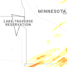
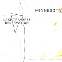


Connect with Interactive Hail Maps