

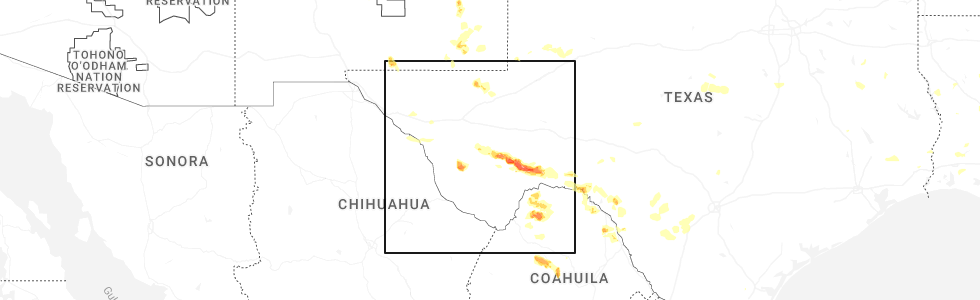
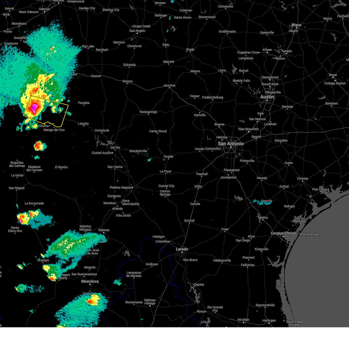
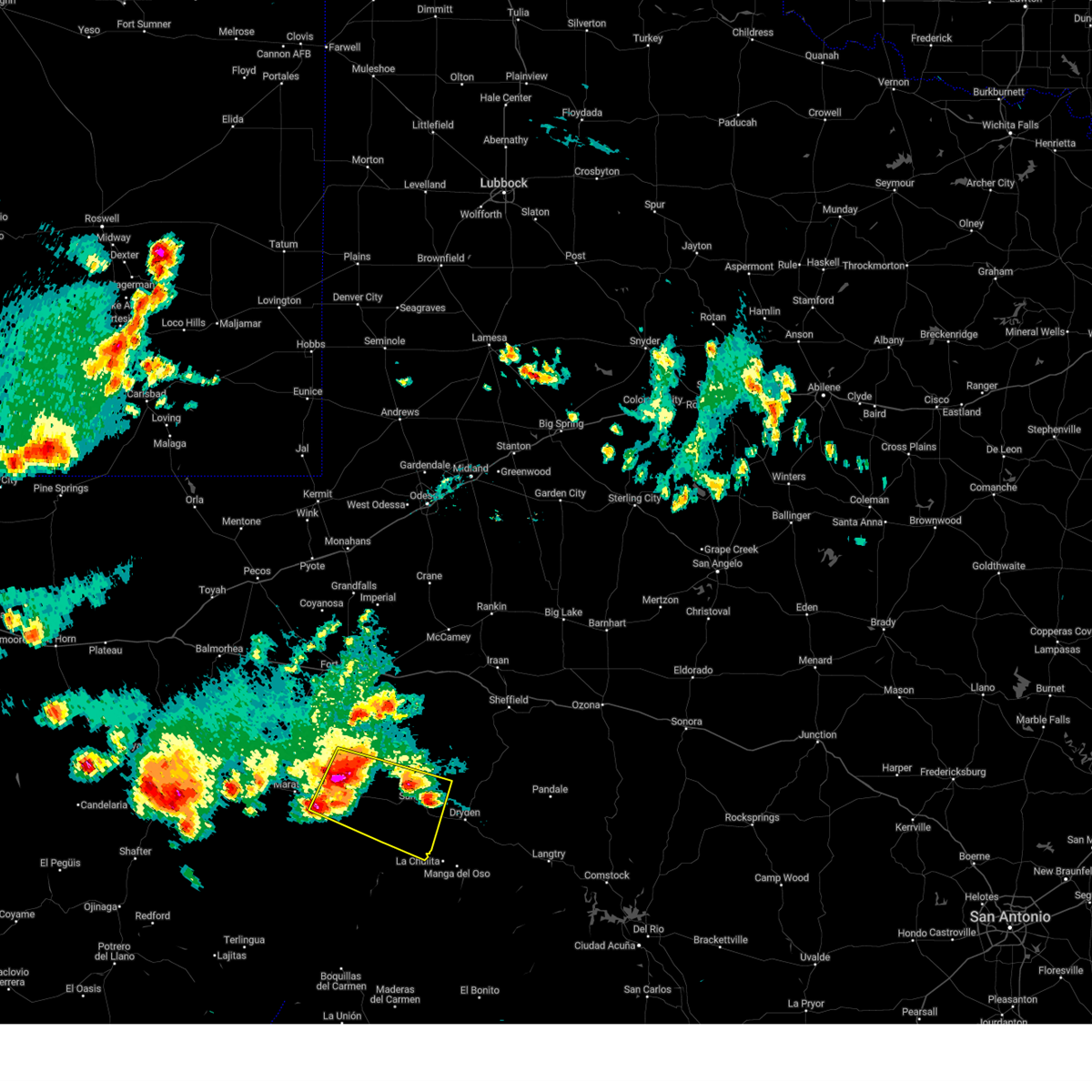
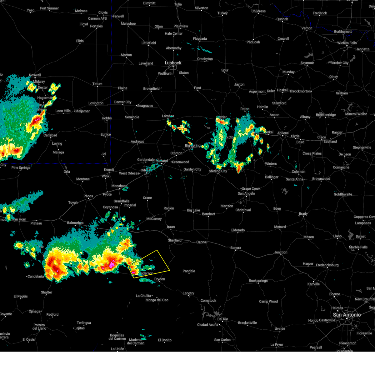
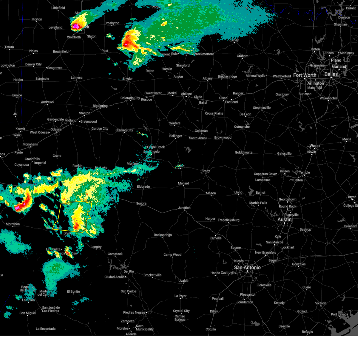
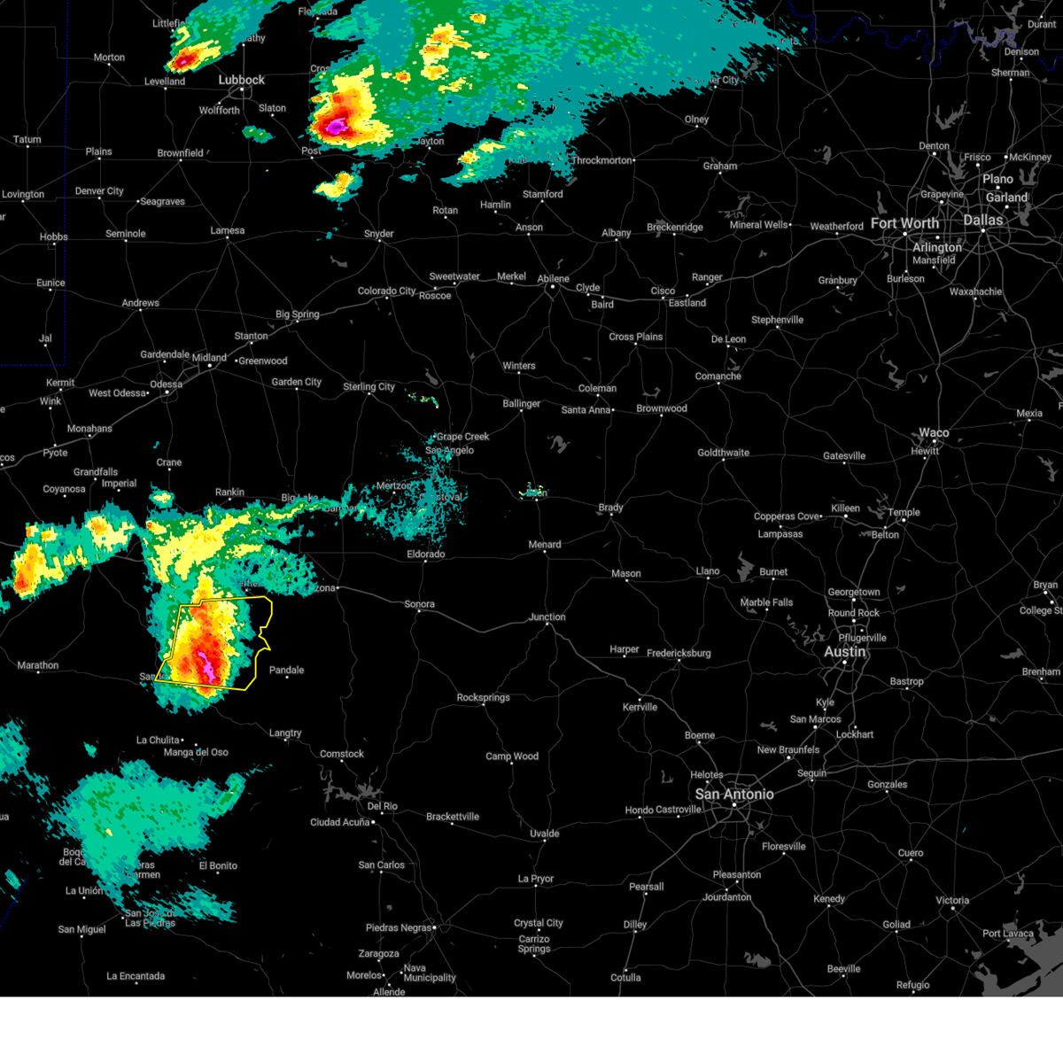
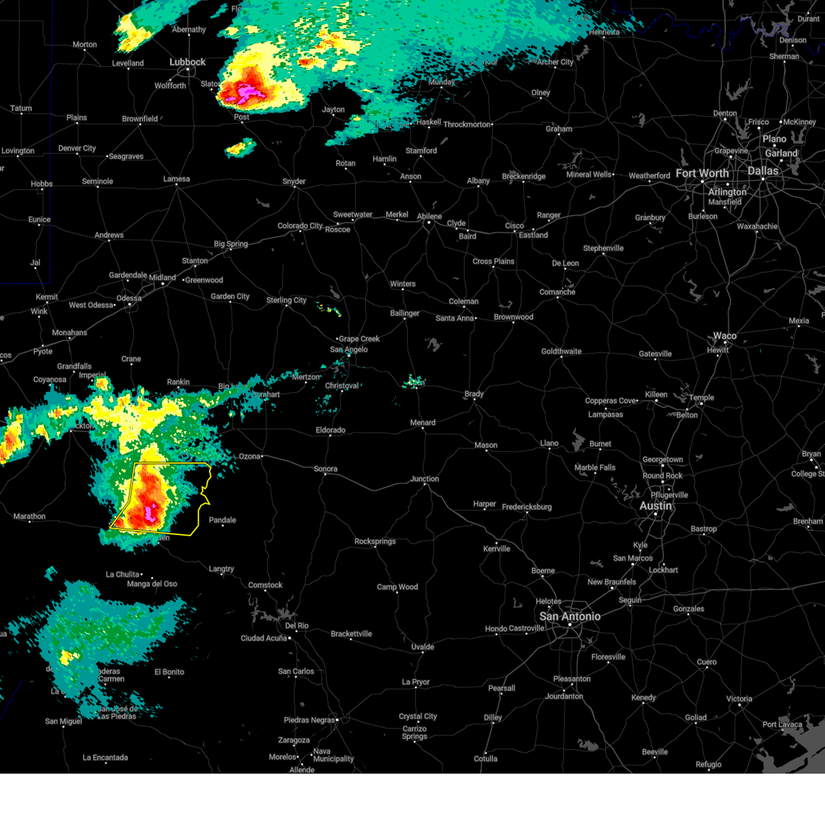
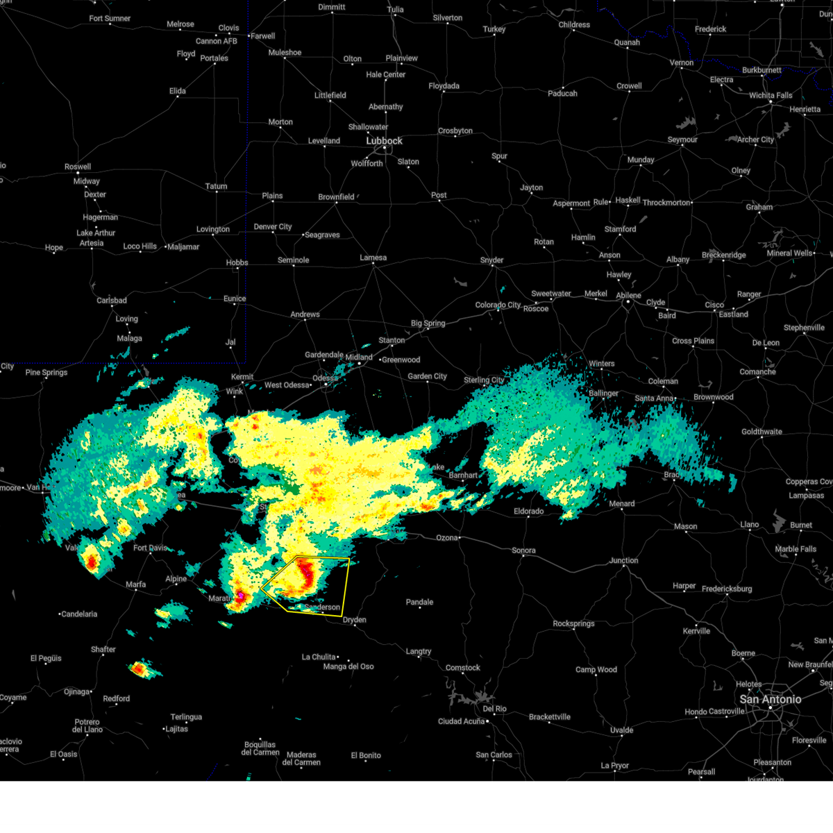
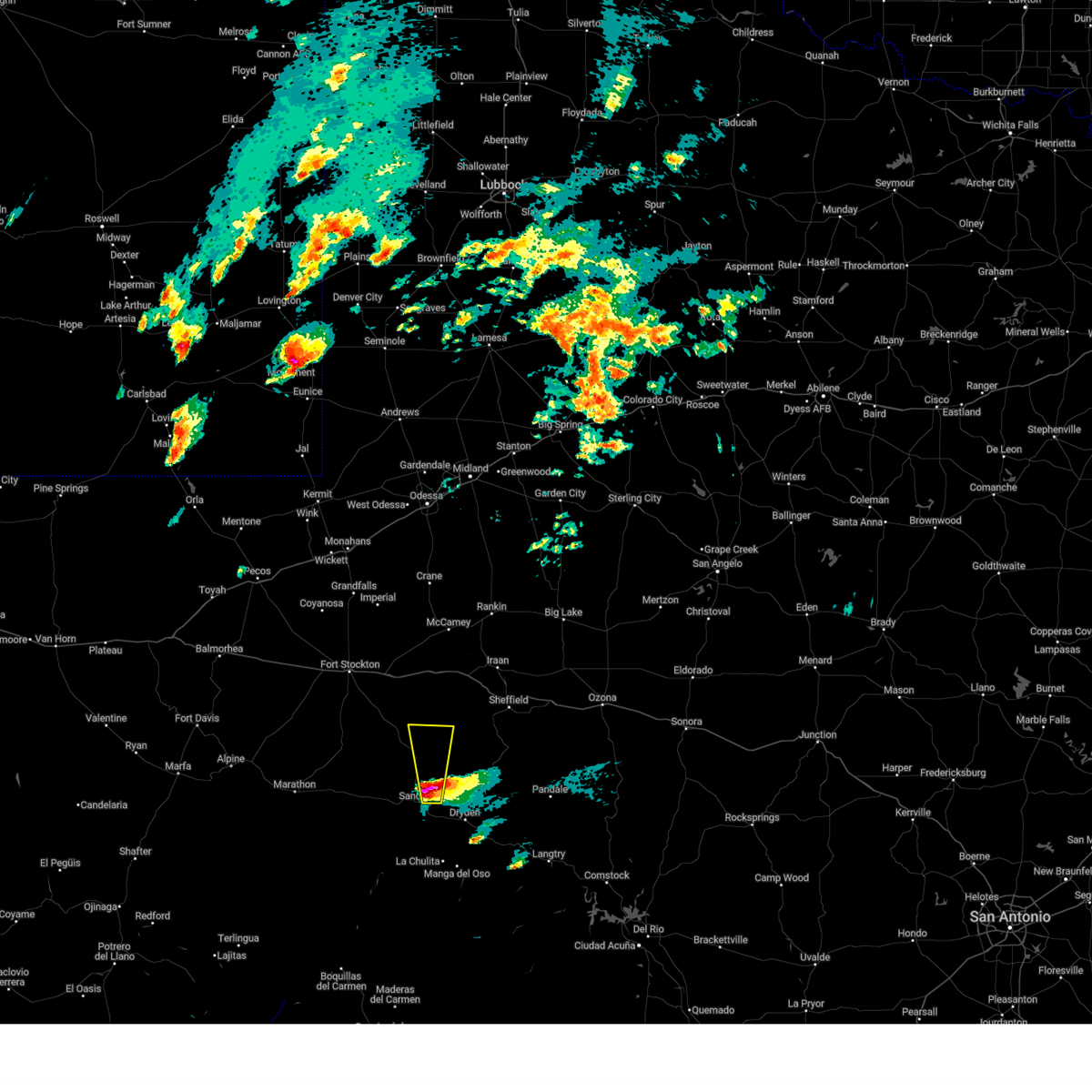
Hail Map for Sanderson, TX
The Sanderson, TX area has had 28 reports of on-the-ground hail by trained spotters, and has been under severe weather warnings 41 times during the past 12 months. Doppler radar has detected hail at or near Sanderson, TX on 62 occasions, including 5 occasions during the past year.
| Name: | Sanderson, TX |
| Where Located: | 77.2 miles ESE of Alpine, TX |
| Map: | Google Map for Sanderson, TX |
| Population: | 837 |
| Housing Units: | 542 |
| More Info: | Search Google for Sanderson, TX |
3
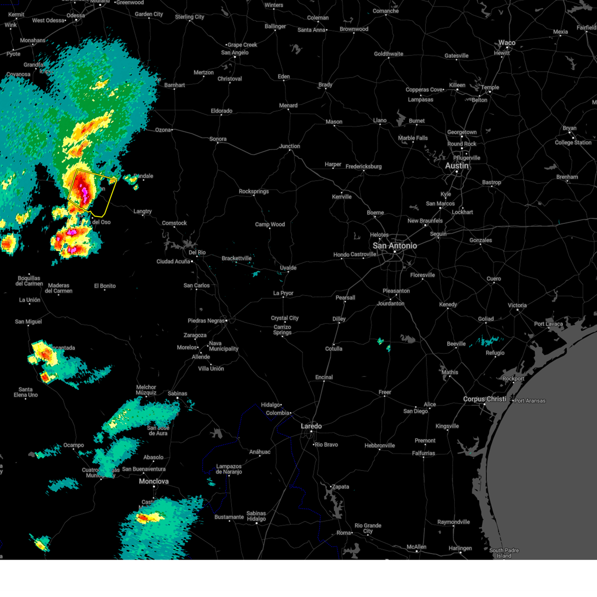
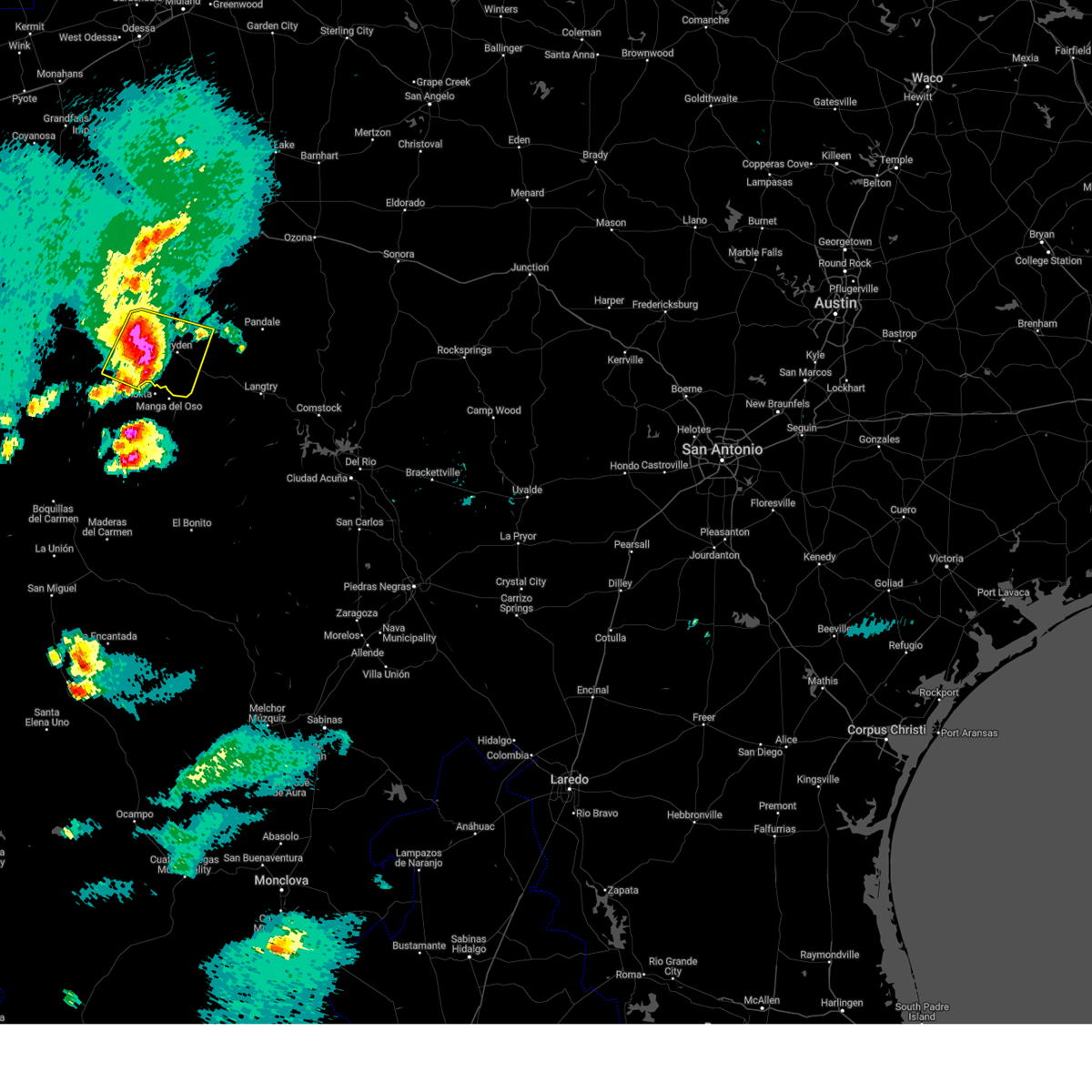
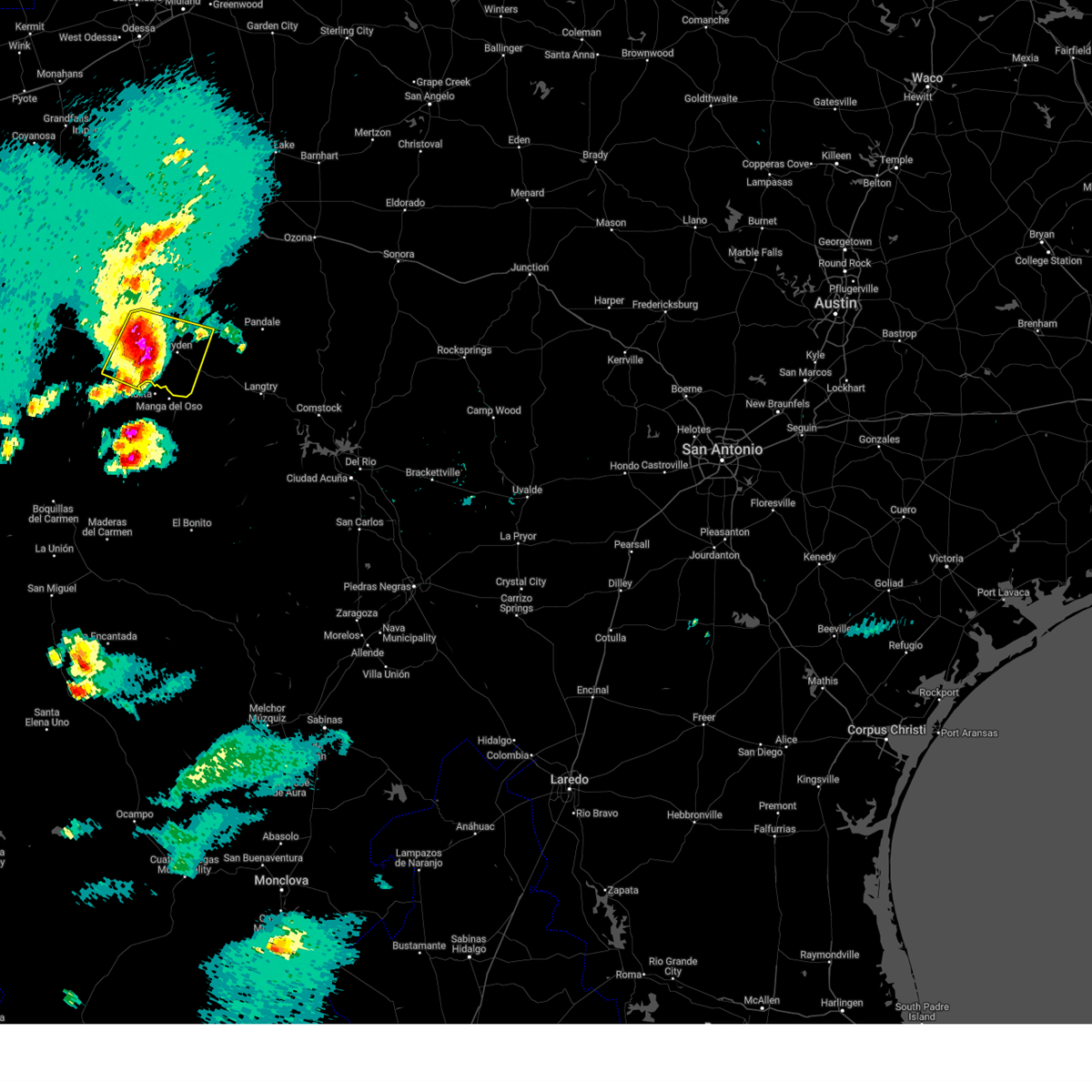
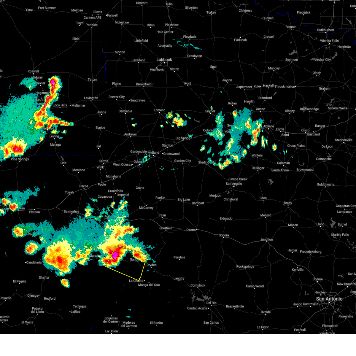
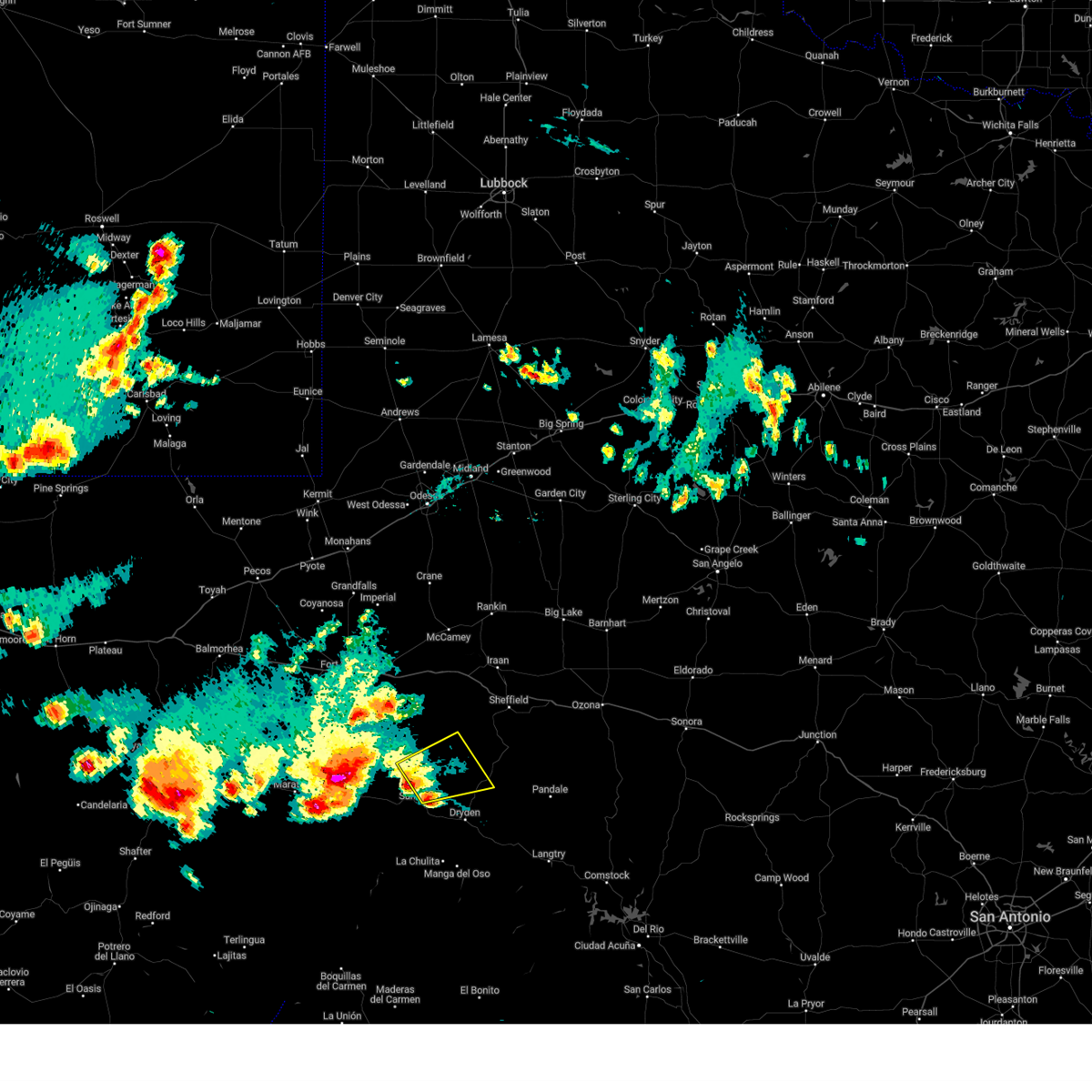
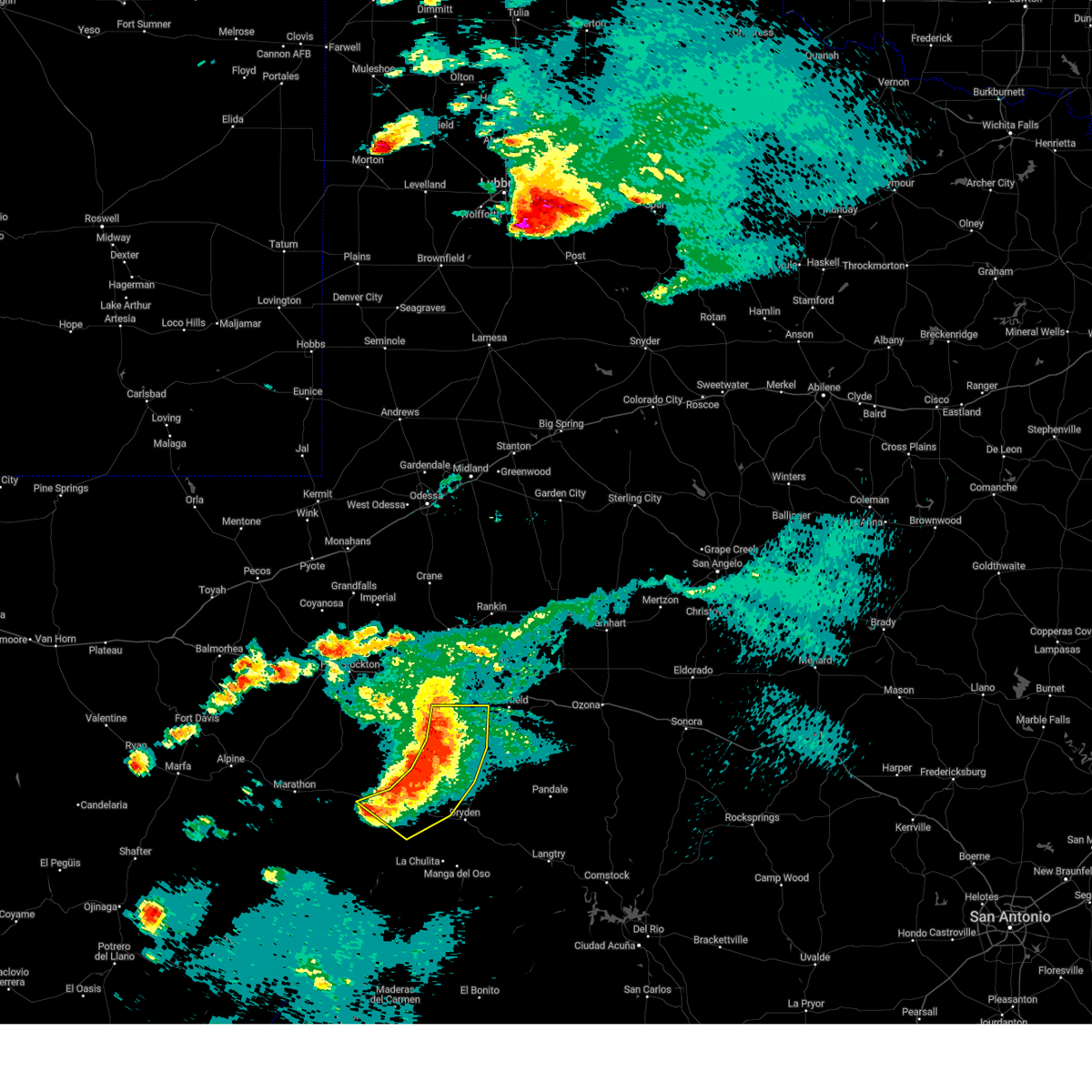
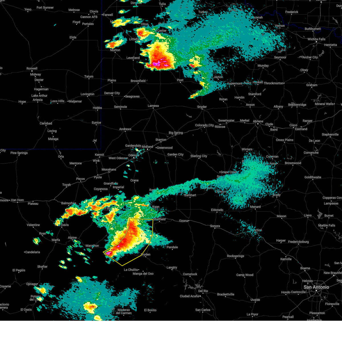
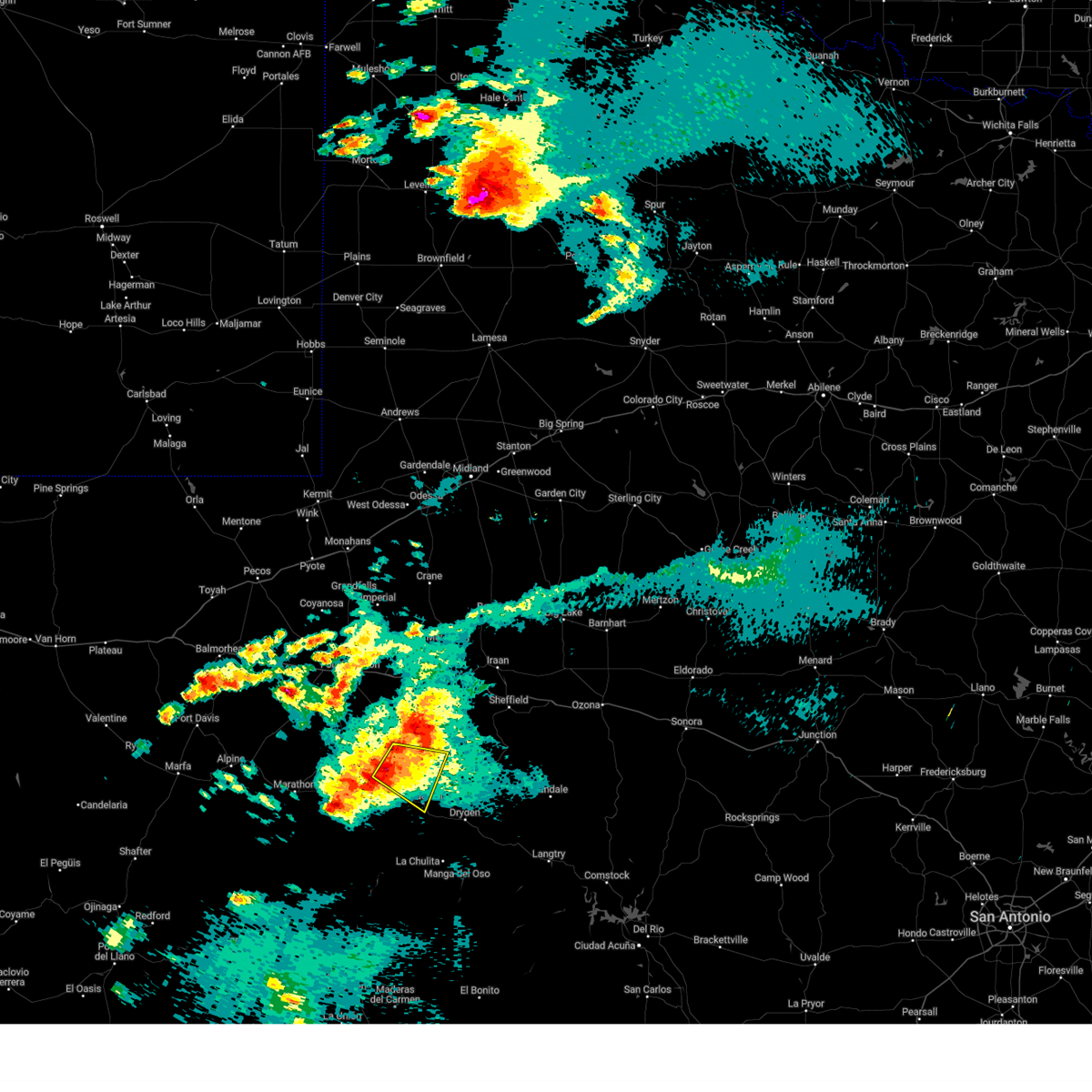
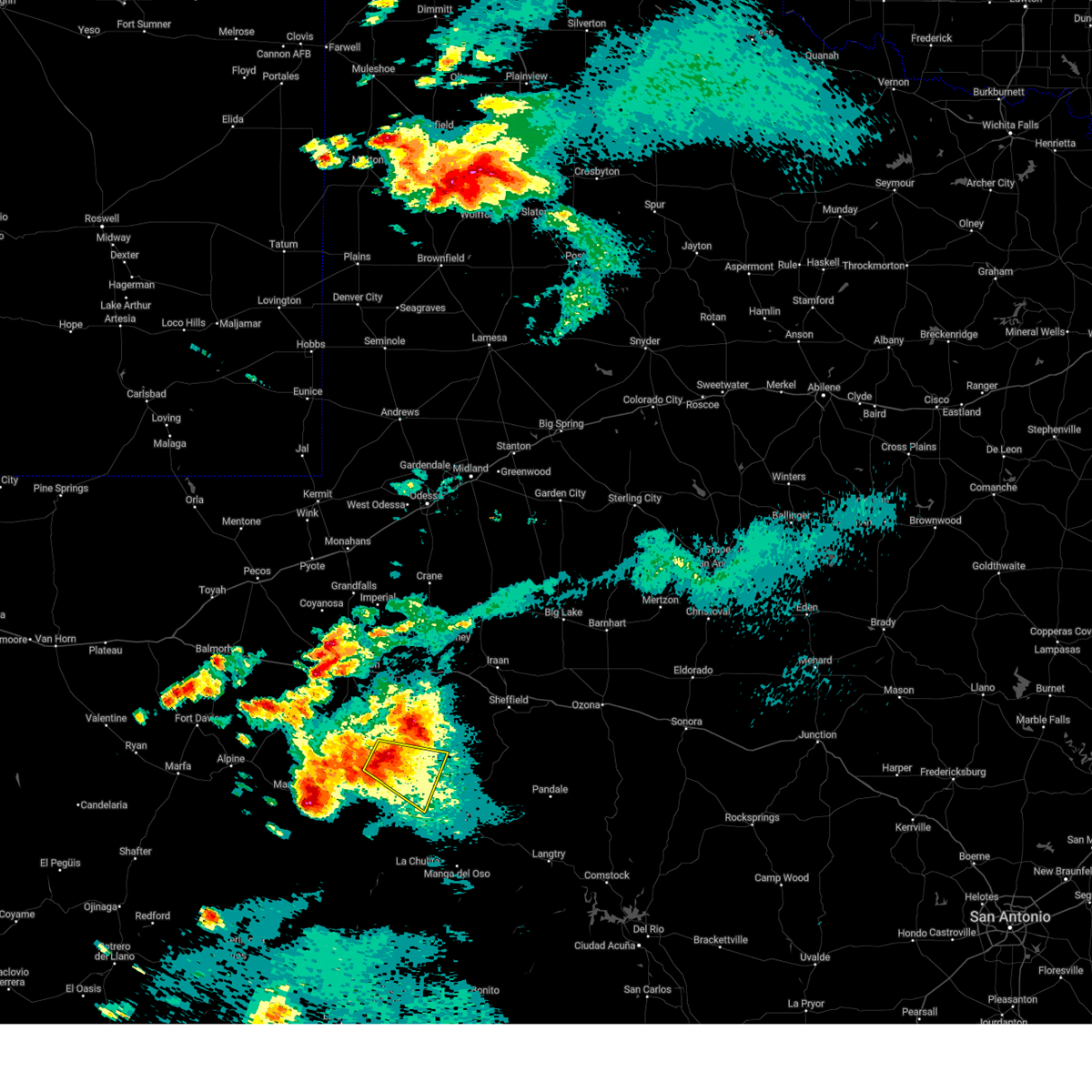
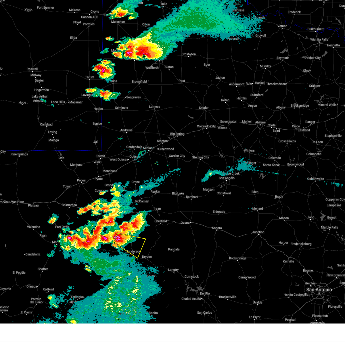
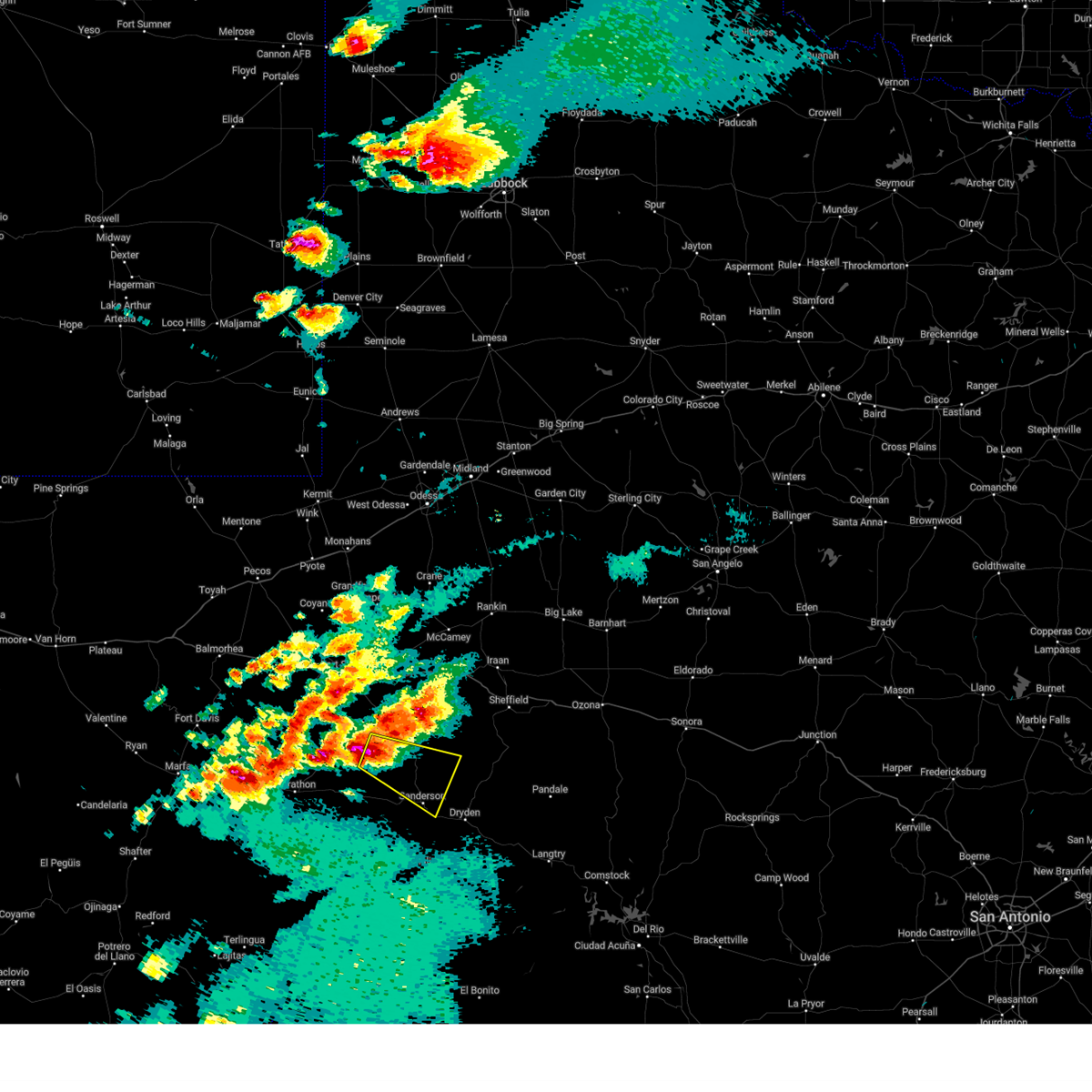
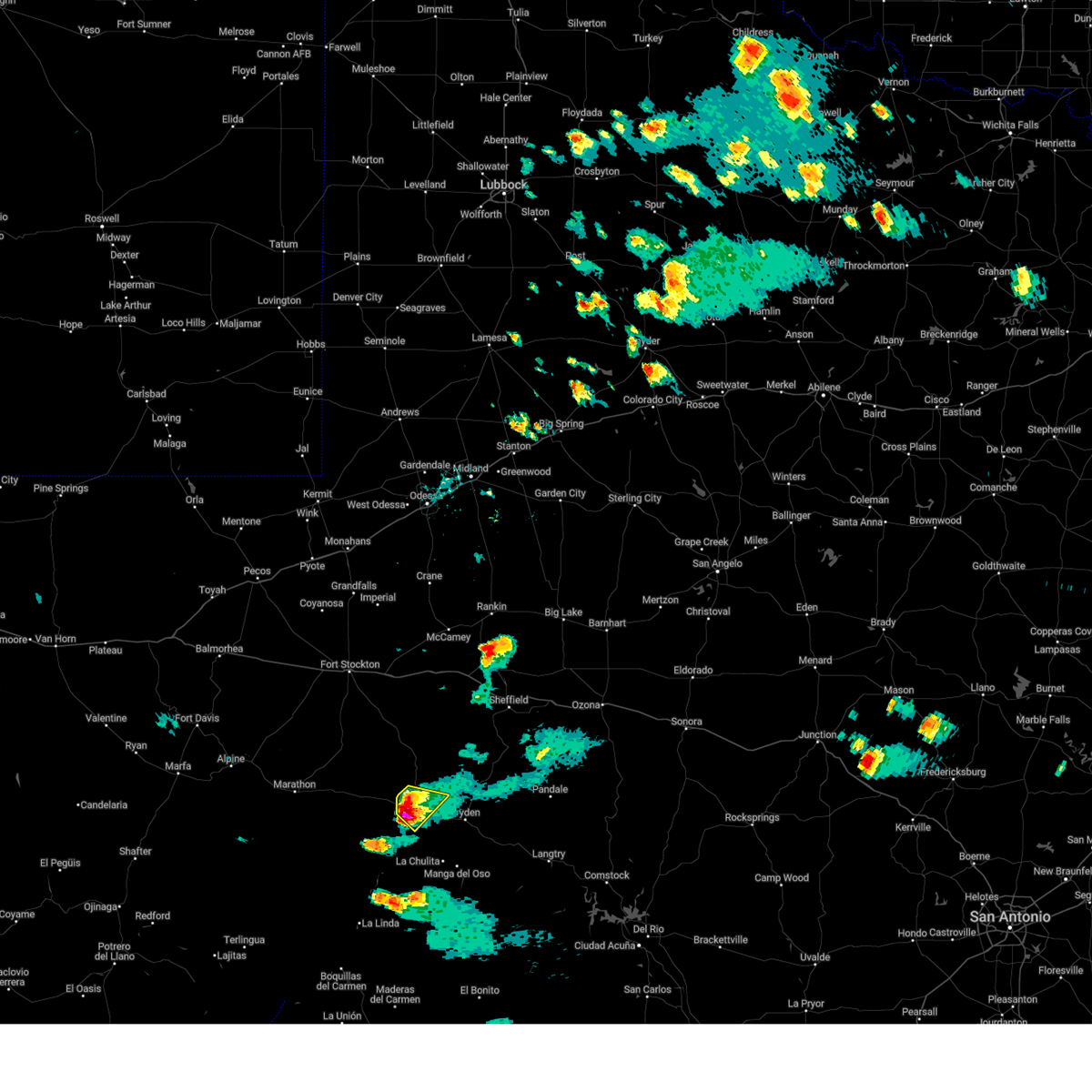
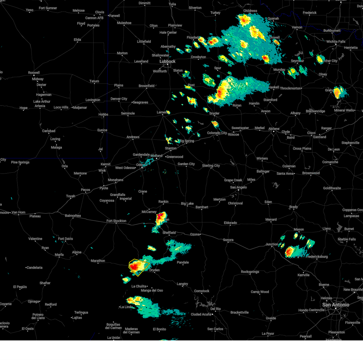
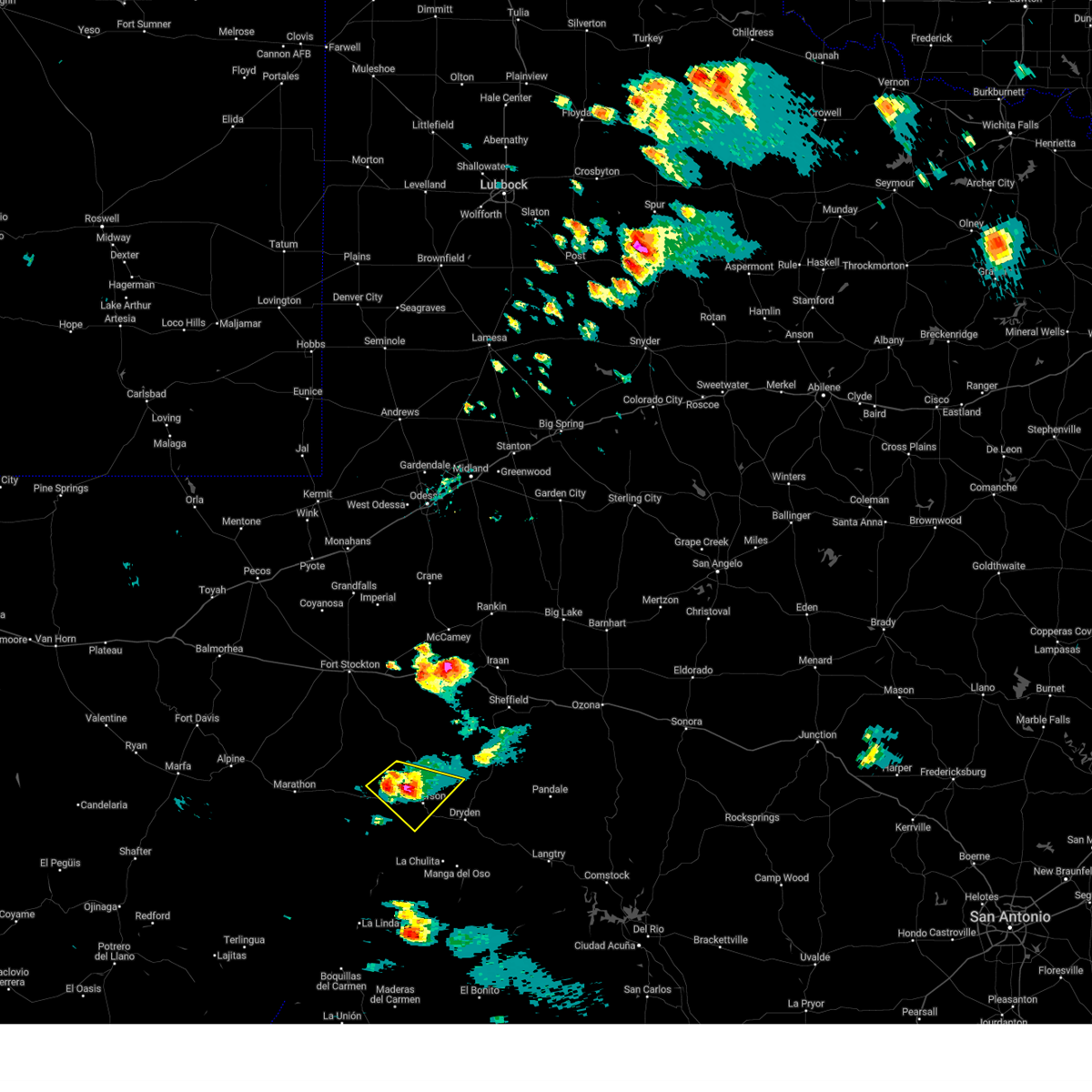
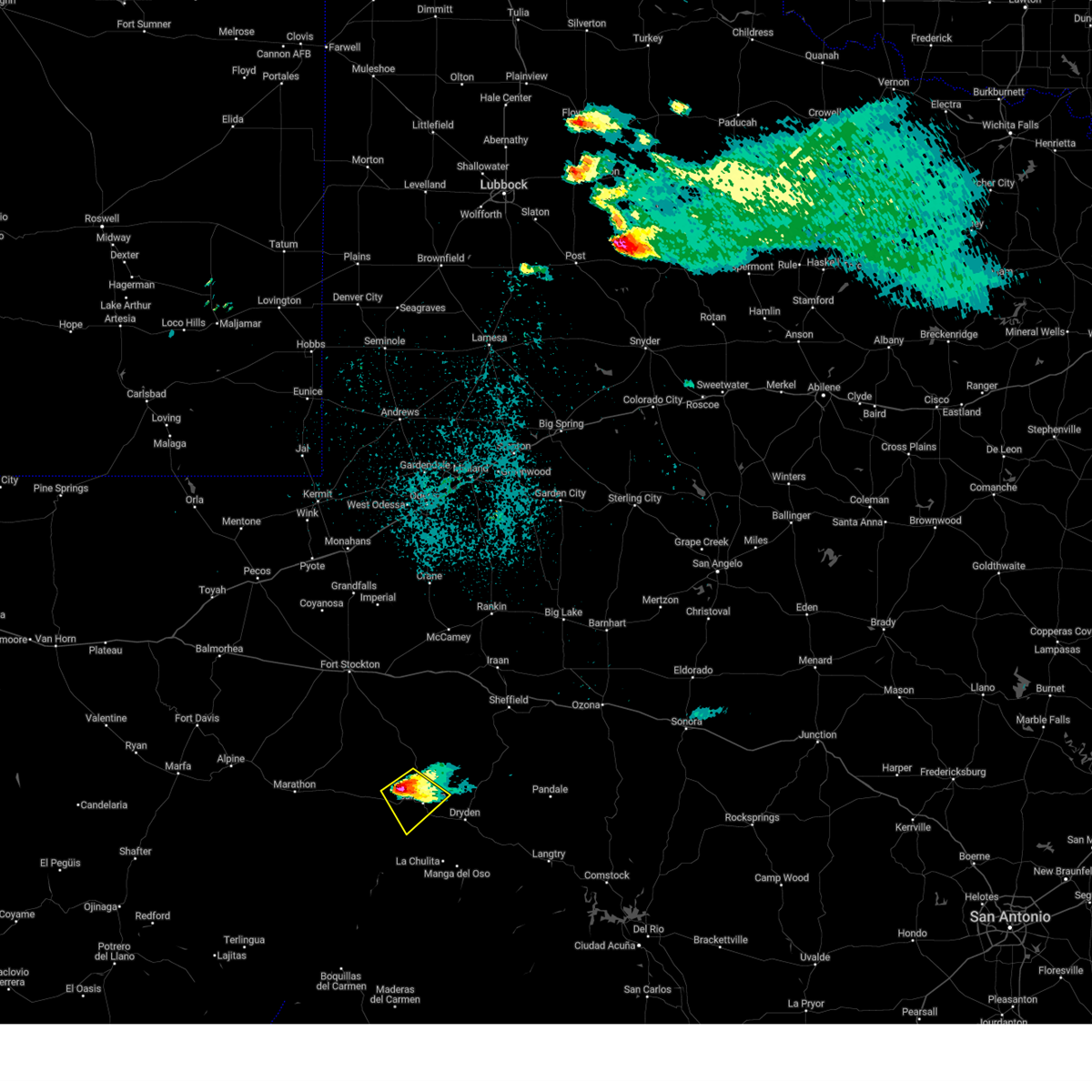
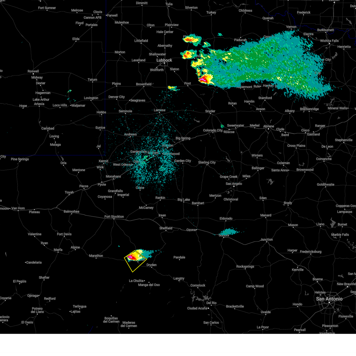
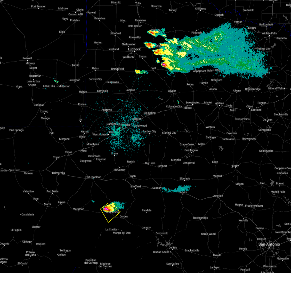
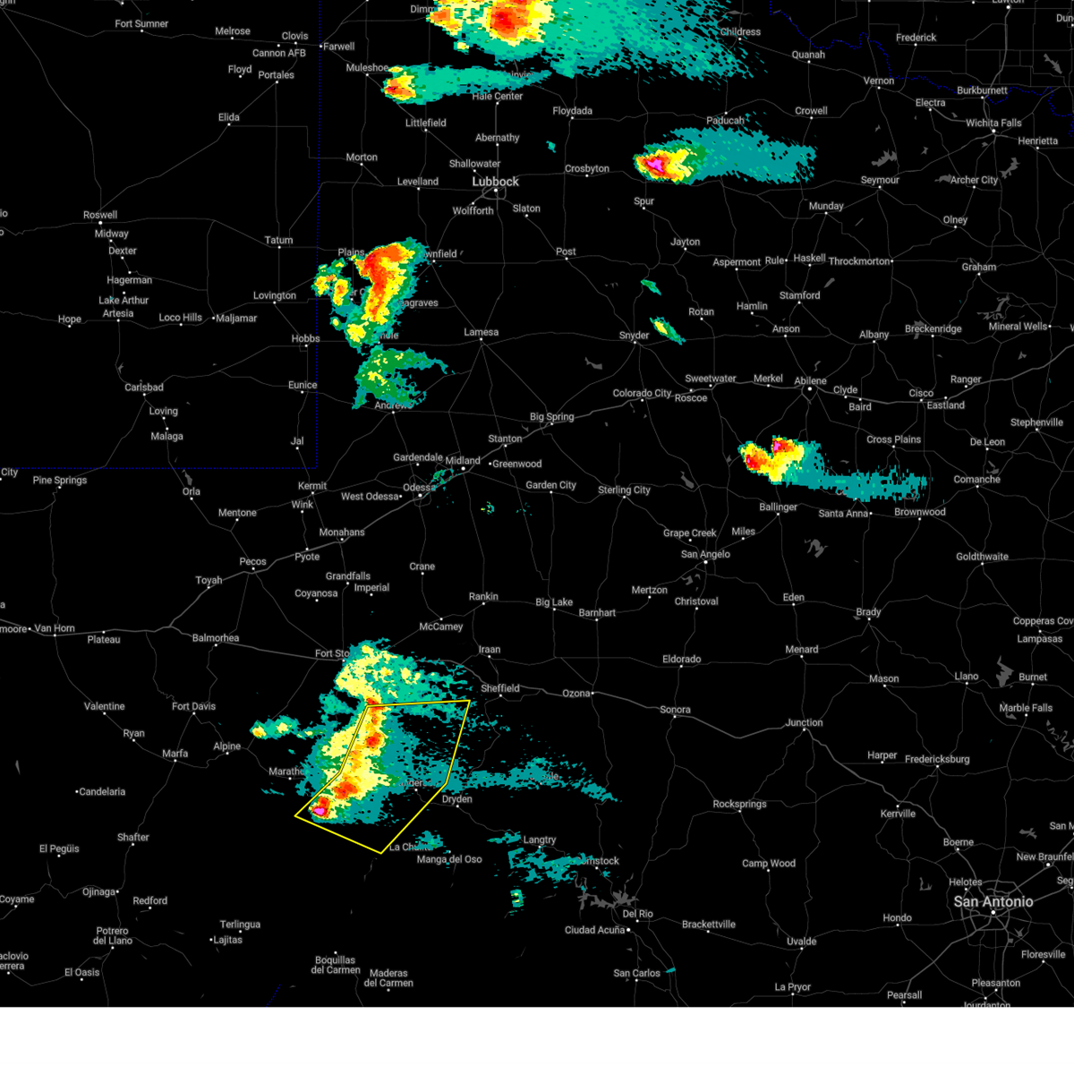
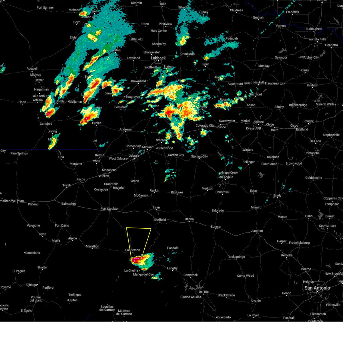
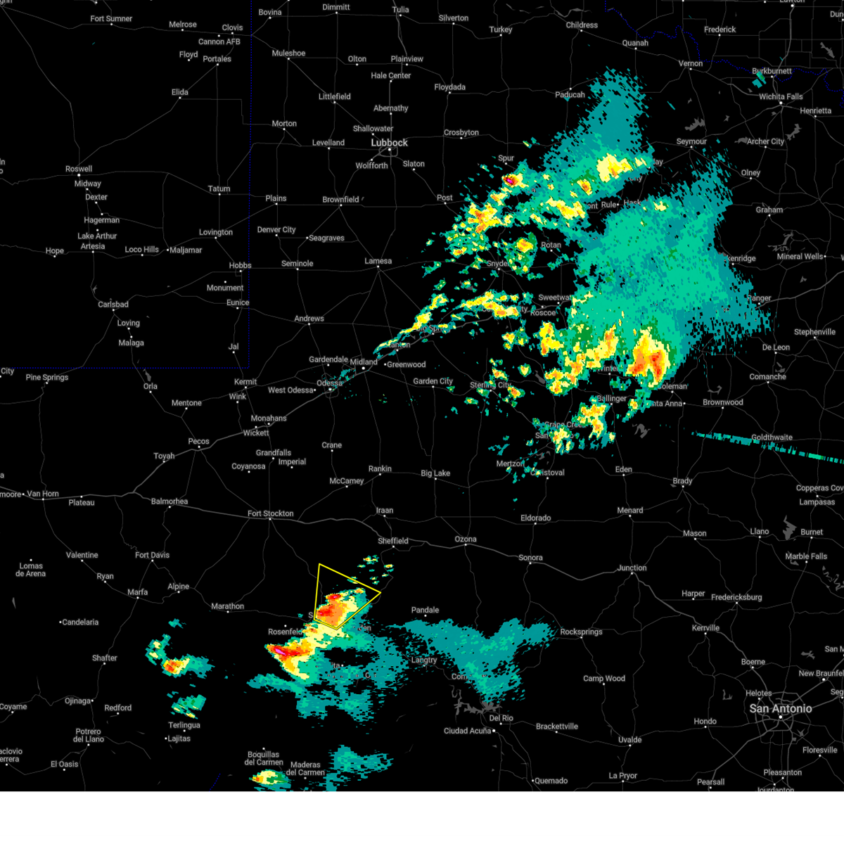
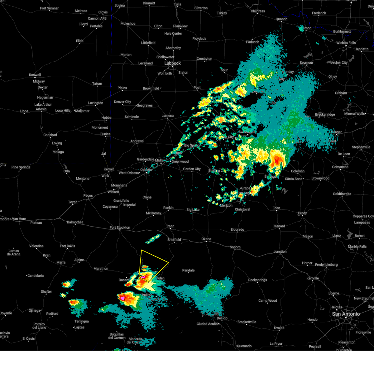
The Top Recent Hail Date for Sanderson, TX is Tuesday, June 10, 2025 (3rd out of 62)
Hail and Wind Damage Spotted near Sanderson, TX
| Date / Time | Report Details |
|---|---|
| 6/10/2025 5:02 PM CDT |
 At 502 pm cdt, a severe thunderstorm was located near dryden, moving east at 25 mph (radar indicated). Hazards include 60 mph wind gusts and quarter size hail. Hail damage to vehicles is expected. expect wind damage to roofs, siding, and trees. Locations impacted include, sanderson, dryden, and terrell county airport. At 502 pm cdt, a severe thunderstorm was located near dryden, moving east at 25 mph (radar indicated). Hazards include 60 mph wind gusts and quarter size hail. Hail damage to vehicles is expected. expect wind damage to roofs, siding, and trees. Locations impacted include, sanderson, dryden, and terrell county airport.
|
| 6/10/2025 5:02 PM CDT |
 the severe thunderstorm warning has been cancelled and is no longer in effect the severe thunderstorm warning has been cancelled and is no longer in effect
|
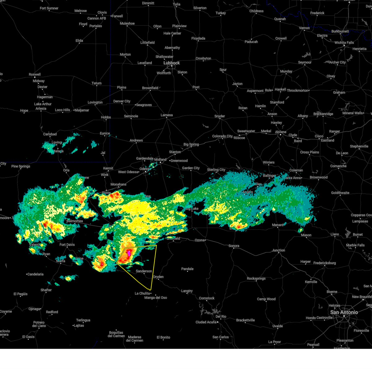
| 6/10/2025 5:01 PM CDT | Awos station k6r6 5 w dryden recorded a storm-related gust of 93mp in terrell county TX, 12.9 miles WNW of Sanderson, TX |
| 6/10/2025 4:49 PM CDT |
 At 449 pm cdt, a severe thunderstorm was located 8 miles west of dryden, moving east at 40 mph (radar indicated). Hazards include ping pong ball size hail and 60 mph wind gusts. People and animals outdoors will be injured. expect hail damage to roofs, siding, windows, and vehicles. expect wind damage to roofs, siding, and trees. Locations impacted include, sanderson, dryden, and terrell county airport. At 449 pm cdt, a severe thunderstorm was located 8 miles west of dryden, moving east at 40 mph (radar indicated). Hazards include ping pong ball size hail and 60 mph wind gusts. People and animals outdoors will be injured. expect hail damage to roofs, siding, windows, and vehicles. expect wind damage to roofs, siding, and trees. Locations impacted include, sanderson, dryden, and terrell county airport.
|
| 6/10/2025 4:49 PM CDT |
 the severe thunderstorm warning has been cancelled and is no longer in effect the severe thunderstorm warning has been cancelled and is no longer in effect
|
| 6/10/2025 4:45 PM CDT | Estimated 70mph winds accompanied by small hai in terrell county TX, 0.1 miles E of Sanderson, TX |
| 6/10/2025 4:29 PM CDT |
 Svrmaf the national weather service in midland has issued a * severe thunderstorm warning for, south central pecos county in southwestern texas, east central brewster county in southwestern texas, southwestern terrell county in southwestern texas, * until 515 pm cdt. * at 429 pm cdt, a severe thunderstorm was located near sanderson, moving east at 35 mph. this is a destructive storm for sanderson (radar indicated). Hazards include baseball size hail and 70 mph wind gusts. People and animals outdoors will be severely injured. Expect shattered windows, extensive damage to roofs, siding, and vehicles. Svrmaf the national weather service in midland has issued a * severe thunderstorm warning for, south central pecos county in southwestern texas, east central brewster county in southwestern texas, southwestern terrell county in southwestern texas, * until 515 pm cdt. * at 429 pm cdt, a severe thunderstorm was located near sanderson, moving east at 35 mph. this is a destructive storm for sanderson (radar indicated). Hazards include baseball size hail and 70 mph wind gusts. People and animals outdoors will be severely injured. Expect shattered windows, extensive damage to roofs, siding, and vehicles.
|
| 6/10/2025 4:15 PM CDT |
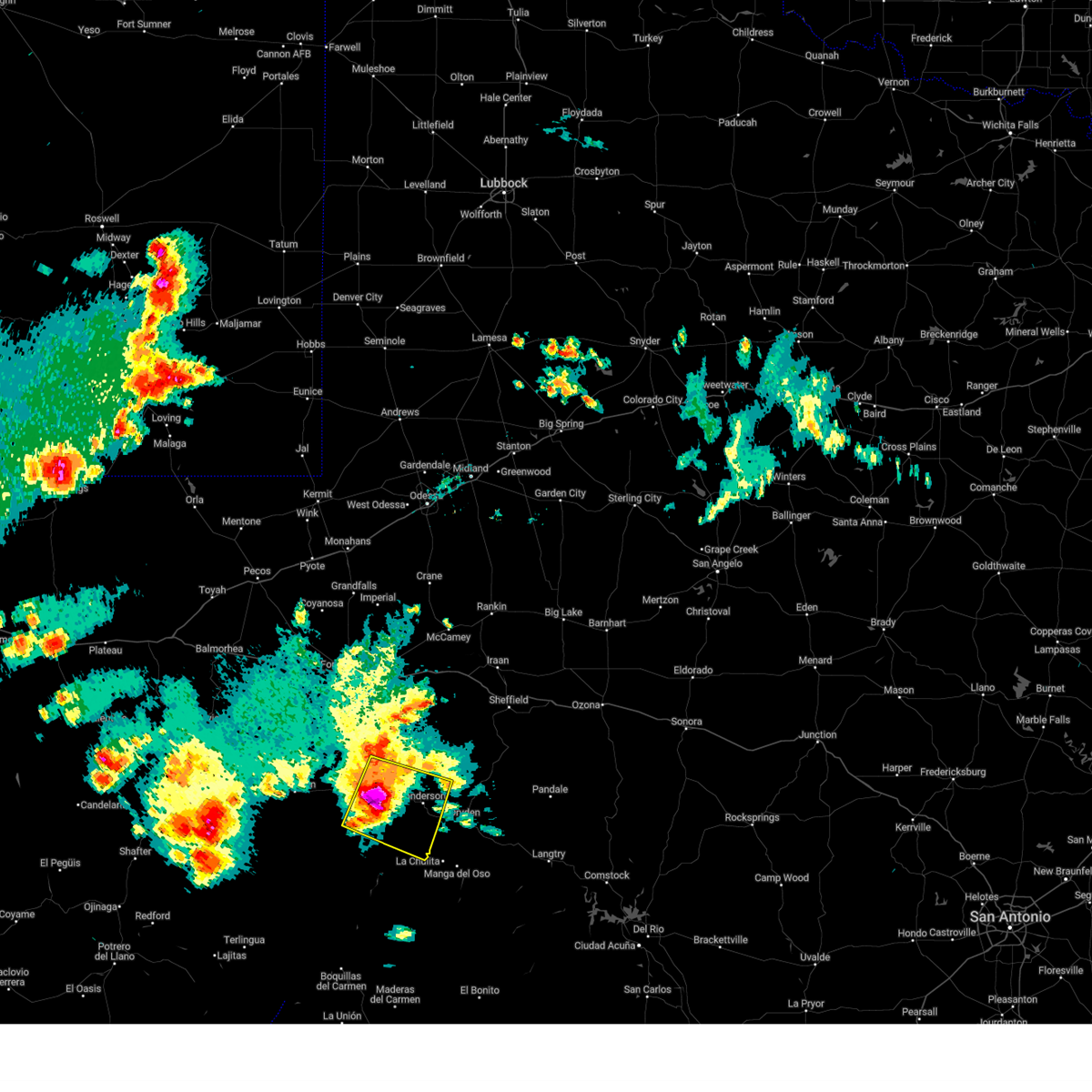 At 415 pm cdt, a severe thunderstorm was located 9 miles west of sanderson, moving east at 40 mph. this is a destructive storm for sanderson (radar indicated). Hazards include baseball size hail and 70 mph wind gusts. People and animals outdoors will be severely injured. expect shattered windows, extensive damage to roofs, siding, and vehicles. Locations impacted include, sanderson. At 415 pm cdt, a severe thunderstorm was located 9 miles west of sanderson, moving east at 40 mph. this is a destructive storm for sanderson (radar indicated). Hazards include baseball size hail and 70 mph wind gusts. People and animals outdoors will be severely injured. expect shattered windows, extensive damage to roofs, siding, and vehicles. Locations impacted include, sanderson.
|
| 6/10/2025 4:07 PM CDT | The storm which prompted the warning has weakened below severe limits, and no longer poses an immediate threat to life or property. therefore, the warning will be allowed to expire. however, gusty winds and heavy rain are still possible with this thunderstorm. a severe thunderstorm watch remains in effect until 900 pm cdt for southwestern texas. |
| 6/10/2025 3:58 PM CDT |
 At 358 pm cdt, a severe thunderstorm was located 20 miles west of sanderson, moving east at 30 mph (radar indicated). Hazards include two inch hail and 70 mph wind gusts. People and animals outdoors will be injured. expect hail damage to roofs, siding, windows, and vehicles. expect considerable tree damage. wind damage is also likely to mobile homes, roofs, and outbuildings. Locations impacted include, sanderson. At 358 pm cdt, a severe thunderstorm was located 20 miles west of sanderson, moving east at 30 mph (radar indicated). Hazards include two inch hail and 70 mph wind gusts. People and animals outdoors will be injured. expect hail damage to roofs, siding, windows, and vehicles. expect considerable tree damage. wind damage is also likely to mobile homes, roofs, and outbuildings. Locations impacted include, sanderson.
|
| 6/10/2025 3:53 PM CDT |
 At 353 pm cdt, a severe thunderstorm was located 9 miles north of sanderson, moving northeast at 25 mph (radar indicated). Hazards include 60 mph wind gusts and quarter size hail. Hail damage to vehicles is expected. expect wind damage to roofs, siding, and trees. Locations impacted include, sanderson. At 353 pm cdt, a severe thunderstorm was located 9 miles north of sanderson, moving northeast at 25 mph (radar indicated). Hazards include 60 mph wind gusts and quarter size hail. Hail damage to vehicles is expected. expect wind damage to roofs, siding, and trees. Locations impacted include, sanderson.
|
| 6/10/2025 3:49 PM CDT |
 Svrmaf the national weather service in midland has issued a * severe thunderstorm warning for, south central pecos county in southwestern texas, northeastern brewster county in southwestern texas, southwestern terrell county in southwestern texas, * until 430 pm cdt. * at 348 pm cdt, a severe thunderstorm was located 24 miles west of sanderson, moving east at 35 mph (radar indicated). Hazards include golf ball size hail and 70 mph wind gusts. People and animals outdoors will be injured. expect hail damage to roofs, siding, windows, and vehicles. expect considerable tree damage. Wind damage is also likely to mobile homes, roofs, and outbuildings. Svrmaf the national weather service in midland has issued a * severe thunderstorm warning for, south central pecos county in southwestern texas, northeastern brewster county in southwestern texas, southwestern terrell county in southwestern texas, * until 430 pm cdt. * at 348 pm cdt, a severe thunderstorm was located 24 miles west of sanderson, moving east at 35 mph (radar indicated). Hazards include golf ball size hail and 70 mph wind gusts. People and animals outdoors will be injured. expect hail damage to roofs, siding, windows, and vehicles. expect considerable tree damage. Wind damage is also likely to mobile homes, roofs, and outbuildings.
|
| 6/10/2025 3:31 PM CDT |
 Svrmaf the national weather service in midland has issued a * severe thunderstorm warning for, south central pecos county in southwestern texas, northwestern terrell county in southwestern texas, * until 415 pm cdt. * at 331 pm cdt, a severe thunderstorm was located 9 miles northwest of sanderson, moving east at 35 mph (radar indicated). Hazards include 60 mph wind gusts and half dollar size hail. Hail damage to vehicles is expected. Expect wind damage to roofs, siding, and trees. Svrmaf the national weather service in midland has issued a * severe thunderstorm warning for, south central pecos county in southwestern texas, northwestern terrell county in southwestern texas, * until 415 pm cdt. * at 331 pm cdt, a severe thunderstorm was located 9 miles northwest of sanderson, moving east at 35 mph (radar indicated). Hazards include 60 mph wind gusts and half dollar size hail. Hail damage to vehicles is expected. Expect wind damage to roofs, siding, and trees.
|
| 6/5/2025 10:13 PM CDT |
 The storms which prompted the warning have weakened below severe limits, and no longer pose an immediate threat to life or property. therefore, the warning will be allowed to expire. The storms which prompted the warning have weakened below severe limits, and no longer pose an immediate threat to life or property. therefore, the warning will be allowed to expire.
|
| 6/5/2025 9:51 PM CDT | Awos station k6r6 5 w dryde in terrell county TX, 12.9 miles WNW of Sanderson, TX |
| 6/5/2025 9:32 PM CDT |
 the severe thunderstorm warning has been cancelled and is no longer in effect the severe thunderstorm warning has been cancelled and is no longer in effect
|
| 6/5/2025 9:32 PM CDT |
 At 931 pm cdt, severe thunderstorms were located along a line extending from 20 miles southwest of sheffield to 15 miles west of terrell county gas plant to 10 miles east of sanderson, moving east at 30 mph (radar indicated). Hazards include 70 mph wind gusts and quarter size hail. Hail damage to vehicles is expected. expect considerable tree damage. wind damage is also likely to mobile homes, roofs, and outbuildings. Locations impacted include, terrell county gas plant and state highway 349. At 931 pm cdt, severe thunderstorms were located along a line extending from 20 miles southwest of sheffield to 15 miles west of terrell county gas plant to 10 miles east of sanderson, moving east at 30 mph (radar indicated). Hazards include 70 mph wind gusts and quarter size hail. Hail damage to vehicles is expected. expect considerable tree damage. wind damage is also likely to mobile homes, roofs, and outbuildings. Locations impacted include, terrell county gas plant and state highway 349.
|
| 6/5/2025 9:15 PM CDT |
 Svrmaf the national weather service in midland has issued a * severe thunderstorm warning for, southeastern pecos county in southwestern texas, northern terrell county in southwestern texas, * until 1015 pm cdt. * at 914 pm cdt, severe thunderstorms were located along a line extending from 22 miles west of sheffield to 17 miles west of terrell county gas plant to near sanderson, moving east at 35 mph (radar indicated). Hazards include 70 mph wind gusts and quarter size hail. Hail damage to vehicles is expected. expect considerable tree damage. Wind damage is also likely to mobile homes, roofs, and outbuildings. Svrmaf the national weather service in midland has issued a * severe thunderstorm warning for, southeastern pecos county in southwestern texas, northern terrell county in southwestern texas, * until 1015 pm cdt. * at 914 pm cdt, severe thunderstorms were located along a line extending from 22 miles west of sheffield to 17 miles west of terrell county gas plant to near sanderson, moving east at 35 mph (radar indicated). Hazards include 70 mph wind gusts and quarter size hail. Hail damage to vehicles is expected. expect considerable tree damage. Wind damage is also likely to mobile homes, roofs, and outbuildings.
|
| 6/5/2025 8:49 PM CDT |
 At 849 pm cdt, severe thunderstorms were located along a line extending from 17 miles west of sheffield to 17 miles northwest of terrell county gas plant to 19 miles north of dryden to near sanderson to 34 miles southeast of marathon, moving east at 20 mph (radar indicated). Hazards include 70 mph wind gusts and half dollar size hail. Hail damage to vehicles is expected. expect considerable tree damage. wind damage is also likely to mobile homes, roofs, and outbuildings. Locations impacted include, sanderson. At 849 pm cdt, severe thunderstorms were located along a line extending from 17 miles west of sheffield to 17 miles northwest of terrell county gas plant to 19 miles north of dryden to near sanderson to 34 miles southeast of marathon, moving east at 20 mph (radar indicated). Hazards include 70 mph wind gusts and half dollar size hail. Hail damage to vehicles is expected. expect considerable tree damage. wind damage is also likely to mobile homes, roofs, and outbuildings. Locations impacted include, sanderson.
|
| 6/5/2025 8:23 PM CDT |
 Svrmaf the national weather service in midland has issued a * severe thunderstorm warning for, southeastern pecos county in southwestern texas, east central brewster county in southwestern texas, northwestern terrell county in southwestern texas, * until 915 pm cdt. * at 823 pm cdt, severe thunderstorms were located along a line extending from 27 miles west of sheffield to 26 miles west of terrell county gas plant to 24 miles northwest of dryden to 6 miles northwest of sanderson to 25 miles southeast of marathon, moving east at 10 mph (radar indicated). Hazards include two inch hail and 70 mph wind gusts. People and animals outdoors will be injured. expect hail damage to roofs, siding, windows, and vehicles. expect considerable tree damage. Wind damage is also likely to mobile homes, roofs, and outbuildings. Svrmaf the national weather service in midland has issued a * severe thunderstorm warning for, southeastern pecos county in southwestern texas, east central brewster county in southwestern texas, northwestern terrell county in southwestern texas, * until 915 pm cdt. * at 823 pm cdt, severe thunderstorms were located along a line extending from 27 miles west of sheffield to 26 miles west of terrell county gas plant to 24 miles northwest of dryden to 6 miles northwest of sanderson to 25 miles southeast of marathon, moving east at 10 mph (radar indicated). Hazards include two inch hail and 70 mph wind gusts. People and animals outdoors will be injured. expect hail damage to roofs, siding, windows, and vehicles. expect considerable tree damage. Wind damage is also likely to mobile homes, roofs, and outbuildings.
|
| 6/5/2025 8:12 PM CDT |
 At 812 pm cdt, a severe thunderstorm was located 18 miles northwest of sanderson, moving east at 20 mph (radar indicated). Hazards include two inch hail and 70 mph wind gusts. People and animals outdoors will be injured. expect hail damage to roofs, siding, windows, and vehicles. expect considerable tree damage. wind damage is also likely to mobile homes, roofs, and outbuildings. Locations impacted include, sanderson. At 812 pm cdt, a severe thunderstorm was located 18 miles northwest of sanderson, moving east at 20 mph (radar indicated). Hazards include two inch hail and 70 mph wind gusts. People and animals outdoors will be injured. expect hail damage to roofs, siding, windows, and vehicles. expect considerable tree damage. wind damage is also likely to mobile homes, roofs, and outbuildings. Locations impacted include, sanderson.
|
| 6/5/2025 7:45 PM CDT |
 Svrmaf the national weather service in midland has issued a * severe thunderstorm warning for, south central pecos county in southwestern texas, west central terrell county in southwestern texas, * until 830 pm cdt. * at 745 pm cdt, a severe thunderstorm was located 19 miles northwest of sanderson, moving southeast at 15 mph (radar indicated). Hazards include two inch hail and 60 mph wind gusts. People and animals outdoors will be injured. expect hail damage to roofs, siding, windows, and vehicles. Expect wind damage to roofs, siding, and trees. Svrmaf the national weather service in midland has issued a * severe thunderstorm warning for, south central pecos county in southwestern texas, west central terrell county in southwestern texas, * until 830 pm cdt. * at 745 pm cdt, a severe thunderstorm was located 19 miles northwest of sanderson, moving southeast at 15 mph (radar indicated). Hazards include two inch hail and 60 mph wind gusts. People and animals outdoors will be injured. expect hail damage to roofs, siding, windows, and vehicles. Expect wind damage to roofs, siding, and trees.
|
| 6/5/2025 7:12 PM CDT |
 At 712 pm cdt, a severe thunderstorm was located 20 miles northwest of sanderson, moving east at 30 mph (radar indicated). Hazards include tennis ball size hail and 70 mph wind gusts. People and animals outdoors will be injured. expect hail damage to roofs, siding, windows, and vehicles. expect considerable tree damage. wind damage is also likely to mobile homes, roofs, and outbuildings. Locations impacted include, sanderson. At 712 pm cdt, a severe thunderstorm was located 20 miles northwest of sanderson, moving east at 30 mph (radar indicated). Hazards include tennis ball size hail and 70 mph wind gusts. People and animals outdoors will be injured. expect hail damage to roofs, siding, windows, and vehicles. expect considerable tree damage. wind damage is also likely to mobile homes, roofs, and outbuildings. Locations impacted include, sanderson.
|
| 6/5/2025 7:00 PM CDT |
 Svrmaf the national weather service in midland has issued a * severe thunderstorm warning for, south central pecos county in southwestern texas, west central terrell county in southwestern texas, * until 745 pm cdt. * at 700 pm cdt, a severe thunderstorm was located 23 miles northwest of sanderson, moving east at 35 mph (radar indicated). Hazards include ping pong ball size hail and 60 mph wind gusts. People and animals outdoors will be injured. expect hail damage to roofs, siding, windows, and vehicles. Expect wind damage to roofs, siding, and trees. Svrmaf the national weather service in midland has issued a * severe thunderstorm warning for, south central pecos county in southwestern texas, west central terrell county in southwestern texas, * until 745 pm cdt. * at 700 pm cdt, a severe thunderstorm was located 23 miles northwest of sanderson, moving east at 35 mph (radar indicated). Hazards include ping pong ball size hail and 60 mph wind gusts. People and animals outdoors will be injured. expect hail damage to roofs, siding, windows, and vehicles. Expect wind damage to roofs, siding, and trees.
|
| 5/22/2025 5:33 PM CDT |
 the severe thunderstorm warning has been cancelled and is no longer in effect the severe thunderstorm warning has been cancelled and is no longer in effect
|
| 5/22/2025 5:33 PM CDT |
 At 532 pm cdt, a severe thunderstorm was located 7 miles southwest of sanderson, moving southeast at 20 mph (radar indicated). Hazards include golf ball size hail and 70 mph wind gusts. People and animals outdoors will be injured. expect hail damage to roofs, siding, windows, and vehicles. expect considerable tree damage. wind damage is also likely to mobile homes, roofs, and outbuildings. locations impacted include, sanderson and u. s. Highway 90 west of sanderson. At 532 pm cdt, a severe thunderstorm was located 7 miles southwest of sanderson, moving southeast at 20 mph (radar indicated). Hazards include golf ball size hail and 70 mph wind gusts. People and animals outdoors will be injured. expect hail damage to roofs, siding, windows, and vehicles. expect considerable tree damage. wind damage is also likely to mobile homes, roofs, and outbuildings. locations impacted include, sanderson and u. s. Highway 90 west of sanderson.
|
| 5/22/2025 5:17 PM CDT |
 At 516 pm cdt, a severe thunderstorm was located 8 miles west of sanderson, moving southeast at 15 mph (radar indicated). Hazards include 60 mph wind gusts and quarter size hail. Hail damage to vehicles is expected. expect wind damage to roofs, siding, and trees. Locations impacted include, sanderson. At 516 pm cdt, a severe thunderstorm was located 8 miles west of sanderson, moving southeast at 15 mph (radar indicated). Hazards include 60 mph wind gusts and quarter size hail. Hail damage to vehicles is expected. expect wind damage to roofs, siding, and trees. Locations impacted include, sanderson.
|
| 5/22/2025 4:40 PM CDT |
 Svrmaf the national weather service in midland has issued a * severe thunderstorm warning for, south central pecos county in southwestern texas, west central terrell county in southwestern texas, * until 545 pm cdt. * at 439 pm cdt, a severe thunderstorm was located 7 miles northwest of sanderson, moving southeast at 15 mph (radar indicated). Hazards include ping pong ball size hail and 60 mph wind gusts. People and animals outdoors will be injured. expect hail damage to roofs, siding, windows, and vehicles. Expect wind damage to roofs, siding, and trees. Svrmaf the national weather service in midland has issued a * severe thunderstorm warning for, south central pecos county in southwestern texas, west central terrell county in southwestern texas, * until 545 pm cdt. * at 439 pm cdt, a severe thunderstorm was located 7 miles northwest of sanderson, moving southeast at 15 mph (radar indicated). Hazards include ping pong ball size hail and 60 mph wind gusts. People and animals outdoors will be injured. expect hail damage to roofs, siding, windows, and vehicles. Expect wind damage to roofs, siding, and trees.
|
| 5/8/2025 1:00 PM CDT |
 Svrmaf the national weather service in midland has issued a * severe thunderstorm warning for, south central pecos county in southwestern texas, east central brewster county in southwestern texas, southwestern terrell county in southwestern texas, * until 200 pm cdt. * at 100 pm cdt, a severe thunderstorm was located 18 miles west of sanderson, moving east at 25 mph (radar indicated). Hazards include 60 mph wind gusts and quarter size hail. Hail damage to vehicles is expected. Expect wind damage to roofs, siding, and trees. Svrmaf the national weather service in midland has issued a * severe thunderstorm warning for, south central pecos county in southwestern texas, east central brewster county in southwestern texas, southwestern terrell county in southwestern texas, * until 200 pm cdt. * at 100 pm cdt, a severe thunderstorm was located 18 miles west of sanderson, moving east at 25 mph (radar indicated). Hazards include 60 mph wind gusts and quarter size hail. Hail damage to vehicles is expected. Expect wind damage to roofs, siding, and trees.
|
| 5/8/2025 12:22 PM CDT |
 The storm which prompted the warning has weakened below severe limits, and no longer poses an immediate threat to life or property. therefore, the warning will be allowed to expire. The storm which prompted the warning has weakened below severe limits, and no longer poses an immediate threat to life or property. therefore, the warning will be allowed to expire.
|
| 5/8/2025 11:54 AM CDT |
 At 1154 am cdt, a severe thunderstorm was located 21 miles north of sanderson, moving east at 15 mph (radar indicated). Hazards include 60 mph wind gusts and quarter size hail. Hail damage to vehicles is expected. expect wind damage to roofs, siding, and trees. Locations impacted include, sanderson. At 1154 am cdt, a severe thunderstorm was located 21 miles north of sanderson, moving east at 15 mph (radar indicated). Hazards include 60 mph wind gusts and quarter size hail. Hail damage to vehicles is expected. expect wind damage to roofs, siding, and trees. Locations impacted include, sanderson.
|
| 5/8/2025 11:30 AM CDT |
 Svrmaf the national weather service in midland has issued a * severe thunderstorm warning for, southeastern pecos county in southwestern texas, western terrell county in southwestern texas, * until 1230 pm cdt. * at 1129 am cdt, a severe thunderstorm was located 25 miles northwest of sanderson, moving east at 15 mph (radar indicated). Hazards include 60 mph wind gusts and half dollar size hail. Hail damage to vehicles is expected. Expect wind damage to roofs, siding, and trees. Svrmaf the national weather service in midland has issued a * severe thunderstorm warning for, southeastern pecos county in southwestern texas, western terrell county in southwestern texas, * until 1230 pm cdt. * at 1129 am cdt, a severe thunderstorm was located 25 miles northwest of sanderson, moving east at 15 mph (radar indicated). Hazards include 60 mph wind gusts and half dollar size hail. Hail damage to vehicles is expected. Expect wind damage to roofs, siding, and trees.
|
| 4/24/2025 10:50 PM CDT |
 the severe thunderstorm warning has been cancelled and is no longer in effect the severe thunderstorm warning has been cancelled and is no longer in effect
|
| 4/24/2025 10:41 PM CDT |
 Svrmaf the national weather service in midland has issued a * severe thunderstorm warning for, southeastern pecos county in southwestern texas, west central terrell county in southwestern texas, * until 1115 pm cdt. * at 1041 pm cdt, a severe thunderstorm was located near sanderson, moving southeast at 20 mph (radar indicated). Hazards include 60 mph wind gusts and quarter size hail. Hail damage to vehicles is expected. Expect wind damage to roofs, siding, and trees. Svrmaf the national weather service in midland has issued a * severe thunderstorm warning for, southeastern pecos county in southwestern texas, west central terrell county in southwestern texas, * until 1115 pm cdt. * at 1041 pm cdt, a severe thunderstorm was located near sanderson, moving southeast at 20 mph (radar indicated). Hazards include 60 mph wind gusts and quarter size hail. Hail damage to vehicles is expected. Expect wind damage to roofs, siding, and trees.
|
| 4/24/2025 10:24 PM CDT |
 At 1023 pm cdt, a severe thunderstorm was located 7 miles northwest of sanderson, moving southeast at 15 mph (radar indicated). Hazards include 60 mph wind gusts and half dollar size hail. Hail damage to vehicles is expected. expect wind damage to roofs, siding, and trees. Locations impacted include, sanderson. At 1023 pm cdt, a severe thunderstorm was located 7 miles northwest of sanderson, moving southeast at 15 mph (radar indicated). Hazards include 60 mph wind gusts and half dollar size hail. Hail damage to vehicles is expected. expect wind damage to roofs, siding, and trees. Locations impacted include, sanderson.
|
| 4/24/2025 10:14 PM CDT |
 At 1014 pm cdt, a severe thunderstorm was located 7 miles northwest of sanderson, moving southeast at 15 mph (radar indicated). Hazards include two inch hail and 70 mph wind gusts. People and animals outdoors will be injured. expect hail damage to roofs, siding, windows, and vehicles. expect considerable tree damage. wind damage is also likely to mobile homes, roofs, and outbuildings. Locations impacted include, sanderson. At 1014 pm cdt, a severe thunderstorm was located 7 miles northwest of sanderson, moving southeast at 15 mph (radar indicated). Hazards include two inch hail and 70 mph wind gusts. People and animals outdoors will be injured. expect hail damage to roofs, siding, windows, and vehicles. expect considerable tree damage. wind damage is also likely to mobile homes, roofs, and outbuildings. Locations impacted include, sanderson.
|
| 4/24/2025 10:00 PM CDT |
 Svrmaf the national weather service in midland has issued a * severe thunderstorm warning for, south central pecos county in southwestern texas, northeastern brewster county in southwestern texas, west central terrell county in southwestern texas, * until 1045 pm cdt. * at 1000 pm cdt, a severe thunderstorm was located 8 miles northwest of sanderson, moving southeast at 25 mph (radar indicated). Hazards include 70 mph wind gusts and ping pong ball size hail. People and animals outdoors will be injured. expect hail damage to roofs, siding, windows, and vehicles. expect considerable tree damage. Wind damage is also likely to mobile homes, roofs, and outbuildings. Svrmaf the national weather service in midland has issued a * severe thunderstorm warning for, south central pecos county in southwestern texas, northeastern brewster county in southwestern texas, west central terrell county in southwestern texas, * until 1045 pm cdt. * at 1000 pm cdt, a severe thunderstorm was located 8 miles northwest of sanderson, moving southeast at 25 mph (radar indicated). Hazards include 70 mph wind gusts and ping pong ball size hail. People and animals outdoors will be injured. expect hail damage to roofs, siding, windows, and vehicles. expect considerable tree damage. Wind damage is also likely to mobile homes, roofs, and outbuildings.
|
| 4/23/2025 8:39 PM CDT |
 At 839 pm cdt, severe thunderstorms were located along a line extending from 24 miles southeast of fort stockton to 22 miles west of sanderson to 18 miles southeast of marathon, moving east at 25 mph (radar indicated). Hazards include 60 mph wind gusts and quarter size hail. Hail damage to vehicles is expected. expect wind damage to roofs, siding, and trees. Locations impacted include, sanderson. At 839 pm cdt, severe thunderstorms were located along a line extending from 24 miles southeast of fort stockton to 22 miles west of sanderson to 18 miles southeast of marathon, moving east at 25 mph (radar indicated). Hazards include 60 mph wind gusts and quarter size hail. Hail damage to vehicles is expected. expect wind damage to roofs, siding, and trees. Locations impacted include, sanderson.
|
| 4/23/2025 8:09 PM CDT | At 809 pm cdt, severe thunderstorms were located along a line extending from 20 miles southeast of fort stockton to 28 miles west of sanderson to 14 miles south of marathon, moving east at 20 mph (radar indicated). Hazards include 60 mph wind gusts and quarter size hail. Hail damage to vehicles is expected. expect wind damage to roofs, siding, and trees. Locations impacted include, sanderson. |
| 4/23/2025 7:56 PM CDT | Svrmaf the national weather service in midland has issued a * severe thunderstorm warning for, southeastern pecos county in southwestern texas, central brewster county in southwestern texas, northwestern terrell county in southwestern texas, * until 900 pm cdt. * at 755 pm cdt, severe thunderstorms were located along a line extending from 22 miles southeast of fort stockton to 24 miles west of sanderson to 17 miles south of marathon, moving east at 35 mph (radar indicated). Hazards include 60 mph wind gusts and quarter size hail. Hail damage to vehicles is expected. Expect wind damage to roofs, siding, and trees. |
| 11/2/2024 4:24 PM CDT |
 At 424 pm cdt, a severe thunderstorm was located 7 miles northeast of sanderson, moving north at 35 mph (emergency management). Hazards include tennis ball size hail and 60 mph wind gusts. People and animals outdoors will be injured. expect hail damage to roofs, siding, windows, and vehicles. expect wind damage to roofs, siding, and trees. Locations impacted include, sanderson. At 424 pm cdt, a severe thunderstorm was located 7 miles northeast of sanderson, moving north at 35 mph (emergency management). Hazards include tennis ball size hail and 60 mph wind gusts. People and animals outdoors will be injured. expect hail damage to roofs, siding, windows, and vehicles. expect wind damage to roofs, siding, and trees. Locations impacted include, sanderson.
|
| 11/2/2024 4:15 PM CDT | Tennis Ball sized hail reported 0.5 miles W of Sanderson, TX |
| 11/2/2024 4:03 PM CDT |
 Svrmaf the national weather service in midland has issued a * severe thunderstorm warning for, south central pecos county in southwestern texas, western terrell county in southwestern texas, * until 445 pm cdt. * at 402 pm cdt, a severe thunderstorm was located near sanderson, moving north at 25 mph (radar indicated). Hazards include two inch hail and 60 mph wind gusts. People and animals outdoors will be injured. expect hail damage to roofs, siding, windows, and vehicles. Expect wind damage to roofs, siding, and trees. Svrmaf the national weather service in midland has issued a * severe thunderstorm warning for, south central pecos county in southwestern texas, western terrell county in southwestern texas, * until 445 pm cdt. * at 402 pm cdt, a severe thunderstorm was located near sanderson, moving north at 25 mph (radar indicated). Hazards include two inch hail and 60 mph wind gusts. People and animals outdoors will be injured. expect hail damage to roofs, siding, windows, and vehicles. Expect wind damage to roofs, siding, and trees.
|
| 9/22/2024 7:45 PM CDT |
 At 745 pm cdt, a severe thunderstorm was located near sanderson, moving north at 20 mph (radar indicated). Hazards include 60 mph wind gusts and quarter size hail. Hail damage to vehicles is expected. expect wind damage to roofs, siding, and trees. Locations impacted include, sanderson. At 745 pm cdt, a severe thunderstorm was located near sanderson, moving north at 20 mph (radar indicated). Hazards include 60 mph wind gusts and quarter size hail. Hail damage to vehicles is expected. expect wind damage to roofs, siding, and trees. Locations impacted include, sanderson.
|
| 9/22/2024 7:25 PM CDT |
 Svrmaf the national weather service in midland has issued a * severe thunderstorm warning for, south central pecos county in southwestern texas, northwestern terrell county in southwestern texas, * until 830 pm cdt. * at 725 pm cdt, a severe thunderstorm was located over sanderson, moving northeast at 20 mph (radar indicated). Hazards include ping pong ball size hail and 60 mph wind gusts. People and animals outdoors will be injured. expect hail damage to roofs, siding, windows, and vehicles. Expect wind damage to roofs, siding, and trees. Svrmaf the national weather service in midland has issued a * severe thunderstorm warning for, south central pecos county in southwestern texas, northwestern terrell county in southwestern texas, * until 830 pm cdt. * at 725 pm cdt, a severe thunderstorm was located over sanderson, moving northeast at 20 mph (radar indicated). Hazards include ping pong ball size hail and 60 mph wind gusts. People and animals outdoors will be injured. expect hail damage to roofs, siding, windows, and vehicles. Expect wind damage to roofs, siding, and trees.
|
| 6/2/2024 7:57 PM CDT |
 Svrmaf the national weather service in midland has issued a * severe thunderstorm warning for, south central pecos county in southwestern texas, east central brewster county in southwestern texas, west central terrell county in southwestern texas, * until 830 pm cdt. * at 757 pm cdt, a severe thunderstorm was located 15 miles west of sanderson, moving east at 10 mph (radar indicated). Hazards include 60 mph wind gusts and half dollar size hail. Hail damage to vehicles is expected. Expect wind damage to roofs, siding, and trees. Svrmaf the national weather service in midland has issued a * severe thunderstorm warning for, south central pecos county in southwestern texas, east central brewster county in southwestern texas, west central terrell county in southwestern texas, * until 830 pm cdt. * at 757 pm cdt, a severe thunderstorm was located 15 miles west of sanderson, moving east at 10 mph (radar indicated). Hazards include 60 mph wind gusts and half dollar size hail. Hail damage to vehicles is expected. Expect wind damage to roofs, siding, and trees.
|
| 6/2/2024 7:31 PM CDT |
 At 731 pm cdt, a severe thunderstorm was located 7 miles east of sanderson, moving southeast at 25 mph (radar indicated). Hazards include ping pong ball size hail and 60 mph wind gusts. People and animals outdoors will be injured. expect hail damage to roofs, siding, windows, and vehicles. expect wind damage to roofs, siding, and trees. Locations impacted include, sanderson and terrell county airport. At 731 pm cdt, a severe thunderstorm was located 7 miles east of sanderson, moving southeast at 25 mph (radar indicated). Hazards include ping pong ball size hail and 60 mph wind gusts. People and animals outdoors will be injured. expect hail damage to roofs, siding, windows, and vehicles. expect wind damage to roofs, siding, and trees. Locations impacted include, sanderson and terrell county airport.
|
| 6/2/2024 7:23 PM CDT |
 At 722 pm cdt, a severe thunderstorm capable of producing a tornado was located near sanderson, moving southeast at 30 mph (radar indicated rotation). Hazards include tornado and baseball size hail. Flying debris will be dangerous to those caught without shelter. mobile homes will be damaged or destroyed. damage to roofs, windows, and vehicles will occur. tree damage is likely. This tornadic thunderstorm will remain over mainly rural areas of southwestern terrell county. At 722 pm cdt, a severe thunderstorm capable of producing a tornado was located near sanderson, moving southeast at 30 mph (radar indicated rotation). Hazards include tornado and baseball size hail. Flying debris will be dangerous to those caught without shelter. mobile homes will be damaged or destroyed. damage to roofs, windows, and vehicles will occur. tree damage is likely. This tornadic thunderstorm will remain over mainly rural areas of southwestern terrell county.
|
| 6/2/2024 7:04 PM CDT |
 Tormaf the national weather service in midland has issued a * tornado warning for, west central terrell county in southwestern texas, * until 730 pm cdt. * at 704 pm cdt, a severe thunderstorm capable of producing a tornado was located near sanderson, moving southeast at 25 mph (radar indicated rotation). Hazards include tornado and baseball size hail. Flying debris will be dangerous to those caught without shelter. mobile homes will be damaged or destroyed. damage to roofs, windows, and vehicles will occur. tree damage is likely. This dangerous storm will be near, sanderson around 710 pm cdt. Tormaf the national weather service in midland has issued a * tornado warning for, west central terrell county in southwestern texas, * until 730 pm cdt. * at 704 pm cdt, a severe thunderstorm capable of producing a tornado was located near sanderson, moving southeast at 25 mph (radar indicated rotation). Hazards include tornado and baseball size hail. Flying debris will be dangerous to those caught without shelter. mobile homes will be damaged or destroyed. damage to roofs, windows, and vehicles will occur. tree damage is likely. This dangerous storm will be near, sanderson around 710 pm cdt.
|
| 6/2/2024 6:39 PM CDT |
 Svrmaf the national weather service in midland has issued a * severe thunderstorm warning for, south central pecos county in southwestern texas, southwestern terrell county in southwestern texas, * until 745 pm cdt. * at 639 pm cdt, a severe thunderstorm was located 16 miles northwest of sanderson, moving east at 25 mph (radar indicated). Hazards include two inch hail and 70 mph wind gusts. People and animals outdoors will be injured. expect hail damage to roofs, siding, windows, and vehicles. expect considerable tree damage. Wind damage is also likely to mobile homes, roofs, and outbuildings. Svrmaf the national weather service in midland has issued a * severe thunderstorm warning for, south central pecos county in southwestern texas, southwestern terrell county in southwestern texas, * until 745 pm cdt. * at 639 pm cdt, a severe thunderstorm was located 16 miles northwest of sanderson, moving east at 25 mph (radar indicated). Hazards include two inch hail and 70 mph wind gusts. People and animals outdoors will be injured. expect hail damage to roofs, siding, windows, and vehicles. expect considerable tree damage. Wind damage is also likely to mobile homes, roofs, and outbuildings.
|
| 5/30/2024 6:28 PM CDT | Hen Egg sized hail reported 13.4 miles WNW of Sanderson, TX, time estimated from radar. |
| 5/30/2024 6:12 PM CDT |
 At 612 pm cdt, a severe thunderstorm was located near dryden, moving southeast at 15 mph (radar indicated). Hazards include tennis ball size hail and 70 mph wind gusts. People and animals outdoors will be injured. expect hail damage to roofs, siding, windows, and vehicles. expect considerable tree damage. wind damage is also likely to mobile homes, roofs, and outbuildings. Locations impacted include, dryden, sanderson, and terrell county airport. At 612 pm cdt, a severe thunderstorm was located near dryden, moving southeast at 15 mph (radar indicated). Hazards include tennis ball size hail and 70 mph wind gusts. People and animals outdoors will be injured. expect hail damage to roofs, siding, windows, and vehicles. expect considerable tree damage. wind damage is also likely to mobile homes, roofs, and outbuildings. Locations impacted include, dryden, sanderson, and terrell county airport.
|
| 5/30/2024 6:04 PM CDT |
 Tormaf the national weather service in midland has issued a * tornado warning for, southwestern terrell county in southwestern texas, * until 630 pm cdt. * at 603 pm cdt, a confirmed tornado was located near sanderson, moving south at 10 mph (weather spotters confirmed tornado). Hazards include damaging tornado and hail up to two inches in diameter. Flying debris will be dangerous to those caught without shelter. mobile homes will be damaged or destroyed. damage to roofs, windows, and vehicles will occur. tree damage is likely. This tornadic thunderstorm will remain over mainly rural areas of southwestern terrell county. Tormaf the national weather service in midland has issued a * tornado warning for, southwestern terrell county in southwestern texas, * until 630 pm cdt. * at 603 pm cdt, a confirmed tornado was located near sanderson, moving south at 10 mph (weather spotters confirmed tornado). Hazards include damaging tornado and hail up to two inches in diameter. Flying debris will be dangerous to those caught without shelter. mobile homes will be damaged or destroyed. damage to roofs, windows, and vehicles will occur. tree damage is likely. This tornadic thunderstorm will remain over mainly rural areas of southwestern terrell county.
|
| 5/30/2024 5:55 PM CDT |
 Svrmaf the national weather service in midland has issued a * severe thunderstorm warning for, southern terrell county in southwestern texas, * until 645 pm cdt. * at 555 pm cdt, a severe thunderstorm was located 10 miles northwest of dryden, moving southeast at 20 mph (radar indicated). Hazards include 60 mph wind gusts and half dollar size hail. Hail damage to vehicles is expected. Expect wind damage to roofs, siding, and trees. Svrmaf the national weather service in midland has issued a * severe thunderstorm warning for, southern terrell county in southwestern texas, * until 645 pm cdt. * at 555 pm cdt, a severe thunderstorm was located 10 miles northwest of dryden, moving southeast at 20 mph (radar indicated). Hazards include 60 mph wind gusts and half dollar size hail. Hail damage to vehicles is expected. Expect wind damage to roofs, siding, and trees.
|
| 5/30/2024 5:07 PM CDT |
 Svrmaf the national weather service in midland has issued a * severe thunderstorm warning for, southeastern pecos county in southwestern texas, southwestern terrell county in southwestern texas, * until 600 pm cdt. * at 507 pm cdt, a severe thunderstorm was located 13 miles north of sanderson, moving southeast at 30 mph (radar indicated). Hazards include golf ball size hail and 60 mph wind gusts. People and animals outdoors will be injured. expect hail damage to roofs, siding, windows, and vehicles. Expect wind damage to roofs, siding, and trees. Svrmaf the national weather service in midland has issued a * severe thunderstorm warning for, southeastern pecos county in southwestern texas, southwestern terrell county in southwestern texas, * until 600 pm cdt. * at 507 pm cdt, a severe thunderstorm was located 13 miles north of sanderson, moving southeast at 30 mph (radar indicated). Hazards include golf ball size hail and 60 mph wind gusts. People and animals outdoors will be injured. expect hail damage to roofs, siding, windows, and vehicles. Expect wind damage to roofs, siding, and trees.
|
| 5/28/2024 5:13 PM CDT |
 Svrmaf the national weather service in midland has issued a * severe thunderstorm warning for, southeastern pecos county in southwestern texas, northern terrell county in southwestern texas, * until 600 pm cdt. * at 513 pm cdt, severe thunderstorms were located along a line extending from 15 miles southeast of sheffield to near terrell county gas plant to 15 miles northwest of sanderson, moving southeast at 20 mph (radar indicated). Hazards include tennis ball size hail and 70 mph wind gusts. People and animals outdoors will be injured. expect hail damage to roofs, siding, windows, and vehicles. expect considerable tree damage. Wind damage is also likely to mobile homes, roofs, and outbuildings. Svrmaf the national weather service in midland has issued a * severe thunderstorm warning for, southeastern pecos county in southwestern texas, northern terrell county in southwestern texas, * until 600 pm cdt. * at 513 pm cdt, severe thunderstorms were located along a line extending from 15 miles southeast of sheffield to near terrell county gas plant to 15 miles northwest of sanderson, moving southeast at 20 mph (radar indicated). Hazards include tennis ball size hail and 70 mph wind gusts. People and animals outdoors will be injured. expect hail damage to roofs, siding, windows, and vehicles. expect considerable tree damage. Wind damage is also likely to mobile homes, roofs, and outbuildings.
|
| 5/3/2024 5:14 PM CDT |
 Svrmaf the national weather service in midland has issued a * severe thunderstorm warning for, south central pecos county in southwestern texas, eastern brewster county in southwestern texas, southern terrell county in southwestern texas, * until 600 pm cdt. * at 514 pm cdt, a severe thunderstorm was located 14 miles south of sanderson, moving north at 40 mph (radar indicated). Hazards include 60 mph wind gusts and half dollar size hail. Hail damage to vehicles is expected. Expect wind damage to roofs, siding, and trees. Svrmaf the national weather service in midland has issued a * severe thunderstorm warning for, south central pecos county in southwestern texas, eastern brewster county in southwestern texas, southern terrell county in southwestern texas, * until 600 pm cdt. * at 514 pm cdt, a severe thunderstorm was located 14 miles south of sanderson, moving north at 40 mph (radar indicated). Hazards include 60 mph wind gusts and half dollar size hail. Hail damage to vehicles is expected. Expect wind damage to roofs, siding, and trees.
|
| 5/1/2024 6:39 PM CDT |
 At 639 pm cdt, severe thunderstorms were located along a line extending from 18 miles west of sheffield to 15 miles northeast of sanderson, moving east at 30 mph (radar indicated). Hazards include 60 mph wind gusts and quarter size hail. Hail damage to vehicles is expected. expect wind damage to roofs, siding, and trees. locations impacted include, sheffield, sanderson, terrell county gas plant, iraan, iraan municipal airport, and bakersfield. This includes interstate 10 between mile markers 292 and 327. At 639 pm cdt, severe thunderstorms were located along a line extending from 18 miles west of sheffield to 15 miles northeast of sanderson, moving east at 30 mph (radar indicated). Hazards include 60 mph wind gusts and quarter size hail. Hail damage to vehicles is expected. expect wind damage to roofs, siding, and trees. locations impacted include, sheffield, sanderson, terrell county gas plant, iraan, iraan municipal airport, and bakersfield. This includes interstate 10 between mile markers 292 and 327.
|
| 5/1/2024 6:22 PM CDT |
 Svrmaf the national weather service in midland has issued a * severe thunderstorm warning for, southeastern pecos county in southwestern texas, terrell county in southwestern texas, * until 715 pm cdt. * at 621 pm cdt, severe thunderstorms were located along a line extending from 25 miles west of sheffield to 12 miles north of sanderson, moving east at 30 mph (radar indicated). Hazards include 60 mph wind gusts and quarter size hail. Hail damage to vehicles is expected. Expect wind damage to roofs, siding, and trees. Svrmaf the national weather service in midland has issued a * severe thunderstorm warning for, southeastern pecos county in southwestern texas, terrell county in southwestern texas, * until 715 pm cdt. * at 621 pm cdt, severe thunderstorms were located along a line extending from 25 miles west of sheffield to 12 miles north of sanderson, moving east at 30 mph (radar indicated). Hazards include 60 mph wind gusts and quarter size hail. Hail damage to vehicles is expected. Expect wind damage to roofs, siding, and trees.
|
| 5/1/2024 5:53 PM CDT |
 At 552 pm cdt, a severe thunderstorm was located 21 miles north of sanderson, moving east at 20 mph (radar indicated). Hazards include ping pong ball size hail and 60 mph wind gusts. People and animals outdoors will be injured. expect hail damage to roofs, siding, windows, and vehicles. expect wind damage to roofs, siding, and trees. Locations impacted include, sanderson. At 552 pm cdt, a severe thunderstorm was located 21 miles north of sanderson, moving east at 20 mph (radar indicated). Hazards include ping pong ball size hail and 60 mph wind gusts. People and animals outdoors will be injured. expect hail damage to roofs, siding, windows, and vehicles. expect wind damage to roofs, siding, and trees. Locations impacted include, sanderson.
|
| 5/1/2024 5:26 PM CDT |
 Svrmaf the national weather service in midland has issued a * severe thunderstorm warning for, south central pecos county in southwestern texas, northwestern terrell county in southwestern texas, * until 630 pm cdt. * at 525 pm cdt, a severe thunderstorm was located 22 miles northwest of sanderson, moving southeast at 15 mph (radar indicated). Hazards include 60 mph wind gusts and quarter size hail. Hail damage to vehicles is expected. Expect wind damage to roofs, siding, and trees. Svrmaf the national weather service in midland has issued a * severe thunderstorm warning for, south central pecos county in southwestern texas, northwestern terrell county in southwestern texas, * until 630 pm cdt. * at 525 pm cdt, a severe thunderstorm was located 22 miles northwest of sanderson, moving southeast at 15 mph (radar indicated). Hazards include 60 mph wind gusts and quarter size hail. Hail damage to vehicles is expected. Expect wind damage to roofs, siding, and trees.
|
| 10/4/2023 6:32 PM CDT |
 At 632 pm cdt, a severe thunderstorm was located 12 miles northwest of terrell county gas plant, or 20 miles southwest of sheffield, moving east at 30 mph (radar indicated). Hazards include 60 mph wind gusts and half dollar size hail. Hail damage to vehicles is expected. Expect wind damage to roofs, siding, and trees. At 632 pm cdt, a severe thunderstorm was located 12 miles northwest of terrell county gas plant, or 20 miles southwest of sheffield, moving east at 30 mph (radar indicated). Hazards include 60 mph wind gusts and half dollar size hail. Hail damage to vehicles is expected. Expect wind damage to roofs, siding, and trees.
|
| 10/4/2023 5:56 PM CDT |
 At 556 pm cdt, a severe thunderstorm was located 17 miles southwest of dryden, moving north at 30 mph (radar indicated). Hazards include 60 mph wind gusts and quarter size hail. Hail damage to vehicles is expected. Expect wind damage to roofs, siding, and trees. At 556 pm cdt, a severe thunderstorm was located 17 miles southwest of dryden, moving north at 30 mph (radar indicated). Hazards include 60 mph wind gusts and quarter size hail. Hail damage to vehicles is expected. Expect wind damage to roofs, siding, and trees.
|
| 10/3/2023 7:42 PM CDT |
 At 742 pm cdt, a severe thunderstorm was located 25 miles northwest of sanderson, moving east at 20 mph (radar indicated). Hazards include ping pong ball size hail and 60 mph wind gusts. People and animals outdoors will be injured. expect hail damage to roofs, siding, windows, and vehicles. expect wind damage to roofs, siding, and trees. locations impacted include, sanderson. hail threat, radar indicated max hail size, 1. 50 in wind threat, radar indicated max wind gust, 60 mph. At 742 pm cdt, a severe thunderstorm was located 25 miles northwest of sanderson, moving east at 20 mph (radar indicated). Hazards include ping pong ball size hail and 60 mph wind gusts. People and animals outdoors will be injured. expect hail damage to roofs, siding, windows, and vehicles. expect wind damage to roofs, siding, and trees. locations impacted include, sanderson. hail threat, radar indicated max hail size, 1. 50 in wind threat, radar indicated max wind gust, 60 mph.
|
| 10/3/2023 7:26 PM CDT |
 At 726 pm cdt, a severe thunderstorm was located 26 miles northeast of marathon, or 30 miles northwest of sanderson, moving east at 20 mph (radar indicated). Hazards include ping pong ball size hail and 60 mph wind gusts. People and animals outdoors will be injured. expect hail damage to roofs, siding, windows, and vehicles. Expect wind damage to roofs, siding, and trees. At 726 pm cdt, a severe thunderstorm was located 26 miles northeast of marathon, or 30 miles northwest of sanderson, moving east at 20 mph (radar indicated). Hazards include ping pong ball size hail and 60 mph wind gusts. People and animals outdoors will be injured. expect hail damage to roofs, siding, windows, and vehicles. Expect wind damage to roofs, siding, and trees.
|
| 10/3/2023 6:37 PM CDT |
 At 637 pm cdt, a severe thunderstorm was located near sanderson, moving northeast at 30 mph (radar indicated). Hazards include 60 mph wind gusts and quarter size hail. Hail damage to vehicles is expected. expect wind damage to roofs, siding, and trees. this severe thunderstorm will remain over mainly rural areas of south central pecos and west central terrell counties. hail threat, radar indicated max hail size, 1. 00 in wind threat, radar indicated max wind gust, 60 mph. At 637 pm cdt, a severe thunderstorm was located near sanderson, moving northeast at 30 mph (radar indicated). Hazards include 60 mph wind gusts and quarter size hail. Hail damage to vehicles is expected. expect wind damage to roofs, siding, and trees. this severe thunderstorm will remain over mainly rural areas of south central pecos and west central terrell counties. hail threat, radar indicated max hail size, 1. 00 in wind threat, radar indicated max wind gust, 60 mph.
|
| 10/3/2023 6:24 PM CDT |
 At 624 pm cdt, a severe thunderstorm was located over sanderson, moving northeast at 30 mph (radar indicated). Hazards include 60 mph wind gusts and half dollar size hail. Hail damage to vehicles is expected. Expect wind damage to roofs, siding, and trees. At 624 pm cdt, a severe thunderstorm was located over sanderson, moving northeast at 30 mph (radar indicated). Hazards include 60 mph wind gusts and half dollar size hail. Hail damage to vehicles is expected. Expect wind damage to roofs, siding, and trees.
|
| 6/23/2023 5:40 PM CDT |
 At 539 pm cdt, a severe thunderstorm was located 9 miles northeast of sanderson, moving southeast at 15 mph (radar indicated). Hazards include 70 mph wind gusts and half dollar size hail. Hail damage to vehicles is expected. expect considerable tree damage. wind damage is also likely to mobile homes, roofs, and outbuildings. locations impacted include, sanderson. thunderstorm damage threat, considerable hail threat, radar indicated max hail size, 1. 25 in wind threat, radar indicated max wind gust, 70 mph. At 539 pm cdt, a severe thunderstorm was located 9 miles northeast of sanderson, moving southeast at 15 mph (radar indicated). Hazards include 70 mph wind gusts and half dollar size hail. Hail damage to vehicles is expected. expect considerable tree damage. wind damage is also likely to mobile homes, roofs, and outbuildings. locations impacted include, sanderson. thunderstorm damage threat, considerable hail threat, radar indicated max hail size, 1. 25 in wind threat, radar indicated max wind gust, 70 mph.
|
| 6/23/2023 5:22 PM CDT |
 At 522 pm cdt, a severe thunderstorm was located 10 miles north of sanderson, moving southeast at 15 mph (radar indicated). Hazards include 70 mph wind gusts and quarter size hail. Hail damage to vehicles is expected. expect considerable tree damage. Wind damage is also likely to mobile homes, roofs, and outbuildings. At 522 pm cdt, a severe thunderstorm was located 10 miles north of sanderson, moving southeast at 15 mph (radar indicated). Hazards include 70 mph wind gusts and quarter size hail. Hail damage to vehicles is expected. expect considerable tree damage. Wind damage is also likely to mobile homes, roofs, and outbuildings.
|
| 6/7/2023 7:58 PM CDT | Hen Egg sized hail reported 16.4 miles E of Sanderson, TX |
| 6/7/2023 7:54 PM CDT | Golf Ball sized hail reported 17.7 miles E of Sanderson, TX |
| 6/2/2023 7:04 PM CDT | Hen Egg sized hail reported 4.2 miles NNW of Sanderson, TX, report from mping: hen egg+ (2.25 in.). |
| 6/2/2023 6:50 PM CDT | Hen Egg sized hail reported 11.7 miles NW of Sanderson, TX, photo showing approximately 2 inch hail along us highway 90. |
| 6/2/2023 6:15 PM CDT |
 At 615 pm cdt, a severe thunderstorm was located near dryden, moving northeast at 15 mph (radar indicated). Hazards include golf ball size hail and 70 mph wind gusts. People and animals outdoors will be injured. expect hail damage to roofs, siding, windows, and vehicles. expect considerable tree damage. wind damage is also likely to mobile homes, roofs, and outbuildings. Locations impacted include, sanderson, dryden and terrell county airport. At 615 pm cdt, a severe thunderstorm was located near dryden, moving northeast at 15 mph (radar indicated). Hazards include golf ball size hail and 70 mph wind gusts. People and animals outdoors will be injured. expect hail damage to roofs, siding, windows, and vehicles. expect considerable tree damage. wind damage is also likely to mobile homes, roofs, and outbuildings. Locations impacted include, sanderson, dryden and terrell county airport.
|
| 6/2/2023 5:45 PM CDT |
 At 544 pm cdt, a severe thunderstorm was located 7 miles southeast of sanderson, moving east at 25 mph (radar indicated). Hazards include ping pong ball size hail and 60 mph wind gusts. People and animals outdoors will be injured. expect hail damage to roofs, siding, windows, and vehicles. expect wind damage to roofs, siding, and trees. Locations impacted include, sanderson, dryden and terrell county airport. At 544 pm cdt, a severe thunderstorm was located 7 miles southeast of sanderson, moving east at 25 mph (radar indicated). Hazards include ping pong ball size hail and 60 mph wind gusts. People and animals outdoors will be injured. expect hail damage to roofs, siding, windows, and vehicles. expect wind damage to roofs, siding, and trees. Locations impacted include, sanderson, dryden and terrell county airport.
|
| 6/2/2023 5:23 PM CDT |
 At 522 pm cdt, a severe thunderstorm was located 9 miles southwest of sanderson, moving east at 20 mph (radar indicated). Hazards include ping pong ball size hail and 60 mph wind gusts. People and animals outdoors will be injured. expect hail damage to roofs, siding, windows, and vehicles. Expect wind damage to roofs, siding, and trees. At 522 pm cdt, a severe thunderstorm was located 9 miles southwest of sanderson, moving east at 20 mph (radar indicated). Hazards include ping pong ball size hail and 60 mph wind gusts. People and animals outdoors will be injured. expect hail damage to roofs, siding, windows, and vehicles. Expect wind damage to roofs, siding, and trees.
|
| 5/23/2023 8:19 PM CDT |
 At 819 pm cdt, a severe thunderstorm was located 7 miles southwest of sanderson, moving south at 10 mph (radar indicated). Hazards include 60 mph wind gusts and quarter size hail. Hail damage to vehicles is expected. expect wind damage to roofs, siding, and trees. locations impacted include, sanderson and terrell county airport. hail threat, radar indicated max hail size, 1. 00 in wind threat, radar indicated max wind gust, 60 mph. At 819 pm cdt, a severe thunderstorm was located 7 miles southwest of sanderson, moving south at 10 mph (radar indicated). Hazards include 60 mph wind gusts and quarter size hail. Hail damage to vehicles is expected. expect wind damage to roofs, siding, and trees. locations impacted include, sanderson and terrell county airport. hail threat, radar indicated max hail size, 1. 00 in wind threat, radar indicated max wind gust, 60 mph.
|
| 5/23/2023 7:53 PM CDT |
 At 753 pm cdt, a severe thunderstorm was located 8 miles west of sanderson, moving southeast at 25 mph (radar indicated). Hazards include two inch hail and 70 mph wind gusts. People and animals outdoors will be injured. expect hail damage to roofs, siding, windows, and vehicles. expect considerable tree damage. Wind damage is also likely to mobile homes, roofs, and outbuildings. At 753 pm cdt, a severe thunderstorm was located 8 miles west of sanderson, moving southeast at 25 mph (radar indicated). Hazards include two inch hail and 70 mph wind gusts. People and animals outdoors will be injured. expect hail damage to roofs, siding, windows, and vehicles. expect considerable tree damage. Wind damage is also likely to mobile homes, roofs, and outbuildings.
|
| 5/22/2023 5:30 PM CDT |
 At 530 pm cdt, a severe thunderstorm was located 24 miles east of marathon, or 25 miles west of sanderson, moving east at 15 mph (radar indicated). Hazards include 60 mph wind gusts and quarter size hail. Hail damage to vehicles is expected. expect wind damage to roofs, siding, and trees. locations impacted include, sanderson. hail threat, radar indicated max hail size, 1. 00 in wind threat, radar indicated max wind gust, 60 mph. At 530 pm cdt, a severe thunderstorm was located 24 miles east of marathon, or 25 miles west of sanderson, moving east at 15 mph (radar indicated). Hazards include 60 mph wind gusts and quarter size hail. Hail damage to vehicles is expected. expect wind damage to roofs, siding, and trees. locations impacted include, sanderson. hail threat, radar indicated max hail size, 1. 00 in wind threat, radar indicated max wind gust, 60 mph.
|
| 5/22/2023 5:14 PM CDT |
 At 513 pm cdt, a severe thunderstorm was located 21 miles east of marathon, or 29 miles west of sanderson, moving east at 20 mph (radar indicated). Hazards include ping pong ball size hail and 60 mph wind gusts. People and animals outdoors will be injured. expect hail damage to roofs, siding, windows, and vehicles. Expect wind damage to roofs, siding, and trees. At 513 pm cdt, a severe thunderstorm was located 21 miles east of marathon, or 29 miles west of sanderson, moving east at 20 mph (radar indicated). Hazards include ping pong ball size hail and 60 mph wind gusts. People and animals outdoors will be injured. expect hail damage to roofs, siding, windows, and vehicles. Expect wind damage to roofs, siding, and trees.
|
| 10/17/2022 12:07 AM CDT |
 At 1206 am cdt, a severe thunderstorm was located near sanderson, moving east at 35 mph (radar indicated). Hazards include ping pong ball size hail and 60 mph wind gusts. People and animals outdoors will be injured. expect hail damage to roofs, siding, windows, and vehicles. expect wind damage to roofs, siding, and trees. locations impacted include, sanderson, dryden and terrell county airport. hail threat, radar indicated max hail size, 1. 50 in wind threat, radar indicated max wind gust, 60 mph. At 1206 am cdt, a severe thunderstorm was located near sanderson, moving east at 35 mph (radar indicated). Hazards include ping pong ball size hail and 60 mph wind gusts. People and animals outdoors will be injured. expect hail damage to roofs, siding, windows, and vehicles. expect wind damage to roofs, siding, and trees. locations impacted include, sanderson, dryden and terrell county airport. hail threat, radar indicated max hail size, 1. 50 in wind threat, radar indicated max wind gust, 60 mph.
|
| 10/16/2022 11:40 PM CDT |
 At 1140 pm cdt, a severe thunderstorm was located 12 miles west of sanderson, moving east at 35 mph (radar indicated). Hazards include golf ball size hail and 60 mph wind gusts. People and animals outdoors will be injured. expect hail damage to roofs, siding, windows, and vehicles. Expect wind damage to roofs, siding, and trees. At 1140 pm cdt, a severe thunderstorm was located 12 miles west of sanderson, moving east at 35 mph (radar indicated). Hazards include golf ball size hail and 60 mph wind gusts. People and animals outdoors will be injured. expect hail damage to roofs, siding, windows, and vehicles. Expect wind damage to roofs, siding, and trees.
|
| 6/4/2022 6:40 PM CDT |
 At 640 pm cdt, a severe thunderstorm was located near sanderson, moving southeast at 20 mph (radar indicated). Hazards include 60 mph wind gusts and quarter size hail. Hail damage to vehicles is expected. expect wind damage to roofs, siding, and trees. locations impacted include, sanderson. hail threat, radar indicated max hail size, 1. 00 in wind threat, radar indicated max wind gust, 60 mph. At 640 pm cdt, a severe thunderstorm was located near sanderson, moving southeast at 20 mph (radar indicated). Hazards include 60 mph wind gusts and quarter size hail. Hail damage to vehicles is expected. expect wind damage to roofs, siding, and trees. locations impacted include, sanderson. hail threat, radar indicated max hail size, 1. 00 in wind threat, radar indicated max wind gust, 60 mph.
|
| 6/4/2022 5:55 PM CDT |
 At 555 pm cdt, a severe thunderstorm was located 13 miles west of sanderson, moving southeast at 20 mph (radar indicated). Hazards include 60 mph wind gusts and quarter size hail. Hail damage to vehicles is expected. Expect wind damage to roofs, siding, and trees. At 555 pm cdt, a severe thunderstorm was located 13 miles west of sanderson, moving southeast at 20 mph (radar indicated). Hazards include 60 mph wind gusts and quarter size hail. Hail damage to vehicles is expected. Expect wind damage to roofs, siding, and trees.
|
| 5/13/2022 6:48 AM CDT |
 At 648 am cdt, a severe thunderstorm was located near sanderson, moving east at 45 mph (radar indicated). Hazards include 70 mph wind gusts and quarter size hail. Hail damage to vehicles is expected. expect considerable tree damage. wind damage is also likely to mobile homes, roofs, and outbuildings. locations impacted include, sanderson, dryden and terrell county airport. thunderstorm damage threat, considerable hail threat, radar indicated max hail size, 1. 00 in wind threat, radar indicated max wind gust, 70 mph. At 648 am cdt, a severe thunderstorm was located near sanderson, moving east at 45 mph (radar indicated). Hazards include 70 mph wind gusts and quarter size hail. Hail damage to vehicles is expected. expect considerable tree damage. wind damage is also likely to mobile homes, roofs, and outbuildings. locations impacted include, sanderson, dryden and terrell county airport. thunderstorm damage threat, considerable hail threat, radar indicated max hail size, 1. 00 in wind threat, radar indicated max wind gust, 70 mph.
|
| 5/13/2022 6:36 AM CDT |
 At 636 am cdt, a severe thunderstorm was located 12 miles west of sanderson, moving east at 40 mph (radar indicated). Hazards include 60 mph wind gusts and quarter size hail. Hail damage to vehicles is expected. Expect wind damage to roofs, siding, and trees. At 636 am cdt, a severe thunderstorm was located 12 miles west of sanderson, moving east at 40 mph (radar indicated). Hazards include 60 mph wind gusts and quarter size hail. Hail damage to vehicles is expected. Expect wind damage to roofs, siding, and trees.
|
| 4/24/2022 8:45 PM CDT |
 At 845 pm cdt, a severe thunderstorm was located near sanderson, moving southeast at 20 mph (radar indicated). Hazards include 60 mph wind gusts and quarter size hail. Hail damage to vehicles is expected. expect wind damage to roofs, siding, and trees. locations impacted include, sanderson. hail threat, radar indicated max hail size, 1. 00 in wind threat, radar indicated max wind gust, 60 mph. At 845 pm cdt, a severe thunderstorm was located near sanderson, moving southeast at 20 mph (radar indicated). Hazards include 60 mph wind gusts and quarter size hail. Hail damage to vehicles is expected. expect wind damage to roofs, siding, and trees. locations impacted include, sanderson. hail threat, radar indicated max hail size, 1. 00 in wind threat, radar indicated max wind gust, 60 mph.
|
| 4/24/2022 8:14 PM CDT |
 At 814 pm cdt, a severe thunderstorm was located 11 miles north of sanderson, moving east at 20 mph (radar indicated). Hazards include ping pong ball size hail and 60 mph wind gusts. People and animals outdoors will be injured. expect hail damage to roofs, siding, windows, and vehicles. expect wind damage to roofs, siding, and trees. locations impacted include, sanderson. hail threat, radar indicated max hail size, 1. 50 in wind threat, radar indicated max wind gust, 60 mph. At 814 pm cdt, a severe thunderstorm was located 11 miles north of sanderson, moving east at 20 mph (radar indicated). Hazards include ping pong ball size hail and 60 mph wind gusts. People and animals outdoors will be injured. expect hail damage to roofs, siding, windows, and vehicles. expect wind damage to roofs, siding, and trees. locations impacted include, sanderson. hail threat, radar indicated max hail size, 1. 50 in wind threat, radar indicated max wind gust, 60 mph.
|
| 4/24/2022 7:52 PM CDT |
 At 752 pm cdt, a severe thunderstorm was located 17 miles northwest of sanderson, moving east at 20 mph (radar indicated). Hazards include 60 mph wind gusts and half dollar size hail. Hail damage to vehicles is expected. Expect wind damage to roofs, siding, and trees. At 752 pm cdt, a severe thunderstorm was located 17 miles northwest of sanderson, moving east at 20 mph (radar indicated). Hazards include 60 mph wind gusts and half dollar size hail. Hail damage to vehicles is expected. Expect wind damage to roofs, siding, and trees.
|
| 9/30/2021 6:38 PM CDT | Storm damage reported in terrell county TX, 17.8 miles WNW of Sanderson, TX |
| 9/30/2021 5:16 PM CDT |
 At 516 pm cdt, a severe thunderstorm was located 25 miles west of sanderson, moving east at 35 mph (radar indicated). Hazards include 60 mph wind gusts and quarter size hail. Hail damage to vehicles is expected. expect wind damage to roofs, siding, and trees. locations impacted include, sanderson. hail threat, radar indicated max hail size, 1. 00 in wind threat, radar indicated max wind gust, 60 mph. At 516 pm cdt, a severe thunderstorm was located 25 miles west of sanderson, moving east at 35 mph (radar indicated). Hazards include 60 mph wind gusts and quarter size hail. Hail damage to vehicles is expected. expect wind damage to roofs, siding, and trees. locations impacted include, sanderson. hail threat, radar indicated max hail size, 1. 00 in wind threat, radar indicated max wind gust, 60 mph.
|
| 9/30/2021 5:02 PM CDT |
 At 502 pm cdt, a severe thunderstorm was located 17 miles east of marathon, or 33 miles west of sanderson, moving east at 35 mph (radar indicated). Hazards include ping pong ball size hail and 60 mph wind gusts. People and animals outdoors will be injured. expect hail damage to roofs, siding, windows, and vehicles. expect wind damage to roofs, siding, and trees. Locations impacted include, sanderson. At 502 pm cdt, a severe thunderstorm was located 17 miles east of marathon, or 33 miles west of sanderson, moving east at 35 mph (radar indicated). Hazards include ping pong ball size hail and 60 mph wind gusts. People and animals outdoors will be injured. expect hail damage to roofs, siding, windows, and vehicles. expect wind damage to roofs, siding, and trees. Locations impacted include, sanderson.
|
| 9/30/2021 4:53 PM CDT |
 At 453 pm cdt, a severe thunderstorm was located 13 miles southeast of marathon, or 38 miles west of sanderson, moving east at 35 mph (radar indicated). Hazards include 60 mph wind gusts and quarter size hail. Hail damage to vehicles is expected. Expect wind damage to roofs, siding, and trees. At 453 pm cdt, a severe thunderstorm was located 13 miles southeast of marathon, or 38 miles west of sanderson, moving east at 35 mph (radar indicated). Hazards include 60 mph wind gusts and quarter size hail. Hail damage to vehicles is expected. Expect wind damage to roofs, siding, and trees.
|
| 8/17/2021 7:37 PM CDT |
 At 737 pm cdt, a severe thunderstorm was located 8 miles west of dryden, moving southeast at 15 mph (radar indicated). Hazards include 60 mph wind gusts and quarter size hail. Hail damage to vehicles is expected. expect wind damage to roofs, siding, and trees. locations impacted include, sanderson, dryden and terrell county airport. hail threat, radar indicated max hail size, 1. 00 in wind threat, radar indicated max wind gust, 60 mph. At 737 pm cdt, a severe thunderstorm was located 8 miles west of dryden, moving southeast at 15 mph (radar indicated). Hazards include 60 mph wind gusts and quarter size hail. Hail damage to vehicles is expected. expect wind damage to roofs, siding, and trees. locations impacted include, sanderson, dryden and terrell county airport. hail threat, radar indicated max hail size, 1. 00 in wind threat, radar indicated max wind gust, 60 mph.
|
| 8/17/2021 7:20 PM CDT |
 At 720 pm cdt, a severe thunderstorm was located near sanderson, moving southeast at 15 mph (radar indicated). Hazards include ping pong ball size hail and 60 mph wind gusts. People and animals outdoors will be injured. expect hail damage to roofs, siding, windows, and vehicles. Expect wind damage to roofs, siding, and trees. At 720 pm cdt, a severe thunderstorm was located near sanderson, moving southeast at 15 mph (radar indicated). Hazards include ping pong ball size hail and 60 mph wind gusts. People and animals outdoors will be injured. expect hail damage to roofs, siding, windows, and vehicles. Expect wind damage to roofs, siding, and trees.
|
| 5/31/2021 5:44 PM CDT |
 At 544 pm cdt, a severe thunderstorm was located 10 miles west of sanderson, moving east at 35 mph (radar indicated). Hazards include 60 mph wind gusts and quarter size hail. Hail damage to vehicles is expected. expect wind damage to roofs, siding, and trees. Locations impacted include, sanderson and terrell county airport. At 544 pm cdt, a severe thunderstorm was located 10 miles west of sanderson, moving east at 35 mph (radar indicated). Hazards include 60 mph wind gusts and quarter size hail. Hail damage to vehicles is expected. expect wind damage to roofs, siding, and trees. Locations impacted include, sanderson and terrell county airport.
|
| 5/31/2021 5:28 PM CDT |
 At 528 pm cdt, a confirmed tornado was located 16 miles north of sanderson, moving southeast at 15 mph (weather spotters confirmed tornado). Hazards include damaging tornado and baseball size hail. Flying debris will be dangerous to those caught without shelter. mobile homes will be damaged or destroyed. damage to roofs, windows, and vehicles will occur. tree damage is likely. Locations impacted include, sanderson. At 528 pm cdt, a confirmed tornado was located 16 miles north of sanderson, moving southeast at 15 mph (weather spotters confirmed tornado). Hazards include damaging tornado and baseball size hail. Flying debris will be dangerous to those caught without shelter. mobile homes will be damaged or destroyed. damage to roofs, windows, and vehicles will occur. tree damage is likely. Locations impacted include, sanderson.
|
| 5/31/2021 5:15 PM CDT |
 At 514 pm cdt, a confirmed tornado was located 18 miles north of sanderson, moving southeast at 15 mph. this storm has had a history of producing multiple tornadoes (weather spotters confirmed tornado). Hazards include damaging tornado and tennis ball size hail. Flying debris will be dangerous to those caught without shelter. mobile homes will be damaged or destroyed. damage to roofs, windows, and vehicles will occur. tree damage is likely. This tornadic thunderstorm will remain over mainly rural areas of south central pecos and northwestern terrell counties. At 514 pm cdt, a confirmed tornado was located 18 miles north of sanderson, moving southeast at 15 mph. this storm has had a history of producing multiple tornadoes (weather spotters confirmed tornado). Hazards include damaging tornado and tennis ball size hail. Flying debris will be dangerous to those caught without shelter. mobile homes will be damaged or destroyed. damage to roofs, windows, and vehicles will occur. tree damage is likely. This tornadic thunderstorm will remain over mainly rural areas of south central pecos and northwestern terrell counties.
|
| 5/31/2021 5:15 PM CDT |
 At 515 pm cdt, a severe thunderstorm was located 24 miles east of marathon, or 25 miles west of sanderson, moving east at 35 mph (radar indicated). Hazards include 60 mph wind gusts and quarter size hail. Hail damage to vehicles is expected. expect wind damage to roofs, siding, and trees. Locations impacted include, sanderson and terrell county airport. At 515 pm cdt, a severe thunderstorm was located 24 miles east of marathon, or 25 miles west of sanderson, moving east at 35 mph (radar indicated). Hazards include 60 mph wind gusts and quarter size hail. Hail damage to vehicles is expected. expect wind damage to roofs, siding, and trees. Locations impacted include, sanderson and terrell county airport.
|
| 5/31/2021 5:12 PM CDT |
 At 511 pm cdt, a severe thunderstorm was located 22 miles east of marathon, or 27 miles west of sanderson, moving east at 40 mph (radar indicated). Hazards include 60 mph wind gusts and quarter size hail. Hail damage to vehicles is expected. Expect wind damage to roofs, siding, and trees. At 511 pm cdt, a severe thunderstorm was located 22 miles east of marathon, or 27 miles west of sanderson, moving east at 40 mph (radar indicated). Hazards include 60 mph wind gusts and quarter size hail. Hail damage to vehicles is expected. Expect wind damage to roofs, siding, and trees.
|
| 5/27/2021 9:31 PM CDT |
 At 930 pm cdt, a severe thunderstorm was located near pumpville, or 17 miles northwest of langtry, moving southeast at 20 mph (radar indicated). Hazards include 70 mph wind gusts and half dollar size hail. Hail damage to vehicles is expected. expect considerable tree damage. wind damage is also likely to mobile homes, roofs, and outbuildings. Locations impacted include, sanderson, dryden and terrell county airport. At 930 pm cdt, a severe thunderstorm was located near pumpville, or 17 miles northwest of langtry, moving southeast at 20 mph (radar indicated). Hazards include 70 mph wind gusts and half dollar size hail. Hail damage to vehicles is expected. expect considerable tree damage. wind damage is also likely to mobile homes, roofs, and outbuildings. Locations impacted include, sanderson, dryden and terrell county airport.
|
| 5/27/2021 9:06 PM CDT |
 At 906 pm cdt, a severe thunderstorm was located 11 miles west of pumpville, or 12 miles southeast of dryden, moving southeast at 20 mph (radar indicated). Hazards include 70 mph wind gusts and ping pong ball size hail. People and animals outdoors will be injured. expect hail damage to roofs, siding, windows, and vehicles. expect considerable tree damage. wind damage is also likely to mobile homes, roofs, and outbuildings. Locations impacted include, sanderson, dryden and terrell county airport. At 906 pm cdt, a severe thunderstorm was located 11 miles west of pumpville, or 12 miles southeast of dryden, moving southeast at 20 mph (radar indicated). Hazards include 70 mph wind gusts and ping pong ball size hail. People and animals outdoors will be injured. expect hail damage to roofs, siding, windows, and vehicles. expect considerable tree damage. wind damage is also likely to mobile homes, roofs, and outbuildings. Locations impacted include, sanderson, dryden and terrell county airport.
|
| 5/27/2021 8:57 PM CDT |
 At 857 pm cdt, a severe thunderstorm was located 9 miles southeast of dryden, moving southeast at 20 mph (radar indicated). Hazards include two inch hail and 70 mph wind gusts. People and animals outdoors will be injured. expect hail damage to roofs, siding, windows, and vehicles. expect considerable tree damage. wind damage is also likely to mobile homes, roofs, and outbuildings. Locations impacted include, sanderson, dryden and terrell county airport. At 857 pm cdt, a severe thunderstorm was located 9 miles southeast of dryden, moving southeast at 20 mph (radar indicated). Hazards include two inch hail and 70 mph wind gusts. People and animals outdoors will be injured. expect hail damage to roofs, siding, windows, and vehicles. expect considerable tree damage. wind damage is also likely to mobile homes, roofs, and outbuildings. Locations impacted include, sanderson, dryden and terrell county airport.
|
| 5/27/2021 8:41 PM CDT |
 At 841 pm cdt, a severe thunderstorm was located near dryden, moving southeast at 20 mph (radar indicated). Hazards include tennis ball size hail and 70 mph wind gusts. People and animals outdoors will be injured. expect hail damage to roofs, siding, windows, and vehicles. expect considerable tree damage. Wind damage is also likely to mobile homes, roofs, and outbuildings. At 841 pm cdt, a severe thunderstorm was located near dryden, moving southeast at 20 mph (radar indicated). Hazards include tennis ball size hail and 70 mph wind gusts. People and animals outdoors will be injured. expect hail damage to roofs, siding, windows, and vehicles. expect considerable tree damage. Wind damage is also likely to mobile homes, roofs, and outbuildings.
|
| 5/27/2021 8:32 PM CDT |
 At 831 pm cdt, a severe thunderstorm was located over dryden, moving southeast at 15 mph. this is a very dangerous storm (radar indicated). Hazards include three inch hail and 70 mph wind gusts. People and animals outdoors will be severely injured. expect shattered windows, extensive damage to roofs, siding, and vehicles. Locations impacted include, sanderson, dryden and terrell county airport. At 831 pm cdt, a severe thunderstorm was located over dryden, moving southeast at 15 mph. this is a very dangerous storm (radar indicated). Hazards include three inch hail and 70 mph wind gusts. People and animals outdoors will be severely injured. expect shattered windows, extensive damage to roofs, siding, and vehicles. Locations impacted include, sanderson, dryden and terrell county airport.
|
| 5/27/2021 8:11 PM CDT |
 At 811 pm cdt, a severe thunderstorm was located near dryden, moving east at 30 mph. this is a very dangerous storm (radar indicated). Hazards include softball size hail and 70 mph wind gusts. People and animals outdoors will be severely injured. expect shattered windows, extensive damage to roofs, siding, and vehicles. Locations impacted include, sanderson, dryden and terrell county airport. At 811 pm cdt, a severe thunderstorm was located near dryden, moving east at 30 mph. this is a very dangerous storm (radar indicated). Hazards include softball size hail and 70 mph wind gusts. People and animals outdoors will be severely injured. expect shattered windows, extensive damage to roofs, siding, and vehicles. Locations impacted include, sanderson, dryden and terrell county airport.
|
| 5/27/2021 7:40 PM CDT |
 At 739 pm cdt, a severe thunderstorm was located 9 miles northwest of dryden, moving east at 25 mph. this is a very dangerous storm (radar indicated). Hazards include baseball size hail and 70 mph wind gusts. People and animals outdoors will be severely injured. expect shattered windows, extensive damage to roofs, siding, and vehicles. Locations impacted include, sanderson, dryden and terrell county airport. At 739 pm cdt, a severe thunderstorm was located 9 miles northwest of dryden, moving east at 25 mph. this is a very dangerous storm (radar indicated). Hazards include baseball size hail and 70 mph wind gusts. People and animals outdoors will be severely injured. expect shattered windows, extensive damage to roofs, siding, and vehicles. Locations impacted include, sanderson, dryden and terrell county airport.
|
| 5/27/2021 7:30 PM CDT | Hen Egg sized hail reported 0.1 miles E of Sanderson, TX, spotter photo of hail up to 2 inches in diameter. |
| 5/27/2021 7:21 PM CDT |
 At 721 pm cdt, a severe thunderstorm was located near sanderson, moving southeast at 15 mph. this is a very dangerous storm (radar indicated). Hazards include three inch hail and 70 mph wind gusts. People and animals outdoors will be severely injured. expect shattered windows, extensive damage to roofs, siding, and vehicles. Locations impacted include, sanderson, dryden and terrell county airport. At 721 pm cdt, a severe thunderstorm was located near sanderson, moving southeast at 15 mph. this is a very dangerous storm (radar indicated). Hazards include three inch hail and 70 mph wind gusts. People and animals outdoors will be severely injured. expect shattered windows, extensive damage to roofs, siding, and vehicles. Locations impacted include, sanderson, dryden and terrell county airport.
|
| 5/27/2021 7:12 PM CDT |
 At 711 pm cdt, a severe thunderstorm was located 7 miles west of sanderson, moving southeast at 15 mph (radar indicated). Hazards include tennis ball size hail and 70 mph wind gusts. People and animals outdoors will be injured. expect hail damage to roofs, siding, windows, and vehicles. expect considerable tree damage. Wind damage is also likely to mobile homes, roofs, and outbuildings. At 711 pm cdt, a severe thunderstorm was located 7 miles west of sanderson, moving southeast at 15 mph (radar indicated). Hazards include tennis ball size hail and 70 mph wind gusts. People and animals outdoors will be injured. expect hail damage to roofs, siding, windows, and vehicles. expect considerable tree damage. Wind damage is also likely to mobile homes, roofs, and outbuildings.
|
| 5/27/2021 6:49 PM CDT |
 At 637 pm cdt, a severe thunderstorm was located 11 miles north of sanderson, moving southeast at 20 mph. this is a very dangerous storm (radar indicated). Hazards include baseball size hail and 70 mph wind gusts. People and animals outdoors will be severely injured. expect shattered windows, extensive damage to roofs, siding, and vehicles. locations impacted include, sheffield, sanderson and terrell county airport. This includes interstate 10 between mile markers 280 and 288. At 637 pm cdt, a severe thunderstorm was located 11 miles north of sanderson, moving southeast at 20 mph. this is a very dangerous storm (radar indicated). Hazards include baseball size hail and 70 mph wind gusts. People and animals outdoors will be severely injured. expect shattered windows, extensive damage to roofs, siding, and vehicles. locations impacted include, sheffield, sanderson and terrell county airport. This includes interstate 10 between mile markers 280 and 288.
|
| 5/27/2021 6:37 PM CDT |
 At 637 pm cdt, a severe thunderstorm was located 11 miles north of sanderson, moving southeast at 20 mph. this is a very dangerous storm (radar indicated). Hazards include baseball size hail and 70 mph wind gusts. People and animals outdoors will be severely injured. expect shattered windows, extensive damage to roofs, siding, and vehicles. locations impacted include, sheffield, sanderson and terrell county airport. This includes interstate 10 between mile markers 280 and 288. At 637 pm cdt, a severe thunderstorm was located 11 miles north of sanderson, moving southeast at 20 mph. this is a very dangerous storm (radar indicated). Hazards include baseball size hail and 70 mph wind gusts. People and animals outdoors will be severely injured. expect shattered windows, extensive damage to roofs, siding, and vehicles. locations impacted include, sheffield, sanderson and terrell county airport. This includes interstate 10 between mile markers 280 and 288.
|
| 5/27/2021 6:17 PM CDT |
 At 617 pm cdt, a severe thunderstorm was located 15 miles north of sanderson, moving southeast at 20 mph. this is a very dangerous storm (radar indicated). Hazards include three inch hail and 70 mph wind gusts. People and animals outdoors will be severely injured. expect shattered windows, extensive damage to roofs, siding, and vehicles. locations impacted include, sheffield, sanderson and terrell county airport. This includes interstate 10 between mile markers 270 and 289. At 617 pm cdt, a severe thunderstorm was located 15 miles north of sanderson, moving southeast at 20 mph. this is a very dangerous storm (radar indicated). Hazards include three inch hail and 70 mph wind gusts. People and animals outdoors will be severely injured. expect shattered windows, extensive damage to roofs, siding, and vehicles. locations impacted include, sheffield, sanderson and terrell county airport. This includes interstate 10 between mile markers 270 and 289.
|
| 5/27/2021 6:03 PM CDT |
 The national weather service in midland has issued a * severe thunderstorm warning for. central pecos county in southwestern texas. northeastern brewster county in southwestern texas. western terrell county in southwestern texas. Until 715 pm cdt. The national weather service in midland has issued a * severe thunderstorm warning for. central pecos county in southwestern texas. northeastern brewster county in southwestern texas. western terrell county in southwestern texas. Until 715 pm cdt.
|
| 5/24/2021 5:23 PM CDT |
 At 522 pm cdt, a severe thunderstorm was located near sanderson, moving north at 25 mph (radar indicated). Hazards include ping pong ball size hail and 60 mph wind gusts. People and animals outdoors will be injured. expect hail damage to roofs, siding, windows, and vehicles. expect wind damage to roofs, siding, and trees. Locations impacted include, sanderson. At 522 pm cdt, a severe thunderstorm was located near sanderson, moving north at 25 mph (radar indicated). Hazards include ping pong ball size hail and 60 mph wind gusts. People and animals outdoors will be injured. expect hail damage to roofs, siding, windows, and vehicles. expect wind damage to roofs, siding, and trees. Locations impacted include, sanderson.
|
| 5/24/2021 5:06 PM CDT |
 At 505 pm cdt, a severe thunderstorm was located 8 miles south of sanderson, moving north at 20 mph (radar indicated). Hazards include ping pong ball size hail and 60 mph wind gusts. People and animals outdoors will be injured. expect hail damage to roofs, siding, windows, and vehicles. Expect wind damage to roofs, siding, and trees. At 505 pm cdt, a severe thunderstorm was located 8 miles south of sanderson, moving north at 20 mph (radar indicated). Hazards include ping pong ball size hail and 60 mph wind gusts. People and animals outdoors will be injured. expect hail damage to roofs, siding, windows, and vehicles. Expect wind damage to roofs, siding, and trees.
|
| 5/17/2021 7:42 PM CDT |
 At 742 pm cdt, a severe thunderstorm was located 7 miles east of sanderson, moving east at 30 mph (radar indicated). Hazards include golf ball size hail and 60 mph wind gusts. People and animals outdoors will be injured. expect hail damage to roofs, siding, windows, and vehicles. expect wind damage to roofs, siding, and trees. Locations impacted include, sanderson, dryden, terrell county gas plant and terrell county airport. At 742 pm cdt, a severe thunderstorm was located 7 miles east of sanderson, moving east at 30 mph (radar indicated). Hazards include golf ball size hail and 60 mph wind gusts. People and animals outdoors will be injured. expect hail damage to roofs, siding, windows, and vehicles. expect wind damage to roofs, siding, and trees. Locations impacted include, sanderson, dryden, terrell county gas plant and terrell county airport.
|
| 5/17/2021 7:30 PM CDT | Golf Ball sized hail reported 0.1 miles E of Sanderson, TX |
| 5/17/2021 7:28 PM CDT | At 727 pm cdt, a severe thunderstorm was located over sanderson, moving east at 40 mph (radar indicated). Hazards include golf ball size hail and 60 mph wind gusts. People and animals outdoors will be injured. expect hail damage to roofs, siding, windows, and vehicles. Expect wind damage to roofs, siding, and trees. |
| 5/15/2021 8:21 PM CDT | Storm damage reported in terrell county TX, 13.4 miles WNW of Sanderson, TX |
| 5/15/2021 8:12 PM CDT |
 At 812 pm cdt, severe thunderstorms were located along a line extending from 17 miles southwest of terrell county gas plant to near dryden to 13 miles south of sanderson, moving southeast at 25 mph (radar indicated). Hazards include tennis ball size hail and 70 mph wind gusts. People and animals outdoors will be injured. expect hail damage to roofs, siding, windows, and vehicles. expect considerable tree damage. Wind damage is also likely to mobile homes, roofs, and outbuildings. At 812 pm cdt, severe thunderstorms were located along a line extending from 17 miles southwest of terrell county gas plant to near dryden to 13 miles south of sanderson, moving southeast at 25 mph (radar indicated). Hazards include tennis ball size hail and 70 mph wind gusts. People and animals outdoors will be injured. expect hail damage to roofs, siding, windows, and vehicles. expect considerable tree damage. Wind damage is also likely to mobile homes, roofs, and outbuildings.
|
| 5/15/2021 7:51 PM CDT |
 At 750 pm cdt, a severe thunderstorm was located 7 miles southwest of sanderson, moving southeast at 25 mph (radar indicated). Hazards include tennis ball size hail and 70 mph wind gusts. People and animals outdoors will be injured. expect hail damage to roofs, siding, windows, and vehicles. expect considerable tree damage. wind damage is also likely to mobile homes, roofs, and outbuildings. Locations impacted include, sanderson. At 750 pm cdt, a severe thunderstorm was located 7 miles southwest of sanderson, moving southeast at 25 mph (radar indicated). Hazards include tennis ball size hail and 70 mph wind gusts. People and animals outdoors will be injured. expect hail damage to roofs, siding, windows, and vehicles. expect considerable tree damage. wind damage is also likely to mobile homes, roofs, and outbuildings. Locations impacted include, sanderson.
|
| 5/15/2021 7:44 PM CDT |
 At 744 pm cdt, a severe thunderstorm was located 8 miles south of sanderson, moving southeast at 35 mph (radar indicated). Hazards include 70 mph wind gusts and half dollar size hail. Hail damage to vehicles is expected. expect considerable tree damage. wind damage is also likely to mobile homes, roofs, and outbuildings. Locations impacted include, sanderson. At 744 pm cdt, a severe thunderstorm was located 8 miles south of sanderson, moving southeast at 35 mph (radar indicated). Hazards include 70 mph wind gusts and half dollar size hail. Hail damage to vehicles is expected. expect considerable tree damage. wind damage is also likely to mobile homes, roofs, and outbuildings. Locations impacted include, sanderson.
|
| 5/15/2021 7:28 PM CDT |
 At 728 pm cdt, a severe thunderstorm was located near sanderson, moving south at 35 mph (radar indicated). Hazards include 70 mph wind gusts and ping pong ball size hail. People and animals outdoors will be injured. expect hail damage to roofs, siding, windows, and vehicles. expect considerable tree damage. Wind damage is also likely to mobile homes, roofs, and outbuildings. At 728 pm cdt, a severe thunderstorm was located near sanderson, moving south at 35 mph (radar indicated). Hazards include 70 mph wind gusts and ping pong ball size hail. People and animals outdoors will be injured. expect hail damage to roofs, siding, windows, and vehicles. expect considerable tree damage. Wind damage is also likely to mobile homes, roofs, and outbuildings.
|
| 5/15/2021 7:10 PM CDT |
 At 710 pm cdt, a severe thunderstorm was located 10 miles northeast of sanderson, moving southeast at 20 mph (radar indicated). Hazards include tennis ball size hail and 60 mph wind gusts. People and animals outdoors will be injured. expect hail damage to roofs, siding, windows, and vehicles. expect wind damage to roofs, siding, and trees. Locations impacted include, sanderson and terrell county airport. At 710 pm cdt, a severe thunderstorm was located 10 miles northeast of sanderson, moving southeast at 20 mph (radar indicated). Hazards include tennis ball size hail and 60 mph wind gusts. People and animals outdoors will be injured. expect hail damage to roofs, siding, windows, and vehicles. expect wind damage to roofs, siding, and trees. Locations impacted include, sanderson and terrell county airport.
|
| 5/15/2021 6:41 PM CDT |
 The national weather service in midland has issued a * severe thunderstorm warning for. south central pecos county in southwestern texas. central terrell county in southwestern texas. until 745 pm cdt. At 639 pm cdt, a severe thunderstorm was located 13 miles north of. The national weather service in midland has issued a * severe thunderstorm warning for. south central pecos county in southwestern texas. central terrell county in southwestern texas. until 745 pm cdt. At 639 pm cdt, a severe thunderstorm was located 13 miles north of.
|
| 5/15/2021 5:54 PM CDT |
 At 554 pm cdt, a severe thunderstorm was located 28 miles north of sanderson, moving southeast at 25 mph (radar indicated). Hazards include two inch hail and 60 mph wind gusts. People and animals outdoors will be injured. expect hail damage to roofs, siding, windows, and vehicles. expect wind damage to roofs, siding, and trees. This severe thunderstorm will remain over mainly rural areas of south central pecos and northwestern terrell counties. At 554 pm cdt, a severe thunderstorm was located 28 miles north of sanderson, moving southeast at 25 mph (radar indicated). Hazards include two inch hail and 60 mph wind gusts. People and animals outdoors will be injured. expect hail damage to roofs, siding, windows, and vehicles. expect wind damage to roofs, siding, and trees. This severe thunderstorm will remain over mainly rural areas of south central pecos and northwestern terrell counties.
|
| 5/15/2021 5:24 PM CDT |
 At 523 pm cdt, a severe thunderstorm was located 26 miles southeast of fort stockton, moving southeast at 25 mph (radar indicated). Hazards include 60 mph wind gusts and half dollar size hail. Hail damage to vehicles is expected. expect wind damage to roofs, siding, and trees. This severe thunderstorm will remain over mainly rural areas of south central pecos and northwestern terrell counties. At 523 pm cdt, a severe thunderstorm was located 26 miles southeast of fort stockton, moving southeast at 25 mph (radar indicated). Hazards include 60 mph wind gusts and half dollar size hail. Hail damage to vehicles is expected. expect wind damage to roofs, siding, and trees. This severe thunderstorm will remain over mainly rural areas of south central pecos and northwestern terrell counties.
|
| 5/11/2021 7:23 PM CDT | Golf Ball sized hail reported 12.4 miles WNW of Sanderson, TX, measured by ibhs hail study researchers. time estimated from radar. |
| 5/11/2021 7:19 PM CDT |
 At 719 pm cdt, a severe thunderstorm was located 7 miles west of dryden, moving east at 25 mph. this is a very dangerous storm (radar indicated). Hazards include baseball size hail and 70 mph wind gusts. People and animals outdoors will be severely injured. expect shattered windows, extensive damage to roofs, siding, and vehicles. Locations impacted include, sanderson, dryden and terrell county airport. At 719 pm cdt, a severe thunderstorm was located 7 miles west of dryden, moving east at 25 mph. this is a very dangerous storm (radar indicated). Hazards include baseball size hail and 70 mph wind gusts. People and animals outdoors will be severely injured. expect shattered windows, extensive damage to roofs, siding, and vehicles. Locations impacted include, sanderson, dryden and terrell county airport.
|
| 5/11/2021 7:10 PM CDT |
 At 710 pm cdt, a severe thunderstorm was located 7 miles east of sanderson, moving east at 25 mph (radar indicated). Hazards include two inch hail and 70 mph wind gusts. People and animals outdoors will be injured. expect hail damage to roofs, siding, windows, and vehicles. expect considerable tree damage. Wind damage is also likely to mobile homes, roofs, and outbuildings. At 710 pm cdt, a severe thunderstorm was located 7 miles east of sanderson, moving east at 25 mph (radar indicated). Hazards include two inch hail and 70 mph wind gusts. People and animals outdoors will be injured. expect hail damage to roofs, siding, windows, and vehicles. expect considerable tree damage. Wind damage is also likely to mobile homes, roofs, and outbuildings.
|
| 5/11/2021 7:04 PM CDT |
 At 703 pm cdt, a severe thunderstorm was located 7 miles southwest of sanderson, moving southeast at 25 mph (radar indicated). Hazards include two inch hail and 70 mph wind gusts. People and animals outdoors will be injured. expect hail damage to roofs, siding, windows, and vehicles. expect considerable tree damage. wind damage is also likely to mobile homes, roofs, and outbuildings. Locations impacted include, sanderson and terrell county airport. At 703 pm cdt, a severe thunderstorm was located 7 miles southwest of sanderson, moving southeast at 25 mph (radar indicated). Hazards include two inch hail and 70 mph wind gusts. People and animals outdoors will be injured. expect hail damage to roofs, siding, windows, and vehicles. expect considerable tree damage. wind damage is also likely to mobile homes, roofs, and outbuildings. Locations impacted include, sanderson and terrell county airport.
|
| 5/11/2021 6:59 PM CDT | Half Dollar sized hail reported 1 miles SE of Sanderson, TX |
| 5/11/2021 6:32 PM CDT |
 At 632 pm cdt, a severe thunderstorm was located 11 miles northwest of sanderson, moving southeast at 15 mph (radar indicated). Hazards include two inch hail and 70 mph wind gusts. People and animals outdoors will be injured. expect hail damage to roofs, siding, windows, and vehicles. expect considerable tree damage. wind damage is also likely to mobile homes, roofs, and outbuildings. Locations impacted include, sanderson and terrell county airport. At 632 pm cdt, a severe thunderstorm was located 11 miles northwest of sanderson, moving southeast at 15 mph (radar indicated). Hazards include two inch hail and 70 mph wind gusts. People and animals outdoors will be injured. expect hail damage to roofs, siding, windows, and vehicles. expect considerable tree damage. wind damage is also likely to mobile homes, roofs, and outbuildings. Locations impacted include, sanderson and terrell county airport.
|
| 5/11/2021 6:21 PM CDT |
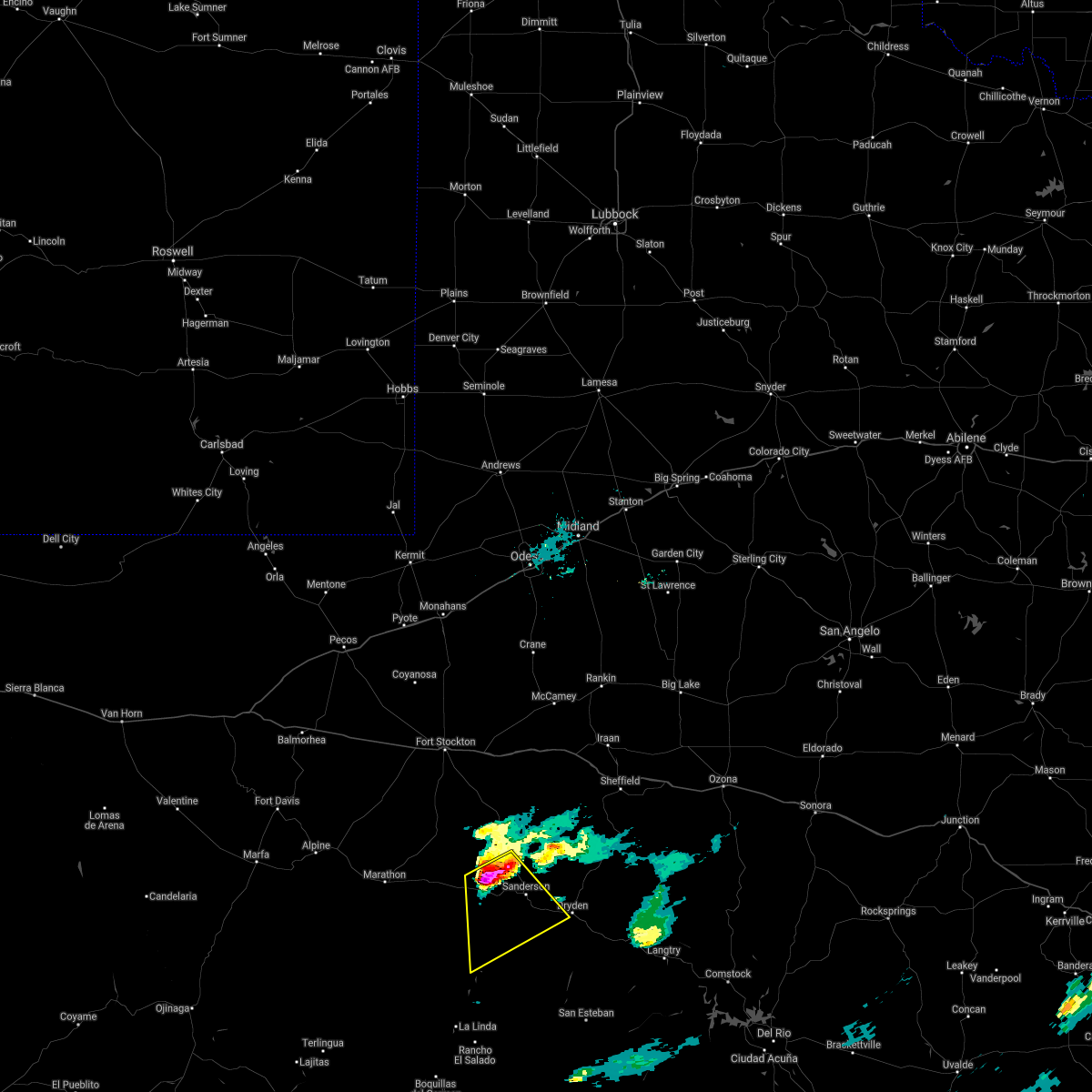 At 620 pm cdt, a severe thunderstorm was located 13 miles west of sanderson, moving southeast at 25 mph (radar indicated). Hazards include golf ball size hail and 70 mph wind gusts. People and animals outdoors will be injured. expect hail damage to roofs, siding, windows, and vehicles. expect considerable tree damage. Wind damage is also likely to mobile homes, roofs, and outbuildings. At 620 pm cdt, a severe thunderstorm was located 13 miles west of sanderson, moving southeast at 25 mph (radar indicated). Hazards include golf ball size hail and 70 mph wind gusts. People and animals outdoors will be injured. expect hail damage to roofs, siding, windows, and vehicles. expect considerable tree damage. Wind damage is also likely to mobile homes, roofs, and outbuildings.
|
| 5/11/2021 5:42 PM CDT |
 At 542 pm cdt, a severe thunderstorm was located 8 miles northeast of sanderson, moving northeast at 35 mph (radar indicated). Hazards include two inch hail and 70 mph wind gusts. People and animals outdoors will be injured. expect hail damage to roofs, siding, windows, and vehicles. expect considerable tree damage. wind damage is also likely to mobile homes, roofs, and outbuildings. This severe thunderstorm will remain over mainly rural areas of south central pecos and west central terrell counties. At 542 pm cdt, a severe thunderstorm was located 8 miles northeast of sanderson, moving northeast at 35 mph (radar indicated). Hazards include two inch hail and 70 mph wind gusts. People and animals outdoors will be injured. expect hail damage to roofs, siding, windows, and vehicles. expect considerable tree damage. wind damage is also likely to mobile homes, roofs, and outbuildings. This severe thunderstorm will remain over mainly rural areas of south central pecos and west central terrell counties.
|
| 5/11/2021 5:37 PM CDT |
 At 536 pm cdt, a severe thunderstorm was located 7 miles northeast of sanderson, moving northeast at 35 mph (radar indicated). Hazards include 60 mph wind gusts and half dollar size hail. Hail damage to vehicles is expected. expect wind damage to roofs, siding, and trees. This severe thunderstorm will remain over mainly rural areas of south central pecos and west central terrell counties. At 536 pm cdt, a severe thunderstorm was located 7 miles northeast of sanderson, moving northeast at 35 mph (radar indicated). Hazards include 60 mph wind gusts and half dollar size hail. Hail damage to vehicles is expected. expect wind damage to roofs, siding, and trees. This severe thunderstorm will remain over mainly rural areas of south central pecos and west central terrell counties.
|
| 5/11/2021 5:15 PM CDT |
 At 515 pm cdt, a severe thunderstorm was located 7 miles south of sanderson, moving northeast at 25 mph (radar indicated). Hazards include 60 mph wind gusts and quarter size hail. Hail damage to vehicles is expected. Expect wind damage to roofs, siding, and trees. At 515 pm cdt, a severe thunderstorm was located 7 miles south of sanderson, moving northeast at 25 mph (radar indicated). Hazards include 60 mph wind gusts and quarter size hail. Hail damage to vehicles is expected. Expect wind damage to roofs, siding, and trees.
|
| 5/24/2020 3:58 PM CDT |
 At 358 pm cdt, a cluster of severe thunderstorms was located 12 miles southwest of sheffield, moving northeast at 35 mph (radar indicated). Hazards include golf ball size hail and 70 mph wind gusts. People and animals outdoors will be injured. expect hail damage to roofs, siding, windows, and vehicles. expect considerable tree damage. Wind damage is also likely to mobile homes, roofs, and outbuildings. At 358 pm cdt, a cluster of severe thunderstorms was located 12 miles southwest of sheffield, moving northeast at 35 mph (radar indicated). Hazards include golf ball size hail and 70 mph wind gusts. People and animals outdoors will be injured. expect hail damage to roofs, siding, windows, and vehicles. expect considerable tree damage. Wind damage is also likely to mobile homes, roofs, and outbuildings.
|
| 5/23/2020 6:53 PM CDT |
 At 652 pm cdt, a severe thunderstorm was located 11 miles northwest of sanderson, moving east southeast at 30 mph (radar indicated). Hazards include 60 mph wind gusts and quarter size hail. Hail damage to vehicles is expected. Expect wind damage to roofs, siding, and trees. At 652 pm cdt, a severe thunderstorm was located 11 miles northwest of sanderson, moving east southeast at 30 mph (radar indicated). Hazards include 60 mph wind gusts and quarter size hail. Hail damage to vehicles is expected. Expect wind damage to roofs, siding, and trees.
|
| 5/20/2020 6:25 PM CDT |
 At 624 pm cdt, a severe thunderstorm was located 14 miles northwest of sanderson, moving east at 25 mph (radar indicated). Hazards include 60 mph wind gusts and quarter size hail. Hail damage to vehicles is expected. Expect wind damage to roofs, siding, and trees. At 624 pm cdt, a severe thunderstorm was located 14 miles northwest of sanderson, moving east at 25 mph (radar indicated). Hazards include 60 mph wind gusts and quarter size hail. Hail damage to vehicles is expected. Expect wind damage to roofs, siding, and trees.
|
| 5/13/2020 7:25 PM CDT |
 At 724 pm cdt, a severe thunderstorm was located 17 miles north of sanderson, moving southeast at 15 mph (radar indicated). Hazards include tennis ball size hail and 60 mph wind gusts. People and animals outdoors will be injured. expect hail damage to roofs, siding, windows, and vehicles. expect wind damage to roofs, siding, and trees. Locations impacted include, sanderson. At 724 pm cdt, a severe thunderstorm was located 17 miles north of sanderson, moving southeast at 15 mph (radar indicated). Hazards include tennis ball size hail and 60 mph wind gusts. People and animals outdoors will be injured. expect hail damage to roofs, siding, windows, and vehicles. expect wind damage to roofs, siding, and trees. Locations impacted include, sanderson.
|
| 5/13/2020 7:06 PM CDT |
 At 706 pm cdt, a severe thunderstorm was located 21 miles north of sanderson, moving southeast at 15 mph (radar indicated). Hazards include tennis ball size hail and 60 mph wind gusts. People and animals outdoors will be injured. expect hail damage to roofs, siding, windows, and vehicles. expect wind damage to roofs, siding, and trees. Locations impacted include, sanderson. At 706 pm cdt, a severe thunderstorm was located 21 miles north of sanderson, moving southeast at 15 mph (radar indicated). Hazards include tennis ball size hail and 60 mph wind gusts. People and animals outdoors will be injured. expect hail damage to roofs, siding, windows, and vehicles. expect wind damage to roofs, siding, and trees. Locations impacted include, sanderson.
|
| 5/13/2020 6:58 PM CDT |
 At 658 pm cdt, a severe thunderstorm was located 21 miles north of sanderson, moving southeast at 20 mph (radar indicated). Hazards include 60 mph wind gusts and half dollar size hail. Hail damage to vehicles is expected. Expect wind damage to roofs, siding, and trees. At 658 pm cdt, a severe thunderstorm was located 21 miles north of sanderson, moving southeast at 20 mph (radar indicated). Hazards include 60 mph wind gusts and half dollar size hail. Hail damage to vehicles is expected. Expect wind damage to roofs, siding, and trees.
|
| 6/5/2019 5:29 PM CDT |
 At 528 pm cdt, a severe thunderstorm was located 7 miles north of sanderson, moving east at 20 mph (radar indicated). Hazards include 70 mph wind gusts and ping pong ball size hail. People and animals outdoors will be injured. expect hail damage to roofs, siding, windows, and vehicles. expect considerable tree damage. wind damage is also likely to mobile homes, roofs, and outbuildings. Locations impacted include, sanderson. At 528 pm cdt, a severe thunderstorm was located 7 miles north of sanderson, moving east at 20 mph (radar indicated). Hazards include 70 mph wind gusts and ping pong ball size hail. People and animals outdoors will be injured. expect hail damage to roofs, siding, windows, and vehicles. expect considerable tree damage. wind damage is also likely to mobile homes, roofs, and outbuildings. Locations impacted include, sanderson.
|
| 6/5/2019 5:12 PM CDT |
 At 512 pm cdt, a severe thunderstorm was located 10 miles northwest of sanderson, moving east at 20 mph (radar indicated). Hazards include 70 mph wind gusts and ping pong ball size hail. People and animals outdoors will be injured. expect hail damage to roofs, siding, windows, and vehicles. expect considerable tree damage. Wind damage is also likely to mobile homes, roofs, and outbuildings. At 512 pm cdt, a severe thunderstorm was located 10 miles northwest of sanderson, moving east at 20 mph (radar indicated). Hazards include 70 mph wind gusts and ping pong ball size hail. People and animals outdoors will be injured. expect hail damage to roofs, siding, windows, and vehicles. expect considerable tree damage. Wind damage is also likely to mobile homes, roofs, and outbuildings.
|
| 5/31/2019 8:43 PM CDT |
 At 842 pm cdt, a severe thunderstorm was located 10 miles southeast of marathon, or 36 miles southeast of alpine, moving southeast at 20 mph (radar indicated). Hazards include 60 mph wind gusts and quarter size hail. Hail damage to vehicles is expected. expect wind damage to roofs, siding, and trees. Locations impacted include, sanderson. At 842 pm cdt, a severe thunderstorm was located 10 miles southeast of marathon, or 36 miles southeast of alpine, moving southeast at 20 mph (radar indicated). Hazards include 60 mph wind gusts and quarter size hail. Hail damage to vehicles is expected. expect wind damage to roofs, siding, and trees. Locations impacted include, sanderson.
|
| 5/31/2019 8:28 PM CDT |
 At 828 pm cdt, a severe thunderstorm was located near marathon, or 32 miles southeast of alpine, moving southeast at 20 mph (radar indicated). Hazards include ping pong ball size hail and 60 mph wind gusts. People and animals outdoors will be injured. expect hail damage to roofs, siding, windows, and vehicles. Expect wind damage to roofs, siding, and trees. At 828 pm cdt, a severe thunderstorm was located near marathon, or 32 miles southeast of alpine, moving southeast at 20 mph (radar indicated). Hazards include ping pong ball size hail and 60 mph wind gusts. People and animals outdoors will be injured. expect hail damage to roofs, siding, windows, and vehicles. Expect wind damage to roofs, siding, and trees.
|
| 5/31/2019 6:35 PM CDT |
 At 635 pm cdt, a severe thunderstorm was located 25 miles northwest of sanderson, and is nearly stationary (radar indicated). Hazards include 60 mph wind gusts and quarter size hail. Hail damage to vehicles is expected. expect wind damage to roofs, siding, and trees. Locations impacted include, sanderson. At 635 pm cdt, a severe thunderstorm was located 25 miles northwest of sanderson, and is nearly stationary (radar indicated). Hazards include 60 mph wind gusts and quarter size hail. Hail damage to vehicles is expected. expect wind damage to roofs, siding, and trees. Locations impacted include, sanderson.
|
| 5/31/2019 5:57 PM CDT |
 The national weather service in midland has issued a * severe thunderstorm warning for. south central pecos county in southwestern texas. west central terrell county in southwestern texas. until 715 pm cdt. At 556 pm cdt, a severe thunderstorm was located 26 miles northwest. The national weather service in midland has issued a * severe thunderstorm warning for. south central pecos county in southwestern texas. west central terrell county in southwestern texas. until 715 pm cdt. At 556 pm cdt, a severe thunderstorm was located 26 miles northwest.
|
| 5/24/2019 4:18 PM CDT |
 At 417 pm cdt, a severe thunderstorm was located 10 miles northwest of sanderson, moving north at 35 mph (radar indicated). Hazards include ping pong ball size hail and 60 mph wind gusts. People and animals outdoors will be injured. expect hail damage to roofs, siding, windows, and vehicles. expect wind damage to roofs, siding, and trees. This severe thunderstorm will remain over mainly rural areas of south central pecos and northwestern terrell counties. At 417 pm cdt, a severe thunderstorm was located 10 miles northwest of sanderson, moving north at 35 mph (radar indicated). Hazards include ping pong ball size hail and 60 mph wind gusts. People and animals outdoors will be injured. expect hail damage to roofs, siding, windows, and vehicles. expect wind damage to roofs, siding, and trees. This severe thunderstorm will remain over mainly rural areas of south central pecos and northwestern terrell counties.
|
| 5/24/2019 3:57 PM CDT |
 At 357 pm cdt, a severe thunderstorm was located 12 miles southwest of sanderson, moving north at 40 mph (radar indicated). Hazards include ping pong ball size hail and 60 mph wind gusts. People and animals outdoors will be injured. expect hail damage to roofs, siding, windows, and vehicles. Expect wind damage to roofs, siding, and trees. At 357 pm cdt, a severe thunderstorm was located 12 miles southwest of sanderson, moving north at 40 mph (radar indicated). Hazards include ping pong ball size hail and 60 mph wind gusts. People and animals outdoors will be injured. expect hail damage to roofs, siding, windows, and vehicles. Expect wind damage to roofs, siding, and trees.
|
| 5/5/2019 7:32 PM CDT |
 At 729 pm cdt, a severe thunderstorm was located 20 miles north of sanderson, moving east at 20 mph (radar indicated). Hazards include 60 mph wind gusts and half dollar size hail. Hail damage to vehicles is expected. expect wind damage to roofs, siding, and trees. Locations impacted include, farm to market road 2400 in terrell county, open country of terrell county. At 729 pm cdt, a severe thunderstorm was located 20 miles north of sanderson, moving east at 20 mph (radar indicated). Hazards include 60 mph wind gusts and half dollar size hail. Hail damage to vehicles is expected. expect wind damage to roofs, siding, and trees. Locations impacted include, farm to market road 2400 in terrell county, open country of terrell county.
|
| 5/5/2019 7:00 PM CDT |
 At 700 pm cdt, a severe thunderstorm was located 18 miles north of sanderson, moving southeast at 20 mph (radar indicated). Hazards include 60 mph wind gusts and half dollar size hail. Hail damage to vehicles is expected. Expect wind damage to roofs, siding, and trees. At 700 pm cdt, a severe thunderstorm was located 18 miles north of sanderson, moving southeast at 20 mph (radar indicated). Hazards include 60 mph wind gusts and half dollar size hail. Hail damage to vehicles is expected. Expect wind damage to roofs, siding, and trees.
|
| 5/2/2019 9:07 PM CDT |
 At 906 pm cdt, a severe thunderstorm was located 13 miles northeast of sanderson, moving southeast at 10 mph (radar indicated). Hazards include 60 mph wind gusts and quarter size hail. Hail damage to vehicles is expected. expect wind damage to roofs, siding, and trees. Locations impacted include, sanderson and sierra madera. At 906 pm cdt, a severe thunderstorm was located 13 miles northeast of sanderson, moving southeast at 10 mph (radar indicated). Hazards include 60 mph wind gusts and quarter size hail. Hail damage to vehicles is expected. expect wind damage to roofs, siding, and trees. Locations impacted include, sanderson and sierra madera.
|
| 5/2/2019 8:31 PM CDT |
 At 831 pm cdt, a severe thunderstorm was located 17 miles north of sanderson, moving south at 10 mph (radar indicated). Hazards include ping pong ball size hail and 60 mph wind gusts. People and animals outdoors will be injured. expect hail damage to roofs, siding, windows, and vehicles. Expect wind damage to roofs, siding, and trees. At 831 pm cdt, a severe thunderstorm was located 17 miles north of sanderson, moving south at 10 mph (radar indicated). Hazards include ping pong ball size hail and 60 mph wind gusts. People and animals outdoors will be injured. expect hail damage to roofs, siding, windows, and vehicles. Expect wind damage to roofs, siding, and trees.
|
| 5/2/2019 8:09 PM CDT | Quarter sized hail reported 17.8 miles WNW of Sanderson, TX |
| 5/2/2019 8:07 PM CDT |
 At 806 pm cdt, a severe thunderstorm was located 20 miles north of sanderson, moving south at 10 mph (radar indicated). Hazards include ping pong ball size hail and 60 mph wind gusts. People and animals outdoors will be injured. expect hail damage to roofs, siding, windows, and vehicles. expect wind damage to roofs, siding, and trees. locations impacted include, sanderson. Longfellow. At 806 pm cdt, a severe thunderstorm was located 20 miles north of sanderson, moving south at 10 mph (radar indicated). Hazards include ping pong ball size hail and 60 mph wind gusts. People and animals outdoors will be injured. expect hail damage to roofs, siding, windows, and vehicles. expect wind damage to roofs, siding, and trees. locations impacted include, sanderson. Longfellow.
|
| 5/2/2019 7:32 PM CDT |
 At 731 pm cdt, a severe thunderstorm was located 28 miles north of sanderson, moving south at 10 mph (radar indicated). Hazards include ping pong ball size hail and 60 mph wind gusts. People and animals outdoors will be injured. expect hail damage to roofs, siding, windows, and vehicles. Expect wind damage to roofs, siding, and trees. At 731 pm cdt, a severe thunderstorm was located 28 miles north of sanderson, moving south at 10 mph (radar indicated). Hazards include ping pong ball size hail and 60 mph wind gusts. People and animals outdoors will be injured. expect hail damage to roofs, siding, windows, and vehicles. Expect wind damage to roofs, siding, and trees.
|
| 10/12/2018 10:56 PM CDT |
 At 1056 pm cdt, a severe thunderstorm was located 7 miles north of sanderson, moving east at 25 mph (radar indicated). Hazards include ping pong ball size hail and 60 mph wind gusts. People and animals outdoors will be injured. expect hail damage to roofs, siding, windows, and vehicles. Expect wind damage to roofs, siding, and trees. At 1056 pm cdt, a severe thunderstorm was located 7 miles north of sanderson, moving east at 25 mph (radar indicated). Hazards include ping pong ball size hail and 60 mph wind gusts. People and animals outdoors will be injured. expect hail damage to roofs, siding, windows, and vehicles. Expect wind damage to roofs, siding, and trees.
|
| 10/12/2018 10:33 PM CDT |
 At 1033 pm cdt, a severe thunderstorm was located 12 miles northwest of sanderson, moving east at 20 mph (radar indicated). Hazards include 60 mph wind gusts and half dollar size hail. Hail damage to vehicles is expected. expect wind damage to roofs, siding, and trees. Locations impacted include, sanderson. At 1033 pm cdt, a severe thunderstorm was located 12 miles northwest of sanderson, moving east at 20 mph (radar indicated). Hazards include 60 mph wind gusts and half dollar size hail. Hail damage to vehicles is expected. expect wind damage to roofs, siding, and trees. Locations impacted include, sanderson.
|
| 10/12/2018 9:58 PM CDT |
 At 957 pm cdt, a severe thunderstorm was located over us hwy 90, 22 miles west of sanderson, moving east at 15 mph (radar indicated). Hazards include 60 mph wind gusts and half dollar size hail. Hail damage to vehicles is expected. Expect wind damage to roofs, siding, and trees. At 957 pm cdt, a severe thunderstorm was located over us hwy 90, 22 miles west of sanderson, moving east at 15 mph (radar indicated). Hazards include 60 mph wind gusts and half dollar size hail. Hail damage to vehicles is expected. Expect wind damage to roofs, siding, and trees.
|
| 5/17/2018 6:26 PM CDT |
 At 622 pm cdt, a severe thunderstorm was located near sanderson, moving southeast at 25 mph (law enforcement). Hazards include golf ball size hail. People and animals outdoors will be injured. expect damage to roofs, siding, windows, and vehicles. Locations impacted include, areas along highway 90 south of sanderson. At 622 pm cdt, a severe thunderstorm was located near sanderson, moving southeast at 25 mph (law enforcement). Hazards include golf ball size hail. People and animals outdoors will be injured. expect damage to roofs, siding, windows, and vehicles. Locations impacted include, areas along highway 90 south of sanderson.
|
| 5/17/2018 6:06 PM CDT | Golf Ball sized hail reported 0.1 miles E of Sanderson, TX, hail occurred bwtween 606 pm and 620 pm cdt. |
| 5/17/2018 5:43 PM CDT |
 At 542 pm cdt, a severe thunderstorm was located 14 miles northwest of sanderson, moving southeast at 25 mph (radar indicated). Hazards include two inch hail and 70 mph wind gusts. People and animals outdoors will be injured. expect hail damage to roofs, siding, windows, and vehicles. expect considerable tree damage. Wind damage is also likely to mobile homes, roofs, and outbuildings. At 542 pm cdt, a severe thunderstorm was located 14 miles northwest of sanderson, moving southeast at 25 mph (radar indicated). Hazards include two inch hail and 70 mph wind gusts. People and animals outdoors will be injured. expect hail damage to roofs, siding, windows, and vehicles. expect considerable tree damage. Wind damage is also likely to mobile homes, roofs, and outbuildings.
|
| 4/16/2017 7:57 PM CDT |
 At 756 pm cdt, severe thunderstorms were located along a line extending from 8 miles northeast of sanderson to 10 miles east of dryden, moving northeast at 25 mph (law enforcement). Hazards include quarter size hail. Damage to vehicles is expected. Locations impacted include, sanderson, dryden, terrell county gas plant and terrell county airport. At 756 pm cdt, severe thunderstorms were located along a line extending from 8 miles northeast of sanderson to 10 miles east of dryden, moving northeast at 25 mph (law enforcement). Hazards include quarter size hail. Damage to vehicles is expected. Locations impacted include, sanderson, dryden, terrell county gas plant and terrell county airport.
|
| 4/16/2017 7:45 PM CDT | Quarter sized hail reported 17.8 miles WNW of Sanderson, TX |
| 4/16/2017 7:41 PM CDT |
 At 740 pm cdt, severe thunderstorms were located along a line extending from near sanderson to near dryden, moving northeast at 25 mph (radar indicated). Hazards include 60 mph wind gusts and half dollar size hail. Hail damage to vehicles is expected. Expect wind damage to roofs, siding, and trees. At 740 pm cdt, severe thunderstorms were located along a line extending from near sanderson to near dryden, moving northeast at 25 mph (radar indicated). Hazards include 60 mph wind gusts and half dollar size hail. Hail damage to vehicles is expected. Expect wind damage to roofs, siding, and trees.
|
| 4/16/2017 7:14 PM CDT |
 At 714 pm cdt, a severe thunderstorm was located 10 miles southwest of terrell county airport, or 14 miles south of sanderson, moving northeast at 20 mph (radar indicated). Hazards include 60 mph wind gusts and quarter size hail. Hail damage to vehicles is expected. expect wind damage to roofs, siding, and trees. Locations impacted include, sanderson, dryden and terrell county airport. At 714 pm cdt, a severe thunderstorm was located 10 miles southwest of terrell county airport, or 14 miles south of sanderson, moving northeast at 20 mph (radar indicated). Hazards include 60 mph wind gusts and quarter size hail. Hail damage to vehicles is expected. expect wind damage to roofs, siding, and trees. Locations impacted include, sanderson, dryden and terrell county airport.
|
| 4/16/2017 6:49 PM CDT |
 At 649 pm cdt, a severe thunderstorm was located 21 miles south of longfellow, or 24 miles southwest of sanderson, moving northeast at 25 mph (radar indicated). Hazards include two inch hail and 60 mph wind gusts. People and animals outdoors will be injured. expect hail damage to roofs, siding, windows, and vehicles. Expect wind damage to roofs, siding, and trees. At 649 pm cdt, a severe thunderstorm was located 21 miles south of longfellow, or 24 miles southwest of sanderson, moving northeast at 25 mph (radar indicated). Hazards include two inch hail and 60 mph wind gusts. People and animals outdoors will be injured. expect hail damage to roofs, siding, windows, and vehicles. Expect wind damage to roofs, siding, and trees.
|
| 4/1/2017 11:50 PM CDT |
 The severe thunderstorm warning for south central pecos and west central terrell counties will expire at midnight cdt, the storm which prompted the warning has weakened below severe limits, and no longer poses an immediate threat to life or property. therefore the warning will be allowed to expire. however small hail and heavy rain are still possible with this thunderstorm. The severe thunderstorm warning for south central pecos and west central terrell counties will expire at midnight cdt, the storm which prompted the warning has weakened below severe limits, and no longer poses an immediate threat to life or property. therefore the warning will be allowed to expire. however small hail and heavy rain are still possible with this thunderstorm.
|
| 4/1/2017 11:37 PM CDT |
 At 1136 pm cdt, a severe thunderstorm was located near sanderson, moving northeast at 25 mph (radar indicated). Hazards include 60 mph wind gusts and quarter size hail. Hail damage to vehicles is expected. expect wind damage to roofs, siding, and trees. Locations impacted include, sanderson and longfellow. At 1136 pm cdt, a severe thunderstorm was located near sanderson, moving northeast at 25 mph (radar indicated). Hazards include 60 mph wind gusts and quarter size hail. Hail damage to vehicles is expected. expect wind damage to roofs, siding, and trees. Locations impacted include, sanderson and longfellow.
|
| 4/1/2017 11:23 PM CDT |
 At 1123 pm cdt, a severe thunderstorm was located near longfellow, or 12 miles west of sanderson, moving north at 25 mph (radar indicated). Hazards include ping pong ball size hail and 60 mph wind gusts. People and animals outdoors will be injured. expect hail damage to roofs, siding, windows, and vehicles. expect wind damage to roofs, siding, and trees. Locations impacted include, sanderson and longfellow. At 1123 pm cdt, a severe thunderstorm was located near longfellow, or 12 miles west of sanderson, moving north at 25 mph (radar indicated). Hazards include ping pong ball size hail and 60 mph wind gusts. People and animals outdoors will be injured. expect hail damage to roofs, siding, windows, and vehicles. expect wind damage to roofs, siding, and trees. Locations impacted include, sanderson and longfellow.
|
| 4/1/2017 11:04 PM CDT |
 At 1104 pm cdt, a severe thunderstorm was located 11 miles south of longfellow, or 18 miles southwest of sanderson, moving north at 25 mph (radar indicated). Hazards include ping pong ball size hail and 60 mph wind gusts. People and animals outdoors will be injured. expect hail damage to roofs, siding, windows, and vehicles. Expect wind damage to roofs, siding, and trees. At 1104 pm cdt, a severe thunderstorm was located 11 miles south of longfellow, or 18 miles southwest of sanderson, moving north at 25 mph (radar indicated). Hazards include ping pong ball size hail and 60 mph wind gusts. People and animals outdoors will be injured. expect hail damage to roofs, siding, windows, and vehicles. Expect wind damage to roofs, siding, and trees.
|
| 3/28/2017 8:40 PM CDT |
 At 840 pm cdt, a severe thunderstorm was located over sanderson, moving northeast at 20 mph (radar indicated). Hazards include 60 mph wind gusts and half dollar size hail. Hail damage to vehicles is expected. expect wind damage to roofs, siding, and trees. Locations impacted include, sanderson. At 840 pm cdt, a severe thunderstorm was located over sanderson, moving northeast at 20 mph (radar indicated). Hazards include 60 mph wind gusts and half dollar size hail. Hail damage to vehicles is expected. expect wind damage to roofs, siding, and trees. Locations impacted include, sanderson.
|
| 3/28/2017 8:30 PM CDT | Half Dollar sized hail reported 0.1 miles E of Sanderson, TX |
| 3/28/2017 8:15 PM CDT |
 At 814 pm cdt, a severe thunderstorm was located over longfellow, or 12 miles west of sanderson, moving northeast at 20 mph (radar indicated). Hazards include 60 mph wind gusts and half dollar size hail. Hail damage to vehicles is expected. Expect wind damage to roofs, siding, and trees. At 814 pm cdt, a severe thunderstorm was located over longfellow, or 12 miles west of sanderson, moving northeast at 20 mph (radar indicated). Hazards include 60 mph wind gusts and half dollar size hail. Hail damage to vehicles is expected. Expect wind damage to roofs, siding, and trees.
|
| 11/6/2016 7:01 PM CST |
 At 701 pm cst, a severe thunderstorm was located near sanderson, moving southeast at 15 mph (radar indicated). Hazards include 60 mph wind gusts and quarter size hail. Hail damage to vehicles is expected. expect wind damage to roofs, siding, and trees. Locations impacted include, sanderson. At 701 pm cst, a severe thunderstorm was located near sanderson, moving southeast at 15 mph (radar indicated). Hazards include 60 mph wind gusts and quarter size hail. Hail damage to vehicles is expected. expect wind damage to roofs, siding, and trees. Locations impacted include, sanderson.
|
| 11/6/2016 6:41 PM CST |
 At 641 pm cst, a severe thunderstorm was located 7 miles northeast of longfellow, or 11 miles northwest of sanderson, moving southeast at 15 mph (radar indicated). Hazards include 60 mph wind gusts and quarter size hail. Hail damage to vehicles is expected. Expect wind damage to roofs, siding, and trees. At 641 pm cst, a severe thunderstorm was located 7 miles northeast of longfellow, or 11 miles northwest of sanderson, moving southeast at 15 mph (radar indicated). Hazards include 60 mph wind gusts and quarter size hail. Hail damage to vehicles is expected. Expect wind damage to roofs, siding, and trees.
|
| 10/6/2016 7:10 PM CDT |
 At 710 pm cdt, a severe thunderstorm was located near sanderson, moving southeast at 10 mph (radar indicated). Hazards include 60 mph wind gusts and half dollar size hail. Hail damage to vehicles is expected. Expect wind damage to roofs, siding, and trees. At 710 pm cdt, a severe thunderstorm was located near sanderson, moving southeast at 10 mph (radar indicated). Hazards include 60 mph wind gusts and half dollar size hail. Hail damage to vehicles is expected. Expect wind damage to roofs, siding, and trees.
|
| 10/6/2016 6:38 PM CDT |
 At 638 pm cdt, a severe thunderstorm was located near longfellow, or 11 miles west of sanderson, moving south at 15 mph (radar indicated). Hazards include two inch hail and 60 mph wind gusts. People and animals outdoors will be injured. expect hail damage to roofs, siding, windows, and vehicles. expect wind damage to roofs, siding, and trees. Locations impacted include, sanderson and longfellow. At 638 pm cdt, a severe thunderstorm was located near longfellow, or 11 miles west of sanderson, moving south at 15 mph (radar indicated). Hazards include two inch hail and 60 mph wind gusts. People and animals outdoors will be injured. expect hail damage to roofs, siding, windows, and vehicles. expect wind damage to roofs, siding, and trees. Locations impacted include, sanderson and longfellow.
|
| 10/6/2016 6:08 PM CDT |
 At 607 pm cdt, a severe thunderstorm was located 7 miles north of longfellow, or 16 miles northwest of sanderson, moving south at 15 mph (radar indicated). Hazards include golf ball size hail and 60 mph wind gusts. People and animals outdoors will be injured. expect hail damage to roofs, siding, windows, and vehicles. Expect wind damage to roofs, siding, and trees. At 607 pm cdt, a severe thunderstorm was located 7 miles north of longfellow, or 16 miles northwest of sanderson, moving south at 15 mph (radar indicated). Hazards include golf ball size hail and 60 mph wind gusts. People and animals outdoors will be injured. expect hail damage to roofs, siding, windows, and vehicles. Expect wind damage to roofs, siding, and trees.
|
| 9/12/2016 6:58 PM CDT | Storm damage reported in terrell county TX, 17.8 miles WNW of Sanderson, TX |
| 9/9/2016 7:41 PM CDT |
 At 708 pm cdt, a severe thunderstorm was located near longfellow, or 14 miles west of sanderson, moving northeast at 20 mph (radar indicated). Hazards include 60 mph wind gusts and quarter size hail. Hail damage to vehicles is expected. Expect wind damage to roofs, siding, and trees. At 708 pm cdt, a severe thunderstorm was located near longfellow, or 14 miles west of sanderson, moving northeast at 20 mph (radar indicated). Hazards include 60 mph wind gusts and quarter size hail. Hail damage to vehicles is expected. Expect wind damage to roofs, siding, and trees.
|
| 9/9/2016 7:08 PM CDT |
 At 708 pm cdt, a severe thunderstorm was located near longfellow, or 14 miles west of sanderson, moving northeast at 20 mph (radar indicated). Hazards include 60 mph wind gusts and quarter size hail. Hail damage to vehicles is expected. Expect wind damage to roofs, siding, and trees. At 708 pm cdt, a severe thunderstorm was located near longfellow, or 14 miles west of sanderson, moving northeast at 20 mph (radar indicated). Hazards include 60 mph wind gusts and quarter size hail. Hail damage to vehicles is expected. Expect wind damage to roofs, siding, and trees.
|
| 7/26/2016 5:44 PM CDT | Measured at k6r6 asos in terrell county TX, 17.8 miles WNW of Sanderson, TX |
| 6/1/2016 6:10 PM CDT | Tennis Ball sized hail reported 2.2 miles NW of Sanderson, TX |
| 6/1/2016 6:04 PM CDT | Half Dollar sized hail reported 0.1 miles E of Sanderson, TX |
| 6/1/2016 5:59 PM CDT |
 At 558 pm cdt, a severe thunderstorm was located over sanderson, moving east at 20 mph (radar indicated). Hazards include 60 mph wind gusts and quarter size hail. Hail damage to vehicles is expected. Expect wind damage to roofs, siding, and trees. At 558 pm cdt, a severe thunderstorm was located over sanderson, moving east at 20 mph (radar indicated). Hazards include 60 mph wind gusts and quarter size hail. Hail damage to vehicles is expected. Expect wind damage to roofs, siding, and trees.
|
| 6/1/2016 5:45 PM CDT | Hen Egg sized hail reported 4.1 miles SE of Sanderson, TX, reported on hwy 90 west of sanderson |
| 6/1/2016 5:36 PM CDT |
 At 536 pm cdt, a severe thunderstorm was located near longfellow, or 8 miles west of sanderson, moving east at 20 mph (radar indicated). Hazards include 60 mph wind gusts and quarter size hail. Hail damage to vehicles is expected. expect wind damage to roofs, siding, and trees. Locations impacted include, sanderson. At 536 pm cdt, a severe thunderstorm was located near longfellow, or 8 miles west of sanderson, moving east at 20 mph (radar indicated). Hazards include 60 mph wind gusts and quarter size hail. Hail damage to vehicles is expected. expect wind damage to roofs, siding, and trees. Locations impacted include, sanderson.
|
| 6/1/2016 5:03 PM CDT |
 At 503 pm cdt, a severe thunderstorm was located near longfellow, or 16 miles west of sanderson, moving east at 10 mph (radar indicated). Hazards include 60 mph wind gusts and quarter size hail. Hail damage to vehicles is expected. Expect wind damage to roofs, siding, and trees. At 503 pm cdt, a severe thunderstorm was located near longfellow, or 16 miles west of sanderson, moving east at 10 mph (radar indicated). Hazards include 60 mph wind gusts and quarter size hail. Hail damage to vehicles is expected. Expect wind damage to roofs, siding, and trees.
|
| 5/23/2016 5:05 PM CDT | Quarter sized hail reported 21 miles SSW of Sanderson, TX |
| 5/23/2016 5:05 PM CDT | Baseball sized hail reported 21 miles SSW of Sanderson, TX, a few baseball size hail reports |
| 4/20/2016 4:00 PM CDT |
 At 357 pm cdt, a severe thunderstorm was located 11 miles south of sanderson, moving southeast at 30 mph (radar indicated. at 3:38 pm cdt quarter to half dollar size hail was reported 2 miles se of longfellow along us 90). Hazards include 60 mph wind gusts and quarter size hail. Hail damage to vehicles is expected. expect wind damage to roofs, siding, and trees. Locations impacted include, sanderson and longfellow. At 357 pm cdt, a severe thunderstorm was located 11 miles south of sanderson, moving southeast at 30 mph (radar indicated. at 3:38 pm cdt quarter to half dollar size hail was reported 2 miles se of longfellow along us 90). Hazards include 60 mph wind gusts and quarter size hail. Hail damage to vehicles is expected. expect wind damage to roofs, siding, and trees. Locations impacted include, sanderson and longfellow.
|
| 4/20/2016 3:38 PM CDT | Half Dollar sized hail reported 13.3 miles E of Sanderson, TX, spotter measured quarter to half dollar size hail along us 90. |
| 4/20/2016 3:30 PM CDT |
 At 330 pm cdt, a severe thunderstorm was located near longfellow, or 11 miles west of sanderson, moving southeast at 30 mph (radar indicated). Hazards include 60 mph wind gusts and quarter size hail. Hail damage to vehicles is expected. Expect wind damage to roofs, siding, and trees. At 330 pm cdt, a severe thunderstorm was located near longfellow, or 11 miles west of sanderson, moving southeast at 30 mph (radar indicated). Hazards include 60 mph wind gusts and quarter size hail. Hail damage to vehicles is expected. Expect wind damage to roofs, siding, and trees.
|
| 4/19/2016 8:15 PM CDT |
 At 814 pm cdt, a severe thunderstorm was located 7 miles south of sanderson, moving southeast at 25 mph (trained weather spotters). Hazards include 60 mph wind gusts and quarter size hail. Hail damage to vehicles is expected. expect wind damage to roofs, siding, and trees. Locations impacted include, dryden, sanderson and terrell county airport. At 814 pm cdt, a severe thunderstorm was located 7 miles south of sanderson, moving southeast at 25 mph (trained weather spotters). Hazards include 60 mph wind gusts and quarter size hail. Hail damage to vehicles is expected. expect wind damage to roofs, siding, and trees. Locations impacted include, dryden, sanderson and terrell county airport.
|
| 4/19/2016 7:55 PM CDT | Quarter sized hail reported 0.1 miles E of Sanderson, TX |
| 4/19/2016 7:54 PM CDT |
 At 753 pm cdt, a severe thunderstorm was located near sanderson, moving east at 25 mph. history of producing quarter size hail (spotter report). Hazards include 60 mph wind gusts and half dollar size hail. Hail damage to vehicles is expected. Expect wind damage to roofs, siding, and trees. At 753 pm cdt, a severe thunderstorm was located near sanderson, moving east at 25 mph. history of producing quarter size hail (spotter report). Hazards include 60 mph wind gusts and half dollar size hail. Hail damage to vehicles is expected. Expect wind damage to roofs, siding, and trees.
|
| 4/19/2016 7:51 PM CDT | Quarter sized hail reported 0.1 miles E of Sanderson, TX, just west of sanderson on hwy 90. |
| 4/19/2016 7:33 PM CDT |
 At 732 pm cdt, a severe thunderstorm was located near longfellow, or 11 miles west of sanderson, moving east at 20 mph. sanderson is in the path of this storm (radar indicated). Hazards include 70 mph wind gusts and ping pong ball size hail. People and animals outdoors will be injured. expect hail damage to roofs, siding, windows, and vehicles. expect considerable tree damage. wind damage is also likely to mobile homes, roofs, and outbuildings. Locations impacted include, sanderson and longfellow. At 732 pm cdt, a severe thunderstorm was located near longfellow, or 11 miles west of sanderson, moving east at 20 mph. sanderson is in the path of this storm (radar indicated). Hazards include 70 mph wind gusts and ping pong ball size hail. People and animals outdoors will be injured. expect hail damage to roofs, siding, windows, and vehicles. expect considerable tree damage. wind damage is also likely to mobile homes, roofs, and outbuildings. Locations impacted include, sanderson and longfellow.
|
| 4/19/2016 7:07 PM CDT |
 At 707 pm cdt, a severe thunderstorm was located 10 miles north of sanderson, moving southeast at 15 mph (radar indicated). Hazards include 70 mph wind gusts and ping pong ball size hail. People and animals outdoors will be injured. expect hail damage to roofs, siding, windows, and vehicles. expect considerable tree damage. Wind damage is also likely to mobile homes, roofs, and outbuildings. At 707 pm cdt, a severe thunderstorm was located 10 miles north of sanderson, moving southeast at 15 mph (radar indicated). Hazards include 70 mph wind gusts and ping pong ball size hail. People and animals outdoors will be injured. expect hail damage to roofs, siding, windows, and vehicles. expect considerable tree damage. Wind damage is also likely to mobile homes, roofs, and outbuildings.
|
| 4/19/2016 5:37 PM CDT |
 At 536 pm cdt, a severe thunderstorm was located 20 miles north of longfellow, or 25 miles northwest of sanderson, moving southeast at 20 mph (radar indicated). Hazards include 60 mph wind gusts and half dollar size hail. Hail damage to vehicles is expected. expect wind damage to roofs, siding, and trees. Locations impacted include, longfellow. At 536 pm cdt, a severe thunderstorm was located 20 miles north of longfellow, or 25 miles northwest of sanderson, moving southeast at 20 mph (radar indicated). Hazards include 60 mph wind gusts and half dollar size hail. Hail damage to vehicles is expected. expect wind damage to roofs, siding, and trees. Locations impacted include, longfellow.
|
| 4/19/2016 5:15 PM CDT |
 At 514 pm cdt, a severe thunderstorm was located 25 miles north of longfellow, or 29 miles southeast of fort tocktonn near highway 285, moving southeast at 25 mph (radar indicated). Hazards include 70 mph wind gusts. Expect considerable tree damage. Damage is likely to mobile homes, roofs, and outbuildings. At 514 pm cdt, a severe thunderstorm was located 25 miles north of longfellow, or 29 miles southeast of fort tocktonn near highway 285, moving southeast at 25 mph (radar indicated). Hazards include 70 mph wind gusts. Expect considerable tree damage. Damage is likely to mobile homes, roofs, and outbuildings.
|
| 6/13/2015 7:45 PM CDT |
 At 744 pm cdt, severe thunderstorms were located along a line extending from 12 miles northwest of longfellow to 6 miles southwest of longfellow to 22 miles southwest of longfellow, and moving east at 25 mph (radar indicated). Hazards include 60 mph wind gusts and quarter size hail. Hail damage to vehicles is expected. expect wind damage to roofs, siding and trees. Locations impacted include, sanderson and longfellow. At 744 pm cdt, severe thunderstorms were located along a line extending from 12 miles northwest of longfellow to 6 miles southwest of longfellow to 22 miles southwest of longfellow, and moving east at 25 mph (radar indicated). Hazards include 60 mph wind gusts and quarter size hail. Hail damage to vehicles is expected. expect wind damage to roofs, siding and trees. Locations impacted include, sanderson and longfellow.
|
| 6/13/2015 7:14 PM CDT |
 At 712 pm cdt, severe thunderstorms were located along a line extending from 21 miles northeast of marathon to 16 miles west of longfellow to 16 miles southeast of marathon, and moving east at 25 mph (radar indicated). Hazards include 70 mph wind gusts and quarter size hail. Hail damage to vehicles is expected. expect considerable tree damage. Wind damage is also likely to mobile homes, roofs and outbuildings. At 712 pm cdt, severe thunderstorms were located along a line extending from 21 miles northeast of marathon to 16 miles west of longfellow to 16 miles southeast of marathon, and moving east at 25 mph (radar indicated). Hazards include 70 mph wind gusts and quarter size hail. Hail damage to vehicles is expected. expect considerable tree damage. Wind damage is also likely to mobile homes, roofs and outbuildings.
|
| 5/19/2015 7:00 PM CDT | Hen Egg sized hail reported 17.1 miles SSW of Sanderson, TX, 7 miles east of us 285 on fm 2400. |
| 4/12/2015 5:31 PM CDT | The national weather service in midland has issued a * severe thunderstorm warning for. southeastern pecos county in southwest texas. terrell county in southwest texas. until 630 pm cdt * at 528 pm cdt. A severe thunderstorm was located near terrell. |
| 4/12/2015 5:25 PM CDT | Storm damage reported in terrell county TX, 17.8 miles WNW of Sanderson, TX |
| 4/5/2015 10:47 PM CDT | The national weather service in midland has issued a * severe thunderstorm warning for. east central brewster county in southwest texas. south central pecos county in southwest texas. west central terrell county in southwest texas. Until 1130 pm cdt. |
| 10/10/2014 9:08 PM CDT | Golf Ball sized hail reported 17.8 miles WNW of Sanderson, TX, hail broke a window in home |
| 5/26/2014 5:15 PM CDT | Quarter sized hail reported 1.9 miles E of Sanderson, TX |
| 4/28/2013 7:30 PM CDT | Ping Pong Ball sized hail reported 0.9 miles NW of Sanderson, TX |
| 4/28/2013 7:30 PM CDT | Half Dollar sized hail reported 3.1 miles NW of Sanderson, TX, sporadic 3/4 to 1 1/4 inch hailstones falling. |
| 4/2/2013 4:15 PM CDT | Quarter sized hail reported 21.6 miles ESE of Sanderson, TX, penny to quarter size hail occurred for 5 minutes. |
| 5/14/2012 2:29 AM CDT | Storm damage reported in terrell county TX, 13.4 miles WNW of Sanderson, TX |
| 1/1/0001 12:00 AM | 50 knot wind gust measured at dryden aso in terrell county TX, 17.8 miles WNW of Sanderson, TX |
Hail Maps for Sanderson, TX
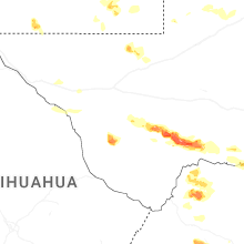
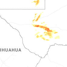
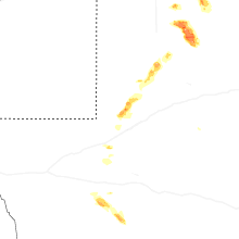


Connect with Interactive Hail Maps