

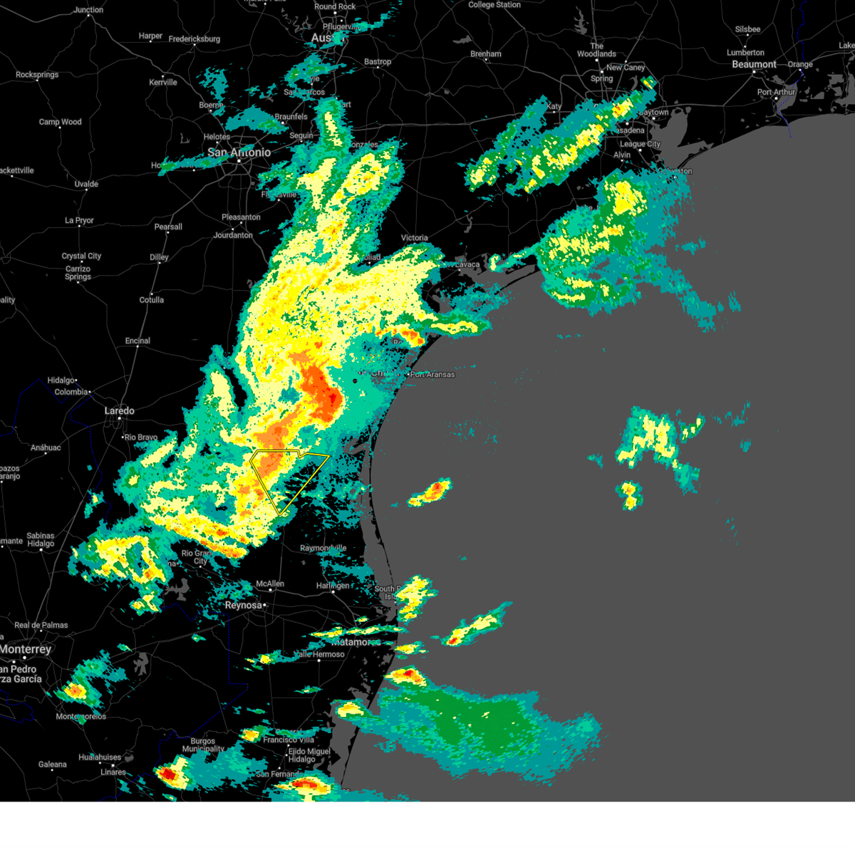
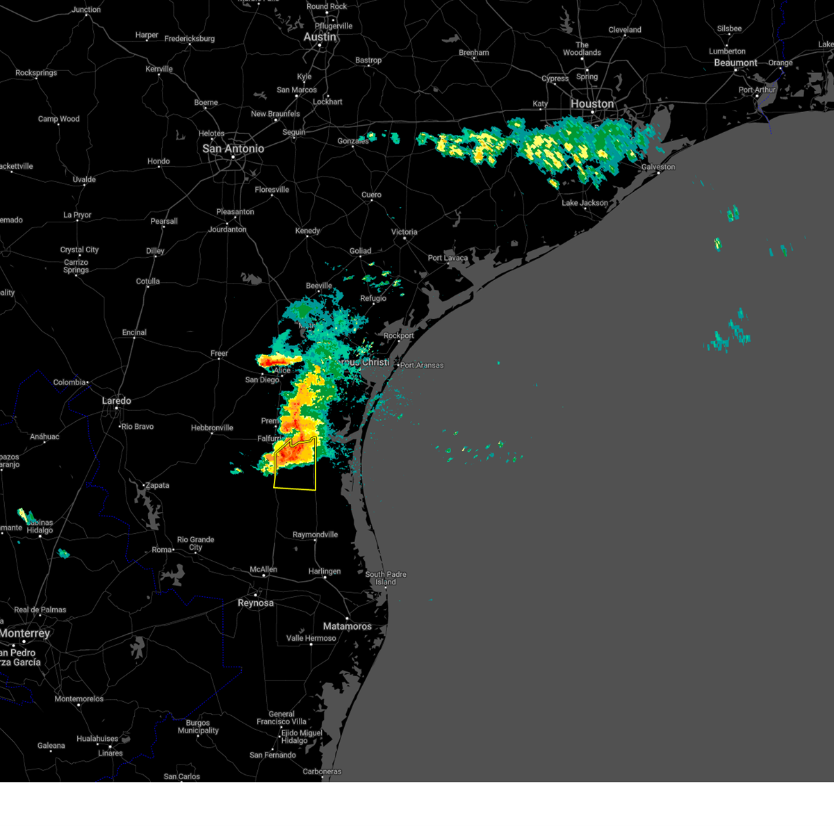
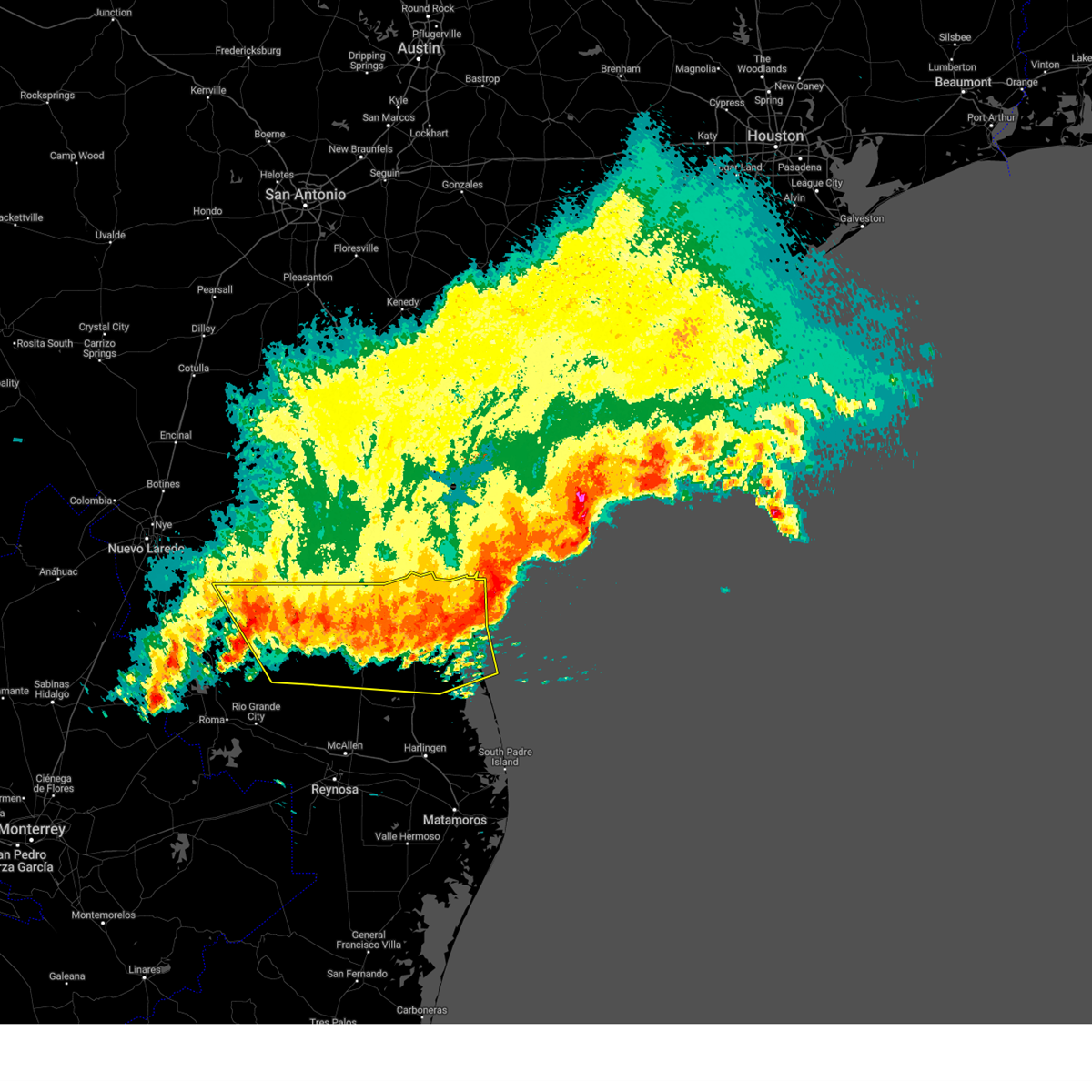
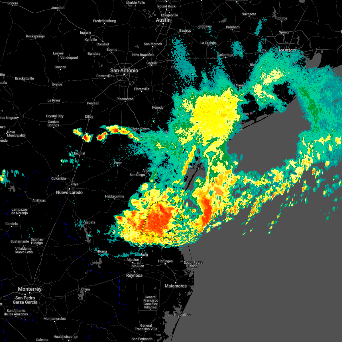
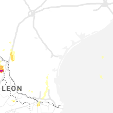
Hail Map for Sarita, TX
The Sarita, TX area has had 1 report of on-the-ground hail by trained spotters, and has been under severe weather warnings 3 times during the past 12 months. Doppler radar has detected hail at or near Sarita, TX on 16 occasions.
| Name: | Sarita, TX |
| Where Located: | 46.4 miles SSW of Corpus Christi, TX |
| Map: | Google Map for Sarita, TX |
| Population: | 238 |
| Housing Units: | 84 |
| More Info: | Search Google for Sarita, TX |
0
The Top Recent Hail Date for Sarita, TX is Monday, May 13, 2024 (16th out of 16)

Hail and Wind Damage Spotted near Sarita, TX
| Date / Time | Report Details |
|---|---|
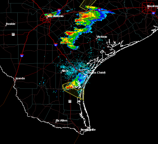
| 5/8/2025 10:02 PM CDT |
 the severe thunderstorm warning has been cancelled and is no longer in effect the severe thunderstorm warning has been cancelled and is no longer in effect
|
| 5/8/2025 9:54 PM CDT |
 At 954 pm cdt, a severe thunderstorm was located 9 miles southwest of falfurrias junior high school, or 10 miles southwest of falfurrias, moving southeast at 40 mph (radar indicated). Hazards include 60 mph wind gusts and quarter size hail. Hail damage to vehicles is expected. expect wind damage to roofs, siding, and trees. Locations impacted include, la colonia park, cantu addition, airport road addition, encino, rachal, flowella, falfurrias junior high school, pleasant park, brooks county airport, and brooks county detention center. At 954 pm cdt, a severe thunderstorm was located 9 miles southwest of falfurrias junior high school, or 10 miles southwest of falfurrias, moving southeast at 40 mph (radar indicated). Hazards include 60 mph wind gusts and quarter size hail. Hail damage to vehicles is expected. expect wind damage to roofs, siding, and trees. Locations impacted include, la colonia park, cantu addition, airport road addition, encino, rachal, flowella, falfurrias junior high school, pleasant park, brooks county airport, and brooks county detention center.
|
| 5/8/2025 9:43 PM CDT |
 Svrbro the national weather service in brownsville has issued a * severe thunderstorm warning for, northwestern kenedy county in deep south texas, brooks county in deep south texas, * until 1030 pm cdt. * at 942 pm cdt, a severe thunderstorm was located 10 miles south of ramirez, or 13 miles west of falfurrias, moving southeast at 40 mph (radar indicated). Hazards include 60 mph wind gusts and quarter size hail. Hail damage to vehicles is expected. Expect wind damage to roofs, siding, and trees. Svrbro the national weather service in brownsville has issued a * severe thunderstorm warning for, northwestern kenedy county in deep south texas, brooks county in deep south texas, * until 1030 pm cdt. * at 942 pm cdt, a severe thunderstorm was located 10 miles south of ramirez, or 13 miles west of falfurrias, moving southeast at 40 mph (radar indicated). Hazards include 60 mph wind gusts and quarter size hail. Hail damage to vehicles is expected. Expect wind damage to roofs, siding, and trees.
|
| 5/17/2024 8:11 AM CDT |
 the severe thunderstorm warning has been cancelled and is no longer in effect the severe thunderstorm warning has been cancelled and is no longer in effect
|
| 5/17/2024 7:55 AM CDT |
 At 754 am cdt, a severe thunderstorm was located near airport road addition, or near falfurrias, moving east at 45 mph (radar indicated). Hazards include 60 mph wind gusts and quarter size hail. Hail damage to vehicles is expected. expect wind damage to roofs, siding, and trees. Locations impacted include, falfurrias, sarita, falfurrias junior high school, pleasant park, la colonia park, airport road addition, kenedy county sheriffs office, falfurrias fire station, flowella, and brooks county airport. At 754 am cdt, a severe thunderstorm was located near airport road addition, or near falfurrias, moving east at 45 mph (radar indicated). Hazards include 60 mph wind gusts and quarter size hail. Hail damage to vehicles is expected. expect wind damage to roofs, siding, and trees. Locations impacted include, falfurrias, sarita, falfurrias junior high school, pleasant park, la colonia park, airport road addition, kenedy county sheriffs office, falfurrias fire station, flowella, and brooks county airport.
|
| 5/17/2024 7:43 AM CDT |
 Svrbro the national weather service in brownsville has issued a * severe thunderstorm warning for, northwestern kenedy county in deep south texas, northeastern brooks county in deep south texas, * until 830 am cdt. * at 743 am cdt, a severe thunderstorm was located 7 miles southwest of falfurrias junior high school, or 7 miles southwest of falfurrias, moving east at 45 mph (radar indicated). Hazards include 60 mph wind gusts and quarter size hail. Hail damage to vehicles is expected. Expect wind damage to roofs, siding, and trees. Svrbro the national weather service in brownsville has issued a * severe thunderstorm warning for, northwestern kenedy county in deep south texas, northeastern brooks county in deep south texas, * until 830 am cdt. * at 743 am cdt, a severe thunderstorm was located 7 miles southwest of falfurrias junior high school, or 7 miles southwest of falfurrias, moving east at 45 mph (radar indicated). Hazards include 60 mph wind gusts and quarter size hail. Hail damage to vehicles is expected. Expect wind damage to roofs, siding, and trees.
|
| 5/5/2024 7:11 PM CDT |
 The storm which prompted the warning has weakened below severe limits, and no longer poses an immediate threat to life or property. therefore, the warning will be allowed to expire. however, gusty winds and heavy rain are still possible with this thunderstorm. to report severe weather, contact your nearest law enforcement agency. they will relay your report to the national weather service brownsville. The storm which prompted the warning has weakened below severe limits, and no longer poses an immediate threat to life or property. therefore, the warning will be allowed to expire. however, gusty winds and heavy rain are still possible with this thunderstorm. to report severe weather, contact your nearest law enforcement agency. they will relay your report to the national weather service brownsville.
|
| 5/5/2024 6:59 PM CDT |
 At 658 pm cdt, a severe thunderstorm was located 10 miles southeast of airport road addition, or 12 miles southwest of sarita, moving southeast at 30 mph (radar indicated). Hazards include 60 mph wind gusts and quarter size hail. Hail damage to vehicles is expected. expect wind damage to roofs, siding, and trees. Locations impacted include, armstrong, encino, sarita, rachal, u s 77 border patrol station, and kenedy county sheriffs office. At 658 pm cdt, a severe thunderstorm was located 10 miles southeast of airport road addition, or 12 miles southwest of sarita, moving southeast at 30 mph (radar indicated). Hazards include 60 mph wind gusts and quarter size hail. Hail damage to vehicles is expected. expect wind damage to roofs, siding, and trees. Locations impacted include, armstrong, encino, sarita, rachal, u s 77 border patrol station, and kenedy county sheriffs office.
|
| 5/5/2024 6:45 PM CDT |
 At 645 pm cdt, a severe thunderstorm was located near airport road addition, or near falfurrias, moving southeast at 30 mph (radar indicated). Hazards include 60 mph wind gusts and quarter size hail. Hail damage to vehicles is expected. expect wind damage to roofs, siding, and trees. Locations impacted include, falfurrias, armstrong, encino, sarita, la colonia park, airport road addition, u s 77 border patrol station, falfurrias junior high school, pleasant park, and kenedy county sheriffs office. At 645 pm cdt, a severe thunderstorm was located near airport road addition, or near falfurrias, moving southeast at 30 mph (radar indicated). Hazards include 60 mph wind gusts and quarter size hail. Hail damage to vehicles is expected. expect wind damage to roofs, siding, and trees. Locations impacted include, falfurrias, armstrong, encino, sarita, la colonia park, airport road addition, u s 77 border patrol station, falfurrias junior high school, pleasant park, and kenedy county sheriffs office.
|
| 5/5/2024 6:27 PM CDT |
 Svrbro the national weather service in brownsville has issued a * severe thunderstorm warning for, northwestern kenedy county in deep south texas, northeastern brooks county in deep south texas, * until 715 pm cdt. * at 626 pm cdt, a severe thunderstorm was located near la colonia park, or near falfurrias, moving southeast at 30 mph (radar indicated). Hazards include 60 mph wind gusts and quarter size hail. Hail damage to vehicles is expected. Expect wind damage to roofs, siding, and trees. Svrbro the national weather service in brownsville has issued a * severe thunderstorm warning for, northwestern kenedy county in deep south texas, northeastern brooks county in deep south texas, * until 715 pm cdt. * at 626 pm cdt, a severe thunderstorm was located near la colonia park, or near falfurrias, moving southeast at 30 mph (radar indicated). Hazards include 60 mph wind gusts and quarter size hail. Hail damage to vehicles is expected. Expect wind damage to roofs, siding, and trees.
|
| 4/23/2023 12:06 PM CDT |
 At 1206 pm cdt, severe thunderstorms were located along a line extending from 30 miles southeast of malaquite beach to 9 miles west of norias to near guerra, moving southeast at 55 mph (radar indicated). Hazards include 70 mph wind gusts and penny size hail. Expect considerable tree damage. damage is likely to mobile homes, roofs, and outbuildings. locations impacted include, falfurrias, armstrong, agua nueva, encino, rachal, sarita, puerto rico, randado, la gloria and la reforma. thunderstorm damage threat, considerable hail threat, radar indicated max hail size, 0. 75 in wind threat, radar indicated max wind gust, 70 mph. At 1206 pm cdt, severe thunderstorms were located along a line extending from 30 miles southeast of malaquite beach to 9 miles west of norias to near guerra, moving southeast at 55 mph (radar indicated). Hazards include 70 mph wind gusts and penny size hail. Expect considerable tree damage. damage is likely to mobile homes, roofs, and outbuildings. locations impacted include, falfurrias, armstrong, agua nueva, encino, rachal, sarita, puerto rico, randado, la gloria and la reforma. thunderstorm damage threat, considerable hail threat, radar indicated max hail size, 0. 75 in wind threat, radar indicated max wind gust, 70 mph.
|
| 4/23/2023 11:42 AM CDT |
 At 1141 am cdt, severe thunderstorms were located along a line extending from 21 miles southeast of malaquite beach to 6 miles east of rachal to near bustamante, moving southeast at 50 mph (radar indicated). Hazards include 70 mph wind gusts and penny size hail. Expect considerable tree damage. Damage is likely to mobile homes, roofs, and outbuildings. At 1141 am cdt, severe thunderstorms were located along a line extending from 21 miles southeast of malaquite beach to 6 miles east of rachal to near bustamante, moving southeast at 50 mph (radar indicated). Hazards include 70 mph wind gusts and penny size hail. Expect considerable tree damage. Damage is likely to mobile homes, roofs, and outbuildings.
|
| 4/23/2023 11:04 AM CDT |
 At 1104 am cdt, severe thunderstorms were located along a line extending from 9 miles east of mustang island state park to near riviera beach to near airport road addition, moving southeast at 50 mph (radar indicated). Hazards include 70 mph wind gusts and penny size hail. Expect considerable tree damage. Damage is likely to mobile homes, roofs, and outbuildings. At 1104 am cdt, severe thunderstorms were located along a line extending from 9 miles east of mustang island state park to near riviera beach to near airport road addition, moving southeast at 50 mph (radar indicated). Hazards include 70 mph wind gusts and penny size hail. Expect considerable tree damage. Damage is likely to mobile homes, roofs, and outbuildings.
|
| 5/25/2022 5:38 AM CDT |
 At 537 am cdt, severe thunderstorms were located along a line extending from 7 miles southwest of malaquite beach to near rudolph, moving east at 40 mph (radar indicated). Hazards include 60 mph wind gusts. Expect damage to roofs, siding, and trees. locations impacted include, armstrong, sarita, kenedy county wind farms, norias, u s 77 border patrol station, kenedy county sheriffs office, rudolph and armstrong ranch airport. hail threat, radar indicated max hail size, <. 75 in wind threat, radar indicated max wind gust, 60 mph. At 537 am cdt, severe thunderstorms were located along a line extending from 7 miles southwest of malaquite beach to near rudolph, moving east at 40 mph (radar indicated). Hazards include 60 mph wind gusts. Expect damage to roofs, siding, and trees. locations impacted include, armstrong, sarita, kenedy county wind farms, norias, u s 77 border patrol station, kenedy county sheriffs office, rudolph and armstrong ranch airport. hail threat, radar indicated max hail size, <. 75 in wind threat, radar indicated max wind gust, 60 mph.
|
| 5/25/2022 5:13 AM CDT |
 At 512 am cdt, severe thunderstorms were located along a line extending from 9 miles east of kingsville naval air station to 8 miles southeast of rachal, moving east at 40 mph (radar indicated). Hazards include 60 mph wind gusts. expect damage to roofs, siding, and trees At 512 am cdt, severe thunderstorms were located along a line extending from 9 miles east of kingsville naval air station to 8 miles southeast of rachal, moving east at 40 mph (radar indicated). Hazards include 60 mph wind gusts. expect damage to roofs, siding, and trees
|
| 5/19/2021 9:30 AM CDT |
 At 930 am cdt, severe thunderstorms were located along a line extending from near kenedy county sheriffs office to near san perlita to near relampago, moving east at 30 mph (radar indicated). Hazards include 60 mph wind gusts. Expect damage to roofs, siding, and trees. Locations impacted include, harlingen, weslaco, san juan, san benito, alamo, donna, mercedes, raymondville, la feria and elsa. At 930 am cdt, severe thunderstorms were located along a line extending from near kenedy county sheriffs office to near san perlita to near relampago, moving east at 30 mph (radar indicated). Hazards include 60 mph wind gusts. Expect damage to roofs, siding, and trees. Locations impacted include, harlingen, weslaco, san juan, san benito, alamo, donna, mercedes, raymondville, la feria and elsa.
|
| 5/19/2021 8:58 AM CDT |
 The national weather service in brownsville has issued a * severe thunderstorm warning for. kenedy county in deep south texas. hidalgo county in deep south texas. northwestern cameron county in deep south texas. Eastern brooks county in deep south texas. The national weather service in brownsville has issued a * severe thunderstorm warning for. kenedy county in deep south texas. hidalgo county in deep south texas. northwestern cameron county in deep south texas. Eastern brooks county in deep south texas.
|
| 5/18/2021 1:49 AM CDT |
 At 149 am cdt, severe thunderstorms were located along a line extending from riviera to 9 miles northeast of encino, moving east at 45 mph (radar indicated). Hazards include 60 mph wind gusts and penny size hail. Expect damage to roofs, siding, and trees. Locations impacted include, falfurrias, sarita, la colonia park, airport road addition, u s 77 border patrol station, falfurrias junior high school, pleasant park, kenedy county sheriffs office, falfurrias fire station and cantu addition. At 149 am cdt, severe thunderstorms were located along a line extending from riviera to 9 miles northeast of encino, moving east at 45 mph (radar indicated). Hazards include 60 mph wind gusts and penny size hail. Expect damage to roofs, siding, and trees. Locations impacted include, falfurrias, sarita, la colonia park, airport road addition, u s 77 border patrol station, falfurrias junior high school, pleasant park, kenedy county sheriffs office, falfurrias fire station and cantu addition.
|
| 5/18/2021 1:33 AM CDT |
 At 133 am cdt, severe thunderstorms were located along a line extending from 6 miles east of airport road addition to near encino, moving east at 45 mph (radar indicated). Hazards include 60 mph wind gusts and penny size hail. Expect damage to roofs, siding, and trees. Locations impacted include, falfurrias, armstrong, encino, rachal, sarita, la colonia park, airport road addition, u s 77 border patrol station, falfurrias junior high school and pleasant park. At 133 am cdt, severe thunderstorms were located along a line extending from 6 miles east of airport road addition to near encino, moving east at 45 mph (radar indicated). Hazards include 60 mph wind gusts and penny size hail. Expect damage to roofs, siding, and trees. Locations impacted include, falfurrias, armstrong, encino, rachal, sarita, la colonia park, airport road addition, u s 77 border patrol station, falfurrias junior high school and pleasant park.
|
| 5/18/2021 1:29 AM CDT |
 At 128 am cdt, severe thunderstorms were located along a line extending from near airport road addition to 8 miles northwest of encino, moving east at 45 mph (radar indicated). Hazards include 70 mph wind gusts and nickel size hail. Expect considerable tree damage. Damage is likely to mobile homes, roofs, and outbuildings. At 128 am cdt, severe thunderstorms were located along a line extending from near airport road addition to 8 miles northwest of encino, moving east at 45 mph (radar indicated). Hazards include 70 mph wind gusts and nickel size hail. Expect considerable tree damage. Damage is likely to mobile homes, roofs, and outbuildings.
|
| 6/24/2019 3:51 PM CDT |
 At 351 pm cdt, a severe thunderstorm was located 11 miles southwest of sarita, moving south at 10 mph (radar indicated). Hazards include 60 mph wind gusts and nickel size hail. expect damage to roofs, siding, and trees At 351 pm cdt, a severe thunderstorm was located 11 miles southwest of sarita, moving south at 10 mph (radar indicated). Hazards include 60 mph wind gusts and nickel size hail. expect damage to roofs, siding, and trees
|
| 6/24/2019 3:39 PM CDT |
 At 320 pm cdt, a severe thunderstorm was located near sarita, moving south at 10 mph (radar indicated). Hazards include 60 mph wind gusts and quarter size hail. Hail damage to vehicles is expected. Expect wind damage to roofs, siding, and trees. At 320 pm cdt, a severe thunderstorm was located near sarita, moving south at 10 mph (radar indicated). Hazards include 60 mph wind gusts and quarter size hail. Hail damage to vehicles is expected. Expect wind damage to roofs, siding, and trees.
|
| 6/24/2019 3:20 PM CDT |
 At 320 pm cdt, a severe thunderstorm was located near sarita, moving south at 10 mph (radar indicated). Hazards include 60 mph wind gusts and quarter size hail. Hail damage to vehicles is expected. Expect wind damage to roofs, siding, and trees. At 320 pm cdt, a severe thunderstorm was located near sarita, moving south at 10 mph (radar indicated). Hazards include 60 mph wind gusts and quarter size hail. Hail damage to vehicles is expected. Expect wind damage to roofs, siding, and trees.
|
| 3/18/2018 6:42 PM CDT |
 At 642 pm cdt, a severe thunderstorm was located over riviera, or near sarita, moving southeast at 40 mph (radar indicated). Hazards include 60 mph wind gusts and quarter size hail. Hail damage to vehicles is expected. Expect wind damage to roofs, siding, and trees. At 642 pm cdt, a severe thunderstorm was located over riviera, or near sarita, moving southeast at 40 mph (radar indicated). Hazards include 60 mph wind gusts and quarter size hail. Hail damage to vehicles is expected. Expect wind damage to roofs, siding, and trees.
|
| 6/4/2017 10:22 PM CDT |
 At 1021 pm cdt, a severe thunderstorm was located over riviera beach, or 8 miles east of sarita, moving southeast at 25 mph (radar indicated). Hazards include 60 mph wind gusts and quarter size hail. Hail damage to vehicles. including cracked windshields and minor exterior dents can expected. some damage to crops and trees is expected. expect minor wind damage to mobile homes, some roofs, siding and some fences. tree limbs will blow down and small trees will be uprooted. damage to power lines and some power poles is expected. Locations impacted include, sarita and kenedy county sheriffs office. At 1021 pm cdt, a severe thunderstorm was located over riviera beach, or 8 miles east of sarita, moving southeast at 25 mph (radar indicated). Hazards include 60 mph wind gusts and quarter size hail. Hail damage to vehicles. including cracked windshields and minor exterior dents can expected. some damage to crops and trees is expected. expect minor wind damage to mobile homes, some roofs, siding and some fences. tree limbs will blow down and small trees will be uprooted. damage to power lines and some power poles is expected. Locations impacted include, sarita and kenedy county sheriffs office.
|
| 6/4/2017 10:06 PM CDT |
 At 1004 pm cdt, a severe thunderstorm was located over riviera, or near sarita, moving southeast at 25 mph. this intense storm is crossing into kenedy county will be moving over highway 285 and u.s. 77 by 1015 pm (radar indicated). Hazards include 60 mph wind gusts and quarter size hail. Hail damage to vehicles. including cracked windshields and minor exterior dents can expected. some damage to crops and trees is expected. expect minor wind damage to mobile homes, some roofs, siding and some fences. tree limbs will blow down and small trees will be uprooted. damage to power lines and some power poles is expected. Locations impacted include, sarita and kenedy county sheriffs office. At 1004 pm cdt, a severe thunderstorm was located over riviera, or near sarita, moving southeast at 25 mph. this intense storm is crossing into kenedy county will be moving over highway 285 and u.s. 77 by 1015 pm (radar indicated). Hazards include 60 mph wind gusts and quarter size hail. Hail damage to vehicles. including cracked windshields and minor exterior dents can expected. some damage to crops and trees is expected. expect minor wind damage to mobile homes, some roofs, siding and some fences. tree limbs will blow down and small trees will be uprooted. damage to power lines and some power poles is expected. Locations impacted include, sarita and kenedy county sheriffs office.
|
| 6/4/2017 9:49 PM CDT |
 At 948 pm cdt, a severe thunderstorm was located near riviera, or 9 miles northwest of sarita, moving southeast at 25 mph (radar indicated). Hazards include 60 mph wind gusts and quarter size hail. Hail damage to vehicles. including cracked windshields and minor exterior dents can expected. some damage to crops and trees is expected. expect minor wind damage to mobile homes, some roofs, siding and some fences. tree limbs will blow down and small trees will be uprooted. Damage to power lines and some power poles is expected. At 948 pm cdt, a severe thunderstorm was located near riviera, or 9 miles northwest of sarita, moving southeast at 25 mph (radar indicated). Hazards include 60 mph wind gusts and quarter size hail. Hail damage to vehicles. including cracked windshields and minor exterior dents can expected. some damage to crops and trees is expected. expect minor wind damage to mobile homes, some roofs, siding and some fences. tree limbs will blow down and small trees will be uprooted. Damage to power lines and some power poles is expected.
|
| 5/29/2017 1:43 AM CDT |
 At 143 am cdt, severe thunderstorms were located along a line extending from 8 miles east of premont to 9 miles southeast of airport road addition to 7 miles northeast of encino to 11 miles southeast of rachal, moving northeast at 45 mph (radar indicated). Hazards include 60 mph wind gusts and nickel size hail. Expect minor damage to mobile homes. some roofs. siding and some fences. tree limbs will blow down and small trees will be uprooted. Damage to power lines and some power poles is expected. At 143 am cdt, severe thunderstorms were located along a line extending from 8 miles east of premont to 9 miles southeast of airport road addition to 7 miles northeast of encino to 11 miles southeast of rachal, moving northeast at 45 mph (radar indicated). Hazards include 60 mph wind gusts and nickel size hail. Expect minor damage to mobile homes. some roofs. siding and some fences. tree limbs will blow down and small trees will be uprooted. Damage to power lines and some power poles is expected.
|
| 5/29/2017 12:43 AM CDT |
 At 1242 am cdt, severe thunderstorms were located along a line extending from near realitos to 8 miles northeast of agua nueva to near la gloria, moving east at 25 mph (radar indicated). Hazards include 60 mph wind gusts and quarter size hail. Hail damage to vehicles. including cracked windshields and minor exterior dents can expected. some damage to crops and trees is expected. expect minor wind damage to mobile homes, some roofs, siding and some fences. tree limbs will blow down and small trees will be uprooted. Damage to power lines and some power poles is expected. At 1242 am cdt, severe thunderstorms were located along a line extending from near realitos to 8 miles northeast of agua nueva to near la gloria, moving east at 25 mph (radar indicated). Hazards include 60 mph wind gusts and quarter size hail. Hail damage to vehicles. including cracked windshields and minor exterior dents can expected. some damage to crops and trees is expected. expect minor wind damage to mobile homes, some roofs, siding and some fences. tree limbs will blow down and small trees will be uprooted. Damage to power lines and some power poles is expected.
|
| 6/2/2016 2:28 PM CDT |
 At 227 pm cdt, a severe thunderstorm was located 7 miles south of airport road addition, or 8 miles southeast of falfurrias, moving northeast at 25 mph (radar indicated). Hazards include 60 mph wind gusts and quarter size hail. Hail damage to vehicles. including cracked windshields and minor exterior dents can expected. some damage to crops and trees is expected. expect minor wind damage to mobile homes, some roofs, siding and some fences. tree limbs will blow down and small trees will be uprooted. Damage to power lines and some power poles is expected. At 227 pm cdt, a severe thunderstorm was located 7 miles south of airport road addition, or 8 miles southeast of falfurrias, moving northeast at 25 mph (radar indicated). Hazards include 60 mph wind gusts and quarter size hail. Hail damage to vehicles. including cracked windshields and minor exterior dents can expected. some damage to crops and trees is expected. expect minor wind damage to mobile homes, some roofs, siding and some fences. tree limbs will blow down and small trees will be uprooted. Damage to power lines and some power poles is expected.
|
| 3/19/2016 12:19 AM CDT |
 At 1218 am cdt, severe thunderstorms were located along a line extending from near riviera to 6 miles northwest of el coyote ranch airport, moving east at 50 mph (radar indicated). Hazards include 70 mph wind gusts and quarter size hail. Hail damage to vehicles. including cracked windshields and minor exterior dents can expected. some damage to crops and trees is expected. expect considerable tree damage. wind damage is also likely to mobile homes, roofs, outbuildings and some windows. Power outages are likely. At 1218 am cdt, severe thunderstorms were located along a line extending from near riviera to 6 miles northwest of el coyote ranch airport, moving east at 50 mph (radar indicated). Hazards include 70 mph wind gusts and quarter size hail. Hail damage to vehicles. including cracked windshields and minor exterior dents can expected. some damage to crops and trees is expected. expect considerable tree damage. wind damage is also likely to mobile homes, roofs, outbuildings and some windows. Power outages are likely.
|
| 8/31/2015 3:50 PM CDT |
 At 349 pm cdt, national weather service meteorologists detected a severe thunderstorm capable of producing quarter size hail. this storm was located near sarita, moving south at 10 mph. locations impacted include, sarita and kenedy county sheriffs office. At 349 pm cdt, national weather service meteorologists detected a severe thunderstorm capable of producing quarter size hail. this storm was located near sarita, moving south at 10 mph. locations impacted include, sarita and kenedy county sheriffs office.
|
| 8/31/2015 3:26 PM CDT |
 At 325 pm cdt, national weather service meteorologists detected a line of severe thunderstorms capable of producing quarter size hail. these storms were located along a line extending from near kenedy county sheriffs office to near sarita, and moving south at 5 mph. At 325 pm cdt, national weather service meteorologists detected a line of severe thunderstorms capable of producing quarter size hail. these storms were located along a line extending from near kenedy county sheriffs office to near sarita, and moving south at 5 mph.
|
| 5/29/2015 5:55 AM CDT | At 555 am cdt, doppler radar indicated a line of severe thunderstorms capable of producing damaging winds in excess of 60 mph. these storms were located along a line extending from 9 miles south of malaquite beach to near el coyote ranch airport, moving southeast at 35 mph. locations impacted include, kenedy county wind farms, kenedy county sheriffs office, el coyote ranch airport, sarita, armstrong, border patrol, rachal, encino and armstrong ranch airport. |
| 5/29/2015 5:33 AM CDT | At 533 am cdt, doppler radar indicated a line of severe thunderstorms capable of producing damaging winds in excess of 60 mph. these storms were located along a line extending from 11 miles west of malaquite beach to 13 miles northeast of puesta del sol airport, and moving southeast at 35 mph. |
| 5/24/2015 1:04 AM CDT | At 103 am cdt, doppler radar indicated a line of severe thunderstorms capable of producing damaging winds in excess of 60 mph. these storms were located along a line extending from near sarita to near rudolph, moving east at 40 mph. penny size hail may also accompany the damaging winds. locations impacted include, kenedy county wind farms, sarita and rudolph. |
| 5/24/2015 12:41 AM CDT | At 1240 am cdt, doppler radar indicated a line of severe thunderstorms capable of producing damaging winds in excess of 60 mph. these storms were located along a line extending from 6 miles northwest of bishop to near kenedy county sheriffs office to border patrol to 11 miles west of rudolph, and moving east at 40 mph. penny size hail may also accompany the damaging winds. |
| 5/24/2015 12:31 AM CDT | At 1229 am cdt, doppler radar indicated a line of severe thunderstorms capable of producing damaging winds in excess of 60 mph. these storms were located along a line extending from near falfurrias to near san manuel, moving east at 30 mph. locations impacted include, falfurrias and sarita. |
| 5/23/2015 11:55 PM CDT | At 1154 pm cdt, doppler radar indicated a line of severe thunderstorms capable of producing damaging winds in excess of 60 mph. these storms were located along a line extending from falfurrias to near palmview, and moving east at 45 mph. penny size hail may also accompany the damaging winds. |
| 4/12/2015 11:02 PM CDT | A severe thunderstorm warning remains in effect until 1130 pm cdt for hidalgo. kenedy. northwestern cameron. brooks and willacy counties. at 1100 pm cdt. doppler radar indicated a line of severe thunderstorms capable of producing quarter size hail and destructive winds in excess of 70 mph. These storms were located along a line. |
| 4/12/2015 10:52 PM CDT | A severe thunderstorm warning remains in effect until 1130 pm cdt for hidalgo. kenedy. northwestern cameron. brooks. eastern starr and willacy counties. at 1048 pm cdt. doppler radar indicated a line of severe thunderstorms capable of producing quarter size hail and damaging winds in excess of 60 mph. These storms were located along a line. |
| 4/12/2015 10:28 PM CDT | The national weather service in brownsville has issued a * severe thunderstorm warning for. hidalgo county in deep south texas. eastern jim hogg county in deep south texas. kenedy county in deep south texas. Northwestern cameron county in deep south texas. |
| 4/10/2015 3:24 PM CDT | A severe thunderstorm warning remains in effect until 345 pm cdt for northwestern kenedy and northeastern brooks counties. at 322 pm cdt. doppler radar indicated a severe thunderstorm capable of producing damaging winds in excess of 60 mph. this storm was located over airport road addition. or near falfurrias. moving northeast at 15 mph. Nickel size hail may also accompany the damaging. |
| 4/10/2015 3:08 PM CDT | The national weather service in brownsville has issued a * severe thunderstorm warning for. northwestern kenedy county in deep south texas. northeastern brooks county in deep south texas. until 345 pm cdt * at 307 pm cdt. Doppler radar indicated a severe thunderstorm. |
| 5/9/2012 10:33 PM CDT | Quarter sized hail reported 15.1 miles N of Sarita, TX, border patrol checkpoint 15 miles south of sarita reports predominantly nickel-size hail with embedded quarter-size hail. |
| 3/29/2012 4:35 PM CDT | Nws employee observed microburst just east of highway 7 in kenedy county TX, 10.3 miles N of Sarita, TX |
Hail Maps for Sarita, TX


Connect with Interactive Hail Maps