

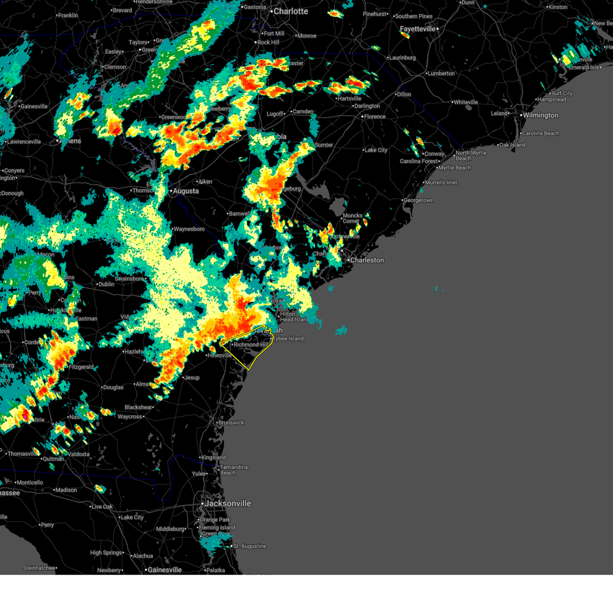
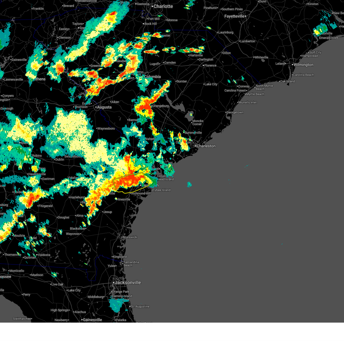
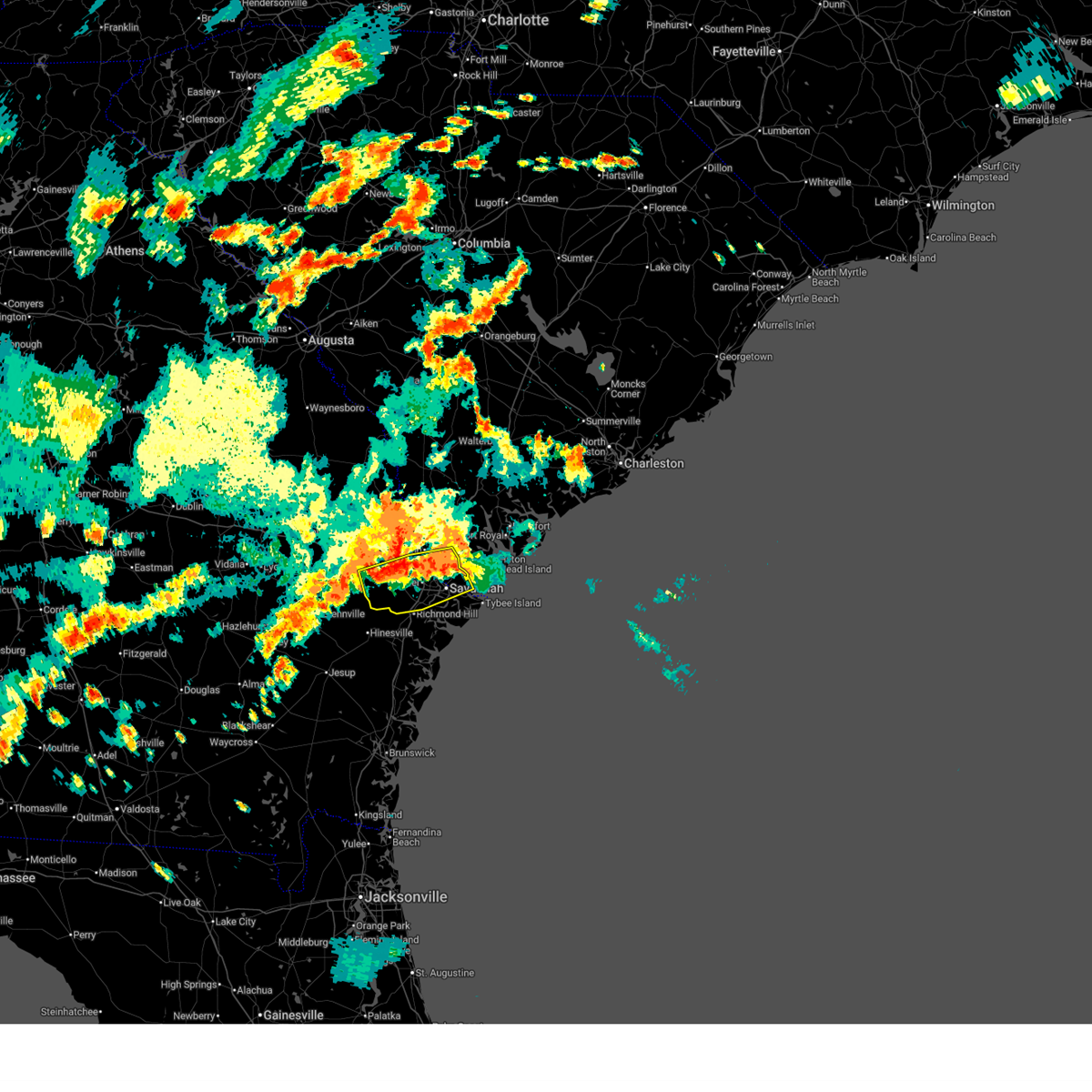
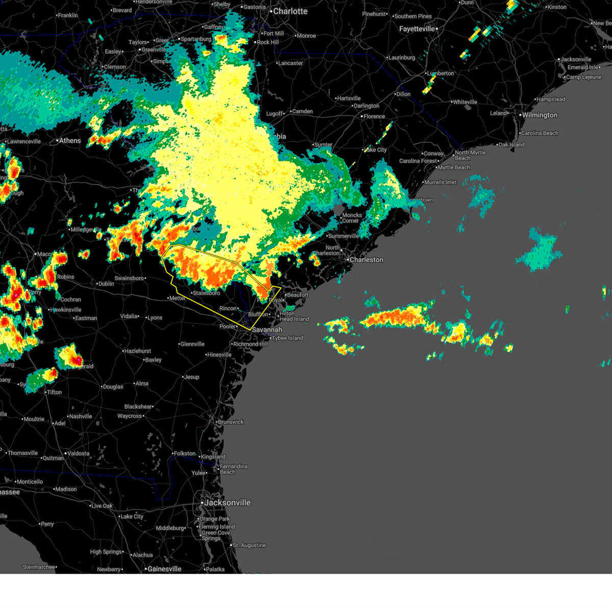
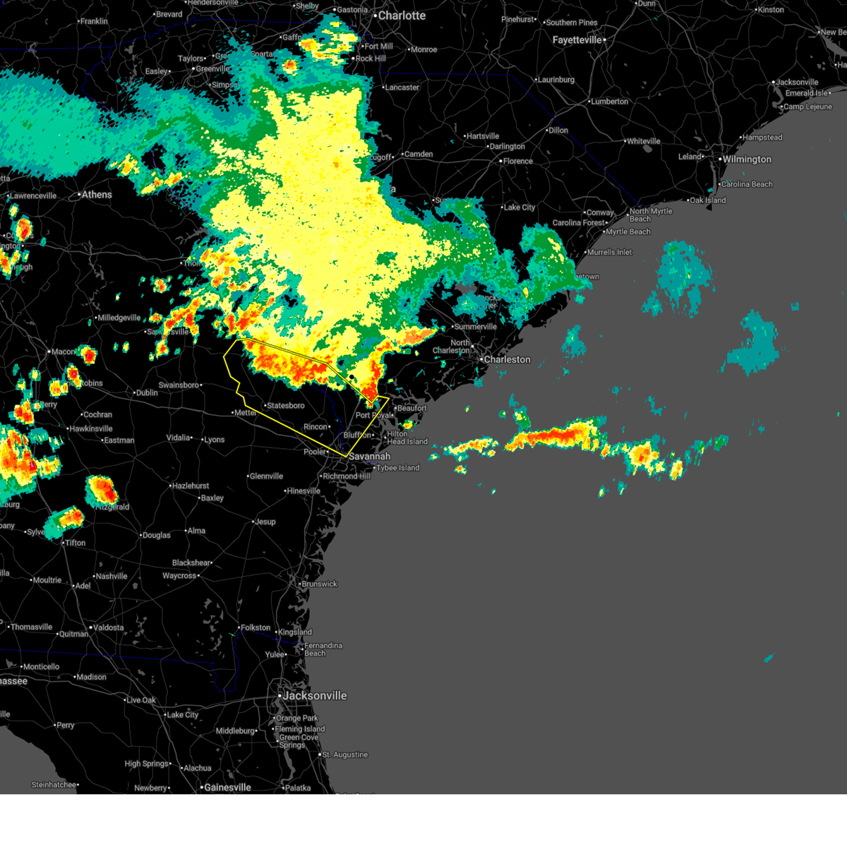
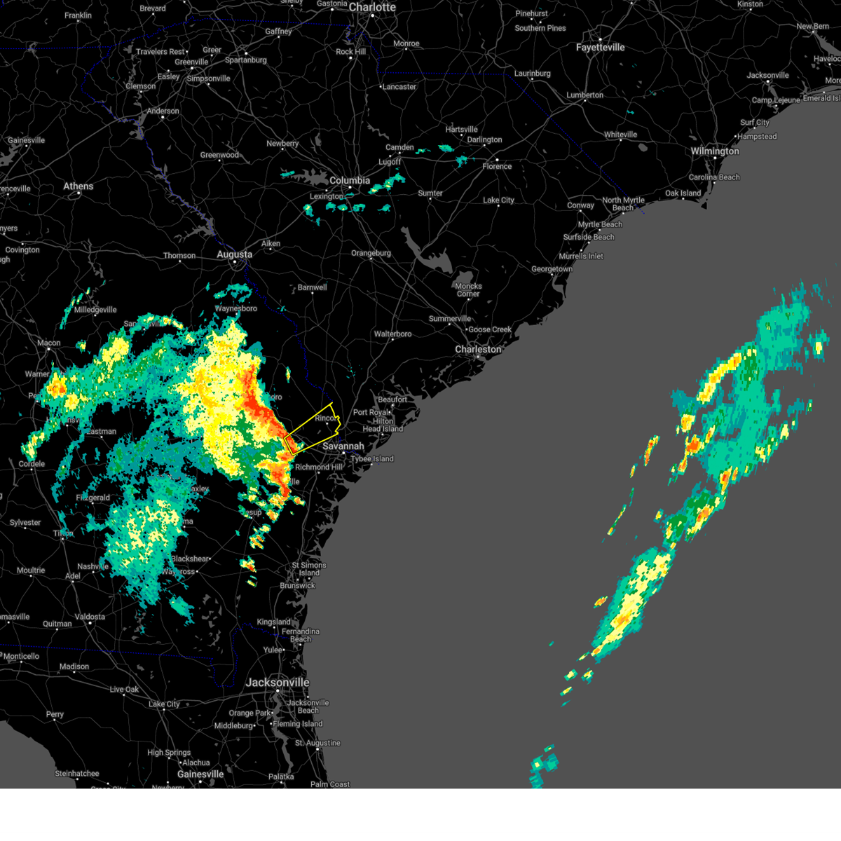
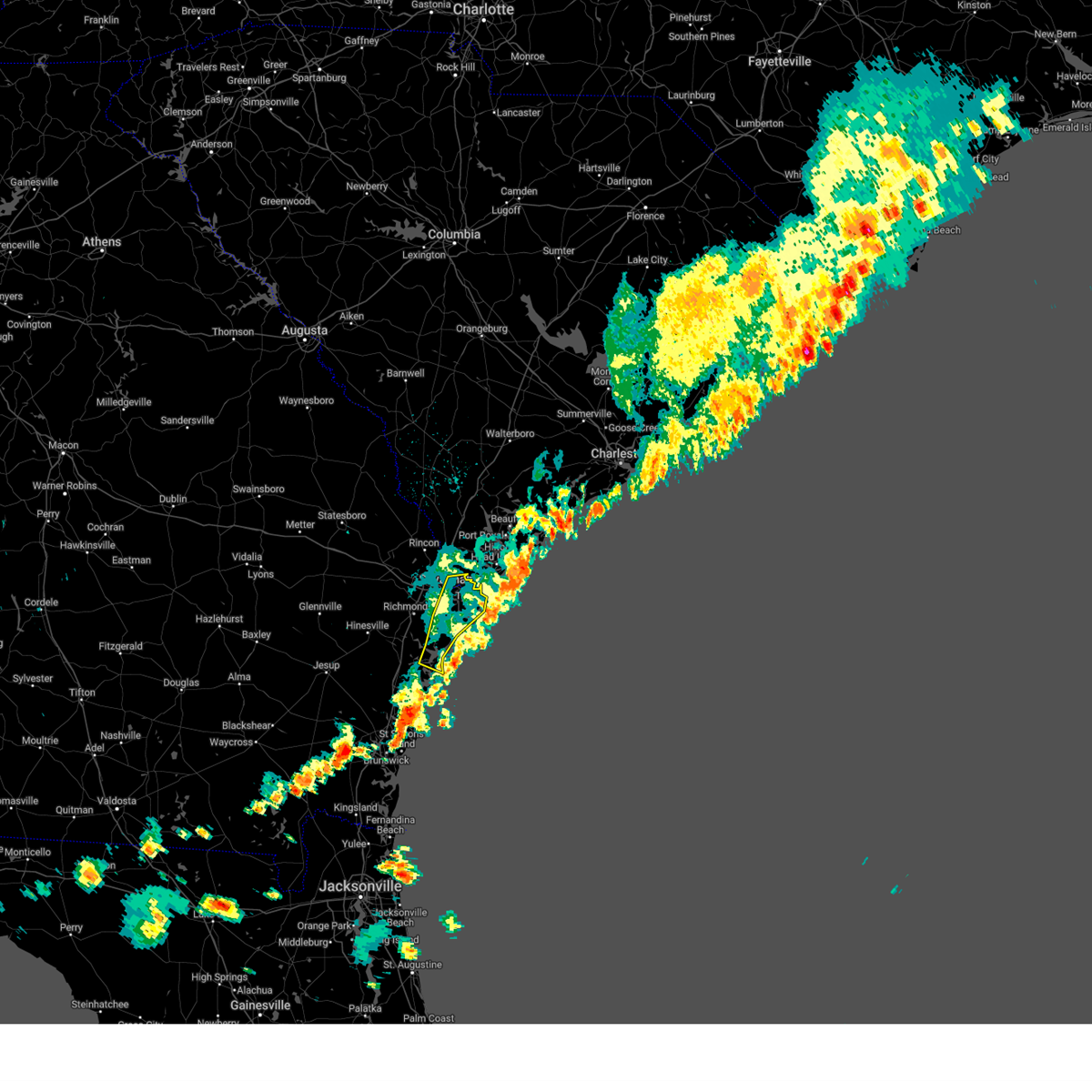
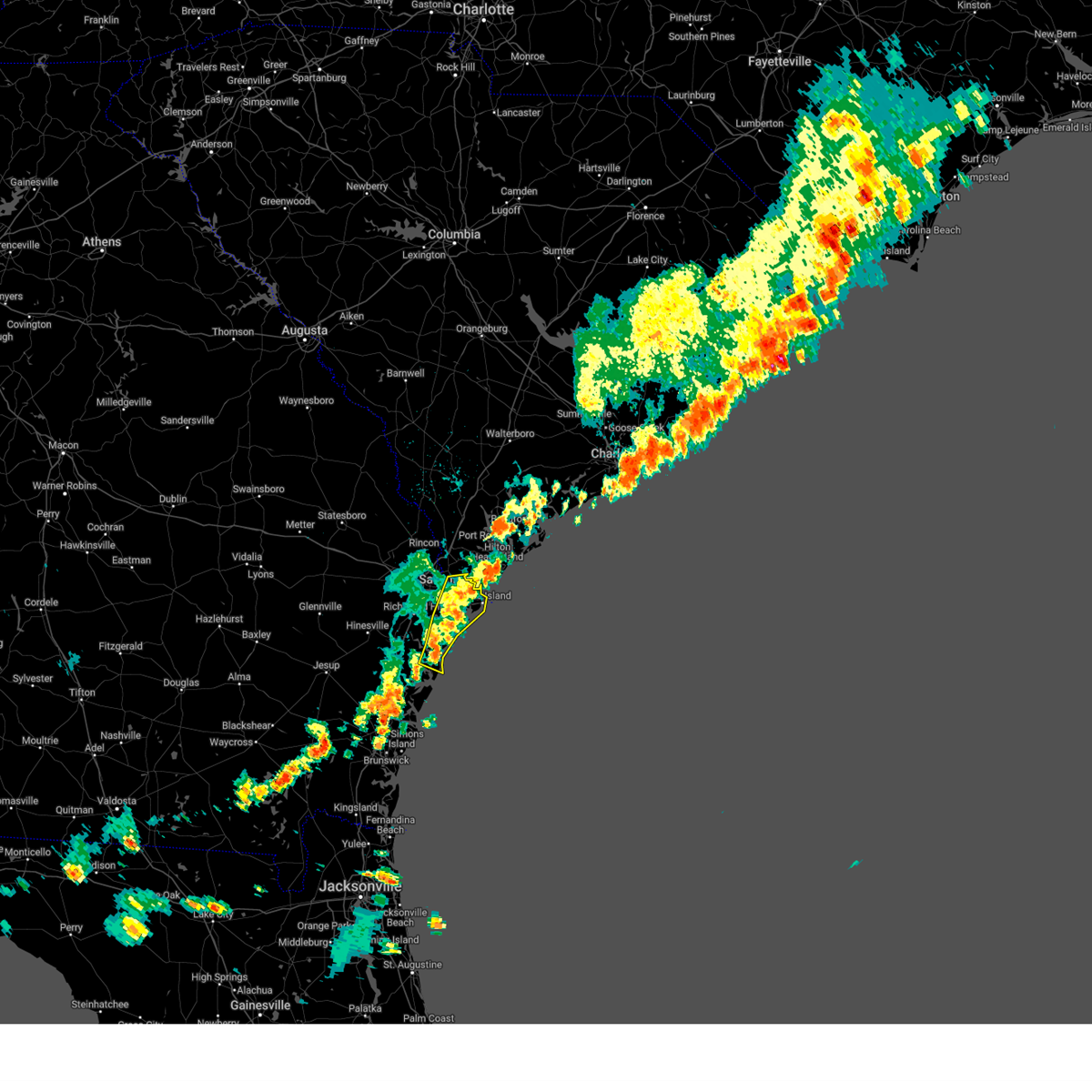
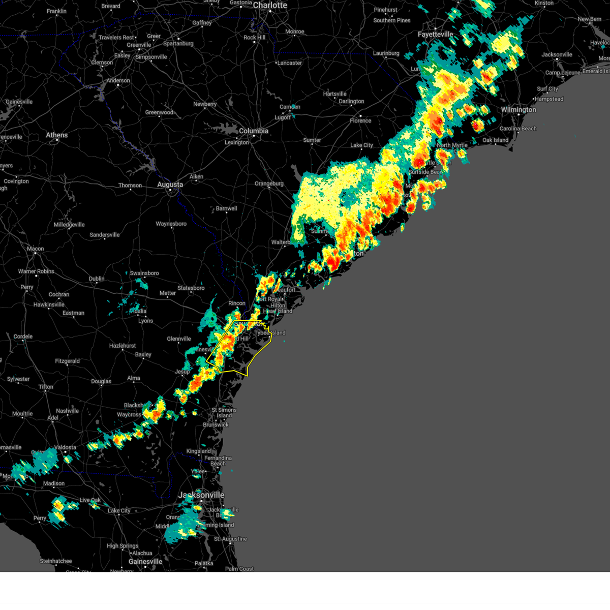
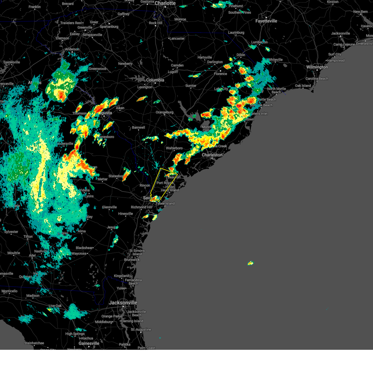
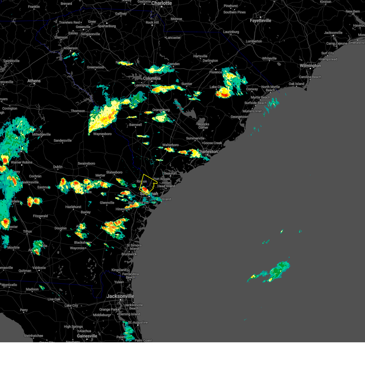
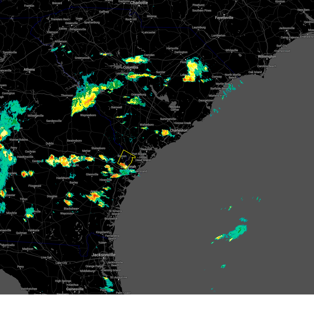
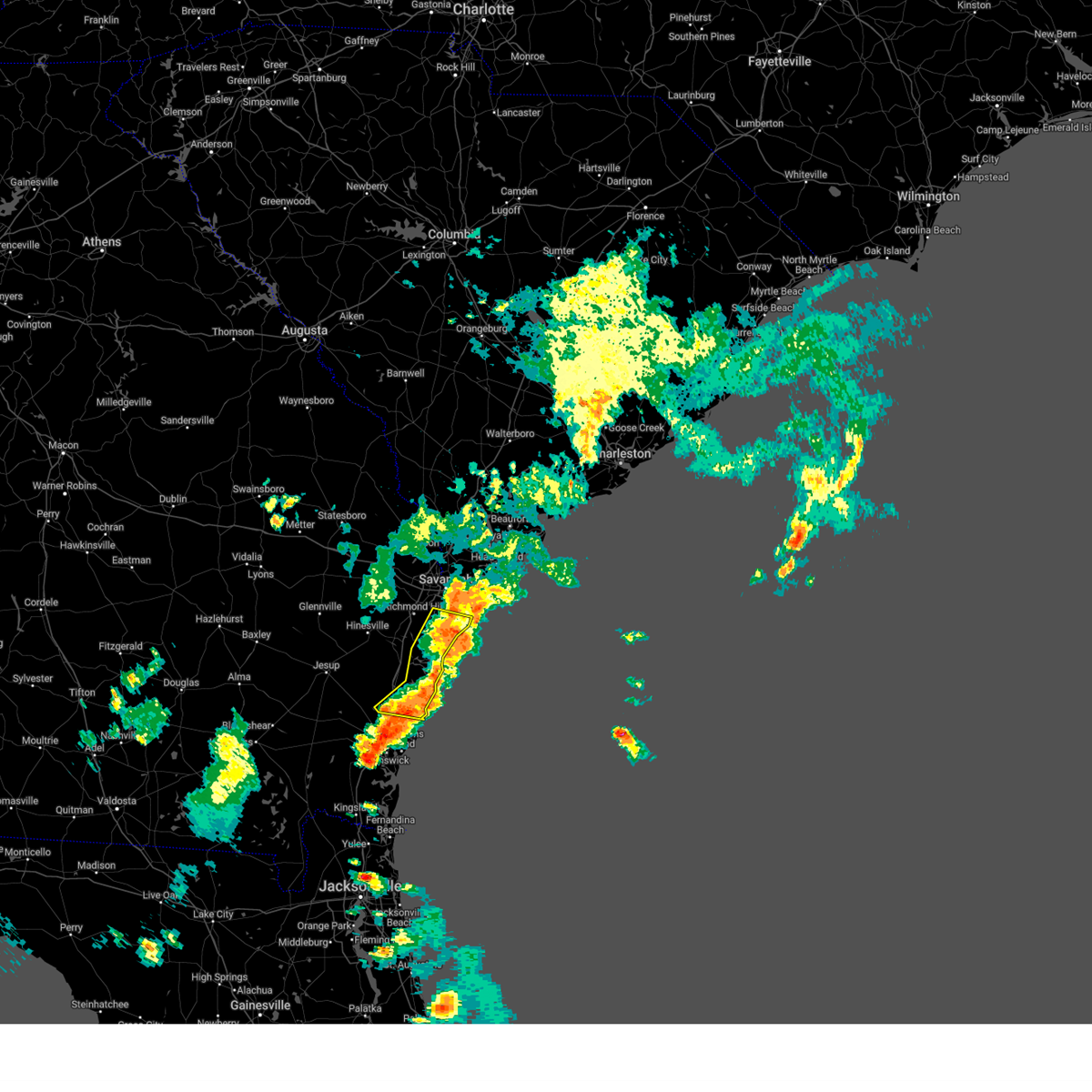
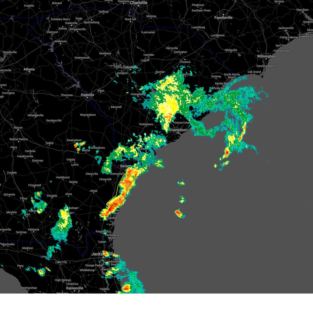
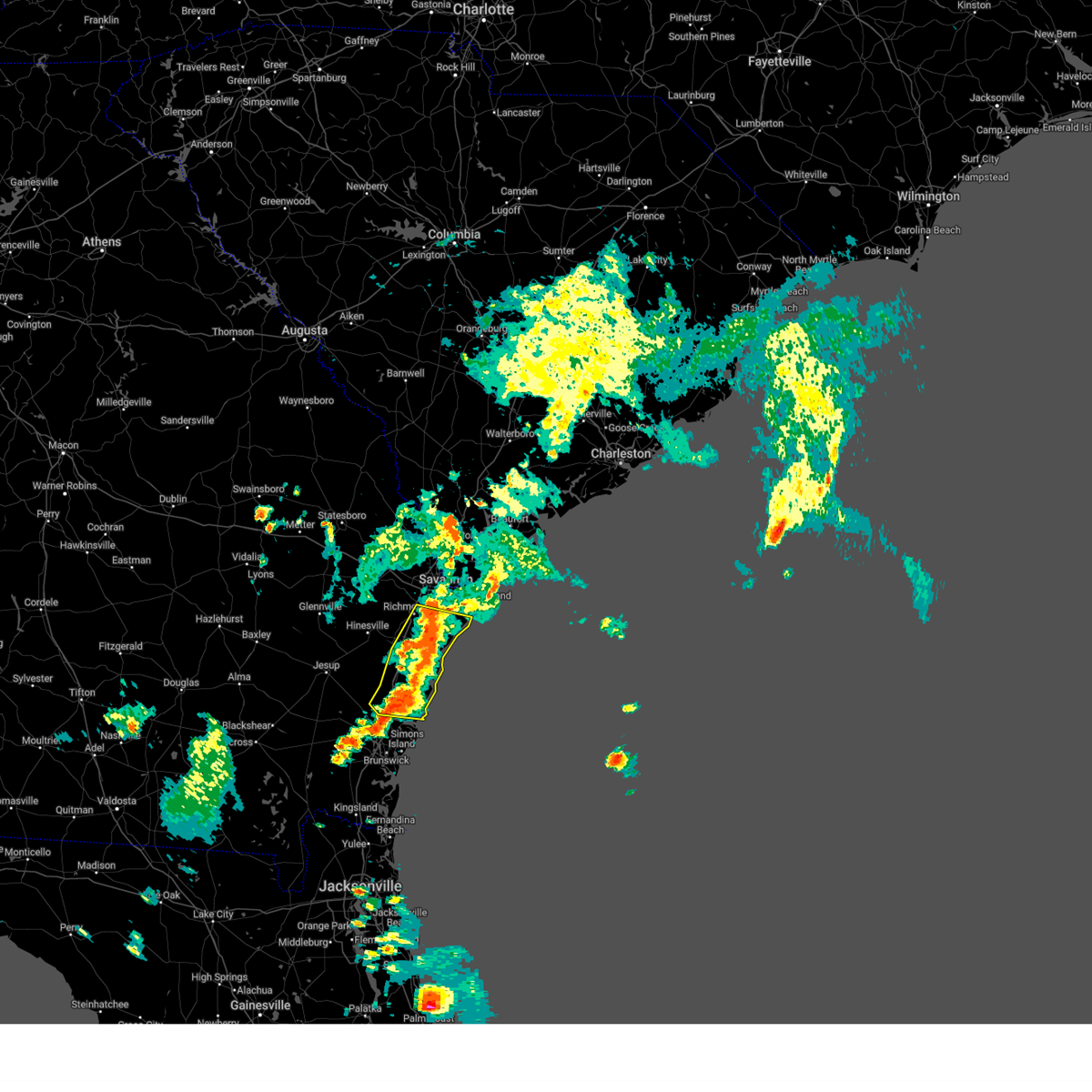
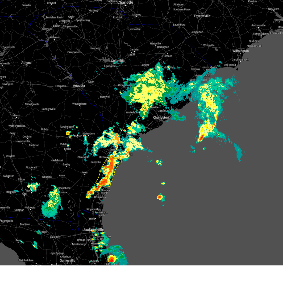
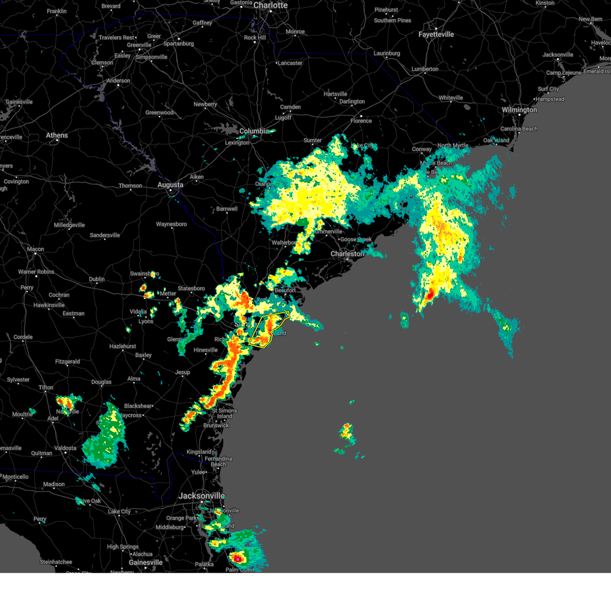
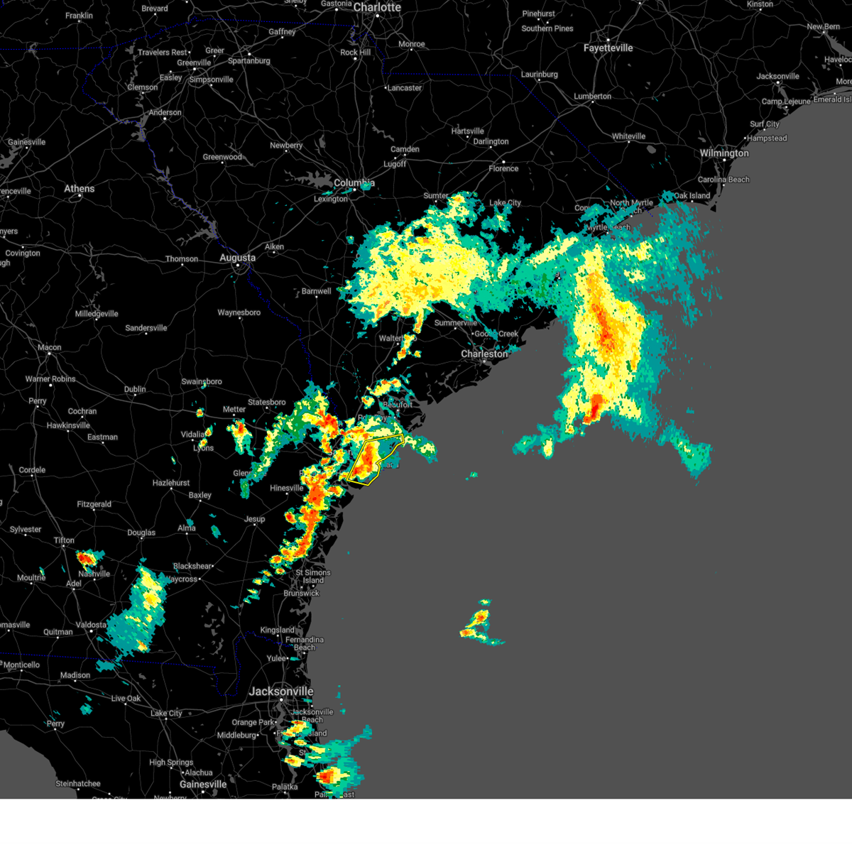
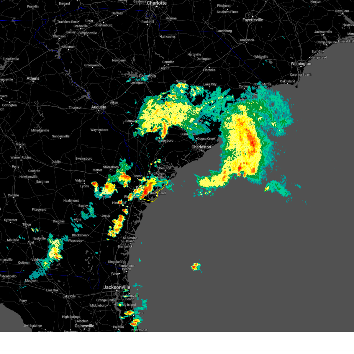
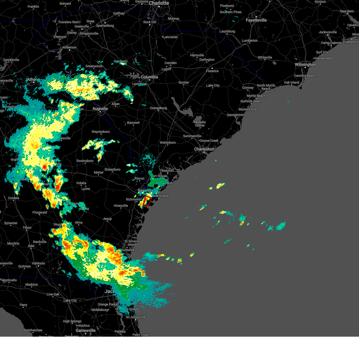
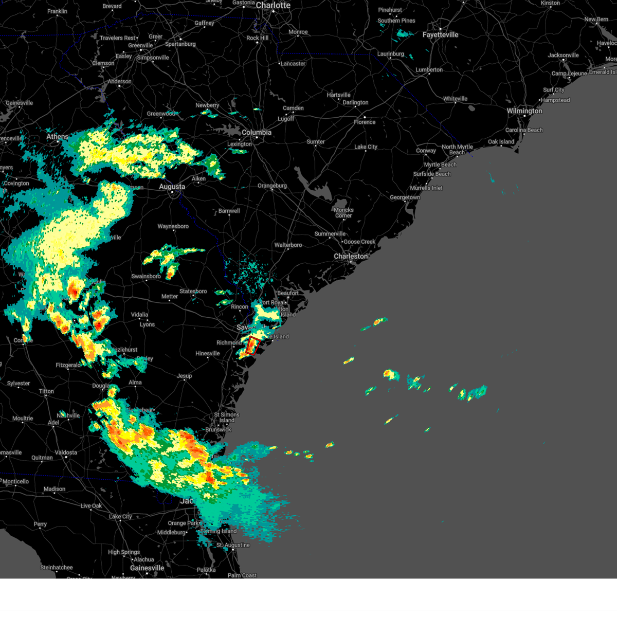
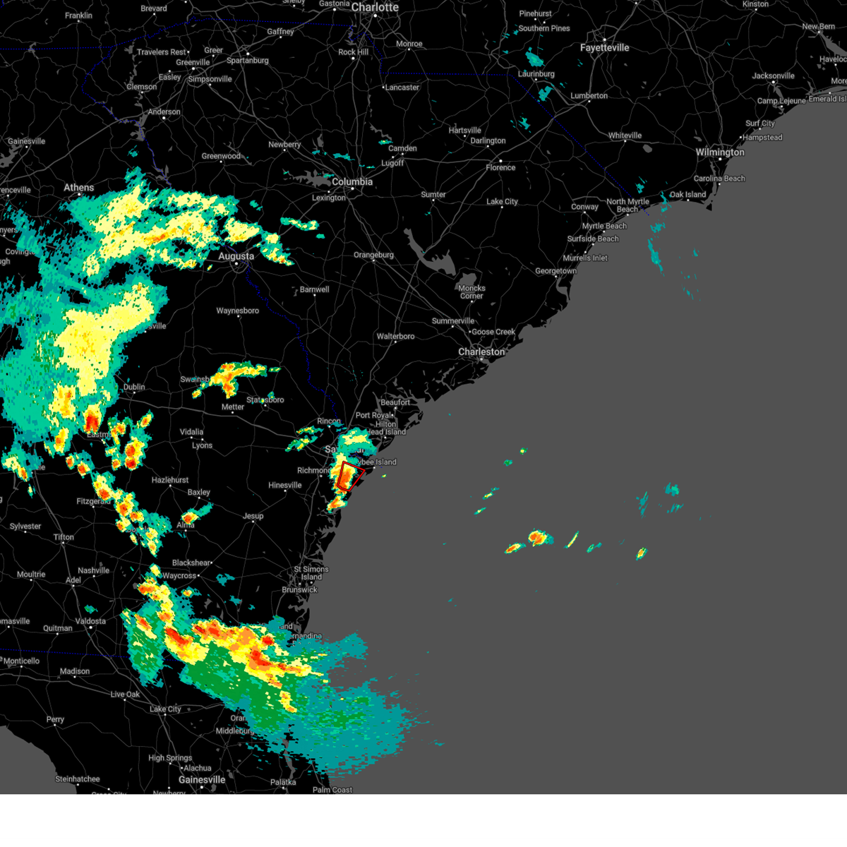
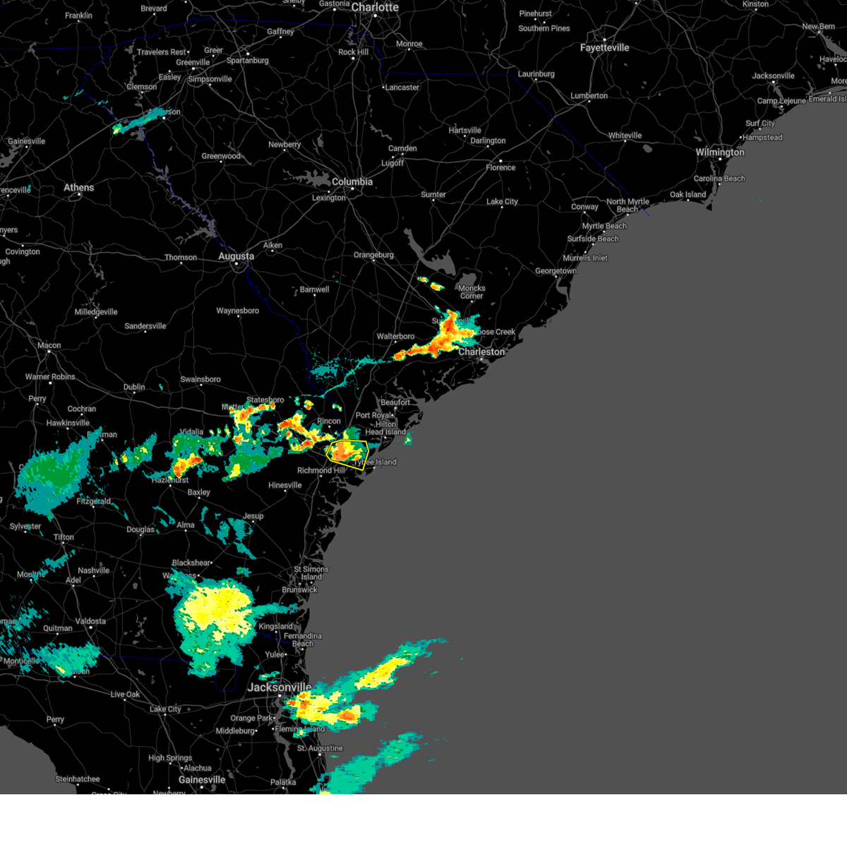
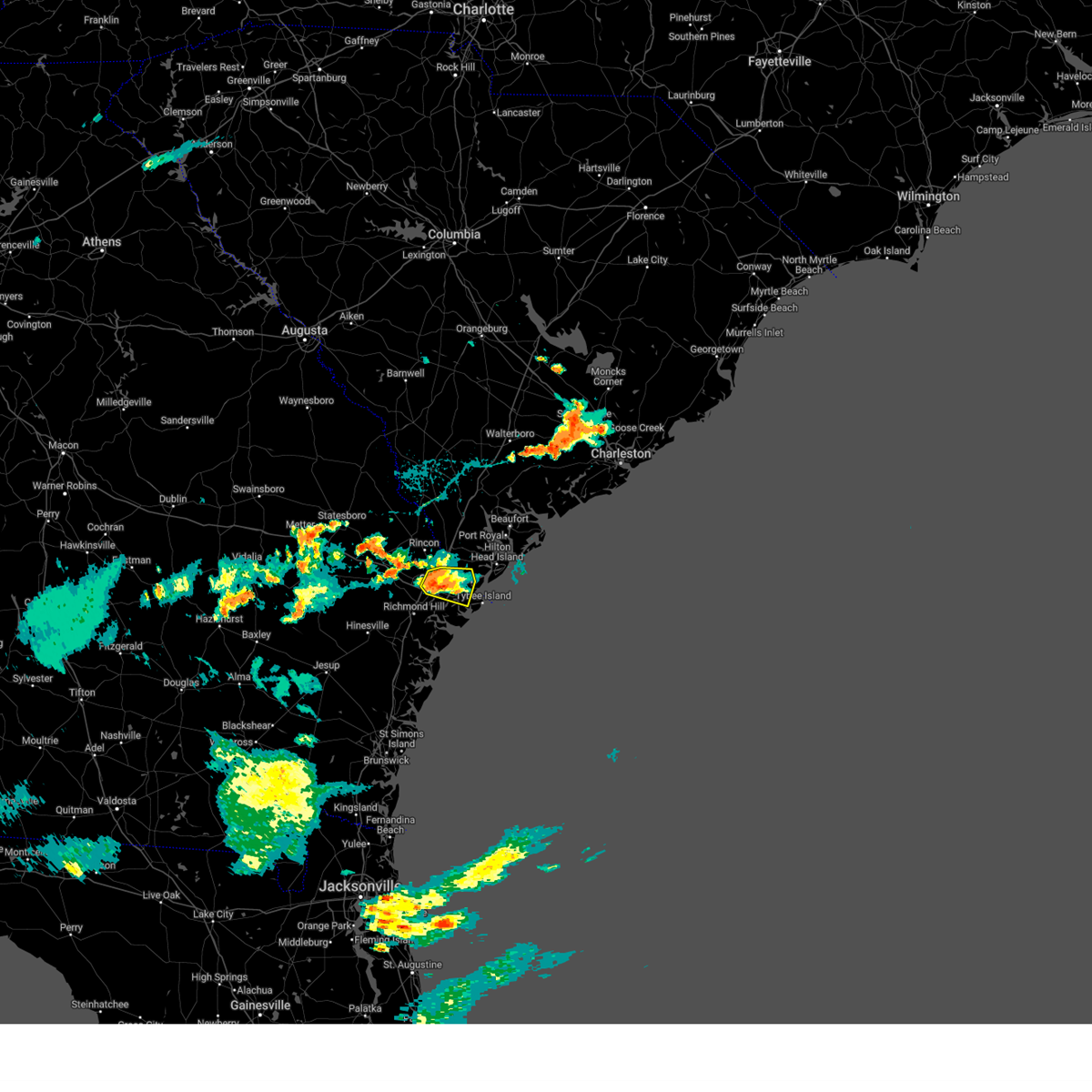
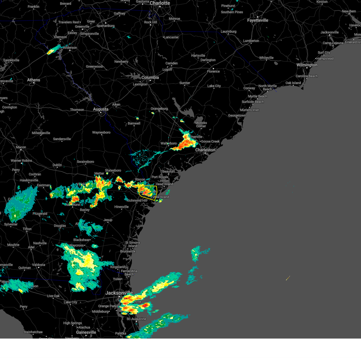
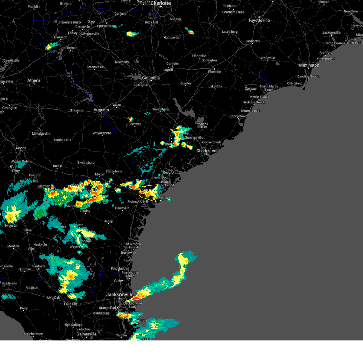
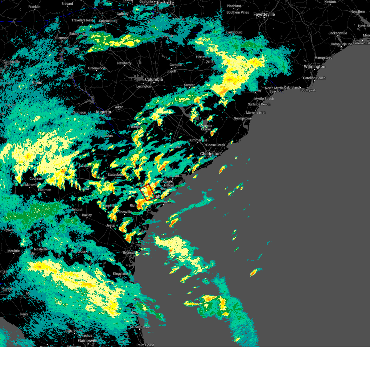
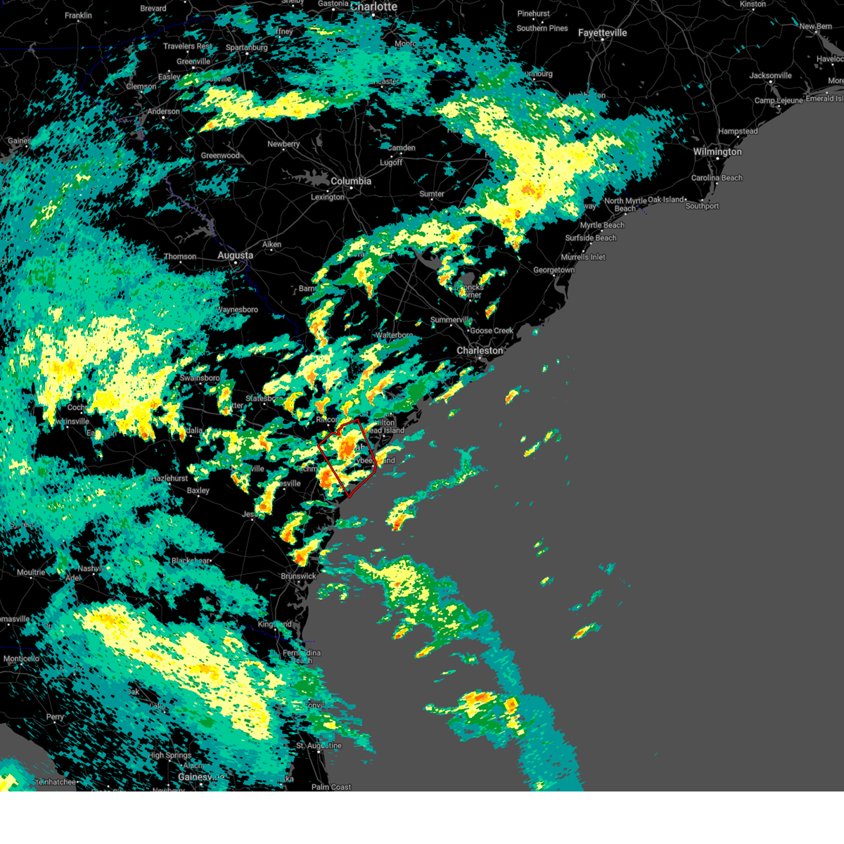
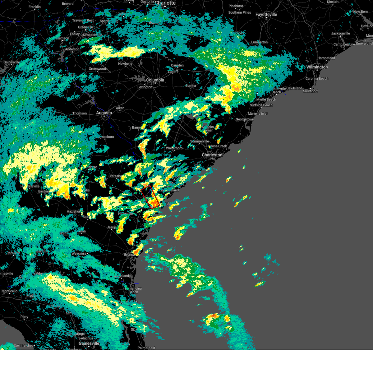
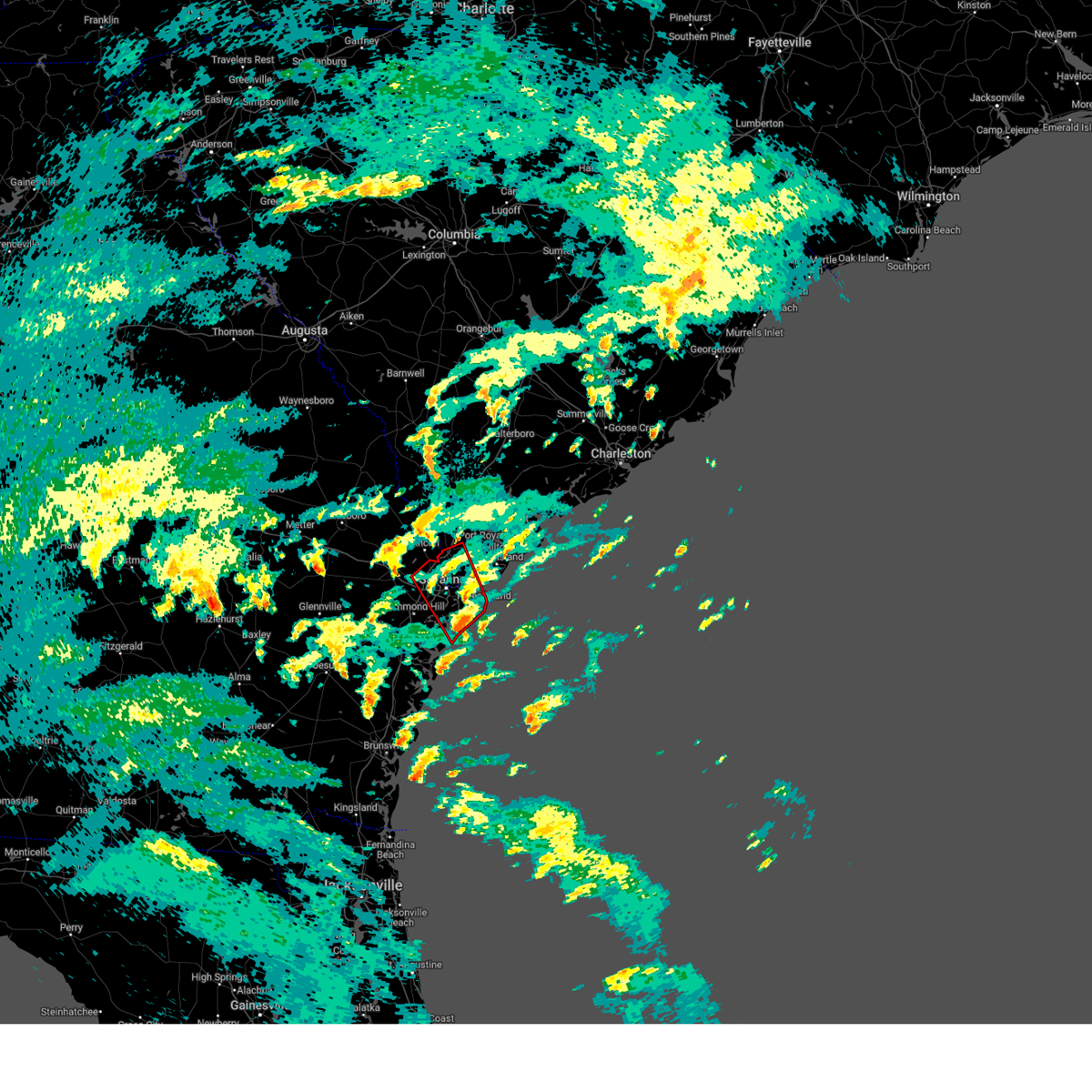
Hail Map for Savannah, GA
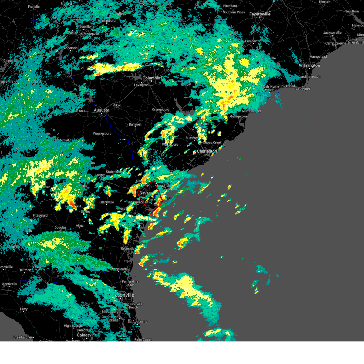
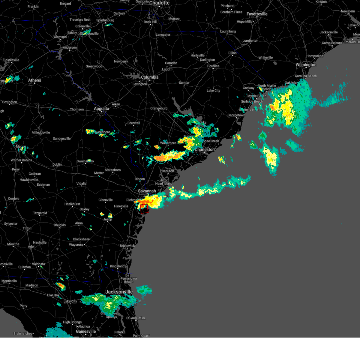
The Savannah, GA area has had 31 reports of on-the-ground hail by trained spotters, and has been under severe weather warnings 74 times during the past 12 months. Doppler radar has detected hail at or near Savannah, GA on 136 occasions, including 6 occasions during the past year.
| Name: | Savannah, GA |
| Where Located: | 7 miles WSW of Savannah, GA |
| Map: | Google Map for Savannah, GA |
| Population: | 136286 |
| Housing Units: | 61883 |
| More Info: | Search Google for Savannah, GA |
1
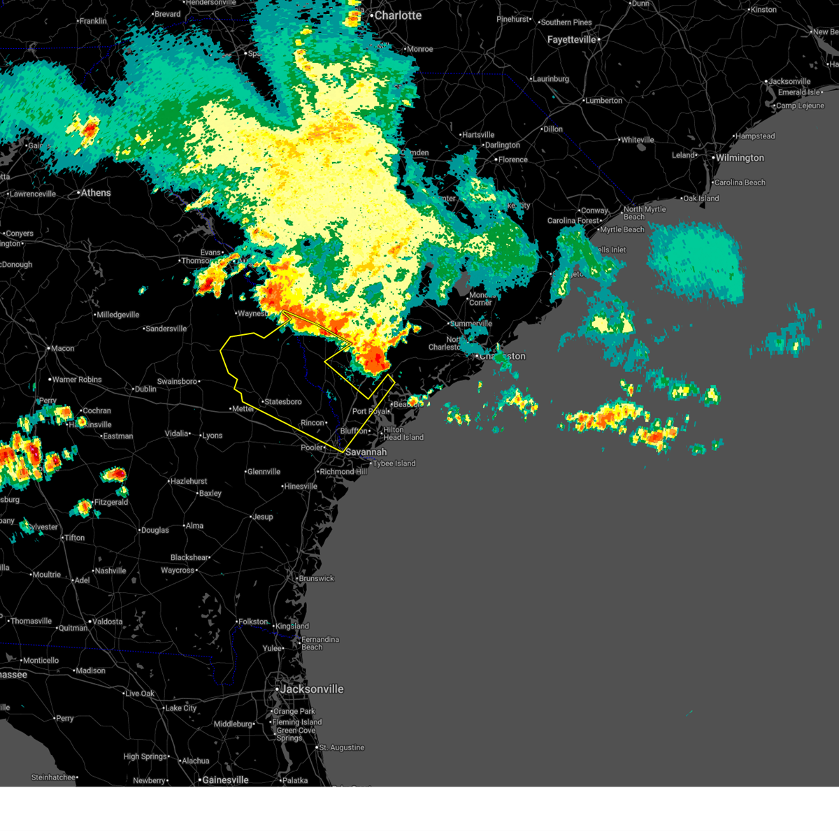
The Top Recent Hail Date for Savannah, GA is Friday, July 11, 2025 (78th out of 136)

Hail and Wind Damage Spotted near Savannah, GA
| Date / Time | Report Details |
|---|---|
| 7/11/2025 5:54 PM EDT | Emergency manager reported trees blocking half the roadway at the block of 7600 central avenu in chatham county GA, 9.1 miles WNW of Savannah, GA |
| 7/11/2025 5:34 PM EDT | Emergency manager reported one large tree down on ga-204 near montgomery cross roa in chatham county GA, 6 miles WSW of Savannah, GA |
| 7/11/2025 5:01 PM EDT | Emergency manager reported a tree blocking roadway at the 7900 block of abercorn stree in chatham county GA, 4.9 miles WNW of Savannah, GA |
| 7/10/2025 6:41 PM EDT | The storms which prompted the warning have moved out of the area. therefore, the warning will be allowed to expire. however, gusty winds and heavy rain are still possible with these thunderstorms. |
| 7/10/2025 6:21 PM EDT | the severe thunderstorm warning has been cancelled and is no longer in effect |
| 7/10/2025 6:21 PM EDT | At 621 pm edt, severe thunderstorms were located along a line from over keller to 6 miles south of forest beach, moving southeast at 15 mph (radar indicated). Hazards include 60 mph wind gusts. Expect damage to roofs, siding, and trees. locations impacted include, richmond hill, tybee island, coffee bluff, midtown savannah, windsor forest, hunter army airfield, wilmington island, downtown savannah, fort pulaski national monument and montgomery. This includes i-95 in georgia between mile markers 84 and 88. |
| 7/10/2025 6:11 PM EDT | The storms which prompted the warning have moved out of the area. therefore, the warning will be allowed to expire. however, gusty winds are still possible with these thunderstorms. |
| 7/10/2025 6:10 PM EDT | Chatham county em reported downed powerlines across the county. police scanner broadcast within the city of savannah reported a tree blocking a road and at least one tr in chatham county GA, 7.1 miles W of Savannah, GA |
| 7/10/2025 6:02 PM EDT | A severe thunderstorm downed a power line near the intersection of coffee bluff road and ben kell road. time determined from radar dat in chatham county GA, 7.6 miles NNW of Savannah, GA |
| 7/10/2025 6:00 PM EDT | A severe thunderstorm downed a power line near the 3200 block of cedar street. time determined using radar dat in chatham county GA, 8.9 miles W of Savannah, GA |
| 7/10/2025 5:55 PM EDT | Powerline reported down on elm street. time determined from radar dat in chatham county GA, 7.2 miles SW of Savannah, GA |
| 7/10/2025 5:49 PM EDT | At 549 pm edt, severe thunderstorms were located along a line from 8 miles south of lanier to over whitemarsh island, moving southeast at 15 mph (radar indicated). Hazards include 60 mph wind gusts and small hail. Expect damage to roofs, siding, and trees. locations impacted include, pooler, bluffton, richmond hill, i-16/i-95 interchange, savannah international airport, godley station, hunter army airfield, windsor forest, downtown savannah and hutchinson island. this includes the following highways, i-16 between mile markers 147 and 168. i-95 in georgia between mile markers 90 and 110. I-516 between mile markers 3 and 9. |
| 7/10/2025 5:46 PM EDT | A severe thunderstorm downed a power line at the 300 block of beaufort road. time determined from radar dat in chatham county GA, 5 miles NE of Savannah, GA |
| 7/10/2025 5:43 PM EDT |
 Svrchs the national weather service in charleston has issued a * severe thunderstorm warning for portions of, bryan county in southeastern georgia, chatham county in southeastern georgia, liberty county in southeastern georgia, jasper county in southeastern south carolina, * until 645 pm edt. * at 543 pm edt, severe thunderstorms were located along a line from near richmond hill to near bluffton, moving southeast at 15 mph (radar indicated). Hazards include 60 mph wind gusts. expect damage to roofs, siding, and trees Svrchs the national weather service in charleston has issued a * severe thunderstorm warning for portions of, bryan county in southeastern georgia, chatham county in southeastern georgia, liberty county in southeastern georgia, jasper county in southeastern south carolina, * until 645 pm edt. * at 543 pm edt, severe thunderstorms were located along a line from near richmond hill to near bluffton, moving southeast at 15 mph (radar indicated). Hazards include 60 mph wind gusts. expect damage to roofs, siding, and trees
|
| 7/10/2025 5:39 PM EDT | A severe thunderstorm downed a power line at the 2100 block of krenson street. time determined from radar dat in chatham county GA, 5.9 miles SW of Savannah, GA |
| 7/10/2025 5:31 PM EDT |
 At 531 pm edt, severe thunderstorms were located along a line from near lanier to near bellinger hill area, moving southeast at 15 mph (radar indicated). Hazards include 60 mph wind gusts and small hail. Expect damage to roofs, siding, and trees. locations impacted include, pooler, bluffton, richmond hill, pembroke, i-16/i-95 interchange, godley station, savannah international airport, hunter army airfield, downtown savannah and windsor forest. this includes the following highways, i-16 between mile markers 139 and 168. i-95 in georgia between mile markers 90 and 112. i-95 in south carolina between mile markers 2 and 8. I-516 between mile markers 3 and 9. At 531 pm edt, severe thunderstorms were located along a line from near lanier to near bellinger hill area, moving southeast at 15 mph (radar indicated). Hazards include 60 mph wind gusts and small hail. Expect damage to roofs, siding, and trees. locations impacted include, pooler, bluffton, richmond hill, pembroke, i-16/i-95 interchange, godley station, savannah international airport, hunter army airfield, downtown savannah and windsor forest. this includes the following highways, i-16 between mile markers 139 and 168. i-95 in georgia between mile markers 90 and 112. i-95 in south carolina between mile markers 2 and 8. I-516 between mile markers 3 and 9.
|
| 7/10/2025 5:16 PM EDT |
 Svrchs the national weather service in charleston has issued a * severe thunderstorm warning for portions of, bryan county in southeastern georgia, chatham county in southeastern georgia, effingham county in southeastern georgia, jasper county in southeastern south carolina, * until 615 pm edt. * at 516 pm edt, severe thunderstorms were located along a line from over pembroke to over bellinger hill area, moving south at 10 mph (radar indicated). Hazards include 60 mph wind gusts and small hail. expect damage to roofs, siding, and trees Svrchs the national weather service in charleston has issued a * severe thunderstorm warning for portions of, bryan county in southeastern georgia, chatham county in southeastern georgia, effingham county in southeastern georgia, jasper county in southeastern south carolina, * until 615 pm edt. * at 516 pm edt, severe thunderstorms were located along a line from over pembroke to over bellinger hill area, moving south at 10 mph (radar indicated). Hazards include 60 mph wind gusts and small hail. expect damage to roofs, siding, and trees
|
| 6/25/2025 11:40 PM EDT |
 The severe thunderstorm warning that was previously in effect has been reissued for screven, jenkins, effingham, and bulloch counties and is in effect until 1230 am edt. please refer to that bulletin for the latest severe weather information. a severe thunderstorm watch remains in effect until 400 am edt for portions of southeast georgia and southeast south carolina. The severe thunderstorm warning that was previously in effect has been reissued for screven, jenkins, effingham, and bulloch counties and is in effect until 1230 am edt. please refer to that bulletin for the latest severe weather information. a severe thunderstorm watch remains in effect until 400 am edt for portions of southeast georgia and southeast south carolina.
|
| 6/25/2025 11:22 PM EDT |
 At 1122 pm edt, severe thunderstorms were located along a line from over old house to over millen, moving southwest at 30 mph (law enforcement reported. at 1020 pm, law enforcement officials reported trees down near sylvania as well as other portions of screven county). Hazards include 60 mph wind gusts and small hail. Expect damage to roofs, siding, and trees. locations impacted include, beaufort, sylvania, ridgeland, millen, springfield, statesboro, bluffton, godley station, savannah international airport and pooler. this includes the following highways, i-95 in georgia between mile markers 106 and 112. I-95 in south carolina between mile markers 2 and 25. At 1122 pm edt, severe thunderstorms were located along a line from over old house to over millen, moving southwest at 30 mph (law enforcement reported. at 1020 pm, law enforcement officials reported trees down near sylvania as well as other portions of screven county). Hazards include 60 mph wind gusts and small hail. Expect damage to roofs, siding, and trees. locations impacted include, beaufort, sylvania, ridgeland, millen, springfield, statesboro, bluffton, godley station, savannah international airport and pooler. this includes the following highways, i-95 in georgia between mile markers 106 and 112. I-95 in south carolina between mile markers 2 and 25.
|
| 6/25/2025 10:49 PM EDT |
 Svrchs the national weather service in charleston has issued a * severe thunderstorm warning for portions of, bulloch county in southeastern georgia, chatham county in southeastern georgia, effingham county in southeastern georgia, jenkins county in southeastern georgia, screven county in southeastern georgia, allendale county in southeastern south carolina, beaufort county in southeastern south carolina, hampton county in southeastern south carolina, jasper county in southeastern south carolina, * until 1145 pm edt. * at 1049 pm edt, severe thunderstorms were located along a line from near sheldon to 12 miles northeast of perkins, moving southwest at 30 mph (radar indicated). Hazards include 60 mph wind gusts and small hail. expect damage to roofs, siding, and trees Svrchs the national weather service in charleston has issued a * severe thunderstorm warning for portions of, bulloch county in southeastern georgia, chatham county in southeastern georgia, effingham county in southeastern georgia, jenkins county in southeastern georgia, screven county in southeastern georgia, allendale county in southeastern south carolina, beaufort county in southeastern south carolina, hampton county in southeastern south carolina, jasper county in southeastern south carolina, * until 1145 pm edt. * at 1049 pm edt, severe thunderstorms were located along a line from near sheldon to 12 miles northeast of perkins, moving southwest at 30 mph (radar indicated). Hazards include 60 mph wind gusts and small hail. expect damage to roofs, siding, and trees
|
| 6/10/2025 9:21 AM EDT | Power lines down on walthour r in chatham county GA, 13.2 miles WNW of Savannah, GA |
| 6/10/2025 9:06 AM EDT |
 The severe thunderstorm warning that was previously in effect has been reissued for effingham county and is in effect until 930 am edt. please refer to that bulletin for the latest severe weather information. The severe thunderstorm warning that was previously in effect has been reissued for effingham county and is in effect until 930 am edt. please refer to that bulletin for the latest severe weather information.
|
| 6/10/2025 8:51 AM EDT |
 the severe thunderstorm warning has been cancelled and is no longer in effect the severe thunderstorm warning has been cancelled and is no longer in effect
|
| 6/10/2025 8:51 AM EDT |
 At 851 am edt, a severe thunderstorm was located near rincon, moving northeast at 30 mph (radar indicated). Hazards include 60 mph wind gusts. Expect damage to roofs, siding, and trees. locations impacted include, springfield, godley station, rincon, port wentworth, bloomingdale, guyton, stillwell, pineora, marlow and ebenezer. This includes i-95 in georgia between mile markers 111 and 112. At 851 am edt, a severe thunderstorm was located near rincon, moving northeast at 30 mph (radar indicated). Hazards include 60 mph wind gusts. Expect damage to roofs, siding, and trees. locations impacted include, springfield, godley station, rincon, port wentworth, bloomingdale, guyton, stillwell, pineora, marlow and ebenezer. This includes i-95 in georgia between mile markers 111 and 112.
|
| 6/10/2025 8:49 AM EDT |
 Svrchs the national weather service in charleston has issued a * severe thunderstorm warning for portions of, bulloch county in southeastern georgia, effingham county in southeastern georgia, screven county in southeastern georgia, allendale county in southeastern south carolina, hampton county in southeastern south carolina, jasper county in southeastern south carolina, * until 930 am edt. * at 849 am edt, severe thunderstorms were located along a line from over newington to over rincon, moving northeast at 55 mph (radar indicated). Hazards include 60 mph wind gusts. expect damage to roofs, siding, and trees Svrchs the national weather service in charleston has issued a * severe thunderstorm warning for portions of, bulloch county in southeastern georgia, effingham county in southeastern georgia, screven county in southeastern georgia, allendale county in southeastern south carolina, hampton county in southeastern south carolina, jasper county in southeastern south carolina, * until 930 am edt. * at 849 am edt, severe thunderstorms were located along a line from over newington to over rincon, moving northeast at 55 mph (radar indicated). Hazards include 60 mph wind gusts. expect damage to roofs, siding, and trees
|
| 6/10/2025 8:30 AM EDT |
 Svrchs the national weather service in charleston has issued a * severe thunderstorm warning for portions of, bryan county in southeastern georgia, bulloch county in southeastern georgia, chatham county in southeastern georgia, effingham county in southeastern georgia, * until 915 am edt. * at 830 am edt, a severe thunderstorm was located over blitchton, moving northeast at 30 mph (radar indicated). Hazards include 60 mph wind gusts. expect damage to roofs, siding, and trees Svrchs the national weather service in charleston has issued a * severe thunderstorm warning for portions of, bryan county in southeastern georgia, bulloch county in southeastern georgia, chatham county in southeastern georgia, effingham county in southeastern georgia, * until 915 am edt. * at 830 am edt, a severe thunderstorm was located over blitchton, moving northeast at 30 mph (radar indicated). Hazards include 60 mph wind gusts. expect damage to roofs, siding, and trees
|
| 6/8/2025 2:26 PM EDT |
 The storms which prompted the warning have weakened below severe limits, and have exited the warned area. therefore, the warning will be allowed to expire. a severe thunderstorm watch remains in effect until 500 pm edt for portions of southeast georgia and southeast south carolina. The storms which prompted the warning have weakened below severe limits, and have exited the warned area. therefore, the warning will be allowed to expire. a severe thunderstorm watch remains in effect until 500 pm edt for portions of southeast georgia and southeast south carolina.
|
| 6/8/2025 2:06 PM EDT |
 At 206 pm edt, severe thunderstorms were located along a line from near forest beach to 5 miles northeast of st. catherines island, moving east at 45 mph (radar indicated). Hazards include 60 mph wind gusts and small hail. Expect damage to roofs, siding, and trees. locations impacted include, bluffton, tybee island, coffee bluff, midtown savannah, windsor forest, wilmington island, hunter army airfield, downtown savannah, hutchinson island and fort pulaski national monument. This includes i-16 between mile markers 166 and 168. At 206 pm edt, severe thunderstorms were located along a line from near forest beach to 5 miles northeast of st. catherines island, moving east at 45 mph (radar indicated). Hazards include 60 mph wind gusts and small hail. Expect damage to roofs, siding, and trees. locations impacted include, bluffton, tybee island, coffee bluff, midtown savannah, windsor forest, wilmington island, hunter army airfield, downtown savannah, hutchinson island and fort pulaski national monument. This includes i-16 between mile markers 166 and 168.
|
| 6/8/2025 1:39 PM EDT |
 Svrchs the national weather service in charleston has issued a * severe thunderstorm warning for portions of, bryan county in southeastern georgia, chatham county in southeastern georgia, liberty county in southeastern georgia, jasper county in southeastern south carolina, * until 230 pm edt. * at 139 pm edt, severe thunderstorms were located along a line from over bellinger hill area to over retreat, moving east at 45 mph (radar indicated). Hazards include 60 mph wind gusts and small hail. expect damage to roofs, siding, and trees Svrchs the national weather service in charleston has issued a * severe thunderstorm warning for portions of, bryan county in southeastern georgia, chatham county in southeastern georgia, liberty county in southeastern georgia, jasper county in southeastern south carolina, * until 230 pm edt. * at 139 pm edt, severe thunderstorms were located along a line from over bellinger hill area to over retreat, moving east at 45 mph (radar indicated). Hazards include 60 mph wind gusts and small hail. expect damage to roofs, siding, and trees
|
| 5/29/2025 2:40 PM EDT |
 Svrchs the national weather service in charleston has issued a * severe thunderstorm warning for portions of, beaufort county in southeastern south carolina, jasper county in southeastern south carolina, * until 345 pm edt. * at 240 pm edt, a severe thunderstorm was located over bellinger hill area, moving northeast at 30 mph (radar indicated). Hazards include 60 mph wind gusts and quarter size hail. Hail damage to vehicles is expected. Expect wind damage to roofs, siding, and trees. Svrchs the national weather service in charleston has issued a * severe thunderstorm warning for portions of, beaufort county in southeastern south carolina, jasper county in southeastern south carolina, * until 345 pm edt. * at 240 pm edt, a severe thunderstorm was located over bellinger hill area, moving northeast at 30 mph (radar indicated). Hazards include 60 mph wind gusts and quarter size hail. Hail damage to vehicles is expected. Expect wind damage to roofs, siding, and trees.
|
| 5/26/2025 5:33 PM EDT |
 At 533 pm edt, a severe thunderstorm was located over port wentworth, moving northeast at 15 mph (radar indicated). Hazards include 60 mph wind gusts and half dollar size hail. Hail damage to vehicles is expected. expect wind damage to roofs, siding, and trees. locations impacted include, savannah international airport, garden city, godley station, port wentworth, monteith, rincon, bluffton, purysburgh, hardeeville and ebenezer. this includes the following highways, i-95 in georgia between mile markers 107 and 112. I-95 in south carolina between mile markers 2 and 14. At 533 pm edt, a severe thunderstorm was located over port wentworth, moving northeast at 15 mph (radar indicated). Hazards include 60 mph wind gusts and half dollar size hail. Hail damage to vehicles is expected. expect wind damage to roofs, siding, and trees. locations impacted include, savannah international airport, garden city, godley station, port wentworth, monteith, rincon, bluffton, purysburgh, hardeeville and ebenezer. this includes the following highways, i-95 in georgia between mile markers 107 and 112. I-95 in south carolina between mile markers 2 and 14.
|
| 5/26/2025 5:21 PM EDT |
 Svrchs the national weather service in charleston has issued a * severe thunderstorm warning for portions of, chatham county in southeastern georgia, effingham county in southeastern georgia, jasper county in southeastern south carolina, * until 615 pm edt. * at 521 pm edt, a severe thunderstorm was located over monteith, moving northeast at 15 mph (radar indicated). Hazards include 60 mph wind gusts and half dollar size hail. Hail damage to vehicles is expected. Expect wind damage to roofs, siding, and trees. Svrchs the national weather service in charleston has issued a * severe thunderstorm warning for portions of, chatham county in southeastern georgia, effingham county in southeastern georgia, jasper county in southeastern south carolina, * until 615 pm edt. * at 521 pm edt, a severe thunderstorm was located over monteith, moving northeast at 15 mph (radar indicated). Hazards include 60 mph wind gusts and half dollar size hail. Hail damage to vehicles is expected. Expect wind damage to roofs, siding, and trees.
|
| 5/25/2025 3:59 PM EDT |
 The storms which prompted the warning have moved out of the area. therefore, the warning will be allowed to expire. The storms which prompted the warning have moved out of the area. therefore, the warning will be allowed to expire.
|
| 5/25/2025 3:51 PM EDT |
 At 351 pm edt, severe thunderstorms were located along a line from over sandfly to near sapelo island, moving east at 15 mph (radar indicated). Hazards include 60 mph wind gusts. Expect damage to roofs, siding, and trees. locations impacted include, darien, coffee bluff, windsor forest, montgomery, vernonburg, harris neck, halfmoon landing, st. catherines island, shellman bluff and sunbury. This includes i-95 in georgia between mile markers 48 and 56. At 351 pm edt, severe thunderstorms were located along a line from over sandfly to near sapelo island, moving east at 15 mph (radar indicated). Hazards include 60 mph wind gusts. Expect damage to roofs, siding, and trees. locations impacted include, darien, coffee bluff, windsor forest, montgomery, vernonburg, harris neck, halfmoon landing, st. catherines island, shellman bluff and sunbury. This includes i-95 in georgia between mile markers 48 and 56.
|
| 5/25/2025 3:30 PM EDT |
 At 330 pm edt, severe thunderstorms were located along a line from over hunter army airfield to over ridgeville, moving east at 15 mph (radar indicated). Hazards include 60 mph wind gusts. Expect damage to roofs, siding, and trees. locations impacted include, richmond hill, darien, coffee bluff, windsor forest, jones, montgomery, midway, riceboro, vernonburg and harris neck. This includes i-95 in georgia between mile markers 48 and 88. At 330 pm edt, severe thunderstorms were located along a line from over hunter army airfield to over ridgeville, moving east at 15 mph (radar indicated). Hazards include 60 mph wind gusts. Expect damage to roofs, siding, and trees. locations impacted include, richmond hill, darien, coffee bluff, windsor forest, jones, montgomery, midway, riceboro, vernonburg and harris neck. This includes i-95 in georgia between mile markers 48 and 88.
|
| 5/25/2025 3:30 PM EDT |
 the severe thunderstorm warning has been cancelled and is no longer in effect the severe thunderstorm warning has been cancelled and is no longer in effect
|
| 5/25/2025 3:12 PM EDT |
 The storms which prompted the warning have moved out of the area. therefore, the warning will be allowed to expire. The storms which prompted the warning have moved out of the area. therefore, the warning will be allowed to expire.
|
| 5/25/2025 3:07 PM EDT |
 At 307 pm edt, severe thunderstorms were located along a line from over hilton head island to near fort pulaski national monument, moving east at 20 mph (radar indicated). Hazards include 60 mph wind gusts and small hail. Expect damage to roofs, siding, and trees. Locations impacted include, bluffton, midtown savannah, montgomery, thunderbolt, whitemarsh island, wilmington island, hilton head island, fort pulaski national monument, tybee island and forest beach. At 307 pm edt, severe thunderstorms were located along a line from over hilton head island to near fort pulaski national monument, moving east at 20 mph (radar indicated). Hazards include 60 mph wind gusts and small hail. Expect damage to roofs, siding, and trees. Locations impacted include, bluffton, midtown savannah, montgomery, thunderbolt, whitemarsh island, wilmington island, hilton head island, fort pulaski national monument, tybee island and forest beach.
|
| 5/25/2025 3:05 PM EDT |
 Svrchs the national weather service in charleston has issued a * severe thunderstorm warning for portions of, bryan county in southeastern georgia, chatham county in southeastern georgia, liberty county in southeastern georgia, long county in southeastern georgia, mcintosh county in southeastern georgia, * until 400 pm edt. * at 305 pm edt, severe thunderstorms were located along a line from over burroughs to over darien, moving east at 15 mph (radar indicated). Hazards include 60 mph wind gusts. expect damage to roofs, siding, and trees Svrchs the national weather service in charleston has issued a * severe thunderstorm warning for portions of, bryan county in southeastern georgia, chatham county in southeastern georgia, liberty county in southeastern georgia, long county in southeastern georgia, mcintosh county in southeastern georgia, * until 400 pm edt. * at 305 pm edt, severe thunderstorms were located along a line from over burroughs to over darien, moving east at 15 mph (radar indicated). Hazards include 60 mph wind gusts. expect damage to roofs, siding, and trees
|
| 5/25/2025 2:45 PM EDT | Social media reports a tree down at waite drive near the intersection of government roa in chatham county GA, 9.4 miles WNW of Savannah, GA |
| 5/25/2025 2:31 PM EDT |
 Svrchs the national weather service in charleston has issued a * severe thunderstorm warning for portions of, chatham county in southeastern georgia, beaufort county in southeastern south carolina, jasper county in southeastern south carolina, * until 315 pm edt. * at 231 pm edt, severe thunderstorms were located along a line from over bluffton to over montgomery, moving east at 20 mph (radar indicated). Hazards include 60 mph wind gusts and small hail. expect damage to roofs, siding, and trees Svrchs the national weather service in charleston has issued a * severe thunderstorm warning for portions of, chatham county in southeastern georgia, beaufort county in southeastern south carolina, jasper county in southeastern south carolina, * until 315 pm edt. * at 231 pm edt, severe thunderstorms were located along a line from over bluffton to over montgomery, moving east at 20 mph (radar indicated). Hazards include 60 mph wind gusts and small hail. expect damage to roofs, siding, and trees
|
| 5/25/2025 2:17 PM EDT | Tree down at the intersection of oglethorpe avenue and drayton stree in chatham county GA, 7.1 miles WSW of Savannah, GA |
| 5/10/2025 8:43 PM EDT |
 The storm which prompted the warning has weakened below severe limits, and no longer appears capable of producing a tornado. therefore, the warning will be allowed to expire. The storm which prompted the warning has weakened below severe limits, and no longer appears capable of producing a tornado. therefore, the warning will be allowed to expire.
|
| 5/10/2025 8:32 PM EDT |
 At 832 pm edt, a severe thunderstorm capable of producing a tornado was located over montgomery, moving north at 15 mph (radar indicated rotation). Hazards include tornado. Flying debris will be dangerous to those caught without shelter. mobile homes will be damaged or destroyed. damage to roofs, windows and vehicles will occur. tree damage is likely. Locations impacted include, midtown savannah, coffee bluff, windsor forest, hunter army airfield, downtown savannah, wilmington island, montgomery, vernonburg, skidaway island and sandfly. At 832 pm edt, a severe thunderstorm capable of producing a tornado was located over montgomery, moving north at 15 mph (radar indicated rotation). Hazards include tornado. Flying debris will be dangerous to those caught without shelter. mobile homes will be damaged or destroyed. damage to roofs, windows and vehicles will occur. tree damage is likely. Locations impacted include, midtown savannah, coffee bluff, windsor forest, hunter army airfield, downtown savannah, wilmington island, montgomery, vernonburg, skidaway island and sandfly.
|
| 5/10/2025 7:58 PM EDT |
 Torchs the national weather service in charleston has issued a * tornado warning for portions of, chatham county in southeastern georgia, * until 845 pm edt. * at 758 pm edt, a severe thunderstorm capable of producing a tornado was located near montgomery, moving north at 15 mph (radar indicated rotation). Hazards include tornado. Flying debris will be dangerous to those caught without shelter. mobile homes will be damaged or destroyed. damage to roofs, windows and vehicles will occur. Tree damage is likely. Torchs the national weather service in charleston has issued a * tornado warning for portions of, chatham county in southeastern georgia, * until 845 pm edt. * at 758 pm edt, a severe thunderstorm capable of producing a tornado was located near montgomery, moving north at 15 mph (radar indicated rotation). Hazards include tornado. Flying debris will be dangerous to those caught without shelter. mobile homes will be damaged or destroyed. damage to roofs, windows and vehicles will occur. Tree damage is likely.
|
| 5/10/2025 12:30 PM EDT | Chatham county emergency management reported several trees and large limbs down on burnside islan in chatham county GA, 9.9 miles NW of Savannah, GA |
| 5/10/2025 10:53 AM EDT | Chatham county emergency management reported several trees and large limbs down on burnside islan in chatham county GA, 9.9 miles NW of Savannah, GA |
| 5/9/2025 7:48 PM EDT |
 the severe thunderstorm warning has been cancelled and is no longer in effect the severe thunderstorm warning has been cancelled and is no longer in effect
|
| 5/9/2025 7:41 PM EDT |
 At 741 pm edt, a severe thunderstorm was located over savannah historic district, moving east at 10 mph (radar indicated). Hazards include 60 mph wind gusts and quarter size hail. Hail damage to vehicles is expected. expect wind damage to roofs, siding, and trees. locations impacted include, pooler, savannah international airport, i-16/i-95 interchange, downtown savannah, hutchinson island, hunter army airfield, midtown savannah, wilmington island, bellinger hill area and bluffton. this includes the following highways, i-16 between mile markers 159 and 168. i-95 in georgia between mile markers 101 and 103, and near mile marker 108. I-516 between mile markers 3 and 9. At 741 pm edt, a severe thunderstorm was located over savannah historic district, moving east at 10 mph (radar indicated). Hazards include 60 mph wind gusts and quarter size hail. Hail damage to vehicles is expected. expect wind damage to roofs, siding, and trees. locations impacted include, pooler, savannah international airport, i-16/i-95 interchange, downtown savannah, hutchinson island, hunter army airfield, midtown savannah, wilmington island, bellinger hill area and bluffton. this includes the following highways, i-16 between mile markers 159 and 168. i-95 in georgia between mile markers 101 and 103, and near mile marker 108. I-516 between mile markers 3 and 9.
|
| 5/9/2025 7:28 PM EDT |
 At 728 pm edt, a severe thunderstorm was located over garden city, moving east at 10 mph (radar indicated). Hazards include 60 mph wind gusts and quarter size hail. Hail damage to vehicles is expected. expect wind damage to roofs, siding, and trees. locations impacted include, pooler, savannah international airport, i-16/i-95 interchange, hunter army airfield, downtown savannah, hutchinson island, midtown savannah, bellinger hill area, bluffton and wilmington island. this includes the following highways, i-16 between mile markers 159 and 168. i-95 in georgia between mile markers 101 and 112. I-516 between mile markers 3 and 9. At 728 pm edt, a severe thunderstorm was located over garden city, moving east at 10 mph (radar indicated). Hazards include 60 mph wind gusts and quarter size hail. Hail damage to vehicles is expected. expect wind damage to roofs, siding, and trees. locations impacted include, pooler, savannah international airport, i-16/i-95 interchange, hunter army airfield, downtown savannah, hutchinson island, midtown savannah, bellinger hill area, bluffton and wilmington island. this includes the following highways, i-16 between mile markers 159 and 168. i-95 in georgia between mile markers 101 and 112. I-516 between mile markers 3 and 9.
|
| 5/9/2025 7:02 PM EDT |
 At 702 pm edt, a severe thunderstorm was located over savannah international airport, moving east at 10 mph (radar indicated). Hazards include 60 mph wind gusts and quarter size hail. Hail damage to vehicles is expected. expect wind damage to roofs, siding, and trees. locations impacted include, pooler, godley station, savannah international airport, hunter army airfield, downtown savannah, midtown savannah, hutchinson island, bellinger hill area, bluffton and wilmington island. this includes the following highways, i-16 between mile markers 159 and 168. i-95 in georgia between mile markers 101 and 111. I-516 between mile markers 3 and 9. At 702 pm edt, a severe thunderstorm was located over savannah international airport, moving east at 10 mph (radar indicated). Hazards include 60 mph wind gusts and quarter size hail. Hail damage to vehicles is expected. expect wind damage to roofs, siding, and trees. locations impacted include, pooler, godley station, savannah international airport, hunter army airfield, downtown savannah, midtown savannah, hutchinson island, bellinger hill area, bluffton and wilmington island. this includes the following highways, i-16 between mile markers 159 and 168. i-95 in georgia between mile markers 101 and 111. I-516 between mile markers 3 and 9.
|
| 5/9/2025 6:58 PM EDT |
 Svrchs the national weather service in charleston has issued a * severe thunderstorm warning for portions of, chatham county in southeastern georgia, beaufort county in southeastern south carolina, jasper county in southeastern south carolina, * until 800 pm edt. * at 658 pm edt, a severe thunderstorm was located over savannah international airport, moving east at 10 mph (radar indicated). Hazards include 60 mph wind gusts and quarter size hail. Hail damage to vehicles is expected. Expect wind damage to roofs, siding, and trees. Svrchs the national weather service in charleston has issued a * severe thunderstorm warning for portions of, chatham county in southeastern georgia, beaufort county in southeastern south carolina, jasper county in southeastern south carolina, * until 800 pm edt. * at 658 pm edt, a severe thunderstorm was located over savannah international airport, moving east at 10 mph (radar indicated). Hazards include 60 mph wind gusts and quarter size hail. Hail damage to vehicles is expected. Expect wind damage to roofs, siding, and trees.
|
| 3/31/2025 6:08 PM EDT | Power lines down at n. cromwell/landon lane. another one also down at 400 block of forrest av in chatham county GA, 12.6 miles WNW of Savannah, GA |
| 3/31/2025 6:08 PM EDT | Power lines down at n. cromwell/landon lane. another one also down at 400 block of forrest ave. time estimated from rada in chatham county GA, 12.6 miles WNW of Savannah, GA |
| 2/16/2025 8:14 AM EST |
 Svrchs the national weather service in charleston has issued a * severe thunderstorm warning for portions of, bryan county in southeastern georgia, bulloch county in southeastern georgia, candler county in southeastern georgia, effingham county in southeastern georgia, evans county in southeastern georgia, jenkins county in southeastern georgia, liberty county in southeastern georgia, long county in southeastern georgia, screven county in southeastern georgia, tattnall county in southeastern georgia, allendale county in southeastern south carolina, hampton county in southeastern south carolina, jasper county in southeastern south carolina, * until 915 am est. * at 814 am est, severe thunderstorms were located along a line from near millett to 13 miles southwest of gordonia altamaha state park, moving southeast at 40 mph (radar indicated). Hazards include 60 mph wind gusts. expect damage to roofs, siding, and trees Svrchs the national weather service in charleston has issued a * severe thunderstorm warning for portions of, bryan county in southeastern georgia, bulloch county in southeastern georgia, candler county in southeastern georgia, effingham county in southeastern georgia, evans county in southeastern georgia, jenkins county in southeastern georgia, liberty county in southeastern georgia, long county in southeastern georgia, screven county in southeastern georgia, tattnall county in southeastern georgia, allendale county in southeastern south carolina, hampton county in southeastern south carolina, jasper county in southeastern south carolina, * until 915 am est. * at 814 am est, severe thunderstorms were located along a line from near millett to 13 miles southwest of gordonia altamaha state park, moving southeast at 40 mph (radar indicated). Hazards include 60 mph wind gusts. expect damage to roofs, siding, and trees
|
| 9/26/2024 10:42 PM EDT |
 At 1042 pm edt, a severe thunderstorm capable of producing a tornado was located over bloomingdale, moving northwest at 55 mph (radar indicated rotation). Hazards include tornado. Flying debris will be dangerous to those caught without shelter. mobile homes will be damaged or destroyed. damage to roofs, windows and vehicles will occur. tree damage is likely. locations impacted include, pooler, godley station, savannah international airport, rincon, port wentworth, bloomingdale, meinhard, marlow, faulkville and coldbrook. this includes the following highways, i-16 near mile marker 153. I-95 in georgia between mile markers 104 and 108. At 1042 pm edt, a severe thunderstorm capable of producing a tornado was located over bloomingdale, moving northwest at 55 mph (radar indicated rotation). Hazards include tornado. Flying debris will be dangerous to those caught without shelter. mobile homes will be damaged or destroyed. damage to roofs, windows and vehicles will occur. tree damage is likely. locations impacted include, pooler, godley station, savannah international airport, rincon, port wentworth, bloomingdale, meinhard, marlow, faulkville and coldbrook. this includes the following highways, i-16 near mile marker 153. I-95 in georgia between mile markers 104 and 108.
|
| 9/26/2024 10:33 PM EDT |
 Torchs the national weather service in charleston has issued a * tornado warning for portions of, chatham county in southeastern georgia, effingham county in southeastern georgia, * until 1100 pm edt. * at 1033 pm edt, a severe thunderstorm capable of producing a tornado was located over i-16/i-95 interchange, moving northwest at 55 mph (radar indicated rotation). Hazards include tornado. Flying debris will be dangerous to those caught without shelter. mobile homes will be damaged or destroyed. damage to roofs, windows and vehicles will occur. Tree damage is likely. Torchs the national weather service in charleston has issued a * tornado warning for portions of, chatham county in southeastern georgia, effingham county in southeastern georgia, * until 1100 pm edt. * at 1033 pm edt, a severe thunderstorm capable of producing a tornado was located over i-16/i-95 interchange, moving northwest at 55 mph (radar indicated rotation). Hazards include tornado. Flying debris will be dangerous to those caught without shelter. mobile homes will be damaged or destroyed. damage to roofs, windows and vehicles will occur. Tree damage is likely.
|
| 9/26/2024 10:29 PM EDT |
 The storm which prompted the warning has weakened below severe limits, and no longer appears capable of producing a tornado. therefore, the warning will be allowed to expire. a tornado watch remains in effect until 800 am edt friday for a portion of southeast georgia. The storm which prompted the warning has weakened below severe limits, and no longer appears capable of producing a tornado. therefore, the warning will be allowed to expire. a tornado watch remains in effect until 800 am edt friday for a portion of southeast georgia.
|
| 9/26/2024 10:08 PM EDT |
 At 1008 pm edt, a severe thunderstorm capable of producing a tornado was located near bellinger hill area, moving northwest at 40 mph (radar indicated rotation). Hazards include tornado. Flying debris will be dangerous to those caught without shelter. mobile homes will be damaged or destroyed. damage to roofs, windows and vehicles will occur. tree damage is likely. locations impacted include, hilton head island, bluffton, tybee island, bellinger hill area, hutchinson island, wilmington island, fort pulaski national monument, downtown savannah, midtown savannah and savannah international airport. this includes the following highways, i-16 between mile markers 166 and 168. I-516 between mile markers 7 and 9. At 1008 pm edt, a severe thunderstorm capable of producing a tornado was located near bellinger hill area, moving northwest at 40 mph (radar indicated rotation). Hazards include tornado. Flying debris will be dangerous to those caught without shelter. mobile homes will be damaged or destroyed. damage to roofs, windows and vehicles will occur. tree damage is likely. locations impacted include, hilton head island, bluffton, tybee island, bellinger hill area, hutchinson island, wilmington island, fort pulaski national monument, downtown savannah, midtown savannah and savannah international airport. this includes the following highways, i-16 between mile markers 166 and 168. I-516 between mile markers 7 and 9.
|
| 9/26/2024 10:07 PM EDT |
 Torchs the national weather service in charleston has issued a * tornado warning for portions of, bryan county in southeastern georgia, chatham county in southeastern georgia, * until 1030 pm edt. * at 1007 pm edt, a severe thunderstorm capable of producing a tornado was located 9 miles northeast of st. catherines island, moving northwest at 55 mph (radar indicated rotation). Hazards include tornado. Flying debris will be dangerous to those caught without shelter. mobile homes will be damaged or destroyed. damage to roofs, windows and vehicles will occur. Tree damage is likely. Torchs the national weather service in charleston has issued a * tornado warning for portions of, bryan county in southeastern georgia, chatham county in southeastern georgia, * until 1030 pm edt. * at 1007 pm edt, a severe thunderstorm capable of producing a tornado was located 9 miles northeast of st. catherines island, moving northwest at 55 mph (radar indicated rotation). Hazards include tornado. Flying debris will be dangerous to those caught without shelter. mobile homes will be damaged or destroyed. damage to roofs, windows and vehicles will occur. Tree damage is likely.
|
| 9/26/2024 9:50 PM EDT |
 Torchs the national weather service in charleston has issued a * tornado warning for portions of, chatham county in southeastern georgia, beaufort county in southeastern south carolina, jasper county in southeastern south carolina, * until 1015 pm edt. * at 950 pm edt, a confirmed waterspout was located 5 miles south of tybee island, moving northwest at 50 mph (weather spotters confirmed waterspout moving onshore). Hazards include tornado. Flying debris will be dangerous to those caught without shelter. mobile homes will be damaged or destroyed. damage to roofs, windows and vehicles will occur. Tree damage is likely. Torchs the national weather service in charleston has issued a * tornado warning for portions of, chatham county in southeastern georgia, beaufort county in southeastern south carolina, jasper county in southeastern south carolina, * until 1015 pm edt. * at 950 pm edt, a confirmed waterspout was located 5 miles south of tybee island, moving northwest at 50 mph (weather spotters confirmed waterspout moving onshore). Hazards include tornado. Flying debris will be dangerous to those caught without shelter. mobile homes will be damaged or destroyed. damage to roofs, windows and vehicles will occur. Tree damage is likely.
|
| 9/26/2024 9:42 PM EDT |
 The storm which prompted the warning has weakened below severe limits, and no longer appears capable of producing a tornado. therefore, the warning will be allowed to expire. a tornado watch remains in effect until 800 am edt friday for a portion of southeast georgia. The storm which prompted the warning has weakened below severe limits, and no longer appears capable of producing a tornado. therefore, the warning will be allowed to expire. a tornado watch remains in effect until 800 am edt friday for a portion of southeast georgia.
|
| 9/26/2024 9:32 PM EDT |
 the tornado warning has been cancelled and is no longer in effect the tornado warning has been cancelled and is no longer in effect
|
| 9/26/2024 9:32 PM EDT |
 At 932 pm edt, a confirmed waterspout was located 6 miles south of bloomingdale, moving northwest at 50 mph (weather spotters confirmed waterspout moving onshore). Hazards include tornado. Flying debris will be dangerous to those caught without shelter. mobile homes will be damaged or destroyed. damage to roofs, windows and vehicles will occur. tree damage is likely. locations impacted include, pooler, richmond hill and bloomingdale. this includes the following highways, i-16 between mile markers 154 and 156. I-95 in georgia between mile markers 88 and 98. At 932 pm edt, a confirmed waterspout was located 6 miles south of bloomingdale, moving northwest at 50 mph (weather spotters confirmed waterspout moving onshore). Hazards include tornado. Flying debris will be dangerous to those caught without shelter. mobile homes will be damaged or destroyed. damage to roofs, windows and vehicles will occur. tree damage is likely. locations impacted include, pooler, richmond hill and bloomingdale. this includes the following highways, i-16 between mile markers 154 and 156. I-95 in georgia between mile markers 88 and 98.
|
| 9/26/2024 9:23 PM EDT |
 At 923 pm edt, a confirmed waterspout was located over richmond hill, moving north at 50 mph (weather spotters confirmed waterspout moving onshore). Hazards include tornado. Flying debris will be dangerous to those caught without shelter. mobile homes will be damaged or destroyed. damage to roofs, windows and vehicles will occur. tree damage is likely. locations impacted include, pooler, richmond hill, bloomingdale, burroughs, fort mcallister, brisbon, daniel, port royal, rabbit hill and georgetown. this includes the following highways, i-16 between mile markers 154 and 156. I-95 in georgia between mile markers 84 and 98. At 923 pm edt, a confirmed waterspout was located over richmond hill, moving north at 50 mph (weather spotters confirmed waterspout moving onshore). Hazards include tornado. Flying debris will be dangerous to those caught without shelter. mobile homes will be damaged or destroyed. damage to roofs, windows and vehicles will occur. tree damage is likely. locations impacted include, pooler, richmond hill, bloomingdale, burroughs, fort mcallister, brisbon, daniel, port royal, rabbit hill and georgetown. this includes the following highways, i-16 between mile markers 154 and 156. I-95 in georgia between mile markers 84 and 98.
|
| 9/26/2024 9:22 PM EDT |
 At 922 pm edt, a severe thunderstorm capable of producing a tornado was located near hutchinson island, moving northwest at 55 mph (radar indicated rotation). Hazards include tornado. Flying debris will be dangerous to those caught without shelter. mobile homes will be damaged or destroyed. damage to roofs, windows and vehicles will occur. tree damage is likely. locations impacted include, pooler, savannah international airport, godley station, hutchinson island, downtown savannah, rincon, garden city, port wentworth, hardeeville and monteith. this includes the following highways, i-16 between mile markers 162 and 164. i-95 in georgia between mile markers 106 and 112. i-95 in south carolina between mile markers 2 and 4. I-516 between mile markers 7 and 9. At 922 pm edt, a severe thunderstorm capable of producing a tornado was located near hutchinson island, moving northwest at 55 mph (radar indicated rotation). Hazards include tornado. Flying debris will be dangerous to those caught without shelter. mobile homes will be damaged or destroyed. damage to roofs, windows and vehicles will occur. tree damage is likely. locations impacted include, pooler, savannah international airport, godley station, hutchinson island, downtown savannah, rincon, garden city, port wentworth, hardeeville and monteith. this includes the following highways, i-16 between mile markers 162 and 164. i-95 in georgia between mile markers 106 and 112. i-95 in south carolina between mile markers 2 and 4. I-516 between mile markers 7 and 9.
|
| 9/26/2024 9:15 PM EDT |
 The tornado warning that was previously in effect has been reissued for chatham and jasper counties and is in effect until 945 pm edt. please refer to that bulletin for the latest severe weather information. to report severe weather, contact your nearest law enforcement agency. they will send your report to the national weather service office. a tornado watch remains in effect until 800 am edt friday for portions of southeast georgia and southeast south carolina. The tornado warning that was previously in effect has been reissued for chatham and jasper counties and is in effect until 945 pm edt. please refer to that bulletin for the latest severe weather information. to report severe weather, contact your nearest law enforcement agency. they will send your report to the national weather service office. a tornado watch remains in effect until 800 am edt friday for portions of southeast georgia and southeast south carolina.
|
| 9/26/2024 9:12 PM EDT |
 At 912 pm edt, a confirmed waterspout was located near keller, moving northwest at 35 mph (weather spotters confirmed waterspout moving onshore). Hazards include tornado. Flying debris will be dangerous to those caught without shelter. mobile homes will be damaged or destroyed. damage to roofs, windows and vehicles will occur. tree damage is likely. locations impacted include, pooler, richmond hill, bloomingdale, keller, belfast, fort mcallister, burroughs, sunbury, halfmoon landing and port royal. this includes the following highways, i-16 between mile markers 154 and 156. I-95 in georgia between mile markers 79 and 98. At 912 pm edt, a confirmed waterspout was located near keller, moving northwest at 35 mph (weather spotters confirmed waterspout moving onshore). Hazards include tornado. Flying debris will be dangerous to those caught without shelter. mobile homes will be damaged or destroyed. damage to roofs, windows and vehicles will occur. tree damage is likely. locations impacted include, pooler, richmond hill, bloomingdale, keller, belfast, fort mcallister, burroughs, sunbury, halfmoon landing and port royal. this includes the following highways, i-16 between mile markers 154 and 156. I-95 in georgia between mile markers 79 and 98.
|
| 9/26/2024 9:10 PM EDT |
 Torchs the national weather service in charleston has issued a * tornado warning for portions of, chatham county in southeastern georgia, effingham county in southeastern georgia, jasper county in southeastern south carolina, * until 945 pm edt. * at 910 pm edt, a severe thunderstorm capable of producing a tornado was located over thunderbolt, moving northwest at 45 mph (radar indicated rotation). Hazards include tornado. Flying debris will be dangerous to those caught without shelter. mobile homes will be damaged or destroyed. damage to roofs, windows and vehicles will occur. Tree damage is likely. Torchs the national weather service in charleston has issued a * tornado warning for portions of, chatham county in southeastern georgia, effingham county in southeastern georgia, jasper county in southeastern south carolina, * until 945 pm edt. * at 910 pm edt, a severe thunderstorm capable of producing a tornado was located over thunderbolt, moving northwest at 45 mph (radar indicated rotation). Hazards include tornado. Flying debris will be dangerous to those caught without shelter. mobile homes will be damaged or destroyed. damage to roofs, windows and vehicles will occur. Tree damage is likely.
|
| 9/26/2024 9:04 PM EDT |
 At 904 pm edt, a severe thunderstorm capable of producing a tornado was located over isle of hope, moving northwest at 45 mph (radar indicated rotation). Hazards include tornado. Flying debris will be dangerous to those caught without shelter. mobile homes will be damaged or destroyed. damage to roofs, windows and vehicles will occur. tree damage is likely. locations impacted include, pooler, bluffton, tybee island, hutchinson island, downtown savannah, midtown savannah, bellinger hill area, wilmington island, hunter army airfield and windsor forest. this includes the following highways, i-16 between mile markers 157 and 168. i-95 in georgia between mile markers 99 and 112. i-95 in south carolina between mile markers 2 and 9. I-516 between mile markers 3 and 9. At 904 pm edt, a severe thunderstorm capable of producing a tornado was located over isle of hope, moving northwest at 45 mph (radar indicated rotation). Hazards include tornado. Flying debris will be dangerous to those caught without shelter. mobile homes will be damaged or destroyed. damage to roofs, windows and vehicles will occur. tree damage is likely. locations impacted include, pooler, bluffton, tybee island, hutchinson island, downtown savannah, midtown savannah, bellinger hill area, wilmington island, hunter army airfield and windsor forest. this includes the following highways, i-16 between mile markers 157 and 168. i-95 in georgia between mile markers 99 and 112. i-95 in south carolina between mile markers 2 and 9. I-516 between mile markers 3 and 9.
|
| 9/26/2024 8:54 PM EDT |
 Torchs the national weather service in charleston has issued a * tornado warning for portions of, bryan county in southeastern georgia, chatham county in southeastern georgia, liberty county in southeastern georgia, * until 945 pm edt. * at 854 pm edt, a confirmed waterspout was located over st. catherines island, moving northwest at 35 mph (weather spotters confirmed waterspout moving onshore). Hazards include tornado. Flying debris will be dangerous to those caught without shelter. mobile homes will be damaged or destroyed. damage to roofs, windows and vehicles will occur. Tree damage is likely. Torchs the national weather service in charleston has issued a * tornado warning for portions of, bryan county in southeastern georgia, chatham county in southeastern georgia, liberty county in southeastern georgia, * until 945 pm edt. * at 854 pm edt, a confirmed waterspout was located over st. catherines island, moving northwest at 35 mph (weather spotters confirmed waterspout moving onshore). Hazards include tornado. Flying debris will be dangerous to those caught without shelter. mobile homes will be damaged or destroyed. damage to roofs, windows and vehicles will occur. Tree damage is likely.
|
| 9/26/2024 8:42 PM EDT |
 Torchs the national weather service in charleston has issued a * tornado warning for portions of, chatham county in southeastern georgia, beaufort county in southeastern south carolina, jasper county in southeastern south carolina, * until 915 pm edt. * at 842 pm edt, a severe thunderstorm capable of producing a tornado was located 5 miles northeast of wassaw island, moving north at 40 mph (radar indicated rotation). Hazards include tornado. Flying debris will be dangerous to those caught without shelter. mobile homes will be damaged or destroyed. damage to roofs, windows and vehicles will occur. Tree damage is likely. Torchs the national weather service in charleston has issued a * tornado warning for portions of, chatham county in southeastern georgia, beaufort county in southeastern south carolina, jasper county in southeastern south carolina, * until 915 pm edt. * at 842 pm edt, a severe thunderstorm capable of producing a tornado was located 5 miles northeast of wassaw island, moving north at 40 mph (radar indicated rotation). Hazards include tornado. Flying debris will be dangerous to those caught without shelter. mobile homes will be damaged or destroyed. damage to roofs, windows and vehicles will occur. Tree damage is likely.
|
| 8/5/2024 6:22 PM EDT |
 The storm which prompted the warning has weakened below severe limits, and no longer appears capable of producing a tornado. therefore, the warning will be allowed to expire. a tornado watch remains in effect until 100 am edt for southeastern georgia, and southeastern south carolina. to report severe weather, contact your nearest law enforcement agency. they will relay your report to the national weather service charleston. The storm which prompted the warning has weakened below severe limits, and no longer appears capable of producing a tornado. therefore, the warning will be allowed to expire. a tornado watch remains in effect until 100 am edt for southeastern georgia, and southeastern south carolina. to report severe weather, contact your nearest law enforcement agency. they will relay your report to the national weather service charleston.
|
| 8/5/2024 6:18 PM EDT |
 At 618 pm edt, a severe thunderstorm capable of producing a tornado was located over hunter army airfield, moving northwest at 20 mph (radar indicated rotation). Hazards include tornado. Flying debris will be dangerous to those caught without shelter. mobile homes will be damaged or destroyed. damage to roofs, windows, and vehicles will occur. tree damage is likely. locations impacted include: pooler, i-16/i-95 interchange, hunter army airfield, midtown savannah, downtown savannah, savannah international airport, coffee bluff, godley station, montgomery, garden city, port wentworth, bloomingdale, thunderbolt, vernonburg, and savannah historic district. this warning includes the following interstates: i-16 between mile markers 155 and 168. i-516 between mile markers 3 and 9. I-95 in georgia between mile markers 96 and 111. At 618 pm edt, a severe thunderstorm capable of producing a tornado was located over hunter army airfield, moving northwest at 20 mph (radar indicated rotation). Hazards include tornado. Flying debris will be dangerous to those caught without shelter. mobile homes will be damaged or destroyed. damage to roofs, windows, and vehicles will occur. tree damage is likely. locations impacted include: pooler, i-16/i-95 interchange, hunter army airfield, midtown savannah, downtown savannah, savannah international airport, coffee bluff, godley station, montgomery, garden city, port wentworth, bloomingdale, thunderbolt, vernonburg, and savannah historic district. this warning includes the following interstates: i-16 between mile markers 155 and 168. i-516 between mile markers 3 and 9. I-95 in georgia between mile markers 96 and 111.
|
| 8/5/2024 6:09 PM EDT |
 At 609 pm edt, a severe thunderstorm capable of producing a tornado was located over vernonburg, moving northwest at 20 mph (radar indicated rotation). Hazards include tornado. Flying debris will be dangerous to those caught without shelter. mobile homes will be damaged or destroyed. damage to roofs, windows, and vehicles will occur. tree damage is likely. locations impacted include: pooler, midtown savannah, downtown savannah, coffee bluff, savannah international airport, i-16/i-95 interchange, hunter army airfield, godley station, montgomery, garden city, port wentworth, bloomingdale, thunderbolt, vernonburg, and isle of hope. this warning includes the following interstates: i-16 between mile markers 155 and 168. i-516 between mile markers 3 and 9. I-95 in georgia between mile markers 96 and 111. At 609 pm edt, a severe thunderstorm capable of producing a tornado was located over vernonburg, moving northwest at 20 mph (radar indicated rotation). Hazards include tornado. Flying debris will be dangerous to those caught without shelter. mobile homes will be damaged or destroyed. damage to roofs, windows, and vehicles will occur. tree damage is likely. locations impacted include: pooler, midtown savannah, downtown savannah, coffee bluff, savannah international airport, i-16/i-95 interchange, hunter army airfield, godley station, montgomery, garden city, port wentworth, bloomingdale, thunderbolt, vernonburg, and isle of hope. this warning includes the following interstates: i-16 between mile markers 155 and 168. i-516 between mile markers 3 and 9. I-95 in georgia between mile markers 96 and 111.
|
| 8/5/2024 6:02 PM EDT |
 Torchs the national weather service in charleston has issued a * tornado warning for portions of, chatham county in southeastern georgia, * until 630 pm edt. * at 601 pm edt, a severe thunderstorm capable of producing a tornado was located over skidaway island, moving northwest at 20 mph (radar indicated rotation). Hazards include tornado. Flying debris will be dangerous to those caught without shelter. mobile homes will be damaged or destroyed. damage to roofs, windows, and vehicles will occur. tree damage is likely. locations impacted include: pooler, wilmington island, midtown savannah, downtown savannah, coffee bluff, savannah international airport, i-16/i-95 interchange, hunter army airfield, godley station, montgomery, garden city, port wentworth, bloomingdale, thunderbolt, and vernonburg. this warning includes the following interstates: i-16 between mile markers 155 and 168. i-516 between mile markers 3 and 9. I-95 in georgia between mile markers 95 and 111. Torchs the national weather service in charleston has issued a * tornado warning for portions of, chatham county in southeastern georgia, * until 630 pm edt. * at 601 pm edt, a severe thunderstorm capable of producing a tornado was located over skidaway island, moving northwest at 20 mph (radar indicated rotation). Hazards include tornado. Flying debris will be dangerous to those caught without shelter. mobile homes will be damaged or destroyed. damage to roofs, windows, and vehicles will occur. tree damage is likely. locations impacted include: pooler, wilmington island, midtown savannah, downtown savannah, coffee bluff, savannah international airport, i-16/i-95 interchange, hunter army airfield, godley station, montgomery, garden city, port wentworth, bloomingdale, thunderbolt, and vernonburg. this warning includes the following interstates: i-16 between mile markers 155 and 168. i-516 between mile markers 3 and 9. I-95 in georgia between mile markers 95 and 111.
|
| 8/5/2024 4:37 PM EDT |
 The storm which prompted the warning has weakened below severe limits, and no longer appears capable of producing a tornado. therefore, the warning will be allowed to expire. a tornado watch remains in effect until 100 am edt for southeastern georgia, and southeastern south carolina. The storm which prompted the warning has weakened below severe limits, and no longer appears capable of producing a tornado. therefore, the warning will be allowed to expire. a tornado watch remains in effect until 100 am edt for southeastern georgia, and southeastern south carolina.
|
| 8/5/2024 4:11 PM EDT |
 Torchs the national weather service in charleston has issued a * tornado warning for portions of, bryan county in southeastern georgia, chatham county in southeastern georgia, jasper county in southeastern south carolina, * until 445 pm edt. * at 410 pm edt, a severe thunderstorm capable of producing a tornado was located over wassaw island, moving northwest at 55 mph (radar indicated rotation). Hazards include tornado. Flying debris will be dangerous to those caught without shelter. mobile homes will be damaged or destroyed. damage to roofs, windows, and vehicles will occur. tree damage is likely. locations impacted include: pooler, wilmington island, bellinger hill area, midtown savannah, downtown savannah, coffee bluff, savannah international airport, i-16/i-95 interchange, hunter army airfield, godley station, montgomery, garden city, port wentworth, hardeeville, and bloomingdale. this warning includes the following interstates: i-16 between mile markers 154 and 168. i-516 between mile markers 3 and 9. i-95 in south carolina between mile markers 2 and 6. I-95 in georgia between mile markers 92 and 112. Torchs the national weather service in charleston has issued a * tornado warning for portions of, bryan county in southeastern georgia, chatham county in southeastern georgia, jasper county in southeastern south carolina, * until 445 pm edt. * at 410 pm edt, a severe thunderstorm capable of producing a tornado was located over wassaw island, moving northwest at 55 mph (radar indicated rotation). Hazards include tornado. Flying debris will be dangerous to those caught without shelter. mobile homes will be damaged or destroyed. damage to roofs, windows, and vehicles will occur. tree damage is likely. locations impacted include: pooler, wilmington island, bellinger hill area, midtown savannah, downtown savannah, coffee bluff, savannah international airport, i-16/i-95 interchange, hunter army airfield, godley station, montgomery, garden city, port wentworth, hardeeville, and bloomingdale. this warning includes the following interstates: i-16 between mile markers 154 and 168. i-516 between mile markers 3 and 9. i-95 in south carolina between mile markers 2 and 6. I-95 in georgia between mile markers 92 and 112.
|
| 7/26/2024 7:40 PM EDT |
 the tornado warning has been cancelled and is no longer in effect the tornado warning has been cancelled and is no longer in effect
|
| 7/26/2024 7:36 PM EDT |
 At 736 pm edt, a severe thunderstorm capable of producing a tornado was located 3 miles southeast of fort mcallister, moving south at 20 mph (radar indicated rotation). Hazards include tornado. Flying debris will be dangerous to those caught without shelter. mobile homes will be damaged or destroyed. damage to roofs, windows and vehicles will occur. tree damage is likely. Locations impacted include, fort mcallister and ossabaw island. At 736 pm edt, a severe thunderstorm capable of producing a tornado was located 3 miles southeast of fort mcallister, moving south at 20 mph (radar indicated rotation). Hazards include tornado. Flying debris will be dangerous to those caught without shelter. mobile homes will be damaged or destroyed. damage to roofs, windows and vehicles will occur. tree damage is likely. Locations impacted include, fort mcallister and ossabaw island.
|
| 7/26/2024 7:26 PM EDT |
 Torchs the national weather service in charleston has issued a * tornado warning for portions of, bryan county in southeastern georgia, chatham county in southeastern georgia, * until 815 pm edt. * at 726 pm edt, a severe thunderstorm capable of producing a tornado was located over fort mcallister, moving south at 15 mph (radar indicated rotation). Hazards include tornado. Flying debris will be dangerous to those caught without shelter. mobile homes will be damaged or destroyed. damage to roofs, windows and vehicles will occur. Tree damage is likely. Torchs the national weather service in charleston has issued a * tornado warning for portions of, bryan county in southeastern georgia, chatham county in southeastern georgia, * until 815 pm edt. * at 726 pm edt, a severe thunderstorm capable of producing a tornado was located over fort mcallister, moving south at 15 mph (radar indicated rotation). Hazards include tornado. Flying debris will be dangerous to those caught without shelter. mobile homes will be damaged or destroyed. damage to roofs, windows and vehicles will occur. Tree damage is likely.
|
| 7/26/2024 7:18 PM EDT |
 At 718 pm edt, a severe thunderstorm capable of producing a tornado was located over coffee bluff, moving south at 15 mph (radar indicated rotation). Hazards include tornado. Flying debris will be dangerous to those caught without shelter. mobile homes will be damaged or destroyed. damage to roofs, windows and vehicles will occur. tree damage is likely. Locations impacted include, coffee bluff, windsor forest, midtown savannah, montgomery, vernonburg, fort mcallister, skidaway island, mount herman and burnside. At 718 pm edt, a severe thunderstorm capable of producing a tornado was located over coffee bluff, moving south at 15 mph (radar indicated rotation). Hazards include tornado. Flying debris will be dangerous to those caught without shelter. mobile homes will be damaged or destroyed. damage to roofs, windows and vehicles will occur. tree damage is likely. Locations impacted include, coffee bluff, windsor forest, midtown savannah, montgomery, vernonburg, fort mcallister, skidaway island, mount herman and burnside.
|
| 7/26/2024 7:09 PM EDT |
 At 709 pm edt, a severe thunderstorm capable of producing a tornado was located over windsor forest, moving south at 10 mph. this storm has a history of producing a well defined funnel cloud and could produce a tornado at any time (radar indicated rotation). Hazards include tornado. Flying debris will be dangerous to those caught without shelter. mobile homes will be damaged or destroyed. damage to roofs, windows and vehicles will occur. tree damage is likely. Locations impacted include, coffee bluff, windsor forest, hunter army airfield, midtown savannah, downtown savannah, montgomery, vernonburg, white bluff and fort mcallister. At 709 pm edt, a severe thunderstorm capable of producing a tornado was located over windsor forest, moving south at 10 mph. this storm has a history of producing a well defined funnel cloud and could produce a tornado at any time (radar indicated rotation). Hazards include tornado. Flying debris will be dangerous to those caught without shelter. mobile homes will be damaged or destroyed. damage to roofs, windows and vehicles will occur. tree damage is likely. Locations impacted include, coffee bluff, windsor forest, hunter army airfield, midtown savannah, downtown savannah, montgomery, vernonburg, white bluff and fort mcallister.
|
| 7/26/2024 6:58 PM EDT |
 Torchs the national weather service in charleston has issued a * tornado warning for portions of, bryan county in southeastern georgia, chatham county in southeastern georgia, * until 730 pm edt. * at 658 pm edt, a severe thunderstorm capable of producing a tornado was located over windsor forest, moving south at 10 mph (radar indicated rotation). Hazards include tornado. Flying debris will be dangerous to those caught without shelter. mobile homes will be damaged or destroyed. damage to roofs, windows and vehicles will occur. Tree damage is likely. Torchs the national weather service in charleston has issued a * tornado warning for portions of, bryan county in southeastern georgia, chatham county in southeastern georgia, * until 730 pm edt. * at 658 pm edt, a severe thunderstorm capable of producing a tornado was located over windsor forest, moving south at 10 mph (radar indicated rotation). Hazards include tornado. Flying debris will be dangerous to those caught without shelter. mobile homes will be damaged or destroyed. damage to roofs, windows and vehicles will occur. Tree damage is likely.
|
| 7/26/2024 6:55 PM EDT | Tree down on wind mill lan in chatham county GA, 5.7 miles NW of Savannah, GA |
| 7/17/2024 5:28 PM EDT | the severe thunderstorm warning has been cancelled and is no longer in effect |
| 7/17/2024 5:28 PM EDT | At 528 pm edt, a severe thunderstorm was located near eden, moving northeast at 10 mph (radar indicated). Hazards include 60 mph wind gusts and quarter size hail. Hail damage to vehicles is expected. expect wind damage to roofs, siding, and trees. locations impacted include, pooler, springfield, godley station, savannah international airport, rincon, port wentworth, bloomingdale, guyton, meinhard and marlow. this includes the following highways, i-16 between mile markers 149 and 153. I-95 in georgia between mile markers 104 and 112. |
| 7/17/2024 5:08 PM EDT | Svrchs the national weather service in charleston has issued a * severe thunderstorm warning for portions of, bryan county in southeastern georgia, bulloch county in southeastern georgia, chatham county in southeastern georgia, effingham county in southeastern georgia, * until 615 pm edt. * at 508 pm edt, a severe thunderstorm was located over blitchton, moving northeast at 10 mph (radar indicated). Hazards include 60 mph wind gusts and quarter size hail. Hail damage to vehicles is expected. Expect wind damage to roofs, siding, and trees. |
| 7/15/2024 4:22 PM EDT |
 the severe thunderstorm warning has been cancelled and is no longer in effect the severe thunderstorm warning has been cancelled and is no longer in effect
|
| 7/15/2024 4:03 PM EDT | At 403 pm edt, a severe thunderstorm was located over garden city, moving northeast at 10 mph (radar indicated). Hazards include 60 mph wind gusts and small hail. Expect damage to roofs, siding, and trees. locations impacted include, pooler, i-16/i-95 interchange, savannah international airport, godley station, hunter army airfield, downtown savannah, windsor forest, hutchinson island, midtown savannah and garden city. this includes the following highways, i-16 between mile markers 151 and 168. i-95 in georgia between mile markers 94 and 112. I-516 between mile markers 3 and 9. |
| 7/15/2024 3:47 PM EDT | Chatham county warning point reported a tree down on vehicle on the 4500 block of ogeechee roa in chatham county GA, 1.9 miles WSW of Savannah, GA |
| 7/15/2024 3:44 PM EDT | A 911 call center relayed a report of a tree down along the 100 block of buckhalter r in chatham county GA, 0.6 miles WSW of Savannah, GA |
| 7/15/2024 3:40 PM EDT |
 Svrchs the national weather service in charleston has issued a * severe thunderstorm warning for portions of, chatham county in southeastern georgia, * until 445 pm edt. * at 340 pm edt, a severe thunderstorm was located over i-16/i-95 interchange, moving northeast at 10 mph (radar indicated). Hazards include 60 mph wind gusts and quarter size hail. Hail damage to vehicles is expected. Expect wind damage to roofs, siding, and trees. Svrchs the national weather service in charleston has issued a * severe thunderstorm warning for portions of, chatham county in southeastern georgia, * until 445 pm edt. * at 340 pm edt, a severe thunderstorm was located over i-16/i-95 interchange, moving northeast at 10 mph (radar indicated). Hazards include 60 mph wind gusts and quarter size hail. Hail damage to vehicles is expected. Expect wind damage to roofs, siding, and trees.
|
| 6/10/2024 4:54 PM EDT |
 At 453 pm edt, a severe thunderstorm was located near sunbury, moving east at 25 mph (radar indicated). Hazards include 60 mph wind gusts and half dollar size hail. Minor hail damage to vehicles is possible. expect wind damage to trees and powerlines. locations impacted include: richmond hill, coffee bluff, windsor forest, montgomery, midway, riceboro, vernonburg, fort mcallister, st. catherines island, sunbury, belfast, skidaway island, halfmoon landing, burroughs, and retreat. This warning includes i-95 in georgia between mile markers 69 and 92. At 453 pm edt, a severe thunderstorm was located near sunbury, moving east at 25 mph (radar indicated). Hazards include 60 mph wind gusts and half dollar size hail. Minor hail damage to vehicles is possible. expect wind damage to trees and powerlines. locations impacted include: richmond hill, coffee bluff, windsor forest, montgomery, midway, riceboro, vernonburg, fort mcallister, st. catherines island, sunbury, belfast, skidaway island, halfmoon landing, burroughs, and retreat. This warning includes i-95 in georgia between mile markers 69 and 92.
|
| 6/10/2024 4:21 PM EDT |
 Svrchs the national weather service in charleston has issued a * severe thunderstorm warning for portions of, bryan county in southeastern georgia, liberty county in southeastern georgia, mcintosh county in southeastern georgia, chatham county in southeastern georgia, * until 515 pm edt. * at 420 pm edt, a severe thunderstorm was located near belfast, moving east at 30 mph (radar indicated). Hazards include 60 mph wind gusts and quarter size hail. Minor hail damage to vehicles is possible. expect wind damage to trees and powerlines. locations impacted include: richmond hill, coffee bluff, windsor forest, montgomery, midway, riceboro, vernonburg, fort mcallister, st. catherines island, sunbury, belfast, skidaway island, halfmoon landing, burroughs, and retreat. This warning includes i-95 in georgia between mile markers 69 and 92. Svrchs the national weather service in charleston has issued a * severe thunderstorm warning for portions of, bryan county in southeastern georgia, liberty county in southeastern georgia, mcintosh county in southeastern georgia, chatham county in southeastern georgia, * until 515 pm edt. * at 420 pm edt, a severe thunderstorm was located near belfast, moving east at 30 mph (radar indicated). Hazards include 60 mph wind gusts and quarter size hail. Minor hail damage to vehicles is possible. expect wind damage to trees and powerlines. locations impacted include: richmond hill, coffee bluff, windsor forest, montgomery, midway, riceboro, vernonburg, fort mcallister, st. catherines island, sunbury, belfast, skidaway island, halfmoon landing, burroughs, and retreat. This warning includes i-95 in georgia between mile markers 69 and 92.
|
| 5/24/2024 6:06 PM EDT |
 The storm which prompted the warning has moved out of the area. therefore, the warning will be allowed to expire. The storm which prompted the warning has moved out of the area. therefore, the warning will be allowed to expire.
|
| 5/24/2024 5:50 PM EDT |
 At 549 pm edt, a severe thunderstorm was located near wassaw island, moving east at 30 mph (radar indicated). Hazards include ping pong ball size hail and 60 mph wind gusts. People and animals outdoors will be injured. expect hail damage to roofs, siding, windows, and vehicles. expect wind damage to trees and powerlines. Locations impacted include: tybee island, wilmington island, fort pulaski national monument, coffee bluff, montgomery, skidaway island, isle of hope, wassaw island, and whitemarsh island. At 549 pm edt, a severe thunderstorm was located near wassaw island, moving east at 30 mph (radar indicated). Hazards include ping pong ball size hail and 60 mph wind gusts. People and animals outdoors will be injured. expect hail damage to roofs, siding, windows, and vehicles. expect wind damage to trees and powerlines. Locations impacted include: tybee island, wilmington island, fort pulaski national monument, coffee bluff, montgomery, skidaway island, isle of hope, wassaw island, and whitemarsh island.
|
| 5/24/2024 5:34 PM EDT |
 At 534 pm edt, a severe thunderstorm was located near wassaw island, moving southeast at 20 mph (radar indicated). Hazards include ping pong ball size hail and 60 mph wind gusts. People and animals outdoors will be injured. expect hail damage to roofs, siding, windows, and vehicles. expect wind damage to trees and powerlines. Locations impacted include: tybee island, wilmington island, fort pulaski national monument, hunter army airfield, midtown savannah, coffee bluff, downtown savannah, hutchinson island, montgomery, thunderbolt, vernonburg, sandfly, windsor forest, isle of hope, and whitemarsh island. At 534 pm edt, a severe thunderstorm was located near wassaw island, moving southeast at 20 mph (radar indicated). Hazards include ping pong ball size hail and 60 mph wind gusts. People and animals outdoors will be injured. expect hail damage to roofs, siding, windows, and vehicles. expect wind damage to trees and powerlines. Locations impacted include: tybee island, wilmington island, fort pulaski national monument, hunter army airfield, midtown savannah, coffee bluff, downtown savannah, hutchinson island, montgomery, thunderbolt, vernonburg, sandfly, windsor forest, isle of hope, and whitemarsh island.
|
| 5/24/2024 5:18 PM EDT | Quarter sized hail reported 11.5 miles NW of Savannah, GA, estimated quarter size hail from broadcast media at the landings. time estimated from radar. |
| 5/24/2024 5:10 PM EDT |
 Svrchs the national weather service in charleston has issued a * severe thunderstorm warning for portions of, chatham county in southeastern georgia, * until 615 pm edt. * at 509 pm edt, a severe thunderstorm was located over isle of hope, moving southeast at 20 mph (radar indicated). Hazards include 60 mph wind gusts and quarter size hail. Minor hail damage to vehicles is possible. expect wind damage to trees and powerlines. locations impacted include: tybee island, wilmington island, fort pulaski national monument, hunter army airfield, midtown savannah, downtown savannah, coffee bluff, montgomery, garden city, thunderbolt, vernonburg, sandfly, savannah historic district, windsor forest, and isle of hope. this warning includes the following interstates: i-16 between mile markers 163 and 168. I-516 between mile markers 3 and 9. Svrchs the national weather service in charleston has issued a * severe thunderstorm warning for portions of, chatham county in southeastern georgia, * until 615 pm edt. * at 509 pm edt, a severe thunderstorm was located over isle of hope, moving southeast at 20 mph (radar indicated). Hazards include 60 mph wind gusts and quarter size hail. Minor hail damage to vehicles is possible. expect wind damage to trees and powerlines. locations impacted include: tybee island, wilmington island, fort pulaski national monument, hunter army airfield, midtown savannah, downtown savannah, coffee bluff, montgomery, garden city, thunderbolt, vernonburg, sandfly, savannah historic district, windsor forest, and isle of hope. this warning includes the following interstates: i-16 between mile markers 163 and 168. I-516 between mile markers 3 and 9.
|
| 5/19/2024 4:11 PM EDT |
 the severe thunderstorm warning has been cancelled and is no longer in effect the severe thunderstorm warning has been cancelled and is no longer in effect
|
| 5/19/2024 3:31 PM EDT |
 Svrchs the national weather service in charleston has issued a * severe thunderstorm warning for portions of, chatham county in southeastern georgia, jasper county in southeastern south carolina, * until 430 pm edt. * at 331 pm edt, severe thunderstorms were located along a line extending from near garden city to fort pulaski national monument, moving east at 35 mph (radar indicated). Hazards include 60 mph wind gusts and quarter size hail. Minor hail damage to vehicles is possible. expect wind damage to trees and powerlines. locations impacted include: pooler, richmond hill, tybee island, wilmington island, fort pulaski national monument, midtown savannah, downtown savannah, savannah international airport, i-16/i-95 interchange, hunter army airfield, coffee bluff, godley station, montgomery, garden city, and port wentworth. this warning includes the following interstates: i-16 between mile markers 152 and 168. i-516 between mile markers 3 and 9. I-95 in georgia between mile markers 93 and 105. Svrchs the national weather service in charleston has issued a * severe thunderstorm warning for portions of, chatham county in southeastern georgia, jasper county in southeastern south carolina, * until 430 pm edt. * at 331 pm edt, severe thunderstorms were located along a line extending from near garden city to fort pulaski national monument, moving east at 35 mph (radar indicated). Hazards include 60 mph wind gusts and quarter size hail. Minor hail damage to vehicles is possible. expect wind damage to trees and powerlines. locations impacted include: pooler, richmond hill, tybee island, wilmington island, fort pulaski national monument, midtown savannah, downtown savannah, savannah international airport, i-16/i-95 interchange, hunter army airfield, coffee bluff, godley station, montgomery, garden city, and port wentworth. this warning includes the following interstates: i-16 between mile markers 152 and 168. i-516 between mile markers 3 and 9. I-95 in georgia between mile markers 93 and 105.
|
| 5/14/2024 9:21 AM EDT | Tree down blocking access to a churc in chatham county GA, 7.6 miles W of Savannah, GA |
| 5/14/2024 9:21 AM EDT | Power line down at 411 whitaker s in chatham county GA, 6.3 miles WSW of Savannah, GA |
| 5/14/2024 9:20 AM EDT | Tree down on roadwa in chatham county GA, 4.7 miles W of Savannah, GA |
| 5/14/2024 9:19 AM EDT | Tree down blocking roadwa in chatham county GA, 3.5 miles E of Savannah, GA |
| 5/14/2024 9:15 AM EDT | Tree down on powerlin in chatham county GA, 7.6 miles W of Savannah, GA |
| 5/9/2024 4:15 PM EDT |
 the severe thunderstorm warning has been cancelled and is no longer in effect the severe thunderstorm warning has been cancelled and is no longer in effect
|
| 5/9/2024 3:40 PM EDT | Chatham county emergency management reports trees down on power lines on the 200 block of wild heron r in chatham county GA, 5 miles NNE of Savannah, GA |
| 5/9/2024 3:40 PM EDT | Tree fell on dump truck near the intersection of truman pkwy and derenne av in chatham county GA, 6.6 miles W of Savannah, GA |
| 5/9/2024 3:37 PM EDT |
 Svrchs the national weather service in charleston has issued a * severe thunderstorm warning for portions of, bryan county in southeastern georgia, chatham county in southeastern georgia, * until 430 pm edt. * at 337 pm edt, severe thunderstorms were located along a line extending from near hutchinson island to belfast, moving southeast at 45 mph (radar indicated). Hazards include 60 mph wind gusts. Expect damage to trees and powerlines. locations impacted include: tybee island, wilmington island, fort pulaski national monument, midtown savannah, downtown savannah, coffee bluff, hunter army airfield, montgomery, thunderbolt, vernonburg, fort mcallister, sandfly, savannah historic district, windsor forest, and isle of hope. This warning includes i-16 between mile markers 167 and 168. Svrchs the national weather service in charleston has issued a * severe thunderstorm warning for portions of, bryan county in southeastern georgia, chatham county in southeastern georgia, * until 430 pm edt. * at 337 pm edt, severe thunderstorms were located along a line extending from near hutchinson island to belfast, moving southeast at 45 mph (radar indicated). Hazards include 60 mph wind gusts. Expect damage to trees and powerlines. locations impacted include: tybee island, wilmington island, fort pulaski national monument, midtown savannah, downtown savannah, coffee bluff, hunter army airfield, montgomery, thunderbolt, vernonburg, fort mcallister, sandfly, savannah historic district, windsor forest, and isle of hope. This warning includes i-16 between mile markers 167 and 168.
|
| 5/9/2024 3:33 PM EDT | Report of tree down across the road 6300 block of chief of love r in chatham county GA, 5.8 miles NE of Savannah, GA |
| 5/9/2024 3:29 PM EDT |
 At 328 pm edt, severe thunderstorms were located along a line extending from monteith to near i-16/i-95 interchange to near mcintosh, moving east at 35 mph (radar indicated). Hazards include 60 mph wind gusts and penny size hail. Expect damage to trees and powerlines. locations impacted include: hinesville, pooler, richmond hill, midtown savannah, downtown savannah, coffee bluff, savannah international airport, fort stewart, i-16/i-95 interchange, hunter army airfield, godley station, montgomery, rincon, garden city, and port wentworth. this warning includes the following interstates: i-16 between mile markers 148 and 168. i-516 between mile markers 3 and 9. i-95 in south carolina between mile markers 2 and 5. I-95 in georgia between mile markers 80 and 112. At 328 pm edt, severe thunderstorms were located along a line extending from monteith to near i-16/i-95 interchange to near mcintosh, moving east at 35 mph (radar indicated). Hazards include 60 mph wind gusts and penny size hail. Expect damage to trees and powerlines. locations impacted include: hinesville, pooler, richmond hill, midtown savannah, downtown savannah, coffee bluff, savannah international airport, fort stewart, i-16/i-95 interchange, hunter army airfield, godley station, montgomery, rincon, garden city, and port wentworth. this warning includes the following interstates: i-16 between mile markers 148 and 168. i-516 between mile markers 3 and 9. i-95 in south carolina between mile markers 2 and 5. I-95 in georgia between mile markers 80 and 112.
|
| 5/9/2024 3:29 PM EDT |
 the severe thunderstorm warning has been cancelled and is no longer in effect the severe thunderstorm warning has been cancelled and is no longer in effect
|
| 5/9/2024 3:17 PM EDT |
 At 317 pm edt, severe thunderstorms were located along a line extending from marlow to 6 miles south of meldrim to flemington, moving east at 45 mph (radar indicated). Hazards include 60 mph wind gusts and penny size hail. Expect damage to trees and powerlines. locations impacted include: hinesville, pooler, richmond hill, midtown savannah, downtown savannah, coffee bluff, savannah international airport, fort stewart, i-16/i-95 interchange, hunter army airfield, godley station, lanier, montgomery, rincon, and garden city. this warning includes the following interstates: i-16 between mile markers 135 and 168. i-516 between mile markers 3 and 9. i-95 in south carolina between mile markers 2 and 4. I-95 in georgia between mile markers 81 and 112. At 317 pm edt, severe thunderstorms were located along a line extending from marlow to 6 miles south of meldrim to flemington, moving east at 45 mph (radar indicated). Hazards include 60 mph wind gusts and penny size hail. Expect damage to trees and powerlines. locations impacted include: hinesville, pooler, richmond hill, midtown savannah, downtown savannah, coffee bluff, savannah international airport, fort stewart, i-16/i-95 interchange, hunter army airfield, godley station, lanier, montgomery, rincon, and garden city. this warning includes the following interstates: i-16 between mile markers 135 and 168. i-516 between mile markers 3 and 9. i-95 in south carolina between mile markers 2 and 4. I-95 in georgia between mile markers 81 and 112.
|
| 5/9/2024 2:48 PM EDT |
 Svrchs the national weather service in charleston has issued a * severe thunderstorm warning for portions of, bryan county in southeastern georgia, liberty county in southeastern georgia, bulloch county in southeastern georgia, effingham county in southeastern georgia, chatham county in southeastern georgia, jasper county in southeastern south carolina, * until 345 pm edt. * at 247 pm edt, severe thunderstorms were located along a line extending from near denmark to near groveland to 6 miles north of donald, moving east at 35 mph (radar indicated). Hazards include 60 mph wind gusts and penny size hail. Expect damage to trees and powerlines. locations impacted include: hinesville, pooler, richmond hill, midtown savannah, downtown savannah, coffee bluff, savannah international airport, fort stewart, i-16/i-95 interchange, hunter army airfield, godley station, lanier, montgomery, rincon, and garden city. this warning includes the following interstates: i-16 between mile markers 135 and 168. i-516 between mile markers 3 and 9. i-95 in south carolina between mile markers 2 and 4. I-95 in georgia between mile markers 81 and 112. Svrchs the national weather service in charleston has issued a * severe thunderstorm warning for portions of, bryan county in southeastern georgia, liberty county in southeastern georgia, bulloch county in southeastern georgia, effingham county in southeastern georgia, chatham county in southeastern georgia, jasper county in southeastern south carolina, * until 345 pm edt. * at 247 pm edt, severe thunderstorms were located along a line extending from near denmark to near groveland to 6 miles north of donald, moving east at 35 mph (radar indicated). Hazards include 60 mph wind gusts and penny size hail. Expect damage to trees and powerlines. locations impacted include: hinesville, pooler, richmond hill, midtown savannah, downtown savannah, coffee bluff, savannah international airport, fort stewart, i-16/i-95 interchange, hunter army airfield, godley station, lanier, montgomery, rincon, and garden city. this warning includes the following interstates: i-16 between mile markers 135 and 168. i-516 between mile markers 3 and 9. i-95 in south carolina between mile markers 2 and 4. I-95 in georgia between mile markers 81 and 112.
|
| 1/9/2024 3:41 PM EST | Tree down on a power line at e 35th lane at harmon s in chatham county GA, 7.1 miles W of Savannah, GA |
| 1/9/2024 3:33 PM EST |
 At 333 pm est, severe thunderstorms were located along a line extending from switzerland to sunbury, moving northeast at 50 mph (radar indicated). Hazards include 60 mph wind gusts. Expect damage to trees and powerlines. locations impacted include: hilton head island, bluffton, beaufort, port royal, ridgeland, tybee island, bellinger hill area, wilmington island, fort pulaski national monument, midtown savannah, downtown savannah, coffee bluff, hunter army airfield, clarendon, and jasper. this warning includes the following interstates: i-16 between mile markers 162 and 168. i-516 between mile markers 3 and 9. i-95 in south carolina between mile markers 3 and 22. hail threat, radar indicated max hail size, <. 75 in wind threat, radar indicated max wind gust, 60 mph. At 333 pm est, severe thunderstorms were located along a line extending from switzerland to sunbury, moving northeast at 50 mph (radar indicated). Hazards include 60 mph wind gusts. Expect damage to trees and powerlines. locations impacted include: hilton head island, bluffton, beaufort, port royal, ridgeland, tybee island, bellinger hill area, wilmington island, fort pulaski national monument, midtown savannah, downtown savannah, coffee bluff, hunter army airfield, clarendon, and jasper. this warning includes the following interstates: i-16 between mile markers 162 and 168. i-516 between mile markers 3 and 9. i-95 in south carolina between mile markers 3 and 22. hail threat, radar indicated max hail size, <. 75 in wind threat, radar indicated max wind gust, 60 mph.
|
| 1/9/2024 3:30 PM EST |
 At 330 pm est, severe thunderstorms were located along a line extending from near coosawhatchie to halfmoon landing, moving northeast at 55 mph (radar indicated). Hazards include 60 mph wind gusts. Expect damage to trees and powerlines. locations impacted include: hilton head island, pooler, bluffton, richmond hill, ridgeland, tybee island, darien, bellinger hill area, wilmington island, fort pulaski national monument, midtown savannah, downtown savannah, coffee bluff, hunter army airfield, and savannah international airport. this warning includes the following interstates: i-16 between mile markers 159 and 168. i-516 between mile markers 3 and 9. i-95 in south carolina between mile markers 2 and 21. i-95 in georgia between mile markers 48 and 84. hail threat, radar indicated max hail size, <. 75 in wind threat, radar indicated max wind gust, 60 mph. At 330 pm est, severe thunderstorms were located along a line extending from near coosawhatchie to halfmoon landing, moving northeast at 55 mph (radar indicated). Hazards include 60 mph wind gusts. Expect damage to trees and powerlines. locations impacted include: hilton head island, pooler, bluffton, richmond hill, ridgeland, tybee island, darien, bellinger hill area, wilmington island, fort pulaski national monument, midtown savannah, downtown savannah, coffee bluff, hunter army airfield, and savannah international airport. this warning includes the following interstates: i-16 between mile markers 159 and 168. i-516 between mile markers 3 and 9. i-95 in south carolina between mile markers 2 and 21. i-95 in georgia between mile markers 48 and 84. hail threat, radar indicated max hail size, <. 75 in wind threat, radar indicated max wind gust, 60 mph.
|
| 1/9/2024 3:09 PM EST |
 At 309 pm est, severe thunderstorms were located along a line extending from near ebenezer to near townsend, moving northeast at 50 mph (radar indicated). Hazards include 60 mph wind gusts. Expect damage to trees and powerlines. locations impacted include: hilton head island, pooler, bluffton, richmond hill, ridgeland, tybee island, springfield, darien, bellinger hill area, savannah international airport, wilmington island, fort pulaski national monument, midtown savannah, downtown savannah, and coffee bluff. this warning includes the following interstates: i-16 between mile markers 147 and 168. i-516 between mile markers 3 and 9. i-95 in south carolina between mile markers 2 and 22. i-95 in georgia between mile markers 50 and 112. hail threat, radar indicated max hail size, <. 75 in wind threat, radar indicated max wind gust, 60 mph. At 309 pm est, severe thunderstorms were located along a line extending from near ebenezer to near townsend, moving northeast at 50 mph (radar indicated). Hazards include 60 mph wind gusts. Expect damage to trees and powerlines. locations impacted include: hilton head island, pooler, bluffton, richmond hill, ridgeland, tybee island, springfield, darien, bellinger hill area, savannah international airport, wilmington island, fort pulaski national monument, midtown savannah, downtown savannah, and coffee bluff. this warning includes the following interstates: i-16 between mile markers 147 and 168. i-516 between mile markers 3 and 9. i-95 in south carolina between mile markers 2 and 22. i-95 in georgia between mile markers 50 and 112. hail threat, radar indicated max hail size, <. 75 in wind threat, radar indicated max wind gust, 60 mph.
|
| 1/9/2024 2:42 PM EST |
 At 242 pm est, severe thunderstorms were located along a line extending from near shawnee to allenhurst, moving northeast at 55 mph (radar indicated). Hazards include 60 mph wind gusts. Expect damage to trees and powerlines. locations impacted include: hilton head island, hinesville, pooler, bluffton, richmond hill, ridgeland, tybee island, springfield, darien, tibet, bellinger hill area, savannah international airport, fort stewart, wilmington island, and fort pulaski national monument. this warning includes the following interstates: i-16 between mile markers 139 and 168. i-516 between mile markers 3 and 9. i-95 in south carolina between mile markers 2 and 22. i-95 in georgia between mile markers 50 and 112. hail threat, radar indicated max hail size, <. 75 in wind threat, radar indicated max wind gust, 60 mph. At 242 pm est, severe thunderstorms were located along a line extending from near shawnee to allenhurst, moving northeast at 55 mph (radar indicated). Hazards include 60 mph wind gusts. Expect damage to trees and powerlines. locations impacted include: hilton head island, hinesville, pooler, bluffton, richmond hill, ridgeland, tybee island, springfield, darien, tibet, bellinger hill area, savannah international airport, fort stewart, wilmington island, and fort pulaski national monument. this warning includes the following interstates: i-16 between mile markers 139 and 168. i-516 between mile markers 3 and 9. i-95 in south carolina between mile markers 2 and 22. i-95 in georgia between mile markers 50 and 112. hail threat, radar indicated max hail size, <. 75 in wind threat, radar indicated max wind gust, 60 mph.
|
| 1/9/2024 1:57 PM EST |
 At 156 pm est, severe thunderstorms were located along a line extending from near georgia southern to near glennville, moving northeast at 65 mph (radar indicated). Hazards include 70 mph wind gusts. Expect considerable tree damage. damage is likely to mobile homes, roofs, and outbuildings. locations impacted include: hinesville, statesboro, richmond hill, pembroke, ludowici, tibet, fort stewart, mcintosh, lanier, walthourville, midway, guyton, brooklet, riceboro, and flemington. this warning includes the following interstates: i-16 between mile markers 121 and 149. I-95 in georgia between mile markers 74 and 93. At 156 pm est, severe thunderstorms were located along a line extending from near georgia southern to near glennville, moving northeast at 65 mph (radar indicated). Hazards include 70 mph wind gusts. Expect considerable tree damage. damage is likely to mobile homes, roofs, and outbuildings. locations impacted include: hinesville, statesboro, richmond hill, pembroke, ludowici, tibet, fort stewart, mcintosh, lanier, walthourville, midway, guyton, brooklet, riceboro, and flemington. this warning includes the following interstates: i-16 between mile markers 121 and 149. I-95 in georgia between mile markers 74 and 93.
|
| 12/10/2023 4:12 PM EST |
 At 411 pm est, a severe thunderstorm was located over skidaway island, moving northeast at 45 mph (radar indicated). Hazards include 60 mph wind gusts. Expect damage to trees and powerlines. this severe thunderstorm will remain over mainly rural areas of chatham, beaufort and jasper counties, including the following locations, talmadge memorial bridge, oglethorpe mall, union junction, armstrong atlantic state university, grubbs, cresthill, edgemere, clearview, shelter cove, and wilmington park. this warning includes the following interstates: i-16 between mile markers 162 and 168. i-516 between mile markers 3 and 9. hail threat, radar indicated max hail size, <. 75 in wind threat, radar indicated max wind gust, 60 mph. At 411 pm est, a severe thunderstorm was located over skidaway island, moving northeast at 45 mph (radar indicated). Hazards include 60 mph wind gusts. Expect damage to trees and powerlines. this severe thunderstorm will remain over mainly rural areas of chatham, beaufort and jasper counties, including the following locations, talmadge memorial bridge, oglethorpe mall, union junction, armstrong atlantic state university, grubbs, cresthill, edgemere, clearview, shelter cove, and wilmington park. this warning includes the following interstates: i-16 between mile markers 162 and 168. i-516 between mile markers 3 and 9. hail threat, radar indicated max hail size, <. 75 in wind threat, radar indicated max wind gust, 60 mph.
|
| 12/10/2023 4:00 PM EST |
 At 359 pm est, a severe thunderstorm was located over skidaway island, moving northeast at 55 mph (radar indicated). Hazards include 60 mph wind gusts. Expect damage to trees and powerlines. this severe thunderstorm will remain over mainly rural areas of bryan, effingham, chatham, beaufort and jasper counties, including the following locations, talmadge memorial bridge, hamer, oglethorpe mall, union junction, armstrong atlantic state university, grubbs, cresthill, edgemere, silk hope, and sweet hill. this warning includes the following interstates: i-16 between mile markers 154 and 168. i-516 between mile markers 3 and 9. i-95 in south carolina between mile markers 2 and 14. i-95 in georgia between mile markers 92 and 112. hail threat, radar indicated max hail size, <. 75 in wind threat, radar indicated max wind gust, 60 mph. At 359 pm est, a severe thunderstorm was located over skidaway island, moving northeast at 55 mph (radar indicated). Hazards include 60 mph wind gusts. Expect damage to trees and powerlines. this severe thunderstorm will remain over mainly rural areas of bryan, effingham, chatham, beaufort and jasper counties, including the following locations, talmadge memorial bridge, hamer, oglethorpe mall, union junction, armstrong atlantic state university, grubbs, cresthill, edgemere, silk hope, and sweet hill. this warning includes the following interstates: i-16 between mile markers 154 and 168. i-516 between mile markers 3 and 9. i-95 in south carolina between mile markers 2 and 14. i-95 in georgia between mile markers 92 and 112. hail threat, radar indicated max hail size, <. 75 in wind threat, radar indicated max wind gust, 60 mph.
|
| 12/10/2023 3:37 PM EST |
 At 337 pm est, a severe thunderstorm was located over halfmoon landing, moving northeast at 50 mph (radar indicated). Hazards include 60 mph wind gusts and quarter size hail. Minor hail damage to vehicles is possible. expect wind damage to trees and powerlines. locations impacted include: hilton head island, pooler, bluffton, richmond hill, tybee island, bellinger hill area, savannah international airport, wilmington island, fort pulaski national monument, midtown savannah, downtown savannah, coffee bluff, i-16/i-95 interchange, hunter army airfield, and godley station. this warning includes the following interstates: i-16 between mile markers 154 and 168. i-516 between mile markers 3 and 9. i-95 in south carolina between mile markers 2 and 14. i-95 in georgia between mile markers 72 and 112. hail threat, radar indicated max hail size, 1. 00 in wind threat, radar indicated max wind gust, 60 mph. At 337 pm est, a severe thunderstorm was located over halfmoon landing, moving northeast at 50 mph (radar indicated). Hazards include 60 mph wind gusts and quarter size hail. Minor hail damage to vehicles is possible. expect wind damage to trees and powerlines. locations impacted include: hilton head island, pooler, bluffton, richmond hill, tybee island, bellinger hill area, savannah international airport, wilmington island, fort pulaski national monument, midtown savannah, downtown savannah, coffee bluff, i-16/i-95 interchange, hunter army airfield, and godley station. this warning includes the following interstates: i-16 between mile markers 154 and 168. i-516 between mile markers 3 and 9. i-95 in south carolina between mile markers 2 and 14. i-95 in georgia between mile markers 72 and 112. hail threat, radar indicated max hail size, 1. 00 in wind threat, radar indicated max wind gust, 60 mph.
|
| 8/30/2023 10:52 AM EDT |
 The tornado warning for portions of bryan and chatham counties will expire at 1100 am edt, the storm which prompted the warning has weakened below severe limits, and no longer appears capable of producing a tornado. therefore, the warning will be allowed to expire. a tornado watch remains in effect until 300 pm edt for southeastern georgia. The tornado warning for portions of bryan and chatham counties will expire at 1100 am edt, the storm which prompted the warning has weakened below severe limits, and no longer appears capable of producing a tornado. therefore, the warning will be allowed to expire. a tornado watch remains in effect until 300 pm edt for southeastern georgia.
|
| 8/30/2023 10:42 AM EDT |
 At 1042 am edt, a severe thunderstorm capable of producing a tornado was located over richmond hill, moving northwest at 35 mph (radar indicated rotation). Hazards include tornado. Flying debris will be dangerous to those caught without shelter. mobile homes will be damaged or destroyed. damage to roofs, windows, and vehicles will occur. tree damage is likely. locations impacted include: pooler, richmond hill, and burroughs. This warning includes i-95 in georgia between mile markers 87 and 99. At 1042 am edt, a severe thunderstorm capable of producing a tornado was located over richmond hill, moving northwest at 35 mph (radar indicated rotation). Hazards include tornado. Flying debris will be dangerous to those caught without shelter. mobile homes will be damaged or destroyed. damage to roofs, windows, and vehicles will occur. tree damage is likely. locations impacted include: pooler, richmond hill, and burroughs. This warning includes i-95 in georgia between mile markers 87 and 99.
|
| 8/30/2023 10:34 AM EDT |
 At 1034 am edt, a severe thunderstorm capable of producing a tornado was located over keller, moving north at 35 mph (radar indicated rotation). Hazards include tornado. Flying debris will be dangerous to those caught without shelter. mobile homes will be damaged or destroyed. damage to roofs, windows, and vehicles will occur. tree damage is likely. this tornadic thunderstorm will remain over mainly rural areas of bryan and chatham counties, including the following locations, port royal, sweet hill, brisbon, rabbit hill, oak level, dunham marsh, daniel, and georgetown. This warning includes i-95 in georgia between mile markers 84 and 99. At 1034 am edt, a severe thunderstorm capable of producing a tornado was located over keller, moving north at 35 mph (radar indicated rotation). Hazards include tornado. Flying debris will be dangerous to those caught without shelter. mobile homes will be damaged or destroyed. damage to roofs, windows, and vehicles will occur. tree damage is likely. this tornadic thunderstorm will remain over mainly rural areas of bryan and chatham counties, including the following locations, port royal, sweet hill, brisbon, rabbit hill, oak level, dunham marsh, daniel, and georgetown. This warning includes i-95 in georgia between mile markers 84 and 99.
|
| 8/30/2023 10:27 AM EDT |
 At 1027 am edt, a severe thunderstorm capable of producing a tornado was located over keller, moving northwest at 35 mph (radar indicated rotation). Hazards include tornado. Flying debris will be dangerous to those caught without shelter. mobile homes will be damaged or destroyed. damage to roofs, windows, and vehicles will occur. tree damage is likely. locations impacted include: pooler, richmond hill, fort mcallister, keller, belfast, and burroughs. This warning includes i-95 in georgia between mile markers 84 and 99. At 1027 am edt, a severe thunderstorm capable of producing a tornado was located over keller, moving northwest at 35 mph (radar indicated rotation). Hazards include tornado. Flying debris will be dangerous to those caught without shelter. mobile homes will be damaged or destroyed. damage to roofs, windows, and vehicles will occur. tree damage is likely. locations impacted include: pooler, richmond hill, fort mcallister, keller, belfast, and burroughs. This warning includes i-95 in georgia between mile markers 84 and 99.
|
| 8/30/2023 10:14 AM EDT |
 At 1014 am edt, a severe thunderstorm capable of producing a tornado was located near ellabell, moving north at 40 mph (radar indicated rotation). Hazards include tornado. Flying debris will be dangerous to those caught without shelter. mobile homes will be damaged or destroyed. damage to roofs, windows, and vehicles will occur. tree damage is likely. locations impacted include: pembroke, lanier, bloomingdale, eden, meldrim, and ellabell. This warning includes i-16 between mile markers 143 and 154. At 1014 am edt, a severe thunderstorm capable of producing a tornado was located near ellabell, moving north at 40 mph (radar indicated rotation). Hazards include tornado. Flying debris will be dangerous to those caught without shelter. mobile homes will be damaged or destroyed. damage to roofs, windows, and vehicles will occur. tree damage is likely. locations impacted include: pembroke, lanier, bloomingdale, eden, meldrim, and ellabell. This warning includes i-16 between mile markers 143 and 154.
|
| 8/30/2023 10:02 AM EDT |
 At 1001 am edt, a severe thunderstorm capable of producing a tornado was located near richmond hill, moving north at 40 mph (radar indicated rotation). Hazards include tornado. Flying debris will be dangerous to those caught without shelter. mobile homes will be damaged or destroyed. damage to roofs, windows, and vehicles will occur. tree damage is likely. locations impacted include: pooler, richmond hill, pembroke, lanier, bloomingdale, eden, meldrim, and ellabell. this warning includes the following interstates: i-16 between mile markers 143 and 154. I-95 in georgia between mile markers 84 and 92. At 1001 am edt, a severe thunderstorm capable of producing a tornado was located near richmond hill, moving north at 40 mph (radar indicated rotation). Hazards include tornado. Flying debris will be dangerous to those caught without shelter. mobile homes will be damaged or destroyed. damage to roofs, windows, and vehicles will occur. tree damage is likely. locations impacted include: pooler, richmond hill, pembroke, lanier, bloomingdale, eden, meldrim, and ellabell. this warning includes the following interstates: i-16 between mile markers 143 and 154. I-95 in georgia between mile markers 84 and 92.
|
| 8/8/2023 8:26 PM EDT |
 At 826 pm edt, severe thunderstorms were located along a line extending from near bluffton to near darien, moving east at 45 mph (radar indicated). Hazards include 60 mph wind gusts. Expect damage to trees and powerlines. locations impacted include: hilton head island, bluffton, tybee island, darien, wilmington island, fort pulaski national monument, bellinger hill area, midtown savannah, downtown savannah, coffee bluff, hunter army airfield, hutchinson island, jones, montgomery, and thunderbolt. this warning includes i-95 in georgia between mile markers 50 and 76. hail threat, radar indicated max hail size, <. 75 in wind threat, radar indicated max wind gust, 60 mph. At 826 pm edt, severe thunderstorms were located along a line extending from near bluffton to near darien, moving east at 45 mph (radar indicated). Hazards include 60 mph wind gusts. Expect damage to trees and powerlines. locations impacted include: hilton head island, bluffton, tybee island, darien, wilmington island, fort pulaski national monument, bellinger hill area, midtown savannah, downtown savannah, coffee bluff, hunter army airfield, hutchinson island, jones, montgomery, and thunderbolt. this warning includes i-95 in georgia between mile markers 50 and 76. hail threat, radar indicated max hail size, <. 75 in wind threat, radar indicated max wind gust, 60 mph.
|
| 8/8/2023 8:05 PM EDT | *** 1 fatal *** chatham county police department and chatham county emergency management agency reported one fatality due to a tree falling on a vehicle in the 5600 blo in chatham county GA, 7.9 miles WNW of Savannah, GA |
| 8/8/2023 7:58 PM EDT | Tree reported down on ferguson avenue at marvalingrove dr. time estimated from rada in chatham county GA, 8.1 miles WNW of Savannah, GA |
| 8/8/2023 7:57 PM EDT | Tree reported down on northgate rd. time estimated from rada in chatham county GA, 7.6 miles W of Savannah, GA |
| 8/8/2023 7:55 PM EDT | Tree reported down on harlan dr. time estimated from rada in chatham county GA, 6.6 miles W of Savannah, GA |
| 8/8/2023 7:50 PM EDT | Tree reported down on grove point road. time estimated from rada in chatham county GA, 4.8 miles NW of Savannah, GA |
| 8/8/2023 7:50 PM EDT | Tree reported down on grove point road. time estimated from rada in chatham county GA, 4.8 miles NW of Savannah, GA |
| 8/8/2023 7:44 PM EDT | Tree reported down on salt creek road. time estimated from rada in chatham county GA, 0.1 miles S of Savannah, GA |
| 8/8/2023 7:41 PM EDT | Tree reported down on abercorn street at gateway blvd. time estimated from rada in chatham county GA, 5.4 miles ENE of Savannah, GA |
| 8/8/2023 7:40 PM EDT | One tree uprooted on chevis road. time estimated from rada in chatham county GA, 4.8 miles NE of Savannah, GA |
| 8/8/2023 7:26 PM EDT |
 At 726 pm edt, a severe thunderstorm was located near meldrim, moving east at 20 mph (radar indicated). Hazards include 60 mph wind gusts and penny size hail. Expect damage to trees and powerlines. locations impacted include: hilton head island, pooler, bluffton, richmond hill, tybee island, wilmington island, fort pulaski national monument, bellinger hill area, midtown savannah, downtown savannah, coffee bluff, savannah international airport, i-16/i-95 interchange, hunter army airfield, and godley station. this warning includes the following interstates: i-16 between mile markers 149 and 168. i-516 between mile markers 3 and 9. i-95 in georgia between mile markers 84 and 112. hail threat, radar indicated max hail size, 0. 75 in wind threat, radar indicated max wind gust, 60 mph. At 726 pm edt, a severe thunderstorm was located near meldrim, moving east at 20 mph (radar indicated). Hazards include 60 mph wind gusts and penny size hail. Expect damage to trees and powerlines. locations impacted include: hilton head island, pooler, bluffton, richmond hill, tybee island, wilmington island, fort pulaski national monument, bellinger hill area, midtown savannah, downtown savannah, coffee bluff, savannah international airport, i-16/i-95 interchange, hunter army airfield, and godley station. this warning includes the following interstates: i-16 between mile markers 149 and 168. i-516 between mile markers 3 and 9. i-95 in georgia between mile markers 84 and 112. hail threat, radar indicated max hail size, 0. 75 in wind threat, radar indicated max wind gust, 60 mph.
|
| 7/30/2023 9:32 PM EDT |
 At 932 pm edt, severe thunderstorms were located along a line extending from near hilton head island to near fort pulaski national monument to wassaw island, moving east at 20 mph (radar indicated). Hazards include 60 mph wind gusts. Expect damage to trees and powerlines. locations impacted include: hilton head island, bluffton, tybee island, wilmington island, fort pulaski national monument, hutchinson island, midtown savannah, downtown savannah, thunderbolt, isle of hope, whitemarsh island, skidaway island, and wassaw island. hail threat, radar indicated max hail size, <. 75 in wind threat, radar indicated max wind gust, 60 mph. At 932 pm edt, severe thunderstorms were located along a line extending from near hilton head island to near fort pulaski national monument to wassaw island, moving east at 20 mph (radar indicated). Hazards include 60 mph wind gusts. Expect damage to trees and powerlines. locations impacted include: hilton head island, bluffton, tybee island, wilmington island, fort pulaski national monument, hutchinson island, midtown savannah, downtown savannah, thunderbolt, isle of hope, whitemarsh island, skidaway island, and wassaw island. hail threat, radar indicated max hail size, <. 75 in wind threat, radar indicated max wind gust, 60 mph.
|
| 7/30/2023 9:13 PM EDT |
 At 913 pm edt, severe thunderstorms were located along a line extending from near sun city to near montgomery, moving northeast at 25 mph (radar indicated). Hazards include 60 mph wind gusts and penny size hail. Expect damage to trees and powerlines. locations impacted include: hilton head island, bluffton, tybee island, wilmington island, fort pulaski national monument, bellinger hill area, midtown savannah, downtown savannah, coffee bluff, hunter army airfield, montgomery, thunderbolt, vernonburg, rose hill, and isle of hope. this warning includes i-16 between mile markers 166 and 168. hail threat, radar indicated max hail size, 0. 75 in wind threat, radar indicated max wind gust, 60 mph. At 913 pm edt, severe thunderstorms were located along a line extending from near sun city to near montgomery, moving northeast at 25 mph (radar indicated). Hazards include 60 mph wind gusts and penny size hail. Expect damage to trees and powerlines. locations impacted include: hilton head island, bluffton, tybee island, wilmington island, fort pulaski national monument, bellinger hill area, midtown savannah, downtown savannah, coffee bluff, hunter army airfield, montgomery, thunderbolt, vernonburg, rose hill, and isle of hope. this warning includes i-16 between mile markers 166 and 168. hail threat, radar indicated max hail size, 0. 75 in wind threat, radar indicated max wind gust, 60 mph.
|
| 7/30/2023 9:08 PM EDT |
 At 908 pm edt, severe thunderstorms were located along a line extending from pritchardville to near montgomery, moving northeast at 25 mph (radar indicated). Hazards include 60 mph wind gusts. Expect damage to trees and powerlines. locations impacted include: hilton head island, bluffton, tybee island, wilmington island, fort pulaski national monument, bellinger hill area, midtown savannah, downtown savannah, coffee bluff, hunter army airfield, montgomery, thunderbolt, vernonburg, rose hill, and isle of hope. this warning includes i-16 between mile markers 166 and 168. hail threat, radar indicated max hail size, <. 75 in wind threat, radar indicated max wind gust, 60 mph. At 908 pm edt, severe thunderstorms were located along a line extending from pritchardville to near montgomery, moving northeast at 25 mph (radar indicated). Hazards include 60 mph wind gusts. Expect damage to trees and powerlines. locations impacted include: hilton head island, bluffton, tybee island, wilmington island, fort pulaski national monument, bellinger hill area, midtown savannah, downtown savannah, coffee bluff, hunter army airfield, montgomery, thunderbolt, vernonburg, rose hill, and isle of hope. this warning includes i-16 between mile markers 166 and 168. hail threat, radar indicated max hail size, <. 75 in wind threat, radar indicated max wind gust, 60 mph.
|
| 6/14/2023 8:09 PM EDT |
 At 808 pm edt, severe thunderstorms were located along a line extending from green pond to near whitemarsh island, moving east at 55 mph (radar indicated). Hazards include 60 mph wind gusts. Expect damage to trees and powerlines. locations impacted include: hilton head island, bluffton, beaufort, port royal, tybee island, edisto beach, bellinger hill area, wilmington island, fort pulaski national monument, hutchinson island, midtown savannah, johns island, downtown savannah, hunter army airfield, and windsor forest. hail threat, radar indicated max hail size, <. 75 in wind threat, radar indicated max wind gust, 60 mph. At 808 pm edt, severe thunderstorms were located along a line extending from green pond to near whitemarsh island, moving east at 55 mph (radar indicated). Hazards include 60 mph wind gusts. Expect damage to trees and powerlines. locations impacted include: hilton head island, bluffton, beaufort, port royal, tybee island, edisto beach, bellinger hill area, wilmington island, fort pulaski national monument, hutchinson island, midtown savannah, johns island, downtown savannah, hunter army airfield, and windsor forest. hail threat, radar indicated max hail size, <. 75 in wind threat, radar indicated max wind gust, 60 mph.
|
| 6/11/2023 6:13 PM EDT |
 The severe thunderstorm warning for portions of bryan, liberty, effingham, chatham, beaufort and jasper counties will expire at 615 pm edt, the storms which prompted the warning have weakened below severe limits, and no longer pose an immediate threat to life or property. therefore, the warning will be allowed to expire. however, gusty winds and heavy rain are still possible with these thunderstorms. a flood advisory remains in effect for chatham county until 730 pm edt. The severe thunderstorm warning for portions of bryan, liberty, effingham, chatham, beaufort and jasper counties will expire at 615 pm edt, the storms which prompted the warning have weakened below severe limits, and no longer pose an immediate threat to life or property. therefore, the warning will be allowed to expire. however, gusty winds and heavy rain are still possible with these thunderstorms. a flood advisory remains in effect for chatham county until 730 pm edt.
|
| 6/11/2023 5:19 PM EDT |
 At 519 pm edt, severe thunderstorms were located along a line extending from rincon to near ellabell, moving east at 10 mph (radar indicated). Hazards include 60 mph wind gusts and penny size hail. Expect damage to trees and powerlines. locations impacted include: pooler, bluffton, richmond hill, bellinger hill area, midtown savannah, downtown savannah, coffee bluff, savannah international airport, i-16/i-95 interchange, hunter army airfield, godley station, montgomery, rincon, garden city, and port wentworth. this warning includes the following interstates: i-16 between mile markers 146 and 168. i-516 between mile markers 3 and 9. i-95 in south carolina between mile markers 2 and 6. i-95 in georgia between mile markers 81 and 112. hail threat, radar indicated max hail size, 0. 75 in wind threat, radar indicated max wind gust, 60 mph. At 519 pm edt, severe thunderstorms were located along a line extending from rincon to near ellabell, moving east at 10 mph (radar indicated). Hazards include 60 mph wind gusts and penny size hail. Expect damage to trees and powerlines. locations impacted include: pooler, bluffton, richmond hill, bellinger hill area, midtown savannah, downtown savannah, coffee bluff, savannah international airport, i-16/i-95 interchange, hunter army airfield, godley station, montgomery, rincon, garden city, and port wentworth. this warning includes the following interstates: i-16 between mile markers 146 and 168. i-516 between mile markers 3 and 9. i-95 in south carolina between mile markers 2 and 6. i-95 in georgia between mile markers 81 and 112. hail threat, radar indicated max hail size, 0. 75 in wind threat, radar indicated max wind gust, 60 mph.
|
| 6/8/2023 8:20 PM EDT |
 At 820 pm edt, a severe thunderstorm was located over isle of hope, moving southeast at 20 mph (doppler radar and hunter army airfield gusted to 61 mph). Hazards include 60 mph wind gusts and quarter size hail. Minor hail damage to vehicles is possible. expect wind damage to trees and powerlines. locations impacted include: tybee island, wilmington island, fort pulaski national monument, hunter army airfield, midtown savannah, downtown savannah, coffee bluff, montgomery, thunderbolt, vernonburg, fort mcallister, sandfly, savannah historic district, windsor forest, and isle of hope. this warning includes the following interstates: i-16 between mile markers 165 and 168. i-516 between mile markers 3 and 7. hail threat, radar indicated max hail size, 1. 00 in wind threat, radar indicated max wind gust, 60 mph. At 820 pm edt, a severe thunderstorm was located over isle of hope, moving southeast at 20 mph (doppler radar and hunter army airfield gusted to 61 mph). Hazards include 60 mph wind gusts and quarter size hail. Minor hail damage to vehicles is possible. expect wind damage to trees and powerlines. locations impacted include: tybee island, wilmington island, fort pulaski national monument, hunter army airfield, midtown savannah, downtown savannah, coffee bluff, montgomery, thunderbolt, vernonburg, fort mcallister, sandfly, savannah historic district, windsor forest, and isle of hope. this warning includes the following interstates: i-16 between mile markers 165 and 168. i-516 between mile markers 3 and 7. hail threat, radar indicated max hail size, 1. 00 in wind threat, radar indicated max wind gust, 60 mph.
|
| 6/8/2023 8:11 PM EDT |
 At 810 pm edt, a severe thunderstorm was located over midtown savannah, moving southeast at 20 mph (doppler radar and hunter army airfield gusted to 61 mph). Hazards include 60 mph wind gusts and quarter size hail. Minor hail damage to vehicles is possible. expect wind damage to trees and powerlines. locations impacted include: tybee island, wilmington island, fort pulaski national monument, hunter army airfield, midtown savannah, downtown savannah, coffee bluff, montgomery, thunderbolt, vernonburg, fort mcallister, sandfly, savannah historic district, windsor forest, and isle of hope. this warning includes the following interstates: i-16 between mile markers 165 and 168. i-516 between mile markers 3 and 7. hail threat, radar indicated max hail size, 1. 00 in wind threat, radar indicated max wind gust, 60 mph. At 810 pm edt, a severe thunderstorm was located over midtown savannah, moving southeast at 20 mph (doppler radar and hunter army airfield gusted to 61 mph). Hazards include 60 mph wind gusts and quarter size hail. Minor hail damage to vehicles is possible. expect wind damage to trees and powerlines. locations impacted include: tybee island, wilmington island, fort pulaski national monument, hunter army airfield, midtown savannah, downtown savannah, coffee bluff, montgomery, thunderbolt, vernonburg, fort mcallister, sandfly, savannah historic district, windsor forest, and isle of hope. this warning includes the following interstates: i-16 between mile markers 165 and 168. i-516 between mile markers 3 and 7. hail threat, radar indicated max hail size, 1. 00 in wind threat, radar indicated max wind gust, 60 mph.
|
| 6/8/2023 8:07 PM EDT | Tree down at strachan ave and whitefield av in chatham county GA, 8.2 miles NW of Savannah, GA |
| 6/8/2023 8:07 PM EDT |
 At 807 pm edt, a severe thunderstorm was located over thunderbolt, moving east at 25 mph (radar indicated). Hazards include 60 mph wind gusts and quarter size hail. Minor hail damage to vehicles is possible. expect wind damage to trees and powerlines. locations impacted include: tybee island, downtown savannah, wilmington island, fort pulaski national monument, midtown savannah, hunter army airfield, thunderbolt, savannah historic district, hutchinson island, whitemarsh island, isle of hope, and skidaway island. this warning includes the following interstates: i-16 between mile markers 165 and 168. i-516 between mile markers 3 and 7. hail threat, radar indicated max hail size, 1. 00 in wind threat, radar indicated max wind gust, 60 mph. At 807 pm edt, a severe thunderstorm was located over thunderbolt, moving east at 25 mph (radar indicated). Hazards include 60 mph wind gusts and quarter size hail. Minor hail damage to vehicles is possible. expect wind damage to trees and powerlines. locations impacted include: tybee island, downtown savannah, wilmington island, fort pulaski national monument, midtown savannah, hunter army airfield, thunderbolt, savannah historic district, hutchinson island, whitemarsh island, isle of hope, and skidaway island. this warning includes the following interstates: i-16 between mile markers 165 and 168. i-516 between mile markers 3 and 7. hail threat, radar indicated max hail size, 1. 00 in wind threat, radar indicated max wind gust, 60 mph.
|
| 6/8/2023 8:03 PM EDT | Quarter sized hail reported 4.6 miles NNW of Savannah, GA, a video on social media relayed by media shows quarter size hail in the southern savannah area. |
| 6/8/2023 8:00 PM EDT | A wind gust of 53 kt was measured at hunter army airfiel in chatham county GA, 4.5 miles WNW of Savannah, GA |
| 6/8/2023 7:58 PM EDT |
 At 757 pm edt, a severe thunderstorm was located over hunter army airfield, moving southeast at 25 mph (radar indicated). Hazards include 60 mph wind gusts and half dollar size hail. Minor hail damage to vehicles is possible. expect wind damage to trees and powerlines. locations impacted include: pooler, tybee island, wilmington island, fort pulaski national monument, midtown savannah, downtown savannah, coffee bluff, i-16/i-95 interchange, hunter army airfield, savannah international airport, montgomery, garden city, thunderbolt, vernonburg, and isle of hope. this warning includes the following interstates: i-16 between mile markers 158 and 168. i-516 between mile markers 3 and 9. i-95 in georgia between mile markers 97 and 102. hail threat, radar indicated max hail size, 1. 25 in wind threat, radar indicated max wind gust, 60 mph. At 757 pm edt, a severe thunderstorm was located over hunter army airfield, moving southeast at 25 mph (radar indicated). Hazards include 60 mph wind gusts and half dollar size hail. Minor hail damage to vehicles is possible. expect wind damage to trees and powerlines. locations impacted include: pooler, tybee island, wilmington island, fort pulaski national monument, midtown savannah, downtown savannah, coffee bluff, i-16/i-95 interchange, hunter army airfield, savannah international airport, montgomery, garden city, thunderbolt, vernonburg, and isle of hope. this warning includes the following interstates: i-16 between mile markers 158 and 168. i-516 between mile markers 3 and 9. i-95 in georgia between mile markers 97 and 102. hail threat, radar indicated max hail size, 1. 25 in wind threat, radar indicated max wind gust, 60 mph.
|
| 6/8/2023 7:55 PM EDT | Tree down on a residence on westlake av in chatham county GA, 3.5 miles W of Savannah, GA |
| 6/8/2023 7:55 PM EDT |
 At 754 pm edt, a severe thunderstorm was located over downtown savannah, moving east at 25 mph (radar indicated). Hazards include 60 mph wind gusts and half dollar size hail. Minor hail damage to vehicles is possible. expect wind damage to trees and powerlines. locations impacted include: pooler, tybee island, wilmington island, fort pulaski national monument, i-16/i-95 interchange, hunter army airfield, midtown savannah, downtown savannah, savannah international airport, garden city, thunderbolt, savannah historic district, whitemarsh island, hutchinson island, and isle of hope. this warning includes the following interstates: i-16 between mile markers 158 and 168. i-516 between mile markers 3 and 9. i-95 in georgia between mile markers 99 and 102. hail threat, radar indicated max hail size, 1. 25 in wind threat, radar indicated max wind gust, 60 mph. At 754 pm edt, a severe thunderstorm was located over downtown savannah, moving east at 25 mph (radar indicated). Hazards include 60 mph wind gusts and half dollar size hail. Minor hail damage to vehicles is possible. expect wind damage to trees and powerlines. locations impacted include: pooler, tybee island, wilmington island, fort pulaski national monument, i-16/i-95 interchange, hunter army airfield, midtown savannah, downtown savannah, savannah international airport, garden city, thunderbolt, savannah historic district, whitemarsh island, hutchinson island, and isle of hope. this warning includes the following interstates: i-16 between mile markers 158 and 168. i-516 between mile markers 3 and 9. i-95 in georgia between mile markers 99 and 102. hail threat, radar indicated max hail size, 1. 25 in wind threat, radar indicated max wind gust, 60 mph.
|
| 6/8/2023 7:44 PM EDT | Tree down on quacco rd at laurelwood d in chatham county GA, 3 miles E of Savannah, GA |
| 6/8/2023 7:42 PM EDT | Quarter sized hail reported 2.9 miles E of Savannah, GA, broadcast media relayed a video on social media showing quarter size hail in the enclave neighborhood. |
| 6/8/2023 7:29 PM EDT |
 At 728 pm edt, a severe thunderstorm was located over bloomingdale, moving southeast at 25 mph (radar indicated). Hazards include 60 mph wind gusts and half dollar size hail. Minor hail damage to vehicles is possible. expect wind damage to trees and powerlines. locations impacted include: pooler, bluffton, tybee island, wilmington island, fort pulaski national monument, bellinger hill area, midtown savannah, downtown savannah, savannah international airport, i-16/i-95 interchange, hunter army airfield, godley station, windsor forest, garden city, and port wentworth. this warning includes the following interstates: i-16 between mile markers 150 and 168. i-516 between mile markers 3 and 9. i-95 in georgia between mile markers 98 and 110. hail threat, radar indicated max hail size, 1. 25 in wind threat, radar indicated max wind gust, 60 mph. At 728 pm edt, a severe thunderstorm was located over bloomingdale, moving southeast at 25 mph (radar indicated). Hazards include 60 mph wind gusts and half dollar size hail. Minor hail damage to vehicles is possible. expect wind damage to trees and powerlines. locations impacted include: pooler, bluffton, tybee island, wilmington island, fort pulaski national monument, bellinger hill area, midtown savannah, downtown savannah, savannah international airport, i-16/i-95 interchange, hunter army airfield, godley station, windsor forest, garden city, and port wentworth. this warning includes the following interstates: i-16 between mile markers 150 and 168. i-516 between mile markers 3 and 9. i-95 in georgia between mile markers 98 and 110. hail threat, radar indicated max hail size, 1. 25 in wind threat, radar indicated max wind gust, 60 mph.
|
| 6/8/2023 7:27 PM EDT |
 At 727 pm edt, a severe thunderstorm was located over bloomingdale, moving southeast at 20 mph (radar indicated). Hazards include 60 mph wind gusts and half dollar size hail. Minor hail damage to vehicles is possible. expect wind damage to trees and powerlines. locations impacted include: pooler, bluffton, richmond hill, tybee island, wilmington island, fort pulaski national monument, midtown savannah, downtown savannah, coffee bluff, savannah international airport, i-16/i-95 interchange, hunter army airfield, godley station, montgomery, and garden city. this warning includes the following interstates: i-16 between mile markers 150 and 168. i-516 between mile markers 3 and 9. i-95 in georgia between mile markers 92 and 108. hail threat, radar indicated max hail size, 1. 25 in wind threat, radar indicated max wind gust, 60 mph. At 727 pm edt, a severe thunderstorm was located over bloomingdale, moving southeast at 20 mph (radar indicated). Hazards include 60 mph wind gusts and half dollar size hail. Minor hail damage to vehicles is possible. expect wind damage to trees and powerlines. locations impacted include: pooler, bluffton, richmond hill, tybee island, wilmington island, fort pulaski national monument, midtown savannah, downtown savannah, coffee bluff, savannah international airport, i-16/i-95 interchange, hunter army airfield, godley station, montgomery, and garden city. this warning includes the following interstates: i-16 between mile markers 150 and 168. i-516 between mile markers 3 and 9. i-95 in georgia between mile markers 92 and 108. hail threat, radar indicated max hail size, 1. 25 in wind threat, radar indicated max wind gust, 60 mph.
|
| 6/8/2023 7:23 PM EDT |
 At 723 pm edt, a severe thunderstorm was located over bloomingdale, moving east at 20 mph (radar indicated). Hazards include 60 mph wind gusts and quarter size hail. Minor hail damage to vehicles is possible. expect wind damage to trees and powerlines. locations impacted include: pooler, bluffton, tybee island, wilmington island, fort pulaski national monument, bellinger hill area, midtown savannah, downtown savannah, savannah international airport, i-16/i-95 interchange, hunter army airfield, godley station, windsor forest, garden city, and port wentworth. this warning includes the following interstates: i-16 between mile markers 147 and 168. i-516 between mile markers 3 and 9. i-95 in georgia between mile markers 98 and 110. hail threat, radar indicated max hail size, 1. 00 in wind threat, radar indicated max wind gust, 60 mph. At 723 pm edt, a severe thunderstorm was located over bloomingdale, moving east at 20 mph (radar indicated). Hazards include 60 mph wind gusts and quarter size hail. Minor hail damage to vehicles is possible. expect wind damage to trees and powerlines. locations impacted include: pooler, bluffton, tybee island, wilmington island, fort pulaski national monument, bellinger hill area, midtown savannah, downtown savannah, savannah international airport, i-16/i-95 interchange, hunter army airfield, godley station, windsor forest, garden city, and port wentworth. this warning includes the following interstates: i-16 between mile markers 147 and 168. i-516 between mile markers 3 and 9. i-95 in georgia between mile markers 98 and 110. hail threat, radar indicated max hail size, 1. 00 in wind threat, radar indicated max wind gust, 60 mph.
|
| 6/8/2023 7:10 PM EDT |
 At 709 pm edt, a severe thunderstorm was located over meldrim, moving east at 25 mph (radar indicated). Hazards include 60 mph wind gusts and quarter size hail. Minor hail damage to vehicles is possible. expect wind damage to trees and powerlines. locations impacted include: pooler, bluffton, tybee island, wilmington island, fort pulaski national monument, bellinger hill area, midtown savannah, downtown savannah, savannah international airport, i-16/i-95 interchange, hunter army airfield, godley station, windsor forest, garden city, and port wentworth. this warning includes the following interstates: i-16 between mile markers 144 and 168. i-516 between mile markers 3 and 9. i-95 in georgia between mile markers 98 and 112. hail threat, radar indicated max hail size, 1. 00 in wind threat, radar indicated max wind gust, 60 mph. At 709 pm edt, a severe thunderstorm was located over meldrim, moving east at 25 mph (radar indicated). Hazards include 60 mph wind gusts and quarter size hail. Minor hail damage to vehicles is possible. expect wind damage to trees and powerlines. locations impacted include: pooler, bluffton, tybee island, wilmington island, fort pulaski national monument, bellinger hill area, midtown savannah, downtown savannah, savannah international airport, i-16/i-95 interchange, hunter army airfield, godley station, windsor forest, garden city, and port wentworth. this warning includes the following interstates: i-16 between mile markers 144 and 168. i-516 between mile markers 3 and 9. i-95 in georgia between mile markers 98 and 112. hail threat, radar indicated max hail size, 1. 00 in wind threat, radar indicated max wind gust, 60 mph.
|
| 4/26/2023 4:50 PM EDT |
 The severe thunderstorm warning for portions of bryan, liberty and chatham counties will expire at 500 pm edt, the storm which prompted the warning has weakened below severe limits, and no longer poses an immediate threat to life or property. therefore, the warning will be allowed to expire. however, small hail is still possible with this thunderstorm. The severe thunderstorm warning for portions of bryan, liberty and chatham counties will expire at 500 pm edt, the storm which prompted the warning has weakened below severe limits, and no longer poses an immediate threat to life or property. therefore, the warning will be allowed to expire. however, small hail is still possible with this thunderstorm.
|
| 4/26/2023 4:38 PM EDT |
 At 437 pm edt, a severe thunderstorm was located over keller, moving south at 15 mph (trained weather spotters). Hazards include half dollar size hail. Minor damage to vehicles is possible. locations impacted include: richmond hill, coffee bluff, fort mcallister, keller, belfast, and sunbury. this warning includes i-95 in georgia between mile markers 82 and 88. hail threat, radar indicated max hail size, 1. 25 in wind threat, radar indicated max wind gust, <50 mph. At 437 pm edt, a severe thunderstorm was located over keller, moving south at 15 mph (trained weather spotters). Hazards include half dollar size hail. Minor damage to vehicles is possible. locations impacted include: richmond hill, coffee bluff, fort mcallister, keller, belfast, and sunbury. this warning includes i-95 in georgia between mile markers 82 and 88. hail threat, radar indicated max hail size, 1. 25 in wind threat, radar indicated max wind gust, <50 mph.
|
| 4/26/2023 4:24 PM EDT |
 At 423 pm edt, a severe thunderstorm was located over richmond hill, moving south at 15 mph (public. at 420 pm tennis ball size hail was reported in richmond hill ga). Hazards include tennis ball size hail. People and animals outdoors will be injured. expect damage to roofs, siding, windows, and vehicles. locations impacted include: richmond hill, windsor forest, coffee bluff, montgomery, vernonburg, fort mcallister, belfast, burroughs, keller, and sunbury. this warning includes i-95 in georgia between mile markers 81 and 91. thunderstorm damage threat, considerable hail threat, radar indicated max hail size, 2. 50 in wind threat, radar indicated max wind gust, <50 mph. At 423 pm edt, a severe thunderstorm was located over richmond hill, moving south at 15 mph (public. at 420 pm tennis ball size hail was reported in richmond hill ga). Hazards include tennis ball size hail. People and animals outdoors will be injured. expect damage to roofs, siding, windows, and vehicles. locations impacted include: richmond hill, windsor forest, coffee bluff, montgomery, vernonburg, fort mcallister, belfast, burroughs, keller, and sunbury. this warning includes i-95 in georgia between mile markers 81 and 91. thunderstorm damage threat, considerable hail threat, radar indicated max hail size, 2. 50 in wind threat, radar indicated max wind gust, <50 mph.
|
| 4/26/2023 4:10 PM EDT |
 At 409 pm edt, a severe thunderstorm was located over burroughs, moving southeast at 20 mph (radar indicated). Hazards include golf ball size hail. People and animals outdoors will be injured. expect damage to roofs, siding, windows, and vehicles. locations impacted include: pooler, richmond hill, i-16/i-95 interchange, hunter army airfield, windsor forest, downtown savannah, garden city, and burroughs. this warning includes the following interstates: i-16 between mile markers 158 and 161. i-95 in georgia between mile markers 88 and 100. thunderstorm damage threat, considerable hail threat, radar indicated max hail size, 1. 75 in wind threat, radar indicated max wind gust, <50 mph. At 409 pm edt, a severe thunderstorm was located over burroughs, moving southeast at 20 mph (radar indicated). Hazards include golf ball size hail. People and animals outdoors will be injured. expect damage to roofs, siding, windows, and vehicles. locations impacted include: pooler, richmond hill, i-16/i-95 interchange, hunter army airfield, windsor forest, downtown savannah, garden city, and burroughs. this warning includes the following interstates: i-16 between mile markers 158 and 161. i-95 in georgia between mile markers 88 and 100. thunderstorm damage threat, considerable hail threat, radar indicated max hail size, 1. 75 in wind threat, radar indicated max wind gust, <50 mph.
|
| 4/26/2023 4:08 PM EDT |
 At 408 pm edt, a severe thunderstorm was located over richmond hill, moving south at 25 mph (radar indicated). Hazards include golf ball size hail. People and animals outdoors will be injured. expect damage to roofs, siding, windows, and vehicles. locations impacted include: richmond hill, coffee bluff, hunter army airfield, midtown savannah, montgomery, vernonburg, fort mcallister, windsor forest, sunbury, belfast, burroughs, white bluff, keller, and skidaway island. this warning includes i-95 in georgia between mile markers 81 and 92. thunderstorm damage threat, considerable hail threat, radar indicated max hail size, 1. 75 in wind threat, radar indicated max wind gust, <50 mph. At 408 pm edt, a severe thunderstorm was located over richmond hill, moving south at 25 mph (radar indicated). Hazards include golf ball size hail. People and animals outdoors will be injured. expect damage to roofs, siding, windows, and vehicles. locations impacted include: richmond hill, coffee bluff, hunter army airfield, midtown savannah, montgomery, vernonburg, fort mcallister, windsor forest, sunbury, belfast, burroughs, white bluff, keller, and skidaway island. this warning includes i-95 in georgia between mile markers 81 and 92. thunderstorm damage threat, considerable hail threat, radar indicated max hail size, 1. 75 in wind threat, radar indicated max wind gust, <50 mph.
|
| 4/26/2023 4:05 PM EDT | Golf Ball sized hail reported 6.2 miles ENE of Savannah, GA, social media report of golf ball size hail along i-95 between exits 94 and 90. time estimated from radar. |
| 4/26/2023 3:56 PM EDT |
 At 356 pm edt, a severe thunderstorm was located near i-16/i-95 interchange, moving south at 15 mph (radar indicated). Hazards include golf ball size hail and 60 mph wind gusts. People and animals outdoors will be injured. expect hail damage to roofs, siding, windows, and vehicles. expect wind damage to trees and powerlines. locations impacted include: pooler, richmond hill, i-16/i-95 interchange, hunter army airfield, windsor forest, midtown savannah, downtown savannah, garden city, bloomingdale, and burroughs. this warning includes the following interstates: i-16 between mile markers 151 and 162. i-516 near mile marker 3. i-95 in georgia between mile markers 88 and 102. thunderstorm damage threat, considerable hail threat, radar indicated max hail size, 1. 75 in wind threat, radar indicated max wind gust, 60 mph. At 356 pm edt, a severe thunderstorm was located near i-16/i-95 interchange, moving south at 15 mph (radar indicated). Hazards include golf ball size hail and 60 mph wind gusts. People and animals outdoors will be injured. expect hail damage to roofs, siding, windows, and vehicles. expect wind damage to trees and powerlines. locations impacted include: pooler, richmond hill, i-16/i-95 interchange, hunter army airfield, windsor forest, midtown savannah, downtown savannah, garden city, bloomingdale, and burroughs. this warning includes the following interstates: i-16 between mile markers 151 and 162. i-516 near mile marker 3. i-95 in georgia between mile markers 88 and 102. thunderstorm damage threat, considerable hail threat, radar indicated max hail size, 1. 75 in wind threat, radar indicated max wind gust, 60 mph.
|
| 4/26/2023 3:51 PM EDT |
 At 350 pm edt, a severe thunderstorm was located near bloomingdale, moving southeast at 20 mph (radar indicated). Hazards include 60 mph wind gusts and quarter size hail. Minor hail damage to vehicles is possible. expect wind damage to trees and powerlines. locations impacted include: pooler and bloomingdale. this warning includes the following interstates: i-16 between mile markers 151 and 158. i-95 in georgia near mile marker 101. hail threat, radar indicated max hail size, 1. 00 in wind threat, radar indicated max wind gust, 60 mph. At 350 pm edt, a severe thunderstorm was located near bloomingdale, moving southeast at 20 mph (radar indicated). Hazards include 60 mph wind gusts and quarter size hail. Minor hail damage to vehicles is possible. expect wind damage to trees and powerlines. locations impacted include: pooler and bloomingdale. this warning includes the following interstates: i-16 between mile markers 151 and 158. i-95 in georgia near mile marker 101. hail threat, radar indicated max hail size, 1. 00 in wind threat, radar indicated max wind gust, 60 mph.
|
| 4/26/2023 3:44 PM EDT |
 At 344 pm edt, a severe thunderstorm was located near bloomingdale, moving southeast at 15 mph (radar indicated). Hazards include 60 mph wind gusts and quarter size hail. Minor hail damage to vehicles is possible. expect wind damage to trees and powerlines. locations impacted include: pooler, richmond hill, i-16/i-95 interchange, hunter army airfield, windsor forest, midtown savannah, downtown savannah, garden city, bloomingdale, burroughs, and meldrim. this warning includes the following interstates: i-16 between mile markers 149 and 162. i-516 near mile marker 3. i-95 in georgia between mile markers 88 and 102. hail threat, radar indicated max hail size, 1. 00 in wind threat, radar indicated max wind gust, 60 mph. At 344 pm edt, a severe thunderstorm was located near bloomingdale, moving southeast at 15 mph (radar indicated). Hazards include 60 mph wind gusts and quarter size hail. Minor hail damage to vehicles is possible. expect wind damage to trees and powerlines. locations impacted include: pooler, richmond hill, i-16/i-95 interchange, hunter army airfield, windsor forest, midtown savannah, downtown savannah, garden city, bloomingdale, burroughs, and meldrim. this warning includes the following interstates: i-16 between mile markers 149 and 162. i-516 near mile marker 3. i-95 in georgia between mile markers 88 and 102. hail threat, radar indicated max hail size, 1. 00 in wind threat, radar indicated max wind gust, 60 mph.
|
| 4/26/2023 3:27 PM EDT |
 At 327 pm edt, a severe thunderstorm was located over pooler, moving east at 10 mph (trained weather spotters). Hazards include 60 mph wind gusts and quarter size hail. Minor hail damage to vehicles is possible. expect wind damage to trees and powerlines. locations impacted include: pooler, godley station, savannah international airport, garden city, port wentworth, bloomingdale, meinhard, and monteith. this warning includes the following interstates: i-16 between mile markers 151 and 158. i-95 in georgia between mile markers 101 and 109. hail threat, radar indicated max hail size, 1. 00 in wind threat, radar indicated max wind gust, 60 mph. At 327 pm edt, a severe thunderstorm was located over pooler, moving east at 10 mph (trained weather spotters). Hazards include 60 mph wind gusts and quarter size hail. Minor hail damage to vehicles is possible. expect wind damage to trees and powerlines. locations impacted include: pooler, godley station, savannah international airport, garden city, port wentworth, bloomingdale, meinhard, and monteith. this warning includes the following interstates: i-16 between mile markers 151 and 158. i-95 in georgia between mile markers 101 and 109. hail threat, radar indicated max hail size, 1. 00 in wind threat, radar indicated max wind gust, 60 mph.
|
| 4/26/2023 3:17 PM EDT |
 At 316 pm edt, a severe thunderstorm was located over pooler, moving southeast at 20 mph (radar indicated). Hazards include 60 mph wind gusts and quarter size hail. Minor hail damage to vehicles is possible. expect wind damage to trees and powerlines. locations impacted include: pooler, godley station, savannah international airport, garden city, port wentworth, bloomingdale, meinhard, and monteith. this warning includes the following interstates: i-16 between mile markers 151 and 158. i-95 in georgia between mile markers 101 and 112. hail threat, radar indicated max hail size, 1. 00 in wind threat, radar indicated max wind gust, 60 mph. At 316 pm edt, a severe thunderstorm was located over pooler, moving southeast at 20 mph (radar indicated). Hazards include 60 mph wind gusts and quarter size hail. Minor hail damage to vehicles is possible. expect wind damage to trees and powerlines. locations impacted include: pooler, godley station, savannah international airport, garden city, port wentworth, bloomingdale, meinhard, and monteith. this warning includes the following interstates: i-16 between mile markers 151 and 158. i-95 in georgia between mile markers 101 and 112. hail threat, radar indicated max hail size, 1. 00 in wind threat, radar indicated max wind gust, 60 mph.
|
| 4/26/2023 3:01 PM EDT |
 At 301 pm edt, a severe thunderstorm was located near godley station, moving east at 10 mph (radar indicated). Hazards include 60 mph wind gusts and half dollar size hail. Minor hail damage to vehicles is possible. expect wind damage to trees and powerlines. locations impacted include: pooler, godley station, savannah international airport, rincon, garden city, port wentworth, bloomingdale, meinhard, and monteith. this warning includes the following interstates: i-16 between mile markers 151 and 158. i-95 in georgia between mile markers 101 and 112. hail threat, radar indicated max hail size, 1. 25 in wind threat, radar indicated max wind gust, 60 mph. At 301 pm edt, a severe thunderstorm was located near godley station, moving east at 10 mph (radar indicated). Hazards include 60 mph wind gusts and half dollar size hail. Minor hail damage to vehicles is possible. expect wind damage to trees and powerlines. locations impacted include: pooler, godley station, savannah international airport, rincon, garden city, port wentworth, bloomingdale, meinhard, and monteith. this warning includes the following interstates: i-16 between mile markers 151 and 158. i-95 in georgia between mile markers 101 and 112. hail threat, radar indicated max hail size, 1. 25 in wind threat, radar indicated max wind gust, 60 mph.
|
| 1/22/2023 8:51 PM EST |
 The severe thunderstorm warning for portions of chatham, beaufort and jasper counties will expire at 900 pm est, the storm which prompted the warning has moved out of the area. therefore, the warning will be allowed to expire. The severe thunderstorm warning for portions of chatham, beaufort and jasper counties will expire at 900 pm est, the storm which prompted the warning has moved out of the area. therefore, the warning will be allowed to expire.
|
| 1/22/2023 8:29 PM EST |
 At 828 pm est, a severe thunderstorm was located near whitemarsh island, moving east at 40 mph (radar indicated). Hazards include 60 mph wind gusts. Expect damage to trees and powerlines. locations impacted include: hilton head island, bluffton, tybee island, wilmington island, hutchinson island, downtown savannah, montgomery, thunderbolt, sandfly, isle of hope, whitemarsh island. hail threat, radar indicated max hail size, <. 75 in wind threat, radar indicated max wind gust, 60 mph. At 828 pm est, a severe thunderstorm was located near whitemarsh island, moving east at 40 mph (radar indicated). Hazards include 60 mph wind gusts. Expect damage to trees and powerlines. locations impacted include: hilton head island, bluffton, tybee island, wilmington island, hutchinson island, downtown savannah, montgomery, thunderbolt, sandfly, isle of hope, whitemarsh island. hail threat, radar indicated max hail size, <. 75 in wind threat, radar indicated max wind gust, 60 mph.
|
| 1/22/2023 8:20 PM EST |
 At 820 pm est, a severe thunderstorm was located over downtown savannah, moving east at 45 mph (radar indicated). Hazards include 60 mph wind gusts. Expect damage to trees and powerlines. locations impacted include: hilton head island, bluffton, tybee island, wilmington island, hunter army airfield, downtown savannah, coffee bluff, montgomery, thunderbolt, vernonburg and sandfly. this warning includes the following interstates: i-16 between mile markers 163 and 168. i-516 between mile markers 3 and 9. hail threat, radar indicated max hail size, <. 75 in wind threat, radar indicated max wind gust, 60 mph. At 820 pm est, a severe thunderstorm was located over downtown savannah, moving east at 45 mph (radar indicated). Hazards include 60 mph wind gusts. Expect damage to trees and powerlines. locations impacted include: hilton head island, bluffton, tybee island, wilmington island, hunter army airfield, downtown savannah, coffee bluff, montgomery, thunderbolt, vernonburg and sandfly. this warning includes the following interstates: i-16 between mile markers 163 and 168. i-516 between mile markers 3 and 9. hail threat, radar indicated max hail size, <. 75 in wind threat, radar indicated max wind gust, 60 mph.
|
| 1/22/2023 8:10 PM EST |
 At 810 pm est, a severe thunderstorm was located over burroughs, moving east at 40 mph (radar indicated). Hazards include 60 mph wind gusts. Expect damage to trees and powerlines. locations impacted include: hilton head island, pooler, bluffton, richmond hill, tybee island, wilmington island, fort pulaski national monument, bellinger hill area, midtown savannah, downtown savannah, coffee bluff, i-16/i-95 interchange, hunter army airfield, savannah international airport and montgomery. this warning includes the following interstates: i-16 between mile markers 156 and 168. i-516 between mile markers 3 and 9. I-95 in georgia between mile markers 93 and 102. At 810 pm est, a severe thunderstorm was located over burroughs, moving east at 40 mph (radar indicated). Hazards include 60 mph wind gusts. Expect damage to trees and powerlines. locations impacted include: hilton head island, pooler, bluffton, richmond hill, tybee island, wilmington island, fort pulaski national monument, bellinger hill area, midtown savannah, downtown savannah, coffee bluff, i-16/i-95 interchange, hunter army airfield, savannah international airport and montgomery. this warning includes the following interstates: i-16 between mile markers 156 and 168. i-516 between mile markers 3 and 9. I-95 in georgia between mile markers 93 and 102.
|
| 1/4/2023 2:04 PM EST |
 At 204 pm est, severe thunderstorms were located along a line extending from near midway to near darien, moving northeast at 50 mph (radar indicated). Hazards include 60 mph wind gusts. Expect damage to trees and powerlines. locations impacted include: hinesville, darien, jones, mcintosh, walthourville, midway, riceboro, flemington, allenhurst, harris neck, eulonia, valona, south newport, sunbury and belfast. this warning includes i-95 in georgia between mile markers 50 and 84. hail threat, radar indicated max hail size, <. 75 in wind threat, radar indicated max wind gust, 60 mph. At 204 pm est, severe thunderstorms were located along a line extending from near midway to near darien, moving northeast at 50 mph (radar indicated). Hazards include 60 mph wind gusts. Expect damage to trees and powerlines. locations impacted include: hinesville, darien, jones, mcintosh, walthourville, midway, riceboro, flemington, allenhurst, harris neck, eulonia, valona, south newport, sunbury and belfast. this warning includes i-95 in georgia between mile markers 50 and 84. hail threat, radar indicated max hail size, <. 75 in wind threat, radar indicated max wind gust, 60 mph.
|
| 1/4/2023 1:57 PM EST |
 At 156 pm est, severe thunderstorms were located along a line extending from near allenhurst to 7 miles north of dock junction, moving northeast at 50 mph (radar indicated). Hazards include 60 mph wind gusts. Expect damage to trees and powerlines. locations impacted include: hinesville, darien, ludowici, tibet, jones, mcintosh, walthourville, midway, riceboro, flemington, allenhurst, harris neck, eulonia, valona and south newport. this warning includes i-95 in georgia between mile markers 50 and 84. hail threat, radar indicated max hail size, <. 75 in wind threat, radar indicated max wind gust, 60 mph. At 156 pm est, severe thunderstorms were located along a line extending from near allenhurst to 7 miles north of dock junction, moving northeast at 50 mph (radar indicated). Hazards include 60 mph wind gusts. Expect damage to trees and powerlines. locations impacted include: hinesville, darien, ludowici, tibet, jones, mcintosh, walthourville, midway, riceboro, flemington, allenhurst, harris neck, eulonia, valona and south newport. this warning includes i-95 in georgia between mile markers 50 and 84. hail threat, radar indicated max hail size, <. 75 in wind threat, radar indicated max wind gust, 60 mph.
|
| 1/4/2023 1:43 PM EST |
 At 143 pm est, severe thunderstorms were located along a line extending from near ludowici to near thalmann, moving northeast at 50 mph (radar indicated). Hazards include 60 mph wind gusts. Expect damage to trees and powerlines. locations impacted include: hinesville, darien, ludowici, tibet, jones, mcintosh, walthourville, midway, riceboro, flemington, allenhurst, harris neck, eulonia, valona and south newport. this warning includes i-95 in georgia between mile markers 50 and 84. hail threat, radar indicated max hail size, <. 75 in wind threat, radar indicated max wind gust, 60 mph. At 143 pm est, severe thunderstorms were located along a line extending from near ludowici to near thalmann, moving northeast at 50 mph (radar indicated). Hazards include 60 mph wind gusts. Expect damage to trees and powerlines. locations impacted include: hinesville, darien, ludowici, tibet, jones, mcintosh, walthourville, midway, riceboro, flemington, allenhurst, harris neck, eulonia, valona and south newport. this warning includes i-95 in georgia between mile markers 50 and 84. hail threat, radar indicated max hail size, <. 75 in wind threat, radar indicated max wind gust, 60 mph.
|
| 1/4/2023 1:18 PM EST |
 At 117 pm est, severe thunderstorms were located along a line extending from near screven to hickox, moving northeast at 50 mph (radar indicated). Hazards include 60 mph wind gusts. Expect damage to trees and powerlines. locations impacted include: hinesville, darien, ludowici, tibet, jones, mcintosh, walthourville, midway, riceboro, flemington, allenhurst, harris neck, eulonia, valona and south newport. this warning includes i-95 in georgia between mile markers 50 and 84. hail threat, radar indicated max hail size, <. 75 in wind threat, radar indicated max wind gust, 60 mph. At 117 pm est, severe thunderstorms were located along a line extending from near screven to hickox, moving northeast at 50 mph (radar indicated). Hazards include 60 mph wind gusts. Expect damage to trees and powerlines. locations impacted include: hinesville, darien, ludowici, tibet, jones, mcintosh, walthourville, midway, riceboro, flemington, allenhurst, harris neck, eulonia, valona and south newport. this warning includes i-95 in georgia between mile markers 50 and 84. hail threat, radar indicated max hail size, <. 75 in wind threat, radar indicated max wind gust, 60 mph.
|
| 9/1/2022 4:39 PM EDT | Two trees down from an outflow boundary that went through the area. time estimated based on rada in chatham county GA, 3.8 miles WSW of Savannah, GA |
| 8/21/2022 6:45 PM EDT | A 911 call center reported a tree that knocked down a power line near the intersection of hwy 80 and griffin ave. time was estimated via radar dat in chatham county GA, 3.8 miles SSW of Savannah, GA |
| 8/21/2022 5:13 PM EDT |
 At 512 pm edt, a severe thunderstorm was located near bellinger hill area, moving northeast at 10 mph (radar indicated). Hazards include 60 mph wind gusts. Expect damage to trees and powerlines. locations impacted include: hilton head island, bluffton, tybee island, wilmington island, fort pulaski national monument, midtown savannah, downtown savannah, thunderbolt, sandfly, savannah historic district, isle of hope, whitemarsh island, forest beach, hutchinson island and skidaway island. hail threat, radar indicated max hail size, <. 75 in wind threat, radar indicated max wind gust, 60 mph. At 512 pm edt, a severe thunderstorm was located near bellinger hill area, moving northeast at 10 mph (radar indicated). Hazards include 60 mph wind gusts. Expect damage to trees and powerlines. locations impacted include: hilton head island, bluffton, tybee island, wilmington island, fort pulaski national monument, midtown savannah, downtown savannah, thunderbolt, sandfly, savannah historic district, isle of hope, whitemarsh island, forest beach, hutchinson island and skidaway island. hail threat, radar indicated max hail size, <. 75 in wind threat, radar indicated max wind gust, 60 mph.
|
| 8/21/2022 4:45 PM EDT |
 At 445 pm edt, a severe thunderstorm was located near hutchinson island, moving east at 10 mph (radar indicated). Hazards include 60 mph wind gusts and nickel size hail. Expect damage to trees and powerlines. locations impacted include: hilton head island, bluffton, tybee island, wilmington island, fort pulaski national monument, midtown savannah, downtown savannah, thunderbolt, sandfly, savannah historic district, isle of hope, whitemarsh island, forest beach, hutchinson island and skidaway island. hail threat, radar indicated max hail size, 0. 88 in wind threat, radar indicated max wind gust, 60 mph. At 445 pm edt, a severe thunderstorm was located near hutchinson island, moving east at 10 mph (radar indicated). Hazards include 60 mph wind gusts and nickel size hail. Expect damage to trees and powerlines. locations impacted include: hilton head island, bluffton, tybee island, wilmington island, fort pulaski national monument, midtown savannah, downtown savannah, thunderbolt, sandfly, savannah historic district, isle of hope, whitemarsh island, forest beach, hutchinson island and skidaway island. hail threat, radar indicated max hail size, 0. 88 in wind threat, radar indicated max wind gust, 60 mph.
|
| 8/19/2022 7:01 PM EDT |
 At 700 pm edt, severe thunderstorms were located along a line extending from grahamville to near calawassie island to near monteith, moving east at 45 mph (radar indicated). Hazards include 60 mph wind gusts. Expect damage to trees and powerlines. locations impacted include: hilton head island, bluffton, beaufort, port royal, ridgeland, springfield, bellinger hill area, godley station, savannah international airport, clarendon, jasper, rincon, port wentworth, hardeeville and grahamville. this warning includes the following interstates: i-95 in south carolina between mile markers 2 and 34. i-95 in georgia between mile markers 107 and 112. hail threat, radar indicated max hail size, <. 75 in wind threat, radar indicated max wind gust, 60 mph. At 700 pm edt, severe thunderstorms were located along a line extending from grahamville to near calawassie island to near monteith, moving east at 45 mph (radar indicated). Hazards include 60 mph wind gusts. Expect damage to trees and powerlines. locations impacted include: hilton head island, bluffton, beaufort, port royal, ridgeland, springfield, bellinger hill area, godley station, savannah international airport, clarendon, jasper, rincon, port wentworth, hardeeville and grahamville. this warning includes the following interstates: i-95 in south carolina between mile markers 2 and 34. i-95 in georgia between mile markers 107 and 112. hail threat, radar indicated max hail size, <. 75 in wind threat, radar indicated max wind gust, 60 mph.
|
| 8/19/2022 6:37 PM EDT |
 At 636 pm edt, severe thunderstorms were located along a line extending from clyo to ebenezer to near marlow, moving east at 45 mph (radar indicated. at 6:20 pm the effingham 911 center reported a tree down in the springfield area). Hazards include 60 mph wind gusts. Expect damage to trees and powerlines. locations impacted include: hilton head island, pooler, bluffton, beaufort, port royal, ridgeland, springfield, bellinger hill area, godley station, savannah international airport, clarendon, jasper, rincon, port wentworth and hardeeville. this warning includes the following interstates: i-95 in south carolina between mile markers 2 and 34. i-95 in georgia between mile markers 107 and 112. hail threat, radar indicated max hail size, <. 75 in wind threat, radar indicated max wind gust, 60 mph. At 636 pm edt, severe thunderstorms were located along a line extending from clyo to ebenezer to near marlow, moving east at 45 mph (radar indicated. at 6:20 pm the effingham 911 center reported a tree down in the springfield area). Hazards include 60 mph wind gusts. Expect damage to trees and powerlines. locations impacted include: hilton head island, pooler, bluffton, beaufort, port royal, ridgeland, springfield, bellinger hill area, godley station, savannah international airport, clarendon, jasper, rincon, port wentworth and hardeeville. this warning includes the following interstates: i-95 in south carolina between mile markers 2 and 34. i-95 in georgia between mile markers 107 and 112. hail threat, radar indicated max hail size, <. 75 in wind threat, radar indicated max wind gust, 60 mph.
|
| 8/19/2022 6:18 PM EDT |
 At 618 pm edt, severe thunderstorms were located along a line extending from kildare to near springfield to near blitchton, moving east at 45 mph (radar indicated). Hazards include 60 mph wind gusts and quarter size hail. Minor hail damage to vehicles is possible. expect wind damage to trees and powerlines. locations impacted include: hilton head island, pooler, bluffton, beaufort, port royal, ridgeland, springfield, bellinger hill area, godley station, savannah international airport, clarendon, jasper, rincon, port wentworth and hardeeville. this warning includes the following interstates: i-95 in south carolina between mile markers 2 and 34. i-95 in georgia between mile markers 107 and 112. hail threat, radar indicated max hail size, 1. 00 in wind threat, radar indicated max wind gust, 60 mph. At 618 pm edt, severe thunderstorms were located along a line extending from kildare to near springfield to near blitchton, moving east at 45 mph (radar indicated). Hazards include 60 mph wind gusts and quarter size hail. Minor hail damage to vehicles is possible. expect wind damage to trees and powerlines. locations impacted include: hilton head island, pooler, bluffton, beaufort, port royal, ridgeland, springfield, bellinger hill area, godley station, savannah international airport, clarendon, jasper, rincon, port wentworth and hardeeville. this warning includes the following interstates: i-95 in south carolina between mile markers 2 and 34. i-95 in georgia between mile markers 107 and 112. hail threat, radar indicated max hail size, 1. 00 in wind threat, radar indicated max wind gust, 60 mph.
|
| 8/3/2022 1:34 PM EDT | Chatham county emergency management reported a power line down near the intersection of harry s truman parkway and anderson stree in chatham county GA, 7.8 miles WSW of Savannah, GA |
| 7/24/2022 5:52 PM EDT |
 The severe thunderstorm warning for portions of bryan, effingham and chatham counties will expire at 600 pm edt, the storm which prompted the warning has weakened below severe limits, and no longer poses an immediate threat to life or property. therefore, the warning will be allowed to expire. The severe thunderstorm warning for portions of bryan, effingham and chatham counties will expire at 600 pm edt, the storm which prompted the warning has weakened below severe limits, and no longer poses an immediate threat to life or property. therefore, the warning will be allowed to expire.
|
| 7/24/2022 5:43 PM EDT |
 At 543 pm edt, a severe thunderstorm was located near ellabell, moving southwest at 5 mph (radar indicated). Hazards include 60 mph wind gusts and penny size hail. Expect damage to trees and powerlines. locations impacted include: pooler, bloomingdale, eden, blitchton, meldrim and ellabell. this warning includes i-16 between mile markers 144 and 154. hail threat, radar indicated max hail size, 0. 75 in wind threat, radar indicated max wind gust, 60 mph. At 543 pm edt, a severe thunderstorm was located near ellabell, moving southwest at 5 mph (radar indicated). Hazards include 60 mph wind gusts and penny size hail. Expect damage to trees and powerlines. locations impacted include: pooler, bloomingdale, eden, blitchton, meldrim and ellabell. this warning includes i-16 between mile markers 144 and 154. hail threat, radar indicated max hail size, 0. 75 in wind threat, radar indicated max wind gust, 60 mph.
|
| 7/24/2022 5:28 PM EDT |
 At 528 pm edt, a severe thunderstorm was located over meldrim, moving southwest at 10 mph (radar indicated). Hazards include 60 mph wind gusts and penny size hail. Expect damage to trees and powerlines. locations impacted include: pooler, godley station, bloomingdale, blitchton, pineora, marlow, eden, meldrim and ellabell. this warning includes i-16 between mile markers 139 and 155. hail threat, radar indicated max hail size, 0. 75 in wind threat, radar indicated max wind gust, 60 mph. At 528 pm edt, a severe thunderstorm was located over meldrim, moving southwest at 10 mph (radar indicated). Hazards include 60 mph wind gusts and penny size hail. Expect damage to trees and powerlines. locations impacted include: pooler, godley station, bloomingdale, blitchton, pineora, marlow, eden, meldrim and ellabell. this warning includes i-16 between mile markers 139 and 155. hail threat, radar indicated max hail size, 0. 75 in wind threat, radar indicated max wind gust, 60 mph.
|
| 7/24/2022 5:15 PM EDT |
 At 513 pm edt, a severe thunderstorm was located over meldrim, moving southwest at 10 mph (radar indicated). Hazards include 60 mph wind gusts and quarter size hail. Minor hail damage to vehicles is possible. expect wind damage to trees and powerlines. locations impacted include: pooler, godley station, savannah international airport, port wentworth, bloomingdale, blitchton, meinhard, pineora, marlow, eden, meldrim and ellabell. this warning includes the following interstates: i-16 between mile markers 139 and 155. i-95 in georgia between mile markers 105 and 106, and near mile marker 111. hail threat, radar indicated max hail size, 1. 00 in wind threat, radar indicated max wind gust, 60 mph. At 513 pm edt, a severe thunderstorm was located over meldrim, moving southwest at 10 mph (radar indicated). Hazards include 60 mph wind gusts and quarter size hail. Minor hail damage to vehicles is possible. expect wind damage to trees and powerlines. locations impacted include: pooler, godley station, savannah international airport, port wentworth, bloomingdale, blitchton, meinhard, pineora, marlow, eden, meldrim and ellabell. this warning includes the following interstates: i-16 between mile markers 139 and 155. i-95 in georgia between mile markers 105 and 106, and near mile marker 111. hail threat, radar indicated max hail size, 1. 00 in wind threat, radar indicated max wind gust, 60 mph.
|
| 7/24/2022 5:08 PM EDT |
 At 508 pm edt, a severe thunderstorm was located over godley station, moving southwest at 10 mph (radar indicated). Hazards include 60 mph wind gusts and quarter size hail. Minor hail damage to vehicles is possible. expect wind damage to trees and powerlines. locations impacted include: pooler, godley station, i-16/i-95 interchange, savannah international airport, downtown savannah, garden city, port wentworth, bloomingdale, meinhard and monteith. this warning includes the following interstates: i-16 between mile markers 150 and 162. i-516 near mile marker 9. i-95 in georgia between mile markers 98 and 111. hail threat, radar indicated max hail size, 1. 00 in wind threat, radar indicated max wind gust, 60 mph. At 508 pm edt, a severe thunderstorm was located over godley station, moving southwest at 10 mph (radar indicated). Hazards include 60 mph wind gusts and quarter size hail. Minor hail damage to vehicles is possible. expect wind damage to trees and powerlines. locations impacted include: pooler, godley station, i-16/i-95 interchange, savannah international airport, downtown savannah, garden city, port wentworth, bloomingdale, meinhard and monteith. this warning includes the following interstates: i-16 between mile markers 150 and 162. i-516 near mile marker 9. i-95 in georgia between mile markers 98 and 111. hail threat, radar indicated max hail size, 1. 00 in wind threat, radar indicated max wind gust, 60 mph.
|
| 7/24/2022 4:58 PM EDT |
 At 457 pm edt, a severe thunderstorm was located near godley station, moving southwest at 5 mph (radar indicated). Hazards include 60 mph wind gusts and nickel size hail. Expect damage to trees and powerlines. locations impacted include: pooler, godley station, savannah international airport, port wentworth, bloomingdale, blitchton, meinhard, pineora, marlow, eden, meldrim and ellabell. this warning includes the following interstates: i-16 between mile markers 139 and 155. i-95 in georgia between mile markers 105 and 106, and near mile marker 111. hail threat, radar indicated max hail size, 0. 88 in wind threat, radar indicated max wind gust, 60 mph. At 457 pm edt, a severe thunderstorm was located near godley station, moving southwest at 5 mph (radar indicated). Hazards include 60 mph wind gusts and nickel size hail. Expect damage to trees and powerlines. locations impacted include: pooler, godley station, savannah international airport, port wentworth, bloomingdale, blitchton, meinhard, pineora, marlow, eden, meldrim and ellabell. this warning includes the following interstates: i-16 between mile markers 139 and 155. i-95 in georgia between mile markers 105 and 106, and near mile marker 111. hail threat, radar indicated max hail size, 0. 88 in wind threat, radar indicated max wind gust, 60 mph.
|
| 7/24/2022 4:51 PM EDT |
 At 450 pm edt, a severe thunderstorm was located over meinhard, and is nearly stationary (radar indicated). Hazards include 60 mph wind gusts and quarter size hail. Minor hail damage to vehicles is possible. expect wind damage to trees and powerlines. locations impacted include: pooler, i-16/i-95 interchange, hunter army airfield, godley station, savannah international airport, downtown savannah, windsor forest, rincon, garden city, port wentworth, bloomingdale, meinhard and monteith. this warning includes the following interstates: i-16 between mile markers 150 and 167. i-516 between mile markers 3 and 9. i-95 in south carolina near mile marker 2. i-95 in georgia between mile markers 98 and 112. hail threat, radar indicated max hail size, 1. 00 in wind threat, radar indicated max wind gust, 60 mph. At 450 pm edt, a severe thunderstorm was located over meinhard, and is nearly stationary (radar indicated). Hazards include 60 mph wind gusts and quarter size hail. Minor hail damage to vehicles is possible. expect wind damage to trees and powerlines. locations impacted include: pooler, i-16/i-95 interchange, hunter army airfield, godley station, savannah international airport, downtown savannah, windsor forest, rincon, garden city, port wentworth, bloomingdale, meinhard and monteith. this warning includes the following interstates: i-16 between mile markers 150 and 167. i-516 between mile markers 3 and 9. i-95 in south carolina near mile marker 2. i-95 in georgia between mile markers 98 and 112. hail threat, radar indicated max hail size, 1. 00 in wind threat, radar indicated max wind gust, 60 mph.
|
| 7/24/2022 4:32 PM EDT |
 At 431 pm edt, a severe thunderstorm was located near monteith, moving south at 5 mph (radar indicated). Hazards include 60 mph wind gusts and quarter size hail. Minor hail damage to vehicles is possible. expect wind damage to trees and powerlines. locations impacted include: pooler, i-16/i-95 interchange, hunter army airfield, midtown savannah, downtown savannah, godley station, savannah international airport, windsor forest, rincon, garden city, port wentworth, hardeeville, bloomingdale, thunderbolt and sandfly. this warning includes the following interstates: i-16 between mile markers 150 and 168. i-516 between mile markers 3 and 9. i-95 in south carolina between mile markers 2 and 4. i-95 in georgia between mile markers 98 and 112. hail threat, radar indicated max hail size, 1. 00 in wind threat, radar indicated max wind gust, 60 mph. At 431 pm edt, a severe thunderstorm was located near monteith, moving south at 5 mph (radar indicated). Hazards include 60 mph wind gusts and quarter size hail. Minor hail damage to vehicles is possible. expect wind damage to trees and powerlines. locations impacted include: pooler, i-16/i-95 interchange, hunter army airfield, midtown savannah, downtown savannah, godley station, savannah international airport, windsor forest, rincon, garden city, port wentworth, hardeeville, bloomingdale, thunderbolt and sandfly. this warning includes the following interstates: i-16 between mile markers 150 and 168. i-516 between mile markers 3 and 9. i-95 in south carolina between mile markers 2 and 4. i-95 in georgia between mile markers 98 and 112. hail threat, radar indicated max hail size, 1. 00 in wind threat, radar indicated max wind gust, 60 mph.
|
| 7/14/2022 6:24 PM EDT |
 The severe thunderstorm warning for portions of effingham, chatham and jasper counties will expire at 630 pm edt, the storms which prompted the warning have weakened below severe limits, and no longer pose an immediate threat to life or property. therefore, the warning will be allowed to expire. however, gusty winds are still possible with these thunderstorms. The severe thunderstorm warning for portions of effingham, chatham and jasper counties will expire at 630 pm edt, the storms which prompted the warning have weakened below severe limits, and no longer pose an immediate threat to life or property. therefore, the warning will be allowed to expire. however, gusty winds are still possible with these thunderstorms.
|
| 7/14/2022 6:14 PM EDT |
 At 612 pm edt, severe thunderstorms were located along a line extending from near hardeeville to pooler, and are nearly stationary (radar indicated). Hazards include 60 mph wind gusts and penny size hail. Expect damage to trees and powerlines. locations impacted include: pooler, godley station, savannah international airport, rincon, garden city, port wentworth, hardeeville, purysburgh, meinhard, monteith and switzerland. this warning includes the following interstates: i-16 between mile markers 159 and 161. i-516 near mile marker 9. i-95 in south carolina between mile markers 2 and 17. i-95 in georgia between mile markers 101 and 112. hail threat, radar indicated max hail size, 0. 75 in wind threat, radar indicated max wind gust, 60 mph. At 612 pm edt, severe thunderstorms were located along a line extending from near hardeeville to pooler, and are nearly stationary (radar indicated). Hazards include 60 mph wind gusts and penny size hail. Expect damage to trees and powerlines. locations impacted include: pooler, godley station, savannah international airport, rincon, garden city, port wentworth, hardeeville, purysburgh, meinhard, monteith and switzerland. this warning includes the following interstates: i-16 between mile markers 159 and 161. i-516 near mile marker 9. i-95 in south carolina between mile markers 2 and 17. i-95 in georgia between mile markers 101 and 112. hail threat, radar indicated max hail size, 0. 75 in wind threat, radar indicated max wind gust, 60 mph.
|
| 7/14/2022 5:59 PM EDT |
 At 558 pm edt, severe thunderstorms were located along a line extending from near hardeeville to pooler, moving northeast at 10 mph (radar indicated). Hazards include 60 mph wind gusts and nickel size hail. Expect damage to trees and powerlines. locations impacted include: pooler, bluffton, godley station, savannah international airport, jasper, rincon, garden city, port wentworth, hardeeville, rose hill, sun city, switzerland, purysburgh, calawassie island and meinhard. this warning includes the following interstates: i-16 between mile markers 159 and 161. i-516 near mile marker 9. i-95 in south carolina between mile markers 2 and 19. i-95 in georgia between mile markers 101 and 112. hail threat, radar indicated max hail size, 0. 88 in wind threat, radar indicated max wind gust, 60 mph. At 558 pm edt, severe thunderstorms were located along a line extending from near hardeeville to pooler, moving northeast at 10 mph (radar indicated). Hazards include 60 mph wind gusts and nickel size hail. Expect damage to trees and powerlines. locations impacted include: pooler, bluffton, godley station, savannah international airport, jasper, rincon, garden city, port wentworth, hardeeville, rose hill, sun city, switzerland, purysburgh, calawassie island and meinhard. this warning includes the following interstates: i-16 between mile markers 159 and 161. i-516 near mile marker 9. i-95 in south carolina between mile markers 2 and 19. i-95 in georgia between mile markers 101 and 112. hail threat, radar indicated max hail size, 0. 88 in wind threat, radar indicated max wind gust, 60 mph.
|
| 7/14/2022 5:25 PM EDT |
 At 525 pm edt, clusters of severe thunderstorms were located along a line extending from calawassie island to near monteith. the storms were nearly stationary (radar indicated). Hazards include 60 mph wind gusts and nickel size hail. Expect damage to trees and powerlines. locations impacted include: pooler, bluffton, godley station, savannah international airport, jasper, rincon, garden city, port wentworth, hardeeville, rose hill, sun city, switzerland, purysburgh, calawassie island and meinhard. this warning includes the following interstates: i-16 between mile markers 159 and 161. i-516 near mile marker 9. i-95 in south carolina between mile markers 2 and 19. i-95 in georgia between mile markers 101 and 112. hail threat, radar indicated max hail size, 0. 88 in wind threat, radar indicated max wind gust, 60 mph. At 525 pm edt, clusters of severe thunderstorms were located along a line extending from calawassie island to near monteith. the storms were nearly stationary (radar indicated). Hazards include 60 mph wind gusts and nickel size hail. Expect damage to trees and powerlines. locations impacted include: pooler, bluffton, godley station, savannah international airport, jasper, rincon, garden city, port wentworth, hardeeville, rose hill, sun city, switzerland, purysburgh, calawassie island and meinhard. this warning includes the following interstates: i-16 between mile markers 159 and 161. i-516 near mile marker 9. i-95 in south carolina between mile markers 2 and 19. i-95 in georgia between mile markers 101 and 112. hail threat, radar indicated max hail size, 0. 88 in wind threat, radar indicated max wind gust, 60 mph.
|
| 6/17/2022 10:44 PM EDT |
 At 1044 pm edt, severe thunderstorms were located along a line extending from near skidaway island to near gardi, moving south at 25 mph (radar indicated). Hazards include 60 mph wind gusts and penny size hail. Expect damage to trees and powerlines. locations impacted include: hinesville, richmond hill, darien, ludowici, tibet, coffee bluff, fort stewart, windsor forest, jones, mcintosh, montgomery, walthourville, midway, riceboro and flemington. this warning includes i-95 in georgia between mile markers 50 and 93. hail threat, radar indicated max hail size, 0. 75 in wind threat, radar indicated max wind gust, 60 mph. At 1044 pm edt, severe thunderstorms were located along a line extending from near skidaway island to near gardi, moving south at 25 mph (radar indicated). Hazards include 60 mph wind gusts and penny size hail. Expect damage to trees and powerlines. locations impacted include: hinesville, richmond hill, darien, ludowici, tibet, coffee bluff, fort stewart, windsor forest, jones, mcintosh, montgomery, walthourville, midway, riceboro and flemington. this warning includes i-95 in georgia between mile markers 50 and 93. hail threat, radar indicated max hail size, 0. 75 in wind threat, radar indicated max wind gust, 60 mph.
|
| 6/17/2022 10:32 PM EDT |
 At 1031 pm edt, severe thunderstorms were located along a line extending from near montgomery to near gardi, moving southeast at 30 mph (radar indicated). Hazards include 60 mph wind gusts and nickel size hail. Expect damage to trees and powerlines. locations impacted include: hinesville, pooler, richmond hill, darien, ludowici, tibet, coffee bluff, fort stewart, windsor forest, jones, mcintosh, montgomery, walthourville, bloomingdale and midway. this warning includes the following interstates: i-16 between mile markers 149 and 154. i-95 in georgia between mile markers 50 and 98. hail threat, radar indicated max hail size, 0. 88 in wind threat, radar indicated max wind gust, 60 mph. At 1031 pm edt, severe thunderstorms were located along a line extending from near montgomery to near gardi, moving southeast at 30 mph (radar indicated). Hazards include 60 mph wind gusts and nickel size hail. Expect damage to trees and powerlines. locations impacted include: hinesville, pooler, richmond hill, darien, ludowici, tibet, coffee bluff, fort stewart, windsor forest, jones, mcintosh, montgomery, walthourville, bloomingdale and midway. this warning includes the following interstates: i-16 between mile markers 149 and 154. i-95 in georgia between mile markers 50 and 98. hail threat, radar indicated max hail size, 0. 88 in wind threat, radar indicated max wind gust, 60 mph.
|
| 6/17/2022 10:07 PM EDT | Tree down on morgans bridge rd at ga-20 in bryan county GA, 11.5 miles ESE of Savannah, GA |
| 6/17/2022 10:04 PM EDT |
 At 1004 pm edt, severe thunderstorms were located along a line extending from windsor forest to jesup, moving southeast at 40 mph (radar indicated). Hazards include 60 mph wind gusts and nickel size hail. Expect damage to trees and powerlines. locations impacted include: hinesville, pooler, richmond hill, darien, ludowici, tibet, coffee bluff, fort stewart, windsor forest, jones, mcintosh, montgomery, walthourville, bloomingdale and midway. this warning includes the following interstates: i-16 between mile markers 149 and 154. i-95 in georgia between mile markers 50 and 98. hail threat, radar indicated max hail size, 0. 88 in wind threat, radar indicated max wind gust, 60 mph. At 1004 pm edt, severe thunderstorms were located along a line extending from windsor forest to jesup, moving southeast at 40 mph (radar indicated). Hazards include 60 mph wind gusts and nickel size hail. Expect damage to trees and powerlines. locations impacted include: hinesville, pooler, richmond hill, darien, ludowici, tibet, coffee bluff, fort stewart, windsor forest, jones, mcintosh, montgomery, walthourville, bloomingdale and midway. this warning includes the following interstates: i-16 between mile markers 149 and 154. i-95 in georgia between mile markers 50 and 98. hail threat, radar indicated max hail size, 0. 88 in wind threat, radar indicated max wind gust, 60 mph.
|
| 6/17/2022 9:27 PM EDT |
 At 927 pm edt, severe thunderstorms were located along a line extending from near ladys island to near hardeeville to near meldrim, moving southeast at 30 mph (radar indicated). Hazards include 60 mph wind gusts and quarter size hail. Minor hail damage to vehicles is possible. expect wind damage to trees and powerlines. locations impacted include: hilton head island, pooler, bluffton, beaufort, port royal, tybee island, wilmington island, fort pulaski national monument, bellinger hill area, midtown savannah, downtown savannah, coffee bluff, savannah international airport, i-16/i-95 interchange and hunter army airfield. this warning includes the following interstates: i-16 between mile markers 150 and 168. i-516 between mile markers 3 and 9. i-95 in georgia between mile markers 94 and 110. hail threat, radar indicated max hail size, 1. 00 in wind threat, radar indicated max wind gust, 60 mph. At 927 pm edt, severe thunderstorms were located along a line extending from near ladys island to near hardeeville to near meldrim, moving southeast at 30 mph (radar indicated). Hazards include 60 mph wind gusts and quarter size hail. Minor hail damage to vehicles is possible. expect wind damage to trees and powerlines. locations impacted include: hilton head island, pooler, bluffton, beaufort, port royal, tybee island, wilmington island, fort pulaski national monument, bellinger hill area, midtown savannah, downtown savannah, coffee bluff, savannah international airport, i-16/i-95 interchange and hunter army airfield. this warning includes the following interstates: i-16 between mile markers 150 and 168. i-516 between mile markers 3 and 9. i-95 in georgia between mile markers 94 and 110. hail threat, radar indicated max hail size, 1. 00 in wind threat, radar indicated max wind gust, 60 mph.
|
| 6/17/2022 9:24 PM EDT |
 At 923 pm edt, severe thunderstorms were located along a line extending from near marlow to near hagan, moving east at 40 mph (radar indicated). Hazards include 60 mph wind gusts and penny size hail. Expect damage to trees and powerlines. locations impacted include: reidsville, claxton, pembroke, godley station, lanier, port wentworth, guyton, hagan, collins, daisy, bellville, manassas, gordonia altamaha state park, eden and pineora. this warning includes i-16 between mile markers 118 and 150. hail threat, radar indicated max hail size, 0. 75 in wind threat, radar indicated max wind gust, 60 mph. At 923 pm edt, severe thunderstorms were located along a line extending from near marlow to near hagan, moving east at 40 mph (radar indicated). Hazards include 60 mph wind gusts and penny size hail. Expect damage to trees and powerlines. locations impacted include: reidsville, claxton, pembroke, godley station, lanier, port wentworth, guyton, hagan, collins, daisy, bellville, manassas, gordonia altamaha state park, eden and pineora. this warning includes i-16 between mile markers 118 and 150. hail threat, radar indicated max hail size, 0. 75 in wind threat, radar indicated max wind gust, 60 mph.
|
| 6/17/2022 8:36 PM EDT |
 At 836 pm edt, severe thunderstorms were located along a line extending from near oliver to near aline, moving southeast at 30 mph (radar indicated). Hazards include 60 mph wind gusts and penny size hail. Expect damage to trees and powerlines. locations impacted include: statesboro, reidsville, metter, claxton, pembroke, godley station, lanier, port wentworth, guyton, brooklet, hagan, collins, cobbtown, pulaski and register. this warning includes i-16 between mile markers 96 and 150. hail threat, radar indicated max hail size, 0. 75 in wind threat, radar indicated max wind gust, 60 mph. At 836 pm edt, severe thunderstorms were located along a line extending from near oliver to near aline, moving southeast at 30 mph (radar indicated). Hazards include 60 mph wind gusts and penny size hail. Expect damage to trees and powerlines. locations impacted include: statesboro, reidsville, metter, claxton, pembroke, godley station, lanier, port wentworth, guyton, brooklet, hagan, collins, cobbtown, pulaski and register. this warning includes i-16 between mile markers 96 and 150. hail threat, radar indicated max hail size, 0. 75 in wind threat, radar indicated max wind gust, 60 mph.
|
| 6/14/2022 3:26 PM EDT |
 The severe thunderstorm warning for portions of bryan, liberty, mcintosh and chatham counties will expire at 330 pm edt, the storm which prompted the warning has moved out of the area. therefore, the warning will be allowed to expire. however, gusty winds are still possible with this thunderstorm. The severe thunderstorm warning for portions of bryan, liberty, mcintosh and chatham counties will expire at 330 pm edt, the storm which prompted the warning has moved out of the area. therefore, the warning will be allowed to expire. however, gusty winds are still possible with this thunderstorm.
|
| 6/14/2022 3:14 PM EDT |
 At 314 pm edt, a severe thunderstorm was located near meridian, moving southeast at 10 mph (radar indicated). Hazards include 60 mph wind gusts. Expect damage to trees and powerlines. locations impacted include: tybee island, darien, wilmington island, fort pulaski national monument, midtown savannah, coffee bluff, hunter army airfield, downtown savannah, jones, montgomery, thunderbolt, riceboro, vernonburg, harris neck and eulonia. this warning includes i-95 in georgia between mile markers 50 and 75. hail threat, radar indicated max hail size, <. 75 in wind threat, radar indicated max wind gust, 60 mph. At 314 pm edt, a severe thunderstorm was located near meridian, moving southeast at 10 mph (radar indicated). Hazards include 60 mph wind gusts. Expect damage to trees and powerlines. locations impacted include: tybee island, darien, wilmington island, fort pulaski national monument, midtown savannah, coffee bluff, hunter army airfield, downtown savannah, jones, montgomery, thunderbolt, riceboro, vernonburg, harris neck and eulonia. this warning includes i-95 in georgia between mile markers 50 and 75. hail threat, radar indicated max hail size, <. 75 in wind threat, radar indicated max wind gust, 60 mph.
|
| 6/14/2022 2:55 PM EDT | Large tree down and blocking the road leading into the skidaway island institute of oceanograph in chatham county GA, 11.3 miles WNW of Savannah, GA |
| 6/14/2022 2:53 PM EDT |
 The severe thunderstorm warning for portions of bryan, liberty, chatham, beaufort and jasper counties will expire at 300 pm edt, the storm which prompted the warning has moved out of the area. therefore, the warning will be allowed to expire. however, gusty winds are still possible with this thunderstorm. The severe thunderstorm warning for portions of bryan, liberty, chatham, beaufort and jasper counties will expire at 300 pm edt, the storm which prompted the warning has moved out of the area. therefore, the warning will be allowed to expire. however, gusty winds are still possible with this thunderstorm.
|
| 6/14/2022 2:50 PM EDT | Cema reports a tree down along the 0 block of richmond driv in chatham county GA, 9.5 miles WNW of Savannah, GA |
| 6/14/2022 2:35 PM EDT | Cema reports powerlines down at the intersection of waters avenue and east waldburg stree in chatham county GA, 8.2 miles W of Savannah, GA |
| 6/14/2022 2:34 PM EDT |
 At 233 pm edt, a severe thunderstorm was located over downtown savannah, moving east at 35 mph (radar indicated). Hazards include 60 mph wind gusts. Expect damage to trees and powerlines. locations impacted include: hilton head island, hinesville, pooler, bluffton, richmond hill, bellinger hill area, downtown savannah, savannah international airport, windsor forest, fort stewart, i-16/i-95 interchange, hunter army airfield, midtown savannah, mcintosh and garden city. this warning includes the following interstates: i-16 between mile markers 153 and 168. i-516 between mile markers 3 and 9. i-95 in georgia between mile markers 86 and 105. hail threat, radar indicated max hail size, <. 75 in wind threat, radar indicated max wind gust, 60 mph. At 233 pm edt, a severe thunderstorm was located over downtown savannah, moving east at 35 mph (radar indicated). Hazards include 60 mph wind gusts. Expect damage to trees and powerlines. locations impacted include: hilton head island, hinesville, pooler, bluffton, richmond hill, bellinger hill area, downtown savannah, savannah international airport, windsor forest, fort stewart, i-16/i-95 interchange, hunter army airfield, midtown savannah, mcintosh and garden city. this warning includes the following interstates: i-16 between mile markers 153 and 168. i-516 between mile markers 3 and 9. i-95 in georgia between mile markers 86 and 105. hail threat, radar indicated max hail size, <. 75 in wind threat, radar indicated max wind gust, 60 mph.
|
| 6/14/2022 2:31 PM EDT |
 At 231 pm edt, severe thunderstorms were located along a line extending from thunderbolt to near doctortown, moving southeast at 10 mph (radar indicated). Hazards include 60 mph wind gusts. Expect damage to trees and powerlines. locations impacted include: hinesville, richmond hill, tybee island, darien, ludowici, tibet, wilmington island, fort pulaski national monument, midtown savannah, coffee bluff, hunter army airfield, downtown savannah, jones, mcintosh and montgomery. this warning includes i-95 in georgia between mile markers 50 and 89. hail threat, radar indicated max hail size, <. 75 in wind threat, radar indicated max wind gust, 60 mph. At 231 pm edt, severe thunderstorms were located along a line extending from thunderbolt to near doctortown, moving southeast at 10 mph (radar indicated). Hazards include 60 mph wind gusts. Expect damage to trees and powerlines. locations impacted include: hinesville, richmond hill, tybee island, darien, ludowici, tibet, wilmington island, fort pulaski national monument, midtown savannah, coffee bluff, hunter army airfield, downtown savannah, jones, mcintosh and montgomery. this warning includes i-95 in georgia between mile markers 50 and 89. hail threat, radar indicated max hail size, <. 75 in wind threat, radar indicated max wind gust, 60 mph.
|
| 6/14/2022 2:23 PM EDT |
 At 221 pm edt, severe thunderstorms were located along a line extending from bluffton to 9 miles northwest of fort stewart, moving southeast at 30 mph (radar indicated). Hazards include 60 mph wind gusts. Expect damage to trees and powerlines. locations impacted include: hilton head island, hinesville, pooler, bluffton, richmond hill, pembroke, bellinger hill area, downtown savannah, savannah international airport, windsor forest, fort stewart, i-16/i-95 interchange, hunter army airfield, godley station and midtown savannah. this warning includes the following interstates: i-16 between mile markers 143 and 168. i-516 between mile markers 3 and 9. i-95 in south carolina between mile markers 2 and 10. i-95 in georgia between mile markers 86 and 112. hail threat, radar indicated max hail size, <. 75 in wind threat, radar indicated max wind gust, 60 mph. At 221 pm edt, severe thunderstorms were located along a line extending from bluffton to 9 miles northwest of fort stewart, moving southeast at 30 mph (radar indicated). Hazards include 60 mph wind gusts. Expect damage to trees and powerlines. locations impacted include: hilton head island, hinesville, pooler, bluffton, richmond hill, pembroke, bellinger hill area, downtown savannah, savannah international airport, windsor forest, fort stewart, i-16/i-95 interchange, hunter army airfield, godley station and midtown savannah. this warning includes the following interstates: i-16 between mile markers 143 and 168. i-516 between mile markers 3 and 9. i-95 in south carolina between mile markers 2 and 10. i-95 in georgia between mile markers 86 and 112. hail threat, radar indicated max hail size, <. 75 in wind threat, radar indicated max wind gust, 60 mph.
|
| 6/14/2022 2:10 PM EDT | Cema reports powerlines down at the intersection of skidaway road and 43rd stree in chatham county GA, 7.2 miles WSW of Savannah, GA |
| 6/14/2022 2:06 PM EDT | Cema reports a tree down on powerlines at the 600 block of windsor roa in chatham county GA, 5.5 miles NNW of Savannah, GA |
| 6/14/2022 2:06 PM EDT | Cema reports a tree down on powerlines at the 600 block of windsor roa in chatham county GA, 5.2 miles NNW of Savannah, GA |
| 6/14/2022 1:56 PM EDT |
 At 156 pm edt, severe thunderstorms were located along a line extending from hardeeville to near daisy, moving southeast at 20 mph (radar indicated). Hazards include 60 mph wind gusts and quarter size hail. Minor hail damage to vehicles is possible. expect wind damage to trees and powerlines. locations impacted include: hilton head island, hinesville, pooler, bluffton, richmond hill, pembroke, bellinger hill area, downtown savannah, savannah international airport, windsor forest, fort stewart, i-16/i-95 interchange, hunter army airfield, godley station and midtown savannah. this warning includes the following interstates: i-16 between mile markers 135 and 168. i-516 between mile markers 3 and 9. i-95 in south carolina between mile markers 2 and 14. i-95 in georgia between mile markers 86 and 112. hail threat, radar indicated max hail size, 1. 00 in wind threat, radar indicated max wind gust, 60 mph. At 156 pm edt, severe thunderstorms were located along a line extending from hardeeville to near daisy, moving southeast at 20 mph (radar indicated). Hazards include 60 mph wind gusts and quarter size hail. Minor hail damage to vehicles is possible. expect wind damage to trees and powerlines. locations impacted include: hilton head island, hinesville, pooler, bluffton, richmond hill, pembroke, bellinger hill area, downtown savannah, savannah international airport, windsor forest, fort stewart, i-16/i-95 interchange, hunter army airfield, godley station and midtown savannah. this warning includes the following interstates: i-16 between mile markers 135 and 168. i-516 between mile markers 3 and 9. i-95 in south carolina between mile markers 2 and 14. i-95 in georgia between mile markers 86 and 112. hail threat, radar indicated max hail size, 1. 00 in wind threat, radar indicated max wind gust, 60 mph.
|
| 6/9/2022 5:43 PM EDT |
 The severe thunderstorm warning for portions of chatham and jasper counties will expire at 545 pm edt, the storms which prompted the warning have weakened below severe limits, and no longer pose an immediate threat to life or property. therefore, the warning will be allowed to expire. however, gusty winds and heavy rain are still possible with these thunderstorms. The severe thunderstorm warning for portions of chatham and jasper counties will expire at 545 pm edt, the storms which prompted the warning have weakened below severe limits, and no longer pose an immediate threat to life or property. therefore, the warning will be allowed to expire. however, gusty winds and heavy rain are still possible with these thunderstorms.
|
| 6/9/2022 5:36 PM EDT |
 At 536 pm edt, severe thunderstorms were located along a line extending from near skidaway island to near sunbury, moving east at 30 mph (radar indicated). Hazards include 60 mph wind gusts. Expect damage to trees and powerlines. locations impacted include: richmond hill, coffee bluff, windsor forest, montgomery, vernonburg, fort mcallister, burroughs, keller and skidaway island. this warning includes i-95 in georgia between mile markers 85 and 96. hail threat, radar indicated max hail size, <. 75 in wind threat, radar indicated max wind gust, 60 mph. At 536 pm edt, severe thunderstorms were located along a line extending from near skidaway island to near sunbury, moving east at 30 mph (radar indicated). Hazards include 60 mph wind gusts. Expect damage to trees and powerlines. locations impacted include: richmond hill, coffee bluff, windsor forest, montgomery, vernonburg, fort mcallister, burroughs, keller and skidaway island. this warning includes i-95 in georgia between mile markers 85 and 96. hail threat, radar indicated max hail size, <. 75 in wind threat, radar indicated max wind gust, 60 mph.
|
| 6/9/2022 5:08 PM EDT |
 At 508 pm edt, severe thunderstorms were located along a line extending from near burroughs to near midway, moving east at 30 mph (radar indicated). Hazards include 60 mph wind gusts. Expect damage to trees and powerlines. locations impacted include: hinesville, richmond hill, coffee bluff, windsor forest, mcintosh, montgomery, midway, flemington, vernonburg, fort mcallister, sunbury, belfast, burroughs, keller and skidaway island. this warning includes i-95 in georgia between mile markers 76 and 96. hail threat, radar indicated max hail size, <. 75 in wind threat, radar indicated max wind gust, 60 mph. At 508 pm edt, severe thunderstorms were located along a line extending from near burroughs to near midway, moving east at 30 mph (radar indicated). Hazards include 60 mph wind gusts. Expect damage to trees and powerlines. locations impacted include: hinesville, richmond hill, coffee bluff, windsor forest, mcintosh, montgomery, midway, flemington, vernonburg, fort mcallister, sunbury, belfast, burroughs, keller and skidaway island. this warning includes i-95 in georgia between mile markers 76 and 96. hail threat, radar indicated max hail size, <. 75 in wind threat, radar indicated max wind gust, 60 mph.
|
| 6/9/2022 5:07 PM EDT |
 At 506 pm edt, severe thunderstorms were located along a line extending from near whitemarsh island to near i-16/i-95 interchange, moving southeast at 10 mph (radar indicated. at 503 pm, chatham emergency management reported trees and powerlines down across parts of the savannah metro area). Hazards include 60 mph wind gusts. Expect damage to trees and powerlines. locations impacted include: pooler, tybee island, wilmington island, fort pulaski national monument, i-16/i-95 interchange, hunter army airfield, midtown savannah, downtown savannah, savannah international airport, montgomery, garden city, port wentworth, thunderbolt, vernonburg and sandfly. this warning includes the following interstates: i-16 between mile markers 158 and 168. i-516 between mile markers 3 and 9. i-95 in georgia between mile markers 97 and 101. hail threat, radar indicated max hail size, <. 75 in wind threat, radar indicated max wind gust, 60 mph. At 506 pm edt, severe thunderstorms were located along a line extending from near whitemarsh island to near i-16/i-95 interchange, moving southeast at 10 mph (radar indicated. at 503 pm, chatham emergency management reported trees and powerlines down across parts of the savannah metro area). Hazards include 60 mph wind gusts. Expect damage to trees and powerlines. locations impacted include: pooler, tybee island, wilmington island, fort pulaski national monument, i-16/i-95 interchange, hunter army airfield, midtown savannah, downtown savannah, savannah international airport, montgomery, garden city, port wentworth, thunderbolt, vernonburg and sandfly. this warning includes the following interstates: i-16 between mile markers 158 and 168. i-516 between mile markers 3 and 9. i-95 in georgia between mile markers 97 and 101. hail threat, radar indicated max hail size, <. 75 in wind threat, radar indicated max wind gust, 60 mph.
|
| 6/9/2022 4:42 PM EDT | Chatham county emergency management agency reported a tree down in the 600 block of main street. the road was blocked due to the tree falling on power line in chatham county GA, 5.5 miles SW of Savannah, GA |
| 6/9/2022 4:38 PM EDT |
 At 438 pm edt, a severe thunderstorm was located over garden city, moving east at 15 mph (radar indicated). Hazards include 60 mph wind gusts and nickel size hail. Expect damage to trees and powerlines. locations impacted include: pooler, tybee island, wilmington island, fort pulaski national monument, i-16/i-95 interchange, hunter army airfield, midtown savannah, downtown savannah, savannah international airport, montgomery, garden city, port wentworth, thunderbolt, vernonburg and sandfly. this warning includes the following interstates: i-16 between mile markers 158 and 168. i-516 between mile markers 3 and 9. i-95 in georgia between mile markers 97 and 101. hail threat, radar indicated max hail size, 0. 88 in wind threat, radar indicated max wind gust, 60 mph. At 438 pm edt, a severe thunderstorm was located over garden city, moving east at 15 mph (radar indicated). Hazards include 60 mph wind gusts and nickel size hail. Expect damage to trees and powerlines. locations impacted include: pooler, tybee island, wilmington island, fort pulaski national monument, i-16/i-95 interchange, hunter army airfield, midtown savannah, downtown savannah, savannah international airport, montgomery, garden city, port wentworth, thunderbolt, vernonburg and sandfly. this warning includes the following interstates: i-16 between mile markers 158 and 168. i-516 between mile markers 3 and 9. i-95 in georgia between mile markers 97 and 101. hail threat, radar indicated max hail size, 0. 88 in wind threat, radar indicated max wind gust, 60 mph.
|
| 6/9/2022 4:27 PM EDT | Chatham county emergency management agency reported a tree down on smith avenue near main stree in chatham county GA, 6.4 miles SSW of Savannah, GA |
| 5/23/2022 6:57 PM EDT |
 The severe thunderstorm warning for portions of bryan, liberty, mcintosh, chatham and jasper counties will expire at 700 pm edt, the storms which prompted the warning have weakened below severe limits, and no longer pose an immediate threat to life or property. therefore, the warning will be allowed to expire. these thunderstorms will still remain capable of producing gusty winds and frequent lightning. The severe thunderstorm warning for portions of bryan, liberty, mcintosh, chatham and jasper counties will expire at 700 pm edt, the storms which prompted the warning have weakened below severe limits, and no longer pose an immediate threat to life or property. therefore, the warning will be allowed to expire. these thunderstorms will still remain capable of producing gusty winds and frequent lightning.
|
| 5/23/2022 6:42 PM EDT |
 At 642 pm edt, severe thunderstorms were located along a line extending from rincon to near burroughs to near riceboro, moving northeast at 40 mph (radar indicated). Hazards include 60 mph wind gusts. Expect damage to trees and powerlines. locations impacted include: pooler, bluffton, richmond hill, tybee island, darien, bellinger hill area, savannah international airport, wilmington island, fort pulaski national monument, midtown savannah, downtown savannah, coffee bluff, i-16/i-95 interchange, hunter army airfield and godley station. this warning includes the following interstates: i-16 between mile markers 152 and 168. i-516 between mile markers 3 and 9. i-95 in south carolina between mile markers 2 and 8. i-95 in georgia between mile markers 50 and 112. hail threat, radar indicated max hail size, <. 75 in wind threat, radar indicated max wind gust, 60 mph. At 642 pm edt, severe thunderstorms were located along a line extending from rincon to near burroughs to near riceboro, moving northeast at 40 mph (radar indicated). Hazards include 60 mph wind gusts. Expect damage to trees and powerlines. locations impacted include: pooler, bluffton, richmond hill, tybee island, darien, bellinger hill area, savannah international airport, wilmington island, fort pulaski national monument, midtown savannah, downtown savannah, coffee bluff, i-16/i-95 interchange, hunter army airfield and godley station. this warning includes the following interstates: i-16 between mile markers 152 and 168. i-516 between mile markers 3 and 9. i-95 in south carolina between mile markers 2 and 8. i-95 in georgia between mile markers 50 and 112. hail threat, radar indicated max hail size, <. 75 in wind threat, radar indicated max wind gust, 60 mph.
|
| 5/23/2022 6:15 PM EDT |
 At 614 pm edt, severe thunderstorms were located along a line extending from near ashton to near clyo to near meldrim, moving east at 40 mph (radar indicated). Hazards include 60 mph wind gusts and penny size hail. Expect damage to trees and powerlines. locations impacted include: ridgeland, springfield, hampton, lake warren state park, godley station, lanier, rincon, port wentworth, hardeeville, varnville, estill, guyton, brunson, gifford and furman. this warning includes the following interstates: i-16 between mile markers 138 and 150. i-95 in south carolina between mile markers 8 and 18. hail threat, radar indicated max hail size, 0. 75 in wind threat, radar indicated max wind gust, 60 mph. At 614 pm edt, severe thunderstorms were located along a line extending from near ashton to near clyo to near meldrim, moving east at 40 mph (radar indicated). Hazards include 60 mph wind gusts and penny size hail. Expect damage to trees and powerlines. locations impacted include: ridgeland, springfield, hampton, lake warren state park, godley station, lanier, rincon, port wentworth, hardeeville, varnville, estill, guyton, brunson, gifford and furman. this warning includes the following interstates: i-16 between mile markers 138 and 150. i-95 in south carolina between mile markers 8 and 18. hail threat, radar indicated max hail size, 0. 75 in wind threat, radar indicated max wind gust, 60 mph.
|
| 5/23/2022 6:06 PM EDT |
 At 605 pm edt, severe thunderstorms were located along a line extending from near ellabell to mcintosh to near tibet, moving northeast at 40 mph (radar indicated). Hazards include 60 mph wind gusts and penny size hail. Expect damage to trees and powerlines. locations impacted include: hinesville, pooler, bluffton, richmond hill, tybee island, darien, tibet, bellinger hill area, savannah international airport, fort stewart, wilmington island, fort pulaski national monument, midtown savannah, downtown savannah and coffee bluff. this warning includes the following interstates: i-16 between mile markers 147 and 168. i-516 between mile markers 3 and 9. i-95 in south carolina between mile markers 2 and 10. i-95 in georgia between mile markers 50 and 112. hail threat, radar indicated max hail size, 0. 75 in wind threat, radar indicated max wind gust, 60 mph. At 605 pm edt, severe thunderstorms were located along a line extending from near ellabell to mcintosh to near tibet, moving northeast at 40 mph (radar indicated). Hazards include 60 mph wind gusts and penny size hail. Expect damage to trees and powerlines. locations impacted include: hinesville, pooler, bluffton, richmond hill, tybee island, darien, tibet, bellinger hill area, savannah international airport, fort stewart, wilmington island, fort pulaski national monument, midtown savannah, downtown savannah and coffee bluff. this warning includes the following interstates: i-16 between mile markers 147 and 168. i-516 between mile markers 3 and 9. i-95 in south carolina between mile markers 2 and 10. i-95 in georgia between mile markers 50 and 112. hail threat, radar indicated max hail size, 0. 75 in wind threat, radar indicated max wind gust, 60 mph.
|
| 5/23/2022 6:03 PM EDT |
 At 603 pm edt, severe thunderstorms were located along a line extending from near rivers bridge state park to near clyo to near ellabell, moving east at 35 mph (radar indicated). Hazards include 60 mph wind gusts and penny size hail. Expect damage to trees and powerlines. locations impacted include: ridgeland, springfield, hampton, pembroke, lake warren state park, godley station, lanier, rincon, port wentworth, hardeeville, varnville, estill, guyton, brunson and gifford. this warning includes the following interstates: i-16 between mile markers 133 and 150. i-95 in south carolina between mile markers 8 and 18. hail threat, radar indicated max hail size, 0. 75 in wind threat, radar indicated max wind gust, 60 mph. At 603 pm edt, severe thunderstorms were located along a line extending from near rivers bridge state park to near clyo to near ellabell, moving east at 35 mph (radar indicated). Hazards include 60 mph wind gusts and penny size hail. Expect damage to trees and powerlines. locations impacted include: ridgeland, springfield, hampton, pembroke, lake warren state park, godley station, lanier, rincon, port wentworth, hardeeville, varnville, estill, guyton, brunson and gifford. this warning includes the following interstates: i-16 between mile markers 133 and 150. i-95 in south carolina between mile markers 8 and 18. hail threat, radar indicated max hail size, 0. 75 in wind threat, radar indicated max wind gust, 60 mph.
|
| 5/23/2022 5:29 PM EDT |
 At 529 pm edt, severe thunderstorms were located along a line extending from hunters to near pembroke, moving northeast at 45 mph (radar indicated). Hazards include 60 mph wind gusts and penny size hail. Expect damage to trees and powerlines. locations impacted include: ridgeland, springfield, hampton, pembroke, lake warren state park, godley station, lanier, rincon, port wentworth, hardeeville, varnville, estill, guyton, brooklet and brunson. this warning includes the following interstates: i-16 between mile markers 126 and 150. i-95 in south carolina between mile markers 8 and 18. hail threat, radar indicated max hail size, 0. 75 in wind threat, radar indicated max wind gust, 60 mph. At 529 pm edt, severe thunderstorms were located along a line extending from hunters to near pembroke, moving northeast at 45 mph (radar indicated). Hazards include 60 mph wind gusts and penny size hail. Expect damage to trees and powerlines. locations impacted include: ridgeland, springfield, hampton, pembroke, lake warren state park, godley station, lanier, rincon, port wentworth, hardeeville, varnville, estill, guyton, brooklet and brunson. this warning includes the following interstates: i-16 between mile markers 126 and 150. i-95 in south carolina between mile markers 8 and 18. hail threat, radar indicated max hail size, 0. 75 in wind threat, radar indicated max wind gust, 60 mph.
|
| 4/6/2022 10:08 PM EDT |
 The severe thunderstorm warning for portions of bryan, screven, bulloch, effingham, hampton, allendale and jasper counties will expire at 1015 pm edt, the storms which prompted the warning are expected to weaken below severe limits by 1015 pm, and thus no longer pose an immediate threat to life or property. therefore, the warning will be allowed to expire. however, gusty winds and heavy rain are still possible with these thunderstorms. The severe thunderstorm warning for portions of bryan, screven, bulloch, effingham, hampton, allendale and jasper counties will expire at 1015 pm edt, the storms which prompted the warning are expected to weaken below severe limits by 1015 pm, and thus no longer pose an immediate threat to life or property. therefore, the warning will be allowed to expire. however, gusty winds and heavy rain are still possible with these thunderstorms.
|
| 4/6/2022 9:51 PM EDT |
 At 950 pm edt, severe thunderstorms were located along a line extending from near burtons ferry landing to near shirley to near springfield to marlow to 7 miles south of ellabell, moving east at 45 mph (radar indicated). Hazards include 60 mph wind gusts. Expect damage to trees and powerlines. locations impacted include: allendale, springfield, godley station, rincon, port wentworth, estill, fairfax, guyton, hiltonia, gifford, furman, scotia, luray, eden and tarboro. this warning includes i-16 between mile markers 142 and 150. hail threat, radar indicated max hail size, <. 75 in wind threat, radar indicated max wind gust, 60 mph. At 950 pm edt, severe thunderstorms were located along a line extending from near burtons ferry landing to near shirley to near springfield to marlow to 7 miles south of ellabell, moving east at 45 mph (radar indicated). Hazards include 60 mph wind gusts. Expect damage to trees and powerlines. locations impacted include: allendale, springfield, godley station, rincon, port wentworth, estill, fairfax, guyton, hiltonia, gifford, furman, scotia, luray, eden and tarboro. this warning includes i-16 between mile markers 142 and 150. hail threat, radar indicated max hail size, <. 75 in wind threat, radar indicated max wind gust, 60 mph.
|
| 4/6/2022 9:31 PM EDT |
 At 931 pm edt, severe thunderstorms were located along a line extending from 8 miles northeast of sylvania to oliver to near egypt to near bay to near groveland, moving east at 55 mph (radar indicated). Hazards include 60 mph wind gusts. Expect damage to trees and powerlines. locations impacted include: allendale, sylvania, springfield, pembroke, godley station, lanier, rincon, port wentworth, estill, fairfax, guyton, hiltonia, gifford, newington and furman. this warning includes i-16 between mile markers 129 and 150. hail threat, radar indicated max hail size, <. 75 in wind threat, radar indicated max wind gust, 60 mph. At 931 pm edt, severe thunderstorms were located along a line extending from 8 miles northeast of sylvania to oliver to near egypt to near bay to near groveland, moving east at 55 mph (radar indicated). Hazards include 60 mph wind gusts. Expect damage to trees and powerlines. locations impacted include: allendale, sylvania, springfield, pembroke, godley station, lanier, rincon, port wentworth, estill, fairfax, guyton, hiltonia, gifford, newington and furman. this warning includes i-16 between mile markers 129 and 150. hail threat, radar indicated max hail size, <. 75 in wind threat, radar indicated max wind gust, 60 mph.
|
| 4/5/2022 6:41 PM EDT |
 At 640 pm edt, severe thunderstorms were located along a line extending from crocketville to near pineland to near godley station, moving east at 60 mph (radar indicated). Hazards include 60 mph wind gusts and penny size hail. Expect damage to trees and powerlines. locations impacted include: ridgeland, springfield, yemassee, godley station, jasper, rincon, port wentworth, hardeeville, varnville, guyton, furman, grahamville, coosawhatchie, eden and tarboro. this warning includes the following interstates: i-16 between mile markers 143 and 147. i-95 in south carolina between mile markers 2 and 43. i-95 in georgia between mile markers 110 and 112. hail threat, radar indicated max hail size, 0. 75 in wind threat, radar indicated max wind gust, 60 mph. At 640 pm edt, severe thunderstorms were located along a line extending from crocketville to near pineland to near godley station, moving east at 60 mph (radar indicated). Hazards include 60 mph wind gusts and penny size hail. Expect damage to trees and powerlines. locations impacted include: ridgeland, springfield, yemassee, godley station, jasper, rincon, port wentworth, hardeeville, varnville, guyton, furman, grahamville, coosawhatchie, eden and tarboro. this warning includes the following interstates: i-16 between mile markers 143 and 147. i-95 in south carolina between mile markers 2 and 43. i-95 in georgia between mile markers 110 and 112. hail threat, radar indicated max hail size, 0. 75 in wind threat, radar indicated max wind gust, 60 mph.
|
| 4/5/2022 5:41 PM EDT |
 At 540 pm edt, a confirmed tornado was located over eden, moving east at 45 mph (law enforcement confirmed tornado). Hazards include damaging tornado and quarter size hail. Flying debris will be dangerous to those caught without shelter. mobile homes will be damaged or destroyed. damage to roofs, windows, and vehicles will occur. tree damage is likely. locations impacted include: pooler, springfield, savannah international airport, godley station, downtown savannah, rincon, garden city, port wentworth, hardeeville, bloomingdale, guyton, eden, tarboro, stillwell and purysburgh. this warning includes the following interstates: i-16 between mile markers 140 and 154. i-516 between mile markers 8 and 9. i-95 in south carolina between mile markers 2 and 13. I-95 in georgia between mile markers 102 and 112. At 540 pm edt, a confirmed tornado was located over eden, moving east at 45 mph (law enforcement confirmed tornado). Hazards include damaging tornado and quarter size hail. Flying debris will be dangerous to those caught without shelter. mobile homes will be damaged or destroyed. damage to roofs, windows, and vehicles will occur. tree damage is likely. locations impacted include: pooler, springfield, savannah international airport, godley station, downtown savannah, rincon, garden city, port wentworth, hardeeville, bloomingdale, guyton, eden, tarboro, stillwell and purysburgh. this warning includes the following interstates: i-16 between mile markers 140 and 154. i-516 between mile markers 8 and 9. i-95 in south carolina between mile markers 2 and 13. I-95 in georgia between mile markers 102 and 112.
|
| 4/5/2022 5:37 PM EDT |
 At 537 pm edt, severe thunderstorms were located along a line extending from near allenhurst to eulonia, moving east at 70 mph (radar indicated). Hazards include 60 mph wind gusts and penny size hail. Expect damage to trees and powerlines. locations impacted include: hinesville, richmond hill, tybee island, darien, ludowici, tibet, fort stewart, wilmington island, fort pulaski national monument, midtown savannah, downtown savannah, coffee bluff, hunter army airfield, jones and mcintosh. this warning includes the following interstates: i-516 between mile markers 3 and 4. I-95 in georgia between mile markers 48 and 97. At 537 pm edt, severe thunderstorms were located along a line extending from near allenhurst to eulonia, moving east at 70 mph (radar indicated). Hazards include 60 mph wind gusts and penny size hail. Expect damage to trees and powerlines. locations impacted include: hinesville, richmond hill, tybee island, darien, ludowici, tibet, fort stewart, wilmington island, fort pulaski national monument, midtown savannah, downtown savannah, coffee bluff, hunter army airfield, jones and mcintosh. this warning includes the following interstates: i-516 between mile markers 3 and 4. I-95 in georgia between mile markers 48 and 97.
|
| 4/5/2022 5:27 PM EDT |
 At 527 pm edt, a confirmed tornado was located over pembroke, moving east at 45 mph (law enforcement confirmed tornado). Hazards include damaging tornado. Flying debris will be dangerous to those caught without shelter. mobile homes will be damaged or destroyed. damage to roofs, windows, and vehicles will occur. tree damage is likely. locations impacted include: pooler, springfield, pembroke, savannah international airport, i-16/i-95 interchange, godley station, downtown savannah, lanier, rincon, garden city, port wentworth, hardeeville, bloomingdale, guyton and egypt. this warning includes the following interstates: i-16 between mile markers 132 and 159. i-516 between mile markers 7 and 9. i-95 in south carolina between mile markers 2 and 13. I-95 in georgia between mile markers 101 and 112. At 527 pm edt, a confirmed tornado was located over pembroke, moving east at 45 mph (law enforcement confirmed tornado). Hazards include damaging tornado. Flying debris will be dangerous to those caught without shelter. mobile homes will be damaged or destroyed. damage to roofs, windows, and vehicles will occur. tree damage is likely. locations impacted include: pooler, springfield, pembroke, savannah international airport, i-16/i-95 interchange, godley station, downtown savannah, lanier, rincon, garden city, port wentworth, hardeeville, bloomingdale, guyton and egypt. this warning includes the following interstates: i-16 between mile markers 132 and 159. i-516 between mile markers 7 and 9. i-95 in south carolina between mile markers 2 and 13. I-95 in georgia between mile markers 101 and 112.
|
| 4/5/2022 5:26 PM EDT |
 At 526 pm edt, a confirmed tornado was located over lanier, moving east at 45 mph (law enforcement confirmed tornado). Hazards include damaging tornado and quarter size hail. Flying debris will be dangerous to those caught without shelter. mobile homes will be damaged or destroyed. damage to roofs, windows, and vehicles will occur. tree damage is likely. locations impacted include: pooler, springfield, pembroke, savannah international airport, i-16/i-95 interchange, godley station, downtown savannah, lanier, rincon, garden city, port wentworth, hardeeville, bloomingdale, guyton and egypt. this warning includes the following interstates: i-16 between mile markers 132 and 159. i-516 between mile markers 7 and 9. i-95 in south carolina between mile markers 2 and 13. I-95 in georgia between mile markers 101 and 112. At 526 pm edt, a confirmed tornado was located over lanier, moving east at 45 mph (law enforcement confirmed tornado). Hazards include damaging tornado and quarter size hail. Flying debris will be dangerous to those caught without shelter. mobile homes will be damaged or destroyed. damage to roofs, windows, and vehicles will occur. tree damage is likely. locations impacted include: pooler, springfield, pembroke, savannah international airport, i-16/i-95 interchange, godley station, downtown savannah, lanier, rincon, garden city, port wentworth, hardeeville, bloomingdale, guyton and egypt. this warning includes the following interstates: i-16 between mile markers 132 and 159. i-516 between mile markers 7 and 9. i-95 in south carolina between mile markers 2 and 13. I-95 in georgia between mile markers 101 and 112.
|
| 4/5/2022 5:21 PM EDT |
 At 521 pm edt, severe thunderstorms were located along a line extending from doctortown to near everett, moving east at 80 mph (radar indicated). Hazards include 60 mph wind gusts and penny size hail. Expect damage to trees and powerlines. locations impacted include: hinesville, pooler, richmond hill, tybee island, darien, ludowici, tibet, fort stewart, wilmington island, fort pulaski national monument, midtown savannah, downtown savannah, coffee bluff, hunter army airfield and jones. this warning includes the following interstates: i-16 between mile markers 159 and 168. i-516 between mile markers 3 and 6. i-95 in georgia between mile markers 50 and 100. hail threat, radar indicated max hail size, 0. 75 in wind threat, radar indicated max wind gust, 60 mph. At 521 pm edt, severe thunderstorms were located along a line extending from doctortown to near everett, moving east at 80 mph (radar indicated). Hazards include 60 mph wind gusts and penny size hail. Expect damage to trees and powerlines. locations impacted include: hinesville, pooler, richmond hill, tybee island, darien, ludowici, tibet, fort stewart, wilmington island, fort pulaski national monument, midtown savannah, downtown savannah, coffee bluff, hunter army airfield and jones. this warning includes the following interstates: i-16 between mile markers 159 and 168. i-516 between mile markers 3 and 6. i-95 in georgia between mile markers 50 and 100. hail threat, radar indicated max hail size, 0. 75 in wind threat, radar indicated max wind gust, 60 mph.
|
| 3/31/2022 3:00 PM EDT | Trees down around approximately six homes on ramsgate road... in the coffee bluff area. one home sustained some minor damage from an oak tree partially falling on i in chatham county GA, 7.4 miles NNW of Savannah, GA |
| 8/31/2021 3:55 PM EDT | Broadcast media relayed a picture showing damage to a metal roof of a commercial building near the intersection of w 37th and montgomery st. time was estimated via rada in chatham county GA, 6 miles WSW of Savannah, GA |
| 7/22/2021 3:53 PM EDT |
 The severe thunderstorm warning for portions of effingham, chatham and jasper counties will expire at 400 pm edt, the storm which prompted the warning has weakened below severe limits, and no longer pose an immediate threat to life or property. therefore the warning will be allowed to expire. however heavy rain is still possible with this thunderstorm. The severe thunderstorm warning for portions of effingham, chatham and jasper counties will expire at 400 pm edt, the storm which prompted the warning has weakened below severe limits, and no longer pose an immediate threat to life or property. therefore the warning will be allowed to expire. however heavy rain is still possible with this thunderstorm.
|
| 7/22/2021 3:45 PM EDT |
 At 345 pm edt, a severe thunderstorm was located over garden city, moving southeast at 15 mph (radar indicated). Hazards include 60 mph wind gusts and quarter size hail. Minor hail damage to vehicles is possible. expect wind damage to trees and powerlines. locations impacted include, pooler, i-16/i-95 interchange, hunter army airfield, midtown savannah, downtown savannah, godley station, savannah international airport, coffee bluff, montgomery, garden city, port wentworth, bloomingdale, thunderbolt, vernonburg and sandfly. this warning includes the following interstates: i-16 between mile markers 159 and 168. i-516 between mile markers 3 and 9. I-95 in georgia between mile markers 101 and 112. At 345 pm edt, a severe thunderstorm was located over garden city, moving southeast at 15 mph (radar indicated). Hazards include 60 mph wind gusts and quarter size hail. Minor hail damage to vehicles is possible. expect wind damage to trees and powerlines. locations impacted include, pooler, i-16/i-95 interchange, hunter army airfield, midtown savannah, downtown savannah, godley station, savannah international airport, coffee bluff, montgomery, garden city, port wentworth, bloomingdale, thunderbolt, vernonburg and sandfly. this warning includes the following interstates: i-16 between mile markers 159 and 168. i-516 between mile markers 3 and 9. I-95 in georgia between mile markers 101 and 112.
|
| 7/22/2021 3:19 PM EDT |
 At 318 pm edt, a severe thunderstorm was located over godley station, moving southeast at 20 mph (radar indicated). Hazards include 60 mph wind gusts and quarter size hail. Minor hail damage to vehicles is possible. Expect wind damage to trees and powerlines. At 318 pm edt, a severe thunderstorm was located over godley station, moving southeast at 20 mph (radar indicated). Hazards include 60 mph wind gusts and quarter size hail. Minor hail damage to vehicles is possible. Expect wind damage to trees and powerlines.
|
| 7/18/2021 3:57 PM EDT |
 At 357 pm edt, a severe thunderstorm was located over windsor forest, moving east at 5 mph (radar indicated). Hazards include 60 mph wind gusts. Expect damage to trees and powerlines. locations impacted include, pooler, richmond hill, i-16/i-95 interchange, hunter army airfield, midtown savannah, downtown savannah, coffee bluff, montgomery, garden city, thunderbolt, vernonburg, fort mcallister, sandfly, savannah historic district and windsor forest. this warning includes the following interstates: i-16 between mile markers 159 and 168. i-516 between mile markers 3 and 8. I-95 in georgia near mile marker 100. At 357 pm edt, a severe thunderstorm was located over windsor forest, moving east at 5 mph (radar indicated). Hazards include 60 mph wind gusts. Expect damage to trees and powerlines. locations impacted include, pooler, richmond hill, i-16/i-95 interchange, hunter army airfield, midtown savannah, downtown savannah, coffee bluff, montgomery, garden city, thunderbolt, vernonburg, fort mcallister, sandfly, savannah historic district and windsor forest. this warning includes the following interstates: i-16 between mile markers 159 and 168. i-516 between mile markers 3 and 8. I-95 in georgia near mile marker 100.
|
| 7/18/2021 3:48 PM EDT |
 At 348 pm edt, a severe thunderstorm was located over white bluff, moving east at 10 mph (radar indicated). Hazards include 60 mph wind gusts. Expect damage to trees and powerlines. locations impacted include, pooler, bluffton, richmond hill, tybee island, wilmington island, fort pulaski national monument, midtown savannah, downtown savannah, coffee bluff, i-16/i-95 interchange, hunter army airfield, bellinger hill area, montgomery, garden city and thunderbolt. this warning includes the following interstates: i-16 between mile markers 159 and 168. i-516 between mile markers 3 and 9. I-95 in georgia near mile marker 100. At 348 pm edt, a severe thunderstorm was located over white bluff, moving east at 10 mph (radar indicated). Hazards include 60 mph wind gusts. Expect damage to trees and powerlines. locations impacted include, pooler, bluffton, richmond hill, tybee island, wilmington island, fort pulaski national monument, midtown savannah, downtown savannah, coffee bluff, i-16/i-95 interchange, hunter army airfield, bellinger hill area, montgomery, garden city and thunderbolt. this warning includes the following interstates: i-16 between mile markers 159 and 168. i-516 between mile markers 3 and 9. I-95 in georgia near mile marker 100.
|
| 7/18/2021 3:09 PM EDT |
 At 309 pm edt, a severe thunderstorm was located over hunter army airfield, moving northeast at 20 mph (radar indicated). Hazards include 60 mph wind gusts and quarter size hail. Minor hail damage to vehicles is possible. Expect wind damage to trees and powerlines. At 309 pm edt, a severe thunderstorm was located over hunter army airfield, moving northeast at 20 mph (radar indicated). Hazards include 60 mph wind gusts and quarter size hail. Minor hail damage to vehicles is possible. Expect wind damage to trees and powerlines.
|
| 6/15/2021 10:41 PM EDT |
 At 1040 pm edt, severe thunderstorms were located along a line extending from near port wentworth to rose hill, moving east at 35 mph (trained weather spotters. at 1037 pm, a trainer weather spotter reported hail to the size of quarters north of prichardville). Hazards include 60 mph wind gusts and quarter size hail. Minor hail damage to vehicles is possible. expect wind damage to trees and powerlines. locations impacted include, hilton head island, bluffton, beaufort, port royal, bellinger hill area, godley station, savannah international airport, jasper, rincon, port wentworth, hardeeville, rose hill, purysburgh, pritchardville and parris island. this warning includes the following interstates: i-95 in south carolina between mile markers 2 and 12. I-95 in georgia between mile markers 108 and 112. At 1040 pm edt, severe thunderstorms were located along a line extending from near port wentworth to rose hill, moving east at 35 mph (trained weather spotters. at 1037 pm, a trainer weather spotter reported hail to the size of quarters north of prichardville). Hazards include 60 mph wind gusts and quarter size hail. Minor hail damage to vehicles is possible. expect wind damage to trees and powerlines. locations impacted include, hilton head island, bluffton, beaufort, port royal, bellinger hill area, godley station, savannah international airport, jasper, rincon, port wentworth, hardeeville, rose hill, purysburgh, pritchardville and parris island. this warning includes the following interstates: i-95 in south carolina between mile markers 2 and 12. I-95 in georgia between mile markers 108 and 112.
|
| 6/15/2021 10:26 PM EDT |
 At 1026 pm edt, severe thunderstorms were located along a line extending from near marlow to near hardeeville, moving east at 20 mph (radar indicated). Hazards include 60 mph wind gusts and quarter size hail. Minor hail damage to vehicles is possible. Expect wind damage to trees and powerlines. At 1026 pm edt, severe thunderstorms were located along a line extending from near marlow to near hardeeville, moving east at 20 mph (radar indicated). Hazards include 60 mph wind gusts and quarter size hail. Minor hail damage to vehicles is possible. Expect wind damage to trees and powerlines.
|
| 4/24/2021 2:21 PM EDT |
 The severe thunderstorm warning for bryan, liberty, mcintosh and chatham counties will expire at 230 pm edt, the storms which prompted the warning have moved out of the area. therefore the warning will be allowed to expire. The severe thunderstorm warning for bryan, liberty, mcintosh and chatham counties will expire at 230 pm edt, the storms which prompted the warning have moved out of the area. therefore the warning will be allowed to expire.
|
| 4/24/2021 1:29 PM EDT |
 At 128 pm edt, severe thunderstorms were located along a line extending from hunter army airfield to near retreat to near everett, moving east at 35 mph (radar indicated). Hazards include 60 mph wind gusts and penny size hail. expect damage to trees and powerlines At 128 pm edt, severe thunderstorms were located along a line extending from hunter army airfield to near retreat to near everett, moving east at 35 mph (radar indicated). Hazards include 60 mph wind gusts and penny size hail. expect damage to trees and powerlines
|
| 4/24/2021 1:18 PM EDT | Tree blocking road at sylvania dr at chevis r in chatham county GA, 4.8 miles NE of Savannah, GA |
| 3/18/2021 2:55 PM EDT |
 At 255 pm edt, a severe thunderstorm capable of producing a tornado was located near burroughs, moving northeast at 25 mph (radar indicated rotation). Hazards include tornado. Flying debris will be dangerous to those caught without shelter. mobile homes will be damaged or destroyed. damage to roofs, windows, and vehicles will occur. Tree damage is likely. At 255 pm edt, a severe thunderstorm capable of producing a tornado was located near burroughs, moving northeast at 25 mph (radar indicated rotation). Hazards include tornado. Flying debris will be dangerous to those caught without shelter. mobile homes will be damaged or destroyed. damage to roofs, windows, and vehicles will occur. Tree damage is likely.
|
| 2/15/2021 7:20 PM EST |
 The severe thunderstorm warning for effingham, chatham and jasper counties will expire at 730 pm est, the storm which prompted the warning has weakened below severe limits, and has exited the warned area. therefore the warning will be allowed to expire. The severe thunderstorm warning for effingham, chatham and jasper counties will expire at 730 pm est, the storm which prompted the warning has weakened below severe limits, and has exited the warned area. therefore the warning will be allowed to expire.
|
| 2/15/2021 7:10 PM EST |
 At 710 pm est, a severe thunderstorm was located over meinhard, moving north at 65 mph (public). Hazards include 60 mph wind gusts and quarter size hail. Minor hail damage to vehicles is possible. expect wind damage to trees and powerlines. locations impacted include, pooler, godley station, savannah international airport, rincon, garden city, port wentworth, hardeeville, bloomingdale, meinhard and monteith. this warning includes, i-16 between mile markers 163 and 165. i-516 between mile markers 5 and 9. i-95 in south carolina between mile markers 2 and 5. I-95 in georgia between mile markers 102 and 112. At 710 pm est, a severe thunderstorm was located over meinhard, moving north at 65 mph (public). Hazards include 60 mph wind gusts and quarter size hail. Minor hail damage to vehicles is possible. expect wind damage to trees and powerlines. locations impacted include, pooler, godley station, savannah international airport, rincon, garden city, port wentworth, hardeeville, bloomingdale, meinhard and monteith. this warning includes, i-16 between mile markers 163 and 165. i-516 between mile markers 5 and 9. i-95 in south carolina between mile markers 2 and 5. I-95 in georgia between mile markers 102 and 112.
|
| 2/15/2021 7:01 PM EST |
 At 701 pm est, a severe thunderstorm was located over i-16/i-95 interchange, moving north at 65 mph (radar indicated). Hazards include 60 mph wind gusts and quarter size hail. Minor hail damage to vehicles is possible. Expect wind damage to trees and powerlines. At 701 pm est, a severe thunderstorm was located over i-16/i-95 interchange, moving north at 65 mph (radar indicated). Hazards include 60 mph wind gusts and quarter size hail. Minor hail damage to vehicles is possible. Expect wind damage to trees and powerlines.
|
| 12/24/2020 7:07 PM EST |
 The severe thunderstorm warning for bryan, liberty, mcintosh, chatham, beaufort and jasper counties will expire at 715 pm est, the storms which prompted the warning have mostly moved out of the area. therefore the warning will be allowed to expire at 715 pm. report damage directly to the charleston national weather service at 888-383-2024 when it is safe to do so. The severe thunderstorm warning for bryan, liberty, mcintosh, chatham, beaufort and jasper counties will expire at 715 pm est, the storms which prompted the warning have mostly moved out of the area. therefore the warning will be allowed to expire at 715 pm. report damage directly to the charleston national weather service at 888-383-2024 when it is safe to do so.
|
| 12/24/2020 6:44 PM EST |
 At 643 pm est, severe thunderstorms were located along a line extending from near pritchardville to wolf island, moving east at 40 mph (emergency management reporated a tree down on a power line near savannah around 630). Hazards include 60 mph wind gusts. Expect damage to trees and powerlines. locations impacted include, hilton head island, bluffton, wilmington island, bellinger hill area, midtown savannah, downtown savannah, coffee bluff, hunter army airfield, montgomery, garden city, thunderbolt, vernonburg, harris neck, valona and isle of hope. this warning includes, i-16 between mile markers 163 and 168. I-516 between mile markers 3 and 9. At 643 pm est, severe thunderstorms were located along a line extending from near pritchardville to wolf island, moving east at 40 mph (emergency management reporated a tree down on a power line near savannah around 630). Hazards include 60 mph wind gusts. Expect damage to trees and powerlines. locations impacted include, hilton head island, bluffton, wilmington island, bellinger hill area, midtown savannah, downtown savannah, coffee bluff, hunter army airfield, montgomery, garden city, thunderbolt, vernonburg, harris neck, valona and isle of hope. this warning includes, i-16 between mile markers 163 and 168. I-516 between mile markers 3 and 9.
|
| 12/24/2020 6:38 PM EST | Tree down on power lines in the 600 block of kline stree in chatham county GA, 5.5 miles WSW of Savannah, GA |
| 12/24/2020 6:35 PM EST | Tree fell on a house in the 2200 block of pecan driv in chatham county GA, 7.6 miles W of Savannah, GA |
| 12/24/2020 6:31 PM EST | Rose dhu road at rose dhu glen drive... tree down on power line in roa in chatham county GA, 7.6 miles NNW of Savannah, GA |
| 12/24/2020 6:23 PM EST |
 At 622 pm est, severe thunderstorms were located along a line extending from eden to near cox, moving east at 30 mph (public). Hazards include 60 mph wind gusts. expect damage to trees and powerlines At 622 pm est, severe thunderstorms were located along a line extending from eden to near cox, moving east at 30 mph (public). Hazards include 60 mph wind gusts. expect damage to trees and powerlines
|
| 11/30/2020 6:43 AM EST |
 The severe thunderstorm warning for bryan, chatham and jasper counties will expire at 645 am est, the storm which prompted the warning no longer poses an immediate significant threat to life or property. therefore the warning will be allowed to expire. The severe thunderstorm warning for bryan, chatham and jasper counties will expire at 645 am est, the storm which prompted the warning no longer poses an immediate significant threat to life or property. therefore the warning will be allowed to expire.
|
| 11/30/2020 6:36 AM EST |
 At 636 am est, a severe thunderstorm was located over whitemarsh island, moving northeast at 55 mph (radar indicated). Hazards include 60 mph wind gusts. Expect damage to trees and powerlines. locations impacted include, bluffton, richmond hill, tybee island, wilmington island, fort pulaski national monument, bellinger hill area, midtown savannah, downtown savannah, coffee bluff, hunter army airfield, montgomery, garden city, thunderbolt, vernonburg and isle of hope. this warning includes, i-16 between mile markers 162 and 168. I-516 between mile markers 3 and 9. At 636 am est, a severe thunderstorm was located over whitemarsh island, moving northeast at 55 mph (radar indicated). Hazards include 60 mph wind gusts. Expect damage to trees and powerlines. locations impacted include, bluffton, richmond hill, tybee island, wilmington island, fort pulaski national monument, bellinger hill area, midtown savannah, downtown savannah, coffee bluff, hunter army airfield, montgomery, garden city, thunderbolt, vernonburg and isle of hope. this warning includes, i-16 between mile markers 162 and 168. I-516 between mile markers 3 and 9.
|
| 11/30/2020 6:06 AM EST |
 At 606 am est, a severe thunderstorm was located over midway, moving northeast at 55 mph (radar indicated). Hazards include 60 mph wind gusts. expect damage to trees and powerlines At 606 am est, a severe thunderstorm was located over midway, moving northeast at 55 mph (radar indicated). Hazards include 60 mph wind gusts. expect damage to trees and powerlines
|
| 9/29/2020 4:57 PM EDT | A tree was reported down on bacon park drive and skidaway roa in chatham county GA, 7.3 miles WNW of Savannah, GA |
| 9/29/2020 4:54 PM EDT | A tree was reported down near stephenson avenue and hodgson memorial driv in chatham county GA, 5.6 miles WNW of Savannah, GA |
| 9/29/2020 4:54 PM EDT | A tree was reported down on rockdale street and pendleton stree in chatham county GA, 4.2 miles WSW of Savannah, GA |
| 9/29/2020 4:49 PM EDT | A tree was reported down on a powerline near apache avenue and mohawk stree in chatham county GA, 3.8 miles NNW of Savannah, GA |
| 9/5/2020 8:55 PM EDT | Tree fell on a house and power lines on e 39th s in chatham county GA, 5.9 miles W of Savannah, GA |
| 9/5/2020 8:45 PM EDT | Large tree blocking roadway at skidaway rd and mccormick. tree down on road and power line at e henry st at skidaway rd. tree down at pennsylvania and californi in chatham county GA, 8.3 miles W of Savannah, GA |
| 8/9/2020 3:43 PM EDT | A tree was reported to have fallen onto a powerline causing it to fall onto east president street near general mcintosh blv in chatham county GA, 7.6 miles WSW of Savannah, GA |
| 8/4/2020 5:24 PM EDT |
 The severe thunderstorm warning for effingham, chatham and jasper counties will expire at 530 pm edt, the storm which prompted the warning has moved out of the area. therefore, the warning will be allowed to expire. The severe thunderstorm warning for effingham, chatham and jasper counties will expire at 530 pm edt, the storm which prompted the warning has moved out of the area. therefore, the warning will be allowed to expire.
|
| 8/4/2020 4:58 PM EDT |
 At 440 pm edt, a severe thunderstorm was located over pooler, moving northeast at 20 mph (radar indicated). Hazards include 60 mph wind gusts. expect damage to trees and powerlines At 440 pm edt, a severe thunderstorm was located over pooler, moving northeast at 20 mph (radar indicated). Hazards include 60 mph wind gusts. expect damage to trees and powerlines
|
| 8/4/2020 4:40 PM EDT |
 At 440 pm edt, a severe thunderstorm was located over pooler, moving northeast at 20 mph (radar indicated). Hazards include 60 mph wind gusts. expect damage to trees and powerlines At 440 pm edt, a severe thunderstorm was located over pooler, moving northeast at 20 mph (radar indicated). Hazards include 60 mph wind gusts. expect damage to trees and powerlines
|
| 6/23/2020 8:52 PM EDT |
 The severe thunderstorm warning for chatham, beaufort and jasper counties will expire at 900 pm edt, the storms which prompted the warning have weakened below severe limits, and no longer pose an immediate threat to life or property. therefore the warning will be allowed to expire. however, heavy rain is still possible with these thunderstorms. The severe thunderstorm warning for chatham, beaufort and jasper counties will expire at 900 pm edt, the storms which prompted the warning have weakened below severe limits, and no longer pose an immediate threat to life or property. therefore the warning will be allowed to expire. however, heavy rain is still possible with these thunderstorms.
|
| 6/23/2020 8:32 PM EDT |
 At 832 pm edt, severe thunderstorms were located along a line extending from near whitemarsh island to savannah international airport, moving east at 20 mph (radar indicated). Hazards include 60 mph wind gusts and penny size hail. Expect damage to trees and powerlines. locations impacted include, hilton head island, pooler, bluffton, tybee island, wilmington island, fort pulaski national monument, bellinger hill area, downtown savannah, savannah international airport, midtown savannah, garden city, port wentworth, thunderbolt, savannah historic district and whitemarsh island. this warning includes, i-16 between mile markers 161 and 168. i-516 between mile markers 3 and 9. I-95 in georgia between mile markers 101 and 102. At 832 pm edt, severe thunderstorms were located along a line extending from near whitemarsh island to savannah international airport, moving east at 20 mph (radar indicated). Hazards include 60 mph wind gusts and penny size hail. Expect damage to trees and powerlines. locations impacted include, hilton head island, pooler, bluffton, tybee island, wilmington island, fort pulaski national monument, bellinger hill area, downtown savannah, savannah international airport, midtown savannah, garden city, port wentworth, thunderbolt, savannah historic district and whitemarsh island. this warning includes, i-16 between mile markers 161 and 168. i-516 between mile markers 3 and 9. I-95 in georgia between mile markers 101 and 102.
|
| 6/23/2020 8:10 PM EDT | Emergency manager reported a tree down on a power line near the intersection of hickory drive and smith avenu in chatham county GA, 6.1 miles SSW of Savannah, GA |
| 6/23/2020 8:08 PM EDT |
 At 808 pm edt, severe thunderstorms were located along a line extending from near pritchardville to garden city, moving east at 25 mph (radar indicated). Hazards include 60 mph wind gusts and penny size hail. expect damage to trees and powerlines At 808 pm edt, severe thunderstorms were located along a line extending from near pritchardville to garden city, moving east at 25 mph (radar indicated). Hazards include 60 mph wind gusts and penny size hail. expect damage to trees and powerlines
|
| 6/12/2020 2:30 PM EDT | Chatham emergency management reported multiple trees down in the county. tree down in roadway at davidson avenue and white bluff road. tree down on powerline at east we in chatham county GA, 6.2 miles NW of Savannah, GA |
| 5/20/2020 11:53 PM EDT |
 The severe thunderstorm warning for bryan, effingham and chatham counties will expire at midnight edt, the storms which prompted the warning have weakened below severe limits, and no longer pose an immediate threat to life or property. therefore, the warning will be allowed to expire. however heavy rain is still possible with these thunderstorms, resulting in some urban flooding. The severe thunderstorm warning for bryan, effingham and chatham counties will expire at midnight edt, the storms which prompted the warning have weakened below severe limits, and no longer pose an immediate threat to life or property. therefore, the warning will be allowed to expire. however heavy rain is still possible with these thunderstorms, resulting in some urban flooding.
|
| 5/20/2020 11:23 PM EDT |
 At 1122 pm edt, severe thunderstorms were located along a line extending from bloomingdale to near i-16/i-95 interchange to richmond hill, moving east at 30 mph (radar indicated). Hazards include 60 mph wind gusts and penny size hail. Expect damage to trees and powerlines. locations impacted include, pooler, richmond hill, i-16/i-95 interchange, hunter army airfield, downtown savannah, godley station, coffee bluff, savannah international airport, hutchinson island, midtown savannah, montgomery, garden city, port wentworth, bloomingdale and vernonburg. this warning includes, i-16 between mile markers 151 and 168. i-516 between mile markers 3 and 9. I-95 in georgia between mile markers 88 and 111. At 1122 pm edt, severe thunderstorms were located along a line extending from bloomingdale to near i-16/i-95 interchange to richmond hill, moving east at 30 mph (radar indicated). Hazards include 60 mph wind gusts and penny size hail. Expect damage to trees and powerlines. locations impacted include, pooler, richmond hill, i-16/i-95 interchange, hunter army airfield, downtown savannah, godley station, coffee bluff, savannah international airport, hutchinson island, midtown savannah, montgomery, garden city, port wentworth, bloomingdale and vernonburg. this warning includes, i-16 between mile markers 151 and 168. i-516 between mile markers 3 and 9. I-95 in georgia between mile markers 88 and 111.
|
| 5/20/2020 11:06 PM EDT |
 At 1105 pm edt, severe thunderstorms were located along a line extending from meldrim to 6 miles southwest of i-16/i-95 interchange to near richmond hill, moving east at 15 mph (radar indicated). Hazards include 60 mph wind gusts and nickel size hail. expect damage to trees and powerlines At 1105 pm edt, severe thunderstorms were located along a line extending from meldrim to 6 miles southwest of i-16/i-95 interchange to near richmond hill, moving east at 15 mph (radar indicated). Hazards include 60 mph wind gusts and nickel size hail. expect damage to trees and powerlines
|
| 5/20/2020 7:18 PM EDT |
 At 717 pm edt, a severe thunderstorm was located near gumbranch, moving northeast at 20 mph (radar indicated). Hazards include 60 mph wind gusts and quarter size hail. Minor hail damage to vehicles is possible. expect wind damage to trees and powerlines. locations impacted include, hinesville, richmond hill, fort stewart, mcintosh, walthourville, midway, flemington, allenhurst, gumbranch, gum branch, keller and ellabell. This warning includes i-95 in georgia between mile markers 81 and 92. At 717 pm edt, a severe thunderstorm was located near gumbranch, moving northeast at 20 mph (radar indicated). Hazards include 60 mph wind gusts and quarter size hail. Minor hail damage to vehicles is possible. expect wind damage to trees and powerlines. locations impacted include, hinesville, richmond hill, fort stewart, mcintosh, walthourville, midway, flemington, allenhurst, gumbranch, gum branch, keller and ellabell. This warning includes i-95 in georgia between mile markers 81 and 92.
|
| 5/20/2020 7:03 PM EDT |
 At 702 pm edt, a severe thunderstorm was located near gum branch, moving northeast at 20 mph (radar indicated). Hazards include 60 mph wind gusts and quarter size hail. Minor hail damage to vehicles is possible. Expect wind damage to trees and powerlines. At 702 pm edt, a severe thunderstorm was located near gum branch, moving northeast at 20 mph (radar indicated). Hazards include 60 mph wind gusts and quarter size hail. Minor hail damage to vehicles is possible. Expect wind damage to trees and powerlines.
|
| 4/20/2020 5:15 AM EDT |
 At 515 am edt, severe thunderstorms were located along a line extending from near keller to near darien, moving east at 60 mph (radar indicated). Hazards include 60 mph wind gusts and quarter size hail. Minor hail damage to vehicles is possible. Expect wind damage to trees and powerlines. At 515 am edt, severe thunderstorms were located along a line extending from near keller to near darien, moving east at 60 mph (radar indicated). Hazards include 60 mph wind gusts and quarter size hail. Minor hail damage to vehicles is possible. Expect wind damage to trees and powerlines.
|
| 4/20/2020 3:50 AM EDT |
 At 350 am edt, a severe thunderstorm was located over jesup, moving northeast at 65 mph (radar indicated). Hazards include 60 mph wind gusts and penny size hail. expect damage to trees and powerlines At 350 am edt, a severe thunderstorm was located over jesup, moving northeast at 65 mph (radar indicated). Hazards include 60 mph wind gusts and penny size hail. expect damage to trees and powerlines
|
| 4/13/2020 8:47 AM EDT |
 At 846 am edt, severe thunderstorms were located along a line extending from 15 miles southeast of edisto beach to 17 miles east of st. catherines island, moving east at 50 mph (trained weather spotters). Hazards include 70 mph wind gusts and penny size hail. Expect considerable tree damage. damage is likely to mobile homes, roofs, and outbuildings. locations impacted include, hilton head island, tybee island, darien, wilmington island, fort pulaski national monument, coffee bluff, midtown savannah, jones, montgomery, harris neck, eulonia, valona, south newport, isle of hope and sunbury. This warning includes i-95 in georgia between mile markers 50 and 73. At 846 am edt, severe thunderstorms were located along a line extending from 15 miles southeast of edisto beach to 17 miles east of st. catherines island, moving east at 50 mph (trained weather spotters). Hazards include 70 mph wind gusts and penny size hail. Expect considerable tree damage. damage is likely to mobile homes, roofs, and outbuildings. locations impacted include, hilton head island, tybee island, darien, wilmington island, fort pulaski national monument, coffee bluff, midtown savannah, jones, montgomery, harris neck, eulonia, valona, south newport, isle of hope and sunbury. This warning includes i-95 in georgia between mile markers 50 and 73.
|
| 4/13/2020 8:33 AM EDT |
 At 833 am edt, a severe thunderstorm capable of producing a tornado was located 7 miles south of skidaway island, moving east at 50 mph (radar indicated rotation). Hazards include tornado. Flying debris will be dangerous to those caught without shelter. mobile homes will be damaged or destroyed. damage to roofs, windows, and vehicles will occur. tree damage is likely. Locations impacted include, tybee island, wilmington island, montgomery, skidaway island and wassaw island. At 833 am edt, a severe thunderstorm capable of producing a tornado was located 7 miles south of skidaway island, moving east at 50 mph (radar indicated rotation). Hazards include tornado. Flying debris will be dangerous to those caught without shelter. mobile homes will be damaged or destroyed. damage to roofs, windows, and vehicles will occur. tree damage is likely. Locations impacted include, tybee island, wilmington island, montgomery, skidaway island and wassaw island.
|
| 4/13/2020 8:21 AM EDT |
 At 821 am edt, a severe thunderstorm capable of producing a tornado was located over keller, moving east at 50 mph (radar indicated rotation). Hazards include tornado. Flying debris will be dangerous to those caught without shelter. mobile homes will be damaged or destroyed. damage to roofs, windows, and vehicles will occur. Tree damage is likely. At 821 am edt, a severe thunderstorm capable of producing a tornado was located over keller, moving east at 50 mph (radar indicated rotation). Hazards include tornado. Flying debris will be dangerous to those caught without shelter. mobile homes will be damaged or destroyed. damage to roofs, windows, and vehicles will occur. Tree damage is likely.
|
| 4/13/2020 8:18 AM EDT | A tree was reported to have fallen on a vehicle near the 2200 block of east victory dr. no injuries were reported. time estimated via radar dat in chatham county GA, 8.2 miles W of Savannah, GA |
| 4/13/2020 8:18 AM EDT | Downed power line on the 1100 block at east 52nd street. time estimated via radar dat in chatham county GA, 6.4 miles W of Savannah, GA |
| 4/13/2020 8:13 AM EDT |
 At 812 am edt, severe thunderstorms were located along a line extending from near hilton head airport to shellman bluff, moving east at 50 mph (trained weather spotters). Hazards include 70 mph wind gusts and penny size hail. Expect considerable tree damage. Damage is likely to mobile homes, roofs, and outbuildings. At 812 am edt, severe thunderstorms were located along a line extending from near hilton head airport to shellman bluff, moving east at 50 mph (trained weather spotters). Hazards include 70 mph wind gusts and penny size hail. Expect considerable tree damage. Damage is likely to mobile homes, roofs, and outbuildings.
|
| 4/13/2020 8:06 AM EDT |
 At 806 am edt, a severe thunderstorm capable of producing a tornado was located over riceboro, moving east at 50 mph (radar indicated rotation). Hazards include tornado. Flying debris will be dangerous to those caught without shelter. mobile homes will be damaged or destroyed. damage to roofs, windows, and vehicles will occur. tree damage is likely. locations impacted include, richmond hill, mcintosh, riceboro, flemington, belfast, halfmoon landing, retreat, keller and sunbury. This warning includes i-95 in georgia between mile markers 71 and 88. At 806 am edt, a severe thunderstorm capable of producing a tornado was located over riceboro, moving east at 50 mph (radar indicated rotation). Hazards include tornado. Flying debris will be dangerous to those caught without shelter. mobile homes will be damaged or destroyed. damage to roofs, windows, and vehicles will occur. tree damage is likely. locations impacted include, richmond hill, mcintosh, riceboro, flemington, belfast, halfmoon landing, retreat, keller and sunbury. This warning includes i-95 in georgia between mile markers 71 and 88.
|
| 4/13/2020 7:57 AM EDT |
 At 757 am edt, a severe thunderstorm capable of producing a tornado was located near allenhurst, moving east at 45 mph (radar indicated rotation). Hazards include tornado. Flying debris will be dangerous to those caught without shelter. mobile homes will be damaged or destroyed. damage to roofs, windows, and vehicles will occur. Tree damage is likely. At 757 am edt, a severe thunderstorm capable of producing a tornado was located near allenhurst, moving east at 45 mph (radar indicated rotation). Hazards include tornado. Flying debris will be dangerous to those caught without shelter. mobile homes will be damaged or destroyed. damage to roofs, windows, and vehicles will occur. Tree damage is likely.
|
| 4/13/2020 7:15 AM EDT |
 At 714 am edt, severe thunderstorms were located along a line extending from blitchton to near odum, moving east at 40 mph (radar indicated). Hazards include 70 mph wind gusts and penny size hail. Expect considerable tree damage. Damage is likely to mobile homes, roofs, and outbuildings. At 714 am edt, severe thunderstorms were located along a line extending from blitchton to near odum, moving east at 40 mph (radar indicated). Hazards include 70 mph wind gusts and penny size hail. Expect considerable tree damage. Damage is likely to mobile homes, roofs, and outbuildings.
|
| 3/4/2020 11:20 AM EST |
 At 1119 am est, a severe thunderstorm was located near coffee bluff, moving east at 55 mph (radar indicated). Hazards include 60 mph wind gusts. expect damage to trees and powerlines At 1119 am est, a severe thunderstorm was located near coffee bluff, moving east at 55 mph (radar indicated). Hazards include 60 mph wind gusts. expect damage to trees and powerlines
|
| 8/14/2019 3:23 PM EDT | A tree was reported down on coffee bluff villa road. time is estimated by rada in chatham county GA, 7.4 miles NNW of Savannah, GA |
| 8/14/2019 3:10 PM EDT | A tree was reported down on whitebluff road and greenbriar drive. time is estimated by rada in chatham county GA, 6.4 miles NNW of Savannah, GA |
| 8/14/2019 3:04 PM EDT | A tree was reported down at arlington road and stillwood road. time is estimated by rada in chatham county GA, 5.9 miles NNW of Savannah, GA |
| 8/14/2019 2:59 PM EDT | A tree was reported down at east 31st street and harmon street. time is estimated by rada in chatham county GA, 7.2 miles WSW of Savannah, GA |
| 7/4/2019 4:40 PM EDT |
 At 440 pm edt, a severe thunderstorm was located near richmond hill, moving south at 10 mph (radar indicated). Hazards include 60 mph wind gusts and quarter size hail. Minor hail damage to vehicles is possible. expect wind damage to trees and powerlines. locations impacted include, savannah, pooler, richmond hill, pembroke, i-16/i-95 interchange, lanier, rincon and garden city. this warning includes, i-16 between mile markers 140 and 165. i-516 between mile markers 5 and 9. I-95 in georgia between mile markers 86 and 112. At 440 pm edt, a severe thunderstorm was located near richmond hill, moving south at 10 mph (radar indicated). Hazards include 60 mph wind gusts and quarter size hail. Minor hail damage to vehicles is possible. expect wind damage to trees and powerlines. locations impacted include, savannah, pooler, richmond hill, pembroke, i-16/i-95 interchange, lanier, rincon and garden city. this warning includes, i-16 between mile markers 140 and 165. i-516 between mile markers 5 and 9. I-95 in georgia between mile markers 86 and 112.
|
| 7/4/2019 4:16 PM EDT |
 At 416 pm edt, a severe thunderstorm was located 7 miles west of pooler, and is nearly stationary (radar indicated). Hazards include 60 mph wind gusts and quarter size hail. Minor hail damage to vehicles is possible. Expect wind damage to trees and powerlines. At 416 pm edt, a severe thunderstorm was located 7 miles west of pooler, and is nearly stationary (radar indicated). Hazards include 60 mph wind gusts and quarter size hail. Minor hail damage to vehicles is possible. Expect wind damage to trees and powerlines.
|
| 6/22/2019 6:51 AM EDT |
 The severe thunderstorm warning for bryan, evans, liberty, chatham, long and tattnall counties will expire at 700 am edt, the storms which prompted the warning have weakened below severe limits, and no longer pose an immediate threat to life or property. therefore the warning will be allowed to expire. however heavy rain is still possible with these thunderstorms. The severe thunderstorm warning for bryan, evans, liberty, chatham, long and tattnall counties will expire at 700 am edt, the storms which prompted the warning have weakened below severe limits, and no longer pose an immediate threat to life or property. therefore the warning will be allowed to expire. however heavy rain is still possible with these thunderstorms.
|
| 6/22/2019 6:36 AM EDT |
 The severe thunderstorm warning for bulloch, candler, effingham, beaufort, hampton and jasper counties will expire at 645 am edt, the storms which prompted the warning have moved out of the area. therefore the warning will be allowed to expire. to report severe weather, contact your nearest law enforcement agency. they will relay your report to the national weather service charleston. The severe thunderstorm warning for bulloch, candler, effingham, beaufort, hampton and jasper counties will expire at 645 am edt, the storms which prompted the warning have moved out of the area. therefore the warning will be allowed to expire. to report severe weather, contact your nearest law enforcement agency. they will relay your report to the national weather service charleston.
|
| 6/22/2019 6:10 AM EDT |
 At 610 am edt, severe thunderstorms were located along a line extending from 6 miles southwest of yemassee to near bay, moving east at 45 mph (radar indicated). Hazards include 60 mph wind gusts and quarter size hail. Minor hail damage to vehicles is possible. expect wind damage to trees and powerlines. locations impacted include, statesboro, metter, ridgeland, springfield, yemassee, lake warren state park, westside and bay. this warning includes, i-16 between mile markers 96 and 137. I-95 in south carolina between mile markers 2 and 42. At 610 am edt, severe thunderstorms were located along a line extending from 6 miles southwest of yemassee to near bay, moving east at 45 mph (radar indicated). Hazards include 60 mph wind gusts and quarter size hail. Minor hail damage to vehicles is possible. expect wind damage to trees and powerlines. locations impacted include, statesboro, metter, ridgeland, springfield, yemassee, lake warren state park, westside and bay. this warning includes, i-16 between mile markers 96 and 137. I-95 in south carolina between mile markers 2 and 42.
|
| 6/22/2019 5:56 AM EDT |
 At 556 am edt, severe thunderstorms were located along a line extending from 8 miles south of springfield to near pembroke to 9 miles north of reidsville, moving southeast at 55 mph (radar indicated). Hazards include 60 mph wind gusts and quarter size hail. Minor hail damage to vehicles is possible. Expect wind damage to trees and powerlines. At 556 am edt, severe thunderstorms were located along a line extending from 8 miles south of springfield to near pembroke to 9 miles north of reidsville, moving southeast at 55 mph (radar indicated). Hazards include 60 mph wind gusts and quarter size hail. Minor hail damage to vehicles is possible. Expect wind damage to trees and powerlines.
|
| 6/22/2019 5:40 AM EDT |
 At 540 am edt, severe thunderstorms were located along a line extending from 11 miles southwest of lake warren state park to 6 miles south of westside, moving east at 45 mph (radar indicated). Hazards include 60 mph wind gusts and quarter size hail. Minor hail damage to vehicles is possible. Expect wind damage to trees and powerlines. At 540 am edt, severe thunderstorms were located along a line extending from 11 miles southwest of lake warren state park to 6 miles south of westside, moving east at 45 mph (radar indicated). Hazards include 60 mph wind gusts and quarter size hail. Minor hail damage to vehicles is possible. Expect wind damage to trees and powerlines.
|
| 6/20/2019 8:04 PM EDT |
 At 803 pm edt, severe thunderstorms were located along a line extending from 9 miles southwest of ridgeland to 9 miles east of bay to near pembroke, moving east at 45 mph (radar indicated). Hazards include 60 mph wind gusts. Expect damage to trees and powerlines. locations impacted include, springfield, pembroke, bay, lanier, rincon, port wentworth, guyton and ebenezer. This warning includes i-16 between mile markers 130 and 150. At 803 pm edt, severe thunderstorms were located along a line extending from 9 miles southwest of ridgeland to 9 miles east of bay to near pembroke, moving east at 45 mph (radar indicated). Hazards include 60 mph wind gusts. Expect damage to trees and powerlines. locations impacted include, springfield, pembroke, bay, lanier, rincon, port wentworth, guyton and ebenezer. This warning includes i-16 between mile markers 130 and 150.
|
| 6/20/2019 7:39 PM EDT |
 At 738 pm edt, severe thunderstorms were located along a line extending from springfield to 7 miles west of bay to 6 miles south of claxton, moving east at 50 mph (radar indicated). Hazards include 60 mph wind gusts. expect damage to trees and powerlines At 738 pm edt, severe thunderstorms were located along a line extending from springfield to 7 miles west of bay to 6 miles south of claxton, moving east at 50 mph (radar indicated). Hazards include 60 mph wind gusts. expect damage to trees and powerlines
|
| 6/8/2019 7:42 PM EDT |
 At 742 pm edt, a severe thunderstorm was located 8 miles south of springfield, moving northeast at 30 mph (radar indicated). Hazards include 60 mph wind gusts. expect damage to trees and powerlines At 742 pm edt, a severe thunderstorm was located 8 miles south of springfield, moving northeast at 30 mph (radar indicated). Hazards include 60 mph wind gusts. expect damage to trees and powerlines
|
| 6/5/2019 5:23 PM EDT |
 At 523 pm edt, a severe thunderstorm was located 9 miles northwest of pooler, moving south at 10 mph (radar indicated). Hazards include 60 mph wind gusts and quarter size hail. Minor hail damage to vehicles is possible. expect wind damage to trees and powerlines. locations impacted include, pooler, rincon, port wentworth, bloomingdale, blitchton, meinhard, eden and meldrim. this warning includes, i-16 between mile markers 144 and 152. I-95 in georgia between mile markers 110 and 112. At 523 pm edt, a severe thunderstorm was located 9 miles northwest of pooler, moving south at 10 mph (radar indicated). Hazards include 60 mph wind gusts and quarter size hail. Minor hail damage to vehicles is possible. expect wind damage to trees and powerlines. locations impacted include, pooler, rincon, port wentworth, bloomingdale, blitchton, meinhard, eden and meldrim. this warning includes, i-16 between mile markers 144 and 152. I-95 in georgia between mile markers 110 and 112.
|
| 6/5/2019 4:54 PM EDT |
 The national weather service in charleston has issued a * severe thunderstorm warning for portions of. bryan county in southeastern georgia. bulloch county in southeastern georgia. effingham county in southeastern georgia. Chatham county in southeastern georgia. The national weather service in charleston has issued a * severe thunderstorm warning for portions of. bryan county in southeastern georgia. bulloch county in southeastern georgia. effingham county in southeastern georgia. Chatham county in southeastern georgia.
|
| 5/31/2019 1:39 PM EDT | Report of 4 large tree limbs down around 6 to 8 inches in diameter and also a power pole down off of abercorn street. spotter estimated 60 mph wind gus in chatham county GA, 4.6 miles NNW of Savannah, GA |
| 5/12/2019 3:28 PM EDT |
 At 328 pm edt, severe thunderstorms were located along a line extending from 8 miles southeast of richmond hill to near tibet, moving east at 20 mph (radar indicated). Hazards include 60 mph wind gusts and penny size hail. Expect damage to trees and powerlines. locations impacted include, tibet, jones, riceboro, fort mcallister, belfast, halfmoon landing, retreat and keller. This warning includes i-95 in georgia between mile markers 64 and 83. At 328 pm edt, severe thunderstorms were located along a line extending from 8 miles southeast of richmond hill to near tibet, moving east at 20 mph (radar indicated). Hazards include 60 mph wind gusts and penny size hail. Expect damage to trees and powerlines. locations impacted include, tibet, jones, riceboro, fort mcallister, belfast, halfmoon landing, retreat and keller. This warning includes i-95 in georgia between mile markers 64 and 83.
|
| 5/12/2019 3:12 PM EDT |
 At 312 pm edt, severe thunderstorms were located along a line extending from 7 miles south of richmond hill to near tibet, moving northeast at 20 mph (radar indicated). Hazards include 60 mph wind gusts and penny size hail. expect damage to trees and powerlines At 312 pm edt, severe thunderstorms were located along a line extending from 7 miles south of richmond hill to near tibet, moving northeast at 20 mph (radar indicated). Hazards include 60 mph wind gusts and penny size hail. expect damage to trees and powerlines
|
| 5/4/2019 4:51 PM EDT |
 At 451 pm edt, a severe thunderstorm capable of producing a tornado was located over wilmington island, moving east at 20 mph (radar indicated rotation). Hazards include tornado. Flying debris will be dangerous to those caught without shelter. mobile homes will be damaged or destroyed. damage to roofs, windows, and vehicles will occur. Tree damage is likely. At 451 pm edt, a severe thunderstorm capable of producing a tornado was located over wilmington island, moving east at 20 mph (radar indicated rotation). Hazards include tornado. Flying debris will be dangerous to those caught without shelter. mobile homes will be damaged or destroyed. damage to roofs, windows, and vehicles will occur. Tree damage is likely.
|
| 5/4/2019 4:45 PM EDT | Power lines were down on mckenzie place. time was estimated from radar dat in chatham county GA, 5.3 miles W of Savannah, GA |
| 5/4/2019 4:44 PM EDT | Power lines were down on mohawk street. time was estimated from radar dat in chatham county GA, 3.8 miles NNW of Savannah, GA |
| 4/19/2019 1:26 PM EDT |
 At 123 pm edt, severe thunderstorms were located along a line extending from 7 miles northeast of allendale to 8 miles northwest of beaufort, moving northeast at 55 mph (radar indicated). Hazards include 70 mph wind gusts. Expect considerable tree damage. damage is likely to mobile homes, roofs, and outbuildings. locations impacted include, hilton head island, bluffton, beaufort, port royal, walterboro, ridgeland, allendale and hampton. those attending the rbc heritage golf tournament at harbour town are in the path of this storm and should prepare for imminent, dangerous weather conditions. Seek shelter now! this warning includes i-95 in south carolina between mile markers 15 and 66. At 123 pm edt, severe thunderstorms were located along a line extending from 7 miles northeast of allendale to 8 miles northwest of beaufort, moving northeast at 55 mph (radar indicated). Hazards include 70 mph wind gusts. Expect considerable tree damage. damage is likely to mobile homes, roofs, and outbuildings. locations impacted include, hilton head island, bluffton, beaufort, port royal, walterboro, ridgeland, allendale and hampton. those attending the rbc heritage golf tournament at harbour town are in the path of this storm and should prepare for imminent, dangerous weather conditions. Seek shelter now! this warning includes i-95 in south carolina between mile markers 15 and 66.
|
| 4/19/2019 1:08 PM EDT | Tree snapped in isle of hope are in chatham county GA, 9.1 miles WNW of Savannah, GA |
| 4/19/2019 1:01 PM EDT |
 At 100 pm edt, severe thunderstorms were located along a line extending from 6 miles east of springfield to 7 miles south of savannah to 10 miles east of darien, moving northeast at 45 mph (radar indicated. these thunderstorms are producing wind damage). Hazards include 70 mph wind gusts. Expect considerable tree damage. damage is likely to mobile homes, roofs, and outbuildings. locations impacted include, savannah, pooler, richmond hill, springfield, darien, wilmington island, fort pulaski national monument and i-16/i-95 interchange. this warning includes, i-16 between mile markers 152 and 168. i-516 between mile markers 3 and 9. I-95 in georgia between mile markers 59 and 112. At 100 pm edt, severe thunderstorms were located along a line extending from 6 miles east of springfield to 7 miles south of savannah to 10 miles east of darien, moving northeast at 45 mph (radar indicated. these thunderstorms are producing wind damage). Hazards include 70 mph wind gusts. Expect considerable tree damage. damage is likely to mobile homes, roofs, and outbuildings. locations impacted include, savannah, pooler, richmond hill, springfield, darien, wilmington island, fort pulaski national monument and i-16/i-95 interchange. this warning includes, i-16 between mile markers 152 and 168. i-516 between mile markers 3 and 9. I-95 in georgia between mile markers 59 and 112.
|
| 4/19/2019 12:54 PM EDT | Trees and power lines down on e 32nd st in savanna in chatham county GA, 7 miles W of Savannah, GA |
| 4/19/2019 12:53 PM EDT | Power lines down on shipyard r in chatham county GA, 6.6 miles NW of Savannah, GA |
| 4/19/2019 12:52 PM EDT |
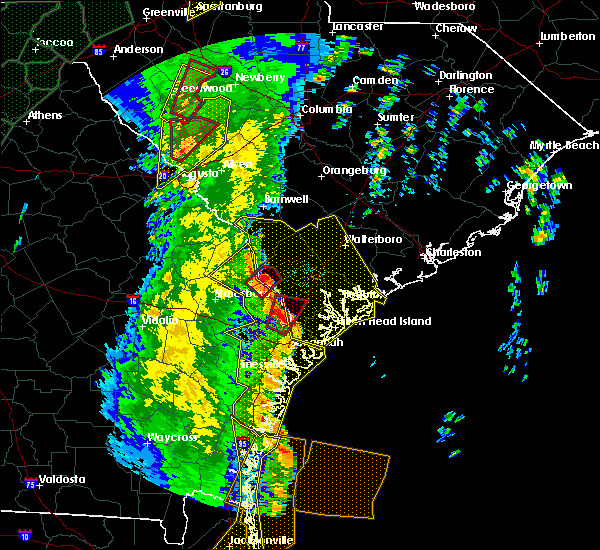 At 1252 pm edt, a severe thunderstorm capable of producing a tornado was located 10 miles north of pooler, moving northeast at 55 mph (radar indicated rotation). Hazards include tornado. Flying debris will be dangerous to those caught without shelter. mobile homes will be damaged or destroyed. damage to roofs, windows, and vehicles will occur. Tree damage is likely. At 1252 pm edt, a severe thunderstorm capable of producing a tornado was located 10 miles north of pooler, moving northeast at 55 mph (radar indicated rotation). Hazards include tornado. Flying debris will be dangerous to those caught without shelter. mobile homes will be damaged or destroyed. damage to roofs, windows, and vehicles will occur. Tree damage is likely.
|
| 4/19/2019 12:46 PM EDT | Savannah/hilton head international airport (ksav) measured a 66 mph wind gus in chatham county GA, 6.3 miles S of Savannah, GA |
| 4/19/2019 12:45 PM EDT | Tree on a home on ansford d in chatham county GA, 4.6 miles SSW of Savannah, GA |
| 4/19/2019 12:44 PM EDT | Roof collapse on large commercial warehouse on crossroads pkw in chatham county GA, 8.4 miles S of Savannah, GA |
| 4/19/2019 12:44 PM EDT | Trees on power lines on lynn d in chatham county GA, 4.6 miles SSW of Savannah, GA |
| 4/19/2019 12:43 PM EDT |
 At 1243 pm edt, severe thunderstorms were located along a line extending from 8 miles southwest of springfield to near richmond hill to near darien, moving northeast at 45 mph (radar indicated). Hazards include 60 mph wind gusts. Expect damage to trees and powerlines. locations impacted include, savannah, hinesville, pooler, richmond hill, sylvania, springfield, pembroke and darien. this warning includes, i-16 between mile markers 138 and 168. i-516 between mile markers 3 and 9. I-95 in georgia between mile markers 50 and 112. At 1243 pm edt, severe thunderstorms were located along a line extending from 8 miles southwest of springfield to near richmond hill to near darien, moving northeast at 45 mph (radar indicated). Hazards include 60 mph wind gusts. Expect damage to trees and powerlines. locations impacted include, savannah, hinesville, pooler, richmond hill, sylvania, springfield, pembroke and darien. this warning includes, i-16 between mile markers 138 and 168. i-516 between mile markers 3 and 9. I-95 in georgia between mile markers 50 and 112.
|
| 4/19/2019 12:42 PM EDT | A portable aircraft boarding ramp was blew over on its sid in chatham county GA, 6.3 miles S of Savannah, GA |
| 4/19/2019 12:42 PM EDT | Tree on a home on 13th street in garden cit in chatham county GA, 4.6 miles SSW of Savannah, GA |
| 4/19/2019 12:39 PM EDT | Tree down in road on dean forest and central av in chatham county GA, 2.2 miles S of Savannah, GA |
| 4/19/2019 12:39 PM EDT | Power lines down on village d in chatham county GA, 1.6 miles SSW of Savannah, GA |
| 4/19/2019 12:39 PM EDT | Tree and power line down on littleneck r in chatham county GA, 6.1 miles ESE of Savannah, GA |
| 4/19/2019 12:38 PM EDT | Power lines down on pine barren r in chatham county GA, 5.5 miles ESE of Savannah, GA |
| 4/19/2019 12:34 PM EDT | Trees down on cottonvale and salt landing r in chatham county GA, 1.4 miles NNE of Savannah, GA |
| 4/19/2019 12:27 PM EDT |
 At 1225 pm edt, severe thunderstorms were located along a line extending from near bay to 10 miles east of hinesville to near dock junction, moving northeast at 45 mph (radar indicated). Hazards include 60 mph wind gusts. Expect damage to trees and powerlines. locations impacted include, savannah, hinesville, statesboro, pooler, richmond hill, sylvania, springfield and pembroke. this warning includes, i-16 between mile markers 119 and 168. i-516 between mile markers 3 and 9. I-95 in georgia between mile markers 50 and 112. At 1225 pm edt, severe thunderstorms were located along a line extending from near bay to 10 miles east of hinesville to near dock junction, moving northeast at 45 mph (radar indicated). Hazards include 60 mph wind gusts. Expect damage to trees and powerlines. locations impacted include, savannah, hinesville, statesboro, pooler, richmond hill, sylvania, springfield and pembroke. this warning includes, i-16 between mile markers 119 and 168. i-516 between mile markers 3 and 9. I-95 in georgia between mile markers 50 and 112.
|
| 4/19/2019 12:09 PM EDT |
 At 1208 pm edt, severe thunderstorms were located along a line extending from 6 miles west of pembroke to near tibet to 12 miles east of nahunta, moving northeast at 45 mph (radar indicated). Hazards include 60 mph wind gusts. expect damage to trees and powerlines At 1208 pm edt, severe thunderstorms were located along a line extending from 6 miles west of pembroke to near tibet to 12 miles east of nahunta, moving northeast at 45 mph (radar indicated). Hazards include 60 mph wind gusts. expect damage to trees and powerlines
|
| 3/3/2019 7:04 PM EST |
 At 704 pm est, a severe thunderstorm was located 12 miles south of richmond hill, moving east at 45 mph (radar indicated). Hazards include 60 mph wind gusts and quarter size hail. Minor hail damage to vehicles is possible. Expect wind damage to trees and powerlines. At 704 pm est, a severe thunderstorm was located 12 miles south of richmond hill, moving east at 45 mph (radar indicated). Hazards include 60 mph wind gusts and quarter size hail. Minor hail damage to vehicles is possible. Expect wind damage to trees and powerlines.
|
| 10/10/2018 10:50 PM EDT |
 At 1049 pm edt, a severe thunderstorm capable of producing a tornado was located over fort pulaski national monument, moving north at 45 mph (radar indicated rotation). Hazards include tornado. Flying debris will be dangerous to those caught without shelter. mobile homes will be damaged or destroyed. damage to roofs, windows, and vehicles will occur. Tree damage is likely. At 1049 pm edt, a severe thunderstorm capable of producing a tornado was located over fort pulaski national monument, moving north at 45 mph (radar indicated rotation). Hazards include tornado. Flying debris will be dangerous to those caught without shelter. mobile homes will be damaged or destroyed. damage to roofs, windows, and vehicles will occur. Tree damage is likely.
|
| 8/14/2018 6:45 PM EDT |
 At 645 pm edt, severe thunderstorms were located along a line extending from near pooler to 6 miles northwest of savannah, moving west at 10 mph (radar indicated). Hazards include 60 mph wind gusts. Expect damage to trees and powerlines. locations impacted include, savannah, pooler, garden city, port wentworth, bloomingdale, savannah airport, meinhard and monteith. this warning includes, i-16 between mile markers 159 and 165. i-516 between mile markers 5 and 9. I-95 in georgia between mile markers 101 and 111. At 645 pm edt, severe thunderstorms were located along a line extending from near pooler to 6 miles northwest of savannah, moving west at 10 mph (radar indicated). Hazards include 60 mph wind gusts. Expect damage to trees and powerlines. locations impacted include, savannah, pooler, garden city, port wentworth, bloomingdale, savannah airport, meinhard and monteith. this warning includes, i-16 between mile markers 159 and 165. i-516 between mile markers 5 and 9. I-95 in georgia between mile markers 101 and 111.
|
| 8/14/2018 6:35 PM EDT |
 At 635 pm edt, severe thunderstorms were located along a line extending from near pooler to near savannah, moving west at 5 mph (radar indicated). Hazards include 60 mph wind gusts and penny size hail. Expect damage to trees and powerlines. locations impacted include, savannah, pooler, i-16/i-95 interchange, garden city, port wentworth, bloomingdale, savannah airport and meinhard. this warning includes, i-16 between mile markers 153 and 168. i-516 between mile markers 3 and 9. I-95 in georgia between mile markers 99 and 111. At 635 pm edt, severe thunderstorms were located along a line extending from near pooler to near savannah, moving west at 5 mph (radar indicated). Hazards include 60 mph wind gusts and penny size hail. Expect damage to trees and powerlines. locations impacted include, savannah, pooler, i-16/i-95 interchange, garden city, port wentworth, bloomingdale, savannah airport and meinhard. this warning includes, i-16 between mile markers 153 and 168. i-516 between mile markers 3 and 9. I-95 in georgia between mile markers 99 and 111.
|
| 8/14/2018 6:26 PM EDT |
 At 602 pm edt, severe thunderstorms were located along a line extending from near pooler to near bellinger hill area, moving west at 10 mph (radar indicated). Hazards include 60 mph wind gusts and penny size hail. expect damage to trees and powerlines At 602 pm edt, severe thunderstorms were located along a line extending from near pooler to near bellinger hill area, moving west at 10 mph (radar indicated). Hazards include 60 mph wind gusts and penny size hail. expect damage to trees and powerlines
|
| 8/14/2018 6:26 PM EDT |
 At 626 pm edt, severe thunderstorms were located along a line extending from near pooler to near savannah, moving west at 5 mph (radar indicated). Hazards include 60 mph wind gusts and penny size hail. Expect damage to trees and powerlines. locations impacted include, savannah, pooler, i-16/i-95 interchange, garden city, port wentworth, bloomingdale, savannah airport and meinhard. this warning includes, i-16 between mile markers 153 and 168. i-516 between mile markers 3 and 9. I-95 in georgia between mile markers 99 and 112. At 626 pm edt, severe thunderstorms were located along a line extending from near pooler to near savannah, moving west at 5 mph (radar indicated). Hazards include 60 mph wind gusts and penny size hail. Expect damage to trees and powerlines. locations impacted include, savannah, pooler, i-16/i-95 interchange, garden city, port wentworth, bloomingdale, savannah airport and meinhard. this warning includes, i-16 between mile markers 153 and 168. i-516 between mile markers 3 and 9. I-95 in georgia between mile markers 99 and 112.
|
| 8/14/2018 6:02 PM EDT |
 At 602 pm edt, severe thunderstorms were located along a line extending from near pooler to near bellinger hill area, moving west at 10 mph (radar indicated). Hazards include 60 mph wind gusts and penny size hail. expect damage to trees and powerlines At 602 pm edt, severe thunderstorms were located along a line extending from near pooler to near bellinger hill area, moving west at 10 mph (radar indicated). Hazards include 60 mph wind gusts and penny size hail. expect damage to trees and powerlines
|
| 8/14/2018 5:19 PM EDT |
 At 519 pm edt, severe thunderstorms were located along a line extending from 9 miles southwest of richmond hill to 20 miles south of savannah, and are nearly stationary (radar indicated). Hazards include 60 mph wind gusts and penny size hail. Expect damage to trees and powerlines. locations impacted include, richmond hill, keller and belfast. This warning includes i-95 in georgia between mile markers 82 and 88. At 519 pm edt, severe thunderstorms were located along a line extending from 9 miles southwest of richmond hill to 20 miles south of savannah, and are nearly stationary (radar indicated). Hazards include 60 mph wind gusts and penny size hail. Expect damage to trees and powerlines. locations impacted include, richmond hill, keller and belfast. This warning includes i-95 in georgia between mile markers 82 and 88.
|
| 8/14/2018 4:59 PM EDT |
 At 459 pm edt, severe thunderstorms were located along a line extending from 8 miles south of richmond hill to 20 miles southwest of wilmington island, moving northeast at 10 mph (radar indicated). Hazards include 60 mph wind gusts and penny size hail. expect damage to trees and powerlines At 459 pm edt, severe thunderstorms were located along a line extending from 8 miles south of richmond hill to 20 miles southwest of wilmington island, moving northeast at 10 mph (radar indicated). Hazards include 60 mph wind gusts and penny size hail. expect damage to trees and powerlines
|
| 7/28/2018 4:59 PM EDT |
 At 459 pm edt, severe thunderstorms were located along a line extending from near savannah to near richmond hill, and are nearly stationary (radar indicated). Hazards include 60 mph wind gusts. Expect damage to trees and powerlines. locations impacted include, savannah, wilmington island, montgomery, garden city, thunderbolt, vernonburg, sandfly and savannah historic district. this warning includes, i-16 between mile markers 166 and 168. i-516 between mile markers 3 and 5. I-95 in georgia between mile markers 96 and 97. At 459 pm edt, severe thunderstorms were located along a line extending from near savannah to near richmond hill, and are nearly stationary (radar indicated). Hazards include 60 mph wind gusts. Expect damage to trees and powerlines. locations impacted include, savannah, wilmington island, montgomery, garden city, thunderbolt, vernonburg, sandfly and savannah historic district. this warning includes, i-16 between mile markers 166 and 168. i-516 between mile markers 3 and 5. I-95 in georgia between mile markers 96 and 97.
|
| 7/28/2018 4:47 PM EDT |
 At 446 pm edt, severe thunderstorms were located along a line extending from near savannah to near richmond hill, moving little (radar indicated). Hazards include 60 mph wind gusts. Expect damage to trees and powerlines. locations impacted include, savannah, wilmington island, montgomery, garden city, thunderbolt, vernonburg, sandfly and savannah historic district. this warning includes, i-16 between mile markers 166 and 168. i-516 between mile markers 3 and 5. I-95 in georgia between mile markers 96 and 97. At 446 pm edt, severe thunderstorms were located along a line extending from near savannah to near richmond hill, moving little (radar indicated). Hazards include 60 mph wind gusts. Expect damage to trees and powerlines. locations impacted include, savannah, wilmington island, montgomery, garden city, thunderbolt, vernonburg, sandfly and savannah historic district. this warning includes, i-16 between mile markers 166 and 168. i-516 between mile markers 3 and 5. I-95 in georgia between mile markers 96 and 97.
|
| 7/28/2018 4:28 PM EDT |
 At 428 pm edt, severe thunderstorms were located along a line extending from near savannah to 6 miles east of richmond hill, moving west at 5 mph (radar indicated). Hazards include 60 mph wind gusts and penny size hail. expect damage to trees and powerlines At 428 pm edt, severe thunderstorms were located along a line extending from near savannah to 6 miles east of richmond hill, moving west at 5 mph (radar indicated). Hazards include 60 mph wind gusts and penny size hail. expect damage to trees and powerlines
|
| 7/6/2018 2:38 PM EDT | At the intersection of east 36th street and atlantic avenue a tree fell in the street and damaged a car. power lines were also taken dow in chatham county GA, 6.5 miles W of Savannah, GA |
| 6/27/2018 5:05 PM EDT |
 At 505 pm edt, a severe thunderstorm was located 14 miles southeast of richmond hill, moving south at 10 mph (radar indicated). Hazards include 60 mph wind gusts and quarter size hail. Minor hail damage to vehicles is possible. expect wind damage to trees and powerlines. locations impacted include, richmond hill, riceboro, belfast, halfmoon landing, st. catherines island, keller and sunbury. This warning includes i-95 in georgia between mile markers 73 and 92. At 505 pm edt, a severe thunderstorm was located 14 miles southeast of richmond hill, moving south at 10 mph (radar indicated). Hazards include 60 mph wind gusts and quarter size hail. Minor hail damage to vehicles is possible. expect wind damage to trees and powerlines. locations impacted include, richmond hill, riceboro, belfast, halfmoon landing, st. catherines island, keller and sunbury. This warning includes i-95 in georgia between mile markers 73 and 92.
|
| 6/27/2018 4:42 PM EDT |
 At 442 pm edt, a severe thunderstorm was located 8 miles southeast of richmond hill, moving northeast at 5 mph (radar indicated). Hazards include 60 mph wind gusts and nickel size hail. expect damage to trees and powerlines At 442 pm edt, a severe thunderstorm was located 8 miles southeast of richmond hill, moving northeast at 5 mph (radar indicated). Hazards include 60 mph wind gusts and nickel size hail. expect damage to trees and powerlines
|
| 6/27/2018 4:32 PM EDT | Savannah fire dept reported a tree on a home on linwood rd... a tree down at largo dr near tibet ave... and tree branches and power lines down nearb in chatham county GA, 4.8 miles NW of Savannah, GA |
| 6/25/2018 5:21 PM EDT |
 At 520 pm edt, a severe thunderstorm was located 7 miles west of bellinger hill area, moving northeast at 10 mph (radar indicated). Hazards include 60 mph wind gusts and penny size hail. Expect damage to trees and powerlines. locations impacted include, savannah, pooler, i-16/i-95 interchange, bellinger hill area, rincon, garden city, port wentworth and hardeeville. this warning includes, i-16 between mile markers 159 and 168. i-516 between mile markers 3 and 9. i-95 in south carolina between mile markers 2 and 15. I-95 in georgia between mile markers 101 and 112. At 520 pm edt, a severe thunderstorm was located 7 miles west of bellinger hill area, moving northeast at 10 mph (radar indicated). Hazards include 60 mph wind gusts and penny size hail. Expect damage to trees and powerlines. locations impacted include, savannah, pooler, i-16/i-95 interchange, bellinger hill area, rincon, garden city, port wentworth and hardeeville. this warning includes, i-16 between mile markers 159 and 168. i-516 between mile markers 3 and 9. i-95 in south carolina between mile markers 2 and 15. I-95 in georgia between mile markers 101 and 112.
|
| 6/25/2018 4:55 PM EDT |
 At 455 pm edt, a severe thunderstorm was located near pooler, moving northeast at 15 mph (radar indicated). Hazards include 60 mph wind gusts and penny size hail. expect damage to trees and powerlines At 455 pm edt, a severe thunderstorm was located near pooler, moving northeast at 15 mph (radar indicated). Hazards include 60 mph wind gusts and penny size hail. expect damage to trees and powerlines
|
| 6/25/2018 12:48 AM EDT |
 At 1248 am edt, severe thunderstorms were located along a line extending from 13 miles north of edisto beach to 6 miles north of bluffton to 9 miles east of bay, moving southeast at 35 mph (radar indicated). Hazards include 60 mph wind gusts. Expect damage to trees and powerlines. locations impacted include, bluffton, beaufort, port royal, ridgeland, springfield, yemassee, clarendon and jasper. this warning includes, i-95 in south carolina between mile markers 2 and 38. I-95 in georgia between mile markers 109 and 112. At 1248 am edt, severe thunderstorms were located along a line extending from 13 miles north of edisto beach to 6 miles north of bluffton to 9 miles east of bay, moving southeast at 35 mph (radar indicated). Hazards include 60 mph wind gusts. Expect damage to trees and powerlines. locations impacted include, bluffton, beaufort, port royal, ridgeland, springfield, yemassee, clarendon and jasper. this warning includes, i-95 in south carolina between mile markers 2 and 38. I-95 in georgia between mile markers 109 and 112.
|
| 6/25/2018 12:29 AM EDT |
 At 1229 am edt, severe thunderstorms were located along a line extending from 14 miles southeast of walterboro to near ridgeland to 9 miles north of bay, moving southeast at 40 mph (radar indicated). Hazards include 60 mph wind gusts. Expect damage to trees and powerlines. locations impacted include, bluffton, beaufort, port royal, walterboro, ridgeland, springfield, yemassee and clarendon. this warning includes, i-95 in south carolina between mile markers 2 and 64. I-95 in georgia between mile markers 109 and 112. At 1229 am edt, severe thunderstorms were located along a line extending from 14 miles southeast of walterboro to near ridgeland to 9 miles north of bay, moving southeast at 40 mph (radar indicated). Hazards include 60 mph wind gusts. Expect damage to trees and powerlines. locations impacted include, bluffton, beaufort, port royal, walterboro, ridgeland, springfield, yemassee and clarendon. this warning includes, i-95 in south carolina between mile markers 2 and 64. I-95 in georgia between mile markers 109 and 112.
|
| 6/24/2018 11:58 PM EDT |
 At 1158 pm edt, severe thunderstorms were located along a line extending from near walterboro to 16 miles south of lake warren state park to middleground, moving southeast at 35 mph (radar indicated). Hazards include 60 mph wind gusts. expect damage to trees and powerlines At 1158 pm edt, severe thunderstorms were located along a line extending from near walterboro to 16 miles south of lake warren state park to middleground, moving southeast at 35 mph (radar indicated). Hazards include 60 mph wind gusts. expect damage to trees and powerlines
|
| 6/14/2018 3:22 PM EDT |
 At 322 pm edt, severe thunderstorms were located along a line extending from near wilmington island to 7 miles south of savannah, moving southwest at 10 mph (radar indicated). Hazards include 60 mph wind gusts. Expect damage to trees and powerlines. Locations impacted include, savannah, wilmington island, montgomery, vernonburg, skidaway island, windsor forest, isle of hope and wassaw island. At 322 pm edt, severe thunderstorms were located along a line extending from near wilmington island to 7 miles south of savannah, moving southwest at 10 mph (radar indicated). Hazards include 60 mph wind gusts. Expect damage to trees and powerlines. Locations impacted include, savannah, wilmington island, montgomery, vernonburg, skidaway island, windsor forest, isle of hope and wassaw island.
|
| 6/14/2018 3:10 PM EDT |
 At 310 pm edt, severe thunderstorms were located along a line extending from near wilmington island to 8 miles south of savannah, moving south at 10 mph (radar indicated). Hazards include 60 mph wind gusts and penny size hail. Expect damage to trees and powerlines. Locations impacted include, savannah, wilmington island, montgomery, vernonburg, skidaway island, sandfly, windsor forest and isle of hope. At 310 pm edt, severe thunderstorms were located along a line extending from near wilmington island to 8 miles south of savannah, moving south at 10 mph (radar indicated). Hazards include 60 mph wind gusts and penny size hail. Expect damage to trees and powerlines. Locations impacted include, savannah, wilmington island, montgomery, vernonburg, skidaway island, sandfly, windsor forest and isle of hope.
|
| 6/14/2018 2:45 PM EDT |
 At 244 pm edt, severe thunderstorms were located along a line extending from near fort pulaski national monument to near savannah, moving south at 10 mph (radar indicated). Hazards include 60 mph wind gusts and penny size hail. expect damage to trees and powerlines At 244 pm edt, severe thunderstorms were located along a line extending from near fort pulaski national monument to near savannah, moving south at 10 mph (radar indicated). Hazards include 60 mph wind gusts and penny size hail. expect damage to trees and powerlines
|
| 6/2/2018 4:46 PM EDT | Chatham ema reports a tree down on a vehicle on moss driv in chatham county GA, 14.2 miles W of Savannah, GA |
| 6/2/2018 4:05 PM EDT | Chatham county ema reported a large gadot highway sign down on i-16 near i-516 interchang in chatham county GA, 4.6 miles WSW of Savannah, GA |
| 4/15/2018 3:08 PM EDT |
 The severe thunderstorm warning for bryan, liberty, mcintosh and long counties will expire at 315 pm edt, the storm which prompted the warning has weakened below severe limits, and no longer pose an immediate threat to life or property. therefore the warning will be allowed to expire. however gusty winds between 40 and 50 mph are still possible with this thunderstorm. The severe thunderstorm warning for bryan, liberty, mcintosh and long counties will expire at 315 pm edt, the storm which prompted the warning has weakened below severe limits, and no longer pose an immediate threat to life or property. therefore the warning will be allowed to expire. however gusty winds between 40 and 50 mph are still possible with this thunderstorm.
|
| 4/15/2018 2:46 PM EDT |
 At 245 pm edt, a severe thunderstorm was located 8 miles northeast of tibet, moving northeast at 50 mph (radar indicated). Hazards include 60 mph wind gusts. Expect damage to trees and powerlines. locations impacted include, hinesville, richmond hill, tibet, fort stewart, jones, mcintosh, walthourville and riceboro. This warning includes i-95 in georgia between mile markers 63 and 92. At 245 pm edt, a severe thunderstorm was located 8 miles northeast of tibet, moving northeast at 50 mph (radar indicated). Hazards include 60 mph wind gusts. Expect damage to trees and powerlines. locations impacted include, hinesville, richmond hill, tibet, fort stewart, jones, mcintosh, walthourville and riceboro. This warning includes i-95 in georgia between mile markers 63 and 92.
|
| 4/15/2018 2:26 PM EDT |
 At 226 pm edt, a severe thunderstorm was located 7 miles east of gardi, moving northeast at 50 mph (radar indicated). Hazards include 60 mph wind gusts and nickel size hail. expect damage to trees and powerlines At 226 pm edt, a severe thunderstorm was located 7 miles east of gardi, moving northeast at 50 mph (radar indicated). Hazards include 60 mph wind gusts and nickel size hail. expect damage to trees and powerlines
|
| 3/20/2018 2:28 PM EDT |
 At 228 pm edt, a severe thunderstorm was located over savannah, moving northeast at 55 mph (radar indicated). Hazards include 60 mph wind gusts and quarter size hail. Minor hail damage to vehicles is possible. Expect wind damage to trees and powerlines. At 228 pm edt, a severe thunderstorm was located over savannah, moving northeast at 55 mph (radar indicated). Hazards include 60 mph wind gusts and quarter size hail. Minor hail damage to vehicles is possible. Expect wind damage to trees and powerlines.
|
| 8/23/2017 6:51 PM EDT |
 At 651 pm edt, a severe thunderstorm was located near i-16/i-95 interchange, moving east at 10 mph (radar indicated). Hazards include 60 mph wind gusts. Expect damage to trees and powerlines. locations impacted include, pooler and bloomingdale. This warning includes i-16 between mile markers 151 and 156. At 651 pm edt, a severe thunderstorm was located near i-16/i-95 interchange, moving east at 10 mph (radar indicated). Hazards include 60 mph wind gusts. Expect damage to trees and powerlines. locations impacted include, pooler and bloomingdale. This warning includes i-16 between mile markers 151 and 156.
|
| 8/23/2017 6:19 PM EDT |
 At 619 pm edt, a severe thunderstorm was located near pooler, moving east at 5 mph (radar indicated). Hazards include 60 mph wind gusts and nickel size hail. expect damage to trees and powerlines At 619 pm edt, a severe thunderstorm was located near pooler, moving east at 5 mph (radar indicated). Hazards include 60 mph wind gusts and nickel size hail. expect damage to trees and powerlines
|
| 8/23/2017 6:19 PM EDT |
 At 651 pm edt, a severe thunderstorm was located near i-16/i-95 interchange, moving east at 10 mph (radar indicated). Hazards include 60 mph wind gusts. Expect damage to trees and powerlines. locations impacted include, pooler and bloomingdale. This warning includes i-16 between mile markers 151 and 156. At 651 pm edt, a severe thunderstorm was located near i-16/i-95 interchange, moving east at 10 mph (radar indicated). Hazards include 60 mph wind gusts. Expect damage to trees and powerlines. locations impacted include, pooler and bloomingdale. This warning includes i-16 between mile markers 151 and 156.
|
| 7/20/2017 3:47 PM EDT |
 At 347 pm edt, a severe thunderstorm was located 10 miles southeast of springfield, moving west at 10 mph (radar indicated). Hazards include 60 mph wind gusts and quarter size hail. Hail damage to vehicles is expected. expect wind damage to roofs, siding, and trees. Locations impacted include, savannah, pooler, rincon, garden city, port wentworth, hardeeville, savannah airport and ebenezer. At 347 pm edt, a severe thunderstorm was located 10 miles southeast of springfield, moving west at 10 mph (radar indicated). Hazards include 60 mph wind gusts and quarter size hail. Hail damage to vehicles is expected. expect wind damage to roofs, siding, and trees. Locations impacted include, savannah, pooler, rincon, garden city, port wentworth, hardeeville, savannah airport and ebenezer.
|
| 7/20/2017 3:33 PM EDT |
 At 333 pm edt, a severe thunderstorm was located 10 miles northwest of bellinger hill area, and is nearly stationary (radar indicated). Hazards include 60 mph wind gusts and quarter size hail. Hail damage to vehicles is expected. Expect wind damage to roofs, siding, and trees. At 333 pm edt, a severe thunderstorm was located 10 miles northwest of bellinger hill area, and is nearly stationary (radar indicated). Hazards include 60 mph wind gusts and quarter size hail. Hail damage to vehicles is expected. Expect wind damage to roofs, siding, and trees.
|
| 7/19/2017 8:29 PM EDT |
 At 828 pm edt, a severe thunderstorm was located 9 miles west of pooler, moving southwest at 15 mph (radar indicated). Hazards include 60 mph wind gusts and half dollar size hail. Minor hail damage to vehicles is possible. Expect wind damage to trees and powerlines. At 828 pm edt, a severe thunderstorm was located 9 miles west of pooler, moving southwest at 15 mph (radar indicated). Hazards include 60 mph wind gusts and half dollar size hail. Minor hail damage to vehicles is possible. Expect wind damage to trees and powerlines.
|
| 7/8/2017 9:24 PM EDT |
 At 923 pm edt, a severe thunderstorm was located over savannah, moving northeast at 30 mph (radar indicated). Hazards include 60 mph wind gusts and penny size hail. Expect damage to trees and powerlines. locations impacted include, savannah, pooler, richmond hill, wilmington island, i-16/i-95 interchange, fort pulaski national monument, bellinger hill area and montgomery. this warning includes, i-16 between mile markers 157 and 168. i-516 between mile markers 3 and 9. I-95 in georgia between mile markers 93 and 103. At 923 pm edt, a severe thunderstorm was located over savannah, moving northeast at 30 mph (radar indicated). Hazards include 60 mph wind gusts and penny size hail. Expect damage to trees and powerlines. locations impacted include, savannah, pooler, richmond hill, wilmington island, i-16/i-95 interchange, fort pulaski national monument, bellinger hill area and montgomery. this warning includes, i-16 between mile markers 157 and 168. i-516 between mile markers 3 and 9. I-95 in georgia between mile markers 93 and 103.
|
| 7/8/2017 9:03 PM EDT |
 At 903 pm edt, a severe thunderstorm was located near richmond hill, moving northeast at 25 mph (radar indicated). Hazards include 60 mph wind gusts and penny size hail. Expect damage to trees and powerlines. locations impacted include, savannah, pooler, richmond hill, wilmington island, i-16/i-95 interchange, fort pulaski national monument, bellinger hill area and montgomery. this warning includes, i-16 between mile markers 157 and 168. i-516 between mile markers 3 and 9. I-95 in georgia between mile markers 84 and 104. At 903 pm edt, a severe thunderstorm was located near richmond hill, moving northeast at 25 mph (radar indicated). Hazards include 60 mph wind gusts and penny size hail. Expect damage to trees and powerlines. locations impacted include, savannah, pooler, richmond hill, wilmington island, i-16/i-95 interchange, fort pulaski national monument, bellinger hill area and montgomery. this warning includes, i-16 between mile markers 157 and 168. i-516 between mile markers 3 and 9. I-95 in georgia between mile markers 84 and 104.
|
| 7/8/2017 8:47 PM EDT |
 At 847 pm edt, a severe thunderstorm was located near richmond hill, moving northeast at 25 mph (radar indicated). Hazards include 60 mph wind gusts and quarter size hail. Minor hail damage to vehicles is possible. Expect wind damage to trees and powerlines. At 847 pm edt, a severe thunderstorm was located near richmond hill, moving northeast at 25 mph (radar indicated). Hazards include 60 mph wind gusts and quarter size hail. Minor hail damage to vehicles is possible. Expect wind damage to trees and powerlines.
|
| 7/5/2017 9:46 PM EDT |
 At 945 pm edt, a severe thunderstorm was located over savannah, moving east at 30 mph. this storm has produced wind gusts in excess of 60 mph, as measured at the savannah international airport (radar indicated). Hazards include 60 mph wind gusts and quarter size hail. Minor hail damage to vehicles is possible. expect wind damage to trees and powerlines. locations impacted include, savannah, pooler, bluffton, wilmington island, i-16/i-95 interchange, fort pulaski national monument, bellinger hill area and montgomery. this warning includes, i-16 between mile markers 156 and 168. i-516 between mile markers 3 and 9. I-95 in georgia between mile markers 96 and 109. At 945 pm edt, a severe thunderstorm was located over savannah, moving east at 30 mph. this storm has produced wind gusts in excess of 60 mph, as measured at the savannah international airport (radar indicated). Hazards include 60 mph wind gusts and quarter size hail. Minor hail damage to vehicles is possible. expect wind damage to trees and powerlines. locations impacted include, savannah, pooler, bluffton, wilmington island, i-16/i-95 interchange, fort pulaski national monument, bellinger hill area and montgomery. this warning includes, i-16 between mile markers 156 and 168. i-516 between mile markers 3 and 9. I-95 in georgia between mile markers 96 and 109.
|
| 7/5/2017 9:32 PM EDT | Storm damage reported in chatham county GA, 6.3 miles S of Savannah, GA |
| 7/5/2017 9:30 PM EDT |
 At 930 pm edt, a severe thunderstorm was located over i-16/i-95 interchange, moving east at 30 mph (radar indicated). Hazards include 60 mph wind gusts and quarter size hail. Minor hail damage to vehicles is possible. Expect wind damage to trees and powerlines. At 930 pm edt, a severe thunderstorm was located over i-16/i-95 interchange, moving east at 30 mph (radar indicated). Hazards include 60 mph wind gusts and quarter size hail. Minor hail damage to vehicles is possible. Expect wind damage to trees and powerlines.
|
| 7/2/2017 4:55 PM EDT | Tree reported down near the 300-block of e liberty street in savanna in chatham county GA, 6.8 miles WSW of Savannah, GA |
| 7/2/2017 4:49 PM EDT |
 At 448 pm edt, a severe thunderstorm was located over pooler, moving northeast at 20 mph (radar indicated). Hazards include 60 mph wind gusts and quarter size hail. Minor hail damage to vehicles is possible. expect wind damage to trees and powerlines. locations impacted include, savannah, pooler, richmond hill, i-16/i-95 interchange, garden city, port wentworth, bloomingdale and vernonburg. this warning includes, i-16 between mile markers 152 and 168. i-516 between mile markers 3 and 9. I-95 in georgia between mile markers 92 and 112. At 448 pm edt, a severe thunderstorm was located over pooler, moving northeast at 20 mph (radar indicated). Hazards include 60 mph wind gusts and quarter size hail. Minor hail damage to vehicles is possible. expect wind damage to trees and powerlines. locations impacted include, savannah, pooler, richmond hill, i-16/i-95 interchange, garden city, port wentworth, bloomingdale and vernonburg. this warning includes, i-16 between mile markers 152 and 168. i-516 between mile markers 3 and 9. I-95 in georgia between mile markers 92 and 112.
|
| 7/2/2017 4:29 PM EDT |
 At 409 pm edt, a severe thunderstorm was located near tibet, moving northeast at 35 mph (radar indicated). Hazards include 60 mph wind gusts and quarter size hail. Minor hail damage to vehicles is possible. Expect wind damage to trees and powerlines. At 409 pm edt, a severe thunderstorm was located near tibet, moving northeast at 35 mph (radar indicated). Hazards include 60 mph wind gusts and quarter size hail. Minor hail damage to vehicles is possible. Expect wind damage to trees and powerlines.
|
| 7/2/2017 4:09 PM EDT |
 At 409 pm edt, a severe thunderstorm was located near tibet, moving northeast at 35 mph (radar indicated). Hazards include 60 mph wind gusts and quarter size hail. Minor hail damage to vehicles is possible. Expect wind damage to trees and powerlines. At 409 pm edt, a severe thunderstorm was located near tibet, moving northeast at 35 mph (radar indicated). Hazards include 60 mph wind gusts and quarter size hail. Minor hail damage to vehicles is possible. Expect wind damage to trees and powerlines.
|
| 5/31/2017 3:28 PM EDT |
 The severe thunderstorm warning for bryan, liberty and chatham counties will expire at 330 pm edt, the storms which prompted the warning have weakened below severe limits, and no longer pose an immediate threat to life or property. therefore the warning will be allowed to expire. however gusty winds and heavy rain are still possible with these thunderstorms. The severe thunderstorm warning for bryan, liberty and chatham counties will expire at 330 pm edt, the storms which prompted the warning have weakened below severe limits, and no longer pose an immediate threat to life or property. therefore the warning will be allowed to expire. however gusty winds and heavy rain are still possible with these thunderstorms.
|
| 5/31/2017 3:18 PM EDT |
 At 317 pm edt, severe thunderstorms were located along a line extending from near richmond hill to 11 miles south of savannah, moving east at 15 mph (radar indicated. at 245 pm quarter sized hail was reported near richmond hill). Hazards include 60 mph wind gusts and quarter size hail. Minor hail damage to vehicles is possible. expect wind damage to trees and powerlines. locations impacted include, savannah, pooler, richmond hill, wilmington island, montgomery, garden city, tybee island and thunderbolt. this warning includes, i-16 between mile markers 160 and 168. i-516 between mile markers 3 and 8. I-95 in georgia between mile markers 84 and 99. At 317 pm edt, severe thunderstorms were located along a line extending from near richmond hill to 11 miles south of savannah, moving east at 15 mph (radar indicated. at 245 pm quarter sized hail was reported near richmond hill). Hazards include 60 mph wind gusts and quarter size hail. Minor hail damage to vehicles is possible. expect wind damage to trees and powerlines. locations impacted include, savannah, pooler, richmond hill, wilmington island, montgomery, garden city, tybee island and thunderbolt. this warning includes, i-16 between mile markers 160 and 168. i-516 between mile markers 3 and 8. I-95 in georgia between mile markers 84 and 99.
|
| 5/31/2017 3:08 PM EDT |
 At 307 pm edt, severe thunderstorms were located along a line extending from 6 miles west of richmond hill to 9 miles southwest of savannah, moving east at 15 mph (radar indicated dime and nickel sized hail at richmond hill with these storms). Hazards include 60 mph wind gusts and quarter size hail. Minor hail damage to vehicles is possible. expect wind damage to trees and powerlines. locations impacted include, savannah, pooler, richmond hill, wilmington island, montgomery, garden city, tybee island, fort mcallister and thunderbolt. this warning includes, i-16 between mile markers 159 and 168. i-516 between mile markers 3 and 7. I-95 in georgia between mile markers 84 and 99. At 307 pm edt, severe thunderstorms were located along a line extending from 6 miles west of richmond hill to 9 miles southwest of savannah, moving east at 15 mph (radar indicated dime and nickel sized hail at richmond hill with these storms). Hazards include 60 mph wind gusts and quarter size hail. Minor hail damage to vehicles is possible. expect wind damage to trees and powerlines. locations impacted include, savannah, pooler, richmond hill, wilmington island, montgomery, garden city, tybee island, fort mcallister and thunderbolt. this warning includes, i-16 between mile markers 159 and 168. i-516 between mile markers 3 and 7. I-95 in georgia between mile markers 84 and 99.
|
| 5/31/2017 2:57 PM EDT |
 At 256 pm edt, severe thunderstorms were located along a line extending from 10 miles east of fort stewart to 6 miles east of richmond hill, moving east at 15 mph (radar indicated). Hazards include 60 mph wind gusts and quarter size hail. Minor hail damage to vehicles is possible. expect wind damage to trees and powerlines. locations impacted include, savannah, pooler, richmond hill, wilmington island, montgomery, garden city, fort mcallister, tybee island and thunderbolt. this warning includes, i-16 between mile markers 159 and 168. i-516 between mile markers 3 and 7. I-95 in georgia between mile markers 84 and 99. At 256 pm edt, severe thunderstorms were located along a line extending from 10 miles east of fort stewart to 6 miles east of richmond hill, moving east at 15 mph (radar indicated). Hazards include 60 mph wind gusts and quarter size hail. Minor hail damage to vehicles is possible. expect wind damage to trees and powerlines. locations impacted include, savannah, pooler, richmond hill, wilmington island, montgomery, garden city, fort mcallister, tybee island and thunderbolt. this warning includes, i-16 between mile markers 159 and 168. i-516 between mile markers 3 and 7. I-95 in georgia between mile markers 84 and 99.
|
| 5/31/2017 2:36 PM EDT |
 At 235 pm edt, severe thunderstorms were located along a line extending from 6 miles northeast of fort stewart to richmond hill, moving east at 15 mph (radar indicated). Hazards include 60 mph wind gusts and half dollar size hail. Minor hail damage to vehicles is possible. Expect wind damage to trees and powerlines. At 235 pm edt, severe thunderstorms were located along a line extending from 6 miles northeast of fort stewart to richmond hill, moving east at 15 mph (radar indicated). Hazards include 60 mph wind gusts and half dollar size hail. Minor hail damage to vehicles is possible. Expect wind damage to trees and powerlines.
|
| 5/30/2017 6:21 PM EDT |
 At 621 pm edt, a severe thunderstorm was located 16 miles south of richmond hill, moving northeast at 20 mph (radar indicated). Hazards include 60 mph wind gusts and nickel size hail. Expect damage to trees and powerlines. locations impacted include, richmond hill, riceboro, belfast, halfmoon landing, retreat, keller and sunbury. This warning includes i-95 in georgia between mile markers 70 and 88. At 621 pm edt, a severe thunderstorm was located 16 miles south of richmond hill, moving northeast at 20 mph (radar indicated). Hazards include 60 mph wind gusts and nickel size hail. Expect damage to trees and powerlines. locations impacted include, richmond hill, riceboro, belfast, halfmoon landing, retreat, keller and sunbury. This warning includes i-95 in georgia between mile markers 70 and 88.
|
| 5/30/2017 6:05 PM EDT |
 At 605 pm edt, a severe thunderstorm was located 14 miles east of tibet, moving northeast at 25 mph (radar indicated). Hazards include 60 mph wind gusts and half dollar size hail. Minor hail damage to vehicles is possible. Expect wind damage to trees and powerlines. At 605 pm edt, a severe thunderstorm was located 14 miles east of tibet, moving northeast at 25 mph (radar indicated). Hazards include 60 mph wind gusts and half dollar size hail. Minor hail damage to vehicles is possible. Expect wind damage to trees and powerlines.
|
| 5/23/2017 9:38 PM EDT |
 The severe thunderstorm warning for bryan and chatham counties will expire at 945 pm edt, the storm which prompted the warning has moved out of the area as strong rotation on radar has moved offshore. therefore the warning will be allowed to expire. however heavy rain is still possible with this thunderstorm. The severe thunderstorm warning for bryan and chatham counties will expire at 945 pm edt, the storm which prompted the warning has moved out of the area as strong rotation on radar has moved offshore. therefore the warning will be allowed to expire. however heavy rain is still possible with this thunderstorm.
|
| 5/23/2017 9:23 PM EDT |
 At 922 pm edt, a severe thunderstorm capable of producing a tornado was located 8 miles south of wilmington island, moving east at 50 mph (radar indicated rotation). Hazards include tornado. Flying debris will be dangerous to those caught without shelter. mobile homes will be damaged or destroyed. damage to roofs, windows, and vehicles will occur. tree damage is likely. Locations impacted include, fort pulaski national monument, wilmington island, montgomery, tybee island, ossabaw sound, skidaway island and wassaw island. At 922 pm edt, a severe thunderstorm capable of producing a tornado was located 8 miles south of wilmington island, moving east at 50 mph (radar indicated rotation). Hazards include tornado. Flying debris will be dangerous to those caught without shelter. mobile homes will be damaged or destroyed. damage to roofs, windows, and vehicles will occur. tree damage is likely. Locations impacted include, fort pulaski national monument, wilmington island, montgomery, tybee island, ossabaw sound, skidaway island and wassaw island.
|
| 5/23/2017 9:07 PM EDT |
 At 907 pm edt, a severe thunderstorm capable of producing a tornado was located 10 miles southeast of richmond hill, moving east at 40 mph (radar indicated rotation). Hazards include tornado. Flying debris will be dangerous to those caught without shelter. mobile homes will be damaged or destroyed. damage to roofs, windows, and vehicles will occur. Tree damage is likely. At 907 pm edt, a severe thunderstorm capable of producing a tornado was located 10 miles southeast of richmond hill, moving east at 40 mph (radar indicated rotation). Hazards include tornado. Flying debris will be dangerous to those caught without shelter. mobile homes will be damaged or destroyed. damage to roofs, windows, and vehicles will occur. Tree damage is likely.
|
| 5/23/2017 9:05 PM EDT |
 At 904 pm edt, a severe thunderstorm was located 9 miles southeast of richmond hill, moving east at 40 mph (radar indicated). Hazards include 60 mph wind gusts and penny size hail. expect damage to trees and powerlines At 904 pm edt, a severe thunderstorm was located 9 miles southeast of richmond hill, moving east at 40 mph (radar indicated). Hazards include 60 mph wind gusts and penny size hail. expect damage to trees and powerlines
|
| 5/23/2017 5:54 PM EDT |
 At 554 pm edt, a severe thunderstorm capable of producing a tornado was located over wilmington island, moving east at 40 mph (radar indicated strong rotation). Hazards include tornado. Flying debris will be dangerous to those caught without shelter. mobile homes will be damaged or destroyed. damage to roofs, windows, and vehicles will occur. tree damage is likely. Locations impacted include, wilmington island, thunderbolt, whitemarsh island, isle of hope and skidaway island. At 554 pm edt, a severe thunderstorm capable of producing a tornado was located over wilmington island, moving east at 40 mph (radar indicated strong rotation). Hazards include tornado. Flying debris will be dangerous to those caught without shelter. mobile homes will be damaged or destroyed. damage to roofs, windows, and vehicles will occur. tree damage is likely. Locations impacted include, wilmington island, thunderbolt, whitemarsh island, isle of hope and skidaway island.
|
| 5/23/2017 5:52 PM EDT | Tree down on a house on cromwell rd on southern end of wilmington island. possible tornad in chatham county GA, 13 miles WNW of Savannah, GA |
| 5/23/2017 5:41 PM EDT |
 At 539 pm edt, a severe thunderstorm capable of producing a tornado was located south of savannah, moving east at 40 mph (radar indicated rotation). Hazards include tornado. Flying debris will be dangerous to those caught without shelter. mobile homes will be damaged or destroyed. damage to roofs, windows, and vehicles will occur. Tree damage is likely. At 539 pm edt, a severe thunderstorm capable of producing a tornado was located south of savannah, moving east at 40 mph (radar indicated rotation). Hazards include tornado. Flying debris will be dangerous to those caught without shelter. mobile homes will be damaged or destroyed. damage to roofs, windows, and vehicles will occur. Tree damage is likely.
|
| 5/23/2017 5:37 PM EDT |
 At 536 pm edt, a severe thunderstorm capable of producing a tornado was located over richmond hill, moving northeast at 35 mph (radar indicated rotation). Hazards include tornado. Flying debris will be dangerous to those caught without shelter. mobile homes will be damaged or destroyed. damage to roofs, windows, and vehicles will occur. tree damage is likely. Locations impacted include, savannah, montgomery, vernonburg and skidaway island. At 536 pm edt, a severe thunderstorm capable of producing a tornado was located over richmond hill, moving northeast at 35 mph (radar indicated rotation). Hazards include tornado. Flying debris will be dangerous to those caught without shelter. mobile homes will be damaged or destroyed. damage to roofs, windows, and vehicles will occur. tree damage is likely. Locations impacted include, savannah, montgomery, vernonburg and skidaway island.
|
| 5/23/2017 5:34 PM EDT | Power lines down on staley ave in savannah g in chatham county GA, 4.1 miles W of Savannah, GA |
| 5/23/2017 5:34 PM EDT |
 At 532 pm edt, a severe thunderstorm was located near pooler, moving east at 35 mph (radar indicated). Hazards include 60 mph wind gusts and penny size hail. Expect damage to trees and powerlines. locations impacted include, savannah, pooler, i-16/i-95 interchange, garden city, port wentworth, bloomingdale, thunderbolt and savannah airport. this warning includes, i-16 between mile markers 155 and 168. i-516 between mile markers 3 and 9. I-95 in georgia between mile markers 97 and 107. At 532 pm edt, a severe thunderstorm was located near pooler, moving east at 35 mph (radar indicated). Hazards include 60 mph wind gusts and penny size hail. Expect damage to trees and powerlines. locations impacted include, savannah, pooler, i-16/i-95 interchange, garden city, port wentworth, bloomingdale, thunderbolt and savannah airport. this warning includes, i-16 between mile markers 155 and 168. i-516 between mile markers 3 and 9. I-95 in georgia between mile markers 97 and 107.
|
| 5/23/2017 5:19 PM EDT |
 At 519 pm edt, a severe thunderstorm capable of producing a tornado was located 7 miles southwest of richmond hill, moving northeast at 35 mph (radar indicated rotation). Hazards include tornado. Flying debris will be dangerous to those caught without shelter. mobile homes will be damaged or destroyed. damage to roofs, windows, and vehicles will occur. tree damage is likely. locations impacted include, savannah, richmond hill, montgomery, vernonburg, fort mcallister, burroughs, keller and skidaway island. This warning includes i-95 in georgia between mile markers 84 and 96. At 519 pm edt, a severe thunderstorm capable of producing a tornado was located 7 miles southwest of richmond hill, moving northeast at 35 mph (radar indicated rotation). Hazards include tornado. Flying debris will be dangerous to those caught without shelter. mobile homes will be damaged or destroyed. damage to roofs, windows, and vehicles will occur. tree damage is likely. locations impacted include, savannah, richmond hill, montgomery, vernonburg, fort mcallister, burroughs, keller and skidaway island. This warning includes i-95 in georgia between mile markers 84 and 96.
|
| 5/23/2017 5:12 PM EDT |
 At 512 pm edt, a severe thunderstorm capable of producing a tornado was located 9 miles east of hinesville, moving east at 35 mph (radar indicated rotation). Hazards include tornado. Flying debris will be dangerous to those caught without shelter. mobile homes will be damaged or destroyed. damage to roofs, windows, and vehicles will occur. Tree damage is likely. At 512 pm edt, a severe thunderstorm capable of producing a tornado was located 9 miles east of hinesville, moving east at 35 mph (radar indicated rotation). Hazards include tornado. Flying debris will be dangerous to those caught without shelter. mobile homes will be damaged or destroyed. damage to roofs, windows, and vehicles will occur. Tree damage is likely.
|
| 5/23/2017 5:07 PM EDT |
 At 506 pm edt, a severe thunderstorm was located 9 miles west of i-16/i-95 interchange, moving east at 35 mph (radar indicated). Hazards include 60 mph wind gusts. Expect damage to trees and powerlines. locations impacted include, savannah, pooler, richmond hill, i-16/i-95 interchange, garden city, port wentworth, bloomingdale and thunderbolt. this warning includes, i-16 between mile markers 151 and 168. i-516 between mile markers 3 and 9. I-95 in georgia between mile markers 91 and 107. At 506 pm edt, a severe thunderstorm was located 9 miles west of i-16/i-95 interchange, moving east at 35 mph (radar indicated). Hazards include 60 mph wind gusts. Expect damage to trees and powerlines. locations impacted include, savannah, pooler, richmond hill, i-16/i-95 interchange, garden city, port wentworth, bloomingdale and thunderbolt. this warning includes, i-16 between mile markers 151 and 168. i-516 between mile markers 3 and 9. I-95 in georgia between mile markers 91 and 107.
|
| 5/23/2017 4:52 PM EDT |
 At 452 pm edt, a severe thunderstorm was located 9 miles northeast of fort stewart, moving east at 35 mph (radar indicated). Hazards include 60 mph wind gusts. expect damage to trees and powerlines At 452 pm edt, a severe thunderstorm was located 9 miles northeast of fort stewart, moving east at 35 mph (radar indicated). Hazards include 60 mph wind gusts. expect damage to trees and powerlines
|
| 5/22/2017 5:25 PM EDT |
 The severe thunderstorm warning for chatham, beaufort and jasper counties will expire at 530 pm edt, the storm which prompted the warning has weakened below severe limits, and no longer pose an immediate threat to life or property. therefore the warning will be allowed to expire. however torrential rain is likely with this thunderstorm and a flood advisory remains in effect for the area. The severe thunderstorm warning for chatham, beaufort and jasper counties will expire at 530 pm edt, the storm which prompted the warning has weakened below severe limits, and no longer pose an immediate threat to life or property. therefore the warning will be allowed to expire. however torrential rain is likely with this thunderstorm and a flood advisory remains in effect for the area.
|
| 5/22/2017 5:07 PM EDT |
 At 504 pm edt, a severe thunderstorm was located near pooler, moving east at 15 mph (radar indicated). Hazards include 60 mph wind gusts and quarter size hail. Minor hail damage to vehicles is possible. expect wind damage to trees and powerlines. locations impacted include, savannah, pooler, bluffton, bellinger hill area, garden city, port wentworth, hardeeville and savannah airport. this warning includes, i-516 between mile markers 7 and 9. i-95 in south carolina between mile markers 2 and 5. I-95 in georgia between mile markers 103 and 105, and between mile markers 107 and 108. At 504 pm edt, a severe thunderstorm was located near pooler, moving east at 15 mph (radar indicated). Hazards include 60 mph wind gusts and quarter size hail. Minor hail damage to vehicles is possible. expect wind damage to trees and powerlines. locations impacted include, savannah, pooler, bluffton, bellinger hill area, garden city, port wentworth, hardeeville and savannah airport. this warning includes, i-516 between mile markers 7 and 9. i-95 in south carolina between mile markers 2 and 5. I-95 in georgia between mile markers 103 and 105, and between mile markers 107 and 108.
|
| 5/22/2017 4:32 PM EDT |
 At 432 pm edt, a severe thunderstorm was located near bellinger hill area, moving east at 20 mph (radar indicated). Hazards include 60 mph wind gusts and quarter size hail. Minor hail damage to vehicles is possible. Expect wind damage to trees and powerlines. At 432 pm edt, a severe thunderstorm was located near bellinger hill area, moving east at 20 mph (radar indicated). Hazards include 60 mph wind gusts and quarter size hail. Minor hail damage to vehicles is possible. Expect wind damage to trees and powerlines.
|
| 5/13/2017 3:15 PM EDT |
 At 315 pm edt, severe thunderstorms were located along a line extending from 10 miles southeast of springfield to near i-16/i-95 interchange, moving northeast at 30 mph (radar indicated). Hazards include 60 mph wind gusts. Expect damage to trees and powerlines. locations impacted include, savannah, pooler, i-16/i-95 interchange, rincon, garden city, port wentworth, hardeeville and bloomingdale. this warning includes, i-16 between mile markers 154 and 168. i-516 between mile markers 3 and 9. i-95 in south carolina between mile markers 2 and 9. I-95 in georgia between mile markers 95 and 112. At 315 pm edt, severe thunderstorms were located along a line extending from 10 miles southeast of springfield to near i-16/i-95 interchange, moving northeast at 30 mph (radar indicated). Hazards include 60 mph wind gusts. Expect damage to trees and powerlines. locations impacted include, savannah, pooler, i-16/i-95 interchange, rincon, garden city, port wentworth, hardeeville and bloomingdale. this warning includes, i-16 between mile markers 154 and 168. i-516 between mile markers 3 and 9. i-95 in south carolina between mile markers 2 and 9. I-95 in georgia between mile markers 95 and 112.
|
| 5/13/2017 2:55 PM EDT |
 At 255 pm edt, severe thunderstorms were located along a line extending from 9 miles northwest of pooler to near richmond hill, moving northeast at 40 mph (radar indicated). Hazards include 60 mph wind gusts. expect damage to trees and powerlines At 255 pm edt, severe thunderstorms were located along a line extending from 9 miles northwest of pooler to near richmond hill, moving northeast at 40 mph (radar indicated). Hazards include 60 mph wind gusts. expect damage to trees and powerlines
|
| 4/5/2017 11:33 PM EDT |
 At 1132 pm edt, a severe thunderstorm was located 14 miles south of richmond hill, moving northeast at 55 mph. a second severe thunderstorm was located over ossabw island, moving northeast at 45 mph (radar indicated). Hazards include 60 mph wind gusts and half dollar size hail. Hail damage to vehicles is expected. Expect wind damage to roofs, siding, and trees. At 1132 pm edt, a severe thunderstorm was located 14 miles south of richmond hill, moving northeast at 55 mph. a second severe thunderstorm was located over ossabw island, moving northeast at 45 mph (radar indicated). Hazards include 60 mph wind gusts and half dollar size hail. Hail damage to vehicles is expected. Expect wind damage to roofs, siding, and trees.
|
| 2/9/2017 3:50 AM EST |
 At 350 am est, a severe thunderstorm capable of producing a tornado was located 7 miles north of bay, moving east at 60 mph (radar indicated rotation). Hazards include tornado. Flying debris will be dangerous to those caught without shelter. mobile homes will be damaged or destroyed. damage to roofs, windows, and vehicles will occur. Tree damage is likely. At 350 am est, a severe thunderstorm capable of producing a tornado was located 7 miles north of bay, moving east at 60 mph (radar indicated rotation). Hazards include tornado. Flying debris will be dangerous to those caught without shelter. mobile homes will be damaged or destroyed. damage to roofs, windows, and vehicles will occur. Tree damage is likely.
|
| 1/22/2017 6:35 AM EST |
 At 635 am est, severe thunderstorms were located along a line extending from 10 miles west of springfield to 6 miles northwest of ludowici, moving east at 55 mph (radar indicated). Hazards include 60 mph wind gusts and quarter size hail. Hail damage to vehicles is expected. Expect wind damage to roofs, siding, and trees. At 635 am est, severe thunderstorms were located along a line extending from 10 miles west of springfield to 6 miles northwest of ludowici, moving east at 55 mph (radar indicated). Hazards include 60 mph wind gusts and quarter size hail. Hail damage to vehicles is expected. Expect wind damage to roofs, siding, and trees.
|
| 1/22/2017 5:13 AM EST |
 The tornado warning for liberty, effingham and chatham counties will expire at 515 am est, the storm which prompted the warning has weakened below severe limits, and no longer appears capable of producing a tornado. therefore the warning will be allowed to expire. a tornado watch remains in effect until 1000 am est for southeastern georgia. The tornado warning for liberty, effingham and chatham counties will expire at 515 am est, the storm which prompted the warning has weakened below severe limits, and no longer appears capable of producing a tornado. therefore the warning will be allowed to expire. a tornado watch remains in effect until 1000 am est for southeastern georgia.
|
| 1/22/2017 4:57 AM EST |
 At 456 am est, a severe thunderstorm capable of producing a tornado was located near pooler, moving northeast at 55 mph (radar indicated rotation). Hazards include tornado. Flying debris will be dangerous to those caught without shelter. mobile homes will be damaged or destroyed. damage to roofs, windows, and vehicles will occur. tree damage is likely. Locations impacted include, savannah, pooler, i-16/i-95 interchange, rincon, garden city, port wentworth, bloomingdale and savannah airport. At 456 am est, a severe thunderstorm capable of producing a tornado was located near pooler, moving northeast at 55 mph (radar indicated rotation). Hazards include tornado. Flying debris will be dangerous to those caught without shelter. mobile homes will be damaged or destroyed. damage to roofs, windows, and vehicles will occur. tree damage is likely. Locations impacted include, savannah, pooler, i-16/i-95 interchange, rincon, garden city, port wentworth, bloomingdale and savannah airport.
|
| 1/22/2017 4:40 AM EST |
 At 440 am est, a severe thunderstorm capable of producing a tornado was located 8 miles southeast of pembroke, moving northeast at 55 mph (radar indicated rotation). Hazards include tornado. Flying debris will be dangerous to those caught without shelter. mobile homes will be damaged or destroyed. damage to roofs, windows, and vehicles will occur. Tree damage is likely. At 440 am est, a severe thunderstorm capable of producing a tornado was located 8 miles southeast of pembroke, moving northeast at 55 mph (radar indicated rotation). Hazards include tornado. Flying debris will be dangerous to those caught without shelter. mobile homes will be damaged or destroyed. damage to roofs, windows, and vehicles will occur. Tree damage is likely.
|
| 1/21/2017 4:37 PM EST |
 The severe thunderstorm warning for bryan, liberty, chatham, beaufort and jasper counties will expire at 445 pm est, the storms which prompted the warning have weakened below severe limits, and no longer pose an immediate threat to life or property. therefore the warning will be allowed to expire. to report severe weather, contact your nearest law enforcement agency. they will relay your report to the national weather service charleston. The severe thunderstorm warning for bryan, liberty, chatham, beaufort and jasper counties will expire at 445 pm est, the storms which prompted the warning have weakened below severe limits, and no longer pose an immediate threat to life or property. therefore the warning will be allowed to expire. to report severe weather, contact your nearest law enforcement agency. they will relay your report to the national weather service charleston.
|
| 1/21/2017 4:02 PM EST |
 At 402 pm est, severe thunderstorms were located along a line extending from near port royal to near savannah to 13 miles south of richmond hill, moving northeast at 60 mph (radar indicated). Hazards include 60 mph wind gusts and penny size hail. Expect damage to roofs, siding, and trees. locations impacted include, savannah, hilton head island, pooler, bluffton, port royal, richmond hill, bellinger hill area and wilmington island. A tornado watch remains in effect until 700 pm est for southeastern georgia, and southeastern south carolina. At 402 pm est, severe thunderstorms were located along a line extending from near port royal to near savannah to 13 miles south of richmond hill, moving northeast at 60 mph (radar indicated). Hazards include 60 mph wind gusts and penny size hail. Expect damage to roofs, siding, and trees. locations impacted include, savannah, hilton head island, pooler, bluffton, port royal, richmond hill, bellinger hill area and wilmington island. A tornado watch remains in effect until 700 pm est for southeastern georgia, and southeastern south carolina.
|
| 1/21/2017 3:38 PM EST |
 At 338 pm est, a severe thunderstorm was located 8 miles east of hinesville, moving east at 65 mph (radar indicated). Hazards include 60 mph wind gusts. expect damage to roofs, siding, and trees At 338 pm est, a severe thunderstorm was located 8 miles east of hinesville, moving east at 65 mph (radar indicated). Hazards include 60 mph wind gusts. expect damage to roofs, siding, and trees
|
| 1/21/2017 3:31 PM EST |
 At 330 pm est, severe thunderstorms were located along a line extending from 14 miles northeast of hampton to near ridgeland to 7 miles east of hinesville, moving east at 65 mph (radar indicated). Hazards include 60 mph wind gusts and penny size hail. Expect damage to roofs, siding, and trees. locations impacted include, hinesville, ridgeland, allendale, springfield, hampton, pembroke, ludowici and yemassee. A tornado watch remains in effect until 700 pm est for southeastern georgia, and southeastern south carolina. At 330 pm est, severe thunderstorms were located along a line extending from 14 miles northeast of hampton to near ridgeland to 7 miles east of hinesville, moving east at 65 mph (radar indicated). Hazards include 60 mph wind gusts and penny size hail. Expect damage to roofs, siding, and trees. locations impacted include, hinesville, ridgeland, allendale, springfield, hampton, pembroke, ludowici and yemassee. A tornado watch remains in effect until 700 pm est for southeastern georgia, and southeastern south carolina.
|
| 1/21/2017 3:06 PM EST |
 At 304 pm est, severe thunderstorms were located along a line extending from 9 miles west of allendale to 12 miles northwest of springfield to 14 miles northwest of ludowici, moving east at 65 mph (radar indicated). Hazards include 60 mph wind gusts and penny size hail. expect damage to roofs, siding, and trees At 304 pm est, severe thunderstorms were located along a line extending from 9 miles west of allendale to 12 miles northwest of springfield to 14 miles northwest of ludowici, moving east at 65 mph (radar indicated). Hazards include 60 mph wind gusts and penny size hail. expect damage to roofs, siding, and trees
|
| 10/7/2016 2:29 PM EDT |
 At 229 pm edt, a severe thunderstorm capable of producing a tornado was located 8 miles northwest of bellinger hill area, moving west at 45 mph (radar indicated rotation). Hazards include tornado. Flying debris will be dangerous to those caught without shelter. mobile homes will be damaged or destroyed. damage to roofs, windows, and vehicles will occur. Tree damage is likely. At 229 pm edt, a severe thunderstorm capable of producing a tornado was located 8 miles northwest of bellinger hill area, moving west at 45 mph (radar indicated rotation). Hazards include tornado. Flying debris will be dangerous to those caught without shelter. mobile homes will be damaged or destroyed. damage to roofs, windows, and vehicles will occur. Tree damage is likely.
|
| 10/7/2016 1:09 PM EDT | Emergency manager relayed report that top of some trees taken down and debris in the roadway on quacco road. possible tornad in chatham county GA, 3.5 miles E of Savannah, GA |
| 10/7/2016 1:08 PM EDT |
 At 107 pm edt, a severe thunderstorm capable of producing a tornado was located near i-16/i-95 interchange, moving southwest at 40 mph (radar indicated rotation). Hazards include tornado. Flying debris will be dangerous to those caught without shelter. mobile homes will be damaged or destroyed. damage to roofs, windows, and vehicles will occur. Tree damage is likely. At 107 pm edt, a severe thunderstorm capable of producing a tornado was located near i-16/i-95 interchange, moving southwest at 40 mph (radar indicated rotation). Hazards include tornado. Flying debris will be dangerous to those caught without shelter. mobile homes will be damaged or destroyed. damage to roofs, windows, and vehicles will occur. Tree damage is likely.
|
| 9/2/2016 5:13 AM EDT | Multiple trees reported down on skidaway island and damage to at least 12 to 15 structures. possible tornad in chatham county GA, 12 miles NW of Savannah, GA |
| 9/2/2016 3:42 AM EDT |
 At 341 am edt, a severe thunderstorm capable of producing a tornado was located near richmond hill, moving north at 30 mph (radar indicated rotation). Hazards include tornado. Flying debris will be dangerous to those caught without shelter. mobile homes will be damaged or destroyed. damage to roofs, windows, and vehicles will occur. tree damage is likely. Locations impacted include, savannah and burroughs. At 341 am edt, a severe thunderstorm capable of producing a tornado was located near richmond hill, moving north at 30 mph (radar indicated rotation). Hazards include tornado. Flying debris will be dangerous to those caught without shelter. mobile homes will be damaged or destroyed. damage to roofs, windows, and vehicles will occur. tree damage is likely. Locations impacted include, savannah and burroughs.
|
| 9/2/2016 3:30 AM EDT |
 At 330 am edt, a severe thunderstorm capable of producing a tornado was located near richmond hill, moving north at 30 mph (radar indicated rotation). Hazards include tornado. Flying debris will be dangerous to those caught without shelter. mobile homes will be damaged or destroyed. damage to roofs, windows, and vehicles will occur. Tree damage is likely. At 330 am edt, a severe thunderstorm capable of producing a tornado was located near richmond hill, moving north at 30 mph (radar indicated rotation). Hazards include tornado. Flying debris will be dangerous to those caught without shelter. mobile homes will be damaged or destroyed. damage to roofs, windows, and vehicles will occur. Tree damage is likely.
|
| 7/20/2016 6:24 PM EDT |
 At 624 pm edt, severe thunderstorms were located along a line extending from 12 miles north of pooler to near springfield, moving southwest at 20 mph (radar indicated). Hazards include 60 mph wind gusts and quarter size hail. Hail damage to vehicles is expected. expect wind damage to roofs, siding, and trees. Locations impacted include, pooler, springfield, pembroke, i-16/i-95 interchange, bay, lanier and rincon. At 624 pm edt, severe thunderstorms were located along a line extending from 12 miles north of pooler to near springfield, moving southwest at 20 mph (radar indicated). Hazards include 60 mph wind gusts and quarter size hail. Hail damage to vehicles is expected. expect wind damage to roofs, siding, and trees. Locations impacted include, pooler, springfield, pembroke, i-16/i-95 interchange, bay, lanier and rincon.
|
| 7/20/2016 6:03 PM EDT |
 At 603 pm edt, a severe thunderstorm was located near springfield, moving south at 30 mph (radar indicated). Hazards include 60 mph wind gusts and quarter size hail. Hail damage to vehicles is expected. Expect wind damage to roofs, siding, and trees. At 603 pm edt, a severe thunderstorm was located near springfield, moving south at 30 mph (radar indicated). Hazards include 60 mph wind gusts and quarter size hail. Hail damage to vehicles is expected. Expect wind damage to roofs, siding, and trees.
|
| 7/20/2016 4:36 PM EDT |
 At 436 pm edt, severe thunderstorms were located along a line extending from near savannah to wilmington island, moving southwest at 20 mph (radar indicated). Hazards include 60 mph wind gusts and quarter size hail. Hail damage to vehicles is expected. expect wind damage to roofs, siding, and trees. Locations impacted include, savannah, wilmington island, fort pulaski national monument, montgomery, garden city, tybee island, thunderbolt and vernonburg. At 436 pm edt, severe thunderstorms were located along a line extending from near savannah to wilmington island, moving southwest at 20 mph (radar indicated). Hazards include 60 mph wind gusts and quarter size hail. Hail damage to vehicles is expected. expect wind damage to roofs, siding, and trees. Locations impacted include, savannah, wilmington island, fort pulaski national monument, montgomery, garden city, tybee island, thunderbolt and vernonburg.
|
| 7/20/2016 4:26 PM EDT | Trees and power lines dow in chatham county GA, 5.9 miles W of Savannah, GA |
| 7/20/2016 4:25 PM EDT | Tree knocked down on a hous in chatham county GA, 8.2 miles W of Savannah, GA |
| 7/20/2016 4:03 PM EDT |
 At 403 pm edt, severe thunderstorms were located along a line extending from near bellinger hill area to near fort pulaski national monument, moving southwest at 10 mph (radar indicated). Hazards include 60 mph wind gusts and quarter size hail. Hail damage to vehicles is expected. expect wind damage to roofs, siding, and trees. Locations impacted include, savannah, hilton head island, bluffton, wilmington island, bellinger hill area, fort pulaski national monument, montgomery, tybee island and garden city. At 403 pm edt, severe thunderstorms were located along a line extending from near bellinger hill area to near fort pulaski national monument, moving southwest at 10 mph (radar indicated). Hazards include 60 mph wind gusts and quarter size hail. Hail damage to vehicles is expected. expect wind damage to roofs, siding, and trees. Locations impacted include, savannah, hilton head island, bluffton, wilmington island, bellinger hill area, fort pulaski national monument, montgomery, tybee island and garden city.
|
| 7/20/2016 3:40 PM EDT |
 At 340 pm edt, severe thunderstorms were located along a line extending from near bellinger hill area to 6 miles north of fort pulaski national monument, moving northwest at 10 mph (radar indicated). Hazards include 60 mph wind gusts and quarter size hail. Hail damage to vehicles is expected. Expect wind damage to roofs, siding, and trees. At 340 pm edt, severe thunderstorms were located along a line extending from near bellinger hill area to 6 miles north of fort pulaski national monument, moving northwest at 10 mph (radar indicated). Hazards include 60 mph wind gusts and quarter size hail. Hail damage to vehicles is expected. Expect wind damage to roofs, siding, and trees.
|
| 7/17/2016 3:49 PM EDT |
 At 349 pm edt, a severe thunderstorm was located near i-16/i-95 interchange, moving east at 10 mph (radar indicated). Hazards include 60 mph wind gusts. Expect damage to roofs. siding. and trees. Locations impacted include, pooler, richmond hill, i-16/i-95 interchange and bloomingdale. At 349 pm edt, a severe thunderstorm was located near i-16/i-95 interchange, moving east at 10 mph (radar indicated). Hazards include 60 mph wind gusts. Expect damage to roofs. siding. and trees. Locations impacted include, pooler, richmond hill, i-16/i-95 interchange and bloomingdale.
|
| 7/17/2016 3:32 PM EDT |
 At 332 pm edt, severe thunderstorms were located along a line extending from 9 miles west of pooler to 7 miles northwest of richmond hill, moving east at 10 mph (radar indicated). Hazards include 60 mph wind gusts. Expect damage to roofs. siding. And trees. At 332 pm edt, severe thunderstorms were located along a line extending from 9 miles west of pooler to 7 miles northwest of richmond hill, moving east at 10 mph (radar indicated). Hazards include 60 mph wind gusts. Expect damage to roofs. siding. And trees.
|
| 7/17/2016 2:25 PM EDT | Emergency manager reported tree down on a house near the intersection of robertson ave at falligant ave. time estimated based on rada in chatham county GA, 8.8 miles W of Savannah, GA |
| 7/17/2016 2:25 PM EDT |
 At 225 pm edt, a severe thunderstorm was located over savannah, moving east at 10 mph (radar indicated. at 218 pm edt...a wind gust to 45 mph was observed at hunter army airfield). Hazards include 60 mph wind gusts and penny size hail. Expect damage to roofs. siding. and trees. Locations impacted include, savannah, wilmington island, fort pulaski national monument, montgomery, garden city, tybee island, thunderbolt and windsor forest. At 225 pm edt, a severe thunderstorm was located over savannah, moving east at 10 mph (radar indicated. at 218 pm edt...a wind gust to 45 mph was observed at hunter army airfield). Hazards include 60 mph wind gusts and penny size hail. Expect damage to roofs. siding. and trees. Locations impacted include, savannah, wilmington island, fort pulaski national monument, montgomery, garden city, tybee island, thunderbolt and windsor forest.
|
| 7/17/2016 2:21 PM EDT | Trained spotter reported a tree down on e 37th st...possibly on powerlines. time estimated based on rada in chatham county GA, 6.6 miles WSW of Savannah, GA |
| 7/17/2016 2:21 PM EDT | Trained spotter reported a tree down on e 37th st near the intersection with skidaway rd...possibly on powerlines. time estimated based on rada in chatham county GA, 8.2 miles W of Savannah, GA |
| 7/17/2016 2:13 PM EDT |
 At 213 pm edt, a severe thunderstorm was located over savannah, moving east at 10 mph (radar indicated). Hazards include 60 mph wind gusts and penny size hail. Expect damage to roofs. siding. And trees. At 213 pm edt, a severe thunderstorm was located over savannah, moving east at 10 mph (radar indicated). Hazards include 60 mph wind gusts and penny size hail. Expect damage to roofs. siding. And trees.
|
| 7/14/2016 3:46 PM EDT |
 At 346 pm edt, a severe thunderstorm was located near bluffton, moving northeast at 25 mph (radar indicated). Hazards include 60 mph wind gusts and quarter size hail. Hail damage to vehicles is expected. expect wind damage to roofs, siding, and trees. Locations impacted include, hilton head island, bluffton, bellinger hill area, jasper, hardeeville, rose hill, lemon island and sun city. At 346 pm edt, a severe thunderstorm was located near bluffton, moving northeast at 25 mph (radar indicated). Hazards include 60 mph wind gusts and quarter size hail. Hail damage to vehicles is expected. expect wind damage to roofs, siding, and trees. Locations impacted include, hilton head island, bluffton, bellinger hill area, jasper, hardeeville, rose hill, lemon island and sun city.
|
| 7/14/2016 3:43 PM EDT |
 At 342 pm edt, a severe thunderstorm was located near bellinger hill area, moving northeast at 25 mph (radar indicated). Hazards include 60 mph wind gusts and quarter size hail. Hail damage to vehicles is expected. expect wind damage to roofs, siding, and trees. Locations impacted include, hilton head island, bluffton, bellinger hill area, jasper, tybee island, hardeeville, rose hill and lemon island. At 342 pm edt, a severe thunderstorm was located near bellinger hill area, moving northeast at 25 mph (radar indicated). Hazards include 60 mph wind gusts and quarter size hail. Hail damage to vehicles is expected. expect wind damage to roofs, siding, and trees. Locations impacted include, hilton head island, bluffton, bellinger hill area, jasper, tybee island, hardeeville, rose hill and lemon island.
|
| 7/14/2016 3:15 PM EDT | Chatham co em reports a tree down on power line in the 8500 block of lyn ave. also nearby a tree fell on power lines near the intersection of coffee bluff rd and vernon in chatham county GA, 6.2 miles WNW of Savannah, GA |
| 7/14/2016 3:15 PM EDT | Chatham co em reports a tree down on power line in the 8500 block of lyn ave. also nearby a tree fell on power lines near the intersection of coffee bluff rd and vernon in chatham county GA, 6.2 miles WNW of Savannah, GA |
| 7/14/2016 3:13 PM EDT |
 At 313 pm edt, a severe thunderstorm was located over savannah, moving northeast at 25 mph (radar indicated). Hazards include 60 mph wind gusts and quarter size hail. Hail damage to vehicles is expected. Expect wind damage to roofs, siding, and trees. At 313 pm edt, a severe thunderstorm was located over savannah, moving northeast at 25 mph (radar indicated). Hazards include 60 mph wind gusts and quarter size hail. Hail damage to vehicles is expected. Expect wind damage to roofs, siding, and trees.
|
| 6/29/2016 4:40 PM EDT |
 The severe thunderstorm warning for chatham, effingham, beaufort and jasper counties will expire at 445 pm edt, the storms which prompted the warning have weakened below severe limits, and no longer pose an immediate threat to life or property. therefore the warning will be allowed to expire. however gusty winds are still possible with these thunderstorms. The severe thunderstorm warning for chatham, effingham, beaufort and jasper counties will expire at 445 pm edt, the storms which prompted the warning have weakened below severe limits, and no longer pose an immediate threat to life or property. therefore the warning will be allowed to expire. however gusty winds are still possible with these thunderstorms.
|
| 6/29/2016 4:09 PM EDT |
 At 409 pm edt, severe thunderstorms were located along a line extending from port royal to near bellinger hill area to 6 miles northwest of pooler, moving southeast at 30 mph (radar indicated). Hazards include 60 mph wind gusts. Expect damage to roofs. siding. and trees. Locations impacted include, savannah, hilton head island, pooler, bluffton, beaufort, port royal, bellinger hill area and rincon. At 409 pm edt, severe thunderstorms were located along a line extending from port royal to near bellinger hill area to 6 miles northwest of pooler, moving southeast at 30 mph (radar indicated). Hazards include 60 mph wind gusts. Expect damage to roofs. siding. and trees. Locations impacted include, savannah, hilton head island, pooler, bluffton, beaufort, port royal, bellinger hill area and rincon.
|
| 6/29/2016 3:54 PM EDT |
 At 353 pm edt, severe thunderstorms were located along a line extending from 7 miles north of bluffton to 7 miles north of pooler, moving southeast at 15 mph (radar indicated). Hazards include 70 mph wind gusts and penny size hail. Expect considerable tree damage. damage is likely to mobile homes, roofs, and outbuildings. Locations impacted include, savannah, hilton head island, pooler, bluffton, beaufort, port royal, bellinger hill area and rincon. At 353 pm edt, severe thunderstorms were located along a line extending from 7 miles north of bluffton to 7 miles north of pooler, moving southeast at 15 mph (radar indicated). Hazards include 70 mph wind gusts and penny size hail. Expect considerable tree damage. damage is likely to mobile homes, roofs, and outbuildings. Locations impacted include, savannah, hilton head island, pooler, bluffton, beaufort, port royal, bellinger hill area and rincon.
|
| 6/29/2016 3:47 PM EDT |
 At 346 pm edt, severe thunderstorms were located along a line extending from 8 miles north of bluffton to 7 miles north of pooler, moving southeast at 25 mph (radar indicated). Hazards include 60 mph wind gusts and penny size hail. Expect damage to roofs. siding. And trees. At 346 pm edt, severe thunderstorms were located along a line extending from 8 miles north of bluffton to 7 miles north of pooler, moving southeast at 25 mph (radar indicated). Hazards include 60 mph wind gusts and penny size hail. Expect damage to roofs. siding. And trees.
|
| 6/28/2016 9:22 PM EDT | Tree reported down on johnny mercer blvd near turners rock rd. time estimated based on rada in chatham county GA, 11.8 miles W of Savannah, GA |
| 6/28/2016 9:18 PM EDT |
 At 918 pm edt, severe thunderstorms were located along a line extending from near bellinger hill area to near wilmington island, moving east at 10 mph (radar indicated). Hazards include 60 mph wind gusts. Expect damage to roofs. siding. and trees. Locations impacted include, savannah, hilton head island, bluffton, wilmington island, fort pulaski national monument, bellinger hill area, tybee island and thunderbolt. At 918 pm edt, severe thunderstorms were located along a line extending from near bellinger hill area to near wilmington island, moving east at 10 mph (radar indicated). Hazards include 60 mph wind gusts. Expect damage to roofs. siding. and trees. Locations impacted include, savannah, hilton head island, bluffton, wilmington island, fort pulaski national monument, bellinger hill area, tybee island and thunderbolt.
|
| 6/28/2016 9:10 PM EDT | Savannah broadcast media relayed a report of a tree down on burbank boulevar in chatham county GA, 4.8 miles NW of Savannah, GA |
| 6/28/2016 9:06 PM EDT | Tree reported down on river dr at tuberson ave. time estimated based on rada in chatham county GA, 8.8 miles W of Savannah, GA |
| 6/28/2016 9:04 PM EDT | Tree reported down at the intersection of pennsylvania ave and tennessee st. time estimated based on rada in chatham county GA, 8.2 miles W of Savannah, GA |
| 6/28/2016 9:01 PM EDT | Tree reported down near the 2300 block of new mexico st. time estimated based on rada in chatham county GA, 9.1 miles WSW of Savannah, GA |
| 6/28/2016 8:57 PM EDT |
 At 856 pm edt, severe thunderstorms were located along a line extending from 6 miles north of bellinger hill area to near wilmington island, moving east at 10 mph (radar indicated). Hazards include 60 mph wind gusts. Expect damage to roofs. siding. And trees. At 856 pm edt, severe thunderstorms were located along a line extending from 6 miles north of bellinger hill area to near wilmington island, moving east at 10 mph (radar indicated). Hazards include 60 mph wind gusts. Expect damage to roofs. siding. And trees.
|
| 6/17/2016 7:19 PM EDT |
 At 718 pm edt, severe thunderstorms were located along a line extending from near ludowici to 10 miles south of wilmington island, moving east at 25 mph (radar indicated). Hazards include 60 mph wind gusts. Expect damage to roofs. siding. and trees. Locations impacted include, hinesville, richmond hill, ludowici, fort stewart, wilmington island, mcintosh and montgomery. At 718 pm edt, severe thunderstorms were located along a line extending from near ludowici to 10 miles south of wilmington island, moving east at 25 mph (radar indicated). Hazards include 60 mph wind gusts. Expect damage to roofs. siding. and trees. Locations impacted include, hinesville, richmond hill, ludowici, fort stewart, wilmington island, mcintosh and montgomery.
|
| 6/17/2016 7:09 PM EDT | The severe thunderstorm warning for chatham, evans, liberty, long, effingham, tattnall and bryan counties will expire at 715 pm edt, the storms which prompted the warning have moved out of the area. therefore the warning will be allowed to expire. to report severe weather, contact your nearest law enforcement agency. they will relay your report to the national weather service charleston. |
| 6/17/2016 6:55 PM EDT |
 At 654 pm edt, severe thunderstorms were located along a line extending from 7 miles south of springfield to 8 miles north of plant hatch, moving southeast at 30 mph (trained weather spotters). Hazards include 60 mph wind gusts and penny size hail. Expect damage to roofs. siding. and trees. Locations impacted include, savannah, pooler, reidsville, pembroke, i-16/i-95 interchange, lanier, garden city and port wentworth. At 654 pm edt, severe thunderstorms were located along a line extending from 7 miles south of springfield to 8 miles north of plant hatch, moving southeast at 30 mph (trained weather spotters). Hazards include 60 mph wind gusts and penny size hail. Expect damage to roofs. siding. and trees. Locations impacted include, savannah, pooler, reidsville, pembroke, i-16/i-95 interchange, lanier, garden city and port wentworth.
|
| 6/17/2016 6:54 PM EDT |
 At 653 pm edt, severe thunderstorms were located along a line extending from 15 miles northwest of ludowici to near wilmington island, moving southeast at 35 mph (radar indicated). Hazards include 70 mph wind gusts. Expect considerable tree damage. damage is likely to mobile homes, roofs, and outbuildings. Locations impacted include, savannah, hinesville, pooler, richmond hill, ludowici, wilmington island, fort stewart and fort pulaski national monument. At 653 pm edt, severe thunderstorms were located along a line extending from 15 miles northwest of ludowici to near wilmington island, moving southeast at 35 mph (radar indicated). Hazards include 70 mph wind gusts. Expect considerable tree damage. damage is likely to mobile homes, roofs, and outbuildings. Locations impacted include, savannah, hinesville, pooler, richmond hill, ludowici, wilmington island, fort stewart and fort pulaski national monument.
|
| 6/17/2016 6:41 PM EDT |
 At 640 pm edt, severe thunderstorms were located along a line extending from 11 miles southeast of claxton to near wilmington island, moving south at 25 mph (radar indicated). Hazards include 60 mph wind gusts. Expect damage to roofs. siding. And trees. At 640 pm edt, severe thunderstorms were located along a line extending from 11 miles southeast of claxton to near wilmington island, moving south at 25 mph (radar indicated). Hazards include 60 mph wind gusts. Expect damage to roofs. siding. And trees.
|
| 6/17/2016 6:35 PM EDT |
 At 634 pm edt, severe thunderstorms were located along a line extending from near springfield to 7 miles southwest of lyons, moving southeast at 30 mph (trained weather spotters). Hazards include 60 mph wind gusts and penny size hail. Expect damage to roofs. siding. and trees. Locations impacted include, savannah, pooler, reidsville, claxton, pembroke, i-16/i-95 interchange, lanier and rincon. At 634 pm edt, severe thunderstorms were located along a line extending from near springfield to 7 miles southwest of lyons, moving southeast at 30 mph (trained weather spotters). Hazards include 60 mph wind gusts and penny size hail. Expect damage to roofs. siding. and trees. Locations impacted include, savannah, pooler, reidsville, claxton, pembroke, i-16/i-95 interchange, lanier and rincon.
|
| 6/17/2016 6:32 PM EDT |
 At 631 pm edt, severe thunderstorms were located along a line extending from 6 miles southwest of savannah to near fort pulaski national monument, moving southeast at 35 mph (radar indicated). Hazards include 60 mph wind gusts. Expect damage to roofs. siding. and trees. Locations impacted include, savannah, hilton head island, pooler, bluffton, richmond hill, wilmington island, i-16/i-95 interchange and bellinger hill area. At 631 pm edt, severe thunderstorms were located along a line extending from 6 miles southwest of savannah to near fort pulaski national monument, moving southeast at 35 mph (radar indicated). Hazards include 60 mph wind gusts. Expect damage to roofs. siding. and trees. Locations impacted include, savannah, hilton head island, pooler, bluffton, richmond hill, wilmington island, i-16/i-95 interchange and bellinger hill area.
|
| 6/17/2016 6:17 PM EDT |
 At 616 pm edt, severe thunderstorms were located along a line extending from near i-16/i-95 interchange to near fort pulaski national monument, moving south at 25 mph (radar indicated). Hazards include 60 mph wind gusts. Expect damage to roofs. siding. and trees. Locations impacted include, savannah, hilton head island, pooler, bluffton, richmond hill, wilmington island, i-16/i-95 interchange and bellinger hill area. At 616 pm edt, severe thunderstorms were located along a line extending from near i-16/i-95 interchange to near fort pulaski national monument, moving south at 25 mph (radar indicated). Hazards include 60 mph wind gusts. Expect damage to roofs. siding. and trees. Locations impacted include, savannah, hilton head island, pooler, bluffton, richmond hill, wilmington island, i-16/i-95 interchange and bellinger hill area.
|
| 6/17/2016 6:13 PM EDT |
 At 613 pm edt, severe thunderstorms were located along a line extending from 12 miles northwest of springfield to near mount vernon, moving southeast at 30 mph (radar indicated). Hazards include 60 mph wind gusts and penny size hail. Expect damage to roofs. siding. And trees. At 613 pm edt, severe thunderstorms were located along a line extending from 12 miles northwest of springfield to near mount vernon, moving southeast at 30 mph (radar indicated). Hazards include 60 mph wind gusts and penny size hail. Expect damage to roofs. siding. And trees.
|
| 6/17/2016 6:10 PM EDT | 2 trees down in back yard of a residence on long boat place on wilmington island in chatham county GA, 13.5 miles W of Savannah, GA |
| 6/17/2016 6:09 PM EDT | Highway 80 closed near chatham parkway due to a large tree dow in chatham county GA, 4.3 miles SSW of Savannah, GA |
| 6/17/2016 6:04 PM EDT | Garden city police report a tree down and blocking highway 80 near talmadge avenue and griffin avenu in chatham county GA, 3.8 miles SSW of Savannah, GA |
| 6/17/2016 5:56 PM EDT |
 At 556 pm edt, severe thunderstorms were located along a line extending from near savannah to 9 miles southeast of port royal, moving southeast at 35 mph (radar indicated). Hazards include 70 mph wind gusts and nickel size hail. Expect considerable tree damage. damage is likely to mobile homes, roofs, and outbuildings. Locations impacted include, savannah, hilton head island, pooler, bluffton, richmond hill, wilmington island, i-16/i-95 interchange and bellinger hill area. At 556 pm edt, severe thunderstorms were located along a line extending from near savannah to 9 miles southeast of port royal, moving southeast at 35 mph (radar indicated). Hazards include 70 mph wind gusts and nickel size hail. Expect considerable tree damage. damage is likely to mobile homes, roofs, and outbuildings. Locations impacted include, savannah, hilton head island, pooler, bluffton, richmond hill, wilmington island, i-16/i-95 interchange and bellinger hill area.
|
| 6/17/2016 5:47 PM EDT |
 At 547 pm edt, severe thunderstorms were located along a line extending from 9 miles northwest of bellinger hill area to 9 miles southeast of statesboro, moving southeast at 30 mph (radar indicated). Hazards include 60 mph wind gusts and penny size hail. Expect damage to roofs. siding. and trees. Locations impacted include, savannah, pooler, springfield, bay, rincon, garden city, port wentworth and bloomingdale. At 547 pm edt, severe thunderstorms were located along a line extending from 9 miles northwest of bellinger hill area to 9 miles southeast of statesboro, moving southeast at 30 mph (radar indicated). Hazards include 60 mph wind gusts and penny size hail. Expect damage to roofs. siding. and trees. Locations impacted include, savannah, pooler, springfield, bay, rincon, garden city, port wentworth and bloomingdale.
|
| 6/17/2016 5:41 PM EDT |
 At 541 pm edt, severe thunderstorms were located along a line extending from near bellinger hill area to 12 miles east of port royal, moving southeast at 35 mph (radar indicated). Hazards include 70 mph wind gusts and nickel size hail. Expect considerable tree damage. Damage is likely to mobile homes, roofs, and outbuildings. At 541 pm edt, severe thunderstorms were located along a line extending from near bellinger hill area to 12 miles east of port royal, moving southeast at 35 mph (radar indicated). Hazards include 70 mph wind gusts and nickel size hail. Expect considerable tree damage. Damage is likely to mobile homes, roofs, and outbuildings.
|
| 6/17/2016 5:22 PM EDT |
 At 521 pm edt, severe thunderstorms were located along a line extending from 7 miles northeast of springfield to near middleground, moving southeast at 30 mph (radar indicated). Hazards include 60 mph wind gusts and penny size hail. Expect damage to roofs. siding. And trees. At 521 pm edt, severe thunderstorms were located along a line extending from 7 miles northeast of springfield to near middleground, moving southeast at 30 mph (radar indicated). Hazards include 60 mph wind gusts and penny size hail. Expect damage to roofs. siding. And trees.
|
| 6/14/2016 3:47 PM EDT |
 At 346 pm edt, severe thunderstorms were located along a line extending from near savannah to 11 miles east of richmond hill, moving northeast at 35 mph (radar indicated). Hazards include 60 mph wind gusts. Expect damage to roofs. siding. and trees. Locations impacted include, savannah, hilton head island, pooler, bluffton, richmond hill, wilmington island, i-16/i-95 interchange and bellinger hill area. At 346 pm edt, severe thunderstorms were located along a line extending from near savannah to 11 miles east of richmond hill, moving northeast at 35 mph (radar indicated). Hazards include 60 mph wind gusts. Expect damage to roofs. siding. and trees. Locations impacted include, savannah, hilton head island, pooler, bluffton, richmond hill, wilmington island, i-16/i-95 interchange and bellinger hill area.
|
| 6/14/2016 3:36 PM EDT |
 At 335 pm edt, severe thunderstorms were located along a line extending from near savannah to 7 miles southeast of richmond hill, moving east at 25 mph (radar indicated). Hazards include 60 mph wind gusts. Expect damage to roofs. siding. and trees. locations impacted include, savannah, hilton head island, pooler, bluffton, richmond hill, wilmington island, i-16/i-95 interchange and bellinger hill area. There have already been reports of several trees and power lines down in the pooler and bloomingdale areas. At 335 pm edt, severe thunderstorms were located along a line extending from near savannah to 7 miles southeast of richmond hill, moving east at 25 mph (radar indicated). Hazards include 60 mph wind gusts. Expect damage to roofs. siding. and trees. locations impacted include, savannah, hilton head island, pooler, bluffton, richmond hill, wilmington island, i-16/i-95 interchange and bellinger hill area. There have already been reports of several trees and power lines down in the pooler and bloomingdale areas.
|
| 6/14/2016 3:35 PM EDT | Public reported large section of heavy wooden fence and trees down at the savannah mall. winds were estimated at 60 mp in chatham county GA, 4.4 miles NNW of Savannah, GA |
| 6/14/2016 3:24 PM EDT |
 At 324 pm edt, severe thunderstorms were located along a line extending from 7 miles west of bellinger hill area to 6 miles southwest of richmond hill, moving east at 30 mph (radar indicated). Hazards include 60 mph wind gusts. Expect damage to roofs. siding. and trees. Locations impacted include, savannah, hilton head island, pooler, bluffton, richmond hill, springfield, pembroke and fort pulaski national monument. At 324 pm edt, severe thunderstorms were located along a line extending from 7 miles west of bellinger hill area to 6 miles southwest of richmond hill, moving east at 30 mph (radar indicated). Hazards include 60 mph wind gusts. Expect damage to roofs. siding. and trees. Locations impacted include, savannah, hilton head island, pooler, bluffton, richmond hill, springfield, pembroke and fort pulaski national monument.
|
| 6/14/2016 3:00 PM EDT |
 The national weather service in charleston has issued a * severe thunderstorm warning for portions of. chatham county in southeastern georgia. bulloch county in southeastern georgia. liberty county in southeastern georgia. Bryan county in southeastern georgia. The national weather service in charleston has issued a * severe thunderstorm warning for portions of. chatham county in southeastern georgia. bulloch county in southeastern georgia. liberty county in southeastern georgia. Bryan county in southeastern georgia.
|
| 6/5/2016 5:09 PM EDT |
 At 509 pm edt, a severe thunderstorm was located 7 miles southwest of springfield, moving northeast at 25 mph (radar indicated). Hazards include 60 mph wind gusts. Expect damage to roofs. siding. and trees. Locations impacted include, rincon, port wentworth, bloomingdale, ellabell, meldrim, marlow, eden and blitchton. At 509 pm edt, a severe thunderstorm was located 7 miles southwest of springfield, moving northeast at 25 mph (radar indicated). Hazards include 60 mph wind gusts. Expect damage to roofs. siding. and trees. Locations impacted include, rincon, port wentworth, bloomingdale, ellabell, meldrim, marlow, eden and blitchton.
|
| 6/5/2016 4:54 PM EDT |
 At 454 pm edt, a severe thunderstorm was located 9 miles east of bay, moving northeast at 25 mph (radar indicated). Hazards include 60 mph wind gusts. Hail damage to vehicles is expected. Expect wind damage to roofs, siding, and trees. At 454 pm edt, a severe thunderstorm was located 9 miles east of bay, moving northeast at 25 mph (radar indicated). Hazards include 60 mph wind gusts. Hail damage to vehicles is expected. Expect wind damage to roofs, siding, and trees.
|
| 6/4/2016 6:06 PM EDT |
 The severe thunderstorm warning for chatham, effingham and bryan counties will expire at 615 pm edt, the storm which prompted the warning has weakened below severe limits, and no longer pose an immediate threat to life or property. therefore the warning will be allowed to expire. The severe thunderstorm warning for chatham, effingham and bryan counties will expire at 615 pm edt, the storm which prompted the warning has weakened below severe limits, and no longer pose an immediate threat to life or property. therefore the warning will be allowed to expire.
|
| 6/4/2016 5:44 PM EDT |
 At 544 pm edt, a severe thunderstorm was located 9 miles northwest of richmond hill, moving north at 10 mph (radar indicated). Hazards include 60 mph wind gusts and quarter size hail. Hail damage to vehicles is expected. expect wind damage to roofs, siding, and trees. Locations impacted include, savannah, pooler, richmond hill, i-16/i-95 interchange, garden city, bloomingdale, meldrim and eden. At 544 pm edt, a severe thunderstorm was located 9 miles northwest of richmond hill, moving north at 10 mph (radar indicated). Hazards include 60 mph wind gusts and quarter size hail. Hail damage to vehicles is expected. expect wind damage to roofs, siding, and trees. Locations impacted include, savannah, pooler, richmond hill, i-16/i-95 interchange, garden city, bloomingdale, meldrim and eden.
|
| 6/4/2016 5:22 PM EDT |
 At 521 pm edt, a severe thunderstorm was located near richmond hill, moving northeast at 10 mph (radar indicated). Hazards include 60 mph wind gusts and quarter size hail. Hail damage to vehicles is expected. Expect wind damage to roofs, siding, and trees. At 521 pm edt, a severe thunderstorm was located near richmond hill, moving northeast at 10 mph (radar indicated). Hazards include 60 mph wind gusts and quarter size hail. Hail damage to vehicles is expected. Expect wind damage to roofs, siding, and trees.
|
| 6/2/2016 5:10 PM EDT |
 At 509 pm edt, a severe thunderstorm was located near i-16/i-95 interchange, moving northeast at 15 mph (radar indicated). Hazards include 60 mph wind gusts and quarter size hail. Hail damage to vehicles is expected. expect wind damage to roofs, siding, and trees. Locations impacted include, richmond hill. At 509 pm edt, a severe thunderstorm was located near i-16/i-95 interchange, moving northeast at 15 mph (radar indicated). Hazards include 60 mph wind gusts and quarter size hail. Hail damage to vehicles is expected. expect wind damage to roofs, siding, and trees. Locations impacted include, richmond hill.
|
| 6/2/2016 5:02 PM EDT |
 At 502 pm edt, a severe thunderstorm was located near i-16/i-95 interchange, and is nearly stationary (radar indicated). Hazards include 60 mph wind gusts and quarter size hail. Hail damage to vehicles is expected. expect wind damage to roofs, siding, and trees. Locations impacted include, savannah, pooler, i-16/i-95 interchange, garden city, port wentworth, bloomingdale, monteith and meinhard. At 502 pm edt, a severe thunderstorm was located near i-16/i-95 interchange, and is nearly stationary (radar indicated). Hazards include 60 mph wind gusts and quarter size hail. Hail damage to vehicles is expected. expect wind damage to roofs, siding, and trees. Locations impacted include, savannah, pooler, i-16/i-95 interchange, garden city, port wentworth, bloomingdale, monteith and meinhard.
|
| 6/2/2016 4:49 PM EDT |
 At 449 pm edt, a severe thunderstorm was located 9 miles northwest of richmond hill, moving northeast at 15 mph (radar indicated). Hazards include 60 mph wind gusts and quarter size hail. Hail damage to vehicles is expected. expect wind damage to roofs, siding, and trees. Locations impacted include, richmond hill. At 449 pm edt, a severe thunderstorm was located 9 miles northwest of richmond hill, moving northeast at 15 mph (radar indicated). Hazards include 60 mph wind gusts and quarter size hail. Hail damage to vehicles is expected. expect wind damage to roofs, siding, and trees. Locations impacted include, richmond hill.
|
| 6/2/2016 4:39 PM EDT |
 At 438 pm edt, a severe thunderstorm was located near pooler, moving northeast at 15 mph (radar indicated). Hazards include 60 mph wind gusts and quarter size hail. Hail damage to vehicles is expected. Expect wind damage to roofs, siding, and trees. At 438 pm edt, a severe thunderstorm was located near pooler, moving northeast at 15 mph (radar indicated). Hazards include 60 mph wind gusts and quarter size hail. Hail damage to vehicles is expected. Expect wind damage to roofs, siding, and trees.
|
| 6/2/2016 4:23 PM EDT |
 At 422 pm edt, a severe thunderstorm was located near fort stewart, moving northeast at 15 mph (radar indicated. at 358 pm this storm produced a 51 mph wind gust at the midcoast regional airport). Hazards include 60 mph wind gusts and quarter size hail. Hail damage to vehicles is expected. Expect wind damage to roofs, siding, and trees. At 422 pm edt, a severe thunderstorm was located near fort stewart, moving northeast at 15 mph (radar indicated. at 358 pm this storm produced a 51 mph wind gust at the midcoast regional airport). Hazards include 60 mph wind gusts and quarter size hail. Hail damage to vehicles is expected. Expect wind damage to roofs, siding, and trees.
|
| 5/17/2016 2:50 PM EDT | Chatham county emergency management reported a few trees down in the landings area of skidaway island. the landings public works department cleared the trees awa in chatham county GA, 11.6 miles NW of Savannah, GA |
| 5/17/2016 2:44 PM EDT |
 At 243 pm edt, a severe thunderstorm was located 9 miles southwest of wilmington island, moving northeast at 20 mph (radar indicated). Hazards include 60 mph wind gusts and penny size hail. Expect damage to roofs. siding. And trees. At 243 pm edt, a severe thunderstorm was located 9 miles southwest of wilmington island, moving northeast at 20 mph (radar indicated). Hazards include 60 mph wind gusts and penny size hail. Expect damage to roofs. siding. And trees.
|
| 3/26/2016 4:44 PM EDT |
 At 444 pm edt, a severe thunderstorm was located 11 miles southeast of springfield, moving east at 15 mph (radar indicated). Hazards include quarter size hail. damage to vehicles is expected At 444 pm edt, a severe thunderstorm was located 11 miles southeast of springfield, moving east at 15 mph (radar indicated). Hazards include quarter size hail. damage to vehicles is expected
|
| 2/16/2016 2:30 AM EST | Local savannah media relayed a report from savannah police of a tree down on truman parkway near president stree in chatham county GA, 7.9 miles WSW of Savannah, GA |
| 2/16/2016 2:30 AM EST |
 At 229 am est, severe thunderstorms were located along a line extending from 8 miles north of pooler to 11 miles southeast of richmond hill, moving northeast at 50 mph (radar indicated). Hazards include 60 mph wind gusts. Expect damage to roofs. siding. and trees. Locations impacted include, savannah, pooler, wilmington island, montgomery, garden city, port wentworth, hardeeville and thunderbolt. At 229 am est, severe thunderstorms were located along a line extending from 8 miles north of pooler to 11 miles southeast of richmond hill, moving northeast at 50 mph (radar indicated). Hazards include 60 mph wind gusts. Expect damage to roofs. siding. and trees. Locations impacted include, savannah, pooler, wilmington island, montgomery, garden city, port wentworth, hardeeville and thunderbolt.
|
| 2/16/2016 2:07 AM EST |
 At 207 am est, severe thunderstorms were located along a line extending from 11 miles southeast of pembroke to 14 miles east of tibet, moving northeast at 50 mph (radar indicated). Hazards include 60 mph wind gusts. Expect damage to roofs. siding. And trees. At 207 am est, severe thunderstorms were located along a line extending from 11 miles southeast of pembroke to 14 miles east of tibet, moving northeast at 50 mph (radar indicated). Hazards include 60 mph wind gusts. Expect damage to roofs. siding. And trees.
|
| 2/3/2016 6:23 PM EST |
 A tornado warning remains in effect until 630 pm est for chatham and effingham counties. at 622 pm est. a severe thunderstorm capable of producing a tornado was located over pooler. moving northeast at 35 mph. hazard. tornado. source. Weather spotters reported a funnel cloud. A tornado warning remains in effect until 630 pm est for chatham and effingham counties. at 622 pm est. a severe thunderstorm capable of producing a tornado was located over pooler. moving northeast at 35 mph. hazard. tornado. source. Weather spotters reported a funnel cloud.
|
| 2/3/2016 6:15 PM EST |
 At 614 pm est, a severe thunderstorm capable of producing a tornado was located near pooler, moving northeast at 35 mph (radar indicated rotation). Hazards include tornado. Flying debris will be dangerous to those caught without shelter. mobile homes will be damaged or destroyed. damage to roofs, windows, and vehicles will occur. tree damage is likely. Locations impacted include, savannah, pooler, garden city, port wentworth, bloomingdale, monteith, meldrim and meinhard. At 614 pm est, a severe thunderstorm capable of producing a tornado was located near pooler, moving northeast at 35 mph (radar indicated rotation). Hazards include tornado. Flying debris will be dangerous to those caught without shelter. mobile homes will be damaged or destroyed. damage to roofs, windows, and vehicles will occur. tree damage is likely. Locations impacted include, savannah, pooler, garden city, port wentworth, bloomingdale, monteith, meldrim and meinhard.
|
| 2/3/2016 5:58 PM EST |
 At 558 pm est, a severe thunderstorm capable of producing a tornado was located 10 miles southeast of pembroke, moving northeast at 35 mph (radar indicated rotation). Hazards include tornado. Flying debris will be dangerous to those caught without shelter. mobile homes will be damaged or destroyed. damage to roofs, windows, and vehicles will occur. Tree damage is likely. At 558 pm est, a severe thunderstorm capable of producing a tornado was located 10 miles southeast of pembroke, moving northeast at 35 mph (radar indicated rotation). Hazards include tornado. Flying debris will be dangerous to those caught without shelter. mobile homes will be damaged or destroyed. damage to roofs, windows, and vehicles will occur. Tree damage is likely.
|
| 2/3/2016 5:43 PM EST |
 At 538 pm est, the initial thunderstorm which prompted the warning has weakened and is no longer capable of producing a tornado. however, another thunderstorm which is capable of producing a tornado will be moving over fort stewart north of trinity (radar detected tornado). Hazards include damaging tornado. Flying debris will be dangerous to those caught without shelter. mobile homes will be damaged or destroyed. damage to roofs, windows, and vehicles will occur. tree damage is likely. Locations impacted include, fort stewart, ellabell, meldrim. At 538 pm est, the initial thunderstorm which prompted the warning has weakened and is no longer capable of producing a tornado. however, another thunderstorm which is capable of producing a tornado will be moving over fort stewart north of trinity (radar detected tornado). Hazards include damaging tornado. Flying debris will be dangerous to those caught without shelter. mobile homes will be damaged or destroyed. damage to roofs, windows, and vehicles will occur. tree damage is likely. Locations impacted include, fort stewart, ellabell, meldrim.
|
| 2/3/2016 5:10 PM EST |
 At 509 pm est, a tornado was reported near fort stewart, moving northeast at 35 mph (public confirmed tornado). Hazards include damaging tornado. Flying debris will be dangerous to those caught without shelter. mobile homes will be damaged or destroyed. damage to roofs, windows, and vehicles will occur. Tree damage is likely. At 509 pm est, a tornado was reported near fort stewart, moving northeast at 35 mph (public confirmed tornado). Hazards include damaging tornado. Flying debris will be dangerous to those caught without shelter. mobile homes will be damaged or destroyed. damage to roofs, windows, and vehicles will occur. Tree damage is likely.
|
| 8/22/2015 6:35 PM EDT |
 At 635 pm edt, severe thunderstorms were located along a line extending from 7 miles south of savannah to near hinesville, moving east at 35 mph (radar indicated). Hazards include 60 mph wind gusts. Expect damage to roofs. Siding and trees. At 635 pm edt, severe thunderstorms were located along a line extending from 7 miles south of savannah to near hinesville, moving east at 35 mph (radar indicated). Hazards include 60 mph wind gusts. Expect damage to roofs. Siding and trees.
|
| 8/22/2015 6:17 PM EDT |
 At 617 pm edt, severe thunderstorms were located along a line extending from 6 miles northeast of hilton head island to near i-16/i-95 interchange, moving southeast at 45 mph (radar indicated). Hazards include 60 mph wind gusts. Expect damage to roofs. siding and trees. Locations impacted include, savannah, hilton head island, pooler, bluffton, beaufort, port royal, wilmington island and i-16/i-95 interchange. At 617 pm edt, severe thunderstorms were located along a line extending from 6 miles northeast of hilton head island to near i-16/i-95 interchange, moving southeast at 45 mph (radar indicated). Hazards include 60 mph wind gusts. Expect damage to roofs. siding and trees. Locations impacted include, savannah, hilton head island, pooler, bluffton, beaufort, port royal, wilmington island and i-16/i-95 interchange.
|
| 8/22/2015 5:49 PM EDT |
 At 549 pm edt, severe thunderstorms were located along a line extending from near beaufort to near i-16/i-95 interchange, moving southeast at 40 mph (radar indicated). Hazards include 60 mph wind gusts. Expect damage to roofs. siding and trees. Locations impacted include, savannah, hilton head island, pooler, bluffton, beaufort, port royal, ridgeland and fort pulaski national monument. At 549 pm edt, severe thunderstorms were located along a line extending from near beaufort to near i-16/i-95 interchange, moving southeast at 40 mph (radar indicated). Hazards include 60 mph wind gusts. Expect damage to roofs. siding and trees. Locations impacted include, savannah, hilton head island, pooler, bluffton, beaufort, port royal, ridgeland and fort pulaski national monument.
|
| 8/22/2015 5:25 PM EDT |
 At 525 pm edt, severe thunderstorms were located along a line extending from 7 miles north of beaufort to near springfield, moving southeast at 45 mph (radar indicated). Hazards include 60 mph wind gusts. Expect damage to roofs. Siding and trees. At 525 pm edt, severe thunderstorms were located along a line extending from 7 miles north of beaufort to near springfield, moving southeast at 45 mph (radar indicated). Hazards include 60 mph wind gusts. Expect damage to roofs. Siding and trees.
|
| 7/23/2015 7:43 PM EDT | The severe thunderstorm warning for bryan, chatham, liberty, mcintosh, jasper and beaufort counties will expire at 745 pm edt, the storms which prompted the warning have weakened below severe limits, and exited the warned area. therefore the warning will be allowed to expire. to report severe weather, contact your nearest law enforcement agency. they will relay your report to the national weather service charleston. |
| 7/23/2015 7:43 PM EDT | The severe thunderstorm warning for bryan, chatham, liberty, mcintosh, jasper and beaufort counties will expire at 745 pm edt, the storms which prompted the warning have weakened below severe limits, and exited the warned area. therefore the warning will be allowed to expire. to report severe weather, contact your nearest law enforcement agency. they will relay your report to the national weather service charleston. |
| 7/23/2015 7:23 PM EDT |
 At 721 pm edt, severe thunderstorms were located along a line extending from 6 miles south of fort pulaski national monument to 8 miles northeast of darien, moving east at 25 mph (law enforcement). Hazards include 60 mph wind gusts. Expect damage to roofs. siding and trees. Locations impacted include, savannah, hilton head island, bluffton, darien, wilmington island, bellinger hill area, fort pulaski national monument and jones. At 721 pm edt, severe thunderstorms were located along a line extending from 6 miles south of fort pulaski national monument to 8 miles northeast of darien, moving east at 25 mph (law enforcement). Hazards include 60 mph wind gusts. Expect damage to roofs. siding and trees. Locations impacted include, savannah, hilton head island, bluffton, darien, wilmington island, bellinger hill area, fort pulaski national monument and jones.
|
| 7/23/2015 6:51 PM EDT |
 At 650 pm edt, severe thunderstorms were located along a line extending from near savannah to tibet, moving southeast at 20 mph (law enforcement has reported multiple trees down in and around savannah georgia). Hazards include 60 mph wind gusts. Expect damage to roofs. Siding and trees. At 650 pm edt, severe thunderstorms were located along a line extending from near savannah to tibet, moving southeast at 20 mph (law enforcement has reported multiple trees down in and around savannah georgia). Hazards include 60 mph wind gusts. Expect damage to roofs. Siding and trees.
|
| 7/23/2015 6:37 PM EDT | Chatham county emergency management reports multiple limbs and trees down at the intersection of wheaton street and waters avenue. the stop light has also been blown do in chatham county GA, 7.2 miles WSW of Savannah, GA |
| 7/23/2015 6:37 PM EDT | Chatham county emergency management reports a tree down on a power line in the 1800 block of e 41st stree in chatham county GA, 7.7 miles W of Savannah, GA |
| 7/23/2015 6:37 PM EDT | Chatham county emergency management reports a tree down on a power line and a house in the 2100 block of clars avenu in chatham county GA, 8.2 miles W of Savannah, GA |
| 7/23/2015 6:35 PM EDT | One tree down on 40th street near the intersection with abercorn stree in chatham county GA, 5.9 miles W of Savannah, GA |
| 7/20/2015 5:48 PM EDT |
 At 548 pm edt, severe thunderstorms were located along a line extending from 7 miles southeast of richmond hill to 6 miles southeast of hinesville, moving southeast at 10 mph (radar indicated). Hazards include 60 mph wind gusts. Expect damage to roofs. siding and trees. Locations impacted include, hinesville, richmond hill, fort stewart, mcintosh, riceboro, flemington, keller and sunbury. At 548 pm edt, severe thunderstorms were located along a line extending from 7 miles southeast of richmond hill to 6 miles southeast of hinesville, moving southeast at 10 mph (radar indicated). Hazards include 60 mph wind gusts. Expect damage to roofs. siding and trees. Locations impacted include, hinesville, richmond hill, fort stewart, mcintosh, riceboro, flemington, keller and sunbury.
|
| 7/20/2015 5:22 PM EDT |
 At 522 pm edt, severe thunderstorms were located along a line extending from near richmond hill to near hinesville, moving southeast at 10 mph (radar indicated). Hazards include 60 mph wind gusts and penny size hail. Expect damage to roofs. Siding and trees. At 522 pm edt, severe thunderstorms were located along a line extending from near richmond hill to near hinesville, moving southeast at 10 mph (radar indicated). Hazards include 60 mph wind gusts and penny size hail. Expect damage to roofs. Siding and trees.
|
| 7/19/2015 3:15 PM EDT | Trees blocking road bay street and houston stree in chatham county GA, 7.1 miles WSW of Savannah, GA |
| 7/19/2015 3:10 PM EDT |
 At 310 pm edt, severe thunderstorms were located along a line extending from 6 miles west of port royal to bellinger hill area, moving southeast at 30 mph (radar indicated). Hazards include 60 mph wind gusts and quarter size hail. Hail damage to vehicles is expected. Expect wind damage to roofs, siding and trees. At 310 pm edt, severe thunderstorms were located along a line extending from 6 miles west of port royal to bellinger hill area, moving southeast at 30 mph (radar indicated). Hazards include 60 mph wind gusts and quarter size hail. Hail damage to vehicles is expected. Expect wind damage to roofs, siding and trees.
|
| 7/19/2015 3:07 PM EDT |
 At 307 pm edt, a severe thunderstorm was located 8 miles south of savannah, moving southeast at 25 mph (radar indicated). Hazards include 60 mph wind gusts and quarter size hail. Hail damage to vehicles is expected. Expect wind damage to roofs, siding and trees. At 307 pm edt, a severe thunderstorm was located 8 miles south of savannah, moving southeast at 25 mph (radar indicated). Hazards include 60 mph wind gusts and quarter size hail. Hail damage to vehicles is expected. Expect wind damage to roofs, siding and trees.
|
| 7/15/2015 7:05 PM EDT |
 The severe thunderstorm warning for bryan and chatham counties will expire at 715 pm edt, the storm which prompted the warning has moved out of the area. therefore the warning will be allowed to expire. The severe thunderstorm warning for bryan and chatham counties will expire at 715 pm edt, the storm which prompted the warning has moved out of the area. therefore the warning will be allowed to expire.
|
| 7/15/2015 6:55 PM EDT |
 At 655 pm edt, a severe thunderstorm was located 8 miles southeast of ossabaw sound, or 14 miles south of wilmington island, moving east at 35 mph (radar indicated). Hazards include 60 mph wind gusts. Expect damage to roofs. siding and trees. This severe thunderstorm will remain over mainly rural areas of bryan and chatham counties, including the following locations, oak level, ossabaw island, sweet hill and belfast. At 655 pm edt, a severe thunderstorm was located 8 miles southeast of ossabaw sound, or 14 miles south of wilmington island, moving east at 35 mph (radar indicated). Hazards include 60 mph wind gusts. Expect damage to roofs. siding and trees. This severe thunderstorm will remain over mainly rural areas of bryan and chatham counties, including the following locations, oak level, ossabaw island, sweet hill and belfast.
|
| 7/15/2015 6:44 PM EDT |
 At 643 pm edt, a severe thunderstorm was located over ossabaw sound, or 12 miles south of wilmington island, moving east at 35 mph (radar indicated). Hazards include 60 mph wind gusts and quarter size hail. Hail damage to vehicles is expected. expect wind damage to roofs, siding and trees. locations impacted include, ossabaw island. At 620 pm, a tree was blown down onto a house in richmond hill. At 643 pm edt, a severe thunderstorm was located over ossabaw sound, or 12 miles south of wilmington island, moving east at 35 mph (radar indicated). Hazards include 60 mph wind gusts and quarter size hail. Hail damage to vehicles is expected. expect wind damage to roofs, siding and trees. locations impacted include, ossabaw island. At 620 pm, a tree was blown down onto a house in richmond hill.
|
| 7/15/2015 6:33 PM EDT |
 At 633 pm edt, a severe thunderstorm was located near ossabaw sound, or 12 miles southeast of richmond hill, moving east at 35 mph (radar indicated). Hazards include 60 mph wind gusts and quarter size hail. Hail damage to vehicles is expected. expect wind damage to roofs, siding and trees. Locations impacted include, savannah and richmond hill. At 633 pm edt, a severe thunderstorm was located near ossabaw sound, or 12 miles southeast of richmond hill, moving east at 35 mph (radar indicated). Hazards include 60 mph wind gusts and quarter size hail. Hail damage to vehicles is expected. expect wind damage to roofs, siding and trees. Locations impacted include, savannah and richmond hill.
|
| 7/15/2015 6:16 PM EDT |
 At 615 pm edt, a severe thunderstorm was located over richmond hill, moving east at 35 mph (radar indicated). Hazards include 60 mph wind gusts and quarter size hail. Hail damage to vehicles is expected. Expect wind damage to roofs, siding and trees. At 615 pm edt, a severe thunderstorm was located over richmond hill, moving east at 35 mph (radar indicated). Hazards include 60 mph wind gusts and quarter size hail. Hail damage to vehicles is expected. Expect wind damage to roofs, siding and trees.
|
| 7/15/2015 5:04 PM EDT |
 At 503 pm edt, severe thunderstorms were located along a line extending from savannah to near tybee island, moving southeast at 40 mph (radar indicated. at 500 pm edt...a gust to 54 mph was observed on the south end of tybee island). Hazards include 60 mph wind gusts. Expect damage to roofs. siding and trees. Locations impacted include, savannah, pooler, wilmington island and fort pulaski national monument. At 503 pm edt, severe thunderstorms were located along a line extending from savannah to near tybee island, moving southeast at 40 mph (radar indicated. at 500 pm edt...a gust to 54 mph was observed on the south end of tybee island). Hazards include 60 mph wind gusts. Expect damage to roofs. siding and trees. Locations impacted include, savannah, pooler, wilmington island and fort pulaski national monument.
|
| 7/15/2015 4:55 PM EDT | Tree down on trailer with people trapped inside. time estimated by rada in chatham county GA, 4.9 miles WSW of Savannah, GA |
| 7/15/2015 4:51 PM EDT |
 At 451 pm edt, severe thunderstorms were located along a line extending from near i-16/i-95 interchange to tybee island, moving southeast at 35 mph (radar indicated). Hazards include 60 mph wind gusts. Expect damage to roofs. Siding and trees. At 451 pm edt, severe thunderstorms were located along a line extending from near i-16/i-95 interchange to tybee island, moving southeast at 35 mph (radar indicated). Hazards include 60 mph wind gusts. Expect damage to roofs. Siding and trees.
|
| 7/13/2015 1:07 PM EDT |
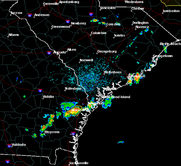 At 107 pm edt, severe thunderstorms were located along a line extending from near richmond hill to near gumbranch, moving east at 20 mph (radar indicated). Hazards include 60 mph wind gusts and quarter size hail. Hail damage to vehicles is expected. expect wind damage to roofs, siding and trees. Locations impacted include, hinesville, richmond hill and fort stewart. At 107 pm edt, severe thunderstorms were located along a line extending from near richmond hill to near gumbranch, moving east at 20 mph (radar indicated). Hazards include 60 mph wind gusts and quarter size hail. Hail damage to vehicles is expected. expect wind damage to roofs, siding and trees. Locations impacted include, hinesville, richmond hill and fort stewart.
|
| 7/13/2015 12:54 PM EDT |
 At 1254 pm edt, severe thunderstorms were located along a line extending from 9 miles northwest of richmond hill to near gumbranch, moving east at 20 mph (radar indicated). Hazards include 60 mph wind gusts and quarter size hail. Hail damage to vehicles is expected. expect wind damage to roofs, siding and trees. Locations impacted include, hinesville, richmond hill and fort stewart. At 1254 pm edt, severe thunderstorms were located along a line extending from 9 miles northwest of richmond hill to near gumbranch, moving east at 20 mph (radar indicated). Hazards include 60 mph wind gusts and quarter size hail. Hail damage to vehicles is expected. expect wind damage to roofs, siding and trees. Locations impacted include, hinesville, richmond hill and fort stewart.
|
| 7/13/2015 12:39 PM EDT |
 At 1239 pm edt, severe thunderstorms were located along a line extending from 7 miles north of fort stewart to near gumbranch, moving east at 20 mph (radar indicated). Hazards include 60 mph wind gusts and quarter size hail. Hail damage to vehicles is expected. Expect wind damage to roofs, siding and trees. At 1239 pm edt, severe thunderstorms were located along a line extending from 7 miles north of fort stewart to near gumbranch, moving east at 20 mph (radar indicated). Hazards include 60 mph wind gusts and quarter size hail. Hail damage to vehicles is expected. Expect wind damage to roofs, siding and trees.
|
| 7/7/2015 3:26 PM EDT | A tree fell onto a car and was blocking the road at the intersection of sumter and mitchell streets in savannah. estimated maximum wind gust 40-50 mp in chatham county GA, 4.2 miles WSW of Savannah, GA |
| 7/7/2015 3:20 PM EDT | Trees and power lines were blown down at the intersection of east park avenue and paulsen street in savannah. estimated maximum wind gust 40-50 mp in chatham county GA, 7.2 miles WSW of Savannah, GA |
| 7/5/2015 5:51 PM EDT |
 The severe thunderstorm warning for bryan, chatham, beaufort and jasper counties will expire at 600 pm edt, the storms which prompted the warning have weakened below severe limits, and no longer pose an immediate threat to life or property. therefore the warning will be allowed to expire. to report severe weather, contact your nearest law enforcement agency. they will relay your report to the national weather service charleston. The severe thunderstorm warning for bryan, chatham, beaufort and jasper counties will expire at 600 pm edt, the storms which prompted the warning have weakened below severe limits, and no longer pose an immediate threat to life or property. therefore the warning will be allowed to expire. to report severe weather, contact your nearest law enforcement agency. they will relay your report to the national weather service charleston.
|
| 7/5/2015 5:32 PM EDT |
 At 532 pm edt, severe thunderstorms were located along a line extending from near fort pulaski national monument to near ossabaw sound, moving northeast at 25 mph (radar indicated). Hazards include 60 mph wind gusts. Expect damage to roofs. siding and trees. Locations impacted include, savannah, hilton head island, pooler, bluffton, beaufort, port royal, wilmington island and fort pulaski national monument. At 532 pm edt, severe thunderstorms were located along a line extending from near fort pulaski national monument to near ossabaw sound, moving northeast at 25 mph (radar indicated). Hazards include 60 mph wind gusts. Expect damage to roofs. siding and trees. Locations impacted include, savannah, hilton head island, pooler, bluffton, beaufort, port royal, wilmington island and fort pulaski national monument.
|
| 7/5/2015 5:25 PM EDT |
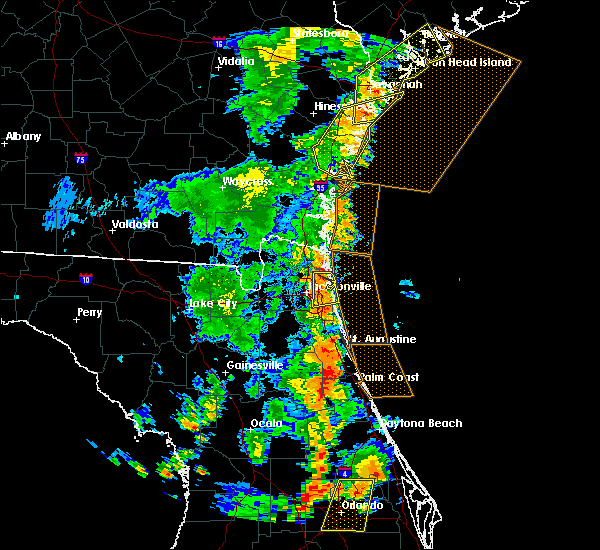 The severe thunderstorm warning for bryan, mcintosh, chatham and liberty counties will expire at 530 pm edt, the storms which prompted the warning have weakened below severe limits, and no longer pose an immediate threat to life or property. therefore the warning will be allowed to expire. however gusty winds and heavy rain are still possible with these thunderstorms. a severe thunderstorm warning remain in effect for portions of bryan and chatham counties until 6 pm edt. The severe thunderstorm warning for bryan, mcintosh, chatham and liberty counties will expire at 530 pm edt, the storms which prompted the warning have weakened below severe limits, and no longer pose an immediate threat to life or property. therefore the warning will be allowed to expire. however gusty winds and heavy rain are still possible with these thunderstorms. a severe thunderstorm warning remain in effect for portions of bryan and chatham counties until 6 pm edt.
|
| 7/5/2015 5:16 PM EDT |
 At 515 pm edt, severe thunderstorms were located along a line extending from near whitemarsh island to ossabaw sound, moving northeast at 30 mph (radar indicated. at 443 pm these thunderstorms blew down tree limbs and power lines near windsor forest). Hazards include 60 mph wind gusts. Expect damage to roofs. siding and trees. Locations impacted include, savannah, hilton head island, pooler, bluffton, beaufort, port royal, wilmington island and fort pulaski national monument. At 515 pm edt, severe thunderstorms were located along a line extending from near whitemarsh island to ossabaw sound, moving northeast at 30 mph (radar indicated. at 443 pm these thunderstorms blew down tree limbs and power lines near windsor forest). Hazards include 60 mph wind gusts. Expect damage to roofs. siding and trees. Locations impacted include, savannah, hilton head island, pooler, bluffton, beaufort, port royal, wilmington island and fort pulaski national monument.
|
| 7/5/2015 5:02 PM EDT |
 At 502 pm edt, severe thunderstorms were located along a line extending from skidaway island to near shellman bluff, moving northeast at 30 mph (radar indicated. these thunderstorms blew down a tree in mcintosh county). Hazards include 60 mph wind gusts and penny size hail. Expect damage to roofs. siding and trees. Locations impacted include, savannah, darien and wilmington island. At 502 pm edt, severe thunderstorms were located along a line extending from skidaway island to near shellman bluff, moving northeast at 30 mph (radar indicated. these thunderstorms blew down a tree in mcintosh county). Hazards include 60 mph wind gusts and penny size hail. Expect damage to roofs. siding and trees. Locations impacted include, savannah, darien and wilmington island.
|
| 7/5/2015 5:00 PM EDT |
 At 459 pm edt, severe thunderstorms were located along a line extending from thunderbolt to near keller, moving northeast at 30 mph (radar indicated). Hazards include 60 mph wind gusts and penny size hail. Expect damage to roofs. Siding and trees. At 459 pm edt, severe thunderstorms were located along a line extending from thunderbolt to near keller, moving northeast at 30 mph (radar indicated). Hazards include 60 mph wind gusts and penny size hail. Expect damage to roofs. Siding and trees.
|
| 7/5/2015 4:44 PM EDT |
 At 444 pm edt, severe thunderstorms were located along a line extending from near burroughs to belfast, moving northeast at 25 mph (radar indicated). Hazards include 60 mph wind gusts and nickel size hail. Expect damage to roofs. siding and trees. Locations impacted include, savannah, pooler, richmond hill, wilmington island, i-16/i-95 interchange and fort pulaski national monument. At 444 pm edt, severe thunderstorms were located along a line extending from near burroughs to belfast, moving northeast at 25 mph (radar indicated). Hazards include 60 mph wind gusts and nickel size hail. Expect damage to roofs. siding and trees. Locations impacted include, savannah, pooler, richmond hill, wilmington island, i-16/i-95 interchange and fort pulaski national monument.
|
| 7/5/2015 4:43 PM EDT | Power lines down and multiple tree limbs in the road at the intersection of apache ave and shawnee s in chatham county GA, 4.4 miles NNW of Savannah, GA |
| 7/5/2015 4:40 PM EDT |
 At 438 pm edt, severe thunderstorms were located along a line extending from near fort mcallister to near eulonia, moving northeast at 30 mph (radar indicated). Hazards include 60 mph wind gusts and nickel size hail. Expect damage to roofs. siding and trees. Locations impacted include, shellman bluff, darien, keller and wilmington island. At 438 pm edt, severe thunderstorms were located along a line extending from near fort mcallister to near eulonia, moving northeast at 30 mph (radar indicated). Hazards include 60 mph wind gusts and nickel size hail. Expect damage to roofs. siding and trees. Locations impacted include, shellman bluff, darien, keller and wilmington island.
|
| 7/5/2015 4:29 PM EDT |
 At 428 pm edt, a severe thunderstorm was located near i-16/i-95 interchange, and is moving northeast at 25 mph (radar indicated). Hazards include 60 mph wind gusts and nickel size hail. Expect damage to roofs. siding and trees. Locations impacted include, savannah, pooler, richmond hill, wilmington island, i-16/i-95 interchange and fort pulaski national monument. At 428 pm edt, a severe thunderstorm was located near i-16/i-95 interchange, and is moving northeast at 25 mph (radar indicated). Hazards include 60 mph wind gusts and nickel size hail. Expect damage to roofs. siding and trees. Locations impacted include, savannah, pooler, richmond hill, wilmington island, i-16/i-95 interchange and fort pulaski national monument.
|
| 7/5/2015 4:25 PM EDT |
 At 425 pm edt, severe thunderstorms were located along a line extending from near belfast to cox, moving northeast at 30 mph (radar indicated). Hazards include 60 mph wind gusts and quarter size hail. Hail damage to vehicles is expected. Expect wind damage to roofs, siding and trees. At 425 pm edt, severe thunderstorms were located along a line extending from near belfast to cox, moving northeast at 30 mph (radar indicated). Hazards include 60 mph wind gusts and quarter size hail. Hail damage to vehicles is expected. Expect wind damage to roofs, siding and trees.
|
| 7/5/2015 4:05 PM EDT |
 At 405 pm edt, a severe thunderstorm was located near richmond hill, moving northeast at 30 mph (radar indicated). Hazards include 60 mph wind gusts and quarter size hail. Hail damage to vehicles is expected. Expect wind damage to roofs, siding and trees. At 405 pm edt, a severe thunderstorm was located near richmond hill, moving northeast at 30 mph (radar indicated). Hazards include 60 mph wind gusts and quarter size hail. Hail damage to vehicles is expected. Expect wind damage to roofs, siding and trees.
|
| 7/2/2015 7:32 PM EDT |
 At 732 pm edt, severe thunderstorms were located along a line extending from near rincon to ridgeville, and are nearly stationary (radar indicated). Hazards include 60 mph wind gusts. Expect damage to roofs. siding and trees. Locations impacted include, savannah, pooler, bluffton, richmond hill, wilmington island, i-16/i-95 interchange, fort pulaski national monument and bellinger hill area. At 732 pm edt, severe thunderstorms were located along a line extending from near rincon to ridgeville, and are nearly stationary (radar indicated). Hazards include 60 mph wind gusts. Expect damage to roofs. siding and trees. Locations impacted include, savannah, pooler, bluffton, richmond hill, wilmington island, i-16/i-95 interchange, fort pulaski national monument and bellinger hill area.
|
| 7/2/2015 7:05 PM EDT |
 At 705 pm edt, severe thunderstorms were located along a line extending from near rincon to ridgeville, moving east at 35 mph (radar indicated). Hazards include 60 mph wind gusts. Expect damage to roofs. siding and trees. Locations impacted include, savannah, pooler, bluffton, richmond hill, darien, wilmington island, i-16/i-95 interchange and fort pulaski national monument. At 705 pm edt, severe thunderstorms were located along a line extending from near rincon to ridgeville, moving east at 35 mph (radar indicated). Hazards include 60 mph wind gusts. Expect damage to roofs. siding and trees. Locations impacted include, savannah, pooler, bluffton, richmond hill, darien, wilmington island, i-16/i-95 interchange and fort pulaski national monument.
|
| 7/2/2015 6:52 PM EDT |
 At 651 pm edt, severe thunderstorms were located along a line extending from pineora to near darien, moving east at 35 mph (radar indicated). Hazards include 60 mph wind gusts. Expect damage to roofs. Siding and trees. At 651 pm edt, severe thunderstorms were located along a line extending from pineora to near darien, moving east at 35 mph (radar indicated). Hazards include 60 mph wind gusts. Expect damage to roofs. Siding and trees.
|
| 6/22/2015 7:55 PM EDT |
 The severe thunderstorm warning for bryan, chatham, liberty, mcintosh, beaufort and jasper counties will expire at 800 pm edt, the storm which prompted the warning has weakened below severe limits, and no longer pose an immediate threat to life or property. therefore the warning will be allowed to expire. The severe thunderstorm warning for bryan, chatham, liberty, mcintosh, beaufort and jasper counties will expire at 800 pm edt, the storm which prompted the warning has weakened below severe limits, and no longer pose an immediate threat to life or property. therefore the warning will be allowed to expire.
|
| 6/22/2015 7:55 PM EDT |
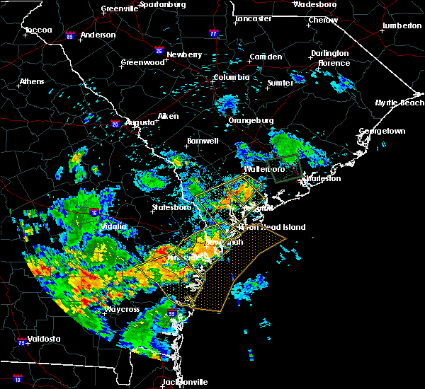 The severe thunderstorm warning for bryan, chatham, liberty, mcintosh, beaufort and jasper counties will expire at 800 pm edt, the storm which prompted the warning has weakened below severe limits, and no longer pose an immediate threat to life or property. therefore the warning will be allowed to expire. The severe thunderstorm warning for bryan, chatham, liberty, mcintosh, beaufort and jasper counties will expire at 800 pm edt, the storm which prompted the warning has weakened below severe limits, and no longer pose an immediate threat to life or property. therefore the warning will be allowed to expire.
|
| 6/22/2015 7:35 PM EDT |
 At 730 pm edt, a severe thunderstorm was located near white bluff, or near savannah, moving southeast at 20 mph (radar indicated. at 722 pm a 68 mph wind gust was measured at the savannah airport). Hazards include 60 mph wind gusts and quarter size hail. Hail damage to vehicles is expected. expect wind damage to roofs, siding and trees. Locations impacted include, savannah, hilton head island, pooler, bluffton, richmond hill, wilmington island, i-16/i-95 interchange and fort pulaski national monument. At 730 pm edt, a severe thunderstorm was located near white bluff, or near savannah, moving southeast at 20 mph (radar indicated. at 722 pm a 68 mph wind gust was measured at the savannah airport). Hazards include 60 mph wind gusts and quarter size hail. Hail damage to vehicles is expected. expect wind damage to roofs, siding and trees. Locations impacted include, savannah, hilton head island, pooler, bluffton, richmond hill, wilmington island, i-16/i-95 interchange and fort pulaski national monument.
|
| 6/22/2015 7:15 PM EDT | Storm damage reported in chatham county GA, 6.3 miles S of Savannah, GA |
| 6/22/2015 7:02 PM EDT | Storm damage reported in chatham county GA, 6.3 miles S of Savannah, GA |
| 6/22/2015 7:02 PM EDT |
 At 701 pm edt, a severe thunderstorm was located over hutchinson island, or near savannah, moving southeast at 30 mph (radar indicated). Hazards include 60 mph wind gusts and quarter size hail. Hail damage to vehicles is expected. Expect wind damage to roofs, siding and trees. At 701 pm edt, a severe thunderstorm was located over hutchinson island, or near savannah, moving southeast at 30 mph (radar indicated). Hazards include 60 mph wind gusts and quarter size hail. Hail damage to vehicles is expected. Expect wind damage to roofs, siding and trees.
|
| 6/22/2015 6:53 PM EDT |
 At 649 pm edt, a severe thunderstorm was located over port wentworth, or near pooler, moving southeast at 15 mph (trained weather spotter. at 648 pm quarter size hail and wind gusts between 40 to 50 mph was reported on interstate 95). Hazards include 60 mph wind gusts and quarter size hail. Hail damage to vehicles is expected. expect wind damage to roofs, siding and trees. Locations impacted include, savannah, pooler and bluffton. At 649 pm edt, a severe thunderstorm was located over port wentworth, or near pooler, moving southeast at 15 mph (trained weather spotter. at 648 pm quarter size hail and wind gusts between 40 to 50 mph was reported on interstate 95). Hazards include 60 mph wind gusts and quarter size hail. Hail damage to vehicles is expected. expect wind damage to roofs, siding and trees. Locations impacted include, savannah, pooler and bluffton.
|
| 6/22/2015 6:23 PM EDT |
 At 623 pm edt, a severe thunderstorm was located near purysburgh, or 11 miles northeast of pooler, moving southeast at 10 mph (radar indicated). Hazards include 60 mph wind gusts and quarter size hail. Hail damage to vehicles is expected. Expect wind damage to roofs, siding and trees. At 623 pm edt, a severe thunderstorm was located near purysburgh, or 11 miles northeast of pooler, moving southeast at 10 mph (radar indicated). Hazards include 60 mph wind gusts and quarter size hail. Hail damage to vehicles is expected. Expect wind damage to roofs, siding and trees.
|
| 6/19/2015 8:21 PM EDT |
 The severe thunderstorm warning for chatham county will expire at 830 pm edt, the storm which prompted the warning has weakened below severe limits, and no longer pose an immediate threat to life or property. therefore the warning will be allowed to expire. to report severe weather, contact your nearest law enforcement agency. they will relay your report to the national weather service charleston. The severe thunderstorm warning for chatham county will expire at 830 pm edt, the storm which prompted the warning has weakened below severe limits, and no longer pose an immediate threat to life or property. therefore the warning will be allowed to expire. to report severe weather, contact your nearest law enforcement agency. they will relay your report to the national weather service charleston.
|
| 6/19/2015 8:00 PM EDT |
 At 800 pm edt, a severe thunderstorm was located over garden city, or near savannah, moving east at 15 mph (radar indicated. this thunderstorm produced a wind gust to 59 mph at the savannah airport). Hazards include 60 mph wind gusts and quarter size hail. Hail damage to vehicles is expected. expect wind damage to roofs, siding and trees. Locations impacted include, savannah, pooler, i-16/i-95 interchange and wilmington island. At 800 pm edt, a severe thunderstorm was located over garden city, or near savannah, moving east at 15 mph (radar indicated. this thunderstorm produced a wind gust to 59 mph at the savannah airport). Hazards include 60 mph wind gusts and quarter size hail. Hail damage to vehicles is expected. expect wind damage to roofs, siding and trees. Locations impacted include, savannah, pooler, i-16/i-95 interchange and wilmington island.
|
| 6/19/2015 7:46 PM EDT |
 At 744 pm edt, a severe thunderstorm was located over port wentworth, or near pooler, moving east at 15 mph (radar indicated. at 733 pm edt a wind gust to 59 mph was reported at the savannah airport). Hazards include 60 mph wind gusts and quarter size hail. Hail damage to vehicles is expected. expect wind damage to roofs, siding and trees. Locations impacted include, savannah, pooler, i-16/i-95 interchange and wilmington island. At 744 pm edt, a severe thunderstorm was located over port wentworth, or near pooler, moving east at 15 mph (radar indicated. at 733 pm edt a wind gust to 59 mph was reported at the savannah airport). Hazards include 60 mph wind gusts and quarter size hail. Hail damage to vehicles is expected. expect wind damage to roofs, siding and trees. Locations impacted include, savannah, pooler, i-16/i-95 interchange and wilmington island.
|
| 6/19/2015 7:34 PM EDT | Tree down on crossgate rd near hwy 21 in chatham county GA, 7.8 miles S of Savannah, GA |
| 6/19/2015 7:33 PM EDT | Ksav reported a peak wind gust of 59 mp in chatham county GA, 6.3 miles S of Savannah, GA |
| 6/19/2015 7:30 PM EDT |
 At 730 pm edt, a severe thunderstorm was located over savannah airport, or over pooler, moving east at 15 mph (radar indicated). Hazards include 60 mph wind gusts and quarter size hail. Hail damage to vehicles is expected. Expect wind damage to roofs, siding and trees. At 730 pm edt, a severe thunderstorm was located over savannah airport, or over pooler, moving east at 15 mph (radar indicated). Hazards include 60 mph wind gusts and quarter size hail. Hail damage to vehicles is expected. Expect wind damage to roofs, siding and trees.
|
| 6/9/2015 7:49 PM EDT |
 At 748 pm edt, severe thunderstorms were located along a line extending from near jasper to near bluffton to savannah historic district, moving northeast at 25 mph (radar indicated). Hazards include 60 mph wind gusts and quarter size hail. Hail damage to vehicles is expected. expect wind damage to roofs, siding and trees. Locations impacted include, savannah, hilton head island, bluffton, port royal, bellinger hill area and wilmington island. At 748 pm edt, severe thunderstorms were located along a line extending from near jasper to near bluffton to savannah historic district, moving northeast at 25 mph (radar indicated). Hazards include 60 mph wind gusts and quarter size hail. Hail damage to vehicles is expected. expect wind damage to roofs, siding and trees. Locations impacted include, savannah, hilton head island, bluffton, port royal, bellinger hill area and wilmington island.
|
| 6/9/2015 7:37 PM EDT | Emergency manager reported tree down in yard in the 8500 block of kent driv in chatham county GA, 7.2 miles WNW of Savannah, GA |
| 6/9/2015 7:29 PM EDT |
 At 729 pm edt, a severe thunderstorm was located near port wentworth, or 7 miles west of bellinger hill area, moving northeast at 25 mph (radar indicated). Hazards include 60 mph wind gusts and quarter size hail. Hail damage to vehicles is expected. Expect wind damage to roofs, siding and trees. At 729 pm edt, a severe thunderstorm was located near port wentworth, or 7 miles west of bellinger hill area, moving northeast at 25 mph (radar indicated). Hazards include 60 mph wind gusts and quarter size hail. Hail damage to vehicles is expected. Expect wind damage to roofs, siding and trees.
|
| 6/3/2015 3:02 PM EDT | At 301 pm edt, a severe thunderstorm was located over fort mcallister, moving east at 15 mph (radar indicated). Hazards include 60 mph wind gusts and quarter size hail. Hail damage to vehicles is expected. expect wind damage to roofs, siding and trees. Locations impacted include, savannah and richmond hill. |
| 6/3/2015 2:52 PM EDT | At 251 pm edt, a severe thunderstorm was located over fort mcallister, or 8 miles east of richmond hill, moving east at 15 mph (radar indicated). Hazards include 60 mph wind gusts and quarter size hail. several reports of dime to nickel size hail have been reported in the richmond hill area with this storm. Hail damage to vehicles is expected. expect wind damage to roofs, siding and trees. Locations impacted include, savannah, pooler, richmond hill and wilmington island. |
| 6/3/2015 2:38 PM EDT | At 237 pm edt, a severe thunderstorm was located near fort mcallister, or near richmond hill, moving east at 15 mph (radar indicated. nickel size hail was reported by the public in richmond hill at 237 pm). Hazards include 60 mph wind gusts and quarter size hail. Hail damage to vehicles is expected. expect wind damage to roofs, siding and trees. Locations impacted include, savannah, pooler, richmond hill and wilmington island. |
| 6/3/2015 2:32 PM EDT | At 231 pm edt, a severe thunderstorm was located over richmond hill, moving east at 15 mph (radar indicated). Hazards include 60 mph wind gusts and penny size hail. Expect damage to roofs. Siding and trees. |
| 6/2/2015 4:36 PM EDT | The severe thunderstorm warning for chatham county will expire at 445 pm edt, the storm which prompted the warning has moved out of the area. therefore the warning will be allowed to expire. to report severe weather, contact your nearest law enforcement agency. they will relay your report to the national weather service charleston. |
| 6/2/2015 4:24 PM EDT | At 423 pm edt, a severe thunderstorm was located near port wentworth, or near bellinger hill area, moving northeast at 5 mph (radar indicated). Hazards include 60 mph wind gusts and quarter size hail. Hail damage to vehicles is expected. Expect wind damage to roofs, siding and trees. |
| 6/2/2015 4:21 PM EDT | At 420 pm edt, a severe thunderstorm was located over garden city, or near pooler, moving north at 15 mph (radar indicated. at about 4 pm...quarter sized hail was reported at berwick blvd). Hazards include 60 mph wind gusts and quarter size hail. Hail damage to vehicles is expected. expect wind damage to roofs, siding and trees. Locations impacted include, savannah and pooler. |
| 6/2/2015 4:12 PM EDT | At 412 pm edt, a severe thunderstorm was located over i-16/i-95 interchange, moving northeast at 15 mph (radar indicated). Hazards include 60 mph wind gusts and quarter size hail. Hail damage to vehicles is expected. expect wind damage to roofs, siding and trees. Locations impacted include, savannah, pooler and i-16/i-95 interchange. |
| 6/2/2015 4:04 PM EDT | Very large tree blown down at the entrance to the southbridge neighborhood. tree blocking the road. time estimated based on rada in chatham county GA, 2.5 miles ESE of Savannah, GA |
| 6/2/2015 4:00 PM EDT | Quarter sized hail reported 2.2 miles NE of Savannah, GA |
| 6/2/2015 4:00 PM EDT | At 400 pm edt, a severe thunderstorm was located over i-16/i-95 interchange, moving north at 20 mph (radar indicated). Hazards include 60 mph wind gusts and quarter size hail. Hail damage to vehicles is expected. Expect wind damage to roofs, siding and trees. |
| 4/25/2015 9:20 PM EDT | At 917 pm edt, severe thunderstorms were located along a line extending from near bellinger hill area to near wilmington island to near isle of hope, moving east at 50 mph. these are very dangerous storms (radar indicated). Hazards include 80 mph wind gusts. Flying debris will be dangerous to those caught without shelter. mobile homes will be heavily damaged. expect considerable damage to roofs, windows and vehicles. extensive tree damage and power outages are likely. locations impacted include, savannah, hilton head island, pooler, bluffton, beaufort, port royal, richmond hill and wilmington island. 75in. |
| 4/25/2015 9:20 PM EDT | At 917 pm edt, severe thunderstorms were located along a line extending from near bellinger hill area to near wilmington island to near isle of hope, moving east at 50 mph. these are very dangerous storms (radar indicated). Hazards include 80 mph wind gusts. Flying debris will be dangerous to those caught without shelter. mobile homes will be heavily damaged. expect considerable damage to roofs, windows and vehicles. extensive tree damage and power outages are likely. locations impacted include, savannah, hilton head island, pooler, bluffton, beaufort, port royal, richmond hill and wilmington island. 75in. |
| 4/25/2015 9:08 PM EDT | Trees were blown down at scattered locations along skidaway road between virginia avenue and 41st street. time was estimated from radar dat in chatham county GA, 8.2 miles W of Savannah, GA |
| 4/25/2015 9:05 PM EDT | A tree was blown onto power lines at the intersection of bull street and thackery place. time was estimated from radar dat in chatham county GA, 5.3 miles W of Savannah, GA |
| 4/25/2015 9:05 PM EDT | At 903 pm edt, severe thunderstorms were located along a line extending from near port wentworth to hutchinson island to near white bluff, moving east at 75 mph. these are very dangerous storms (radar indicated). Hazards include 80 mph wind gusts. Flying debris will be dangerous to those caught without shelter. mobile homes will be heavily damaged. expect considerable damage to roofs, windows and vehicles. extensive tree damage and power outages are likely. locations impacted include, savannah, hilton head island, pooler, bluffton, beaufort, port royal, richmond hill and ridgeland. 75in. |
| 4/25/2015 9:05 PM EDT | At 903 pm edt, severe thunderstorms were located along a line extending from near port wentworth to hutchinson island to near white bluff, moving east at 75 mph. these are very dangerous storms (radar indicated). Hazards include 80 mph wind gusts. Flying debris will be dangerous to those caught without shelter. mobile homes will be heavily damaged. expect considerable damage to roofs, windows and vehicles. extensive tree damage and power outages are likely. locations impacted include, savannah, hilton head island, pooler, bluffton, beaufort, port royal, richmond hill and ridgeland. 75in. |
| 4/25/2015 9:04 PM EDT | *** 1 inj *** tree fell down on a house on west street causing one injury to a femal in chatham county GA, 5.9 miles SW of Savannah, GA |
| 4/25/2015 9:03 PM EDT | Thunderstorm winds blew a tree onto a vehicle at the intersection of ogeechee road and kollock street. time was estimated from radar dat in chatham county GA, 4.9 miles WSW of Savannah, GA |
| 4/25/2015 9:03 PM EDT | Trees were blown down at scattered locations along ogeechee road between 37th street and corvair street. time was estimated from radar dat in chatham county GA, 4.8 miles W of Savannah, GA |
| 4/25/2015 9:01 PM EDT | Multiple trees were blown down in the port wentworth vicinity. time was estimated from radar dat in chatham county GA, 7.8 miles S of Savannah, GA |
| 4/25/2015 9:00 PM EDT | Ksav reported peak wind of 70 kt....81 mph in chatham county GA, 6.3 miles S of Savannah, GA |
| 4/25/2015 8:59 PM EDT | Tree down blocking northbound lanes of interstate 95 near ga tech campus in chatham county GA, 9.1 miles S of Savannah, GA |
| 4/25/2015 8:58 PM EDT | At 857 pm edt, severe thunderstorms were located along a line extending from near hilton head island to 6 miles northwest of richmond hill, moving southeast at 40 mph (radar indicated). Hazards include quarter size hail and 60 mph wind gusts. Hail damage to vehicles is expected. Expect wind damage to roofs, siding and trees. |
| 4/25/2015 8:58 PM EDT | At 857 pm edt, severe thunderstorms were located along a line extending from near hilton head island to 6 miles northwest of richmond hill, moving southeast at 40 mph (radar indicated). Hazards include quarter size hail and 60 mph wind gusts. Hail damage to vehicles is expected. Expect wind damage to roofs, siding and trees. |
| 4/25/2015 8:39 PM EDT | At 838 pm edt, a severe thunderstorm was located near hardeeville, or 7 miles northwest of bellinger hill area, moving east at 30 mph (radar indicated). Hazards include quarter size hail and 60 mph wind gusts. Hail damage to vehicles is expected. expect wind damage to roofs, siding and trees. locations impacted include, savannah, hilton head island, pooler, bluffton, beaufort, port royal, springfield and pembroke. 1. 00in. |
| 4/25/2015 8:39 PM EDT | At 838 pm edt, a severe thunderstorm was located near hardeeville, or 7 miles northwest of bellinger hill area, moving east at 30 mph (radar indicated). Hazards include quarter size hail and 60 mph wind gusts. Hail damage to vehicles is expected. expect wind damage to roofs, siding and trees. locations impacted include, savannah, hilton head island, pooler, bluffton, beaufort, port royal, springfield and pembroke. 1. 00in. |
| 4/25/2015 8:07 PM EDT | At 806 pm edt, a severe thunderstorm was located over monteith, or 7 miles northeast of pooler, moving east at 35 mph (radar indicated). Hazards include quarter size hail and 60 mph wind gusts. Hail damage to vehicles is expected. Expect wind damage to roofs, siding and trees. |
| 4/25/2015 8:07 PM EDT | At 806 pm edt, a severe thunderstorm was located over monteith, or 7 miles northeast of pooler, moving east at 35 mph (radar indicated). Hazards include quarter size hail and 60 mph wind gusts. Hail damage to vehicles is expected. Expect wind damage to roofs, siding and trees. |
| 4/25/2015 12:51 PM EDT | The severe thunderstorm warning for bryan, mcintosh, chatham, liberty and long counties will expire at 100 pm edt, the line of storms which prompted the warning have weakened below severe limits, and exited the warned area. therefore the warning will be allowed to expire. |
| 4/25/2015 12:26 PM EDT | At 1225 pm edt, severe thunderstorms were located along a line extending from near skidaway island to near halfmoon landing to near retreat to near tibet, moving southeast at 45 mph (radar indicated). Hazards include 60 mph wind gusts. Expect damage to roofs. siding and trees. locations impacted include, richmond hill, darien and tibet. 75in. |
| 4/25/2015 12:00 PM EDT | At 1159 am edt, severe thunderstorms were located along a line extending from near richmond hill to hinesville to near gum branch to 7 miles northeast of odum, moving southeast at 45 mph (radar indicated). Hazards include 60 mph wind gusts. Expect damage to roofs. Siding and trees. |
| 4/19/2015 4:29 PM EDT | At 429 pm edt, severe thunderstorms were located along a line extending from near meinhard to white bluff to near st. catherines island, moving northeast at 35 mph (radar indicated). Hazards include 60 mph wind gusts. Expect damage to roofs. siding and trees. locations impacted include, savannah, pooler, bluffton, wilmington island, fort pulaski national monument and bellinger hill area. a tornado watch remains in effect until 800 pm edt for southeastern georgia and southeastern south carolina. 75in. |
| 4/19/2015 4:29 PM EDT | At 429 pm edt, severe thunderstorms were located along a line extending from near meinhard to white bluff to near st. catherines island, moving northeast at 35 mph (radar indicated). Hazards include 60 mph wind gusts. Expect damage to roofs. siding and trees. locations impacted include, savannah, pooler, bluffton, wilmington island, fort pulaski national monument and bellinger hill area. a tornado watch remains in effect until 800 pm edt for southeastern georgia and southeastern south carolina. 75in. |
| 4/19/2015 4:22 PM EDT | Emergency manager reported power lines down and on fire at the 8500 block of kent driv in chatham county GA, 7.2 miles WNW of Savannah, GA |
| 4/19/2015 4:11 PM EDT | At 410 pm edt, severe thunderstorms were located along a line extending from lanier to near richmond hill to near st. catherines island, moving northeast at 35 mph (radar indicated). Hazards include 60 mph wind gusts. Expect damage to roofs. siding and trees. locations impacted include, savannah, pooler, bluffton, richmond hill, wilmington island, i-16/i-95 interchange, fort pulaski national monument and bellinger hill area. a tornado watch remains in effect until 800 pm edt for southeastern georgia and southeastern south carolina. 75in. |
| 4/19/2015 4:11 PM EDT | At 410 pm edt, severe thunderstorms were located along a line extending from lanier to near richmond hill to near st. catherines island, moving northeast at 35 mph (radar indicated). Hazards include 60 mph wind gusts. Expect damage to roofs. siding and trees. locations impacted include, savannah, pooler, bluffton, richmond hill, wilmington island, i-16/i-95 interchange, fort pulaski national monument and bellinger hill area. a tornado watch remains in effect until 800 pm edt for southeastern georgia and southeastern south carolina. 75in. |
| 4/19/2015 3:47 PM EDT | At 345 pm edt, severe thunderstorms were located along a line extending from near groveland to near mcintosh to near cox, moving northeast at 35 mph (radar indicated. at 333 pm edt...the public reported numerous powerlines blown down along highway 84 near walthourville). Hazards include 70 mph wind gusts. Expect considerable tree damage. Damage is likely to mobile homes, roofs and outbuildings. |
| 4/19/2015 3:47 PM EDT | At 345 pm edt, severe thunderstorms were located along a line extending from near groveland to near mcintosh to near cox, moving northeast at 35 mph (radar indicated. at 333 pm edt...the public reported numerous powerlines blown down along highway 84 near walthourville). Hazards include 70 mph wind gusts. Expect considerable tree damage. Damage is likely to mobile homes, roofs and outbuildings. |
| 1/4/2015 3:12 PM EST | Numerous large limbs down. time estimated by rada in chatham county GA, 6 miles WSW of Savannah, GA |
| 1/4/2015 3:12 PM EST | Ham radio operator relayed a report from the brunswick port that the savannah port police are reporting several large containers blown over. time estimated by radar in chatham county GA, 6.4 miles SW of Savannah, GA |
| 1/4/2015 3:10 PM EST | Power poles snapped at the base at cornell avenue and waters avenu in chatham county GA, 6.2 miles WNW of Savannah, GA |
| 1/4/2015 3:08 PM EST | Chatham county emergency management reported two trees blown down and blocking traffic off of southern blvd and chatham parkway. time estimated based on rada in chatham county GA, 2.8 miles WSW of Savannah, GA |
| 1/4/2015 3:03 PM EST | Trees down reported at fall avenue near gould elementary schoo in chatham county GA, 1.4 miles SW of Savannah, GA |
| 1/4/2015 2:59 PM EST | Chatham county emergency management reports 2 trees down and large limbs down on elk road in the silk hope area. time estimated from rada in chatham county GA, 1.2 miles E of Savannah, GA |
| 11/23/2014 8:50 PM EST | A trained weather spotter reported a tree blocking the road near the diamond causeway. time estimated based on rada in chatham county GA, 5 miles NW of Savannah, GA |
| 10/14/2014 5:08 PM EDT | Thunderstorm winds downed powerlines near the pilot travel center near i-16 and dean forest roa in chatham county GA, 2.2 miles S of Savannah, GA |
| 8/19/2014 1:22 PM EDT | Tree fell on house on georgia avenu in chatham county GA, 8.2 miles W of Savannah, GA |
| 8/19/2014 1:20 PM EDT | Tree down on bona bella avenue in between skidaway road and jan stree in chatham county GA, 7.3 miles WNW of Savannah, GA |
| 8/19/2014 1:16 PM EDT | Tree down on powerline at the intersection of godsells street and mildred stree in chatham county GA, 4.7 miles W of Savannah, GA |
| 8/19/2014 1:13 PM EDT | Large tree down on a home on parkview road. no one was home at the tim in chatham county GA, 1.9 miles ENE of Savannah, GA |
| 7/15/2014 4:54 PM EDT | Cema reports a tree blocking road on davison avenu in chatham county GA, 6.2 miles NW of Savannah, GA |
| 7/15/2014 4:48 PM EDT | Cema reports a tree down on a house on jasmine avenu in chatham county GA, 7.9 miles WNW of Savannah, GA |
| 7/15/2014 4:45 PM EDT | Public reported a tree down on laroche av in chatham county GA, 7.7 miles W of Savannah, GA |
| 7/15/2014 4:35 PM EDT | Public reported a tree down on laroche ave. time estimated by rada in chatham county GA, 7.7 miles W of Savannah, GA |
| 6/24/2014 7:57 PM EDT | Power line down at 200 block of west bolton stree in chatham county GA, 6.3 miles WSW of Savannah, GA |
| 6/24/2014 7:56 PM EDT | Tree down at the intersection of habersham street and maupas avenu in chatham county GA, 5.9 miles W of Savannah, GA |
| 6/24/2014 7:56 PM EDT | Tree down at the intersection of west victory drive and martin luther king jr boulevar in chatham county GA, 5.3 miles W of Savannah, GA |
| 6/24/2014 7:55 PM EDT | Trees down at the arbors off of benton boulevar in chatham county GA, 8.2 miles SSE of Savannah, GA |
| 6/24/2014 7:50 PM EDT | Spotter reported windows blown out of the back of a house off windsor on the mars in chatham county GA, 5 miles NNW of Savannah, GA |
| 6/24/2014 7:30 PM EDT | Warning point reported power lines down at the intersection of belle island road and kilkenny roa in bryan county GA, 17.1 miles N of Savannah, GA |
| 6/14/2014 6:07 PM EDT | Bryan county dispatch reported a tree down at the intersection of highway 144 and strathy hall road. time estimated by rada in bryan county GA, 10.2 miles NNE of Savannah, GA |
| 6/14/2014 5:26 PM EDT | Media reported a tree down on powerlines on skidaway road. time estimated by rada in chatham county GA, 7.8 miles WNW of Savannah, GA |
| 6/14/2014 5:24 PM EDT | Quarter sized hail reported 7 miles W of Savannah, GA, spotter reported quarter size hail near ash street and 52nd street. |
| 6/11/2014 3:53 PM EDT | Quarter sized hail reported 7 miles S of Savannah, GA, public reported dime to quarter size hail and lightning strike to a railroad crossing gate. damage to crossing gate unknown. |
| 6/6/2014 8:39 PM EDT | Tree down jimmy deloach parkway at farm lake driv in chatham county GA, 8.4 miles S of Savannah, GA |
| 6/6/2014 8:39 PM EDT | Tree in road at ford avenue and grove poin in chatham county GA, 7.2 miles NNE of Savannah, GA |
| 7/31/2013 4:39 PM EDT | Cema reports a tree down on hamstead avenue near montgomery stree in chatham county GA, 4.7 miles W of Savannah, GA |
| 7/31/2013 4:39 PM EDT | Gema reports a tree down on hamstead avenue near montgomery stree in chatham county GA, 4.7 miles W of Savannah, GA |
| 6/19/2013 5:45 PM EDT | Strong thunderstorm winds blew down several tree limbs...the largest of which was 12 inches in diameter. the tree limbs were blown onto powerlines and brought them down in chatham county GA, 4.9 miles WNW of Savannah, GA |
| 6/10/2013 7:20 PM EDT | Public reported down power lines on 2300 block of noel c conaway roa in chatham county GA, 6.1 miles NNW of Savannah, GA |
| 6/4/2013 2:44 PM EDT | Media in savannah reported the left lane of interstate 16 west at interstate 516 was blocked due to a fallen tree. time estimated by rada in chatham county GA, 2.9 miles W of Savannah, GA |
| 6/4/2013 2:41 PM EDT | Chatham emergency management reported trees down at liberty pkwy and acl blv in chatham county GA, 3 miles W of Savannah, GA |
| 6/4/2013 2:41 PM EDT | Chatham emergency management reported trees down at chatham center d in chatham county GA, 3.2 miles SW of Savannah, GA |
| 6/4/2013 2:40 PM EDT | Spotter reported estimated wind gust to 60 mp in chatham county GA, 4.1 miles WSW of Savannah, GA |
| 12/17/2012 3:54 PM EST | 71 mph wind gust recorded at hunter air fiel in chatham county GA, 3 miles W of Savannah, GA |
| 12/17/2012 3:54 PM EST | 71 knot wind gust recorded at hunter air fiel in chatham county GA, 3 miles W of Savannah, GA |
| 9/7/2012 8:40 PM EDT | Tree and power line down at coffee bluff and coffee villa roa in chatham county GA, 6.7 miles NNW of Savannah, GA |
| 8/17/2012 2:05 PM EDT | Tree limbs down. reported through nws cha in chatham county GA, 4.6 miles NNW of Savannah, GA |
| 8/17/2012 2:04 PM EDT | 20 foot long tree branch broke off...nearly missing a hous in chatham county GA, 5.7 miles NW of Savannah, GA |
| 8/17/2012 1:59 PM EDT | Large tree fell on a hous in chatham county GA, 8 miles NNW of Savannah, GA |
| 7/29/2012 4:55 PM EDT | Tree down and another tree down on a powerline near whitaker st and w jones s in chatham county GA, 6.3 miles WSW of Savannah, GA |
| 7/20/2012 4:30 PM EDT | Media relayed a report of a tree down on a house on davidson ave. estimated wind gust of 50 mph. time estimated by rada in chatham county GA, 6.2 miles NW of Savannah, GA |
| 7/1/2012 9:25 PM EDT | Trained weather spotter estimated 60-70 mph winds near memorial hospital in savanna in chatham county GA, 6.5 miles W of Savannah, GA |
| 7/1/2012 9:25 PM EDT | A trained weather spotter reported trees down near memorial hospital in downtown savanna in chatham county GA, 6.5 miles W of Savannah, GA |
| 7/1/2012 9:20 PM EDT | Law enforcement reported one tree down on top of three vehclies along east 50th street. no injurie in chatham county GA, 6.4 miles W of Savannah, GA |
| 7/1/2012 9:15 PM EDT | 1 tree down at chatham county mosquito contro in chatham county GA, 5.7 miles S of Savannah, GA |
| 6/11/2012 5:40 PM EDT | Large oak tree limb fell on a car at e park ave and waters av in chatham county GA, 7.2 miles WSW of Savannah, GA |
| 6/5/2012 3:13 PM EDT | The public reported a large 1 foot diameter branch down due to lightning near the intersection of highway 17 and chatham parkwa in chatham county GA, 1.9 miles WSW of Savannah, GA |
| 6/5/2012 3:13 PM EDT | The public reported a large 1 foot diameter branch down near the intersection of highway 17 and chatham parkwa in chatham county GA, 1.9 miles WSW of Savannah, GA |
| 5/31/2012 1:57 PM EDT | Quarter sized hail reported 7.8 miles S of Savannah, GA, quarter sized hail at inersection of highway 30 and highway 21 in port wentworth |
| 5/15/2012 4:55 PM EDT | Quarter sized hail reported 8.1 miles SSW of Savannah, GA, trained spotter reported quarter size hail that fell for 2 minutes. |
| 5/15/2012 4:55 PM EDT | Golf Ball sized hail reported 7.8 miles S of Savannah, GA, golfball size hail on bonney road. |
| 5/15/2012 4:55 PM EDT | Golf Ball sized hail reported 4.9 miles SSW of Savannah, GA |
| 5/15/2012 4:53 PM EDT | Quarter sized hail reported 6.3 miles S of Savannah, GA, trained spotter reported quarter size hail at the savannah airport. |
| 5/15/2012 4:52 PM EDT | Quarter sized hail reported 4.6 miles SSW of Savannah, GA, quarter size hail covering the ground. |
| 5/15/2012 4:52 PM EDT | Golf Ball sized hail reported 5.9 miles SW of Savannah, GA, golfball size hail fell on foundation drive. |
| 5/15/2012 4:51 PM EDT | Ping Pong Ball sized hail reported 5.6 miles S of Savannah, GA |
| 5/15/2012 4:47 PM EDT | Quarter sized hail reported 2.6 miles NE of Savannah, GA, trained spotter reported quarter size hail at berwick plantation. |
| 5/15/2012 4:45 PM EDT | Golf Ball sized hail reported 6.3 miles S of Savannah, GA, trained spotter at the savannah airport reported two minutes of hail up to the size of golf balls. |
| 5/9/2012 4:35 PM EDT | Oak tree down. time estimated from radar. report relayed by broadcast medi in chatham county GA, 4.7 miles W of Savannah, GA |
| 1/1/0001 12:00 AM | Tree down on powerlin in chatham county GA, 6.2 miles NW of Savannah, GA |
| 1/1/0001 12:00 AM | Tree down on powerlin in chatham county GA, 6.2 miles NW of Savannah, GA |
| 1/1/0001 12:00 AM | Tree blown down on top of car in chatham county GA, 4.8 miles NW of Savannah, GA |
| 1/1/0001 12:00 AM | Power lines down across yar in chatham county GA, 5.3 miles NW of Savannah, GA |
| 1/1/0001 12:00 AM | Powerlines down down and sparking on fence near the intersection of 65th street and habersham stree in chatham county GA, 5.9 miles W of Savannah, GA |
| 1/1/0001 12:00 AM | A nws damage survey team has determined the damage observed south of downtown savannah near hunter army airfield was caused by straight line winds and not a tornado. pe in chatham county GA, 4.1 miles NW of Savannah, GA |
| 1/1/0001 12:00 AM | 3 homes damaged and several oak trees down near windsor forest high school. time estimated by rada in chatham county GA, 3.9 miles NW of Savannah, GA |
| 1/1/0001 12:00 AM | 5 homes and a few cars damaged along with a power pole snapped in half near dutchtown road and middleground road. time estimated by rada in chatham county GA, 4.1 miles NW of Savannah, GA |
| 1/1/0001 12:00 AM | Numerous trees reported down across southern portions of chatham count in chatham county GA, 6.9 miles N of Savannah, GA |
| 1/1/0001 12:00 AM | Several powerlines down near the intersection of wilshire blvd and white bluff roa in chatham county GA, 5.7 miles NW of Savannah, GA |
| 1/1/0001 12:00 AM | 6 to 8 inch tree limbs down in theus park. time estimated based on rada in chatham county GA, 6.5 miles W of Savannah, GA |
| 1/1/0001 12:00 AM | The chatham county warning point reported a tree down on the south side of savannah...georgi in chatham county GA, 6.7 miles WNW of Savannah, GA |
| 1/1/0001 12:00 AM | Large tree limb down on east 34th and drayton stree in chatham county GA, 6 miles WSW of Savannah, GA |
| 1/1/0001 12:00 AM | Large tree down on 2800 block of aimar avenu in chatham county GA, 8.4 miles WNW of Savannah, GA |
| 1/1/0001 12:00 AM | Report of a large tree down on 518 wheeler stree in chatham county GA, 5.4 miles WNW of Savannah, GA |
| 1/1/0001 12:00 AM | Tree blocking the 1500 block of bacon park driv in chatham county GA, 7.1 miles W of Savannah, GA |
| 1/1/0001 12:00 AM | Spotter reported a tree down across powerlines on van nuys blvd. several small branches down across the are in chatham county GA, 5.3 miles NW of Savannah, GA |
| 1/1/0001 12:00 AM | Trained spotter reported several trees down in the wilshire estates subdivisio in chatham county GA, 4.1 miles NW of Savannah, GA |
| 1/1/0001 12:00 AM | Spotter reported several trees down 2 miles east of richmond hil in chatham county GA, 7.9 miles NNE of Savannah, GA |
| 1/1/0001 12:00 AM | Spotter reported several trees down 2 miles east of richmond hil in chatham county GA, 7.9 miles NNE of Savannah, GA |
| 1/1/0001 12:00 AM | A 70 mph gust was reported at savannah international airpor in chatham county GA, 7 miles S of Savannah, GA |
| 1/1/0001 12:00 AM | Storm damage reported in chatham county GA, 7 miles S of Savannah, GA |
| 1/1/0001 12:00 AM | Public official reported a tree down over power lines on 37th street. time estimated by rada in chatham county GA, 7.1 miles W of Savannah, GA |
| 1/1/0001 12:00 AM | Public official reported trees down on 54th and waters ave. time estimated by rada in chatham county GA, 6.4 miles W of Savannah, GA |
| 1/1/0001 12:00 AM | Spotter reported large tree on road near intersection of chatham parkway and highway 1 in chatham county GA, 1.9 miles WSW of Savannah, GA |
| 1/1/0001 12:00 AM | Public reported large tree branch broken over power line in chatham county GA, 7.8 miles S of Savannah, GA |
| 1/1/0001 12:00 AM | Broadcast meteorologist reported numerous trees down on bradley point road and johnny mercer blv in chatham county GA, 7.1 miles W of Savannah, GA |
| 1/1/0001 12:00 AM | One tree down near phillip av in chatham county GA, 7.8 miles S of Savannah, GA |
| 1/1/0001 12:00 AM | Quarter sized hail reported 11.1 miles W of Savannah, GA, also reports numerous small branches down |
| 1/1/0001 12:00 AM | Quarter sized hail reported 13 miles W of Savannah, GA, pea to quarter size hail reported. |
| 1/1/0001 12:00 AM | Golf Ball sized hail reported 10.7 miles W of Savannah, GA, spotter located on whitemarsh island. |
| 1/1/0001 12:00 AM | Quarter sized hail reported 7 miles W of Savannah, GA, public report of quarter size hail breaking car windows. |
| 1/1/0001 12:00 AM | Half Dollar sized hail reported 13.5 miles W of Savannah, GA, hail occurring between 420 and 430 pm. |
| 1/1/0001 12:00 AM | Half Dollar sized hail reported 13 miles W of Savannah, GA, trained spotter report of half dollar size hail. |
| 1/1/0001 12:00 AM | Half Dollar sized hail reported 13 miles W of Savannah, GA, quarter to half dollar size hail reported. |
| 1/1/0001 12:00 AM | Quarter sized hail reported 7.1 miles W of Savannah, GA, quarter size hail near savannah memorial hospital. |
| 1/1/0001 12:00 AM | Quarter sized hail reported 13 miles W of Savannah, GA |
| 1/1/0001 12:00 AM | Ping Pong Ball sized hail reported 11.3 miles W of Savannah, GA, spotter had pea to ping pong ball size hail at residence. |
| 1/1/0001 12:00 AM | Quarter sized hail reported 13 miles W of Savannah, GA |
| 1/1/0001 12:00 AM | Hen Egg sized hail reported 13.5 miles W of Savannah, GA |
| 1/1/0001 12:00 AM | Quarter sized hail reported 7.1 miles W of Savannah, GA |
| 1/1/0001 12:00 AM | Quarter sized hail reported 5.4 miles SW of Savannah, GA |
Hail Maps for Savannah, GA
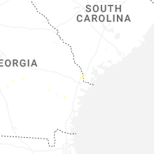
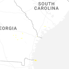
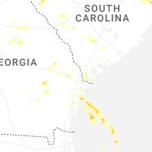


Connect with Interactive Hail Maps