

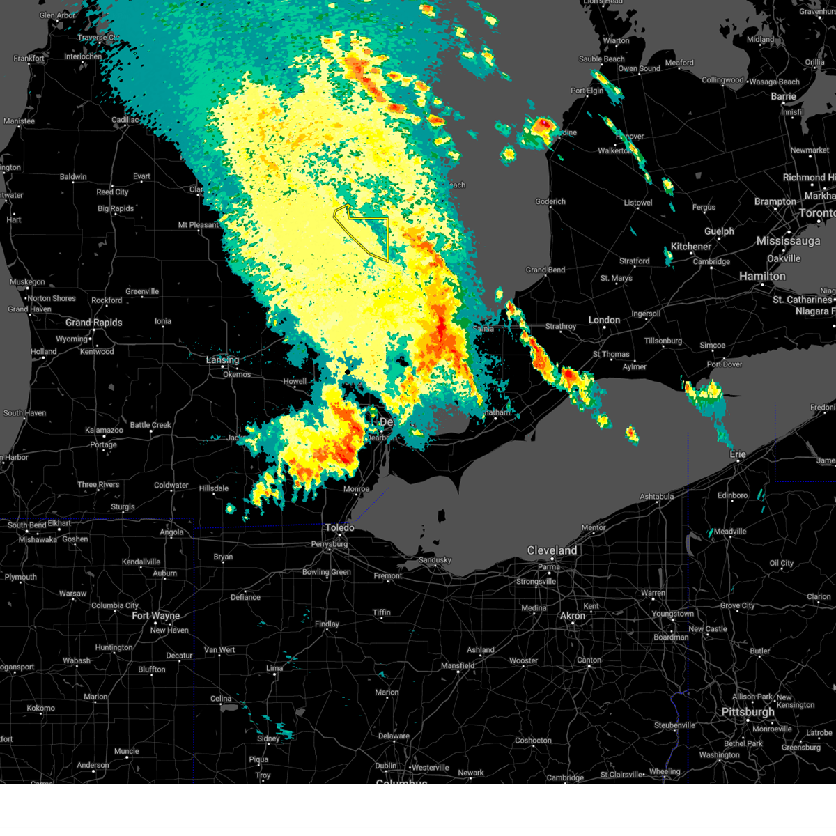
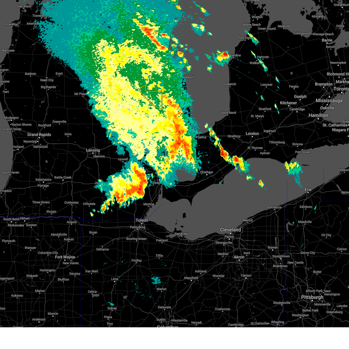
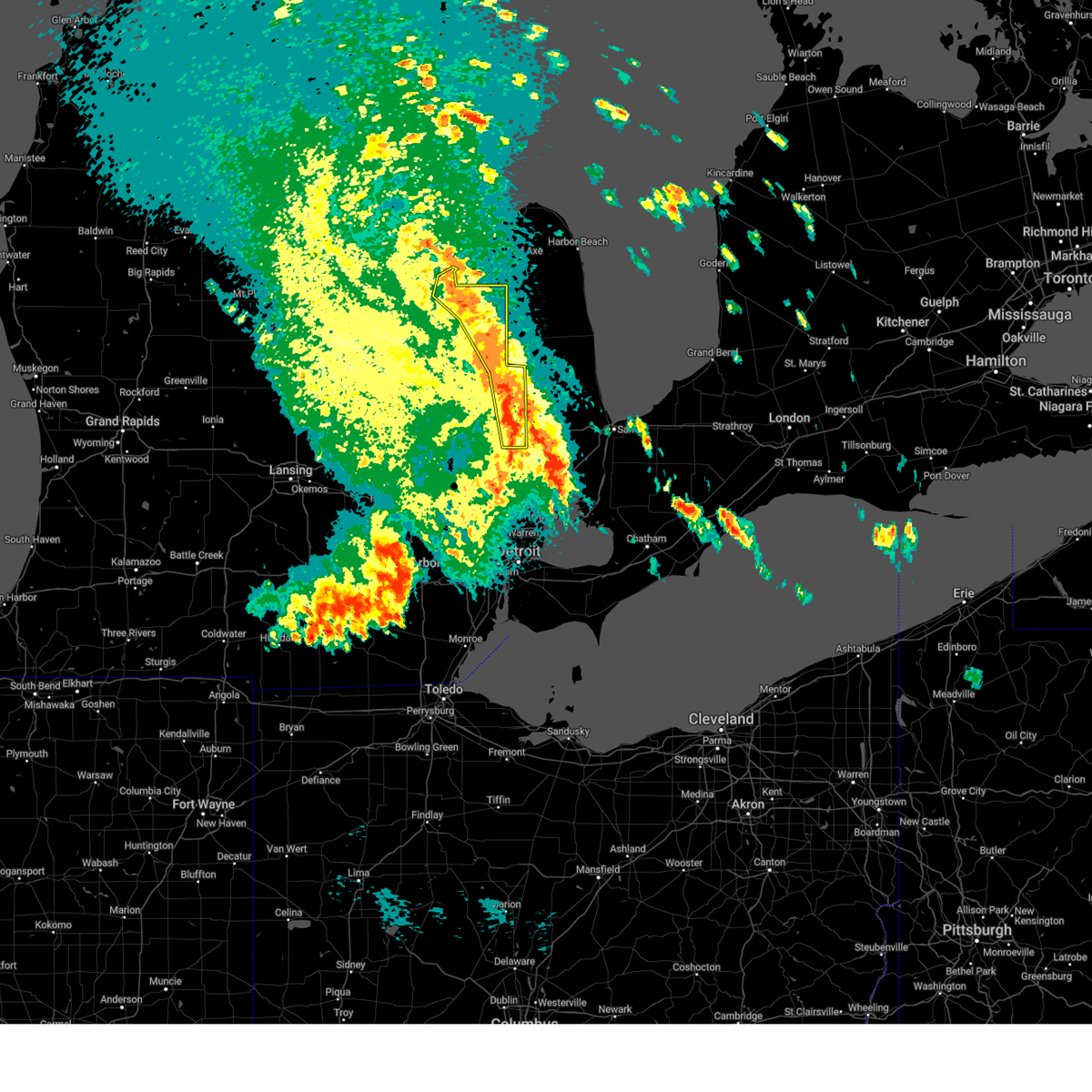
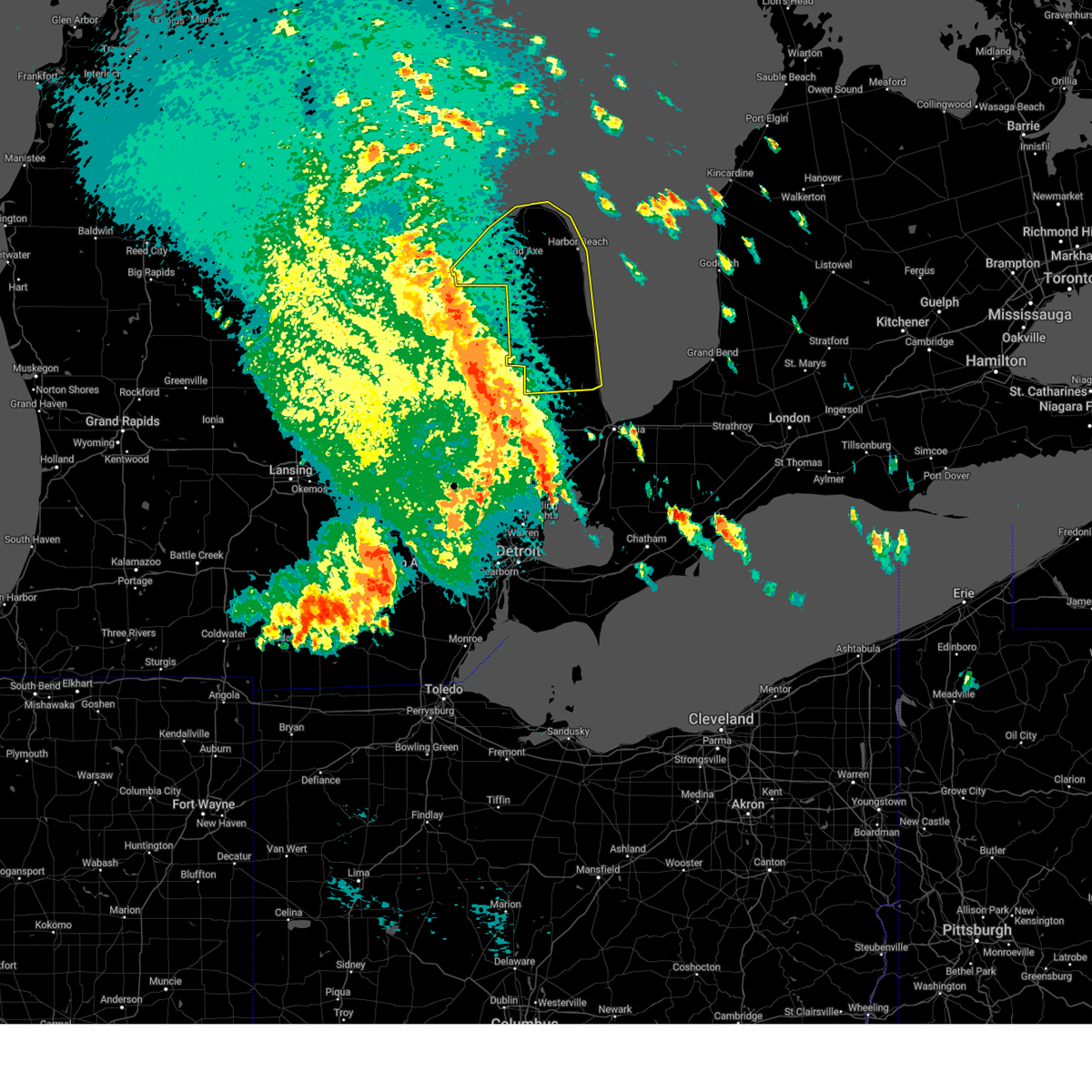
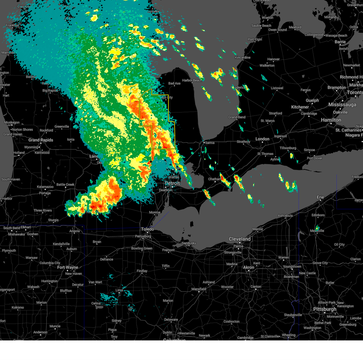
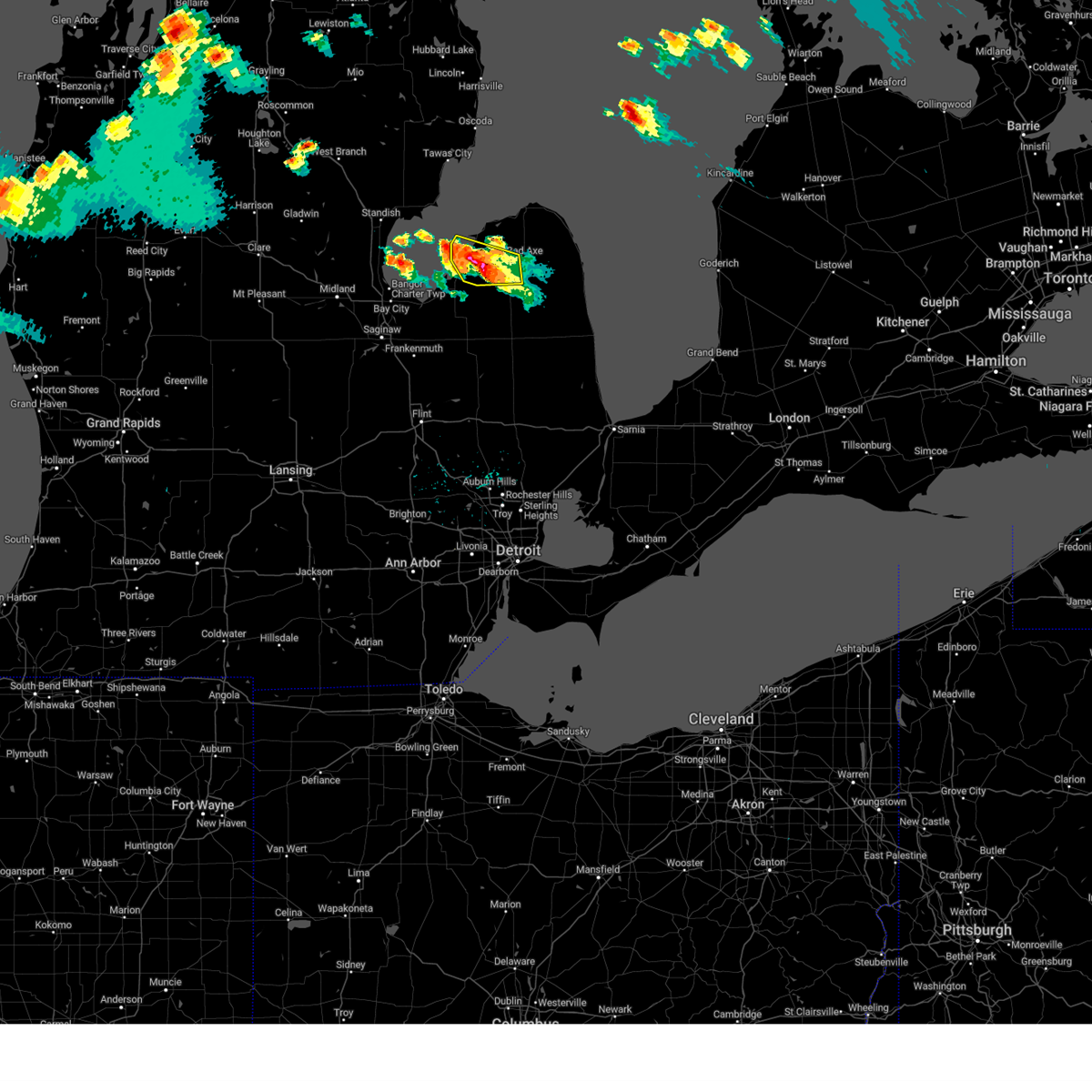
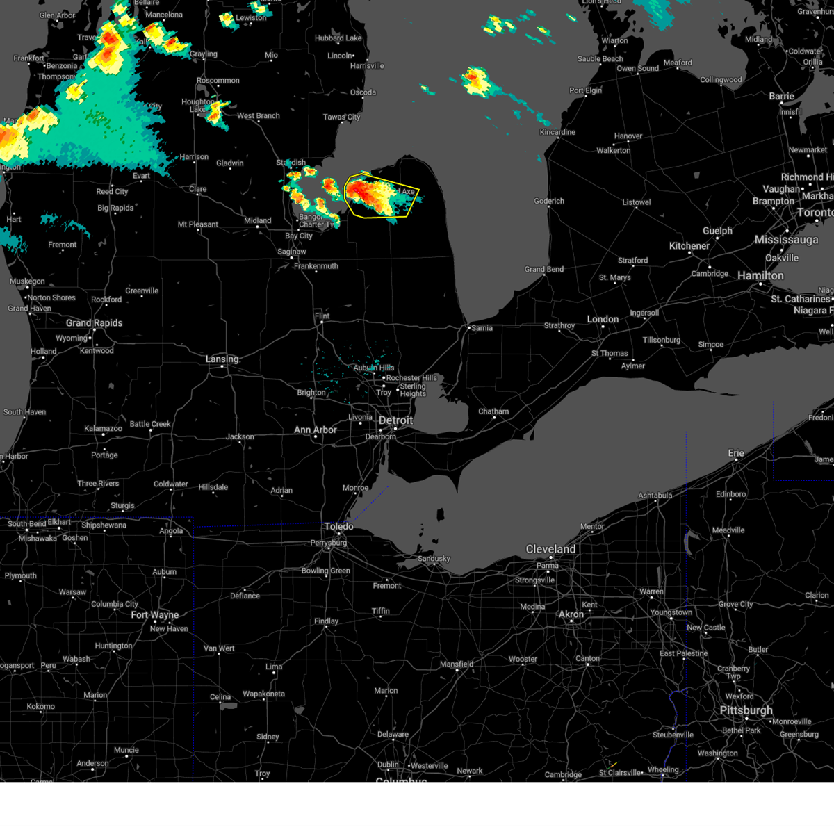
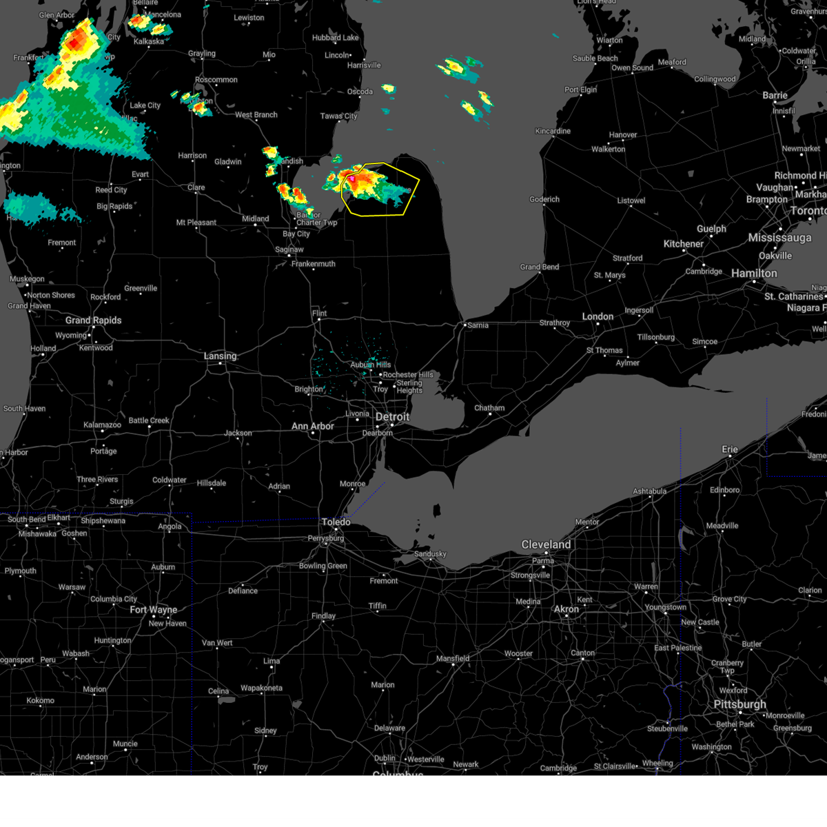
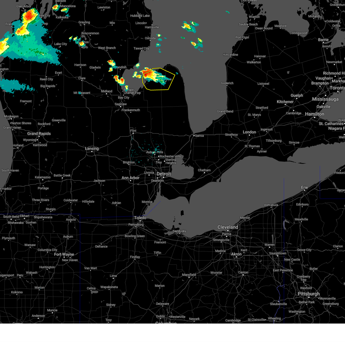
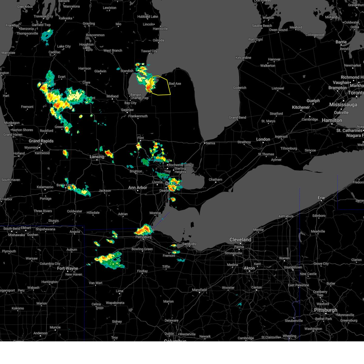
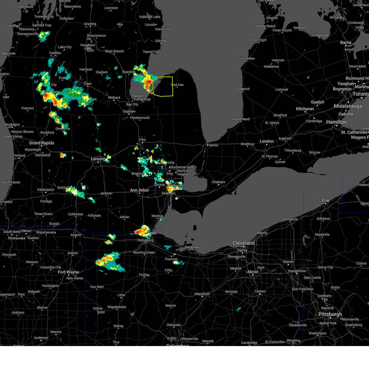
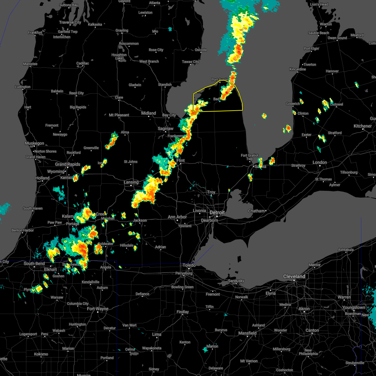
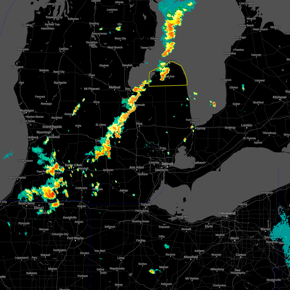
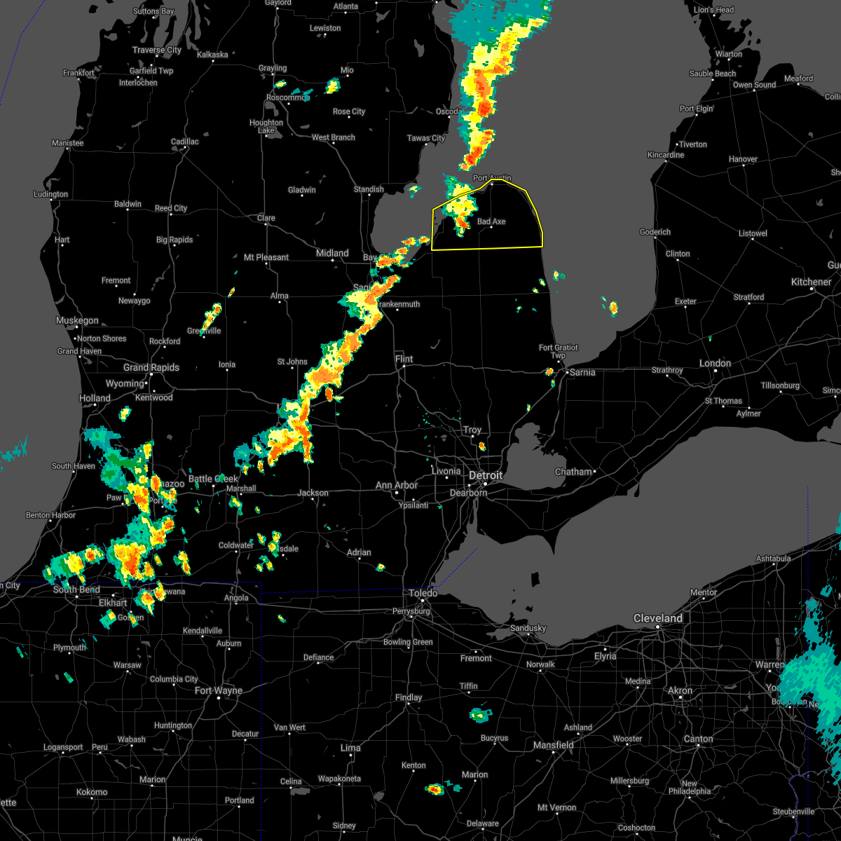
Hail Map for Sebewaing, MI
The Sebewaing, MI area has had 1 report of on-the-ground hail by trained spotters, and has been under severe weather warnings 23 times during the past 12 months. Doppler radar has detected hail at or near Sebewaing, MI on 31 occasions, including 2 occasions during the past year.
| Name: | Sebewaing, MI |
| Where Located: | 51.2 miles NNE of Flint, MI |
| Map: | Google Map for Sebewaing, MI |
| Population: | 1759 |
| Housing Units: | 917 |
| More Info: | Search Google for Sebewaing, MI |
2
The Top Recent Hail Date for Sebewaing, MI is Wednesday, April 2, 2025 (4th out of 31)

Hail and Wind Damage Spotted near Sebewaing, MI
| Date / Time | Report Details |
|---|---|
| 5/16/2025 1:24 AM EDT |
 The storms which prompted the warning have moved out of the area. therefore, the warning will be allowed to expire. a tornado watch remains in effect until 500 am edt for southeastern michigan. The storms which prompted the warning have moved out of the area. therefore, the warning will be allowed to expire. a tornado watch remains in effect until 500 am edt for southeastern michigan.
|
| 5/16/2025 1:19 AM EDT |
 At 119 am edt, severe thunderstorms were located along a line extending from pigeon to near argyle to near croswell, moving northeast at 45 mph (radar indicated). Hazards include 60 mph wind gusts. Expect damage to roofs, siding, and trees. these severe storms will be near, bad axe, croswell, lexington, ubly, deckerville, port sanilac, carsonville, and applegate around 125 am edt. forestville and kinde around 130 am edt. harbor beach around 140 am edt. port hope around 145 am edt. Other locations impacted by these severe thunderstorms include parisville, huron city, white rock, ivanhoe, rapson, grindstone city, amador, juhl, elmer, and new greenleaf. At 119 am edt, severe thunderstorms were located along a line extending from pigeon to near argyle to near croswell, moving northeast at 45 mph (radar indicated). Hazards include 60 mph wind gusts. Expect damage to roofs, siding, and trees. these severe storms will be near, bad axe, croswell, lexington, ubly, deckerville, port sanilac, carsonville, and applegate around 125 am edt. forestville and kinde around 130 am edt. harbor beach around 140 am edt. port hope around 145 am edt. Other locations impacted by these severe thunderstorms include parisville, huron city, white rock, ivanhoe, rapson, grindstone city, amador, juhl, elmer, and new greenleaf.
|
| 5/16/2025 1:18 AM EDT |
 At 117 am edt, severe thunderstorms were located along a line extending from near bad axe to near deckerville to near lexington, moving east at 55 mph (radar indicated). Hazards include 60 mph wind gusts. Expect damage to roofs, siding, and trees. Locations impacted include, cass city, unionville, kingston, gagetown, ellington, wilmot, deford, colling, and colwood. At 117 am edt, severe thunderstorms were located along a line extending from near bad axe to near deckerville to near lexington, moving east at 55 mph (radar indicated). Hazards include 60 mph wind gusts. Expect damage to roofs, siding, and trees. Locations impacted include, cass city, unionville, kingston, gagetown, ellington, wilmot, deford, colling, and colwood.
|
| 5/16/2025 1:18 AM EDT |
 the severe thunderstorm warning has been cancelled and is no longer in effect the severe thunderstorm warning has been cancelled and is no longer in effect
|
| 5/16/2025 1:04 AM EDT |
 At 104 am edt, severe thunderstorms were located along a line extending from near owendale to 6 miles northeast of marlette to near emmett, moving east at 55 mph (radar indicated). Hazards include 60 mph wind gusts. Expect damage to roofs, siding, and trees. These severe thunderstorms will remain over mainly rural areas of northeastern tuscola and eastern lapeer counties, including the following locations, goodland township, east dayton, attica, colling, wilmot, wisner, ellington, silverwood, deford, and burnside. At 104 am edt, severe thunderstorms were located along a line extending from near owendale to 6 miles northeast of marlette to near emmett, moving east at 55 mph (radar indicated). Hazards include 60 mph wind gusts. Expect damage to roofs, siding, and trees. These severe thunderstorms will remain over mainly rural areas of northeastern tuscola and eastern lapeer counties, including the following locations, goodland township, east dayton, attica, colling, wilmot, wisner, ellington, silverwood, deford, and burnside.
|
| 5/16/2025 12:56 AM EDT |
 Svrdtx the national weather service in detroit/pontiac has issued a * severe thunderstorm warning for, sanilac county in southeastern michigan, huron county in southeastern michigan, * until 215 am edt. * at 1255 am edt, severe thunderstorms were located along a line extending from sebewaing to 6 miles northwest of kingston to near brown city, moving northeast at 45 mph (radar indicated). Hazards include 60 mph wind gusts. Expect damage to roofs, siding, and trees. severe thunderstorms will be near, marlette, brown city, owendale, and melvin around 100 am edt. pigeon and peck around 105 am edt. sandusky, elkton, and argyle around 110 am edt. bad axe around 115 am edt. croswell, ubly, deckerville, carsonville, and applegate around 120 am edt. lexington and kinde around 125 am edt. port sanilac around 130 am edt. forestville around 135 am edt. Other locations impacted by these severe thunderstorms include parisville, huron city, white rock, ivanhoe, rapson, grindstone city, amador, juhl, elmer, and new greenleaf. Svrdtx the national weather service in detroit/pontiac has issued a * severe thunderstorm warning for, sanilac county in southeastern michigan, huron county in southeastern michigan, * until 215 am edt. * at 1255 am edt, severe thunderstorms were located along a line extending from sebewaing to 6 miles northwest of kingston to near brown city, moving northeast at 45 mph (radar indicated). Hazards include 60 mph wind gusts. Expect damage to roofs, siding, and trees. severe thunderstorms will be near, marlette, brown city, owendale, and melvin around 100 am edt. pigeon and peck around 105 am edt. sandusky, elkton, and argyle around 110 am edt. bad axe around 115 am edt. croswell, ubly, deckerville, carsonville, and applegate around 120 am edt. lexington and kinde around 125 am edt. port sanilac around 130 am edt. forestville around 135 am edt. Other locations impacted by these severe thunderstorms include parisville, huron city, white rock, ivanhoe, rapson, grindstone city, amador, juhl, elmer, and new greenleaf.
|
| 5/16/2025 12:43 AM EDT |
 At 1243 am edt, severe thunderstorms were located along a line extending from near quanicassee to near mayville to near almont, moving east at 55 mph (radar indicated). Hazards include 60 mph wind gusts. Expect damage to roofs, siding, and trees. these severe storms will be near, caro, sebewaing, brown city, unionville, kingston, and clifford around 1250 am edt. cass city and gagetown around 1255 am edt. Other locations impacted by these severe thunderstorms include goodland township, east dayton, attica, tuscola, elba, colling, wilmot, wisner, ellington, and gilford. At 1243 am edt, severe thunderstorms were located along a line extending from near quanicassee to near mayville to near almont, moving east at 55 mph (radar indicated). Hazards include 60 mph wind gusts. Expect damage to roofs, siding, and trees. these severe storms will be near, caro, sebewaing, brown city, unionville, kingston, and clifford around 1250 am edt. cass city and gagetown around 1255 am edt. Other locations impacted by these severe thunderstorms include goodland township, east dayton, attica, tuscola, elba, colling, wilmot, wisner, ellington, and gilford.
|
| 5/16/2025 12:25 AM EDT |
 Svrdtx the national weather service in detroit/pontiac has issued a * severe thunderstorm warning for, tuscola county in southeastern michigan, lapeer county in southeastern michigan, * until 130 am edt. * at 1225 am edt, severe thunderstorms were located along a line extending from near auburn to birch run to fenton, moving east at 55 mph (radar indicated). Hazards include 60 mph wind gusts. Expect damage to roofs, siding, and trees. severe thunderstorms will be near, reese around 1230 am edt. vassar, millington, otter lake, and quanicassee around 1235 am edt. lapeer, columbiaville, hadley, and fairgrove around 1240 am edt. caro, mayville, akron, and metamora around 1245 am edt. sebewaing, north branch, unionville, and clifford around 1250 am edt. imlay city, almont, dryden, kingston, and lum around 1255 am edt. cass city, brown city, and gagetown around 100 am edt. Other locations impacted by these severe thunderstorms include goodland township, east dayton, attica, tuscola, elba, colling, wilmot, wisner, ellington, and gilford. Svrdtx the national weather service in detroit/pontiac has issued a * severe thunderstorm warning for, tuscola county in southeastern michigan, lapeer county in southeastern michigan, * until 130 am edt. * at 1225 am edt, severe thunderstorms were located along a line extending from near auburn to birch run to fenton, moving east at 55 mph (radar indicated). Hazards include 60 mph wind gusts. Expect damage to roofs, siding, and trees. severe thunderstorms will be near, reese around 1230 am edt. vassar, millington, otter lake, and quanicassee around 1235 am edt. lapeer, columbiaville, hadley, and fairgrove around 1240 am edt. caro, mayville, akron, and metamora around 1245 am edt. sebewaing, north branch, unionville, and clifford around 1250 am edt. imlay city, almont, dryden, kingston, and lum around 1255 am edt. cass city, brown city, and gagetown around 100 am edt. Other locations impacted by these severe thunderstorms include goodland township, east dayton, attica, tuscola, elba, colling, wilmot, wisner, ellington, and gilford.
|
| 4/2/2025 8:45 PM EDT | At 844 pm edt, a severe thunderstorm was located near pigeon, or near caseville, moving northeast at 85 mph (radar indicated). Hazards include ping pong ball size hail. People and animals outdoors will be injured. expect damage to roofs, siding, windows, and vehicles. this severe storm will be near, port austin around 855 pm edt. Other locations impacted by this severe thunderstorm include pinnebog, port crescent state park, redman, filion, rapson, verona, bay port, bach, and grindstone city. |
| 4/2/2025 8:38 PM EDT | Svrdtx the national weather service in detroit/pontiac has issued a * severe thunderstorm warning for, huron county in southeastern michigan, * until 915 pm edt. * at 838 pm edt, a severe thunderstorm was located near sebewaing, moving northeast at 85 mph (radar indicated). Hazards include quarter size hail. Damage to vehicles is expected. this severe thunderstorm will be near, pigeon and caseville around 845 pm edt. port austin around 855 pm edt. Other locations impacted by this severe thunderstorm include pinnebog, port crescent state park, redman, filion, rapson, verona, bay port, bach, and grindstone city. |
| 3/30/2025 7:54 PM EDT | At 754 pm edt, severe thunderstorms were located along a line extending from 12 miles southeast of au gres to sebewaing to near cass city, moving northeast at 60 mph (radar indicated). Hazards include 60 mph wind gusts and penny size hail. Expect damage to roofs, siding, and trees. these severe storms will be near, pigeon and owendale around 800 pm edt. elkton and caseville around 805 pm edt. bad axe and ubly around 810 pm edt. kinde around 815 pm edt. port austin around 820 pm edt. harbor beach around 825 pm edt. port hope around 830 pm edt. Other locations impacted by these severe thunderstorms include redman, parisville, huron city, white rock, ivanhoe, rapson, grindstone city, bay port, pinnebog, and ruth. |
| 3/30/2025 7:41 PM EDT |
 At 741 pm edt, severe thunderstorms were located along a line extending from near quanicassee to mayville to lum, moving northeast at 65 mph (radar indicated). Hazards include 70 mph wind gusts and penny size hail. Expect considerable tree damage. damage is likely to mobile homes, roofs, and outbuildings. these severe storms will be near, akron, north branch, clifford, caro, kingston, and unionville around 745 pm edt. gagetown, cass city, and brown city around 750 pm edt. other locations impacted by these severe thunderstorms include goodland township, east dayton, attica, colling, wilmot, wisner, ellington, gilford, silverwood, and deford. This includes i-69 between mile markers 159 and 172. At 741 pm edt, severe thunderstorms were located along a line extending from near quanicassee to mayville to lum, moving northeast at 65 mph (radar indicated). Hazards include 70 mph wind gusts and penny size hail. Expect considerable tree damage. damage is likely to mobile homes, roofs, and outbuildings. these severe storms will be near, akron, north branch, clifford, caro, kingston, and unionville around 745 pm edt. gagetown, cass city, and brown city around 750 pm edt. other locations impacted by these severe thunderstorms include goodland township, east dayton, attica, colling, wilmot, wisner, ellington, gilford, silverwood, and deford. This includes i-69 between mile markers 159 and 172.
|
| 3/30/2025 7:40 PM EDT |
 Svrdtx the national weather service in detroit/pontiac has issued a * severe thunderstorm warning for, huron county in southeastern michigan, * until 845 pm edt. * at 740 pm edt, severe thunderstorms were located along a line extending from 10 miles east of pinconning to near quanicassee to near vassar, moving northeast at 60 mph (radar indicated). Hazards include 60 mph wind gusts and penny size hail. Expect damage to roofs, siding, and trees. severe thunderstorms will be near, sebewaing around 745 pm edt. owendale around 755 pm edt. pigeon, elkton, and caseville around 800 pm edt. bad axe around 810 pm edt. kinde and ubly around 815 pm edt. port austin around 820 pm edt. port hope and harbor beach around 830 pm edt. Other locations impacted by these severe thunderstorms include redman, parisville, huron city, white rock, ivanhoe, rapson, grindstone city, bay port, pinnebog, and ruth. Svrdtx the national weather service in detroit/pontiac has issued a * severe thunderstorm warning for, huron county in southeastern michigan, * until 845 pm edt. * at 740 pm edt, severe thunderstorms were located along a line extending from 10 miles east of pinconning to near quanicassee to near vassar, moving northeast at 60 mph (radar indicated). Hazards include 60 mph wind gusts and penny size hail. Expect damage to roofs, siding, and trees. severe thunderstorms will be near, sebewaing around 745 pm edt. owendale around 755 pm edt. pigeon, elkton, and caseville around 800 pm edt. bad axe around 810 pm edt. kinde and ubly around 815 pm edt. port austin around 820 pm edt. port hope and harbor beach around 830 pm edt. Other locations impacted by these severe thunderstorms include redman, parisville, huron city, white rock, ivanhoe, rapson, grindstone city, bay port, pinnebog, and ruth.
|
| 3/30/2025 7:31 PM EDT | At 730 pm edt, severe thunderstorms were located along a line extending from near munger to otter lake to near metamora, moving northeast at 65 mph (radar indicated). Hazards include 70 mph wind gusts and penny size hail. Expect considerable tree damage. damage is likely to mobile homes, roofs, and outbuildings. these severe storms will be near, lapeer, quanicassee, lum, fairgrove, vassar, and mayville around 735 pm edt. akron, north branch, imlay city, clifford, and caro around 740 pm edt. brown city, kingston, and unionville around 745 pm edt. gagetown and cass city around 750 pm edt. other locations impacted by these severe thunderstorms include goodland township, east dayton, attica, tuscola, elba, colling, wilmot, wisner, ellington, and gilford. This includes i-69 between mile markers 149 and 172. |
| 3/30/2025 7:15 PM EDT | Svrdtx the national weather service in detroit/pontiac has issued a * severe thunderstorm warning for, tuscola county in southeastern michigan, lapeer county in southeastern michigan, * until 815 pm edt. * at 715 pm edt, severe thunderstorms were located along a line extending from near bridgeport to near beecher to near ortonville, moving northeast at 65 mph (radar indicated). Hazards include 70 mph wind gusts and penny size hail. Expect considerable tree damage. damage is likely to mobile homes, roofs, and outbuildings. severe thunderstorms will be near, hadley around 720 pm edt. lapeer, otter lake, millington, vassar, reese, metamora, and columbiaville around 725 pm edt. quanicassee around 730 pm edt. lum, akron, north branch, fairgrove, caro, and mayville around 735 pm edt. clifford and unionville around 740 pm edt. brown city and kingston around 745 pm edt. gagetown and cass city around 750 pm edt. other locations impacted by these severe thunderstorms include goodland township, east dayton, attica, tuscola, elba, colling, wilmot, wisner, ellington, and gilford. This includes i-69 between mile markers 149 and 172. |
| 11/10/2024 7:11 PM EST |
 Svrdtx the national weather service in detroit/pontiac has issued a * severe thunderstorm warning for, tuscola county in southeastern michigan, sanilac county in southeastern michigan, northeastern lapeer county in southeastern michigan, huron county in southeastern michigan, * until 830 pm est. * at 710 pm est, severe thunderstorms were located along a line extending from near sebewaing to near caro to near millington, moving east at 45 mph (radar indicated). Hazards include 60 mph wind gusts. Expect damage to roofs, siding, and trees. severe thunderstorms will be near, cass city, millington, mayville, pigeon, gagetown, and owendale around 715 pm est. elkton and kingston around 720 pm est. clifford around 725 pm est. bad axe, marlette, and argyle around 730 pm est. ubly around 735 pm est. sandusky and deckerville around 740 pm est. harbor beach, forestville, and carsonville around 755 pm est. port sanilac and applegate around 800 pm est. Other locations impacted by these severe thunderstorms include parisville, colling, white rock, ivanhoe, rapson, ellington, juhl, elmer, silverwood, and new greenleaf. Svrdtx the national weather service in detroit/pontiac has issued a * severe thunderstorm warning for, tuscola county in southeastern michigan, sanilac county in southeastern michigan, northeastern lapeer county in southeastern michigan, huron county in southeastern michigan, * until 830 pm est. * at 710 pm est, severe thunderstorms were located along a line extending from near sebewaing to near caro to near millington, moving east at 45 mph (radar indicated). Hazards include 60 mph wind gusts. Expect damage to roofs, siding, and trees. severe thunderstorms will be near, cass city, millington, mayville, pigeon, gagetown, and owendale around 715 pm est. elkton and kingston around 720 pm est. clifford around 725 pm est. bad axe, marlette, and argyle around 730 pm est. ubly around 735 pm est. sandusky and deckerville around 740 pm est. harbor beach, forestville, and carsonville around 755 pm est. port sanilac and applegate around 800 pm est. Other locations impacted by these severe thunderstorms include parisville, colling, white rock, ivanhoe, rapson, ellington, juhl, elmer, silverwood, and new greenleaf.
|
| 8/27/2024 5:16 PM EDT |
 the severe thunderstorm warning has been cancelled and is no longer in effect the severe thunderstorm warning has been cancelled and is no longer in effect
|
| 8/27/2024 4:58 PM EDT |
 At 458 pm edt, severe thunderstorms were located along a line extending from near gagetown to near kingston to near clio, moving southeast at 40 mph (radar indicated). Hazards include 60 mph wind gusts and penny size hail. Expect damage to roofs, siding, and trees. these severe storms will be near, cass city, mayville, and kingston around 505 pm edt. Other locations impacted by these severe thunderstorms include east dayton, tuscola, colling, wilmot, wisner, ellington, gilford, richville, deford, and colwood. At 458 pm edt, severe thunderstorms were located along a line extending from near gagetown to near kingston to near clio, moving southeast at 40 mph (radar indicated). Hazards include 60 mph wind gusts and penny size hail. Expect damage to roofs, siding, and trees. these severe storms will be near, cass city, mayville, and kingston around 505 pm edt. Other locations impacted by these severe thunderstorms include east dayton, tuscola, colling, wilmot, wisner, ellington, gilford, richville, deford, and colwood.
|
| 8/27/2024 4:43 PM EDT |
 At 443 pm edt, severe thunderstorms were located along a line extending from near caseville to pigeon to near gagetown, moving east at 45 mph (radar indicated). Hazards include 70 mph wind gusts and penny size hail. Expect considerable tree damage. damage is likely to mobile homes, roofs, and outbuildings. these severe storms will be near, elkton and owendale around 450 pm edt. bad axe, port austin, and kinde around 455 pm edt. ubly around 505 pm edt. port hope around 515 pm edt. harbor beach around 520 pm edt. Other locations impacted by these severe thunderstorms include redman, parisville, huron city, white rock, ivanhoe, rapson, grindstone city, bay port, pinnebog, and ruth. At 443 pm edt, severe thunderstorms were located along a line extending from near caseville to pigeon to near gagetown, moving east at 45 mph (radar indicated). Hazards include 70 mph wind gusts and penny size hail. Expect considerable tree damage. damage is likely to mobile homes, roofs, and outbuildings. these severe storms will be near, elkton and owendale around 450 pm edt. bad axe, port austin, and kinde around 455 pm edt. ubly around 505 pm edt. port hope around 515 pm edt. harbor beach around 520 pm edt. Other locations impacted by these severe thunderstorms include redman, parisville, huron city, white rock, ivanhoe, rapson, grindstone city, bay port, pinnebog, and ruth.
|
| 8/27/2024 4:42 PM EDT |
 At 441 pm edt, severe thunderstorms were located along a line extending from near sebewaing to near akron to clio, moving east at 30 mph (radar indicated). Hazards include 70 mph wind gusts and penny size hail. Expect considerable tree damage. damage is likely to mobile homes, roofs, and outbuildings. these severe storms will be near, caro, vassar, and millington around 445 pm edt. gagetown around 450 pm edt. cass city and mayville around 455 pm edt. kingston around 505 pm edt. Other locations impacted by these severe thunderstorms include east dayton, tuscola, colling, wilmot, wisner, ellington, gilford, richville, deford, and colwood. At 441 pm edt, severe thunderstorms were located along a line extending from near sebewaing to near akron to clio, moving east at 30 mph (radar indicated). Hazards include 70 mph wind gusts and penny size hail. Expect considerable tree damage. damage is likely to mobile homes, roofs, and outbuildings. these severe storms will be near, caro, vassar, and millington around 445 pm edt. gagetown around 450 pm edt. cass city and mayville around 455 pm edt. kingston around 505 pm edt. Other locations impacted by these severe thunderstorms include east dayton, tuscola, colling, wilmot, wisner, ellington, gilford, richville, deford, and colwood.
|
| 8/27/2024 4:40 PM EDT | Large tree down across center st near m25 and beck in huron county MI, 0.5 miles SSW of Sebewaing, MI |
| 8/27/2024 4:30 PM EDT | Multiple 3+ inch tree limbs dow in huron county MI, 0.2 miles NW of Sebewaing, MI |
| 8/27/2024 4:27 PM EDT |
 Svrdtx the national weather service in detroit/pontiac has issued a * severe thunderstorm warning for, huron county in southeastern michigan, * until 545 pm edt. * at 427 pm edt, severe thunderstorms were located along a line extending from 9 miles southeast of au gres to 7 miles northwest of sebewaing to 6 miles west of unionville, moving east at 45 mph (radar indicated). Hazards include 70 mph wind gusts and penny size hail. Expect considerable tree damage. damage is likely to mobile homes, roofs, and outbuildings. severe thunderstorms will be near, sebewaing around 430 pm edt. caseville and pigeon around 440 pm edt. owendale around 445 pm edt. elkton around 450 pm edt. bad axe, port austin, and kinde around 500 pm edt. port hope around 525 pm edt. harbor beach around 530 pm edt. Other locations impacted by these severe thunderstorms include redman, parisville, huron city, white rock, ivanhoe, rapson, grindstone city, bay port, pinnebog, and ruth. Svrdtx the national weather service in detroit/pontiac has issued a * severe thunderstorm warning for, huron county in southeastern michigan, * until 545 pm edt. * at 427 pm edt, severe thunderstorms were located along a line extending from 9 miles southeast of au gres to 7 miles northwest of sebewaing to 6 miles west of unionville, moving east at 45 mph (radar indicated). Hazards include 70 mph wind gusts and penny size hail. Expect considerable tree damage. damage is likely to mobile homes, roofs, and outbuildings. severe thunderstorms will be near, sebewaing around 430 pm edt. caseville and pigeon around 440 pm edt. owendale around 445 pm edt. elkton around 450 pm edt. bad axe, port austin, and kinde around 500 pm edt. port hope around 525 pm edt. harbor beach around 530 pm edt. Other locations impacted by these severe thunderstorms include redman, parisville, huron city, white rock, ivanhoe, rapson, grindstone city, bay port, pinnebog, and ruth.
|
| 8/27/2024 4:25 PM EDT |
 At 424 pm edt, severe thunderstorms were located along a line extending from 9 miles west of sebewaing to quanicassee to bridgeport, moving east at 30 mph (radar indicated). Hazards include 70 mph wind gusts and penny size hail. Expect considerable tree damage. damage is likely to mobile homes, roofs, and outbuildings. these severe storms will be near, reese and quanicassee around 430 pm edt. akron, fairgrove, and unionville around 435 pm edt. vassar around 440 pm edt. caro around 450 pm edt. millington and gagetown around 455 pm edt. cass city and mayville around 505 pm edt. kingston around 515 pm edt. Other locations impacted by these severe thunderstorms include east dayton, tuscola, colling, wilmot, wisner, ellington, gilford, richville, deford, and colwood. At 424 pm edt, severe thunderstorms were located along a line extending from 9 miles west of sebewaing to quanicassee to bridgeport, moving east at 30 mph (radar indicated). Hazards include 70 mph wind gusts and penny size hail. Expect considerable tree damage. damage is likely to mobile homes, roofs, and outbuildings. these severe storms will be near, reese and quanicassee around 430 pm edt. akron, fairgrove, and unionville around 435 pm edt. vassar around 440 pm edt. caro around 450 pm edt. millington and gagetown around 455 pm edt. cass city and mayville around 505 pm edt. kingston around 515 pm edt. Other locations impacted by these severe thunderstorms include east dayton, tuscola, colling, wilmot, wisner, ellington, gilford, richville, deford, and colwood.
|
| 8/27/2024 4:13 PM EDT |
 Svrdtx the national weather service in detroit/pontiac has issued a * severe thunderstorm warning for, tuscola county in southeastern michigan, * until 545 pm edt. * at 413 pm edt, severe thunderstorms were located along a line extending from 8 miles east of linwood to essexville to 6 miles south of freeland, moving east at 30 mph (radar indicated). Hazards include 60 mph wind gusts and penny size hail. Expect damage to roofs, siding, and trees. severe thunderstorms will be near, quanicassee around 420 pm edt. reese around 430 pm edt. fairgrove around 435 pm edt. akron and unionville around 440 pm edt. caro and vassar around 450 pm edt. gagetown around 500 pm edt. millington around 505 pm edt. cass city around 510 pm edt. Other locations impacted by these severe thunderstorms include east dayton, tuscola, colling, wilmot, wisner, ellington, gilford, richville, deford, and colwood. Svrdtx the national weather service in detroit/pontiac has issued a * severe thunderstorm warning for, tuscola county in southeastern michigan, * until 545 pm edt. * at 413 pm edt, severe thunderstorms were located along a line extending from 8 miles east of linwood to essexville to 6 miles south of freeland, moving east at 30 mph (radar indicated). Hazards include 60 mph wind gusts and penny size hail. Expect damage to roofs, siding, and trees. severe thunderstorms will be near, quanicassee around 420 pm edt. reese around 430 pm edt. fairgrove around 435 pm edt. akron and unionville around 440 pm edt. caro and vassar around 450 pm edt. gagetown around 500 pm edt. millington around 505 pm edt. cass city around 510 pm edt. Other locations impacted by these severe thunderstorms include east dayton, tuscola, colling, wilmot, wisner, ellington, gilford, richville, deford, and colwood.
|
| 8/3/2023 6:08 PM EDT |
 At 606 pm edt, a severe thunderstorm was located near owendale, or near sebewaing, moving southeast at 30 mph (radar indicated). Hazards include golf ball size hail and 60 mph wind gusts. People and animals outdoors will be injured. expect hail damage to roofs, siding, windows, and vehicles. expect wind damage to roofs, siding, and trees. this severe storm will be near, owendale around 610 pm edt. Other locations impacted by this severe thunderstorm include ivanhoe, bay port and bach. At 606 pm edt, a severe thunderstorm was located near owendale, or near sebewaing, moving southeast at 30 mph (radar indicated). Hazards include golf ball size hail and 60 mph wind gusts. People and animals outdoors will be injured. expect hail damage to roofs, siding, windows, and vehicles. expect wind damage to roofs, siding, and trees. this severe storm will be near, owendale around 610 pm edt. Other locations impacted by this severe thunderstorm include ivanhoe, bay port and bach.
|
| 8/3/2023 6:02 PM EDT | Quarter sized hail reported 0.2 miles NW of Sebewaing, MI, in addition to quarter size hail... photos of downed trees and tree limbs also included with report. |
| 8/3/2023 6:02 PM EDT | Multiple reports of trees and tree limbs down around the intersection of sebawaing rd. and m25. similar damage reported on kuhl rd. and geiger r in huron county MI, 0.2 miles NW of Sebewaing, MI |
| 8/3/2023 5:54 PM EDT |
 At 554 pm edt, a severe thunderstorm was located near sebewaing, moving southeast at 20 mph (radar indicated). Hazards include golf ball size hail and 60 mph wind gusts. People and animals outdoors will be injured. expect hail damage to roofs, siding, windows, and vehicles. expect wind damage to roofs, siding, and trees. this severe storm will be near, pigeon around 610 pm edt. owendale around 620 pm edt. elkton around 625 pm edt. other locations impacted by this severe thunderstorm include ivanhoe, rapson, verona, bay port and bach. People attending huron county fairgrounds should seek safe shelter immediately!. At 554 pm edt, a severe thunderstorm was located near sebewaing, moving southeast at 20 mph (radar indicated). Hazards include golf ball size hail and 60 mph wind gusts. People and animals outdoors will be injured. expect hail damage to roofs, siding, windows, and vehicles. expect wind damage to roofs, siding, and trees. this severe storm will be near, pigeon around 610 pm edt. owendale around 620 pm edt. elkton around 625 pm edt. other locations impacted by this severe thunderstorm include ivanhoe, rapson, verona, bay port and bach. People attending huron county fairgrounds should seek safe shelter immediately!.
|
| 8/3/2023 5:43 PM EDT |
 At 542 pm edt, a severe thunderstorm was located near pigeon, or near caseville, moving southeast at 40 mph (radar indicated). Hazards include golf ball size hail and 60 mph wind gusts. People and animals outdoors will be injured. expect hail damage to roofs, siding, windows, and vehicles. expect wind damage to roofs, siding, and trees. this severe storm will be near, pigeon around 545 pm edt. owendale around 550 pm edt. elkton around 555 pm edt. bad axe around 605 pm edt. ubly around 615 pm edt. other locations impacted by this severe thunderstorm include pinnebog, filion, ivanhoe, rapson, verona, bay port and bach. people attending huron county fairgrounds should seek safe shelter immediately! thunderstorm damage threat, considerable hail threat, radar indicated max hail size, 1. 75 in wind threat, radar indicated max wind gust, 60 mph. At 542 pm edt, a severe thunderstorm was located near pigeon, or near caseville, moving southeast at 40 mph (radar indicated). Hazards include golf ball size hail and 60 mph wind gusts. People and animals outdoors will be injured. expect hail damage to roofs, siding, windows, and vehicles. expect wind damage to roofs, siding, and trees. this severe storm will be near, pigeon around 545 pm edt. owendale around 550 pm edt. elkton around 555 pm edt. bad axe around 605 pm edt. ubly around 615 pm edt. other locations impacted by this severe thunderstorm include pinnebog, filion, ivanhoe, rapson, verona, bay port and bach. people attending huron county fairgrounds should seek safe shelter immediately! thunderstorm damage threat, considerable hail threat, radar indicated max hail size, 1. 75 in wind threat, radar indicated max wind gust, 60 mph.
|
| 8/3/2023 5:33 PM EDT |
 At 532 pm edt, a severe thunderstorm was located near caseville, moving southeast at 30 mph (radar indicated). Hazards include 60 mph wind gusts and quarter size hail. Hail damage to vehicles is expected. expect wind damage to roofs, siding, and trees. this severe thunderstorm will be near, caseville around 540 pm edt. pigeon around 545 pm edt. owendale around 555 pm edt. elkton around 600 pm edt. bad axe around 615 pm edt. ubly around 625 pm edt. other locations impacted by this severe thunderstorm include pinnebog, filion, ivanhoe, rapson, verona, bay port and bach. people attending huron county fairgrounds should seek safe shelter immediately! hail threat, radar indicated max hail size, 1. 00 in wind threat, radar indicated max wind gust, 60 mph. At 532 pm edt, a severe thunderstorm was located near caseville, moving southeast at 30 mph (radar indicated). Hazards include 60 mph wind gusts and quarter size hail. Hail damage to vehicles is expected. expect wind damage to roofs, siding, and trees. this severe thunderstorm will be near, caseville around 540 pm edt. pigeon around 545 pm edt. owendale around 555 pm edt. elkton around 600 pm edt. bad axe around 615 pm edt. ubly around 625 pm edt. other locations impacted by this severe thunderstorm include pinnebog, filion, ivanhoe, rapson, verona, bay port and bach. people attending huron county fairgrounds should seek safe shelter immediately! hail threat, radar indicated max hail size, 1. 00 in wind threat, radar indicated max wind gust, 60 mph.
|
| 7/22/2023 6:52 PM EDT |
 At 652 pm edt, a severe thunderstorm was located over sebewaing, moving southeast at 15 mph (radar indicated). Hazards include 60 mph wind gusts and penny size hail. Expect damage to roofs, siding, and trees. this severe storm will be near, sebewaing around 655 pm edt. owendale around 725 pm edt. Other locations impacted by this severe thunderstorm include bay port, bach and ivanhoe. At 652 pm edt, a severe thunderstorm was located over sebewaing, moving southeast at 15 mph (radar indicated). Hazards include 60 mph wind gusts and penny size hail. Expect damage to roofs, siding, and trees. this severe storm will be near, sebewaing around 655 pm edt. owendale around 725 pm edt. Other locations impacted by this severe thunderstorm include bay port, bach and ivanhoe.
|
| 7/22/2023 6:32 PM EDT |
 At 632 pm edt, a severe thunderstorm was located 8 miles north of sebewaing, moving southeast at 20 mph (radar indicated). Hazards include 60 mph wind gusts and quarter size hail. Hail damage to vehicles is expected. expect wind damage to roofs, siding, and trees. this severe thunderstorm will be near, sebewaing around 650 pm edt. pigeon around 700 pm edt. owendale around 710 pm edt. elkton around 720 pm edt. Other locations impacted by this severe thunderstorm include pinnebog, ivanhoe, bay port and bach. At 632 pm edt, a severe thunderstorm was located 8 miles north of sebewaing, moving southeast at 20 mph (radar indicated). Hazards include 60 mph wind gusts and quarter size hail. Hail damage to vehicles is expected. expect wind damage to roofs, siding, and trees. this severe thunderstorm will be near, sebewaing around 650 pm edt. pigeon around 700 pm edt. owendale around 710 pm edt. elkton around 720 pm edt. Other locations impacted by this severe thunderstorm include pinnebog, ivanhoe, bay port and bach.
|
| 9/21/2022 9:47 AM EDT |
 At 947 am edt, a severe thunderstorm was located near gagetown, or near cass city, moving east at 45 mph (radar indicated). Hazards include 60 mph wind gusts and quarter size hail. Hail damage to vehicles is expected. expect wind damage to roofs, siding, and trees. this severe thunderstorm will remain over mainly rural areas of northern tuscola and southwestern huron counties, including the following locations, colwood, wisner, ellington, bach, bay park and colling. hail threat, radar indicated max hail size, 1. 00 in wind threat, radar indicated max wind gust, 60 mph. At 947 am edt, a severe thunderstorm was located near gagetown, or near cass city, moving east at 45 mph (radar indicated). Hazards include 60 mph wind gusts and quarter size hail. Hail damage to vehicles is expected. expect wind damage to roofs, siding, and trees. this severe thunderstorm will remain over mainly rural areas of northern tuscola and southwestern huron counties, including the following locations, colwood, wisner, ellington, bach, bay park and colling. hail threat, radar indicated max hail size, 1. 00 in wind threat, radar indicated max wind gust, 60 mph.
|
| 9/21/2022 9:22 AM EDT |
 At 922 am edt, a severe thunderstorm was located near sebewaing, moving east at 50 mph (radar indicated). Hazards include 60 mph wind gusts and quarter size hail. Hail damage to vehicles is expected. expect wind damage to roofs, siding, and trees. this severe thunderstorm will be near, unionville around 925 am edt. sebewaing around 930 am edt. pigeon and owendale around 935 am edt. gagetown around 940 am edt. elkton around 945 am edt. other locations impacted by this severe thunderstorm include pinnebog, colling, colwood, wisner, ivanhoe, bay port, ellington, bach and bay park. hail threat, radar indicated max hail size, 1. 00 in wind threat, radar indicated max wind gust, 60 mph. At 922 am edt, a severe thunderstorm was located near sebewaing, moving east at 50 mph (radar indicated). Hazards include 60 mph wind gusts and quarter size hail. Hail damage to vehicles is expected. expect wind damage to roofs, siding, and trees. this severe thunderstorm will be near, unionville around 925 am edt. sebewaing around 930 am edt. pigeon and owendale around 935 am edt. gagetown around 940 am edt. elkton around 945 am edt. other locations impacted by this severe thunderstorm include pinnebog, colling, colwood, wisner, ivanhoe, bay port, ellington, bach and bay park. hail threat, radar indicated max hail size, 1. 00 in wind threat, radar indicated max wind gust, 60 mph.
|
| 8/29/2022 5:56 PM EDT |
 At 555 pm edt, severe thunderstorms were located along a line extending from 6 miles east of caseville to near argyle to clifford, moving east at 50 mph (radar indicated). Hazards include 60 mph wind gusts. Expect damage to roofs, siding, and trees. these severe thunderstorms will remain over mainly rural areas of tuscola and western huron counties, including the following locations, pinnebog, east dayton, deford, colling, wilmot, colwood, bay port, ellington, bach and fostoria. hail threat, radar indicated max hail size, <. 75 in wind threat, radar indicated max wind gust, 60 mph. At 555 pm edt, severe thunderstorms were located along a line extending from 6 miles east of caseville to near argyle to clifford, moving east at 50 mph (radar indicated). Hazards include 60 mph wind gusts. Expect damage to roofs, siding, and trees. these severe thunderstorms will remain over mainly rural areas of tuscola and western huron counties, including the following locations, pinnebog, east dayton, deford, colling, wilmot, colwood, bay port, ellington, bach and fostoria. hail threat, radar indicated max hail size, <. 75 in wind threat, radar indicated max wind gust, 60 mph.
|
| 8/29/2022 5:33 PM EDT |
 At 532 pm edt, severe thunderstorms were located along a line extending from 6 miles west of caseville to 6 miles southwest of gagetown to near millington, moving east at 50 mph (radar indicated). Hazards include 60 mph wind gusts. Expect damage to roofs, siding, and trees. these severe storms will be near, cass city, caseville, pigeon and gagetown around 540 pm edt. mayville around 550 pm edt. other locations impacted by these severe thunderstorms include arthur, colling, wisner, ellington, buena vista township, gera, gilford, indiantown, deford and colwood. hail threat, radar indicated max hail size, <. 75 in wind threat, radar indicated max wind gust, 60 mph. At 532 pm edt, severe thunderstorms were located along a line extending from 6 miles west of caseville to 6 miles southwest of gagetown to near millington, moving east at 50 mph (radar indicated). Hazards include 60 mph wind gusts. Expect damage to roofs, siding, and trees. these severe storms will be near, cass city, caseville, pigeon and gagetown around 540 pm edt. mayville around 550 pm edt. other locations impacted by these severe thunderstorms include arthur, colling, wisner, ellington, buena vista township, gera, gilford, indiantown, deford and colwood. hail threat, radar indicated max hail size, <. 75 in wind threat, radar indicated max wind gust, 60 mph.
|
| 8/29/2022 5:15 PM EDT |
 At 515 pm edt, severe thunderstorms were located along a line extending from 9 miles south of au gres to near quanicassee to near montrose, moving east at 50 mph (radar indicated). Hazards include 60 mph wind gusts. Expect damage to roofs, siding, and trees. severe thunderstorms will be near, akron and fairgrove around 520 pm edt. unionville around 525 pm edt. frankenmuth and caro around 530 pm edt. vassar, cass city, millington, caseville, pigeon and gagetown around 540 pm edt. mayville around 550 pm edt. kingston around 600 pm edt. other locations impacted by these severe thunderstorms include carrollton, arthur, colling, wisner, ellington, buena vista township, gera, gilford, indiantown and deford. hail threat, radar indicated max hail size, <. 75 in wind threat, radar indicated max wind gust, 60 mph. At 515 pm edt, severe thunderstorms were located along a line extending from 9 miles south of au gres to near quanicassee to near montrose, moving east at 50 mph (radar indicated). Hazards include 60 mph wind gusts. Expect damage to roofs, siding, and trees. severe thunderstorms will be near, akron and fairgrove around 520 pm edt. unionville around 525 pm edt. frankenmuth and caro around 530 pm edt. vassar, cass city, millington, caseville, pigeon and gagetown around 540 pm edt. mayville around 550 pm edt. kingston around 600 pm edt. other locations impacted by these severe thunderstorms include carrollton, arthur, colling, wisner, ellington, buena vista township, gera, gilford, indiantown and deford. hail threat, radar indicated max hail size, <. 75 in wind threat, radar indicated max wind gust, 60 mph.
|
| 6/16/2022 5:12 AM EDT |
 The severe thunderstorm warning for tuscola and western huron counties will expire at 515 am edt, the storms which prompted the warning have moved out of the area. therefore, the warning will be allowed to expire. The severe thunderstorm warning for tuscola and western huron counties will expire at 515 am edt, the storms which prompted the warning have moved out of the area. therefore, the warning will be allowed to expire.
|
| 6/16/2022 4:49 AM EDT | Central dispatch reported scattered trees down in the western and central part of huron county. some locations include sebewaing... owendale... filion... and ubly in huron county MI, 2.2 miles W of Sebewaing, MI |
| 6/16/2022 4:31 AM EDT |
 At 431 am edt, severe thunderstorms were located along a line extending from 9 miles west of sebewaing to quanicassee to near bridgeport, moving northeast at 65 mph (radar indicated). Hazards include 60 mph wind gusts and penny size hail. Expect damage to roofs, siding, and trees. severe thunderstorms will be near, vassar and unionville around 440 am edt. sebewaing, pigeon and fairgrove around 445 am edt. caro, caseville, akron and owendale around 450 am edt. elkton around 455 am edt. gagetown around 500 am edt. cass city around 505 am edt. other locations impacted by these severe thunderstorms include east dayton, tuscola, colling, wilmot, wisner, ivanhoe, bay port, ellington, gilford and richville. hail threat, radar indicated max hail size, 0. 75 in wind threat, radar indicated max wind gust, 60 mph. At 431 am edt, severe thunderstorms were located along a line extending from 9 miles west of sebewaing to quanicassee to near bridgeport, moving northeast at 65 mph (radar indicated). Hazards include 60 mph wind gusts and penny size hail. Expect damage to roofs, siding, and trees. severe thunderstorms will be near, vassar and unionville around 440 am edt. sebewaing, pigeon and fairgrove around 445 am edt. caro, caseville, akron and owendale around 450 am edt. elkton around 455 am edt. gagetown around 500 am edt. cass city around 505 am edt. other locations impacted by these severe thunderstorms include east dayton, tuscola, colling, wilmot, wisner, ivanhoe, bay port, ellington, gilford and richville. hail threat, radar indicated max hail size, 0. 75 in wind threat, radar indicated max wind gust, 60 mph.
|
| 9/7/2021 4:18 PM EDT |
 At 418 pm edt, a severe thunderstorm was located 7 miles southeast of elkton, or 7 miles southwest of bad axe, moving east at 50 mph (radar indicated). Hazards include 60 mph wind gusts. Expect damage to roofs, siding, and trees. this severe storm will be near, bad axe around 425 pm edt. ubly around 430 pm edt. harbor beach around 450 pm edt. other locations impacted by this severe thunderstorm include ruth, parisville, helena, white rock, ivanhoe, rapson, verona and bach. hail threat, radar indicated max hail size, <. 75 in wind threat, radar indicated max wind gust, 60 mph. At 418 pm edt, a severe thunderstorm was located 7 miles southeast of elkton, or 7 miles southwest of bad axe, moving east at 50 mph (radar indicated). Hazards include 60 mph wind gusts. Expect damage to roofs, siding, and trees. this severe storm will be near, bad axe around 425 pm edt. ubly around 430 pm edt. harbor beach around 450 pm edt. other locations impacted by this severe thunderstorm include ruth, parisville, helena, white rock, ivanhoe, rapson, verona and bach. hail threat, radar indicated max hail size, <. 75 in wind threat, radar indicated max wind gust, 60 mph.
|
| 9/7/2021 3:49 PM EDT |
 At 347 pm edt, a severe thunderstorm was located near kinde, or near bad axe, moving east at 50 mph (radar indicated). Hazards include 60 mph wind gusts and quarter size hail. Hail damage to vehicles is expected. expect wind damage to roofs, siding, and trees. this severe storm will be near, port hope around 400 pm edt. harbor beach around 405 pm edt. other locations impacted by this severe thunderstorm include redman, parisville, huron city, white rock, ivanhoe, rapson, grindstone city, bay port, pinnebog and ruth. additional strong to severe thunderstorms capable of producing wind gusts to 60 mph are located across southern saginaw bay and will move inland into huron county around 4pm. hail threat, radar indicated max hail size, 1. 00 in wind threat, radar indicated max wind gust, 60 mph. At 347 pm edt, a severe thunderstorm was located near kinde, or near bad axe, moving east at 50 mph (radar indicated). Hazards include 60 mph wind gusts and quarter size hail. Hail damage to vehicles is expected. expect wind damage to roofs, siding, and trees. this severe storm will be near, port hope around 400 pm edt. harbor beach around 405 pm edt. other locations impacted by this severe thunderstorm include redman, parisville, huron city, white rock, ivanhoe, rapson, grindstone city, bay port, pinnebog and ruth. additional strong to severe thunderstorms capable of producing wind gusts to 60 mph are located across southern saginaw bay and will move inland into huron county around 4pm. hail threat, radar indicated max hail size, 1. 00 in wind threat, radar indicated max wind gust, 60 mph.
|
| 9/7/2021 3:24 PM EDT |
 At 324 pm edt, a severe thunderstorm was located near caseville, moving east at 65 mph (radar indicated). Hazards include 60 mph wind gusts and quarter size hail. Hail damage to vehicles is expected. expect wind damage to roofs, siding, and trees. this severe thunderstorm will be near, elkton around 335 pm edt. bad axe and kinde around 340 pm edt. harbor beach and port hope around 355 pm edt. other locations impacted by this severe thunderstorm include redman, parisville, huron city, white rock, ivanhoe, rapson, grindstone city, bay port, pinnebog and ruth. hail threat, radar indicated max hail size, 1. 00 in wind threat, radar indicated max wind gust, 60 mph. At 324 pm edt, a severe thunderstorm was located near caseville, moving east at 65 mph (radar indicated). Hazards include 60 mph wind gusts and quarter size hail. Hail damage to vehicles is expected. expect wind damage to roofs, siding, and trees. this severe thunderstorm will be near, elkton around 335 pm edt. bad axe and kinde around 340 pm edt. harbor beach and port hope around 355 pm edt. other locations impacted by this severe thunderstorm include redman, parisville, huron city, white rock, ivanhoe, rapson, grindstone city, bay port, pinnebog and ruth. hail threat, radar indicated max hail size, 1. 00 in wind threat, radar indicated max wind gust, 60 mph.
|
| 8/29/2021 5:54 PM EDT |
 At 554 pm edt, severe thunderstorms were located along a line extending from near port hope to 8 miles west of harbor beach to gagetown, moving east at 35 mph (radar indicated). Hazards include 60 mph wind gusts. Expect damage to roofs, siding, and trees. these severe storms will be near, port hope around 600 pm edt. harbor beach around 610 pm edt. bad axe around 620 pm edt. ubly around 625 pm edt. other locations impacted by these severe thunderstorms include redman, parisville, huron city, white rock, ivanhoe, rapson, grindstone city, bay port, pinnebog and ruth. hail threat, radar indicated max hail size, <. 75 in wind threat, radar indicated max wind gust, 60 mph. At 554 pm edt, severe thunderstorms were located along a line extending from near port hope to 8 miles west of harbor beach to gagetown, moving east at 35 mph (radar indicated). Hazards include 60 mph wind gusts. Expect damage to roofs, siding, and trees. these severe storms will be near, port hope around 600 pm edt. harbor beach around 610 pm edt. bad axe around 620 pm edt. ubly around 625 pm edt. other locations impacted by these severe thunderstorms include redman, parisville, huron city, white rock, ivanhoe, rapson, grindstone city, bay port, pinnebog and ruth. hail threat, radar indicated max hail size, <. 75 in wind threat, radar indicated max wind gust, 60 mph.
|
| 8/29/2021 5:44 PM EDT |
 At 543 pm edt, severe thunderstorms were located along a line extending from near owendale to millington to near byron, moving east at 35 mph (radar indicated). Hazards include 60 mph wind gusts. Expect damage to roofs, siding, and trees. these severe storms will be near, otter lake and gagetown around 550 pm edt. mayville around 600 pm edt. grand blanc and kingston around 615 pm edt. goodrich around 620 pm edt. other locations impacted by these severe thunderstorms include atlas, east dayton, tuscola, rankin, colling, wilmot, wisner, ellington, gilford and argentine. people attending ally golf tournament should seek safe shelter immediately! hail threat, radar indicated max hail size, <. 75 in wind threat, radar indicated max wind gust, 60 mph. At 543 pm edt, severe thunderstorms were located along a line extending from near owendale to millington to near byron, moving east at 35 mph (radar indicated). Hazards include 60 mph wind gusts. Expect damage to roofs, siding, and trees. these severe storms will be near, otter lake and gagetown around 550 pm edt. mayville around 600 pm edt. grand blanc and kingston around 615 pm edt. goodrich around 620 pm edt. other locations impacted by these severe thunderstorms include atlas, east dayton, tuscola, rankin, colling, wilmot, wisner, ellington, gilford and argentine. people attending ally golf tournament should seek safe shelter immediately! hail threat, radar indicated max hail size, <. 75 in wind threat, radar indicated max wind gust, 60 mph.
|
| 8/29/2021 5:40 PM EDT |
 At 539 pm edt, severe thunderstorms were located along a line extending from near port hope to near bad axe to near sebewaing, moving northeast at 45 mph (radar indicated). Hazards include 60 mph wind gusts. Expect damage to roofs, siding, and trees. these severe storms will be near, pigeon around 550 pm edt. elkton around 600 pm edt. bad axe and ubly around 610 pm edt. harbor beach and port hope around 630 pm edt. other locations impacted by these severe thunderstorms include redman, parisville, huron city, white rock, ivanhoe, rapson, grindstone city, bay port, pinnebog and ruth. hail threat, radar indicated max hail size, <. 75 in wind threat, radar indicated max wind gust, 60 mph. At 539 pm edt, severe thunderstorms were located along a line extending from near port hope to near bad axe to near sebewaing, moving northeast at 45 mph (radar indicated). Hazards include 60 mph wind gusts. Expect damage to roofs, siding, and trees. these severe storms will be near, pigeon around 550 pm edt. elkton around 600 pm edt. bad axe and ubly around 610 pm edt. harbor beach and port hope around 630 pm edt. other locations impacted by these severe thunderstorms include redman, parisville, huron city, white rock, ivanhoe, rapson, grindstone city, bay port, pinnebog and ruth. hail threat, radar indicated max hail size, <. 75 in wind threat, radar indicated max wind gust, 60 mph.
|
| 8/29/2021 5:34 PM EDT |
 At 534 pm edt, severe thunderstorms were located along a line extending from near sebewaing to near frankenmuth to near durand, moving east at 35 mph (radar indicated). Hazards include 60 mph wind gusts. Expect damage to roofs, siding, and trees. these severe storms will be near, unionville around 540 pm edt. vassar and millington around 545 pm edt. flushing, otter lake and gagetown around 550 pm edt. lake fenton around 555 pm edt. flint and mayville around 600 pm edt. grand blanc, burton and crossroads village around 605 pm edt. goodrich around 610 pm edt. davison around 615 pm edt. other locations impacted by these severe thunderstorms include atlas, east dayton, tuscola, rankin, colling, wilmot, wisner, ellington, gilford and argentine. people attending ally golf tournament should seek safe shelter immediately! hail threat, radar indicated max hail size, <. 75 in wind threat, radar indicated max wind gust, 60 mph. At 534 pm edt, severe thunderstorms were located along a line extending from near sebewaing to near frankenmuth to near durand, moving east at 35 mph (radar indicated). Hazards include 60 mph wind gusts. Expect damage to roofs, siding, and trees. these severe storms will be near, unionville around 540 pm edt. vassar and millington around 545 pm edt. flushing, otter lake and gagetown around 550 pm edt. lake fenton around 555 pm edt. flint and mayville around 600 pm edt. grand blanc, burton and crossroads village around 605 pm edt. goodrich around 610 pm edt. davison around 615 pm edt. other locations impacted by these severe thunderstorms include atlas, east dayton, tuscola, rankin, colling, wilmot, wisner, ellington, gilford and argentine. people attending ally golf tournament should seek safe shelter immediately! hail threat, radar indicated max hail size, <. 75 in wind threat, radar indicated max wind gust, 60 mph.
|
| 8/29/2021 5:22 PM EDT |
 At 522 pm edt, severe thunderstorms were located along a line extending from near port austin to near kinde to near elkton, moving east at 45 mph (radar indicated). Hazards include 60 mph wind gusts. Expect damage to roofs, siding, and trees. these severe storms will be near, port hope around 545 pm edt. harbor beach around 555 pm edt. other locations impacted by these severe thunderstorms include redman, parisville, huron city, white rock, ivanhoe, rapson, grindstone city, bay port, pinnebog and ruth. hail threat, radar indicated max hail size, <. 75 in wind threat, radar indicated max wind gust, 60 mph. At 522 pm edt, severe thunderstorms were located along a line extending from near port austin to near kinde to near elkton, moving east at 45 mph (radar indicated). Hazards include 60 mph wind gusts. Expect damage to roofs, siding, and trees. these severe storms will be near, port hope around 545 pm edt. harbor beach around 555 pm edt. other locations impacted by these severe thunderstorms include redman, parisville, huron city, white rock, ivanhoe, rapson, grindstone city, bay port, pinnebog and ruth. hail threat, radar indicated max hail size, <. 75 in wind threat, radar indicated max wind gust, 60 mph.
|
| 8/29/2021 5:21 PM EDT |
 At 521 pm edt, severe thunderstorms were located along a line extending from near unionville to birch run to near bancroft, moving east at 25 mph (radar indicated). Hazards include 60 mph wind gusts. Expect damage to roofs, siding, and trees. these severe storms will be near, clio around 525 pm edt. unionville around 535 pm edt. lennon around 540 pm edt. vassar and millington around 550 pm edt. swartz creek, linden and otter lake around 555 pm edt. gagetown around 600 pm edt. cass city and lake fenton around 605 pm edt. flint and mayville around 610 pm edt. other locations impacted by these severe thunderstorms include atlas, east dayton, tuscola, rankin, colling, wilmot, wisner, ellington, gilford and argentine. people attending ally golf tournament should seek safe shelter immediately! hail threat, radar indicated max hail size, <. 75 in wind threat, radar indicated max wind gust, 60 mph. At 521 pm edt, severe thunderstorms were located along a line extending from near unionville to birch run to near bancroft, moving east at 25 mph (radar indicated). Hazards include 60 mph wind gusts. Expect damage to roofs, siding, and trees. these severe storms will be near, clio around 525 pm edt. unionville around 535 pm edt. lennon around 540 pm edt. vassar and millington around 550 pm edt. swartz creek, linden and otter lake around 555 pm edt. gagetown around 600 pm edt. cass city and lake fenton around 605 pm edt. flint and mayville around 610 pm edt. other locations impacted by these severe thunderstorms include atlas, east dayton, tuscola, rankin, colling, wilmot, wisner, ellington, gilford and argentine. people attending ally golf tournament should seek safe shelter immediately! hail threat, radar indicated max hail size, <. 75 in wind threat, radar indicated max wind gust, 60 mph.
|
| 8/29/2021 5:13 PM EDT |
 At 513 pm edt, severe thunderstorms were located along a line extending from 7 miles northeast of caseville to elkton, moving east at 40 mph (radar indicated). Hazards include 60 mph wind gusts. Expect damage to roofs, siding, and trees. these severe storms will be near, bad axe and port austin around 525 pm edt. kinde around 530 pm edt. harbor beach and port hope around 550 pm edt. other locations impacted by these severe thunderstorms include redman, parisville, huron city, white rock, ivanhoe, rapson, grindstone city, bay port, pinnebog and ruth. hail threat, radar indicated max hail size, <. 75 in wind threat, radar indicated max wind gust, 60 mph. At 513 pm edt, severe thunderstorms were located along a line extending from 7 miles northeast of caseville to elkton, moving east at 40 mph (radar indicated). Hazards include 60 mph wind gusts. Expect damage to roofs, siding, and trees. these severe storms will be near, bad axe and port austin around 525 pm edt. kinde around 530 pm edt. harbor beach and port hope around 550 pm edt. other locations impacted by these severe thunderstorms include redman, parisville, huron city, white rock, ivanhoe, rapson, grindstone city, bay port, pinnebog and ruth. hail threat, radar indicated max hail size, <. 75 in wind threat, radar indicated max wind gust, 60 mph.
|
| 8/29/2021 5:11 PM EDT |
 At 510 pm edt, severe thunderstorms were located along a line extending from near zilwaukee to 7 miles east of st. charles to near owosso, moving east at 35 mph (radar indicated). Hazards include 60 mph wind gusts. Expect damage to roofs, siding, and trees. severe thunderstorms will be near, montrose and munger around 520 pm edt. reese around 525 pm edt. clio and quanicassee around 530 pm edt. fairgrove and lennon around 540 pm edt. akron around 545 pm edt. flushing, caro, vassar, millington and swartz creek around 550 pm edt. mount morris and beecher around 600 pm edt. flint, grand blanc, mayville and crossroads village around 605 pm edt. other locations impacted by these severe thunderstorms include atlas, east dayton, tuscola, rankin, colling, wilmot, wisner, ellington, gilford and argentine. people attending ally golf tournament should seek safe shelter immediately! hail threat, radar indicated max hail size, <. 75 in wind threat, radar indicated max wind gust, 60 mph. At 510 pm edt, severe thunderstorms were located along a line extending from near zilwaukee to 7 miles east of st. charles to near owosso, moving east at 35 mph (radar indicated). Hazards include 60 mph wind gusts. Expect damage to roofs, siding, and trees. severe thunderstorms will be near, montrose and munger around 520 pm edt. reese around 525 pm edt. clio and quanicassee around 530 pm edt. fairgrove and lennon around 540 pm edt. akron around 545 pm edt. flushing, caro, vassar, millington and swartz creek around 550 pm edt. mount morris and beecher around 600 pm edt. flint, grand blanc, mayville and crossroads village around 605 pm edt. other locations impacted by these severe thunderstorms include atlas, east dayton, tuscola, rankin, colling, wilmot, wisner, ellington, gilford and argentine. people attending ally golf tournament should seek safe shelter immediately! hail threat, radar indicated max hail size, <. 75 in wind threat, radar indicated max wind gust, 60 mph.
|
| 8/29/2021 4:58 PM EDT |
 At 458 pm edt, a severe thunderstorm was located near pigeon, or 7 miles southwest of caseville, moving east at 45 mph (radar indicated). Hazards include 60 mph wind gusts. Expect damage to roofs, siding, and trees. this severe thunderstorm will be near, caseville around 505 pm edt. elkton around 510 pm edt. bad axe around 520 pm edt. kinde around 525 pm edt. port hope around 540 pm edt. other locations impacted by this severe thunderstorm include redman, parisville, huron city, white rock, ivanhoe, rapson, grindstone city, bay port, pinnebog and ruth. hail threat, radar indicated max hail size, <. 75 in wind threat, radar indicated max wind gust, 60 mph. At 458 pm edt, a severe thunderstorm was located near pigeon, or 7 miles southwest of caseville, moving east at 45 mph (radar indicated). Hazards include 60 mph wind gusts. Expect damage to roofs, siding, and trees. this severe thunderstorm will be near, caseville around 505 pm edt. elkton around 510 pm edt. bad axe around 520 pm edt. kinde around 525 pm edt. port hope around 540 pm edt. other locations impacted by this severe thunderstorm include redman, parisville, huron city, white rock, ivanhoe, rapson, grindstone city, bay port, pinnebog and ruth. hail threat, radar indicated max hail size, <. 75 in wind threat, radar indicated max wind gust, 60 mph.
|
| 8/28/2021 7:22 PM EDT |
 At 722 pm edt, severe thunderstorms were located along a line extending from near owendale to near caro to near clio, moving east at 25 mph (radar indicated). Hazards include 60 mph wind gusts. Expect damage to roofs, siding, and trees. these severe storms will be near, owendale around 730 pm edt. gagetown around 735 pm edt. mayville around 740 pm edt. kingston around 755 pm edt. ubly around 805 pm edt. other locations impacted by these severe thunderstorms include east dayton, parisville, colling, wilmot, white rock, ivanhoe, ellington, ruth, deford and colwood. hail threat, radar indicated max hail size, <. 75 in wind threat, radar indicated max wind gust, 60 mph. At 722 pm edt, severe thunderstorms were located along a line extending from near owendale to near caro to near clio, moving east at 25 mph (radar indicated). Hazards include 60 mph wind gusts. Expect damage to roofs, siding, and trees. these severe storms will be near, owendale around 730 pm edt. gagetown around 735 pm edt. mayville around 740 pm edt. kingston around 755 pm edt. ubly around 805 pm edt. other locations impacted by these severe thunderstorms include east dayton, parisville, colling, wilmot, white rock, ivanhoe, ellington, ruth, deford and colwood. hail threat, radar indicated max hail size, <. 75 in wind threat, radar indicated max wind gust, 60 mph.
|
| 8/28/2021 6:51 PM EDT |
 At 651 pm edt, severe thunderstorms were located along a line extending from near sebewaing to near munger to near montrose, moving east at 25 mph (radar indicated). Hazards include 60 mph wind gusts. Expect damage to roofs, siding, and trees. severe thunderstorms will be near, sebewaing around 700 pm edt. akron and fairgrove around 710 pm edt. vassar and owendale around 715 pm edt. caro and gagetown around 725 pm edt. cass city and millington around 735 pm edt. mayville around 740 pm edt. ubly and kingston around 745 pm edt. other locations impacted by these severe thunderstorms include east dayton, parisville, tuscola, colling, wilmot, white rock, wisner, ivanhoe, ellington and gilford. hail threat, radar indicated max hail size, <. 75 in wind threat, radar indicated max wind gust, 60 mph. At 651 pm edt, severe thunderstorms were located along a line extending from near sebewaing to near munger to near montrose, moving east at 25 mph (radar indicated). Hazards include 60 mph wind gusts. Expect damage to roofs, siding, and trees. severe thunderstorms will be near, sebewaing around 700 pm edt. akron and fairgrove around 710 pm edt. vassar and owendale around 715 pm edt. caro and gagetown around 725 pm edt. cass city and millington around 735 pm edt. mayville around 740 pm edt. ubly and kingston around 745 pm edt. other locations impacted by these severe thunderstorms include east dayton, parisville, tuscola, colling, wilmot, white rock, wisner, ivanhoe, ellington and gilford. hail threat, radar indicated max hail size, <. 75 in wind threat, radar indicated max wind gust, 60 mph.
|
| 8/11/2021 1:15 AM EDT |
 At 114 am edt, severe thunderstorms were located along a line extending from near owendale to near gagetown to near mayville, moving east at 45 mph (radar indicated). Hazards include 60 mph wind gusts. Expect damage to roofs, siding, and trees. these severe storms will be near, cass city and pigeon around 120 am edt. elkton around 125 am edt. other locations impacted by these severe thunderstorms include east dayton, deford, colling, wilmot, colwood, bay port, bach, ellington and silverwood. hail threat, radar indicated max hail size, <. 75 in wind threat, radar indicated max wind gust, 60 mph. At 114 am edt, severe thunderstorms were located along a line extending from near owendale to near gagetown to near mayville, moving east at 45 mph (radar indicated). Hazards include 60 mph wind gusts. Expect damage to roofs, siding, and trees. these severe storms will be near, cass city and pigeon around 120 am edt. elkton around 125 am edt. other locations impacted by these severe thunderstorms include east dayton, deford, colling, wilmot, colwood, bay port, bach, ellington and silverwood. hail threat, radar indicated max hail size, <. 75 in wind threat, radar indicated max wind gust, 60 mph.
|
| 8/11/2021 1:00 AM EDT |
 At 100 am edt, severe thunderstorms were located along a line extending from sebewaing to near akron to near mayville, moving east at 45 mph (radar indicated). Hazards include 60 mph wind gusts. Expect damage to roofs, siding, and trees. these severe storms will be near, owendale around 110 am edt. cass city, pigeon and gagetown around 115 am edt. elkton and kingston around 120 am edt. other locations impacted by these severe thunderstorms include east dayton, colling, wilmot, wisner, bay port, ellington, deford, colwood, bach and watrousville. hail threat, radar indicated max hail size, <. 75 in wind threat, radar indicated max wind gust, 60 mph. At 100 am edt, severe thunderstorms were located along a line extending from sebewaing to near akron to near mayville, moving east at 45 mph (radar indicated). Hazards include 60 mph wind gusts. Expect damage to roofs, siding, and trees. these severe storms will be near, owendale around 110 am edt. cass city, pigeon and gagetown around 115 am edt. elkton and kingston around 120 am edt. other locations impacted by these severe thunderstorms include east dayton, colling, wilmot, wisner, bay port, ellington, deford, colwood, bach and watrousville. hail threat, radar indicated max hail size, <. 75 in wind threat, radar indicated max wind gust, 60 mph.
|
| 8/11/2021 12:43 AM EDT |
 At 1242 am edt, severe thunderstorms were located along a line extending from 10 miles northeast of essexville to near quanicassee to 6 miles southeast of frankenmuth, moving east at 45 mph (radar indicated). Hazards include 60 mph wind gusts. Expect damage to roofs, siding, and trees. severe thunderstorms will be near, akron and fairgrove around 1250 am edt. unionville around 1255 am edt. caro and sebewaing around 100 am edt. mayville around 105 am edt. pigeon, gagetown and owendale around 110 am edt. cass city and kingston around 115 am edt. elkton around 120 am edt. other locations impacted by these severe thunderstorms include east dayton, arthur, tuscola, colling, wilmot, wisner, bay port, ellington, gera and gilford. hail threat, radar indicated max hail size, <. 75 in wind threat, radar indicated max wind gust, 60 mph. At 1242 am edt, severe thunderstorms were located along a line extending from 10 miles northeast of essexville to near quanicassee to 6 miles southeast of frankenmuth, moving east at 45 mph (radar indicated). Hazards include 60 mph wind gusts. Expect damage to roofs, siding, and trees. severe thunderstorms will be near, akron and fairgrove around 1250 am edt. unionville around 1255 am edt. caro and sebewaing around 100 am edt. mayville around 105 am edt. pigeon, gagetown and owendale around 110 am edt. cass city and kingston around 115 am edt. elkton around 120 am edt. other locations impacted by these severe thunderstorms include east dayton, arthur, tuscola, colling, wilmot, wisner, bay port, ellington, gera and gilford. hail threat, radar indicated max hail size, <. 75 in wind threat, radar indicated max wind gust, 60 mph.
|
| 7/24/2021 5:12 PM EDT |
 At 511 pm edt, severe thunderstorms were located along a line extending from owendale to 6 miles southwest of gagetown to near akron to near reese, moving east at 40 mph (radar indicated). Hazards include 60 mph wind gusts. Expect damage to roofs, siding, and trees. these severe storms will be near, gagetown and owendale around 515 pm edt. caro around 535 pm edt. cass city around 545 pm edt. kingston around 550 pm edt. Other locations impacted by these severe thunderstorms include east dayton, colling, wilmot, wisner, ivanhoe, ellington, gilford, new greenleaf, richville and decker. At 511 pm edt, severe thunderstorms were located along a line extending from owendale to 6 miles southwest of gagetown to near akron to near reese, moving east at 40 mph (radar indicated). Hazards include 60 mph wind gusts. Expect damage to roofs, siding, and trees. these severe storms will be near, gagetown and owendale around 515 pm edt. caro around 535 pm edt. cass city around 545 pm edt. kingston around 550 pm edt. Other locations impacted by these severe thunderstorms include east dayton, colling, wilmot, wisner, ivanhoe, ellington, gilford, new greenleaf, richville and decker.
|
| 7/24/2021 4:52 PM EDT |
 At 452 pm edt, a severe thunderstorm was located over unionville, or near sebewaing, moving east at 45 mph (radar indicated). Hazards include 60 mph wind gusts and penny size hail. Expect damage to roofs, siding, and trees. this severe storm will be near, owendale around 505 pm edt. gagetown around 510 pm edt. cass city around 515 pm edt. Other locations impacted by this severe thunderstorm include east dayton, colling, wilmot, wisner, ivanhoe, ellington, gilford, new greenleaf, richville and decker. At 452 pm edt, a severe thunderstorm was located over unionville, or near sebewaing, moving east at 45 mph (radar indicated). Hazards include 60 mph wind gusts and penny size hail. Expect damage to roofs, siding, and trees. this severe storm will be near, owendale around 505 pm edt. gagetown around 510 pm edt. cass city around 515 pm edt. Other locations impacted by this severe thunderstorm include east dayton, colling, wilmot, wisner, ivanhoe, ellington, gilford, new greenleaf, richville and decker.
|
| 7/24/2021 4:37 PM EDT |
 At 437 pm edt, a severe thunderstorm was located 8 miles north of quanicassee, or 11 miles northeast of bay city, moving east at 45 mph (radar indicated). Hazards include 60 mph wind gusts and penny size hail. Expect damage to roofs, siding, and trees. this severe thunderstorm will be near, quanicassee around 440 pm edt. sebewaing, akron and unionville around 455 pm edt. Other locations in the path of this severe thunderstorm include owendale, gagetown and cass city. At 437 pm edt, a severe thunderstorm was located 8 miles north of quanicassee, or 11 miles northeast of bay city, moving east at 45 mph (radar indicated). Hazards include 60 mph wind gusts and penny size hail. Expect damage to roofs, siding, and trees. this severe thunderstorm will be near, quanicassee around 440 pm edt. sebewaing, akron and unionville around 455 pm edt. Other locations in the path of this severe thunderstorm include owendale, gagetown and cass city.
|
| 10/23/2020 2:09 PM EDT |
 The severe thunderstorm warning for northern tuscola and western huron counties will expire at 215 pm edt, the storm which prompted the warning has moved out of the area. therefore, the warning will be allowed to expire. a severe thunderstorm watch remains in effect until 900 pm edt for southeastern michigan. remember, a severe thunderstorm warning still remains in effect for the eastern half of huron county until 245 pm edt. The severe thunderstorm warning for northern tuscola and western huron counties will expire at 215 pm edt, the storm which prompted the warning has moved out of the area. therefore, the warning will be allowed to expire. a severe thunderstorm watch remains in effect until 900 pm edt for southeastern michigan. remember, a severe thunderstorm warning still remains in effect for the eastern half of huron county until 245 pm edt.
|
| 10/23/2020 1:47 PM EDT |
 At 146 pm edt, a severe thunderstorm was located near sebewaing, moving northeast at 55 mph (radar indicated). Hazards include 60 mph wind gusts and quarter size hail. Hail damage to vehicles is expected. expect wind damage to roofs, siding, and trees. this severe storm will be near, owendale around 150 pm edt. pigeon around 155 pm edt. caseville and elkton around 200 pm edt. Other locations impacted by this severe thunderstorm include colwood, wisner, bay port, bach, bay park and colling. At 146 pm edt, a severe thunderstorm was located near sebewaing, moving northeast at 55 mph (radar indicated). Hazards include 60 mph wind gusts and quarter size hail. Hail damage to vehicles is expected. expect wind damage to roofs, siding, and trees. this severe storm will be near, owendale around 150 pm edt. pigeon around 155 pm edt. caseville and elkton around 200 pm edt. Other locations impacted by this severe thunderstorm include colwood, wisner, bay port, bach, bay park and colling.
|
| 10/23/2020 1:30 PM EDT |
 At 130 pm edt, a severe thunderstorm was located 8 miles north of quanicassee, or 10 miles west of sebewaing, moving northeast at 55 mph (radar indicated). Hazards include 60 mph wind gusts and quarter size hail. Hail damage to vehicles is expected. expect wind damage to roofs, siding, and trees. this severe thunderstorm will be near, unionville around 140 pm edt. sebewaing around 145 pm edt. owendale around 150 pm edt. pigeon around 155 pm edt. caseville and elkton around 200 pm edt. Other locations impacted by this severe thunderstorm include colwood, wisner, bay port, bach, bay park and colling. At 130 pm edt, a severe thunderstorm was located 8 miles north of quanicassee, or 10 miles west of sebewaing, moving northeast at 55 mph (radar indicated). Hazards include 60 mph wind gusts and quarter size hail. Hail damage to vehicles is expected. expect wind damage to roofs, siding, and trees. this severe thunderstorm will be near, unionville around 140 pm edt. sebewaing around 145 pm edt. owendale around 150 pm edt. pigeon around 155 pm edt. caseville and elkton around 200 pm edt. Other locations impacted by this severe thunderstorm include colwood, wisner, bay port, bach, bay park and colling.
|
| 7/19/2020 10:09 AM EDT |
 The severe thunderstorm warning for tuscola county will expire at 1015 am edt, the storms which prompted the warning have weakened below severe limits, and will continue to slowly exit the southern part of the county. therefore, the warning will be allowed to expire. however gusty winds and heavy rain will persist through at least 1030 am toward the southern tuscola border. The severe thunderstorm warning for tuscola county will expire at 1015 am edt, the storms which prompted the warning have weakened below severe limits, and will continue to slowly exit the southern part of the county. therefore, the warning will be allowed to expire. however gusty winds and heavy rain will persist through at least 1030 am toward the southern tuscola border.
|
| 7/19/2020 9:33 AM EDT |
 At 933 am edt, severe thunderstorms were located along a line extending from 6 miles southeast of cass city to near caro to near reese, moving southeast at 45 mph (radar indicated). Hazards include 60 mph wind gusts. Expect damage to roofs, siding, and trees. these severe storms will be near, kingston around 950 am edt. mayville around 955 am edt. Other locations impacted by these severe thunderstorms include east dayton, tuscola, colling, wilmot, wisner, ellington, gilford, richville, deford and colwood. At 933 am edt, severe thunderstorms were located along a line extending from 6 miles southeast of cass city to near caro to near reese, moving southeast at 45 mph (radar indicated). Hazards include 60 mph wind gusts. Expect damage to roofs, siding, and trees. these severe storms will be near, kingston around 950 am edt. mayville around 955 am edt. Other locations impacted by these severe thunderstorms include east dayton, tuscola, colling, wilmot, wisner, ellington, gilford, richville, deford and colwood.
|
| 7/19/2020 9:17 AM EDT |
 At 916 am edt, a severe thunderstorm was located over munger, or near bay city, moving east at 50 mph (radar indicated). Hazards include 60 mph wind gusts. Expect damage to roofs, siding, and trees. this severe thunderstorm will be near, quanicassee around 920 am edt. reese around 925 am edt. akron and fairgrove around 930 am edt. vassar around 935 am edt. caro around 940 am edt. mayville around 945 am edt. kingston around 955 am edt. Other locations impacted by this severe thunderstorm include east dayton, tuscola, colling, wilmot, wisner, ellington, gilford, richville, deford and colwood. At 916 am edt, a severe thunderstorm was located over munger, or near bay city, moving east at 50 mph (radar indicated). Hazards include 60 mph wind gusts. Expect damage to roofs, siding, and trees. this severe thunderstorm will be near, quanicassee around 920 am edt. reese around 925 am edt. akron and fairgrove around 930 am edt. vassar around 935 am edt. caro around 940 am edt. mayville around 945 am edt. kingston around 955 am edt. Other locations impacted by this severe thunderstorm include east dayton, tuscola, colling, wilmot, wisner, ellington, gilford, richville, deford and colwood.
|
| 6/10/2020 3:25 PM EDT |
 The severe thunderstorm warning for northwestern tuscola, bay and saginaw counties will expire at 330 pm edt, the storm which prompted the warning has weakened below severe limits, and no longer poses an immediate threat to life or property. therefore, the warning will be allowed to expire. however gusty winds and heavy rain are still possible with these thunderstorms. a severe thunderstorm watch remains in effect until 800 pm edt for southeastern michigan. The severe thunderstorm warning for northwestern tuscola, bay and saginaw counties will expire at 330 pm edt, the storm which prompted the warning has weakened below severe limits, and no longer poses an immediate threat to life or property. therefore, the warning will be allowed to expire. however gusty winds and heavy rain are still possible with these thunderstorms. a severe thunderstorm watch remains in effect until 800 pm edt for southeastern michigan.
|
| 6/10/2020 3:21 PM EDT |
 At 321 pm edt, a severe thunderstorm was located near elkton, or 8 miles southwest of bad axe, moving northeast at 50 mph (radar indicated). Hazards include 70 mph wind gusts and penny size hail. Expect considerable tree damage. damage is likely to mobile homes, roofs, and outbuildings. this severe storm will be near, bad axe around 330 pm edt. kinde around 340 pm edt. port austin around 345 pm edt. port hope around 350 pm edt. Other locations impacted by this severe thunderstorm include redman, parisville, huron city, ivanhoe, rapson, grindstone city, bay port, pinnebog, ruth and port crescent state park. At 321 pm edt, a severe thunderstorm was located near elkton, or 8 miles southwest of bad axe, moving northeast at 50 mph (radar indicated). Hazards include 70 mph wind gusts and penny size hail. Expect considerable tree damage. damage is likely to mobile homes, roofs, and outbuildings. this severe storm will be near, bad axe around 330 pm edt. kinde around 340 pm edt. port austin around 345 pm edt. port hope around 350 pm edt. Other locations impacted by this severe thunderstorm include redman, parisville, huron city, ivanhoe, rapson, grindstone city, bay port, pinnebog, ruth and port crescent state park.
|
| 6/10/2020 3:13 PM EDT |
 At 312 pm edt, a severe thunderstorm was located near quanicassee, or near reese, moving northeast at 55 mph. another cluster of severe thunderstorms was located near chesaning and st. charles, moving northeast at 55 mph (radar indicated). Hazards include 70 mph wind gusts and penny size hail. Expect considerable tree damage. damage is likely to mobile homes, roofs, and outbuildings. these severe storms will be near, akron around 320 pm edt. unionville around 325 pm edt. Other locations impacted by these severe thunderstorms include carrollton, garfield, arthur, tuscola, colling, wisner, burt, ellington, gera and buena vista township. At 312 pm edt, a severe thunderstorm was located near quanicassee, or near reese, moving northeast at 55 mph. another cluster of severe thunderstorms was located near chesaning and st. charles, moving northeast at 55 mph (radar indicated). Hazards include 70 mph wind gusts and penny size hail. Expect considerable tree damage. damage is likely to mobile homes, roofs, and outbuildings. these severe storms will be near, akron around 320 pm edt. unionville around 325 pm edt. Other locations impacted by these severe thunderstorms include carrollton, garfield, arthur, tuscola, colling, wisner, burt, ellington, gera and buena vista township.
|
| 6/10/2020 3:09 PM EDT |
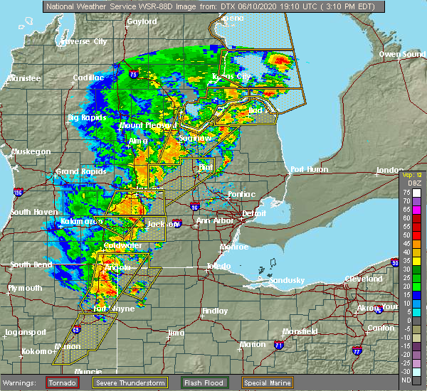 At 309 pm edt, a severe thunderstorm was located over gagetown, or near cass city, moving northeast at 55 mph (radar indicated). Hazards include 70 mph wind gusts and quarter size hail. Hail damage to vehicles is expected. expect considerable tree damage. wind damage is also likely to mobile homes, roofs, and outbuildings. this severe thunderstorm will be near, elkton around 325 pm edt. bad axe around 330 pm edt. kinde around 335 pm edt. port austin around 340 pm edt. Other locations impacted by this severe thunderstorm include redman, parisville, huron city, ivanhoe, rapson, grindstone city, bay port, pinnebog, ruth and port crescent state park. At 309 pm edt, a severe thunderstorm was located over gagetown, or near cass city, moving northeast at 55 mph (radar indicated). Hazards include 70 mph wind gusts and quarter size hail. Hail damage to vehicles is expected. expect considerable tree damage. wind damage is also likely to mobile homes, roofs, and outbuildings. this severe thunderstorm will be near, elkton around 325 pm edt. bad axe around 330 pm edt. kinde around 335 pm edt. port austin around 340 pm edt. Other locations impacted by this severe thunderstorm include redman, parisville, huron city, ivanhoe, rapson, grindstone city, bay port, pinnebog, ruth and port crescent state park.
|
| 6/10/2020 3:01 PM EDT |
 At 258 pm edt, a severe thunderstorm was located over fairgrove, or near akron, moving northeast at 55 mph. another severe thunderstorm was located over bridgeport, also moving northeast at 55 mph. additional severe storms are moving through western saginaw county (radar indicated). Hazards include 70 mph wind gusts and quarter size hail. Hail damage to vehicles is expected. expect considerable tree damage. wind damage is also likely to mobile homes, roofs, and outbuildings. this severe storm will be near, unionville around 310 pm edt. gagetown around 320 pm edt. Other locations impacted by this severe thunderstorm include carrollton, garfield, arthur, tuscola, colling, wisner, burt, ellington, gera and buena vista township. At 258 pm edt, a severe thunderstorm was located over fairgrove, or near akron, moving northeast at 55 mph. another severe thunderstorm was located over bridgeport, also moving northeast at 55 mph. additional severe storms are moving through western saginaw county (radar indicated). Hazards include 70 mph wind gusts and quarter size hail. Hail damage to vehicles is expected. expect considerable tree damage. wind damage is also likely to mobile homes, roofs, and outbuildings. this severe storm will be near, unionville around 310 pm edt. gagetown around 320 pm edt. Other locations impacted by this severe thunderstorm include carrollton, garfield, arthur, tuscola, colling, wisner, burt, ellington, gera and buena vista township.
|
| 6/10/2020 2:47 PM EDT |
 At 247 pm edt, a severe thunderstorm was located over bridgeport, or near saginaw, moving northeast at 50 mph (radar indicated). Hazards include 70 mph wind gusts and quarter size hail. Hail damage to vehicles is expected. expect considerable tree damage. wind damage is also likely to mobile homes, roofs, and outbuildings. this severe storm will be near, reese and munger around 300 pm edt. fairgrove and quanicassee around 310 pm edt. akron around 315 pm edt. unionville around 325 pm edt. Other locations impacted by this severe thunderstorm include carrollton, garfield, arthur, tuscola, colling, wisner, burt, ellington, gera and buena vista township. At 247 pm edt, a severe thunderstorm was located over bridgeport, or near saginaw, moving northeast at 50 mph (radar indicated). Hazards include 70 mph wind gusts and quarter size hail. Hail damage to vehicles is expected. expect considerable tree damage. wind damage is also likely to mobile homes, roofs, and outbuildings. this severe storm will be near, reese and munger around 300 pm edt. fairgrove and quanicassee around 310 pm edt. akron around 315 pm edt. unionville around 325 pm edt. Other locations impacted by this severe thunderstorm include carrollton, garfield, arthur, tuscola, colling, wisner, burt, ellington, gera and buena vista township.
|
| 6/10/2020 2:35 PM EDT |
 At 234 pm edt, severe thunderstorms were located near chesaning and burt, moving north at 55 mph (radar indicated). Hazards include 70 mph wind gusts and quarter size hail. Hail damage to vehicles is expected. expect considerable tree damage. wind damage is also likely to mobile homes, roofs, and outbuildings. these severe storms will be near, bridgeport around 245 pm edt. saginaw and zilwaukee around 250 pm edt. munger around 255 pm edt. bay city and essexville around 300 pm edt. kawkawlin around 305 pm edt. linwood around 310 pm edt. Other locations impacted by these severe thunderstorms include carrollton, garfield, arthur, tuscola, colling, wisner, burt, ellington, gera and buena vista township. At 234 pm edt, severe thunderstorms were located near chesaning and burt, moving north at 55 mph (radar indicated). Hazards include 70 mph wind gusts and quarter size hail. Hail damage to vehicles is expected. expect considerable tree damage. wind damage is also likely to mobile homes, roofs, and outbuildings. these severe storms will be near, bridgeport around 245 pm edt. saginaw and zilwaukee around 250 pm edt. munger around 255 pm edt. bay city and essexville around 300 pm edt. kawkawlin around 305 pm edt. linwood around 310 pm edt. Other locations impacted by these severe thunderstorms include carrollton, garfield, arthur, tuscola, colling, wisner, burt, ellington, gera and buena vista township.
|
| 6/10/2020 2:20 PM EDT |
 At 220 pm edt, a severe thunderstorm was located near oakley, or near chesaning, moving north at 55 mph (radar indicated). Hazards include 70 mph wind gusts and quarter size hail. Hail damage to vehicles is expected. expect considerable tree damage. wind damage is also likely to mobile homes, roofs, and outbuildings. this severe thunderstorm will be near, chesaning around 225 pm edt. st. charles around 235 pm edt. bridgeport around 245 pm edt. saginaw and zilwaukee around 250 pm edt. munger around 255 pm edt. bay city and essexville around 300 pm edt. kawkawlin around 305 pm edt. Other locations impacted by this severe thunderstorm include carrollton, garfield, arthur, tuscola, colling, wisner, burt, ellington, gera and buena vista township. At 220 pm edt, a severe thunderstorm was located near oakley, or near chesaning, moving north at 55 mph (radar indicated). Hazards include 70 mph wind gusts and quarter size hail. Hail damage to vehicles is expected. expect considerable tree damage. wind damage is also likely to mobile homes, roofs, and outbuildings. this severe thunderstorm will be near, chesaning around 225 pm edt. st. charles around 235 pm edt. bridgeport around 245 pm edt. saginaw and zilwaukee around 250 pm edt. munger around 255 pm edt. bay city and essexville around 300 pm edt. kawkawlin around 305 pm edt. Other locations impacted by this severe thunderstorm include carrollton, garfield, arthur, tuscola, colling, wisner, burt, ellington, gera and buena vista township.
|
| 6/10/2020 2:00 PM EDT |
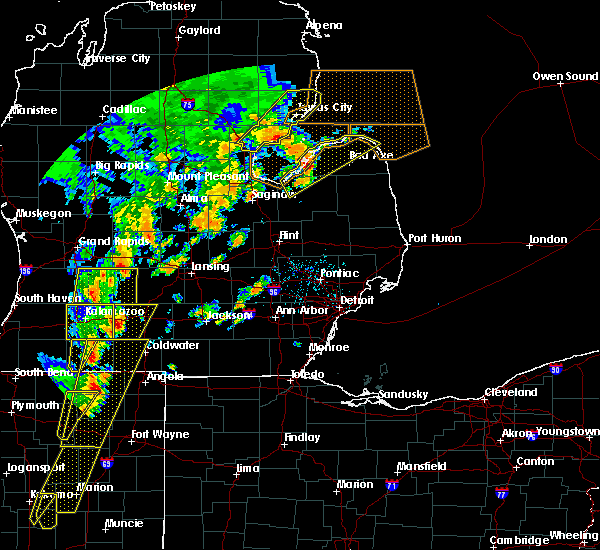 At 200 pm edt, a severe thunderstorm was located over pigeon, or 8 miles northeast of sebewaing, moving northeast at 50 mph (radar indicated). Hazards include 70 mph wind gusts and ping pong ball size hail. People and animals outdoors will be injured. expect hail damage to roofs, siding, windows, and vehicles. expect considerable tree damage. wind damage is also likely to mobile homes, roofs, and outbuildings. this severe storm will be near, elkton around 205 pm edt. caseville around 210 pm edt. port austin and kinde around 225 pm edt. Other locations impacted by this severe thunderstorm include pinnebog, port crescent state park, redman, filion, colling, huron city, colwood, grindstone city, bay port and bach. At 200 pm edt, a severe thunderstorm was located over pigeon, or 8 miles northeast of sebewaing, moving northeast at 50 mph (radar indicated). Hazards include 70 mph wind gusts and ping pong ball size hail. People and animals outdoors will be injured. expect hail damage to roofs, siding, windows, and vehicles. expect considerable tree damage. wind damage is also likely to mobile homes, roofs, and outbuildings. this severe storm will be near, elkton around 205 pm edt. caseville around 210 pm edt. port austin and kinde around 225 pm edt. Other locations impacted by this severe thunderstorm include pinnebog, port crescent state park, redman, filion, colling, huron city, colwood, grindstone city, bay port and bach.
|
| 6/10/2020 1:57 PM EDT | Multiple reports of power lines down on roads and buildings across sebewain in huron county MI, 0.2 miles NW of Sebewaing, MI |
| 6/10/2020 1:57 PM EDT | Trees down along liken rd between myers rd and bay s in huron county MI, 0.9 miles NNE of Sebewaing, MI |
| 6/10/2020 1:49 PM EDT |
 At 148 pm edt, a severe thunderstorm was located over sebewaing, moving northeast at 55 mph (radar indicated). Hazards include 70 mph wind gusts and quarter size hail. Hail damage to vehicles is expected. expect considerable tree damage. wind damage is also likely to mobile homes, roofs, and outbuildings. this severe storm will be near, owendale around 155 pm edt. pigeon around 200 pm edt. elkton around 205 pm edt. caseville around 210 pm edt. kinde around 220 pm edt. port austin around 225 pm edt. Other locations impacted by this severe thunderstorm include pinnebog, port crescent state park, redman, filion, colling, huron city, colwood, wisner, grindstone city and bay port. At 148 pm edt, a severe thunderstorm was located over sebewaing, moving northeast at 55 mph (radar indicated). Hazards include 70 mph wind gusts and quarter size hail. Hail damage to vehicles is expected. expect considerable tree damage. wind damage is also likely to mobile homes, roofs, and outbuildings. this severe storm will be near, owendale around 155 pm edt. pigeon around 200 pm edt. elkton around 205 pm edt. caseville around 210 pm edt. kinde around 220 pm edt. port austin around 225 pm edt. Other locations impacted by this severe thunderstorm include pinnebog, port crescent state park, redman, filion, colling, huron city, colwood, wisner, grindstone city and bay port.
|
| 6/10/2020 1:36 PM EDT |
 At 136 pm edt, a severe thunderstorm was located near quanicassee, or near akron, moving northeast at 55 mph (radar indicated). Hazards include 70 mph wind gusts and quarter size hail. Hail damage to vehicles is expected. expect considerable tree damage. wind damage is also likely to mobile homes, roofs, and outbuildings. this severe thunderstorm will be near, unionville around 145 pm edt. sebewaing around 150 pm edt. owendale around 200 pm edt. pigeon and elkton around 205 pm edt. caseville around 210 pm edt. kinde around 220 pm edt. port austin around 225 pm edt. Other locations impacted by this severe thunderstorm include redman, colling, huron city, wisner, grindstone city, bay port, gilford, richville, pinnebog and port crescent state park. At 136 pm edt, a severe thunderstorm was located near quanicassee, or near akron, moving northeast at 55 mph (radar indicated). Hazards include 70 mph wind gusts and quarter size hail. Hail damage to vehicles is expected. expect considerable tree damage. wind damage is also likely to mobile homes, roofs, and outbuildings. this severe thunderstorm will be near, unionville around 145 pm edt. sebewaing around 150 pm edt. owendale around 200 pm edt. pigeon and elkton around 205 pm edt. caseville around 210 pm edt. kinde around 220 pm edt. port austin around 225 pm edt. Other locations impacted by this severe thunderstorm include redman, colling, huron city, wisner, grindstone city, bay port, gilford, richville, pinnebog and port crescent state park.
|
| 6/3/2020 2:42 AM EDT |
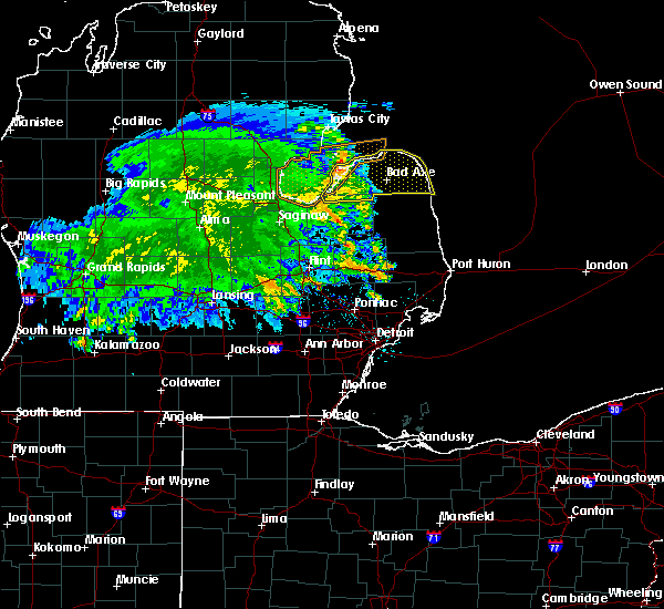 At 242 am edt, severe thunderstorms were located along a line extending from 8 miles northwest of caseville to 6 miles west of pigeon to near unionville, moving east at 35 mph (radar indicated). Hazards include 60 mph wind gusts. Expect damage to roofs, siding, and trees. these severe storms will be near, caseville, pigeon and owendale around 250 am edt. gagetown around 255 am edt. elkton around 300 am edt. bad axe, port austin and kinde around 315 am edt. ubly around 320 am edt. harbor beach and port hope around 340 am edt. Other locations impacted by these severe thunderstorms include redman, parisville, huron city, white rock, ivanhoe, rapson, grindstone city, bay port, pinnebog and ruth. At 242 am edt, severe thunderstorms were located along a line extending from 8 miles northwest of caseville to 6 miles west of pigeon to near unionville, moving east at 35 mph (radar indicated). Hazards include 60 mph wind gusts. Expect damage to roofs, siding, and trees. these severe storms will be near, caseville, pigeon and owendale around 250 am edt. gagetown around 255 am edt. elkton around 300 am edt. bad axe, port austin and kinde around 315 am edt. ubly around 320 am edt. harbor beach and port hope around 340 am edt. Other locations impacted by these severe thunderstorms include redman, parisville, huron city, white rock, ivanhoe, rapson, grindstone city, bay port, pinnebog and ruth.
|
| 6/3/2020 2:27 AM EDT |
 At 226 am edt, severe thunderstorms were located along a line extending from 7 miles east of au gres to 6 miles northwest of sebewaing to near unionville, moving east at 35 mph (radar indicated). Hazards include 60 mph wind gusts. Expect damage to roofs, siding, and trees. these severe storms will be near, sebewaing and unionville around 235 am edt. caseville, pigeon, gagetown and owendale around 250 am edt. elkton around 255 am edt. bad axe and port austin around 310 am edt. ubly and kinde around 315 am edt. port hope around 335 am edt. harbor beach around 340 am edt. Other locations impacted by these severe thunderstorms include redman, parisville, colling, huron city, white rock, wisner, ivanhoe, rapson, grindstone city and bay port. At 226 am edt, severe thunderstorms were located along a line extending from 7 miles east of au gres to 6 miles northwest of sebewaing to near unionville, moving east at 35 mph (radar indicated). Hazards include 60 mph wind gusts. Expect damage to roofs, siding, and trees. these severe storms will be near, sebewaing and unionville around 235 am edt. caseville, pigeon, gagetown and owendale around 250 am edt. elkton around 255 am edt. bad axe and port austin around 310 am edt. ubly and kinde around 315 am edt. port hope around 335 am edt. harbor beach around 340 am edt. Other locations impacted by these severe thunderstorms include redman, parisville, colling, huron city, white rock, wisner, ivanhoe, rapson, grindstone city and bay port.
|
| 6/3/2020 2:16 AM EDT |
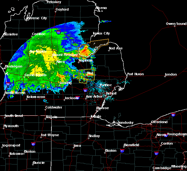 At 215 am edt, severe thunderstorms were located along a line extending from near au gres to 11 miles west of sebewaing to near quanicassee, moving east at 35 mph (radar indicated). Hazards include 60 mph wind gusts. Expect damage to roofs, siding, and trees. severe thunderstorms will be near, unionville around 230 am edt. sebewaing around 235 am edt. caseville and pigeon around 245 am edt. gagetown and owendale around 250 am edt. elkton around 255 am edt. bad axe, port austin and kinde around 310 am edt. ubly around 315 am edt. harbor beach and port hope around 335 am edt. Other locations impacted by these severe thunderstorms include redman, parisville, colling, huron city, white rock, wisner, ivanhoe, rapson, grindstone city and bay port. At 215 am edt, severe thunderstorms were located along a line extending from near au gres to 11 miles west of sebewaing to near quanicassee, moving east at 35 mph (radar indicated). Hazards include 60 mph wind gusts. Expect damage to roofs, siding, and trees. severe thunderstorms will be near, unionville around 230 am edt. sebewaing around 235 am edt. caseville and pigeon around 245 am edt. gagetown and owendale around 250 am edt. elkton around 255 am edt. bad axe, port austin and kinde around 310 am edt. ubly around 315 am edt. harbor beach and port hope around 335 am edt. Other locations impacted by these severe thunderstorms include redman, parisville, colling, huron city, white rock, wisner, ivanhoe, rapson, grindstone city and bay port.
|
| 9/10/2019 8:23 PM EDT |
 At 822 pm edt, severe thunderstorms were located along a line extending from near gagetown to caro to reese, moving east at 45 mph (radar indicated). Hazards include 60 mph wind gusts and quarter size hail. Hail damage to vehicles is expected. expect wind damage to roofs, siding, and trees. these severe storms will be near, gagetown around 830 pm edt. cass city around 835 pm edt. kingston around 840 pm edt. Other locations impacted by these severe thunderstorms include east dayton, deford, colling, wilmot, colwood, wisner, ellington, gilford, watrousville and bay park. At 822 pm edt, severe thunderstorms were located along a line extending from near gagetown to caro to reese, moving east at 45 mph (radar indicated). Hazards include 60 mph wind gusts and quarter size hail. Hail damage to vehicles is expected. expect wind damage to roofs, siding, and trees. these severe storms will be near, gagetown around 830 pm edt. cass city around 835 pm edt. kingston around 840 pm edt. Other locations impacted by these severe thunderstorms include east dayton, deford, colling, wilmot, colwood, wisner, ellington, gilford, watrousville and bay park.
|
| 9/10/2019 8:07 PM EDT |
 At 807 pm edt, severe thunderstorms were located along a line extending from near bay park to near vassar, moving east at 35 mph (radar indicated). Hazards include 60 mph wind gusts and penny size hail. Expect damage to roofs, siding, and trees. these severe storms will be near, fairgrove around 810 pm edt. unionville around 815 pm edt. caro around 825 pm edt. gagetown around 835 pm edt. cass city and kingston around 840 pm edt. Other locations impacted by these severe thunderstorms include east dayton, deford, colling, wilmot, colwood, wisner, ellington, gilford, watrousville and bay park. At 807 pm edt, severe thunderstorms were located along a line extending from near bay park to near vassar, moving east at 35 mph (radar indicated). Hazards include 60 mph wind gusts and penny size hail. Expect damage to roofs, siding, and trees. these severe storms will be near, fairgrove around 810 pm edt. unionville around 815 pm edt. caro around 825 pm edt. gagetown around 835 pm edt. cass city and kingston around 840 pm edt. Other locations impacted by these severe thunderstorms include east dayton, deford, colling, wilmot, colwood, wisner, ellington, gilford, watrousville and bay park.
|
| 9/10/2019 7:53 PM EDT |
 At 753 pm edt, severe thunderstorms were located along a line extending from 11 miles northeast of essexville to reese, moving east at 35 mph (radar indicated). Hazards include 60 mph wind gusts and penny size hail. Expect damage to roofs, siding, and trees. severe thunderstorms will be near, vassar and fairgrove around 805 pm edt. unionville around 815 pm edt. caro around 820 pm edt. kingston and gagetown around 835 pm edt. cass city around 840 pm edt. Other locations impacted by these severe thunderstorms include east dayton, deford, colling, wilmot, colwood, wisner, ellington, gilford, watrousville and bay park. At 753 pm edt, severe thunderstorms were located along a line extending from 11 miles northeast of essexville to reese, moving east at 35 mph (radar indicated). Hazards include 60 mph wind gusts and penny size hail. Expect damage to roofs, siding, and trees. severe thunderstorms will be near, vassar and fairgrove around 805 pm edt. unionville around 815 pm edt. caro around 820 pm edt. kingston and gagetown around 835 pm edt. cass city around 840 pm edt. Other locations impacted by these severe thunderstorms include east dayton, deford, colling, wilmot, colwood, wisner, ellington, gilford, watrousville and bay park.
|
| 7/29/2019 3:06 PM EDT |
 At 306 pm edt, a severe thunderstorm was located near gagetown, or near cass city, moving northeast at 60 mph (radar indicated). Hazards include 60 mph wind gusts and penny size hail. Expect damage to roofs, siding, and trees. this severe storm will be near, cass city around 310 pm edt. Other locations impacted by this severe thunderstorm include east dayton, deford, colling, wilmot, colwood, wisner, ellington, gilford, watrousville and bay park. At 306 pm edt, a severe thunderstorm was located near gagetown, or near cass city, moving northeast at 60 mph (radar indicated). Hazards include 60 mph wind gusts and penny size hail. Expect damage to roofs, siding, and trees. this severe storm will be near, cass city around 310 pm edt. Other locations impacted by this severe thunderstorm include east dayton, deford, colling, wilmot, colwood, wisner, ellington, gilford, watrousville and bay park.
|
| 7/29/2019 2:54 PM EDT |
 A severe thunderstorm warning remains in effect until 400 pm edt for tuscola county. at 254 pm edt, a severe thunderstorm was located over caro, moving northeast at 50 mph. hazard. 60 mph wind gusts and penny size hail. source. Radar indicated. A severe thunderstorm warning remains in effect until 400 pm edt for tuscola county. at 254 pm edt, a severe thunderstorm was located over caro, moving northeast at 50 mph. hazard. 60 mph wind gusts and penny size hail. source. Radar indicated.
|
| 7/29/2019 2:38 PM EDT |
 The national weather service in detroit/pontiac has issued a * severe thunderstorm warning for. tuscola county in southeastern michigan. until 400 pm edt. At 238 pm edt, a severe thunderstorm was located near reese, moving northeast at 55 mph. The national weather service in detroit/pontiac has issued a * severe thunderstorm warning for. tuscola county in southeastern michigan. until 400 pm edt. At 238 pm edt, a severe thunderstorm was located near reese, moving northeast at 55 mph.
|
| 8/28/2018 10:09 PM EDT |
 At 1008 pm edt, severe thunderstorms were located along a line extending from 11 miles northeast of port austin to port hope to near caro to near otter lake, moving east at 45 mph (radar indicated). Hazards include 60 mph wind gusts. Expect damage to roofs, siding, and trees. these severe storms will be near, mayville around 1020 pm edt. Other locations impacted by these severe thunderstorms include redman, east dayton, parisville, tuscola, colling, wilmot, ivanhoe, rapson, bay port and ellington. At 1008 pm edt, severe thunderstorms were located along a line extending from 11 miles northeast of port austin to port hope to near caro to near otter lake, moving east at 45 mph (radar indicated). Hazards include 60 mph wind gusts. Expect damage to roofs, siding, and trees. these severe storms will be near, mayville around 1020 pm edt. Other locations impacted by these severe thunderstorms include redman, east dayton, parisville, tuscola, colling, wilmot, ivanhoe, rapson, bay port and ellington.
|
| 8/28/2018 9:52 PM EDT |
 At 951 pm edt, severe thunderstorms were located along a line extending from near port austin to near kinde to fairgrove to near millington, moving east at 45 mph (radar indicated). Hazards include 60 mph wind gusts. Expect damage to roofs, siding, and trees. these severe storms will be near, port austin and kinde around 955 pm edt. mayville around 1005 pm edt. kingston around 1015 pm edt. Other locations impacted by these severe thunderstorms include parisville, colling, wisner, ivanhoe, rapson, ellington, gilford, port crescent state park, filion and deford. At 951 pm edt, severe thunderstorms were located along a line extending from near port austin to near kinde to fairgrove to near millington, moving east at 45 mph (radar indicated). Hazards include 60 mph wind gusts. Expect damage to roofs, siding, and trees. these severe storms will be near, port austin and kinde around 955 pm edt. mayville around 1005 pm edt. kingston around 1015 pm edt. Other locations impacted by these severe thunderstorms include parisville, colling, wisner, ivanhoe, rapson, ellington, gilford, port crescent state park, filion and deford.
|
| 8/28/2018 9:33 PM EDT |
 At 932 pm edt, severe thunderstorms were located along a line extending from 10 miles southeast of tawas point state park to near caseville to munger to near bridgeport, moving east at 45 mph (radar indicated). Hazards include 60 mph wind gusts. Expect damage to roofs, siding, and trees. severe thunderstorms will be near, caseville around 935 pm edt. vassar, port austin, akron, fairgrove and kinde around 950 pm edt. millington around 955 pm edt. caro around 1000 pm edt. mayville around 1005 pm edt. kingston around 1015 pm edt. Other locations impacted by these severe thunderstorms include parisville, colling, wisner, ivanhoe, rapson, ellington, gilford, port crescent state park, filion and deford. At 932 pm edt, severe thunderstorms were located along a line extending from 10 miles southeast of tawas point state park to near caseville to munger to near bridgeport, moving east at 45 mph (radar indicated). Hazards include 60 mph wind gusts. Expect damage to roofs, siding, and trees. severe thunderstorms will be near, caseville around 935 pm edt. vassar, port austin, akron, fairgrove and kinde around 950 pm edt. millington around 955 pm edt. caro around 1000 pm edt. mayville around 1005 pm edt. kingston around 1015 pm edt. Other locations impacted by these severe thunderstorms include parisville, colling, wisner, ivanhoe, rapson, ellington, gilford, port crescent state park, filion and deford.
|
| 8/2/2018 5:04 PM EDT |
 At 502 pm edt, a severe thunderstorm was located 7 miles southeast of kinde, or 8 miles southwest of port hope, moving east at 35 mph (radar indicated). Hazards include 60 mph wind gusts and quarter size hail. Hail damage to vehicles is expected. expect wind damage to roofs, siding, and trees. this severe storm will be near, harbor beach and port hope around 515 pm edt. other locations impacted by this severe thunderstorm include redman, parisville, huron city, white rock, ivanhoe, rapson, grindstone city, bay port, pinnebog and ruth. Additional strong thunderstorms may become severe as they track onshore near bay port and sebewaing over the half an hour or so. At 502 pm edt, a severe thunderstorm was located 7 miles southeast of kinde, or 8 miles southwest of port hope, moving east at 35 mph (radar indicated). Hazards include 60 mph wind gusts and quarter size hail. Hail damage to vehicles is expected. expect wind damage to roofs, siding, and trees. this severe storm will be near, harbor beach and port hope around 515 pm edt. other locations impacted by this severe thunderstorm include redman, parisville, huron city, white rock, ivanhoe, rapson, grindstone city, bay port, pinnebog and ruth. Additional strong thunderstorms may become severe as they track onshore near bay port and sebewaing over the half an hour or so.
|
| 8/2/2018 4:43 PM EDT |
 At 443 pm edt, a severe thunderstorm was located near caseville, moving east at 35 mph (radar indicated). Hazards include 60 mph wind gusts and quarter size hail. Hail damage to vehicles is expected. expect wind damage to roofs, siding, and trees. this severe thunderstorm will be near, kinde around 455 pm edt. port austin around 500 pm edt. port hope around 520 pm edt. Other locations impacted by this severe thunderstorm include redman, parisville, huron city, white rock, ivanhoe, rapson, grindstone city, bay port, pinnebog and ruth. At 443 pm edt, a severe thunderstorm was located near caseville, moving east at 35 mph (radar indicated). Hazards include 60 mph wind gusts and quarter size hail. Hail damage to vehicles is expected. expect wind damage to roofs, siding, and trees. this severe thunderstorm will be near, kinde around 455 pm edt. port austin around 500 pm edt. port hope around 520 pm edt. Other locations impacted by this severe thunderstorm include redman, parisville, huron city, white rock, ivanhoe, rapson, grindstone city, bay port, pinnebog and ruth.
|
| 5/27/2018 5:32 PM EDT |
 At 532 pm edt, a severe thunderstorm was located over owendale, or 8 miles east of sebewaing, moving east at 30 mph (radar indicated). Hazards include 60 mph wind gusts and quarter size hail. Hail damage to vehicles is expected. expect wind damage to roofs, siding, and trees. This severe thunderstorm will remain over mainly rural areas of southwestern huron county, including the following locations, ivanhoe, bay port and bach. At 532 pm edt, a severe thunderstorm was located over owendale, or 8 miles east of sebewaing, moving east at 30 mph (radar indicated). Hazards include 60 mph wind gusts and quarter size hail. Hail damage to vehicles is expected. expect wind damage to roofs, siding, and trees. This severe thunderstorm will remain over mainly rural areas of southwestern huron county, including the following locations, ivanhoe, bay port and bach.
|
| 5/27/2018 5:24 PM EDT |
 At 523 pm edt, a severe thunderstorm was located near owendale, or near sebewaing, moving east at 30 mph (radar indicated). Hazards include 60 mph wind gusts and quarter size hail. Hail damage to vehicles is expected. expect wind damage to roofs, siding, and trees. this severe storm will be near, pigeon and owendale around 530 pm edt. elkton around 540 pm edt. Other locations impacted by this severe thunderstorm include pinnebog, ruth, redman, filion, parisville, helena, white rock, ivanhoe, rapson and bay port. At 523 pm edt, a severe thunderstorm was located near owendale, or near sebewaing, moving east at 30 mph (radar indicated). Hazards include 60 mph wind gusts and quarter size hail. Hail damage to vehicles is expected. expect wind damage to roofs, siding, and trees. this severe storm will be near, pigeon and owendale around 530 pm edt. elkton around 540 pm edt. Other locations impacted by this severe thunderstorm include pinnebog, ruth, redman, filion, parisville, helena, white rock, ivanhoe, rapson and bay port.
|
| 5/27/2018 5:10 PM EDT |
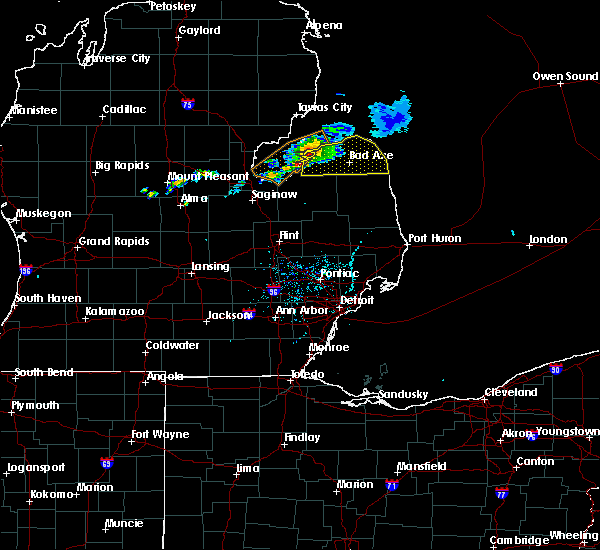 At 510 pm edt, a severe thunderstorm was located near pigeon, or 7 miles southwest of caseville, moving east at 35 mph (radar indicated). Hazards include 60 mph wind gusts and quarter size hail. Hail damage to vehicles is expected. expect wind damage to roofs, siding, and trees. this severe storm will be near, caseville around 515 pm edt. pigeon around 520 pm edt. owendale around 525 pm edt. elkton around 530 pm edt. bad axe and ubly around 545 pm edt. Other locations impacted by this severe thunderstorm include redman, parisville, huron city, white rock, ivanhoe, rapson, grindstone city, bay port, pinnebog and ruth. At 510 pm edt, a severe thunderstorm was located near pigeon, or 7 miles southwest of caseville, moving east at 35 mph (radar indicated). Hazards include 60 mph wind gusts and quarter size hail. Hail damage to vehicles is expected. expect wind damage to roofs, siding, and trees. this severe storm will be near, caseville around 515 pm edt. pigeon around 520 pm edt. owendale around 525 pm edt. elkton around 530 pm edt. bad axe and ubly around 545 pm edt. Other locations impacted by this severe thunderstorm include redman, parisville, huron city, white rock, ivanhoe, rapson, grindstone city, bay port, pinnebog and ruth.
|
| 5/27/2018 4:52 PM EDT |
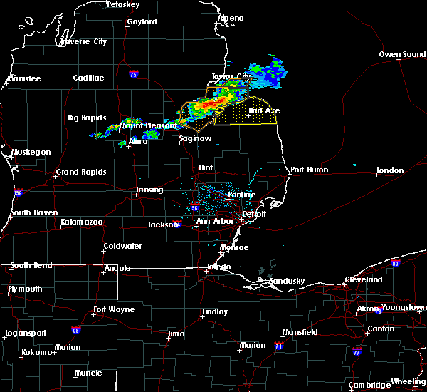 At 451 pm edt, a severe thunderstorm was located 10 miles southeast of au gres, moving east at 30 mph (radar indicated). Hazards include 60 mph wind gusts and quarter size hail. Hail damage to vehicles is expected. expect wind damage to roofs, siding, and trees. this severe thunderstorm will be near, caseville around 515 pm edt. pigeon around 520 pm edt. elkton around 530 pm edt. bad axe and kinde around 545 pm edt. Other locations impacted by this severe thunderstorm include redman, parisville, huron city, white rock, ivanhoe, rapson, grindstone city, bay port, pinnebog and ruth. At 451 pm edt, a severe thunderstorm was located 10 miles southeast of au gres, moving east at 30 mph (radar indicated). Hazards include 60 mph wind gusts and quarter size hail. Hail damage to vehicles is expected. expect wind damage to roofs, siding, and trees. this severe thunderstorm will be near, caseville around 515 pm edt. pigeon around 520 pm edt. elkton around 530 pm edt. bad axe and kinde around 545 pm edt. Other locations impacted by this severe thunderstorm include redman, parisville, huron city, white rock, ivanhoe, rapson, grindstone city, bay port, pinnebog and ruth.
|
| 10/7/2017 10:49 PM EDT |
 At 1049 pm edt, severe thunderstorms were located along a line extending from sebewaing to near cass city to near mayville, moving northeast at 65 mph (radar indicated). Hazards include 60 mph wind gusts. Expect damage to roofs, siding, and trees. severe thunderstorms will be near, pigeon around 1100 pm edt. bad axe and caseville around 1105 pm edt. argyle around 1110 pm edt. ubly and port austin around 1115 pm edt. harbor beach around 1130 pm edt. port hope around 1135 pm edt. Other locations impacted by these severe thunderstorms include deckerville, lexington, port hope, sandusky, port sanilac, caseville, bad axe, ubly, port austin and harbor beach. At 1049 pm edt, severe thunderstorms were located along a line extending from sebewaing to near cass city to near mayville, moving northeast at 65 mph (radar indicated). Hazards include 60 mph wind gusts. Expect damage to roofs, siding, and trees. severe thunderstorms will be near, pigeon around 1100 pm edt. bad axe and caseville around 1105 pm edt. argyle around 1110 pm edt. ubly and port austin around 1115 pm edt. harbor beach around 1130 pm edt. port hope around 1135 pm edt. Other locations impacted by these severe thunderstorms include deckerville, lexington, port hope, sandusky, port sanilac, caseville, bad axe, ubly, port austin and harbor beach.
|
| 7/23/2017 5:45 PM EDT |
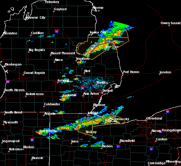 At 544 pm edt, severe thunderstorms were located along a line extending from near port austin to quanicassee, moving southeast at 30 mph (radar indicated). Hazards include 60 mph wind gusts and quarter size hail. Hail damage to vehicles is expected. expect wind damage to roofs, siding, and trees. these severe storms will be near, kinde around 550 pm edt. fairgrove around 555 pm edt. Other locations impacted by these severe thunderstorms include bad axe, akron, port austin, port hope, caro, caseville, sebewaing, gagetown, unionville and kinde. At 544 pm edt, severe thunderstorms were located along a line extending from near port austin to quanicassee, moving southeast at 30 mph (radar indicated). Hazards include 60 mph wind gusts and quarter size hail. Hail damage to vehicles is expected. expect wind damage to roofs, siding, and trees. these severe storms will be near, kinde around 550 pm edt. fairgrove around 555 pm edt. Other locations impacted by these severe thunderstorms include bad axe, akron, port austin, port hope, caro, caseville, sebewaing, gagetown, unionville and kinde.
|
| 7/23/2017 5:30 PM EDT |
 At 529 pm edt, severe thunderstorms were located along a line extending from near port austin to near quanicassee, moving southeast at 30 mph (radar indicated). Hazards include 60 mph wind gusts and quarter size hail. Hail damage to vehicles is expected. expect wind damage to roofs, siding, and trees. severe thunderstorms will be near, port austin around 540 pm edt. kinde around 550 pm edt. akron and fairgrove around 555 pm edt. caro and port hope around 610 pm edt. Other locations impacted by these severe thunderstorms include bad axe, akron, port austin, port hope, caro, caseville, sebewaing, gagetown, unionville and kinde. At 529 pm edt, severe thunderstorms were located along a line extending from near port austin to near quanicassee, moving southeast at 30 mph (radar indicated). Hazards include 60 mph wind gusts and quarter size hail. Hail damage to vehicles is expected. expect wind damage to roofs, siding, and trees. severe thunderstorms will be near, port austin around 540 pm edt. kinde around 550 pm edt. akron and fairgrove around 555 pm edt. caro and port hope around 610 pm edt. Other locations impacted by these severe thunderstorms include bad axe, akron, port austin, port hope, caro, caseville, sebewaing, gagetown, unionville and kinde.
|
| 11/18/2016 8:34 PM EST |
 At 834 pm est, severe thunderstorms were located along a line extending from near sebewaing to 8 miles east of kingston to near brown city, moving northeast at 75 mph (radar indicated). Hazards include 60 mph wind gusts. Expect damage to roofs. siding. and trees. these severe storms will be near, argyle and owendale around 840 pm est. caseville and pigeon around 845 pm est. sandusky and carsonville around 850 pm est. deckerville and port austin around 855 pm est. harbor beach, port hope and forestville around 900 pm est. Other locations impacted by these severe thunderstorms include marlette, sandusky, deckerville, forestville, port sanilac, ubly, yale, port hope, harbor beach and cass city. At 834 pm est, severe thunderstorms were located along a line extending from near sebewaing to 8 miles east of kingston to near brown city, moving northeast at 75 mph (radar indicated). Hazards include 60 mph wind gusts. Expect damage to roofs. siding. and trees. these severe storms will be near, argyle and owendale around 840 pm est. caseville and pigeon around 845 pm est. sandusky and carsonville around 850 pm est. deckerville and port austin around 855 pm est. harbor beach, port hope and forestville around 900 pm est. Other locations impacted by these severe thunderstorms include marlette, sandusky, deckerville, forestville, port sanilac, ubly, yale, port hope, harbor beach and cass city.
|
| 11/18/2016 8:10 PM EST |
 At 809 pm est, severe thunderstorms were located along a line extending from near birch run to near lapeer to near ortonville, moving northeast at 70 mph (radar indicated). Hazards include 60 mph wind gusts. Expect damage to roofs. siding. and trees. severe thunderstorms will be near, reese around 820 pm est. akron, fairgrove and clifford around 825 pm est. brown city, unionville and kingston around 830 pm est. marlette and sebewaing around 835 pm est. pigeon and argyle around 840 pm est. sandusky and caseville around 845 pm est. deckerville around 850 pm est. harbor beach, port austin and forestville around 855 pm est. Other locations impacted by these severe thunderstorms include marlette, sandusky, deckerville, forestville, port sanilac, ubly, mayville, millington, yale and port hope. At 809 pm est, severe thunderstorms were located along a line extending from near birch run to near lapeer to near ortonville, moving northeast at 70 mph (radar indicated). Hazards include 60 mph wind gusts. Expect damage to roofs. siding. and trees. severe thunderstorms will be near, reese around 820 pm est. akron, fairgrove and clifford around 825 pm est. brown city, unionville and kingston around 830 pm est. marlette and sebewaing around 835 pm est. pigeon and argyle around 840 pm est. sandusky and caseville around 845 pm est. deckerville around 850 pm est. harbor beach, port austin and forestville around 855 pm est. Other locations impacted by these severe thunderstorms include marlette, sandusky, deckerville, forestville, port sanilac, ubly, mayville, millington, yale and port hope.
|
| 7/8/2016 4:48 PM EDT |
 At 448 pm edt, severe thunderstorms were located along a line extending from near gagetown to near unionville, moving east at 35 mph (radar indicated). Hazards include 60 mph wind gusts and quarter size hail. Hail damage to vehicles is expected. expect wind damage to roofs, siding, and trees. Locations impacted include, cass city, sebewaing, pigeon, elkton, unionville, gagetown, owendale, bay park and bach. At 448 pm edt, severe thunderstorms were located along a line extending from near gagetown to near unionville, moving east at 35 mph (radar indicated). Hazards include 60 mph wind gusts and quarter size hail. Hail damage to vehicles is expected. expect wind damage to roofs, siding, and trees. Locations impacted include, cass city, sebewaing, pigeon, elkton, unionville, gagetown, owendale, bay park and bach.
|
| 7/8/2016 4:41 PM EDT | Big trees down and numerous wires down sebewaing to bay port. via dispatc in huron county MI, 0.2 miles NW of Sebewaing, MI |
| 7/8/2016 4:38 PM EDT |
 At 438 pm edt, severe thunderstorms were located along a line extending from near elkton to near gagetown, moving east at 30 mph (radar indicated). Hazards include 70 mph wind gusts and quarter size hail. Hail damage to vehicles is expected. expect considerable tree damage. wind damage is also likely to mobile homes, roofs, and outbuildings. These severe thunderstorms will remain over mainly rural areas of western huron and northern tuscola counties, including the following locations: caseville, sebewaing, elkton, unionville, gagetown, owendale, pigeon, bay park, bach and bay port. At 438 pm edt, severe thunderstorms were located along a line extending from near elkton to near gagetown, moving east at 30 mph (radar indicated). Hazards include 70 mph wind gusts and quarter size hail. Hail damage to vehicles is expected. expect considerable tree damage. wind damage is also likely to mobile homes, roofs, and outbuildings. These severe thunderstorms will remain over mainly rural areas of western huron and northern tuscola counties, including the following locations: caseville, sebewaing, elkton, unionville, gagetown, owendale, pigeon, bay park, bach and bay port.
|
| 7/8/2016 4:20 PM EDT |
 At 420 pm edt, severe thunderstorms were located along a line extending from near caseville to unionville, moving east at 30 mph (radar indicated). Hazards include 70 mph wind gusts and quarter size hail. Hail damage to vehicles is expected. expect considerable tree damage. wind damage is also likely to mobile homes, roofs, and outbuildings. these severe storms will be near, pigeon around 425 pm edt. caseville around 430 pm edt. owendale around 440 pm edt. gagetown around 445 pm edt. elkton around 455 pm edt. Other locations impacted by these severe thunderstorms include caseville, sebewaing, elkton, unionville, gagetown, owendale, p igeon, bay park, bach and bay port. At 420 pm edt, severe thunderstorms were located along a line extending from near caseville to unionville, moving east at 30 mph (radar indicated). Hazards include 70 mph wind gusts and quarter size hail. Hail damage to vehicles is expected. expect considerable tree damage. wind damage is also likely to mobile homes, roofs, and outbuildings. these severe storms will be near, pigeon around 425 pm edt. caseville around 430 pm edt. owendale around 440 pm edt. gagetown around 445 pm edt. elkton around 455 pm edt. Other locations impacted by these severe thunderstorms include caseville, sebewaing, elkton, unionville, gagetown, owendale, p igeon, bay park, bach and bay port.
|
| 7/8/2016 4:07 PM EDT |
 At 406 pm edt, a severe thunderstorm was located near unionville, or 7 miles southwest of sebewaing, moving east at 40 mph (radar indicated). Hazards include 60 mph wind gusts and quarter size hail. Hail damage to vehicles is expected. expect wind damage to roofs, siding, and trees. this severe thunderstorm will be near, unionville around 415 pm edt. sebewaing around 420 pm edt. owendale around 430 pm edt. pigeon around 435 pm edt. elkton around 440 pm edt. Other locations impacted by this severe thunderstorm include caseville, sebewaing, elkton, unionville, gagetown, owendale, p igeon, bay park, bach and bay port. At 406 pm edt, a severe thunderstorm was located near unionville, or 7 miles southwest of sebewaing, moving east at 40 mph (radar indicated). Hazards include 60 mph wind gusts and quarter size hail. Hail damage to vehicles is expected. expect wind damage to roofs, siding, and trees. this severe thunderstorm will be near, unionville around 415 pm edt. sebewaing around 420 pm edt. owendale around 430 pm edt. pigeon around 435 pm edt. elkton around 440 pm edt. Other locations impacted by this severe thunderstorm include caseville, sebewaing, elkton, unionville, gagetown, owendale, p igeon, bay park, bach and bay port.
|
| 5/12/2016 6:03 PM EDT |
 At 602 pm edt, a severe thunderstorm was located over akron, moving northeast at 35 mph (radar indicated). Hazards include 60 mph wind gusts and penny size hail. Expect damage to roofs. siding. and trees. this severe storm will be near, unionville around 615 pm edt. gagetown around 630 pm edt. Other locations impacted by this severe thunderstorm include colwood, ellington, gilford, colling, reese, bay park, unionville, quanicassee, fairgrove and cass city. At 602 pm edt, a severe thunderstorm was located over akron, moving northeast at 35 mph (radar indicated). Hazards include 60 mph wind gusts and penny size hail. Expect damage to roofs. siding. and trees. this severe storm will be near, unionville around 615 pm edt. gagetown around 630 pm edt. Other locations impacted by this severe thunderstorm include colwood, ellington, gilford, colling, reese, bay park, unionville, quanicassee, fairgrove and cass city.
|
| 5/12/2016 5:51 PM EDT |
 At 551 pm edt, a severe thunderstorm was located over quanicassee, or near reese, moving northeast at 35 mph (radar indicated). Hazards include 60 mph wind gusts and quarter size hail. Hail damage to vehicles is expected. expect wind damage to roofs, siding, and trees. this severe storm will be near, fairgrove around 555 pm edt. akron around 605 pm edt. unionville around 615 pm edt. gagetown around 630 pm edt. Other locations impacted by this severe thunderstorm include colwood, ellington, gilford, colling, reese, watrousville, bay park, unionville, richville and quanicassee. At 551 pm edt, a severe thunderstorm was located over quanicassee, or near reese, moving northeast at 35 mph (radar indicated). Hazards include 60 mph wind gusts and quarter size hail. Hail damage to vehicles is expected. expect wind damage to roofs, siding, and trees. this severe storm will be near, fairgrove around 555 pm edt. akron around 605 pm edt. unionville around 615 pm edt. gagetown around 630 pm edt. Other locations impacted by this severe thunderstorm include colwood, ellington, gilford, colling, reese, watrousville, bay park, unionville, richville and quanicassee.
|
| 5/12/2016 5:42 PM EDT |
 At 541 pm edt, a severe thunderstorm was located over munger, or near reese, moving northeast at 35 mph (radar indicated). Hazards include 60 mph wind gusts and quarter size hail. Hail damage to vehicles is expected. expect wind damage to roofs, siding, and trees. this severe thunderstorm will be near, quanicassee around 555 pm edt. fairgrove around 600 pm edt. akron around 605 pm edt. unionville around 615 pm edt. gagetown around 630 pm edt. Other locations impacted by this severe thunderstorm include colwood, ellington, gilford, arthur, indiantown, colling, reese, watrousville, bay park and unionville. At 541 pm edt, a severe thunderstorm was located over munger, or near reese, moving northeast at 35 mph (radar indicated). Hazards include 60 mph wind gusts and quarter size hail. Hail damage to vehicles is expected. expect wind damage to roofs, siding, and trees. this severe thunderstorm will be near, quanicassee around 555 pm edt. fairgrove around 600 pm edt. akron around 605 pm edt. unionville around 615 pm edt. gagetown around 630 pm edt. Other locations impacted by this severe thunderstorm include colwood, ellington, gilford, arthur, indiantown, colling, reese, watrousville, bay park and unionville.
|
| 8/2/2015 6:51 PM EDT |
 At 651 pm edt, severe thunderstorms were located along a line extending from near ubly to near fairgrove, moving southeast at 45 mph (radar indicated). Hazards include 70 mph wind gusts and quarter size hail. Hail damage to vehicles is expected. expect considerable tree damage. wind damage is also likely to mobile homes, roofs and outbuildings. these severe storms will be near, argyle around 705 pm edt. mayville around 710 pm edt. marlette around 725 pm edt. Other locations impacted by these severe thunderstorms include east dayton, colwood, ellington, tyre, bach, colling, ivanhoe, watrousville, bay park and new greenleaf. At 651 pm edt, severe thunderstorms were located along a line extending from near ubly to near fairgrove, moving southeast at 45 mph (radar indicated). Hazards include 70 mph wind gusts and quarter size hail. Hail damage to vehicles is expected. expect considerable tree damage. wind damage is also likely to mobile homes, roofs and outbuildings. these severe storms will be near, argyle around 705 pm edt. mayville around 710 pm edt. marlette around 725 pm edt. Other locations impacted by these severe thunderstorms include east dayton, colwood, ellington, tyre, bach, colling, ivanhoe, watrousville, bay park and new greenleaf.
|
| 8/2/2015 6:32 PM EDT |
 At 632 pm edt, severe thunderstorms were located along a line extending from pigeon to near quanicassee, moving southeast at 40 mph (radar indicated). Hazards include 70 mph wind gusts and quarter size hail. Hail damage to vehicles is expected. expect considerable tree damage. wind damage is also likely to mobile homes, roofs and outbuildings. these severe storms will be near, owendale around 640 pm edt. fairgrove and gagetown around 650 pm edt. cass city around 655 pm edt. argyle around 710 pm edt. mayville around 715 pm edt. Other locations impacted by these severe thunderstorms include east dayton, colwood, ellington, tyre, bach, colling, ivanhoe, watrousville, bay park and new greenleaf. At 632 pm edt, severe thunderstorms were located along a line extending from pigeon to near quanicassee, moving southeast at 40 mph (radar indicated). Hazards include 70 mph wind gusts and quarter size hail. Hail damage to vehicles is expected. expect considerable tree damage. wind damage is also likely to mobile homes, roofs and outbuildings. these severe storms will be near, owendale around 640 pm edt. fairgrove and gagetown around 650 pm edt. cass city around 655 pm edt. argyle around 710 pm edt. mayville around 715 pm edt. Other locations impacted by these severe thunderstorms include east dayton, colwood, ellington, tyre, bach, colling, ivanhoe, watrousville, bay park and new greenleaf.
|
| 8/2/2015 6:24 PM EDT |
 At 623 pm edt, severe thunderstorms were located along a line extending from near pigeon to 6 miles northeast of essexville, moving southeast at 40 mph (radar indicated). Hazards include 60 mph wind gusts and quarter size hail. Hail damage to vehicles is expected. expect wind damage to roofs, siding and trees. severe thunderstorms will be near, quanicassee around 635 pm edt. owendale around 640 pm edt. fairgrove and gagetown around 650 pm edt. cass city around 655 pm edt. mayville around 710 pm edt. Other locations impacted by these severe thunderstorms include east dayton, colwood, ellington, tyre, bach, colling, ivanhoe, watrousville, bay park and new greenleaf. At 623 pm edt, severe thunderstorms were located along a line extending from near pigeon to 6 miles northeast of essexville, moving southeast at 40 mph (radar indicated). Hazards include 60 mph wind gusts and quarter size hail. Hail damage to vehicles is expected. expect wind damage to roofs, siding and trees. severe thunderstorms will be near, quanicassee around 635 pm edt. owendale around 640 pm edt. fairgrove and gagetown around 650 pm edt. cass city around 655 pm edt. mayville around 710 pm edt. Other locations impacted by these severe thunderstorms include east dayton, colwood, ellington, tyre, bach, colling, ivanhoe, watrousville, bay park and new greenleaf.
|
| 8/2/2015 6:20 PM EDT | Road closed between sebewaing and owendale due to fallen trees in huron county MI, 4.7 miles W of Sebewaing, MI |
| 8/2/2015 3:06 PM EDT |
 The severe thunderstorm warning for huron county will expire at 315 pm edt, the storms which prompted the warning have weakened below severe limits, and no longer pose an immediate threat to life or property. therefore the warning will be allowed to expire. however gusty winds and heavy rain are still possible with these thunderstorms. The severe thunderstorm warning for huron county will expire at 315 pm edt, the storms which prompted the warning have weakened below severe limits, and no longer pose an immediate threat to life or property. therefore the warning will be allowed to expire. however gusty winds and heavy rain are still possible with these thunderstorms.
|
| 8/2/2015 3:05 PM EDT | Trees down...wires and pole down. power pole down along with 8-10 inch diameter tre in lhz422 county MI, 12.3 miles SE of Sebewaing, MI |
| 8/2/2015 2:52 PM EDT |
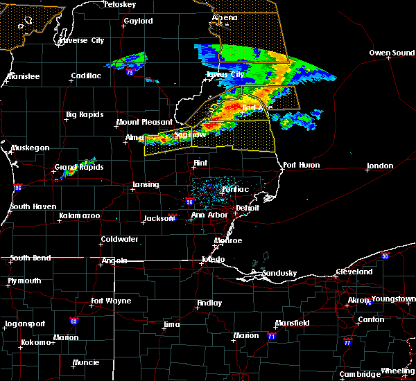 At 251 pm edt, severe thunderstorms were located along a line extending from port hope to near gagetown, moving east at 45 mph (radar indicated). Hazards include 70 mph wind gusts and half dollar size hail. Hail damage to vehicles is expected. expect considerable tree damage. wind damage is also likely to mobile homes, roofs and outbuildings. these severe storms will be near, port hope around 255 pm edt. Other locations impacted by these severe thunderstorms include redman, rapson, pinnebog, grindstone city, parisville, filion, bach, helena, ivanhoe and port crescent state park. At 251 pm edt, severe thunderstorms were located along a line extending from port hope to near gagetown, moving east at 45 mph (radar indicated). Hazards include 70 mph wind gusts and half dollar size hail. Hail damage to vehicles is expected. expect considerable tree damage. wind damage is also likely to mobile homes, roofs and outbuildings. these severe storms will be near, port hope around 255 pm edt. Other locations impacted by these severe thunderstorms include redman, rapson, pinnebog, grindstone city, parisville, filion, bach, helena, ivanhoe and port crescent state park.
|
| 8/2/2015 2:34 PM EDT |
 At 233 pm edt, severe thunderstorms were located along a line extending from 6 miles east of port austin to unionville, moving east at 60 mph (radar indicated). Hazards include 70 mph wind gusts and half dollar size hail. Hail damage to vehicles is expected. expect considerable tree damage. wind damage is also likely to mobile homes, roofs and outbuildings. these severe storms will be near, ubly around 300 pm edt. Other locations impacted by these severe thunderstorms include redman, rapson, pinnebog, grindstone city, parisville, filion, bach, helena, ivanhoe and port crescent state park. At 233 pm edt, severe thunderstorms were located along a line extending from 6 miles east of port austin to unionville, moving east at 60 mph (radar indicated). Hazards include 70 mph wind gusts and half dollar size hail. Hail damage to vehicles is expected. expect considerable tree damage. wind damage is also likely to mobile homes, roofs and outbuildings. these severe storms will be near, ubly around 300 pm edt. Other locations impacted by these severe thunderstorms include redman, rapson, pinnebog, grindstone city, parisville, filion, bach, helena, ivanhoe and port crescent state park.
|
| 8/2/2015 2:18 PM EDT |
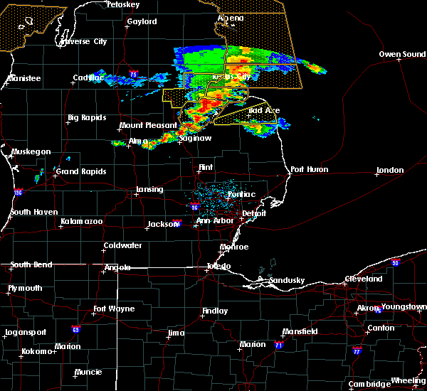 At 218 pm edt, severe thunderstorms were located along a line extending from 9 miles north of caseville to near sebewaing, moving east at 55 mph (radar indicated). Hazards include 60 mph wind gusts and half dollar size hail. Hail damage to vehicles is expected. expect wind damage to roofs, siding and trees. severe thunderstorms will be near, port austin and owendale around 230 pm edt. ubly around 245 pm edt. Other locations impacted by these severe thunderstorms include redman, rapson, pinnebog, grindstone city, parisville, filion, bach, helena, ivanhoe and port crescent state park. At 218 pm edt, severe thunderstorms were located along a line extending from 9 miles north of caseville to near sebewaing, moving east at 55 mph (radar indicated). Hazards include 60 mph wind gusts and half dollar size hail. Hail damage to vehicles is expected. expect wind damage to roofs, siding and trees. severe thunderstorms will be near, port austin and owendale around 230 pm edt. ubly around 245 pm edt. Other locations impacted by these severe thunderstorms include redman, rapson, pinnebog, grindstone city, parisville, filion, bach, helena, ivanhoe and port crescent state park.
|
| 8/2/2015 2:16 PM EDT |
 At 215 pm edt, a severe thunderstorm was located near caseville, moving east at 55 mph (radar indicated). Hazards include 60 mph wind gusts and quarter size hail. Hail damage to vehicles is expected. expect wind damage to roofs, siding and trees. Locations impacted include, bad axe, sebewaing, harbor beach, ubly, port hope, elkton, owendale, verona, helena, redman, rapson, parisville, filion, bach, ivanhoe, white rock and ruth. At 215 pm edt, a severe thunderstorm was located near caseville, moving east at 55 mph (radar indicated). Hazards include 60 mph wind gusts and quarter size hail. Hail damage to vehicles is expected. expect wind damage to roofs, siding and trees. Locations impacted include, bad axe, sebewaing, harbor beach, ubly, port hope, elkton, owendale, verona, helena, redman, rapson, parisville, filion, bach, ivanhoe, white rock and ruth.
|
| 8/2/2015 2:08 PM EDT |
 At 207 pm edt, a severe thunderstorm was located near ubly, moving east at 45 mph (radar indicated). Hazards include quarter size hail. Damage to vehicles is expected. This severe thunderstorm will remain over mainly rural areas of northern sanilac and huron counties, including the following locations, redman, rapson, parisville, tyre, palms, filion, bach, helena, ivanhoe and minden. At 207 pm edt, a severe thunderstorm was located near ubly, moving east at 45 mph (radar indicated). Hazards include quarter size hail. Damage to vehicles is expected. This severe thunderstorm will remain over mainly rural areas of northern sanilac and huron counties, including the following locations, redman, rapson, parisville, tyre, palms, filion, bach, helena, ivanhoe and minden.
|
| 8/2/2015 1:48 PM EDT |
 At 147 pm edt, a severe thunderstorm was located near gagetown, or near cass city, moving east at 40 mph (radar indicated). Hazards include ping pong ball size hail and 60 mph wind gusts. People and animals outdoors will be injured. expect hail damage to roofs, siding, windows and vehicles. expect wind damage to roofs, siding and trees. this severe storm will be near, ubly around 200 pm edt. forestville around 220 pm edt. Other locations impacted by this severe thunderstorm include redman, rapson, colwood, parisville, tyre, palms, filion, bach, colling and helena. At 147 pm edt, a severe thunderstorm was located near gagetown, or near cass city, moving east at 40 mph (radar indicated). Hazards include ping pong ball size hail and 60 mph wind gusts. People and animals outdoors will be injured. expect hail damage to roofs, siding, windows and vehicles. expect wind damage to roofs, siding and trees. this severe storm will be near, ubly around 200 pm edt. forestville around 220 pm edt. Other locations impacted by this severe thunderstorm include redman, rapson, colwood, parisville, tyre, palms, filion, bach, colling and helena.
|
| 8/2/2015 1:33 PM EDT |
 At 133 pm edt, a severe thunderstorm was located near unionville, or 7 miles northeast of akron, moving east at 35 mph (radar indicated). Hazards include quarter size hail. Damage to vehicles is expected. this severe thunderstorm will be near, owendale around 140 pm edt. cass city and gagetown around 145 pm edt. ubly around 200 pm edt. forestville around 220 pm edt. Other locations impacted by this severe thunderstorm include redman, rapson, colwood, ellington, parisville, tyre, palms, filion, bach and colling. At 133 pm edt, a severe thunderstorm was located near unionville, or 7 miles northeast of akron, moving east at 35 mph (radar indicated). Hazards include quarter size hail. Damage to vehicles is expected. this severe thunderstorm will be near, owendale around 140 pm edt. cass city and gagetown around 145 pm edt. ubly around 200 pm edt. forestville around 220 pm edt. Other locations impacted by this severe thunderstorm include redman, rapson, colwood, ellington, parisville, tyre, palms, filion, bach and colling.
|
| 6/22/2015 9:42 PM EDT |
 At 941 pm edt, severe thunderstorms were located along a line extending from near elkton to near gagetown to near akron, moving east at 45 mph (radar indicated). Hazards include 60 mph wind gusts and penny size hail. Expect damage to roofs. siding and trees. these severe storms will be near, elkton around 945 pm edt. bad axe, cass city and kinde around 950 pm edt. other locations impacted by these severe thunderstorms include pinnebog, east dayton, colwood, ellington, gilford, filion, bach, colling, ivanhoe and watrousville. A tornado watch remains in effect until 300 am edt for southeastern michigan. At 941 pm edt, severe thunderstorms were located along a line extending from near elkton to near gagetown to near akron, moving east at 45 mph (radar indicated). Hazards include 60 mph wind gusts and penny size hail. Expect damage to roofs. siding and trees. these severe storms will be near, elkton around 945 pm edt. bad axe, cass city and kinde around 950 pm edt. other locations impacted by these severe thunderstorms include pinnebog, east dayton, colwood, ellington, gilford, filion, bach, colling, ivanhoe and watrousville. A tornado watch remains in effect until 300 am edt for southeastern michigan.
|
| 6/22/2015 9:06 PM EDT |
 At 905 pm edt, severe thunderstorms were located along a line extending from 11 miles north of caseville to near zilwaukee, moving east at 35 mph (radar indicated). Hazards include 60 mph wind gusts and penny size hail. Expect damage to roofs. siding and trees. severe thunderstorms will be near, reese, port austin and quanicassee around 925 pm edt. fairgrove around 935 pm edt. akron around 940 pm edt. caro around 950 pm edt. cass city and kingston around 1005 pm edt. Other locations impacted by these severe thunderstorms include pinnebog, east dayton, colwood, ellington, gilford, filion, bach, colling, ivanhoe and watrousville. At 905 pm edt, severe thunderstorms were located along a line extending from 11 miles north of caseville to near zilwaukee, moving east at 35 mph (radar indicated). Hazards include 60 mph wind gusts and penny size hail. Expect damage to roofs. siding and trees. severe thunderstorms will be near, reese, port austin and quanicassee around 925 pm edt. fairgrove around 935 pm edt. akron around 940 pm edt. caro around 950 pm edt. cass city and kingston around 1005 pm edt. Other locations impacted by these severe thunderstorms include pinnebog, east dayton, colwood, ellington, gilford, filion, bach, colling, ivanhoe and watrousville.
|
| 6/8/2015 2:07 PM EDT |
 At 207 pm edt, a severe thunderstorm was located over argyle, or 8 miles south of ubly, moving east at 40 mph (radar indicated). Hazards include 60 mph wind gusts and quarter size hail. Hail damage to vehicles is expected. expect wind damage to roofs, siding and trees. this severe storm will be near, deckerville around 220 pm edt. forestville around 230 pm edt. Other locations impacted by this severe thunderstorm include rapson, colwood, ellington, parisville, richmondville, tyre, palms, filion, bach and colling. At 207 pm edt, a severe thunderstorm was located over argyle, or 8 miles south of ubly, moving east at 40 mph (radar indicated). Hazards include 60 mph wind gusts and quarter size hail. Hail damage to vehicles is expected. expect wind damage to roofs, siding and trees. this severe storm will be near, deckerville around 220 pm edt. forestville around 230 pm edt. Other locations impacted by this severe thunderstorm include rapson, colwood, ellington, parisville, richmondville, tyre, palms, filion, bach and colling.
|
| 6/8/2015 1:52 PM EDT |
 At 151 pm edt, a severe thunderstorm was located over cass city, moving east at 40 mph (radar indicated). Hazards include 60 mph wind gusts and quarter size hail. Hail damage to vehicles is expected. expect wind damage to roofs, siding and trees. this severe storm will be near, ubly around 205 pm edt. argyle around 210 pm edt. deckerville around 225 pm edt. forestville around 235 pm edt. Other locations impacted by this severe thunderstorm include rapson, colwood, ellington, parisville, richmondville, tyre, palms, filion, bach and colling. At 151 pm edt, a severe thunderstorm was located over cass city, moving east at 40 mph (radar indicated). Hazards include 60 mph wind gusts and quarter size hail. Hail damage to vehicles is expected. expect wind damage to roofs, siding and trees. this severe storm will be near, ubly around 205 pm edt. argyle around 210 pm edt. deckerville around 225 pm edt. forestville around 235 pm edt. Other locations impacted by this severe thunderstorm include rapson, colwood, ellington, parisville, richmondville, tyre, palms, filion, bach and colling.
|
| 6/8/2015 1:24 PM EDT |
 At 123 pm edt, a severe thunderstorm was located over unionville, or near akron, moving east at 40 mph (radar indicated). Hazards include 60 mph wind gusts and quarter size hail. Hail damage to vehicles is expected. expect wind damage to roofs, siding and trees. this severe thunderstorm will be near, caro around 135 pm edt. gagetown around 145 pm edt. cass city around 150 pm edt. ubly around 205 pm edt. argyle around 210 pm edt. deckerville around 225 pm edt. forestville around 235 pm edt. Other locations impacted by this severe thunderstorm include rapson, colwood, ellington, parisville, richmondville, gilford, tyre, palms, filion and bach. At 123 pm edt, a severe thunderstorm was located over unionville, or near akron, moving east at 40 mph (radar indicated). Hazards include 60 mph wind gusts and quarter size hail. Hail damage to vehicles is expected. expect wind damage to roofs, siding and trees. this severe thunderstorm will be near, caro around 135 pm edt. gagetown around 145 pm edt. cass city around 150 pm edt. ubly around 205 pm edt. argyle around 210 pm edt. deckerville around 225 pm edt. forestville around 235 pm edt. Other locations impacted by this severe thunderstorm include rapson, colwood, ellington, parisville, richmondville, gilford, tyre, palms, filion and bach.
|
| 5/20/2013 5:40 PM EDT | 49 mph sustained winds from 510pm to 540pm with peak gust at 540p in lhz422 county MI, 13.2 miles ESE of Sebewaing, MI |
| 1/1/0001 12:00 AM | 3 to 4 inch diameter branches down in huron county MI, 0.2 miles NW of Sebewaing, MI |
| 1/1/0001 12:00 AM | 3 to 4 inch diameter branches down in huron county MI, 0.2 miles NW of Sebewaing, MI |
| 1/1/0001 12:00 AM | Central dispatch reports dozens of trees down in and around sebewaing. powerlines down as wel in huron county MI, 0.2 miles NW of Sebewaing, MI |
| 1/1/0001 12:00 AM | National weather service survey team determined the damage in and around sebewaing was produced by straight line winds estimated between 80 and 90 mp in huron county MI, 0.2 miles NW of Sebewaing, MI |
Hail Maps for Sebewaing, MI


Connect with Interactive Hail Maps