

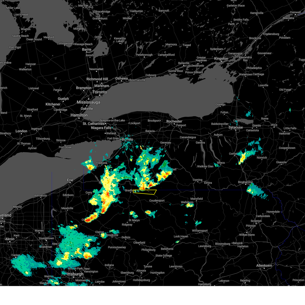
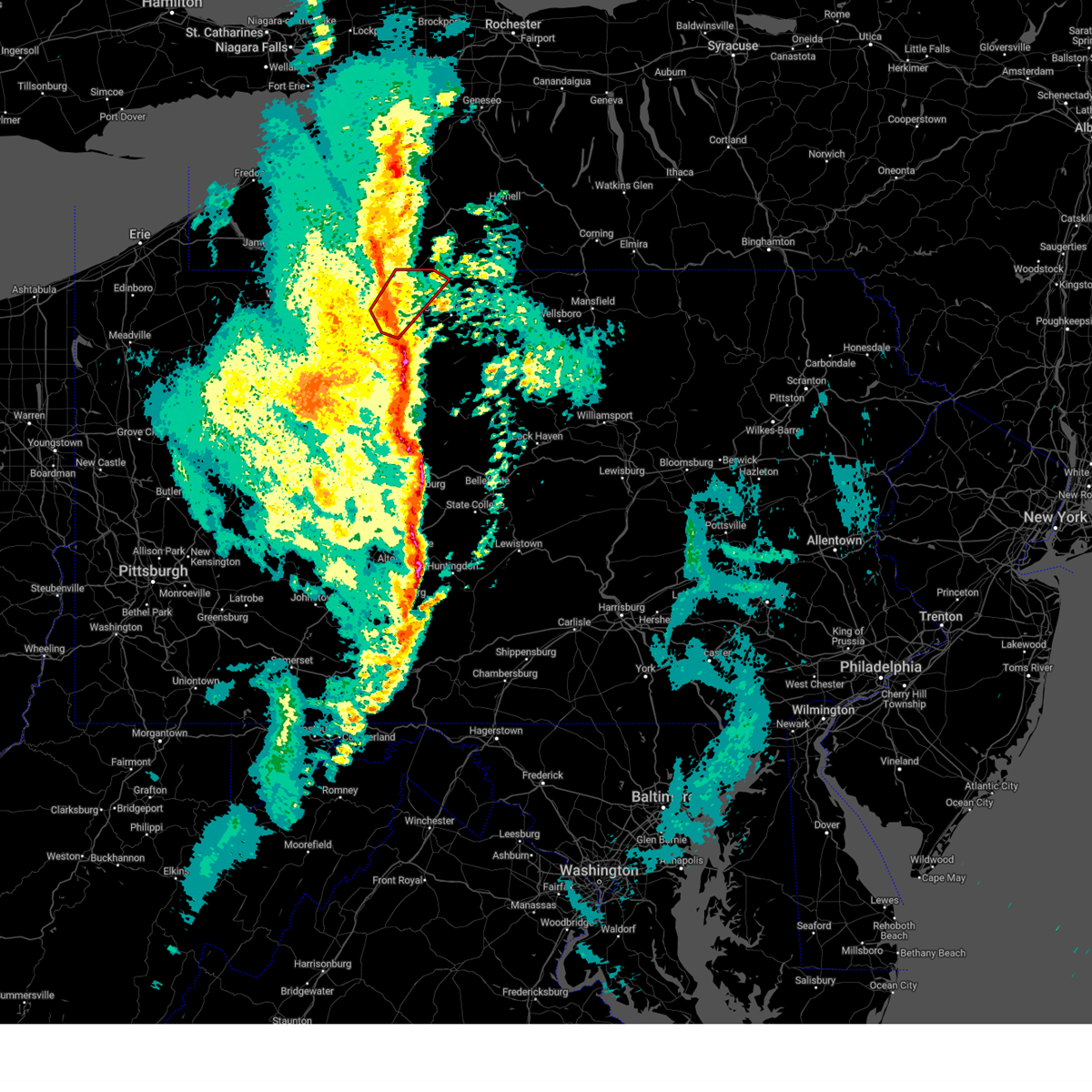
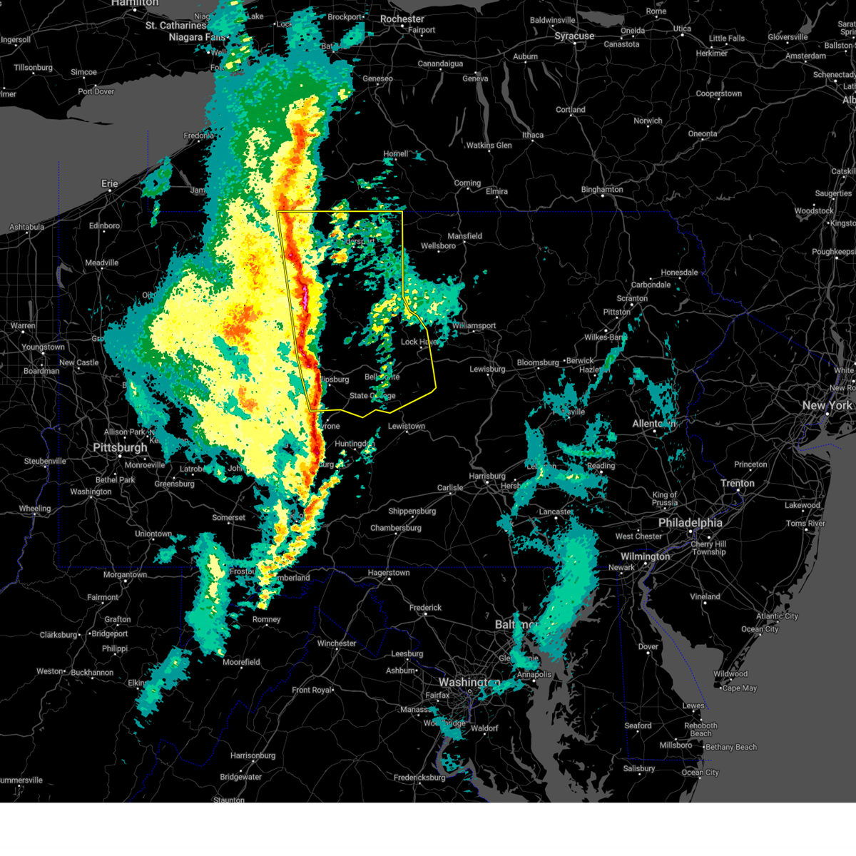
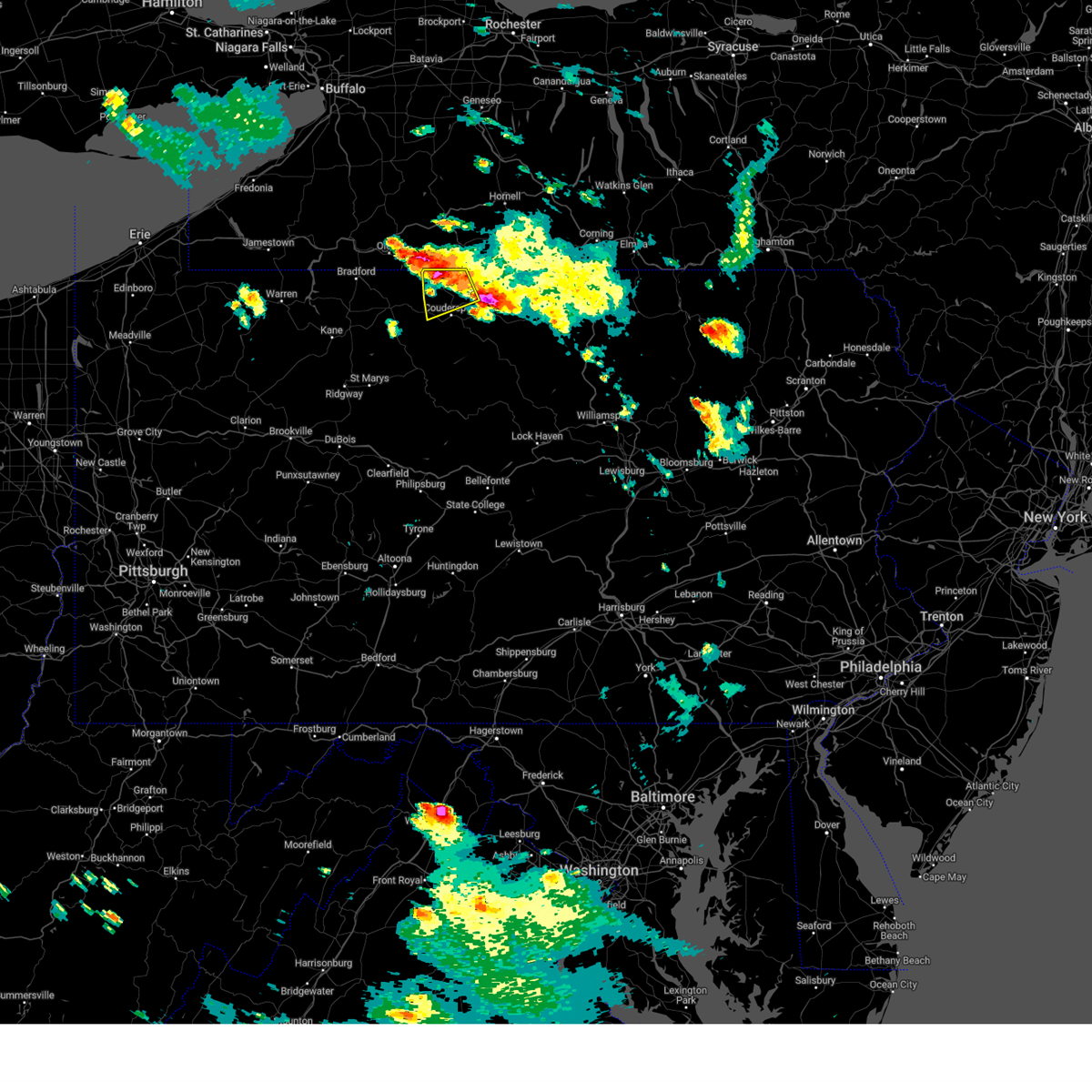
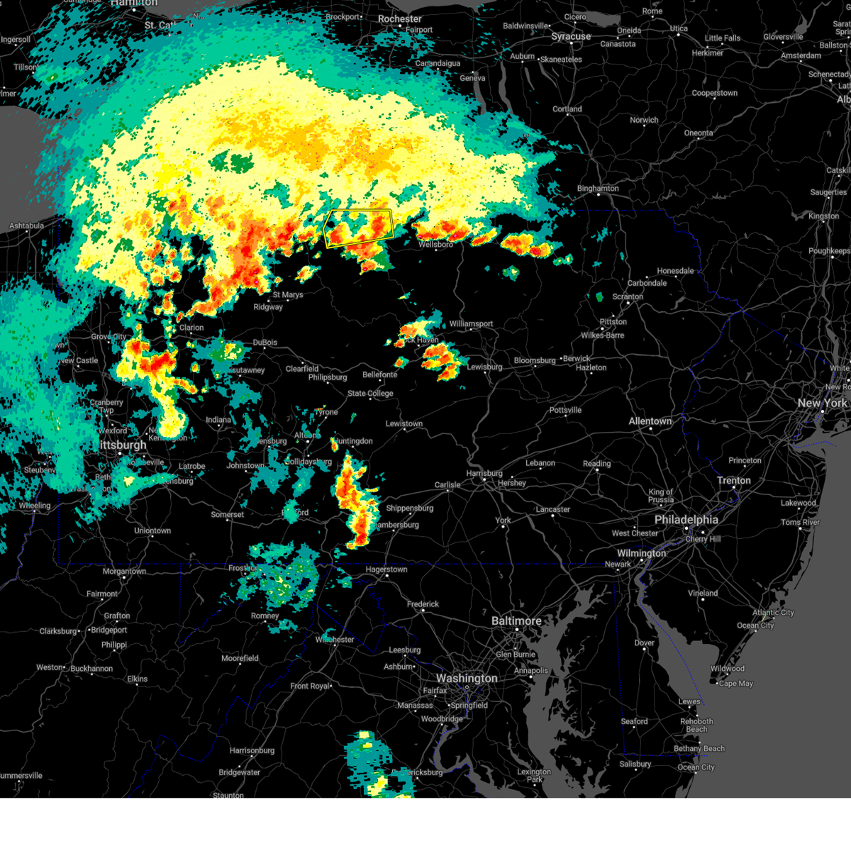
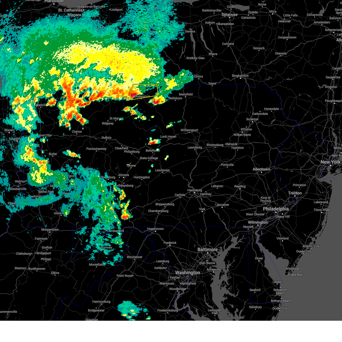
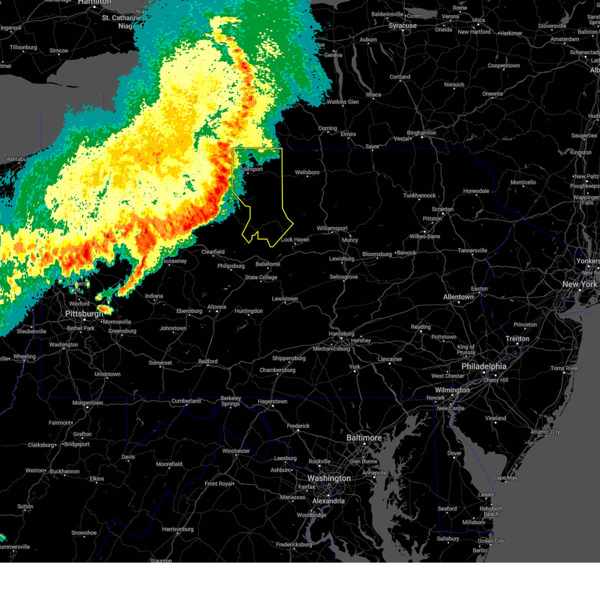
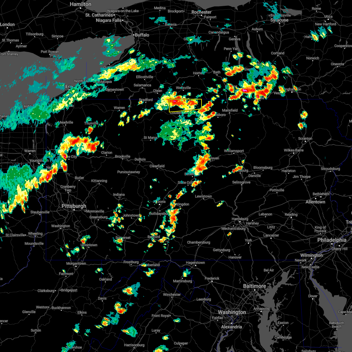
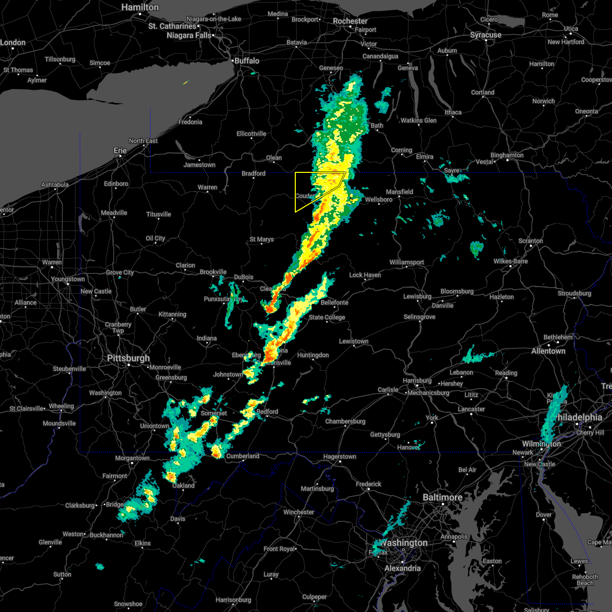
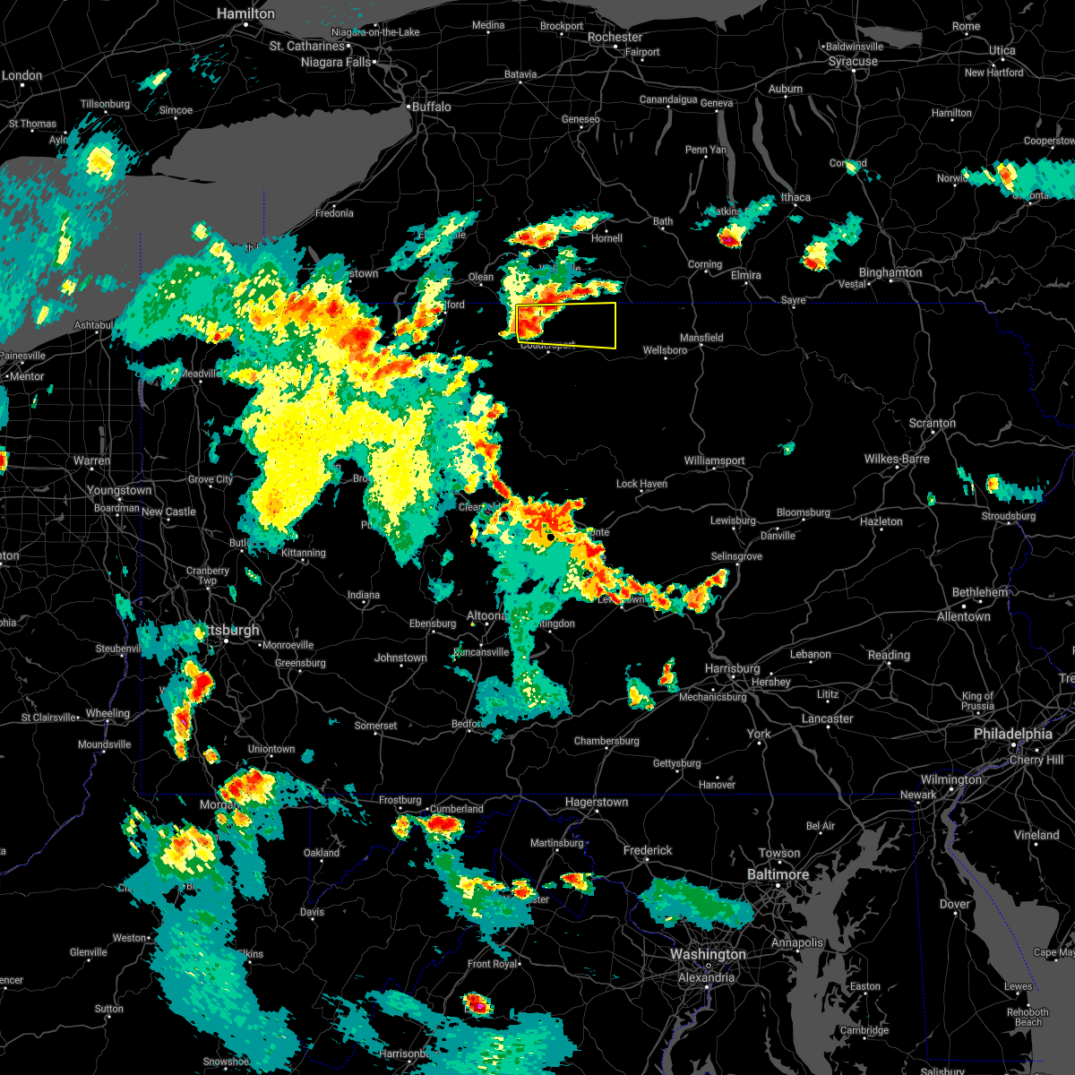
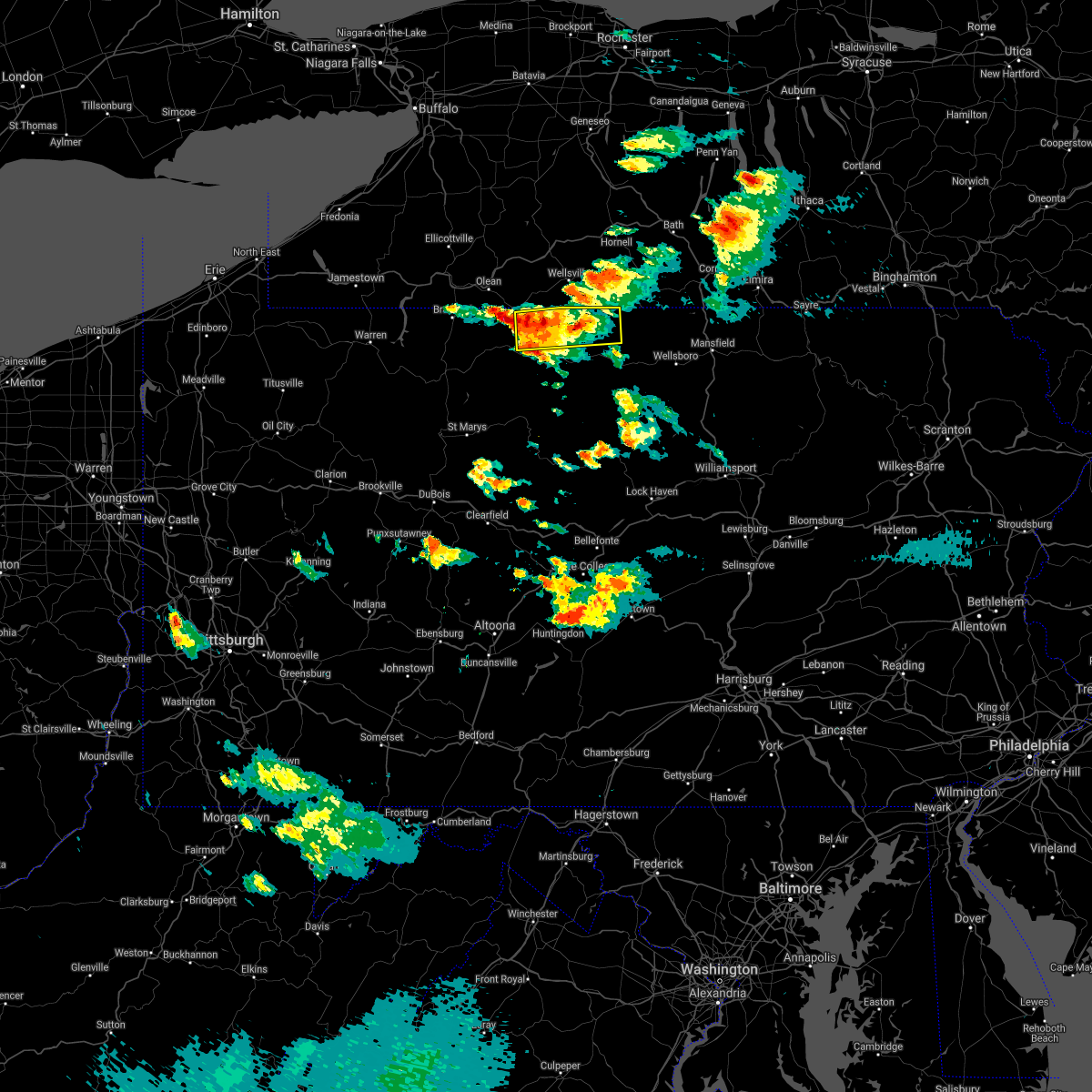
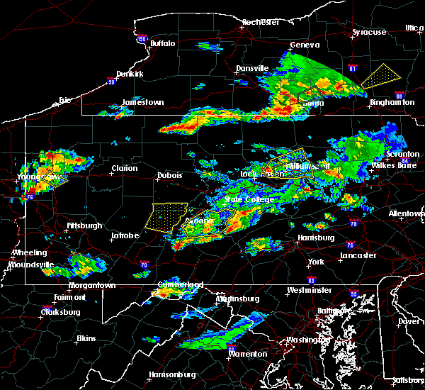
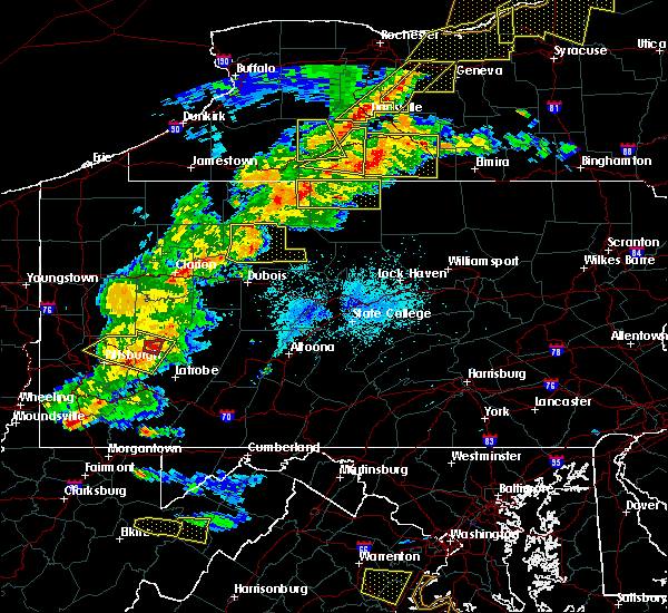
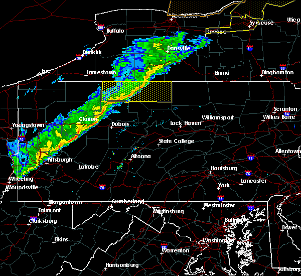
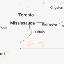
Hail Map for Shinglehouse, PA
The Shinglehouse, PA area has had 1 report of on-the-ground hail by trained spotters, and has been under severe weather warnings 8 times during the past 12 months. Doppler radar has detected hail at or near Shinglehouse, PA on 27 occasions, including 2 occasions during the past year.
| Name: | Shinglehouse, PA |
| Where Located: | 72.5 miles SSE of Buffalo, NY |
| Map: | Google Map for Shinglehouse, PA |
| Population: | 1127 |
| Housing Units: | 540 |
| More Info: | Search Google for Shinglehouse, PA |
1
The Top Recent Hail Date for Shinglehouse, PA is Saturday, August 17, 2024 (11th out of 27)

Hail and Wind Damage Spotted near Shinglehouse, PA
| Date / Time | Report Details |
|---|---|
| 6/9/2025 6:10 PM EDT | Torctp the national weather service in state college pa has issued a * tornado warning for, northwestern potter county in north central pennsylvania, * until 630 pm edt. * at 610 pm edt, a severe thunderstorm capable of producing a tornado was located near roulette, moving northeast at 30 mph (radar indicated rotation). Hazards include tornado. Flying debris will be dangerous to those caught without shelter. mobile homes will be damaged or destroyed. damage to roofs, windows, and vehicles will occur. tree damage is likely. This tornadic thunderstorm will remain over mainly rural areas of northwestern potter county, including the following locations, oswayo. |
| 5/2/2025 5:18 PM EDT |
 the severe thunderstorm warning has been cancelled and is no longer in effect the severe thunderstorm warning has been cancelled and is no longer in effect
|
| 5/2/2025 5:10 PM EDT | At 510 pm edt, a severe thunderstorm was located over st. bonaventure, moving east at 35 mph (radar indicated). Hazards include 60 mph wind gusts and quarter size hail. Hail damage to vehicles is expected. expect wind damage to roofs, siding, and trees. Locations impacted include, ceres, shinglehouse, and eldred. |
| 5/2/2025 4:52 PM EDT | Svrctp the national weather service in state college pa has issued a * severe thunderstorm warning for, northeastern mckean county in north central pennsylvania, northwestern potter county in north central pennsylvania, * until 530 pm edt. * at 451 pm edt, a severe thunderstorm was located over bradford, moving east at 35 mph (radar indicated). Hazards include 60 mph wind gusts and quarter size hail. Hail damage to vehicles is expected. Expect wind damage to roofs, siding, and trees. |
| 3/16/2025 2:49 PM EDT | Trees on wires. report from in potter county PA, 0.2 miles S of Shinglehouse, PA |
| 3/16/2025 2:34 PM EDT |
 Torctp the national weather service in state college pa has issued a * tornado warning for, eastern mckean county in north central pennsylvania, northwestern potter county in north central pennsylvania, * until 300 pm edt. * at 233 pm edt, severe thunderstorms capable of producing both tornadoes and extensive straight line wind damage were located over crosby, moving northeast at 70 mph (radar indicated rotation). Hazards include tornado and quarter size hail. Flying debris will be dangerous to those caught without shelter. mobile homes will be damaged or destroyed. damage to roofs, windows, and vehicles will occur. tree damage is likely. these dangerous storms will be near, smethport and coryville around 240 pm edt. shinglehouse around 250 pm edt. other locations impacted by this tornadic thunderstorm include ceres and eldred. this includes the following highways, route 6 from west of smethport to east of port allegany. state road 46 from smethport to farmers valley. state road 59 from west of smethport to smethport. State road 446 from farmers valley to the new york border. Torctp the national weather service in state college pa has issued a * tornado warning for, eastern mckean county in north central pennsylvania, northwestern potter county in north central pennsylvania, * until 300 pm edt. * at 233 pm edt, severe thunderstorms capable of producing both tornadoes and extensive straight line wind damage were located over crosby, moving northeast at 70 mph (radar indicated rotation). Hazards include tornado and quarter size hail. Flying debris will be dangerous to those caught without shelter. mobile homes will be damaged or destroyed. damage to roofs, windows, and vehicles will occur. tree damage is likely. these dangerous storms will be near, smethport and coryville around 240 pm edt. shinglehouse around 250 pm edt. other locations impacted by this tornadic thunderstorm include ceres and eldred. this includes the following highways, route 6 from west of smethport to east of port allegany. state road 46 from smethport to farmers valley. state road 59 from west of smethport to smethport. State road 446 from farmers valley to the new york border.
|
| 3/16/2025 2:27 PM EDT |
 Svrctp the national weather service in state college pa has issued a * severe thunderstorm warning for, cameron county in north central pennsylvania, centre county in central pennsylvania, eastern clearfield county in central pennsylvania, clinton county in north central pennsylvania, eastern elk county in north central pennsylvania, eastern mckean county in north central pennsylvania, potter county in north central pennsylvania, * until 345 pm edt. * at 226 pm edt, severe thunderstorms were located along a line extending from rew to betula to benezette to medix run to jeffries to sinking valley, moving east at 35 mph (trained weather spotters). Hazards include 70 mph wind gusts and quarter size hail. Hail damage to vehicles is expected. expect considerable tree damage. Wind damage is also likely to mobile homes, roofs, and outbuildings. Svrctp the national weather service in state college pa has issued a * severe thunderstorm warning for, cameron county in north central pennsylvania, centre county in central pennsylvania, eastern clearfield county in central pennsylvania, clinton county in north central pennsylvania, eastern elk county in north central pennsylvania, eastern mckean county in north central pennsylvania, potter county in north central pennsylvania, * until 345 pm edt. * at 226 pm edt, severe thunderstorms were located along a line extending from rew to betula to benezette to medix run to jeffries to sinking valley, moving east at 35 mph (trained weather spotters). Hazards include 70 mph wind gusts and quarter size hail. Hail damage to vehicles is expected. expect considerable tree damage. Wind damage is also likely to mobile homes, roofs, and outbuildings.
|
| 9/21/2024 8:07 PM EDT | The storm which prompted the warning has moved out of the area. therefore, the warning will be allowed to expire. remember, multile severe thunderstorm warnings still remains in effect for portions of potter county. |
| 9/21/2024 7:55 PM EDT | Tree down blocking the highwa in potter county PA, 0.2 miles S of Shinglehouse, PA |
| 9/21/2024 7:23 PM EDT |
 Svrctp the national weather service in state college pa has issued a * severe thunderstorm warning for, northwestern potter county in north central pennsylvania, * until 815 pm edt. * at 723 pm edt, a severe thunderstorm was located over shinglehouse, moving southeast at 15 mph (radar indicated). Hazards include 60 mph wind gusts and quarter size hail. Hail damage to vehicles is expected. Expect wind damage to roofs, siding, and trees. Svrctp the national weather service in state college pa has issued a * severe thunderstorm warning for, northwestern potter county in north central pennsylvania, * until 815 pm edt. * at 723 pm edt, a severe thunderstorm was located over shinglehouse, moving southeast at 15 mph (radar indicated). Hazards include 60 mph wind gusts and quarter size hail. Hail damage to vehicles is expected. Expect wind damage to roofs, siding, and trees.
|
| 7/10/2024 1:18 PM EDT |
 Svrctp the national weather service in state college pa has issued a * severe thunderstorm warning for, northeastern cameron county in north central pennsylvania, southeastern mckean county in north central pennsylvania, western potter county in north central pennsylvania, * until 215 pm edt. * at 117 pm edt, severe thunderstorms were located along a line extending from shinglehouse to roulette to emporium, moving northeast at 60 mph (radar indicated). Hazards include 60 mph wind gusts. expect damage to roofs, siding, and trees Svrctp the national weather service in state college pa has issued a * severe thunderstorm warning for, northeastern cameron county in north central pennsylvania, southeastern mckean county in north central pennsylvania, western potter county in north central pennsylvania, * until 215 pm edt. * at 117 pm edt, severe thunderstorms were located along a line extending from shinglehouse to roulette to emporium, moving northeast at 60 mph (radar indicated). Hazards include 60 mph wind gusts. expect damage to roofs, siding, and trees
|
| 6/26/2024 3:56 PM EDT |
 The storm which prompted the warning has weakened below severe limits, and no longer poses an immediate threat to life or property. therefore, the warning will be allowed to expire. a severe thunderstorm watch remains in effect until 900 pm edt for north central pennsylvania. to report severe weather, contact your nearest law enforcement agency. they will relay your report to the national weather service state college pa. The storm which prompted the warning has weakened below severe limits, and no longer poses an immediate threat to life or property. therefore, the warning will be allowed to expire. a severe thunderstorm watch remains in effect until 900 pm edt for north central pennsylvania. to report severe weather, contact your nearest law enforcement agency. they will relay your report to the national weather service state college pa.
|
| 6/26/2024 3:20 PM EDT |
 Svrctp the national weather service in state college pa has issued a * severe thunderstorm warning for, east central mckean county in north central pennsylvania, northern potter county in north central pennsylvania, * until 400 pm edt. * at 320 pm edt, a severe thunderstorm was located over roulette, moving east at 35 mph (radar indicated). Hazards include 60 mph wind gusts and half dollar size hail. Hail damage to vehicles is expected. Expect wind damage to roofs, siding, and trees. Svrctp the national weather service in state college pa has issued a * severe thunderstorm warning for, east central mckean county in north central pennsylvania, northern potter county in north central pennsylvania, * until 400 pm edt. * at 320 pm edt, a severe thunderstorm was located over roulette, moving east at 35 mph (radar indicated). Hazards include 60 mph wind gusts and half dollar size hail. Hail damage to vehicles is expected. Expect wind damage to roofs, siding, and trees.
|
| 8/25/2023 1:23 AM EDT |
 At 122 am edt, severe thunderstorms were located along a line extending from weston mills to brockport, moving east at 50 mph. the storms appear to be weakening, though (radar indicated). Hazards include 60 mph wind gusts and nickel size hail. Expect damage to roofs, siding, and trees. locations impacted include, st. marys, ridgway, johnsonburg, port allegany, emporium, smethport, shinglehouse, betula, force, benezette, coryville and crosby. hail threat, radar indicated max hail size, 0. 88 in wind threat, radar indicated max wind gust, 60 mph. At 122 am edt, severe thunderstorms were located along a line extending from weston mills to brockport, moving east at 50 mph. the storms appear to be weakening, though (radar indicated). Hazards include 60 mph wind gusts and nickel size hail. Expect damage to roofs, siding, and trees. locations impacted include, st. marys, ridgway, johnsonburg, port allegany, emporium, smethport, shinglehouse, betula, force, benezette, coryville and crosby. hail threat, radar indicated max hail size, 0. 88 in wind threat, radar indicated max wind gust, 60 mph.
|
| 8/25/2023 1:05 AM EDT |
 At 104 am edt, severe thunderstorms were located along a line extending from near bradford to portland mills, moving east at 55 mph (radar indicated). Hazards include 60 mph wind gusts and nickel size hail. Expect damage to roofs, siding, and trees. locations impacted include, st. marys, bradford, ridgway, kane, johnsonburg, port allegany, emporium, smethport, wetmore, shinglehouse, betula and wilcox. hail threat, radar indicated max hail size, 0. 88 in wind threat, radar indicated max wind gust, 60 mph. At 104 am edt, severe thunderstorms were located along a line extending from near bradford to portland mills, moving east at 55 mph (radar indicated). Hazards include 60 mph wind gusts and nickel size hail. Expect damage to roofs, siding, and trees. locations impacted include, st. marys, bradford, ridgway, kane, johnsonburg, port allegany, emporium, smethport, wetmore, shinglehouse, betula and wilcox. hail threat, radar indicated max hail size, 0. 88 in wind threat, radar indicated max wind gust, 60 mph.
|
| 8/25/2023 12:46 AM EDT |
 At 1246 am edt, severe thunderstorms were located along a line extending from near allegany state park to near brookville, moving east at 55 mph (radar indicated). Hazards include 60 mph wind gusts and nickel size hail. expect damage to roofs, siding, and trees At 1246 am edt, severe thunderstorms were located along a line extending from near allegany state park to near brookville, moving east at 55 mph (radar indicated). Hazards include 60 mph wind gusts and nickel size hail. expect damage to roofs, siding, and trees
|
| 7/20/2023 8:53 PM EDT |
 At 853 pm edt, severe thunderstorms were located along a line extending from shinglehouse to sizerville, moving east at 50 mph (radar indicated). Hazards include 60 mph wind gusts. expect damage to roofs, siding, and trees At 853 pm edt, severe thunderstorms were located along a line extending from shinglehouse to sizerville, moving east at 50 mph (radar indicated). Hazards include 60 mph wind gusts. expect damage to roofs, siding, and trees
|
| 7/20/2023 8:29 PM EDT |
 At 829 pm edt, severe thunderstorms were located along a line extending from rew to east branch dam to johnsonburg, moving east at 45 mph (radar indicated). Hazards include 70 mph wind gusts and penny size hail. Expect considerable tree damage. damage is likely to mobile homes, roofs, and outbuildings. locations impacted include, st. Marys, bradford, ridgway, kane, johnsonburg, port allegany, smethport, wetmore, shinglehouse, betula, wilcox and james city. At 829 pm edt, severe thunderstorms were located along a line extending from rew to east branch dam to johnsonburg, moving east at 45 mph (radar indicated). Hazards include 70 mph wind gusts and penny size hail. Expect considerable tree damage. damage is likely to mobile homes, roofs, and outbuildings. locations impacted include, st. Marys, bradford, ridgway, kane, johnsonburg, port allegany, smethport, wetmore, shinglehouse, betula, wilcox and james city.
|
| 7/20/2023 7:58 PM EDT |
 At 758 pm edt, severe thunderstorms were located along a line extending from scandia to sheffield to near marienville, moving east at 50 mph (radar indicated). Hazards include 70 mph wind gusts and penny size hail. Expect considerable tree damage. Damage is likely to mobile homes, roofs, and outbuildings. At 758 pm edt, severe thunderstorms were located along a line extending from scandia to sheffield to near marienville, moving east at 50 mph (radar indicated). Hazards include 70 mph wind gusts and penny size hail. Expect considerable tree damage. Damage is likely to mobile homes, roofs, and outbuildings.
|
| 4/1/2023 3:07 PM EDT |
 At 307 pm edt, severe thunderstorms were located along a line extending from near shinglehouse to cameron to woodland, moving northeast at 40 mph (radar indicated). Hazards include 70 mph wind gusts. Expect considerable tree damage. Damage is likely to mobile homes, roofs, and outbuildings. At 307 pm edt, severe thunderstorms were located along a line extending from near shinglehouse to cameron to woodland, moving northeast at 40 mph (radar indicated). Hazards include 70 mph wind gusts. Expect considerable tree damage. Damage is likely to mobile homes, roofs, and outbuildings.
|
| 4/1/2023 2:18 PM EDT |
 At 217 pm edt, severe thunderstorms were located along a line extending from kinzua dam to near indiana, moving east at 55 mph (automatic observing system. wind gust to 68 mph at allegheny county airport). Hazards include 70 mph wind gusts. Expect considerable tree damage. Damage is likely to mobile homes, roofs, and outbuildings. At 217 pm edt, severe thunderstorms were located along a line extending from kinzua dam to near indiana, moving east at 55 mph (automatic observing system. wind gust to 68 mph at allegheny county airport). Hazards include 70 mph wind gusts. Expect considerable tree damage. Damage is likely to mobile homes, roofs, and outbuildings.
|
| 8/4/2022 1:35 PM EDT |
 At 134 pm edt, a severe thunderstorm was located over genesee, moving east at 35 mph (radar indicated). Hazards include 60 mph wind gusts and quarter size hail. Hail damage to vehicles is expected. expect wind damage to roofs, siding, and trees. locations impacted include, shinglehouse, genesee, harrison valley, ulysses and oswayo. hail threat, radar indicated max hail size, 1. 00 in wind threat, radar indicated max wind gust, 60 mph. At 134 pm edt, a severe thunderstorm was located over genesee, moving east at 35 mph (radar indicated). Hazards include 60 mph wind gusts and quarter size hail. Hail damage to vehicles is expected. expect wind damage to roofs, siding, and trees. locations impacted include, shinglehouse, genesee, harrison valley, ulysses and oswayo. hail threat, radar indicated max hail size, 1. 00 in wind threat, radar indicated max wind gust, 60 mph.
|
| 8/4/2022 1:23 PM EDT | Trees and wires dow in potter county PA, 0.5 miles N of Shinglehouse, PA |
| 8/4/2022 1:12 PM EDT |
 At 112 pm edt, a severe thunderstorm was located over shinglehouse, moving east at 35 mph (radar indicated). Hazards include 60 mph wind gusts and quarter size hail. Hail damage to vehicles is expected. Expect wind damage to roofs, siding, and trees. At 112 pm edt, a severe thunderstorm was located over shinglehouse, moving east at 35 mph (radar indicated). Hazards include 60 mph wind gusts and quarter size hail. Hail damage to vehicles is expected. Expect wind damage to roofs, siding, and trees.
|
| 3/31/2022 1:35 PM EDT |
 The severe thunderstorm warning for northwestern potter county will expire at 145 pm edt, the storms which prompted the warning have weakened below severe limits, and no longer pose an immediate threat to life or property. therefore, the warning will be allowed to expire. to report severe weather, contact your nearest law enforcement agency. they will relay your report to the national weather service state college pa. The severe thunderstorm warning for northwestern potter county will expire at 145 pm edt, the storms which prompted the warning have weakened below severe limits, and no longer pose an immediate threat to life or property. therefore, the warning will be allowed to expire. to report severe weather, contact your nearest law enforcement agency. they will relay your report to the national weather service state college pa.
|
| 3/31/2022 1:19 PM EDT |
 At 118 pm edt, severe thunderstorms were located along a line extending from near wellsville to roulette, moving northeast at 55 mph (radar indicated). Hazards include 60 mph wind gusts. Expect damage to roofs, siding, and trees. locations impacted include, coudersport, roulette, shinglehouse, genesee, keating summit, ulysses and oswayo. hail threat, radar indicated max hail size, <. 75 in wind threat, radar indicated max wind gust, 60 mph. At 118 pm edt, severe thunderstorms were located along a line extending from near wellsville to roulette, moving northeast at 55 mph (radar indicated). Hazards include 60 mph wind gusts. Expect damage to roofs, siding, and trees. locations impacted include, coudersport, roulette, shinglehouse, genesee, keating summit, ulysses and oswayo. hail threat, radar indicated max hail size, <. 75 in wind threat, radar indicated max wind gust, 60 mph.
|
| 3/31/2022 1:05 PM EDT |
 At 104 pm edt, severe thunderstorms were located along a line extending from shinglehouse to betula, moving northeast at 55 mph (radar indicated). Hazards include 60 mph wind gusts. expect damage to roofs, siding, and trees At 104 pm edt, severe thunderstorms were located along a line extending from shinglehouse to betula, moving northeast at 55 mph (radar indicated). Hazards include 60 mph wind gusts. expect damage to roofs, siding, and trees
|
| 3/7/2022 4:49 PM EST |
 At 448 pm est, severe thunderstorms were located along a line extending from near cuba to south connellsville, moving northeast at 75 mph (radar indicated). Hazards include 60 mph wind gusts. expect damage to roofs, siding, and trees At 448 pm est, severe thunderstorms were located along a line extending from near cuba to south connellsville, moving northeast at 75 mph (radar indicated). Hazards include 60 mph wind gusts. expect damage to roofs, siding, and trees
|
| 7/13/2021 6:59 PM EDT |
 The national weather service in state college pa has issued a * severe thunderstorm warning for. potter county in north central pennsylvania. until 800 pm edt. At 659 pm edt, severe thunderstorms were located along a line extending from near shinglehouse to near keating summit to near. The national weather service in state college pa has issued a * severe thunderstorm warning for. potter county in north central pennsylvania. until 800 pm edt. At 659 pm edt, severe thunderstorms were located along a line extending from near shinglehouse to near keating summit to near.
|
| 7/13/2021 6:19 PM EDT |
 At 619 pm edt, severe thunderstorms were located along a line extending from near allegany to near coryville to near crosby to near betula, moving northeast at 40 mph. these are very dangerous storms (radar indicated). Hazards include 80 mph wind gusts and penny size hail. Flying debris will be dangerous to those caught without shelter. mobile homes will be heavily damaged. expect considerable damage to roofs, windows, and vehicles. extensive tree damage and power outages are likely. severe thunderstorms will be near, coryville around 620 pm edt. port allegany around 630 pm edt. shinglehouse and roulette around 640 pm edt. genesee around 700 pm edt. Other locations impacted by these severe thunderstorms include oswayo and eldred. At 619 pm edt, severe thunderstorms were located along a line extending from near allegany to near coryville to near crosby to near betula, moving northeast at 40 mph. these are very dangerous storms (radar indicated). Hazards include 80 mph wind gusts and penny size hail. Flying debris will be dangerous to those caught without shelter. mobile homes will be heavily damaged. expect considerable damage to roofs, windows, and vehicles. extensive tree damage and power outages are likely. severe thunderstorms will be near, coryville around 620 pm edt. port allegany around 630 pm edt. shinglehouse and roulette around 640 pm edt. genesee around 700 pm edt. Other locations impacted by these severe thunderstorms include oswayo and eldred.
|
| 7/13/2021 5:23 PM EDT |
 At 523 pm edt, severe thunderstorms were located along a line extending from near russell to near warren south to near chapman state park to 9 miles west of sheffield to near marienville, moving northeast at 45 mph (radar indicated). Hazards include 60 mph wind gusts and penny size hail. Expect damage to roofs, siding, and trees. severe thunderstorms will be near, warren and russell around 530 pm edt. kane, james city, kinzua dam, ludlow, scandia, wetmore and wilcox around 540 pm edt. marshburg and westline around 550 pm edt. bradford, cyclone, rew and kinzua bridge state park around 600 pm edt. Other locations impacted by these severe thunderstorms include starbrick, eldred, mount jewett, lewis run, clarendon, bradford airport and university of pittsburgh - bradford. At 523 pm edt, severe thunderstorms were located along a line extending from near russell to near warren south to near chapman state park to 9 miles west of sheffield to near marienville, moving northeast at 45 mph (radar indicated). Hazards include 60 mph wind gusts and penny size hail. Expect damage to roofs, siding, and trees. severe thunderstorms will be near, warren and russell around 530 pm edt. kane, james city, kinzua dam, ludlow, scandia, wetmore and wilcox around 540 pm edt. marshburg and westline around 550 pm edt. bradford, cyclone, rew and kinzua bridge state park around 600 pm edt. Other locations impacted by these severe thunderstorms include starbrick, eldred, mount jewett, lewis run, clarendon, bradford airport and university of pittsburgh - bradford.
|
| 7/7/2021 7:56 PM EDT |
 The severe thunderstorm warning for northern potter county will expire at 800 pm edt, the storm which prompted the warning has weakened below severe limits, and has exited the warned area. therefore, the warning will be allowed to expire. however heavy rain is still possible with this thunderstorm. a flood advisory is in effect for nw potter county until 945pm. a severe thunderstorm watch remains in effect until 1100 pm edt for north central pennsylvania. The severe thunderstorm warning for northern potter county will expire at 800 pm edt, the storm which prompted the warning has weakened below severe limits, and has exited the warned area. therefore, the warning will be allowed to expire. however heavy rain is still possible with this thunderstorm. a flood advisory is in effect for nw potter county until 945pm. a severe thunderstorm watch remains in effect until 1100 pm edt for north central pennsylvania.
|
| 7/7/2021 7:02 PM EDT |
 At 701 pm edt, a severe thunderstorm was located 8 miles southeast of shinglehouse, moving east at 30 mph (law enforcement has reported quarter size hail and numerous downed trees in the path of this storm). Hazards include 70 mph wind gusts and quarter size hail. Hail damage to vehicles is expected. expect considerable tree damage. wind damage is also likely to mobile homes, roofs, and outbuildings. Locations impacted include, shinglehouse, genesee, harrison valley, ulysses and oswayo. At 701 pm edt, a severe thunderstorm was located 8 miles southeast of shinglehouse, moving east at 30 mph (law enforcement has reported quarter size hail and numerous downed trees in the path of this storm). Hazards include 70 mph wind gusts and quarter size hail. Hail damage to vehicles is expected. expect considerable tree damage. wind damage is also likely to mobile homes, roofs, and outbuildings. Locations impacted include, shinglehouse, genesee, harrison valley, ulysses and oswayo.
|
| 7/7/2021 6:43 PM EDT |
 At 641 pm edt, a severe thunderstorm was located near port allegany, moving east at 30 mph (law enforcement reported hail and numerous downed trees in the path of this storm). Hazards include 70 mph wind gusts and quarter size hail. Hail damage to vehicles is expected. expect considerable tree damage. Wind damage is also likely to mobile homes, roofs, and outbuildings. At 641 pm edt, a severe thunderstorm was located near port allegany, moving east at 30 mph (law enforcement reported hail and numerous downed trees in the path of this storm). Hazards include 70 mph wind gusts and quarter size hail. Hail damage to vehicles is expected. expect considerable tree damage. Wind damage is also likely to mobile homes, roofs, and outbuildings.
|
| 6/21/2021 3:17 PM EDT |
 At 316 pm edt, a severe thunderstorm was located just east of shinglehouse, moving east at 35 mph (radar indicated). Hazards include 60 mph wind gusts and quarter size hail. Hail damage to vehicles is expected. expect wind damage to roofs, siding, and trees. Locations impacted include, shinglehouse and oswayo. At 316 pm edt, a severe thunderstorm was located just east of shinglehouse, moving east at 35 mph (radar indicated). Hazards include 60 mph wind gusts and quarter size hail. Hail damage to vehicles is expected. expect wind damage to roofs, siding, and trees. Locations impacted include, shinglehouse and oswayo.
|
| 6/21/2021 3:09 PM EDT |
 At 309 pm edt, a severe thunderstorm was located over shinglehouse, moving east at 35 mph (radar indicated). Hazards include 60 mph wind gusts and quarter size hail. Hail damage to vehicles is expected. Expect wind damage to roofs, siding, and trees. At 309 pm edt, a severe thunderstorm was located over shinglehouse, moving east at 35 mph (radar indicated). Hazards include 60 mph wind gusts and quarter size hail. Hail damage to vehicles is expected. Expect wind damage to roofs, siding, and trees.
|
| 6/13/2021 9:04 PM EDT |
 At 902 pm edt, a severe thunderstorm was located near shinglehouse, moving east at 20 mph (doppler radar indicated). Hazards include 60 mph wind gusts, small hail and minor flooding. Expect downed trees and minor flooding in some locations. Locations impacted include, port allegany, shinglehouse, genesee, harrison valley, ulysses and oswayo. At 902 pm edt, a severe thunderstorm was located near shinglehouse, moving east at 20 mph (doppler radar indicated). Hazards include 60 mph wind gusts, small hail and minor flooding. Expect downed trees and minor flooding in some locations. Locations impacted include, port allegany, shinglehouse, genesee, harrison valley, ulysses and oswayo.
|
| 6/13/2021 8:41 PM EDT |
 At 841 pm edt, a severe thunderstorm was located near coryville, moving east at 25 mph (trained weather spotters have occasionally reported large hail over the last hour to hour and a half with this storm). Hazards include 60 mph wind gusts and half dollar size hail. Hail damage to vehicles is expected. expect wind damage to roofs, siding, and trees. this severe thunderstorm will be near, shinglehouse around 850 pm edt. genesee around 920 pm edt. harrison valley around 940 pm edt. Other locations impacted by this severe thunderstorm include ulysses, oswayo and eldred. At 841 pm edt, a severe thunderstorm was located near coryville, moving east at 25 mph (trained weather spotters have occasionally reported large hail over the last hour to hour and a half with this storm). Hazards include 60 mph wind gusts and half dollar size hail. Hail damage to vehicles is expected. expect wind damage to roofs, siding, and trees. this severe thunderstorm will be near, shinglehouse around 850 pm edt. genesee around 920 pm edt. harrison valley around 940 pm edt. Other locations impacted by this severe thunderstorm include ulysses, oswayo and eldred.
|
| 11/15/2020 4:17 PM EST |
 At 417 pm est, severe thunderstorms were located along a line extending from coryville to s.b. elliot state park, moving east at 45 mph (radar indicated). Hazards include 60 mph wind gusts. Expect damage to trees, roofs, and siding. locations impacted include, st. marys, dubois, clearfield, johnsonburg, sandy, philipsburg, woodland, curwensville, port allegany, smethport, penfield, hyde, osceola mills, shinglehouse, plymptonville, rockton, chester hill, karthaus, houtzdale and betula. For those driving on interstate 80, this includes areas between the dubois and snow shoe exits, specifically from mile markers 97 to 135. At 417 pm est, severe thunderstorms were located along a line extending from coryville to s.b. elliot state park, moving east at 45 mph (radar indicated). Hazards include 60 mph wind gusts. Expect damage to trees, roofs, and siding. locations impacted include, st. marys, dubois, clearfield, johnsonburg, sandy, philipsburg, woodland, curwensville, port allegany, smethport, penfield, hyde, osceola mills, shinglehouse, plymptonville, rockton, chester hill, karthaus, houtzdale and betula. For those driving on interstate 80, this includes areas between the dubois and snow shoe exits, specifically from mile markers 97 to 135.
|
| 11/15/2020 3:30 PM EST |
 At 329 pm est, severe thunderstorms were located along a line extending from 6 miles southwest of sheffield to 8 miles south of new bethlehem, moving northeast at 70 mph (radar indicated). Hazards include 60 mph wind gusts. expect damage to trees, roofs, and siding At 329 pm est, severe thunderstorms were located along a line extending from 6 miles southwest of sheffield to 8 miles south of new bethlehem, moving northeast at 70 mph (radar indicated). Hazards include 60 mph wind gusts. expect damage to trees, roofs, and siding
|
| 8/27/2020 5:45 PM EDT |
 At 544 pm edt, severe thunderstorms were located along a line extending from genesee to near keating summit, moving east at 60 mph. these are very dangerous storms (radar indicated). Hazards include 75 mph wind gusts. Extensive tree damage and power outages are likely. expect considerable damage to roofs, windows, and vehicles. flying debris will be dangerous to those caught without shelter. mobile homes will be heavily damaged. Locations impacted include, wharton, coudersport, port allegany, roulette, galeton, shinglehouse, genesee, cross fork, harrison valley, coryville, cherry springs state park, keating summit, denton hill state park, ole bull state park, lyman run state park, sizerville, eldred, ulysses, austin and sweden valley. At 544 pm edt, severe thunderstorms were located along a line extending from genesee to near keating summit, moving east at 60 mph. these are very dangerous storms (radar indicated). Hazards include 75 mph wind gusts. Extensive tree damage and power outages are likely. expect considerable damage to roofs, windows, and vehicles. flying debris will be dangerous to those caught without shelter. mobile homes will be heavily damaged. Locations impacted include, wharton, coudersport, port allegany, roulette, galeton, shinglehouse, genesee, cross fork, harrison valley, coryville, cherry springs state park, keating summit, denton hill state park, ole bull state park, lyman run state park, sizerville, eldred, ulysses, austin and sweden valley.
|
| 8/27/2020 5:35 PM EDT |
 At 534 pm edt, severe thunderstorms were located along a line extending from 8 miles northeast of shinglehouse to crosby, moving east at 60 mph (radar indicated). Hazards include 60 mph wind gusts. expect damage to trees, roofs, and siding At 534 pm edt, severe thunderstorms were located along a line extending from 8 miles northeast of shinglehouse to crosby, moving east at 60 mph (radar indicated). Hazards include 60 mph wind gusts. expect damage to trees, roofs, and siding
|
| 6/3/2020 12:39 AM EDT |
 At 1239 am edt, severe thunderstorms were located along a line extending from 7 miles east of belfast to 6 miles west of cuba to 11 miles northwest of salamanca, moving southeast at 45 mph (radar indicated). Hazards include 70 mph wind gusts and half dollar size hail. Hail damage to vehicles is expected. expect considerable tree damage. Wind damage is also likely to mobile homes, roofs, and outbuildings. At 1239 am edt, severe thunderstorms were located along a line extending from 7 miles east of belfast to 6 miles west of cuba to 11 miles northwest of salamanca, moving southeast at 45 mph (radar indicated). Hazards include 70 mph wind gusts and half dollar size hail. Hail damage to vehicles is expected. expect considerable tree damage. Wind damage is also likely to mobile homes, roofs, and outbuildings.
|
| 5/29/2020 5:23 PM EDT |
 At 523 pm edt, a severe thunderstorm was located near coryville, moving east at 45 mph (radar indicated). Hazards include 60 mph wind gusts. Expect damage to trees, roofs, and siding. Locations impacted include, shinglehouse, coryville and eldred. At 523 pm edt, a severe thunderstorm was located near coryville, moving east at 45 mph (radar indicated). Hazards include 60 mph wind gusts. Expect damage to trees, roofs, and siding. Locations impacted include, shinglehouse, coryville and eldred.
|
| 5/29/2020 5:02 PM EDT |
 At 502 pm edt, a severe thunderstorm was located near marshburg, moving northeast at 45 mph (radar indicated). Hazards include 60 mph wind gusts. expect damage to trees, roofs, and siding At 502 pm edt, a severe thunderstorm was located near marshburg, moving northeast at 45 mph (radar indicated). Hazards include 60 mph wind gusts. expect damage to trees, roofs, and siding
|
| 5/15/2020 7:11 PM EDT |
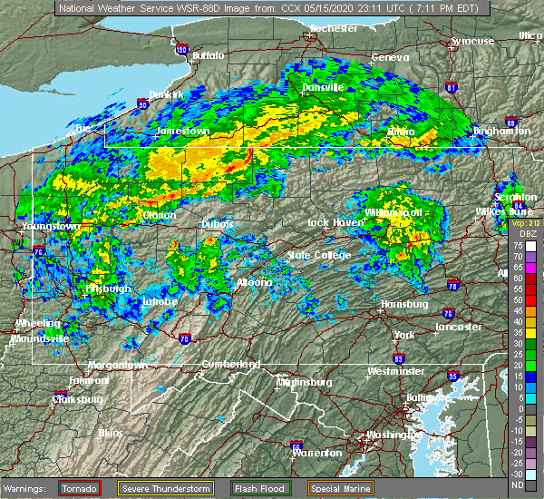 At 711 pm edt, severe thunderstorms were located along a line extending from shinglehouse to port allegany, moving east at 45 mph (radar indicated). Hazards include 60 mph wind gusts. Expect damage to trees, roofs, and siding. severe thunderstorms will be near, coudersport and genesee around 730 pm edt. denton hill state park around 740 pm edt. harrison valley and lyman run state park around 750 pm edt. galeton around 800 pm edt. Other locations impacted by these severe thunderstorms include ulysses, oswayo, sweden valley and ski denton ski area. At 711 pm edt, severe thunderstorms were located along a line extending from shinglehouse to port allegany, moving east at 45 mph (radar indicated). Hazards include 60 mph wind gusts. Expect damage to trees, roofs, and siding. severe thunderstorms will be near, coudersport and genesee around 730 pm edt. denton hill state park around 740 pm edt. harrison valley and lyman run state park around 750 pm edt. galeton around 800 pm edt. Other locations impacted by these severe thunderstorms include ulysses, oswayo, sweden valley and ski denton ski area.
|
| 8/17/2019 4:28 PM EDT |
 At 427 pm edt, a severe thunderstorm was located near denton hill state park, moving east at 30 mph. other severe storms were just to the west of this storm, and northeast along the new york border (radar indicated). Hazards include 60 mph wind gusts and quarter size hail. Hail damage to vehicles is expected. expect wind damage to trees, roofs, and siding. Locations impacted include, coudersport, roulette, galeton, shinglehouse, westfield, genesee, gaines, harrison valley, keating summit, denton hill state park, lyman run state park, ulysses, austin, sweden valley, oswayo and ski denton ski area. At 427 pm edt, a severe thunderstorm was located near denton hill state park, moving east at 30 mph. other severe storms were just to the west of this storm, and northeast along the new york border (radar indicated). Hazards include 60 mph wind gusts and quarter size hail. Hail damage to vehicles is expected. expect wind damage to trees, roofs, and siding. Locations impacted include, coudersport, roulette, galeton, shinglehouse, westfield, genesee, gaines, harrison valley, keating summit, denton hill state park, lyman run state park, ulysses, austin, sweden valley, oswayo and ski denton ski area.
|
| 8/17/2019 3:59 PM EDT |
 At 359 pm edt, a severe thunderstorm was located over roulette, moving east at 25 mph (radar indicated). Hazards include 60 mph wind gusts and quarter size hail. Hail damage to vehicles is expected. Expect wind damage to trees, roofs, and siding. At 359 pm edt, a severe thunderstorm was located over roulette, moving east at 25 mph (radar indicated). Hazards include 60 mph wind gusts and quarter size hail. Hail damage to vehicles is expected. Expect wind damage to trees, roofs, and siding.
|
| 8/15/2019 7:38 PM EDT |
 At 738 pm edt, severe thunderstorms were located along a line extending from shinglehouse to crosby to near kinzua bridge state park, moving east at 15 mph (radar indicated). Hazards include 60 mph wind gusts and quarter size hail. Hail damage to vehicles is expected. Expect wind damage to trees, roofs, and siding. At 738 pm edt, severe thunderstorms were located along a line extending from shinglehouse to crosby to near kinzua bridge state park, moving east at 15 mph (radar indicated). Hazards include 60 mph wind gusts and quarter size hail. Hail damage to vehicles is expected. Expect wind damage to trees, roofs, and siding.
|
| 8/15/2019 6:51 PM EDT |
 At 651 pm edt, a severe thunderstorm was located over port allegany, moving northeast at 25 mph (radar indicated). Hazards include 60 mph wind gusts and quarter size hail. Hail damage to vehicles is expected. Expect wind damage to trees, roofs, and siding. At 651 pm edt, a severe thunderstorm was located over port allegany, moving northeast at 25 mph (radar indicated). Hazards include 60 mph wind gusts and quarter size hail. Hail damage to vehicles is expected. Expect wind damage to trees, roofs, and siding.
|
| 8/15/2019 5:20 PM EDT | Multiple trees down between pa-44 and wild cat r in potter county PA, 3.7 miles W of Shinglehouse, PA |
| 6/1/2019 4:04 PM EDT |
 At 403 pm edt, a severe thunderstorm was located just southeast of shinglehouse, moving southeast at 25 mph (radar indicated). Hazards include 60 mph wind gusts and quarter size hail. Hail damage to vehicles is expected. expect wind damage to trees, roofs, and siding. Locations impacted include, shinglehouse, genesee and oswayo. At 403 pm edt, a severe thunderstorm was located just southeast of shinglehouse, moving southeast at 25 mph (radar indicated). Hazards include 60 mph wind gusts and quarter size hail. Hail damage to vehicles is expected. expect wind damage to trees, roofs, and siding. Locations impacted include, shinglehouse, genesee and oswayo.
|
| 6/1/2019 3:40 PM EDT |
 At 339 pm edt, a severe thunderstorm was located over shinglehouse, moving southeast at 25 mph (radar indicated). Hazards include 60 mph wind gusts and quarter size hail. Hail damage to vehicles is expected. Expect wind damage to trees, roofs, and siding. At 339 pm edt, a severe thunderstorm was located over shinglehouse, moving southeast at 25 mph (radar indicated). Hazards include 60 mph wind gusts and quarter size hail. Hail damage to vehicles is expected. Expect wind damage to trees, roofs, and siding.
|
| 5/25/2019 8:09 PM EDT |
 At 808 pm edt, a severe thunderstorm was located near port allegany, moving east at 45 mph (radar indicated). Hazards include 70 mph wind gusts and penny size hail. Expect considerable tree damage. damage is likely to mobile homes, roofs, and outbuildings. this severe thunderstorm will be near, roulette and shinglehouse around 810 pm edt. coudersport around 820 pm edt. harrison valley around 850 pm edt. other locations impacted by this severe thunderstorm include ulysses, oswayo and ski denton ski area. This includes route 6 between port allegany and coudersport, and from ski denton to west of galeton. At 808 pm edt, a severe thunderstorm was located near port allegany, moving east at 45 mph (radar indicated). Hazards include 70 mph wind gusts and penny size hail. Expect considerable tree damage. damage is likely to mobile homes, roofs, and outbuildings. this severe thunderstorm will be near, roulette and shinglehouse around 810 pm edt. coudersport around 820 pm edt. harrison valley around 850 pm edt. other locations impacted by this severe thunderstorm include ulysses, oswayo and ski denton ski area. This includes route 6 between port allegany and coudersport, and from ski denton to west of galeton.
|
| 4/14/2019 10:00 PM EDT |
 At 959 pm edt, severe thunderstorms were located along a line extending from cuba to near st. marys, moving northeast at 45 mph (radar indicated). Hazards include 60 mph wind gusts and penny size hail. Expect damage to roofs, siding, and trees. locations impacted include, st. marys, cameron, coudersport, port allegany, emporium, roulette, shinglehouse, genesee, betula, force, benezette, crosby, brandy camp, elk river, brockport, keating summit, medix run, truman, sizerville and kersey. A tornado watch remains in effect until 300 am edt for central and north central pennsylvania. At 959 pm edt, severe thunderstorms were located along a line extending from cuba to near st. marys, moving northeast at 45 mph (radar indicated). Hazards include 60 mph wind gusts and penny size hail. Expect damage to roofs, siding, and trees. locations impacted include, st. marys, cameron, coudersport, port allegany, emporium, roulette, shinglehouse, genesee, betula, force, benezette, crosby, brandy camp, elk river, brockport, keating summit, medix run, truman, sizerville and kersey. A tornado watch remains in effect until 300 am edt for central and north central pennsylvania.
|
| 4/14/2019 9:34 PM EDT |
 At 933 pm edt, severe thunderstorms were located along a line extending from near allegany to brockway, moving northeast at 45 mph (radar indicated). Hazards include 60 mph wind gusts and penny size hail. expect damage to roofs, siding, and trees At 933 pm edt, severe thunderstorms were located along a line extending from near allegany to brockway, moving northeast at 45 mph (radar indicated). Hazards include 60 mph wind gusts and penny size hail. expect damage to roofs, siding, and trees
|
| 9/21/2018 8:06 PM EDT |
 A severe thunderstorm warning remains in effect until 900 pm edt for northern elk. eastern mckean. potter and northern cameron counties. At 805 pm edt, severe thunderstorms were located along a line extending from 7 miles west of genesee to 6 miles south of shinglehouse to near crosby to wilcox, moving east at 45 mph. A severe thunderstorm warning remains in effect until 900 pm edt for northern elk. eastern mckean. potter and northern cameron counties. At 805 pm edt, severe thunderstorms were located along a line extending from 7 miles west of genesee to 6 miles south of shinglehouse to near crosby to wilcox, moving east at 45 mph.
|
| 9/21/2018 7:37 PM EDT |
 The national weather service in state college pa has issued a * severe thunderstorm warning for. northern elk county in north central pennsylvania. mckean county in north central pennsylvania. potter county in north central pennsylvania. Northern cameron county in north central pennsylvania. The national weather service in state college pa has issued a * severe thunderstorm warning for. northern elk county in north central pennsylvania. mckean county in north central pennsylvania. potter county in north central pennsylvania. Northern cameron county in north central pennsylvania.
|
| 6/18/2018 7:51 PM EDT |
 At 748 pm edt, severe thunderstorms were located along a line extending from near ashford to 6 miles north of scandia to near cambridge springs, moving southeast at 40 mph (radar indicated). Hazards include 60 mph wind gusts. downed trees or tree limbs are expected in some spots At 748 pm edt, severe thunderstorms were located along a line extending from near ashford to 6 miles north of scandia to near cambridge springs, moving southeast at 40 mph (radar indicated). Hazards include 60 mph wind gusts. downed trees or tree limbs are expected in some spots
|
| 5/4/2018 5:23 PM EDT |
 At 429 pm edt, severe thunderstorms were located along a line extending from 7 miles southwest of allegany state park to near wetmore to 7 miles southeast of tionesta, moving east at 60 mph (radar indicated). Hazards include 70 mph wind gusts. Expect considerable tree damage. Damage is likely to mobile homes, roofs, and outbuildings. At 429 pm edt, severe thunderstorms were located along a line extending from 7 miles southwest of allegany state park to near wetmore to 7 miles southeast of tionesta, moving east at 60 mph (radar indicated). Hazards include 70 mph wind gusts. Expect considerable tree damage. Damage is likely to mobile homes, roofs, and outbuildings.
|
| 5/4/2018 5:09 PM EDT |
 At 507 pm edt, severe thunderstorms were located along a line extending from 8 miles southwest of wellsville to near port allegany to near wilcox, moving east at 40 mph (radar indicated). Hazards include 70 mph wind gusts. Expect considerable tree damage. Damage is likely to mobile homes, roofs, and outbuildings. At 507 pm edt, severe thunderstorms were located along a line extending from 8 miles southwest of wellsville to near port allegany to near wilcox, moving east at 40 mph (radar indicated). Hazards include 70 mph wind gusts. Expect considerable tree damage. Damage is likely to mobile homes, roofs, and outbuildings.
|
| 5/4/2018 4:31 PM EDT |
 At 429 pm edt, severe thunderstorms were located along a line extending from 7 miles southwest of allegany state park to near wetmore to 7 miles southeast of tionesta, moving east at 60 mph (radar indicated). Hazards include 70 mph wind gusts. Expect considerable tree damage. Damage is likely to mobile homes, roofs, and outbuildings. At 429 pm edt, severe thunderstorms were located along a line extending from 7 miles southwest of allegany state park to near wetmore to 7 miles southeast of tionesta, moving east at 60 mph (radar indicated). Hazards include 70 mph wind gusts. Expect considerable tree damage. Damage is likely to mobile homes, roofs, and outbuildings.
|
| 10/15/2017 6:07 PM EDT |
 At 606 pm edt, severe thunderstorms were located along a line extending from 7 miles southwest of wellsville to near betula, moving east at 45 mph (radar indicated). Hazards include 60 mph wind gusts. Expect damage to trees and power lines. Locations impacted include, galeton, harrison valley, cherry springs state park, crosby, roulette, genesee, keating summit, denton hill state park, shinglehouse and port allegany. At 606 pm edt, severe thunderstorms were located along a line extending from 7 miles southwest of wellsville to near betula, moving east at 45 mph (radar indicated). Hazards include 60 mph wind gusts. Expect damage to trees and power lines. Locations impacted include, galeton, harrison valley, cherry springs state park, crosby, roulette, genesee, keating summit, denton hill state park, shinglehouse and port allegany.
|
| 10/15/2017 5:55 PM EDT |
 At 554 pm edt, severe thunderstorms were located along a line extending from near shinglehouse to near wilcox, moving east at 40 mph (radar indicated). Hazards include 60 mph wind gusts. expect damage to trees and power lines At 554 pm edt, severe thunderstorms were located along a line extending from near shinglehouse to near wilcox, moving east at 40 mph (radar indicated). Hazards include 60 mph wind gusts. expect damage to trees and power lines
|
| 10/15/2017 5:24 PM EDT |
 At 520 pm edt, severe thunderstorms were located along a line extending from near allegany state park to near kinzua dam to near sheffield to 11 miles northeast of tionesta, moving east at 50 mph (radar indicated). Hazards include 70 mph wind gusts. Expect considerable tree damage. damage is likely to mobile homes, roofs, and outbuildings. these severe storms will be near, bradford and marshburg around 530 pm edt. cyclone and westline around 540 pm edt. kane, coryville, kinzua bridge state park, smethport and rew around 550 pm edt. crosby, port allegany, shinglehouse and betula around 600 pm edt. Other locations impacted by these severe thunderstorms include eldred, lewis run, mount jewett, clarendon, university of pittsburgh - bradford and bradford airport. At 520 pm edt, severe thunderstorms were located along a line extending from near allegany state park to near kinzua dam to near sheffield to 11 miles northeast of tionesta, moving east at 50 mph (radar indicated). Hazards include 70 mph wind gusts. Expect considerable tree damage. damage is likely to mobile homes, roofs, and outbuildings. these severe storms will be near, bradford and marshburg around 530 pm edt. cyclone and westline around 540 pm edt. kane, coryville, kinzua bridge state park, smethport and rew around 550 pm edt. crosby, port allegany, shinglehouse and betula around 600 pm edt. Other locations impacted by these severe thunderstorms include eldred, lewis run, mount jewett, clarendon, university of pittsburgh - bradford and bradford airport.
|
| 10/15/2017 4:46 PM EDT |
 At 446 pm edt, severe thunderstorms were located along a line extending from near frewsburg to garland to 8 miles northwest of oil city, moving east at 40 mph (radar indicated). Hazards include 60 mph wind gusts. Expect damage to trees and power lines. severe thunderstorms will be near, garland and lottsville around 450 pm edt. youngsville around 500 pm edt. warren, warren south, chapman state park and russell around 510 pm edt. kinzua dam, scandia and sheffield around 520 pm edt. Other locations impacted by these severe thunderstorms include tidioute, ceres, starbrick, sugar grove, eldred, lewis run, mount jewett, clarendon, bradford airport and university of pittsburgh - bradford. At 446 pm edt, severe thunderstorms were located along a line extending from near frewsburg to garland to 8 miles northwest of oil city, moving east at 40 mph (radar indicated). Hazards include 60 mph wind gusts. Expect damage to trees and power lines. severe thunderstorms will be near, garland and lottsville around 450 pm edt. youngsville around 500 pm edt. warren, warren south, chapman state park and russell around 510 pm edt. kinzua dam, scandia and sheffield around 520 pm edt. Other locations impacted by these severe thunderstorms include tidioute, ceres, starbrick, sugar grove, eldred, lewis run, mount jewett, clarendon, bradford airport and university of pittsburgh - bradford.
|
| 6/18/2017 5:23 PM EDT |
 At 521 pm edt, a severe thunderstorm was located between eldred and shinglehouse, moving east at 30 mph. minor rotation was indicated on radar and while not likely, a brief, weak tornado may be possible (radar indicated). Hazards include 60 mph wind gusts and penny size hail. Expect damage to trees and power lines. This severe thunderstorm will remain over otherwise rural areas of northeastern mckean and northwestern potter counties, including the following locations: ceres, and oswayo. At 521 pm edt, a severe thunderstorm was located between eldred and shinglehouse, moving east at 30 mph. minor rotation was indicated on radar and while not likely, a brief, weak tornado may be possible (radar indicated). Hazards include 60 mph wind gusts and penny size hail. Expect damage to trees and power lines. This severe thunderstorm will remain over otherwise rural areas of northeastern mckean and northwestern potter counties, including the following locations: ceres, and oswayo.
|
| 6/18/2017 4:57 PM EDT |
 At 456 pm edt, severe thunderstorms were located along a line extending from 6 miles southwest of st. bonaventure to near rew to near cyclone, moving east at 45 mph (law enforcement). Hazards include 60 mph wind gusts. Expect damage to trees and power lines. severe thunderstorms will be near, coryville and smethport around 510 pm edt. shinglehouse around 520 pm edt. Other locations impacted by these severe thunderstorms include ceres, oswayo and eldred. At 456 pm edt, severe thunderstorms were located along a line extending from 6 miles southwest of st. bonaventure to near rew to near cyclone, moving east at 45 mph (law enforcement). Hazards include 60 mph wind gusts. Expect damage to trees and power lines. severe thunderstorms will be near, coryville and smethport around 510 pm edt. shinglehouse around 520 pm edt. Other locations impacted by these severe thunderstorms include ceres, oswayo and eldred.
|
| 5/1/2017 4:45 PM EDT | Roof and building damage in potter county PA, 1.6 miles S of Shinglehouse, PA |
| 5/1/2017 4:40 PM EDT | Numerous trees and lines down in allegany county NY, 4.5 miles SE of Shinglehouse, PA |
| 5/1/2017 4:35 PM EDT |
 At 435 pm edt, a severe thunderstorm capable of producing a tornado was located over port allegany, moving northeast at 50 mph (radar indicated rotation). Hazards include tornado. Flying debris will be dangerous to those caught without shelter. mobile homes will be damaged or destroyed. damage to roofs, windows, and vehicles will occur. tree damage is likely. this dangerous storm will be near, roulette around 440 pm edt. coudersport around 450 pm edt. genesee around 500 pm edt. harrison valley around 520 pm edt. Other locations impacted by this tornadic thunderstorm include ulysses, oswayo, sweden valley and ski denton ski area. At 435 pm edt, a severe thunderstorm capable of producing a tornado was located over port allegany, moving northeast at 50 mph (radar indicated rotation). Hazards include tornado. Flying debris will be dangerous to those caught without shelter. mobile homes will be damaged or destroyed. damage to roofs, windows, and vehicles will occur. tree damage is likely. this dangerous storm will be near, roulette around 440 pm edt. coudersport around 450 pm edt. genesee around 500 pm edt. harrison valley around 520 pm edt. Other locations impacted by this tornadic thunderstorm include ulysses, oswayo, sweden valley and ski denton ski area.
|
| 5/1/2017 4:22 PM EDT |
 At 421 pm edt, severe thunderstorms were located along a line extending from st. bonaventure to near penfield, moving east at 50 mph (radar indicated). Hazards include 70 mph wind gusts. Expect considerable tree damage. Damage is likely to mobile homes, roofs, and outbuildings. At 421 pm edt, severe thunderstorms were located along a line extending from st. bonaventure to near penfield, moving east at 50 mph (radar indicated). Hazards include 70 mph wind gusts. Expect considerable tree damage. Damage is likely to mobile homes, roofs, and outbuildings.
|
| 5/1/2017 3:33 PM EDT |
 At 333 pm edt, severe thunderstorms were located along a line extending from near frewsburg to near new bethlehem, moving east at 40 mph (radar indicated). Hazards include 60 mph wind gusts. expect damage to roofs, siding, and trees At 333 pm edt, severe thunderstorms were located along a line extending from near frewsburg to near new bethlehem, moving east at 40 mph (radar indicated). Hazards include 60 mph wind gusts. expect damage to roofs, siding, and trees
|
| 8/13/2016 8:11 PM EDT |
 At 810 pm edt, severe thunderstorms with gusty winds were located along a line extending from shinglehouse to near betula to near portland mills, moving east at 50 mph (radar indicated). Hazards include 60 mph wind gusts. Expect damage to roofs. siding. And trees. At 810 pm edt, severe thunderstorms with gusty winds were located along a line extending from shinglehouse to near betula to near portland mills, moving east at 50 mph (radar indicated). Hazards include 60 mph wind gusts. Expect damage to roofs. siding. And trees.
|
| 7/25/2016 1:38 PM EDT |
 At 137 pm edt, a severe thunderstorm was located near port allegany, moving east at 40 mph (radar indicated). Hazards include 60 mph wind gusts and quarter size hail. Hail damage to vehicles is expected. Expect wind damage to roofs, siding, and trees. At 137 pm edt, a severe thunderstorm was located near port allegany, moving east at 40 mph (radar indicated). Hazards include 60 mph wind gusts and quarter size hail. Hail damage to vehicles is expected. Expect wind damage to roofs, siding, and trees.
|
| 6/5/2016 6:24 PM EDT |
 At 623 pm edt, severe thunderstorms were located along a line extending from near genesee to coudersport to near keating summit, moving east at 45 mph (radar indicated). Hazards include 70 mph wind gusts. Expect considerable tree damage. damage is likely to mobile homes, roofs, and outbuildings. these severe storms will be near, genesee around 630 pm edt. denton hill state park and harrison valley around 640 pm edt. Other locations impacted by these severe thunderstorms include oswayo, ulysses, austin, sweden valley and ski denton ski area. At 623 pm edt, severe thunderstorms were located along a line extending from near genesee to coudersport to near keating summit, moving east at 45 mph (radar indicated). Hazards include 70 mph wind gusts. Expect considerable tree damage. damage is likely to mobile homes, roofs, and outbuildings. these severe storms will be near, genesee around 630 pm edt. denton hill state park and harrison valley around 640 pm edt. Other locations impacted by these severe thunderstorms include oswayo, ulysses, austin, sweden valley and ski denton ski area.
|
| 6/5/2016 5:56 PM EDT |
 At 555 pm edt, severe thunderstorms were located along a line extending from weston mills to smethport to just north of wilcox, moving east at 45 mph (radar indicated). Hazards include 60 to 70 mph wind gusts. Expect considerable tree damage. damage is likely to mobile homes, roofs, and outbuildings. severe thunderstorms will be near, port allegany and shinglehouse around 600 pm edt. roulette and betula around 610 pm edt. coudersport around 620 pm edt. genesee, sizerville, denton hill state park and keating summit around 630 pm edt. Other locations impacted by these severe thunderstorms include oswayo, ulysses, eldred, ceres, austin, mount jewett, sweden valley, bradford airport and ski denton ski area. At 555 pm edt, severe thunderstorms were located along a line extending from weston mills to smethport to just north of wilcox, moving east at 45 mph (radar indicated). Hazards include 60 to 70 mph wind gusts. Expect considerable tree damage. damage is likely to mobile homes, roofs, and outbuildings. severe thunderstorms will be near, port allegany and shinglehouse around 600 pm edt. roulette and betula around 610 pm edt. coudersport around 620 pm edt. genesee, sizerville, denton hill state park and keating summit around 630 pm edt. Other locations impacted by these severe thunderstorms include oswayo, ulysses, eldred, ceres, austin, mount jewett, sweden valley, bradford airport and ski denton ski area.
|
| 6/5/2016 5:36 PM EDT |
 At 533 pm edt, severe thunderstorms were located along a line extending from bradford to marshburg to sheffield, moving east at 55 mph (law enforcement). Hazards include 70 mph wind gusts. Expect considerable tree damage. damage is likely to mobile homes, roofs, and outbuildings. these severe storms will be near, bradford, rew and cyclone around 540 pm edt. kane, wetmore, james city and coryville around 550 pm edt. shinglehouse, westline and kinzua bridge state park around 600 pm edt. Other locations impacted by these severe thunderstorms include lewis run, eldred, mount jewett, university of pittsburgh - bradford and bradford airport. At 533 pm edt, severe thunderstorms were located along a line extending from bradford to marshburg to sheffield, moving east at 55 mph (law enforcement). Hazards include 70 mph wind gusts. Expect considerable tree damage. damage is likely to mobile homes, roofs, and outbuildings. these severe storms will be near, bradford, rew and cyclone around 540 pm edt. kane, wetmore, james city and coryville around 550 pm edt. shinglehouse, westline and kinzua bridge state park around 600 pm edt. Other locations impacted by these severe thunderstorms include lewis run, eldred, mount jewett, university of pittsburgh - bradford and bradford airport.
|
| 6/5/2016 5:18 PM EDT |
 At 517 pm edt, severe thunderstorms were located along a line extending from allegany state park to kinzua dam to tionesta, moving east at 55 mph (trained weather spotters). Hazards include 70 mph wind gusts. Expect considerable tree damage. damage is likely to mobile homes, roofs, and outbuildings. these severe storms will be near, kinzua dam around 520 pm edt. allegany state park and marshburg around 530 pm edt. bradford, rew, sheffield, ludlow and cyclone around 540 pm edt. kane, wetmore, james city and coryville around 550 pm edt. Other locations impacted by these severe thunderstorms include lewis run, eldred, ceres, clarendon, mount jewett, tidioute, bradford airport and university of pittsburgh - bradford. At 517 pm edt, severe thunderstorms were located along a line extending from allegany state park to kinzua dam to tionesta, moving east at 55 mph (trained weather spotters). Hazards include 70 mph wind gusts. Expect considerable tree damage. damage is likely to mobile homes, roofs, and outbuildings. these severe storms will be near, kinzua dam around 520 pm edt. allegany state park and marshburg around 530 pm edt. bradford, rew, sheffield, ludlow and cyclone around 540 pm edt. kane, wetmore, james city and coryville around 550 pm edt. Other locations impacted by these severe thunderstorms include lewis run, eldred, ceres, clarendon, mount jewett, tidioute, bradford airport and university of pittsburgh - bradford.
|
| 6/5/2016 4:54 PM EDT |
 At 453 pm edt, severe thunderstorms were located along a line extending from near jamestown to youngsville to oil city, moving east at 55 mph (radar indicated). Hazards include 60 to 70 mph wind gusts. Expect considerable tree damage. Damage is likely to mobile homes, roofs, and outbuildings. At 453 pm edt, severe thunderstorms were located along a line extending from near jamestown to youngsville to oil city, moving east at 55 mph (radar indicated). Hazards include 60 to 70 mph wind gusts. Expect considerable tree damage. Damage is likely to mobile homes, roofs, and outbuildings.
|
| 7/7/2015 6:10 PM EDT | Trees down on eleven mile roa in potter county PA, 0.2 miles S of Shinglehouse, PA |
| 7/7/2015 6:05 PM EDT |
 At 604 pm edt, doppler radar indicated a severe thunderstorm capable of producing damaging winds in excess of 60 mph. this storm was located near shinglehouse, moving northeast at 45 mph. this storm has a history of producing wind damage across central and southwest mckean county. locations impacted include, port allegany, shinglehouse and ceres. At 604 pm edt, doppler radar indicated a severe thunderstorm capable of producing damaging winds in excess of 60 mph. this storm was located near shinglehouse, moving northeast at 45 mph. this storm has a history of producing wind damage across central and southwest mckean county. locations impacted include, port allegany, shinglehouse and ceres.
|
| 7/7/2015 5:41 PM EDT |
 At 541 pm edt, doppler radar indicated a severe thunderstorm capable of producing damaging winds around 60 mph. this storm was located near rew, and moving northeast at 45 mph. At 541 pm edt, doppler radar indicated a severe thunderstorm capable of producing damaging winds around 60 mph. this storm was located near rew, and moving northeast at 45 mph.
|
| 6/23/2015 6:13 AM EDT |
 At 611 am edt, doppler radar indicated a line of severe thunderstorms capable of producing destructive winds in excess of 70 mph. these storms were located along a line extending from near weston mills to near smethport to near james city, moving east at 60 mph. these severe storms will be near, port allegany, roulette and shinglehouse around 620 am edt. coudersport around 630 am edt. denton hill state park, elk river, emporium, genesee, lyman run state park, sizerville and truman around 640 am edt. other locations impacted by these severe thunderstorms include austin, eldred, lewis run, mount jewett, oswayo, sweden valley, ulysses, bradford airport, ski denton ski area and university of pittsburgh - bradford. At 611 am edt, doppler radar indicated a line of severe thunderstorms capable of producing destructive winds in excess of 70 mph. these storms were located along a line extending from near weston mills to near smethport to near james city, moving east at 60 mph. these severe storms will be near, port allegany, roulette and shinglehouse around 620 am edt. coudersport around 630 am edt. denton hill state park, elk river, emporium, genesee, lyman run state park, sizerville and truman around 640 am edt. other locations impacted by these severe thunderstorms include austin, eldred, lewis run, mount jewett, oswayo, sweden valley, ulysses, bradford airport, ski denton ski area and university of pittsburgh - bradford.
|
| 6/23/2015 5:50 AM EDT |
 At 549 am edt, doppler radar indicated a line of severe thunderstorms capable of producing damaging winds of 60 to 70 mph. these storms were located along a line extending from near allegany park to near marshburg to near kellettville, and moving east at 60 mph. * severe thunderstorms will be near, marshburg and westline around 550 am edt. bradford, cyclone, kinzua bridge state park and rew around 600 am edt. kane, coryville, crosby, james city and smethport around 610 am edt. johnsonburg, east branch dam, port allegany, roulette, shinglehouse and wilcox around 620 am edt. other locations impacted by these severe thunderstorms include austin, clarendon, eldred, lewis run, mount jewett, oswayo, starbrick, sugar grove, sweden valley and tidioute. At 549 am edt, doppler radar indicated a line of severe thunderstorms capable of producing damaging winds of 60 to 70 mph. these storms were located along a line extending from near allegany park to near marshburg to near kellettville, and moving east at 60 mph. * severe thunderstorms will be near, marshburg and westline around 550 am edt. bradford, cyclone, kinzua bridge state park and rew around 600 am edt. kane, coryville, crosby, james city and smethport around 610 am edt. johnsonburg, east branch dam, port allegany, roulette, shinglehouse and wilcox around 620 am edt. other locations impacted by these severe thunderstorms include austin, clarendon, eldred, lewis run, mount jewett, oswayo, starbrick, sugar grove, sweden valley and tidioute.
|
| 9/11/2013 8:00 PM EDT | Trees and wires down on barbertown road in potter county PA, 0.2 miles S of Shinglehouse, PA |
| 9/11/2013 7:30 PM EDT | Trees down in mckean county PA, 3.6 miles ENE of Shinglehouse, PA |
| 9/11/2013 7:27 PM EDT | Trees dow in mckean county PA, 4.4 miles NE of Shinglehouse, PA |
| 9/11/2013 5:40 PM EDT | Quarter sized hail reported 0.2 miles S of Shinglehouse, PA |
| 5/22/2013 6:25 PM EDT | Wires dow in potter county PA, 0.2 miles S of Shinglehouse, PA |
| 1/1/0001 12:00 AM | Power out. severe thunderstorm wind lasted 10 minute in potter county PA, 0.2 miles S of Shinglehouse, PA |
| 1/1/0001 12:00 AM | Numerous trees and wires down in shinglehouse in potter county PA, 0.2 miles S of Shinglehouse, PA |
Hail Maps for Shinglehouse, PA


Connect with Interactive Hail Maps