

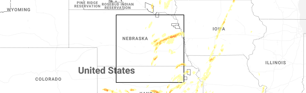
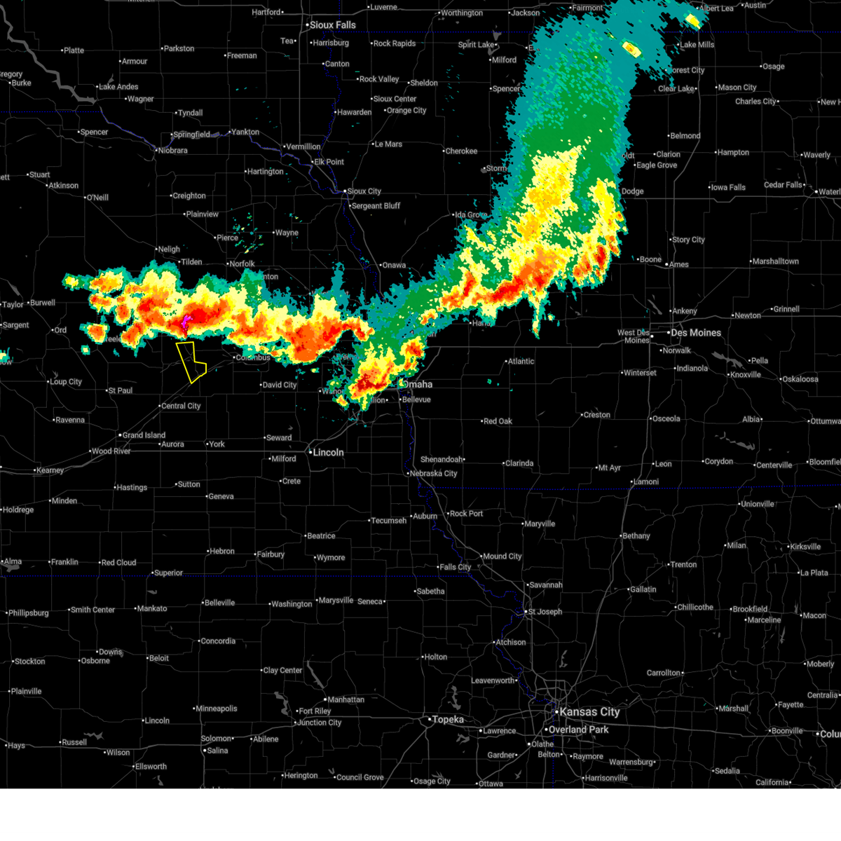
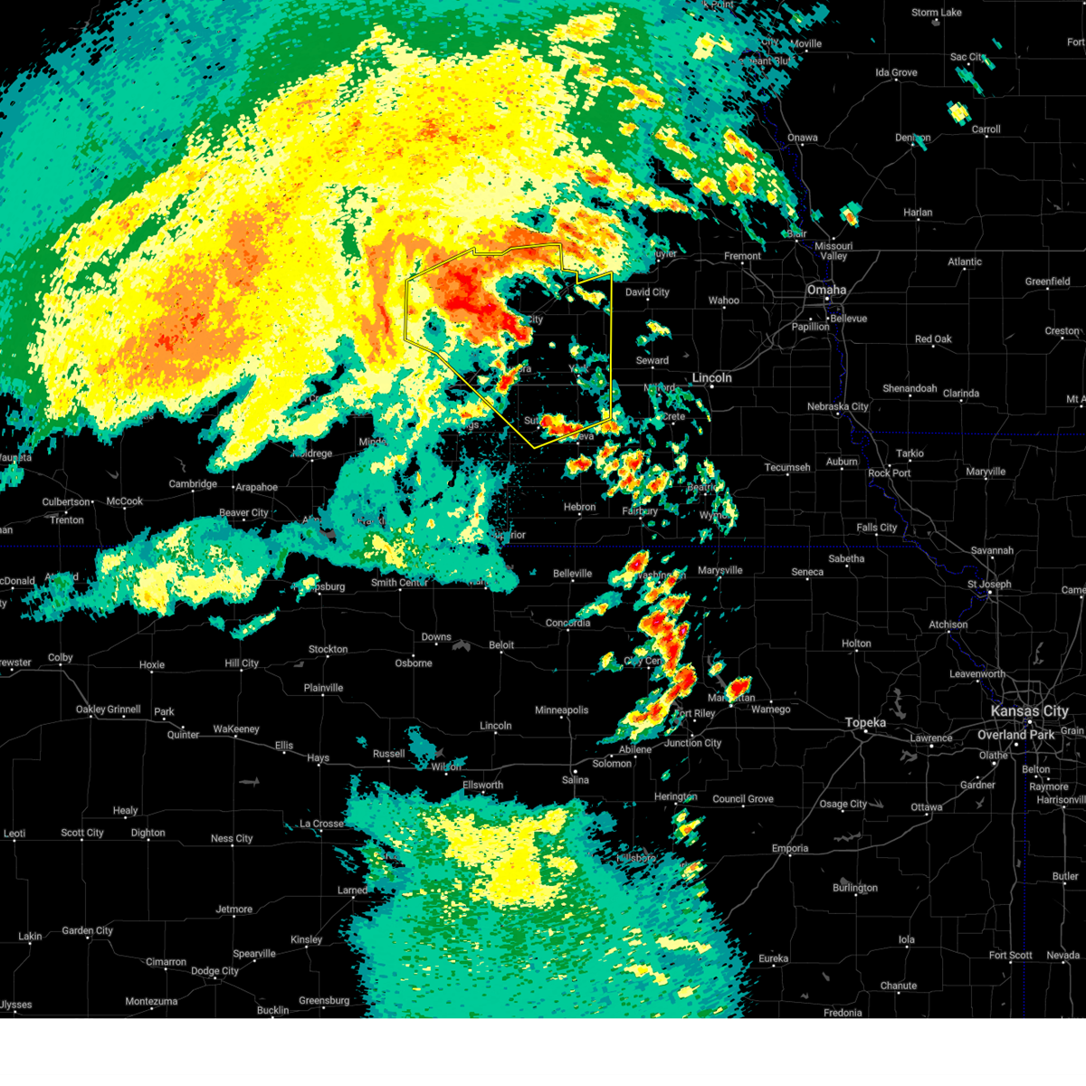
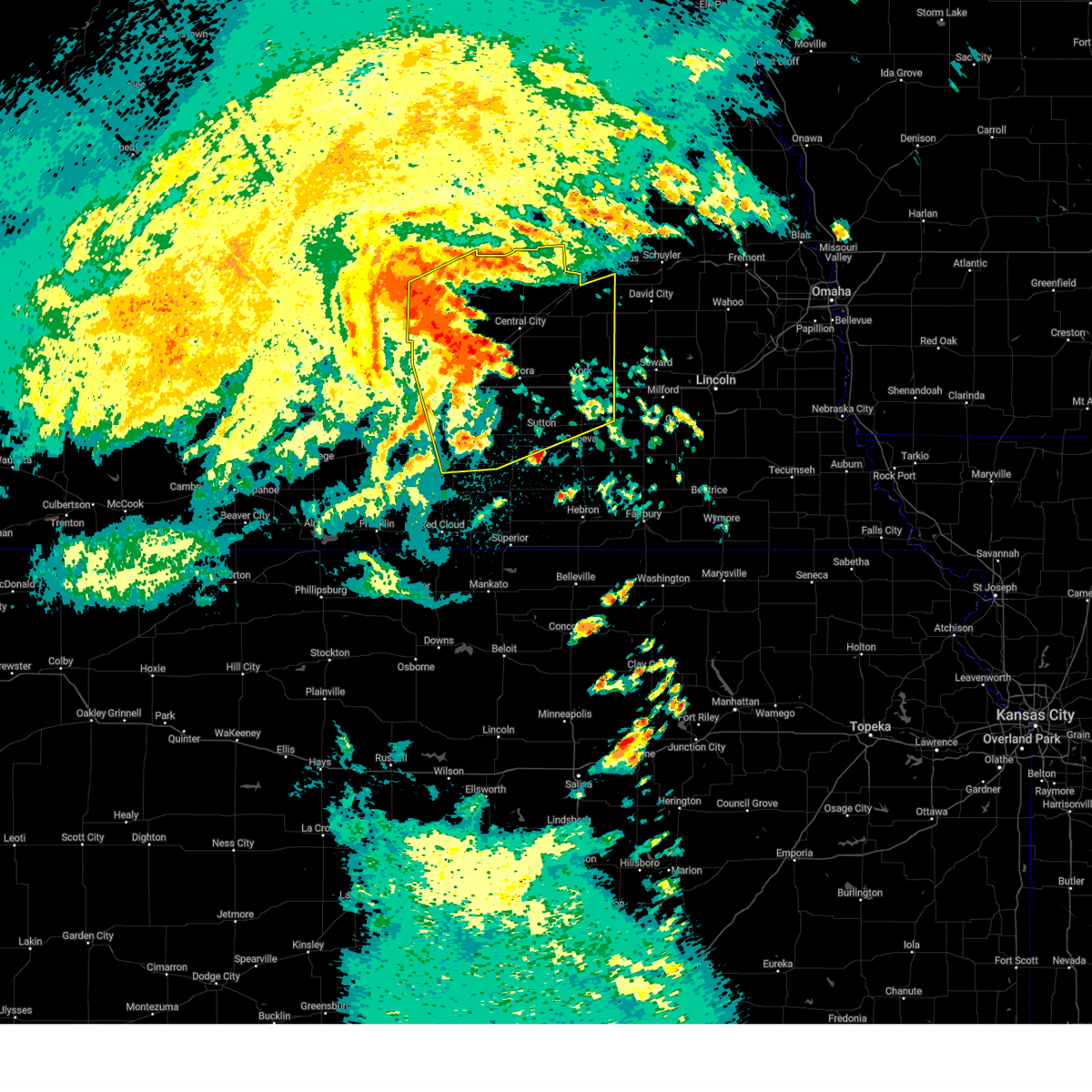
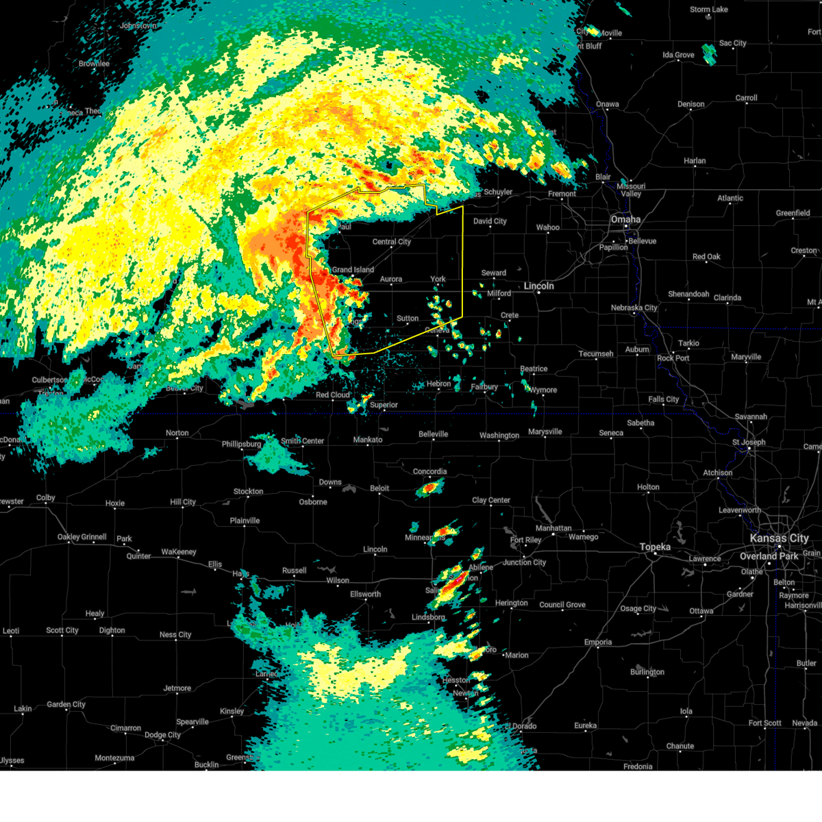
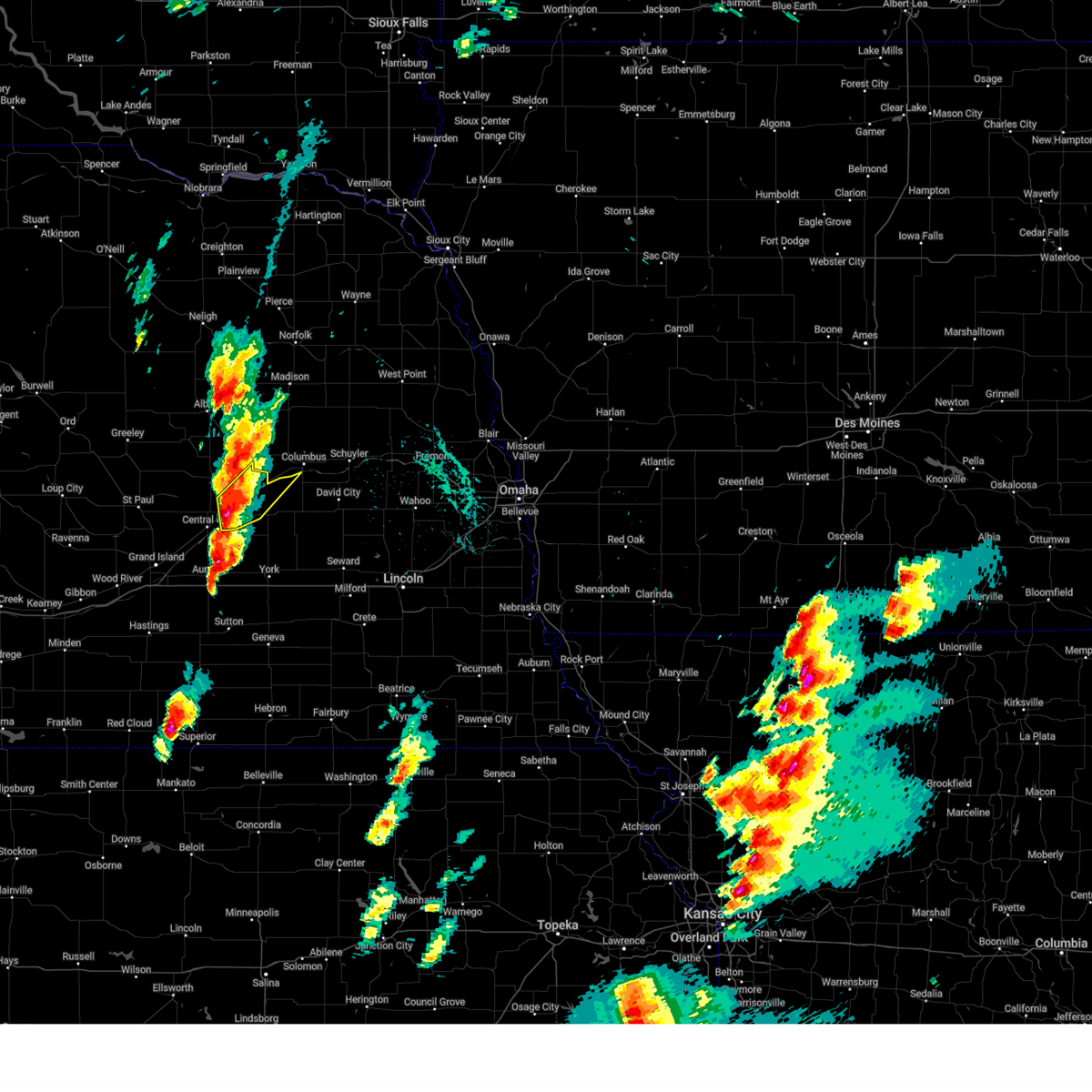
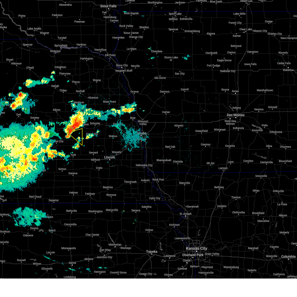
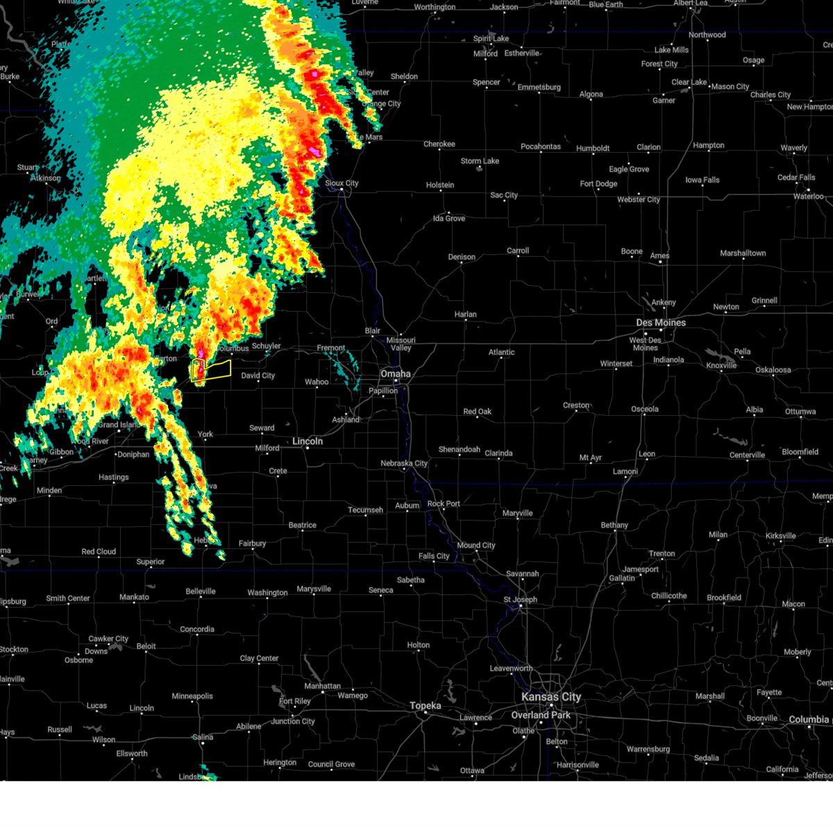
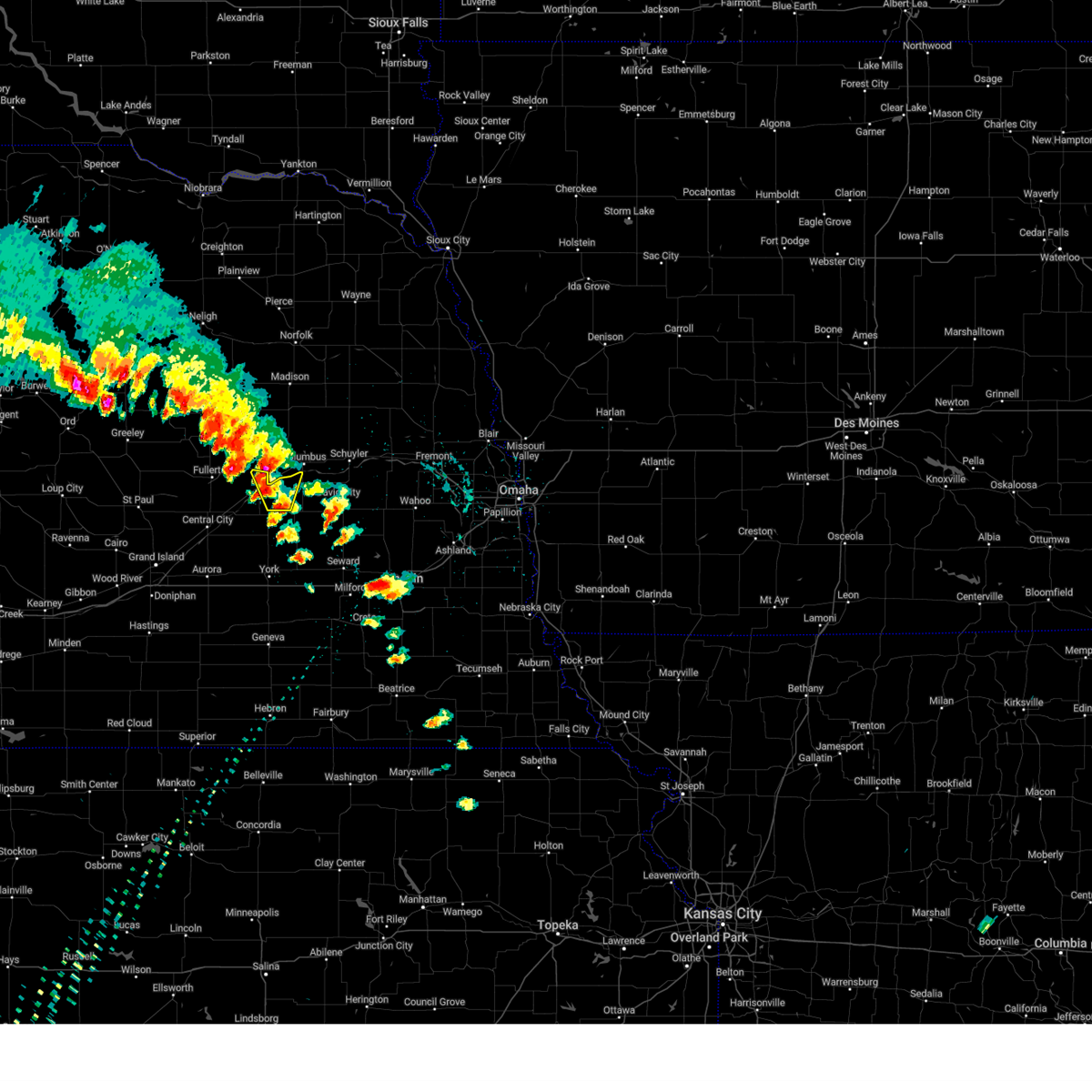
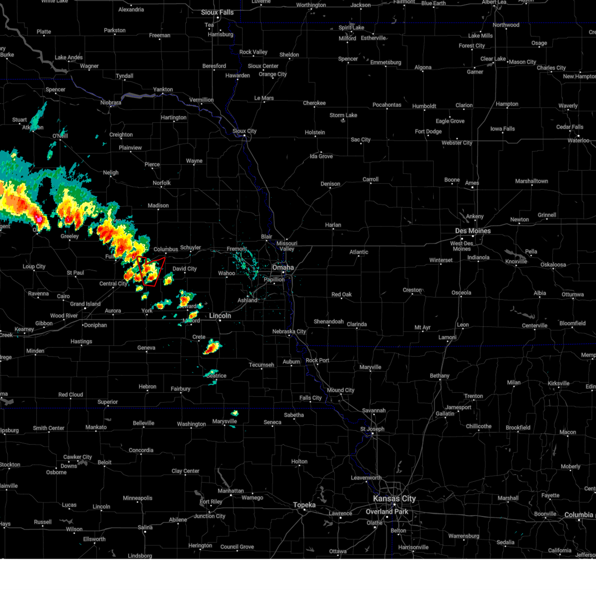
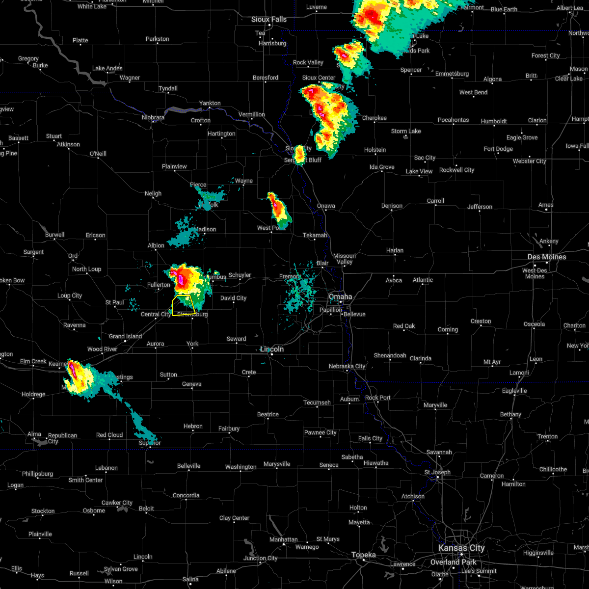
Hail Map for Silver Creek, NE
The Silver Creek, NE area has had 8 reports of on-the-ground hail by trained spotters, and has been under severe weather warnings 26 times during the past 12 months. Doppler radar has detected hail at or near Silver Creek, NE on 97 occasions, including 5 occasions during the past year.
| Name: | Silver Creek, NE |
| Where Located: | 44.3 miles NE of Grand Island, NE |
| Map: | Google Map for Silver Creek, NE |
| Population: | 362 |
| Housing Units: | 194 |
| More Info: | Search Google for Silver Creek, NE |
1
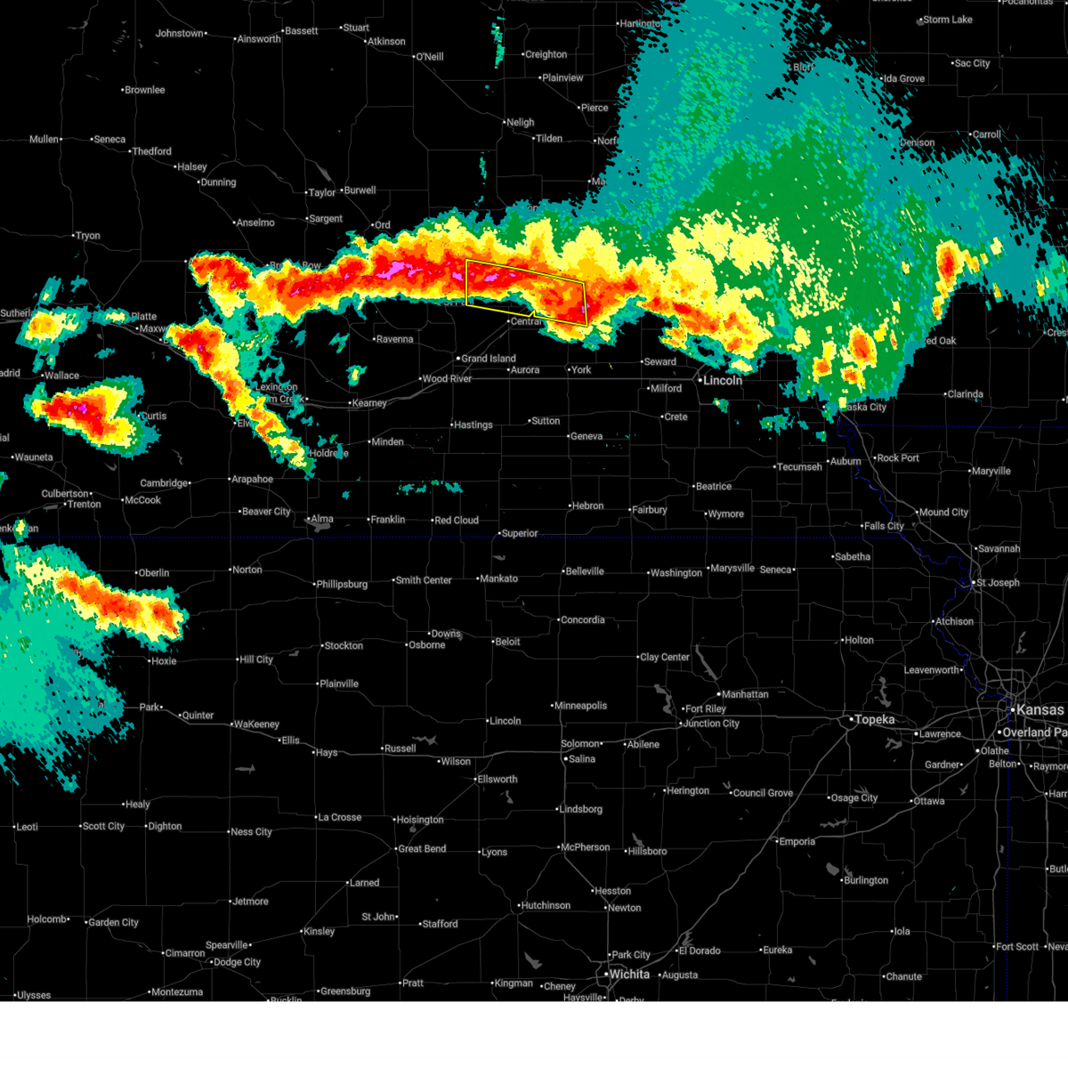
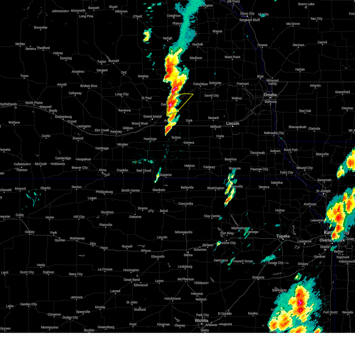
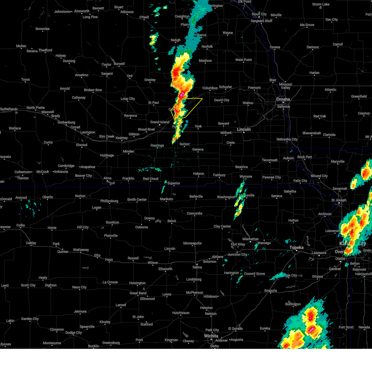
The Top Recent Hail Date for Silver Creek, NE is Monday, May 19, 2025 (13th out of 97)
Hail and Wind Damage Spotted near Silver Creek, NE
| Date / Time | Report Details |
|---|---|
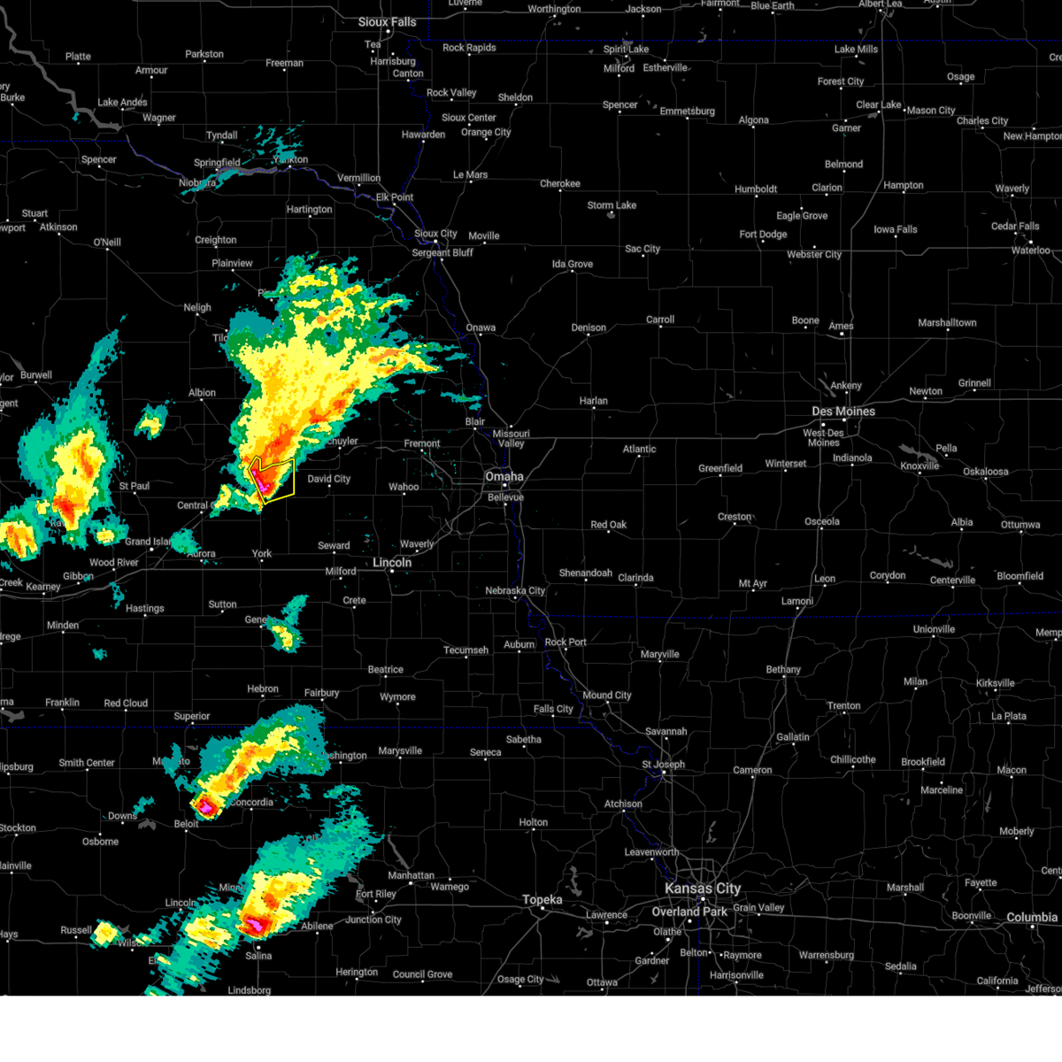
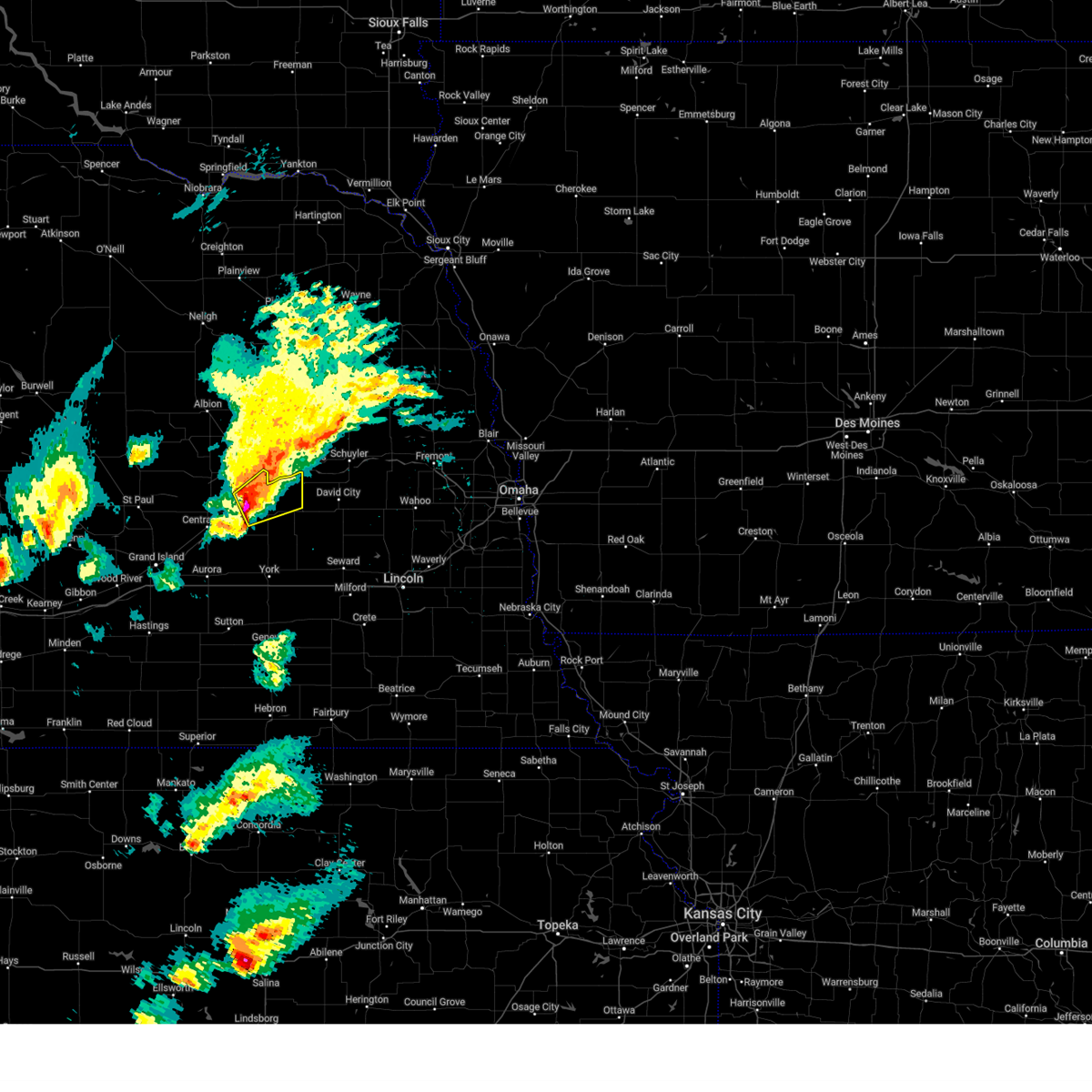
| 6/16/2025 9:14 PM CDT |
 At 914 pm cdt, severe thunderstorms were located along a line extending from 6 miles northeast of palmer to near osceola, moving south at 25 mph (radar indicated). Hazards include 60 mph wind gusts. Expect damage to roofs, siding, and trees. These severe storms will be near, stromsburg and clarks around 920 pm cdt. At 914 pm cdt, severe thunderstorms were located along a line extending from 6 miles northeast of palmer to near osceola, moving south at 25 mph (radar indicated). Hazards include 60 mph wind gusts. Expect damage to roofs, siding, and trees. These severe storms will be near, stromsburg and clarks around 920 pm cdt.
|
| 6/16/2025 8:57 PM CDT |
 At 856 pm cdt, severe thunderstorms were located along a line extending from 8 miles east of wolbach to near osceola, moving south at 25 mph (trained weather spotters. this storm has a history of producing quarter size hail near belgrade and genoa, but the main threat appears to be transitioning to 50 to 60 mph wind gusts). Hazards include 60 mph wind gusts and nickel size hail. Expect damage to roofs, siding, and trees. these severe storms will be near, osceola and clarks around 900 pm cdt. Stromsburg around 905 pm cdt. At 856 pm cdt, severe thunderstorms were located along a line extending from 8 miles east of wolbach to near osceola, moving south at 25 mph (trained weather spotters. this storm has a history of producing quarter size hail near belgrade and genoa, but the main threat appears to be transitioning to 50 to 60 mph wind gusts). Hazards include 60 mph wind gusts and nickel size hail. Expect damage to roofs, siding, and trees. these severe storms will be near, osceola and clarks around 900 pm cdt. Stromsburg around 905 pm cdt.
|
| 6/16/2025 8:28 PM CDT |
 Svrgid the national weather service in hastings has issued a * severe thunderstorm warning for, nance county in central nebraska, northern merrick county in central nebraska, central polk county in east central nebraska, * until 930 pm cdt. * at 827 pm cdt, severe thunderstorms were located along a line extending from near cedar rapids to genoa, moving south at 15 mph (trained weather spotters. at 819 pm cdt, quarter size hail was reported in genoa). Hazards include 60 mph wind gusts and half dollar size hail. Hail damage to vehicles is expected. expect wind damage to roofs, siding, and trees. severe thunderstorms will be near, belgrade around 835 pm cdt. Fullerton and silver creek around 840 pm cdt. Svrgid the national weather service in hastings has issued a * severe thunderstorm warning for, nance county in central nebraska, northern merrick county in central nebraska, central polk county in east central nebraska, * until 930 pm cdt. * at 827 pm cdt, severe thunderstorms were located along a line extending from near cedar rapids to genoa, moving south at 15 mph (trained weather spotters. at 819 pm cdt, quarter size hail was reported in genoa). Hazards include 60 mph wind gusts and half dollar size hail. Hail damage to vehicles is expected. expect wind damage to roofs, siding, and trees. severe thunderstorms will be near, belgrade around 835 pm cdt. Fullerton and silver creek around 840 pm cdt.
|
| 6/16/2025 8:10 PM CDT | At 809 pm cdt, a severe thunderstorm was located over genoa, or 18 miles west of columbus, moving south at 25 mph (trained weather spotters. at about 805 pm cdt, nickel size hail was reported 1 mile north of genoa). Hazards include ping pong ball size hail and 60 mph wind gusts. People and animals outdoors will be injured. expect hail damage to roofs, siding, windows, and vehicles. expect wind damage to roofs, siding, and trees. this severe storm will be near, genoa around 810 pm cdt. Silver creek around 830 pm cdt. |
| 6/16/2025 7:45 PM CDT |
 Svrgid the national weather service in hastings has issued a * severe thunderstorm warning for, northeastern nance county in central nebraska, northeastern merrick county in central nebraska, * until 830 pm cdt. * at 745 pm cdt, a severe thunderstorm was located near st. edward, or 14 miles southeast of albion, moving southeast at 25 mph (radar indicated). Hazards include ping pong ball size hail and 60 mph wind gusts. People and animals outdoors will be injured. expect hail damage to roofs, siding, windows, and vehicles. expect wind damage to roofs, siding, and trees. this severe thunderstorm will be near, genoa around 800 pm cdt. Other locations in the path of this severe thunderstorm include silver creek. Svrgid the national weather service in hastings has issued a * severe thunderstorm warning for, northeastern nance county in central nebraska, northeastern merrick county in central nebraska, * until 830 pm cdt. * at 745 pm cdt, a severe thunderstorm was located near st. edward, or 14 miles southeast of albion, moving southeast at 25 mph (radar indicated). Hazards include ping pong ball size hail and 60 mph wind gusts. People and animals outdoors will be injured. expect hail damage to roofs, siding, windows, and vehicles. expect wind damage to roofs, siding, and trees. this severe thunderstorm will be near, genoa around 800 pm cdt. Other locations in the path of this severe thunderstorm include silver creek.
|
| 6/3/2025 12:13 AM CDT |
 The storms which prompted the warning have weakened below severe limits, and are exiting the warned area. therefore, the warning will be allowed to expire. however, gusty winds are still possible with these thunderstorms. a severe thunderstorm watch remains in effect until 100 am cdt for central, south central and east central nebraska. The storms which prompted the warning have weakened below severe limits, and are exiting the warned area. therefore, the warning will be allowed to expire. however, gusty winds are still possible with these thunderstorms. a severe thunderstorm watch remains in effect until 100 am cdt for central, south central and east central nebraska.
|
| 6/2/2025 11:54 PM CDT |
 At 1154 pm cdt, severe thunderstorms were located along a line extending from near cedar rapids to near genoa to near stromsburg, moving northeast at 50 mph (radar indicated). Hazards include 60 mph wind gusts and quarter size hail. Hail damage to vehicles is expected. expect wind damage to roofs, siding, and trees. These severe storms will be near, genoa, osceola, and silver creek around 1200 am cdt. At 1154 pm cdt, severe thunderstorms were located along a line extending from near cedar rapids to near genoa to near stromsburg, moving northeast at 50 mph (radar indicated). Hazards include 60 mph wind gusts and quarter size hail. Hail damage to vehicles is expected. expect wind damage to roofs, siding, and trees. These severe storms will be near, genoa, osceola, and silver creek around 1200 am cdt.
|
| 6/2/2025 11:54 PM CDT |
 the severe thunderstorm warning has been cancelled and is no longer in effect the severe thunderstorm warning has been cancelled and is no longer in effect
|
| 6/2/2025 11:41 PM CDT |
 Svrgid the national weather service in hastings has issued a * severe thunderstorm warning for, southeastern greeley county in central nebraska, nance county in central nebraska, northwestern york county in east central nebraska, eastern hamilton county in south central nebraska, merrick county in central nebraska, polk county in east central nebraska, northeastern howard county in central nebraska, * until 1215 am cdt. * at 1140 pm cdt, severe thunderstorms were located along a line extending from 7 miles southwest of cedar rapids to 6 miles southeast of fullerton to near polk, moving northeast at 50 mph (radar indicated). Hazards include 60 mph wind gusts and quarter size hail. Hail damage to vehicles is expected. expect wind damage to roofs, siding, and trees. severe thunderstorms will be near, fullerton, stromsburg, and belgrade around 1145 pm cdt. genoa, osceola, and silver creek around 1150 pm cdt. This includes interstate 80 between mile markers 331 and 334. Svrgid the national weather service in hastings has issued a * severe thunderstorm warning for, southeastern greeley county in central nebraska, nance county in central nebraska, northwestern york county in east central nebraska, eastern hamilton county in south central nebraska, merrick county in central nebraska, polk county in east central nebraska, northeastern howard county in central nebraska, * until 1215 am cdt. * at 1140 pm cdt, severe thunderstorms were located along a line extending from 7 miles southwest of cedar rapids to 6 miles southeast of fullerton to near polk, moving northeast at 50 mph (radar indicated). Hazards include 60 mph wind gusts and quarter size hail. Hail damage to vehicles is expected. expect wind damage to roofs, siding, and trees. severe thunderstorms will be near, fullerton, stromsburg, and belgrade around 1145 pm cdt. genoa, osceola, and silver creek around 1150 pm cdt. This includes interstate 80 between mile markers 331 and 334.
|
| 6/2/2025 11:34 PM CDT |
 the severe thunderstorm warning has been cancelled and is no longer in effect the severe thunderstorm warning has been cancelled and is no longer in effect
|
| 6/2/2025 11:34 PM CDT |
 At 1133 pm cdt, severe thunderstorms were located along a line extending from 8 miles east of wolbach to near polk to near bradshaw, moving northeast at 50 mph (radar indicated). Hazards include 60 mph wind gusts and quarter size hail. Hail damage to vehicles is expected. expect wind damage to roofs, siding, and trees. locations impacted include, york, aurora, central city, st. paul, sutton, fullerton, stromsburg, genoa, henderson, osceola, shelby, exeter, fairmont, palmer, hampton, mccool junction, clarks, silver creek, polk, and chapman. This includes interstate 80 between mile markers 326 and 364. At 1133 pm cdt, severe thunderstorms were located along a line extending from 8 miles east of wolbach to near polk to near bradshaw, moving northeast at 50 mph (radar indicated). Hazards include 60 mph wind gusts and quarter size hail. Hail damage to vehicles is expected. expect wind damage to roofs, siding, and trees. locations impacted include, york, aurora, central city, st. paul, sutton, fullerton, stromsburg, genoa, henderson, osceola, shelby, exeter, fairmont, palmer, hampton, mccool junction, clarks, silver creek, polk, and chapman. This includes interstate 80 between mile markers 326 and 364.
|
| 6/2/2025 11:28 PM CDT |
 At 1128 pm cdt, severe thunderstorms were located along a line extending from near wolbach to hordville to hampton, moving northeast at 55 mph (radar indicated). Hazards include 60 mph wind gusts and quarter size hail. Hail damage to vehicles is expected. expect wind damage to roofs, siding, and trees. locations impacted include, grand island, york, aurora, central city, st. paul, sutton, fullerton, stromsburg, genoa, henderson, osceola, cairo, shelby, exeter, fairmont, palmer, hampton, mccool junction, clarks, and silver creek. This includes interstate 80 between mile markers 315 and 364. At 1128 pm cdt, severe thunderstorms were located along a line extending from near wolbach to hordville to hampton, moving northeast at 55 mph (radar indicated). Hazards include 60 mph wind gusts and quarter size hail. Hail damage to vehicles is expected. expect wind damage to roofs, siding, and trees. locations impacted include, grand island, york, aurora, central city, st. paul, sutton, fullerton, stromsburg, genoa, henderson, osceola, cairo, shelby, exeter, fairmont, palmer, hampton, mccool junction, clarks, and silver creek. This includes interstate 80 between mile markers 315 and 364.
|
| 6/2/2025 11:28 PM CDT |
 the severe thunderstorm warning has been cancelled and is no longer in effect the severe thunderstorm warning has been cancelled and is no longer in effect
|
| 6/2/2025 11:12 PM CDT |
 At 1111 pm cdt, severe thunderstorms were located along a line extending from near elba to near chapman to near clay center, moving northeast at 50 mph (radar indicated). Hazards include 60 mph wind gusts and quarter size hail. Hail damage to vehicles is expected. expect wind damage to roofs, siding, and trees. locations impacted include, grand island, hastings, york, aurora, central city, st. paul, sutton, wood river, fullerton, stromsburg, harvard, genoa, henderson, osceola, doniphan, cairo, clay center, juniata, shelby, and alda. This includes interstate 80 between mile markers 297 and 364. At 1111 pm cdt, severe thunderstorms were located along a line extending from near elba to near chapman to near clay center, moving northeast at 50 mph (radar indicated). Hazards include 60 mph wind gusts and quarter size hail. Hail damage to vehicles is expected. expect wind damage to roofs, siding, and trees. locations impacted include, grand island, hastings, york, aurora, central city, st. paul, sutton, wood river, fullerton, stromsburg, harvard, genoa, henderson, osceola, doniphan, cairo, clay center, juniata, shelby, and alda. This includes interstate 80 between mile markers 297 and 364.
|
| 6/2/2025 10:58 PM CDT |
 Svrgid the national weather service in hastings has issued a * severe thunderstorm warning for, southeastern greeley county in central nebraska, clay county in south central nebraska, eastern adams county in south central nebraska, nance county in central nebraska, york county in east central nebraska, hamilton county in south central nebraska, northern fillmore county in south central nebraska, merrick county in central nebraska, polk county in east central nebraska, howard county in central nebraska, hall county in south central nebraska, * until 1145 pm cdt. * at 1058 pm cdt, severe thunderstorms were located along a line extending from near farwell to near phillips to 7 miles north of lawrence, moving northeast at 50 mph (radar indicated). Hazards include 60 mph wind gusts and quarter size hail. Hail damage to vehicles is expected. Expect wind damage to roofs, siding, and trees. Svrgid the national weather service in hastings has issued a * severe thunderstorm warning for, southeastern greeley county in central nebraska, clay county in south central nebraska, eastern adams county in south central nebraska, nance county in central nebraska, york county in east central nebraska, hamilton county in south central nebraska, northern fillmore county in south central nebraska, merrick county in central nebraska, polk county in east central nebraska, howard county in central nebraska, hall county in south central nebraska, * until 1145 pm cdt. * at 1058 pm cdt, severe thunderstorms were located along a line extending from near farwell to near phillips to 7 miles north of lawrence, moving northeast at 50 mph (radar indicated). Hazards include 60 mph wind gusts and quarter size hail. Hail damage to vehicles is expected. Expect wind damage to roofs, siding, and trees.
|
| 5/19/2025 4:00 PM CDT | the severe thunderstorm warning has been cancelled and is no longer in effect |
| 5/19/2025 4:00 PM CDT | At 359 pm cdt, a severe thunderstorm was located over silver creek, or 18 miles southwest of columbus, moving northeast at 20 mph (radar indicated). Hazards include ping pong ball size hail and 60 mph wind gusts. People and animals outdoors will be injured. expect hail damage to roofs, siding, windows, and vehicles. expect wind damage to roofs, siding, and trees. This severe storm will be near, silver creek around 405 pm cdt. |
| 5/19/2025 3:41 PM CDT | At 340 pm cdt, a severe thunderstorm was located near clarks, or 24 miles southwest of columbus, moving northeast at 25 mph (radar indicated). Hazards include 60 mph wind gusts and half dollar size hail. Hail damage to vehicles is expected. expect wind damage to roofs, siding, and trees. This severe storm will be near, silver creek around 345 pm cdt. |
| 5/19/2025 3:24 PM CDT |
 Svrgid the national weather service in hastings has issued a * severe thunderstorm warning for, southeastern nance county in central nebraska, northeastern hamilton county in south central nebraska, northeastern merrick county in central nebraska, central polk county in east central nebraska, * until 415 pm cdt. * at 324 pm cdt, a severe thunderstorm was located over clarks, or 26 miles northwest of york, moving northeast at 30 mph (radar indicated). Hazards include golf ball size hail and 60 mph wind gusts. People and animals outdoors will be injured. expect hail damage to roofs, siding, windows, and vehicles. expect wind damage to roofs, siding, and trees. This severe thunderstorm will be near, silver creek around 340 pm cdt. Svrgid the national weather service in hastings has issued a * severe thunderstorm warning for, southeastern nance county in central nebraska, northeastern hamilton county in south central nebraska, northeastern merrick county in central nebraska, central polk county in east central nebraska, * until 415 pm cdt. * at 324 pm cdt, a severe thunderstorm was located over clarks, or 26 miles northwest of york, moving northeast at 30 mph (radar indicated). Hazards include golf ball size hail and 60 mph wind gusts. People and animals outdoors will be injured. expect hail damage to roofs, siding, windows, and vehicles. expect wind damage to roofs, siding, and trees. This severe thunderstorm will be near, silver creek around 340 pm cdt.
|
| 5/19/2025 3:01 PM CDT |
 At 300 pm cdt, a severe thunderstorm was located near clarks, or 27 miles northwest of york, moving northeast at 30 mph (trained weather spotters). Hazards include golf ball size hail and 60 mph wind gusts. People and animals outdoors will be injured. expect hail damage to roofs, siding, windows, and vehicles. expect wind damage to roofs, siding, and trees. This severe storm will be near, clarks around 305 pm cdt. At 300 pm cdt, a severe thunderstorm was located near clarks, or 27 miles northwest of york, moving northeast at 30 mph (trained weather spotters). Hazards include golf ball size hail and 60 mph wind gusts. People and animals outdoors will be injured. expect hail damage to roofs, siding, windows, and vehicles. expect wind damage to roofs, siding, and trees. This severe storm will be near, clarks around 305 pm cdt.
|
| 5/19/2025 2:50 PM CDT |
 Svrgid the national weather service in hastings has issued a * severe thunderstorm warning for, northeastern hamilton county in south central nebraska, central merrick county in central nebraska, west central polk county in east central nebraska, * until 330 pm cdt. * at 249 pm cdt, a severe thunderstorm was located over central city, or 23 miles northeast of grand island, moving northeast at 30 mph (radar indicated). Hazards include 60 mph wind gusts and half dollar size hail. Hail damage to vehicles is expected. expect wind damage to roofs, siding, and trees. This severe thunderstorm will be near, clarks around 305 pm cdt. Svrgid the national weather service in hastings has issued a * severe thunderstorm warning for, northeastern hamilton county in south central nebraska, central merrick county in central nebraska, west central polk county in east central nebraska, * until 330 pm cdt. * at 249 pm cdt, a severe thunderstorm was located over central city, or 23 miles northeast of grand island, moving northeast at 30 mph (radar indicated). Hazards include 60 mph wind gusts and half dollar size hail. Hail damage to vehicles is expected. expect wind damage to roofs, siding, and trees. This severe thunderstorm will be near, clarks around 305 pm cdt.
|
| 4/1/2025 9:08 PM CDT | The storm which prompted the warning has moved out of the area. therefore, the warning will be allowed to expire. however, gusty winds are still possible with this thunderstorm. a severe thunderstorm watch remains in effect until 300 am cdt for central and east central nebraska. |
| 4/1/2025 8:50 PM CDT |
 the severe thunderstorm warning has been cancelled and is no longer in effect the severe thunderstorm warning has been cancelled and is no longer in effect
|
| 4/1/2025 8:50 PM CDT |
 At 850 pm cdt, a severe thunderstorm was located near osceola, or 14 miles southwest of columbus, moving northeast at 45 mph (radar indicated). Hazards include 60 mph wind gusts and quarter size hail. Hail damage to vehicles is expected. expect wind damage to roofs, siding, and trees. This severe thunderstorm will remain over mainly rural areas of northeastern merrick and northeastern polk counties. At 850 pm cdt, a severe thunderstorm was located near osceola, or 14 miles southwest of columbus, moving northeast at 45 mph (radar indicated). Hazards include 60 mph wind gusts and quarter size hail. Hail damage to vehicles is expected. expect wind damage to roofs, siding, and trees. This severe thunderstorm will remain over mainly rural areas of northeastern merrick and northeastern polk counties.
|
| 4/1/2025 8:40 PM CDT |
 Svrgid the national weather service in hastings has issued a * severe thunderstorm warning for, southeastern nance county in central nebraska, northeastern merrick county in central nebraska, central polk county in east central nebraska, * until 915 pm cdt. * at 840 pm cdt, a severe thunderstorm was located near silver creek, or 21 miles southwest of columbus, moving northeast at 40 mph (radar indicated). Hazards include 60 mph wind gusts and quarter size hail. Hail damage to vehicles is expected. expect wind damage to roofs, siding, and trees. This severe thunderstorm will be near, silver creek around 845 pm cdt. Svrgid the national weather service in hastings has issued a * severe thunderstorm warning for, southeastern nance county in central nebraska, northeastern merrick county in central nebraska, central polk county in east central nebraska, * until 915 pm cdt. * at 840 pm cdt, a severe thunderstorm was located near silver creek, or 21 miles southwest of columbus, moving northeast at 40 mph (radar indicated). Hazards include 60 mph wind gusts and quarter size hail. Hail damage to vehicles is expected. expect wind damage to roofs, siding, and trees. This severe thunderstorm will be near, silver creek around 845 pm cdt.
|
| 8/8/2024 12:03 AM CDT |
 Svrgid the national weather service in hastings has issued a * severe thunderstorm warning for, northeastern merrick county in central nebraska, northeastern polk county in east central nebraska, * until 1230 am cdt. * at 1202 am cdt, severe thunderstorms were located along a line extending from near lakeview to silver creek, moving southeast at 30 mph (radar indicated). Hazards include 60 mph wind gusts and penny size hail. Expect damage to roofs, siding, and trees. These severe thunderstorms will remain over mainly rural areas of northeastern merrick and northeastern polk counties, but also including silver creek and the shelby area. Svrgid the national weather service in hastings has issued a * severe thunderstorm warning for, northeastern merrick county in central nebraska, northeastern polk county in east central nebraska, * until 1230 am cdt. * at 1202 am cdt, severe thunderstorms were located along a line extending from near lakeview to silver creek, moving southeast at 30 mph (radar indicated). Hazards include 60 mph wind gusts and penny size hail. Expect damage to roofs, siding, and trees. These severe thunderstorms will remain over mainly rural areas of northeastern merrick and northeastern polk counties, but also including silver creek and the shelby area.
|
| 6/25/2024 11:59 PM CDT |
 At 1159 pm cdt, a severe thunderstorm was located near silver creek, or 22 miles west of columbus, moving southeast at 25 mph (radar indicated). Hazards include golf ball size hail and 60 mph wind gusts. People and animals outdoors will be injured. expect hail damage to roofs, siding, windows, and vehicles. expect wind damage to roofs, siding, and trees. This severe storm will be near, silver creek around 1205 am cdt. At 1159 pm cdt, a severe thunderstorm was located near silver creek, or 22 miles west of columbus, moving southeast at 25 mph (radar indicated). Hazards include golf ball size hail and 60 mph wind gusts. People and animals outdoors will be injured. expect hail damage to roofs, siding, windows, and vehicles. expect wind damage to roofs, siding, and trees. This severe storm will be near, silver creek around 1205 am cdt.
|
| 6/25/2024 11:48 PM CDT |
 Svrgid the national weather service in hastings has issued a * severe thunderstorm warning for, eastern nance county in central nebraska, northeastern merrick county in central nebraska, northwestern polk county in east central nebraska, * until 1230 am cdt. * at 1148 pm cdt, a severe thunderstorm was located over belgrade, or 16 miles south of albion, moving east at 15 mph (radar indicated). Hazards include 60 mph wind gusts and quarter size hail. Hail damage to vehicles is expected. expect wind damage to roofs, siding, and trees. This severe thunderstorm will be near, fullerton around 1205 am cdt. Svrgid the national weather service in hastings has issued a * severe thunderstorm warning for, eastern nance county in central nebraska, northeastern merrick county in central nebraska, northwestern polk county in east central nebraska, * until 1230 am cdt. * at 1148 pm cdt, a severe thunderstorm was located over belgrade, or 16 miles south of albion, moving east at 15 mph (radar indicated). Hazards include 60 mph wind gusts and quarter size hail. Hail damage to vehicles is expected. expect wind damage to roofs, siding, and trees. This severe thunderstorm will be near, fullerton around 1205 am cdt.
|
| 6/25/2024 10:40 PM CDT |
 At 1040 pm cdt, a severe thunderstorm was located near st. edward, or 14 miles southeast of albion, moving southeast at 15 mph (radar indicated). Hazards include 60 mph wind gusts and quarter size hail. Hail damage to vehicles is expected. expect wind damage to roofs, siding, and trees. This severe storm will be near, genoa around 1055 pm cdt. At 1040 pm cdt, a severe thunderstorm was located near st. edward, or 14 miles southeast of albion, moving southeast at 15 mph (radar indicated). Hazards include 60 mph wind gusts and quarter size hail. Hail damage to vehicles is expected. expect wind damage to roofs, siding, and trees. This severe storm will be near, genoa around 1055 pm cdt.
|
| 6/25/2024 10:17 PM CDT |
 Svrgid the national weather service in hastings has issued a * severe thunderstorm warning for, eastern nance county in central nebraska, northeastern merrick county in central nebraska, * until 1100 pm cdt. * at 1017 pm cdt, a severe thunderstorm was located over st. edward, or 9 miles southeast of albion, moving southeast at 25 mph (radar indicated). Hazards include 60 mph wind gusts and quarter size hail. Hail damage to vehicles is expected. expect wind damage to roofs, siding, and trees. This severe thunderstorm will be near, genoa around 1035 pm cdt. Svrgid the national weather service in hastings has issued a * severe thunderstorm warning for, eastern nance county in central nebraska, northeastern merrick county in central nebraska, * until 1100 pm cdt. * at 1017 pm cdt, a severe thunderstorm was located over st. edward, or 9 miles southeast of albion, moving southeast at 25 mph (radar indicated). Hazards include 60 mph wind gusts and quarter size hail. Hail damage to vehicles is expected. expect wind damage to roofs, siding, and trees. This severe thunderstorm will be near, genoa around 1035 pm cdt.
|
| 6/21/2024 10:43 PM CDT |
 The storms which prompted the warning have moved out of the area. therefore, the warning will be allowed to expire. however, gusty winds and heavy rain are still possible with these thunderstorms. a severe thunderstorm watch remains in effect until 1100 pm cdt for central and east central nebraska. The storms which prompted the warning have moved out of the area. therefore, the warning will be allowed to expire. however, gusty winds and heavy rain are still possible with these thunderstorms. a severe thunderstorm watch remains in effect until 1100 pm cdt for central and east central nebraska.
|
| 6/21/2024 10:35 PM CDT |
 At 1035 pm cdt, severe thunderstorms were located along a line extending from richland to 6 miles west of bellwood to near osceola, moving east at 30 mph (radar indicated). Hazards include 60 mph wind gusts. Expect damage to roofs, siding, and trees. These severe storms will be near, shelby around 1040 pm cdt. At 1035 pm cdt, severe thunderstorms were located along a line extending from richland to 6 miles west of bellwood to near osceola, moving east at 30 mph (radar indicated). Hazards include 60 mph wind gusts. Expect damage to roofs, siding, and trees. These severe storms will be near, shelby around 1040 pm cdt.
|
| 6/21/2024 10:13 PM CDT |
 Svrgid the national weather service in hastings has issued a * severe thunderstorm warning for, east central nance county in central nebraska, northeastern merrick county in central nebraska, polk county in east central nebraska, * until 1045 pm cdt. * at 1013 pm cdt, severe thunderstorms were located along a line extending from near duncan to near silver creek to near clarks, moving east at 30 mph (radar indicated). Hazards include 60 mph wind gusts. Expect damage to roofs, siding, and trees. Severe thunderstorms will be near, osceola around 1025 pm cdt. Svrgid the national weather service in hastings has issued a * severe thunderstorm warning for, east central nance county in central nebraska, northeastern merrick county in central nebraska, polk county in east central nebraska, * until 1045 pm cdt. * at 1013 pm cdt, severe thunderstorms were located along a line extending from near duncan to near silver creek to near clarks, moving east at 30 mph (radar indicated). Hazards include 60 mph wind gusts. Expect damage to roofs, siding, and trees. Severe thunderstorms will be near, osceola around 1025 pm cdt.
|
| 5/24/2024 12:49 AM CDT |
 At 1249 am cdt, severe thunderstorms were located along a line extending from near genoa to hordville, moving east at 35 mph (radar indicated). Hazards include 70 mph wind gusts and quarter size hail. Hail damage to vehicles is expected. expect considerable tree damage. wind damage is also likely to mobile homes, roofs, and outbuildings. these severe storms will be near, genoa, clarks, silver creek, and polk around 1255 am cdt. Stromsburg and osceola around 110 am cdt. At 1249 am cdt, severe thunderstorms were located along a line extending from near genoa to hordville, moving east at 35 mph (radar indicated). Hazards include 70 mph wind gusts and quarter size hail. Hail damage to vehicles is expected. expect considerable tree damage. wind damage is also likely to mobile homes, roofs, and outbuildings. these severe storms will be near, genoa, clarks, silver creek, and polk around 1255 am cdt. Stromsburg and osceola around 110 am cdt.
|
| 5/24/2024 12:34 AM CDT |
 Svrgid the national weather service in hastings has issued a * severe thunderstorm warning for, nance county in central nebraska, northeastern hamilton county in south central nebraska, merrick county in central nebraska, polk county in east central nebraska, * until 115 am cdt. * at 1234 am cdt, severe thunderstorms were located along a line extending from 6 miles south of st. edward to near central city, moving east at 35 mph (radar indicated). Hazards include 60 mph wind gusts and quarter size hail. Hail damage to vehicles is expected. expect wind damage to roofs, siding, and trees. severe thunderstorms will be near, central city around 1240 am cdt. genoa, clarks, and hordville around 1245 am cdt. Other locations in the path of these severe thunderstorms include silver creek and polk. Svrgid the national weather service in hastings has issued a * severe thunderstorm warning for, nance county in central nebraska, northeastern hamilton county in south central nebraska, merrick county in central nebraska, polk county in east central nebraska, * until 115 am cdt. * at 1234 am cdt, severe thunderstorms were located along a line extending from 6 miles south of st. edward to near central city, moving east at 35 mph (radar indicated). Hazards include 60 mph wind gusts and quarter size hail. Hail damage to vehicles is expected. expect wind damage to roofs, siding, and trees. severe thunderstorms will be near, central city around 1240 am cdt. genoa, clarks, and hordville around 1245 am cdt. Other locations in the path of these severe thunderstorms include silver creek and polk.
|
| 5/21/2024 5:01 AM CDT |
 The storms which prompted the warning have moved out of the area. therefore, the warning has been allowed to expire. however, gusty winds and heavy rain are still possible with these thunderstorms. a severe thunderstorm watch remains in effect until 700 am cdt for central and east central nebraska. to report severe weather, contact your nearest law enforcement agency. they will relay your report to the national weather service hastings. The storms which prompted the warning have moved out of the area. therefore, the warning has been allowed to expire. however, gusty winds and heavy rain are still possible with these thunderstorms. a severe thunderstorm watch remains in effect until 700 am cdt for central and east central nebraska. to report severe weather, contact your nearest law enforcement agency. they will relay your report to the national weather service hastings.
|
| 5/21/2024 4:50 AM CDT |
 the severe thunderstorm warning has been cancelled and is no longer in effect the severe thunderstorm warning has been cancelled and is no longer in effect
|
| 5/21/2024 4:50 AM CDT |
 At 450 am cdt, severe thunderstorms were located along a line extending from near st. edward to near duncan to near stromsburg, moving east at 50 mph (automated weather stations). Hazards include 60 mph wind gusts. Expect damage to roofs, siding, and trees. These severe storms will be near, shelby around 455 am cdt. At 450 am cdt, severe thunderstorms were located along a line extending from near st. edward to near duncan to near stromsburg, moving east at 50 mph (automated weather stations). Hazards include 60 mph wind gusts. Expect damage to roofs, siding, and trees. These severe storms will be near, shelby around 455 am cdt.
|
| 5/21/2024 4:42 AM CDT |
 At 442 am cdt, severe thunderstorms were located along a line extending from near st. edward to silver creek to near benedict, moving east at 55 mph (automated weather station). Hazards include 60 mph wind gusts. Expect damage to roofs, siding, and trees. these severe storms will be near, stromsburg, genoa, osceola, and silver creek around 445 am cdt. Shelby around 450 am cdt. At 442 am cdt, severe thunderstorms were located along a line extending from near st. edward to silver creek to near benedict, moving east at 55 mph (automated weather station). Hazards include 60 mph wind gusts. Expect damage to roofs, siding, and trees. these severe storms will be near, stromsburg, genoa, osceola, and silver creek around 445 am cdt. Shelby around 450 am cdt.
|
| 5/21/2024 4:33 AM CDT |
 Svrgid the national weather service in hastings has issued a * severe thunderstorm warning for, nance county in central nebraska, northwestern york county in east central nebraska, northeastern hamilton county in south central nebraska, northeastern merrick county in central nebraska, polk county in east central nebraska, * until 500 am cdt. * at 433 am cdt, severe thunderstorms were located along a line extending from 6 miles east of cedar rapids to polk, moving east at 50 mph (automated weather station). Hazards include 60 mph wind gusts. Expect damage to roofs, siding, and trees. severe thunderstorms will be near, stromsburg, genoa, and silver creek around 440 am cdt. Osceola around 445 am cdt. Svrgid the national weather service in hastings has issued a * severe thunderstorm warning for, nance county in central nebraska, northwestern york county in east central nebraska, northeastern hamilton county in south central nebraska, northeastern merrick county in central nebraska, polk county in east central nebraska, * until 500 am cdt. * at 433 am cdt, severe thunderstorms were located along a line extending from 6 miles east of cedar rapids to polk, moving east at 50 mph (automated weather station). Hazards include 60 mph wind gusts. Expect damage to roofs, siding, and trees. severe thunderstorms will be near, stromsburg, genoa, and silver creek around 440 am cdt. Osceola around 445 am cdt.
|
| 4/16/2024 4:43 AM CDT |
 The storms which prompted the warning have moved out of the area. therefore, the warning will be allowed to expire. however, gusty winds are still possible with these thunderstorms. a tornado watch remains in effect until 800 am cdt for central and east central nebraska. The storms which prompted the warning have moved out of the area. therefore, the warning will be allowed to expire. however, gusty winds are still possible with these thunderstorms. a tornado watch remains in effect until 800 am cdt for central and east central nebraska.
|
| 4/16/2024 4:32 AM CDT |
 At 431 am cdt, severe thunderstorms were located along a line extending from near calamus reservoir state recreation area to near petersburg to near silver creek to near milford, moving north at 75 mph (radar indicated). Hazards include 60 mph wind gusts. Expect damage to roofs, siding, and trees. locations impacted include, fullerton, stromsburg, genoa, osceola, shelby, clarks, silver creek, waco, benedict, gresham, belgrade, and thayer. This includes interstate 80 between mile markers 363 and 365. At 431 am cdt, severe thunderstorms were located along a line extending from near calamus reservoir state recreation area to near petersburg to near silver creek to near milford, moving north at 75 mph (radar indicated). Hazards include 60 mph wind gusts. Expect damage to roofs, siding, and trees. locations impacted include, fullerton, stromsburg, genoa, osceola, shelby, clarks, silver creek, waco, benedict, gresham, belgrade, and thayer. This includes interstate 80 between mile markers 363 and 365.
|
| 4/16/2024 4:32 AM CDT |
 the severe thunderstorm warning has been cancelled and is no longer in effect the severe thunderstorm warning has been cancelled and is no longer in effect
|
| 4/16/2024 4:15 AM CDT |
 Svrgid the national weather service in hastings has issued a * severe thunderstorm warning for, greeley county in central nebraska, nance county in central nebraska, valley county in central nebraska, york county in east central nebraska, northeastern hamilton county in south central nebraska, northeastern fillmore county in south central nebraska, northeastern merrick county in central nebraska, polk county in east central nebraska, * until 445 am cdt. * at 415 am cdt, severe thunderstorms were located along a line extending from near sargent to near primrose to near stromsburg to 6 miles south of dorchester, moving north at 75 mph (radar indicated). Hazards include 60 mph wind gusts. Expect damage to roofs, siding, and trees. severe thunderstorms will be near, stromsburg, osceola, spalding, silver creek, waco, gresham, elyria, and fort hartsuff state park around 420 am cdt. genoa and shelby around 425 am cdt. This includes interstate 80 between mile markers 346 and 365. Svrgid the national weather service in hastings has issued a * severe thunderstorm warning for, greeley county in central nebraska, nance county in central nebraska, valley county in central nebraska, york county in east central nebraska, northeastern hamilton county in south central nebraska, northeastern fillmore county in south central nebraska, northeastern merrick county in central nebraska, polk county in east central nebraska, * until 445 am cdt. * at 415 am cdt, severe thunderstorms were located along a line extending from near sargent to near primrose to near stromsburg to 6 miles south of dorchester, moving north at 75 mph (radar indicated). Hazards include 60 mph wind gusts. Expect damage to roofs, siding, and trees. severe thunderstorms will be near, stromsburg, osceola, spalding, silver creek, waco, gresham, elyria, and fort hartsuff state park around 420 am cdt. genoa and shelby around 425 am cdt. This includes interstate 80 between mile markers 346 and 365.
|
| 4/6/2024 6:13 PM CDT |
 The storms which prompted the warning have weakened below severe limits, and no longer pose an immediate threat to life or property. therefore, the warning will be allowed to expire. however, gusty winds are still possible with these thunderstorms. a severe thunderstorm watch remains in effect until 800 pm cdt for south central, central and east central nebraska. The storms which prompted the warning have weakened below severe limits, and no longer pose an immediate threat to life or property. therefore, the warning will be allowed to expire. however, gusty winds are still possible with these thunderstorms. a severe thunderstorm watch remains in effect until 800 pm cdt for south central, central and east central nebraska.
|
| 4/6/2024 5:56 PM CDT |
 At 555 pm cdt, severe thunderstorms were located along a line extending from near st. edward to near friend, moving north at 50 mph (radar indicated). Hazards include 60 mph wind gusts. Expect damage to roofs, siding, and trees. these severe storms will be near, stromsburg, genoa, osceola, silver creek, waco, and benedict around 600 pm cdt. gresham around 605 pm cdt. shelby around 615 pm cdt. other locations impacted by these severe thunderstorms include thayer. This includes interstate 80 between mile markers 332 and 365. At 555 pm cdt, severe thunderstorms were located along a line extending from near st. edward to near friend, moving north at 50 mph (radar indicated). Hazards include 60 mph wind gusts. Expect damage to roofs, siding, and trees. these severe storms will be near, stromsburg, genoa, osceola, silver creek, waco, and benedict around 600 pm cdt. gresham around 605 pm cdt. shelby around 615 pm cdt. other locations impacted by these severe thunderstorms include thayer. This includes interstate 80 between mile markers 332 and 365.
|
| 4/6/2024 5:41 PM CDT |
 Svrgid the national weather service in hastings has issued a * severe thunderstorm warning for, nance county in central nebraska, york county in east central nebraska, hamilton county in south central nebraska, northern fillmore county in south central nebraska, merrick county in central nebraska, polk county in east central nebraska, * until 615 pm cdt. * at 541 pm cdt, severe thunderstorms were located along a line extending from fullerton to milligan, moving north at 50 mph (radar indicated). Hazards include 60 mph wind gusts. Expect damage to roofs, siding, and trees. severe thunderstorms will be near, york, fullerton, exeter, clarks, polk, milligan, and benedict around 545 pm cdt. stromsburg and waco around 550 pm cdt. genoa, osceola, and silver creek around 600 pm cdt. other locations in the path of these severe thunderstorms include gresham. This includes interstate 80 between mile markers 328 and 365. Svrgid the national weather service in hastings has issued a * severe thunderstorm warning for, nance county in central nebraska, york county in east central nebraska, hamilton county in south central nebraska, northern fillmore county in south central nebraska, merrick county in central nebraska, polk county in east central nebraska, * until 615 pm cdt. * at 541 pm cdt, severe thunderstorms were located along a line extending from fullerton to milligan, moving north at 50 mph (radar indicated). Hazards include 60 mph wind gusts. Expect damage to roofs, siding, and trees. severe thunderstorms will be near, york, fullerton, exeter, clarks, polk, milligan, and benedict around 545 pm cdt. stromsburg and waco around 550 pm cdt. genoa, osceola, and silver creek around 600 pm cdt. other locations in the path of these severe thunderstorms include gresham. This includes interstate 80 between mile markers 328 and 365.
|
| 10/11/2023 11:06 PM CDT |
 At 1106 pm cdt, a severe thunderstorm was located over silver creek, or 16 miles west of columbus, moving north at 30 mph (radar indicated). Hazards include half dollar size hail. Damage to vehicles is expected. locations impacted include, genoa and silver creek. hail threat, radar indicated max hail size, 1. 25 in wind threat, radar indicated max wind gust, <50 mph. At 1106 pm cdt, a severe thunderstorm was located over silver creek, or 16 miles west of columbus, moving north at 30 mph (radar indicated). Hazards include half dollar size hail. Damage to vehicles is expected. locations impacted include, genoa and silver creek. hail threat, radar indicated max hail size, 1. 25 in wind threat, radar indicated max wind gust, <50 mph.
|
| 10/11/2023 10:59 PM CDT |
 At 1059 pm cdt, a severe thunderstorm was located over silver creek, or 16 miles southwest of columbus, moving north at 30 mph (radar indicated). Hazards include quarter size hail. Damage to vehicles is expected. this severe thunderstorm will remain over mainly rural areas of northeastern nance, northeastern merrick and northwestern polk counties. hail threat, radar indicated max hail size, 1. 00 in wind threat, radar indicated max wind gust, <50 mph. At 1059 pm cdt, a severe thunderstorm was located over silver creek, or 16 miles southwest of columbus, moving north at 30 mph (radar indicated). Hazards include quarter size hail. Damage to vehicles is expected. this severe thunderstorm will remain over mainly rural areas of northeastern nance, northeastern merrick and northwestern polk counties. hail threat, radar indicated max hail size, 1. 00 in wind threat, radar indicated max wind gust, <50 mph.
|
| 10/3/2023 7:13 PM CDT |
 The severe thunderstorm warning for eastern nance, northern york, northeastern merrick and polk counties will expire at 715 pm cdt, the storms which prompted the warning have moved out of the area. therefore, the warning will be allowed to expire. however, gusty winds and heavy rain are still possible with these thunderstorms. a severe thunderstorm watch remains in effect until 1100 pm cdt for central and east central nebraska. The severe thunderstorm warning for eastern nance, northern york, northeastern merrick and polk counties will expire at 715 pm cdt, the storms which prompted the warning have moved out of the area. therefore, the warning will be allowed to expire. however, gusty winds and heavy rain are still possible with these thunderstorms. a severe thunderstorm watch remains in effect until 1100 pm cdt for central and east central nebraska.
|
| 10/3/2023 7:02 PM CDT |
 At 701 pm cdt, severe thunderstorms were located along a line extending from near silver creek to near duncan to near shelby, moving northeast at 70 mph (automated weather station. at 6:51 pm, 65 mph wind was reported 7 e of clarks, ne). Hazards include 70 mph wind gusts and penny size hail. Expect considerable tree damage. damage is likely to mobile homes, roofs, and outbuildings. these severe storms will be near, shelby around 705 pm cdt. other locations impacted by these severe thunderstorms include thayer. This includes interstate 80 near mile marker 342. At 701 pm cdt, severe thunderstorms were located along a line extending from near silver creek to near duncan to near shelby, moving northeast at 70 mph (automated weather station. at 6:51 pm, 65 mph wind was reported 7 e of clarks, ne). Hazards include 70 mph wind gusts and penny size hail. Expect considerable tree damage. damage is likely to mobile homes, roofs, and outbuildings. these severe storms will be near, shelby around 705 pm cdt. other locations impacted by these severe thunderstorms include thayer. This includes interstate 80 near mile marker 342.
|
| 10/3/2023 6:48 PM CDT |
 At 646 pm cdt, severe thunderstorms were located along a line extending from clarks to 8 miles northeast of hordville to near polk to near benedict, moving northeast at 75 mph (automated weather station. at 6:41 pm a mesonet south of central city, ne reported strong winds of 61 mph). Hazards include 70 mph wind gusts and nickel size hail. Expect considerable tree damage. damage is likely to mobile homes, roofs, and outbuildings. these severe storms will be near, stromsburg, osceola, clarks, silver creek, and benedict around 650 pm cdt. shelby around 655 pm cdt. other locations impacted by these severe thunderstorms include thayer. This includes interstate 80 between mile markers 338 and 342. At 646 pm cdt, severe thunderstorms were located along a line extending from clarks to 8 miles northeast of hordville to near polk to near benedict, moving northeast at 75 mph (automated weather station. at 6:41 pm a mesonet south of central city, ne reported strong winds of 61 mph). Hazards include 70 mph wind gusts and nickel size hail. Expect considerable tree damage. damage is likely to mobile homes, roofs, and outbuildings. these severe storms will be near, stromsburg, osceola, clarks, silver creek, and benedict around 650 pm cdt. shelby around 655 pm cdt. other locations impacted by these severe thunderstorms include thayer. This includes interstate 80 between mile markers 338 and 342.
|
| 10/3/2023 6:35 PM CDT |
 At 635 pm cdt, severe thunderstorms were located along a line extending from near central city to near marquette to hampton, moving northeast at 70 mph (radar indicated). Hazards include 70 mph wind gusts and nickel size hail. Expect considerable tree damage. damage is likely to mobile homes, roofs, and outbuildings. severe thunderstorms will be near, central city, polk, and hordville around 640 pm cdt. clarks around 645 pm cdt. stromsburg around 650 pm cdt. osceola and silver creek around 655 pm cdt. other locations in the path of these severe thunderstorms include genoa. This includes interstate 80 between mile markers 335 and 342. At 635 pm cdt, severe thunderstorms were located along a line extending from near central city to near marquette to hampton, moving northeast at 70 mph (radar indicated). Hazards include 70 mph wind gusts and nickel size hail. Expect considerable tree damage. damage is likely to mobile homes, roofs, and outbuildings. severe thunderstorms will be near, central city, polk, and hordville around 640 pm cdt. clarks around 645 pm cdt. stromsburg around 650 pm cdt. osceola and silver creek around 655 pm cdt. other locations in the path of these severe thunderstorms include genoa. This includes interstate 80 between mile markers 335 and 342.
|
| 9/23/2023 8:49 AM CDT |
 At 849 am cdt, severe thunderstorms were located along a line extending from near lindsay to silver creek, moving east at 30 mph (radar indicated). Hazards include quarter size hail. Damage to vehicles is expected. these severe thunderstorms will remain over mainly rural areas of northeastern nance, northeastern merrick and northeastern polk counties. hail threat, radar indicated max hail size, 1. 00 in wind threat, radar indicated max wind gust, <50 mph. At 849 am cdt, severe thunderstorms were located along a line extending from near lindsay to silver creek, moving east at 30 mph (radar indicated). Hazards include quarter size hail. Damage to vehicles is expected. these severe thunderstorms will remain over mainly rural areas of northeastern nance, northeastern merrick and northeastern polk counties. hail threat, radar indicated max hail size, 1. 00 in wind threat, radar indicated max wind gust, <50 mph.
|
| 9/23/2023 8:38 AM CDT |
 At 837 am cdt, severe thunderstorms were located along a line extending from 6 miles southwest of lindsay to near silver creek, moving east at 30 mph (radar indicated. nickel size hail was reported as this storm passed north of fullerton). Hazards include half dollar size hail. Damage to vehicles is expected. these severe storms will be near, genoa around 840 am cdt and silver creek around 845 am cdt. hail threat, radar indicated max hail size, 1. 25 in wind threat, radar indicated max wind gust, <50 mph. At 837 am cdt, severe thunderstorms were located along a line extending from 6 miles southwest of lindsay to near silver creek, moving east at 30 mph (radar indicated. nickel size hail was reported as this storm passed north of fullerton). Hazards include half dollar size hail. Damage to vehicles is expected. these severe storms will be near, genoa around 840 am cdt and silver creek around 845 am cdt. hail threat, radar indicated max hail size, 1. 25 in wind threat, radar indicated max wind gust, <50 mph.
|
| 9/23/2023 8:21 AM CDT |
 At 821 am cdt, severe thunderstorms were located along a line extending from near albion to fullerton, moving east at 30 mph (radar indicated). Hazards include ping pong ball size hail. People and animals outdoors will be injured. expect damage to roofs, siding, windows, and vehicles. severe thunderstorms will be near, genoa around 835 am cdt. hail threat, radar indicated max hail size, 1. 50 in wind threat, radar indicated max wind gust, <50 mph. At 821 am cdt, severe thunderstorms were located along a line extending from near albion to fullerton, moving east at 30 mph (radar indicated). Hazards include ping pong ball size hail. People and animals outdoors will be injured. expect damage to roofs, siding, windows, and vehicles. severe thunderstorms will be near, genoa around 835 am cdt. hail threat, radar indicated max hail size, 1. 50 in wind threat, radar indicated max wind gust, <50 mph.
|
| 7/29/2023 7:06 AM CDT |
 At 706 am cdt, severe thunderstorms were located along a line extending from near genoa to near polk to near sutton, moving east at 35 mph (emergency management). Hazards include 60 mph wind gusts and nickel size hail. Expect damage to roofs, siding, and trees. these severe storms will be near, lushton around 710 am cdt. stromsburg around 715 am cdt. benedict around 720 am cdt. this includes interstate 80 between mile markers 329 and 349. hail threat, radar indicated max hail size, 0. 88 in wind threat, observed max wind gust, 60 mph. At 706 am cdt, severe thunderstorms were located along a line extending from near genoa to near polk to near sutton, moving east at 35 mph (emergency management). Hazards include 60 mph wind gusts and nickel size hail. Expect damage to roofs, siding, and trees. these severe storms will be near, lushton around 710 am cdt. stromsburg around 715 am cdt. benedict around 720 am cdt. this includes interstate 80 between mile markers 329 and 349. hail threat, radar indicated max hail size, 0. 88 in wind threat, observed max wind gust, 60 mph.
|
| 7/29/2023 6:51 AM CDT |
 At 650 am cdt, severe thunderstorms were located along a line extending from near st. edward to near hordville to stockham, moving east at 35 mph (emergency management. at 647 am cdt, emergency management reported 60 mph wind gusts near aurora). Hazards include 60 mph wind gusts and penny size hail. Expect damage to roofs, siding, and trees. these severe storms will be near, polk around 655 am cdt. genoa around 700 am cdt. henderson around 705 am cdt. benedict and lushton around 710 am cdt. stromsburg around 715 am cdt. this includes interstate 80 between mile markers 319 and 349. hail threat, radar indicated max hail size, 0. 75 in wind threat, observed max wind gust, 60 mph. At 650 am cdt, severe thunderstorms were located along a line extending from near st. edward to near hordville to stockham, moving east at 35 mph (emergency management. at 647 am cdt, emergency management reported 60 mph wind gusts near aurora). Hazards include 60 mph wind gusts and penny size hail. Expect damage to roofs, siding, and trees. these severe storms will be near, polk around 655 am cdt. genoa around 700 am cdt. henderson around 705 am cdt. benedict and lushton around 710 am cdt. stromsburg around 715 am cdt. this includes interstate 80 between mile markers 319 and 349. hail threat, radar indicated max hail size, 0. 75 in wind threat, observed max wind gust, 60 mph.
|
| 7/29/2023 6:28 AM CDT |
 At 627 am cdt, severe thunderstorms were located along a line extending from near cedar rapids to near archer to trumbull, moving east at 35 mph (automated weather station. at 625 am cdt, a 60 mph wind gust was reported at the grand island airport). Hazards include 60 mph wind gusts and penny size hail. Expect damage to roofs, siding, and trees. these severe storms will be near, central city around 635 am cdt. clarks and hordville around 645 am cdt. polk around 655 am cdt. genoa around 700 am cdt. stromsburg around 710 am cdt. benedict around 715 am cdt. this includes interstate 80 between mile markers 303 and 349. hail threat, radar indicated max hail size, 0. 75 in wind threat, observed max wind gust, 60 mph. At 627 am cdt, severe thunderstorms were located along a line extending from near cedar rapids to near archer to trumbull, moving east at 35 mph (automated weather station. at 625 am cdt, a 60 mph wind gust was reported at the grand island airport). Hazards include 60 mph wind gusts and penny size hail. Expect damage to roofs, siding, and trees. these severe storms will be near, central city around 635 am cdt. clarks and hordville around 645 am cdt. polk around 655 am cdt. genoa around 700 am cdt. stromsburg around 710 am cdt. benedict around 715 am cdt. this includes interstate 80 between mile markers 303 and 349. hail threat, radar indicated max hail size, 0. 75 in wind threat, observed max wind gust, 60 mph.
|
| 7/29/2023 6:10 AM CDT |
 At 610 am cdt, severe thunderstorms were located along a line extending from near cedar rapids to palmer to hansen, moving east at 35 mph (radar indicated). Hazards include 60 mph wind gusts and penny size hail. Expect damage to roofs, siding, and trees. severe thunderstorms will be near, archer around 620 am cdt. central city and belgrade around 630 am cdt. other locations in the path of these severe thunderstorms include clarks, hordville, polk, genoa, stromsburg and benedict. this includes interstate 80 between mile markers 293 and 349. hail threat, radar indicated max hail size, 0. 75 in wind threat, radar indicated max wind gust, 60 mph. At 610 am cdt, severe thunderstorms were located along a line extending from near cedar rapids to palmer to hansen, moving east at 35 mph (radar indicated). Hazards include 60 mph wind gusts and penny size hail. Expect damage to roofs, siding, and trees. severe thunderstorms will be near, archer around 620 am cdt. central city and belgrade around 630 am cdt. other locations in the path of these severe thunderstorms include clarks, hordville, polk, genoa, stromsburg and benedict. this includes interstate 80 between mile markers 293 and 349. hail threat, radar indicated max hail size, 0. 75 in wind threat, radar indicated max wind gust, 60 mph.
|
| 7/16/2023 4:27 AM CDT |
 The severe thunderstorm warning for northeastern hamilton, northeastern merrick and southern polk counties will expire at 430 am cdt, the storms which prompted the warning have weakened below severe limits, and have exited the warned area. therefore, the warning will be allowed to expire. however small hail is still possible with these thunderstorms. to report severe weather, contact your nearest law enforcement agency. they will relay your report to the national weather service hastings. The severe thunderstorm warning for northeastern hamilton, northeastern merrick and southern polk counties will expire at 430 am cdt, the storms which prompted the warning have weakened below severe limits, and have exited the warned area. therefore, the warning will be allowed to expire. however small hail is still possible with these thunderstorms. to report severe weather, contact your nearest law enforcement agency. they will relay your report to the national weather service hastings.
|
| 7/16/2023 4:14 AM CDT |
 At 414 am cdt, severe thunderstorms were located along a line extending from 6 miles south of silver creek to near clarks, moving southeast at 35 mph (radar indicated). Hazards include quarter size hail. Damage to vehicles is expected. these severe storms will be near, osceola around 425 am cdt. stromsburg around 430 am cdt. hail threat, radar indicated max hail size, 1. 00 in wind threat, radar indicated max wind gust, <50 mph. At 414 am cdt, severe thunderstorms were located along a line extending from 6 miles south of silver creek to near clarks, moving southeast at 35 mph (radar indicated). Hazards include quarter size hail. Damage to vehicles is expected. these severe storms will be near, osceola around 425 am cdt. stromsburg around 430 am cdt. hail threat, radar indicated max hail size, 1. 00 in wind threat, radar indicated max wind gust, <50 mph.
|
| 7/16/2023 4:04 AM CDT |
 At 404 am cdt, severe thunderstorms were located along a line extending from near silver creek to 7 miles south of fullerton, moving southeast at 30 mph (radar indicated). Hazards include quarter size hail. Damage to vehicles is expected. severe thunderstorms will be near, silver creek around 410 am cdt. central city and clarks around 420 am cdt. other locations in the path of these severe thunderstorms include stromsburg, osceola and hordville. hail threat, radar indicated max hail size, 1. 00 in wind threat, radar indicated max wind gust, <50 mph. At 404 am cdt, severe thunderstorms were located along a line extending from near silver creek to 7 miles south of fullerton, moving southeast at 30 mph (radar indicated). Hazards include quarter size hail. Damage to vehicles is expected. severe thunderstorms will be near, silver creek around 410 am cdt. central city and clarks around 420 am cdt. other locations in the path of these severe thunderstorms include stromsburg, osceola and hordville. hail threat, radar indicated max hail size, 1. 00 in wind threat, radar indicated max wind gust, <50 mph.
|
| 7/10/2023 8:29 PM CDT |
 At 828 pm cdt, a severe thunderstorm was located over silver creek, or 17 miles southwest of columbus, moving southeast at 25 mph (radar indicated). Hazards include 60 mph wind gusts and quarter size hail. Hail damage to vehicles is expected. Expect wind damage to roofs, siding, and trees. At 828 pm cdt, a severe thunderstorm was located over silver creek, or 17 miles southwest of columbus, moving southeast at 25 mph (radar indicated). Hazards include 60 mph wind gusts and quarter size hail. Hail damage to vehicles is expected. Expect wind damage to roofs, siding, and trees.
|
| 7/4/2023 6:06 PM CDT |
 At 606 pm cdt, a severe thunderstorm was located near shelby, or 12 miles southwest of columbus, moving east at 25 mph (radar indicated). Hazards include golf ball size hail and 60 mph wind gusts. People and animals outdoors will be injured. expect hail damage to roofs, siding, windows, and vehicles. expect wind damage to roofs, siding, and trees. this severe storm will be near, shelby around 615 pm cdt. thunderstorm damage threat, considerable hail threat, radar indicated max hail size, 1. 75 in wind threat, radar indicated max wind gust, 60 mph. At 606 pm cdt, a severe thunderstorm was located near shelby, or 12 miles southwest of columbus, moving east at 25 mph (radar indicated). Hazards include golf ball size hail and 60 mph wind gusts. People and animals outdoors will be injured. expect hail damage to roofs, siding, windows, and vehicles. expect wind damage to roofs, siding, and trees. this severe storm will be near, shelby around 615 pm cdt. thunderstorm damage threat, considerable hail threat, radar indicated max hail size, 1. 75 in wind threat, radar indicated max wind gust, 60 mph.
|
| 7/4/2023 5:45 PM CDT | Quarter sized hail reported 0.5 miles SE of Silver Creek, NE, dime to quarter size hail falling in silver creek. |
| 7/4/2023 5:38 PM CDT |
 At 537 pm cdt, a severe thunderstorm was located over silver creek, or 20 miles southwest of columbus, moving east at 25 mph (radar indicated). Hazards include 60 mph wind gusts and quarter size hail. Hail damage to vehicles is expected. expect wind damage to roofs, siding, and trees. this severe thunderstorm will be near, osceola around 555 pm cdt. other locations in the path of this severe thunderstorm include shelby. hail threat, radar indicated max hail size, 1. 00 in wind threat, radar indicated max wind gust, 60 mph. At 537 pm cdt, a severe thunderstorm was located over silver creek, or 20 miles southwest of columbus, moving east at 25 mph (radar indicated). Hazards include 60 mph wind gusts and quarter size hail. Hail damage to vehicles is expected. expect wind damage to roofs, siding, and trees. this severe thunderstorm will be near, osceola around 555 pm cdt. other locations in the path of this severe thunderstorm include shelby. hail threat, radar indicated max hail size, 1. 00 in wind threat, radar indicated max wind gust, 60 mph.
|
| 6/24/2023 4:38 AM CDT |
 At 438 am cdt, a severe thunderstorm was located near duncan, or 12 miles southwest of columbus, moving east at 40 mph (radar indicated). Hazards include 60 mph wind gusts and quarter size hail. Hail damage to vehicles is expected. expect wind damage to roofs, siding, and trees. locations impacted include, silver creek. hail threat, radar indicated max hail size, 1. 00 in wind threat, radar indicated max wind gust, 60 mph. At 438 am cdt, a severe thunderstorm was located near duncan, or 12 miles southwest of columbus, moving east at 40 mph (radar indicated). Hazards include 60 mph wind gusts and quarter size hail. Hail damage to vehicles is expected. expect wind damage to roofs, siding, and trees. locations impacted include, silver creek. hail threat, radar indicated max hail size, 1. 00 in wind threat, radar indicated max wind gust, 60 mph.
|
| 6/24/2023 4:29 AM CDT |
 At 428 am cdt, a severe thunderstorm was located over silver creek, or 18 miles west of columbus, moving east at 40 mph (radar indicated). Hazards include 60 mph wind gusts and quarter size hail. Hail damage to vehicles is expected. expect wind damage to roofs, siding, and trees. this severe thunderstorm will remain over mainly rural areas of east central nance, northeastern merrick and northern polk counties. hail threat, radar indicated max hail size, 1. 00 in wind threat, radar indicated max wind gust, 60 mph. At 428 am cdt, a severe thunderstorm was located over silver creek, or 18 miles west of columbus, moving east at 40 mph (radar indicated). Hazards include 60 mph wind gusts and quarter size hail. Hail damage to vehicles is expected. expect wind damage to roofs, siding, and trees. this severe thunderstorm will remain over mainly rural areas of east central nance, northeastern merrick and northern polk counties. hail threat, radar indicated max hail size, 1. 00 in wind threat, radar indicated max wind gust, 60 mph.
|
| 5/12/2023 3:40 PM CDT |
 At 339 pm cdt, a severe thunderstorm capable of producing a tornado was located over silver creek, or 15 miles southwest of columbus, moving north at 40 mph (radar indicated rotation). Hazards include tornado. Flying debris will be dangerous to those caught without shelter. mobile homes will be damaged or destroyed. damage to roofs, windows, and vehicles will occur. tree damage is likely. This dangerous storm will be near, genoa around 355 pm cdt. At 339 pm cdt, a severe thunderstorm capable of producing a tornado was located over silver creek, or 15 miles southwest of columbus, moving north at 40 mph (radar indicated rotation). Hazards include tornado. Flying debris will be dangerous to those caught without shelter. mobile homes will be damaged or destroyed. damage to roofs, windows, and vehicles will occur. tree damage is likely. This dangerous storm will be near, genoa around 355 pm cdt.
|
| 5/12/2023 3:26 PM CDT |
 At 325 pm cdt, a severe thunderstorm capable of producing a tornado was located near osceola, or 18 miles southwest of columbus, moving north at 40 mph (radar indicated rotation). Hazards include tornado. Flying debris will be dangerous to those caught without shelter. mobile homes will be damaged or destroyed. damage to roofs, windows, and vehicles will occur. tree damage is likely. this dangerous storm will be near, silver creek around 335 pm cdt. Genoa around 345 pm cdt. At 325 pm cdt, a severe thunderstorm capable of producing a tornado was located near osceola, or 18 miles southwest of columbus, moving north at 40 mph (radar indicated rotation). Hazards include tornado. Flying debris will be dangerous to those caught without shelter. mobile homes will be damaged or destroyed. damage to roofs, windows, and vehicles will occur. tree damage is likely. this dangerous storm will be near, silver creek around 335 pm cdt. Genoa around 345 pm cdt.
|
| 5/12/2023 3:21 PM CDT |
 At 321 pm cdt, a severe thunderstorm was located near osceola, or 15 miles southwest of columbus, moving north at 35 mph (trained weather spotters). Hazards include quarter size hail. Damage to vehicles is expected. this severe thunderstorm will be near, silver creek around 330 pm cdt. hail threat, observed max hail size, 1. 00 in wind threat, radar indicated max wind gust, <50 mph. At 321 pm cdt, a severe thunderstorm was located near osceola, or 15 miles southwest of columbus, moving north at 35 mph (trained weather spotters). Hazards include quarter size hail. Damage to vehicles is expected. this severe thunderstorm will be near, silver creek around 330 pm cdt. hail threat, observed max hail size, 1. 00 in wind threat, radar indicated max wind gust, <50 mph.
|
| 5/12/2023 3:07 PM CDT |
 At 306 pm cdt, a severe thunderstorm capable of producing a tornado was located near silver creek, or 15 miles southwest of columbus, moving north at 40 mph (radar indicated rotation). Hazards include tornado. Flying debris will be dangerous to those caught without shelter. mobile homes will be damaged or destroyed. damage to roofs, windows, and vehicles will occur. tree damage is likely. This dangerous storm will be near, silver creek around 310 pm cdt. At 306 pm cdt, a severe thunderstorm capable of producing a tornado was located near silver creek, or 15 miles southwest of columbus, moving north at 40 mph (radar indicated rotation). Hazards include tornado. Flying debris will be dangerous to those caught without shelter. mobile homes will be damaged or destroyed. damage to roofs, windows, and vehicles will occur. tree damage is likely. This dangerous storm will be near, silver creek around 310 pm cdt.
|
| 5/12/2023 2:54 PM CDT |
 At 254 pm cdt, a severe thunderstorm capable of producing a tornado was located over osceola, or 19 miles southwest of columbus, moving north at 45 mph (radar indicated rotation). Hazards include tornado. Flying debris will be dangerous to those caught without shelter. mobile homes will be damaged or destroyed. damage to roofs, windows, and vehicles will occur. tree damage is likely. This dangerous storm will be near, silver creek around 305 pm cdt. At 254 pm cdt, a severe thunderstorm capable of producing a tornado was located over osceola, or 19 miles southwest of columbus, moving north at 45 mph (radar indicated rotation). Hazards include tornado. Flying debris will be dangerous to those caught without shelter. mobile homes will be damaged or destroyed. damage to roofs, windows, and vehicles will occur. tree damage is likely. This dangerous storm will be near, silver creek around 305 pm cdt.
|
| 5/6/2023 1:15 AM CDT |
 At 114 am cdt, severe thunderstorms were located along a line extending from near albion to near genoa to near hordville to near phillips, moving east at 50 mph (radar indicated). Hazards include 60 mph wind gusts and quarter size hail. Hail damage to vehicles is expected. expect wind damage to roofs, siding, and trees. these severe storms will be near, genoa, clarks and polk around 120 am cdt. marquette around 130 am cdt. stromsburg and osceola around 135 am cdt. shelby around 145 am cdt. hail threat, radar indicated max hail size, 1. 00 in wind threat, radar indicated max wind gust, 60 mph. At 114 am cdt, severe thunderstorms were located along a line extending from near albion to near genoa to near hordville to near phillips, moving east at 50 mph (radar indicated). Hazards include 60 mph wind gusts and quarter size hail. Hail damage to vehicles is expected. expect wind damage to roofs, siding, and trees. these severe storms will be near, genoa, clarks and polk around 120 am cdt. marquette around 130 am cdt. stromsburg and osceola around 135 am cdt. shelby around 145 am cdt. hail threat, radar indicated max hail size, 1. 00 in wind threat, radar indicated max wind gust, 60 mph.
|
| 5/6/2023 12:52 AM CDT |
 At 1252 am cdt, severe thunderstorms were located along a line extending from near spalding to near belgrade to near chapman to near alda, moving northeast at 50 mph (radar indicated). Hazards include 60 mph wind gusts and quarter size hail. Hail damage to vehicles is expected. expect wind damage to roofs, siding, and trees. severe thunderstorms will be near, spalding around 1255 am cdt. fullerton, belgrade and archer around 100 am cdt. grand island and central city around 105 am cdt. phillips, hordville and st. libory around 110 am cdt. other locations in the path of these severe thunderstorms include genoa, clarks, marquette and silver creek. hail threat, radar indicated max hail size, 1. 00 in wind threat, radar indicated max wind gust, 60 mph. At 1252 am cdt, severe thunderstorms were located along a line extending from near spalding to near belgrade to near chapman to near alda, moving northeast at 50 mph (radar indicated). Hazards include 60 mph wind gusts and quarter size hail. Hail damage to vehicles is expected. expect wind damage to roofs, siding, and trees. severe thunderstorms will be near, spalding around 1255 am cdt. fullerton, belgrade and archer around 100 am cdt. grand island and central city around 105 am cdt. phillips, hordville and st. libory around 110 am cdt. other locations in the path of these severe thunderstorms include genoa, clarks, marquette and silver creek. hail threat, radar indicated max hail size, 1. 00 in wind threat, radar indicated max wind gust, 60 mph.
|
| 8/18/2022 7:00 PM CDT |
 At 700 pm cdt, a severe thunderstorm was located near clarks, or 23 miles southwest of columbus, moving south at 20 mph (radar indicated). Hazards include ping pong ball size hail and 60 mph wind gusts. People and animals outdoors will be injured. expect hail damage to roofs, siding, windows, and vehicles. expect wind damage to roofs, siding, and trees. this severe thunderstorm will remain over mainly rural areas of northeastern merrick and west central polk counties. hail threat, radar indicated max hail size, 1. 50 in wind threat, radar indicated max wind gust, 60 mph. At 700 pm cdt, a severe thunderstorm was located near clarks, or 23 miles southwest of columbus, moving south at 20 mph (radar indicated). Hazards include ping pong ball size hail and 60 mph wind gusts. People and animals outdoors will be injured. expect hail damage to roofs, siding, windows, and vehicles. expect wind damage to roofs, siding, and trees. this severe thunderstorm will remain over mainly rural areas of northeastern merrick and west central polk counties. hail threat, radar indicated max hail size, 1. 50 in wind threat, radar indicated max wind gust, 60 mph.
|
| 8/18/2022 6:46 PM CDT |
 At 646 pm cdt, a severe thunderstorm was located near silver creek, or 22 miles southwest of columbus, moving south at 35 mph (radar indicated). Hazards include golf ball size hail and 60 mph wind gusts. People and animals outdoors will be injured. expect hail damage to roofs, siding, windows, and vehicles. expect wind damage to roofs, siding, and trees. This severe storm will be near, clarks around 655 pm cdt. At 646 pm cdt, a severe thunderstorm was located near silver creek, or 22 miles southwest of columbus, moving south at 35 mph (radar indicated). Hazards include golf ball size hail and 60 mph wind gusts. People and animals outdoors will be injured. expect hail damage to roofs, siding, windows, and vehicles. expect wind damage to roofs, siding, and trees. This severe storm will be near, clarks around 655 pm cdt.
|
| 8/18/2022 6:40 PM CDT | Half Dollar sized hail reported 5.1 miles ESE of Silver Creek, NE, facebook report. |
| 8/18/2022 6:29 PM CDT |
 At 627 pm cdt, a severe thunderstorm was located near genoa, or 19 miles west of columbus, moving south at 20 mph. this is a destructive storm for genoa and silver creek! (trained weather spotters. baseball size hail has been reported in genoa). Hazards include baseball size hail and 60 mph wind gusts. People and animals outdoors will be severely injured. expect shattered windows, extensive damage to roofs, siding, and vehicles. this severe thunderstorm will be near, silver creek around 645 pm cdt. Other locations in the path of this severe thunderstorm include clarks and osceola. At 627 pm cdt, a severe thunderstorm was located near genoa, or 19 miles west of columbus, moving south at 20 mph. this is a destructive storm for genoa and silver creek! (trained weather spotters. baseball size hail has been reported in genoa). Hazards include baseball size hail and 60 mph wind gusts. People and animals outdoors will be severely injured. expect shattered windows, extensive damage to roofs, siding, and vehicles. this severe thunderstorm will be near, silver creek around 645 pm cdt. Other locations in the path of this severe thunderstorm include clarks and osceola.
|
| 8/18/2022 6:11 PM CDT |
 At 610 pm cdt, a severe thunderstorm was located over genoa, or 19 miles west of columbus, moving south at 25 mph. this is a destructive storm for eastern nance county, including genoa, and eastern merrick county, including silver creek (trained weather spotters. at 608 pm cdt, baseball size hail was reported 3 miles north of genoa). Hazards include baseball size hail and 60 mph wind gusts. People and animals outdoors will be severely injured. expect shattered windows, extensive damage to roofs, siding, and vehicles. this severe storm will be near, silver creek around 635 pm cdt. clarks around 645 pm cdt. thunderstorm damage threat, destructive hail threat, observed max hail size, 2. 75 in wind threat, radar indicated max wind gust, 60 mph. At 610 pm cdt, a severe thunderstorm was located over genoa, or 19 miles west of columbus, moving south at 25 mph. this is a destructive storm for eastern nance county, including genoa, and eastern merrick county, including silver creek (trained weather spotters. at 608 pm cdt, baseball size hail was reported 3 miles north of genoa). Hazards include baseball size hail and 60 mph wind gusts. People and animals outdoors will be severely injured. expect shattered windows, extensive damage to roofs, siding, and vehicles. this severe storm will be near, silver creek around 635 pm cdt. clarks around 645 pm cdt. thunderstorm damage threat, destructive hail threat, observed max hail size, 2. 75 in wind threat, radar indicated max wind gust, 60 mph.
|
| 8/18/2022 6:04 PM CDT |
 At 604 pm cdt, a severe thunderstorm was located over genoa, or 20 miles west of columbus, moving south at 25 mph (radar indicated). Hazards include two inch hail and 60 mph wind gusts. People and animals outdoors will be injured. expect hail damage to roofs, siding, windows, and vehicles. expect wind damage to roofs, siding, and trees. this severe storm will be near, genoa around 610 pm cdt. silver creek around 635 pm cdt. clarks around 645 pm cdt. thunderstorm damage threat, considerable hail threat, radar indicated max hail size, 2. 00 in wind threat, radar indicated max wind gust, 60 mph. At 604 pm cdt, a severe thunderstorm was located over genoa, or 20 miles west of columbus, moving south at 25 mph (radar indicated). Hazards include two inch hail and 60 mph wind gusts. People and animals outdoors will be injured. expect hail damage to roofs, siding, windows, and vehicles. expect wind damage to roofs, siding, and trees. this severe storm will be near, genoa around 610 pm cdt. silver creek around 635 pm cdt. clarks around 645 pm cdt. thunderstorm damage threat, considerable hail threat, radar indicated max hail size, 2. 00 in wind threat, radar indicated max wind gust, 60 mph.
|
| 8/18/2022 5:53 PM CDT |
 At 552 pm cdt, a severe thunderstorm was located near genoa, or 21 miles west of columbus, moving south at 25 mph (radar indicated). Hazards include 60 mph wind gusts and quarter size hail. Hail damage to vehicles is expected. expect wind damage to roofs, siding, and trees. this severe thunderstorm will be near, genoa around 605 pm cdt. other locations in the path of this severe thunderstorm include silver creek. hail threat, radar indicated max hail size, 1. 00 in wind threat, radar indicated max wind gust, 60 mph. At 552 pm cdt, a severe thunderstorm was located near genoa, or 21 miles west of columbus, moving south at 25 mph (radar indicated). Hazards include 60 mph wind gusts and quarter size hail. Hail damage to vehicles is expected. expect wind damage to roofs, siding, and trees. this severe thunderstorm will be near, genoa around 605 pm cdt. other locations in the path of this severe thunderstorm include silver creek. hail threat, radar indicated max hail size, 1. 00 in wind threat, radar indicated max wind gust, 60 mph.
|
| 6/7/2022 7:43 PM CDT |
 At 742 pm cdt, a severe thunderstorm was located near genoa, or 17 miles west of columbus, moving southeast at 40 mph (trained weather spotters reported golf ball hail and 60 mph winds near genoa at 737 pm). Hazards include golf ball size hail and 60 mph wind gusts. People and animals outdoors will be injured. expect hail damage to roofs, siding, windows, and vehicles. expect wind damage to roofs, siding, and trees. locations impacted include, genoa and silver creek. thunderstorm damage threat, considerable hail threat, observed max hail size, 1. 75 in wind threat, observed max wind gust, 60 mph. At 742 pm cdt, a severe thunderstorm was located near genoa, or 17 miles west of columbus, moving southeast at 40 mph (trained weather spotters reported golf ball hail and 60 mph winds near genoa at 737 pm). Hazards include golf ball size hail and 60 mph wind gusts. People and animals outdoors will be injured. expect hail damage to roofs, siding, windows, and vehicles. expect wind damage to roofs, siding, and trees. locations impacted include, genoa and silver creek. thunderstorm damage threat, considerable hail threat, observed max hail size, 1. 75 in wind threat, observed max wind gust, 60 mph.
|
| 6/7/2022 7:29 PM CDT |
 At 729 pm cdt, a severe thunderstorm was located near genoa, or 24 miles west of columbus, moving southeast at 50 mph (radar indicated). Hazards include 60 mph wind gusts and quarter size hail. Hail damage to vehicles is expected. expect wind damage to roofs, siding, and trees. locations impacted include, genoa and silver creek. hail threat, radar indicated max hail size, 1. 00 in wind threat, radar indicated max wind gust, 60 mph. At 729 pm cdt, a severe thunderstorm was located near genoa, or 24 miles west of columbus, moving southeast at 50 mph (radar indicated). Hazards include 60 mph wind gusts and quarter size hail. Hail damage to vehicles is expected. expect wind damage to roofs, siding, and trees. locations impacted include, genoa and silver creek. hail threat, radar indicated max hail size, 1. 00 in wind threat, radar indicated max wind gust, 60 mph.
|
| 6/7/2022 7:17 PM CDT |
 At 717 pm cdt, a severe thunderstorm was located near belgrade, or 34 miles west of columbus, moving southeast at 40 mph (radar indicated). Hazards include 60 mph wind gusts and quarter size hail. Hail damage to vehicles is expected. Expect wind damage to roofs, siding, and trees. At 717 pm cdt, a severe thunderstorm was located near belgrade, or 34 miles west of columbus, moving southeast at 40 mph (radar indicated). Hazards include 60 mph wind gusts and quarter size hail. Hail damage to vehicles is expected. Expect wind damage to roofs, siding, and trees.
|
| 6/6/2022 3:40 PM CDT |
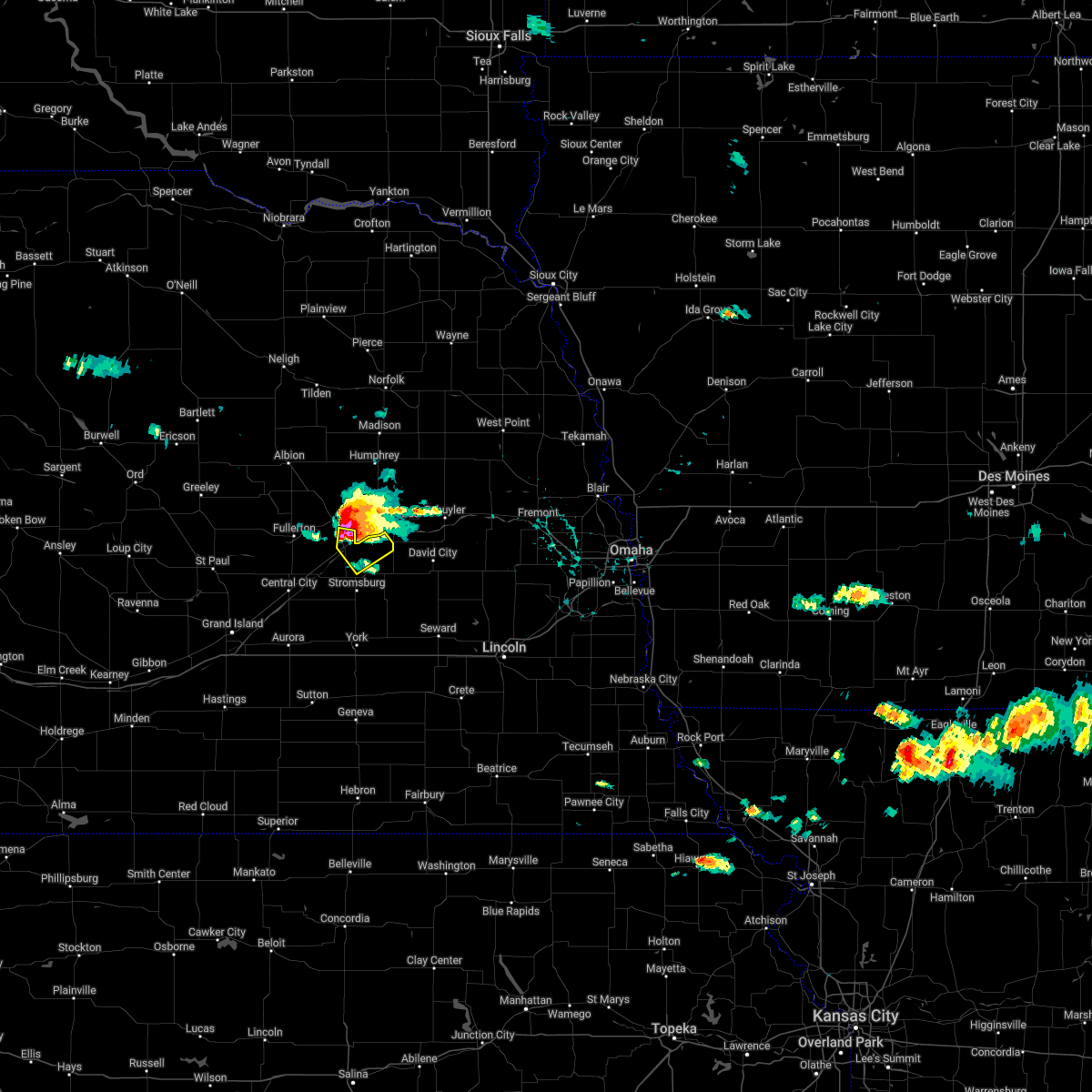 At 339 pm cdt, a severe thunderstorm was located over silver creek, or 14 miles southwest of columbus, moving southeast at 50 mph (radar indicated). Hazards include golf ball size hail and 60 mph wind gusts. People and animals outdoors will be injured. expect hail damage to roofs, siding, windows, and vehicles. expect wind damage to roofs, siding, and trees. this severe thunderstorm will remain over mainly rural areas of northeastern merrick and northeastern polk counties. thunderstorm damage threat, considerable hail threat, radar indicated max hail size, 1. 75 in wind threat, radar indicated max wind gust, 60 mph. At 339 pm cdt, a severe thunderstorm was located over silver creek, or 14 miles southwest of columbus, moving southeast at 50 mph (radar indicated). Hazards include golf ball size hail and 60 mph wind gusts. People and animals outdoors will be injured. expect hail damage to roofs, siding, windows, and vehicles. expect wind damage to roofs, siding, and trees. this severe thunderstorm will remain over mainly rural areas of northeastern merrick and northeastern polk counties. thunderstorm damage threat, considerable hail threat, radar indicated max hail size, 1. 75 in wind threat, radar indicated max wind gust, 60 mph.
|
| 6/6/2022 3:29 PM CDT |
 At 328 pm cdt, a severe thunderstorm was located over genoa, or 18 miles west of columbus, moving southeast at 40 mph (radar indicated). Hazards include 60 mph wind gusts and half dollar size hail. Hail damage to vehicles is expected. expect wind damage to roofs, siding, and trees. this severe storm will be near, silver creek around 345 pm cdt. hail threat, radar indicated max hail size, 1. 25 in wind threat, radar indicated max wind gust, 60 mph. At 328 pm cdt, a severe thunderstorm was located over genoa, or 18 miles west of columbus, moving southeast at 40 mph (radar indicated). Hazards include 60 mph wind gusts and half dollar size hail. Hail damage to vehicles is expected. expect wind damage to roofs, siding, and trees. this severe storm will be near, silver creek around 345 pm cdt. hail threat, radar indicated max hail size, 1. 25 in wind threat, radar indicated max wind gust, 60 mph.
|
| 6/6/2022 3:12 PM CDT |
 At 311 pm cdt, a severe thunderstorm was located over st. edward, or 26 miles west of columbus, moving southeast at 35 mph (radar indicated). Hazards include golf ball size hail and 60 mph wind gusts. People and animals outdoors will be injured. expect hail damage to roofs, siding, windows, and vehicles. expect wind damage to roofs, siding, and trees. this severe thunderstorm will be near, genoa around 330 pm cdt. other locations in the path of this severe thunderstorm include silver creek. thunderstorm damage threat, considerable hail threat, radar indicated max hail size, 1. 75 in wind threat, radar indicated max wind gust, 60 mph. At 311 pm cdt, a severe thunderstorm was located over st. edward, or 26 miles west of columbus, moving southeast at 35 mph (radar indicated). Hazards include golf ball size hail and 60 mph wind gusts. People and animals outdoors will be injured. expect hail damage to roofs, siding, windows, and vehicles. expect wind damage to roofs, siding, and trees. this severe thunderstorm will be near, genoa around 330 pm cdt. other locations in the path of this severe thunderstorm include silver creek. thunderstorm damage threat, considerable hail threat, radar indicated max hail size, 1. 75 in wind threat, radar indicated max wind gust, 60 mph.
|
| 5/12/2022 5:51 PM CDT |
 The severe thunderstorm warning for nance, northeastern hamilton, merrick and northwestern polk counties will expire at 600 pm cdt, the storm which prompted the warning has moved out of the area. therefore, the warning will be allowed to expire. a severe thunderstorm watch remains in effect until 900 pm cdt for south central, central and east central nebraska. remember, a severe thunderstorm warning still remains in effect for polk county until 630 pm cdt. The severe thunderstorm warning for nance, northeastern hamilton, merrick and northwestern polk counties will expire at 600 pm cdt, the storm which prompted the warning has moved out of the area. therefore, the warning will be allowed to expire. a severe thunderstorm watch remains in effect until 900 pm cdt for south central, central and east central nebraska. remember, a severe thunderstorm warning still remains in effect for polk county until 630 pm cdt.
|
| 5/12/2022 5:30 PM CDT |
 At 530 pm cdt, a severe thunderstorm was located near clarks, or 22 miles northwest of york, moving northeast at 65 mph (radar indicated). Hazards include 70 mph wind gusts and penny size hail. Expect considerable tree damage. damage is likely to mobile homes, roofs, and outbuildings. this severe thunderstorm will be near, silver creek around 540 pm cdt. thunderstorm damage threat, considerable hail threat, radar indicated max hail size, 0. 75 in wind threat, radar indicated max wind gust, 70 mph. At 530 pm cdt, a severe thunderstorm was located near clarks, or 22 miles northwest of york, moving northeast at 65 mph (radar indicated). Hazards include 70 mph wind gusts and penny size hail. Expect considerable tree damage. damage is likely to mobile homes, roofs, and outbuildings. this severe thunderstorm will be near, silver creek around 540 pm cdt. thunderstorm damage threat, considerable hail threat, radar indicated max hail size, 0. 75 in wind threat, radar indicated max wind gust, 70 mph.
|
| 5/12/2022 3:11 PM CDT |
 At 310 pm cdt, severe thunderstorms were located along a line extending from 8 miles north of spalding to near cedar rapids to near cushing to st. libory to grand island, moving northeast at 60 mph (radar indicated). Hazards include two inch hail and 70 mph wind gusts. People and animals outdoors will be injured. expect hail damage to roofs, siding, windows, and vehicles. expect considerable tree damage. wind damage is also likely to mobile homes, roofs, and outbuildings. severe thunderstorms will be near, chapman and archer around 325 pm cdt. fullerton and belgrade around 330 pm cdt. other locations in the path of these severe thunderstorms include central city, hordville, clarks, genoa, osceola and silver creek. thunderstorm damage threat, considerable hail threat, radar indicated max hail size, 2. 00 in wind threat, radar indicated max wind gust, 70 mph. At 310 pm cdt, severe thunderstorms were located along a line extending from 8 miles north of spalding to near cedar rapids to near cushing to st. libory to grand island, moving northeast at 60 mph (radar indicated). Hazards include two inch hail and 70 mph wind gusts. People and animals outdoors will be injured. expect hail damage to roofs, siding, windows, and vehicles. expect considerable tree damage. wind damage is also likely to mobile homes, roofs, and outbuildings. severe thunderstorms will be near, chapman and archer around 325 pm cdt. fullerton and belgrade around 330 pm cdt. other locations in the path of these severe thunderstorms include central city, hordville, clarks, genoa, osceola and silver creek. thunderstorm damage threat, considerable hail threat, radar indicated max hail size, 2. 00 in wind threat, radar indicated max wind gust, 70 mph.
|
| 4/29/2022 7:32 PM CDT |
 At 732 pm cdt, severe thunderstorms were located along a line extending from near duncan to near gresham to near fairmont, moving east at 45 mph (radar indicated). Hazards include 60 mph wind gusts and nickel size hail. Expect damage to roofs, siding, and trees. these severe storms will be near, waco and gresham around 735 pm cdt. other locations impacted by these severe thunderstorms include thayer. This includes interstate 80 between mile markers 337 and 365. At 732 pm cdt, severe thunderstorms were located along a line extending from near duncan to near gresham to near fairmont, moving east at 45 mph (radar indicated). Hazards include 60 mph wind gusts and nickel size hail. Expect damage to roofs, siding, and trees. these severe storms will be near, waco and gresham around 735 pm cdt. other locations impacted by these severe thunderstorms include thayer. This includes interstate 80 between mile markers 337 and 365.
|
| 4/29/2022 7:28 PM CDT |
 The tornado warning for east central nance, northeastern merrick and northwestern polk counties will expire at 730 pm cdt, the storm which prompted the warning has moved out of the area. therefore, the warning will be allowed to expire. a tornado watch remains in effect until 900 pm cdt for central and east central nebraska. remember, a severe thunderstorm warning still remains in effect. The tornado warning for east central nance, northeastern merrick and northwestern polk counties will expire at 730 pm cdt, the storm which prompted the warning has moved out of the area. therefore, the warning will be allowed to expire. a tornado watch remains in effect until 900 pm cdt for central and east central nebraska. remember, a severe thunderstorm warning still remains in effect.
|
| 4/29/2022 7:17 PM CDT |
 At 717 pm cdt, a severe squall line capable of producing both tornadoes and extensive straight line wind damage was located over silver creek, or 17 miles west of columbus, moving east at 45 mph (radar indicated rotation). Hazards include tornado. Flying debris will be dangerous to those caught without shelter. mobile homes will be damaged or destroyed. damage to roofs, windows, and vehicles will occur. tree damage is likely. Locations impacted include, genoa and silver creek. At 717 pm cdt, a severe squall line capable of producing both tornadoes and extensive straight line wind damage was located over silver creek, or 17 miles west of columbus, moving east at 45 mph (radar indicated rotation). Hazards include tornado. Flying debris will be dangerous to those caught without shelter. mobile homes will be damaged or destroyed. damage to roofs, windows, and vehicles will occur. tree damage is likely. Locations impacted include, genoa and silver creek.
|
| 4/29/2022 7:15 PM CDT |
 At 715 pm cdt, severe thunderstorms were located along a line extending from near genoa to near polk to near grafton, moving east at 45 mph (radar indicated). Hazards include 70 mph wind gusts and nickel size hail. Expect considerable tree damage. damage is likely to mobile homes, roofs, and outbuildings. severe thunderstorms will be near, stromsburg and lushton around 720 pm cdt. york, mccool junction and benedict around 725 pm cdt. waco and gresham around 735 pm cdt. This includes interstate 80 between mile markers 325 and 365. At 715 pm cdt, severe thunderstorms were located along a line extending from near genoa to near polk to near grafton, moving east at 45 mph (radar indicated). Hazards include 70 mph wind gusts and nickel size hail. Expect considerable tree damage. damage is likely to mobile homes, roofs, and outbuildings. severe thunderstorms will be near, stromsburg and lushton around 720 pm cdt. york, mccool junction and benedict around 725 pm cdt. waco and gresham around 735 pm cdt. This includes interstate 80 between mile markers 325 and 365.
|
| 4/29/2022 6:55 PM CDT |
 At 654 pm cdt, severe thunderstorms capable of producing both tornadoes and extensive straight line wind damage were located near fullerton, or 30 miles west of columbus, moving east at 35 mph (radar indicated rotation). Hazards include tornado. Flying debris will be dangerous to those caught without shelter. mobile homes will be damaged or destroyed. damage to roofs, windows, and vehicles will occur. Tree damage is likely. At 654 pm cdt, severe thunderstorms capable of producing both tornadoes and extensive straight line wind damage were located near fullerton, or 30 miles west of columbus, moving east at 35 mph (radar indicated rotation). Hazards include tornado. Flying debris will be dangerous to those caught without shelter. mobile homes will be damaged or destroyed. damage to roofs, windows, and vehicles will occur. Tree damage is likely.
|
| 4/22/2022 2:57 AM CDT |
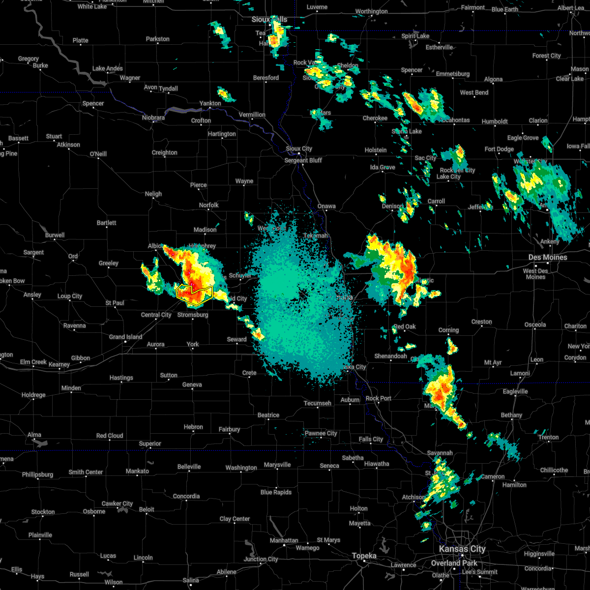 At 257 am cdt, a severe thunderstorm was located near silver creek, or 13 miles southwest of columbus, moving northeast at 30 mph (radar indicated). Hazards include 60 mph wind gusts and quarter size hail. Hail damage to vehicles is expected. expect wind damage to roofs, siding, and trees. this severe thunderstorm will remain over mainly rural areas of east central nance, northeastern merrick and northeastern polk counties. hail threat, radar indicated max hail size, 1. 00 in wind threat, radar indicated max wind gust, 60 mph. At 257 am cdt, a severe thunderstorm was located near silver creek, or 13 miles southwest of columbus, moving northeast at 30 mph (radar indicated). Hazards include 60 mph wind gusts and quarter size hail. Hail damage to vehicles is expected. expect wind damage to roofs, siding, and trees. this severe thunderstorm will remain over mainly rural areas of east central nance, northeastern merrick and northeastern polk counties. hail threat, radar indicated max hail size, 1. 00 in wind threat, radar indicated max wind gust, 60 mph.
|
| 4/22/2022 2:46 AM CDT |
 At 246 am cdt, a severe thunderstorm was located near silver creek, or 20 miles southwest of columbus, moving east at 30 mph (mesonet reported 65 mph wind gusts along highway 30 near clarks). Hazards include 60 mph wind gusts and quarter size hail. Hail damage to vehicles is expected. expect wind damage to roofs, siding, and trees. this severe storm will be near, silver creek around 250 am cdt. hail threat, radar indicated max hail size, 1. 00 in wind threat, observed max wind gust, 60 mph. At 246 am cdt, a severe thunderstorm was located near silver creek, or 20 miles southwest of columbus, moving east at 30 mph (mesonet reported 65 mph wind gusts along highway 30 near clarks). Hazards include 60 mph wind gusts and quarter size hail. Hail damage to vehicles is expected. expect wind damage to roofs, siding, and trees. this severe storm will be near, silver creek around 250 am cdt. hail threat, radar indicated max hail size, 1. 00 in wind threat, observed max wind gust, 60 mph.
|
| 4/22/2022 2:31 AM CDT |
 At 231 am cdt, a severe thunderstorm was located over clarks, or 28 miles southwest of columbus, moving east at 30 mph (radar indicated). Hazards include 60 mph wind gusts and quarter size hail. Hail damage to vehicles is expected. expect wind damage to roofs, siding, and trees. this severe storm will be near, silver creek around 250 am cdt. hail threat, radar indicated max hail size, 1. 00 in wind threat, radar indicated max wind gust, 60 mph. At 231 am cdt, a severe thunderstorm was located over clarks, or 28 miles southwest of columbus, moving east at 30 mph (radar indicated). Hazards include 60 mph wind gusts and quarter size hail. Hail damage to vehicles is expected. expect wind damage to roofs, siding, and trees. this severe storm will be near, silver creek around 250 am cdt. hail threat, radar indicated max hail size, 1. 00 in wind threat, radar indicated max wind gust, 60 mph.
|
| 4/22/2022 2:12 AM CDT |
 At 212 am cdt, a severe thunderstorm was located near central city, or 26 miles northeast of grand island, moving east at 30 mph (radar indicated). Hazards include 60 mph wind gusts and quarter size hail. Hail damage to vehicles is expected. expect wind damage to roofs, siding, and trees. this severe thunderstorm will be near, clarks around 230 am cdt. other locations in the path of this severe thunderstorm include silver creek. hail threat, radar indicated max hail size, 1. 00 in wind threat, radar indicated max wind gust, 60 mph. At 212 am cdt, a severe thunderstorm was located near central city, or 26 miles northeast of grand island, moving east at 30 mph (radar indicated). Hazards include 60 mph wind gusts and quarter size hail. Hail damage to vehicles is expected. expect wind damage to roofs, siding, and trees. this severe thunderstorm will be near, clarks around 230 am cdt. other locations in the path of this severe thunderstorm include silver creek. hail threat, radar indicated max hail size, 1. 00 in wind threat, radar indicated max wind gust, 60 mph.
|
| 8/24/2021 10:57 PM CDT |
 The severe thunderstorm warning for east central nance, northeastern merrick and northeastern polk counties will expire at 1100 pm cdt, the storm which prompted the warning has weakened below severe limits, and no longer poses an immediate threat to life or property. therefore, the warning will be allowed to expire. however small hail is still possible with this thunderstorm. The severe thunderstorm warning for east central nance, northeastern merrick and northeastern polk counties will expire at 1100 pm cdt, the storm which prompted the warning has weakened below severe limits, and no longer poses an immediate threat to life or property. therefore, the warning will be allowed to expire. however small hail is still possible with this thunderstorm.
|
| 8/24/2021 10:51 PM CDT |
 At 1051 pm cdt, a severe thunderstorm was located over silver creek, or 17 miles west of columbus, moving east at 20 mph (radar indicated). Hazards include 60 mph wind gusts and quarter size hail. Hail damage to vehicles is expected. expect wind damage to roofs, siding, and trees. locations impacted include, silver creek. hail threat, radar indicated max hail size, 1. 00 in wind threat, radar indicated max wind gust, 60 mph. At 1051 pm cdt, a severe thunderstorm was located over silver creek, or 17 miles west of columbus, moving east at 20 mph (radar indicated). Hazards include 60 mph wind gusts and quarter size hail. Hail damage to vehicles is expected. expect wind damage to roofs, siding, and trees. locations impacted include, silver creek. hail threat, radar indicated max hail size, 1. 00 in wind threat, radar indicated max wind gust, 60 mph.
|
| 8/24/2021 10:34 PM CDT |
 At 1034 pm cdt, a severe thunderstorm was located over genoa, or 18 miles west of columbus, moving northeast at 55 mph (radar indicated). Hazards include 60 mph wind gusts and half dollar size hail. Hail damage to vehicles is expected. expect wind damage to roofs, siding, and trees. this severe thunderstorm will remain over mainly rural areas of eastern nance, northeastern merrick and northeastern polk counties. hail threat, radar indicated max hail size, 1. 25 in wind threat, radar indicated max wind gust, 60 mph. At 1034 pm cdt, a severe thunderstorm was located over genoa, or 18 miles west of columbus, moving northeast at 55 mph (radar indicated). Hazards include 60 mph wind gusts and half dollar size hail. Hail damage to vehicles is expected. expect wind damage to roofs, siding, and trees. this severe thunderstorm will remain over mainly rural areas of eastern nance, northeastern merrick and northeastern polk counties. hail threat, radar indicated max hail size, 1. 25 in wind threat, radar indicated max wind gust, 60 mph.
|
| 8/7/2021 9:30 PM CDT |
 At 929 pm cdt, severe thunderstorms were located along a line extending from near fullerton to near osceola, moving northeast at 20 mph (radar indicated). Hazards include 60 mph wind gusts and nickel size hail. Expect damage to roofs, siding, and trees. severe thunderstorms will be near, osceola around 935 pm cdt. other locations in the path of these severe thunderstorms include shelby and genoa. hail threat, radar indicated max hail size, 0. 88 in wind threat, radar indicated max wind gust, 60 mph. At 929 pm cdt, severe thunderstorms were located along a line extending from near fullerton to near osceola, moving northeast at 20 mph (radar indicated). Hazards include 60 mph wind gusts and nickel size hail. Expect damage to roofs, siding, and trees. severe thunderstorms will be near, osceola around 935 pm cdt. other locations in the path of these severe thunderstorms include shelby and genoa. hail threat, radar indicated max hail size, 0. 88 in wind threat, radar indicated max wind gust, 60 mph.
|
| 8/7/2021 9:15 PM CDT |
 At 915 pm cdt, severe thunderstorms were located along a line extending from osceola to near clarks to chapman, and are nearly stationary (radar indicated). Hazards include 60 mph wind gusts and quarter size hail. Hail damage to vehicles is expected. expect wind damage to roofs, siding, and trees. these severe storms will be near, shelby and clarks around 920 pm cdt. silver creek and archer around 945 pm cdt. hail threat, radar indicated max hail size, 1. 00 in wind threat, radar indicated max wind gust, 60 mph. At 915 pm cdt, severe thunderstorms were located along a line extending from osceola to near clarks to chapman, and are nearly stationary (radar indicated). Hazards include 60 mph wind gusts and quarter size hail. Hail damage to vehicles is expected. expect wind damage to roofs, siding, and trees. these severe storms will be near, shelby and clarks around 920 pm cdt. silver creek and archer around 945 pm cdt. hail threat, radar indicated max hail size, 1. 00 in wind threat, radar indicated max wind gust, 60 mph.
|
| 8/7/2021 8:57 PM CDT |
 At 856 pm cdt, severe thunderstorms were located along a line extending from near shelby to near phillips, moving northeast at 10 mph (radar indicated). Hazards include 60 mph wind gusts and quarter size hail. Hail damage to vehicles is expected. expect wind damage to roofs, siding, and trees. severe thunderstorms will be near, shelby around 900 pm cdt. other locations in the path of these severe thunderstorms include hampton and marquette. hail threat, observed max hail size, 1. 00 in wind threat, radar indicated max wind gust, 60 mph. At 856 pm cdt, severe thunderstorms were located along a line extending from near shelby to near phillips, moving northeast at 10 mph (radar indicated). Hazards include 60 mph wind gusts and quarter size hail. Hail damage to vehicles is expected. expect wind damage to roofs, siding, and trees. severe thunderstorms will be near, shelby around 900 pm cdt. other locations in the path of these severe thunderstorms include hampton and marquette. hail threat, observed max hail size, 1. 00 in wind threat, radar indicated max wind gust, 60 mph.
|
| 8/7/2021 8:31 PM CDT |
 At 831 pm cdt, severe thunderstorms were located along a line extending from near rising city to near chapman, moving northeast at 55 mph (radar indicated). Hazards include 60 mph wind gusts and quarter size hail. Hail damage to vehicles is expected. expect wind damage to roofs, siding, and trees. these severe storms will be near, central city and hordville around 845 pm cdt. polk around 850 pm cdt. clarks around 855 pm cdt. osceola around 905 pm cdt. this includes interstate 80 between mile markers 323 and 344. hail threat, radar indicated max hail size, 1. 00 in wind threat, radar indicated max wind gust, 60 mph. At 831 pm cdt, severe thunderstorms were located along a line extending from near rising city to near chapman, moving northeast at 55 mph (radar indicated). Hazards include 60 mph wind gusts and quarter size hail. Hail damage to vehicles is expected. expect wind damage to roofs, siding, and trees. these severe storms will be near, central city and hordville around 845 pm cdt. polk around 850 pm cdt. clarks around 855 pm cdt. osceola around 905 pm cdt. this includes interstate 80 between mile markers 323 and 344. hail threat, radar indicated max hail size, 1. 00 in wind threat, radar indicated max wind gust, 60 mph.
|
| 8/7/2021 8:10 PM CDT |
 At 810 pm cdt, severe thunderstorms were located along a line extending from near shelby to aurora, moving northeast at 25 mph (radar indicated). Hazards include 60 mph wind gusts and quarter size hail. Hail damage to vehicles is expected. expect wind damage to roofs, siding, and trees. severe thunderstorms will be near, shelby around 815 pm cdt. other locations in the path of these severe thunderstorms include bradshaw, polk, stromsburg and benedict. this includes interstate 80 between mile markers 323 and 349. hail threat, radar indicated max hail size, 1. 00 in wind threat, radar indicated max wind gust, 60 mph. At 810 pm cdt, severe thunderstorms were located along a line extending from near shelby to aurora, moving northeast at 25 mph (radar indicated). Hazards include 60 mph wind gusts and quarter size hail. Hail damage to vehicles is expected. expect wind damage to roofs, siding, and trees. severe thunderstorms will be near, shelby around 815 pm cdt. other locations in the path of these severe thunderstorms include bradshaw, polk, stromsburg and benedict. this includes interstate 80 between mile markers 323 and 349. hail threat, radar indicated max hail size, 1. 00 in wind threat, radar indicated max wind gust, 60 mph.
|
| 7/9/2021 11:15 PM CDT |
 At 1115 pm cdt, severe thunderstorms were located along a line extending from near bellwood to near benedict to near henderson, moving southeast at 30 mph (radar indicated). Hazards include 60 mph wind gusts and quarter size hail. Hail damage to vehicles is expected. expect wind damage to roofs, siding, and trees. severe thunderstorms will be near, gresham around 1125 pm cdt. waco around 1130 pm cdt. This includes interstate 80 between mile markers 329 and 365. At 1115 pm cdt, severe thunderstorms were located along a line extending from near bellwood to near benedict to near henderson, moving southeast at 30 mph (radar indicated). Hazards include 60 mph wind gusts and quarter size hail. Hail damage to vehicles is expected. expect wind damage to roofs, siding, and trees. severe thunderstorms will be near, gresham around 1125 pm cdt. waco around 1130 pm cdt. This includes interstate 80 between mile markers 329 and 365.
|
| 7/9/2021 10:35 PM CDT |
 At 1035 pm cdt, severe thunderstorms were located along a line extending from near duncan to near marquette to near phillips to near doniphan to near kenesaw, moving east at 40 mph. these are very dangerous storms (radar indicated). Hazards include 80 mph wind gusts and half dollar size hail. Flying debris will be dangerous to those caught without shelter. mobile homes will be heavily damaged. expect considerable damage to roofs, windows, and vehicles. extensive tree damage and power outages are likely. locations impacted include, hastings, aurora, hampton, bradshaw, henderson, inland and stockham. This includes interstate 80 between mile markers 293 and 344. At 1035 pm cdt, severe thunderstorms were located along a line extending from near duncan to near marquette to near phillips to near doniphan to near kenesaw, moving east at 40 mph. these are very dangerous storms (radar indicated). Hazards include 80 mph wind gusts and half dollar size hail. Flying debris will be dangerous to those caught without shelter. mobile homes will be heavily damaged. expect considerable damage to roofs, windows, and vehicles. extensive tree damage and power outages are likely. locations impacted include, hastings, aurora, hampton, bradshaw, henderson, inland and stockham. This includes interstate 80 between mile markers 293 and 344.
|
| 7/9/2021 10:26 PM CDT |
 At 1026 pm cdt, severe thunderstorms were located along a line extending from near monroe to near chapman to near phillips to near doniphan to near heartwell, moving east at 40 mph (radar indicated). Hazards include 60 mph wind gusts and half dollar size hail. Hail damage to vehicles is expected. expect wind damage to roofs, siding, and trees. severe thunderstorms will be near, holstein around 1035 pm cdt. roseland, marquette and trumbull around 1040 pm cdt. juniata and giltner around 1045 pm cdt. other locations in the path of these severe thunderstorms include hastings, aurora, hampton, bradshaw, henderson, inland and stockham. This includes interstate 80 between mile markers 293 and 344. At 1026 pm cdt, severe thunderstorms were located along a line extending from near monroe to near chapman to near phillips to near doniphan to near heartwell, moving east at 40 mph (radar indicated). Hazards include 60 mph wind gusts and half dollar size hail. Hail damage to vehicles is expected. expect wind damage to roofs, siding, and trees. severe thunderstorms will be near, holstein around 1035 pm cdt. roseland, marquette and trumbull around 1040 pm cdt. juniata and giltner around 1045 pm cdt. other locations in the path of these severe thunderstorms include hastings, aurora, hampton, bradshaw, henderson, inland and stockham. This includes interstate 80 between mile markers 293 and 344.
|
| 7/9/2021 9:46 PM CDT |
 At 945 pm cdt, severe thunderstorms were located along a line extending from near cedar rapids to near farwell to near poole, moving southeast at 50 mph (radar indicated). Hazards include 60 mph wind gusts and half dollar size hail. Hail damage to vehicles is expected. expect wind damage to roofs, siding, and trees. severe thunderstorms will be near, st. paul, dannebrog and belgrade around 950 pm cdt. gibbon and fullerton around 1000 pm cdt. shelton and st. libory around 1005 pm cdt. other locations in the path of these severe thunderstorms include wood river, clarks, chapman, silver creek and doniphan. This includes interstate 80 between mile markers 273 and 317. At 945 pm cdt, severe thunderstorms were located along a line extending from near cedar rapids to near farwell to near poole, moving southeast at 50 mph (radar indicated). Hazards include 60 mph wind gusts and half dollar size hail. Hail damage to vehicles is expected. expect wind damage to roofs, siding, and trees. severe thunderstorms will be near, st. paul, dannebrog and belgrade around 950 pm cdt. gibbon and fullerton around 1000 pm cdt. shelton and st. libory around 1005 pm cdt. other locations in the path of these severe thunderstorms include wood river, clarks, chapman, silver creek and doniphan. This includes interstate 80 between mile markers 273 and 317.
|
| 6/24/2021 1:43 AM CDT |
 At 142 am cdt, severe thunderstorms were located along a line extending from near osceola to near polk to near phillips, moving southeast at 50 mph (radar indicated). Hazards include 70 mph wind gusts and nickel size hail. Expect considerable tree damage. damage is likely to mobile homes, roofs, and outbuildings. locations impacted include, york, aurora, central city, stromsburg, henderson, osceola, shelby, hampton, mccool junction, clarks, silver creek, giltner, polk, phillips, chapman, bradshaw, waco, benedict, marquette and gresham. This includes interstate 80 between mile markers 318 and 365. At 142 am cdt, severe thunderstorms were located along a line extending from near osceola to near polk to near phillips, moving southeast at 50 mph (radar indicated). Hazards include 70 mph wind gusts and nickel size hail. Expect considerable tree damage. damage is likely to mobile homes, roofs, and outbuildings. locations impacted include, york, aurora, central city, stromsburg, henderson, osceola, shelby, hampton, mccool junction, clarks, silver creek, giltner, polk, phillips, chapman, bradshaw, waco, benedict, marquette and gresham. This includes interstate 80 between mile markers 318 and 365.
|
| 6/24/2021 1:22 AM CDT |
 At 121 am cdt, severe thunderstorms were located along a line extending from near silver creek to 7 miles north of central city to near dannebrog, moving southeast at 50 mph (radar indicated). Hazards include 70 mph wind gusts and nickel size hail. Expect considerable tree damage. damage is likely to mobile homes, roofs, and outbuildings. severe thunderstorms will be near, silver creek around 125 am cdt. central city and clarks around 130 am cdt. hordville around 135 am cdt. grand island, osceola, shelby, polk and marquette around 140 am cdt. other locations in the path of these severe thunderstorms include stromsburg, phillips, hampton, bradshaw, gresham, york, henderson, giltner, waco and lushton. This includes interstate 80 between mile markers 309 and 365. At 121 am cdt, severe thunderstorms were located along a line extending from near silver creek to 7 miles north of central city to near dannebrog, moving southeast at 50 mph (radar indicated). Hazards include 70 mph wind gusts and nickel size hail. Expect considerable tree damage. damage is likely to mobile homes, roofs, and outbuildings. severe thunderstorms will be near, silver creek around 125 am cdt. central city and clarks around 130 am cdt. hordville around 135 am cdt. grand island, osceola, shelby, polk and marquette around 140 am cdt. other locations in the path of these severe thunderstorms include stromsburg, phillips, hampton, bradshaw, gresham, york, henderson, giltner, waco and lushton. This includes interstate 80 between mile markers 309 and 365.
|
| 6/22/2021 7:59 PM CDT |
 At 758 pm cdt, severe thunderstorms were located along a line extending from 6 miles east of clarks to osceola to shelby, moving south at 40 mph (radar indicated). Hazards include golf ball size hail and 70 mph wind gusts. People and animals outdoors will be injured. expect hail damage to roofs, siding, windows, and vehicles. expect considerable tree damage. wind damage is also likely to mobile homes, roofs, and outbuildings. severe thunderstorms will be near, stromsburg around 805 pm cdt. polk, benedict and gresham around 815 pm cdt. other locations in the path of these severe thunderstorms include waco, york and bradshaw. This includes interstate 80 between mile markers 342 and 365. At 758 pm cdt, severe thunderstorms were located along a line extending from 6 miles east of clarks to osceola to shelby, moving south at 40 mph (radar indicated). Hazards include golf ball size hail and 70 mph wind gusts. People and animals outdoors will be injured. expect hail damage to roofs, siding, windows, and vehicles. expect considerable tree damage. wind damage is also likely to mobile homes, roofs, and outbuildings. severe thunderstorms will be near, stromsburg around 805 pm cdt. polk, benedict and gresham around 815 pm cdt. other locations in the path of these severe thunderstorms include waco, york and bradshaw. This includes interstate 80 between mile markers 342 and 365.
|
| 6/22/2021 7:53 PM CDT |
 At 753 pm cdt, a severe thunderstorm was located near silver creek, or 20 miles southwest of columbus, moving south at 45 mph (radar indicated). Hazards include golf ball size hail and 70 mph wind gusts. People and animals outdoors will be injured. expect hail damage to roofs, siding, windows, and vehicles. expect considerable tree damage. wind damage is also likely to mobile homes, roofs, and outbuildings. This severe storm will be near, osceola around 800 pm cdt. At 753 pm cdt, a severe thunderstorm was located near silver creek, or 20 miles southwest of columbus, moving south at 45 mph (radar indicated). Hazards include golf ball size hail and 70 mph wind gusts. People and animals outdoors will be injured. expect hail damage to roofs, siding, windows, and vehicles. expect considerable tree damage. wind damage is also likely to mobile homes, roofs, and outbuildings. This severe storm will be near, osceola around 800 pm cdt.
|
| 6/22/2021 7:42 PM CDT |
 At 741 pm cdt, a severe thunderstorm was located over silver creek, or 16 miles southwest of columbus, moving southeast at 25 mph (radar indicated). Hazards include golf ball size hail and 60 mph wind gusts. People and animals outdoors will be injured. expect hail damage to roofs, siding, windows, and vehicles. expect wind damage to roofs, siding, and trees. Locations impacted include, osceola and shelby. At 741 pm cdt, a severe thunderstorm was located over silver creek, or 16 miles southwest of columbus, moving southeast at 25 mph (radar indicated). Hazards include golf ball size hail and 60 mph wind gusts. People and animals outdoors will be injured. expect hail damage to roofs, siding, windows, and vehicles. expect wind damage to roofs, siding, and trees. Locations impacted include, osceola and shelby.
|
| 6/22/2021 7:28 PM CDT |
 At 728 pm cdt, a severe thunderstorm was located near genoa, or 17 miles west of columbus, moving south at 35 mph (radar indicated). Hazards include ping pong ball size hail and 60 mph wind gusts. People and animals outdoors will be injured. expect hail damage to roofs, siding, windows, and vehicles. expect wind damage to roofs, siding, and trees. this severe thunderstorm will be near, silver creek around 740 pm cdt. Other locations in the path of this severe thunderstorm include osceola and shelby. At 728 pm cdt, a severe thunderstorm was located near genoa, or 17 miles west of columbus, moving south at 35 mph (radar indicated). Hazards include ping pong ball size hail and 60 mph wind gusts. People and animals outdoors will be injured. expect hail damage to roofs, siding, windows, and vehicles. expect wind damage to roofs, siding, and trees. this severe thunderstorm will be near, silver creek around 740 pm cdt. Other locations in the path of this severe thunderstorm include osceola and shelby.
|
| 6/11/2021 7:57 AM CDT |
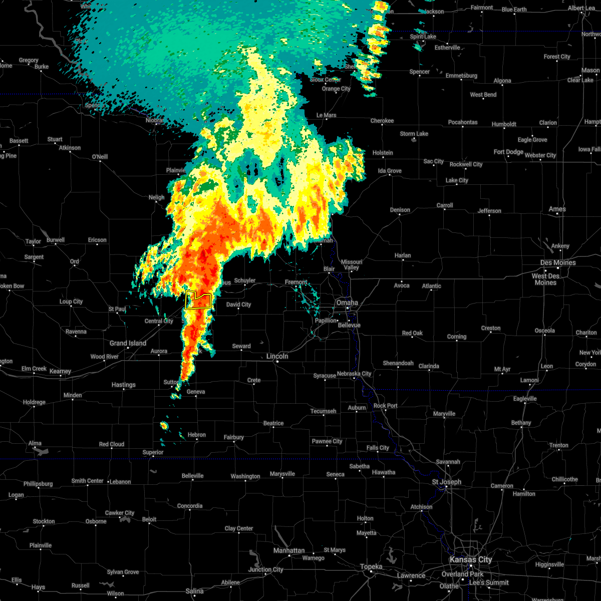 The severe thunderstorm warning for northeastern merrick and northeastern polk counties will expire at 800 am cdt, the storm which prompted the warning has weakened below severe limits, and no longer poses an immediate threat to life or property. therefore, the warning will be allowed to expire. however small hail, gusty winds and heavy rain are still possible with this thunderstorm. a severe thunderstorm watch remains in effect until 1100 am cdt for central and east central nebraska. The severe thunderstorm warning for northeastern merrick and northeastern polk counties will expire at 800 am cdt, the storm which prompted the warning has weakened below severe limits, and no longer poses an immediate threat to life or property. therefore, the warning will be allowed to expire. however small hail, gusty winds and heavy rain are still possible with this thunderstorm. a severe thunderstorm watch remains in effect until 1100 am cdt for central and east central nebraska.
|
| 6/11/2021 7:46 AM CDT |
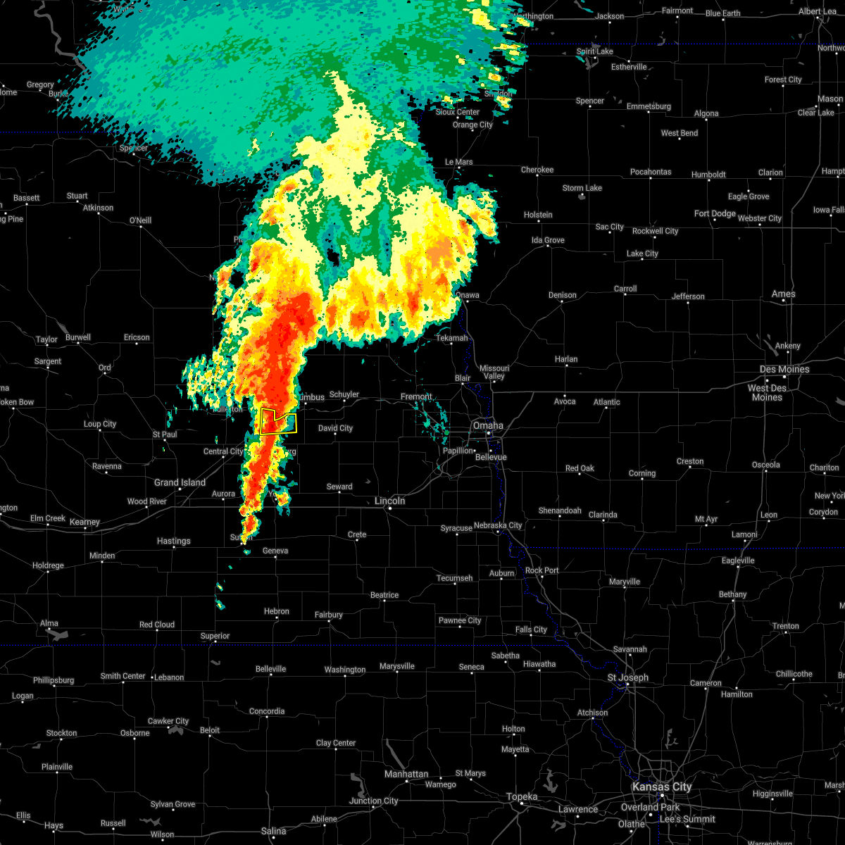 At 745 am cdt, a severe thunderstorm was located near silver creek, or 14 miles southwest of columbus, moving east at 30 mph (radar indicated). Hazards include 60 mph wind gusts and quarter size hail. Hail damage to vehicles is expected. expect wind damage to roofs, siding, and trees. This severe thunderstorm will remain over mainly rural areas of northeastern merrick and northeastern polk counties. At 745 am cdt, a severe thunderstorm was located near silver creek, or 14 miles southwest of columbus, moving east at 30 mph (radar indicated). Hazards include 60 mph wind gusts and quarter size hail. Hail damage to vehicles is expected. expect wind damage to roofs, siding, and trees. This severe thunderstorm will remain over mainly rural areas of northeastern merrick and northeastern polk counties.
|
| 6/11/2021 7:31 AM CDT |
 At 731 am cdt, a severe thunderstorm was located over silver creek, or 20 miles west of columbus, moving east at 30 mph (radar indicated). Hazards include 60 mph wind gusts and quarter size hail. Hail damage to vehicles is expected. expect wind damage to roofs, siding, and trees. This severe thunderstorm will be near, silver creek around 735 am cdt. At 731 am cdt, a severe thunderstorm was located over silver creek, or 20 miles west of columbus, moving east at 30 mph (radar indicated). Hazards include 60 mph wind gusts and quarter size hail. Hail damage to vehicles is expected. expect wind damage to roofs, siding, and trees. This severe thunderstorm will be near, silver creek around 735 am cdt.
|
| 8/16/2020 6:13 PM CDT |
 At 613 pm cdt, a severe thunderstorm was located near clarks, or 23 miles northwest of york, moving south at 30 mph (radar indicated). Hazards include ping pong ball size hail and 60 mph wind gusts. People and animals outdoors will be injured. expect hail damage to roofs, siding, windows, and vehicles. Expect wind damage to roofs, siding, and trees. At 613 pm cdt, a severe thunderstorm was located near clarks, or 23 miles northwest of york, moving south at 30 mph (radar indicated). Hazards include ping pong ball size hail and 60 mph wind gusts. People and animals outdoors will be injured. expect hail damage to roofs, siding, windows, and vehicles. Expect wind damage to roofs, siding, and trees.
|
| 8/16/2020 6:02 PM CDT |
 At 602 pm cdt, a severe thunderstorm was located over clarks, or 25 miles northwest of york, moving south at 40 mph (radar indicated). Hazards include golf ball size hail and 60 mph wind gusts. People and animals outdoors will be injured. expect hail damage to roofs, siding, windows, and vehicles. expect wind damage to roofs, siding, and trees. Locations impacted include, central city, fullerton, stromsburg, osceola, shelby, clarks, silver creek, polk, hordville and archer. At 602 pm cdt, a severe thunderstorm was located over clarks, or 25 miles northwest of york, moving south at 40 mph (radar indicated). Hazards include golf ball size hail and 60 mph wind gusts. People and animals outdoors will be injured. expect hail damage to roofs, siding, windows, and vehicles. expect wind damage to roofs, siding, and trees. Locations impacted include, central city, fullerton, stromsburg, osceola, shelby, clarks, silver creek, polk, hordville and archer.
|
| 8/16/2020 5:37 PM CDT |
 At 536 pm cdt, a severe thunderstorm was located near genoa, or 24 miles west of columbus, moving south at 30 mph (radar indicated). Hazards include ping pong ball size hail and 60 mph wind gusts. People and animals outdoors will be injured. expect hail damage to roofs, siding, windows, and vehicles. Expect wind damage to roofs, siding, and trees. At 536 pm cdt, a severe thunderstorm was located near genoa, or 24 miles west of columbus, moving south at 30 mph (radar indicated). Hazards include ping pong ball size hail and 60 mph wind gusts. People and animals outdoors will be injured. expect hail damage to roofs, siding, windows, and vehicles. Expect wind damage to roofs, siding, and trees.
|
| 8/14/2020 3:59 PM CDT |
 The national weather service in hastings has issued a * severe thunderstorm warning for. northeastern merrick county in central nebraska. polk county in east central nebraska. until 445 pm cdt. At 359 pm cdt, a severe thunderstorm was located near duncan, or 11. The national weather service in hastings has issued a * severe thunderstorm warning for. northeastern merrick county in central nebraska. polk county in east central nebraska. until 445 pm cdt. At 359 pm cdt, a severe thunderstorm was located near duncan, or 11.
|
| 6/30/2020 10:48 PM CDT |
 At 1048 pm cdt, a severe thunderstorm was located over genoa, or 17 miles west of columbus, moving east at 30 mph (radar indicated). Hazards include 60 mph wind gusts. Expect damage to roofs, siding, and trees. Locations impacted include, genoa and silver creek. At 1048 pm cdt, a severe thunderstorm was located over genoa, or 17 miles west of columbus, moving east at 30 mph (radar indicated). Hazards include 60 mph wind gusts. Expect damage to roofs, siding, and trees. Locations impacted include, genoa and silver creek.
|
| 6/30/2020 10:38 PM CDT |
 At 1038 pm cdt, a severe thunderstorm was located near genoa, or 22 miles west of columbus, moving east at 30 mph (radar indicated). Hazards include 60 mph wind gusts. Expect damage to roofs, siding, and trees. Locations impacted include, fullerton, genoa, clarks and silver creek. At 1038 pm cdt, a severe thunderstorm was located near genoa, or 22 miles west of columbus, moving east at 30 mph (radar indicated). Hazards include 60 mph wind gusts. Expect damage to roofs, siding, and trees. Locations impacted include, fullerton, genoa, clarks and silver creek.
|
| 6/30/2020 10:14 PM CDT |
 At 1014 pm cdt, a severe thunderstorm was located over fullerton, or 34 miles northeast of grand island, moving east at 30 mph (radar indicated). Hazards include 60 mph wind gusts and quarter size hail. Hail damage to vehicles is expected. Expect wind damage to roofs, siding, and trees. At 1014 pm cdt, a severe thunderstorm was located over fullerton, or 34 miles northeast of grand island, moving east at 30 mph (radar indicated). Hazards include 60 mph wind gusts and quarter size hail. Hail damage to vehicles is expected. Expect wind damage to roofs, siding, and trees.
|
| 6/21/2020 1:32 AM CDT |
 At 132 am cdt, a severe thunderstorm was located over osceola, or 19 miles southwest of columbus, moving southeast at 30 mph (radar indicated). Hazards include 60 mph wind gusts and quarter size hail. Hail damage to vehicles is expected. expect wind damage to roofs, siding, and trees. Locations impacted include, stromsburg, osceola, shelby and silver creek. At 132 am cdt, a severe thunderstorm was located over osceola, or 19 miles southwest of columbus, moving southeast at 30 mph (radar indicated). Hazards include 60 mph wind gusts and quarter size hail. Hail damage to vehicles is expected. expect wind damage to roofs, siding, and trees. Locations impacted include, stromsburg, osceola, shelby and silver creek.
|
| 6/21/2020 1:16 AM CDT |
 At 115 am cdt, a severe thunderstorm was located near silver creek, or 19 miles southwest of columbus, moving southeast at 30 mph (radar indicated). Hazards include 60 mph wind gusts and half dollar size hail. Hail damage to vehicles is expected. Expect wind damage to roofs, siding, and trees. At 115 am cdt, a severe thunderstorm was located near silver creek, or 19 miles southwest of columbus, moving southeast at 30 mph (radar indicated). Hazards include 60 mph wind gusts and half dollar size hail. Hail damage to vehicles is expected. Expect wind damage to roofs, siding, and trees.
|
| 6/21/2020 1:00 AM CDT |
 At 100 am cdt, a severe thunderstorm was located near silver creek, or 22 miles west of columbus, moving southeast at 20 mph (radar indicated). Hazards include ping pong ball size hail and 60 mph wind gusts. People and animals outdoors will be injured. expect hail damage to roofs, siding, windows, and vehicles. expect wind damage to roofs, siding, and trees. Locations impacted include, genoa, clarks and silver creek. At 100 am cdt, a severe thunderstorm was located near silver creek, or 22 miles west of columbus, moving southeast at 20 mph (radar indicated). Hazards include ping pong ball size hail and 60 mph wind gusts. People and animals outdoors will be injured. expect hail damage to roofs, siding, windows, and vehicles. expect wind damage to roofs, siding, and trees. Locations impacted include, genoa, clarks and silver creek.
|
| 6/21/2020 12:35 AM CDT |
 At 1235 am cdt, a severe thunderstorm was located near fullerton, or 28 miles west of columbus, moving southeast at 15 mph (radar indicated). Hazards include ping pong ball size hail and 60 mph wind gusts. People and animals outdoors will be injured. expect hail damage to roofs, siding, windows, and vehicles. Expect wind damage to roofs, siding, and trees. At 1235 am cdt, a severe thunderstorm was located near fullerton, or 28 miles west of columbus, moving southeast at 15 mph (radar indicated). Hazards include ping pong ball size hail and 60 mph wind gusts. People and animals outdoors will be injured. expect hail damage to roofs, siding, windows, and vehicles. Expect wind damage to roofs, siding, and trees.
|
| 5/24/2020 3:00 AM CDT |
 At 245 am cdt, the leading edge of severe thunderstorms were located along a line extending from near newman grove to 6 miles southwest of genoa to near hordville, moving east at 45 mph (radar indicated). Hazards include 60 mph wind gusts. Expect damage to roofs, siding, and trees. Locations impacted include, central city, fullerton, stromsburg, genoa, osceola, shelby, palmer, clarks, silver creek, polk, hordville, belgrade and archer. At 245 am cdt, the leading edge of severe thunderstorms were located along a line extending from near newman grove to 6 miles southwest of genoa to near hordville, moving east at 45 mph (radar indicated). Hazards include 60 mph wind gusts. Expect damage to roofs, siding, and trees. Locations impacted include, central city, fullerton, stromsburg, genoa, osceola, shelby, palmer, clarks, silver creek, polk, hordville, belgrade and archer.
|
| 5/24/2020 2:46 AM CDT |
 At 245 am cdt, the leading edge of severe thunderstorms were located along a line extending from near newman grove to 6 miles southwest of genoa to near hordville, moving east at 45 mph (radar indicated). Hazards include 60 mph wind gusts. Expect damage to roofs, siding, and trees. Locations impacted include, central city, fullerton, stromsburg, genoa, osceola, shelby, palmer, clarks, silver creek, polk, hordville, belgrade and archer. At 245 am cdt, the leading edge of severe thunderstorms were located along a line extending from near newman grove to 6 miles southwest of genoa to near hordville, moving east at 45 mph (radar indicated). Hazards include 60 mph wind gusts. Expect damage to roofs, siding, and trees. Locations impacted include, central city, fullerton, stromsburg, genoa, osceola, shelby, palmer, clarks, silver creek, polk, hordville, belgrade and archer.
|
| 5/24/2020 2:29 AM CDT |
 At 228 am cdt, severe thunderstorms were located along a line extending from near albion to near fullerton to near chapman, moving east at 45 mph (radar indicated). Hazards include 60 mph wind gusts. expect damage to roofs, siding, and trees At 228 am cdt, severe thunderstorms were located along a line extending from near albion to near fullerton to near chapman, moving east at 45 mph (radar indicated). Hazards include 60 mph wind gusts. expect damage to roofs, siding, and trees
|
| 6/26/2019 6:10 AM CDT |
 The severe thunderstorm warning for southeastern nance, northeastern merrick and western polk counties will expire at 615 am cdt, the storm which prompted the warning has weakened below severe limits, and no longer poses an immediate threat to life or property. therefore, the warning will be allowed to expire. however small hail and gusty winds are still possible with this thunderstorm. a severe thunderstorm watch remains in effect until 1000 am cdt for south central, central and east central nebraska. The severe thunderstorm warning for southeastern nance, northeastern merrick and western polk counties will expire at 615 am cdt, the storm which prompted the warning has weakened below severe limits, and no longer poses an immediate threat to life or property. therefore, the warning will be allowed to expire. however small hail and gusty winds are still possible with this thunderstorm. a severe thunderstorm watch remains in effect until 1000 am cdt for south central, central and east central nebraska.
|
| 6/26/2019 5:50 AM CDT |
 At 549 am cdt, a severe thunderstorm was located near clarks, or 29 miles southwest of columbus, moving east at 40 mph (radar indicated). Hazards include 60 mph wind gusts and half dollar size hail. Hail damage to vehicles is expected. expect wind damage to roofs, siding, and trees. Locations impacted include, fullerton, stromsburg, clarks and silver creek. At 549 am cdt, a severe thunderstorm was located near clarks, or 29 miles southwest of columbus, moving east at 40 mph (radar indicated). Hazards include 60 mph wind gusts and half dollar size hail. Hail damage to vehicles is expected. expect wind damage to roofs, siding, and trees. Locations impacted include, fullerton, stromsburg, clarks and silver creek.
|
| 6/26/2019 5:26 AM CDT |
 At 526 am cdt, a severe thunderstorm was located near palmer, or 25 miles northeast of grand island, moving east at 40 mph (radar indicated). Hazards include 60 mph wind gusts and half dollar size hail. Hail damage to vehicles is expected. Expect wind damage to roofs, siding, and trees. At 526 am cdt, a severe thunderstorm was located near palmer, or 25 miles northeast of grand island, moving east at 40 mph (radar indicated). Hazards include 60 mph wind gusts and half dollar size hail. Hail damage to vehicles is expected. Expect wind damage to roofs, siding, and trees.
|
| 6/26/2019 4:44 AM CDT |
 At 443 am cdt, severe thunderstorms were located along a line extending from near rising city to near central city to palmer to near elba, moving east at 40 mph (radar indicated). Hazards include 60 mph wind gusts and nickel size hail. expect damage to roofs, siding, and trees At 443 am cdt, severe thunderstorms were located along a line extending from near rising city to near central city to palmer to near elba, moving east at 40 mph (radar indicated). Hazards include 60 mph wind gusts and nickel size hail. expect damage to roofs, siding, and trees
|
| 6/21/2019 2:31 AM CDT |
 A severe thunderstorm warning remains in effect until 300 am cdt for nance. york. northeastern hamilton. northeastern fillmore. northern merrick and polk counties. At 230 am cdt, severe thunderstorms were located along a line extending from near belgrade to near benedict to near friend, moving northeast at 40 mph. A severe thunderstorm warning remains in effect until 300 am cdt for nance. york. northeastern hamilton. northeastern fillmore. northern merrick and polk counties. At 230 am cdt, severe thunderstorms were located along a line extending from near belgrade to near benedict to near friend, moving northeast at 40 mph.
|
| 6/21/2019 2:12 AM CDT |
 At 211 am cdt, severe thunderstorms were located along a line extending from 6 miles northeast of palmer to near bradshaw to near geneva, moving northeast at 40 mph (radar indicated). Hazards include 60 mph wind gusts and penny size hail. expect damage to roofs, siding, and trees At 211 am cdt, severe thunderstorms were located along a line extending from 6 miles northeast of palmer to near bradshaw to near geneva, moving northeast at 40 mph (radar indicated). Hazards include 60 mph wind gusts and penny size hail. expect damage to roofs, siding, and trees
|
| 5/28/2019 3:10 AM CDT |
 The severe thunderstorm warning for east central nance, northeastern merrick and northern polk counties will expire at 315 am cdt, the storm which prompted the warning has weakened below severe limits, and no longer poses an immediate threat to life or property. therefore, the warning will be allowed to expire. a severe thunderstorm watch remains in effect until 700 am cdt for central and east central nebraska. The severe thunderstorm warning for east central nance, northeastern merrick and northern polk counties will expire at 315 am cdt, the storm which prompted the warning has weakened below severe limits, and no longer poses an immediate threat to life or property. therefore, the warning will be allowed to expire. a severe thunderstorm watch remains in effect until 700 am cdt for central and east central nebraska.
|
| 5/28/2019 2:45 AM CDT |
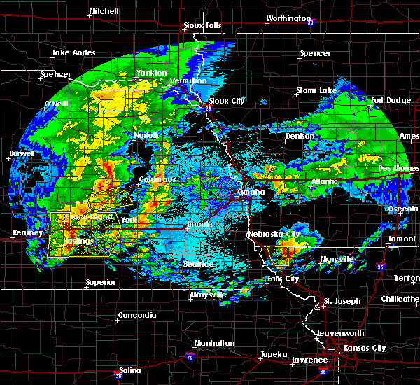 At 245 am cdt, a severe thunderstorm was located over silver creek, or 18 miles southwest of columbus, moving east at 45 mph (radar indicated). Hazards include 60 mph wind gusts. expect damage to roofs, siding, and trees At 245 am cdt, a severe thunderstorm was located over silver creek, or 18 miles southwest of columbus, moving east at 45 mph (radar indicated). Hazards include 60 mph wind gusts. expect damage to roofs, siding, and trees
|
| 5/28/2019 2:22 AM CDT |
 At 222 am cdt, a severe thunderstorm was located near clarks, or 29 miles northwest of york, moving east at 35 mph (radar indicated). Hazards include 60 mph wind gusts and nickel size hail. Expect damage to roofs, siding, and trees. Locations impacted include, central city, osceola, clarks and silver creek. At 222 am cdt, a severe thunderstorm was located near clarks, or 29 miles northwest of york, moving east at 35 mph (radar indicated). Hazards include 60 mph wind gusts and nickel size hail. Expect damage to roofs, siding, and trees. Locations impacted include, central city, osceola, clarks and silver creek.
|
| 5/28/2019 2:02 AM CDT |
 At 202 am cdt, a severe thunderstorm was located over archer, or 19 miles northeast of grand island, moving east at 40 mph (radar indicated). Hazards include 60 mph wind gusts. expect damage to roofs, siding, and trees At 202 am cdt, a severe thunderstorm was located over archer, or 19 miles northeast of grand island, moving east at 40 mph (radar indicated). Hazards include 60 mph wind gusts. expect damage to roofs, siding, and trees
|
| 9/18/2018 2:56 PM CDT |
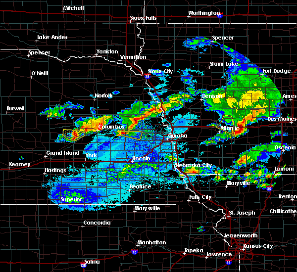 The severe thunderstorm warning for southeastern nance and northeastern merrick counties will expire at 300 pm cdt, the storm which prompted the warning has weakened below severe limits, and no longer poses an immediate threat to life or property. therefore, the warning will be allowed to expire. to report severe weather, contact your nearest law enforcement agency. they will relay your report to the national weather service hastings. The severe thunderstorm warning for southeastern nance and northeastern merrick counties will expire at 300 pm cdt, the storm which prompted the warning has weakened below severe limits, and no longer poses an immediate threat to life or property. therefore, the warning will be allowed to expire. to report severe weather, contact your nearest law enforcement agency. they will relay your report to the national weather service hastings.
|
| 9/18/2018 2:45 PM CDT |
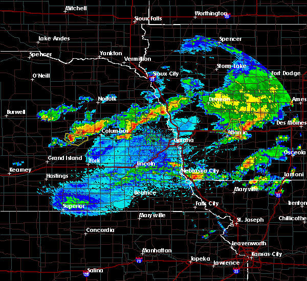 At 245 pm cdt, a severe thunderstorm was located over fullerton, or 30 miles west of columbus, moving east at 35 mph (radar indicated). Hazards include 60 mph wind gusts and quarter size hail. Hail damage to vehicles is expected. expect wind damage to roofs, siding, and trees. Locations impacted include, fullerton and silver creek. At 245 pm cdt, a severe thunderstorm was located over fullerton, or 30 miles west of columbus, moving east at 35 mph (radar indicated). Hazards include 60 mph wind gusts and quarter size hail. Hail damage to vehicles is expected. expect wind damage to roofs, siding, and trees. Locations impacted include, fullerton and silver creek.
|
| 9/18/2018 2:35 PM CDT |
 At 234 pm cdt, a severe thunderstorm was located near fullerton, or 35 miles west of columbus, moving east at 35 mph (radar indicated). Hazards include 60 mph wind gusts and quarter size hail. Hail damage to vehicles is expected. Expect wind damage to roofs, siding, and trees. At 234 pm cdt, a severe thunderstorm was located near fullerton, or 35 miles west of columbus, moving east at 35 mph (radar indicated). Hazards include 60 mph wind gusts and quarter size hail. Hail damage to vehicles is expected. Expect wind damage to roofs, siding, and trees.
|
| 9/1/2018 2:22 AM CDT |
 At 222 am cdt, a severe thunderstorm was located over central city, or 21 miles northeast of grand island, moving northeast at 45 mph (radar indicated). Hazards include 60 mph wind gusts. expect damage to roofs, siding, and trees At 222 am cdt, a severe thunderstorm was located over central city, or 21 miles northeast of grand island, moving northeast at 45 mph (radar indicated). Hazards include 60 mph wind gusts. expect damage to roofs, siding, and trees
|
| 7/1/2018 12:36 AM CDT |
 The severe thunderstorm warning for york, fillmore, thayer, northeastern merrick and polk counties will expire at 1245 am cdt, the storms which prompted the warning have moved out of the area. therefore, the warning will be allowed to expire. The severe thunderstorm warning for york, fillmore, thayer, northeastern merrick and polk counties will expire at 1245 am cdt, the storms which prompted the warning have moved out of the area. therefore, the warning will be allowed to expire.
|
| 7/1/2018 12:06 AM CDT |
 At 1205 am cdt, severe thunderstorms were located along a line extending from near benedict to near waco to bruning to near byron, moving east at 25 mph (radar indicated). Hazards include 70 mph wind gusts. Expect considerable tree damage. Damage is likely to mobile homes, roofs, and outbuildings. At 1205 am cdt, severe thunderstorms were located along a line extending from near benedict to near waco to bruning to near byron, moving east at 25 mph (radar indicated). Hazards include 70 mph wind gusts. Expect considerable tree damage. Damage is likely to mobile homes, roofs, and outbuildings.
|
| 6/6/2018 9:40 PM CDT |
 At 940 pm cdt, severe thunderstorms were located along a line extending from near belgrade to near silver creek, and are nearly stationary (radar indicated). Hazards include 60 mph wind gusts and quarter size hail. Hail damage to vehicles is expected. expect wind damage to roofs, siding, and trees. Locations impacted include, genoa, silver creek and belgrade. At 940 pm cdt, severe thunderstorms were located along a line extending from near belgrade to near silver creek, and are nearly stationary (radar indicated). Hazards include 60 mph wind gusts and quarter size hail. Hail damage to vehicles is expected. expect wind damage to roofs, siding, and trees. Locations impacted include, genoa, silver creek and belgrade.
|
| 6/6/2018 9:18 PM CDT |
 At 917 pm cdt, severe thunderstorms were located along a line extending from near cedar rapids to near silver creek, moving west at 20 mph (radar indicated). Hazards include ping pong ball size hail and 60 mph wind gusts. People and animals outdoors will be injured. expect hail damage to roofs, siding, windows, and vehicles. Expect wind damage to roofs, siding, and trees. At 917 pm cdt, severe thunderstorms were located along a line extending from near cedar rapids to near silver creek, moving west at 20 mph (radar indicated). Hazards include ping pong ball size hail and 60 mph wind gusts. People and animals outdoors will be injured. expect hail damage to roofs, siding, windows, and vehicles. Expect wind damage to roofs, siding, and trees.
|
| 6/6/2018 8:24 PM CDT |
 At 823 pm cdt, a severe thunderstorm was located over silver creek, or 18 miles west of columbus, moving southeast at 15 mph (radar indicated). Hazards include 60 mph wind gusts and half dollar size hail. Hail damage to vehicles is expected. expect wind damage to roofs, siding, and trees. Locations impacted include, genoa and silver creek. At 823 pm cdt, a severe thunderstorm was located over silver creek, or 18 miles west of columbus, moving southeast at 15 mph (radar indicated). Hazards include 60 mph wind gusts and half dollar size hail. Hail damage to vehicles is expected. expect wind damage to roofs, siding, and trees. Locations impacted include, genoa and silver creek.
|
| 6/6/2018 8:11 PM CDT |
 At 811 pm cdt, a severe thunderstorm was located near silver creek, or 20 miles west of columbus, moving southeast at 20 mph (radar indicated). Hazards include 60 mph wind gusts and quarter size hail. Hail damage to vehicles is expected. Expect wind damage to roofs, siding, and trees. At 811 pm cdt, a severe thunderstorm was located near silver creek, or 20 miles west of columbus, moving southeast at 20 mph (radar indicated). Hazards include 60 mph wind gusts and quarter size hail. Hail damage to vehicles is expected. Expect wind damage to roofs, siding, and trees.
|
| 6/6/2018 4:39 PM CDT |
 The severe thunderstorm warning for southeastern nance and northeastern merrick counties will expire at 445 pm cdt, the storm which prompted the warning has weakened below severe limits, and no longer poses an immediate threat to life or property. therefore the warning will be allowed to expire. a severe thunderstorm watch remains in effect until 1000 pm cdt for central and east central nebraska. to report severe weather, contact your nearest law enforcement agency. they will relay your report to the national weather service hastings. The severe thunderstorm warning for southeastern nance and northeastern merrick counties will expire at 445 pm cdt, the storm which prompted the warning has weakened below severe limits, and no longer poses an immediate threat to life or property. therefore the warning will be allowed to expire. a severe thunderstorm watch remains in effect until 1000 pm cdt for central and east central nebraska. to report severe weather, contact your nearest law enforcement agency. they will relay your report to the national weather service hastings.
|
| 6/6/2018 4:30 PM CDT |
 At 430 pm cdt, a severe thunderstorm was located near fullerton, or 28 miles west of columbus, moving northeast at 10 mph (radar indicated). Hazards include 60 mph wind gusts and penny size hail. Expect damage to roofs, siding, and trees. Locations impacted include, fullerton, genoa and silver creek. At 430 pm cdt, a severe thunderstorm was located near fullerton, or 28 miles west of columbus, moving northeast at 10 mph (radar indicated). Hazards include 60 mph wind gusts and penny size hail. Expect damage to roofs, siding, and trees. Locations impacted include, fullerton, genoa and silver creek.
|
| 6/6/2018 4:18 PM CDT |
 At 418 pm cdt, a severe thunderstorm was located near fullerton, or 29 miles west of columbus, moving northeast at 10 mph (radar indicated). Hazards include 60 mph wind gusts and quarter size hail. Hail damage to vehicles is expected. expect wind damage to roofs, siding, and trees. Locations impacted include, fullerton, genoa, clarks and silver creek. At 418 pm cdt, a severe thunderstorm was located near fullerton, or 29 miles west of columbus, moving northeast at 10 mph (radar indicated). Hazards include 60 mph wind gusts and quarter size hail. Hail damage to vehicles is expected. expect wind damage to roofs, siding, and trees. Locations impacted include, fullerton, genoa, clarks and silver creek.
|
| 6/6/2018 4:06 PM CDT |
 At 406 pm cdt, a severe thunderstorm was located near clarks, or 30 miles west of columbus, moving east at 10 mph (radar indicated). Hazards include 60 mph wind gusts and quarter size hail. Hail damage to vehicles is expected. Expect wind damage to roofs, siding, and trees. At 406 pm cdt, a severe thunderstorm was located near clarks, or 30 miles west of columbus, moving east at 10 mph (radar indicated). Hazards include 60 mph wind gusts and quarter size hail. Hail damage to vehicles is expected. Expect wind damage to roofs, siding, and trees.
|
| 6/1/2018 11:19 PM CDT |
 At 1118 pm cdt, severe thunderstorms were located along a line extending from rising city to near chapman, moving south at 20 mph (radar indicated). Hazards include 60 mph wind gusts. Expect damage to roofs, siding, and trees. Locations impacted include, central city, stromsburg, osceola, shelby, palmer, clarks, silver creek, polk, chapman, marquette, hordville and archer. At 1118 pm cdt, severe thunderstorms were located along a line extending from rising city to near chapman, moving south at 20 mph (radar indicated). Hazards include 60 mph wind gusts. Expect damage to roofs, siding, and trees. Locations impacted include, central city, stromsburg, osceola, shelby, palmer, clarks, silver creek, polk, chapman, marquette, hordville and archer.
|
| 6/1/2018 10:54 PM CDT |
 At 1053 pm cdt, severe thunderstorms were located along a line extending from near bellwood to near palmer, moving southeast at 30 mph (radar indicated). Hazards include 70 mph wind gusts. Expect considerable tree damage. Damage is likely to mobile homes, roofs, and outbuildings. At 1053 pm cdt, severe thunderstorms were located along a line extending from near bellwood to near palmer, moving southeast at 30 mph (radar indicated). Hazards include 70 mph wind gusts. Expect considerable tree damage. Damage is likely to mobile homes, roofs, and outbuildings.
|
| 5/1/2018 5:24 PM CDT |
 At 524 pm cdt, a severe thunderstorm was located over polk, or 19 miles northwest of york, moving northeast at 20 mph. another severe storm was located north of osceola moving northeast at 20 mph (radar indicated). Hazards include ping pong ball size hail and 60 mph wind gusts. People and animals outdoors will be injured. expect hail damage to roofs, siding, windows, and vehicles. expect wind damage to roofs, siding, and trees. locations impacted include, stromsburg, osceola, shelby, silver creek, polk, benedict and hordville. A tornado watch remains in effect until 1000 pm cdt for south central, central and east central nebraska. At 524 pm cdt, a severe thunderstorm was located over polk, or 19 miles northwest of york, moving northeast at 20 mph. another severe storm was located north of osceola moving northeast at 20 mph (radar indicated). Hazards include ping pong ball size hail and 60 mph wind gusts. People and animals outdoors will be injured. expect hail damage to roofs, siding, windows, and vehicles. expect wind damage to roofs, siding, and trees. locations impacted include, stromsburg, osceola, shelby, silver creek, polk, benedict and hordville. A tornado watch remains in effect until 1000 pm cdt for south central, central and east central nebraska.
|
| 5/1/2018 5:09 PM CDT |
 The national weather service in hastings has issued a * severe thunderstorm warning for. northwestern york county in east central nebraska. northeastern hamilton county in south central nebraska. central merrick county in central nebraska. Polk county in east central nebraska. The national weather service in hastings has issued a * severe thunderstorm warning for. northwestern york county in east central nebraska. northeastern hamilton county in south central nebraska. central merrick county in central nebraska. Polk county in east central nebraska.
|
| 10/2/2017 8:36 PM CDT |
 The severe thunderstorm warning for northeastern nance and northeastern merrick counties will expire at 845 pm cdt, the storm which prompted the warning has moved out of the area. therefore the warning will be allowed to expire. a severe thunderstorm watch remains in effect until midnight cdt for central and east central nebraska. The severe thunderstorm warning for northeastern nance and northeastern merrick counties will expire at 845 pm cdt, the storm which prompted the warning has moved out of the area. therefore the warning will be allowed to expire. a severe thunderstorm watch remains in effect until midnight cdt for central and east central nebraska.
|
| 10/2/2017 8:29 PM CDT |
 At 829 pm cdt, a severe thunderstorm was located over genoa, or 18 miles west of columbus, moving northeast at 40 mph (radar indicated). Hazards include 60 mph wind gusts and quarter size hail. Hail damage to vehicles is expected. expect wind damage to roofs, siding, and trees. Locations impacted include, genoa and silver creek. At 829 pm cdt, a severe thunderstorm was located over genoa, or 18 miles west of columbus, moving northeast at 40 mph (radar indicated). Hazards include 60 mph wind gusts and quarter size hail. Hail damage to vehicles is expected. expect wind damage to roofs, siding, and trees. Locations impacted include, genoa and silver creek.
|
| 10/2/2017 8:11 PM CDT |
 At 810 pm cdt, a severe thunderstorm was located near clarks, or 29 miles west of columbus, moving northeast at 40 mph (radar indicated). Hazards include 60 mph wind gusts and quarter size hail. Hail damage to vehicles is expected. Expect wind damage to roofs, siding, and trees. At 810 pm cdt, a severe thunderstorm was located near clarks, or 29 miles west of columbus, moving northeast at 40 mph (radar indicated). Hazards include 60 mph wind gusts and quarter size hail. Hail damage to vehicles is expected. Expect wind damage to roofs, siding, and trees.
|
| 10/2/2017 7:19 PM CDT |
 At 719 pm cdt, a severe thunderstorm was located near clarks, or 25 miles west of columbus, moving northeast at 45 mph (radar indicated). Hazards include 60 mph wind gusts and half dollar size hail. Hail damage to vehicles is expected. expect wind damage to roofs, siding, and trees. Locations impacted include, genoa, clarks and silver creek. At 719 pm cdt, a severe thunderstorm was located near clarks, or 25 miles west of columbus, moving northeast at 45 mph (radar indicated). Hazards include 60 mph wind gusts and half dollar size hail. Hail damage to vehicles is expected. expect wind damage to roofs, siding, and trees. Locations impacted include, genoa, clarks and silver creek.
|
| 10/2/2017 7:12 PM CDT |
 At 711 pm cdt, a severe thunderstorm was located over clarks, or 27 miles northwest of york, moving northeast at 35 mph (radar indicated). Hazards include 60 mph wind gusts and half dollar size hail. Hail damage to vehicles is expected. expect wind damage to roofs, siding, and trees. Locations impacted include, genoa, clarks and silver creek. At 711 pm cdt, a severe thunderstorm was located over clarks, or 27 miles northwest of york, moving northeast at 35 mph (radar indicated). Hazards include 60 mph wind gusts and half dollar size hail. Hail damage to vehicles is expected. expect wind damage to roofs, siding, and trees. Locations impacted include, genoa, clarks and silver creek.
|
| 10/2/2017 6:51 PM CDT |
 At 651 pm cdt, a severe thunderstorm was located over central city, or 21 miles northeast of grand island, moving northeast at 35 mph (radar indicated). Hazards include 60 mph wind gusts and quarter size hail. Hail damage to vehicles is expected. Expect wind damage to roofs, siding, and trees. At 651 pm cdt, a severe thunderstorm was located over central city, or 21 miles northeast of grand island, moving northeast at 35 mph (radar indicated). Hazards include 60 mph wind gusts and quarter size hail. Hail damage to vehicles is expected. Expect wind damage to roofs, siding, and trees.
|
| 8/27/2017 3:53 AM CDT |
 At 353 am cdt, a severe thunderstorm was located near duncan, or 12 miles west of columbus, moving east at 20 mph (radar indicated). Hazards include 60 mph wind gusts and half dollar size hail. Hail damage to vehicles is expected. expect wind damage to roofs, siding, and trees. This severe thunderstorm will remain over mainly rural areas of northeastern merrick and northeastern polk counties. At 353 am cdt, a severe thunderstorm was located near duncan, or 12 miles west of columbus, moving east at 20 mph (radar indicated). Hazards include 60 mph wind gusts and half dollar size hail. Hail damage to vehicles is expected. expect wind damage to roofs, siding, and trees. This severe thunderstorm will remain over mainly rural areas of northeastern merrick and northeastern polk counties.
|
| 8/20/2017 12:10 AM CDT |
 The severe thunderstorm warning for northeastern hamilton, northeastern merrick and polk counties will expire at 1215 am cdt, the storm which prompted the warning has weakened below severe limits, and no longer poses an immediate threat to life or property. therefore the warning will be allowed to expire. however heavy rain is still expected with this thunderstorm. a severe thunderstorm watch remains in effect until 100 am cdt for south central, central and east central nebraska. The severe thunderstorm warning for northeastern hamilton, northeastern merrick and polk counties will expire at 1215 am cdt, the storm which prompted the warning has weakened below severe limits, and no longer poses an immediate threat to life or property. therefore the warning will be allowed to expire. however heavy rain is still expected with this thunderstorm. a severe thunderstorm watch remains in effect until 100 am cdt for south central, central and east central nebraska.
|
| 8/20/2017 12:04 AM CDT |
 At 1204 am cdt, a severe thunderstorm was located near clarks, or 21 miles northwest of york, moving east at 30 mph (radar indicated). Hazards include 60 mph wind gusts and quarter size hail. Hail damage to vehicles is expected. expect wind damage to roofs, siding, and trees. Locations impacted include, stromsburg, osceola, clarks, silver creek, polk and hordville. At 1204 am cdt, a severe thunderstorm was located near clarks, or 21 miles northwest of york, moving east at 30 mph (radar indicated). Hazards include 60 mph wind gusts and quarter size hail. Hail damage to vehicles is expected. expect wind damage to roofs, siding, and trees. Locations impacted include, stromsburg, osceola, clarks, silver creek, polk and hordville.
|
| 8/19/2017 11:37 PM CDT |
 At 1137 pm cdt, a severe thunderstorm was located near hordville, or 22 miles northwest of york, moving northeast at 25 mph (radar indicated). Hazards include 60 mph wind gusts and quarter size hail. Hail damage to vehicles is expected. expect wind damage to roofs, siding, and trees. Locations impacted include, central city, stromsburg, osceola, clarks, silver creek, polk and hordville. At 1137 pm cdt, a severe thunderstorm was located near hordville, or 22 miles northwest of york, moving northeast at 25 mph (radar indicated). Hazards include 60 mph wind gusts and quarter size hail. Hail damage to vehicles is expected. expect wind damage to roofs, siding, and trees. Locations impacted include, central city, stromsburg, osceola, clarks, silver creek, polk and hordville.
|
| 8/19/2017 11:27 PM CDT |
 At 1126 pm cdt, a severe thunderstorm was located near central city, or 24 miles northwest of york, moving northeast at 25 mph (radar indicated). Hazards include 60 mph wind gusts and quarter size hail. Hail damage to vehicles is expected. Expect wind damage to roofs, siding, and trees. At 1126 pm cdt, a severe thunderstorm was located near central city, or 24 miles northwest of york, moving northeast at 25 mph (radar indicated). Hazards include 60 mph wind gusts and quarter size hail. Hail damage to vehicles is expected. Expect wind damage to roofs, siding, and trees.
|
| 8/15/2017 7:20 PM CDT |
 At 719 pm cdt, a severe thunderstorm was located near cushing, or 24 miles north of grand island, moving northeast at 20 mph (radar indicated. quarter size hail has also been reported from this storm). Hazards include 60 mph wind gusts and quarter size hail. Hail damage to vehicles is expected. expect wind damage to roofs, siding, and trees. locations impacted include, st. Paul, fullerton, genoa, palmer, silver creek, belgrade, cushing and archer. At 719 pm cdt, a severe thunderstorm was located near cushing, or 24 miles north of grand island, moving northeast at 20 mph (radar indicated. quarter size hail has also been reported from this storm). Hazards include 60 mph wind gusts and quarter size hail. Hail damage to vehicles is expected. expect wind damage to roofs, siding, and trees. locations impacted include, st. Paul, fullerton, genoa, palmer, silver creek, belgrade, cushing and archer.
|
| 8/15/2017 6:58 PM CDT |
 At 657 pm cdt, a severe thunderstorm was located near cushing, or 20 miles north of grand island, moving northeast at 25 mph (radar indicated). Hazards include 60 mph wind gusts and quarter size hail. Hail damage to vehicles is expected. Expect wind damage to roofs, siding, and trees. At 657 pm cdt, a severe thunderstorm was located near cushing, or 20 miles north of grand island, moving northeast at 25 mph (radar indicated). Hazards include 60 mph wind gusts and quarter size hail. Hail damage to vehicles is expected. Expect wind damage to roofs, siding, and trees.
|
| 6/27/2017 6:57 PM CDT |
 The severe thunderstorm warning for nance, northwestern york, northern hamilton, merrick, polk and southeastern howard counties will expire at midnight cdt, the storms which prompted the warning have weakened below severe limits, and no longer pose an immediate threat to life or property. therefore the warning will be allowed to expire. however gusty winds to 55 mph are still possible with these thunderstorms. a severe thunderstorm watch remains in effect until 200 am cdt for south central, central and east central nebraska. The severe thunderstorm warning for nance, northwestern york, northern hamilton, merrick, polk and southeastern howard counties will expire at midnight cdt, the storms which prompted the warning have weakened below severe limits, and no longer pose an immediate threat to life or property. therefore the warning will be allowed to expire. however gusty winds to 55 mph are still possible with these thunderstorms. a severe thunderstorm watch remains in effect until 200 am cdt for south central, central and east central nebraska.
|
| 6/27/2017 6:40 PM CDT |
 At 1140 pm cdt, severe thunderstorms were located along a line extending from 6 miles northwest of monroe to near clarks to near aurora, moving east at 45 mph (radar indicated). Hazards include 60 mph wind gusts. Expect damage to roofs, siding, and trees. locations impacted include, central city, fullerton, stromsburg, genoa, osceola, palmer, clarks, silver creek, polk, chapman, benedict, marquette, hordville, belgrade, archer and st. Libory. At 1140 pm cdt, severe thunderstorms were located along a line extending from 6 miles northwest of monroe to near clarks to near aurora, moving east at 45 mph (radar indicated). Hazards include 60 mph wind gusts. Expect damage to roofs, siding, and trees. locations impacted include, central city, fullerton, stromsburg, genoa, osceola, palmer, clarks, silver creek, polk, chapman, benedict, marquette, hordville, belgrade, archer and st. Libory.
|
| 6/27/2017 6:20 PM CDT |
 At 1120 pm cdt, severe thunderstorms were located along a line extending from near albion to near archer to near st. libory, moving east at 45 mph (radar indicated). Hazards include 60 mph wind gusts. expect damage to roofs, siding, and trees At 1120 pm cdt, severe thunderstorms were located along a line extending from near albion to near archer to near st. libory, moving east at 45 mph (radar indicated). Hazards include 60 mph wind gusts. expect damage to roofs, siding, and trees
|
| 6/16/2017 7:28 PM CDT | Quarter sized hail reported 2.3 miles N of Silver Creek, NE, 3 s of silver creek. nws employee reported quarter sized hail. |
| 6/16/2017 7:27 PM CDT |
 At 727 pm cdt, severe thunderstorms were located along a line extending from near bellwood to near silver creek to clarks, moving south at 35 mph (radar indicated). Hazards include golf ball size hail and 70 mph wind gusts. People and animals outdoors will be injured. expect hail damage to roofs, siding, windows, and vehicles. expect considerable tree damage. Wind damage is also likely to mobile homes, roofs, and outbuildings. At 727 pm cdt, severe thunderstorms were located along a line extending from near bellwood to near silver creek to clarks, moving south at 35 mph (radar indicated). Hazards include golf ball size hail and 70 mph wind gusts. People and animals outdoors will be injured. expect hail damage to roofs, siding, windows, and vehicles. expect considerable tree damage. Wind damage is also likely to mobile homes, roofs, and outbuildings.
|
| 6/16/2017 6:58 PM CDT |
 At 658 pm cdt, a severe thunderstorm was located near genoa, or 16 miles west of columbus, moving south at 30 mph (trained weather spotters reported quarter to golf ball size hail near genoa). Hazards include golf ball size hail and 60 mph wind gusts. People and animals outdoors will be injured. expect hail damage to roofs, siding, windows, and vehicles. expect wind damage to roofs, siding, and trees. Locations impacted include, genoa and silver creek. At 658 pm cdt, a severe thunderstorm was located near genoa, or 16 miles west of columbus, moving south at 30 mph (trained weather spotters reported quarter to golf ball size hail near genoa). Hazards include golf ball size hail and 60 mph wind gusts. People and animals outdoors will be injured. expect hail damage to roofs, siding, windows, and vehicles. expect wind damage to roofs, siding, and trees. Locations impacted include, genoa and silver creek.
|
| 6/16/2017 6:47 PM CDT |
 At 646 pm cdt, a severe thunderstorm was located near genoa, or 18 miles west of columbus, moving south at 30 mph (radar indicated). Hazards include 60 mph wind gusts and quarter size hail. Hail damage to vehicles is expected. Expect wind damage to roofs, siding, and trees. At 646 pm cdt, a severe thunderstorm was located near genoa, or 18 miles west of columbus, moving south at 30 mph (radar indicated). Hazards include 60 mph wind gusts and quarter size hail. Hail damage to vehicles is expected. Expect wind damage to roofs, siding, and trees.
|
| 6/13/2017 8:56 PM CDT |
 The severe thunderstorm warning for eastern clay, east central nance, northwestern york, hamilton, northeastern merrick and polk counties will expire at 900 pm cdt, the storms which prompted the warning have moved out of the area. therefore the warning will be allowed to expire. however gusty winds and heavy rain are still possible with these thunderstorms. a severe thunderstorm watch remains in effect until 100 am cdt for south central, central and east central nebraska. to report severe weather, contact your nearest law enforcement agency. they will relay your report to the national weather service hastings. remember, a severe thunderstorm warning still remains in effect for york, polk and northern fillmore counties until 930 pm. The severe thunderstorm warning for eastern clay, east central nance, northwestern york, hamilton, northeastern merrick and polk counties will expire at 900 pm cdt, the storms which prompted the warning have moved out of the area. therefore the warning will be allowed to expire. however gusty winds and heavy rain are still possible with these thunderstorms. a severe thunderstorm watch remains in effect until 100 am cdt for south central, central and east central nebraska. to report severe weather, contact your nearest law enforcement agency. they will relay your report to the national weather service hastings. remember, a severe thunderstorm warning still remains in effect for york, polk and northern fillmore counties until 930 pm.
|
| 6/13/2017 8:38 PM CDT |
 At 838 pm cdt, severe thunderstorms were located along a line extending from near duncan to near stockham, moving northeast at 35 mph (radar indicated). Hazards include golf ball size hail and 70 mph wind gusts. People and animals outdoors will be injured. expect hail damage to roofs, siding, windows, and vehicles. expect considerable tree damage. wind damage is also likely to mobile homes, roofs, and outbuildings. locations impacted include, york, aurora, sutton, stromsburg, harvard, henderson, osceola, clay center, shelby, hampton, fairfield, clarks, silver creek, giltner, polk, bradshaw, benedict, marquette, gresham and hordville. This includes interstate 80 between mile markers 324 and 350. At 838 pm cdt, severe thunderstorms were located along a line extending from near duncan to near stockham, moving northeast at 35 mph (radar indicated). Hazards include golf ball size hail and 70 mph wind gusts. People and animals outdoors will be injured. expect hail damage to roofs, siding, windows, and vehicles. expect considerable tree damage. wind damage is also likely to mobile homes, roofs, and outbuildings. locations impacted include, york, aurora, sutton, stromsburg, harvard, henderson, osceola, clay center, shelby, hampton, fairfield, clarks, silver creek, giltner, polk, bradshaw, benedict, marquette, gresham and hordville. This includes interstate 80 between mile markers 324 and 350.
|
| 6/13/2017 8:24 PM CDT |
 At 824 pm cdt, severe thunderstorms were located along a line extending from near duncan to near saronville, moving east at 25 mph (radar indicated). Hazards include golf ball size hail and 70 mph wind gusts. People and animals outdoors will be injured. expect hail damage to roofs, siding, windows, and vehicles. expect considerable tree damage. wind damage is also likely to mobile homes, roofs, and outbuildings. locations impacted include, york, aurora, central city, sutton, fullerton, stromsburg, harvard, genoa, henderson, osceola, clay center, shelby, hampton, fairfield, clarks, silver creek, giltner, polk, glenvil and phillips. This includes interstate 80 between mile markers 318 and 350. At 824 pm cdt, severe thunderstorms were located along a line extending from near duncan to near saronville, moving east at 25 mph (radar indicated). Hazards include golf ball size hail and 70 mph wind gusts. People and animals outdoors will be injured. expect hail damage to roofs, siding, windows, and vehicles. expect considerable tree damage. wind damage is also likely to mobile homes, roofs, and outbuildings. locations impacted include, york, aurora, central city, sutton, fullerton, stromsburg, harvard, genoa, henderson, osceola, clay center, shelby, hampton, fairfield, clarks, silver creek, giltner, polk, glenvil and phillips. This includes interstate 80 between mile markers 318 and 350.
|
| 6/13/2017 8:09 PM CDT |
 At 809 pm cdt, severe thunderstorms were located along a line extending from near genoa to near clay center, moving northeast at 35 mph (radar indicated). Hazards include golf ball size hail and 70 mph wind gusts. People and animals outdoors will be injured. expect hail damage to roofs, siding, windows, and vehicles. expect considerable tree damage. Wind damage is also likely to mobile homes, roofs, and outbuildings. At 809 pm cdt, severe thunderstorms were located along a line extending from near genoa to near clay center, moving northeast at 35 mph (radar indicated). Hazards include golf ball size hail and 70 mph wind gusts. People and animals outdoors will be injured. expect hail damage to roofs, siding, windows, and vehicles. expect considerable tree damage. Wind damage is also likely to mobile homes, roofs, and outbuildings.
|
| 6/13/2017 7:53 PM CDT |
 At 753 pm cdt, severe thunderstorms were located along a line extending from near genoa to near clarks to near aurora, moving east at 35 mph (radar indicated). Hazards include golf ball size hail and 60 mph wind gusts. People and animals outdoors will be injured. expect hail damage to roofs, siding, windows, and vehicles. expect wind damage to roofs, siding, and trees. locations impacted include, grand island, aurora, central city, fullerton, genoa, henderson, doniphan, hampton, clarks, silver creek, giltner, polk, chapman, phillips, bradshaw, marquette, hordville, belgrade, stockham and archer. This includes interstate 80 between mile markers 310 and 343. At 753 pm cdt, severe thunderstorms were located along a line extending from near genoa to near clarks to near aurora, moving east at 35 mph (radar indicated). Hazards include golf ball size hail and 60 mph wind gusts. People and animals outdoors will be injured. expect hail damage to roofs, siding, windows, and vehicles. expect wind damage to roofs, siding, and trees. locations impacted include, grand island, aurora, central city, fullerton, genoa, henderson, doniphan, hampton, clarks, silver creek, giltner, polk, chapman, phillips, bradshaw, marquette, hordville, belgrade, stockham and archer. This includes interstate 80 between mile markers 310 and 343.
|
| 6/13/2017 7:41 PM CDT |
 At 741 pm cdt, severe thunderstorms were located along a line extending from near st. edward to near aurora, moving northeast at 30 mph (radar indicated). Hazards include golf ball size hail and 60 mph wind gusts. People and animals outdoors will be injured. expect hail damage to roofs, siding, windows, and vehicles. expect wind damage to roofs, siding, and trees. locations impacted include, grand island, aurora, central city, fullerton, genoa, henderson, doniphan, palmer, hampton, clarks, silver creek, giltner, polk, chapman, phillips, bradshaw, marquette, hordville, belgrade and stockham. This includes interstate 80 between mile markers 308 and 343. At 741 pm cdt, severe thunderstorms were located along a line extending from near st. edward to near aurora, moving northeast at 30 mph (radar indicated). Hazards include golf ball size hail and 60 mph wind gusts. People and animals outdoors will be injured. expect hail damage to roofs, siding, windows, and vehicles. expect wind damage to roofs, siding, and trees. locations impacted include, grand island, aurora, central city, fullerton, genoa, henderson, doniphan, palmer, hampton, clarks, silver creek, giltner, polk, chapman, phillips, bradshaw, marquette, hordville, belgrade and stockham. This includes interstate 80 between mile markers 308 and 343.
|
| 6/13/2017 7:29 PM CDT |
 At 729 pm cdt, severe thunderstorms were located along a line extending from near genoa to near giltner, moving northeast at 35 mph (radar indicated). Hazards include golf ball size hail and 60 mph wind gusts. People and animals outdoors will be injured. expect hail damage to roofs, siding, windows, and vehicles. Expect wind damage to roofs, siding, and trees. At 729 pm cdt, severe thunderstorms were located along a line extending from near genoa to near giltner, moving northeast at 35 mph (radar indicated). Hazards include golf ball size hail and 60 mph wind gusts. People and animals outdoors will be injured. expect hail damage to roofs, siding, windows, and vehicles. Expect wind damage to roofs, siding, and trees.
|
| 3/23/2017 11:27 PM CDT |
 The severe thunderstorm warning for northwestern york, eastern hamilton, northeastern merrick and polk counties will expire at 1130 pm cdt, the storm which prompted the warning has weakened below severe limits, and no longer poses an immediate threat to life or property. therefore, the warning will be allowed to expire. The severe thunderstorm warning for northwestern york, eastern hamilton, northeastern merrick and polk counties will expire at 1130 pm cdt, the storm which prompted the warning has weakened below severe limits, and no longer poses an immediate threat to life or property. therefore, the warning will be allowed to expire.
|
| 3/23/2017 10:51 PM CDT |
 At 1049 pm cdt, severe wind gusts from thunderstorm outflow were located near polk, or 12 miles northwest of york, moving northeast at 65 mph (radar indicated). Hazards include 70 mph wind gusts. Expect considerable tree damage. Damage is likely to mobile homes, roofs, and outbuildings. At 1049 pm cdt, severe wind gusts from thunderstorm outflow were located near polk, or 12 miles northwest of york, moving northeast at 65 mph (radar indicated). Hazards include 70 mph wind gusts. Expect considerable tree damage. Damage is likely to mobile homes, roofs, and outbuildings.
|
| 7/5/2016 8:52 PM CDT |
 The severe thunderstorm warning for southwestern polk, eastern nance and northeastern merrick counties will expire at 900 pm cdt, the storms which prompted the warning have weakened below severe limits, and have exited the warned area. therefore the warning will be allowed to expire. a severe thunderstorm watch remains in effect until 200 am cdt for southeastern nebraska. to report severe weather, contact your nearest law enforcement agency. they will relay your report to the national weather service hastings. The severe thunderstorm warning for southwestern polk, eastern nance and northeastern merrick counties will expire at 900 pm cdt, the storms which prompted the warning have weakened below severe limits, and have exited the warned area. therefore the warning will be allowed to expire. a severe thunderstorm watch remains in effect until 200 am cdt for southeastern nebraska. to report severe weather, contact your nearest law enforcement agency. they will relay your report to the national weather service hastings.
|
| 7/5/2016 8:39 PM CDT |
 At 839 pm cdt, severe thunderstorms were located along a line extending from near genoa to near silver creek to 8 miles north of osceola, moving northeast at 30 mph (radar indicated). Hazards include ping pong ball size hail and 60 mph wind gusts. People and animals outdoors will be injured. expect hail damage to roofs, siding, windows, and vehicles. expect wind damage to roofs, siding, and trees. These severe thunderstorms will remain over mainly rural areas of southwestern polk, eastern nance and northeastern merrick counties. At 839 pm cdt, severe thunderstorms were located along a line extending from near genoa to near silver creek to 8 miles north of osceola, moving northeast at 30 mph (radar indicated). Hazards include ping pong ball size hail and 60 mph wind gusts. People and animals outdoors will be injured. expect hail damage to roofs, siding, windows, and vehicles. expect wind damage to roofs, siding, and trees. These severe thunderstorms will remain over mainly rural areas of southwestern polk, eastern nance and northeastern merrick counties.
|
| 7/5/2016 8:22 PM CDT |
 At 821 pm cdt, severe thunderstorms were located along a line extending from fullerton to 6 miles west of silver creek to 7 miles northwest of osceola, moving northeast at 35 mph (radar indicated). Hazards include ping pong ball size hail and 60 mph wind gusts. People and animals outdoors will be injured. expect hail damage to roofs, siding, windows, and vehicles. expect wind damage to roofs, siding, and trees. these severe storms will be near, silver creek around 825 pm cdt. Genoa around 845 pm cdt. At 821 pm cdt, severe thunderstorms were located along a line extending from fullerton to 6 miles west of silver creek to 7 miles northwest of osceola, moving northeast at 35 mph (radar indicated). Hazards include ping pong ball size hail and 60 mph wind gusts. People and animals outdoors will be injured. expect hail damage to roofs, siding, windows, and vehicles. expect wind damage to roofs, siding, and trees. these severe storms will be near, silver creek around 825 pm cdt. Genoa around 845 pm cdt.
|
| 7/5/2016 8:08 PM CDT |
 At 808 pm cdt, severe thunderstorms were located along a line extending from near palmer to near fullerton to near clarks, moving northeast at 30 mph (radar indicated). Hazards include ping pong ball size hail and 60 mph wind gusts. People and animals outdoors will be injured. expect hail damage to roofs, siding, windows, and vehicles. expect wind damage to roofs, siding, and trees. severe thunderstorms will be near, clarks around 815 pm cdt. fullerton and belgrade around 830 pm cdt. silver creek around 835 pm cdt. Genoa around 840 pm cdt. At 808 pm cdt, severe thunderstorms were located along a line extending from near palmer to near fullerton to near clarks, moving northeast at 30 mph (radar indicated). Hazards include ping pong ball size hail and 60 mph wind gusts. People and animals outdoors will be injured. expect hail damage to roofs, siding, windows, and vehicles. expect wind damage to roofs, siding, and trees. severe thunderstorms will be near, clarks around 815 pm cdt. fullerton and belgrade around 830 pm cdt. silver creek around 835 pm cdt. Genoa around 840 pm cdt.
|
| 7/5/2016 7:57 PM CDT |
 At 756 pm cdt, severe thunderstorms were located along a line extending from near archer to polk, moving northeast at 25 mph (radar indicated). Hazards include ping pong ball size hail and 60 mph wind gusts. the greatest threat for hail is currently near palmer, in northwestern merrick county. People and animals outdoors will be injured. expect hail damage to roofs, siding, windows, and vehicles. expect wind damage to roofs, siding, and trees. these severe storms will be near, polk around 800 pm cdt. Fullerton, stromsburg and osceola around 815 pm cdt. At 756 pm cdt, severe thunderstorms were located along a line extending from near archer to polk, moving northeast at 25 mph (radar indicated). Hazards include ping pong ball size hail and 60 mph wind gusts. the greatest threat for hail is currently near palmer, in northwestern merrick county. People and animals outdoors will be injured. expect hail damage to roofs, siding, windows, and vehicles. expect wind damage to roofs, siding, and trees. these severe storms will be near, polk around 800 pm cdt. Fullerton, stromsburg and osceola around 815 pm cdt.
|
| 7/5/2016 7:36 PM CDT |
 At 736 pm cdt, severe thunderstorms were located along a line extending from 6 miles east of st. libory to 6 miles north of hampton, moving northeast at 20 mph (radar indicated). Hazards include 60 mph wind gusts and penny size hail. Expect damage to roofs. siding. and trees. severe thunderstorms will be near, hordville around 750 pm cdt. archer around 755 pm cdt. polk around 800 pm cdt. central city around 805 pm cdt. Stromsburg and osceola around 815 pm cdt. At 736 pm cdt, severe thunderstorms were located along a line extending from 6 miles east of st. libory to 6 miles north of hampton, moving northeast at 20 mph (radar indicated). Hazards include 60 mph wind gusts and penny size hail. Expect damage to roofs. siding. and trees. severe thunderstorms will be near, hordville around 750 pm cdt. archer around 755 pm cdt. polk around 800 pm cdt. central city around 805 pm cdt. Stromsburg and osceola around 815 pm cdt.
|
| 4/24/2016 7:12 PM CDT |
 At 710 pm cdt, a severe thunderstorm was located near fullerton, or 34 miles northwest of york, moving north at 30 mph (radar indicated). Hazards include 60 mph wind gusts and quarter size hail. Hail damage to vehicles is expected. Expect wind damage to roofs, siding, and trees. At 710 pm cdt, a severe thunderstorm was located near fullerton, or 34 miles northwest of york, moving north at 30 mph (radar indicated). Hazards include 60 mph wind gusts and quarter size hail. Hail damage to vehicles is expected. Expect wind damage to roofs, siding, and trees.
|
| 7/31/2015 3:36 PM CDT |
 At 336 pm cdt, a severe thunderstorm was located near fullerton, or 28 miles west of columbus, moving south at 35 mph (radar indicated). Hazards include 60 mph wind gusts and quarter size hail. Hail damage to vehicles is expected. expect wind damage to roofs, siding and trees. Locations impacted include, fullerton, clarks, silver creek and belgrade. At 336 pm cdt, a severe thunderstorm was located near fullerton, or 28 miles west of columbus, moving south at 35 mph (radar indicated). Hazards include 60 mph wind gusts and quarter size hail. Hail damage to vehicles is expected. expect wind damage to roofs, siding and trees. Locations impacted include, fullerton, clarks, silver creek and belgrade.
|
| 7/31/2015 3:28 PM CDT |
 At 328 pm cdt, a severe thunderstorm was located near fullerton, or 28 miles west of columbus, moving south at 35 mph (radar indicated). Hazards include 60 mph wind gusts and quarter size hail. Hail damage to vehicles is expected. Expect wind damage to roofs, siding and trees. At 328 pm cdt, a severe thunderstorm was located near fullerton, or 28 miles west of columbus, moving south at 35 mph (radar indicated). Hazards include 60 mph wind gusts and quarter size hail. Hail damage to vehicles is expected. Expect wind damage to roofs, siding and trees.
|
| 7/24/2015 11:13 PM CDT |
 At 1113 pm cdt, severe thunderstorms were located along a line extending from near silver creek to near lushton, moving east at 40 mph (radar indicated). Hazards include 60 mph wind gusts. Expect damage to roofs. Siding and trees. At 1113 pm cdt, severe thunderstorms were located along a line extending from near silver creek to near lushton, moving east at 40 mph (radar indicated). Hazards include 60 mph wind gusts. Expect damage to roofs. Siding and trees.
|
| 7/24/2015 10:34 PM CDT |
 At 1034 pm cdt, severe thunderstorms were located along a line extending from near chapman to near aurora to near stockham, moving east at 40 mph (radar indicated). Hazards include 60 mph wind gusts. Expect damage to roofs. Siding and trees. At 1034 pm cdt, severe thunderstorms were located along a line extending from near chapman to near aurora to near stockham, moving east at 40 mph (radar indicated). Hazards include 60 mph wind gusts. Expect damage to roofs. Siding and trees.
|
| 4/12/2015 6:00 PM CDT | A severe thunderstorm warning remains in effect until 615 pm cdt for southeastern nance and northeastern merrick counties. at 600 pm cdt. severe thunderstorms were located along a line extending from 8 miles northeast of fullerton to near genoa to near silver creek. moving northeast at 35 mph. hazard. Quarter size hail. |
| 4/12/2015 5:58 PM CDT | The national weather service in hastings has issued a * severe thunderstorm warning for. northeastern merrick county in central nebraska. central polk county in east central nebraska. until 630 pm cdt * at 558 pm cdt. a severe thunderstorm was located near clarks. Or. |
| 4/12/2015 5:48 PM CDT | A severe thunderstorm warning remains in effect until 615 pm cdt for eastern nance and northeastern merrick counties. at 548 pm cdt. severe thunderstorms were located along a line extending from 6 miles northeast of fullerton to 6 miles south of genoa to 6 miles northeast of clarks. moving northeast at 35 mph. hazard. Quarter size hail. |
| 4/12/2015 5:29 PM CDT | The national weather service in hastings has issued a * severe thunderstorm warning for. eastern nance county in central nebraska. northeastern merrick county in central nebraska. until 615 pm cdt * at 528 pm cdt. A cluster of severe thunderstorms were located. |
| 6/3/2014 6:19 PM CDT | Quarter sized hail reported 4.8 miles SW of Silver Creek, NE, 35-45 mph winds also reported. |
| 6/14/2013 6:25 PM CDT | Ping Pong Ball sized hail reported 1.2 miles SSE of Silver Creek, NE, public report relayed by nws employee. |
| 6/14/2013 6:00 PM CDT | Ping Pong Ball sized hail reported 1.2 miles SSE of Silver Creek, NE, public report relayed by nws employee. |
| 1/1/0001 12:00 AM | Power lines down and 6 inch diameter tree branches down in merrick county NE, 1.2 miles SSE of Silver Creek, NE |
| 1/1/0001 12:00 AM | Estimated 60 mph winds in town in merrick county NE, 1.2 miles SSE of Silver Creek, NE |
| 1/1/0001 12:00 AM | Golf Ball sized hail reported 1.4 miles E of Silver Creek, NE, corrected location from original report |
| 1/1/0001 12:00 AM | Golf Ball sized hail reported 2.2 miles ESE of Silver Creek, NE |
| 1/1/0001 12:00 AM | Corrected location from original report to put in merrick county. old elevator blown across highway 30. debris covering the road between clarks and silver creek. power in merrick county NE, 1.4 miles E of Silver Creek, NE |
| 1/1/0001 12:00 AM | Old elevator blown across highway 30. debris covering the road between clarks and silver creek. power lines down in clarks and power is out to the town of clark in nance county NE, 2.2 miles ESE of Silver Creek, NE |
Hail Maps for Silver Creek, NE
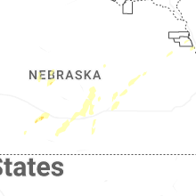

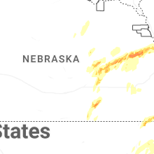
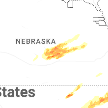


Connect with Interactive Hail Maps