

Hail Map for Silver Springs Shores, FL
The Silver Springs Shores, FL area has had 1 report of on-the-ground hail by trained spotters, and has been under severe weather warnings 20 times during the past 12 months. Doppler radar has detected hail at or near Silver Springs Shores, FL on 55 occasions, including 2 occasions during the past year.
| Name: | Silver Springs Shores, FL |
| Where Located: | 54.4 miles NW of Orlando, FL |
| Map: | Google Map for Silver Springs Shores, FL |
| Population: | 6539 |
| Housing Units: | 3449 |
| More Info: | Search Google for Silver Springs Shores, FL |
1
The Top Recent Hail Date for Silver Springs Shores, FL is Friday, July 11, 2025 (9th out of 55)

Hail and Wind Damage Spotted near Silver Springs Shores, FL
| Date / Time | Report Details |
|---|---|
| 7/11/2025 1:58 PM EDT |
 the severe thunderstorm warning has been cancelled and is no longer in effect the severe thunderstorm warning has been cancelled and is no longer in effect
|
| 7/11/2025 1:44 PM EDT |
 Svrjax the national weather service in jacksonville has issued a * severe thunderstorm warning for, southeastern marion county in northern florida, * until 215 pm edt. * at 144 pm edt, a severe thunderstorm was located over moss bluff, or near lynne, moving east at 20 mph (radar indicated). Hazards include 60 mph wind gusts and quarter size hail. Hail damage to vehicles is expected. Expect wind damage to roofs, siding, and trees. Svrjax the national weather service in jacksonville has issued a * severe thunderstorm warning for, southeastern marion county in northern florida, * until 215 pm edt. * at 144 pm edt, a severe thunderstorm was located over moss bluff, or near lynne, moving east at 20 mph (radar indicated). Hazards include 60 mph wind gusts and quarter size hail. Hail damage to vehicles is expected. Expect wind damage to roofs, siding, and trees.
|
| 1/19/2025 8:38 AM EST |
 At 838 am est, severe thunderstorms were located along a line extending from near salt springs to near moss bluff to inverness highlands south, moving east at 55 mph (radar indicated). Hazards include 60 mph wind gusts and penny size hail. Expect damage to roofs, siding, and trees. Locations impacted include, juniper springs, lynne, weirsdale, santos, the village of briar meadow, ocklawaha, moss bluff, silver springs shores, lake weir, and belleview. At 838 am est, severe thunderstorms were located along a line extending from near salt springs to near moss bluff to inverness highlands south, moving east at 55 mph (radar indicated). Hazards include 60 mph wind gusts and penny size hail. Expect damage to roofs, siding, and trees. Locations impacted include, juniper springs, lynne, weirsdale, santos, the village of briar meadow, ocklawaha, moss bluff, silver springs shores, lake weir, and belleview.
|
| 1/19/2025 8:15 AM EST |
 Svrjax the national weather service in jacksonville has issued a * severe thunderstorm warning for, southern flagler county in northeastern florida, southern marion county in northern florida, * until 845 am est. * at 814 am est, severe thunderstorms were located along a line extending from 9 miles east of marineland to 7 miles southwest of flagler beach to 7 miles south of lake george to homosassa springs, moving east at 50 mph (radar indicated). Hazards include 60 mph wind gusts and penny size hail. expect damage to roofs, siding, and trees Svrjax the national weather service in jacksonville has issued a * severe thunderstorm warning for, southern flagler county in northeastern florida, southern marion county in northern florida, * until 845 am est. * at 814 am est, severe thunderstorms were located along a line extending from 9 miles east of marineland to 7 miles southwest of flagler beach to 7 miles south of lake george to homosassa springs, moving east at 50 mph (radar indicated). Hazards include 60 mph wind gusts and penny size hail. expect damage to roofs, siding, and trees
|
| 1/19/2025 8:01 AM EST |
 At 801 am est, severe thunderstorms were located along a line extending from 7 miles west of saint augustine south to near butler beach to near palm coast to 7 miles southeast of crescent city to near silver springs shores, moving east at 65 mph (radar indicated). Hazards include 70 mph wind gusts and quarter size hail. Hail damage to vehicles is expected. expect considerable tree damage. wind damage is also likely to mobile homes, roofs, and outbuildings. Locations impacted include, palm coast, flagler beach, bunnell, hastings, juniper springs, saint augustine beach, marineland, weirsdale, the village of briar meadow, and ocklawaha. At 801 am est, severe thunderstorms were located along a line extending from 7 miles west of saint augustine south to near butler beach to near palm coast to 7 miles southeast of crescent city to near silver springs shores, moving east at 65 mph (radar indicated). Hazards include 70 mph wind gusts and quarter size hail. Hail damage to vehicles is expected. expect considerable tree damage. wind damage is also likely to mobile homes, roofs, and outbuildings. Locations impacted include, palm coast, flagler beach, bunnell, hastings, juniper springs, saint augustine beach, marineland, weirsdale, the village of briar meadow, and ocklawaha.
|
| 1/19/2025 7:48 AM EST |
 Svrjax the national weather service in jacksonville has issued a * severe thunderstorm warning for, flagler county in northeastern florida, southeastern st. johns county in northeastern florida, southeastern marion county in northern florida, eastern putnam county in northeastern florida, * until 815 am est. * at 748 am est, severe thunderstorms were located along a line extending from near bostwick to hastings to near andalusia to near lake george to 8 miles south of ocala airport, moving east at 70 mph (radar indicated). Hazards include 70 mph wind gusts and quarter size hail. Hail damage to vehicles is expected. expect considerable tree damage. Wind damage is also likely to mobile homes, roofs, and outbuildings. Svrjax the national weather service in jacksonville has issued a * severe thunderstorm warning for, flagler county in northeastern florida, southeastern st. johns county in northeastern florida, southeastern marion county in northern florida, eastern putnam county in northeastern florida, * until 815 am est. * at 748 am est, severe thunderstorms were located along a line extending from near bostwick to hastings to near andalusia to near lake george to 8 miles south of ocala airport, moving east at 70 mph (radar indicated). Hazards include 70 mph wind gusts and quarter size hail. Hail damage to vehicles is expected. expect considerable tree damage. Wind damage is also likely to mobile homes, roofs, and outbuildings.
|
| 1/19/2025 7:42 AM EST |
 At 742 am est, severe thunderstorms were located along a line extending from near palatka to fruitland to 10 miles southwest of ocala airport, moving east at 70 mph (radar indicated). Hazards include 70 mph wind gusts and quarter size hail. Hail damage to vehicles is expected. expect considerable tree damage. wind damage is also likely to mobile homes, roofs, and outbuildings. Locations impacted include, palatka, bunnell, crescent city, interlachen, pomona park, hastings, east palatka, salt springs, andalusia, and juniper springs. At 742 am est, severe thunderstorms were located along a line extending from near palatka to fruitland to 10 miles southwest of ocala airport, moving east at 70 mph (radar indicated). Hazards include 70 mph wind gusts and quarter size hail. Hail damage to vehicles is expected. expect considerable tree damage. wind damage is also likely to mobile homes, roofs, and outbuildings. Locations impacted include, palatka, bunnell, crescent city, interlachen, pomona park, hastings, east palatka, salt springs, andalusia, and juniper springs.
|
| 1/19/2025 7:32 AM EST |
 Svrjax the national weather service in jacksonville has issued a * severe thunderstorm warning for, western flagler county in northeastern florida, south central st. johns county in northeastern florida, eastern marion county in northern florida, putnam county in northeastern florida, * until 800 am est. * at 732 am est, severe thunderstorms were located along a line extending from near lake geneva to near fort mccoy to 8 miles southwest of rainbow lakes estates, moving east at 55 mph (radar indicated). Hazards include 70 mph wind gusts and quarter size hail. Hail damage to vehicles is expected. expect considerable tree damage. Wind damage is also likely to mobile homes, roofs, and outbuildings. Svrjax the national weather service in jacksonville has issued a * severe thunderstorm warning for, western flagler county in northeastern florida, south central st. johns county in northeastern florida, eastern marion county in northern florida, putnam county in northeastern florida, * until 800 am est. * at 732 am est, severe thunderstorms were located along a line extending from near lake geneva to near fort mccoy to 8 miles southwest of rainbow lakes estates, moving east at 55 mph (radar indicated). Hazards include 70 mph wind gusts and quarter size hail. Hail damage to vehicles is expected. expect considerable tree damage. Wind damage is also likely to mobile homes, roofs, and outbuildings.
|
| 1/19/2025 7:26 AM EST |
 At 726 am est, severe thunderstorms were located along a line extending from near hawthorne to near fort mccoy to near ocala to near rainbow lakes estates, moving east at 65 mph (radar indicated). Hazards include 70 mph wind gusts and quarter size hail. Hail damage to vehicles is expected. expect considerable tree damage. wind damage is also likely to mobile homes, roofs, and outbuildings. Locations impacted include, ocala, rainbow lakes estates, interlachen, fort mccoy, citra, lynne, lake delancy, sparr, anthony, and silver springs shores. At 726 am est, severe thunderstorms were located along a line extending from near hawthorne to near fort mccoy to near ocala to near rainbow lakes estates, moving east at 65 mph (radar indicated). Hazards include 70 mph wind gusts and quarter size hail. Hail damage to vehicles is expected. expect considerable tree damage. wind damage is also likely to mobile homes, roofs, and outbuildings. Locations impacted include, ocala, rainbow lakes estates, interlachen, fort mccoy, citra, lynne, lake delancy, sparr, anthony, and silver springs shores.
|
| 1/19/2025 7:15 AM EST |
 Svrjax the national weather service in jacksonville has issued a * severe thunderstorm warning for, southeastern alachua county in northern florida, marion county in northern florida, southwestern putnam county in northeastern florida, * until 745 am est. * at 715 am est, severe thunderstorms were located along a line extending from near rochelle to near citra to near rainbow lakes estates, moving east at 65 mph (radar indicated). Hazards include 70 mph wind gusts and quarter size hail. Hail damage to vehicles is expected. expect considerable tree damage. Wind damage is also likely to mobile homes, roofs, and outbuildings. Svrjax the national weather service in jacksonville has issued a * severe thunderstorm warning for, southeastern alachua county in northern florida, marion county in northern florida, southwestern putnam county in northeastern florida, * until 745 am est. * at 715 am est, severe thunderstorms were located along a line extending from near rochelle to near citra to near rainbow lakes estates, moving east at 65 mph (radar indicated). Hazards include 70 mph wind gusts and quarter size hail. Hail damage to vehicles is expected. expect considerable tree damage. Wind damage is also likely to mobile homes, roofs, and outbuildings.
|
| 12/11/2024 11:36 AM EST |
 The storm which prompted the warning has weakened below severe limits, and no longer poses an immediate threat to life or property. therefore, the warning will be allowed to expire. however, gusty winds are still possible with this thunderstorm. The storm which prompted the warning has weakened below severe limits, and no longer poses an immediate threat to life or property. therefore, the warning will be allowed to expire. however, gusty winds are still possible with this thunderstorm.
|
| 12/11/2024 11:16 AM EST |
 Svrjax the national weather service in jacksonville has issued a * severe thunderstorm warning for, central marion county in northern florida, * until 1145 am est. * at 1116 am est, a severe thunderstorm was located near ocala airport, or 9 miles southwest of ocala, moving northeast at 60 mph (radar indicated). Hazards include 60 mph wind gusts. expect damage to roofs, siding, and trees Svrjax the national weather service in jacksonville has issued a * severe thunderstorm warning for, central marion county in northern florida, * until 1145 am est. * at 1116 am est, a severe thunderstorm was located near ocala airport, or 9 miles southwest of ocala, moving northeast at 60 mph (radar indicated). Hazards include 60 mph wind gusts. expect damage to roofs, siding, and trees
|
| 8/22/2024 7:24 PM EDT |
 The storm which prompted the warning has weakened below severe limits, and no longer poses an immediate threat to life or property. therefore, the warning will be allowed to expire. however, heavy rain is still possible with this thunderstorm. The storm which prompted the warning has weakened below severe limits, and no longer poses an immediate threat to life or property. therefore, the warning will be allowed to expire. however, heavy rain is still possible with this thunderstorm.
|
| 8/22/2024 6:50 PM EDT |
 At 650 pm edt, a severe thunderstorm was located over lake weir, or 8 miles northwest of the villages, moving southeast at 10 mph (radar indicated). Hazards include 60 mph wind gusts. Expect damage to roofs, siding, and trees. Locations impacted include, weirsdale, ocklawaha, lake weir, the village of briar meadow, belleview, and summerfield. At 650 pm edt, a severe thunderstorm was located over lake weir, or 8 miles northwest of the villages, moving southeast at 10 mph (radar indicated). Hazards include 60 mph wind gusts. Expect damage to roofs, siding, and trees. Locations impacted include, weirsdale, ocklawaha, lake weir, the village of briar meadow, belleview, and summerfield.
|
| 8/22/2024 6:30 PM EDT |
 Svrjax the national weather service in jacksonville has issued a * severe thunderstorm warning for, south central marion county in northern florida, * until 730 pm edt. * at 630 pm edt, a severe thunderstorm was located near santos, or 8 miles southeast of ocala, moving southeast at 10 mph (radar indicated). Hazards include 60 mph wind gusts. expect damage to roofs, siding, and trees Svrjax the national weather service in jacksonville has issued a * severe thunderstorm warning for, south central marion county in northern florida, * until 730 pm edt. * at 630 pm edt, a severe thunderstorm was located near santos, or 8 miles southeast of ocala, moving southeast at 10 mph (radar indicated). Hazards include 60 mph wind gusts. expect damage to roofs, siding, and trees
|
| 8/22/2024 5:48 PM EDT |
 Svrjax the national weather service in jacksonville has issued a * severe thunderstorm warning for, south central marion county in northern florida, * until 630 pm edt. * at 548 pm edt, a severe thunderstorm was located over ocala, moving southeast at 15 mph (radar indicated). Hazards include 60 mph wind gusts. expect damage to roofs, siding, and trees Svrjax the national weather service in jacksonville has issued a * severe thunderstorm warning for, south central marion county in northern florida, * until 630 pm edt. * at 548 pm edt, a severe thunderstorm was located over ocala, moving southeast at 15 mph (radar indicated). Hazards include 60 mph wind gusts. expect damage to roofs, siding, and trees
|
| 8/4/2024 1:38 PM EDT |
 The storms which prompted the warning have weakened below severe limits, and no longer pose an immediate threat to life or property. therefore, the warning will be allowed to expire. however, gusty winds and heavy rain are still possible with these thunderstorms. a tornado watch remains in effect until 800 pm edt for northern and northeastern florida. The storms which prompted the warning have weakened below severe limits, and no longer pose an immediate threat to life or property. therefore, the warning will be allowed to expire. however, gusty winds and heavy rain are still possible with these thunderstorms. a tornado watch remains in effect until 800 pm edt for northern and northeastern florida.
|
| 8/4/2024 1:28 PM EDT |
 At 128 pm edt, severe thunderstorms were located along a line extending from near juniper springs to near lake weir, moving northwest at 40 mph (radar indicated). Hazards include 60 mph wind gusts. Expect damage to roofs, siding, and trees. Locations impacted include, ocala, salt springs, juniper springs, lynne, weirsdale, anthony, ocklawaha, moss bluff, silver springs shores, and lake weir. At 128 pm edt, severe thunderstorms were located along a line extending from near juniper springs to near lake weir, moving northwest at 40 mph (radar indicated). Hazards include 60 mph wind gusts. Expect damage to roofs, siding, and trees. Locations impacted include, ocala, salt springs, juniper springs, lynne, weirsdale, anthony, ocklawaha, moss bluff, silver springs shores, and lake weir.
|
| 8/4/2024 1:07 PM EDT |
 At 107 pm edt, severe thunderstorms were located along a line extending from near pittman to leesburg, moving northwest at 40 mph (radar indicated). Hazards include 60 mph wind gusts. Expect damage to roofs, siding, and trees. Locations impacted include, ocala, salt springs, juniper springs, lynne, weirsdale, anthony, the village of briar meadow, ocklawaha, moss bluff, and silver springs shores. At 107 pm edt, severe thunderstorms were located along a line extending from near pittman to leesburg, moving northwest at 40 mph (radar indicated). Hazards include 60 mph wind gusts. Expect damage to roofs, siding, and trees. Locations impacted include, ocala, salt springs, juniper springs, lynne, weirsdale, anthony, the village of briar meadow, ocklawaha, moss bluff, and silver springs shores.
|
| 8/4/2024 12:53 PM EDT |
 Svrjax the national weather service in jacksonville has issued a * severe thunderstorm warning for, marion county in northern florida, * until 145 pm edt. * at 1252 pm edt, severe thunderstorms were located along a line extending from near mount plymouth to near howey-in-the-hills, moving northwest at 35 mph (radar indicated). Hazards include 60 mph wind gusts. expect damage to roofs, siding, and trees Svrjax the national weather service in jacksonville has issued a * severe thunderstorm warning for, marion county in northern florida, * until 145 pm edt. * at 1252 pm edt, severe thunderstorms were located along a line extending from near mount plymouth to near howey-in-the-hills, moving northwest at 35 mph (radar indicated). Hazards include 60 mph wind gusts. expect damage to roofs, siding, and trees
|
| 7/4/2024 5:54 PM EDT |
 The storm which prompted the warning has weakened below severe limits, and no longer poses an immediate threat to life or property. therefore, the warning will be allowed to expire. however, gusty winds and heavy rain are still likely with this thunderstorm. The storm which prompted the warning has weakened below severe limits, and no longer poses an immediate threat to life or property. therefore, the warning will be allowed to expire. however, gusty winds and heavy rain are still likely with this thunderstorm.
|
| 7/4/2024 5:25 PM EDT |
 Svrjax the national weather service in jacksonville has issued a * severe thunderstorm warning for, south central marion county in northern florida, * until 600 pm edt. * at 525 pm edt, a severe thunderstorm was located near santos, or 7 miles south of ocala, moving southwest at 10 mph (radar indicated). Hazards include 60 mph wind gusts and penny size hail. expect damage to roofs, siding, and trees Svrjax the national weather service in jacksonville has issued a * severe thunderstorm warning for, south central marion county in northern florida, * until 600 pm edt. * at 525 pm edt, a severe thunderstorm was located near santos, or 7 miles south of ocala, moving southwest at 10 mph (radar indicated). Hazards include 60 mph wind gusts and penny size hail. expect damage to roofs, siding, and trees
|
| 6/28/2024 5:53 PM EDT |
 The storm which prompted the warning has weakened below severe limits, and no longer poses an immediate threat to life or property. therefore, the warning will be allowed to expire. however, gusty winds and heavy rain are still possible with this thunderstorm. The storm which prompted the warning has weakened below severe limits, and no longer poses an immediate threat to life or property. therefore, the warning will be allowed to expire. however, gusty winds and heavy rain are still possible with this thunderstorm.
|
| 6/28/2024 5:19 PM EDT |
 Svrjax the national weather service in jacksonville has issued a * severe thunderstorm warning for, south central marion county in northern florida, * until 600 pm edt. * at 519 pm edt, a severe thunderstorm was located 8 miles southwest of santos, or 10 miles south of ocala, moving east at 20 mph (radar indicated). Hazards include 60 mph wind gusts. expect damage to roofs, siding, and trees Svrjax the national weather service in jacksonville has issued a * severe thunderstorm warning for, south central marion county in northern florida, * until 600 pm edt. * at 519 pm edt, a severe thunderstorm was located 8 miles southwest of santos, or 10 miles south of ocala, moving east at 20 mph (radar indicated). Hazards include 60 mph wind gusts. expect damage to roofs, siding, and trees
|
| 5/11/2024 1:06 AM EDT |
 The storm which prompted the warning has moved out of the area. therefore, the warning will be allowed to expire. The storm which prompted the warning has moved out of the area. therefore, the warning will be allowed to expire.
|
| 5/11/2024 12:44 AM EDT |
 Svrjax the national weather service in jacksonville has issued a * severe thunderstorm warning for, south central marion county in northern florida, * until 115 am edt. * at 1244 am edt, a severe thunderstorm was located near lake weir, or 8 miles northwest of the villages, moving southeast at 35 mph (radar indicated). Hazards include 60 mph wind gusts and quarter size hail. Hail damage to vehicles is expected. Expect wind damage to roofs, siding, and trees. Svrjax the national weather service in jacksonville has issued a * severe thunderstorm warning for, south central marion county in northern florida, * until 115 am edt. * at 1244 am edt, a severe thunderstorm was located near lake weir, or 8 miles northwest of the villages, moving southeast at 35 mph (radar indicated). Hazards include 60 mph wind gusts and quarter size hail. Hail damage to vehicles is expected. Expect wind damage to roofs, siding, and trees.
|
| 4/21/2024 9:58 PM EDT |
 The storm which prompted the warning has moved out of the area. therefore, the warning will be allowed to expire. remember, a severe thunderstorm warning still remains in effect for marion county. The storm which prompted the warning has moved out of the area. therefore, the warning will be allowed to expire. remember, a severe thunderstorm warning still remains in effect for marion county.
|
| 4/21/2024 9:51 PM EDT |
 Svrjax the national weather service in jacksonville has issued a * severe thunderstorm warning for, southeastern marion county in northern florida, * until 1015 pm edt. * at 951 pm edt, a severe thunderstorm was located near lynne, moving east at 30 mph (radar indicated). Hazards include 60 mph wind gusts and penny size hail. expect damage to roofs, siding, and trees Svrjax the national weather service in jacksonville has issued a * severe thunderstorm warning for, southeastern marion county in northern florida, * until 1015 pm edt. * at 951 pm edt, a severe thunderstorm was located near lynne, moving east at 30 mph (radar indicated). Hazards include 60 mph wind gusts and penny size hail. expect damage to roofs, siding, and trees
|
| 4/21/2024 9:47 PM EDT |
 At 947 pm edt, a severe thunderstorm was located near silver springs shores, or near lynne, moving east at 30 mph (radar indicated). Hazards include 60 mph wind gusts. Expect damage to roofs, siding, and trees. Locations impacted include, silver springs shores, santos, and burbank. At 947 pm edt, a severe thunderstorm was located near silver springs shores, or near lynne, moving east at 30 mph (radar indicated). Hazards include 60 mph wind gusts. Expect damage to roofs, siding, and trees. Locations impacted include, silver springs shores, santos, and burbank.
|
| 4/21/2024 9:32 PM EDT |
 Svrjax the national weather service in jacksonville has issued a * severe thunderstorm warning for, central marion county in northern florida, * until 1000 pm edt. * at 931 pm edt, a severe thunderstorm was located over ocala, moving east at 30 mph (radar indicated). Hazards include 60 mph wind gusts. expect damage to roofs, siding, and trees Svrjax the national weather service in jacksonville has issued a * severe thunderstorm warning for, central marion county in northern florida, * until 1000 pm edt. * at 931 pm edt, a severe thunderstorm was located over ocala, moving east at 30 mph (radar indicated). Hazards include 60 mph wind gusts. expect damage to roofs, siding, and trees
|
| 4/11/2024 11:54 AM EDT |
 Svrjax the national weather service in jacksonville has issued a * severe thunderstorm warning for, southeastern marion county in northern florida, * until 1215 pm edt. * at 1153 am edt, a severe thunderstorm was located over silver springs shores, or 7 miles southwest of lynne, moving northeast at 70 mph (radar indicated). Hazards include 70 mph wind gusts. Expect considerable tree damage. Damage is likely to mobile homes, roofs, and outbuildings. Svrjax the national weather service in jacksonville has issued a * severe thunderstorm warning for, southeastern marion county in northern florida, * until 1215 pm edt. * at 1153 am edt, a severe thunderstorm was located over silver springs shores, or 7 miles southwest of lynne, moving northeast at 70 mph (radar indicated). Hazards include 70 mph wind gusts. Expect considerable tree damage. Damage is likely to mobile homes, roofs, and outbuildings.
|
| 4/11/2024 11:34 AM EDT |
 Svrjax the national weather service in jacksonville has issued a * severe thunderstorm warning for, southern marion county in northern florida, * until noon edt. * at 1134 am edt, a severe thunderstorm was located 11 miles south of ocala airport, or 12 miles northeast of inverness, moving northeast at 60 mph (radar indicated). Hazards include 70 mph wind gusts. Expect considerable tree damage. Damage is likely to mobile homes, roofs, and outbuildings. Svrjax the national weather service in jacksonville has issued a * severe thunderstorm warning for, southern marion county in northern florida, * until noon edt. * at 1134 am edt, a severe thunderstorm was located 11 miles south of ocala airport, or 12 miles northeast of inverness, moving northeast at 60 mph (radar indicated). Hazards include 70 mph wind gusts. Expect considerable tree damage. Damage is likely to mobile homes, roofs, and outbuildings.
|
| 2/4/2024 5:50 PM EST |
 At 549 pm est, a severe thunderstorm was located over ocklawaha, or near the villages, moving northeast at 20 mph (radar indicated). Hazards include 60 mph wind gusts and quarter size hail. Hail damage to vehicles is expected. Expect wind damage to roofs, siding, and trees. At 549 pm est, a severe thunderstorm was located over ocklawaha, or near the villages, moving northeast at 20 mph (radar indicated). Hazards include 60 mph wind gusts and quarter size hail. Hail damage to vehicles is expected. Expect wind damage to roofs, siding, and trees.
|
| 2/4/2024 5:28 PM EST |
 At 527 pm est, a severe thunderstorm was located over moss bluff, or near lynne, moving northeast at 25 mph (radar indicated). Hazards include 60 mph wind gusts and quarter size hail. Hail damage to vehicles is expected. Expect wind damage to roofs, siding, and trees. At 527 pm est, a severe thunderstorm was located over moss bluff, or near lynne, moving northeast at 25 mph (radar indicated). Hazards include 60 mph wind gusts and quarter size hail. Hail damage to vehicles is expected. Expect wind damage to roofs, siding, and trees.
|
| 1/9/2024 4:40 PM EST |
 The severe thunderstorm warning for western flagler, southeastern st. johns, eastern marion and eastern putnam counties will expire at 445 pm est, the storms that prompted this severe thunderstorm warning continue to impact putnam, marion, st johns and flagler counties. a new severe thunderstorm warning will reissued for these threatened areas. a tornado watch remains in effect until 600 pm est for northern and northeastern florida. The severe thunderstorm warning for western flagler, southeastern st. johns, eastern marion and eastern putnam counties will expire at 445 pm est, the storms that prompted this severe thunderstorm warning continue to impact putnam, marion, st johns and flagler counties. a new severe thunderstorm warning will reissued for these threatened areas. a tornado watch remains in effect until 600 pm est for northern and northeastern florida.
|
| 1/9/2024 4:30 PM EST |
 A severe thunderstorm warning remains in effect until 445 pm est for western flagler. southeastern st. johns. eastern marion and eastern putnam counties. at 430 pm est, severe thunderstorms were located along a line extending from near hastings to lady lake, moving east at 45 mph. hazard. 60 mph wind gusts. A severe thunderstorm warning remains in effect until 445 pm est for western flagler. southeastern st. johns. eastern marion and eastern putnam counties. at 430 pm est, severe thunderstorms were located along a line extending from near hastings to lady lake, moving east at 45 mph. hazard. 60 mph wind gusts.
|
| 1/9/2024 4:28 PM EST |
 The tornado warning for southeastern marion county will expire at 430 pm est. the storm which prompted the warning has weakened below severe limits, and no longer appears capable of producing a tornado. therefore, the warning will be allowed to expire. A tornado watch remains in effect until 600 pm est for northern. The tornado warning for southeastern marion county will expire at 430 pm est. the storm which prompted the warning has weakened below severe limits, and no longer appears capable of producing a tornado. therefore, the warning will be allowed to expire. A tornado watch remains in effect until 600 pm est for northern.
|
| 1/9/2024 4:04 PM EST |
 At 402 pm est, a severe thunderstorm capable of producing a tornado was located near inverness airport, or near inverness, moving east at 50 mph (radar indicated rotation). Hazards include tornado. Flying debris will be dangerous to those caught without shelter. mobile homes will be damaged or destroyed. damage to roofs, windows, and vehicles will occur. tree damage is likely. this dangerous storm will be near, the village of briar meadow around 420 pm est. weirsdale around 425 pm est. Other locations impacted by this tornadic thunderstorm include belleview and summerfield. At 402 pm est, a severe thunderstorm capable of producing a tornado was located near inverness airport, or near inverness, moving east at 50 mph (radar indicated rotation). Hazards include tornado. Flying debris will be dangerous to those caught without shelter. mobile homes will be damaged or destroyed. damage to roofs, windows, and vehicles will occur. tree damage is likely. this dangerous storm will be near, the village of briar meadow around 420 pm est. weirsdale around 425 pm est. Other locations impacted by this tornadic thunderstorm include belleview and summerfield.
|
| 1/9/2024 4:01 PM EST |
 At 401 pm est, severe thunderstorms were located along a line extending from near bardin to 9 miles northeast of inverness highlands north, moving east at 45 mph (radar indicated). Hazards include 60 mph wind gusts. expect damage to roofs, siding, and trees At 401 pm est, severe thunderstorms were located along a line extending from near bardin to 9 miles northeast of inverness highlands north, moving east at 45 mph (radar indicated). Hazards include 60 mph wind gusts. expect damage to roofs, siding, and trees
|
| 1/9/2024 3:38 PM EST |
 A severe thunderstorm warning remains in effect until 400 pm est for southeastern alachua. marion. northwestern putnam and southwestern clay counties. At 337 pm est, severe thunderstorms were located along a line extending from melrose to 7 miles north of inverness highlands north, moving east at 35 mph. A severe thunderstorm warning remains in effect until 400 pm est for southeastern alachua. marion. northwestern putnam and southwestern clay counties. At 337 pm est, severe thunderstorms were located along a line extending from melrose to 7 miles north of inverness highlands north, moving east at 35 mph.
|
| 1/9/2024 2:57 PM EST |
 At 257 pm est, severe thunderstorms were located along a line extending from near alachua to 15 miles west of rainbow lakes estates, moving east at 35 mph (radar indicated). Hazards include 60 mph wind gusts. expect damage to roofs, siding, and trees At 257 pm est, severe thunderstorms were located along a line extending from near alachua to 15 miles west of rainbow lakes estates, moving east at 35 mph (radar indicated). Hazards include 60 mph wind gusts. expect damage to roofs, siding, and trees
|
| 1/9/2024 2:09 PM EST |
 At 209 pm est, severe thunderstorms were located along a line extending from near high springs to 20 miles northwest of crystal river airport, moving east at 45 mph (radar indicated). Hazards include 60 mph wind gusts. expect damage to roofs, siding, and trees At 209 pm est, severe thunderstorms were located along a line extending from near high springs to 20 miles northwest of crystal river airport, moving east at 45 mph (radar indicated). Hazards include 60 mph wind gusts. expect damage to roofs, siding, and trees
|
| 8/15/2023 3:14 PM EDT |
 At 314 pm edt, a severe thunderstorm was located near ocala, moving northeast at 15 mph (radar indicated). Hazards include 60 mph wind gusts. expect damage to roofs, siding, and trees At 314 pm edt, a severe thunderstorm was located near ocala, moving northeast at 15 mph (radar indicated). Hazards include 60 mph wind gusts. expect damage to roofs, siding, and trees
|
| 7/31/2023 1:21 PM EDT |
 The severe thunderstorm warning for south central marion county will expire at 130 pm edt, the storm which prompted the warning has weakened below severe limits, and no longer poses an immediate threat to life or property. therefore, the warning will be allowed to expire. The severe thunderstorm warning for south central marion county will expire at 130 pm edt, the storm which prompted the warning has weakened below severe limits, and no longer poses an immediate threat to life or property. therefore, the warning will be allowed to expire.
|
| 7/31/2023 12:55 PM EDT |
 At 1255 pm edt, a severe thunderstorm was located over lake weir, or 7 miles northwest of the villages, moving east at 10 mph (radar indicated). Hazards include 60 mph wind gusts and penny size hail. expect damage to roofs, siding, and trees At 1255 pm edt, a severe thunderstorm was located over lake weir, or 7 miles northwest of the villages, moving east at 10 mph (radar indicated). Hazards include 60 mph wind gusts and penny size hail. expect damage to roofs, siding, and trees
|
| 7/30/2023 4:50 PM EDT |
 The severe thunderstorm warning for south central marion county will expire at 500 pm edt, the storm which prompted the warning has weakened below severe limits, and has exited the warned area. therefore, the warning will be allowed to expire. however gusty winds and heavy rain are still possible with this thunderstorm. The severe thunderstorm warning for south central marion county will expire at 500 pm edt, the storm which prompted the warning has weakened below severe limits, and has exited the warned area. therefore, the warning will be allowed to expire. however gusty winds and heavy rain are still possible with this thunderstorm.
|
| 7/30/2023 4:23 PM EDT |
 At 423 pm edt, a severe thunderstorm was located 9 miles southwest of santos, or 11 miles northwest of wildwood, and is nearly stationary (radar indicated). Hazards include 60 mph wind gusts and penny size hail. expect damage to roofs, siding, and trees At 423 pm edt, a severe thunderstorm was located 9 miles southwest of santos, or 11 miles northwest of wildwood, and is nearly stationary (radar indicated). Hazards include 60 mph wind gusts and penny size hail. expect damage to roofs, siding, and trees
|
| 6/20/2023 11:40 AM EDT |
 The severe thunderstorm warning for southeastern marion county will expire at 1145 am edt, the storm which prompted the warning has weakened below severe limits, and no longer poses an immediate threat to life or property. therefore, the warning will be allowed to expire. however gusty winds are still possible with this thunderstorm. The severe thunderstorm warning for southeastern marion county will expire at 1145 am edt, the storm which prompted the warning has weakened below severe limits, and no longer poses an immediate threat to life or property. therefore, the warning will be allowed to expire. however gusty winds are still possible with this thunderstorm.
|
| 6/20/2023 11:31 AM EDT |
 At 1131 am edt, a severe thunderstorm was located over silver springs shores, or 8 miles southwest of lynne, moving east at 15 mph (radar indicated). Hazards include 60 mph wind gusts and nickel size hail. Expect damage to roofs, siding, and trees. locations impacted include, ocklawaha, moss bluff, silver springs shores, lake weir, belleview and summerfield. hail threat, radar indicated max hail size, 0. 88 in wind threat, radar indicated max wind gust, 60 mph. At 1131 am edt, a severe thunderstorm was located over silver springs shores, or 8 miles southwest of lynne, moving east at 15 mph (radar indicated). Hazards include 60 mph wind gusts and nickel size hail. Expect damage to roofs, siding, and trees. locations impacted include, ocklawaha, moss bluff, silver springs shores, lake weir, belleview and summerfield. hail threat, radar indicated max hail size, 0. 88 in wind threat, radar indicated max wind gust, 60 mph.
|
| 6/20/2023 11:17 AM EDT |
 At 1116 am edt, a severe thunderstorm was located over santos, or 7 miles southeast of ocala, moving east at 15 mph (radar indicated). Hazards include 60 mph wind gusts and penny size hail. expect damage to roofs, siding, and trees At 1116 am edt, a severe thunderstorm was located over santos, or 7 miles southeast of ocala, moving east at 15 mph (radar indicated). Hazards include 60 mph wind gusts and penny size hail. expect damage to roofs, siding, and trees
|
| 6/20/2023 9:35 AM EDT |
 The severe thunderstorm warning for central marion county will expire at 945 am edt, the storm which prompted the warning has weakened below severe limits, and no longer poses an immediate threat to life or property. therefore, the warning will be allowed to expire. however gusty winds and heavy rain are still possible with this thunderstorm. The severe thunderstorm warning for central marion county will expire at 945 am edt, the storm which prompted the warning has weakened below severe limits, and no longer poses an immediate threat to life or property. therefore, the warning will be allowed to expire. however gusty winds and heavy rain are still possible with this thunderstorm.
|
| 6/20/2023 9:11 AM EDT |
 At 911 am edt, a severe thunderstorm was located over ocala, moving east at 10 mph (radar indicated). Hazards include 60 mph wind gusts and penny size hail. expect damage to roofs, siding, and trees At 911 am edt, a severe thunderstorm was located over ocala, moving east at 10 mph (radar indicated). Hazards include 60 mph wind gusts and penny size hail. expect damage to roofs, siding, and trees
|
| 6/15/2023 12:27 AM EDT |
 The severe thunderstorm warning for southern marion county will expire at 1230 am edt, the storms which prompted the warning have weakened below severe limits, and no longer pose an immediate threat to life or property. therefore, the warning will be allowed to expire. however gusty winds and heavy rain are still possible with these thunderstorms. a severe thunderstorm watch remains in effect until 100 am edt for northern florida. The severe thunderstorm warning for southern marion county will expire at 1230 am edt, the storms which prompted the warning have weakened below severe limits, and no longer pose an immediate threat to life or property. therefore, the warning will be allowed to expire. however gusty winds and heavy rain are still possible with these thunderstorms. a severe thunderstorm watch remains in effect until 100 am edt for northern florida.
|
| 6/15/2023 12:20 AM EDT |
 At 1220 am edt, severe thunderstorms were located along a line extending from near juniper springs to near moss bluff to 9 miles north of inverness highlands north, moving southeast at 40 mph (radar indicated). Hazards include 60 mph wind gusts. Expect damage to roofs, siding, and trees. locations impacted include, ocala, juniper springs, lynne, weirsdale, the village of briar meadow, ocklawaha, moss bluff, silver springs shores, lake weir and santos. hail threat, radar indicated max hail size, <. 75 in wind threat, radar indicated max wind gust, 60 mph. At 1220 am edt, severe thunderstorms were located along a line extending from near juniper springs to near moss bluff to 9 miles north of inverness highlands north, moving southeast at 40 mph (radar indicated). Hazards include 60 mph wind gusts. Expect damage to roofs, siding, and trees. locations impacted include, ocala, juniper springs, lynne, weirsdale, the village of briar meadow, ocklawaha, moss bluff, silver springs shores, lake weir and santos. hail threat, radar indicated max hail size, <. 75 in wind threat, radar indicated max wind gust, 60 mph.
|
| 6/14/2023 11:57 PM EDT |
 At 1157 pm edt, severe thunderstorms were located along a line extending from near fort mccoy to near ocala to 7 miles south of rainbow lakes estates, moving southeast at 40 mph (radar indicated). Hazards include 60 mph wind gusts. expect damage to roofs, siding, and trees At 1157 pm edt, severe thunderstorms were located along a line extending from near fort mccoy to near ocala to 7 miles south of rainbow lakes estates, moving southeast at 40 mph (radar indicated). Hazards include 60 mph wind gusts. expect damage to roofs, siding, and trees
|
| 9/10/2022 3:06 PM EDT |
 The severe thunderstorm warning for central marion county will expire at 315 pm edt, the storms which prompted the warning have weakened below severe limits, and no longer pose an immediate threat to life or property. therefore, the warning will be allowed to expire. however gusty winds and heavy rain are still possible with these thunderstorms. The severe thunderstorm warning for central marion county will expire at 315 pm edt, the storms which prompted the warning have weakened below severe limits, and no longer pose an immediate threat to life or property. therefore, the warning will be allowed to expire. however gusty winds and heavy rain are still possible with these thunderstorms.
|
| 9/10/2022 2:49 PM EDT |
 At 249 pm edt, severe thunderstorms were located along a line extending from ocala to near silver springs shores, moving north at 35 mph (radar indicated). Hazards include 60 mph wind gusts and penny size hail. Expect damage to roofs, siding, and trees. locations impacted include, ocala, fort mccoy, citra, lynne, sparr, santos, anthony, silver springs shores, ocala airport and reddick. hail threat, radar indicated max hail size, 0. 75 in wind threat, radar indicated max wind gust, 60 mph. At 249 pm edt, severe thunderstorms were located along a line extending from ocala to near silver springs shores, moving north at 35 mph (radar indicated). Hazards include 60 mph wind gusts and penny size hail. Expect damage to roofs, siding, and trees. locations impacted include, ocala, fort mccoy, citra, lynne, sparr, santos, anthony, silver springs shores, ocala airport and reddick. hail threat, radar indicated max hail size, 0. 75 in wind threat, radar indicated max wind gust, 60 mph.
|
| 9/10/2022 2:27 PM EDT |
 At 227 pm edt, severe thunderstorms were located along a line extending from 11 miles southwest of santos to near the villages, moving north at 35 mph (radar indicated). Hazards include 60 mph wind gusts and penny size hail. expect damage to roofs, siding, and trees At 227 pm edt, severe thunderstorms were located along a line extending from 11 miles southwest of santos to near the villages, moving north at 35 mph (radar indicated). Hazards include 60 mph wind gusts and penny size hail. expect damage to roofs, siding, and trees
|
| 8/21/2022 3:44 PM EDT |
 At 343 pm edt, a severe thunderstorm was located near ocala, moving south at 5 mph (radar indicated). Hazards include 60 mph wind gusts and quarter size hail. Hail damage to vehicles is expected. expect wind damage to roofs, siding, and trees. locations impacted include, ocala, santos, ocala airport, lake weir, silver springs shores, belleview and summerfield. hail threat, radar indicated max hail size, 1. 00 in wind threat, radar indicated max wind gust, 60 mph. At 343 pm edt, a severe thunderstorm was located near ocala, moving south at 5 mph (radar indicated). Hazards include 60 mph wind gusts and quarter size hail. Hail damage to vehicles is expected. expect wind damage to roofs, siding, and trees. locations impacted include, ocala, santos, ocala airport, lake weir, silver springs shores, belleview and summerfield. hail threat, radar indicated max hail size, 1. 00 in wind threat, radar indicated max wind gust, 60 mph.
|
| 8/21/2022 3:33 PM EDT |
 At 333 pm edt, a severe thunderstorm was located over ocala, moving south at 5 mph (radar indicated). Hazards include 60 mph wind gusts and quarter size hail. Hail damage to vehicles is expected. expect wind damage to roofs, siding, and trees. locations impacted include, ocala, santos, ocala airport, lake weir, silver springs shores, belleview and summerfield. hail threat, radar indicated max hail size, 1. 00 in wind threat, radar indicated max wind gust, 60 mph. At 333 pm edt, a severe thunderstorm was located over ocala, moving south at 5 mph (radar indicated). Hazards include 60 mph wind gusts and quarter size hail. Hail damage to vehicles is expected. expect wind damage to roofs, siding, and trees. locations impacted include, ocala, santos, ocala airport, lake weir, silver springs shores, belleview and summerfield. hail threat, radar indicated max hail size, 1. 00 in wind threat, radar indicated max wind gust, 60 mph.
|
| 8/21/2022 3:27 PM EDT |
 At 327 pm edt, a severe thunderstorm was located over ocala, moving south at 5 mph (radar indicated). Hazards include 60 mph wind gusts and quarter size hail. Hail damage to vehicles is expected. Expect wind damage to roofs, siding, and trees. At 327 pm edt, a severe thunderstorm was located over ocala, moving south at 5 mph (radar indicated). Hazards include 60 mph wind gusts and quarter size hail. Hail damage to vehicles is expected. Expect wind damage to roofs, siding, and trees.
|
| 8/17/2022 2:53 PM EDT |
 At 253 pm edt, a severe thunderstorm was located near santos, or 8 miles south of ocala, moving southeast at 20 mph (radar indicated). Hazards include 60 mph wind gusts. Expect damage to roofs, siding, and trees. locations impacted include, santos, ocklawaha, silver springs shores, lake weir, belleview and summerfield. hail threat, radar indicated max hail size, <. 75 in wind threat, radar indicated max wind gust, 60 mph. At 253 pm edt, a severe thunderstorm was located near santos, or 8 miles south of ocala, moving southeast at 20 mph (radar indicated). Hazards include 60 mph wind gusts. Expect damage to roofs, siding, and trees. locations impacted include, santos, ocklawaha, silver springs shores, lake weir, belleview and summerfield. hail threat, radar indicated max hail size, <. 75 in wind threat, radar indicated max wind gust, 60 mph.
|
| 8/17/2022 2:33 PM EDT |
 At 233 pm edt, a severe thunderstorm was located near ocala airport, or near ocala, moving east at 30 mph (radar indicated). Hazards include 60 mph wind gusts. expect damage to roofs, siding, and trees At 233 pm edt, a severe thunderstorm was located near ocala airport, or near ocala, moving east at 30 mph (radar indicated). Hazards include 60 mph wind gusts. expect damage to roofs, siding, and trees
|
| 7/20/2022 2:45 PM EDT | Marion county fr advises of storm damage to one home near ocklawaha. caller states that the roof over the back porch sustained damage due to thunderstorm wind in marion county FL, 10.2 miles W of Silver Springs Shores, FL |
| 6/24/2022 3:45 PM EDT |
 At 345 pm edt, a severe thunderstorm was located 7 miles southwest of santos, or 10 miles south of ocala, moving south at 15 mph (radar indicated). Hazards include 60 mph wind gusts and nickel size hail. Expect damage to roofs, siding, and trees. locations impacted include, weirsdale, santos, ocklawaha, silver springs shores, lake weir, belleview and summerfield. hail threat, radar indicated max hail size, 0. 88 in wind threat, radar indicated max wind gust, 60 mph. At 345 pm edt, a severe thunderstorm was located 7 miles southwest of santos, or 10 miles south of ocala, moving south at 15 mph (radar indicated). Hazards include 60 mph wind gusts and nickel size hail. Expect damage to roofs, siding, and trees. locations impacted include, weirsdale, santos, ocklawaha, silver springs shores, lake weir, belleview and summerfield. hail threat, radar indicated max hail size, 0. 88 in wind threat, radar indicated max wind gust, 60 mph.
|
| 6/24/2022 3:38 PM EDT |
 At 337 pm edt, a severe thunderstorm was located 7 miles southwest of santos, or 8 miles southwest of ocala, moving south at 15 mph (radar indicated). Hazards include 70 mph wind gusts and half dollar size hail. Hail damage to vehicles is expected. expect considerable tree damage. wind damage is also likely to mobile homes, roofs, and outbuildings. locations impacted include, weirsdale, santos, ocklawaha, silver springs shores, lake weir, belleview and summerfield. thunderstorm damage threat, considerable hail threat, radar indicated max hail size, 1. 25 in wind threat, radar indicated max wind gust, 70 mph. At 337 pm edt, a severe thunderstorm was located 7 miles southwest of santos, or 8 miles southwest of ocala, moving south at 15 mph (radar indicated). Hazards include 70 mph wind gusts and half dollar size hail. Hail damage to vehicles is expected. expect considerable tree damage. wind damage is also likely to mobile homes, roofs, and outbuildings. locations impacted include, weirsdale, santos, ocklawaha, silver springs shores, lake weir, belleview and summerfield. thunderstorm damage threat, considerable hail threat, radar indicated max hail size, 1. 25 in wind threat, radar indicated max wind gust, 70 mph.
|
| 6/24/2022 3:29 PM EDT |
 At 328 pm edt, a severe thunderstorm was located near ocala airport, or near ocala, moving south at 15 mph (radar indicated). Hazards include 70 mph wind gusts and half dollar size hail. Hail damage to vehicles is expected. expect considerable tree damage. Wind damage is also likely to mobile homes, roofs, and outbuildings. At 328 pm edt, a severe thunderstorm was located near ocala airport, or near ocala, moving south at 15 mph (radar indicated). Hazards include 70 mph wind gusts and half dollar size hail. Hail damage to vehicles is expected. expect considerable tree damage. Wind damage is also likely to mobile homes, roofs, and outbuildings.
|
| 6/24/2022 3:27 PM EDT |
 The severe thunderstorm warning for central marion county will expire at 330 pm edt, a new severe thunderstorm warning will be issued for the ocala area shortly. The severe thunderstorm warning for central marion county will expire at 330 pm edt, a new severe thunderstorm warning will be issued for the ocala area shortly.
|
| 6/24/2022 3:23 PM EDT |
 At 322 pm edt, severe thunderstorms were located along a line extending from near lynne to 6 miles southwest of ocala airport, moving southeast at 30 mph (radar indicated). Hazards include 70 mph wind gusts and half dollar size hail. Hail damage to vehicles is expected. expect considerable tree damage. wind damage is also likely to mobile homes, roofs, and outbuildings. locations impacted include, ocala, rainbow lakes estates, juniper springs, lynne, sparr, santos, anthony, ocala airport, silver springs shores and lowell. thunderstorm damage threat, considerable hail threat, radar indicated max hail size, 1. 25 in wind threat, radar indicated max wind gust, 70 mph. At 322 pm edt, severe thunderstorms were located along a line extending from near lynne to 6 miles southwest of ocala airport, moving southeast at 30 mph (radar indicated). Hazards include 70 mph wind gusts and half dollar size hail. Hail damage to vehicles is expected. expect considerable tree damage. wind damage is also likely to mobile homes, roofs, and outbuildings. locations impacted include, ocala, rainbow lakes estates, juniper springs, lynne, sparr, santos, anthony, ocala airport, silver springs shores and lowell. thunderstorm damage threat, considerable hail threat, radar indicated max hail size, 1. 25 in wind threat, radar indicated max wind gust, 70 mph.
|
| 6/24/2022 3:13 PM EDT |
 At 313 pm edt, severe thunderstorms were located along a line extending from 6 miles northwest of lynne to near ocala airport, moving southeast at 30 mph (radar indicated). Hazards include 60 mph wind gusts and quarter size hail. Hail damage to vehicles is expected. expect wind damage to roofs, siding, and trees. locations impacted include, ocala, rainbow lakes estates, fort mccoy, juniper springs, citra, lynne, sparr, anthony, silver springs shores and santos. hail threat, radar indicated max hail size, 1. 00 in wind threat, radar indicated max wind gust, 60 mph. At 313 pm edt, severe thunderstorms were located along a line extending from 6 miles northwest of lynne to near ocala airport, moving southeast at 30 mph (radar indicated). Hazards include 60 mph wind gusts and quarter size hail. Hail damage to vehicles is expected. expect wind damage to roofs, siding, and trees. locations impacted include, ocala, rainbow lakes estates, fort mccoy, juniper springs, citra, lynne, sparr, anthony, silver springs shores and santos. hail threat, radar indicated max hail size, 1. 00 in wind threat, radar indicated max wind gust, 60 mph.
|
| 6/24/2022 3:07 PM EDT |
 At 307 pm edt, severe thunderstorms were located along a line extending from citra to 6 miles southeast of williston, moving southeast at 5 mph (radar indicated). Hazards include 60 mph wind gusts and quarter size hail. Hail damage to vehicles is expected. expect wind damage to roofs, siding, and trees. locations impacted include, ocala, rainbow lakes estates, fort mccoy, salt springs, juniper springs, citra, lynne, lake delancy, sparr and anthony. hail threat, radar indicated max hail size, 1. 00 in wind threat, radar indicated max wind gust, 60 mph. At 307 pm edt, severe thunderstorms were located along a line extending from citra to 6 miles southeast of williston, moving southeast at 5 mph (radar indicated). Hazards include 60 mph wind gusts and quarter size hail. Hail damage to vehicles is expected. expect wind damage to roofs, siding, and trees. locations impacted include, ocala, rainbow lakes estates, fort mccoy, salt springs, juniper springs, citra, lynne, lake delancy, sparr and anthony. hail threat, radar indicated max hail size, 1. 00 in wind threat, radar indicated max wind gust, 60 mph.
|
| 6/24/2022 3:00 PM EDT |
 At 259 pm edt, severe thunderstorms were located along a line extending from citra to 6 miles southeast of williston, moving southeast at 5 mph (radar indicated). Hazards include 60 mph wind gusts and quarter size hail. Hail damage to vehicles is expected. Expect wind damage to roofs, siding, and trees. At 259 pm edt, severe thunderstorms were located along a line extending from citra to 6 miles southeast of williston, moving southeast at 5 mph (radar indicated). Hazards include 60 mph wind gusts and quarter size hail. Hail damage to vehicles is expected. Expect wind damage to roofs, siding, and trees.
|
| 6/24/2022 2:51 PM EDT |
 At 250 pm edt, a severe thunderstorm was located near silver springs shores, or near lynne, moving north at 5 mph (radar indicated). Hazards include 60 mph wind gusts and quarter size hail. Hail damage to vehicles is expected. expect wind damage to roofs, siding, and trees. locations impacted include, ocala, lynne, moss bluff, silver springs shores and santos. hail threat, radar indicated max hail size, 1. 00 in wind threat, radar indicated max wind gust, 60 mph. At 250 pm edt, a severe thunderstorm was located near silver springs shores, or near lynne, moving north at 5 mph (radar indicated). Hazards include 60 mph wind gusts and quarter size hail. Hail damage to vehicles is expected. expect wind damage to roofs, siding, and trees. locations impacted include, ocala, lynne, moss bluff, silver springs shores and santos. hail threat, radar indicated max hail size, 1. 00 in wind threat, radar indicated max wind gust, 60 mph.
|
| 6/24/2022 2:46 PM EDT |
 A severe thunderstorm warning remains in effect until 300 pm edt for south central marion county. at 246 pm edt, a severe thunderstorm was located near silver springs shores, or near lynne, moving north at 5 mph. hazard. 60 mph wind gusts and quarter size hail. source. Radar indicated. A severe thunderstorm warning remains in effect until 300 pm edt for south central marion county. at 246 pm edt, a severe thunderstorm was located near silver springs shores, or near lynne, moving north at 5 mph. hazard. 60 mph wind gusts and quarter size hail. source. Radar indicated.
|
| 6/24/2022 2:36 PM EDT |
 At 236 pm edt, a severe thunderstorm was located near silver springs shores, or near lynne, moving north at 5 mph (radar indicated). Hazards include 60 mph wind gusts and quarter size hail. Hail damage to vehicles is expected. Expect wind damage to roofs, siding, and trees. At 236 pm edt, a severe thunderstorm was located near silver springs shores, or near lynne, moving north at 5 mph (radar indicated). Hazards include 60 mph wind gusts and quarter size hail. Hail damage to vehicles is expected. Expect wind damage to roofs, siding, and trees.
|
| 6/23/2022 4:51 PM EDT |
 At 451 pm edt, a severe thunderstorm was located near silver springs shores, or near lynne, moving southeast at 20 mph (radar indicated). Hazards include 60 mph wind gusts and penny size hail. expect damage to roofs, siding, and trees At 451 pm edt, a severe thunderstorm was located near silver springs shores, or near lynne, moving southeast at 20 mph (radar indicated). Hazards include 60 mph wind gusts and penny size hail. expect damage to roofs, siding, and trees
|
| 6/19/2022 1:32 PM EDT |
 At 131 pm edt, a severe thunderstorm was located near santos, or near ocala, moving southeast at 15 mph (radar indicated). Hazards include 60 mph wind gusts and penny size hail. expect damage to roofs, siding, and trees At 131 pm edt, a severe thunderstorm was located near santos, or near ocala, moving southeast at 15 mph (radar indicated). Hazards include 60 mph wind gusts and penny size hail. expect damage to roofs, siding, and trees
|
| 10/28/2021 1:08 PM EDT |
 At 108 pm edt, severe thunderstorms were located along a line extending from 6 miles north of lynne to near lake weir, moving east at 35 mph (radar indicated). Hazards include 60 mph wind gusts. Expect damage to roofs, siding, and trees. Locations impacted include, salt springs, juniper springs, lynne, weirsdale, santos, ocklawaha, moss bluff, silver springs shores, lake weir and belleview. At 108 pm edt, severe thunderstorms were located along a line extending from 6 miles north of lynne to near lake weir, moving east at 35 mph (radar indicated). Hazards include 60 mph wind gusts. Expect damage to roofs, siding, and trees. Locations impacted include, salt springs, juniper springs, lynne, weirsdale, santos, ocklawaha, moss bluff, silver springs shores, lake weir and belleview.
|
| 10/28/2021 12:45 PM EDT |
 At 1244 pm edt, severe thunderstorms were located along a line extending from ocala to 8 miles northeast of inverness highlands north, moving east at 15 mph (radar indicated). Hazards include 60 mph wind gusts. expect damage to roofs, siding, and trees At 1244 pm edt, severe thunderstorms were located along a line extending from ocala to 8 miles northeast of inverness highlands north, moving east at 15 mph (radar indicated). Hazards include 60 mph wind gusts. expect damage to roofs, siding, and trees
|
| 10/28/2021 12:26 PM EDT | At 1226 pm edt, a severe thunderstorm was located 8 miles southeast of rainbow lakes estates, moving east at 15 mph (radar indicated). Hazards include 60 mph wind gusts. Expect damage to roofs, siding, and trees. Locations impacted include, ocala, rainbow lakes estates, santos, ocala airport, silver springs shores, lake weir, belleview, dunnellon, burbank and summerfield. |
| 10/28/2021 12:10 PM EDT |
 At 1210 pm edt, a severe thunderstorm was located 7 miles south of rainbow lakes estates, moving east at 15 mph (radar indicated). Hazards include 60 mph wind gusts. expect damage to roofs, siding, and trees At 1210 pm edt, a severe thunderstorm was located 7 miles south of rainbow lakes estates, moving east at 15 mph (radar indicated). Hazards include 60 mph wind gusts. expect damage to roofs, siding, and trees
|
| 7/7/2021 4:46 AM EDT |
 At 446 am edt, a severe thunderstorm capable of producing a tornado was located near moss bluff, or near lynne, moving northwest at 35 mph (radar indicated rotation). Hazards include tornado. Flying debris will be dangerous to those caught without shelter. mobile homes will be damaged or destroyed. damage to roofs, windows, and vehicles will occur. tree damage is likely. This dangerous storm will be near, lynne around 455 am edt. At 446 am edt, a severe thunderstorm capable of producing a tornado was located near moss bluff, or near lynne, moving northwest at 35 mph (radar indicated rotation). Hazards include tornado. Flying debris will be dangerous to those caught without shelter. mobile homes will be damaged or destroyed. damage to roofs, windows, and vehicles will occur. tree damage is likely. This dangerous storm will be near, lynne around 455 am edt.
|
| 7/7/2021 4:33 AM EDT |
 At 432 am edt, a severe thunderstorm capable of producing a tornado was located near moss bluff, or near emeralda, moving north at 40 mph (radar indicated rotation). Hazards include tornado. Flying debris will be dangerous to those caught without shelter. mobile homes will be damaged or destroyed. damage to roofs, windows, and vehicles will occur. tree damage is likely. this dangerous storm will be near, silver springs shores around 445 am edt. Lynne around 450 am edt. At 432 am edt, a severe thunderstorm capable of producing a tornado was located near moss bluff, or near emeralda, moving north at 40 mph (radar indicated rotation). Hazards include tornado. Flying debris will be dangerous to those caught without shelter. mobile homes will be damaged or destroyed. damage to roofs, windows, and vehicles will occur. tree damage is likely. this dangerous storm will be near, silver springs shores around 445 am edt. Lynne around 450 am edt.
|
| 4/11/2021 4:08 AM EDT |
 At 408 am edt, a severe thunderstorm was located over ocala airport, or near ocala, moving east at 35 mph (radar indicated). Hazards include 60 mph wind gusts and quarter size hail. Hail damage to vehicles is expected. Expect wind damage to roofs, siding, and trees. At 408 am edt, a severe thunderstorm was located over ocala airport, or near ocala, moving east at 35 mph (radar indicated). Hazards include 60 mph wind gusts and quarter size hail. Hail damage to vehicles is expected. Expect wind damage to roofs, siding, and trees.
|
| 3/30/2021 6:45 PM EDT |
 At 645 pm edt, a severe thunderstorm was located near ocala, moving east at 15 mph (radar indicated). Hazards include 60 mph wind gusts and penny size hail. expect damage to roofs, siding, and trees At 645 pm edt, a severe thunderstorm was located near ocala, moving east at 15 mph (radar indicated). Hazards include 60 mph wind gusts and penny size hail. expect damage to roofs, siding, and trees
|
| 6/19/2020 5:13 PM EDT |
 At 513 pm edt, a severe thunderstorm was located over ocala airport, or near ocala, moving north at 10 mph (radar indicated). Hazards include ping pong ball size hail and 60 mph wind gusts. People and animals outdoors will be injured. expect hail damage to roofs, siding, windows, and vehicles. expect wind damage to roofs, siding, and trees. Locations impacted include, ocala, lynne, anthony, santos, ocala airport, silver springs shores, lowell and burbank. At 513 pm edt, a severe thunderstorm was located over ocala airport, or near ocala, moving north at 10 mph (radar indicated). Hazards include ping pong ball size hail and 60 mph wind gusts. People and animals outdoors will be injured. expect hail damage to roofs, siding, windows, and vehicles. expect wind damage to roofs, siding, and trees. Locations impacted include, ocala, lynne, anthony, santos, ocala airport, silver springs shores, lowell and burbank.
|
| 6/19/2020 5:06 PM EDT |
 At 506 pm edt, a severe thunderstorm was located near ocala airport, or near ocala, moving north at 10 mph (radar indicated). Hazards include 60 mph wind gusts and quarter size hail. Hail damage to vehicles is expected. Expect wind damage to roofs, siding, and trees. At 506 pm edt, a severe thunderstorm was located near ocala airport, or near ocala, moving north at 10 mph (radar indicated). Hazards include 60 mph wind gusts and quarter size hail. Hail damage to vehicles is expected. Expect wind damage to roofs, siding, and trees.
|
| 6/18/2020 7:48 PM EDT | Report of a tree down near the intersection of county rd 314a and se 65th lane. time estimate based on rada in marion county FL, 7.3 miles W of Silver Springs Shores, FL |
| 6/6/2020 4:39 PM EDT |
 At 428 pm edt, a severe thunderstorm capable of producing a tornado was located near silver springs shores, or near lynne, moving north at 20 mph (radar indicated rotation). Hazards include tornado. Flying debris will be dangerous to those caught without shelter. mobile homes will be damaged or destroyed. damage to roofs, windows, and vehicles will occur. tree damage is likely. this dangerous storm will be near, lynne around 440 pm edt. Other locations impacted by this tornadic thunderstorm include burbank. At 428 pm edt, a severe thunderstorm capable of producing a tornado was located near silver springs shores, or near lynne, moving north at 20 mph (radar indicated rotation). Hazards include tornado. Flying debris will be dangerous to those caught without shelter. mobile homes will be damaged or destroyed. damage to roofs, windows, and vehicles will occur. tree damage is likely. this dangerous storm will be near, lynne around 440 pm edt. Other locations impacted by this tornadic thunderstorm include burbank.
|
| 6/6/2020 4:28 PM EDT |
 At 428 pm edt, a severe thunderstorm capable of producing a tornado was located near silver springs shores, or near lynne, moving north at 20 mph (radar indicated rotation). Hazards include tornado. Flying debris will be dangerous to those caught without shelter. mobile homes will be damaged or destroyed. damage to roofs, windows, and vehicles will occur. tree damage is likely. this dangerous storm will be near, lynne around 440 pm edt. Other locations impacted by this tornadic thunderstorm include burbank. At 428 pm edt, a severe thunderstorm capable of producing a tornado was located near silver springs shores, or near lynne, moving north at 20 mph (radar indicated rotation). Hazards include tornado. Flying debris will be dangerous to those caught without shelter. mobile homes will be damaged or destroyed. damage to roofs, windows, and vehicles will occur. tree damage is likely. this dangerous storm will be near, lynne around 440 pm edt. Other locations impacted by this tornadic thunderstorm include burbank.
|
| 6/6/2020 4:14 PM EDT |
 At 412 pm edt, a severe thunderstorm capable of producing a tornado was located near silver springs shores, or near lynne, moving north at 20 mph. another storm capable of producing a tornado was located just southwest of silver spring shores moving north at 15 mph (radar indicated rotation). Hazards include tornado. Flying debris will be dangerous to those caught without shelter. mobile homes will be damaged or destroyed. damage to roofs, windows, and vehicles will occur. tree damage is likely. this dangerous storm will be near, lynne around 420 pm edt. Other locations impacted by this tornadic thunderstorm include burbank, belleview and summerfield. At 412 pm edt, a severe thunderstorm capable of producing a tornado was located near silver springs shores, or near lynne, moving north at 20 mph. another storm capable of producing a tornado was located just southwest of silver spring shores moving north at 15 mph (radar indicated rotation). Hazards include tornado. Flying debris will be dangerous to those caught without shelter. mobile homes will be damaged or destroyed. damage to roofs, windows, and vehicles will occur. tree damage is likely. this dangerous storm will be near, lynne around 420 pm edt. Other locations impacted by this tornadic thunderstorm include burbank, belleview and summerfield.
|
| 6/6/2020 4:00 PM EDT |
 At 359 pm edt, a severe thunderstorm capable of producing a tornado was located over silver springs shores, or 8 miles southeast of ocala, moving north at 15 mph. another storm near summerfield is moving north at 15 mph (radar indicated rotation). Hazards include tornado. Flying debris will be dangerous to those caught without shelter. mobile homes will be damaged or destroyed. damage to roofs, windows, and vehicles will occur. tree damage is likely. this dangerous storm will be near, lynne around 420 pm edt. ocala around 425 pm edt. anthony around 440 pm edt. Other locations impacted by this tornadic thunderstorm include burbank, belleview and summerfield. At 359 pm edt, a severe thunderstorm capable of producing a tornado was located over silver springs shores, or 8 miles southeast of ocala, moving north at 15 mph. another storm near summerfield is moving north at 15 mph (radar indicated rotation). Hazards include tornado. Flying debris will be dangerous to those caught without shelter. mobile homes will be damaged or destroyed. damage to roofs, windows, and vehicles will occur. tree damage is likely. this dangerous storm will be near, lynne around 420 pm edt. ocala around 425 pm edt. anthony around 440 pm edt. Other locations impacted by this tornadic thunderstorm include burbank, belleview and summerfield.
|
| 6/6/2020 3:45 PM EDT |
 At 345 pm edt, a severe thunderstorm was located near lake weir, or 8 miles northwest of the villages, moving north at 15 mph (radar indicated). Hazards include 60 mph wind gusts. Expect damage to roofs, siding, and trees. Locations impacted include, ocala, silver springs shores, lake weir, santos, belleview and summerfield. At 345 pm edt, a severe thunderstorm was located near lake weir, or 8 miles northwest of the villages, moving north at 15 mph (radar indicated). Hazards include 60 mph wind gusts. Expect damage to roofs, siding, and trees. Locations impacted include, ocala, silver springs shores, lake weir, santos, belleview and summerfield.
|
| 6/6/2020 3:29 PM EDT |
 At 329 pm edt, a severe thunderstorm was located near lake weir, or near the villages, moving north at 15 mph (radar indicated). Hazards include 60 mph wind gusts. expect damage to roofs, siding, and trees At 329 pm edt, a severe thunderstorm was located near lake weir, or near the villages, moving north at 15 mph (radar indicated). Hazards include 60 mph wind gusts. expect damage to roofs, siding, and trees
|
| 4/24/2020 5:12 AM EDT |
 At 512 am edt, a severe thunderstorm was located over lake weir, or near the villages, moving northeast at 45 mph (radar indicated). Hazards include 60 mph wind gusts. expect damage to roofs, siding, and trees At 512 am edt, a severe thunderstorm was located over lake weir, or near the villages, moving northeast at 45 mph (radar indicated). Hazards include 60 mph wind gusts. expect damage to roofs, siding, and trees
|
| 4/20/2020 10:04 AM EDT |
 At 1004 am edt, a severe thunderstorm was located over ocklawaha, or 7 miles north of the villages, moving east at 50 mph (radar indicated). Hazards include 60 mph wind gusts and penny size hail. Expect damage to roofs, siding, and trees. Locations impacted include, juniper springs, lynne, weirsdale, santos, ocklawaha, moss bluff, lake weir, silver springs shores, belleview and summerfield. At 1004 am edt, a severe thunderstorm was located over ocklawaha, or 7 miles north of the villages, moving east at 50 mph (radar indicated). Hazards include 60 mph wind gusts and penny size hail. Expect damage to roofs, siding, and trees. Locations impacted include, juniper springs, lynne, weirsdale, santos, ocklawaha, moss bluff, lake weir, silver springs shores, belleview and summerfield.
|
| 4/20/2020 9:54 AM EDT |
 At 953 am edt, a severe thunderstorm was located near santos, or 10 miles southeast of ocala, moving east at 45 mph (radar indicated). Hazards include 60 mph wind gusts and penny size hail. expect damage to roofs, siding, and trees At 953 am edt, a severe thunderstorm was located near santos, or 10 miles southeast of ocala, moving east at 45 mph (radar indicated). Hazards include 60 mph wind gusts and penny size hail. expect damage to roofs, siding, and trees
|
| 4/20/2020 9:47 AM EDT |
 At 946 am edt, a severe thunderstorm was located over santos, or 7 miles south of ocala, moving east at 55 mph (radar indicated). Hazards include 60 mph wind gusts and penny size hail. Expect damage to roofs, siding, and trees. Locations impacted include, ocala, rainbow lakes estates, fort mccoy, salt springs, juniper springs, lynne, weirsdale, lake delancy, anthony and ocklawaha. At 946 am edt, a severe thunderstorm was located over santos, or 7 miles south of ocala, moving east at 55 mph (radar indicated). Hazards include 60 mph wind gusts and penny size hail. Expect damage to roofs, siding, and trees. Locations impacted include, ocala, rainbow lakes estates, fort mccoy, salt springs, juniper springs, lynne, weirsdale, lake delancy, anthony and ocklawaha.
|
| 4/20/2020 9:37 AM EDT |
 At 936 am edt, a severe thunderstorm was located near ocala airport, or 10 miles southwest of ocala, moving east at 60 mph (radar indicated). Hazards include 60 mph wind gusts and penny size hail. Expect damage to roofs, siding, and trees. Locations impacted include, ocala, rainbow lakes estates, fort mccoy, salt springs, juniper springs, lynne, weirsdale, lake delancy, sparr and anthony. At 936 am edt, a severe thunderstorm was located near ocala airport, or 10 miles southwest of ocala, moving east at 60 mph (radar indicated). Hazards include 60 mph wind gusts and penny size hail. Expect damage to roofs, siding, and trees. Locations impacted include, ocala, rainbow lakes estates, fort mccoy, salt springs, juniper springs, lynne, weirsdale, lake delancy, sparr and anthony.
|
| 4/20/2020 9:27 AM EDT |
 At 927 am edt, a severe thunderstorm was located near rainbow lakes estates, moving east at 45 mph (radar indicated). Hazards include 60 mph wind gusts and penny size hail. Expect damage to roofs, siding, and trees. Locations impacted include, ocala, rainbow lakes estates, fort mccoy, salt springs, juniper springs, citra, lynne, weirsdale, lake delancy and sparr. At 927 am edt, a severe thunderstorm was located near rainbow lakes estates, moving east at 45 mph (radar indicated). Hazards include 60 mph wind gusts and penny size hail. Expect damage to roofs, siding, and trees. Locations impacted include, ocala, rainbow lakes estates, fort mccoy, salt springs, juniper springs, citra, lynne, weirsdale, lake delancy and sparr.
|
| 4/20/2020 9:22 AM EDT |
 At 922 am edt, severe thunderstorms were located along a line extending from 6 miles west of sparr to near ocala airport to near beverly hills, moving east at 60 mph (radar indicated). Hazards include 60 mph wind gusts. expect damage to roofs, siding, and trees At 922 am edt, severe thunderstorms were located along a line extending from 6 miles west of sparr to near ocala airport to near beverly hills, moving east at 60 mph (radar indicated). Hazards include 60 mph wind gusts. expect damage to roofs, siding, and trees
|
| 2/6/2020 10:57 PM EST |
 At 1056 pm est, severe thunderstorms were located along a line extending from near satsuma to near the villages, moving east at 45 mph (radar indicated). Hazards include 60 to 70 mph wind gusts. Expect considerable tree damage. Damage is likely to mobile homes, roofs, and outbuildings. At 1056 pm est, severe thunderstorms were located along a line extending from near satsuma to near the villages, moving east at 45 mph (radar indicated). Hazards include 60 to 70 mph wind gusts. Expect considerable tree damage. Damage is likely to mobile homes, roofs, and outbuildings.
|
| 2/6/2020 10:49 PM EST |
 At 1049 pm est, severe thunderstorms were located along a line extending from 6 miles north of lake delancy to 6 miles southeast of fort mccoy to 7 miles north of wildwood, moving east at 50 mph (radar indicated). Hazards include 60 mph wind gusts. Expect damage to roofs, siding, and trees. Locations impacted include, ocala, crescent city, pomona park, fort mccoy, salt springs, juniper springs, lynne, lake delancy, sparr and moss bluff. At 1049 pm est, severe thunderstorms were located along a line extending from 6 miles north of lake delancy to 6 miles southeast of fort mccoy to 7 miles north of wildwood, moving east at 50 mph (radar indicated). Hazards include 60 mph wind gusts. Expect damage to roofs, siding, and trees. Locations impacted include, ocala, crescent city, pomona park, fort mccoy, salt springs, juniper springs, lynne, lake delancy, sparr and moss bluff.
|
| 2/6/2020 10:11 PM EST |
 At 1011 pm est, severe thunderstorms were located along a line extending from near cross creek to 9 miles west of anthony to near beverly hills, moving east at 50 mph (radar indicated). Hazards include 60 mph wind gusts. expect damage to roofs, siding, and trees At 1011 pm est, severe thunderstorms were located along a line extending from near cross creek to 9 miles west of anthony to near beverly hills, moving east at 50 mph (radar indicated). Hazards include 60 mph wind gusts. expect damage to roofs, siding, and trees
|
| 4/19/2019 1:25 PM EDT |
 At 125 pm edt, severe thunderstorms were located along a line extending from sawgrass to near lake weir, moving east at 40 mph (radar indicated). Hazards include 60 mph wind gusts. expect damage to roofs, siding, and trees At 125 pm edt, severe thunderstorms were located along a line extending from sawgrass to near lake weir, moving east at 40 mph (radar indicated). Hazards include 60 mph wind gusts. expect damage to roofs, siding, and trees
|
| 4/19/2019 12:45 PM EDT |
 At 1244 pm edt, severe thunderstorms were located along a line extending from near green cove springs to 10 miles northeast of inverness highlands north, moving east at 50 mph (radar indicated). Hazards include 60 mph wind gusts. expect damage to roofs, siding, and trees At 1244 pm edt, severe thunderstorms were located along a line extending from near green cove springs to 10 miles northeast of inverness highlands north, moving east at 50 mph (radar indicated). Hazards include 60 mph wind gusts. expect damage to roofs, siding, and trees
|
| 4/19/2019 11:54 AM EDT |
 At 1154 am edt, severe thunderstorms were located along a line extending from near keystone heights to near beverly hills, moving northeast at 50 mph (radar indicated). Hazards include 60 mph wind gusts. expect damage to roofs, siding, and trees At 1154 am edt, severe thunderstorms were located along a line extending from near keystone heights to near beverly hills, moving northeast at 50 mph (radar indicated). Hazards include 60 mph wind gusts. expect damage to roofs, siding, and trees
|
| 7/22/2018 2:42 PM EDT |
 At 242 pm edt, a severe thunderstorm was located over juniper springs, moving east at 45 mph (radar indicated). Hazards include 70 mph wind gusts and quarter size hail. Hail damage to vehicles is expected. expect considerable tree damage. Wind damage is also likely to mobile homes, roofs, and outbuildings. At 242 pm edt, a severe thunderstorm was located over juniper springs, moving east at 45 mph (radar indicated). Hazards include 70 mph wind gusts and quarter size hail. Hail damage to vehicles is expected. expect considerable tree damage. Wind damage is also likely to mobile homes, roofs, and outbuildings.
|
| 6/26/2018 5:51 PM EDT |
 At 551 pm edt, a severe thunderstorm was located near silver springs shores, or near ocala, moving southwest at 15 mph (radar indicated). Hazards include 60 mph wind gusts and penny size hail. Expect damage to roofs, siding, and trees. Locations impacted include, santos, silver springs shores and burbank. At 551 pm edt, a severe thunderstorm was located near silver springs shores, or near ocala, moving southwest at 15 mph (radar indicated). Hazards include 60 mph wind gusts and penny size hail. Expect damage to roofs, siding, and trees. Locations impacted include, santos, silver springs shores and burbank.
|
| 6/26/2018 5:35 PM EDT |
 At 535 pm edt, a severe thunderstorm was located near lynne, moving southwest at 15 mph (radar indicated). Hazards include 60 mph wind gusts and penny size hail. expect damage to roofs, siding, and trees At 535 pm edt, a severe thunderstorm was located near lynne, moving southwest at 15 mph (radar indicated). Hazards include 60 mph wind gusts and penny size hail. expect damage to roofs, siding, and trees
|
| 6/4/2018 1:44 PM EDT |
 At 143 pm edt, a severe thunderstorm was located near fort mccoy, moving east at 15 mph (radar indicated). Hazards include 60 mph wind gusts and quarter size hail. Hail damage to vehicles is expected. expect wind damage to roofs, siding, and trees. Locations impacted include, fort mccoy, salt springs, juniper springs, lynne, moss bluff and burbank. At 143 pm edt, a severe thunderstorm was located near fort mccoy, moving east at 15 mph (radar indicated). Hazards include 60 mph wind gusts and quarter size hail. Hail damage to vehicles is expected. expect wind damage to roofs, siding, and trees. Locations impacted include, fort mccoy, salt springs, juniper springs, lynne, moss bluff and burbank.
|
| 6/4/2018 1:33 PM EDT |
 At 133 pm edt, a severe thunderstorm was located near fort mccoy, moving east at 15 mph (radar indicated). Hazards include 60 mph wind gusts and nickel size hail. expect damage to roofs, siding, and trees At 133 pm edt, a severe thunderstorm was located near fort mccoy, moving east at 15 mph (radar indicated). Hazards include 60 mph wind gusts and nickel size hail. expect damage to roofs, siding, and trees
|
| 5/15/2018 1:31 PM EDT |
 At 130 pm edt, a severe thunderstorm was located 9 miles southwest of santos, or 12 miles southwest of ocala, moving north at 20 mph (radar indicated). Hazards include 60 mph wind gusts. expect damage to roofs, siding, and trees At 130 pm edt, a severe thunderstorm was located 9 miles southwest of santos, or 12 miles southwest of ocala, moving north at 20 mph (radar indicated). Hazards include 60 mph wind gusts. expect damage to roofs, siding, and trees
|
| 4/15/2018 2:40 PM EDT |
 At 240 pm edt, severe thunderstorms were located along a line extending from near kingsley to interlachen to near weirsdale, moving northeast at 50 mph (radar indicated). Hazards include 60 mph wind gusts. expect damage to roofs, siding, and trees At 240 pm edt, severe thunderstorms were located along a line extending from near kingsley to interlachen to near weirsdale, moving northeast at 50 mph (radar indicated). Hazards include 60 mph wind gusts. expect damage to roofs, siding, and trees
|
| 3/20/2018 2:05 PM EDT |
 The severe thunderstorm warning for southeastern marion county will expire at 215 pm edt, the storm which prompted the warning has weakened below severe limits, and no longer poses an immediate threat to life or property. therefore the warning will be allowed to expire. however small hail, gusty winds and heavy rain are still possible with this thunderstorm. a tornado watch remains in effect until 700 pm edt for northern and northeastern florida. The severe thunderstorm warning for southeastern marion county will expire at 215 pm edt, the storm which prompted the warning has weakened below severe limits, and no longer poses an immediate threat to life or property. therefore the warning will be allowed to expire. however small hail, gusty winds and heavy rain are still possible with this thunderstorm. a tornado watch remains in effect until 700 pm edt for northern and northeastern florida.
|
| 3/20/2018 1:41 PM EDT |
 At 141 pm edt, a severe thunderstorm was located near ocala airport, or 9 miles southwest of ocala, moving east at 50 mph (radar indicated). Hazards include 60 mph wind gusts and penny size hail. Expect damage to roofs, siding, and trees. locations impacted include, ocala, salt springs, juniper springs, lynne, weirsdale, santos, ocklawaha, moss bluff, silver springs shores and lake weir. A tornado watch remains in effect until 700 pm edt for northern and northeastern florida. At 141 pm edt, a severe thunderstorm was located near ocala airport, or 9 miles southwest of ocala, moving east at 50 mph (radar indicated). Hazards include 60 mph wind gusts and penny size hail. Expect damage to roofs, siding, and trees. locations impacted include, ocala, salt springs, juniper springs, lynne, weirsdale, santos, ocklawaha, moss bluff, silver springs shores and lake weir. A tornado watch remains in effect until 700 pm edt for northern and northeastern florida.
|
| 3/20/2018 1:26 PM EDT |
 At 126 pm edt, a severe thunderstorm was located 7 miles northeast of beverly hills, moving east at 50 mph (radar indicated). Hazards include 60 mph wind gusts and quarter size hail. Hail damage to vehicles is expected. Expect wind damage to roofs, siding, and trees. At 126 pm edt, a severe thunderstorm was located 7 miles northeast of beverly hills, moving east at 50 mph (radar indicated). Hazards include 60 mph wind gusts and quarter size hail. Hail damage to vehicles is expected. Expect wind damage to roofs, siding, and trees.
|
| 12/8/2017 10:08 PM EST |
 At 1007 pm est, a severe thunderstorm was located near wildwood, moving northeast at 40 mph (radar indicated). Hazards include 60 mph wind gusts and nickel size hail. expect damage to roofs, siding, and trees At 1007 pm est, a severe thunderstorm was located near wildwood, moving northeast at 40 mph (radar indicated). Hazards include 60 mph wind gusts and nickel size hail. expect damage to roofs, siding, and trees
|
| 11/23/2017 6:46 AM EST |
 At 645 am est, a severe thunderstorm was located over silver springs shores, or 7 miles southwest of lynne, moving northeast at 20 mph. hail was reported around 634 am in belleview (radar indicated). Hazards include 60 mph wind gusts and quarter size hail. Hail damage to vehicles is expected. expect wind damage to roofs, siding, and trees. Locations impacted include, ocala, lynne, santos, ocklawaha, silver springs shores, lake weir, belleview, burbank and summerfield. At 645 am est, a severe thunderstorm was located over silver springs shores, or 7 miles southwest of lynne, moving northeast at 20 mph. hail was reported around 634 am in belleview (radar indicated). Hazards include 60 mph wind gusts and quarter size hail. Hail damage to vehicles is expected. expect wind damage to roofs, siding, and trees. Locations impacted include, ocala, lynne, santos, ocklawaha, silver springs shores, lake weir, belleview, burbank and summerfield.
|
| 11/23/2017 6:30 AM EST |
 At 628 am est, a severe thunderstorm was located near silver springs shores, or 9 miles southeast of ocala, moving northeast at 25 mph (radar indicated). Hazards include 60 mph wind gusts and quarter size hail. Hail damage to vehicles is expected. expect wind damage to roofs, siding, and trees. Locations impacted include, ocala, fort mccoy, lynne, santos, ocklawaha, silver springs shores, lake weir, belleview, burbank and summerfield. At 628 am est, a severe thunderstorm was located near silver springs shores, or 9 miles southeast of ocala, moving northeast at 25 mph (radar indicated). Hazards include 60 mph wind gusts and quarter size hail. Hail damage to vehicles is expected. expect wind damage to roofs, siding, and trees. Locations impacted include, ocala, fort mccoy, lynne, santos, ocklawaha, silver springs shores, lake weir, belleview, burbank and summerfield.
|
| 11/23/2017 6:22 AM EST |
 At 622 am est, a severe thunderstorm was located near santos, or 10 miles northwest of the villages, moving north at 25 mph (radar indicated). Hazards include quarter size hail. damage to vehicles is expected At 622 am est, a severe thunderstorm was located near santos, or 10 miles northwest of the villages, moving north at 25 mph (radar indicated). Hazards include quarter size hail. damage to vehicles is expected
|
| 9/1/2017 2:57 PM EDT |
 At 257 pm edt, a severe thunderstorm was located near ocala airport, or 8 miles southwest of ocala, moving northeast at 20 mph (radar indicated). Hazards include 60 mph wind gusts and quarter size hail. Hail damage to vehicles is expected. expect wind damage to roofs, siding, and trees. Locations impacted include, ocala, lynne, anthony, santos, ocala airport, silver springs shores, belleview and lowell. At 257 pm edt, a severe thunderstorm was located near ocala airport, or 8 miles southwest of ocala, moving northeast at 20 mph (radar indicated). Hazards include 60 mph wind gusts and quarter size hail. Hail damage to vehicles is expected. expect wind damage to roofs, siding, and trees. Locations impacted include, ocala, lynne, anthony, santos, ocala airport, silver springs shores, belleview and lowell.
|
| 9/1/2017 2:36 PM EDT |
 At 236 pm edt, a severe thunderstorm was located 11 miles northeast of inverness highlands north, or 11 miles northeast of inverness, moving northeast at 20 mph (radar indicated). Hazards include 60 mph wind gusts and quarter size hail. Hail damage to vehicles is expected. Expect wind damage to roofs, siding, and trees. At 236 pm edt, a severe thunderstorm was located 11 miles northeast of inverness highlands north, or 11 miles northeast of inverness, moving northeast at 20 mph (radar indicated). Hazards include 60 mph wind gusts and quarter size hail. Hail damage to vehicles is expected. Expect wind damage to roofs, siding, and trees.
|
| 6/15/2017 5:20 PM EDT | Tree downe in marion county FL, 6.3 miles NW of Silver Springs Shores, FL |
| 6/15/2017 4:54 PM EDT |
 At 454 pm edt, a severe thunderstorm was located over silver springs shores, or 9 miles north of the villages, moving east at 15 mph (radar indicated). Hazards include 60 mph wind gusts and quarter size hail. Hail damage to vehicles is expected. Expect wind damage to roofs, siding, and trees. At 454 pm edt, a severe thunderstorm was located over silver springs shores, or 9 miles north of the villages, moving east at 15 mph (radar indicated). Hazards include 60 mph wind gusts and quarter size hail. Hail damage to vehicles is expected. Expect wind damage to roofs, siding, and trees.
|
| 4/4/2017 12:45 PM EDT |
 At 1245 pm edt, severe thunderstorms were located along a line extending from near fruitland to near juniper springs to ocklawaha, moving east at 30 mph (radar indicated). Hazards include 60 mph wind gusts and quarter size hail. Hail damage to vehicles is expected. expect wind damage to roofs, siding, and trees. Locations impacted include, ocala, juniper springs, lynne, salt springs, weirsdale, fruitland, ocklawaha, moss bluff, silver springs shores and lake weir. At 1245 pm edt, severe thunderstorms were located along a line extending from near fruitland to near juniper springs to ocklawaha, moving east at 30 mph (radar indicated). Hazards include 60 mph wind gusts and quarter size hail. Hail damage to vehicles is expected. expect wind damage to roofs, siding, and trees. Locations impacted include, ocala, juniper springs, lynne, salt springs, weirsdale, fruitland, ocklawaha, moss bluff, silver springs shores and lake weir.
|
| 4/4/2017 12:12 PM EDT |
 At 1210 pm edt, severe thunderstorms were located along a line extending from near orange springs to near ocala to near ocala airport, moving east at 25 mph (radar indicated). Hazards include 60 mph wind gusts and quarter size hail. doppler radar continues to indicate weak rotation within this storm. a tornado may form at any time. Hail damage to vehicles is expected. Expect wind damage to roofs, siding, and trees. At 1210 pm edt, severe thunderstorms were located along a line extending from near orange springs to near ocala to near ocala airport, moving east at 25 mph (radar indicated). Hazards include 60 mph wind gusts and quarter size hail. doppler radar continues to indicate weak rotation within this storm. a tornado may form at any time. Hail damage to vehicles is expected. Expect wind damage to roofs, siding, and trees.
|
| 2/15/2017 2:54 PM EST |
 At 254 pm est, a severe thunderstorm was located near anthony, or 7 miles northwest of ocala, moving east at 60 mph (radar indicated). Hazards include 60 mph wind gusts and quarter size hail. Hail damage to vehicles is expected. expect wind damage to roofs, siding, and trees. Locations impacted include, ocala, citra, sparr, anthony, santos, ocala airport, silver springs shores, reddick, lowell and burbank. At 254 pm est, a severe thunderstorm was located near anthony, or 7 miles northwest of ocala, moving east at 60 mph (radar indicated). Hazards include 60 mph wind gusts and quarter size hail. Hail damage to vehicles is expected. expect wind damage to roofs, siding, and trees. Locations impacted include, ocala, citra, sparr, anthony, santos, ocala airport, silver springs shores, reddick, lowell and burbank.
|
| 2/15/2017 2:27 PM EST |
 At 227 pm est, a severe thunderstorm was located 10 miles west of rainbow lakes estates, moving northeast at 60 mph (radar indicated). Hazards include 60 mph wind gusts and quarter size hail. Hail damage to vehicles is expected. Expect wind damage to roofs, siding, and trees. At 227 pm est, a severe thunderstorm was located 10 miles west of rainbow lakes estates, moving northeast at 60 mph (radar indicated). Hazards include 60 mph wind gusts and quarter size hail. Hail damage to vehicles is expected. Expect wind damage to roofs, siding, and trees.
|
| 1/22/2017 7:02 PM EST |
 At 702 pm est, severe thunderstorms were located along a line extending from lake delancy to near wildwood, moving northeast at 75 mph (radar indicated). Hazards include 60 mph wind gusts and quarter size hail. Hail damage to vehicles is expected. expect wind damage to roofs, siding, and trees. locations impacted include, palm coast, flagler beach, bunnell, crescent city, pomona park, fort mccoy, andalusia, juniper springs, salt springs and lynne. A tornado watch remains in effect until 800 pm est for northern and northeastern florida. At 702 pm est, severe thunderstorms were located along a line extending from lake delancy to near wildwood, moving northeast at 75 mph (radar indicated). Hazards include 60 mph wind gusts and quarter size hail. Hail damage to vehicles is expected. expect wind damage to roofs, siding, and trees. locations impacted include, palm coast, flagler beach, bunnell, crescent city, pomona park, fort mccoy, andalusia, juniper springs, salt springs and lynne. A tornado watch remains in effect until 800 pm est for northern and northeastern florida.
|
| 1/22/2017 6:47 PM EST |
 At 647 pm est, severe thunderstorms were located along a line extending from near anthony to inverness highlands south, moving northeast at 75 mph (radar indicated). Hazards include 60 mph wind gusts and quarter size hail. Hail damage to vehicles is expected. expect wind damage to roofs, siding, and trees. locations impacted include, palm coast, ocala, flagler beach, bunnell, crescent city, pomona park, fort mccoy, andalusia, juniper springs and salt springs. A tornado watch remains in effect until 800 pm est for northern and northeastern florida. At 647 pm est, severe thunderstorms were located along a line extending from near anthony to inverness highlands south, moving northeast at 75 mph (radar indicated). Hazards include 60 mph wind gusts and quarter size hail. Hail damage to vehicles is expected. expect wind damage to roofs, siding, and trees. locations impacted include, palm coast, ocala, flagler beach, bunnell, crescent city, pomona park, fort mccoy, andalusia, juniper springs and salt springs. A tornado watch remains in effect until 800 pm est for northern and northeastern florida.
|
| 1/22/2017 6:40 PM EST |
 At 640 pm est, severe thunderstorms were located along a line extending from near anthony to 6 miles southwest of inverness highlands south, moving northeast at 75 mph (radar indicated). Hazards include 60 mph wind gusts and quarter size hail. Hail damage to vehicles is expected. Expect wind damage to roofs, siding, and trees. At 640 pm est, severe thunderstorms were located along a line extending from near anthony to 6 miles southwest of inverness highlands south, moving northeast at 75 mph (radar indicated). Hazards include 60 mph wind gusts and quarter size hail. Hail damage to vehicles is expected. Expect wind damage to roofs, siding, and trees.
|
| 1/22/2017 6:31 PM EST |
 At 629 pm est, a severe thunderstorm capable of producing a tornado was located over lynne, moving northeast at 60 mph (radar indicated rotation). Hazards include tornado and quarter size hail. Flying debris will be dangerous to those caught without shelter. mobile homes will be damaged or destroyed. damage to roofs, windows, and vehicles will occur. tree damage is likely. Locations impacted include, juniper springs, lynne, silver springs shores, moss bluff and ocklawaha. At 629 pm est, a severe thunderstorm capable of producing a tornado was located over lynne, moving northeast at 60 mph (radar indicated rotation). Hazards include tornado and quarter size hail. Flying debris will be dangerous to those caught without shelter. mobile homes will be damaged or destroyed. damage to roofs, windows, and vehicles will occur. tree damage is likely. Locations impacted include, juniper springs, lynne, silver springs shores, moss bluff and ocklawaha.
|
| 1/22/2017 6:21 PM EST |
 At 620 pm est, a severe thunderstorm capable of producing a tornado was located near silver springs shores, or 9 miles northwest of the villages, moving northeast at 60 mph (radar indicated rotation). Hazards include tornado and quarter size hail. Flying debris will be dangerous to those caught without shelter. mobile homes will be damaged or destroyed. damage to roofs, windows, and vehicles will occur. tree damage is likely. Locations impacted include, juniper springs, lynne, ocklawaha, silver springs shores, moss bluff, lake weir, santos, belleview and summerfield. At 620 pm est, a severe thunderstorm capable of producing a tornado was located near silver springs shores, or 9 miles northwest of the villages, moving northeast at 60 mph (radar indicated rotation). Hazards include tornado and quarter size hail. Flying debris will be dangerous to those caught without shelter. mobile homes will be damaged or destroyed. damage to roofs, windows, and vehicles will occur. tree damage is likely. Locations impacted include, juniper springs, lynne, ocklawaha, silver springs shores, moss bluff, lake weir, santos, belleview and summerfield.
|
| 1/22/2017 6:13 PM EST |
 At 613 pm est, a severe thunderstorm capable of producing a tornado was located 8 miles southwest of santos, or 12 miles northwest of wildwood, moving northeast at 60 mph (radar indicated rotation). Hazards include tornado and quarter size hail. Flying debris will be dangerous to those caught without shelter. mobile homes will be damaged or destroyed. damage to roofs, windows, and vehicles will occur. Tree damage is likely. At 613 pm est, a severe thunderstorm capable of producing a tornado was located 8 miles southwest of santos, or 12 miles northwest of wildwood, moving northeast at 60 mph (radar indicated rotation). Hazards include tornado and quarter size hail. Flying debris will be dangerous to those caught without shelter. mobile homes will be damaged or destroyed. damage to roofs, windows, and vehicles will occur. Tree damage is likely.
|
| 1/22/2017 5:59 PM EST |
 At 558 pm est, a severe thunderstorm was located near inverness highlands north, or near inverness, moving northeast at 60 mph (radar indicated). Hazards include 60 mph wind gusts. expect damage to roofs, siding, and trees At 558 pm est, a severe thunderstorm was located near inverness highlands north, or near inverness, moving northeast at 60 mph (radar indicated). Hazards include 60 mph wind gusts. expect damage to roofs, siding, and trees
|
| 1/7/2017 2:51 AM EST |
 The severe thunderstorm warning for southeastern marion county will expire at 300 am est, the storm which prompted the warning has weakened below severe limits, and no longer pose an immediate threat to life or property. therefore the warning will be allowed to expire. The severe thunderstorm warning for southeastern marion county will expire at 300 am est, the storm which prompted the warning has weakened below severe limits, and no longer pose an immediate threat to life or property. therefore the warning will be allowed to expire.
|
| 1/7/2017 2:35 AM EST |
 At 234 am est, a severe thunderstorm was located over santos, or 8 miles southeast of ocala, moving east at 55 mph. radar continued to indicate some rotation within this storm. severe thunderstorms can produce brief tornadoes with little or no advanced warning (radar indicated). Hazards include 60 mph wind gusts and penny size hail. Expect damage to roofs, siding, and trees. Locations impacted include, ocala, juniper springs, lynne, ocklawaha, silver springs shores, moss bluff, weirsdale, lake weir, santos and belleview. At 234 am est, a severe thunderstorm was located over santos, or 8 miles southeast of ocala, moving east at 55 mph. radar continued to indicate some rotation within this storm. severe thunderstorms can produce brief tornadoes with little or no advanced warning (radar indicated). Hazards include 60 mph wind gusts and penny size hail. Expect damage to roofs, siding, and trees. Locations impacted include, ocala, juniper springs, lynne, ocklawaha, silver springs shores, moss bluff, weirsdale, lake weir, santos and belleview.
|
| 1/7/2017 2:18 AM EST |
 At 216 am est, a severe thunderstorm was located 10 miles north of inverness highlands north, or 11 miles northeast of beverly hills, moving east at 55 mph. radar indicated rotation with this storm. severe thunderstorms can produce brief tornadoes with little or no advanced warning (radar indicated). Hazards include 60 mph wind gusts and penny size hail. expect damage to roofs, siding, and trees At 216 am est, a severe thunderstorm was located 10 miles north of inverness highlands north, or 11 miles northeast of beverly hills, moving east at 55 mph. radar indicated rotation with this storm. severe thunderstorms can produce brief tornadoes with little or no advanced warning (radar indicated). Hazards include 60 mph wind gusts and penny size hail. expect damage to roofs, siding, and trees
|
| 7/17/2016 5:37 PM EDT |
 The severe thunderstorm warning for south central marion county will expire at 545 pm edt, the storm which prompted the warning was located just south of silver springs shores, moving west at 10 mph. the storm has weakened below severe limits, but may still produce strong gusty winds. The severe thunderstorm warning for south central marion county will expire at 545 pm edt, the storm which prompted the warning was located just south of silver springs shores, moving west at 10 mph. the storm has weakened below severe limits, but may still produce strong gusty winds.
|
| 7/17/2016 5:19 PM EDT |
 At 519 pm edt, a severe thunderstorm was located over ocklawaha, or near the villages, moving west at 10 mph (radar indicated). Hazards include 60 mph wind gusts. Expect damage to roofs. siding. And trees. At 519 pm edt, a severe thunderstorm was located over ocklawaha, or near the villages, moving west at 10 mph (radar indicated). Hazards include 60 mph wind gusts. Expect damage to roofs. siding. And trees.
|
| 2/24/2016 9:27 AM EST | The severe thunderstorm warning for eastern marion county will expire at 930 am est, the storm which prompted the warning has weakened below severe limits, and have exited the warned area. therefore the warning will be allowed to expire. however gusty winds of 45 to 55 mph are still possible with this thunderstorm. a tornado watch remains in effect until 1000 am est for northern florida. |
| 2/24/2016 9:05 AM EST |
 At 905 am est, a severe thunderstorm was located near anthony, or near lynne, moving northeast at 50 mph (radar indicated). Hazards include 60 mph wind gusts. Expect damage to roofs. siding and trees. locations impacted include, ocala, fort mccoy, juniper springs, citra, lynne, orange springs, moss bluff, anthony, silver springs shores, sparr, santos, belleview, lowell, hog valley and burbank. A tornado watch remains in effect until 1000 am est for northern florida. At 905 am est, a severe thunderstorm was located near anthony, or near lynne, moving northeast at 50 mph (radar indicated). Hazards include 60 mph wind gusts. Expect damage to roofs. siding and trees. locations impacted include, ocala, fort mccoy, juniper springs, citra, lynne, orange springs, moss bluff, anthony, silver springs shores, sparr, santos, belleview, lowell, hog valley and burbank. A tornado watch remains in effect until 1000 am est for northern florida.
|
| 2/24/2016 8:41 AM EST |
 At 841 am est, a severe thunderstorm was located 7 miles southwest of ocala airport, or 11 miles southeast of rainbow lakes estates, moving northeast at 50 mph (radar indicated). Hazards include 60 mph wind gusts. Expect damage to roofs. Siding and trees. At 841 am est, a severe thunderstorm was located 7 miles southwest of ocala airport, or 11 miles southeast of rainbow lakes estates, moving northeast at 50 mph (radar indicated). Hazards include 60 mph wind gusts. Expect damage to roofs. Siding and trees.
|
| 8/20/2015 5:12 PM EDT | Large tree down near the intersection of north hwy 314a and east hwy 40. time estimated by rada in marion county FL, 9 miles SW of Silver Springs Shores, FL |
| 7/4/2015 4:40 PM EDT |
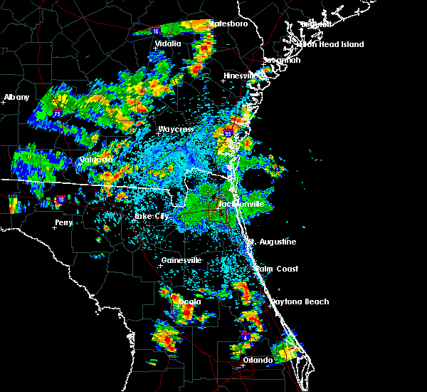 At 440 pm edt, doppler radar indicated a severe thunderstorm capable of producing damaging winds in excess of 60 mph. this storm was located near lynne, moving northeast at 15 mph. penny size hail may also accompany the damaging winds. locations impacted include, lynne, silver springs shores and burbank. At 440 pm edt, doppler radar indicated a severe thunderstorm capable of producing damaging winds in excess of 60 mph. this storm was located near lynne, moving northeast at 15 mph. penny size hail may also accompany the damaging winds. locations impacted include, lynne, silver springs shores and burbank.
|
| 7/4/2015 4:11 PM EDT |
 At 410 pm edt, doppler radar indicated a severe thunderstorm capable of producing damaging winds in excess of 60 mph. this storm was located near anthony, or near ocala, and moving north at 15 mph. penny size hail may also accompany the damaging winds. At 410 pm edt, doppler radar indicated a severe thunderstorm capable of producing damaging winds in excess of 60 mph. this storm was located near anthony, or near ocala, and moving north at 15 mph. penny size hail may also accompany the damaging winds.
|
| 6/23/2015 3:48 PM EDT |
 At 348 pm edt, doppler radar indicated a severe thunderstorm capable of producing quarter size hail and damaging winds in excess of 60 mph. this storm was located 8 miles southeast of rainbow lakes estates. this storm was nearly stationary. At 348 pm edt, doppler radar indicated a severe thunderstorm capable of producing quarter size hail and damaging winds in excess of 60 mph. this storm was located 8 miles southeast of rainbow lakes estates. this storm was nearly stationary.
|
| 6/21/2015 6:42 PM EDT | The severe thunderstorm warning for south central marion county will expire at 645 pm edt, the storm which prompted the warning has weakened below severe limits, and no longer poses an immediate threat to life or property. therefore the warning will be allowed to expire. however gusty winds are still possible with this thunderstorm. |
| 6/21/2015 6:15 PM EDT | Several reports of power lines blown down by thunderstorm winds near silver spring shore in marion county FL, 1 miles NE of Silver Springs Shores, FL |
| 6/21/2015 5:55 PM EDT |
 At 554 pm edt, doppler radar indicated a severe thunderstorm capable of producing damaging winds in excess of 60 mph. this storm was located near santos, or 8 miles northwest of the villages. this storm was nearly stationary. nickel size hail may also accompany the damaging winds. At 554 pm edt, doppler radar indicated a severe thunderstorm capable of producing damaging winds in excess of 60 mph. this storm was located near santos, or 8 miles northwest of the villages. this storm was nearly stationary. nickel size hail may also accompany the damaging winds.
|
| 6/12/2015 4:10 PM EDT |
 At 410 pm edt, doppler radar indicated a severe thunderstorm capable of producing quarter size hail and destructive winds in excess of 70 mph. this storm was located over juniper springs, moving northwest at 30 mph. locations impacted include, ocala, juniper springs, lynne, ocklawaha, moss bluff, silver springs shores, weirsdale and burbank. At 410 pm edt, doppler radar indicated a severe thunderstorm capable of producing quarter size hail and destructive winds in excess of 70 mph. this storm was located over juniper springs, moving northwest at 30 mph. locations impacted include, ocala, juniper springs, lynne, ocklawaha, moss bluff, silver springs shores, weirsdale and burbank.
|
| 6/12/2015 4:03 PM EDT |
 At 403 pm edt, doppler radar indicated a severe thunderstorm capable of producing damaging winds in excess of 60 mph. this storm was located 7 miles northwest of pittman, or 7 miles south of juniper springs, moving northwest at 30 mph. locations impacted include, ocala, juniper springs, lynne, ocklawaha, moss bluff, silver springs shores, weirsdale and burbank. At 403 pm edt, doppler radar indicated a severe thunderstorm capable of producing damaging winds in excess of 60 mph. this storm was located 7 miles northwest of pittman, or 7 miles south of juniper springs, moving northwest at 30 mph. locations impacted include, ocala, juniper springs, lynne, ocklawaha, moss bluff, silver springs shores, weirsdale and burbank.
|
| 6/12/2015 3:41 PM EDT |
 The national weather service in jacksonville has issued a * severe thunderstorm warning for. eastern marion county in northern florida. until 430 pm edt * at 341 pm edt. doppler radar indicated a severe thunderstorm capable of producing destructive winds in excess of 70 mph. This. The national weather service in jacksonville has issued a * severe thunderstorm warning for. eastern marion county in northern florida. until 430 pm edt * at 341 pm edt. doppler radar indicated a severe thunderstorm capable of producing destructive winds in excess of 70 mph. This.
|
| 4/20/2015 4:06 PM EDT | The severe thunderstorm warning for eastern marion county will expire at 415 pm edt, the storms which prompted the warning have weakened below severe limits and exited the warned area. therefore the warning will be allowed to expire. however small hail, gusty winds and heavy rain are still possible with lingering thunderstorm activity. to report severe weather, contact your nearest law enforcement agency. they will relay your report to the national weather service jacksonville. |
| 4/20/2015 3:47 PM EDT | At 346 pm edt, doppler radar indicated a line of severe thunderstorms capable of producing quarter size hail and damaging winds in excess of 60 mph. these storms were located along a line extending from near lake delancy to 6 miles south of santos, moving east at 45 mph. locations impacted include, ocala, fort mccoy, juniper springs, salt springs, lynne, lake delancy, moss bluff, lake weir, ocklawaha, silver springs shores, weirsdale, santos, belleview, burbank and summerfield. |
| 4/20/2015 3:31 PM EDT | At 331 pm edt, doppler radar indicated a line of severe thunderstorms capable of producing quarter size hail and damaging winds in excess of 60 mph. these storms were located along a line extending from near citra to 10 miles northeast of beverly hills, and moving east at 35 mph. |
| 6/10/2014 5:30 PM EDT | Marion county 911 dispatch reported powerlines down due to trees toppled by strong wind gusts. time of damage based on radar dat in marion county FL, 8.2 miles WNW of Silver Springs Shores, FL |
| 5/30/2014 4:05 PM EDT | Large trees down near 16908 se street road in marion county FL, 9.7 miles WSW of Silver Springs Shores, FL |
| 4/14/2013 6:30 PM EDT | Quarter sized hail reported 8.4 miles W of Silver Springs Shores, FL, one inch diameter hail ne of ocklawaha |
| 5/30/2012 4:29 PM EDT | Large tree fell on a house on northeast 166th terrace. no injuries were reported. residents were not home at the time. numerous trees and powerlines were reported down in marion county FL, 12.9 miles SW of Silver Springs Shores, FL |
| 5/30/2012 4:29 PM EDT | Numerous tree damage reported with tops of large oak trees torn off from strong downburst winds. power outages reported in the area. pea sized hail also reporte in marion county FL, 12.9 miles SW of Silver Springs Shores, FL |
| 5/30/2012 4:25 PM EDT | Numerous trees and powerlines were reported down along a 1 to 2 mile stretch of county road 314a from the 3700 to 6000 bloc in marion county FL, 12.3 miles SW of Silver Springs Shores, FL |
| 1/1/0001 12:00 AM | Trees were blown down along 10896 se 131st lan in marion county FL, 5.3 miles NNW of Silver Springs Shores, FL |
| 1/1/0001 12:00 AM | Trees were blown down along 10896 se 131st lane. the time of damage was based on rada in marion county FL, 5.3 miles NNW of Silver Springs Shores, FL |
Hail Maps for Silver Springs Shores, FL
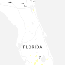


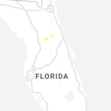


Connect with Interactive Hail Maps