

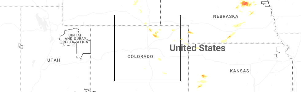
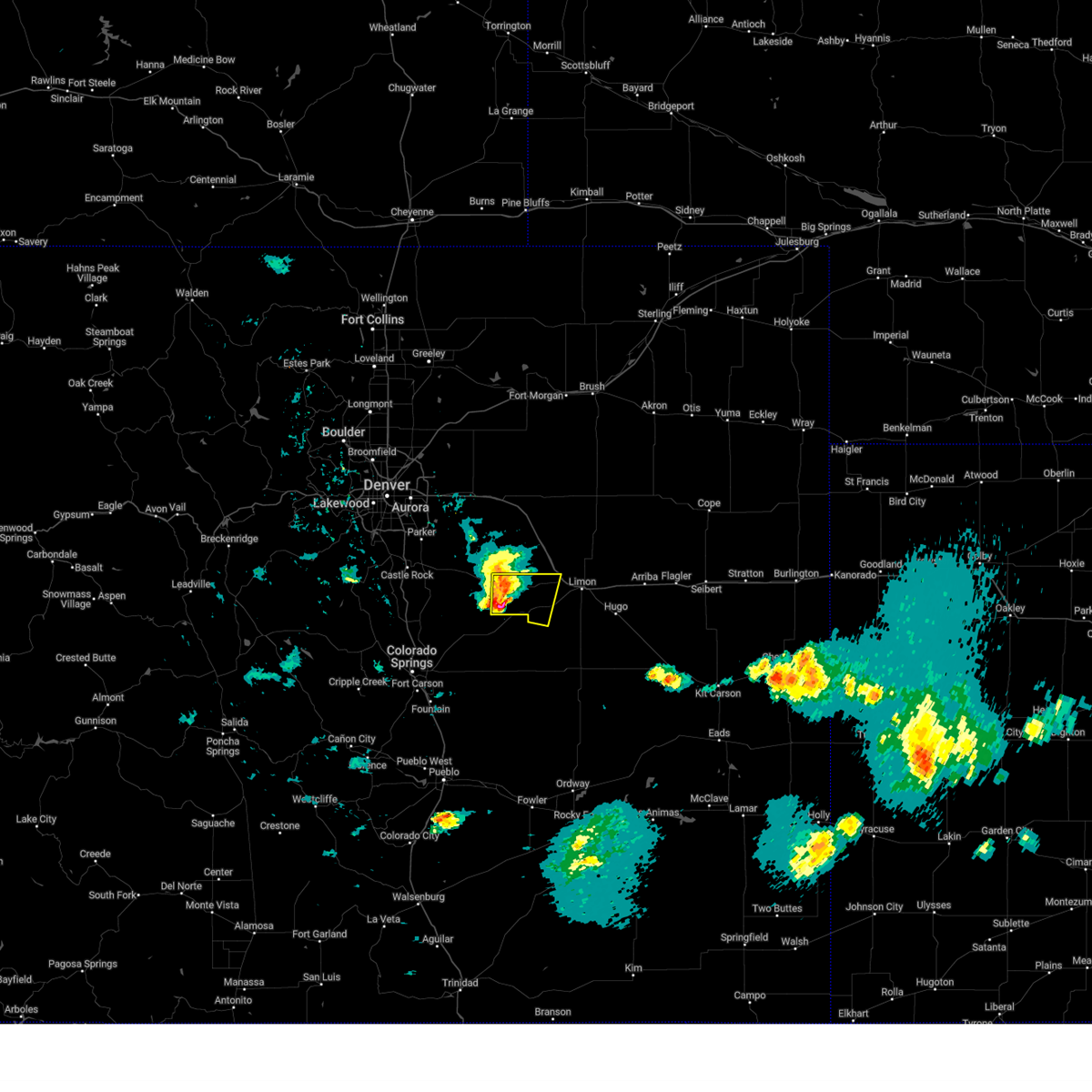
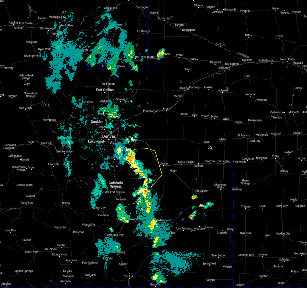
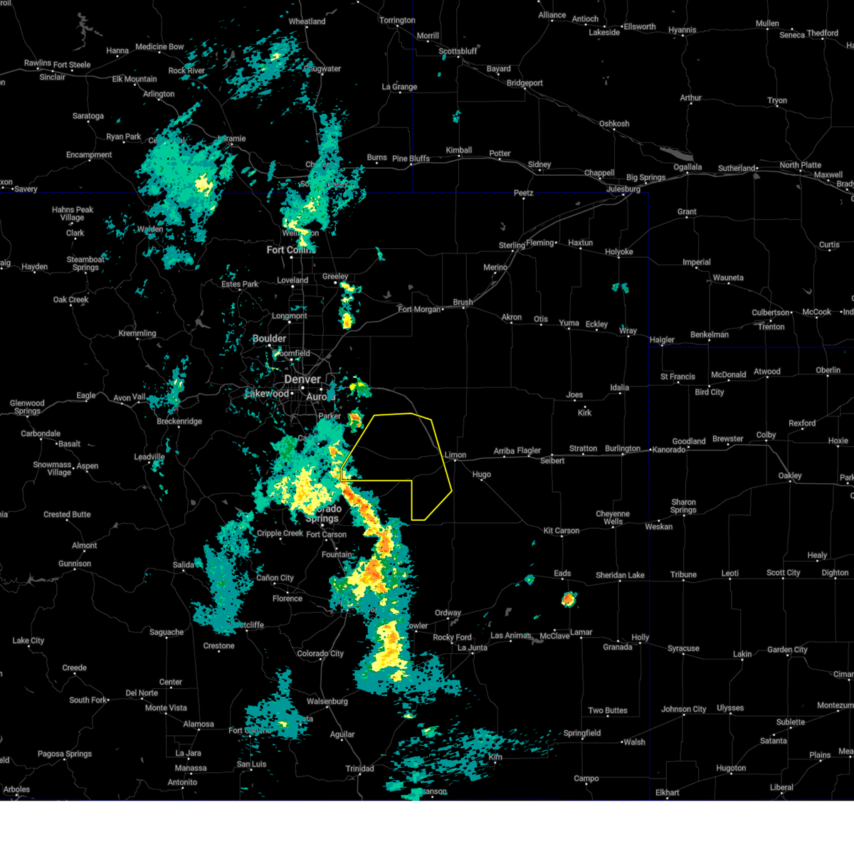
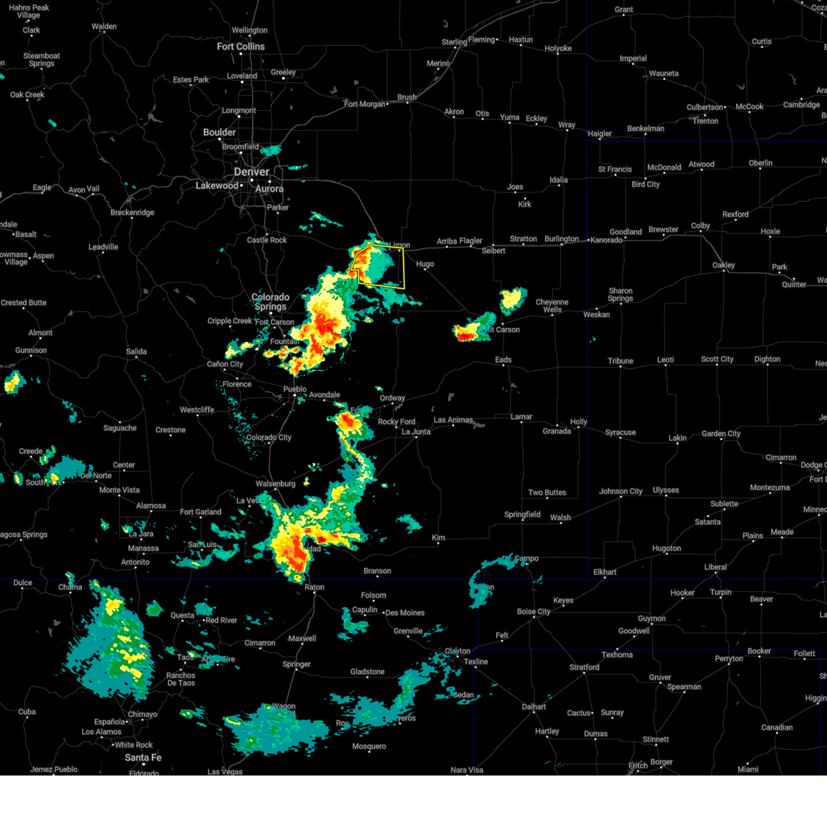
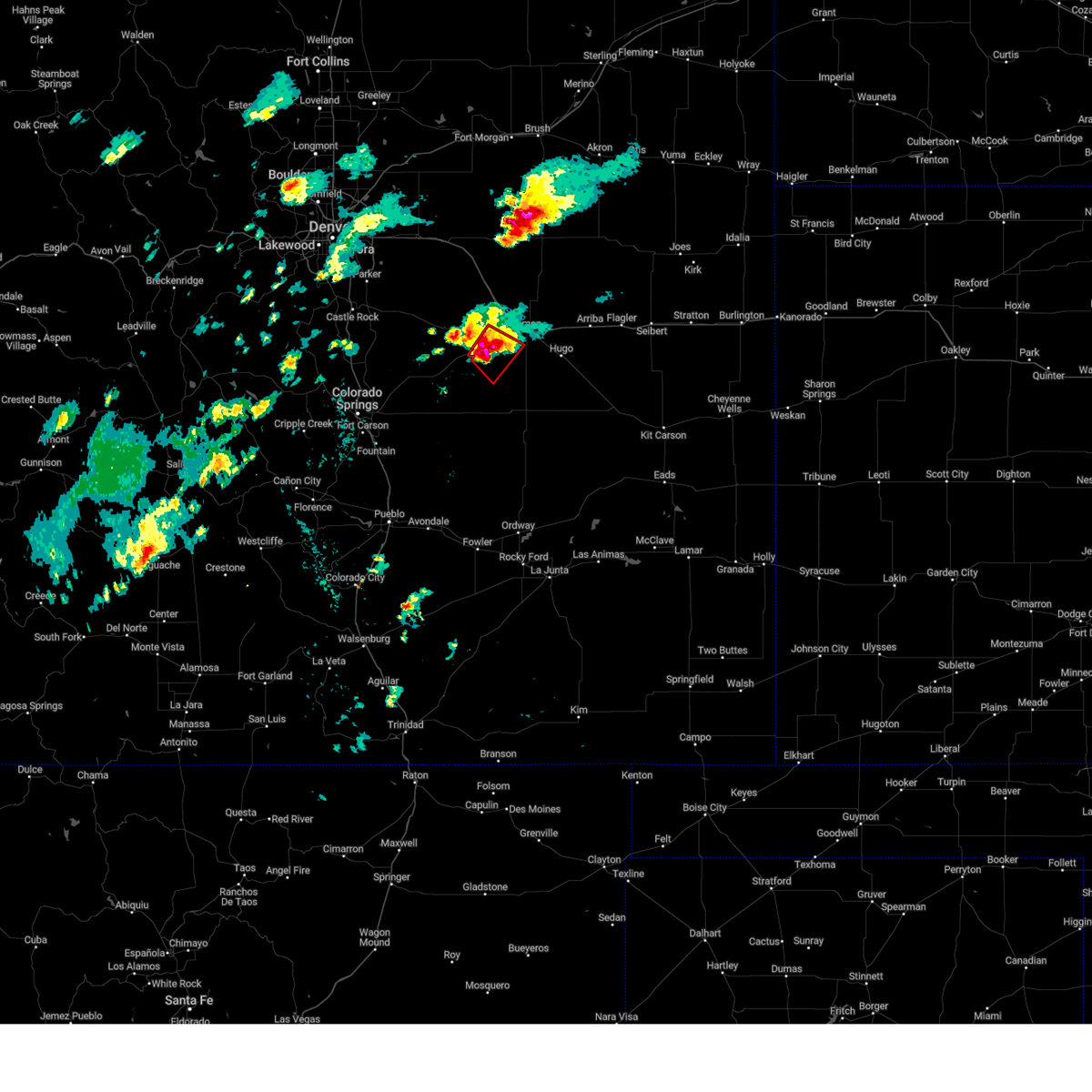
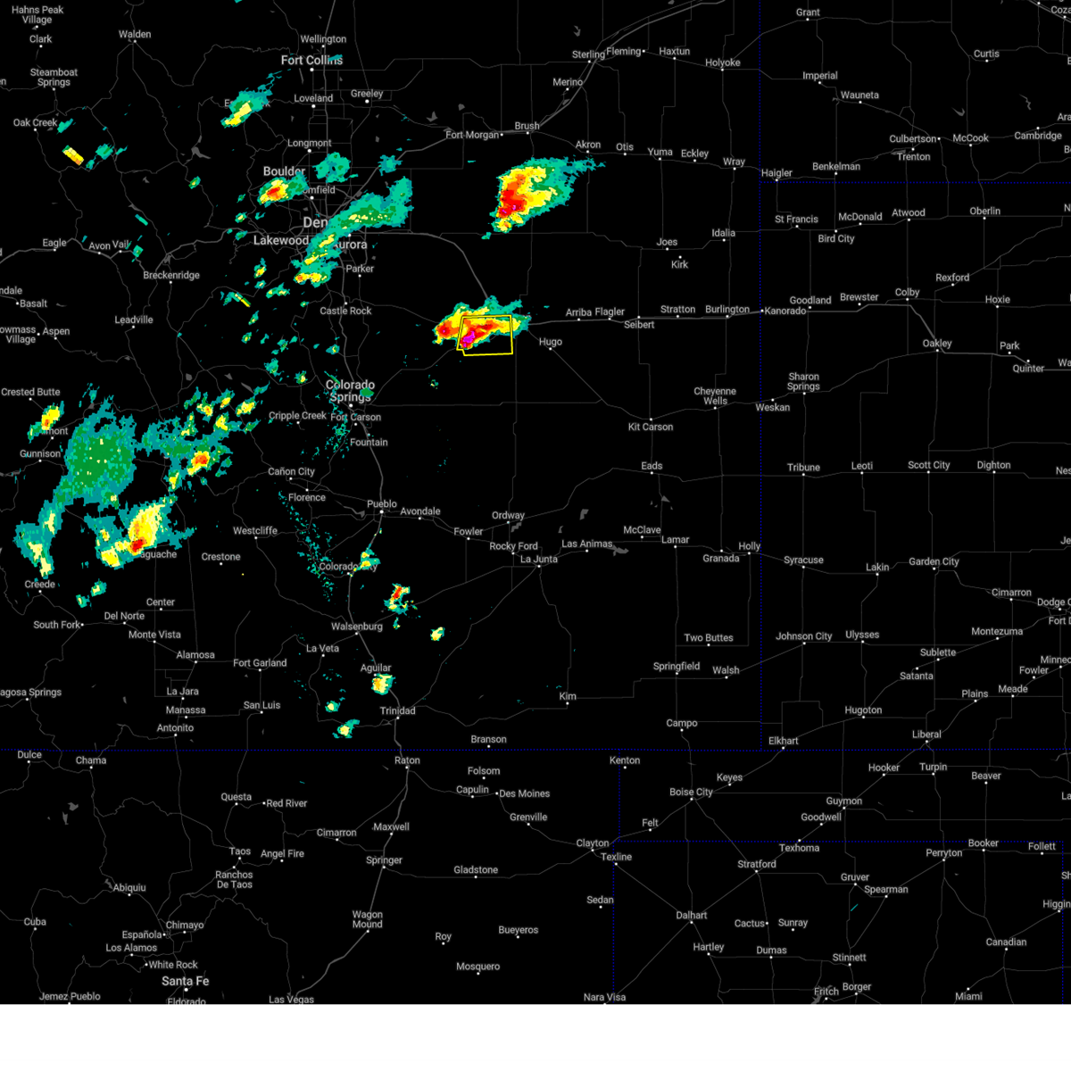
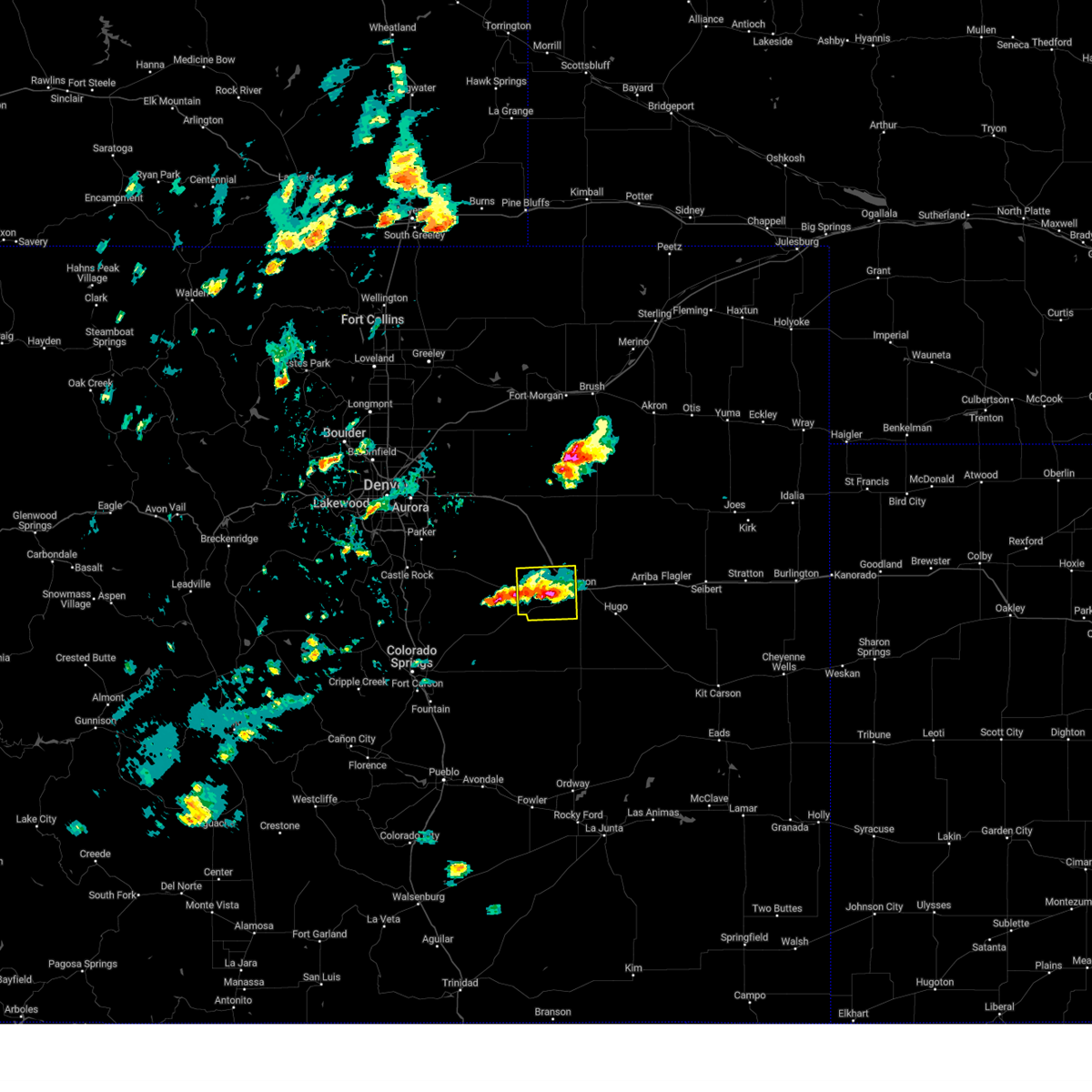
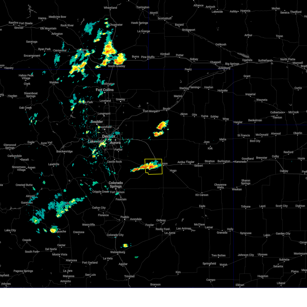
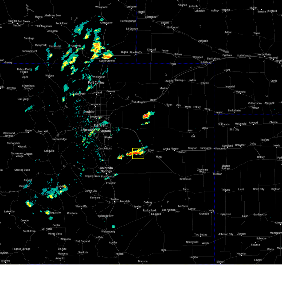
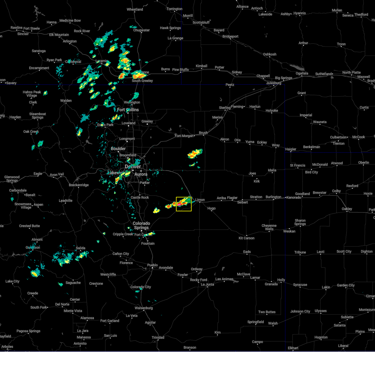
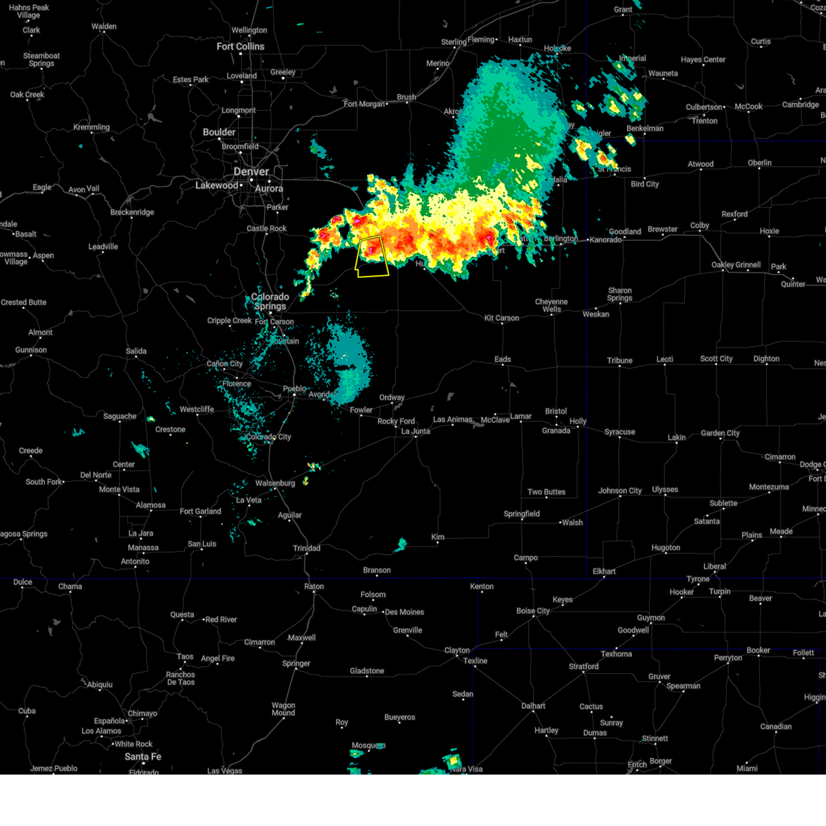
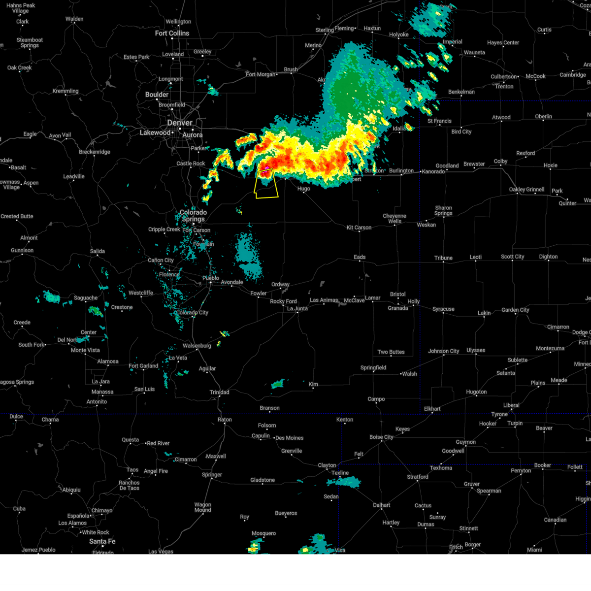
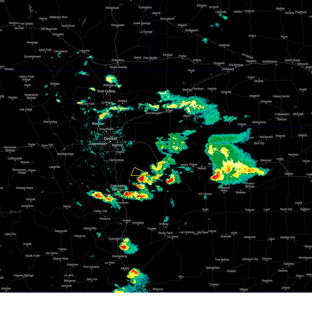
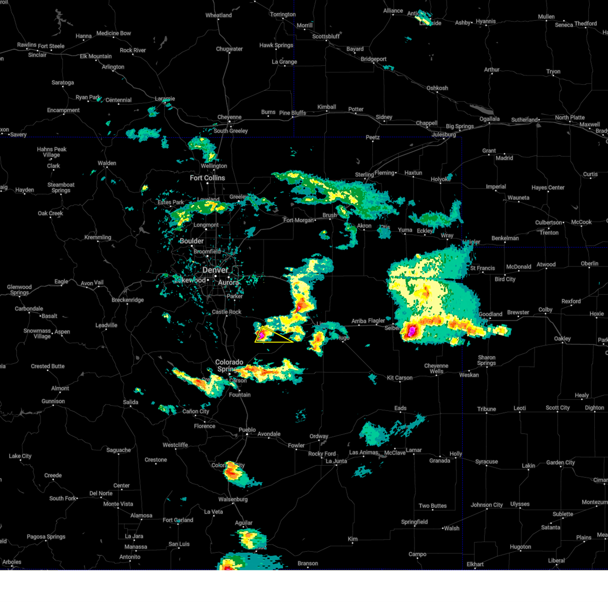
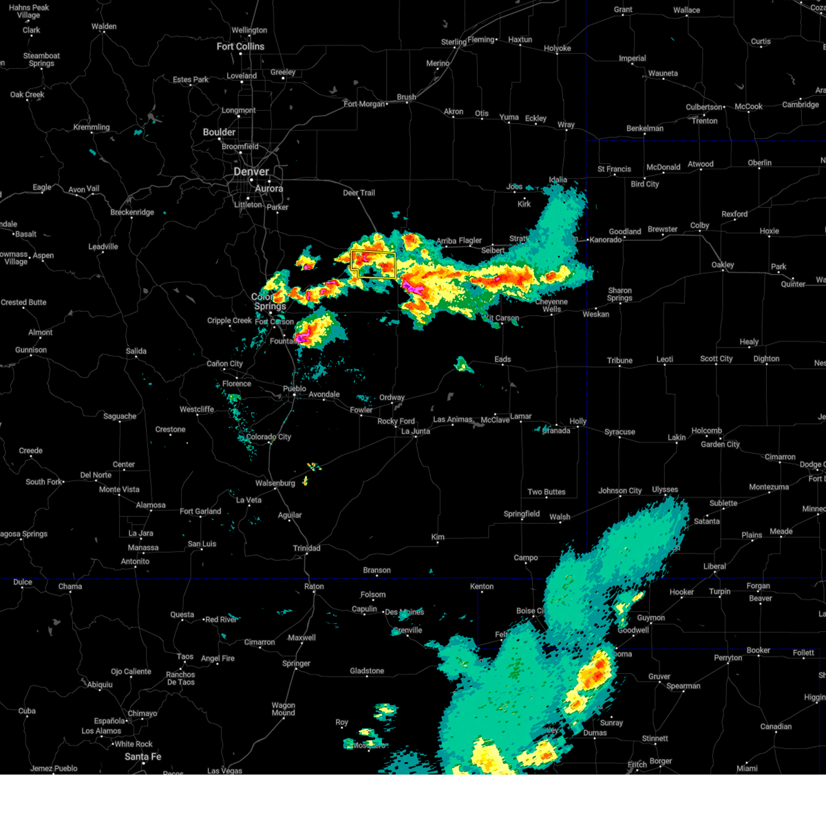
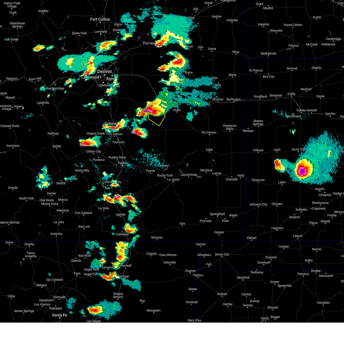
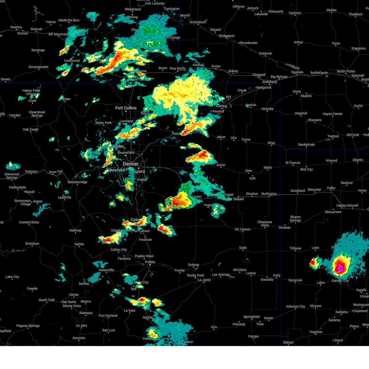
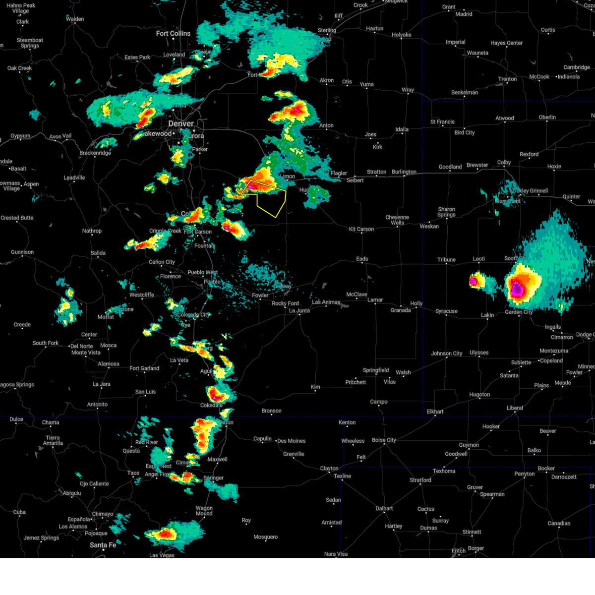
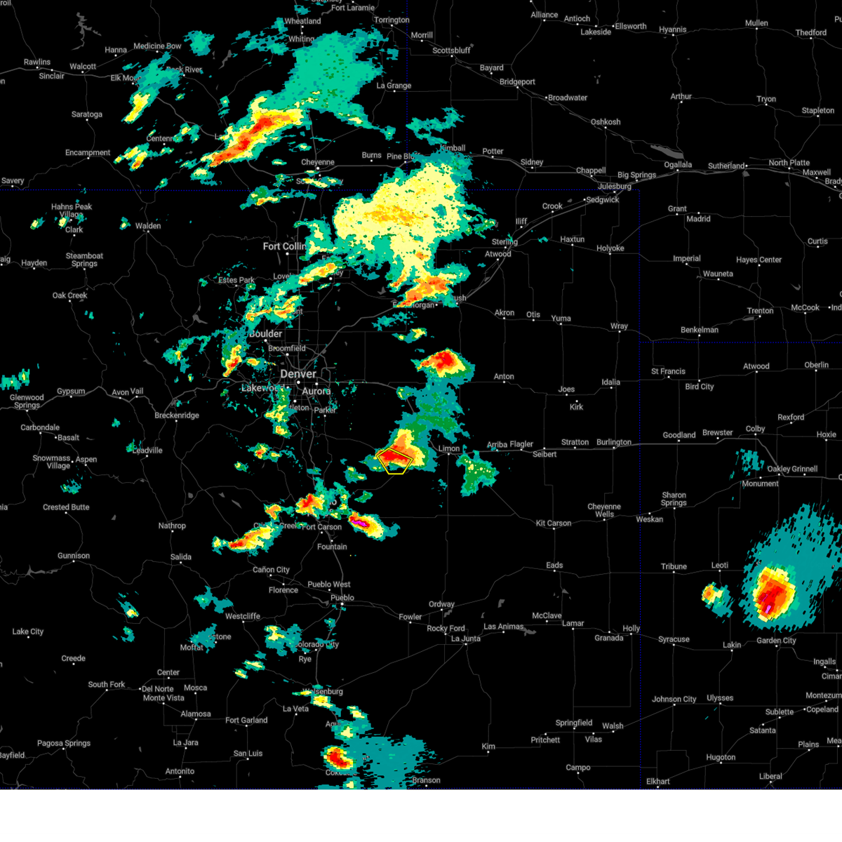
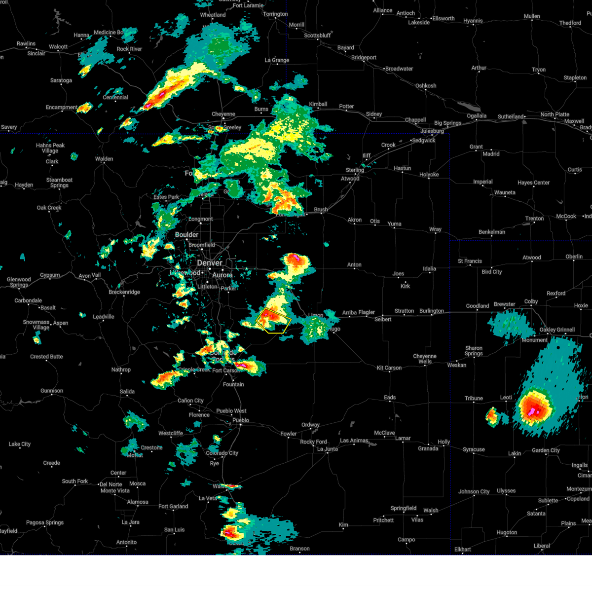
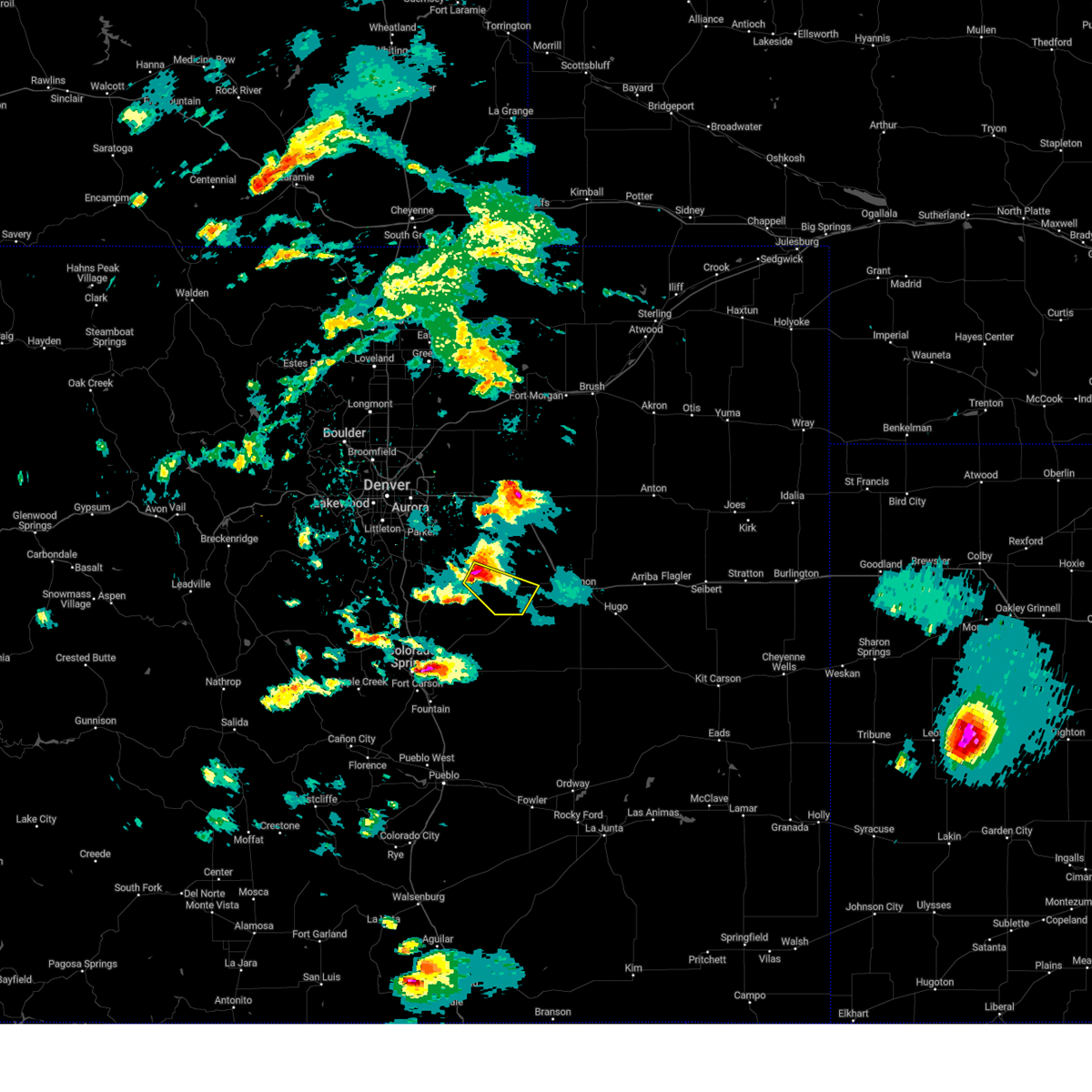
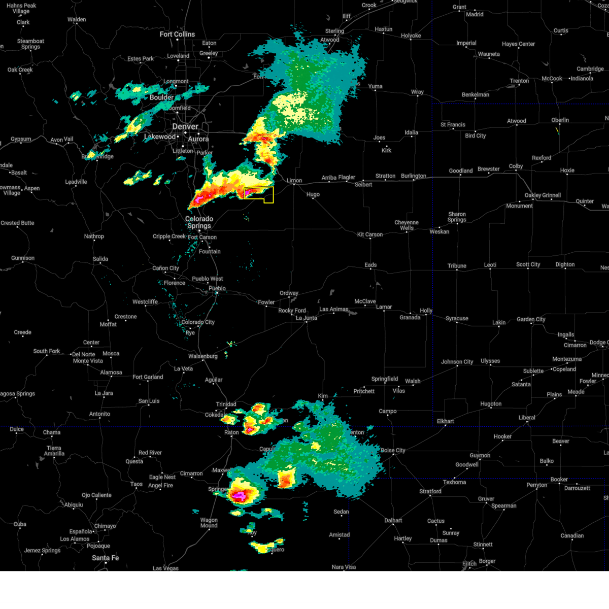
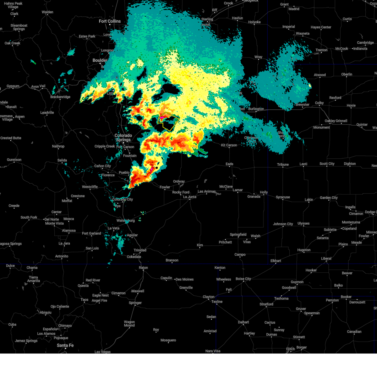
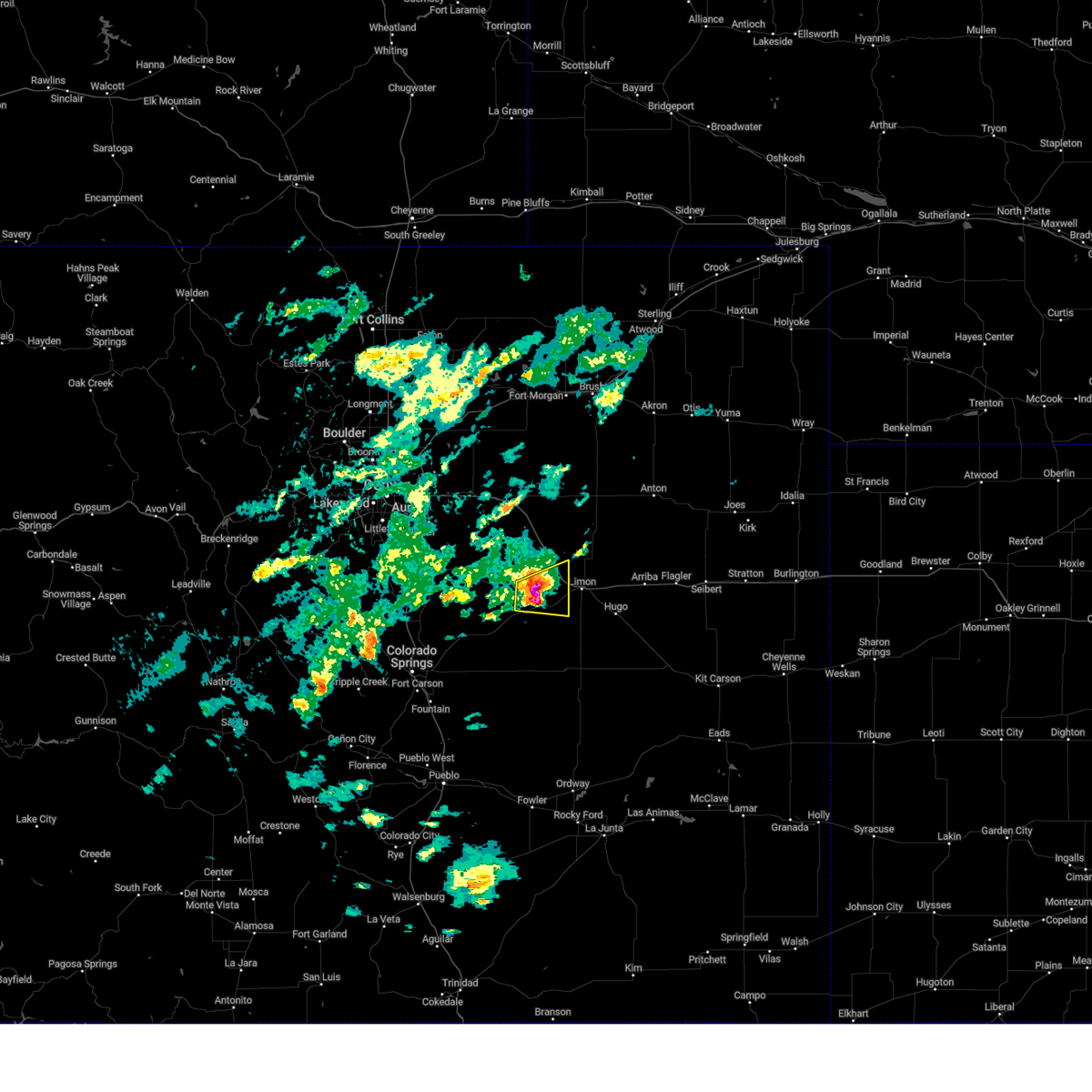
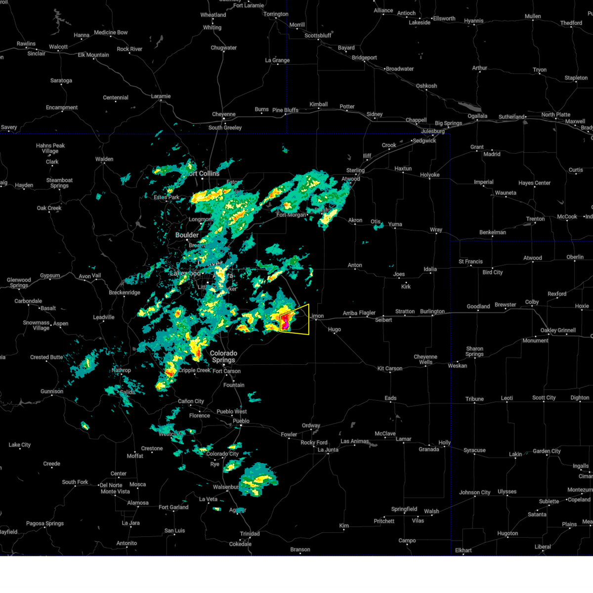
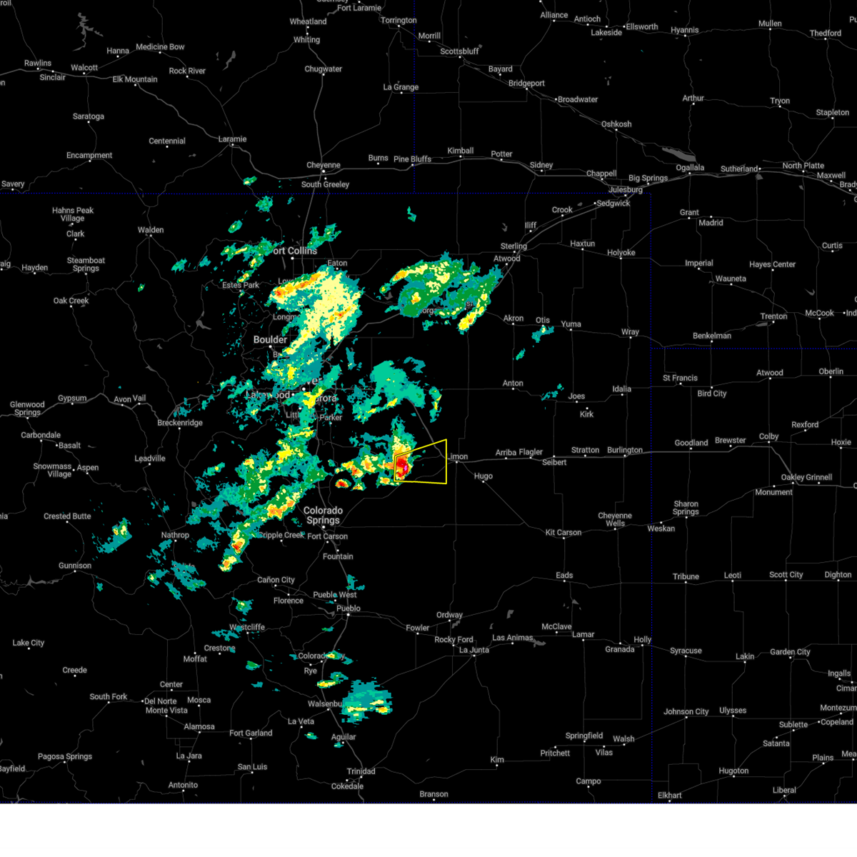
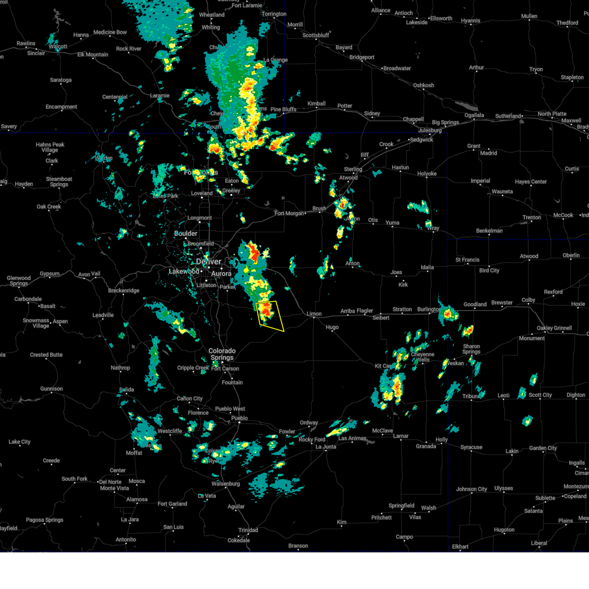
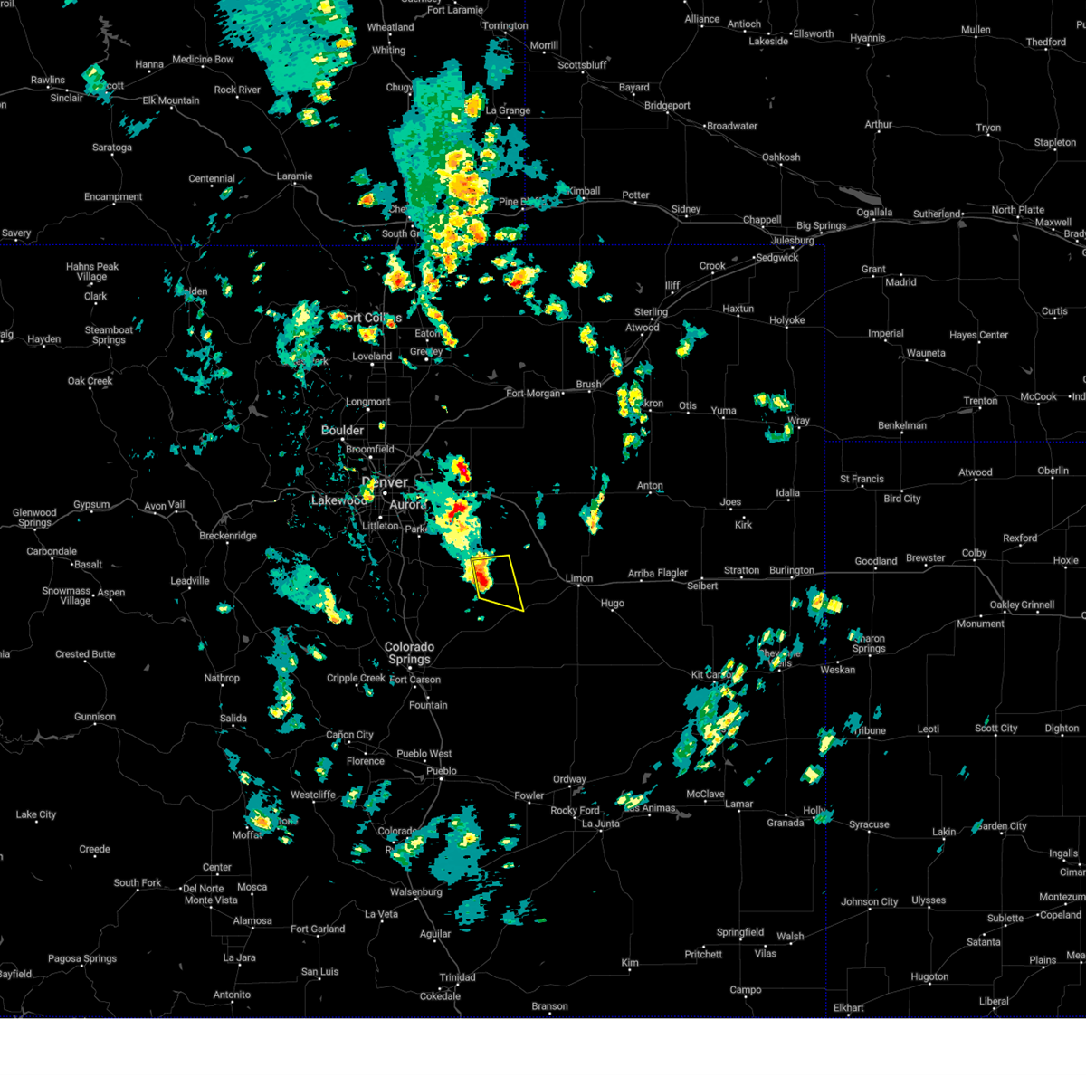
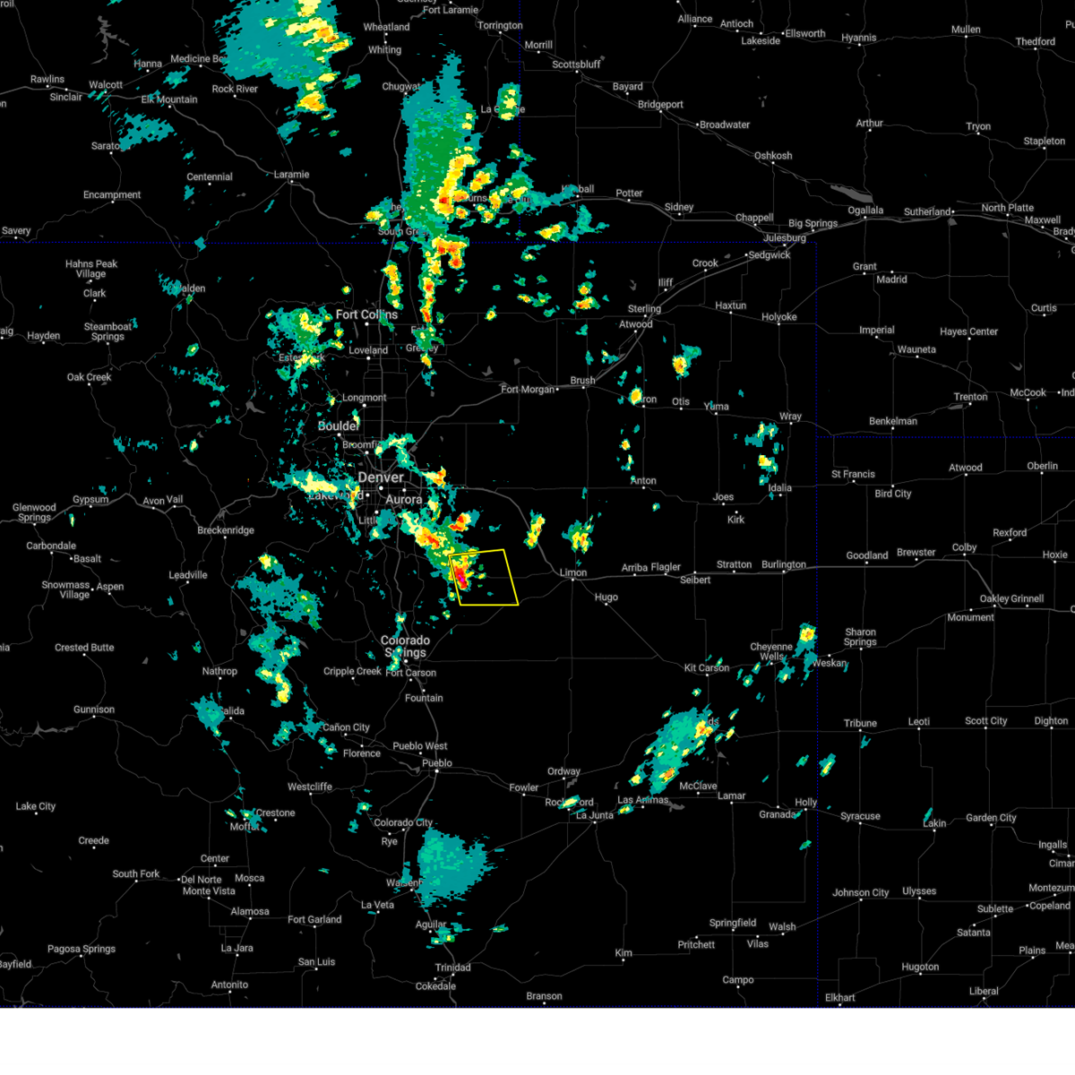
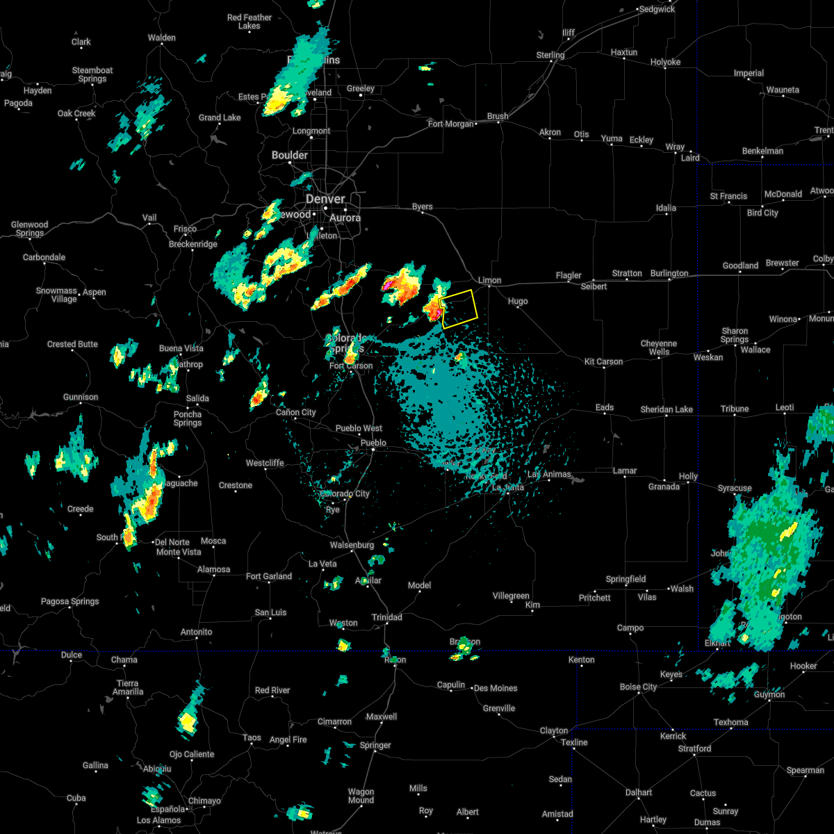
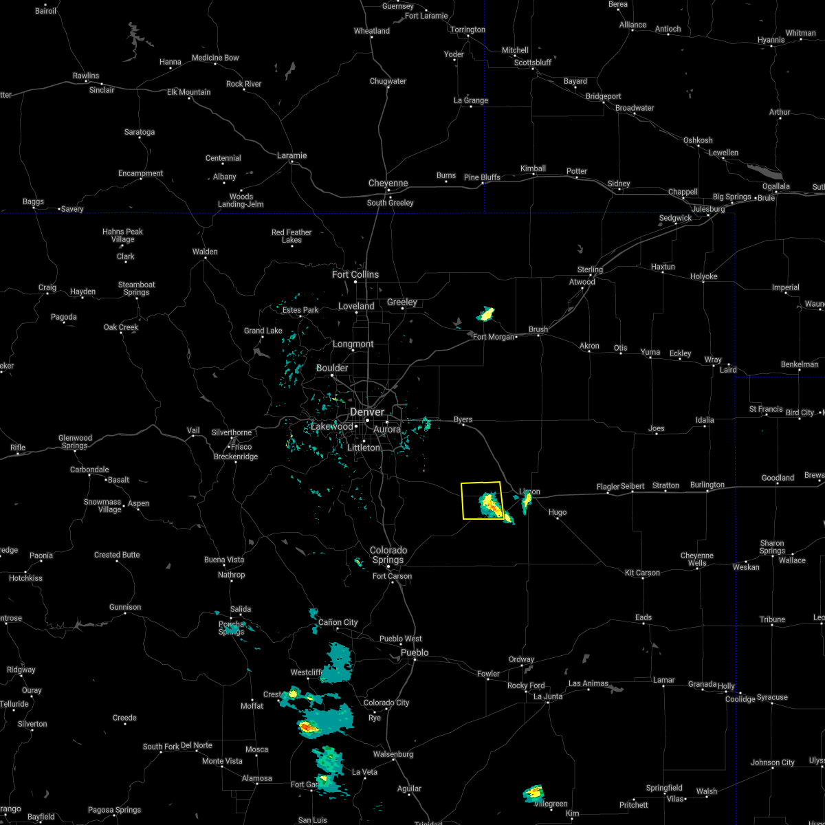
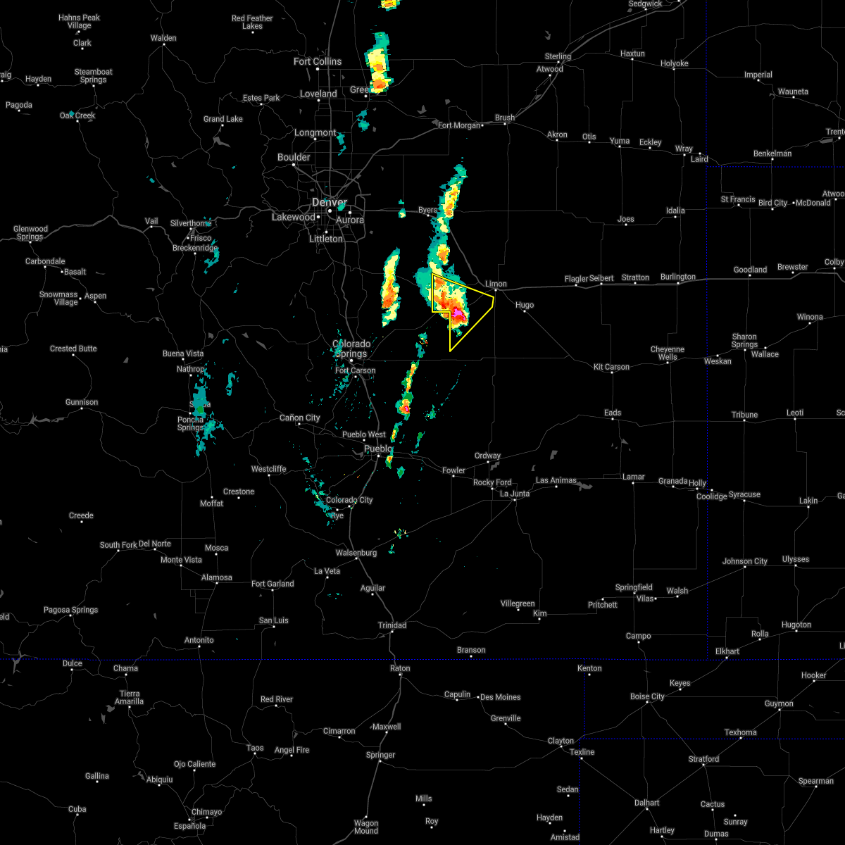
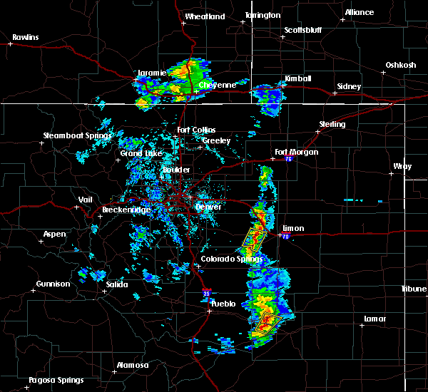
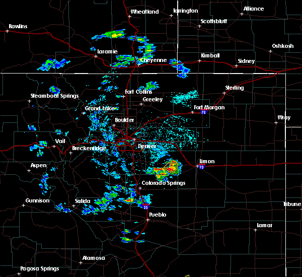
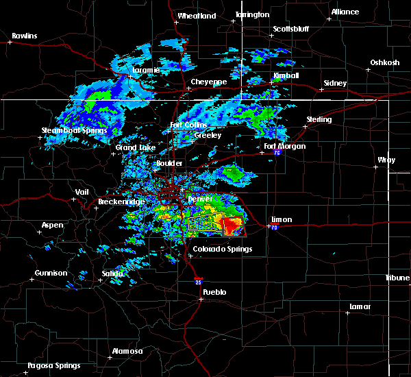
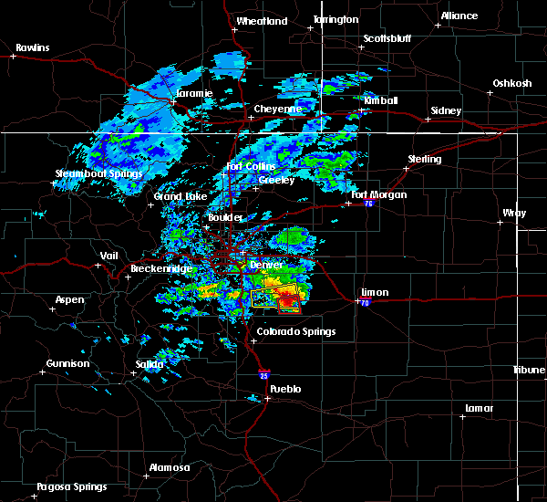
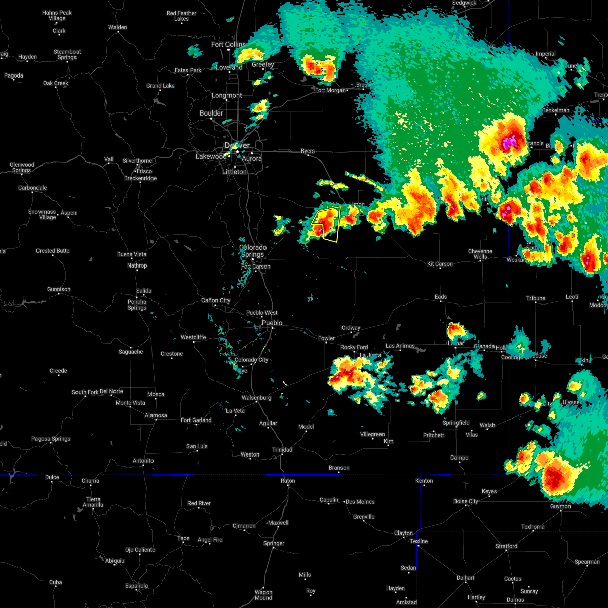
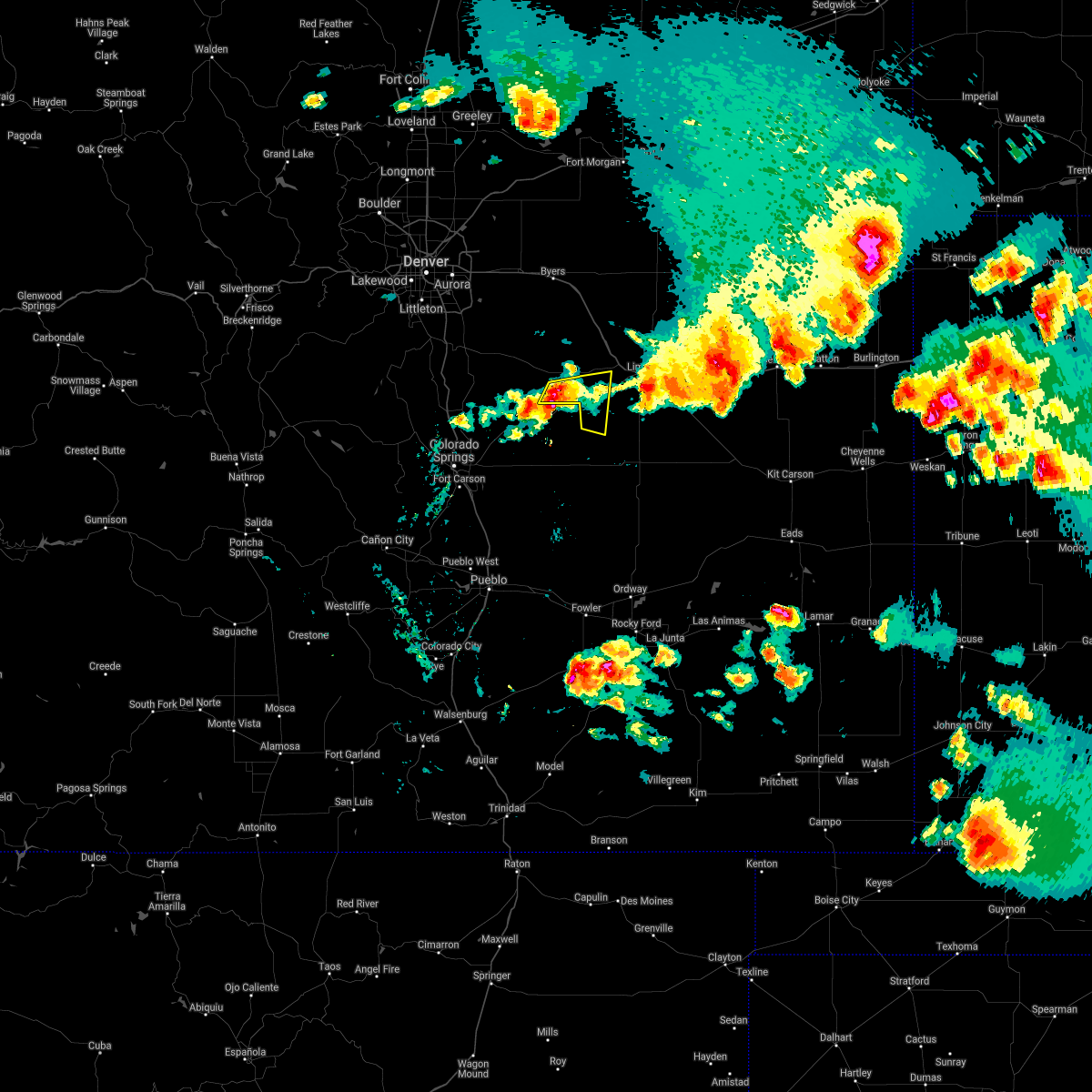
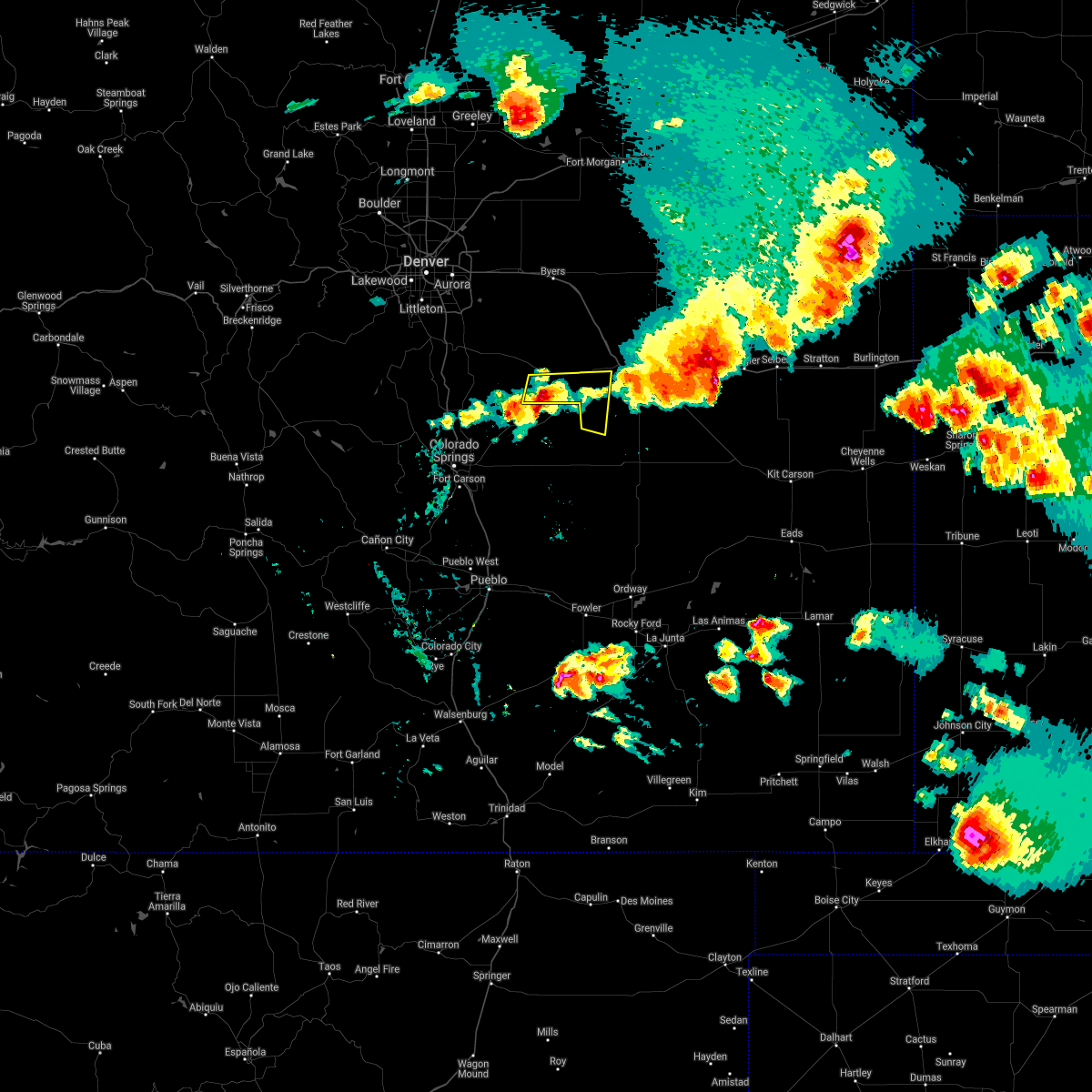
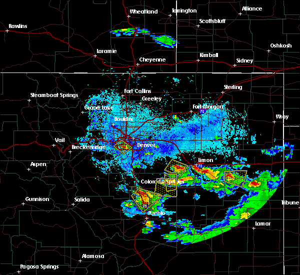
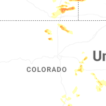
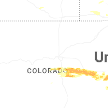
Hail Map for Simla, CO
The Simla, CO area has had 33 reports of on-the-ground hail by trained spotters, and has been under severe weather warnings 17 times during the past 12 months. Doppler radar has detected hail at or near Simla, CO on 103 occasions, including 9 occasions during the past year.
| Name: | Simla, CO |
| Where Located: | 63.8 miles SE of Denver, CO |
| Map: | Google Map for Simla, CO |
| Population: | 618 |
| Housing Units: | 266 |
| More Info: | Search Google for Simla, CO |
1
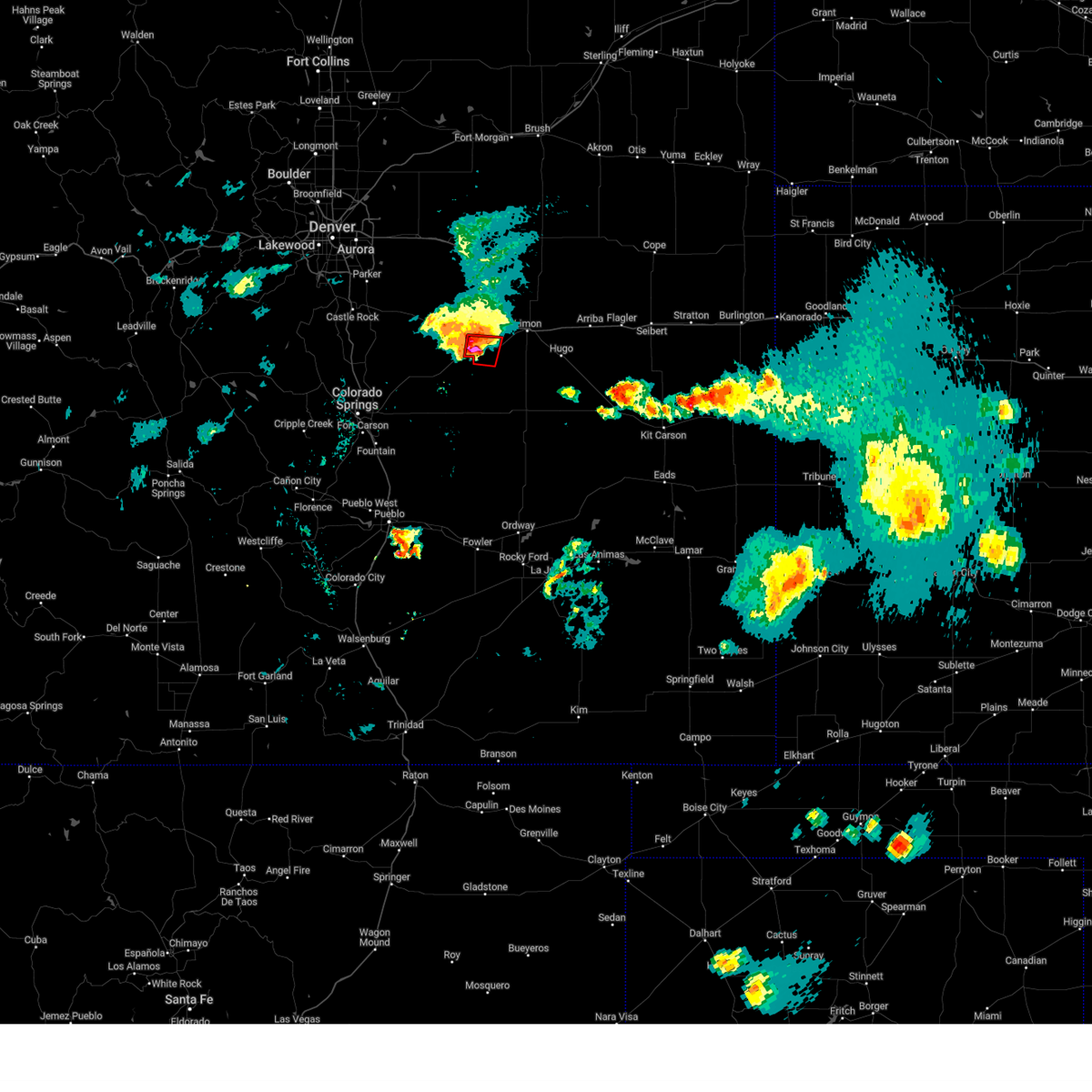
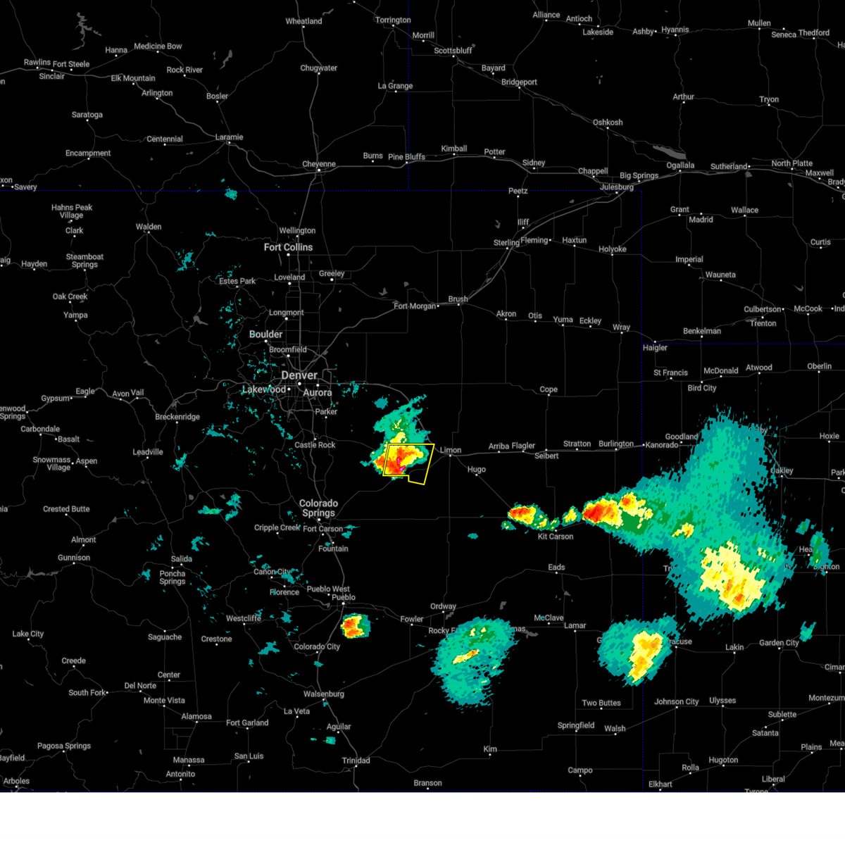
The Top Recent Hail Date for Simla, CO is Thursday, July 10, 2025 (15th out of 103)
Hail and Wind Damage Spotted near Simla, CO
| Date / Time | Report Details |
|---|---|
| 4/23/2025 6:56 PM MDT | The storm which prompted the warning has moved out of the area. therefore, the warning will be allowed to expire. |
| 4/23/2025 6:53 PM MDT | Tennis Ball sized hail reported 7 miles WSW of Simla, CO |
| 4/23/2025 6:50 PM MDT | At 650 pm mdt, a severe thunderstorm capable of producing a tornado was located over matheson, or 17 miles southwest of limon, moving east at 25 mph (radar indicated rotation). Hazards include tornado and two inch hail. Flying debris will be dangerous to those caught without shelter. mobile homes will be damaged or destroyed. damage to roofs, windows and vehicles will occur. tree damage is likely. Locations impacted include, simla and matheson. |
| 4/23/2025 6:48 PM MDT | Hen Egg sized hail reported 6 miles WNW of Simla, CO, report from mping: hen egg (2.00 in.). |
| 4/23/2025 6:39 PM MDT |
 Torbou the national weather service in denver has issued a * tornado warning for, east central elbert county in east central colorado, * until 700 pm mdt. * at 639 pm mdt, a severe thunderstorm capable of producing a tornado was located over simla, or 21 miles west of limon, moving east at 20 mph (radar indicated rotation). Hazards include tornado and half dollar size hail. Flying debris will be dangerous to those caught without shelter. mobile homes will be damaged or destroyed. damage to roofs, windows and vehicles will occur. Tree damage is likely. Torbou the national weather service in denver has issued a * tornado warning for, east central elbert county in east central colorado, * until 700 pm mdt. * at 639 pm mdt, a severe thunderstorm capable of producing a tornado was located over simla, or 21 miles west of limon, moving east at 20 mph (radar indicated rotation). Hazards include tornado and half dollar size hail. Flying debris will be dangerous to those caught without shelter. mobile homes will be damaged or destroyed. damage to roofs, windows and vehicles will occur. Tree damage is likely.
|
| 4/23/2025 6:32 PM MDT |
 At 632 pm mdt, a severe thunderstorm was located near simla, or 22 miles west of limon, moving east at 20 mph (radar indicated). Hazards include 60 mph wind gusts and half dollar size hail. Hail damage to vehicles is expected. expect wind damage to roofs, siding, and trees. Locations impacted include, simla and matheson. At 632 pm mdt, a severe thunderstorm was located near simla, or 22 miles west of limon, moving east at 20 mph (radar indicated). Hazards include 60 mph wind gusts and half dollar size hail. Hail damage to vehicles is expected. expect wind damage to roofs, siding, and trees. Locations impacted include, simla and matheson.
|
| 4/23/2025 6:30 PM MDT |
 At 630 pm mdt, a severe thunderstorm was located near simla, or 23 miles west of limon, moving east at 20 mph (radar indicated). Hazards include 60 mph wind gusts and half dollar size hail. Hail damage to vehicles is expected. expect wind damage to roofs, siding, and trees. Locations impacted include, simla and matheson. At 630 pm mdt, a severe thunderstorm was located near simla, or 23 miles west of limon, moving east at 20 mph (radar indicated). Hazards include 60 mph wind gusts and half dollar size hail. Hail damage to vehicles is expected. expect wind damage to roofs, siding, and trees. Locations impacted include, simla and matheson.
|
| 4/23/2025 6:15 PM MDT |
 Svrbou the national weather service in denver has issued a * severe thunderstorm warning for, central elbert county in east central colorado, * until 700 pm mdt. * at 615 pm mdt, a severe thunderstorm was located 8 miles northwest of simla, or 27 miles west of limon, moving east at 20 mph (radar indicated). Hazards include 60 mph wind gusts and half dollar size hail. Hail damage to vehicles is expected. Expect wind damage to roofs, siding, and trees. Svrbou the national weather service in denver has issued a * severe thunderstorm warning for, central elbert county in east central colorado, * until 700 pm mdt. * at 615 pm mdt, a severe thunderstorm was located 8 miles northwest of simla, or 27 miles west of limon, moving east at 20 mph (radar indicated). Hazards include 60 mph wind gusts and half dollar size hail. Hail damage to vehicles is expected. Expect wind damage to roofs, siding, and trees.
|
| 9/17/2024 3:59 PM MDT | Storm damage reported in elbert county CO, 17.3 miles S of Simla, CO |
| 9/17/2024 3:55 PM MDT | Storm damage reported in elbert county CO, 6.3 miles S of Simla, CO |
| 9/17/2024 3:48 PM MDT |
 At 348 pm mdt, severe thunderstorms were located along a line extending from 9 miles northeast of kiowa to 10 miles northwest of simla to 7 miles northwest of kutch, or along a line extending from 34 miles southeast of denver to 25 miles west of limon to 45 miles east of colorado springs, moving northeast at 60 mph (radar indicated). Hazards include 60 mph wind gusts. Expect damage to roofs, siding, and trees. Locations impacted include, kiowa, simla, agate, and matheson. At 348 pm mdt, severe thunderstorms were located along a line extending from 9 miles northeast of kiowa to 10 miles northwest of simla to 7 miles northwest of kutch, or along a line extending from 34 miles southeast of denver to 25 miles west of limon to 45 miles east of colorado springs, moving northeast at 60 mph (radar indicated). Hazards include 60 mph wind gusts. Expect damage to roofs, siding, and trees. Locations impacted include, kiowa, simla, agate, and matheson.
|
| 9/17/2024 3:23 PM MDT |
 Svrbou the national weather service in denver colorado has issued a * severe thunderstorm warning for, elbert county in east central colorado, * until 415 pm mdt. * at 323 pm mdt, severe thunderstorms were located along a line extending from 7 miles northeast of black forest to 4 miles southeast of peyton to 5 miles west of truckton, or along a line extending from 21 miles northeast of colorado springs to 42 miles southwest of limon to 31 miles northeast of pueblo airport, moving northeast at 45 mph (radar indicated). Hazards include 60 mph wind gusts. expect damage to roofs, siding, and trees Svrbou the national weather service in denver colorado has issued a * severe thunderstorm warning for, elbert county in east central colorado, * until 415 pm mdt. * at 323 pm mdt, severe thunderstorms were located along a line extending from 7 miles northeast of black forest to 4 miles southeast of peyton to 5 miles west of truckton, or along a line extending from 21 miles northeast of colorado springs to 42 miles southwest of limon to 31 miles northeast of pueblo airport, moving northeast at 45 mph (radar indicated). Hazards include 60 mph wind gusts. expect damage to roofs, siding, and trees
|
| 8/20/2024 7:40 PM MDT |
 Svrbou the national weather service in denver colorado has issued a * severe thunderstorm warning for, east central elbert county in east central colorado, central lincoln county in east central colorado, * until 830 pm mdt. * at 739 pm mdt, a cluster of strong thunderstorms producing severe wind gusts was located west of matheson, or 13 miles southwest of limon, moving east at 30 mph (radar indicated). Hazards include 60 mph wind gusts. expect damage to roofs, siding, and trees Svrbou the national weather service in denver colorado has issued a * severe thunderstorm warning for, east central elbert county in east central colorado, central lincoln county in east central colorado, * until 830 pm mdt. * at 739 pm mdt, a cluster of strong thunderstorms producing severe wind gusts was located west of matheson, or 13 miles southwest of limon, moving east at 30 mph (radar indicated). Hazards include 60 mph wind gusts. expect damage to roofs, siding, and trees
|
| 8/19/2024 5:31 PM MDT | Ping Pong Ball sized hail reported 18 miles NW of Simla, CO |
| 8/19/2024 2:56 PM MDT |
 Torbou the national weather service in denver colorado has issued a * tornado warning for, southeastern elbert county in east central colorado, * until 330 pm mdt. * at 255 pm mdt, a severe thunderstorm capable of producing a tornado was located near matheson, or 15 miles southwest of limon, moving southeast at 10 mph (radar indicated rotation). Hazards include tornado and hail up to two inches in diameter. Flying debris will be dangerous to those caught without shelter. mobile homes will be damaged or destroyed. damage to roofs, windows, and vehicles will occur. Tree damage is likely. Torbou the national weather service in denver colorado has issued a * tornado warning for, southeastern elbert county in east central colorado, * until 330 pm mdt. * at 255 pm mdt, a severe thunderstorm capable of producing a tornado was located near matheson, or 15 miles southwest of limon, moving southeast at 10 mph (radar indicated rotation). Hazards include tornado and hail up to two inches in diameter. Flying debris will be dangerous to those caught without shelter. mobile homes will be damaged or destroyed. damage to roofs, windows, and vehicles will occur. Tree damage is likely.
|
| 8/19/2024 2:44 PM MDT |
 At 244 pm mdt, a severe thunderstorm was located near matheson, or 14 miles west of limon, moving southeast at 15 mph (radar indicated). Hazards include golf ball size hail and 60 mph wind gusts. Expect damage to roofs, siding, and trees. people and animals outdoors will be injured. expect hail damage to roofs, siding, windows, and vehicles. Locations impacted include, simla and matheson. At 244 pm mdt, a severe thunderstorm was located near matheson, or 14 miles west of limon, moving southeast at 15 mph (radar indicated). Hazards include golf ball size hail and 60 mph wind gusts. Expect damage to roofs, siding, and trees. people and animals outdoors will be injured. expect hail damage to roofs, siding, windows, and vehicles. Locations impacted include, simla and matheson.
|
| 8/19/2024 2:26 PM MDT |
 At 226 pm mdt, a severe thunderstorm was located near matheson, or 14 miles west of limon, moving east at 10 mph (radar indicated). Hazards include ping pong ball size hail and 60 mph wind gusts. Expect damage to roofs, siding, and trees. people and animals outdoors will be injured. expect hail damage to roofs, siding, windows, and vehicles. Locations impacted include, simla and matheson. At 226 pm mdt, a severe thunderstorm was located near matheson, or 14 miles west of limon, moving east at 10 mph (radar indicated). Hazards include ping pong ball size hail and 60 mph wind gusts. Expect damage to roofs, siding, and trees. people and animals outdoors will be injured. expect hail damage to roofs, siding, windows, and vehicles. Locations impacted include, simla and matheson.
|
| 8/19/2024 2:21 PM MDT | Ping Pong Ball sized hail reported 7.9 miles SW of Simla, CO, report from mping: ping pong ball (1.50 in.). |
| 8/19/2024 2:13 PM MDT |
 Svrbou the national weather service in denver colorado has issued a * severe thunderstorm warning for, east central elbert county in east central colorado, * until 300 pm mdt. * at 213 pm mdt, a severe thunderstorm was located near matheson, or 16 miles west of limon, moving east at 10 mph (radar indicated). Hazards include 60 mph wind gusts and half dollar size hail. Expect damage to roofs, siding, and trees. Hail damage to vehicles is expected. Svrbou the national weather service in denver colorado has issued a * severe thunderstorm warning for, east central elbert county in east central colorado, * until 300 pm mdt. * at 213 pm mdt, a severe thunderstorm was located near matheson, or 16 miles west of limon, moving east at 10 mph (radar indicated). Hazards include 60 mph wind gusts and half dollar size hail. Expect damage to roofs, siding, and trees. Hail damage to vehicles is expected.
|
| 8/19/2024 2:00 PM MDT |
 At 200 pm mdt, a severe thunderstorm was located near matheson, or 16 miles west of limon, moving east at 15 mph (radar indicated). Hazards include 60 mph wind gusts and quarter size hail. Expect damage to roofs, siding, and trees. hail damage to vehicles is expected. Locations impacted include, simla and matheson. At 200 pm mdt, a severe thunderstorm was located near matheson, or 16 miles west of limon, moving east at 15 mph (radar indicated). Hazards include 60 mph wind gusts and quarter size hail. Expect damage to roofs, siding, and trees. hail damage to vehicles is expected. Locations impacted include, simla and matheson.
|
| 8/19/2024 1:47 PM MDT |
 Svrbou the national weather service in denver colorado has issued a * severe thunderstorm warning for, east central elbert county in east central colorado, * until 215 pm mdt. * at 147 pm mdt, a severe thunderstorm was located 5 miles northwest of matheson, or 19 miles west of limon, moving east at 15 mph (radar indicated). Hazards include ping pong ball size hail and 60 mph wind gusts. Expect damage to roofs, siding, and trees. people and animals outdoors will be injured. Expect hail damage to roofs, siding, windows, and vehicles. Svrbou the national weather service in denver colorado has issued a * severe thunderstorm warning for, east central elbert county in east central colorado, * until 215 pm mdt. * at 147 pm mdt, a severe thunderstorm was located 5 miles northwest of matheson, or 19 miles west of limon, moving east at 15 mph (radar indicated). Hazards include ping pong ball size hail and 60 mph wind gusts. Expect damage to roofs, siding, and trees. people and animals outdoors will be injured. Expect hail damage to roofs, siding, windows, and vehicles.
|
| 8/2/2024 9:35 PM MDT |
 the severe thunderstorm warning has been cancelled and is no longer in effect the severe thunderstorm warning has been cancelled and is no longer in effect
|
| 8/2/2024 9:13 PM MDT |
 Svrbou the national weather service in denver colorado has issued a * severe thunderstorm warning for, east central elbert county in east central colorado, * until 1000 pm mdt. * at 913 pm mdt, a severe thunderstorm was located 9 miles north of matheson, or 13 miles west of limon, moving south at 15 mph (radar indicated). Hazards include 60 mph wind gusts and half dollar size hail. Expect damage to roofs, siding, and trees. Hail damage to vehicles is expected. Svrbou the national weather service in denver colorado has issued a * severe thunderstorm warning for, east central elbert county in east central colorado, * until 1000 pm mdt. * at 913 pm mdt, a severe thunderstorm was located 9 miles north of matheson, or 13 miles west of limon, moving south at 15 mph (radar indicated). Hazards include 60 mph wind gusts and half dollar size hail. Expect damage to roofs, siding, and trees. Hail damage to vehicles is expected.
|
| 7/7/2024 5:59 PM MDT |
 The storm which prompted the warning has moved out of the area. therefore, the warning will be allowed to expire. a severe thunderstorm watch remains in effect until 1100 pm mdt for east central colorado. The storm which prompted the warning has moved out of the area. therefore, the warning will be allowed to expire. a severe thunderstorm watch remains in effect until 1100 pm mdt for east central colorado.
|
| 7/7/2024 5:37 PM MDT |
 Svrbou the national weather service in denver colorado has issued a * severe thunderstorm warning for, west central elbert county in east central colorado, * until 600 pm mdt. * at 537 pm mdt, a severe thunderstorm was located 8 miles southeast of elbert, or 28 miles northeast of colorado springs, moving southeast at 30 mph (radar indicated). Hazards include quarter size hail. damage to vehicles is expected Svrbou the national weather service in denver colorado has issued a * severe thunderstorm warning for, west central elbert county in east central colorado, * until 600 pm mdt. * at 537 pm mdt, a severe thunderstorm was located 8 miles southeast of elbert, or 28 miles northeast of colorado springs, moving southeast at 30 mph (radar indicated). Hazards include quarter size hail. damage to vehicles is expected
|
| 5/31/2024 7:42 PM MDT |
 Svrbou the national weather service in denver colorado has issued a * severe thunderstorm warning for, east central elbert county in east central colorado, * until 815 pm mdt. * at 742 pm mdt, a severe thunderstorm was located over matheson, or 15 miles west of limon, moving east at 25 mph (radar indicated). Hazards include half dollar size hail. Damage to vehicles is expected. This severe thunderstorm will remain over mainly rural areas of east central elbert county. Svrbou the national weather service in denver colorado has issued a * severe thunderstorm warning for, east central elbert county in east central colorado, * until 815 pm mdt. * at 742 pm mdt, a severe thunderstorm was located over matheson, or 15 miles west of limon, moving east at 25 mph (radar indicated). Hazards include half dollar size hail. Damage to vehicles is expected. This severe thunderstorm will remain over mainly rural areas of east central elbert county.
|
| 8/6/2023 7:14 PM MDT |
 At 714 pm mdt, a severe thunderstorm was located 4 miles east of elbert, or 30 miles northeast of colorado springs, moving east at 45 mph (radar indicated). Hazards include quarter size hail. damage to vehicles is expected At 714 pm mdt, a severe thunderstorm was located 4 miles east of elbert, or 30 miles northeast of colorado springs, moving east at 45 mph (radar indicated). Hazards include quarter size hail. damage to vehicles is expected
|
| 8/3/2023 5:50 PM MDT | Half Dollar sized hail reported 8.4 miles SW of Simla, CO, report from mping: half dollar (1.25 in.). |
| 8/3/2023 5:43 PM MDT | Quarter sized hail reported 7.9 miles SW of Simla, CO, report from mping: quarter (1.00 in.). |
| 8/3/2023 5:42 PM MDT | Quarter sized hail reported 8.4 miles SW of Simla, CO, report from mping: quarter (1.00 in.). |
| 8/3/2023 5:41 PM MDT | Ping Pong Ball sized hail reported 9.3 miles SW of Simla, CO |
| 8/2/2023 8:34 PM MDT |
 At 834 pm mdt, a severe thunderstorm was located 6 miles east of greenland, or 20 miles north of colorado springs, moving northeast at 25 mph (radar indicated). Hazards include 60 mph wind gusts and quarter size hail. Expect damage to roofs, siding, and trees. Hail damage to vehicles is expected. At 834 pm mdt, a severe thunderstorm was located 6 miles east of greenland, or 20 miles north of colorado springs, moving northeast at 25 mph (radar indicated). Hazards include 60 mph wind gusts and quarter size hail. Expect damage to roofs, siding, and trees. Hail damage to vehicles is expected.
|
| 7/20/2023 3:43 PM MDT | Golf Ball sized hail reported 0.8 miles SSW of Simla, CO |
| 7/20/2023 3:35 PM MDT |
 At 334 pm mdt, a severe thunderstorm was located over simla, or 22 miles southwest of limon, moving southeast at 25 mph (radar indicated). Hazards include tennis ball size hail and 60 mph wind gusts. Expect damage to roofs, siding, and trees. people and animals outdoors will be injured. expect hail damage to roofs, siding, windows, and vehicles. This severe thunderstorm will remain over mainly rural areas of southeastern elbert county. At 334 pm mdt, a severe thunderstorm was located over simla, or 22 miles southwest of limon, moving southeast at 25 mph (radar indicated). Hazards include tennis ball size hail and 60 mph wind gusts. Expect damage to roofs, siding, and trees. people and animals outdoors will be injured. expect hail damage to roofs, siding, windows, and vehicles. This severe thunderstorm will remain over mainly rural areas of southeastern elbert county.
|
| 7/20/2023 3:27 PM MDT |
 The severe thunderstorm warning for central elbert county will expire at 330 pm mdt, the storm which prompted the warning has moved out of the area. therefore, the warning will be allowed to expire. a new severe thunderstorm warning is in effect for southeastern elbert county until 415 pm mdt. a severe thunderstorm watch remains in effect until 900 pm mdt for east central colorado. to report severe weather, contact your nearest law enforcement agency. they will relay your report to the national weather service denver colorado. The severe thunderstorm warning for central elbert county will expire at 330 pm mdt, the storm which prompted the warning has moved out of the area. therefore, the warning will be allowed to expire. a new severe thunderstorm warning is in effect for southeastern elbert county until 415 pm mdt. a severe thunderstorm watch remains in effect until 900 pm mdt for east central colorado. to report severe weather, contact your nearest law enforcement agency. they will relay your report to the national weather service denver colorado.
|
| 7/20/2023 3:24 PM MDT | Golf Ball sized hail reported 0.3 miles WSW of Simla, CO |
| 7/20/2023 3:23 PM MDT |
 At 323 pm mdt, a severe thunderstorm was located near simla, or 23 miles west of limon, moving southeast at 25 mph (radar indicated). Hazards include golf ball size hail and 60 mph wind gusts. Expect damage to roofs, siding, and trees. people and animals outdoors will be injured. expect hail damage to roofs, siding, windows, and vehicles. this severe thunderstorm will be near, simla around 330 pm mdt. Matheson around 340 pm mdt. At 323 pm mdt, a severe thunderstorm was located near simla, or 23 miles west of limon, moving southeast at 25 mph (radar indicated). Hazards include golf ball size hail and 60 mph wind gusts. Expect damage to roofs, siding, and trees. people and animals outdoors will be injured. expect hail damage to roofs, siding, windows, and vehicles. this severe thunderstorm will be near, simla around 330 pm mdt. Matheson around 340 pm mdt.
|
| 7/20/2023 3:12 PM MDT |
 At 311 pm mdt, a severe thunderstorm was located 5 miles north of ramah, or 26 miles west of limon, moving southeast at 25 mph (radar indicated). Hazards include golf ball size hail and 70 mph wind gusts. Expect considerable tree damage. damage is likely to mobile homes, roofs, and outbuildings. people and animals outdoors will be injured. expect hail damage to roofs, siding, windows, and vehicles. Locations impacted include, simla. At 311 pm mdt, a severe thunderstorm was located 5 miles north of ramah, or 26 miles west of limon, moving southeast at 25 mph (radar indicated). Hazards include golf ball size hail and 70 mph wind gusts. Expect considerable tree damage. damage is likely to mobile homes, roofs, and outbuildings. people and animals outdoors will be injured. expect hail damage to roofs, siding, windows, and vehicles. Locations impacted include, simla.
|
| 7/20/2023 2:58 PM MDT |
 At 258 pm mdt, a severe thunderstorm was located 11 miles southeast of kiowa, or 32 miles west of limon, moving southeast at 15 mph (trained weather spotters). Hazards include golf ball size hail and 70 mph wind gusts. Expect considerable tree damage. damage is likely to mobile homes, roofs, and outbuildings. people and animals outdoors will be injured. expect hail damage to roofs, siding, windows, and vehicles. Locations impacted include, simla. At 258 pm mdt, a severe thunderstorm was located 11 miles southeast of kiowa, or 32 miles west of limon, moving southeast at 15 mph (trained weather spotters). Hazards include golf ball size hail and 70 mph wind gusts. Expect considerable tree damage. damage is likely to mobile homes, roofs, and outbuildings. people and animals outdoors will be injured. expect hail damage to roofs, siding, windows, and vehicles. Locations impacted include, simla.
|
| 7/20/2023 2:40 PM MDT |
 At 240 pm mdt, a severe thunderstorm was located 4 miles southeast of kiowa, or 36 miles west of limon, moving southeast at 25 mph (radar indicated). Hazards include tennis ball size hail and 70 mph wind gusts. Expect considerable tree damage. damage is likely to mobile homes, roofs, and outbuildings. people and animals outdoors will be injured. Expect hail damage to roofs, siding, windows, and vehicles. At 240 pm mdt, a severe thunderstorm was located 4 miles southeast of kiowa, or 36 miles west of limon, moving southeast at 25 mph (radar indicated). Hazards include tennis ball size hail and 70 mph wind gusts. Expect considerable tree damage. damage is likely to mobile homes, roofs, and outbuildings. people and animals outdoors will be injured. Expect hail damage to roofs, siding, windows, and vehicles.
|
| 6/22/2023 5:58 PM MDT |
 At 558 pm mdt, a severe thunderstorm was located 5 miles northwest of ramah, or 29 miles west of limon, moving east at 20 mph (radar indicated). Hazards include golf ball size hail. People and animals outdoors will be injured. Expect damage to roofs, siding, windows, and vehicles. At 558 pm mdt, a severe thunderstorm was located 5 miles northwest of ramah, or 29 miles west of limon, moving east at 20 mph (radar indicated). Hazards include golf ball size hail. People and animals outdoors will be injured. Expect damage to roofs, siding, windows, and vehicles.
|
| 6/22/2023 12:39 AM MDT |
 At 1239 am mdt, a severe thunderstorm was located near simla, or 20 miles west of limon, moving southeast at 15 mph (radar indicated). Hazards include ping pong ball size hail. People and animals outdoors will be injured. Expect damage to roofs, siding, windows, and vehicles. At 1239 am mdt, a severe thunderstorm was located near simla, or 20 miles west of limon, moving southeast at 15 mph (radar indicated). Hazards include ping pong ball size hail. People and animals outdoors will be injured. Expect damage to roofs, siding, windows, and vehicles.
|
| 6/22/2023 12:00 AM MDT | Ping Pong Ball sized hail reported 9.1 miles SSE of Simla, CO, mostly smaller accumulating hail... but a few up to ping pong ball size estimated. |
| 6/21/2023 9:50 PM MDT | Ping Pong Ball sized hail reported 9.1 miles SSE of Simla, CO, delayed report. time estimated by radar. |
| 6/16/2023 2:57 PM MDT |
 At 256 pm mdt, a severe thunderstorm was located near matheson, or 14 miles west of limon, moving east at 20 mph (radar indicated). Hazards include tennis ball size hail. People and animals outdoors will be injured. expect damage to roofs, siding, windows, and vehicles. This severe thunderstorm will remain over mainly rural areas of east central elbert county, including the following locations, cedar point. At 256 pm mdt, a severe thunderstorm was located near matheson, or 14 miles west of limon, moving east at 20 mph (radar indicated). Hazards include tennis ball size hail. People and animals outdoors will be injured. expect damage to roofs, siding, windows, and vehicles. This severe thunderstorm will remain over mainly rural areas of east central elbert county, including the following locations, cedar point.
|
| 6/16/2023 2:48 PM MDT |
 At 248 pm mdt, a severe thunderstorm was located near matheson, or 17 miles west of limon, moving east at 20 mph (radar indicated). Hazards include tennis ball size hail. People and animals outdoors will be injured. expect damage to roofs, siding, windows, and vehicles. this severe thunderstorm will remain over mainly rural areas of east central elbert county, including the following locations, cedar point. thunderstorm damage threat, considerable hail threat, radar indicated max hail size, 2. 50 in wind threat, radar indicated max wind gust, <50 mph. At 248 pm mdt, a severe thunderstorm was located near matheson, or 17 miles west of limon, moving east at 20 mph (radar indicated). Hazards include tennis ball size hail. People and animals outdoors will be injured. expect damage to roofs, siding, windows, and vehicles. this severe thunderstorm will remain over mainly rural areas of east central elbert county, including the following locations, cedar point. thunderstorm damage threat, considerable hail threat, radar indicated max hail size, 2. 50 in wind threat, radar indicated max wind gust, <50 mph.
|
| 6/16/2023 2:33 PM MDT |
 At 233 pm mdt, a severe thunderstorm was located 6 miles north of simla, or 22 miles west of limon, moving east at 20 mph (radar indicated). Hazards include ping pong ball size hail. People and animals outdoors will be injured. expect damage to roofs, siding, windows, and vehicles. this severe thunderstorm will be near, matheson around 250 pm mdt. hail threat, radar indicated max hail size, 1. 50 in wind threat, radar indicated max wind gust, <50 mph. At 233 pm mdt, a severe thunderstorm was located 6 miles north of simla, or 22 miles west of limon, moving east at 20 mph (radar indicated). Hazards include ping pong ball size hail. People and animals outdoors will be injured. expect damage to roofs, siding, windows, and vehicles. this severe thunderstorm will be near, matheson around 250 pm mdt. hail threat, radar indicated max hail size, 1. 50 in wind threat, radar indicated max wind gust, <50 mph.
|
| 6/1/2023 3:12 PM MDT |
 The severe thunderstorm warning for central elbert county will expire at 315 pm mdt, the storm which prompted the warning has weakened below severe limits, and no longer poses an immediate threat to life or property. therefore, the warning will be allowed to expire. however small hail, gusty winds and heavy rain are still possible with this thunderstorm. The severe thunderstorm warning for central elbert county will expire at 315 pm mdt, the storm which prompted the warning has weakened below severe limits, and no longer poses an immediate threat to life or property. therefore, the warning will be allowed to expire. however small hail, gusty winds and heavy rain are still possible with this thunderstorm.
|
| 6/1/2023 3:01 PM MDT |
 At 301 pm mdt, a severe thunderstorm was located 10 miles east of kiowa, or 31 miles west of limon, moving east at 15 mph (radar indicated). Hazards include 60 mph wind gusts and quarter size hail. Expect damage to roofs, siding, and trees. hail damage to vehicles is expected. locations impacted include, simla. hail threat, radar indicated max hail size, 1. 00 in wind threat, radar indicated max wind gust, 60 mph. At 301 pm mdt, a severe thunderstorm was located 10 miles east of kiowa, or 31 miles west of limon, moving east at 15 mph (radar indicated). Hazards include 60 mph wind gusts and quarter size hail. Expect damage to roofs, siding, and trees. hail damage to vehicles is expected. locations impacted include, simla. hail threat, radar indicated max hail size, 1. 00 in wind threat, radar indicated max wind gust, 60 mph.
|
| 6/1/2023 2:27 PM MDT |
 At 226 pm mdt, a severe thunderstorm was located 4 miles south of kiowa, or 33 miles northeast of colorado springs, moving east at 15 mph (radar indicated). Hazards include 60 mph wind gusts and half dollar size hail. Expect damage to roofs, siding, and trees. hail damage to vehicles is expected. this severe thunderstorm will remain over mainly rural areas of central elbert county, including the following locations, fondis and simla. hail threat, radar indicated max hail size, 1. 25 in wind threat, radar indicated max wind gust, 60 mph. At 226 pm mdt, a severe thunderstorm was located 4 miles south of kiowa, or 33 miles northeast of colorado springs, moving east at 15 mph (radar indicated). Hazards include 60 mph wind gusts and half dollar size hail. Expect damage to roofs, siding, and trees. hail damage to vehicles is expected. this severe thunderstorm will remain over mainly rural areas of central elbert county, including the following locations, fondis and simla. hail threat, radar indicated max hail size, 1. 25 in wind threat, radar indicated max wind gust, 60 mph.
|
| 8/6/2022 6:30 PM MDT | Shingles off the roofs of house in elbert county CO, 16.9 miles WNW of Simla, CO |
| 7/6/2022 2:02 PM MDT |
 At 202 pm mdt, a severe thunderstorm was located near matheson, or 19 miles southwest of limon, moving east at 15 mph (radar indicated). Hazards include 60 mph wind gusts and quarter size hail. Expect damage to roofs, siding, and trees. hail damage to vehicles is expected. this severe thunderstorm will be near, matheson around 210 pm mdt. hail threat, radar indicated max hail size, 1. 00 in wind threat, radar indicated max wind gust, 60 mph. At 202 pm mdt, a severe thunderstorm was located near matheson, or 19 miles southwest of limon, moving east at 15 mph (radar indicated). Hazards include 60 mph wind gusts and quarter size hail. Expect damage to roofs, siding, and trees. hail damage to vehicles is expected. this severe thunderstorm will be near, matheson around 210 pm mdt. hail threat, radar indicated max hail size, 1. 00 in wind threat, radar indicated max wind gust, 60 mph.
|
| 6/15/2021 4:38 PM MDT |
 The severe thunderstorm warning for central elbert county will expire at 445 pm mdt, the storm which prompted the warning has weakened below severe limits, and no longer poses an immediate threat to life or property. therefore, the warning will be allowed to expire. however small hail, gusty winds and heavy rain are still possible with this thunderstorm. The severe thunderstorm warning for central elbert county will expire at 445 pm mdt, the storm which prompted the warning has weakened below severe limits, and no longer poses an immediate threat to life or property. therefore, the warning will be allowed to expire. however small hail, gusty winds and heavy rain are still possible with this thunderstorm.
|
| 6/15/2021 4:14 PM MDT |
 At 414 pm mdt, a severe thunderstorm was located 10 miles north of simla, or 21 miles west of limon, moving south at 10 mph (radar indicated). Hazards include golf ball size hail and 60 mph wind gusts. Expect damage to roofs, siding, and trees. people and animals outdoors will be injured. Expect hail damage to roofs, siding, windows, and vehicles. At 414 pm mdt, a severe thunderstorm was located 10 miles north of simla, or 21 miles west of limon, moving south at 10 mph (radar indicated). Hazards include golf ball size hail and 60 mph wind gusts. Expect damage to roofs, siding, and trees. people and animals outdoors will be injured. Expect hail damage to roofs, siding, windows, and vehicles.
|
| 5/23/2021 1:12 PM MDT |
 At 111 pm mdt, a severe thunderstorm was located 7 miles northwest of kutch, or 25 miles southwest of limon, moving northeast at 45 mph (radar indicated). Hazards include 60 mph wind gusts and quarter size hail. Expect damage to roofs, siding, and trees. hail damage to vehicles is expected. Locations impacted include, simla and matheson. At 111 pm mdt, a severe thunderstorm was located 7 miles northwest of kutch, or 25 miles southwest of limon, moving northeast at 45 mph (radar indicated). Hazards include 60 mph wind gusts and quarter size hail. Expect damage to roofs, siding, and trees. hail damage to vehicles is expected. Locations impacted include, simla and matheson.
|
| 5/23/2021 12:50 PM MDT |
 At 1249 pm mdt, a severe thunderstorm was located near truckton, or 33 miles east of colorado springs, moving northeast at 45 mph (radar indicated). Hazards include 60 mph wind gusts and half dollar size hail. Expect damage to roofs, siding, and trees. Hail damage to vehicles is expected. At 1249 pm mdt, a severe thunderstorm was located near truckton, or 33 miles east of colorado springs, moving northeast at 45 mph (radar indicated). Hazards include 60 mph wind gusts and half dollar size hail. Expect damage to roofs, siding, and trees. Hail damage to vehicles is expected.
|
| 4/27/2021 2:02 PM MDT |
 At 202 pm mdt, a severe thunderstorm was located near ramah, or 30 miles west of limon, moving northeast at 15 mph (radar indicated). Hazards include quarter size hail. Damage to vehicles is expected. Hail may accumulate on roadways causing hazardous travel. At 202 pm mdt, a severe thunderstorm was located near ramah, or 30 miles west of limon, moving northeast at 15 mph (radar indicated). Hazards include quarter size hail. Damage to vehicles is expected. Hail may accumulate on roadways causing hazardous travel.
|
| 6/6/2020 4:50 PM MDT |
 At 449 pm mdt, severe thunderstorms were located along a line extending from 10 miles northeast of ponderosa park to 8 miles northwest of calhan, or along a line extending from 26 miles southeast of denver to 28 miles northeast of colorado springs, moving northeast at 60 mph. these are very dangerous storms (radar indicated). Hazards include 80 mph wind gusts. Flying debris will be dangerous to those caught without shelter. mobile homes will be heavily damaged. expect considerable damage to roofs, windows, and vehicles. Extensive tree damage and power outages are likely. At 449 pm mdt, severe thunderstorms were located along a line extending from 10 miles northeast of ponderosa park to 8 miles northwest of calhan, or along a line extending from 26 miles southeast of denver to 28 miles northeast of colorado springs, moving northeast at 60 mph. these are very dangerous storms (radar indicated). Hazards include 80 mph wind gusts. Flying debris will be dangerous to those caught without shelter. mobile homes will be heavily damaged. expect considerable damage to roofs, windows, and vehicles. Extensive tree damage and power outages are likely.
|
| 5/19/2020 5:34 PM MDT |
 At 534 pm mdt, a severe thunderstorm was located 4 miles northwest of matheson, or 19 miles west of limon, moving north at 30 mph (radar indicated). Hazards include 60 mph wind gusts and quarter size hail. Expect damage to roofs, siding, and trees. Hail damage to vehicles is expected. At 534 pm mdt, a severe thunderstorm was located 4 miles northwest of matheson, or 19 miles west of limon, moving north at 30 mph (radar indicated). Hazards include 60 mph wind gusts and quarter size hail. Expect damage to roofs, siding, and trees. Hail damage to vehicles is expected.
|
| 5/3/2020 10:47 PM MDT |
 At 1047 pm mdt, a severe thunderstorm was located over simla, or 21 miles southwest of limon, moving east at 25 mph (radar indicated). Hazards include 60 mph wind gusts and quarter size hail. Expect damage to roofs, siding, and trees. hail damage to vehicles is expected. Locations impacted include, simla and matheson. At 1047 pm mdt, a severe thunderstorm was located over simla, or 21 miles southwest of limon, moving east at 25 mph (radar indicated). Hazards include 60 mph wind gusts and quarter size hail. Expect damage to roofs, siding, and trees. hail damage to vehicles is expected. Locations impacted include, simla and matheson.
|
| 5/3/2020 10:37 PM MDT |
 At 1036 pm mdt, a severe thunderstorm was located over ramah, or 26 miles southwest of limon, moving east at 25 mph (radar indicated). Hazards include 60 mph wind gusts and quarter size hail. Expect damage to roofs, siding, and trees. Hail damage to vehicles is expected. At 1036 pm mdt, a severe thunderstorm was located over ramah, or 26 miles southwest of limon, moving east at 25 mph (radar indicated). Hazards include 60 mph wind gusts and quarter size hail. Expect damage to roofs, siding, and trees. Hail damage to vehicles is expected.
|
| 8/30/2019 4:06 PM MDT |
 At 405 pm mdt, a severe thunderstorm was located 6 miles northwest of ramah, or 31 miles west of limon, moving southeast at 15 mph (radar indicated). Hazards include 60 mph wind gusts and half dollar size hail. Expect damage to roofs, siding, and trees. hail damage to vehicles is expected. Locations impacted include, simla. At 405 pm mdt, a severe thunderstorm was located 6 miles northwest of ramah, or 31 miles west of limon, moving southeast at 15 mph (radar indicated). Hazards include 60 mph wind gusts and half dollar size hail. Expect damage to roofs, siding, and trees. hail damage to vehicles is expected. Locations impacted include, simla.
|
| 8/30/2019 3:39 PM MDT |
 At 339 pm mdt, a severe thunderstorm was located 8 miles northwest of ramah, or 30 miles west of limon, moving southeast at 10 mph (radar indicated). Hazards include golf ball size hail and 60 mph wind gusts. Expect damage to roofs, siding, and trees. people and animals outdoors will be injured. Expect hail damage to roofs, siding, windows, and vehicles. At 339 pm mdt, a severe thunderstorm was located 8 miles northwest of ramah, or 30 miles west of limon, moving southeast at 10 mph (radar indicated). Hazards include golf ball size hail and 60 mph wind gusts. Expect damage to roofs, siding, and trees. people and animals outdoors will be injured. Expect hail damage to roofs, siding, windows, and vehicles.
|
| 8/16/2019 3:49 PM MDT |
 At 331 pm mdt, a severe thunderstorm was located near matheson, or 19 miles west of limon, moving northeast at 35 mph (radar indicated). Hazards include quarter size hail. damage to vehicles is expected At 331 pm mdt, a severe thunderstorm was located near matheson, or 19 miles west of limon, moving northeast at 35 mph (radar indicated). Hazards include quarter size hail. damage to vehicles is expected
|
| 8/16/2019 3:32 PM MDT |
 At 331 pm mdt, a severe thunderstorm was located near matheson, or 19 miles west of limon, moving northeast at 35 mph (radar indicated). Hazards include quarter size hail. damage to vehicles is expected At 331 pm mdt, a severe thunderstorm was located near matheson, or 19 miles west of limon, moving northeast at 35 mph (radar indicated). Hazards include quarter size hail. damage to vehicles is expected
|
| 8/8/2019 5:43 PM MDT |
 At 541 pm mdt, severe thunderstorms were located along a line extending from 7 miles southeast of agate to 10 miles south of simla, or along a line extending from 12 miles northwest of limon to 44 miles east of colorado springs, moving east at 15 mph (radar indicated). Hazards include 60 mph wind gusts. expect damage to roofs, siding, and trees At 541 pm mdt, severe thunderstorms were located along a line extending from 7 miles southeast of agate to 10 miles south of simla, or along a line extending from 12 miles northwest of limon to 44 miles east of colorado springs, moving east at 15 mph (radar indicated). Hazards include 60 mph wind gusts. expect damage to roofs, siding, and trees
|
| 7/21/2019 5:31 PM MDT |
 At 531 pm mdt, a severe thunderstorm was located 8 miles northeast of matheson, or 8 miles west of limon, moving northeast at 10 mph (radar indicated). Hazards include two inch hail and 60 mph wind gusts. Expect damage to roofs, siding, and trees. people and animals outdoors will be injured. Expect hail damage to roofs, siding, windows, and vehicles. At 531 pm mdt, a severe thunderstorm was located 8 miles northeast of matheson, or 8 miles west of limon, moving northeast at 10 mph (radar indicated). Hazards include two inch hail and 60 mph wind gusts. Expect damage to roofs, siding, and trees. people and animals outdoors will be injured. Expect hail damage to roofs, siding, windows, and vehicles.
|
| 7/16/2019 3:51 PM MDT |
 At 350 pm mdt, a severe thunderstorm was located 5 miles north of simla, or 20 miles west of limon, moving northeast at 30 mph (radar indicated). Hazards include quarter size hail. damage to vehicles is expected At 350 pm mdt, a severe thunderstorm was located 5 miles north of simla, or 20 miles west of limon, moving northeast at 30 mph (radar indicated). Hazards include quarter size hail. damage to vehicles is expected
|
| 6/21/2019 4:03 PM MDT | Baseball sized hail reported 7.9 miles SW of Simla, CO |
| 6/21/2019 3:59 PM MDT | Hen Egg sized hail reported 1.5 miles S of Simla, CO |
| 6/21/2019 3:55 PM MDT | Golf Ball sized hail reported 3.1 miles NW of Simla, CO |
| 6/21/2019 3:51 PM MDT | Golf Ball sized hail reported 0.8 miles E of Simla, CO |
| 6/21/2019 3:41 PM MDT | Half Dollar sized hail reported 9.1 miles SSE of Simla, CO |
| 6/21/2019 3:40 PM MDT | Quarter sized hail reported 9.1 miles SSE of Simla, CO |
| 6/21/2019 3:39 PM MDT |
 At 339 pm mdt, a severe thunderstorm capable of producing a tornado was located near ramah, or 25 miles west of limon, moving east at 30 mph. golfball hail was recently reported with this storm (radar indicated rotation). Hazards include tornado and golf ball size hail. Flying debris will be dangerous to those caught without shelter. mobile homes will be damaged or destroyed. damage to roofs, windows, and vehicles will occur. tree damage is likely. Locations impacted include, simla. At 339 pm mdt, a severe thunderstorm capable of producing a tornado was located near ramah, or 25 miles west of limon, moving east at 30 mph. golfball hail was recently reported with this storm (radar indicated rotation). Hazards include tornado and golf ball size hail. Flying debris will be dangerous to those caught without shelter. mobile homes will be damaged or destroyed. damage to roofs, windows, and vehicles will occur. tree damage is likely. Locations impacted include, simla.
|
| 6/21/2019 3:27 PM MDT |
 At 326 pm mdt, a severe thunderstorm capable of producing a tornado was located 9 miles northwest of ramah, or 32 miles west of limon, moving east at 30 mph. at 325 pm storm chasers are reporting rapid rotation at the cloud base (radar indicated rotation). Hazards include tornado and quarter size hail. Flying debris will be dangerous to those caught without shelter. mobile homes will be damaged or destroyed. damage to roofs, windows, and vehicles will occur. Tree damage is likely. At 326 pm mdt, a severe thunderstorm capable of producing a tornado was located 9 miles northwest of ramah, or 32 miles west of limon, moving east at 30 mph. at 325 pm storm chasers are reporting rapid rotation at the cloud base (radar indicated rotation). Hazards include tornado and quarter size hail. Flying debris will be dangerous to those caught without shelter. mobile homes will be damaged or destroyed. damage to roofs, windows, and vehicles will occur. Tree damage is likely.
|
| 6/13/2019 6:15 PM MDT |
 At 614 pm mdt, a severe thunderstorm was located 5 miles northwest of ramah, or 28 miles west of limon, moving southeast at 20 mph (radar indicated). Hazards include 60 mph wind gusts and quarter size hail. Expect damage to roofs, siding, and trees. Hail damage to vehicles is expected. At 614 pm mdt, a severe thunderstorm was located 5 miles northwest of ramah, or 28 miles west of limon, moving southeast at 20 mph (radar indicated). Hazards include 60 mph wind gusts and quarter size hail. Expect damage to roofs, siding, and trees. Hail damage to vehicles is expected.
|
| 6/13/2019 5:57 PM MDT |
 At 557 pm mdt, a severe thunderstorm was located 10 miles northwest of ramah, or 33 miles west of limon, moving southeast at 20 mph (radar indicated). Hazards include 60 mph wind gusts and quarter size hail. Expect damage to roofs, siding, and trees. hail damage to vehicles is expected. Locations impacted include, simla. At 557 pm mdt, a severe thunderstorm was located 10 miles northwest of ramah, or 33 miles west of limon, moving southeast at 20 mph (radar indicated). Hazards include 60 mph wind gusts and quarter size hail. Expect damage to roofs, siding, and trees. hail damage to vehicles is expected. Locations impacted include, simla.
|
| 6/13/2019 5:34 PM MDT |
 At 534 pm mdt, a severe thunderstorm was located 4 miles southeast of kiowa, or 38 miles west of limon, moving southeast at 20 mph (radar indicated). Hazards include 60 mph wind gusts and quarter size hail. Expect damage to roofs, siding, and trees. Hail damage to vehicles is expected. At 534 pm mdt, a severe thunderstorm was located 4 miles southeast of kiowa, or 38 miles west of limon, moving southeast at 20 mph (radar indicated). Hazards include 60 mph wind gusts and quarter size hail. Expect damage to roofs, siding, and trees. Hail damage to vehicles is expected.
|
| 6/8/2019 7:09 PM MDT | Golf Ball sized hail reported 0.7 miles NNE of Simla, CO |
| 6/8/2019 7:09 PM MDT |
 At 709 pm mdt, a severe thunderstorm was located near simla, or 21 miles southwest of limon, moving southeast at 35 mph (radar indicated). Hazards include ping pong ball size hail and 60 mph wind gusts. Expect damage to roofs, siding, and trees. people and animals outdoors will be injured. Expect hail damage to roofs, siding, windows, and vehicles. At 709 pm mdt, a severe thunderstorm was located near simla, or 21 miles southwest of limon, moving southeast at 35 mph (radar indicated). Hazards include ping pong ball size hail and 60 mph wind gusts. Expect damage to roofs, siding, and trees. people and animals outdoors will be injured. Expect hail damage to roofs, siding, windows, and vehicles.
|
| 6/1/2019 5:08 PM MDT |
 At 508 pm mdt, a severe thunderstorm was located near simla, or 20 miles southwest of limon, moving southeast at 15 mph (radar indicated). Hazards include 60 mph wind gusts and quarter size hail. Expect damage to roofs, siding, and trees. Hail damage to vehicles is expected. At 508 pm mdt, a severe thunderstorm was located near simla, or 20 miles southwest of limon, moving southeast at 15 mph (radar indicated). Hazards include 60 mph wind gusts and quarter size hail. Expect damage to roofs, siding, and trees. Hail damage to vehicles is expected.
|
| 6/1/2019 5:00 PM MDT |
 At 500 pm mdt, a severe thunderstorm was located over simla, or 22 miles west of limon, moving southeast at 15 mph (radar indicated). Hazards include 60 mph wind gusts and half dollar size hail. Expect damage to roofs, siding, and trees. hail damage to vehicles is expected. Locations impacted include, simla and matheson. At 500 pm mdt, a severe thunderstorm was located over simla, or 22 miles west of limon, moving southeast at 15 mph (radar indicated). Hazards include 60 mph wind gusts and half dollar size hail. Expect damage to roofs, siding, and trees. hail damage to vehicles is expected. Locations impacted include, simla and matheson.
|
| 6/1/2019 4:46 PM MDT |
 At 446 pm mdt, a severe thunderstorm was located 5 miles northwest of simla, or 23 miles west of limon, moving southeast at 10 mph (radar indicated). Hazards include 60 mph wind gusts and half dollar size hail. Expect damage to roofs, siding, and trees. Hail damage to vehicles is expected. At 446 pm mdt, a severe thunderstorm was located 5 miles northwest of simla, or 23 miles west of limon, moving southeast at 10 mph (radar indicated). Hazards include 60 mph wind gusts and half dollar size hail. Expect damage to roofs, siding, and trees. Hail damage to vehicles is expected.
|
| 8/6/2018 9:59 PM MDT |
 At 958 pm mdt, a severe thunderstorm was located over matheson, or 18 miles west of limon, moving southeast at 30 mph (trained weather spotters). Hazards include golf ball size hail. People and animals outdoors will be injured. Expect damage to roofs, siding, windows, and vehicles. At 958 pm mdt, a severe thunderstorm was located over matheson, or 18 miles west of limon, moving southeast at 30 mph (trained weather spotters). Hazards include golf ball size hail. People and animals outdoors will be injured. Expect damage to roofs, siding, windows, and vehicles.
|
| 8/6/2018 9:42 PM MDT |
 At 941 pm mdt, a severe thunderstorm was located 7 miles north of simla, or 23 miles west of limon, moving south at 20 mph (radar indicated). Hazards include two inch hail and 60 mph wind gusts. Expect damage to roofs, siding, and trees. people and animals outdoors will be injured. expect hail damage to roofs, siding, windows, and vehicles. Locations impacted include, simla and matheson. At 941 pm mdt, a severe thunderstorm was located 7 miles north of simla, or 23 miles west of limon, moving south at 20 mph (radar indicated). Hazards include two inch hail and 60 mph wind gusts. Expect damage to roofs, siding, and trees. people and animals outdoors will be injured. expect hail damage to roofs, siding, windows, and vehicles. Locations impacted include, simla and matheson.
|
| 8/6/2018 9:26 PM MDT |
 At 926 pm mdt, a severe thunderstorm was located 12 miles north of simla, or 25 miles west of limon, moving south at 25 mph (radar indicated). Hazards include two inch hail and 60 mph wind gusts. Expect damage to roofs, siding, and trees. people and animals outdoors will be injured. Expect hail damage to roofs, siding, windows, and vehicles. At 926 pm mdt, a severe thunderstorm was located 12 miles north of simla, or 25 miles west of limon, moving south at 25 mph (radar indicated). Hazards include two inch hail and 60 mph wind gusts. Expect damage to roofs, siding, and trees. people and animals outdoors will be injured. Expect hail damage to roofs, siding, windows, and vehicles.
|
| 7/29/2018 9:16 PM MDT |
 At 915 pm mdt, severe thunderstorms were located along a line extending from 8 miles east of matheson to 5 miles north of yoder, or along a line extending from 11 miles southwest of limon to 31 miles east of colorado springs, moving south at 60 mph (trained weather spotters reported two inch diameter hail near ramah at 9:09 pm). Hazards include two inch hail and 70 mph wind gusts. Expect considerable tree damage. damage is likely to mobile homes, roofs, and outbuildings. people and animals outdoors will be injured. expect hail damage to roofs, siding, windows, and vehicles. Locations impacted include, simla, kutch, punkin center and matheson. At 915 pm mdt, severe thunderstorms were located along a line extending from 8 miles east of matheson to 5 miles north of yoder, or along a line extending from 11 miles southwest of limon to 31 miles east of colorado springs, moving south at 60 mph (trained weather spotters reported two inch diameter hail near ramah at 9:09 pm). Hazards include two inch hail and 70 mph wind gusts. Expect considerable tree damage. damage is likely to mobile homes, roofs, and outbuildings. people and animals outdoors will be injured. expect hail damage to roofs, siding, windows, and vehicles. Locations impacted include, simla, kutch, punkin center and matheson.
|
| 7/29/2018 8:58 PM MDT |
 At 858 pm mdt, severe thunderstorms were located along a line extending from 6 miles southeast of agate to 11 miles north of matheson to 5 miles northwest of ramah, or along a line extending from 13 miles northwest of limon to 73 miles west of stratton to 37 miles northeast of colorado springs, moving south at 60 mph (radar indicated). Hazards include two inch hail and 70 mph wind gusts. Expect considerable tree damage. damage is likely to mobile homes, roofs, and outbuildings. people and animals outdoors will be injured. Expect hail damage to roofs, siding, windows, and vehicles. At 858 pm mdt, severe thunderstorms were located along a line extending from 6 miles southeast of agate to 11 miles north of matheson to 5 miles northwest of ramah, or along a line extending from 13 miles northwest of limon to 73 miles west of stratton to 37 miles northeast of colorado springs, moving south at 60 mph (radar indicated). Hazards include two inch hail and 70 mph wind gusts. Expect considerable tree damage. damage is likely to mobile homes, roofs, and outbuildings. people and animals outdoors will be injured. Expect hail damage to roofs, siding, windows, and vehicles.
|
| 7/27/2018 4:23 PM MDT |
 At 347 pm mdt, a severe thunderstorm was located 10 miles southwest of deer trail, or 33 miles northwest of limon, moving southeast at 25 mph (radar indicated). Hazards include 60 mph wind gusts and quarter size hail. Expect damage to roofs, siding, and trees. Hail damage to vehicles is expected. At 347 pm mdt, a severe thunderstorm was located 10 miles southwest of deer trail, or 33 miles northwest of limon, moving southeast at 25 mph (radar indicated). Hazards include 60 mph wind gusts and quarter size hail. Expect damage to roofs, siding, and trees. Hail damage to vehicles is expected.
|
| 7/27/2018 3:47 PM MDT |
 At 347 pm mdt, a severe thunderstorm was located 10 miles southwest of deer trail, or 33 miles northwest of limon, moving southeast at 25 mph (radar indicated). Hazards include 60 mph wind gusts and quarter size hail. Expect damage to roofs, siding, and trees. Hail damage to vehicles is expected. At 347 pm mdt, a severe thunderstorm was located 10 miles southwest of deer trail, or 33 miles northwest of limon, moving southeast at 25 mph (radar indicated). Hazards include 60 mph wind gusts and quarter size hail. Expect damage to roofs, siding, and trees. Hail damage to vehicles is expected.
|
| 6/19/2018 5:56 PM MDT |
 At 555 pm mdt, a severe thunderstorm was located over simla, or 22 miles southwest of limon, moving east at 25 mph. 2 inch diamater hail was just reported in the last 10 minutes norht of north of ramah (trained weather spotters). Hazards include two inch hail. People and animals outdoors will be injured. expect damage to roofs, siding, windows, and vehicles. locations impacted include, simla and matheson. A tornado watch remains in effect until 700 pm mdt for east central colorado. At 555 pm mdt, a severe thunderstorm was located over simla, or 22 miles southwest of limon, moving east at 25 mph. 2 inch diamater hail was just reported in the last 10 minutes norht of north of ramah (trained weather spotters). Hazards include two inch hail. People and animals outdoors will be injured. expect damage to roofs, siding, windows, and vehicles. locations impacted include, simla and matheson. A tornado watch remains in effect until 700 pm mdt for east central colorado.
|
| 6/19/2018 5:37 PM MDT |
 At 536 pm mdt, a severe thunderstorm was located near ramah, or 29 miles west of limon, moving east at 25 mph (radar indicated). Hazards include quarter size hail. Damage to vehicles is possible. locations impacted include, simla and matheson. A tornado watch remains in effect until 700 pm mdt for east central colorado. At 536 pm mdt, a severe thunderstorm was located near ramah, or 29 miles west of limon, moving east at 25 mph (radar indicated). Hazards include quarter size hail. Damage to vehicles is possible. locations impacted include, simla and matheson. A tornado watch remains in effect until 700 pm mdt for east central colorado.
|
| 6/19/2018 5:24 PM MDT |
 At 524 pm mdt, a severe thunderstorm was located 8 miles west of ramah, or 34 miles west of limon, moving east at 25 mph (radar indicated). Hazards include quarter size hail. damage to vehicles is expected At 524 pm mdt, a severe thunderstorm was located 8 miles west of ramah, or 34 miles west of limon, moving east at 25 mph (radar indicated). Hazards include quarter size hail. damage to vehicles is expected
|
| 6/19/2018 4:32 PM MDT |
 At 432 pm mdt, severe thunderstorms were located along a line extending from 14 miles southeast of cottonwood valley to 5 miles northeast of matheson, or along a line extending from 31 miles northwest of flagler to 12 miles west of limon, moving east at 30 mph. these are very dangerous storms (radar indicated). Hazards include 80 mph wind gusts and quarter size hail. Flying debris will be dangerous to those caught without shelter. mobile homes will be heavily damaged. expect considerable damage to roofs, windows, and vehicles. Extensive tree damage and power outages are likely. At 432 pm mdt, severe thunderstorms were located along a line extending from 14 miles southeast of cottonwood valley to 5 miles northeast of matheson, or along a line extending from 31 miles northwest of flagler to 12 miles west of limon, moving east at 30 mph. these are very dangerous storms (radar indicated). Hazards include 80 mph wind gusts and quarter size hail. Flying debris will be dangerous to those caught without shelter. mobile homes will be heavily damaged. expect considerable damage to roofs, windows, and vehicles. Extensive tree damage and power outages are likely.
|
| 8/15/2017 5:47 PM MDT | Golf Ball sized hail reported 11.2 miles WNW of Simla, CO |
| 7/20/2017 5:30 PM MDT |
 At 530 pm mdt, a severe thunderstorm was located 7 miles east of kiowa, or 34 miles west of limon, moving southeast at 15 mph (radar indicated). Hazards include quarter size hail. damage to vehicles is expected At 530 pm mdt, a severe thunderstorm was located 7 miles east of kiowa, or 34 miles west of limon, moving southeast at 15 mph (radar indicated). Hazards include quarter size hail. damage to vehicles is expected
|
| 6/29/2017 10:00 AM MDT |
 At 359 pm mdt, a severe thunderstorm was located 4 miles south of simla, or 25 miles southwest of limon, moving east at 25 mph (radar indicated). Hazards include 60 mph wind gusts and quarter size hail. hail damage to vehicles is possible At 359 pm mdt, a severe thunderstorm was located 4 miles south of simla, or 25 miles southwest of limon, moving east at 25 mph (radar indicated). Hazards include 60 mph wind gusts and quarter size hail. hail damage to vehicles is possible
|
| 6/29/2017 7:51 AM MDT |
 At 150 pm mdt, a severe thunderstorm was located 10 miles north of simla, or 23 miles west of limon, moving northeast at 30 mph (radar indicated). Hazards include quarter size hail. damage to vehicles is possible At 150 pm mdt, a severe thunderstorm was located 10 miles north of simla, or 23 miles west of limon, moving northeast at 30 mph (radar indicated). Hazards include quarter size hail. damage to vehicles is possible
|
| 7/28/2016 10:10 PM MDT | The severe thunderstorm warning for central elbert county will expire at 1015 pm mdt, the storm which prompted the warning has moved out of the area. therefore the warning will be allowed to expire. |
| 7/28/2016 9:37 PM MDT |
 At 937 pm mdt, a severe thunderstorm was located 6 miles northwest of matheson, or 19 miles west of limon, moving east at 20 mph (radar indicated). Hazards include golf ball size hail and 60 mph wind gusts. People and animals outdoors will be injured. expect hail damage to roofs, siding, windows, and vehicles. expect wind damage to roofs, siding, and trees. Locations impacted include, simla and matheson. At 937 pm mdt, a severe thunderstorm was located 6 miles northwest of matheson, or 19 miles west of limon, moving east at 20 mph (radar indicated). Hazards include golf ball size hail and 60 mph wind gusts. People and animals outdoors will be injured. expect hail damage to roofs, siding, windows, and vehicles. expect wind damage to roofs, siding, and trees. Locations impacted include, simla and matheson.
|
| 7/28/2016 9:23 PM MDT |
 At 922 pm mdt, a severe thunderstorm was located 7 miles northwest of simla, or 24 miles west of limon, moving southeast at 25 mph (radar indicated). Hazards include ping pong ball size hail and 60 mph wind gusts. People and animals outdoors will be injured. expect hail damage to roofs, siding, windows, and vehicles. Expect wind damage to roofs, siding, and trees. At 922 pm mdt, a severe thunderstorm was located 7 miles northwest of simla, or 24 miles west of limon, moving southeast at 25 mph (radar indicated). Hazards include ping pong ball size hail and 60 mph wind gusts. People and animals outdoors will be injured. expect hail damage to roofs, siding, windows, and vehicles. Expect wind damage to roofs, siding, and trees.
|
| 7/17/2016 7:18 PM MDT |
 At 717 pm mdt, severe thunderstorms were located along a line extending from 4 miles north of simla to 9 miles northeast of boone, or along a line extending from 22 miles west of limon to 28 miles east of pueblo, moving east at 25 mph (radar indicated). Hazards include 60 mph wind gusts and half dollar size hail. Hail damage to vehicles is expected. Expect wind damage to roofs, siding, and trees. At 717 pm mdt, severe thunderstorms were located along a line extending from 4 miles north of simla to 9 miles northeast of boone, or along a line extending from 22 miles west of limon to 28 miles east of pueblo, moving east at 25 mph (radar indicated). Hazards include 60 mph wind gusts and half dollar size hail. Hail damage to vehicles is expected. Expect wind damage to roofs, siding, and trees.
|
| 6/19/2016 9:45 PM MDT |
 At 945 pm mdt, a severe thunderstorm was located 8 miles northwest of simla, or 24 miles west of limon, moving east at 25 mph (radar indicated). Hazards include 60 mph wind gusts and quarter size hail. Hail damage to vehicles is expected. expect wind damage to roofs, siding, and trees. Locations impacted include, simla. At 945 pm mdt, a severe thunderstorm was located 8 miles northwest of simla, or 24 miles west of limon, moving east at 25 mph (radar indicated). Hazards include 60 mph wind gusts and quarter size hail. Hail damage to vehicles is expected. expect wind damage to roofs, siding, and trees. Locations impacted include, simla.
|
| 6/19/2016 9:11 PM MDT |
 At 910 pm mdt, a severe thunderstorm was located 5 miles southeast of kiowa, or 37 miles northeast of colorado springs, moving southeast at 25 mph (radar indicated. this storm produced hail up to the size of quarters in the elizabeth area). Hazards include 60 mph wind gusts and quarter size hail. Hail damage to vehicles is expected. Expect wind damage to roofs, siding, and trees. At 910 pm mdt, a severe thunderstorm was located 5 miles southeast of kiowa, or 37 miles northeast of colorado springs, moving southeast at 25 mph (radar indicated. this storm produced hail up to the size of quarters in the elizabeth area). Hazards include 60 mph wind gusts and quarter size hail. Hail damage to vehicles is expected. Expect wind damage to roofs, siding, and trees.
|
| 6/25/2015 6:54 PM MDT |
 The severe thunderstorm warning for central elbert county will expire at 700 pm mdt, the severe thunderstorm which prompted the warning has weakened. therefore the warning will be allowed to expire. a severe thunderstorm watch remains in effect until 1000 pm mdt for east central colorado. The severe thunderstorm warning for central elbert county will expire at 700 pm mdt, the severe thunderstorm which prompted the warning has weakened. therefore the warning will be allowed to expire. a severe thunderstorm watch remains in effect until 1000 pm mdt for east central colorado.
|
| 6/25/2015 6:45 PM MDT |
 At 645 pm mdt, a severe thunderstorm was located 4 miles northwest of matheson, or 19 miles west of limon, moving southeast at 35 mph (radar indicated). Hazards include quarter size hail and 60 mph wind gusts. Hail damage to vehicles is expected. expect wind damage to roofs, siding and trees. Locations impacted include, simla. At 645 pm mdt, a severe thunderstorm was located 4 miles northwest of matheson, or 19 miles west of limon, moving southeast at 35 mph (radar indicated). Hazards include quarter size hail and 60 mph wind gusts. Hail damage to vehicles is expected. expect wind damage to roofs, siding and trees. Locations impacted include, simla.
|
| 6/25/2015 6:10 PM MDT |
 At 610 pm mdt, a severe thunderstorm was located 11 miles east of kiowa, or 29 miles west of limon, moving south at 25 mph (radar indicated). Hazards include golf ball size hail and 60 mph wind gusts. People and animals outdoors will be injured. expect hail damage to roofs, siding, windows and vehicles. Expect wind damage to roofs, siding and trees. At 610 pm mdt, a severe thunderstorm was located 11 miles east of kiowa, or 29 miles west of limon, moving south at 25 mph (radar indicated). Hazards include golf ball size hail and 60 mph wind gusts. People and animals outdoors will be injured. expect hail damage to roofs, siding, windows and vehicles. Expect wind damage to roofs, siding and trees.
|
| 6/5/2015 2:57 AM MDT | The tornado warning for east central elbert county will expire at 300 am mdt, the storm which prompted the warning has weakened below severe limits, and no longer appears capable of producing a tornado. therefore the warning will be allowed to expire. however heavy rain is still possible with this thunderstorm. |
| 6/5/2015 2:37 AM MDT | At 237 am mdt, a severe thunderstorm capable of producing a tornado was located 5 miles northeast of matheson, or 11 miles west of limon, moving east at 25 mph (radar indicated rotation). Hazards include tornado and half dollar size hail. Flying debris will be dangerous to those caught without shelter. mobile homes will be damaged or destroyed. damage to roofs, windows and vehicles will occur. tree damage is likely. Locations impacted include, simla and matheson. |
| 6/5/2015 2:26 AM MDT | At 226 am mdt, a severe thunderstorm capable of producing a tornado was located 4 miles north of matheson, or 15 miles west of limon, moving east at 25 mph (radar indicated rotation). Hazards include tornado and hail up to two inches in diameter. Flying debris will be dangerous to those caught without shelter. mobile homes will be damaged or destroyed. damage to roofs, windows and vehicles will occur. Tree damage is likely. |
| 6/4/2015 6:14 PM MDT | At 613 pm mdt, a confirmed large and extremely dangerous tornado was located 9 miles south of simla, or 24 miles southwest of limon, moving south at 15 mph. this is a particularly dangerous situation (radar confirmed tornado). Hazards include damaging tornado. You are in a life threatening situation. flying debris may be deadly to those caught without shelter. mobile homes will be destroyed. considerable damage to homes, businesses and vehicles is likely and complete destruction is possible. Locations impacted include, simla. |
| 6/4/2015 6:05 PM MDT | Baseball sized hail reported 0.3 miles WSW of Simla, CO |
| 6/4/2015 6:04 PM MDT | At 603 pm mdt, a confirmed large and extremely dangerous tornado was located 6 miles south of simla, or 24 miles southwest of limon, moving south at 15 mph. this is a particularly dangerous situation (radar confirmed tornado). Hazards include damaging tornado. You are in a life threatening situation. flying debris may be deadly to those caught without shelter. mobile homes will be destroyed. considerable damage to homes, businesses and vehicles is likely and complete destruction is possible. Locations impacted include, simla. |
| 6/4/2015 6:00 PM MDT | Tennis Ball sized hail reported 0.8 miles E of Simla, CO, broken windows reported. |
| 6/4/2015 5:59 PM MDT | Tennis Ball sized hail reported 1.9 miles E of Simla, CO |
| 6/4/2015 5:58 PM MDT | At 557 pm mdt, a severe thunderstorm capable of producing a tornado was located 4 miles south of simla, or 23 miles southwest of limon, moving south at 15 mph (radar indicated rotation). Hazards include tornado and half dollar size hail. Flying debris will be dangerous to those caught without shelter. mobile homes will be damaged or destroyed. damage to roofs, windows and vehicles will occur. Tree damage is likely. |
| 6/4/2015 5:49 PM MDT | At 549 pm mdt, a severe thunderstorm was located over simla, or 23 miles west of limon, moving south at 10 mph (radar indicated). Hazards include 60 mph wind gusts and half dollar size hail. Hail damage to vehicles is expected. Expect wind damage to roofs, siding and trees. |
| 6/4/2015 5:40 PM MDT | Baseball sized hail reported 0.8 miles E of Simla, CO |
| 6/4/2015 5:34 PM MDT | At 534 pm mdt, a confirmed large and extremely dangerous tornado was located over ramah, or 27 miles west of limon, moving south at 10 mph. this is a particularly dangerous situation (radar confirmed tornado). Hazards include damaging tornado. You are in a life threatening situation. flying debris may be deadly to those caught without shelter. mobile homes will be destroyed. considerable damage to homes, businesses and vehicles is likely and complete destruction is possible. Locations impacted include, simla. |
| 6/4/2015 5:29 PM MDT | At 529 pm mdt, a severe thunderstorm capable of producing a tornado was located over simla, or 24 miles west of limon, moving south at 10 mph (radar indicated rotation). Hazards include tornado and ping pong ball size hail. Flying debris will be dangerous to those caught without shelter. mobile homes will be damaged or destroyed. damage to roofs, windows and vehicles will occur. tree damage is likely. Locations impacted include, simla. |
| 6/4/2015 5:16 PM MDT | At 516 pm mdt, a tornado producing storm was located over simla, or 23 miles west of limon, moving south at 5 mph (radar confirmed tornado). Hazards include damaging tornado and half dollar size hail. Flying debris will be dangerous to those caught without shelter. mobile homes will be damaged or destroyed. damage to roofs, windows and vehicles will occur. Tree damage is likely. |
| 6/4/2015 5:05 PM MDT | At 504 pm mdt, a severe thunderstorm capable of producing a tornado was located near simla, or 24 miles west of limon, moving south at 10 mph (radar indicated rotation). Hazards include tornado and golf ball size hail. Flying debris will be dangerous to those caught without shelter. mobile homes will be damaged or destroyed. damage to roofs, windows and vehicles will occur. Tree damage is likely. |
| 6/4/2015 4:48 PM MDT | At 448 pm mdt, a severe thunderstorm was located 7 miles north of simla, or 23 miles west of limon, moving south at 10 mph (radar indicated). Hazards include golf ball size hail and 60 mph wind gusts. People and animals outdoors will be injured. expect hail damage to roofs, siding, windows and vehicles. Expect wind damage to roofs, siding and trees. |
| 6/4/2015 4:13 PM MDT | The severe thunderstorm warning for east central elbert county will expire at 415 pm mdt, the storm which prompted the warning has weakened below severe limits, and no longer poses an immediate threat to life or property. therefore the warning will be allowed to expire. however small hail is still possible with this thunderstorm. a tornado watch remains in effect until 1000 pm mdt for east central colorado. |
| 6/4/2015 4:02 PM MDT | At 401 pm mdt, a severe thunderstorm was located 5 miles northwest of matheson, or 18 miles west of limon, moving south at 5 mph (trained weather spotters). Hazards include ping pong ball size hail. People and animals outdoors will be injured. expect damage to roofs, siding, windows and vehicles. locations impacted include, simla and matheson. A tornado watch remains in effect until 1000 pm mdt for east central colorado. |
| 6/4/2015 3:46 PM MDT | Ping Pong Ball sized hail reported 10.7 miles SSW of Simla, CO |
| 6/4/2015 3:46 PM MDT | At 344 pm mdt, a severe thunderstorm was located 7 miles northwest of matheson, or 18 miles west of limon, moving south at 10 mph (trained weather spotters. at 340 pm...quarter-sized hail was reported to the north of matheson). Hazards include ping pong ball size hail. People and animals outdoors will be injured. Expect damage to roofs, siding, windows and vehicles. |
| 6/4/2015 3:22 PM MDT | Ping Pong Ball sized hail reported 12.5 miles SSW of Simla, CO |
| 5/7/2015 2:45 PM MDT | Ping Pong Ball sized hail reported 0.3 miles WSW of Simla, CO |
| 5/7/2015 2:18 PM MDT | At 217 pm mdt, a severe thunderstorm was located near ramah, or 28 miles west of limon, moving east at 10 mph (radar indicated). Hazards include half dollar size hail. Damage to vehicles is expected. locations impacted include, simla. 1. 25in. |
| 5/7/2015 2:03 PM MDT | At 202 pm mdt, a severe thunderstorm was located 4 miles west of ramah, or 31 miles west of limon, moving east at 10 mph (radar indicated). Hazards include half dollar size hail. damage to vehicles is expected |
| 5/7/2015 1:46 PM MDT | At 146 pm mdt, a severe thunderstorm was located 8 miles west of ramah, or 34 miles west of limon, moving east at 10 mph (radar indicated). Hazards include half dollar size hail. Damage to vehicles is expected. locations impacted include, simla. 1. 25in. |
| 5/7/2015 1:35 PM MDT | At 134 pm mdt, a severe thunderstorm was located 9 miles north of calhan, or 34 miles northeast of colorado springs, moving northeast at 15 mph (radar indicated). Hazards include half dollar size hail. damage to vehicles is expected |
| 7/3/2014 6:35 PM MDT | Ping Pong Ball sized hail reported 9.6 miles WSW of Simla, CO |
| 7/3/2014 6:31 PM MDT | Quarter sized hail reported 9.1 miles WSW of Simla, CO |
| 7/3/2014 6:20 PM MDT | Quarter sized hail reported 6 miles WSW of Simla, CO |
| 6/5/2014 4:48 PM MDT | Quarter sized hail reported 12.7 miles WNW of Simla, CO, time estimated based on radar. |
| 1/1/0001 12:00 AM | Half Dollar sized hail reported 0.3 miles WSW of Simla, CO |
| 1/1/0001 12:00 AM | Quarter sized hail reported 2.9 miles S of Simla, CO |
Hail Maps for Simla, CO


Connect with Interactive Hail Maps