

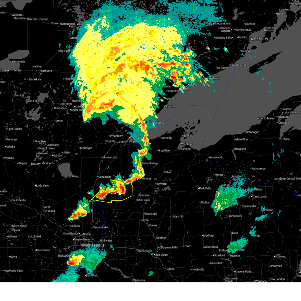
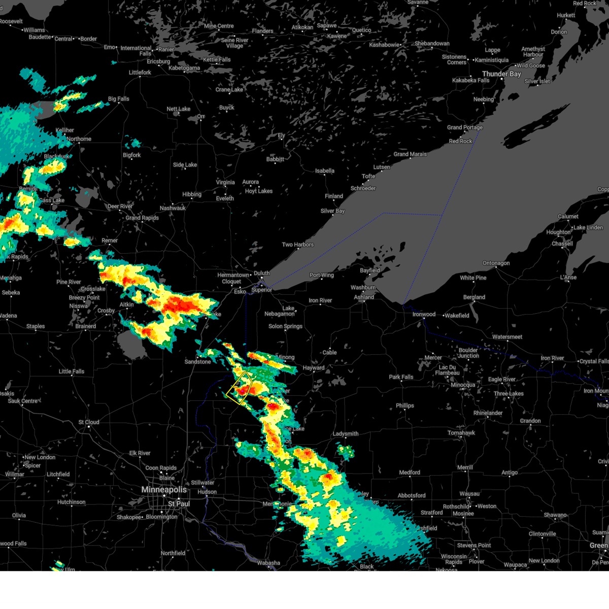
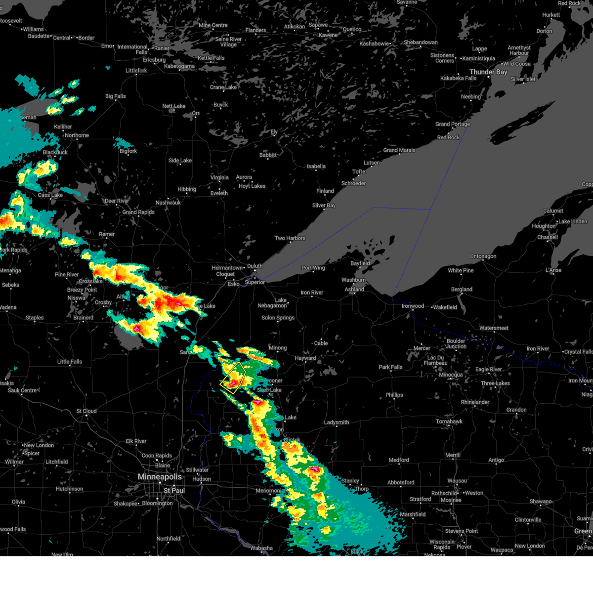
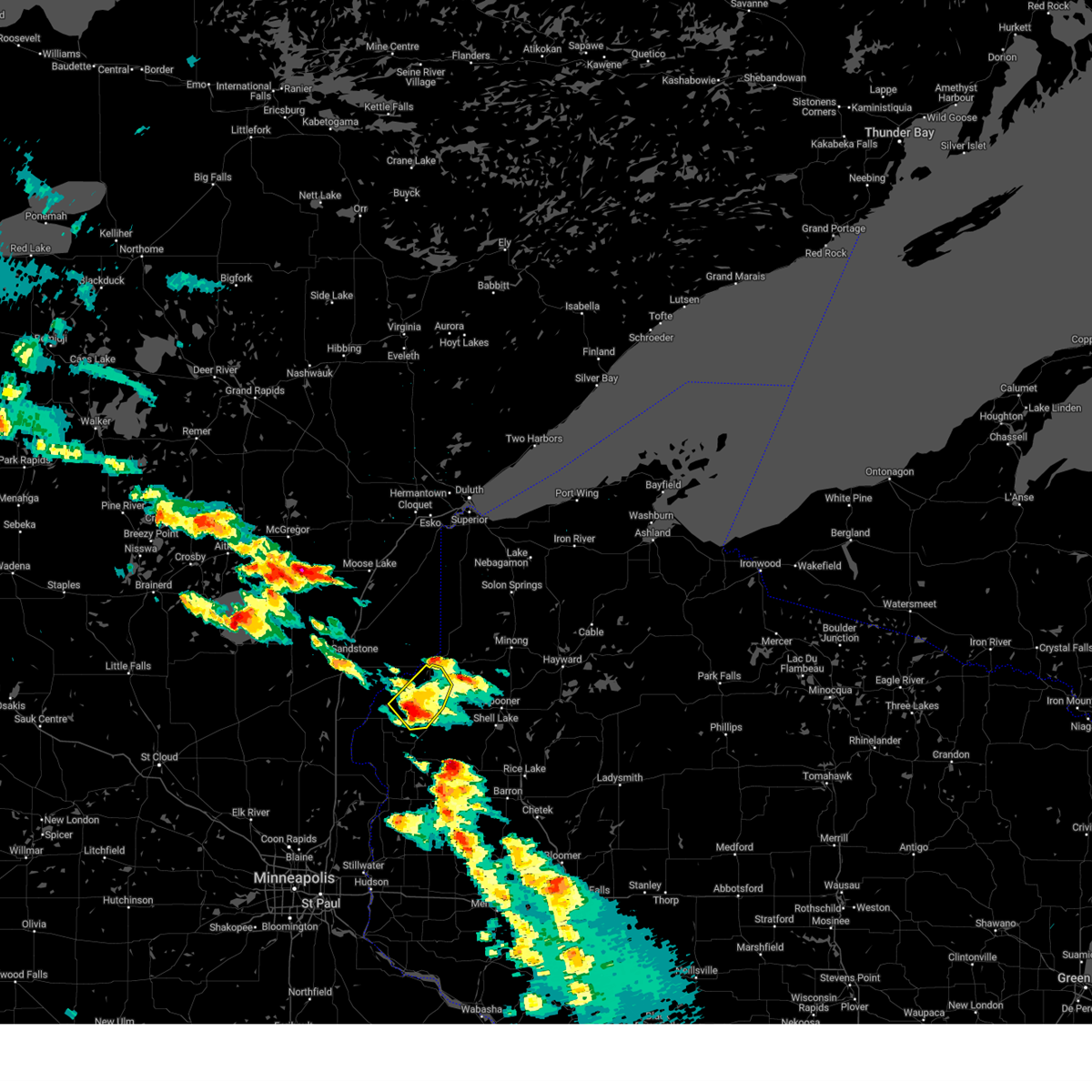
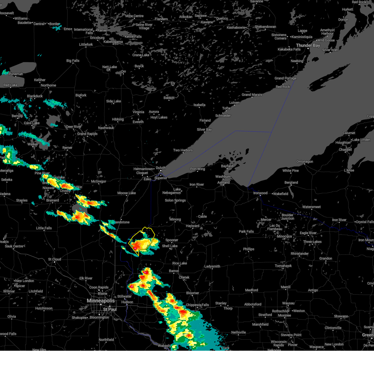
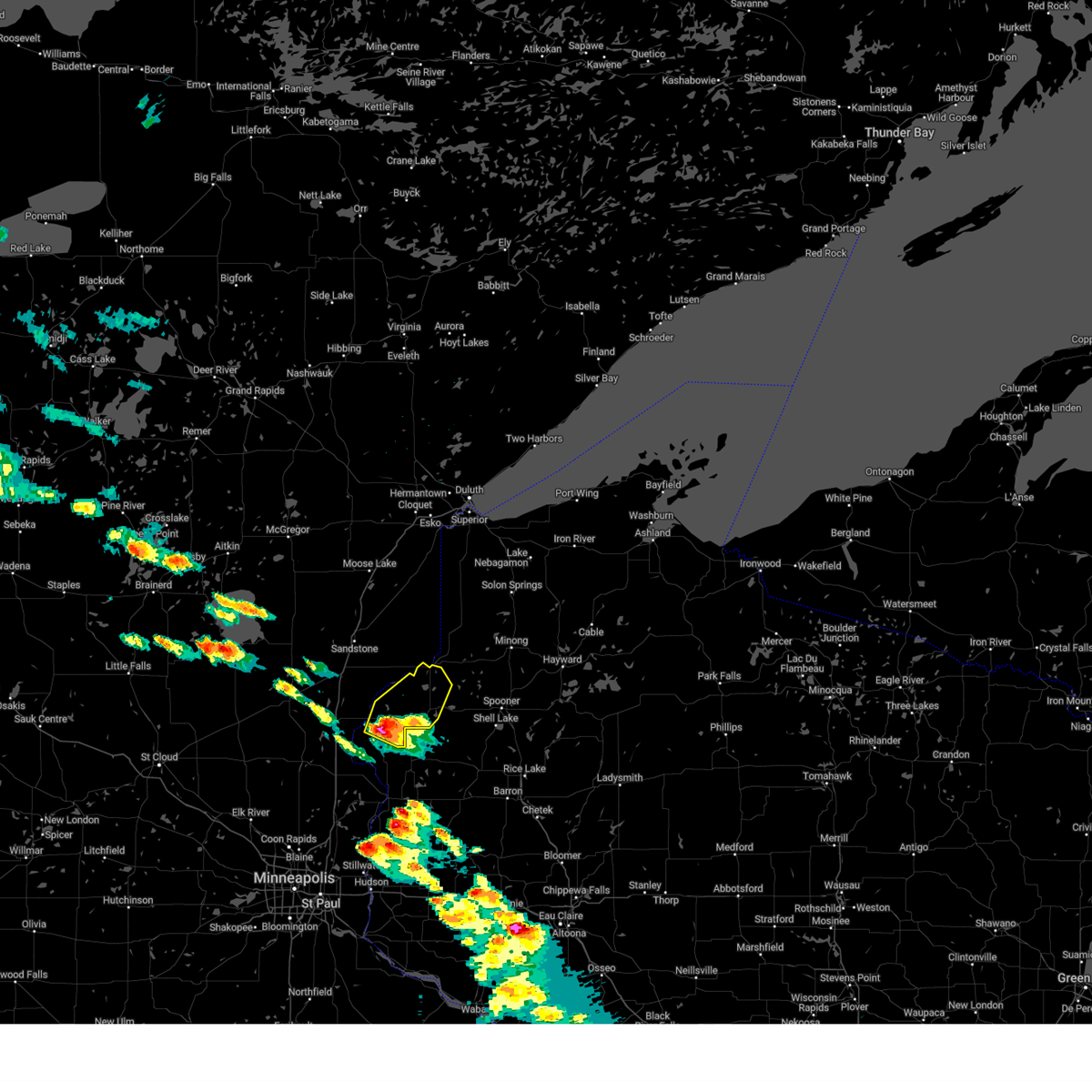
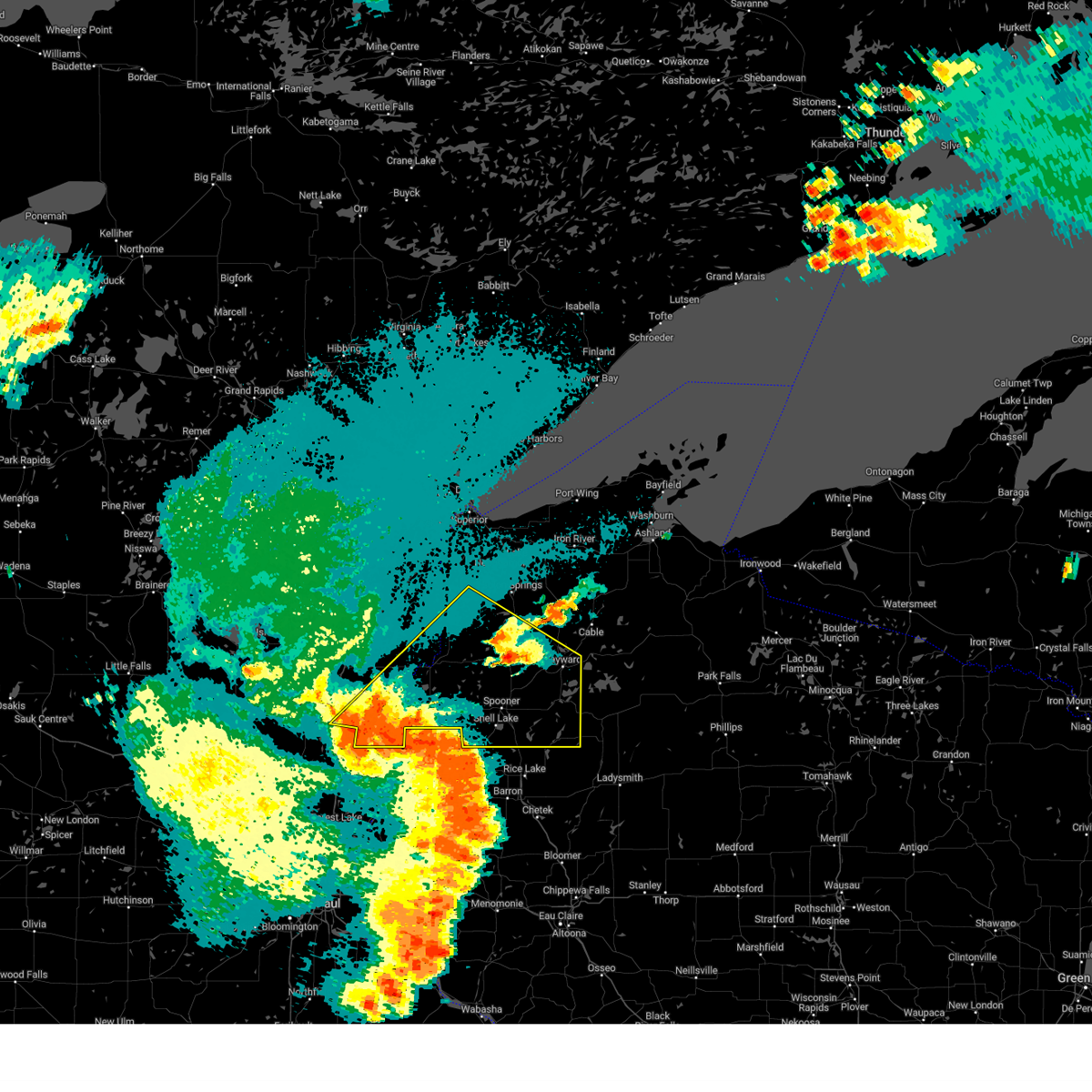
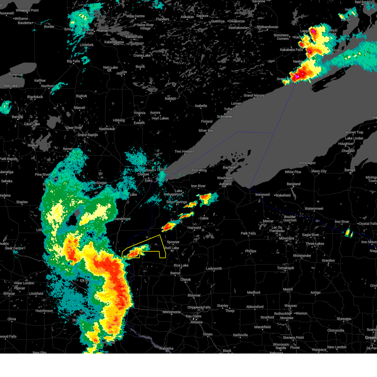
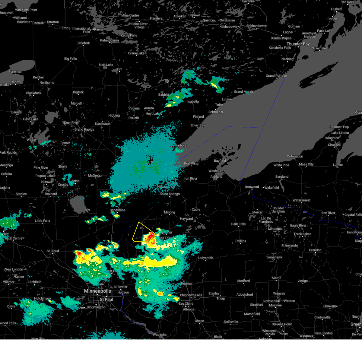
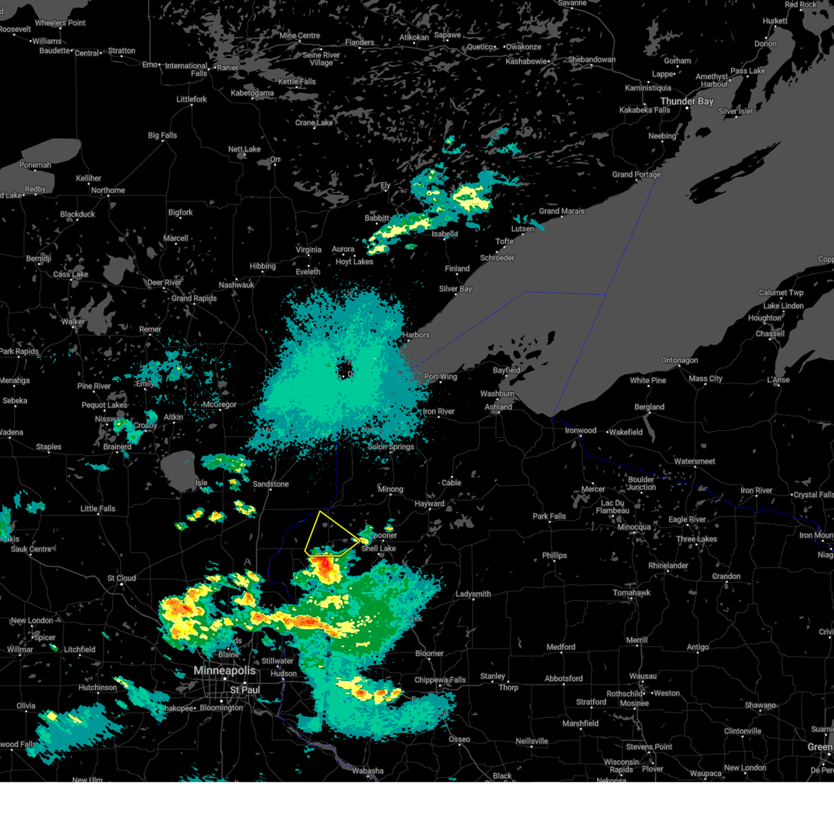
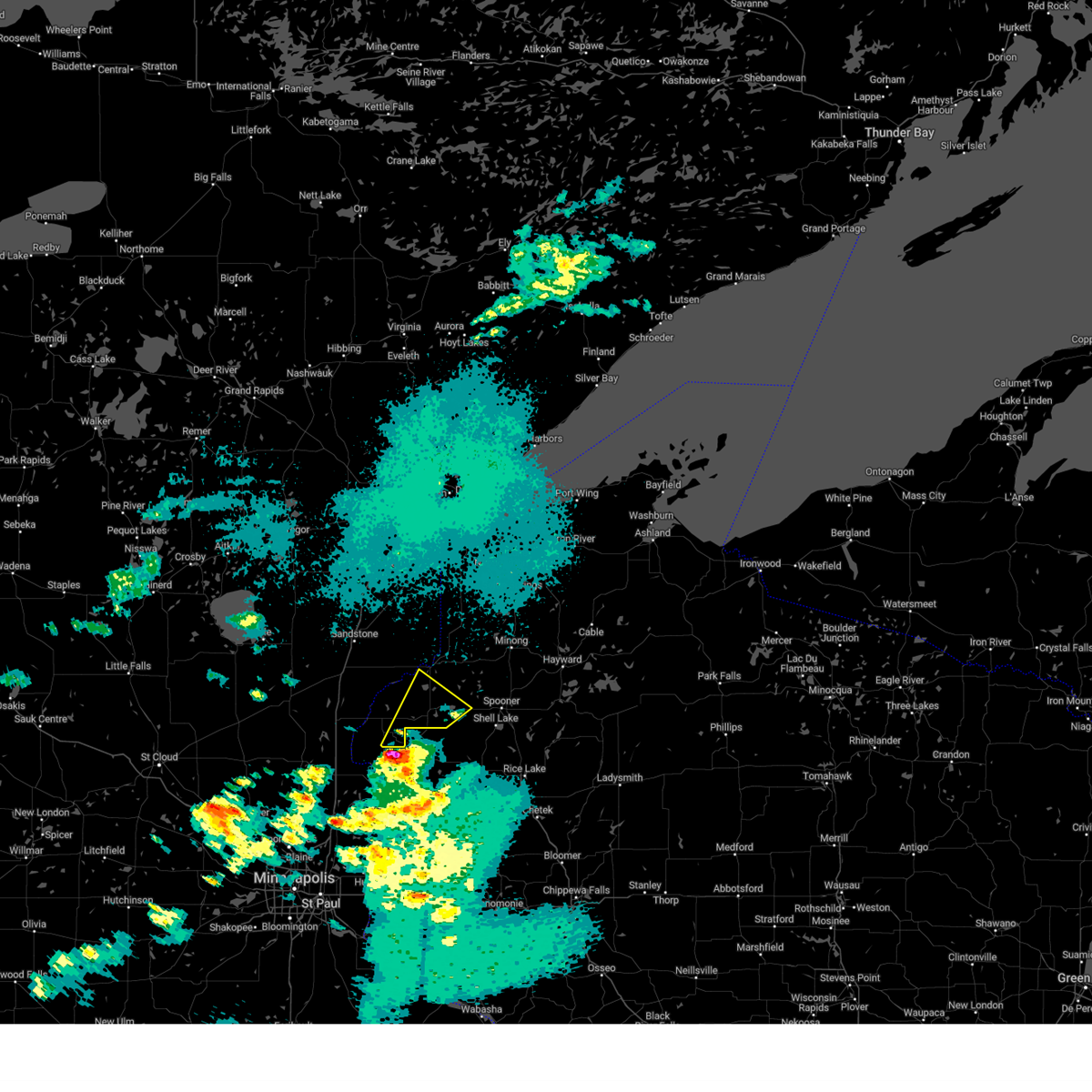
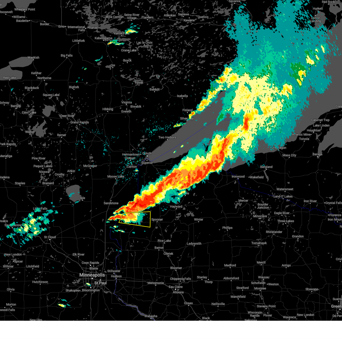
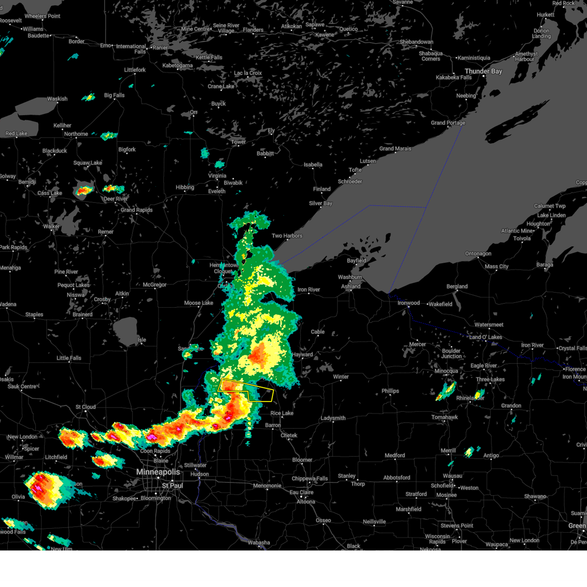
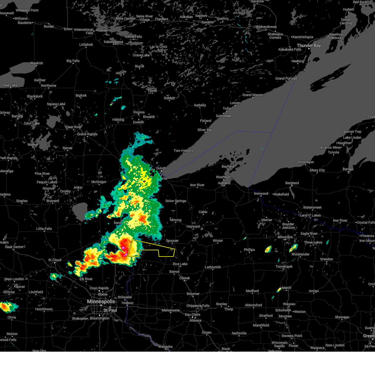
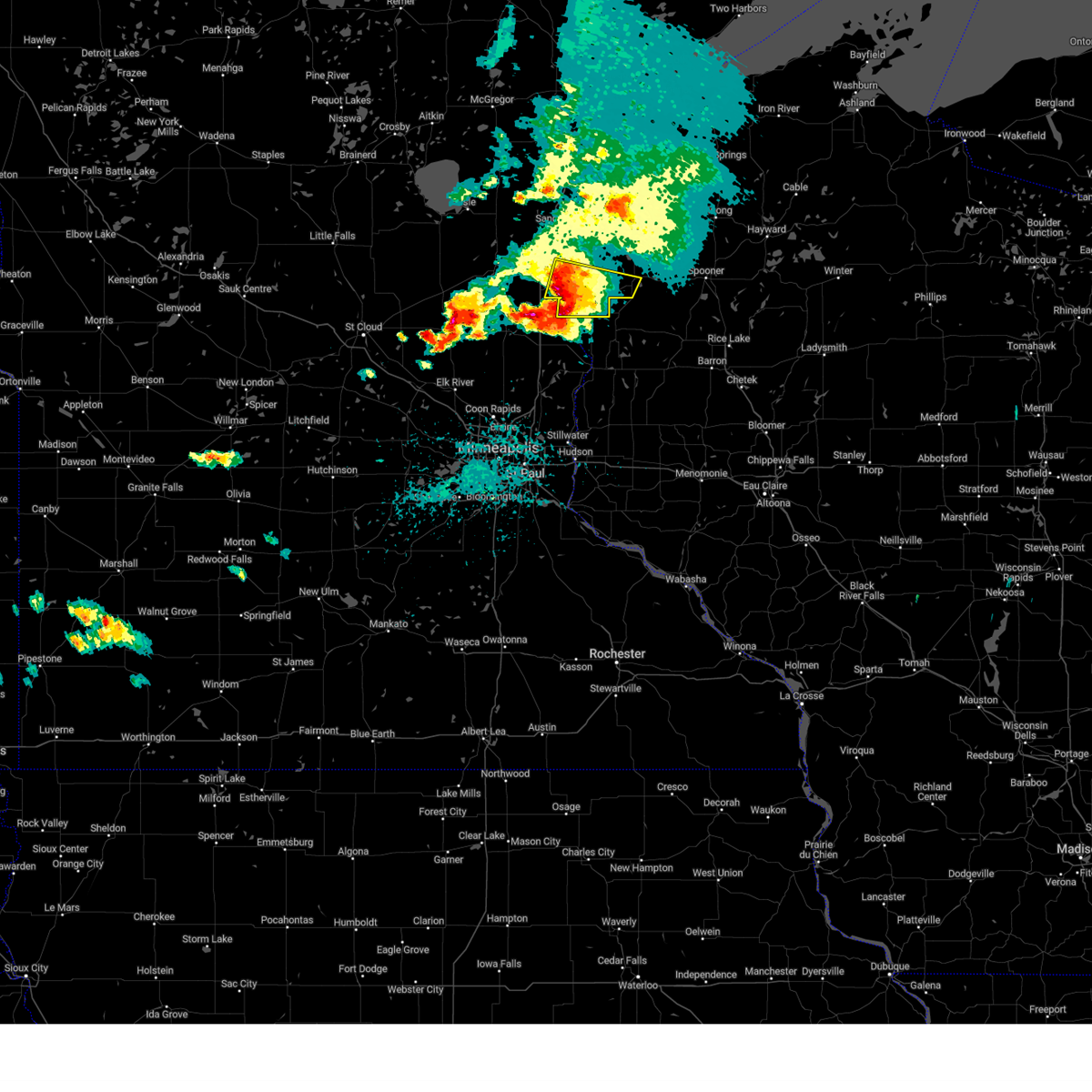
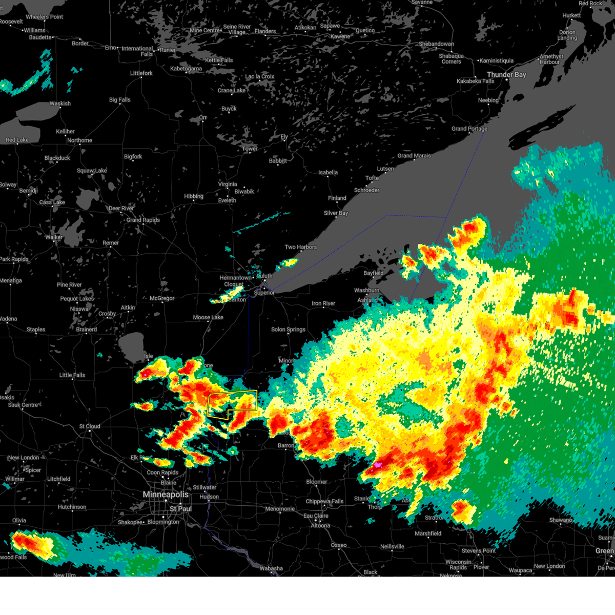
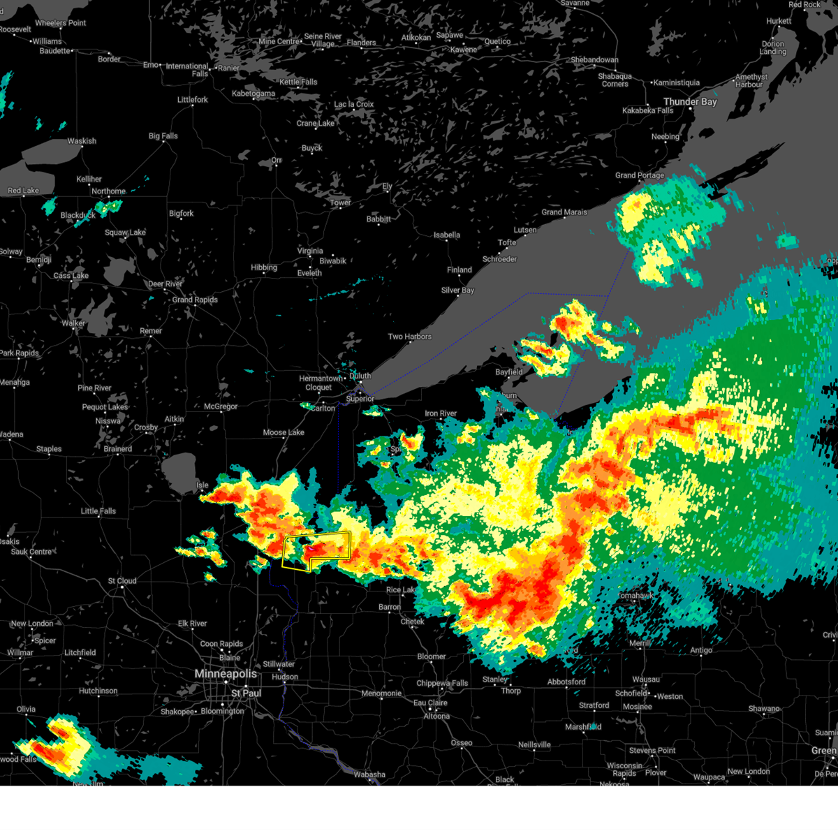
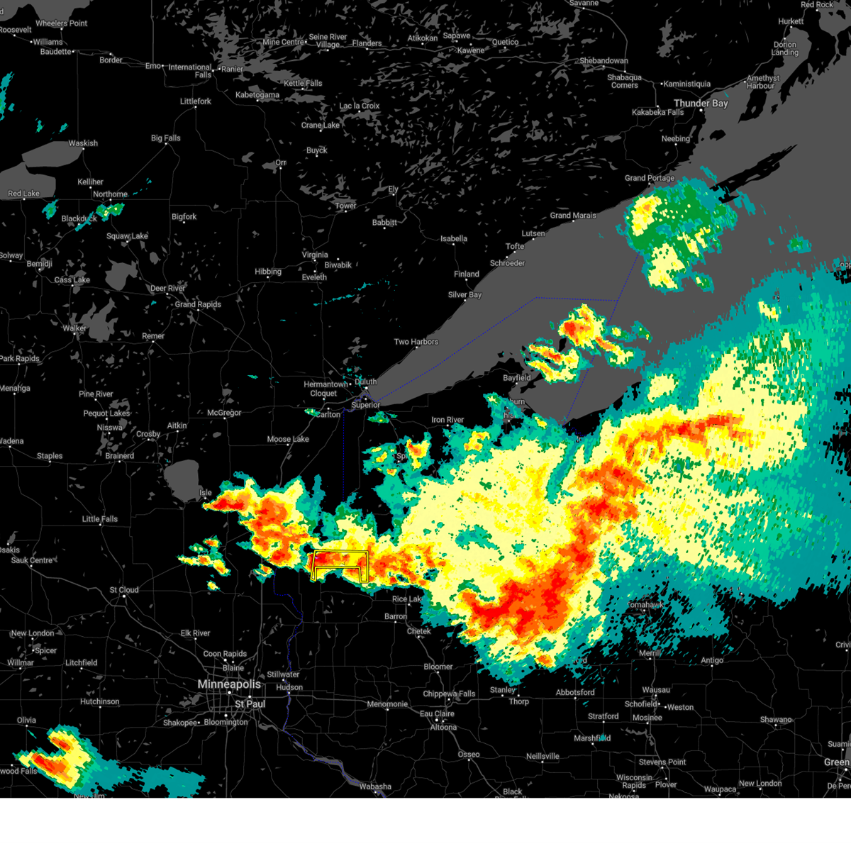
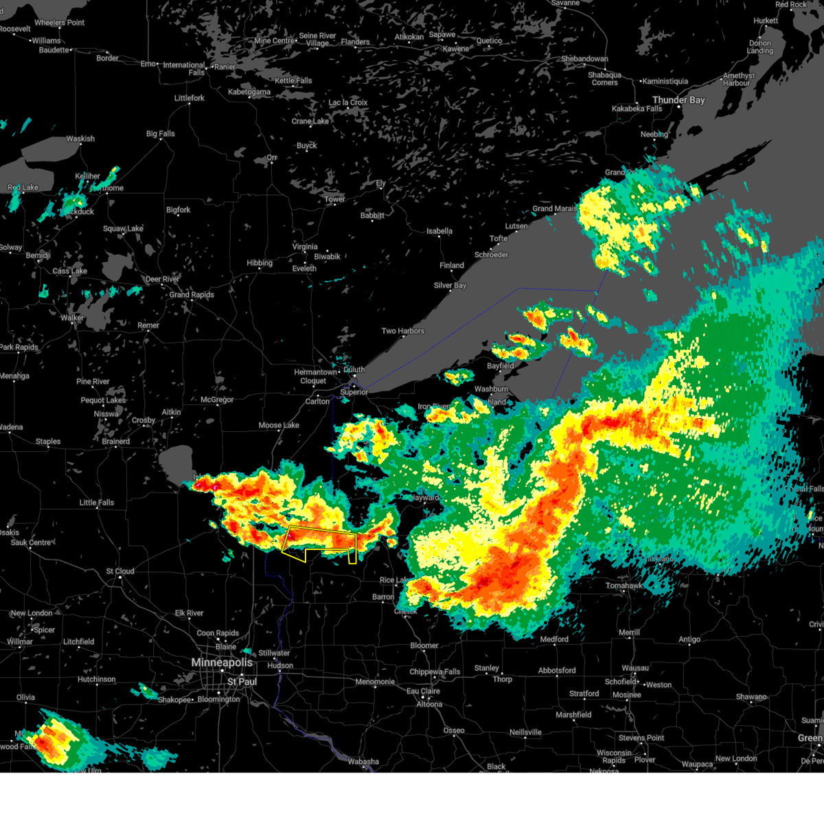
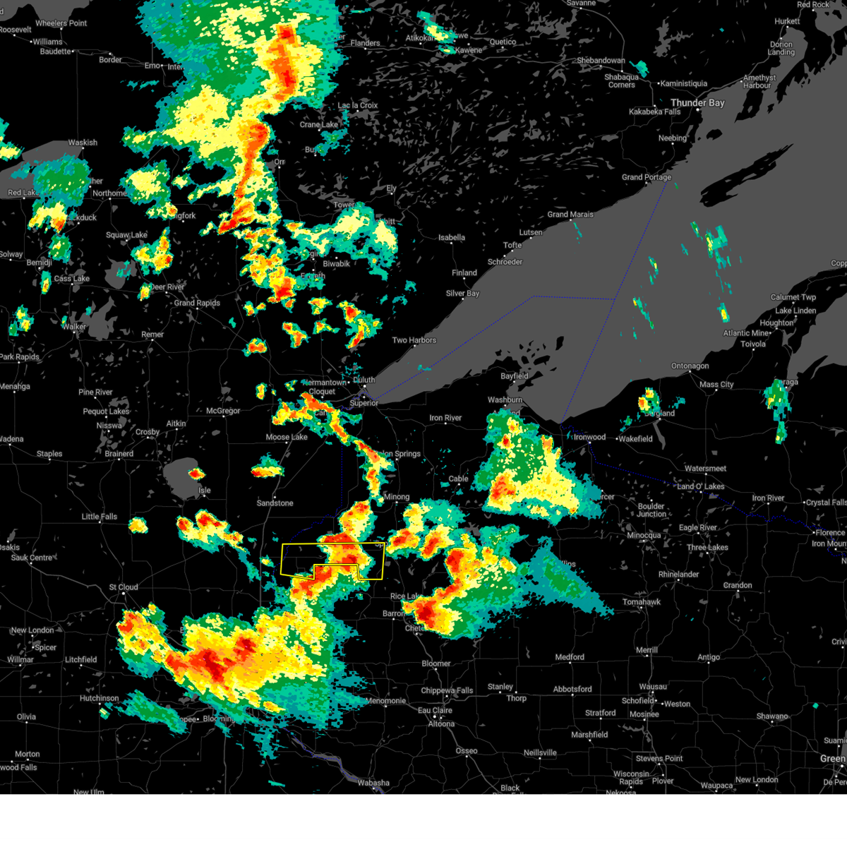
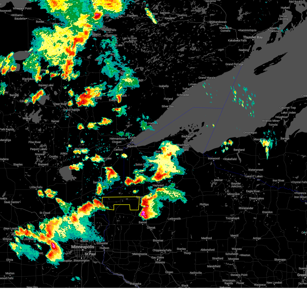
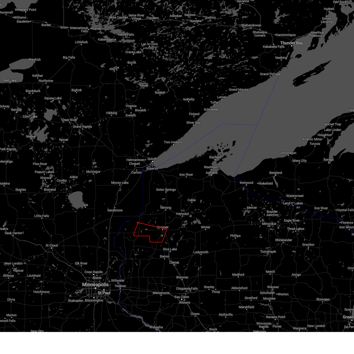
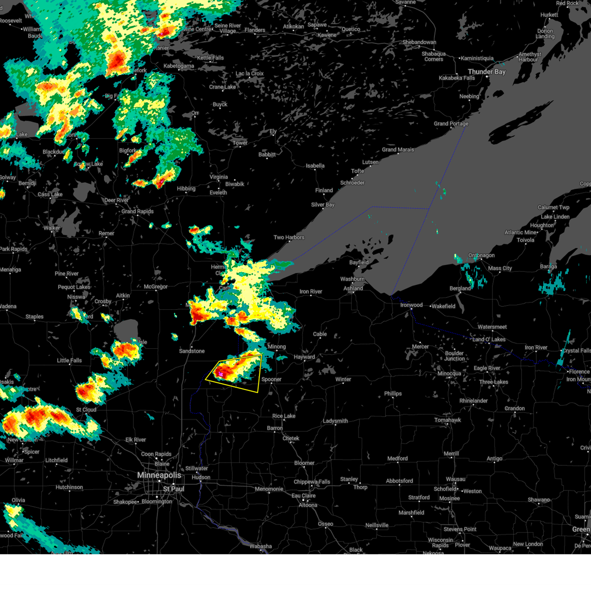
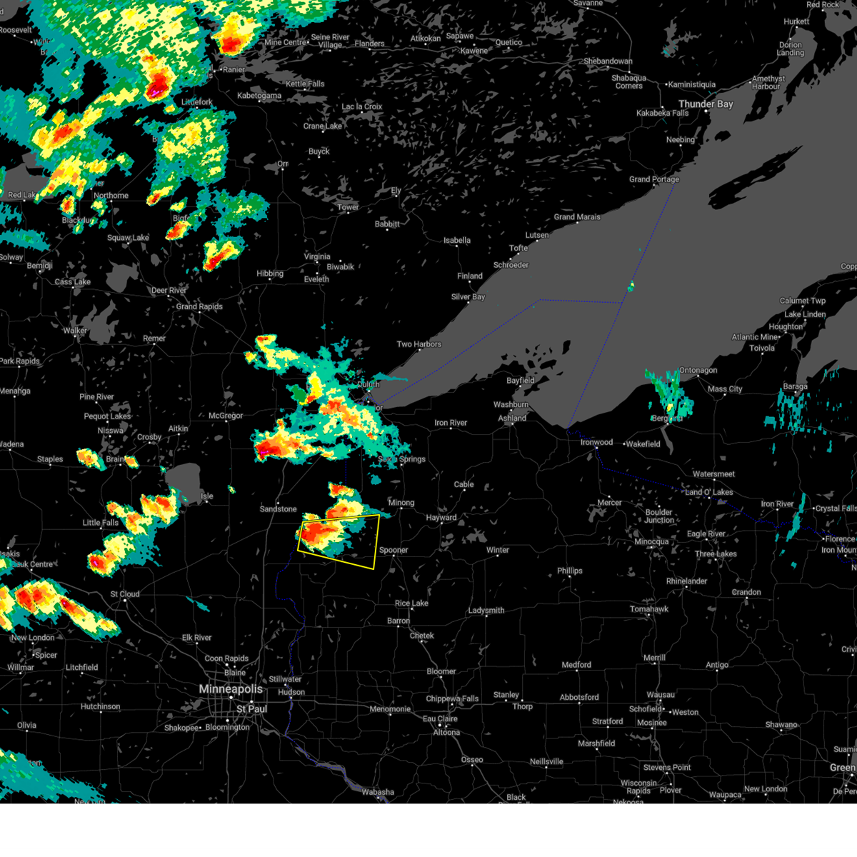
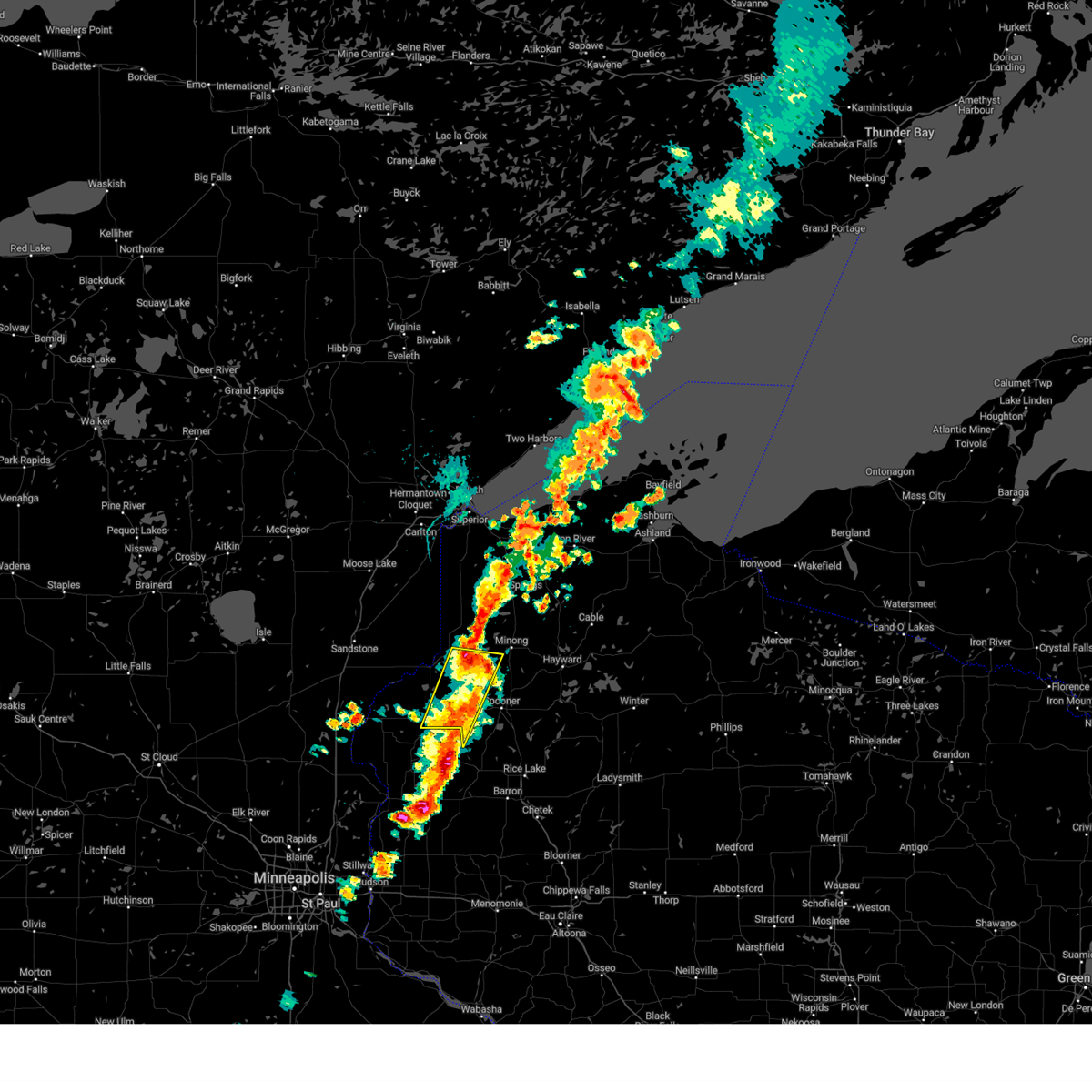
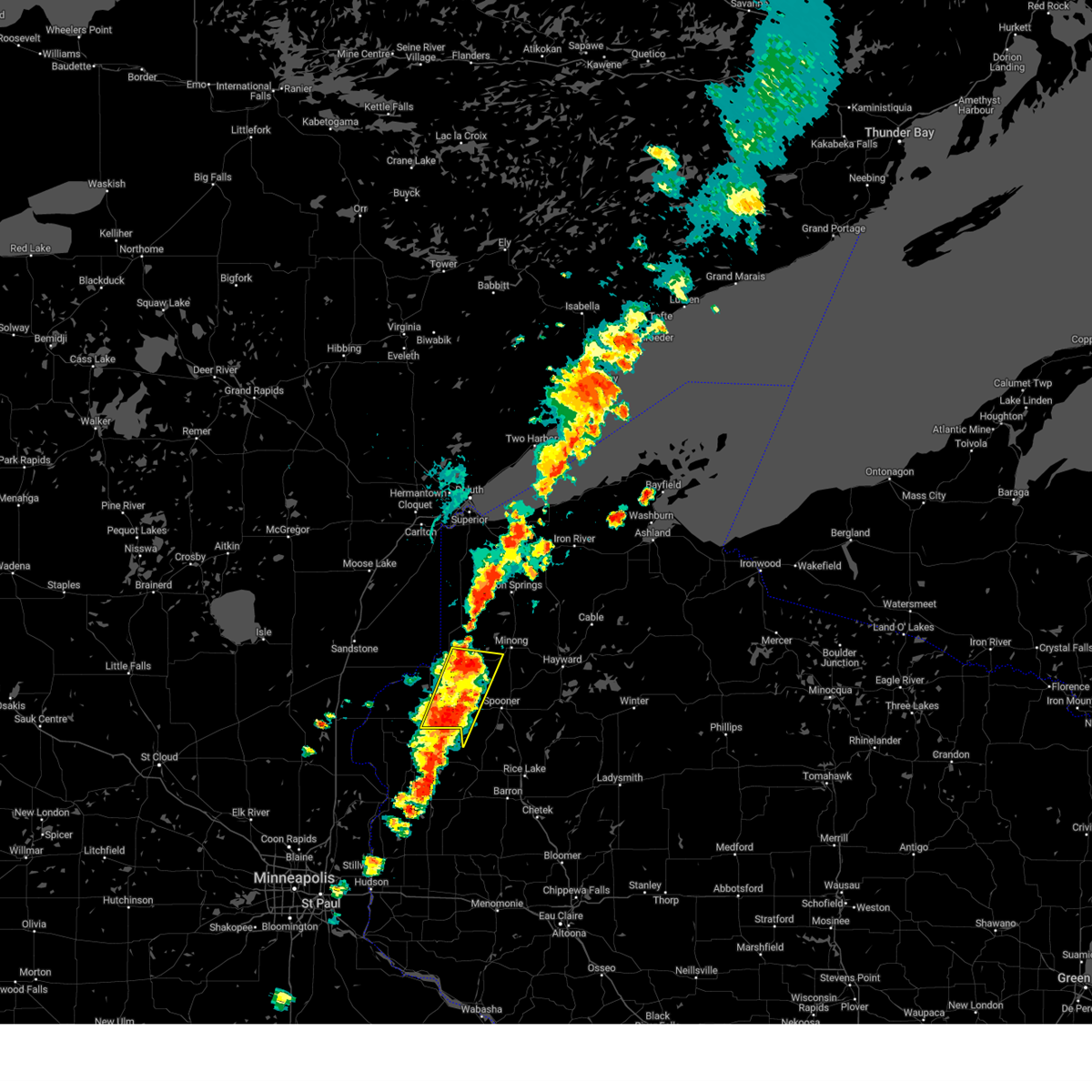
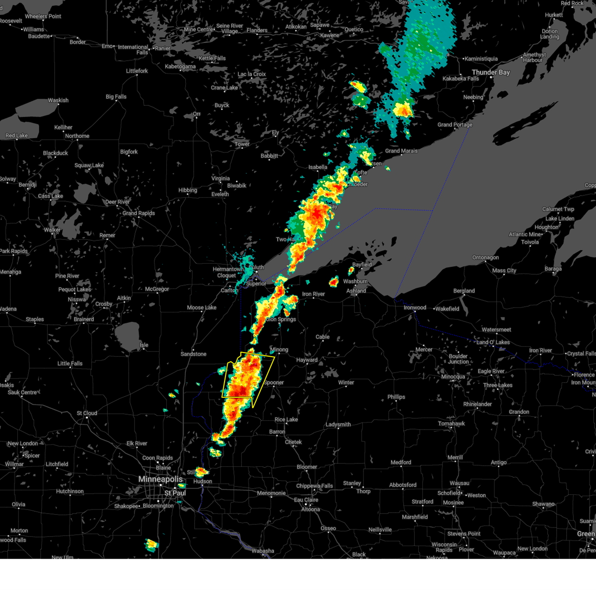
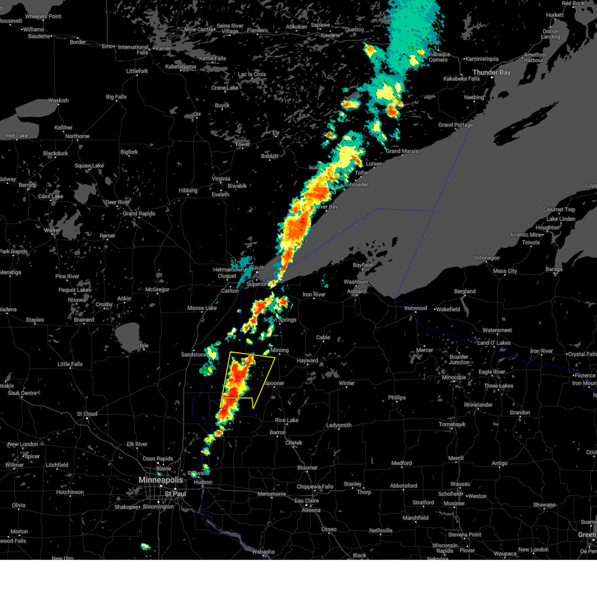
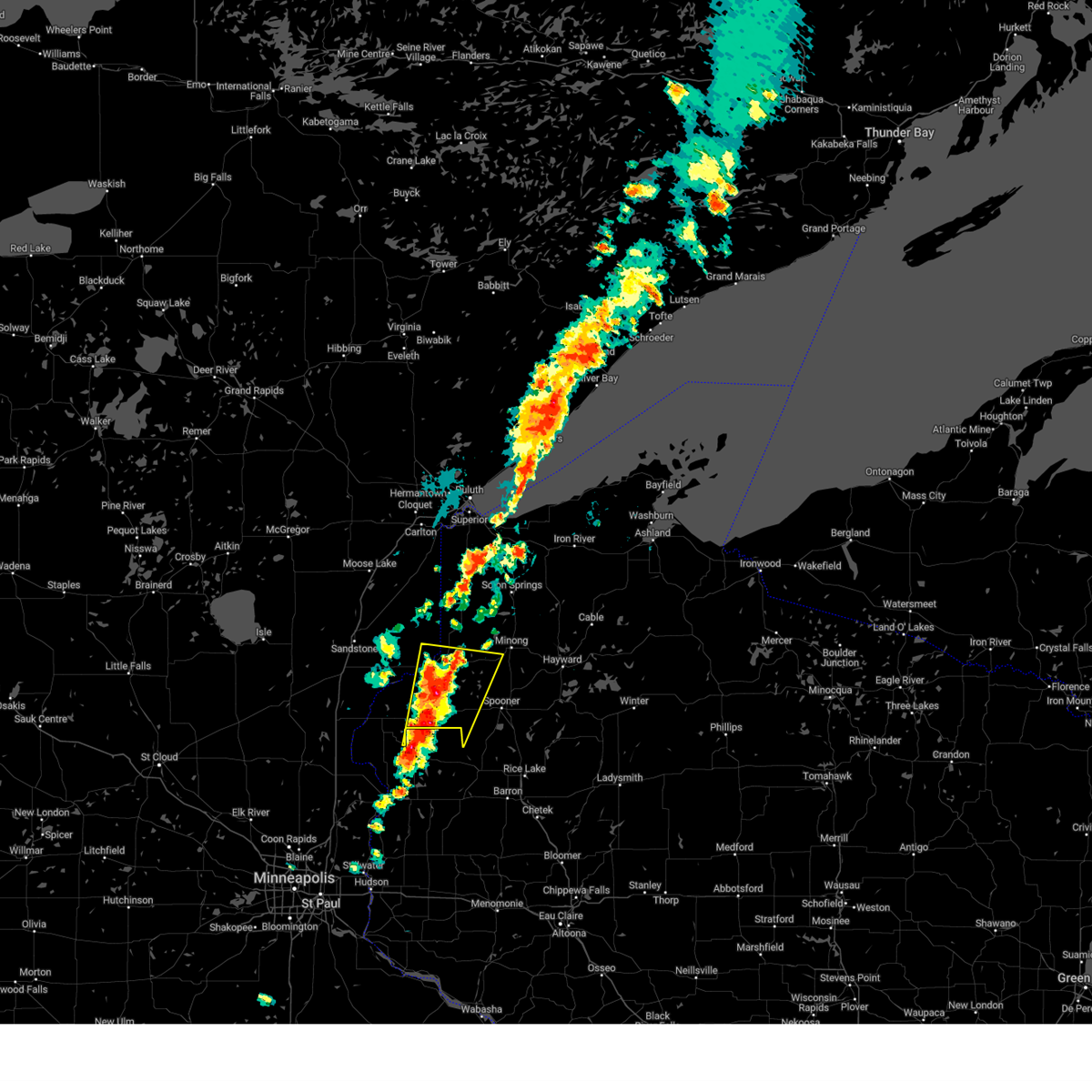
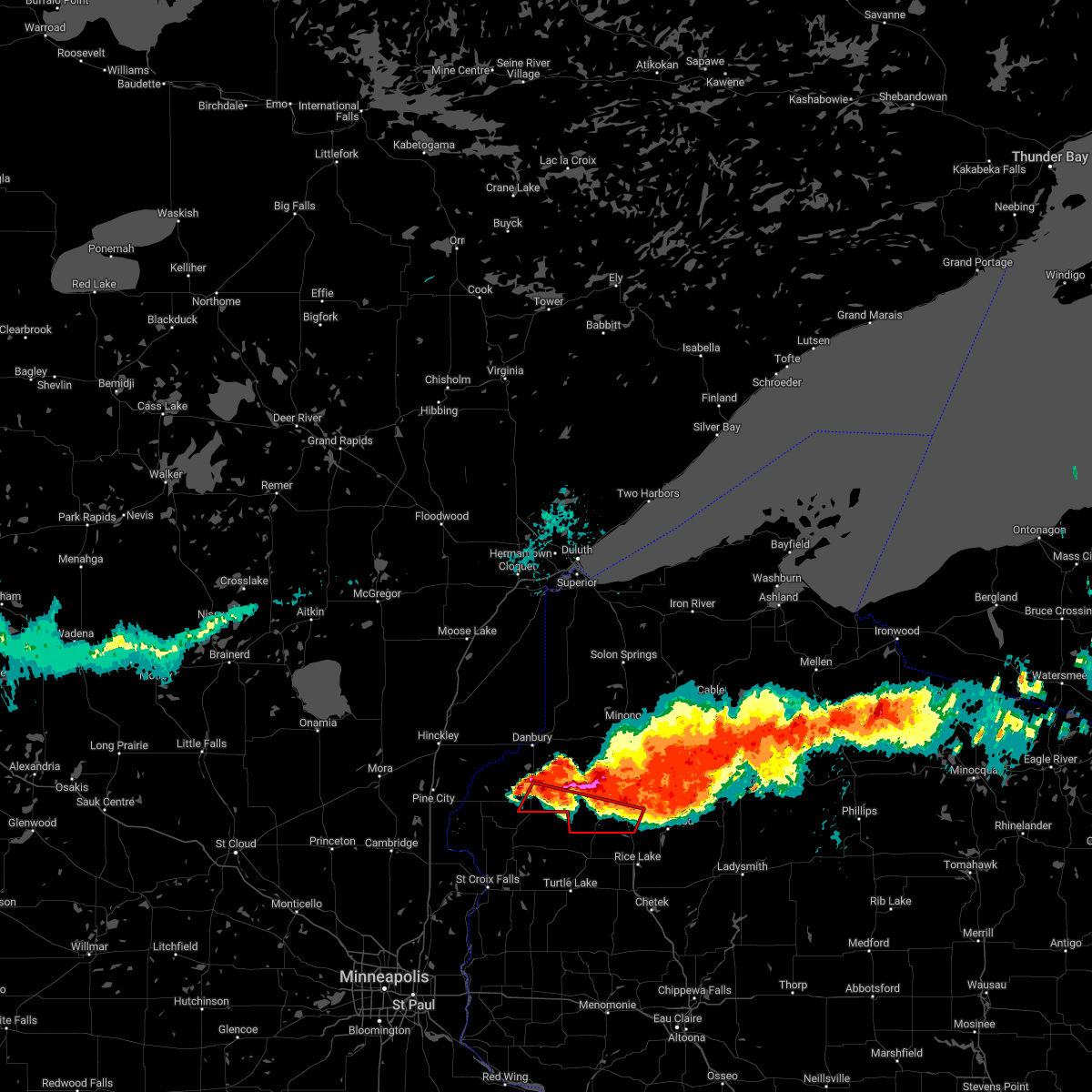
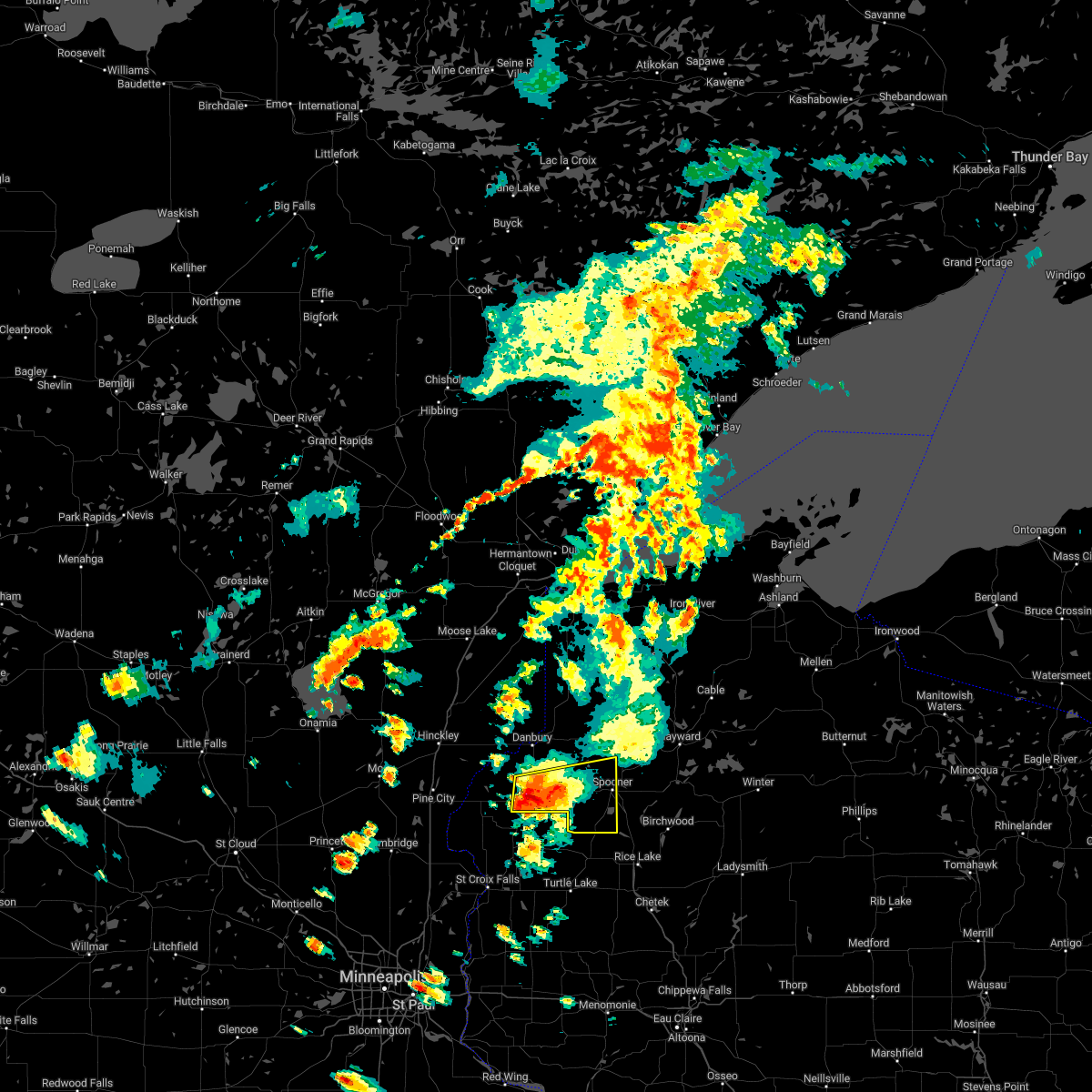
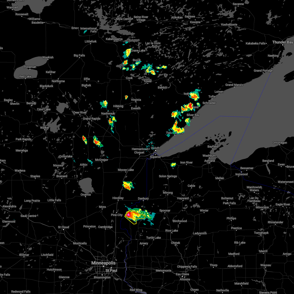
Hail Map for Siren, WI
The Siren, WI area has had 10 reports of on-the-ground hail by trained spotters, and has been under severe weather warnings 15 times during the past 12 months. Doppler radar has detected hail at or near Siren, WI on 39 occasions, including 4 occasions during the past year.
| Name: | Siren, WI |
| Where Located: | 70.1 miles NE of Minneapolis, MN |
| Map: | Google Map for Siren, WI |
| Population: | 806 |
| Housing Units: | 490 |
| More Info: | Search Google for Siren, WI |
1
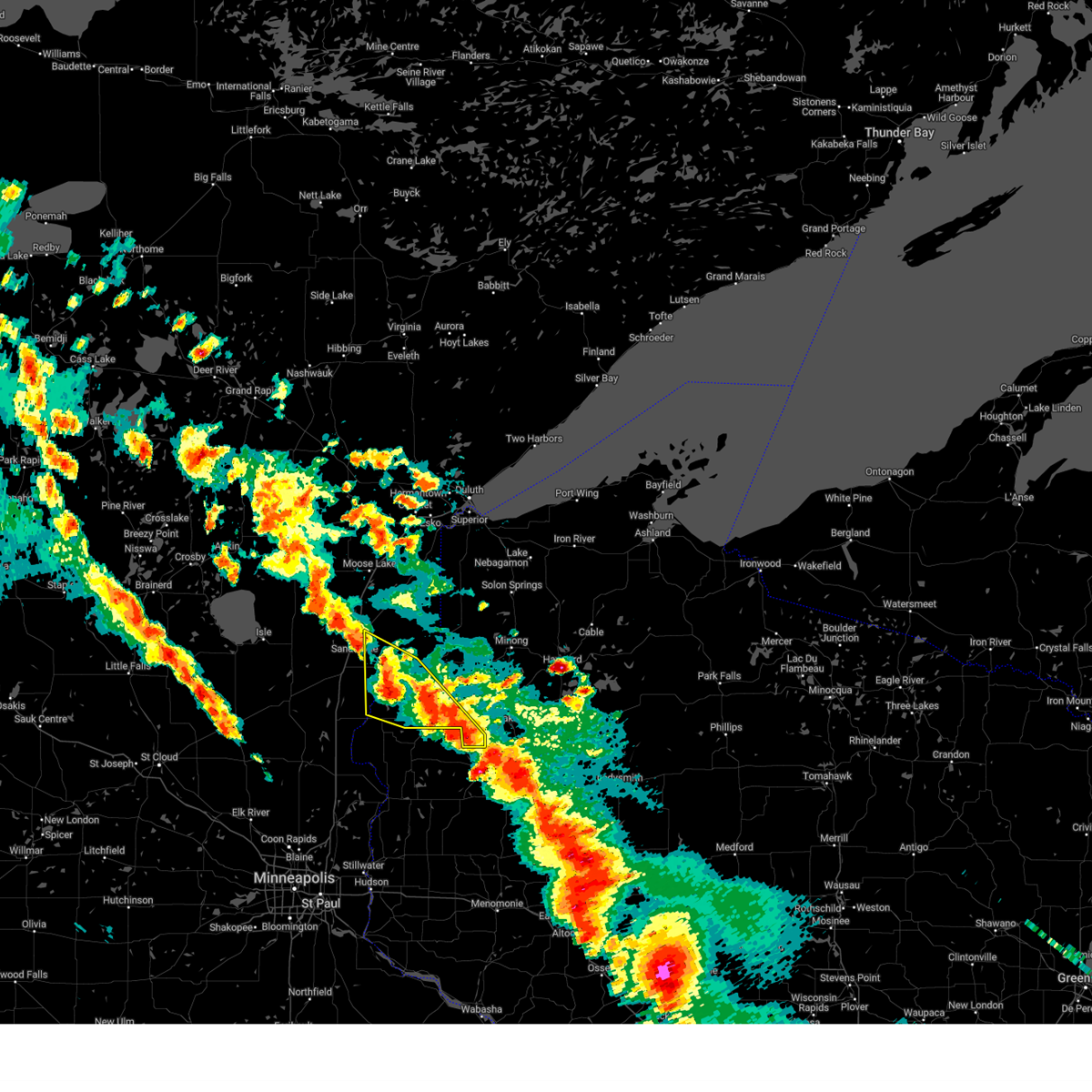
The Top Recent Hail Date for Siren, WI is Monday, July 22, 2024 (14th out of 39)

Hail and Wind Damage Spotted near Siren, WI
| Date / Time | Report Details |
|---|---|
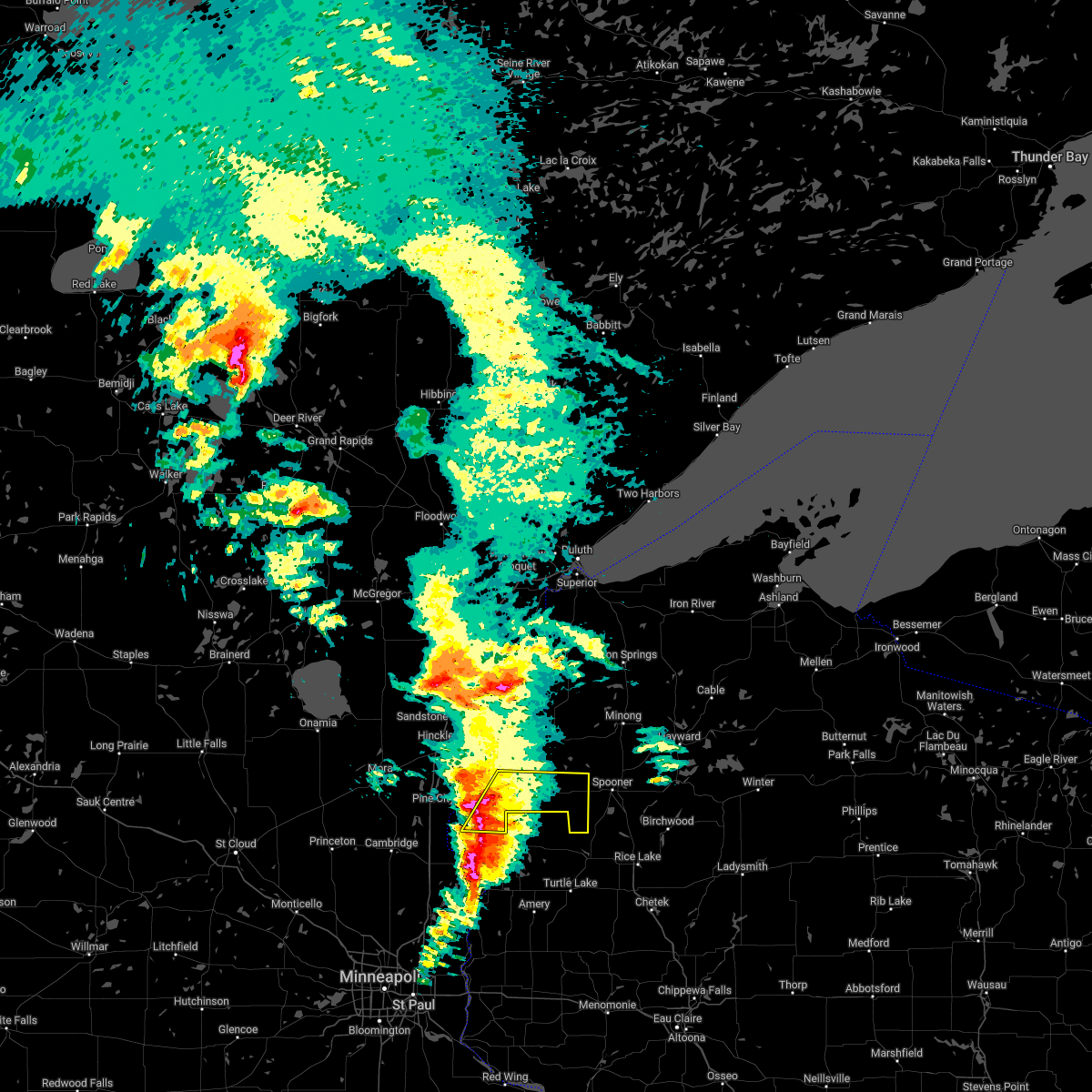
| 6/16/2025 7:44 PM CDT |
 At 743 pm cdt, severe thunderstorms were located along a line extending from near danbury to near webster to near grantsburg to 6 miles east of rock creek, moving east at 50 mph (radar indicated). Hazards include 60 mph wind gusts. Expect damage to roofs, siding, and trees. Locations impacted include, rock creek, grantsburg, siren, webster, webb lake wisconsin, saint croix band sand lake area, saint croix band clam lake area, danbury, hertel, saint croix band pike lake area, branstad, mille lacs band lena lake area, saint croix state park, oakland, falun, mckenzie lake, birch island lake, yellow lake, clam lake near siren, and phantom lake. At 743 pm cdt, severe thunderstorms were located along a line extending from near danbury to near webster to near grantsburg to 6 miles east of rock creek, moving east at 50 mph (radar indicated). Hazards include 60 mph wind gusts. Expect damage to roofs, siding, and trees. Locations impacted include, rock creek, grantsburg, siren, webster, webb lake wisconsin, saint croix band sand lake area, saint croix band clam lake area, danbury, hertel, saint croix band pike lake area, branstad, mille lacs band lena lake area, saint croix state park, oakland, falun, mckenzie lake, birch island lake, yellow lake, clam lake near siren, and phantom lake.
|
| 6/16/2025 7:17 PM CDT | At 716 pm cdt, severe thunderstorms were located along a line extending from 7 miles east of hinckley to 6 miles southwest of saint croix state park to near pine city to grasston, moving east at 55 mph (radar indicated). Hazards include 60 mph wind gusts. Expect damage to roofs, siding, and trees. Locations impacted include, pine city, hinckley, rock creek, grantsburg, trade lake, siren, webster, webb lake wisconsin, brook park, henriette, saint croix band sand lake area, saint croix band bashaw area, saint croix band clam lake area, danbury, hertel, saint croix state park, saint croix band pike lake area, branstad, mille lacs band lena lake area, and randall. |
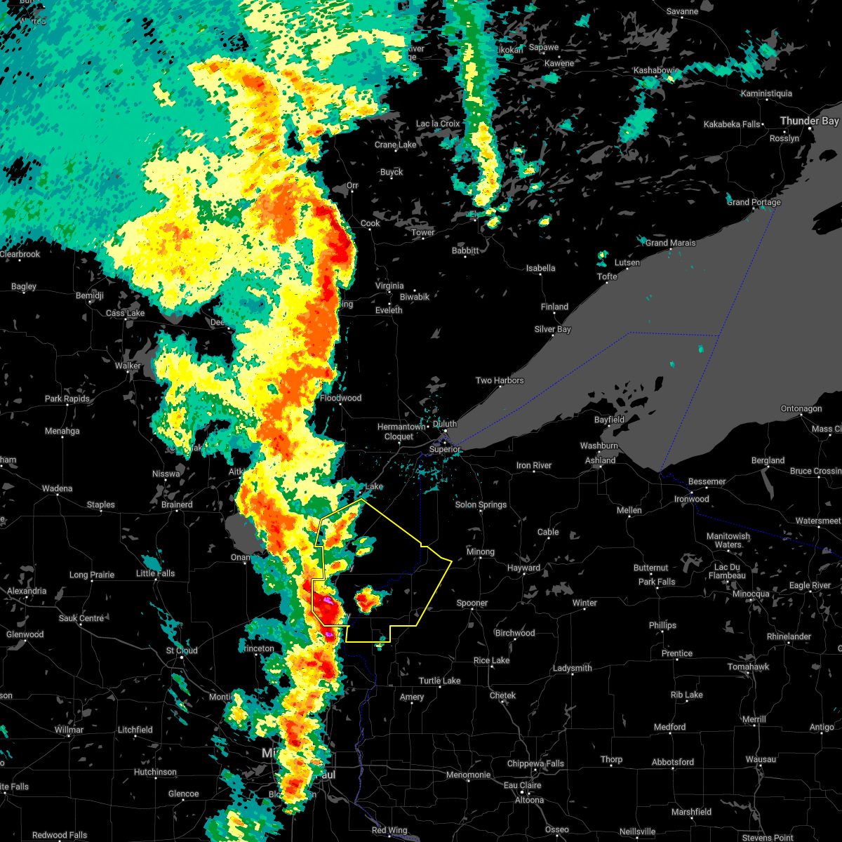
| 6/16/2025 6:53 PM CDT | Svrdlh the national weather service in duluth mn has issued a * severe thunderstorm warning for, southern pine county in east central minnesota, burnett county in northwestern wisconsin, * until 800 pm cdt. * at 653 pm cdt, severe thunderstorms were located along a line extending from 6 miles north of brook park to near quamba to near bock, moving east at 45 mph (radar indicated). Hazards include 60 mph wind gusts and penny size hail. expect damage to roofs, siding, and trees |
| 5/15/2025 4:29 PM CDT |
 The storms which prompted the warning have weakened below severe limits, and no longer pose an immediate threat to life or property. therefore, the warning will be allowed to expire. a tornado watch remains in effect until 800 pm cdt for east central minnesota, and northwestern wisconsin. The storms which prompted the warning have weakened below severe limits, and no longer pose an immediate threat to life or property. therefore, the warning will be allowed to expire. a tornado watch remains in effect until 800 pm cdt for east central minnesota, and northwestern wisconsin.
|
| 5/15/2025 4:22 PM CDT |
 At 421 pm cdt, severe thunderstorms were located along a line extending from near grantsburg to near siren to near cumberland, moving north at 55 mph (radar indicated). Hazards include 60 mph wind gusts and quarter size hail. Hail damage to vehicles is expected. expect wind damage to roofs, siding, and trees. these severe storms will be near, siren, saint croix state park, and saint croix band clam lake area around 425 pm cdt. Other locations in the path of these severe thunderstorms include webster, saint croix band pike lake area, saint croix band sand lake area, hertel, mille lacs band lena lake area and saint croix band bashaw area. At 421 pm cdt, severe thunderstorms were located along a line extending from near grantsburg to near siren to near cumberland, moving north at 55 mph (radar indicated). Hazards include 60 mph wind gusts and quarter size hail. Hail damage to vehicles is expected. expect wind damage to roofs, siding, and trees. these severe storms will be near, siren, saint croix state park, and saint croix band clam lake area around 425 pm cdt. Other locations in the path of these severe thunderstorms include webster, saint croix band pike lake area, saint croix band sand lake area, hertel, mille lacs band lena lake area and saint croix band bashaw area.
|
| 5/15/2025 4:06 PM CDT |
 Svrdlh the national weather service in duluth mn has issued a * severe thunderstorm warning for, central pine county in east central minnesota, southwestern washburn county in northwestern wisconsin, burnett county in northwestern wisconsin, * until 430 pm cdt. * at 405 pm cdt, severe thunderstorms were located along a line extending from 7 miles southwest of trade lake to near milltown to near clayton, moving north at 55 mph (radar indicated). Hazards include 60 mph wind gusts and quarter size hail. Hail damage to vehicles is expected. expect wind damage to roofs, siding, and trees. severe thunderstorms will be near, grantsburg, trade lake, and branstad around 410 pm cdt. saint croix state park around 420 pm cdt. Siren around 425 pm cdt. Svrdlh the national weather service in duluth mn has issued a * severe thunderstorm warning for, central pine county in east central minnesota, southwestern washburn county in northwestern wisconsin, burnett county in northwestern wisconsin, * until 430 pm cdt. * at 405 pm cdt, severe thunderstorms were located along a line extending from 7 miles southwest of trade lake to near milltown to near clayton, moving north at 55 mph (radar indicated). Hazards include 60 mph wind gusts and quarter size hail. Hail damage to vehicles is expected. expect wind damage to roofs, siding, and trees. severe thunderstorms will be near, grantsburg, trade lake, and branstad around 410 pm cdt. saint croix state park around 420 pm cdt. Siren around 425 pm cdt.
|
| 4/17/2025 1:14 PM CDT |
 The storm which prompted the warning has weakened below severe limits, and no longer poses an immediate threat to life or property. therefore, the warning will be allowed to expire. however, small hail is still possible with this thunderstorm. The storm which prompted the warning has weakened below severe limits, and no longer poses an immediate threat to life or property. therefore, the warning will be allowed to expire. however, small hail is still possible with this thunderstorm.
|
| 4/17/2025 1:04 PM CDT |
 At 104 pm cdt, a severe thunderstorm was located over webster, or 21 miles west of spooner, moving northeast at 30 mph (radar indicated). Hazards include 60 mph wind gusts and quarter size hail. Hail damage to vehicles is expected. expect wind damage to roofs, siding, and trees. Locations impacted include, webster, siren, clam lake near siren, saint croix band pike lake area, oakland, saint croix band clam lake area, and yellow lake. At 104 pm cdt, a severe thunderstorm was located over webster, or 21 miles west of spooner, moving northeast at 30 mph (radar indicated). Hazards include 60 mph wind gusts and quarter size hail. Hail damage to vehicles is expected. expect wind damage to roofs, siding, and trees. Locations impacted include, webster, siren, clam lake near siren, saint croix band pike lake area, oakland, saint croix band clam lake area, and yellow lake.
|
| 4/17/2025 12:51 PM CDT |
 At 1251 pm cdt, a severe thunderstorm was located near siren, or 23 miles east of pine city, moving northeast at 30 mph (radar indicated). Hazards include 60 mph wind gusts and quarter size hail. Hail damage to vehicles is expected. expect wind damage to roofs, siding, and trees. Locations impacted include, webster, danbury, falun, siren, clam lake near siren, saint croix band pike lake area, saint croix band danbury area, oakland, saint croix band clam lake area, and yellow lake. At 1251 pm cdt, a severe thunderstorm was located near siren, or 23 miles east of pine city, moving northeast at 30 mph (radar indicated). Hazards include 60 mph wind gusts and quarter size hail. Hail damage to vehicles is expected. expect wind damage to roofs, siding, and trees. Locations impacted include, webster, danbury, falun, siren, clam lake near siren, saint croix band pike lake area, saint croix band danbury area, oakland, saint croix band clam lake area, and yellow lake.
|
| 4/17/2025 12:39 PM CDT |
 At 1238 pm cdt, a severe thunderstorm was located near grantsburg, or 19 miles east of pine city, moving northeast at 30 mph (radar indicated). Hazards include 60 mph wind gusts and quarter size hail. Hail damage to vehicles is expected. expect wind damage to roofs, siding, and trees. Locations impacted include, webster and danbury. At 1238 pm cdt, a severe thunderstorm was located near grantsburg, or 19 miles east of pine city, moving northeast at 30 mph (radar indicated). Hazards include 60 mph wind gusts and quarter size hail. Hail damage to vehicles is expected. expect wind damage to roofs, siding, and trees. Locations impacted include, webster and danbury.
|
| 4/17/2025 12:26 PM CDT |
 Svrdlh the national weather service in duluth mn has issued a * severe thunderstorm warning for, southern burnett county in northwestern wisconsin, * until 115 pm cdt. * at 1226 pm cdt, a severe thunderstorm was located over branstad, or 16 miles southeast of pine city, moving northeast at 30 mph (radar indicated). Hazards include 60 mph wind gusts and quarter size hail. Hail damage to vehicles is expected. expect wind damage to roofs, siding, and trees. this severe thunderstorm will be near, grantsburg around 1230 pm cdt. Other locations in the path of this severe thunderstorm include webster and danbury. Svrdlh the national weather service in duluth mn has issued a * severe thunderstorm warning for, southern burnett county in northwestern wisconsin, * until 115 pm cdt. * at 1226 pm cdt, a severe thunderstorm was located over branstad, or 16 miles southeast of pine city, moving northeast at 30 mph (radar indicated). Hazards include 60 mph wind gusts and quarter size hail. Hail damage to vehicles is expected. expect wind damage to roofs, siding, and trees. this severe thunderstorm will be near, grantsburg around 1230 pm cdt. Other locations in the path of this severe thunderstorm include webster and danbury.
|
| 8/29/2024 5:30 PM CDT | At 530 pm cdt, severe thunderstorms were located along a line extending from near grantsburg to near frederic to near luck, moving northeast at 50 mph (radar indicated). Hazards include 60 mph wind gusts. Expect damage to roofs, siding, and trees. Locations impacted include, siren, saint croix band clam lake area, webster, saint croix band pike lake area, saint croix band bashaw area, saint croix band sand lake area, hertel, spooner, shell lake, webb lake wisconsin and trego. |
| 8/29/2024 5:13 PM CDT | Svrdlh the national weather service in duluth mn has issued a * severe thunderstorm warning for, western washburn county in northwestern wisconsin, burnett county in northwestern wisconsin, * until 615 pm cdt. * at 513 pm cdt, severe thunderstorms were located along a line extending from 6 miles southeast of rush city to 10 miles northwest of st. croix falls to near taylors falls, moving northeast at 45 mph (radar indicated). Hazards include 60 mph wind gusts. Expect damage to roofs, siding, and trees. severe thunderstorms will be near, trade lake and branstad around 525 pm cdt. grantsburg around 530 pm cdt. Other locations in the path of these severe thunderstorms include siren, saint croix band clam lake area, webster, saint croix band pike lake area, saint croix band sand lake area, hertel and saint croix band bashaw area. |
| 8/26/2024 8:41 PM CDT |
 Svrdlh the national weather service in duluth mn has issued a * severe thunderstorm warning for, southeastern pine county in east central minnesota, southwestern douglas county in northwestern wisconsin, washburn county in northwestern wisconsin, burnett county in northwestern wisconsin, western sawyer county in northwestern wisconsin, * until 930 pm cdt. * at 837 pm cdt, severe thunderstorms were located along a line extending from near grantsburg to 8 miles northwest of cumberland to near glenwood city, moving northeast at 55 mph (radar indicated). Hazards include 60 mph wind gusts and quarter size hail. Hail damage to vehicles is expected. expect wind damage to roofs, siding, and trees. severe thunderstorms will be near, siren, webster, hertel, saint croix state park, saint croix band pike lake area, saint croix band bashaw area, saint croix band clam lake area, and saint croix band sand lake area around 845 pm cdt. shell lake and mille lacs band lena lake area around 850 pm cdt. spooner and danbury around 855 pm cdt. Other locations in the path of these severe thunderstorms include webb lake wisconsin, trego, cloverton, minong, stone lake, birchwood, dairyland and hayward. Svrdlh the national weather service in duluth mn has issued a * severe thunderstorm warning for, southeastern pine county in east central minnesota, southwestern douglas county in northwestern wisconsin, washburn county in northwestern wisconsin, burnett county in northwestern wisconsin, western sawyer county in northwestern wisconsin, * until 930 pm cdt. * at 837 pm cdt, severe thunderstorms were located along a line extending from near grantsburg to 8 miles northwest of cumberland to near glenwood city, moving northeast at 55 mph (radar indicated). Hazards include 60 mph wind gusts and quarter size hail. Hail damage to vehicles is expected. expect wind damage to roofs, siding, and trees. severe thunderstorms will be near, siren, webster, hertel, saint croix state park, saint croix band pike lake area, saint croix band bashaw area, saint croix band clam lake area, and saint croix band sand lake area around 845 pm cdt. shell lake and mille lacs band lena lake area around 850 pm cdt. spooner and danbury around 855 pm cdt. Other locations in the path of these severe thunderstorms include webb lake wisconsin, trego, cloverton, minong, stone lake, birchwood, dairyland and hayward.
|
| 8/26/2024 8:03 PM CDT |
 Svrdlh the national weather service in duluth mn has issued a * severe thunderstorm warning for, southern burnett county in northwestern wisconsin, * until 845 pm cdt. * at 803 pm cdt, severe thunderstorms were located along a line extending from 6 miles southeast of rush city to near scandia to near prescott, moving east at 45 mph (radar indicated). Hazards include 60 mph wind gusts and quarter size hail. Hail damage to vehicles is expected. expect wind damage to roofs, siding, and trees. Severe thunderstorms will be near, trade lake around 820 pm cdt. Svrdlh the national weather service in duluth mn has issued a * severe thunderstorm warning for, southern burnett county in northwestern wisconsin, * until 845 pm cdt. * at 803 pm cdt, severe thunderstorms were located along a line extending from 6 miles southeast of rush city to near scandia to near prescott, moving east at 45 mph (radar indicated). Hazards include 60 mph wind gusts and quarter size hail. Hail damage to vehicles is expected. expect wind damage to roofs, siding, and trees. Severe thunderstorms will be near, trade lake around 820 pm cdt.
|
| 5/21/2024 3:16 AM CDT |
 The storm which prompted the warning has weakened below severe limits, and no longer poses an immediate threat to life or property. therefore, the warning has been allowed to expire. The storm which prompted the warning has weakened below severe limits, and no longer poses an immediate threat to life or property. therefore, the warning has been allowed to expire.
|
| 5/21/2024 2:49 AM CDT |
 At 248 am cdt, a severe thunderstorm was located near siren, or 25 miles east of pine city, moving northeast at 30 mph (radar indicated). Hazards include 60 mph wind gusts and half dollar size hail. Hail damage to vehicles is expected. expect wind damage to roofs, siding, and trees. Locations impacted include, siren, saint croix band clam lake area, webster, saint croix band pike lake area and saint croix band sand lake area. At 248 am cdt, a severe thunderstorm was located near siren, or 25 miles east of pine city, moving northeast at 30 mph (radar indicated). Hazards include 60 mph wind gusts and half dollar size hail. Hail damage to vehicles is expected. expect wind damage to roofs, siding, and trees. Locations impacted include, siren, saint croix band clam lake area, webster, saint croix band pike lake area and saint croix band sand lake area.
|
| 5/21/2024 2:26 AM CDT |
 Svrdlh the national weather service in duluth mn has issued a * severe thunderstorm warning for, southeastern burnett county in northwestern wisconsin, * until 315 am cdt. * at 226 am cdt, a severe thunderstorm was located near trade lake, or 22 miles southeast of pine city, moving northeast at 25 mph (radar indicated). Hazards include ping pong ball size hail and 60 mph wind gusts. People and animals outdoors will be injured. expect hail damage to roofs, siding, windows, and vehicles. expect wind damage to roofs, siding, and trees. this severe thunderstorm will be near, trade lake around 230 am cdt. siren around 245 am cdt. Other locations in the path of this severe thunderstorm include saint croix band clam lake area, webster and saint croix band pike lake area. Svrdlh the national weather service in duluth mn has issued a * severe thunderstorm warning for, southeastern burnett county in northwestern wisconsin, * until 315 am cdt. * at 226 am cdt, a severe thunderstorm was located near trade lake, or 22 miles southeast of pine city, moving northeast at 25 mph (radar indicated). Hazards include ping pong ball size hail and 60 mph wind gusts. People and animals outdoors will be injured. expect hail damage to roofs, siding, windows, and vehicles. expect wind damage to roofs, siding, and trees. this severe thunderstorm will be near, trade lake around 230 am cdt. siren around 245 am cdt. Other locations in the path of this severe thunderstorm include saint croix band clam lake area, webster and saint croix band pike lake area.
|
| 8/16/2023 8:06 PM CDT |
 At 806 pm cdt, a severe thunderstorm was located 7 miles west of webster, or 22 miles east of pine city, moving east at 50 mph (radar indicated). Hazards include golf ball size hail and 60 mph wind gusts. People and animals outdoors will be injured. expect hail damage to roofs, siding, windows, and vehicles. expect wind damage to roofs, siding, and trees. this severe thunderstorm will be near, siren and webster around 815 pm cdt. hertel around 825 pm cdt. thunderstorm damage threat, considerable hail threat, radar indicated max hail size, 1. 75 in wind threat, radar indicated max wind gust, 60 mph. At 806 pm cdt, a severe thunderstorm was located 7 miles west of webster, or 22 miles east of pine city, moving east at 50 mph (radar indicated). Hazards include golf ball size hail and 60 mph wind gusts. People and animals outdoors will be injured. expect hail damage to roofs, siding, windows, and vehicles. expect wind damage to roofs, siding, and trees. this severe thunderstorm will be near, siren and webster around 815 pm cdt. hertel around 825 pm cdt. thunderstorm damage threat, considerable hail threat, radar indicated max hail size, 1. 75 in wind threat, radar indicated max wind gust, 60 mph.
|
| 8/11/2023 4:39 PM CDT |
 The severe thunderstorm warning for southwestern washburn and southeastern burnett counties will expire at 445 pm cdt, the storms which prompted the warning have weakened below severe limits, and no longer pose an immediate threat to life or property. therefore, the warning will be allowed to expire. a severe thunderstorm watch remains in effect until 1000 pm cdt for northwestern wisconsin. The severe thunderstorm warning for southwestern washburn and southeastern burnett counties will expire at 445 pm cdt, the storms which prompted the warning have weakened below severe limits, and no longer pose an immediate threat to life or property. therefore, the warning will be allowed to expire. a severe thunderstorm watch remains in effect until 1000 pm cdt for northwestern wisconsin.
|
| 8/11/2023 4:24 PM CDT |
 At 424 pm cdt, severe thunderstorms were located along a line extending from near siren, to 9 miles east of luck, to near centuria, moving east at 50 mph (radar indicated). Hazards include 60 mph wind gusts and quarter size hail. Hail damage to vehicles is expected. expect wind damage to roofs, siding, and trees. locations impacted include, shell lake. hail threat, radar indicated max hail size, 1. 00 in wind threat, radar indicated max wind gust, 60 mph. At 424 pm cdt, severe thunderstorms were located along a line extending from near siren, to 9 miles east of luck, to near centuria, moving east at 50 mph (radar indicated). Hazards include 60 mph wind gusts and quarter size hail. Hail damage to vehicles is expected. expect wind damage to roofs, siding, and trees. locations impacted include, shell lake. hail threat, radar indicated max hail size, 1. 00 in wind threat, radar indicated max wind gust, 60 mph.
|
| 8/11/2023 4:09 PM CDT |
 At 409 pm cdt, severe thunderstorms were located along a line extending from near siren, to near luck, to 8 miles north of center city, moving east at 50 mph (radar indicated). Hazards include 60 mph wind gusts and quarter size hail. Hail damage to vehicles is expected. expect wind damage to roofs, siding, and trees. severe thunderstorms will be near, siren around 415 pm cdt. other locations in the path of these severe thunderstorms include shell lake. hail threat, radar indicated max hail size, 1. 00 in wind threat, radar indicated max wind gust, 60 mph. At 409 pm cdt, severe thunderstorms were located along a line extending from near siren, to near luck, to 8 miles north of center city, moving east at 50 mph (radar indicated). Hazards include 60 mph wind gusts and quarter size hail. Hail damage to vehicles is expected. expect wind damage to roofs, siding, and trees. severe thunderstorms will be near, siren around 415 pm cdt. other locations in the path of these severe thunderstorms include shell lake. hail threat, radar indicated max hail size, 1. 00 in wind threat, radar indicated max wind gust, 60 mph.
|
| 8/11/2023 3:49 PM CDT |
 At 348 pm cdt, a severe thunderstorm was located near branstad, or 12 miles southeast of pine city, moving southeast at 45 mph. this is a destructive storm for southern pine and burnett counties (radar indicated). Hazards include 80 mph wind gusts and quarter size hail. Flying debris will be dangerous to those caught without shelter. mobile homes will be heavily damaged. expect considerable damage to roofs, windows, and vehicles. extensive tree damage and power outages are likely. locations impacted include, branstad and trade lake. thunderstorm damage threat, destructive hail threat, radar indicated max hail size, 1. 00 in wind threat, radar indicated max wind gust, 80 mph. At 348 pm cdt, a severe thunderstorm was located near branstad, or 12 miles southeast of pine city, moving southeast at 45 mph. this is a destructive storm for southern pine and burnett counties (radar indicated). Hazards include 80 mph wind gusts and quarter size hail. Flying debris will be dangerous to those caught without shelter. mobile homes will be heavily damaged. expect considerable damage to roofs, windows, and vehicles. extensive tree damage and power outages are likely. locations impacted include, branstad and trade lake. thunderstorm damage threat, destructive hail threat, radar indicated max hail size, 1. 00 in wind threat, radar indicated max wind gust, 80 mph.
|
| 8/11/2023 3:32 PM CDT |
 At 332 pm cdt, a severe thunderstorm was located over rock creek, or near pine city, moving southeast at 45 mph. this is a destructive storm for southern pine and burnett counties (radar indicated). Hazards include 80 mph wind gusts and quarter size hail. Flying debris will be dangerous to those caught without shelter. mobile homes will be heavily damaged. expect considerable damage to roofs, windows, and vehicles. extensive tree damage and power outages are likely. this severe thunderstorm will be near, rock creek around 335 pm cdt. grantsburg around 350 pm cdt. other locations in the path of this severe thunderstorm include branstad and trade lake. thunderstorm damage threat, destructive hail threat, radar indicated max hail size, 1. 00 in wind threat, radar indicated max wind gust, 80 mph. At 332 pm cdt, a severe thunderstorm was located over rock creek, or near pine city, moving southeast at 45 mph. this is a destructive storm for southern pine and burnett counties (radar indicated). Hazards include 80 mph wind gusts and quarter size hail. Flying debris will be dangerous to those caught without shelter. mobile homes will be heavily damaged. expect considerable damage to roofs, windows, and vehicles. extensive tree damage and power outages are likely. this severe thunderstorm will be near, rock creek around 335 pm cdt. grantsburg around 350 pm cdt. other locations in the path of this severe thunderstorm include branstad and trade lake. thunderstorm damage threat, destructive hail threat, radar indicated max hail size, 1. 00 in wind threat, radar indicated max wind gust, 80 mph.
|
| 7/27/2023 7:05 PM CDT |
 The severe thunderstorm warning for southern burnett county will expire at 715 pm cdt, the storm which prompted the warning has weakened below severe limits, and has exited the warned area. therefore, the warning will be allowed to expire. a severe thunderstorm watch remains in effect until 900 pm cdt for east central minnesota, and northwestern wisconsin. The severe thunderstorm warning for southern burnett county will expire at 715 pm cdt, the storm which prompted the warning has weakened below severe limits, and has exited the warned area. therefore, the warning will be allowed to expire. a severe thunderstorm watch remains in effect until 900 pm cdt for east central minnesota, and northwestern wisconsin.
|
| 7/27/2023 6:25 PM CDT |
 At 624 pm cdt, a severe thunderstorm was located over grantsburg, or 15 miles east of pine city, moving east at 35 mph (radar indicated). Hazards include 60 mph wind gusts and half dollar size hail. Hail damage to vehicles is expected. Expect wind damage to roofs, siding, and trees. At 624 pm cdt, a severe thunderstorm was located over grantsburg, or 15 miles east of pine city, moving east at 35 mph (radar indicated). Hazards include 60 mph wind gusts and half dollar size hail. Hail damage to vehicles is expected. Expect wind damage to roofs, siding, and trees.
|
| 7/27/2023 6:15 PM CDT |
 At 615 pm cdt, a severe thunderstorm was located near siren, or 24 miles west of spooner, moving east at 45 mph (radar indicated). Hazards include 60 mph wind gusts and half dollar size hail. Hail damage to vehicles is expected. expect wind damage to roofs, siding, and trees. locations impacted include, hertel. hail threat, radar indicated max hail size, 1. 25 in wind threat, radar indicated max wind gust, 60 mph. At 615 pm cdt, a severe thunderstorm was located near siren, or 24 miles west of spooner, moving east at 45 mph (radar indicated). Hazards include 60 mph wind gusts and half dollar size hail. Hail damage to vehicles is expected. expect wind damage to roofs, siding, and trees. locations impacted include, hertel. hail threat, radar indicated max hail size, 1. 25 in wind threat, radar indicated max wind gust, 60 mph.
|
| 7/27/2023 6:03 PM CDT |
 At 602 pm cdt, a severe thunderstorm was located near grantsburg, or 19 miles east of pine city, moving east at 45 mph (radar indicated). Hazards include 60 mph wind gusts and half dollar size hail. Hail damage to vehicles is expected. expect wind damage to roofs, siding, and trees. this severe thunderstorm will be near, siren around 615 pm cdt. other locations in the path of this severe thunderstorm include hertel. hail threat, radar indicated max hail size, 1. 25 in wind threat, radar indicated max wind gust, 60 mph. At 602 pm cdt, a severe thunderstorm was located near grantsburg, or 19 miles east of pine city, moving east at 45 mph (radar indicated). Hazards include 60 mph wind gusts and half dollar size hail. Hail damage to vehicles is expected. expect wind damage to roofs, siding, and trees. this severe thunderstorm will be near, siren around 615 pm cdt. other locations in the path of this severe thunderstorm include hertel. hail threat, radar indicated max hail size, 1. 25 in wind threat, radar indicated max wind gust, 60 mph.
|
| 7/19/2023 6:36 PM CDT |
 The severe thunderstorm warning for southern pine, southwestern washburn and southern burnett counties will expire at 645 pm cdt, the storm which prompted the warning has weakened below severe limits, and no longer poses an immediate threat to life or property. therefore, the warning will be allowed to expire. a severe thunderstorm watch remains in effect until 1000 pm cdt for east central minnesota, and northwestern wisconsin. The severe thunderstorm warning for southern pine, southwestern washburn and southern burnett counties will expire at 645 pm cdt, the storm which prompted the warning has weakened below severe limits, and no longer poses an immediate threat to life or property. therefore, the warning will be allowed to expire. a severe thunderstorm watch remains in effect until 1000 pm cdt for east central minnesota, and northwestern wisconsin.
|
| 7/19/2023 6:07 PM CDT |
 At 607 pm cdt, a severe thunderstorm was located near rock creek, or near pine city, moving east at 40 mph (radar indicated). Hazards include 60 mph wind gusts and quarter size hail. Hail damage to vehicles is expected. expect wind damage to roofs, siding, and trees. this severe thunderstorm will be near, grantsburg around 620 pm cdt. branstad around 625 pm cdt. other locations in the path of this severe thunderstorm include trade lake and siren. hail threat, radar indicated max hail size, 1. 00 in wind threat, radar indicated max wind gust, 60 mph. At 607 pm cdt, a severe thunderstorm was located near rock creek, or near pine city, moving east at 40 mph (radar indicated). Hazards include 60 mph wind gusts and quarter size hail. Hail damage to vehicles is expected. expect wind damage to roofs, siding, and trees. this severe thunderstorm will be near, grantsburg around 620 pm cdt. branstad around 625 pm cdt. other locations in the path of this severe thunderstorm include trade lake and siren. hail threat, radar indicated max hail size, 1. 00 in wind threat, radar indicated max wind gust, 60 mph.
|
| 7/19/2023 5:24 PM CDT | Quarter sized hail reported 3.5 miles W of Siren, WI, report from mping: quarter (1.00 in.). |
| 7/19/2023 5:15 PM CDT | Half Dollar sized hail reported 4.2 miles SW of Siren, WI |
| 7/19/2023 5:12 PM CDT |
 At 512 pm cdt, a severe thunderstorm capable of producing a tornado was located near hertel, or 16 miles west of spooner, moving east at 35 mph (radar indicated rotation). Hazards include tornado and golf ball size hail. Flying debris will be dangerous to those caught without shelter. mobile homes will be damaged or destroyed. damage to roofs, windows, and vehicles will occur. tree damage is likely. Locations impacted include, spooner, shell lake, siren, webster, hertel, big sand lake, and yellow lake. At 512 pm cdt, a severe thunderstorm capable of producing a tornado was located near hertel, or 16 miles west of spooner, moving east at 35 mph (radar indicated rotation). Hazards include tornado and golf ball size hail. Flying debris will be dangerous to those caught without shelter. mobile homes will be damaged or destroyed. damage to roofs, windows, and vehicles will occur. tree damage is likely. Locations impacted include, spooner, shell lake, siren, webster, hertel, big sand lake, and yellow lake.
|
| 7/19/2023 5:10 PM CDT | Golf Ball sized hail reported 2.9 miles SSW of Siren, WI, report with photo of ground completely covered with hail. largest hail stone estimated up to golf ball size. |
| 7/19/2023 5:03 PM CDT |
 At 503 pm cdt, a severe thunderstorm capable of producing a tornado was located near siren, or 21 miles west of spooner, moving east at 35 mph (radar indicated rotation). Hazards include tornado and hail up to two inches in diameter. Flying debris will be dangerous to those caught without shelter. mobile homes will be damaged or destroyed. damage to roofs, windows, and vehicles will occur. Tree damage is likely. At 503 pm cdt, a severe thunderstorm capable of producing a tornado was located near siren, or 21 miles west of spooner, moving east at 35 mph (radar indicated rotation). Hazards include tornado and hail up to two inches in diameter. Flying debris will be dangerous to those caught without shelter. mobile homes will be damaged or destroyed. damage to roofs, windows, and vehicles will occur. Tree damage is likely.
|
| 7/19/2023 4:55 PM CDT |
 At 455 pm cdt, a severe thunderstorm was located near webster, or 23 miles east of hinckley, moving east at 25 mph (radar indicated). Hazards include two inch hail and 60 mph wind gusts. People and animals outdoors will be injured. expect hail damage to roofs, siding, windows, and vehicles. expect wind damage to roofs, siding, and trees. Locations impacted include, siren, webster, webb lake wisconsin, danbury, hertel, mille lacs band lena lake area, oakland, mckenzie lake, big sand lake, birch island lake, yellow lake, and saint croix state park. At 455 pm cdt, a severe thunderstorm was located near webster, or 23 miles east of hinckley, moving east at 25 mph (radar indicated). Hazards include two inch hail and 60 mph wind gusts. People and animals outdoors will be injured. expect hail damage to roofs, siding, windows, and vehicles. expect wind damage to roofs, siding, and trees. Locations impacted include, siren, webster, webb lake wisconsin, danbury, hertel, mille lacs band lena lake area, oakland, mckenzie lake, big sand lake, birch island lake, yellow lake, and saint croix state park.
|
| 7/19/2023 4:41 PM CDT |
 At 441 pm cdt, a severe thunderstorm was located 8 miles southwest of mille lacs band lena lake area, or 17 miles east of hinckley, moving east at 25 mph (radar indicated). Hazards include 60 mph wind gusts and half dollar size hail. Hail damage to vehicles is expected. Expect wind damage to roofs, siding, and trees. At 441 pm cdt, a severe thunderstorm was located 8 miles southwest of mille lacs band lena lake area, or 17 miles east of hinckley, moving east at 25 mph (radar indicated). Hazards include 60 mph wind gusts and half dollar size hail. Hail damage to vehicles is expected. Expect wind damage to roofs, siding, and trees.
|
| 7/3/2023 3:57 PM CDT |
 The severe thunderstorm warning for northwestern washburn and eastern burnett counties will expire at 400 pm cdt, the storms which prompted the warning have weakened below severe limits, and no longer pose an immediate threat to life or property. therefore, the warning will be allowed to expire. however small hail and gusty winds are still possible with these thunderstorms. The severe thunderstorm warning for northwestern washburn and eastern burnett counties will expire at 400 pm cdt, the storms which prompted the warning have weakened below severe limits, and no longer pose an immediate threat to life or property. therefore, the warning will be allowed to expire. however small hail and gusty winds are still possible with these thunderstorms.
|
| 7/3/2023 3:46 PM CDT |
 At 346 pm cdt, severe thunderstorms were located along a line extending from near webb lake wisconsin, to 10 miles south of hertel, moving east at 20 mph (radar indicated). Hazards include 60 mph wind gusts and quarter size hail. Hail damage to vehicles is expected. expect wind damage to roofs, siding, and trees. these severe thunderstorms will remain over mainly rural areas of northwestern washburn and eastern burnett counties, including the following locations, birch island lake, mckenzie lake and big sand lake. hail threat, radar indicated max hail size, 1. 00 in wind threat, radar indicated max wind gust, 60 mph. At 346 pm cdt, severe thunderstorms were located along a line extending from near webb lake wisconsin, to 10 miles south of hertel, moving east at 20 mph (radar indicated). Hazards include 60 mph wind gusts and quarter size hail. Hail damage to vehicles is expected. expect wind damage to roofs, siding, and trees. these severe thunderstorms will remain over mainly rural areas of northwestern washburn and eastern burnett counties, including the following locations, birch island lake, mckenzie lake and big sand lake. hail threat, radar indicated max hail size, 1. 00 in wind threat, radar indicated max wind gust, 60 mph.
|
| 7/3/2023 3:44 PM CDT | Report of about 5 large trees down due to damaging winds. approximately a foot to foot and a half in diameter. some trees uprooted... others snapped in half. some appea in burnett county WI, 1.6 miles NNW of Siren, WI |
| 7/3/2023 3:37 PM CDT |
 At 337 pm cdt, severe thunderstorms were located along a line extending from near webb lake wisconsin, to 7 miles east of frederic, moving east at 20 mph (radar indicated). Hazards include 60 mph wind gusts and quarter size hail. Hail damage to vehicles is expected. expect wind damage to roofs, siding, and trees. these severe storms will be near, webb lake wisconsin around 340 pm cdt. hail threat, radar indicated max hail size, 1. 00 in wind threat, radar indicated max wind gust, 60 mph. At 337 pm cdt, severe thunderstorms were located along a line extending from near webb lake wisconsin, to 7 miles east of frederic, moving east at 20 mph (radar indicated). Hazards include 60 mph wind gusts and quarter size hail. Hail damage to vehicles is expected. expect wind damage to roofs, siding, and trees. these severe storms will be near, webb lake wisconsin around 340 pm cdt. hail threat, radar indicated max hail size, 1. 00 in wind threat, radar indicated max wind gust, 60 mph.
|
| 7/3/2023 3:21 PM CDT |
 At 321 pm cdt, severe thunderstorms were located along a line extending from near webb lake wisconsin, to near frederic, moving east at 20 mph (radar indicated). Hazards include ping pong ball size hail and 60 mph wind gusts. People and animals outdoors will be injured. expect hail damage to roofs, siding, windows, and vehicles. expect wind damage to roofs, siding, and trees. severe thunderstorms will be near, webb lake wisconsin around 330 pm cdt. hail threat, radar indicated max hail size, 1. 50 in wind threat, radar indicated max wind gust, 60 mph. At 321 pm cdt, severe thunderstorms were located along a line extending from near webb lake wisconsin, to near frederic, moving east at 20 mph (radar indicated). Hazards include ping pong ball size hail and 60 mph wind gusts. People and animals outdoors will be injured. expect hail damage to roofs, siding, windows, and vehicles. expect wind damage to roofs, siding, and trees. severe thunderstorms will be near, webb lake wisconsin around 330 pm cdt. hail threat, radar indicated max hail size, 1. 50 in wind threat, radar indicated max wind gust, 60 mph.
|
| 8/2/2022 9:31 PM CDT |
 At 931 pm cdt, a severe thunderstorm capable of producing a tornado was located over siren, or 21 miles west of spooner, moving southeast at 45 mph (radar indicated rotation). Hazards include tornado. Flying debris will be dangerous to those caught without shelter. mobile homes will be damaged or destroyed. damage to roofs, windows, and vehicles will occur. tree damage is likely. this dangerous storm will be near, hertel around 940 pm cdt. Other locations in the path of this tornadic thunderstorm include shell lake. At 931 pm cdt, a severe thunderstorm capable of producing a tornado was located over siren, or 21 miles west of spooner, moving southeast at 45 mph (radar indicated rotation). Hazards include tornado. Flying debris will be dangerous to those caught without shelter. mobile homes will be damaged or destroyed. damage to roofs, windows, and vehicles will occur. tree damage is likely. this dangerous storm will be near, hertel around 940 pm cdt. Other locations in the path of this tornadic thunderstorm include shell lake.
|
| 7/31/2022 7:41 PM CDT |
 At 740 pm cdt, a severe thunderstorm was located near siren, or 19 miles west of spooner, moving east at 25 mph (radar indicated). Hazards include 60 mph wind gusts and half dollar size hail. Hail damage to vehicles is expected. expect wind damage to roofs, siding, and trees. Locations impacted include, spooner, shell lake, siren, webster, hertel, mckenzie lake, and big sand lake. At 740 pm cdt, a severe thunderstorm was located near siren, or 19 miles west of spooner, moving east at 25 mph (radar indicated). Hazards include 60 mph wind gusts and half dollar size hail. Hail damage to vehicles is expected. expect wind damage to roofs, siding, and trees. Locations impacted include, spooner, shell lake, siren, webster, hertel, mckenzie lake, and big sand lake.
|
| 7/31/2022 7:29 PM CDT |
 At 729 pm cdt, a severe thunderstorm was located over siren, or 24 miles west of spooner, moving east at 25 mph (radar indicated). Hazards include ping pong ball size hail and 60 mph wind gusts. People and animals outdoors will be injured. expect hail damage to roofs, siding, windows, and vehicles. Expect wind damage to roofs, siding, and trees. At 729 pm cdt, a severe thunderstorm was located over siren, or 24 miles west of spooner, moving east at 25 mph (radar indicated). Hazards include ping pong ball size hail and 60 mph wind gusts. People and animals outdoors will be injured. expect hail damage to roofs, siding, windows, and vehicles. Expect wind damage to roofs, siding, and trees.
|
| 6/27/2022 5:47 PM CDT |
 At 545 pm cdt, a severe thunderstorm was located over grantsburg, or 14 miles east of pine city, moving southeast at 25 mph (radar indicated). Hazards include ping pong ball size hail. People and animals outdoors will be injured. expect damage to roofs, siding, windows, and vehicles. locations impacted include, trade lake and siren. hail threat, radar indicated max hail size, 1. 50 in wind threat, radar indicated max wind gust, <50 mph. At 545 pm cdt, a severe thunderstorm was located over grantsburg, or 14 miles east of pine city, moving southeast at 25 mph (radar indicated). Hazards include ping pong ball size hail. People and animals outdoors will be injured. expect damage to roofs, siding, windows, and vehicles. locations impacted include, trade lake and siren. hail threat, radar indicated max hail size, 1. 50 in wind threat, radar indicated max wind gust, <50 mph.
|
| 6/27/2022 5:38 PM CDT |
 At 538 pm cdt, a severe thunderstorm was located near grantsburg, or 10 miles east of pine city, moving southeast at 20 mph (radar indicated). Hazards include ping pong ball size hail. People and animals outdoors will be injured. expect damage to roofs, siding, windows, and vehicles. this severe thunderstorm will be near, grantsburg around 550 pm cdt. branstad around 555 pm cdt. other locations in the path of this severe thunderstorm include trade lake and siren. hail threat, radar indicated max hail size, 1. 50 in wind threat, radar indicated max wind gust, <50 mph. At 538 pm cdt, a severe thunderstorm was located near grantsburg, or 10 miles east of pine city, moving southeast at 20 mph (radar indicated). Hazards include ping pong ball size hail. People and animals outdoors will be injured. expect damage to roofs, siding, windows, and vehicles. this severe thunderstorm will be near, grantsburg around 550 pm cdt. branstad around 555 pm cdt. other locations in the path of this severe thunderstorm include trade lake and siren. hail threat, radar indicated max hail size, 1. 50 in wind threat, radar indicated max wind gust, <50 mph.
|
| 6/23/2022 10:40 PM CDT |
 The severe thunderstorm warning for southwestern pine and southwestern burnett counties will expire at 1045 pm cdt, the storms which prompted the warning have weakened below severe limits, and no longer pose an immediate threat to life or property. therefore, the warning will be allowed to expire. however small hail and gusty winds are still possible with these thunderstorms. a severe thunderstorm watch remains in effect until 100 am cdt for east central minnesota. The severe thunderstorm warning for southwestern pine and southwestern burnett counties will expire at 1045 pm cdt, the storms which prompted the warning have weakened below severe limits, and no longer pose an immediate threat to life or property. therefore, the warning will be allowed to expire. however small hail and gusty winds are still possible with these thunderstorms. a severe thunderstorm watch remains in effect until 100 am cdt for east central minnesota.
|
| 6/23/2022 10:32 PM CDT |
 At 1031 pm cdt, severe thunderstorms were located along a line extending from near pine city, to siren, moving east at 25 mph (trained weather spotters). Hazards include 60 mph wind gusts and quarter size hail. Hail damage to vehicles is expected. expect wind damage to roofs, siding, and trees. Locations impacted include, siren and grantsburg. At 1031 pm cdt, severe thunderstorms were located along a line extending from near pine city, to siren, moving east at 25 mph (trained weather spotters). Hazards include 60 mph wind gusts and quarter size hail. Hail damage to vehicles is expected. expect wind damage to roofs, siding, and trees. Locations impacted include, siren and grantsburg.
|
| 6/23/2022 10:08 PM CDT |
 At 1006 pm cdt, severe thunderstorms were located along a line extending from quamba, to 7 miles east of grantsburg, moving southeast at 25 mph (trained weather spotters reported funnel clouds near grantsburg). Hazards include 60 mph wind gusts and quarter size hail. Hail damage to vehicles is expected. expect wind damage to roofs, siding, and trees. severe thunderstorms will be near, siren around 1025 pm cdt. Other locations in the path of these severe thunderstorms include pine city, rock creek and grantsburg. At 1006 pm cdt, severe thunderstorms were located along a line extending from quamba, to 7 miles east of grantsburg, moving southeast at 25 mph (trained weather spotters reported funnel clouds near grantsburg). Hazards include 60 mph wind gusts and quarter size hail. Hail damage to vehicles is expected. expect wind damage to roofs, siding, and trees. severe thunderstorms will be near, siren around 1025 pm cdt. Other locations in the path of these severe thunderstorms include pine city, rock creek and grantsburg.
|
| 5/30/2022 8:05 PM CDT |
 At 803 pm cdt, severe thunderstorms were located along a line extending from 6 miles northwest of rutledge, to near askov, to grantsburg, moving northeast at 70 mph (law enforcement. at 742 pm trees and power lines were reported down in and near pine city). Hazards include 70 mph wind gusts and quarter size hail. Hail damage to vehicles is expected. expect considerable tree damage. wind damage is also likely to mobile homes, roofs, and outbuildings. Locations impacted include, pine city, hinckley, sandstone, rock creek, grantsburg, trade lake, siren, webster, willow river, askov, webb lake wisconsin, rutledge, bruno, cloverton, duxbury, danbury, branstad, mille lacs band lena lake area, randall, and oakland. At 803 pm cdt, severe thunderstorms were located along a line extending from 6 miles northwest of rutledge, to near askov, to grantsburg, moving northeast at 70 mph (law enforcement. at 742 pm trees and power lines were reported down in and near pine city). Hazards include 70 mph wind gusts and quarter size hail. Hail damage to vehicles is expected. expect considerable tree damage. wind damage is also likely to mobile homes, roofs, and outbuildings. Locations impacted include, pine city, hinckley, sandstone, rock creek, grantsburg, trade lake, siren, webster, willow river, askov, webb lake wisconsin, rutledge, bruno, cloverton, duxbury, danbury, branstad, mille lacs band lena lake area, randall, and oakland.
|
| 5/30/2022 8:00 PM CDT |
 At 800 pm cdt, severe thunderstorms were located along a line extending from 6 miles west of rutledge, to near askov, to branstad, moving northeast at 70 mph (radar indicated). Hazards include 70 mph wind gusts and quarter size hail. Hail damage to vehicles is expected. expect considerable tree damage. wind damage is also likely to mobile homes, roofs, and outbuildings. Locations impacted include, pine city, hinckley, sandstone, rock creek, grantsburg, trade lake, siren, webster, willow river, askov, webb lake wisconsin, rutledge, bruno, cloverton, duxbury, danbury, branstad, mille lacs band lena lake area, randall, and oakland. At 800 pm cdt, severe thunderstorms were located along a line extending from 6 miles west of rutledge, to near askov, to branstad, moving northeast at 70 mph (radar indicated). Hazards include 70 mph wind gusts and quarter size hail. Hail damage to vehicles is expected. expect considerable tree damage. wind damage is also likely to mobile homes, roofs, and outbuildings. Locations impacted include, pine city, hinckley, sandstone, rock creek, grantsburg, trade lake, siren, webster, willow river, askov, webb lake wisconsin, rutledge, bruno, cloverton, duxbury, danbury, branstad, mille lacs band lena lake area, randall, and oakland.
|
| 5/30/2022 7:54 PM CDT |
 At 754 pm cdt, severe thunderstorms were located along a line extending from 8 miles southwest of rutledge, to 7 miles southeast of sandstone, to 7 miles southwest of branstad, moving northeast at 70 mph (radar indicated). Hazards include 70 mph wind gusts and quarter size hail. Hail damage to vehicles is expected. expect considerable tree damage. wind damage is also likely to mobile homes, roofs, and outbuildings. Locations impacted include, pine city, hinckley, sandstone, rock creek, grantsburg, trade lake, siren, webster, willow river, askov, webb lake wisconsin, rutledge, brook park, bruno, henriette, cloverton, duxbury, danbury, branstad, and mille lacs band lena lake area. At 754 pm cdt, severe thunderstorms were located along a line extending from 8 miles southwest of rutledge, to 7 miles southeast of sandstone, to 7 miles southwest of branstad, moving northeast at 70 mph (radar indicated). Hazards include 70 mph wind gusts and quarter size hail. Hail damage to vehicles is expected. expect considerable tree damage. wind damage is also likely to mobile homes, roofs, and outbuildings. Locations impacted include, pine city, hinckley, sandstone, rock creek, grantsburg, trade lake, siren, webster, willow river, askov, webb lake wisconsin, rutledge, brook park, bruno, henriette, cloverton, duxbury, danbury, branstad, and mille lacs band lena lake area.
|
| 5/30/2022 7:45 PM CDT |
 At 744 pm cdt, a severe thunderstorm was located near pine city, moving northeast at 65 mph (radar indicated). Hazards include 60 mph wind gusts and quarter size hail. Hail damage to vehicles is expected. expect wind damage to roofs, siding, and trees. this severe thunderstorm will be near, hinckley around 750 pm cdt. Other locations in the path of this severe thunderstorm include askov, mille lacs band lena lake area and duxbury. At 744 pm cdt, a severe thunderstorm was located near pine city, moving northeast at 65 mph (radar indicated). Hazards include 60 mph wind gusts and quarter size hail. Hail damage to vehicles is expected. expect wind damage to roofs, siding, and trees. this severe thunderstorm will be near, hinckley around 750 pm cdt. Other locations in the path of this severe thunderstorm include askov, mille lacs band lena lake area and duxbury.
|
| 5/12/2022 1:39 PM CDT |
 At 138 pm cdt, a severe thunderstorm was located near grantsburg, or 17 miles east of pine city, moving east at 40 mph (trained weather spotters). Hazards include golf ball size hail. People and animals outdoors will be injured. expect damage to roofs, siding, windows, and vehicles. this severe thunderstorm will be near, siren around 150 pm cdt. webster around 155 pm cdt. other locations in the path of this severe thunderstorm include danbury, webb lake wisconsin, wascott and minong. thunderstorm damage threat, considerable hail threat, observed max hail size, 1. 75 in wind threat, radar indicated max wind gust, <50 mph. At 138 pm cdt, a severe thunderstorm was located near grantsburg, or 17 miles east of pine city, moving east at 40 mph (trained weather spotters). Hazards include golf ball size hail. People and animals outdoors will be injured. expect damage to roofs, siding, windows, and vehicles. this severe thunderstorm will be near, siren around 150 pm cdt. webster around 155 pm cdt. other locations in the path of this severe thunderstorm include danbury, webb lake wisconsin, wascott and minong. thunderstorm damage threat, considerable hail threat, observed max hail size, 1. 75 in wind threat, radar indicated max wind gust, <50 mph.
|
| 5/11/2022 9:06 PM CDT |
 At 906 pm cdt, severe thunderstorms were located along a line extending from near ogilvie, to near rock creek, to 7 miles north of center city, moving northeast at 55 mph (radar indicated). Hazards include 70 mph wind gusts and quarter size hail. Hail damage to vehicles is expected. expect considerable tree damage. wind damage is also likely to mobile homes, roofs, and outbuildings. Locations impacted include, pine city, hinckley, rock creek, grantsburg, trade lake, siren, webster, brook park, henriette, branstad, randall, falun, greely, phantom lake, chengwatana state forest, four corners, west rock, alpha, trade river, and beroun. At 906 pm cdt, severe thunderstorms were located along a line extending from near ogilvie, to near rock creek, to 7 miles north of center city, moving northeast at 55 mph (radar indicated). Hazards include 70 mph wind gusts and quarter size hail. Hail damage to vehicles is expected. expect considerable tree damage. wind damage is also likely to mobile homes, roofs, and outbuildings. Locations impacted include, pine city, hinckley, rock creek, grantsburg, trade lake, siren, webster, brook park, henriette, branstad, randall, falun, greely, phantom lake, chengwatana state forest, four corners, west rock, alpha, trade river, and beroun.
|
| 5/11/2022 8:46 PM CDT |
 At 846 pm cdt, severe thunderstorms were located along a line extending from near foreston, to 7 miles northwest of cambridge, to near east bethel, moving east at 55 mph (radar indicated). Hazards include 70 mph wind gusts and ping pong ball size hail. People and animals outdoors will be injured. expect hail damage to roofs, siding, windows, and vehicles. expect considerable tree damage. Wind damage is also likely to mobile homes, roofs, and outbuildings. At 846 pm cdt, severe thunderstorms were located along a line extending from near foreston, to 7 miles northwest of cambridge, to near east bethel, moving east at 55 mph (radar indicated). Hazards include 70 mph wind gusts and ping pong ball size hail. People and animals outdoors will be injured. expect hail damage to roofs, siding, windows, and vehicles. expect considerable tree damage. Wind damage is also likely to mobile homes, roofs, and outbuildings.
|
| 5/9/2022 10:50 AM CDT | Quarter sized hail reported 2 miles W of Siren, WI, heavy rains with hail ranging from pea size to quarter size. no visible damage to trees or rv parked in driveway. |
| 5/9/2022 10:33 AM CDT |
 At 1032 am cdt, severe thunderstorms were located along a line extending from siren, to luck, to dresser, moving east at 40 mph (radar indicated). Hazards include 60 mph wind gusts and quarter size hail. Hail damage to vehicles is expected. expect wind damage to roofs, siding, and trees. locations impacted include, siren and hertel. hail threat, radar indicated max hail size, 1. 00 in wind threat, radar indicated max wind gust, 60 mph. At 1032 am cdt, severe thunderstorms were located along a line extending from siren, to luck, to dresser, moving east at 40 mph (radar indicated). Hazards include 60 mph wind gusts and quarter size hail. Hail damage to vehicles is expected. expect wind damage to roofs, siding, and trees. locations impacted include, siren and hertel. hail threat, radar indicated max hail size, 1. 00 in wind threat, radar indicated max wind gust, 60 mph.
|
| 5/9/2022 10:17 AM CDT |
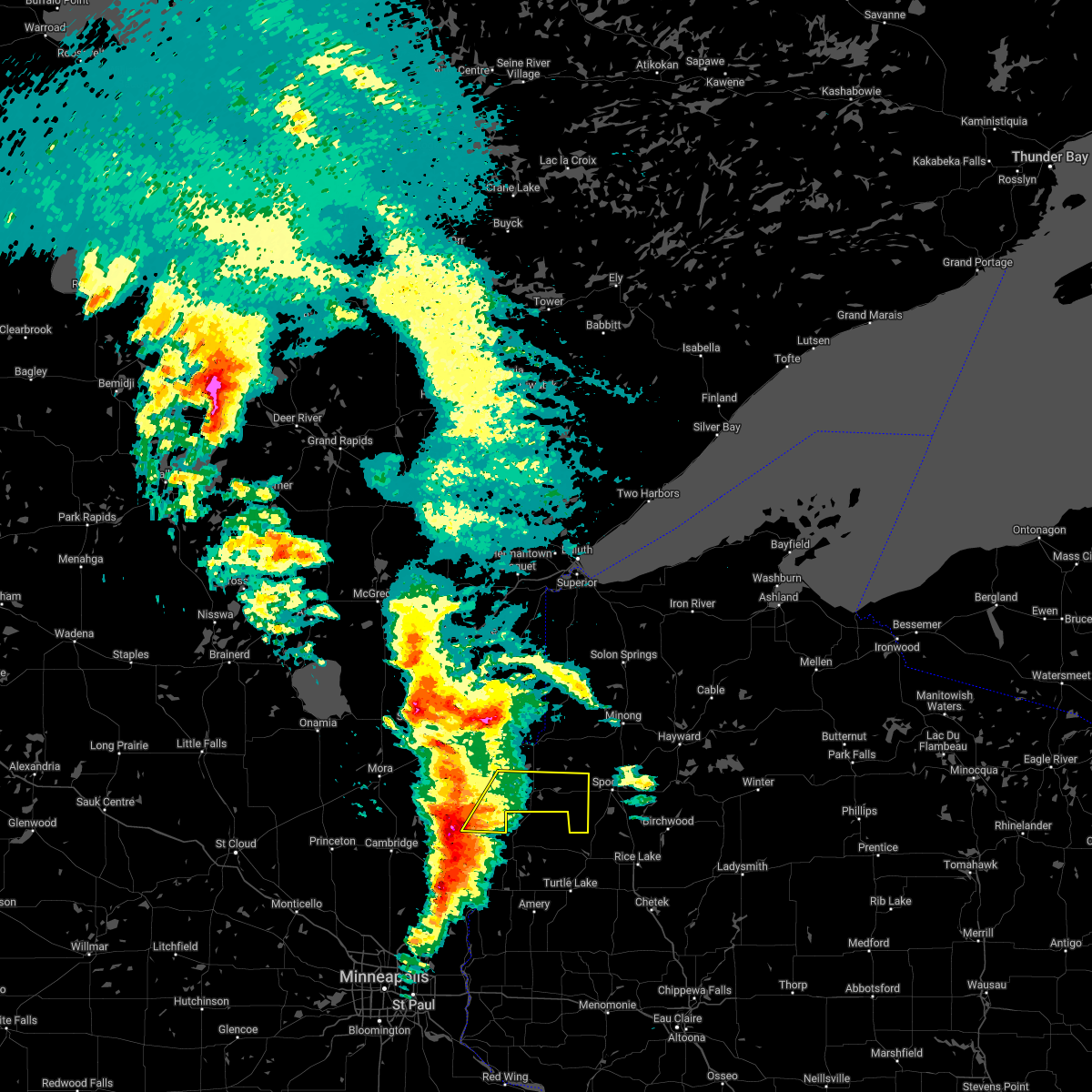 At 1016 am cdt, severe thunderstorms were located along a line extending from near trade lake, to 9 miles west of milltown, to near center city, moving east at 40 mph (radar indicated). Hazards include 60 mph wind gusts and quarter size hail. Hail damage to vehicles is expected. expect wind damage to roofs, siding, and trees. severe thunderstorms will be near, trade lake around 1020 am cdt. siren around 1030 am cdt. other locations in the path of these severe thunderstorms include hertel. hail threat, radar indicated max hail size, 1. 00 in wind threat, radar indicated max wind gust, 60 mph. At 1016 am cdt, severe thunderstorms were located along a line extending from near trade lake, to 9 miles west of milltown, to near center city, moving east at 40 mph (radar indicated). Hazards include 60 mph wind gusts and quarter size hail. Hail damage to vehicles is expected. expect wind damage to roofs, siding, and trees. severe thunderstorms will be near, trade lake around 1020 am cdt. siren around 1030 am cdt. other locations in the path of these severe thunderstorms include hertel. hail threat, radar indicated max hail size, 1. 00 in wind threat, radar indicated max wind gust, 60 mph.
|
| 6/30/2019 11:39 AM CDT |
 The severe thunderstorm warning for southwestern burnett county will expire at 1145 am cdt, the storm which prompted the warning has moved out of the area. therefore, the warning will be allowed to expire. The severe thunderstorm warning for southwestern burnett county will expire at 1145 am cdt, the storm which prompted the warning has moved out of the area. therefore, the warning will be allowed to expire.
|
| 6/30/2019 11:33 AM CDT |
 At 1133 am cdt, a severe thunderstorm was located over frederic, or 25 miles southeast of pine city, moving southeast at 55 mph (radar indicated). Hazards include 60 mph wind gusts and half dollar size hail. Hail damage to vehicles is expected. expect wind damage to roofs, siding, and trees. Locations impacted include, grantsburg, trade lake, siren, branstad, falun, four corners, and alpha. At 1133 am cdt, a severe thunderstorm was located over frederic, or 25 miles southeast of pine city, moving southeast at 55 mph (radar indicated). Hazards include 60 mph wind gusts and half dollar size hail. Hail damage to vehicles is expected. expect wind damage to roofs, siding, and trees. Locations impacted include, grantsburg, trade lake, siren, branstad, falun, four corners, and alpha.
|
| 6/30/2019 11:16 AM CDT |
 At 1116 am cdt, a severe thunderstorm was located near grantsburg, or 11 miles east of pine city, moving southeast at 55 mph (radar indicated). Hazards include 60 mph wind gusts and half dollar size hail. Hail damage to vehicles is expected. Expect wind damage to roofs, siding, and trees. At 1116 am cdt, a severe thunderstorm was located near grantsburg, or 11 miles east of pine city, moving southeast at 55 mph (radar indicated). Hazards include 60 mph wind gusts and half dollar size hail. Hail damage to vehicles is expected. Expect wind damage to roofs, siding, and trees.
|
| 8/27/2018 6:38 PM CDT |
 At 638 pm cdt, severe thunderstorms were located along a line extending from near foxboro, to near dairyland, to near webster, moving northeast at 40 mph (radar indicated). Hazards include 60 mph wind gusts and torrential rainfall. Expect damage to roofs, siding, and trees. Locations impacted include, grantsburg, siren, webster, webb lake wisconsin, dairyland, holyoke, cloverton, duxbury, foxboro, danbury, hertel, south range, oakland, nickerson, kerrick, cozy corner, falun, duquette, moose junction, and amnicon lake. At 638 pm cdt, severe thunderstorms were located along a line extending from near foxboro, to near dairyland, to near webster, moving northeast at 40 mph (radar indicated). Hazards include 60 mph wind gusts and torrential rainfall. Expect damage to roofs, siding, and trees. Locations impacted include, grantsburg, siren, webster, webb lake wisconsin, dairyland, holyoke, cloverton, duxbury, foxboro, danbury, hertel, south range, oakland, nickerson, kerrick, cozy corner, falun, duquette, moose junction, and amnicon lake.
|
| 8/27/2018 6:34 PM CDT |
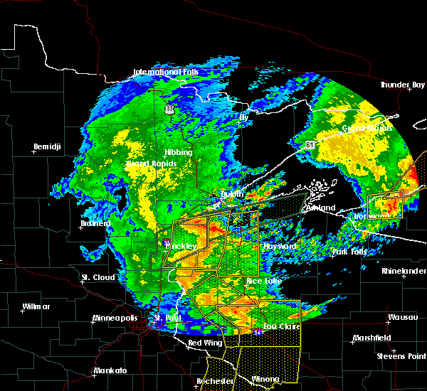 At 633 pm cdt, a severe thunderstorm was located near webb lake wisconsin, or 22 miles northwest of spooner, moving east at 45 mph (radar indicated). Hazards include 60 mph wind gusts. Expect damage to roofs, siding, and trees. this severe thunderstorm will be near, minong around 655 pm cdt. wascott and gordon around 700 pm cdt. Other locations impacted by this severe thunderstorm include spooner lake, cozy corner, mckenzie lake, minong flowage, springbrook, moose junction, amnicon lake, oakland, birch island lake, and lampson. At 633 pm cdt, a severe thunderstorm was located near webb lake wisconsin, or 22 miles northwest of spooner, moving east at 45 mph (radar indicated). Hazards include 60 mph wind gusts. Expect damage to roofs, siding, and trees. this severe thunderstorm will be near, minong around 655 pm cdt. wascott and gordon around 700 pm cdt. Other locations impacted by this severe thunderstorm include spooner lake, cozy corner, mckenzie lake, minong flowage, springbrook, moose junction, amnicon lake, oakland, birch island lake, and lampson.
|
| 8/27/2018 6:12 PM CDT |
 At 612 pm cdt, severe thunderstorms were located along a line extending from 7 miles southeast of nemadji, to near duxbury, to near grantsburg, moving northeast at 45 mph (radar indicated). Hazards include 60 mph wind gusts. Expect damage to roofs, siding, and trees. a flash flood warning is also in effect for much of the warned area. Locations impacted include, grantsburg, siren, webster, willow river, askov, webb lake wisconsin, dairyland, holyoke, bruno, cloverton, south range, duxbury, foxboro, danbury, hertel, nemadji, oakland, sturgeon lake, nickerson, and kerrick. At 612 pm cdt, severe thunderstorms were located along a line extending from 7 miles southeast of nemadji, to near duxbury, to near grantsburg, moving northeast at 45 mph (radar indicated). Hazards include 60 mph wind gusts. Expect damage to roofs, siding, and trees. a flash flood warning is also in effect for much of the warned area. Locations impacted include, grantsburg, siren, webster, willow river, askov, webb lake wisconsin, dairyland, holyoke, bruno, cloverton, south range, duxbury, foxboro, danbury, hertel, nemadji, oakland, sturgeon lake, nickerson, and kerrick.
|
| 8/27/2018 6:12 PM CDT |
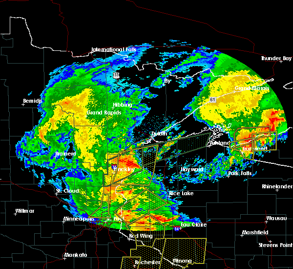 At 612 pm cdt, severe thunderstorms were located along a line extending from 7 miles southeast of nemadji, to near duxbury, to near grantsburg, moving northeast at 45 mph (radar indicated). Hazards include 60 mph wind gusts. Expect damage to roofs, siding, and trees. a flash flood warning is also in effect for much of the warned area. Locations impacted include, grantsburg, siren, webster, willow river, askov, webb lake wisconsin, dairyland, holyoke, bruno, cloverton, south range, duxbury, foxboro, danbury, hertel, nemadji, oakland, sturgeon lake, nickerson, and kerrick. At 612 pm cdt, severe thunderstorms were located along a line extending from 7 miles southeast of nemadji, to near duxbury, to near grantsburg, moving northeast at 45 mph (radar indicated). Hazards include 60 mph wind gusts. Expect damage to roofs, siding, and trees. a flash flood warning is also in effect for much of the warned area. Locations impacted include, grantsburg, siren, webster, willow river, askov, webb lake wisconsin, dairyland, holyoke, bruno, cloverton, south range, duxbury, foxboro, danbury, hertel, nemadji, oakland, sturgeon lake, nickerson, and kerrick.
|
| 8/27/2018 5:58 PM CDT |
 At 558 pm cdt, severe thunderstorms were located along a line extending from near bruno, to 9 miles southeast of sandstone, to near rock creek, moving northeast at 40 mph (radar indicated). Hazards include 60 mph wind gusts and torrential rainfall. expect damage to roofs, siding, and trees At 558 pm cdt, severe thunderstorms were located along a line extending from near bruno, to 9 miles southeast of sandstone, to near rock creek, moving northeast at 40 mph (radar indicated). Hazards include 60 mph wind gusts and torrential rainfall. expect damage to roofs, siding, and trees
|
| 6/17/2018 3:26 PM CDT |
 At 326 pm cdt, severe thunderstorms were located along a line extending from near lake nebagamon, to near solon springs, to near webster, moving east at 60 mph. in this line a stronger storm is near solon springs, moving east at 50 to 60 mph. these are very dangerous storms (radar indicated). Hazards include 80 mph wind gusts and quarter size hail. Hail damage to vehicles is expected. locations impacted include, pine city, grantsburg, trego, trade lake, siren, barnes, wascott, webster, solon springs, minong, webb lake wisconsin, gordon, dairyland, cloverton, duxbury, danbury, hertel, branstad, oakland, and bennett. A tornado watch remains in effect until 900 pm cdt for northeastern and east central minnesota, and northwestern wisconsin. At 326 pm cdt, severe thunderstorms were located along a line extending from near lake nebagamon, to near solon springs, to near webster, moving east at 60 mph. in this line a stronger storm is near solon springs, moving east at 50 to 60 mph. these are very dangerous storms (radar indicated). Hazards include 80 mph wind gusts and quarter size hail. Hail damage to vehicles is expected. locations impacted include, pine city, grantsburg, trego, trade lake, siren, barnes, wascott, webster, solon springs, minong, webb lake wisconsin, gordon, dairyland, cloverton, duxbury, danbury, hertel, branstad, oakland, and bennett. A tornado watch remains in effect until 900 pm cdt for northeastern and east central minnesota, and northwestern wisconsin.
|
| 6/17/2018 3:01 PM CDT |
 At 300 pm cdt, severe thunderstorms were located along a line extending from 6 miles southeast of foxboro, to near cloverton, to near grantsburg, moving east at 45 mph (radar indicated). Hazards include 70 mph wind gusts and quarter size hail. Hail damage to vehicles is expected. expect considerable tree damage. Wind damage is also likely to mobile homes, roofs, and outbuildings. At 300 pm cdt, severe thunderstorms were located along a line extending from 6 miles southeast of foxboro, to near cloverton, to near grantsburg, moving east at 45 mph (radar indicated). Hazards include 70 mph wind gusts and quarter size hail. Hail damage to vehicles is expected. expect considerable tree damage. Wind damage is also likely to mobile homes, roofs, and outbuildings.
|
| 5/29/2018 5:08 PM CDT |
 At 507 pm cdt, a severe thunderstorm was located near webster, or 20 miles west of spooner, moving north at 30 mph (radar indicated). Hazards include 60 mph wind gusts and half dollar size hail. Hail damage to vehicles is expected. expect wind damage to roofs, siding, and trees. Locations impacted include, siren, webster, webb lake wisconsin, danbury, hertel, oakland, big sand lake, birch island lake, and yellow lake. At 507 pm cdt, a severe thunderstorm was located near webster, or 20 miles west of spooner, moving north at 30 mph (radar indicated). Hazards include 60 mph wind gusts and half dollar size hail. Hail damage to vehicles is expected. expect wind damage to roofs, siding, and trees. Locations impacted include, siren, webster, webb lake wisconsin, danbury, hertel, oakland, big sand lake, birch island lake, and yellow lake.
|
| 5/29/2018 4:44 PM CDT |
 At 444 pm cdt, a severe thunderstorm was located near siren, or 20 miles west of spooner, moving north at 30 mph (radar indicated). Hazards include 60 mph wind gusts and half dollar size hail. Hail damage to vehicles is expected. Expect wind damage to roofs, siding, and trees. At 444 pm cdt, a severe thunderstorm was located near siren, or 20 miles west of spooner, moving north at 30 mph (radar indicated). Hazards include 60 mph wind gusts and half dollar size hail. Hail damage to vehicles is expected. Expect wind damage to roofs, siding, and trees.
|
| 5/29/2018 4:44 PM CDT |
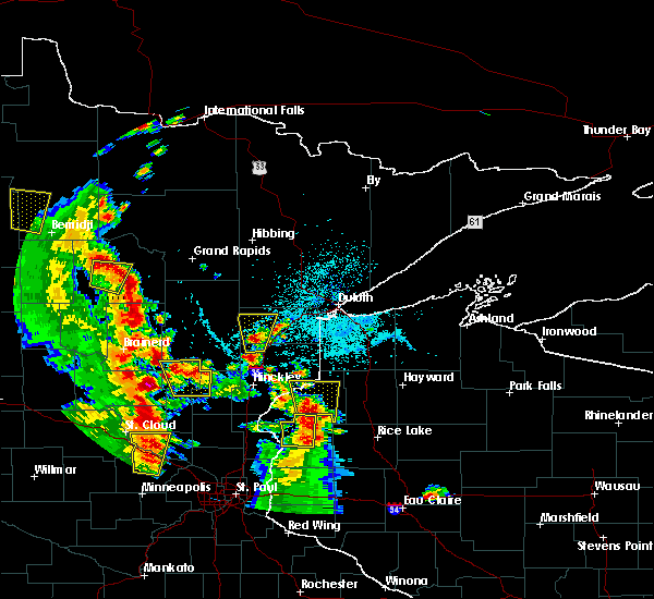 At 444 pm cdt, a severe thunderstorm was located near siren, or 20 miles west of spooner, moving north at 30 mph (radar indicated). Hazards include 60 mph wind gusts and half dollar size hail. Hail damage to vehicles is expected. Expect wind damage to roofs, siding, and trees. At 444 pm cdt, a severe thunderstorm was located near siren, or 20 miles west of spooner, moving north at 30 mph (radar indicated). Hazards include 60 mph wind gusts and half dollar size hail. Hail damage to vehicles is expected. Expect wind damage to roofs, siding, and trees.
|
| 5/29/2018 4:25 PM CDT |
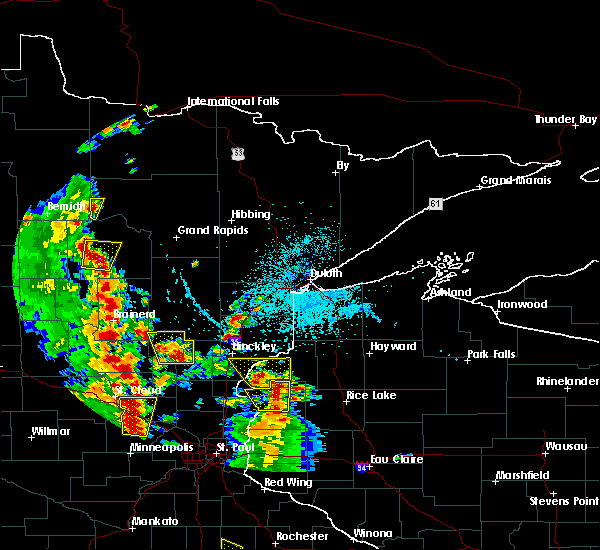 At 424 pm cdt, a severe thunderstorm was located over trade lake, or 22 miles southeast of pine city, moving north at 30 mph (radar indicated). Hazards include 60 mph wind gusts and quarter size hail. Hail damage to vehicles is expected. expect wind damage to roofs, siding, and trees. Locations impacted include, grantsburg, trade lake, siren, webster, branstad, oakland, falun, phantom lake, chengwatana state forest, saint croix state park, four corners, alpha, and yellow lake. At 424 pm cdt, a severe thunderstorm was located over trade lake, or 22 miles southeast of pine city, moving north at 30 mph (radar indicated). Hazards include 60 mph wind gusts and quarter size hail. Hail damage to vehicles is expected. expect wind damage to roofs, siding, and trees. Locations impacted include, grantsburg, trade lake, siren, webster, branstad, oakland, falun, phantom lake, chengwatana state forest, saint croix state park, four corners, alpha, and yellow lake.
|
| 5/29/2018 4:06 PM CDT |
 At 406 pm cdt, a severe thunderstorm was located over milltown, or 27 miles southeast of pine city, moving north at 30 mph (radar indicated). Hazards include 60 mph wind gusts and half dollar size hail. Hail damage to vehicles is expected. Expect wind damage to roofs, siding, and trees. At 406 pm cdt, a severe thunderstorm was located over milltown, or 27 miles southeast of pine city, moving north at 30 mph (radar indicated). Hazards include 60 mph wind gusts and half dollar size hail. Hail damage to vehicles is expected. Expect wind damage to roofs, siding, and trees.
|
| 5/28/2018 7:30 PM CDT |
 At 729 pm cdt, a severe thunderstorm was located over branstad, or 17 miles east of pine city, moving northeast at 15 mph (radar indicated). Hazards include ping pong ball size hail and 60 mph wind gusts. People and animals outdoors will be injured. expect hail damage to roofs, siding, windows, and vehicles. expect wind damage to roofs, siding, and trees. Locations impacted include, grantsburg, trade lake, siren, branstad, falun, four corners, alpha, and phantom lake. At 729 pm cdt, a severe thunderstorm was located over branstad, or 17 miles east of pine city, moving northeast at 15 mph (radar indicated). Hazards include ping pong ball size hail and 60 mph wind gusts. People and animals outdoors will be injured. expect hail damage to roofs, siding, windows, and vehicles. expect wind damage to roofs, siding, and trees. Locations impacted include, grantsburg, trade lake, siren, branstad, falun, four corners, alpha, and phantom lake.
|
| 5/28/2018 7:10 PM CDT |
 At 710 pm cdt, a severe thunderstorm was located near branstad, or 17 miles southeast of pine city, moving northeast at 15 mph (radar indicated). Hazards include 60 mph wind gusts and half dollar size hail. Hail damage to vehicles is expected. Expect wind damage to roofs, siding, and trees. At 710 pm cdt, a severe thunderstorm was located near branstad, or 17 miles southeast of pine city, moving northeast at 15 mph (radar indicated). Hazards include 60 mph wind gusts and half dollar size hail. Hail damage to vehicles is expected. Expect wind damage to roofs, siding, and trees.
|
| 9/20/2017 3:48 AM CDT |
 At 348 am cdt, severe thunderstorms were located along a line extending from near dairyland, to near hertel, moving east at 45 mph (radar indicated). Hazards include 60 mph wind gusts and penny size hail. Expect damage to roofs, siding, and trees. Locations impacted include, spooner, shell lake, trego, siren, webster, minong, webb lake wisconsin, hertel, oakland, springbrook, sarona, spooner lake, mckenzie lake, birch island lake, lampson, stanberry, earl, big sand lake, riverside, and angus. At 348 am cdt, severe thunderstorms were located along a line extending from near dairyland, to near hertel, moving east at 45 mph (radar indicated). Hazards include 60 mph wind gusts and penny size hail. Expect damage to roofs, siding, and trees. Locations impacted include, spooner, shell lake, trego, siren, webster, minong, webb lake wisconsin, hertel, oakland, springbrook, sarona, spooner lake, mckenzie lake, birch island lake, lampson, stanberry, earl, big sand lake, riverside, and angus.
|
| 9/20/2017 3:37 AM CDT |
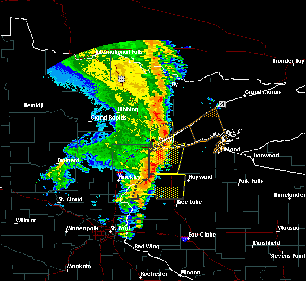 At 337 am cdt, severe thunderstorms were located along a line extending from near cloverton, to near siren, moving east at 50 mph (radar indicated). Hazards include 60 mph wind gusts and nickel size hail. Expect damage to roofs, siding, and trees. Locations impacted include, spooner, shell lake, trego, trade lake, siren, webster, minong, webb lake wisconsin, danbury, hertel, oakland, springbrook, sarona, spooner lake, falun, mckenzie lake, birch island lake, lampson, four corners, and stanberry. At 337 am cdt, severe thunderstorms were located along a line extending from near cloverton, to near siren, moving east at 50 mph (radar indicated). Hazards include 60 mph wind gusts and nickel size hail. Expect damage to roofs, siding, and trees. Locations impacted include, spooner, shell lake, trego, trade lake, siren, webster, minong, webb lake wisconsin, danbury, hertel, oakland, springbrook, sarona, spooner lake, falun, mckenzie lake, birch island lake, lampson, four corners, and stanberry.
|
| 9/20/2017 3:15 AM CDT |
 At 314 am cdt, severe thunderstorms were located along a line extending from duxbury, to 6 miles south of branstad, moving east at 55 mph (radar indicated). Hazards include 60 mph wind gusts and nickel size hail. expect damage to roofs, siding, and trees At 314 am cdt, severe thunderstorms were located along a line extending from duxbury, to 6 miles south of branstad, moving east at 55 mph (radar indicated). Hazards include 60 mph wind gusts and nickel size hail. expect damage to roofs, siding, and trees
|
| 7/6/2017 5:35 AM CDT |
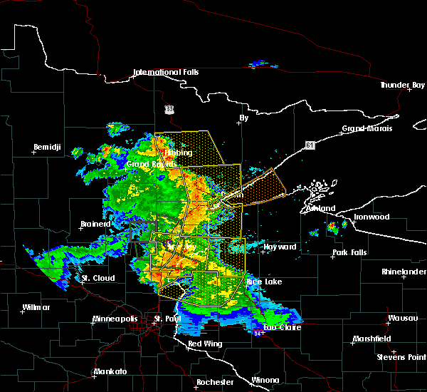 At 535 am cdt, severe thunderstorms were located along a line extending from 6 miles northeast of duxbury, to 8 miles west of webster, to 10 miles southwest of trade lake, moving east at 45 mph (radar indicated). Hazards include 60 mph wind gusts and penny size hail. expect damage to roofs, siding, and trees At 535 am cdt, severe thunderstorms were located along a line extending from 6 miles northeast of duxbury, to 8 miles west of webster, to 10 miles southwest of trade lake, moving east at 45 mph (radar indicated). Hazards include 60 mph wind gusts and penny size hail. expect damage to roofs, siding, and trees
|
| 7/6/2017 5:17 AM CDT |
 At 517 am cdt, severe thunderstorms were located along a line extending from near askov, to 6 miles east of pine city, to 8 miles northeast of cambridge, moving east at 45 mph (radar indicated). Hazards include 60 mph wind gusts and quarter size hail. Hail damage to vehicles is expected. expect wind damage to roofs, siding, and trees. Locations impacted include, pine city, hinckley, sandstone, rock creek, grantsburg, trade lake, siren, webster, askov, rutledge, brook park, henriette, cloverton, duxbury, danbury, branstad, randall, oakland, finlayson, and falun. At 517 am cdt, severe thunderstorms were located along a line extending from near askov, to 6 miles east of pine city, to 8 miles northeast of cambridge, moving east at 45 mph (radar indicated). Hazards include 60 mph wind gusts and quarter size hail. Hail damage to vehicles is expected. expect wind damage to roofs, siding, and trees. Locations impacted include, pine city, hinckley, sandstone, rock creek, grantsburg, trade lake, siren, webster, askov, rutledge, brook park, henriette, cloverton, duxbury, danbury, branstad, randall, oakland, finlayson, and falun.
|
| 7/6/2017 5:13 AM CDT |
 At 512 am cdt, severe thunderstorms were located along a line extending from askov, to near pine city, to 8 miles south of brunswick, moving east at 45 mph (radar indicated). Hazards include 60 mph wind gusts and quarter size hail. Hail damage to vehicles is expected. Expect wind damage to roofs, siding, and trees. At 512 am cdt, severe thunderstorms were located along a line extending from askov, to near pine city, to 8 miles south of brunswick, moving east at 45 mph (radar indicated). Hazards include 60 mph wind gusts and quarter size hail. Hail damage to vehicles is expected. Expect wind damage to roofs, siding, and trees.
|
| 7/6/2017 4:48 AM CDT |
 At 448 am cdt, severe thunderstorms were located along a line extending from 7 miles east of mcgrath, to near quamba, to near bock, moving east at 45 mph (radar indicated). Hazards include 60 mph wind gusts and quarter size hail. Hail damage to vehicles is expected. Expect wind damage to roofs, siding, and trees. At 448 am cdt, severe thunderstorms were located along a line extending from 7 miles east of mcgrath, to near quamba, to near bock, moving east at 45 mph (radar indicated). Hazards include 60 mph wind gusts and quarter size hail. Hail damage to vehicles is expected. Expect wind damage to roofs, siding, and trees.
|
| 6/30/2017 10:32 PM CDT |
 At 1032 pm cdt, a severe thunderstorm was located 7 miles northeast of grantsburg, or 19 miles east of pine city, moving southeast at 20 mph (radar indicated). Hazards include 60 mph wind gusts and quarter size hail. Hail damage to vehicles is expected. expect wind damage to roofs, siding, and trees. this severe storm will be near, siren and webster around 1045 pm cdt. Other locations impacted by this severe thunderstorm include alpha, phantom lake, and falun. At 1032 pm cdt, a severe thunderstorm was located 7 miles northeast of grantsburg, or 19 miles east of pine city, moving southeast at 20 mph (radar indicated). Hazards include 60 mph wind gusts and quarter size hail. Hail damage to vehicles is expected. expect wind damage to roofs, siding, and trees. this severe storm will be near, siren and webster around 1045 pm cdt. Other locations impacted by this severe thunderstorm include alpha, phantom lake, and falun.
|
| 6/30/2017 10:12 PM CDT |
 At 1012 pm cdt, a severe thunderstorm was located 8 miles north of grantsburg, or 14 miles east of pine city, moving southeast at 20 mph (radar indicated). Hazards include 60 mph wind gusts and quarter size hail. Hail damage to vehicles is expected. expect wind damage to roofs, siding, and trees. this severe thunderstorm will be near, grantsburg around 1025 pm cdt. siren and webster around 1045 pm cdt. Other locations impacted by this severe thunderstorm include alpha, phantom lake, falun, saint croix state park, and yellow lake. At 1012 pm cdt, a severe thunderstorm was located 8 miles north of grantsburg, or 14 miles east of pine city, moving southeast at 20 mph (radar indicated). Hazards include 60 mph wind gusts and quarter size hail. Hail damage to vehicles is expected. expect wind damage to roofs, siding, and trees. this severe thunderstorm will be near, grantsburg around 1025 pm cdt. siren and webster around 1045 pm cdt. Other locations impacted by this severe thunderstorm include alpha, phantom lake, falun, saint croix state park, and yellow lake.
|
| 6/28/2017 12:10 PM CDT |
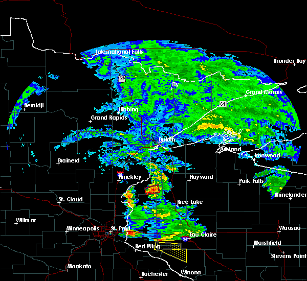 At 510 pm cdt, a severe thunderstorm capable of producing a tornado was located over siren, or 21 miles west of spooner, moving east at 15 mph (weather spotters reported funnel cloud near siren at 505 pm cdt). Hazards include tornado. Flying debris will be dangerous to those caught without shelter. mobile homes will be damaged or destroyed. damage to roofs, windows, and vehicles will occur. Tree damage is likely. At 510 pm cdt, a severe thunderstorm capable of producing a tornado was located over siren, or 21 miles west of spooner, moving east at 15 mph (weather spotters reported funnel cloud near siren at 505 pm cdt). Hazards include tornado. Flying debris will be dangerous to those caught without shelter. mobile homes will be damaged or destroyed. damage to roofs, windows, and vehicles will occur. Tree damage is likely.
|
| 6/11/2017 6:26 PM CDT |
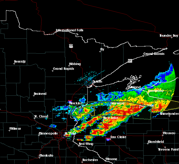 The severe thunderstorm warning for southeastern burnett county will expire at 630 pm cdt, the storms which prompted the warning have weakened below severe limits, and no longer pose an immediate threat to life or property. therefore, the warning will be allowed to expire. however small hail, gusty winds, and heavy rain are still possible with these thunderstorms. The severe thunderstorm warning for southeastern burnett county will expire at 630 pm cdt, the storms which prompted the warning have weakened below severe limits, and no longer pose an immediate threat to life or property. therefore, the warning will be allowed to expire. however small hail, gusty winds, and heavy rain are still possible with these thunderstorms.
|
| 6/11/2017 6:15 PM CDT |
 At 605 pm cdt, severe thunderstorms were located along a line extending from near grantsburg, to near trade lake, moving northeast at 40 mph (radar indicated). Hazards include 70 mph wind gusts and half dollar size hail. Hail damage to vehicles is expected. expect considerable tree damage. wind damage is also likely to mobile homes, roofs, and outbuildings. Locations impacted include, grantsburg, trade lake, siren, webster, webb lake wisconsin, hertel, branstad, oakland, falun, phantom lake, birch island lake, four corners, alpha, trade river, big sand lake, and yellow lake. At 605 pm cdt, severe thunderstorms were located along a line extending from near grantsburg, to near trade lake, moving northeast at 40 mph (radar indicated). Hazards include 70 mph wind gusts and half dollar size hail. Hail damage to vehicles is expected. expect considerable tree damage. wind damage is also likely to mobile homes, roofs, and outbuildings. Locations impacted include, grantsburg, trade lake, siren, webster, webb lake wisconsin, hertel, branstad, oakland, falun, phantom lake, birch island lake, four corners, alpha, trade river, big sand lake, and yellow lake.
|
| 6/11/2017 6:05 PM CDT |
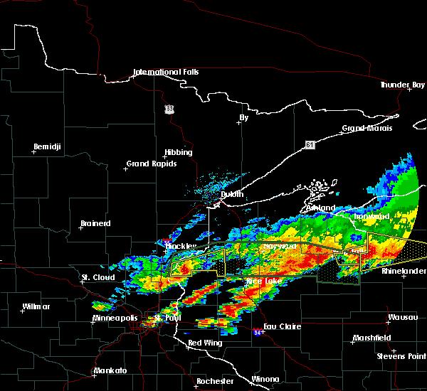 At 551 pm cdt, severe thunderstorms were located along a line extending from near grantsburg, to 11 miles northwest of taylors falls, moving east at 35 mph (radar indicated). Hazards include 70 mph wind gusts and quarter size hail. Hail damage to vehicles is expected. expect considerable tree damage. Wind damage is also likely to mobile homes, roofs, and outbuildings. At 551 pm cdt, severe thunderstorms were located along a line extending from near grantsburg, to 11 miles northwest of taylors falls, moving east at 35 mph (radar indicated). Hazards include 70 mph wind gusts and quarter size hail. Hail damage to vehicles is expected. expect considerable tree damage. Wind damage is also likely to mobile homes, roofs, and outbuildings.
|
| 6/11/2017 5:52 PM CDT |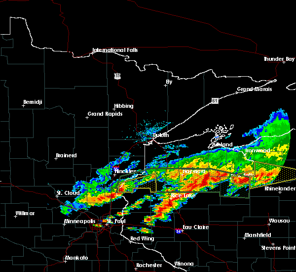
 At 551 pm cdt, severe thunderstorms were located along a line extending from near grantsburg, to 11 miles northwest of taylors falls, moving east at 35 mph (radar indicated). Hazards include 70 mph wind gusts and quarter size hail. Hail damage to vehicles is expected. expect considerable tree damage. Wind damage is also likely to mobile homes, roofs, and outbuildings. At 551 pm cdt, severe thunderstorms were located along a line extending from near grantsburg, to 11 miles northwest of taylors falls, moving east at 35 mph (radar indicated). Hazards include 70 mph wind gusts and quarter size hail. Hail damage to vehicles is expected. expect considerable tree damage. Wind damage is also likely to mobile homes, roofs, and outbuildings.
|
| 6/11/2017 10:03 AM CDT |
 At 1003 am cdt, severe thunderstorms were located along a line extending from near webb lake wisconsin, to 7 miles north of cumberland, moving east at 55 mph (radar indicated). Hazards include 70 mph wind gusts and penny size hail. Expect considerable tree damage. damage is likely to mobile homes, roofs, and outbuildings. Locations impacted include, spooner, hayward, chippewa flowage, shell lake, trego, siren, wascott, webster, minong, stone lake, birchwood, webb lake wisconsin, radisson, exeland, couderay, little round lake, chief lake, danbury, hertel, and oakland. At 1003 am cdt, severe thunderstorms were located along a line extending from near webb lake wisconsin, to 7 miles north of cumberland, moving east at 55 mph (radar indicated). Hazards include 70 mph wind gusts and penny size hail. Expect considerable tree damage. damage is likely to mobile homes, roofs, and outbuildings. Locations impacted include, spooner, hayward, chippewa flowage, shell lake, trego, siren, wascott, webster, minong, stone lake, birchwood, webb lake wisconsin, radisson, exeland, couderay, little round lake, chief lake, danbury, hertel, and oakland.
|
| 6/11/2017 10:00 AM CDT | Oen tree down in burnett county WI, 0.1 miles NW of Siren, WI |
| 6/11/2017 9:57 AM CDT | Numerous trees downed across the north side of siren. the largest trees were 12 inches in diameter. in addition...a pontoon and lift were lifted and ripped off a dock a in burnett county WI, 0.1 miles NW of Siren, WI |
| 6/11/2017 9:55 AM CDT | Half of their pine tree broke off from the thunderstorm winds. there was just under a half inch of rainfal in burnett county WI, 4.2 miles SW of Siren, WI |
| 6/11/2017 9:51 AM CDT |
 At 951 am cdt, severe thunderstorms were located along a line extending from near danbury, to 10 miles northwest of cumberland, moving east at 55 mph (radar indicated). Hazards include 70 mph wind gusts and penny size hail. Expect considerable tree damage. Damage is likely to mobile homes, roofs, and outbuildings. At 951 am cdt, severe thunderstorms were located along a line extending from near danbury, to 10 miles northwest of cumberland, moving east at 55 mph (radar indicated). Hazards include 70 mph wind gusts and penny size hail. Expect considerable tree damage. Damage is likely to mobile homes, roofs, and outbuildings.
|
| 8/4/2016 5:19 AM CDT |
 At 518 am cdt, severe thunderstorms were located along a line extending from wascott, to near siren, moving east at 55 mph (radar indicated). Hazards include 60 mph wind gusts and penny size hail. Expect damage to roofs. siding. and trees. Locations impacted include, spooner, hayward, grantsburg, trego, cable, siren, wascott, webster, minong, webb lake wisconsin, danbury, seeley, hertel, oakland, springbrook, alpha, falun, lampson, riverside and totagatic flowage. At 518 am cdt, severe thunderstorms were located along a line extending from wascott, to near siren, moving east at 55 mph (radar indicated). Hazards include 60 mph wind gusts and penny size hail. Expect damage to roofs. siding. and trees. Locations impacted include, spooner, hayward, grantsburg, trego, cable, siren, wascott, webster, minong, webb lake wisconsin, danbury, seeley, hertel, oakland, springbrook, alpha, falun, lampson, riverside and totagatic flowage.
|
| 8/4/2016 5:02 AM CDT |
 At 502 am cdt, severe thunderstorms were located along a line extending from near dairyland, to near grantsburg, moving east at 55 mph (radar indicated). Hazards include 60 mph wind gusts and penny size hail. Expect damage to roofs. siding. And trees. At 502 am cdt, severe thunderstorms were located along a line extending from near dairyland, to near grantsburg, moving east at 55 mph (radar indicated). Hazards include 60 mph wind gusts and penny size hail. Expect damage to roofs. siding. And trees.
|
| 7/21/2016 4:20 AM CDT |
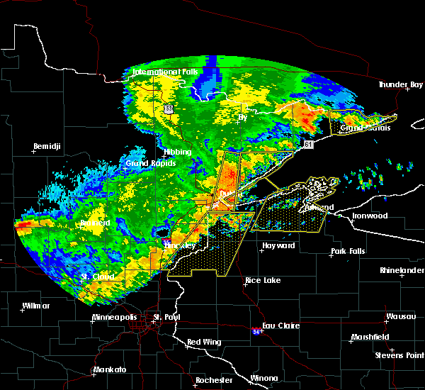 At 420 am cdt, severe thunderstorms were located along a line extending from near poplar in douglas county, to near luck, moving east at 50 mph (radar indicated). Hazards include 60 mph wind gusts and quarter size hail. Hail damage to vehicles is expected. expect wind damage to roofs, siding, and trees. these severe storms will be near, hawthorne and lake nebagamon around 425 am cdt. Other locations impacted by these severe thunderstorms include alpha, lyman lake, falun, birch island lake, riverside, four corners, mckenzie lake, markville, phantom lake and minong flowage. At 420 am cdt, severe thunderstorms were located along a line extending from near poplar in douglas county, to near luck, moving east at 50 mph (radar indicated). Hazards include 60 mph wind gusts and quarter size hail. Hail damage to vehicles is expected. expect wind damage to roofs, siding, and trees. these severe storms will be near, hawthorne and lake nebagamon around 425 am cdt. Other locations impacted by these severe thunderstorms include alpha, lyman lake, falun, birch island lake, riverside, four corners, mckenzie lake, markville, phantom lake and minong flowage.
|
| 7/21/2016 4:06 AM CDT |
 At 406 am cdt, severe thunderstorms were located along a line extending from near south range, to 6 miles south of trade lake, moving east at 50 mph (radar indicated). Hazards include 60 mph wind gusts and quarter size hail. Hail damage to vehicles is expected. expect wind damage to roofs, siding, and trees. these severe storms will be near, hawthorne around 410 am cdt. poplar in douglas county around 415 am cdt. lake nebagamon around 425 am cdt. Other locations impacted by these severe thunderstorms include pattison state park, alpha, falun, riverside, patzau, cloverdale, minong flowage, trade river, blueberry and bennett. At 406 am cdt, severe thunderstorms were located along a line extending from near south range, to 6 miles south of trade lake, moving east at 50 mph (radar indicated). Hazards include 60 mph wind gusts and quarter size hail. Hail damage to vehicles is expected. expect wind damage to roofs, siding, and trees. these severe storms will be near, hawthorne around 410 am cdt. poplar in douglas county around 415 am cdt. lake nebagamon around 425 am cdt. Other locations impacted by these severe thunderstorms include pattison state park, alpha, falun, riverside, patzau, cloverdale, minong flowage, trade river, blueberry and bennett.
|
| 7/21/2016 4:06 AM CDT |
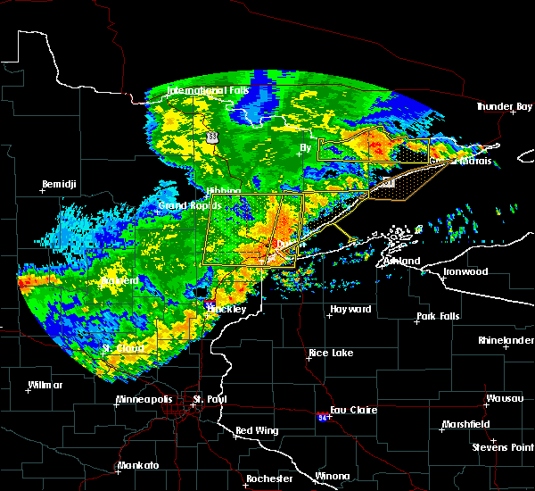 At 406 am cdt, severe thunderstorms were located along a line extending from near south range, to 6 miles south of trade lake, moving east at 50 mph (radar indicated). Hazards include 60 mph wind gusts and quarter size hail. Hail damage to vehicles is expected. expect wind damage to roofs, siding, and trees. these severe storms will be near, hawthorne around 410 am cdt. poplar in douglas county around 415 am cdt. lake nebagamon around 425 am cdt. Other locations impacted by these severe thunderstorms include pattison state park, alpha, falun, riverside, patzau, cloverdale, minong flowage, trade river, blueberry and bennett. At 406 am cdt, severe thunderstorms were located along a line extending from near south range, to 6 miles south of trade lake, moving east at 50 mph (radar indicated). Hazards include 60 mph wind gusts and quarter size hail. Hail damage to vehicles is expected. expect wind damage to roofs, siding, and trees. these severe storms will be near, hawthorne around 410 am cdt. poplar in douglas county around 415 am cdt. lake nebagamon around 425 am cdt. Other locations impacted by these severe thunderstorms include pattison state park, alpha, falun, riverside, patzau, cloverdale, minong flowage, trade river, blueberry and bennett.
|
| 7/21/2016 3:50 AM CDT |
 At 349 am cdt, severe thunderstorms were located along a line extending from 6 miles northeast of foxboro, to 7 miles southeast of rush city, moving east at 50 mph (radar indicated). Hazards include 60 mph wind gusts and quarter size hail. Hail damage to vehicles is expected. expect wind damage to roofs, siding, and trees. severe thunderstorms will be near, foxboro around 355 am cdt. trade lake around 405 am cdt. hawthorne around 410 am cdt. poplar in douglas county around 415 am cdt. lake nebagamon around 420 am cdt. Other locations impacted by these severe thunderstorms include pattison state park, alpha, falun, west rock, riverside, patzau, cloverdale, minong flowage, trade river and blueberry. At 349 am cdt, severe thunderstorms were located along a line extending from 6 miles northeast of foxboro, to 7 miles southeast of rush city, moving east at 50 mph (radar indicated). Hazards include 60 mph wind gusts and quarter size hail. Hail damage to vehicles is expected. expect wind damage to roofs, siding, and trees. severe thunderstorms will be near, foxboro around 355 am cdt. trade lake around 405 am cdt. hawthorne around 410 am cdt. poplar in douglas county around 415 am cdt. lake nebagamon around 420 am cdt. Other locations impacted by these severe thunderstorms include pattison state park, alpha, falun, west rock, riverside, patzau, cloverdale, minong flowage, trade river and blueberry.
|
| 7/11/2016 6:03 PM CDT |
 At 603 pm cdt, a severe thunderstorm capable of producing a tornado was located over siren, or 22 miles west of spooner, moving northeast at 45 mph (radar indicated rotation). Hazards include tornado and quarter size hail. Flying debris will be dangerous to those caught without shelter. mobile homes will be damaged or destroyed. damage to roofs, windows, and vehicles will occur. tree damage is likely. this dangerous storm will be near, hertel around 615 pm cdt. Other locations impacted by this tornadic thunderstorm include alpha, falun and big sand lake. At 603 pm cdt, a severe thunderstorm capable of producing a tornado was located over siren, or 22 miles west of spooner, moving northeast at 45 mph (radar indicated rotation). Hazards include tornado and quarter size hail. Flying debris will be dangerous to those caught without shelter. mobile homes will be damaged or destroyed. damage to roofs, windows, and vehicles will occur. tree damage is likely. this dangerous storm will be near, hertel around 615 pm cdt. Other locations impacted by this tornadic thunderstorm include alpha, falun and big sand lake.
|
| 7/11/2016 6:00 PM CDT |
 At 600 pm cdt, a severe thunderstorm was located 8 miles northeast of grantsburg, or 20 miles east of pine city, moving northeast at 45 mph (radar indicated). Hazards include 60 mph wind gusts and quarter size hail. Hail damage to vehicles is expected. expect wind damage to roofs, siding, and trees. this severe storm will be near, siren around 605 pm cdt. webster around 610 pm cdt. danbury around 615 pm cdt. Other locations impacted by this severe thunderstorm include saint croix state park, alpha, falun, yellow lake, oakland, cloverdale, phantom lake and riverside. At 600 pm cdt, a severe thunderstorm was located 8 miles northeast of grantsburg, or 20 miles east of pine city, moving northeast at 45 mph (radar indicated). Hazards include 60 mph wind gusts and quarter size hail. Hail damage to vehicles is expected. expect wind damage to roofs, siding, and trees. this severe storm will be near, siren around 605 pm cdt. webster around 610 pm cdt. danbury around 615 pm cdt. Other locations impacted by this severe thunderstorm include saint croix state park, alpha, falun, yellow lake, oakland, cloverdale, phantom lake and riverside.
|
| 7/11/2016 6:00 PM CDT |
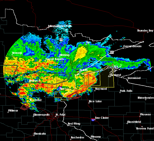 At 600 pm cdt, a severe thunderstorm was located 8 miles northeast of grantsburg, or 20 miles east of pine city, moving northeast at 45 mph (radar indicated). Hazards include 60 mph wind gusts and quarter size hail. Hail damage to vehicles is expected. expect wind damage to roofs, siding, and trees. this severe storm will be near, siren around 605 pm cdt. webster around 610 pm cdt. danbury around 615 pm cdt. Other locations impacted by this severe thunderstorm include saint croix state park, alpha, falun, yellow lake, oakland, cloverdale, phantom lake and riverside. At 600 pm cdt, a severe thunderstorm was located 8 miles northeast of grantsburg, or 20 miles east of pine city, moving northeast at 45 mph (radar indicated). Hazards include 60 mph wind gusts and quarter size hail. Hail damage to vehicles is expected. expect wind damage to roofs, siding, and trees. this severe storm will be near, siren around 605 pm cdt. webster around 610 pm cdt. danbury around 615 pm cdt. Other locations impacted by this severe thunderstorm include saint croix state park, alpha, falun, yellow lake, oakland, cloverdale, phantom lake and riverside.
|
| 7/11/2016 5:56 PM CDT |
 At 556 pm cdt, a severe thunderstorm capable of producing a tornado was located near siren, or 24 miles east of pine city, moving northeast at 50 mph (radar indicated rotation). Hazards include tornado and quarter size hail. Flying debris will be dangerous to those caught without shelter. mobile homes will be damaged or destroyed. damage to roofs, windows, and vehicles will occur. tree damage is likely. this dangerous storm will be near, siren around 600 pm cdt. webster around 605 pm cdt. hertel around 615 pm cdt. Other locations impacted by this tornadic thunderstorm include alpha, falun and big sand lake. At 556 pm cdt, a severe thunderstorm capable of producing a tornado was located near siren, or 24 miles east of pine city, moving northeast at 50 mph (radar indicated rotation). Hazards include tornado and quarter size hail. Flying debris will be dangerous to those caught without shelter. mobile homes will be damaged or destroyed. damage to roofs, windows, and vehicles will occur. tree damage is likely. this dangerous storm will be near, siren around 600 pm cdt. webster around 605 pm cdt. hertel around 615 pm cdt. Other locations impacted by this tornadic thunderstorm include alpha, falun and big sand lake.
|
| 7/11/2016 5:46 PM CDT |
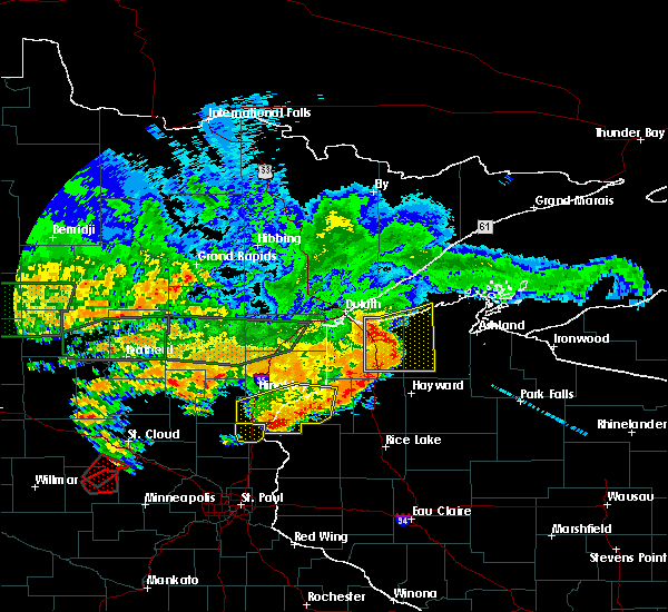 At 546 pm cdt, a severe thunderstorm capable of producing a tornado was located over branstad, or 17 miles southeast of pine city, moving northeast at 45 mph (radar indicated rotation). Hazards include tornado and quarter size hail. Flying debris will be dangerous to those caught without shelter. mobile homes will be damaged or destroyed. damage to roofs, windows, and vehicles will occur. tree damage is likely. this dangerous storm will be near, siren around 605 pm cdt. webster around 610 pm cdt. hertel around 615 pm cdt. Other locations impacted by this tornadic thunderstorm include four corners, alpha, big sand lake and falun. At 546 pm cdt, a severe thunderstorm capable of producing a tornado was located over branstad, or 17 miles southeast of pine city, moving northeast at 45 mph (radar indicated rotation). Hazards include tornado and quarter size hail. Flying debris will be dangerous to those caught without shelter. mobile homes will be damaged or destroyed. damage to roofs, windows, and vehicles will occur. tree damage is likely. this dangerous storm will be near, siren around 605 pm cdt. webster around 610 pm cdt. hertel around 615 pm cdt. Other locations impacted by this tornadic thunderstorm include four corners, alpha, big sand lake and falun.
|
| 7/11/2016 5:21 PM CDT |
 At 521 pm cdt, a severe thunderstorm was located over rush city, or 8 miles south of pine city, moving northeast at 35 mph (radar indicated). Hazards include 60 mph wind gusts and quarter size hail. Hail damage to vehicles is expected. expect wind damage to roofs, siding, and trees. this severe thunderstorm will be near, pine city around 530 pm cdt. grantsburg and branstad around 540 pm cdt. webster around 610 pm cdt. danbury around 615 pm cdt. Other locations impacted by this severe thunderstorm include greely, beroun, alpha, falun, randall, west rock, four corners, cloverdale, phantom lake and saint croix state park. At 521 pm cdt, a severe thunderstorm was located over rush city, or 8 miles south of pine city, moving northeast at 35 mph (radar indicated). Hazards include 60 mph wind gusts and quarter size hail. Hail damage to vehicles is expected. expect wind damage to roofs, siding, and trees. this severe thunderstorm will be near, pine city around 530 pm cdt. grantsburg and branstad around 540 pm cdt. webster around 610 pm cdt. danbury around 615 pm cdt. Other locations impacted by this severe thunderstorm include greely, beroun, alpha, falun, randall, west rock, four corners, cloverdale, phantom lake and saint croix state park.
|
| 8/2/2015 5:25 AM CDT | The severe thunderstorm warning for central burnett county will expire at 530 am cdt, the storm which prompted the warning has moved out of the area. therefore the warning will be allowed to expire. however gusty winds are still possible with this thunderstorm. |
| 8/2/2015 5:12 AM CDT |
 At 511 am cdt, a severe thunderstorm was located over webster, or 22 miles west of spooner, moving southeast at 40 mph (radar indicated). Hazards include 60 mph wind gusts and quarter size hail. Hail damage to vehicles is expected. expect wind damage to roofs, siding and trees. Locations impacted include, siren, webster, oakland and yellow lake. At 511 am cdt, a severe thunderstorm was located over webster, or 22 miles west of spooner, moving southeast at 40 mph (radar indicated). Hazards include 60 mph wind gusts and quarter size hail. Hail damage to vehicles is expected. expect wind damage to roofs, siding and trees. Locations impacted include, siren, webster, oakland and yellow lake.
|
| 8/2/2015 4:59 AM CDT |
 At 459 am cdt, a severe thunderstorm was located 7 miles northwest of webster, or 21 miles east of hinckley, moving southeast at 45 mph (radar indicated). Hazards include 60 mph wind gusts and half dollar size hail. Hail damage to vehicles is expected. expect wind damage to roofs, siding and trees. locations impacted include, siren, webster, oakland and yellow lake. This includes hole in the wall casino. At 459 am cdt, a severe thunderstorm was located 7 miles northwest of webster, or 21 miles east of hinckley, moving southeast at 45 mph (radar indicated). Hazards include 60 mph wind gusts and half dollar size hail. Hail damage to vehicles is expected. expect wind damage to roofs, siding and trees. locations impacted include, siren, webster, oakland and yellow lake. This includes hole in the wall casino.
|
| 8/2/2015 4:59 AM CDT |
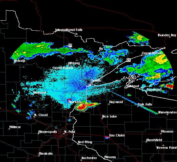 At 459 am cdt, a severe thunderstorm was located 7 miles northwest of webster, or 21 miles east of hinckley, moving southeast at 45 mph (radar indicated). Hazards include 60 mph wind gusts and half dollar size hail. Hail damage to vehicles is expected. expect wind damage to roofs, siding and trees. locations impacted include, siren, webster, oakland and yellow lake. This includes hole in the wall casino. At 459 am cdt, a severe thunderstorm was located 7 miles northwest of webster, or 21 miles east of hinckley, moving southeast at 45 mph (radar indicated). Hazards include 60 mph wind gusts and half dollar size hail. Hail damage to vehicles is expected. expect wind damage to roofs, siding and trees. locations impacted include, siren, webster, oakland and yellow lake. This includes hole in the wall casino.
|
| 8/2/2015 4:46 AM CDT |
 At 445 am cdt, a severe thunderstorm was located 9 miles east of hinckley, moving southeast at 40 mph (radar indicated). Hazards include 60 mph wind gusts and half dollar size hail. Hail damage to vehicles is expected. Expect wind damage to roofs, siding and trees. At 445 am cdt, a severe thunderstorm was located 9 miles east of hinckley, moving southeast at 40 mph (radar indicated). Hazards include 60 mph wind gusts and half dollar size hail. Hail damage to vehicles is expected. Expect wind damage to roofs, siding and trees.
|
| 7/12/2015 11:57 AM CDT | The severe thunderstorm warning for southwestern burnett county will expire at 1200 pm cdt, the storm which prompted the warning has weakened below severe limits, and no longer pose an immediate threat to life or property. therefore the warning will be allowed to expire. |
| 7/12/2015 11:51 AM CDT |
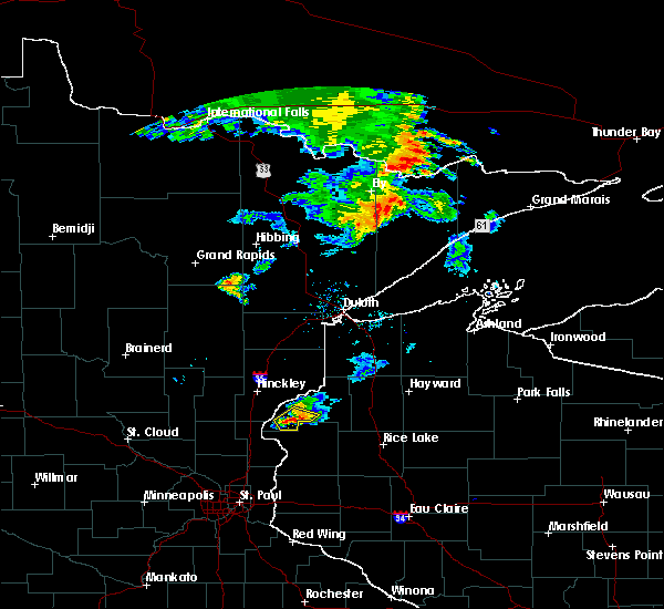 At 1149 am cdt, a severe thunderstorm was located near grantsburg, or 19 miles east of pine city, moving southeast at 25 mph (fire department reported nickel to quarter size hail in grantsburg). Hazards include 60 mph wind gusts and quarter size hail. Hail damage to vehicles is expected. expect wind damage to roofs, siding and trees. Locations impacted include, grantsburg, trade lake, siren, branstad, alpha, falun, trade river, four corners and phantom lake. At 1149 am cdt, a severe thunderstorm was located near grantsburg, or 19 miles east of pine city, moving southeast at 25 mph (fire department reported nickel to quarter size hail in grantsburg). Hazards include 60 mph wind gusts and quarter size hail. Hail damage to vehicles is expected. expect wind damage to roofs, siding and trees. Locations impacted include, grantsburg, trade lake, siren, branstad, alpha, falun, trade river, four corners and phantom lake.
|
| 7/12/2015 11:44 AM CDT |
 At 1143 am cdt, a severe thunderstorm was located over grantsburg, or 16 miles east of pine city, moving southeast at 25 mph (radar indicated). Hazards include 60 mph wind gusts and quarter size hail. Hail damage to vehicles is expected. expect wind damage to roofs, siding and trees. Locations impacted include, grantsburg, trade lake, siren, branstad, alpha, falun, trade river, four corners and phantom lake. At 1143 am cdt, a severe thunderstorm was located over grantsburg, or 16 miles east of pine city, moving southeast at 25 mph (radar indicated). Hazards include 60 mph wind gusts and quarter size hail. Hail damage to vehicles is expected. expect wind damage to roofs, siding and trees. Locations impacted include, grantsburg, trade lake, siren, branstad, alpha, falun, trade river, four corners and phantom lake.
|
| 7/12/2015 11:29 AM CDT |
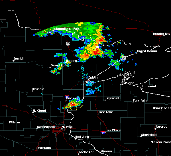 At 1129 am cdt, a severe thunderstorm was located near grantsburg, or 12 miles east of pine city, moving southeast at 25 mph (radar indicated). Hazards include 60 mph wind gusts and quarter size hail. Hail damage to vehicles is expected. expect wind damage to roofs, siding and trees. Locations impacted include, grantsburg, trade lake, siren, branstad, alpha, falun, trade river, four corners and phantom lake. At 1129 am cdt, a severe thunderstorm was located near grantsburg, or 12 miles east of pine city, moving southeast at 25 mph (radar indicated). Hazards include 60 mph wind gusts and quarter size hail. Hail damage to vehicles is expected. expect wind damage to roofs, siding and trees. Locations impacted include, grantsburg, trade lake, siren, branstad, alpha, falun, trade river, four corners and phantom lake.
|
| 7/12/2015 11:13 AM CDT |
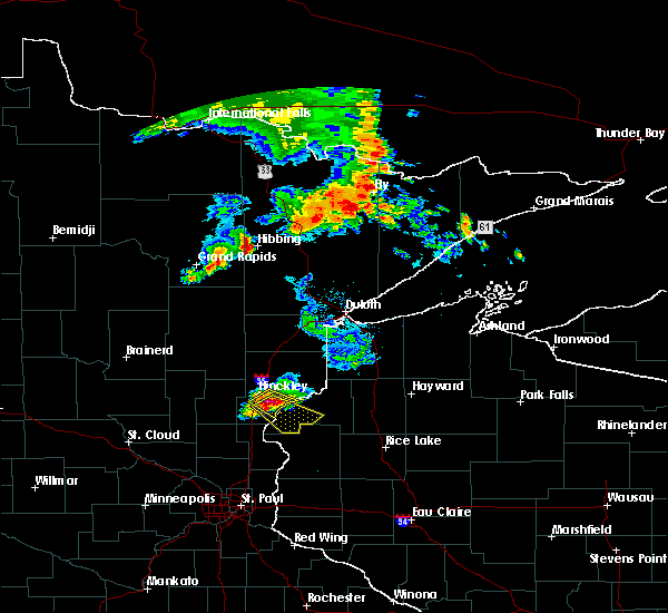 At 1112 am cdt, a severe thunderstorm was located 8 miles southeast of hinckley, moving southeast at 25 mph (trained weather spotters. at 1105 am ping pong ball size hail was reported at hinckley). Hazards include ping pong ball size hail and 60 mph wind gusts. People and animals outdoors will be injured. expect hail damage to roofs, siding, windows and vehicles. expect wind damage to roofs, siding and trees. this severe thunderstorm will be near, saint croix state park around 1125 am cdt. grantsburg around 1140 am cdt. branstad around 1145 am cdt. trade lake and siren around 1200 pm cdt. Other locations impacted by this severe thunderstorm include four corners, beroun, alpha, falun, trade river and phantom lake. At 1112 am cdt, a severe thunderstorm was located 8 miles southeast of hinckley, moving southeast at 25 mph (trained weather spotters. at 1105 am ping pong ball size hail was reported at hinckley). Hazards include ping pong ball size hail and 60 mph wind gusts. People and animals outdoors will be injured. expect hail damage to roofs, siding, windows and vehicles. expect wind damage to roofs, siding and trees. this severe thunderstorm will be near, saint croix state park around 1125 am cdt. grantsburg around 1140 am cdt. branstad around 1145 am cdt. trade lake and siren around 1200 pm cdt. Other locations impacted by this severe thunderstorm include four corners, beroun, alpha, falun, trade river and phantom lake.
|
| 9/3/2014 6:50 PM CDT | Golf Ball sized hail reported 0.1 miles NW of Siren, WI |
| 9/19/2013 11:55 AM CDT | 1-2 inch diameter tree branches. also pea-size hail reporte in burnett county WI, 3 miles W of Siren, WI |
| 9/19/2013 11:51 AM CDT | Pontoon boat and dock it was tied to flipped over on lower clam lak in burnett county WI, 2.8 miles WSW of Siren, WI |
| 9/19/2013 11:51 AM CDT | 8 inch diameter tree branch down. time estimated from rada in burnett county WI, 3 miles W of Siren, WI |
| 6/26/2013 5:00 PM CDT | Half Dollar sized hail reported 0.1 miles NW of Siren, WI |
| 5/27/2012 6:45 PM CDT | Quarter sized hail reported 0.1 miles NW of Siren, WI |
| 1/1/0001 12:00 AM | Camper-trailed recieved significant damage with only one wall left intact. no one was inside at time of stor in burnett county WI, 4.7 miles SE of Siren, WI |
| 1/1/0001 12:00 AM | Ping Pong Ball sized hail reported 2.6 miles WSW of Siren, WI |
| 1/1/0001 12:00 AM | Ping Pong Ball sized hail reported 1.5 miles ESE of Siren, WI |
| 1/1/0001 12:00 AM | Quarter sized hail reported 2.2 miles SSW of Siren, WI, hail size has increased. reported at government center on north side of siren. |
Hail Maps for Siren, WI


Connect with Interactive Hail Maps