

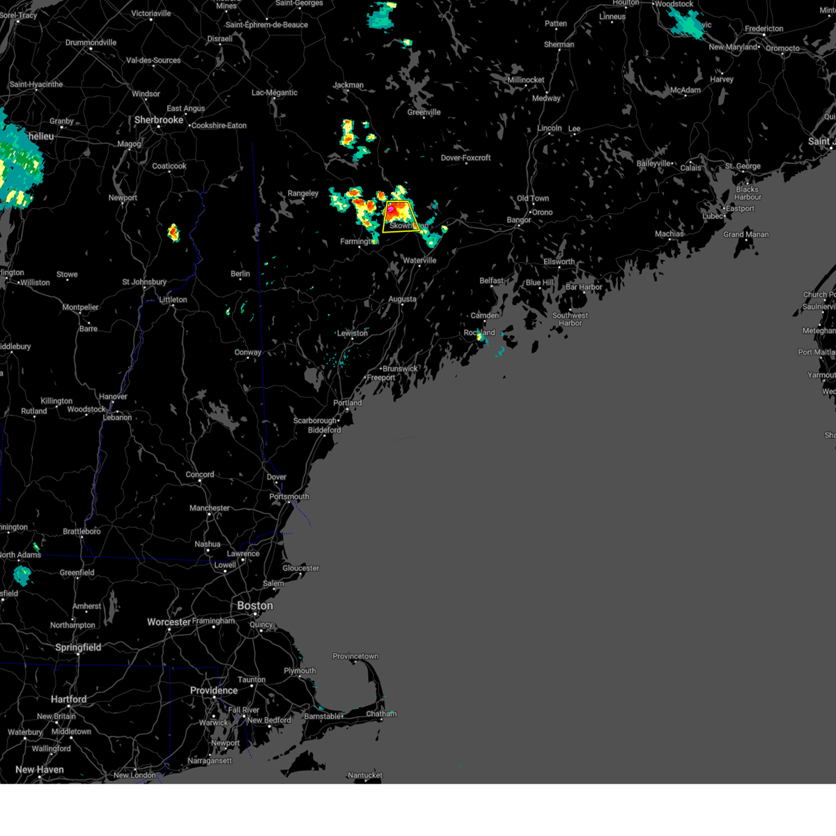
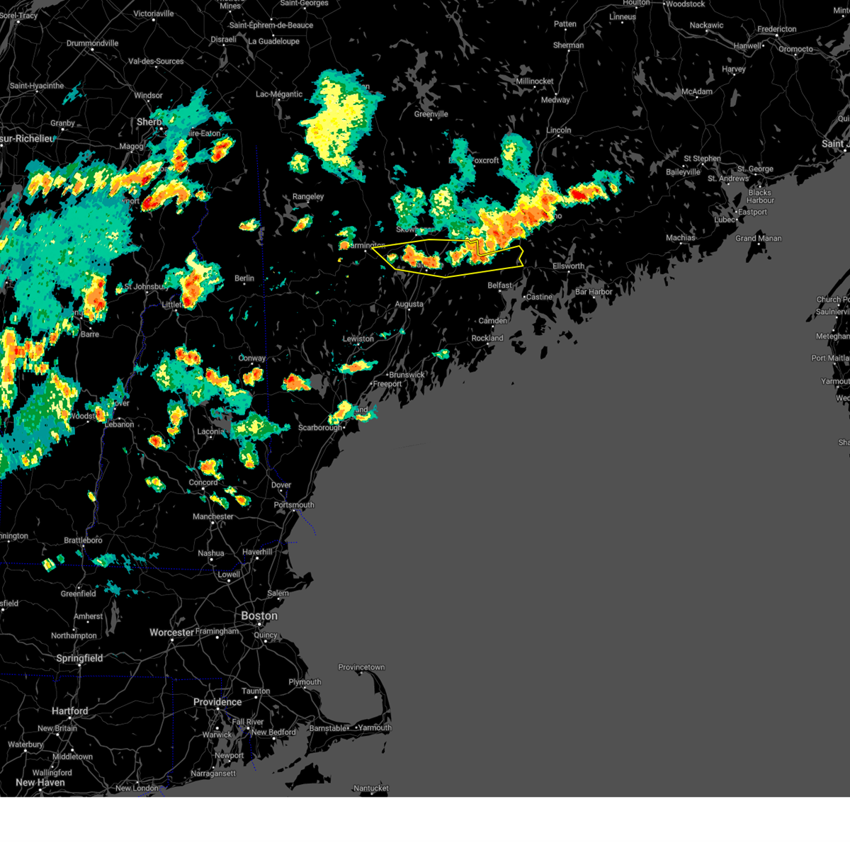
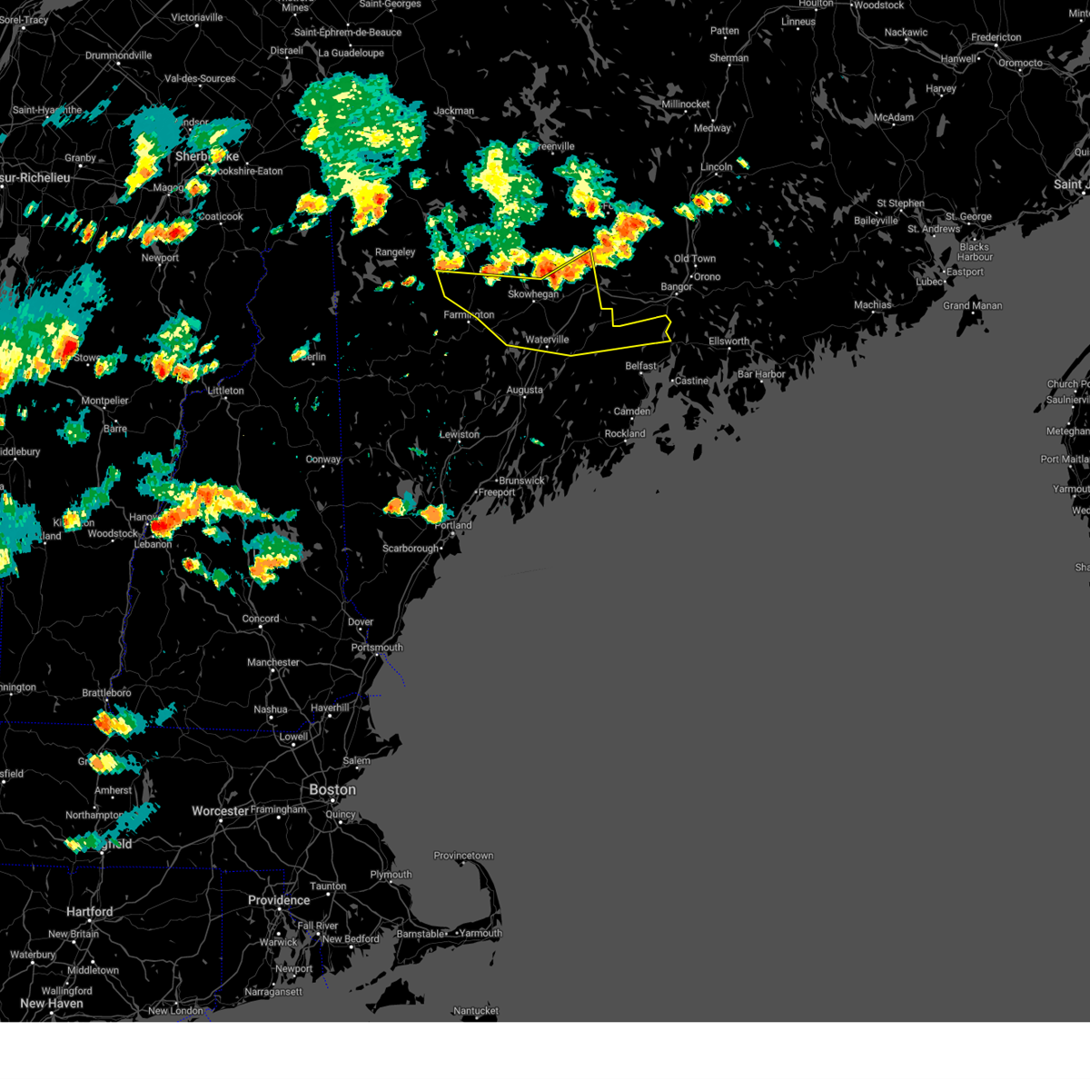
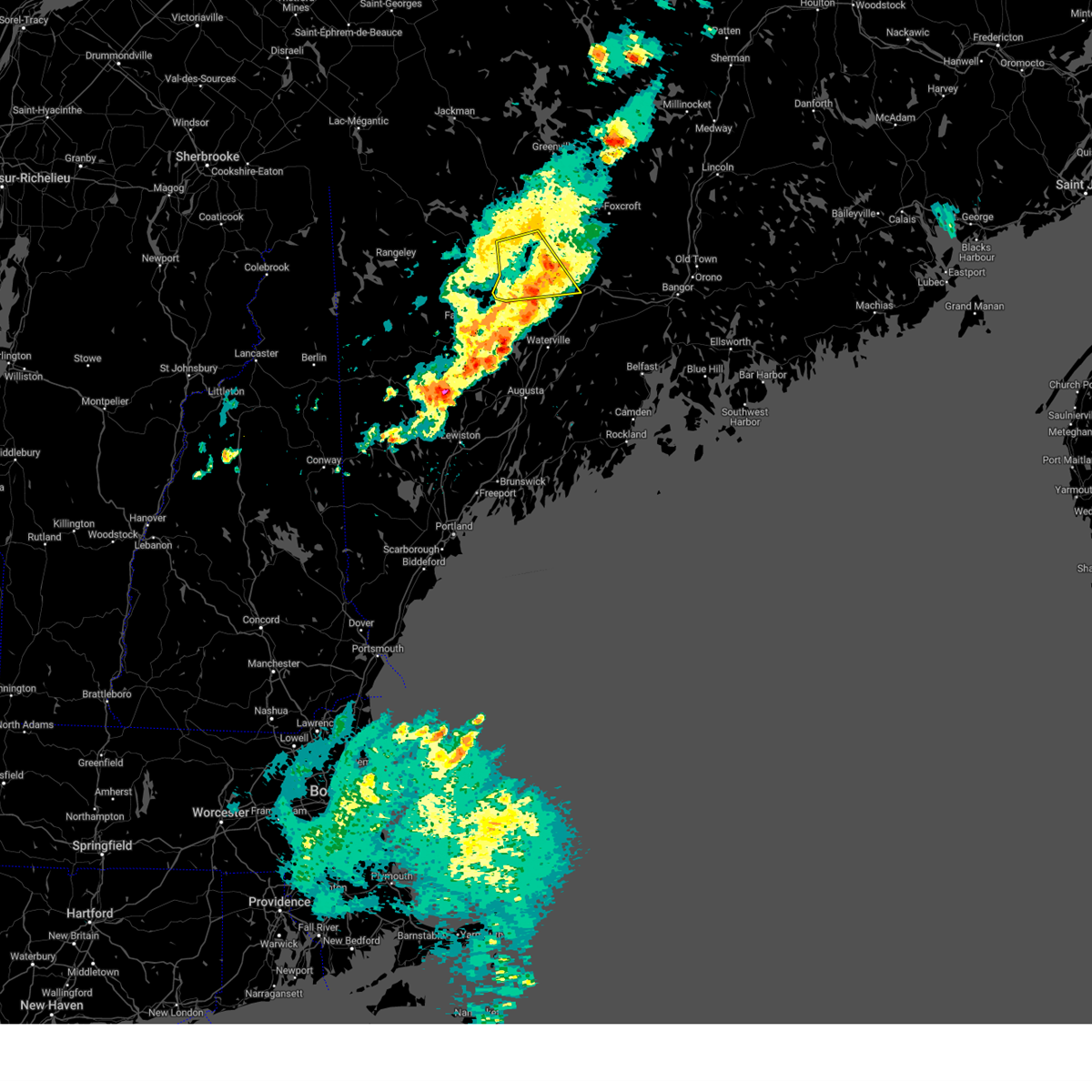
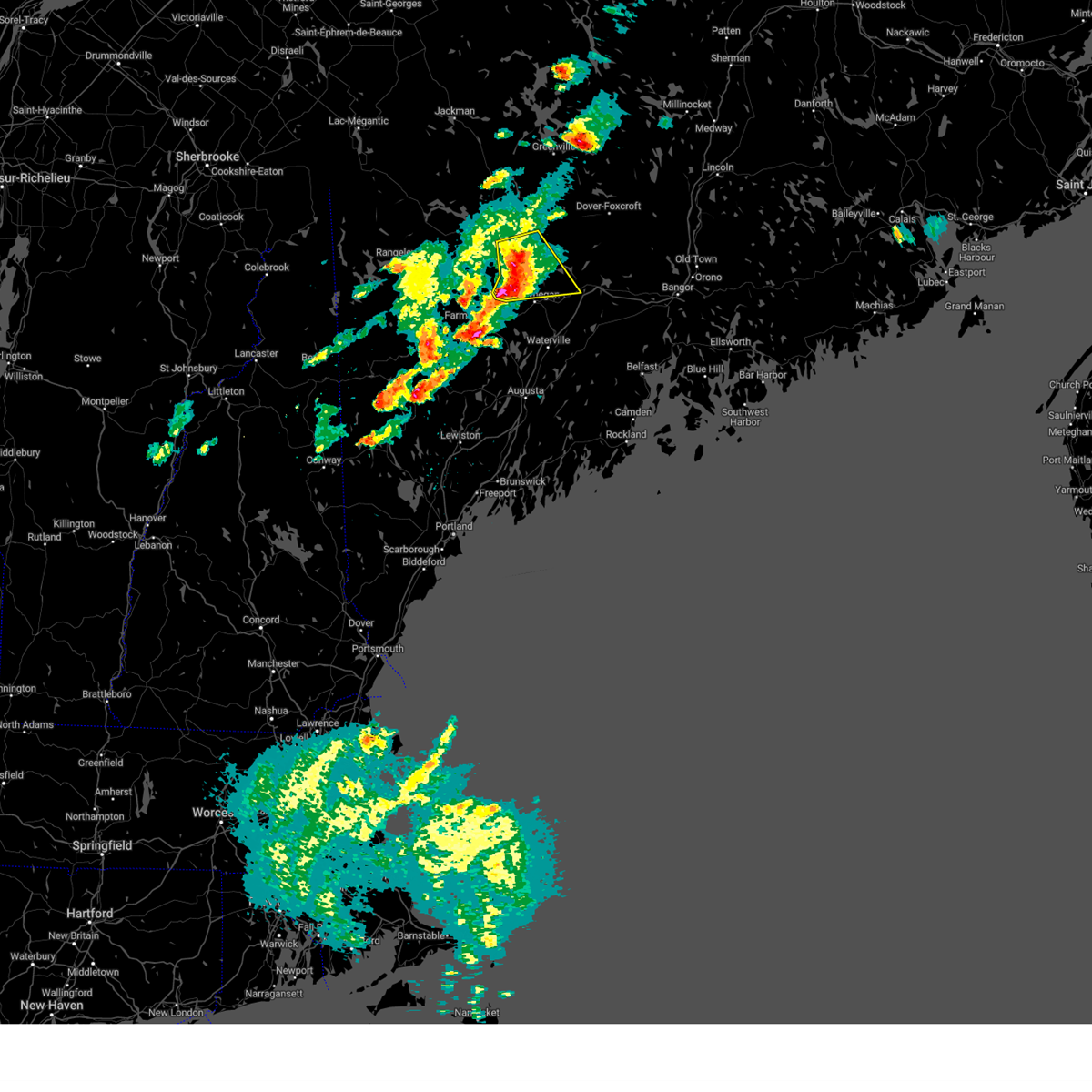
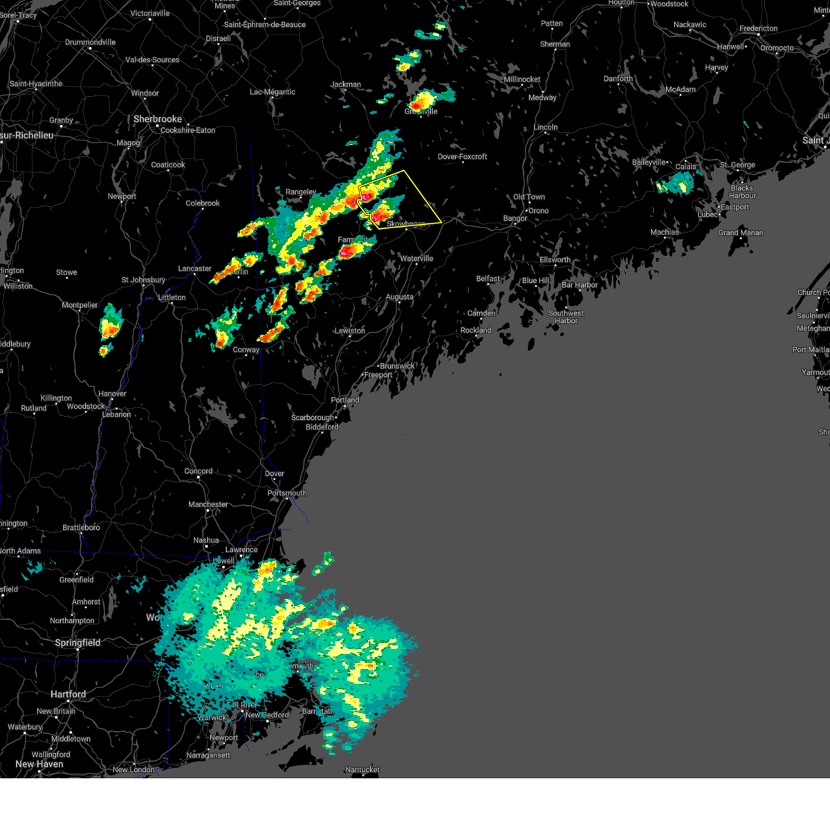
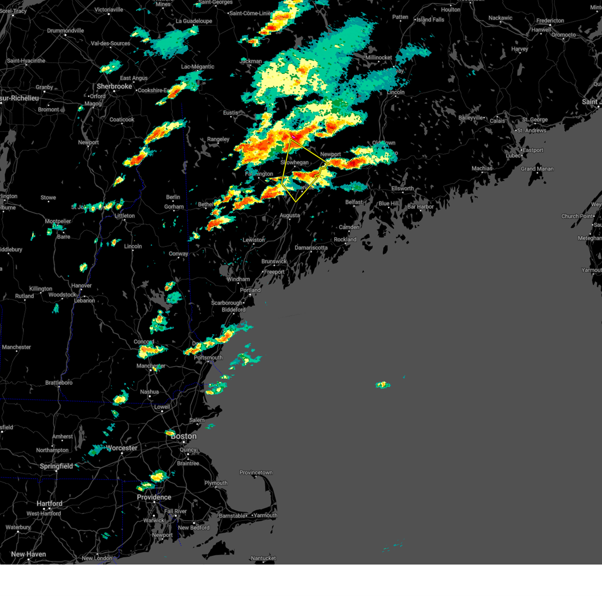
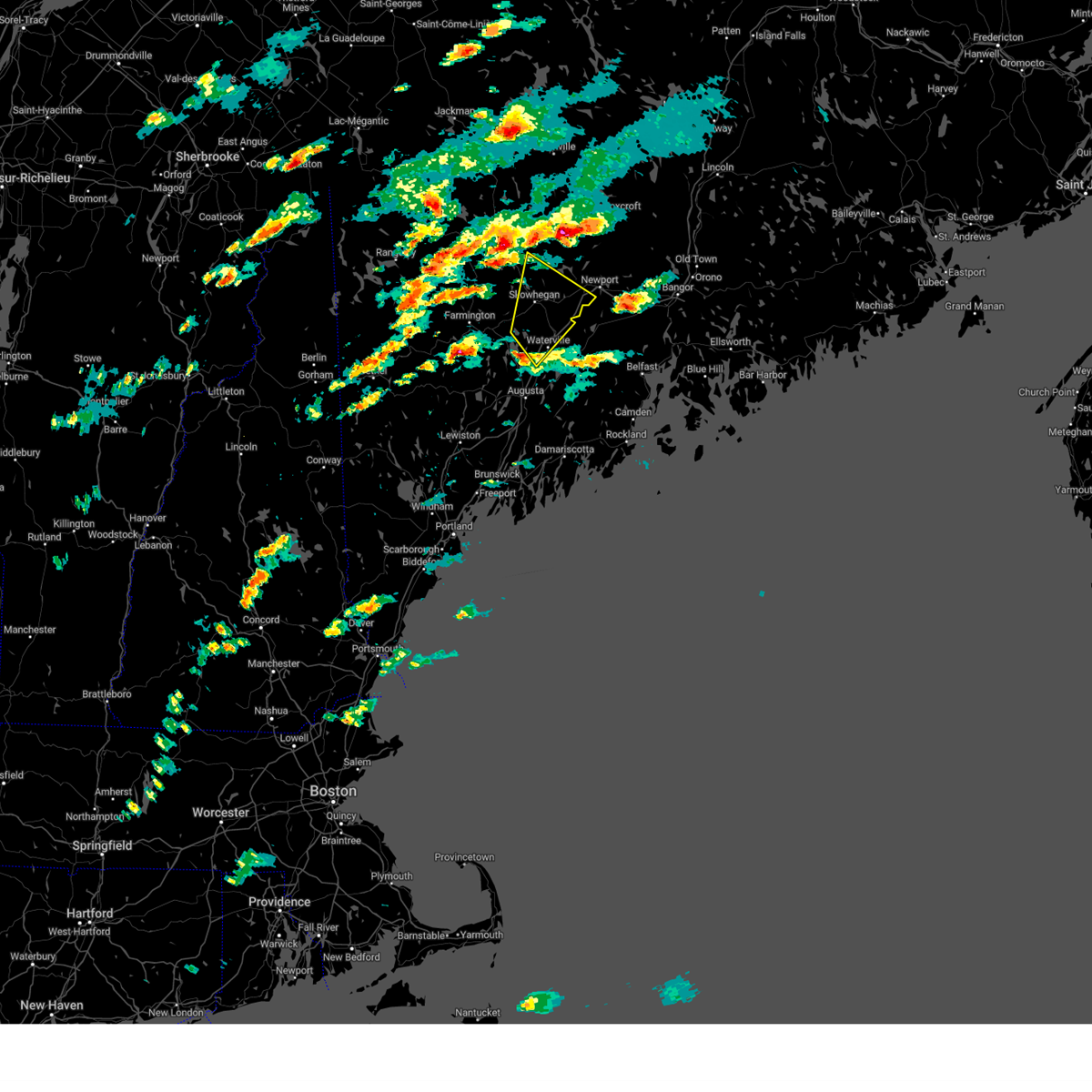
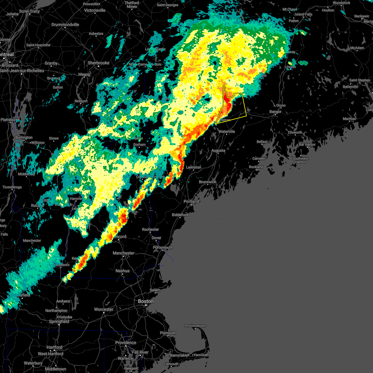
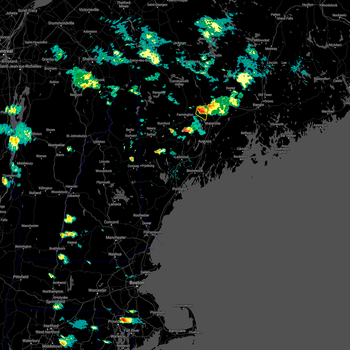
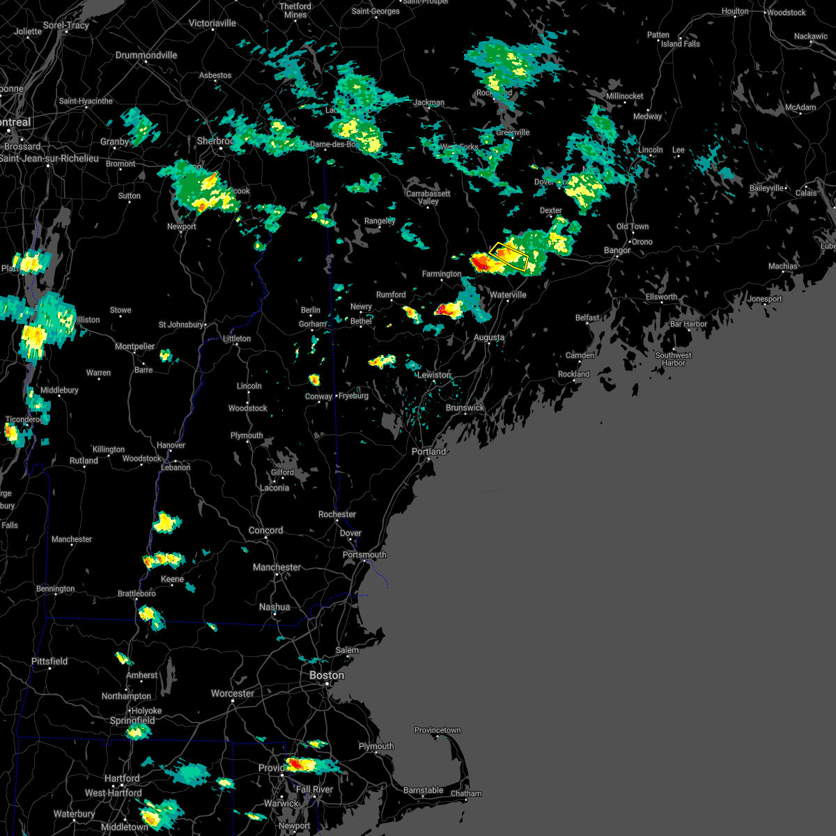
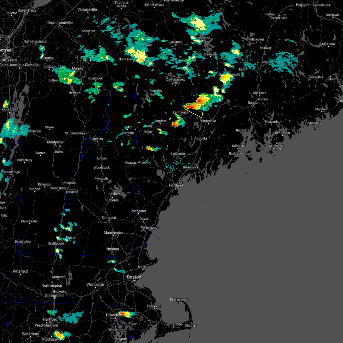
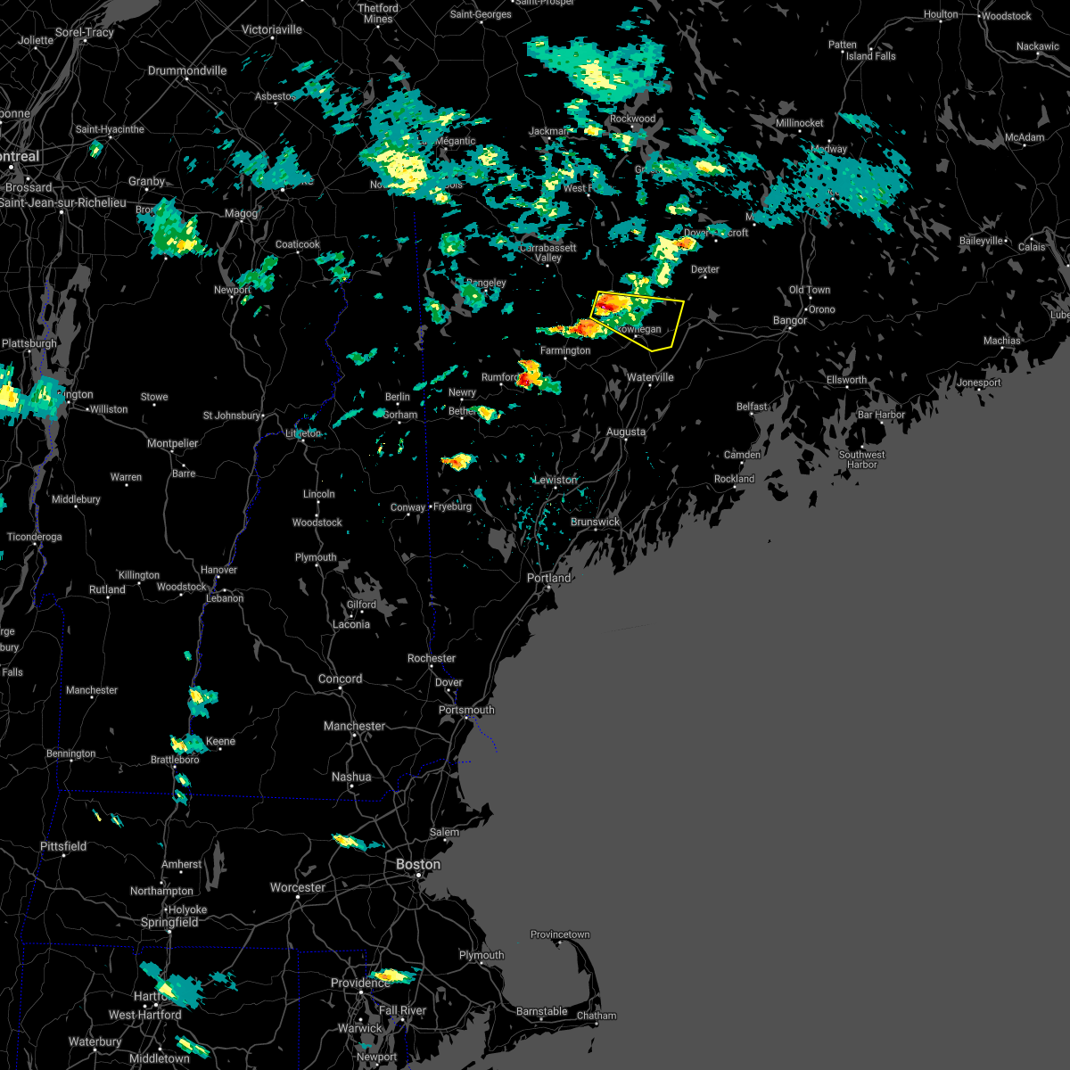
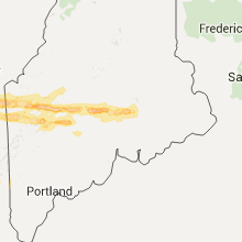
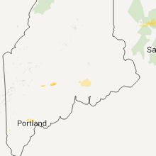
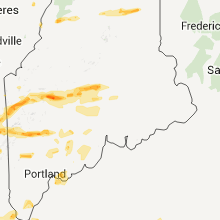
Hail Map for Skowhegan, ME
The Skowhegan, ME area has had 3 reports of on-the-ground hail by trained spotters, and has been under severe weather warnings 3 times during the past 12 months. Doppler radar has detected hail at or near Skowhegan, ME on 15 occasions, including 1 occasion during the past year.
| Name: | Skowhegan, ME |
| Where Located: | 45.8 miles W of Bangor, ME |
| Map: | Google Map for Skowhegan, ME |
| Population: | 6297 |
| Housing Units: | 3178 |
| More Info: | Search Google for Skowhegan, ME |
0
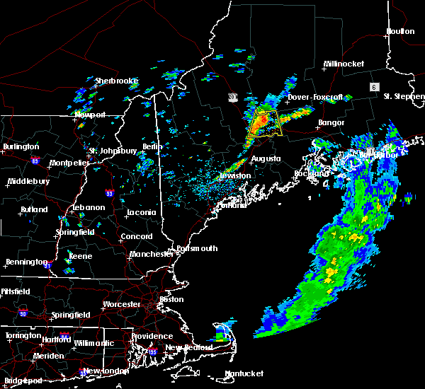
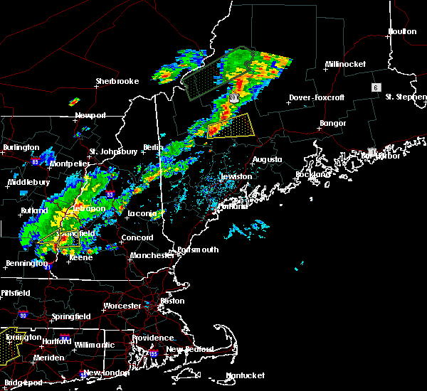
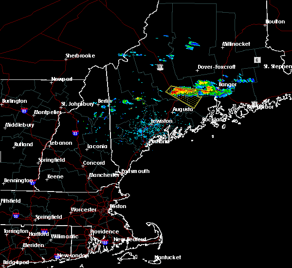
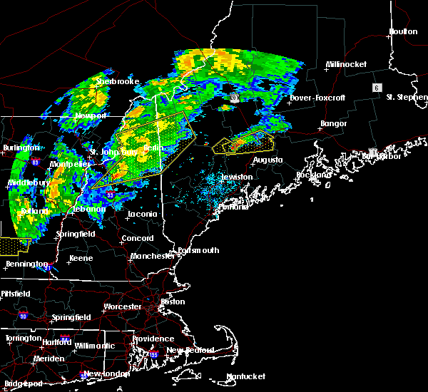
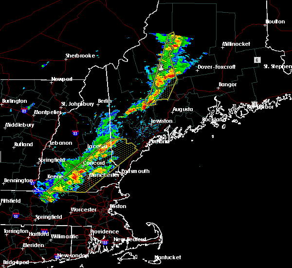
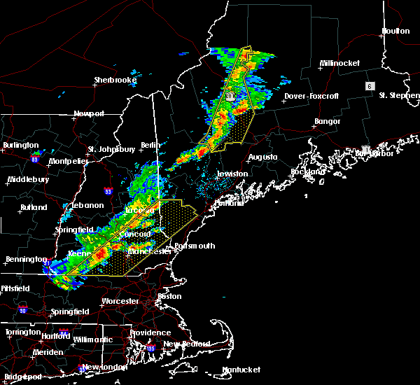
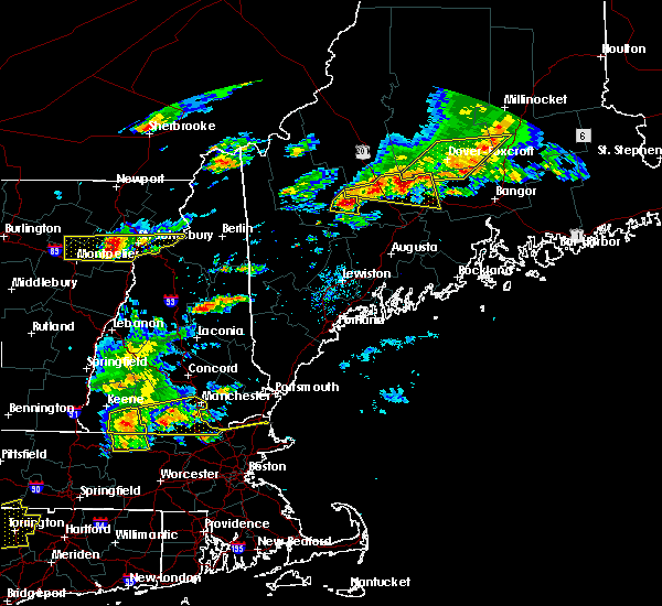
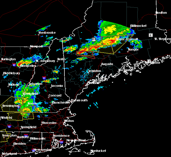
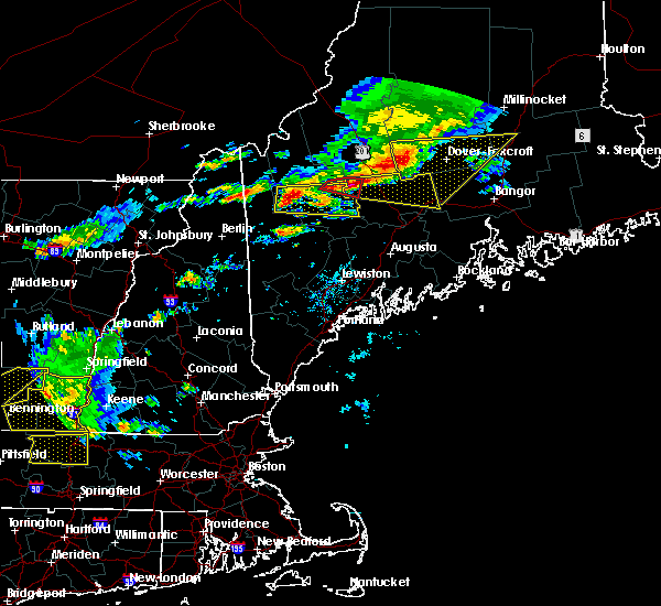
The Top Recent Hail Date for Skowhegan, ME is Wednesday, August 14, 2024 (13th out of 15)

Hail and Wind Damage Spotted near Skowhegan, ME
| Date / Time | Report Details |
|---|---|
| 8/14/2024 6:59 PM EDT |
 The storm which prompted the warning has moved out of the area. therefore, the warning will be allowed to expire. The storm which prompted the warning has moved out of the area. therefore, the warning will be allowed to expire.
|
| 8/14/2024 6:30 PM EDT |
 At 629 pm edt, a severe thunderstorm was located near madison, or 12 miles northwest of skowhegan, moving south at 20 mph (radar indicated). Hazards include 60 mph wind gusts and quarter size hail. Hail damage to vehicles is expected. expect wind damage to roofs, siding, and trees. Locations impacted include, skowhegan, madison, norridgewock, anson, cornville, athens, embden, solon, and starks. At 629 pm edt, a severe thunderstorm was located near madison, or 12 miles northwest of skowhegan, moving south at 20 mph (radar indicated). Hazards include 60 mph wind gusts and quarter size hail. Hail damage to vehicles is expected. expect wind damage to roofs, siding, and trees. Locations impacted include, skowhegan, madison, norridgewock, anson, cornville, athens, embden, solon, and starks.
|
| 8/14/2024 6:12 PM EDT |
 Svrgyx the national weather service in gray maine has issued a * severe thunderstorm warning for, south central somerset county in west central maine, * until 700 pm edt. * at 611 pm edt, a severe thunderstorm was located near bingham, or 18 miles northwest of skowhegan, moving south at 20 mph (radar indicated). Hazards include 60 mph wind gusts and quarter size hail. Hail damage to vehicles is expected. Expect wind damage to roofs, siding, and trees. Svrgyx the national weather service in gray maine has issued a * severe thunderstorm warning for, south central somerset county in west central maine, * until 700 pm edt. * at 611 pm edt, a severe thunderstorm was located near bingham, or 18 miles northwest of skowhegan, moving south at 20 mph (radar indicated). Hazards include 60 mph wind gusts and quarter size hail. Hail damage to vehicles is expected. Expect wind damage to roofs, siding, and trees.
|
| 7/11/2024 5:28 PM EDT | Tree down along tobey r in somerset county ME, 7 miles W of Skowhegan, ME |
| 6/20/2024 4:13 PM EDT |
 At 413 pm edt, severe thunderstorms were located along a line extending from 6 miles northwest of winterport to near thorndike to 6 miles north of belgrade, moving southeast at 35 mph (radar indicated). Hazards include 60 mph wind gusts and penny size hail. Expect damage to roofs, siding, and trees. locations impacted include, waterville, fairfield, oakland, thorndike, skowhegan, pittsfield, clinton, belgrade, winterport, unity, norridgewock, prospect, knox, benton, canaan, albion, burnham, frankfort, brooks, and detroit. This includes interstate 95 between mile markers 127 and 146. At 413 pm edt, severe thunderstorms were located along a line extending from 6 miles northwest of winterport to near thorndike to 6 miles north of belgrade, moving southeast at 35 mph (radar indicated). Hazards include 60 mph wind gusts and penny size hail. Expect damage to roofs, siding, and trees. locations impacted include, waterville, fairfield, oakland, thorndike, skowhegan, pittsfield, clinton, belgrade, winterport, unity, norridgewock, prospect, knox, benton, canaan, albion, burnham, frankfort, brooks, and detroit. This includes interstate 95 between mile markers 127 and 146.
|
| 6/20/2024 3:40 PM EDT | Tree and power lines down blocking beckwith rd in cornvill in somerset county ME, 5.7 miles S of Skowhegan, ME |
| 6/20/2024 3:29 PM EDT |
 Svrgyx the national weather service in gray maine has issued a * severe thunderstorm warning for, northeastern kennebec county in south central maine, northern waldo county in south central maine, southeastern somerset county in west central maine, southeastern franklin county in western maine, * until 430 pm edt. * at 328 pm edt, severe thunderstorms were located along a line extending from 15 miles northeast of pittsfield to 6 miles northeast of skowhegan to near phillips, moving southeast at 20 mph (radar indicated). Hazards include 60 mph wind gusts and penny size hail. expect damage to roofs, siding, and trees Svrgyx the national weather service in gray maine has issued a * severe thunderstorm warning for, northeastern kennebec county in south central maine, northern waldo county in south central maine, southeastern somerset county in west central maine, southeastern franklin county in western maine, * until 430 pm edt. * at 328 pm edt, severe thunderstorms were located along a line extending from 15 miles northeast of pittsfield to 6 miles northeast of skowhegan to near phillips, moving southeast at 20 mph (radar indicated). Hazards include 60 mph wind gusts and penny size hail. expect damage to roofs, siding, and trees
|
| 5/23/2024 1:57 PM EDT |
 The storms which prompted the warning have weakened below severe limits, and no longer pose an immediate threat to life or property. therefore, the warning will be allowed to expire. however, small hail, gusty winds and heavy rain are still possible with these thunderstorms. a severe thunderstorm watch remains in effect until 700 pm edt for west central maine. The storms which prompted the warning have weakened below severe limits, and no longer pose an immediate threat to life or property. therefore, the warning will be allowed to expire. however, small hail, gusty winds and heavy rain are still possible with these thunderstorms. a severe thunderstorm watch remains in effect until 700 pm edt for west central maine.
|
| 5/23/2024 1:51 PM EDT | Somerset county reported trees down on water st in skowhegan. time estimated by rada in somerset county ME, 0.4 miles ESE of Skowhegan, ME |
| 5/23/2024 1:28 PM EDT |
 At 128 pm edt, severe thunderstorms were located along a line extending from near bingham to near madison, moving east at 25 mph (radar indicated). Hazards include 60 mph wind gusts and half dollar size hail. Hail damage to vehicles is expected. expect wind damage to roofs, siding, and trees. Locations impacted include, skowhegan, pittsfield, madison, bingham, anson, canaan, hartland, cornville, athens, embden, harmony, brighton plantation, concord, solon, starks, mayfield, and palmyra. At 128 pm edt, severe thunderstorms were located along a line extending from near bingham to near madison, moving east at 25 mph (radar indicated). Hazards include 60 mph wind gusts and half dollar size hail. Hail damage to vehicles is expected. expect wind damage to roofs, siding, and trees. Locations impacted include, skowhegan, pittsfield, madison, bingham, anson, canaan, hartland, cornville, athens, embden, harmony, brighton plantation, concord, solon, starks, mayfield, and palmyra.
|
| 5/23/2024 1:08 PM EDT |
 Svrgyx the national weather service in gray maine has issued a * severe thunderstorm warning for, southeastern somerset county in west central maine, * until 200 pm edt. * at 108 pm edt, severe thunderstorms were located along a line extending from near kingfield to 6 miles west of madison, moving east at 35 mph (radar indicated). Hazards include 60 mph wind gusts and half dollar size hail. Hail damage to vehicles is expected. Expect wind damage to roofs, siding, and trees. Svrgyx the national weather service in gray maine has issued a * severe thunderstorm warning for, southeastern somerset county in west central maine, * until 200 pm edt. * at 108 pm edt, severe thunderstorms were located along a line extending from near kingfield to 6 miles west of madison, moving east at 35 mph (radar indicated). Hazards include 60 mph wind gusts and half dollar size hail. Hail damage to vehicles is expected. Expect wind damage to roofs, siding, and trees.
|
| 8/13/2023 4:07 PM EDT |
 The severe thunderstorm warning for north central kennebec and southeastern somerset counties will expire at 415 pm edt, the storm which prompted the warning has weakened below severe limits, and has exited the warned area. therefore, the warning will be allowed to expire. however, small hail and gusty winds are still possible with this thunderstorm. a severe thunderstorm watch remains in effect until 900 pm edt for south central and west central maine. The severe thunderstorm warning for north central kennebec and southeastern somerset counties will expire at 415 pm edt, the storm which prompted the warning has weakened below severe limits, and has exited the warned area. therefore, the warning will be allowed to expire. however, small hail and gusty winds are still possible with this thunderstorm. a severe thunderstorm watch remains in effect until 900 pm edt for south central and west central maine.
|
| 8/13/2023 3:55 PM EDT |
 At 355 pm edt, a severe thunderstorm was located over skowhegan, moving north at 25 mph (radar indicated). Hazards include 60 mph wind gusts and quarter size hail. Hail damage to vehicles is expected. expect wind damage to roofs, siding, and trees. locations impacted include, waterville, fairfield, skowhegan, oakland, pittsfield, madison, clinton, belgrade, norridgewock, benton, canaan, hartland, cornville, burnham, athens, detroit, smithfield, solon, winslow, and palmyra. this includes interstate 95 between mile markers 122 and 141, and between mile markers 143 and 153. hail threat, radar indicated max hail size, 1. 00 in wind threat, radar indicated max wind gust, 60 mph. At 355 pm edt, a severe thunderstorm was located over skowhegan, moving north at 25 mph (radar indicated). Hazards include 60 mph wind gusts and quarter size hail. Hail damage to vehicles is expected. expect wind damage to roofs, siding, and trees. locations impacted include, waterville, fairfield, skowhegan, oakland, pittsfield, madison, clinton, belgrade, norridgewock, benton, canaan, hartland, cornville, burnham, athens, detroit, smithfield, solon, winslow, and palmyra. this includes interstate 95 between mile markers 122 and 141, and between mile markers 143 and 153. hail threat, radar indicated max hail size, 1. 00 in wind threat, radar indicated max wind gust, 60 mph.
|
| 8/13/2023 3:32 PM EDT |
 At 332 pm edt, a severe thunderstorm was located near oakland, moving north at 25 mph (radar indicated). Hazards include 60 mph wind gusts and quarter size hail. Hail damage to vehicles is expected. Expect wind damage to roofs, siding, and trees. At 332 pm edt, a severe thunderstorm was located near oakland, moving north at 25 mph (radar indicated). Hazards include 60 mph wind gusts and quarter size hail. Hail damage to vehicles is expected. Expect wind damage to roofs, siding, and trees.
|
| 6/2/2023 2:30 PM EDT | Trees down on wire in somerset county ME, 0.9 miles ESE of Skowhegan, ME |
| 6/13/2022 5:12 PM EDT | Trees down on electricity wires on notch road-relayed by trained spotter/somerset county dispatc in somerset county ME, 7 miles WSW of Skowhegan, ME |
| 9/15/2021 5:09 PM EDT | Tree down across martin stream road. time estimated based on rada in somerset county ME, 6.3 miles SW of Skowhegan, ME |
| 9/15/2021 4:58 PM EDT |
 At 458 pm edt, severe thunderstorms were located along a line extending from 14 miles east of bingham to 10 miles northwest of pittsfield to near skowhegan, moving northeast at 45 mph (radar indicated). Hazards include 60 mph wind gusts and penny size hail. expect damage to roofs, siding, and trees At 458 pm edt, severe thunderstorms were located along a line extending from 14 miles east of bingham to 10 miles northwest of pittsfield to near skowhegan, moving northeast at 45 mph (radar indicated). Hazards include 60 mph wind gusts and penny size hail. expect damage to roofs, siding, and trees
|
| 7/23/2021 3:25 PM EDT |
 At 325 pm edt, a severe thunderstorm was located near skowhegan, moving south at 15 mph (radar indicated). Hazards include 60 mph wind gusts and quarter size hail. Hail damage to vehicles is expected. Expect wind damage to roofs, siding, and trees. At 325 pm edt, a severe thunderstorm was located near skowhegan, moving south at 15 mph (radar indicated). Hazards include 60 mph wind gusts and quarter size hail. Hail damage to vehicles is expected. Expect wind damage to roofs, siding, and trees.
|
| 6/19/2021 3:13 PM EDT |
 At 313 pm edt, severe thunderstorms were located along a line extending from 6 miles northeast of skowhegan to winthrop, moving east at 45 mph (radar indicated). Hazards include 60 mph wind gusts and quarter size hail. Hail damage to vehicles is expected. Expect wind damage to roofs, siding, and trees. At 313 pm edt, severe thunderstorms were located along a line extending from 6 miles northeast of skowhegan to winthrop, moving east at 45 mph (radar indicated). Hazards include 60 mph wind gusts and quarter size hail. Hail damage to vehicles is expected. Expect wind damage to roofs, siding, and trees.
|
| 8/25/2020 2:34 PM EDT |
 At 234 pm edt, a severe thunderstorm was located near fairfield, moving east at 30 mph (radar indicated). Hazards include 60 mph wind gusts and quarter size hail. Hail damage to vehicles is expected. Expect wind damage to roofs, siding, and trees. At 234 pm edt, a severe thunderstorm was located near fairfield, moving east at 30 mph (radar indicated). Hazards include 60 mph wind gusts and quarter size hail. Hail damage to vehicles is expected. Expect wind damage to roofs, siding, and trees.
|
| 8/24/2020 2:16 PM EDT |
 At 216 pm edt, a severe thunderstorm was located over norridgewock, or near skowhegan, moving east at 25 mph (radar indicated). Hazards include 60 mph wind gusts and half dollar size hail. Hail damage to vehicles is expected. Expect wind damage to roofs, siding, and trees. At 216 pm edt, a severe thunderstorm was located over norridgewock, or near skowhegan, moving east at 25 mph (radar indicated). Hazards include 60 mph wind gusts and half dollar size hail. Hail damage to vehicles is expected. Expect wind damage to roofs, siding, and trees.
|
| 8/24/2020 2:07 PM EDT |
 At 207 pm edt, a severe thunderstorm was located near madison, or near skowhegan, moving east at 15 mph (radar indicated). Hazards include 60 mph wind gusts and quarter size hail. Hail damage to vehicles is expected. expect wind damage to roofs, siding, and trees. Locations impacted include, fairfield, skowhegan, madison, norridgewock, anson, cornville, starks, smithfield and mercer. At 207 pm edt, a severe thunderstorm was located near madison, or near skowhegan, moving east at 15 mph (radar indicated). Hazards include 60 mph wind gusts and quarter size hail. Hail damage to vehicles is expected. expect wind damage to roofs, siding, and trees. Locations impacted include, fairfield, skowhegan, madison, norridgewock, anson, cornville, starks, smithfield and mercer.
|
| 8/24/2020 2:06 PM EDT |
 At 205 pm edt, a severe thunderstorm was located near skowhegan, moving east at 25 mph (radar indicated). Hazards include 60 mph wind gusts and penny size hail. Expect damage to roofs, siding, and trees. Locations impacted include, skowhegan, pittsfield, madison, canaan and cornville. At 205 pm edt, a severe thunderstorm was located near skowhegan, moving east at 25 mph (radar indicated). Hazards include 60 mph wind gusts and penny size hail. Expect damage to roofs, siding, and trees. Locations impacted include, skowhegan, pittsfield, madison, canaan and cornville.
|
| 8/24/2020 1:45 PM EDT |
 At 144 pm edt, a severe thunderstorm was located near madison, or 10 miles northeast of farmington, moving east at 15 mph (radar indicated). Hazards include 60 mph wind gusts and quarter size hail. Hail damage to vehicles is expected. Expect wind damage to roofs, siding, and trees. At 144 pm edt, a severe thunderstorm was located near madison, or 10 miles northeast of farmington, moving east at 15 mph (radar indicated). Hazards include 60 mph wind gusts and quarter size hail. Hail damage to vehicles is expected. Expect wind damage to roofs, siding, and trees.
|
| 8/24/2020 1:27 PM EDT |
 At 127 pm edt, a severe thunderstorm was located 8 miles northwest of madison, or 15 miles northwest of skowhegan, moving east at 25 mph (radar indicated). Hazards include 60 mph wind gusts and quarter size hail. Hail damage to vehicles is expected. Expect wind damage to roofs, siding, and trees. At 127 pm edt, a severe thunderstorm was located 8 miles northwest of madison, or 15 miles northwest of skowhegan, moving east at 25 mph (radar indicated). Hazards include 60 mph wind gusts and quarter size hail. Hail damage to vehicles is expected. Expect wind damage to roofs, siding, and trees.
|
| 7/13/2020 4:45 PM EDT | Multiple reports of trees down...trees on wires... completely blocking rd at waterville and free st; trees down on french and at 130 block of main st. time est via rada in somerset county ME, 0.6 miles NE of Skowhegan, ME |
| 7/8/2020 5:27 PM EDT |
 At 527 pm edt, severe thunderstorms were located along a line extending from 16 miles northeast of pittsfield to near skowhegan to 10 miles west of oakland to near belgrade to near winthrop to near turner to 10 miles southwest of canton, moving east at 40 mph (radar indicated). Hazards include 60 mph wind gusts and quarter size hail. Hail damage to vehicles is expected. expect wind damage to roofs, siding, and trees. locations impacted include, augusta, waterville, farmington, fairfield, oakland, skowhegan, pittsfield, turner, madison, china, clinton, belgrade, livermore falls, manchester, hallowell, bingham, norridgewock, winthrop, unity and benton. This includes interstate 95 between mile markers 110 and 155. At 527 pm edt, severe thunderstorms were located along a line extending from 16 miles northeast of pittsfield to near skowhegan to 10 miles west of oakland to near belgrade to near winthrop to near turner to 10 miles southwest of canton, moving east at 40 mph (radar indicated). Hazards include 60 mph wind gusts and quarter size hail. Hail damage to vehicles is expected. expect wind damage to roofs, siding, and trees. locations impacted include, augusta, waterville, farmington, fairfield, oakland, skowhegan, pittsfield, turner, madison, china, clinton, belgrade, livermore falls, manchester, hallowell, bingham, norridgewock, winthrop, unity and benton. This includes interstate 95 between mile markers 110 and 155.
|
| 7/8/2020 4:54 PM EDT |
 At 454 pm edt, severe thunderstorms were located along a line extending from 10 miles east of bingham to 7 miles east of kingfield to 8 miles west of madison to near farmington to near wilton to dixfield to 6 miles southeast of andover, moving east at 55 mph (radar indicated). Hazards include 60 mph wind gusts and quarter size hail. Hail damage to vehicles is expected. Expect wind damage to roofs, siding, and trees. At 454 pm edt, severe thunderstorms were located along a line extending from 10 miles east of bingham to 7 miles east of kingfield to 8 miles west of madison to near farmington to near wilton to dixfield to 6 miles southeast of andover, moving east at 55 mph (radar indicated). Hazards include 60 mph wind gusts and quarter size hail. Hail damage to vehicles is expected. Expect wind damage to roofs, siding, and trees.
|
| 7/2/2020 5:25 PM EDT | Reported at bigelow hill road... adams street... pine street...and winter street skowhegan me with multiple trees and wires dow in somerset county ME, 3.6 miles NNE of Skowhegan, ME |
| 7/2/2020 4:53 PM EDT |
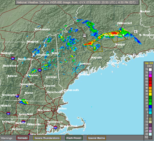 At 452 pm edt, a severe thunderstorm was located 10 miles southeast of bingham, or 12 miles north of skowhegan, moving south at 25 mph (radar indicated). Hazards include 60 mph wind gusts and quarter size hail. Hail damage to vehicles is expected. expect wind damage to roofs, siding, and trees. locations impacted include, fairfield, skowhegan, pittsfield, madison, clinton, bingham, norridgewock, unity, benton, anson, canaan, hartland, cornville, burnham, athens, harmony, embden, detroit, brighton plantation and solon. This includes interstate 95 between mile markers 136 and 155. At 452 pm edt, a severe thunderstorm was located 10 miles southeast of bingham, or 12 miles north of skowhegan, moving south at 25 mph (radar indicated). Hazards include 60 mph wind gusts and quarter size hail. Hail damage to vehicles is expected. expect wind damage to roofs, siding, and trees. locations impacted include, fairfield, skowhegan, pittsfield, madison, clinton, bingham, norridgewock, unity, benton, anson, canaan, hartland, cornville, burnham, athens, harmony, embden, detroit, brighton plantation and solon. This includes interstate 95 between mile markers 136 and 155.
|
| 7/2/2020 4:34 PM EDT |
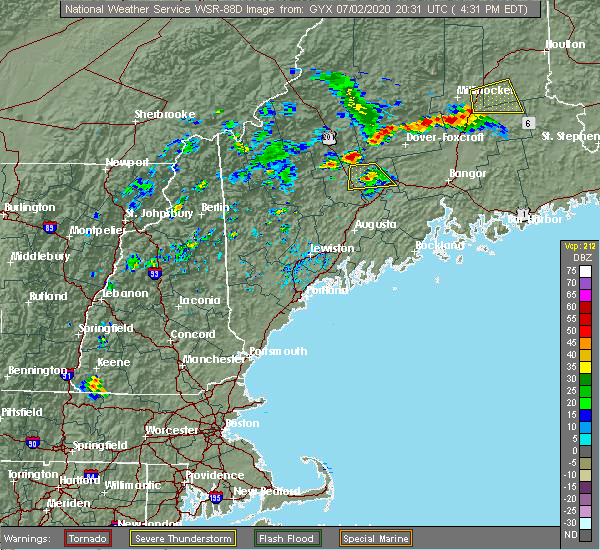 At 434 pm edt, a severe thunderstorm was located near bingham, or 19 miles north of skowhegan, moving south at 20 mph (radar indicated). Hazards include 60 mph wind gusts and quarter size hail. Hail damage to vehicles is expected. Expect wind damage to roofs, siding, and trees. At 434 pm edt, a severe thunderstorm was located near bingham, or 19 miles north of skowhegan, moving south at 20 mph (radar indicated). Hazards include 60 mph wind gusts and quarter size hail. Hail damage to vehicles is expected. Expect wind damage to roofs, siding, and trees.
|
| 7/2/2020 4:19 PM EDT |
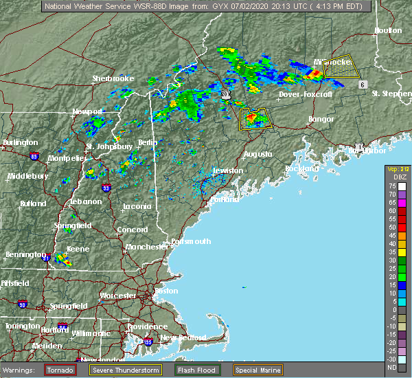 At 419 pm edt, a severe thunderstorm was located 13 miles northeast of skowhegan, moving south at 15 mph (trained weather spotters). Hazards include 60 mph wind gusts and quarter size hail. Hail damage to vehicles is expected. expect wind damage to roofs, siding, and trees. locations impacted include, skowhegan, pittsfield, madison, norridgewock, canaan, hartland, cornville, athens, harmony, detroit, palmyra, saint albans and solon. This includes interstate 95 between mile markers 150 and 154. At 419 pm edt, a severe thunderstorm was located 13 miles northeast of skowhegan, moving south at 15 mph (trained weather spotters). Hazards include 60 mph wind gusts and quarter size hail. Hail damage to vehicles is expected. expect wind damage to roofs, siding, and trees. locations impacted include, skowhegan, pittsfield, madison, norridgewock, canaan, hartland, cornville, athens, harmony, detroit, palmyra, saint albans and solon. This includes interstate 95 between mile markers 150 and 154.
|
| 7/2/2020 3:58 PM EDT |
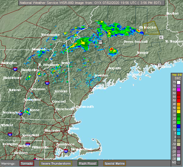 At 357 pm edt, a severe thunderstorm was located 13 miles east of bingham, or 17 miles north of skowhegan, moving south at 20 mph (trained weather spotters). Hazards include 60 mph wind gusts and quarter size hail. Hail damage to vehicles is expected. Expect wind damage to roofs, siding, and trees. At 357 pm edt, a severe thunderstorm was located 13 miles east of bingham, or 17 miles north of skowhegan, moving south at 20 mph (trained weather spotters). Hazards include 60 mph wind gusts and quarter size hail. Hail damage to vehicles is expected. Expect wind damage to roofs, siding, and trees.
|
| 7/28/2019 4:58 PM EDT |
 At 458 pm edt, a severe thunderstorm was located near bingham, or 18 miles north of skowhegan, moving east at 30 mph (radar indicated). Hazards include 60 mph wind gusts and quarter size hail. Hail damage to vehicles is expected. Expect wind damage to roofs, siding, and trees. At 458 pm edt, a severe thunderstorm was located near bingham, or 18 miles north of skowhegan, moving east at 30 mph (radar indicated). Hazards include 60 mph wind gusts and quarter size hail. Hail damage to vehicles is expected. Expect wind damage to roofs, siding, and trees.
|
| 5/20/2019 5:52 PM EDT |
 At 552 pm edt, a severe thunderstorm was located 8 miles east of skowhegan, moving east at 40 mph (radar indicated). Hazards include 60 mph wind gusts and quarter size hail. Hail damage to vehicles is expected. Expect wind damage to roofs, siding, and trees. At 552 pm edt, a severe thunderstorm was located 8 miles east of skowhegan, moving east at 40 mph (radar indicated). Hazards include 60 mph wind gusts and quarter size hail. Hail damage to vehicles is expected. Expect wind damage to roofs, siding, and trees.
|
| 8/9/2018 5:00 PM EDT | One tree down next to the somerset county sherrif's offic in somerset county ME, 0.9 miles ESE of Skowhegan, ME |
| 8/9/2018 12:21 PM EDT |
 At 1221 pm edt, a severe thunderstorm was located 11 miles north of pittsfield, moving east at 30 mph (radar indicated). Hazards include 60 mph wind gusts and penny size hail. Expect damage to roofs, siding, and trees. locations impacted include, pittsfield, clinton, canaan, hartland, cornville, burnham, athens, harmony, detroit, palmyra, saint albans, and ripley. This includes interstate 95 between mile markers 145 and 156. At 1221 pm edt, a severe thunderstorm was located 11 miles north of pittsfield, moving east at 30 mph (radar indicated). Hazards include 60 mph wind gusts and penny size hail. Expect damage to roofs, siding, and trees. locations impacted include, pittsfield, clinton, canaan, hartland, cornville, burnham, athens, harmony, detroit, palmyra, saint albans, and ripley. This includes interstate 95 between mile markers 145 and 156.
|
| 8/9/2018 12:03 PM EDT |
 At 1202 pm edt, a severe thunderstorm was located 11 miles northwest of pittsfield, moving east at 30 mph (radar indicated). Hazards include 60 mph wind gusts and penny size hail. expect damage to roofs, siding, and trees At 1202 pm edt, a severe thunderstorm was located 11 miles northwest of pittsfield, moving east at 30 mph (radar indicated). Hazards include 60 mph wind gusts and penny size hail. expect damage to roofs, siding, and trees
|
| 7/27/2018 4:06 PM EDT |
 At 406 pm edt, a severe thunderstorm was located 9 miles west of madison, or 10 miles north of farmington, moving east at 30 mph (radar indicated). Hazards include 60 mph wind gusts. Expect damage to roofs, siding, and trees. Locations impacted include, farmington, skowhegan, madison, bingham, norridgewock, anson, cornville, embden, avon, solon, strong, industry, new portland, new vineyard, freeman, concord, starks, temple and lexington. At 406 pm edt, a severe thunderstorm was located 9 miles west of madison, or 10 miles north of farmington, moving east at 30 mph (radar indicated). Hazards include 60 mph wind gusts. Expect damage to roofs, siding, and trees. Locations impacted include, farmington, skowhegan, madison, bingham, norridgewock, anson, cornville, embden, avon, solon, strong, industry, new portland, new vineyard, freeman, concord, starks, temple and lexington.
|
| 7/27/2018 3:48 PM EDT |
 At 348 pm edt, a severe thunderstorm was located near phillips, or 8 miles northwest of farmington, moving east at 30 mph (radar indicated). Hazards include 60 mph wind gusts and nickel size hail. expect damage to roofs, siding, and trees At 348 pm edt, a severe thunderstorm was located near phillips, or 8 miles northwest of farmington, moving east at 30 mph (radar indicated). Hazards include 60 mph wind gusts and nickel size hail. expect damage to roofs, siding, and trees
|
| 5/23/2018 1:35 PM EDT |
 At 135 pm edt, a severe thunderstorm was located near skowhegan, moving southeast at 35 mph (radar indicated). Hazards include 60 mph wind gusts and quarter size hail. Hail damage to vehicles is expected. Expect wind damage to roofs, siding, and trees. At 135 pm edt, a severe thunderstorm was located near skowhegan, moving southeast at 35 mph (radar indicated). Hazards include 60 mph wind gusts and quarter size hail. Hail damage to vehicles is expected. Expect wind damage to roofs, siding, and trees.
|
| 8/22/2017 8:09 PM EDT |
 At 809 pm edt, a severe thunderstorm was located 10 miles southeast of farmington, moving east at 30 mph (radar indicated). Hazards include 60 mph wind gusts. expect damage to trees, and power lines At 809 pm edt, a severe thunderstorm was located 10 miles southeast of farmington, moving east at 30 mph (radar indicated). Hazards include 60 mph wind gusts. expect damage to trees, and power lines
|
| 7/8/2017 1:16 PM EDT |
 At 116 pm edt, severe thunderstorms were located along a line extending from 10 miles northeast of seboomook to near turner, moving east at 30 mph (radar indicated). Hazards include 60 mph wind gusts and penny size hail. Expect damage to trees, and power lines. locations impacted include, farmington, skowhegan, madison, jay, livermore falls, bingham, blanchard, norridgewock, wilton, seboomook, kingsbury plantation, anson, livermore, chesterville, cornville, fayette, athens, embden, brighton plantation and caratunk plantation. This also includes, pleasant pond mountain and moxie bald mountain. At 116 pm edt, severe thunderstorms were located along a line extending from 10 miles northeast of seboomook to near turner, moving east at 30 mph (radar indicated). Hazards include 60 mph wind gusts and penny size hail. Expect damage to trees, and power lines. locations impacted include, farmington, skowhegan, madison, jay, livermore falls, bingham, blanchard, norridgewock, wilton, seboomook, kingsbury plantation, anson, livermore, chesterville, cornville, fayette, athens, embden, brighton plantation and caratunk plantation. This also includes, pleasant pond mountain and moxie bald mountain.
|
| 7/8/2017 1:02 PM EDT |
 A severe thunderstorm warning remains in effect until 145 pm edt for central somerset and southeastern franklin counties. at 101 pm edt, severe thunderstorms were located along a line extending from near seboomook to 7 miles north of mechanic falls, moving east at 30 mph. hazard. 60 mph wind gusts and penny size hail. A severe thunderstorm warning remains in effect until 145 pm edt for central somerset and southeastern franklin counties. at 101 pm edt, severe thunderstorms were located along a line extending from near seboomook to 7 miles north of mechanic falls, moving east at 30 mph. hazard. 60 mph wind gusts and penny size hail.
|
| 7/8/2017 12:51 PM EDT |
 At 1249 pm edt, severe thunderstorms were located along a line extending from near seboomook to 8 miles east of waterford, moving east at 30 mph (radar indicated). Hazards include 60 mph wind gusts and penny size hail. expect damage to trees, and power lines At 1249 pm edt, severe thunderstorms were located along a line extending from near seboomook to 8 miles east of waterford, moving east at 30 mph (radar indicated). Hazards include 60 mph wind gusts and penny size hail. expect damage to trees, and power lines
|
| 7/18/2016 7:15 PM EDT |
 At 715 pm edt, a severe thunderstorm was located near norridgewock, or 7 miles north of oakland, moving east at 30 mph (radar indicated). Hazards include 60 mph wind gusts and penny size hail. Expect damage to roofs. siding. and trees. Locations impacted include, waterville, fairfield, oakland, skowhegan, pittsfield, clinton, norridgewock, benton, canaan, albion, burnham, smithfield, winslow, rome and mercer. At 715 pm edt, a severe thunderstorm was located near norridgewock, or 7 miles north of oakland, moving east at 30 mph (radar indicated). Hazards include 60 mph wind gusts and penny size hail. Expect damage to roofs. siding. and trees. Locations impacted include, waterville, fairfield, oakland, skowhegan, pittsfield, clinton, norridgewock, benton, canaan, albion, burnham, smithfield, winslow, rome and mercer.
|
| 7/18/2016 6:48 PM EDT |
 At 647 pm edt, a severe thunderstorm was located near farmington, moving east at 30 mph (spotters reported quarter sized hail in temple). Hazards include ping pong ball size hail and 60 mph wind gusts. People and animals outdoors will be injured. expect hail damage to roofs, siding, windows, and vehicles. Expect wind damage to roofs, siding, and trees. At 647 pm edt, a severe thunderstorm was located near farmington, moving east at 30 mph (spotters reported quarter sized hail in temple). Hazards include ping pong ball size hail and 60 mph wind gusts. People and animals outdoors will be injured. expect hail damage to roofs, siding, windows, and vehicles. Expect wind damage to roofs, siding, and trees.
|
| 7/18/2016 3:15 PM EDT | Tree down near west front market in somerset county ME, 3.3 miles N of Skowhegan, ME |
| 7/18/2016 3:15 PM EDT |
 At 315 pm edt, a severe thunderstorm was located over skowhegan, moving east at 50 mph (radar indicated). Hazards include ping pong ball size hail and 60 mph wind gusts. People and animals outdoors will be injured. expect hail damage to roofs, siding, windows, and vehicles. expect wind damage to roofs, siding, and trees. Locations impacted include, dexter, newport, skowhegan, pittsfield, madison, clinton, norridgewock, canaan, corinna, hartland, plymouth, cornville, burnham, athens, harmony, detroit, palmyra, saint albans, ripley and solon. At 315 pm edt, a severe thunderstorm was located over skowhegan, moving east at 50 mph (radar indicated). Hazards include ping pong ball size hail and 60 mph wind gusts. People and animals outdoors will be injured. expect hail damage to roofs, siding, windows, and vehicles. expect wind damage to roofs, siding, and trees. Locations impacted include, dexter, newport, skowhegan, pittsfield, madison, clinton, norridgewock, canaan, corinna, hartland, plymouth, cornville, burnham, athens, harmony, detroit, palmyra, saint albans, ripley and solon.
|
| 7/18/2016 2:52 PM EDT |
 At 252 pm edt, a severe thunderstorm was located 10 miles west of madison, or 10 miles northeast of farmington, moving east at 50 mph (radar indicated). Hazards include golf ball size hail and 60 mph wind gusts. People and animals outdoors will be injured. expect hail damage to roofs, siding, windows, and vehicles. Expect wind damage to roofs, siding, and trees. At 252 pm edt, a severe thunderstorm was located 10 miles west of madison, or 10 miles northeast of farmington, moving east at 50 mph (radar indicated). Hazards include golf ball size hail and 60 mph wind gusts. People and animals outdoors will be injured. expect hail damage to roofs, siding, windows, and vehicles. Expect wind damage to roofs, siding, and trees.
|
| 7/18/2016 2:41 PM EDT |
 At 241 pm edt, a severe thunderstorm was located 11 miles north of skowhegan, or near athens, moving east at 35 mph (radar indicated). Hazards include golf ball size hail and 60 mph wind gusts. People and animals outdoors will be injured. expect hail damage to roofs, siding, windows, and vehicles. expect wind damage to roofs, siding, and trees. Locations impacted include, pittsfield, skowhegan, madison, bingham, anson, canaan, hartland, plymouth, cornville, athens, harmony, embden, detroit, brighton plantation, palmyra, new portland, saint albans, ripley, solon and new vineyard. At 241 pm edt, a severe thunderstorm was located 11 miles north of skowhegan, or near athens, moving east at 35 mph (radar indicated). Hazards include golf ball size hail and 60 mph wind gusts. People and animals outdoors will be injured. expect hail damage to roofs, siding, windows, and vehicles. expect wind damage to roofs, siding, and trees. Locations impacted include, pittsfield, skowhegan, madison, bingham, anson, canaan, hartland, plymouth, cornville, athens, harmony, embden, detroit, brighton plantation, palmyra, new portland, saint albans, ripley, solon and new vineyard.
|
| 7/18/2016 2:31 PM EDT |
 At 230 pm edt, a severe thunderstorm was located near solon, or 13 miles northwest of skowhegan, moving east at 35 mph (radar indicated). Hazards include golf ball size hail and 60 mph wind gusts. People and animals outdoors will be injured. expect hail damage to roofs, siding, windows, and vehicles. expect wind damage to roofs, siding, and trees. Locations impacted include, pittsfield, skowhegan, madison, bingham, anson, canaan, hartland, plymouth, cornville, athens, harmony, embden, detroit, brighton plantation, lexington, concord, palmyra, new portland, saint albans and ripley. At 230 pm edt, a severe thunderstorm was located near solon, or 13 miles northwest of skowhegan, moving east at 35 mph (radar indicated). Hazards include golf ball size hail and 60 mph wind gusts. People and animals outdoors will be injured. expect hail damage to roofs, siding, windows, and vehicles. expect wind damage to roofs, siding, and trees. Locations impacted include, pittsfield, skowhegan, madison, bingham, anson, canaan, hartland, plymouth, cornville, athens, harmony, embden, detroit, brighton plantation, lexington, concord, palmyra, new portland, saint albans and ripley.
|
| 7/18/2016 2:12 PM EDT |
 At 211 pm edt, a severe thunderstorm was located near kingfield, or 19 miles northwest of skowhegan, moving east at 30 mph (radar indicated). Hazards include 60 mph wind gusts and half dollar size hail. Hail damage to vehicles is expected. Expect wind damage to roofs, siding, and trees. At 211 pm edt, a severe thunderstorm was located near kingfield, or 19 miles northwest of skowhegan, moving east at 30 mph (radar indicated). Hazards include 60 mph wind gusts and half dollar size hail. Hail damage to vehicles is expected. Expect wind damage to roofs, siding, and trees.
|
| 3/17/2016 3:17 PM EDT | Quarter sized hail reported 7 miles W of Skowhegan, ME |
| 8/4/2015 4:30 PM EDT |
 At 429 pm edt, doppler radar indicated a line of severe thunderstorms capable of producing half dollar size hail and damaging winds in excess of 60 mph. these storms were located along a line extending from 6 miles east of skowhegan to near winthrop, and moving northeast at 30 mph. At 429 pm edt, doppler radar indicated a line of severe thunderstorms capable of producing half dollar size hail and damaging winds in excess of 60 mph. these storms were located along a line extending from 6 miles east of skowhegan to near winthrop, and moving northeast at 30 mph.
|
| 8/4/2015 4:15 PM EDT | Half Dollar sized hail reported 3.3 miles N of Skowhegan, ME |
| 8/4/2015 4:14 PM EDT |
 At 413 pm edt, doppler radar indicated a severe thunderstorm capable of producing large hail up to ping pong ball size and damaging winds in excess of 60 mph. this storm was located over skowhegan, moving east at 50 mph. locations impacted include, northern waterville, fairfield, pittsfield, skowhegan, oakland, madison, clinton, belgrade, norridgewock, benton, anson, canaan, hartland, cornville, burnham, athens, harmony, detroit, brighton plantation and palmyra. At 413 pm edt, doppler radar indicated a severe thunderstorm capable of producing large hail up to ping pong ball size and damaging winds in excess of 60 mph. this storm was located over skowhegan, moving east at 50 mph. locations impacted include, northern waterville, fairfield, pittsfield, skowhegan, oakland, madison, clinton, belgrade, norridgewock, benton, anson, canaan, hartland, cornville, burnham, athens, harmony, detroit, brighton plantation and palmyra.
|
| 8/4/2015 3:55 PM EDT |
 At 355 pm edt, doppler radar indicated a line of severe thunderstorms capable of producing half dollar size hail and damaging winds in excess of 60 mph. these storms were located along a line extending from 11 miles north of skowhegan to jay, and moving east at 25 mph. At 355 pm edt, doppler radar indicated a line of severe thunderstorms capable of producing half dollar size hail and damaging winds in excess of 60 mph. these storms were located along a line extending from 11 miles north of skowhegan to jay, and moving east at 25 mph.
|
| 8/4/2015 3:49 PM EDT |
 At 349 pm edt, doppler radar indicated a line of severe thunderstorms capable of producing half dollar size hail and damaging winds in excess of 60 mph. these storms were located along a line extending from 11 miles southeast of bingham to near wilton, moving east at 40 mph. locations impacted include, farmington, fairfield, skowhegan, pittsfield, oakland, madison, jay, clinton, belgrade, livermore falls, dixfield, canton, bingham, wilton, norridgewock, anson, canaan, hartland, chesterville and cornville. At 349 pm edt, doppler radar indicated a line of severe thunderstorms capable of producing half dollar size hail and damaging winds in excess of 60 mph. these storms were located along a line extending from 11 miles southeast of bingham to near wilton, moving east at 40 mph. locations impacted include, farmington, fairfield, skowhegan, pittsfield, oakland, madison, jay, clinton, belgrade, livermore falls, dixfield, canton, bingham, wilton, norridgewock, anson, canaan, hartland, chesterville and cornville.
|
| 8/4/2015 3:38 PM EDT |
 At 338 pm edt, doppler radar indicated a line of severe thunderstorms capable of producing half dollar size hail and damaging winds in excess of 60 mph. these storms were located along a line extending from 9 miles southeast of bingham to jay, moving east at 35 mph. locations impacted include, farmington, fairfield, skowhegan, eastern rumford, pittsfield, oakland, madison, jay, clinton, belgrade, livermore falls, dixfield, canton, bingham, wilton, norridgewock, mexico, anson, canaan and livermore. At 338 pm edt, doppler radar indicated a line of severe thunderstorms capable of producing half dollar size hail and damaging winds in excess of 60 mph. these storms were located along a line extending from 9 miles southeast of bingham to jay, moving east at 35 mph. locations impacted include, farmington, fairfield, skowhegan, eastern rumford, pittsfield, oakland, madison, jay, clinton, belgrade, livermore falls, dixfield, canton, bingham, wilton, norridgewock, mexico, anson, canaan and livermore.
|
| 8/4/2015 3:16 PM EDT |
 At 316 pm edt, doppler radar indicated a line of severe thunderstorms capable of producing quarter size hail and damaging winds in excess of 60 mph. these storms were located along a line extending from near kingfield to rumford, and moving east at 40 mph. At 316 pm edt, doppler radar indicated a line of severe thunderstorms capable of producing quarter size hail and damaging winds in excess of 60 mph. these storms were located along a line extending from near kingfield to rumford, and moving east at 40 mph.
|
| 7/28/2015 5:52 PM EDT | Trees down in somerset county ME, 5.2 miles NW of Skowhegan, ME |
| 7/27/2015 10:30 PM EDT | Multiple trees down on wires... poles snappe in somerset county ME, 4.6 miles N of Skowhegan, ME |
| 7/19/2015 8:58 PM EDT |
 At 857 pm edt, doppler radar indicated a severe thunderstorm capable of producing damaging winds in excess of 60 mph. this storm was located near farmington, moving southeast at 15 mph. locations impacted include, northeastern farmington, northwestern fairfi if you are in the path of this storm, prepare immediately for large hail and damaging winds. people outside should move to a shelter, preferably inside a strong building and away from windows.eld, skowhegan, oakland, belgrade, norridgewock, anson, mercer, rome, industry, smithfield, starks, new vineyard and new sharon. At 857 pm edt, doppler radar indicated a severe thunderstorm capable of producing damaging winds in excess of 60 mph. this storm was located near farmington, moving southeast at 15 mph. locations impacted include, northeastern farmington, northwestern fairfi if you are in the path of this storm, prepare immediately for large hail and damaging winds. people outside should move to a shelter, preferably inside a strong building and away from windows.eld, skowhegan, oakland, belgrade, norridgewock, anson, mercer, rome, industry, smithfield, starks, new vineyard and new sharon.
|
| 7/19/2015 8:18 PM EDT |
 At 817 pm edt, doppler radar indicated a severe thunderstorm capable of producing damaging winds in excess of 60 mph. this storm was located near phillips, or 12 miles northwest of farmington, and moving east at 30 mph. At 817 pm edt, doppler radar indicated a severe thunderstorm capable of producing damaging winds in excess of 60 mph. this storm was located near phillips, or 12 miles northwest of farmington, and moving east at 30 mph.
|
| 5/28/2015 4:59 PM EDT | At 459 pm edt, doppler radar indicated a line of severe thunderstorms capable of producing damaging winds in excess of 60 mph. these storms were located along a line extending from near dexter to 6 miles northwest of pittsfield to near clinton to near belgrade, moving east at 30 mph. locations impacted include, waterville, fairfield, pittsfield, thorndike, skowhegan, oakland, madison, clinton, belgrade, norridgewock, unity, knox, benton, canaan, albion, hartland, cornville, burnham, brooks and athens. |
| 5/28/2015 4:55 PM EDT | Trees down. delayed report. time estimated from rada in somerset county ME, 7 miles W of Skowhegan, ME |
| 5/28/2015 4:40 PM EDT | Trees down. delayed report. time estimated from rada in somerset county ME, 0.9 miles ESE of Skowhegan, ME |
| 5/28/2015 4:37 PM EDT | At 437 pm edt, doppler radar indicated a line of severe thunderstorms capable of producing damaging winds in excess of 60 mph. these storms were located along a line extending from 12 miles east of bingham to 9 miles north of skowhegan to norridgewock to 8 miles east of livermore falls, and moving east at 30 mph. |
| 5/28/2015 4:37 PM EDT | At 437 pm edt, doppler radar indicated a line of severe thunderstorms capable of producing damaging winds in excess of 60 mph. these storms were located along a line extending from 12 miles east of bingham to 9 miles north of skowhegan to norridgewock to 8 miles east of livermore falls, and moving east at 30 mph. |
| 5/28/2015 4:09 PM EDT | At 409 pm edt, doppler radar indicated a severe thunderstorm capable of producing damaging winds in excess of 60 mph. this storm was located over clinton, or 7 miles northeast of fairfield, moving east at 35 mph. nickel size hail may also accompany the damaging winds. locations impacted include, northeastern waterville, fairfield, pittsfield, thorndike, skowhegan, oakland, clinton, unity, knox, benton, canaan, albion, burnham, detroit, freedom, winslow, palmyra, troy and montville. |
| 5/28/2015 4:04 PM EDT | At 404 pm edt, doppler radar indicated a severe thunderstorm capable of producing damaging winds in excess of 60 mph. this storm was located near clinton, or near fairfield, moving east at 35 mph. locations impacted include, northeastern waterville, fairfield, pittsfield, thorndike, skowhegan, oakland, clinton, unity, norridgewock, knox, benton, canaan, albion, burnham, detroit, freedom, winslow, palmyra, troy and smithfield. |
| 5/28/2015 3:51 PM EDT | At 351 pm edt, doppler radar indicated a severe thunderstorm capable of producing damaging winds in excess of 60 mph. this storm was located over western fairfield, moving east at 35 mph. locations impacted include, waterville, fairfield, pittsfield, thorndike, skowhegan, oakland, clinton, belgrade, norridgewock, unity, knox, benton, canaan, albion, burnham, detroit, freedom, smithfield, winslow and rome. |
| 5/28/2015 3:40 PM EDT | At 340 pm edt, doppler radar indicated a severe thunderstorm capable of producing nickle size hail and damaging winds in excess of 60 mph. this storm was located 7 miles southwest of norridgewock, or 9 miles northwest of oakland, and moving east at 35 mph. |
| 5/28/2015 1:05 PM EDT | At 105 pm edt, doppler radar indicated a severe thunderstorm capable of producing quarter size hail and damaging winds in excess of 60 mph. this storm was located near norridgewock, or 8 miles northwest of oakland, moving east at 45 mph. locations impacted include, northeastern augusta, waterville, southeastern farmington, fairfield, oakland, skowhegan, northeastern jay, china, clinton, belgrade, manchester, norridgewock, wilton, chesterville, fayette, mount vernon, mercer, smithfield, winslow and new sharon. |
| 5/28/2015 12:49 PM EDT | At 1249 pm edt, doppler radar indicated a severe thunderstorm capable of producing quarter size hail and damaging winds in excess of 60 mph. this storm was located 7 miles east of wilton, or 7 miles southeast of farmington, moving east at 45 mph. locations impacted include, northern augusta, waterville, southeastern farmington, fairfield, oakland, skowhegan, jay, china, clinton, belgrade, livermore falls, manchester, dixfield, canton, wilton, norridgewock, livermore, chesterville, fayette and mount vernon. |
| 5/28/2015 12:31 PM EDT | At 1231 pm edt, doppler radar indicated a severe thunderstorm capable of producing penny size hail and damaging winds in excess of 60 mph. this storm was located near canton, or 10 miles east of rumford, and moving east at 45 mph. |
| 8/5/2014 5:37 PM EDT | Tree down and transformer in the road in athens in somerset county ME, 10.7 miles S of Skowhegan, ME |
| 7/28/2014 9:21 PM EDT | Trees and wires down in somerset county ME, 10.7 miles S of Skowhegan, ME |
| 7/28/2014 9:10 PM EDT | Trees and power lines down in somerset county ME, 0.9 miles ESE of Skowhegan, ME |
| 7/29/2013 8:01 PM EDT | Tree down and strong winds occurring in tow in somerset county ME, 0.9 miles ESE of Skowhegan, ME |
| 7/19/2013 9:45 PM EDT | Multiple trees down on several roads in somerset county ME, 5.3 miles SSW of Skowhegan, ME |
| 7/19/2013 8:18 PM EDT | Numerous trees and power lines down around wesserunsett lake in somerset county ME, 5.3 miles SSW of Skowhegan, ME |
| 7/17/2013 9:35 PM EDT | Two trees down across the roa in somerset county ME, 0.9 miles ESE of Skowhegan, ME |
| 6/29/2013 6:00 PM EDT | Spurwink had strong winds estimated at 60 mph. power ou in somerset county ME, 7.8 miles S of Skowhegan, ME |
| 6/29/2013 6:00 PM EDT | Trees down on west ridge road. time estimated in somerset county ME, 5.3 miles SSW of Skowhegan, ME |
| 6/25/2013 4:15 PM EDT | River road closed due to several trees dow in somerset county ME, 0.9 miles ESE of Skowhegan, ME |
| 6/2/2013 5:45 PM EDT | Trees and wires down on hill road in somerset county ME, 7 miles W of Skowhegan, ME |
| 6/29/2012 7:10 PM EDT | Quarter sized hail reported 7 miles SW of Skowhegan, ME |
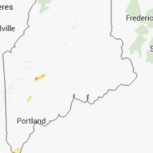
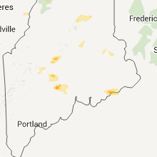
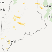
Hail Maps for Skowhegan, ME


Connect with Interactive Hail Maps