

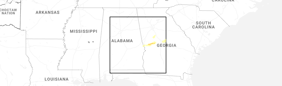
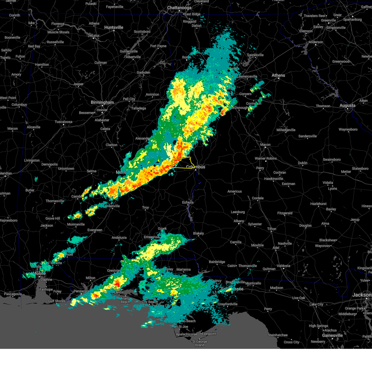
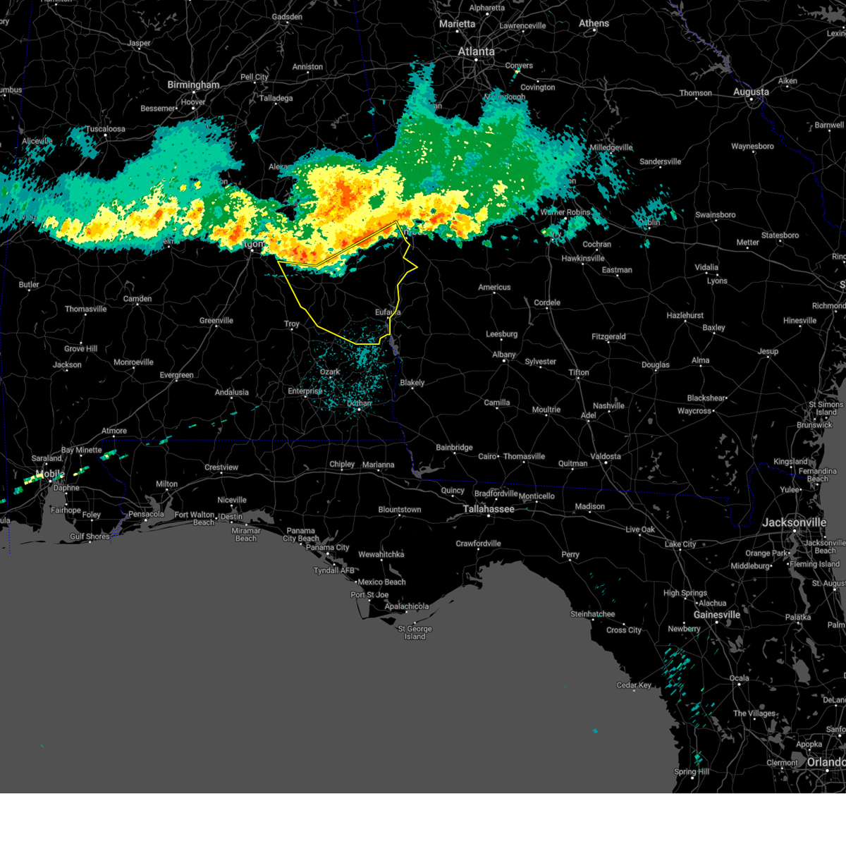
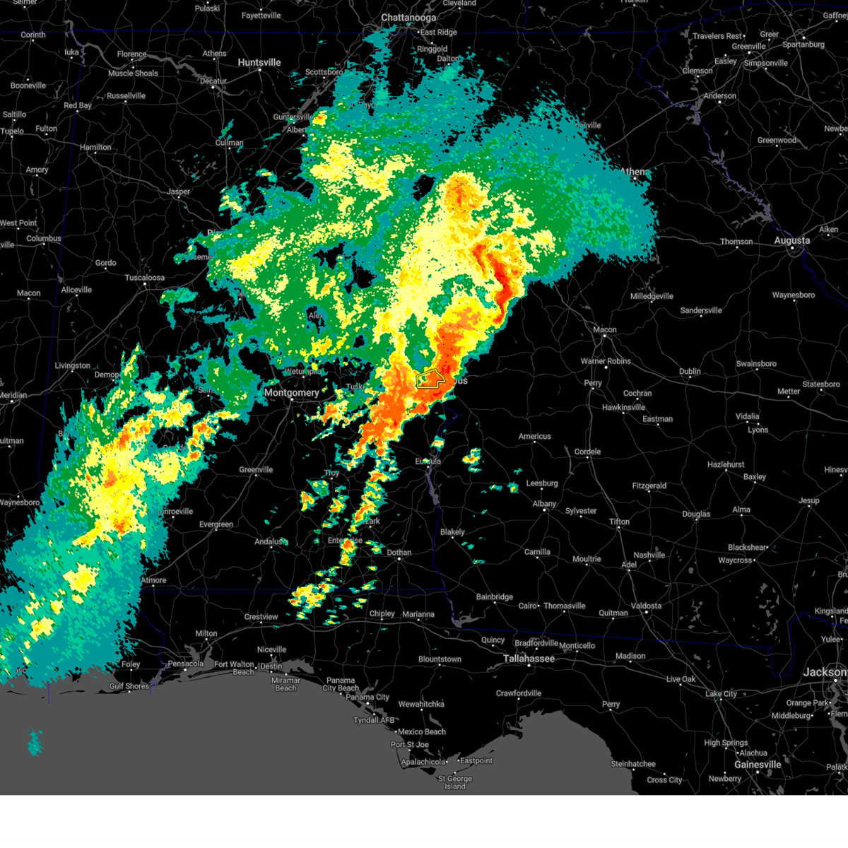
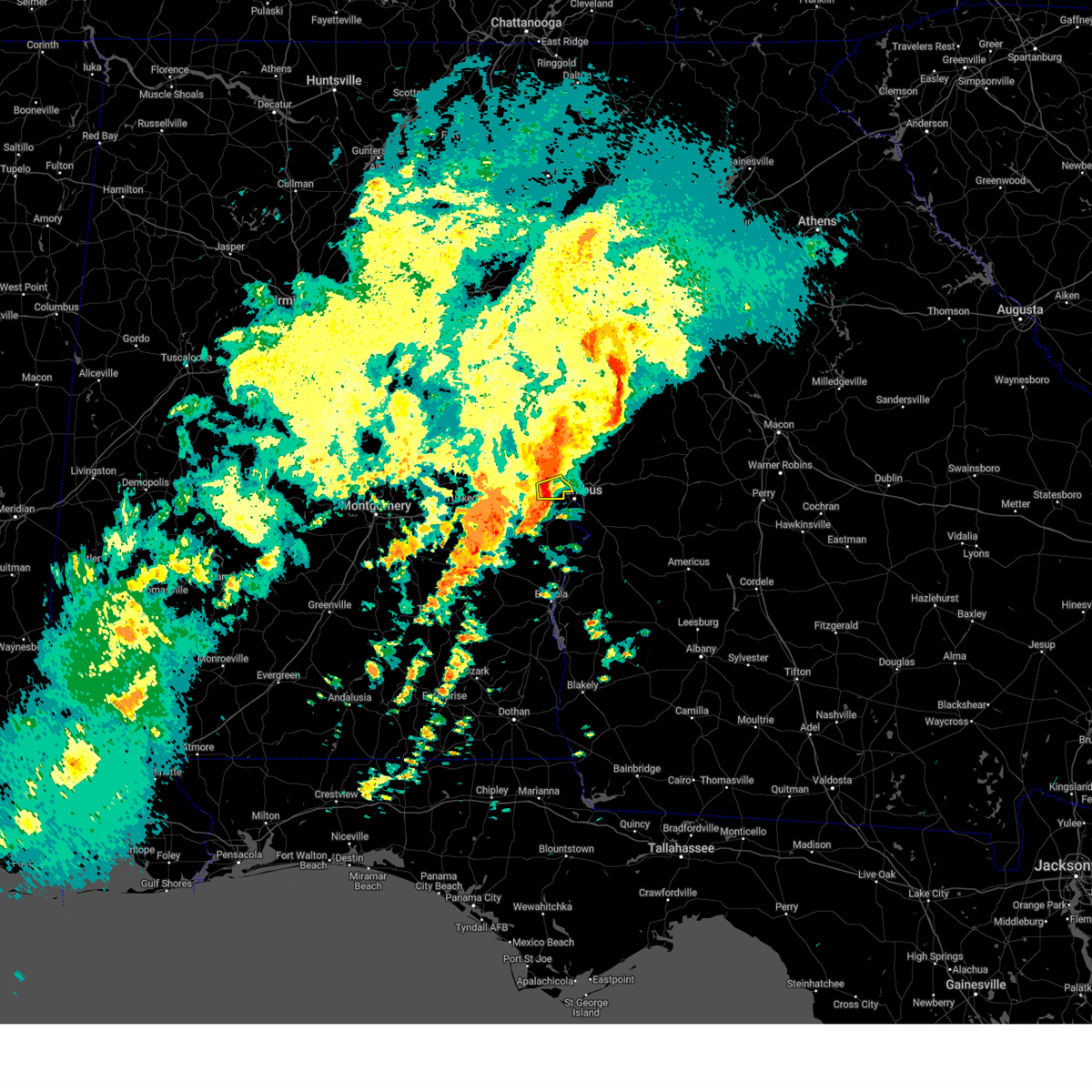
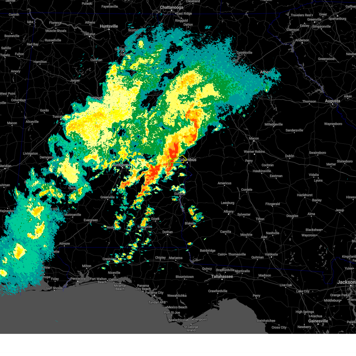
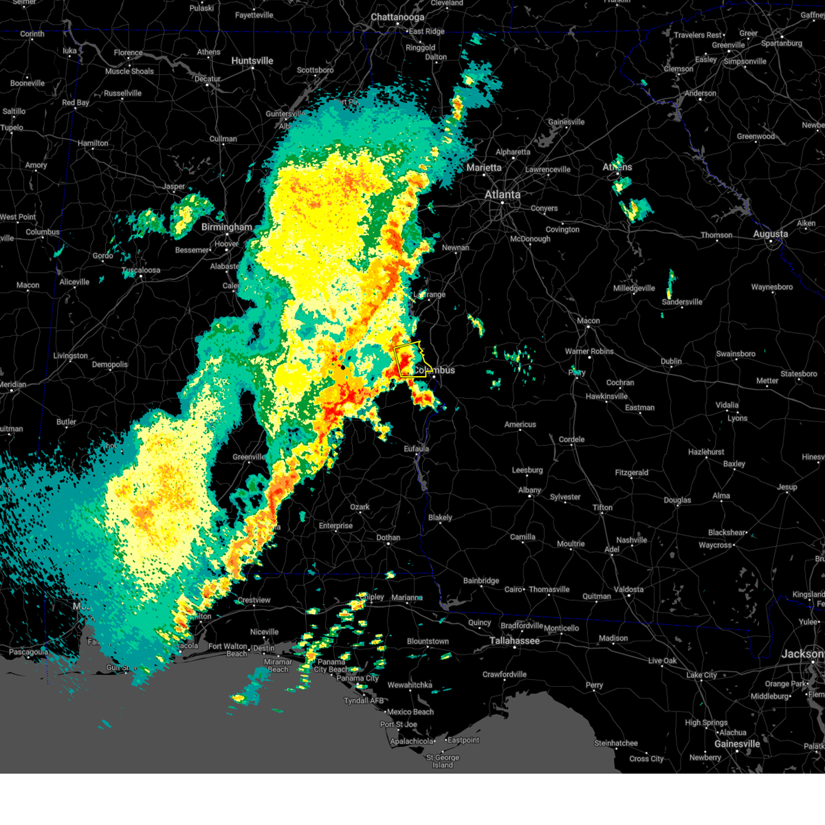
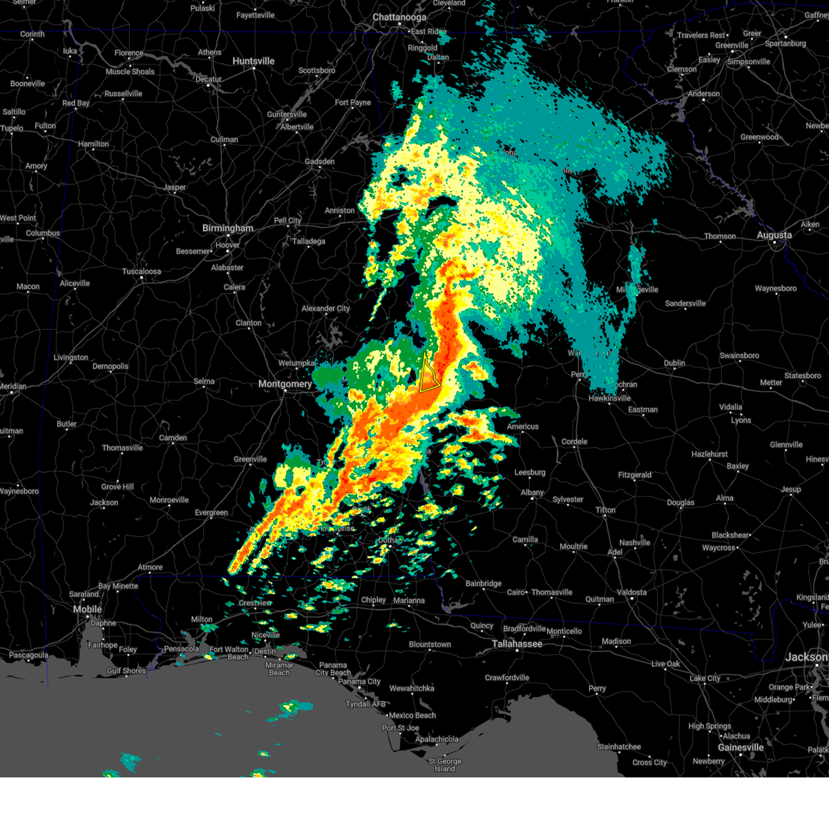
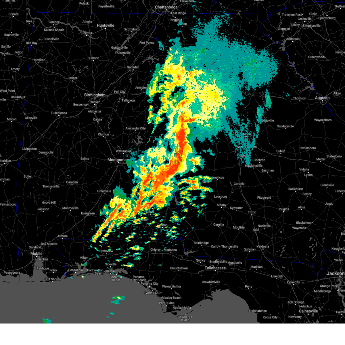
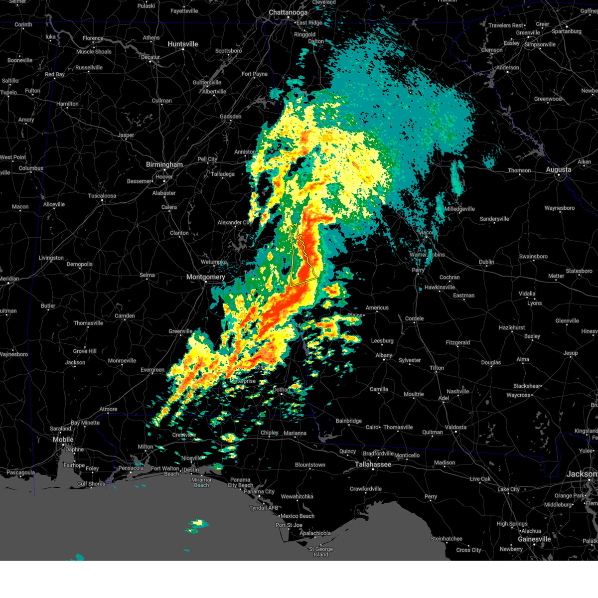
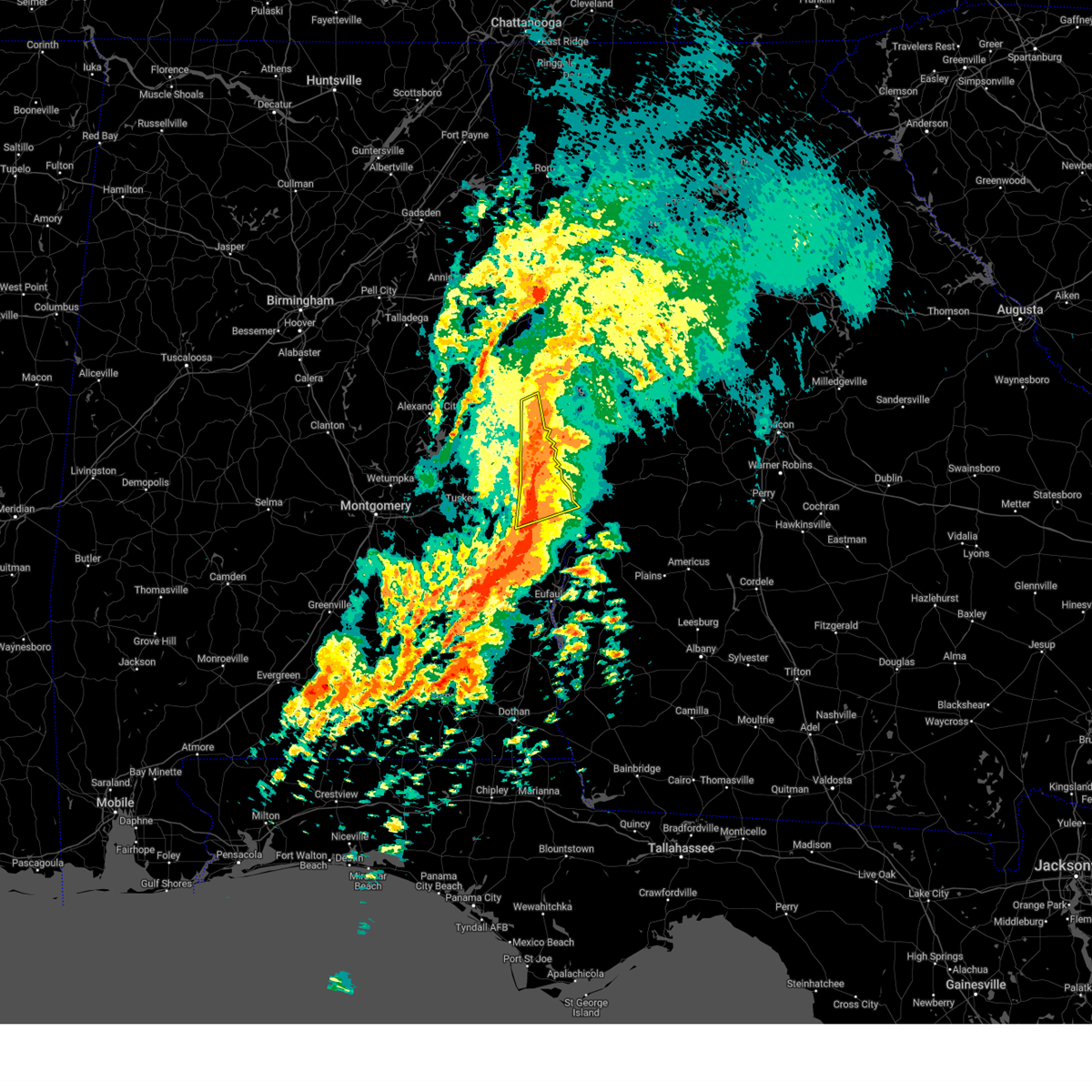
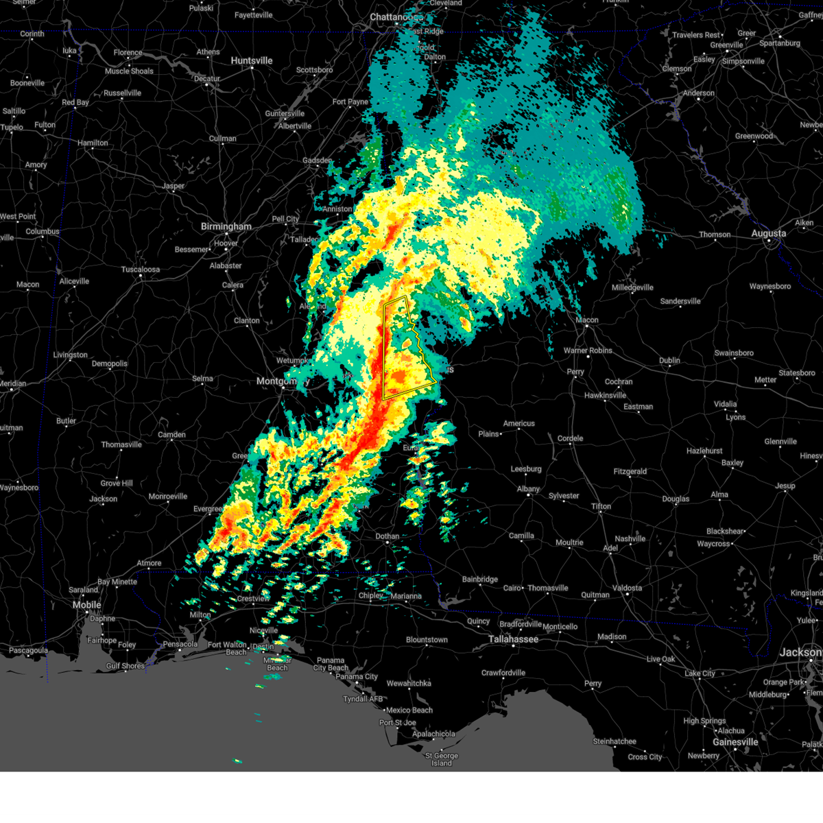
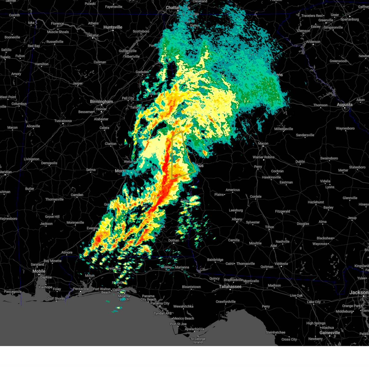
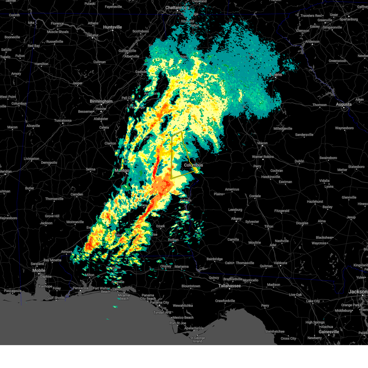
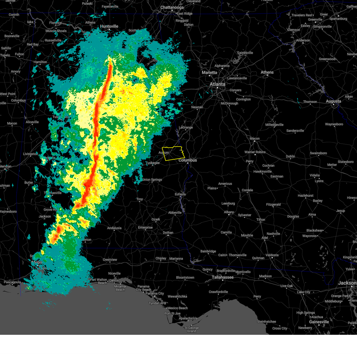
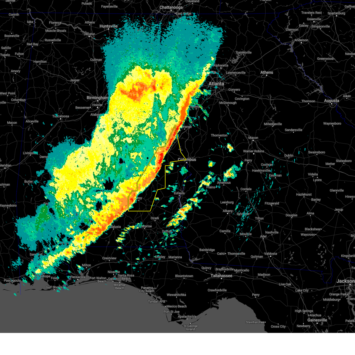
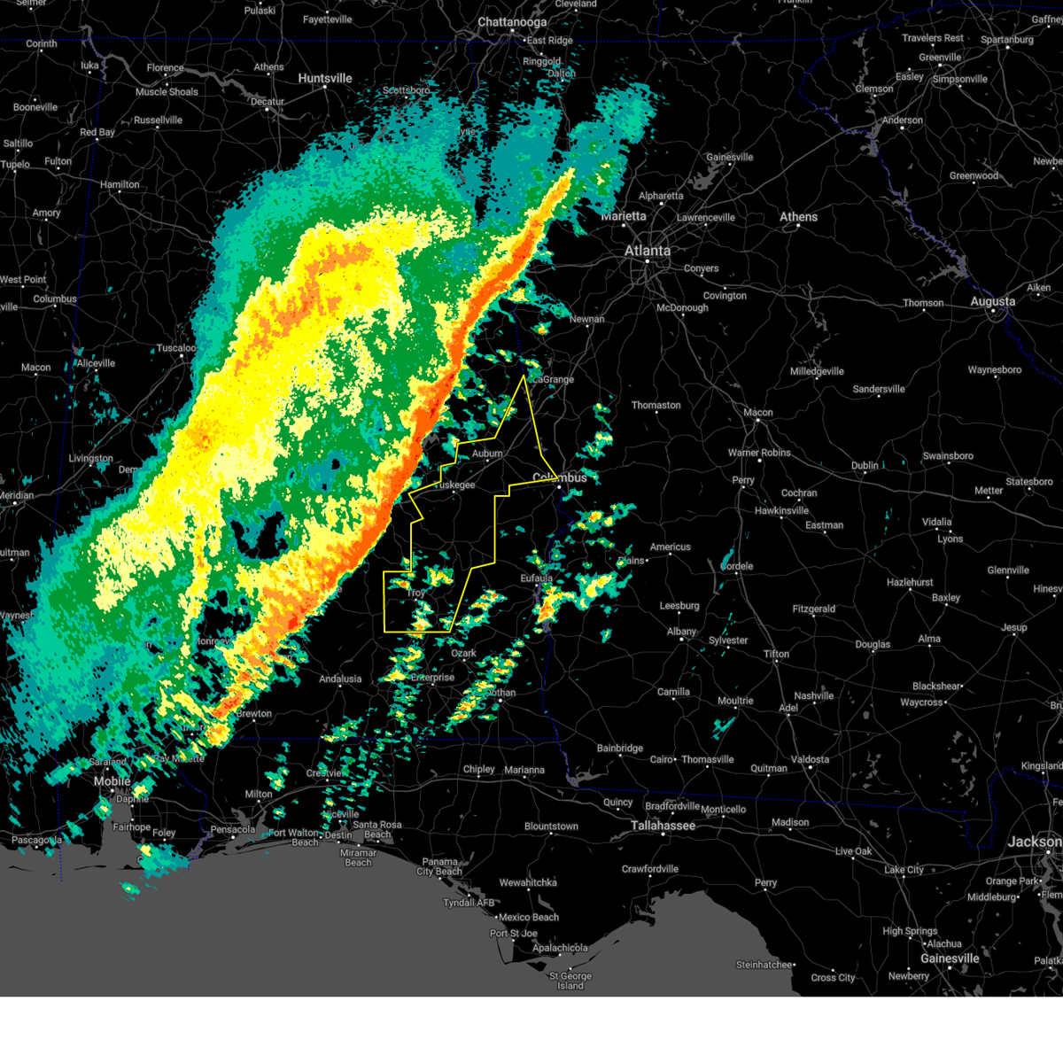
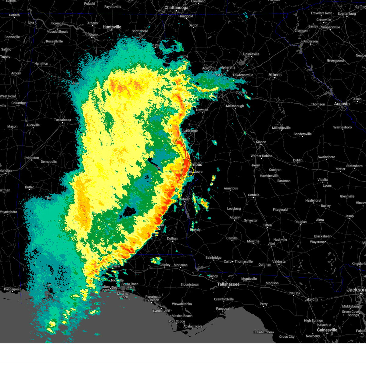
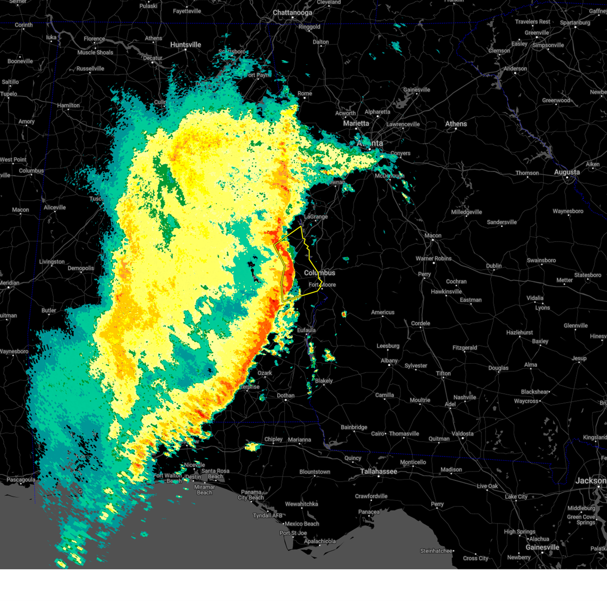
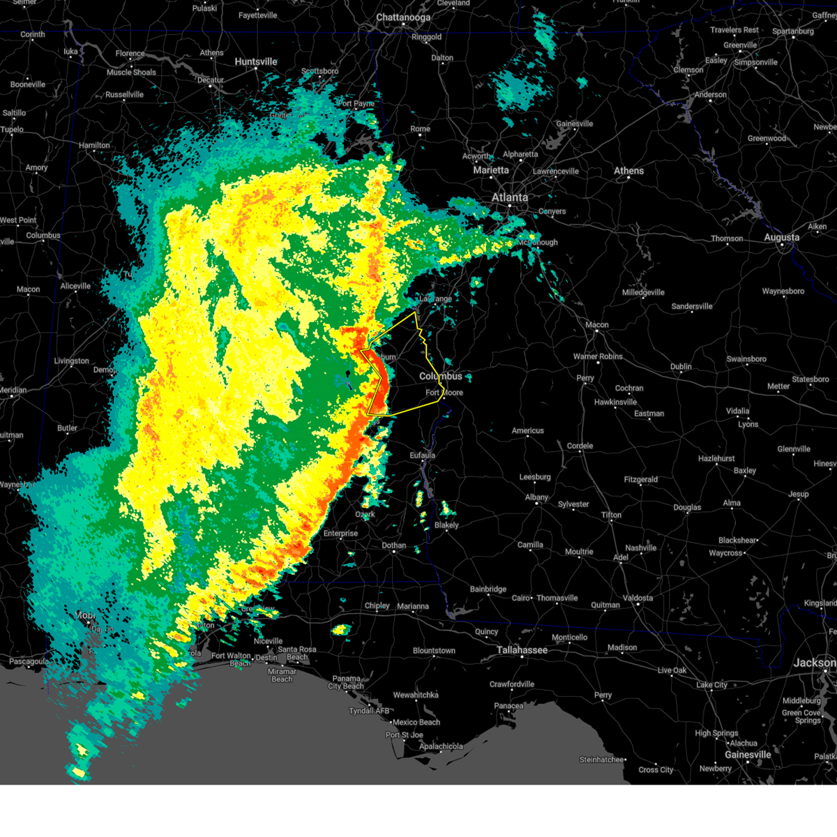
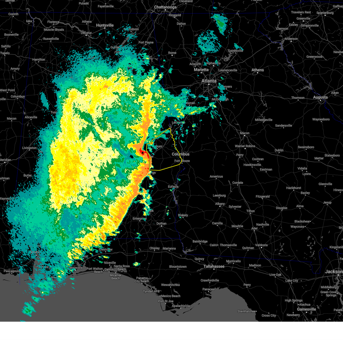
Hail Map for Smiths Station, AL
The Smiths Station, AL area has had 4 reports of on-the-ground hail by trained spotters, and has been under severe weather warnings 40 times during the past 12 months. Doppler radar has detected hail at or near Smiths Station, AL on 65 occasions, including 5 occasions during the past year.
| Name: | Smiths Station, AL |
| Where Located: | 23.5 miles ESE of Auburn, AL |
| Map: | Google Map for Smiths Station, AL |
| Population: | 4926 |
| Housing Units: | 2071 |
| More Info: | Search Google for Smiths Station, AL |
1
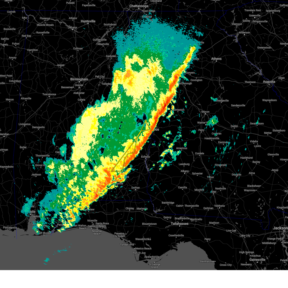
The Top Recent Hail Date for Smiths Station, AL is Sunday, April 6, 2025 (9th out of 65)
Hail and Wind Damage Spotted near Smiths Station, AL
| Date / Time | Report Details |
|---|---|
| 5/3/2025 7:47 PM CDT |
 the severe thunderstorm warning has been cancelled and is no longer in effect the severe thunderstorm warning has been cancelled and is no longer in effect
|
| 5/3/2025 7:31 PM CDT |
 At 730 pm cdt, a severe thunderstorm was located over bleecker, or near smiths, moving east at 35 mph (radar indicated). Hazards include 60 mph wind gusts and quarter size hail. Hail damage to vehicles is expected. expect wind damage to roofs, siding, and trees. Locations impacted include, smiths station, bleecker, monterey heights, and smiths. At 730 pm cdt, a severe thunderstorm was located over bleecker, or near smiths, moving east at 35 mph (radar indicated). Hazards include 60 mph wind gusts and quarter size hail. Hail damage to vehicles is expected. expect wind damage to roofs, siding, and trees. Locations impacted include, smiths station, bleecker, monterey heights, and smiths.
|
| 5/3/2025 7:19 PM CDT |
 At 719 pm cdt, a severe thunderstorm was located near beauregard, or near opelika, moving east at 35 mph (radar indicated). Hazards include 60 mph wind gusts and quarter size hail. Hail damage to vehicles is expected. expect wind damage to roofs, siding, and trees. Locations impacted include, smiths station, bleecker, monterey heights, smiths, griffen mill, and opelika. At 719 pm cdt, a severe thunderstorm was located near beauregard, or near opelika, moving east at 35 mph (radar indicated). Hazards include 60 mph wind gusts and quarter size hail. Hail damage to vehicles is expected. expect wind damage to roofs, siding, and trees. Locations impacted include, smiths station, bleecker, monterey heights, smiths, griffen mill, and opelika.
|
| 5/3/2025 7:14 PM CDT |
 Svrbmx the national weather service in birmingham has issued a * severe thunderstorm warning for, northeastern lee county in east central alabama, * until 800 pm cdt. * at 714 pm cdt, a severe thunderstorm was located near beauregard, or near opelika, moving east at 35 mph (radar indicated). Hazards include 60 mph wind gusts and quarter size hail. Hail damage to vehicles is expected. Expect wind damage to roofs, siding, and trees. Svrbmx the national weather service in birmingham has issued a * severe thunderstorm warning for, northeastern lee county in east central alabama, * until 800 pm cdt. * at 714 pm cdt, a severe thunderstorm was located near beauregard, or near opelika, moving east at 35 mph (radar indicated). Hazards include 60 mph wind gusts and quarter size hail. Hail damage to vehicles is expected. Expect wind damage to roofs, siding, and trees.
|
| 4/10/2025 10:56 PM CDT |
 Svrbmx the national weather service in birmingham has issued a * severe thunderstorm warning for, northeastern pike county in southeastern alabama, southeastern lee county in east central alabama, bullock county in southeastern alabama, southeastern macon county in southeastern alabama, east central montgomery county in south central alabama, barbour county in southeastern alabama, russell county in southeastern alabama, * until midnight cdt. * at 1056 pm cdt, severe thunderstorms were located along a line extending from uchee to near union springs to near pike road, moving southeast at 50 mph (radar indicated). Hazards include 60 mph wind gusts. expect damage to roofs, siding, and trees Svrbmx the national weather service in birmingham has issued a * severe thunderstorm warning for, northeastern pike county in southeastern alabama, southeastern lee county in east central alabama, bullock county in southeastern alabama, southeastern macon county in southeastern alabama, east central montgomery county in south central alabama, barbour county in southeastern alabama, russell county in southeastern alabama, * until midnight cdt. * at 1056 pm cdt, severe thunderstorms were located along a line extending from uchee to near union springs to near pike road, moving southeast at 50 mph (radar indicated). Hazards include 60 mph wind gusts. expect damage to roofs, siding, and trees
|
| 4/6/2025 2:49 PM CDT |
 the severe thunderstorm warning has been cancelled and is no longer in effect the severe thunderstorm warning has been cancelled and is no longer in effect
|
| 4/6/2025 2:32 PM CDT |
 At 232 pm cdt, a severe thunderstorm was located over smiths station, or over smiths, moving northeast at 35 mph (radar indicated). Hazards include 60 mph wind gusts. Expect damage to roofs, siding, and trees. Locations impacted include, smiths station, monterey heights, smiths, and ladonia. At 232 pm cdt, a severe thunderstorm was located over smiths station, or over smiths, moving northeast at 35 mph (radar indicated). Hazards include 60 mph wind gusts. Expect damage to roofs, siding, and trees. Locations impacted include, smiths station, monterey heights, smiths, and ladonia.
|
| 4/6/2025 2:19 PM CDT |
 At 219 pm cdt, a severe thunderstorm was located over griffen mill, or 10 miles west of smiths, moving east at 35 mph (radar indicated). Hazards include 60 mph wind gusts. Expect damage to roofs, siding, and trees. Locations impacted include, smiths station, monterey heights, smiths, griffen mill, marvyn, and ladonia. At 219 pm cdt, a severe thunderstorm was located over griffen mill, or 10 miles west of smiths, moving east at 35 mph (radar indicated). Hazards include 60 mph wind gusts. Expect damage to roofs, siding, and trees. Locations impacted include, smiths station, monterey heights, smiths, griffen mill, marvyn, and ladonia.
|
| 4/6/2025 2:10 PM CDT |
 At 209 pm cdt, a severe thunderstorm was located over beauregard, or 7 miles southeast of auburn, moving northeast at 35 mph (radar indicated). Hazards include 60 mph wind gusts. Expect damage to roofs, siding, and trees. Locations impacted include, monterey heights, smiths, beauregard, smiths station, bleecker, marvyn, griffen mill, ladonia, auburn, and opelika. At 209 pm cdt, a severe thunderstorm was located over beauregard, or 7 miles southeast of auburn, moving northeast at 35 mph (radar indicated). Hazards include 60 mph wind gusts. Expect damage to roofs, siding, and trees. Locations impacted include, monterey heights, smiths, beauregard, smiths station, bleecker, marvyn, griffen mill, ladonia, auburn, and opelika.
|
| 4/6/2025 2:10 PM CDT |
 the severe thunderstorm warning has been cancelled and is no longer in effect the severe thunderstorm warning has been cancelled and is no longer in effect
|
| 4/6/2025 1:56 PM CDT |
 Svrbmx the national weather service in birmingham has issued a * severe thunderstorm warning for, central lee county in east central alabama, northeastern macon county in southeastern alabama, * until 300 pm cdt. * at 155 pm cdt, a severe thunderstorm was located near tuskegee national forest, or 7 miles south of auburn, moving northeast at 35 mph (radar indicated). Hazards include 60 mph wind gusts. expect damage to roofs, siding, and trees Svrbmx the national weather service in birmingham has issued a * severe thunderstorm warning for, central lee county in east central alabama, northeastern macon county in southeastern alabama, * until 300 pm cdt. * at 155 pm cdt, a severe thunderstorm was located near tuskegee national forest, or 7 miles south of auburn, moving northeast at 35 mph (radar indicated). Hazards include 60 mph wind gusts. expect damage to roofs, siding, and trees
|
| 3/31/2025 11:15 AM CDT |
 the severe thunderstorm warning has been cancelled and is no longer in effect the severe thunderstorm warning has been cancelled and is no longer in effect
|
| 3/31/2025 11:00 AM CDT |
 Svrbmx the national weather service in birmingham has issued a * severe thunderstorm warning for, eastern lee county in east central alabama, * until 1130 am cdt. * at 1059 am cdt, a severe thunderstorm was located over bleecker, or 7 miles northwest of smiths, moving east at 35 mph (radar indicated). Hazards include golf ball size hail and 60 mph wind gusts. People and animals outdoors will be injured. expect hail damage to roofs, siding, windows, and vehicles. Expect wind damage to roofs, siding, and trees. Svrbmx the national weather service in birmingham has issued a * severe thunderstorm warning for, eastern lee county in east central alabama, * until 1130 am cdt. * at 1059 am cdt, a severe thunderstorm was located over bleecker, or 7 miles northwest of smiths, moving east at 35 mph (radar indicated). Hazards include golf ball size hail and 60 mph wind gusts. People and animals outdoors will be injured. expect hail damage to roofs, siding, windows, and vehicles. Expect wind damage to roofs, siding, and trees.
|
| 3/16/2025 12:38 AM CDT |
 The storms which prompted the warning have moved out of the area. therefore, the warning will be allowed to expire. a tornado watch remains in effect until 300 am cdt for southeastern and east central alabama. The storms which prompted the warning have moved out of the area. therefore, the warning will be allowed to expire. a tornado watch remains in effect until 300 am cdt for southeastern and east central alabama.
|
| 3/16/2025 12:30 AM CDT |
 the severe thunderstorm warning has been cancelled and is no longer in effect the severe thunderstorm warning has been cancelled and is no longer in effect
|
| 3/16/2025 12:30 AM CDT |
 At 1230 am cdt, severe thunderstorms were located along a line extending from 9 miles east of beulah to near fort moore/lawson army air fld, moving northeast at 60 mph (radar indicated). Hazards include 70 mph wind gusts. Expect considerable tree damage. damage is likely to mobile homes, roofs, and outbuildings. Locations impacted include, goat rock lake, ladonia, monterey heights, smiths, smiths station, ladonia sports complex, bartletts ferry dam, phenix drag strip, and phenix city. At 1230 am cdt, severe thunderstorms were located along a line extending from 9 miles east of beulah to near fort moore/lawson army air fld, moving northeast at 60 mph (radar indicated). Hazards include 70 mph wind gusts. Expect considerable tree damage. damage is likely to mobile homes, roofs, and outbuildings. Locations impacted include, goat rock lake, ladonia, monterey heights, smiths, smiths station, ladonia sports complex, bartletts ferry dam, phenix drag strip, and phenix city.
|
| 3/16/2025 12:22 AM CDT |
 At 1222 am cdt, severe thunderstorms were located along a line extending from lanett to near beulah to near russell county sports complex, moving east at 55 mph (radar indicated). Hazards include 70 mph wind gusts. Expect considerable tree damage. damage is likely to mobile homes, roofs, and outbuildings. Locations impacted include, goat rock lake, smiths, beulah, lakeview, smiths station, lanett municipal airport, huguley, fairfax, i 85 welcome center at lanett, river view, ladonia, monterey heights, valley, lanett, bleecker, ladonia sports complex, phenix drag strip, phenix city, parkmanville, and southern harbor. At 1222 am cdt, severe thunderstorms were located along a line extending from lanett to near beulah to near russell county sports complex, moving east at 55 mph (radar indicated). Hazards include 70 mph wind gusts. Expect considerable tree damage. damage is likely to mobile homes, roofs, and outbuildings. Locations impacted include, goat rock lake, smiths, beulah, lakeview, smiths station, lanett municipal airport, huguley, fairfax, i 85 welcome center at lanett, river view, ladonia, monterey heights, valley, lanett, bleecker, ladonia sports complex, phenix drag strip, phenix city, parkmanville, and southern harbor.
|
| 3/16/2025 12:13 AM CDT |
 At 1213 am cdt, severe thunderstorms were located along a line extending from veasey creek park to beulah to 6 miles northwest of seale, moving east at 55 mph (radar indicated). Hazards include 70 mph wind gusts. Expect considerable tree damage. damage is likely to mobile homes, roofs, and outbuildings. Locations impacted include, goat rock lake, beulah, uchee, denson, beans mill, i 85 welcome center at lanett, river view, cusseta, amity park, bleecker, phenix city, smiths, fredonia, lakeview, veasey creek park, smiths station, lanett municipal airport, huguley, fairfax, and ladonia. At 1213 am cdt, severe thunderstorms were located along a line extending from veasey creek park to beulah to 6 miles northwest of seale, moving east at 55 mph (radar indicated). Hazards include 70 mph wind gusts. Expect considerable tree damage. damage is likely to mobile homes, roofs, and outbuildings. Locations impacted include, goat rock lake, beulah, uchee, denson, beans mill, i 85 welcome center at lanett, river view, cusseta, amity park, bleecker, phenix city, smiths, fredonia, lakeview, veasey creek park, smiths station, lanett municipal airport, huguley, fairfax, and ladonia.
|
| 3/16/2025 12:03 AM CDT |
 At 1203 am cdt, severe thunderstorms were located along a line extending from near chambers county lake to near beans mill to near uchee, moving east at 55 mph (radar indicated). Hazards include 70 mph wind gusts. Expect considerable tree damage. damage is likely to mobile homes, roofs, and outbuildings. Locations impacted include, goat rock lake, beulah, uchee, denson, beans mill, i 85 welcome center at lanett, river view, cusseta, amity park, beauregard, bleecker, phenix city, buffalo, chambers county lake, smiths, fredonia, lakeview, la fayette, veasey creek park, and smiths station. At 1203 am cdt, severe thunderstorms were located along a line extending from near chambers county lake to near beans mill to near uchee, moving east at 55 mph (radar indicated). Hazards include 70 mph wind gusts. Expect considerable tree damage. damage is likely to mobile homes, roofs, and outbuildings. Locations impacted include, goat rock lake, beulah, uchee, denson, beans mill, i 85 welcome center at lanett, river view, cusseta, amity park, beauregard, bleecker, phenix city, buffalo, chambers county lake, smiths, fredonia, lakeview, la fayette, veasey creek park, and smiths station.
|
| 3/15/2025 11:53 PM CDT |
 At 1153 pm cdt, severe thunderstorms were located along a line extending from near buffalo to near auburn university to near guerryton, moving east at 55 mph (radar indicated). Hazards include 60 mph wind gusts. Expect damage to roofs, siding, and trees. Locations impacted include, goat rock lake, beulah, post oak forks, uchee, denson, beans mill, i 85 welcome center at lanett, river view, cusseta, amity park, beauregard, bleecker, phenix city, buffalo, chambers county lake, smiths, fredonia, lakeview, la fayette, and veasey creek park. At 1153 pm cdt, severe thunderstorms were located along a line extending from near buffalo to near auburn university to near guerryton, moving east at 55 mph (radar indicated). Hazards include 60 mph wind gusts. Expect damage to roofs, siding, and trees. Locations impacted include, goat rock lake, beulah, post oak forks, uchee, denson, beans mill, i 85 welcome center at lanett, river view, cusseta, amity park, beauregard, bleecker, phenix city, buffalo, chambers county lake, smiths, fredonia, lakeview, la fayette, and veasey creek park.
|
| 3/15/2025 11:42 PM CDT |
 Svrbmx the national weather service in birmingham has issued a * severe thunderstorm warning for, lee county in east central alabama, central chambers county in east central alabama, northern russell county in southeastern alabama, * until 1245 am cdt. * at 1142 pm cdt, severe thunderstorms were located along a line extending from ridge grove to near notasulga to near davisville, moving east at 55 mph (radar indicated). Hazards include 60 mph wind gusts. expect damage to roofs, siding, and trees Svrbmx the national weather service in birmingham has issued a * severe thunderstorm warning for, lee county in east central alabama, central chambers county in east central alabama, northern russell county in southeastern alabama, * until 1245 am cdt. * at 1142 pm cdt, severe thunderstorms were located along a line extending from ridge grove to near notasulga to near davisville, moving east at 55 mph (radar indicated). Hazards include 60 mph wind gusts. expect damage to roofs, siding, and trees
|
| 3/4/2025 11:57 PM CST |
 the severe thunderstorm warning has been cancelled and is no longer in effect the severe thunderstorm warning has been cancelled and is no longer in effect
|
| 3/4/2025 11:18 PM CST |
 Svrbmx the national weather service in birmingham has issued a * severe thunderstorm warning for, northeastern lee county in east central alabama, * until 1215 am cst. * at 1118 pm cst, a severe thunderstorm was located over auburn university, or near auburn, moving east at 35 mph (radar indicated). Hazards include 60 mph wind gusts. expect damage to roofs, siding, and trees Svrbmx the national weather service in birmingham has issued a * severe thunderstorm warning for, northeastern lee county in east central alabama, * until 1215 am cst. * at 1118 pm cst, a severe thunderstorm was located over auburn university, or near auburn, moving east at 35 mph (radar indicated). Hazards include 60 mph wind gusts. expect damage to roofs, siding, and trees
|
| 2/16/2025 3:47 AM CST |
 the severe thunderstorm warning has been cancelled and is no longer in effect the severe thunderstorm warning has been cancelled and is no longer in effect
|
| 2/16/2025 3:36 AM CST |
 At 335 am cst, severe thunderstorms were located along a line extending from near pine mountain to 6 miles north of russell county sports complex to near brundidge, moving east at 50 mph (radar indicated). Hazards include 70 mph wind gusts. Expect considerable tree damage. damage is likely to mobile homes, roofs, and outbuildings. Locations impacted include, troy, brundidge, midway, smiths, smiths station, banks, pickett, uchee, antioch, guerryton, bleecker, ladonia, tennille, tanyard, hamilton crossroads, monticello, springhill, perote, josie, and monterey heights. At 335 am cst, severe thunderstorms were located along a line extending from near pine mountain to 6 miles north of russell county sports complex to near brundidge, moving east at 50 mph (radar indicated). Hazards include 70 mph wind gusts. Expect considerable tree damage. damage is likely to mobile homes, roofs, and outbuildings. Locations impacted include, troy, brundidge, midway, smiths, smiths station, banks, pickett, uchee, antioch, guerryton, bleecker, ladonia, tennille, tanyard, hamilton crossroads, monticello, springhill, perote, josie, and monterey heights.
|
| 2/16/2025 3:36 AM CST |
 the severe thunderstorm warning has been cancelled and is no longer in effect the severe thunderstorm warning has been cancelled and is no longer in effect
|
| 2/16/2025 3:36 AM CST |
 At 335 am cst, severe thunderstorms were located along a line extending from near pine mountain to 6 miles north of russell county sports complex to near brundidge, moving east at 65 mph (radar indicated). Hazards include 70 mph wind gusts. Expect considerable tree damage. damage is likely to mobile homes, roofs, and outbuildings. Locations impacted include, brundidge, hurtsboro, midway, smiths, smiths station, banks, pickett, bleecker, tennille, tanyard, hamilton crossroads, monticello, josie, monterey heights, tarentum, and brundidge municipal airport. At 335 am cst, severe thunderstorms were located along a line extending from near pine mountain to 6 miles north of russell county sports complex to near brundidge, moving east at 65 mph (radar indicated). Hazards include 70 mph wind gusts. Expect considerable tree damage. damage is likely to mobile homes, roofs, and outbuildings. Locations impacted include, brundidge, hurtsboro, midway, smiths, smiths station, banks, pickett, bleecker, tennille, tanyard, hamilton crossroads, monticello, josie, monterey heights, tarentum, and brundidge municipal airport.
|
| 2/16/2025 3:36 AM CST |
 the severe thunderstorm warning has been cancelled and is no longer in effect the severe thunderstorm warning has been cancelled and is no longer in effect
|
| 2/16/2025 3:26 AM CST |
 At 326 am cst, severe thunderstorms were located along a line extending from near west point to near uchee to 8 miles southeast of goshen, moving east at 60 mph (radar indicated). Hazards include 70 mph wind gusts. Expect considerable tree damage. damage is likely to mobile homes, roofs, and outbuildings. Locations impacted include, opelika, troy, valley, lanett, union springs, brundidge, midway, goshen, smiths, smiths station, west point, banks, lakeview, pickett, beulah, aberfoil, beans mill, beans crossroads, guerryton, and linwood. At 326 am cst, severe thunderstorms were located along a line extending from near west point to near uchee to 8 miles southeast of goshen, moving east at 60 mph (radar indicated). Hazards include 70 mph wind gusts. Expect considerable tree damage. damage is likely to mobile homes, roofs, and outbuildings. Locations impacted include, opelika, troy, valley, lanett, union springs, brundidge, midway, goshen, smiths, smiths station, west point, banks, lakeview, pickett, beulah, aberfoil, beans mill, beans crossroads, guerryton, and linwood.
|
| 2/16/2025 3:10 AM CST |
 At 309 am cst, severe thunderstorms were located along a line extending from fredonia to 6 miles north of troy municipal airport, moving east at 65 mph (radar indicated). Hazards include 70 mph wind gusts. Expect considerable tree damage. damage is likely to mobile homes, roofs, and outbuildings. Locations impacted include, auburn, opelika, troy, tuskegee, valley, lanett, union springs, brundidge, notasulga, midway, goshen, smiths, smiths station, west point, glenwood, banks, lakeview, cusseta, pickett, and beulah. At 309 am cst, severe thunderstorms were located along a line extending from fredonia to 6 miles north of troy municipal airport, moving east at 65 mph (radar indicated). Hazards include 70 mph wind gusts. Expect considerable tree damage. damage is likely to mobile homes, roofs, and outbuildings. Locations impacted include, auburn, opelika, troy, tuskegee, valley, lanett, union springs, brundidge, notasulga, midway, goshen, smiths, smiths station, west point, glenwood, banks, lakeview, cusseta, pickett, and beulah.
|
| 2/16/2025 2:35 AM CST |
 Svrbmx the national weather service in birmingham has issued a * severe thunderstorm warning for, pike county in southeastern alabama, lee county in east central alabama, bullock county in southeastern alabama, macon county in southeastern alabama, eastern chambers county in east central alabama, * until 400 am cst. * at 234 am cst, severe thunderstorms were located along a line extending from near new site to near logan, moving east at 65 mph (radar indicated). Hazards include 70 mph wind gusts. Expect considerable tree damage. Damage is likely to mobile homes, roofs, and outbuildings. Svrbmx the national weather service in birmingham has issued a * severe thunderstorm warning for, pike county in southeastern alabama, lee county in east central alabama, bullock county in southeastern alabama, macon county in southeastern alabama, eastern chambers county in east central alabama, * until 400 am cst. * at 234 am cst, severe thunderstorms were located along a line extending from near new site to near logan, moving east at 65 mph (radar indicated). Hazards include 70 mph wind gusts. Expect considerable tree damage. Damage is likely to mobile homes, roofs, and outbuildings.
|
| 2/13/2025 12:38 AM CST | At 1237 am cst, a severe thunderstorm was located near auburn university, or near auburn, moving east at 40 mph (radar indicated). Hazards include 60 mph wind gusts. Expect damage to roofs, siding, and trees. locations impacted include, auburn, opelika, notasulga, smiths, smiths station, waverly, cusseta, beulah, beans mill, auburn university, river view, beauregard, oak bowery, bleecker, griffen mill, loachapoka, robert g. Pitts airport, chewacla state park, and mount jefferson. |
| 2/13/2025 12:27 AM CST | Svrbmx the national weather service in birmingham has issued a * severe thunderstorm warning for, lee county in east central alabama, southern chambers county in east central alabama, * until 130 am cst. * at 1226 am cst, a severe thunderstorm was located near notasulga, moving east at 40 mph (radar indicated). Hazards include 60 mph wind gusts. expect damage to roofs, siding, and trees |
| 12/29/2024 2:27 AM CST |
 At 227 am cst, severe thunderstorms were located along a line extending from near denson to 6 miles north of smiths to seale, moving northeast at 50 mph (radar indicated). Hazards include 60 mph wind gusts. Expect damage to roofs, siding, and trees. Locations impacted include, phenix city, valley, lanett, smiths, smiths station, lakeview, beulah, russell county sports complex, seale, huguley, fairfax, river view, amity park, ladonia, bleecker, southern harbor, lanett municipal airport, i 85 welcome center at lanett, monterey heights, and fort mitchell. At 227 am cst, severe thunderstorms were located along a line extending from near denson to 6 miles north of smiths to seale, moving northeast at 50 mph (radar indicated). Hazards include 60 mph wind gusts. Expect damage to roofs, siding, and trees. Locations impacted include, phenix city, valley, lanett, smiths, smiths station, lakeview, beulah, russell county sports complex, seale, huguley, fairfax, river view, amity park, ladonia, bleecker, southern harbor, lanett municipal airport, i 85 welcome center at lanett, monterey heights, and fort mitchell.
|
| 12/29/2024 2:12 AM CST |
 At 212 am cst, severe thunderstorms were located along a line extending from near chambers county lake to near bleecker to near hurtsboro, moving east at 55 mph (radar indicated). Hazards include 60 mph wind gusts. Expect damage to roofs, siding, and trees. Locations impacted include, phenix city, opelika, valley, lanett, hurtsboro, smiths, smiths station, lakeview, cusseta, beulah, uchee, beans mill, river view, amity park, beauregard, sturkie, bleecker, chambers county lake, russell county sports complex, and seale. At 212 am cst, severe thunderstorms were located along a line extending from near chambers county lake to near bleecker to near hurtsboro, moving east at 55 mph (radar indicated). Hazards include 60 mph wind gusts. Expect damage to roofs, siding, and trees. Locations impacted include, phenix city, opelika, valley, lanett, hurtsboro, smiths, smiths station, lakeview, cusseta, beulah, uchee, beans mill, river view, amity park, beauregard, sturkie, bleecker, chambers county lake, russell county sports complex, and seale.
|
| 12/29/2024 2:12 AM CST |
 the severe thunderstorm warning has been cancelled and is no longer in effect the severe thunderstorm warning has been cancelled and is no longer in effect
|
| 12/29/2024 2:01 AM CST |
 At 201 am cst, severe thunderstorms were located along a line extending from near sturkie to beauregard to near hurtsboro, moving east at 50 mph (radar indicated). Hazards include 60 mph wind gusts. Expect damage to roofs, siding, and trees. Locations impacted include, auburn, phenix city, opelika, valley, lanett, hurtsboro, smiths, smiths station, la fayette, waverly, lakeview, cusseta, beulah, uchee, beans mill, auburn university, river view, amity park, beauregard, and sturkie. At 201 am cst, severe thunderstorms were located along a line extending from near sturkie to beauregard to near hurtsboro, moving east at 50 mph (radar indicated). Hazards include 60 mph wind gusts. Expect damage to roofs, siding, and trees. Locations impacted include, auburn, phenix city, opelika, valley, lanett, hurtsboro, smiths, smiths station, la fayette, waverly, lakeview, cusseta, beulah, uchee, beans mill, auburn university, river view, amity park, beauregard, and sturkie.
|
| 12/29/2024 1:43 AM CST |
 Svrbmx the national weather service in birmingham has issued a * severe thunderstorm warning for, lee county in east central alabama, eastern macon county in southeastern alabama, southern chambers county in east central alabama, northern russell county in southeastern alabama, * until 245 am cst. * at 143 am cst, severe thunderstorms were located along a line extending from liberty city to tuskegee national forest to near davisville, moving northeast at 50 mph (radar indicated). Hazards include 60 mph wind gusts. expect damage to roofs, siding, and trees Svrbmx the national weather service in birmingham has issued a * severe thunderstorm warning for, lee county in east central alabama, eastern macon county in southeastern alabama, southern chambers county in east central alabama, northern russell county in southeastern alabama, * until 245 am cst. * at 143 am cst, severe thunderstorms were located along a line extending from liberty city to tuskegee national forest to near davisville, moving northeast at 50 mph (radar indicated). Hazards include 60 mph wind gusts. expect damage to roofs, siding, and trees
|
| 8/18/2024 5:05 PM CDT |
 Svrbmx the national weather service in birmingham has issued a * severe thunderstorm warning for, southeastern lee county in east central alabama, southeastern macon county in southeastern alabama, russell county in southeastern alabama, * until 600 pm cdt. * at 505 pm cdt, a severe thunderstorm was located over beauregard, or 8 miles southeast of auburn, moving southeast at 30 mph (radar indicated). Hazards include 60 mph wind gusts and quarter size hail. Hail damage to vehicles is expected. Expect wind damage to roofs, siding, and trees. Svrbmx the national weather service in birmingham has issued a * severe thunderstorm warning for, southeastern lee county in east central alabama, southeastern macon county in southeastern alabama, russell county in southeastern alabama, * until 600 pm cdt. * at 505 pm cdt, a severe thunderstorm was located over beauregard, or 8 miles southeast of auburn, moving southeast at 30 mph (radar indicated). Hazards include 60 mph wind gusts and quarter size hail. Hail damage to vehicles is expected. Expect wind damage to roofs, siding, and trees.
|
| 8/18/2024 4:36 PM CDT |
 Svrbmx the national weather service in birmingham has issued a * severe thunderstorm warning for, eastern lee county in east central alabama, northeastern russell county in southeastern alabama, * until 515 pm cdt. * at 436 pm cdt, a severe thunderstorm was located over beulah, or 8 miles south of valley, moving southeast at 35 mph (radar indicated). Hazards include 60 mph wind gusts and quarter size hail. Hail damage to vehicles is expected. Expect wind damage to roofs, siding, and trees. Svrbmx the national weather service in birmingham has issued a * severe thunderstorm warning for, eastern lee county in east central alabama, northeastern russell county in southeastern alabama, * until 515 pm cdt. * at 436 pm cdt, a severe thunderstorm was located over beulah, or 8 miles south of valley, moving southeast at 35 mph (radar indicated). Hazards include 60 mph wind gusts and quarter size hail. Hail damage to vehicles is expected. Expect wind damage to roofs, siding, and trees.
|
| 5/9/2024 10:59 PM CDT | Tree down on lee road 226/43 in lee county AL, 1.7 miles NW of Smiths Station, AL |
| 12/10/2023 4:56 AM CST |
 At 456 am cst, a severe thunderstorm capable of producing a tornado was located over bleecker, or near smiths, moving northeast at 50 mph (radar indicated rotation). Hazards include tornado. Flying debris will be dangerous to those caught without shelter. mobile homes will be damaged or destroyed. damage to roofs, windows, and vehicles will occur. tree damage is likely. Locations impacted include, smiths, smiths station, bleecker, ladonia, and monterey heights. At 456 am cst, a severe thunderstorm capable of producing a tornado was located over bleecker, or near smiths, moving northeast at 50 mph (radar indicated rotation). Hazards include tornado. Flying debris will be dangerous to those caught without shelter. mobile homes will be damaged or destroyed. damage to roofs, windows, and vehicles will occur. tree damage is likely. Locations impacted include, smiths, smiths station, bleecker, ladonia, and monterey heights.
|
| 12/10/2023 4:46 AM CST |
 At 446 am cst, a severe thunderstorm capable of producing a tornado was located over griffen mill, or 10 miles southeast of opelika, moving northeast at 45 mph (radar indicated rotation). Hazards include tornado. Flying debris will be dangerous to those caught without shelter. mobile homes will be damaged or destroyed. damage to roofs, windows, and vehicles will occur. tree damage is likely. Locations impacted include, auburn, smiths, smiths station, beauregard, bleecker, griffen mill, ladonia, and monterey heights. At 446 am cst, a severe thunderstorm capable of producing a tornado was located over griffen mill, or 10 miles southeast of opelika, moving northeast at 45 mph (radar indicated rotation). Hazards include tornado. Flying debris will be dangerous to those caught without shelter. mobile homes will be damaged or destroyed. damage to roofs, windows, and vehicles will occur. tree damage is likely. Locations impacted include, auburn, smiths, smiths station, beauregard, bleecker, griffen mill, ladonia, and monterey heights.
|
| 12/10/2023 4:38 AM CST |
 At 438 am cst, a severe thunderstorm capable of producing a tornado was located near society hill, or 9 miles southeast of auburn, moving northeast at 50 mph (radar indicated rotation). Hazards include tornado. Flying debris will be dangerous to those caught without shelter. mobile homes will be damaged or destroyed. damage to roofs, windows, and vehicles will occur. Tree damage is likely. At 438 am cst, a severe thunderstorm capable of producing a tornado was located near society hill, or 9 miles southeast of auburn, moving northeast at 50 mph (radar indicated rotation). Hazards include tornado. Flying debris will be dangerous to those caught without shelter. mobile homes will be damaged or destroyed. damage to roofs, windows, and vehicles will occur. Tree damage is likely.
|
| 8/15/2023 3:33 PM CDT |
 At 333 pm cdt, severe thunderstorms were located along a line extending from near smiths station to near russell county sports complex to near spring hill, moving east at 30 mph (radar indicated). Hazards include 60 mph wind gusts. Expect damage to roofs, siding, and trees. locations impacted include, hurtsboro, smiths, smiths station, ladonia, uchee, bleecker, rutherford, monterey heights, hatchechubbe and ladonia sports complex. hail threat, radar indicated max hail size, <. 75 in wind threat, radar indicated max wind gust, 60 mph. At 333 pm cdt, severe thunderstorms were located along a line extending from near smiths station to near russell county sports complex to near spring hill, moving east at 30 mph (radar indicated). Hazards include 60 mph wind gusts. Expect damage to roofs, siding, and trees. locations impacted include, hurtsboro, smiths, smiths station, ladonia, uchee, bleecker, rutherford, monterey heights, hatchechubbe and ladonia sports complex. hail threat, radar indicated max hail size, <. 75 in wind threat, radar indicated max wind gust, 60 mph.
|
| 8/15/2023 3:20 PM CDT |
 At 320 pm cdt, severe thunderstorms were located along a line extending from near beauregard to near uchee to near hurtsboro, moving east at 40 mph (radar indicated). Hazards include 60 mph wind gusts. Expect damage to roofs, siding, and trees. locations impacted include, auburn, opelika, hurtsboro, smiths, smiths station, uchee, guerryton, ladonia, beauregard, society hill, bleecker, griffen mill, warriorstand, sedgefield, fort davis, creek stand, rutherford, monterey heights, hatchechubbe and ladonia sports complex. hail threat, radar indicated max hail size, <. 75 in wind threat, radar indicated max wind gust, 60 mph. At 320 pm cdt, severe thunderstorms were located along a line extending from near beauregard to near uchee to near hurtsboro, moving east at 40 mph (radar indicated). Hazards include 60 mph wind gusts. Expect damage to roofs, siding, and trees. locations impacted include, auburn, opelika, hurtsboro, smiths, smiths station, uchee, guerryton, ladonia, beauregard, society hill, bleecker, griffen mill, warriorstand, sedgefield, fort davis, creek stand, rutherford, monterey heights, hatchechubbe and ladonia sports complex. hail threat, radar indicated max hail size, <. 75 in wind threat, radar indicated max wind gust, 60 mph.
|
| 8/15/2023 3:04 PM CDT |
 At 304 pm cdt, severe thunderstorms were located along a line extending from near opelika to near tuskegee national forest to near davisville, moving east at 30 mph (radar indicated). Hazards include 60 mph wind gusts. expect damage to roofs, siding, and trees At 304 pm cdt, severe thunderstorms were located along a line extending from near opelika to near tuskegee national forest to near davisville, moving east at 30 mph (radar indicated). Hazards include 60 mph wind gusts. expect damage to roofs, siding, and trees
|
| 8/12/2023 5:12 PM CDT |
 At 511 pm cdt, severe thunderstorms were located along a line extending from near bleecker to near beauregard, moving southeast at 25 mph (radar indicated). Hazards include 60 mph wind gusts. Expect damage to roofs, siding, and trees. locations impacted include, smiths, smiths station, beauregard, bleecker, griffen mill, ladonia and monterey heights. hail threat, radar indicated max hail size, <. 75 in wind threat, radar indicated max wind gust, 60 mph. At 511 pm cdt, severe thunderstorms were located along a line extending from near bleecker to near beauregard, moving southeast at 25 mph (radar indicated). Hazards include 60 mph wind gusts. Expect damage to roofs, siding, and trees. locations impacted include, smiths, smiths station, beauregard, bleecker, griffen mill, ladonia and monterey heights. hail threat, radar indicated max hail size, <. 75 in wind threat, radar indicated max wind gust, 60 mph.
|
| 8/12/2023 4:51 PM CDT |
 At 451 pm cdt, severe thunderstorms were located along a line extending from beulah to near oak bowery to near auburn university, moving southeast at 20 mph (radar indicated). Hazards include 60 mph wind gusts. Expect damage to roofs, siding, and trees. locations impacted include, auburn, opelika, smiths, smiths station, beulah, beans mill, auburn university, beauregard, bleecker, griffen mill, ladonia, robert g. pitts airport, monterey heights, chewacla state park and mount jefferson. hail threat, radar indicated max hail size, <. 75 in wind threat, radar indicated max wind gust, 60 mph. At 451 pm cdt, severe thunderstorms were located along a line extending from beulah to near oak bowery to near auburn university, moving southeast at 20 mph (radar indicated). Hazards include 60 mph wind gusts. Expect damage to roofs, siding, and trees. locations impacted include, auburn, opelika, smiths, smiths station, beulah, beans mill, auburn university, beauregard, bleecker, griffen mill, ladonia, robert g. pitts airport, monterey heights, chewacla state park and mount jefferson. hail threat, radar indicated max hail size, <. 75 in wind threat, radar indicated max wind gust, 60 mph.
|
| 8/12/2023 4:30 PM CDT |
 At 430 pm cdt, severe thunderstorms were located along a line extending from near cusseta to near sturkie to near notasulga, moving southeast at 20 mph (radar indicated). Hazards include 60 mph wind gusts. expect damage to roofs, siding, and trees At 430 pm cdt, severe thunderstorms were located along a line extending from near cusseta to near sturkie to near notasulga, moving southeast at 20 mph (radar indicated). Hazards include 60 mph wind gusts. expect damage to roofs, siding, and trees
|
| 8/11/2023 1:28 PM CDT |
 At 128 pm cdt, a severe thunderstorm was located over beauregard, or near opelika, moving east at 25 mph (radar indicated). Hazards include ping pong ball size hail and 60 mph wind gusts. People and animals outdoors will be injured. expect hail damage to roofs, siding, windows, and vehicles. expect wind damage to roofs, siding, and trees. locations impacted include, auburn, opelika, beauregard, griffen mill and chewacla state park. hail threat, radar indicated max hail size, 1. 50 in wind threat, radar indicated max wind gust, 60 mph. At 128 pm cdt, a severe thunderstorm was located over beauregard, or near opelika, moving east at 25 mph (radar indicated). Hazards include ping pong ball size hail and 60 mph wind gusts. People and animals outdoors will be injured. expect hail damage to roofs, siding, windows, and vehicles. expect wind damage to roofs, siding, and trees. locations impacted include, auburn, opelika, beauregard, griffen mill and chewacla state park. hail threat, radar indicated max hail size, 1. 50 in wind threat, radar indicated max wind gust, 60 mph.
|
| 8/11/2023 1:17 PM CDT |
 At 117 pm cdt, a severe thunderstorm was located near auburn, moving east at 25 mph (radar indicated). Hazards include ping pong ball size hail and 60 mph wind gusts. People and animals outdoors will be injured. expect hail damage to roofs, siding, windows, and vehicles. expect wind damage to roofs, siding, and trees. locations impacted include, auburn, opelika, beauregard, bleecker, griffen mill, auburn university, robert g. pitts airport and chewacla state park. hail threat, radar indicated max hail size, 1. 50 in wind threat, radar indicated max wind gust, 60 mph. At 117 pm cdt, a severe thunderstorm was located near auburn, moving east at 25 mph (radar indicated). Hazards include ping pong ball size hail and 60 mph wind gusts. People and animals outdoors will be injured. expect hail damage to roofs, siding, windows, and vehicles. expect wind damage to roofs, siding, and trees. locations impacted include, auburn, opelika, beauregard, bleecker, griffen mill, auburn university, robert g. pitts airport and chewacla state park. hail threat, radar indicated max hail size, 1. 50 in wind threat, radar indicated max wind gust, 60 mph.
|
| 8/11/2023 1:06 PM CDT |
 At 106 pm cdt, a severe thunderstorm was located over auburn university, or over auburn, moving east at 25 mph (radar indicated). Hazards include 60 mph wind gusts and quarter size hail. Hail damage to vehicles is expected. expect wind damage to roofs, siding, and trees. locations impacted include, auburn, opelika, beauregard, bleecker, griffen mill, auburn university, loachapoka, robert g. pitts airport and chewacla state park. hail threat, radar indicated max hail size, 1. 00 in wind threat, radar indicated max wind gust, 60 mph. At 106 pm cdt, a severe thunderstorm was located over auburn university, or over auburn, moving east at 25 mph (radar indicated). Hazards include 60 mph wind gusts and quarter size hail. Hail damage to vehicles is expected. expect wind damage to roofs, siding, and trees. locations impacted include, auburn, opelika, beauregard, bleecker, griffen mill, auburn university, loachapoka, robert g. pitts airport and chewacla state park. hail threat, radar indicated max hail size, 1. 00 in wind threat, radar indicated max wind gust, 60 mph.
|
| 8/11/2023 12:49 PM CDT |
 At 1248 pm cdt, a severe thunderstorm was located near waverly, or 7 miles northwest of auburn, moving east at 25 mph (radar indicated). Hazards include 60 mph wind gusts and quarter size hail. Hail damage to vehicles is expected. Expect wind damage to roofs, siding, and trees. At 1248 pm cdt, a severe thunderstorm was located near waverly, or 7 miles northwest of auburn, moving east at 25 mph (radar indicated). Hazards include 60 mph wind gusts and quarter size hail. Hail damage to vehicles is expected. Expect wind damage to roofs, siding, and trees.
|
| 8/6/2023 6:49 PM CDT |
 At 649 pm cdt, severe thunderstorms were located along a line extending from near smiths to near spring hill to near union springs, moving southeast at 35 mph (radar indicated). Hazards include 60 mph wind gusts. Expect damage to roofs, siding, and trees. locations impacted include, phenix city, union springs, hurtsboro, midway, smiths, smiths station, uchee, spring hill, franklin field, guerryton, bleecker, russell county sports complex, seale, comer, barbour county public lake dam, ladonia, aberfoil, rutherford, three notch and uchee creek. hail threat, radar indicated max hail size, <. 75 in wind threat, radar indicated max wind gust, 60 mph. At 649 pm cdt, severe thunderstorms were located along a line extending from near smiths to near spring hill to near union springs, moving southeast at 35 mph (radar indicated). Hazards include 60 mph wind gusts. Expect damage to roofs, siding, and trees. locations impacted include, phenix city, union springs, hurtsboro, midway, smiths, smiths station, uchee, spring hill, franklin field, guerryton, bleecker, russell county sports complex, seale, comer, barbour county public lake dam, ladonia, aberfoil, rutherford, three notch and uchee creek. hail threat, radar indicated max hail size, <. 75 in wind threat, radar indicated max wind gust, 60 mph.
|
| 8/6/2023 6:33 PM CDT |
 At 633 pm cdt, severe thunderstorms were located along a line extending from near beulah to guerryton to near franklin field, moving southeast at 40 mph (radar indicated). Hazards include 60 mph wind gusts. Expect damage to roofs, siding, and trees. locations impacted include, phenix city, union springs, hurtsboro, midway, smiths, smiths station, uchee, spring hill, franklin field, guerryton, bleecker, russell county sports complex, seale, comer, barbour county public lake dam, ladonia, griffen mill, goat rock lake, rutherford and three notch. hail threat, radar indicated max hail size, <. 75 in wind threat, radar indicated max wind gust, 60 mph. At 633 pm cdt, severe thunderstorms were located along a line extending from near beulah to guerryton to near franklin field, moving southeast at 40 mph (radar indicated). Hazards include 60 mph wind gusts. Expect damage to roofs, siding, and trees. locations impacted include, phenix city, union springs, hurtsboro, midway, smiths, smiths station, uchee, spring hill, franklin field, guerryton, bleecker, russell county sports complex, seale, comer, barbour county public lake dam, ladonia, griffen mill, goat rock lake, rutherford and three notch. hail threat, radar indicated max hail size, <. 75 in wind threat, radar indicated max wind gust, 60 mph.
|
| 8/6/2023 6:16 PM CDT |
 At 616 pm cdt, severe thunderstorms were located along a line extending from near beans mill to near hardaway, moving southeast at 35 mph (radar indicated). Hazards include 60 mph wind gusts. expect damage to roofs, siding, and trees At 616 pm cdt, severe thunderstorms were located along a line extending from near beans mill to near hardaway, moving southeast at 35 mph (radar indicated). Hazards include 60 mph wind gusts. expect damage to roofs, siding, and trees
|
| 8/6/2023 3:59 PM CDT |
 At 359 pm cdt, severe thunderstorms were located along a line extending from near smiths station to near hurtsboro, moving east at 25 mph (radar indicated). Hazards include 60 mph wind gusts. Expect damage to roofs, siding, and trees. locations impacted include, phenix city, hurtsboro, smiths, smiths station, russell county sports complex, uchee, seale, ladonia, beauregard, davisville, society hill, bleecker, griffen mill, warriorstand, creek stand, monterey heights, hatchechubbe, uchee creek, fort mitchell and ladonia sports complex. hail threat, radar indicated max hail size, <. 75 in wind threat, radar indicated max wind gust, 60 mph. At 359 pm cdt, severe thunderstorms were located along a line extending from near smiths station to near hurtsboro, moving east at 25 mph (radar indicated). Hazards include 60 mph wind gusts. Expect damage to roofs, siding, and trees. locations impacted include, phenix city, hurtsboro, smiths, smiths station, russell county sports complex, uchee, seale, ladonia, beauregard, davisville, society hill, bleecker, griffen mill, warriorstand, creek stand, monterey heights, hatchechubbe, uchee creek, fort mitchell and ladonia sports complex. hail threat, radar indicated max hail size, <. 75 in wind threat, radar indicated max wind gust, 60 mph.
|
| 8/6/2023 3:45 PM CDT |
 At 345 pm cdt, severe thunderstorms were located along a line extending from near bleecker to near guerryton, moving east at 25 mph (radar indicated). Hazards include 60 mph wind gusts. expect damage to roofs, siding, and trees At 345 pm cdt, severe thunderstorms were located along a line extending from near bleecker to near guerryton, moving east at 25 mph (radar indicated). Hazards include 60 mph wind gusts. expect damage to roofs, siding, and trees
|
| 8/3/2023 6:22 PM CDT |
 The severe thunderstorm warning for central lee county will expire at 630 pm cdt, the storms which prompted the warning have moved out of the area. therefore, the warning will be allowed to expire. a severe thunderstorm watch remains in effect until 900 pm cdt for southeastern and east central alabama. The severe thunderstorm warning for central lee county will expire at 630 pm cdt, the storms which prompted the warning have moved out of the area. therefore, the warning will be allowed to expire. a severe thunderstorm watch remains in effect until 900 pm cdt for southeastern and east central alabama.
|
| 8/3/2023 6:04 PM CDT |
 At 604 pm cdt, severe thunderstorms were located along a line extending from 9 miles southwest of hamilton to near tuskegee national forest, moving southeast at 30 mph (radar indicated). Hazards include 60 mph wind gusts. Expect damage to roofs, siding, and trees. locations impacted include, auburn, opelika, smiths, smiths station, beauregard, bleecker, griffen mill, ladonia, monterey heights, chewacla state park and marvyn. hail threat, radar indicated max hail size, <. 75 in wind threat, radar indicated max wind gust, 60 mph. At 604 pm cdt, severe thunderstorms were located along a line extending from 9 miles southwest of hamilton to near tuskegee national forest, moving southeast at 30 mph (radar indicated). Hazards include 60 mph wind gusts. Expect damage to roofs, siding, and trees. locations impacted include, auburn, opelika, smiths, smiths station, beauregard, bleecker, griffen mill, ladonia, monterey heights, chewacla state park and marvyn. hail threat, radar indicated max hail size, <. 75 in wind threat, radar indicated max wind gust, 60 mph.
|
| 8/3/2023 5:49 PM CDT |
 At 549 pm cdt, severe thunderstorms were located along a line extending from 7 miles southeast of river view to near tuskegee national forest, moving southeast at 25 mph (radar indicated). Hazards include 60 mph wind gusts. Expect damage to roofs, siding, and trees. locations impacted include, auburn, opelika, notasulga, smiths, smiths station, beulah, beans mill, auburn university, beauregard, bleecker, griffen mill, ladonia, loachapoka, robert g. pitts airport, monterey heights, chewacla state park and marvyn. hail threat, radar indicated max hail size, <. 75 in wind threat, radar indicated max wind gust, 60 mph. At 549 pm cdt, severe thunderstorms were located along a line extending from 7 miles southeast of river view to near tuskegee national forest, moving southeast at 25 mph (radar indicated). Hazards include 60 mph wind gusts. Expect damage to roofs, siding, and trees. locations impacted include, auburn, opelika, notasulga, smiths, smiths station, beulah, beans mill, auburn university, beauregard, bleecker, griffen mill, ladonia, loachapoka, robert g. pitts airport, monterey heights, chewacla state park and marvyn. hail threat, radar indicated max hail size, <. 75 in wind threat, radar indicated max wind gust, 60 mph.
|
| 8/3/2023 5:36 PM CDT |
 At 536 pm cdt, severe thunderstorms were located along a line extending from near river view to near liberty city, moving southeast at 30 mph (radar indicated). Hazards include 60 mph wind gusts. Expect damage to roofs, siding, and trees. locations impacted include, auburn, opelika, notasulga, smiths, smiths station, waverly, beulah, beans mill, auburn university, beauregard, bleecker, griffen mill, ladonia, loachapoka, robert g. pitts airport, monterey heights, chewacla state park, roxana, marvyn and mount jefferson. hail threat, radar indicated max hail size, <. 75 in wind threat, radar indicated max wind gust, 60 mph. At 536 pm cdt, severe thunderstorms were located along a line extending from near river view to near liberty city, moving southeast at 30 mph (radar indicated). Hazards include 60 mph wind gusts. Expect damage to roofs, siding, and trees. locations impacted include, auburn, opelika, notasulga, smiths, smiths station, waverly, beulah, beans mill, auburn university, beauregard, bleecker, griffen mill, ladonia, loachapoka, robert g. pitts airport, monterey heights, chewacla state park, roxana, marvyn and mount jefferson. hail threat, radar indicated max hail size, <. 75 in wind threat, radar indicated max wind gust, 60 mph.
|
| 8/3/2023 5:10 PM CDT |
 At 510 pm cdt, severe thunderstorms were located along a line extending from lakeview to near still waters resort, moving southeast at 25 mph (radar indicated). Hazards include 60 mph wind gusts. expect damage to roofs, siding, and trees At 510 pm cdt, severe thunderstorms were located along a line extending from lakeview to near still waters resort, moving southeast at 25 mph (radar indicated). Hazards include 60 mph wind gusts. expect damage to roofs, siding, and trees
|
| 7/21/2023 8:53 PM CDT |
 The severe thunderstorm warning for southeastern lee, northeastern bullock, southeastern macon and northern russell counties will expire at 900 pm cdt, the storms which prompted the warning have moved out of the area. therefore, the warning will be allowed to expire. a severe thunderstorm watch remains in effect until midnight cdt for southeastern alabama, and southeastern and east central alabama. to report severe weather, contact your nearest law enforcement agency. they will relay your report to the national weather service birmingham. The severe thunderstorm warning for southeastern lee, northeastern bullock, southeastern macon and northern russell counties will expire at 900 pm cdt, the storms which prompted the warning have moved out of the area. therefore, the warning will be allowed to expire. a severe thunderstorm watch remains in effect until midnight cdt for southeastern alabama, and southeastern and east central alabama. to report severe weather, contact your nearest law enforcement agency. they will relay your report to the national weather service birmingham.
|
| 7/21/2023 8:31 PM CDT |
 At 831 pm cdt, severe thunderstorms were located along a line extending from near columbus to near seale to 6 miles west of guerryton, moving east at 30 mph (radar indicated). Hazards include 60 mph wind gusts and penny size hail. Expect damage to roofs, siding, and trees. locations impacted include, phenix city, hurtsboro, smiths, smiths station, russell county sports complex, uchee, guerryton, hardaway, ladonia, davisville, society hill, warriorstand, sedgefield, fort davis, creek stand, monterey heights, ladonia sports complex, marvyn, phenix drag strip and parkmanville. hail threat, radar indicated max hail size, 0. 75 in wind threat, radar indicated max wind gust, 60 mph. At 831 pm cdt, severe thunderstorms were located along a line extending from near columbus to near seale to 6 miles west of guerryton, moving east at 30 mph (radar indicated). Hazards include 60 mph wind gusts and penny size hail. Expect damage to roofs, siding, and trees. locations impacted include, phenix city, hurtsboro, smiths, smiths station, russell county sports complex, uchee, guerryton, hardaway, ladonia, davisville, society hill, warriorstand, sedgefield, fort davis, creek stand, monterey heights, ladonia sports complex, marvyn, phenix drag strip and parkmanville. hail threat, radar indicated max hail size, 0. 75 in wind threat, radar indicated max wind gust, 60 mph.
|
| 7/21/2023 8:15 PM CDT |
 At 815 pm cdt, severe thunderstorms were located along a line extending from bleecker to near uchee to near liverpool, moving east at 15 mph (radar indicated). Hazards include 60 mph wind gusts and penny size hail. Expect damage to roofs, siding, and trees. locations impacted include, phenix city, tuskegee, hurtsboro, smiths, smiths station, uchee, lake tuskegee, guerryton, beauregard, davisville, bleecker, liverpool, russell county sports complex, ladonia, society hill, griffen mill, hardaway, warriorstand, fort davis and sedgefield. hail threat, radar indicated max hail size, 0. 75 in wind threat, radar indicated max wind gust, 60 mph. At 815 pm cdt, severe thunderstorms were located along a line extending from bleecker to near uchee to near liverpool, moving east at 15 mph (radar indicated). Hazards include 60 mph wind gusts and penny size hail. Expect damage to roofs, siding, and trees. locations impacted include, phenix city, tuskegee, hurtsboro, smiths, smiths station, uchee, lake tuskegee, guerryton, beauregard, davisville, bleecker, liverpool, russell county sports complex, ladonia, society hill, griffen mill, hardaway, warriorstand, fort davis and sedgefield. hail threat, radar indicated max hail size, 0. 75 in wind threat, radar indicated max wind gust, 60 mph.
|
| 7/21/2023 7:57 PM CDT |
 At 757 pm cdt, severe thunderstorms were located along a line extending from near griffen mill to near society hill to near hardaway, moving east at 15 mph (radar indicated). Hazards include 60 mph wind gusts. expect damage to roofs, siding, and trees At 757 pm cdt, severe thunderstorms were located along a line extending from near griffen mill to near society hill to near hardaway, moving east at 15 mph (radar indicated). Hazards include 60 mph wind gusts. expect damage to roofs, siding, and trees
|
| 7/2/2023 6:12 PM CDT | Trees downed at a few locations in eastern lee county... some onto roadways and power line in lee county AL, 1.1 miles SW of Smiths Station, AL |
| 6/30/2023 3:16 PM CDT | Several trees down near smiths station... a in lee county AL, 1 miles SSE of Smiths Station, AL |
| 6/30/2023 3:14 PM CDT |
 At 313 pm cdt, severe thunderstorms were located along a line extending from near smiths to near griffen mill to near auburn university, moving south at 40 mph (radar indicated). Hazards include 60 mph wind gusts and quarter size hail. Hail damage to vehicles is expected. Expect wind damage to roofs, siding, and trees. At 313 pm cdt, severe thunderstorms were located along a line extending from near smiths to near griffen mill to near auburn university, moving south at 40 mph (radar indicated). Hazards include 60 mph wind gusts and quarter size hail. Hail damage to vehicles is expected. Expect wind damage to roofs, siding, and trees.
|
| 6/30/2023 3:08 PM CDT |
 At 308 pm cdt, severe thunderstorms were located along a line extending from camp hill to opelika to bleecker, moving south at 40 mph (radar indicated). Hazards include 60 mph wind gusts and quarter size hail. Hail damage to vehicles is expected. expect wind damage to roofs, siding, and trees. locations impacted include, auburn, opelika, camp hill, notasulga, smiths, smiths station, la fayette, waverly, cusseta, beulah, beans mill, auburn university, river view, beauregard, sturkie, bleecker, ridge grove, chambers county lake, fairfax and oak bowery. hail threat, radar indicated max hail size, 1. 00 in wind threat, radar indicated max wind gust, 60 mph. At 308 pm cdt, severe thunderstorms were located along a line extending from camp hill to opelika to bleecker, moving south at 40 mph (radar indicated). Hazards include 60 mph wind gusts and quarter size hail. Hail damage to vehicles is expected. expect wind damage to roofs, siding, and trees. locations impacted include, auburn, opelika, camp hill, notasulga, smiths, smiths station, la fayette, waverly, cusseta, beulah, beans mill, auburn university, river view, beauregard, sturkie, bleecker, ridge grove, chambers county lake, fairfax and oak bowery. hail threat, radar indicated max hail size, 1. 00 in wind threat, radar indicated max wind gust, 60 mph.
|
| 6/30/2023 2:54 PM CDT |
 At 253 pm cdt, severe thunderstorms were located along a line extending from near ridge grove to oak bowery to beulah, moving south at 40 mph (radar indicated). Hazards include 60 mph wind gusts and quarter size hail. Hail damage to vehicles is expected. expect wind damage to roofs, siding, and trees. locations impacted include, auburn, opelika, valley, lanett, camp hill, notasulga, smiths, lafayette, smiths station, la fayette, waverly, lakeview, five points, cusseta, beulah, beauregard, sturkie, trammel crossroads, buffalo and huguley. hail threat, radar indicated max hail size, 1. 00 in wind threat, radar indicated max wind gust, 60 mph. At 253 pm cdt, severe thunderstorms were located along a line extending from near ridge grove to oak bowery to beulah, moving south at 40 mph (radar indicated). Hazards include 60 mph wind gusts and quarter size hail. Hail damage to vehicles is expected. expect wind damage to roofs, siding, and trees. locations impacted include, auburn, opelika, valley, lanett, camp hill, notasulga, smiths, lafayette, smiths station, la fayette, waverly, lakeview, five points, cusseta, beulah, beauregard, sturkie, trammel crossroads, buffalo and huguley. hail threat, radar indicated max hail size, 1. 00 in wind threat, radar indicated max wind gust, 60 mph.
|
| 6/30/2023 2:32 PM CDT |
 At 232 pm cdt, severe thunderstorms were located along a line extending from near goldville to near buffalo to near lakeview, moving south at 40 mph (radar indicated). Hazards include 60 mph wind gusts and quarter size hail. Hail damage to vehicles is expected. Expect wind damage to roofs, siding, and trees. At 232 pm cdt, severe thunderstorms were located along a line extending from near goldville to near buffalo to near lakeview, moving south at 40 mph (radar indicated). Hazards include 60 mph wind gusts and quarter size hail. Hail damage to vehicles is expected. Expect wind damage to roofs, siding, and trees.
|
| 6/25/2023 8:06 PM CDT |
 At 805 pm cdt, severe thunderstorms were located along a line extending from near western lake martin to near fort benning/lawson army air fld, moving south at 25 mph (radar indicated). Hazards include 60 mph wind gusts. Expect damage to roofs, siding, and trees. locations impacted include, columbus, auburn, phenix city, opelika, alexander city, tuskegee, tallassee, dadeville, camp hill, notasulga, hurtsboro, smiths, smiths station, jacksons` gap, franklin, waverly, martin dam, lake tuskegee, tuskegee national forest and beauregard. hail threat, radar indicated max hail size, <. 75 in wind threat, radar indicated max wind gust, 60 mph. At 805 pm cdt, severe thunderstorms were located along a line extending from near western lake martin to near fort benning/lawson army air fld, moving south at 25 mph (radar indicated). Hazards include 60 mph wind gusts. Expect damage to roofs, siding, and trees. locations impacted include, columbus, auburn, phenix city, opelika, alexander city, tuskegee, tallassee, dadeville, camp hill, notasulga, hurtsboro, smiths, smiths station, jacksons` gap, franklin, waverly, martin dam, lake tuskegee, tuskegee national forest and beauregard. hail threat, radar indicated max hail size, <. 75 in wind threat, radar indicated max wind gust, 60 mph.
|
| 6/25/2023 7:49 PM CDT |
 At 749 pm cdt, severe thunderstorms were located along a line extending from near wind creek state park to near fort benning/lawson army air fld, moving south at 35 mph (radar indicated). Hazards include 60 mph wind gusts. Expect damage to roofs, siding, and trees. locations impacted include, auburn, phenix city, opelika, alexander city, tuskegee, tallassee, dadeville, camp hill, notasulga, hurtsboro, smiths, smiths station, jacksons` gap, franklin, waverly, cusseta, martin dam, beulah, lake tuskegee and tuskegee national forest. hail threat, radar indicated max hail size, <. 75 in wind threat, radar indicated max wind gust, 60 mph. At 749 pm cdt, severe thunderstorms were located along a line extending from near wind creek state park to near fort benning/lawson army air fld, moving south at 35 mph (radar indicated). Hazards include 60 mph wind gusts. Expect damage to roofs, siding, and trees. locations impacted include, auburn, phenix city, opelika, alexander city, tuskegee, tallassee, dadeville, camp hill, notasulga, hurtsboro, smiths, smiths station, jacksons` gap, franklin, waverly, cusseta, martin dam, beulah, lake tuskegee and tuskegee national forest. hail threat, radar indicated max hail size, <. 75 in wind threat, radar indicated max wind gust, 60 mph.
|
| 6/25/2023 7:43 PM CDT |
 At 742 pm cdt, severe thunderstorms were located along a line extending from kellyton to near columbus, moving south at 25 mph (radar indicated). Hazards include 60 mph wind gusts. expect damage to roofs, siding, and trees At 742 pm cdt, severe thunderstorms were located along a line extending from kellyton to near columbus, moving south at 25 mph (radar indicated). Hazards include 60 mph wind gusts. expect damage to roofs, siding, and trees
|
| 6/14/2023 2:54 PM CDT |
 At 254 pm cdt, a severe thunderstorm was located near opelika, moving east at 50 mph (radar indicated). Hazards include 60 mph wind gusts and quarter size hail. Hail damage to vehicles is expected. expect wind damage to roofs, siding, and trees. locations impacted include, auburn, phenix city, opelika, notasulga, smiths, smiths station, beulah, beans mill, auburn university, beauregard, bleecker, ladonia, griffen mill, loachapoka, chewacla state park, uchee creek, robert g. pitts airport, monterey heights, fort mitchell and ladonia sports complex. hail threat, radar indicated max hail size, 1. 00 in wind threat, radar indicated max wind gust, 60 mph. At 254 pm cdt, a severe thunderstorm was located near opelika, moving east at 50 mph (radar indicated). Hazards include 60 mph wind gusts and quarter size hail. Hail damage to vehicles is expected. expect wind damage to roofs, siding, and trees. locations impacted include, auburn, phenix city, opelika, notasulga, smiths, smiths station, beulah, beans mill, auburn university, beauregard, bleecker, ladonia, griffen mill, loachapoka, chewacla state park, uchee creek, robert g. pitts airport, monterey heights, fort mitchell and ladonia sports complex. hail threat, radar indicated max hail size, 1. 00 in wind threat, radar indicated max wind gust, 60 mph.
|
| 6/14/2023 2:41 PM CDT |
 At 240 pm cdt, a severe thunderstorm was located near waverly, or 7 miles northeast of notasulga, moving east at 45 mph (radar indicated). Hazards include 60 mph wind gusts and quarter size hail. Hail damage to vehicles is expected. Expect wind damage to roofs, siding, and trees. At 240 pm cdt, a severe thunderstorm was located near waverly, or 7 miles northeast of notasulga, moving east at 45 mph (radar indicated). Hazards include 60 mph wind gusts and quarter size hail. Hail damage to vehicles is expected. Expect wind damage to roofs, siding, and trees.
|
| 3/26/2023 11:13 PM CDT |
 At 1113 pm cdt, severe thunderstorms were located along a line extending from near lagrange to near west point to smiths station, moving east at 60 mph (radar indicated). Hazards include 60 mph wind gusts. Expect damage to roofs, siding, and trees. locations impacted include, smiths, smiths station, bleecker, ladonia and monterey heights. hail threat, radar indicated max hail size, <. 75 in wind threat, radar indicated max wind gust, 60 mph. At 1113 pm cdt, severe thunderstorms were located along a line extending from near lagrange to near west point to smiths station, moving east at 60 mph (radar indicated). Hazards include 60 mph wind gusts. Expect damage to roofs, siding, and trees. locations impacted include, smiths, smiths station, bleecker, ladonia and monterey heights. hail threat, radar indicated max hail size, <. 75 in wind threat, radar indicated max wind gust, 60 mph.
|
| 3/26/2023 11:06 PM CDT |
 At 1106 pm cdt, severe thunderstorms were located along a line extending from fredonia to huguley to near griffen mill, moving east at 60 mph (radar indicated). Hazards include 60 mph wind gusts. Expect damage to roofs, siding, and trees. locations impacted include, valley, lanett, smiths, smiths station, lakeview, beulah, fredonia, post oak forks, veasey creek park, beans mill, huguley, fairfax, standing rock, bleecker, griffen mill, ladonia, lanett municipal airport, i 85 welcome center at lanett, monterey heights and stroud creek. hail threat, radar indicated max hail size, <. 75 in wind threat, radar indicated max wind gust, 60 mph. At 1106 pm cdt, severe thunderstorms were located along a line extending from fredonia to huguley to near griffen mill, moving east at 60 mph (radar indicated). Hazards include 60 mph wind gusts. Expect damage to roofs, siding, and trees. locations impacted include, valley, lanett, smiths, smiths station, lakeview, beulah, fredonia, post oak forks, veasey creek park, beans mill, huguley, fairfax, standing rock, bleecker, griffen mill, ladonia, lanett municipal airport, i 85 welcome center at lanett, monterey heights and stroud creek. hail threat, radar indicated max hail size, <. 75 in wind threat, radar indicated max wind gust, 60 mph.
|
| 3/26/2023 10:59 PM CDT |
 At 1058 pm cdt, severe thunderstorms were located along a line extending from buffalo to near chambers county lake to near beauregard, moving east at 60 mph (radar indicated). Hazards include 60 mph wind gusts. Expect damage to roofs, siding, and trees. locations impacted include, auburn, opelika, valley, lanett, smiths, lafayette, stroud, smiths station, la fayette, lakeview, five points, cusseta, beulah, post oak forks, denson, beans mill, beauregard, standing rock, bleecker and buffalo. hail threat, radar indicated max hail size, <. 75 in wind threat, radar indicated max wind gust, 60 mph. At 1058 pm cdt, severe thunderstorms were located along a line extending from buffalo to near chambers county lake to near beauregard, moving east at 60 mph (radar indicated). Hazards include 60 mph wind gusts. Expect damage to roofs, siding, and trees. locations impacted include, auburn, opelika, valley, lanett, smiths, lafayette, stroud, smiths station, la fayette, lakeview, five points, cusseta, beulah, post oak forks, denson, beans mill, beauregard, standing rock, bleecker and buffalo. hail threat, radar indicated max hail size, <. 75 in wind threat, radar indicated max wind gust, 60 mph.
|
| 3/26/2023 10:49 PM CDT |
 At 1049 pm cdt, severe thunderstorms were located along a line extending from ridge grove to near waverly to near tuskegee national forest, moving east at 60 mph (radar indicated). Hazards include 60 mph wind gusts. Expect damage to roofs, siding, and trees. locations impacted include, auburn, opelika, valley, lanett, smiths, lafayette, stroud, smiths station, la fayette, waverly, lakeview, five points, cusseta, beulah, post oak forks, denson, beans mill, auburn university, tuskegee national forest and beauregard. hail threat, radar indicated max hail size, <. 75 in wind threat, radar indicated max wind gust, 60 mph. At 1049 pm cdt, severe thunderstorms were located along a line extending from ridge grove to near waverly to near tuskegee national forest, moving east at 60 mph (radar indicated). Hazards include 60 mph wind gusts. Expect damage to roofs, siding, and trees. locations impacted include, auburn, opelika, valley, lanett, smiths, lafayette, stroud, smiths station, la fayette, waverly, lakeview, five points, cusseta, beulah, post oak forks, denson, beans mill, auburn university, tuskegee national forest and beauregard. hail threat, radar indicated max hail size, <. 75 in wind threat, radar indicated max wind gust, 60 mph.
|
| 3/26/2023 10:42 PM CDT |
 At 1042 pm cdt, severe thunderstorms were located along a line extending from near dadeville to near waverly to near lake tuskegee, moving east at 60 mph (radar indicated). Hazards include 60 mph wind gusts. Expect damage to roofs, siding, and trees. locations impacted include, auburn, opelika, tuskegee, valley, lanett, dadeville, camp hill, notasulga, smiths, stroud, lafayette, smiths station, la fayette, waverly, lakeview, five points, cusseta, beulah, lake tuskegee and tuskegee national forest. hail threat, radar indicated max hail size, <. 75 in wind threat, radar indicated max wind gust, 60 mph. At 1042 pm cdt, severe thunderstorms were located along a line extending from near dadeville to near waverly to near lake tuskegee, moving east at 60 mph (radar indicated). Hazards include 60 mph wind gusts. Expect damage to roofs, siding, and trees. locations impacted include, auburn, opelika, tuskegee, valley, lanett, dadeville, camp hill, notasulga, smiths, stroud, lafayette, smiths station, la fayette, waverly, lakeview, five points, cusseta, beulah, lake tuskegee and tuskegee national forest. hail threat, radar indicated max hail size, <. 75 in wind threat, radar indicated max wind gust, 60 mph.
|
| 3/26/2023 10:35 PM CDT |
 At 1035 pm cdt, severe thunderstorms were located along a line extending from near dadeville to near still waters resort to liverpool, moving east at 55 mph (radar indicated). Hazards include 60 mph wind gusts. Expect damage to roofs, siding, and trees. locations impacted include, auburn, opelika, alexander city, tuskegee, valley, lanett, roanoke, dadeville, camp hill, notasulga, smiths, stroud, milstead, lafayette, smiths station, la fayette, jacksons` gap, new site, wadley and shorter. hail threat, radar indicated max hail size, <. 75 in wind threat, radar indicated max wind gust, 60 mph. At 1035 pm cdt, severe thunderstorms were located along a line extending from near dadeville to near still waters resort to liverpool, moving east at 55 mph (radar indicated). Hazards include 60 mph wind gusts. Expect damage to roofs, siding, and trees. locations impacted include, auburn, opelika, alexander city, tuskegee, valley, lanett, roanoke, dadeville, camp hill, notasulga, smiths, stroud, milstead, lafayette, smiths station, la fayette, jacksons` gap, new site, wadley and shorter. hail threat, radar indicated max hail size, <. 75 in wind threat, radar indicated max wind gust, 60 mph.
|
| 3/26/2023 10:09 PM CDT |
 At 1008 pm cdt, severe thunderstorms were located along a line extending from near nixburg to martin dam to near shorter, moving east at 60 mph (radar indicated). Hazards include 60 mph wind gusts. expect damage to roofs, siding, and trees At 1008 pm cdt, severe thunderstorms were located along a line extending from near nixburg to martin dam to near shorter, moving east at 60 mph (radar indicated). Hazards include 60 mph wind gusts. expect damage to roofs, siding, and trees
|
| 1/4/2023 4:44 AM CST |
 At 444 am cst, a severe thunderstorm was located over smiths, moving east at 35 mph (radar indicated). Hazards include 60 mph wind gusts and penny size hail. Expect damage to roofs, siding, and trees. Locations impacted include, phenix city, smiths, smiths station, ladonia, beulah, bleecker, monterey heights and ladonia sports complex. At 444 am cst, a severe thunderstorm was located over smiths, moving east at 35 mph (radar indicated). Hazards include 60 mph wind gusts and penny size hail. Expect damage to roofs, siding, and trees. Locations impacted include, phenix city, smiths, smiths station, ladonia, beulah, bleecker, monterey heights and ladonia sports complex.
|
| 1/4/2023 4:27 AM CST |
 At 427 am cst, a severe thunderstorm was located over griffen mill, or 7 miles west of smiths, moving east at 35 mph (radar indicated). Hazards include 60 mph wind gusts and quarter size hail. Hail damage to vehicles is expected. expect wind damage to roofs, siding, and trees. Locations impacted include, phenix city, opelika, smiths, smiths station, ladonia, beulah, beauregard, bleecker, griffen mill, monterey heights and ladonia sports complex. At 427 am cst, a severe thunderstorm was located over griffen mill, or 7 miles west of smiths, moving east at 35 mph (radar indicated). Hazards include 60 mph wind gusts and quarter size hail. Hail damage to vehicles is expected. expect wind damage to roofs, siding, and trees. Locations impacted include, phenix city, opelika, smiths, smiths station, ladonia, beulah, beauregard, bleecker, griffen mill, monterey heights and ladonia sports complex.
|
| 1/4/2023 4:25 AM CST |
 At 425 am cst, a severe thunderstorm capable of producing a tornado was located near griffen mill, or 11 miles southwest of smiths, moving east at 35 mph (radar indicated rotation). Hazards include tornado. Flying debris will be dangerous to those caught without shelter. mobile homes will be damaged or destroyed. damage to roofs, windows, and vehicles will occur. tree damage is likely. Locations impacted include, phenix city, smiths, smiths station, ladonia, bleecker, griffen mill, monterey heights and ladonia sports complex. At 425 am cst, a severe thunderstorm capable of producing a tornado was located near griffen mill, or 11 miles southwest of smiths, moving east at 35 mph (radar indicated rotation). Hazards include tornado. Flying debris will be dangerous to those caught without shelter. mobile homes will be damaged or destroyed. damage to roofs, windows, and vehicles will occur. tree damage is likely. Locations impacted include, phenix city, smiths, smiths station, ladonia, bleecker, griffen mill, monterey heights and ladonia sports complex.
|
| 1/4/2023 4:15 AM CST |
 At 415 am cst, a severe thunderstorm capable of producing a tornado was located near society hill, or 11 miles southeast of auburn, moving east at 35 mph (radar indicated rotation). Hazards include tornado. Flying debris will be dangerous to those caught without shelter. mobile homes will be damaged or destroyed. damage to roofs, windows, and vehicles will occur. Tree damage is likely. At 415 am cst, a severe thunderstorm capable of producing a tornado was located near society hill, or 11 miles southeast of auburn, moving east at 35 mph (radar indicated rotation). Hazards include tornado. Flying debris will be dangerous to those caught without shelter. mobile homes will be damaged or destroyed. damage to roofs, windows, and vehicles will occur. Tree damage is likely.
|
| 1/4/2023 4:10 AM CST |
 At 410 am cst, a severe thunderstorm was located near beauregard, or 8 miles southeast of auburn, moving east at 40 mph (radar indicated). Hazards include 60 mph wind gusts and quarter size hail. Hail damage to vehicles is expected. expect wind damage to roofs, siding, and trees. locations impacted include, auburn, phenix city, opelika, smiths, smiths station, beulah, beans mill, auburn university, ladonia, beauregard, society hill, bleecker, griffen mill, robert g. Pitts airport, monterey heights, chewacla state park, ladonia sports complex and marvyn. At 410 am cst, a severe thunderstorm was located near beauregard, or 8 miles southeast of auburn, moving east at 40 mph (radar indicated). Hazards include 60 mph wind gusts and quarter size hail. Hail damage to vehicles is expected. expect wind damage to roofs, siding, and trees. locations impacted include, auburn, phenix city, opelika, smiths, smiths station, beulah, beans mill, auburn university, ladonia, beauregard, society hill, bleecker, griffen mill, robert g. Pitts airport, monterey heights, chewacla state park, ladonia sports complex and marvyn.
|
| 1/4/2023 3:57 AM CST |
 At 357 am cst, a severe thunderstorm was located near tuskegee national forest, or 8 miles south of auburn, moving east at 45 mph (radar indicated). Hazards include 60 mph wind gusts and penny size hail. expect damage to roofs, siding, and trees At 357 am cst, a severe thunderstorm was located near tuskegee national forest, or 8 miles south of auburn, moving east at 45 mph (radar indicated). Hazards include 60 mph wind gusts and penny size hail. expect damage to roofs, siding, and trees
|
| 1/3/2023 4:08 PM CST |
 At 407 pm cst, a severe thunderstorm was located near bibb city, or near smiths, moving northeast at 45 mph (radar indicated). Hazards include 60 mph wind gusts and penny size hail. Expect damage to roofs, siding, and trees. Locations impacted include, smiths, smiths station and monterey heights. At 407 pm cst, a severe thunderstorm was located near bibb city, or near smiths, moving northeast at 45 mph (radar indicated). Hazards include 60 mph wind gusts and penny size hail. Expect damage to roofs, siding, and trees. Locations impacted include, smiths, smiths station and monterey heights.
|
| 1/3/2023 3:46 PM CST |
 At 346 pm cst, a severe thunderstorm was located near griffen mill, or 9 miles southwest of smiths, moving northeast at 45 mph (radar indicated). Hazards include 60 mph wind gusts and penny size hail. Expect damage to roofs, siding, and trees. Locations impacted include, smiths, smiths station, bleecker, griffen mill, ladonia and monterey heights. At 346 pm cst, a severe thunderstorm was located near griffen mill, or 9 miles southwest of smiths, moving northeast at 45 mph (radar indicated). Hazards include 60 mph wind gusts and penny size hail. Expect damage to roofs, siding, and trees. Locations impacted include, smiths, smiths station, bleecker, griffen mill, ladonia and monterey heights.
|
| 1/3/2023 3:27 PM CST |
 At 327 pm cst, a severe thunderstorm was located over society hill, or 12 miles north of hurtsboro, moving northeast at 45 mph (radar indicated). Hazards include 60 mph wind gusts and penny size hail. expect damage to roofs, siding, and trees At 327 pm cst, a severe thunderstorm was located over society hill, or 12 miles north of hurtsboro, moving northeast at 45 mph (radar indicated). Hazards include 60 mph wind gusts and penny size hail. expect damage to roofs, siding, and trees
|
| 7/21/2022 3:49 PM CDT |
 At 349 pm cdt, severe thunderstorms were located along a line extending from oak bowery to beauregard to ladonia, moving south at 25 mph (radar indicated). Hazards include 60 mph wind gusts. Expect damage to roofs, siding, and trees. locations impacted include, auburn, opelika, smiths, smiths station, cusseta, chambers county lake, beans mill, auburn university, beauregard, oak bowery, bleecker, griffen mill, ladonia, robert g. pitts airport, monterey heights, chewacla state park and mount jefferson. hail threat, radar indicated max hail size, <. 75 in wind threat, radar indicated max wind gust, 60 mph. At 349 pm cdt, severe thunderstorms were located along a line extending from oak bowery to beauregard to ladonia, moving south at 25 mph (radar indicated). Hazards include 60 mph wind gusts. Expect damage to roofs, siding, and trees. locations impacted include, auburn, opelika, smiths, smiths station, cusseta, chambers county lake, beans mill, auburn university, beauregard, oak bowery, bleecker, griffen mill, ladonia, robert g. pitts airport, monterey heights, chewacla state park and mount jefferson. hail threat, radar indicated max hail size, <. 75 in wind threat, radar indicated max wind gust, 60 mph.
|
| 7/21/2022 3:38 PM CDT |
 At 338 pm cdt, severe thunderstorms were located along a line extending from near sturkie to near beauregard to near ladonia, moving south at 15 mph (radar indicated). Hazards include 60 mph wind gusts. Expect damage to roofs, siding, and trees. locations impacted include, auburn, opelika, smiths, smiths station, cusseta, chambers county lake, beans mill, auburn university, beauregard, oak bowery, bleecker, griffen mill, ladonia, robert g. pitts airport, monterey heights, chewacla state park and mount jefferson. hail threat, radar indicated max hail size, <. 75 in wind threat, radar indicated max wind gust, 60 mph. At 338 pm cdt, severe thunderstorms were located along a line extending from near sturkie to near beauregard to near ladonia, moving south at 15 mph (radar indicated). Hazards include 60 mph wind gusts. Expect damage to roofs, siding, and trees. locations impacted include, auburn, opelika, smiths, smiths station, cusseta, chambers county lake, beans mill, auburn university, beauregard, oak bowery, bleecker, griffen mill, ladonia, robert g. pitts airport, monterey heights, chewacla state park and mount jefferson. hail threat, radar indicated max hail size, <. 75 in wind threat, radar indicated max wind gust, 60 mph.
|
| 7/21/2022 3:21 PM CDT |
 At 321 pm cdt, severe thunderstorms were located along a line extending from oak bowery to near smiths, moving south at 20 mph (radar indicated). Hazards include 60 mph wind gusts. Expect damage to roofs, siding, and trees. locations impacted include, auburn, opelika, smiths, smiths station, cusseta, chambers county lake, beulah, beans mill, auburn university, beauregard, oak bowery, bleecker, griffen mill, ladonia, robert g. pitts airport, monterey heights, chewacla state park and mount jefferson. hail threat, radar indicated max hail size, <. 75 in wind threat, radar indicated max wind gust, 60 mph. At 321 pm cdt, severe thunderstorms were located along a line extending from oak bowery to near smiths, moving south at 20 mph (radar indicated). Hazards include 60 mph wind gusts. Expect damage to roofs, siding, and trees. locations impacted include, auburn, opelika, smiths, smiths station, cusseta, chambers county lake, beulah, beans mill, auburn university, beauregard, oak bowery, bleecker, griffen mill, ladonia, robert g. pitts airport, monterey heights, chewacla state park and mount jefferson. hail threat, radar indicated max hail size, <. 75 in wind threat, radar indicated max wind gust, 60 mph.
|
| 7/21/2022 2:53 PM CDT |
 At 253 pm cdt, severe thunderstorms were located along a line extending from chambers county lake to 8 miles east of beulah, moving south at 25 mph (radar indicated). Hazards include 60 mph wind gusts. expect damage to roofs, siding, and trees At 253 pm cdt, severe thunderstorms were located along a line extending from chambers county lake to 8 miles east of beulah, moving south at 25 mph (radar indicated). Hazards include 60 mph wind gusts. expect damage to roofs, siding, and trees
|
| 6/15/2022 8:17 PM CDT |
 At 816 pm cdt, severe thunderstorms were located along a line extending from near griffen mill to near hurtsboro, moving west at 15 mph (radar indicated). Hazards include 60 mph wind gusts. Expect damage to roofs, siding, and trees. locations impacted include, tuskegee, union springs, hurtsboro, smiths, smiths station, uchee, lake tuskegee, guerryton, davisville, russell county sports complex, seale, ladonia, society hill, griffen mill, warriorstand, fort davis, rutherford, sedgefield, creek stand and monterey heights. hail threat, radar indicated max hail size, <. 75 in wind threat, radar indicated max wind gust, 60 mph. At 816 pm cdt, severe thunderstorms were located along a line extending from near griffen mill to near hurtsboro, moving west at 15 mph (radar indicated). Hazards include 60 mph wind gusts. Expect damage to roofs, siding, and trees. locations impacted include, tuskegee, union springs, hurtsboro, smiths, smiths station, uchee, lake tuskegee, guerryton, davisville, russell county sports complex, seale, ladonia, society hill, griffen mill, warriorstand, fort davis, rutherford, sedgefield, creek stand and monterey heights. hail threat, radar indicated max hail size, <. 75 in wind threat, radar indicated max wind gust, 60 mph.
|
| 6/15/2022 8:07 PM CDT |
 At 807 pm cdt, severe thunderstorms were located along a line extending from near griffen mill to 6 miles north of spring hill, moving west at 15 mph (radar indicated). Hazards include 60 mph wind gusts. expect damage to roofs, siding, and trees At 807 pm cdt, severe thunderstorms were located along a line extending from near griffen mill to 6 miles north of spring hill, moving west at 15 mph (radar indicated). Hazards include 60 mph wind gusts. expect damage to roofs, siding, and trees
|
| 6/15/2022 6:50 PM CDT |
 At 650 pm cdt, a severe thunderstorm was located near ladonia, or near smiths, moving west at 20 mph (radar indicated). Hazards include 60 mph wind gusts and quarter size hail. Hail damage to vehicles is expected. expect wind damage to roofs, siding, and trees. locations impacted include, auburn, smiths, smiths station, ladonia, beauregard, bleecker, griffen mill, monterey heights, ladonia sports complex, marvyn and phenix drag strip. hail threat, radar indicated max hail size, 1. 00 in wind threat, radar indicated max wind gust, 60 mph. At 650 pm cdt, a severe thunderstorm was located near ladonia, or near smiths, moving west at 20 mph (radar indicated). Hazards include 60 mph wind gusts and quarter size hail. Hail damage to vehicles is expected. expect wind damage to roofs, siding, and trees. locations impacted include, auburn, smiths, smiths station, ladonia, beauregard, bleecker, griffen mill, monterey heights, ladonia sports complex, marvyn and phenix drag strip. hail threat, radar indicated max hail size, 1. 00 in wind threat, radar indicated max wind gust, 60 mph.
|
| 6/15/2022 6:46 PM CDT |
 At 646 pm cdt, a severe thunderstorm was located over ladonia, or near smiths, moving west at 15 mph (radar indicated). Hazards include 60 mph wind gusts and nickel size hail. Expect damage to roofs, siding, and trees. locations impacted include, auburn, smiths, smiths station, ladonia, beauregard, bleecker, griffen mill, monterey heights, ladonia sports complex, marvyn and phenix drag strip. hail threat, radar indicated max hail size, 0. 88 in wind threat, radar indicated max wind gust, 60 mph. At 646 pm cdt, a severe thunderstorm was located over ladonia, or near smiths, moving west at 15 mph (radar indicated). Hazards include 60 mph wind gusts and nickel size hail. Expect damage to roofs, siding, and trees. locations impacted include, auburn, smiths, smiths station, ladonia, beauregard, bleecker, griffen mill, monterey heights, ladonia sports complex, marvyn and phenix drag strip. hail threat, radar indicated max hail size, 0. 88 in wind threat, radar indicated max wind gust, 60 mph.
|
| 6/15/2022 6:36 PM CDT |
 At 636 pm cdt, severe thunderstorms were located along a line extending from fairfax to ladonia, moving west at 20 mph (radar indicated). Hazards include 60 mph wind gusts. Expect damage to roofs, siding, and trees. locations impacted include, auburn, phenix city, opelika, valley, smiths, smiths station, cusseta, beulah, beans mill, river view, beauregard, sturkie, bleecker, chambers county lake, fairfax, ladonia, oak bowery, griffen mill, huguley and bibb city. hail threat, radar indicated max hail size, <. 75 in wind threat, radar indicated max wind gust, 60 mph. At 636 pm cdt, severe thunderstorms were located along a line extending from fairfax to ladonia, moving west at 20 mph (radar indicated). Hazards include 60 mph wind gusts. Expect damage to roofs, siding, and trees. locations impacted include, auburn, phenix city, opelika, valley, smiths, smiths station, cusseta, beulah, beans mill, river view, beauregard, sturkie, bleecker, chambers county lake, fairfax, ladonia, oak bowery, griffen mill, huguley and bibb city. hail threat, radar indicated max hail size, <. 75 in wind threat, radar indicated max wind gust, 60 mph.
|
| 6/15/2022 6:18 PM CDT |
 At 618 pm cdt, severe thunderstorms were located along a line extending from river view to columbus, moving west at 20 mph (radar indicated). Hazards include 60 mph wind gusts. expect damage to roofs, siding, and trees At 618 pm cdt, severe thunderstorms were located along a line extending from river view to columbus, moving west at 20 mph (radar indicated). Hazards include 60 mph wind gusts. expect damage to roofs, siding, and trees
|
| 4/5/2022 11:21 AM CDT | At 1120 am cdt, severe thunderstorms were located along a line extending from near waugh to 8 miles southeast of glenwood, moving east at 60 mph (radar indicated). Hazards include 60 mph wind gusts and penny size hail. expect damage to roofs, siding, and trees |
| 2/3/2022 6:59 PM CST |
 At 659 pm cst, severe thunderstorms were located along a line extending from 6 miles north of corinth to lone oak to 6 miles west of greenville to fairfax, moving northeast at 50 mph (radar indicated). Hazards include 60 mph wind gusts. Expect damage to roofs, siding, and trees. locations impacted include, auburn, phenix city, opelika, valley, hurtsboro, smiths, smiths station, beulah, uchee, beans mill, river view, beauregard, davisville, bleecker, russell county sports complex, seale, fairfax, ladonia, society hill and griffen mill. hail threat, radar indicated max hail size, <. 75 in wind threat, radar indicated max wind gust, 60 mph. At 659 pm cst, severe thunderstorms were located along a line extending from 6 miles north of corinth to lone oak to 6 miles west of greenville to fairfax, moving northeast at 50 mph (radar indicated). Hazards include 60 mph wind gusts. Expect damage to roofs, siding, and trees. locations impacted include, auburn, phenix city, opelika, valley, hurtsboro, smiths, smiths station, beulah, uchee, beans mill, river view, beauregard, davisville, bleecker, russell county sports complex, seale, fairfax, ladonia, society hill and griffen mill. hail threat, radar indicated max hail size, <. 75 in wind threat, radar indicated max wind gust, 60 mph.
|
| 2/3/2022 6:31 PM CST |
 At 630 pm cst, severe thunderstorms were located along a line extending from near roanoke to near veasey creek park to lakeview to near auburn university, moving northeast at 50 mph (radar indicated). Hazards include 60 mph wind gusts. Expect damage to roofs, siding, and trees. locations impacted include, auburn, phenix city, opelika, tuskegee, valley, lanett, notasulga, hurtsboro, smiths, smiths station, lakeview, cusseta, beulah, lake tuskegee, tuskegee national forest, beauregard, seale, huguley, fairfax and ladonia. hail threat, radar indicated max hail size, <. 75 in wind threat, radar indicated max wind gust, 60 mph. At 630 pm cst, severe thunderstorms were located along a line extending from near roanoke to near veasey creek park to lakeview to near auburn university, moving northeast at 50 mph (radar indicated). Hazards include 60 mph wind gusts. Expect damage to roofs, siding, and trees. locations impacted include, auburn, phenix city, opelika, tuskegee, valley, lanett, notasulga, hurtsboro, smiths, smiths station, lakeview, cusseta, beulah, lake tuskegee, tuskegee national forest, beauregard, seale, huguley, fairfax and ladonia. hail threat, radar indicated max hail size, <. 75 in wind threat, radar indicated max wind gust, 60 mph.
|
| 2/3/2022 5:52 PM CST |
 At 552 pm cst, severe thunderstorms were located along a line extending from near hillabee creek to near camp hill to near waverly to near tysonville, moving northeast at 50 mph (radar indicated). Hazards include 60 mph wind gusts. expect damage to roofs, siding, and trees At 552 pm cst, severe thunderstorms were located along a line extending from near hillabee creek to near camp hill to near waverly to near tysonville, moving northeast at 50 mph (radar indicated). Hazards include 60 mph wind gusts. expect damage to roofs, siding, and trees
|
| 12/30/2021 2:47 PM CST | Quarter sized hail reported 0.9 miles S of Smiths Station, AL, quarter size hail in smiths station. |
| 12/30/2021 2:47 PM CST | Golf Ball sized hail reported 0.9 miles S of Smiths Station, AL, golf ball size hail in smiths station. |
| 12/30/2021 2:41 PM CST |
 At 241 pm cst, a severe thunderstorm was located over bleecker, or near smiths, moving east at 40 mph (radar indicated). Hazards include ping pong ball size hail and 60 mph wind gusts. People and animals outdoors will be injured. expect hail damage to roofs, siding, windows, and vehicles. Expect wind damage to roofs, siding, and trees. At 241 pm cst, a severe thunderstorm was located over bleecker, or near smiths, moving east at 40 mph (radar indicated). Hazards include ping pong ball size hail and 60 mph wind gusts. People and animals outdoors will be injured. expect hail damage to roofs, siding, windows, and vehicles. Expect wind damage to roofs, siding, and trees.
|
| 12/30/2021 2:34 PM CST |
 At 233 pm cst, a severe thunderstorm was located near griffen mill, or near opelika, moving east at 35 mph (radar indicated). Hazards include ping pong ball size hail and 60 mph wind gusts. People and animals outdoors will be injured. expect hail damage to roofs, siding, windows, and vehicles. expect wind damage to roofs, siding, and trees. locations impacted include, opelika, bleecker, beans mill, beulah, beauregard and mount jefferson. hail threat, observed max hail size, 1. 50 in wind threat, radar indicated max wind gust, 60 mph. At 233 pm cst, a severe thunderstorm was located near griffen mill, or near opelika, moving east at 35 mph (radar indicated). Hazards include ping pong ball size hail and 60 mph wind gusts. People and animals outdoors will be injured. expect hail damage to roofs, siding, windows, and vehicles. expect wind damage to roofs, siding, and trees. locations impacted include, opelika, bleecker, beans mill, beulah, beauregard and mount jefferson. hail threat, observed max hail size, 1. 50 in wind threat, radar indicated max wind gust, 60 mph.
|
| 12/30/2021 2:09 PM CST |
 At 208 pm cst, a severe thunderstorm was located over auburn university, or over auburn, moving east at 40 mph (radar indicated). Hazards include ping pong ball size hail and 60 mph wind gusts. People and animals outdoors will be injured. expect hail damage to roofs, siding, windows, and vehicles. Expect wind damage to roofs, siding, and trees. At 208 pm cst, a severe thunderstorm was located over auburn university, or over auburn, moving east at 40 mph (radar indicated). Hazards include ping pong ball size hail and 60 mph wind gusts. People and animals outdoors will be injured. expect hail damage to roofs, siding, windows, and vehicles. Expect wind damage to roofs, siding, and trees.
|
| 8/27/2021 5:59 PM CDT |
 At 558 pm cdt, a severe thunderstorm was located over ladonia, or near smiths, moving northwest at 25 mph (radar indicated). Hazards include 60 mph wind gusts. Expect damage to roofs, siding, and trees. locations impacted include, phenix city, smiths, smiths station, ladonia, bleecker, griffen mill, monterey heights, ladonia sports complex and phenix drag strip. hail threat, radar indicated max hail size, <. 75 in wind threat, radar indicated max wind gust, 60 mph. At 558 pm cdt, a severe thunderstorm was located over ladonia, or near smiths, moving northwest at 25 mph (radar indicated). Hazards include 60 mph wind gusts. Expect damage to roofs, siding, and trees. locations impacted include, phenix city, smiths, smiths station, ladonia, bleecker, griffen mill, monterey heights, ladonia sports complex and phenix drag strip. hail threat, radar indicated max hail size, <. 75 in wind threat, radar indicated max wind gust, 60 mph.
|
| 8/27/2021 5:45 PM CDT |
 At 545 pm cdt, a severe thunderstorm was located over ladonia, or over phenix city, moving northwest at 25 mph (radar indicated). Hazards include 60 mph wind gusts and penny size hail. expect damage to roofs, siding, and trees At 545 pm cdt, a severe thunderstorm was located over ladonia, or over phenix city, moving northwest at 25 mph (radar indicated). Hazards include 60 mph wind gusts and penny size hail. expect damage to roofs, siding, and trees
|
| 5/4/2021 7:32 PM CDT |
 At 732 pm cdt, severe thunderstorms were located along a line extending from standing rock to 6 miles north of smiths to 7 miles northeast of spring hill, moving east at 60 mph (radar indicated). Hazards include 60 mph wind gusts. a wind gust to 53 mph was recently recorded at the troy airport. wind damage has also been reported with this line of storms. Expect damage to roofs, siding, and trees. Locations impacted include, valley, lanett, smiths, stroud, smiths station, lakeview, cusseta, beulah, post oak forks, denson, beans mill, river view, amity park, standing rock, bleecker, welch, fredonia, veasey creek park, huguley and fairfax. At 732 pm cdt, severe thunderstorms were located along a line extending from standing rock to 6 miles north of smiths to 7 miles northeast of spring hill, moving east at 60 mph (radar indicated). Hazards include 60 mph wind gusts. a wind gust to 53 mph was recently recorded at the troy airport. wind damage has also been reported with this line of storms. Expect damage to roofs, siding, and trees. Locations impacted include, valley, lanett, smiths, stroud, smiths station, lakeview, cusseta, beulah, post oak forks, denson, beans mill, river view, amity park, standing rock, bleecker, welch, fredonia, veasey creek park, huguley and fairfax.
|
| 5/4/2021 7:09 PM CDT |
 At 708 pm cdt, severe thunderstorms were located along a line extending from abanda to near opelika to near tuskegee national forest, moving east at 55 mph (radar indicated). Hazards include 60 mph wind gusts. Expect damage to roofs, siding, and trees. Locations impacted include, auburn, opelika, valley, lanett, notasulga, smiths, stroud, lafayette, smiths station, la fayette, waverly, lakeview, cusseta, beulah, beauregard, sturkie, trammel crossroads, buffalo, huguley and fairfax. At 708 pm cdt, severe thunderstorms were located along a line extending from abanda to near opelika to near tuskegee national forest, moving east at 55 mph (radar indicated). Hazards include 60 mph wind gusts. Expect damage to roofs, siding, and trees. Locations impacted include, auburn, opelika, valley, lanett, notasulga, smiths, stroud, lafayette, smiths station, la fayette, waverly, lakeview, cusseta, beulah, beauregard, sturkie, trammel crossroads, buffalo, huguley and fairfax.
|
| 5/4/2021 6:41 PM CDT |
 The national weather service in birmingham has issued a * severe thunderstorm warning for. lee county in east central alabama. chambers county in east central alabama. until 800 pm cdt. At 640 pm cdt, severe thunderstorms were located along a line. The national weather service in birmingham has issued a * severe thunderstorm warning for. lee county in east central alabama. chambers county in east central alabama. until 800 pm cdt. At 640 pm cdt, severe thunderstorms were located along a line.
|
| 7/15/2020 3:32 PM CDT |
 At 332 pm cdt, severe thunderstorms were located along a line extending from near beans mill to near ladonia, moving west at 10 mph (radar indicated). Hazards include 60 mph wind gusts. expect damage to roofs, siding, and trees At 332 pm cdt, severe thunderstorms were located along a line extending from near beans mill to near ladonia, moving west at 10 mph (radar indicated). Hazards include 60 mph wind gusts. expect damage to roofs, siding, and trees
|
| 4/19/2020 7:38 AM CDT |
 At 738 am cdt, a severe thunderstorm was located over chambers county lake, or over lafayette, moving east at 60 mph (radar indicated). Hazards include 60 mph wind gusts and penny size hail. Expect damage to roofs, siding, and trees. Locations impacted include, auburn, opelika, valley, lanett, dadeville, camp hill, lafayette, stroud, la fayette, waverly, lakeview, cusseta, beulah, post oak forks, denson, beans mill, river view, amity park, sturkie and bleecker. At 738 am cdt, a severe thunderstorm was located over chambers county lake, or over lafayette, moving east at 60 mph (radar indicated). Hazards include 60 mph wind gusts and penny size hail. Expect damage to roofs, siding, and trees. Locations impacted include, auburn, opelika, valley, lanett, dadeville, camp hill, lafayette, stroud, la fayette, waverly, lakeview, cusseta, beulah, post oak forks, denson, beans mill, river view, amity park, sturkie and bleecker.
|
| 4/19/2020 7:21 AM CDT |
 At 720 am cdt, a severe thunderstorm was located near dadeville, moving east at 60 mph (radar indicated). Hazards include 70 mph wind gusts and half dollar size hail. Hail damage to vehicles is expected. expect considerable tree damage. Wind damage is also likely to mobile homes, roofs, and outbuildings. At 720 am cdt, a severe thunderstorm was located near dadeville, moving east at 60 mph (radar indicated). Hazards include 70 mph wind gusts and half dollar size hail. Hail damage to vehicles is expected. expect considerable tree damage. Wind damage is also likely to mobile homes, roofs, and outbuildings.
|
| 4/13/2020 12:43 AM CDT |
 The severe thunderstorm warning for lee and russell counties will expire at 1245 am cdt, the storms which prompted the warning have weakened below severe limits, and no longer pose an immediate threat to life or property. therefore, the warning will be allowed to expire. however gusty winds are still possible with these thunderstorms. a tornado watch remains in effect until 600 am cdt for southeastern and east central alabama. to report severe weather, contact your nearest law enforcement agency. they will relay your report to the national weather service birmingham. The severe thunderstorm warning for lee and russell counties will expire at 1245 am cdt, the storms which prompted the warning have weakened below severe limits, and no longer pose an immediate threat to life or property. therefore, the warning will be allowed to expire. however gusty winds are still possible with these thunderstorms. a tornado watch remains in effect until 600 am cdt for southeastern and east central alabama. to report severe weather, contact your nearest law enforcement agency. they will relay your report to the national weather service birmingham.
|
| 4/13/2020 12:31 AM CDT | *** 1 inj *** trees were blown down near lee road 858. one of the trees fell through a mobile home injuring the residen in lee county AL, 1.7 miles NW of Smiths Station, AL |
| 4/13/2020 12:14 AM CDT |
 At 1214 am cdt, severe thunderstorms were located along a line extending from beulah to hurtsboro, moving east at 55 mph (radar indicated). Hazards include 60 mph wind gusts. winds over 60 mph have been reported with these storms. Expect damage to roofs, siding, and trees. locations impacted include, columbus, auburn, phenix city, opelika, hurtsboro, smiths, smiths station, beulah, uchee, beans mill, beauregard, bleecker, russell county sports complex, seale, ladonia, griffen mill, rutherford, uchee creek, robert g. Pitts airport and monterey heights. At 1214 am cdt, severe thunderstorms were located along a line extending from beulah to hurtsboro, moving east at 55 mph (radar indicated). Hazards include 60 mph wind gusts. winds over 60 mph have been reported with these storms. Expect damage to roofs, siding, and trees. locations impacted include, columbus, auburn, phenix city, opelika, hurtsboro, smiths, smiths station, beulah, uchee, beans mill, beauregard, bleecker, russell county sports complex, seale, ladonia, griffen mill, rutherford, uchee creek, robert g. Pitts airport and monterey heights.
|
| 4/12/2020 11:30 PM CDT |
 At 1130 pm cdt, severe thunderstorms were located along a line extending from near martin dam to near shopton, moving east at 60 mph (radar indicated). Hazards include 60 mph wind gusts. expect damage to roofs, siding, and trees At 1130 pm cdt, severe thunderstorms were located along a line extending from near martin dam to near shopton, moving east at 60 mph (radar indicated). Hazards include 60 mph wind gusts. expect damage to roofs, siding, and trees
|
| 4/8/2020 5:07 PM CDT |
 At 507 pm cdt, a severe thunderstorm was located near beauregard, or 10 miles southeast of auburn, moving east at 35 mph (radar indicated). Hazards include ping pong ball size hail and 60 mph wind gusts. People and animals outdoors will be injured. expect hail damage to roofs, siding, windows, and vehicles. expect wind damage to roofs, siding, and trees. Locations impacted include, phenix city, smiths, smiths station, russell county sports complex, uchee, seale, ladonia, bleecker, griffen mill, monterey heights, hatchechubbe, uchee creek, fort mitchell, ladonia sports complex, marvyn, fort mitchell activity center, phenix drag strip and parkmanville. At 507 pm cdt, a severe thunderstorm was located near beauregard, or 10 miles southeast of auburn, moving east at 35 mph (radar indicated). Hazards include ping pong ball size hail and 60 mph wind gusts. People and animals outdoors will be injured. expect hail damage to roofs, siding, windows, and vehicles. expect wind damage to roofs, siding, and trees. Locations impacted include, phenix city, smiths, smiths station, russell county sports complex, uchee, seale, ladonia, bleecker, griffen mill, monterey heights, hatchechubbe, uchee creek, fort mitchell, ladonia sports complex, marvyn, fort mitchell activity center, phenix drag strip and parkmanville.
|
| 4/8/2020 4:58 PM CDT |
 The national weather service in birmingham has issued a * severe thunderstorm warning for. southeastern lee county in east central alabama. russell county in southeastern alabama. until 545 pm cdt. At 458 pm cdt, severe thunderstorms were located along a line. The national weather service in birmingham has issued a * severe thunderstorm warning for. southeastern lee county in east central alabama. russell county in southeastern alabama. until 545 pm cdt. At 458 pm cdt, severe thunderstorms were located along a line.
|
| 2/6/2020 10:50 AM CST |
 At 1050 am cst, a severe thunderstorm was located near beans mill, or 7 miles east of opelika, moving northeast at 65 mph (radar indicated). Hazards include 60 mph wind gusts. Expect damage to roofs, siding, and trees. Locations impacted include, phenix city, opelika, smiths, smiths station, beulah, beans mill, ladonia, bleecker, griffen mill, monterey heights, ladonia sports complex, phenix drag strip, mount jefferson and parkmanville. At 1050 am cst, a severe thunderstorm was located near beans mill, or 7 miles east of opelika, moving northeast at 65 mph (radar indicated). Hazards include 60 mph wind gusts. Expect damage to roofs, siding, and trees. Locations impacted include, phenix city, opelika, smiths, smiths station, beulah, beans mill, ladonia, bleecker, griffen mill, monterey heights, ladonia sports complex, phenix drag strip, mount jefferson and parkmanville.
|
| 2/6/2020 10:27 AM CST |
 At 1026 am cst, a severe thunderstorm was located over lake tuskegee, or near tuskegee, moving northeast at 55 mph (radar indicated). Hazards include 60 mph wind gusts. expect damage to roofs, siding, and trees At 1026 am cst, a severe thunderstorm was located over lake tuskegee, or near tuskegee, moving northeast at 55 mph (radar indicated). Hazards include 60 mph wind gusts. expect damage to roofs, siding, and trees
|
| 1/11/2020 3:57 PM CST |
 At 347 pm cst, severe thunderstorms were located along a line extending from post oak forks to near ladonia to near spring hill, moving east at 65 mph (radar indicated). Hazards include 70 mph wind gusts. Expect considerable tree damage. damage is likely to mobile homes, roofs, and outbuildings. Locations impacted include, auburn, phenix city, opelika, valley, lanett, hurtsboro, smiths, stroud, lafayette, smiths station, la fayette, lakeview, cusseta, beulah, beauregard, buffalo, seale, huguley, fairfax and ladonia. At 347 pm cst, severe thunderstorms were located along a line extending from post oak forks to near ladonia to near spring hill, moving east at 65 mph (radar indicated). Hazards include 70 mph wind gusts. Expect considerable tree damage. damage is likely to mobile homes, roofs, and outbuildings. Locations impacted include, auburn, phenix city, opelika, valley, lanett, hurtsboro, smiths, stroud, lafayette, smiths station, la fayette, lakeview, cusseta, beulah, beauregard, buffalo, seale, huguley, fairfax and ladonia.
|
| 1/11/2020 3:47 PM CST |
 At 347 pm cst, severe thunderstorms were located along a line extending from post oak forks to near ladonia to near spring hill, moving east at 65 mph (radar indicated). Hazards include 70 mph wind gusts. Expect considerable tree damage. damage is likely to mobile homes, roofs, and outbuildings. Locations impacted include, auburn, phenix city, opelika, valley, lanett, hurtsboro, smiths, stroud, lafayette, smiths station, la fayette, lakeview, cusseta, beulah, beauregard, buffalo, seale, huguley, fairfax and ladonia. At 347 pm cst, severe thunderstorms were located along a line extending from post oak forks to near ladonia to near spring hill, moving east at 65 mph (radar indicated). Hazards include 70 mph wind gusts. Expect considerable tree damage. damage is likely to mobile homes, roofs, and outbuildings. Locations impacted include, auburn, phenix city, opelika, valley, lanett, hurtsboro, smiths, stroud, lafayette, smiths station, la fayette, lakeview, cusseta, beulah, beauregard, buffalo, seale, huguley, fairfax and ladonia.
|
| 1/11/2020 3:35 PM CST |
 At 335 pm cst, severe thunderstorms were located along a line extending from crystal lake to near midway, moving east at 50 mph (radar indicated). Hazards include 70 mph wind gusts. Expect considerable tree damage. damage is likely to mobile homes, roofs, and outbuildings. Locations impacted include, auburn, phenix city, opelika, valley, lanett, hurtsboro, smiths, stroud, lafayette, smiths station, la fayette, waverly, lakeview, cusseta, beulah, beauregard, sturkie, trammel crossroads, buffalo and seale. At 335 pm cst, severe thunderstorms were located along a line extending from crystal lake to near midway, moving east at 50 mph (radar indicated). Hazards include 70 mph wind gusts. Expect considerable tree damage. damage is likely to mobile homes, roofs, and outbuildings. Locations impacted include, auburn, phenix city, opelika, valley, lanett, hurtsboro, smiths, stroud, lafayette, smiths station, la fayette, waverly, lakeview, cusseta, beulah, beauregard, sturkie, trammel crossroads, buffalo and seale.
|
| 1/11/2020 3:07 PM CST |
 At 307 pm cst, severe thunderstorms were located along a line extending from corinth to near franklin field, moving east at 55 mph (radar indicated). Hazards include 70 mph wind gusts. Expect considerable tree damage. Damage is likely to mobile homes, roofs, and outbuildings. At 307 pm cst, severe thunderstorms were located along a line extending from corinth to near franklin field, moving east at 55 mph (radar indicated). Hazards include 70 mph wind gusts. Expect considerable tree damage. Damage is likely to mobile homes, roofs, and outbuildings.
|
| 6/7/2019 2:31 PM CDT |
 At 223 pm cdt, severe thunderstorms were located along a line extending from beans mill to bleecker to ladonia to near russell county sports complex to 8 miles north of hawkinsville, moving east at 30 mph (radar indicated). Hazards include 60 mph wind gusts. Expect damage to roofs, siding, and trees. Locations impacted include, phenix city, opelika, smiths, smiths station, beulah, russell county sports complex, seale, beans mill, ladonia, bleecker, griffen mill, goat rock lake, monterey heights, uchee creek, fort mitchell, ladonia sports complex, fort mitchell activity center, carter acres, phenix drag strip and parkmanville. At 223 pm cdt, severe thunderstorms were located along a line extending from beans mill to bleecker to ladonia to near russell county sports complex to 8 miles north of hawkinsville, moving east at 30 mph (radar indicated). Hazards include 60 mph wind gusts. Expect damage to roofs, siding, and trees. Locations impacted include, phenix city, opelika, smiths, smiths station, beulah, russell county sports complex, seale, beans mill, ladonia, bleecker, griffen mill, goat rock lake, monterey heights, uchee creek, fort mitchell, ladonia sports complex, fort mitchell activity center, carter acres, phenix drag strip and parkmanville.
|
| 6/7/2019 2:24 PM CDT |
 At 223 pm cdt, severe thunderstorms were located along a line extending from beans mill to bleecker to ladonia to near russell county sports complex to 8 miles north of hawkinsville, moving east at 30 mph (radar indicated). Hazards include 60 mph wind gusts. Expect damage to roofs, siding, and trees. Locations impacted include, phenix city, opelika, smiths, smiths station, beulah, russell county sports complex, seale, beans mill, ladonia, bleecker, griffen mill, goat rock lake, monterey heights, uchee creek, fort mitchell, ladonia sports complex, fort mitchell activity center, carter acres, phenix drag strip and parkmanville. At 223 pm cdt, severe thunderstorms were located along a line extending from beans mill to bleecker to ladonia to near russell county sports complex to 8 miles north of hawkinsville, moving east at 30 mph (radar indicated). Hazards include 60 mph wind gusts. Expect damage to roofs, siding, and trees. Locations impacted include, phenix city, opelika, smiths, smiths station, beulah, russell county sports complex, seale, beans mill, ladonia, bleecker, griffen mill, goat rock lake, monterey heights, uchee creek, fort mitchell, ladonia sports complex, fort mitchell activity center, carter acres, phenix drag strip and parkmanville.
|
| 6/7/2019 2:21 PM CDT | Multiple trees down in smiths station. time estimated from rada in lee county AL, 0.9 miles S of Smiths Station, AL |
| 6/7/2019 2:07 PM CDT |
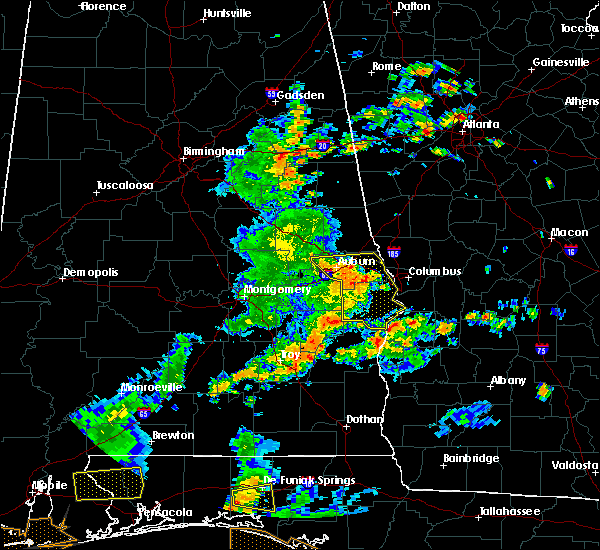 At 207 pm cdt, severe thunderstorms were located along a line extending from opelika to near griffen mill to 6 miles west of ladonia to seale to 9 miles southwest of russell county sports complex, moving east at 55 mph (radar indicated). Hazards include 60 mph wind gusts. Expect damage to roofs, siding, and trees. Locations impacted include, phenix city, opelika, smiths, smiths station, beulah, russell county sports complex, seale, beans mill, ladonia, bleecker, griffen mill, goat rock lake, monterey heights, uchee creek, fort mitchell, ladonia sports complex, fort mitchell activity center, carter acres, phenix drag strip and parkmanville. At 207 pm cdt, severe thunderstorms were located along a line extending from opelika to near griffen mill to 6 miles west of ladonia to seale to 9 miles southwest of russell county sports complex, moving east at 55 mph (radar indicated). Hazards include 60 mph wind gusts. Expect damage to roofs, siding, and trees. Locations impacted include, phenix city, opelika, smiths, smiths station, beulah, russell county sports complex, seale, beans mill, ladonia, bleecker, griffen mill, goat rock lake, monterey heights, uchee creek, fort mitchell, ladonia sports complex, fort mitchell activity center, carter acres, phenix drag strip and parkmanville.
|
| 6/7/2019 1:51 PM CDT |
 At 151 pm cdt, severe thunderstorms were located along a line extending from near auburn university to near auburn to near society hill to near uchee to near hurtsboro, moving east at 45 mph (radar indicated). Hazards include 60 mph wind gusts. expect damage to roofs, siding, and trees At 151 pm cdt, severe thunderstorms were located along a line extending from near auburn university to near auburn to near society hill to near uchee to near hurtsboro, moving east at 45 mph (radar indicated). Hazards include 60 mph wind gusts. expect damage to roofs, siding, and trees
|
| 3/25/2019 7:13 PM CDT | A tree was downed onto a hom in lee county AL, 1.7 miles SSE of Smiths Station, AL |
| 3/25/2019 7:01 PM CDT |
 At 701 pm cdt, severe thunderstorms were located along a line extending from near opelika to near beauregard to tuskegee national forest, moving east at 45 mph (radar indicated). Hazards include 60 mph wind gusts and penny size hail. Expect damage to roofs, siding, and trees. Locations impacted include, opelika, smiths, smiths station, tuskegee national forest, beauregard, society hill, bleecker, griffen mill, ladonia, monterey heights, i 85 rest area and marvyn. At 701 pm cdt, severe thunderstorms were located along a line extending from near opelika to near beauregard to tuskegee national forest, moving east at 45 mph (radar indicated). Hazards include 60 mph wind gusts and penny size hail. Expect damage to roofs, siding, and trees. Locations impacted include, opelika, smiths, smiths station, tuskegee national forest, beauregard, society hill, bleecker, griffen mill, ladonia, monterey heights, i 85 rest area and marvyn.
|
| 3/25/2019 6:46 PM CDT |
 At 646 pm cdt, severe thunderstorms were located along a line extending from near auburn university to near tuskegee national forest to near liberty city, moving east at 45 mph (radar indicated). Hazards include 60 mph wind gusts and quarter size hail. Hail damage to vehicles is expected. expect wind damage to roofs, siding, and trees. locations impacted include, auburn, opelika, tuskegee, notasulga, smiths, smiths station, auburn university, tuskegee national forest, beauregard, society hill, bleecker, griffen mill, ladonia, loachapoka, robert g. Pitts airport, i 85 rest area, monterey heights, chewacla state park and marvyn. At 646 pm cdt, severe thunderstorms were located along a line extending from near auburn university to near tuskegee national forest to near liberty city, moving east at 45 mph (radar indicated). Hazards include 60 mph wind gusts and quarter size hail. Hail damage to vehicles is expected. expect wind damage to roofs, siding, and trees. locations impacted include, auburn, opelika, tuskegee, notasulga, smiths, smiths station, auburn university, tuskegee national forest, beauregard, society hill, bleecker, griffen mill, ladonia, loachapoka, robert g. Pitts airport, i 85 rest area, monterey heights, chewacla state park and marvyn.
|
| 3/25/2019 6:34 PM CDT |
 At 634 pm cdt, a severe thunderstorm was located near notasulga, moving east at 45 mph (radar indicated). Hazards include 60 mph wind gusts and quarter size hail. Hail damage to vehicles is expected. expect wind damage to roofs, siding, and trees. locations impacted include, auburn, opelika, tuskegee, notasulga, smiths, smiths station, auburn university, tuskegee national forest, beauregard, society hill, bleecker, griffen mill, liberty city, ladonia, loachapoka, robert g. Pitts airport, i 85 rest area, monterey heights, chewacla state park and marvyn. At 634 pm cdt, a severe thunderstorm was located near notasulga, moving east at 45 mph (radar indicated). Hazards include 60 mph wind gusts and quarter size hail. Hail damage to vehicles is expected. expect wind damage to roofs, siding, and trees. locations impacted include, auburn, opelika, tuskegee, notasulga, smiths, smiths station, auburn university, tuskegee national forest, beauregard, society hill, bleecker, griffen mill, liberty city, ladonia, loachapoka, robert g. Pitts airport, i 85 rest area, monterey heights, chewacla state park and marvyn.
|
| 3/25/2019 6:15 PM CDT |
 At 614 pm cdt, a severe thunderstorm was located near martin dam, or near tallassee, moving east at 45 mph (radar indicated). Hazards include 60 mph wind gusts and quarter size hail. Hail damage to vehicles is expected. Expect wind damage to roofs, siding, and trees. At 614 pm cdt, a severe thunderstorm was located near martin dam, or near tallassee, moving east at 45 mph (radar indicated). Hazards include 60 mph wind gusts and quarter size hail. Hail damage to vehicles is expected. Expect wind damage to roofs, siding, and trees.
|
| 3/3/2019 3:07 PM CST |
 At 307 pm cst, a severe thunderstorm capable of producing a tornado was located near smiths station, or near smiths, moving northeast at 50 mph (radar indicated rotation). Hazards include tornado. Flying debris will be dangerous to those caught without shelter. mobile homes will be damaged or destroyed. damage to roofs, windows, and vehicles will occur. tree damage is likely. Locations impacted include, smiths, smiths station, bleecker, ladonia, monterey heights and bartletts ferry dam. At 307 pm cst, a severe thunderstorm capable of producing a tornado was located near smiths station, or near smiths, moving northeast at 50 mph (radar indicated rotation). Hazards include tornado. Flying debris will be dangerous to those caught without shelter. mobile homes will be damaged or destroyed. damage to roofs, windows, and vehicles will occur. tree damage is likely. Locations impacted include, smiths, smiths station, bleecker, ladonia, monterey heights and bartletts ferry dam.
|
| 3/3/2019 3:00 PM CST |
 At 300 pm cst, a confirmed large and extremely dangerous tornado was located over griffen mill, or 7 miles west of smiths, moving east at 65 mph. this is a particularly dangerous situation. take cover now! (radar confirmed tornado). Hazards include damaging tornado. You are in a life-threatening situation. flying debris may be deadly to those caught without shelter. mobile homes will be destroyed. considerable damage to homes, businesses, and vehicles is likely and complete destruction is possible. Locations impacted include, smiths, smiths station, bleecker, griffen mill, ladonia, monterey heights, ladonia sports complex and bartletts ferry dam. At 300 pm cst, a confirmed large and extremely dangerous tornado was located over griffen mill, or 7 miles west of smiths, moving east at 65 mph. this is a particularly dangerous situation. take cover now! (radar confirmed tornado). Hazards include damaging tornado. You are in a life-threatening situation. flying debris may be deadly to those caught without shelter. mobile homes will be destroyed. considerable damage to homes, businesses, and vehicles is likely and complete destruction is possible. Locations impacted include, smiths, smiths station, bleecker, griffen mill, ladonia, monterey heights, ladonia sports complex and bartletts ferry dam.
|
| 3/3/2019 2:56 PM CST |
 At 256 pm cst, a confirmed large and extremely dangerous tornado was located over griffen mill, or 11 miles west of smiths, moving east at 55 mph. this is a particularly dangerous situation. take cover now! (radar confirmed tornado). Hazards include damaging tornado. You are in a life-threatening situation. flying debris may be deadly to those caught without shelter. mobile homes will be destroyed. considerable damage to homes, businesses, and vehicles is likely and complete destruction is possible. Locations impacted include, phenix city, smiths, smiths station, ladonia, bleecker, griffen mill, monterey heights, ladonia sports complex and bartletts ferry dam. At 256 pm cst, a confirmed large and extremely dangerous tornado was located over griffen mill, or 11 miles west of smiths, moving east at 55 mph. this is a particularly dangerous situation. take cover now! (radar confirmed tornado). Hazards include damaging tornado. You are in a life-threatening situation. flying debris may be deadly to those caught without shelter. mobile homes will be destroyed. considerable damage to homes, businesses, and vehicles is likely and complete destruction is possible. Locations impacted include, phenix city, smiths, smiths station, ladonia, bleecker, griffen mill, monterey heights, ladonia sports complex and bartletts ferry dam.
|
| 3/3/2019 2:51 PM CST |
 At 250 pm cst, a confirmed large and extremely dangerous tornado was located near society hill, or 10 miles southeast of auburn, moving east at 45 mph. this is a particularly dangerous situation. take cover now! (radar confirmed tornado). Hazards include damaging tornado. You are in a life-threatening situation. flying debris may be deadly to those caught without shelter. mobile homes will be destroyed. considerable damage to homes, businesses, and vehicles is likely and complete destruction is possible. Locations impacted include, phenix city, smiths, smiths station, ladonia, bleecker, griffen mill, monterey heights, ladonia sports complex, marvyn and bartletts ferry dam. At 250 pm cst, a confirmed large and extremely dangerous tornado was located near society hill, or 10 miles southeast of auburn, moving east at 45 mph. this is a particularly dangerous situation. take cover now! (radar confirmed tornado). Hazards include damaging tornado. You are in a life-threatening situation. flying debris may be deadly to those caught without shelter. mobile homes will be destroyed. considerable damage to homes, businesses, and vehicles is likely and complete destruction is possible. Locations impacted include, phenix city, smiths, smiths station, ladonia, bleecker, griffen mill, monterey heights, ladonia sports complex, marvyn and bartletts ferry dam.
|
| 3/3/2019 2:38 PM CST |
 At 238 pm cst, a tornado producing storm was located near tuskegee national forest, or 9 miles east of tuskegee, moving east at 60 mph (radar confirmed tornado). Hazards include damaging tornado. Flying debris will be dangerous to those caught without shelter. mobile homes will be damaged or destroyed. damage to roofs, windows, and vehicles will occur. Tree damage is likely. At 238 pm cst, a tornado producing storm was located near tuskegee national forest, or 9 miles east of tuskegee, moving east at 60 mph (radar confirmed tornado). Hazards include damaging tornado. Flying debris will be dangerous to those caught without shelter. mobile homes will be damaged or destroyed. damage to roofs, windows, and vehicles will occur. Tree damage is likely.
|
| 3/3/2019 2:25 PM CST |
 At 224 pm cst, a confirmed large and destructive tornado was located over smiths station, or near smiths, moving east at 60 mph. tornado emergency for smiths station. this is a particularly dangerous situation. take cover now! (radar confirmed tornado). Hazards include deadly tornado. You are in a life-threatening situation. flying debris may be deadly to those caught without shelter. mobile homes will be destroyed. considerable damage to homes, businesses, and vehicles is likely and complete destruction is possible. Locations impacted include, smiths, smiths station, bleecker, monterey heights and bartletts ferry dam. At 224 pm cst, a confirmed large and destructive tornado was located over smiths station, or near smiths, moving east at 60 mph. tornado emergency for smiths station. this is a particularly dangerous situation. take cover now! (radar confirmed tornado). Hazards include deadly tornado. You are in a life-threatening situation. flying debris may be deadly to those caught without shelter. mobile homes will be destroyed. considerable damage to homes, businesses, and vehicles is likely and complete destruction is possible. Locations impacted include, smiths, smiths station, bleecker, monterey heights and bartletts ferry dam.
|
| 3/3/2019 2:15 PM CST |
 At 214 pm cst, a confirmed large and destructive tornado was located over griffen mill, or 11 miles west of smiths, moving east at 60 mph. tornado emergency for southern lee and northern russell county. this is a particularly dangerous situation. take cover now! (radar confirmed tornado). Hazards include deadly tornado. You are in a life-threatening situation. flying debris may be deadly to those caught without shelter. mobile homes will be destroyed. considerable damage to homes, businesses, and vehicles is likely and complete destruction is possible. Locations impacted include, phenix city, smiths, smiths station, ladonia, bleecker, griffen mill, bibb city, monterey heights, ladonia sports complex and bartletts ferry dam. At 214 pm cst, a confirmed large and destructive tornado was located over griffen mill, or 11 miles west of smiths, moving east at 60 mph. tornado emergency for southern lee and northern russell county. this is a particularly dangerous situation. take cover now! (radar confirmed tornado). Hazards include deadly tornado. You are in a life-threatening situation. flying debris may be deadly to those caught without shelter. mobile homes will be destroyed. considerable damage to homes, businesses, and vehicles is likely and complete destruction is possible. Locations impacted include, phenix city, smiths, smiths station, ladonia, bleecker, griffen mill, bibb city, monterey heights, ladonia sports complex and bartletts ferry dam.
|
| 3/3/2019 2:09 PM CST |
 At 209 pm cst, a confirmed large and destructive tornado was located near griffen mill, or 11 miles southeast of auburn, moving east at 60 mph. tornado emergency for southern lee county and northern russell county. this is a particularly dangerous situation. take cover now! (radar confirmed tornado). Hazards include deadly tornado. You are in a life-threatening situation. flying debris may be deadly to those caught without shelter. mobile homes will be destroyed. considerable damage to homes, businesses, and vehicles is likely and complete destruction is possible. Locations impacted include, phenix city, smiths, smiths station, ladonia, bleecker, griffen mill, bibb city, monterey heights, ladonia sports complex, marvyn and bartletts ferry dam. At 209 pm cst, a confirmed large and destructive tornado was located near griffen mill, or 11 miles southeast of auburn, moving east at 60 mph. tornado emergency for southern lee county and northern russell county. this is a particularly dangerous situation. take cover now! (radar confirmed tornado). Hazards include deadly tornado. You are in a life-threatening situation. flying debris may be deadly to those caught without shelter. mobile homes will be destroyed. considerable damage to homes, businesses, and vehicles is likely and complete destruction is possible. Locations impacted include, phenix city, smiths, smiths station, ladonia, bleecker, griffen mill, bibb city, monterey heights, ladonia sports complex, marvyn and bartletts ferry dam.
|
| 3/3/2019 2:07 PM CST |
 At 206 pm cst, a confirmed large and extremely dangerous tornado was located near society hill, or 10 miles southeast of auburn, moving east at 55 mph. this is a particularly dangerous situation. take cover now! (radar confirmed tornado). Hazards include damaging tornado. You are in a life-threatening situation. flying debris may be deadly to those caught without shelter. mobile homes will be destroyed. considerable damage to homes, businesses, and vehicles is likely and complete destruction is possible. Locations impacted include, auburn, phenix city, opelika, smiths, smiths station, ladonia, beauregard, bleecker, griffen mill, bibb city, monterey heights, chewacla state park, ladonia sports complex, marvyn and bartletts ferry dam. At 206 pm cst, a confirmed large and extremely dangerous tornado was located near society hill, or 10 miles southeast of auburn, moving east at 55 mph. this is a particularly dangerous situation. take cover now! (radar confirmed tornado). Hazards include damaging tornado. You are in a life-threatening situation. flying debris may be deadly to those caught without shelter. mobile homes will be destroyed. considerable damage to homes, businesses, and vehicles is likely and complete destruction is possible. Locations impacted include, auburn, phenix city, opelika, smiths, smiths station, ladonia, beauregard, bleecker, griffen mill, bibb city, monterey heights, chewacla state park, ladonia sports complex, marvyn and bartletts ferry dam.
|
| 3/3/2019 1:58 PM CST |
 At 158 pm cst, a severe thunderstorm capable of producing a tornado was located near tuskegee national forest, or 9 miles south of auburn, moving east at 60 mph (radar indicated rotation). Hazards include tornado. Flying debris will be dangerous to those caught without shelter. mobile homes will be damaged or destroyed. damage to roofs, windows, and vehicles will occur. Tree damage is likely. At 158 pm cst, a severe thunderstorm capable of producing a tornado was located near tuskegee national forest, or 9 miles south of auburn, moving east at 60 mph (radar indicated rotation). Hazards include tornado. Flying debris will be dangerous to those caught without shelter. mobile homes will be damaged or destroyed. damage to roofs, windows, and vehicles will occur. Tree damage is likely.
|
| 1/19/2019 5:10 PM CST |
 The severe thunderstorm warning for eastern lee and northeastern russell counties will expire at 515 pm cst, the storms which prompted the warning have moved out of the area. therefore, the warning will be allowed to expire. a tornado watch remains in effect until 900 pm cst for southeastern and east central alabama. The severe thunderstorm warning for eastern lee and northeastern russell counties will expire at 515 pm cst, the storms which prompted the warning have moved out of the area. therefore, the warning will be allowed to expire. a tornado watch remains in effect until 900 pm cst for southeastern and east central alabama.
|
| 1/19/2019 5:01 PM CST |
 At 501 pm cst, severe thunderstorms were located along a line extending from near river view to near bleecker, moving northeast at 45 mph (radar indicated). Hazards include 60 mph wind gusts. Expect damage to roofs, siding, and trees. locations impacted include, phenix city, smiths, smiths station, ladonia, bleecker, bibb city, monterey heights, ladonia sports complex and phenix drag strip. A tornado watch remains in effect until 900 pm cst for southeastern and east central alabama. At 501 pm cst, severe thunderstorms were located along a line extending from near river view to near bleecker, moving northeast at 45 mph (radar indicated). Hazards include 60 mph wind gusts. Expect damage to roofs, siding, and trees. locations impacted include, phenix city, smiths, smiths station, ladonia, bleecker, bibb city, monterey heights, ladonia sports complex and phenix drag strip. A tornado watch remains in effect until 900 pm cst for southeastern and east central alabama.
|
| 1/19/2019 4:54 PM CST | Trees down near the intersection of lee rd 440 and lee rd 179. also report of trees down just to the east near the intersection of lee rd 240 and lee rd 212. time estim in lee county AL, 5.8 miles ENE of Smiths Station, AL |
| 1/19/2019 4:54 PM CST |
 At 454 pm cst, a severe thunderstorm capable of producing a tornado was located near ladonia, or 8 miles southwest of smiths, moving northeast at 50 mph (radar indicated rotation). Hazards include tornado. Flying debris will be dangerous to those caught without shelter. mobile homes will be damaged or destroyed. damage to roofs, windows, and vehicles will occur. Tree damage is likely. At 454 pm cst, a severe thunderstorm capable of producing a tornado was located near ladonia, or 8 miles southwest of smiths, moving northeast at 50 mph (radar indicated rotation). Hazards include tornado. Flying debris will be dangerous to those caught without shelter. mobile homes will be damaged or destroyed. damage to roofs, windows, and vehicles will occur. Tree damage is likely.
|
| 1/19/2019 4:39 PM CST |
 At 439 pm cst, severe thunderstorms were located along a line extending from near beans mill to society hill, moving northeast at 45 mph (radar indicated). Hazards include 60 mph wind gusts. expect damage to roofs, siding, and trees At 439 pm cst, severe thunderstorms were located along a line extending from near beans mill to society hill, moving northeast at 45 mph (radar indicated). Hazards include 60 mph wind gusts. expect damage to roofs, siding, and trees
|
| 9/27/2018 1:47 PM CDT |
 At 137 pm cdt, a severe thunderstorm was located near beulah, or 9 miles northwest of smiths, moving northeast at 40 mph (radar indicated). Hazards include 60 mph wind gusts. expect damage to roofs, siding, and trees At 137 pm cdt, a severe thunderstorm was located near beulah, or 9 miles northwest of smiths, moving northeast at 40 mph (radar indicated). Hazards include 60 mph wind gusts. expect damage to roofs, siding, and trees
|
| 9/27/2018 1:37 PM CDT |
 At 137 pm cdt, a severe thunderstorm was located near beulah, or 9 miles northwest of smiths, moving northeast at 40 mph (radar indicated). Hazards include 60 mph wind gusts. expect damage to roofs, siding, and trees At 137 pm cdt, a severe thunderstorm was located near beulah, or 9 miles northwest of smiths, moving northeast at 40 mph (radar indicated). Hazards include 60 mph wind gusts. expect damage to roofs, siding, and trees
|
| 7/21/2018 7:03 PM CDT |
 At 703 pm cdt, severe thunderstorms were located along a line extending from near ladonia to near beans mill, moving southeast at 20 mph (radar indicated). Hazards include quarter size hail. Damage to vehicles is expected. Locations impacted include, opelika, russell county sports complex, seale, ladonia, beauregard, bleecker, griffen mill, monterey heights, hatchechubbe, uchee creek, fort mitchell, ladonia sports complex, fort mitchell activity center, phenix drag strip and parkmanville. At 703 pm cdt, severe thunderstorms were located along a line extending from near ladonia to near beans mill, moving southeast at 20 mph (radar indicated). Hazards include quarter size hail. Damage to vehicles is expected. Locations impacted include, opelika, russell county sports complex, seale, ladonia, beauregard, bleecker, griffen mill, monterey heights, hatchechubbe, uchee creek, fort mitchell, ladonia sports complex, fort mitchell activity center, phenix drag strip and parkmanville.
|
| 7/21/2018 6:33 PM CDT |
 At 633 pm cdt, a severe thunderstorm was located near beauregard, or near opelika, moving southeast at 25 mph (radar indicated). Hazards include golf ball size hail. People and animals outdoors will be injured. Expect damage to roofs, siding, windows, and vehicles. At 633 pm cdt, a severe thunderstorm was located near beauregard, or near opelika, moving southeast at 25 mph (radar indicated). Hazards include golf ball size hail. People and animals outdoors will be injured. Expect damage to roofs, siding, windows, and vehicles.
|
| 7/21/2018 6:31 PM CDT |
 At 631 pm cdt, a severe thunderstorm was located near russell county sports complex, or 8 miles southwest of phenix city, moving southeast at 25 mph (radar indicated). Hazards include golf ball size hail and 60 mph wind gusts. large hail has been confirmed with this storm. an additional thunderstorm is approaching from the northwest and could also soon become severe. People and animals outdoors will be injured. expect hail damage to roofs, siding, windows, and vehicles. expect wind damage to roofs, siding, and trees. Locations impacted include, ladonia, russell county sports complex, seale, griffen mill, hatchechubbe, uchee creek, fort mitchell, ladonia sports complex, fort mitchell activity center, phenix drag strip and parkmanville. At 631 pm cdt, a severe thunderstorm was located near russell county sports complex, or 8 miles southwest of phenix city, moving southeast at 25 mph (radar indicated). Hazards include golf ball size hail and 60 mph wind gusts. large hail has been confirmed with this storm. an additional thunderstorm is approaching from the northwest and could also soon become severe. People and animals outdoors will be injured. expect hail damage to roofs, siding, windows, and vehicles. expect wind damage to roofs, siding, and trees. Locations impacted include, ladonia, russell county sports complex, seale, griffen mill, hatchechubbe, uchee creek, fort mitchell, ladonia sports complex, fort mitchell activity center, phenix drag strip and parkmanville.
|
| 7/21/2018 6:11 PM CDT |
 At 611 pm cdt, a severe thunderstorm was located over griffen mill, or 9 miles west of smiths, moving south at 20 mph (radar indicated). Hazards include golf ball size hail and 60 mph wind gusts. People and animals outdoors will be injured. expect hail damage to roofs, siding, windows, and vehicles. Expect wind damage to roofs, siding, and trees. At 611 pm cdt, a severe thunderstorm was located over griffen mill, or 9 miles west of smiths, moving south at 20 mph (radar indicated). Hazards include golf ball size hail and 60 mph wind gusts. People and animals outdoors will be injured. expect hail damage to roofs, siding, windows, and vehicles. Expect wind damage to roofs, siding, and trees.
|
| 7/21/2018 6:05 PM CDT |
 At 604 pm cdt, a confirmed tornado was located over beauregard, or near opelika, moving south at 15 mph (radar confirmed tornado). Hazards include damaging tornado and ping pong ball size hail. Flying debris will be dangerous to those caught without shelter. mobile homes will be damaged or destroyed. damage to roofs, windows, and vehicles will occur. tree damage is likely. Locations impacted include, opelika and griffen mill. At 604 pm cdt, a confirmed tornado was located over beauregard, or near opelika, moving south at 15 mph (radar confirmed tornado). Hazards include damaging tornado and ping pong ball size hail. Flying debris will be dangerous to those caught without shelter. mobile homes will be damaged or destroyed. damage to roofs, windows, and vehicles will occur. tree damage is likely. Locations impacted include, opelika and griffen mill.
|
| 7/21/2018 5:58 PM CDT |
 At 558 pm cdt, a tornado producing storm was located near beauregard, or near opelika, moving southeast at 25 mph (radar confirmed tornado). Hazards include damaging tornado and ping pong ball size hail. Flying debris will be dangerous to those caught without shelter. mobile homes will be damaged or destroyed. damage to roofs, windows, and vehicles will occur. Tree damage is likely. At 558 pm cdt, a tornado producing storm was located near beauregard, or near opelika, moving southeast at 25 mph (radar confirmed tornado). Hazards include damaging tornado and ping pong ball size hail. Flying debris will be dangerous to those caught without shelter. mobile homes will be damaged or destroyed. damage to roofs, windows, and vehicles will occur. Tree damage is likely.
|
| 7/21/2018 5:47 PM CDT |
 At 547 pm cdt, a severe thunderstorm capable of producing a tornado was located over opelika, moving southeast at 25 mph (radar indicated rotation). Hazards include tornado and ping pong ball size hail. Flying debris will be dangerous to those caught without shelter. mobile homes will be damaged or destroyed. damage to roofs, windows, and vehicles will occur. Tree damage is likely. At 547 pm cdt, a severe thunderstorm capable of producing a tornado was located over opelika, moving southeast at 25 mph (radar indicated rotation). Hazards include tornado and ping pong ball size hail. Flying debris will be dangerous to those caught without shelter. mobile homes will be damaged or destroyed. damage to roofs, windows, and vehicles will occur. Tree damage is likely.
|
| 6/28/2018 4:25 PM CDT |
 At 425 pm cdt, severe thunderstorms were located along a line extending from near smiths to near uchee to montgomery, moving southeast at 35 mph (radar indicated). Hazards include 60 mph wind gusts. expect damage to roofs, siding, and trees At 425 pm cdt, severe thunderstorms were located along a line extending from near smiths to near uchee to montgomery, moving southeast at 35 mph (radar indicated). Hazards include 60 mph wind gusts. expect damage to roofs, siding, and trees
|
| 6/28/2018 3:58 PM CDT |
 At 357 pm cdt, severe thunderstorms were located along a line extending from west point to near notasulga, moving south at 30 mph (radar indicated). Hazards include 60 mph wind gusts. expect damage to roofs, siding, and trees At 357 pm cdt, severe thunderstorms were located along a line extending from west point to near notasulga, moving south at 30 mph (radar indicated). Hazards include 60 mph wind gusts. expect damage to roofs, siding, and trees
|
| 6/28/2018 3:44 PM CDT |
 At 344 pm cdt, a severe thunderstorm was located 7 miles south of seale, or 17 miles east of hurtsboro, moving southeast at 30 mph (radar indicated). Hazards include 60 mph wind gusts. Expect damage to roofs, siding, and trees. Locations impacted include, auburn, phenix city, opelika, smiths, smiths station, waverly, hawkinsville, beulah, uchee, spring hill, beans mill, auburn university, beauregard, bleecker, russell county sports complex, seale, ladonia, oak bowery, griffen mill and twin springs. At 344 pm cdt, a severe thunderstorm was located 7 miles south of seale, or 17 miles east of hurtsboro, moving southeast at 30 mph (radar indicated). Hazards include 60 mph wind gusts. Expect damage to roofs, siding, and trees. Locations impacted include, auburn, phenix city, opelika, smiths, smiths station, waverly, hawkinsville, beulah, uchee, spring hill, beans mill, auburn university, beauregard, bleecker, russell county sports complex, seale, ladonia, oak bowery, griffen mill and twin springs.
|
| 6/28/2018 3:25 PM CDT |
 The national weather service in birmingham has issued a * severe thunderstorm warning for. lee county in east central alabama. southern chambers county in east central alabama. northeastern barbour county in southeastern alabama. Russell county in southeastern alabama. The national weather service in birmingham has issued a * severe thunderstorm warning for. lee county in east central alabama. southern chambers county in east central alabama. northeastern barbour county in southeastern alabama. Russell county in southeastern alabama.
|
| 6/28/2018 3:20 PM CDT | Tree down at the smith station government cente in lee county AL, 1 miles SSE of Smiths Station, AL |
| 6/28/2018 3:06 PM CDT |
 At 306 pm cdt, severe thunderstorms were located along a line extending from near society hill to 9 miles southwest of cusseta, moving southeast at 30 mph (radar indicated). Hazards include 60 mph wind gusts. expect damage to roofs, siding, and trees At 306 pm cdt, severe thunderstorms were located along a line extending from near society hill to 9 miles southwest of cusseta, moving southeast at 30 mph (radar indicated). Hazards include 60 mph wind gusts. expect damage to roofs, siding, and trees
|
| 6/22/2018 6:58 PM CDT | Tree down on lee road 17 in lee county AL, 4.8 miles ENE of Smiths Station, AL |
| 6/22/2018 6:57 PM CDT |
 At 657 pm cdt, a severe thunderstorm was located over smiths, moving east at 30 mph (radar indicated). Hazards include 60 mph wind gusts. expect damage to roofs, siding, and trees At 657 pm cdt, a severe thunderstorm was located over smiths, moving east at 30 mph (radar indicated). Hazards include 60 mph wind gusts. expect damage to roofs, siding, and trees
|
| 2/7/2018 9:08 AM CST |
 At 908 am cst, a severe thunderstorm was located near bleecker, or 9 miles southeast of opelika, moving east at 55 mph (radar indicated). Hazards include 60 mph wind gusts and nickel size hail. expect damage to roofs, siding, and trees At 908 am cst, a severe thunderstorm was located near bleecker, or 9 miles southeast of opelika, moving east at 55 mph (radar indicated). Hazards include 60 mph wind gusts and nickel size hail. expect damage to roofs, siding, and trees
|
| 9/22/2017 4:36 PM CDT |
 The severe thunderstorm warning for southeastern lee and northwestern russell counties will expire at 445 pm cdt, the storm which prompted the warning has weakened below severe limits, and no longer poses an immediate threat to life or property. therefore the warning will be allowed to expire. The severe thunderstorm warning for southeastern lee and northwestern russell counties will expire at 445 pm cdt, the storm which prompted the warning has weakened below severe limits, and no longer poses an immediate threat to life or property. therefore the warning will be allowed to expire.
|
| 9/22/2017 4:12 PM CDT |
 At 412 pm cdt, a severe thunderstorm was located near ladonia, or 8 miles southwest of smiths, moving west at 10 mph (radar indicated). Hazards include 60 mph wind gusts and nickel size hail. expect damage to roofs, siding, and trees At 412 pm cdt, a severe thunderstorm was located near ladonia, or 8 miles southwest of smiths, moving west at 10 mph (radar indicated). Hazards include 60 mph wind gusts and nickel size hail. expect damage to roofs, siding, and trees
|
| 7/27/2017 4:41 PM CDT |
 At 440 pm cdt, a severe thunderstorm was located over griffen mill, or 9 miles west of smiths, moving south at 15 mph (radar indicated). Hazards include 60 mph wind gusts. Expect damage to roofs, siding, and trees. Locations impacted include, griffen mill, bleecker and ladonia. At 440 pm cdt, a severe thunderstorm was located over griffen mill, or 9 miles west of smiths, moving south at 15 mph (radar indicated). Hazards include 60 mph wind gusts. Expect damage to roofs, siding, and trees. Locations impacted include, griffen mill, bleecker and ladonia.
|
| 7/27/2017 4:27 PM CDT |
 At 427 pm cdt, a severe thunderstorm was located near bleecker, or 8 miles southeast of opelika, moving south at 15 mph (radar indicated). Hazards include 60 mph wind gusts. expect damage to roofs, siding, and trees At 427 pm cdt, a severe thunderstorm was located near bleecker, or 8 miles southeast of opelika, moving south at 15 mph (radar indicated). Hazards include 60 mph wind gusts. expect damage to roofs, siding, and trees
|
| 6/15/2017 6:20 PM CDT | 3 reports of downed trees in the are in lee county AL, 0.9 miles S of Smiths Station, AL |
| 6/15/2017 6:06 PM CDT |
 At 605 pm cdt, severe thunderstorms were located along a line extending from near beulah to 6 miles south of davisville, moving southeast at 30 mph (radar indicated). Hazards include 60 mph wind gusts and penny size hail. Expect damage to roofs, siding, and trees. Locations impacted include, auburn, opelika, tuskegee, smiths, smiths station, beulah, beans mill, lake tuskegee, auburn university, tuskegee national forest, beauregard, davisville, bleecker, liverpool, hardaway, society hill, griffen mill, ladonia, warriorstand and fort davis. At 605 pm cdt, severe thunderstorms were located along a line extending from near beulah to 6 miles south of davisville, moving southeast at 30 mph (radar indicated). Hazards include 60 mph wind gusts and penny size hail. Expect damage to roofs, siding, and trees. Locations impacted include, auburn, opelika, tuskegee, smiths, smiths station, beulah, beans mill, lake tuskegee, auburn university, tuskegee national forest, beauregard, davisville, bleecker, liverpool, hardaway, society hill, griffen mill, ladonia, warriorstand and fort davis.
|
| 6/15/2017 5:42 PM CDT |
 At 542 pm cdt, severe thunderstorms were located along a line extending from amity park to near hardaway, moving southeast at 50 mph (radar indicated). Hazards include 60 mph wind gusts and penny size hail. these storms have a history of blowing down trees. Expect damage to roofs, siding, and trees. Locations impacted include, auburn, opelika, tuskegee, valley, lanett, notasulga, smiths, milstead, lafayette, smiths station, la fayette, shorter, franklin, waverly, lakeview, cusseta, beulah, lake tuskegee, tuskegee national forest and beauregard. At 542 pm cdt, severe thunderstorms were located along a line extending from amity park to near hardaway, moving southeast at 50 mph (radar indicated). Hazards include 60 mph wind gusts and penny size hail. these storms have a history of blowing down trees. Expect damage to roofs, siding, and trees. Locations impacted include, auburn, opelika, tuskegee, valley, lanett, notasulga, smiths, milstead, lafayette, smiths station, la fayette, shorter, franklin, waverly, lakeview, cusseta, beulah, lake tuskegee, tuskegee national forest and beauregard.
|
| 6/15/2017 5:16 PM CDT |
 At 516 pm cdt, severe thunderstorms were located along a line extending from near welch to shorter, moving southeast at 50 mph (radar indicated). Hazards include 60 mph wind gusts and penny size hail. these storms have a history of blowing down trees. expect damage to roofs, siding, and trees At 516 pm cdt, severe thunderstorms were located along a line extending from near welch to shorter, moving southeast at 50 mph (radar indicated). Hazards include 60 mph wind gusts and penny size hail. these storms have a history of blowing down trees. expect damage to roofs, siding, and trees
|
| 4/27/2017 11:31 AM CDT |
 At 1131 am cdt, a severe thunderstorm capable of producing a tornado was located over ladonia, or near phenix city, moving east at 45 mph (radar indicated rotation). Hazards include tornado. Flying debris will be dangerous to those caught without shelter. mobile homes will be damaged or destroyed. damage to roofs, windows, and vehicles will occur. Tree damage is likely. At 1131 am cdt, a severe thunderstorm capable of producing a tornado was located over ladonia, or near phenix city, moving east at 45 mph (radar indicated rotation). Hazards include tornado. Flying debris will be dangerous to those caught without shelter. mobile homes will be damaged or destroyed. damage to roofs, windows, and vehicles will occur. Tree damage is likely.
|
| 4/5/2017 10:10 PM CDT |
 The severe thunderstorm warning for eastern lee county will expire at 1015 pm cdt, the storm which prompted the warning has moved out of the area. therefore the warning will be allowed to expire. a tornado watch remains in effect until 100 am cdt for southeastern and east central alabama. The severe thunderstorm warning for eastern lee county will expire at 1015 pm cdt, the storm which prompted the warning has moved out of the area. therefore the warning will be allowed to expire. a tornado watch remains in effect until 100 am cdt for southeastern and east central alabama.
|
| 4/5/2017 10:07 PM CDT | Trees were blown down in and around smiths statio in lee county AL, 0.9 miles S of Smiths Station, AL |
| 4/5/2017 10:05 PM CDT | Golf Ball sized hail reported 1 miles SSE of Smiths Station, AL |
| 4/5/2017 10:04 PM CDT | Quarter sized hail reported 5.4 miles SE of Smiths Station, AL |
| 4/5/2017 9:58 PM CDT |
 At 957 pm cdt, a severe thunderstorm was located over smiths station, or over smiths, moving northeast at 55 mph (radar indicated). Hazards include 60 mph wind gusts and quarter size hail. Hail damage to vehicles is expected. expect wind damage to roofs, siding, and trees. locations impacted include, smiths, smiths station, bleecker, ladonia and monterey heights. a tornado watch remains in effect until 1000 pm cdt for southeastern and east central alabama. A tornado watch also remains in effect until 100 am cdt for southeastern and east central alabama. At 957 pm cdt, a severe thunderstorm was located over smiths station, or over smiths, moving northeast at 55 mph (radar indicated). Hazards include 60 mph wind gusts and quarter size hail. Hail damage to vehicles is expected. expect wind damage to roofs, siding, and trees. locations impacted include, smiths, smiths station, bleecker, ladonia and monterey heights. a tornado watch remains in effect until 1000 pm cdt for southeastern and east central alabama. A tornado watch also remains in effect until 100 am cdt for southeastern and east central alabama.
|
| 4/5/2017 9:49 PM CDT |
 At 948 pm cdt, a severe thunderstorm was located over griffen mill, or 9 miles west of smiths, moving northeast at 55 mph. quarter-sized hail has been reported with this storm (radar indicated). Hazards include 60 mph wind gusts and quarter size hail. Hail damage to vehicles is expected. expect wind damage to roofs, siding, and trees. locations impacted include, smiths, smiths station, beulah, bleecker, griffen mill, ladonia and monterey heights. a tornado watch remains in effect until 1000 pm cdt for southeastern and east central alabama. A tornado watch also remains in effect until 100 am cdt for southeastern and east central alabama. At 948 pm cdt, a severe thunderstorm was located over griffen mill, or 9 miles west of smiths, moving northeast at 55 mph. quarter-sized hail has been reported with this storm (radar indicated). Hazards include 60 mph wind gusts and quarter size hail. Hail damage to vehicles is expected. expect wind damage to roofs, siding, and trees. locations impacted include, smiths, smiths station, beulah, bleecker, griffen mill, ladonia and monterey heights. a tornado watch remains in effect until 1000 pm cdt for southeastern and east central alabama. A tornado watch also remains in effect until 100 am cdt for southeastern and east central alabama.
|
| 4/5/2017 9:38 PM CDT |
 At 938 pm cdt, a severe thunderstorm was located near beans mill, or near opelika, moving northeast at 50 mph (radar indicated). Hazards include 60 mph wind gusts and quarter size hail. Hail damage to vehicles is expected. Expect wind damage to roofs, siding, and trees. At 938 pm cdt, a severe thunderstorm was located near beans mill, or near opelika, moving northeast at 50 mph (radar indicated). Hazards include 60 mph wind gusts and quarter size hail. Hail damage to vehicles is expected. Expect wind damage to roofs, siding, and trees.
|
| 2/7/2017 3:17 PM CST |
 At 316 pm cst, severe thunderstorms were located along a line extending from near beulah to near cusseta, moving east at 40 mph (radar indicated). Hazards include 60 mph wind gusts. Expect damage to roofs, siding, and trees. Locations impacted include, beulah. At 316 pm cst, severe thunderstorms were located along a line extending from near beulah to near cusseta, moving east at 40 mph (radar indicated). Hazards include 60 mph wind gusts. Expect damage to roofs, siding, and trees. Locations impacted include, beulah.
|
| 2/7/2017 3:09 PM CST |
 At 309 pm cst, severe thunderstorms were located along a line extending from near beulah to near fort benning/lawson army air fld, moving east at 40 mph (radar indicated). Hazards include 60 mph wind gusts. Expect damage to roofs, siding, and trees. Locations impacted include, phenix city, opelika, smiths, smiths station, beans mill, beulah, bleecker, ladonia, ladonia sports complex, carter acres, fort mitchell, fort mitchell activity center, uchee creek and monterey heights. At 309 pm cst, severe thunderstorms were located along a line extending from near beulah to near fort benning/lawson army air fld, moving east at 40 mph (radar indicated). Hazards include 60 mph wind gusts. Expect damage to roofs, siding, and trees. Locations impacted include, phenix city, opelika, smiths, smiths station, beans mill, beulah, bleecker, ladonia, ladonia sports complex, carter acres, fort mitchell, fort mitchell activity center, uchee creek and monterey heights.
|
| 2/7/2017 2:57 PM CST |
 At 257 pm cst, severe thunderstorms were located along a line extending from near opelika to 6 miles southwest of fort benning/lawson army air fld, moving east at 40 mph (radar indicated). Hazards include 60 mph wind gusts. Expect damage to roofs, siding, and trees. Locations impacted include, auburn, phenix city, opelika, smiths, smiths station, ladonia, beans mill, beulah, bleecker, griffen mill, russell county sports complex, phenix drag strip, mount jefferson, crawford, ladonia sports complex, carter acres, fort mitchell, fort mitchell activity center, uchee creek and monterey heights. At 257 pm cst, severe thunderstorms were located along a line extending from near opelika to 6 miles southwest of fort benning/lawson army air fld, moving east at 40 mph (radar indicated). Hazards include 60 mph wind gusts. Expect damage to roofs, siding, and trees. Locations impacted include, auburn, phenix city, opelika, smiths, smiths station, ladonia, beans mill, beulah, bleecker, griffen mill, russell county sports complex, phenix drag strip, mount jefferson, crawford, ladonia sports complex, carter acres, fort mitchell, fort mitchell activity center, uchee creek and monterey heights.
|
| 2/7/2017 2:43 PM CST |
 At 242 pm cst, severe thunderstorms were located along a line extending from auburn university to near seale, moving northeast at 55 mph (radar indicated). Hazards include 60 mph wind gusts. Expect damage to roofs, siding, and trees. Locations impacted include, auburn, phenix city, opelika, smiths, smiths station, waverly, ladonia, beans mill, bleecker, griffen mill, beulah, auburn university, seale, russell county sports complex, beauregard, loachapoka, crawford, ladonia sports complex, rutherford and chewacla state park. At 242 pm cst, severe thunderstorms were located along a line extending from auburn university to near seale, moving northeast at 55 mph (radar indicated). Hazards include 60 mph wind gusts. Expect damage to roofs, siding, and trees. Locations impacted include, auburn, phenix city, opelika, smiths, smiths station, waverly, ladonia, beans mill, bleecker, griffen mill, beulah, auburn university, seale, russell county sports complex, beauregard, loachapoka, crawford, ladonia sports complex, rutherford and chewacla state park.
|
| 2/7/2017 2:24 PM CST |
 At 224 pm cst, severe thunderstorms were located along a line extending from near notasulga to near guerryton, moving east at 40 mph (radar indicated). Hazards include 60 mph wind gusts. expect damage to roofs, siding, and trees At 224 pm cst, severe thunderstorms were located along a line extending from near notasulga to near guerryton, moving east at 40 mph (radar indicated). Hazards include 60 mph wind gusts. expect damage to roofs, siding, and trees
|
| 1/22/2017 2:30 PM CST |
 At 228 pm cst, severe thunderstorms were located along a line extending from 7 miles southwest of franklin to near hamilton to near upatoi, moving east at 65 mph (radar indicated). Hazards include 60 mph wind gusts and quarter size hail. Hail damage to vehicles is expected. expect wind damage to roofs, siding, and trees. locations impacted include, opelika, valley, lanett, roanoke, lafayette, smiths, stroud, smiths station, la fayette, wadley, red level, lakeview, cusseta, beans mill, welch, crystal lake, penton, huguley, fairfax and chambers county lake. A tornado watch remains in effect until 700 pm cst for southeastern and east central alabama. At 228 pm cst, severe thunderstorms were located along a line extending from 7 miles southwest of franklin to near hamilton to near upatoi, moving east at 65 mph (radar indicated). Hazards include 60 mph wind gusts and quarter size hail. Hail damage to vehicles is expected. expect wind damage to roofs, siding, and trees. locations impacted include, opelika, valley, lanett, roanoke, lafayette, smiths, stroud, smiths station, la fayette, wadley, red level, lakeview, cusseta, beans mill, welch, crystal lake, penton, huguley, fairfax and chambers county lake. A tornado watch remains in effect until 700 pm cst for southeastern and east central alabama.
|
| 1/22/2017 1:41 PM CST |
 At 140 pm cst, severe thunderstorms were located along a line extending from near kellyton to near notasulga to near tuskegee national forest, moving east at 65 mph (radar indicated). Hazards include 60 mph wind gusts and quarter size hail. Hail damage to vehicles is expected. Expect wind damage to roofs, siding, and trees. At 140 pm cst, severe thunderstorms were located along a line extending from near kellyton to near notasulga to near tuskegee national forest, moving east at 65 mph (radar indicated). Hazards include 60 mph wind gusts and quarter size hail. Hail damage to vehicles is expected. Expect wind damage to roofs, siding, and trees.
|
| 1/21/2017 9:18 AM CST | Damage to roof and athletic field at smiths station high school. possible tornado. time estimated by rada in lee county AL, 1.3 miles WNW of Smiths Station, AL |
| 1/21/2017 9:17 AM CST |
 At 916 am cst, tornado producing storms were located along a line extending from near cusseta to near bleecker to near ladonia, moving east at 55 mph (radar confirmed tornado). Hazards include damaging tornado. Flying debris will be dangerous to those caught without shelter. mobile homes will be damaged or destroyed. damage to roofs, windows, and vehicles will occur. tree damage is likely. Locations impacted include, valley, lanett, smiths, smiths station, cusseta, beans mill, river view, beulah, huguley, fairfax, bleecker, ladonia, i 85 welcome center at lanett, lanett municipal airport, monterey heights and lake harding. At 916 am cst, tornado producing storms were located along a line extending from near cusseta to near bleecker to near ladonia, moving east at 55 mph (radar confirmed tornado). Hazards include damaging tornado. Flying debris will be dangerous to those caught without shelter. mobile homes will be damaged or destroyed. damage to roofs, windows, and vehicles will occur. tree damage is likely. Locations impacted include, valley, lanett, smiths, smiths station, cusseta, beans mill, river view, beulah, huguley, fairfax, bleecker, ladonia, i 85 welcome center at lanett, lanett municipal airport, monterey heights and lake harding.
|
| 1/21/2017 9:08 AM CST |
 At 908 am cst, tornado producing storms were located along a line extending from near ridge grove to near beans mill to near griffen mill, moving northeast at 45 mph (radar confirmed tornado). Hazards include damaging tornado. Flying debris will be dangerous to those caught without shelter. mobile homes will be damaged or destroyed. damage to roofs, windows, and vehicles will occur. tree damage is likely. Locations impacted include, opelika, valley, lanett, lafayette, smiths, smiths station, la fayette, lakeview, cusseta, west chambers, beans mill, ridge grove, huguley, trammel crossroads, fairfax, chambers county lake, bleecker, griffen mill, river view and post oak forks. At 908 am cst, tornado producing storms were located along a line extending from near ridge grove to near beans mill to near griffen mill, moving northeast at 45 mph (radar confirmed tornado). Hazards include damaging tornado. Flying debris will be dangerous to those caught without shelter. mobile homes will be damaged or destroyed. damage to roofs, windows, and vehicles will occur. tree damage is likely. Locations impacted include, opelika, valley, lanett, lafayette, smiths, smiths station, la fayette, lakeview, cusseta, west chambers, beans mill, ridge grove, huguley, trammel crossroads, fairfax, chambers county lake, bleecker, griffen mill, river view and post oak forks.
|
| 1/21/2017 8:54 AM CST |
 At 854 am cst, tornado producing storms were located along a line extending from near trammel crossroads to near beauregard to near uchee, moving east at 60 mph (radar confirmed tornado). Hazards include damaging tornado. Flying debris will be dangerous to those caught without shelter. mobile homes will be damaged or destroyed. damage to roofs, windows, and vehicles will occur. tree damage is likely. Locations impacted include, auburn, opelika, valley, lanett, lafayette, smiths, smiths station, la fayette, waverly, lakeview, cusseta, west chambers, beans mill, ridge grove, huguley, trammel crossroads, fairfax, chambers county lake, bleecker and griffen mill. At 854 am cst, tornado producing storms were located along a line extending from near trammel crossroads to near beauregard to near uchee, moving east at 60 mph (radar confirmed tornado). Hazards include damaging tornado. Flying debris will be dangerous to those caught without shelter. mobile homes will be damaged or destroyed. damage to roofs, windows, and vehicles will occur. tree damage is likely. Locations impacted include, auburn, opelika, valley, lanett, lafayette, smiths, smiths station, la fayette, waverly, lakeview, cusseta, west chambers, beans mill, ridge grove, huguley, trammel crossroads, fairfax, chambers county lake, bleecker and griffen mill.
|
| 1/21/2017 8:41 AM CST |
 At 840 am cst, severe thunderstorms capable of producing both tornadoes and extensive straight line wind damage were located along a line extending from near jacksons` gap to near tuskegee national forest to 6 miles southwest of society hill, moving east at 60 mph (radar indicated rotation). Hazards include tornado. Flying debris will be dangerous to those caught without shelter. mobile homes will be damaged or destroyed. damage to roofs, windows, and vehicles will occur. Tree damage is likely. At 840 am cst, severe thunderstorms capable of producing both tornadoes and extensive straight line wind damage were located along a line extending from near jacksons` gap to near tuskegee national forest to 6 miles southwest of society hill, moving east at 60 mph (radar indicated rotation). Hazards include tornado. Flying debris will be dangerous to those caught without shelter. mobile homes will be damaged or destroyed. damage to roofs, windows, and vehicles will occur. Tree damage is likely.
|
| 1/21/2017 8:05 AM CST | Sheet metal and tree damage north of crawford. this is a correction from previous lsr. correct location is in lee county. possible tornado. time estimated by rada in lee county AL, 8.2 miles ENE of Smiths Station, AL |
| 7/9/2016 1:38 PM CDT |
 At 137 pm cdt, a severe thunderstorm was located near griffen mill, or 12 miles south of opelika, moving east at 10 mph. another severe thunderstorms was located southwest of phenix city (radar indicated). Hazards include 60 mph wind gusts and quarter size hail. Hail damage to vehicles is expected. expect wind damage to roofs, siding, and trees. Locations impacted include, phenix city, smiths, smiths station, ladonia, beauregard, bleecker, griffen mill, bibb city, phenix drag strip, crawford, ladonia sports complex, parkmanville, fort mitchell, fort mitchell activity center, uchee creek and monterey heights. At 137 pm cdt, a severe thunderstorm was located near griffen mill, or 12 miles south of opelika, moving east at 10 mph. another severe thunderstorms was located southwest of phenix city (radar indicated). Hazards include 60 mph wind gusts and quarter size hail. Hail damage to vehicles is expected. expect wind damage to roofs, siding, and trees. Locations impacted include, phenix city, smiths, smiths station, ladonia, beauregard, bleecker, griffen mill, bibb city, phenix drag strip, crawford, ladonia sports complex, parkmanville, fort mitchell, fort mitchell activity center, uchee creek and monterey heights.
|
| 7/9/2016 1:19 PM CDT |
 At 119 pm cdt, a severe thunderstorm was located near beauregard, or 10 miles southeast of auburn, moving east at 10 mph (radar indicated). Hazards include 60 mph wind gusts. Expect damage to roofs. siding. And trees. At 119 pm cdt, a severe thunderstorm was located near beauregard, or 10 miles southeast of auburn, moving east at 10 mph (radar indicated). Hazards include 60 mph wind gusts. Expect damage to roofs. siding. And trees.
|
| 6/17/2016 5:29 PM CDT |
 At 529 pm cdt, severe thunderstorms were located along a line extending from bibb city to near beauregard to near liberty city, moving south at 20 mph (radar indicated). Hazards include 60 mph wind gusts. Expect damage to roofs. siding. and trees. locations impacted include, auburn, opelika, notasulga, smiths, smiths station, auburn university, beauregard, bleecker, griffen mill, ladonia, loachapoka, marvyn, robert g. Pitts airport, chewacla state park, roxana and monterey heights. At 529 pm cdt, severe thunderstorms were located along a line extending from bibb city to near beauregard to near liberty city, moving south at 20 mph (radar indicated). Hazards include 60 mph wind gusts. Expect damage to roofs. siding. and trees. locations impacted include, auburn, opelika, notasulga, smiths, smiths station, auburn university, beauregard, bleecker, griffen mill, ladonia, loachapoka, marvyn, robert g. Pitts airport, chewacla state park, roxana and monterey heights.
|
| 6/17/2016 5:18 PM CDT |
 At 518 pm cdt, severe thunderstorms were located along a line extending from near smiths to beauregard to near liberty city, moving south at 25 mph (radar indicated). Hazards include 60 mph wind gusts. Expect damage to roofs. siding. and trees. locations impacted include, auburn, opelika, notasulga, smiths, smiths station, waverly, beans mill, beulah, auburn university, beauregard, bleecker, griffen mill, ladonia, loachapoka, mount jefferson, marvyn, robert g. Pitts airport, chewacla state park, roxana and monterey heights. At 518 pm cdt, severe thunderstorms were located along a line extending from near smiths to beauregard to near liberty city, moving south at 25 mph (radar indicated). Hazards include 60 mph wind gusts. Expect damage to roofs. siding. and trees. locations impacted include, auburn, opelika, notasulga, smiths, smiths station, waverly, beans mill, beulah, auburn university, beauregard, bleecker, griffen mill, ladonia, loachapoka, mount jefferson, marvyn, robert g. Pitts airport, chewacla state park, roxana and monterey heights.
|
| 6/17/2016 5:05 PM CDT |
 At 505 pm cdt, severe thunderstorms were located along a line extending from smiths to beauregard to near waverly, moving south at 50 mph (radar indicated). Hazards include 60 mph wind gusts. Expect damage to roofs. siding. and trees. locations impacted include, auburn, opelika, notasulga, smiths, smiths station, waverly, beans mill, beulah, auburn university, beauregard, bleecker, griffen mill, ladonia, loachapoka, mount jefferson, marvyn, robert g. Pitts airport, chewacla state park, roxana and monterey heights. At 505 pm cdt, severe thunderstorms were located along a line extending from smiths to beauregard to near waverly, moving south at 50 mph (radar indicated). Hazards include 60 mph wind gusts. Expect damage to roofs. siding. and trees. locations impacted include, auburn, opelika, notasulga, smiths, smiths station, waverly, beans mill, beulah, auburn university, beauregard, bleecker, griffen mill, ladonia, loachapoka, mount jefferson, marvyn, robert g. Pitts airport, chewacla state park, roxana and monterey heights.
|
| 6/17/2016 4:49 PM CDT |
 At 448 pm cdt, severe thunderstorms were located along a line extending from near beulah to near camp hill, moving south at 30 mph (radar indicated). Hazards include 60 mph wind gusts. Expect damage to roofs. siding. And trees. At 448 pm cdt, severe thunderstorms were located along a line extending from near beulah to near camp hill, moving south at 30 mph (radar indicated). Hazards include 60 mph wind gusts. Expect damage to roofs. siding. And trees.
|
| 4/7/2016 12:10 AM CDT |
 At 1209 am cdt, a severe thunderstorm capable of producing a tornado was located over smiths station, or over smiths, moving east at 45 mph (radar indicated rotation). Hazards include tornado. Flying debris will be dangerous to those caught without shelter. mobile homes will be damaged or destroyed. damage to roofs, windows, and vehicles will occur. tree damage is likely. Locations impacted include, phenix city, smiths, smiths station, ladonia, bibb city, ladonia sports complex and monterey heights. At 1209 am cdt, a severe thunderstorm capable of producing a tornado was located over smiths station, or over smiths, moving east at 45 mph (radar indicated rotation). Hazards include tornado. Flying debris will be dangerous to those caught without shelter. mobile homes will be damaged or destroyed. damage to roofs, windows, and vehicles will occur. tree damage is likely. Locations impacted include, phenix city, smiths, smiths station, ladonia, bibb city, ladonia sports complex and monterey heights.
|
| 4/7/2016 12:03 AM CDT |
 At 1202 am cdt, a severe thunderstorm capable of producing a tornado was located near bleecker, or near smiths, moving east at 45 mph (radar indicated rotation). Hazards include tornado. Flying debris will be dangerous to those caught without shelter. mobile homes will be damaged or destroyed. damage to roofs, windows, and vehicles will occur. Tree damage is likely. At 1202 am cdt, a severe thunderstorm capable of producing a tornado was located near bleecker, or near smiths, moving east at 45 mph (radar indicated rotation). Hazards include tornado. Flying debris will be dangerous to those caught without shelter. mobile homes will be damaged or destroyed. damage to roofs, windows, and vehicles will occur. Tree damage is likely.
|
| 2/15/2016 7:13 PM CST |
 At 712 pm cst, a severe thunderstorm capable of producing a tornado was located near smiths station, or near smiths, moving northeast at 55 mph (radar indicated rotation). Hazards include tornado. Flying debris will be dangerous to those caught without shelter. mobile homes will be damaged or destroyed. damage to roofs, windows and vehicles will occur. tree damage is likely. Locations impacted include, smiths, smiths station, bleecker, ladonia and monterey heights. At 712 pm cst, a severe thunderstorm capable of producing a tornado was located near smiths station, or near smiths, moving northeast at 55 mph (radar indicated rotation). Hazards include tornado. Flying debris will be dangerous to those caught without shelter. mobile homes will be damaged or destroyed. damage to roofs, windows and vehicles will occur. tree damage is likely. Locations impacted include, smiths, smiths station, bleecker, ladonia and monterey heights.
|
| 2/15/2016 7:08 PM CST |
 At 708 pm cst, a severe thunderstorm capable of producing a tornado was located near griffen mill, or 8 miles southwest of smiths, moving northeast at 50 mph (radar indicated rotation). Hazards include tornado. Flying debris will be dangerous to those caught without shelter. mobile homes will be damaged or destroyed. damage to roofs, windows and vehicles will occur. tree damage is likely. Locations impacted include, smiths, smiths station, ladonia, bleecker, griffen mill, ladonia sports complex, crawford and monterey heights. At 708 pm cst, a severe thunderstorm capable of producing a tornado was located near griffen mill, or 8 miles southwest of smiths, moving northeast at 50 mph (radar indicated rotation). Hazards include tornado. Flying debris will be dangerous to those caught without shelter. mobile homes will be damaged or destroyed. damage to roofs, windows and vehicles will occur. tree damage is likely. Locations impacted include, smiths, smiths station, ladonia, bleecker, griffen mill, ladonia sports complex, crawford and monterey heights.
|
| 2/15/2016 7:03 PM CST | Multiple trees down on green dudley road. possible tornado. time estimated by rada in russell county AL, 10.9 miles ENE of Smiths Station, AL |
| 2/15/2016 6:58 PM CST |
 At 658 pm cst, a severe thunderstorm capable of producing a tornado was located near griffen mill, or 13 miles southwest of smiths, moving northeast at 55 mph (radar indicated rotation). Hazards include tornado. Flying debris will be dangerous to those caught without shelter. mobile homes will be damaged or destroyed. damage to roofs, windows and vehicles will occur. Tree damage is likely. At 658 pm cst, a severe thunderstorm capable of producing a tornado was located near griffen mill, or 13 miles southwest of smiths, moving northeast at 55 mph (radar indicated rotation). Hazards include tornado. Flying debris will be dangerous to those caught without shelter. mobile homes will be damaged or destroyed. damage to roofs, windows and vehicles will occur. Tree damage is likely.
|
| 12/28/2015 3:56 PM CST |
 At 356 pm cst, a severe thunderstorm capable of producing a tornado was located near hurtsboro, moving northeast at 40 mph (radar indicated rotation). Hazards include tornado. Flying debris will be dangerous to those caught without shelter. mobile homes will be damaged or destroyed. damage to roofs, windows and vehicles will occur. tree damage is likely. this dangerous storm will be near, uchee around 400 pm cst. griffen mill around 420 pm cst. smiths station and bleecker around 430 pm cst. Other locations impacted by this tornadic thunderstorm include parkmanville, phenix drag strip, ladonia sports complex, crawford, marvyn and monterey heights. At 356 pm cst, a severe thunderstorm capable of producing a tornado was located near hurtsboro, moving northeast at 40 mph (radar indicated rotation). Hazards include tornado. Flying debris will be dangerous to those caught without shelter. mobile homes will be damaged or destroyed. damage to roofs, windows and vehicles will occur. tree damage is likely. this dangerous storm will be near, uchee around 400 pm cst. griffen mill around 420 pm cst. smiths station and bleecker around 430 pm cst. Other locations impacted by this tornadic thunderstorm include parkmanville, phenix drag strip, ladonia sports complex, crawford, marvyn and monterey heights.
|
| 12/28/2015 3:45 PM CST |
 At 345 pm cst, a severe thunderstorm capable of producing a tornado was located near hurtsboro, moving northeast at 40 mph (radar indicated rotation). Hazards include tornado. Flying debris will be dangerous to those caught without shelter. mobile homes will be damaged or destroyed. damage to roofs, windows and vehicles will occur. tree damage is likely. this dangerous storm will be near, uchee around 400 pm cst. griffen mill around 420 pm cst. smiths, smiths station and bleecker around 430 pm cst. Other locations impacted by this tornadic thunderstorm include ladonia sports complex, rutherford, marvyn, parkmanville, phenix drag strip, crawford, hatchechubbe and monterey heights. At 345 pm cst, a severe thunderstorm capable of producing a tornado was located near hurtsboro, moving northeast at 40 mph (radar indicated rotation). Hazards include tornado. Flying debris will be dangerous to those caught without shelter. mobile homes will be damaged or destroyed. damage to roofs, windows and vehicles will occur. tree damage is likely. this dangerous storm will be near, uchee around 400 pm cst. griffen mill around 420 pm cst. smiths, smiths station and bleecker around 430 pm cst. Other locations impacted by this tornadic thunderstorm include ladonia sports complex, rutherford, marvyn, parkmanville, phenix drag strip, crawford, hatchechubbe and monterey heights.
|
| 12/24/2015 10:35 AM CST |
 At 1035 am cst, severe thunderstorms were located along a line extending from near beans mill to near beulah to griffen mill, moving east at 40 mph (trained weather spotters). Hazards include 60 mph wind gusts reported with broken windows on home near opleika. Expect damage to roofs. Siding and trees. At 1035 am cst, severe thunderstorms were located along a line extending from near beans mill to near beulah to griffen mill, moving east at 40 mph (trained weather spotters). Hazards include 60 mph wind gusts reported with broken windows on home near opleika. Expect damage to roofs. Siding and trees.
|
| 8/6/2015 7:04 PM CDT |
 At 704 pm cdt, a severe thunderstorm was located over ladonia, or near smiths, moving southeast at 35 mph (radar indicated). Hazards include 60 mph wind gusts. Expect damage to roofs. Siding and trees. At 704 pm cdt, a severe thunderstorm was located over ladonia, or near smiths, moving southeast at 35 mph (radar indicated). Hazards include 60 mph wind gusts. Expect damage to roofs. Siding and trees.
|
| 6/24/2015 7:01 PM CDT |
 At 701 pm cdt, severe thunderstorms were located along a line extending from near russell county sports complex to near beauregard to near opelika, moving west at 30 mph (radar indicated). Hazards include 60 mph wind gusts. Expect damage to roofs. siding and trees. Locations impacted include, auburn, phenix city, opelika, smiths, smiths station, ladonia, beans mill, uchee, bleecker, griffen mill, beulah, seale, russell county sports complex, beauregard, crawford, ladonia sports complex, fort mitchell activity center, goat rock lake, phenix drag strip and mount jefferson. At 701 pm cdt, severe thunderstorms were located along a line extending from near russell county sports complex to near beauregard to near opelika, moving west at 30 mph (radar indicated). Hazards include 60 mph wind gusts. Expect damage to roofs. siding and trees. Locations impacted include, auburn, phenix city, opelika, smiths, smiths station, ladonia, beans mill, uchee, bleecker, griffen mill, beulah, seale, russell county sports complex, beauregard, crawford, ladonia sports complex, fort mitchell activity center, goat rock lake, phenix drag strip and mount jefferson.
|
| 6/24/2015 6:50 PM CDT | Sporadic trees and powerlines down in smiths station. locations include along county 296 and also along county 23 in lee county AL, 1.1 miles E of Smiths Station, AL |
| 6/24/2015 6:34 PM CDT |
 At 633 pm cdt, severe thunderstorms were located along a line extending from columbus to bleecker to near beans mill, moving west at 40 mph (radar indicated). Hazards include 60 mph wind gusts. Expect damage to roofs. Siding and trees. At 633 pm cdt, severe thunderstorms were located along a line extending from columbus to bleecker to near beans mill, moving west at 40 mph (radar indicated). Hazards include 60 mph wind gusts. Expect damage to roofs. Siding and trees.
|
| 5/31/2015 5:03 PM CDT | At 503 pm cdt, severe thunderstorms were located along a line extending from 8 miles north of bibb city to near uchee, moving north at 15 mph (radar indicated). Hazards include 60 mph wind gusts. Expect damage to trees. Locations impacted include, phenix city, smiths, smiths station, ladonia, russell county sports complex, bleecker, griffen mill, ladonia sports complex, parkmanville, phenix drag strip, crawford and monterey heights. |
| 5/31/2015 4:42 PM CDT | At 441 pm cdt, severe thunderstorms were located along a line extending from near bibb city to near hurtsboro, moving north at 15 mph (radar indicated). Hazards include 60 mph wind gusts. expect damage to trees |
| 4/29/2014 3:59 AM CDT | Multiple trees down. roads impassable. possible tornad in lee county AL, 6.5 miles E of Smiths Station, AL |
| 4/29/2014 3:54 AM CDT | Trees down along highways 2087 and 169. people trapped in houses along highway 2087 and 202. possible tornad in lee county AL, 8.2 miles ENE of Smiths Station, AL |
| 3/5/2013 3:50 PM CST | Several trees down near the intersection of highway 280 and lee rd 379. there was also an automobile accident related to the damag in lee county AL, 2.8 miles SE of Smiths Station, AL |
| 1/1/0001 12:00 AM | Trees down on u.s. highway 280 in smiths statio in lee county AL, 1 miles SSE of Smiths Station, AL |
| 1/1/0001 12:00 AM | Damage to local flea market at intersection of us 280 and cr 379. tents blown over as well as pieces of tin roofing thrown down strea in lee county AL, 2.8 miles SE of Smiths Station, AL |
Hail Maps for Smiths Station, AL


Connect with Interactive Hail Maps