

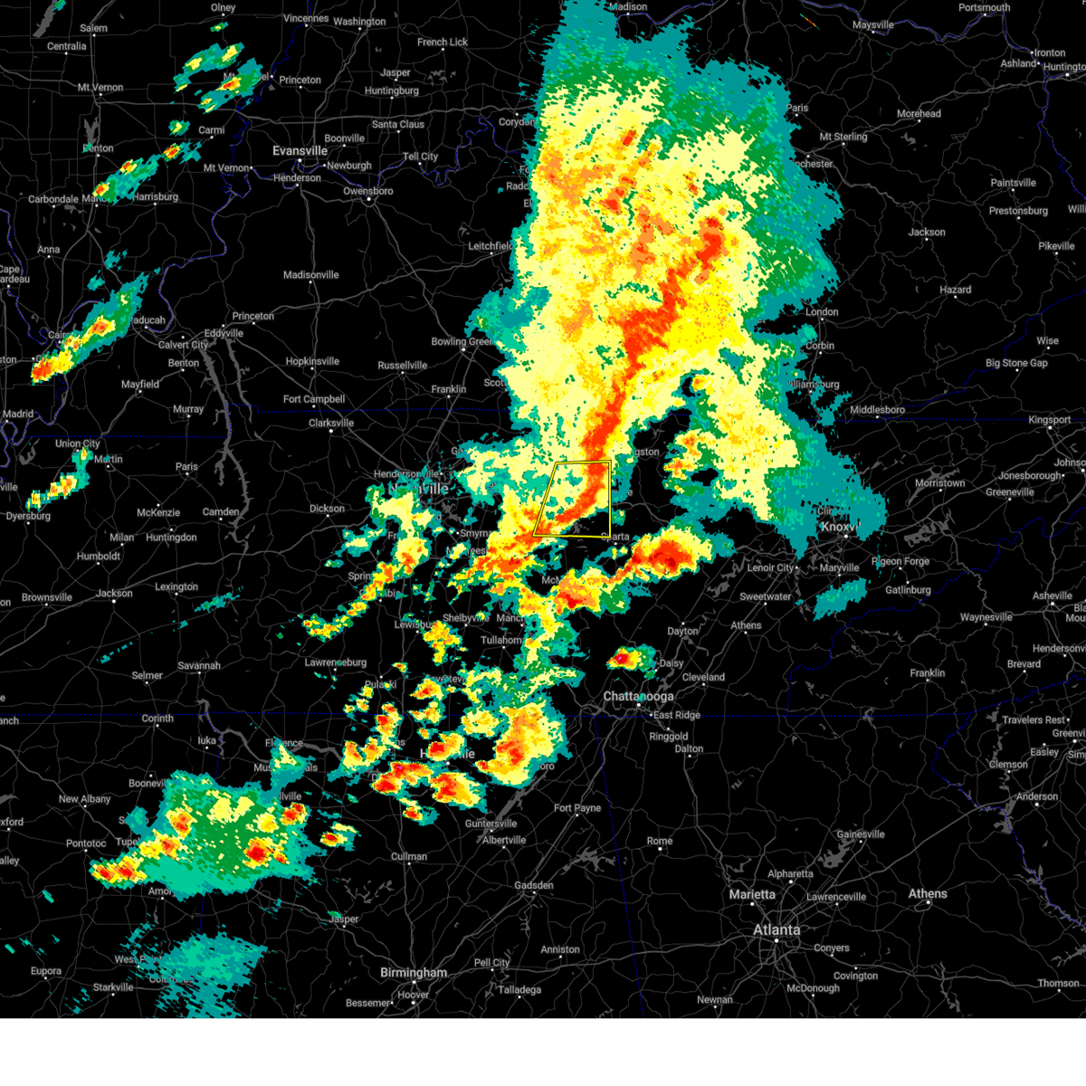
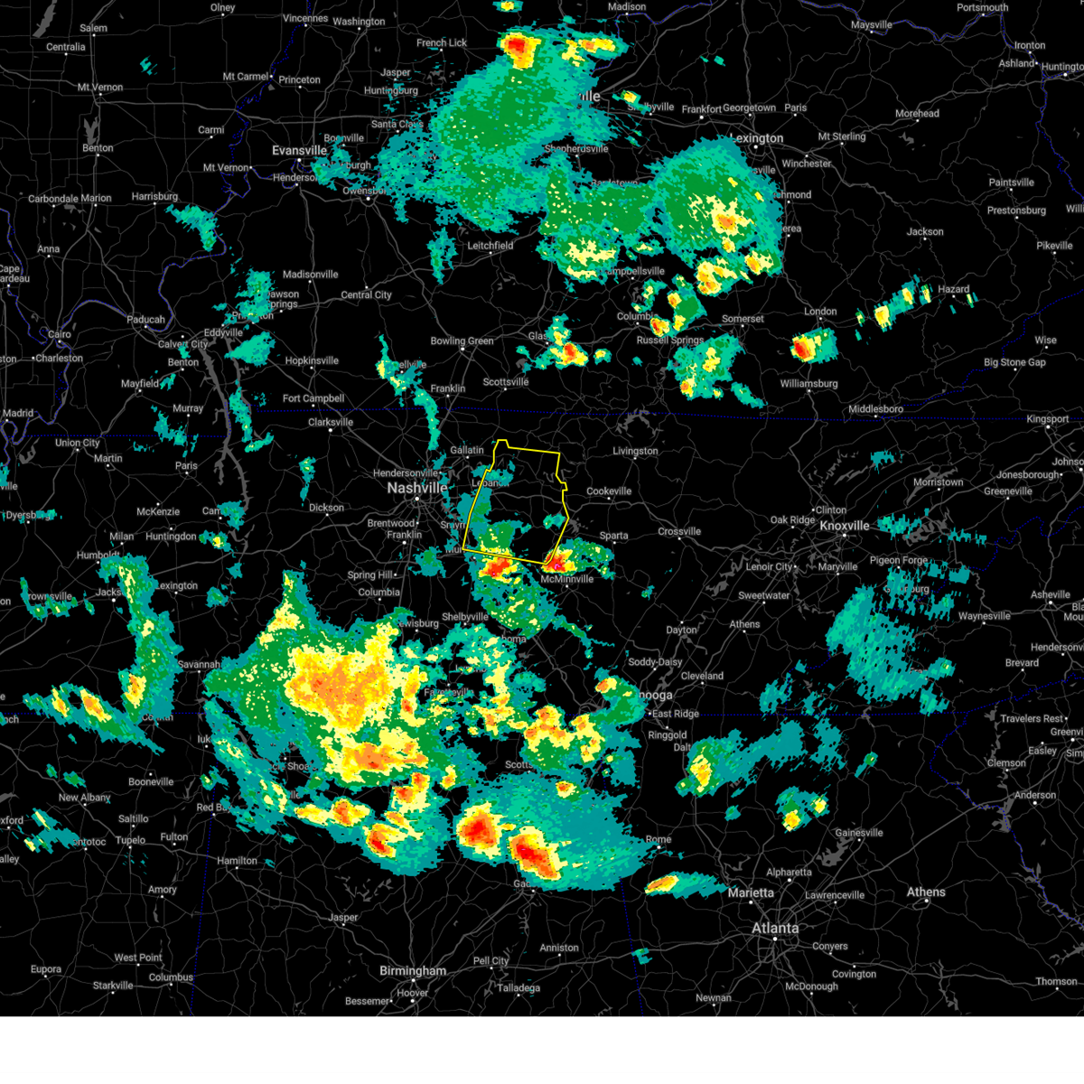
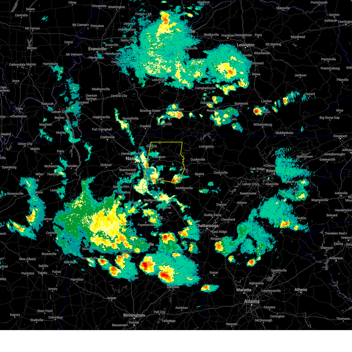
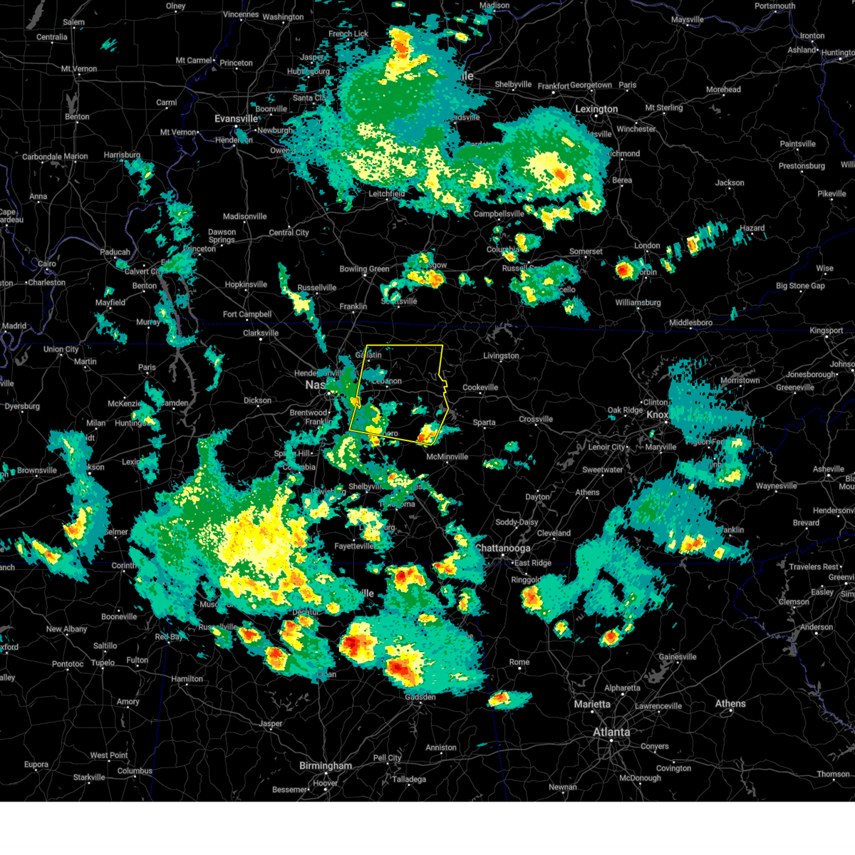
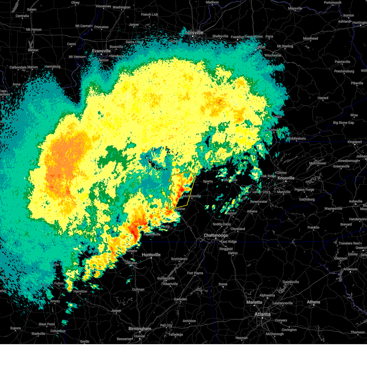
Hail Map for Smithville, TN
The Smithville, TN area has had 4 reports of on-the-ground hail by trained spotters, and has been under severe weather warnings 42 times during the past 12 months. Doppler radar has detected hail at or near Smithville, TN on 65 occasions, including 2 occasions during the past year.
| Name: | Smithville, TN |
| Where Located: | 55.6 miles ESE of Nashville, TN |
| Map: | Google Map for Smithville, TN |
| Population: | 4530 |
| Housing Units: | 2040 |
| More Info: | Search Google for Smithville, TN |
1
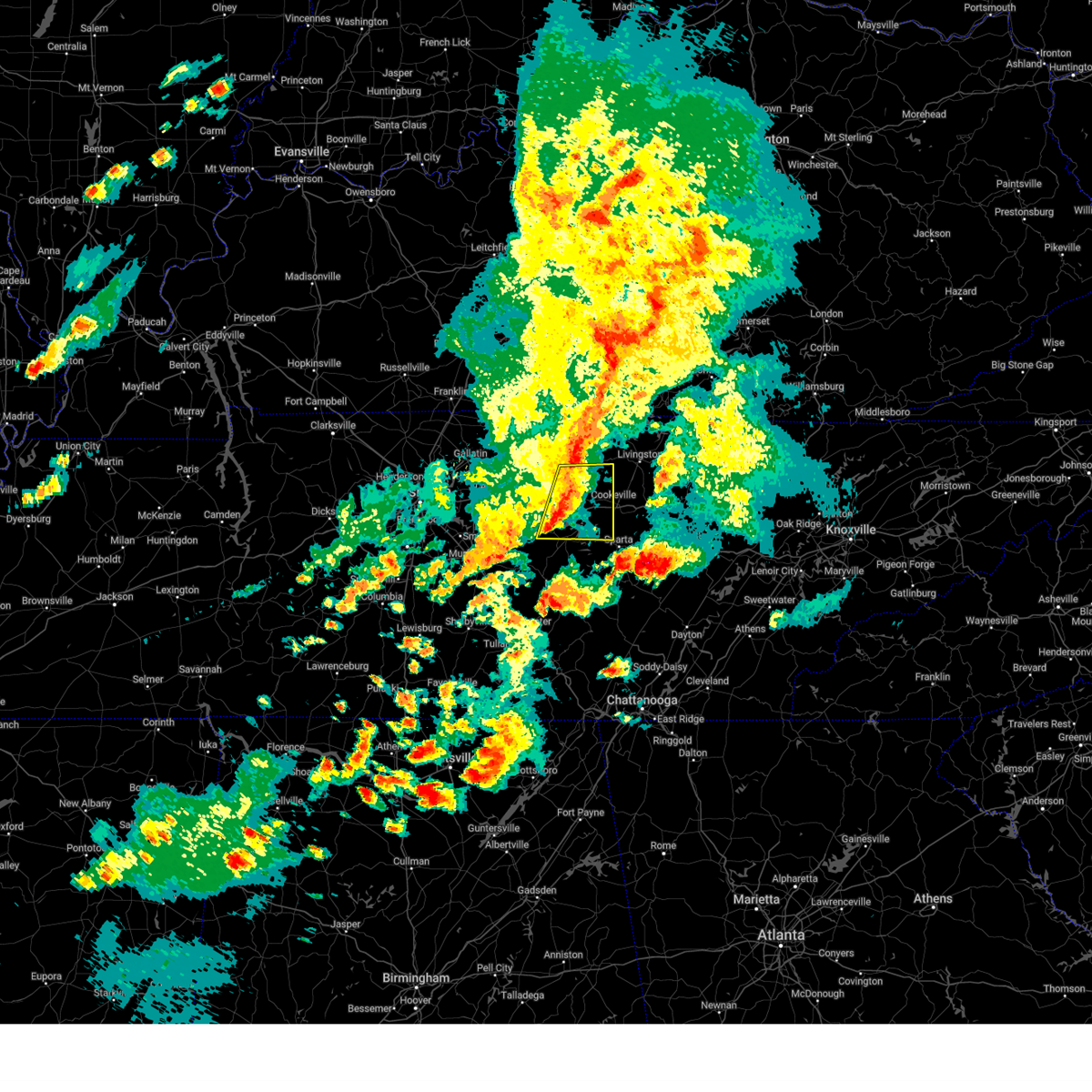
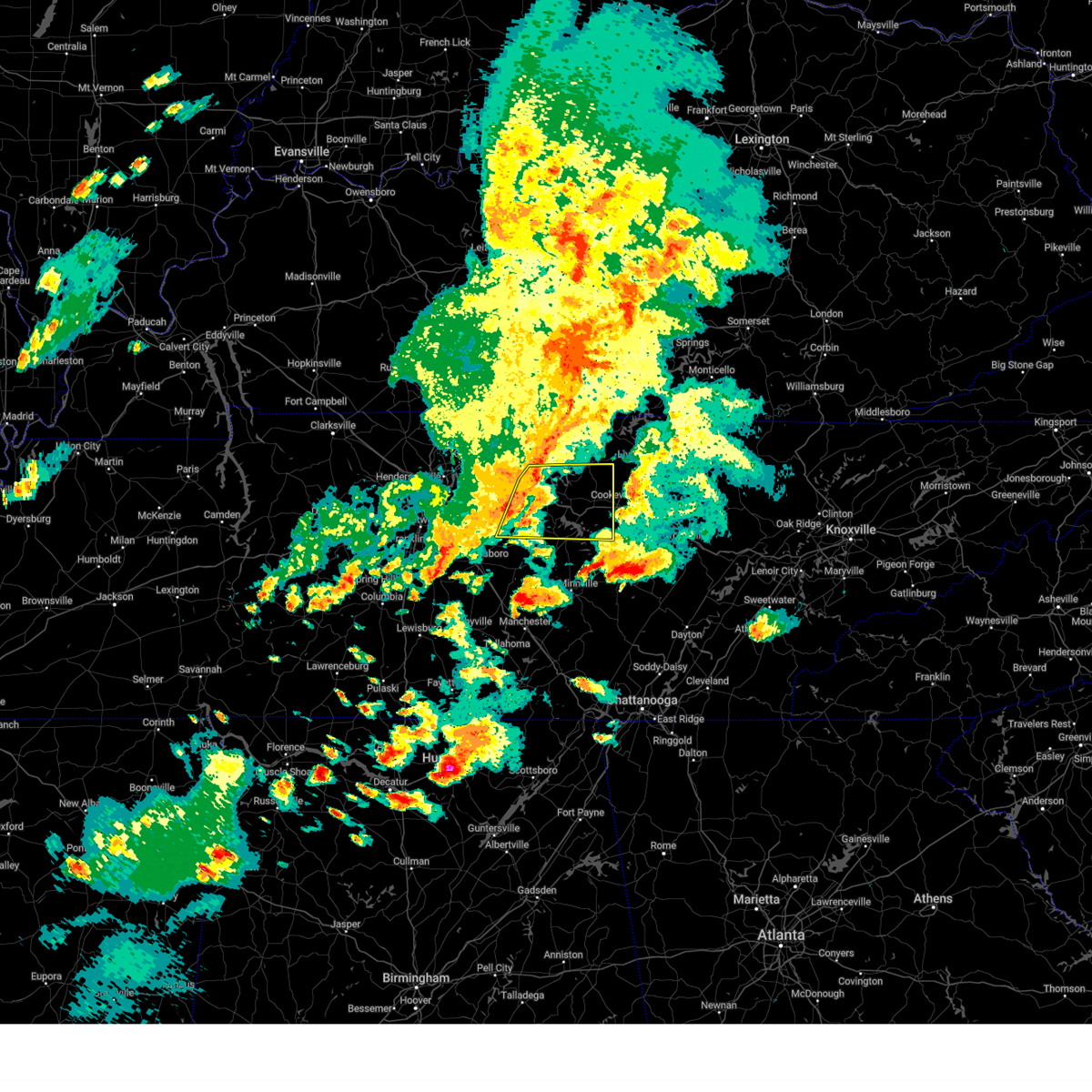
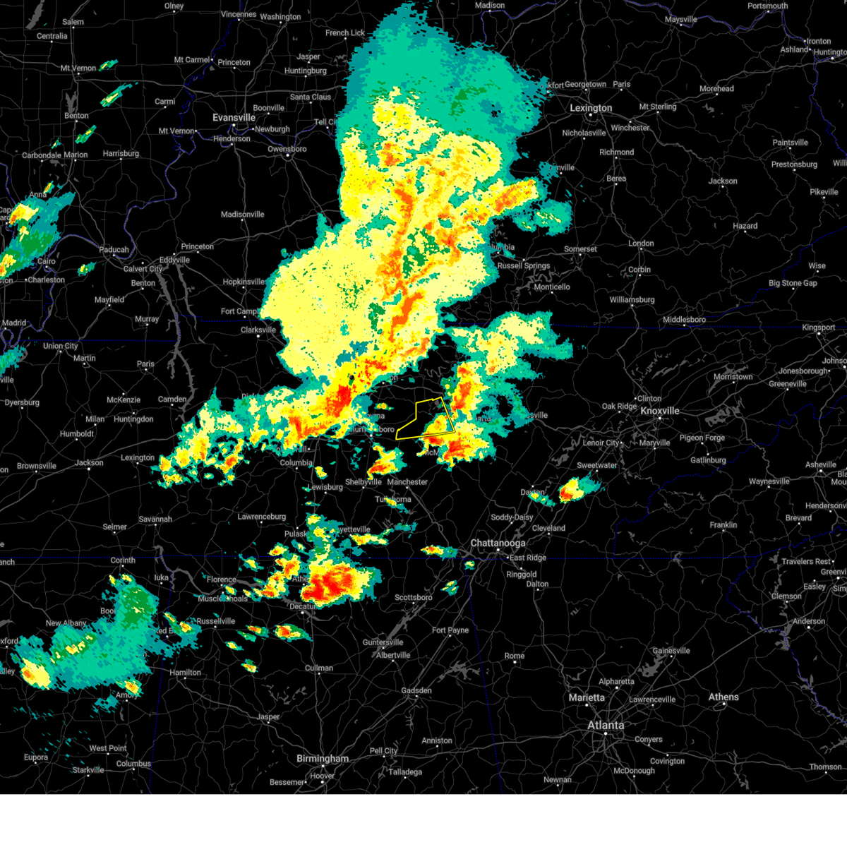
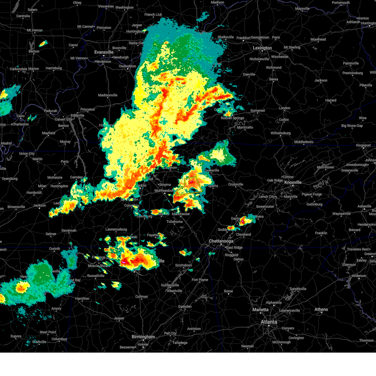
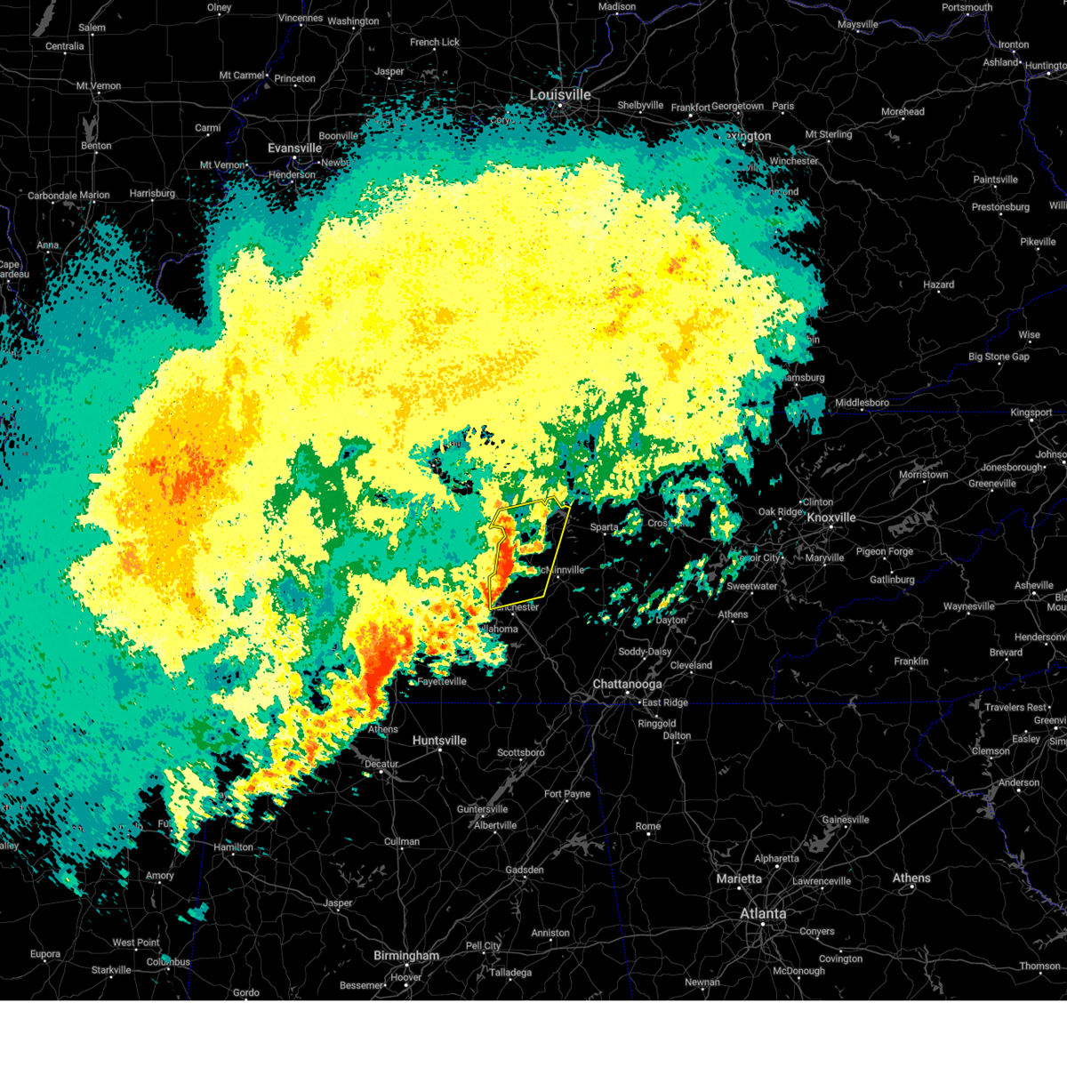
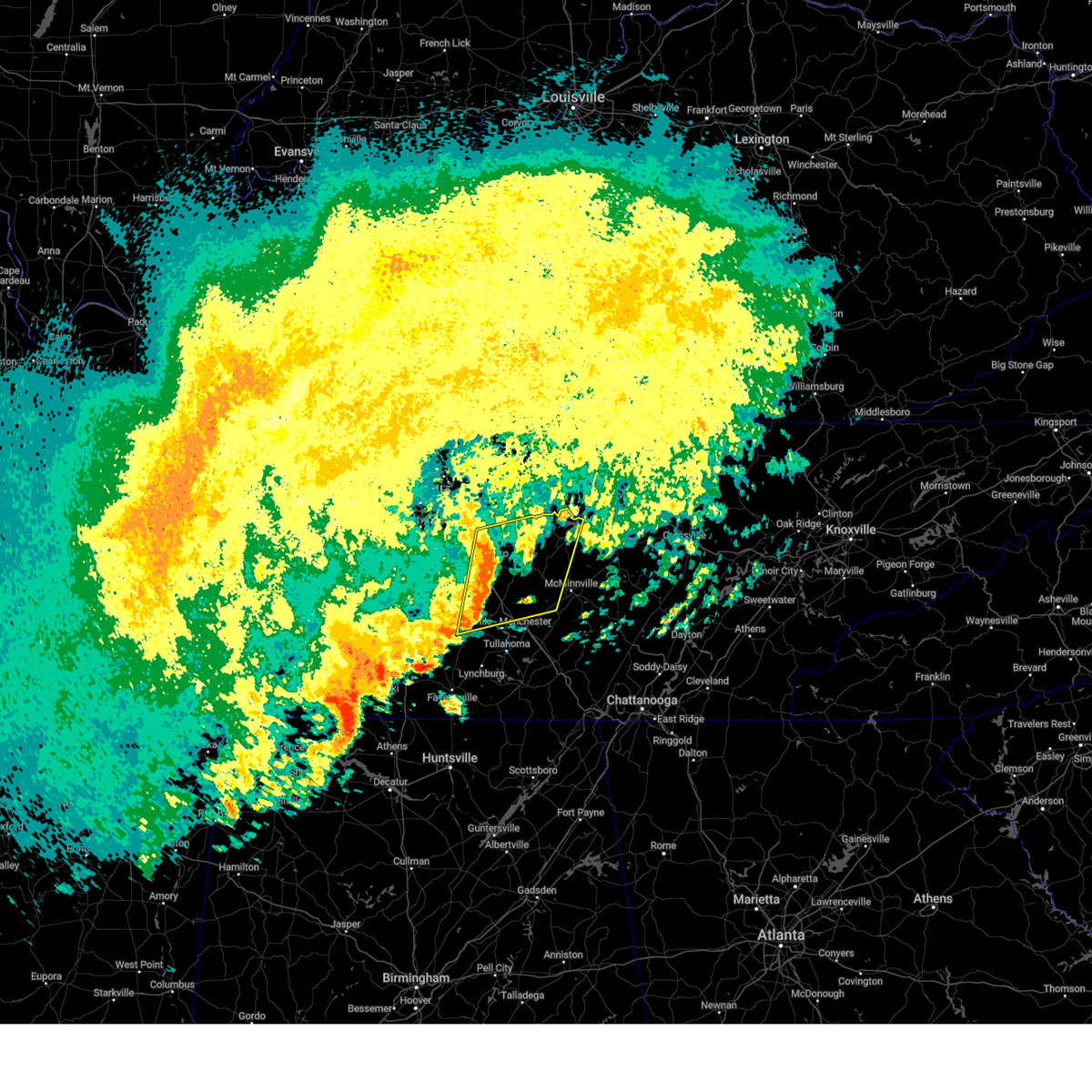
The Top Recent Hail Date for Smithville, TN is Tuesday, May 20, 2025 (25th out of 65)

Hail and Wind Damage Spotted near Smithville, TN
| Date / Time | Report Details |
|---|---|
| 5/20/2025 7:37 PM CDT |
 The storms which prompted the warning have moved out of the area. therefore the warning will be allowed to expire. a tornado watch remains in effect until 1000 pm cdt for middle tennessee. to report severe weather, contact your nearest law enforcement agency. they will relay your report to the national weather service nashville. The storms which prompted the warning have moved out of the area. therefore the warning will be allowed to expire. a tornado watch remains in effect until 1000 pm cdt for middle tennessee. to report severe weather, contact your nearest law enforcement agency. they will relay your report to the national weather service nashville.
|
| 5/20/2025 7:13 PM CDT |
 the severe thunderstorm warning has been cancelled and is no longer in effect the severe thunderstorm warning has been cancelled and is no longer in effect
|
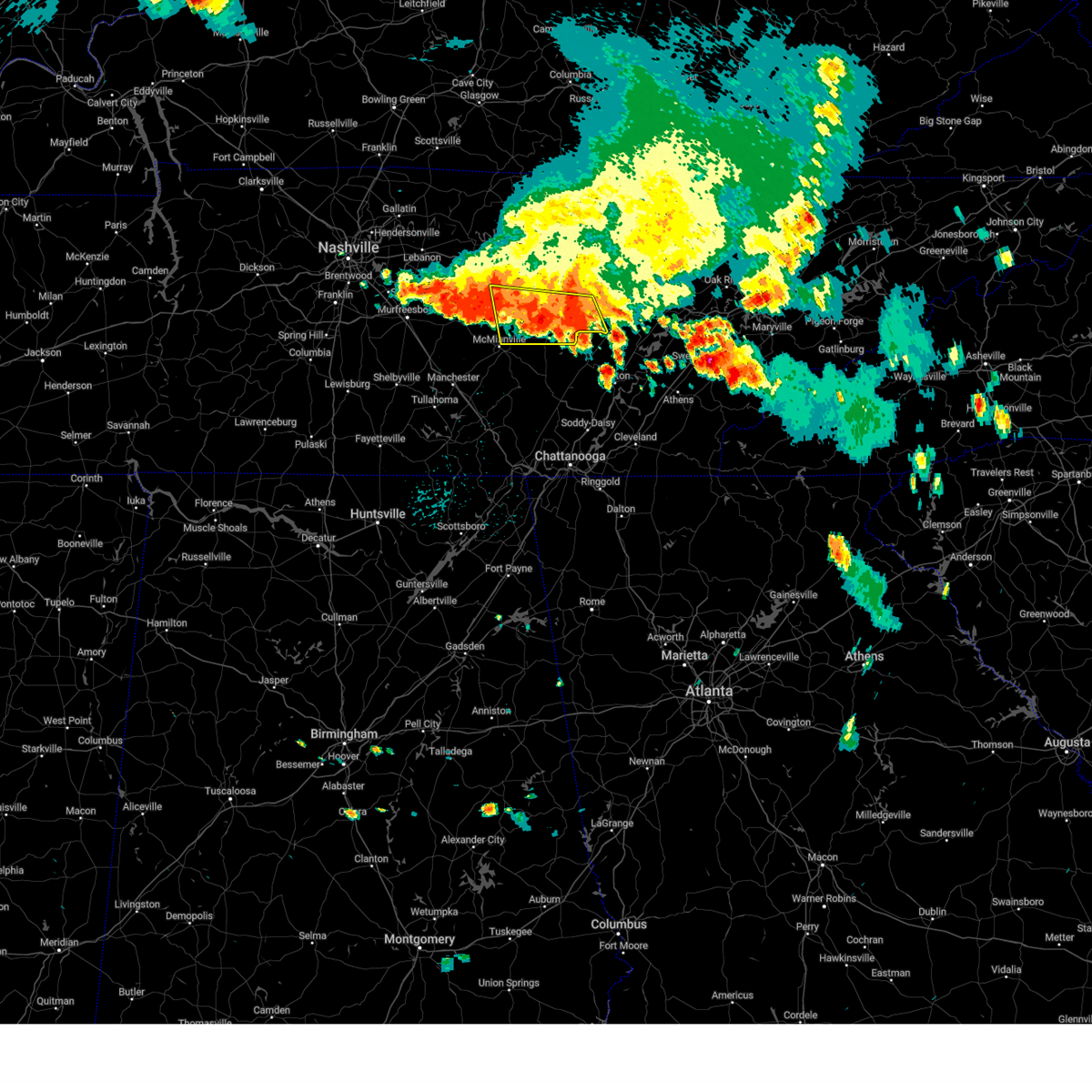
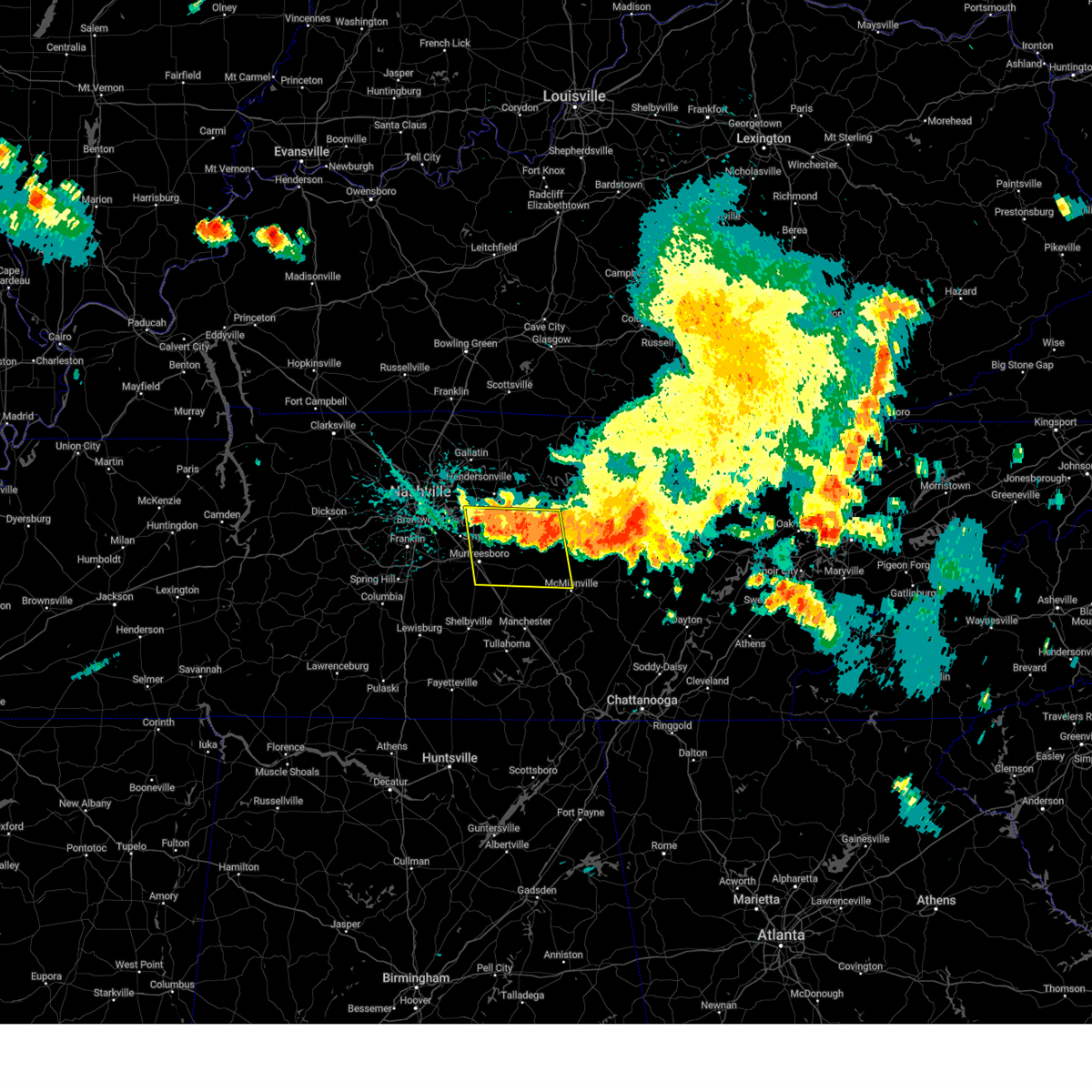
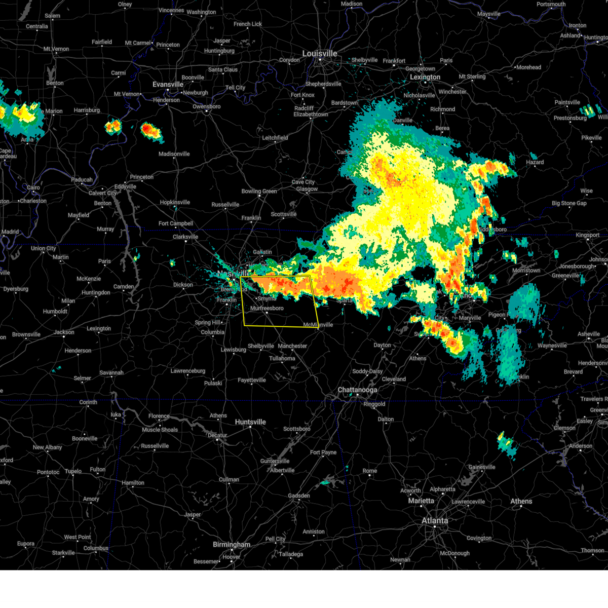
| 5/20/2025 7:13 PM CDT |
 At 713 pm cdt, severe thunderstorms were located along a line extending from near gainesboro to smithville, moving east at 45 mph (radar indicated). Hazards include 65 mph wind gusts and quarter size hail. Hail damage to vehicles is expected. expect wind damage to roofs, siding, and trees. Locations impacted include, hamptons crossroads, bakers crossroads, hickman, gainesboro, baxter, dowelltown, burgess falls state park, liberty, center hill lake, granville, edgar evins state park, cookeville, cummins falls state park, gordonsville, and smithville. At 713 pm cdt, severe thunderstorms were located along a line extending from near gainesboro to smithville, moving east at 45 mph (radar indicated). Hazards include 65 mph wind gusts and quarter size hail. Hail damage to vehicles is expected. expect wind damage to roofs, siding, and trees. Locations impacted include, hamptons crossroads, bakers crossroads, hickman, gainesboro, baxter, dowelltown, burgess falls state park, liberty, center hill lake, granville, edgar evins state park, cookeville, cummins falls state park, gordonsville, and smithville.
|
| 5/20/2025 6:58 PM CDT |
 Svrohx the national weather service in nashville has issued a * severe thunderstorm warning for, smith county in middle tennessee, northern de kalb county in middle tennessee, southern jackson county in middle tennessee, eastern wilson county in middle tennessee, northwestern white county in middle tennessee, western putnam county in middle tennessee, * until 745 pm cdt. * at 658 pm cdt, a severe thunderstorm was located near watertown, or 11 miles southwest of carthage, moving east at 55 mph (radar indicated). Hazards include 60 mph wind gusts and quarter size hail. Hail damage to vehicles is expected. Expect wind damage to roofs, siding, and trees. Svrohx the national weather service in nashville has issued a * severe thunderstorm warning for, smith county in middle tennessee, northern de kalb county in middle tennessee, southern jackson county in middle tennessee, eastern wilson county in middle tennessee, northwestern white county in middle tennessee, western putnam county in middle tennessee, * until 745 pm cdt. * at 658 pm cdt, a severe thunderstorm was located near watertown, or 11 miles southwest of carthage, moving east at 55 mph (radar indicated). Hazards include 60 mph wind gusts and quarter size hail. Hail damage to vehicles is expected. Expect wind damage to roofs, siding, and trees.
|
| 5/20/2025 6:35 PM CDT |
 The storm which prompted the warning has moved out of the area. therefore the warning will be allowed to expire. a tornado watch remains in effect until 1000 pm cdt for middle tennessee. The storm which prompted the warning has moved out of the area. therefore the warning will be allowed to expire. a tornado watch remains in effect until 1000 pm cdt for middle tennessee.
|
| 5/20/2025 6:08 PM CDT |
 At 608 pm cdt, a severe thunderstorm was located near smithville, moving east at 40 mph (radar indicated). Hazards include ping pong ball size hail and 60 mph wind gusts. People and animals outdoors will be injured. expect hail damage to roofs, siding, windows, and vehicles. expect wind damage to roofs, siding, and trees. Locations impacted include, center hill lake, smithville, dowelltown, liberty, edgar evins state park, readyville, and woodbury. At 608 pm cdt, a severe thunderstorm was located near smithville, moving east at 40 mph (radar indicated). Hazards include ping pong ball size hail and 60 mph wind gusts. People and animals outdoors will be injured. expect hail damage to roofs, siding, windows, and vehicles. expect wind damage to roofs, siding, and trees. Locations impacted include, center hill lake, smithville, dowelltown, liberty, edgar evins state park, readyville, and woodbury.
|
| 5/20/2025 6:08 PM CDT |
 the severe thunderstorm warning has been cancelled and is no longer in effect the severe thunderstorm warning has been cancelled and is no longer in effect
|
| 5/20/2025 5:39 PM CDT | Svrohx the national weather service in nashville has issued a * severe thunderstorm warning for, de kalb county in middle tennessee, northeastern rutherford county in middle tennessee, southeastern wilson county in middle tennessee, northern cannon county in middle tennessee, * until 645 pm cdt. * at 539 pm cdt, a severe thunderstorm was located 9 miles southeast of walterhill, or 10 miles east of murfreesboro, moving east at 35 mph (radar indicated). Hazards include golf ball size hail and 60 mph wind gusts. People and animals outdoors will be injured. expect hail damage to roofs, siding, windows, and vehicles. Expect wind damage to roofs, siding, and trees. |
| 5/8/2025 5:22 PM CDT | The storm which prompted the warning has weakened below severe limits, and no longer poses an immediate threat to life or property. therefore, the warning will be allowed to expire. however, small hail, gusty winds and heavy rain are still possible with this thunderstorm. a severe thunderstorm watch remains in effect until 800 pm cdt for middle tennessee. |
| 5/8/2025 5:11 PM CDT |
 At 511 pm cdt, a severe thunderstorm was located 8 miles north of smithville, moving east at 30 mph (radar indicated). Hazards include 60 mph wind gusts and quarter size hail. Hail damage to vehicles is expected. expect wind damage to roofs, siding, and trees. locations impacted include, center hill lake, hickman, gordonsville, baxter, dowelltown, edgar evins state park, smithville, and liberty. This includes interstate 40 between mile markers 258 and 281. At 511 pm cdt, a severe thunderstorm was located 8 miles north of smithville, moving east at 30 mph (radar indicated). Hazards include 60 mph wind gusts and quarter size hail. Hail damage to vehicles is expected. expect wind damage to roofs, siding, and trees. locations impacted include, center hill lake, hickman, gordonsville, baxter, dowelltown, edgar evins state park, smithville, and liberty. This includes interstate 40 between mile markers 258 and 281.
|
| 5/8/2025 5:11 PM CDT |
 the severe thunderstorm warning has been cancelled and is no longer in effect the severe thunderstorm warning has been cancelled and is no longer in effect
|
| 5/8/2025 5:01 PM CDT |
 At 500 pm cdt, a severe thunderstorm was located 7 miles south of gordonsville, or 12 miles northwest of smithville, moving east at 35 mph (radar indicated). Hazards include ping pong ball size hail and 60 mph wind gusts. People and animals outdoors will be injured. expect hail damage to roofs, siding, windows, and vehicles. expect wind damage to roofs, siding, and trees. locations impacted include, center hill lake, hickman, gordonsville, baxter, dowelltown, granville, alexandria, liberty, edgar evins state park, south carthage, carthage, and smithville. This includes interstate 40 between mile markers 250 and 280. At 500 pm cdt, a severe thunderstorm was located 7 miles south of gordonsville, or 12 miles northwest of smithville, moving east at 35 mph (radar indicated). Hazards include ping pong ball size hail and 60 mph wind gusts. People and animals outdoors will be injured. expect hail damage to roofs, siding, windows, and vehicles. expect wind damage to roofs, siding, and trees. locations impacted include, center hill lake, hickman, gordonsville, baxter, dowelltown, granville, alexandria, liberty, edgar evins state park, south carthage, carthage, and smithville. This includes interstate 40 between mile markers 250 and 280.
|
| 5/8/2025 5:01 PM CDT |
 the severe thunderstorm warning has been cancelled and is no longer in effect the severe thunderstorm warning has been cancelled and is no longer in effect
|
| 5/8/2025 4:52 PM CDT | At 452 pm cdt, a severe thunderstorm was located near watertown, or 14 miles northwest of smithville, moving east at 30 mph (radar indicated). Hazards include ping pong ball size hail and 60 mph wind gusts. People and animals outdoors will be injured. expect hail damage to roofs, siding, windows, and vehicles. expect wind damage to roofs, siding, and trees. locations impacted include, tuckers crossroads, hickman, gordonsville, baxter, dowelltown, liberty, carthage, center hill lake, watertown, granville, alexandria, edgar evins state park, south carthage, and smithville. This includes interstate 40 between mile markers 244 and 280. |
| 5/8/2025 4:47 PM CDT | Svrohx the national weather service in nashville has issued a * severe thunderstorm warning for, smith county in middle tennessee, northern de kalb county in middle tennessee, southwestern jackson county in middle tennessee, southeastern wilson county in middle tennessee, southwestern putnam county in middle tennessee, * until 530 pm cdt. * at 447 pm cdt, a severe thunderstorm was located over watertown, or 14 miles southwest of carthage, moving east at 30 mph (radar indicated). Hazards include 60 mph wind gusts and quarter size hail. Hail damage to vehicles is expected. Expect wind damage to roofs, siding, and trees. |
| 4/10/2025 6:45 PM CDT |
 the severe thunderstorm warning has been cancelled and is no longer in effect the severe thunderstorm warning has been cancelled and is no longer in effect
|
| 4/10/2025 6:38 PM CDT | At 638 pm cdt, severe thunderstorms were located along a line extending from 8 miles east of carthage to near smithville, moving east at 40 mph (radar indicated). Hazards include 60 mph wind gusts. Expect damage to roofs, siding, and trees. locations impacted include, sparta, hamptons crossroads, bakers crossroads, smithville, baxter, virgin falls state natural area, burgess falls state park, center hill lake, doyle, monterey, edgar evins state park, cookeville, and algood. This includes interstate 40 between mile markers 267 and 301. |
| 4/10/2025 6:38 PM CDT | the severe thunderstorm warning has been cancelled and is no longer in effect |
| 4/10/2025 6:27 PM CDT |
 Svrohx the national weather service in nashville has issued a * severe thunderstorm warning for, southeastern smith county in middle tennessee, de kalb county in middle tennessee, white county in middle tennessee, putnam county in middle tennessee, northeastern cannon county in middle tennessee, * until 715 pm cdt. * at 627 pm cdt, severe thunderstorms were located along a line extending from carthage to 8 miles northeast of woodbury, moving east at 40 mph (radar indicated). Hazards include 60 mph wind gusts. expect damage to roofs, siding, and trees Svrohx the national weather service in nashville has issued a * severe thunderstorm warning for, southeastern smith county in middle tennessee, de kalb county in middle tennessee, white county in middle tennessee, putnam county in middle tennessee, northeastern cannon county in middle tennessee, * until 715 pm cdt. * at 627 pm cdt, severe thunderstorms were located along a line extending from carthage to 8 miles northeast of woodbury, moving east at 40 mph (radar indicated). Hazards include 60 mph wind gusts. expect damage to roofs, siding, and trees
|
| 4/10/2025 6:15 PM CDT |
 the severe thunderstorm warning has been cancelled and is no longer in effect the severe thunderstorm warning has been cancelled and is no longer in effect
|
| 4/10/2025 6:15 PM CDT |
 At 614 pm cdt, severe thunderstorms were located along a line extending from 6 miles east of hartsville to near woodbury, moving east at 35 mph (radar indicated). Hazards include 60 mph wind gusts. Expect damage to roofs, siding, and trees. locations impacted include, gordonsville, hartsville, pleasant shade, dickerson chapel recreation area, liberty, cedars of lebanon state park, carthage, auburntown, center hill lake, alexandria, edgar evins state park, south carthage, lascassas, tuckers crossroads, hickman, walterhill, dixon springs, dowelltown, lebanon, and watertown. this includes the following highways, interstate 40 between mile markers 234 and 267. Interstate 840 between mile markers 54 and 76. At 614 pm cdt, severe thunderstorms were located along a line extending from 6 miles east of hartsville to near woodbury, moving east at 35 mph (radar indicated). Hazards include 60 mph wind gusts. Expect damage to roofs, siding, and trees. locations impacted include, gordonsville, hartsville, pleasant shade, dickerson chapel recreation area, liberty, cedars of lebanon state park, carthage, auburntown, center hill lake, alexandria, edgar evins state park, south carthage, lascassas, tuckers crossroads, hickman, walterhill, dixon springs, dowelltown, lebanon, and watertown. this includes the following highways, interstate 40 between mile markers 234 and 267. Interstate 840 between mile markers 54 and 76.
|
| 4/10/2025 5:59 PM CDT |
 At 558 pm cdt, severe thunderstorms were located along a line extending from near hartsville to 8 miles southeast of murfreesboro, moving east at 35 mph (radar indicated). Hazards include 60 mph wind gusts. Expect damage to roofs, siding, and trees. locations impacted include, gordonsville, hartsville, pleasant shade, la vergne, gallatin, bledsoe creek state park, dickerson chapel recreation area, liberty, cedars of lebanon state park, carthage, auburntown, center hill lake, mount juliet, alexandria, smyrna, edgar evins state park, south carthage, lascassas, tuckers crossroads, and hickman. this includes the following highways, interstate 40 between mile markers 225 and 267. interstate 24 between mile markers 66 and 73. Interstate 840 between mile markers 54 and 76. At 558 pm cdt, severe thunderstorms were located along a line extending from near hartsville to 8 miles southeast of murfreesboro, moving east at 35 mph (radar indicated). Hazards include 60 mph wind gusts. Expect damage to roofs, siding, and trees. locations impacted include, gordonsville, hartsville, pleasant shade, la vergne, gallatin, bledsoe creek state park, dickerson chapel recreation area, liberty, cedars of lebanon state park, carthage, auburntown, center hill lake, mount juliet, alexandria, smyrna, edgar evins state park, south carthage, lascassas, tuckers crossroads, and hickman. this includes the following highways, interstate 40 between mile markers 225 and 267. interstate 24 between mile markers 66 and 73. Interstate 840 between mile markers 54 and 76.
|
| 4/10/2025 5:59 PM CDT |
 the severe thunderstorm warning has been cancelled and is no longer in effect the severe thunderstorm warning has been cancelled and is no longer in effect
|
| 4/10/2025 5:41 PM CDT | Svrohx the national weather service in nashville has issued a * severe thunderstorm warning for, smith county in middle tennessee, southeastern davidson county in middle tennessee, western de kalb county in middle tennessee, northern rutherford county in middle tennessee, southern sumner county in middle tennessee, northeastern williamson county in middle tennessee, wilson county in middle tennessee, southern macon county in middle tennessee, trousdale county in middle tennessee, northern cannon county in middle tennessee, * until 630 pm cdt. * at 541 pm cdt, severe thunderstorms were located along a line extending from 6 miles northeast of gallatin to near murfreesboro, moving east at 35 mph (radar indicated). Hazards include 60 mph wind gusts. expect damage to roofs, siding, and trees |
| 4/5/2025 11:41 PM CDT |
 the severe thunderstorm warning has been cancelled and is no longer in effect the severe thunderstorm warning has been cancelled and is no longer in effect
|
| 4/5/2025 11:29 PM CDT |
 the severe thunderstorm warning has been cancelled and is no longer in effect the severe thunderstorm warning has been cancelled and is no longer in effect
|
| 4/5/2025 11:29 PM CDT |
 At 1128 pm cdt, severe thunderstorms were located along a line extending from 6 miles southeast of watertown to 11 miles northwest of manchester, moving northeast at 40 mph (radar indicated). Hazards include 60 mph wind gusts and penny size hail. Expect damage to roofs, siding, and trees. locations impacted include, morrison, centertown, smithville, dowelltown, beechgrove, liberty, summitville, auburntown, center hill lake, woodbury, bradyville, alexandria, edgar evins state park, and readyville. This includes interstate 24 between mile markers 97 and 106. At 1128 pm cdt, severe thunderstorms were located along a line extending from 6 miles southeast of watertown to 11 miles northwest of manchester, moving northeast at 40 mph (radar indicated). Hazards include 60 mph wind gusts and penny size hail. Expect damage to roofs, siding, and trees. locations impacted include, morrison, centertown, smithville, dowelltown, beechgrove, liberty, summitville, auburntown, center hill lake, woodbury, bradyville, alexandria, edgar evins state park, and readyville. This includes interstate 24 between mile markers 97 and 106.
|
| 4/5/2025 11:08 PM CDT |
 Svrohx the national weather service in nashville has issued a * severe thunderstorm warning for, de kalb county in middle tennessee, eastern rutherford county in middle tennessee, western warren county in middle tennessee, northern coffee county in middle tennessee, southeastern wilson county in middle tennessee, northeastern bedford county in middle tennessee, cannon county in middle tennessee, * until 1215 am cdt. * at 1108 pm cdt, severe thunderstorms were located along a line extending from near walterhill to near shelbyville, moving northeast at 40 mph (radar indicated). Hazards include 60 mph wind gusts and penny size hail. expect damage to roofs, siding, and trees Svrohx the national weather service in nashville has issued a * severe thunderstorm warning for, de kalb county in middle tennessee, eastern rutherford county in middle tennessee, western warren county in middle tennessee, northern coffee county in middle tennessee, southeastern wilson county in middle tennessee, northeastern bedford county in middle tennessee, cannon county in middle tennessee, * until 1215 am cdt. * at 1108 pm cdt, severe thunderstorms were located along a line extending from near walterhill to near shelbyville, moving northeast at 40 mph (radar indicated). Hazards include 60 mph wind gusts and penny size hail. expect damage to roofs, siding, and trees
|
| 3/31/2025 12:58 AM CDT |
 Svrohx the national weather service in nashville has issued a * severe thunderstorm warning for, southeastern de kalb county in middle tennessee, northwestern van buren county in middle tennessee, northern warren county in middle tennessee, white county in middle tennessee, * until 200 am cdt. * at 1258 am cdt, a severe thunderstorm was located 8 miles east of woodbury, moving east at 40 mph (radar indicated). Hazards include 60 mph wind gusts and quarter size hail. Hail damage to vehicles is expected. Expect wind damage to roofs, siding, and trees. Svrohx the national weather service in nashville has issued a * severe thunderstorm warning for, southeastern de kalb county in middle tennessee, northwestern van buren county in middle tennessee, northern warren county in middle tennessee, white county in middle tennessee, * until 200 am cdt. * at 1258 am cdt, a severe thunderstorm was located 8 miles east of woodbury, moving east at 40 mph (radar indicated). Hazards include 60 mph wind gusts and quarter size hail. Hail damage to vehicles is expected. Expect wind damage to roofs, siding, and trees.
|
| 3/15/2025 4:20 PM CDT | the severe thunderstorm warning has been cancelled and is no longer in effect |
| 3/15/2025 4:20 PM CDT | At 419 pm cdt, severe thunderstorms were located along a line extending from near smithville to 6 miles north of mcminnville to 11 miles east of manchester, moving east at 45 mph (radar indicated). Hazards include 60 mph wind gusts and penny size hail. Expect damage to roofs, siding, and trees. Locations impacted include, viola, mcminnville, morrison, and altamont. |
| 3/15/2025 4:18 PM CDT | Svrohx the national weather service in nashville has issued a * severe thunderstorm warning for, eastern de kalb county in middle tennessee, northern van buren county in middle tennessee, northeastern warren county in middle tennessee, white county in middle tennessee, putnam county in middle tennessee, * until 500 pm cdt. * at 418 pm cdt, severe thunderstorms were located along a line extending from 7 miles southeast of gordonsville to 9 miles southeast of smithville to near mcminnville, moving east at 75 mph (radar indicated). Hazards include 60 mph wind gusts and penny size hail. expect damage to roofs, siding, and trees |
| 3/15/2025 3:55 PM CDT |
 At 355 pm cdt, severe thunderstorms were located along a line extending from 10 miles south of watertown to 7 miles southeast of woodbury to near manchester, moving east at 55 mph (radar indicated). Hazards include 60 mph wind gusts and penny size hail. Expect damage to roofs, siding, and trees. locations impacted include, morrison, centertown, tullahoma, beechgrove, raus, summitville, auburntown, woodbury, mcminnville, hillsboro, pelham, manchester, bradyville, normandy, milton, viola, readyville, liberty, altamont, and monteagle. This includes interstate 24 between mile markers 95 and 133. At 355 pm cdt, severe thunderstorms were located along a line extending from 10 miles south of watertown to 7 miles southeast of woodbury to near manchester, moving east at 55 mph (radar indicated). Hazards include 60 mph wind gusts and penny size hail. Expect damage to roofs, siding, and trees. locations impacted include, morrison, centertown, tullahoma, beechgrove, raus, summitville, auburntown, woodbury, mcminnville, hillsboro, pelham, manchester, bradyville, normandy, milton, viola, readyville, liberty, altamont, and monteagle. This includes interstate 24 between mile markers 95 and 133.
|
| 3/15/2025 3:38 PM CDT | Svrohx the national weather service in nashville has issued a * severe thunderstorm warning for, southern de kalb county in middle tennessee, eastern rutherford county in middle tennessee, warren county in middle tennessee, coffee county in middle tennessee, southeastern wilson county in middle tennessee, eastern bedford county in middle tennessee, western grundy county in middle tennessee, cannon county in middle tennessee, * until 430 pm cdt. * at 338 pm cdt, severe thunderstorms were located along a line extending from murfreesboro to 15 miles northeast of shelbyville to near lynchburg, moving east at 55 mph (radar indicated). Hazards include 60 mph wind gusts and penny size hail. expect damage to roofs, siding, and trees |
| 7/30/2024 4:20 PM CDT | the severe thunderstorm warning has been cancelled and is no longer in effect |
| 7/30/2024 4:20 PM CDT | At 420 pm cdt, severe thunderstorms were located along a line extending from mcminnville to near murfreesboro, moving south at 40 mph (radar indicated). Hazards include 60 mph wind gusts and quarter size hail. Hail damage to vehicles is expected. expect wind damage to roofs, siding, and trees. locations impacted include, murfreesboro, mcminnville, smithville, woodbury, walterhill, dowelltown, liberty, auburntown, centertown, lascassas, cedars of lebanon state park, bradyville, milton, and readyville. This includes interstate 24 between mile markers 80 and 89. |
| 7/30/2024 4:16 PM CDT |
 the severe thunderstorm warning has been cancelled and is no longer in effect the severe thunderstorm warning has been cancelled and is no longer in effect
|
| 7/30/2024 4:16 PM CDT |
 At 415 pm cdt, severe thunderstorms were located along a line extending from pikeville to near mcminnville, moving south at 40 mph (radar indicated). Hazards include 60 mph wind gusts and quarter size hail. Hail damage to vehicles is expected. expect wind damage to roofs, siding, and trees. Locations impacted include, mcminnville, sparta, smithville, spencer, doyle, indian rock lake, virgin falls state natural area, rock island state park, and fall creek falls state park. At 415 pm cdt, severe thunderstorms were located along a line extending from pikeville to near mcminnville, moving south at 40 mph (radar indicated). Hazards include 60 mph wind gusts and quarter size hail. Hail damage to vehicles is expected. expect wind damage to roofs, siding, and trees. Locations impacted include, mcminnville, sparta, smithville, spencer, doyle, indian rock lake, virgin falls state natural area, rock island state park, and fall creek falls state park.
|
| 7/30/2024 4:01 PM CDT |
 the severe thunderstorm warning has been cancelled and is no longer in effect the severe thunderstorm warning has been cancelled and is no longer in effect
|
| 7/30/2024 4:01 PM CDT |
 At 401 pm cdt, severe thunderstorms were located along a line extending from smithville to near smyrna, moving south at 40 mph (radar indicated). Hazards include 60 mph wind gusts and quarter size hail. Hail damage to vehicles is expected. expect wind damage to roofs, siding, and trees. locations impacted include, murfreesboro, mcminnville, smithville, woodbury, watertown, walterhill, alexandria, dowelltown, liberty, auburntown, centertown, lascassas, cedars of lebanon state park, bradyville, milton, gladeville, and readyville. this includes the following highways, interstate 24 between mile markers 78 and 89. Interstate 840 between mile markers 55 and 72. At 401 pm cdt, severe thunderstorms were located along a line extending from smithville to near smyrna, moving south at 40 mph (radar indicated). Hazards include 60 mph wind gusts and quarter size hail. Hail damage to vehicles is expected. expect wind damage to roofs, siding, and trees. locations impacted include, murfreesboro, mcminnville, smithville, woodbury, watertown, walterhill, alexandria, dowelltown, liberty, auburntown, centertown, lascassas, cedars of lebanon state park, bradyville, milton, gladeville, and readyville. this includes the following highways, interstate 24 between mile markers 78 and 89. Interstate 840 between mile markers 55 and 72.
|
| 7/30/2024 3:44 PM CDT | Svrohx the national weather service in nashville has issued a * severe thunderstorm warning for, southwestern cumberland county in middle tennessee, southeastern smith county in middle tennessee, eastern de kalb county in middle tennessee, northern van buren county in middle tennessee, northeastern warren county in middle tennessee, white county in middle tennessee, putnam county in middle tennessee, * until 430 pm cdt. * at 344 pm cdt, severe thunderstorms were located along a line extending from monterey to near smithville, moving southeast at 50 mph (radar indicated). Hazards include 60 mph wind gusts and quarter size hail. Hail damage to vehicles is expected. Expect wind damage to roofs, siding, and trees. |
| 7/30/2024 3:42 PM CDT |
 Svrohx the national weather service in nashville has issued a * severe thunderstorm warning for, southwestern smith county in middle tennessee, southeastern davidson county in middle tennessee, western de kalb county in middle tennessee, rutherford county in middle tennessee, northwestern warren county in middle tennessee, east central williamson county in middle tennessee, wilson county in middle tennessee, cannon county in middle tennessee, * until 430 pm cdt. * at 342 pm cdt, severe thunderstorms were located along a line extending from percy priest lake to alexandria, moving south at 40 mph (radar indicated). Hazards include 60 mph wind gusts and quarter size hail. Hail damage to vehicles is expected. Expect wind damage to roofs, siding, and trees. Svrohx the national weather service in nashville has issued a * severe thunderstorm warning for, southwestern smith county in middle tennessee, southeastern davidson county in middle tennessee, western de kalb county in middle tennessee, rutherford county in middle tennessee, northwestern warren county in middle tennessee, east central williamson county in middle tennessee, wilson county in middle tennessee, cannon county in middle tennessee, * until 430 pm cdt. * at 342 pm cdt, severe thunderstorms were located along a line extending from percy priest lake to alexandria, moving south at 40 mph (radar indicated). Hazards include 60 mph wind gusts and quarter size hail. Hail damage to vehicles is expected. Expect wind damage to roofs, siding, and trees.
|
| 5/22/2024 6:29 PM CDT |
 Svrohx the national weather service in nashville has issued a * severe thunderstorm warning for, southeastern overton county in middle tennessee, cumberland county in middle tennessee, eastern de kalb county in middle tennessee, white county in middle tennessee, southern putnam county in middle tennessee, * until 715 pm cdt. * at 629 pm cdt, a severe thunderstorm was located 7 miles west of sparta, moving east at 55 mph (radar indicated). Hazards include 60 mph wind gusts. expect damage to roofs, siding, and trees Svrohx the national weather service in nashville has issued a * severe thunderstorm warning for, southeastern overton county in middle tennessee, cumberland county in middle tennessee, eastern de kalb county in middle tennessee, white county in middle tennessee, southern putnam county in middle tennessee, * until 715 pm cdt. * at 629 pm cdt, a severe thunderstorm was located 7 miles west of sparta, moving east at 55 mph (radar indicated). Hazards include 60 mph wind gusts. expect damage to roofs, siding, and trees
|
| 5/8/2024 7:24 PM CDT |
 At 724 pm cdt, a severe thunderstorm was located 7 miles south of cookeville, moving east at 30 mph (emergency management). Hazards include 60 mph wind gusts and quarter size hail. Hail damage to vehicles is expected. expect wind damage to roofs, siding, and trees. locations impacted include, cookeville, sparta, smithville, algood, monterey, baxter, doyle, hamptons crossroads, bakers crossroads, and burgess falls state park. This includes interstate 40 between mile markers 270 and 303. At 724 pm cdt, a severe thunderstorm was located 7 miles south of cookeville, moving east at 30 mph (emergency management). Hazards include 60 mph wind gusts and quarter size hail. Hail damage to vehicles is expected. expect wind damage to roofs, siding, and trees. locations impacted include, cookeville, sparta, smithville, algood, monterey, baxter, doyle, hamptons crossroads, bakers crossroads, and burgess falls state park. This includes interstate 40 between mile markers 270 and 303.
|
| 5/8/2024 7:15 PM CDT |
 At 714 pm cdt, a severe thunderstorm was located 9 miles west of sparta, moving southeast at 35 mph (radar indicated). Hazards include 60 mph wind gusts and quarter size hail. Hail damage to vehicles is expected. expect wind damage to roofs, siding, and trees. locations impacted include, sparta, smithville, center hill lake, hamptons crossroads, bakers crossroads, burgess falls state park, rock island state park, and edgar evins state park. This includes interstate 40 between mile markers 267 and 278. At 714 pm cdt, a severe thunderstorm was located 9 miles west of sparta, moving southeast at 35 mph (radar indicated). Hazards include 60 mph wind gusts and quarter size hail. Hail damage to vehicles is expected. expect wind damage to roofs, siding, and trees. locations impacted include, sparta, smithville, center hill lake, hamptons crossroads, bakers crossroads, burgess falls state park, rock island state park, and edgar evins state park. This includes interstate 40 between mile markers 267 and 278.
|
| 5/8/2024 7:15 PM CDT |
 the severe thunderstorm warning has been cancelled and is no longer in effect the severe thunderstorm warning has been cancelled and is no longer in effect
|
| 5/8/2024 7:13 PM CDT |
 Svrohx the national weather service in nashville has issued a * severe thunderstorm warning for, northeastern de kalb county in middle tennessee, white county in middle tennessee, putnam county in middle tennessee, * until 800 pm cdt. * at 713 pm cdt, a severe thunderstorm was located near baxter, or 9 miles southwest of cookeville, moving east at 30 mph (radar indicated). Hazards include 60 mph wind gusts and quarter size hail. Hail damage to vehicles is expected. Expect wind damage to roofs, siding, and trees. Svrohx the national weather service in nashville has issued a * severe thunderstorm warning for, northeastern de kalb county in middle tennessee, white county in middle tennessee, putnam county in middle tennessee, * until 800 pm cdt. * at 713 pm cdt, a severe thunderstorm was located near baxter, or 9 miles southwest of cookeville, moving east at 30 mph (radar indicated). Hazards include 60 mph wind gusts and quarter size hail. Hail damage to vehicles is expected. Expect wind damage to roofs, siding, and trees.
|
| 5/8/2024 6:50 PM CDT |
 Svrohx the national weather service in nashville has issued a * severe thunderstorm warning for, southeastern smith county in middle tennessee, de kalb county in middle tennessee, northeastern warren county in middle tennessee, east central wilson county in middle tennessee, western white county in middle tennessee, southwestern putnam county in middle tennessee, * until 730 pm cdt. * at 649 pm cdt, a severe thunderstorm was located near gordonsville, or 9 miles north of smithville, moving southeast at 35 mph (radar indicated). Hazards include 60 mph wind gusts and quarter size hail. Hail damage to vehicles is expected. Expect wind damage to roofs, siding, and trees. Svrohx the national weather service in nashville has issued a * severe thunderstorm warning for, southeastern smith county in middle tennessee, de kalb county in middle tennessee, northeastern warren county in middle tennessee, east central wilson county in middle tennessee, western white county in middle tennessee, southwestern putnam county in middle tennessee, * until 730 pm cdt. * at 649 pm cdt, a severe thunderstorm was located near gordonsville, or 9 miles north of smithville, moving southeast at 35 mph (radar indicated). Hazards include 60 mph wind gusts and quarter size hail. Hail damage to vehicles is expected. Expect wind damage to roofs, siding, and trees.
|
| 5/6/2024 4:54 PM CDT | Quarter sized hail reported 5 miles W of Smithville, TN |
| 5/6/2024 4:51 PM CDT |
 Svrohx the national weather service in nashville has issued a * severe thunderstorm warning for, west central cumberland county in middle tennessee, eastern de kalb county in middle tennessee, northern van buren county in middle tennessee, northeastern warren county in middle tennessee, white county in middle tennessee, southern putnam county in middle tennessee, * until 530 pm cdt. * at 451 pm cdt, a severe thunderstorm was located 7 miles west of sparta, moving east at 35 mph (radar indicated). Hazards include 60 mph wind gusts and quarter size hail. Hail damage to vehicles is expected. Expect wind damage to roofs, siding, and trees. Svrohx the national weather service in nashville has issued a * severe thunderstorm warning for, west central cumberland county in middle tennessee, eastern de kalb county in middle tennessee, northern van buren county in middle tennessee, northeastern warren county in middle tennessee, white county in middle tennessee, southern putnam county in middle tennessee, * until 530 pm cdt. * at 451 pm cdt, a severe thunderstorm was located 7 miles west of sparta, moving east at 35 mph (radar indicated). Hazards include 60 mph wind gusts and quarter size hail. Hail damage to vehicles is expected. Expect wind damage to roofs, siding, and trees.
|
| 5/6/2024 4:41 PM CDT |
 the severe thunderstorm warning has been cancelled and is no longer in effect the severe thunderstorm warning has been cancelled and is no longer in effect
|
| 5/6/2024 4:41 PM CDT |
 At 440 pm cdt, a severe thunderstorm was located 8 miles east of smithville, moving east at 30 mph (radar indicated). Hazards include 60 mph wind gusts and quarter size hail. Hail damage to vehicles is expected. expect wind damage to roofs, siding, and trees. locations impacted include, cookeville, smithville, baxter, dowelltown, center hill lake, hamptons crossroads, bakers crossroads, burgess falls state park, and edgar evins state park. This includes interstate 40 between mile markers 268 and 287. At 440 pm cdt, a severe thunderstorm was located 8 miles east of smithville, moving east at 30 mph (radar indicated). Hazards include 60 mph wind gusts and quarter size hail. Hail damage to vehicles is expected. expect wind damage to roofs, siding, and trees. locations impacted include, cookeville, smithville, baxter, dowelltown, center hill lake, hamptons crossroads, bakers crossroads, burgess falls state park, and edgar evins state park. This includes interstate 40 between mile markers 268 and 287.
|
| 5/6/2024 4:30 PM CDT |
 At 430 pm cdt, a confirmed tornado was located over smithville, moving east at 25 mph (radar confirmed tornado). Hazards include damaging tornado. Flying debris will be dangerous to those caught without shelter. mobile homes will be damaged or destroyed. damage to roofs, windows, and vehicles will occur. tree damage is likely. this tornado will be near, smithville around 435 pm cdt. Other locations impacted by this tornadic thunderstorm include bakers crossroads. At 430 pm cdt, a confirmed tornado was located over smithville, moving east at 25 mph (radar confirmed tornado). Hazards include damaging tornado. Flying debris will be dangerous to those caught without shelter. mobile homes will be damaged or destroyed. damage to roofs, windows, and vehicles will occur. tree damage is likely. this tornado will be near, smithville around 435 pm cdt. Other locations impacted by this tornadic thunderstorm include bakers crossroads.
|
| 5/6/2024 4:24 PM CDT |
 Torohx the national weather service in nashville has issued a * tornado warning for, east central de kalb county in middle tennessee, northwestern white county in middle tennessee, * until 500 pm cdt. * at 424 pm cdt, a severe thunderstorm capable of producing a tornado was located over smithville, moving east at 25 mph (radar indicated rotation). Hazards include tornado. Flying debris will be dangerous to those caught without shelter. mobile homes will be damaged or destroyed. damage to roofs, windows, and vehicles will occur. tree damage is likely. this dangerous storm will be near, smithville around 430 pm cdt. Other locations impacted by this tornadic thunderstorm include bakers crossroads. Torohx the national weather service in nashville has issued a * tornado warning for, east central de kalb county in middle tennessee, northwestern white county in middle tennessee, * until 500 pm cdt. * at 424 pm cdt, a severe thunderstorm capable of producing a tornado was located over smithville, moving east at 25 mph (radar indicated rotation). Hazards include tornado. Flying debris will be dangerous to those caught without shelter. mobile homes will be damaged or destroyed. damage to roofs, windows, and vehicles will occur. tree damage is likely. this dangerous storm will be near, smithville around 430 pm cdt. Other locations impacted by this tornadic thunderstorm include bakers crossroads.
|
| 5/6/2024 4:11 PM CDT |
 Svrohx the national weather service in nashville has issued a * severe thunderstorm warning for, southeastern smith county in middle tennessee, northern de kalb county in middle tennessee, northwestern white county in middle tennessee, southwestern putnam county in middle tennessee, * until 500 pm cdt. * at 411 pm cdt, a severe thunderstorm was located 8 miles south of gordonsville, or 8 miles northwest of smithville, moving east at 30 mph (radar indicated). Hazards include 60 mph wind gusts and nickel size hail. expect damage to roofs, siding, and trees Svrohx the national weather service in nashville has issued a * severe thunderstorm warning for, southeastern smith county in middle tennessee, northern de kalb county in middle tennessee, northwestern white county in middle tennessee, southwestern putnam county in middle tennessee, * until 500 pm cdt. * at 411 pm cdt, a severe thunderstorm was located 8 miles south of gordonsville, or 8 miles northwest of smithville, moving east at 30 mph (radar indicated). Hazards include 60 mph wind gusts and nickel size hail. expect damage to roofs, siding, and trees
|
| 8/13/2023 5:07 PM CDT |
 The severe thunderstorm warning for southern de kalb and warren counties will expire at 515 pm cdt, the storm which prompted the warning has weakened below severe limits, and no longer poses an immediate threat to life or property. therefore, the warning will be allowed to expire. however gusty winds and heavy rain are still possible with this thunderstorm. a severe thunderstorm watch remains in effect until 800 pm cdt for middle tennessee. The severe thunderstorm warning for southern de kalb and warren counties will expire at 515 pm cdt, the storm which prompted the warning has weakened below severe limits, and no longer poses an immediate threat to life or property. therefore, the warning will be allowed to expire. however gusty winds and heavy rain are still possible with this thunderstorm. a severe thunderstorm watch remains in effect until 800 pm cdt for middle tennessee.
|
| 8/13/2023 4:53 PM CDT |
 At 452 pm cdt, a severe thunderstorm was located 8 miles south of smithville, moving east at 35 mph (radar indicated). Hazards include 60 mph wind gusts and penny size hail. Expect damage to roofs, siding, and trees. locations impacted include, mcminnville, smithville, centertown and rock island state park. hail threat, radar indicated max hail size, 0. 75 in wind threat, radar indicated max wind gust, 60 mph. At 452 pm cdt, a severe thunderstorm was located 8 miles south of smithville, moving east at 35 mph (radar indicated). Hazards include 60 mph wind gusts and penny size hail. Expect damage to roofs, siding, and trees. locations impacted include, mcminnville, smithville, centertown and rock island state park. hail threat, radar indicated max hail size, 0. 75 in wind threat, radar indicated max wind gust, 60 mph.
|
| 8/13/2023 4:45 PM CDT | Trained spotter reports large branches and a few weak trees were blown down in southwest sections of the count in de kalb county TN, 5.8 miles NE of Smithville, TN |
| 8/13/2023 4:34 PM CDT |
 At 434 pm cdt, a severe thunderstorm was located near woodbury, moving east at 40 mph (radar indicated). Hazards include 60 mph wind gusts and penny size hail. expect damage to roofs, siding, and trees At 434 pm cdt, a severe thunderstorm was located near woodbury, moving east at 40 mph (radar indicated). Hazards include 60 mph wind gusts and penny size hail. expect damage to roofs, siding, and trees
|
| 8/12/2023 12:58 PM CDT |
 At 1257 pm cdt, severe thunderstorms were located along a line extending from carthage to baxter to near mcminnville, moving east at 50 mph (radar indicated). Hazards include 70 mph wind gusts. Expect considerable tree damage. Damage is likely to mobile homes, roofs, and outbuildings. At 1257 pm cdt, severe thunderstorms were located along a line extending from carthage to baxter to near mcminnville, moving east at 50 mph (radar indicated). Hazards include 70 mph wind gusts. Expect considerable tree damage. Damage is likely to mobile homes, roofs, and outbuildings.
|
| 8/12/2023 12:49 PM CDT |
 At 1248 pm cdt, severe thunderstorms were located along a line extending from baxter to near centertown, moving east at 50 mph (radar indicated). Hazards include 70 mph wind gusts. Expect considerable tree damage. damage is likely to mobile homes, roofs, and outbuildings. locations impacted include, mcminnville, smithville, woodbury, carthage, baxter, gordonsville, hickman, south carthage, alexandria, dowelltown, liberty, centertown, center hill lake, granville and edgar evans state park. This includes interstate 40 between mile markers 253 and 278. At 1248 pm cdt, severe thunderstorms were located along a line extending from baxter to near centertown, moving east at 50 mph (radar indicated). Hazards include 70 mph wind gusts. Expect considerable tree damage. damage is likely to mobile homes, roofs, and outbuildings. locations impacted include, mcminnville, smithville, woodbury, carthage, baxter, gordonsville, hickman, south carthage, alexandria, dowelltown, liberty, centertown, center hill lake, granville and edgar evans state park. This includes interstate 40 between mile markers 253 and 278.
|
| 8/12/2023 12:26 PM CDT |
 At 1226 pm cdt, severe thunderstorms were located along a line extending from hartsville to woodbury to murfreesboro, moving east at 50 mph (radar indicated). Hazards include 70 mph wind gusts. Expect considerable tree damage. Damage is likely to mobile homes, roofs, and outbuildings. At 1226 pm cdt, severe thunderstorms were located along a line extending from hartsville to woodbury to murfreesboro, moving east at 50 mph (radar indicated). Hazards include 70 mph wind gusts. Expect considerable tree damage. Damage is likely to mobile homes, roofs, and outbuildings.
|
| 8/7/2023 12:04 PM CDT |
 At 1204 pm cdt, a severe thunderstorm was located 8 miles north of mcminnville, moving east at 55 mph (radar indicated). Hazards include 70 mph wind gusts and penny size hail. Expect considerable tree damage. damage is likely to mobile homes, roofs, and outbuildings. locations impacted include, sparta, smithville, spencer, doyle, centertown, virgin falls state natural area, rock island state park and fall creek falls state park. thunderstorm damage threat, considerable hail threat, radar indicated max hail size, 0. 75 in wind threat, radar indicated max wind gust, 70 mph. At 1204 pm cdt, a severe thunderstorm was located 8 miles north of mcminnville, moving east at 55 mph (radar indicated). Hazards include 70 mph wind gusts and penny size hail. Expect considerable tree damage. damage is likely to mobile homes, roofs, and outbuildings. locations impacted include, sparta, smithville, spencer, doyle, centertown, virgin falls state natural area, rock island state park and fall creek falls state park. thunderstorm damage threat, considerable hail threat, radar indicated max hail size, 0. 75 in wind threat, radar indicated max wind gust, 70 mph.
|
| 8/7/2023 11:54 AM CDT |
 At 1154 am cdt, a severe thunderstorm was located near woodbury, moving east at 55 mph (radar indicated). Hazards include 70 mph wind gusts and penny size hail. Expect considerable tree damage. Damage is likely to mobile homes, roofs, and outbuildings. At 1154 am cdt, a severe thunderstorm was located near woodbury, moving east at 55 mph (radar indicated). Hazards include 70 mph wind gusts and penny size hail. Expect considerable tree damage. Damage is likely to mobile homes, roofs, and outbuildings.
|
| 7/29/2023 5:21 PM CDT |
 At 521 pm cdt, a severe thunderstorm was located 8 miles southwest of watertown, or 14 miles northeast of murfreesboro, moving southeast at 20 mph (radar indicated). Hazards include 60 mph wind gusts. expect damage to roofs, siding, and trees At 521 pm cdt, a severe thunderstorm was located 8 miles southwest of watertown, or 14 miles northeast of murfreesboro, moving southeast at 20 mph (radar indicated). Hazards include 60 mph wind gusts. expect damage to roofs, siding, and trees
|
| 7/20/2023 2:03 PM CDT |
 At 202 pm cdt, severe thunderstorms were located along a line extending from 8 miles southeast of smithville to 9 miles south of woodbury, moving southeast at 45 mph (radar indicated). Hazards include 70 mph wind gusts and nickel size hail. Expect considerable tree damage. damage is likely to mobile homes, roofs, and outbuildings. locations impacted include, mcminnville, sparta, smithville, woodbury, morrison, doyle, centertown, viola, bakers crossroads, bradyville, rock island state park and summitville. thunderstorm damage threat, considerable hail threat, radar indicated max hail size, 0. 88 in wind threat, radar indicated max wind gust, 70 mph. At 202 pm cdt, severe thunderstorms were located along a line extending from 8 miles southeast of smithville to 9 miles south of woodbury, moving southeast at 45 mph (radar indicated). Hazards include 70 mph wind gusts and nickel size hail. Expect considerable tree damage. damage is likely to mobile homes, roofs, and outbuildings. locations impacted include, mcminnville, sparta, smithville, woodbury, morrison, doyle, centertown, viola, bakers crossroads, bradyville, rock island state park and summitville. thunderstorm damage threat, considerable hail threat, radar indicated max hail size, 0. 88 in wind threat, radar indicated max wind gust, 70 mph.
|
| 7/20/2023 1:50 PM CDT |
 At 149 pm cdt, severe thunderstorms were located along a line extending from 8 miles southeast of gordonsville to near woodbury, moving southeast at 50 mph (radar indicated). Hazards include 70 mph wind gusts and nickel size hail. Expect considerable tree damage. damage is likely to mobile homes, roofs, and outbuildings. locations impacted include, mcminnville, sparta, smithville, woodbury, alexandria, morrison, doyle, dowelltown, liberty, auburntown, centertown, viola, bakers crossroads, burgess falls state park, rock island state park, summitville, center hill lake, bradyville and edgar evans state park. this includes interstate 40 between mile markers 267 and 276. thunderstorm damage threat, considerable hail threat, radar indicated max hail size, 0. 88 in wind threat, radar indicated max wind gust, 70 mph. At 149 pm cdt, severe thunderstorms were located along a line extending from 8 miles southeast of gordonsville to near woodbury, moving southeast at 50 mph (radar indicated). Hazards include 70 mph wind gusts and nickel size hail. Expect considerable tree damage. damage is likely to mobile homes, roofs, and outbuildings. locations impacted include, mcminnville, sparta, smithville, woodbury, alexandria, morrison, doyle, dowelltown, liberty, auburntown, centertown, viola, bakers crossroads, burgess falls state park, rock island state park, summitville, center hill lake, bradyville and edgar evans state park. this includes interstate 40 between mile markers 267 and 276. thunderstorm damage threat, considerable hail threat, radar indicated max hail size, 0. 88 in wind threat, radar indicated max wind gust, 70 mph.
|
| 7/20/2023 1:35 PM CDT |
 At 134 pm cdt, severe thunderstorms were located along a line extending from near gordonsville to near murfreesboro, moving southeast at 50 mph (radar indicated). Hazards include 70 mph wind gusts and nickel size hail. Expect considerable tree damage. Damage is likely to mobile homes, roofs, and outbuildings. At 134 pm cdt, severe thunderstorms were located along a line extending from near gordonsville to near murfreesboro, moving southeast at 50 mph (radar indicated). Hazards include 70 mph wind gusts and nickel size hail. Expect considerable tree damage. Damage is likely to mobile homes, roofs, and outbuildings.
|
| 7/18/2023 5:38 PM CDT |
 The severe thunderstorm warning for de kalb, central coffee, van buren, warren, northwestern grundy, white, putnam and cannon counties will expire at 545 pm cdt, the storms which prompted the warning have weakened below severe limits, and no longer pose an immediate threat to life or property. therefore, the warning will be allowed to expire. however gusty winds and heavy rain are still possible with these thunderstorms. a severe thunderstorm watch remains in effect until 800 pm cdt for middle tennessee. The severe thunderstorm warning for de kalb, central coffee, van buren, warren, northwestern grundy, white, putnam and cannon counties will expire at 545 pm cdt, the storms which prompted the warning have weakened below severe limits, and no longer pose an immediate threat to life or property. therefore, the warning will be allowed to expire. however gusty winds and heavy rain are still possible with these thunderstorms. a severe thunderstorm watch remains in effect until 800 pm cdt for middle tennessee.
|
| 7/18/2023 5:27 PM CDT |
 At 526 pm cdt, severe thunderstorms were located along a line extending from 6 miles southwest of baxter to near smithville to 12 miles north of manchester, moving east at 50 mph (radar indicated). Hazards include 60 mph wind gusts and penny size hail. Expect damage to roofs, siding, and trees. locations impacted include, cookeville, mcminnville, manchester, sparta, smithville, woodbury, spencer, algood, monterey, gruetli-laager, baxter, altamont, alexandria, coalmont, morrison, doyle, beersheba springs, dowelltown, liberty and auburntown. this includes the following highways, interstate 40 between mile markers 268 and 305. interstate 24 between mile markers 97 and 113. hail threat, radar indicated max hail size, 0. 75 in wind threat, radar indicated max wind gust, 60 mph. At 526 pm cdt, severe thunderstorms were located along a line extending from 6 miles southwest of baxter to near smithville to 12 miles north of manchester, moving east at 50 mph (radar indicated). Hazards include 60 mph wind gusts and penny size hail. Expect damage to roofs, siding, and trees. locations impacted include, cookeville, mcminnville, manchester, sparta, smithville, woodbury, spencer, algood, monterey, gruetli-laager, baxter, altamont, alexandria, coalmont, morrison, doyle, beersheba springs, dowelltown, liberty and auburntown. this includes the following highways, interstate 40 between mile markers 268 and 305. interstate 24 between mile markers 97 and 113. hail threat, radar indicated max hail size, 0. 75 in wind threat, radar indicated max wind gust, 60 mph.
|
| 7/18/2023 5:15 PM CDT |
 At 515 pm cdt, severe thunderstorms were located along a line extending from near gordonsville to 7 miles north of woodbury to 12 miles southeast of murfreesboro, moving southeast at 40 mph (radar indicated). Hazards include 60 mph wind gusts and penny size hail. Expect damage to roofs, siding, and trees. locations impacted include, murfreesboro, cookeville, mcminnville, manchester, sparta, smithville, woodbury, spencer, algood, monterey, gruetli-laager, watertown, baxter, gordonsville, hickman, south carthage, altamont, alexandria, coalmont and morrison. this includes the following highways, interstate 40 between mile markers 247 and 305. interstate 24 between mile markers 81 and 113. hail threat, radar indicated max hail size, 0. 75 in wind threat, radar indicated max wind gust, 60 mph. At 515 pm cdt, severe thunderstorms were located along a line extending from near gordonsville to 7 miles north of woodbury to 12 miles southeast of murfreesboro, moving southeast at 40 mph (radar indicated). Hazards include 60 mph wind gusts and penny size hail. Expect damage to roofs, siding, and trees. locations impacted include, murfreesboro, cookeville, mcminnville, manchester, sparta, smithville, woodbury, spencer, algood, monterey, gruetli-laager, watertown, baxter, gordonsville, hickman, south carthage, altamont, alexandria, coalmont and morrison. this includes the following highways, interstate 40 between mile markers 247 and 305. interstate 24 between mile markers 81 and 113. hail threat, radar indicated max hail size, 0. 75 in wind threat, radar indicated max wind gust, 60 mph.
|
| 7/18/2023 5:00 PM CDT |
 At 459 pm cdt, severe thunderstorms were located along a line extending from near gordonsville to 7 miles east of watertown to 10 miles south of murfreesboro, moving east at 50 mph (radar indicated). Hazards include 60 mph wind gusts and penny size hail. expect damage to roofs, siding, and trees At 459 pm cdt, severe thunderstorms were located along a line extending from near gordonsville to 7 miles east of watertown to 10 miles south of murfreesboro, moving east at 50 mph (radar indicated). Hazards include 60 mph wind gusts and penny size hail. expect damage to roofs, siding, and trees
|
| 7/1/2023 2:42 PM CDT |
 At 241 pm cdt, severe thunderstorms were located along a line extending from 7 miles southeast of red boiling springs to near gainesboro to near baxter to 10 miles southeast of smithville, moving east at 45 mph (radar indicated). Hazards include 60 mph wind gusts. Expect damage to roofs, siding, and trees. locations impacted include, cookeville, sparta, smithville, gainesboro, algood, baxter, doyle, hamptons crossroads, bakers crossroads, whitleyville, burgess falls state park, center hill lake, granville, edgar evans state park and cummins falls state park. this includes interstate 40 between mile markers 265 and 294. hail threat, radar indicated max hail size, <. 75 in wind threat, radar indicated max wind gust, 60 mph. At 241 pm cdt, severe thunderstorms were located along a line extending from 7 miles southeast of red boiling springs to near gainesboro to near baxter to 10 miles southeast of smithville, moving east at 45 mph (radar indicated). Hazards include 60 mph wind gusts. Expect damage to roofs, siding, and trees. locations impacted include, cookeville, sparta, smithville, gainesboro, algood, baxter, doyle, hamptons crossroads, bakers crossroads, whitleyville, burgess falls state park, center hill lake, granville, edgar evans state park and cummins falls state park. this includes interstate 40 between mile markers 265 and 294. hail threat, radar indicated max hail size, <. 75 in wind threat, radar indicated max wind gust, 60 mph.
|
| 7/1/2023 2:28 PM CDT |
 At 227 pm cdt, severe thunderstorms were located along a line extending from 6 miles southwest of red boiling springs to 8 miles northeast of carthage to 6 miles west of baxter to 8 miles south of smithville, moving east at 45 mph (radar indicated). Hazards include 70 mph wind gusts. Expect considerable tree damage. damage is likely to mobile homes, roofs, and outbuildings. locations impacted include, cookeville, sparta, smithville, lafayette, carthage, gainesboro, algood, baxter, gordonsville, hickman, south carthage, doyle, dowelltown, liberty, hamptons crossroads, bakers crossroads, whitleyville, burgess falls state park, pleasant shade and center hill lake. this includes interstate 40 between mile markers 258 and 294. thunderstorm damage threat, considerable hail threat, radar indicated max hail size, <. 75 in wind threat, observed max wind gust, 70 mph. At 227 pm cdt, severe thunderstorms were located along a line extending from 6 miles southwest of red boiling springs to 8 miles northeast of carthage to 6 miles west of baxter to 8 miles south of smithville, moving east at 45 mph (radar indicated). Hazards include 70 mph wind gusts. Expect considerable tree damage. damage is likely to mobile homes, roofs, and outbuildings. locations impacted include, cookeville, sparta, smithville, lafayette, carthage, gainesboro, algood, baxter, gordonsville, hickman, south carthage, doyle, dowelltown, liberty, hamptons crossroads, bakers crossroads, whitleyville, burgess falls state park, pleasant shade and center hill lake. this includes interstate 40 between mile markers 258 and 294. thunderstorm damage threat, considerable hail threat, radar indicated max hail size, <. 75 in wind threat, observed max wind gust, 70 mph.
|
| 7/1/2023 2:15 PM CDT |
 At 214 pm cdt, severe thunderstorms were located along a line extending from near hartsville to near carthage to near gordonsville to near woodbury, moving east at 45 mph (emergency management). Hazards include 70 mph wind gusts. Expect considerable tree damage. Damage is likely to mobile homes, roofs, and outbuildings. At 214 pm cdt, severe thunderstorms were located along a line extending from near hartsville to near carthage to near gordonsville to near woodbury, moving east at 45 mph (emergency management). Hazards include 70 mph wind gusts. Expect considerable tree damage. Damage is likely to mobile homes, roofs, and outbuildings.
|
| 7/1/2023 2:03 PM CDT |
 At 202 pm cdt, severe thunderstorms were located along a line extending from near hartsville to 6 miles north of watertown to 6 miles northwest of woodbury, moving east at 50 mph (emergency management). Hazards include 70 mph wind gusts. Expect considerable tree damage. damage is likely to mobile homes, roofs, and outbuildings. locations impacted include, murfreesboro, gallatin, lebanon, smithville, carthage, hartsville, watertown, gordonsville, walterhill, hickman, south carthage, alexandria, dowelltown, liberty, auburntown, pleasant shade, bledsoe creek state park, dickerson chapel recreation area, cedars of lebanon state park and center hill lake. this includes the following highways, interstate 40 between mile markers 235 and 266. interstate 840 near mile marker 76. thunderstorm damage threat, considerable hail threat, radar indicated max hail size, <. 75 in wind threat, observed max wind gust, 70 mph. At 202 pm cdt, severe thunderstorms were located along a line extending from near hartsville to 6 miles north of watertown to 6 miles northwest of woodbury, moving east at 50 mph (emergency management). Hazards include 70 mph wind gusts. Expect considerable tree damage. damage is likely to mobile homes, roofs, and outbuildings. locations impacted include, murfreesboro, gallatin, lebanon, smithville, carthage, hartsville, watertown, gordonsville, walterhill, hickman, south carthage, alexandria, dowelltown, liberty, auburntown, pleasant shade, bledsoe creek state park, dickerson chapel recreation area, cedars of lebanon state park and center hill lake. this includes the following highways, interstate 40 between mile markers 235 and 266. interstate 840 near mile marker 76. thunderstorm damage threat, considerable hail threat, radar indicated max hail size, <. 75 in wind threat, observed max wind gust, 70 mph.
|
| 7/1/2023 1:49 PM CDT |
 At 148 pm cdt, severe thunderstorms were located along a line extending from 7 miles west of hartsville to 7 miles east of murfreesboro, moving east at 50 mph (emergency management). Hazards include 70 mph wind gusts. Expect considerable tree damage. Damage is likely to mobile homes, roofs, and outbuildings. At 148 pm cdt, severe thunderstorms were located along a line extending from 7 miles west of hartsville to 7 miles east of murfreesboro, moving east at 50 mph (emergency management). Hazards include 70 mph wind gusts. Expect considerable tree damage. Damage is likely to mobile homes, roofs, and outbuildings.
|
| 6/30/2023 8:01 PM CDT |
 At 801 pm cdt, a severe thunderstorm was located 9 miles south of gordonsville, or 9 miles northwest of smithville, moving southeast at 15 mph (radar indicated). Hazards include 60 mph wind gusts and quarter size hail. Hail damage to vehicles is expected. Expect wind damage to roofs, siding, and trees. At 801 pm cdt, a severe thunderstorm was located 9 miles south of gordonsville, or 9 miles northwest of smithville, moving southeast at 15 mph (radar indicated). Hazards include 60 mph wind gusts and quarter size hail. Hail damage to vehicles is expected. Expect wind damage to roofs, siding, and trees.
|
| 6/25/2023 1:37 PM CDT |
 At 136 pm cdt, a severe thunderstorm was located 7 miles southwest of baxter, or 9 miles northeast of smithville, moving east at 20 mph (radar indicated). Hazards include 60 mph wind gusts and quarter size hail. Hail damage to vehicles is expected. expect wind damage to roofs, siding, and trees. locations impacted include, smithville, burgess falls state park and bakers crossroads. this includes interstate 40 between mile markers 271 and 279. hail threat, radar indicated max hail size, 1. 00 in wind threat, radar indicated max wind gust, 60 mph. At 136 pm cdt, a severe thunderstorm was located 7 miles southwest of baxter, or 9 miles northeast of smithville, moving east at 20 mph (radar indicated). Hazards include 60 mph wind gusts and quarter size hail. Hail damage to vehicles is expected. expect wind damage to roofs, siding, and trees. locations impacted include, smithville, burgess falls state park and bakers crossroads. this includes interstate 40 between mile markers 271 and 279. hail threat, radar indicated max hail size, 1. 00 in wind threat, radar indicated max wind gust, 60 mph.
|
| 6/25/2023 1:20 PM CDT |
 At 120 pm cdt, a severe thunderstorm was located 7 miles southeast of gordonsville, or 9 miles north of smithville, moving east at 20 mph (radar indicated). Hazards include 60 mph wind gusts and quarter size hail. Hail damage to vehicles is expected. Expect wind damage to roofs, siding, and trees. At 120 pm cdt, a severe thunderstorm was located 7 miles southeast of gordonsville, or 9 miles north of smithville, moving east at 20 mph (radar indicated). Hazards include 60 mph wind gusts and quarter size hail. Hail damage to vehicles is expected. Expect wind damage to roofs, siding, and trees.
|
| 6/11/2023 6:37 PM CDT |
 The severe thunderstorm warning for western de kalb, central rutherford, southeastern wilson and northern cannon counties will expire at 645 pm cdt, the storm which prompted the warning has weakened below severe limits, and no longer poses an immediate threat to life or property. therefore, the warning will be allowed to expire. however gusty winds and heavy rain are still possible with this thunderstorm. a severe thunderstorm watch remains in effect until 1000 pm cdt for middle tennessee. The severe thunderstorm warning for western de kalb, central rutherford, southeastern wilson and northern cannon counties will expire at 645 pm cdt, the storm which prompted the warning has weakened below severe limits, and no longer poses an immediate threat to life or property. therefore, the warning will be allowed to expire. however gusty winds and heavy rain are still possible with this thunderstorm. a severe thunderstorm watch remains in effect until 1000 pm cdt for middle tennessee.
|
| 6/11/2023 6:21 PM CDT |
 At 620 pm cdt, a severe thunderstorm was located near walterhill, or near murfreesboro, moving east at 60 mph (radar indicated). Hazards include 60 mph wind gusts and penny size hail. expect damage to roofs, siding, and trees At 620 pm cdt, a severe thunderstorm was located near walterhill, or near murfreesboro, moving east at 60 mph (radar indicated). Hazards include 60 mph wind gusts and penny size hail. expect damage to roofs, siding, and trees
|
| 3/24/2023 11:55 PM CDT |
 The severe thunderstorm warning for smith, de kalb, northeastern rutherford, jackson, southeastern wilson, west central putnam and northern cannon counties will expire at midnight cdt, the storms which prompted the warning have weakened below severe limits, and no longer pose an immediate threat to life or property. therefore, the warning will be allowed to expire. a tornado watch remains in effect until 300 am cdt for middle tennessee. The severe thunderstorm warning for smith, de kalb, northeastern rutherford, jackson, southeastern wilson, west central putnam and northern cannon counties will expire at midnight cdt, the storms which prompted the warning have weakened below severe limits, and no longer pose an immediate threat to life or property. therefore, the warning will be allowed to expire. a tornado watch remains in effect until 300 am cdt for middle tennessee.
|
| 3/24/2023 11:26 PM CDT |
 At 1125 pm cdt, severe thunderstorms were located along a line extending from near hartsville to near watertown to 7 miles southeast of walterhill, moving northeast at 65 mph (radar indicated). Hazards include 60 mph wind gusts. expect damage to roofs, siding, and trees At 1125 pm cdt, severe thunderstorms were located along a line extending from near hartsville to near watertown to 7 miles southeast of walterhill, moving northeast at 65 mph (radar indicated). Hazards include 60 mph wind gusts. expect damage to roofs, siding, and trees
|
| 3/3/2023 12:24 PM CST |
 At 1224 pm cst, severe thunderstorms were located along a line extending from 10 miles southeast of gordonsville to 6 miles southeast of smithville to near mcminnville, moving northeast at 85 mph (radar indicated). Hazards include 70 mph wind gusts. Expect considerable tree damage. Damage is likely to mobile homes, roofs, and outbuildings. At 1224 pm cst, severe thunderstorms were located along a line extending from 10 miles southeast of gordonsville to 6 miles southeast of smithville to near mcminnville, moving northeast at 85 mph (radar indicated). Hazards include 70 mph wind gusts. Expect considerable tree damage. Damage is likely to mobile homes, roofs, and outbuildings.
|
| 3/3/2023 12:16 PM CST |
 At 1215 pm cst, severe thunderstorms were located along a line extending from 9 miles northwest of smithville to 7 miles east of woodbury to 12 miles west of mcminnville, moving northeast at 65 mph (radar indicated). Hazards include 70 mph wind gusts. Expect considerable tree damage. damage is likely to mobile homes, roofs, and outbuildings. locations impacted include, mcminnville, manchester, smithville, alexandria, morrison, dowelltown, liberty, centertown, center hill lake, rock island state park, edgar evans state park and summitville. This includes interstate 24 between mile markers 108 and 111. At 1215 pm cst, severe thunderstorms were located along a line extending from 9 miles northwest of smithville to 7 miles east of woodbury to 12 miles west of mcminnville, moving northeast at 65 mph (radar indicated). Hazards include 70 mph wind gusts. Expect considerable tree damage. damage is likely to mobile homes, roofs, and outbuildings. locations impacted include, mcminnville, manchester, smithville, alexandria, morrison, dowelltown, liberty, centertown, center hill lake, rock island state park, edgar evans state park and summitville. This includes interstate 24 between mile markers 108 and 111.
|
| 3/3/2023 12:10 PM CST |
 At 1209 pm cst, severe thunderstorms were located along a line extending from 9 miles south of watertown to near woodbury to 9 miles north of manchester, moving northeast at 65 mph (radar indicated). Hazards include 70 mph wind gusts. Expect considerable tree damage. damage is likely to mobile homes, roofs, and outbuildings. locations impacted include, mcminnville, manchester, smithville, woodbury, watertown, alexandria, morrison, dowelltown, liberty, auburntown, centertown, rock island state park, summitville, center hill lake and edgar evans state park. this includes interstate 24 between mile markers 103 and 111. thunderstorm damage threat, considerable hail threat, radar indicated max hail size, <. 75 in wind threat, radar indicated max wind gust, 70 mph. At 1209 pm cst, severe thunderstorms were located along a line extending from 9 miles south of watertown to near woodbury to 9 miles north of manchester, moving northeast at 65 mph (radar indicated). Hazards include 70 mph wind gusts. Expect considerable tree damage. damage is likely to mobile homes, roofs, and outbuildings. locations impacted include, mcminnville, manchester, smithville, woodbury, watertown, alexandria, morrison, dowelltown, liberty, auburntown, centertown, rock island state park, summitville, center hill lake and edgar evans state park. this includes interstate 24 between mile markers 103 and 111. thunderstorm damage threat, considerable hail threat, radar indicated max hail size, <. 75 in wind threat, radar indicated max wind gust, 70 mph.
|
| 3/3/2023 11:56 AM CST |
 At 1156 am cst, severe thunderstorms were located along a line extending from 8 miles east of murfreesboro to 14 miles southwest of woodbury to 9 miles east of shelbyville, moving northeast at 65 mph (radar indicated). Hazards include 70 mph wind gusts. Expect considerable tree damage. Damage is likely to mobile homes, roofs, and outbuildings. At 1156 am cst, severe thunderstorms were located along a line extending from 8 miles east of murfreesboro to 14 miles southwest of woodbury to 9 miles east of shelbyville, moving northeast at 65 mph (radar indicated). Hazards include 70 mph wind gusts. Expect considerable tree damage. Damage is likely to mobile homes, roofs, and outbuildings.
|
| 2/16/2023 5:28 PM CST |
 At 528 pm cst, a severe thunderstorm was located 9 miles north of woodbury, or 3 miles west of auburntown, moving northeast at 30 mph (radar indicated). Hazards include 60 mph wind gusts and penny size hail. expect damage to roofs, siding, and trees At 528 pm cst, a severe thunderstorm was located 9 miles north of woodbury, or 3 miles west of auburntown, moving northeast at 30 mph (radar indicated). Hazards include 60 mph wind gusts and penny size hail. expect damage to roofs, siding, and trees
|
| 1/3/2023 11:48 AM CST |
 At 1147 am cst, a severe thunderstorm was located 7 miles northwest of sparta, moving northeast at 55 mph (radar indicated). Hazards include 60 mph wind gusts. Expect damage to roofs, siding, and trees. locations impacted include, cookeville, mcminnville, sparta, smithville, spencer, algood, monterey, baxter, pleasant hill, doyle, hamptons crossroads, bakers crossroads, virgin falls state natural area, burgess falls state park, rock island state park, indian rock lake and fall creek falls state park. this includes interstate 40 between mile markers 273 and 300. hail threat, radar indicated max hail size, <. 75 in wind threat, radar indicated max wind gust, 60 mph. At 1147 am cst, a severe thunderstorm was located 7 miles northwest of sparta, moving northeast at 55 mph (radar indicated). Hazards include 60 mph wind gusts. Expect damage to roofs, siding, and trees. locations impacted include, cookeville, mcminnville, sparta, smithville, spencer, algood, monterey, baxter, pleasant hill, doyle, hamptons crossroads, bakers crossroads, virgin falls state natural area, burgess falls state park, rock island state park, indian rock lake and fall creek falls state park. this includes interstate 40 between mile markers 273 and 300. hail threat, radar indicated max hail size, <. 75 in wind threat, radar indicated max wind gust, 60 mph.
|
| 1/3/2023 11:32 AM CST |
 At 1132 am cst, a severe thunderstorm was located near smithville, moving northeast at 40 mph (radar indicated). Hazards include 60 mph wind gusts. expect damage to roofs, siding, and trees At 1132 am cst, a severe thunderstorm was located near smithville, moving northeast at 40 mph (radar indicated). Hazards include 60 mph wind gusts. expect damage to roofs, siding, and trees
|
| 8/20/2022 4:08 PM CDT | Tree and power line down on highway 70 at dunn lan in de kalb county TN, 3.3 miles WNW of Smithville, TN |
| 7/21/2022 3:59 AM CDT |
 At 358 am cdt, severe thunderstorms were located along a line extending from 8 miles east of monterey to near sparta, moving east at 35 mph (radar indicated). Hazards include 60 mph wind gusts. Expect damage to roofs, siding, and trees. locations impacted include, cookeville, sparta, smithville, algood, monterey, baxter, pleasant hill, dowelltown, grimsley, hamptons crossroads, bakers crossroads, burgess falls state park, rickman, clarkrange, crawford and edgar evans state park. this includes interstate 40 between mile markers 270 and 315. hail threat, radar indicated max hail size, <. 75 in wind threat, radar indicated max wind gust, 60 mph. At 358 am cdt, severe thunderstorms were located along a line extending from 8 miles east of monterey to near sparta, moving east at 35 mph (radar indicated). Hazards include 60 mph wind gusts. Expect damage to roofs, siding, and trees. locations impacted include, cookeville, sparta, smithville, algood, monterey, baxter, pleasant hill, dowelltown, grimsley, hamptons crossroads, bakers crossroads, burgess falls state park, rickman, clarkrange, crawford and edgar evans state park. this includes interstate 40 between mile markers 270 and 315. hail threat, radar indicated max hail size, <. 75 in wind threat, radar indicated max wind gust, 60 mph.
|
| 7/21/2022 3:30 AM CDT |
 At 330 am cdt, severe thunderstorms were located along a line extending from near algood to 6 miles north of smithville, moving east at 35 mph (radar indicated). Hazards include 60 mph wind gusts. expect damage to roofs, siding, and trees At 330 am cdt, severe thunderstorms were located along a line extending from near algood to 6 miles north of smithville, moving east at 35 mph (radar indicated). Hazards include 60 mph wind gusts. expect damage to roofs, siding, and trees
|
| 7/21/2022 3:06 AM CDT |
 At 306 am cdt, a severe thunderstorm was located near gordonsville, or 10 miles south of carthage, moving east at 40 mph (radar indicated). Hazards include 70 mph wind gusts and penny size hail. Expect considerable tree damage. Damage is likely to mobile homes, roofs, and outbuildings. At 306 am cdt, a severe thunderstorm was located near gordonsville, or 10 miles south of carthage, moving east at 40 mph (radar indicated). Hazards include 70 mph wind gusts and penny size hail. Expect considerable tree damage. Damage is likely to mobile homes, roofs, and outbuildings.
|
| 7/12/2022 6:16 PM CDT |
 At 616 pm cdt, severe thunderstorms were located along a line extending from near monterey to auburntown, moving southeast at 25 mph (radar indicated). Hazards include 60 mph wind gusts and penny size hail. Expect damage to roofs, siding, and trees. locations impacted include, cookeville, smithville, gainesboro, algood, monterey, watertown, baxter, gordonsville, hickman, alexandria, dowelltown, liberty, auburntown, hamptons crossroads, bakers crossroads, burgess falls state park, rickman, center hill lake, crawford and edgar evans state park. event: dss-alexandria fair will also be impacted. this includes interstate 40 between mile markers 257 and 301. hail threat, radar indicated max hail size, 0. 75 in wind threat, radar indicated max wind gust, 60 mph. At 616 pm cdt, severe thunderstorms were located along a line extending from near monterey to auburntown, moving southeast at 25 mph (radar indicated). Hazards include 60 mph wind gusts and penny size hail. Expect damage to roofs, siding, and trees. locations impacted include, cookeville, smithville, gainesboro, algood, monterey, watertown, baxter, gordonsville, hickman, alexandria, dowelltown, liberty, auburntown, hamptons crossroads, bakers crossroads, burgess falls state park, rickman, center hill lake, crawford and edgar evans state park. event: dss-alexandria fair will also be impacted. this includes interstate 40 between mile markers 257 and 301. hail threat, radar indicated max hail size, 0. 75 in wind threat, radar indicated max wind gust, 60 mph.
|
| 7/12/2022 5:55 PM CDT |
 At 554 pm cdt, severe thunderstorms were located along a line extending from watertown to gainesboro, moving east at 25 mph (radar indicated). Hazards include 60 mph wind gusts and quarter size hail. Hail damage to vehicles is expected. Expect wind damage to roofs, siding, and trees. At 554 pm cdt, severe thunderstorms were located along a line extending from watertown to gainesboro, moving east at 25 mph (radar indicated). Hazards include 60 mph wind gusts and quarter size hail. Hail damage to vehicles is expected. Expect wind damage to roofs, siding, and trees.
|
| 7/9/2022 4:05 AM CDT |
 The severe thunderstorm warning for southern de kalb, southeastern rutherford, warren, coffee, eastern bedford and cannon counties will expire at 415 am cdt, the storms which prompted the warning have weakened below severe limits, and no longer pose an immediate threat to life or property. therefore, the warning will be allowed to expire. however gusty winds are still possible with these thunderstorms. The severe thunderstorm warning for southern de kalb, southeastern rutherford, warren, coffee, eastern bedford and cannon counties will expire at 415 am cdt, the storms which prompted the warning have weakened below severe limits, and no longer pose an immediate threat to life or property. therefore, the warning will be allowed to expire. however gusty winds are still possible with these thunderstorms.
|
| 7/9/2022 3:53 AM CDT |
 At 352 am cdt, severe thunderstorms were located along a line extending from near mcminnville to near manchester to near shelbyville, moving south at 55 mph (radar indicated). Hazards include 60 mph wind gusts. Expect damage to roofs, siding, and trees. locations impacted include, murfreesboro, shelbyville, mcminnville, manchester, smithville, woodbury, morrison, wartrace, bell buckle, centertown, normandy, christiana, beechgrove, raus, fosterville, summitville, deason, rockvale, bradyville and readyville. this includes interstate 24 between mile markers 81 and 114. hail threat, radar indicated max hail size, <. 75 in wind threat, radar indicated max wind gust, 60 mph. At 352 am cdt, severe thunderstorms were located along a line extending from near mcminnville to near manchester to near shelbyville, moving south at 55 mph (radar indicated). Hazards include 60 mph wind gusts. Expect damage to roofs, siding, and trees. locations impacted include, murfreesboro, shelbyville, mcminnville, manchester, smithville, woodbury, morrison, wartrace, bell buckle, centertown, normandy, christiana, beechgrove, raus, fosterville, summitville, deason, rockvale, bradyville and readyville. this includes interstate 24 between mile markers 81 and 114. hail threat, radar indicated max hail size, <. 75 in wind threat, radar indicated max wind gust, 60 mph.
|
| 7/9/2022 3:25 AM CDT |
 At 325 am cdt, severe thunderstorms were located along a line extending from near smithville to 10 miles southwest of murfreesboro, moving south at 45 mph (radar indicated). Hazards include 60 mph wind gusts. expect damage to roofs, siding, and trees At 325 am cdt, severe thunderstorms were located along a line extending from near smithville to 10 miles southwest of murfreesboro, moving south at 45 mph (radar indicated). Hazards include 60 mph wind gusts. expect damage to roofs, siding, and trees
|
| 7/8/2022 3:47 PM CDT |
 At 346 pm cdt, a severe thunderstorm was located near smithville, moving east at 15 mph (radar indicated). Hazards include 60 mph wind gusts and penny size hail. expect damage to roofs, siding, and trees At 346 pm cdt, a severe thunderstorm was located near smithville, moving east at 15 mph (radar indicated). Hazards include 60 mph wind gusts and penny size hail. expect damage to roofs, siding, and trees
|
| 7/7/2022 3:04 PM CDT |
 At 304 pm cdt, severe thunderstorms were located along a line extending from near gainesboro to near smithville, moving east at 20 mph (radar indicated). Hazards include 60 mph wind gusts and penny size hail. Expect damage to roofs, siding, and trees. locations impacted include, smithville, gainesboro, baxter, center hill lake, whitleyville, granville and edgar evans state park. this includes interstate 40 between mile markers 264 and 280. hail threat, radar indicated max hail size, 0. 75 in wind threat, radar indicated max wind gust, 60 mph. At 304 pm cdt, severe thunderstorms were located along a line extending from near gainesboro to near smithville, moving east at 20 mph (radar indicated). Hazards include 60 mph wind gusts and penny size hail. Expect damage to roofs, siding, and trees. locations impacted include, smithville, gainesboro, baxter, center hill lake, whitleyville, granville and edgar evans state park. this includes interstate 40 between mile markers 264 and 280. hail threat, radar indicated max hail size, 0. 75 in wind threat, radar indicated max wind gust, 60 mph.
|
| 7/7/2022 2:47 PM CDT |
 At 246 pm cdt, severe thunderstorms were located along a line extending from near red boiling springs to dowelltown, moving east at 15 mph (radar indicated). Hazards include 60 mph wind gusts and penny size hail. expect damage to roofs, siding, and trees At 246 pm cdt, severe thunderstorms were located along a line extending from near red boiling springs to dowelltown, moving east at 15 mph (radar indicated). Hazards include 60 mph wind gusts and penny size hail. expect damage to roofs, siding, and trees
|
| 4/13/2022 9:19 PM CDT | Trees were blown down on old smithvile roa in de kalb county TN, 0.1 miles ENE of Smithville, TN |
| 4/13/2022 8:56 PM CDT |
 The tornado warning for southern de kalb, northwestern warren and northeastern cannon counties will expire at 900 pm cdt, the storm which prompted the warning has weakened below severe limits, and no longer appears capable of producing a tornado. therefore, the warning will be allowed to expire. The tornado warning for southern de kalb, northwestern warren and northeastern cannon counties will expire at 900 pm cdt, the storm which prompted the warning has weakened below severe limits, and no longer appears capable of producing a tornado. therefore, the warning will be allowed to expire.
|
| 4/13/2022 8:50 PM CDT |
 At 850 pm cdt, severe thunderstorms were located along a line extending from 6 miles north of gainesboro to 6 miles north of baxter to 8 miles northeast of smithville, moving east at 60 mph (radar indicated). Hazards include 70 mph wind gusts. Expect considerable tree damage. damage is likely to mobile homes, roofs, and outbuildings. locations impacted include, cookeville, sparta, smithville, livingston, gainesboro, algood, baxter, gordonsville, dowelltown, liberty, hamptons crossroads, bakers crossroads, whitleyville, burgess falls state park, rickman, center hill lake, granville, edgar evans state park, cummins falls state park and standing stone state park. this includes interstate 40 between mile markers 261 and 296. thunderstorm damage threat, considerable hail threat, radar indicated max hail size, <. 75 in wind threat, radar indicated max wind gust, 70 mph. At 850 pm cdt, severe thunderstorms were located along a line extending from 6 miles north of gainesboro to 6 miles north of baxter to 8 miles northeast of smithville, moving east at 60 mph (radar indicated). Hazards include 70 mph wind gusts. Expect considerable tree damage. damage is likely to mobile homes, roofs, and outbuildings. locations impacted include, cookeville, sparta, smithville, livingston, gainesboro, algood, baxter, gordonsville, dowelltown, liberty, hamptons crossroads, bakers crossroads, whitleyville, burgess falls state park, rickman, center hill lake, granville, edgar evans state park, cummins falls state park and standing stone state park. this includes interstate 40 between mile markers 261 and 296. thunderstorm damage threat, considerable hail threat, radar indicated max hail size, <. 75 in wind threat, radar indicated max wind gust, 70 mph.
|
| 4/13/2022 8:47 PM CDT |
 At 847 pm cdt, severe thunderstorms were located along a line extending from near smithville to 8 miles southeast of woodbury to near estill springs, moving east at 55 mph (radar indicated). Hazards include 70 mph wind gusts. Expect considerable tree damage. damage is likely to mobile homes, roofs, and outbuildings. locations impacted include, mcminnville, manchester, sparta, smithville, woodbury, spencer, tullahoma, gruetli-laager, tracy city, monteagle, altamont, coalmont, morrison, doyle, beersheba springs, liberty, centertown, viola, rock island state park and summitville. this includes interstate 24 between mile markers 104 and 134. thunderstorm damage threat, considerable hail threat, radar indicated max hail size, <. 75 in wind threat, radar indicated max wind gust, 70 mph. At 847 pm cdt, severe thunderstorms were located along a line extending from near smithville to 8 miles southeast of woodbury to near estill springs, moving east at 55 mph (radar indicated). Hazards include 70 mph wind gusts. Expect considerable tree damage. damage is likely to mobile homes, roofs, and outbuildings. locations impacted include, mcminnville, manchester, sparta, smithville, woodbury, spencer, tullahoma, gruetli-laager, tracy city, monteagle, altamont, coalmont, morrison, doyle, beersheba springs, liberty, centertown, viola, rock island state park and summitville. this includes interstate 24 between mile markers 104 and 134. thunderstorm damage threat, considerable hail threat, radar indicated max hail size, <. 75 in wind threat, radar indicated max wind gust, 70 mph.
|
| 4/13/2022 8:39 PM CDT |
 At 839 pm cdt, a severe thunderstorm capable of producing a tornado was located near woodbury, moving east at 55 mph (radar indicated rotation). Hazards include tornado. Flying debris will be dangerous to those caught without shelter. mobile homes will be damaged or destroyed. damage to roofs, windows, and vehicles will occur. tree damage is likely. This dangerous storm will be near, smithville around 850 pm cdt. At 839 pm cdt, a severe thunderstorm capable of producing a tornado was located near woodbury, moving east at 55 mph (radar indicated rotation). Hazards include tornado. Flying debris will be dangerous to those caught without shelter. mobile homes will be damaged or destroyed. damage to roofs, windows, and vehicles will occur. tree damage is likely. This dangerous storm will be near, smithville around 850 pm cdt.
|
| 4/13/2022 8:27 PM CDT |
 At 826 pm cdt, severe thunderstorms were located along a line extending from 8 miles southwest of watertown to 11 miles southeast of murfreesboro to near lynchburg, moving east at 55 mph (radar indicated). Hazards include 70 mph wind gusts. Expect considerable tree damage. Damage is likely to mobile homes, roofs, and outbuildings. At 826 pm cdt, severe thunderstorms were located along a line extending from 8 miles southwest of watertown to 11 miles southeast of murfreesboro to near lynchburg, moving east at 55 mph (radar indicated). Hazards include 70 mph wind gusts. Expect considerable tree damage. Damage is likely to mobile homes, roofs, and outbuildings.
|
| 4/13/2022 8:26 PM CDT |
 At 826 pm cdt, a severe thunderstorm capable of producing a tornado was located 7 miles west of woodbury, moving east at 55 mph (weather spotters reported funnel cloud). Hazards include tornado. Flying debris will be dangerous to those caught without shelter. mobile homes will be damaged or destroyed. damage to roofs, windows, and vehicles will occur. tree damage is likely. this dangerous storm will be near, woodbury around 835 pm cdt. smithville around 850 pm cdt. Other locations impacted by this tornadic thunderstorm include readyville. At 826 pm cdt, a severe thunderstorm capable of producing a tornado was located 7 miles west of woodbury, moving east at 55 mph (weather spotters reported funnel cloud). Hazards include tornado. Flying debris will be dangerous to those caught without shelter. mobile homes will be damaged or destroyed. damage to roofs, windows, and vehicles will occur. tree damage is likely. this dangerous storm will be near, woodbury around 835 pm cdt. smithville around 850 pm cdt. Other locations impacted by this tornadic thunderstorm include readyville.
|
| 4/13/2022 8:24 PM CDT |
 At 824 pm cdt, severe thunderstorms were located along a line extending from 6 miles east of hartsville to 6 miles west of gordonsville to 8 miles south of watertown, moving east at 65 mph (radar indicated). Hazards include 70 mph wind gusts. Expect considerable tree damage. Damage is likely to mobile homes, roofs, and outbuildings. At 824 pm cdt, severe thunderstorms were located along a line extending from 6 miles east of hartsville to 6 miles west of gordonsville to 8 miles south of watertown, moving east at 65 mph (radar indicated). Hazards include 70 mph wind gusts. Expect considerable tree damage. Damage is likely to mobile homes, roofs, and outbuildings.
|
| 3/30/2022 11:45 PM CDT |
 At 1145 pm cdt, a severe thunderstorm was located over mcminnville, moving northeast at 65 mph (radar indicated). Hazards include 60 mph wind gusts. Expect damage to roofs, siding, and trees. locations impacted include, mcminnville, smithville and centertown. hail threat, radar indicated max hail size, <. 75 in wind threat, radar indicated max wind gust, 60 mph. At 1145 pm cdt, a severe thunderstorm was located over mcminnville, moving northeast at 65 mph (radar indicated). Hazards include 60 mph wind gusts. Expect damage to roofs, siding, and trees. locations impacted include, mcminnville, smithville and centertown. hail threat, radar indicated max hail size, <. 75 in wind threat, radar indicated max wind gust, 60 mph.
|
| 3/30/2022 11:33 PM CDT |
 At 1133 pm cdt, a severe thunderstorm was located 8 miles north of manchester, moving northeast at 65 mph (radar indicated). Hazards include 60 mph wind gusts. expect damage to roofs, siding, and trees At 1133 pm cdt, a severe thunderstorm was located 8 miles north of manchester, moving northeast at 65 mph (radar indicated). Hazards include 60 mph wind gusts. expect damage to roofs, siding, and trees
|
| 6/3/2021 4:58 AM CDT |
 At 457 am cdt, a severe thunderstorm was located 7 miles east of smithville, moving northeast at 55 mph (radar indicated). Hazards include 60 mph wind gusts. expect damage to roofs, siding, and trees At 457 am cdt, a severe thunderstorm was located 7 miles east of smithville, moving northeast at 55 mph (radar indicated). Hazards include 60 mph wind gusts. expect damage to roofs, siding, and trees
|
| 6/3/2021 4:34 AM CDT |
 At 434 am cdt, a severe thunderstorm was located 7 miles west of mcminnville, moving northeast at 55 mph (radar indicated). Hazards include 60 mph wind gusts. expect damage to roofs, siding, and trees At 434 am cdt, a severe thunderstorm was located 7 miles west of mcminnville, moving northeast at 55 mph (radar indicated). Hazards include 60 mph wind gusts. expect damage to roofs, siding, and trees
|
| 5/6/2021 6:47 PM CDT |
 At 646 pm cdt, severe thunderstorms were located along a line extending from near gainesboro to 11 miles south of woodbury, moving east at 35 mph (radar indicated). Hazards include 60 mph wind gusts. Expect damage to roofs, siding, and trees. Locations impacted include, cookeville, mcminnville, smithville, woodbury, gainesboro, baxter, gordonsville, hickman, dowelltown, liberty, auburntown, centertown, center hill lake, bradyville, granville, edgar evans state park and cummins falls state park. At 646 pm cdt, severe thunderstorms were located along a line extending from near gainesboro to 11 miles south of woodbury, moving east at 35 mph (radar indicated). Hazards include 60 mph wind gusts. Expect damage to roofs, siding, and trees. Locations impacted include, cookeville, mcminnville, smithville, woodbury, gainesboro, baxter, gordonsville, hickman, dowelltown, liberty, auburntown, centertown, center hill lake, bradyville, granville, edgar evans state park and cummins falls state park.
|
| 5/6/2021 6:13 PM CDT |
 The national weather service in nashville has issued a * severe thunderstorm warning for. smith county in middle tennessee. de kalb county in middle tennessee. eastern rutherford county in middle tennessee. Jackson county in middle tennessee. The national weather service in nashville has issued a * severe thunderstorm warning for. smith county in middle tennessee. de kalb county in middle tennessee. eastern rutherford county in middle tennessee. Jackson county in middle tennessee.
|
| 5/4/2021 7:49 AM CDT |
 At 748 am cdt, a severe thunderstorm capable of producing a tornado was located 7 miles southeast of baxter, or 7 miles southwest of cookeville, moving east at 50 mph (radar indicated rotation). Hazards include tornado. Flying debris will be dangerous to those caught without shelter. mobile homes will be damaged or destroyed. damage to roofs, windows, and vehicles will occur. tree damage is likely. this tornadic thunderstorm will remain over mainly rural areas of northeastern de kalb and southwestern putnam counties, including the following locations, edgar evans state park. This includes interstate 40 between mile markers 273 and 274. At 748 am cdt, a severe thunderstorm capable of producing a tornado was located 7 miles southeast of baxter, or 7 miles southwest of cookeville, moving east at 50 mph (radar indicated rotation). Hazards include tornado. Flying debris will be dangerous to those caught without shelter. mobile homes will be damaged or destroyed. damage to roofs, windows, and vehicles will occur. tree damage is likely. this tornadic thunderstorm will remain over mainly rural areas of northeastern de kalb and southwestern putnam counties, including the following locations, edgar evans state park. This includes interstate 40 between mile markers 273 and 274.
|
| 5/4/2021 7:48 AM CDT |
 At 747 am cdt, a severe thunderstorm capable of producing a tornado was located near smithville, moving east at 35 mph (radar indicated rotation). Hazards include tornado. Flying debris will be dangerous to those caught without shelter. mobile homes will be damaged or destroyed. damage to roofs, windows, and vehicles will occur. tree damage is likely. this dangerous storm will be near, sparta around 815 am cdt. Other locations impacted by this tornadic thunderstorm include burgess falls state park, hamptons crossroads, bakers crossroads and doyle. At 747 am cdt, a severe thunderstorm capable of producing a tornado was located near smithville, moving east at 35 mph (radar indicated rotation). Hazards include tornado. Flying debris will be dangerous to those caught without shelter. mobile homes will be damaged or destroyed. damage to roofs, windows, and vehicles will occur. tree damage is likely. this dangerous storm will be near, sparta around 815 am cdt. Other locations impacted by this tornadic thunderstorm include burgess falls state park, hamptons crossroads, bakers crossroads and doyle.
|
| 5/4/2021 7:47 AM CDT | Trees downs and some roof damage in smithville in de kalb county TN, 0.1 miles ENE of Smithville, TN |
| 5/4/2021 7:45 AM CDT | Trees down and some structural damage of homes in smithville and also toward flago bridge in the holliday haven community in de kalb county TN, 0.1 miles ENE of Smithville, TN |
| 5/4/2021 7:29 AM CDT |
 At 729 am cdt, severe thunderstorms were located along a line extending from 8 miles south of tompkinsville to near smithville, moving east at 75 mph (radar indicated). Hazards include 60 mph wind gusts. expect damage to roofs, siding, and trees At 729 am cdt, severe thunderstorms were located along a line extending from 8 miles south of tompkinsville to near smithville, moving east at 75 mph (radar indicated). Hazards include 60 mph wind gusts. expect damage to roofs, siding, and trees
|
| 5/4/2021 7:27 AM CDT |
 At 726 am cdt, a severe thunderstorm capable of producing a tornado was located 8 miles northwest of smithville, moving east at 50 mph (radar indicated rotation). Hazards include tornado. Flying debris will be dangerous to those caught without shelter. mobile homes will be damaged or destroyed. damage to roofs, windows, and vehicles will occur. tree damage is likely. this dangerous storm will be near, smithville around 735 am cdt. baxter around 745 am cdt. other locations impacted by this tornadic thunderstorm include center hill lake, dowelltown, edgar evans state park and liberty. This includes interstate 40 between mile markers 264 and 279. At 726 am cdt, a severe thunderstorm capable of producing a tornado was located 8 miles northwest of smithville, moving east at 50 mph (radar indicated rotation). Hazards include tornado. Flying debris will be dangerous to those caught without shelter. mobile homes will be damaged or destroyed. damage to roofs, windows, and vehicles will occur. tree damage is likely. this dangerous storm will be near, smithville around 735 am cdt. baxter around 745 am cdt. other locations impacted by this tornadic thunderstorm include center hill lake, dowelltown, edgar evans state park and liberty. This includes interstate 40 between mile markers 264 and 279.
|
| 5/4/2021 6:52 AM CDT |
 At 651 am cdt, severe thunderstorms were located along a line extending from near lafayette to 6 miles west of watertown, moving east at 45 mph (radar indicated). Hazards include 60 mph wind gusts and penny size hail. expect damage to roofs, siding, and trees At 651 am cdt, severe thunderstorms were located along a line extending from near lafayette to 6 miles west of watertown, moving east at 45 mph (radar indicated). Hazards include 60 mph wind gusts and penny size hail. expect damage to roofs, siding, and trees
|
| 3/27/2021 7:59 PM CDT |
 At 758 pm cdt, a severe thunderstorm was located near woodbury, moving east at 45 mph (radar indicated). Hazards include 60 mph wind gusts and quarter size hail. Hail damage to vehicles is expected. expect wind damage to roofs, siding, and trees. Locations impacted include, mcminnville, smithville, woodbury, morrison and centertown. At 758 pm cdt, a severe thunderstorm was located near woodbury, moving east at 45 mph (radar indicated). Hazards include 60 mph wind gusts and quarter size hail. Hail damage to vehicles is expected. expect wind damage to roofs, siding, and trees. Locations impacted include, mcminnville, smithville, woodbury, morrison and centertown.
|
| 3/27/2021 7:32 PM CDT |
 At 732 pm cdt, a severe thunderstorm was located 12 miles south of murfreesboro, moving east at 45 mph (radar indicated). Hazards include 60 mph wind gusts and half dollar size hail. Hail damage to vehicles is expected. Expect wind damage to roofs, siding, and trees. At 732 pm cdt, a severe thunderstorm was located 12 miles south of murfreesboro, moving east at 45 mph (radar indicated). Hazards include 60 mph wind gusts and half dollar size hail. Hail damage to vehicles is expected. Expect wind damage to roofs, siding, and trees.
|
| 3/25/2021 9:40 PM CDT |
 At 940 pm cdt, a severe thunderstorm was located over smithville, moving northeast at 55 mph (radar indicated). Hazards include 60 mph wind gusts and quarter size hail. Hail damage to vehicles is expected. Expect wind damage to roofs, siding, and trees. At 940 pm cdt, a severe thunderstorm was located over smithville, moving northeast at 55 mph (radar indicated). Hazards include 60 mph wind gusts and quarter size hail. Hail damage to vehicles is expected. Expect wind damage to roofs, siding, and trees.
|
| 3/25/2021 9:32 PM CDT |
 At 931 pm cdt, a severe thunderstorm was located near gordonsville, or 10 miles south of carthage, moving northeast at 55 mph (radar indicated). Hazards include 60 mph wind gusts and quarter size hail. Hail damage to vehicles is expected. expect wind damage to roofs, siding, and trees. locations impacted include, smithville, gordonsville, hickman, alexandria, dowelltown, liberty, center hill lake and edgar evans state park. This includes interstate 40 between mile markers 260 and 267. At 931 pm cdt, a severe thunderstorm was located near gordonsville, or 10 miles south of carthage, moving northeast at 55 mph (radar indicated). Hazards include 60 mph wind gusts and quarter size hail. Hail damage to vehicles is expected. expect wind damage to roofs, siding, and trees. locations impacted include, smithville, gordonsville, hickman, alexandria, dowelltown, liberty, center hill lake and edgar evans state park. This includes interstate 40 between mile markers 260 and 267.
|
| 3/25/2021 9:09 PM CDT |
 At 908 pm cdt, a severe thunderstorm was located 8 miles east of walterhill, or 11 miles northeast of murfreesboro, moving northeast at 55 mph (radar indicated). Hazards include 60 mph wind gusts and quarter size hail. Hail damage to vehicles is expected. Expect wind damage to roofs, siding, and trees. At 908 pm cdt, a severe thunderstorm was located 8 miles east of walterhill, or 11 miles northeast of murfreesboro, moving northeast at 55 mph (radar indicated). Hazards include 60 mph wind gusts and quarter size hail. Hail damage to vehicles is expected. Expect wind damage to roofs, siding, and trees.
|
| 7/31/2020 2:27 PM CDT |
 The severe thunderstorm warning for southeastern smith and central de kalb counties will expire at 230 pm cdt, the storm which prompted the warning has moved out of the area. therefore, the warning will be allowed to expire. remember, a new severe thunderstorm warning still remains in effect for northeastern de kalb county until 300 pm cdt!. The severe thunderstorm warning for southeastern smith and central de kalb counties will expire at 230 pm cdt, the storm which prompted the warning has moved out of the area. therefore, the warning will be allowed to expire. remember, a new severe thunderstorm warning still remains in effect for northeastern de kalb county until 300 pm cdt!.
|
| 7/31/2020 2:10 PM CDT |
 At 209 pm cdt, a severe thunderstorm was located 7 miles northwest of smithville, moving east at 30 mph (radar indicated). Hazards include 60 mph wind gusts. Expect damage to roofs, siding, and trees. locations impacted include, smithville, dowelltown, center hill lake and edgar evans state park. This includes interstate 40 between mile markers 263 and 266. At 209 pm cdt, a severe thunderstorm was located 7 miles northwest of smithville, moving east at 30 mph (radar indicated). Hazards include 60 mph wind gusts. Expect damage to roofs, siding, and trees. locations impacted include, smithville, dowelltown, center hill lake and edgar evans state park. This includes interstate 40 between mile markers 263 and 266.
|
| 7/31/2020 2:06 PM CDT | 2 trees down from thunderstorm winds in de kalb county TN, 0.1 miles ENE of Smithville, TN |
| 7/31/2020 1:45 PM CDT |
 At 145 pm cdt, a severe thunderstorm was located 8 miles south of watertown, or 11 miles north of woodbury, moving east at 30 mph (radar indicated). Hazards include 60 mph wind gusts and penny size hail. expect damage to roofs, siding, and trees At 145 pm cdt, a severe thunderstorm was located 8 miles south of watertown, or 11 miles north of woodbury, moving east at 30 mph (radar indicated). Hazards include 60 mph wind gusts and penny size hail. expect damage to roofs, siding, and trees
|
| 6/3/2020 3:11 PM CDT |
 At 308 pm cdt, a possible severe thunderstorm was located just northeast of woodbury, with another severe thunderstorm just south of woodbury, both moving east at 15 mph (radar indicated. at 257 pm, pea size hail was reported in woodbury). Hazards include 60 mph wind gusts and nickel size hail. Expect damage to roofs, siding, and trees. Locations impacted include, mcminnville, smithville, woodbury and centertown. At 308 pm cdt, a possible severe thunderstorm was located just northeast of woodbury, with another severe thunderstorm just south of woodbury, both moving east at 15 mph (radar indicated. at 257 pm, pea size hail was reported in woodbury). Hazards include 60 mph wind gusts and nickel size hail. Expect damage to roofs, siding, and trees. Locations impacted include, mcminnville, smithville, woodbury and centertown.
|
| 6/3/2020 2:58 PM CDT |
 At 258 pm cdt, a severe thunderstorm was located over woodbury, moving east at 20 mph (radar indicated). Hazards include 60 mph wind gusts and quarter size hail. Hail damage to vehicles is expected. Expect wind damage to roofs, siding, and trees. At 258 pm cdt, a severe thunderstorm was located over woodbury, moving east at 20 mph (radar indicated). Hazards include 60 mph wind gusts and quarter size hail. Hail damage to vehicles is expected. Expect wind damage to roofs, siding, and trees.
|
| 5/3/2020 5:37 PM CDT |
 At 536 pm cdt, severe thunderstorms were located along a line extending from 7 miles southwest of baxter to mcminnville, moving east at 60 mph (radar indicated). Hazards include 70 mph wind gusts. Expect considerable tree damage. damage is likely to mobile homes, roofs, and outbuildings. Locations impacted include, mcminnville, sparta, smithville, spencer, morrison, doyle, dowelltown, centertown, bakers crossroads, rock island state park and fall creek falls state park. At 536 pm cdt, severe thunderstorms were located along a line extending from 7 miles southwest of baxter to mcminnville, moving east at 60 mph (radar indicated). Hazards include 70 mph wind gusts. Expect considerable tree damage. damage is likely to mobile homes, roofs, and outbuildings. Locations impacted include, mcminnville, sparta, smithville, spencer, morrison, doyle, dowelltown, centertown, bakers crossroads, rock island state park and fall creek falls state park.
|
| 5/3/2020 5:18 PM CDT |
 At 517 pm cdt, severe thunderstorms were located along a line extending from 7 miles east of watertown to 8 miles south of woodbury, moving east at 60 mph (radar indicated). Hazards include 70 mph wind gusts. Expect considerable tree damage. Damage is likely to mobile homes, roofs, and outbuildings. At 517 pm cdt, severe thunderstorms were located along a line extending from 7 miles east of watertown to 8 miles south of woodbury, moving east at 60 mph (radar indicated). Hazards include 70 mph wind gusts. Expect considerable tree damage. Damage is likely to mobile homes, roofs, and outbuildings.
|
| 4/8/2020 11:19 PM CDT |
 At 1118 pm cdt, severe thunderstorms were located along a line extending from 10 miles west of sparta to 6 miles south of smithville to near woodbury, moving southeast at 40 mph (radar indicated). Hazards include 60 mph wind gusts and nickel size hail. Expect damage to roofs, siding, and trees. Locations impacted include, smithville and woodbury. At 1118 pm cdt, severe thunderstorms were located along a line extending from 10 miles west of sparta to 6 miles south of smithville to near woodbury, moving southeast at 40 mph (radar indicated). Hazards include 60 mph wind gusts and nickel size hail. Expect damage to roofs, siding, and trees. Locations impacted include, smithville and woodbury.
|
| 4/8/2020 10:43 PM CDT |
 At 1042 pm cdt, severe thunderstorms were located along a line extending from near watertown to 14 miles northwest of woodbury to walterhill, moving southeast at 40 mph (radar indicated). Hazards include 60 mph wind gusts and nickel size hail. expect damage to roofs, siding, and trees At 1042 pm cdt, severe thunderstorms were located along a line extending from near watertown to 14 miles northwest of woodbury to walterhill, moving southeast at 40 mph (radar indicated). Hazards include 60 mph wind gusts and nickel size hail. expect damage to roofs, siding, and trees
|
| 3/29/2020 2:20 AM CDT |
 At 219 am cdt, severe thunderstorms were located along a line extending from 9 miles northwest of sparta to 9 miles west of spencer to 6 miles southeast of mcminnville, moving northeast at 85 mph (radar indicated). Hazards include 75 mph wind gusts and nickel size hail. Expect considerable tree damage. damage is likely to mobile homes, roofs, and outbuildings. locations impacted include, mcminnville, sparta, smithville, spencer, monterey, doyle, hamptons crossroads, bakers crossroads, virgin falls state natural area, burgess falls state park and rock island state park. This includes interstate 40 between mile markers 296 and 304. At 219 am cdt, severe thunderstorms were located along a line extending from 9 miles northwest of sparta to 9 miles west of spencer to 6 miles southeast of mcminnville, moving northeast at 85 mph (radar indicated). Hazards include 75 mph wind gusts and nickel size hail. Expect considerable tree damage. damage is likely to mobile homes, roofs, and outbuildings. locations impacted include, mcminnville, sparta, smithville, spencer, monterey, doyle, hamptons crossroads, bakers crossroads, virgin falls state natural area, burgess falls state park and rock island state park. This includes interstate 40 between mile markers 296 and 304.
|
| 3/29/2020 2:03 AM CDT |
 At 203 am cdt, severe thunderstorms were located along a line extending from 8 miles east of woodbury to near manchester, moving east at 80 mph (radar indicated). Hazards include 70 mph wind gusts and nickel size hail. Expect considerable tree damage. Damage is likely to mobile homes, roofs, and outbuildings. At 203 am cdt, severe thunderstorms were located along a line extending from 8 miles east of woodbury to near manchester, moving east at 80 mph (radar indicated). Hazards include 70 mph wind gusts and nickel size hail. Expect considerable tree damage. Damage is likely to mobile homes, roofs, and outbuildings.
|
| 2/5/2020 7:32 PM CST |
 At 732 pm cst, a severe thunderstorm was located 7 miles south of smithville, moving east at 50 mph (radar indicated). Hazards include 60 mph wind gusts. expect damage to roofs, siding, and trees At 732 pm cst, a severe thunderstorm was located 7 miles south of smithville, moving east at 50 mph (radar indicated). Hazards include 60 mph wind gusts. expect damage to roofs, siding, and trees
|
| 1/11/2020 6:49 PM CST |
 At 649 pm cst, severe thunderstorms were located along a line extending from carthage to near smithville, moving east at 50 mph (radar indicated). Hazards include 60 mph wind gusts. Expect damage to roofs, siding, and trees. locations impacted include, smithville, gordonsville, hickman, south carthage, alexandria, dowelltown, liberty, center hill lake and edgar evans state park. This includes interstate 40 between mile markers 250 and 266. At 649 pm cst, severe thunderstorms were located along a line extending from carthage to near smithville, moving east at 50 mph (radar indicated). Hazards include 60 mph wind gusts. Expect damage to roofs, siding, and trees. locations impacted include, smithville, gordonsville, hickman, south carthage, alexandria, dowelltown, liberty, center hill lake and edgar evans state park. This includes interstate 40 between mile markers 250 and 266.
|
| 1/11/2020 6:38 PM CST |
 At 638 pm cst, severe thunderstorms were located along a line extending from 6 miles west of carthage to 7 miles north of woodbury, moving east at 50 mph (radar indicated). Hazards include 60 mph wind gusts. Expect damage to roofs, siding, and trees. locations impacted include, smithville, watertown, gordonsville, hickman, south carthage, alexandria, dowelltown, liberty, auburntown, center hill lake, tuckers crossroads and edgar evans state park. This includes interstate 40 between mile markers 244 and 266. At 638 pm cst, severe thunderstorms were located along a line extending from 6 miles west of carthage to 7 miles north of woodbury, moving east at 50 mph (radar indicated). Hazards include 60 mph wind gusts. Expect damage to roofs, siding, and trees. locations impacted include, smithville, watertown, gordonsville, hickman, south carthage, alexandria, dowelltown, liberty, auburntown, center hill lake, tuckers crossroads and edgar evans state park. This includes interstate 40 between mile markers 244 and 266.
|
| 1/11/2020 6:20 PM CST |
 At 620 pm cst, severe thunderstorms were located along a line extending from lebanon to near walterhill, moving east at 50 mph (radar indicated). Hazards include 60 mph wind gusts. expect damage to roofs, siding, and trees At 620 pm cst, severe thunderstorms were located along a line extending from lebanon to near walterhill, moving east at 50 mph (radar indicated). Hazards include 60 mph wind gusts. expect damage to roofs, siding, and trees
|
| 1/11/2020 11:07 AM CST |
 The severe thunderstorm warning for southeastern smith and northwestern de kalb counties will expire at 1115 am cst, the storm which prompted the warning has moved out of the area. therefore, the warning will be allowed to expire. a tornado watch remains in effect until 100 pm cst for middle tennessee. The severe thunderstorm warning for southeastern smith and northwestern de kalb counties will expire at 1115 am cst, the storm which prompted the warning has moved out of the area. therefore, the warning will be allowed to expire. a tornado watch remains in effect until 100 pm cst for middle tennessee.
|
| 1/11/2020 10:56 AM CST |
 At 1055 am cst, a severe thunderstorm was located 10 miles southeast of watertown, or 10 miles northwest of smithville, moving east at 35 mph (radar indicated). Hazards include 60 mph wind gusts. Expect damage to roofs, siding, and trees. locations impacted include, dowelltown, liberty and center hill lake. This includes interstate 40 between mile markers 263 and 266. At 1055 am cst, a severe thunderstorm was located 10 miles southeast of watertown, or 10 miles northwest of smithville, moving east at 35 mph (radar indicated). Hazards include 60 mph wind gusts. Expect damage to roofs, siding, and trees. locations impacted include, dowelltown, liberty and center hill lake. This includes interstate 40 between mile markers 263 and 266.
|
| 1/11/2020 10:43 AM CST |
 At 1043 am cst, a severe thunderstorm was located 7 miles south of watertown, or 12 miles north of woodbury, moving east at 35 mph (radar indicated). Hazards include 60 mph wind gusts. expect damage to roofs, siding, and trees At 1043 am cst, a severe thunderstorm was located 7 miles south of watertown, or 12 miles north of woodbury, moving east at 35 mph (radar indicated). Hazards include 60 mph wind gusts. expect damage to roofs, siding, and trees
|
| 8/13/2019 4:47 PM CDT |
 The national weather service in nashville has issued a * severe thunderstorm warning for. southeastern de kalb county in middle tennessee. northern warren county in middle tennessee. southwestern white county in middle tennessee. Until 515 pm cdt. The national weather service in nashville has issued a * severe thunderstorm warning for. southeastern de kalb county in middle tennessee. northern warren county in middle tennessee. southwestern white county in middle tennessee. Until 515 pm cdt.
|
| 8/13/2019 4:10 PM CDT |
 At 409 pm cdt, a severe thunderstorm was located near gordonsville, or 9 miles south of carthage, moving east at 40 mph (radar indicated). Hazards include 70 mph wind gusts and penny size hail. Expect considerable tree damage. Damage is likely to mobile homes, roofs, and outbuildings. At 409 pm cdt, a severe thunderstorm was located near gordonsville, or 9 miles south of carthage, moving east at 40 mph (radar indicated). Hazards include 70 mph wind gusts and penny size hail. Expect considerable tree damage. Damage is likely to mobile homes, roofs, and outbuildings.
|
| 7/13/2019 8:58 PM CDT |
 At 858 pm cdt, a severe thunderstorm was located 8 miles northwest of sparta, moving west at 25 mph (radar indicated). Hazards include 60 mph wind gusts. expect damage to roofs, siding, and trees At 858 pm cdt, a severe thunderstorm was located 8 miles northwest of sparta, moving west at 25 mph (radar indicated). Hazards include 60 mph wind gusts. expect damage to roofs, siding, and trees
|
| 6/21/2019 9:10 PM CDT | Estimated 60-65 mph gust in de kalb county TN, 0.1 miles ENE of Smithville, TN |
| 6/21/2019 9:01 PM CDT |
 At 900 pm cdt, severe thunderstorms were located along a line extending from baxter to smithville to 6 miles southeast of woodbury, moving east at 50 mph (radar indicated). Hazards include 70 mph wind gusts and quarter size hail. Hail damage to vehicles is expected. expect considerable tree damage. wind damage is also likely to mobile homes, roofs, and outbuildings. locations impacted include, cookeville, mcminnville, sparta, smithville, woodbury, baxter, alexandria, doyle, dowelltown, liberty, auburntown, centertown, hamptons crossroads, bakers crossroads, burgess falls state park, rock island state park, center hill lake, edgar evans state park, milton and readyville. This includes interstate 40 between mile markers 267 and 300. At 900 pm cdt, severe thunderstorms were located along a line extending from baxter to smithville to 6 miles southeast of woodbury, moving east at 50 mph (radar indicated). Hazards include 70 mph wind gusts and quarter size hail. Hail damage to vehicles is expected. expect considerable tree damage. wind damage is also likely to mobile homes, roofs, and outbuildings. locations impacted include, cookeville, mcminnville, sparta, smithville, woodbury, baxter, alexandria, doyle, dowelltown, liberty, auburntown, centertown, hamptons crossroads, bakers crossroads, burgess falls state park, rock island state park, center hill lake, edgar evans state park, milton and readyville. This includes interstate 40 between mile markers 267 and 300.
|
| 6/21/2019 8:54 PM CDT | Trees abd powerlines down county wid in de kalb county TN, 0.1 miles ENE of Smithville, TN |
| 6/21/2019 8:38 PM CDT |
 At 838 pm cdt, severe thunderstorms were located along a line extending from gordonsville to 7 miles south of watertown to near murfreesboro, moving east at 50 mph (radar indicated). Hazards include 70 mph wind gusts and quarter size hail. Hail damage to vehicles is expected. expect considerable tree damage. Wind damage is also likely to mobile homes, roofs, and outbuildings. At 838 pm cdt, severe thunderstorms were located along a line extending from gordonsville to 7 miles south of watertown to near murfreesboro, moving east at 50 mph (radar indicated). Hazards include 70 mph wind gusts and quarter size hail. Hail damage to vehicles is expected. expect considerable tree damage. Wind damage is also likely to mobile homes, roofs, and outbuildings.
|
| 6/19/2019 9:19 PM CDT |
 At 919 pm cdt, severe thunderstorms were located along a line extending from 6 miles southeast of smithville to near mcminnville to near shelbyville, moving east at 35 mph (trained weather spotters). Hazards include 60 mph wind gusts and penny size hail. Expect damage to roofs, siding, and trees. locations impacted include, shelbyville, mcminnville, manchester, smithville, morrison, wartrace, bell buckle, centertown, viola, christiana, rock island state park, beechgrove, fosterville, summitville and deason. This includes interstate 24 between mile markers 90 and 111. At 919 pm cdt, severe thunderstorms were located along a line extending from 6 miles southeast of smithville to near mcminnville to near shelbyville, moving east at 35 mph (trained weather spotters). Hazards include 60 mph wind gusts and penny size hail. Expect damage to roofs, siding, and trees. locations impacted include, shelbyville, mcminnville, manchester, smithville, morrison, wartrace, bell buckle, centertown, viola, christiana, rock island state park, beechgrove, fosterville, summitville and deason. This includes interstate 24 between mile markers 90 and 111.
|
| 6/19/2019 9:10 PM CDT | Tree on a power line on pine creek drive in de kalb county TN, 3.7 miles NE of Smithville, TN |
| 6/19/2019 8:56 PM CDT |
 At 855 pm cdt, severe thunderstorms were located along a line extending from liberty to near woodbury to unionville, moving east at 35 mph (trained weather spotters. at 850 pm cdt...numerous trees and power lines were reportedly blown down with these storms across rutherford county). Hazards include 60 mph wind gusts and quarter size hail. Hail damage to vehicles is expected. Expect wind damage to roofs, siding, and trees. At 855 pm cdt, severe thunderstorms were located along a line extending from liberty to near woodbury to unionville, moving east at 35 mph (trained weather spotters. at 850 pm cdt...numerous trees and power lines were reportedly blown down with these storms across rutherford county). Hazards include 60 mph wind gusts and quarter size hail. Hail damage to vehicles is expected. Expect wind damage to roofs, siding, and trees.
|
| 6/19/2019 8:31 PM CDT |
 At 830 pm cdt, severe thunderstorms were located along a line extending from alexandria to christiana, moving east at 25 mph (radar indicated. at 828 pm cdt...several trees were blown down with these storms across rutherford county). Hazards include 70 mph wind gusts and quarter size hail. Hail damage to vehicles is expected. expect considerable tree damage. Wind damage is also likely to mobile homes, roofs, and outbuildings. At 830 pm cdt, severe thunderstorms were located along a line extending from alexandria to christiana, moving east at 25 mph (radar indicated. at 828 pm cdt...several trees were blown down with these storms across rutherford county). Hazards include 70 mph wind gusts and quarter size hail. Hail damage to vehicles is expected. expect considerable tree damage. Wind damage is also likely to mobile homes, roofs, and outbuildings.
|
| 5/2/2019 4:42 PM CDT |
 At 442 pm cdt, a severe thunderstorm was located near baxter, or 12 miles north of smithville, moving north at 30 mph (radar indicated). Hazards include 60 mph wind gusts and penny size hail. expect damage to roofs, siding, and trees At 442 pm cdt, a severe thunderstorm was located near baxter, or 12 miles north of smithville, moving north at 30 mph (radar indicated). Hazards include 60 mph wind gusts and penny size hail. expect damage to roofs, siding, and trees
|
| 5/2/2019 4:16 PM CDT |
 At 416 pm cdt, a severe thunderstorm was located over smithville, moving north at 20 mph (radar indicated). Hazards include 60 mph wind gusts and nickel size hail. expect damage to roofs, siding, and trees At 416 pm cdt, a severe thunderstorm was located over smithville, moving north at 20 mph (radar indicated). Hazards include 60 mph wind gusts and nickel size hail. expect damage to roofs, siding, and trees
|
| 4/7/2019 5:18 PM CDT | Half Dollar sized hail reported 10.6 miles NW of Smithville, TN, reported through media outlet in belk... tn. thanks to davis nolan. |
| 11/6/2018 1:01 AM CST |
 At 101 am cst, a confirmed tornado was located 7 miles west of smithville, or just southeast of liberty, moving northeast at 40 mph (radar confirmed tornado). Hazards include damaging tornado. Flying debris will be dangerous to those caught without shelter. mobile homes will be damaged or destroyed. damage to roofs, windows, and vehicles will occur. tree damage is likely. locations impacted include, smithville, dowelltown, liberty, center hill lake and edgar evans state park. This includes interstate 40 between mile markers 264 and 266. At 101 am cst, a confirmed tornado was located 7 miles west of smithville, or just southeast of liberty, moving northeast at 40 mph (radar confirmed tornado). Hazards include damaging tornado. Flying debris will be dangerous to those caught without shelter. mobile homes will be damaged or destroyed. damage to roofs, windows, and vehicles will occur. tree damage is likely. locations impacted include, smithville, dowelltown, liberty, center hill lake and edgar evans state park. This includes interstate 40 between mile markers 264 and 266.
|
| 11/6/2018 12:54 AM CST |
 At 1253 am cst, a confirmed tornado was located 9 miles north of woodbury, or just east of auburntown, moving east at 40 mph (radar confirmed tornado). Hazards include damaging tornado. Flying debris will be dangerous to those caught without shelter. mobile homes will be damaged or destroyed. damage to roofs, windows, and vehicles will occur. tree damage is likely. locations impacted include, smithville, dowelltown, liberty, auburntown, center hill lake and edgar evans state park. This includes interstate 40 between mile markers 264 and 266. At 1253 am cst, a confirmed tornado was located 9 miles north of woodbury, or just east of auburntown, moving east at 40 mph (radar confirmed tornado). Hazards include damaging tornado. Flying debris will be dangerous to those caught without shelter. mobile homes will be damaged or destroyed. damage to roofs, windows, and vehicles will occur. tree damage is likely. locations impacted include, smithville, dowelltown, liberty, auburntown, center hill lake and edgar evans state park. This includes interstate 40 between mile markers 264 and 266.
|
| 11/6/2018 12:43 AM CST |
 At 1243 am cst, a severe thunderstorm capable of producing a tornado was located 8 miles northwest of woodbury, or near readyville, moving east at 35 mph (radar indicated rotation). Hazards include tornado. Flying debris will be dangerous to those caught without shelter. mobile homes will be damaged or destroyed. damage to roofs, windows, and vehicles will occur. Tree damage is likely. At 1243 am cst, a severe thunderstorm capable of producing a tornado was located 8 miles northwest of woodbury, or near readyville, moving east at 35 mph (radar indicated rotation). Hazards include tornado. Flying debris will be dangerous to those caught without shelter. mobile homes will be damaged or destroyed. damage to roofs, windows, and vehicles will occur. Tree damage is likely.
|
| 9/24/2018 5:05 PM CDT |
 At 505 pm cdt, a severe thunderstorm capable of producing a tornado was located near algood, or 8 miles south of livingston, moving northeast at 35 mph (radar indicated rotation). Hazards include tornado. Flying debris will be dangerous to those caught without shelter. mobile homes will be damaged or destroyed. damage to roofs, windows, and vehicles will occur. tree damage is likely. Locations impacted include, smithville, dowelltown and liberty. At 505 pm cdt, a severe thunderstorm capable of producing a tornado was located near algood, or 8 miles south of livingston, moving northeast at 35 mph (radar indicated rotation). Hazards include tornado. Flying debris will be dangerous to those caught without shelter. mobile homes will be damaged or destroyed. damage to roofs, windows, and vehicles will occur. tree damage is likely. Locations impacted include, smithville, dowelltown and liberty.
|
| 9/24/2018 4:53 PM CDT |
 At 453 pm cdt, a severe thunderstorm capable of producing a tornado was located near cookeville, moving northeast at 45 mph (radar indicated rotation). Hazards include tornado. Flying debris will be dangerous to those caught without shelter. mobile homes will be damaged or destroyed. damage to roofs, windows, and vehicles will occur. tree damage is likely. This tornadic thunderstorm will remain over mainly rural areas of northwestern de kalb county, including the following locations, dowelltown and liberty. At 453 pm cdt, a severe thunderstorm capable of producing a tornado was located near cookeville, moving northeast at 45 mph (radar indicated rotation). Hazards include tornado. Flying debris will be dangerous to those caught without shelter. mobile homes will be damaged or destroyed. damage to roofs, windows, and vehicles will occur. tree damage is likely. This tornadic thunderstorm will remain over mainly rural areas of northwestern de kalb county, including the following locations, dowelltown and liberty.
|
| 7/21/2018 5:09 AM CDT |
 At 508 am cdt, a severe thunderstorm was located near smithville, moving southeast at 50 mph (radar indicated). Hazards include golf ball size hail and 60 mph wind gusts. People and animals outdoors will be injured. expect hail damage to roofs, siding, windows, and vehicles. expect wind damage to roofs, siding, and trees. locations impacted include, sparta, smithville, spencer, doyle, dowelltown, center hill lake, bakers crossroads, virgin falls state natural area, edgar evans state park and fall creek falls state park. This includes interstate 40 between mile markers 271 and 273. At 508 am cdt, a severe thunderstorm was located near smithville, moving southeast at 50 mph (radar indicated). Hazards include golf ball size hail and 60 mph wind gusts. People and animals outdoors will be injured. expect hail damage to roofs, siding, windows, and vehicles. expect wind damage to roofs, siding, and trees. locations impacted include, sparta, smithville, spencer, doyle, dowelltown, center hill lake, bakers crossroads, virgin falls state natural area, edgar evans state park and fall creek falls state park. This includes interstate 40 between mile markers 271 and 273.
|
| 7/21/2018 5:04 AM CDT |
 At 504 am cdt, a severe thunderstorm was located near smithville, moving southeast at 50 mph (radar indicated). Hazards include 60 mph wind gusts and quarter size hail. Hail damage to vehicles is expected. Expect wind damage to roofs, siding, and trees. At 504 am cdt, a severe thunderstorm was located near smithville, moving southeast at 50 mph (radar indicated). Hazards include 60 mph wind gusts and quarter size hail. Hail damage to vehicles is expected. Expect wind damage to roofs, siding, and trees.
|
| 5/18/2018 7:04 PM CDT |
 At 704 pm cdt, a severe thunderstorm was located 7 miles south of baxter, or 9 miles southwest of cookeville, moving north at 25 mph (radar indicated). Hazards include 60 mph wind gusts and quarter size hail. Hail damage to vehicles is expected. expect wind damage to roofs, siding, and trees. this severe thunderstorm will be near, baxter around 720 pm cdt. cookeville and algood around 730 pm cdt. other locations impacted by this severe thunderstorm include burgess falls state park, hamptons crossroads and bakers crossroads. This includes interstate 40 between mile markers 271 and 293. At 704 pm cdt, a severe thunderstorm was located 7 miles south of baxter, or 9 miles southwest of cookeville, moving north at 25 mph (radar indicated). Hazards include 60 mph wind gusts and quarter size hail. Hail damage to vehicles is expected. expect wind damage to roofs, siding, and trees. this severe thunderstorm will be near, baxter around 720 pm cdt. cookeville and algood around 730 pm cdt. other locations impacted by this severe thunderstorm include burgess falls state park, hamptons crossroads and bakers crossroads. This includes interstate 40 between mile markers 271 and 293.
|
| 11/18/2017 5:44 PM CST |
 At 544 pm cst, severe thunderstorms were located along a line extending from near celina to 6 miles northwest of smithville, moving east at 45 mph (radar indicated). Hazards include 70 mph wind gusts. Expect considerable tree damage. Damage is likely to mobile homes, roofs, and outbuildings. At 544 pm cst, severe thunderstorms were located along a line extending from near celina to 6 miles northwest of smithville, moving east at 45 mph (radar indicated). Hazards include 70 mph wind gusts. Expect considerable tree damage. Damage is likely to mobile homes, roofs, and outbuildings.
|
| 11/18/2017 5:41 PM CST |
 At 541 pm cst, a severe thunderstorm capable of producing a tornado was located 7 miles northeast of woodbury, moving east at 55 mph (radar indicated rotation). Hazards include tornado. Flying debris will be dangerous to those caught without shelter. mobile homes will be damaged or destroyed. damage to roofs, windows, and vehicles will occur. tree damage is likely. This dangerous storm will be near, smithville around 555 pm cst. At 541 pm cst, a severe thunderstorm capable of producing a tornado was located 7 miles northeast of woodbury, moving east at 55 mph (radar indicated rotation). Hazards include tornado. Flying debris will be dangerous to those caught without shelter. mobile homes will be damaged or destroyed. damage to roofs, windows, and vehicles will occur. tree damage is likely. This dangerous storm will be near, smithville around 555 pm cst.
|
| 8/4/2017 4:12 PM CDT |
 The severe thunderstorm warning for southwestern de kalb, east central rutherford, southeastern wilson and cannon counties will expire at 415 pm cdt, the storm which prompted the warning has weakened below severe limits, and no longer poses an immediate threat to life or property. therefore the warning will be allowed to expire. however gusty winds are still possible with this thunderstorm. The severe thunderstorm warning for southwestern de kalb, east central rutherford, southeastern wilson and cannon counties will expire at 415 pm cdt, the storm which prompted the warning has weakened below severe limits, and no longer poses an immediate threat to life or property. therefore the warning will be allowed to expire. however gusty winds are still possible with this thunderstorm.
|
| 8/4/2017 3:51 PM CDT |
 At 350 pm cdt, a severe thunderstorm was located 8 miles northwest of woodbury, moving southeast at 30 mph (radar indicated). Hazards include 60 mph wind gusts and penny size hail. expect damage to roofs, siding, and trees At 350 pm cdt, a severe thunderstorm was located 8 miles northwest of woodbury, moving southeast at 30 mph (radar indicated). Hazards include 60 mph wind gusts and penny size hail. expect damage to roofs, siding, and trees
|
| 7/23/2017 7:18 PM CDT |
 At 718 pm cdt, a severe thunderstorm was located near statesville, or 7 miles south of watertown, moving southeast at 15 mph (public. at 711 pm...tree limbs were blown down and hail was reported in watertown with this storm). Hazards include 60 mph wind gusts and penny size hail. Expect damage to roofs, siding, and trees. Locations impacted include, smithville, watertown, hickman, alexandria, dowelltown, liberty, auburntown, cedars of lebanon state park and milton. At 718 pm cdt, a severe thunderstorm was located near statesville, or 7 miles south of watertown, moving southeast at 15 mph (public. at 711 pm...tree limbs were blown down and hail was reported in watertown with this storm). Hazards include 60 mph wind gusts and penny size hail. Expect damage to roofs, siding, and trees. Locations impacted include, smithville, watertown, hickman, alexandria, dowelltown, liberty, auburntown, cedars of lebanon state park and milton.
|
| 7/23/2017 7:04 PM CDT |
 At 702 pm cdt, a large severe thunderstorm was located from watertown to near alexandria, or 14 miles southeast of lebanon, moving southeast at 10 mph (public. at 656 pm, trees and a power pole were blown down near gordonsville in smith county with these storms). Hazards include 60 mph wind gusts and penny size hail. Expect damage to roofs, siding, and trees. Locations impacted include, smithville, watertown, gordonsville, hickman, south carthage, alexandria, dowelltown, liberty, auburntown, cedars of lebanon state park, center hill lake, edgar evans state park and milton. At 702 pm cdt, a large severe thunderstorm was located from watertown to near alexandria, or 14 miles southeast of lebanon, moving southeast at 10 mph (public. at 656 pm, trees and a power pole were blown down near gordonsville in smith county with these storms). Hazards include 60 mph wind gusts and penny size hail. Expect damage to roofs, siding, and trees. Locations impacted include, smithville, watertown, gordonsville, hickman, south carthage, alexandria, dowelltown, liberty, auburntown, cedars of lebanon state park, center hill lake, edgar evans state park and milton.
|
| 7/23/2017 6:47 PM CDT |
 At 647 pm cdt, a severe thunderstorm was located over watertown, or 12 miles southeast of lebanon, moving southeast at 10 mph (radar indicated). Hazards include 60 mph wind gusts and penny size hail. expect damage to roofs, siding, and trees At 647 pm cdt, a severe thunderstorm was located over watertown, or 12 miles southeast of lebanon, moving southeast at 10 mph (radar indicated). Hazards include 60 mph wind gusts and penny size hail. expect damage to roofs, siding, and trees
|
| 5/27/2017 8:09 PM CDT |
 At 808 pm cdt, severe thunderstorms were located along a line extending from near baxter to smithville to christiana, moving east at 50 mph (radar indicated). Hazards include 70 mph wind gusts and quarter size hail. Hail damage to vehicles is expected. expect considerable tree damage. Wind damage is also likely to mobile homes, roofs, and outbuildings. At 808 pm cdt, severe thunderstorms were located along a line extending from near baxter to smithville to christiana, moving east at 50 mph (radar indicated). Hazards include 70 mph wind gusts and quarter size hail. Hail damage to vehicles is expected. expect considerable tree damage. Wind damage is also likely to mobile homes, roofs, and outbuildings.
|
| 5/27/2017 7:52 PM CDT |
 At 752 pm cdt, a severe thunderstorm was located near gordonsville, or 9 miles southwest of carthage, moving east at 70 mph (radar indicated). Hazards include 70 mph wind gusts and quarter size hail. Hail damage to vehicles is expected. expect considerable tree damage. wind damage is also likely to mobile homes, roofs, and outbuildings. Locations impacted include, murfreesboro, franklin, cookeville, smithville, woodbury, carthage, smyrna, brentwood, la vergne, nolensville, oak hill, algood, watertown, baxter, gordonsville, walterhill, antioch, rural hill, hickman and south carthage. At 752 pm cdt, a severe thunderstorm was located near gordonsville, or 9 miles southwest of carthage, moving east at 70 mph (radar indicated). Hazards include 70 mph wind gusts and quarter size hail. Hail damage to vehicles is expected. expect considerable tree damage. wind damage is also likely to mobile homes, roofs, and outbuildings. Locations impacted include, murfreesboro, franklin, cookeville, smithville, woodbury, carthage, smyrna, brentwood, la vergne, nolensville, oak hill, algood, watertown, baxter, gordonsville, walterhill, antioch, rural hill, hickman and south carthage.
|
| 5/27/2017 7:47 PM CDT |
 At 746 pm cdt, a severe thunderstorm was located near watertown, or 10 miles southeast of lebanon, moving east at 70 mph (radar indicated). Hazards include 70 mph wind gusts and quarter size hail. Hail damage to vehicles is expected. expect considerable tree damage. Wind damage is also likely to mobile homes, roofs, and outbuildings. At 746 pm cdt, a severe thunderstorm was located near watertown, or 10 miles southeast of lebanon, moving east at 70 mph (radar indicated). Hazards include 70 mph wind gusts and quarter size hail. Hail damage to vehicles is expected. expect considerable tree damage. Wind damage is also likely to mobile homes, roofs, and outbuildings.
|
| 4/5/2017 6:12 PM CDT |
 At 611 pm cdt, a severe thunderstorm was located near baxter, or 10 miles northeast of smithville, moving northeast at 60 mph (radar indicated). Hazards include 60 mph wind gusts and quarter size hail. Hail damage to vehicles is expected. Expect wind damage to roofs, siding, and trees. At 611 pm cdt, a severe thunderstorm was located near baxter, or 10 miles northeast of smithville, moving northeast at 60 mph (radar indicated). Hazards include 60 mph wind gusts and quarter size hail. Hail damage to vehicles is expected. Expect wind damage to roofs, siding, and trees.
|
| 4/5/2017 5:39 PM CDT |
 The severe thunderstorm warning for southeastern de kalb and northwestern warren counties will expire at 545 pm cdt, the storm which prompted the warning has weakened below severe limits, and no longer poses an immediate threat to life or property. therefore the warning will be allowed to expire. however small hail is still possible with this thunderstorm. a tornado watch remains in effect until 900 pm cdt for middle tennessee. The severe thunderstorm warning for southeastern de kalb and northwestern warren counties will expire at 545 pm cdt, the storm which prompted the warning has weakened below severe limits, and no longer poses an immediate threat to life or property. therefore the warning will be allowed to expire. however small hail is still possible with this thunderstorm. a tornado watch remains in effect until 900 pm cdt for middle tennessee.
|
| 4/5/2017 5:30 PM CDT |
 At 529 pm cdt, a severe thunderstorm was located near mcminnville, moving northeast at 45 mph (radar indicated). Hazards include 60 mph wind gusts and quarter size hail. Hail damage to vehicles is expected. expect wind damage to roofs, siding, and trees. locations impacted include, mcminnville, smithville and centertown. A tornado watch remains in effect until 900 pm cdt for middle tennessee. At 529 pm cdt, a severe thunderstorm was located near mcminnville, moving northeast at 45 mph (radar indicated). Hazards include 60 mph wind gusts and quarter size hail. Hail damage to vehicles is expected. expect wind damage to roofs, siding, and trees. locations impacted include, mcminnville, smithville and centertown. A tornado watch remains in effect until 900 pm cdt for middle tennessee.
|
| 4/5/2017 5:22 PM CDT |
 At 522 pm cdt, a severe thunderstorm was located 9 miles west of mcminnville, moving northeast at 50 mph (radar indicated). Hazards include 60 mph wind gusts and quarter size hail. Hail damage to vehicles is expected. Expect wind damage to roofs, siding, and trees. At 522 pm cdt, a severe thunderstorm was located 9 miles west of mcminnville, moving northeast at 50 mph (radar indicated). Hazards include 60 mph wind gusts and quarter size hail. Hail damage to vehicles is expected. Expect wind damage to roofs, siding, and trees.
|
| 3/21/2017 5:51 PM CDT |
 At 551 pm cdt, a severe thunderstorm was located 8 miles southeast of spencer, moving east at 55 mph (radar indicated). Hazards include 70 mph wind gusts and nickel size hail. Expect considerable tree damage. damage is likely to mobile homes, roofs, and outbuildings. Locations impacted include, mcminnville, sparta, smithville, spencer, altamont, doyle, beersheba springs, virgin falls state natural area, rock island state park and fall creek falls state park. At 551 pm cdt, a severe thunderstorm was located 8 miles southeast of spencer, moving east at 55 mph (radar indicated). Hazards include 70 mph wind gusts and nickel size hail. Expect considerable tree damage. damage is likely to mobile homes, roofs, and outbuildings. Locations impacted include, mcminnville, sparta, smithville, spencer, altamont, doyle, beersheba springs, virgin falls state natural area, rock island state park and fall creek falls state park.
|
| 3/21/2017 5:29 PM CDT |
 At 528 pm cdt, a severe thunderstorm was located over mcminnville, moving east at 55 mph (radar indicated). Hazards include 70 mph wind gusts and quarter size hail. Hail damage to vehicles is expected. expect considerable tree damage. Wind damage is also likely to mobile homes, roofs, and outbuildings. At 528 pm cdt, a severe thunderstorm was located over mcminnville, moving east at 55 mph (radar indicated). Hazards include 70 mph wind gusts and quarter size hail. Hail damage to vehicles is expected. expect considerable tree damage. Wind damage is also likely to mobile homes, roofs, and outbuildings.
|
| 3/21/2017 5:00 PM CDT |
 At 500 pm cdt, a severe thunderstorm was located 9 miles southwest of woodbury, moving east at 50 mph (radar indicated). Hazards include 70 mph wind gusts and quarter size hail. Hail damage to vehicles is expected. expect considerable tree damage. Wind damage is also likely to mobile homes, roofs, and outbuildings. At 500 pm cdt, a severe thunderstorm was located 9 miles southwest of woodbury, moving east at 50 mph (radar indicated). Hazards include 70 mph wind gusts and quarter size hail. Hail damage to vehicles is expected. expect considerable tree damage. Wind damage is also likely to mobile homes, roofs, and outbuildings.
|
| 3/10/2017 12:09 AM CST | Powerlines down on capshaw road in warren county in warren county TN, 9.3 miles NNW of Smithville, TN |
| 3/10/2017 12:02 AM CST | *** 1 inj *** trees... powerlines down on capshaw road. home damaged... car flipped. on dekalb/warren county lin in de kalb county TN, 7 miles N of Smithville, TN |
| 3/9/2017 11:47 PM CST |
 At 1147 pm cst, a severe thunderstorm was located near woodbury, moving east at 50 mph (radar indicated). Hazards include 60 mph wind gusts. Expect damage to roofs, siding, and trees. Locations impacted include, shelbyville, manchester, smithville, woodbury, wartrace, bell buckle, dowelltown, liberty, auburntown, centertown, beechgrove, fosterville, summitville, deason, bradyville, readyville and milton. At 1147 pm cst, a severe thunderstorm was located near woodbury, moving east at 50 mph (radar indicated). Hazards include 60 mph wind gusts. Expect damage to roofs, siding, and trees. Locations impacted include, shelbyville, manchester, smithville, woodbury, wartrace, bell buckle, dowelltown, liberty, auburntown, centertown, beechgrove, fosterville, summitville, deason, bradyville, readyville and milton.
|
| 3/9/2017 11:33 PM CST |
 At 1133 pm cst, a severe thunderstorm was located over murfreesboro, moving east at 50 mph (radar indicated). Hazards include 60 mph wind gusts. expect damage to roofs, siding, and trees At 1133 pm cst, a severe thunderstorm was located over murfreesboro, moving east at 50 mph (radar indicated). Hazards include 60 mph wind gusts. expect damage to roofs, siding, and trees
|
| 3/9/2017 10:37 PM CST |
 The severe thunderstorm warning for western de kalb county will expire at 1045 pm cst, the storm which prompted the warning has weakened below severe limits, and no longer poses an immediate threat to life or property. therefore the warning will be allowed to expire. a severe thunderstorm watch remains in effect until 100 am cst for middle tennessee. The severe thunderstorm warning for western de kalb county will expire at 1045 pm cst, the storm which prompted the warning has weakened below severe limits, and no longer poses an immediate threat to life or property. therefore the warning will be allowed to expire. a severe thunderstorm watch remains in effect until 100 am cst for middle tennessee.
|
| 3/9/2017 10:30 PM CST |
 At 1029 pm cst, a severe thunderstorm was located near smithville, moving northeast at 60 mph (radar indicated). Hazards include 60 mph wind gusts and half dollar size hail. Hail damage to vehicles is expected. expect wind damage to roofs, siding, and trees. Locations impacted include, smithville, alexandria, dowelltown and liberty. At 1029 pm cst, a severe thunderstorm was located near smithville, moving northeast at 60 mph (radar indicated). Hazards include 60 mph wind gusts and half dollar size hail. Hail damage to vehicles is expected. expect wind damage to roofs, siding, and trees. Locations impacted include, smithville, alexandria, dowelltown and liberty.
|
| 3/9/2017 10:19 PM CST |
 At 1018 pm cst, a severe thunderstorm was located near woodbury, moving northeast at 60 mph (radar indicated). Hazards include 60 mph wind gusts and half dollar size hail. Hail damage to vehicles is expected. expect wind damage to roofs, siding, and trees. Locations impacted include, smithville, woodbury, alexandria, dowelltown, liberty and auburntown. At 1018 pm cst, a severe thunderstorm was located near woodbury, moving northeast at 60 mph (radar indicated). Hazards include 60 mph wind gusts and half dollar size hail. Hail damage to vehicles is expected. expect wind damage to roofs, siding, and trees. Locations impacted include, smithville, woodbury, alexandria, dowelltown, liberty and auburntown.
|
| 3/9/2017 10:08 PM CST |
 At 1007 pm cst, a severe thunderstorm was located 7 miles east of murfreesboro, moving northeast at 55 mph (radar indicated). Hazards include 60 mph wind gusts and half dollar size hail. Hail damage to vehicles is expected. Expect wind damage to roofs, siding, and trees. At 1007 pm cst, a severe thunderstorm was located 7 miles east of murfreesboro, moving northeast at 55 mph (radar indicated). Hazards include 60 mph wind gusts and half dollar size hail. Hail damage to vehicles is expected. Expect wind damage to roofs, siding, and trees.
|
| 3/1/2017 8:22 AM CST |
 At 821 am cst, severe thunderstorms were located along a line extending from 8 miles south of burkesville to sparta, moving east at 75 mph (radar indicated). Hazards include 70 mph wind gusts and penny size hail. Expect considerable tree damage. damage is likely to mobile homes, roofs, and outbuildings. locations impacted include, cookeville, sparta, smithville, celina, gainesboro, algood, baxter, hamptons crossroads, bakers crossroads, moss, burgess falls state park, edgar evans state park and standing stone state park. A tornado watch remains in effect until 1000 am cst for middle tennessee. At 821 am cst, severe thunderstorms were located along a line extending from 8 miles south of burkesville to sparta, moving east at 75 mph (radar indicated). Hazards include 70 mph wind gusts and penny size hail. Expect considerable tree damage. damage is likely to mobile homes, roofs, and outbuildings. locations impacted include, cookeville, sparta, smithville, celina, gainesboro, algood, baxter, hamptons crossroads, bakers crossroads, moss, burgess falls state park, edgar evans state park and standing stone state park. A tornado watch remains in effect until 1000 am cst for middle tennessee.
|
| 3/1/2017 8:20 AM CST |
 At 820 am cst, severe thunderstorms were located along a line extending from 9 miles west of byrdstown to 11 miles southeast of smithville, moving east at 65 mph (radar indicated). Hazards include 70 mph wind gusts and penny size hail. Expect considerable tree damage. Damage is likely to mobile homes, roofs, and outbuildings. At 820 am cst, severe thunderstorms were located along a line extending from 9 miles west of byrdstown to 11 miles southeast of smithville, moving east at 65 mph (radar indicated). Hazards include 70 mph wind gusts and penny size hail. Expect considerable tree damage. Damage is likely to mobile homes, roofs, and outbuildings.
|
| 3/1/2017 7:58 AM CST |
 At 758 am cst, severe thunderstorms were located along a line extending from 6 miles north of red boiling springs to 8 miles southwest of smithville, moving east at 75 mph (radar indicated). Hazards include 70 mph wind gusts and penny size hail. Expect considerable tree damage. Damage is likely to mobile homes, roofs, and outbuildings. At 758 am cst, severe thunderstorms were located along a line extending from 6 miles north of red boiling springs to 8 miles southwest of smithville, moving east at 75 mph (radar indicated). Hazards include 70 mph wind gusts and penny size hail. Expect considerable tree damage. Damage is likely to mobile homes, roofs, and outbuildings.
|
| 3/1/2017 7:26 AM CST |
 At 726 am cst, severe thunderstorms were located along a line extending from 7 miles northwest of westmoreland to near murfreesboro, moving east at 70 mph (radar indicated). Hazards include 60 mph wind gusts and penny size hail. expect damage to roofs, siding, and trees At 726 am cst, severe thunderstorms were located along a line extending from 7 miles northwest of westmoreland to near murfreesboro, moving east at 70 mph (radar indicated). Hazards include 60 mph wind gusts and penny size hail. expect damage to roofs, siding, and trees
|
| 12/18/2016 12:49 AM CST |
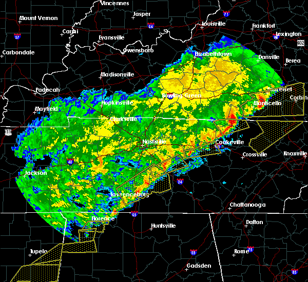 At 1249 am cst, a severe thunderstorm was located 8 miles northwest of smithville, moving east at 60 mph (radar indicated). Hazards include 60 mph wind gusts. expect damage to roofs, siding, and trees At 1249 am cst, a severe thunderstorm was located 8 miles northwest of smithville, moving east at 60 mph (radar indicated). Hazards include 60 mph wind gusts. expect damage to roofs, siding, and trees
|
| 9/10/2016 5:47 PM CDT |
 At 547 pm cdt, severe thunderstorms were located along a line extending from near baxter to near woodbury, moving east at 45 mph (radar indicated). Hazards include 60 mph wind gusts. Expect damage to roofs. siding. and trees. Locations impacted include, murfreesboro, smithville, woodbury, carthage, baxter, gordonsville, hickman, south carthage, alexandria, dowelltown, liberty, auburntown, edgar evans state park, center hill lake, readyville and milton. At 547 pm cdt, severe thunderstorms were located along a line extending from near baxter to near woodbury, moving east at 45 mph (radar indicated). Hazards include 60 mph wind gusts. Expect damage to roofs. siding. and trees. Locations impacted include, murfreesboro, smithville, woodbury, carthage, baxter, gordonsville, hickman, south carthage, alexandria, dowelltown, liberty, auburntown, edgar evans state park, center hill lake, readyville and milton.
|
| 9/10/2016 5:35 PM CDT |
 At 535 pm cdt, severe thunderstorms were located along a line extending from near gordonsville to near murfreesboro, moving east at 45 mph (radar indicated). Hazards include 60 mph wind gusts. Expect damage to roofs. siding. and trees. Locations impacted include, murfreesboro, smithville, woodbury, carthage, watertown, baxter, gordonsville, walterhill, hickman, south carthage, alexandria, dowelltown, liberty, auburntown, edgar evans state park, cedars of lebanon state park, tuckers crossroads, center hill lake, readyville and milton. At 535 pm cdt, severe thunderstorms were located along a line extending from near gordonsville to near murfreesboro, moving east at 45 mph (radar indicated). Hazards include 60 mph wind gusts. Expect damage to roofs. siding. and trees. Locations impacted include, murfreesboro, smithville, woodbury, carthage, watertown, baxter, gordonsville, walterhill, hickman, south carthage, alexandria, dowelltown, liberty, auburntown, edgar evans state park, cedars of lebanon state park, tuckers crossroads, center hill lake, readyville and milton.
|
| 9/10/2016 5:18 PM CDT |
 At 517 pm cdt, severe thunderstorms were located along a line extending from carthage to near murfreesboro, moving east at 45 mph (radar indicated). Hazards include 60 mph wind gusts. Expect damage to roofs. siding. And trees. At 517 pm cdt, severe thunderstorms were located along a line extending from carthage to near murfreesboro, moving east at 45 mph (radar indicated). Hazards include 60 mph wind gusts. Expect damage to roofs. siding. And trees.
|
| 7/19/2016 2:43 PM CDT |
 At 243 pm cdt, a severe thunderstorm was located 9 miles southeast of watertown, or 11 miles north of woodbury, moving south at 25 mph (radar indicated). Hazards include 60 mph wind gusts and quarter size hail. Hail damage to vehicles is expected. Expect wind damage to roofs, siding, and trees. At 243 pm cdt, a severe thunderstorm was located 9 miles southeast of watertown, or 11 miles north of woodbury, moving south at 25 mph (radar indicated). Hazards include 60 mph wind gusts and quarter size hail. Hail damage to vehicles is expected. Expect wind damage to roofs, siding, and trees.
|
| 7/8/2016 9:53 PM CDT |
 At 952 pm cdt, severe thunderstorms were located along a line extending from near baxter to near smithville, moving east at 45 mph (radar indicated). Hazards include 60 mph wind gusts and penny size hail. Expect damage to roofs. siding. And trees. At 952 pm cdt, severe thunderstorms were located along a line extending from near baxter to near smithville, moving east at 45 mph (radar indicated). Hazards include 60 mph wind gusts and penny size hail. Expect damage to roofs. siding. And trees.
|
| 7/8/2016 9:46 PM CDT |
 At 945 pm cdt, severe thunderstorms were located along a line extending from gainesboro to near woodbury, moving east at 55 mph (radar indicated). Hazards include 60 mph wind gusts and penny size hail. Expect damage to roofs. siding. and trees. Locations impacted include, murfreesboro, lebanon, smithville, woodbury, carthage, smyrna, watertown, baxter, gordonsville, walterhill, hickman, south carthage, alexandria, dowelltown, liberty, auburntown, dickerson chapel recreation area, granville, edgar evans state park and cedars of lebanon state park. At 945 pm cdt, severe thunderstorms were located along a line extending from gainesboro to near woodbury, moving east at 55 mph (radar indicated). Hazards include 60 mph wind gusts and penny size hail. Expect damage to roofs. siding. and trees. Locations impacted include, murfreesboro, lebanon, smithville, woodbury, carthage, smyrna, watertown, baxter, gordonsville, walterhill, hickman, south carthage, alexandria, dowelltown, liberty, auburntown, dickerson chapel recreation area, granville, edgar evans state park and cedars of lebanon state park.
|
| 7/8/2016 9:25 PM CDT |
 At 925 pm cdt, severe thunderstorms were located along a line extending from near carthage to near walterhill, moving east at 55 mph (radar indicated). Hazards include 70 mph wind gusts and penny size hail. Expect considerable tree damage. Damage is likely to mobile homes, roofs, and outbuildings. At 925 pm cdt, severe thunderstorms were located along a line extending from near carthage to near walterhill, moving east at 55 mph (radar indicated). Hazards include 70 mph wind gusts and penny size hail. Expect considerable tree damage. Damage is likely to mobile homes, roofs, and outbuildings.
|
| 7/7/2016 4:34 PM CDT |
 At 433 pm cdt, a severe thunderstorm was located near sparta, moving southeast at 45 mph (radar indicated). Hazards include 60 mph wind gusts and penny size hail. Expect damage to roofs. siding. and trees. locations impacted include, cookeville, sparta, smithville, spencer, baxter, doyle, virgin falls state natural area, edgar evans state park, burgess falls state park, hamptons crossroads, center hill lake, bakers crossroads and fall creek falls s. P At 433 pm cdt, a severe thunderstorm was located near sparta, moving southeast at 45 mph (radar indicated). Hazards include 60 mph wind gusts and penny size hail. Expect damage to roofs. siding. and trees. locations impacted include, cookeville, sparta, smithville, spencer, baxter, doyle, virgin falls state natural area, edgar evans state park, burgess falls state park, hamptons crossroads, center hill lake, bakers crossroads and fall creek falls s. P
|
| 7/7/2016 4:24 PM CDT | Several reports of trees down in the belk communit in de kalb county TN, 10.1 miles NW of Smithville, TN |
| 7/7/2016 4:14 PM CDT |
 At 413 pm cdt, a severe thunderstorm was located near baxter, or 7 miles southwest of cookeville, moving southeast at 60 mph (radar indicated). Hazards include 60 mph wind gusts and penny size hail. Expect damage to roofs. siding. And trees. At 413 pm cdt, a severe thunderstorm was located near baxter, or 7 miles southwest of cookeville, moving southeast at 60 mph (radar indicated). Hazards include 60 mph wind gusts and penny size hail. Expect damage to roofs. siding. And trees.
|
| 7/7/2016 3:18 AM CDT |
 At 317 am cdt, severe thunderstorms were located along a line extending from 6 miles southeast of gainesboro to 7 miles southwest of baxter to 6 miles west of smithville, moving southeast at 50 mph (radar indicated). Hazards include 60 mph wind gusts. Expect damage to roofs. siding. And trees. At 317 am cdt, severe thunderstorms were located along a line extending from 6 miles southeast of gainesboro to 7 miles southwest of baxter to 6 miles west of smithville, moving southeast at 50 mph (radar indicated). Hazards include 60 mph wind gusts. Expect damage to roofs. siding. And trees.
|
| 7/6/2016 5:13 PM CDT |
 At 512 pm cdt, severe thunderstorms were located along a line extending from baxter to murfreesboro, moving east at 50 mph (radar indicated). Hazards include 60 mph wind gusts and penny size hail. Expect damage to roofs. siding. and trees. Locations impacted include, murfreesboro, cookeville, smithville, woodbury, walterhill, dowelltown, liberty, auburntown, edgar evans state park, bradyville, burgess falls state park, hamptons crossroads, center hill lake, readyville, milton, bakers crossroads and lascassas. At 512 pm cdt, severe thunderstorms were located along a line extending from baxter to murfreesboro, moving east at 50 mph (radar indicated). Hazards include 60 mph wind gusts and penny size hail. Expect damage to roofs. siding. and trees. Locations impacted include, murfreesboro, cookeville, smithville, woodbury, walterhill, dowelltown, liberty, auburntown, edgar evans state park, bradyville, burgess falls state park, hamptons crossroads, center hill lake, readyville, milton, bakers crossroads and lascassas.
|
| 7/6/2016 4:55 PM CDT |
 At 454 pm cdt, severe thunderstorms were located along a line extending from gordonsville to smyrna, moving east at 50 mph (radar indicated). Hazards include 60 mph wind gusts and penny size hail. Expect damage to roofs. siding. And trees. At 454 pm cdt, severe thunderstorms were located along a line extending from gordonsville to smyrna, moving east at 50 mph (radar indicated). Hazards include 60 mph wind gusts and penny size hail. Expect damage to roofs. siding. And trees.
|
| 6/15/2016 5:13 PM CDT | Trees downed and street signs blown over in de kalb county TN, 0.1 miles ENE of Smithville, TN |
| 6/15/2016 5:01 PM CDT |
 At 501 pm cdt, severe thunderstorms were located along a line extending from 8 miles west of baxter to 10 miles southeast of watertown, moving southeast at 50 mph (radar indicated). Hazards include 60 mph wind gusts. Expect damage to roofs. siding. And trees. At 501 pm cdt, severe thunderstorms were located along a line extending from 8 miles west of baxter to 10 miles southeast of watertown, moving southeast at 50 mph (radar indicated). Hazards include 60 mph wind gusts. Expect damage to roofs. siding. And trees.
|
| 5/11/2016 1:26 AM CDT |
 At 126 am cdt, a severe thunderstorm was located 8 miles southeast of watertown, or 11 miles north of woodbury, moving southeast at 25 mph (radar indicated). Hazards include 60 mph wind gusts and quarter size hail. Hail damage to vehicles is expected. expect wind damage to roofs, siding, and trees. Locations impacted include, smithville, woodbury, watertown, alexandria, dowelltown, liberty, auburntown, milton and cedars of lebanon state park. At 126 am cdt, a severe thunderstorm was located 8 miles southeast of watertown, or 11 miles north of woodbury, moving southeast at 25 mph (radar indicated). Hazards include 60 mph wind gusts and quarter size hail. Hail damage to vehicles is expected. expect wind damage to roofs, siding, and trees. Locations impacted include, smithville, woodbury, watertown, alexandria, dowelltown, liberty, auburntown, milton and cedars of lebanon state park.
|
| 5/11/2016 1:10 AM CDT |
 At 109 am cdt, a severe thunderstorm was located near watertown, or 13 miles southeast of lebanon, moving southeast at 25 mph (radar indicated). Hazards include 60 mph wind gusts and half dollar size hail. Hail damage to vehicles is expected. Expect wind damage to roofs, siding, and trees. At 109 am cdt, a severe thunderstorm was located near watertown, or 13 miles southeast of lebanon, moving southeast at 25 mph (radar indicated). Hazards include 60 mph wind gusts and half dollar size hail. Hail damage to vehicles is expected. Expect wind damage to roofs, siding, and trees.
|
| 3/31/2016 6:57 PM CDT | Quarter sized hail reported 0.1 miles ENE of Smithville, TN |
| 3/31/2016 6:44 PM CDT |
 At 643 pm cdt, a severe thunderstorm was located 8 miles west of smithville, moving east at 50 mph (radar indicated). Hazards include 60 mph wind gusts and quarter size hail. Hail damage to vehicles is expected. Expect wind damage to roofs, siding, and trees. At 643 pm cdt, a severe thunderstorm was located 8 miles west of smithville, moving east at 50 mph (radar indicated). Hazards include 60 mph wind gusts and quarter size hail. Hail damage to vehicles is expected. Expect wind damage to roofs, siding, and trees.
|
| 7/14/2015 4:00 PM CDT | Roof blown off barn at west green hill road and campbell road in warren county TN, 8.7 miles NNE of Smithville, TN |
| 7/14/2015 3:38 PM CDT |
 At 337 pm cdt, a severe thunderstorm was located 11 miles southwest of sparta, moving southeast at 50 mph (radar indicated). Hazards include 70 mph wind gusts and quarter size hail. Hail damage to vehicles is expected. expect considerable tree damage. wind damage is also likely to mobile homes, roofs and outbuildings. Locations impacted include, mcminnville, sparta, smithville, dowelltown, liberty and rock island state park. At 337 pm cdt, a severe thunderstorm was located 11 miles southwest of sparta, moving southeast at 50 mph (radar indicated). Hazards include 70 mph wind gusts and quarter size hail. Hail damage to vehicles is expected. expect considerable tree damage. wind damage is also likely to mobile homes, roofs and outbuildings. Locations impacted include, mcminnville, sparta, smithville, dowelltown, liberty and rock island state park.
|
| 7/14/2015 3:30 PM CDT | Numerous trees down in the jefferson road area in de kalb county TN, 7.3 miles NW of Smithville, TN |
| 7/14/2015 3:25 PM CDT | Trees down on adcock cemetery road in de kalb county TN, 2.7 miles W of Smithville, TN |
| 7/14/2015 3:25 PM CDT | Measured on home weather station in de kalb county TN, 2.7 miles W of Smithville, TN |
| 7/14/2015 3:18 PM CDT |
 At 317 pm cdt, a severe thunderstorm was located near smithville, moving southeast at 50 mph (radar indicated). Hazards include 70 mph wind gusts and quarter size hail. Hail damage to vehicles is expected. expect considerable tree damage. wind damage is also likely to mobile homes, roofs and outbuildings. This severe thunderstorm will remain over mainly rural areas of northern warren, northeastern cannon, de kalb and southwestern white counties, including the following locations, rock island state park, liberty and dowelltown. At 317 pm cdt, a severe thunderstorm was located near smithville, moving southeast at 50 mph (radar indicated). Hazards include 70 mph wind gusts and quarter size hail. Hail damage to vehicles is expected. expect considerable tree damage. wind damage is also likely to mobile homes, roofs and outbuildings. This severe thunderstorm will remain over mainly rural areas of northern warren, northeastern cannon, de kalb and southwestern white counties, including the following locations, rock island state park, liberty and dowelltown.
|
| 6/23/2015 8:27 PM CDT |
 At 826 pm cdt, a severe thunderstorm was located 9 miles west of sparta, moving east at 35 mph (radar indicated). Hazards include 60 mph wind gusts and quarter size hail. Hail damage to vehicles is expected. expect wind damage to roofs, siding and trees. this severe thunderstorm will be near, sparta around 840 pm cdt. Other locations impacted by this severe thunderstorm include bakers crossroads and doyle. At 826 pm cdt, a severe thunderstorm was located 9 miles west of sparta, moving east at 35 mph (radar indicated). Hazards include 60 mph wind gusts and quarter size hail. Hail damage to vehicles is expected. expect wind damage to roofs, siding and trees. this severe thunderstorm will be near, sparta around 840 pm cdt. Other locations impacted by this severe thunderstorm include bakers crossroads and doyle.
|
| 6/8/2015 1:47 PM CDT |
 At 145 pm cdt, a severe thunderstorm was located 5 miles northeast of smithville, and moving east at 30 mph (radar indicated). Hazards include 60 mph wind gusts and nickel size hail. Expect damage to roofs. siding and trees. the severe thunderstorm will be near, burgess falls state park around 200 pm cdt. Other locations in the warning include bakers crossroads and hamptons crossroads. At 145 pm cdt, a severe thunderstorm was located 5 miles northeast of smithville, and moving east at 30 mph (radar indicated). Hazards include 60 mph wind gusts and nickel size hail. Expect damage to roofs. siding and trees. the severe thunderstorm will be near, burgess falls state park around 200 pm cdt. Other locations in the warning include bakers crossroads and hamptons crossroads.
|
| 6/8/2015 1:33 PM CDT |
 At 128 pm cdt, a severe thunderstorm was located 6 miles northeast of woodbury, and moving east at 30 mph (radar indicated). Hazards include 60 mph wind gusts and nickel size hail. Expect damage to roofs. siding and trees. The severe thunderstorm will be near, smithville around 150 pm cdt. At 128 pm cdt, a severe thunderstorm was located 6 miles northeast of woodbury, and moving east at 30 mph (radar indicated). Hazards include 60 mph wind gusts and nickel size hail. Expect damage to roofs. siding and trees. The severe thunderstorm will be near, smithville around 150 pm cdt.
|
| 6/8/2015 1:22 PM CDT |
 At 120 pm cdt, a severe thunderstorm was located near woodbury, and moving east at 30 mph (radar indicated). Hazards include 60 mph wind gusts and nickel size hail. Expect damage to roofs. siding and trees. The severe thunderstorm will be near, smithville around 150 pm cdt. At 120 pm cdt, a severe thunderstorm was located near woodbury, and moving east at 30 mph (radar indicated). Hazards include 60 mph wind gusts and nickel size hail. Expect damage to roofs. siding and trees. The severe thunderstorm will be near, smithville around 150 pm cdt.
|
| 6/8/2015 1:14 PM CDT |
 At 112 pm cdt, a severe thunderstorm was located near woodbury, and moving east at 30 mph (radar indicated). Hazards include 60 mph wind gusts and nickel size hail. Expect damage to roofs. siding and trees. the severe thunderstorm will be near, woodbury around 120 pm cdt. smithville around 150 pm cdt. Other locations in the warning include auburntown. At 112 pm cdt, a severe thunderstorm was located near woodbury, and moving east at 30 mph (radar indicated). Hazards include 60 mph wind gusts and nickel size hail. Expect damage to roofs. siding and trees. the severe thunderstorm will be near, woodbury around 120 pm cdt. smithville around 150 pm cdt. Other locations in the warning include auburntown.
|
| 4/10/2015 4:38 AM CDT | The severe thunderstorm warning for de kalb. southeastern smith. western putnam and southern overton counties will expire at 445 am cdt. the line of storms which prompted the warning has weakened below severe limits. and no longer poses an immediate threat to life or property. however. Gusty winds are still possible with these. |
| 4/10/2015 4:14 AM CDT | A severe thunderstorm warning remains in effect for de kalb. southeastern smith. western putnam and southern overton counties until 445 am cdt. at 413 am cdt. severe thunderstorms were located along a line extending from 8 miles southeast of gainesboro to 9 miles west of smithville. And moving east at 40 mph. |
| 4/10/2015 3:57 AM CDT | The national weather service in nashville has issued a * severe thunderstorm warning for. de kalb county in middle tennessee. southern overton county in middle tennessee. western putnam county in middle tennessee. Southeastern smith county in middle tennessee. |
| 4/10/2015 3:43 AM CDT | A severe thunderstorm warning remains in effect for de kalb. northern cannon. southeastern wilson. eastern rutherford and western putnam counties until 400 am cdt. at 341 am cdt. severe thunderstorms were located along a line extending from watertown to 10 miles northwest of woodbury to 6 miles southeast of murfreesboro. And moving northeast at 50 mph. |
| 4/10/2015 3:35 AM CDT | The national weather service in nashville has issued a * severe thunderstorm warning for. northern cannon county in middle tennessee. de kalb county in middle tennessee. western putnam county in middle tennessee. Eastern rutherford county in middle tennessee. |
| 4/3/2015 5:12 PM CST | Storm damage reported in de kalb county TN, 2.7 miles W of Smithville, TN |
| 4/3/2015 5:10 PM CST | A few trees blown down across the county in de kalb county TN, 0.1 miles ENE of Smithville, TN |
| 4/3/2015 6:02 PM CDT | The national weather service in nashville has issued a * severe thunderstorm warning for. northeastern cannon county in middle tennessee. de kalb county in middle tennessee. northwestern van buren county in middle tennessee. Northeastern warren county in middle tennessee. |
| 4/3/2015 5:53 PM CDT | A severe thunderstorm warning remains in effect for western de kalb. southeastern wilson and southern smith counties until 600 pm cdt. at 551 pm cdt. a severe thunderstorm was located 6 miles south of gordonsville. and moving east at 45 mph. hazard. 60 mph wind gusts and quarter size hail. |
| 4/3/2015 5:43 PM CDT | A severe thunderstorm warning remains in effect for western de kalb. southeastern wilson and southern smith counties until 600 pm cdt. at 540 pm cdt. a severe thunderstorm was located near watertown. and moving east at 45 mph. hazard. 60 mph wind gusts and quarter size hail. |
| 4/3/2015 5:29 PM CDT | The national weather service in nashville has issued a * severe thunderstorm warning for. western de kalb county in middle tennessee. southern smith county in middle tennessee. eastern wilson county in middle tennessee. Until 600 pm cdt. |
| 8/20/2014 2:47 PM CDT | Emergency management reported winds in excess of 60 mph on blue springs r in white county TN, 9.6 miles WNW of Smithville, TN |
| 8/20/2014 2:35 PM CDT | Trees and power lines blown down all across dekalb county in de kalb county TN, 0.1 miles ENE of Smithville, TN |
| 7/27/2014 10:10 PM CDT | Numerous trees down across roadways in area of cookeville highway and pine grove road with several homes damaged. ema currently assessing damage in are in de kalb county TN, 2.5 miles WSW of Smithville, TN |
| 5/19/2013 2:04 PM CDT | Quarter sized hail reported 0.1 miles ENE of Smithville, TN, espotter report of 1 inch hail in smithville. |
| 1/30/2013 5:00 AM CST | A few trees were downed across the count in de kalb county TN, 0.1 miles ENE of Smithville, TN |
| 7/5/2012 6:38 PM CDT | Trees down western portions of county. winds estimated around 50 mp in de kalb county TN, 0.1 miles ENE of Smithville, TN |
| 7/5/2012 6:15 PM CDT | Trees and powerlines down and minor structural damage to docks at center hill lake. also several trees down along highway 7 in de kalb county TN, 4.8 miles S of Smithville, TN |
| 1/1/0001 12:00 AM | *** 1 fatal *** roof damage with numerous trees down along holiday haven rd. one fatality reported. possible tornad in de kalb county TN, 7.7 miles SW of Smithville, TN |
| 1/1/0001 12:00 AM | Roof damage with numerous trees down along holiday haven rd. report of a person trapped in a home. possible tornad in de kalb county TN, 7.7 miles SW of Smithville, TN |
| 1/1/0001 12:00 AM | Structural damage on arrowhead drive. trees down on dogwood circle and highland drive. possible tornad in de kalb county TN, 2.7 miles S of Smithville, TN |
| 1/1/0001 12:00 AM | Storm damage reported in de kalb county TN, 0.1 miles ENE of Smithville, TN |
| 1/1/0001 12:00 AM | Trees and power lines down in several areas in dekalb count in de kalb county TN, 0.1 miles ENE of Smithville, TN |
| 1/1/0001 12:00 AM | Tema reports a convenient store was leveled in smithville. this is a possible tornado but uncomfirmed at this tim in de kalb county TN, 0.1 miles ENE of Smithville, TN |
| 1/1/0001 12:00 AM | Trained spotter reports a tree down near alexandri in dekalb county TN, 0.1 miles ENE of Smithville, TN |
| 1/1/0001 12:00 AM | Trees blown over into roads. rpt from highway dep in de kalb county TN, 0.1 miles ENE of Smithville, TN |
| 1/1/0001 12:00 AM | Storm damage reported in de kalb county TN, 0.1 miles ENE of Smithville, TN |
| 1/1/0001 12:00 AM | Trained spotter measured 80mph wind gust with home weather statio in de kalb county TN, 0.1 miles ENE of Smithville, TN |
Hail Maps for Smithville, TN


Connect with Interactive Hail Maps