

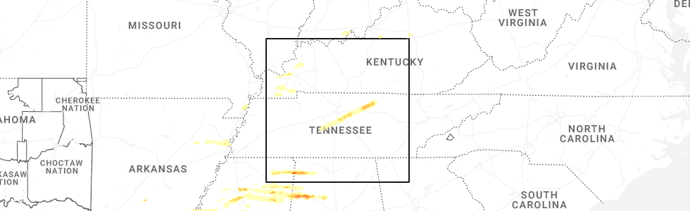
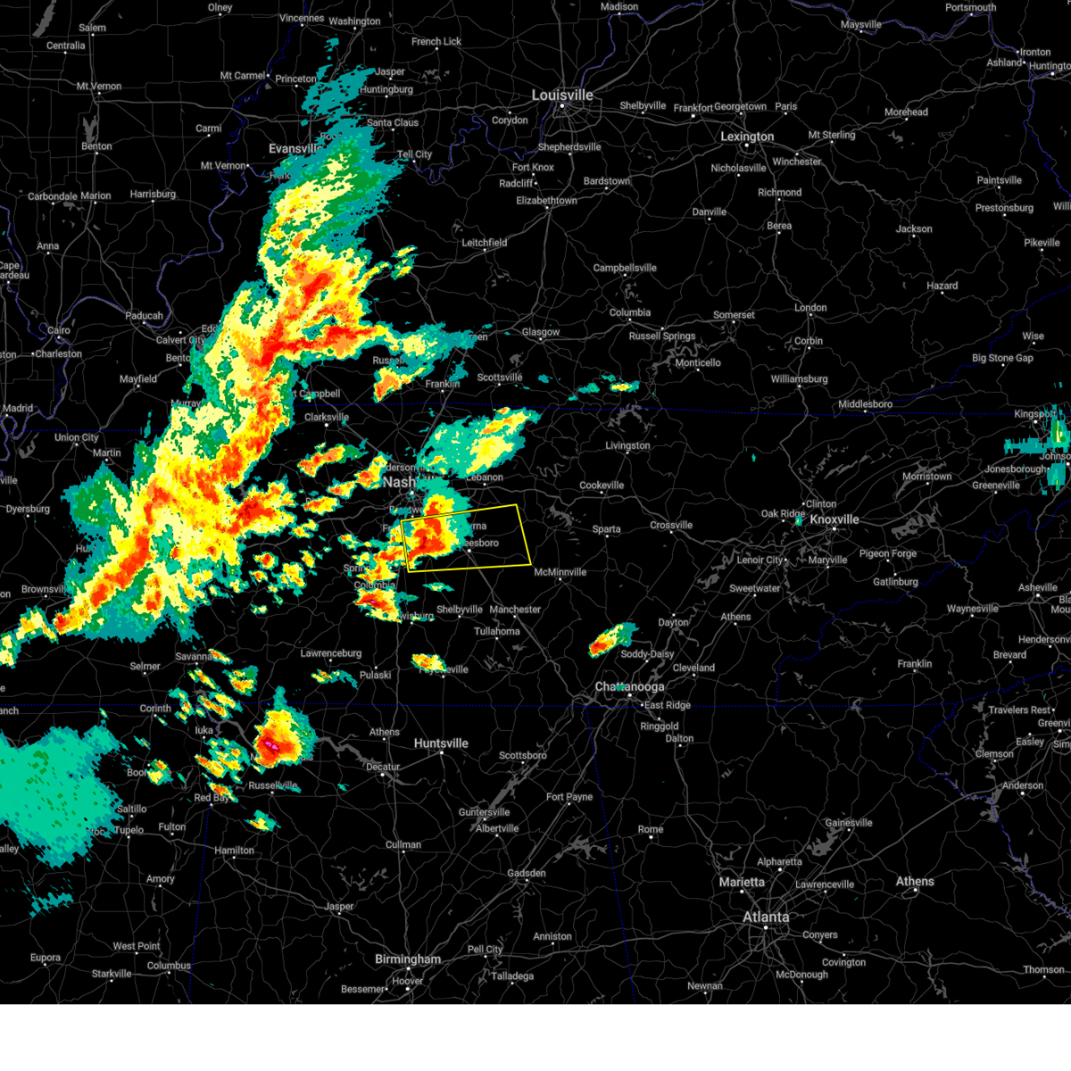
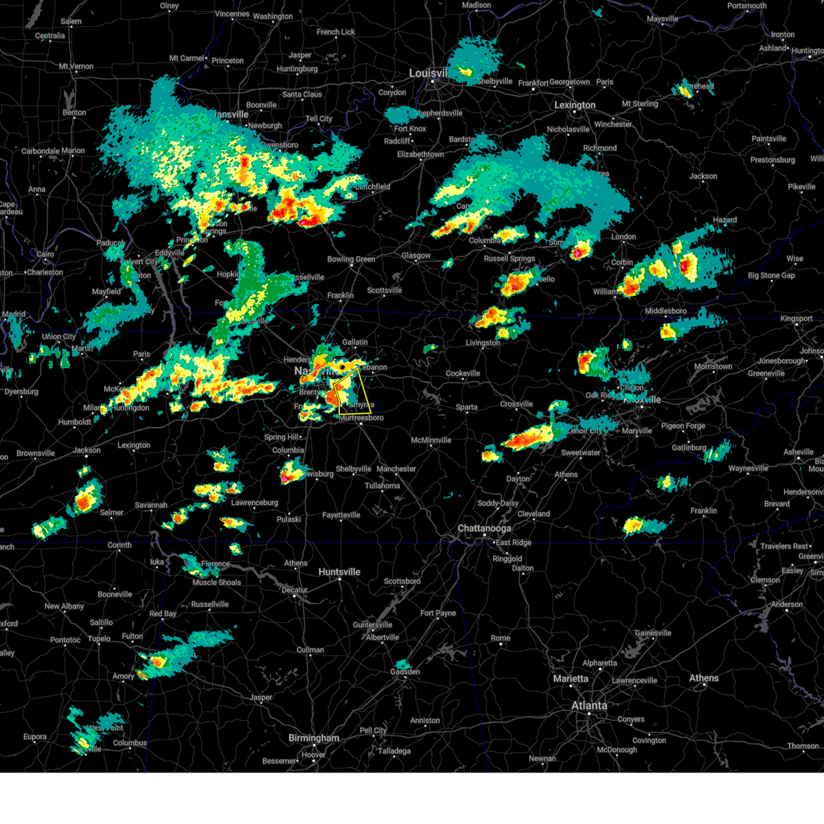
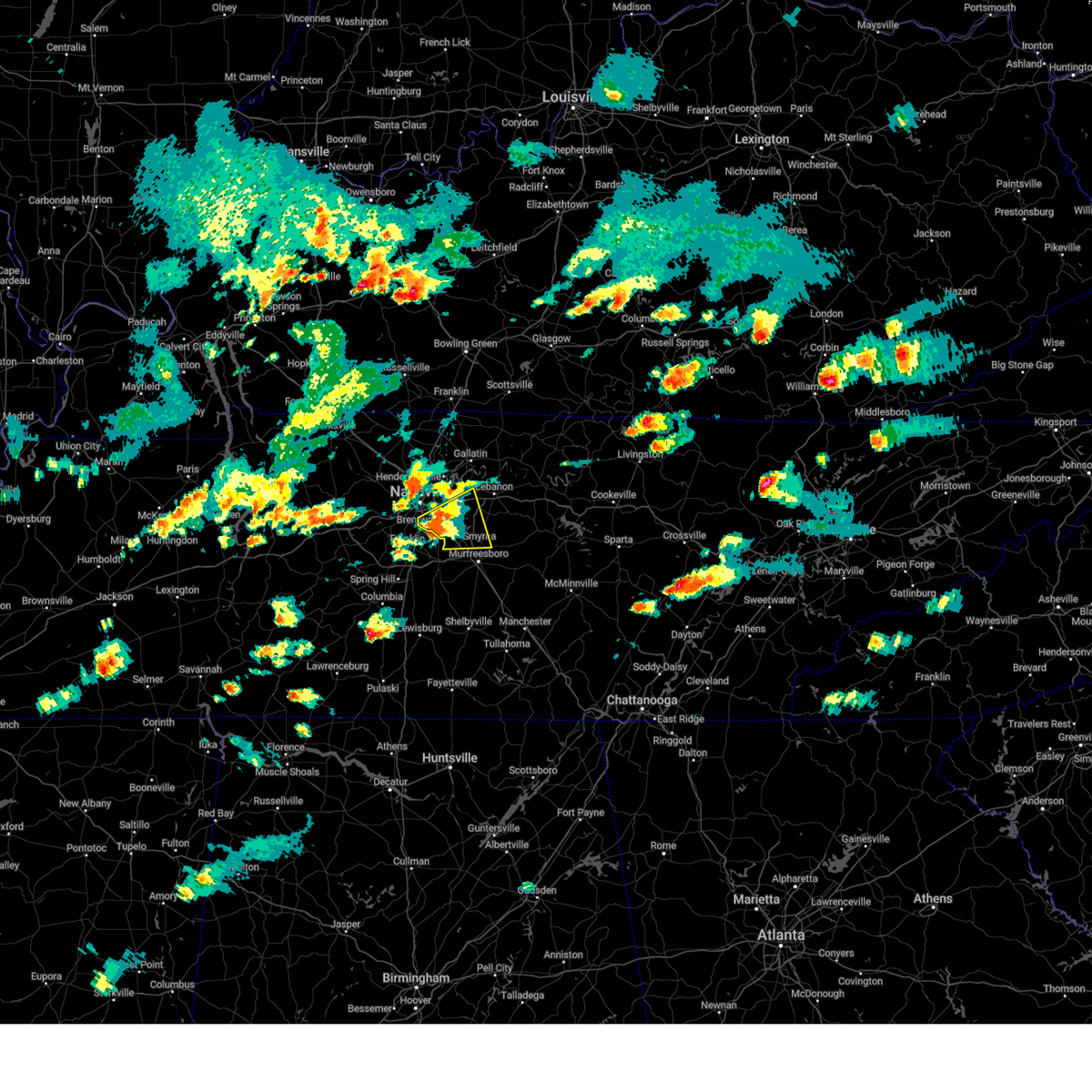
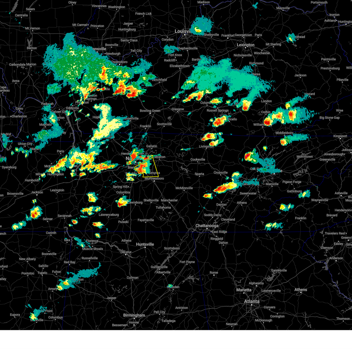
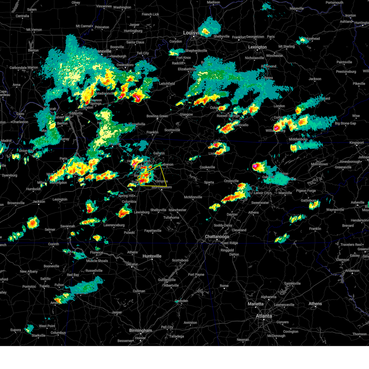
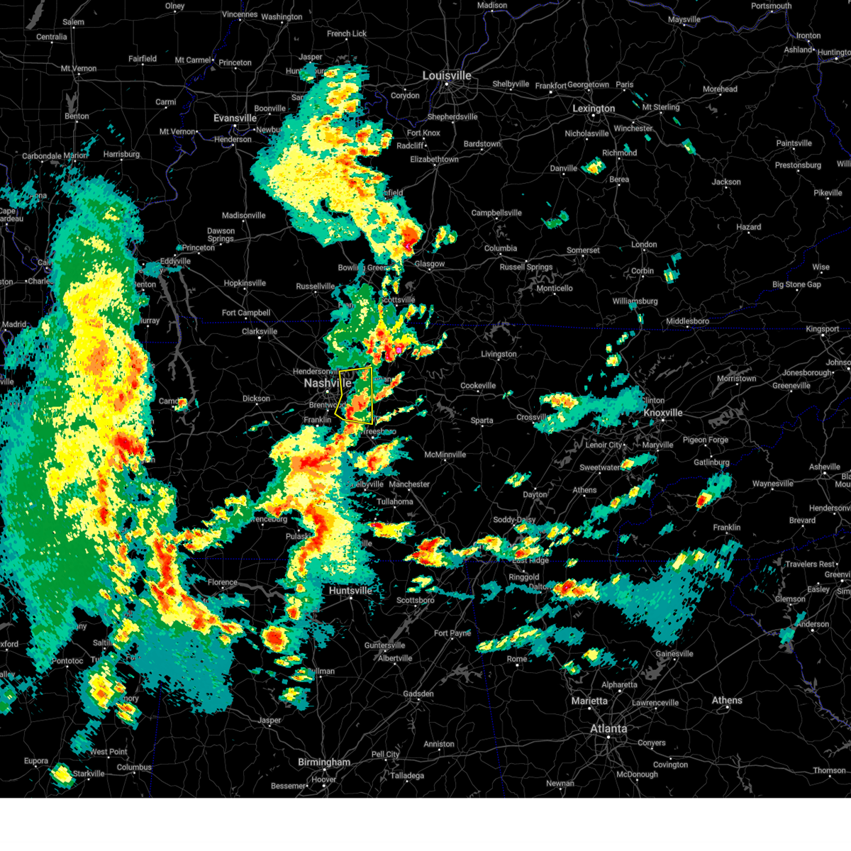
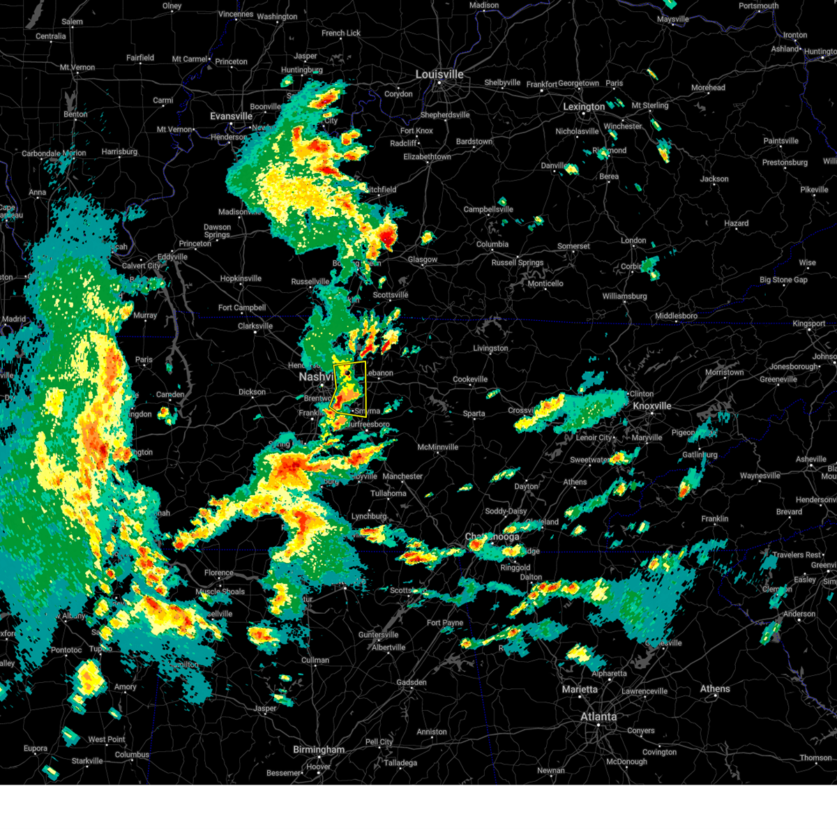
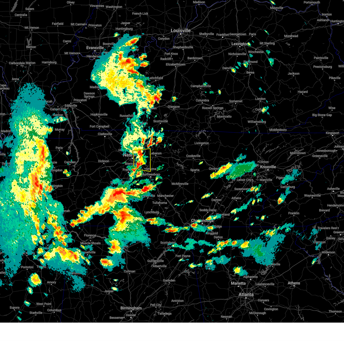
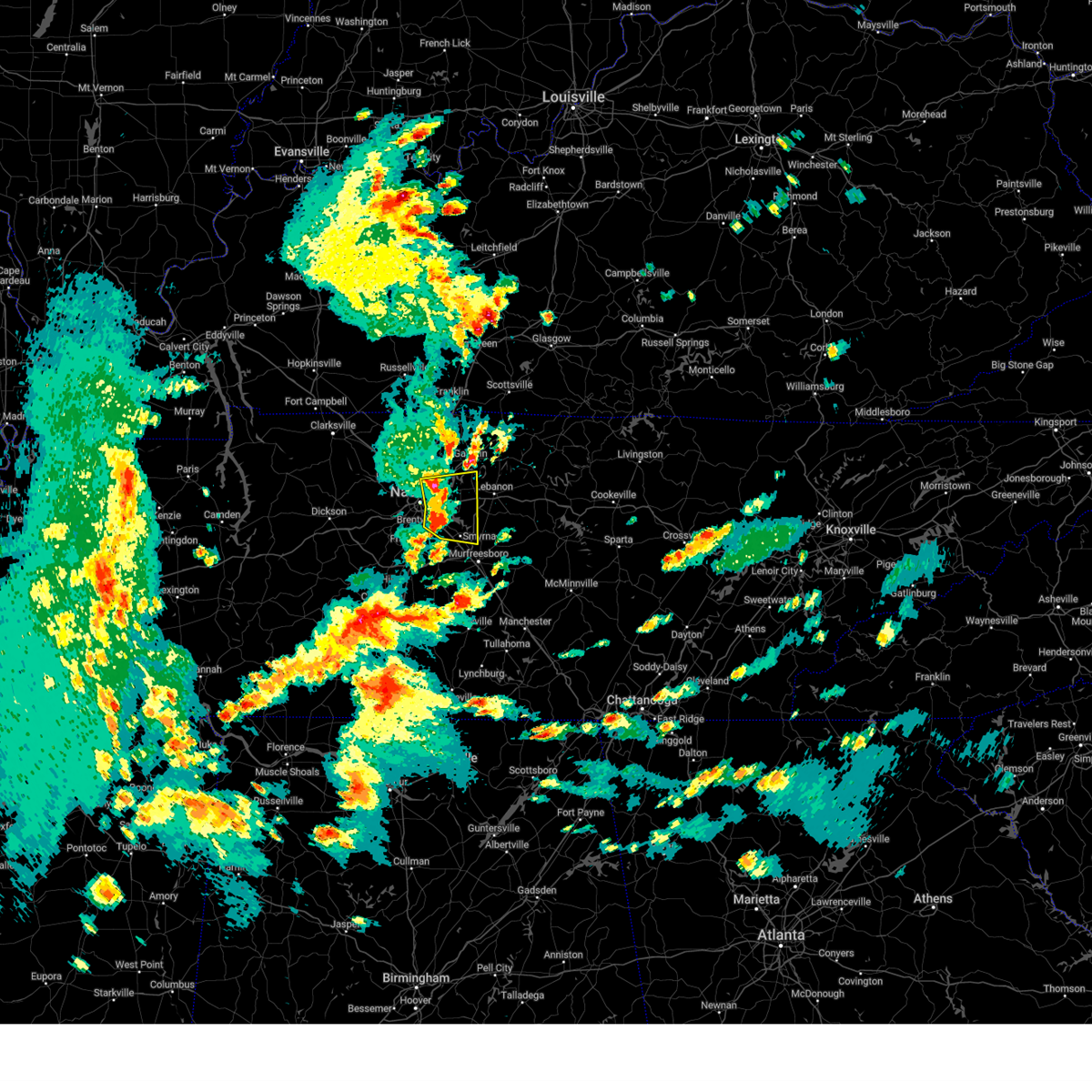
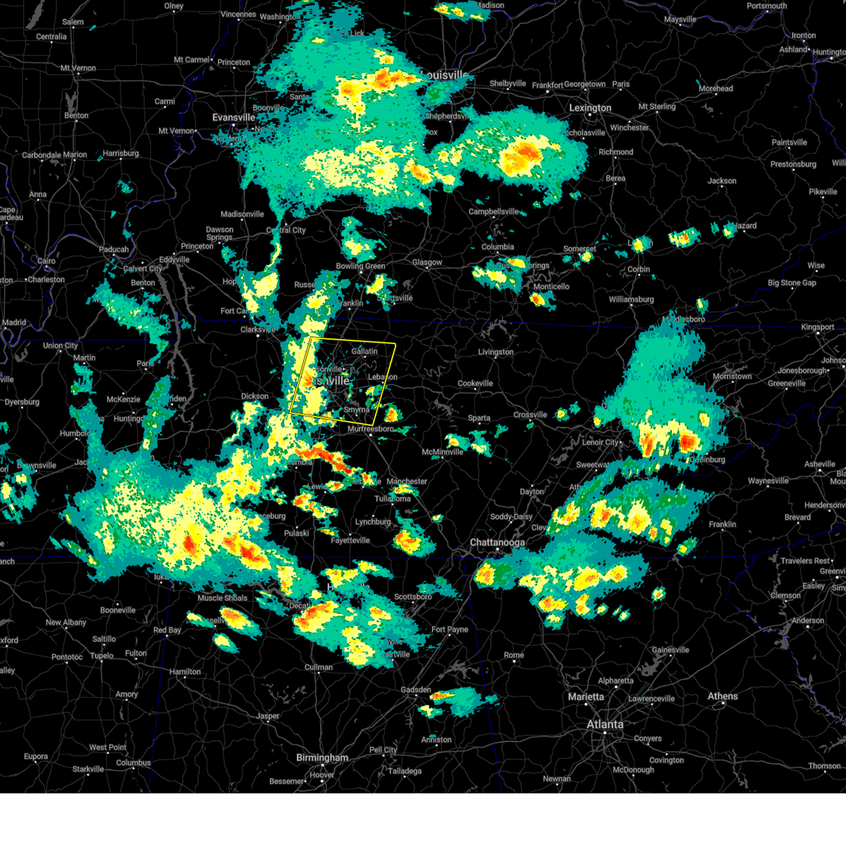
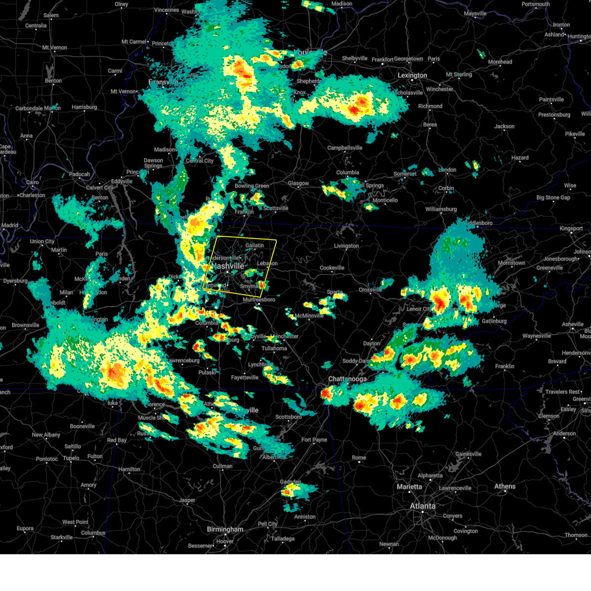
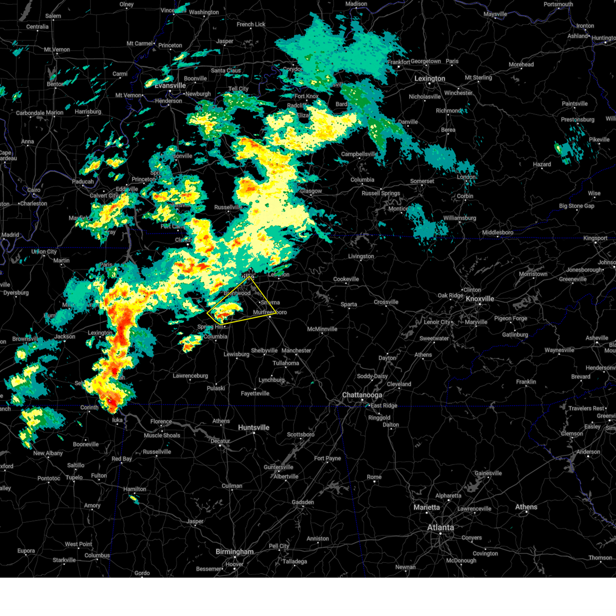
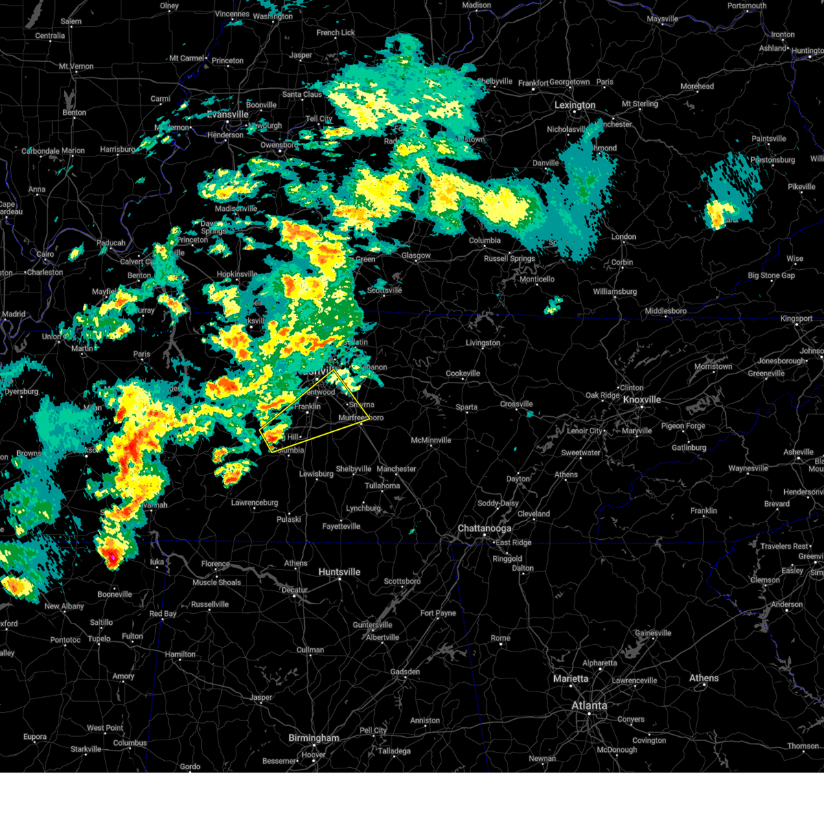
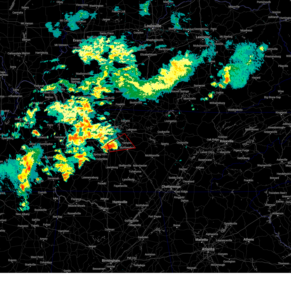
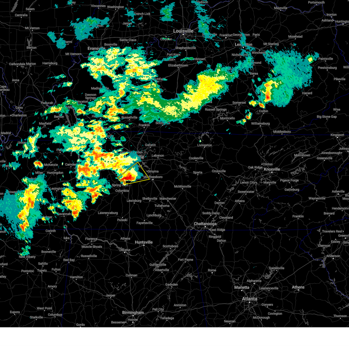
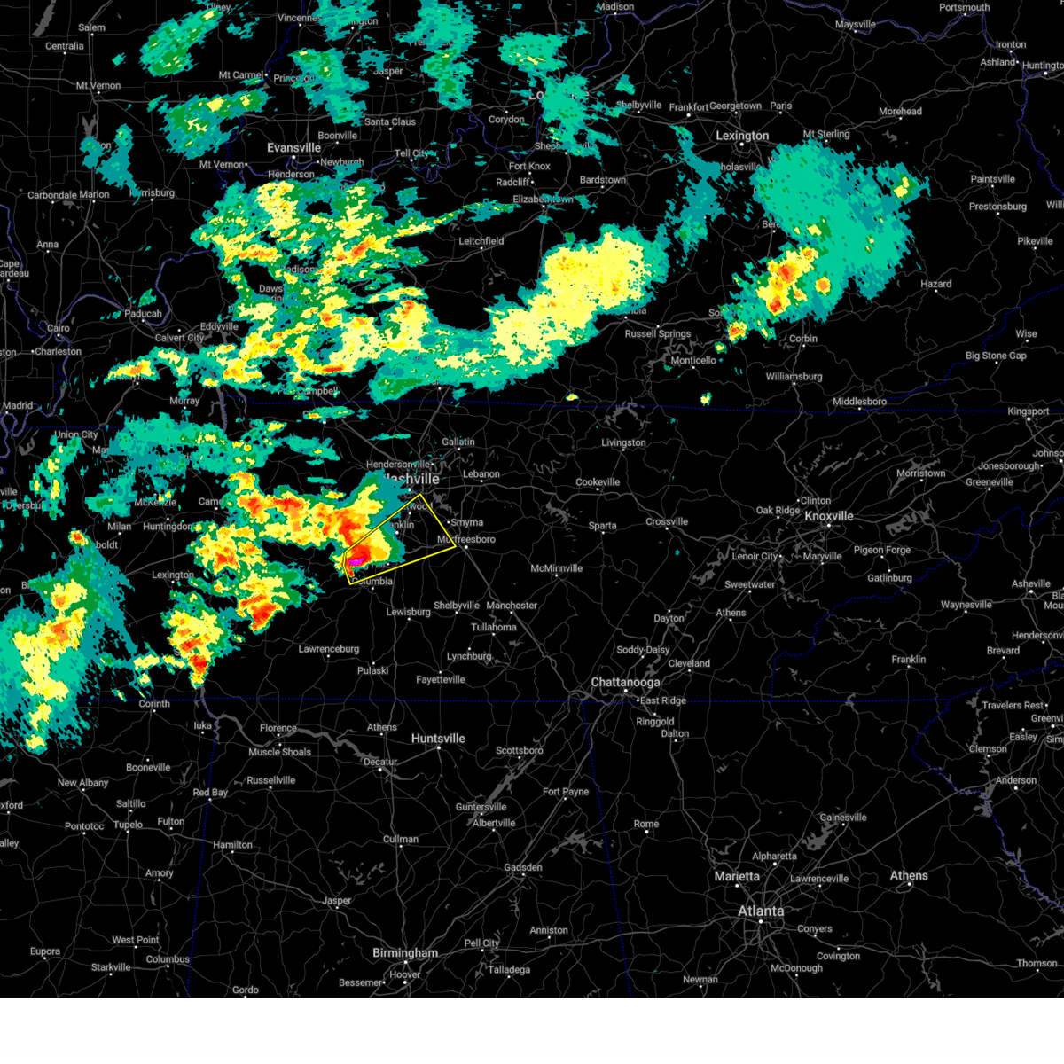
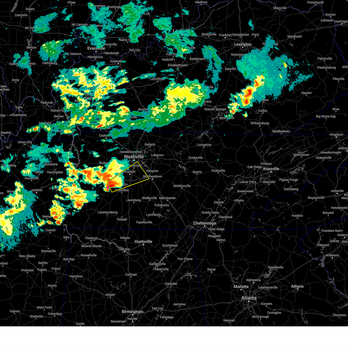
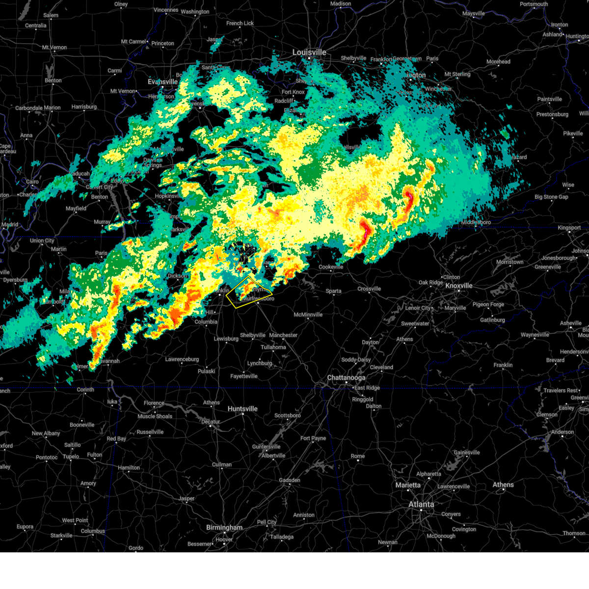
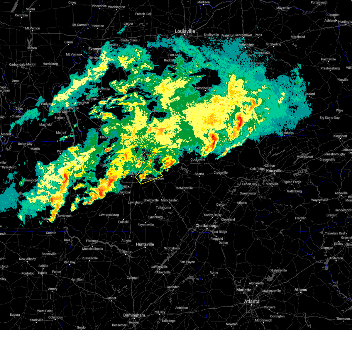
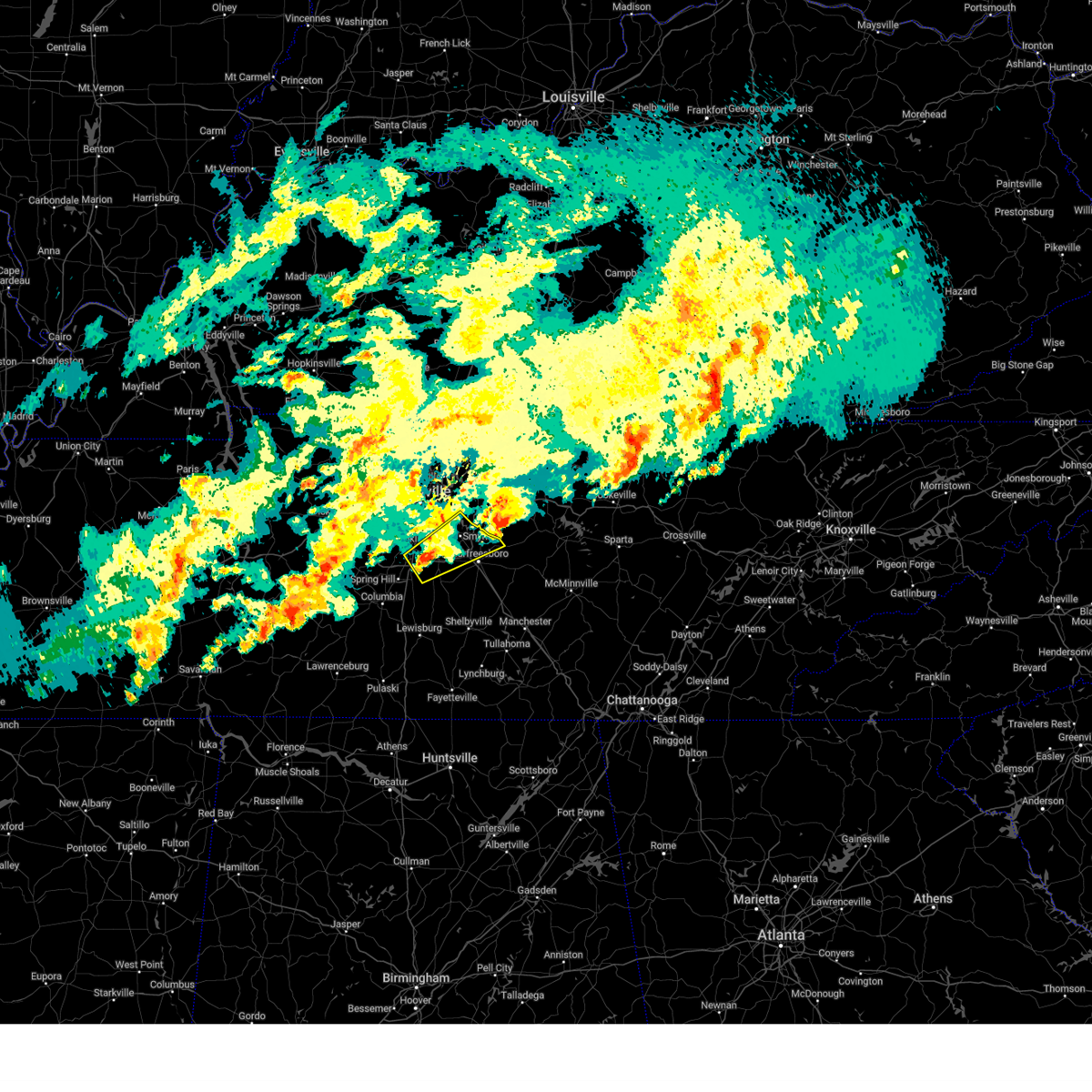
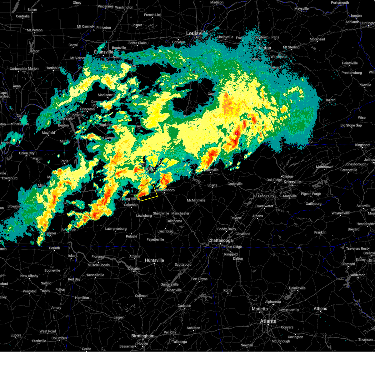
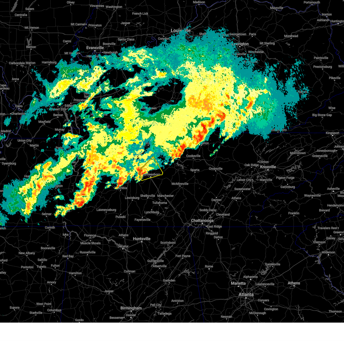
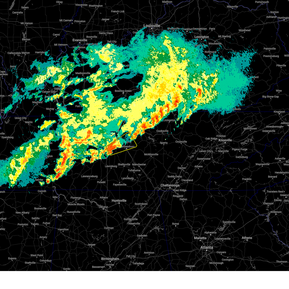
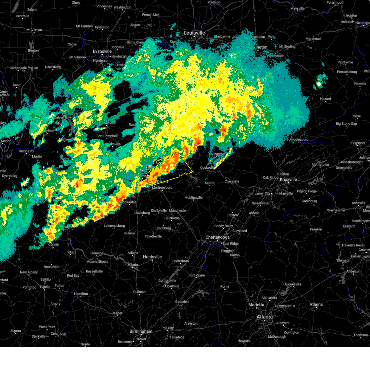
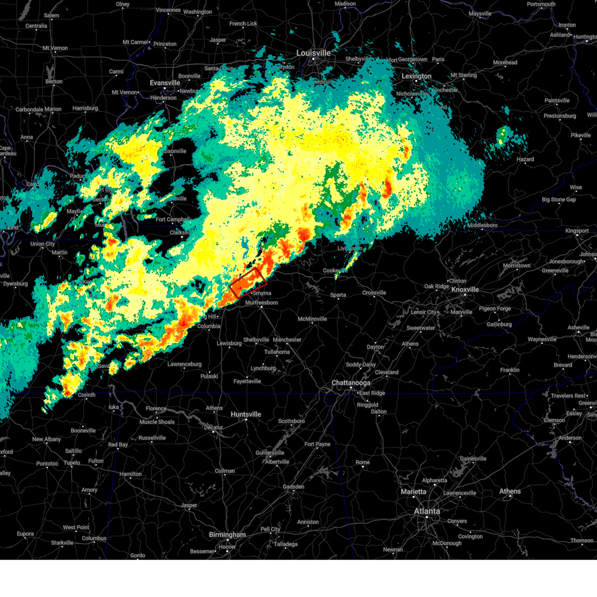
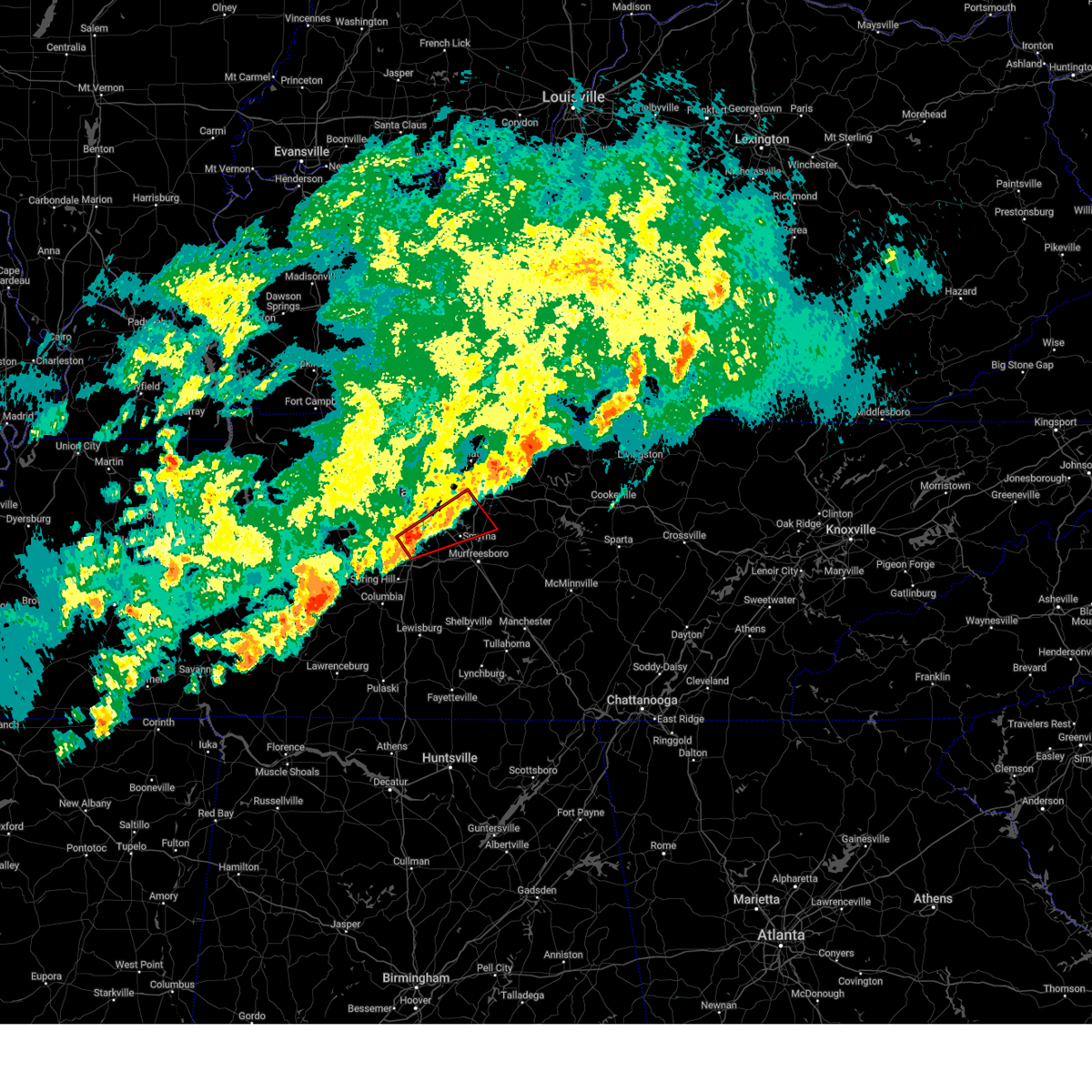
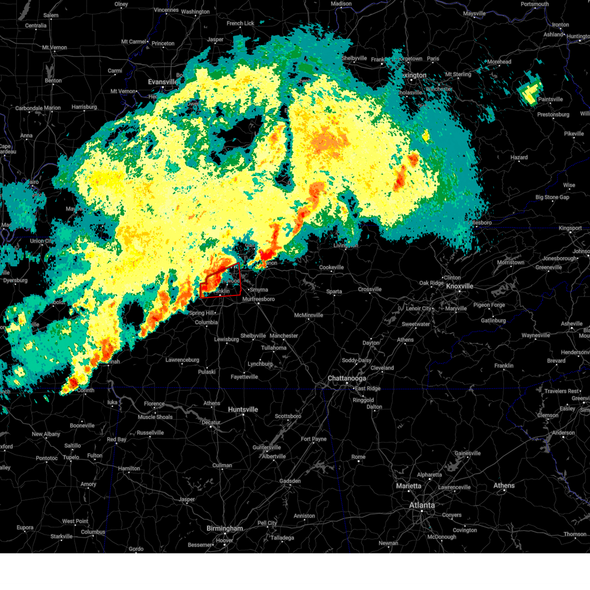
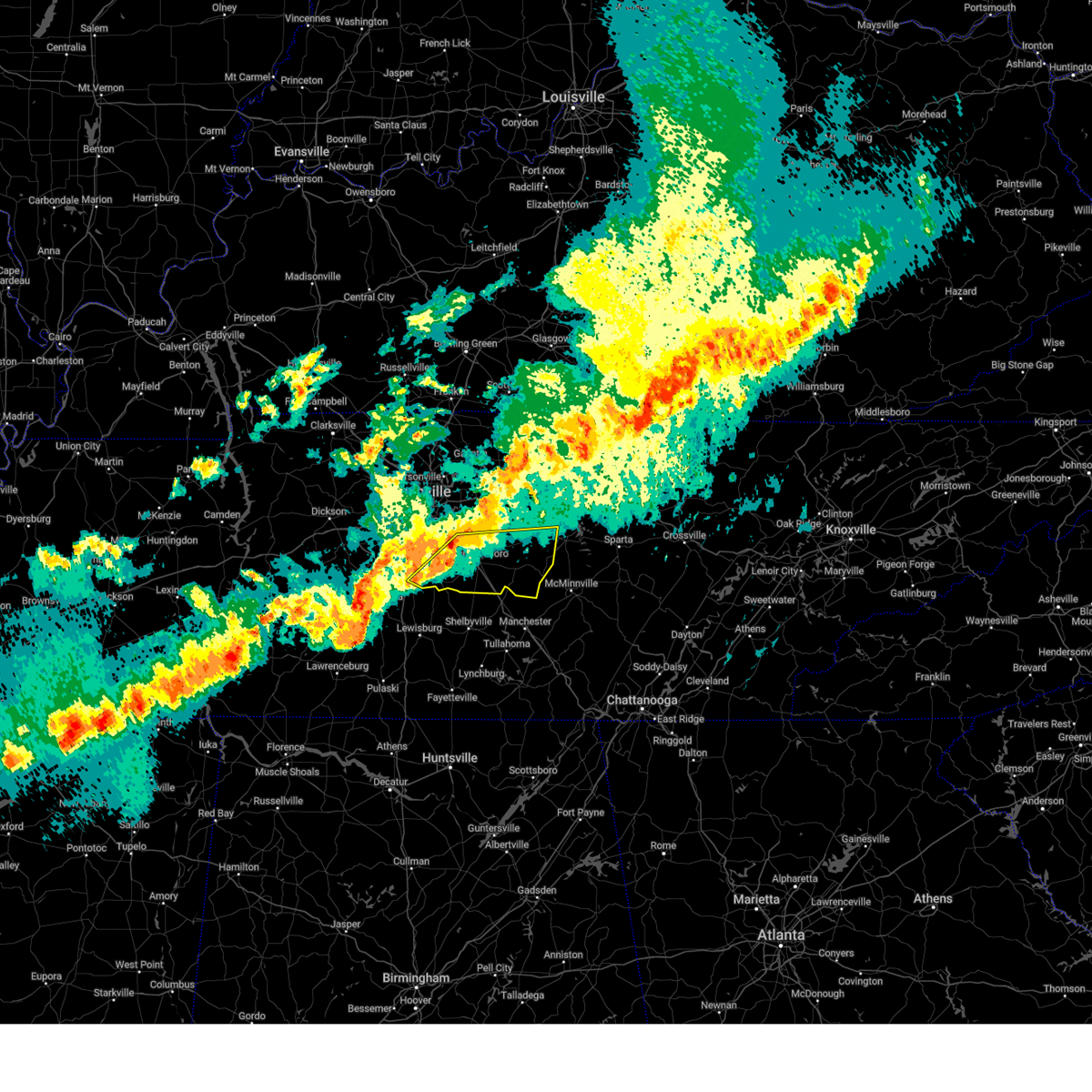
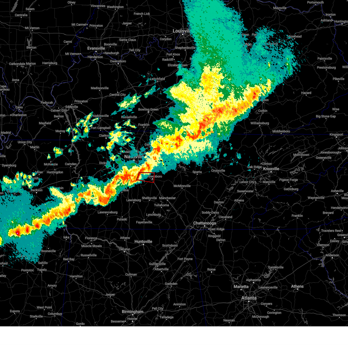
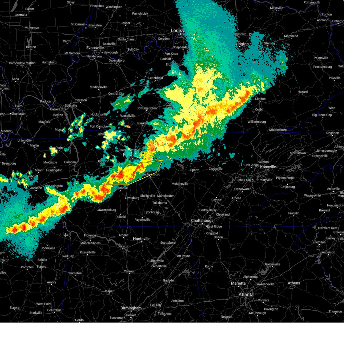
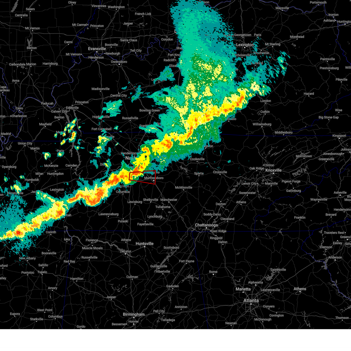
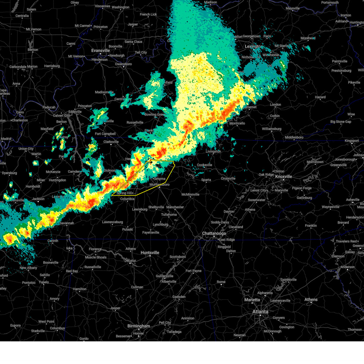
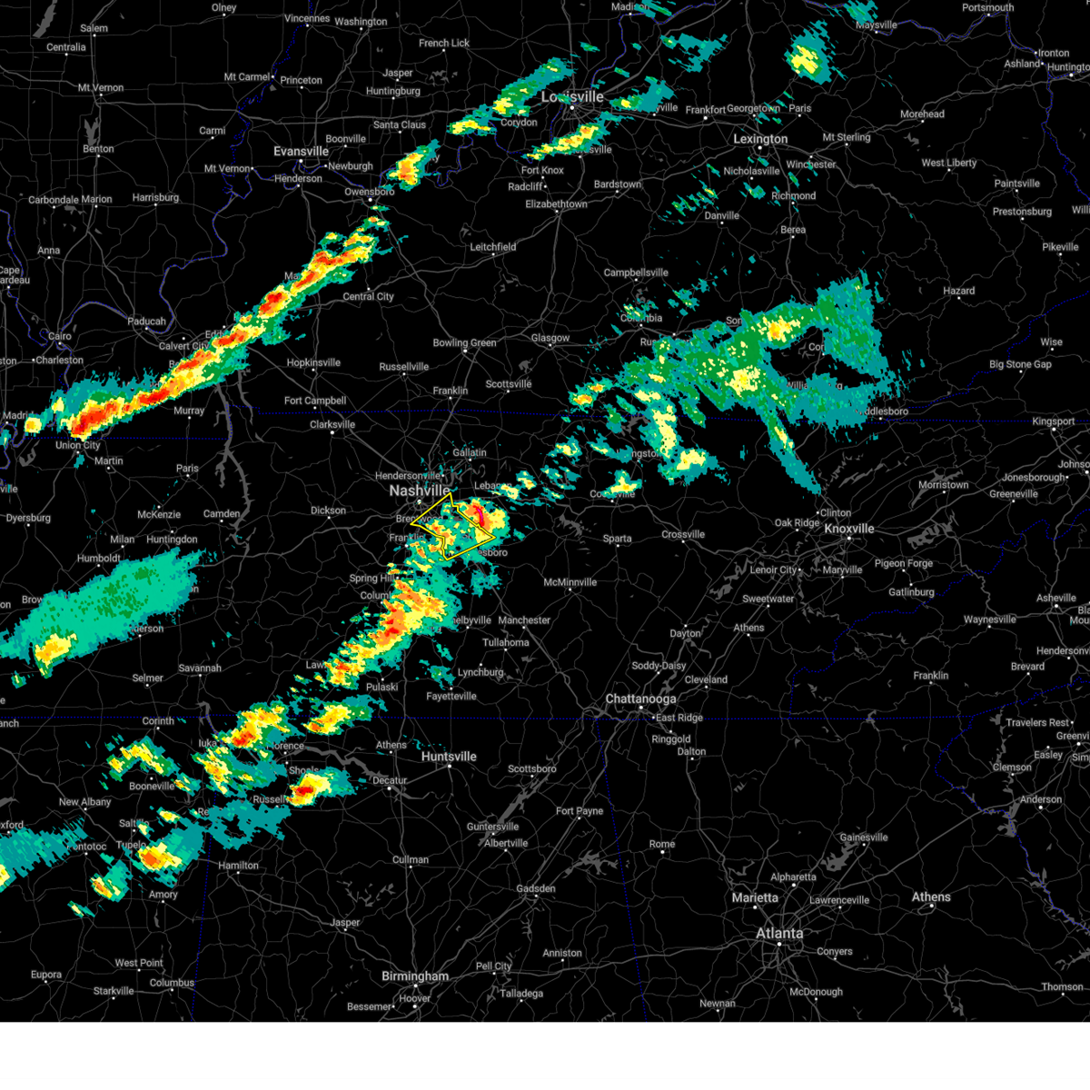
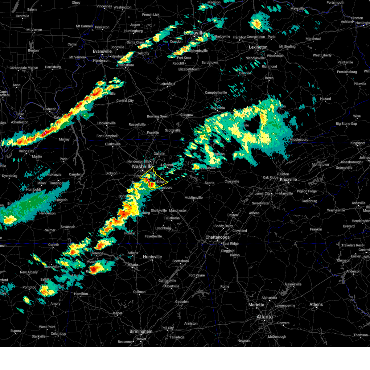
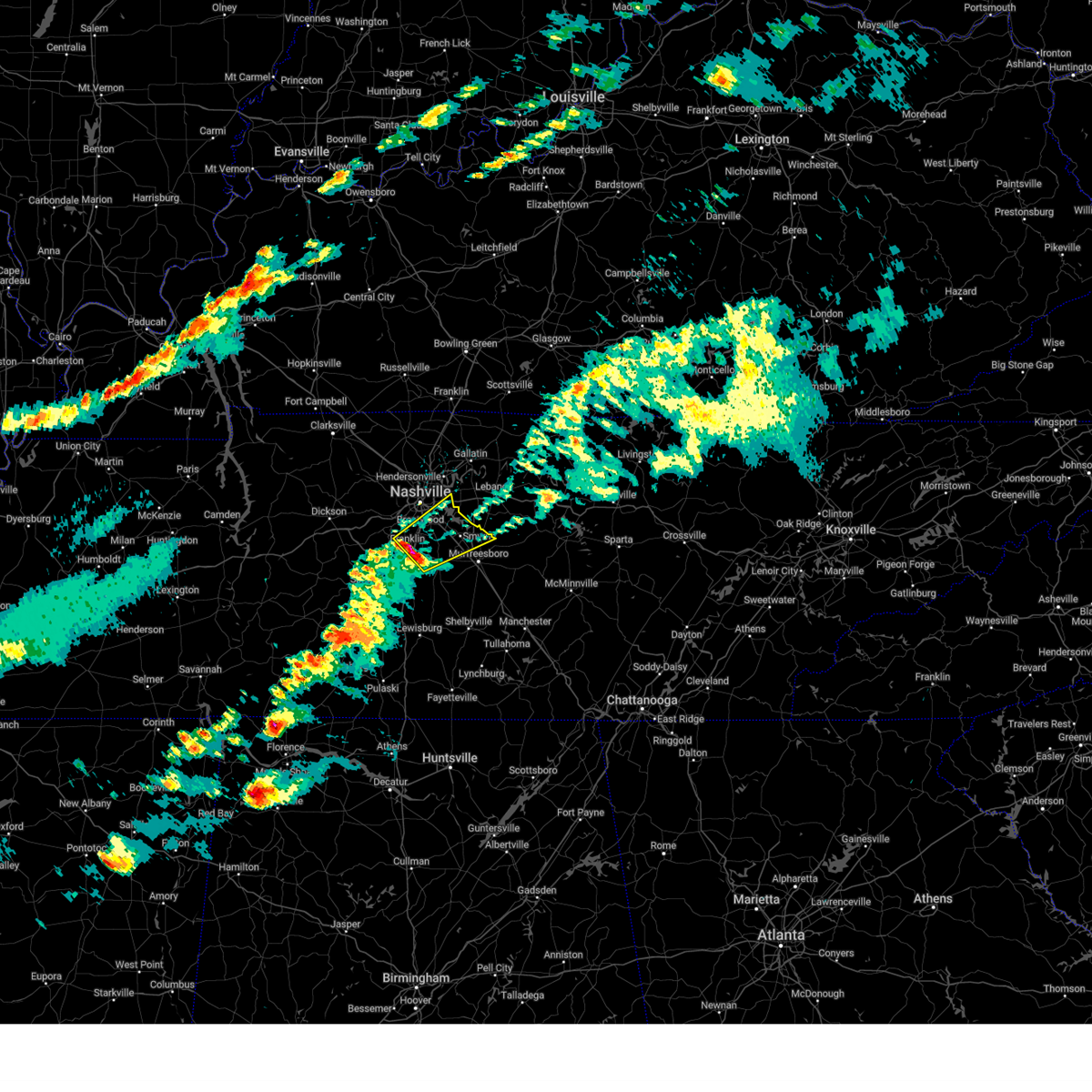
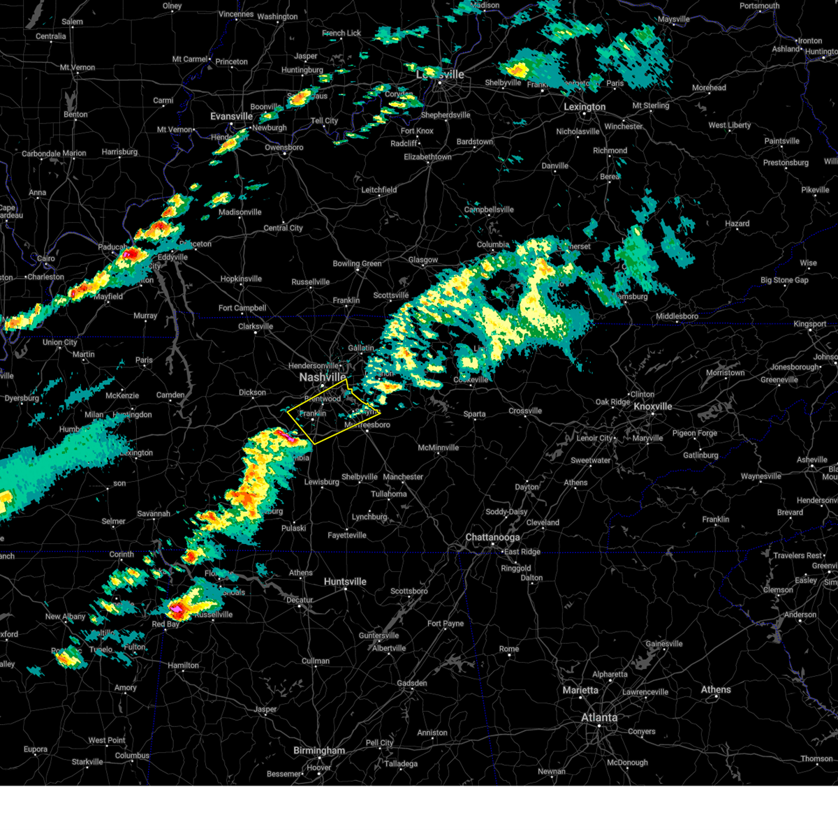
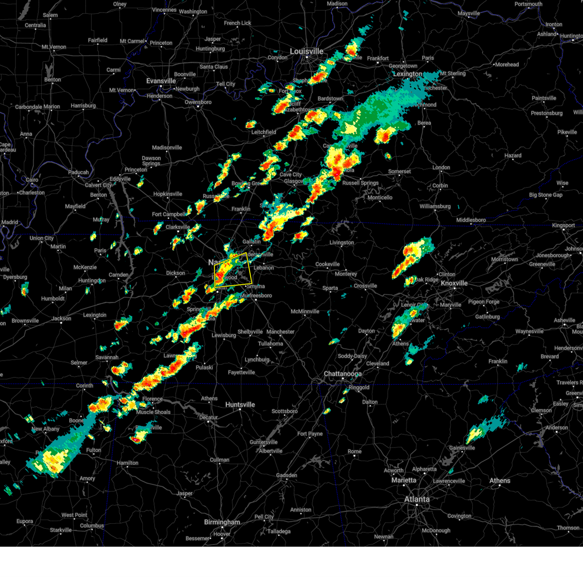
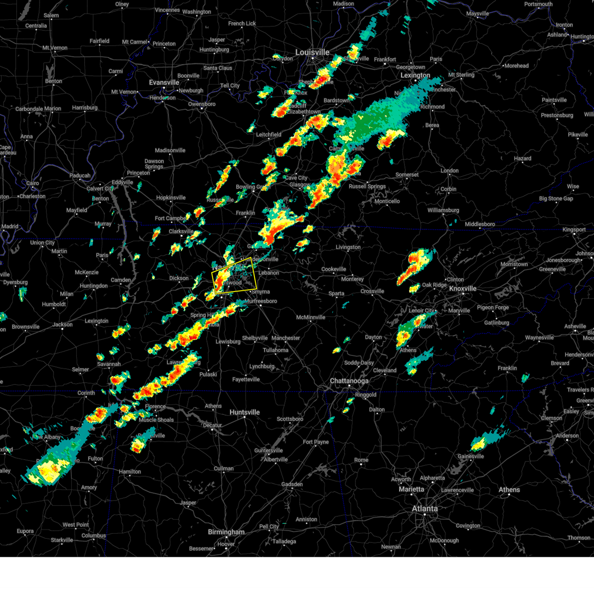
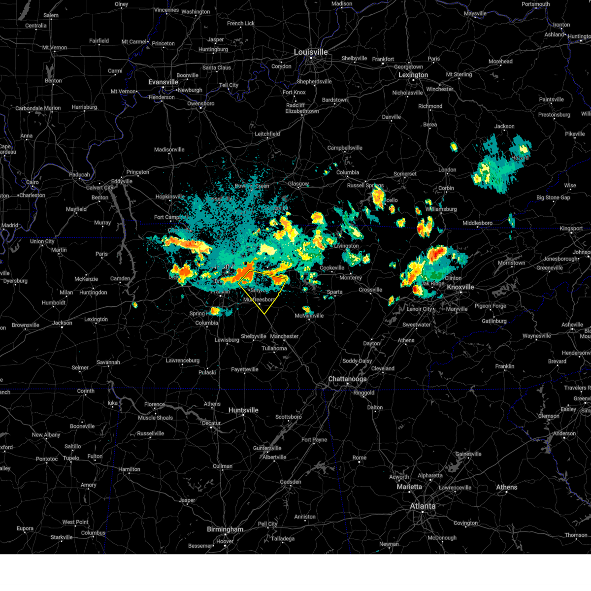
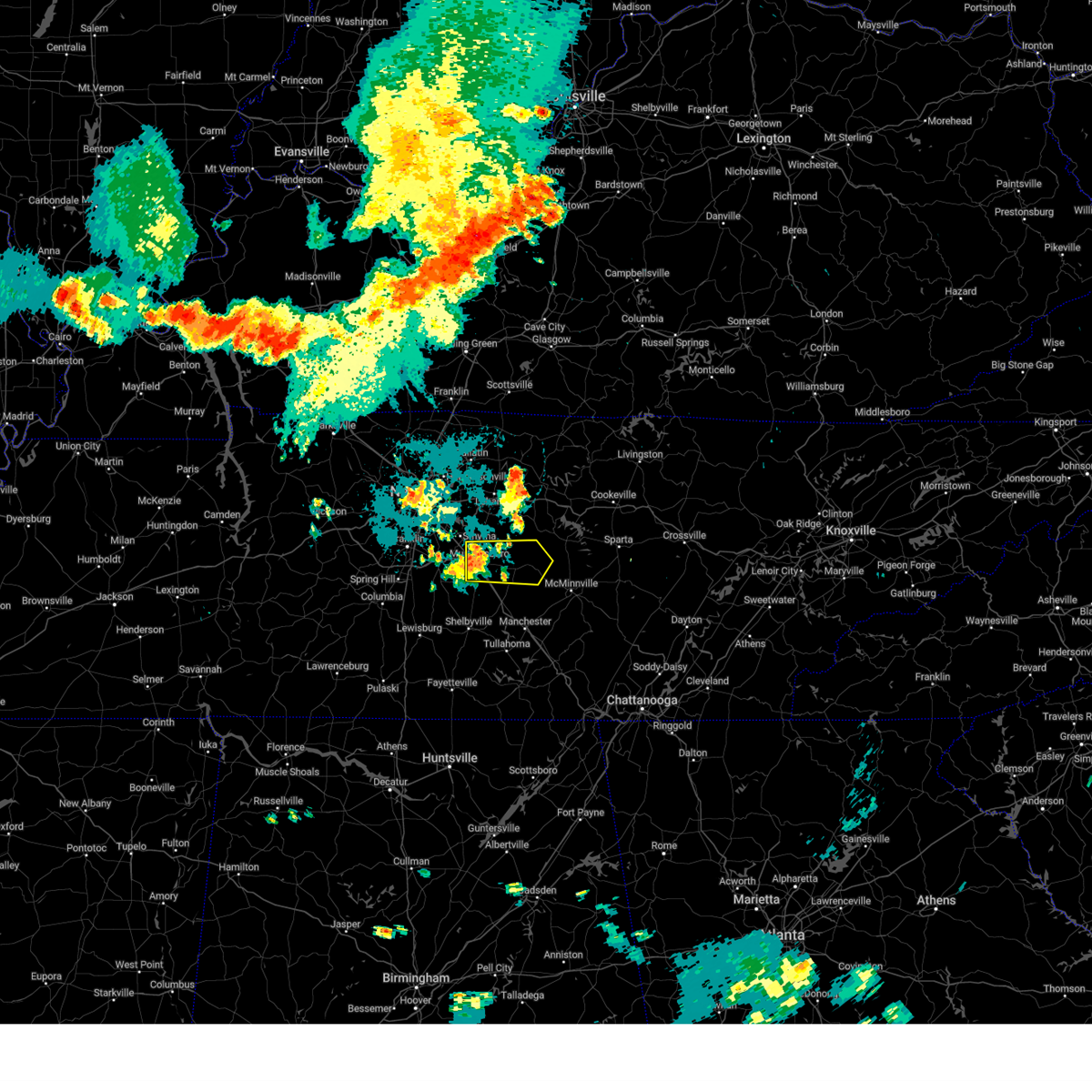
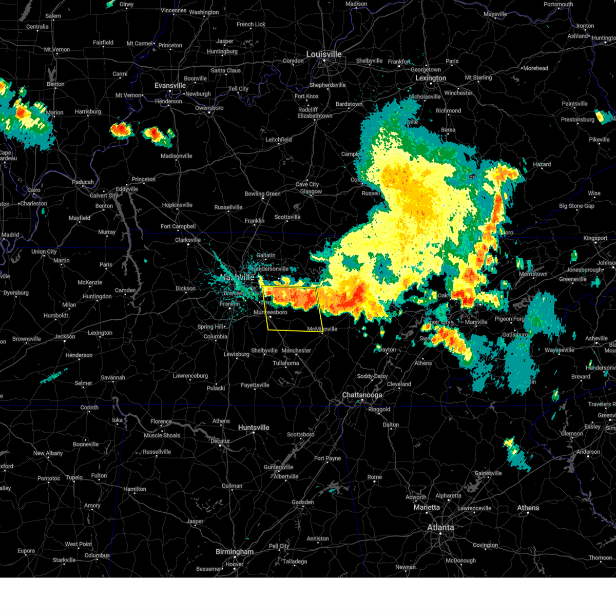
Hail Map for Smyrna, TN
The Smyrna, TN area has had 8 reports of on-the-ground hail by trained spotters, and has been under severe weather warnings 82 times during the past 12 months. Doppler radar has detected hail at or near Smyrna, TN on 81 occasions, including 6 occasions during the past year.
| Name: | Smyrna, TN |
| Where Located: | 20 miles SE of Nashville, TN |
| Map: | Google Map for Smyrna, TN |
| Population: | 39974 |
| Housing Units: | 15787 |
| More Info: | Search Google for Smyrna, TN |
3
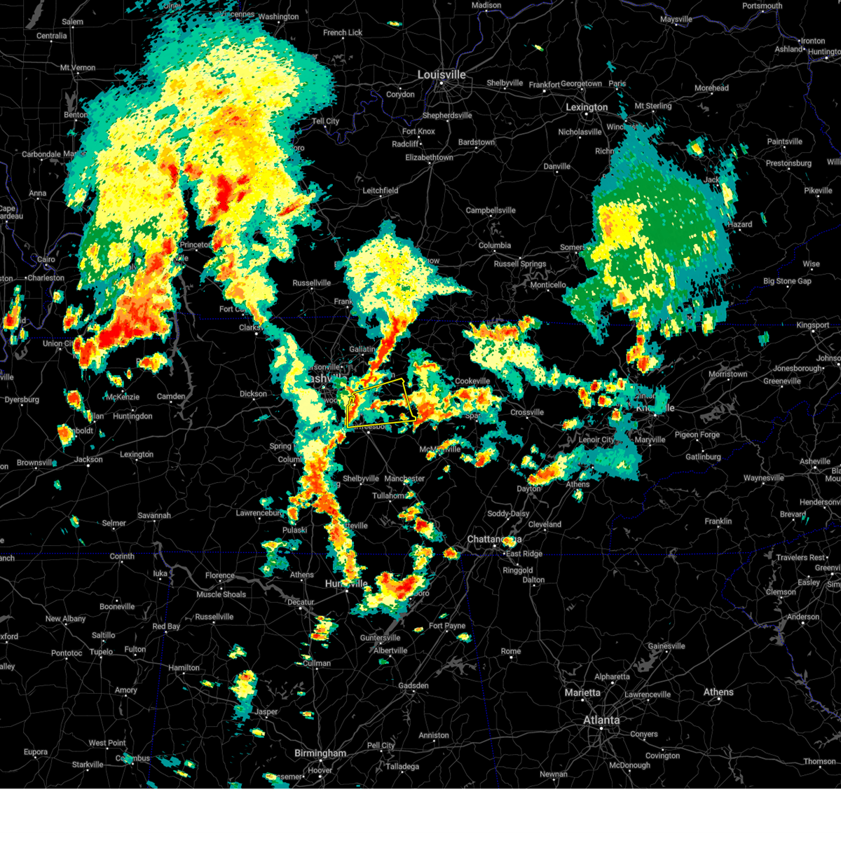
The Top Recent Hail Date for Smyrna, TN is Sunday, March 23, 2025 (3rd out of 81)
Hail and Wind Damage Spotted near Smyrna, TN
| Date / Time | Report Details |
|---|---|
| 6/6/2025 3:40 PM CDT | Multiple trees broken in woodmont subdivisio in rutherford county TN, 2.4 miles ENE of Smyrna, TN |
| 6/6/2025 3:40 PM CDT |
 Svrohx the national weather service in nashville has issued a * severe thunderstorm warning for, northern rutherford county in middle tennessee, southern wilson county in middle tennessee, north central cannon county in middle tennessee, * until 430 pm cdt. * at 339 pm cdt, a severe thunderstorm was located over smyrna, or 10 miles northwest of murfreesboro, moving east at 40 mph (radar indicated). Hazards include 60 mph wind gusts and penny size hail. expect damage to roofs, siding, and trees Svrohx the national weather service in nashville has issued a * severe thunderstorm warning for, northern rutherford county in middle tennessee, southern wilson county in middle tennessee, north central cannon county in middle tennessee, * until 430 pm cdt. * at 339 pm cdt, a severe thunderstorm was located over smyrna, or 10 miles northwest of murfreesboro, moving east at 40 mph (radar indicated). Hazards include 60 mph wind gusts and penny size hail. expect damage to roofs, siding, and trees
|
| 5/20/2025 6:45 PM CDT |
 the severe thunderstorm warning has been cancelled and is no longer in effect the severe thunderstorm warning has been cancelled and is no longer in effect
|
| 5/20/2025 6:45 PM CDT |
 At 644 pm cdt, severe thunderstorms were located along a line extending from lebanon to thompson's station, moving east at 40 mph (radar indicated). Hazards include 60 mph wind gusts and quarter size hail. Hail damage to vehicles is expected. expect wind damage to roofs, siding, and trees. Locations impacted include, tuckers crossroads, murfreesboro, walterhill, thompson's station, la vergne, belinda city, triune, cedars of lebanon state park, lebanon, smyrna, gladeville, mount juliet, rural hill, nolensville, and spring hill. At 644 pm cdt, severe thunderstorms were located along a line extending from lebanon to thompson's station, moving east at 40 mph (radar indicated). Hazards include 60 mph wind gusts and quarter size hail. Hail damage to vehicles is expected. expect wind damage to roofs, siding, and trees. Locations impacted include, tuckers crossroads, murfreesboro, walterhill, thompson's station, la vergne, belinda city, triune, cedars of lebanon state park, lebanon, smyrna, gladeville, mount juliet, rural hill, nolensville, and spring hill.
|
| 5/20/2025 6:33 PM CDT |
 the severe thunderstorm warning has been cancelled and is no longer in effect the severe thunderstorm warning has been cancelled and is no longer in effect
|
| 5/20/2025 6:33 PM CDT |
 At 633 pm cdt, severe thunderstorms were located along a line extending from near hartsville to near thompson's station, moving east at 55 mph (radar indicated). Hazards include 60 mph wind gusts and quarter size hail. Hail damage to vehicles is expected. expect wind damage to roofs, siding, and trees. Locations impacted include, franklin, madison, murfreesboro, nolensville, hermitage, belle meade, hartsville, thompson's station, la vergne, dickerson chapel recreation area, triune, natchez trace at highway 96, hendersonville, cedars of lebanon state park, berry hill, mount juliet, leipers fork, smyrna, oak hill, and green hill. At 633 pm cdt, severe thunderstorms were located along a line extending from near hartsville to near thompson's station, moving east at 55 mph (radar indicated). Hazards include 60 mph wind gusts and quarter size hail. Hail damage to vehicles is expected. expect wind damage to roofs, siding, and trees. Locations impacted include, franklin, madison, murfreesboro, nolensville, hermitage, belle meade, hartsville, thompson's station, la vergne, dickerson chapel recreation area, triune, natchez trace at highway 96, hendersonville, cedars of lebanon state park, berry hill, mount juliet, leipers fork, smyrna, oak hill, and green hill.
|
| 5/20/2025 6:06 PM CDT | Svrohx the national weather service in nashville has issued a * severe thunderstorm warning for, davidson county in middle tennessee, central rutherford county in middle tennessee, north central maury county in middle tennessee, southeastern sumner county in middle tennessee, williamson county in middle tennessee, wilson county in middle tennessee, south central cheatham county in middle tennessee, southwestern trousdale county in middle tennessee, east central hickman county in middle tennessee, * until 700 pm cdt. * at 606 pm cdt, severe thunderstorms were located along a line extending from near hendersonville to centerville, moving east at 50 mph (radar indicated). Hazards include 60 mph wind gusts and quarter size hail. Hail damage to vehicles is expected. Expect wind damage to roofs, siding, and trees. |
| 5/20/2025 5:34 PM CDT | At 533 pm cdt, a severe thunderstorm was located near walterhill, or 8 miles northeast of murfreesboro, moving east at 40 mph (radar indicated). Hazards include ping pong ball size hail and 60 mph wind gusts. People and animals outdoors will be injured. expect hail damage to roofs, siding, windows, and vehicles. expect wind damage to roofs, siding, and trees. Locations impacted include, lascassas, murfreesboro, nolensville, walterhill, brentwood, la vergne, triune, cedars of lebanon state park, auburntown, eagleville, woodbury, rockvale, smyrna, milton, readyville, and franklin. |
| 5/20/2025 4:49 PM CDT |
 Svrohx the national weather service in nashville has issued a * severe thunderstorm warning for, southeastern davidson county in middle tennessee, rutherford county in middle tennessee, eastern williamson county in middle tennessee, southeastern wilson county in middle tennessee, northwestern cannon county in middle tennessee, * until 545 pm cdt. * at 448 pm cdt, a severe thunderstorm was located near nolensville, or 7 miles southeast of franklin, moving east at 45 mph. this is a destructive storm for williamson and rutherford counties (trained weather spotters. at 445 pm cdt...numerous reports of golfball to tennis ball size hail were received in franklin). Hazards include baseball size hail and 60 mph wind gusts. People and animals outdoors will be severely injured. Expect shattered windows, extensive damage to roofs, siding, and vehicles. Svrohx the national weather service in nashville has issued a * severe thunderstorm warning for, southeastern davidson county in middle tennessee, rutherford county in middle tennessee, eastern williamson county in middle tennessee, southeastern wilson county in middle tennessee, northwestern cannon county in middle tennessee, * until 545 pm cdt. * at 448 pm cdt, a severe thunderstorm was located near nolensville, or 7 miles southeast of franklin, moving east at 45 mph. this is a destructive storm for williamson and rutherford counties (trained weather spotters. at 445 pm cdt...numerous reports of golfball to tennis ball size hail were received in franklin). Hazards include baseball size hail and 60 mph wind gusts. People and animals outdoors will be severely injured. Expect shattered windows, extensive damage to roofs, siding, and vehicles.
|
| 5/8/2025 5:52 PM CDT | the severe thunderstorm warning has been cancelled and is no longer in effect |
| 5/8/2025 5:47 PM CDT | At 547 pm cdt, a severe thunderstorm was located near smyrna, or 10 miles west of murfreesboro, moving east at 35 mph (radar indicated). Hazards include 60 mph wind gusts and quarter size hail. Hail damage to vehicles is expected. expect wind damage to roofs, siding, and trees. locations impacted include, cedars of lebanon state park, lascassas, walterhill, smyrna, milton, la vergne, murfreesboro, and nolensville. this includes the following highways, interstate 24 between mile markers 64 and 77. Interstate 840 between mile markers 46 and 65. |
| 5/8/2025 5:47 PM CDT | the severe thunderstorm warning has been cancelled and is no longer in effect |
| 5/8/2025 5:32 PM CDT | Svrohx the national weather service in nashville has issued a * severe thunderstorm warning for, southeastern davidson county in middle tennessee, northern rutherford county in middle tennessee, northeastern williamson county in middle tennessee, southwestern wilson county in middle tennessee, * until 615 pm cdt. * at 531 pm cdt, a severe thunderstorm was located near nolensville, or 8 miles east of franklin, moving east at 40 mph (radar indicated). Hazards include 60 mph wind gusts and quarter size hail. Hail damage to vehicles is expected. Expect wind damage to roofs, siding, and trees. |
| 5/8/2025 4:15 PM CDT | Svrohx the national weather service in nashville has issued a * severe thunderstorm warning for, northeastern rutherford county in middle tennessee, southeastern wilson county in middle tennessee, north central cannon county in middle tennessee, * until 500 pm cdt. * at 415 pm cdt, a severe thunderstorm was located near smyrna, or 9 miles north of murfreesboro, moving east at 30 mph (radar indicated). Hazards include 60 mph wind gusts and quarter size hail. Hail damage to vehicles is expected. Expect wind damage to roofs, siding, and trees. |
| 5/8/2025 4:05 PM CDT |
 At 404 pm cdt, a severe thunderstorm was located over rural hill, or 12 miles southwest of lebanon, moving east at 30 mph (radar indicated). Hazards include 60 mph wind gusts and nickel size hail. Expect damage to roofs, siding, and trees. locations impacted include, walterhill, rural hill, la vergne, percy priest lake, smyrna, gladeville, belinda city, mount juliet, murfreesboro, and lebanon. this includes the following highways, interstate 40 between mile markers 224 and 231. interstate 24 between mile markers 65 and 71. Interstate 840 between mile markers 56 and 72. At 404 pm cdt, a severe thunderstorm was located over rural hill, or 12 miles southwest of lebanon, moving east at 30 mph (radar indicated). Hazards include 60 mph wind gusts and nickel size hail. Expect damage to roofs, siding, and trees. locations impacted include, walterhill, rural hill, la vergne, percy priest lake, smyrna, gladeville, belinda city, mount juliet, murfreesboro, and lebanon. this includes the following highways, interstate 40 between mile markers 224 and 231. interstate 24 between mile markers 65 and 71. Interstate 840 between mile markers 56 and 72.
|
| 5/8/2025 3:48 PM CDT |
 At 348 pm cdt, a severe thunderstorm was located near nolensville, or 10 miles northeast of franklin, moving east at 30 mph (radar indicated). Hazards include 60 mph wind gusts and quarter size hail. Hail damage to vehicles is expected. expect wind damage to roofs, siding, and trees. locations impacted include, walterhill, rural hill, la vergne, antioch, belinda city, mount juliet, percy priest lake, smyrna, gladeville, oak hill, nolensville, brentwood, murfreesboro, and lebanon. this includes the following highways, interstate 40 between mile markers 217 and 218, and between mile markers 222 and 231. interstate 65 between mile markers 75 and 78. interstate 24 between mile markers 54 and 71. Interstate 840 between mile markers 56 and 72. At 348 pm cdt, a severe thunderstorm was located near nolensville, or 10 miles northeast of franklin, moving east at 30 mph (radar indicated). Hazards include 60 mph wind gusts and quarter size hail. Hail damage to vehicles is expected. expect wind damage to roofs, siding, and trees. locations impacted include, walterhill, rural hill, la vergne, antioch, belinda city, mount juliet, percy priest lake, smyrna, gladeville, oak hill, nolensville, brentwood, murfreesboro, and lebanon. this includes the following highways, interstate 40 between mile markers 217 and 218, and between mile markers 222 and 231. interstate 65 between mile markers 75 and 78. interstate 24 between mile markers 54 and 71. Interstate 840 between mile markers 56 and 72.
|
| 5/8/2025 3:48 PM CDT |
 the severe thunderstorm warning has been cancelled and is no longer in effect the severe thunderstorm warning has been cancelled and is no longer in effect
|
| 5/8/2025 3:38 PM CDT |
 Svrohx the national weather service in nashville has issued a * severe thunderstorm warning for, southeastern davidson county in middle tennessee, northwestern rutherford county in middle tennessee, northeastern williamson county in middle tennessee, southwestern wilson county in middle tennessee, * until 430 pm cdt. * at 338 pm cdt, a severe thunderstorm was located over brentwood, or near franklin, moving east at 25 mph (radar indicated). Hazards include 60 mph wind gusts and half dollar size hail. Hail damage to vehicles is expected. Expect wind damage to roofs, siding, and trees. Svrohx the national weather service in nashville has issued a * severe thunderstorm warning for, southeastern davidson county in middle tennessee, northwestern rutherford county in middle tennessee, northeastern williamson county in middle tennessee, southwestern wilson county in middle tennessee, * until 430 pm cdt. * at 338 pm cdt, a severe thunderstorm was located over brentwood, or near franklin, moving east at 25 mph (radar indicated). Hazards include 60 mph wind gusts and half dollar size hail. Hail damage to vehicles is expected. Expect wind damage to roofs, siding, and trees.
|
| 5/8/2025 3:27 PM CDT | At 327 pm cdt, a severe thunderstorm was located near franklin, moving east at 25 mph (radar indicated). Hazards include 60 mph wind gusts and quarter size hail. Hail damage to vehicles is expected. expect wind damage to roofs, siding, and trees. locations impacted include, franklin, berry hill, forest hills, nolensville, belle meade, brentwood, nashville, bellevue, antioch, and oak hill. this includes the following highways, interstate 40 between mile markers 196 and 197, and between mile markers 209 and 215. interstate 65 between mile markers 65 and 82. Interstate 24 between mile markers 48 and 63. |
| 5/8/2025 3:06 PM CDT | Svrohx the national weather service in nashville has issued a * severe thunderstorm warning for, southwestern davidson county in middle tennessee, northern williamson county in middle tennessee, * until 345 pm cdt. * at 306 pm cdt, a severe thunderstorm was located 7 miles east of fairview, or 8 miles west of franklin, moving east at 30 mph (radar indicated). Hazards include 60 mph wind gusts and quarter size hail. Hail damage to vehicles is expected. Expect wind damage to roofs, siding, and trees. |
| 5/2/2025 1:53 PM CDT |
 The storm which prompted the warning has weakened below severe limits, and no longer poses an immediate threat to life or property. therefore, the warning will be allowed to expire. however, small hail and gusty winds are still possible with this thunderstorm. a severe thunderstorm watch remains in effect until 500 pm cdt for middle tennessee. The storm which prompted the warning has weakened below severe limits, and no longer poses an immediate threat to life or property. therefore, the warning will be allowed to expire. however, small hail and gusty winds are still possible with this thunderstorm. a severe thunderstorm watch remains in effect until 500 pm cdt for middle tennessee.
|
| 5/2/2025 1:41 PM CDT |
 At 140 pm cdt, a severe thunderstorm was located near rural hill, or 14 miles southwest of lebanon, moving east at 30 mph (radar indicated). Hazards include 60 mph wind gusts and half dollar size hail. Hail damage to vehicles is expected. expect wind damage to roofs, siding, and trees. locations impacted include, green hill, hermitage, rural hill, la vergne, antioch, belinda city, lakewood, hendersonville, mount juliet, old hickory, percy priest lake, smyrna, gladeville, walterhill, and lebanon. this includes the following highways, interstate 40 between mile markers 217 and 231. interstate 24 between mile markers 57 and 67. Interstate 840 between mile markers 58 and 71. At 140 pm cdt, a severe thunderstorm was located near rural hill, or 14 miles southwest of lebanon, moving east at 30 mph (radar indicated). Hazards include 60 mph wind gusts and half dollar size hail. Hail damage to vehicles is expected. expect wind damage to roofs, siding, and trees. locations impacted include, green hill, hermitage, rural hill, la vergne, antioch, belinda city, lakewood, hendersonville, mount juliet, old hickory, percy priest lake, smyrna, gladeville, walterhill, and lebanon. this includes the following highways, interstate 40 between mile markers 217 and 231. interstate 24 between mile markers 57 and 67. Interstate 840 between mile markers 58 and 71.
|
| 5/2/2025 1:34 PM CDT |
 At 134 pm cdt, a severe thunderstorm was located near la vergne, or 12 miles southeast of nashville, moving east at 30 mph (radar indicated). Hazards include 60 mph wind gusts and half dollar size hail. Hail damage to vehicles is expected. expect wind damage to roofs, siding, and trees. locations impacted include, green hill, madison, hermitage, rural hill, la vergne, antioch, belinda city, lakewood, hendersonville, mount juliet, old hickory, percy priest lake, smyrna, gladeville, walterhill, nolensville, goodlettsville, and lebanon. this includes the following highways, interstate 40 between mile markers 212 and 231. interstate 65 between mile markers 90 and 93. interstate 24 between mile markers 52 and 67. Interstate 840 between mile markers 58 and 71. At 134 pm cdt, a severe thunderstorm was located near la vergne, or 12 miles southeast of nashville, moving east at 30 mph (radar indicated). Hazards include 60 mph wind gusts and half dollar size hail. Hail damage to vehicles is expected. expect wind damage to roofs, siding, and trees. locations impacted include, green hill, madison, hermitage, rural hill, la vergne, antioch, belinda city, lakewood, hendersonville, mount juliet, old hickory, percy priest lake, smyrna, gladeville, walterhill, nolensville, goodlettsville, and lebanon. this includes the following highways, interstate 40 between mile markers 212 and 231. interstate 65 between mile markers 90 and 93. interstate 24 between mile markers 52 and 67. Interstate 840 between mile markers 58 and 71.
|
| 5/2/2025 1:30 PM CDT |
 At 130 pm cdt, a severe thunderstorm was located over antioch, or 10 miles southeast of nashville, moving east at 30 mph (radar indicated). Hazards include 60 mph wind gusts and quarter size hail. Hail damage to vehicles is expected. expect wind damage to roofs, siding, and trees. locations impacted include, green hill, madison, hermitage, rural hill, la vergne, antioch, belinda city, lakewood, hendersonville, mount juliet, old hickory, percy priest lake, smyrna, gladeville, walterhill, nolensville, goodlettsville, and lebanon. this includes the following highways, interstate 40 between mile markers 212 and 231. interstate 65 between mile markers 90 and 93. interstate 24 between mile markers 52 and 67. Interstate 840 between mile markers 58 and 71. At 130 pm cdt, a severe thunderstorm was located over antioch, or 10 miles southeast of nashville, moving east at 30 mph (radar indicated). Hazards include 60 mph wind gusts and quarter size hail. Hail damage to vehicles is expected. expect wind damage to roofs, siding, and trees. locations impacted include, green hill, madison, hermitage, rural hill, la vergne, antioch, belinda city, lakewood, hendersonville, mount juliet, old hickory, percy priest lake, smyrna, gladeville, walterhill, nolensville, goodlettsville, and lebanon. this includes the following highways, interstate 40 between mile markers 212 and 231. interstate 65 between mile markers 90 and 93. interstate 24 between mile markers 52 and 67. Interstate 840 between mile markers 58 and 71.
|
| 5/2/2025 1:30 PM CDT |
 the severe thunderstorm warning has been cancelled and is no longer in effect the severe thunderstorm warning has been cancelled and is no longer in effect
|
| 5/2/2025 1:18 PM CDT | Svrohx the national weather service in nashville has issued a * severe thunderstorm warning for, southeastern davidson county in middle tennessee, northwestern rutherford county in middle tennessee, south central sumner county in middle tennessee, northeastern williamson county in middle tennessee, western wilson county in middle tennessee, * until 200 pm cdt. * at 118 pm cdt, a severe thunderstorm was located over oak hill, or 7 miles south of nashville, moving east at 30 mph (radar indicated). Hazards include 60 mph wind gusts and quarter size hail. Hail damage to vehicles is expected. Expect wind damage to roofs, siding, and trees. |
| 4/10/2025 5:59 PM CDT |
 At 558 pm cdt, severe thunderstorms were located along a line extending from near hartsville to 8 miles southeast of murfreesboro, moving east at 35 mph (radar indicated). Hazards include 60 mph wind gusts. Expect damage to roofs, siding, and trees. locations impacted include, gordonsville, hartsville, pleasant shade, la vergne, gallatin, bledsoe creek state park, dickerson chapel recreation area, liberty, cedars of lebanon state park, carthage, auburntown, center hill lake, mount juliet, alexandria, smyrna, edgar evins state park, south carthage, lascassas, tuckers crossroads, and hickman. this includes the following highways, interstate 40 between mile markers 225 and 267. interstate 24 between mile markers 66 and 73. Interstate 840 between mile markers 54 and 76. At 558 pm cdt, severe thunderstorms were located along a line extending from near hartsville to 8 miles southeast of murfreesboro, moving east at 35 mph (radar indicated). Hazards include 60 mph wind gusts. Expect damage to roofs, siding, and trees. locations impacted include, gordonsville, hartsville, pleasant shade, la vergne, gallatin, bledsoe creek state park, dickerson chapel recreation area, liberty, cedars of lebanon state park, carthage, auburntown, center hill lake, mount juliet, alexandria, smyrna, edgar evins state park, south carthage, lascassas, tuckers crossroads, and hickman. this includes the following highways, interstate 40 between mile markers 225 and 267. interstate 24 between mile markers 66 and 73. Interstate 840 between mile markers 54 and 76.
|
| 4/10/2025 5:59 PM CDT |
 the severe thunderstorm warning has been cancelled and is no longer in effect the severe thunderstorm warning has been cancelled and is no longer in effect
|
| 4/10/2025 5:57 PM CDT |
 At 557 pm cdt, a severe thunderstorm was located near murfreesboro, moving east at 30 mph (radar indicated). Hazards include 60 mph wind gusts. Expect damage to roofs, siding, and trees. locations impacted include, lascassas, christiana, murfreesboro, bell buckle, fosterville, chapel hill, rover, eagleville, deason, rockvale, unionville, wartrace, smyrna, and walterhill. this includes the following highways, interstate 24 between mile markers 67 and 96. Interstate 840 between mile markers 46 and 58. At 557 pm cdt, a severe thunderstorm was located near murfreesboro, moving east at 30 mph (radar indicated). Hazards include 60 mph wind gusts. Expect damage to roofs, siding, and trees. locations impacted include, lascassas, christiana, murfreesboro, bell buckle, fosterville, chapel hill, rover, eagleville, deason, rockvale, unionville, wartrace, smyrna, and walterhill. this includes the following highways, interstate 24 between mile markers 67 and 96. Interstate 840 between mile markers 46 and 58.
|
| 4/10/2025 5:57 PM CDT |
 the severe thunderstorm warning has been cancelled and is no longer in effect the severe thunderstorm warning has been cancelled and is no longer in effect
|
| 4/10/2025 5:45 PM CDT | Smyrna awo in rutherford county TN, 3.5 miles S of Smyrna, TN |
| 4/10/2025 5:41 PM CDT | Svrohx the national weather service in nashville has issued a * severe thunderstorm warning for, smith county in middle tennessee, southeastern davidson county in middle tennessee, western de kalb county in middle tennessee, northern rutherford county in middle tennessee, southern sumner county in middle tennessee, northeastern williamson county in middle tennessee, wilson county in middle tennessee, southern macon county in middle tennessee, trousdale county in middle tennessee, northern cannon county in middle tennessee, * until 630 pm cdt. * at 541 pm cdt, severe thunderstorms were located along a line extending from 6 miles northeast of gallatin to near murfreesboro, moving east at 35 mph (radar indicated). Hazards include 60 mph wind gusts. expect damage to roofs, siding, and trees |
| 4/10/2025 5:31 PM CDT |
 At 531 pm cdt, severe thunderstorms were located along a line extending from 6 miles east of white house to near antioch, moving east at 45 mph (emergency management). Hazards include 60 mph wind gusts. Expect damage to roofs, siding, and trees. locations impacted include, madison, nolensville, hermitage, belle meade, la vergne, millersville, gallatin, bledsoe creek state park, hendersonville, greenbrier, berry hill, cottontown, mount juliet, smyrna, oak hill, green hill, forest hills, ridgetop, bethpage, and goodlettsville. this includes the following highways, interstate 40 between mile markers 201 and 238. interstate 65 between mile markers 69 and 110. interstate 24 between mile markers 36 and 70. Interstate 840 between mile markers 56 and 76. At 531 pm cdt, severe thunderstorms were located along a line extending from 6 miles east of white house to near antioch, moving east at 45 mph (emergency management). Hazards include 60 mph wind gusts. Expect damage to roofs, siding, and trees. locations impacted include, madison, nolensville, hermitage, belle meade, la vergne, millersville, gallatin, bledsoe creek state park, hendersonville, greenbrier, berry hill, cottontown, mount juliet, smyrna, oak hill, green hill, forest hills, ridgetop, bethpage, and goodlettsville. this includes the following highways, interstate 40 between mile markers 201 and 238. interstate 65 between mile markers 69 and 110. interstate 24 between mile markers 36 and 70. Interstate 840 between mile markers 56 and 76.
|
| 4/10/2025 5:31 PM CDT |
 the severe thunderstorm warning has been cancelled and is no longer in effect the severe thunderstorm warning has been cancelled and is no longer in effect
|
| 4/10/2025 5:29 PM CDT |
 Svrohx the national weather service in nashville has issued a * severe thunderstorm warning for, northeastern marshall county in middle tennessee, rutherford county in middle tennessee, northeastern maury county in middle tennessee, eastern williamson county in middle tennessee, northern bedford county in middle tennessee, * until 615 pm cdt. * at 529 pm cdt, a severe thunderstorm was located near franklin, moving east at 30 mph (radar indicated). Hazards include 60 mph wind gusts. expect damage to roofs, siding, and trees Svrohx the national weather service in nashville has issued a * severe thunderstorm warning for, northeastern marshall county in middle tennessee, rutherford county in middle tennessee, northeastern maury county in middle tennessee, eastern williamson county in middle tennessee, northern bedford county in middle tennessee, * until 615 pm cdt. * at 529 pm cdt, a severe thunderstorm was located near franklin, moving east at 30 mph (radar indicated). Hazards include 60 mph wind gusts. expect damage to roofs, siding, and trees
|
| 4/10/2025 5:24 PM CDT |
 At 524 pm cdt, severe thunderstorms were located along a line extending from near white house to near brentwood, moving east at 45 mph (emergency management). Hazards include 60 mph wind gusts. Expect damage to roofs, siding, and trees. locations impacted include, madison, nolensville, hermitage, belle meade, la vergne, millersville, gallatin, bledsoe creek state park, hendersonville, greenbrier, berry hill, cottontown, mount juliet, smyrna, oak hill, green hill, forest hills, ridgetop, bethpage, and goodlettsville. this includes the following highways, interstate 40 between mile markers 191 and 238. interstate 65 between mile markers 70 and 110. interstate 24 between mile markers 29 and 70. Interstate 840 between mile markers 56 and 76. At 524 pm cdt, severe thunderstorms were located along a line extending from near white house to near brentwood, moving east at 45 mph (emergency management). Hazards include 60 mph wind gusts. Expect damage to roofs, siding, and trees. locations impacted include, madison, nolensville, hermitage, belle meade, la vergne, millersville, gallatin, bledsoe creek state park, hendersonville, greenbrier, berry hill, cottontown, mount juliet, smyrna, oak hill, green hill, forest hills, ridgetop, bethpage, and goodlettsville. this includes the following highways, interstate 40 between mile markers 191 and 238. interstate 65 between mile markers 70 and 110. interstate 24 between mile markers 29 and 70. Interstate 840 between mile markers 56 and 76.
|
| 4/10/2025 5:05 PM CDT |
 Svrohx the national weather service in nashville has issued a * severe thunderstorm warning for, davidson county in middle tennessee, northwestern rutherford county in middle tennessee, southern sumner county in middle tennessee, northeastern williamson county in middle tennessee, western wilson county in middle tennessee, southeastern cheatham county in middle tennessee, western trousdale county in middle tennessee, southeastern robertson county in middle tennessee, * until 545 pm cdt. * at 504 pm cdt, severe thunderstorms were located along a line extending from near springfield to near pegram, moving east at 45 mph (radar indicated). Hazards include 60 mph wind gusts. expect damage to roofs, siding, and trees Svrohx the national weather service in nashville has issued a * severe thunderstorm warning for, davidson county in middle tennessee, northwestern rutherford county in middle tennessee, southern sumner county in middle tennessee, northeastern williamson county in middle tennessee, western wilson county in middle tennessee, southeastern cheatham county in middle tennessee, western trousdale county in middle tennessee, southeastern robertson county in middle tennessee, * until 545 pm cdt. * at 504 pm cdt, severe thunderstorms were located along a line extending from near springfield to near pegram, moving east at 45 mph (radar indicated). Hazards include 60 mph wind gusts. expect damage to roofs, siding, and trees
|
| 4/3/2025 4:55 PM CDT |
 the severe thunderstorm warning has been cancelled and is no longer in effect the severe thunderstorm warning has been cancelled and is no longer in effect
|
| 4/3/2025 4:55 PM CDT |
 At 455 pm cdt, a severe thunderstorm was located over franklin, moving northeast at 60 mph (radar indicated). Hazards include 60 mph wind gusts and quarter size hail. Hail damage to vehicles is expected. expect wind damage to roofs, siding, and trees. locations impacted include, franklin, forest hills, nolensville, hermitage, thompson's station, brentwood, la vergne, antioch, triune, berry hill, leipers fork, percy priest lake, smyrna, oak hill, murfreesboro, rural hill, walterhill, belle meade, and spring hill. this includes the following highways, interstate 40 between mile markers 212 and 221. interstate 65 between mile markers 57 and 81. interstate 24 between mile markers 52 and 76. Interstate 840 between mile markers 13 and 62. At 455 pm cdt, a severe thunderstorm was located over franklin, moving northeast at 60 mph (radar indicated). Hazards include 60 mph wind gusts and quarter size hail. Hail damage to vehicles is expected. expect wind damage to roofs, siding, and trees. locations impacted include, franklin, forest hills, nolensville, hermitage, thompson's station, brentwood, la vergne, antioch, triune, berry hill, leipers fork, percy priest lake, smyrna, oak hill, murfreesboro, rural hill, walterhill, belle meade, and spring hill. this includes the following highways, interstate 40 between mile markers 212 and 221. interstate 65 between mile markers 57 and 81. interstate 24 between mile markers 52 and 76. Interstate 840 between mile markers 13 and 62.
|
| 4/3/2025 4:39 PM CDT |
 Svrohx the national weather service in nashville has issued a * severe thunderstorm warning for, southeastern davidson county in middle tennessee, northwestern rutherford county in middle tennessee, northern maury county in middle tennessee, williamson county in middle tennessee, east central hickman county in middle tennessee, * until 515 pm cdt. * at 438 pm cdt, a severe thunderstorm was located 10 miles west of spring hill, or 10 miles north of columbia, moving northeast at 60 mph (radar indicated). Hazards include 60 mph wind gusts and quarter size hail. Hail damage to vehicles is expected. Expect wind damage to roofs, siding, and trees. Svrohx the national weather service in nashville has issued a * severe thunderstorm warning for, southeastern davidson county in middle tennessee, northwestern rutherford county in middle tennessee, northern maury county in middle tennessee, williamson county in middle tennessee, east central hickman county in middle tennessee, * until 515 pm cdt. * at 438 pm cdt, a severe thunderstorm was located 10 miles west of spring hill, or 10 miles north of columbia, moving northeast at 60 mph (radar indicated). Hazards include 60 mph wind gusts and quarter size hail. Hail damage to vehicles is expected. Expect wind damage to roofs, siding, and trees.
|
| 4/3/2025 4:18 PM CDT | the tornado warning has been cancelled and is no longer in effect |
| 4/3/2025 4:06 PM CDT |
 Torohx the national weather service in nashville has issued a * tornado warning for, southeastern davidson county in middle tennessee, northern rutherford county in middle tennessee, northeastern williamson county in middle tennessee, southwestern wilson county in middle tennessee, * until 430 pm cdt. * at 406 pm cdt, a severe thunderstorm capable of producing a tornado was located near franklin, moving northeast at 45 mph (radar indicated rotation). Hazards include tornado and quarter size hail. Flying debris will be dangerous to those caught without shelter. mobile homes will be damaged or destroyed. damage to roofs, windows, and vehicles will occur. tree damage is likely. this dangerous storm will be near, franklin and nolensville around 410 pm cdt. la vergne and smyrna around 415 pm cdt. other locations impacted by this tornadic thunderstorm include triune, lascassas, and gladeville. this includes the following highways, interstate 65 between mile markers 59 and 72. interstate 24 between mile markers 58 and 77. Interstate 840 between mile markers 31 and 69. Torohx the national weather service in nashville has issued a * tornado warning for, southeastern davidson county in middle tennessee, northern rutherford county in middle tennessee, northeastern williamson county in middle tennessee, southwestern wilson county in middle tennessee, * until 430 pm cdt. * at 406 pm cdt, a severe thunderstorm capable of producing a tornado was located near franklin, moving northeast at 45 mph (radar indicated rotation). Hazards include tornado and quarter size hail. Flying debris will be dangerous to those caught without shelter. mobile homes will be damaged or destroyed. damage to roofs, windows, and vehicles will occur. tree damage is likely. this dangerous storm will be near, franklin and nolensville around 410 pm cdt. la vergne and smyrna around 415 pm cdt. other locations impacted by this tornadic thunderstorm include triune, lascassas, and gladeville. this includes the following highways, interstate 65 between mile markers 59 and 72. interstate 24 between mile markers 58 and 77. Interstate 840 between mile markers 31 and 69.
|
| 4/3/2025 3:53 PM CDT |
 At 352 pm cdt, a severe thunderstorm was located over franklin, moving northeast at 50 mph (radar indicated). Hazards include two inch hail and 60 mph wind gusts. People and animals outdoors will be injured. expect hail damage to roofs, siding, windows, and vehicles. expect wind damage to roofs, siding, and trees. locations impacted include, franklin, nolensville, thompson's station, brentwood, leipers fork, antioch, oak hill, triune, forest hills, spring hill, smyrna, and la vergne. this includes the following highways, interstate 65 between mile markers 56 and 79. interstate 24 between mile markers 53 and 65. Interstate 840 between mile markers 14 and 18, and between mile markers 21 and 51. At 352 pm cdt, a severe thunderstorm was located over franklin, moving northeast at 50 mph (radar indicated). Hazards include two inch hail and 60 mph wind gusts. People and animals outdoors will be injured. expect hail damage to roofs, siding, windows, and vehicles. expect wind damage to roofs, siding, and trees. locations impacted include, franklin, nolensville, thompson's station, brentwood, leipers fork, antioch, oak hill, triune, forest hills, spring hill, smyrna, and la vergne. this includes the following highways, interstate 65 between mile markers 56 and 79. interstate 24 between mile markers 53 and 65. Interstate 840 between mile markers 14 and 18, and between mile markers 21 and 51.
|
| 4/3/2025 3:53 PM CDT |
 the severe thunderstorm warning has been cancelled and is no longer in effect the severe thunderstorm warning has been cancelled and is no longer in effect
|
| 4/3/2025 3:32 PM CDT |
 the severe thunderstorm warning has been cancelled and is no longer in effect the severe thunderstorm warning has been cancelled and is no longer in effect
|
| 4/3/2025 3:32 PM CDT |
 At 332 pm cdt, a severe thunderstorm was located 10 miles west of spring hill, or 12 miles north of columbia, moving northeast at 50 mph (radar indicated). Hazards include two inch hail and 60 mph wind gusts. People and animals outdoors will be injured. expect hail damage to roofs, siding, windows, and vehicles. expect wind damage to roofs, siding, and trees. locations impacted include, franklin, nolensville, spring hill, thompson's station, brentwood, antioch, triune, santa fe, leipers fork, oak hill, forest hills, smyrna, la vergne, and columbia. this includes the following highways, interstate 65 between mile markers 53 and 79. interstate 24 between mile markers 53 and 65. Interstate 840 between mile markers 13 and 51. At 332 pm cdt, a severe thunderstorm was located 10 miles west of spring hill, or 12 miles north of columbia, moving northeast at 50 mph (radar indicated). Hazards include two inch hail and 60 mph wind gusts. People and animals outdoors will be injured. expect hail damage to roofs, siding, windows, and vehicles. expect wind damage to roofs, siding, and trees. locations impacted include, franklin, nolensville, spring hill, thompson's station, brentwood, antioch, triune, santa fe, leipers fork, oak hill, forest hills, smyrna, la vergne, and columbia. this includes the following highways, interstate 65 between mile markers 53 and 79. interstate 24 between mile markers 53 and 65. Interstate 840 between mile markers 13 and 51.
|
| 4/3/2025 3:26 PM CDT |
 Svrohx the national weather service in nashville has issued a * severe thunderstorm warning for, south central davidson county in middle tennessee, west central rutherford county in middle tennessee, northern maury county in middle tennessee, williamson county in middle tennessee, east central hickman county in middle tennessee, * until 415 pm cdt. * at 325 pm cdt, a severe thunderstorm was located 12 miles northwest of columbia, moving northeast at 50 mph (radar indicated). Hazards include 60 mph wind gusts and half dollar size hail. Hail damage to vehicles is expected. Expect wind damage to roofs, siding, and trees. Svrohx the national weather service in nashville has issued a * severe thunderstorm warning for, south central davidson county in middle tennessee, west central rutherford county in middle tennessee, northern maury county in middle tennessee, williamson county in middle tennessee, east central hickman county in middle tennessee, * until 415 pm cdt. * at 325 pm cdt, a severe thunderstorm was located 12 miles northwest of columbia, moving northeast at 50 mph (radar indicated). Hazards include 60 mph wind gusts and half dollar size hail. Hail damage to vehicles is expected. Expect wind damage to roofs, siding, and trees.
|
| 4/3/2025 6:49 AM CDT |
 the severe thunderstorm warning has been cancelled and is no longer in effect the severe thunderstorm warning has been cancelled and is no longer in effect
|
| 4/3/2025 6:38 AM CDT |
 At 637 am cdt, a severe thunderstorm was located near nolensville, or 12 miles east of franklin, moving northeast at 45 mph (radar indicated). Hazards include 60 mph wind gusts and quarter size hail. Hail damage to vehicles is expected. expect wind damage to roofs, siding, and trees. locations impacted include, lascassas, nolensville, walterhill, la vergne, smyrna, triune, rural hill, murfreesboro, franklin, and brentwood. this includes the following highways, interstate 24 between mile markers 62 and 76. Interstate 840 between mile markers 39 and 65. At 637 am cdt, a severe thunderstorm was located near nolensville, or 12 miles east of franklin, moving northeast at 45 mph (radar indicated). Hazards include 60 mph wind gusts and quarter size hail. Hail damage to vehicles is expected. expect wind damage to roofs, siding, and trees. locations impacted include, lascassas, nolensville, walterhill, la vergne, smyrna, triune, rural hill, murfreesboro, franklin, and brentwood. this includes the following highways, interstate 24 between mile markers 62 and 76. Interstate 840 between mile markers 39 and 65.
|
| 4/3/2025 6:27 AM CDT |
 Svrohx the national weather service in nashville has issued a * severe thunderstorm warning for, southeastern davidson county in middle tennessee, northern rutherford county in middle tennessee, southeastern williamson county in middle tennessee, * until 700 am cdt. * at 627 am cdt, a severe thunderstorm was located 7 miles southeast of franklin, moving northeast at 45 mph (radar indicated). Hazards include 60 mph wind gusts and quarter size hail. Hail damage to vehicles is expected. Expect wind damage to roofs, siding, and trees. Svrohx the national weather service in nashville has issued a * severe thunderstorm warning for, southeastern davidson county in middle tennessee, northern rutherford county in middle tennessee, southeastern williamson county in middle tennessee, * until 700 am cdt. * at 627 am cdt, a severe thunderstorm was located 7 miles southeast of franklin, moving northeast at 45 mph (radar indicated). Hazards include 60 mph wind gusts and quarter size hail. Hail damage to vehicles is expected. Expect wind damage to roofs, siding, and trees.
|
| 4/3/2025 6:17 AM CDT |
 the severe thunderstorm warning has been cancelled and is no longer in effect the severe thunderstorm warning has been cancelled and is no longer in effect
|
| 4/3/2025 6:17 AM CDT |
 At 617 am cdt, a severe thunderstorm was located near thompson's station, or 9 miles south of franklin, moving northeast at 45 mph (radar indicated). Hazards include 60 mph wind gusts and quarter size hail. Hail damage to vehicles is expected. expect wind damage to roofs, siding, and trees. locations impacted include, nolensville, thompson's station, triune, spring hill, franklin, brentwood, and smyrna. this includes the following highways, interstate 65 between mile markers 53 and 64. Interstate 840 between mile markers 27 and 47. At 617 am cdt, a severe thunderstorm was located near thompson's station, or 9 miles south of franklin, moving northeast at 45 mph (radar indicated). Hazards include 60 mph wind gusts and quarter size hail. Hail damage to vehicles is expected. expect wind damage to roofs, siding, and trees. locations impacted include, nolensville, thompson's station, triune, spring hill, franklin, brentwood, and smyrna. this includes the following highways, interstate 65 between mile markers 53 and 64. Interstate 840 between mile markers 27 and 47.
|
| 4/3/2025 6:05 AM CDT |
 Svrohx the national weather service in nashville has issued a * severe thunderstorm warning for, west central rutherford county in middle tennessee, northeastern maury county in middle tennessee, eastern williamson county in middle tennessee, * until 630 am cdt. * at 605 am cdt, a severe thunderstorm was located over spring hill, or 9 miles northeast of columbia, moving northeast at 45 mph (radar indicated). Hazards include 60 mph wind gusts and quarter size hail. Hail damage to vehicles is expected. Expect wind damage to roofs, siding, and trees. Svrohx the national weather service in nashville has issued a * severe thunderstorm warning for, west central rutherford county in middle tennessee, northeastern maury county in middle tennessee, eastern williamson county in middle tennessee, * until 630 am cdt. * at 605 am cdt, a severe thunderstorm was located over spring hill, or 9 miles northeast of columbia, moving northeast at 45 mph (radar indicated). Hazards include 60 mph wind gusts and quarter size hail. Hail damage to vehicles is expected. Expect wind damage to roofs, siding, and trees.
|
| 4/3/2025 6:02 AM CDT |
 the severe thunderstorm warning has been cancelled and is no longer in effect the severe thunderstorm warning has been cancelled and is no longer in effect
|
| 4/3/2025 6:02 AM CDT |
 At 602 am cdt, a severe thunderstorm was located near smyrna, or 7 miles northwest of murfreesboro, moving northeast at 45 mph (radar indicated). Hazards include 60 mph wind gusts and quarter size hail. Hail damage to vehicles is expected. expect wind damage to roofs, siding, and trees. locations impacted include, cedars of lebanon state park, lascassas, murfreesboro, walterhill, smyrna, milton, gladeville, la vergne, lebanon, and nolensville. this includes the following highways, interstate 24 between mile markers 65 and 80. Interstate 840 between mile markers 45 and 76. At 602 am cdt, a severe thunderstorm was located near smyrna, or 7 miles northwest of murfreesboro, moving northeast at 45 mph (radar indicated). Hazards include 60 mph wind gusts and quarter size hail. Hail damage to vehicles is expected. expect wind damage to roofs, siding, and trees. locations impacted include, cedars of lebanon state park, lascassas, murfreesboro, walterhill, smyrna, milton, gladeville, la vergne, lebanon, and nolensville. this includes the following highways, interstate 24 between mile markers 65 and 80. Interstate 840 between mile markers 45 and 76.
|
| 4/3/2025 5:41 AM CDT |
 Svrohx the national weather service in nashville has issued a * severe thunderstorm warning for, southeastern davidson county in middle tennessee, central rutherford county in middle tennessee, eastern williamson county in middle tennessee, southwestern wilson county in middle tennessee, * until 630 am cdt. * at 540 am cdt, a severe thunderstorm was located 8 miles east of thompson's station, or 8 miles southeast of franklin, moving northeast at 40 mph (radar indicated). Hazards include 60 mph wind gusts and quarter size hail. Hail damage to vehicles is expected. Expect wind damage to roofs, siding, and trees. Svrohx the national weather service in nashville has issued a * severe thunderstorm warning for, southeastern davidson county in middle tennessee, central rutherford county in middle tennessee, eastern williamson county in middle tennessee, southwestern wilson county in middle tennessee, * until 630 am cdt. * at 540 am cdt, a severe thunderstorm was located 8 miles east of thompson's station, or 8 miles southeast of franklin, moving northeast at 40 mph (radar indicated). Hazards include 60 mph wind gusts and quarter size hail. Hail damage to vehicles is expected. Expect wind damage to roofs, siding, and trees.
|
| 4/3/2025 4:57 AM CDT |
 Svrohx the national weather service in nashville has issued a * severe thunderstorm warning for, smith county in middle tennessee, southeastern davidson county in middle tennessee, northwestern rutherford county in middle tennessee, wilson county in middle tennessee, trousdale county in middle tennessee, * until 545 am cdt. * at 456 am cdt, a severe thunderstorm was located over la vergne, or 15 miles northwest of murfreesboro, moving northeast at 50 mph (radar indicated). Hazards include 60 mph wind gusts and quarter size hail. Hail damage to vehicles is expected. Expect wind damage to roofs, siding, and trees. Svrohx the national weather service in nashville has issued a * severe thunderstorm warning for, smith county in middle tennessee, southeastern davidson county in middle tennessee, northwestern rutherford county in middle tennessee, wilson county in middle tennessee, trousdale county in middle tennessee, * until 545 am cdt. * at 456 am cdt, a severe thunderstorm was located over la vergne, or 15 miles northwest of murfreesboro, moving northeast at 50 mph (radar indicated). Hazards include 60 mph wind gusts and quarter size hail. Hail damage to vehicles is expected. Expect wind damage to roofs, siding, and trees.
|
| 4/3/2025 4:49 AM CDT |
 At 449 am cdt, a severe thunderstorm capable of producing a tornado was located over la vergne, or 14 miles southeast of nashville, moving northeast at 55 mph (radar indicated rotation). Hazards include tornado and ping pong ball size hail. Flying debris will be dangerous to those caught without shelter. mobile homes will be damaged or destroyed. damage to roofs, windows, and vehicles will occur. tree damage is likely. this dangerous storm will be near, la vergne, rural hill, and smyrna around 455 am cdt. mount juliet around 500 am cdt. other locations impacted by this tornadic thunderstorm include gladeville and percy priest lake. this includes the following highways, interstate 40 between mile markers 223 and 230. interstate 65 near mile marker 75. interstate 24 between mile markers 55 and 66. Interstate 840 between mile markers 65 and 72. At 449 am cdt, a severe thunderstorm capable of producing a tornado was located over la vergne, or 14 miles southeast of nashville, moving northeast at 55 mph (radar indicated rotation). Hazards include tornado and ping pong ball size hail. Flying debris will be dangerous to those caught without shelter. mobile homes will be damaged or destroyed. damage to roofs, windows, and vehicles will occur. tree damage is likely. this dangerous storm will be near, la vergne, rural hill, and smyrna around 455 am cdt. mount juliet around 500 am cdt. other locations impacted by this tornadic thunderstorm include gladeville and percy priest lake. this includes the following highways, interstate 40 between mile markers 223 and 230. interstate 65 near mile marker 75. interstate 24 between mile markers 55 and 66. Interstate 840 between mile markers 65 and 72.
|
| 4/3/2025 4:35 AM CDT |
 Torohx the national weather service in nashville has issued a * tornado warning for, southeastern davidson county in middle tennessee, northwestern rutherford county in middle tennessee, northeastern williamson county in middle tennessee, southwestern wilson county in middle tennessee, * until 500 am cdt. * at 435 am cdt, a severe thunderstorm capable of producing a tornado was located near brentwood, or near franklin, moving northeast at 55 mph (radar indicated rotation). Hazards include tornado and ping pong ball size hail. Flying debris will be dangerous to those caught without shelter. mobile homes will be damaged or destroyed. damage to roofs, windows, and vehicles will occur. tree damage is likely. this dangerous storm will be near, nolensville and brentwood around 440 am cdt. la vergne and antioch around 445 am cdt. rural hill and smyrna around 450 am cdt. other locations impacted by this tornadic thunderstorm include cedars of lebanon state park, gladeville, and percy priest lake. this includes the following highways, interstate 40 between mile markers 222 and 230. interstate 65 between mile markers 62 and 75. interstate 24 between mile markers 55 and 69. Interstate 840 between mile markers 60 and 72. Torohx the national weather service in nashville has issued a * tornado warning for, southeastern davidson county in middle tennessee, northwestern rutherford county in middle tennessee, northeastern williamson county in middle tennessee, southwestern wilson county in middle tennessee, * until 500 am cdt. * at 435 am cdt, a severe thunderstorm capable of producing a tornado was located near brentwood, or near franklin, moving northeast at 55 mph (radar indicated rotation). Hazards include tornado and ping pong ball size hail. Flying debris will be dangerous to those caught without shelter. mobile homes will be damaged or destroyed. damage to roofs, windows, and vehicles will occur. tree damage is likely. this dangerous storm will be near, nolensville and brentwood around 440 am cdt. la vergne and antioch around 445 am cdt. rural hill and smyrna around 450 am cdt. other locations impacted by this tornadic thunderstorm include cedars of lebanon state park, gladeville, and percy priest lake. this includes the following highways, interstate 40 between mile markers 222 and 230. interstate 65 between mile markers 62 and 75. interstate 24 between mile markers 55 and 69. Interstate 840 between mile markers 60 and 72.
|
| 4/3/2025 3:50 AM CDT | At 350 am cdt, a severe thunderstorm capable of producing a tornado was located over forest hills, or 8 miles southwest of nashville, moving northeast at 45 mph (radar indicated rotation). Hazards include tornado and quarter size hail. Flying debris will be dangerous to those caught without shelter. mobile homes will be damaged or destroyed. damage to roofs, windows, and vehicles will occur. tree damage is likely. this dangerous storm will be near, forest hills, oak hill, and brentwood around 355 am cdt. antioch around 400 am cdt. other locations impacted by this tornadic thunderstorm include berry hill. this includes the following highways, interstate 40 between mile markers 197 and 218. interstate 65 between mile markers 66 and 86. Interstate 24 between mile markers 47 and 63. |
| 4/3/2025 3:38 AM CDT |
 Torohx the national weather service in nashville has issued a * tornado warning for, southern davidson county in middle tennessee, northern williamson county in middle tennessee, * until 415 am cdt. * at 338 am cdt, a severe thunderstorm capable of producing a tornado was located near fairview, or 10 miles northwest of franklin, moving northeast at 45 mph (radar indicated rotation). Hazards include tornado and quarter size hail. Flying debris will be dangerous to those caught without shelter. mobile homes will be damaged or destroyed. damage to roofs, windows, and vehicles will occur. tree damage is likely. this dangerous storm will be near, forest hills, brentwood, bellevue, and belle meade around 345 am cdt. oak hill around 350 am cdt. other locations impacted by this tornadic thunderstorm include berry hill and natchez trace at highway 96. this includes the following highways, interstate 40 between mile markers 192 and 218. interstate 65 between mile markers 66 and 86. Interstate 24 between mile markers 47 and 63. Torohx the national weather service in nashville has issued a * tornado warning for, southern davidson county in middle tennessee, northern williamson county in middle tennessee, * until 415 am cdt. * at 338 am cdt, a severe thunderstorm capable of producing a tornado was located near fairview, or 10 miles northwest of franklin, moving northeast at 45 mph (radar indicated rotation). Hazards include tornado and quarter size hail. Flying debris will be dangerous to those caught without shelter. mobile homes will be damaged or destroyed. damage to roofs, windows, and vehicles will occur. tree damage is likely. this dangerous storm will be near, forest hills, brentwood, bellevue, and belle meade around 345 am cdt. oak hill around 350 am cdt. other locations impacted by this tornadic thunderstorm include berry hill and natchez trace at highway 96. this includes the following highways, interstate 40 between mile markers 192 and 218. interstate 65 between mile markers 66 and 86. Interstate 24 between mile markers 47 and 63.
|
| 4/3/2025 2:36 AM CDT | Torohx the national weather service in nashville has issued a * tornado warning for, davidson county in middle tennessee, williamson county in middle tennessee, southeastern cheatham county in middle tennessee, * until 300 am cdt. * at 236 am cdt, a severe thunderstorm capable of producing a tornado was located over fairview, or 13 miles west of franklin, moving northeast at 70 mph (radar indicated rotation). Hazards include tornado and quarter size hail. Flying debris will be dangerous to those caught without shelter. mobile homes will be damaged or destroyed. damage to roofs, windows, and vehicles will occur. Tree damage is likely. |
| 3/31/2025 12:14 AM CDT | At 1213 am cdt, a severe thunderstorm capable of producing a tornado was located over murfreesboro, moving east at 40 mph (radar indicated rotation). Hazards include tornado. Flying debris will be dangerous to those caught without shelter. mobile homes will be damaged or destroyed. damage to roofs, windows, and vehicles will occur. tree damage is likely. this dangerous storm will be near, murfreesboro around 1220 am cdt. this includes the following highways, interstate 24 between mile markers 72 and 83. Interstate 840 between mile markers 48 and 58. |
| 3/31/2025 12:14 AM CDT | the tornado warning has been cancelled and is no longer in effect |
| 3/31/2025 12:11 AM CDT |
 Svrohx the national weather service in nashville has issued a * severe thunderstorm warning for, southwestern de kalb county in middle tennessee, rutherford county in middle tennessee, southeastern williamson county in middle tennessee, southeastern wilson county in middle tennessee, cannon county in middle tennessee, * until 115 am cdt. * at 1211 am cdt, a severe thunderstorm was located near murfreesboro, moving east at 40 mph (radar indicated). Hazards include ping pong ball size hail and 60 mph wind gusts. People and animals outdoors will be injured. expect hail damage to roofs, siding, windows, and vehicles. Expect wind damage to roofs, siding, and trees. Svrohx the national weather service in nashville has issued a * severe thunderstorm warning for, southwestern de kalb county in middle tennessee, rutherford county in middle tennessee, southeastern williamson county in middle tennessee, southeastern wilson county in middle tennessee, cannon county in middle tennessee, * until 115 am cdt. * at 1211 am cdt, a severe thunderstorm was located near murfreesboro, moving east at 40 mph (radar indicated). Hazards include ping pong ball size hail and 60 mph wind gusts. People and animals outdoors will be injured. expect hail damage to roofs, siding, windows, and vehicles. Expect wind damage to roofs, siding, and trees.
|
| 3/31/2025 12:05 AM CDT | Hen Egg sized hail reported 2.3 miles E of Smyrna, TN, tspotter photo received of 2 inch size hail between nolensville and smyrna. time is radar estimated. |
| 3/30/2025 11:58 PM CDT |
 At 1158 pm cdt, a severe thunderstorm capable of producing a tornado was located near nolensville, or 12 miles west of murfreesboro, moving east at 40 mph (radar indicated rotation). Hazards include tornado. Flying debris will be dangerous to those caught without shelter. mobile homes will be damaged or destroyed. damage to roofs, windows, and vehicles will occur. tree damage is likely. this dangerous storm will be near, murfreesboro around 1205 am cdt. other locations impacted by this tornadic thunderstorm include triune. this includes the following highways, interstate 24 between mile markers 69 and 83. Interstate 840 between mile markers 38 and 58. At 1158 pm cdt, a severe thunderstorm capable of producing a tornado was located near nolensville, or 12 miles west of murfreesboro, moving east at 40 mph (radar indicated rotation). Hazards include tornado. Flying debris will be dangerous to those caught without shelter. mobile homes will be damaged or destroyed. damage to roofs, windows, and vehicles will occur. tree damage is likely. this dangerous storm will be near, murfreesboro around 1205 am cdt. other locations impacted by this tornadic thunderstorm include triune. this includes the following highways, interstate 24 between mile markers 69 and 83. Interstate 840 between mile markers 38 and 58.
|
| 3/30/2025 11:47 PM CDT |
 At 1147 pm cdt, severe thunderstorms were located along a line extending from near rural hill to near nolensville to 8 miles west of spring hill, moving east at 50 mph (radar indicated). Hazards include 60 mph wind gusts and quarter size hail. Hail damage to vehicles is expected. expect wind damage to roofs, siding, and trees. locations impacted include, franklin, lascassas, nolensville, spring hill, walterhill, thompson's station, brentwood, la vergne, antioch, triune, cedars of lebanon state park, santa fe, leipers fork, smyrna, forest hills, oak hill, murfreesboro, and columbia. this includes the following highways, interstate 65 between mile markers 51 and 75. interstate 24 between mile markers 57 and 76. Interstate 840 between mile markers 14 and 69. At 1147 pm cdt, severe thunderstorms were located along a line extending from near rural hill to near nolensville to 8 miles west of spring hill, moving east at 50 mph (radar indicated). Hazards include 60 mph wind gusts and quarter size hail. Hail damage to vehicles is expected. expect wind damage to roofs, siding, and trees. locations impacted include, franklin, lascassas, nolensville, spring hill, walterhill, thompson's station, brentwood, la vergne, antioch, triune, cedars of lebanon state park, santa fe, leipers fork, smyrna, forest hills, oak hill, murfreesboro, and columbia. this includes the following highways, interstate 65 between mile markers 51 and 75. interstate 24 between mile markers 57 and 76. Interstate 840 between mile markers 14 and 69.
|
| 3/30/2025 11:41 PM CDT |
 Torohx the national weather service in nashville has issued a * tornado warning for, central rutherford county in middle tennessee, northeastern williamson county in middle tennessee, * until 1230 am cdt. * at 1140 pm cdt, a severe thunderstorm capable of producing a tornado was located over franklin, moving east at 40 mph (radar indicated rotation). Hazards include tornado. Flying debris will be dangerous to those caught without shelter. mobile homes will be damaged or destroyed. damage to roofs, windows, and vehicles will occur. tree damage is likely. this dangerous storm will be near, franklin, nolensville, and brentwood around 1145 pm cdt. smyrna around 1155 pm cdt. murfreesboro around 1205 am cdt. walterhill around 1215 am cdt. other locations impacted by this tornadic thunderstorm include triune. this includes the following highways, interstate 65 between mile markers 61 and 70. interstate 24 between mile markers 64 and 83. Interstate 840 between mile markers 38 and 62. Torohx the national weather service in nashville has issued a * tornado warning for, central rutherford county in middle tennessee, northeastern williamson county in middle tennessee, * until 1230 am cdt. * at 1140 pm cdt, a severe thunderstorm capable of producing a tornado was located over franklin, moving east at 40 mph (radar indicated rotation). Hazards include tornado. Flying debris will be dangerous to those caught without shelter. mobile homes will be damaged or destroyed. damage to roofs, windows, and vehicles will occur. tree damage is likely. this dangerous storm will be near, franklin, nolensville, and brentwood around 1145 pm cdt. smyrna around 1155 pm cdt. murfreesboro around 1205 am cdt. walterhill around 1215 am cdt. other locations impacted by this tornadic thunderstorm include triune. this includes the following highways, interstate 65 between mile markers 61 and 70. interstate 24 between mile markers 64 and 83. Interstate 840 between mile markers 38 and 62.
|
| 3/30/2025 11:21 PM CDT |
 Svrohx the national weather service in nashville has issued a * severe thunderstorm warning for, southeastern davidson county in middle tennessee, northern rutherford county in middle tennessee, northern maury county in middle tennessee, williamson county in middle tennessee, wilson county in middle tennessee, east central hickman county in middle tennessee, * until 1215 am cdt. * at 1121 pm cdt, severe thunderstorms were located along a line extending from near madison to 8 miles northwest of thompson's station to near centerville, moving east at 50 mph (radar indicated). Hazards include 70 mph wind gusts and quarter size hail. Hail damage to vehicles is expected. expect considerable tree damage. Wind damage is also likely to mobile homes, roofs, and outbuildings. Svrohx the national weather service in nashville has issued a * severe thunderstorm warning for, southeastern davidson county in middle tennessee, northern rutherford county in middle tennessee, northern maury county in middle tennessee, williamson county in middle tennessee, wilson county in middle tennessee, east central hickman county in middle tennessee, * until 1215 am cdt. * at 1121 pm cdt, severe thunderstorms were located along a line extending from near madison to 8 miles northwest of thompson's station to near centerville, moving east at 50 mph (radar indicated). Hazards include 70 mph wind gusts and quarter size hail. Hail damage to vehicles is expected. expect considerable tree damage. Wind damage is also likely to mobile homes, roofs, and outbuildings.
|
| 3/23/2025 6:39 PM CDT |
 The storm which prompted the warning has moved out of the area. therefore, the warning will be allowed to expire. a tornado watch remains in effect until 1100 pm cdt for middle tennessee. The storm which prompted the warning has moved out of the area. therefore, the warning will be allowed to expire. a tornado watch remains in effect until 1100 pm cdt for middle tennessee.
|
| 3/23/2025 6:27 PM CDT |
 At 626 pm cdt, a severe thunderstorm was located over la vergne, or 14 miles northwest of murfreesboro, moving northeast at 50 mph (radar indicated). Hazards include 60 mph wind gusts and quarter size hail. Hail damage to vehicles is expected. expect wind damage to roofs, siding, and trees. locations impacted include, walterhill, la vergne, percy priest lake, antioch, smyrna, oak hill, rural hill, forest hills, nolensville, and brentwood. this includes the following highways, interstate 40 between mile markers 216 and 222. interstate 65 between mile markers 75 and 78. interstate 24 between mile markers 54 and 73. Interstate 840 near mile marker 46, and between mile markers 56 and 65. At 626 pm cdt, a severe thunderstorm was located over la vergne, or 14 miles northwest of murfreesboro, moving northeast at 50 mph (radar indicated). Hazards include 60 mph wind gusts and quarter size hail. Hail damage to vehicles is expected. expect wind damage to roofs, siding, and trees. locations impacted include, walterhill, la vergne, percy priest lake, antioch, smyrna, oak hill, rural hill, forest hills, nolensville, and brentwood. this includes the following highways, interstate 40 between mile markers 216 and 222. interstate 65 between mile markers 75 and 78. interstate 24 between mile markers 54 and 73. Interstate 840 near mile marker 46, and between mile markers 56 and 65.
|
| 3/23/2025 6:27 PM CDT |
 the severe thunderstorm warning has been cancelled and is no longer in effect the severe thunderstorm warning has been cancelled and is no longer in effect
|
| 3/23/2025 6:17 PM CDT |
 At 617 pm cdt, a severe thunderstorm was located near nolensville, or near franklin, moving northeast at 50 mph (radar indicated). Hazards include 60 mph wind gusts and quarter size hail. Hail damage to vehicles is expected. expect wind damage to roofs, siding, and trees. locations impacted include, franklin, nolensville, walterhill, brentwood, la vergne, percy priest lake, antioch, smyrna, oak hill, triune, rural hill, and forest hills. this includes the following highways, interstate 40 between mile markers 216 and 222. interstate 65 between mile markers 62 and 78. interstate 24 between mile markers 54 and 73. Interstate 840 between mile markers 34 and 46, and between mile markers 56 and 65. At 617 pm cdt, a severe thunderstorm was located near nolensville, or near franklin, moving northeast at 50 mph (radar indicated). Hazards include 60 mph wind gusts and quarter size hail. Hail damage to vehicles is expected. expect wind damage to roofs, siding, and trees. locations impacted include, franklin, nolensville, walterhill, brentwood, la vergne, percy priest lake, antioch, smyrna, oak hill, triune, rural hill, and forest hills. this includes the following highways, interstate 40 between mile markers 216 and 222. interstate 65 between mile markers 62 and 78. interstate 24 between mile markers 54 and 73. Interstate 840 between mile markers 34 and 46, and between mile markers 56 and 65.
|
| 3/23/2025 6:02 PM CDT |
 Svrohx the national weather service in nashville has issued a * severe thunderstorm warning for, southern davidson county in middle tennessee, northwestern rutherford county in middle tennessee, central williamson county in middle tennessee, * until 645 pm cdt. * at 601 pm cdt, a severe thunderstorm was located near thompson's station, or 10 miles southwest of franklin, moving northeast at 50 mph (radar indicated). Hazards include 60 mph wind gusts and quarter size hail. Hail damage to vehicles is expected. Expect wind damage to roofs, siding, and trees. Svrohx the national weather service in nashville has issued a * severe thunderstorm warning for, southern davidson county in middle tennessee, northwestern rutherford county in middle tennessee, central williamson county in middle tennessee, * until 645 pm cdt. * at 601 pm cdt, a severe thunderstorm was located near thompson's station, or 10 miles southwest of franklin, moving northeast at 50 mph (radar indicated). Hazards include 60 mph wind gusts and quarter size hail. Hail damage to vehicles is expected. Expect wind damage to roofs, siding, and trees.
|
| 9/24/2024 2:51 PM CDT |
 At 251 pm cdt, a severe thunderstorm was located over oak hill, or near nashville, moving east at 30 mph (radar indicated). Hazards include 60 mph wind gusts and half dollar size hail. Hail damage to vehicles is expected. expect wind damage to roofs, siding, and trees. locations impacted include, nashville, hendersonville, smyrna, brentwood, la vergne, mount juliet, nolensville, forest hills, oak hill, belle meade, lakewood, hermitage, rural hill, antioch, belinda city, old hickory, berry hill, green hill, and percy priest lake. this includes the following highways, interstate 40 between mile markers 201 and 227. interstate 65 between mile markers 71 and 90. Interstate 24 between mile markers 47 and 64. At 251 pm cdt, a severe thunderstorm was located over oak hill, or near nashville, moving east at 30 mph (radar indicated). Hazards include 60 mph wind gusts and half dollar size hail. Hail damage to vehicles is expected. expect wind damage to roofs, siding, and trees. locations impacted include, nashville, hendersonville, smyrna, brentwood, la vergne, mount juliet, nolensville, forest hills, oak hill, belle meade, lakewood, hermitage, rural hill, antioch, belinda city, old hickory, berry hill, green hill, and percy priest lake. this includes the following highways, interstate 40 between mile markers 201 and 227. interstate 65 between mile markers 71 and 90. Interstate 24 between mile markers 47 and 64.
|
| 9/24/2024 2:46 PM CDT |
 Svrohx the national weather service in nashville has issued a * severe thunderstorm warning for, davidson county in middle tennessee, northwestern rutherford county in middle tennessee, south central sumner county in middle tennessee, northeastern williamson county in middle tennessee, northwestern wilson county in middle tennessee, * until 330 pm cdt. * at 245 pm cdt, a severe thunderstorm was located over belle meade, or 7 miles southwest of nashville, moving east at 30 mph (radar indicated). Hazards include 60 mph wind gusts and quarter size hail. Hail damage to vehicles is expected. Expect wind damage to roofs, siding, and trees. Svrohx the national weather service in nashville has issued a * severe thunderstorm warning for, davidson county in middle tennessee, northwestern rutherford county in middle tennessee, south central sumner county in middle tennessee, northeastern williamson county in middle tennessee, northwestern wilson county in middle tennessee, * until 330 pm cdt. * at 245 pm cdt, a severe thunderstorm was located over belle meade, or 7 miles southwest of nashville, moving east at 30 mph (radar indicated). Hazards include 60 mph wind gusts and quarter size hail. Hail damage to vehicles is expected. Expect wind damage to roofs, siding, and trees.
|
| 8/17/2024 10:47 PM CDT |
 the severe thunderstorm warning has been cancelled and is no longer in effect the severe thunderstorm warning has been cancelled and is no longer in effect
|
| 8/17/2024 10:47 PM CDT |
 At 1046 pm cdt, a severe thunderstorm was located near walterhill, or 8 miles northeast of murfreesboro, moving southeast at 40 mph (radar indicated). Hazards include 60 mph wind gusts. Expect damage to roofs, siding, and trees. locations impacted include, murfreesboro, smyrna, la vergne, watertown, walterhill, cedars of lebanon state park, lascassas, milton, and gladeville. this includes the following highways, interstate 24 between mile markers 65 and 66, and between mile markers 70 and 84. Interstate 840 between mile markers 53 and 74. At 1046 pm cdt, a severe thunderstorm was located near walterhill, or 8 miles northeast of murfreesboro, moving southeast at 40 mph (radar indicated). Hazards include 60 mph wind gusts. Expect damage to roofs, siding, and trees. locations impacted include, murfreesboro, smyrna, la vergne, watertown, walterhill, cedars of lebanon state park, lascassas, milton, and gladeville. this includes the following highways, interstate 24 between mile markers 65 and 66, and between mile markers 70 and 84. Interstate 840 between mile markers 53 and 74.
|
| 8/17/2024 10:31 PM CDT |
 Svrohx the national weather service in nashville has issued a * severe thunderstorm warning for, southeastern davidson county in middle tennessee, central rutherford county in middle tennessee, southern wilson county in middle tennessee, * until 1100 pm cdt. * at 1030 pm cdt, a severe thunderstorm was located near la vergne, or 13 miles southwest of lebanon, moving southeast at 40 mph (radar indicated). Hazards include 60 mph wind gusts. expect damage to roofs, siding, and trees Svrohx the national weather service in nashville has issued a * severe thunderstorm warning for, southeastern davidson county in middle tennessee, central rutherford county in middle tennessee, southern wilson county in middle tennessee, * until 1100 pm cdt. * at 1030 pm cdt, a severe thunderstorm was located near la vergne, or 13 miles southwest of lebanon, moving southeast at 40 mph (radar indicated). Hazards include 60 mph wind gusts. expect damage to roofs, siding, and trees
|
| 7/30/2024 8:11 PM CDT |
 Svrohx the national weather service in nashville has issued a * severe thunderstorm warning for, east central rutherford county in middle tennessee, cannon county in middle tennessee, * until 900 pm cdt. * at 811 pm cdt, a severe thunderstorm was located over murfreesboro, moving east at 35 mph (radar indicated). Hazards include 60 mph wind gusts and quarter size hail. Hail damage to vehicles is expected. Expect wind damage to roofs, siding, and trees. Svrohx the national weather service in nashville has issued a * severe thunderstorm warning for, east central rutherford county in middle tennessee, cannon county in middle tennessee, * until 900 pm cdt. * at 811 pm cdt, a severe thunderstorm was located over murfreesboro, moving east at 35 mph (radar indicated). Hazards include 60 mph wind gusts and quarter size hail. Hail damage to vehicles is expected. Expect wind damage to roofs, siding, and trees.
|
| 7/30/2024 4:01 PM CDT |
 At 401 pm cdt, severe thunderstorms were located along a line extending from smithville to near smyrna, moving south at 40 mph (radar indicated). Hazards include 60 mph wind gusts and quarter size hail. Hail damage to vehicles is expected. expect wind damage to roofs, siding, and trees. locations impacted include, murfreesboro, mcminnville, smithville, woodbury, watertown, walterhill, alexandria, dowelltown, liberty, auburntown, centertown, lascassas, cedars of lebanon state park, bradyville, milton, gladeville, and readyville. this includes the following highways, interstate 24 between mile markers 78 and 89. Interstate 840 between mile markers 55 and 72. At 401 pm cdt, severe thunderstorms were located along a line extending from smithville to near smyrna, moving south at 40 mph (radar indicated). Hazards include 60 mph wind gusts and quarter size hail. Hail damage to vehicles is expected. expect wind damage to roofs, siding, and trees. locations impacted include, murfreesboro, mcminnville, smithville, woodbury, watertown, walterhill, alexandria, dowelltown, liberty, auburntown, centertown, lascassas, cedars of lebanon state park, bradyville, milton, gladeville, and readyville. this includes the following highways, interstate 24 between mile markers 78 and 89. Interstate 840 between mile markers 55 and 72.
|
| 7/30/2024 4:01 PM CDT |
 the severe thunderstorm warning has been cancelled and is no longer in effect the severe thunderstorm warning has been cancelled and is no longer in effect
|
| 7/30/2024 3:42 PM CDT |
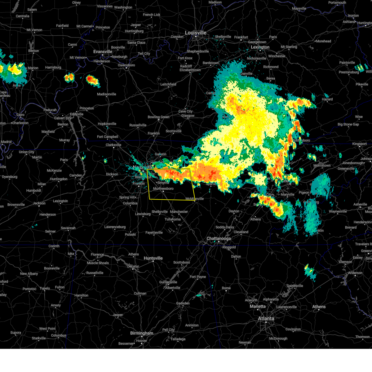 Svrohx the national weather service in nashville has issued a * severe thunderstorm warning for, southwestern smith county in middle tennessee, southeastern davidson county in middle tennessee, western de kalb county in middle tennessee, rutherford county in middle tennessee, northwestern warren county in middle tennessee, east central williamson county in middle tennessee, wilson county in middle tennessee, cannon county in middle tennessee, * until 430 pm cdt. * at 342 pm cdt, severe thunderstorms were located along a line extending from percy priest lake to alexandria, moving south at 40 mph (radar indicated). Hazards include 60 mph wind gusts and quarter size hail. Hail damage to vehicles is expected. Expect wind damage to roofs, siding, and trees. Svrohx the national weather service in nashville has issued a * severe thunderstorm warning for, southwestern smith county in middle tennessee, southeastern davidson county in middle tennessee, western de kalb county in middle tennessee, rutherford county in middle tennessee, northwestern warren county in middle tennessee, east central williamson county in middle tennessee, wilson county in middle tennessee, cannon county in middle tennessee, * until 430 pm cdt. * at 342 pm cdt, severe thunderstorms were located along a line extending from percy priest lake to alexandria, moving south at 40 mph (radar indicated). Hazards include 60 mph wind gusts and quarter size hail. Hail damage to vehicles is expected. Expect wind damage to roofs, siding, and trees.
|
| 7/29/2024 2:15 PM CDT | Trees reported down near i-24 in smyrn in rutherford county TN, 2.2 miles NNE of Smyrna, TN |
| 7/29/2024 1:49 PM CDT |
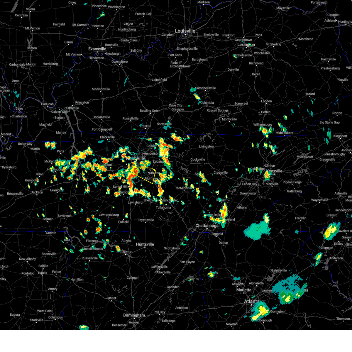 Svrohx the national weather service in nashville has issued a * severe thunderstorm warning for, southeastern davidson county in middle tennessee, northwestern rutherford county in middle tennessee, northeastern williamson county in middle tennessee, * until 230 pm cdt. * at 149 pm cdt, a severe thunderstorm was located over brentwood, or 7 miles northeast of franklin, moving east at 30 mph (radar indicated). Hazards include 60 mph wind gusts. expect damage to roofs, siding, and trees Svrohx the national weather service in nashville has issued a * severe thunderstorm warning for, southeastern davidson county in middle tennessee, northwestern rutherford county in middle tennessee, northeastern williamson county in middle tennessee, * until 230 pm cdt. * at 149 pm cdt, a severe thunderstorm was located over brentwood, or 7 miles northeast of franklin, moving east at 30 mph (radar indicated). Hazards include 60 mph wind gusts. expect damage to roofs, siding, and trees
|
| 6/26/2024 5:13 PM CDT |
 At 512 pm cdt, severe thunderstorms were located along a line extending from millersville to rural hill, moving northeast at 35 mph (radar indicated). Hazards include 60 mph wind gusts. Expect damage to roofs, siding, and trees. locations impacted include, gallatin, lebanon, madison, hendersonville, smyrna, la vergne, mount juliet, goodlettsville, white house, millersville, greenbrier, lakewood, ridgetop, cross plains, hermitage, rural hill, belinda city, old hickory, orlinda, and green hill. this includes the following highways, interstate 40 between mile markers 219 and 242. interstate 65 between mile markers 92 and 118. Interstate 840 between mile markers 64 and 76. At 512 pm cdt, severe thunderstorms were located along a line extending from millersville to rural hill, moving northeast at 35 mph (radar indicated). Hazards include 60 mph wind gusts. Expect damage to roofs, siding, and trees. locations impacted include, gallatin, lebanon, madison, hendersonville, smyrna, la vergne, mount juliet, goodlettsville, white house, millersville, greenbrier, lakewood, ridgetop, cross plains, hermitage, rural hill, belinda city, old hickory, orlinda, and green hill. this includes the following highways, interstate 40 between mile markers 219 and 242. interstate 65 between mile markers 92 and 118. Interstate 840 between mile markers 64 and 76.
|
| 6/26/2024 4:56 PM CDT |
 Svrohx the national weather service in nashville has issued a * severe thunderstorm warning for, eastern davidson county in middle tennessee, northwestern rutherford county in middle tennessee, western sumner county in middle tennessee, western wilson county in middle tennessee, eastern robertson county in middle tennessee, * until 530 pm cdt. * at 456 pm cdt, severe thunderstorms were located along a line extending from near joelton to la vergne, moving northeast at 35 mph (radar indicated). Hazards include 60 mph wind gusts. expect damage to roofs, siding, and trees Svrohx the national weather service in nashville has issued a * severe thunderstorm warning for, eastern davidson county in middle tennessee, northwestern rutherford county in middle tennessee, western sumner county in middle tennessee, western wilson county in middle tennessee, eastern robertson county in middle tennessee, * until 530 pm cdt. * at 456 pm cdt, severe thunderstorms were located along a line extending from near joelton to la vergne, moving northeast at 35 mph (radar indicated). Hazards include 60 mph wind gusts. expect damage to roofs, siding, and trees
|
| 6/26/2024 4:47 PM CDT |
 At 447 pm cdt, severe thunderstorms were located along a line extending from west nashville to smyrna, moving northeast at 35 mph (radar indicated). Hazards include 60 mph wind gusts. Expect damage to roofs, siding, and trees. locations impacted include, murfreesboro, franklin, nashville, madison, smyrna, brentwood, la vergne, nolensville, forest hills, oak hill, belle meade, bellevue, antioch, walterhill, berry hill, bells bend, whites creek, triune, and percy priest lake. this includes the following highways, interstate 40 between mile markers 197 and 220. interstate 65 between mile markers 68 and 93. interstate 24 between mile markers 38 and 74. Interstate 840 between mile markers 39 and 49, and between mile markers 56 and 61. At 447 pm cdt, severe thunderstorms were located along a line extending from west nashville to smyrna, moving northeast at 35 mph (radar indicated). Hazards include 60 mph wind gusts. Expect damage to roofs, siding, and trees. locations impacted include, murfreesboro, franklin, nashville, madison, smyrna, brentwood, la vergne, nolensville, forest hills, oak hill, belle meade, bellevue, antioch, walterhill, berry hill, bells bend, whites creek, triune, and percy priest lake. this includes the following highways, interstate 40 between mile markers 197 and 220. interstate 65 between mile markers 68 and 93. interstate 24 between mile markers 38 and 74. Interstate 840 between mile markers 39 and 49, and between mile markers 56 and 61.
|
| 6/26/2024 4:31 PM CDT |
 Svrohx the national weather service in nashville has issued a * severe thunderstorm warning for, davidson county in middle tennessee, northwestern rutherford county in middle tennessee, eastern williamson county in middle tennessee, * until 500 pm cdt. * at 430 pm cdt, severe thunderstorms were located along a line extending from near bellevue to thompson's station, moving northeast at 40 mph (radar indicated). Hazards include 60 mph wind gusts. expect damage to roofs, siding, and trees Svrohx the national weather service in nashville has issued a * severe thunderstorm warning for, davidson county in middle tennessee, northwestern rutherford county in middle tennessee, eastern williamson county in middle tennessee, * until 500 pm cdt. * at 430 pm cdt, severe thunderstorms were located along a line extending from near bellevue to thompson's station, moving northeast at 40 mph (radar indicated). Hazards include 60 mph wind gusts. expect damage to roofs, siding, and trees
|
| 5/26/2024 3:28 PM CDT | Hen Egg sized hail reported 8.6 miles NE of Smyrna, TN |
| 5/26/2024 3:26 PM CDT |
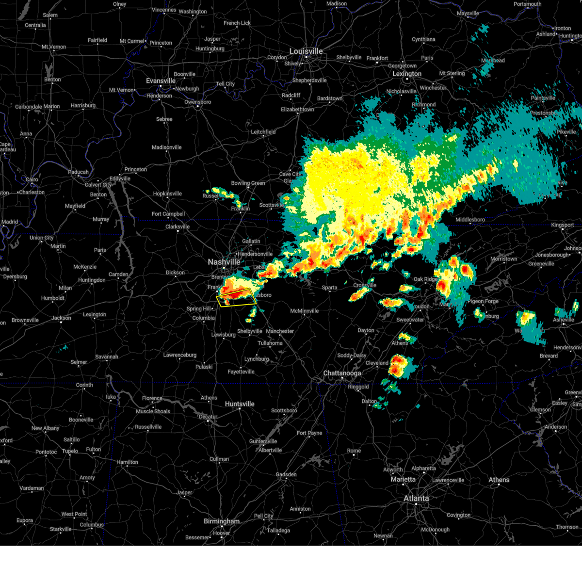 At 326 pm cdt, a severe thunderstorm was located near nolensville, or 9 miles east of franklin, moving east at 40 mph (radar indicated). Hazards include 60 mph wind gusts and quarter size hail. Hail damage to vehicles is expected. expect wind damage to roofs, siding, and trees. locations impacted include, murfreesboro, smyrna, nolensville, and triune. this includes the following highways, interstate 65 between mile markers 59 and 63. interstate 24 between mile markers 70 and 82. Interstate 840 between mile markers 31 and 55. At 326 pm cdt, a severe thunderstorm was located near nolensville, or 9 miles east of franklin, moving east at 40 mph (radar indicated). Hazards include 60 mph wind gusts and quarter size hail. Hail damage to vehicles is expected. expect wind damage to roofs, siding, and trees. locations impacted include, murfreesboro, smyrna, nolensville, and triune. this includes the following highways, interstate 65 between mile markers 59 and 63. interstate 24 between mile markers 70 and 82. Interstate 840 between mile markers 31 and 55.
|
| 5/26/2024 3:25 PM CDT |
 At 324 pm cdt, a severe thunderstorm was located near nolensville, or 10 miles east of franklin, moving east at 40 mph (radar indicated). Hazards include 60 mph wind gusts and quarter size hail. Hail damage to vehicles is expected. expect wind damage to roofs, siding, and trees. locations impacted include, franklin, smyrna, brentwood, la vergne, and nolensville. this includes the following highways, interstate 65 between mile markers 63 and 72. Interstate 24 between mile markers 66 and 70. At 324 pm cdt, a severe thunderstorm was located near nolensville, or 10 miles east of franklin, moving east at 40 mph (radar indicated). Hazards include 60 mph wind gusts and quarter size hail. Hail damage to vehicles is expected. expect wind damage to roofs, siding, and trees. locations impacted include, franklin, smyrna, brentwood, la vergne, and nolensville. this includes the following highways, interstate 65 between mile markers 63 and 72. Interstate 24 between mile markers 66 and 70.
|
| 5/26/2024 3:25 PM CDT |
 the severe thunderstorm warning has been cancelled and is no longer in effect the severe thunderstorm warning has been cancelled and is no longer in effect
|
| 5/26/2024 3:15 PM CDT |
 At 315 pm cdt, a severe thunderstorm was located over franklin, moving east at 35 mph (radar indicated). Hazards include golf ball size hail and 60 mph wind gusts. People and animals outdoors will be injured. expect hail damage to roofs, siding, windows, and vehicles. expect wind damage to roofs, siding, and trees. locations impacted include, franklin, smyrna, brentwood, la vergne, nolensville, forest hills, oak hill, antioch, leipers fork, percy priest lake, and natchez trace at highway 96. this includes the following highways, interstate 65 between mile markers 63 and 78. Interstate 24 between mile markers 55 and 70. At 315 pm cdt, a severe thunderstorm was located over franklin, moving east at 35 mph (radar indicated). Hazards include golf ball size hail and 60 mph wind gusts. People and animals outdoors will be injured. expect hail damage to roofs, siding, windows, and vehicles. expect wind damage to roofs, siding, and trees. locations impacted include, franklin, smyrna, brentwood, la vergne, nolensville, forest hills, oak hill, antioch, leipers fork, percy priest lake, and natchez trace at highway 96. this includes the following highways, interstate 65 between mile markers 63 and 78. Interstate 24 between mile markers 55 and 70.
|
| 5/26/2024 3:14 PM CDT |
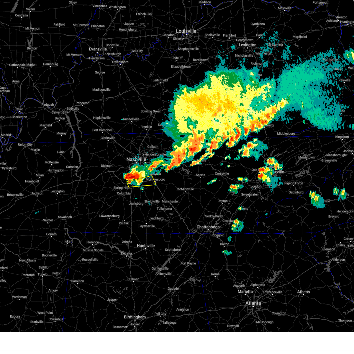 Svrohx the national weather service in nashville has issued a * severe thunderstorm warning for, west central rutherford county in middle tennessee, southeastern williamson county in middle tennessee, * until 345 pm cdt. * at 313 pm cdt, a severe thunderstorm was located over franklin, moving east at 30 mph (radar indicated). Hazards include golf ball size hail and 60 mph wind gusts. People and animals outdoors will be injured. expect hail damage to roofs, siding, windows, and vehicles. Expect wind damage to roofs, siding, and trees. Svrohx the national weather service in nashville has issued a * severe thunderstorm warning for, west central rutherford county in middle tennessee, southeastern williamson county in middle tennessee, * until 345 pm cdt. * at 313 pm cdt, a severe thunderstorm was located over franklin, moving east at 30 mph (radar indicated). Hazards include golf ball size hail and 60 mph wind gusts. People and animals outdoors will be injured. expect hail damage to roofs, siding, windows, and vehicles. Expect wind damage to roofs, siding, and trees.
|
| 5/26/2024 3:06 PM CDT |
 the severe thunderstorm warning has been cancelled and is no longer in effect the severe thunderstorm warning has been cancelled and is no longer in effect
|
| 5/26/2024 3:06 PM CDT |
 At 306 pm cdt, a severe thunderstorm was located near franklin, moving east at 30 mph (radar indicated). Hazards include golf ball size hail and 60 mph wind gusts. People and animals outdoors will be injured. expect hail damage to roofs, siding, windows, and vehicles. expect wind damage to roofs, siding, and trees. locations impacted include, franklin, nashville, hendersonville, smyrna, brentwood, la vergne, nolensville, forest hills, oak hill, belle meade, lakewood, hermitage, bellevue, antioch, fairview, old hickory, berry hill, natchez trace at highway 96, leipers fork, and percy priest lake. this includes the following highways, interstate 40 between mile markers 195 and 198, and between mile markers 205 and 222. interstate 65 between mile markers 63 and 86. Interstate 24 between mile markers 47 and 70. At 306 pm cdt, a severe thunderstorm was located near franklin, moving east at 30 mph (radar indicated). Hazards include golf ball size hail and 60 mph wind gusts. People and animals outdoors will be injured. expect hail damage to roofs, siding, windows, and vehicles. expect wind damage to roofs, siding, and trees. locations impacted include, franklin, nashville, hendersonville, smyrna, brentwood, la vergne, nolensville, forest hills, oak hill, belle meade, lakewood, hermitage, bellevue, antioch, fairview, old hickory, berry hill, natchez trace at highway 96, leipers fork, and percy priest lake. this includes the following highways, interstate 40 between mile markers 195 and 198, and between mile markers 205 and 222. interstate 65 between mile markers 63 and 86. Interstate 24 between mile markers 47 and 70.
|
| 5/26/2024 2:56 PM CDT |
 Svrohx the national weather service in nashville has issued a * severe thunderstorm warning for, davidson county in middle tennessee, northwestern rutherford county in middle tennessee, williamson county in middle tennessee, south central cheatham county in middle tennessee, * until 345 pm cdt. * at 255 pm cdt, a severe thunderstorm was located near fairview, or 10 miles west of franklin, moving east at 35 mph (radar indicated). Hazards include golf ball size hail and 60 mph wind gusts. People and animals outdoors will be injured. expect hail damage to roofs, siding, windows, and vehicles. Expect wind damage to roofs, siding, and trees. Svrohx the national weather service in nashville has issued a * severe thunderstorm warning for, davidson county in middle tennessee, northwestern rutherford county in middle tennessee, williamson county in middle tennessee, south central cheatham county in middle tennessee, * until 345 pm cdt. * at 255 pm cdt, a severe thunderstorm was located near fairview, or 10 miles west of franklin, moving east at 35 mph (radar indicated). Hazards include golf ball size hail and 60 mph wind gusts. People and animals outdoors will be injured. expect hail damage to roofs, siding, windows, and vehicles. Expect wind damage to roofs, siding, and trees.
|
| 5/26/2024 2:48 PM CDT |
 At 248 pm cdt, severe thunderstorms were located along a line extending from near lafayette to near franklin, moving east at 50 mph (radar indicated). Hazards include 60 mph wind gusts and nickel size hail. Expect damage to roofs, siding, and trees. locations impacted include, murfreesboro, franklin, lebanon, hartsville, nashville, hendersonville, smyrna, brentwood, la vergne, mount juliet, nolensville, forest hills, oak hill, belle meade, kingston springs, lakewood, pegram, hermitage, fairview, and walterhill. this includes the following highways, interstate 40 between mile markers 182 and 243. interstate 65 between mile markers 67 and 87. interstate 24 between mile markers 47 and 71. Interstate 840 between mile markers 56 and 76. At 248 pm cdt, severe thunderstorms were located along a line extending from near lafayette to near franklin, moving east at 50 mph (radar indicated). Hazards include 60 mph wind gusts and nickel size hail. Expect damage to roofs, siding, and trees. locations impacted include, murfreesboro, franklin, lebanon, hartsville, nashville, hendersonville, smyrna, brentwood, la vergne, mount juliet, nolensville, forest hills, oak hill, belle meade, kingston springs, lakewood, pegram, hermitage, fairview, and walterhill. this includes the following highways, interstate 40 between mile markers 182 and 243. interstate 65 between mile markers 67 and 87. interstate 24 between mile markers 47 and 71. Interstate 840 between mile markers 56 and 76.
|
| 5/26/2024 2:48 PM CDT |
 the severe thunderstorm warning has been cancelled and is no longer in effect the severe thunderstorm warning has been cancelled and is no longer in effect
|
| 5/26/2024 2:33 PM CDT |
 At 233 pm cdt, severe thunderstorms were located along a line extending from near westmoreland to near fairview, moving east at 50 mph (radar indicated). Hazards include 60 mph wind gusts and nickel size hail. Expect damage to roofs, siding, and trees. locations impacted include, murfreesboro, franklin, gallatin, lebanon, lafayette, hartsville, nashville, madison, hendersonville, smyrna, brentwood, la vergne, mount juliet, goodlettsville, nolensville, forest hills, oak hill, belle meade, kingston springs, and lakewood. this includes the following highways, interstate 40 between mile markers 182 and 243. interstate 65 between mile markers 67 and 95. interstate 24 between mile markers 41 and 71. Interstate 840 between mile markers 56 and 76. At 233 pm cdt, severe thunderstorms were located along a line extending from near westmoreland to near fairview, moving east at 50 mph (radar indicated). Hazards include 60 mph wind gusts and nickel size hail. Expect damage to roofs, siding, and trees. locations impacted include, murfreesboro, franklin, gallatin, lebanon, lafayette, hartsville, nashville, madison, hendersonville, smyrna, brentwood, la vergne, mount juliet, goodlettsville, nolensville, forest hills, oak hill, belle meade, kingston springs, and lakewood. this includes the following highways, interstate 40 between mile markers 182 and 243. interstate 65 between mile markers 67 and 95. interstate 24 between mile markers 41 and 71. Interstate 840 between mile markers 56 and 76.
|
| 5/26/2024 2:18 PM CDT |
 the severe thunderstorm warning has been cancelled and is no longer in effect the severe thunderstorm warning has been cancelled and is no longer in effect
|
| 5/26/2024 2:18 PM CDT |
 At 218 pm cdt, severe thunderstorms were located along a line extending from 7 miles southwest of westmoreland to near burns, moving east at 50 mph (radar indicated). Hazards include 60 mph wind gusts and nickel size hail. Expect damage to roofs, siding, and trees. locations impacted include, murfreesboro, franklin, gallatin, lebanon, ashland city, lafayette, hartsville, nashville, madison, hendersonville, smyrna, brentwood, la vergne, mount juliet, goodlettsville, millersville, nolensville, forest hills, oak hill, and belle meade. this includes the following highways, interstate 40 between mile markers 182 and 243. interstate 65 between mile markers 67 and 101. interstate 24 between mile markers 33 and 71. Interstate 840 between mile markers 56 and 76. At 218 pm cdt, severe thunderstorms were located along a line extending from 7 miles southwest of westmoreland to near burns, moving east at 50 mph (radar indicated). Hazards include 60 mph wind gusts and nickel size hail. Expect damage to roofs, siding, and trees. locations impacted include, murfreesboro, franklin, gallatin, lebanon, ashland city, lafayette, hartsville, nashville, madison, hendersonville, smyrna, brentwood, la vergne, mount juliet, goodlettsville, millersville, nolensville, forest hills, oak hill, and belle meade. this includes the following highways, interstate 40 between mile markers 182 and 243. interstate 65 between mile markers 67 and 101. interstate 24 between mile markers 33 and 71. Interstate 840 between mile markers 56 and 76.
|
| 5/26/2024 1:53 PM CDT |
 Svrohx the national weather service in nashville has issued a * severe thunderstorm warning for, davidson county in middle tennessee, northwestern rutherford county in middle tennessee, sumner county in middle tennessee, northern williamson county in middle tennessee, wilson county in middle tennessee, cheatham county in middle tennessee, western macon county in middle tennessee, trousdale county in middle tennessee, robertson county in middle tennessee, * until 300 pm cdt. * at 153 pm cdt, severe thunderstorms were located along a line extending from near springfield to 6 miles west of dickson, moving east at 50 mph (radar indicated). Hazards include 60 mph wind gusts and nickel size hail. expect damage to roofs, siding, and trees Svrohx the national weather service in nashville has issued a * severe thunderstorm warning for, davidson county in middle tennessee, northwestern rutherford county in middle tennessee, sumner county in middle tennessee, northern williamson county in middle tennessee, wilson county in middle tennessee, cheatham county in middle tennessee, western macon county in middle tennessee, trousdale county in middle tennessee, robertson county in middle tennessee, * until 300 pm cdt. * at 153 pm cdt, severe thunderstorms were located along a line extending from near springfield to 6 miles west of dickson, moving east at 50 mph (radar indicated). Hazards include 60 mph wind gusts and nickel size hail. expect damage to roofs, siding, and trees
|
| 5/9/2024 2:41 AM CDT |
 The storm which prompted the warning has weakened below severe limits, and no longer poses an immediate threat to life or property. therefore, the warning will be allowed to expire. however, gusty winds and heavy rain are still possible with this thunderstorm. a tornado watch remains in effect until 300 am cdt for middle tennessee. The storm which prompted the warning has weakened below severe limits, and no longer poses an immediate threat to life or property. therefore, the warning will be allowed to expire. however, gusty winds and heavy rain are still possible with this thunderstorm. a tornado watch remains in effect until 300 am cdt for middle tennessee.
|
| 5/9/2024 2:27 AM CDT |
 At 226 am cdt, a severe thunderstorm was located near nolensville, or 8 miles east of franklin, moving east at 45 mph (radar indicated). Hazards include 60 mph wind gusts and penny size hail. Expect damage to roofs, siding, and trees. locations impacted include, franklin, columbia, smyrna, brentwood, la vergne, spring hill, nolensville, oak hill, thompson's station, eagleville, triune, rockvale, and leipers fork. this includes the following highways, interstate 65 between mile markers 51 and 74. interstate 24 between mile markers 59 and 74. Interstate 840 between mile markers 19 and 52. At 226 am cdt, a severe thunderstorm was located near nolensville, or 8 miles east of franklin, moving east at 45 mph (radar indicated). Hazards include 60 mph wind gusts and penny size hail. Expect damage to roofs, siding, and trees. locations impacted include, franklin, columbia, smyrna, brentwood, la vergne, spring hill, nolensville, oak hill, thompson's station, eagleville, triune, rockvale, and leipers fork. this includes the following highways, interstate 65 between mile markers 51 and 74. interstate 24 between mile markers 59 and 74. Interstate 840 between mile markers 19 and 52.
|
| 5/9/2024 1:59 AM CDT |
 Svrohx the national weather service in nashville has issued a * severe thunderstorm warning for, southern davidson county in middle tennessee, western rutherford county in middle tennessee, northern maury county in middle tennessee, williamson county in middle tennessee, * until 245 am cdt. * at 158 am cdt, a severe thunderstorm was located 10 miles south of fairview, or 15 miles north of columbia, moving east at 40 mph (radar indicated). Hazards include 60 mph wind gusts and penny size hail. expect damage to roofs, siding, and trees Svrohx the national weather service in nashville has issued a * severe thunderstorm warning for, southern davidson county in middle tennessee, western rutherford county in middle tennessee, northern maury county in middle tennessee, williamson county in middle tennessee, * until 245 am cdt. * at 158 am cdt, a severe thunderstorm was located 10 miles south of fairview, or 15 miles north of columbia, moving east at 40 mph (radar indicated). Hazards include 60 mph wind gusts and penny size hail. expect damage to roofs, siding, and trees
|
| 5/6/2024 4:30 PM CDT |
 At 429 pm cdt, a severe thunderstorm was located near rural hill, or 10 miles southwest of lebanon, moving east at 40 mph (radar indicated). Hazards include 60 mph wind gusts and quarter size hail. Hail damage to vehicles is expected. expect wind damage to roofs, siding, and trees. locations impacted include, la vergne, mount juliet, watertown, rural hill, cedars of lebanon state park, and gladeville. This includes interstate 840 between mile markers 64 and 74. At 429 pm cdt, a severe thunderstorm was located near rural hill, or 10 miles southwest of lebanon, moving east at 40 mph (radar indicated). Hazards include 60 mph wind gusts and quarter size hail. Hail damage to vehicles is expected. expect wind damage to roofs, siding, and trees. locations impacted include, la vergne, mount juliet, watertown, rural hill, cedars of lebanon state park, and gladeville. This includes interstate 840 between mile markers 64 and 74.
|
| 5/6/2024 4:18 PM CDT |
 Svrohx the national weather service in nashville has issued a * severe thunderstorm warning for, southeastern davidson county in middle tennessee, north central rutherford county in middle tennessee, southern wilson county in middle tennessee, * until 500 pm cdt. * at 417 pm cdt, a severe thunderstorm was located near antioch, or 10 miles southeast of nashville, moving east at 40 mph (radar indicated). Hazards include 60 mph wind gusts and quarter size hail. Hail damage to vehicles is expected. Expect wind damage to roofs, siding, and trees. Svrohx the national weather service in nashville has issued a * severe thunderstorm warning for, southeastern davidson county in middle tennessee, north central rutherford county in middle tennessee, southern wilson county in middle tennessee, * until 500 pm cdt. * at 417 pm cdt, a severe thunderstorm was located near antioch, or 10 miles southeast of nashville, moving east at 40 mph (radar indicated). Hazards include 60 mph wind gusts and quarter size hail. Hail damage to vehicles is expected. Expect wind damage to roofs, siding, and trees.
|
| 8/13/2023 3:27 PM CDT |
 At 326 pm cdt, severe thunderstorms were located along a line extending from near greenbrier to near brentwood, moving east at 40 mph (radar indicated). Hazards include 60 mph wind gusts. Expect damage to roofs, siding, and trees. locations impacted include, murfreesboro, franklin, gallatin, lebanon, springfield, nashville, madison, hendersonville, smyrna, brentwood, la vergne, mount juliet, goodlettsville, white house, millersville, greenbrier, nolensville, forest hills, oak hill and coopertown. this includes the following highways, interstate 40 between mile markers 192 and 232. interstate 65 between mile markers 63 and 109. interstate 24 near mile marker 28, and between mile markers 32 and 74. interstate 840 between mile markers 53 and 72. hail threat, radar indicated max hail size, <. 75 in wind threat, radar indicated max wind gust, 60 mph. At 326 pm cdt, severe thunderstorms were located along a line extending from near greenbrier to near brentwood, moving east at 40 mph (radar indicated). Hazards include 60 mph wind gusts. Expect damage to roofs, siding, and trees. locations impacted include, murfreesboro, franklin, gallatin, lebanon, springfield, nashville, madison, hendersonville, smyrna, brentwood, la vergne, mount juliet, goodlettsville, white house, millersville, greenbrier, nolensville, forest hills, oak hill and coopertown. this includes the following highways, interstate 40 between mile markers 192 and 232. interstate 65 between mile markers 63 and 109. interstate 24 near mile marker 28, and between mile markers 32 and 74. interstate 840 between mile markers 53 and 72. hail threat, radar indicated max hail size, <. 75 in wind threat, radar indicated max wind gust, 60 mph.
|
| 8/13/2023 3:13 PM CDT |
 At 312 pm cdt, severe thunderstorms were located along a line extending from 6 miles southwest of coopertown to 8 miles west of franklin, moving east at 40 mph (radar indicated). Hazards include 60 mph wind gusts. Expect damage to roofs, siding, and trees. locations impacted include, murfreesboro, franklin, gallatin, lebanon, springfield, ashland city, nashville, madison, hendersonville, smyrna, brentwood, la vergne, mount juliet, goodlettsville, white house, millersville, greenbrier, nolensville, forest hills and oak hill. this includes the following highways, interstate 40 between mile markers 182 and 232. interstate 65 between mile markers 63 and 109. interstate 24 between mile markers 22 and 74. interstate 840 between mile markers 7 and 16, and between mile markers 53 and 72. hail threat, radar indicated max hail size, <. 75 in wind threat, radar indicated max wind gust, 60 mph. At 312 pm cdt, severe thunderstorms were located along a line extending from 6 miles southwest of coopertown to 8 miles west of franklin, moving east at 40 mph (radar indicated). Hazards include 60 mph wind gusts. Expect damage to roofs, siding, and trees. locations impacted include, murfreesboro, franklin, gallatin, lebanon, springfield, ashland city, nashville, madison, hendersonville, smyrna, brentwood, la vergne, mount juliet, goodlettsville, white house, millersville, greenbrier, nolensville, forest hills and oak hill. this includes the following highways, interstate 40 between mile markers 182 and 232. interstate 65 between mile markers 63 and 109. interstate 24 between mile markers 22 and 74. interstate 840 between mile markers 7 and 16, and between mile markers 53 and 72. hail threat, radar indicated max hail size, <. 75 in wind threat, radar indicated max wind gust, 60 mph.
|
| 8/13/2023 2:57 PM CDT |
 At 257 pm cdt, severe thunderstorms were located along a line extending from 10 miles northwest of ashland city to near fairview, moving east at 40 mph (radar indicated). Hazards include 60 mph wind gusts. expect damage to roofs, siding, and trees At 257 pm cdt, severe thunderstorms were located along a line extending from 10 miles northwest of ashland city to near fairview, moving east at 40 mph (radar indicated). Hazards include 60 mph wind gusts. expect damage to roofs, siding, and trees
|
| 8/12/2023 12:10 PM CDT |
 At 1209 pm cdt, severe thunderstorms were located along a line extending from 8 miles southwest of hartsville to near murfreesboro, moving east at 45 mph (radar indicated). Hazards include 60 mph wind gusts. Expect damage to roofs, siding, and trees. locations impacted include, murfreesboro, lebanon, smyrna, la vergne, mount juliet, nolensville, watertown, walterhill, south carthage, lascassas, tuckers crossroads, dixon springs, pleasant shade, dickerson chapel recreation area, cedars of lebanon state park, milton and gladeville. this includes the following highways, interstate 40 between mile markers 229 and 253. interstate 24 between mile markers 65 and 80. interstate 840 between mile markers 45 and 76. hail threat, radar indicated max hail size, <. 75 in wind threat, radar indicated max wind gust, 60 mph. At 1209 pm cdt, severe thunderstorms were located along a line extending from 8 miles southwest of hartsville to near murfreesboro, moving east at 45 mph (radar indicated). Hazards include 60 mph wind gusts. Expect damage to roofs, siding, and trees. locations impacted include, murfreesboro, lebanon, smyrna, la vergne, mount juliet, nolensville, watertown, walterhill, south carthage, lascassas, tuckers crossroads, dixon springs, pleasant shade, dickerson chapel recreation area, cedars of lebanon state park, milton and gladeville. this includes the following highways, interstate 40 between mile markers 229 and 253. interstate 24 between mile markers 65 and 80. interstate 840 between mile markers 45 and 76. hail threat, radar indicated max hail size, <. 75 in wind threat, radar indicated max wind gust, 60 mph.
|
| 8/12/2023 12:04 PM CDT |
 At 1204 pm cdt, a severe thunderstorm capable of producing a tornado was located near rural hill, or 11 miles southwest of lebanon, moving east at 40 mph (radar indicated rotation). Hazards include tornado. Flying debris will be dangerous to those caught without shelter. mobile homes will be damaged or destroyed. damage to roofs, windows, and vehicles will occur. tree damage is likely. this dangerous storm will be near, walterhill around 1215 pm cdt. other locations impacted by this tornadic thunderstorm include cedars of lebanon state park, milton and lascassas. This includes interstate 840 between mile markers 61 and 70. At 1204 pm cdt, a severe thunderstorm capable of producing a tornado was located near rural hill, or 11 miles southwest of lebanon, moving east at 40 mph (radar indicated rotation). Hazards include tornado. Flying debris will be dangerous to those caught without shelter. mobile homes will be damaged or destroyed. damage to roofs, windows, and vehicles will occur. tree damage is likely. this dangerous storm will be near, walterhill around 1215 pm cdt. other locations impacted by this tornadic thunderstorm include cedars of lebanon state park, milton and lascassas. This includes interstate 840 between mile markers 61 and 70.
|
| 8/12/2023 11:49 AM CDT |
 At 1148 am cdt, severe thunderstorms were located along a line extending from gallatin to near franklin, moving east at 30 mph (radar indicated). Hazards include 60 mph wind gusts. expect damage to roofs, siding, and trees At 1148 am cdt, severe thunderstorms were located along a line extending from gallatin to near franklin, moving east at 30 mph (radar indicated). Hazards include 60 mph wind gusts. expect damage to roofs, siding, and trees
|
| 7/29/2023 5:21 PM CDT |
 At 521 pm cdt, a severe thunderstorm was located 8 miles southwest of watertown, or 14 miles northeast of murfreesboro, moving southeast at 20 mph (radar indicated). Hazards include 60 mph wind gusts. expect damage to roofs, siding, and trees At 521 pm cdt, a severe thunderstorm was located 8 miles southwest of watertown, or 14 miles northeast of murfreesboro, moving southeast at 20 mph (radar indicated). Hazards include 60 mph wind gusts. expect damage to roofs, siding, and trees
|
| 7/20/2023 1:35 PM CDT |
 At 134 pm cdt, severe thunderstorms were located along a line extending from near gordonsville to near murfreesboro, moving southeast at 50 mph (radar indicated). Hazards include 70 mph wind gusts and nickel size hail. Expect considerable tree damage. Damage is likely to mobile homes, roofs, and outbuildings. At 134 pm cdt, severe thunderstorms were located along a line extending from near gordonsville to near murfreesboro, moving southeast at 50 mph (radar indicated). Hazards include 70 mph wind gusts and nickel size hail. Expect considerable tree damage. Damage is likely to mobile homes, roofs, and outbuildings.
|
| 7/18/2023 5:00 PM CDT |
 At 459 pm cdt, severe thunderstorms were located along a line extending from near gordonsville to 7 miles east of watertown to 10 miles south of murfreesboro, moving east at 50 mph (radar indicated). Hazards include 60 mph wind gusts and penny size hail. expect damage to roofs, siding, and trees At 459 pm cdt, severe thunderstorms were located along a line extending from near gordonsville to 7 miles east of watertown to 10 miles south of murfreesboro, moving east at 50 mph (radar indicated). Hazards include 60 mph wind gusts and penny size hail. expect damage to roofs, siding, and trees
|
| 7/18/2023 4:43 PM CDT |
 At 443 pm cdt, severe thunderstorms were located along a line extending from near westmoreland to near lebanon to la vergne, moving east at 50 mph (radar indicated). Hazards include 60 mph wind gusts and penny size hail. Expect damage to roofs, siding, and trees. locations impacted include, murfreesboro, gallatin, lebanon, lafayette, carthage, hartsville, smyrna, la vergne, mount juliet, westmoreland, watertown, gordonsville, red boiling springs, walterhill, rural hill, belinda city, hickman, south carthage, alexandria and liberty. this includes the following highways, interstate 40 between mile markers 223 and 264. interstate 840 between mile markers 58 and 76. hail threat, radar indicated max hail size, 0. 75 in wind threat, radar indicated max wind gust, 60 mph. At 443 pm cdt, severe thunderstorms were located along a line extending from near westmoreland to near lebanon to la vergne, moving east at 50 mph (radar indicated). Hazards include 60 mph wind gusts and penny size hail. Expect damage to roofs, siding, and trees. locations impacted include, murfreesboro, gallatin, lebanon, lafayette, carthage, hartsville, smyrna, la vergne, mount juliet, westmoreland, watertown, gordonsville, red boiling springs, walterhill, rural hill, belinda city, hickman, south carthage, alexandria and liberty. this includes the following highways, interstate 40 between mile markers 223 and 264. interstate 840 between mile markers 58 and 76. hail threat, radar indicated max hail size, 0. 75 in wind threat, radar indicated max wind gust, 60 mph.
|
| 7/18/2023 4:41 PM CDT |
 At 440 pm cdt, severe thunderstorms were located along a line extending from near murfreesboro to 14 miles southeast of spring hill to 11 miles north of pulaski, moving southeast at 50 mph (radar indicated). Hazards include 60 mph wind gusts and penny size hail. Expect damage to roofs, siding, and trees. locations impacted include, murfreesboro, franklin, columbia, shelbyville, lewisburg, smyrna, brentwood, la vergne, spring hill, nolensville, thompson`s station, petersburg, chapel hill, cornersville, wartrace, eagleville, bell buckle, culleoka, fosterville and triune. this includes the following highways, interstate 65 between mile markers 23 and 64. interstate 24 between mile markers 64 and 95. interstate 840 between mile markers 29 and 58. hail threat, radar indicated max hail size, 0. 75 in wind threat, radar indicated max wind gust, 60 mph. At 440 pm cdt, severe thunderstorms were located along a line extending from near murfreesboro to 14 miles southeast of spring hill to 11 miles north of pulaski, moving southeast at 50 mph (radar indicated). Hazards include 60 mph wind gusts and penny size hail. Expect damage to roofs, siding, and trees. locations impacted include, murfreesboro, franklin, columbia, shelbyville, lewisburg, smyrna, brentwood, la vergne, spring hill, nolensville, thompson`s station, petersburg, chapel hill, cornersville, wartrace, eagleville, bell buckle, culleoka, fosterville and triune. this includes the following highways, interstate 65 between mile markers 23 and 64. interstate 24 between mile markers 64 and 95. interstate 840 between mile markers 29 and 58. hail threat, radar indicated max hail size, 0. 75 in wind threat, radar indicated max wind gust, 60 mph.
|
| 7/18/2023 4:28 PM CDT |
 At 428 pm cdt, severe thunderstorms were located along a line extending from 7 miles northwest of westmoreland to near lebanon to antioch, moving east at 50 mph (radar indicated). Hazards include 60 mph wind gusts and penny size hail. Expect damage to roofs, siding, and trees. locations impacted include, murfreesboro, gallatin, lebanon, lafayette, carthage, hartsville, nashville, hendersonville, smyrna, la vergne, mount juliet, lakewood, westmoreland, watertown, gordonsville, red boiling springs, hermitage, walterhill, rural hill and belinda city. this includes the following highways, interstate 40 between mile markers 207 and 264. interstate 65 between mile markers 82 and 88. interstate 24 between mile markers 47 and 54. interstate 840 between mile markers 58 and 76. hail threat, radar indicated max hail size, 0. 75 in wind threat, radar indicated max wind gust, 60 mph. At 428 pm cdt, severe thunderstorms were located along a line extending from 7 miles northwest of westmoreland to near lebanon to antioch, moving east at 50 mph (radar indicated). Hazards include 60 mph wind gusts and penny size hail. Expect damage to roofs, siding, and trees. locations impacted include, murfreesboro, gallatin, lebanon, lafayette, carthage, hartsville, nashville, hendersonville, smyrna, la vergne, mount juliet, lakewood, westmoreland, watertown, gordonsville, red boiling springs, hermitage, walterhill, rural hill and belinda city. this includes the following highways, interstate 40 between mile markers 207 and 264. interstate 65 between mile markers 82 and 88. interstate 24 between mile markers 47 and 54. interstate 840 between mile markers 58 and 76. hail threat, radar indicated max hail size, 0. 75 in wind threat, radar indicated max wind gust, 60 mph.
|
| 7/18/2023 4:27 PM CDT |
 At 427 pm cdt, severe thunderstorms were located along a line extending from near la vergne to 7 miles east of spring hill to near mount pleasant, moving southeast at 45 mph (radar indicated). Hazards include 60 mph wind gusts and penny size hail. Expect damage to roofs, siding, and trees. locations impacted include, murfreesboro, franklin, columbia, shelbyville, lewisburg, nashville, smyrna, brentwood, la vergne, spring hill, nolensville, forest hills, mount pleasant, oak hill, belle meade, thompson`s station, petersburg, antioch, walterhill and chapel hill. this includes the following highways, interstate 40 between mile markers 206 and 217. interstate 65 between mile markers 23 and 88. interstate 24 between mile markers 44 and 95. interstate 840 between mile markers 22 and 61. hail threat, radar indicated max hail size, 0. 75 in wind threat, radar indicated max wind gust, 60 mph. At 427 pm cdt, severe thunderstorms were located along a line extending from near la vergne to 7 miles east of spring hill to near mount pleasant, moving southeast at 45 mph (radar indicated). Hazards include 60 mph wind gusts and penny size hail. Expect damage to roofs, siding, and trees. locations impacted include, murfreesboro, franklin, columbia, shelbyville, lewisburg, nashville, smyrna, brentwood, la vergne, spring hill, nolensville, forest hills, mount pleasant, oak hill, belle meade, thompson`s station, petersburg, antioch, walterhill and chapel hill. this includes the following highways, interstate 40 between mile markers 206 and 217. interstate 65 between mile markers 23 and 88. interstate 24 between mile markers 44 and 95. interstate 840 between mile markers 22 and 61. hail threat, radar indicated max hail size, 0. 75 in wind threat, radar indicated max wind gust, 60 mph.
|
| 7/18/2023 4:13 PM CDT |
 At 413 pm cdt, severe thunderstorms were located along a line extending from 7 miles northeast of portland to near hendersonville to forest hills, moving east at 50 mph (radar indicated). Hazards include 60 mph wind gusts and penny size hail. expect damage to roofs, siding, and trees At 413 pm cdt, severe thunderstorms were located along a line extending from 7 miles northeast of portland to near hendersonville to forest hills, moving east at 50 mph (radar indicated). Hazards include 60 mph wind gusts and penny size hail. expect damage to roofs, siding, and trees
|
| 7/18/2023 4:11 PM CDT |
 At 411 pm cdt, severe thunderstorms were located along a line extending from near nashville to near franklin to 6 miles northwest of mount pleasant, moving southeast at 45 mph (radar indicated). Hazards include 60 mph wind gusts and penny size hail. expect damage to roofs, siding, and trees At 411 pm cdt, severe thunderstorms were located along a line extending from near nashville to near franklin to 6 miles northwest of mount pleasant, moving southeast at 45 mph (radar indicated). Hazards include 60 mph wind gusts and penny size hail. expect damage to roofs, siding, and trees
|
| 7/18/2023 3:43 PM CDT |
 At 343 pm cdt, severe thunderstorms were located along a line extending from near cross plains to near nashville to burns, moving east at 50 mph (radar indicated). Hazards include 70 mph wind gusts and quarter size hail. Hail damage to vehicles is expected. expect considerable tree damage. wind damage is also likely to mobile homes, roofs, and outbuildings. locations impacted include, franklin, gallatin, lebanon, springfield, ashland city, nashville, madison, hendersonville, smyrna, brentwood, la vergne, mount juliet, goodlettsville, white house, millersville, greenbrier, nolensville, forest hills, oak hill and coopertown. this includes the following highways, interstate 40 between mile markers 191 and 243. interstate 65 between mile markers 66 and 121. interstate 24 between mile markers 31 and 65. interstate 840 between mile markers 64 and 76. thunderstorm damage threat, considerable hail threat, radar indicated max hail size, 1. 00 in wind threat, radar indicated max wind gust, 70 mph. At 343 pm cdt, severe thunderstorms were located along a line extending from near cross plains to near nashville to burns, moving east at 50 mph (radar indicated). Hazards include 70 mph wind gusts and quarter size hail. Hail damage to vehicles is expected. expect considerable tree damage. wind damage is also likely to mobile homes, roofs, and outbuildings. locations impacted include, franklin, gallatin, lebanon, springfield, ashland city, nashville, madison, hendersonville, smyrna, brentwood, la vergne, mount juliet, goodlettsville, white house, millersville, greenbrier, nolensville, forest hills, oak hill and coopertown. this includes the following highways, interstate 40 between mile markers 191 and 243. interstate 65 between mile markers 66 and 121. interstate 24 between mile markers 31 and 65. interstate 840 between mile markers 64 and 76. thunderstorm damage threat, considerable hail threat, radar indicated max hail size, 1. 00 in wind threat, radar indicated max wind gust, 70 mph.
|
| 7/18/2023 3:21 PM CDT |
 At 320 pm cdt, severe thunderstorms were located along a line extending from 10 miles south of russellville to near ashland city to 7 miles northeast of mcewen, moving east at 50 mph (radar indicated). Hazards include 70 mph wind gusts and penny size hail. Expect considerable tree damage. Damage is likely to mobile homes, roofs, and outbuildings. At 320 pm cdt, severe thunderstorms were located along a line extending from 10 miles south of russellville to near ashland city to 7 miles northeast of mcewen, moving east at 50 mph (radar indicated). Hazards include 70 mph wind gusts and penny size hail. Expect considerable tree damage. Damage is likely to mobile homes, roofs, and outbuildings.
|
| 7/2/2023 7:04 PM CDT | Half Dollar sized hail reported 0.7 miles N of Smyrna, TN, photo sent in of half-dollar size hail that fell on almaville rd. in smyrna. time estimated on radar. |
| 7/2/2023 6:49 PM CDT | Large tree down near stewarts creek/almavill in rutherford county TN, 6.8 miles NNE of Smyrna, TN |
| 7/1/2023 1:51 PM CDT |
 At 151 pm cdt, severe thunderstorms were located along a line extending from 6 miles southwest of westmoreland to near walterhill, moving east at 50 mph (trained weather spotters). Hazards include 70 mph wind gusts and penny size hail. Expect considerable tree damage. damage is likely to mobile homes, roofs, and outbuildings. locations impacted include, murfreesboro, gallatin, lebanon, hendersonville, smyrna, la vergne, mount juliet, goodlettsville, millersville, walterhill, rural hill, belinda city, green hill, bledsoe creek state park, cedars of lebanon state park and gladeville. this includes the following highways, interstate 40 between mile markers 224 and 242. interstate 65 between mile markers 101 and 103. interstate 24 between mile markers 64 and 82. interstate 840 between mile markers 46 and 76. thunderstorm damage threat, considerable hail threat, radar indicated max hail size, 0. 75 in wind threat, observed max wind gust, 70 mph. At 151 pm cdt, severe thunderstorms were located along a line extending from 6 miles southwest of westmoreland to near walterhill, moving east at 50 mph (trained weather spotters). Hazards include 70 mph wind gusts and penny size hail. Expect considerable tree damage. damage is likely to mobile homes, roofs, and outbuildings. locations impacted include, murfreesboro, gallatin, lebanon, hendersonville, smyrna, la vergne, mount juliet, goodlettsville, millersville, walterhill, rural hill, belinda city, green hill, bledsoe creek state park, cedars of lebanon state park and gladeville. this includes the following highways, interstate 40 between mile markers 224 and 242. interstate 65 between mile markers 101 and 103. interstate 24 between mile markers 64 and 82. interstate 840 between mile markers 46 and 76. thunderstorm damage threat, considerable hail threat, radar indicated max hail size, 0. 75 in wind threat, observed max wind gust, 70 mph.
|
| 7/1/2023 1:49 PM CDT |
 At 148 pm cdt, severe thunderstorms were located along a line extending from 7 miles west of hartsville to 7 miles east of murfreesboro, moving east at 50 mph (emergency management). Hazards include 70 mph wind gusts. Expect considerable tree damage. Damage is likely to mobile homes, roofs, and outbuildings. At 148 pm cdt, severe thunderstorms were located along a line extending from 7 miles west of hartsville to 7 miles east of murfreesboro, moving east at 50 mph (emergency management). Hazards include 70 mph wind gusts. Expect considerable tree damage. Damage is likely to mobile homes, roofs, and outbuildings.
|
| 7/1/2023 1:43 PM CDT | Unoccupied aircraft overturne in rutherford county TN, 3.4 miles S of Smyrna, TN |
| 7/1/2023 1:40 PM CDT |
 At 140 pm cdt, severe thunderstorms were located along a line extending from 6 miles north of gallatin to near murfreesboro, moving east at 50 mph (radar indicated). Hazards include 70 mph wind gusts and penny size hail. Expect considerable tree damage. damage is likely to mobile homes, roofs, and outbuildings. locations impacted include, murfreesboro, franklin, gallatin, lebanon, nashville, madison, hendersonville, smyrna, brentwood, la vergne, mount juliet, goodlettsville, millersville, nolensville, oak hill, lakewood, ridgetop, hermitage, walterhill and rural hill. this includes the following highways, interstate 40 between mile markers 210 and 242. interstate 65 between mile markers 77 and 82, and between mile markers 86 and 103. interstate 24 between mile markers 43 and 82. interstate 840 between mile markers 36 and 76. thunderstorm damage threat, considerable hail threat, radar indicated max hail size, 0. 75 in wind threat, radar indicated max wind gust, 70 mph. At 140 pm cdt, severe thunderstorms were located along a line extending from 6 miles north of gallatin to near murfreesboro, moving east at 50 mph (radar indicated). Hazards include 70 mph wind gusts and penny size hail. Expect considerable tree damage. damage is likely to mobile homes, roofs, and outbuildings. locations impacted include, murfreesboro, franklin, gallatin, lebanon, nashville, madison, hendersonville, smyrna, brentwood, la vergne, mount juliet, goodlettsville, millersville, nolensville, oak hill, lakewood, ridgetop, hermitage, walterhill and rural hill. this includes the following highways, interstate 40 between mile markers 210 and 242. interstate 65 between mile markers 77 and 82, and between mile markers 86 and 103. interstate 24 between mile markers 43 and 82. interstate 840 between mile markers 36 and 76. thunderstorm damage threat, considerable hail threat, radar indicated max hail size, 0. 75 in wind threat, radar indicated max wind gust, 70 mph.
|
| 7/1/2023 1:34 PM CDT | Corrects previous tstm wnd dmg report from 2 nne smyrna. photo received via twitter of tree down on a power line near weakley lane. estimated time on rada in rutherford county TN, 3.8 miles SSW of Smyrna, TN |
| 7/1/2023 1:27 PM CDT |
 At 126 pm cdt, severe thunderstorms were located along a line extending from white house to 6 miles south of nolensville, moving east at 50 mph (radar indicated). Hazards include 70 mph wind gusts and penny size hail. Expect considerable tree damage. damage is likely to mobile homes, roofs, and outbuildings. locations impacted include, murfreesboro, franklin, gallatin, lebanon, nashville, madison, hendersonville, smyrna, brentwood, la vergne, spring hill, mount juliet, goodlettsville, millersville, nolensville, forest hills, oak hill, belle meade, lakewood and thompson`s station. this includes the following highways, interstate 40 between mile markers 199 and 242. interstate 65 between mile markers 56 and 103. interstate 24 between mile markers 34 and 82. interstate 840 between mile markers 25 and 76. thunderstorm damage threat, considerable hail threat, radar indicated max hail size, 0. 75 in wind threat, radar indicated max wind gust, 70 mph. At 126 pm cdt, severe thunderstorms were located along a line extending from white house to 6 miles south of nolensville, moving east at 50 mph (radar indicated). Hazards include 70 mph wind gusts and penny size hail. Expect considerable tree damage. damage is likely to mobile homes, roofs, and outbuildings. locations impacted include, murfreesboro, franklin, gallatin, lebanon, nashville, madison, hendersonville, smyrna, brentwood, la vergne, spring hill, mount juliet, goodlettsville, millersville, nolensville, forest hills, oak hill, belle meade, lakewood and thompson`s station. this includes the following highways, interstate 40 between mile markers 199 and 242. interstate 65 between mile markers 56 and 103. interstate 24 between mile markers 34 and 82. interstate 840 between mile markers 25 and 76. thunderstorm damage threat, considerable hail threat, radar indicated max hail size, 0. 75 in wind threat, radar indicated max wind gust, 70 mph.
|
| 7/1/2023 1:14 PM CDT |
 At 112 pm cdt, severe thunderstorms were located along a line extending from near greenbrier to near thompson`s station, moving east at 50 mph (radar indicated). Hazards include 70 mph wind gusts and penny size hail. Expect considerable tree damage. Damage is likely to mobile homes, roofs, and outbuildings. At 112 pm cdt, severe thunderstorms were located along a line extending from near greenbrier to near thompson`s station, moving east at 50 mph (radar indicated). Hazards include 70 mph wind gusts and penny size hail. Expect considerable tree damage. Damage is likely to mobile homes, roofs, and outbuildings.
|
| 7/1/2023 12:52 PM CDT |
 At 1251 pm cdt, severe thunderstorms were located along a line extending from 8 miles northwest of ashland city to near kingston springs to 9 miles south of fairview, moving east at 70 mph (radar indicated). Hazards include 70 mph wind gusts and nickel size hail. Expect considerable tree damage. Damage is likely to mobile homes, roofs, and outbuildings. At 1251 pm cdt, severe thunderstorms were located along a line extending from 8 miles northwest of ashland city to near kingston springs to 9 miles south of fairview, moving east at 70 mph (radar indicated). Hazards include 70 mph wind gusts and nickel size hail. Expect considerable tree damage. Damage is likely to mobile homes, roofs, and outbuildings.
|
| 6/30/2023 9:09 PM CDT |
 The severe thunderstorm warning for southeastern davidson, central rutherford, east central williamson and southwestern wilson counties will expire at 915 pm cdt, the storm which prompted the warning has weakened below severe limits, and no longer poses an immediate threat to life or property. therefore, the warning will be allowed to expire. however small hail, gusty winds and heavy rain are still possible with this thunderstorm. a severe thunderstorm watch remains in effect until 1100 pm cdt for middle tennessee. The severe thunderstorm warning for southeastern davidson, central rutherford, east central williamson and southwestern wilson counties will expire at 915 pm cdt, the storm which prompted the warning has weakened below severe limits, and no longer poses an immediate threat to life or property. therefore, the warning will be allowed to expire. however small hail, gusty winds and heavy rain are still possible with this thunderstorm. a severe thunderstorm watch remains in effect until 1100 pm cdt for middle tennessee.
|
| 6/30/2023 8:51 PM CDT |
 At 851 pm cdt, a severe thunderstorm was located over smyrna, or 10 miles northwest of murfreesboro, moving south at 35 mph (radar indicated). Hazards include 70 mph wind gusts and quarter size hail. Hail damage to vehicles is expected. expect considerable tree damage. wind damage is also likely to mobile homes, roofs, and outbuildings. locations impacted include, murfreesboro, smyrna, la vergne, nolensville, walterhill, eagleville and triune. this includes the following highways, interstate 24 between mile markers 59 and 83. interstate 840 between mile markers 41 and 68. thunderstorm damage threat, considerable hail threat, radar indicated max hail size, 1. 00 in wind threat, radar indicated max wind gust, 70 mph. At 851 pm cdt, a severe thunderstorm was located over smyrna, or 10 miles northwest of murfreesboro, moving south at 35 mph (radar indicated). Hazards include 70 mph wind gusts and quarter size hail. Hail damage to vehicles is expected. expect considerable tree damage. wind damage is also likely to mobile homes, roofs, and outbuildings. locations impacted include, murfreesboro, smyrna, la vergne, nolensville, walterhill, eagleville and triune. this includes the following highways, interstate 24 between mile markers 59 and 83. interstate 840 between mile markers 41 and 68. thunderstorm damage threat, considerable hail threat, radar indicated max hail size, 1. 00 in wind threat, radar indicated max wind gust, 70 mph.
|
| 6/30/2023 8:45 PM CDT | Corrects previous tstm wnd dmg report from 1 wnw smyrna. tree down blocking road. time estimated on rada in rutherford county TN, 2.1 miles SSE of Smyrna, TN |
| 6/30/2023 8:38 PM CDT |
 At 837 pm cdt, a severe thunderstorm was located over rural hill, or 14 miles southwest of lebanon, moving south at 35 mph (radar indicated). Hazards include 60 mph wind gusts and quarter size hail. Hail damage to vehicles is expected. Expect wind damage to roofs, siding, and trees. At 837 pm cdt, a severe thunderstorm was located over rural hill, or 14 miles southwest of lebanon, moving south at 35 mph (radar indicated). Hazards include 60 mph wind gusts and quarter size hail. Hail damage to vehicles is expected. Expect wind damage to roofs, siding, and trees.
|
| 6/30/2023 8:16 PM CDT | Tree down blocking road. time estimated on rada in rutherford county TN, 2.1 miles SSE of Smyrna, TN |
| 6/29/2023 1:33 PM CDT |
 At 133 pm cdt, severe thunderstorms were located along a line extending from 7 miles west of franklin to near nolensville to walterhill, moving southeast at 45 mph (radar indicated). Hazards include 60 mph wind gusts. expect damage to roofs, siding, and trees At 133 pm cdt, severe thunderstorms were located along a line extending from 7 miles west of franklin to near nolensville to walterhill, moving southeast at 45 mph (radar indicated). Hazards include 60 mph wind gusts. expect damage to roofs, siding, and trees
|
| 6/29/2023 1:14 PM CDT | Smyrna airport measured gust of 52 kt in rutherford county TN, 3.5 miles S of Smyrna, TN |
| 6/11/2023 6:37 PM CDT |
 The severe thunderstorm warning for western de kalb, central rutherford, southeastern wilson and northern cannon counties will expire at 645 pm cdt, the storm which prompted the warning has weakened below severe limits, and no longer poses an immediate threat to life or property. therefore, the warning will be allowed to expire. however gusty winds and heavy rain are still possible with this thunderstorm. a severe thunderstorm watch remains in effect until 1000 pm cdt for middle tennessee. The severe thunderstorm warning for western de kalb, central rutherford, southeastern wilson and northern cannon counties will expire at 645 pm cdt, the storm which prompted the warning has weakened below severe limits, and no longer poses an immediate threat to life or property. therefore, the warning will be allowed to expire. however gusty winds and heavy rain are still possible with this thunderstorm. a severe thunderstorm watch remains in effect until 1000 pm cdt for middle tennessee.
|
| 6/11/2023 6:21 PM CDT |
 At 620 pm cdt, a severe thunderstorm was located near walterhill, or near murfreesboro, moving east at 60 mph (radar indicated). Hazards include 60 mph wind gusts and penny size hail. expect damage to roofs, siding, and trees At 620 pm cdt, a severe thunderstorm was located near walterhill, or near murfreesboro, moving east at 60 mph (radar indicated). Hazards include 60 mph wind gusts and penny size hail. expect damage to roofs, siding, and trees
|
| 5/7/2023 6:51 PM CDT |
 At 651 pm cdt, a severe thunderstorm was located over smyrna, or 10 miles northwest of murfreesboro, moving east at 40 mph (radar indicated). Hazards include quarter size hail. Damage to vehicles is expected. locations impacted include, murfreesboro, smyrna, la vergne, nolensville, walterhill, antioch, cedars of lebanon state park, lascassas, milton and triune. this includes the following highways, interstate 24 between mile markers 59 and 79. interstate 840 between mile markers 45 and 68. hail threat, radar indicated max hail size, 1. 00 in wind threat, radar indicated max wind gust, <50 mph. At 651 pm cdt, a severe thunderstorm was located over smyrna, or 10 miles northwest of murfreesboro, moving east at 40 mph (radar indicated). Hazards include quarter size hail. Damage to vehicles is expected. locations impacted include, murfreesboro, smyrna, la vergne, nolensville, walterhill, antioch, cedars of lebanon state park, lascassas, milton and triune. this includes the following highways, interstate 24 between mile markers 59 and 79. interstate 840 between mile markers 45 and 68. hail threat, radar indicated max hail size, 1. 00 in wind threat, radar indicated max wind gust, <50 mph.
|
| 5/7/2023 6:38 PM CDT |
 At 637 pm cdt, a severe thunderstorm was located over nolensville, or 8 miles east of franklin, moving east at 40 mph (radar indicated). Hazards include quarter size hail. damage to vehicles is expected At 637 pm cdt, a severe thunderstorm was located over nolensville, or 8 miles east of franklin, moving east at 40 mph (radar indicated). Hazards include quarter size hail. damage to vehicles is expected
|
| 4/5/2023 4:31 PM CDT |
 At 431 pm cdt, a severe thunderstorm was located near franklin, moving northeast at 35 mph (radar indicated). Hazards include 60 mph wind gusts and penny size hail. expect damage to roofs, siding, and trees At 431 pm cdt, a severe thunderstorm was located near franklin, moving northeast at 35 mph (radar indicated). Hazards include 60 mph wind gusts and penny size hail. expect damage to roofs, siding, and trees
|
| 3/24/2023 11:17 PM CDT |
 At 1116 pm cdt, severe thunderstorms were located along a line extending from 7 miles west of hartsville to near lebanon to near murfreesboro, moving northeast at 70 mph (radar indicated). Hazards include 60 mph wind gusts. Expect damage to roofs, siding, and trees. locations impacted include, murfreesboro, gallatin, lebanon, carthage, hartsville, hendersonville, smyrna, watertown, walterhill, south carthage, lascassas, tuckers crossroads, dixon springs, bledsoe creek state park, dickerson chapel recreation area, cedars of lebanon state park and milton. hail threat, radar indicated max hail size, <. 75 in wind threat, radar indicated max wind gust, 60 mph. At 1116 pm cdt, severe thunderstorms were located along a line extending from 7 miles west of hartsville to near lebanon to near murfreesboro, moving northeast at 70 mph (radar indicated). Hazards include 60 mph wind gusts. Expect damage to roofs, siding, and trees. locations impacted include, murfreesboro, gallatin, lebanon, carthage, hartsville, hendersonville, smyrna, watertown, walterhill, south carthage, lascassas, tuckers crossroads, dixon springs, bledsoe creek state park, dickerson chapel recreation area, cedars of lebanon state park and milton. hail threat, radar indicated max hail size, <. 75 in wind threat, radar indicated max wind gust, 60 mph.
|
| 3/24/2023 10:59 PM CDT |
 At 1058 pm cdt, severe thunderstorms were located along a line extending from near lakewood to la vergne to 12 miles east of spring hill, moving northeast at 70 mph (radar indicated). Hazards include 70 mph wind gusts. Expect considerable tree damage. Damage is likely to mobile homes, roofs, and outbuildings. At 1058 pm cdt, severe thunderstorms were located along a line extending from near lakewood to la vergne to 12 miles east of spring hill, moving northeast at 70 mph (radar indicated). Hazards include 70 mph wind gusts. Expect considerable tree damage. Damage is likely to mobile homes, roofs, and outbuildings.
|
| 3/24/2023 10:45 PM CDT |
 At 1044 pm cdt, severe thunderstorms were located along a line extending from near nashville to near brentwood to 6 miles south of spring hill, moving east at 55 mph (radar indicated). Hazards include 70 mph wind gusts and nickel size hail. Expect considerable tree damage. damage is likely to mobile homes, roofs, and outbuildings. locations impacted include, murfreesboro, franklin, columbia, gallatin, lebanon, nashville, madison, hendersonville, smyrna, brentwood, la vergne, spring hill, mount juliet, goodlettsville, nolensville, forest hills, oak hill, belle meade, lakewood and thompson`s station. thunderstorm damage threat, considerable hail threat, radar indicated max hail size, 0. 88 in wind threat, radar indicated max wind gust, 70 mph. At 1044 pm cdt, severe thunderstorms were located along a line extending from near nashville to near brentwood to 6 miles south of spring hill, moving east at 55 mph (radar indicated). Hazards include 70 mph wind gusts and nickel size hail. Expect considerable tree damage. damage is likely to mobile homes, roofs, and outbuildings. locations impacted include, murfreesboro, franklin, columbia, gallatin, lebanon, nashville, madison, hendersonville, smyrna, brentwood, la vergne, spring hill, mount juliet, goodlettsville, nolensville, forest hills, oak hill, belle meade, lakewood and thompson`s station. thunderstorm damage threat, considerable hail threat, radar indicated max hail size, 0. 88 in wind threat, radar indicated max wind gust, 70 mph.
|
| 3/24/2023 10:22 PM CDT |
 At 1022 pm cdt, severe thunderstorms were located along a line extending from near pegram to 7 miles southeast of fairview to near mount pleasant, moving east at 60 mph (radar indicated). Hazards include 70 mph wind gusts and nickel size hail. Expect considerable tree damage. Damage is likely to mobile homes, roofs, and outbuildings. At 1022 pm cdt, severe thunderstorms were located along a line extending from near pegram to 7 miles southeast of fairview to near mount pleasant, moving east at 60 mph (radar indicated). Hazards include 70 mph wind gusts and nickel size hail. Expect considerable tree damage. Damage is likely to mobile homes, roofs, and outbuildings.
|
| 3/3/2023 11:59 AM CST |
 At 1158 am cst, severe thunderstorms were located along a line extending from 6 miles southeast of gallatin to near lebanon to walterhill, moving northeast at 65 mph (radar indicated). Hazards include 70 mph wind gusts. Expect considerable tree damage. damage is likely to mobile homes, roofs, and outbuildings. locations impacted include, murfreesboro, gallatin, lebanon, smyrna, mount juliet, watertown, walterhill, lascassas, tuckers crossroads, bledsoe creek state park, dickerson chapel recreation area, cedars of lebanon state park and gladeville. this includes the following highways, interstate 40 between mile markers 229 and 247. interstate 24 between mile markers 79 and 80. interstate 840 between mile markers 57 and 76. thunderstorm damage threat, considerable hail threat, radar indicated max hail size, <. 75 in wind threat, radar indicated max wind gust, 70 mph. At 1158 am cst, severe thunderstorms were located along a line extending from 6 miles southeast of gallatin to near lebanon to walterhill, moving northeast at 65 mph (radar indicated). Hazards include 70 mph wind gusts. Expect considerable tree damage. damage is likely to mobile homes, roofs, and outbuildings. locations impacted include, murfreesboro, gallatin, lebanon, smyrna, mount juliet, watertown, walterhill, lascassas, tuckers crossroads, bledsoe creek state park, dickerson chapel recreation area, cedars of lebanon state park and gladeville. this includes the following highways, interstate 40 between mile markers 229 and 247. interstate 24 between mile markers 79 and 80. interstate 840 between mile markers 57 and 76. thunderstorm damage threat, considerable hail threat, radar indicated max hail size, <. 75 in wind threat, radar indicated max wind gust, 70 mph.
|
| 3/3/2023 11:53 AM CST | Metal part of a roof became unattached during a strong windstor in rutherford county TN, 3.5 miles SW of Smyrna, TN |
| 3/3/2023 11:46 AM CST |
 At 1145 am cst, severe thunderstorms were located along a line extending from near mount juliet to smyrna to 7 miles west of murfreesboro, moving northeast at 70 mph (radar indicated). Hazards include 70 mph wind gusts. Expect considerable tree damage. damage is likely to mobile homes, roofs, and outbuildings. locations impacted include, murfreesboro, gallatin, lebanon, hendersonville, smyrna, la vergne, mount juliet, nolensville, lakewood, watertown, hermitage, walterhill, rural hill, belinda city, old hickory, green hill, lascassas, tuckers crossroads, bledsoe creek state park and dickerson chapel recreation area. this includes the following highways, interstate 40 between mile markers 218 and 247. interstate 24 between mile markers 62 and 80. interstate 840 between mile markers 46 and 76. thunderstorm damage threat, considerable hail threat, radar indicated max hail size, <. 75 in wind threat, radar indicated max wind gust, 70 mph. At 1145 am cst, severe thunderstorms were located along a line extending from near mount juliet to smyrna to 7 miles west of murfreesboro, moving northeast at 70 mph (radar indicated). Hazards include 70 mph wind gusts. Expect considerable tree damage. damage is likely to mobile homes, roofs, and outbuildings. locations impacted include, murfreesboro, gallatin, lebanon, hendersonville, smyrna, la vergne, mount juliet, nolensville, lakewood, watertown, hermitage, walterhill, rural hill, belinda city, old hickory, green hill, lascassas, tuckers crossroads, bledsoe creek state park and dickerson chapel recreation area. this includes the following highways, interstate 40 between mile markers 218 and 247. interstate 24 between mile markers 62 and 80. interstate 840 between mile markers 46 and 76. thunderstorm damage threat, considerable hail threat, radar indicated max hail size, <. 75 in wind threat, radar indicated max wind gust, 70 mph.
|
| 3/3/2023 11:28 AM CST |
 At 1128 am cst, severe thunderstorms were located along a line extending from near franklin to 8 miles east of thompson`s station to 11 miles north of lewisburg, moving northeast at 65 mph (radar indicated). Hazards include 70 mph wind gusts. Expect considerable tree damage. Damage is likely to mobile homes, roofs, and outbuildings. At 1128 am cst, severe thunderstorms were located along a line extending from near franklin to 8 miles east of thompson`s station to 11 miles north of lewisburg, moving northeast at 65 mph (radar indicated). Hazards include 70 mph wind gusts. Expect considerable tree damage. Damage is likely to mobile homes, roofs, and outbuildings.
|
| 1/12/2023 1:55 PM CST |
 The severe thunderstorm warning for southwestern smith, southeastern davidson, northwestern de kalb, northwestern rutherford and southern wilson counties will expire at 200 pm cst, the storm which prompted the warning has weakened below severe limits, and no longer poses an immediate threat to life or property. therefore, the warning will be allowed to expire. however small hail is still possible with this thunderstorm. The severe thunderstorm warning for southwestern smith, southeastern davidson, northwestern de kalb, northwestern rutherford and southern wilson counties will expire at 200 pm cst, the storm which prompted the warning has weakened below severe limits, and no longer poses an immediate threat to life or property. therefore, the warning will be allowed to expire. however small hail is still possible with this thunderstorm.
|
| 1/12/2023 1:36 PM CST |
 At 135 pm cst, a severe thunderstorm was located over la vergne, or 15 miles southwest of lebanon, moving east at 45 mph (radar indicated). Hazards include 60 mph wind gusts and half dollar size hail. Hail damage to vehicles is expected. expect wind damage to roofs, siding, and trees. locations impacted include, lebanon, smyrna, la vergne, mount juliet, watertown, rural hill, walterhill, alexandria, cedars of lebanon state park, tuckers crossroads, percy priest lake and gladeville. this includes the following highways, interstate 40 between mile markers 235 and 254. interstate 24 between mile markers 63 and 67. interstate 840 between mile markers 60 and 76. hail threat, observed max hail size, 1. 25 in wind threat, radar indicated max wind gust, 60 mph. At 135 pm cst, a severe thunderstorm was located over la vergne, or 15 miles southwest of lebanon, moving east at 45 mph (radar indicated). Hazards include 60 mph wind gusts and half dollar size hail. Hail damage to vehicles is expected. expect wind damage to roofs, siding, and trees. locations impacted include, lebanon, smyrna, la vergne, mount juliet, watertown, rural hill, walterhill, alexandria, cedars of lebanon state park, tuckers crossroads, percy priest lake and gladeville. this includes the following highways, interstate 40 between mile markers 235 and 254. interstate 24 between mile markers 63 and 67. interstate 840 between mile markers 60 and 76. hail threat, observed max hail size, 1. 25 in wind threat, radar indicated max wind gust, 60 mph.
|
| 1/12/2023 1:20 PM CST |
 At 120 pm cst, a severe thunderstorm was located near antioch, or 9 miles northeast of franklin, moving east at 60 mph (radar indicated). Hazards include 60 mph wind gusts and half dollar size hail. Hail damage to vehicles is expected. Expect wind damage to roofs, siding, and trees. At 120 pm cst, a severe thunderstorm was located near antioch, or 9 miles northeast of franklin, moving east at 60 mph (radar indicated). Hazards include 60 mph wind gusts and half dollar size hail. Hail damage to vehicles is expected. Expect wind damage to roofs, siding, and trees.
|
| 10/12/2022 4:52 PM CDT |
 The severe thunderstorm warning for southeastern davidson, northwestern rutherford and eastern williamson counties will expire at 500 pm cdt, the storms which prompted the warning have moved out of the area. therefore, the warning will be allowed to expire. however gusty winds and heavy rain are still possible with these thunderstorms. a severe thunderstorm watch remains in effect until 1000 pm cdt for middle tennessee. remember, a severe thunderstorm warning still remains in effect for portions of rutherford county. The severe thunderstorm warning for southeastern davidson, northwestern rutherford and eastern williamson counties will expire at 500 pm cdt, the storms which prompted the warning have moved out of the area. therefore, the warning will be allowed to expire. however gusty winds and heavy rain are still possible with these thunderstorms. a severe thunderstorm watch remains in effect until 1000 pm cdt for middle tennessee. remember, a severe thunderstorm warning still remains in effect for portions of rutherford county.
|
| 10/12/2022 4:50 PM CDT |
 At 450 pm cdt, severe thunderstorms were located along a line extending from near belinda city to 12 miles southwest of murfreesboro, moving east at 40 mph (radar indicated). Hazards include 60 mph wind gusts and penny size hail. expect damage to roofs, siding, and trees At 450 pm cdt, severe thunderstorms were located along a line extending from near belinda city to 12 miles southwest of murfreesboro, moving east at 40 mph (radar indicated). Hazards include 60 mph wind gusts and penny size hail. expect damage to roofs, siding, and trees
|
| 10/12/2022 4:30 PM CDT |
 At 430 pm cdt, severe thunderstorms were located along a line extending from near nashville to 7 miles southeast of franklin, moving east at 40 mph (radar indicated). Hazards include 60 mph wind gusts and penny size hail. Expect damage to roofs, siding, and trees. locations impacted include, franklin, nashville, smyrna, brentwood, la vergne, nolensville, forest hills, oak hill, hermitage, antioch, rural hill, berry hill, triune, percy priest lake and green hill. this includes the following highways, interstate 40 between mile markers 206 and 222. interstate 65 between mile markers 69 and 87. interstate 24 between mile markers 47 and 72. Interstate 840 between mile markers 33 and 51. At 430 pm cdt, severe thunderstorms were located along a line extending from near nashville to 7 miles southeast of franklin, moving east at 40 mph (radar indicated). Hazards include 60 mph wind gusts and penny size hail. Expect damage to roofs, siding, and trees. locations impacted include, franklin, nashville, smyrna, brentwood, la vergne, nolensville, forest hills, oak hill, hermitage, antioch, rural hill, berry hill, triune, percy priest lake and green hill. this includes the following highways, interstate 40 between mile markers 206 and 222. interstate 65 between mile markers 69 and 87. interstate 24 between mile markers 47 and 72. Interstate 840 between mile markers 33 and 51.
|
| 10/12/2022 4:20 PM CDT |
 At 419 pm cdt, severe thunderstorms were located along a line extending from near belle meade to near thompson`s station, moving east at 35 mph (radar indicated). Hazards include 70 mph wind gusts and penny size hail. Expect considerable tree damage. Damage is likely to mobile homes, roofs, and outbuildings. At 419 pm cdt, severe thunderstorms were located along a line extending from near belle meade to near thompson`s station, moving east at 35 mph (radar indicated). Hazards include 70 mph wind gusts and penny size hail. Expect considerable tree damage. Damage is likely to mobile homes, roofs, and outbuildings.
|
| 7/28/2022 3:54 PM CDT |
 At 353 pm cdt, a severe thunderstorm was located near murfreesboro, moving east at 30 mph (radar indicated). Hazards include 60 mph wind gusts. expect damage to roofs, siding, and trees At 353 pm cdt, a severe thunderstorm was located near murfreesboro, moving east at 30 mph (radar indicated). Hazards include 60 mph wind gusts. expect damage to roofs, siding, and trees
|
| 7/28/2022 3:32 PM CDT |
 At 331 pm cdt, a severe thunderstorm was located near fairview, or 9 miles west of franklin, moving east at 30 mph (radar indicated). Hazards include 60 mph wind gusts and quarter size hail. Hail damage to vehicles is expected. Expect wind damage to roofs, siding, and trees. At 331 pm cdt, a severe thunderstorm was located near fairview, or 9 miles west of franklin, moving east at 30 mph (radar indicated). Hazards include 60 mph wind gusts and quarter size hail. Hail damage to vehicles is expected. Expect wind damage to roofs, siding, and trees.
|
| 7/12/2022 7:02 PM CDT |
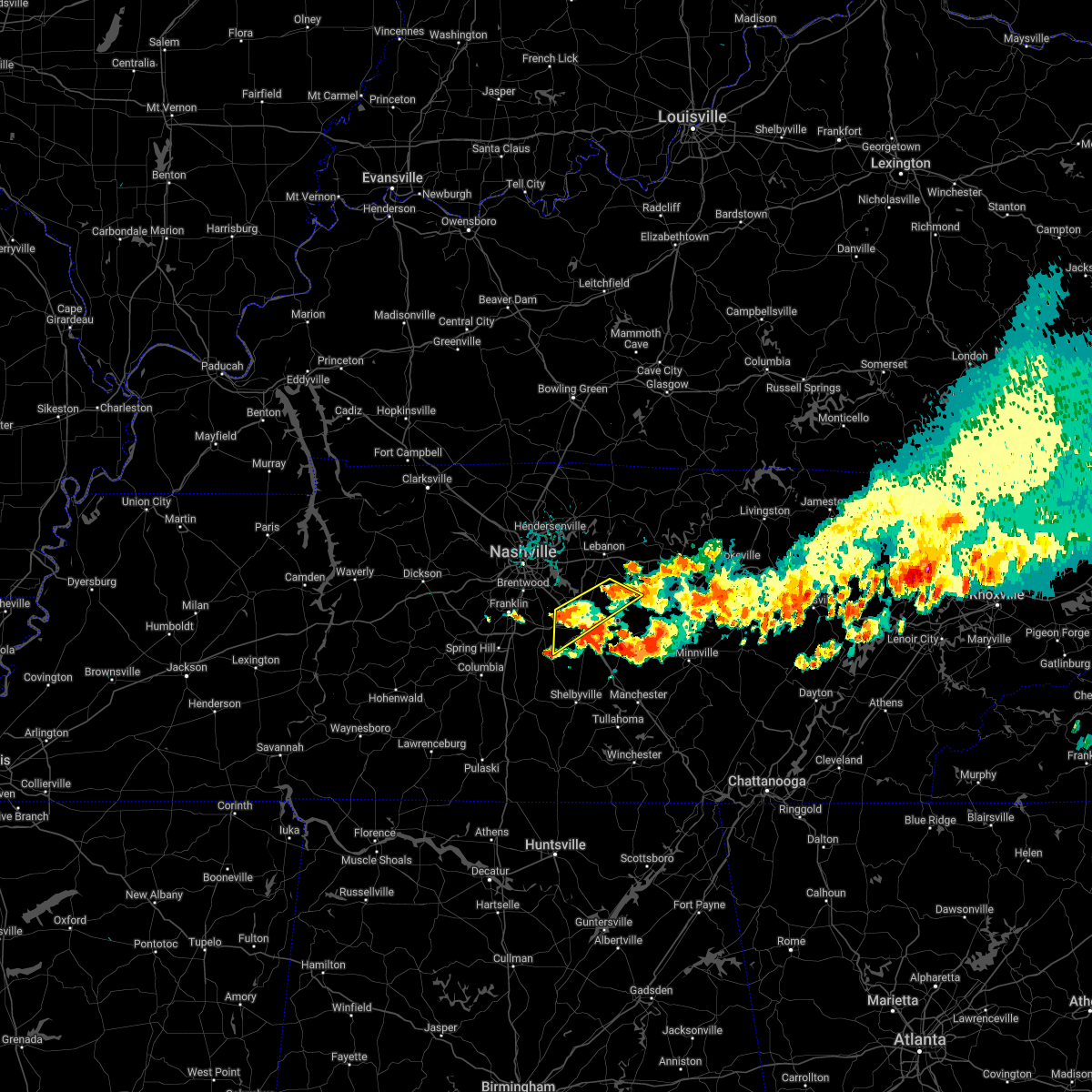 At 701 pm cdt, severe thunderstorms were located along a line extending from 7 miles southwest of watertown to 5 miles south of smyrna, moving southeast at 15 mph (radar indicated). Hazards include 60 mph wind gusts and nickel size hail. Expect damage to roofs, siding, and trees. locations impacted include, murfreesboro, smyrna, walterhill, cedars of lebanon state park, lascassas and rockvale. this includes the following highways, interstate 24 between mile markers 68 and 80. interstate 840 between mile markers 46 and 63. hail threat, radar indicated max hail size, 0. 88 in wind threat, radar indicated max wind gust, 60 mph. At 701 pm cdt, severe thunderstorms were located along a line extending from 7 miles southwest of watertown to 5 miles south of smyrna, moving southeast at 15 mph (radar indicated). Hazards include 60 mph wind gusts and nickel size hail. Expect damage to roofs, siding, and trees. locations impacted include, murfreesboro, smyrna, walterhill, cedars of lebanon state park, lascassas and rockvale. this includes the following highways, interstate 24 between mile markers 68 and 80. interstate 840 between mile markers 46 and 63. hail threat, radar indicated max hail size, 0. 88 in wind threat, radar indicated max wind gust, 60 mph.
|
| 7/12/2022 6:41 PM CDT |
 At 640 pm cdt, severe thunderstorms were located along a line extending from 6 miles northeast of walterhill to near nolensville, moving southeast at 10 mph (radar indicated. at 637 pm cdt...numerous reports of quarter size hail were occurring in nolensville with these storms). Hazards include 60 mph wind gusts and quarter size hail. Hail damage to vehicles is expected. Expect wind damage to roofs, siding, and trees. At 640 pm cdt, severe thunderstorms were located along a line extending from 6 miles northeast of walterhill to near nolensville, moving southeast at 10 mph (radar indicated. at 637 pm cdt...numerous reports of quarter size hail were occurring in nolensville with these storms). Hazards include 60 mph wind gusts and quarter size hail. Hail damage to vehicles is expected. Expect wind damage to roofs, siding, and trees.
|
| 7/12/2022 6:34 PM CDT | Ping Pong Ball sized hail reported 5.6 miles NNE of Smyrna, TN, report from twitter. |
| 7/12/2022 6:33 PM CDT |
 At 632 pm cdt, a severe thunderstorm was located over nolensville, or 12 miles east of franklin, moving southeast at 10 mph (trained weather spotters. at 628 pm cdt...quarter size hail was reported in nolensville with this storm). Hazards include 60 mph wind gusts and half dollar size hail. Hail damage to vehicles is expected. expect wind damage to roofs, siding, and trees. locations impacted include, murfreesboro, smyrna, la vergne, nolensville, walterhill, rockvale and triune. this includes the following highways, interstate 24 between mile markers 67 and 80. interstate 840 between mile markers 43 and 59. hail threat, observed max hail size, 1. 25 in wind threat, radar indicated max wind gust, 60 mph. At 632 pm cdt, a severe thunderstorm was located over nolensville, or 12 miles east of franklin, moving southeast at 10 mph (trained weather spotters. at 628 pm cdt...quarter size hail was reported in nolensville with this storm). Hazards include 60 mph wind gusts and half dollar size hail. Hail damage to vehicles is expected. expect wind damage to roofs, siding, and trees. locations impacted include, murfreesboro, smyrna, la vergne, nolensville, walterhill, rockvale and triune. this includes the following highways, interstate 24 between mile markers 67 and 80. interstate 840 between mile markers 43 and 59. hail threat, observed max hail size, 1. 25 in wind threat, radar indicated max wind gust, 60 mph.
|
| 7/12/2022 6:18 PM CDT |
 At 618 pm cdt, a severe thunderstorm was located over nolensville, or 11 miles east of franklin, moving southeast at 15 mph (radar indicated). Hazards include 60 mph wind gusts and quarter size hail. Hail damage to vehicles is expected. Expect wind damage to roofs, siding, and trees. At 618 pm cdt, a severe thunderstorm was located over nolensville, or 11 miles east of franklin, moving southeast at 15 mph (radar indicated). Hazards include 60 mph wind gusts and quarter size hail. Hail damage to vehicles is expected. Expect wind damage to roofs, siding, and trees.
|
| 7/12/2022 5:32 PM CDT |
 At 532 pm cdt, severe thunderstorms were located along a line extending from gainesboro to near smyrna, moving southeast at 25 mph (radar indicated). Hazards include 60 mph wind gusts and nickel size hail. expect damage to roofs, siding, and trees At 532 pm cdt, severe thunderstorms were located along a line extending from gainesboro to near smyrna, moving southeast at 25 mph (radar indicated). Hazards include 60 mph wind gusts and nickel size hail. expect damage to roofs, siding, and trees
|
| 7/9/2022 3:25 AM CDT |
 At 325 am cdt, severe thunderstorms were located along a line extending from near smithville to 10 miles southwest of murfreesboro, moving south at 45 mph (radar indicated). Hazards include 60 mph wind gusts. expect damage to roofs, siding, and trees At 325 am cdt, severe thunderstorms were located along a line extending from near smithville to 10 miles southwest of murfreesboro, moving south at 45 mph (radar indicated). Hazards include 60 mph wind gusts. expect damage to roofs, siding, and trees
|
| 7/9/2022 3:17 AM CDT |
 At 316 am cdt, a severe thunderstorm was located near murfreesboro, moving southeast at 40 mph (radar indicated). Hazards include 60 mph wind gusts. Expect damage to roofs, siding, and trees. locations impacted include, murfreesboro, woodbury, smyrna, la vergne, nolensville, walterhill, rural hill, auburntown, lascassas, christiana, fosterville, triune, cedars of lebanon state park, rockvale, milton, gladeville and readyville. this includes the following highways, interstate 24 between mile markers 64 and 93. interstate 840 between mile markers 42 and 72. hail threat, radar indicated max hail size, <. 75 in wind threat, radar indicated max wind gust, 60 mph. At 316 am cdt, a severe thunderstorm was located near murfreesboro, moving southeast at 40 mph (radar indicated). Hazards include 60 mph wind gusts. Expect damage to roofs, siding, and trees. locations impacted include, murfreesboro, woodbury, smyrna, la vergne, nolensville, walterhill, rural hill, auburntown, lascassas, christiana, fosterville, triune, cedars of lebanon state park, rockvale, milton, gladeville and readyville. this includes the following highways, interstate 24 between mile markers 64 and 93. interstate 840 between mile markers 42 and 72. hail threat, radar indicated max hail size, <. 75 in wind threat, radar indicated max wind gust, 60 mph.
|
| 7/9/2022 2:54 AM CDT |
 At 254 am cdt, a severe thunderstorm was located over rural hill, or 12 miles southwest of lebanon, moving south at 25 mph (radar indicated). Hazards include 60 mph wind gusts. expect damage to roofs, siding, and trees At 254 am cdt, a severe thunderstorm was located over rural hill, or 12 miles southwest of lebanon, moving south at 25 mph (radar indicated). Hazards include 60 mph wind gusts. expect damage to roofs, siding, and trees
|
| 7/7/2022 1:43 PM CDT |
 At 142 pm cdt, a severe thunderstorm was located over nolensville, or 10 miles east of franklin, moving east at 10 mph (radar indicated). Hazards include 60 mph wind gusts and penny size hail. Expect damage to roofs, siding, and trees. locations impacted include, franklin, smyrna, brentwood, la vergne, nolensville and triune. this includes the following highways, interstate 24 between mile markers 63 and 72. interstate 840 between mile markers 39 and 49, and near mile marker 60. hail threat, radar indicated max hail size, 0. 75 in wind threat, radar indicated max wind gust, 60 mph. At 142 pm cdt, a severe thunderstorm was located over nolensville, or 10 miles east of franklin, moving east at 10 mph (radar indicated). Hazards include 60 mph wind gusts and penny size hail. Expect damage to roofs, siding, and trees. locations impacted include, franklin, smyrna, brentwood, la vergne, nolensville and triune. this includes the following highways, interstate 24 between mile markers 63 and 72. interstate 840 between mile markers 39 and 49, and near mile marker 60. hail threat, radar indicated max hail size, 0. 75 in wind threat, radar indicated max wind gust, 60 mph.
|
| 7/7/2022 1:25 PM CDT |
 At 125 pm cdt, a severe thunderstorm was located over nolensville, or 7 miles east of franklin, moving southeast at 10 mph (radar indicated). Hazards include 60 mph wind gusts and penny size hail. expect damage to roofs, siding, and trees At 125 pm cdt, a severe thunderstorm was located over nolensville, or 7 miles east of franklin, moving southeast at 10 mph (radar indicated). Hazards include 60 mph wind gusts and penny size hail. expect damage to roofs, siding, and trees
|
| 6/17/2022 10:56 AM CDT |
 At 1056 am cdt, severe thunderstorms were located along a line extending from 8 miles northeast of walterhill to near murfreesboro to 11 miles south of nolensville, moving southeast at 40 mph (radar indicated). Hazards include 60 mph wind gusts and quarter size hail. Hail damage to vehicles is expected. Expect wind damage to roofs, siding, and trees. At 1056 am cdt, severe thunderstorms were located along a line extending from 8 miles northeast of walterhill to near murfreesboro to 11 miles south of nolensville, moving southeast at 40 mph (radar indicated). Hazards include 60 mph wind gusts and quarter size hail. Hail damage to vehicles is expected. Expect wind damage to roofs, siding, and trees.
|
| 6/17/2022 10:53 AM CDT | 45 knots / 52 mph wind gust measured at smyrna airport awo in rutherford county TN, 2.7 miles S of Smyrna, TN |
| 6/17/2022 10:40 AM CDT |
 At 1040 am cdt, severe thunderstorms were located along a line extending from 7 miles southeast of belinda city to thompson`s station to 8 miles east of centerville, moving southeast at 40 mph (radar indicated). Hazards include 60 mph wind gusts and half dollar size hail. Hail damage to vehicles is expected. expect wind damage to roofs, siding, and trees. locations impacted include, murfreesboro, franklin, columbia, lebanon, centerville, smyrna, brentwood, la vergne, spring hill, mount juliet, nolensville, forest hills, oak hill, thompson`s station, walterhill, rural hill, antioch, belinda city, eagleville and primm springs. hail threat, radar indicated max hail size, 1. 25 in wind threat, radar indicated max wind gust, 60 mph. At 1040 am cdt, severe thunderstorms were located along a line extending from 7 miles southeast of belinda city to thompson`s station to 8 miles east of centerville, moving southeast at 40 mph (radar indicated). Hazards include 60 mph wind gusts and half dollar size hail. Hail damage to vehicles is expected. expect wind damage to roofs, siding, and trees. locations impacted include, murfreesboro, franklin, columbia, lebanon, centerville, smyrna, brentwood, la vergne, spring hill, mount juliet, nolensville, forest hills, oak hill, thompson`s station, walterhill, rural hill, antioch, belinda city, eagleville and primm springs. hail threat, radar indicated max hail size, 1. 25 in wind threat, radar indicated max wind gust, 60 mph.
|
| 6/17/2022 10:27 AM CDT |
 At 1026 am cdt, severe thunderstorms were located along a line extending from belinda city to 7 miles northwest of thompson`s station to near centerville, moving southeast at 40 mph (radar indicated). Hazards include 60 mph wind gusts. expect damage to roofs, siding, and trees At 1026 am cdt, severe thunderstorms were located along a line extending from belinda city to 7 miles northwest of thompson`s station to near centerville, moving southeast at 40 mph (radar indicated). Hazards include 60 mph wind gusts. expect damage to roofs, siding, and trees
|
| 5/6/2022 2:22 PM CDT |
 The severe thunderstorm warning for southern davidson, northwestern rutherford and west central wilson counties will expire at 230 pm cdt, the storms which prompted the warning have moved out of the area. therefore, the warning will be allowed to expire. to report severe weather, contact your nearest law enforcement agency. they will relay your report to the national weather service nashville. The severe thunderstorm warning for southern davidson, northwestern rutherford and west central wilson counties will expire at 230 pm cdt, the storms which prompted the warning have moved out of the area. therefore, the warning will be allowed to expire. to report severe weather, contact your nearest law enforcement agency. they will relay your report to the national weather service nashville.
|
| 5/6/2022 2:17 PM CDT |
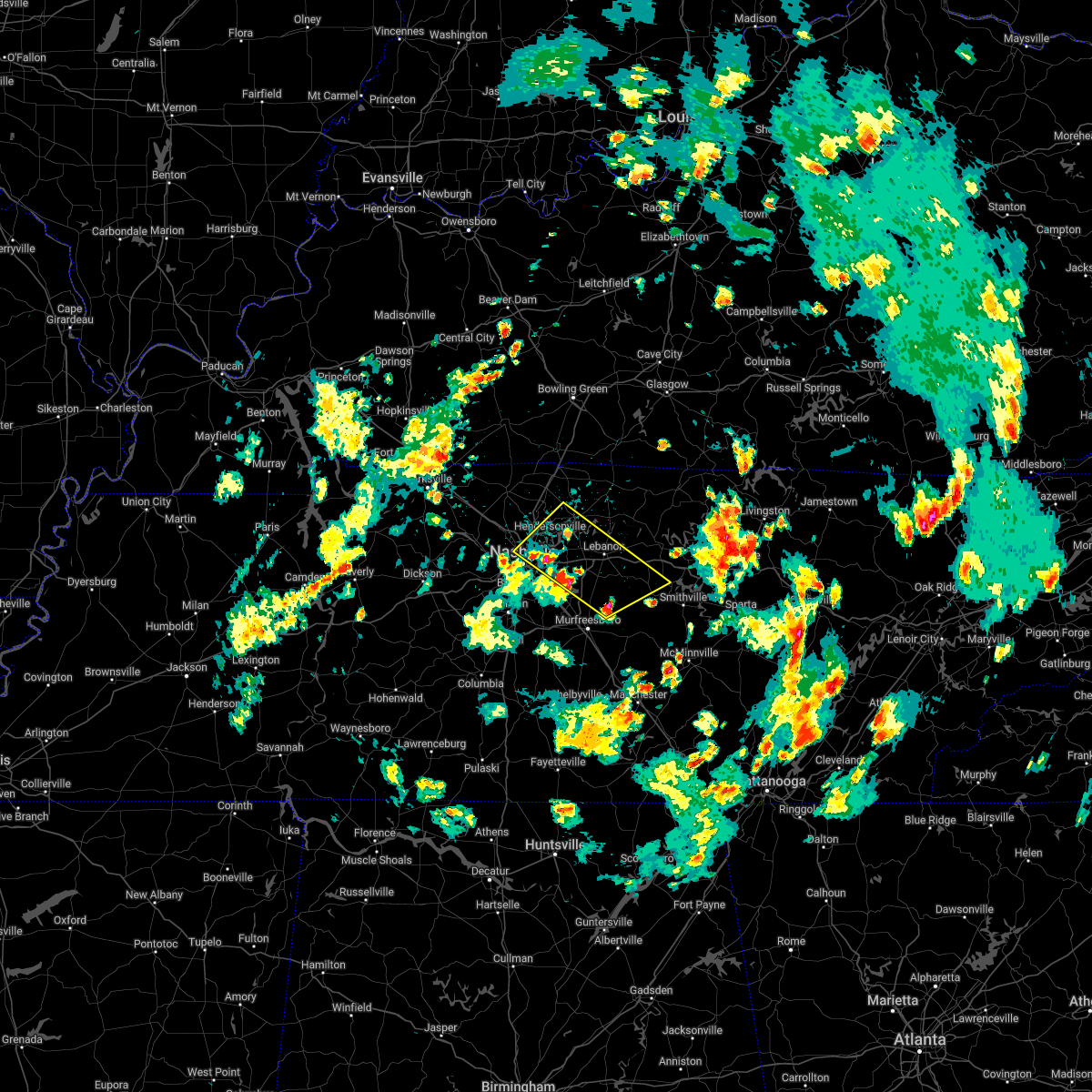 At 217 pm cdt, severe thunderstorms were located along a line extending from near madison to 6 miles east of walterhill, moving northeast at 35 mph (radar indicated). Hazards include 60 mph wind gusts and quarter size hail. Hail damage to vehicles is expected. Expect wind damage to roofs, siding, and trees. At 217 pm cdt, severe thunderstorms were located along a line extending from near madison to 6 miles east of walterhill, moving northeast at 35 mph (radar indicated). Hazards include 60 mph wind gusts and quarter size hail. Hail damage to vehicles is expected. Expect wind damage to roofs, siding, and trees.
|
| 5/6/2022 2:09 PM CDT |
 At 208 pm cdt, severe thunderstorms were located along a line extending from nashville to near rural hill, moving northeast at 35 mph (radar indicated). Hazards include 60 mph wind gusts and quarter size hail. Hail damage to vehicles is expected. expect wind damage to roofs, siding, and trees. locations impacted include, nashville, la vergne, mount juliet, forest hills, oak hill, belle meade, hermitage, rural hill, antioch, belinda city, berry hill, percy priest lake and gladeville. this includes the following highways, interstate 40 between mile markers 199 and 227. interstate 65 between mile markers 77 and 92. interstate 24 between mile markers 43 and 64. interstate 840 between mile markers 67 and 72. hail threat, radar indicated max hail size, 1. 00 in wind threat, radar indicated max wind gust, 60 mph. At 208 pm cdt, severe thunderstorms were located along a line extending from nashville to near rural hill, moving northeast at 35 mph (radar indicated). Hazards include 60 mph wind gusts and quarter size hail. Hail damage to vehicles is expected. expect wind damage to roofs, siding, and trees. locations impacted include, nashville, la vergne, mount juliet, forest hills, oak hill, belle meade, hermitage, rural hill, antioch, belinda city, berry hill, percy priest lake and gladeville. this includes the following highways, interstate 40 between mile markers 199 and 227. interstate 65 between mile markers 77 and 92. interstate 24 between mile markers 43 and 64. interstate 840 between mile markers 67 and 72. hail threat, radar indicated max hail size, 1. 00 in wind threat, radar indicated max wind gust, 60 mph.
|
| 5/6/2022 1:55 PM CDT |
 At 155 pm cdt, severe thunderstorms were located along a line extending from near bellevue to near antioch, moving northeast at 25 mph (radar indicated). Hazards include 60 mph wind gusts and quarter size hail. Hail damage to vehicles is expected. Expect wind damage to roofs, siding, and trees. At 155 pm cdt, severe thunderstorms were located along a line extending from near bellevue to near antioch, moving northeast at 25 mph (radar indicated). Hazards include 60 mph wind gusts and quarter size hail. Hail damage to vehicles is expected. Expect wind damage to roofs, siding, and trees.
|
| 4/13/2022 8:11 PM CDT |
 At 810 pm cdt, severe thunderstorms were located along a line extending from 7 miles northeast of lebanon to 8 miles southwest of murfreesboro, moving east at 65 mph (radar indicated). Hazards include 70 mph wind gusts. Expect considerable tree damage. damage is likely to mobile homes, roofs, and outbuildings. locations impacted include, murfreesboro, gallatin, lebanon, woodbury, carthage, hendersonville, smyrna, la vergne, mount juliet, watertown, gordonsville, walterhill, rural hill, belinda city, hickman, south carthage, alexandria, eagleville, dowelltown and liberty. this includes the following highways, interstate 40 between mile markers 223 and 263. interstate 24 between mile markers 65 and 91. Interstate 840 between mile markers 46 and 76. At 810 pm cdt, severe thunderstorms were located along a line extending from 7 miles northeast of lebanon to 8 miles southwest of murfreesboro, moving east at 65 mph (radar indicated). Hazards include 70 mph wind gusts. Expect considerable tree damage. damage is likely to mobile homes, roofs, and outbuildings. locations impacted include, murfreesboro, gallatin, lebanon, woodbury, carthage, hendersonville, smyrna, la vergne, mount juliet, watertown, gordonsville, walterhill, rural hill, belinda city, hickman, south carthage, alexandria, eagleville, dowelltown and liberty. this includes the following highways, interstate 40 between mile markers 223 and 263. interstate 24 between mile markers 65 and 91. Interstate 840 between mile markers 46 and 76.
|
| 4/13/2022 8:04 PM CDT | 58 knot gust at kmq in rutherford county TN, 1.5 miles SSW of Smyrna, TN |
| 4/13/2022 7:52 PM CDT |
 At 752 pm cdt, severe thunderstorms were located along a line extending from hendersonville to 6 miles east of spring hill, moving east at 65 mph (radar indicated). Hazards include 70 mph wind gusts. Expect considerable tree damage. Damage is likely to mobile homes, roofs, and outbuildings. At 752 pm cdt, severe thunderstorms were located along a line extending from hendersonville to 6 miles east of spring hill, moving east at 65 mph (radar indicated). Hazards include 70 mph wind gusts. Expect considerable tree damage. Damage is likely to mobile homes, roofs, and outbuildings.
|
| 4/13/2022 7:49 PM CDT |
 At 749 pm cdt, severe thunderstorms were located along a line extending from near joelton to near oak hill to near franklin, moving east at 65 mph (radar indicated). Hazards include 70 mph wind gusts. Expect considerable tree damage. damage is likely to mobile homes, roofs, and outbuildings. locations impacted include, franklin, columbia, nashville, madison, hendersonville, brentwood, spring hill, goodlettsville, nolensville, forest hills, oak hill, belle meade, lakewood, thompson`s station, hermitage, bellevue, antioch, old hickory, joelton and berry hill. this includes the following highways, interstate 40 between mile markers 196 and 223. interstate 65 between mile markers 51 and 98. interstate 24 between mile markers 35 and 63. interstate 840 between mile markers 22 and 42. thunderstorm damage threat, considerable hail threat, radar indicated max hail size, <. 75 in wind threat, radar indicated max wind gust, 70 mph. At 749 pm cdt, severe thunderstorms were located along a line extending from near joelton to near oak hill to near franklin, moving east at 65 mph (radar indicated). Hazards include 70 mph wind gusts. Expect considerable tree damage. damage is likely to mobile homes, roofs, and outbuildings. locations impacted include, franklin, columbia, nashville, madison, hendersonville, brentwood, spring hill, goodlettsville, nolensville, forest hills, oak hill, belle meade, lakewood, thompson`s station, hermitage, bellevue, antioch, old hickory, joelton and berry hill. this includes the following highways, interstate 40 between mile markers 196 and 223. interstate 65 between mile markers 51 and 98. interstate 24 between mile markers 35 and 63. interstate 840 between mile markers 22 and 42. thunderstorm damage threat, considerable hail threat, radar indicated max hail size, <. 75 in wind threat, radar indicated max wind gust, 70 mph.
|
| 4/13/2022 7:33 PM CDT |
 At 732 pm cdt, severe thunderstorms were located along a line extending from near ashland city to near pegram to 10 miles south of fairview, moving east at 65 mph (radar indicated). Hazards include 70 mph wind gusts. Expect considerable tree damage. damage is likely to mobile homes, roofs, and outbuildings. locations impacted include, franklin, columbia, dickson, ashland city, nashville, madison, hendersonville, brentwood, la vergne, spring hill, goodlettsville, nolensville, forest hills, oak hill, white bluff, belle meade, kingston springs, lakewood, thompson`s station and pegram. this includes the following highways, interstate 40 between mile markers 173 and 223. interstate 65 between mile markers 51 and 98. interstate 24 between mile markers 36 and 63. interstate 840 between mile markers 1 and 42. thunderstorm damage threat, considerable hail threat, radar indicated max hail size, <. 75 in wind threat, radar indicated max wind gust, 70 mph. At 732 pm cdt, severe thunderstorms were located along a line extending from near ashland city to near pegram to 10 miles south of fairview, moving east at 65 mph (radar indicated). Hazards include 70 mph wind gusts. Expect considerable tree damage. damage is likely to mobile homes, roofs, and outbuildings. locations impacted include, franklin, columbia, dickson, ashland city, nashville, madison, hendersonville, brentwood, la vergne, spring hill, goodlettsville, nolensville, forest hills, oak hill, white bluff, belle meade, kingston springs, lakewood, thompson`s station and pegram. this includes the following highways, interstate 40 between mile markers 173 and 223. interstate 65 between mile markers 51 and 98. interstate 24 between mile markers 36 and 63. interstate 840 between mile markers 1 and 42. thunderstorm damage threat, considerable hail threat, radar indicated max hail size, <. 75 in wind threat, radar indicated max wind gust, 70 mph.
|
| 4/13/2022 7:16 PM CDT |
 At 716 pm cdt, severe thunderstorms were located along a line extending from 7 miles north of dickson to near burns to centerville, moving east at 65 mph (radar indicated). Hazards include 70 mph wind gusts. Expect considerable tree damage. Damage is likely to mobile homes, roofs, and outbuildings. At 716 pm cdt, severe thunderstorms were located along a line extending from 7 miles north of dickson to near burns to centerville, moving east at 65 mph (radar indicated). Hazards include 70 mph wind gusts. Expect considerable tree damage. Damage is likely to mobile homes, roofs, and outbuildings.
|
| 4/12/2022 7:43 AM CDT |
 At 743 am cdt, a severe thunderstorm was located near smyrna, or 8 miles northwest of murfreesboro, moving east at 30 mph (radar indicated). Hazards include quarter size hail. Damage to vehicles is expected. locations impacted include, murfreesboro, smyrna, la vergne, walterhill, cedars of lebanon state park, lascassas and milton. this includes the following highways, interstate 24 between mile markers 67 and 74. interstate 840 between mile markers 53 and 66. hail threat, radar indicated max hail size, 1. 00 in wind threat, radar indicated max wind gust, <50 mph. At 743 am cdt, a severe thunderstorm was located near smyrna, or 8 miles northwest of murfreesboro, moving east at 30 mph (radar indicated). Hazards include quarter size hail. Damage to vehicles is expected. locations impacted include, murfreesboro, smyrna, la vergne, walterhill, cedars of lebanon state park, lascassas and milton. this includes the following highways, interstate 24 between mile markers 67 and 74. interstate 840 between mile markers 53 and 66. hail threat, radar indicated max hail size, 1. 00 in wind threat, radar indicated max wind gust, <50 mph.
|
| 4/12/2022 7:31 AM CDT |
 At 730 am cdt, a severe thunderstorm was located near smyrna, or 12 miles northwest of murfreesboro, moving east at 30 mph (radar indicated). Hazards include quarter size hail. damage to vehicles is expected At 730 am cdt, a severe thunderstorm was located near smyrna, or 12 miles northwest of murfreesboro, moving east at 30 mph (radar indicated). Hazards include quarter size hail. damage to vehicles is expected
|
| 1/1/2022 1:02 PM CST |
 At 101 pm cst, severe thunderstorms were located along a line extending from 6 miles south of scottsville to forest hills, moving northeast at 50 mph (radar indicated). Hazards include 60 mph wind gusts. expect damage to roofs, siding, and trees At 101 pm cst, severe thunderstorms were located along a line extending from 6 miles south of scottsville to forest hills, moving northeast at 50 mph (radar indicated). Hazards include 60 mph wind gusts. expect damage to roofs, siding, and trees
|
| 12/11/2021 3:48 AM CST | Smyrna airport awos measured a peak wind gust of 51 knots / 59 mp in rutherford county TN, 3.5 miles S of Smyrna, TN |
| 10/6/2021 5:12 PM CDT |
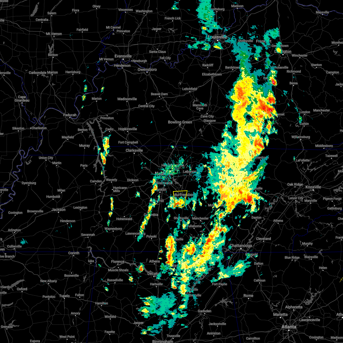 At 512 pm cdt, a severe thunderstorm was located 9 miles southwest of murfreesboro, moving north at 30 mph (radar indicated). Hazards include 60 mph wind gusts and quarter size hail. Hail damage to vehicles is expected. expect wind damage to roofs, siding, and trees. locations impacted include, murfreesboro, smyrna, walterhill and rockvale. this includes the following highways, interstate 24 between mile markers 70 and 82. interstate 840 between mile markers 46 and 58. hail threat, radar indicated max hail size, 1. 00 in wind threat, radar indicated max wind gust, 60 mph. At 512 pm cdt, a severe thunderstorm was located 9 miles southwest of murfreesboro, moving north at 30 mph (radar indicated). Hazards include 60 mph wind gusts and quarter size hail. Hail damage to vehicles is expected. expect wind damage to roofs, siding, and trees. locations impacted include, murfreesboro, smyrna, walterhill and rockvale. this includes the following highways, interstate 24 between mile markers 70 and 82. interstate 840 between mile markers 46 and 58. hail threat, radar indicated max hail size, 1. 00 in wind threat, radar indicated max wind gust, 60 mph.
|
| 10/6/2021 5:05 PM CDT |
 At 504 pm cdt, a severe thunderstorm was located 12 miles north of shelbyville, moving north at 30 mph (radar indicated). Hazards include 60 mph wind gusts and quarter size hail. Hail damage to vehicles is expected. Expect wind damage to roofs, siding, and trees. At 504 pm cdt, a severe thunderstorm was located 12 miles north of shelbyville, moving north at 30 mph (radar indicated). Hazards include 60 mph wind gusts and quarter size hail. Hail damage to vehicles is expected. Expect wind damage to roofs, siding, and trees.
|
| 8/18/2021 6:55 PM CDT |
 The severe thunderstorm warning for southeastern davidson, northwestern rutherford and eastern williamson counties will expire at 700 pm cdt, the storm which prompted the warning has weakened below severe limits, and no longer poses an immediate threat to life or property. therefore, the warning will be allowed to expire. however gusty winds and heavy rain are still possible with this thunderstorm. The severe thunderstorm warning for southeastern davidson, northwestern rutherford and eastern williamson counties will expire at 700 pm cdt, the storm which prompted the warning has weakened below severe limits, and no longer poses an immediate threat to life or property. therefore, the warning will be allowed to expire. however gusty winds and heavy rain are still possible with this thunderstorm.
|
| 8/18/2021 6:28 PM CDT |
 At 628 pm cdt, a severe thunderstorm was located near franklin, moving northeast at 25 mph (radar indicated). Hazards include 60 mph wind gusts. expect damage to roofs, siding, and trees At 628 pm cdt, a severe thunderstorm was located near franklin, moving northeast at 25 mph (radar indicated). Hazards include 60 mph wind gusts. expect damage to roofs, siding, and trees
|
| 7/31/2021 11:17 PM CDT |
 At 1116 pm cdt, severe thunderstorms were located along a line extending from smyrna to near lewisburg, moving southeast at 50 mph (radar indicated). Hazards include 60 mph wind gusts. Expect damage to roofs, siding, and trees. locations impacted include, murfreesboro, shelbyville, lewisburg, smyrna, chapel hill, wartrace, eagleville, bell buckle, christiana, fosterville, rover, belfast, deason, rockvale, farmington and unionville. this includes the following highways, interstate 65 between mile markers 32 and 39. interstate 24 between mile markers 69 and 94. Interstate 840 between mile markers 46 and 55. At 1116 pm cdt, severe thunderstorms were located along a line extending from smyrna to near lewisburg, moving southeast at 50 mph (radar indicated). Hazards include 60 mph wind gusts. Expect damage to roofs, siding, and trees. locations impacted include, murfreesboro, shelbyville, lewisburg, smyrna, chapel hill, wartrace, eagleville, bell buckle, christiana, fosterville, rover, belfast, deason, rockvale, farmington and unionville. this includes the following highways, interstate 65 between mile markers 32 and 39. interstate 24 between mile markers 69 and 94. Interstate 840 between mile markers 46 and 55.
|
| 7/31/2021 10:52 PM CDT |
 At 1052 pm cdt, severe thunderstorms were located along a line extending from near brentwood to near columbia, moving southeast at 50 mph (radar indicated). Hazards include 60 mph wind gusts. expect damage to roofs, siding, and trees At 1052 pm cdt, severe thunderstorms were located along a line extending from near brentwood to near columbia, moving southeast at 50 mph (radar indicated). Hazards include 60 mph wind gusts. expect damage to roofs, siding, and trees
|
| 7/31/2021 9:14 PM CDT |
 At 913 pm cdt, a severe thunderstorm was located near nolensville, or 9 miles northeast of franklin, moving southeast at 25 mph (radar indicated). Hazards include 60 mph wind gusts and penny size hail. Expect damage to roofs, siding, and trees. locations impacted include, franklin, smyrna, brentwood, la vergne, nolensville, antioch and triune. this includes the following highways, interstate 65 near mile marker 72. interstate 24 between mile markers 58 and 72. Interstate 840 between mile markers 39 and 47, and between mile markers 59 and 60. At 913 pm cdt, a severe thunderstorm was located near nolensville, or 9 miles northeast of franklin, moving southeast at 25 mph (radar indicated). Hazards include 60 mph wind gusts and penny size hail. Expect damage to roofs, siding, and trees. locations impacted include, franklin, smyrna, brentwood, la vergne, nolensville, antioch and triune. this includes the following highways, interstate 65 near mile marker 72. interstate 24 between mile markers 58 and 72. Interstate 840 between mile markers 39 and 47, and between mile markers 59 and 60.
|
| 7/31/2021 8:57 PM CDT |
 At 856 pm cdt, a severe thunderstorm was located near brentwood, or 8 miles northeast of franklin, moving southeast at 25 mph (radar indicated). Hazards include 60 mph wind gusts and penny size hail. expect damage to roofs, siding, and trees At 856 pm cdt, a severe thunderstorm was located near brentwood, or 8 miles northeast of franklin, moving southeast at 25 mph (radar indicated). Hazards include 60 mph wind gusts and penny size hail. expect damage to roofs, siding, and trees
|
| 5/6/2021 6:12 PM CDT | Reports trees down and split on sam davis road. #tspotter in rutherford county TN, 1.5 miles SSW of Smyrna, TN |
| 5/6/2021 6:06 PM CDT |
 At 606 pm cdt, severe thunderstorms were located along a line extending from hartsville to 11 miles southeast of spring hill, moving east at 40 mph (radar indicated). Hazards include 60 mph wind gusts. Expect damage to roofs, siding, and trees. locations impacted include, murfreesboro, lebanon, smyrna, la vergne, mount juliet, watertown, walterhill, rural hill, eagleville, lascassas, tuckers crossroads, christiana, dixon springs, dickerson chapel recreation area, cedars of lebanon state park, rockvale and gladeville. this includes the following highways, interstate 40 between mile markers 229 and 249. interstate 24 between mile markers 66 and 88. Interstate 840 between mile markers 46 and 76. At 606 pm cdt, severe thunderstorms were located along a line extending from hartsville to 11 miles southeast of spring hill, moving east at 40 mph (radar indicated). Hazards include 60 mph wind gusts. Expect damage to roofs, siding, and trees. locations impacted include, murfreesboro, lebanon, smyrna, la vergne, mount juliet, watertown, walterhill, rural hill, eagleville, lascassas, tuckers crossroads, christiana, dixon springs, dickerson chapel recreation area, cedars of lebanon state park, rockvale and gladeville. this includes the following highways, interstate 40 between mile markers 229 and 249. interstate 24 between mile markers 66 and 88. Interstate 840 between mile markers 46 and 76.
|
| 5/6/2021 5:42 PM CDT |
 At 542 pm cdt, severe thunderstorms were located along a line extending from near gallatin to near columbia, moving east at 40 mph (radar indicated). Hazards include 60 mph wind gusts. expect damage to roofs, siding, and trees At 542 pm cdt, severe thunderstorms were located along a line extending from near gallatin to near columbia, moving east at 40 mph (radar indicated). Hazards include 60 mph wind gusts. expect damage to roofs, siding, and trees
|
| 5/6/2021 5:34 PM CDT |
 At 534 pm cdt, severe thunderstorms were located along a line extending from 7 miles east of gallatin to 10 miles south of nolensville, moving east at 55 mph (radar indicated). Hazards include 60 mph wind gusts. Expect damage to roofs, siding, and trees. locations impacted include, murfreesboro, franklin, gallatin, lebanon, nashville, hartsville, madison, hendersonville, smyrna, brentwood, la vergne, spring hill, mount juliet, goodlettsville, millersville, nolensville, forest hills, oak hill, belle meade and lakewood. this includes the following highways, interstate 40 between mile markers 203 and 248. interstate 65 between mile markers 53 and 102. interstate 24 between mile markers 38 and 87. Interstate 840 between mile markers 18 and 76. At 534 pm cdt, severe thunderstorms were located along a line extending from 7 miles east of gallatin to 10 miles south of nolensville, moving east at 55 mph (radar indicated). Hazards include 60 mph wind gusts. Expect damage to roofs, siding, and trees. locations impacted include, murfreesboro, franklin, gallatin, lebanon, nashville, hartsville, madison, hendersonville, smyrna, brentwood, la vergne, spring hill, mount juliet, goodlettsville, millersville, nolensville, forest hills, oak hill, belle meade and lakewood. this includes the following highways, interstate 40 between mile markers 203 and 248. interstate 65 between mile markers 53 and 102. interstate 24 between mile markers 38 and 87. Interstate 840 between mile markers 18 and 76.
|
| 5/6/2021 5:09 PM CDT |
 At 508 pm cdt, severe thunderstorms were located along a line extending from near greenbrier to 10 miles south of fairview, moving east at 55 mph (radar indicated). Hazards include 60 mph wind gusts. expect damage to roofs, siding, and trees At 508 pm cdt, severe thunderstorms were located along a line extending from near greenbrier to 10 miles south of fairview, moving east at 55 mph (radar indicated). Hazards include 60 mph wind gusts. expect damage to roofs, siding, and trees
|
| 3/28/2021 12:13 AM CDT |
 The severe thunderstorm warning for southeastern davidson, north central rutherford and west central wilson counties will expire at 1215 am cdt, the storm which prompted the warning has weakened below severe limits, and no longer poses an immediate threat to life or property. therefore, the warning will be allowed to expire. however small hail and gusty winds are still possible with this thunderstorm. The severe thunderstorm warning for southeastern davidson, north central rutherford and west central wilson counties will expire at 1215 am cdt, the storm which prompted the warning has weakened below severe limits, and no longer poses an immediate threat to life or property. therefore, the warning will be allowed to expire. however small hail and gusty winds are still possible with this thunderstorm.
|
| 3/28/2021 12:02 AM CDT |
 At 1201 am cdt, a severe thunderstorm was located over antioch, or 10 miles southeast of nashville, moving east at 40 mph (radar indicated). Hazards include 60 mph wind gusts and quarter size hail. Hail damage to vehicles is expected. expect wind damage to roofs, siding, and trees. Locations impacted include, la vergne, mount juliet, oak hill, hermitage, rural hill, antioch, green hill and percy priest lake. At 1201 am cdt, a severe thunderstorm was located over antioch, or 10 miles southeast of nashville, moving east at 40 mph (radar indicated). Hazards include 60 mph wind gusts and quarter size hail. Hail damage to vehicles is expected. expect wind damage to roofs, siding, and trees. Locations impacted include, la vergne, mount juliet, oak hill, hermitage, rural hill, antioch, green hill and percy priest lake.
|
| 3/27/2021 11:44 PM CDT |
 At 1144 pm cdt, a severe thunderstorm was located over forest hills, or near franklin, moving east at 40 mph (radar indicated). Hazards include 60 mph wind gusts and quarter size hail. Hail damage to vehicles is expected. Expect wind damage to roofs, siding, and trees. At 1144 pm cdt, a severe thunderstorm was located over forest hills, or near franklin, moving east at 40 mph (radar indicated). Hazards include 60 mph wind gusts and quarter size hail. Hail damage to vehicles is expected. Expect wind damage to roofs, siding, and trees.
|
| 3/27/2021 10:54 PM CDT |
 The severe thunderstorm warning for southern davidson, northwestern rutherford and northeastern williamson counties will expire at 1100 pm cdt, the storm which prompted the warning has weakened below severe limits, and no longer poses an immediate threat to life or property. therefore, the warning will be allowed to expire. The severe thunderstorm warning for southern davidson, northwestern rutherford and northeastern williamson counties will expire at 1100 pm cdt, the storm which prompted the warning has weakened below severe limits, and no longer poses an immediate threat to life or property. therefore, the warning will be allowed to expire.
|
| 3/27/2021 10:43 PM CDT |
 At 1043 pm cdt, a severe thunderstorm was located over brentwood, or near franklin, moving northeast at 55 mph (radar indicated). Hazards include 60 mph wind gusts and penny size hail. Expect damage to roofs, siding, and trees. locations impacted include, franklin, smyrna, brentwood, la vergne, nolensville, forest hills, oak hill, belle meade, antioch, berry hill and natchez trace at highway 96. this includes the following highways, interstate 40 between mile markers 212 and 218. interstate 65 between mile markers 63 and 81. Interstate 24 between mile markers 52 and 70. At 1043 pm cdt, a severe thunderstorm was located over brentwood, or near franklin, moving northeast at 55 mph (radar indicated). Hazards include 60 mph wind gusts and penny size hail. Expect damage to roofs, siding, and trees. locations impacted include, franklin, smyrna, brentwood, la vergne, nolensville, forest hills, oak hill, belle meade, antioch, berry hill and natchez trace at highway 96. this includes the following highways, interstate 40 between mile markers 212 and 218. interstate 65 between mile markers 63 and 81. Interstate 24 between mile markers 52 and 70.
|
| 3/27/2021 10:29 PM CDT |
 At 1029 pm cdt, a severe thunderstorm was located 7 miles northwest of thompson`s station, or 9 miles southwest of franklin, moving northeast at 55 mph (radar indicated). Hazards include 60 mph wind gusts and penny size hail. expect damage to roofs, siding, and trees At 1029 pm cdt, a severe thunderstorm was located 7 miles northwest of thompson`s station, or 9 miles southwest of franklin, moving northeast at 55 mph (radar indicated). Hazards include 60 mph wind gusts and penny size hail. expect damage to roofs, siding, and trees
|
| 3/27/2021 7:24 PM CDT |
 At 722 pm cdt, a severe thunderstorm was located 7 miles south of murfreesboro, moving east at 45 mph (trained weather spotters). Hazards include 60 mph wind gusts and half dollar size hail. Hail damage to vehicles is expected. expect wind damage to roofs, siding, and trees. locations impacted include, murfreesboro, smyrna, nolensville, walterhill, eagleville, bell buckle, lascassas, christiana, fosterville, rover, deason, rockvale and unionville. this includes the following highways, interstate 24 between mile markers 68 and 95. Interstate 840 between mile markers 46 and 61. At 722 pm cdt, a severe thunderstorm was located 7 miles south of murfreesboro, moving east at 45 mph (trained weather spotters). Hazards include 60 mph wind gusts and half dollar size hail. Hail damage to vehicles is expected. expect wind damage to roofs, siding, and trees. locations impacted include, murfreesboro, smyrna, nolensville, walterhill, eagleville, bell buckle, lascassas, christiana, fosterville, rover, deason, rockvale and unionville. this includes the following highways, interstate 24 between mile markers 68 and 95. Interstate 840 between mile markers 46 and 61.
|
| 3/27/2021 7:05 PM CDT |
 At 705 pm cdt, a severe thunderstorm was located 14 miles east of spring hill, or 17 miles southeast of franklin, moving east at 45 mph (trained weather spotters). Hazards include golf ball size hail and 60 mph wind gusts. People and animals outdoors will be injured. expect hail damage to roofs, siding, windows, and vehicles. expect wind damage to roofs, siding, and trees. locations impacted include, murfreesboro, franklin, columbia, smyrna, spring hill, nolensville, thompson`s station, walterhill, chapel hill, eagleville, bell buckle, lascassas, christiana, i-65 east of columbia, fosterville, triune, rover, deason, rockvale and unionville. this includes the following highways, interstate 65 between mile markers 42 and 64. interstate 24 between mile markers 68 and 96. Interstate 840 between mile markers 27 and 61. At 705 pm cdt, a severe thunderstorm was located 14 miles east of spring hill, or 17 miles southeast of franklin, moving east at 45 mph (trained weather spotters). Hazards include golf ball size hail and 60 mph wind gusts. People and animals outdoors will be injured. expect hail damage to roofs, siding, windows, and vehicles. expect wind damage to roofs, siding, and trees. locations impacted include, murfreesboro, franklin, columbia, smyrna, spring hill, nolensville, thompson`s station, walterhill, chapel hill, eagleville, bell buckle, lascassas, christiana, i-65 east of columbia, fosterville, triune, rover, deason, rockvale and unionville. this includes the following highways, interstate 65 between mile markers 42 and 64. interstate 24 between mile markers 68 and 96. Interstate 840 between mile markers 27 and 61.
|
| 3/27/2021 6:59 PM CDT |
 The national weather service in nashville has issued a * severe thunderstorm warning for. northeastern marshall county in middle tennessee. rutherford county in middle tennessee. northeastern maury county in middle tennessee. Southeastern williamson county in middle tennessee. The national weather service in nashville has issued a * severe thunderstorm warning for. northeastern marshall county in middle tennessee. rutherford county in middle tennessee. northeastern maury county in middle tennessee. Southeastern williamson county in middle tennessee.
|
| 3/27/2021 8:36 AM CDT |
 The severe thunderstorm warning for western rutherford, northeastern maury and eastern williamson counties will expire at 845 am cdt, the storm which prompted the warning has weakened below severe limits, and no longer poses an immediate threat to life or property. therefore, the warning will be allowed to expire. however heavy rain is still possible with this thunderstorm. The severe thunderstorm warning for western rutherford, northeastern maury and eastern williamson counties will expire at 845 am cdt, the storm which prompted the warning has weakened below severe limits, and no longer poses an immediate threat to life or property. therefore, the warning will be allowed to expire. however heavy rain is still possible with this thunderstorm.
|
| 3/27/2021 8:02 AM CDT |
 At 801 am cdt, a severe thunderstorm was located over thompson`s station, or 10 miles south of franklin, moving east at 45 mph (radar indicated). Hazards include 60 mph wind gusts and quarter size hail. Hail damage to vehicles is expected. Expect wind damage to roofs, siding, and trees. At 801 am cdt, a severe thunderstorm was located over thompson`s station, or 10 miles south of franklin, moving east at 45 mph (radar indicated). Hazards include 60 mph wind gusts and quarter size hail. Hail damage to vehicles is expected. Expect wind damage to roofs, siding, and trees.
|
| 3/27/2021 7:21 AM CDT |
 At 721 am cdt, a severe thunderstorm was located over nolensville, or 10 miles northeast of franklin, moving east at 45 mph (radar indicated). Hazards include 60 mph wind gusts and nickel size hail. expect damage to roofs, siding, and trees At 721 am cdt, a severe thunderstorm was located over nolensville, or 10 miles northeast of franklin, moving east at 45 mph (radar indicated). Hazards include 60 mph wind gusts and nickel size hail. expect damage to roofs, siding, and trees
|
| 3/25/2021 8:24 PM CDT |
 At 823 pm cdt, a severe thunderstorm capable of producing a tornado was located near walterhill, or 11 miles north of murfreesboro, moving east at 50 mph (radar indicated rotation). Hazards include tornado and quarter size hail. Flying debris will be dangerous to those caught without shelter. mobile homes will be damaged or destroyed. damage to roofs, windows, and vehicles will occur. tree damage is likely. locations impacted include, smyrna, la vergne, watertown, walterhill, alexandria, cedars of lebanon state park and gladeville. this includes the following highways, interstate 40 between mile markers 247 and 255. Interstate 840 between mile markers 59 and 70. At 823 pm cdt, a severe thunderstorm capable of producing a tornado was located near walterhill, or 11 miles north of murfreesboro, moving east at 50 mph (radar indicated rotation). Hazards include tornado and quarter size hail. Flying debris will be dangerous to those caught without shelter. mobile homes will be damaged or destroyed. damage to roofs, windows, and vehicles will occur. tree damage is likely. locations impacted include, smyrna, la vergne, watertown, walterhill, alexandria, cedars of lebanon state park and gladeville. this includes the following highways, interstate 40 between mile markers 247 and 255. Interstate 840 between mile markers 59 and 70.
|
| 3/25/2021 8:13 PM CDT |
 At 813 pm cdt, a severe thunderstorm capable of producing a tornado was located near la vergne, or 13 miles southeast of nashville, moving east at 45 mph (radar indicated rotation). Hazards include tornado and quarter size hail. Flying debris will be dangerous to those caught without shelter. mobile homes will be damaged or destroyed. damage to roofs, windows, and vehicles will occur. Tree damage is likely. At 813 pm cdt, a severe thunderstorm capable of producing a tornado was located near la vergne, or 13 miles southeast of nashville, moving east at 45 mph (radar indicated rotation). Hazards include tornado and quarter size hail. Flying debris will be dangerous to those caught without shelter. mobile homes will be damaged or destroyed. damage to roofs, windows, and vehicles will occur. Tree damage is likely.
|
| 3/25/2021 8:06 PM CDT |
 At 806 pm cdt, a severe thunderstorm was located near nolensville, or 10 miles northeast of franklin, moving northeast at 55 mph (radar indicated). Hazards include 60 mph wind gusts and quarter size hail. Hail damage to vehicles is expected. expect wind damage to roofs, siding, and trees. locations impacted include, brentwood, la vergne, nolensville, oak hill, antioch and percy priest lake. this includes the following highways, interstate 65 between mile markers 72 and 75. Interstate 24 between mile markers 56 and 63. At 806 pm cdt, a severe thunderstorm was located near nolensville, or 10 miles northeast of franklin, moving northeast at 55 mph (radar indicated). Hazards include 60 mph wind gusts and quarter size hail. Hail damage to vehicles is expected. expect wind damage to roofs, siding, and trees. locations impacted include, brentwood, la vergne, nolensville, oak hill, antioch and percy priest lake. this includes the following highways, interstate 65 between mile markers 72 and 75. Interstate 24 between mile markers 56 and 63.
|
| 3/25/2021 7:52 PM CDT |
 At 751 pm cdt, a severe thunderstorm was located near franklin, moving northeast at 55 mph (radar indicated). Hazards include 60 mph wind gusts. expect damage to roofs, siding, and trees At 751 pm cdt, a severe thunderstorm was located near franklin, moving northeast at 55 mph (radar indicated). Hazards include 60 mph wind gusts. expect damage to roofs, siding, and trees
|
| 9/1/2020 5:21 PM CDT |
 At 521 pm cdt, a severe thunderstorm was located over nolensville, or 11 miles east of franklin, moving northeast at 30 mph (radar indicated). Hazards include 60 mph wind gusts. expect damage to roofs, siding, and trees At 521 pm cdt, a severe thunderstorm was located over nolensville, or 11 miles east of franklin, moving northeast at 30 mph (radar indicated). Hazards include 60 mph wind gusts. expect damage to roofs, siding, and trees
|
| 9/1/2020 5:12 PM CDT |
 At 512 pm cdt, a severe thunderstorm was located 9 miles south of nolensville, or 12 miles southeast of franklin, moving northeast at 30 mph (radar indicated). Hazards include 60 mph wind gusts. Expect damage to roofs, siding, and trees. locations impacted include, murfreesboro, franklin, smyrna, brentwood, la vergne, nolensville, eagleville, triune and rockvale. this includes the following highways, interstate 24 between mile markers 68 and 78. Interstate 840 between mile markers 32 and 56. At 512 pm cdt, a severe thunderstorm was located 9 miles south of nolensville, or 12 miles southeast of franklin, moving northeast at 30 mph (radar indicated). Hazards include 60 mph wind gusts. Expect damage to roofs, siding, and trees. locations impacted include, murfreesboro, franklin, smyrna, brentwood, la vergne, nolensville, eagleville, triune and rockvale. this includes the following highways, interstate 24 between mile markers 68 and 78. Interstate 840 between mile markers 32 and 56.
|
| 9/1/2020 4:57 PM CDT |
 The national weather service in nashville has issued a * severe thunderstorm warning for. southwestern rutherford county in middle tennessee. eastern williamson county in middle tennessee. until 530 pm cdt. At 456 pm cdt, a severe thunderstorm was located 10 miles east of. The national weather service in nashville has issued a * severe thunderstorm warning for. southwestern rutherford county in middle tennessee. eastern williamson county in middle tennessee. until 530 pm cdt. At 456 pm cdt, a severe thunderstorm was located 10 miles east of.
|
| 8/28/2020 1:51 PM CDT |
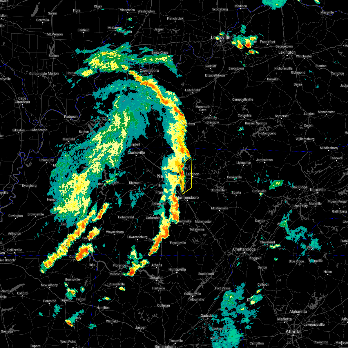 At 150 pm cdt, severe thunderstorms were located along a line extending from near gallatin to near walterhill, moving northeast at 40 mph (radar indicated). Hazards include 60 mph wind gusts. Expect damage to roofs, siding, and trees. locations impacted include, gallatin, lebanon, hendersonville, smyrna, la vergne, mount juliet, belinda city, rural hill, bledsoe creek state park and gladeville. this includes the following highways, interstate 40 between mile markers 226 and 237. Interstate 840 between mile markers 60 and 76. At 150 pm cdt, severe thunderstorms were located along a line extending from near gallatin to near walterhill, moving northeast at 40 mph (radar indicated). Hazards include 60 mph wind gusts. Expect damage to roofs, siding, and trees. locations impacted include, gallatin, lebanon, hendersonville, smyrna, la vergne, mount juliet, belinda city, rural hill, bledsoe creek state park and gladeville. this includes the following highways, interstate 40 between mile markers 226 and 237. Interstate 840 between mile markers 60 and 76.
|
| 8/28/2020 1:38 PM CDT |
 At 138 pm cdt, severe thunderstorms were located along a line extending from near hendersonville to smyrna, moving northeast at 35 mph (radar indicated). Hazards include 60 mph wind gusts. Expect damage to roofs, siding, and trees. locations impacted include, gallatin, lebanon, hendersonville, smyrna, la vergne, mount juliet, lakewood, hermitage, rural hill, belinda city, green hill, bledsoe creek state park, percy priest lake and gladeville. this includes the following highways, interstate 40 between mile markers 219 and 237. interstate 24 between mile markers 63 and 70. Interstate 840 between mile markers 60 and 76. At 138 pm cdt, severe thunderstorms were located along a line extending from near hendersonville to smyrna, moving northeast at 35 mph (radar indicated). Hazards include 60 mph wind gusts. Expect damage to roofs, siding, and trees. locations impacted include, gallatin, lebanon, hendersonville, smyrna, la vergne, mount juliet, lakewood, hermitage, rural hill, belinda city, green hill, bledsoe creek state park, percy priest lake and gladeville. this includes the following highways, interstate 40 between mile markers 219 and 237. interstate 24 between mile markers 63 and 70. Interstate 840 between mile markers 60 and 76.
|
| 8/28/2020 1:22 PM CDT |
 At 122 pm cdt, severe thunderstorms were located along a line extending from near madison to near nolensville, moving northeast at 40 mph (radar indicated). Hazards include 60 mph wind gusts. expect damage to roofs, siding, and trees At 122 pm cdt, severe thunderstorms were located along a line extending from near madison to near nolensville, moving northeast at 40 mph (radar indicated). Hazards include 60 mph wind gusts. expect damage to roofs, siding, and trees
|
| 8/12/2020 2:56 PM CDT |
 The severe thunderstorm warning for central rutherford county will expire at 300 pm cdt, the storm which prompted the warning has weakened below severe limits, and has exited the warned area. therefore, the warning will be allowed to expire. however gusty winds and heavy rain are still possible with this thunderstorm. The severe thunderstorm warning for central rutherford county will expire at 300 pm cdt, the storm which prompted the warning has weakened below severe limits, and has exited the warned area. therefore, the warning will be allowed to expire. however gusty winds and heavy rain are still possible with this thunderstorm.
|
| 8/12/2020 2:38 PM CDT |
 At 237 pm cdt, a severe thunderstorm was located near smyrna, or near murfreesboro, moving north at 10 mph (radar indicated). Hazards include 60 mph wind gusts and quarter size hail. Hail damage to vehicles is expected. Expect wind damage to roofs, siding, and trees. At 237 pm cdt, a severe thunderstorm was located near smyrna, or near murfreesboro, moving north at 10 mph (radar indicated). Hazards include 60 mph wind gusts and quarter size hail. Hail damage to vehicles is expected. Expect wind damage to roofs, siding, and trees.
|
| 5/3/2020 4:51 PM CDT | Smyrna airport asos measured a wind gust of 53 knots / 61 mph in rutherford county TN, 3.8 miles SSW of Smyrna, TN |
| 5/3/2020 4:49 PM CDT |
 At 448 pm cdt, severe thunderstorms were located along a line extending from near nashville to near brentwood to 6 miles east of thompson`s station, moving east at 65 mph (radar indicated). Hazards include 70 mph wind gusts and penny size hail. Expect considerable tree damage. Damage is likely to mobile homes, roofs, and outbuildings. At 448 pm cdt, severe thunderstorms were located along a line extending from near nashville to near brentwood to 6 miles east of thompson`s station, moving east at 65 mph (radar indicated). Hazards include 70 mph wind gusts and penny size hail. Expect considerable tree damage. Damage is likely to mobile homes, roofs, and outbuildings.
|
| 5/3/2020 4:47 PM CDT |
 A severe thunderstorm warning remains in effect until 500 pm cdt for southeastern davidson. north central marshall. northwestern rutherford. northeastern maury and eastern williamson counties. At 446 pm cdt, severe thunderstorms were located along a line extending from hermitage to near nolensville to near thompson`s station, moving east at 60 mph. A severe thunderstorm warning remains in effect until 500 pm cdt for southeastern davidson. north central marshall. northwestern rutherford. northeastern maury and eastern williamson counties. At 446 pm cdt, severe thunderstorms were located along a line extending from hermitage to near nolensville to near thompson`s station, moving east at 60 mph.
|
| 5/3/2020 4:17 PM CDT |
 At 417 pm cdt, severe thunderstorms were located along a line extending from near white bluff to near fairview to 8 miles east of centerville, moving east at 60 mph (radar indicated). Hazards include 70 mph wind gusts and penny size hail. Expect considerable tree damage. Damage is likely to mobile homes, roofs, and outbuildings. At 417 pm cdt, severe thunderstorms were located along a line extending from near white bluff to near fairview to 8 miles east of centerville, moving east at 60 mph (radar indicated). Hazards include 70 mph wind gusts and penny size hail. Expect considerable tree damage. Damage is likely to mobile homes, roofs, and outbuildings.
|
| 4/12/2020 4:53 PM CDT |
 At 452 pm cdt, severe thunderstorms were located along a line extending from bellevue to near spring hill, moving northeast at 65 mph (radar indicated). Hazards include 60 mph wind gusts. expect damage to roofs, siding, and trees At 452 pm cdt, severe thunderstorms were located along a line extending from bellevue to near spring hill, moving northeast at 65 mph (radar indicated). Hazards include 60 mph wind gusts. expect damage to roofs, siding, and trees
|
| 4/8/2020 10:43 PM CDT |
 At 1042 pm cdt, severe thunderstorms were located along a line extending from near watertown to 14 miles northwest of woodbury to walterhill, moving southeast at 40 mph (radar indicated). Hazards include 60 mph wind gusts and nickel size hail. expect damage to roofs, siding, and trees At 1042 pm cdt, severe thunderstorms were located along a line extending from near watertown to 14 miles northwest of woodbury to walterhill, moving southeast at 40 mph (radar indicated). Hazards include 60 mph wind gusts and nickel size hail. expect damage to roofs, siding, and trees
|
| 4/8/2020 10:14 PM CDT |
 At 1014 pm cdt, severe thunderstorms were located along a line extending from near belinda city to near antioch, moving southeast at 30 mph (radar indicated). Hazards include 60 mph wind gusts and nickel size hail. expect damage to roofs, siding, and trees At 1014 pm cdt, severe thunderstorms were located along a line extending from near belinda city to near antioch, moving southeast at 30 mph (radar indicated). Hazards include 60 mph wind gusts and nickel size hail. expect damage to roofs, siding, and trees
|
| 1/11/2020 10:06 AM CST |
 The severe thunderstorm warning for marshall, northwestern rutherford, southeastern maury, southeastern williamson and eastern giles counties will expire at 1015 am cst, the storms which prompted the warning have weakened below severe limits, and have exited the warned area. therefore, the warning will be allowed to expire. a tornado watch remains in effect until 100 pm cst for middle tennessee. The severe thunderstorm warning for marshall, northwestern rutherford, southeastern maury, southeastern williamson and eastern giles counties will expire at 1015 am cst, the storms which prompted the warning have weakened below severe limits, and have exited the warned area. therefore, the warning will be allowed to expire. a tornado watch remains in effect until 100 pm cst for middle tennessee.
|
| 1/11/2020 10:00 AM CST |
 At 1000 am cst, severe thunderstorms were located along a line extending from near la vergne to 7 miles northeast of pulaski, moving northeast at 30 mph (radar indicated). Hazards include 60 mph wind gusts. Expect damage to roofs, siding, and trees. locations impacted include, lewisburg, pulaski, smyrna, nolensville, chapel hill, cornersville, eagleville, frankewing, farmington and triune. this includes the following highways, interstate 65 between mile markers 8 and 37. interstate 24 between mile markers 66 and 71. Interstate 840 between mile markers 35 and 48. At 1000 am cst, severe thunderstorms were located along a line extending from near la vergne to 7 miles northeast of pulaski, moving northeast at 30 mph (radar indicated). Hazards include 60 mph wind gusts. Expect damage to roofs, siding, and trees. locations impacted include, lewisburg, pulaski, smyrna, nolensville, chapel hill, cornersville, eagleville, frankewing, farmington and triune. this includes the following highways, interstate 65 between mile markers 8 and 37. interstate 24 between mile markers 66 and 71. Interstate 840 between mile markers 35 and 48.
|
| 1/11/2020 9:44 AM CST |
 At 944 am cst, severe thunderstorms were located along a line extending from gallatin to la vergne, moving northeast at 60 mph (radar indicated). Hazards include 60 mph wind gusts. Expect damage to roofs, siding, and trees. Locations impacted include, smyrna, brentwood, la vergne, mount juliet, nolensville, lakewood, hermitage, rural hill, antioch, belinda city and percy priest lake. At 944 am cst, severe thunderstorms were located along a line extending from gallatin to la vergne, moving northeast at 60 mph (radar indicated). Hazards include 60 mph wind gusts. Expect damage to roofs, siding, and trees. Locations impacted include, smyrna, brentwood, la vergne, mount juliet, nolensville, lakewood, hermitage, rural hill, antioch, belinda city and percy priest lake.
|
| 1/11/2020 9:43 AM CST |
 At 942 am cst, severe thunderstorms were located along a line extending from near nolensville to near pulaski, moving northeast at 30 mph (radar indicated). Hazards include 60 mph wind gusts. expect damage to roofs, siding, and trees At 942 am cst, severe thunderstorms were located along a line extending from near nolensville to near pulaski, moving northeast at 30 mph (radar indicated). Hazards include 60 mph wind gusts. expect damage to roofs, siding, and trees
|
| 1/11/2020 9:22 AM CST |
 At 921 am cst, severe thunderstorms were located along a line extending from nashville to thompson`s station, moving northeast at 60 mph (radar indicated). Hazards include 60 mph wind gusts. expect damage to roofs, siding, and trees At 921 am cst, severe thunderstorms were located along a line extending from nashville to thompson`s station, moving northeast at 60 mph (radar indicated). Hazards include 60 mph wind gusts. expect damage to roofs, siding, and trees
|
| 8/13/2019 4:11 PM CDT | Tree down near stewart's creek school. rocky fork r in rutherford county TN, 2.7 miles NE of Smyrna, TN |
| 8/13/2019 4:02 PM CDT | Several trees down around the blair road and rock springs road area in rutherford county TN, 2.8 miles E of Smyrna, TN |
| 8/13/2019 4:00 PM CDT |
 At 400 pm cdt, severe thunderstorms were located along a line extending from 6 miles north of walterhill to near thompson`s station, moving east at 35 mph (radar indicated). Hazards include 60 mph wind gusts. expect damage to roofs, siding, and trees At 400 pm cdt, severe thunderstorms were located along a line extending from 6 miles north of walterhill to near thompson`s station, moving east at 35 mph (radar indicated). Hazards include 60 mph wind gusts. expect damage to roofs, siding, and trees
|
| 8/13/2019 3:44 PM CDT | Tspotter report of pea sized hail and tree damage in smyrn in rutherford county TN, 1.5 miles SSW of Smyrna, TN |
| 8/13/2019 3:35 PM CDT |
 At 335 pm cdt, a severe thunderstorm was located over antioch, or 9 miles south of nashville, moving east at 30 mph (radar indicated). Hazards include 60 mph wind gusts. expect damage to roofs, siding, and trees At 335 pm cdt, a severe thunderstorm was located over antioch, or 9 miles south of nashville, moving east at 30 mph (radar indicated). Hazards include 60 mph wind gusts. expect damage to roofs, siding, and trees
|
| 8/6/2019 9:07 PM CDT |
 At 907 pm cdt, severe thunderstorms were located along a line extending from 8 miles northwest of woodbury to 6 miles east of spring hill, moving southeast at 40 mph (radar indicated). Hazards include 60 mph wind gusts. expect damage to roofs, siding, and trees At 907 pm cdt, severe thunderstorms were located along a line extending from 8 miles northwest of woodbury to 6 miles east of spring hill, moving southeast at 40 mph (radar indicated). Hazards include 60 mph wind gusts. expect damage to roofs, siding, and trees
|
| 8/6/2019 8:34 PM CDT |
 At 834 pm cdt, severe thunderstorms were located along a line extending from near lebanon to near forest hills, moving southeast at 40 mph (radar indicated). Hazards include 60 mph wind gusts and penny size hail. expect damage to roofs, siding, and trees At 834 pm cdt, severe thunderstorms were located along a line extending from near lebanon to near forest hills, moving southeast at 40 mph (radar indicated). Hazards include 60 mph wind gusts and penny size hail. expect damage to roofs, siding, and trees
|
| 6/27/2019 5:59 PM CDT |
 At 537 pm cdt, a severe thunderstorm was located near murfreesboro, moving north at 45 mph (radar indicated). Hazards include 60 mph wind gusts and quarter size hail. Hail damage to vehicles is expected. Expect wind damage to roofs, siding, and trees. At 537 pm cdt, a severe thunderstorm was located near murfreesboro, moving north at 45 mph (radar indicated). Hazards include 60 mph wind gusts and quarter size hail. Hail damage to vehicles is expected. Expect wind damage to roofs, siding, and trees.
|
| 6/27/2019 5:55 PM CDT |
 At 554 pm cdt, severe thunderstorms were located along a line extending from 7 miles southeast of ashland city to near rural hill, moving north at 30 mph (radar indicated). Hazards include 60 mph wind gusts and nickel size hail. Expect damage to roofs, siding, and trees. locations impacted include, nashville, madison, la vergne, mount juliet, goodlettsville, forest hills, oak hill, belle meade, lakewood, hermitage, rural hill, bellevue, antioch, belinda city, old hickory, joelton, berry hill, bells bend, whites creek and beaman park. this includes the following highways, interstate 40 between mile markers 195 and 230. interstate 65 between mile markers 75 and 97. Interstate 24 between mile markers 32 and 63. At 554 pm cdt, severe thunderstorms were located along a line extending from 7 miles southeast of ashland city to near rural hill, moving north at 30 mph (radar indicated). Hazards include 60 mph wind gusts and nickel size hail. Expect damage to roofs, siding, and trees. locations impacted include, nashville, madison, la vergne, mount juliet, goodlettsville, forest hills, oak hill, belle meade, lakewood, hermitage, rural hill, bellevue, antioch, belinda city, old hickory, joelton, berry hill, bells bend, whites creek and beaman park. this includes the following highways, interstate 40 between mile markers 195 and 230. interstate 65 between mile markers 75 and 97. Interstate 24 between mile markers 32 and 63.
|
| 6/27/2019 5:37 PM CDT |
 At 537 pm cdt, a severe thunderstorm was located near murfreesboro, moving north at 45 mph (radar indicated). Hazards include 60 mph wind gusts and quarter size hail. Hail damage to vehicles is expected. Expect wind damage to roofs, siding, and trees. At 537 pm cdt, a severe thunderstorm was located near murfreesboro, moving north at 45 mph (radar indicated). Hazards include 60 mph wind gusts and quarter size hail. Hail damage to vehicles is expected. Expect wind damage to roofs, siding, and trees.
|
| 6/27/2019 5:33 PM CDT |
 At 533 pm cdt, severe thunderstorms were located along a line extending from near bellevue to la vergne, moving north at 30 mph (radar indicated). Hazards include 60 mph wind gusts and quarter size hail. Hail damage to vehicles is expected. Expect wind damage to roofs, siding, and trees. At 533 pm cdt, severe thunderstorms were located along a line extending from near bellevue to la vergne, moving north at 30 mph (radar indicated). Hazards include 60 mph wind gusts and quarter size hail. Hail damage to vehicles is expected. Expect wind damage to roofs, siding, and trees.
|
| 6/22/2019 5:24 PM CDT |
 The severe thunderstorm warning for central rutherford and southeastern wilson counties will expire at 530 pm cdt, the storms which prompted the warning have weakened below severe limits, and no longer pose an immediate threat to life or property. therefore, the warning will be allowed to expire. to report severe weather, contact your nearest law enforcement agency. they will relay your report to the national weather service nashville. The severe thunderstorm warning for central rutherford and southeastern wilson counties will expire at 530 pm cdt, the storms which prompted the warning have weakened below severe limits, and no longer pose an immediate threat to life or property. therefore, the warning will be allowed to expire. to report severe weather, contact your nearest law enforcement agency. they will relay your report to the national weather service nashville.
|
| 6/22/2019 5:14 PM CDT |
 At 513 pm cdt, severe thunderstorms were located along a line extending from 6 miles east of lebanon to smyrna, moving southeast at 40 mph (radar indicated). Hazards include 60 mph wind gusts. Expect damage to roofs, siding, and trees. locations impacted include, murfreesboro, lebanon, smyrna, la vergne, watertown, walterhill, cedars of lebanon state park, lascassas, tuckers crossroads and gladeville. this includes the following highways, interstate 40 between mile markers 235 and 249. interstate 24 between mile markers 66 and 84. Interstate 840 between mile markers 52 and 76. At 513 pm cdt, severe thunderstorms were located along a line extending from 6 miles east of lebanon to smyrna, moving southeast at 40 mph (radar indicated). Hazards include 60 mph wind gusts. Expect damage to roofs, siding, and trees. locations impacted include, murfreesboro, lebanon, smyrna, la vergne, watertown, walterhill, cedars of lebanon state park, lascassas, tuckers crossroads and gladeville. this includes the following highways, interstate 40 between mile markers 235 and 249. interstate 24 between mile markers 66 and 84. Interstate 840 between mile markers 52 and 76.
|
| 6/22/2019 4:52 PM CDT |
 At 452 pm cdt, severe thunderstorms were located along a line extending from near gallatin to brentwood, moving southeast at 40 mph (radar indicated). Hazards include 60 mph wind gusts. expect damage to roofs, siding, and trees At 452 pm cdt, severe thunderstorms were located along a line extending from near gallatin to brentwood, moving southeast at 40 mph (radar indicated). Hazards include 60 mph wind gusts. expect damage to roofs, siding, and trees
|
| 6/21/2019 8:26 PM CDT |
 At 825 pm cdt, severe thunderstorms were located along a line extending from near watertown to murfreesboro to spring hill, moving southeast at 50 mph. these are very dangerous storms (radar indicated). Hazards include 80 mph wind gusts and penny size hail. Flying debris will be dangerous to those caught without shelter. mobile homes will be heavily damaged. expect considerable damage to roofs, windows, and vehicles. extensive tree damage and power outages are likely. locations impacted include, murfreesboro, columbia, lewisburg, smyrna, la vergne, spring hill, nolensville, thompson`s station, walterhill, chapel hill, eagleville, auburntown, fosterville, triune, cedars of lebanon state park, rover, rockvale, unionville, readyville and lascassas. this includes the following highways, interstate 65 between mile markers 29 and 60. interstate 24 between mile markers 66 and 93. Interstate 840 between mile markers 29 and 70. At 825 pm cdt, severe thunderstorms were located along a line extending from near watertown to murfreesboro to spring hill, moving southeast at 50 mph. these are very dangerous storms (radar indicated). Hazards include 80 mph wind gusts and penny size hail. Flying debris will be dangerous to those caught without shelter. mobile homes will be heavily damaged. expect considerable damage to roofs, windows, and vehicles. extensive tree damage and power outages are likely. locations impacted include, murfreesboro, columbia, lewisburg, smyrna, la vergne, spring hill, nolensville, thompson`s station, walterhill, chapel hill, eagleville, auburntown, fosterville, triune, cedars of lebanon state park, rover, rockvale, unionville, readyville and lascassas. this includes the following highways, interstate 65 between mile markers 29 and 60. interstate 24 between mile markers 66 and 93. Interstate 840 between mile markers 29 and 70.
|
| 6/21/2019 8:19 PM CDT |
 At 818 pm cdt, a severe thunderstorm capable of producing a tornado was located just northeast of smyrna airport, or 12 miles north of murfreesboro, moving east at 40 mph (radar indicated rotation). Hazards include tornado. Flying debris will be dangerous to those caught without shelter. mobile homes will be damaged or destroyed. damage to roofs, windows, and vehicles will occur. tree damage is likely. this dangerous storm will be near, walterhill around 825 pm cdt. other locations impacted by this tornadic thunderstorm include cedars of lebanon state park, lascassas, milton and gladeville. This includes interstate 840 between mile markers 62 and 70. At 818 pm cdt, a severe thunderstorm capable of producing a tornado was located just northeast of smyrna airport, or 12 miles north of murfreesboro, moving east at 40 mph (radar indicated rotation). Hazards include tornado. Flying debris will be dangerous to those caught without shelter. mobile homes will be damaged or destroyed. damage to roofs, windows, and vehicles will occur. tree damage is likely. this dangerous storm will be near, walterhill around 825 pm cdt. other locations impacted by this tornadic thunderstorm include cedars of lebanon state park, lascassas, milton and gladeville. This includes interstate 840 between mile markers 62 and 70.
|
| 6/21/2019 8:13 PM CDT |
 At 813 pm cdt, a severe thunderstorm capable of producing a tornado was located near rural hill, or 14 miles southwest of lebanon, moving east at 40 mph (radar indicated rotation). Hazards include tornado. Flying debris will be dangerous to those caught without shelter. mobile homes will be damaged or destroyed. damage to roofs, windows, and vehicles will occur. tree damage is likely. this dangerous storm will be near, walterhill around 825 pm cdt. other locations impacted by this tornadic thunderstorm include cedars of lebanon state park, lascassas, milton and gladeville. This includes interstate 840 between mile markers 62 and 71. At 813 pm cdt, a severe thunderstorm capable of producing a tornado was located near rural hill, or 14 miles southwest of lebanon, moving east at 40 mph (radar indicated rotation). Hazards include tornado. Flying debris will be dangerous to those caught without shelter. mobile homes will be damaged or destroyed. damage to roofs, windows, and vehicles will occur. tree damage is likely. this dangerous storm will be near, walterhill around 825 pm cdt. other locations impacted by this tornadic thunderstorm include cedars of lebanon state park, lascassas, milton and gladeville. This includes interstate 840 between mile markers 62 and 71.
|
| 6/21/2019 8:07 PM CDT |
 At 807 pm cdt, a severe thunderstorm capable of producing a tornado was located near rural hill, or 14 miles southeast of nashville, moving east at 45 mph (radar indicated rotation). Hazards include tornado. Flying debris will be dangerous to those caught without shelter. mobile homes will be damaged or destroyed. damage to roofs, windows, and vehicles will occur. tree damage is likely. this dangerous storm will be near, walterhill around 825 pm cdt. watertown around 840 pm cdt. other locations impacted by this tornadic thunderstorm include cedars of lebanon state park, percy priest lake, lascassas, milton and gladeville. this includes the following highways, interstate 24 between mile markers 62 and 65. Interstate 840 between mile markers 59 and 71. At 807 pm cdt, a severe thunderstorm capable of producing a tornado was located near rural hill, or 14 miles southeast of nashville, moving east at 45 mph (radar indicated rotation). Hazards include tornado. Flying debris will be dangerous to those caught without shelter. mobile homes will be damaged or destroyed. damage to roofs, windows, and vehicles will occur. tree damage is likely. this dangerous storm will be near, walterhill around 825 pm cdt. watertown around 840 pm cdt. other locations impacted by this tornadic thunderstorm include cedars of lebanon state park, percy priest lake, lascassas, milton and gladeville. this includes the following highways, interstate 24 between mile markers 62 and 65. Interstate 840 between mile markers 59 and 71.
|
| 6/21/2019 8:05 PM CDT |
 The national weather service in nashville has issued a * severe thunderstorm warning for. southeastern davidson county in middle tennessee. central marshall county in middle tennessee. rutherford county in middle tennessee. Central maury county in middle tennessee. The national weather service in nashville has issued a * severe thunderstorm warning for. southeastern davidson county in middle tennessee. central marshall county in middle tennessee. rutherford county in middle tennessee. Central maury county in middle tennessee.
|
| 6/21/2019 7:44 PM CDT |
 At 744 pm cdt, severe thunderstorms were located along a line extending from near joelton to near pegram to 6 miles southeast of burns, moving southeast at 45 mph (radar indicated). Hazards include 60 mph wind gusts and nickel size hail. Expect damage to roofs, siding, and trees. locations impacted include, franklin, ashland city, nashville, madison, smyrna, brentwood, la vergne, spring hill, mount juliet, nolensville, forest hills, oak hill, white bluff, belle meade, kingston springs, lakewood, thompson`s station, pegram, hermitage and fairview. this includes the following highways, interstate 40 between mile markers 174 and 228. interstate 65 between mile markers 55 and 93. interstate 24 between mile markers 34 and 69. Interstate 840 between mile markers 1 and 35, and between mile markers 66 and 72. At 744 pm cdt, severe thunderstorms were located along a line extending from near joelton to near pegram to 6 miles southeast of burns, moving southeast at 45 mph (radar indicated). Hazards include 60 mph wind gusts and nickel size hail. Expect damage to roofs, siding, and trees. locations impacted include, franklin, ashland city, nashville, madison, smyrna, brentwood, la vergne, spring hill, mount juliet, nolensville, forest hills, oak hill, white bluff, belle meade, kingston springs, lakewood, thompson`s station, pegram, hermitage and fairview. this includes the following highways, interstate 40 between mile markers 174 and 228. interstate 65 between mile markers 55 and 93. interstate 24 between mile markers 34 and 69. Interstate 840 between mile markers 1 and 35, and between mile markers 66 and 72.
|
| 6/21/2019 7:29 PM CDT |
 At 728 pm cdt, severe thunderstorms were located along a line extending from near coopertown to near white bluff to near dickson, moving southeast at 45 mph (radar indicated). Hazards include 60 mph wind gusts and nickel size hail. expect damage to roofs, siding, and trees At 728 pm cdt, severe thunderstorms were located along a line extending from near coopertown to near white bluff to near dickson, moving southeast at 45 mph (radar indicated). Hazards include 60 mph wind gusts and nickel size hail. expect damage to roofs, siding, and trees
|
| 6/19/2019 8:37 PM CDT |
 At 837 pm cdt, severe thunderstorms were located along a line extending from 9 miles northwest of woodbury to near spring hill, moving southeast at 15 mph (radar indicated). Hazards include 60 mph wind gusts and quarter size hail. Hail damage to vehicles is expected. expect wind damage to roofs, siding, and trees. locations impacted include, franklin, smyrna, spring hill, nolensville, thompson`s station, walterhill, eagleville and triune. this includes the following highways, interstate 65 between mile markers 55 and 65. interstate 24 between mile markers 67 and 75. Interstate 840 between mile markers 15 and 61. At 837 pm cdt, severe thunderstorms were located along a line extending from 9 miles northwest of woodbury to near spring hill, moving southeast at 15 mph (radar indicated). Hazards include 60 mph wind gusts and quarter size hail. Hail damage to vehicles is expected. expect wind damage to roofs, siding, and trees. locations impacted include, franklin, smyrna, spring hill, nolensville, thompson`s station, walterhill, eagleville and triune. this includes the following highways, interstate 65 between mile markers 55 and 65. interstate 24 between mile markers 67 and 75. Interstate 840 between mile markers 15 and 61.
|
| 6/19/2019 8:23 PM CDT |
 At 823 pm cdt, severe thunderstorms were located along a line extending from watertown to near thompson`s station, moving east at 30 mph (radar indicated). Hazards include 70 mph wind gusts and quarter size hail. Hail damage to vehicles is expected. expect considerable tree damage. wind damage is also likely to mobile homes, roofs, and outbuildings. locations impacted include, murfreesboro, franklin, smyrna, brentwood, la vergne, spring hill, nolensville, thompson`s station, watertown, walterhill, eagleville, auburntown, lascassas, triune, cedars of lebanon state park, leipers fork and milton. this includes the following highways, interstate 65 between mile markers 55 and 72. interstate 24 between mile markers 60 and 81. Interstate 840 between mile markers 10 and 70. At 823 pm cdt, severe thunderstorms were located along a line extending from watertown to near thompson`s station, moving east at 30 mph (radar indicated). Hazards include 70 mph wind gusts and quarter size hail. Hail damage to vehicles is expected. expect considerable tree damage. wind damage is also likely to mobile homes, roofs, and outbuildings. locations impacted include, murfreesboro, franklin, smyrna, brentwood, la vergne, spring hill, nolensville, thompson`s station, watertown, walterhill, eagleville, auburntown, lascassas, triune, cedars of lebanon state park, leipers fork and milton. this includes the following highways, interstate 65 between mile markers 55 and 72. interstate 24 between mile markers 60 and 81. Interstate 840 between mile markers 10 and 70.
|
| 6/19/2019 8:16 PM CDT |
 At 815 pm cdt, severe thunderstorms were located along a line extending from near watertown to thompson`s station, moving east at 35 mph. these storms have produced numerous reports of quarter size hail and blown down trees in the southern nashville metro area (radar indicated). Hazards include 60 mph wind gusts and quarter size hail. Hail damage to vehicles is expected. expect wind damage to roofs, siding, and trees. locations impacted include, murfreesboro, franklin, smyrna, brentwood, la vergne, spring hill, nolensville, thompson`s station, watertown, walterhill, eagleville, auburntown, lascassas, triune, cedars of lebanon state park, leipers fork and milton. this includes the following highways, interstate 65 between mile markers 55 and 72. interstate 24 between mile markers 60 and 81. Interstate 840 between mile markers 10 and 70. At 815 pm cdt, severe thunderstorms were located along a line extending from near watertown to thompson`s station, moving east at 35 mph. these storms have produced numerous reports of quarter size hail and blown down trees in the southern nashville metro area (radar indicated). Hazards include 60 mph wind gusts and quarter size hail. Hail damage to vehicles is expected. expect wind damage to roofs, siding, and trees. locations impacted include, murfreesboro, franklin, smyrna, brentwood, la vergne, spring hill, nolensville, thompson`s station, watertown, walterhill, eagleville, auburntown, lascassas, triune, cedars of lebanon state park, leipers fork and milton. this includes the following highways, interstate 65 between mile markers 55 and 72. interstate 24 between mile markers 60 and 81. Interstate 840 between mile markers 10 and 70.
|
| 6/19/2019 7:58 PM CDT |
 At 757 pm cdt, severe thunderstorms were located along a line extending from near rural hill to nolensville to leipers fork, moving east at 30 mph (radar indicated. at 756 pm cdt...numerous reports of quarter size hail were received from brentwood with these storms). Hazards include 60 mph wind gusts and quarter size hail. Hail damage to vehicles is expected. Expect wind damage to roofs, siding, and trees. At 757 pm cdt, severe thunderstorms were located along a line extending from near rural hill to nolensville to leipers fork, moving east at 30 mph (radar indicated. at 756 pm cdt...numerous reports of quarter size hail were received from brentwood with these storms). Hazards include 60 mph wind gusts and quarter size hail. Hail damage to vehicles is expected. Expect wind damage to roofs, siding, and trees.
|
| 6/19/2019 7:47 PM CDT |
 At 746 pm cdt, several severe thunderstorms were located along a line extending from rural hill to near fairview, moving east at 30 mph (public. at 740 pm cdt...half dollar size hail was reported in brentwood with these storms). Hazards include 60 mph wind gusts and quarter size hail. Hail damage to vehicles is expected. expect wind damage to roofs, siding, and trees. locations impacted include, franklin, smyrna, brentwood, la vergne, mount juliet, nolensville, forest hills, oak hill, belle meade, rural hill, antioch, berry hill and percy priest lake. this includes the following highways, interstate 40 between mile markers 210 and 227. interstate 65 between mile markers 68 and 82. interstate 24 between mile markers 52 and 68. Interstate 840 between mile markers 59 and 62. At 746 pm cdt, several severe thunderstorms were located along a line extending from rural hill to near fairview, moving east at 30 mph (public. at 740 pm cdt...half dollar size hail was reported in brentwood with these storms). Hazards include 60 mph wind gusts and quarter size hail. Hail damage to vehicles is expected. expect wind damage to roofs, siding, and trees. locations impacted include, franklin, smyrna, brentwood, la vergne, mount juliet, nolensville, forest hills, oak hill, belle meade, rural hill, antioch, berry hill and percy priest lake. this includes the following highways, interstate 40 between mile markers 210 and 227. interstate 65 between mile markers 68 and 82. interstate 24 between mile markers 52 and 68. Interstate 840 between mile markers 59 and 62.
|
| 6/19/2019 7:34 PM CDT |
 At 732 pm cdt, severe thunderstorms were located along a line extending from near antioch to fairview, moving east at 30 mph (radar indicated). Hazards include 60 mph wind gusts and nickel size hail. expect damage to roofs, siding, and trees At 732 pm cdt, severe thunderstorms were located along a line extending from near antioch to fairview, moving east at 30 mph (radar indicated). Hazards include 60 mph wind gusts and nickel size hail. expect damage to roofs, siding, and trees
|
| 5/2/2019 12:03 PM CDT |
 At 1203 pm cdt, a severe thunderstorm was located 11 miles south of nolensville, or 14 miles west of murfreesboro, moving north at 20 mph (radar indicated). Hazards include 60 mph wind gusts and quarter size hail. Hail damage to vehicles is expected. Expect wind damage to roofs, siding, and trees. At 1203 pm cdt, a severe thunderstorm was located 11 miles south of nolensville, or 14 miles west of murfreesboro, moving north at 20 mph (radar indicated). Hazards include 60 mph wind gusts and quarter size hail. Hail damage to vehicles is expected. Expect wind damage to roofs, siding, and trees.
|
| 3/30/2019 7:10 PM CDT |
 At 709 pm cdt, a severe thunderstorm was located 9 miles south of nolensville, or 10 miles west of murfreesboro, moving east at 45 mph (radar indicated). Hazards include 60 mph wind gusts. expect damage to roofs, siding, and trees At 709 pm cdt, a severe thunderstorm was located 9 miles south of nolensville, or 10 miles west of murfreesboro, moving east at 45 mph (radar indicated). Hazards include 60 mph wind gusts. expect damage to roofs, siding, and trees
|
| 3/9/2019 8:05 PM CDT |
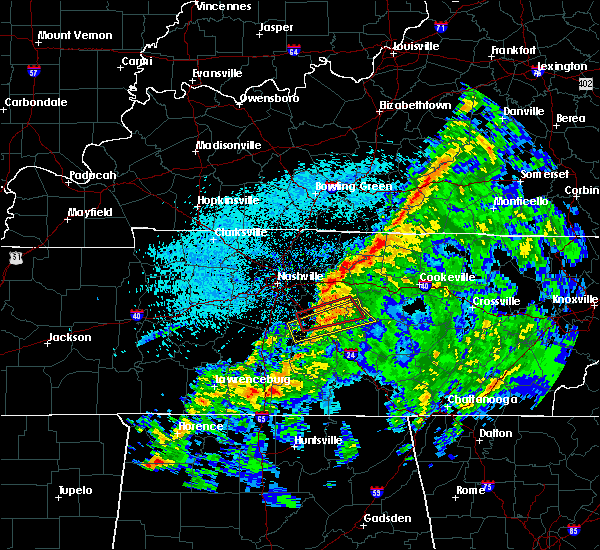 At 705 pm cst, a severe thunderstorm capable of producing a tornado was located over northwest murfreesboro, moving east at 45 mph (radar indicated rotation). Hazards include tornado. Flying debris will be dangerous to those caught without shelter. mobile homes will be damaged or destroyed. damage to roofs, windows, and vehicles will occur. tree damage is likely. this dangerous storm will be near, walterhill around 715 pm cst. other locations impacted by this tornadic thunderstorm include milton, auburntown and lascassas. this includes the following highways, interstate 24 between mile markers 73 and 83. Interstate 840 between mile markers 52 and 59. At 705 pm cst, a severe thunderstorm capable of producing a tornado was located over northwest murfreesboro, moving east at 45 mph (radar indicated rotation). Hazards include tornado. Flying debris will be dangerous to those caught without shelter. mobile homes will be damaged or destroyed. damage to roofs, windows, and vehicles will occur. tree damage is likely. this dangerous storm will be near, walterhill around 715 pm cst. other locations impacted by this tornadic thunderstorm include milton, auburntown and lascassas. this includes the following highways, interstate 24 between mile markers 73 and 83. Interstate 840 between mile markers 52 and 59.
|
| 3/9/2019 7:58 PM CDT |
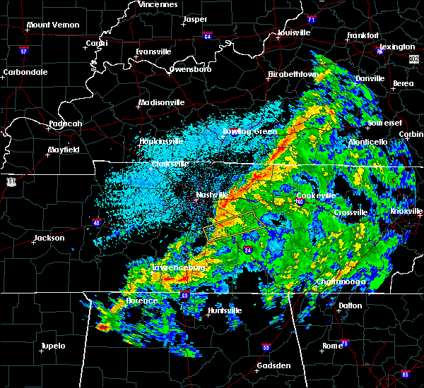 At 658 pm cst, a severe thunderstorm capable of producing a tornado was located about 5 miles west of murfreesboro, moving east at 45 mph (radar indicated rotation). Hazards include tornado. Flying debris will be dangerous to those caught without shelter. mobile homes will be damaged or destroyed. damage to roofs, windows, and vehicles will occur. tree damage is likely. this dangerous storm will be near, murfreesboro around 705 pm cst. walterhill around 715 pm cst. other locations impacted by this tornadic thunderstorm include auburntown, lascassas, milton and rockvale. this includes the following highways, interstate 24 between mile markers 71 and 83. Interstate 840 between mile markers 47 and 58. At 658 pm cst, a severe thunderstorm capable of producing a tornado was located about 5 miles west of murfreesboro, moving east at 45 mph (radar indicated rotation). Hazards include tornado. Flying debris will be dangerous to those caught without shelter. mobile homes will be damaged or destroyed. damage to roofs, windows, and vehicles will occur. tree damage is likely. this dangerous storm will be near, murfreesboro around 705 pm cst. walterhill around 715 pm cst. other locations impacted by this tornadic thunderstorm include auburntown, lascassas, milton and rockvale. this includes the following highways, interstate 24 between mile markers 71 and 83. Interstate 840 between mile markers 47 and 58.
|
| 12/31/2018 2:51 PM CST |
 At 250 pm cst, severe thunderstorms were located along a line extending from 9 miles northeast of scottsville to near mount juliet, moving northeast at 70 mph (radar indicated). Hazards include 60 mph wind gusts. Expect damage to roofs, siding, and trees. Locations impacted include, murfreesboro, franklin, gallatin, lebanon, lafayette, hartsville, hendersonville, smyrna, brentwood, la vergne, mount juliet, nolensville, westmoreland, hermitage, walterhill, rural hill, antioch, belinda city, bethpage and oak grove. At 250 pm cst, severe thunderstorms were located along a line extending from 9 miles northeast of scottsville to near mount juliet, moving northeast at 70 mph (radar indicated). Hazards include 60 mph wind gusts. Expect damage to roofs, siding, and trees. Locations impacted include, murfreesboro, franklin, gallatin, lebanon, lafayette, hartsville, hendersonville, smyrna, brentwood, la vergne, mount juliet, nolensville, westmoreland, hermitage, walterhill, rural hill, antioch, belinda city, bethpage and oak grove.
|
| 12/31/2018 2:25 PM CST |
 At 224 pm cst, severe thunderstorms were located along a line extending from portland to near franklin, moving northeast at 60 mph (radar indicated). Hazards include 60 mph wind gusts. expect damage to roofs, siding, and trees At 224 pm cst, severe thunderstorms were located along a line extending from portland to near franklin, moving northeast at 60 mph (radar indicated). Hazards include 60 mph wind gusts. expect damage to roofs, siding, and trees
|
| 11/6/2018 12:24 AM CST |
 The tornado warning for northwestern rutherford county will expire at 1230 am cst, the tornado warning that was previously in effect has been reissued for rutherford county. please refer to that bulletin for the latest severe weather information. a tornado watch remains in effect until 300 am cst for middle tennessee. The tornado warning for northwestern rutherford county will expire at 1230 am cst, the tornado warning that was previously in effect has been reissued for rutherford county. please refer to that bulletin for the latest severe weather information. a tornado watch remains in effect until 300 am cst for middle tennessee.
|
| 11/6/2018 12:19 AM CST |
 At 1219 am cst, severe thunderstorms were located along a line extending from near lebanon to near murfreesboro, moving east at 40 mph (radar indicated). Hazards include 60 mph wind gusts. Expect damage to roofs, siding, and trees. locations impacted include, murfreesboro, lebanon, smyrna, la vergne, walterhill, cedars of lebanon state park, lascassas and gladeville. this includes the following highways, interstate 40 between mile markers 238 and 244. interstate 24 between mile markers 71 and 84. interstate 840 between mile markers 49 and 75. A tornado watch remains in effect until 300 am cst for middle tennessee. At 1219 am cst, severe thunderstorms were located along a line extending from near lebanon to near murfreesboro, moving east at 40 mph (radar indicated). Hazards include 60 mph wind gusts. Expect damage to roofs, siding, and trees. locations impacted include, murfreesboro, lebanon, smyrna, la vergne, walterhill, cedars of lebanon state park, lascassas and gladeville. this includes the following highways, interstate 40 between mile markers 238 and 244. interstate 24 between mile markers 71 and 84. interstate 840 between mile markers 49 and 75. A tornado watch remains in effect until 300 am cst for middle tennessee.
|
| 11/6/2018 12:18 AM CST |
 At 1217 am cst, a severe thunderstorm capable of producing a tornado was located near walterhill, moving northeast at 35 mph (radar indicated rotation). Hazards include tornado. Flying debris will be dangerous to those caught without shelter. mobile homes will be damaged or destroyed. damage to roofs, windows, and vehicles will occur. Tree damage is likely. At 1217 am cst, a severe thunderstorm capable of producing a tornado was located near walterhill, moving northeast at 35 mph (radar indicated rotation). Hazards include tornado. Flying debris will be dangerous to those caught without shelter. mobile homes will be damaged or destroyed. damage to roofs, windows, and vehicles will occur. Tree damage is likely.
|
| 11/6/2018 12:02 AM CST |
 At 1202 am cst, a confirmed tornado was located near nolensville, or 11 miles west of murfreesboro, moving northeast at 50 mph (radar confirmed tornado). Hazards include damaging tornado. Flying debris will be dangerous to those caught without shelter. mobile homes will be damaged or destroyed. damage to roofs, windows, and vehicles will occur. tree damage is likely. locations impacted include, smyrna, la vergne, nolensville and walterhill. this includes the following highways, interstate 24 between mile markers 66 and 73. Interstate 840 between mile markers 46 and 49, and between mile markers 57 and 63. At 1202 am cst, a confirmed tornado was located near nolensville, or 11 miles west of murfreesboro, moving northeast at 50 mph (radar confirmed tornado). Hazards include damaging tornado. Flying debris will be dangerous to those caught without shelter. mobile homes will be damaged or destroyed. damage to roofs, windows, and vehicles will occur. tree damage is likely. locations impacted include, smyrna, la vergne, nolensville and walterhill. this includes the following highways, interstate 24 between mile markers 66 and 73. Interstate 840 between mile markers 46 and 49, and between mile markers 57 and 63.
|
| 11/5/2018 11:59 PM CST |
 At 1159 pm cst, a severe thunderstorm capable of producing a tornado was located near nolensville, or 12 miles east of franklin, moving northeast at 40 mph (radar indicated rotation). Hazards include tornado. Flying debris will be dangerous to those caught without shelter. mobile homes will be damaged or destroyed. damage to roofs, windows, and vehicles will occur. Tree damage is likely. At 1159 pm cst, a severe thunderstorm capable of producing a tornado was located near nolensville, or 12 miles east of franklin, moving northeast at 40 mph (radar indicated rotation). Hazards include tornado. Flying debris will be dangerous to those caught without shelter. mobile homes will be damaged or destroyed. damage to roofs, windows, and vehicles will occur. Tree damage is likely.
|
| 11/5/2018 11:55 PM CST |
 At 1155 pm cst, a severe thunderstorm was located over nolensville, or 10 miles east of franklin, moving northeast at 50 mph (radar indicated). Hazards include 70 mph wind gusts. Expect considerable tree damage. Damage is likely to mobile homes, roofs, and outbuildings. At 1155 pm cst, a severe thunderstorm was located over nolensville, or 10 miles east of franklin, moving northeast at 50 mph (radar indicated). Hazards include 70 mph wind gusts. Expect considerable tree damage. Damage is likely to mobile homes, roofs, and outbuildings.
|
| 6/27/2018 5:25 PM CDT |
 At 524 pm cdt, a severe thunderstorm was located over belinda city, or 9 miles southwest of lebanon, moving east at 40 mph (trained weather spotters). Hazards include 70 mph wind gusts. Expect considerable tree damage. Damage is likely to mobile homes, roofs, and outbuildings. At 524 pm cdt, a severe thunderstorm was located over belinda city, or 9 miles southwest of lebanon, moving east at 40 mph (trained weather spotters). Hazards include 70 mph wind gusts. Expect considerable tree damage. Damage is likely to mobile homes, roofs, and outbuildings.
|
| 4/3/2018 9:13 PM CDT |
 At 913 pm cdt, a severe thunderstorm was located near rural hill, or 15 miles southwest of lebanon, moving northeast at 50 mph (radar indicated). Hazards include 60 mph wind gusts and penny size hail. expect damage to roofs, siding, and trees At 913 pm cdt, a severe thunderstorm was located near rural hill, or 15 miles southwest of lebanon, moving northeast at 50 mph (radar indicated). Hazards include 60 mph wind gusts and penny size hail. expect damage to roofs, siding, and trees
|
| 3/28/2018 11:22 PM CDT |
 At 1121 pm cdt, a severe thunderstorm was located near nolensville, or near franklin, moving northeast at 40 mph (radar indicated). Hazards include 60 mph wind gusts. Expect damage to roofs, siding, and trees. Locations impacted include, murfreesboro, franklin, smyrna, brentwood, la vergne, nolensville, oak hill, antioch, percy priest lake and triune. At 1121 pm cdt, a severe thunderstorm was located near nolensville, or near franklin, moving northeast at 40 mph (radar indicated). Hazards include 60 mph wind gusts. Expect damage to roofs, siding, and trees. Locations impacted include, murfreesboro, franklin, smyrna, brentwood, la vergne, nolensville, oak hill, antioch, percy priest lake and triune.
|
| 3/28/2018 11:07 PM CDT |
 At 1106 pm cdt, a severe thunderstorm was located near franklin, moving northeast at 50 mph (radar indicated). Hazards include 60 mph wind gusts. expect damage to roofs, siding, and trees At 1106 pm cdt, a severe thunderstorm was located near franklin, moving northeast at 50 mph (radar indicated). Hazards include 60 mph wind gusts. expect damage to roofs, siding, and trees
|
| 2/24/2018 11:12 PM CST |
 At 1111 pm cst, severe thunderstorms were located along a line extending from 6 miles south of tompkinsville to 12 miles south of nolensville, moving east at 45 mph (radar indicated). Hazards include 60 mph wind gusts. Expect damage to roofs, siding, and trees. locations impacted include, murfreesboro, lebanon, lafayette, carthage, celina, gainesboro, hartsville, smyrna, la vergne, spring hill, mount juliet, nolensville, thompson`s station, watertown, gordonsville, red boiling springs, walterhill, rural hill, belinda city and hickman. A tornado watch remains in effect until 200 am cst for middle tennessee. At 1111 pm cst, severe thunderstorms were located along a line extending from 6 miles south of tompkinsville to 12 miles south of nolensville, moving east at 45 mph (radar indicated). Hazards include 60 mph wind gusts. Expect damage to roofs, siding, and trees. locations impacted include, murfreesboro, lebanon, lafayette, carthage, celina, gainesboro, hartsville, smyrna, la vergne, spring hill, mount juliet, nolensville, thompson`s station, watertown, gordonsville, red boiling springs, walterhill, rural hill, belinda city and hickman. A tornado watch remains in effect until 200 am cst for middle tennessee.
|
| 2/24/2018 10:41 PM CST |
 At 1041 pm cst, severe thunderstorms were located along a line extending from 6 miles north of lafayette to near spring hill, moving east at 45 mph (radar indicated). Hazards include 60 mph wind gusts. expect damage to roofs, siding, and trees At 1041 pm cst, severe thunderstorms were located along a line extending from 6 miles north of lafayette to near spring hill, moving east at 45 mph (radar indicated). Hazards include 60 mph wind gusts. expect damage to roofs, siding, and trees
|
| 2/24/2018 10:34 PM CST |
 At 1034 pm cst, a severe thunderstorm was located near fairview, or near franklin, moving east at 55 mph (radar indicated). Hazards include 60 mph wind gusts. Expect damage to roofs, siding, and trees. locations impacted include, franklin, columbia, brentwood, spring hill, nolensville, forest hills, oak hill, belle meade, thompson`s station, antioch, fairview, bellevue, primm springs, natchez trace at highway 96, triune, santa fe, williamsport and leipers fork. A tornado watch remains in effect until 200 am cst for middle tennessee. At 1034 pm cst, a severe thunderstorm was located near fairview, or near franklin, moving east at 55 mph (radar indicated). Hazards include 60 mph wind gusts. Expect damage to roofs, siding, and trees. locations impacted include, franklin, columbia, brentwood, spring hill, nolensville, forest hills, oak hill, belle meade, thompson`s station, antioch, fairview, bellevue, primm springs, natchez trace at highway 96, triune, santa fe, williamsport and leipers fork. A tornado watch remains in effect until 200 am cst for middle tennessee.
|
| 2/24/2018 10:22 PM CST |
 At 1021 pm cst, a severe thunderstorm was located 12 miles southwest of fairview, or 16 miles north of columbia, moving east at 55 mph (trained weather spotters). Hazards include 60 mph wind gusts. Expect damage to roofs, siding, and trees. locations impacted include, franklin, columbia, centerville, brentwood, la vergne, spring hill, nolensville, forest hills, oak hill, belle meade, thompson`s station, antioch, fairview, bellevue, bon aqua, kimmins, primm springs, lyles, natchez trace at highway 96 and triune. A tornado watch remains in effect until 200 am cst for middle tennessee. At 1021 pm cst, a severe thunderstorm was located 12 miles southwest of fairview, or 16 miles north of columbia, moving east at 55 mph (trained weather spotters). Hazards include 60 mph wind gusts. Expect damage to roofs, siding, and trees. locations impacted include, franklin, columbia, centerville, brentwood, la vergne, spring hill, nolensville, forest hills, oak hill, belle meade, thompson`s station, antioch, fairview, bellevue, bon aqua, kimmins, primm springs, lyles, natchez trace at highway 96 and triune. A tornado watch remains in effect until 200 am cst for middle tennessee.
|
| 2/24/2018 10:07 PM CST |
 At 1007 pm cst, a severe thunderstorm was located near centerville, moving east at 55 mph (radar indicated). Hazards include 60 mph wind gusts. expect damage to roofs, siding, and trees At 1007 pm cst, a severe thunderstorm was located near centerville, moving east at 55 mph (radar indicated). Hazards include 60 mph wind gusts. expect damage to roofs, siding, and trees
|
| 11/18/2017 5:09 PM CST |
 At 508 pm cst, severe thunderstorms were located along a line extending from lafayette to murfreesboro, moving east at 55 mph (radar indicated). Hazards include 70 mph wind gusts. Expect considerable tree damage. Damage is likely to mobile homes, roofs, and outbuildings. At 508 pm cst, severe thunderstorms were located along a line extending from lafayette to murfreesboro, moving east at 55 mph (radar indicated). Hazards include 70 mph wind gusts. Expect considerable tree damage. Damage is likely to mobile homes, roofs, and outbuildings.
|
| 11/18/2017 5:06 PM CST |
 At 505 pm cst, a confirmed tornado was located near gladeville, or 7 miles southwest of lebanon, moving east at 45 mph (radar confirmed tornado). Hazards include damaging tornado. Flying debris will be dangerous to those caught without shelter. mobile homes will be damaged or destroyed. damage to roofs, windows, and vehicles will occur. tree damage is likely. Locations impacted include, lebanon, smyrna, la vergne, mount juliet, watertown, rural hill, cedars of lebanon state park, tuckers crossroads and gladeville. At 505 pm cst, a confirmed tornado was located near gladeville, or 7 miles southwest of lebanon, moving east at 45 mph (radar confirmed tornado). Hazards include damaging tornado. Flying debris will be dangerous to those caught without shelter. mobile homes will be damaged or destroyed. damage to roofs, windows, and vehicles will occur. tree damage is likely. Locations impacted include, lebanon, smyrna, la vergne, mount juliet, watertown, rural hill, cedars of lebanon state park, tuckers crossroads and gladeville.
|
| 11/18/2017 5:00 PM CST |
 At 459 pm cst, a confirmed tornado was located near rural hill, or 11 miles southwest of lebanon, moving east at 45 mph (radar confirmed tornado). Hazards include damaging tornado. Flying debris will be dangerous to those caught without shelter. mobile homes will be damaged or destroyed. damage to roofs, windows, and vehicles will occur. tree damage is likely. this tornado will be near, watertown around 525 pm cst. Other locations impacted by this tornadic thunderstorm include cedars of lebanon state park, gladeville and tuckers crossroads. At 459 pm cst, a confirmed tornado was located near rural hill, or 11 miles southwest of lebanon, moving east at 45 mph (radar confirmed tornado). Hazards include damaging tornado. Flying debris will be dangerous to those caught without shelter. mobile homes will be damaged or destroyed. damage to roofs, windows, and vehicles will occur. tree damage is likely. this tornado will be near, watertown around 525 pm cst. Other locations impacted by this tornadic thunderstorm include cedars of lebanon state park, gladeville and tuckers crossroads.
|
| 11/18/2017 4:53 PM CST |
 At 453 pm cst, a severe thunderstorm capable of producing a tornado was located near rural hill, or 14 miles southeast of nashville, moving east at 50 mph (radar indicated rotation). Hazards include tornado. Flying debris will be dangerous to those caught without shelter. mobile homes will be damaged or destroyed. damage to roofs, windows, and vehicles will occur. tree damage is likely. this dangerous storm will be near, watertown around 525 pm cst. Other locations impacted by this tornadic thunderstorm include cedars of lebanon state park, percy priest lake, tuckers crossroads and gladeville. At 453 pm cst, a severe thunderstorm capable of producing a tornado was located near rural hill, or 14 miles southeast of nashville, moving east at 50 mph (radar indicated rotation). Hazards include tornado. Flying debris will be dangerous to those caught without shelter. mobile homes will be damaged or destroyed. damage to roofs, windows, and vehicles will occur. tree damage is likely. this dangerous storm will be near, watertown around 525 pm cst. Other locations impacted by this tornadic thunderstorm include cedars of lebanon state park, percy priest lake, tuckers crossroads and gladeville.
|
| 11/18/2017 4:38 PM CST |
 At 438 pm cst, severe thunderstorms were located along a line extending from portland to thompson`s station, moving east at 50 mph (radar indicated). Hazards include 70 mph wind gusts. Expect considerable tree damage. damage is likely to mobile homes, roofs, and outbuildings. Locations impacted include, murfreesboro, franklin, gallatin, lebanon, springfield, nashville, madison, hendersonville, smyrna, brentwood, la vergne, spring hill, mount juliet, goodlettsville, white house, millersville, greenbrier, nolensville, forest hills and oak hill. At 438 pm cst, severe thunderstorms were located along a line extending from portland to thompson`s station, moving east at 50 mph (radar indicated). Hazards include 70 mph wind gusts. Expect considerable tree damage. damage is likely to mobile homes, roofs, and outbuildings. Locations impacted include, murfreesboro, franklin, gallatin, lebanon, springfield, nashville, madison, hendersonville, smyrna, brentwood, la vergne, spring hill, mount juliet, goodlettsville, white house, millersville, greenbrier, nolensville, forest hills and oak hill.
|
| 11/18/2017 4:25 PM CST |
 At 424 pm cst, severe thunderstorms were located along a line extending from cross plains to leiper`s fork, moving east at 50 mph (radar indicated). Hazards include 70 mph wind gusts. Expect considerable tree damage. Damage is likely to mobile homes, roofs, and outbuildings. At 424 pm cst, severe thunderstorms were located along a line extending from cross plains to leiper`s fork, moving east at 50 mph (radar indicated). Hazards include 70 mph wind gusts. Expect considerable tree damage. Damage is likely to mobile homes, roofs, and outbuildings.
|
| 9/19/2017 3:49 PM CDT |
 At 349 pm cdt, a severe thunderstorm was located near nolensville, or 9 miles east of franklin, moving southeast at 15 mph (trained weather spotters). Hazards include 60 mph wind gusts and nickel size hail. Expect damage to roofs, siding, and trees. Locations impacted include, franklin, smyrna, brentwood, la vergne, nolensville, forest hills, oak hill, belle meade, bellevue, antioch, berry hill and triune. At 349 pm cdt, a severe thunderstorm was located near nolensville, or 9 miles east of franklin, moving southeast at 15 mph (trained weather spotters). Hazards include 60 mph wind gusts and nickel size hail. Expect damage to roofs, siding, and trees. Locations impacted include, franklin, smyrna, brentwood, la vergne, nolensville, forest hills, oak hill, belle meade, bellevue, antioch, berry hill and triune.
|
| 9/19/2017 3:28 PM CDT |
 At 327 pm cdt, a severe thunderstorm was located near oak hill, or 8 miles northeast of franklin, moving southeast at 20 mph (radar indicated). Hazards include 60 mph wind gusts and quarter size hail. Hail damage to vehicles is expected. Expect wind damage to roofs, siding, and trees. At 327 pm cdt, a severe thunderstorm was located near oak hill, or 8 miles northeast of franklin, moving southeast at 20 mph (radar indicated). Hazards include 60 mph wind gusts and quarter size hail. Hail damage to vehicles is expected. Expect wind damage to roofs, siding, and trees.
|
| 8/4/2017 3:33 PM CDT |
 At 333 pm cdt, a severe thunderstorm was located near walterhill, or 11 miles north of murfreesboro, moving southeast at 15 mph (radar indicated). Hazards include 60 mph wind gusts and quarter size hail. Hail damage to vehicles is expected. Expect wind damage to roofs, siding, and trees. At 333 pm cdt, a severe thunderstorm was located near walterhill, or 11 miles north of murfreesboro, moving southeast at 15 mph (radar indicated). Hazards include 60 mph wind gusts and quarter size hail. Hail damage to vehicles is expected. Expect wind damage to roofs, siding, and trees.
|
| 5/27/2017 8:04 PM CDT |
 At 803 pm cdt, a severe thunderstorm was located 9 miles southeast of burns, or 12 miles southeast of dickson, moving east at 35 mph (radar indicated). Hazards include 70 mph wind gusts and quarter size hail. Hail damage to vehicles is expected. expect considerable tree damage. wind damage is also likely to mobile homes, roofs, and outbuildings. locations impacted include, franklin, dickson, ashland city, centerville, nashville, brentwood, spring hill, nolensville, forest hills, oak hill, coopertown, white bluff, belle meade, kingston springs, thompson`s station, pegram, mcewen, burns, hurricane mills and fairview. Nashville sounds baseball will also be impacted. At 803 pm cdt, a severe thunderstorm was located 9 miles southeast of burns, or 12 miles southeast of dickson, moving east at 35 mph (radar indicated). Hazards include 70 mph wind gusts and quarter size hail. Hail damage to vehicles is expected. expect considerable tree damage. wind damage is also likely to mobile homes, roofs, and outbuildings. locations impacted include, franklin, dickson, ashland city, centerville, nashville, brentwood, spring hill, nolensville, forest hills, oak hill, coopertown, white bluff, belle meade, kingston springs, thompson`s station, pegram, mcewen, burns, hurricane mills and fairview. Nashville sounds baseball will also be impacted.
|
| 5/27/2017 7:52 PM CDT |
 At 752 pm cdt, a severe thunderstorm was located near gordonsville, or 9 miles southwest of carthage, moving east at 70 mph (radar indicated). Hazards include 70 mph wind gusts and quarter size hail. Hail damage to vehicles is expected. expect considerable tree damage. wind damage is also likely to mobile homes, roofs, and outbuildings. Locations impacted include, murfreesboro, franklin, cookeville, smithville, woodbury, carthage, smyrna, brentwood, la vergne, nolensville, oak hill, algood, watertown, baxter, gordonsville, walterhill, antioch, rural hill, hickman and south carthage. At 752 pm cdt, a severe thunderstorm was located near gordonsville, or 9 miles southwest of carthage, moving east at 70 mph (radar indicated). Hazards include 70 mph wind gusts and quarter size hail. Hail damage to vehicles is expected. expect considerable tree damage. wind damage is also likely to mobile homes, roofs, and outbuildings. Locations impacted include, murfreesboro, franklin, cookeville, smithville, woodbury, carthage, smyrna, brentwood, la vergne, nolensville, oak hill, algood, watertown, baxter, gordonsville, walterhill, antioch, rural hill, hickman and south carthage.
|
| 5/27/2017 7:49 PM CDT |
 At 749 pm cdt, a severe thunderstorm was located near burns, or 9 miles southeast of dickson, moving east at 70 mph (radar indicated). Hazards include 70 mph wind gusts and quarter size hail. Hail damage to vehicles is expected. expect considerable tree damage. Wind damage is also likely to mobile homes, roofs, and outbuildings. At 749 pm cdt, a severe thunderstorm was located near burns, or 9 miles southeast of dickson, moving east at 70 mph (radar indicated). Hazards include 70 mph wind gusts and quarter size hail. Hail damage to vehicles is expected. expect considerable tree damage. Wind damage is also likely to mobile homes, roofs, and outbuildings.
|
| 5/27/2017 7:47 PM CDT |
 At 746 pm cdt, a severe thunderstorm was located near watertown, or 10 miles southeast of lebanon, moving east at 70 mph (radar indicated). Hazards include 70 mph wind gusts and quarter size hail. Hail damage to vehicles is expected. expect considerable tree damage. Wind damage is also likely to mobile homes, roofs, and outbuildings. At 746 pm cdt, a severe thunderstorm was located near watertown, or 10 miles southeast of lebanon, moving east at 70 mph (radar indicated). Hazards include 70 mph wind gusts and quarter size hail. Hail damage to vehicles is expected. expect considerable tree damage. Wind damage is also likely to mobile homes, roofs, and outbuildings.
|
| 5/27/2017 7:36 PM CDT |
 At 735 pm cdt, a severe thunderstorm was located over antioch, or 10 miles southeast of nashville, moving east at 40 mph (radar indicated). Hazards include 70 mph wind gusts and quarter size hail. Hail damage to vehicles is expected. expect considerable tree damage. wind damage is also likely to mobile homes, roofs, and outbuildings. Locations impacted include, murfreesboro, franklin, lebanon, smyrna, brentwood, la vergne, mount juliet, nolensville, forest hills, oak hill, belle meade, kingston springs, thompson`s station, pegram, watertown, walterhill, rural hill, bellevue, antioch and belinda city. At 735 pm cdt, a severe thunderstorm was located over antioch, or 10 miles southeast of nashville, moving east at 40 mph (radar indicated). Hazards include 70 mph wind gusts and quarter size hail. Hail damage to vehicles is expected. expect considerable tree damage. wind damage is also likely to mobile homes, roofs, and outbuildings. Locations impacted include, murfreesboro, franklin, lebanon, smyrna, brentwood, la vergne, mount juliet, nolensville, forest hills, oak hill, belle meade, kingston springs, thompson`s station, pegram, watertown, walterhill, rural hill, bellevue, antioch and belinda city.
|
| 5/27/2017 7:18 PM CDT |
 At 718 pm cdt, a severe thunderstorm was located over nashville, moving southeast at 60 mph (radar indicated). Hazards include 70 mph wind gusts and quarter size hail. Hail damage to vehicles is expected. expect considerable tree damage. Wind damage is also likely to mobile homes, roofs, and outbuildings. At 718 pm cdt, a severe thunderstorm was located over nashville, moving southeast at 60 mph (radar indicated). Hazards include 70 mph wind gusts and quarter size hail. Hail damage to vehicles is expected. expect considerable tree damage. Wind damage is also likely to mobile homes, roofs, and outbuildings.
|
| 4/30/2017 3:38 PM CDT |
 At 338 pm cdt, severe thunderstorms were located along a line extending from near rural hill to 6 miles south of nolensville, moving northeast at 35 mph (radar indicated). Hazards include 60 mph wind gusts. Expect damage to roofs, siding, and trees. locations impacted include, murfreesboro, lebanon, smyrna, la vergne, mount juliet, walterhill, rural hill, belinda city, cedars of lebanon state park and gladeville. A tornado watch remains in effect until 700 pm cdt for middle tennessee. At 338 pm cdt, severe thunderstorms were located along a line extending from near rural hill to 6 miles south of nolensville, moving northeast at 35 mph (radar indicated). Hazards include 60 mph wind gusts. Expect damage to roofs, siding, and trees. locations impacted include, murfreesboro, lebanon, smyrna, la vergne, mount juliet, walterhill, rural hill, belinda city, cedars of lebanon state park and gladeville. A tornado watch remains in effect until 700 pm cdt for middle tennessee.
|
| 4/30/2017 3:14 PM CDT |
 At 312 pm cdt, severe thunderstorms were located along a line extending from near hermitage to 9 miles east of spring hill, moving northeast at 30 mph (radar indicated. several trees in williamson county have been snapped or downed by this line of storms). Hazards include 60 mph wind gusts. expect damage to roofs, siding, and trees At 312 pm cdt, severe thunderstorms were located along a line extending from near hermitage to 9 miles east of spring hill, moving northeast at 30 mph (radar indicated. several trees in williamson county have been snapped or downed by this line of storms). Hazards include 60 mph wind gusts. expect damage to roofs, siding, and trees
|
| 4/30/2017 3:07 PM CDT |
 At 306 pm cdt, severe thunderstorms were located along a line extending from near antioch to near nolensville, moving northeast at 40 mph (radar indicated. this line of storms has a history of producing damaging wind gusts in franklin and southeastern davidson county). Hazards include 70 mph wind gusts. Expect considerable tree damage. damage is likely to mobile homes, roofs, and outbuildings. locations impacted include, franklin, smyrna, brentwood, la vergne, nolensville, oak hill, antioch, eagleville, berry hill, percy priest lake and triune. A tornado watch remains in effect until 700 pm cdt for middle tennessee. At 306 pm cdt, severe thunderstorms were located along a line extending from near antioch to near nolensville, moving northeast at 40 mph (radar indicated. this line of storms has a history of producing damaging wind gusts in franklin and southeastern davidson county). Hazards include 70 mph wind gusts. Expect considerable tree damage. damage is likely to mobile homes, roofs, and outbuildings. locations impacted include, franklin, smyrna, brentwood, la vergne, nolensville, oak hill, antioch, eagleville, berry hill, percy priest lake and triune. A tornado watch remains in effect until 700 pm cdt for middle tennessee.
|
| 4/30/2017 2:48 PM CDT |
 At 247 pm cdt, severe thunderstorms were located along a line extending from near brentwood to near spring hill, moving northeast at 40 mph (radar indicated). Hazards include 70 mph wind gusts. Expect considerable tree damage. Damage is likely to mobile homes, roofs, and outbuildings. At 247 pm cdt, severe thunderstorms were located along a line extending from near brentwood to near spring hill, moving northeast at 40 mph (radar indicated). Hazards include 70 mph wind gusts. Expect considerable tree damage. Damage is likely to mobile homes, roofs, and outbuildings.
|
| 3/30/2017 7:32 PM CDT |
 At 731 pm cdt, a severe thunderstorm was located near smyrna, moving north at 60 mph (radar indicated). Hazards include 60 mph wind gusts. Expect damage to roofs, siding, and trees. Locations impacted include, murfreesboro, smyrna, la vergne, walterhill, lascassas, christiana and rockvale. At 731 pm cdt, a severe thunderstorm was located near smyrna, moving north at 60 mph (radar indicated). Hazards include 60 mph wind gusts. Expect damage to roofs, siding, and trees. Locations impacted include, murfreesboro, smyrna, la vergne, walterhill, lascassas, christiana and rockvale.
|
| 3/30/2017 7:17 PM CDT |
 At 717 pm cdt, a severe thunderstorm was located 8 miles southwest of murfreesboro, moving northeast at 60 mph (radar indicated). Hazards include 60 mph wind gusts and penny size hail. expect damage to roofs, siding, and trees At 717 pm cdt, a severe thunderstorm was located 8 miles southwest of murfreesboro, moving northeast at 60 mph (radar indicated). Hazards include 60 mph wind gusts and penny size hail. expect damage to roofs, siding, and trees
|
| 3/27/2017 4:19 PM CDT |
 At 419 pm cdt, a severe thunderstorm was located over la vergne, or 14 miles northwest of murfreesboro, moving northeast at 45 mph (radar indicated). Hazards include 60 mph wind gusts and penny size hail. expect damage to roofs, siding, and trees At 419 pm cdt, a severe thunderstorm was located over la vergne, or 14 miles northwest of murfreesboro, moving northeast at 45 mph (radar indicated). Hazards include 60 mph wind gusts and penny size hail. expect damage to roofs, siding, and trees
|
| 3/27/2017 4:18 PM CDT | Roof damage was reported at a hanger at the smyrna airpor in rutherford county TN, 1.5 miles SSW of Smyrna, TN |
| 3/27/2017 4:08 PM CDT |
 At 408 pm cdt, a severe thunderstorm was located near nolensville, or 10 miles east of franklin, moving north at 45 mph (radar indicated). Hazards include 60 mph wind gusts and nickel size hail. Expect damage to roofs, siding, and trees. Locations impacted include, smyrna, brentwood, la vergne, nolensville and triune. At 408 pm cdt, a severe thunderstorm was located near nolensville, or 10 miles east of franklin, moving north at 45 mph (radar indicated). Hazards include 60 mph wind gusts and nickel size hail. Expect damage to roofs, siding, and trees. Locations impacted include, smyrna, brentwood, la vergne, nolensville and triune.
|
| 3/27/2017 3:55 PM CDT |
 At 354 pm cdt, a severe thunderstorm was located 10 miles east of spring hill, or 14 miles south of franklin, moving north at 45 mph (radar indicated). Hazards include 60 mph wind gusts and quarter size hail. Hail damage to vehicles is expected. Expect wind damage to roofs, siding, and trees. At 354 pm cdt, a severe thunderstorm was located 10 miles east of spring hill, or 14 miles south of franklin, moving north at 45 mph (radar indicated). Hazards include 60 mph wind gusts and quarter size hail. Hail damage to vehicles is expected. Expect wind damage to roofs, siding, and trees.
|
| 3/21/2017 4:51 PM CDT |
 At 450 pm cdt, severe thunderstorms were located along a line extending from smyrna to 6 miles southwest of murfreesboro, moving east at 35 mph (radar indicated). Hazards include 70 mph wind gusts and nickel size hail. Expect considerable tree damage. Damage is likely to mobile homes, roofs, and outbuildings. At 450 pm cdt, severe thunderstorms were located along a line extending from smyrna to 6 miles southwest of murfreesboro, moving east at 35 mph (radar indicated). Hazards include 70 mph wind gusts and nickel size hail. Expect considerable tree damage. Damage is likely to mobile homes, roofs, and outbuildings.
|
| 3/21/2017 4:42 PM CDT |
 At 442 pm cdt, severe thunderstorms were located along a line extending from la vergne to 10 miles west of murfreesboro, moving east at 35 mph (radar indicated). Hazards include 60 mph wind gusts and nickel size hail. expect damage to roofs, siding, and trees At 442 pm cdt, severe thunderstorms were located along a line extending from la vergne to 10 miles west of murfreesboro, moving east at 35 mph (radar indicated). Hazards include 60 mph wind gusts and nickel size hail. expect damage to roofs, siding, and trees
|
| 3/9/2017 11:32 PM CST |
 At 1132 pm cst, a severe thunderstorm was located near murfreesboro, moving east at 50 mph (radar indicated). Hazards include 60 mph wind gusts. Expect damage to roofs, siding, and trees. Locations impacted include, murfreesboro, walterhill, chapel hill, cedars of lebanon state park, rover, rockvale and unionville. At 1132 pm cst, a severe thunderstorm was located near murfreesboro, moving east at 50 mph (radar indicated). Hazards include 60 mph wind gusts. Expect damage to roofs, siding, and trees. Locations impacted include, murfreesboro, walterhill, chapel hill, cedars of lebanon state park, rover, rockvale and unionville.
|
| 3/9/2017 11:21 PM CST |
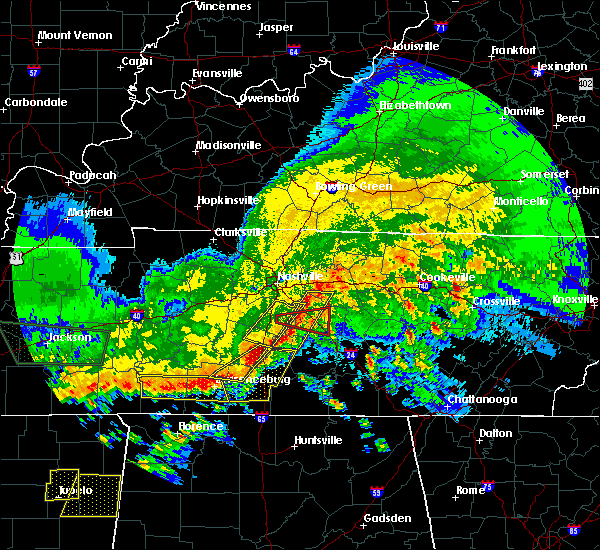 The tornado warning for central rutherford and east central williamson counties will expire at 1130 pm cst, the tornado threat has diminished and the tornado warning has been cancelled. however, damaging winds remain likely and a severe thunderstorm warning remains in effect for the area. a severe thunderstorm watch also remains in effect until 100 am cst for middle tennessee. The tornado warning for central rutherford and east central williamson counties will expire at 1130 pm cst, the tornado threat has diminished and the tornado warning has been cancelled. however, damaging winds remain likely and a severe thunderstorm warning remains in effect for the area. a severe thunderstorm watch also remains in effect until 100 am cst for middle tennessee.
|
| 3/9/2017 11:18 PM CST |
 At 1118 pm cst, a severe thunderstorm was located 11 miles south of nolensville, or 14 miles southeast of franklin, moving east at 50 mph (radar indicated). Hazards include 60 mph wind gusts. expect damage to roofs, siding, and trees At 1118 pm cst, a severe thunderstorm was located 11 miles south of nolensville, or 14 miles southeast of franklin, moving east at 50 mph (radar indicated). Hazards include 60 mph wind gusts. expect damage to roofs, siding, and trees
|
| 3/9/2017 11:13 PM CST |
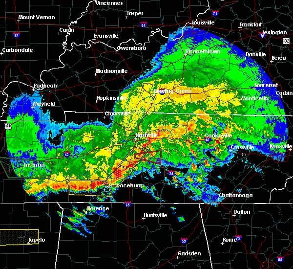 At 1113 pm cst, a severe thunderstorm capable of producing a tornado was located 7 miles southwest of nolensville, or 9 miles southeast of franklin, moving east at 50 mph (radar indicated rotation). Hazards include tornado. Flying debris will be dangerous to those caught without shelter. mobile homes will be damaged or destroyed. damage to roofs, windows, and vehicles will occur. tree damage is likely. this dangerous storm will be near, murfreesboro around 1130 pm cst. Other locations impacted by this tornadic thunderstorm include triune. At 1113 pm cst, a severe thunderstorm capable of producing a tornado was located 7 miles southwest of nolensville, or 9 miles southeast of franklin, moving east at 50 mph (radar indicated rotation). Hazards include tornado. Flying debris will be dangerous to those caught without shelter. mobile homes will be damaged or destroyed. damage to roofs, windows, and vehicles will occur. tree damage is likely. this dangerous storm will be near, murfreesboro around 1130 pm cst. Other locations impacted by this tornadic thunderstorm include triune.
|
| 3/9/2017 11:07 PM CST |
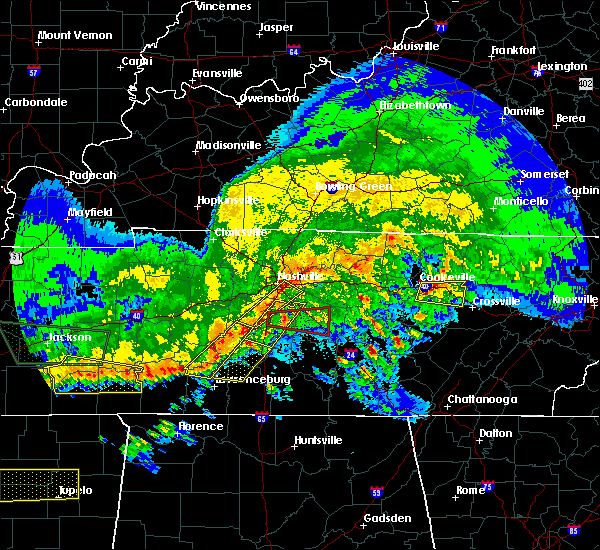 At 1107 pm cst, a severe thunderstorm capable of producing a tornado was located near franklin, moving east at 55 mph (radar indicated rotation). Hazards include tornado. Flying debris will be dangerous to those caught without shelter. mobile homes will be damaged or destroyed. damage to roofs, windows, and vehicles will occur. tree damage is likely. this dangerous storm will be near, murfreesboro around 1125 pm cst. Other locations impacted by this tornadic thunderstorm include triune and rockvale. At 1107 pm cst, a severe thunderstorm capable of producing a tornado was located near franklin, moving east at 55 mph (radar indicated rotation). Hazards include tornado. Flying debris will be dangerous to those caught without shelter. mobile homes will be damaged or destroyed. damage to roofs, windows, and vehicles will occur. tree damage is likely. this dangerous storm will be near, murfreesboro around 1125 pm cst. Other locations impacted by this tornadic thunderstorm include triune and rockvale.
|
| 3/9/2017 11:03 PM CST |
 At 1103 pm cst, a severe thunderstorm was located near thompson`s station, or near franklin, moving east at 50 mph (radar indicated). Hazards include 60 mph wind gusts. expect damage to roofs, siding, and trees At 1103 pm cst, a severe thunderstorm was located near thompson`s station, or near franklin, moving east at 50 mph (radar indicated). Hazards include 60 mph wind gusts. expect damage to roofs, siding, and trees
|
| 3/1/2017 7:26 AM CST |
 At 726 am cst, severe thunderstorms were located along a line extending from 7 miles northwest of westmoreland to near murfreesboro, moving east at 70 mph (radar indicated). Hazards include 60 mph wind gusts and penny size hail. expect damage to roofs, siding, and trees At 726 am cst, severe thunderstorms were located along a line extending from 7 miles northwest of westmoreland to near murfreesboro, moving east at 70 mph (radar indicated). Hazards include 60 mph wind gusts and penny size hail. expect damage to roofs, siding, and trees
|
| 3/1/2017 7:17 AM CST | Damage at smyrna airport. time estimated based on rada in rutherford county TN, 3.5 miles S of Smyrna, TN |
| 3/1/2017 7:17 AM CST |
 At 716 am cst, a severe thunderstorm capable of producing a tornado was located over la vergne, or 14 miles northwest of murfreesboro, moving east at 70 mph (radar indicated rotation. at 7:08am damage was reported at cool springs galleria ). Hazards include tornado. Flying debris will be dangerous to those caught without shelter. mobile homes will be damaged or destroyed. damage to roofs, windows, and vehicles will occur. tree damage is likely. this dangerous storm will be near, walterhill around 725 am cst. Other locations impacted by this tornadic thunderstorm include cedars of lebanon state park, gladeville and lascassas. At 716 am cst, a severe thunderstorm capable of producing a tornado was located over la vergne, or 14 miles northwest of murfreesboro, moving east at 70 mph (radar indicated rotation. at 7:08am damage was reported at cool springs galleria ). Hazards include tornado. Flying debris will be dangerous to those caught without shelter. mobile homes will be damaged or destroyed. damage to roofs, windows, and vehicles will occur. tree damage is likely. this dangerous storm will be near, walterhill around 725 am cst. Other locations impacted by this tornadic thunderstorm include cedars of lebanon state park, gladeville and lascassas.
|
| 3/1/2017 7:11 AM CST |
 At 710 am cst, a severe thunderstorm capable of producing a tornado was located near nolensville, or 10 miles northeast of franklin, moving east at 65 mph (radar indicated rotation. at 7:08 damage at cool spring galleria was reported). Hazards include tornado. Flying debris will be dangerous to those caught without shelter. mobile homes will be damaged or destroyed. damage to roofs, windows, and vehicles will occur. tree damage is likely. this dangerous storm will be near, smyrna and la vergne around 720 am cst. walterhill around 725 am cst. Other locations impacted by this tornadic thunderstorm include cedars of lebanon state park, gladeville and lascassas. At 710 am cst, a severe thunderstorm capable of producing a tornado was located near nolensville, or 10 miles northeast of franklin, moving east at 65 mph (radar indicated rotation. at 7:08 damage at cool spring galleria was reported). Hazards include tornado. Flying debris will be dangerous to those caught without shelter. mobile homes will be damaged or destroyed. damage to roofs, windows, and vehicles will occur. tree damage is likely. this dangerous storm will be near, smyrna and la vergne around 720 am cst. walterhill around 725 am cst. Other locations impacted by this tornadic thunderstorm include cedars of lebanon state park, gladeville and lascassas.
|
| 3/1/2017 7:03 AM CST |
 At 702 am cst, a severe thunderstorm capable of producing a tornado was located over franklin, moving east at 70 mph (radar indicated rotation). Hazards include tornado. Flying debris will be dangerous to those caught without shelter. mobile homes will be damaged or destroyed. damage to roofs, windows, and vehicles will occur. tree damage is likely. this dangerous storm will be near, brentwood around 705 am cst. nolensville and antioch around 710 am cst. smyrna and la vergne around 720 am cst. walterhill around 725 am cst. Other locations impacted by this tornadic thunderstorm include cedars of lebanon state park, gladeville and lascassas. At 702 am cst, a severe thunderstorm capable of producing a tornado was located over franklin, moving east at 70 mph (radar indicated rotation). Hazards include tornado. Flying debris will be dangerous to those caught without shelter. mobile homes will be damaged or destroyed. damage to roofs, windows, and vehicles will occur. tree damage is likely. this dangerous storm will be near, brentwood around 705 am cst. nolensville and antioch around 710 am cst. smyrna and la vergne around 720 am cst. walterhill around 725 am cst. Other locations impacted by this tornadic thunderstorm include cedars of lebanon state park, gladeville and lascassas.
|
| 3/1/2017 6:55 AM CST |
 At 654 am cst, severe thunderstorms were located along a line extending from near springfield to near oak hill to near thompson`s station, moving east at 65 mph (radar indicated). Hazards include 70 mph wind gusts and nickel size hail. Expect considerable tree damage. Damage is likely to mobile homes, roofs, and outbuildings. At 654 am cst, severe thunderstorms were located along a line extending from near springfield to near oak hill to near thompson`s station, moving east at 65 mph (radar indicated). Hazards include 70 mph wind gusts and nickel size hail. Expect considerable tree damage. Damage is likely to mobile homes, roofs, and outbuildings.
|
| 2/7/2017 10:41 AM CST |
 The national weather service in nashville has issued a * severe thunderstorm warning for. western smith county in middle tennessee. rutherford county in middle tennessee. southeastern sumner county in middle tennessee. Wilson county in middle tennessee. The national weather service in nashville has issued a * severe thunderstorm warning for. western smith county in middle tennessee. rutherford county in middle tennessee. southeastern sumner county in middle tennessee. Wilson county in middle tennessee.
|
| 2/7/2017 10:25 AM CST |
 At 1024 am cst, severe thunderstorms were located along a line extending from hendersonville to thompson`s station, moving east at 50 mph (radar indicated). Hazards include 60 mph wind gusts and penny size hail. Expect damage to roofs, siding, and trees. Locations impacted include, murfreesboro, franklin, gallatin, lebanon, nashville, madison, hendersonville, smyrna, brentwood, la vergne, spring hill, mount juliet, goodlettsville, millersville, nolensville, forest hills, oak hill, belle meade, lakewood and thompson`s station. At 1024 am cst, severe thunderstorms were located along a line extending from hendersonville to thompson`s station, moving east at 50 mph (radar indicated). Hazards include 60 mph wind gusts and penny size hail. Expect damage to roofs, siding, and trees. Locations impacted include, murfreesboro, franklin, gallatin, lebanon, nashville, madison, hendersonville, smyrna, brentwood, la vergne, spring hill, mount juliet, goodlettsville, millersville, nolensville, forest hills, oak hill, belle meade, lakewood and thompson`s station.
|
| 2/7/2017 10:11 AM CST |
 At 1010 am cst, severe thunderstorms were located along a line extending from near joelton to near franklin, moving east at 50 mph (radar indicated). Hazards include 70 mph wind gusts. Expect considerable tree damage. Damage is likely to mobile homes, roofs, and outbuildings. At 1010 am cst, severe thunderstorms were located along a line extending from near joelton to near franklin, moving east at 50 mph (radar indicated). Hazards include 70 mph wind gusts. Expect considerable tree damage. Damage is likely to mobile homes, roofs, and outbuildings.
|
| 11/28/2016 6:49 PM CST |
 At 648 pm cst, severe thunderstorms were located along a line extending from near westmoreland to castalian springs to near la vergne, moving east at 45 mph (radar indicated). Hazards include 60 mph wind gusts. Expect damage to roofs. siding. and trees. Locations impacted include, gallatin, lebanon, lafayette, hartsville, smyrna, la vergne, mount juliet, westmoreland, belinda city, walterhill, dickerson chapel recreation area, bledsoe creek state park, cedars of lebanon state park, tuckers crossroads, gladeville and bethpage. At 648 pm cst, severe thunderstorms were located along a line extending from near westmoreland to castalian springs to near la vergne, moving east at 45 mph (radar indicated). Hazards include 60 mph wind gusts. Expect damage to roofs. siding. and trees. Locations impacted include, gallatin, lebanon, lafayette, hartsville, smyrna, la vergne, mount juliet, westmoreland, belinda city, walterhill, dickerson chapel recreation area, bledsoe creek state park, cedars of lebanon state park, tuckers crossroads, gladeville and bethpage.
|
| 11/28/2016 6:34 PM CST |
 At 634 pm cst, severe thunderstorms were located along a line extending from portland to near antioch, moving east at 40 mph (radar indicated). Hazards include 60 mph wind gusts. Expect damage to roofs. siding. And trees. At 634 pm cst, severe thunderstorms were located along a line extending from portland to near antioch, moving east at 40 mph (radar indicated). Hazards include 60 mph wind gusts. Expect damage to roofs. siding. And trees.
|
| 11/28/2016 6:13 PM CST |
 At 612 pm cst, severe thunderstorms were located along a line extending from goodlettsville to near leipers fork, moving east at 40 mph (radar indicated). Hazards include 60 mph wind gusts. Expect damage to roofs. siding. and trees. Locations impacted include, franklin, gallatin, nashville, madison, hendersonville, brentwood, la vergne, mount juliet, goodlettsville, nolensville, forest hills, oak hill, belle meade, lakewood, thompson`s station, hermitage, joelton, bellevue, old hickory and antioch. At 612 pm cst, severe thunderstorms were located along a line extending from goodlettsville to near leipers fork, moving east at 40 mph (radar indicated). Hazards include 60 mph wind gusts. Expect damage to roofs. siding. and trees. Locations impacted include, franklin, gallatin, nashville, madison, hendersonville, brentwood, la vergne, mount juliet, goodlettsville, nolensville, forest hills, oak hill, belle meade, lakewood, thompson`s station, hermitage, joelton, bellevue, old hickory and antioch.
|
| 11/28/2016 6:01 PM CST |
 At 600 pm cst, severe thunderstorms were located along a line extending from joelton to fairview, moving east at 45 mph (radar indicated). Hazards include 60 mph wind gusts. Expect damage to roofs. siding. And trees. At 600 pm cst, severe thunderstorms were located along a line extending from joelton to fairview, moving east at 45 mph (radar indicated). Hazards include 60 mph wind gusts. Expect damage to roofs. siding. And trees.
|
| 9/10/2016 5:35 PM CDT |
 At 535 pm cdt, severe thunderstorms were located along a line extending from near gordonsville to near murfreesboro, moving east at 45 mph (radar indicated). Hazards include 60 mph wind gusts. Expect damage to roofs. siding. and trees. Locations impacted include, murfreesboro, smithville, woodbury, carthage, watertown, baxter, gordonsville, walterhill, hickman, south carthage, alexandria, dowelltown, liberty, auburntown, edgar evans state park, cedars of lebanon state park, tuckers crossroads, center hill lake, readyville and milton. At 535 pm cdt, severe thunderstorms were located along a line extending from near gordonsville to near murfreesboro, moving east at 45 mph (radar indicated). Hazards include 60 mph wind gusts. Expect damage to roofs. siding. and trees. Locations impacted include, murfreesboro, smithville, woodbury, carthage, watertown, baxter, gordonsville, walterhill, hickman, south carthage, alexandria, dowelltown, liberty, auburntown, edgar evans state park, cedars of lebanon state park, tuckers crossroads, center hill lake, readyville and milton.
|
| 9/10/2016 5:18 PM CDT |
 At 517 pm cdt, severe thunderstorms were located along a line extending from carthage to near murfreesboro, moving east at 45 mph (radar indicated). Hazards include 60 mph wind gusts. Expect damage to roofs. siding. And trees. At 517 pm cdt, severe thunderstorms were located along a line extending from carthage to near murfreesboro, moving east at 45 mph (radar indicated). Hazards include 60 mph wind gusts. Expect damage to roofs. siding. And trees.
|
| 9/10/2016 5:06 PM CDT |
 At 504 pm cdt, severe thunderstorms were located along a line extending from near belinda city to franklin, moving east at 40 mph (trained spotter repored and radar indicated. at 455pm, several trees have been blown down with these storms. a wind gust of 51 mph was also measured at nashville international airport with these storms). Hazards include 60 mph wind gusts. Expect damage to roofs. siding. and trees. Locations impacted include, murfreesboro, franklin, lebanon, smyrna, brentwood, la vergne, mount juliet, nolensville, oak hill, hermitage, belinda city, walterhill, rural hill, antioch, berry hill, cedars of lebanon state park, tuckers crossroads, percy priest lake, triune and gladeville. At 504 pm cdt, severe thunderstorms were located along a line extending from near belinda city to franklin, moving east at 40 mph (trained spotter repored and radar indicated. at 455pm, several trees have been blown down with these storms. a wind gust of 51 mph was also measured at nashville international airport with these storms). Hazards include 60 mph wind gusts. Expect damage to roofs. siding. and trees. Locations impacted include, murfreesboro, franklin, lebanon, smyrna, brentwood, la vergne, mount juliet, nolensville, oak hill, hermitage, belinda city, walterhill, rural hill, antioch, berry hill, cedars of lebanon state park, tuckers crossroads, percy priest lake, triune and gladeville.
|
| 9/10/2016 5:05 PM CDT | Scattered trees blown down across rutherford county per dispatch reports in rutherford county TN, 1.5 miles SSW of Smyrna, TN |
| 9/10/2016 4:50 PM CDT |
 At 450 pm cdt, severe thunderstorms were located along a line extending from hermitage to near franklin, moving east at 40 mph (radar indicated). Hazards include 60 mph wind gusts and pea size hail. Expect damage to roofs. siding. And trees. At 450 pm cdt, severe thunderstorms were located along a line extending from hermitage to near franklin, moving east at 40 mph (radar indicated). Hazards include 60 mph wind gusts and pea size hail. Expect damage to roofs. siding. And trees.
|
| 8/20/2016 4:24 PM CDT |
 At 423 pm cdt, a severe thunderstorm was located near murfreesboro, moving east at 40 mph (radar indicated). Hazards include 60 mph wind gusts. Expect damage to roofs. siding. and trees. Locations impacted include, murfreesboro, smyrna, walterhill and rockvale. At 423 pm cdt, a severe thunderstorm was located near murfreesboro, moving east at 40 mph (radar indicated). Hazards include 60 mph wind gusts. Expect damage to roofs. siding. and trees. Locations impacted include, murfreesboro, smyrna, walterhill and rockvale.
|
| 8/20/2016 4:01 PM CDT |
 At 401 pm cdt, a severe thunderstorm was located near franklin, moving east at 45 mph (radar indicated). Hazards include 60 mph wind gusts. Expect damage to roofs. siding. And trees. At 401 pm cdt, a severe thunderstorm was located near franklin, moving east at 45 mph (radar indicated). Hazards include 60 mph wind gusts. Expect damage to roofs. siding. And trees.
|
| 8/4/2016 7:38 PM CDT |
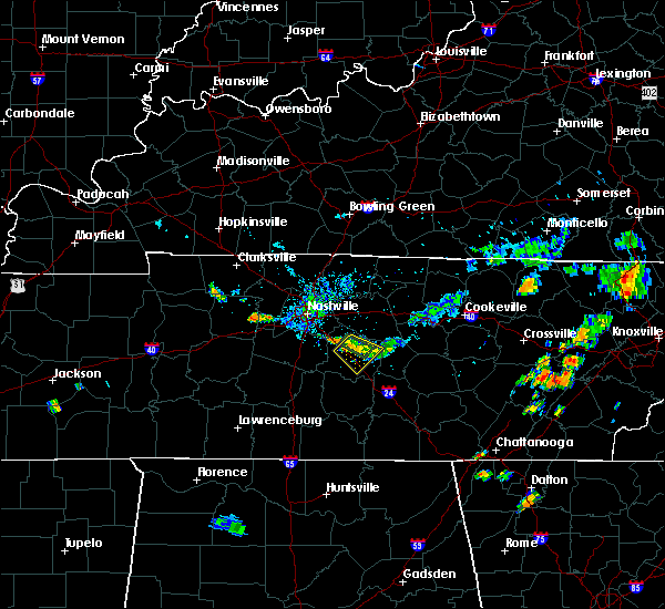 At 738 pm cdt, a severe thunderstorm was located over murfreesboro, moving southeast at 10 mph (radar indicated). Hazards include 60 mph wind gusts. Expect damage to roofs. siding. and trees. Locations impacted include, murfreesboro, smyrna, walterhill and lascassas. At 738 pm cdt, a severe thunderstorm was located over murfreesboro, moving southeast at 10 mph (radar indicated). Hazards include 60 mph wind gusts. Expect damage to roofs. siding. and trees. Locations impacted include, murfreesboro, smyrna, walterhill and lascassas.
|
| 8/4/2016 7:10 PM CDT |
 At 710 pm cdt, a severe thunderstorm was located over murfreesboro, moving southeast at 5 mph (radar indicated). Hazards include 60 mph wind gusts and penny size hail. Expect damage to roofs. siding. And trees. At 710 pm cdt, a severe thunderstorm was located over murfreesboro, moving southeast at 5 mph (radar indicated). Hazards include 60 mph wind gusts and penny size hail. Expect damage to roofs. siding. And trees.
|
| 7/8/2016 9:46 PM CDT |
 At 945 pm cdt, severe thunderstorms were located along a line extending from gainesboro to near woodbury, moving east at 55 mph (radar indicated). Hazards include 60 mph wind gusts and penny size hail. Expect damage to roofs. siding. and trees. Locations impacted include, murfreesboro, lebanon, smithville, woodbury, carthage, smyrna, watertown, baxter, gordonsville, walterhill, hickman, south carthage, alexandria, dowelltown, liberty, auburntown, dickerson chapel recreation area, granville, edgar evans state park and cedars of lebanon state park. At 945 pm cdt, severe thunderstorms were located along a line extending from gainesboro to near woodbury, moving east at 55 mph (radar indicated). Hazards include 60 mph wind gusts and penny size hail. Expect damage to roofs. siding. and trees. Locations impacted include, murfreesboro, lebanon, smithville, woodbury, carthage, smyrna, watertown, baxter, gordonsville, walterhill, hickman, south carthage, alexandria, dowelltown, liberty, auburntown, dickerson chapel recreation area, granville, edgar evans state park and cedars of lebanon state park.
|
| 7/8/2016 9:25 PM CDT |
 At 925 pm cdt, severe thunderstorms were located along a line extending from near carthage to near walterhill, moving east at 55 mph (radar indicated). Hazards include 70 mph wind gusts and penny size hail. Expect considerable tree damage. Damage is likely to mobile homes, roofs, and outbuildings. At 925 pm cdt, severe thunderstorms were located along a line extending from near carthage to near walterhill, moving east at 55 mph (radar indicated). Hazards include 70 mph wind gusts and penny size hail. Expect considerable tree damage. Damage is likely to mobile homes, roofs, and outbuildings.
|
| 7/8/2016 9:16 PM CDT | Large tree down on montgomery way in smyrna in rutherford county TN, 0.6 miles E of Smyrna, TN |
| 7/8/2016 9:10 PM CDT |
 At 909 pm cdt, severe thunderstorms were located along a line extending from lafayette to thompson`s station, moving east at 60 mph (trained weather spotters. numerous trees and power lines have been blown down with these storms all across the nashville metro area). Hazards include 70 mph wind gusts and quarter size hail. Hail damage to vehicles is expected. expect considerable tree damage. wind damage is also likely to mobile homes, roofs, and outbuildings. Locations impacted include, murfreesboro, franklin, gallatin, lebanon, lafayette, carthage, hartsville, nashville, madison, hendersonville, smyrna, brentwood, la vergne, spring hill, mount juliet, goodlettsville, white house, nolensville, forest hills and oak hill. At 909 pm cdt, severe thunderstorms were located along a line extending from lafayette to thompson`s station, moving east at 60 mph (trained weather spotters. numerous trees and power lines have been blown down with these storms all across the nashville metro area). Hazards include 70 mph wind gusts and quarter size hail. Hail damage to vehicles is expected. expect considerable tree damage. wind damage is also likely to mobile homes, roofs, and outbuildings. Locations impacted include, murfreesboro, franklin, gallatin, lebanon, lafayette, carthage, hartsville, nashville, madison, hendersonville, smyrna, brentwood, la vergne, spring hill, mount juliet, goodlettsville, white house, nolensville, forest hills and oak hill.
|
| 7/8/2016 9:06 PM CDT |
 At 905 pm cdt, severe thunderstorms were located along a line extending from westmoreland to near thompson`s station, moving east at 45 mph (trained spotters. at 9 pm cdt...60 mph winds were estimated at the nws nashville office in old hickory. numerous trees and power lines have been blown down with these storms across the nashville metro area). Hazards include 60 mph wind gusts and quarter size hail. Hail damage to vehicles is expected. expect wind damage to roofs, siding, and trees. Locations impacted include, murfreesboro, franklin, gallatin, lebanon, lafayette, carthage, hartsville, nashville, madison, hendersonville, smyrna, brentwood, la vergne, spring hill, mount juliet, goodlettsville, white house, nolensville, forest hills and oak hill. At 905 pm cdt, severe thunderstorms were located along a line extending from westmoreland to near thompson`s station, moving east at 45 mph (trained spotters. at 9 pm cdt...60 mph winds were estimated at the nws nashville office in old hickory. numerous trees and power lines have been blown down with these storms across the nashville metro area). Hazards include 60 mph wind gusts and quarter size hail. Hail damage to vehicles is expected. expect wind damage to roofs, siding, and trees. Locations impacted include, murfreesboro, franklin, gallatin, lebanon, lafayette, carthage, hartsville, nashville, madison, hendersonville, smyrna, brentwood, la vergne, spring hill, mount juliet, goodlettsville, white house, nolensville, forest hills and oak hill.
|
| 7/8/2016 8:50 PM CDT |
 At 849 pm cdt, severe thunderstorms were located along a line extending from portland to near thompson`s station, moving east at 55 mph (radar indicated). Hazards include 60 mph wind gusts and quarter size hail. Hail damage to vehicles is expected. Expect wind damage to roofs, siding, and trees. At 849 pm cdt, severe thunderstorms were located along a line extending from portland to near thompson`s station, moving east at 55 mph (radar indicated). Hazards include 60 mph wind gusts and quarter size hail. Hail damage to vehicles is expected. Expect wind damage to roofs, siding, and trees.
|
| 7/6/2016 5:15 PM CDT |
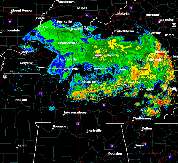 At 514 pm cdt, severe thunderstorms were located along a line extending from near nolensville to near thompson`s station, moving east at 30 mph (radar indicated). Hazards include 60 mph wind gusts and penny size hail. Expect damage to roofs. siding. and trees. Locations impacted include, franklin, columbia, brentwood, spring hill, nolensville, thompson`s station, eagleville, christiana, triune, santa fe, leipers fork, rockvale and thompsons station. At 514 pm cdt, severe thunderstorms were located along a line extending from near nolensville to near thompson`s station, moving east at 30 mph (radar indicated). Hazards include 60 mph wind gusts and penny size hail. Expect damage to roofs. siding. and trees. Locations impacted include, franklin, columbia, brentwood, spring hill, nolensville, thompson`s station, eagleville, christiana, triune, santa fe, leipers fork, rockvale and thompsons station.
|
| 7/6/2016 5:13 PM CDT |
 At 512 pm cdt, severe thunderstorms were located along a line extending from baxter to murfreesboro, moving east at 50 mph (radar indicated). Hazards include 60 mph wind gusts and penny size hail. Expect damage to roofs. siding. and trees. Locations impacted include, murfreesboro, cookeville, smithville, woodbury, walterhill, dowelltown, liberty, auburntown, edgar evans state park, bradyville, burgess falls state park, hamptons crossroads, center hill lake, readyville, milton, bakers crossroads and lascassas. At 512 pm cdt, severe thunderstorms were located along a line extending from baxter to murfreesboro, moving east at 50 mph (radar indicated). Hazards include 60 mph wind gusts and penny size hail. Expect damage to roofs. siding. and trees. Locations impacted include, murfreesboro, cookeville, smithville, woodbury, walterhill, dowelltown, liberty, auburntown, edgar evans state park, bradyville, burgess falls state park, hamptons crossroads, center hill lake, readyville, milton, bakers crossroads and lascassas.
|
| 7/6/2016 4:58 PM CDT |
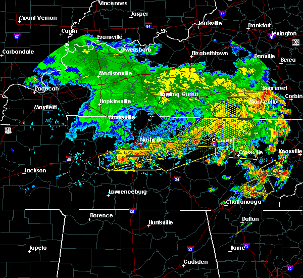 At 457 pm cdt, severe thunderstorms were located along a line extending from near antioch to fairview, moving east at 40 mph (radar indicated). Hazards include 60 mph wind gusts and penny size hail. Expect damage to roofs. siding. And trees. At 457 pm cdt, severe thunderstorms were located along a line extending from near antioch to fairview, moving east at 40 mph (radar indicated). Hazards include 60 mph wind gusts and penny size hail. Expect damage to roofs. siding. And trees.
|
| 7/6/2016 4:55 PM CDT |
 At 454 pm cdt, severe thunderstorms were located along a line extending from gordonsville to smyrna, moving east at 50 mph (radar indicated). Hazards include 60 mph wind gusts and penny size hail. Expect damage to roofs. siding. And trees. At 454 pm cdt, severe thunderstorms were located along a line extending from gordonsville to smyrna, moving east at 50 mph (radar indicated). Hazards include 60 mph wind gusts and penny size hail. Expect damage to roofs. siding. And trees.
|
| 7/6/2016 4:33 PM CDT |
 At 433 pm cdt, severe thunderstorms were located along a line extending from carthage to near brentwood, moving east at 40 mph (radar indicated). Hazards include 60 mph wind gusts and penny size hail. Expect damage to roofs. siding. And trees. At 433 pm cdt, severe thunderstorms were located along a line extending from carthage to near brentwood, moving east at 40 mph (radar indicated). Hazards include 60 mph wind gusts and penny size hail. Expect damage to roofs. siding. And trees.
|
| 6/28/2016 5:29 PM CDT |
 At 528 pm cdt, a severe thunderstorm was located near nolensville, or 11 miles northeast of franklin, moving south at 30 mph (trained weather spotters. at 516 pm...several trees were reportedly blown down with this storm. nashville international airport measured a wind gust of 51 mph with this storm). Hazards include 60 mph wind gusts and penny size hail. Expect damage to roofs. siding. and trees. Locations impacted include, murfreesboro, franklin, smyrna, brentwood, la vergne, nolensville, oak hill, antioch, triune and percy priest lake. At 528 pm cdt, a severe thunderstorm was located near nolensville, or 11 miles northeast of franklin, moving south at 30 mph (trained weather spotters. at 516 pm...several trees were reportedly blown down with this storm. nashville international airport measured a wind gust of 51 mph with this storm). Hazards include 60 mph wind gusts and penny size hail. Expect damage to roofs. siding. and trees. Locations impacted include, murfreesboro, franklin, smyrna, brentwood, la vergne, nolensville, oak hill, antioch, triune and percy priest lake.
|
| 6/28/2016 5:20 PM CDT |
 At 519 pm cdt, a severe thunderstorm was located over antioch, or 9 miles southeast of nashville, moving south at 25 mph (trained weather spotters. at 515 pm...spotters reported several trees blown down in east nashville). Hazards include 60 mph wind gusts and penny size hail. Expect damage to roofs. siding. and trees. Locations impacted include, murfreesboro, franklin, nashville, smyrna, brentwood, la vergne, nolensville, oak hill, hermitage, antioch, berry hill, percy priest lake and triune. At 519 pm cdt, a severe thunderstorm was located over antioch, or 9 miles southeast of nashville, moving south at 25 mph (trained weather spotters. at 515 pm...spotters reported several trees blown down in east nashville). Hazards include 60 mph wind gusts and penny size hail. Expect damage to roofs. siding. and trees. Locations impacted include, murfreesboro, franklin, nashville, smyrna, brentwood, la vergne, nolensville, oak hill, hermitage, antioch, berry hill, percy priest lake and triune.
|
| 6/28/2016 5:11 PM CDT |
 At 510 pm cdt, a severe thunderstorm was located near nashville international airport, or near donelson, moving south at 25 mph (radar indicated and public reported. at 505 pm cdt...the public reported penny size hail and trees down in the east nashville and opryland areas). Hazards include 60 mph wind gusts and penny size hail. Expect damage to roofs. siding. And trees. At 510 pm cdt, a severe thunderstorm was located near nashville international airport, or near donelson, moving south at 25 mph (radar indicated and public reported. at 505 pm cdt...the public reported penny size hail and trees down in the east nashville and opryland areas). Hazards include 60 mph wind gusts and penny size hail. Expect damage to roofs. siding. And trees.
|
| 6/16/2016 7:08 PM CDT |
 At 708 pm cdt, a severe thunderstorm was located near hendersonville, or 7 miles southwest of gallatin, moving south at 30 mph (radar indicated). Hazards include 60 mph wind gusts. Expect damage to roofs. siding. And trees. At 708 pm cdt, a severe thunderstorm was located near hendersonville, or 7 miles southwest of gallatin, moving south at 30 mph (radar indicated). Hazards include 60 mph wind gusts. Expect damage to roofs. siding. And trees.
|
| 6/15/2016 4:50 PM CDT |
 At 450 pm cdt, a severe thunderstorm was located near walterhill, or 9 miles northeast of murfreesboro, moving southeast at 45 mph (radar indicated). Hazards include 60 mph wind gusts. Expect damage to roofs. siding. and trees. Locations impacted include, murfreesboro, lebanon, smyrna, la vergne, watertown, walterhill, cedars of lebanon state park, gladeville, lascassas and tuckers crossroads. At 450 pm cdt, a severe thunderstorm was located near walterhill, or 9 miles northeast of murfreesboro, moving southeast at 45 mph (radar indicated). Hazards include 60 mph wind gusts. Expect damage to roofs. siding. and trees. Locations impacted include, murfreesboro, lebanon, smyrna, la vergne, watertown, walterhill, cedars of lebanon state park, gladeville, lascassas and tuckers crossroads.
|
| 6/15/2016 4:49 PM CDT |
 At 449 pm cdt, a severe thunderstorm was located 8 miles west of murfreesboro, moving southeast at 50 mph (radar indicated). Hazards include 60 mph wind gusts. Expect damage to roofs. siding. and trees. Locations impacted include, murfreesboro, smyrna, la vergne, nolensville, eagleville, triune and rockvale. At 449 pm cdt, a severe thunderstorm was located 8 miles west of murfreesboro, moving southeast at 50 mph (radar indicated). Hazards include 60 mph wind gusts. Expect damage to roofs. siding. and trees. Locations impacted include, murfreesboro, smyrna, la vergne, nolensville, eagleville, triune and rockvale.
|
| 6/15/2016 4:40 PM CDT |
 At 439 pm cdt, a severe thunderstorm was located near walterhill, or 11 miles north of murfreesboro, moving southeast at 45 mph (radar indicated). Hazards include 60 mph wind gusts. Expect damage to roofs. siding. and trees. Locations impacted include, murfreesboro, lebanon, smyrna, la vergne, mount juliet, watertown, belinda city, walterhill, rural hill, antioch, dickerson chapel recreation area, cedars of lebanon state park, tuckers crossroads, percy priest lake, gladeville and lascassas. At 439 pm cdt, a severe thunderstorm was located near walterhill, or 11 miles north of murfreesboro, moving southeast at 45 mph (radar indicated). Hazards include 60 mph wind gusts. Expect damage to roofs. siding. and trees. Locations impacted include, murfreesboro, lebanon, smyrna, la vergne, mount juliet, watertown, belinda city, walterhill, rural hill, antioch, dickerson chapel recreation area, cedars of lebanon state park, tuckers crossroads, percy priest lake, gladeville and lascassas.
|
| 6/15/2016 4:32 PM CDT |
 At 432 pm cdt, a severe thunderstorm was located near nolensville, or 7 miles east of franklin, moving southeast at 50 mph (radar indicated). Hazards include 60 mph wind gusts. Expect damage to roofs. siding. And trees. At 432 pm cdt, a severe thunderstorm was located near nolensville, or 7 miles east of franklin, moving southeast at 50 mph (radar indicated). Hazards include 60 mph wind gusts. Expect damage to roofs. siding. And trees.
|
| 6/15/2016 4:30 PM CDT | Several reports of trees down in smyrna in rutherford county TN, 1.5 miles SSW of Smyrna, TN |
| 6/15/2016 4:24 PM CDT |
 At 423 pm cdt, a severe thunderstorm was located over mount juliet, or 11 miles west of lebanon, moving southeast at 45 mph (radar indicated). Hazards include 60 mph wind gusts. Expect damage to roofs. siding. And trees. At 423 pm cdt, a severe thunderstorm was located over mount juliet, or 11 miles west of lebanon, moving southeast at 45 mph (radar indicated). Hazards include 60 mph wind gusts. Expect damage to roofs. siding. And trees.
|
| 6/3/2016 9:16 PM CDT |
 At 916 pm cdt, a severe thunderstorm was located over nolensville, or 7 miles east of franklin, moving northeast at 20 mph (radar indicated). Hazards include 60 mph wind gusts and quarter size hail. Hail damage to vehicles is expected. expect wind damage to roofs, siding, and trees. Locations impacted include, franklin, smyrna, brentwood, la vergne and nolensville. At 916 pm cdt, a severe thunderstorm was located over nolensville, or 7 miles east of franklin, moving northeast at 20 mph (radar indicated). Hazards include 60 mph wind gusts and quarter size hail. Hail damage to vehicles is expected. expect wind damage to roofs, siding, and trees. Locations impacted include, franklin, smyrna, brentwood, la vergne and nolensville.
|
| 6/3/2016 9:02 PM CDT |
 At 901 pm cdt, a severe thunderstorm was located near franklin, moving northeast at 20 mph (radar indicated). Hazards include 60 mph wind gusts and quarter size hail. Hail damage to vehicles is expected. Expect wind damage to roofs, siding, and trees. At 901 pm cdt, a severe thunderstorm was located near franklin, moving northeast at 20 mph (radar indicated). Hazards include 60 mph wind gusts and quarter size hail. Hail damage to vehicles is expected. Expect wind damage to roofs, siding, and trees.
|
| 5/10/2016 11:45 PM CDT |
 At 1145 pm cdt, severe thunderstorms were located along a line extending from 6 miles northeast of mount juliet to belinda city to near hermitage, moving southeast at 40 mph (radar indicated). Hazards include 60 mph wind gusts and quarter size hail. Hail damage to vehicles is expected. Expect wind damage to roofs, siding, and trees. At 1145 pm cdt, severe thunderstorms were located along a line extending from 6 miles northeast of mount juliet to belinda city to near hermitage, moving southeast at 40 mph (radar indicated). Hazards include 60 mph wind gusts and quarter size hail. Hail damage to vehicles is expected. Expect wind damage to roofs, siding, and trees.
|
| 12/23/2015 9:11 PM CST | The tornado warning for central rutherford county will expire at 915 pm cst, the storm which prompted the warning has weakened and exited the warned area. therefore the warning will be allowed to expire. a tornado watch remains in effect until 1100 pm cst for central tennessee. |
| 12/23/2015 8:58 PM CST | At 858 pm cst, a severe thunderstorm capable of producing a tornado was located near murfreesboro, moving northeast at 60 mph (radar indicated rotation). Hazards include tornado. Flying debris will be dangerous to those caught without shelter. mobile homes will be damaged or destroyed. damage to roofs, windows and vehicles will occur. tree damage is likely. this dangerous storm will be near, walterhill around 910 pm cst. Other locations impacted by this tornadic thunderstorm include lascassas. |
| 12/23/2015 8:50 PM CST | At 850 pm cst, a severe thunderstorm capable of producing a tornado was located 9 miles west of murfreesboro, moving northeast at 60 mph (radar indicated rotation). Hazards include tornado. Flying debris will be dangerous to those caught without shelter. mobile homes will be damaged or destroyed. damage to roofs, windows and vehicles will occur. tree damage is likely. this dangerous storm will be near, murfreesboro around 855 pm cst. walterhill around 905 pm cst. Other locations impacted by this tornadic thunderstorm include lascassas. |
| 8/19/2015 3:21 PM CDT |
 At 320 pm cdt, a severe thunderstorm was located over antioch, or 11 miles southeast of nashville, moving northeast at 30 mph (radar indicated). Hazards include 60 mph wind gusts. Expect damage to roofs. siding and trees. this severe storm will be near, smyrna, la vergne and rural hill around 330 pm cdt. Other locations impacted by this severe thunderstorm include percy priest lake. At 320 pm cdt, a severe thunderstorm was located over antioch, or 11 miles southeast of nashville, moving northeast at 30 mph (radar indicated). Hazards include 60 mph wind gusts. Expect damage to roofs. siding and trees. this severe storm will be near, smyrna, la vergne and rural hill around 330 pm cdt. Other locations impacted by this severe thunderstorm include percy priest lake.
|
| 8/19/2015 3:05 PM CDT |
 At 304 pm cdt, a severe thunderstorm was located over brentwood, or near franklin, moving northeast at 30 mph (radar indicated). Hazards include 60 mph wind gusts. Expect damage to roofs. siding and trees. this severe thunderstorm will be near, nolensville around 315 pm cdt. antioch around 320 pm cdt. smyrna, la vergne and rural hill around 330 pm cdt. Other locations impacted by this severe thunderstorm include percy priest lake. At 304 pm cdt, a severe thunderstorm was located over brentwood, or near franklin, moving northeast at 30 mph (radar indicated). Hazards include 60 mph wind gusts. Expect damage to roofs. siding and trees. this severe thunderstorm will be near, nolensville around 315 pm cdt. antioch around 320 pm cdt. smyrna, la vergne and rural hill around 330 pm cdt. Other locations impacted by this severe thunderstorm include percy priest lake.
|
| 8/15/2015 2:27 PM CDT | The severe thunderstorm warning for southeastern williamson and southwestern rutherford counties will expire at 230 pm cdt, the storm which prompted the warning has weakened below severe limits, and no longer poses an immediate threat to life or property. therefore the warning will be allowed to expire. however heavy rain is still possible with this thunderstorm. |
| 8/15/2015 2:11 PM CDT |
 At 210 pm cdt, a severe thunderstorm was located 8 miles southeast of nolensville, or 10 miles west of murfreesboro, and is nearly stationary (radar indicated). Hazards include 60 mph wind gusts and quarter size hail. Hail damage to vehicles is expected. Expect wind damage to roofs, siding and trees. At 210 pm cdt, a severe thunderstorm was located 8 miles southeast of nolensville, or 10 miles west of murfreesboro, and is nearly stationary (radar indicated). Hazards include 60 mph wind gusts and quarter size hail. Hail damage to vehicles is expected. Expect wind damage to roofs, siding and trees.
|
| 8/15/2015 2:06 PM CDT |
 At 205 pm cdt, a severe thunderstorm was located 9 miles west of murfreesboro, and is nearly stationary (radar indicated. at 200 pm...nickel size hail was reported at rockvale). Hazards include 60 mph wind gusts and quarter size hail. Hail damage to vehicles is expected. expect wind damage to roofs, siding and trees. Locations impacted include, murfreesboro, nolensville, eagleville, rockvale and triune. At 205 pm cdt, a severe thunderstorm was located 9 miles west of murfreesboro, and is nearly stationary (radar indicated. at 200 pm...nickel size hail was reported at rockvale). Hazards include 60 mph wind gusts and quarter size hail. Hail damage to vehicles is expected. expect wind damage to roofs, siding and trees. Locations impacted include, murfreesboro, nolensville, eagleville, rockvale and triune.
|
| 8/15/2015 1:52 PM CDT |
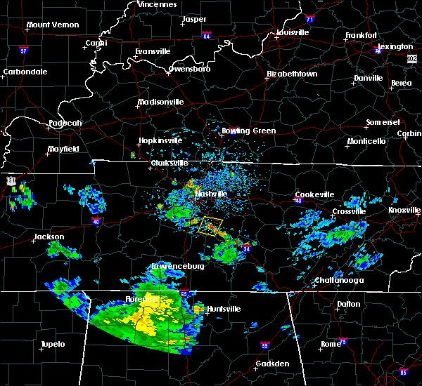 At 151 pm cdt, a severe thunderstorm was located 9 miles west of murfreesboro, and is nearly stationary (radar indicated). Hazards include 60 mph wind gusts and nickel size hail. Expect damage to roofs. Siding and trees. At 151 pm cdt, a severe thunderstorm was located 9 miles west of murfreesboro, and is nearly stationary (radar indicated). Hazards include 60 mph wind gusts and nickel size hail. Expect damage to roofs. Siding and trees.
|
| 7/28/2015 4:38 PM CDT |
 At 436 pm cdt, a severe thunderstorm was located over nolensville, or 12 miles east of franklin, moving south at 30 mph (radar indicated). Hazards include 60 mph wind gusts and penny size hail. Expect damage to roofs. siding and trees. this severe thunderstorm will be near, almaville around 445 pm cdt. Other locations impacted by this severe thunderstorm include rockvale, eagleville and triune. At 436 pm cdt, a severe thunderstorm was located over nolensville, or 12 miles east of franklin, moving south at 30 mph (radar indicated). Hazards include 60 mph wind gusts and penny size hail. Expect damage to roofs. siding and trees. this severe thunderstorm will be near, almaville around 445 pm cdt. Other locations impacted by this severe thunderstorm include rockvale, eagleville and triune.
|
| 7/28/2015 4:30 PM CDT |
 At 430 pm cdt, a severe thunderstorm was located over la vergne, or 14 miles northeast of franklin, moving south at 30 mph (radar indicated). Hazards include 60 mph wind gusts and penny size hail. Expect damage to roofs. siding and trees. this severe storm will be near, smyrna and nolensville around 435 pm cdt. Murfreesboro around 445 pm cdt. At 430 pm cdt, a severe thunderstorm was located over la vergne, or 14 miles northeast of franklin, moving south at 30 mph (radar indicated). Hazards include 60 mph wind gusts and penny size hail. Expect damage to roofs. siding and trees. this severe storm will be near, smyrna and nolensville around 435 pm cdt. Murfreesboro around 445 pm cdt.
|
| 7/28/2015 4:12 PM CDT |
 At 411 pm cdt, a severe thunderstorm was located near antioch, or 9 miles southeast of nashville, moving south at 25 mph (radar indicated). Hazards include 60 mph wind gusts and penny size hail. Expect damage to roofs. siding and trees. this severe thunderstorm will be near, antioch and rural hill around 415 pm cdt. la vergne around 420 pm cdt. nolensville around 425 pm cdt. smyrna around 430 pm cdt. murfreesboro around 445 pm cdt. Other locations impacted by this severe thunderstorm include berry hill and percy priest lake. At 411 pm cdt, a severe thunderstorm was located near antioch, or 9 miles southeast of nashville, moving south at 25 mph (radar indicated). Hazards include 60 mph wind gusts and penny size hail. Expect damage to roofs. siding and trees. this severe thunderstorm will be near, antioch and rural hill around 415 pm cdt. la vergne around 420 pm cdt. nolensville around 425 pm cdt. smyrna around 430 pm cdt. murfreesboro around 445 pm cdt. Other locations impacted by this severe thunderstorm include berry hill and percy priest lake.
|
| 7/16/2015 3:25 PM CDT | Tree blown down in home backyard in smyrna in rutherford county TN, 1.5 miles SSW of Smyrna, TN |
| 7/14/2015 3:35 PM CDT |
 At 334 pm cdt, a severe thunderstorm was located over murfreesboro, moving east at 25 mph (radar indicated). Hazards include 60 mph wind gusts and quarter size hail. Hail damage to vehicles is expected. expect wind damage to roofs, siding and trees. This severe thunderstorm will remain over mainly rural areas of southern wilson, cannon and rutherford counties, including the following locations, christiana, fosterville, readyville, auburntown, milton, bradyville, cedars of lebanon state park, gladeville and lascassas. At 334 pm cdt, a severe thunderstorm was located over murfreesboro, moving east at 25 mph (radar indicated). Hazards include 60 mph wind gusts and quarter size hail. Hail damage to vehicles is expected. expect wind damage to roofs, siding and trees. This severe thunderstorm will remain over mainly rural areas of southern wilson, cannon and rutherford counties, including the following locations, christiana, fosterville, readyville, auburntown, milton, bradyville, cedars of lebanon state park, gladeville and lascassas.
|
| 7/14/2015 2:56 PM CDT |
 At 255 pm cdt, a severe thunderstorm was located over nolensville, or 10 miles east of franklin, moving east at 30 mph (radar indicated). Hazards include 60 mph wind gusts and quarter size hail. Hail damage to vehicles is expected. expect wind damage to roofs, siding and trees. this severe thunderstorm will be near, murfreesboro around 315 pm cdt. Other locations impacted by this severe thunderstorm include lascassas, triune and christiana. At 255 pm cdt, a severe thunderstorm was located over nolensville, or 10 miles east of franklin, moving east at 30 mph (radar indicated). Hazards include 60 mph wind gusts and quarter size hail. Hail damage to vehicles is expected. expect wind damage to roofs, siding and trees. this severe thunderstorm will be near, murfreesboro around 315 pm cdt. Other locations impacted by this severe thunderstorm include lascassas, triune and christiana.
|
| 7/14/2015 2:45 PM CDT |
 At 243 pm cdt, a severe thunderstorm was located near brentwood, moving east at 25 mph (radar indicated. at 230 pm cdt...tennis ball size hail was reported with this storm near brentwood). Hazards include 60 mph wind gusts and half dollar size hail. Hail damage to vehicles is expected. expect wind damage to roofs, siding and trees. this severe storm will be near, nolensville around 250 pm cdt. Other locations impacted by this severe thunderstorm include triune. At 243 pm cdt, a severe thunderstorm was located near brentwood, moving east at 25 mph (radar indicated. at 230 pm cdt...tennis ball size hail was reported with this storm near brentwood). Hazards include 60 mph wind gusts and half dollar size hail. Hail damage to vehicles is expected. expect wind damage to roofs, siding and trees. this severe storm will be near, nolensville around 250 pm cdt. Other locations impacted by this severe thunderstorm include triune.
|
| 7/14/2015 2:31 PM CDT |
 At 230 pm cdt, a severe thunderstorm was located over brentwood, moving east at 20 mph (public reported golf ball size hail at old natchez golf course in franklin). Hazards include golf ball size hail and 60 mph wind gusts. People and animals outdoors will be injured. expect hail damage to roofs, siding, windows and vehicles. expect wind damage to roofs, siding and trees. this severe thunderstorm will be near, brentwood around 235 pm cdt. nolensville and antioch around 250 pm cdt. Other locations impacted by this severe thunderstorm include triune. At 230 pm cdt, a severe thunderstorm was located over brentwood, moving east at 20 mph (public reported golf ball size hail at old natchez golf course in franklin). Hazards include golf ball size hail and 60 mph wind gusts. People and animals outdoors will be injured. expect hail damage to roofs, siding, windows and vehicles. expect wind damage to roofs, siding and trees. this severe thunderstorm will be near, brentwood around 235 pm cdt. nolensville and antioch around 250 pm cdt. Other locations impacted by this severe thunderstorm include triune.
|
| 7/14/2015 2:16 PM CDT |
 At 216 pm cdt, a severe thunderstorm was located over bellevue, or 8 miles northwest of franklin, moving east at 20 mph (radar indicated). Hazards include 60 mph wind gusts and quarter size hail. Hail damage to vehicles is expected. expect wind damage to roofs, siding and trees. this severe thunderstorm will be near, belle meade around 220 pm cdt. brentwood and forest hills around 225 pm cdt. franklin around 230 pm cdt. oak hill around 235 pm cdt. nolensville and antioch around 245 pm cdt. Other locations impacted by this severe thunderstorm include natchez trace at highway 96, triune and berry hill. At 216 pm cdt, a severe thunderstorm was located over bellevue, or 8 miles northwest of franklin, moving east at 20 mph (radar indicated). Hazards include 60 mph wind gusts and quarter size hail. Hail damage to vehicles is expected. expect wind damage to roofs, siding and trees. this severe thunderstorm will be near, belle meade around 220 pm cdt. brentwood and forest hills around 225 pm cdt. franklin around 230 pm cdt. oak hill around 235 pm cdt. nolensville and antioch around 245 pm cdt. Other locations impacted by this severe thunderstorm include natchez trace at highway 96, triune and berry hill.
|
| 6/23/2015 8:30 PM CDT |
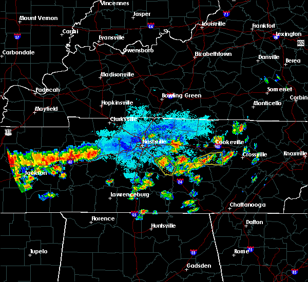 At 829 pm cdt, a severe thunderstorm was located over murfreesboro, moving southeast at 45 mph (radar indicated). Hazards include 60 mph wind gusts and quarter size hail. Hail damage to vehicles is expected. expect wind damage to roofs, siding and trees. This severe thunderstorm will remain over mainly rural areas of central rutherford county, including the following locations, christiana. At 829 pm cdt, a severe thunderstorm was located over murfreesboro, moving southeast at 45 mph (radar indicated). Hazards include 60 mph wind gusts and quarter size hail. Hail damage to vehicles is expected. expect wind damage to roofs, siding and trees. This severe thunderstorm will remain over mainly rural areas of central rutherford county, including the following locations, christiana.
|
| 6/23/2015 8:17 PM CDT |
 At 816 pm cdt, a severe thunderstorm was located near murfreesboro, moving southeast at 20 mph (radar indicated). Hazards include 60 mph wind gusts and quarter size hail. Hail damage to vehicles is expected. expect wind damage to roofs, siding and trees. this severe thunderstorm will be near, murfreesboro around 820 pm cdt. Other locations impacted by this severe thunderstorm include christiana and fosterville. At 816 pm cdt, a severe thunderstorm was located near murfreesboro, moving southeast at 20 mph (radar indicated). Hazards include 60 mph wind gusts and quarter size hail. Hail damage to vehicles is expected. expect wind damage to roofs, siding and trees. this severe thunderstorm will be near, murfreesboro around 820 pm cdt. Other locations impacted by this severe thunderstorm include christiana and fosterville.
|
| 6/23/2015 8:02 PM CDT |
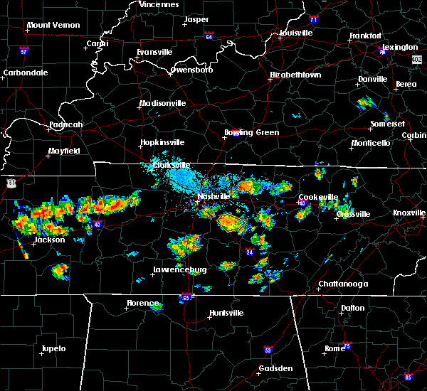 At 801 pm cdt, a severe thunderstorm was located over murfreesboro, moving southeast at 25 mph (radar indicated). Hazards include 60 mph wind gusts and quarter size hail. Hail damage to vehicles is expected. expect wind damage to roofs, siding and trees. This severe thunderstorm will remain over mainly rural areas of central rutherford county, including the following locations, lascassas. At 801 pm cdt, a severe thunderstorm was located over murfreesboro, moving southeast at 25 mph (radar indicated). Hazards include 60 mph wind gusts and quarter size hail. Hail damage to vehicles is expected. expect wind damage to roofs, siding and trees. This severe thunderstorm will remain over mainly rural areas of central rutherford county, including the following locations, lascassas.
|
| 6/23/2015 7:46 PM CDT |
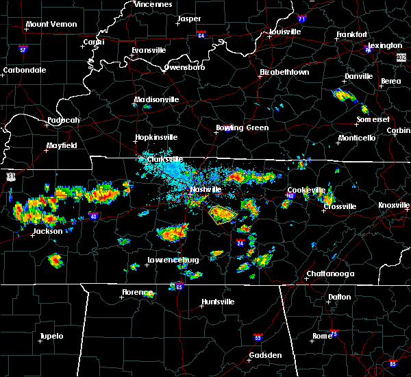 At 745 pm cdt, a severe thunderstorm was located over walterhill, or near murfreesboro, moving southeast at 25 mph (radar indicated). Hazards include 60 mph wind gusts and quarter size hail. Hail damage to vehicles is expected. expect wind damage to roofs, siding and trees. this severe thunderstorm will be near, murfreesboro around 755 pm cdt. Other locations impacted by this severe thunderstorm include lascassas. At 745 pm cdt, a severe thunderstorm was located over walterhill, or near murfreesboro, moving southeast at 25 mph (radar indicated). Hazards include 60 mph wind gusts and quarter size hail. Hail damage to vehicles is expected. expect wind damage to roofs, siding and trees. this severe thunderstorm will be near, murfreesboro around 755 pm cdt. Other locations impacted by this severe thunderstorm include lascassas.
|
| 6/23/2015 7:32 PM CDT |
 At 731 pm cdt, a severe thunderstorm was located near murfreesboro, moving southeast at 15 mph (radar indicated). Hazards include 60 mph wind gusts and quarter size hail. Hail damage to vehicles is expected. expect wind damage to roofs, siding and trees. This severe thunderstorm will remain over mainly rural areas of central rutherford county, including the following locations, lascassas. At 731 pm cdt, a severe thunderstorm was located near murfreesboro, moving southeast at 15 mph (radar indicated). Hazards include 60 mph wind gusts and quarter size hail. Hail damage to vehicles is expected. expect wind damage to roofs, siding and trees. This severe thunderstorm will remain over mainly rural areas of central rutherford county, including the following locations, lascassas.
|
| 6/23/2015 7:13 PM CDT |
 At 712 pm cdt, a severe thunderstorm was located near walterhill, or 8 miles north of murfreesboro, moving south at 20 mph (radar indicated). Hazards include 60 mph wind gusts and quarter size hail. Hail damage to vehicles is expected. expect wind damage to roofs, siding and trees. this severe thunderstorm will be near, murfreesboro around 735 pm cdt. Other locations impacted by this severe thunderstorm include lascassas. At 712 pm cdt, a severe thunderstorm was located near walterhill, or 8 miles north of murfreesboro, moving south at 20 mph (radar indicated). Hazards include 60 mph wind gusts and quarter size hail. Hail damage to vehicles is expected. expect wind damage to roofs, siding and trees. this severe thunderstorm will be near, murfreesboro around 735 pm cdt. Other locations impacted by this severe thunderstorm include lascassas.
|
| 6/8/2015 4:58 PM CDT | At 456 pm cdt, a severe thunderstorm was located 5 miles southeast of nolensville, and moving east at 30 mph (radar indicated). Hazards include 60 mph wind gusts and quarter size hail. Hail damage to vehicles is expected. expect wind damage to roofs, siding and trees. the severe thunderstorm will be near, smyrna around 505 pm cdt. Murfreesboro and walterhill around 515 pm cdt. |
| 6/8/2015 4:39 PM CDT | At 437 pm cdt, a severe thunderstorm was located 5 miles southeast of franklin, and moving east at 30 mph (radar indicated). Hazards include 60 mph wind gusts and quarter size hail. Hail damage to vehicles is expected. expect wind damage to roofs, siding and trees. the severe thunderstorm will be near, nolensville around 450 pm cdt. smyrna around 505 pm cdt. murfreesboro and walterhill around 515 pm cdt. Other locations in the warning include triune. |
| 4/19/2015 4:29 PM CDT | At 427 pm cdt, severe thunderstorms were located along a line extending from belinda city to 5 miles northwest of murfreesboro, and moving northeast at 45 mph (radar indicated). Hazards include 60 mph wind gusts and penny size hail. Expect damage to roofs. siding and trees. severe thunderstorms will be near, lebanon and walterhill around 435 pm cdt. watertown around 455 pm cdt. other locations in the warning include cedars of lebanon state park, lascassas, dickerson chapel recreation area, tuckers crossroads and dixon springs. 0. 75in. |
| 4/15/2015 7:58 PM CDT | The severe thunderstorm warning for southeastern davidson and northwestern rutherford counties will expire at 800 pm cdt. the storm which prompted the warning has weakened below severe limits. And no longer poses an immediate threat to life or property. |
| 4/15/2015 7:43 PM CDT | A severe thunderstorm warning remains in effect for southeastern davidson and northwestern rutherford counties until 800 pm cdt. at 743 pm cdt. a severe thunderstorm was located near antioch. and moving east at 15 mph. hazard. 60 mph wind gusts and quarter size hail. source. Radar indicated. |
| 4/15/2015 7:22 PM CDT | The national weather service in nashville has issued a * severe thunderstorm warning for. southeastern davidson county in middle tennessee. northwestern rutherford county in middle tennessee. northeastern williamson county in middle tennessee. Until 800 pm cdt. |
| 4/10/2015 2:39 AM CDT | A severe thunderstorm warning remains in effect for northeastern maury. southeastern davidson. western wilson. eastern williamson and northwestern rutherford counties until 300 am cdt. at 238 am cdt. severe thunderstorms were located along a line extending from nolensville to spring hill. And moving northeast at 60 mph. |
| 4/10/2015 2:23 AM CDT | The national weather service in nashville has issued a * severe thunderstorm warning for. southern davidson county in middle tennessee. northern maury county in middle tennessee. northwestern rutherford county in middle tennessee. Williamson county in middle tennessee. |
| 4/3/2015 5:54 PM CDT | A severe thunderstorm warning remains in effect for southeastern davidson. eastern williamson and western rutherford counties until 615 pm cdt. at 551 pm cdt. a severe thunderstorm was located near nolensville. and moving east at 45 mph. hazard. 60 mph wind gusts and quarter size hail. |
| 4/3/2015 5:28 PM CDT | The national weather service in nashville has issued a * severe thunderstorm warning for. southern davidson county in middle tennessee. rutherford county in middle tennessee. williamson county in middle tennessee. Until 615 pm cdt. |
| 8/20/2014 4:00 PM CDT | A mobile home roof was blown off at weakly ln along with multiple trees and power lines down in the are in rutherford county TN, 3.5 miles SW of Smyrna, TN |
| 7/14/2014 5:20 PM CDT | Large tree limbs were blown down in the jordan acres area of smyrna in rutherford county TN, 2.8 miles NNE of Smyrna, TN |
| 2/20/2014 9:16 PM CST | Trees and power lines were down across weakley lane just northeast of the smyrna airpor in rutherford county TN, 3.5 miles SW of Smyrna, TN |
| 2/20/2014 8:55 PM CST | A tin roof barn was destroyed with also some 5 foot diameter trees downed near allmaville road and one mile lan in rutherford county TN, 0.5 miles W of Smyrna, TN |
| 2/20/2014 8:30 PM CST | Quarter sized hail reported 1.5 miles SSW of Smyrna, TN |
| 2/20/2014 8:23 PM CST | Multiple trees and power lines were reported down. one tree fell on a house at 208 cumberland road and another tree fell on a home on chestnut street. a power pole was in rutherford county TN, 1.5 miles SSW of Smyrna, TN |
| 2/20/2014 8:23 PM CST | Multiple trees and power lines were reported down. one tree fell on a house at 208 cumberland road and another tree fell on a home on chestnut street. a power pole was in rutherford county TN, 1.5 miles SSW of Smyrna, TN |
| 2/20/2014 8:20 PM CST | Power lines down on valley view drive in rutherford county TN, 1.5 miles SSW of Smyrna, TN |
| 12/21/2013 10:07 PM CST | Smyrna airport emergency manager reports one jetstream aircraft blown over onto another aircraf in rutherford county TN, 1.5 miles SSW of Smyrna, TN |
| 12/21/2013 9:59 PM CST | Railroad crossing arm snapped at corner of enon springs and lowr in rutherford county TN, 1.7 miles SW of Smyrna, TN |
| 12/21/2013 9:54 PM CST | Trees down and limbs snapped at corner of sam ridley parkway and industrial blvd. two business signs blown out as well. winds estimated between 60-70 mp in rutherford county TN, 2.2 miles SE of Smyrna, TN |
| 12/21/2013 9:45 PM CST | 60 foot evergreen tree uprooted and minor roof damage in rutherford county TN, 1.5 miles SSW of Smyrna, TN |
| 5/21/2013 1:09 PM CDT | 66 knots reported at kmq in rutherford county TN, 3.8 miles SSW of Smyrna, TN |
| 5/21/2013 1:07 PM CDT | 66 knots reported at kmq in rutherford county TN, 3.8 miles SSW of Smyrna, TN |
| 1/31/2013 3:41 AM CST | An nws storm survey found tstm wind damage in smyrna. an apartment complex had minor roof damage on weakley ln and a tree fell on a home on nissan dr. a barn was damage in rutherford county TN, 2.6 miles SW of Smyrna, TN |
| 1/30/2013 3:41 AM CST | An nws storm survey found tstm wind damage in smyrna. an apartment complex had minor roof damage on weakley ln and a tree fell on a home on nissan dr. a barn was damage in rutherford county TN, 2.6 miles SW of Smyrna, TN |
| 7/8/2012 5:13 PM CDT | Report of tree down at davis park and windellwood drive. 1 mile s of smyrna. reported by smyrna p in rutherford county TN, 0.9 miles SW of Smyrna, TN |
| 7/5/2012 7:18 PM CDT | Trees down along sam davis rd in smyrn in rutherford county TN, 1.5 miles SSW of Smyrna, TN |
| 7/5/2012 7:05 PM CDT | Several trees blown down in downtown smyrna including on sam hager street in rutherford county TN, 1.5 miles SSW of Smyrna, TN |
| 7/5/2012 7:05 PM CDT | Golf Ball sized hail reported 1.5 miles SSW of Smyrna, TN |
| 7/5/2012 7:00 PM CDT | Trees down along sam davis rd in smyrn in rutherford county TN, 2.6 miles SW of Smyrna, TN |
| 3/15/2012 5:34 PM CDT | Quarter sized hail reported 0.6 miles E of Smyrna, TN |
| 1/1/0001 12:00 AM | Trained spotter reported possible tornado damage on lamar road between the 3700 and 3800 block. multiple roofs damaged and mobile homes damaged. one rv was flipped. tre in rutherford county TN, 6.6 miles SW of Smyrna, TN |
| 1/1/0001 12:00 AM | Trees down across much of northwestern rutherford count in rutherford county TN, 5.1 miles W of Smyrna, TN |
| 1/1/0001 12:00 AM | Power lines down near symrn in rutherford county TN, 1.5 miles SSW of Smyrna, TN |
| 1/1/0001 12:00 AM | Quarter sized hail reported 1.5 miles SSW of Smyrna, TN |
| 1/1/0001 12:00 AM | Reports of trees and power lines down in parts of smyrna and lavergn in rutherford county TN, 1.5 miles SSW of Smyrna, TN |
Hail Maps for Smyrna, TN


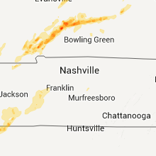

Connect with Interactive Hail Maps