

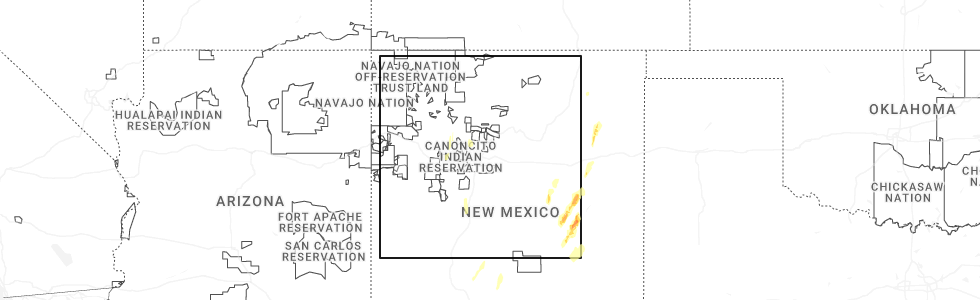
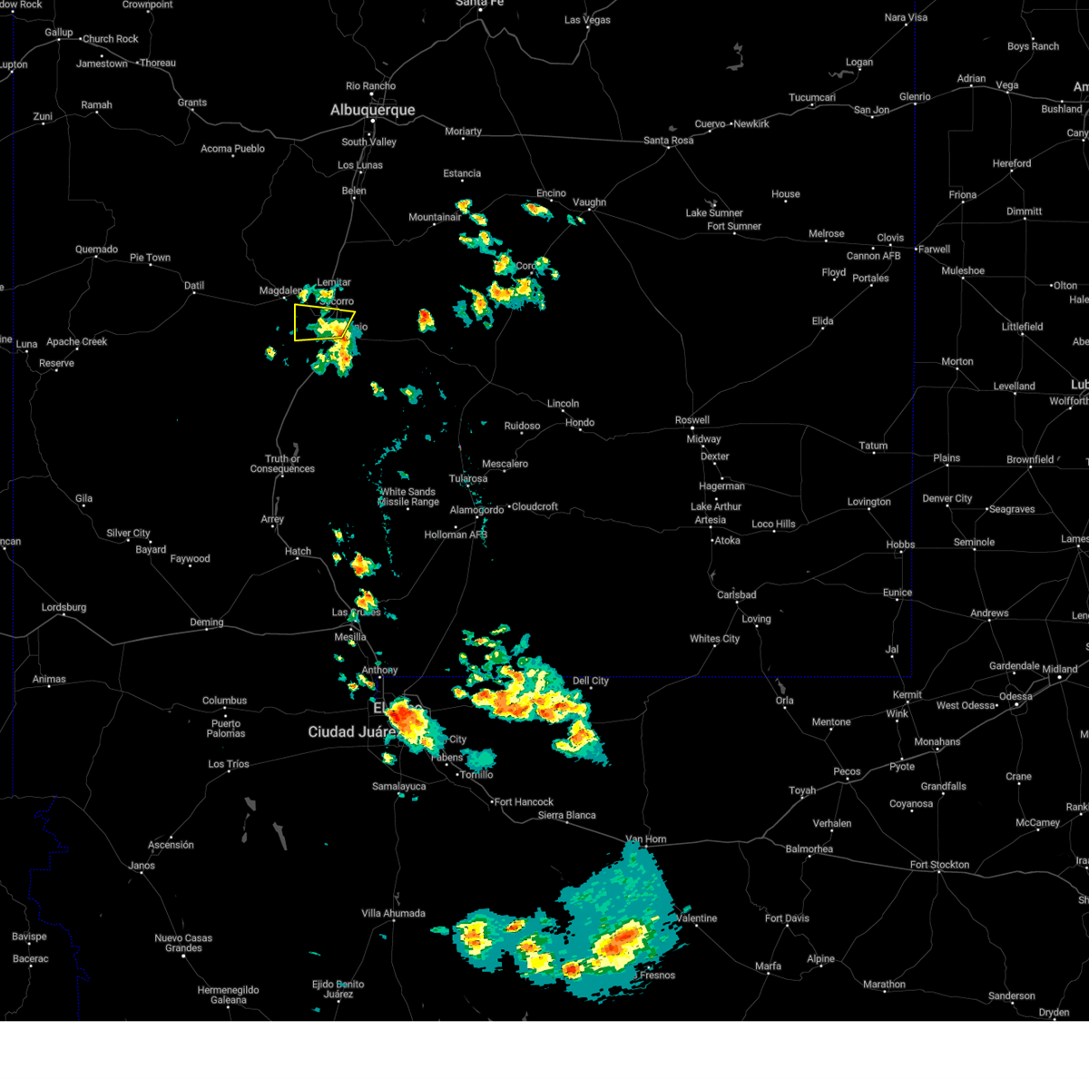
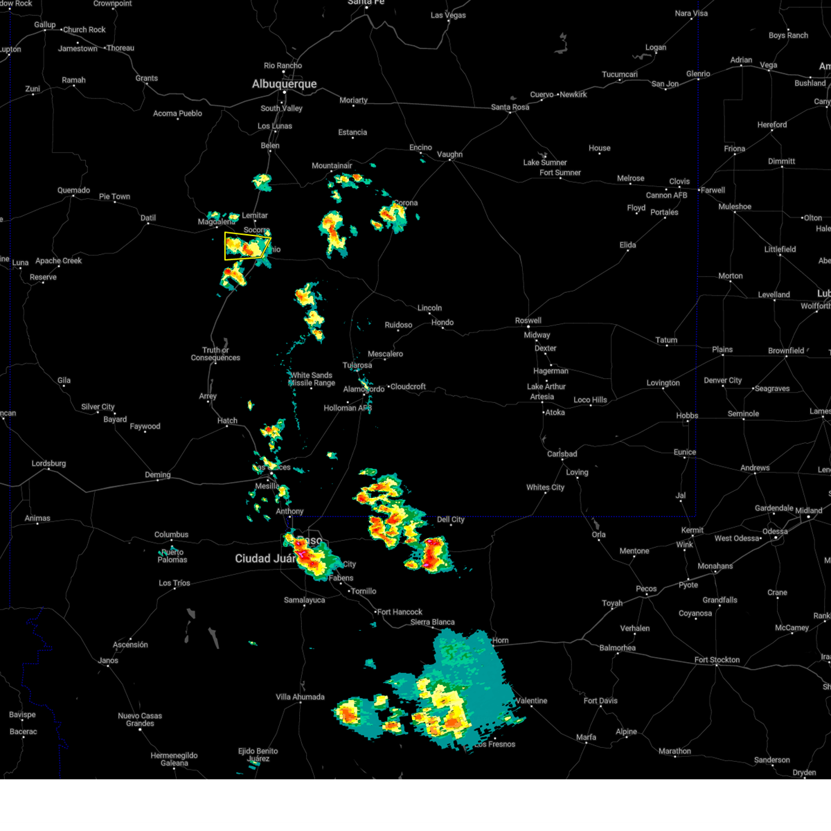
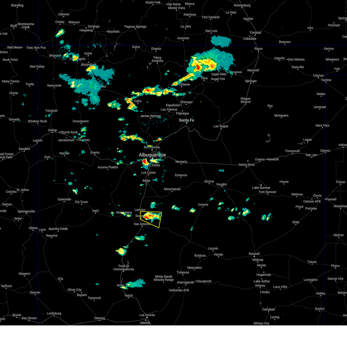
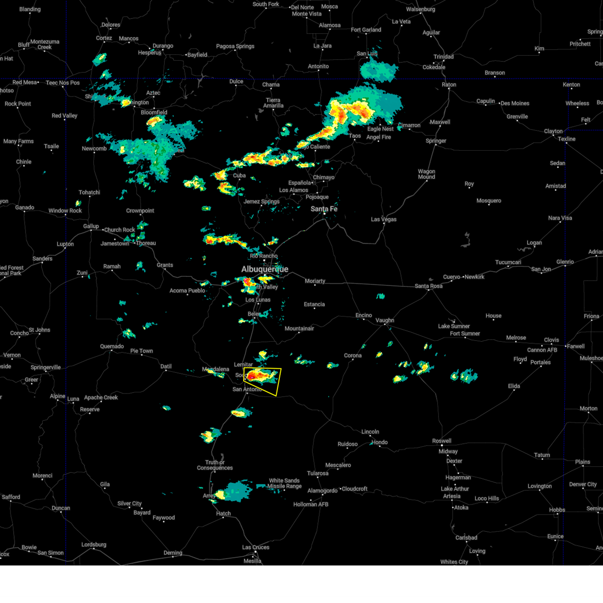
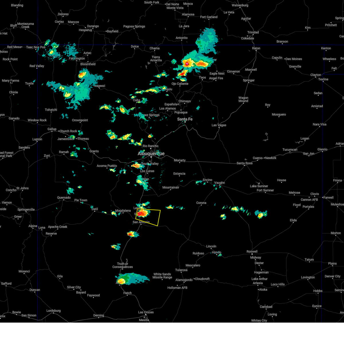
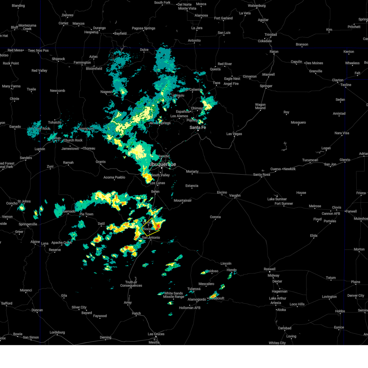
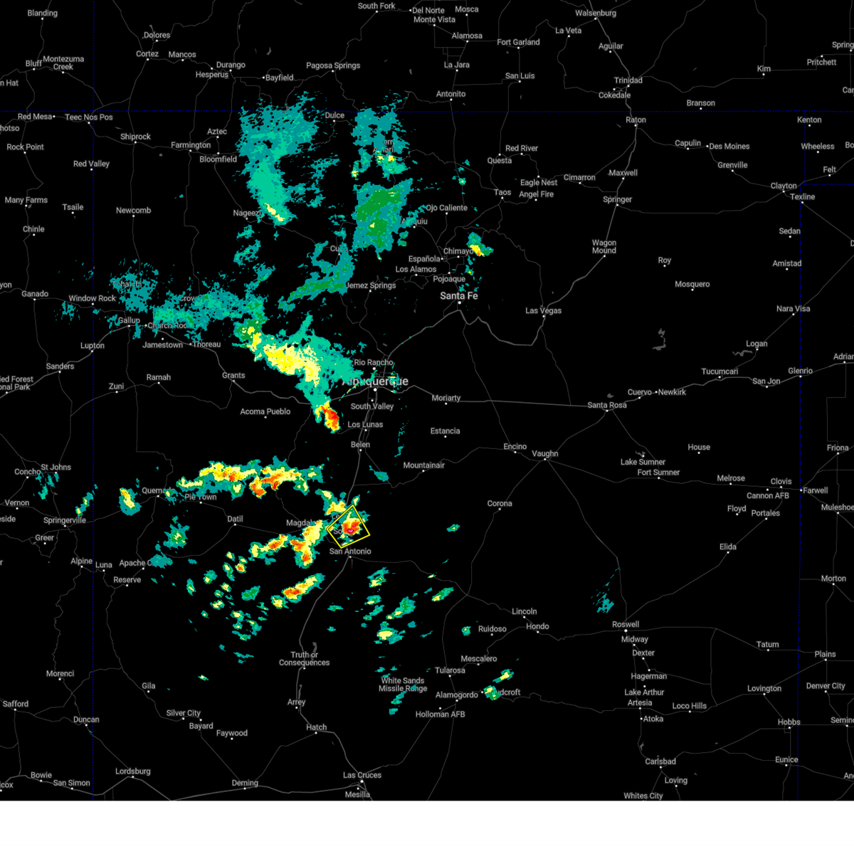
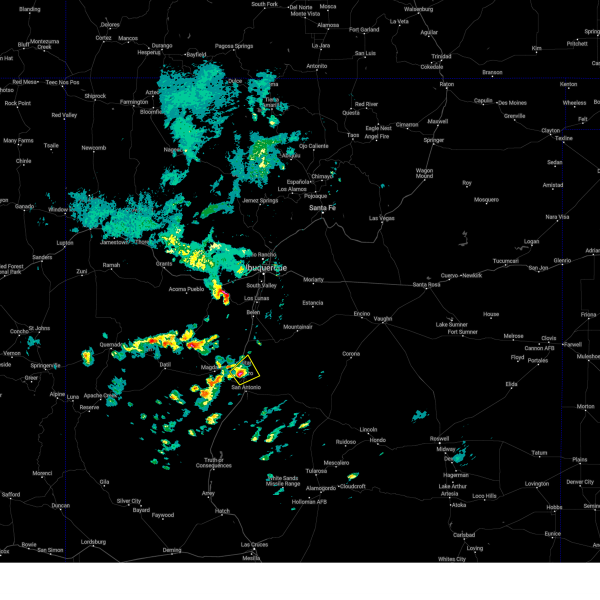
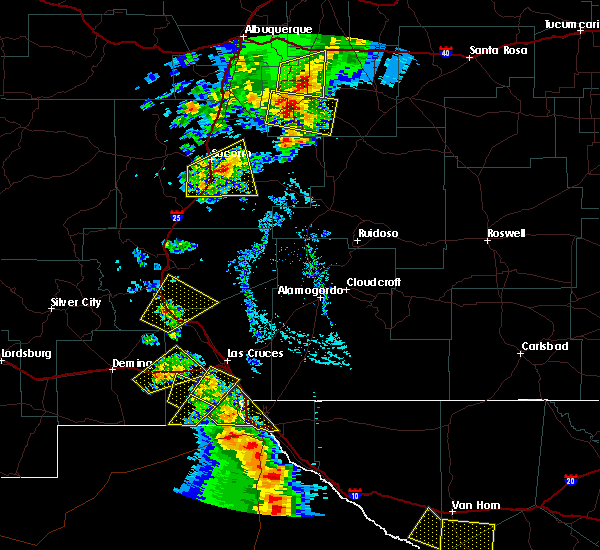
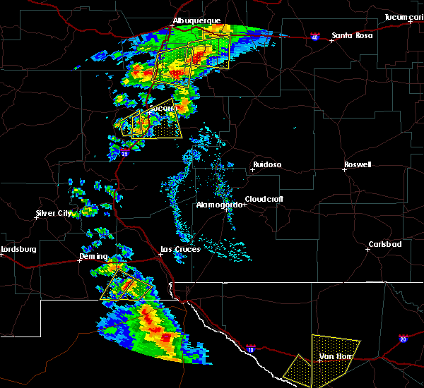
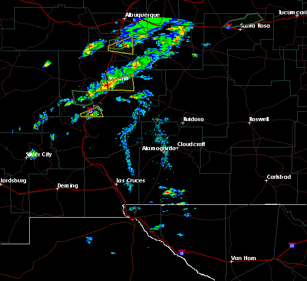
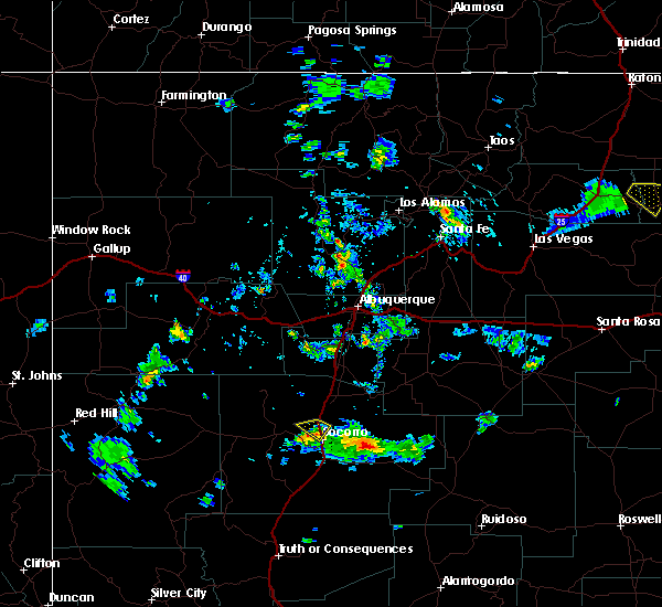
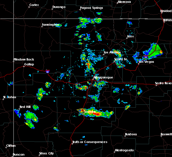
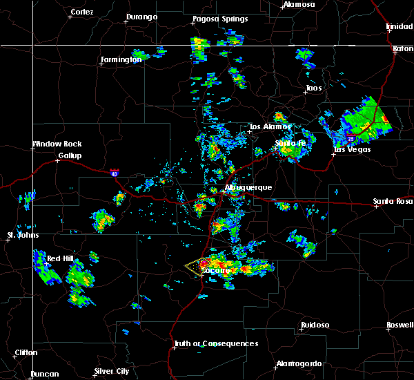
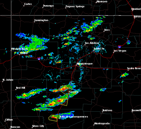
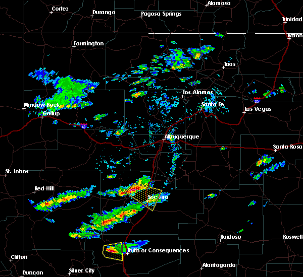
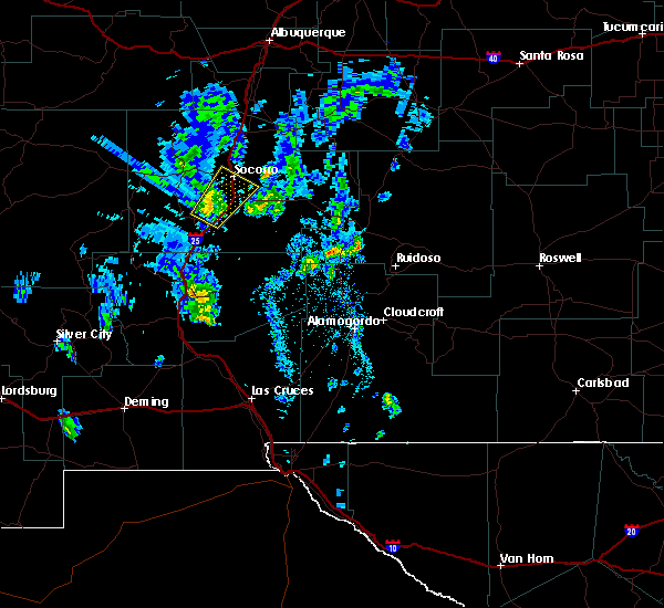
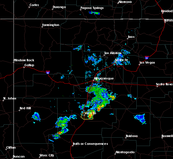
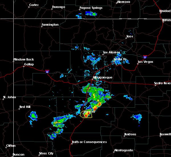
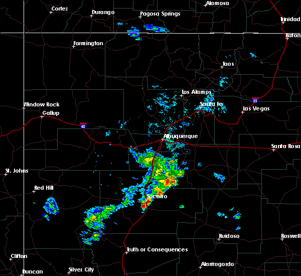
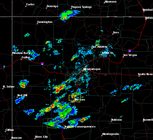
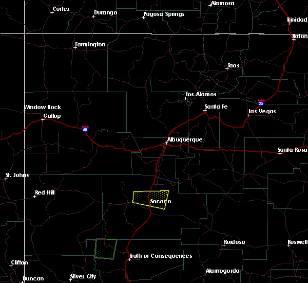
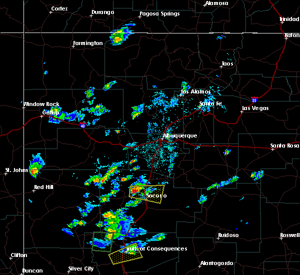
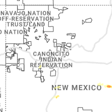
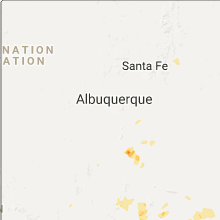
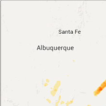
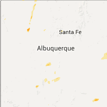
Hail Map for Socorro, NM
The Socorro, NM area has had 4 reports of on-the-ground hail by trained spotters, and has been under severe weather warnings 0 times during the past 12 months. Doppler radar has detected hail at or near Socorro, NM on 24 occasions, including 1 occasion during the past year.
| Name: | Socorro, NM |
| Where Located: | 71.9 miles S of Albuquerque, NM |
| Map: | Google Map for Socorro, NM |
| Population: | 9051 |
| Housing Units: | 4066 |
| More Info: | Search Google for Socorro, NM |
0
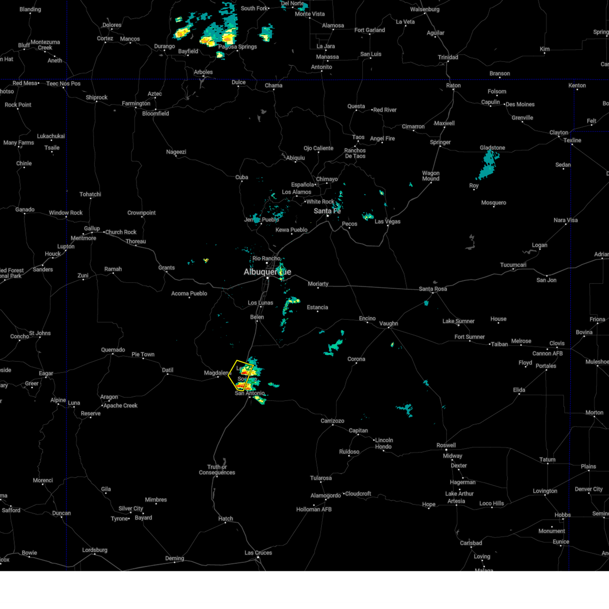
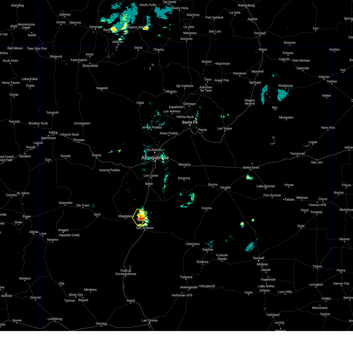
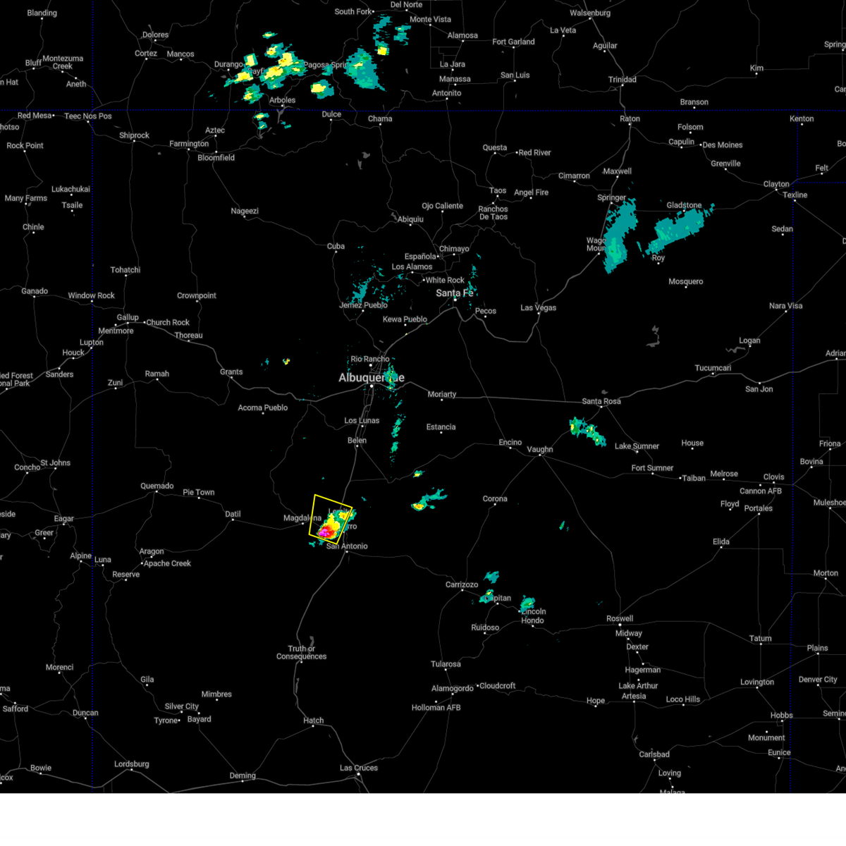
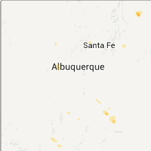
The Top Recent Hail Date for Socorro, NM is Saturday, October 19, 2024 (24th out of 24)
Hail and Wind Damage Spotted near Socorro, NM
| Date / Time | Report Details |
|---|---|
| 6/19/2024 9:59 PM MDT |
 The storm which prompted the warning has weakened below severe limits, and no longer poses an immediate threat to life or property. therefore, the warning will be allowed to expire. however, gusty winds are still possible with this thunderstorm. The storm which prompted the warning has weakened below severe limits, and no longer poses an immediate threat to life or property. therefore, the warning will be allowed to expire. however, gusty winds are still possible with this thunderstorm.
|
| 6/19/2024 9:37 PM MDT |
 At 936 pm mdt, a severe thunderstorm was located near escondida, or near socorro, moving northeast at 10 mph (radar indicated). Hazards include 60 mph wind gusts and half dollar size hail. Hail damage to vehicles is expected. expect wind damage to roofs, siding, and trees. Locations impacted include, socorro, lemitar, escondida, and chamizal. At 936 pm mdt, a severe thunderstorm was located near escondida, or near socorro, moving northeast at 10 mph (radar indicated). Hazards include 60 mph wind gusts and half dollar size hail. Hail damage to vehicles is expected. expect wind damage to roofs, siding, and trees. Locations impacted include, socorro, lemitar, escondida, and chamizal.
|
| 6/19/2024 9:07 PM MDT |
 Svrabq the national weather service in albuquerque has issued a * severe thunderstorm warning for, central socorro county in central new mexico, * until 1000 pm mdt. * at 906 pm mdt, a severe thunderstorm was located 7 miles west of socorro, moving northeast at 10 mph (radar indicated). Hazards include golf ball size hail and 60 mph wind gusts. People and animals outdoors will be injured. expect hail damage to roofs, siding, windows, and vehicles. Expect wind damage to roofs, siding, and trees. Svrabq the national weather service in albuquerque has issued a * severe thunderstorm warning for, central socorro county in central new mexico, * until 1000 pm mdt. * at 906 pm mdt, a severe thunderstorm was located 7 miles west of socorro, moving northeast at 10 mph (radar indicated). Hazards include golf ball size hail and 60 mph wind gusts. People and animals outdoors will be injured. expect hail damage to roofs, siding, windows, and vehicles. Expect wind damage to roofs, siding, and trees.
|
| 9/26/2023 5:12 PM MDT |
 The severe thunderstorm warning for central socorro county will expire at 515 pm mdt, the storm which prompted the warning has weakened below severe limits, and no longer poses an immediate threat to life or property. therefore, the warning will be allowed to expire. however, heavy rain is still possible with this thunderstorm and some minor flooding may occur. The severe thunderstorm warning for central socorro county will expire at 515 pm mdt, the storm which prompted the warning has weakened below severe limits, and no longer poses an immediate threat to life or property. therefore, the warning will be allowed to expire. however, heavy rain is still possible with this thunderstorm and some minor flooding may occur.
|
| 9/26/2023 4:45 PM MDT |
 At 444 pm mdt, a severe thunderstorm was located 8 miles southwest of socorro, moving east at 10 mph (radar indicated). Hazards include 60 mph wind gusts and quarter size hail. Hail damage to vehicles is expected. Expect wind damage to roofs, siding, and trees. At 444 pm mdt, a severe thunderstorm was located 8 miles southwest of socorro, moving east at 10 mph (radar indicated). Hazards include 60 mph wind gusts and quarter size hail. Hail damage to vehicles is expected. Expect wind damage to roofs, siding, and trees.
|
| 9/18/2023 3:50 PM MDT |
 The severe thunderstorm warning for central socorro county will expire at 400 pm mdt, the storm which prompted the warning has weakened below severe limits, and no longer poses an immediate threat to life or property. therefore, the warning will be allowed to expire. however, small hail, gusty winds and heavy rain are still possible with this thunderstorm. The severe thunderstorm warning for central socorro county will expire at 400 pm mdt, the storm which prompted the warning has weakened below severe limits, and no longer poses an immediate threat to life or property. therefore, the warning will be allowed to expire. however, small hail, gusty winds and heavy rain are still possible with this thunderstorm.
|
| 9/18/2023 3:41 PM MDT |
 At 341 pm mdt, a severe thunderstorm was located near escondida, or near socorro, moving east at 10 mph (radar indicated). Hazards include 60 mph wind gusts and quarter size hail. Hail damage to vehicles is expected. expect wind damage to roofs, siding, and trees. locations impacted include, socorro and escondida. this includes the following highways, interstate 25 between mile markers 148 and 153. highway 60 near mile marker 138. hail threat, radar indicated max hail size, 1. 00 in wind threat, radar indicated max wind gust, 60 mph. At 341 pm mdt, a severe thunderstorm was located near escondida, or near socorro, moving east at 10 mph (radar indicated). Hazards include 60 mph wind gusts and quarter size hail. Hail damage to vehicles is expected. expect wind damage to roofs, siding, and trees. locations impacted include, socorro and escondida. this includes the following highways, interstate 25 between mile markers 148 and 153. highway 60 near mile marker 138. hail threat, radar indicated max hail size, 1. 00 in wind threat, radar indicated max wind gust, 60 mph.
|
| 9/18/2023 3:19 PM MDT |
 At 319 pm mdt, a severe thunderstorm was located over escondida, or near socorro, moving east at 20 mph (radar indicated). Hazards include 60 mph wind gusts and quarter size hail. Hail damage to vehicles is expected. Expect wind damage to roofs, siding, and trees. At 319 pm mdt, a severe thunderstorm was located over escondida, or near socorro, moving east at 20 mph (radar indicated). Hazards include 60 mph wind gusts and quarter size hail. Hail damage to vehicles is expected. Expect wind damage to roofs, siding, and trees.
|
| 6/6/2023 5:57 PM MDT |
 At 557 pm mdt, a severe thunderstorm was located 16 miles south of magdalena, or 27 miles southwest of socorro, moving northeast at 20 mph (radar indicated). Hazards include 60 mph wind gusts and half dollar size hail. Hail damage to vehicles is expected. Expect wind damage to roofs, siding, and trees. At 557 pm mdt, a severe thunderstorm was located 16 miles south of magdalena, or 27 miles southwest of socorro, moving northeast at 20 mph (radar indicated). Hazards include 60 mph wind gusts and half dollar size hail. Hail damage to vehicles is expected. Expect wind damage to roofs, siding, and trees.
|
| 5/20/2023 2:45 PM MDT | Quarter sized hail reported 0.6 miles SSE of Socorro, NM |
| 5/19/2023 6:09 PM MDT |
 The severe thunderstorm warning for central socorro county will expire at 615 pm mdt, the storm which prompted the warning has weakened below severe limits, and has exited the warned area. therefore, the warning will be allowed to expire. however small hail, gusty winds and heavy rain are still possible with this thunderstorm. The severe thunderstorm warning for central socorro county will expire at 615 pm mdt, the storm which prompted the warning has weakened below severe limits, and has exited the warned area. therefore, the warning will be allowed to expire. however small hail, gusty winds and heavy rain are still possible with this thunderstorm.
|
| 5/19/2023 5:47 PM MDT |
 At 547 pm mdt, a severe thunderstorm was located near escondida, or near socorro, moving northeast at 10 mph (radar indicated). Hazards include quarter size hail. Damage to vehicles is expected. locations impacted include, socorro, lemitar, escondida and chamizal. this includes the following highways, interstate 25 between mile markers 145 and 160. highway 60 between mile markers 134 and 138. hail threat, radar indicated max hail size, 1. 00 in wind threat, radar indicated max wind gust, <50 mph. At 547 pm mdt, a severe thunderstorm was located near escondida, or near socorro, moving northeast at 10 mph (radar indicated). Hazards include quarter size hail. Damage to vehicles is expected. locations impacted include, socorro, lemitar, escondida and chamizal. this includes the following highways, interstate 25 between mile markers 145 and 160. highway 60 between mile markers 134 and 138. hail threat, radar indicated max hail size, 1. 00 in wind threat, radar indicated max wind gust, <50 mph.
|
| 5/19/2023 5:26 PM MDT |
 At 526 pm mdt, a severe thunderstorm was located over escondida, or near socorro, moving northeast at 10 mph (radar indicated). Hazards include quarter size hail. damage to vehicles is expected At 526 pm mdt, a severe thunderstorm was located over escondida, or near socorro, moving northeast at 10 mph (radar indicated). Hazards include quarter size hail. damage to vehicles is expected
|
| 8/2/2020 4:55 PM MDT | Konm awo in socorro county NM, 2.9 miles N of Socorro, NM |
| 6/23/2020 3:40 PM MDT | Quarter sized hail reported 0.6 miles SSE of Socorro, NM |
| 6/3/2018 4:33 PM MDT |
 At 433 pm mdt, a severe thunderstorm was located 9 miles southeast of socorro, moving east at 25 mph (radar indicated). Hazards include 60 mph wind gusts and quarter size hail. Hail damage to vehicles is expected. expect wind damage to roofs, siding, and trees. locations impacted include, socorro, bosque del apache refuge, escondida, laborcita and luis lopez. This includes interstate 25 between mile markers 126 and 152. At 433 pm mdt, a severe thunderstorm was located 9 miles southeast of socorro, moving east at 25 mph (radar indicated). Hazards include 60 mph wind gusts and quarter size hail. Hail damage to vehicles is expected. expect wind damage to roofs, siding, and trees. locations impacted include, socorro, bosque del apache refuge, escondida, laborcita and luis lopez. This includes interstate 25 between mile markers 126 and 152.
|
| 6/3/2018 4:07 PM MDT |
 At 407 pm mdt, a severe thunderstorm was located 9 miles southwest of socorro, moving east at 30 mph (radar indicated). Hazards include 60 mph wind gusts and half dollar size hail. Hail damage to vehicles is expected. Expect wind damage to roofs, siding, and trees. At 407 pm mdt, a severe thunderstorm was located 9 miles southwest of socorro, moving east at 30 mph (radar indicated). Hazards include 60 mph wind gusts and half dollar size hail. Hail damage to vehicles is expected. Expect wind damage to roofs, siding, and trees.
|
| 10/5/2017 4:22 PM MDT |
 At 421 pm mdt, a severe thunderstorm was located near socorro, moving east at 20 mph (radar indicated). Hazards include 60 mph wind gusts and quarter size hail. Hail damage to vehicles is expected. Expect wind damage to roofs, siding, and trees. At 421 pm mdt, a severe thunderstorm was located near socorro, moving east at 20 mph (radar indicated). Hazards include 60 mph wind gusts and quarter size hail. Hail damage to vehicles is expected. Expect wind damage to roofs, siding, and trees.
|
| 8/28/2017 5:52 PM MDT |
 The severe thunderstorm warning for northern socorro county will expire at 600 pm mdt, the storm which prompted the warning has weakened below severe limits, and no longer poses an immediate threat to life or property. therefore the warning will be allowed to expire. The severe thunderstorm warning for northern socorro county will expire at 600 pm mdt, the storm which prompted the warning has weakened below severe limits, and no longer poses an immediate threat to life or property. therefore the warning will be allowed to expire.
|
| 8/28/2017 5:36 PM MDT |
 At 535 pm mdt, a severe thunderstorm was located near lemitar, or 9 miles north of socorro, moving southwest at 15 mph (trained weather spotters). Hazards include 60 mph wind gusts and quarter size hail. Hail damage to vehicles is expected. expect wind damage to roofs, siding, and trees. locations impacted include, socorro, lemitar, escondida and chamizal. This includes interstate 25 between mile markers 152 and 160. At 535 pm mdt, a severe thunderstorm was located near lemitar, or 9 miles north of socorro, moving southwest at 15 mph (trained weather spotters). Hazards include 60 mph wind gusts and quarter size hail. Hail damage to vehicles is expected. expect wind damage to roofs, siding, and trees. locations impacted include, socorro, lemitar, escondida and chamizal. This includes interstate 25 between mile markers 152 and 160.
|
| 8/28/2017 5:13 PM MDT |
 At 512 pm mdt, a severe thunderstorm was located over san acacia, or 12 miles north of socorro, moving southwest at 15 mph (radar indicated). Hazards include ping pong ball size hail and 60 mph wind gusts. People and animals outdoors will be injured. expect hail damage to roofs, siding, windows, and vehicles. Expect wind damage to roofs, siding, and trees. At 512 pm mdt, a severe thunderstorm was located over san acacia, or 12 miles north of socorro, moving southwest at 15 mph (radar indicated). Hazards include ping pong ball size hail and 60 mph wind gusts. People and animals outdoors will be injured. expect hail damage to roofs, siding, windows, and vehicles. Expect wind damage to roofs, siding, and trees.
|
| 7/15/2017 5:35 PM MDT | Konm awo in socorro county NM, 2.9 miles N of Socorro, NM |
| 10/9/2016 3:15 PM MDT |
 At 314 pm mdt, a severe thunderstorm was located over lemitar, or 9 miles north of socorro, moving southeast at 25 mph (radar indicated). Hazards include 60 mph wind gusts and quarter size hail. Hail damage to vehicles is expected. Expect wind damage to roofs, siding, and trees. At 314 pm mdt, a severe thunderstorm was located over lemitar, or 9 miles north of socorro, moving southeast at 25 mph (radar indicated). Hazards include 60 mph wind gusts and quarter size hail. Hail damage to vehicles is expected. Expect wind damage to roofs, siding, and trees.
|
| 10/9/2016 2:56 PM MDT |
 At 256 pm mdt, a severe thunderstorm was located 10 miles northeast of magdalena, or 16 miles northwest of socorro, moving south at 10 mph (radar indicated). Hazards include golf ball size hail and 60 mph wind gusts. People and animals outdoors will be injured. expect hail damage to roofs, siding, windows, and vehicles. expect wind damage to roofs, siding, and trees. this severe thunderstorm will remain over mainly rural areas of central socorro county. This includes interstate 25 between mile markers 151 and 165. At 256 pm mdt, a severe thunderstorm was located 10 miles northeast of magdalena, or 16 miles northwest of socorro, moving south at 10 mph (radar indicated). Hazards include golf ball size hail and 60 mph wind gusts. People and animals outdoors will be injured. expect hail damage to roofs, siding, windows, and vehicles. expect wind damage to roofs, siding, and trees. this severe thunderstorm will remain over mainly rural areas of central socorro county. This includes interstate 25 between mile markers 151 and 165.
|
| 10/9/2016 2:39 PM MDT |
 At 238 pm mdt, a severe thunderstorm was located 12 miles west of san acacia, or 18 miles northwest of socorro, moving south to southeast at 15 mph (radar indicated). Hazards include golf ball size hail and 60 mph wind gusts. People and animals outdoors will be injured. expect hail damage to roofs, siding, windows, and vehicles. expect wind damage to roofs, siding, and trees. this severe thunderstorm will remain over mainly rural areas of central socorro county. This includes interstate 25 between mile markers 141 and 167. At 238 pm mdt, a severe thunderstorm was located 12 miles west of san acacia, or 18 miles northwest of socorro, moving south to southeast at 15 mph (radar indicated). Hazards include golf ball size hail and 60 mph wind gusts. People and animals outdoors will be injured. expect hail damage to roofs, siding, windows, and vehicles. expect wind damage to roofs, siding, and trees. this severe thunderstorm will remain over mainly rural areas of central socorro county. This includes interstate 25 between mile markers 141 and 167.
|
| 10/9/2016 2:32 PM MDT |
 At 232 pm mdt, a severe thunderstorm was located 8 miles west of san acacia, or 17 miles northwest of socorro, moving southeast at 35 mph (radar indicated). Hazards include 60 mph wind gusts and half dollar size hail. Hail damage to vehicles is expected. expect wind damage to roofs, siding, and trees. this severe thunderstorm will be near, san acacia and chamizal around 245 pm mdt. lemitar around 250 pm mdt. This includes interstate 25 between mile markers 141 and 169. At 232 pm mdt, a severe thunderstorm was located 8 miles west of san acacia, or 17 miles northwest of socorro, moving southeast at 35 mph (radar indicated). Hazards include 60 mph wind gusts and half dollar size hail. Hail damage to vehicles is expected. expect wind damage to roofs, siding, and trees. this severe thunderstorm will be near, san acacia and chamizal around 245 pm mdt. lemitar around 250 pm mdt. This includes interstate 25 between mile markers 141 and 169.
|
| 10/21/2015 7:12 AM MDT | The severe thunderstorm warning for north central socorro county will expire at 715 am mdt, the storm which prompted the warning has weakened below severe limits, and no longer pose an immediate threat to life or property. therefore the warning will be allowed to expire. |
| 10/21/2015 6:54 AM MDT |
 At 654 am mdt, a severe thunderstorm was located near san acacia, or 12 miles north of socorro, moving northeast at 30 mph (radar indicated). Hazards include 60 mph wind gusts and quarter size hail. Hail damage to vehicles is expected. expect wind damage to roofs, siding and trees. locations impacted include, socorro, san acacia, escondida, la joya, lemitar, bernardo, chamizal, contreras and abeytas. This includes interstate 25 between mile markers 151 and 180. At 654 am mdt, a severe thunderstorm was located near san acacia, or 12 miles north of socorro, moving northeast at 30 mph (radar indicated). Hazards include 60 mph wind gusts and quarter size hail. Hail damage to vehicles is expected. expect wind damage to roofs, siding and trees. locations impacted include, socorro, san acacia, escondida, la joya, lemitar, bernardo, chamizal, contreras and abeytas. This includes interstate 25 between mile markers 151 and 180.
|
| 10/21/2015 6:33 AM MDT |
 At 633 am mdt, a severe thunderstorm was located over escondida, or over socorro, moving northeast at 30 mph (radar indicated). Hazards include quarter size hail and 60 mph wind gusts. Hail damage to vehicles is expected. Expect wind damage to roofs, siding and trees. At 633 am mdt, a severe thunderstorm was located over escondida, or over socorro, moving northeast at 30 mph (radar indicated). Hazards include quarter size hail and 60 mph wind gusts. Hail damage to vehicles is expected. Expect wind damage to roofs, siding and trees.
|
| 10/21/2015 6:12 AM MDT | The severe thunderstorm warning for central socorro county will expire at 615 am mdt, the storm which prompted the warning has weakened below severe limits, and no longer pose an immediate threat to life or property. therefore the warning will be allowed to expire. however small hail and gusty winds are still possible with this thunderstorm. |
| 10/21/2015 5:55 AM MDT |
 At 555 am mdt, a severe thunderstorm was located 9 miles west of bosque del apache refuge, or 18 miles southwest of socorro, moving northeast at 30 mph (radar indicated). Hazards include golf ball size hail and 60 mph wind gusts. People and animals outdoors will be injured. expect hail damage to roofs, siding, windows and vehicles. expect wind damage to roofs, siding and trees. locations impacted include, socorro, escondida, bosque del apache refuge, luis lopez and laborcita. This includes interstate 25 between mile markers 121 and 152. At 555 am mdt, a severe thunderstorm was located 9 miles west of bosque del apache refuge, or 18 miles southwest of socorro, moving northeast at 30 mph (radar indicated). Hazards include golf ball size hail and 60 mph wind gusts. People and animals outdoors will be injured. expect hail damage to roofs, siding, windows and vehicles. expect wind damage to roofs, siding and trees. locations impacted include, socorro, escondida, bosque del apache refuge, luis lopez and laborcita. This includes interstate 25 between mile markers 121 and 152.
|
| 10/21/2015 5:32 AM MDT |
 At 532 am mdt, a severe thunderstorm was located 17 miles southwest of bosque del apache refuge, or 26 miles northeast of monticello, moving northeast at 35 mph (radar indicated). Hazards include quarter size hail and 60 mph wind gusts. Hail damage to vehicles is expected. Expect wind damage to roofs, siding and trees. At 532 am mdt, a severe thunderstorm was located 17 miles southwest of bosque del apache refuge, or 26 miles northeast of monticello, moving northeast at 35 mph (radar indicated). Hazards include quarter size hail and 60 mph wind gusts. Hail damage to vehicles is expected. Expect wind damage to roofs, siding and trees.
|
| 10/20/2015 11:56 AM MDT |
 At 1155 am mdt, a severe thunderstorm was located 20 miles south of bosque del apache refuge, or 32 miles northeast of truth or consequences, moving north at 40 mph (radar indicated). Hazards include quarter size hail and 60 mph wind gusts. Hail damage to vehicles is expected. Expect wind damage to roofs, siding and trees. At 1155 am mdt, a severe thunderstorm was located 20 miles south of bosque del apache refuge, or 32 miles northeast of truth or consequences, moving north at 40 mph (radar indicated). Hazards include quarter size hail and 60 mph wind gusts. Hail damage to vehicles is expected. Expect wind damage to roofs, siding and trees.
|
| 10/19/2015 7:41 AM MDT |
 The severe thunderstorm warning for central socorro county will expire at 745 am mdt, the storm which prompted the warning has weakened below severe limits, and no longer pose an immediate threat to life or property. therefore the warning will be allowed to expire. The severe thunderstorm warning for central socorro county will expire at 745 am mdt, the storm which prompted the warning has weakened below severe limits, and no longer pose an immediate threat to life or property. therefore the warning will be allowed to expire.
|
| 10/19/2015 7:29 AM MDT |
 At 729 am mdt, a severe thunderstorm was located 7 miles east of escondida, or 8 miles east of socorro, moving east at 20 mph (radar indicated). Hazards include 60 mph wind gusts and quarter size hail. Hail damage to vehicles is expected. expect wind damage to roofs, siding and trees. locations impacted include, socorro, escondida, luis lopez and laborcita. This includes interstate 25 between mile markers 141 and 154. At 729 am mdt, a severe thunderstorm was located 7 miles east of escondida, or 8 miles east of socorro, moving east at 20 mph (radar indicated). Hazards include 60 mph wind gusts and quarter size hail. Hail damage to vehicles is expected. expect wind damage to roofs, siding and trees. locations impacted include, socorro, escondida, luis lopez and laborcita. This includes interstate 25 between mile markers 141 and 154.
|
| 10/19/2015 7:18 AM MDT | Half Dollar sized hail reported 1.5 miles N of Socorro, NM |
| 10/19/2015 7:12 AM MDT | Quarter sized hail reported 2.4 miles NNW of Socorro, NM |
| 10/19/2015 7:12 AM MDT |
 At 712 am mdt, a severe thunderstorm was located over socorro, moving east at 20 mph (radar indicated). Hazards include quarter size hail and 60 mph wind gusts. Hail damage to vehicles is expected. Expect wind damage to roofs, siding and trees. At 712 am mdt, a severe thunderstorm was located over socorro, moving east at 20 mph (radar indicated). Hazards include quarter size hail and 60 mph wind gusts. Hail damage to vehicles is expected. Expect wind damage to roofs, siding and trees.
|
| 10/19/2015 6:50 AM MDT |
 The severe thunderstorm warning for central socorro county will expire at 700 am mdt, the storm which prompted the warning has weakened below severe limits, and no longer pose an immediate threat to life or property. therefore the warning will be allowed to expire. The severe thunderstorm warning for central socorro county will expire at 700 am mdt, the storm which prompted the warning has weakened below severe limits, and no longer pose an immediate threat to life or property. therefore the warning will be allowed to expire.
|
| 10/19/2015 6:36 AM MDT |
 At 636 am mdt, a severe thunderstorm was located over escondida, or near socorro, moving east at 30 mph (radar indicated). Hazards include 60 mph wind gusts and penny size hail. Expect damage to roofs. siding and trees. locations impacted include, socorro, lemitar, san acacia, escondida and chamizal. This includes interstate 25 between mile markers 146 and 167. At 636 am mdt, a severe thunderstorm was located over escondida, or near socorro, moving east at 30 mph (radar indicated). Hazards include 60 mph wind gusts and penny size hail. Expect damage to roofs. siding and trees. locations impacted include, socorro, lemitar, san acacia, escondida and chamizal. This includes interstate 25 between mile markers 146 and 167.
|
| 10/19/2015 6:25 AM MDT |
 At 625 am mdt, a severe thunderstorm was located 6 miles west of escondida, or 7 miles northwest of socorro, moving northeast at 30 mph (radar indicated). Hazards include quarter size hail and 60 mph wind gusts. Hail damage to vehicles is expected. Expect wind damage to roofs, siding and trees. At 625 am mdt, a severe thunderstorm was located 6 miles west of escondida, or 7 miles northwest of socorro, moving northeast at 30 mph (radar indicated). Hazards include quarter size hail and 60 mph wind gusts. Hail damage to vehicles is expected. Expect wind damage to roofs, siding and trees.
|
| 7/10/2015 1:06 PM MDT |
 The severe thunderstorm warning for central socorro county will expire at 115 pm mdt, the storm which prompted the warning has weakened below severe limits, and no longer pose an immediate threat to life or property. therefore the warning will be allowed to expire. however gusty winds and heavy rain are still possible with this thunderstorm. The severe thunderstorm warning for central socorro county will expire at 115 pm mdt, the storm which prompted the warning has weakened below severe limits, and no longer pose an immediate threat to life or property. therefore the warning will be allowed to expire. however gusty winds and heavy rain are still possible with this thunderstorm.
|
| 7/10/2015 12:55 PM MDT |
 At 1255 pm mdt, a severe thunderstorm was located 6 miles northwest of lemitar, or 11 miles northwest of socorro, moving east at 30 mph (radar indicated). Hazards include 60 mph wind gusts and quarter size hail. Hail damage to vehicles is expected. expect wind damage to roofs, siding and trees. locations impacted include, socorro, lemitar, san acacia, escondida and chamizal. This includes interstate 25 between mile markers 151 and 166. At 1255 pm mdt, a severe thunderstorm was located 6 miles northwest of lemitar, or 11 miles northwest of socorro, moving east at 30 mph (radar indicated). Hazards include 60 mph wind gusts and quarter size hail. Hail damage to vehicles is expected. expect wind damage to roofs, siding and trees. locations impacted include, socorro, lemitar, san acacia, escondida and chamizal. This includes interstate 25 between mile markers 151 and 166.
|
| 7/10/2015 12:37 PM MDT |
 At 1236 pm mdt, a severe thunderstorm was located 8 miles northeast of magdalena, or 16 miles northwest of socorro, moving east at 35 mph (radar indicated). Hazards include quarter size hail and 60 mph wind gusts. Hail damage to vehicles is expected. Expect wind damage to roofs, siding and trees. At 1236 pm mdt, a severe thunderstorm was located 8 miles northeast of magdalena, or 16 miles northwest of socorro, moving east at 35 mph (radar indicated). Hazards include quarter size hail and 60 mph wind gusts. Hail damage to vehicles is expected. Expect wind damage to roofs, siding and trees.
|
Hail Maps for Socorro, NM


Connect with Interactive Hail Maps