

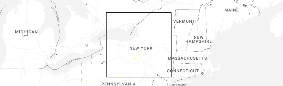
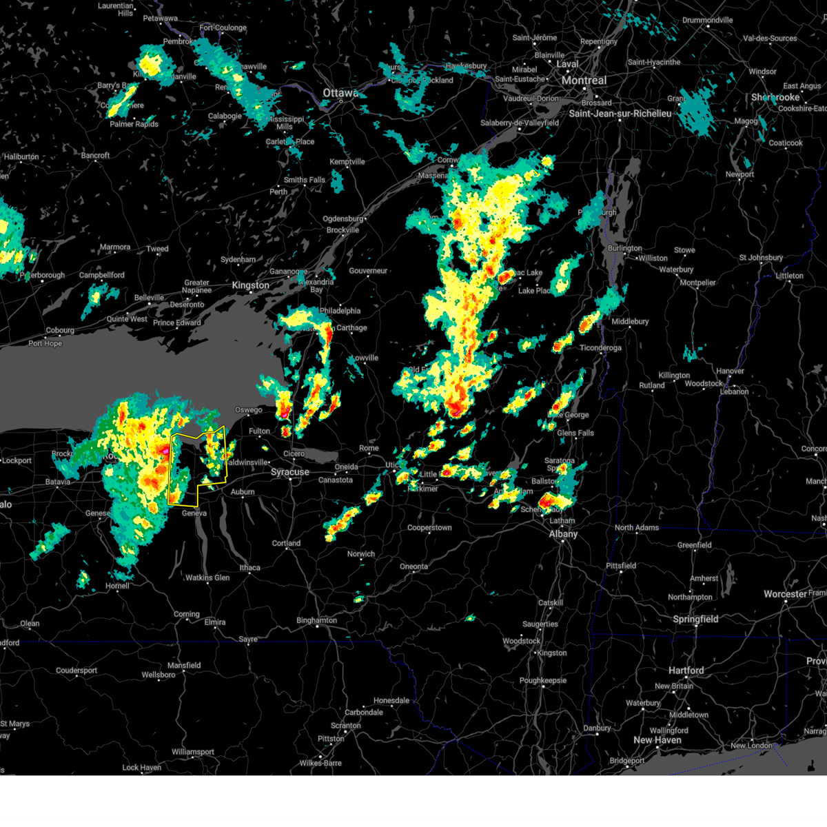
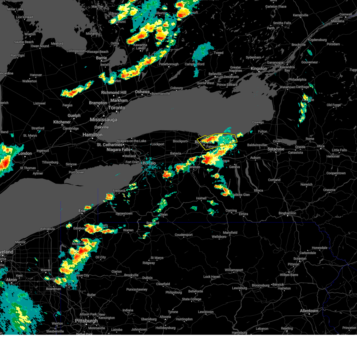
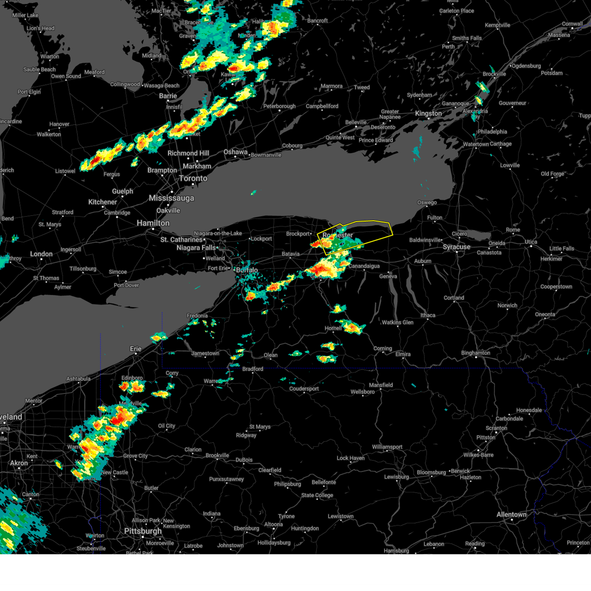
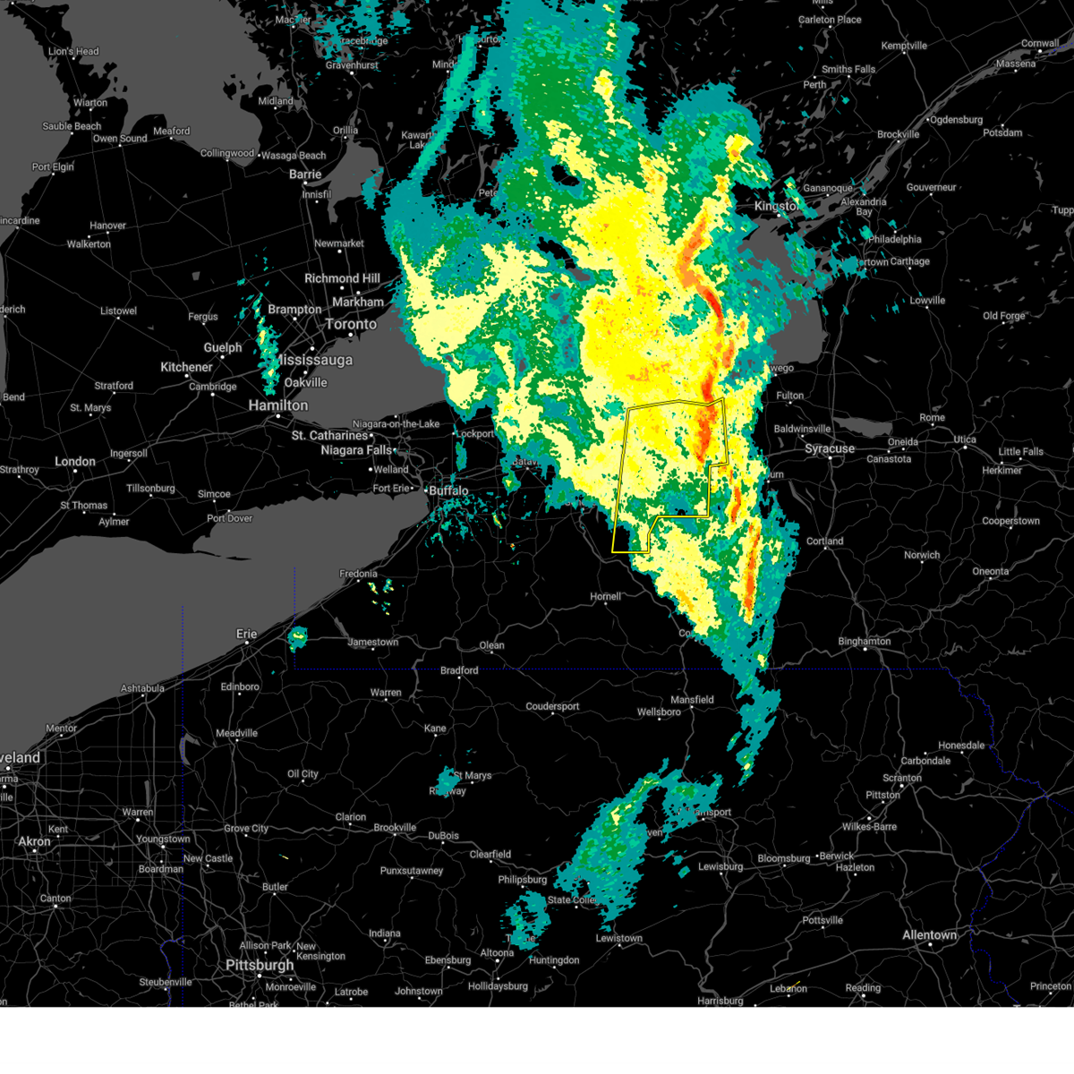
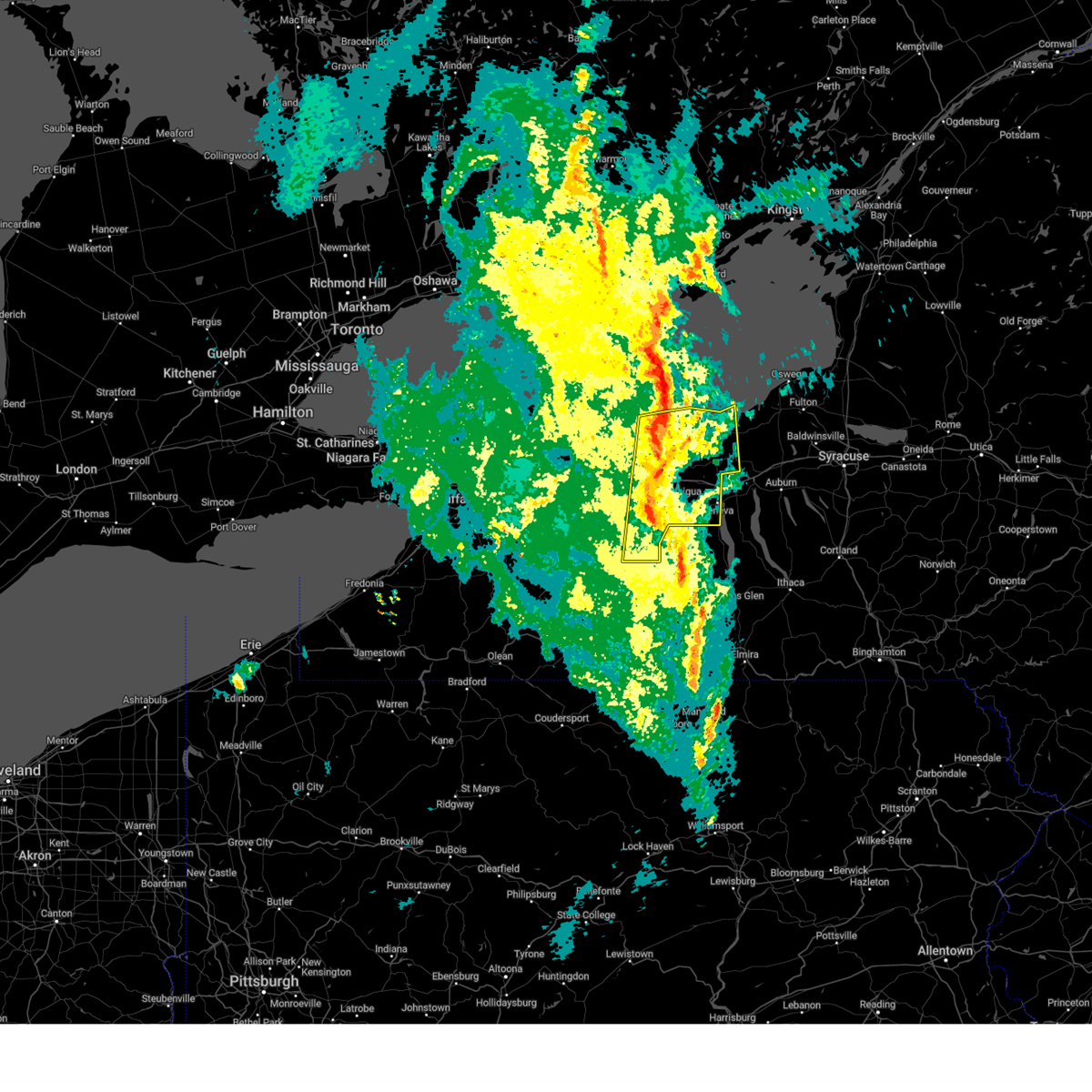
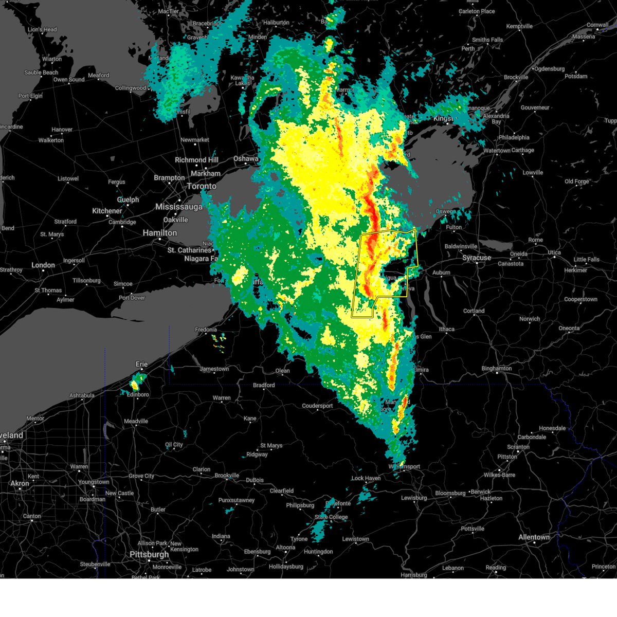
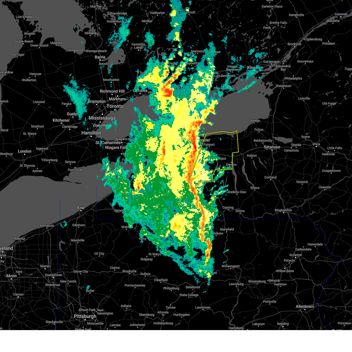
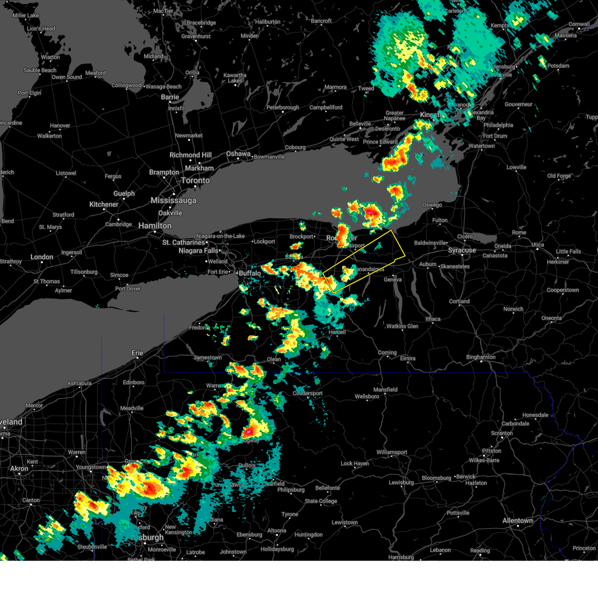
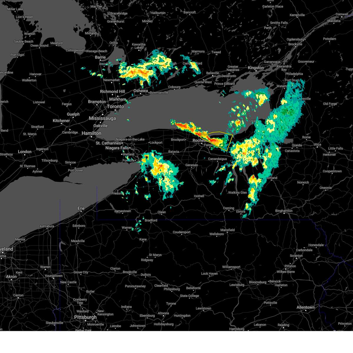
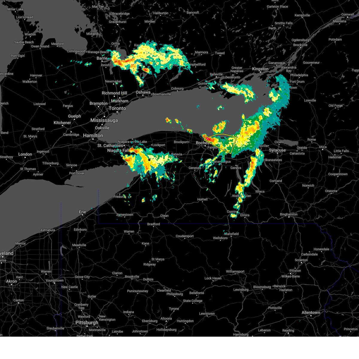
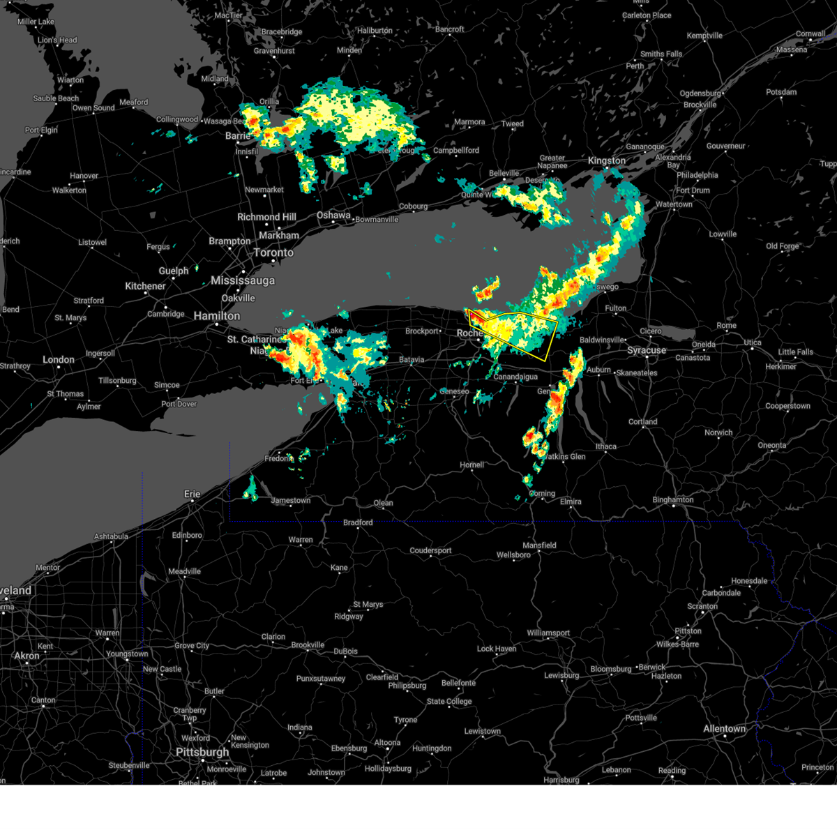
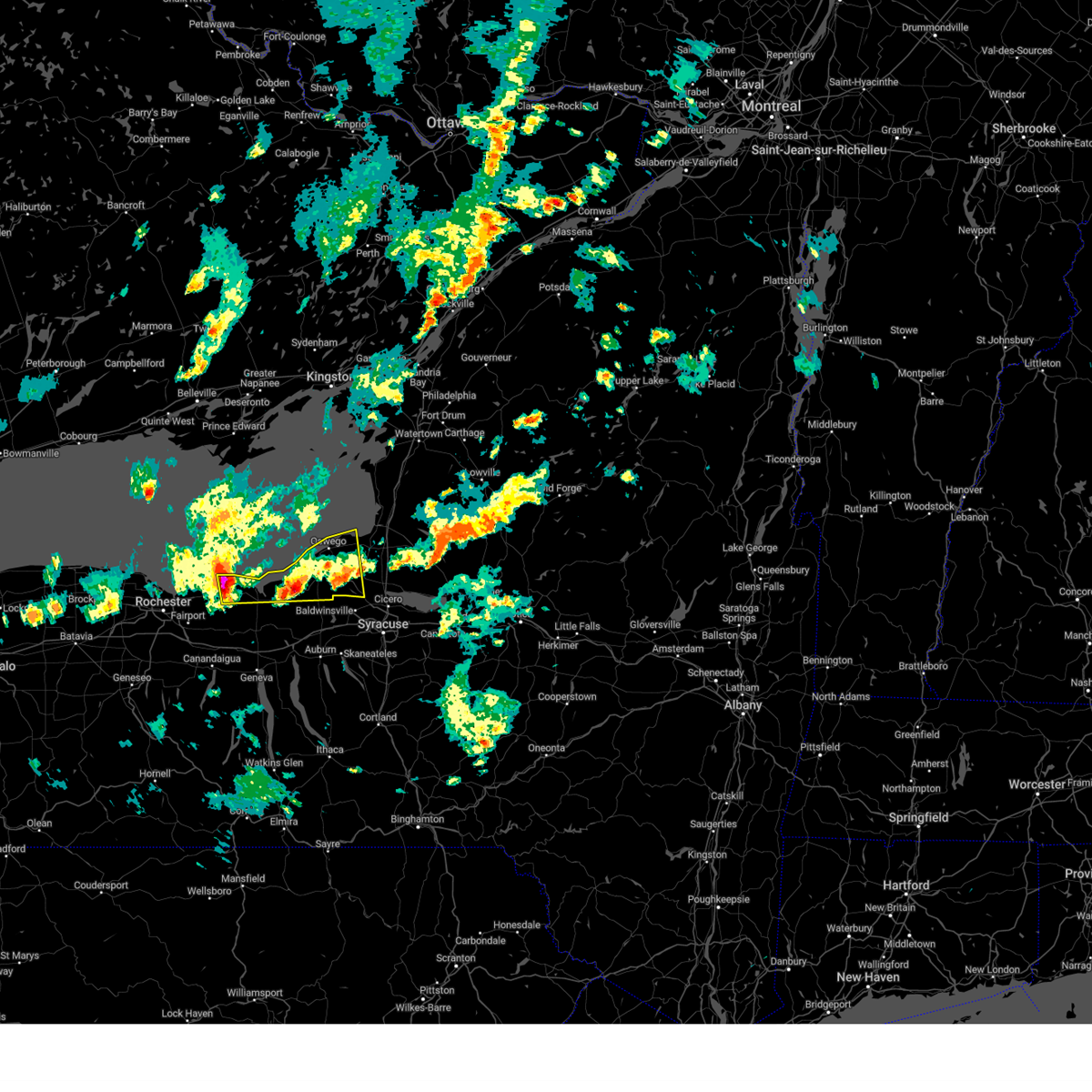
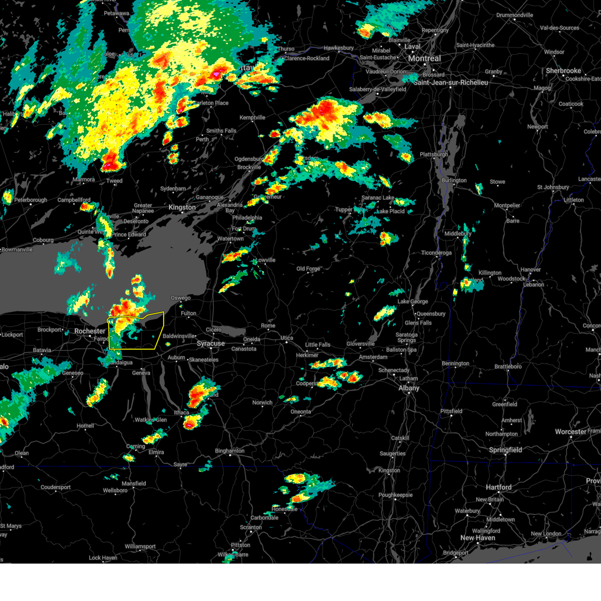
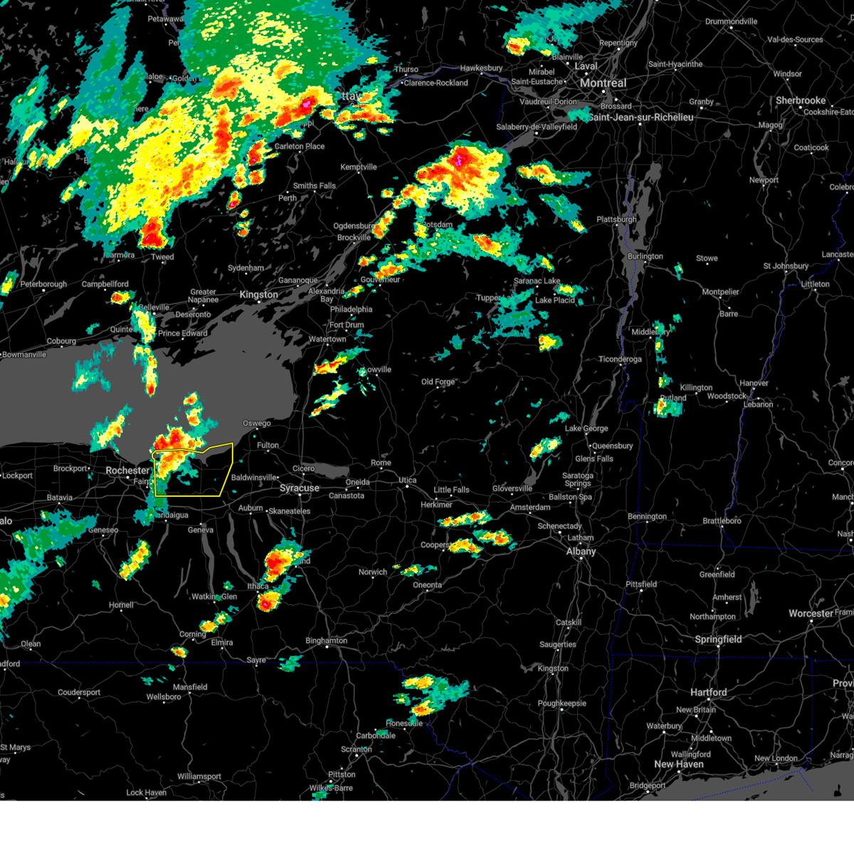
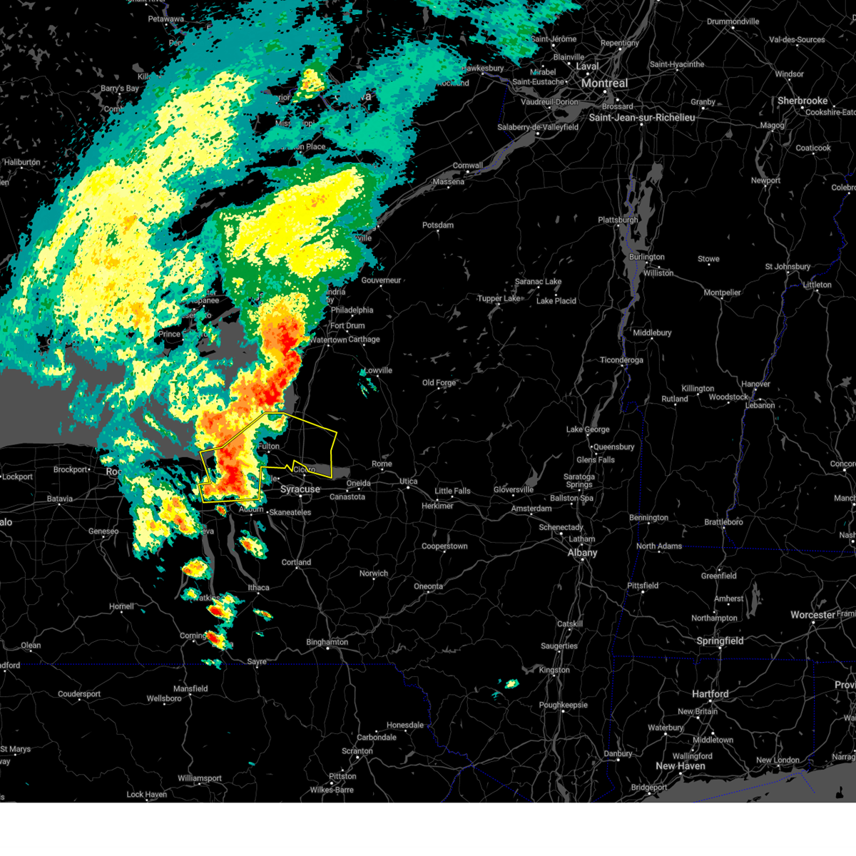
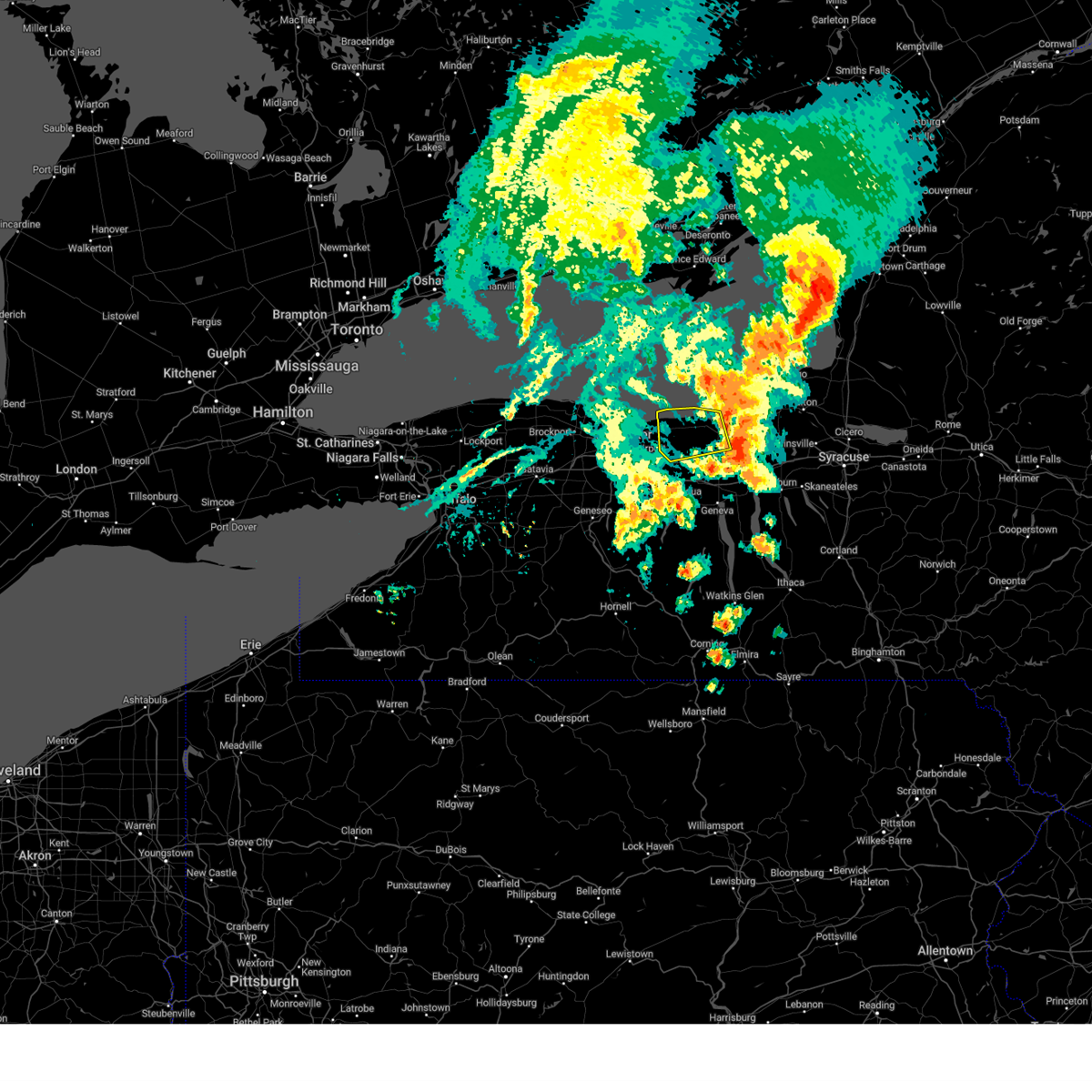
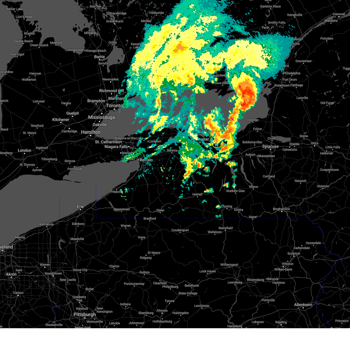
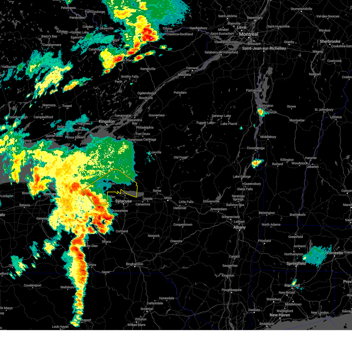
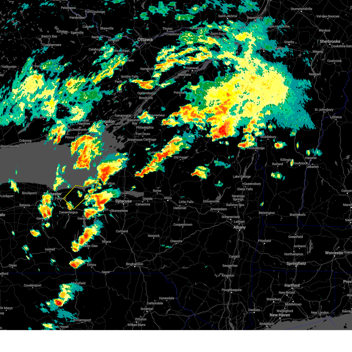
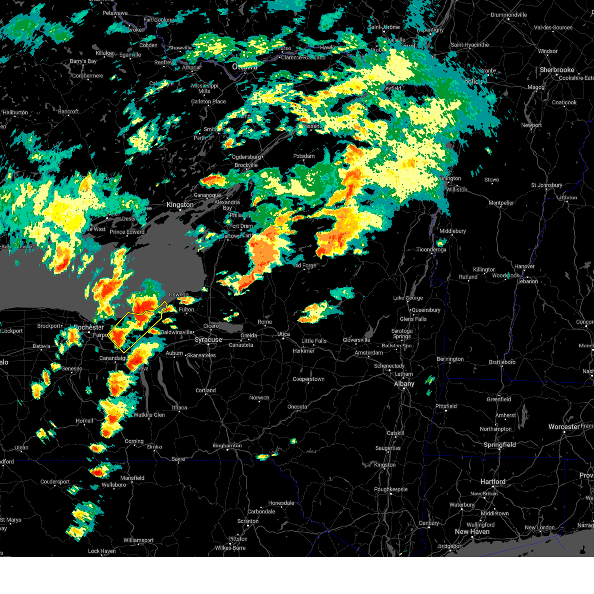
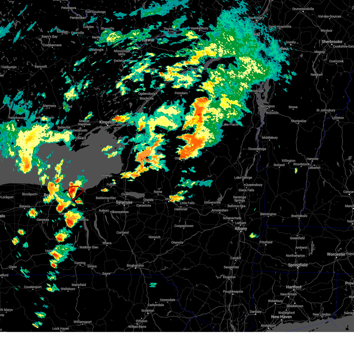
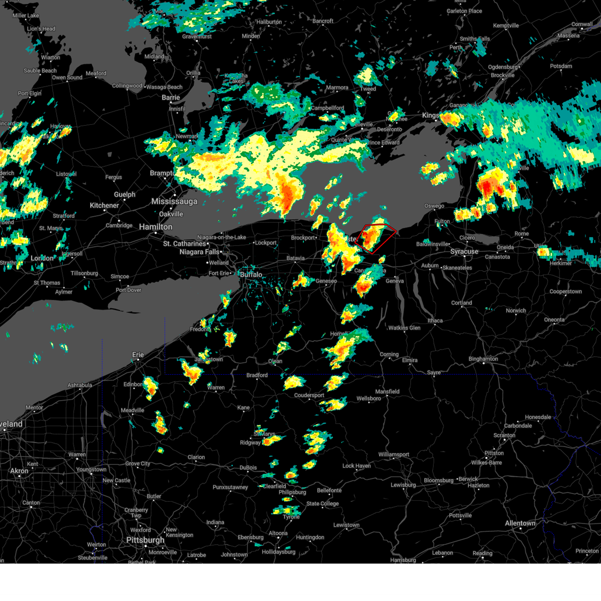
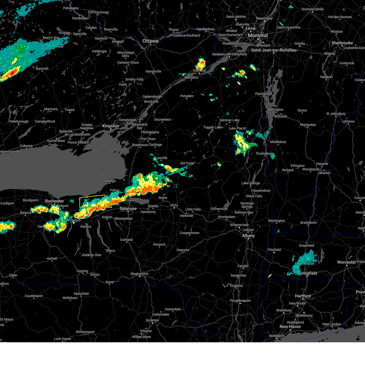
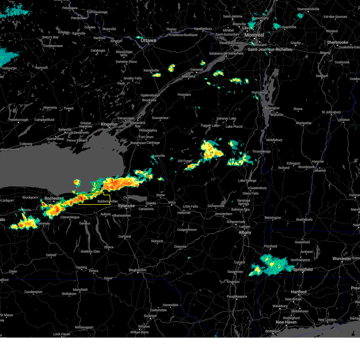
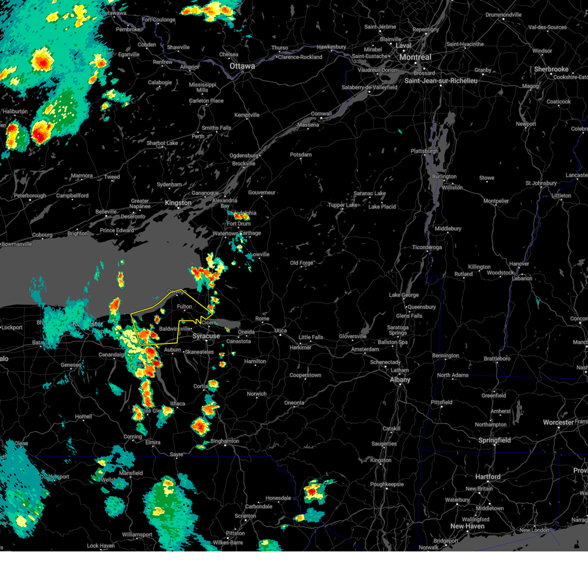
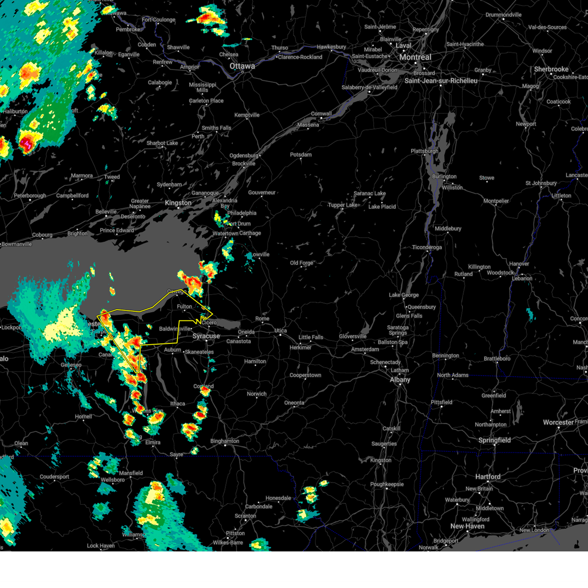
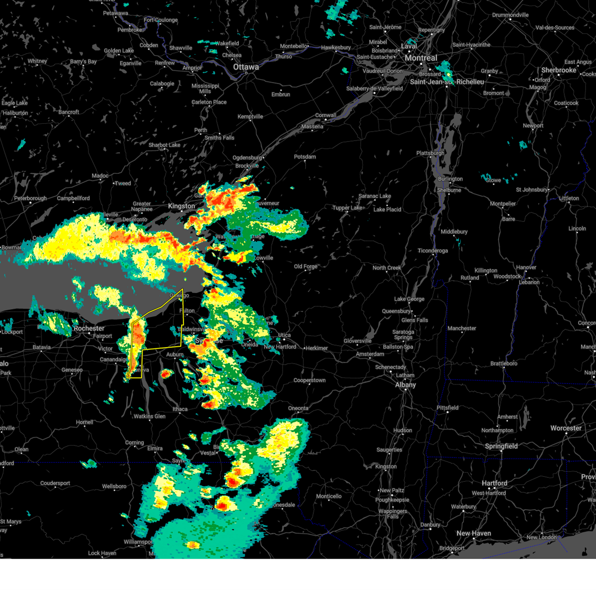
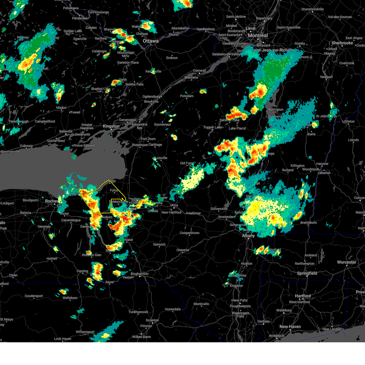
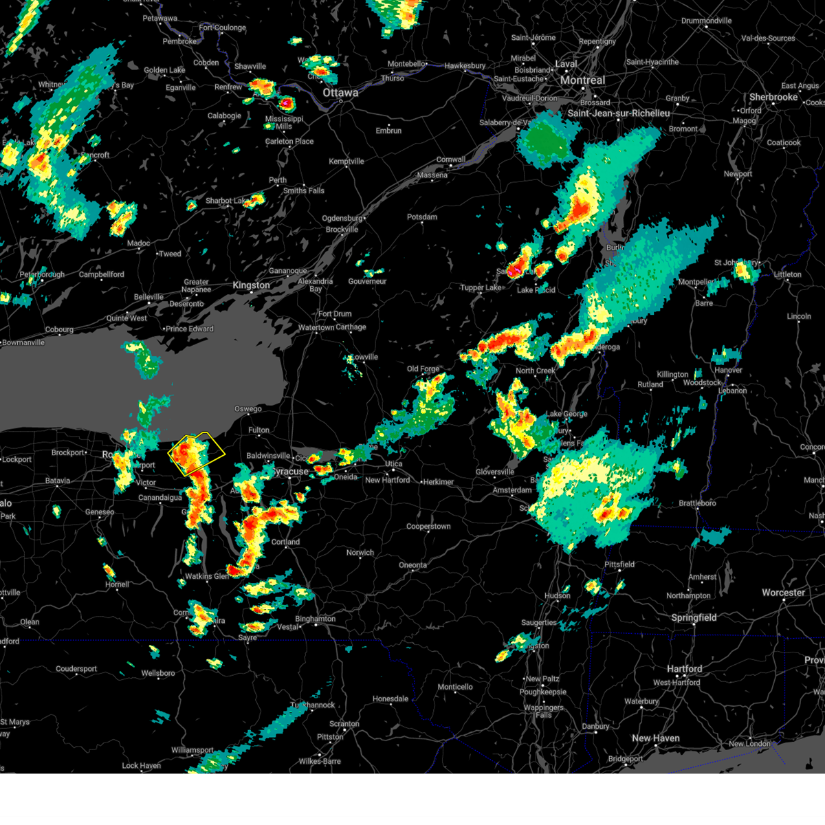
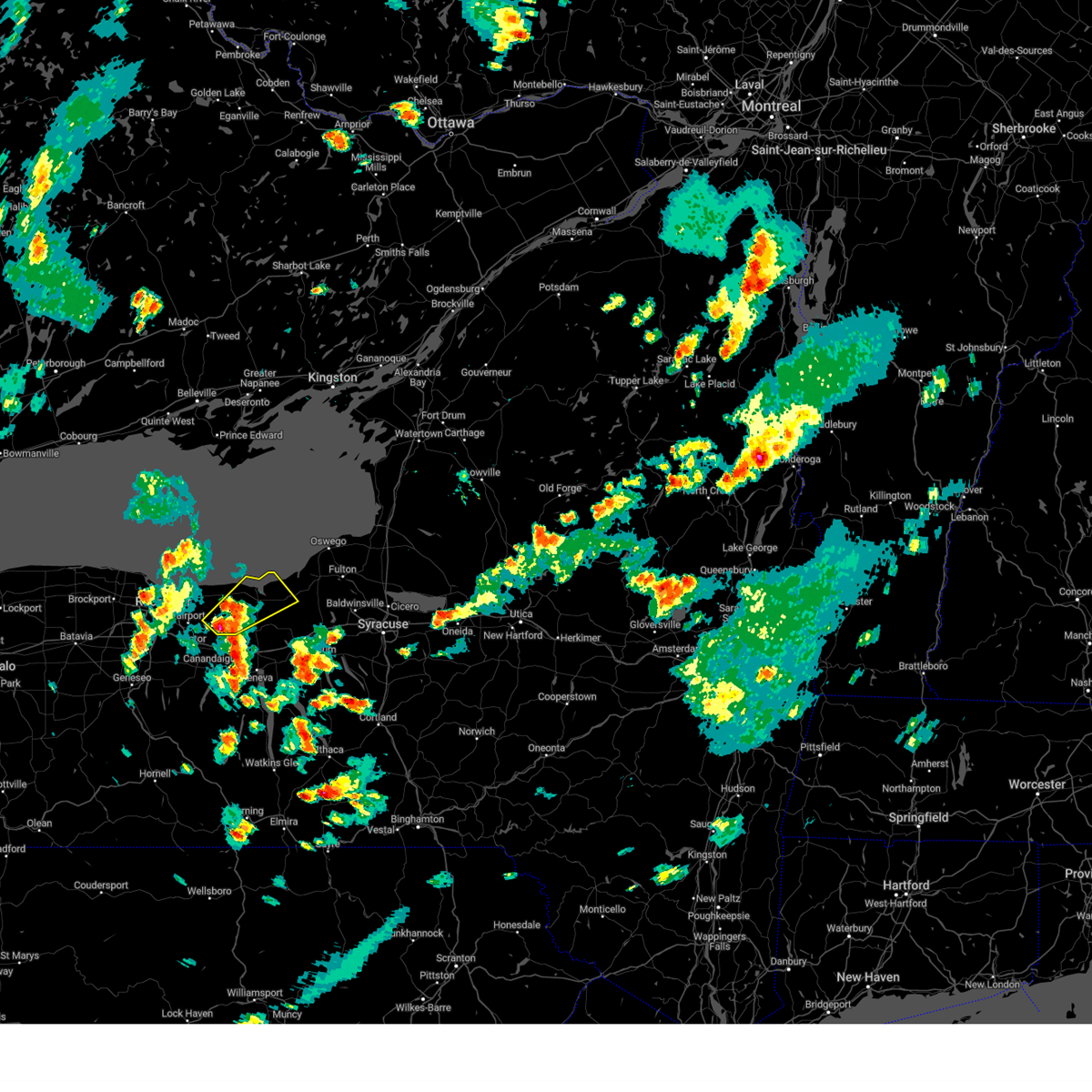
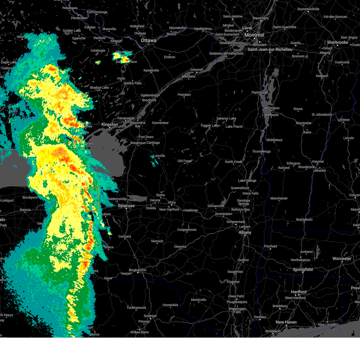
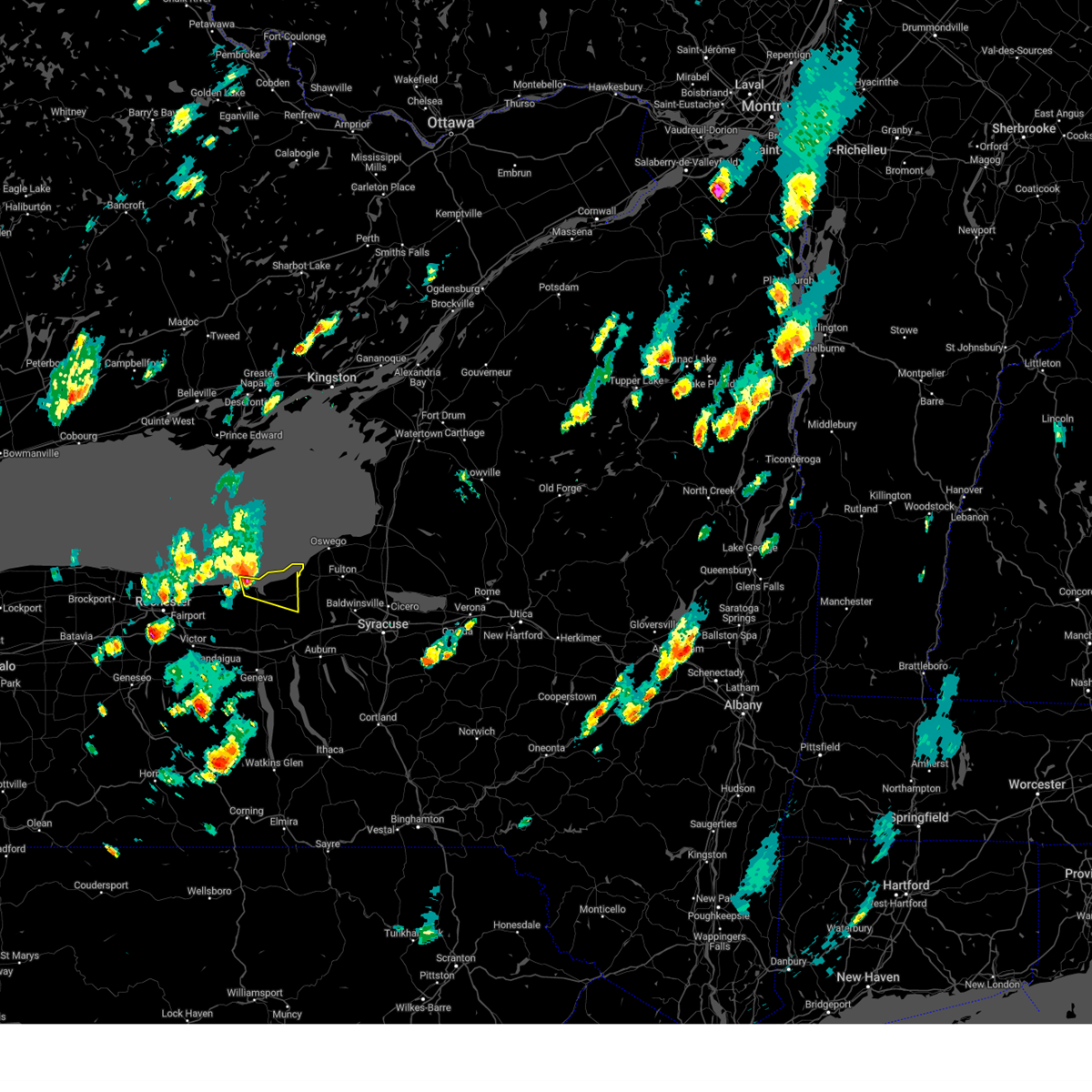
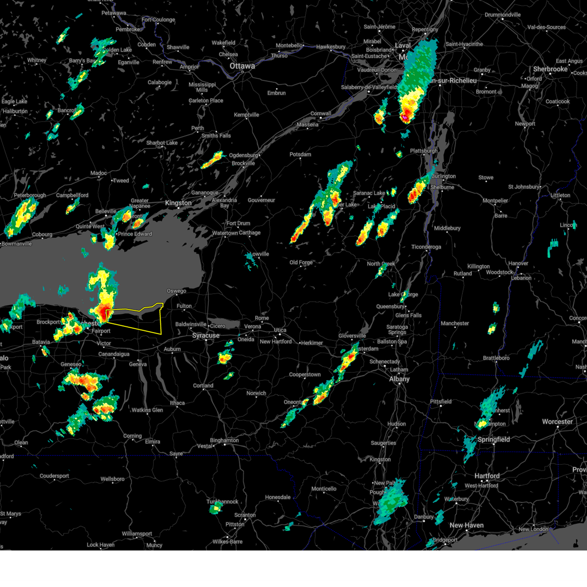
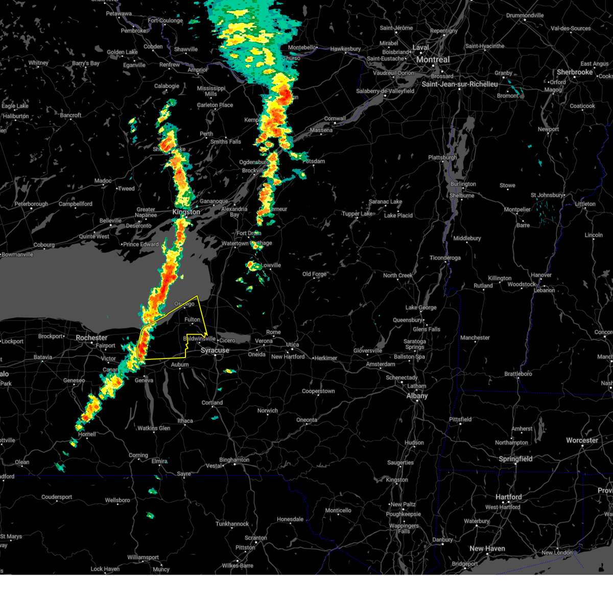
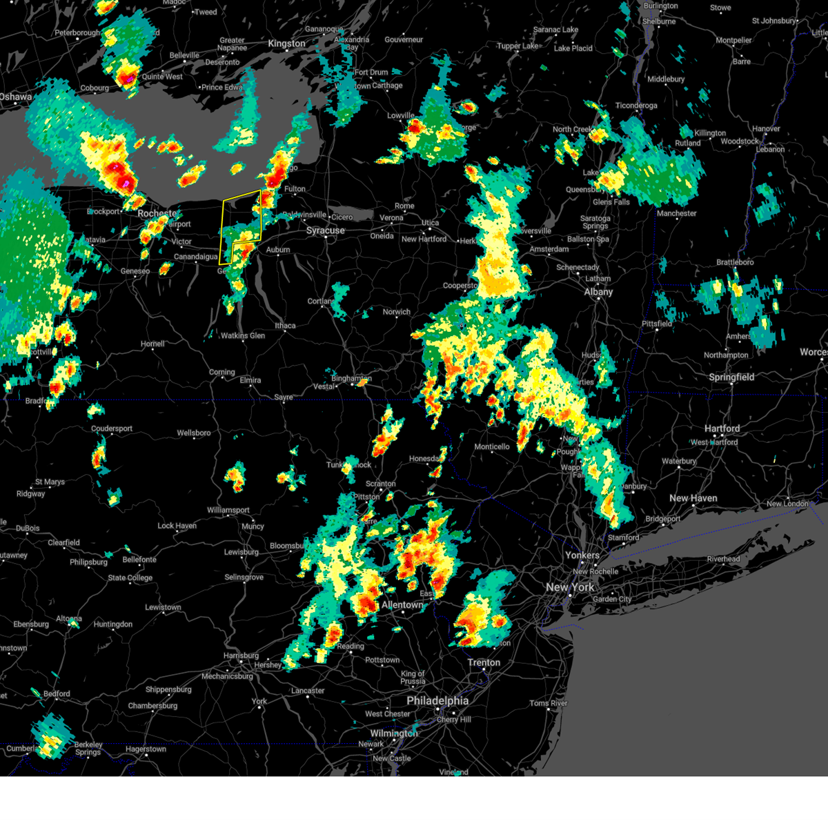
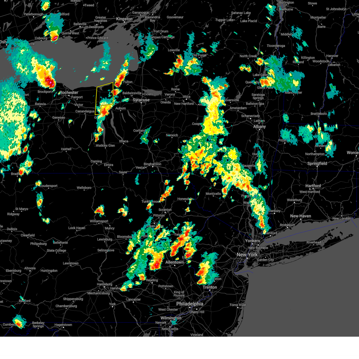
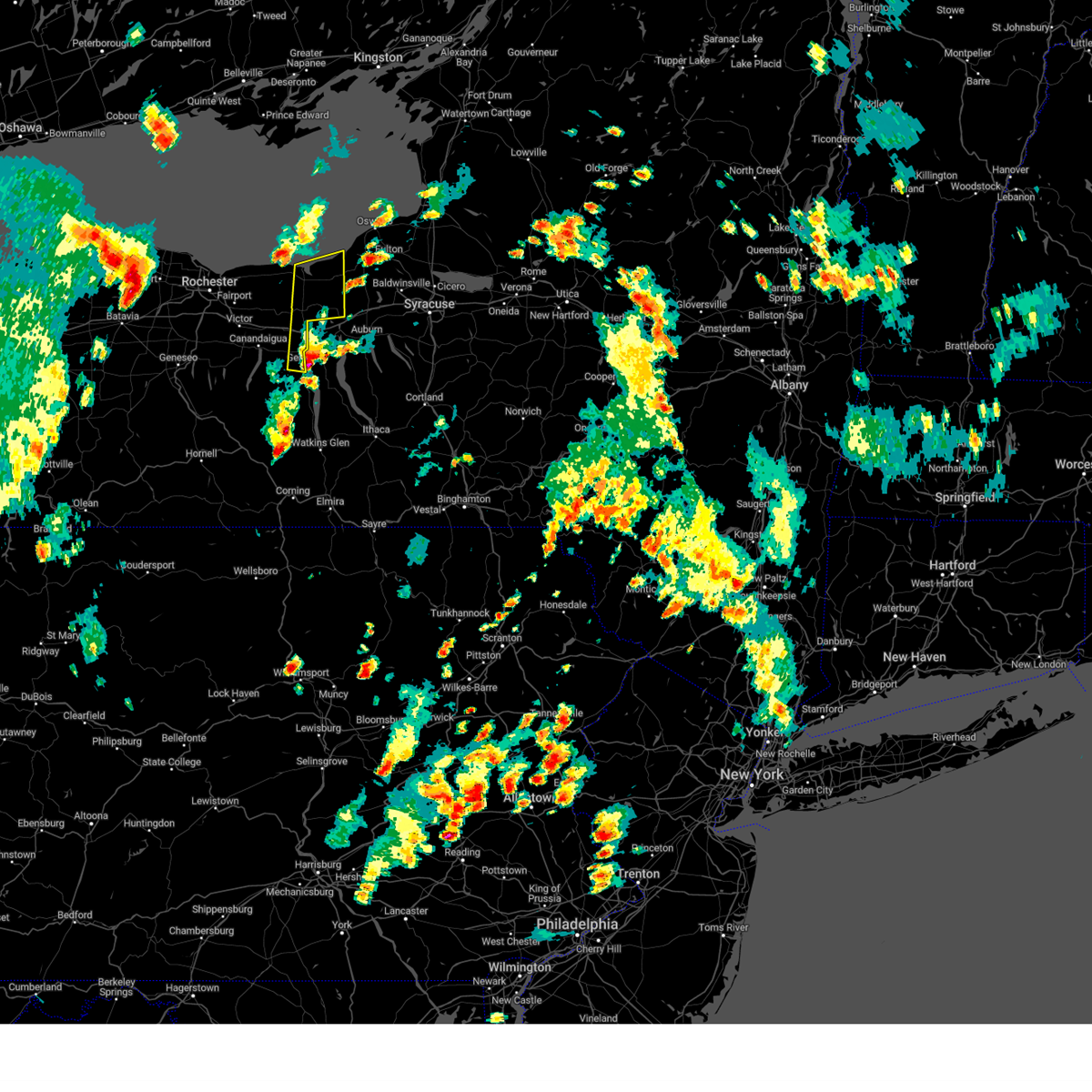
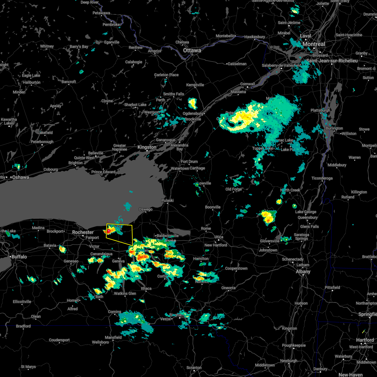
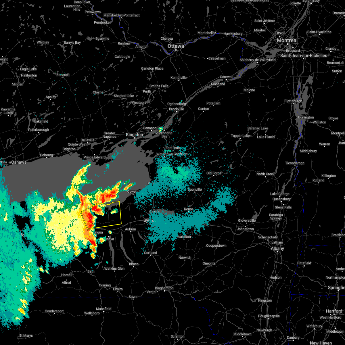
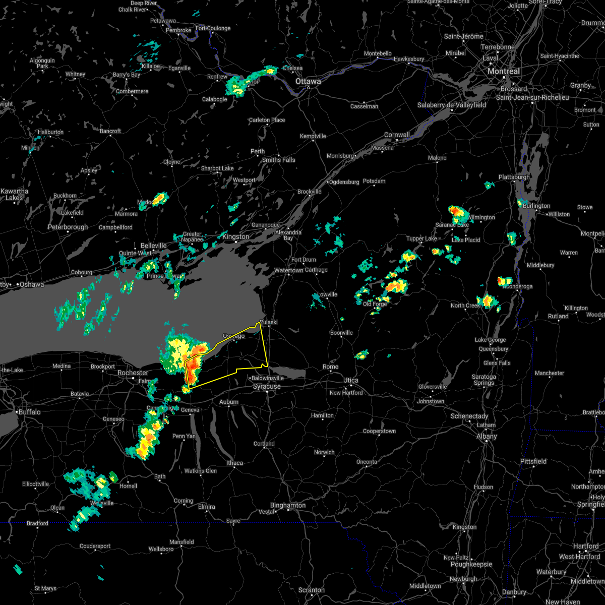
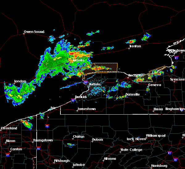
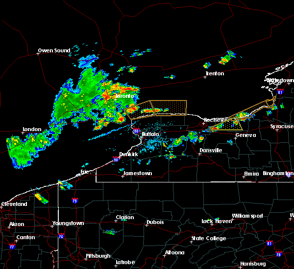
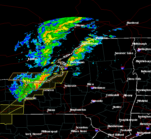
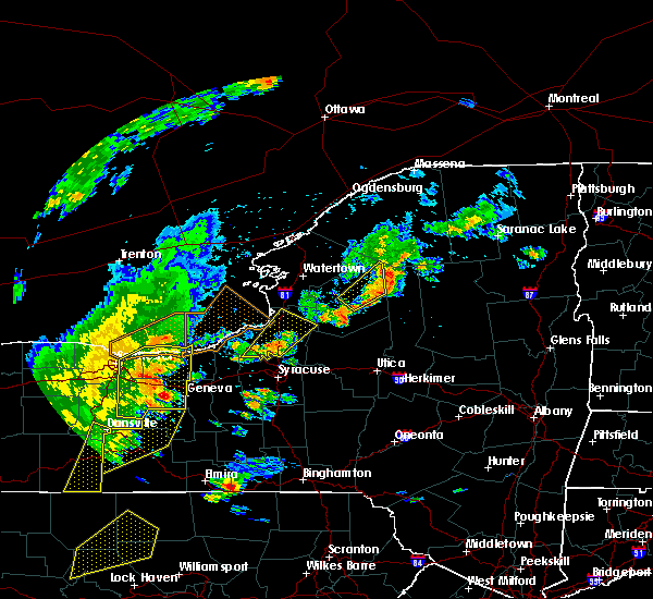
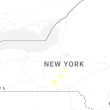
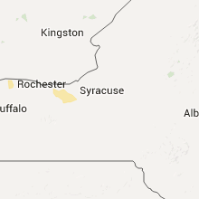
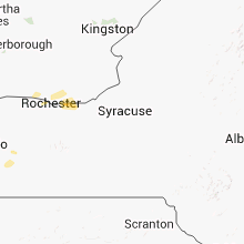
Hail Map for Sodus Point, NY
The Sodus Point, NY area has had 0 reports of on-the-ground hail by trained spotters, and has been under severe weather warnings 28 times during the past 12 months. Doppler radar has detected hail at or near Sodus Point, NY on 12 occasions, including 1 occasion during the past year.
| Name: | Sodus Point, NY |
| Where Located: | 44.9 miles WNW of Syracuse, NY |
| Map: | Google Map for Sodus Point, NY |
| Population: | 900 |
| Housing Units: | 754 |
| More Info: | Search Google for Sodus Point, NY |
0
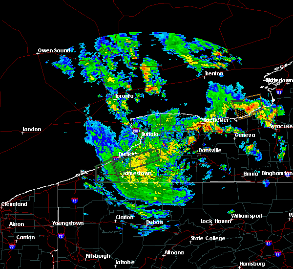
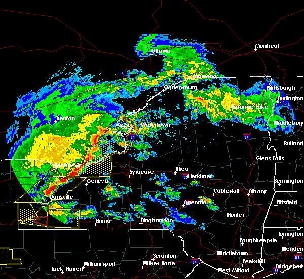
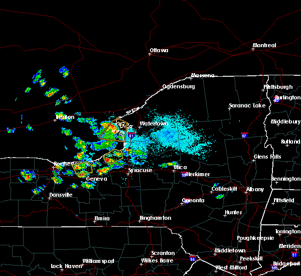
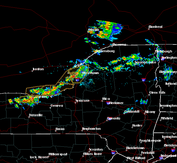
The Top Recent Hail Date for Sodus Point, NY is Monday, July 7, 2025 (10th out of 12)
Hail and Wind Damage Spotted near Sodus Point, NY
| Date / Time | Report Details |
|---|---|
| 5/17/2025 1:34 PM EDT |
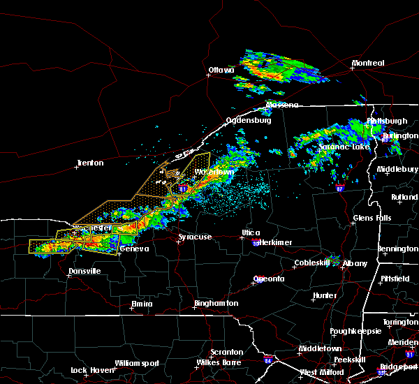
 Svrbuf the national weather service in buffalo has issued a * severe thunderstorm warning for, wayne county in western new york, northeastern ontario county in western new york, * until 230 pm edt. * at 133 pm edt, severe thunderstorms were located along a line extending from near williamson to near clifton springs, moving northeast at 30 mph (radar indicated). Hazards include 60 mph wind gusts and quarter size hail. Hail damage to vehicles is expected. Expect wind damage to roofs, siding, and trees. Svrbuf the national weather service in buffalo has issued a * severe thunderstorm warning for, wayne county in western new york, northeastern ontario county in western new york, * until 230 pm edt. * at 133 pm edt, severe thunderstorms were located along a line extending from near williamson to near clifton springs, moving northeast at 30 mph (radar indicated). Hazards include 60 mph wind gusts and quarter size hail. Hail damage to vehicles is expected. Expect wind damage to roofs, siding, and trees.
|
| 4/29/2025 4:28 PM EDT | the severe thunderstorm warning has been cancelled and is no longer in effect |
| 4/29/2025 4:13 PM EDT |
 At 413 pm edt, a severe thunderstorm was located over irondequoit, moving northeast at 50 mph (radar indicated). Hazards include 60 mph wind gusts and quarter size hail. Hail damage to vehicles is expected. expect wind damage to roofs, siding, and trees. Locations impacted include, union hill, charlotte, walworth, west walworth, sodus, strong memorial hospital, brighton, rochester, alton, and east williamson. At 413 pm edt, a severe thunderstorm was located over irondequoit, moving northeast at 50 mph (radar indicated). Hazards include 60 mph wind gusts and quarter size hail. Hail damage to vehicles is expected. expect wind damage to roofs, siding, and trees. Locations impacted include, union hill, charlotte, walworth, west walworth, sodus, strong memorial hospital, brighton, rochester, alton, and east williamson.
|
| 4/29/2025 4:00 PM EDT |
 Svrbuf the national weather service in buffalo has issued a * severe thunderstorm warning for, northwestern wayne county in western new york, central monroe county in western new york, * until 445 pm edt. * at 400 pm edt, a severe thunderstorm was located over gates-north gates, moving northeast at 50 mph (radar indicated). Hazards include 60 mph wind gusts and quarter size hail. Hail damage to vehicles is expected. Expect wind damage to roofs, siding, and trees. Svrbuf the national weather service in buffalo has issued a * severe thunderstorm warning for, northwestern wayne county in western new york, central monroe county in western new york, * until 445 pm edt. * at 400 pm edt, a severe thunderstorm was located over gates-north gates, moving northeast at 50 mph (radar indicated). Hazards include 60 mph wind gusts and quarter size hail. Hail damage to vehicles is expected. Expect wind damage to roofs, siding, and trees.
|
| 3/16/2025 4:25 PM EDT |
 The storm which prompted the warning has moved out of the area. therefore, the warning will be allowed to expire. a severe thunderstorm watch remains in effect until 700 pm edt for western new york. The storm which prompted the warning has moved out of the area. therefore, the warning will be allowed to expire. a severe thunderstorm watch remains in effect until 700 pm edt for western new york.
|
| 3/16/2025 4:01 PM EDT |
 the severe thunderstorm warning has been cancelled and is no longer in effect the severe thunderstorm warning has been cancelled and is no longer in effect
|
| 3/16/2025 4:01 PM EDT |
 At 358 pm edt, a line of severe thunderstorms extended from near webster southward to bristol, or near canandaigua and is moving east and northeast at 55 mph (radar indicated). Hazards include 60 mph wind gusts. Expect damage to roofs, siding, and trees. locations impacted include, macedon, springwater, east williamson, gorham, sodus point, pultneyville, bristol, penfield, chimney bluffs state park, and union hill. This includes interstate 90 between exits 42 and 45. At 358 pm edt, a line of severe thunderstorms extended from near webster southward to bristol, or near canandaigua and is moving east and northeast at 55 mph (radar indicated). Hazards include 60 mph wind gusts. Expect damage to roofs, siding, and trees. locations impacted include, macedon, springwater, east williamson, gorham, sodus point, pultneyville, bristol, penfield, chimney bluffs state park, and union hill. This includes interstate 90 between exits 42 and 45.
|
| 3/16/2025 3:28 PM EDT |
 Svrbuf the national weather service in buffalo has issued a * severe thunderstorm warning for, wayne county in western new york, eastern livingston county in western new york, northeastern allegany county in western new york, southeastern monroe county in western new york, ontario county in western new york, * until 430 pm edt. * at 327 pm edt, a severe thunderstorm was located near geneseo, moving northeast at 55 mph (radar indicated). Hazards include 60 mph wind gusts. expect damage to roofs, siding, and trees Svrbuf the national weather service in buffalo has issued a * severe thunderstorm warning for, wayne county in western new york, eastern livingston county in western new york, northeastern allegany county in western new york, southeastern monroe county in western new york, ontario county in western new york, * until 430 pm edt. * at 327 pm edt, a severe thunderstorm was located near geneseo, moving northeast at 55 mph (radar indicated). Hazards include 60 mph wind gusts. expect damage to roofs, siding, and trees
|
| 10/6/2024 7:17 PM EDT |
 Svrbuf the national weather service in buffalo has issued a * severe thunderstorm warning for, western wayne county in western new york, northeastern livingston county in western new york, southeastern monroe county in western new york, northern ontario county in western new york, * until 800 pm edt. * at 717 pm edt, a severe thunderstorm was located near avon, or near geneseo, moving northeast at 50 mph (radar indicated). Hazards include 60 mph wind gusts and quarter size hail. Hail damage to vehicles is expected. Expect wind damage to roofs, siding, and trees. Svrbuf the national weather service in buffalo has issued a * severe thunderstorm warning for, western wayne county in western new york, northeastern livingston county in western new york, southeastern monroe county in western new york, northern ontario county in western new york, * until 800 pm edt. * at 717 pm edt, a severe thunderstorm was located near avon, or near geneseo, moving northeast at 50 mph (radar indicated). Hazards include 60 mph wind gusts and quarter size hail. Hail damage to vehicles is expected. Expect wind damage to roofs, siding, and trees.
|
| 9/9/2024 5:04 PM EDT |
 The storm which prompted the warning has weakened below severe limits, and no longer poses an immediate threat to life or property. therefore, the warning has been allowed to expire. however, heavy rain is still possible with this thunderstorm. The storm which prompted the warning has weakened below severe limits, and no longer poses an immediate threat to life or property. therefore, the warning has been allowed to expire. however, heavy rain is still possible with this thunderstorm.
|
| 9/9/2024 4:23 PM EDT |
 At 422 pm edt, a severe thunderstorm was located near webster, moving southeast at 20 mph (radar indicated). Hazards include 60 mph wind gusts and quarter size hail. Hail damage to vehicles is expected. expect wind damage to roofs, siding, and trees. Locations impacted include, rochester, irondequoit, webster, ontario, newark, williamson, marion, sodus, walworth, and charlotte. At 422 pm edt, a severe thunderstorm was located near webster, moving southeast at 20 mph (radar indicated). Hazards include 60 mph wind gusts and quarter size hail. Hail damage to vehicles is expected. expect wind damage to roofs, siding, and trees. Locations impacted include, rochester, irondequoit, webster, ontario, newark, williamson, marion, sodus, walworth, and charlotte.
|
| 9/9/2024 4:00 PM EDT |
 Svrbuf the national weather service in buffalo has issued a * severe thunderstorm warning for, western wayne county in western new york, northeastern monroe county in western new york, * until 500 pm edt. * at 359 pm edt, a severe thunderstorm was located near irondequoit, moving east at 25 mph (radar indicated). Hazards include 60 mph wind gusts and quarter size hail. Hail damage to vehicles is expected. Expect wind damage to roofs, siding, and trees. Svrbuf the national weather service in buffalo has issued a * severe thunderstorm warning for, western wayne county in western new york, northeastern monroe county in western new york, * until 500 pm edt. * at 359 pm edt, a severe thunderstorm was located near irondequoit, moving east at 25 mph (radar indicated). Hazards include 60 mph wind gusts and quarter size hail. Hail damage to vehicles is expected. Expect wind damage to roofs, siding, and trees.
|
| 8/11/2024 3:44 PM EDT |
 Svrbuf the national weather service in buffalo has issued a * severe thunderstorm warning for, northern wayne county in western new york, cayuga county in central new york, southwestern oswego county in central new york, * until 430 pm edt. * at 343 pm edt, a severe thunderstorm was located near sodus, or 15 miles east of webster, moving east at 50 mph (radar indicated). Hazards include 60 mph wind gusts and quarter size hail. Hail damage to vehicles is expected. Expect wind damage to roofs, siding, and trees. Svrbuf the national weather service in buffalo has issued a * severe thunderstorm warning for, northern wayne county in western new york, cayuga county in central new york, southwestern oswego county in central new york, * until 430 pm edt. * at 343 pm edt, a severe thunderstorm was located near sodus, or 15 miles east of webster, moving east at 50 mph (radar indicated). Hazards include 60 mph wind gusts and quarter size hail. Hail damage to vehicles is expected. Expect wind damage to roofs, siding, and trees.
|
| 8/11/2024 3:20 PM EDT |
 the severe thunderstorm warning has been cancelled and is no longer in effect the severe thunderstorm warning has been cancelled and is no longer in effect
|
| 8/11/2024 3:20 PM EDT |
 At 320 pm edt, a severe thunderstorm was located 7 miles northwest of webster, moving east at 45 mph (radar indicated). Hazards include 60 mph wind gusts and quarter size hail. Hail damage to vehicles is expected. expect wind damage to roofs, siding, and trees. Locations impacted include, rochester, greece, irondequoit, webster, gates-north gates, ontario, williamson, sodus, charlotte, and union hill. At 320 pm edt, a severe thunderstorm was located 7 miles northwest of webster, moving east at 45 mph (radar indicated). Hazards include 60 mph wind gusts and quarter size hail. Hail damage to vehicles is expected. expect wind damage to roofs, siding, and trees. Locations impacted include, rochester, greece, irondequoit, webster, gates-north gates, ontario, williamson, sodus, charlotte, and union hill.
|
| 8/11/2024 2:51 PM EDT |
 Svrbuf the national weather service in buffalo has issued a * severe thunderstorm warning for, northwestern wayne county in western new york, northeastern orleans county in western new york, northern monroe county in western new york, * until 345 pm edt. * at 250 pm edt, a severe thunderstorm was located near hamlin beach state park, moving east at 45 mph (radar indicated). Hazards include 60 mph wind gusts and quarter size hail. Hail damage to vehicles is expected. Expect wind damage to roofs, siding, and trees. Svrbuf the national weather service in buffalo has issued a * severe thunderstorm warning for, northwestern wayne county in western new york, northeastern orleans county in western new york, northern monroe county in western new york, * until 345 pm edt. * at 250 pm edt, a severe thunderstorm was located near hamlin beach state park, moving east at 45 mph (radar indicated). Hazards include 60 mph wind gusts and quarter size hail. Hail damage to vehicles is expected. Expect wind damage to roofs, siding, and trees.
|
| 7/24/2024 2:51 PM EDT |
 the severe thunderstorm warning has been cancelled and is no longer in effect the severe thunderstorm warning has been cancelled and is no longer in effect
|
| 7/24/2024 2:44 PM EDT |
 At 243 pm edt, severe thunderstorms were located along a line extending from 12 miles north of williamson to near ontario, moving northeast at 25 mph (radar indicated). Hazards include 60 mph wind gusts. Expect damage to roofs, siding, and trees. Locations impacted include, ontario, newark, williamson, marion, lyons, palmyra, clyde, sodus, chimney bluffs state park, and walworth. At 243 pm edt, severe thunderstorms were located along a line extending from 12 miles north of williamson to near ontario, moving northeast at 25 mph (radar indicated). Hazards include 60 mph wind gusts. Expect damage to roofs, siding, and trees. Locations impacted include, ontario, newark, williamson, marion, lyons, palmyra, clyde, sodus, chimney bluffs state park, and walworth.
|
| 7/24/2024 2:44 PM EDT |
 the severe thunderstorm warning has been cancelled and is no longer in effect the severe thunderstorm warning has been cancelled and is no longer in effect
|
| 7/24/2024 2:30 PM EDT |
 Svrbuf the national weather service in buffalo has issued a * severe thunderstorm warning for, wayne county in western new york, east central monroe county in western new york, * until 330 pm edt. * at 230 pm edt, severe thunderstorms were located along a line extending from 8 miles north of ontario to fairport, moving east at 20 mph (radar indicated). Hazards include 60 mph wind gusts and penny size hail. expect damage to roofs, siding, and trees Svrbuf the national weather service in buffalo has issued a * severe thunderstorm warning for, wayne county in western new york, east central monroe county in western new york, * until 330 pm edt. * at 230 pm edt, severe thunderstorms were located along a line extending from 8 miles north of ontario to fairport, moving east at 20 mph (radar indicated). Hazards include 60 mph wind gusts and penny size hail. expect damage to roofs, siding, and trees
|
| 7/16/2024 1:56 PM EDT |
 the severe thunderstorm warning has been cancelled and is no longer in effect the severe thunderstorm warning has been cancelled and is no longer in effect
|
| 7/16/2024 1:56 PM EDT |
 At 155 pm edt, severe thunderstorms were located along a line extending from 6 miles northwest of fair haven beach state park to clyde, moving northeast at 25 mph (radar indicated). Hazards include 70 mph wind gusts and ping pong ball size hail. People and animals outdoors will be injured. expect hail damage to roofs, siding, windows, and vehicles. expect considerable tree damage. wind damage is also likely to mobile homes, roofs, and outbuildings. locations impacted include, oswego, fulton, fair haven beach state park, lyons, clyde, central square, weedsport, cato, chimney bluffs state park, and mexico point state park. this includes the following highways, interstate 90 near exit 40. Interstate 81 between exits 32 and 35. At 155 pm edt, severe thunderstorms were located along a line extending from 6 miles northwest of fair haven beach state park to clyde, moving northeast at 25 mph (radar indicated). Hazards include 70 mph wind gusts and ping pong ball size hail. People and animals outdoors will be injured. expect hail damage to roofs, siding, windows, and vehicles. expect considerable tree damage. wind damage is also likely to mobile homes, roofs, and outbuildings. locations impacted include, oswego, fulton, fair haven beach state park, lyons, clyde, central square, weedsport, cato, chimney bluffs state park, and mexico point state park. this includes the following highways, interstate 90 near exit 40. Interstate 81 between exits 32 and 35.
|
| 7/16/2024 1:46 PM EDT |
 The storm which prompted the warning has moved out of the area. therefore, the warning has been allowed to expire. a severe thunderstorm watch remains in effect until 600 pm edt for western new york. The storm which prompted the warning has moved out of the area. therefore, the warning has been allowed to expire. a severe thunderstorm watch remains in effect until 600 pm edt for western new york.
|
| 7/16/2024 1:24 PM EDT |
 At 124 pm edt, a severe thunderstorm was located over ontario, or near webster, moving east at 30 mph (radar indicated). Hazards include 60 mph wind gusts. Expect damage to roofs, siding, and trees. Locations impacted include, ontario, williamson, marion, sodus, walworth, macedon, sodus point, fairville, union hill, and west walworth. At 124 pm edt, a severe thunderstorm was located over ontario, or near webster, moving east at 30 mph (radar indicated). Hazards include 60 mph wind gusts. Expect damage to roofs, siding, and trees. Locations impacted include, ontario, williamson, marion, sodus, walworth, macedon, sodus point, fairville, union hill, and west walworth.
|
| 7/16/2024 1:24 PM EDT |
 the severe thunderstorm warning has been cancelled and is no longer in effect the severe thunderstorm warning has been cancelled and is no longer in effect
|
| 7/16/2024 1:19 PM EDT |
 Svrbuf the national weather service in buffalo has issued a * severe thunderstorm warning for, southeastern wayne county in western new york, cayuga county in central new york, oswego county in central new york, northeastern ontario county in western new york, * until 230 pm edt. * at 118 pm edt, severe thunderstorms were located along a line extending from 8 miles northwest of chimney bluffs state park to near newark, moving northeast at 30 mph (radar indicated). Hazards include 60 mph wind gusts. expect damage to roofs, siding, and trees Svrbuf the national weather service in buffalo has issued a * severe thunderstorm warning for, southeastern wayne county in western new york, cayuga county in central new york, oswego county in central new york, northeastern ontario county in western new york, * until 230 pm edt. * at 118 pm edt, severe thunderstorms were located along a line extending from 8 miles northwest of chimney bluffs state park to near newark, moving northeast at 30 mph (radar indicated). Hazards include 60 mph wind gusts. expect damage to roofs, siding, and trees
|
| 7/16/2024 12:50 PM EDT |
 Svrbuf the national weather service in buffalo has issued a * severe thunderstorm warning for, western wayne county in western new york, eastern monroe county in western new york, * until 145 pm edt. * at 1250 pm edt, a severe thunderstorm was located over brighton, moving northeast at 30 mph (radar indicated). Hazards include 60 mph wind gusts. expect damage to roofs, siding, and trees Svrbuf the national weather service in buffalo has issued a * severe thunderstorm warning for, western wayne county in western new york, eastern monroe county in western new york, * until 145 pm edt. * at 1250 pm edt, a severe thunderstorm was located over brighton, moving northeast at 30 mph (radar indicated). Hazards include 60 mph wind gusts. expect damage to roofs, siding, and trees
|
| 7/15/2024 5:42 PM EDT |
 Svrbuf the national weather service in buffalo has issued a * severe thunderstorm warning for, northeastern wayne county in western new york, cayuga county in central new york, oswego county in central new york, * until 645 pm edt. * at 542 pm edt, severe thunderstorms were located along a line extending from 6 miles southeast of chimney bluffs state park to near montezuma, moving northeast at 45 mph (radar indicated). Hazards include 60 mph wind gusts. expect damage to roofs, siding, and trees Svrbuf the national weather service in buffalo has issued a * severe thunderstorm warning for, northeastern wayne county in western new york, cayuga county in central new york, oswego county in central new york, * until 645 pm edt. * at 542 pm edt, severe thunderstorms were located along a line extending from 6 miles southeast of chimney bluffs state park to near montezuma, moving northeast at 45 mph (radar indicated). Hazards include 60 mph wind gusts. expect damage to roofs, siding, and trees
|
| 7/10/2024 3:37 PM EDT |
 The storm which prompted the warning has moved out of the area. therefore, the warning will be allowed to expire. a tornado watch remains in effect until 900 pm edt for central and western new york. to report severe weather, contact your nearest law enforcement agency. they will relay your report to the national weather service buffalo. The storm which prompted the warning has moved out of the area. therefore, the warning will be allowed to expire. a tornado watch remains in effect until 900 pm edt for central and western new york. to report severe weather, contact your nearest law enforcement agency. they will relay your report to the national weather service buffalo.
|
| 7/10/2024 2:56 PM EDT |
 Svrbuf the national weather service in buffalo has issued a * severe thunderstorm warning for, central wayne county in western new york, north central ontario county in western new york, * until 345 pm edt. * at 256 pm edt, a severe thunderstorm was located over marion, or 11 miles east of fairport, moving northeast at 35 mph (radar indicated). Hazards include 60 mph wind gusts. expect damage to roofs, siding, and trees Svrbuf the national weather service in buffalo has issued a * severe thunderstorm warning for, central wayne county in western new york, north central ontario county in western new york, * until 345 pm edt. * at 256 pm edt, a severe thunderstorm was located over marion, or 11 miles east of fairport, moving northeast at 35 mph (radar indicated). Hazards include 60 mph wind gusts. expect damage to roofs, siding, and trees
|
| 7/10/2024 2:35 PM EDT |
 At 234 pm edt, a severe thunderstorm capable of producing a tornado was located near williamson, or 13 miles east of webster, moving northeast at 35 mph (radar indicated rotation). Hazards include tornado. Flying debris will be dangerous to those caught without shelter. mobile homes will be damaged or destroyed. damage to roofs, windows, and vehicles will occur. tree damage is likely. Locations impacted include, williamson, marion, sodus, sodus point, pultneyville, and east williamson. At 234 pm edt, a severe thunderstorm capable of producing a tornado was located near williamson, or 13 miles east of webster, moving northeast at 35 mph (radar indicated rotation). Hazards include tornado. Flying debris will be dangerous to those caught without shelter. mobile homes will be damaged or destroyed. damage to roofs, windows, and vehicles will occur. tree damage is likely. Locations impacted include, williamson, marion, sodus, sodus point, pultneyville, and east williamson.
|
| 7/10/2024 2:35 PM EDT |
 the tornado warning has been cancelled and is no longer in effect the tornado warning has been cancelled and is no longer in effect
|
| 7/10/2024 2:21 PM EDT |
 Torbuf the national weather service in buffalo has issued a * tornado warning for, northwestern wayne county in western new york, east central monroe county in western new york, * until 245 pm edt. * at 221 pm edt, a severe thunderstorm capable of producing a tornado was located over ontario, or near webster, moving northeast at 35 mph (radar indicated rotation). Hazards include tornado. Flying debris will be dangerous to those caught without shelter. mobile homes will be damaged or destroyed. damage to roofs, windows, and vehicles will occur. Tree damage is likely. Torbuf the national weather service in buffalo has issued a * tornado warning for, northwestern wayne county in western new york, east central monroe county in western new york, * until 245 pm edt. * at 221 pm edt, a severe thunderstorm capable of producing a tornado was located over ontario, or near webster, moving northeast at 35 mph (radar indicated rotation). Hazards include tornado. Flying debris will be dangerous to those caught without shelter. mobile homes will be damaged or destroyed. damage to roofs, windows, and vehicles will occur. Tree damage is likely.
|
| 6/30/2024 1:58 AM EDT |
 The storms which prompted the warning has weakened below severe limits, and has exited the warned area. therefore, the warning will be allowed to expire. however, heavy rain is still possible with these thunderstorms. The storms which prompted the warning has weakened below severe limits, and has exited the warned area. therefore, the warning will be allowed to expire. however, heavy rain is still possible with these thunderstorms.
|
| 6/30/2024 1:16 AM EDT |
 Svrbuf the national weather service in buffalo has issued a * severe thunderstorm warning for, northeastern wayne county in western new york, cayuga county in central new york, * until 200 am edt. * at 115 am edt, a severe thunderstorm was located near sodus, or 17 miles southwest of fair haven beach state park, moving east at 45 mph (radar indicated). Hazards include 60 mph wind gusts. expect damage to roofs, siding, and trees Svrbuf the national weather service in buffalo has issued a * severe thunderstorm warning for, northeastern wayne county in western new york, cayuga county in central new york, * until 200 am edt. * at 115 am edt, a severe thunderstorm was located near sodus, or 17 miles southwest of fair haven beach state park, moving east at 45 mph (radar indicated). Hazards include 60 mph wind gusts. expect damage to roofs, siding, and trees
|
| 5/22/2024 4:18 PM EDT |
 the severe thunderstorm warning has been cancelled and is no longer in effect the severe thunderstorm warning has been cancelled and is no longer in effect
|
| 5/22/2024 4:18 PM EDT |
 At 417 pm edt, a cluster of severe thunderstorms was located near clyde, or 14 miles north of seneca falls, moving northeast at 15 mph (radar indicated). Hazards include 60 mph wind gusts and penny size hail. Expect damage to roofs, siding, and trees. locations impacted include, oswego, fulton, fair haven beach state park, lyons, clyde, central square, sodus, weedsport, cato, and chimney bluffs state park. this includes the following highways, interstate 90 near exit 40. Interstate 81 near exit 32. At 417 pm edt, a cluster of severe thunderstorms was located near clyde, or 14 miles north of seneca falls, moving northeast at 15 mph (radar indicated). Hazards include 60 mph wind gusts and penny size hail. Expect damage to roofs, siding, and trees. locations impacted include, oswego, fulton, fair haven beach state park, lyons, clyde, central square, sodus, weedsport, cato, and chimney bluffs state park. this includes the following highways, interstate 90 near exit 40. Interstate 81 near exit 32.
|
| 5/22/2024 3:56 PM EDT |
 Svrbuf the national weather service in buffalo has issued a * severe thunderstorm warning for, wayne county in western new york, cayuga county in central new york, southwestern oswego county in central new york, east central monroe county in western new york, northeastern ontario county in western new york, * until 500 pm edt. * at 356 pm edt, a severe thunderstorm was located over lyons, or 11 miles northwest of waterloo, moving northeast at 45 mph (radar indicated). Hazards include 60 mph wind gusts and penny size hail. expect damage to roofs, siding, and trees Svrbuf the national weather service in buffalo has issued a * severe thunderstorm warning for, wayne county in western new york, cayuga county in central new york, southwestern oswego county in central new york, east central monroe county in western new york, northeastern ontario county in western new york, * until 500 pm edt. * at 356 pm edt, a severe thunderstorm was located over lyons, or 11 miles northwest of waterloo, moving northeast at 45 mph (radar indicated). Hazards include 60 mph wind gusts and penny size hail. expect damage to roofs, siding, and trees
|
| 8/7/2023 5:31 PM EDT |
 At 530 pm edt, severe thunderstorms were located along a line extending from 6 miles south of chimney bluffs state park to just west of geneva, moving northeast at 30 mph (radar indicated). Hazards include 60 mph wind gusts. Expect damage to roofs, siding, and trees. locations impacted include, oswego, geneva, fair haven beach state park, newark, lyons, clyde, phelps, sodus, weedsport, and cato. this includes interstate 90 between exits 40 and 42. hail threat, radar indicated max hail size, <. 75 in wind threat, radar indicated max wind gust, 60 mph. At 530 pm edt, severe thunderstorms were located along a line extending from 6 miles south of chimney bluffs state park to just west of geneva, moving northeast at 30 mph (radar indicated). Hazards include 60 mph wind gusts. Expect damage to roofs, siding, and trees. locations impacted include, oswego, geneva, fair haven beach state park, newark, lyons, clyde, phelps, sodus, weedsport, and cato. this includes interstate 90 between exits 40 and 42. hail threat, radar indicated max hail size, <. 75 in wind threat, radar indicated max wind gust, 60 mph.
|
| 8/7/2023 4:58 PM EDT |
 At 458 pm edt, severe thunderstorms were located along a line extending from near marion to near canandaigua to near naples, moving northeast at 30 mph (radar indicated). Hazards include 60 mph wind gusts. expect damage to roofs, siding, and trees At 458 pm edt, severe thunderstorms were located along a line extending from near marion to near canandaigua to near naples, moving northeast at 30 mph (radar indicated). Hazards include 60 mph wind gusts. expect damage to roofs, siding, and trees
|
| 7/24/2023 3:20 PM EDT |
 At 320 pm edt, a severe thunderstorm was located near sodus, or 17 miles southwest of fair haven beach state park, moving northeast at 15 mph (radar indicated). Hazards include 60 mph wind gusts and quarter size hail. Hail damage to vehicles is expected. expect wind damage to roofs, siding, and trees. locations impacted include, sodus, chimney bluffs state park, rose, huron, wolcott, sodus point, port bay, north rose, and alton. hail threat, radar indicated max hail size, 1. 00 in wind threat, radar indicated max wind gust, 60 mph. At 320 pm edt, a severe thunderstorm was located near sodus, or 17 miles southwest of fair haven beach state park, moving northeast at 15 mph (radar indicated). Hazards include 60 mph wind gusts and quarter size hail. Hail damage to vehicles is expected. expect wind damage to roofs, siding, and trees. locations impacted include, sodus, chimney bluffs state park, rose, huron, wolcott, sodus point, port bay, north rose, and alton. hail threat, radar indicated max hail size, 1. 00 in wind threat, radar indicated max wind gust, 60 mph.
|
| 7/24/2023 3:19 PM EDT |
 At 318 pm edt, a severe thunderstorm was located near clyde, or 14 miles southwest of fair haven beach state park, moving northeast at 20 mph (radar indicated). Hazards include 60 mph wind gusts and quarter size hail. Hail damage to vehicles is expected. Expect wind damage to roofs, siding, and trees. At 318 pm edt, a severe thunderstorm was located near clyde, or 14 miles southwest of fair haven beach state park, moving northeast at 20 mph (radar indicated). Hazards include 60 mph wind gusts and quarter size hail. Hail damage to vehicles is expected. Expect wind damage to roofs, siding, and trees.
|
| 7/24/2023 2:58 PM EDT |
 At 258 pm edt, a severe thunderstorm was located near marion, or 16 miles east of webster, moving northeast at 15 mph (radar indicated). Hazards include 60 mph wind gusts and quarter size hail. Hail damage to vehicles is expected. expect wind damage to roofs, siding, and trees. locations impacted include, williamson, sodus, chimney bluffs state park, rose, huron, wolcott, sodus point, fairville, port bay, and north rose. hail threat, radar indicated max hail size, 1. 00 in wind threat, radar indicated max wind gust, 60 mph. At 258 pm edt, a severe thunderstorm was located near marion, or 16 miles east of webster, moving northeast at 15 mph (radar indicated). Hazards include 60 mph wind gusts and quarter size hail. Hail damage to vehicles is expected. expect wind damage to roofs, siding, and trees. locations impacted include, williamson, sodus, chimney bluffs state park, rose, huron, wolcott, sodus point, fairville, port bay, and north rose. hail threat, radar indicated max hail size, 1. 00 in wind threat, radar indicated max wind gust, 60 mph.
|
| 7/24/2023 2:35 PM EDT |
 At 235 pm edt, a severe thunderstorm was located over palmyra, or 12 miles east of fairport, moving northeast at 15 mph (radar indicated). Hazards include 60 mph wind gusts and quarter size hail. Hail damage to vehicles is expected. Expect wind damage to roofs, siding, and trees. At 235 pm edt, a severe thunderstorm was located over palmyra, or 12 miles east of fairport, moving northeast at 15 mph (radar indicated). Hazards include 60 mph wind gusts and quarter size hail. Hail damage to vehicles is expected. Expect wind damage to roofs, siding, and trees.
|
| 7/20/2023 10:32 PM EDT |
 At 1031 pm edt, severe thunderstorms were located along a line extending from near chimney bluffs state park to montezuma, moving northeast at 30 mph (radar indicated). Hazards include 60 mph wind gusts. Expect damage to trees and power lines. locations impacted include, lyons, clyde, chimney bluffs state park, rose, huron, savannah, wolcott, sodus point, red creek, and north rose. hail threat, radar indicated max hail size, <. 75 in wind threat, radar indicated max wind gust, 60 mph. At 1031 pm edt, severe thunderstorms were located along a line extending from near chimney bluffs state park to montezuma, moving northeast at 30 mph (radar indicated). Hazards include 60 mph wind gusts. Expect damage to trees and power lines. locations impacted include, lyons, clyde, chimney bluffs state park, rose, huron, savannah, wolcott, sodus point, red creek, and north rose. hail threat, radar indicated max hail size, <. 75 in wind threat, radar indicated max wind gust, 60 mph.
|
| 7/20/2023 10:12 PM EDT |
 At 1011 pm edt, severe thunderstorms were located along a line extending from near ontario to clifton springs, moving northeast at 30 mph (radar indicated). Hazards include 60 mph wind gusts. Expect damage to trees and power lines. locations impacted include, geneva, ontario, newark, williamson, marion, lyons, palmyra, clifton springs, clyde, and phelps. this includes interstate 90 between exits 42 and 43. hail threat, radar indicated max hail size, <. 75 in wind threat, radar indicated max wind gust, 60 mph. At 1011 pm edt, severe thunderstorms were located along a line extending from near ontario to clifton springs, moving northeast at 30 mph (radar indicated). Hazards include 60 mph wind gusts. Expect damage to trees and power lines. locations impacted include, geneva, ontario, newark, williamson, marion, lyons, palmyra, clifton springs, clyde, and phelps. this includes interstate 90 between exits 42 and 43. hail threat, radar indicated max hail size, <. 75 in wind threat, radar indicated max wind gust, 60 mph.
|
| 7/20/2023 9:39 PM EDT |
 At 937 pm edt, severe thunderstorms were located along a line extending from rochester to naples, moving east at 45 mph (radar indicated). Hazards include 60 mph wind gusts. Expect damage to trees and power lines. This line of storms has a history of producing wind damage across western new york. At 937 pm edt, severe thunderstorms were located along a line extending from rochester to naples, moving east at 45 mph (radar indicated). Hazards include 60 mph wind gusts. Expect damage to trees and power lines. This line of storms has a history of producing wind damage across western new york.
|
| 7/18/2023 2:17 PM EDT |
 At 215 pm edt, a severe thunderstorm was located near chimney bluffs state park, or 16 miles west of fair haven beach state park, moving east at 25 mph (public). Hazards include 60 mph wind gusts and quarter size hail. Minor damage to vehicles is possible. expect wind damage to trees and power lines. locations impacted include, fair haven beach state park, sodus, chimney bluffs state park, huron, wolcott, sodus point, red creek, port bay, and alton. hail threat, radar indicated max hail size, 1. 00 in wind threat, radar indicated max wind gust, 60 mph. At 215 pm edt, a severe thunderstorm was located near chimney bluffs state park, or 16 miles west of fair haven beach state park, moving east at 25 mph (public). Hazards include 60 mph wind gusts and quarter size hail. Minor damage to vehicles is possible. expect wind damage to trees and power lines. locations impacted include, fair haven beach state park, sodus, chimney bluffs state park, huron, wolcott, sodus point, red creek, port bay, and alton. hail threat, radar indicated max hail size, 1. 00 in wind threat, radar indicated max wind gust, 60 mph.
|
| 7/18/2023 1:38 PM EDT |
 At 137 pm edt, a severe thunderstorm was located near ontario, or near webster, moving east at 25 mph (radar indicated). Hazards include 60 mph wind gusts and quarter size hail. Minor damage to vehicles is possible. Expect wind damage to trees and power lines. At 137 pm edt, a severe thunderstorm was located near ontario, or near webster, moving east at 25 mph (radar indicated). Hazards include 60 mph wind gusts and quarter size hail. Minor damage to vehicles is possible. Expect wind damage to trees and power lines.
|
| 7/13/2023 1:20 PM EDT |
 At 119 pm edt, a severe thunderstorm was located near lyons, or 16 miles north of waterloo, moving east at 30 mph (radar indicated). Hazards include 60 mph wind gusts and quarter size hail. Minor damage to vehicles is possible. Expect wind damage to trees and power lines. At 119 pm edt, a severe thunderstorm was located near lyons, or 16 miles north of waterloo, moving east at 30 mph (radar indicated). Hazards include 60 mph wind gusts and quarter size hail. Minor damage to vehicles is possible. Expect wind damage to trees and power lines.
|
| 6/26/2023 5:35 PM EDT |
 At 534 pm edt, severe thunderstorms were located along a line extending from near palmyra to near tyrone, moving northeast at 30 mph (radar indicated). Hazards include 60 mph wind gusts and penny size hail. Expect damage to trees and power lines. locations impacted include, geneva, canandaigua, newark, marion, lyons, palmyra, clifton springs, clyde, phelps, and sodus. this includes interstate 90 between exits 42 and 43. hail threat, radar indicated max hail size, 0. 75 in wind threat, radar indicated max wind gust, 60 mph. At 534 pm edt, severe thunderstorms were located along a line extending from near palmyra to near tyrone, moving northeast at 30 mph (radar indicated). Hazards include 60 mph wind gusts and penny size hail. Expect damage to trees and power lines. locations impacted include, geneva, canandaigua, newark, marion, lyons, palmyra, clifton springs, clyde, phelps, and sodus. this includes interstate 90 between exits 42 and 43. hail threat, radar indicated max hail size, 0. 75 in wind threat, radar indicated max wind gust, 60 mph.
|
| 6/26/2023 5:08 PM EDT |
 At 507 pm edt, severe thunderstorms were located along a line extending from near palmyra to near middlesex, moving east at 30 mph (radar indicated). Hazards include 60 mph wind gusts and penny size hail. expect damage to trees and power lines At 507 pm edt, severe thunderstorms were located along a line extending from near palmyra to near middlesex, moving east at 30 mph (radar indicated). Hazards include 60 mph wind gusts and penny size hail. expect damage to trees and power lines
|
| 6/26/2023 2:55 PM EDT |
 The severe thunderstorm warning for eastern wayne and northeastern ontario counties will expire at 300 pm edt, the storm which prompted the warning has weakened below severe limits, and no longer poses an immediate threat to life or property. therefore, the warning will be allowed to expire. however gusty winds and heavy rain are still possible with this thunderstorm. a severe thunderstorm watch remains in effect until 900 pm edt for central and western new york. The severe thunderstorm warning for eastern wayne and northeastern ontario counties will expire at 300 pm edt, the storm which prompted the warning has weakened below severe limits, and no longer poses an immediate threat to life or property. therefore, the warning will be allowed to expire. however gusty winds and heavy rain are still possible with this thunderstorm. a severe thunderstorm watch remains in effect until 900 pm edt for central and western new york.
|
| 6/26/2023 2:43 PM EDT |
 At 242 pm edt, a severe thunderstorm was located near waterloo, moving north at 15 mph (radar indicated). Hazards include 60 mph wind gusts and penny size hail. Expect damage to trees and power lines. locations impacted include, newark, lyons, clyde, phelps, chimney bluffs state park, rose, huron, savannah, wolcott, and sodus point. this includes interstate 90 near exit 42. hail threat, radar indicated max hail size, 0. 75 in wind threat, radar indicated max wind gust, 60 mph. At 242 pm edt, a severe thunderstorm was located near waterloo, moving north at 15 mph (radar indicated). Hazards include 60 mph wind gusts and penny size hail. Expect damage to trees and power lines. locations impacted include, newark, lyons, clyde, phelps, chimney bluffs state park, rose, huron, savannah, wolcott, and sodus point. this includes interstate 90 near exit 42. hail threat, radar indicated max hail size, 0. 75 in wind threat, radar indicated max wind gust, 60 mph.
|
| 6/26/2023 2:19 PM EDT |
 At 218 pm edt, a severe thunderstorm was located over geneva, moving north at 25 mph (radar indicated). Hazards include 60 mph wind gusts and quarter size hail. Minor damage to vehicles is possible. Expect wind damage to trees and power lines. At 218 pm edt, a severe thunderstorm was located over geneva, moving north at 25 mph (radar indicated). Hazards include 60 mph wind gusts and quarter size hail. Minor damage to vehicles is possible. Expect wind damage to trees and power lines.
|
| 8/29/2022 5:42 PM EDT |
 At 542 pm edt, severe thunderstorms were located along a line extending from near sodus to near lyons, moving northeast at 50 mph (radar indicated). Hazards include 60 mph wind gusts. expect damage to trees and power lines At 542 pm edt, severe thunderstorms were located along a line extending from near sodus to near lyons, moving northeast at 50 mph (radar indicated). Hazards include 60 mph wind gusts. expect damage to trees and power lines
|
| 6/16/2022 4:20 PM EDT |
 At 420 pm edt, a severe thunderstorm was located near cato, or 11 miles south of fair haven beach state park, moving east at 60 mph (radar indicated). Hazards include 60 mph wind gusts and half dollar size hail. Minor damage to vehicles is possible. Expect wind damage to trees and power lines. At 420 pm edt, a severe thunderstorm was located near cato, or 11 miles south of fair haven beach state park, moving east at 60 mph (radar indicated). Hazards include 60 mph wind gusts and half dollar size hail. Minor damage to vehicles is possible. Expect wind damage to trees and power lines.
|
| 6/16/2022 3:20 PM EDT |
 At 319 pm edt, a severe thunderstorm was located near sodus, or 18 miles southwest of fair haven beach state park, moving northeast at 30 mph (radar indicated). Hazards include 60 mph wind gusts and quarter size hail. Minor damage to vehicles is possible. Expect wind damage to trees and power lines. At 319 pm edt, a severe thunderstorm was located near sodus, or 18 miles southwest of fair haven beach state park, moving northeast at 30 mph (radar indicated). Hazards include 60 mph wind gusts and quarter size hail. Minor damage to vehicles is possible. Expect wind damage to trees and power lines.
|
| 6/12/2022 4:29 PM EDT |
 At 429 pm edt, a severe thunderstorm was located over sodus, or 16 miles east of webster, moving east at 20 mph (radar indicated). Hazards include 60 mph wind gusts and quarter size hail. Minor damage to vehicles is possible. Expect wind damage to trees and power lines. At 429 pm edt, a severe thunderstorm was located over sodus, or 16 miles east of webster, moving east at 20 mph (radar indicated). Hazards include 60 mph wind gusts and quarter size hail. Minor damage to vehicles is possible. Expect wind damage to trees and power lines.
|
| 5/21/2022 9:46 PM EDT |
 At 945 pm edt, a severe thunderstorm was located near fairport, moving northeast at 50 mph (radar indicated). Hazards include 60 mph wind gusts. expect damage to trees and power lines At 945 pm edt, a severe thunderstorm was located near fairport, moving northeast at 50 mph (radar indicated). Hazards include 60 mph wind gusts. expect damage to trees and power lines
|
| 4/25/2022 7:50 PM EDT |
 At 749 pm edt, severe thunderstorms were located along a line extending from near ontario to near bristol, moving east at 50 mph (radar indicated). Hazards include 60 mph wind gusts. expect damage to trees and power lines At 749 pm edt, severe thunderstorms were located along a line extending from near ontario to near bristol, moving east at 50 mph (radar indicated). Hazards include 60 mph wind gusts. expect damage to trees and power lines
|
| 7/13/2021 8:35 PM EDT |
 At 834 pm edt, a severe thunderstorm was located near chimney bluffs state park, or 16 miles southwest of fair haven beach state park, moving east at 35 mph (radar indicated). Hazards include 60 mph wind gusts and penny size hail. expect damage to roofs, siding, and trees At 834 pm edt, a severe thunderstorm was located near chimney bluffs state park, or 16 miles southwest of fair haven beach state park, moving east at 35 mph (radar indicated). Hazards include 60 mph wind gusts and penny size hail. expect damage to roofs, siding, and trees
|
| 6/21/2021 4:25 PM EDT |
 At 424 pm edt, a severe thunderstorm was located near newark, or 17 miles north of geneva, moving east at 45 mph (radar indicated). Hazards include 60 mph wind gusts and penny size hail. Expect damage to roofs, siding, and trees. locations impacted include, canandaigua, newark, marion, lyons, palmyra, victor, bristol, clifton springs, clyde and phelps. This includes interstate 90 between exits 44 and 42. At 424 pm edt, a severe thunderstorm was located near newark, or 17 miles north of geneva, moving east at 45 mph (radar indicated). Hazards include 60 mph wind gusts and penny size hail. Expect damage to roofs, siding, and trees. locations impacted include, canandaigua, newark, marion, lyons, palmyra, victor, bristol, clifton springs, clyde and phelps. This includes interstate 90 between exits 44 and 42.
|
| 6/21/2021 3:58 PM EDT |
 At 358 pm edt, a severe thunderstorm was located near victor, or near fairport, moving east at 45 mph (radar indicated). Hazards include 60 mph wind gusts and penny size hail. expect damage to roofs, siding, and trees At 358 pm edt, a severe thunderstorm was located near victor, or near fairport, moving east at 45 mph (radar indicated). Hazards include 60 mph wind gusts and penny size hail. expect damage to roofs, siding, and trees
|
| 6/21/2021 6:25 AM EDT |
 At 624 am edt, a severe thunderstorm was located near clifton springs, or near canandaigua, moving northeast at 55 mph (radar indicated). Hazards include 60 mph wind gusts. expect damage to roofs, siding, and trees At 624 am edt, a severe thunderstorm was located near clifton springs, or near canandaigua, moving northeast at 55 mph (radar indicated). Hazards include 60 mph wind gusts. expect damage to roofs, siding, and trees
|
| 5/26/2021 12:00 PM EDT | Trees and wires dow in wayne county NY, 1.8 miles N of Sodus Point, NY |
| 5/26/2021 11:59 AM EDT |
 At 1159 am edt, a severe thunderstorm was located near chimney bluffs state park, or 14 miles southwest of fair haven beach state park, moving east at 50 mph (radar indicated). Hazards include 60 mph wind gusts and penny size hail. expect damage to roofs, siding, and trees At 1159 am edt, a severe thunderstorm was located near chimney bluffs state park, or 14 miles southwest of fair haven beach state park, moving east at 50 mph (radar indicated). Hazards include 60 mph wind gusts and penny size hail. expect damage to roofs, siding, and trees
|
| 11/15/2020 5:12 PM EST |
 At 512 pm est, severe thunderstorms were located along a line extending from near chimney bluffs state park to rushville, moving east at 60 mph (radar indicated). Hazards include 60 mph wind gusts. Expect damage to roofs, siding, and trees. locations impacted include, oswego, geneva, canandaigua, fair haven beach state park, newark, lyons, clifton springs, clyde, phelps and sodus. This includes interstate 90 between exits 42 and 40. At 512 pm est, severe thunderstorms were located along a line extending from near chimney bluffs state park to rushville, moving east at 60 mph (radar indicated). Hazards include 60 mph wind gusts. Expect damage to roofs, siding, and trees. locations impacted include, oswego, geneva, canandaigua, fair haven beach state park, newark, lyons, clifton springs, clyde, phelps and sodus. This includes interstate 90 between exits 42 and 40.
|
| 11/15/2020 4:51 PM EST |
 At 450 pm est, severe thunderstorms were located along a line extending from near webster to near bristol, moving east at 60 mph (radar indicated). Hazards include 60 mph wind gusts. expect damage to roofs, siding, and trees At 450 pm est, severe thunderstorms were located along a line extending from near webster to near bristol, moving east at 60 mph (radar indicated). Hazards include 60 mph wind gusts. expect damage to roofs, siding, and trees
|
| 11/15/2020 4:49 PM EST |
 At 448 pm est, severe thunderstorms were located along a line extending from near webster to near alfred, moving east at 55 mph (radar indicated). Hazards include 60 mph wind gusts. Expect damage to roofs, siding, and trees. locations impacted include, rochester, irondequoit, geneva, canandaigua, east rochester, webster, fairport, dansville, and wellsville. this includes the following highways, interstate 390 between exits 4 and 5. interstate 90 between exits 45 and 42. Interstate 86 between exits 32 and 33. At 448 pm est, severe thunderstorms were located along a line extending from near webster to near alfred, moving east at 55 mph (radar indicated). Hazards include 60 mph wind gusts. Expect damage to roofs, siding, and trees. locations impacted include, rochester, irondequoit, geneva, canandaigua, east rochester, webster, fairport, dansville, and wellsville. this includes the following highways, interstate 390 between exits 4 and 5. interstate 90 between exits 45 and 42. Interstate 86 between exits 32 and 33.
|
| 11/15/2020 4:32 PM EST |
 At 431 pm est, severe thunderstorms were located along a line extending from near rochester to 8 miles west of alfred, moving east at 55 mph (radar indicated). Hazards include 60 mph wind gusts. Expect damage to roofs, siding, and trees. locations impacted include, rochester, greece, irondequoit, chili, geneva, canandaigua, geneseo, east rochester, hilton, webster, mount morris, portageville, angelica, fillmore, and belmont. this includes the following highways, interstate 390 between exits 4 and 12. interstate 90 between exits 46 and 42. Interstate 86 between exits 29 and 33. At 431 pm est, severe thunderstorms were located along a line extending from near rochester to 8 miles west of alfred, moving east at 55 mph (radar indicated). Hazards include 60 mph wind gusts. Expect damage to roofs, siding, and trees. locations impacted include, rochester, greece, irondequoit, chili, geneva, canandaigua, geneseo, east rochester, hilton, webster, mount morris, portageville, angelica, fillmore, and belmont. this includes the following highways, interstate 390 between exits 4 and 12. interstate 90 between exits 46 and 42. Interstate 86 between exits 29 and 33.
|
| 11/15/2020 3:57 PM EST |
 At 355 pm est, severe thunderstorms were located along a line extending from near albion to 6 miles south of franklinville, moving east at 55 mph (radar indicated). Hazards include 60 mph wind gusts. expect damage to roofs, siding, and trees At 355 pm est, severe thunderstorms were located along a line extending from near albion to 6 miles south of franklinville, moving east at 55 mph (radar indicated). Hazards include 60 mph wind gusts. expect damage to roofs, siding, and trees
|
| 7/11/2020 3:43 PM EDT |
 At 343 pm edt, a severe thunderstorm was located over palmyra, or 9 miles east of fairport, moving northeast at 25 mph (radar indicated). Hazards include 60 mph wind gusts. expect damage to roofs, siding, and trees At 343 pm edt, a severe thunderstorm was located over palmyra, or 9 miles east of fairport, moving northeast at 25 mph (radar indicated). Hazards include 60 mph wind gusts. expect damage to roofs, siding, and trees
|
| 5/29/2020 3:07 PM EDT |
 At 307 pm edt, a severe thunderstorm was located near lyons, or 16 miles northwest of waterloo, moving northeast at 35 mph (radar indicated). Hazards include 60 mph wind gusts and nickel size hail. expect damage to roofs, siding, and trees At 307 pm edt, a severe thunderstorm was located near lyons, or 16 miles northwest of waterloo, moving northeast at 35 mph (radar indicated). Hazards include 60 mph wind gusts and nickel size hail. expect damage to roofs, siding, and trees
|
| 8/8/2019 1:29 PM EDT |
 At 128 pm edt, severe thunderstorms were located along a line extending from chimney bluffs state park to near geneva, moving east at 30 mph (radar indicated). Hazards include 60 mph wind gusts and penny size hail. Expect damage to roofs, siding, and trees. locations impacted include, oswego, fulton, fair haven beach state park, newark, lyons, clyde, phelps, sodus, weedsport and cato. This includes interstate 90 between exits 42 and 40. At 128 pm edt, severe thunderstorms were located along a line extending from chimney bluffs state park to near geneva, moving east at 30 mph (radar indicated). Hazards include 60 mph wind gusts and penny size hail. Expect damage to roofs, siding, and trees. locations impacted include, oswego, fulton, fair haven beach state park, newark, lyons, clyde, phelps, sodus, weedsport and cato. This includes interstate 90 between exits 42 and 40.
|
| 8/8/2019 1:06 PM EDT |
 At 105 pm edt, severe thunderstorms were located along a line extending from near sodus to near canandaigua, moving east at 35 mph (radar indicated). Hazards include 60 mph wind gusts and penny size hail. expect damage to roofs, siding, and trees At 105 pm edt, severe thunderstorms were located along a line extending from near sodus to near canandaigua, moving east at 35 mph (radar indicated). Hazards include 60 mph wind gusts and penny size hail. expect damage to roofs, siding, and trees
|
| 8/8/2019 12:52 PM EDT |
 At 1251 pm edt, severe thunderstorms were located along a line extending from near williamson to near fairport to near lima, moving east at 35 mph (radar indicated). Hazards include 60 mph wind gusts and penny size hail. Expect damage to roofs, siding, and trees. locations impacted include, canandaigua, east rochester, webster, fairport, brighton, ontario, penfield, newark, williamson and marion. This includes interstate 90 between exits 45 and 42. At 1251 pm edt, severe thunderstorms were located along a line extending from near williamson to near fairport to near lima, moving east at 35 mph (radar indicated). Hazards include 60 mph wind gusts and penny size hail. Expect damage to roofs, siding, and trees. locations impacted include, canandaigua, east rochester, webster, fairport, brighton, ontario, penfield, newark, williamson and marion. This includes interstate 90 between exits 45 and 42.
|
| 8/8/2019 12:20 PM EDT |
 At 1219 pm edt, severe thunderstorms were located along a line extending from near greece to near scottsville to 6 miles east of pavilion, moving east at 35 mph (radar indicated). Hazards include 60 mph wind gusts. expect damage to roofs, siding, and trees At 1219 pm edt, severe thunderstorms were located along a line extending from near greece to near scottsville to 6 miles east of pavilion, moving east at 35 mph (radar indicated). Hazards include 60 mph wind gusts. expect damage to roofs, siding, and trees
|
| 5/25/2019 7:57 PM EDT |
 At 757 pm edt, a severe thunderstorm was located over palmyra, or 12 miles east of fairport, moving east at 55 mph (radar indicated). Hazards include 60 mph wind gusts and penny size hail. expect damage to roofs, siding, and trees At 757 pm edt, a severe thunderstorm was located over palmyra, or 12 miles east of fairport, moving east at 55 mph (radar indicated). Hazards include 60 mph wind gusts and penny size hail. expect damage to roofs, siding, and trees
|
| 5/19/2019 2:05 PM EDT |
 The severe thunderstorm warning for central wayne county will expire at 215 pm edt, the storm which prompted the warning has weakened below severe limits, and has exited the warned area. therefore, the warning will be allowed to expire. a severe thunderstorm watch remains in effect until 900 pm edt for western new york. The severe thunderstorm warning for central wayne county will expire at 215 pm edt, the storm which prompted the warning has weakened below severe limits, and has exited the warned area. therefore, the warning will be allowed to expire. a severe thunderstorm watch remains in effect until 900 pm edt for western new york.
|
| 5/19/2019 1:45 PM EDT |
 At 122 pm edt, a severe thunderstorm was located near palmyra, or near fairport, moving east at 35 mph (radar indicated). Hazards include 60 mph wind gusts and quarter size hail. Minor damage to vehicles is possible. Expect wind damage to roofs, siding, and trees. At 122 pm edt, a severe thunderstorm was located near palmyra, or near fairport, moving east at 35 mph (radar indicated). Hazards include 60 mph wind gusts and quarter size hail. Minor damage to vehicles is possible. Expect wind damage to roofs, siding, and trees.
|
| 5/19/2019 1:23 PM EDT |
 At 122 pm edt, a severe thunderstorm was located near palmyra, or near fairport, moving east at 35 mph (radar indicated). Hazards include 60 mph wind gusts and quarter size hail. Minor damage to vehicles is possible. Expect wind damage to roofs, siding, and trees. At 122 pm edt, a severe thunderstorm was located near palmyra, or near fairport, moving east at 35 mph (radar indicated). Hazards include 60 mph wind gusts and quarter size hail. Minor damage to vehicles is possible. Expect wind damage to roofs, siding, and trees.
|
| 8/6/2018 3:33 PM EDT |
 At 332 pm edt, a severe thunderstorm was located over palmyra, or 10 miles east of fairport, moving east at 30 mph (radar indicated). Hazards include 60 mph wind gusts. Expect damage to roofs, siding, and trees. Locations impacted include, newark, marion, lyons, palmyra, clyde, sodus, chimney bluffs state park and walworth. At 332 pm edt, a severe thunderstorm was located over palmyra, or 10 miles east of fairport, moving east at 30 mph (radar indicated). Hazards include 60 mph wind gusts. Expect damage to roofs, siding, and trees. Locations impacted include, newark, marion, lyons, palmyra, clyde, sodus, chimney bluffs state park and walworth.
|
| 8/6/2018 3:17 PM EDT |
 At 317 pm edt, a severe thunderstorm was located near fairport, moving east at 30 mph (radar indicated). Hazards include 60 mph wind gusts. expect damage to roofs, siding, and trees At 317 pm edt, a severe thunderstorm was located near fairport, moving east at 30 mph (radar indicated). Hazards include 60 mph wind gusts. expect damage to roofs, siding, and trees
|
| 10/15/2017 5:16 PM EDT |
 At 515 pm edt, severe thunderstorms were located along a line extending from 16 miles northwest of fair haven beach state park to near williamson to near palmyra, moving east at 55 mph (radar indicated). Hazards include 70 mph wind gusts. Expect considerable tree damage. Damage is likely to mobile homes, roofs, and outbuildings. At 515 pm edt, severe thunderstorms were located along a line extending from 16 miles northwest of fair haven beach state park to near williamson to near palmyra, moving east at 55 mph (radar indicated). Hazards include 70 mph wind gusts. Expect considerable tree damage. Damage is likely to mobile homes, roofs, and outbuildings.
|
| 10/15/2017 4:57 PM EDT |
 At 456 pm edt, severe thunderstorms were located along a line extending from 9 miles north of ontario to avon to near rushford, moving east at 50 mph (radar indicated). Hazards include 60 mph wind gusts. Expect wind damage to trees and power lines. locations impacted include, rochester, irondequoit, canandaigua, geneseo, east rochester, webster, fairport and dansville. this includes the following highways, interstate 390 between exits 4 and 12. Interstate 90 between exits 46 and 43. At 456 pm edt, severe thunderstorms were located along a line extending from 9 miles north of ontario to avon to near rushford, moving east at 50 mph (radar indicated). Hazards include 60 mph wind gusts. Expect wind damage to trees and power lines. locations impacted include, rochester, irondequoit, canandaigua, geneseo, east rochester, webster, fairport and dansville. this includes the following highways, interstate 390 between exits 4 and 12. Interstate 90 between exits 46 and 43.
|
| 10/15/2017 4:36 PM EDT |
 At 432 pm edt, severe thunderstorms were located along a line extending from near hilton to near pavilion to ashford hollow, moving east at 50 mph (radar indicated). Hazards include 60 mph wind gusts. expect wind damage to trees and power lines At 432 pm edt, severe thunderstorms were located along a line extending from near hilton to near pavilion to ashford hollow, moving east at 50 mph (radar indicated). Hazards include 60 mph wind gusts. expect wind damage to trees and power lines
|
| 8/22/2017 2:03 PM EDT |
 At 202 pm edt, severe thunderstorms were located along a line extending from near sodus to near clifton springs, moving east at 40 mph (radar indicated). Hazards include 60 mph wind gusts. Expect wind damage to trees and power lines. locations impacted include, geneva, canandaigua, fair haven beach state park, newark, williamson, marion, lyons and palmyra. this includes interstate 90 between exits 45 and 42. A tornado watch remains in effect until 900 pm edt for central and western new york. At 202 pm edt, severe thunderstorms were located along a line extending from near sodus to near clifton springs, moving east at 40 mph (radar indicated). Hazards include 60 mph wind gusts. Expect wind damage to trees and power lines. locations impacted include, geneva, canandaigua, fair haven beach state park, newark, williamson, marion, lyons and palmyra. this includes interstate 90 between exits 45 and 42. A tornado watch remains in effect until 900 pm edt for central and western new york.
|
| 8/22/2017 1:23 PM EDT |
 At 123 pm edt, severe thunderstorms were located along a line extending from near penfield to near hemlock, moving east at 40 mph (radar indicated). Hazards include 60 mph wind gusts. expect wind damage to trees and power lines At 123 pm edt, severe thunderstorms were located along a line extending from near penfield to near hemlock, moving east at 40 mph (radar indicated). Hazards include 60 mph wind gusts. expect wind damage to trees and power lines
|
| 6/26/2017 5:36 PM EDT |
 At 535 pm edt, a severe thunderstorm was located over henrietta, or near brighton, moving northeast at 40 mph (radar indicated). Hazards include 60 mph wind gusts and quarter size hail. Minor damage to vehicles is possible. Expect wind damage to trees and power lines. At 535 pm edt, a severe thunderstorm was located over henrietta, or near brighton, moving northeast at 40 mph (radar indicated). Hazards include 60 mph wind gusts and quarter size hail. Minor damage to vehicles is possible. Expect wind damage to trees and power lines.
|
| 6/18/2017 6:11 PM EDT |
 At 610 pm edt, severe thunderstorms were located along a line extending from williamson to near ferguson corners, moving northeast at 55 mph (radar indicated). Hazards include 70 mph wind gusts. Expect considerable tree damage. Damage is likely to mobile homes, roofs, and outbuildings. At 610 pm edt, severe thunderstorms were located along a line extending from williamson to near ferguson corners, moving northeast at 55 mph (radar indicated). Hazards include 70 mph wind gusts. Expect considerable tree damage. Damage is likely to mobile homes, roofs, and outbuildings.
|
| 6/18/2017 5:54 PM EDT |
 At 552 pm edt, severe thunderstorms were located along a line extending from near fairport to near vine valley, moving northeast at 40 mph (radar indicated). Hazards include 70 mph wind gusts. Expect considerable tree damage. damage is likely to mobile homes, roofs, and outbuildings. locations impacted include, geneva, canandaigua, east rochester, webster, fairport. This includes interstate 90 between exits 45 and 42. At 552 pm edt, severe thunderstorms were located along a line extending from near fairport to near vine valley, moving northeast at 40 mph (radar indicated). Hazards include 70 mph wind gusts. Expect considerable tree damage. damage is likely to mobile homes, roofs, and outbuildings. locations impacted include, geneva, canandaigua, east rochester, webster, fairport. This includes interstate 90 between exits 45 and 42.
|
| 6/18/2017 5:19 PM EDT |
 At 519 pm edt, severe thunderstorms were located along a line extending from near gates-north gates to near dansville, moving northeast at 50 mph (radar indicated). Hazards include 60 mph wind gusts. expect wind damage to trees and power lines At 519 pm edt, severe thunderstorms were located along a line extending from near gates-north gates to near dansville, moving northeast at 50 mph (radar indicated). Hazards include 60 mph wind gusts. expect wind damage to trees and power lines
|
| 5/30/2017 2:10 PM EDT |
 At 209 pm edt, a severe thunderstorm was located near chimney bluffs state park, or 11 miles southwest of fair haven beach state park, moving northeast at 45 mph (radar indicated). Hazards include 60 mph wind gusts and quarter size hail. Minor damage to vehicles is possible. Expect wind damage to trees and power lines. At 209 pm edt, a severe thunderstorm was located near chimney bluffs state park, or 11 miles southwest of fair haven beach state park, moving northeast at 45 mph (radar indicated). Hazards include 60 mph wind gusts and quarter size hail. Minor damage to vehicles is possible. Expect wind damage to trees and power lines.
|
| 5/1/2017 5:20 PM EDT |
 At 519 pm edt, severe thunderstorms were located along a line extending from near sodus to near wayland, moving east at 40 mph (radar indicated). Hazards include 60 mph wind gusts. Expect damage to roofs, siding, and trees. locations impacted include, irondequoit, geneva, canandaigua, east rochester, webster, fairport, dansville, brighton, williamson, newark, victor. this includes the following highways, interstate 390 near exit 5. interstate 90 between exits 45 and 42. A tornado watch remains in effect until 1000 pm edt for western new york. At 519 pm edt, severe thunderstorms were located along a line extending from near sodus to near wayland, moving east at 40 mph (radar indicated). Hazards include 60 mph wind gusts. Expect damage to roofs, siding, and trees. locations impacted include, irondequoit, geneva, canandaigua, east rochester, webster, fairport, dansville, brighton, williamson, newark, victor. this includes the following highways, interstate 390 near exit 5. interstate 90 between exits 45 and 42. A tornado watch remains in effect until 1000 pm edt for western new york.
|
| 5/1/2017 4:52 PM EDT |
 At 451 pm edt, severe thunderstorms were located along a line extending from 8 miles north of webster to 6 miles southeast of letchworth state park, moving east at 50 mph (radar indicated). Hazards include 60 mph wind gusts. expect damage to roofs, siding, and trees At 451 pm edt, severe thunderstorms were located along a line extending from 8 miles north of webster to 6 miles southeast of letchworth state park, moving east at 50 mph (radar indicated). Hazards include 60 mph wind gusts. expect damage to roofs, siding, and trees
|
| 8/13/2016 4:40 PM EDT |
 At 439 pm edt, a severe thunderstorm was located over marion, or 15 miles east of fairport, moving east at 40 mph (radar indicated). Hazards include 60 mph wind gusts and quarter size hail. Hail damage to vehicles is expected. Expect wind damage to roofs, siding, and trees. At 439 pm edt, a severe thunderstorm was located over marion, or 15 miles east of fairport, moving east at 40 mph (radar indicated). Hazards include 60 mph wind gusts and quarter size hail. Hail damage to vehicles is expected. Expect wind damage to roofs, siding, and trees.
|
| 8/13/2016 2:48 PM EDT |
 At 247 pm edt, a severe thunderstorm was located over chimney bluffs state park, or 10 miles southwest of fair haven beach state park, moving east at 40 mph (radar indicated). Hazards include 60 mph wind gusts. Expect damage to roofs. siding. And trees. At 247 pm edt, a severe thunderstorm was located over chimney bluffs state park, or 10 miles southwest of fair haven beach state park, moving east at 40 mph (radar indicated). Hazards include 60 mph wind gusts. Expect damage to roofs. siding. And trees.
|
| 6/10/2015 9:42 PM EDT |
 At 941 pm edt, doppler radar indicated a severe thunderstorm capable of producing quarter size hail and damaging winds in excess of 60 mph. this storm was located near fair haven beach state park, moving east at 75 mph. locations impacted include, sodus, chimney bluffs state park, rose, huron, wolcott, sodus point, red creek and north rose. At 941 pm edt, doppler radar indicated a severe thunderstorm capable of producing quarter size hail and damaging winds in excess of 60 mph. this storm was located near fair haven beach state park, moving east at 75 mph. locations impacted include, sodus, chimney bluffs state park, rose, huron, wolcott, sodus point, red creek and north rose.
|
| 6/10/2015 9:16 PM EDT |
 The national weather service in buffalo has issued a * severe thunderstorm warning for. wayne county in western new york. until 1015 pm edt * at 915 pm edt. Doppler radar indicated a severe thunderstorm capable of producing quarter size hail and damaging winds in excess. The national weather service in buffalo has issued a * severe thunderstorm warning for. wayne county in western new york. until 1015 pm edt * at 915 pm edt. Doppler radar indicated a severe thunderstorm capable of producing quarter size hail and damaging winds in excess.
|
| 6/8/2015 11:54 AM EDT | At 1152 am edt, doppler radar indicated a severe thunderstorm capable of producing damaging winds in excess of 60 mph. this storm was located over williamson, or 10 miles east of webster, moving northeast at 55 mph. locations impacted include, fairport, williamson, marion, palmyra, victor, honeoye falls, lima and sodus. |
| 6/8/2015 11:13 AM EDT |
 At 1112 am edt, doppler radar indicated a severe thunderstorm capable of producing damaging winds in excess of 60 mph. this storm was located near caledonia, or 9 miles north of geneseo, and moving northeast at 55 mph. At 1112 am edt, doppler radar indicated a severe thunderstorm capable of producing damaging winds in excess of 60 mph. this storm was located near caledonia, or 9 miles north of geneseo, and moving northeast at 55 mph.
|
Hail Maps for Sodus Point, NY


Connect with Interactive Hail Maps