

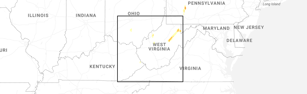
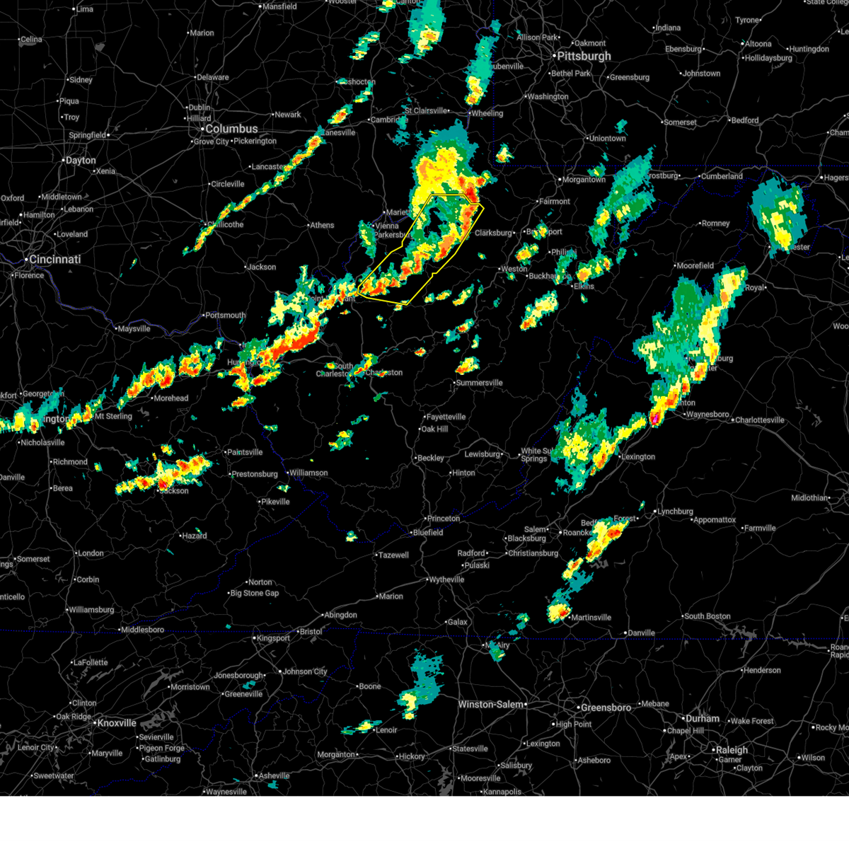
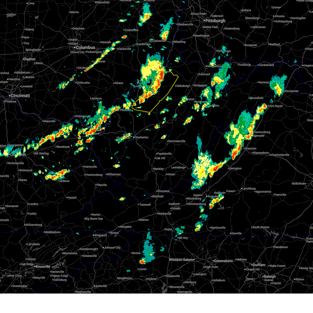
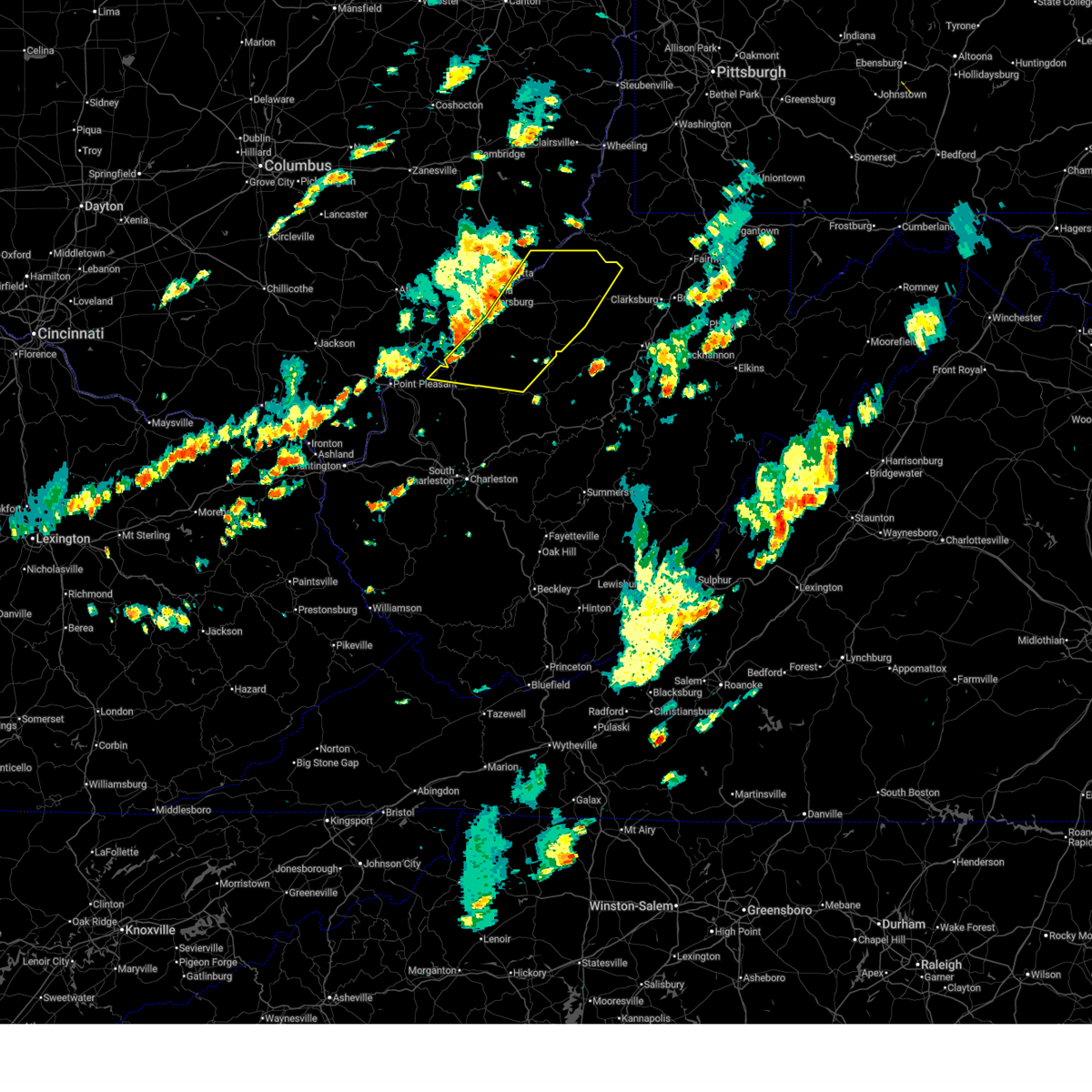
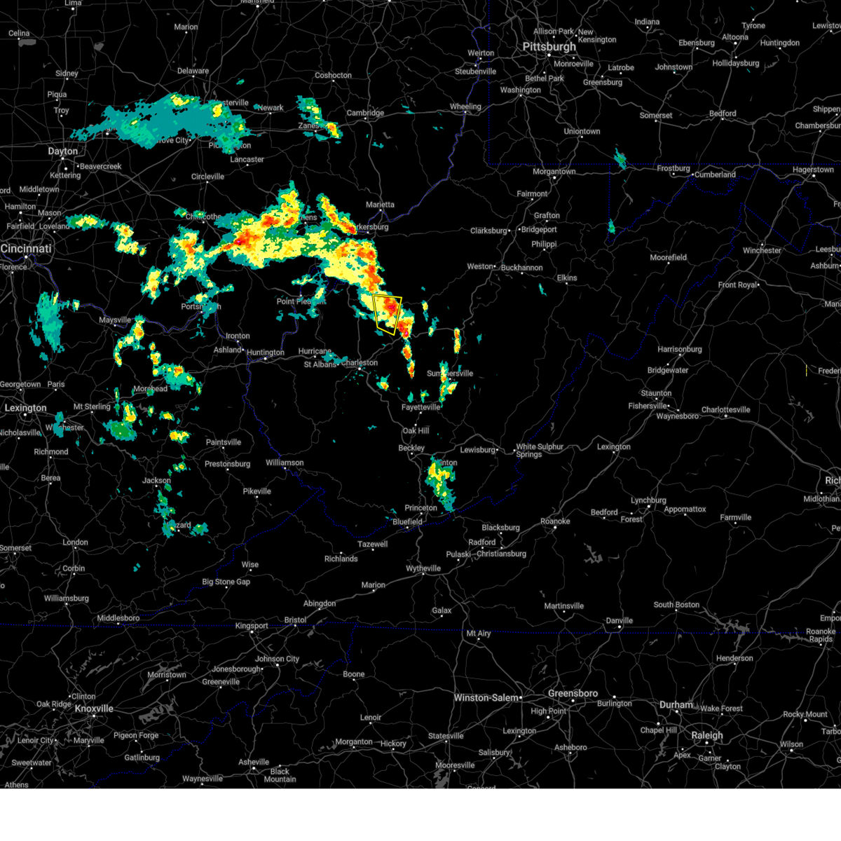
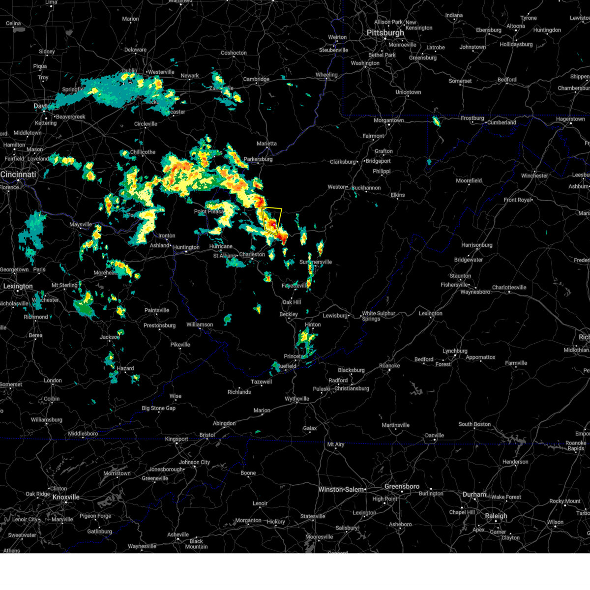
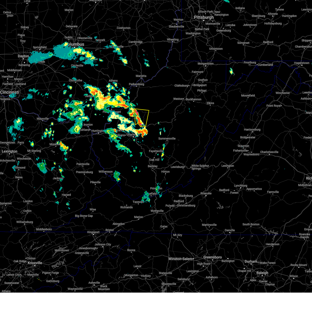
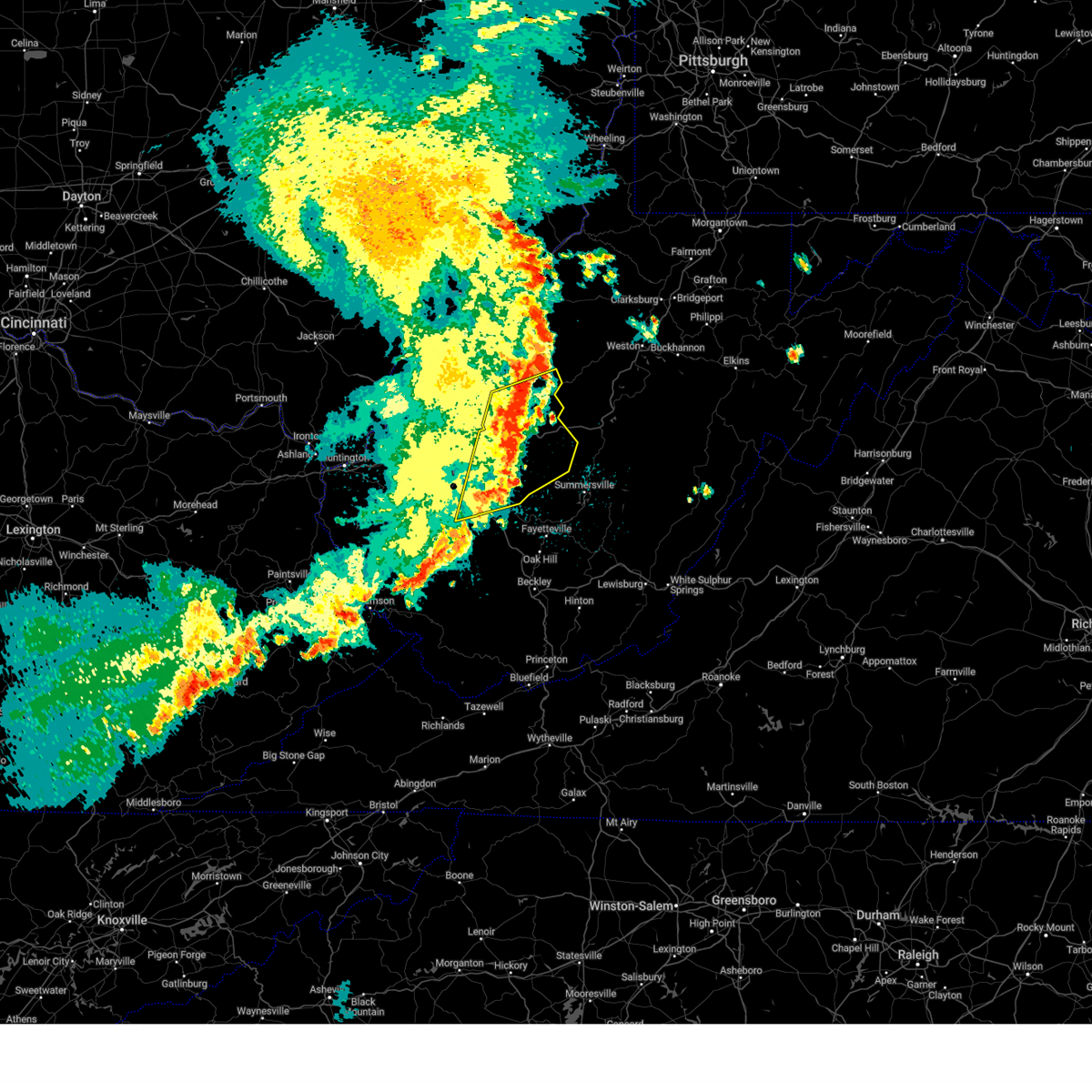
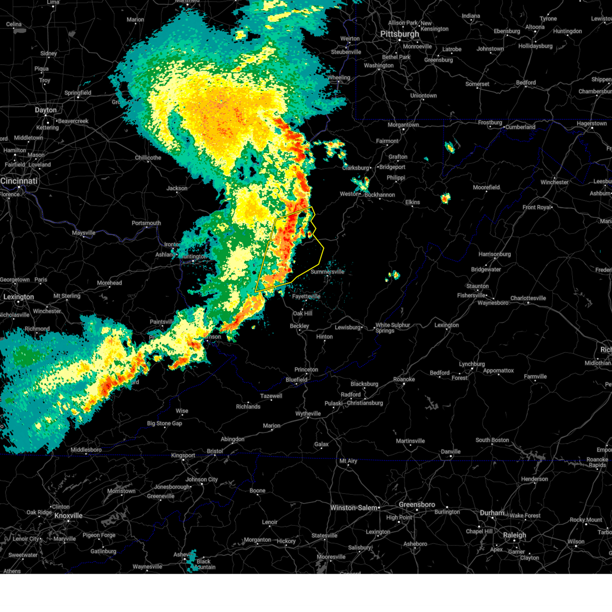
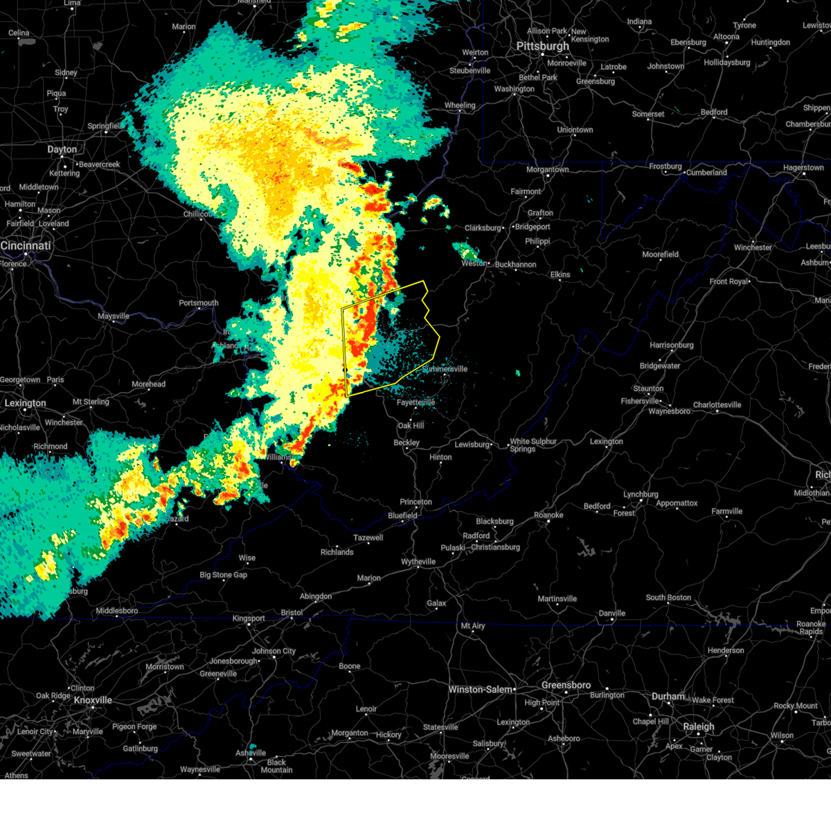
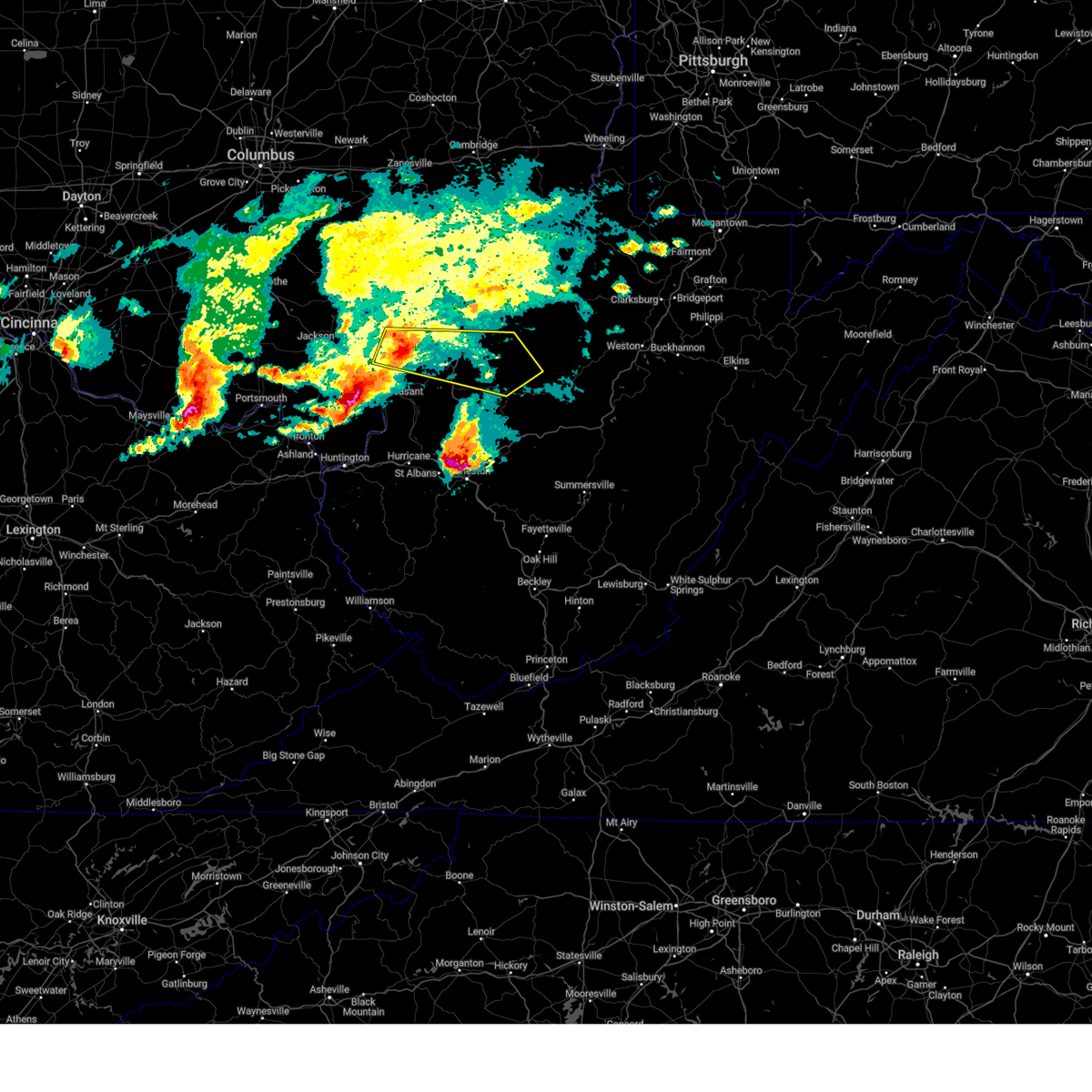
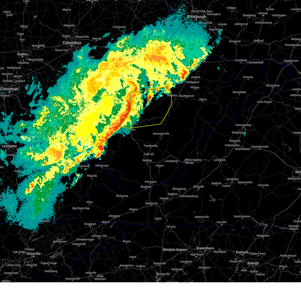
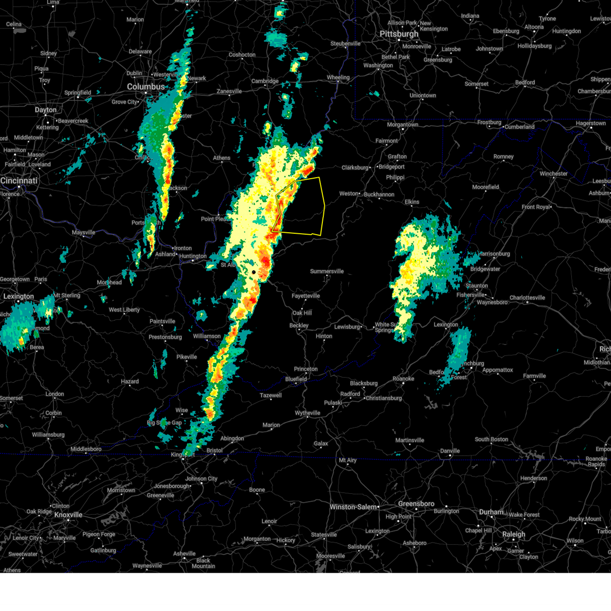
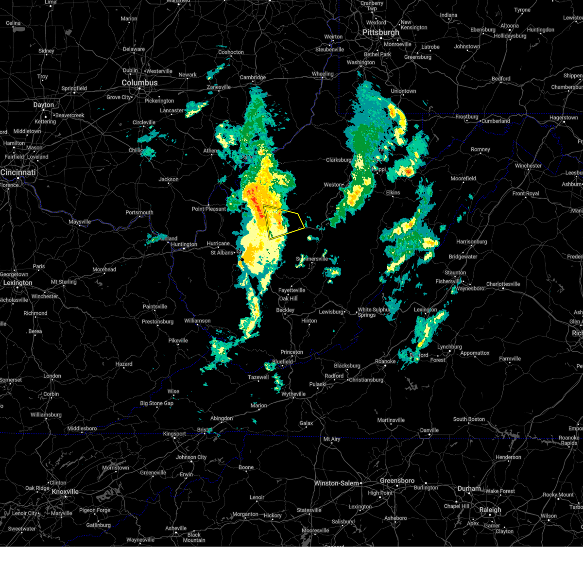
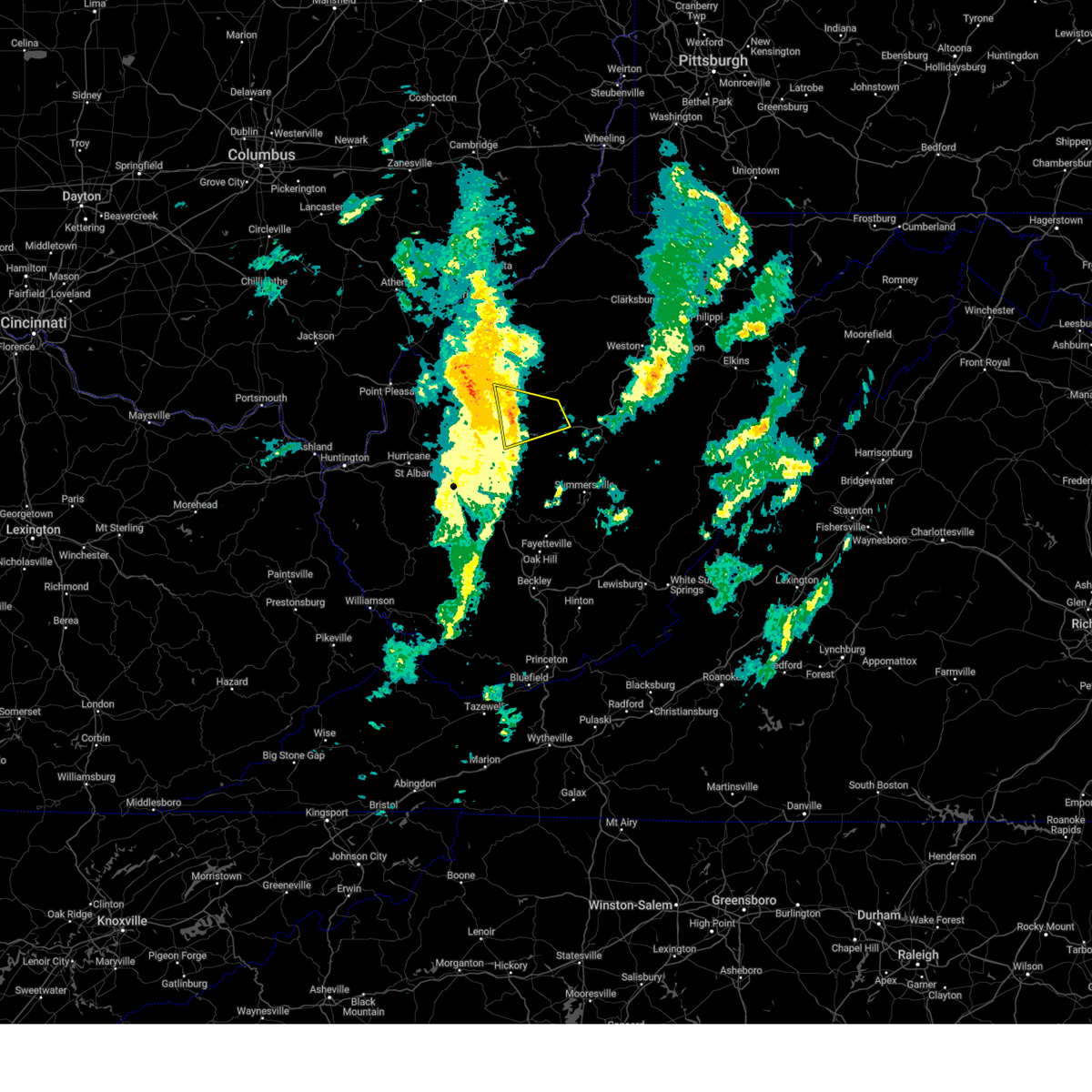
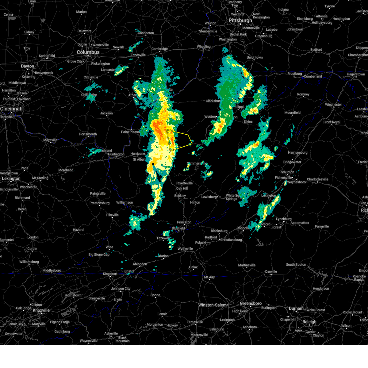
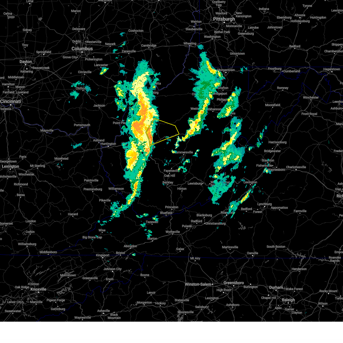
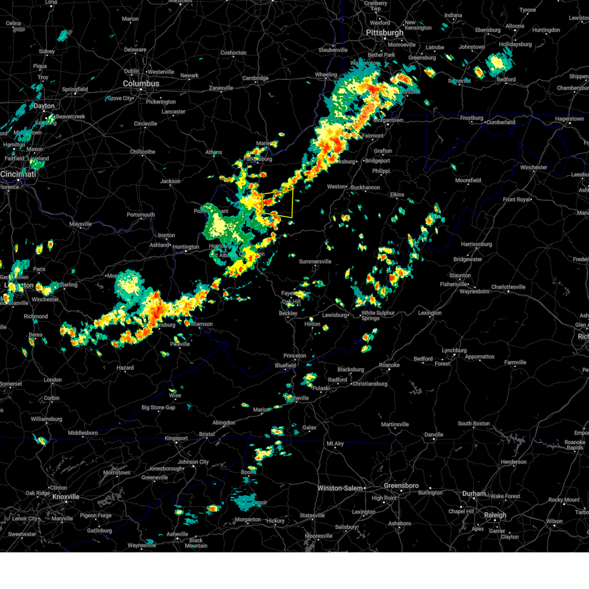
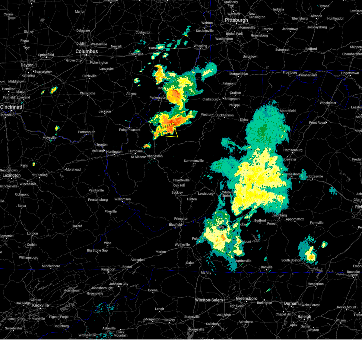
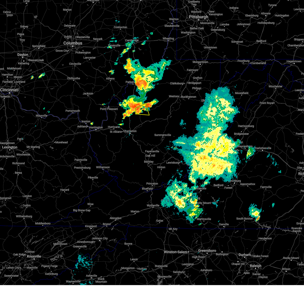
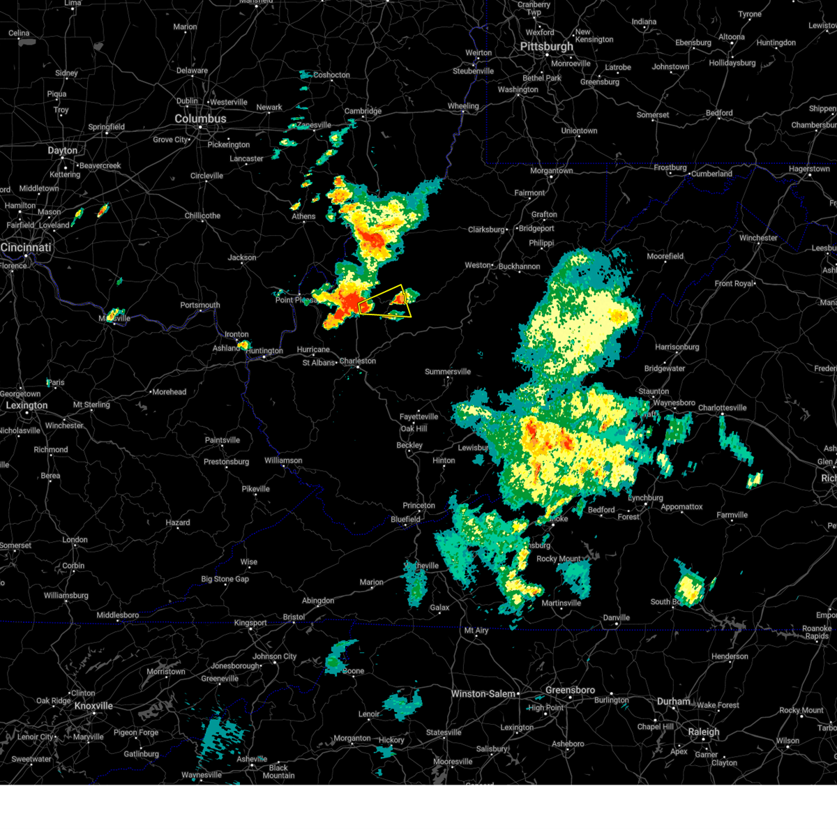
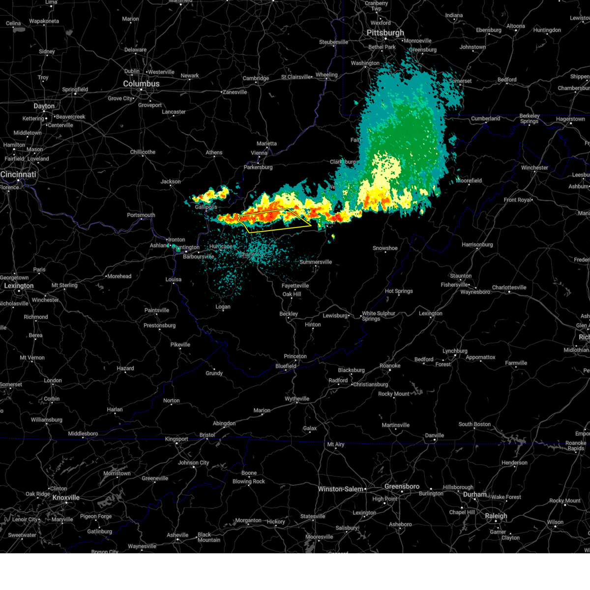
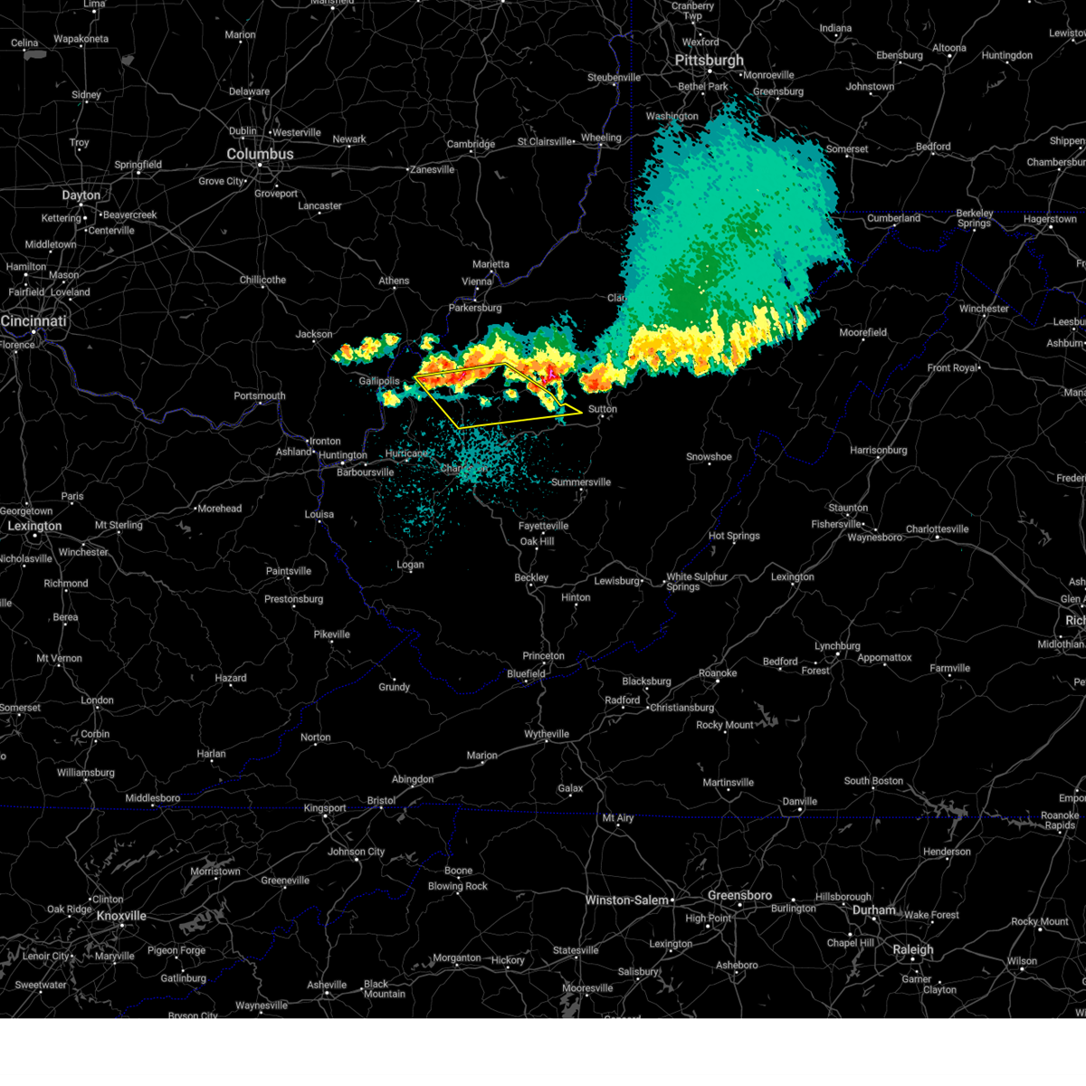
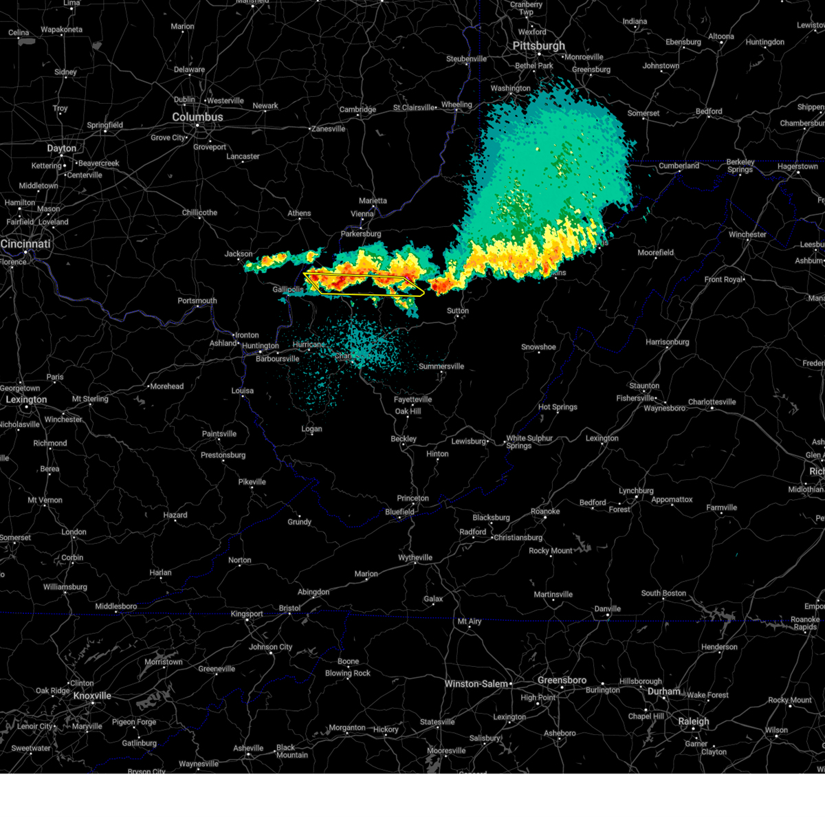
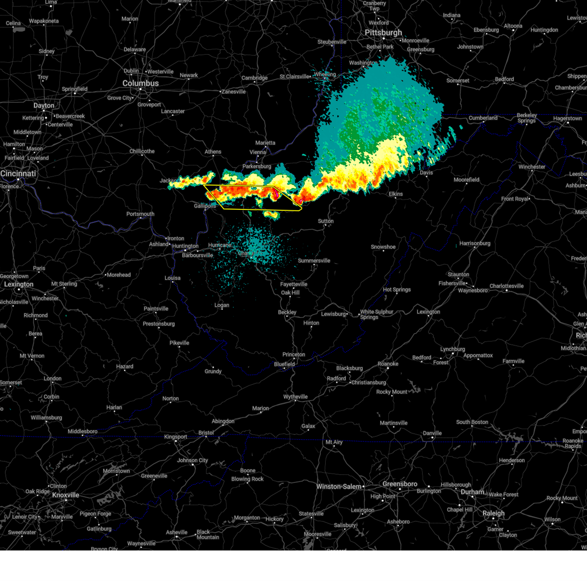
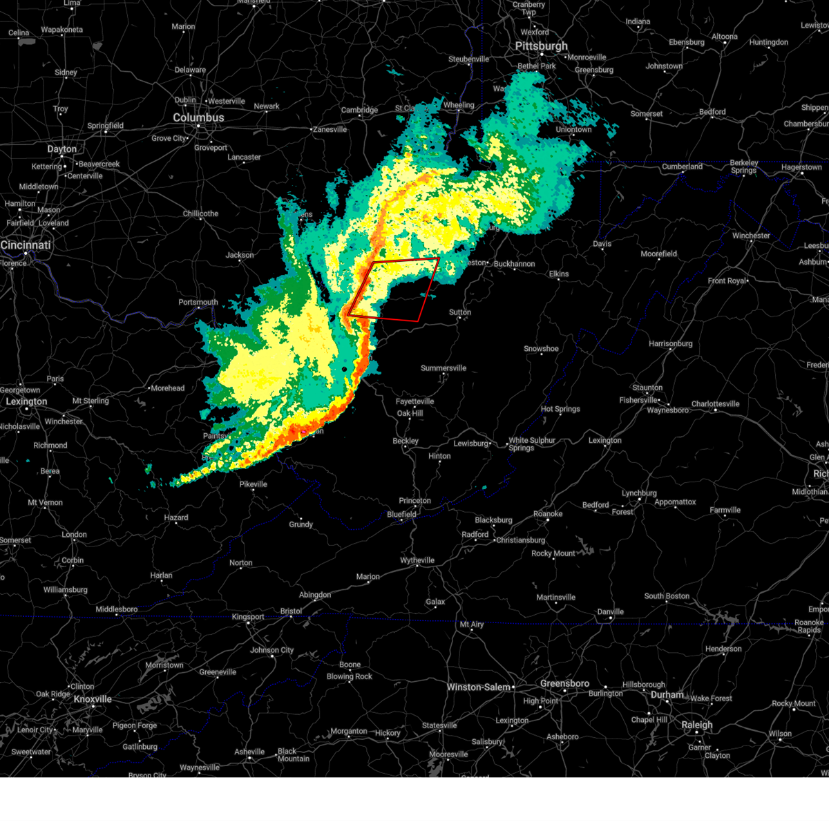
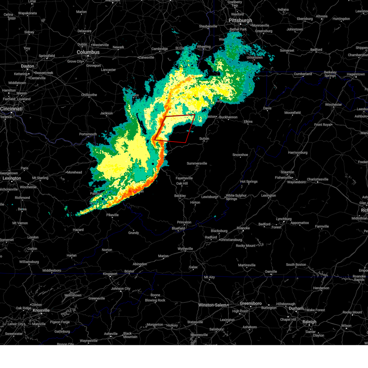
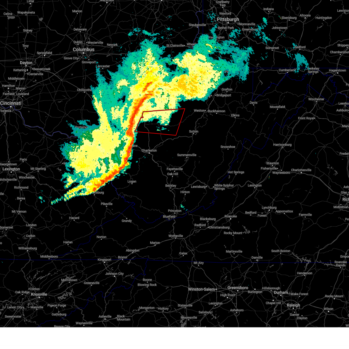
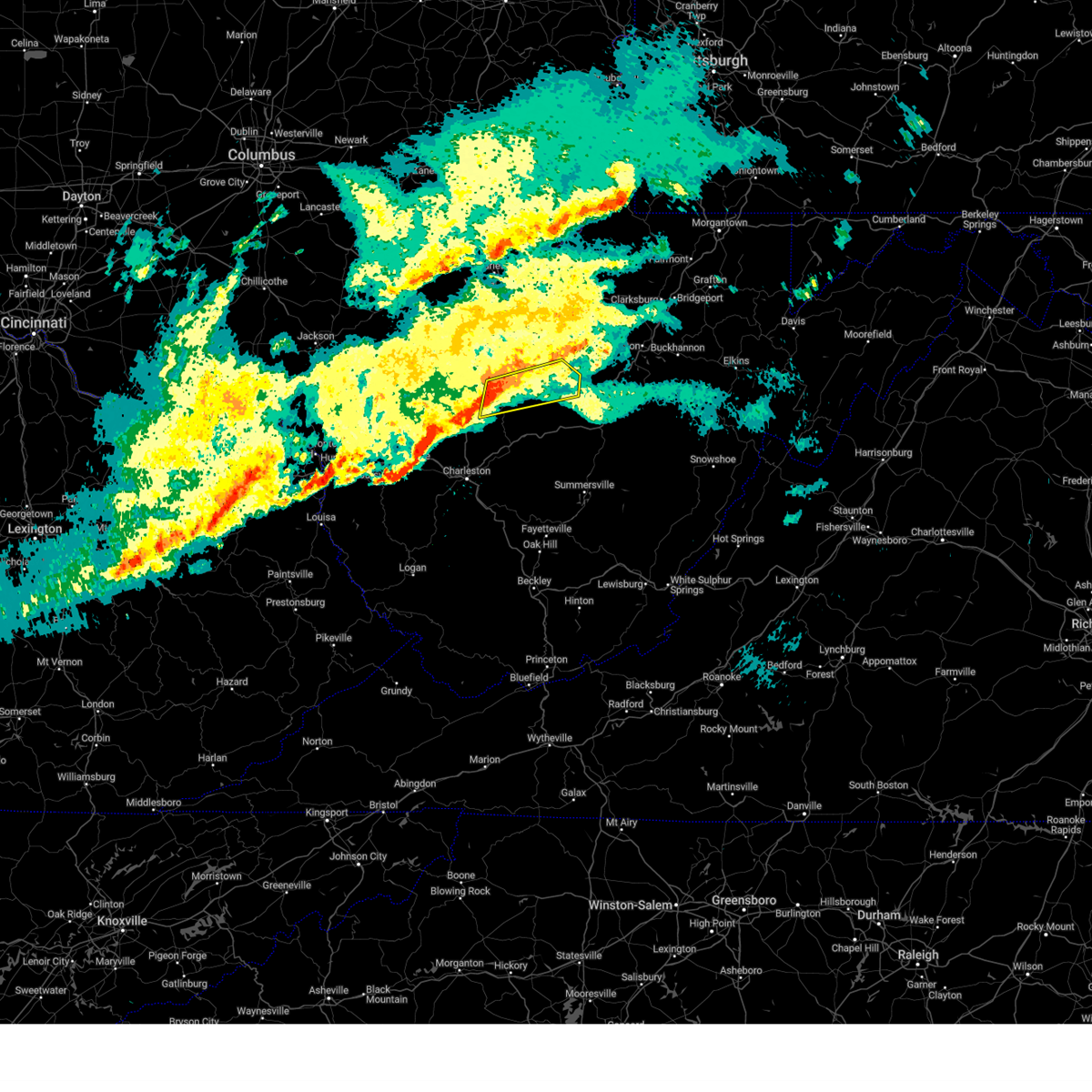
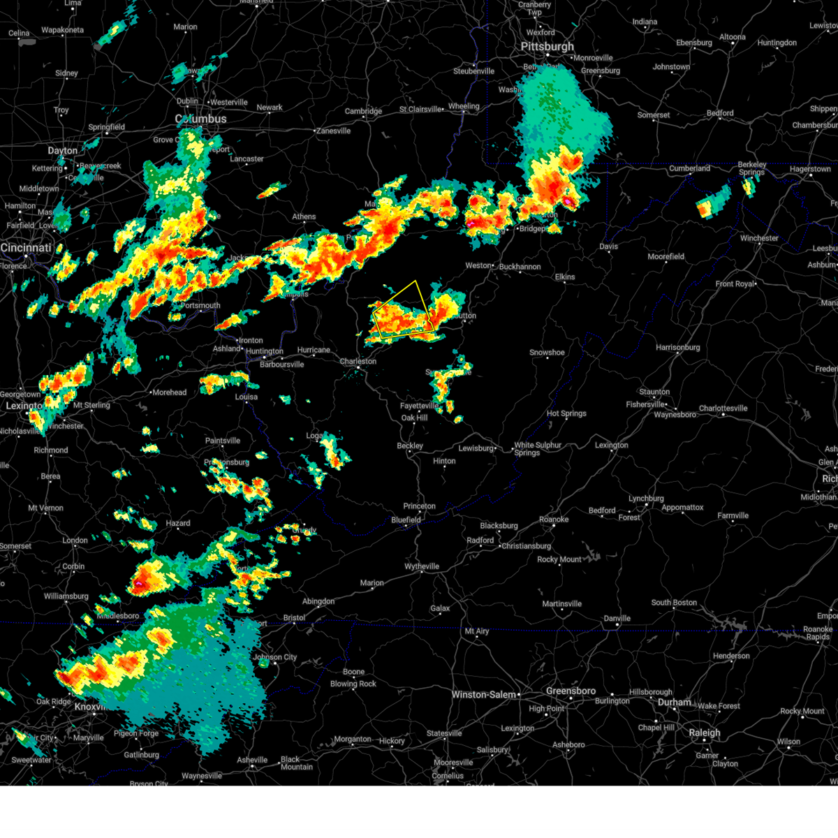
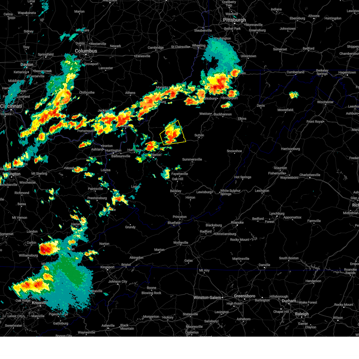
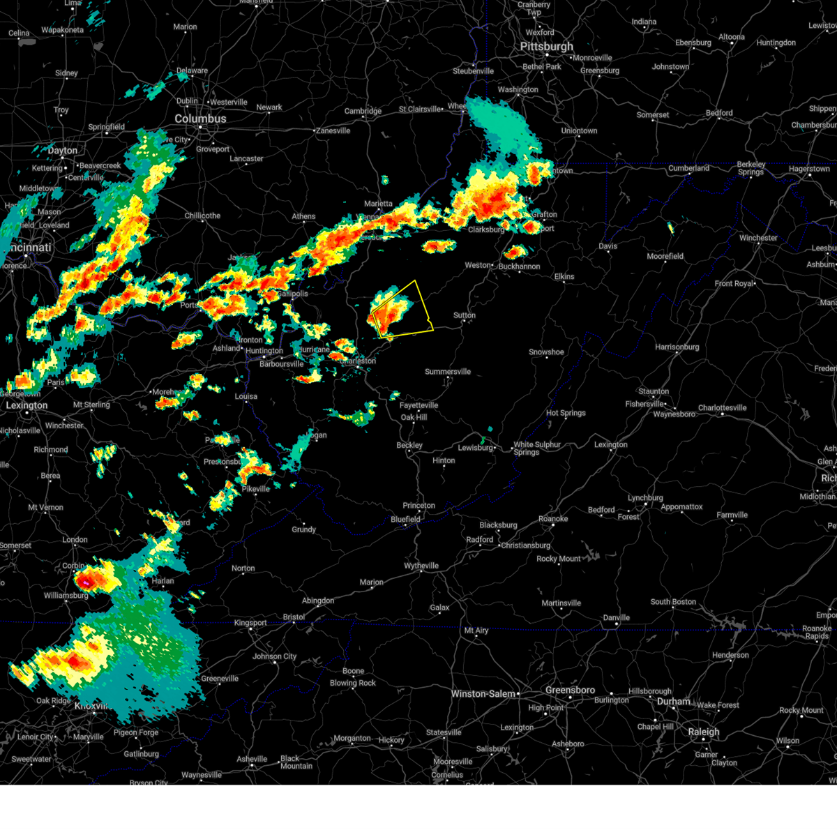
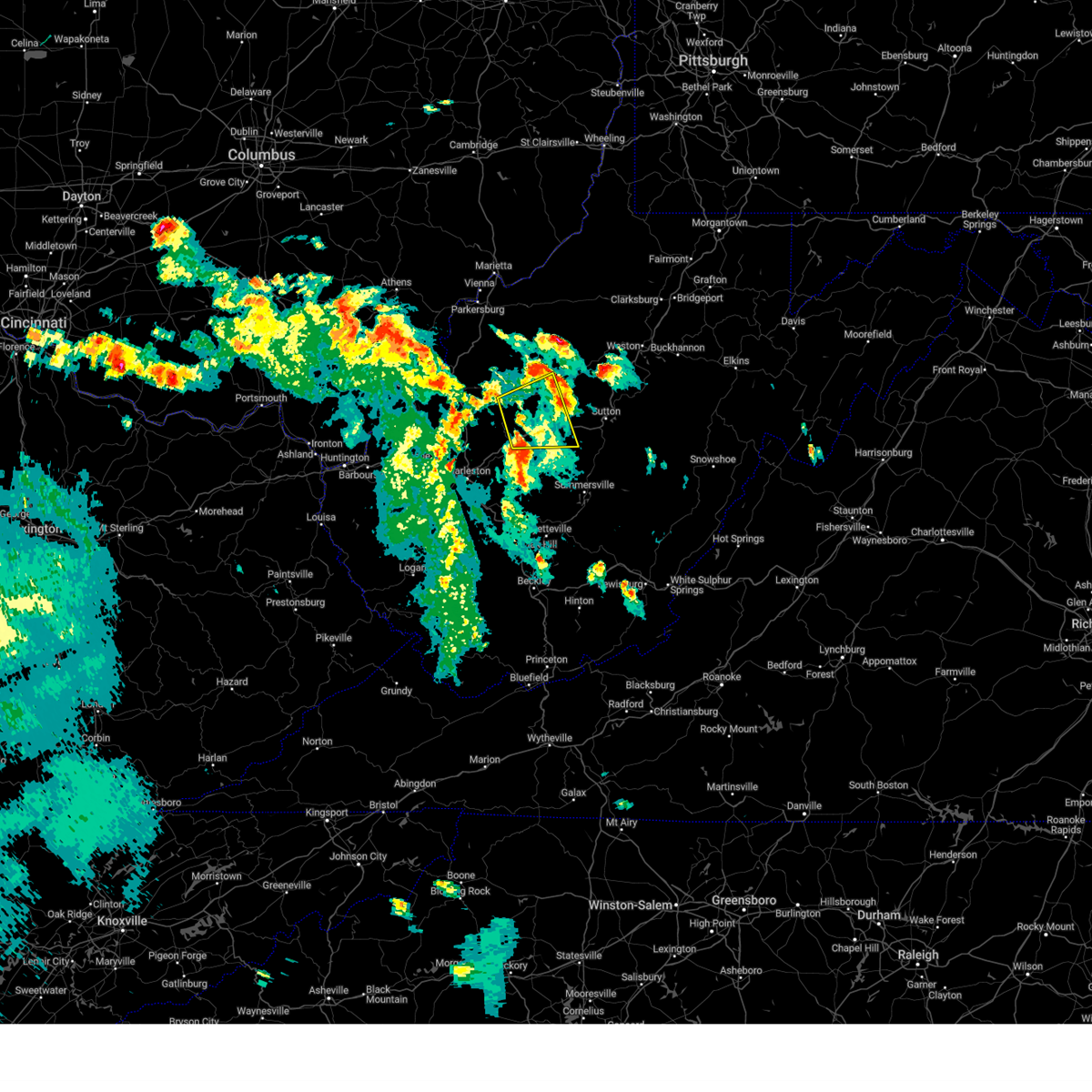
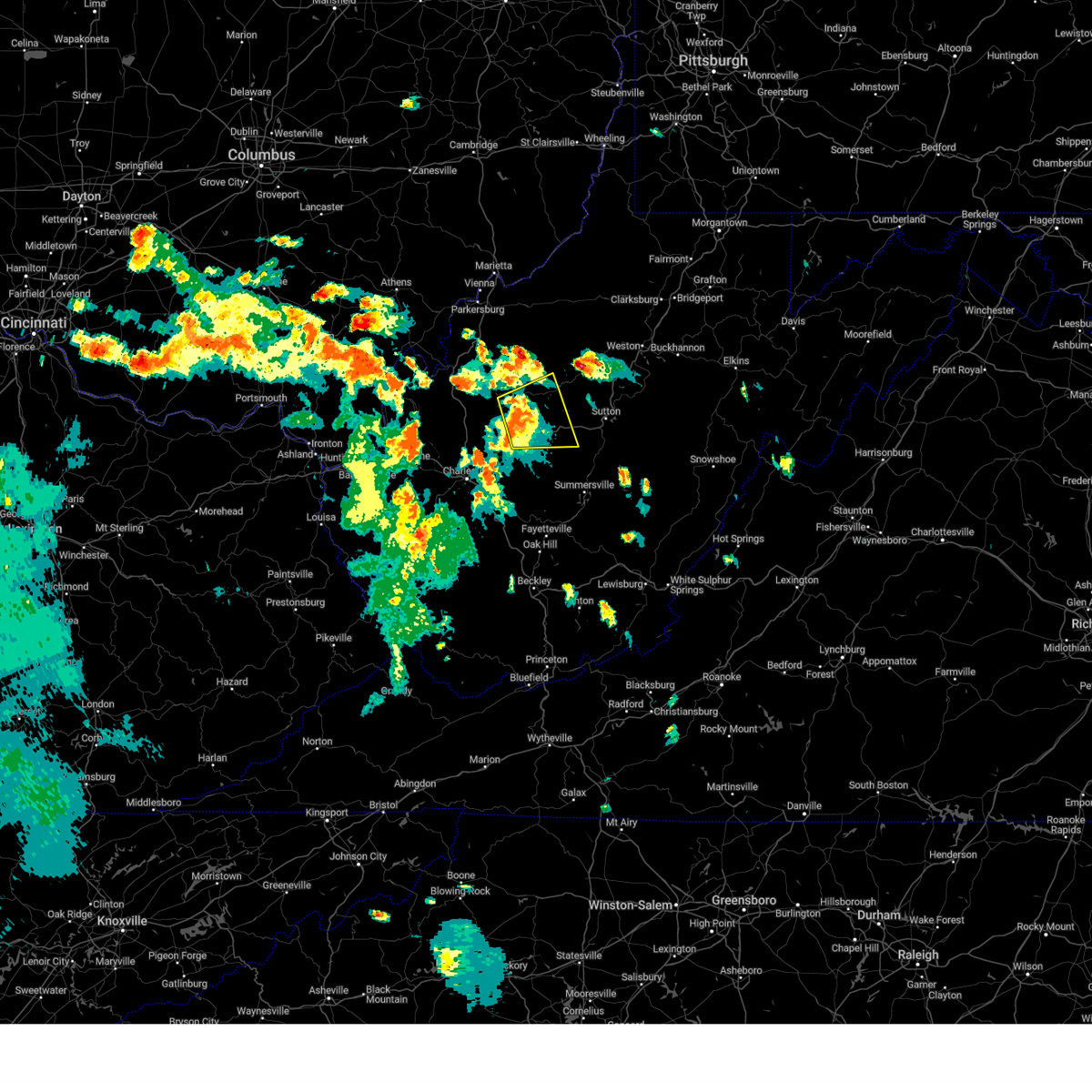
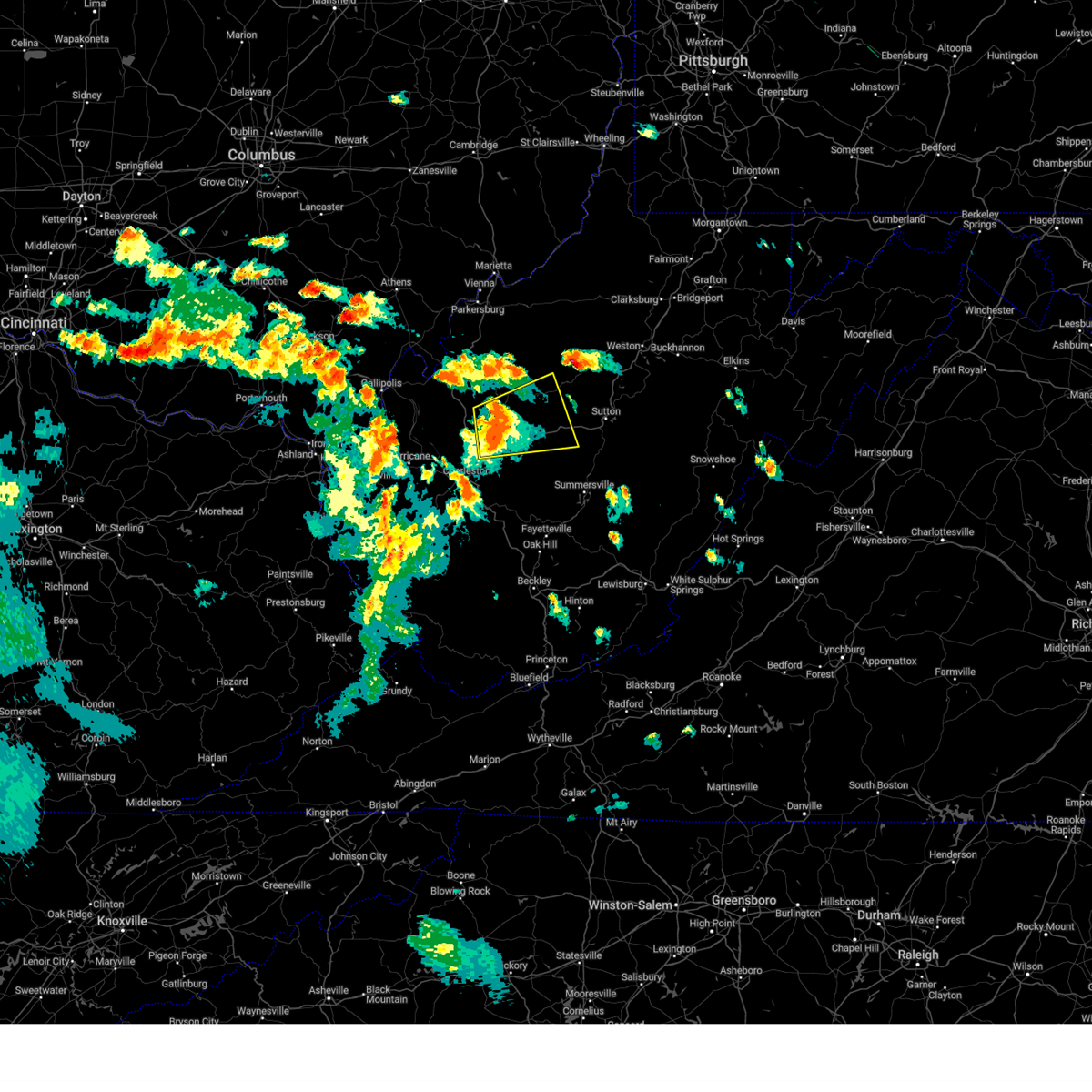
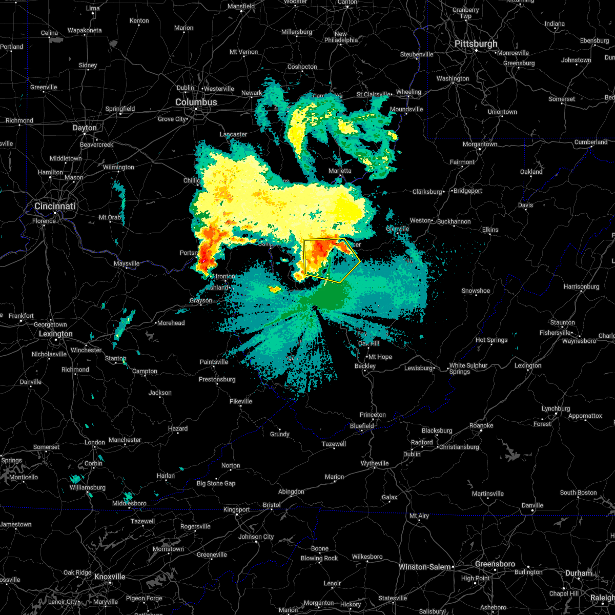
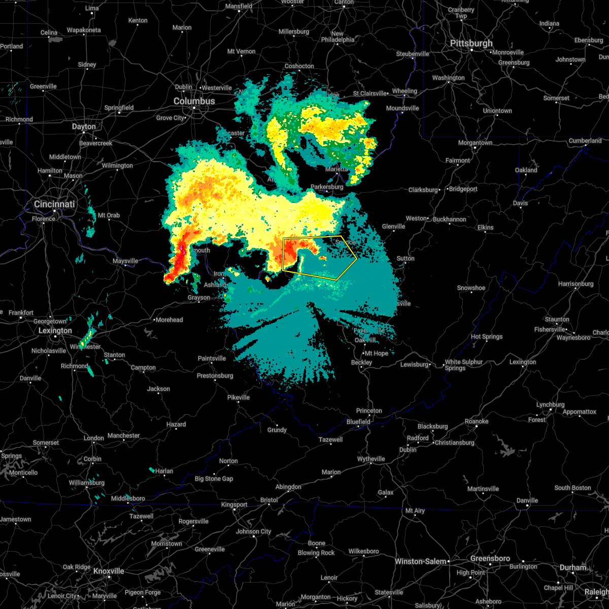
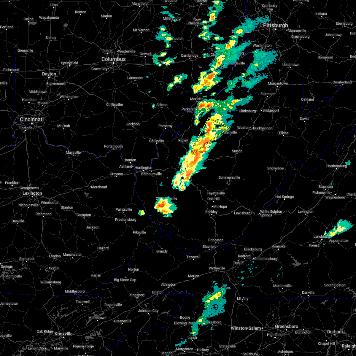
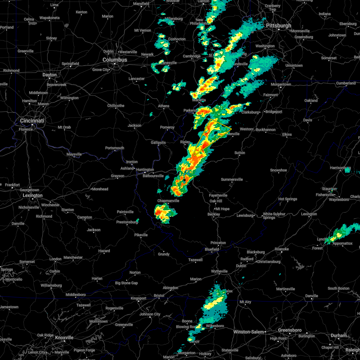
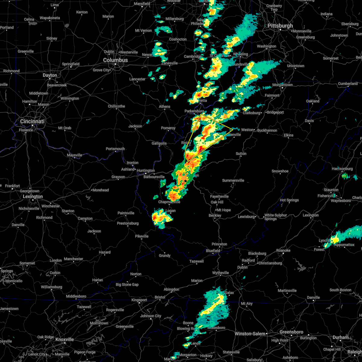
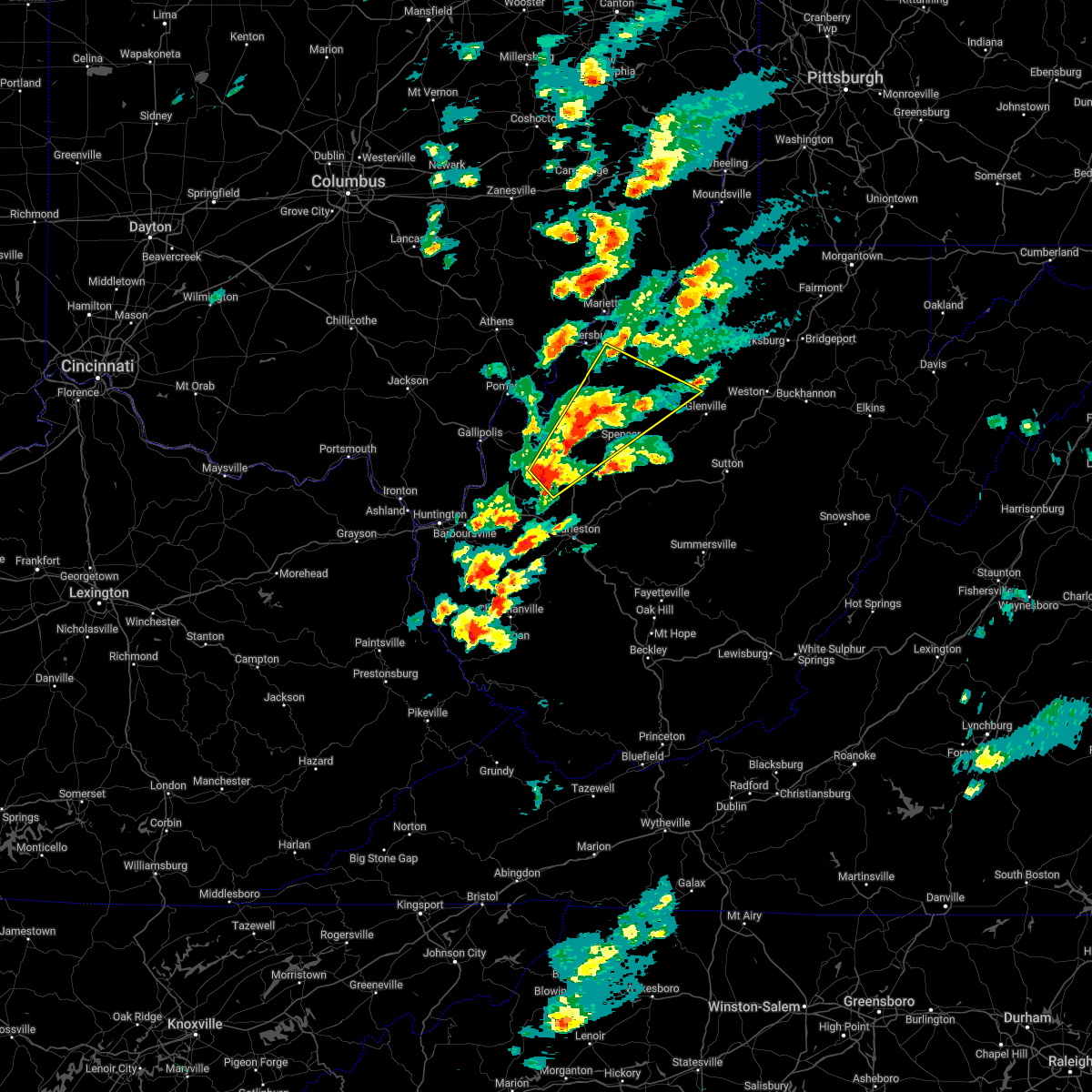
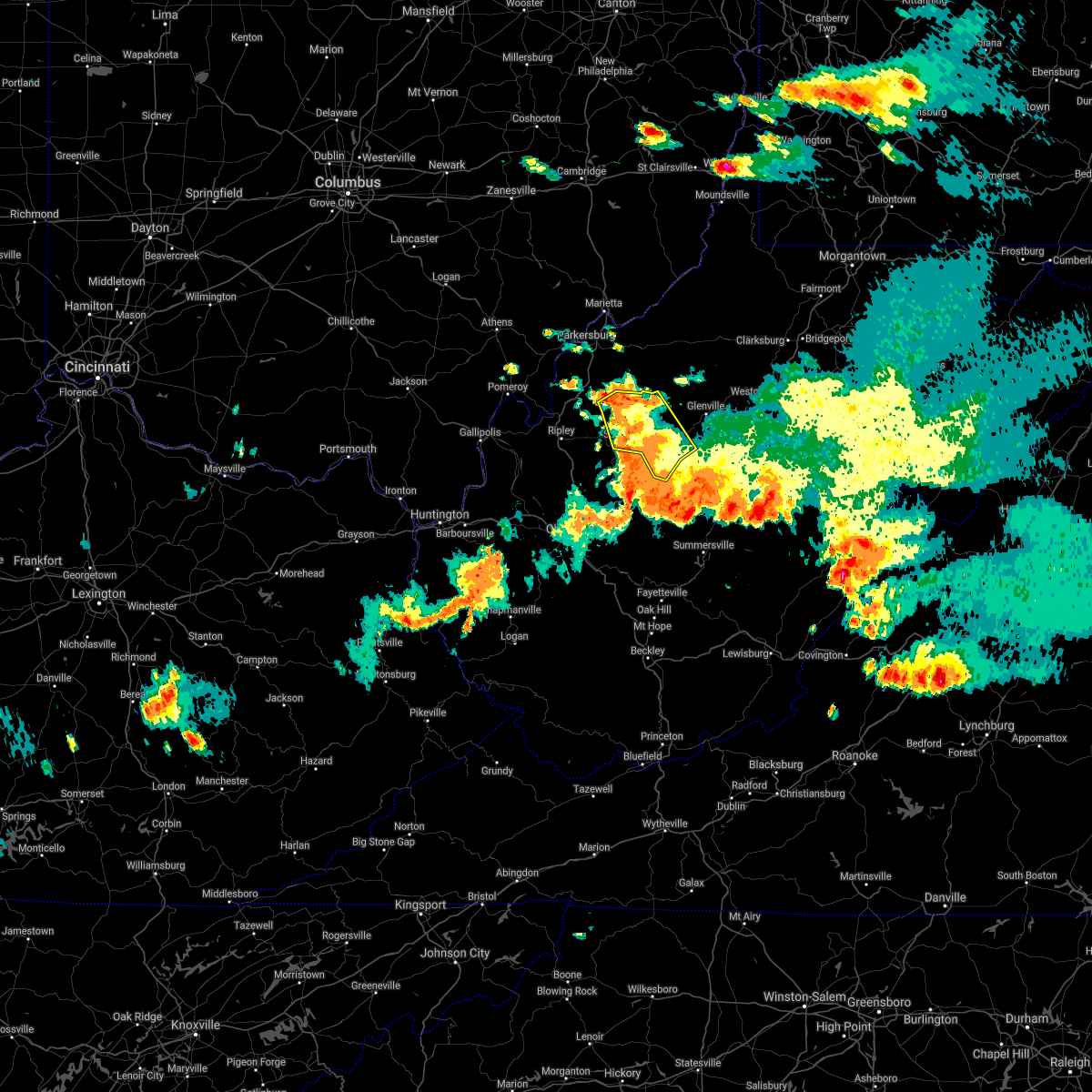
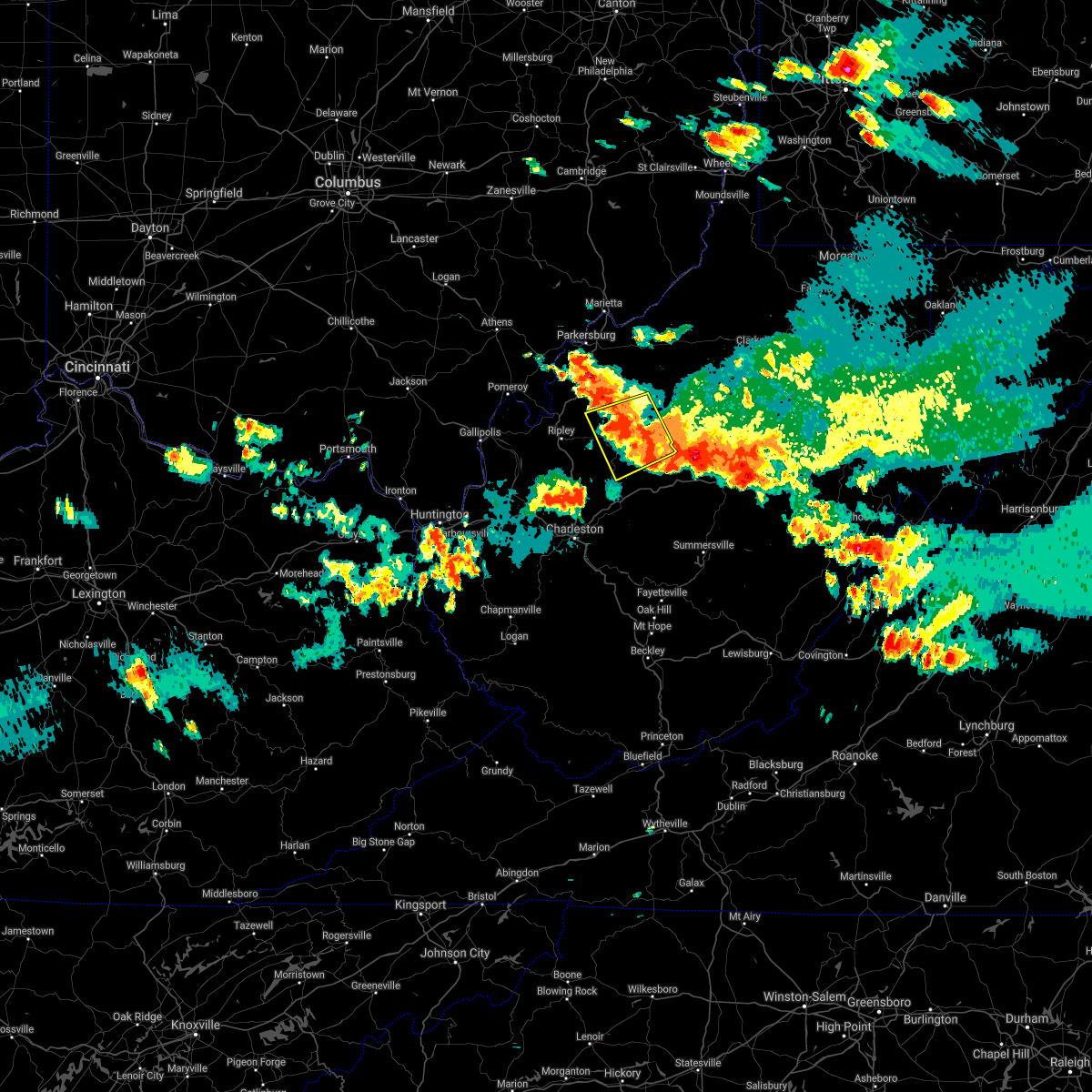
Hail Map for Spencer, WV
The Spencer, WV area has had 5 reports of on-the-ground hail by trained spotters, and has been under severe weather warnings 39 times during the past 12 months. Doppler radar has detected hail at or near Spencer, WV on 43 occasions, including 3 occasions during the past year.
| Name: | Spencer, WV |
| Where Located: | 34.8 miles NNE of Charleston, WV |
| Map: | Google Map for Spencer, WV |
| Population: | 2322 |
| Housing Units: | 1180 |
| More Info: | Search Google for Spencer, WV |
0
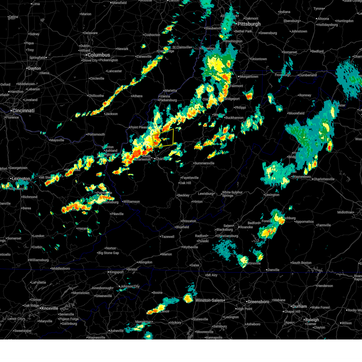
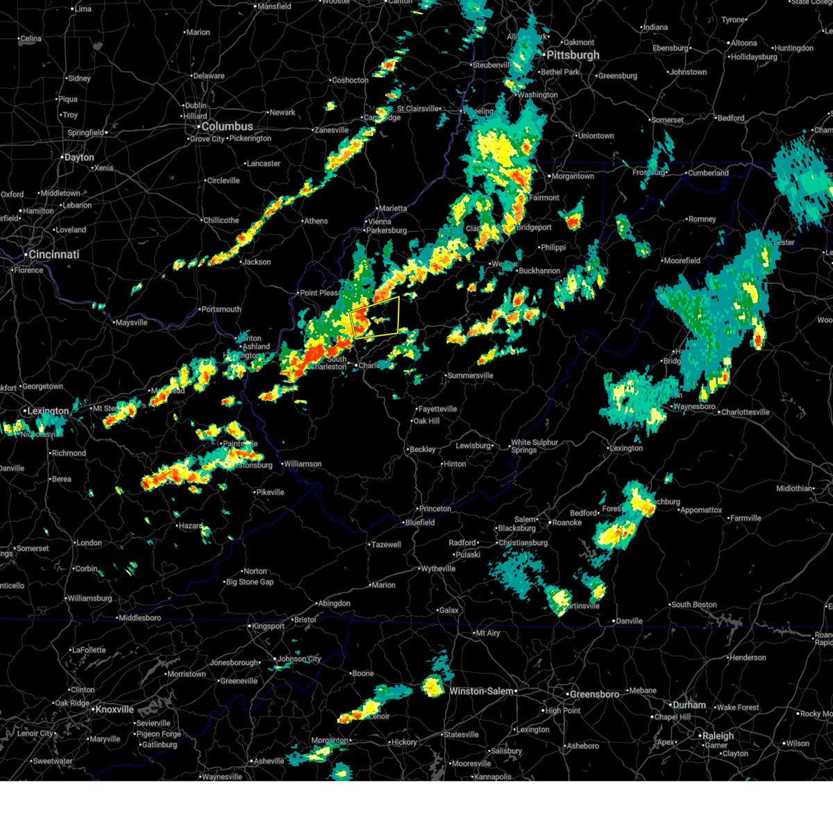
The Top Recent Hail Date for Spencer, WV is Sunday, May 4, 2025 (43rd out of 43)
Hail and Wind Damage Spotted near Spencer, WV
| Date / Time | Report Details |
|---|---|
| 6/19/2025 3:06 PM EDT |
 the severe thunderstorm warning has been cancelled and is no longer in effect the severe thunderstorm warning has been cancelled and is no longer in effect
|
| 6/19/2025 3:06 PM EDT |
 At 305 pm edt, a severe thunderstorm was located near kenna, or 14 miles southeast of ripley, moving east at 45 mph (radar indicated). Hazards include 60 mph wind gusts. Expect damage to roofs, siding, and trees. Locations impacted include, spencer, sissonville, kenna, harmony, looneyville, kentuck, walton, and gandeeville. At 305 pm edt, a severe thunderstorm was located near kenna, or 14 miles southeast of ripley, moving east at 45 mph (radar indicated). Hazards include 60 mph wind gusts. Expect damage to roofs, siding, and trees. Locations impacted include, spencer, sissonville, kenna, harmony, looneyville, kentuck, walton, and gandeeville.
|
| 6/19/2025 2:55 PM EDT |
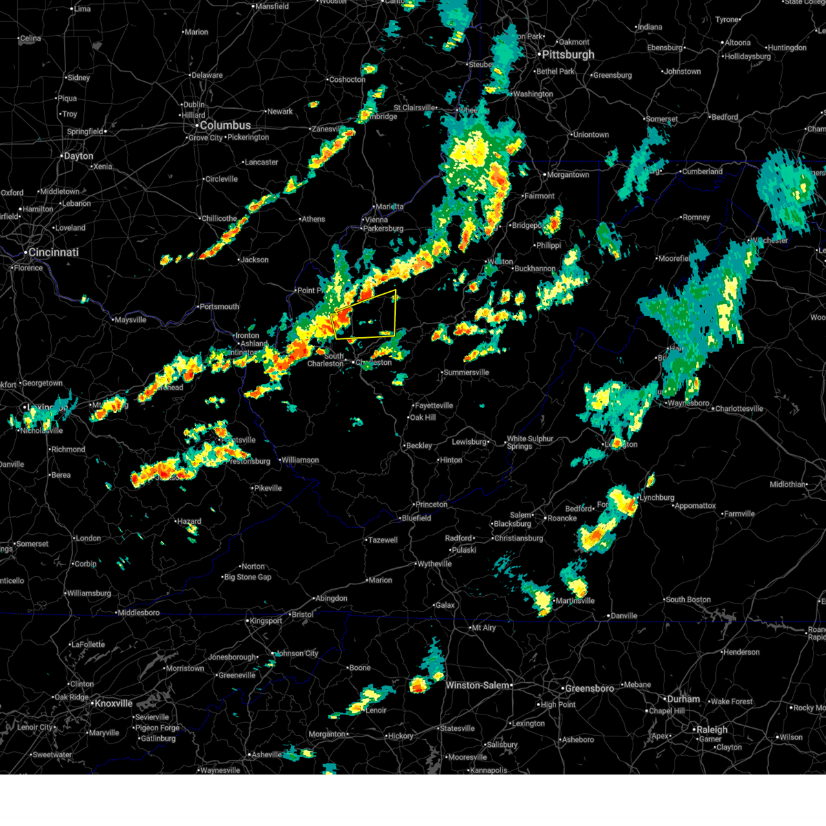 Svrrlx the national weather service in charleston west virginia has issued a * severe thunderstorm warning for, northeastern putnam county in western west virginia, northeastern kanawha county in central west virginia, western roane county in central west virginia, southeastern jackson county in northwestern west virginia, * until 330 pm edt. * at 255 pm edt, a severe thunderstorm was located near kenna, or 11 miles northeast of winfield, moving east at 45 mph (radar indicated). Hazards include 60 mph wind gusts. expect damage to roofs, siding, and trees Svrrlx the national weather service in charleston west virginia has issued a * severe thunderstorm warning for, northeastern putnam county in western west virginia, northeastern kanawha county in central west virginia, western roane county in central west virginia, southeastern jackson county in northwestern west virginia, * until 330 pm edt. * at 255 pm edt, a severe thunderstorm was located near kenna, or 11 miles northeast of winfield, moving east at 45 mph (radar indicated). Hazards include 60 mph wind gusts. expect damage to roofs, siding, and trees
|
| 6/19/2025 2:27 PM EDT |
 The storms which prompted the warning have weakened below severe limits, and have exited the warned area. therefore, the warning will be allowed to expire. however, gusty winds are still possible with these thunderstorms. The storms which prompted the warning have weakened below severe limits, and have exited the warned area. therefore, the warning will be allowed to expire. however, gusty winds are still possible with these thunderstorms.
|
| 6/19/2025 2:09 PM EDT |
 At 209 pm edt, severe thunderstorms were located along a line extending from near middlebourne to near north bend state park to 8 miles east of sandyville, moving east at 40 mph (radar indicated). Hazards include 60 mph wind gusts. Expect damage to roofs, siding, and trees. Locations impacted include, harrisville, elizabeth, middlebourne, pennsboro, west union, sandyville, north bend state park, ellenboro, cairo, reedy, pullman, friendly, alma, cherry, smithville, maxwell, lucille, mountain, lima, and hebron. At 209 pm edt, severe thunderstorms were located along a line extending from near middlebourne to near north bend state park to 8 miles east of sandyville, moving east at 40 mph (radar indicated). Hazards include 60 mph wind gusts. Expect damage to roofs, siding, and trees. Locations impacted include, harrisville, elizabeth, middlebourne, pennsboro, west union, sandyville, north bend state park, ellenboro, cairo, reedy, pullman, friendly, alma, cherry, smithville, maxwell, lucille, mountain, lima, and hebron.
|
| 6/19/2025 2:09 PM EDT |
 the severe thunderstorm warning has been cancelled and is no longer in effect the severe thunderstorm warning has been cancelled and is no longer in effect
|
| 6/19/2025 1:47 PM EDT |
 Svrrlx the national weather service in charleston west virginia has issued a * severe thunderstorm warning for, east central washington county in southeastern ohio, pleasants county in northwestern west virginia, northwestern calhoun county in north central west virginia, ritchie county in northwestern west virginia, western doddridge county in northern west virginia, wirt county in northwestern west virginia, tyler county in northern west virginia, northwestern roane county in central west virginia, northern jackson county in northwestern west virginia, central wood county in northwestern west virginia, * until 230 pm edt. * at 147 pm edt, severe thunderstorms were located along a line extending from near st. marys to near mineralwells to near ravenswood, moving east at 40 mph (radar indicated). Hazards include 60 mph wind gusts. expect damage to roofs, siding, and trees Svrrlx the national weather service in charleston west virginia has issued a * severe thunderstorm warning for, east central washington county in southeastern ohio, pleasants county in northwestern west virginia, northwestern calhoun county in north central west virginia, ritchie county in northwestern west virginia, western doddridge county in northern west virginia, wirt county in northwestern west virginia, tyler county in northern west virginia, northwestern roane county in central west virginia, northern jackson county in northwestern west virginia, central wood county in northwestern west virginia, * until 230 pm edt. * at 147 pm edt, severe thunderstorms were located along a line extending from near st. marys to near mineralwells to near ravenswood, moving east at 40 mph (radar indicated). Hazards include 60 mph wind gusts. expect damage to roofs, siding, and trees
|
| 5/4/2025 4:44 PM EDT |
 The storm which prompted the warning has weakened below severe limits, and no longer poses an immediate threat to life or property. therefore, the warning will be allowed to expire. however, small hail, gusty winds and heavy rain are still possible with this thunderstorm. to report severe weather, contact your nearest law enforcement agency. they will relay your report to the national weather service charleston west virginia. The storm which prompted the warning has weakened below severe limits, and no longer poses an immediate threat to life or property. therefore, the warning will be allowed to expire. however, small hail, gusty winds and heavy rain are still possible with this thunderstorm. to report severe weather, contact your nearest law enforcement agency. they will relay your report to the national weather service charleston west virginia.
|
| 5/4/2025 4:34 PM EDT |
 the severe thunderstorm warning has been cancelled and is no longer in effect the severe thunderstorm warning has been cancelled and is no longer in effect
|
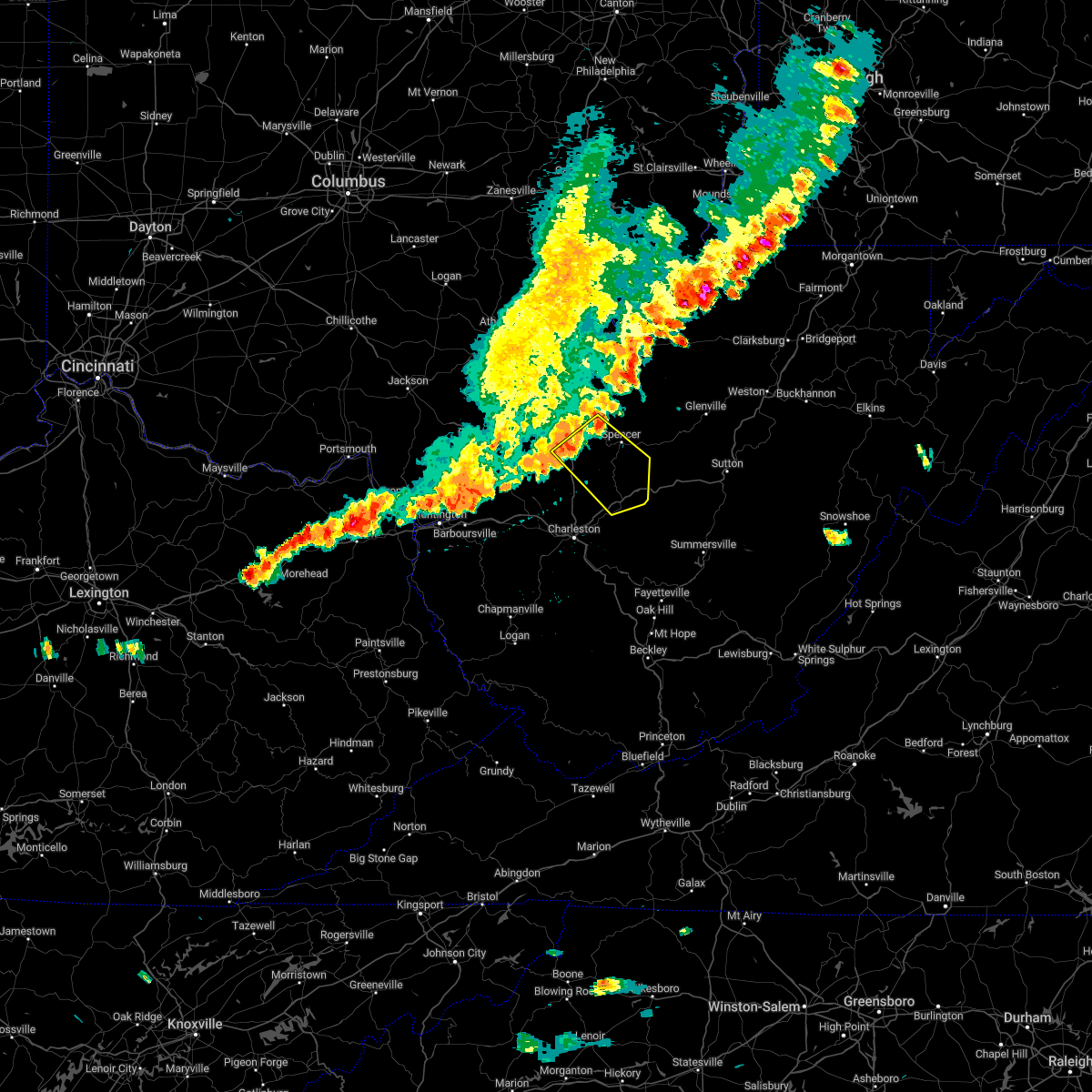
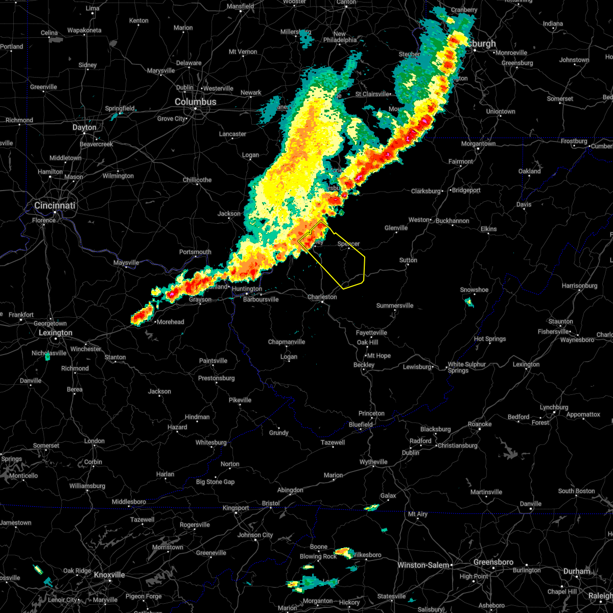
| 5/4/2025 4:34 PM EDT |
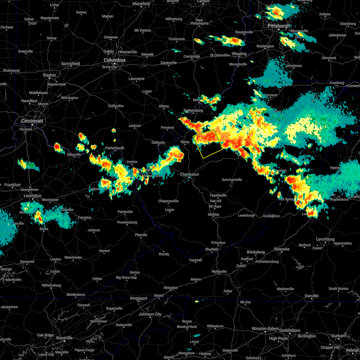
 At 433 pm edt, a severe thunderstorm was located near spencer, moving north at 25 mph (radar indicated). Hazards include 60 mph wind gusts and half dollar size hail. Hail damage to vehicles is expected. expect wind damage to roofs, siding, and trees. Locations impacted include, spencer, harmony, walton, and gandeeville. At 433 pm edt, a severe thunderstorm was located near spencer, moving north at 25 mph (radar indicated). Hazards include 60 mph wind gusts and half dollar size hail. Hail damage to vehicles is expected. expect wind damage to roofs, siding, and trees. Locations impacted include, spencer, harmony, walton, and gandeeville.
|
| 5/4/2025 4:10 PM EDT |
 Svrrlx the national weather service in charleston west virginia has issued a * severe thunderstorm warning for, southwestern roane county in central west virginia, southeastern jackson county in northwestern west virginia, * until 445 pm edt. * at 409 pm edt, a severe thunderstorm was located 9 miles northwest of clendenin, or 16 miles southwest of spencer, moving north at 25 mph (radar indicated). Hazards include 60 mph wind gusts and half dollar size hail. Hail damage to vehicles is expected. Expect wind damage to roofs, siding, and trees. Svrrlx the national weather service in charleston west virginia has issued a * severe thunderstorm warning for, southwestern roane county in central west virginia, southeastern jackson county in northwestern west virginia, * until 445 pm edt. * at 409 pm edt, a severe thunderstorm was located 9 miles northwest of clendenin, or 16 miles southwest of spencer, moving north at 25 mph (radar indicated). Hazards include 60 mph wind gusts and half dollar size hail. Hail damage to vehicles is expected. Expect wind damage to roofs, siding, and trees.
|
| 4/29/2025 10:06 PM EDT |
 the severe thunderstorm warning has been cancelled and is no longer in effect the severe thunderstorm warning has been cancelled and is no longer in effect
|
| 4/29/2025 10:06 PM EDT |
 At 1006 pm edt, severe thunderstorms were located along a line extending from 6 miles northwest of arnoldsburg to glasgow, moving northeast at 60 mph (radar indicated). Hazards include 60 mph wind gusts. Expect damage to roofs, siding, and trees. Locations impacted include, nebo, millstone, charleston, pinch, cedar grove, procious, glasgow, mount zion, indore, glen, left hand, ivydale, coal fork, pond gap, elkview, racine, clay, clendenin, pratt, and harmony. At 1006 pm edt, severe thunderstorms were located along a line extending from 6 miles northwest of arnoldsburg to glasgow, moving northeast at 60 mph (radar indicated). Hazards include 60 mph wind gusts. Expect damage to roofs, siding, and trees. Locations impacted include, nebo, millstone, charleston, pinch, cedar grove, procious, glasgow, mount zion, indore, glen, left hand, ivydale, coal fork, pond gap, elkview, racine, clay, clendenin, pratt, and harmony.
|
| 4/29/2025 9:53 PM EDT |
 Svrrlx the national weather service in charleston west virginia has issued a * severe thunderstorm warning for, calhoun county in north central west virginia, northeastern putnam county in western west virginia, kanawha county in central west virginia, roane county in central west virginia, clay county in north central west virginia, southeastern jackson county in northwestern west virginia, northern boone county in central west virginia, * until 1100 pm edt. * at 952 pm edt, a severe thunderstorm was located over dunbar, or near charleston, moving east at 45 mph (radar indicated). Hazards include 60 mph wind gusts. expect damage to roofs, siding, and trees Svrrlx the national weather service in charleston west virginia has issued a * severe thunderstorm warning for, calhoun county in north central west virginia, northeastern putnam county in western west virginia, kanawha county in central west virginia, roane county in central west virginia, clay county in north central west virginia, southeastern jackson county in northwestern west virginia, northern boone county in central west virginia, * until 1100 pm edt. * at 952 pm edt, a severe thunderstorm was located over dunbar, or near charleston, moving east at 45 mph (radar indicated). Hazards include 60 mph wind gusts. expect damage to roofs, siding, and trees
|
| 4/14/2025 6:42 PM EDT |
 The storm which prompted the warning has weakened below severe limits, and no longer poses an immediate threat to life or property. therefore, the warning will be allowed to expire. however, gusty winds are still possible with this thunderstorm. a severe thunderstorm watch remains in effect until 1100 pm edt for central, north central and northwestern west virginia. The storm which prompted the warning has weakened below severe limits, and no longer poses an immediate threat to life or property. therefore, the warning will be allowed to expire. however, gusty winds are still possible with this thunderstorm. a severe thunderstorm watch remains in effect until 1100 pm edt for central, north central and northwestern west virginia.
|
| 4/14/2025 6:22 PM EDT |
 At 621 pm edt, a severe thunderstorm was located near spencer, moving east at 50 mph (radar indicated). Hazards include 60 mph wind gusts and penny size hail. Expect damage to roofs, siding, and trees. Locations impacted include, creston, lucille, annamoriah, spencer, and reedy. At 621 pm edt, a severe thunderstorm was located near spencer, moving east at 50 mph (radar indicated). Hazards include 60 mph wind gusts and penny size hail. Expect damage to roofs, siding, and trees. Locations impacted include, creston, lucille, annamoriah, spencer, and reedy.
|
| 4/14/2025 6:22 PM EDT |
 the severe thunderstorm warning has been cancelled and is no longer in effect the severe thunderstorm warning has been cancelled and is no longer in effect
|
| 4/14/2025 6:03 PM EDT |
 At 602 pm edt, a severe thunderstorm was located over sandyville, or 8 miles northeast of ripley, moving east at 50 mph (radar indicated). Hazards include 60 mph wind gusts and quarter size hail. Hail damage to vehicles is expected. expect wind damage to roofs, siding, and trees. Locations impacted include, lucille, cherry, sandyville, peewee, reedy, creston, annamoriah, spencer, leroy, munday, palestine, and ravenswood. At 602 pm edt, a severe thunderstorm was located over sandyville, or 8 miles northeast of ripley, moving east at 50 mph (radar indicated). Hazards include 60 mph wind gusts and quarter size hail. Hail damage to vehicles is expected. expect wind damage to roofs, siding, and trees. Locations impacted include, lucille, cherry, sandyville, peewee, reedy, creston, annamoriah, spencer, leroy, munday, palestine, and ravenswood.
|
| 4/14/2025 6:03 PM EDT |
 the severe thunderstorm warning has been cancelled and is no longer in effect the severe thunderstorm warning has been cancelled and is no longer in effect
|
| 4/14/2025 5:40 PM EDT |
 Svrrlx the national weather service in charleston west virginia has issued a * severe thunderstorm warning for, central meigs county in southeastern ohio, northeastern gallia county in southeastern ohio, northwestern calhoun county in north central west virginia, north central mason county in western west virginia, wirt county in northwestern west virginia, northwestern roane county in central west virginia, northern jackson county in northwestern west virginia, southwestern wood county in northwestern west virginia, * until 645 pm edt. * at 540 pm edt, a severe thunderstorm was located over pomeroy, moving east at 50 mph (radar indicated). Hazards include 60 mph wind gusts and quarter size hail. Hail damage to vehicles is expected. Expect wind damage to roofs, siding, and trees. Svrrlx the national weather service in charleston west virginia has issued a * severe thunderstorm warning for, central meigs county in southeastern ohio, northeastern gallia county in southeastern ohio, northwestern calhoun county in north central west virginia, north central mason county in western west virginia, wirt county in northwestern west virginia, northwestern roane county in central west virginia, northern jackson county in northwestern west virginia, southwestern wood county in northwestern west virginia, * until 645 pm edt. * at 540 pm edt, a severe thunderstorm was located over pomeroy, moving east at 50 mph (radar indicated). Hazards include 60 mph wind gusts and quarter size hail. Hail damage to vehicles is expected. Expect wind damage to roofs, siding, and trees.
|
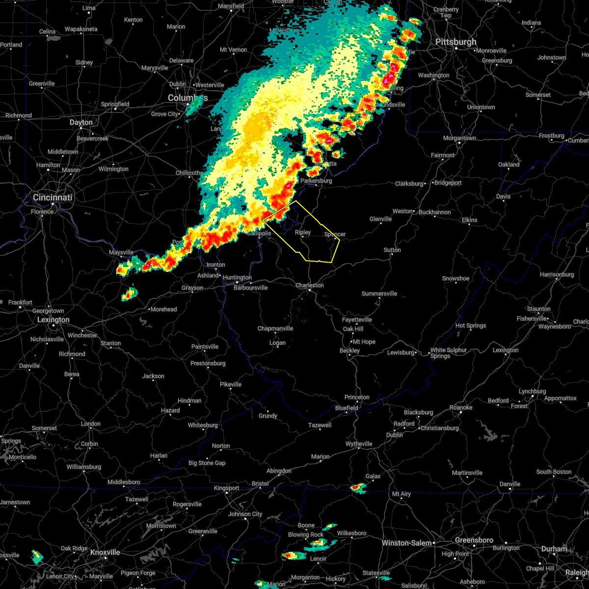
| 4/3/2025 5:34 AM EDT | At 533 am edt, severe thunderstorms were located along a line extending from near elizabeth to near spencer to near sissonville, moving east at 60 mph (radar indicated). Hazards include 60 mph wind gusts. Expect damage to roofs, siding, and trees. Locations impacted include, cherry, smithville, glenville, newberne, lucille, berea, stumptown, poca, tanner, macfarlan, frametown, wilsie, harmony, sand fork, tariff, gassaway, arnoldsburg, servia, auburn, and grantsville. |
| 4/3/2025 5:34 AM EDT | the severe thunderstorm warning has been cancelled and is no longer in effect |
| 4/3/2025 5:21 AM EDT |
 Svrrlx the national weather service in charleston west virginia has issued a * severe thunderstorm warning for, calhoun county in north central west virginia, east central putnam county in western west virginia, northern kanawha county in central west virginia, wirt county in northwestern west virginia, roane county in central west virginia, eastern jackson county in northwestern west virginia, south central wood county in northwestern west virginia, southern ritchie county in northwestern west virginia, southwestern doddridge county in northern west virginia, gilmer county in north central west virginia, northwestern lewis county in northern west virginia, western braxton county in north central west virginia, northern clay county in north central west virginia, * until 600 am edt. * at 521 am edt, severe thunderstorms were located along a line extending from 8 miles west of elizabeth to 7 miles west of spencer to near poca, moving east at 60 mph (radar indicated). Hazards include 60 mph wind gusts. expect damage to roofs, siding, and trees Svrrlx the national weather service in charleston west virginia has issued a * severe thunderstorm warning for, calhoun county in north central west virginia, east central putnam county in western west virginia, northern kanawha county in central west virginia, wirt county in northwestern west virginia, roane county in central west virginia, eastern jackson county in northwestern west virginia, south central wood county in northwestern west virginia, southern ritchie county in northwestern west virginia, southwestern doddridge county in northern west virginia, gilmer county in north central west virginia, northwestern lewis county in northern west virginia, western braxton county in north central west virginia, northern clay county in north central west virginia, * until 600 am edt. * at 521 am edt, severe thunderstorms were located along a line extending from 8 miles west of elizabeth to 7 miles west of spencer to near poca, moving east at 60 mph (radar indicated). Hazards include 60 mph wind gusts. expect damage to roofs, siding, and trees
|
| 3/31/2025 2:14 AM EDT | The storms which prompted the warning have weakened below severe limits, and no longer pose an immediate threat to life or property. therefore, the warning will be allowed to expire. however, small hail, gusty winds and heavy rain are still possible with these thunderstorms. a severe thunderstorm watch remains in effect until 600 am edt for western, central, north central and northwestern west virginia. |
| 3/31/2025 2:01 AM EDT | the severe thunderstorm warning has been cancelled and is no longer in effect |
| 3/31/2025 2:01 AM EDT | At 201 am edt, severe thunderstorms were located along a line extending from near elizabeth to near kenna, moving east at 50 mph (radar indicated). Hazards include 60 mph wind gusts. Expect damage to roofs, siding, and trees. Locations impacted include, statts mills, cherry, peewee, smithville, given, spencer, palestine, lucille, reedy, creston, brohard, annamoriah, leroy, fairplain, gay, munday, and ripley. |
| 3/31/2025 1:42 AM EDT | Svrrlx the national weather service in charleston west virginia has issued a * severe thunderstorm warning for, northwestern calhoun county in north central west virginia, east central mason county in western west virginia, southwestern ritchie county in northwestern west virginia, wirt county in northwestern west virginia, northwestern roane county in central west virginia, jackson county in northwestern west virginia, * until 215 am edt. * at 141 am edt, severe thunderstorms were located along a line extending from near sandyville to near buffalo, moving east at 60 mph (radar indicated). Hazards include 60 mph wind gusts. expect damage to roofs, siding, and trees |
| 3/16/2025 11:02 AM EDT | Several trees down east of spencer... including arnoldsburg rd... steel hollow rd... and clay r in roane county WV, 4.5 miles WNW of Spencer, WV |
| 3/16/2025 11:00 AM EDT |
 Svrrlx the national weather service in charleston west virginia has issued a * severe thunderstorm warning for, calhoun county in north central west virginia, southern ritchie county in northwestern west virginia, western gilmer county in north central west virginia, west central braxton county in north central west virginia, eastern wirt county in northwestern west virginia, central roane county in central west virginia, * until 1145 am edt. * at 1100 am edt, severe thunderstorms were located along a line extending from near elizabeth to 12 miles west of grantsville to near spencer to 10 miles northwest of amma, moving east at 30 mph (radar indicated). Hazards include 60 mph wind gusts. expect damage to roofs, siding, and trees Svrrlx the national weather service in charleston west virginia has issued a * severe thunderstorm warning for, calhoun county in north central west virginia, southern ritchie county in northwestern west virginia, western gilmer county in north central west virginia, west central braxton county in north central west virginia, eastern wirt county in northwestern west virginia, central roane county in central west virginia, * until 1145 am edt. * at 1100 am edt, severe thunderstorms were located along a line extending from near elizabeth to 12 miles west of grantsville to near spencer to 10 miles northwest of amma, moving east at 30 mph (radar indicated). Hazards include 60 mph wind gusts. expect damage to roofs, siding, and trees
|
| 12/31/2024 2:18 PM EST |
 the severe thunderstorm warning has been cancelled and is no longer in effect the severe thunderstorm warning has been cancelled and is no longer in effect
|
| 12/31/2024 2:07 PM EST |
 the severe thunderstorm warning has been cancelled and is no longer in effect the severe thunderstorm warning has been cancelled and is no longer in effect
|
| 12/31/2024 2:07 PM EST |
 At 207 pm est, a severe thunderstorm was located near sissonville, or 13 miles northeast of charleston, moving northeast at 45 mph (radar indicated). Hazards include 60 mph wind gusts. Expect damage to roofs, siding, and trees. Locations impacted include, spencer, big otter, amma, nebo, tariff, servia, walton, left hand, orma, looneyville, nicut, chloe, and gandeeville. At 207 pm est, a severe thunderstorm was located near sissonville, or 13 miles northeast of charleston, moving northeast at 45 mph (radar indicated). Hazards include 60 mph wind gusts. Expect damage to roofs, siding, and trees. Locations impacted include, spencer, big otter, amma, nebo, tariff, servia, walton, left hand, orma, looneyville, nicut, chloe, and gandeeville.
|
| 12/31/2024 1:50 PM EST |
 Svrrlx the national weather service in charleston west virginia has issued a * severe thunderstorm warning for, southern calhoun county in north central west virginia, northeastern kanawha county in central west virginia, west central braxton county in north central west virginia, roane county in central west virginia, north central clay county in north central west virginia, southeastern jackson county in northwestern west virginia, * until 230 pm est. * at 150 pm est, a severe thunderstorm was located near sissonville, or 13 miles northeast of charleston, moving northeast at 45 mph (radar indicated). Hazards include 60 mph wind gusts. expect damage to roofs, siding, and trees Svrrlx the national weather service in charleston west virginia has issued a * severe thunderstorm warning for, southern calhoun county in north central west virginia, northeastern kanawha county in central west virginia, west central braxton county in north central west virginia, roane county in central west virginia, north central clay county in north central west virginia, southeastern jackson county in northwestern west virginia, * until 230 pm est. * at 150 pm est, a severe thunderstorm was located near sissonville, or 13 miles northeast of charleston, moving northeast at 45 mph (radar indicated). Hazards include 60 mph wind gusts. expect damage to roofs, siding, and trees
|
| 8/31/2024 1:58 PM EDT |
 Svrrlx the national weather service in charleston west virginia has issued a * severe thunderstorm warning for, northwestern calhoun county in north central west virginia, southern wirt county in northwestern west virginia, northern roane county in central west virginia, * until 230 pm edt. * at 158 pm edt, a severe thunderstorm was located near spencer, moving east at 15 mph (radar indicated). Hazards include 60 mph wind gusts and quarter size hail. Hail damage to vehicles is expected. Expect wind damage to roofs, siding, and trees. Svrrlx the national weather service in charleston west virginia has issued a * severe thunderstorm warning for, northwestern calhoun county in north central west virginia, southern wirt county in northwestern west virginia, northern roane county in central west virginia, * until 230 pm edt. * at 158 pm edt, a severe thunderstorm was located near spencer, moving east at 15 mph (radar indicated). Hazards include 60 mph wind gusts and quarter size hail. Hail damage to vehicles is expected. Expect wind damage to roofs, siding, and trees.
|
| 7/14/2024 7:13 PM EDT |
 The storms which prompted the warning have weakened below severe limits, and no longer pose an immediate threat to life or property. therefore, the warning will be allowed to expire. however, gusty winds of 40 to 50 mph are still possible with these thunderstorms. The storms which prompted the warning have weakened below severe limits, and no longer pose an immediate threat to life or property. therefore, the warning will be allowed to expire. however, gusty winds of 40 to 50 mph are still possible with these thunderstorms.
|
| 7/14/2024 7:00 PM EDT |
 At 658 pm edt, severe thunderstorms were located along a line extending from 7 miles east of kenna to near dunbar to near spurlockville, moving southeast at 45 mph (radar indicated). Hazards include 5o to 60 mph wind gusts. Expect damage to roofs, siding, and trees. locations impacted include, charleston, nitro, spencer, hamlin, jefferson, south charleston, st. Albans, dunbar, sissonville, chesapeake, marmet, belle, clendenin, cedar grove, poca, pinch, institute, tornado, coal fork, and elkview. At 658 pm edt, severe thunderstorms were located along a line extending from 7 miles east of kenna to near dunbar to near spurlockville, moving southeast at 45 mph (radar indicated). Hazards include 5o to 60 mph wind gusts. Expect damage to roofs, siding, and trees. locations impacted include, charleston, nitro, spencer, hamlin, jefferson, south charleston, st. Albans, dunbar, sissonville, chesapeake, marmet, belle, clendenin, cedar grove, poca, pinch, institute, tornado, coal fork, and elkview.
|
| 7/14/2024 7:00 PM EDT |
 the severe thunderstorm warning has been cancelled and is no longer in effect the severe thunderstorm warning has been cancelled and is no longer in effect
|
| 7/14/2024 6:46 PM EDT |
 the severe thunderstorm warning has been cancelled and is no longer in effect the severe thunderstorm warning has been cancelled and is no longer in effect
|
| 7/14/2024 6:46 PM EDT |
 At 645 pm edt, severe thunderstorms were located along a line extending from near kenna to poca to near hamlin, moving southeast at 45 mph (radar indicated). Hazards include 60 mph wind gusts. Expect damage to roofs, siding, and trees. locations impacted include, charleston, nitro, ripley, spencer, winfield, hamlin, jefferson, south charleston, st. Albans, dunbar, hurricane, ravenswood, sissonville, milton, chesapeake, eleanor, marmet, belle, clendenin, and cedar grove. At 645 pm edt, severe thunderstorms were located along a line extending from near kenna to poca to near hamlin, moving southeast at 45 mph (radar indicated). Hazards include 60 mph wind gusts. Expect damage to roofs, siding, and trees. locations impacted include, charleston, nitro, ripley, spencer, winfield, hamlin, jefferson, south charleston, st. Albans, dunbar, hurricane, ravenswood, sissonville, milton, chesapeake, eleanor, marmet, belle, clendenin, and cedar grove.
|
| 7/14/2024 6:07 PM EDT |
 Svrrlx the national weather service in charleston west virginia has issued a * severe thunderstorm warning for, central calhoun county in north central west virginia, southern mason county in western west virginia, cabell county in central west virginia, putnam county in western west virginia, kanawha county in central west virginia, northern lincoln county in central west virginia, roane county in central west virginia, jackson county in northwestern west virginia, northeastern wayne county in western west virginia, northern boone county in central west virginia, * until 715 pm edt. * at 607 pm edt, severe thunderstorms were located along a line extending from 6 miles southwest of racine to 8 miles west of buffalo to proctorville, moving southeast at 45 mph (radar indicated). Hazards include 60 mph wind gusts. expect damage to roofs, siding, and trees Svrrlx the national weather service in charleston west virginia has issued a * severe thunderstorm warning for, central calhoun county in north central west virginia, southern mason county in western west virginia, cabell county in central west virginia, putnam county in western west virginia, kanawha county in central west virginia, northern lincoln county in central west virginia, roane county in central west virginia, jackson county in northwestern west virginia, northeastern wayne county in western west virginia, northern boone county in central west virginia, * until 715 pm edt. * at 607 pm edt, severe thunderstorms were located along a line extending from 6 miles southwest of racine to 8 miles west of buffalo to proctorville, moving southeast at 45 mph (radar indicated). Hazards include 60 mph wind gusts. expect damage to roofs, siding, and trees
|
| 7/5/2024 7:14 PM EDT |
 The storm which prompted the warning has moved out of the area. therefore, the warning will be allowed to expire. The storm which prompted the warning has moved out of the area. therefore, the warning will be allowed to expire.
|
| 7/5/2024 7:11 PM EDT |
 Svrrlx the national weather service in charleston west virginia has issued a * severe thunderstorm warning for, calhoun county in north central west virginia, south central ritchie county in northwestern west virginia, western gilmer county in north central west virginia, southeastern wirt county in northwestern west virginia, northern roane county in central west virginia, * until 745 pm edt. * at 709 pm edt, a severe thunderstorm was located near spencer, moving east at 25 mph (radar indicated). Hazards include 60 mph wind gusts and quarter size hail. Hail damage to vehicles is expected. Expect wind damage to roofs, siding, and trees. Svrrlx the national weather service in charleston west virginia has issued a * severe thunderstorm warning for, calhoun county in north central west virginia, south central ritchie county in northwestern west virginia, western gilmer county in north central west virginia, southeastern wirt county in northwestern west virginia, northern roane county in central west virginia, * until 745 pm edt. * at 709 pm edt, a severe thunderstorm was located near spencer, moving east at 25 mph (radar indicated). Hazards include 60 mph wind gusts and quarter size hail. Hail damage to vehicles is expected. Expect wind damage to roofs, siding, and trees.
|
| 7/5/2024 7:07 PM EDT |
 At 707 pm edt, a severe thunderstorm was located near spencer, moving east at 25 mph (radar indicated). Hazards include ping pong ball size hail and 60 mph wind gusts. People and animals outdoors will be injured. expect hail damage to roofs, siding, windows, and vehicles. expect wind damage to roofs, siding, and trees. Locations impacted include, spencer. At 707 pm edt, a severe thunderstorm was located near spencer, moving east at 25 mph (radar indicated). Hazards include ping pong ball size hail and 60 mph wind gusts. People and animals outdoors will be injured. expect hail damage to roofs, siding, windows, and vehicles. expect wind damage to roofs, siding, and trees. Locations impacted include, spencer.
|
| 7/5/2024 7:01 PM EDT |
 At 700 pm edt, a severe thunderstorm was located 7 miles southwest of spencer, moving east at 25 mph (radar indicated). Hazards include ping pong ball size hail and 60 mph wind gusts. People and animals outdoors will be injured. expect hail damage to roofs, siding, windows, and vehicles. expect wind damage to roofs, siding, and trees. Locations impacted include, spencer. At 700 pm edt, a severe thunderstorm was located 7 miles southwest of spencer, moving east at 25 mph (radar indicated). Hazards include ping pong ball size hail and 60 mph wind gusts. People and animals outdoors will be injured. expect hail damage to roofs, siding, windows, and vehicles. expect wind damage to roofs, siding, and trees. Locations impacted include, spencer.
|
| 7/5/2024 7:01 PM EDT |
 the severe thunderstorm warning has been cancelled and is no longer in effect the severe thunderstorm warning has been cancelled and is no longer in effect
|
| 7/5/2024 6:45 PM EDT | Tree down across triplett road. time estimated by rada in roane county WV, 4.5 miles SW of Spencer, WV |
| 7/5/2024 6:43 PM EDT |
 Svrrlx the national weather service in charleston west virginia has issued a * severe thunderstorm warning for, central roane county in central west virginia, east central jackson county in northwestern west virginia, * until 715 pm edt. * at 642 pm edt, a severe thunderstorm was located near kenna, or 9 miles southeast of ripley, moving east at 25 mph (radar indicated). Hazards include ping pong ball size hail and 60 mph wind gusts. People and animals outdoors will be injured. expect hail damage to roofs, siding, windows, and vehicles. Expect wind damage to roofs, siding, and trees. Svrrlx the national weather service in charleston west virginia has issued a * severe thunderstorm warning for, central roane county in central west virginia, east central jackson county in northwestern west virginia, * until 715 pm edt. * at 642 pm edt, a severe thunderstorm was located near kenna, or 9 miles southeast of ripley, moving east at 25 mph (radar indicated). Hazards include ping pong ball size hail and 60 mph wind gusts. People and animals outdoors will be injured. expect hail damage to roofs, siding, windows, and vehicles. Expect wind damage to roofs, siding, and trees.
|
| 5/26/2024 5:26 PM EDT |
 The storm which prompted the warning has moved out of the area. therefore, the warning will be allowed to expire. however, gusty winds are still possible with this thunderstorm. a severe thunderstorm watch remains in effect until 800 pm edt for southeastern ohio, and western and northwestern west virginia. a severe thunderstorm watch also remains in effect until 900 pm edt for southeastern ohio, and central, north central and northwestern west virginia. The storm which prompted the warning has moved out of the area. therefore, the warning will be allowed to expire. however, gusty winds are still possible with this thunderstorm. a severe thunderstorm watch remains in effect until 800 pm edt for southeastern ohio, and western and northwestern west virginia. a severe thunderstorm watch also remains in effect until 900 pm edt for southeastern ohio, and central, north central and northwestern west virginia.
|
| 5/26/2024 4:44 PM EDT |
 At 443 pm edt, a severe thunderstorm was located over ravenswood, or near racine, moving northeast at 50 mph (radar indicated). Hazards include 60 mph wind gusts and penny size hail. Expect damage to roofs, siding, and trees. Locations impacted include, parkersburg, athens, marietta, belpre, ripley, spencer, beverly, elizabeth, coolville, chesterhill, forked run state park, vienna, ravenswood, williamstown, sissonville, clendenin, pinch, sandyville, mineralwells, and kenna. At 443 pm edt, a severe thunderstorm was located over ravenswood, or near racine, moving northeast at 50 mph (radar indicated). Hazards include 60 mph wind gusts and penny size hail. Expect damage to roofs, siding, and trees. Locations impacted include, parkersburg, athens, marietta, belpre, ripley, spencer, beverly, elizabeth, coolville, chesterhill, forked run state park, vienna, ravenswood, williamstown, sissonville, clendenin, pinch, sandyville, mineralwells, and kenna.
|
| 5/26/2024 4:32 PM EDT |
 Svrrlx the national weather service in charleston west virginia has issued a * severe thunderstorm warning for, eastern meigs county in southeastern ohio, washington county in southeastern ohio, southern morgan county in southeastern ohio, southeastern athens county in southeastern ohio, northeastern kanawha county in central west virginia, wirt county in northwestern west virginia, roane county in central west virginia, northwestern clay county in north central west virginia, jackson county in northwestern west virginia, wood county in northwestern west virginia, * until 530 pm edt. * at 432 pm edt, a severe thunderstorm was located over racine, moving northeast at 120 mph (radar indicated). Hazards include 60 mph wind gusts and penny size hail. expect damage to roofs, siding, and trees Svrrlx the national weather service in charleston west virginia has issued a * severe thunderstorm warning for, eastern meigs county in southeastern ohio, washington county in southeastern ohio, southern morgan county in southeastern ohio, southeastern athens county in southeastern ohio, northeastern kanawha county in central west virginia, wirt county in northwestern west virginia, roane county in central west virginia, northwestern clay county in north central west virginia, jackson county in northwestern west virginia, wood county in northwestern west virginia, * until 530 pm edt. * at 432 pm edt, a severe thunderstorm was located over racine, moving northeast at 120 mph (radar indicated). Hazards include 60 mph wind gusts and penny size hail. expect damage to roofs, siding, and trees
|
| 4/17/2024 11:09 PM EDT |
 At 1108 pm edt, severe thunderstorms were located along a line extending from near spencer to 7 miles southwest of ripley, moving southeast at 30 mph (radar indicated). Hazards include 60 mph wind gusts and quarter size hail. Hail damage to vehicles is expected. expect wind damage to roofs, siding, and trees. Locations impacted include, spencer, arnoldsburg, kenna, statts mills, harmony, tariff, given, kentuck, walton, orma, looneyville, nicut, chloe, fairplain, gay, and gandeeville. At 1108 pm edt, severe thunderstorms were located along a line extending from near spencer to 7 miles southwest of ripley, moving southeast at 30 mph (radar indicated). Hazards include 60 mph wind gusts and quarter size hail. Hail damage to vehicles is expected. expect wind damage to roofs, siding, and trees. Locations impacted include, spencer, arnoldsburg, kenna, statts mills, harmony, tariff, given, kentuck, walton, orma, looneyville, nicut, chloe, fairplain, gay, and gandeeville.
|
| 4/17/2024 11:09 PM EDT |
 the severe thunderstorm warning has been cancelled and is no longer in effect the severe thunderstorm warning has been cancelled and is no longer in effect
|
| 4/17/2024 10:48 PM EDT |
 Svrrlx the national weather service in charleston west virginia has issued a * severe thunderstorm warning for, southern calhoun county in north central west virginia, east central mason county in western west virginia, west central braxton county in north central west virginia, south central wirt county in northwestern west virginia, roane county in central west virginia, jackson county in northwestern west virginia, * until 1115 pm edt. * at 1047 pm edt, severe thunderstorms were located along a line extending from 6 miles north of spencer to 9 miles south of racine, moving southeast at 30 mph (radar indicated). Hazards include 60 mph wind gusts and quarter size hail. Hail damage to vehicles is expected. Expect wind damage to roofs, siding, and trees. Svrrlx the national weather service in charleston west virginia has issued a * severe thunderstorm warning for, southern calhoun county in north central west virginia, east central mason county in western west virginia, west central braxton county in north central west virginia, south central wirt county in northwestern west virginia, roane county in central west virginia, jackson county in northwestern west virginia, * until 1115 pm edt. * at 1047 pm edt, severe thunderstorms were located along a line extending from 6 miles north of spencer to 9 miles south of racine, moving southeast at 30 mph (radar indicated). Hazards include 60 mph wind gusts and quarter size hail. Hail damage to vehicles is expected. Expect wind damage to roofs, siding, and trees.
|
| 4/17/2024 10:41 PM EDT |
 Svrrlx the national weather service in charleston west virginia has issued a * severe thunderstorm warning for, southern meigs county in southeastern ohio, northeastern gallia county in southeastern ohio, central calhoun county in north central west virginia, northeastern mason county in western west virginia, southern wirt county in northwestern west virginia, northwestern roane county in central west virginia, northern jackson county in northwestern west virginia, * until 1045 pm edt. * at 1019 pm edt, severe thunderstorms were located along a line extending from 7 miles southeast of elizabeth to mason, moving southeast at 30 mph (radar indicated). Hazards include 60 mph wind gusts and half dollar size hail. Hail damage to vehicles is expected. Expect wind damage to roofs, siding, and trees. Svrrlx the national weather service in charleston west virginia has issued a * severe thunderstorm warning for, southern meigs county in southeastern ohio, northeastern gallia county in southeastern ohio, central calhoun county in north central west virginia, northeastern mason county in western west virginia, southern wirt county in northwestern west virginia, northwestern roane county in central west virginia, northern jackson county in northwestern west virginia, * until 1045 pm edt. * at 1019 pm edt, severe thunderstorms were located along a line extending from 7 miles southeast of elizabeth to mason, moving southeast at 30 mph (radar indicated). Hazards include 60 mph wind gusts and half dollar size hail. Hail damage to vehicles is expected. Expect wind damage to roofs, siding, and trees.
|
| 4/17/2024 10:39 PM EDT |
 the severe thunderstorm warning has been cancelled and is no longer in effect the severe thunderstorm warning has been cancelled and is no longer in effect
|
| 4/17/2024 10:39 PM EDT |
 At 1037 pm edt, severe thunderstorms were located along a line extending from near grantsville to near racine, moving southeast at 30 mph (radar indicated). Hazards include 60 mph wind gusts and quarter size hail. Hail damage to vehicles is expected. expect wind damage to roofs, siding, and trees. Locations impacted include, ripley, spencer, ravenswood, sandyville, reedy, millstone, cottageville, mount alto, evans, mount zion, leroy, and letart. At 1037 pm edt, severe thunderstorms were located along a line extending from near grantsville to near racine, moving southeast at 30 mph (radar indicated). Hazards include 60 mph wind gusts and quarter size hail. Hail damage to vehicles is expected. expect wind damage to roofs, siding, and trees. Locations impacted include, ripley, spencer, ravenswood, sandyville, reedy, millstone, cottageville, mount alto, evans, mount zion, leroy, and letart.
|
| 4/17/2024 10:19 PM EDT |
 Svrrlx the national weather service in charleston west virginia has issued a * severe thunderstorm warning for, southern meigs county in southeastern ohio, northeastern gallia county in southeastern ohio, central calhoun county in north central west virginia, northeastern mason county in western west virginia, southern wirt county in northwestern west virginia, northwestern roane county in central west virginia, northern jackson county in northwestern west virginia, * until 1045 pm edt. * at 1019 pm edt, severe thunderstorms were located along a line extending from 7 miles southeast of elizabeth to mason, moving southeast at 30 mph (radar indicated). Hazards include 60 mph wind gusts and half dollar size hail. Hail damage to vehicles is expected. Expect wind damage to roofs, siding, and trees. Svrrlx the national weather service in charleston west virginia has issued a * severe thunderstorm warning for, southern meigs county in southeastern ohio, northeastern gallia county in southeastern ohio, central calhoun county in north central west virginia, northeastern mason county in western west virginia, southern wirt county in northwestern west virginia, northwestern roane county in central west virginia, northern jackson county in northwestern west virginia, * until 1045 pm edt. * at 1019 pm edt, severe thunderstorms were located along a line extending from 7 miles southeast of elizabeth to mason, moving southeast at 30 mph (radar indicated). Hazards include 60 mph wind gusts and half dollar size hail. Hail damage to vehicles is expected. Expect wind damage to roofs, siding, and trees.
|
| 4/2/2024 11:18 AM EDT |
 the tornado warning has been cancelled and is no longer in effect the tornado warning has been cancelled and is no longer in effect
|
| 4/2/2024 11:18 AM EDT |
 At 1117 am edt, a severe squall line capable of producing both tornadoes and extensive straight line wind damage was located along a line extending from near elizabeth to kenna, moving east at 70 mph (radar indicated rotation). Hazards include tornado. Flying debris will be dangerous to those caught without shelter. mobile homes will be damaged or destroyed. damage to roofs, windows, and vehicles will occur. tree damage is likely. these dangerous storms will be near, spencer around 1125 am edt. grantsville and arnoldsburg around 1135 am edt. Other locations impacted by these tornadic storms include millstone, statts mills, cherry, peewee, harmony, tariff, mount zion, palestine, orma, and lucille. At 1117 am edt, a severe squall line capable of producing both tornadoes and extensive straight line wind damage was located along a line extending from near elizabeth to kenna, moving east at 70 mph (radar indicated rotation). Hazards include tornado. Flying debris will be dangerous to those caught without shelter. mobile homes will be damaged or destroyed. damage to roofs, windows, and vehicles will occur. tree damage is likely. these dangerous storms will be near, spencer around 1125 am edt. grantsville and arnoldsburg around 1135 am edt. Other locations impacted by these tornadic storms include millstone, statts mills, cherry, peewee, harmony, tariff, mount zion, palestine, orma, and lucille.
|
| 4/2/2024 11:03 AM EDT |
 Torrlx the national weather service in charleston west virginia has issued a * tornado warning for, calhoun county in north central west virginia, east central mason county in western west virginia, southeastern ritchie county in northwestern west virginia, northwestern gilmer county in north central west virginia, wirt county in northwestern west virginia, roane county in central west virginia, jackson county in northwestern west virginia, * until 1145 am edt. * at 1103 am edt, severe thunderstorms capable of producing both tornadoes and extensive straight line wind damage were located along a line extending from near ravenswood to near buffalo, moving east at 65 mph (radar indicated rotation). Hazards include tornado. Flying debris will be dangerous to those caught without shelter. mobile homes will be damaged or destroyed. damage to roofs, windows, and vehicles will occur. tree damage is likely. these dangerous storms will be near, ripley and sandyville around 1110 am edt. spencer around 1125 am edt. Other locations impacted by these tornadic storms include millstone, statts mills, cherry, given, mount zion, cottageville, lucille, big springs, brohard, and stumptown. Torrlx the national weather service in charleston west virginia has issued a * tornado warning for, calhoun county in north central west virginia, east central mason county in western west virginia, southeastern ritchie county in northwestern west virginia, northwestern gilmer county in north central west virginia, wirt county in northwestern west virginia, roane county in central west virginia, jackson county in northwestern west virginia, * until 1145 am edt. * at 1103 am edt, severe thunderstorms capable of producing both tornadoes and extensive straight line wind damage were located along a line extending from near ravenswood to near buffalo, moving east at 65 mph (radar indicated rotation). Hazards include tornado. Flying debris will be dangerous to those caught without shelter. mobile homes will be damaged or destroyed. damage to roofs, windows, and vehicles will occur. tree damage is likely. these dangerous storms will be near, ripley and sandyville around 1110 am edt. spencer around 1125 am edt. Other locations impacted by these tornadic storms include millstone, statts mills, cherry, given, mount zion, cottageville, lucille, big springs, brohard, and stumptown.
|
| 2/28/2024 7:57 AM EST |
 Svrrlx the national weather service in charleston west virginia has issued a * severe thunderstorm warning for, central calhoun county in north central west virginia, southwestern gilmer county in north central west virginia, central roane county in central west virginia, * until 830 am est. * at 757 am est, a severe thunderstorm was located near spencer, moving east at 60 mph (radar indicated). Hazards include 60 mph wind gusts and penny size hail. expect damage to roofs, siding, and trees Svrrlx the national weather service in charleston west virginia has issued a * severe thunderstorm warning for, central calhoun county in north central west virginia, southwestern gilmer county in north central west virginia, central roane county in central west virginia, * until 830 am est. * at 757 am est, a severe thunderstorm was located near spencer, moving east at 60 mph (radar indicated). Hazards include 60 mph wind gusts and penny size hail. expect damage to roofs, siding, and trees
|
| 8/7/2023 1:09 PM EDT |
 The severe thunderstorm warning for southern calhoun, roane and north central clay counties will expire at 115 pm edt, the storm which prompted the warning has moved out of the area. therefore, the warning will be allowed to expire. a tornado watch remains in effect until 600 pm edt for central and north central west virginia. The severe thunderstorm warning for southern calhoun, roane and north central clay counties will expire at 115 pm edt, the storm which prompted the warning has moved out of the area. therefore, the warning will be allowed to expire. a tornado watch remains in effect until 600 pm edt for central and north central west virginia.
|
| 8/7/2023 12:46 PM EDT |
 At 1246 pm edt, a severe thunderstorm was located 7 miles south of spencer, moving northeast at 20 mph (radar indicated). Hazards include ping pong ball size hail and 60 mph wind gusts. People and animals outdoors will be injured. expect hail damage to roofs, siding, windows, and vehicles. expect wind damage to roofs, siding, and trees. Locations impacted include, spencer, arnoldsburg, big otter, nebo, millstone, harmony, tariff, mount zion, walton, left hand, orma, looneyville, chloe, and gandeeville. At 1246 pm edt, a severe thunderstorm was located 7 miles south of spencer, moving northeast at 20 mph (radar indicated). Hazards include ping pong ball size hail and 60 mph wind gusts. People and animals outdoors will be injured. expect hail damage to roofs, siding, windows, and vehicles. expect wind damage to roofs, siding, and trees. Locations impacted include, spencer, arnoldsburg, big otter, nebo, millstone, harmony, tariff, mount zion, walton, left hand, orma, looneyville, chloe, and gandeeville.
|
| 8/7/2023 12:35 PM EDT | Tree down on barrcut roa in roane county WV, 3.4 miles SSW of Spencer, WV |
| 8/7/2023 12:30 PM EDT |
 At 1230 pm edt, a severe thunderstorm was located 10 miles northwest of amma, or 10 miles south of spencer, moving northeast at 20 mph (radar indicated). Hazards include 60 mph wind gusts and quarter size hail. Hail damage to vehicles is expected. Expect wind damage to roofs, siding, and trees. At 1230 pm edt, a severe thunderstorm was located 10 miles northwest of amma, or 10 miles south of spencer, moving northeast at 20 mph (radar indicated). Hazards include 60 mph wind gusts and quarter size hail. Hail damage to vehicles is expected. Expect wind damage to roofs, siding, and trees.
|
| 7/18/2023 7:23 PM EDT |
 The severe thunderstorm warning for southern calhoun, northeastern kanawha, southwestern gilmer, southwestern braxton, southeastern roane and northern clay counties will expire at 730 pm edt, the storm which prompted the warning has weakened below severe limits, and has exited the warned area. therefore, the warning will be allowed to expire. to report severe weather, contact your nearest law enforcement agency. they will relay your report to the national weather service charleston west virginia. The severe thunderstorm warning for southern calhoun, northeastern kanawha, southwestern gilmer, southwestern braxton, southeastern roane and northern clay counties will expire at 730 pm edt, the storm which prompted the warning has weakened below severe limits, and has exited the warned area. therefore, the warning will be allowed to expire. to report severe weather, contact your nearest law enforcement agency. they will relay your report to the national weather service charleston west virginia.
|
| 7/18/2023 7:05 PM EDT |
 At 704 pm edt, a severe thunderstorm was located near arnoldsburg, or 11 miles southeast of spencer, moving northeast at 35 mph (radar indicated). Hazards include 60 mph wind gusts and penny size hail. Expect damage to roofs, siding, and trees. locations impacted include, spencer, arnoldsburg, big otter, amma, wallback, nebo, millstone, tariff, servia, mount zion, left hand, orma, looneyville, ivydale, nicut, chloe and gandeeville. hail threat, radar indicated max hail size, 0. 75 in wind threat, radar indicated max wind gust, 60 mph. At 704 pm edt, a severe thunderstorm was located near arnoldsburg, or 11 miles southeast of spencer, moving northeast at 35 mph (radar indicated). Hazards include 60 mph wind gusts and penny size hail. Expect damage to roofs, siding, and trees. locations impacted include, spencer, arnoldsburg, big otter, amma, wallback, nebo, millstone, tariff, servia, mount zion, left hand, orma, looneyville, ivydale, nicut, chloe and gandeeville. hail threat, radar indicated max hail size, 0. 75 in wind threat, radar indicated max wind gust, 60 mph.
|
| 7/18/2023 7:04 PM EDT | Tree down along slate roa in roane county WV, 3.3 miles WNW of Spencer, WV |
| 7/18/2023 7:00 PM EDT | Power lines and tree down along poca roa in roane county WV, 11.2 miles NNW of Spencer, WV |
| 7/18/2023 6:44 PM EDT | Tree and power lines down along harmony road. time estimated from rada in roane county WV, 11.3 miles NE of Spencer, WV |
| 7/18/2023 6:42 PM EDT |
 At 640 pm edt, a severe thunderstorm was located 8 miles northwest of amma, or 12 miles south of spencer, moving northeast at 35 mph (radar indicated). Hazards include 60 mph wind gusts and penny size hail. expect damage to roofs, siding, and trees At 640 pm edt, a severe thunderstorm was located 8 miles northwest of amma, or 12 miles south of spencer, moving northeast at 35 mph (radar indicated). Hazards include 60 mph wind gusts and penny size hail. expect damage to roofs, siding, and trees
|
| 7/23/2022 3:18 PM EDT | Multiple trees and powerlines down at gandeevill in roane county WV, 7 miles NNE of Spencer, WV |
| 7/23/2022 3:12 PM EDT | Multiple trees and powerlines dow in roane county WV, 0.5 miles WNW of Spencer, WV |
| 7/23/2022 3:03 PM EDT |
 At 302 pm edt, a severe thunderstorm was located 8 miles southwest of spencer, moving southeast at 40 mph (radar indicated). Hazards include 60 mph wind gusts. Expect damage to roofs, siding, and trees. locations impacted include, ripley, spencer, clendenin, kenna, amma, statts mills, harmony, tariff, given, kentuck, walton, left hand, looneyville, fairplain, gay and gandeeville. hail threat, radar indicated max hail size, <. 75 in wind threat, radar indicated max wind gust, 60 mph. At 302 pm edt, a severe thunderstorm was located 8 miles southwest of spencer, moving southeast at 40 mph (radar indicated). Hazards include 60 mph wind gusts. Expect damage to roofs, siding, and trees. locations impacted include, ripley, spencer, clendenin, kenna, amma, statts mills, harmony, tariff, given, kentuck, walton, left hand, looneyville, fairplain, gay and gandeeville. hail threat, radar indicated max hail size, <. 75 in wind threat, radar indicated max wind gust, 60 mph.
|
| 7/23/2022 2:47 PM EDT |
 At 246 pm edt, a severe thunderstorm was located over ripley, moving southeast at 40 mph (radar indicated). Hazards include 60 mph wind gusts. expect damage to roofs, siding, and trees At 246 pm edt, a severe thunderstorm was located over ripley, moving southeast at 40 mph (radar indicated). Hazards include 60 mph wind gusts. expect damage to roofs, siding, and trees
|
| 7/23/2022 2:11 PM EDT |
 At 210 pm edt, a severe thunderstorm was located near racine, moving southeast at 50 mph (radar indicated). Hazards include 60 mph wind gusts and quarter size hail. Hail damage to vehicles is expected. Expect wind damage to roofs, siding, and trees. At 210 pm edt, a severe thunderstorm was located near racine, moving southeast at 50 mph (radar indicated). Hazards include 60 mph wind gusts and quarter size hail. Hail damage to vehicles is expected. Expect wind damage to roofs, siding, and trees.
|
| 6/17/2022 1:45 PM EDT | Very large limbs dow in roane county WV, 0.2 miles NNE of Spencer, WV |
| 6/13/2022 9:17 PM EDT |
 At 917 pm edt, severe thunderstorms were located along a line extending from 8 miles northeast of marietta to 6 miles northwest of north bend state park to near elizabeth, moving east at 65 mph (radar indicated). Hazards include 60 mph wind gusts and nickel size hail. Expect damage to roofs, siding, and trees. locations impacted include, parkersburg, marietta, belpre, spencer, st. marys, elizabeth, vienna, williamstown, belmont, mineralwells, lubeck, boaz, newport, north hills, reedy, cherry, schultz, lucille, davisville and peewee. hail threat, radar indicated max hail size, 0. 88 in wind threat, radar indicated max wind gust, 60 mph. At 917 pm edt, severe thunderstorms were located along a line extending from 8 miles northeast of marietta to 6 miles northwest of north bend state park to near elizabeth, moving east at 65 mph (radar indicated). Hazards include 60 mph wind gusts and nickel size hail. Expect damage to roofs, siding, and trees. locations impacted include, parkersburg, marietta, belpre, spencer, st. marys, elizabeth, vienna, williamstown, belmont, mineralwells, lubeck, boaz, newport, north hills, reedy, cherry, schultz, lucille, davisville and peewee. hail threat, radar indicated max hail size, 0. 88 in wind threat, radar indicated max wind gust, 60 mph.
|
| 6/13/2022 9:17 PM EDT |
 A severe thunderstorm warning remains in effect until 930 pm edt for southeastern washington. southwestern pleasants. west central calhoun. southwestern ritchie. wirt. northwestern roane and wood counties. At 917 pm edt, severe thunderstorms were located along a line extending from 8 miles northeast of marietta to 6 miles northwest of. A severe thunderstorm warning remains in effect until 930 pm edt for southeastern washington. southwestern pleasants. west central calhoun. southwestern ritchie. wirt. northwestern roane and wood counties. At 917 pm edt, severe thunderstorms were located along a line extending from 8 miles northeast of marietta to 6 miles northwest of.
|
| 6/13/2022 9:09 PM EDT |
 A severe thunderstorm warning remains in effect until 930 pm edt for southern washington. southwestern pleasants. west central calhoun. southwestern ritchie. wirt. northwestern roane. northeastern jackson and wood counties. At 908 pm edt, severe thunderstorms were located along a line extending from near marietta to 9 miles east of mineralwells to near. A severe thunderstorm warning remains in effect until 930 pm edt for southern washington. southwestern pleasants. west central calhoun. southwestern ritchie. wirt. northwestern roane. northeastern jackson and wood counties. At 908 pm edt, severe thunderstorms were located along a line extending from near marietta to 9 miles east of mineralwells to near.
|
| 6/13/2022 9:09 PM EDT |
 At 908 pm edt, severe thunderstorms were located along a line extending from near marietta to 9 miles east of mineralwells to near elizabeth, moving east at 65 mph (radar indicated). Hazards include 60 mph wind gusts and nickel size hail. Expect damage to roofs, siding, and trees. locations impacted include, parkersburg, marietta, belpre, ripley, spencer, st. marys, elizabeth, vienna, ravenswood, williamstown, belmont, sandyville, washington, mineralwells, lubeck, boaz, newport, north hills, reedy and cherry. hail threat, radar indicated max hail size, 0. 88 in wind threat, radar indicated max wind gust, 60 mph. At 908 pm edt, severe thunderstorms were located along a line extending from near marietta to 9 miles east of mineralwells to near elizabeth, moving east at 65 mph (radar indicated). Hazards include 60 mph wind gusts and nickel size hail. Expect damage to roofs, siding, and trees. locations impacted include, parkersburg, marietta, belpre, ripley, spencer, st. marys, elizabeth, vienna, ravenswood, williamstown, belmont, sandyville, washington, mineralwells, lubeck, boaz, newport, north hills, reedy and cherry. hail threat, radar indicated max hail size, 0. 88 in wind threat, radar indicated max wind gust, 60 mph.
|
| 6/13/2022 9:06 PM EDT |
 At 905 pm edt, severe thunderstorms were located along a line extending from near vienna to near elizabeth to 7 miles west of spencer, moving east at 55 mph (radar indicated). Hazards include 60 mph wind gusts and quarter size hail. Hail damage to vehicles is possible. Expect wind damage to roofs, siding, and trees. At 905 pm edt, severe thunderstorms were located along a line extending from near vienna to near elizabeth to 7 miles west of spencer, moving east at 55 mph (radar indicated). Hazards include 60 mph wind gusts and quarter size hail. Hail damage to vehicles is possible. Expect wind damage to roofs, siding, and trees.
|
| 6/13/2022 9:06 PM EDT |
 The national weather service in charleston west virginia has issued a * severe thunderstorm warning for. southeastern washington county in southeastern ohio. pleasants county in northwestern west virginia. calhoun county in north central west virginia. Ritchie county in northwestern west virginia. The national weather service in charleston west virginia has issued a * severe thunderstorm warning for. southeastern washington county in southeastern ohio. pleasants county in northwestern west virginia. calhoun county in north central west virginia. Ritchie county in northwestern west virginia.
|
| 6/13/2022 8:44 PM EDT |
 At 843 pm edt, severe thunderstorms were located along a line extending from 8 miles northwest of coolville to near forked run state park to 8 miles south of racine, moving northeast at 65 mph (radar indicated). Hazards include 60 mph wind gusts and nickel size hail. expect damage to roofs, siding, and trees At 843 pm edt, severe thunderstorms were located along a line extending from 8 miles northwest of coolville to near forked run state park to 8 miles south of racine, moving northeast at 65 mph (radar indicated). Hazards include 60 mph wind gusts and nickel size hail. expect damage to roofs, siding, and trees
|
| 5/20/2022 1:51 AM EDT |
 At 150 am edt, a severe thunderstorm was located over kenna, or 10 miles south of ripley, moving east at 40 mph (radar indicated). Hazards include 60 mph wind gusts and penny size hail. Expect damage to roofs, siding, and trees. locations impacted include, ripley, spencer, kenna, statts mills, harmony, given, kentuck, liberty, walton, cottageville, evans, looneyville, fairplain, gay and gandeeville. hail threat, radar indicated max hail size, 0. 75 in wind threat, radar indicated max wind gust, 60 mph. At 150 am edt, a severe thunderstorm was located over kenna, or 10 miles south of ripley, moving east at 40 mph (radar indicated). Hazards include 60 mph wind gusts and penny size hail. Expect damage to roofs, siding, and trees. locations impacted include, ripley, spencer, kenna, statts mills, harmony, given, kentuck, liberty, walton, cottageville, evans, looneyville, fairplain, gay and gandeeville. hail threat, radar indicated max hail size, 0. 75 in wind threat, radar indicated max wind gust, 60 mph.
|
| 5/20/2022 1:28 AM EDT |
 At 127 am edt, a severe thunderstorm was located near buffalo, or 11 miles north of winfield, moving east at 40 mph (radar indicated). Hazards include 60 mph wind gusts and penny size hail. expect damage to roofs, siding, and trees At 127 am edt, a severe thunderstorm was located near buffalo, or 11 miles north of winfield, moving east at 40 mph (radar indicated). Hazards include 60 mph wind gusts and penny size hail. expect damage to roofs, siding, and trees
|
| 5/6/2022 10:25 AM EDT |
 At 1025 am edt, a severe thunderstorm was located near arnoldsburg, or 7 miles southeast of spencer, moving east at 35 mph (radar indicated). Hazards include 60 mph wind gusts and quarter size hail. Hail damage to vehicles is expected. Expect wind damage to roofs, siding, and trees. At 1025 am edt, a severe thunderstorm was located near arnoldsburg, or 7 miles southeast of spencer, moving east at 35 mph (radar indicated). Hazards include 60 mph wind gusts and quarter size hail. Hail damage to vehicles is expected. Expect wind damage to roofs, siding, and trees.
|
| 3/23/2022 8:21 PM EDT |
 The severe thunderstorm warning for northern calhoun, southwestern ritchie, northwestern gilmer, eastern wirt and northwestern roane counties will expire at 830 pm edt, the storm which prompted the warning has weakened below severe limits, and no longer poses an immediate threat to life or property. therefore, the warning will be allowed to expire. however small hail and gusty winds are still possible with this thunderstorm. a tornado watch remains in effect until 1000 pm edt for central, north central and northwestern west virginia. The severe thunderstorm warning for northern calhoun, southwestern ritchie, northwestern gilmer, eastern wirt and northwestern roane counties will expire at 830 pm edt, the storm which prompted the warning has weakened below severe limits, and no longer poses an immediate threat to life or property. therefore, the warning will be allowed to expire. however small hail and gusty winds are still possible with this thunderstorm. a tornado watch remains in effect until 1000 pm edt for central, north central and northwestern west virginia.
|
| 3/23/2022 8:17 PM EDT |
 At 816 pm edt, a severe thunderstorm was located 7 miles southeast of elizabeth, moving northeast at 70 mph (radar indicated). Hazards include 60 mph wind gusts and nickel size hail. Expect damage to roofs, siding, and trees. locations impacted include, spencer, grantsville, reedy, cherry, smithville, newberne, lucille, creston, big springs, brohard, macfarlan, annamoriah, burnt house and munday. hail threat, radar indicated max hail size, 0. 88 in wind threat, radar indicated max wind gust, 60 mph. At 816 pm edt, a severe thunderstorm was located 7 miles southeast of elizabeth, moving northeast at 70 mph (radar indicated). Hazards include 60 mph wind gusts and nickel size hail. Expect damage to roofs, siding, and trees. locations impacted include, spencer, grantsville, reedy, cherry, smithville, newberne, lucille, creston, big springs, brohard, macfarlan, annamoriah, burnt house and munday. hail threat, radar indicated max hail size, 0. 88 in wind threat, radar indicated max wind gust, 60 mph.
|
| 3/23/2022 8:11 PM EDT |
 At 810 pm edt, a severe thunderstorm was located 8 miles north of spencer, moving northeast at 60 mph (radar indicated). Hazards include 60 mph wind gusts and nickel size hail. Expect damage to roofs, siding, and trees. locations impacted include, ripley, spencer, elizabeth, grantsville, kenna, reedy, statts mills, cherry, smithville, kentuck, newberne, lucille, big springs, brohard, macfarlan, annamoriah, fairplain, burnt house, peewee and walker. hail threat, radar indicated max hail size, 0. 88 in wind threat, radar indicated max wind gust, 60 mph. At 810 pm edt, a severe thunderstorm was located 8 miles north of spencer, moving northeast at 60 mph (radar indicated). Hazards include 60 mph wind gusts and nickel size hail. Expect damage to roofs, siding, and trees. locations impacted include, ripley, spencer, elizabeth, grantsville, kenna, reedy, statts mills, cherry, smithville, kentuck, newberne, lucille, big springs, brohard, macfarlan, annamoriah, fairplain, burnt house, peewee and walker. hail threat, radar indicated max hail size, 0. 88 in wind threat, radar indicated max wind gust, 60 mph.
|
| 3/23/2022 7:46 PM EDT |
 At 745 pm edt, a severe thunderstorm was located near kenna, or 11 miles northeast of winfield, moving northeast at 70 mph (radar indicated). Hazards include 60 mph wind gusts and nickel size hail. expect damage to roofs, siding, and trees At 745 pm edt, a severe thunderstorm was located near kenna, or 11 miles northeast of winfield, moving northeast at 70 mph (radar indicated). Hazards include 60 mph wind gusts and nickel size hail. expect damage to roofs, siding, and trees
|
| 8/3/2021 4:50 PM EDT | Tree reported across windyville r in roane county WV, 6.2 miles NE of Spencer, WV |
| 8/3/2021 4:50 PM EDT | Tree reported down across the entirety of stover fork rd. lines down als in roane county WV, 6 miles ENE of Spencer, WV |
| 8/3/2021 4:35 PM EDT | Tree and power lines reported dow in roane county WV, 9.9 miles NE of Spencer, WV |
| 6/13/2021 6:25 PM EDT |
 The severe thunderstorm warning for southern calhoun, north central nicholas, southwestern gilmer, southern braxton, central roane, northwestern webster and northeastern clay counties will expire at 630 pm edt, the storms which prompted the warning have moved out of the area. therefore, the warning will be allowed to expire. a severe thunderstorm watch remains in effect until 700 pm edt for central, southeastern, north central, northeastern and northwestern west virginia. The severe thunderstorm warning for southern calhoun, north central nicholas, southwestern gilmer, southern braxton, central roane, northwestern webster and northeastern clay counties will expire at 630 pm edt, the storms which prompted the warning have moved out of the area. therefore, the warning will be allowed to expire. a severe thunderstorm watch remains in effect until 700 pm edt for central, southeastern, north central, northeastern and northwestern west virginia.
|
| 6/13/2021 6:24 PM EDT |
 At 624 pm edt, a severe thunderstorm was located near elizabeth, moving southeast at 35 mph (radar indicated). Hazards include 60 mph wind gusts and penny size hail. expect damage to roofs, siding, and trees At 624 pm edt, a severe thunderstorm was located near elizabeth, moving southeast at 35 mph (radar indicated). Hazards include 60 mph wind gusts and penny size hail. expect damage to roofs, siding, and trees
|
| 6/13/2021 6:09 PM EDT |
 At 609 pm edt, severe thunderstorms were located along a line extending from 7 miles southeast of spencer to near addison (webster springs), moving southeast at 25 mph (radar indicated). Hazards include 60 mph wind gusts and quarter size hail. Hail damage to vehicles is expected. expect wind damage to roofs, siding, and trees. Locations impacted include, spencer, sutton, webster springs, gassaway, addison (webster springs), birch river, arnoldsburg, big otter, wallback, flatwoods, reedy, nebo, shock, millstone, rosedale, mount zion, little birch, erbacon, diana and frametown. At 609 pm edt, severe thunderstorms were located along a line extending from 7 miles southeast of spencer to near addison (webster springs), moving southeast at 25 mph (radar indicated). Hazards include 60 mph wind gusts and quarter size hail. Hail damage to vehicles is expected. expect wind damage to roofs, siding, and trees. Locations impacted include, spencer, sutton, webster springs, gassaway, addison (webster springs), birch river, arnoldsburg, big otter, wallback, flatwoods, reedy, nebo, shock, millstone, rosedale, mount zion, little birch, erbacon, diana and frametown.
|
| 6/13/2021 5:53 PM EDT |
 The severe thunderstorm warning for central calhoun, southern wirt, central roane and east central jackson counties will expire at 600 pm edt, the storms which prompted the warning have weakened below severe limits, and no longer pose an immediate threat to life or property. therefore, the warning will be allowed to expire. a severe thunderstorm watch remains in effect until 700 pm edt for central, north central and northwestern west virginia. remember, a severe thunderstorm warning still remains in effect for portions of roane and calhoun counties until 630 pm. The severe thunderstorm warning for central calhoun, southern wirt, central roane and east central jackson counties will expire at 600 pm edt, the storms which prompted the warning have weakened below severe limits, and no longer pose an immediate threat to life or property. therefore, the warning will be allowed to expire. a severe thunderstorm watch remains in effect until 700 pm edt for central, north central and northwestern west virginia. remember, a severe thunderstorm warning still remains in effect for portions of roane and calhoun counties until 630 pm.
|
| 6/13/2021 5:45 PM EDT |
 At 544 pm edt, severe thunderstorms were located along a line extending from near spencer to 8 miles northwest of webster springs, moving southeast at 25 mph (radar indicated). Hazards include 60 mph wind gusts and quarter size hail. Hail damage to vehicles is expected. Expect wind damage to roofs, siding, and trees. At 544 pm edt, severe thunderstorms were located along a line extending from near spencer to 8 miles northwest of webster springs, moving southeast at 25 mph (radar indicated). Hazards include 60 mph wind gusts and quarter size hail. Hail damage to vehicles is expected. Expect wind damage to roofs, siding, and trees.
|
| 6/13/2021 5:29 PM EDT |
 At 529 pm edt, severe thunderstorms were located along a line extending from near grantsville to 8 miles southeast of sandyville, moving southeast at 30 mph (radar indicated). Hazards include 60 mph wind gusts and quarter size hail. Hail damage to vehicles is expected. Expect wind damage to roofs, siding, and trees. At 529 pm edt, severe thunderstorms were located along a line extending from near grantsville to 8 miles southeast of sandyville, moving southeast at 30 mph (radar indicated). Hazards include 60 mph wind gusts and quarter size hail. Hail damage to vehicles is expected. Expect wind damage to roofs, siding, and trees.
|
| 8/25/2020 6:05 PM EDT |
 At 604 pm edt, a severe thunderstorm was located 10 miles northwest of amma, or 11 miles south of spencer, moving southeast at 40 mph (radar indicated). Hazards include 60 mph wind gusts. Expect damage to roofs, siding, and trees. Locations impacted include, ripley, spencer, grantsville, arnoldsburg, statts mills, harmony, tariff, mount zion, kentuck, walton, left hand, looneyville, fairplain, gay and gandeeville. At 604 pm edt, a severe thunderstorm was located 10 miles northwest of amma, or 11 miles south of spencer, moving southeast at 40 mph (radar indicated). Hazards include 60 mph wind gusts. Expect damage to roofs, siding, and trees. Locations impacted include, ripley, spencer, grantsville, arnoldsburg, statts mills, harmony, tariff, mount zion, kentuck, walton, left hand, looneyville, fairplain, gay and gandeeville.
|
| 8/25/2020 5:24 PM EDT |
 At 524 pm edt, a severe thunderstorm was located over ravenswood, or 8 miles south of forked run state park, moving southeast at 40 mph (radar indicated). Hazards include 60 mph wind gusts. expect damage to roofs, siding, and trees At 524 pm edt, a severe thunderstorm was located over ravenswood, or 8 miles south of forked run state park, moving southeast at 40 mph (radar indicated). Hazards include 60 mph wind gusts. expect damage to roofs, siding, and trees
|
| 8/1/2020 7:20 PM EDT | Trees down on egypt ridg in roane county WV, 7.4 miles WSW of Spencer, WV |
| 7/21/2020 7:30 PM EDT | Tree damage reported at multiple locations near gandeeville. tweet included photo of downed tree over pool. pool damage appeared to be minimal. crews were still working in roane county WV, 7 miles NNE of Spencer, WV |
| 6/6/2020 5:02 PM EDT | One tree down along park av in roane county WV, 0.2 miles NNE of Spencer, WV |
| 4/9/2020 1:34 AM EDT |
 At 133 am edt, severe thunderstorms were located along a line extending from 7 miles northeast of elizabeth to near spencer, moving east at 60 mph (radar indicated). Hazards include 70 mph wind gusts and quarter size hail. Hail damage to vehicles is expected. expect considerable tree damage. wind damage is also likely to mobile homes, roofs, and outbuildings. locations impacted include, parkersburg, marietta, belpre, spencer, harrisville, st. Marys, elizabeth, grantsville, vienna, williamstown, pennsboro, belmont, mineralwells, arnoldsburg, north bend state park, boaz, lubeck, newport, north hills and ellenboro. At 133 am edt, severe thunderstorms were located along a line extending from 7 miles northeast of elizabeth to near spencer, moving east at 60 mph (radar indicated). Hazards include 70 mph wind gusts and quarter size hail. Hail damage to vehicles is expected. expect considerable tree damage. wind damage is also likely to mobile homes, roofs, and outbuildings. locations impacted include, parkersburg, marietta, belpre, spencer, harrisville, st. Marys, elizabeth, grantsville, vienna, williamstown, pennsboro, belmont, mineralwells, arnoldsburg, north bend state park, boaz, lubeck, newport, north hills and ellenboro.
|
| 4/9/2020 1:31 AM EDT | 2 trees down on clay roa in roane county WV, 5.2 miles NW of Spencer, WV |
| 4/9/2020 1:23 AM EDT |
 At 122 am edt, severe thunderstorms were located along a line extending from 6 miles south of spencer to marmet to near chesapeake to near logan, moving southeast at 85 mph (radar indicated). Hazards include 70 mph wind gusts and quarter size hail. Hail damage to vehicles is expected. expect considerable tree damage. Wind damage is also likely to mobile homes, roofs, and outbuildings. At 122 am edt, severe thunderstorms were located along a line extending from 6 miles south of spencer to marmet to near chesapeake to near logan, moving southeast at 85 mph (radar indicated). Hazards include 70 mph wind gusts and quarter size hail. Hail damage to vehicles is expected. expect considerable tree damage. Wind damage is also likely to mobile homes, roofs, and outbuildings.
|
| 4/9/2020 1:20 AM EDT |
 At 119 am edt, severe thunderstorms were located along a line extending from 7 miles southeast of kenna to near gill, moving southeast at 55 mph (radar indicated). Hazards include 70 mph wind gusts and quarter size hail. Hail damage to vehicles is expected. expect considerable tree damage. wind damage is also likely to mobile homes, roofs, and outbuildings. locations impacted include, charleston, nitro, madison, spencer, hamlin, jefferson, south charleston, st. Albans, dunbar, sissonville, montgomery, chesapeake, marmet, belle, clendenin, cedar grove, poca, east bank, glasgow and smithers. At 119 am edt, severe thunderstorms were located along a line extending from 7 miles southeast of kenna to near gill, moving southeast at 55 mph (radar indicated). Hazards include 70 mph wind gusts and quarter size hail. Hail damage to vehicles is expected. expect considerable tree damage. wind damage is also likely to mobile homes, roofs, and outbuildings. locations impacted include, charleston, nitro, madison, spencer, hamlin, jefferson, south charleston, st. Albans, dunbar, sissonville, montgomery, chesapeake, marmet, belle, clendenin, cedar grove, poca, east bank, glasgow and smithers.
|
| 4/9/2020 1:18 AM EDT |
 At 116 am edt, a severe thunderstorm was located near elizabeth, moving east at 50 mph (radar indicated). Hazards include 70 mph wind gusts and quarter size hail. Hail damage to vehicles is expected. expect considerable tree damage. wind damage is also likely to mobile homes, roofs, and outbuildings. locations impacted include, parkersburg, marietta, belpre, ripley, spencer, harrisville, st. Marys, elizabeth, grantsville, vienna, williamstown, pennsboro, belmont, sandyville, mineralwells, arnoldsburg, washington, north bend state park, lubeck and boaz. At 116 am edt, a severe thunderstorm was located near elizabeth, moving east at 50 mph (radar indicated). Hazards include 70 mph wind gusts and quarter size hail. Hail damage to vehicles is expected. expect considerable tree damage. wind damage is also likely to mobile homes, roofs, and outbuildings. locations impacted include, parkersburg, marietta, belpre, ripley, spencer, harrisville, st. Marys, elizabeth, grantsville, vienna, williamstown, pennsboro, belmont, sandyville, mineralwells, arnoldsburg, washington, north bend state park, lubeck and boaz.
|
| 4/9/2020 1:08 AM EDT |
 At 108 am edt, severe thunderstorms were located along a line extending from near kenna to near ranger, moving southeast at 55 mph (radar indicated). Hazards include 70 mph wind gusts and quarter size hail. Hail damage to vehicles is expected. expect considerable tree damage. wind damage is also likely to mobile homes, roofs, and outbuildings. locations impacted include, charleston, nitro, madison, spencer, winfield, hamlin, jefferson, south charleston, st. Albans, dunbar, hurricane, sissonville, milton, montgomery, chesapeake, eleanor, marmet, belle, buffalo and clendenin. At 108 am edt, severe thunderstorms were located along a line extending from near kenna to near ranger, moving southeast at 55 mph (radar indicated). Hazards include 70 mph wind gusts and quarter size hail. Hail damage to vehicles is expected. expect considerable tree damage. wind damage is also likely to mobile homes, roofs, and outbuildings. locations impacted include, charleston, nitro, madison, spencer, winfield, hamlin, jefferson, south charleston, st. Albans, dunbar, hurricane, sissonville, milton, montgomery, chesapeake, eleanor, marmet, belle, buffalo and clendenin.
|
| 4/9/2020 1:01 AM EDT |
 At 100 am edt, a severe thunderstorm was located 7 miles east of forked run state park, moving east at 65 mph (radar indicated). Hazards include 70 mph wind gusts and quarter size hail. Hail damage to vehicles is expected. expect considerable tree damage. wind damage is also likely to mobile homes, roofs, and outbuildings. locations impacted include, parkersburg, marietta, belpre, ripley, spencer, harrisville, st. Marys, elizabeth, racine, grantsville, coolville, forked run state park, vienna, ravenswood, williamstown, pennsboro, belmont, sandyville, mineralwells and arnoldsburg. At 100 am edt, a severe thunderstorm was located 7 miles east of forked run state park, moving east at 65 mph (radar indicated). Hazards include 70 mph wind gusts and quarter size hail. Hail damage to vehicles is expected. expect considerable tree damage. wind damage is also likely to mobile homes, roofs, and outbuildings. locations impacted include, parkersburg, marietta, belpre, ripley, spencer, harrisville, st. Marys, elizabeth, racine, grantsville, coolville, forked run state park, vienna, ravenswood, williamstown, pennsboro, belmont, sandyville, mineralwells and arnoldsburg.
|
| 4/9/2020 12:54 AM EDT |
 At 1253 am edt, a severe thunderstorm was located near forked run state park, moving east at 75 mph (radar indicated). Hazards include 70 mph wind gusts and quarter size hail. Hail damage to vehicles is expected. expect considerable tree damage. Wind damage is also likely to mobile homes, roofs, and outbuildings. At 1253 am edt, a severe thunderstorm was located near forked run state park, moving east at 75 mph (radar indicated). Hazards include 70 mph wind gusts and quarter size hail. Hail damage to vehicles is expected. expect considerable tree damage. Wind damage is also likely to mobile homes, roofs, and outbuildings.
|
| 4/9/2020 12:41 AM EDT |
 At 1241 am edt, severe thunderstorms were located along a line extending from near point pleasant to near durbin, moving southeast at 55 mph (radar indicated). Hazards include 70 mph wind gusts and quarter size hail. Hail damage to vehicles is expected. expect considerable tree damage. Wind damage is also likely to mobile homes, roofs, and outbuildings. At 1241 am edt, severe thunderstorms were located along a line extending from near point pleasant to near durbin, moving southeast at 55 mph (radar indicated). Hazards include 70 mph wind gusts and quarter size hail. Hail damage to vehicles is expected. expect considerable tree damage. Wind damage is also likely to mobile homes, roofs, and outbuildings.
|
| 1/11/2020 4:48 PM EST | Trees down on route 33 at roane and calhoun county line in roane county WV, 6.9 miles W of Spencer, WV |
| 1/11/2020 4:36 PM EST | Trees down along grace road in roane county WV, 6.5 miles SSW of Spencer, WV |
| 1/11/2020 4:36 PM EST |
 At 435 pm est, severe thunderstorms were located along a line extending from 6 miles south of elizabeth to near spencer to 12 miles east of kenna, moving east at 55 mph (radar indicated). Hazards include 60 mph wind gusts. expect damage to roofs, siding, and trees At 435 pm est, severe thunderstorms were located along a line extending from 6 miles south of elizabeth to near spencer to 12 miles east of kenna, moving east at 55 mph (radar indicated). Hazards include 60 mph wind gusts. expect damage to roofs, siding, and trees
|
| 1/11/2020 4:35 PM EST | Trees down on reedsville road in roane county WV, 3.9 miles SE of Spencer, WV |
| 8/8/2019 7:24 PM EDT |
 At 723 pm edt, a severe thunderstorm was located near elizabeth, moving southeast at 35 mph (radar indicated). Hazards include 60 mph wind gusts and quarter size hail. Hail damage to vehicles is expected. Expect wind damage to roofs, siding, and trees. At 723 pm edt, a severe thunderstorm was located near elizabeth, moving southeast at 35 mph (radar indicated). Hazards include 60 mph wind gusts and quarter size hail. Hail damage to vehicles is expected. Expect wind damage to roofs, siding, and trees.
|
| 6/24/2019 7:42 PM EDT |
 At 742 pm edt, severe thunderstorms were located along a line extending from 10 miles east of kenna to near clendenin to near pratt, moving northeast at 40 mph (radar indicated). Hazards include 60 mph wind gusts. expect damage to roofs, siding, and trees At 742 pm edt, severe thunderstorms were located along a line extending from 10 miles east of kenna to near clendenin to near pratt, moving northeast at 40 mph (radar indicated). Hazards include 60 mph wind gusts. expect damage to roofs, siding, and trees
|
| 5/29/2019 1:18 PM EDT | Several trees down in looneyville in roane county WV, 10.4 miles NNW of Spencer, WV |
| 5/29/2019 1:09 PM EDT |
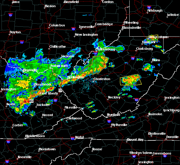 The severe thunderstorm warning for east central mason, northern putnam, wirt, western roane, jackson and south central wood counties will expire at 115 pm edt, the storms which prompted the warning have weakened below severe limits, and no longer pose an immediate threat to life or property. therefore, the warning will be allowed to expire. however gusty winds of 40 to 50mph are still possible with these thunderstorms. a severe thunderstorm watch remains in effect until 700 pm edt for central, western and northwestern west virginia. The severe thunderstorm warning for east central mason, northern putnam, wirt, western roane, jackson and south central wood counties will expire at 115 pm edt, the storms which prompted the warning have weakened below severe limits, and no longer pose an immediate threat to life or property. therefore, the warning will be allowed to expire. however gusty winds of 40 to 50mph are still possible with these thunderstorms. a severe thunderstorm watch remains in effect until 700 pm edt for central, western and northwestern west virginia.
|
| 5/29/2019 1:05 PM EDT | Trees down along barrcut rd. time estimated from rada in roane county WV, 2.2 miles SSE of Spencer, WV |
| 5/29/2019 1:04 PM EDT | Em reported that spencer was the hardest hit community in roane county. numerous trees and powerlines dow in roane county WV, 0.2 miles NNE of Spencer, WV |
| 5/29/2019 1:00 PM EDT | *** 1 fatal *** 55 year old female was killed when a large oak tree fell on her while she was getting her mai in roane county WV, 1.9 miles SW of Spencer, WV |
| 5/29/2019 12:56 PM EDT |
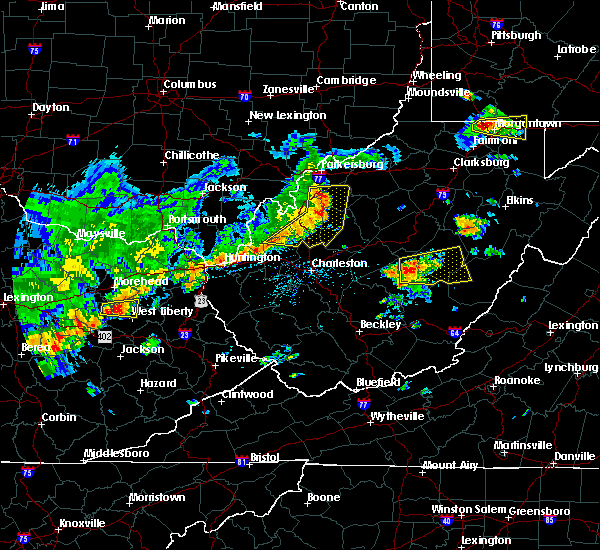 At 1255 pm edt, severe thunderstorms were located along a line extending from 6 miles west of elizabeth to near ripley to buffalo, moving east at 45 mph (radar indicated). Hazards include 60 mph wind gusts and nickel size hail. Expect damage to roofs, siding, and trees. Locations impacted include, ripley, spencer, elizabeth, buffalo, kenna, reedy, statts mills, cherry, peewee, harmony, given, kentuck, liberty, palestine, grimms landing, lucille, morristown, rockport, leroy and fairplain. At 1255 pm edt, severe thunderstorms were located along a line extending from 6 miles west of elizabeth to near ripley to buffalo, moving east at 45 mph (radar indicated). Hazards include 60 mph wind gusts and nickel size hail. Expect damage to roofs, siding, and trees. Locations impacted include, ripley, spencer, elizabeth, buffalo, kenna, reedy, statts mills, cherry, peewee, harmony, given, kentuck, liberty, palestine, grimms landing, lucille, morristown, rockport, leroy and fairplain.
|
| 5/29/2019 12:33 PM EDT |
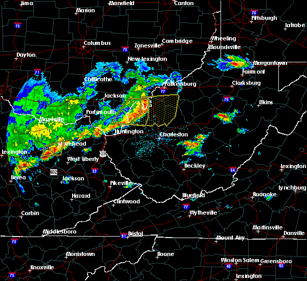 At 1232 pm edt, severe thunderstorms were located along a line extending from forked run state park to 11 miles east of point pleasant to 12 miles north of ona, moving east at 45 mph (radar indicated). Hazards include 60 mph wind gusts and nickel size hail. expect damage to roofs, siding, and trees At 1232 pm edt, severe thunderstorms were located along a line extending from forked run state park to 11 miles east of point pleasant to 12 miles north of ona, moving east at 45 mph (radar indicated). Hazards include 60 mph wind gusts and nickel size hail. expect damage to roofs, siding, and trees
|
| 5/26/2019 7:25 PM EDT |
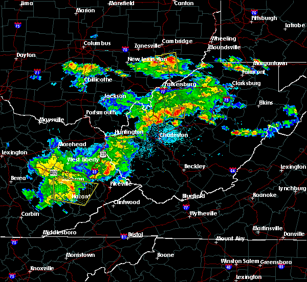 At 724 pm edt, a severe thunderstorm was located near spencer, moving east at 40 mph (radar indicated). Hazards include 60 mph wind gusts and quarter size hail. Hail damage to vehicles is expected. expect wind damage to roofs, siding, and trees. Locations impacted include, spencer and annamoriah. At 724 pm edt, a severe thunderstorm was located near spencer, moving east at 40 mph (radar indicated). Hazards include 60 mph wind gusts and quarter size hail. Hail damage to vehicles is expected. expect wind damage to roofs, siding, and trees. Locations impacted include, spencer and annamoriah.
|
| 5/26/2019 7:20 PM EDT | Four trees down along triplet rd due to high win in roane county WV, 6.7 miles WSW of Spencer, WV |
| 5/26/2019 7:09 PM EDT |
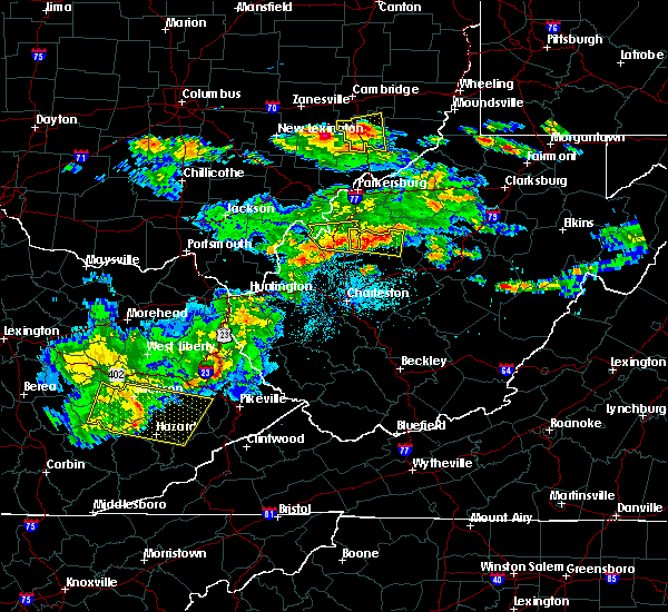 The national weather service in charleston west virginia has issued a * severe thunderstorm warning for. west central calhoun county in north central west virginia. northern roane county in central west virginia. east central jackson county in northwestern west virginia. Until 745 pm edt. The national weather service in charleston west virginia has issued a * severe thunderstorm warning for. west central calhoun county in north central west virginia. northern roane county in central west virginia. east central jackson county in northwestern west virginia. Until 745 pm edt.
|
| 5/17/2019 5:44 PM EDT |
 At 544 pm edt, a severe thunderstorm was located 7 miles northeast of spencer, moving southeast at 30 mph (radar indicated). Hazards include 60 mph wind gusts and quarter size hail. Hail damage to vehicles is expected. Expect wind damage to roofs, siding, and trees. At 544 pm edt, a severe thunderstorm was located 7 miles northeast of spencer, moving southeast at 30 mph (radar indicated). Hazards include 60 mph wind gusts and quarter size hail. Hail damage to vehicles is expected. Expect wind damage to roofs, siding, and trees.
|
| 5/3/2019 3:17 PM EDT |
 At 315 pm edt, severe thunderstorms were located along a line extending from spencer to 6 miles southwest of arnoldsburg to wallback to near clay, moving northeast at 30 mph (radar indicated). Hazards include 60 mph wind gusts. expect damage to roofs, siding, and trees At 315 pm edt, severe thunderstorms were located along a line extending from spencer to 6 miles southwest of arnoldsburg to wallback to near clay, moving northeast at 30 mph (radar indicated). Hazards include 60 mph wind gusts. expect damage to roofs, siding, and trees
|
| 10/28/2018 7:35 PM EDT |
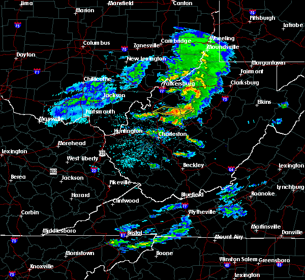 The severe thunderstorm warning for central calhoun, northern roane and east central jackson counties will expire at 745 pm edt, the storms which prompted the warning have weakened below severe limits, and no longer pose an immediate threat to life or property. therefore, the warning will be allowed to expire. however small hail and gusty winds are still possible with these thunderstorms. to report severe weather, contact your nearest law enforcement agency. they will relay your report to the national weather service charleston west virginia. The severe thunderstorm warning for central calhoun, northern roane and east central jackson counties will expire at 745 pm edt, the storms which prompted the warning have weakened below severe limits, and no longer pose an immediate threat to life or property. therefore, the warning will be allowed to expire. however small hail and gusty winds are still possible with these thunderstorms. to report severe weather, contact your nearest law enforcement agency. they will relay your report to the national weather service charleston west virginia.
|
| 10/28/2018 7:19 PM EDT |
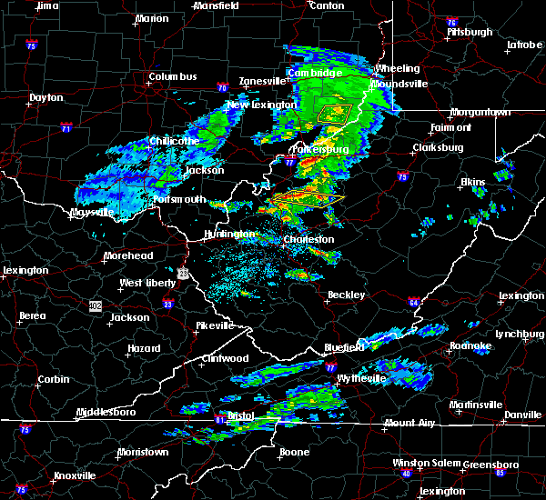 At 719 pm edt, severe thunderstorms were located along a line extending from 8 miles northwest of spencer to near ripley, moving east at 50 mph (radar indicated). Hazards include 60 mph wind gusts and quarter size hail. Hail damage to vehicles is expected. Expect wind damage to roofs, siding, and trees. At 719 pm edt, severe thunderstorms were located along a line extending from 8 miles northwest of spencer to near ripley, moving east at 50 mph (radar indicated). Hazards include 60 mph wind gusts and quarter size hail. Hail damage to vehicles is expected. Expect wind damage to roofs, siding, and trees.
|
| 8/12/2018 9:30 AM EDT | 911 call center received reports of multiple trees and power lines down on otto road. local fire department believes this occurred due to a combination of flooding and in roane county WV, 5.6 miles NW of Spencer, WV |
| 7/31/2018 3:26 PM EDT |
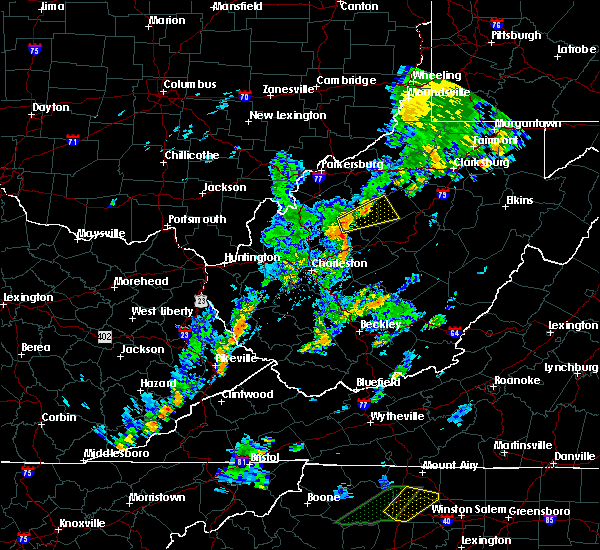 At 325 pm edt, a severe thunderstorm was located near spencer, moving northeast at 25 mph (radar indicated). Hazards include 60 mph wind gusts and quarter size hail. Hail damage to vehicles is expected. Expect wind damage to roofs, siding, and trees. At 325 pm edt, a severe thunderstorm was located near spencer, moving northeast at 25 mph (radar indicated). Hazards include 60 mph wind gusts and quarter size hail. Hail damage to vehicles is expected. Expect wind damage to roofs, siding, and trees.
|
| 7/10/2017 8:07 PM EDT |
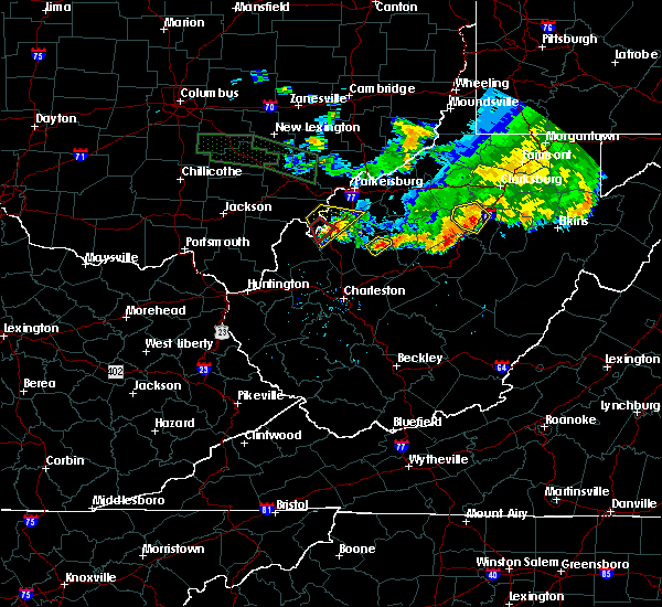 At 807 pm edt, a severe thunderstorm was located near spencer, moving southeast at 35 mph (radar indicated). Hazards include 60 mph wind gusts and quarter size hail. Hail damage to vehicles is expected. expect wind damage to roofs, siding, and trees. Locations impacted include, spencer. At 807 pm edt, a severe thunderstorm was located near spencer, moving southeast at 35 mph (radar indicated). Hazards include 60 mph wind gusts and quarter size hail. Hail damage to vehicles is expected. expect wind damage to roofs, siding, and trees. Locations impacted include, spencer.
|
| 7/10/2017 7:50 PM EDT |
 At 749 pm edt, a severe thunderstorm was located near spencer, moving southeast at 35 mph (radar indicated). Hazards include 60 mph wind gusts and quarter size hail. Hail damage to vehicles is expected. expect wind damage to roofs, siding, and trees. Locations impacted include, spencer, reedy and gandeeville. At 749 pm edt, a severe thunderstorm was located near spencer, moving southeast at 35 mph (radar indicated). Hazards include 60 mph wind gusts and quarter size hail. Hail damage to vehicles is expected. expect wind damage to roofs, siding, and trees. Locations impacted include, spencer, reedy and gandeeville.
|
| 7/10/2017 7:40 PM EDT |
 At 739 pm edt, a severe thunderstorm was located near sandyville, or 10 miles northeast of ripley, moving southeast at 35 mph (radar indicated). Hazards include 60 mph wind gusts and half dollar size hail. Hail damage to vehicles is expected. Expect wind damage to roofs, siding, and trees. At 739 pm edt, a severe thunderstorm was located near sandyville, or 10 miles northeast of ripley, moving southeast at 35 mph (radar indicated). Hazards include 60 mph wind gusts and half dollar size hail. Hail damage to vehicles is expected. Expect wind damage to roofs, siding, and trees.
|
| 4/29/2017 12:48 AM EDT |
 At 1247 am edt, a severe thunderstorm was located near ravenswood, or 9 miles north of ripley, moving east at 60 mph (radar indicated). Hazards include 60 mph wind gusts and quarter size hail. Hail damage to vehicles is expected. expect wind damage to roofs, siding, and trees. locations impacted include, parkersburg, ripley, spencer, elizabeth, ravenswood, sandyville, mineralwells, lubeck, cairo, reedy, statts mills, cherry, given, cottageville, lucille, davisville, brohard, macfarlan, annamoriah and fairplain. this includes the following highways, interstate 77 in west virginia between mile markers 127 and 175. Route 50 in west virginia between mile markers 12 and 32. At 1247 am edt, a severe thunderstorm was located near ravenswood, or 9 miles north of ripley, moving east at 60 mph (radar indicated). Hazards include 60 mph wind gusts and quarter size hail. Hail damage to vehicles is expected. expect wind damage to roofs, siding, and trees. locations impacted include, parkersburg, ripley, spencer, elizabeth, ravenswood, sandyville, mineralwells, lubeck, cairo, reedy, statts mills, cherry, given, cottageville, lucille, davisville, brohard, macfarlan, annamoriah and fairplain. this includes the following highways, interstate 77 in west virginia between mile markers 127 and 175. Route 50 in west virginia between mile markers 12 and 32.
|
| 4/29/2017 12:28 AM EDT |
 At 1228 am edt, a severe thunderstorm was located over new haven, or near pomeroy, moving east at 60 mph (radar indicated). Hazards include 60 mph wind gusts and quarter size hail. Hail damage to vehicles is expected. Expect wind damage to roofs, siding, and trees. At 1228 am edt, a severe thunderstorm was located over new haven, or near pomeroy, moving east at 60 mph (radar indicated). Hazards include 60 mph wind gusts and quarter size hail. Hail damage to vehicles is expected. Expect wind damage to roofs, siding, and trees.
|
| 3/1/2017 10:05 AM EST |
 At 1004 am est, a severe thunderstorm capable of producing a tornado was located near arnoldsburg, or near spencer, moving east at 65 mph (radar indicated rotation). Hazards include tornado and quarter size hail. Flying debris will be dangerous to those caught without shelter. mobile homes will be damaged or destroyed. damage to roofs, windows, and vehicles will occur. tree damage is likely. this dangerous storm will be near, arnoldsburg around 1010 am est. cedar creek state park around 1025 am est. Other locations impacted by this tornadic thunderstorm include shock, millstone, wilsie, harmony, tariff, rosedale, mount zion, orma, looneyville and nicut. At 1004 am est, a severe thunderstorm capable of producing a tornado was located near arnoldsburg, or near spencer, moving east at 65 mph (radar indicated rotation). Hazards include tornado and quarter size hail. Flying debris will be dangerous to those caught without shelter. mobile homes will be damaged or destroyed. damage to roofs, windows, and vehicles will occur. tree damage is likely. this dangerous storm will be near, arnoldsburg around 1010 am est. cedar creek state park around 1025 am est. Other locations impacted by this tornadic thunderstorm include shock, millstone, wilsie, harmony, tariff, rosedale, mount zion, orma, looneyville and nicut.
|
| 3/1/2017 9:55 AM EST |
 At 954 am est, a severe thunderstorm capable of producing a tornado was located near spencer, moving east at 60 mph (radar indicated rotation). Hazards include tornado and quarter size hail. Flying debris will be dangerous to those caught without shelter. mobile homes will be damaged or destroyed. damage to roofs, windows, and vehicles will occur. tree damage is likely. this dangerous storm will be near, arnoldsburg around 1010 am est. cedar creek state park around 1025 am est. Other locations impacted by this tornadic thunderstorm include shock, millstone, wilsie, harmony, tariff, rosedale, mount zion, orma, looneyville and nicut. At 954 am est, a severe thunderstorm capable of producing a tornado was located near spencer, moving east at 60 mph (radar indicated rotation). Hazards include tornado and quarter size hail. Flying debris will be dangerous to those caught without shelter. mobile homes will be damaged or destroyed. damage to roofs, windows, and vehicles will occur. tree damage is likely. this dangerous storm will be near, arnoldsburg around 1010 am est. cedar creek state park around 1025 am est. Other locations impacted by this tornadic thunderstorm include shock, millstone, wilsie, harmony, tariff, rosedale, mount zion, orma, looneyville and nicut.
|
| 3/1/2017 9:50 AM EST |
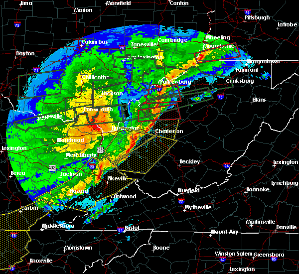 At 949 am est, a severe thunderstorm capable of producing a tornado was located 7 miles northeast of kenna, or 10 miles southeast of ripley, moving east at 60 mph (radar indicated rotation). Hazards include tornado and half dollar size hail. Flying debris will be dangerous to those caught without shelter. mobile homes will be damaged or destroyed. damage to roofs, windows, and vehicles will occur. tree damage is likely. this dangerous storm will be near, spencer around 1000 am est. other locations impacted by this tornadic thunderstorm include statts mills, evans, looneyville, harmony, tariff, given, kentuck, fairplain, gay and gandeeville. This includes interstate 77 in west virginia between mile markers 122 and 138. At 949 am est, a severe thunderstorm capable of producing a tornado was located 7 miles northeast of kenna, or 10 miles southeast of ripley, moving east at 60 mph (radar indicated rotation). Hazards include tornado and half dollar size hail. Flying debris will be dangerous to those caught without shelter. mobile homes will be damaged or destroyed. damage to roofs, windows, and vehicles will occur. tree damage is likely. this dangerous storm will be near, spencer around 1000 am est. other locations impacted by this tornadic thunderstorm include statts mills, evans, looneyville, harmony, tariff, given, kentuck, fairplain, gay and gandeeville. This includes interstate 77 in west virginia between mile markers 122 and 138.
|
| 3/1/2017 9:33 AM EST |
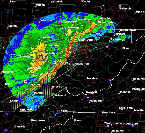 At 933 am est, a severe thunderstorm capable of producing a tornado was located 8 miles northeast of buffalo, or 11 miles north of winfield, moving east at 60 mph (radar indicated rotation). Hazards include tornado and half dollar size hail. Flying debris will be dangerous to those caught without shelter. mobile homes will be damaged or destroyed. damage to roofs, windows, and vehicles will occur. tree damage is likely. this dangerous storm will be near, kenna around 945 am est. spencer around 1000 am est. other locations impacted by this tornadic thunderstorm include statts mills, evans, looneyville, harmony, tariff, given, kentuck, fairplain, gay and gandeeville. This includes interstate 77 in west virginia between mile markers 122 and 138. At 933 am est, a severe thunderstorm capable of producing a tornado was located 8 miles northeast of buffalo, or 11 miles north of winfield, moving east at 60 mph (radar indicated rotation). Hazards include tornado and half dollar size hail. Flying debris will be dangerous to those caught without shelter. mobile homes will be damaged or destroyed. damage to roofs, windows, and vehicles will occur. tree damage is likely. this dangerous storm will be near, kenna around 945 am est. spencer around 1000 am est. other locations impacted by this tornadic thunderstorm include statts mills, evans, looneyville, harmony, tariff, given, kentuck, fairplain, gay and gandeeville. This includes interstate 77 in west virginia between mile markers 122 and 138.
|
| 9/30/2016 2:48 PM EDT |
 At 248 pm edt, a severe thunderstorm was located near elizabeth, moving north at 30 mph (radar indicated). Hazards include 60 mph wind gusts and quarter size hail. Hail damage to vehicles is expected. Locations impacted include, spencer, elizabeth, boaz, reedy, schultz, waverly, walker, lucille, nutter farm, cherry, freeport, petroleum, palestine and greencastle. At 248 pm edt, a severe thunderstorm was located near elizabeth, moving north at 30 mph (radar indicated). Hazards include 60 mph wind gusts and quarter size hail. Hail damage to vehicles is expected. Locations impacted include, spencer, elizabeth, boaz, reedy, schultz, waverly, walker, lucille, nutter farm, cherry, freeport, petroleum, palestine and greencastle.
|
| 9/30/2016 2:34 PM EDT | Golf Ball sized hail reported 1.7 miles E of Spencer, WV |
| 9/30/2016 2:31 PM EDT |
 At 230 pm edt, a severe thunderstorm was located near spencer, moving north at 30 mph (radar indicated). Hazards include 60 mph wind gusts and quarter size hail. hail damage to vehicles is expected At 230 pm edt, a severe thunderstorm was located near spencer, moving north at 30 mph (radar indicated). Hazards include 60 mph wind gusts and quarter size hail. hail damage to vehicles is expected
|
| 9/30/2016 2:30 PM EDT | Hen Egg sized hail reported 2.8 miles SSE of Spencer, WV |
| 9/30/2016 2:11 PM EDT |
 At 210 pm edt, a severe thunderstorm was located 7 miles southwest of spencer, moving north at 30 mph (radar indicated). Hazards include 60 mph wind gusts and quarter size hail. hail damage to vehicles is expected At 210 pm edt, a severe thunderstorm was located 7 miles southwest of spencer, moving north at 30 mph (radar indicated). Hazards include 60 mph wind gusts and quarter size hail. hail damage to vehicles is expected
|
| 7/26/2016 6:00 PM EDT |
 At 559 pm edt, a severe thunderstorm was located near arnoldsburg, or near grantsville, moving southeast at 25 mph (radar indicated). Hazards include 65 mph wind gusts. Expect damage to roofs. siding. And trees. At 559 pm edt, a severe thunderstorm was located near arnoldsburg, or near grantsville, moving southeast at 25 mph (radar indicated). Hazards include 65 mph wind gusts. Expect damage to roofs. siding. And trees.
|
| 6/23/2016 6:17 PM EDT |
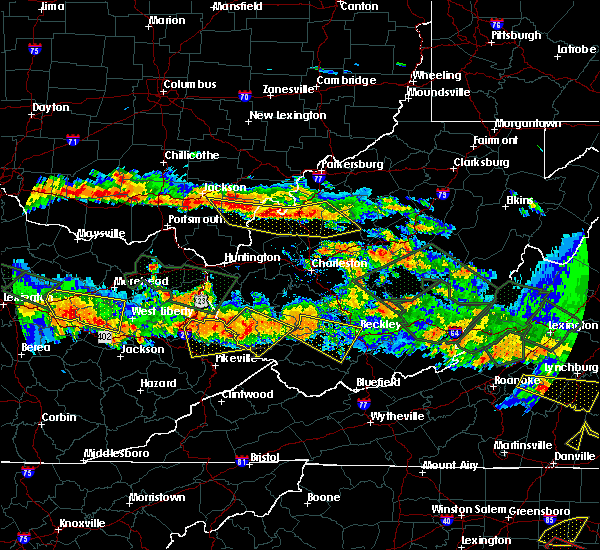 At 616 pm edt, severe thunderstorms were located along a line extending from 7 miles northeast of oak hill to near point pleasant to near sandyville to 9 miles north of spencer, moving east at 35 mph (radar indicated). Hazards include 60 mph wind gusts and quarter size hail. Hail damage to vehicles is expected. expect wind damage to roofs, siding, and trees. locations impacted include, point pleasant, gallipolis, ripley, spencer, rio grande, sandyville, henderson, vinton, reedy, leon, cheshire, adamsville, fairplain, harmony, gallopolis ferry, gandeeville, letart, evans, given and mount alto. A tornado watch remains in effect until 1000 pm edt for southeastern ohio, and western, north central, central and northwestern west virginia. At 616 pm edt, severe thunderstorms were located along a line extending from 7 miles northeast of oak hill to near point pleasant to near sandyville to 9 miles north of spencer, moving east at 35 mph (radar indicated). Hazards include 60 mph wind gusts and quarter size hail. Hail damage to vehicles is expected. expect wind damage to roofs, siding, and trees. locations impacted include, point pleasant, gallipolis, ripley, spencer, rio grande, sandyville, henderson, vinton, reedy, leon, cheshire, adamsville, fairplain, harmony, gallopolis ferry, gandeeville, letart, evans, given and mount alto. A tornado watch remains in effect until 1000 pm edt for southeastern ohio, and western, north central, central and northwestern west virginia.
|
| 6/23/2016 5:58 PM EDT |
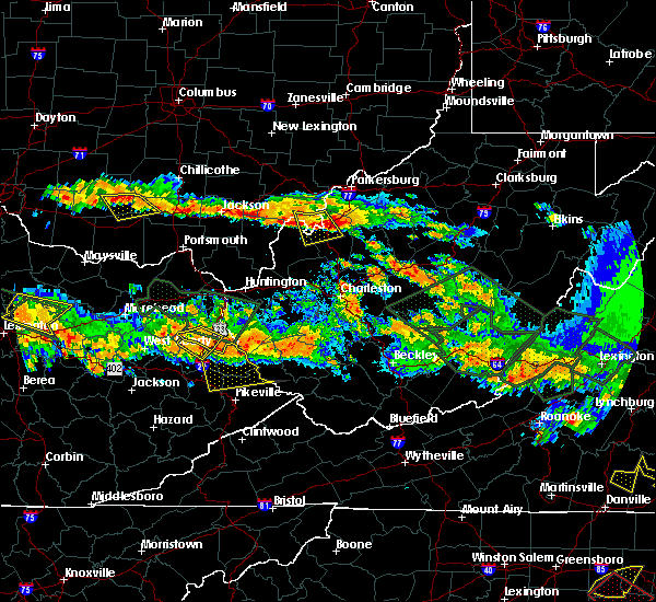 At 558 pm edt, severe thunderstorms were located along a line extending from 11 miles northwest of jackson to near wellston to near pomeroy to 6 miles east of forked run state park, moving southeast at 35 mph (radar indicated). Hazards include 60 mph wind gusts and quarter size hail. Hail damage to vehicles is expected. Expect wind damage to roofs, siding, and trees. At 558 pm edt, severe thunderstorms were located along a line extending from 11 miles northwest of jackson to near wellston to near pomeroy to 6 miles east of forked run state park, moving southeast at 35 mph (radar indicated). Hazards include 60 mph wind gusts and quarter size hail. Hail damage to vehicles is expected. Expect wind damage to roofs, siding, and trees.
|
| 6/23/2016 3:37 PM EDT |
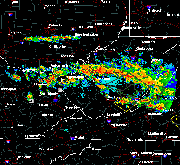 At 336 pm edt, a severe thunderstorm was located 7 miles southwest of spencer, moving southeast at 45 mph (radar indicated). Hazards include 60 mph wind gusts and quarter size hail. Hail damage to vehicles is expected. expect wind damage to roofs, siding, and trees. locations impacted include, ripley, spencer, fairplain, looneyville, harmony, gay, walton, given, statts mills and gandeeville. A tornado watch remains in effect until 1000 pm edt for north central, central and northwestern west virginia. At 336 pm edt, a severe thunderstorm was located 7 miles southwest of spencer, moving southeast at 45 mph (radar indicated). Hazards include 60 mph wind gusts and quarter size hail. Hail damage to vehicles is expected. expect wind damage to roofs, siding, and trees. locations impacted include, ripley, spencer, fairplain, looneyville, harmony, gay, walton, given, statts mills and gandeeville. A tornado watch remains in effect until 1000 pm edt for north central, central and northwestern west virginia.
|
| 6/23/2016 3:22 PM EDT |
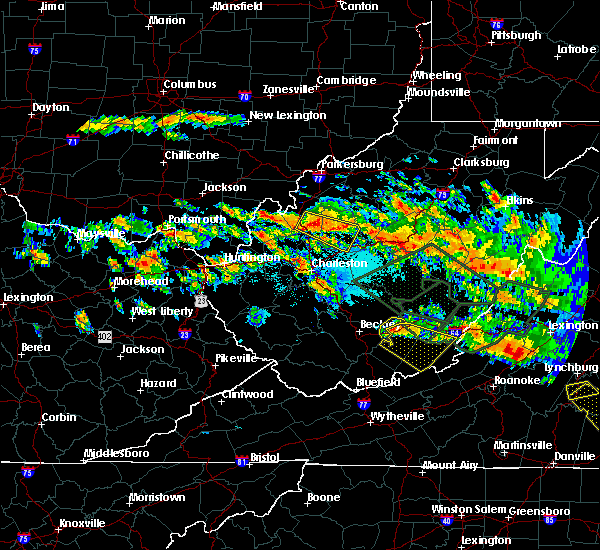 At 322 pm edt, a severe thunderstorm was located near ripley, moving southeast at 45 mph (radar indicated). Hazards include 60 mph wind gusts and half dollar size hail. Hail damage to vehicles is expected. Expect wind damage to roofs, siding, and trees. At 322 pm edt, a severe thunderstorm was located near ripley, moving southeast at 45 mph (radar indicated). Hazards include 60 mph wind gusts and half dollar size hail. Hail damage to vehicles is expected. Expect wind damage to roofs, siding, and trees.
|
| 6/16/2016 5:00 PM EDT |
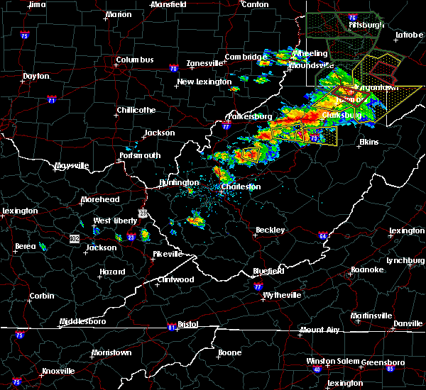 At 459 pm edt, a severe thunderstorm was located near spencer, moving east at 35 mph (radar and public indicated. golf ball sized hail was recently reported near reedy). Hazards include 70 mph wind gusts and half dollar size hail. Hail damage to vehicles is expected. expect considerable tree damage. wind damage is also likely to mobile homes, roofs, and outbuildings. Locations impacted include, spencer. At 459 pm edt, a severe thunderstorm was located near spencer, moving east at 35 mph (radar and public indicated. golf ball sized hail was recently reported near reedy). Hazards include 70 mph wind gusts and half dollar size hail. Hail damage to vehicles is expected. expect considerable tree damage. wind damage is also likely to mobile homes, roofs, and outbuildings. Locations impacted include, spencer.
|
| 6/16/2016 4:40 PM EDT |
 At 440 pm edt, a severe thunderstorm was located 7 miles northwest of spencer, moving east at 35 mph (radar indicated). Hazards include 60 mph wind gusts and quarter size hail. Hail damage to vehicles is expected. Expect wind damage to roofs, siding, and trees. At 440 pm edt, a severe thunderstorm was located 7 miles northwest of spencer, moving east at 35 mph (radar indicated). Hazards include 60 mph wind gusts and quarter size hail. Hail damage to vehicles is expected. Expect wind damage to roofs, siding, and trees.
|
| 6/16/2016 4:33 PM EDT |
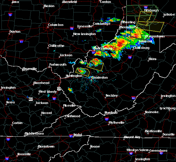 At 433 pm edt, a severe thunderstorm was located 8 miles west of spencer, moving east at 30 mph (radar indicated). Hazards include 60 mph wind gusts and quarter size hail. Hail damage to vehicles is expected. expect wind damage to roofs, siding, and trees. Locations impacted include, ripley, spencer, sandyville, reedy, fairplain, looneyville, harmony, gay, statts mills, gandeeville and leroy. At 433 pm edt, a severe thunderstorm was located 8 miles west of spencer, moving east at 30 mph (radar indicated). Hazards include 60 mph wind gusts and quarter size hail. Hail damage to vehicles is expected. expect wind damage to roofs, siding, and trees. Locations impacted include, ripley, spencer, sandyville, reedy, fairplain, looneyville, harmony, gay, statts mills, gandeeville and leroy.
|
| 6/16/2016 4:12 PM EDT |
 At 412 pm edt, a severe thunderstorm was located over sandyville, or near ripley, moving east at 70 mph (radar indicated). Hazards include 60 mph wind gusts and quarter size hail. Expect wind damage to roofs. siding. And trees. At 412 pm edt, a severe thunderstorm was located over sandyville, or near ripley, moving east at 70 mph (radar indicated). Hazards include 60 mph wind gusts and quarter size hail. Expect wind damage to roofs. siding. And trees.
|
| 6/4/2016 1:45 PM EDT |
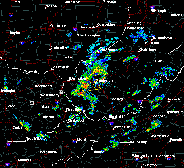 At 143 pm edt, a severe thunderstorm was located near kenna, or 12 miles southeast of ripley, moving east at 20 mph (radar indicated). Hazards include 60 mph wind gusts and half dollar size hail. Hail damage to vehicles is expected. expect wind damage to roofs, siding, and trees. Locations impacted include, spencer, kenna, looneyville, kentuck, harmony, gay, walton, statts mills and gandeeville. At 143 pm edt, a severe thunderstorm was located near kenna, or 12 miles southeast of ripley, moving east at 20 mph (radar indicated). Hazards include 60 mph wind gusts and half dollar size hail. Hail damage to vehicles is expected. expect wind damage to roofs, siding, and trees. Locations impacted include, spencer, kenna, looneyville, kentuck, harmony, gay, walton, statts mills and gandeeville.
|
| 6/4/2016 1:26 PM EDT |
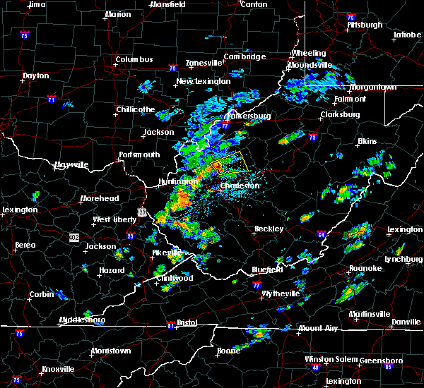 At 126 pm edt, a severe thunderstorm was located over kenna, or 11 miles south of ripley, moving east at 20 mph (radar indicated). Hazards include 60 mph wind gusts and half dollar size hail. Hail damage to vehicles is expected. Expect wind damage to roofs, siding, and trees. At 126 pm edt, a severe thunderstorm was located over kenna, or 11 miles south of ripley, moving east at 20 mph (radar indicated). Hazards include 60 mph wind gusts and half dollar size hail. Hail damage to vehicles is expected. Expect wind damage to roofs, siding, and trees.
|
| 4/28/2016 2:55 PM EDT |
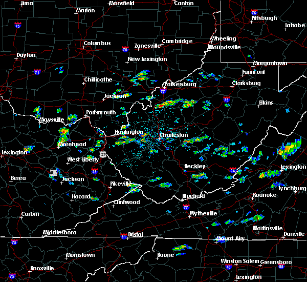 At 254 pm edt, a severe thunderstorm was located near sandyville, or 10 miles northeast of ripley, moving east at 20 mph (radar indicated). Hazards include 60 mph wind gusts and half dollar size hail. Hail damage to vehicles is expected. Expect wind damage to roofs, siding, and trees. At 254 pm edt, a severe thunderstorm was located near sandyville, or 10 miles northeast of ripley, moving east at 20 mph (radar indicated). Hazards include 60 mph wind gusts and half dollar size hail. Hail damage to vehicles is expected. Expect wind damage to roofs, siding, and trees.
|
| 4/26/2016 4:30 PM EDT |
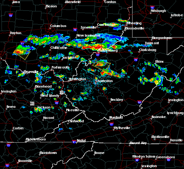 At 430 pm edt, a severe thunderstorm was located near sandyville, or 8 miles northeast of ripley, moving southeast at 35 mph (radar indicated). Hazards include 60 mph wind gusts and quarter size hail. Hail damage to vehicles is expected. expect wind damage to roofs, siding, and trees. Locations impacted include, spencer, sandyville, reedy, peewee, creston, annamoriah, lucille and leroy. At 430 pm edt, a severe thunderstorm was located near sandyville, or 8 miles northeast of ripley, moving southeast at 35 mph (radar indicated). Hazards include 60 mph wind gusts and quarter size hail. Hail damage to vehicles is expected. expect wind damage to roofs, siding, and trees. Locations impacted include, spencer, sandyville, reedy, peewee, creston, annamoriah, lucille and leroy.
|
| 4/26/2016 4:12 PM EDT |
 At 411 pm edt, a severe thunderstorm was located over ravenswood, or 8 miles south of forked run state park, moving southeast at 30 mph (radar indicated). Hazards include ping pong ball size hail and 60 mph wind gusts. People and animals outdoors will be injured. expect hail damage to roofs, siding, windows, and vehicles. Expect wind damage to roofs, siding, and trees. At 411 pm edt, a severe thunderstorm was located over ravenswood, or 8 miles south of forked run state park, moving southeast at 30 mph (radar indicated). Hazards include ping pong ball size hail and 60 mph wind gusts. People and animals outdoors will be injured. expect hail damage to roofs, siding, windows, and vehicles. Expect wind damage to roofs, siding, and trees.
|
| 4/26/2016 4:12 PM EDT |
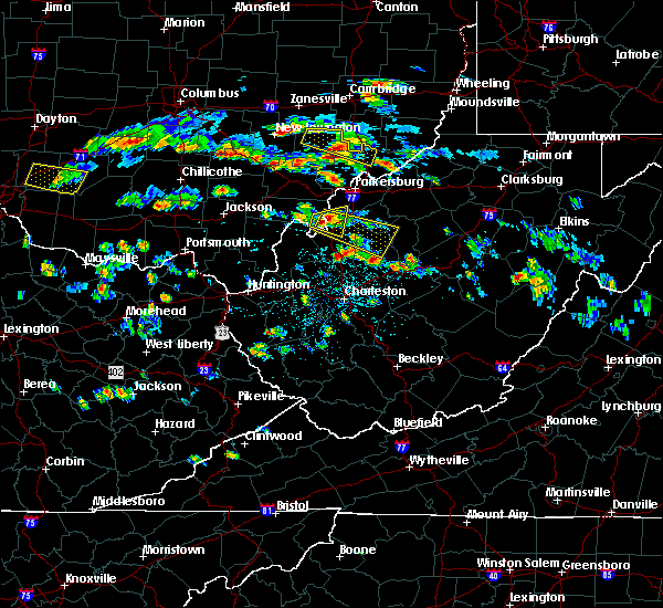 At 411 pm edt, a severe thunderstorm was located over ravenswood, or 8 miles south of forked run state park, moving southeast at 30 mph (radar indicated). Hazards include ping pong ball size hail and 60 mph wind gusts. People and animals outdoors will be injured. expect hail damage to roofs, siding, windows, and vehicles. Expect wind damage to roofs, siding, and trees. At 411 pm edt, a severe thunderstorm was located over ravenswood, or 8 miles south of forked run state park, moving southeast at 30 mph (radar indicated). Hazards include ping pong ball size hail and 60 mph wind gusts. People and animals outdoors will be injured. expect hail damage to roofs, siding, windows, and vehicles. Expect wind damage to roofs, siding, and trees.
|
| 7/14/2015 5:18 PM EDT |
 At 518 pm edt, doppler radar indicated a line of severe thunderstorms capable of producing damaging winds in excess of 60 mph. these storms were located along a line extending from sandyville to 6 miles northwest of kenna to near buffalo, and moving southeast at 50 mph. At 518 pm edt, doppler radar indicated a line of severe thunderstorms capable of producing damaging winds in excess of 60 mph. these storms were located along a line extending from sandyville to 6 miles northwest of kenna to near buffalo, and moving southeast at 50 mph.
|
| 7/14/2015 5:09 PM EDT |
 At 507 pm edt, doppler radar indicated a line of severe thunderstorms capable of producing damaging winds in excess of 60 mph. these storms were located along a line extending from 6 miles southeast of pennsboro to near grantsville to 8 miles north of spencer, moving southeast at 45 mph. locations impacted include, spencer, harrisville, glenville, elizabeth, grantsville, salem, pennsboro, west union, arnoldsburg, north bend state park, cedar creek state park, ellenboro, cairo, reedy, sand fork, pullman, auburn, coxs mills, creston and wolf summit. At 507 pm edt, doppler radar indicated a line of severe thunderstorms capable of producing damaging winds in excess of 60 mph. these storms were located along a line extending from 6 miles southeast of pennsboro to near grantsville to 8 miles north of spencer, moving southeast at 45 mph. locations impacted include, spencer, harrisville, glenville, elizabeth, grantsville, salem, pennsboro, west union, arnoldsburg, north bend state park, cedar creek state park, ellenboro, cairo, reedy, sand fork, pullman, auburn, coxs mills, creston and wolf summit.
|
| 7/14/2015 4:34 PM EDT |
 At 433 pm edt, doppler radar indicated a line of severe thunderstorms capable of producing damaging winds in excess of 60 mph. these storms were located along a line extending from near belmont to mineralwells to forked run state park, and moving southeast at 45 mph. At 433 pm edt, doppler radar indicated a line of severe thunderstorms capable of producing damaging winds in excess of 60 mph. these storms were located along a line extending from near belmont to mineralwells to forked run state park, and moving southeast at 45 mph.
|
| 7/7/2015 5:28 PM EDT | The severe thunderstorm warning for north central roane. southwestern ritchie. southeastern wirt. calhoun and west central gilmer counties will expire at 530 pm edt. the storms which prompted the warning have weakened below severe limits and exited the warned area. Therefore the warning will be allowed to expire. |
| 7/7/2015 5:09 PM EDT |
 At 509 pm edt, doppler radar indicated a line of severe thunderstorms capable of producing damaging winds in excess of 60 mph. these storms were located along a line extending from elizabeth to near spencer. these storms were nearly stationary. locations impacted include, spencer, grantsville, macfarlan, munday, creston, mount zion, burnt house, annamoriah, big springs, brohard, stumptown, smithville and tanner. At 509 pm edt, doppler radar indicated a line of severe thunderstorms capable of producing damaging winds in excess of 60 mph. these storms were located along a line extending from elizabeth to near spencer. these storms were nearly stationary. locations impacted include, spencer, grantsville, macfarlan, munday, creston, mount zion, burnt house, annamoriah, big springs, brohard, stumptown, smithville and tanner.
|
| 7/7/2015 4:45 PM EDT |
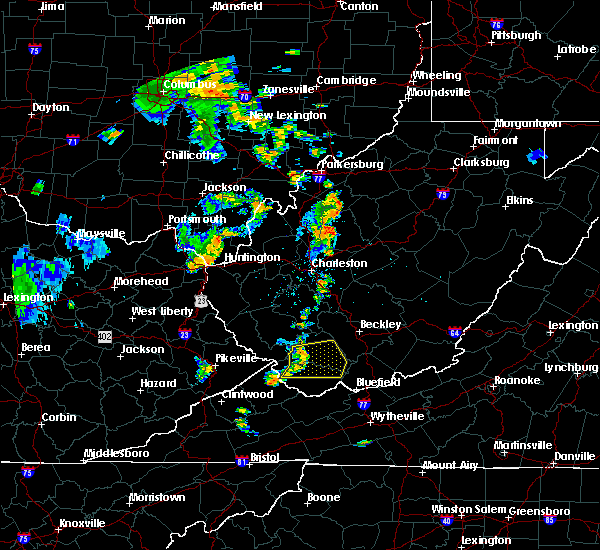 At 444 pm edt, doppler radar indicated a line of severe thunderstorms capable of producing damaging winds in excess of 60 mph. these storms were located along a line extending from elizabeth to near spencer, and moving east at 35 mph. At 444 pm edt, doppler radar indicated a line of severe thunderstorms capable of producing damaging winds in excess of 60 mph. these storms were located along a line extending from elizabeth to near spencer, and moving east at 35 mph.
|
| 6/26/2015 7:57 PM EDT | The severe thunderstorm warning for southeastern meigs. roane. southern wirt. central calhoun. east central mason and jackson counties will expire at 800 pm edt. this severe thunderstorm warning will expire at 8. however. a new severe thunderstorm warning has been issued downstream for roane county in west virginia. North central nicholas county in west. |
| 6/26/2015 7:57 PM EDT | The severe thunderstorm warning for southeastern meigs, roane, southern wirt, central calhoun, east central mason and jackson counties will expire at 800 pm edt, this severe thunderstorm warning will expire at 8. however, a new severe thunderstorm warning has been issued downstream for roane county in west virginia, north central nicholas county in west virginia, southern calhoun county in west virginia, central clay county in west virginia, southwestern gilmer county in west virginia, braxton county in west virginia, southeastern jackson county in west virginia, and northeastern kanawha county in west virginia until 900 pm edt. |
| 6/26/2015 7:54 PM EDT | At 753 pm edt, doppler radar indicated a severe thunderstorm capable of producing half dollar size hail and destructive winds in excess of 70 mph. this storm was located near spencer, and moving east at 35 mph. |
| 6/26/2015 7:50 PM EDT | Trees down along wv 119 near gandeevill in roane county WV, 7.5 miles NNE of Spencer, WV |
| 6/26/2015 7:27 PM EDT | At 727 pm edt, doppler radar indicated a severe thunderstorm capable of producing large damaging hail up to golf ball size and destructive winds in excess of 70 mph. this storm was located near ripley, moving east at 25 mph. locations impacted include, ripley, spencer, grantsville, ravenswood, amma, sandyville, arnoldsburg, kenna, reedy, fairplain, creston, harmony, gandeeville, looneyville, evans, left hand, given, tariff, peewee and mount zion. |
| 6/26/2015 7:27 PM EDT | At 727 pm edt, doppler radar indicated a severe thunderstorm capable of producing large damaging hail up to golf ball size and destructive winds in excess of 70 mph. this storm was located near ripley, moving east at 25 mph. locations impacted include, ripley, spencer, grantsville, ravenswood, amma, sandyville, arnoldsburg, kenna, reedy, fairplain, creston, harmony, gandeeville, looneyville, evans, left hand, given, tariff, peewee and mount zion. |
| 6/26/2015 7:00 PM EDT | At 659 pm edt, doppler radar indicated a severe thunderstorm capable of producing quarter size hail and damaging winds in excess of 60 mph. this storm was located 7 miles west of ripley, and moving east at 35 mph. |
| 6/26/2015 7:00 PM EDT | At 659 pm edt, doppler radar indicated a severe thunderstorm capable of producing quarter size hail and damaging winds in excess of 60 mph. this storm was located 7 miles west of ripley, and moving east at 35 mph. |
| 4/9/2015 6:11 PM EDT | The national weather service in charleston has issued a * severe thunderstorm warning for. north central braxton county in west virginia. northern calhoun county in west virginia. this includes the city of grantsville. South central doddridge county in west virginia. |
| 4/9/2015 6:11 PM EDT | The national weather service in charleston has issued a * severe thunderstorm warning for. north central braxton county in west virginia. northern calhoun county in west virginia. this includes the city of grantsville. South central doddridge county in west virginia. |
| 7/8/2014 2:57 PM EDT | Numerous trees down in tow in roane county WV, 0.2 miles NNE of Spencer, WV |
| 6/11/2014 4:38 PM EDT | Quarter sized hail reported 1.2 miles S of Spencer, WV, quarter size hail between beckley and skelton |
| 6/11/2014 4:20 PM EDT | Quarter sized hail reported 1.2 miles S of Spencer, WV, quarter size hail between beckley and skelton |
| 6/11/2014 2:55 PM EDT | Quarter sized hail reported 7.5 miles NNE of Spencer, WV, quarter size hail reported at the intersection of cox fork rd and mount lebanon road. |
| 5/13/2014 10:00 PM EDT | Trees and powerlines dow in roane county WV, 0.2 miles NNE of Spencer, WV |
| 11/17/2013 9:52 PM EST | Branches down in town and along route 33 west of tow in roane county WV, 0.2 miles NNE of Spencer, WV |
| 5/22/2013 4:30 PM EDT | A few trees reported down near community of clove in roane county WV, 6.9 miles NNW of Spencer, WV |
| 7/26/2012 7:45 PM EDT | Power lines down near spencer in roane county WV, 0.2 miles NNE of Spencer, WV |
| 7/3/2012 5:46 PM EDT | Several trees down between spencer and gandeeville along route 119. several trees down on power lines in the same are in roane county WV, 3.2 miles NNE of Spencer, WV |
| 7/3/2012 5:25 PM EDT | Several trailers in a trailer park reporting structural damag in roane county WV, 1.5 miles W of Spencer, WV |
| 7/3/2012 3:05 PM EDT | Trailer blown off found in roane county WV, 0.2 miles NNE of Spencer, WV |
| 1/1/0001 12:00 AM | Numerous trees down in are in roane county WV, 1.5 miles W of Spencer, WV |
| 1/1/0001 12:00 AM | Numerous trees down in spencer are in roane county WV, 1.5 miles W of Spencer, WV |
Hail Maps for Spencer, WV
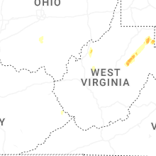
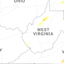


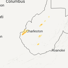


Connect with Interactive Hail Maps