

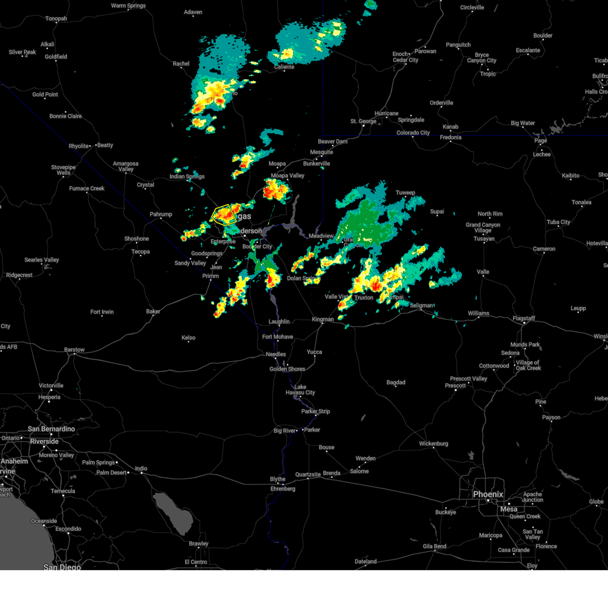
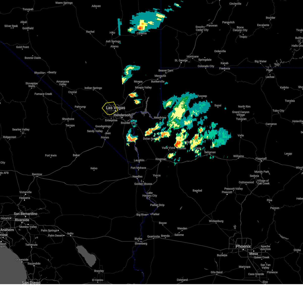
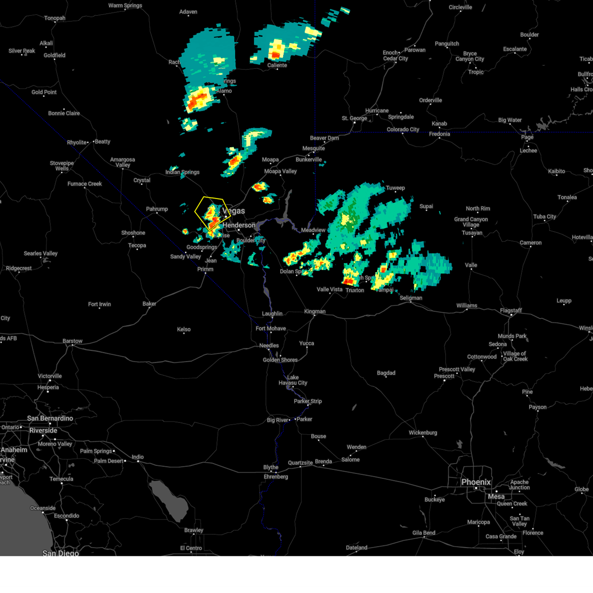
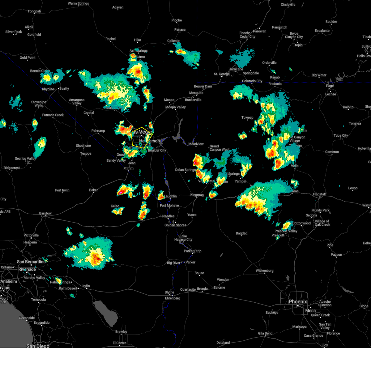
Hail Map for Spring Valley, NV
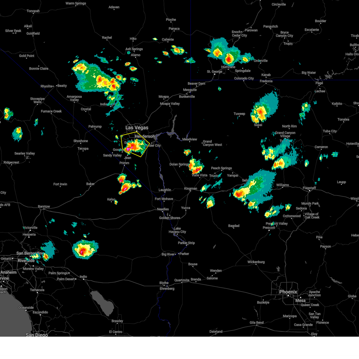
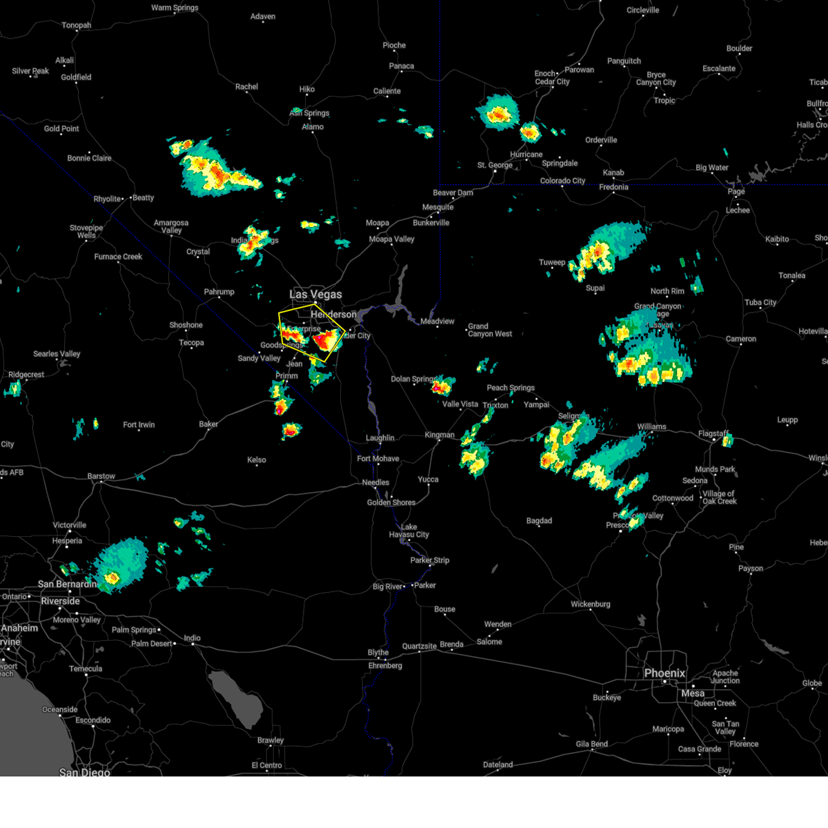
The Spring Valley, NV area has had 0 reports of on-the-ground hail by trained spotters, and has been under severe weather warnings 20 times during the past 12 months. Doppler radar has detected hail at or near Spring Valley, NV on 26 occasions, including 3 occasions during the past year.
| Name: | Spring Valley, NV |
| Where Located: | 8.7 miles SW of Las Vegas, NV |
| Map: | Google Map for Spring Valley, NV |
| Population: | 178395 |
| Housing Units: | 83678 |
| More Info: | Search Google for Spring Valley, NV |
0
The Top Recent Hail Date for Spring Valley, NV is Thursday, June 5, 2025 (16th out of 26)
Hail and Wind Damage Spotted near Spring Valley, NV
| Date / Time | Report Details |
|---|---|
| 7/3/2025 3:59 PM PDT | The storm which prompted the warning has weakened, and no longer poses an immediate threat to life or property. therefore, the warning will be allowed to expire. |
| 7/3/2025 3:36 PM PDT | At 335 pm pdt, a severe thunderstorm was located over anthem, moving east at 15 mph (radar indicated). Hazards include 60 mph wind gusts. Expect damage to roofs and trees. locations impacted include, henderson, boulder city, southern highlands, anthem, lake las vegas, green valley, enterprise, sam boyd stadium, paradise, spring valley, east las vegas, sloan, railroad pass, seven hills, silverado ranch, harry reid international airport, black mtn, and henderson executive airport. This includes interstate 15 in nevada between mile markers 22 and 25. |
| 7/3/2025 3:02 PM PDT |
 Svrvef the national weather service in las vegas has issued a * severe thunderstorm warning for, central clark county in southern nevada, * until 400 pm pdt. * at 302 pm pdt, a severe thunderstorm was located over southern highlands, moving east at 15 mph (radar indicated). Hazards include 60 mph wind gusts and quarter size hail. Hail damage to vehicles is expected. Expect wind damage to roofs and trees. Svrvef the national weather service in las vegas has issued a * severe thunderstorm warning for, central clark county in southern nevada, * until 400 pm pdt. * at 302 pm pdt, a severe thunderstorm was located over southern highlands, moving east at 15 mph (radar indicated). Hazards include 60 mph wind gusts and quarter size hail. Hail damage to vehicles is expected. Expect wind damage to roofs and trees.
|
| 7/1/2025 5:27 PM PDT |
 The storm which prompted the warning has weakened, and no longer poses an immediate threat to life or property. therefore, the warning will be allowed to expire. occasional gusty winds are still possible into the evening. The storm which prompted the warning has weakened, and no longer poses an immediate threat to life or property. therefore, the warning will be allowed to expire. occasional gusty winds are still possible into the evening.
|
| 7/1/2025 5:01 PM PDT | Svrvef the national weather service in las vegas has issued a * severe thunderstorm warning for, central clark county in southern nevada, * until 530 pm pdt. * at 459 pm pdt, a severe thunderstorm was located over spring valley, moving north at 20 mph (radar indicated). Hazards include 60 mph wind gusts. expect damage to roofs and trees |
| 7/1/2025 4:20 PM PDT | At 418 pm pdt, an area of showers and isolated thunderstorms was moving through the las vegas valley moving north at 15 mph (radar indicated). Hazards include 60 mph wind gusts. Expect damage to roofs and trees. visibilities may be reduced to less that 1/2 mile at times. locations impacted include, las vegas, henderson, north las vegas, anthem, the strip, nellis afb, east las vegas, sam boyd stadium, the motor speedway, southern highlands, aliante, lake las vegas, spring valley, green valley, enterprise, fremont street, paradise, lone mountain, centennial hills, and mountains edge. This includes interstate 15 in nevada between mile markers 22 and 25. |
| 7/1/2025 3:41 PM PDT | Svrvef the national weather service in las vegas has issued a * severe thunderstorm warning for, central clark county in southern nevada, * until 445 pm pdt. * at 339 pm pdt, an area of showers and isolated thunderstorms was moving through the las vegas valley moving north at 15 mph (radar indicated). Hazards include 60 mph wind gusts. expect damage to roofs and trees |
| 7/1/2025 2:44 PM PDT | Svrvef the national weather service in las vegas has issued a * severe thunderstorm warning for, central clark county in southern nevada, * until 345 pm pdt. * at 244 pm pdt, an area of showers and isolated thunderstorms was moving through the las vegas valley moving north at 15 mph (radar indicated). Hazards include 60 mph wind gusts. expect damage to roofs and trees |
| 7/1/2025 2:22 PM PDT |
 At 221 pm pdt, an area of showers and isolated thunderstorms was moving through the las vegas valley moving north at 15 mph (radar indicated). Hazards include 60 mph wind gusts. Expect damage to roofs and trees. locations impacted include, las vegas, henderson, north las vegas, anthem, the strip, nellis afb, east las vegas, sam boyd stadium, the motor speedway, southern highlands, aliante, lake las vegas, spring valley, green valley, enterprise, fremont street, paradise, lone mountain, centennial hills, and mountains edge. This includes interstate 15 in nevada between mile markers 22 and 25. At 221 pm pdt, an area of showers and isolated thunderstorms was moving through the las vegas valley moving north at 15 mph (radar indicated). Hazards include 60 mph wind gusts. Expect damage to roofs and trees. locations impacted include, las vegas, henderson, north las vegas, anthem, the strip, nellis afb, east las vegas, sam boyd stadium, the motor speedway, southern highlands, aliante, lake las vegas, spring valley, green valley, enterprise, fremont street, paradise, lone mountain, centennial hills, and mountains edge. This includes interstate 15 in nevada between mile markers 22 and 25.
|
| 7/1/2025 1:52 PM PDT | Svrvef the national weather service in las vegas has issued a * severe thunderstorm warning for, central clark county in southern nevada, * until 245 pm pdt. * at 150 pm pdt, an area of showers and isolated thunderstorms was moving through the las vegas valley moving north at 15 mph (radar indicated). Hazards include 60 mph wind gusts. expect damage to roofs and trees |
| 6/5/2025 2:50 PM PDT |
 The storm which prompted the warning has weakened, and no longer poses an immediate threat to life or property. therefore, the warning will be allowed to expire. The storm which prompted the warning has weakened, and no longer poses an immediate threat to life or property. therefore, the warning will be allowed to expire.
|
| 6/5/2025 2:38 PM PDT | At 237 pm pdt, a severe thunderstorm was located near centennial hills, moving northwest at 25 mph (public). Hazards include 60 mph wind gusts and quarter size hail. Hail damage to vehicles is expected. expect wind damage to roofs and trees. Locations impacted include, las vegas, north las vegas, lone mountain, centennial hills, aliante, fremont street, summerlin, east las vegas, north las vegas airport, and floyd lamb park. |
| 6/5/2025 2:29 PM PDT |
 At 229 pm pdt, a severe thunderstorm was located over lone mountain, moving northwest at 25 mph (public reported quarter-to-ping-pong sized hail). Hazards include 60 mph wind gusts and quarter size hail. Hail damage to vehicles is expected. expect wind damage to roofs and trees. Locations impacted include, las vegas, north las vegas, lone mountain, summerlin, aliante, centennial hills, fremont street, spring valley, the strip, east las vegas, paradise, north las vegas airport, las vegas ballpark, stratosphere tower, the lakes, and floyd lamb park. At 229 pm pdt, a severe thunderstorm was located over lone mountain, moving northwest at 25 mph (public reported quarter-to-ping-pong sized hail). Hazards include 60 mph wind gusts and quarter size hail. Hail damage to vehicles is expected. expect wind damage to roofs and trees. Locations impacted include, las vegas, north las vegas, lone mountain, summerlin, aliante, centennial hills, fremont street, spring valley, the strip, east las vegas, paradise, north las vegas airport, las vegas ballpark, stratosphere tower, the lakes, and floyd lamb park.
|
| 6/5/2025 2:20 PM PDT |
 Svrvef the national weather service in las vegas has issued a * severe thunderstorm warning for, west central clark county in southern nevada, * until 300 pm pdt. * at 220 pm pdt, a severe thunderstorm was located over summerlin, moving northwest at 25 mph (radar indicated). Hazards include 60 mph wind gusts and quarter size hail. Hail damage to vehicles is expected. Expect wind damage to roofs and trees. Svrvef the national weather service in las vegas has issued a * severe thunderstorm warning for, west central clark county in southern nevada, * until 300 pm pdt. * at 220 pm pdt, a severe thunderstorm was located over summerlin, moving northwest at 25 mph (radar indicated). Hazards include 60 mph wind gusts and quarter size hail. Hail damage to vehicles is expected. Expect wind damage to roofs and trees.
|
| 6/3/2025 3:56 PM PDT |
 The storm which prompted the warning has weakened, and no longer poses an immediate threat to life or property. therefore, the warning will be allowed to expire. to report severe weather, contact your nearest law enforcement agency. they will relay your report to the national weather service las vegas. The storm which prompted the warning has weakened, and no longer poses an immediate threat to life or property. therefore, the warning will be allowed to expire. to report severe weather, contact your nearest law enforcement agency. they will relay your report to the national weather service las vegas.
|
| 6/3/2025 3:09 PM PDT | At 308 pm pdt, a severe thunderstorm was located over the strip, moving north at 10 mph. a spotter just west of the las vegas strip reported quarter sized hail at 307 pm (trained weather spotters). Hazards include 60 mph wind gusts and quarter size hail. Hail damage to vehicles is expected. expect wind damage to roofs and trees. Locations impacted include, las vegas, henderson, north las vegas, summerlin, the strip, nellis afb, east las vegas, sam boyd stadium, spring valley, green valley, enterprise, fremont street, paradise, mountains edge, lone mountain, southern highlands, seven hills, silverado ranch, harry reid international airport, and las vegas ballpark. |
| 6/3/2025 3:03 PM PDT | Svrvef the national weather service in las vegas has issued a * severe thunderstorm warning for, central clark county in southern nevada, * until 400 pm pdt. * at 303 pm pdt, a severe thunderstorm was located over the strip, moving north at 10 mph (radar indicated). Hazards include 60 mph wind gusts and quarter size hail. Hail damage to vehicles is expected. Expect wind damage to roofs and trees. |
| 6/3/2025 2:43 PM PDT |
 The storm which prompted the warning has weakened, and no longer poses an immediate threat to life or property. therefore, the warning will be allowed to expire. however, gusty winds of 40 to 50 mph are still possible with this thunderstorm. The storm which prompted the warning has weakened, and no longer poses an immediate threat to life or property. therefore, the warning will be allowed to expire. however, gusty winds of 40 to 50 mph are still possible with this thunderstorm.
|
| 6/3/2025 2:27 PM PDT | At 226 pm pdt, a severe thunderstorm was located over sloan, or near southern highlands, moving northwest at 10 mph (radar indicated). Hazards include 60 mph wind gusts and quarter size hail. Hail damage to vehicles is expected. expect wind damage to roofs and trees. locations impacted include, las vegas, henderson, boulder city, anthem, mountains edge, the strip, blue diamond, southern highlands, spring valley, green valley, enterprise, paradise, red rock canyon, summerlin, east las vegas, sloan, railroad pass, seven hills, silverado ranch, and harry reid international airport. This includes interstate 15 in nevada between mile markers 17 and 25. |
| 6/3/2025 2:01 PM PDT |
 Svrvef the national weather service in las vegas has issued a * severe thunderstorm warning for, central clark county in southern nevada, * until 245 pm pdt. * at 201 pm pdt, a severe thunderstorm was located near sloan, or near anthem, moving northwest at 10 mph (radar indicated). Hazards include 60 mph wind gusts and quarter size hail. Hail damage to vehicles is expected. Expect wind damage to roofs and trees. Svrvef the national weather service in las vegas has issued a * severe thunderstorm warning for, central clark county in southern nevada, * until 245 pm pdt. * at 201 pm pdt, a severe thunderstorm was located near sloan, or near anthem, moving northwest at 10 mph (radar indicated). Hazards include 60 mph wind gusts and quarter size hail. Hail damage to vehicles is expected. Expect wind damage to roofs and trees.
|
| 9/1/2023 3:17 PM PDT |
 At 316 pm pdt, a severe thunderstorm was located over spring valley, moving northeast at 20 mph (observed). Hazards include 60 mph wind gusts and quarter size hail. Hail damage to vehicles is expected. expect wind damage to roofs and trees. locations impacted include, las vegas, henderson, southern highlands, enterprise, mountains edge, the strip, spring valley, paradise, green valley, summerlin, mccarran international airport and the lakes. this includes state route 160 in clark county between mile markers 8 and 10. hail threat, radar indicated max hail size, 1. 00 in wind threat, observed max wind gust, 60 mph. At 316 pm pdt, a severe thunderstorm was located over spring valley, moving northeast at 20 mph (observed). Hazards include 60 mph wind gusts and quarter size hail. Hail damage to vehicles is expected. expect wind damage to roofs and trees. locations impacted include, las vegas, henderson, southern highlands, enterprise, mountains edge, the strip, spring valley, paradise, green valley, summerlin, mccarran international airport and the lakes. this includes state route 160 in clark county between mile markers 8 and 10. hail threat, radar indicated max hail size, 1. 00 in wind threat, observed max wind gust, 60 mph.
|
| 9/1/2023 2:58 PM PDT |
 At 257 pm pdt, a severe thunderstorm was located near mountains edge, moving northeast at 15 mph (radar indicated). Hazards include 60 mph wind gusts and quarter size hail. Hail damage to vehicles is expected. Expect wind damage to roofs and trees. At 257 pm pdt, a severe thunderstorm was located near mountains edge, moving northeast at 15 mph (radar indicated). Hazards include 60 mph wind gusts and quarter size hail. Hail damage to vehicles is expected. Expect wind damage to roofs and trees.
|
| 8/31/2023 6:54 PM PDT |
 The severe thunderstorm warning for central clark county will expire at 700 pm pdt, the storm which prompted the warning has weakened below severe limits, and no longer poses an immediate threat to life or property. therefore, the warning will be allowed to expire. however gusty winds are still possible with this thunderstorm. remember, a severe thunderstorm warning still remains in effect for jean and primm. The severe thunderstorm warning for central clark county will expire at 700 pm pdt, the storm which prompted the warning has weakened below severe limits, and no longer poses an immediate threat to life or property. therefore, the warning will be allowed to expire. however gusty winds are still possible with this thunderstorm. remember, a severe thunderstorm warning still remains in effect for jean and primm.
|
| 8/31/2023 6:42 PM PDT |
 At 641 pm pdt, a severe thunderstorm was located near the motor speedway, moving northeast at 25 mph (radar indicated). Hazards include 60 mph wind gusts. Expect damage to roofs and trees. locations impacted include, las vegas, henderson, north las vegas, lake las vegas, the strip, spring valley, nellis afb, green valley, downtown las vegas, east las vegas, sam boyd stadium, paradise, the motor speedway, enterprise, las vegas bay campground, seven hills, silverado ranch, mccarran international airport, henderson executive airport and stratosphere tower. this includes the following roads, interstate 15 in nevada between mile markers 60 and 65. highway 93 in clark county between mile markers 53 and 58. state route 167 in clark county between mile markers 1 and 7. hail threat, radar indicated max hail size, <. 75 in wind threat, radar indicated max wind gust, 60 mph. At 641 pm pdt, a severe thunderstorm was located near the motor speedway, moving northeast at 25 mph (radar indicated). Hazards include 60 mph wind gusts. Expect damage to roofs and trees. locations impacted include, las vegas, henderson, north las vegas, lake las vegas, the strip, spring valley, nellis afb, green valley, downtown las vegas, east las vegas, sam boyd stadium, paradise, the motor speedway, enterprise, las vegas bay campground, seven hills, silverado ranch, mccarran international airport, henderson executive airport and stratosphere tower. this includes the following roads, interstate 15 in nevada between mile markers 60 and 65. highway 93 in clark county between mile markers 53 and 58. state route 167 in clark county between mile markers 1 and 7. hail threat, radar indicated max hail size, <. 75 in wind threat, radar indicated max wind gust, 60 mph.
|
| 8/31/2023 6:20 PM PDT |
 At 619 pm pdt, a severe thunderstorm was located near paradise, moving northeast at 25 mph (radar indicated). Hazards include 60 mph wind gusts. expect damage to roofs and trees At 619 pm pdt, a severe thunderstorm was located near paradise, moving northeast at 25 mph (radar indicated). Hazards include 60 mph wind gusts. expect damage to roofs and trees
|
| 8/1/2023 6:56 PM PDT |
 The severe thunderstorm warning for central clark county will expire at 700 pm pdt, the storm which prompted the warning has weakened below severe limits, and no longer poses an immediate threat to life or property. therefore, the warning will be allowed to expire. very heavy rain persists in northwest las vegas and a flash flood warning remains in effect. The severe thunderstorm warning for central clark county will expire at 700 pm pdt, the storm which prompted the warning has weakened below severe limits, and no longer poses an immediate threat to life or property. therefore, the warning will be allowed to expire. very heavy rain persists in northwest las vegas and a flash flood warning remains in effect.
|
| 8/1/2023 6:40 PM PDT |
 At 639 pm pdt, a severe thunderstorm was located over summerlin, and is nearly stationary. strong wind gusts of 50 mph have been observed across parts of the western las vegas valley and remain possible ahead of the thunderstorm (radar indicated). Hazards include 60 mph wind gusts. Expect damage to roofs and trees. locations impacted include, las vegas, north las vegas, lone mountain, summerlin, the strip, spring valley, centennial hills, paradise, enterprise, red rock canyon campground, north las vegas airport, mccarran international airport, stratosphere tower and the lakes. this includes state route 159 in red rock canyon between mile markers 13 and 14. hail threat, radar indicated max hail size, <. 75 in wind threat, radar indicated max wind gust, 60 mph. At 639 pm pdt, a severe thunderstorm was located over summerlin, and is nearly stationary. strong wind gusts of 50 mph have been observed across parts of the western las vegas valley and remain possible ahead of the thunderstorm (radar indicated). Hazards include 60 mph wind gusts. Expect damage to roofs and trees. locations impacted include, las vegas, north las vegas, lone mountain, summerlin, the strip, spring valley, centennial hills, paradise, enterprise, red rock canyon campground, north las vegas airport, mccarran international airport, stratosphere tower and the lakes. this includes state route 159 in red rock canyon between mile markers 13 and 14. hail threat, radar indicated max hail size, <. 75 in wind threat, radar indicated max wind gust, 60 mph.
|
| 8/1/2023 6:17 PM PDT |
 At 616 pm pdt, a severe thunderstorm was located over red rock canyon campground, or near summerlin, and is moving east at 5 mph (radar indicated). Hazards include 60 mph wind gusts. expect damage to roofs and trees At 616 pm pdt, a severe thunderstorm was located over red rock canyon campground, or near summerlin, and is moving east at 5 mph (radar indicated). Hazards include 60 mph wind gusts. expect damage to roofs and trees
|
| 7/29/2022 8:12 PM PDT |
 At 812 pm pdt, a severe thunderstorm was located over paradise, and is moving south at 15 mph (radar indicated). Hazards include 60 mph wind gusts. expect damage to roofs and trees At 812 pm pdt, a severe thunderstorm was located over paradise, and is moving south at 15 mph (radar indicated). Hazards include 60 mph wind gusts. expect damage to roofs and trees
|
| 7/28/2022 10:08 PM PDT |
 The severe thunderstorm warning for central clark county will expire at 1015 pm pdt, the storm which prompted the warning has weakened below severe limits in the warned area. gusty winds, small hail, and frequent cloud-to-ground lightning persist on the eastern side of the las vegas valley including lake mead as well as in the far southwest portion of the las vegas valley. additional severe thunderstorm warnings are likely with these storms. this warning will be allowed to expire. The severe thunderstorm warning for central clark county will expire at 1015 pm pdt, the storm which prompted the warning has weakened below severe limits in the warned area. gusty winds, small hail, and frequent cloud-to-ground lightning persist on the eastern side of the las vegas valley including lake mead as well as in the far southwest portion of the las vegas valley. additional severe thunderstorm warnings are likely with these storms. this warning will be allowed to expire.
|
| 7/28/2022 9:34 PM PDT |
 At 934 pm pdt, a severe thunderstorm was located over southern highlands, moving south at 20 mph (surface wind observations). Hazards include 70 mph wind gusts. Expect considerable tree damage. damage is likely to mobile homes, roofs, and outbuildings. locations impacted include, las vegas, henderson, north las vegas, anthem, summerlin, mountains edge, the strip, nellis afb, downtown las vegas, east las vegas, sam boyd stadium, southern highlands, spring valley, green valley, enterprise, paradise, lone mountain, lake las vegas, sloan and seven hills. this includes interstate 15 in nevada between mile markers 20 and 25. thunderstorm damage threat, considerable hail threat, radar indicated max hail size, <. 75 in wind threat, radar indicated max wind gust, 70 mph. At 934 pm pdt, a severe thunderstorm was located over southern highlands, moving south at 20 mph (surface wind observations). Hazards include 70 mph wind gusts. Expect considerable tree damage. damage is likely to mobile homes, roofs, and outbuildings. locations impacted include, las vegas, henderson, north las vegas, anthem, summerlin, mountains edge, the strip, nellis afb, downtown las vegas, east las vegas, sam boyd stadium, southern highlands, spring valley, green valley, enterprise, paradise, lone mountain, lake las vegas, sloan and seven hills. this includes interstate 15 in nevada between mile markers 20 and 25. thunderstorm damage threat, considerable hail threat, radar indicated max hail size, <. 75 in wind threat, radar indicated max wind gust, 70 mph.
|
| 7/28/2022 9:22 PM PDT |
 At 921 pm pdt, a severe thunderstorm was located over the las vegas valley, or over paradise, moving south at 20 mph (radar indicated). Hazards include 60 mph wind gusts. expect damage to roofs and trees At 921 pm pdt, a severe thunderstorm was located over the las vegas valley, or over paradise, moving south at 20 mph (radar indicated). Hazards include 60 mph wind gusts. expect damage to roofs and trees
|
| 7/27/2022 8:25 PM PDT |
 The severe thunderstorm warning for central clark county will expire at 830 pm pdt, the storm which prompted the warning has weakened below severe limits, and no longer poses an immediate threat to life or property. therefore, the warning will be allowed to expire. The severe thunderstorm warning for central clark county will expire at 830 pm pdt, the storm which prompted the warning has weakened below severe limits, and no longer poses an immediate threat to life or property. therefore, the warning will be allowed to expire.
|
| 7/27/2022 8:06 PM PDT |
 At 805 pm pdt, a severe thunderstorm was located near las vegas, moving southwest at 25 mph. widespread wind gusts of 45 to 60 mph have been observed within the las vegas valley (public). Hazards include 60 mph wind gusts. Expect damage to roofs and trees. locations impacted include, las vegas, henderson, north las vegas, boulder city, lone mountain, anthem, summerlin, mountains edge, the strip, nellis afb, blue diamond, downtown las vegas, east las vegas, sam boyd stadium, the motor speedway, southern highlands, aliante, lake las vegas, spring valley and centennial hills. this includes interstate 15 in nevada near mile marker 25. hail threat, radar indicated max hail size, <. 75 in wind threat, radar indicated max wind gust, 60 mph. At 805 pm pdt, a severe thunderstorm was located near las vegas, moving southwest at 25 mph. widespread wind gusts of 45 to 60 mph have been observed within the las vegas valley (public). Hazards include 60 mph wind gusts. Expect damage to roofs and trees. locations impacted include, las vegas, henderson, north las vegas, boulder city, lone mountain, anthem, summerlin, mountains edge, the strip, nellis afb, blue diamond, downtown las vegas, east las vegas, sam boyd stadium, the motor speedway, southern highlands, aliante, lake las vegas, spring valley and centennial hills. this includes interstate 15 in nevada near mile marker 25. hail threat, radar indicated max hail size, <. 75 in wind threat, radar indicated max wind gust, 60 mph.
|
| 7/27/2022 7:38 PM PDT |
 At 737 pm pdt, a severe thunderstorm was located over downtown las vegas, moving southwest at 55 mph (radar indicated). Hazards include 60 mph wind gusts. expect damage to roofs and trees At 737 pm pdt, a severe thunderstorm was located over downtown las vegas, moving southwest at 55 mph (radar indicated). Hazards include 60 mph wind gusts. expect damage to roofs and trees
|
| 7/16/2022 5:10 PM PDT |
 The severe thunderstorm warning for central clark county will expire at 515 pm pdt, the storm which prompted the warning has weakened below severe limits, and no longer poses an immediate threat to life or property. therefore, the warning will be allowed to expire. however gusty winds are still possible with this thunderstorm. The severe thunderstorm warning for central clark county will expire at 515 pm pdt, the storm which prompted the warning has weakened below severe limits, and no longer poses an immediate threat to life or property. therefore, the warning will be allowed to expire. however gusty winds are still possible with this thunderstorm.
|
| 7/16/2022 5:04 PM PDT |
 At 501 pm pdt, a severe thunderstorm was located over mountains edge. the thunderstorms responsible for this outflow have begun to decay. winds should begin to gradually calm down across the valley shortly (radar indicated). Hazards include 60 mph wind gusts. Expect damage to roofs and trees. locations impacted include, las vegas, henderson, southern highlands, mountains edge, the strip, spring valley, green valley, enterprise, east las vegas, sam boyd stadium, paradise, blue diamond, summerlin, seven hills, silverado ranch, mccarran international airport, henderson executive airport, stratosphere tower and unlv. hail threat, radar indicated max hail size, <. 75 in wind threat, observed max wind gust, 60 mph. At 501 pm pdt, a severe thunderstorm was located over mountains edge. the thunderstorms responsible for this outflow have begun to decay. winds should begin to gradually calm down across the valley shortly (radar indicated). Hazards include 60 mph wind gusts. Expect damage to roofs and trees. locations impacted include, las vegas, henderson, southern highlands, mountains edge, the strip, spring valley, green valley, enterprise, east las vegas, sam boyd stadium, paradise, blue diamond, summerlin, seven hills, silverado ranch, mccarran international airport, henderson executive airport, stratosphere tower and unlv. hail threat, radar indicated max hail size, <. 75 in wind threat, observed max wind gust, 60 mph.
|
| 7/16/2022 4:51 PM PDT |
 At 450 pm pdt, a severe thunderstorm was located over enterprise, and is nearly stationary. however, outflow is continuing to push into the eastern portion of the valley (radar indicated). Hazards include 60 mph wind gusts. Expect damage to roofs and trees. locations impacted include, las vegas, henderson, boulder city, southern highlands, anthem, mountains edge, the strip, spring valley, green valley, enterprise, east las vegas, sam boyd stadium, paradise, blue diamond, lake las vegas, summerlin, sloan, railroad pass, seven hills and silverado ranch. this includes interstate 15 in nevada near mile marker 25. hail threat, radar indicated max hail size, <. 75 in wind threat, observed max wind gust, 60 mph. At 450 pm pdt, a severe thunderstorm was located over enterprise, and is nearly stationary. however, outflow is continuing to push into the eastern portion of the valley (radar indicated). Hazards include 60 mph wind gusts. Expect damage to roofs and trees. locations impacted include, las vegas, henderson, boulder city, southern highlands, anthem, mountains edge, the strip, spring valley, green valley, enterprise, east las vegas, sam boyd stadium, paradise, blue diamond, lake las vegas, summerlin, sloan, railroad pass, seven hills and silverado ranch. this includes interstate 15 in nevada near mile marker 25. hail threat, radar indicated max hail size, <. 75 in wind threat, observed max wind gust, 60 mph.
|
| 7/16/2022 4:31 PM PDT |
 At 430 pm pdt, a severe thunderstorm was located over mountains edge, moving east at 40 mph (radar indicated). Hazards include 60 mph wind gusts. expect wind damage to roofs and trees At 430 pm pdt, a severe thunderstorm was located over mountains edge, moving east at 40 mph (radar indicated). Hazards include 60 mph wind gusts. expect wind damage to roofs and trees
|
| 9/10/2021 2:28 PM PDT |
 The severe thunderstorm warning for central clark county will expire at 230 pm pdt, the storm which prompted the warning has weakened below severe limits, and no longer poses an immediate threat to life or property. therefore, the warning will be allowed to expire. however gusty winds are still possible with these thunderstorm. The severe thunderstorm warning for central clark county will expire at 230 pm pdt, the storm which prompted the warning has weakened below severe limits, and no longer poses an immediate threat to life or property. therefore, the warning will be allowed to expire. however gusty winds are still possible with these thunderstorm.
|
| 9/10/2021 2:03 PM PDT |
 At 202 pm pdt, a severe thunderstorm was located over green valley, moving northeast at 20 mph. henderson executive airport observed at peak wind of 74 mph (radar indicated). Hazards include 60 mph wind gusts. Expect damage to roofs and trees. locations impacted include, las vegas, henderson, north las vegas, boulder city, anthem, mountains edge, the strip, nellis afb, downtown las vegas, east las vegas, sam boyd stadium, las vegas bay, southern highlands, aliante, lake las vegas, spring valley, green valley, enterprise, paradise and lone mountain. this includes interstate 15 in nevada between mile markers 24 and 25. hail threat, radar indicated max hail size, <. 75 in wind threat, observed max wind gust, 60 mph. At 202 pm pdt, a severe thunderstorm was located over green valley, moving northeast at 20 mph. henderson executive airport observed at peak wind of 74 mph (radar indicated). Hazards include 60 mph wind gusts. Expect damage to roofs and trees. locations impacted include, las vegas, henderson, north las vegas, boulder city, anthem, mountains edge, the strip, nellis afb, downtown las vegas, east las vegas, sam boyd stadium, las vegas bay, southern highlands, aliante, lake las vegas, spring valley, green valley, enterprise, paradise and lone mountain. this includes interstate 15 in nevada between mile markers 24 and 25. hail threat, radar indicated max hail size, <. 75 in wind threat, observed max wind gust, 60 mph.
|
| 9/10/2021 1:51 PM PDT |
 At 149 pm pdt, a severe thunderstorm was located over seven hills, or over anthem, moving northeast at 20 mph. so far peak wind gusts of 50 to 55 mph have been observed at henderson executive airport and along st. rose parkway between las vegas blvd. and eastern (radar indicated). Hazards include 60 mph wind gusts. Expect damage to roofs and trees. locations impacted include, las vegas, henderson, north las vegas, boulder city, anthem, mountains edge, the strip, nellis afb, downtown las vegas, east las vegas, sam boyd stadium, las vegas bay, southern highlands, aliante, lake las vegas, spring valley, green valley, enterprise, paradise and lone mountain. this includes interstate 15 in nevada between mile markers 24 and 25. hail threat, radar indicated max hail size, <. 75 in wind threat, radar indicated max wind gust, 60 mph. At 149 pm pdt, a severe thunderstorm was located over seven hills, or over anthem, moving northeast at 20 mph. so far peak wind gusts of 50 to 55 mph have been observed at henderson executive airport and along st. rose parkway between las vegas blvd. and eastern (radar indicated). Hazards include 60 mph wind gusts. Expect damage to roofs and trees. locations impacted include, las vegas, henderson, north las vegas, boulder city, anthem, mountains edge, the strip, nellis afb, downtown las vegas, east las vegas, sam boyd stadium, las vegas bay, southern highlands, aliante, lake las vegas, spring valley, green valley, enterprise, paradise and lone mountain. this includes interstate 15 in nevada between mile markers 24 and 25. hail threat, radar indicated max hail size, <. 75 in wind threat, radar indicated max wind gust, 60 mph.
|
| 9/10/2021 1:44 PM PDT |
 At 144 pm pdt, a severe thunderstorm was located over seven hills, or over anthem, moving northeast at 20 mph (radar indicated). Hazards include 60 mph wind gusts. expect damage to roofs and trees At 144 pm pdt, a severe thunderstorm was located over seven hills, or over anthem, moving northeast at 20 mph (radar indicated). Hazards include 60 mph wind gusts. expect damage to roofs and trees
|
| 7/25/2021 9:53 PM PDT |
 The severe thunderstorm warning for western mohave, western clark and southeastern nye counties will expire at 1000 pm pdt/1000 pm mst/, the storms which prompted the warning continue to move southwest through far southern clark county and southern nye county. additional, severe thunderstorm warnings will be issued. gusty winds are still possible with these thunderstorms. The severe thunderstorm warning for western mohave, western clark and southeastern nye counties will expire at 1000 pm pdt/1000 pm mst/, the storms which prompted the warning continue to move southwest through far southern clark county and southern nye county. additional, severe thunderstorm warnings will be issued. gusty winds are still possible with these thunderstorms.
|
| 7/25/2021 9:32 PM PDT |
 At 930 pm pdt/930 pm mst/, severe thunderstorms were located along a line extending from near cottonwood cove campground to near goodsprings to 6 miles west of indian springs, moving south at 35 mph (radar indicated). Hazards include 70 mph wind gusts. Expect considerable tree damage. damage is likely to mobile homes, roofs, and outbuildings. locations impacted include, henderson, pahrump, laughlin, rainbow canyon, mountains edge, blue diamond, southern highlands, jean, mt. charleston, red rock canyon, enterprise, searchlight, primm, spring mountains, mercury, summerlin, spring valley, paradise, kyle canyon campground and fletcher view campground. This includes interstate 15 in nevada between mile markers 1 and 25. At 930 pm pdt/930 pm mst/, severe thunderstorms were located along a line extending from near cottonwood cove campground to near goodsprings to 6 miles west of indian springs, moving south at 35 mph (radar indicated). Hazards include 70 mph wind gusts. Expect considerable tree damage. damage is likely to mobile homes, roofs, and outbuildings. locations impacted include, henderson, pahrump, laughlin, rainbow canyon, mountains edge, blue diamond, southern highlands, jean, mt. charleston, red rock canyon, enterprise, searchlight, primm, spring mountains, mercury, summerlin, spring valley, paradise, kyle canyon campground and fletcher view campground. This includes interstate 15 in nevada between mile markers 1 and 25.
|
| 7/25/2021 8:59 PM PDT |
 At 857 pm pdt/857 pm mst/, severe thunderstorms were located along a line extending from 13 miles north of cottonwood cove campground to spring valley to 15 miles north of indian springs, moving south at 35 mph (radar indicated). Hazards include 70 mph wind gusts. Expect considerable tree damage. Damage is likely to mobile homes, roofs, and outbuildings. At 857 pm pdt/857 pm mst/, severe thunderstorms were located along a line extending from 13 miles north of cottonwood cove campground to spring valley to 15 miles north of indian springs, moving south at 35 mph (radar indicated). Hazards include 70 mph wind gusts. Expect considerable tree damage. Damage is likely to mobile homes, roofs, and outbuildings.
|
| 7/25/2021 8:23 PM PDT |
 At 821 pm pdt/821 pm mst/, severe thunderstorms were located along a line extending from 10 miles north of centennial hills to near hoover dam to near grand canyon ranch, moving southwest at 30 mph (radar indicated). Hazards include 70 mph wind gusts. Expect considerable tree damage. damage is likely to mobile homes, roofs, and outbuildings. locations impacted include, las vegas, henderson, north las vegas, boulder city, rainbow canyon, summerlin, nellis afb, the motor speedway, red rock canyon, green valley, spring mountains, paradise, lone mountain, anthem, mountains edge, the strip, blue diamond, downtown las vegas, east las vegas and sam boyd stadium. This includes interstate 15 in nevada between mile markers 16 and 70. At 821 pm pdt/821 pm mst/, severe thunderstorms were located along a line extending from 10 miles north of centennial hills to near hoover dam to near grand canyon ranch, moving southwest at 30 mph (radar indicated). Hazards include 70 mph wind gusts. Expect considerable tree damage. damage is likely to mobile homes, roofs, and outbuildings. locations impacted include, las vegas, henderson, north las vegas, boulder city, rainbow canyon, summerlin, nellis afb, the motor speedway, red rock canyon, green valley, spring mountains, paradise, lone mountain, anthem, mountains edge, the strip, blue diamond, downtown las vegas, east las vegas and sam boyd stadium. This includes interstate 15 in nevada between mile markers 16 and 70.
|
| 7/25/2021 7:57 PM PDT |
 At 757 pm pdt/757 pm mst/, severe thunderstorms were located along a line extending from 18 miles north of the motor speedway to 7 miles southwest of echo bay campground to meadview, moving south at 20 mph (radar indicated). Hazards include 60 mph wind gusts. expect damage to roofs and trees At 757 pm pdt/757 pm mst/, severe thunderstorms were located along a line extending from 18 miles north of the motor speedway to 7 miles southwest of echo bay campground to meadview, moving south at 20 mph (radar indicated). Hazards include 60 mph wind gusts. expect damage to roofs and trees
|
| 7/22/2021 1:58 PM PDT |
 At 156 pm pdt, a severe thunderstorm was located over aliante, moving northeast at 20 mph (radar indicated). Hazards include 60 mph wind gusts. Expect damage to roofs and trees. Locations impacted include, north las vegas, aliante and nellis afb. At 156 pm pdt, a severe thunderstorm was located over aliante, moving northeast at 20 mph (radar indicated). Hazards include 60 mph wind gusts. Expect damage to roofs and trees. Locations impacted include, north las vegas, aliante and nellis afb.
|
| 7/22/2021 1:31 PM PDT |
 At 131 pm pdt, a severe thunderstorm was located over north las vegas airport, or over las vegas, moving northeast at 20 mph (radar indicated). Hazards include 60 mph wind gusts. expect damage to roofs and trees At 131 pm pdt, a severe thunderstorm was located over north las vegas airport, or over las vegas, moving northeast at 20 mph (radar indicated). Hazards include 60 mph wind gusts. expect damage to roofs and trees
|
| 7/22/2021 1:13 PM PDT |
 At 108 pm pdt, a severe thunderstorm was located near mountains edge with severe winds extending far away from the thunderstorm. severe winds are moving quickly to the northeast and will impact locations that are from this storm (radar indicated). Hazards include 60 mph wind gusts. Expect damage to roofs and trees. Locations impacted include, las vegas, henderson, north las vegas, southern highlands, mountains edge, the strip, spring valley, green valley, downtown las vegas, enterprise, east las vegas, sam boyd stadium, paradise, aliante, blue diamond, summerlin, silverado ranch, north las vegas airport, mccarran international airport and stratosphere tower. At 108 pm pdt, a severe thunderstorm was located near mountains edge with severe winds extending far away from the thunderstorm. severe winds are moving quickly to the northeast and will impact locations that are from this storm (radar indicated). Hazards include 60 mph wind gusts. Expect damage to roofs and trees. Locations impacted include, las vegas, henderson, north las vegas, southern highlands, mountains edge, the strip, spring valley, green valley, downtown las vegas, enterprise, east las vegas, sam boyd stadium, paradise, aliante, blue diamond, summerlin, silverado ranch, north las vegas airport, mccarran international airport and stratosphere tower.
|
| 7/22/2021 12:53 PM PDT |
 At 1251 pm pdt, a severe thunderstorm was located over mountains edge, outflow winds are moving northeast at 35 mph (radar indicated). Hazards include 60 mph wind gusts. expect damage to roofs and trees At 1251 pm pdt, a severe thunderstorm was located over mountains edge, outflow winds are moving northeast at 35 mph (radar indicated). Hazards include 60 mph wind gusts. expect damage to roofs and trees
|
| 2/13/2021 2:09 PM PST |
 The severe thunderstorm warning for central clark county will expire at 215 pm pst, the storm which prompted the warning has moved out of the area. therefore, the warning will be allowed to expire. however, strong winds continue across much of the las vegas valley and will continue through much of the evening. a wind advisory is in effect through sunday morning. The severe thunderstorm warning for central clark county will expire at 215 pm pst, the storm which prompted the warning has moved out of the area. therefore, the warning will be allowed to expire. however, strong winds continue across much of the las vegas valley and will continue through much of the evening. a wind advisory is in effect through sunday morning.
|
| 2/13/2021 1:55 PM PST |
 At 153 pm pst, a severe thunderstorm was located over las vegas, moving southeast at 60 mph. widespread wind gusts of 50 to 70 mph have been recorded across the metro area! (radar indicated). Hazards include 70 mph wind gusts. Expect considerable tree damage. damage is likely to mobile homes, roofs, and outbuildings. Locations impacted include, las vegas, henderson, north las vegas, lone mountain, anthem, summerlin, the strip, nellis afb, downtown las vegas, east las vegas, sam boyd stadium, the motor speedway, las vegas bay, aliante, lake las vegas, spring valley, centennial hills, green valley, enterprise and paradise. At 153 pm pst, a severe thunderstorm was located over las vegas, moving southeast at 60 mph. widespread wind gusts of 50 to 70 mph have been recorded across the metro area! (radar indicated). Hazards include 70 mph wind gusts. Expect considerable tree damage. damage is likely to mobile homes, roofs, and outbuildings. Locations impacted include, las vegas, henderson, north las vegas, lone mountain, anthem, summerlin, the strip, nellis afb, downtown las vegas, east las vegas, sam boyd stadium, the motor speedway, las vegas bay, aliante, lake las vegas, spring valley, centennial hills, green valley, enterprise and paradise.
|
| 2/13/2021 1:35 PM PST |
 At 134 pm pst, a severe thunderstorm was located over northwest las vegas, moving southeast at 60 mph. widespread strong wind gusts are expected (radar indicated). Hazards include 70 mph wind gusts. Expect considerable tree damage. Damage is likely to mobile homes, roofs, and outbuildings. At 134 pm pst, a severe thunderstorm was located over northwest las vegas, moving southeast at 60 mph. widespread strong wind gusts are expected (radar indicated). Hazards include 70 mph wind gusts. Expect considerable tree damage. Damage is likely to mobile homes, roofs, and outbuildings.
|
| 9/2/2019 12:42 AM PDT |
 The severe thunderstorm warning for northwestern mohave and central clark counties will expire at 1245 am pdt/1245 am mst/, the severe thunderstorm warning has been replaced with a new severe thunderstorm warning for the las vegas valley, valid until 130 am pdt, for severe winds up to 80 mph. The severe thunderstorm warning for northwestern mohave and central clark counties will expire at 1245 am pdt/1245 am mst/, the severe thunderstorm warning has been replaced with a new severe thunderstorm warning for the las vegas valley, valid until 130 am pdt, for severe winds up to 80 mph.
|
| 9/2/2019 12:40 AM PDT |
 At 1238 am pdt, severe outflow winds were covering much of the las vegas valley, and will continue through 130 am pdt. gusts as high as 78 mph have been reported. this is a very dangerous storm (radar indicated). Hazards include 80 mph wind gusts. Flying debris will be dangerous to those caught without shelter. mobile homes will be heavily damaged. expect considerable damage to roofs, windows, and vehicles. Extensive tree damage and power outages are likely. At 1238 am pdt, severe outflow winds were covering much of the las vegas valley, and will continue through 130 am pdt. gusts as high as 78 mph have been reported. this is a very dangerous storm (radar indicated). Hazards include 80 mph wind gusts. Flying debris will be dangerous to those caught without shelter. mobile homes will be heavily damaged. expect considerable damage to roofs, windows, and vehicles. Extensive tree damage and power outages are likely.
|
| 9/2/2019 12:25 AM PDT |
 At 1223 am pdt/1223 am mst/, severe outflow winds were spreading over the eastern half of the las vegas valley. multiple stations were reporting gusts of 50 to 70 mph. take shelter now! (radar indicated). Hazards include 70 mph wind gusts. Expect considerable tree damage. damage is likely to mobile homes, roofs, and outbuildings. Locations impacted include, las vegas, henderson, north las vegas, boulder city, anthem, the strip, downtown las vegas, east las vegas, sam boyd stadium, las vegas bay, lake las vegas, green valley, paradise, nellis afb, spring valley, summerlin, enterprise, railroad pass, boulder beach campground and las vegas bay campground. At 1223 am pdt/1223 am mst/, severe outflow winds were spreading over the eastern half of the las vegas valley. multiple stations were reporting gusts of 50 to 70 mph. take shelter now! (radar indicated). Hazards include 70 mph wind gusts. Expect considerable tree damage. damage is likely to mobile homes, roofs, and outbuildings. Locations impacted include, las vegas, henderson, north las vegas, boulder city, anthem, the strip, downtown las vegas, east las vegas, sam boyd stadium, las vegas bay, lake las vegas, green valley, paradise, nellis afb, spring valley, summerlin, enterprise, railroad pass, boulder beach campground and las vegas bay campground.
|
| 9/2/2019 12:04 AM PDT |
 At 1204 am pdt/1204 am mst/, a severe thunderstorm was located 14 miles south of boulder city, moving north at 40 mph (radar indicated). Hazards include 70 mph wind gusts. Expect considerable tree damage. Damage is likely to mobile homes, roofs, and outbuildings. At 1204 am pdt/1204 am mst/, a severe thunderstorm was located 14 miles south of boulder city, moving north at 40 mph (radar indicated). Hazards include 70 mph wind gusts. Expect considerable tree damage. Damage is likely to mobile homes, roofs, and outbuildings.
|
| 4/29/2019 1:24 PM PDT |
 The severe thunderstorm warning for west central clark county will expire at 130 pm pdt, the strong thunderstorm which prompted the warning has weakened below severe limits, and no longer poses an immediate threat to life or property. therefore, the warning will be allowed to expire. however small hail and gusty winds are still possible with this thunderstorm. to report severe weather, contact your nearest law enforcement or via social media. The severe thunderstorm warning for west central clark county will expire at 130 pm pdt, the strong thunderstorm which prompted the warning has weakened below severe limits, and no longer poses an immediate threat to life or property. therefore, the warning will be allowed to expire. however small hail and gusty winds are still possible with this thunderstorm. to report severe weather, contact your nearest law enforcement or via social media.
|
| 4/29/2019 12:44 PM PDT |
 At 1243 pm pdt, a severe thunderstorm was located over sloan, or near southern highlands, moving northwest at 30 mph (radar indicated). Hazards include 60 mph wind gusts and quarter size hail. Hail damage to vehicles is expected. Expect wind damage to roofs and trees. At 1243 pm pdt, a severe thunderstorm was located over sloan, or near southern highlands, moving northwest at 30 mph (radar indicated). Hazards include 60 mph wind gusts and quarter size hail. Hail damage to vehicles is expected. Expect wind damage to roofs and trees.
|
| 8/11/2018 9:36 PM PDT |
 At 837 pm pdt/837 pm mst/, severe thunderstorms were located along a line extending from the sheep mountains to willow beach, moving southwest at 30 mph (radar indicated). Hazards include 70 mph wind gusts. Expect considerable tree damage. Damage is likely to mobile homes, roofs, and outbuildings. At 837 pm pdt/837 pm mst/, severe thunderstorms were located along a line extending from the sheep mountains to willow beach, moving southwest at 30 mph (radar indicated). Hazards include 70 mph wind gusts. Expect considerable tree damage. Damage is likely to mobile homes, roofs, and outbuildings.
|
| 8/11/2018 9:36 PM PDT |
 The severe thunderstorm warning for west central mohave and northwestern clark counties will expire at 945 pm pdt/945 pm mst/, the storms which prompted the warning have weakened below severe limits, and have exited the warned area. therefore, the warning will be allowed to expire. however gusty winds will linger over the next hour or so. The severe thunderstorm warning for west central mohave and northwestern clark counties will expire at 945 pm pdt/945 pm mst/, the storms which prompted the warning have weakened below severe limits, and have exited the warned area. therefore, the warning will be allowed to expire. however gusty winds will linger over the next hour or so.
|
| 8/11/2018 8:39 PM PDT |
 At 837 pm pdt/837 pm mst/, severe thunderstorms were located along a line extending from the sheep mountains to willow beach, moving southwest at 30 mph (radar indicated). Hazards include 70 mph wind gusts. Expect considerable tree damage. Damage is likely to mobile homes, roofs, and outbuildings. At 837 pm pdt/837 pm mst/, severe thunderstorms were located along a line extending from the sheep mountains to willow beach, moving southwest at 30 mph (radar indicated). Hazards include 70 mph wind gusts. Expect considerable tree damage. Damage is likely to mobile homes, roofs, and outbuildings.
|
| 8/11/2018 8:36 PM PDT |
 At 836 pm pdt/836 pm mst/, wind gusts in excess of 70 mph are being reported in the warned area (radar indicated). Hazards include 70 mph wind gusts. Expect considerable tree damage. damage is likely to mobile homes, roofs, and outbuildings. locations impacted include, las vegas, henderson, north las vegas, boulder city, rainbow canyon, summerlin, nellis afb, red rock canyon, green valley, spring mountains, paradise, lone mountain, anthem, mountains edge, the strip, blue diamond, downtown las vegas, east las vegas, sam boyd stadium and southern highlands. This includes interstate 15 in nevada between mile markers 17 and 25. At 836 pm pdt/836 pm mst/, wind gusts in excess of 70 mph are being reported in the warned area (radar indicated). Hazards include 70 mph wind gusts. Expect considerable tree damage. damage is likely to mobile homes, roofs, and outbuildings. locations impacted include, las vegas, henderson, north las vegas, boulder city, rainbow canyon, summerlin, nellis afb, red rock canyon, green valley, spring mountains, paradise, lone mountain, anthem, mountains edge, the strip, blue diamond, downtown las vegas, east las vegas, sam boyd stadium and southern highlands. This includes interstate 15 in nevada between mile markers 17 and 25.
|
| 8/11/2018 8:07 PM PDT |
 At 806 pm pdt/806 pm mst/, severe thunderstorms were located along a line extending from 20 miles north of aliante to callville bay, moving southwest at 30 mph (radar indicated). Hazards include 60 mph wind gusts. expect damage to roofs and trees At 806 pm pdt/806 pm mst/, severe thunderstorms were located along a line extending from 20 miles north of aliante to callville bay, moving southwest at 30 mph (radar indicated). Hazards include 60 mph wind gusts. expect damage to roofs and trees
|
| 7/20/2018 7:35 PM PDT |
 The severe thunderstorm warning for central clark county will expire at 745 pm pdt, the storm which prompted the warning has weakened below severe limits, and no longer poses an immediate threat to life or property. therefore, the warning will be allowed to expire. beware of heavy rain and lightning for the next hour as the storm moves north. The severe thunderstorm warning for central clark county will expire at 745 pm pdt, the storm which prompted the warning has weakened below severe limits, and no longer poses an immediate threat to life or property. therefore, the warning will be allowed to expire. beware of heavy rain and lightning for the next hour as the storm moves north.
|
| 7/20/2018 7:17 PM PDT |
 At 716 pm pdt, a severe thunderstorm was located near paradise, moving north at 15 mph. significant wind damage including uprooted trees and snapped power lines has been reported with this storm in green valley (radar indicated). Hazards include 70 mph wind gusts and quarter size hail. Hail damage to vehicles is expected. expect considerable tree damage. wind damage is also likely to mobile homes, roofs, and outbuildings. locations impacted include, las vegas, henderson, north las vegas, anthem, the strip, downtown las vegas, east las vegas, sam boyd stadium, southern highlands, spring valley, green valley, enterprise, paradise, lake las vegas, mountains edge, nellis afb, summerlin, lone mountain, sloan and seven hills. This includes interstate 15 in nevada between mile markers 21 and 25. At 716 pm pdt, a severe thunderstorm was located near paradise, moving north at 15 mph. significant wind damage including uprooted trees and snapped power lines has been reported with this storm in green valley (radar indicated). Hazards include 70 mph wind gusts and quarter size hail. Hail damage to vehicles is expected. expect considerable tree damage. wind damage is also likely to mobile homes, roofs, and outbuildings. locations impacted include, las vegas, henderson, north las vegas, anthem, the strip, downtown las vegas, east las vegas, sam boyd stadium, southern highlands, spring valley, green valley, enterprise, paradise, lake las vegas, mountains edge, nellis afb, summerlin, lone mountain, sloan and seven hills. This includes interstate 15 in nevada between mile markers 21 and 25.
|
| 7/20/2018 6:59 PM PDT |
 At 658 pm pdt, a severe thunderstorm was located over silverado ranch, or over green valley, moving north at 15 mph. wind gusts in excess of 65 mph have been recorded with this storm (radar indicated). Hazards include 70 mph wind gusts and quarter size hail. Hail damage to vehicles is expected. expect considerable tree damage. wind damage is also likely to mobile homes, roofs, and outbuildings. locations impacted include, las vegas, henderson, north las vegas, anthem, the strip, downtown las vegas, east las vegas, sam boyd stadium, southern highlands, spring valley, green valley, enterprise, paradise, lake las vegas, mountains edge, nellis afb, summerlin, lone mountain, sloan and seven hills. This includes interstate 15 in nevada between mile markers 21 and 25. At 658 pm pdt, a severe thunderstorm was located over silverado ranch, or over green valley, moving north at 15 mph. wind gusts in excess of 65 mph have been recorded with this storm (radar indicated). Hazards include 70 mph wind gusts and quarter size hail. Hail damage to vehicles is expected. expect considerable tree damage. wind damage is also likely to mobile homes, roofs, and outbuildings. locations impacted include, las vegas, henderson, north las vegas, anthem, the strip, downtown las vegas, east las vegas, sam boyd stadium, southern highlands, spring valley, green valley, enterprise, paradise, lake las vegas, mountains edge, nellis afb, summerlin, lone mountain, sloan and seven hills. This includes interstate 15 in nevada between mile markers 21 and 25.
|
| 7/20/2018 6:54 PM PDT |
 At 654 pm pdt, a severe thunderstorm was located over seven hills, or over anthem, moving north at 15 mph (radar indicated). Hazards include 60 mph wind gusts and quarter size hail. Hail damage to vehicles is expected. Expect wind damage to roofs and trees. At 654 pm pdt, a severe thunderstorm was located over seven hills, or over anthem, moving north at 15 mph (radar indicated). Hazards include 60 mph wind gusts and quarter size hail. Hail damage to vehicles is expected. Expect wind damage to roofs and trees.
|
| 7/19/2018 9:38 PM PDT |
 The severe thunderstorm warning for northwestern clark county will expire at 945 pm pdt, the storm which prompted the warning has weakened below severe limits, and no longer poses an immediate threat to life or property. therefore, the warning will be allowed to expire. however gusty winds and heavy rain are still possible for another hour or two. The severe thunderstorm warning for northwestern clark county will expire at 945 pm pdt, the storm which prompted the warning has weakened below severe limits, and no longer poses an immediate threat to life or property. therefore, the warning will be allowed to expire. however gusty winds and heavy rain are still possible for another hour or two.
|
| 7/19/2018 9:20 PM PDT |
 At 919 pm pdt, severe thunderstorm winds were located over mountains edge, moving southwest at 35 mph. strong winds with gusts over 60 mph have been observed across parts of the las vegas valley, along with sporadic power outages (radar indicated). Hazards include 60 mph wind gusts. Expect damage to roofs and trees. locations impacted include, las vegas, henderson, north las vegas, boulder city, lone mountain, anthem, summerlin, mountains edge, the strip, nellis afb, blue diamond, downtown las vegas, east las vegas, sam boyd stadium, the motor speedway, southern highlands, las vegas bay, aliante, lake las vegas and spring valley. This includes interstate 15 in nevada between mile markers 22 and 25. At 919 pm pdt, severe thunderstorm winds were located over mountains edge, moving southwest at 35 mph. strong winds with gusts over 60 mph have been observed across parts of the las vegas valley, along with sporadic power outages (radar indicated). Hazards include 60 mph wind gusts. Expect damage to roofs and trees. locations impacted include, las vegas, henderson, north las vegas, boulder city, lone mountain, anthem, summerlin, mountains edge, the strip, nellis afb, blue diamond, downtown las vegas, east las vegas, sam boyd stadium, the motor speedway, southern highlands, las vegas bay, aliante, lake las vegas and spring valley. This includes interstate 15 in nevada between mile markers 22 and 25.
|
| 7/19/2018 8:47 PM PDT |
 The national weather service in las vegas has issued a * severe thunderstorm warning for. northwestern clark county in southern nevada. until 945 pm pdt. at 846 pm pdt, severe thunderstorm winds were located over nellis afb, moving southwest at 35 mph. Strong winds in excess of 60 mph. The national weather service in las vegas has issued a * severe thunderstorm warning for. northwestern clark county in southern nevada. until 945 pm pdt. at 846 pm pdt, severe thunderstorm winds were located over nellis afb, moving southwest at 35 mph. Strong winds in excess of 60 mph.
|
| 7/9/2018 10:10 PM PDT |
 The severe thunderstorm warning for northwestern mohave and central clark counties will expire at 1015 pm pdt/1015 pm mst/, the storm which prompted the warning has weakened below severe limits, and no longer poses an immediate threat to life or property. therefore, the warning will be allowed to expire. however gusty winds to 45 mph are still possible with this thunderstorm through at least 1045 pm. The severe thunderstorm warning for northwestern mohave and central clark counties will expire at 1015 pm pdt/1015 pm mst/, the storm which prompted the warning has weakened below severe limits, and no longer poses an immediate threat to life or property. therefore, the warning will be allowed to expire. however gusty winds to 45 mph are still possible with this thunderstorm through at least 1045 pm.
|
| 7/9/2018 9:41 PM PDT |
 At 936 pm pdt/936 pm mst/, a severe thunderstorm was located over the las vegas valley, with damaging winds extending to the west side of the vegas valley. a gust of 68 mph was recorded at mccarran airport at 930 pm. the thunderstorm was moving to southwest at 10 to 15 mph (radar indicated and official wind sensors). Hazards include 60 to 70 mph wind gusts. Expect considerable tree damage. damage is likely to mobile homes, roofs, and outbuildings. Locations impacted include, las vegas, henderson, north las vegas, boulder city, lone mountain, anthem, summerlin, the strip, nellis afb, downtown las vegas, east las vegas, sam boyd stadium, the motor speedway, las vegas bay, aliante, lake las vegas, spring valley, centennial hills, green valley and paradise. At 936 pm pdt/936 pm mst/, a severe thunderstorm was located over the las vegas valley, with damaging winds extending to the west side of the vegas valley. a gust of 68 mph was recorded at mccarran airport at 930 pm. the thunderstorm was moving to southwest at 10 to 15 mph (radar indicated and official wind sensors). Hazards include 60 to 70 mph wind gusts. Expect considerable tree damage. damage is likely to mobile homes, roofs, and outbuildings. Locations impacted include, las vegas, henderson, north las vegas, boulder city, lone mountain, anthem, summerlin, the strip, nellis afb, downtown las vegas, east las vegas, sam boyd stadium, the motor speedway, las vegas bay, aliante, lake las vegas, spring valley, centennial hills, green valley and paradise.
|
| 7/9/2018 9:21 PM PDT |
 At 920 pm pdt/920 pm mst/, a severe thunderstorm was located near east las vegas, moving southwest at 10 to 15 mph (radar indicated). Hazards include 60 mph wind gusts. expect damage to roofs and trees At 920 pm pdt/920 pm mst/, a severe thunderstorm was located near east las vegas, moving southwest at 10 to 15 mph (radar indicated). Hazards include 60 mph wind gusts. expect damage to roofs and trees
|
| 7/9/2018 9:21 PM PDT |
 The national weather service in las vegas has issued a * severe thunderstorm warning for. northwestern mohave county in northwestern arizona. central clark county in southern nevada. until 1015 pm pdt/1015 pm mst/. At 920 pm pdt/920 pm mst/, a severe thunderstorm was located near. The national weather service in las vegas has issued a * severe thunderstorm warning for. northwestern mohave county in northwestern arizona. central clark county in southern nevada. until 1015 pm pdt/1015 pm mst/. At 920 pm pdt/920 pm mst/, a severe thunderstorm was located near.
|
| 8/11/2017 4:32 PM PDT |
 At 431 pm pdt, a severe thunderstorm was located over green valley, moving northeast at 20 mph (radar indicated). Hazards include 60 mph wind gusts and quarter size hail. Hail damage to vehicles is expected. Expect wind damage to roofs, siding, and trees. At 431 pm pdt, a severe thunderstorm was located over green valley, moving northeast at 20 mph (radar indicated). Hazards include 60 mph wind gusts and quarter size hail. Hail damage to vehicles is expected. Expect wind damage to roofs, siding, and trees.
|
| 7/17/2017 2:59 PM PDT |
 At 258 pm pdt, a severe thunderstorm was located over enterprise, moving southeast at 15 mph. damaging downburst winds are expected across the southern las vegas valley especially near southern highlands, green valley ranch, and mccarran airport. winds gusts over 60 mph have been observed (radar indicated). Hazards include 70 mph wind gusts and quarter size hail. Hail damage to vehicles is expected. expect considerable tree damage. wind damage is also likely to mobile homes, roofs, and outbuildings. Locations impacted include, las vegas, north las vegas, lone mountain, summerlin, aliante, mountains edge, the strip, spring valley, blue diamond, centennial hills, downtown las vegas, enterprise, southern highlands, red rock canyon, paradise, red rock canyon campground, north las vegas airport, stratosphere tower and the lakes. At 258 pm pdt, a severe thunderstorm was located over enterprise, moving southeast at 15 mph. damaging downburst winds are expected across the southern las vegas valley especially near southern highlands, green valley ranch, and mccarran airport. winds gusts over 60 mph have been observed (radar indicated). Hazards include 70 mph wind gusts and quarter size hail. Hail damage to vehicles is expected. expect considerable tree damage. wind damage is also likely to mobile homes, roofs, and outbuildings. Locations impacted include, las vegas, north las vegas, lone mountain, summerlin, aliante, mountains edge, the strip, spring valley, blue diamond, centennial hills, downtown las vegas, enterprise, southern highlands, red rock canyon, paradise, red rock canyon campground, north las vegas airport, stratosphere tower and the lakes.
|
| 7/17/2017 2:48 PM PDT |
 At 247 pm pdt, a severe thunderstorm was located over mountains edge, moving southeast at 15 mph (radar indicated). Hazards include 60 mph wind gusts and quarter size hail. Hail damage to vehicles is expected. Expect wind damage to roofs, siding, and trees. At 247 pm pdt, a severe thunderstorm was located over mountains edge, moving southeast at 15 mph (radar indicated). Hazards include 60 mph wind gusts and quarter size hail. Hail damage to vehicles is expected. Expect wind damage to roofs, siding, and trees.
|
| 7/16/2017 6:20 PM PDT |
 At 618 pm pdt, a severe thunderstorm was located over mountains edge, moving northeast at 15 mph (radar indicated. at 614 pm nickel size hail was reported mountains edge). Hazards include 60 mph wind gusts and quarter size hail. Hail damage to vehicles is expected. Expect wind damage to roofs, siding, and trees. At 618 pm pdt, a severe thunderstorm was located over mountains edge, moving northeast at 15 mph (radar indicated. at 614 pm nickel size hail was reported mountains edge). Hazards include 60 mph wind gusts and quarter size hail. Hail damage to vehicles is expected. Expect wind damage to roofs, siding, and trees.
|
| 8/23/2016 11:35 PM PDT |
 The severe thunderstorm warning for central clark county will expire at 1145 pm pdt, the storm which prompted the warning has weakened below severe limits, and no longer poses an immediate threat to life or property. therefore the warning will be allowed to expire. The severe thunderstorm warning for central clark county will expire at 1145 pm pdt, the storm which prompted the warning has weakened below severe limits, and no longer poses an immediate threat to life or property. therefore the warning will be allowed to expire.
|
| 8/23/2016 11:33 PM PDT |
 The severe thunderstorm warning for central clark county will expire at 1145 pm pdt, the storm which prompted the warning has weakened below severe limits, and no longer poses an immediate threat to life or property. therefore the warning will be allowed to expire. The severe thunderstorm warning for central clark county will expire at 1145 pm pdt, the storm which prompted the warning has weakened below severe limits, and no longer poses an immediate threat to life or property. therefore the warning will be allowed to expire.
|
| 8/23/2016 11:15 PM PDT |
 At 1113 pm pdt, doppler radar indicated a severe thunderstorm capable of producing damaging winds in excess of 60 mph over summerlin. this storm was moving southeast at 30 mph and heading toward spring valley. locations impacted include, las vegas, henderson, north las vegas, spring valley, summerlin, lone mountain, southern highlands and centennial hills. At 1113 pm pdt, doppler radar indicated a severe thunderstorm capable of producing damaging winds in excess of 60 mph over summerlin. this storm was moving southeast at 30 mph and heading toward spring valley. locations impacted include, las vegas, henderson, north las vegas, spring valley, summerlin, lone mountain, southern highlands and centennial hills.
|
| 8/23/2016 11:01 PM PDT |
 At 1058 pm pdt, doppler radar indicated a severe thunderstorm capable of producing damaging winds in excess of 60 mph. the leading edge strong winds is now starting to spread into the northwest las vegas valley. this storm was located near lone mountain, moving southeast at 30 mph. locations impacted include, las vegas, henderson, north las vegas, spring valley, summerlin, green valley, lone mountain, southern highlands and centennial hills. At 1058 pm pdt, doppler radar indicated a severe thunderstorm capable of producing damaging winds in excess of 60 mph. the leading edge strong winds is now starting to spread into the northwest las vegas valley. this storm was located near lone mountain, moving southeast at 30 mph. locations impacted include, las vegas, henderson, north las vegas, spring valley, summerlin, green valley, lone mountain, southern highlands and centennial hills.
|
| 8/23/2016 10:42 PM PDT |
 At 1041 pm pdt, doppler radar indicated a severe thunderstorm capable of producing damaging winds in excess of 60 mph. this storm was located over corn creek visitors center, or 10 miles northwest of centennial hills, and moving southeast at 30 mph. At 1041 pm pdt, doppler radar indicated a severe thunderstorm capable of producing damaging winds in excess of 60 mph. this storm was located over corn creek visitors center, or 10 miles northwest of centennial hills, and moving southeast at 30 mph.
|
| 8/22/2016 8:47 PM PDT |
 At 846 pm pdt/846 pm mst/, doppler radar indicated a severe thunderstorm capable of producing quarter size hail and damaging winds in excess of 60 mph. this storm was located over las vegas bay, moving east at 25 mph. locations impacted include, las vegas, henderson, north las vegas, boulder city, las vegas bay, sam boyd stadium, lake las vegas, nellis afb, the motor speedway, east las vegas, downtown las vegas, the strip, paradise, callville bay, echo bay, boulder beach, las vegas bay campground, boulder beach campground, callville bay campground and hoover dam. At 846 pm pdt/846 pm mst/, doppler radar indicated a severe thunderstorm capable of producing quarter size hail and damaging winds in excess of 60 mph. this storm was located over las vegas bay, moving east at 25 mph. locations impacted include, las vegas, henderson, north las vegas, boulder city, las vegas bay, sam boyd stadium, lake las vegas, nellis afb, the motor speedway, east las vegas, downtown las vegas, the strip, paradise, callville bay, echo bay, boulder beach, las vegas bay campground, boulder beach campground, callville bay campground and hoover dam.
|
| 8/22/2016 8:19 PM PDT |
 At 818 pm pdt/818 pm mst/, the public reported a severe thunderstorm producing quarter size hail and destructive winds in excess of 70 mph. this storm produced a 67 mph wind gust at nellis air force base. this storm was located near east las vegas, and moving east at 25 mph. At 818 pm pdt/818 pm mst/, the public reported a severe thunderstorm producing quarter size hail and destructive winds in excess of 70 mph. this storm produced a 67 mph wind gust at nellis air force base. this storm was located near east las vegas, and moving east at 25 mph.
|
| 8/22/2016 8:06 PM PDT |
 At 805 pm pdt, doppler radar continued to indicate a severe thunderstorm capable of producing quarter size hail and damaging winds in excess of 60 mph. this storm has a history of producing dime to quarter sized hail and winds in excess of 60 mph. locations impacted include, las vegas, north las vegas, the strip, nellis afb, the motor speedway, aliante, east las vegas, downtown las vegas, centennial hills, spring valley, lone mountain, summerlin, paradise, enterprise, north las vegas airport, floyd lamb state park, mccarran international airport, gass pk, stratosphere tower and unlv. At 805 pm pdt, doppler radar continued to indicate a severe thunderstorm capable of producing quarter size hail and damaging winds in excess of 60 mph. this storm has a history of producing dime to quarter sized hail and winds in excess of 60 mph. locations impacted include, las vegas, north las vegas, the strip, nellis afb, the motor speedway, aliante, east las vegas, downtown las vegas, centennial hills, spring valley, lone mountain, summerlin, paradise, enterprise, north las vegas airport, floyd lamb state park, mccarran international airport, gass pk, stratosphere tower and unlv.
|
| 8/22/2016 7:45 PM PDT |
 At 744 pm pdt, doppler radar indicated a severe thunderstorm capable of producing quarter size hail and damaging winds in excess of 60 mph. this storm was located near nellis afb, or near the motor speedway, and moving southeast at 50 mph. this replaces the previous severe thunderstorm warning. At 744 pm pdt, doppler radar indicated a severe thunderstorm capable of producing quarter size hail and damaging winds in excess of 60 mph. this storm was located near nellis afb, or near the motor speedway, and moving southeast at 50 mph. this replaces the previous severe thunderstorm warning.
|
| 8/22/2016 7:37 PM PDT |
 At 736 pm pdt, doppler radar indicated a severe thunderstorm capable of producing up to quarter size hail and damaging winds in excess of 60 mph. this storm was located over summerlin. this storm was nearly stationary. At 736 pm pdt, doppler radar indicated a severe thunderstorm capable of producing up to quarter size hail and damaging winds in excess of 60 mph. this storm was located over summerlin. this storm was nearly stationary.
|
| 7/31/2016 4:10 PM PDT |
 The severe thunderstorm warning for southwestern clark county will expire at 415 pm pdt, the storm which prompted the warning has weakened and moved out of the area. therefore the warning will be allowed to expire. there is still a chance of thunderstorms through the remainder of the afternoon into the evening. The severe thunderstorm warning for southwestern clark county will expire at 415 pm pdt, the storm which prompted the warning has weakened and moved out of the area. therefore the warning will be allowed to expire. there is still a chance of thunderstorms through the remainder of the afternoon into the evening.
|
| 7/31/2016 3:46 PM PDT |
 At 345 pm pdt, doppler radar indicated a severe thunderstorm capable of producing quarter size hail and damaging winds in excess of 60 mph. this storm was located over rhodes ranch, or near spring valley, moving southeast at 10 mph. locations impacted include, las vegas, spring valley, summerlin, enterprise, red rock canyon campground, rhodes ranch and the lakes. At 345 pm pdt, doppler radar indicated a severe thunderstorm capable of producing quarter size hail and damaging winds in excess of 60 mph. this storm was located over rhodes ranch, or near spring valley, moving southeast at 10 mph. locations impacted include, las vegas, spring valley, summerlin, enterprise, red rock canyon campground, rhodes ranch and the lakes.
|
| 7/31/2016 3:14 PM PDT |
 At 313 pm pdt, doppler radar indicated a severe thunderstorm capable of producing quarter size hail and damaging winds in excess of 60 mph. this storm was located over red rock canyon campground, or near summerlin, and moving east at 15 mph. At 313 pm pdt, doppler radar indicated a severe thunderstorm capable of producing quarter size hail and damaging winds in excess of 60 mph. this storm was located over red rock canyon campground, or near summerlin, and moving east at 15 mph.
|
| 7/2/2016 12:08 AM PDT |
 The severe thunderstorm warning for northwestern clark county will expire at 1215 am pdt, the storm which prompted the warning has weakened below severe limits, and no longer poses an immediate threat to life or property. therefore the warning will be allowed to expire. The severe thunderstorm warning for northwestern clark county will expire at 1215 am pdt, the storm which prompted the warning has weakened below severe limits, and no longer poses an immediate threat to life or property. therefore the warning will be allowed to expire.
|
| 7/1/2016 11:42 PM PDT |
 At 1140 pm pdt, doppler radar indicated the severe thunderstorm capable of producing damaging winds in excess of 60 mph near aliante has weakened. however, other thunderstorms northeast of las vegas and near sam boyd stadium are capable of producing damaging winds. other locations impacted by this severe thunderstorm include frenchman mtn, stratosphere tower, the lakes, unlv, sunrise mtn and gass pk. At 1140 pm pdt, doppler radar indicated the severe thunderstorm capable of producing damaging winds in excess of 60 mph near aliante has weakened. however, other thunderstorms northeast of las vegas and near sam boyd stadium are capable of producing damaging winds. other locations impacted by this severe thunderstorm include frenchman mtn, stratosphere tower, the lakes, unlv, sunrise mtn and gass pk.
|
| 7/1/2016 11:15 PM PDT |
 At 1114 pm pdt, doppler radar indicated a severe thunderstorm capable of producing damaging winds in excess of 60 mph. this storm was located near aliante, and moving east at 20 mph. * this severe thunderstorm will be near, nellis afb and east las vegas around 1135 pm pdt. other locations impacted by this severe thunderstorm include frenchman mtn, stratosphere tower, the lakes, unlv, sunrise mtn and gass pk. this includes interstate 15 in nevada between mile markers 60 and 61. At 1114 pm pdt, doppler radar indicated a severe thunderstorm capable of producing damaging winds in excess of 60 mph. this storm was located near aliante, and moving east at 20 mph. * this severe thunderstorm will be near, nellis afb and east las vegas around 1135 pm pdt. other locations impacted by this severe thunderstorm include frenchman mtn, stratosphere tower, the lakes, unlv, sunrise mtn and gass pk. this includes interstate 15 in nevada between mile markers 60 and 61.
|
| 6/30/2016 3:02 PM PDT |
 At 302 pm pdt, doppler radar contnued to indicate a severe thunderstorm capable of producing large damaging hail up to golf ball size and damaging winds in excess of 60 mph. this storm was located near sam boyd statium, moving east at 30 mph. this storm has a history of severe hail. locations impacted include, las vegas, henderson, north las vegas, boulder city, mountains edge, spring valley, paradise, anthem, east las vegas, green valley, downtown las vegas, the strip, sam boyd stadium, lake las vegas, enterprise, southern highlands, summerlin, seven hills, silverado ranch and sloan. At 302 pm pdt, doppler radar contnued to indicate a severe thunderstorm capable of producing large damaging hail up to golf ball size and damaging winds in excess of 60 mph. this storm was located near sam boyd statium, moving east at 30 mph. this storm has a history of severe hail. locations impacted include, las vegas, henderson, north las vegas, boulder city, mountains edge, spring valley, paradise, anthem, east las vegas, green valley, downtown las vegas, the strip, sam boyd stadium, lake las vegas, enterprise, southern highlands, summerlin, seven hills, silverado ranch and sloan.
|
| 6/30/2016 2:39 PM PDT |
 At 238 pm pdt, doppler radar indicated a severe thunderstorm capable of producing large damaging hail up to golf ball size and damaging winds in excess of 60 mph. this storm was located near mccarran airport. reports of 2 inch diameter hail near jones and the 215 have been received. this sized hail will cause severe damage. locations impacted include, las vegas, henderson, north las vegas, boulder city, mountains edge, spring valley, paradise, anthem, east las vegas, green valley, downtown las vegas, the strip, sam boyd stadium, lake las vegas, enterprise, southern highlands, summerlin, seven hills, silverado ranch and sloan. At 238 pm pdt, doppler radar indicated a severe thunderstorm capable of producing large damaging hail up to golf ball size and damaging winds in excess of 60 mph. this storm was located near mccarran airport. reports of 2 inch diameter hail near jones and the 215 have been received. this sized hail will cause severe damage. locations impacted include, las vegas, henderson, north las vegas, boulder city, mountains edge, spring valley, paradise, anthem, east las vegas, green valley, downtown las vegas, the strip, sam boyd stadium, lake las vegas, enterprise, southern highlands, summerlin, seven hills, silverado ranch and sloan.
|
| 6/30/2016 2:30 PM PDT |
 At 230 pm pdt, doppler radar indicated a severe thunderstorm capable of producing quarter size hail and damaging winds in excess of 60 mph. this storm was located near mccarran international airport, or over paradise, and moving east at 30 mph. At 230 pm pdt, doppler radar indicated a severe thunderstorm capable of producing quarter size hail and damaging winds in excess of 60 mph. this storm was located near mccarran international airport, or over paradise, and moving east at 30 mph.
|
| 6/30/2016 2:00 PM PDT |
 At 158 pm pdt, doppler radar continued to indicate a severe thunderstorm capable of producing quarter size hail and damaging winds in excess of 60 mph. this storm was located near wet and wild waterpark, or 4 miles northeast of blue diamond, moving northeast at 5 mph. additional storms are beginning to develop across the southwest las vegas valley. locations impacted include, las vegas, mountains edge, blue diamond, enterprise, red rock canyon, summerlin, spring valley, southern highlands, red rock canyon campground, mountain springs, rhodes ranch, spring mountain ranch, rocky gap campground, the lakes and mt. potosi. At 158 pm pdt, doppler radar continued to indicate a severe thunderstorm capable of producing quarter size hail and damaging winds in excess of 60 mph. this storm was located near wet and wild waterpark, or 4 miles northeast of blue diamond, moving northeast at 5 mph. additional storms are beginning to develop across the southwest las vegas valley. locations impacted include, las vegas, mountains edge, blue diamond, enterprise, red rock canyon, summerlin, spring valley, southern highlands, red rock canyon campground, mountain springs, rhodes ranch, spring mountain ranch, rocky gap campground, the lakes and mt. potosi.
|
| 6/30/2016 1:32 PM PDT |
 At 131 pm pdt, doppler radar indicated a severe thunderstorm capable of producing quarter size hail and damaging winds in excess of 60 mph. this storm was located near spring mountain ranch, or over blue diamond, and moving east at 5 mph. nickel sized hail has been reported near bonnie springs. At 131 pm pdt, doppler radar indicated a severe thunderstorm capable of producing quarter size hail and damaging winds in excess of 60 mph. this storm was located near spring mountain ranch, or over blue diamond, and moving east at 5 mph. nickel sized hail has been reported near bonnie springs.
|
| 6/30/2016 1:13 PM PDT |
 At 111 pm pdt, doppler radar continued to indicate a severe thunderstorm capable of producing quarter size hail and damaging winds in excess of 60 mph. this storm was located over red rock canyon, moving northeast at 5 mph. other dangerous storms are located near spring mountain ranch and kyle canyon road also capable of producing quarter sized hail. locations impacted include, blue diamond, red rock canyon, spring mountains, lone mountain, summerlin, mountains edge, enterprise, spring valley, kyle canyon campground, red rock canyon campground, lovell canyon campground, hilltop campground, mountain springs, spring mountain ranch and rocky gap campground. At 111 pm pdt, doppler radar continued to indicate a severe thunderstorm capable of producing quarter size hail and damaging winds in excess of 60 mph. this storm was located over red rock canyon, moving northeast at 5 mph. other dangerous storms are located near spring mountain ranch and kyle canyon road also capable of producing quarter sized hail. locations impacted include, blue diamond, red rock canyon, spring mountains, lone mountain, summerlin, mountains edge, enterprise, spring valley, kyle canyon campground, red rock canyon campground, lovell canyon campground, hilltop campground, mountain springs, spring mountain ranch and rocky gap campground.
|
| 6/30/2016 12:52 PM PDT |
 At 1251 pm pdt, doppler radar indicated a severe thunderstorm capable of producing quarter size hail and damaging winds in excess of 60 mph. this storm was located over red rock canyon, and moving northeast at 5 mph. another severe storm was located over kyle canyon road near mt. charleston. At 1251 pm pdt, doppler radar indicated a severe thunderstorm capable of producing quarter size hail and damaging winds in excess of 60 mph. this storm was located over red rock canyon, and moving northeast at 5 mph. another severe storm was located over kyle canyon road near mt. charleston.
|
| 6/28/2016 6:02 PM PDT |
 At 601 pm pdt, doppler radar continued to indicate a severe thunderstorm capable of producing damaging winds in excess of 60 mph. this storm was located near las vegas bay, moving northeast at 30 mph. locations impacted include, las vegas, henderson, north las vegas, boulder city, paradise, anthem, nellis afb, the motor speedway, east las vegas, green valley, downtown las vegas, las vegas bay, the strip, sam boyd stadium, lake las vegas, southern highlands, enterprise, seven hills, boulder beach and boulder beach campground. At 601 pm pdt, doppler radar continued to indicate a severe thunderstorm capable of producing damaging winds in excess of 60 mph. this storm was located near las vegas bay, moving northeast at 30 mph. locations impacted include, las vegas, henderson, north las vegas, boulder city, paradise, anthem, nellis afb, the motor speedway, east las vegas, green valley, downtown las vegas, las vegas bay, the strip, sam boyd stadium, lake las vegas, southern highlands, enterprise, seven hills, boulder beach and boulder beach campground.
|
| 6/28/2016 5:46 PM PDT |
 At 545 pm pdt, doppler radar indicated a severe thunderstorm capable of producing damaging winds in excess of 60 mph. this storm was located over green valley, and moving northeast at 60 mph. strong winds will also impact the lake mead area. At 545 pm pdt, doppler radar indicated a severe thunderstorm capable of producing damaging winds in excess of 60 mph. this storm was located over green valley, and moving northeast at 60 mph. strong winds will also impact the lake mead area.
|
| 7/6/2015 6:39 PM PDT |
 The severe thunderstorm warning for western clark county will expire at 645 pm pdt, the storm which produced quarter size hail in the northwest part of the valley has weakened a little, and large hail and damaging winds are becoming less likely. the severe thunderstorm warning will be allowed to expire. heavy rain and flash flooding are still possible with this thunderstorm, and a flash flood warning remains in effect until 815 pm pdt. The severe thunderstorm warning for western clark county will expire at 645 pm pdt, the storm which produced quarter size hail in the northwest part of the valley has weakened a little, and large hail and damaging winds are becoming less likely. the severe thunderstorm warning will be allowed to expire. heavy rain and flash flooding are still possible with this thunderstorm, and a flash flood warning remains in effect until 815 pm pdt.
|
| 7/6/2015 6:13 PM PDT |
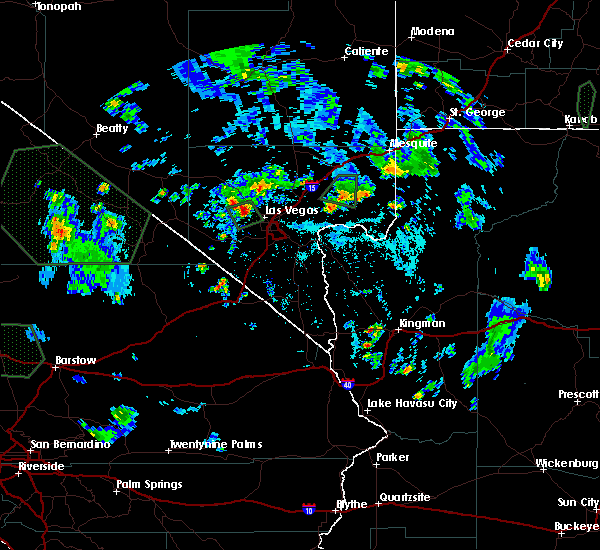 At 613 pm pdt, doppler radar indicated a severe thunderstorm capable of producing quarter size hail and damaging winds in excess of 60 mph. this storm was located near summerlin, and moving south at 15 mph. At 613 pm pdt, doppler radar indicated a severe thunderstorm capable of producing quarter size hail and damaging winds in excess of 60 mph. this storm was located near summerlin, and moving south at 15 mph.
|
| 6/13/2015 9:31 PM PDT |
 At 931 pm pdt, doppler radar indicated a severe thunderstorm capable of producing damaging winds in excess of 60 mph. this storm was located over green valley, and moving southeast at 20 mph. At 931 pm pdt, doppler radar indicated a severe thunderstorm capable of producing damaging winds in excess of 60 mph. this storm was located over green valley, and moving southeast at 20 mph.
|
| 5/18/2015 11:18 AM PDT | At 1116 am pdt, a severe thunderstorm with quarter size hail was located in the southwest las vegas valley. this storm was located near blue diamond, and moving northeast at 15 mph. |
Hail Maps for Spring Valley, NV
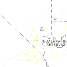


Connect with Interactive Hail Maps