

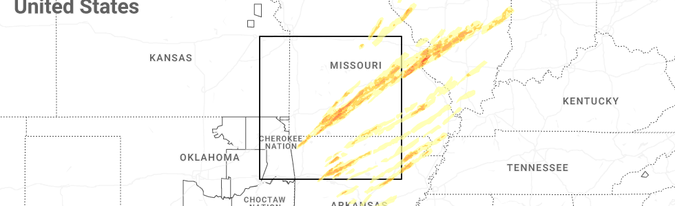
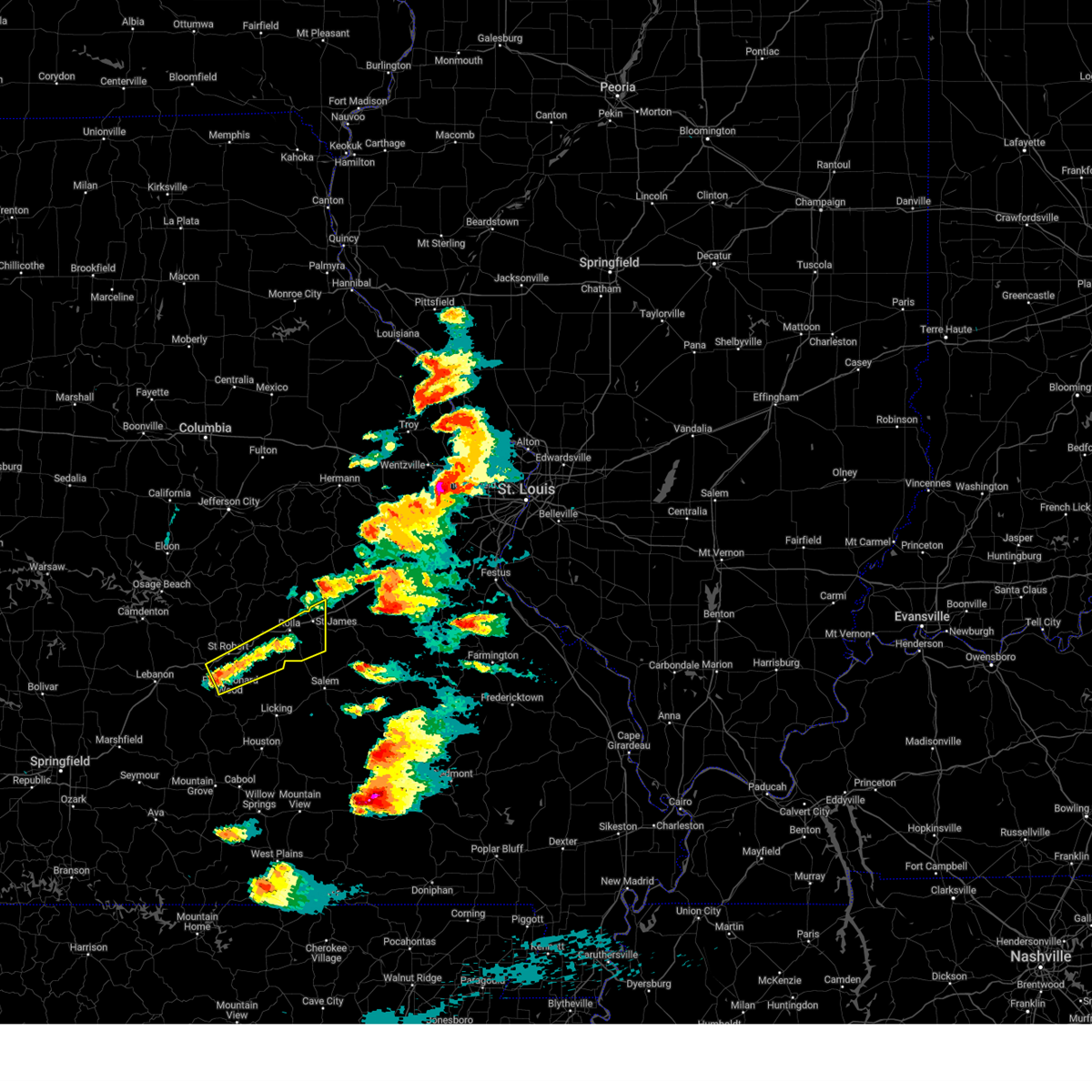
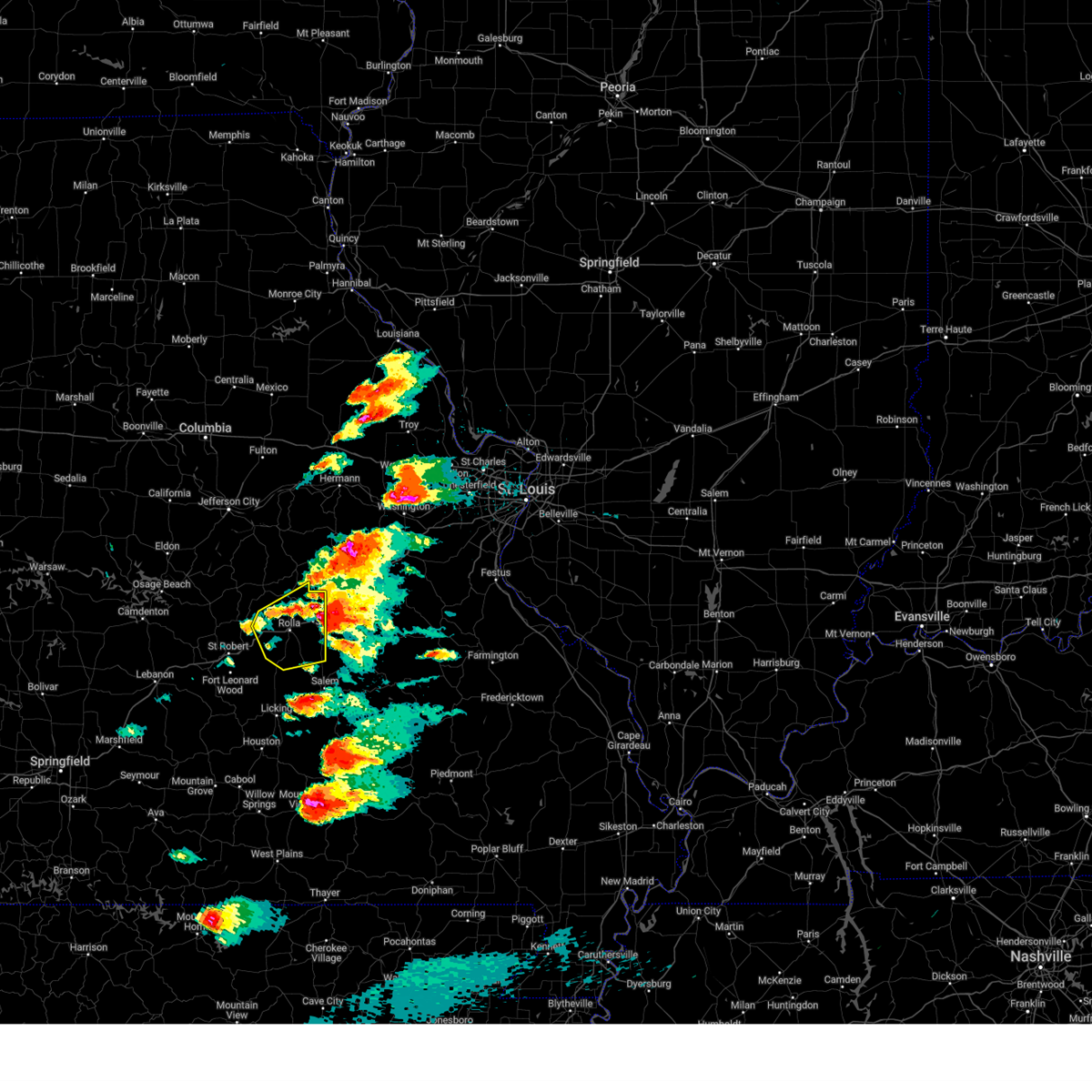
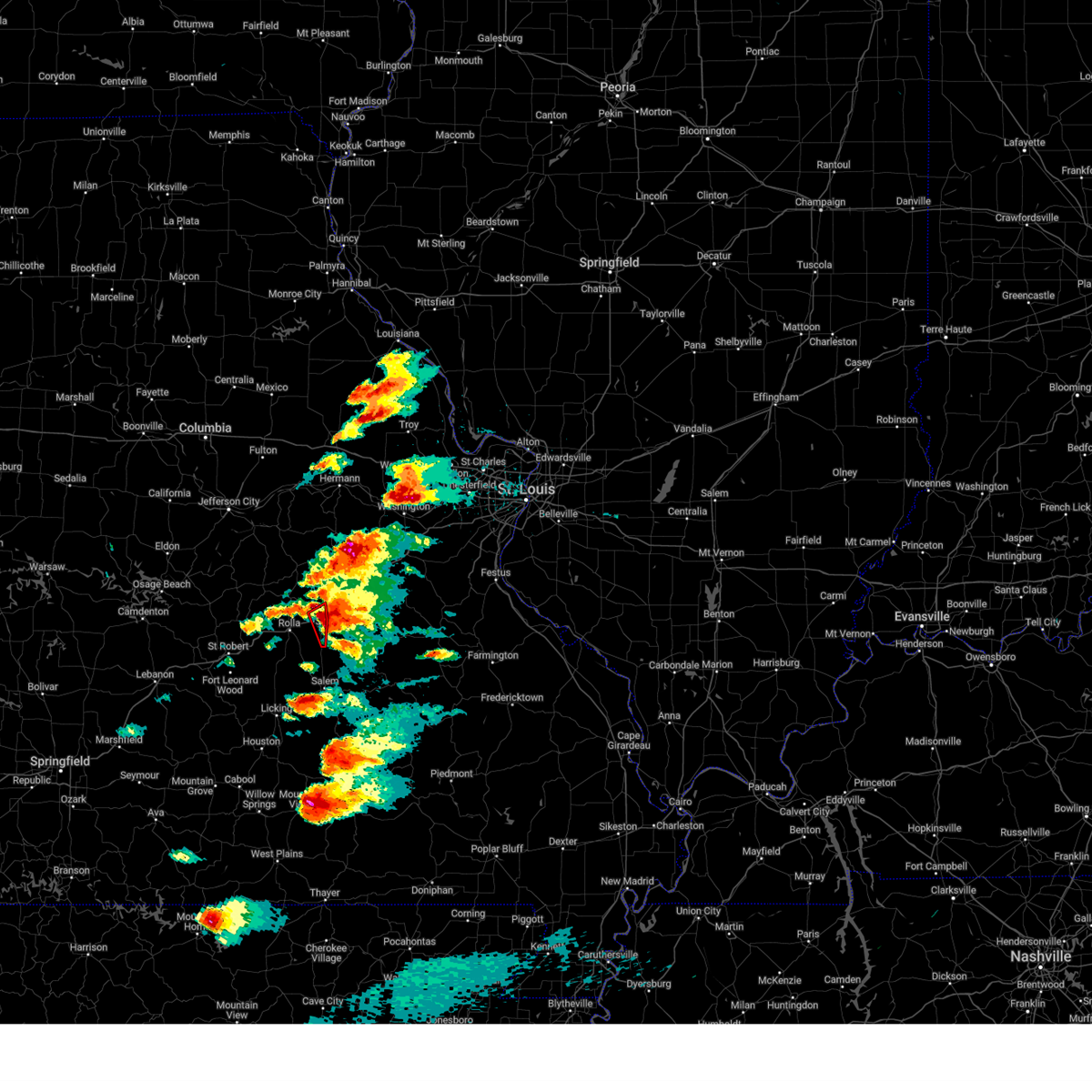
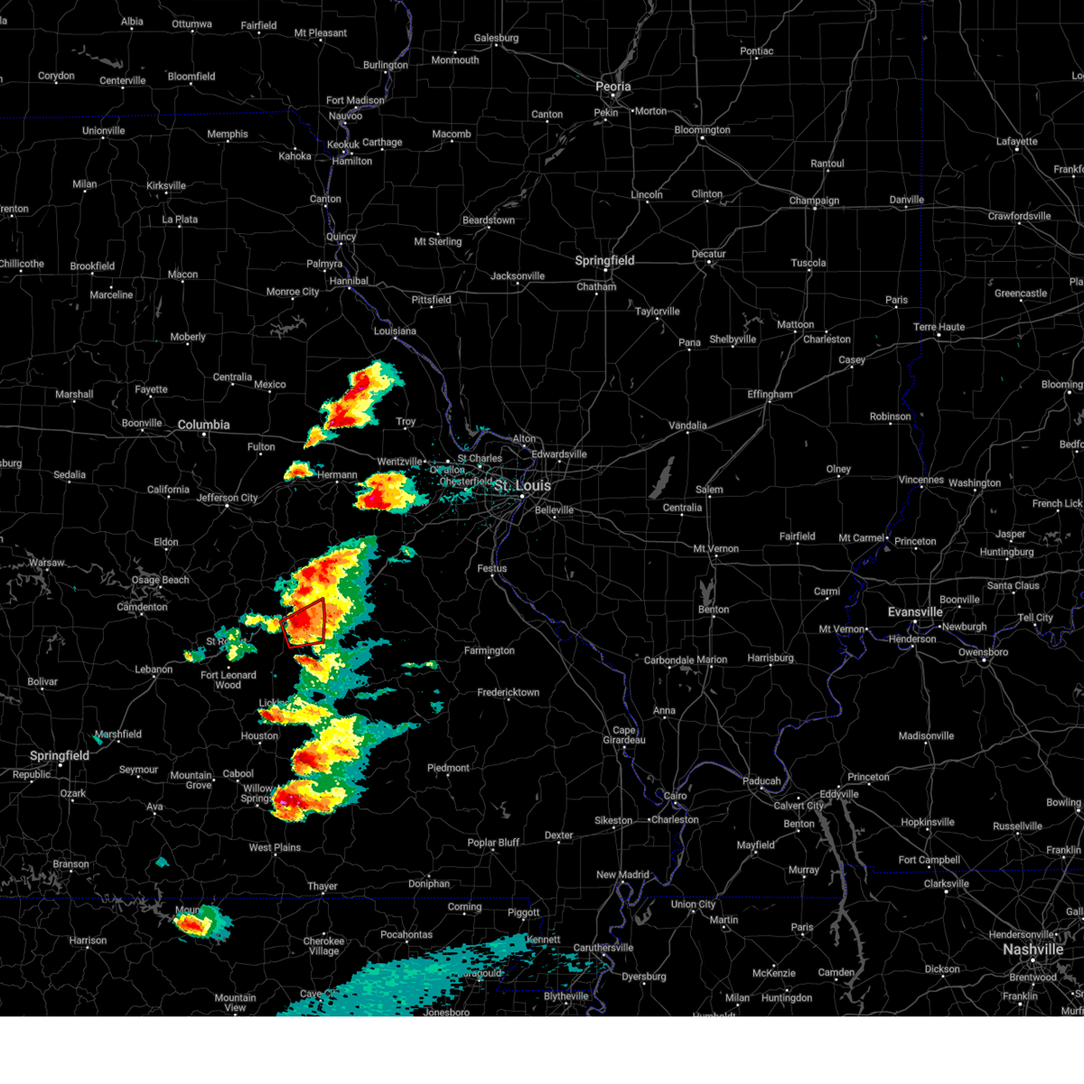
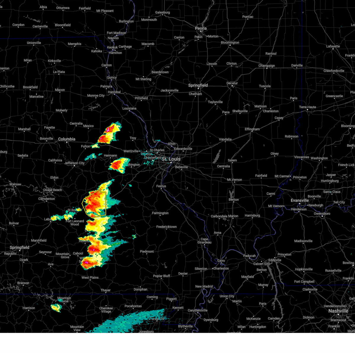
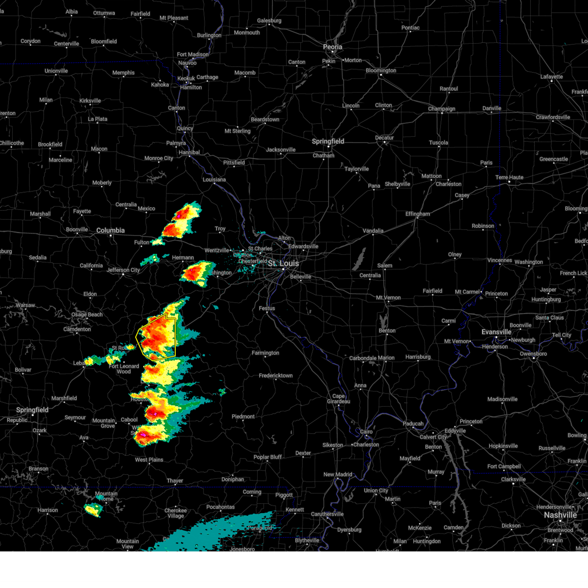
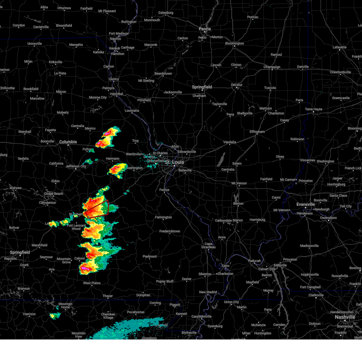
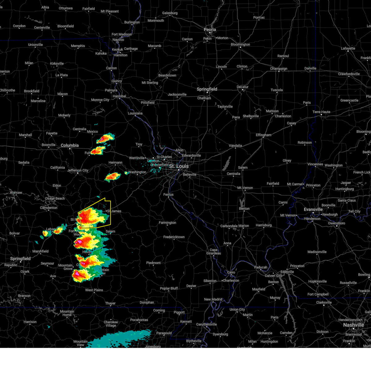
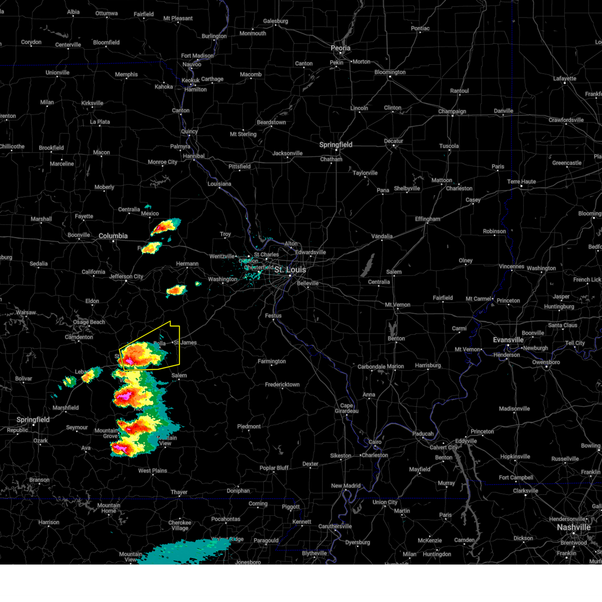
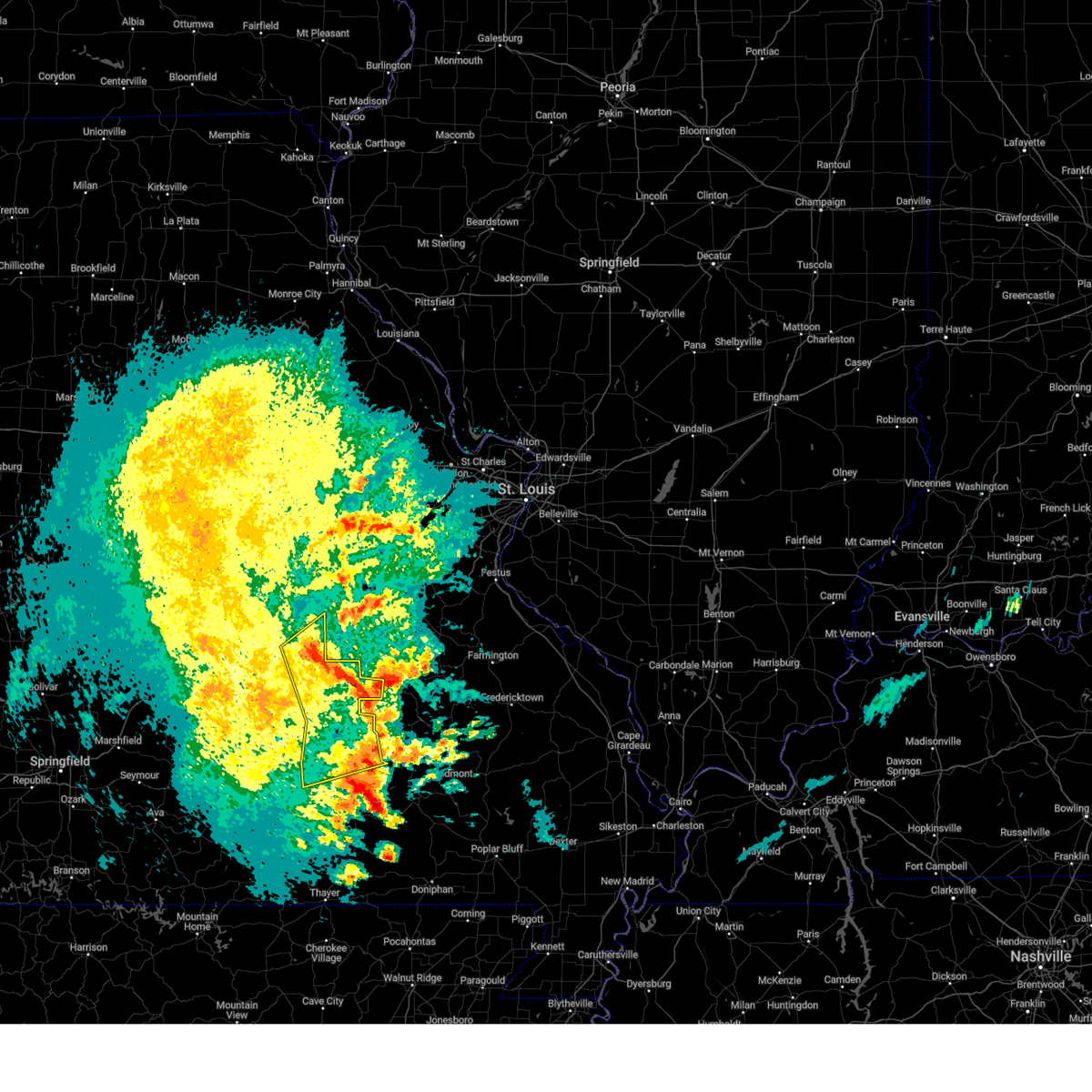
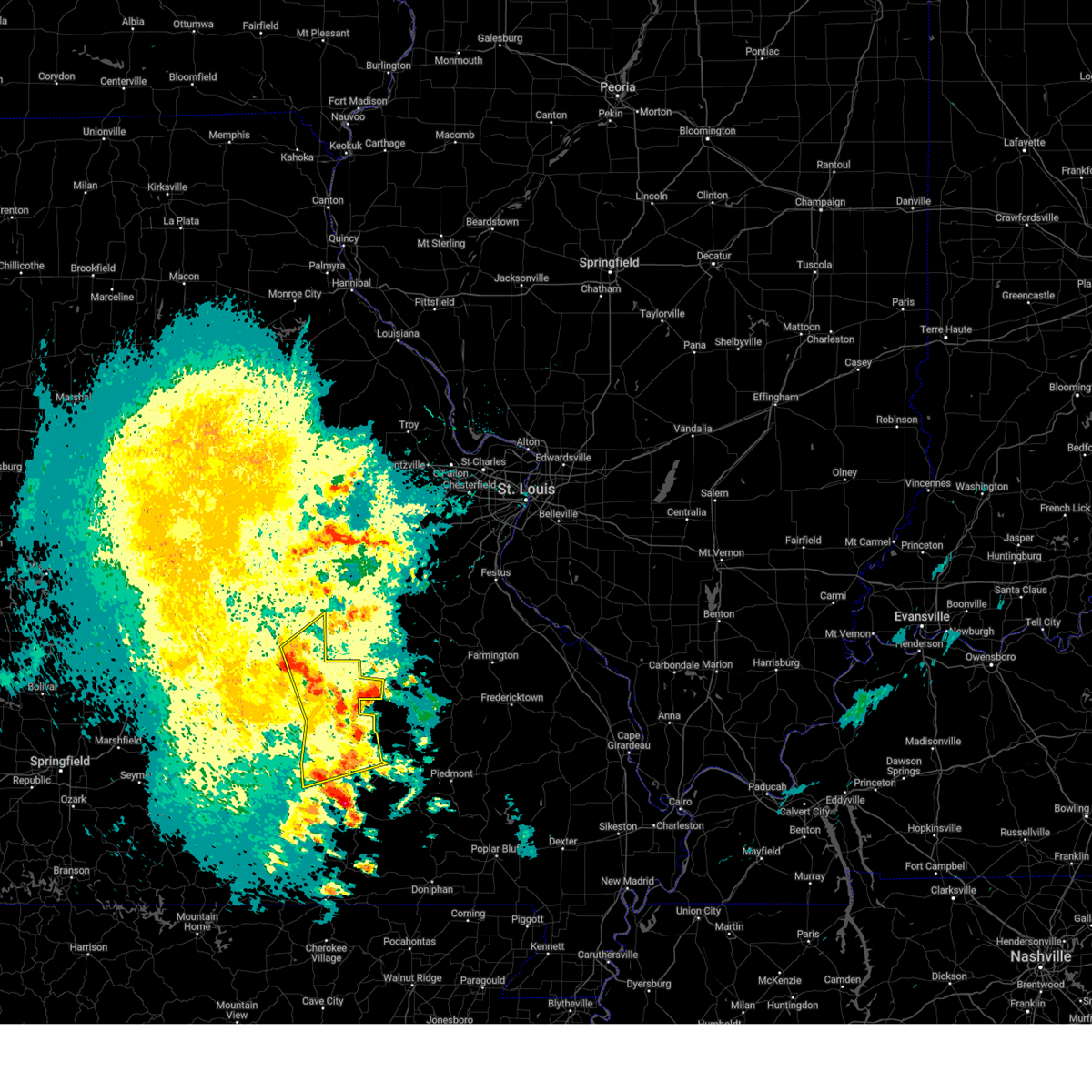
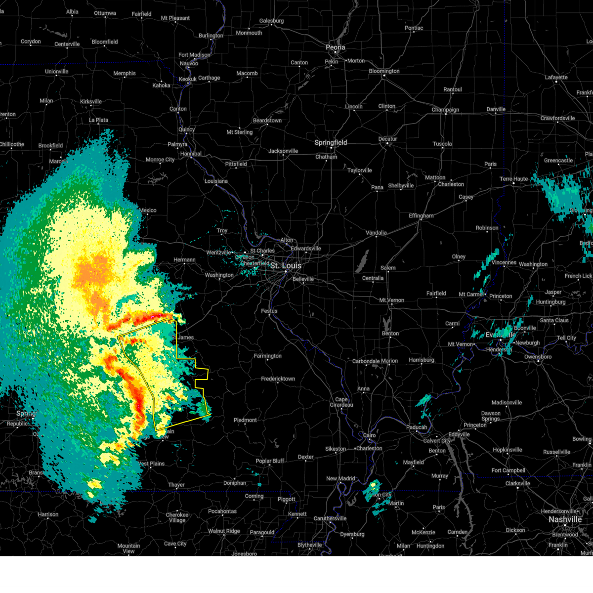
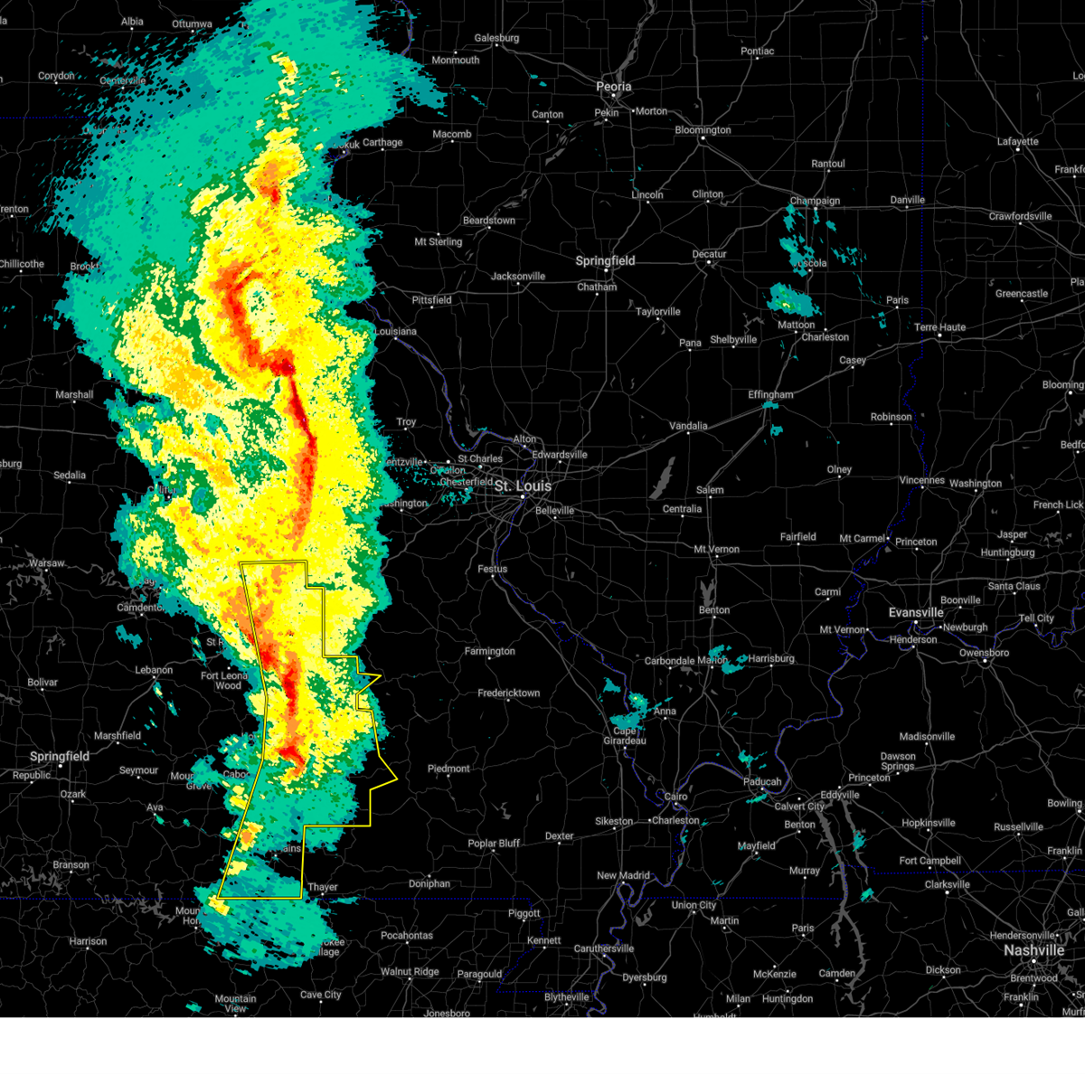
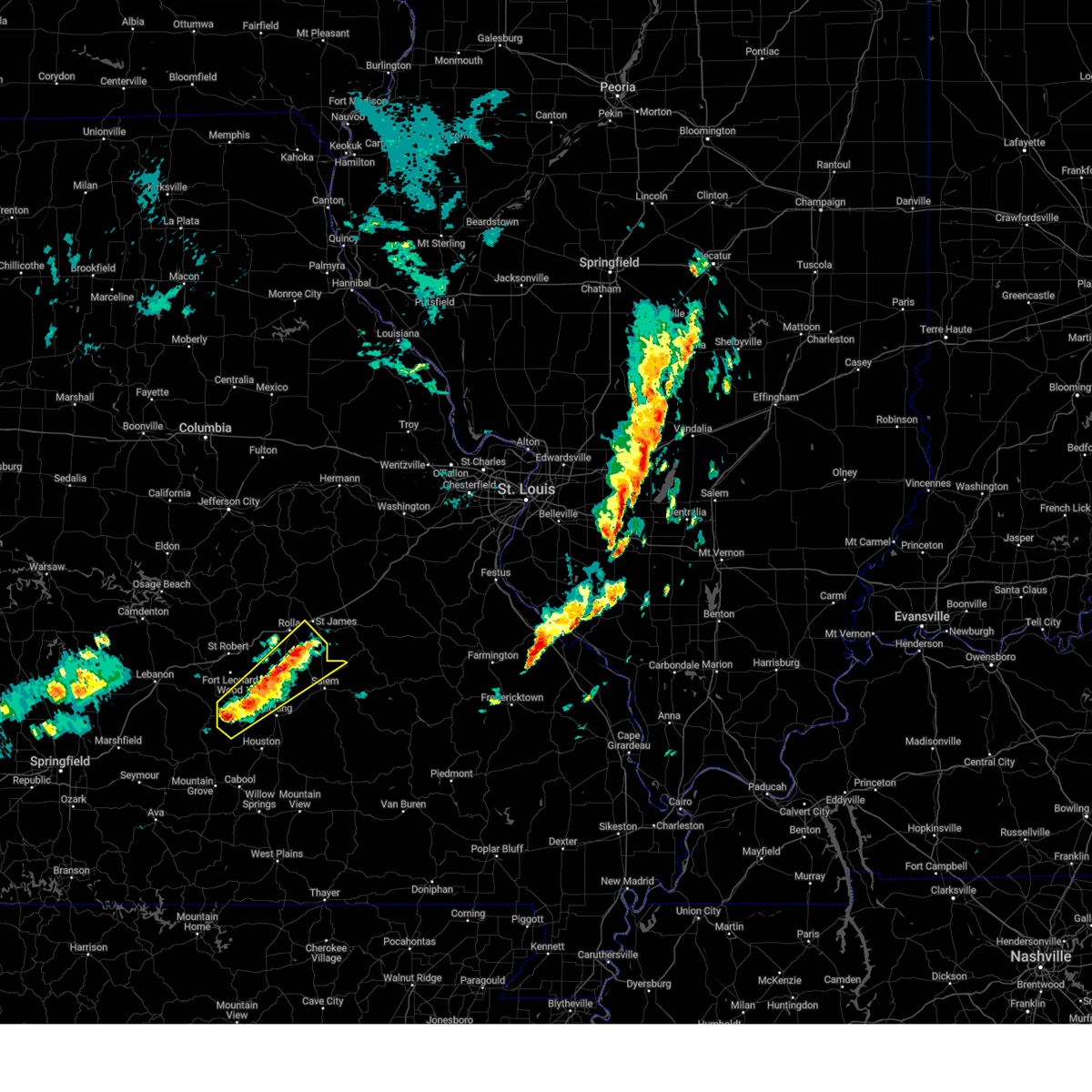
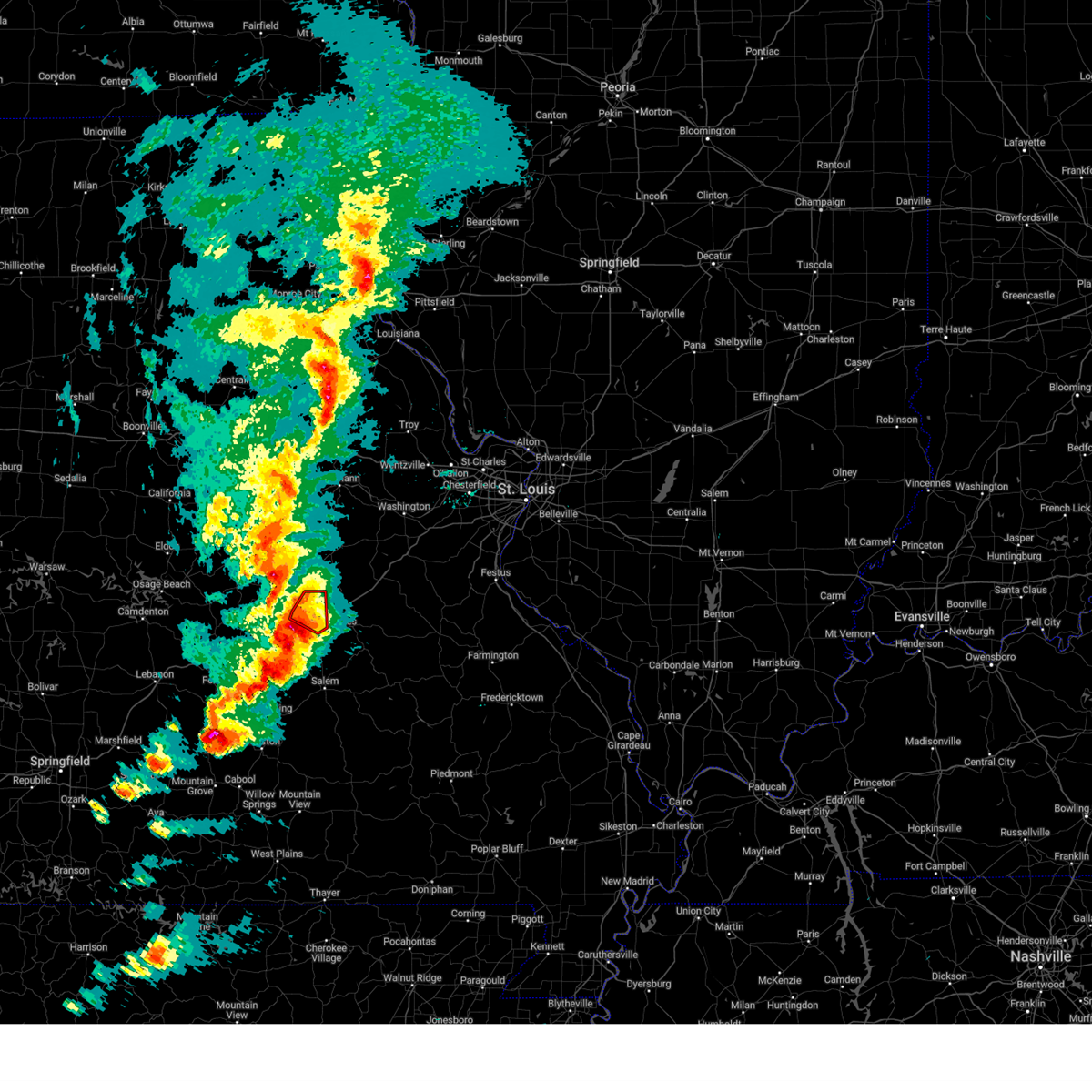
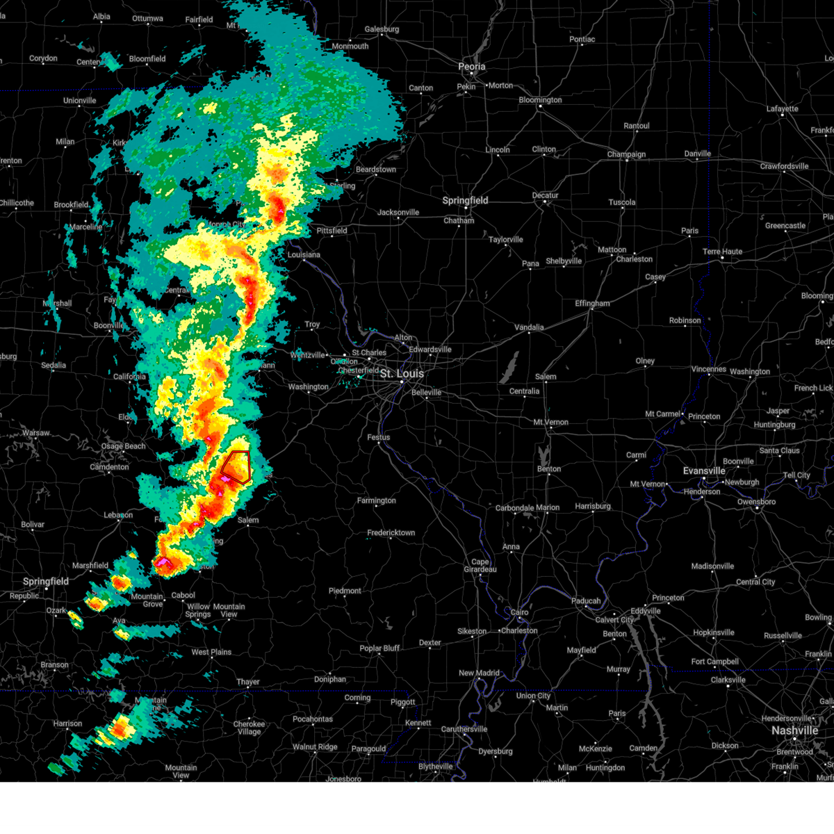
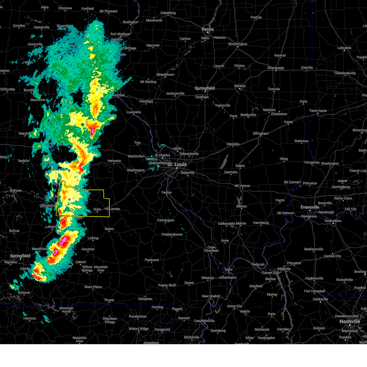
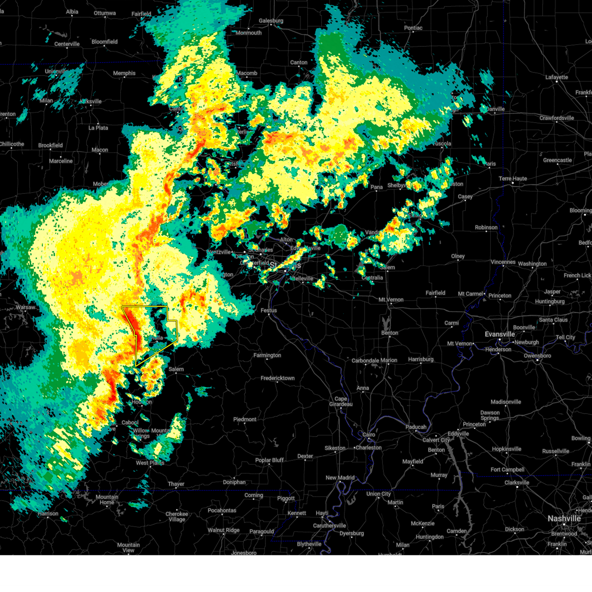
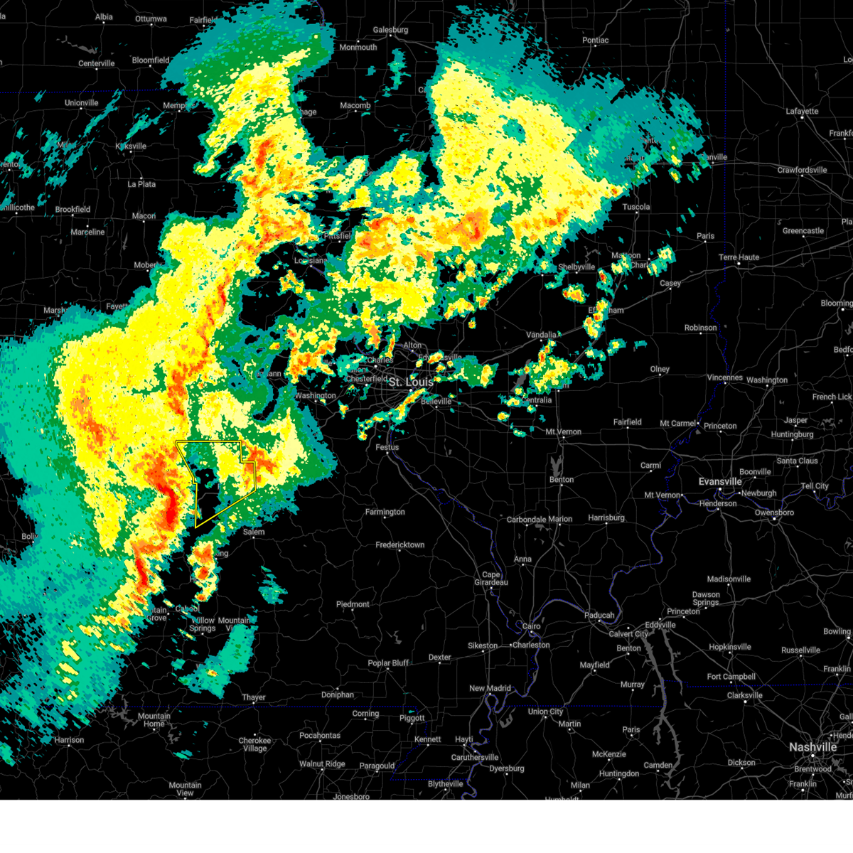
Hail Map for St. James, MO
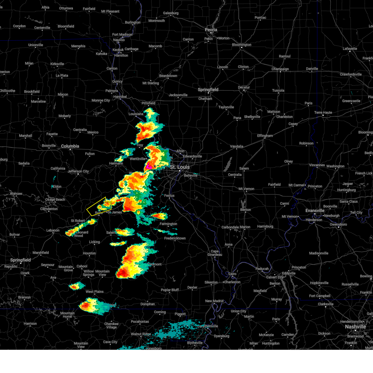
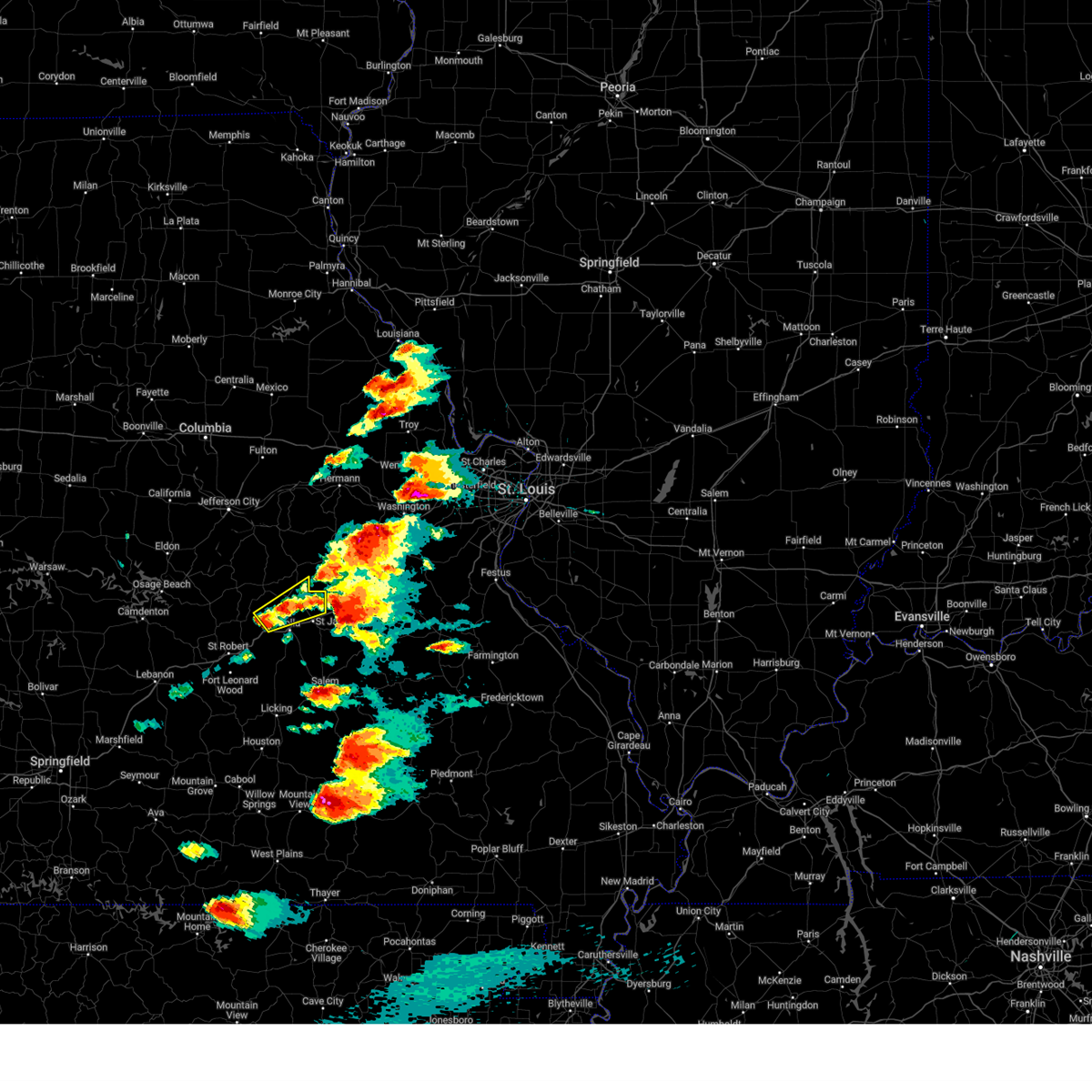
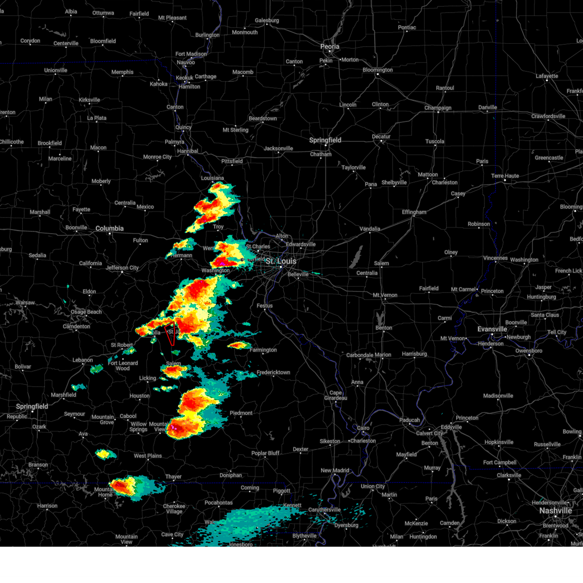
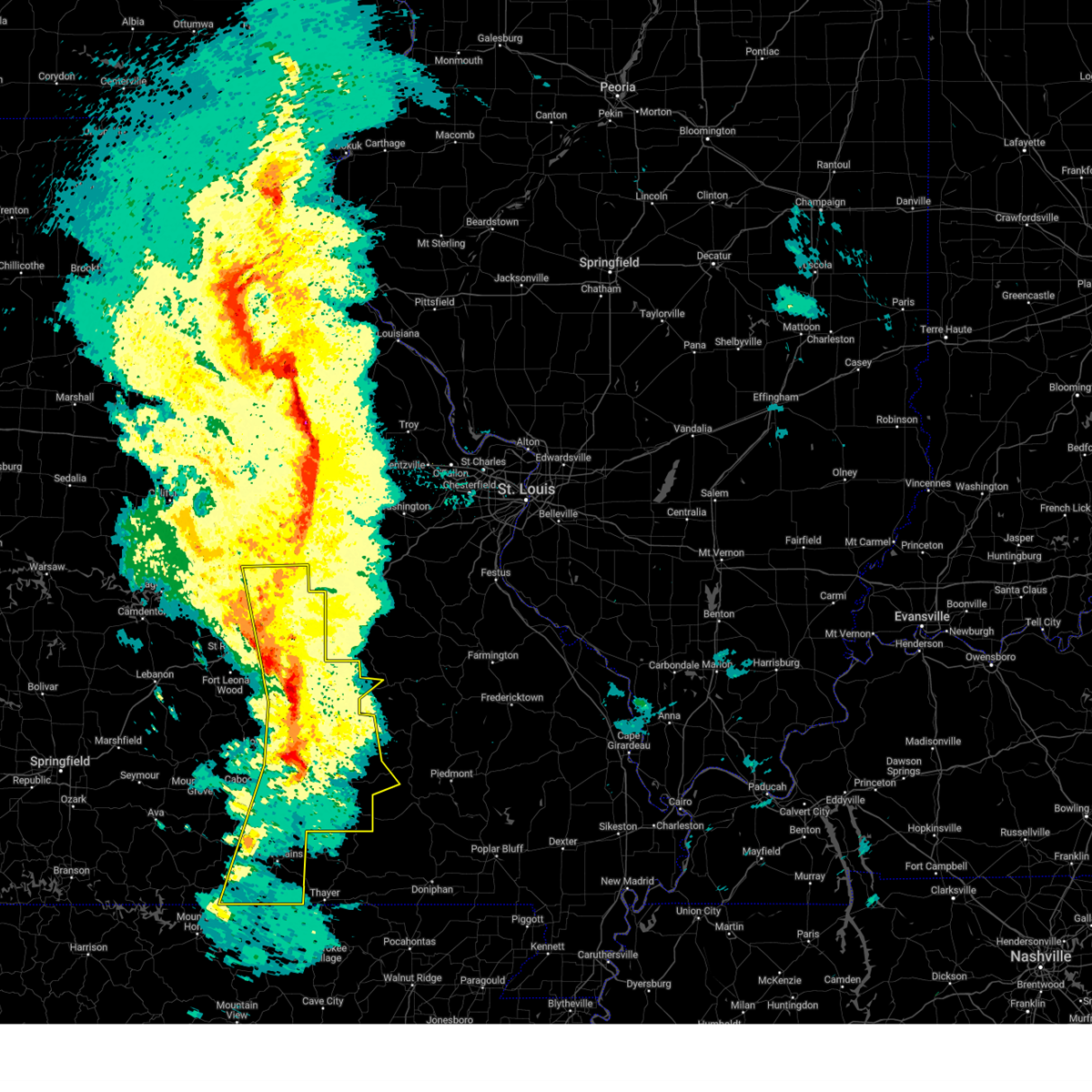
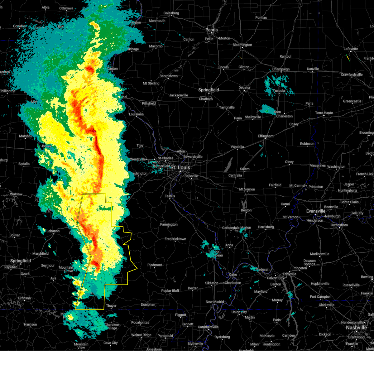
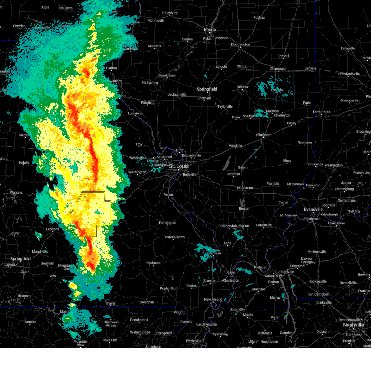
The St. James, MO area has had 6 reports of on-the-ground hail by trained spotters, and has been under severe weather warnings 41 times during the past 12 months. Doppler radar has detected hail at or near St. James, MO on 68 occasions, including 4 occasions during the past year.
| Name: | St. James, MO |
| Where Located: | 25.3 miles N of Salem, MO |
| Map: | Google Map for St. James, MO |
| Population: | 4216 |
| Housing Units: | 1767 |
| More Info: | Search Google for St. James, MO |
5
The Top Recent Hail Date for St. James, MO is Friday, March 14, 2025 (1st out of 68)
Hail and Wind Damage Spotted near St. James, MO
| Date / Time | Report Details |
|---|---|
| 6/6/2025 3:52 AM CDT |
 The storm which prompted the warning has weakened below severe limits, and no longer poses an immediate threat to life or property. therefore, the warning will be allowed to expire. The storm which prompted the warning has weakened below severe limits, and no longer poses an immediate threat to life or property. therefore, the warning will be allowed to expire.
|
| 6/6/2025 3:08 AM CDT |
 Svrsgf the national weather service in springfield has issued a * severe thunderstorm warning for, east central phelps county in east central missouri, * until 400 am cdt. * at 307 am cdt, a severe thunderstorm was located over rolla, moving east at 25 mph (radar indicated). Hazards include 60 mph wind gusts and quarter size hail. Hail damage to vehicles is expected. Expect wind damage to roofs, siding, and trees. Svrsgf the national weather service in springfield has issued a * severe thunderstorm warning for, east central phelps county in east central missouri, * until 400 am cdt. * at 307 am cdt, a severe thunderstorm was located over rolla, moving east at 25 mph (radar indicated). Hazards include 60 mph wind gusts and quarter size hail. Hail damage to vehicles is expected. Expect wind damage to roofs, siding, and trees.
|
| 5/19/2025 10:24 PM CDT | Tree down on highway 8. time estimated from rada in phelps county MO, 3.6 miles NW of St. James, MO |
| 5/16/2025 2:34 PM CDT |
 At 234 pm cdt, a severe thunderstorm was located 8 miles south of newburg, or 11 miles southwest of rolla, moving east at 60 mph (radar indicated). Hazards include 60 mph wind gusts and quarter size hail. Hail damage to vehicles is expected. expect wind damage to roofs, siding, and trees. locations impacted include, rolla, st. james, newburg, northwye, and rosati. This includes interstate 44 between mile markers 180 and 200. At 234 pm cdt, a severe thunderstorm was located 8 miles south of newburg, or 11 miles southwest of rolla, moving east at 60 mph (radar indicated). Hazards include 60 mph wind gusts and quarter size hail. Hail damage to vehicles is expected. expect wind damage to roofs, siding, and trees. locations impacted include, rolla, st. james, newburg, northwye, and rosati. This includes interstate 44 between mile markers 180 and 200.
|
| 5/16/2025 2:34 PM CDT |
 the severe thunderstorm warning has been cancelled and is no longer in effect the severe thunderstorm warning has been cancelled and is no longer in effect
|
| 5/16/2025 2:17 PM CDT |
 Svrsgf the national weather service in springfield has issued a * severe thunderstorm warning for, southern pulaski county in central missouri, phelps county in east central missouri, * until 300 pm cdt. * at 217 pm cdt, a severe thunderstorm was located over northwestern fort leonard wood, moving east at 60 mph (radar indicated). Hazards include 60 mph wind gusts and quarter size hail. Hail damage to vehicles is expected. Expect wind damage to roofs, siding, and trees. Svrsgf the national weather service in springfield has issued a * severe thunderstorm warning for, southern pulaski county in central missouri, phelps county in east central missouri, * until 300 pm cdt. * at 217 pm cdt, a severe thunderstorm was located over northwestern fort leonard wood, moving east at 60 mph (radar indicated). Hazards include 60 mph wind gusts and quarter size hail. Hail damage to vehicles is expected. Expect wind damage to roofs, siding, and trees.
|
| 5/16/2025 2:12 PM CDT |
 the severe thunderstorm warning has been cancelled and is no longer in effect the severe thunderstorm warning has been cancelled and is no longer in effect
|
| 5/16/2025 2:00 PM CDT |
 Svrsgf the national weather service in springfield has issued a * severe thunderstorm warning for, southeastern maries county in central missouri, northern phelps county in east central missouri, * until 230 pm cdt. * at 200 pm cdt, a severe thunderstorm was located near doolittle, or 7 miles northwest of rolla, moving east at 60 mph (radar indicated). Hazards include 60 mph wind gusts and quarter size hail. Hail damage to vehicles is expected. Expect wind damage to roofs, siding, and trees. Svrsgf the national weather service in springfield has issued a * severe thunderstorm warning for, southeastern maries county in central missouri, northern phelps county in east central missouri, * until 230 pm cdt. * at 200 pm cdt, a severe thunderstorm was located near doolittle, or 7 miles northwest of rolla, moving east at 60 mph (radar indicated). Hazards include 60 mph wind gusts and quarter size hail. Hail damage to vehicles is expected. Expect wind damage to roofs, siding, and trees.
|
| 5/16/2025 1:59 PM CDT |
 The storm which prompted the warning has moved out of the area. therefore, the warning will be allowed to expire. a tornado watch remains in effect until 700 pm cdt for east central missouri. The storm which prompted the warning has moved out of the area. therefore, the warning will be allowed to expire. a tornado watch remains in effect until 700 pm cdt for east central missouri.
|
| 5/16/2025 1:54 PM CDT |
 The storm which prompted the warning has moved out of the area. therefore, the warning will be allowed to expire. a tornado watch remains in effect until 700 pm cdt for south central, central and east central missouri. The storm which prompted the warning has moved out of the area. therefore, the warning will be allowed to expire. a tornado watch remains in effect until 700 pm cdt for south central, central and east central missouri.
|
| 5/16/2025 1:51 PM CDT |
 At 151 pm cdt, a severe thunderstorm capable of producing a tornado was located near st. james, or 8 miles southwest of cuba, moving northeast at 60 mph (radar indicated rotation). Hazards include tornado and half dollar size hail. Flying debris will be dangerous to those caught without shelter. mobile homes will be damaged or destroyed. damage to roofs, windows, and vehicles will occur. tree damage is likely. locations impacted include, st. james and rosati. This includes interstate 44 between mile markers 194 and 200. At 151 pm cdt, a severe thunderstorm capable of producing a tornado was located near st. james, or 8 miles southwest of cuba, moving northeast at 60 mph (radar indicated rotation). Hazards include tornado and half dollar size hail. Flying debris will be dangerous to those caught without shelter. mobile homes will be damaged or destroyed. damage to roofs, windows, and vehicles will occur. tree damage is likely. locations impacted include, st. james and rosati. This includes interstate 44 between mile markers 194 and 200.
|
| 5/16/2025 1:41 PM CDT |
 At 141 pm cdt, a severe thunderstorm capable of producing a tornado was located 7 miles southeast of rolla, moving east at 70 mph (radar indicated rotation). Hazards include tornado and softball size hail. Flying debris will be dangerous to those caught without shelter. mobile homes will be damaged or destroyed. damage to roofs, windows, and vehicles will occur. tree damage is likely. locations impacted include, rolla, st. james, northwye, and rosati. This includes interstate 44 between mile markers 184 and 200. At 141 pm cdt, a severe thunderstorm capable of producing a tornado was located 7 miles southeast of rolla, moving east at 70 mph (radar indicated rotation). Hazards include tornado and softball size hail. Flying debris will be dangerous to those caught without shelter. mobile homes will be damaged or destroyed. damage to roofs, windows, and vehicles will occur. tree damage is likely. locations impacted include, rolla, st. james, northwye, and rosati. This includes interstate 44 between mile markers 184 and 200.
|
| 5/16/2025 1:36 PM CDT |
 At 135 pm cdt, a severe thunderstorm capable of producing a tornado was located over rolla, moving east at 50 mph (radar indicated rotation). Hazards include tornado and softball size hail. Flying debris will be dangerous to those caught without shelter. mobile homes will be damaged or destroyed. damage to roofs, windows, and vehicles will occur. tree damage is likely. locations impacted include, rolla, st. james, doolittle, northwye, and rosati. This includes interstate 44 between mile markers 183 and 200. At 135 pm cdt, a severe thunderstorm capable of producing a tornado was located over rolla, moving east at 50 mph (radar indicated rotation). Hazards include tornado and softball size hail. Flying debris will be dangerous to those caught without shelter. mobile homes will be damaged or destroyed. damage to roofs, windows, and vehicles will occur. tree damage is likely. locations impacted include, rolla, st. james, doolittle, northwye, and rosati. This includes interstate 44 between mile markers 183 and 200.
|
| 5/16/2025 1:31 PM CDT |
 the severe thunderstorm warning has been cancelled and is no longer in effect the severe thunderstorm warning has been cancelled and is no longer in effect
|
| 5/16/2025 1:31 PM CDT |
 At 131 pm cdt, a severe thunderstorm was located over rolla, moving east at 60 mph (trained weather spotters). Hazards include two inch hail and 60 mph wind gusts. People and animals outdoors will be injured. expect hail damage to roofs, siding, windows, and vehicles. expect wind damage to roofs, siding, and trees. locations impacted include, rolla, st. james, doolittle, newburg, northwye, lecoma, jerome, vichy, lake spring, and rosati. This includes interstate 44 between mile markers 172 and 200. At 131 pm cdt, a severe thunderstorm was located over rolla, moving east at 60 mph (trained weather spotters). Hazards include two inch hail and 60 mph wind gusts. People and animals outdoors will be injured. expect hail damage to roofs, siding, windows, and vehicles. expect wind damage to roofs, siding, and trees. locations impacted include, rolla, st. james, doolittle, newburg, northwye, lecoma, jerome, vichy, lake spring, and rosati. This includes interstate 44 between mile markers 172 and 200.
|
| 5/16/2025 1:30 PM CDT | Quarter sized hail reported 10.4 miles SSE of St. James, MO, report from mping... quarter 1.00 in. |
| 5/16/2025 1:28 PM CDT |
 Torsgf the national weather service in springfield has issued a * tornado warning for, central phelps county in east central missouri, * until 200 pm cdt. * at 128 pm cdt, a severe thunderstorm capable of producing a tornado was located near newburg, or 8 miles southwest of rolla, moving east at 60 mph (radar indicated rotation). Hazards include tornado and golf ball size hail. Flying debris will be dangerous to those caught without shelter. mobile homes will be damaged or destroyed. damage to roofs, windows, and vehicles will occur. Tree damage is likely. Torsgf the national weather service in springfield has issued a * tornado warning for, central phelps county in east central missouri, * until 200 pm cdt. * at 128 pm cdt, a severe thunderstorm capable of producing a tornado was located near newburg, or 8 miles southwest of rolla, moving east at 60 mph (radar indicated rotation). Hazards include tornado and golf ball size hail. Flying debris will be dangerous to those caught without shelter. mobile homes will be damaged or destroyed. damage to roofs, windows, and vehicles will occur. Tree damage is likely.
|
| 5/16/2025 1:18 PM CDT |
 At 117 pm cdt, a severe thunderstorm was located near newburg, or 12 miles east of waynesville, moving east at 60 mph. this is a destructive storm for devils elbow and jerome (trained weather spotters. cooperative observer reported two inch hail west of waynesville ). Hazards include baseball size hail and 60 mph wind gusts. People and animals outdoors will be severely injured. expect shattered windows, extensive damage to roofs, siding, and vehicles. locations impacted include, rolla, northeastern fort leonard wood, st. robert, st. james, dixon, doolittle, newburg, devil's elbow, vichy, lake spring, northwye, lecoma, jerome, and rosati. This includes interstate 44 between mile markers 163 and 169, and between mile markers 171 and 200. At 117 pm cdt, a severe thunderstorm was located near newburg, or 12 miles east of waynesville, moving east at 60 mph. this is a destructive storm for devils elbow and jerome (trained weather spotters. cooperative observer reported two inch hail west of waynesville ). Hazards include baseball size hail and 60 mph wind gusts. People and animals outdoors will be severely injured. expect shattered windows, extensive damage to roofs, siding, and vehicles. locations impacted include, rolla, northeastern fort leonard wood, st. robert, st. james, dixon, doolittle, newburg, devil's elbow, vichy, lake spring, northwye, lecoma, jerome, and rosati. This includes interstate 44 between mile markers 163 and 169, and between mile markers 171 and 200.
|
| 5/16/2025 1:13 PM CDT |
 Svrsgf the national weather service in springfield has issued a * severe thunderstorm warning for, southeastern maries county in central missouri, northwestern dent county in south central missouri, northeastern pulaski county in central missouri, phelps county in east central missouri, * until 200 pm cdt. * at 112 pm cdt, a severe thunderstorm was located over st. robert, or near waynesville, moving east at 60 mph. this is a destructive storm for devils elbow (radar indicated). Hazards include baseball size hail and 60 mph wind gusts. People and animals outdoors will be severely injured. Expect shattered windows, extensive damage to roofs, siding, and vehicles. Svrsgf the national weather service in springfield has issued a * severe thunderstorm warning for, southeastern maries county in central missouri, northwestern dent county in south central missouri, northeastern pulaski county in central missouri, phelps county in east central missouri, * until 200 pm cdt. * at 112 pm cdt, a severe thunderstorm was located over st. robert, or near waynesville, moving east at 60 mph. this is a destructive storm for devils elbow (radar indicated). Hazards include baseball size hail and 60 mph wind gusts. People and animals outdoors will be severely injured. Expect shattered windows, extensive damage to roofs, siding, and vehicles.
|
| 4/29/2025 11:55 AM CDT |
 The storms which prompted the warning have weakened below severe limits, and have exited the warned area. therefore, the warning will be allowed to expire. a severe thunderstorm watch remains in effect until 300 pm cdt for south central and east central missouri. to report severe weather, contact your nearest law enforcement agency. they will relay your report to the national weather service springfield. The storms which prompted the warning have weakened below severe limits, and have exited the warned area. therefore, the warning will be allowed to expire. a severe thunderstorm watch remains in effect until 300 pm cdt for south central and east central missouri. to report severe weather, contact your nearest law enforcement agency. they will relay your report to the national weather service springfield.
|
| 4/29/2025 11:41 AM CDT |
 the severe thunderstorm warning has been cancelled and is no longer in effect the severe thunderstorm warning has been cancelled and is no longer in effect
|
| 4/29/2025 11:41 AM CDT |
 At 1140 am cdt, severe thunderstorms were located along a line extending from 7 miles southeast of newburg to 6 miles north of salem to 7 miles northwest of bunker to 13 miles north of eminence to near birch tree, moving east at 45 mph (radar indicated). Hazards include 60 mph wind gusts and penny size hail. Expect damage to roofs, siding, and trees. locations impacted include, jadwin, howes mill, midridge, current river state park, lake spring, gladden, anutt, bangert, echo bluff state park, boss, round spring, bunker, salem, akers, summersville, turtle, darien, howes, hartshorn, and lecoma. This includes interstate 44 near mile marker 183, and between mile markers 198 and 199. At 1140 am cdt, severe thunderstorms were located along a line extending from 7 miles southeast of newburg to 6 miles north of salem to 7 miles northwest of bunker to 13 miles north of eminence to near birch tree, moving east at 45 mph (radar indicated). Hazards include 60 mph wind gusts and penny size hail. Expect damage to roofs, siding, and trees. locations impacted include, jadwin, howes mill, midridge, current river state park, lake spring, gladden, anutt, bangert, echo bluff state park, boss, round spring, bunker, salem, akers, summersville, turtle, darien, howes, hartshorn, and lecoma. This includes interstate 44 near mile marker 183, and between mile markers 198 and 199.
|
| 4/29/2025 10:59 AM CDT |
 Svrsgf the national weather service in springfield has issued a * severe thunderstorm warning for, southeastern maries county in central missouri, northern shannon county in south central missouri, dent county in south central missouri, northeastern pulaski county in central missouri, eastern texas county in south central missouri, phelps county in east central missouri, * until noon cdt. * at 1058 am cdt, severe thunderstorms were located along a line extending from 7 miles southwest of waynesville to 8 miles southeast of fort leonard wood to near raymondville to 7 miles southeast of houston to willow springs, moving east at 55 mph (radar indicated). Hazards include 60 mph wind gusts and quarter size hail. Hail damage to vehicles is expected. Expect wind damage to roofs, siding, and trees. Svrsgf the national weather service in springfield has issued a * severe thunderstorm warning for, southeastern maries county in central missouri, northern shannon county in south central missouri, dent county in south central missouri, northeastern pulaski county in central missouri, eastern texas county in south central missouri, phelps county in east central missouri, * until noon cdt. * at 1058 am cdt, severe thunderstorms were located along a line extending from 7 miles southwest of waynesville to 8 miles southeast of fort leonard wood to near raymondville to 7 miles southeast of houston to willow springs, moving east at 55 mph (radar indicated). Hazards include 60 mph wind gusts and quarter size hail. Hail damage to vehicles is expected. Expect wind damage to roofs, siding, and trees.
|
| 4/20/2025 6:01 PM CDT |
 the severe thunderstorm warning has been cancelled and is no longer in effect the severe thunderstorm warning has been cancelled and is no longer in effect
|
| 4/20/2025 6:01 PM CDT |
 At 600 pm cdt, severe thunderstorms were located along a line extending from near doolittle to 9 miles southwest of salem to 12 miles west of west plains, moving east at 60 mph (public). Hazards include 70 mph wind gusts and nickel size hail. Expect considerable tree damage. damage is likely to mobile homes, roofs, and outbuildings. locations impacted include, lanton, jadwin, beulah, ozark national scenic riverways, caulfield, bakersfield, gladden, anutt, bangert, echo bluff state park, edgar springs, west plains, eminence, akers, pine crest, summersville, rosati, montier, turtle, and pomona. This includes interstate 44 between mile markers 171 and 200. At 600 pm cdt, severe thunderstorms were located along a line extending from near doolittle to 9 miles southwest of salem to 12 miles west of west plains, moving east at 60 mph (public). Hazards include 70 mph wind gusts and nickel size hail. Expect considerable tree damage. damage is likely to mobile homes, roofs, and outbuildings. locations impacted include, lanton, jadwin, beulah, ozark national scenic riverways, caulfield, bakersfield, gladden, anutt, bangert, echo bluff state park, edgar springs, west plains, eminence, akers, pine crest, summersville, rosati, montier, turtle, and pomona. This includes interstate 44 between mile markers 171 and 200.
|
| 4/20/2025 5:48 PM CDT |
 Svrsgf the national weather service in springfield has issued a * severe thunderstorm warning for, maries county in central missouri, southeastern ozark county in southwestern missouri, shannon county in south central missouri, dent county in south central missouri, howell county in south central missouri, eastern pulaski county in central missouri, eastern texas county in south central missouri, phelps county in east central missouri, * until 645 pm cdt. * at 546 pm cdt, severe thunderstorms were located along a line extending from near st. robert to near raymondville to near bakersfield, moving northeast at 65 mph (radar indicated). Hazards include 70 mph wind gusts and nickel size hail. Expect considerable tree damage. Damage is likely to mobile homes, roofs, and outbuildings. Svrsgf the national weather service in springfield has issued a * severe thunderstorm warning for, maries county in central missouri, southeastern ozark county in southwestern missouri, shannon county in south central missouri, dent county in south central missouri, howell county in south central missouri, eastern pulaski county in central missouri, eastern texas county in south central missouri, phelps county in east central missouri, * until 645 pm cdt. * at 546 pm cdt, severe thunderstorms were located along a line extending from near st. robert to near raymondville to near bakersfield, moving northeast at 65 mph (radar indicated). Hazards include 70 mph wind gusts and nickel size hail. Expect considerable tree damage. Damage is likely to mobile homes, roofs, and outbuildings.
|
| 4/20/2025 5:42 PM CDT |
 At 541 pm cdt, severe thunderstorms were located along a line extending from near williamsburg to 7 miles southeast of chamois to near willow springs, moving northeast at 60 mph (public). Hazards include 60 mph wind gusts and nickel size hail. Expect damage to roofs, siding, and trees. locations impacted include, fort leonard wood, brinktown, crocker, st. james, beulah, devil's elbow, vichy, waynesville, laquey, newburg, st. robert, rolla, belle, northwye, edgar springs, doolittle, swedeborg, vienna, ozark springs, and jerome. This includes interstate 44 between mile markers 149 and 169, and between mile markers 171 and 200. At 541 pm cdt, severe thunderstorms were located along a line extending from near williamsburg to 7 miles southeast of chamois to near willow springs, moving northeast at 60 mph (public). Hazards include 60 mph wind gusts and nickel size hail. Expect damage to roofs, siding, and trees. locations impacted include, fort leonard wood, brinktown, crocker, st. james, beulah, devil's elbow, vichy, waynesville, laquey, newburg, st. robert, rolla, belle, northwye, edgar springs, doolittle, swedeborg, vienna, ozark springs, and jerome. This includes interstate 44 between mile markers 149 and 169, and between mile markers 171 and 200.
|
| 4/20/2025 5:42 PM CDT |
 the severe thunderstorm warning has been cancelled and is no longer in effect the severe thunderstorm warning has been cancelled and is no longer in effect
|
| 4/20/2025 5:16 PM CDT | the severe thunderstorm warning has been cancelled and is no longer in effect |
| 4/20/2025 5:16 PM CDT | At 516 pm cdt, severe thunderstorms were located along a line extending from near new bloomfield to near westphalia to 17 miles south of norwood, moving northeast at 60 mph (public). Hazards include 60 mph wind gusts and nickel size hail. Expect damage to roofs, siding, and trees. locations impacted include, competition, crocker, beulah, lynchburg, sleeper, richland, falcon, stoutland, laquey, st. robert, rolla, edgar springs, vienna, iberia, ozark springs, st. elizabeth, rosati, fort leonard wood, brinktown, and st. james. This includes interstate 44 between mile markers 132 and 169, and between mile markers 171 and 200. |
| 4/20/2025 4:54 PM CDT |
 Svrsgf the national weather service in springfield has issued a * severe thunderstorm warning for, maries county in central missouri, southeastern dallas county in southwestern missouri, miller county in central missouri, laclede county in southwestern missouri, pulaski county in central missouri, phelps county in east central missouri, eastern camden county in central missouri, southeastern morgan county in central missouri, * until 600 pm cdt. * at 453 pm cdt, severe thunderstorms were located along a line extending from mcgirk to 9 miles south of hickory hill to 14 miles northwest of gainesville, moving northeast at 55 mph (public). Hazards include 70 mph wind gusts and nickel size hail. Expect considerable tree damage. Damage is likely to mobile homes, roofs, and outbuildings. Svrsgf the national weather service in springfield has issued a * severe thunderstorm warning for, maries county in central missouri, southeastern dallas county in southwestern missouri, miller county in central missouri, laclede county in southwestern missouri, pulaski county in central missouri, phelps county in east central missouri, eastern camden county in central missouri, southeastern morgan county in central missouri, * until 600 pm cdt. * at 453 pm cdt, severe thunderstorms were located along a line extending from mcgirk to 9 miles south of hickory hill to 14 miles northwest of gainesville, moving northeast at 55 mph (public). Hazards include 70 mph wind gusts and nickel size hail. Expect considerable tree damage. Damage is likely to mobile homes, roofs, and outbuildings.
|
| 4/19/2025 12:05 AM CDT |
 the severe thunderstorm warning has been cancelled and is no longer in effect the severe thunderstorm warning has been cancelled and is no longer in effect
|
| 4/19/2025 12:05 AM CDT |
 At 1204 am cdt, severe thunderstorms were located along a line extending from near newburg to 7 miles northeast of raymondville to 8 miles north of willow springs, moving east at 45 mph (radar indicated). Hazards include 60 mph wind gusts and quarter size hail. Hail damage to vehicles is expected. expect wind damage to roofs, siding, and trees. locations impacted include, lenox, montauk, jadwin, beulah, lake spring, gladden, success, eunice, anutt, bangert, yukon, rolla, licking, edgar springs, solo, salem, akers, simmons, summersville, and st. james. This includes interstate 44 between mile markers 161 and 169, and between mile markers 178 and 197. At 1204 am cdt, severe thunderstorms were located along a line extending from near newburg to 7 miles northeast of raymondville to 8 miles north of willow springs, moving east at 45 mph (radar indicated). Hazards include 60 mph wind gusts and quarter size hail. Hail damage to vehicles is expected. expect wind damage to roofs, siding, and trees. locations impacted include, lenox, montauk, jadwin, beulah, lake spring, gladden, success, eunice, anutt, bangert, yukon, rolla, licking, edgar springs, solo, salem, akers, simmons, summersville, and st. james. This includes interstate 44 between mile markers 161 and 169, and between mile markers 178 and 197.
|
| 4/18/2025 11:43 PM CDT |
 Svrsgf the national weather service in springfield has issued a * severe thunderstorm warning for, northwestern shannon county in south central missouri, southeastern wright county in southwestern missouri, western dent county in south central missouri, southeastern pulaski county in central missouri, texas county in south central missouri, phelps county in east central missouri, * until 1230 am cdt. * at 1143 pm cdt, severe thunderstorms were located along a line extending from near st. robert to near houston to 7 miles southeast of mountain grove, moving east at 45 mph (radar indicated). Hazards include 60 mph wind gusts and quarter size hail. Hail damage to vehicles is expected. Expect wind damage to roofs, siding, and trees. Svrsgf the national weather service in springfield has issued a * severe thunderstorm warning for, northwestern shannon county in south central missouri, southeastern wright county in southwestern missouri, western dent county in south central missouri, southeastern pulaski county in central missouri, texas county in south central missouri, phelps county in east central missouri, * until 1230 am cdt. * at 1143 pm cdt, severe thunderstorms were located along a line extending from near st. robert to near houston to 7 miles southeast of mountain grove, moving east at 45 mph (radar indicated). Hazards include 60 mph wind gusts and quarter size hail. Hail damage to vehicles is expected. Expect wind damage to roofs, siding, and trees.
|
| 4/2/2025 3:03 PM CDT |
 The storm which prompted the warning has moved out of the area. therefore, the warning has been allowed to expire. a tornado watch remains in effect until 400 pm cdt for south central, central and east central missouri. to report severe weather, contact your nearest law enforcement agency. they will relay your report to the national weather service springfield. The storm which prompted the warning has moved out of the area. therefore, the warning has been allowed to expire. a tornado watch remains in effect until 400 pm cdt for south central, central and east central missouri. to report severe weather, contact your nearest law enforcement agency. they will relay your report to the national weather service springfield.
|
| 4/2/2025 1:59 PM CDT |
 Svrsgf the national weather service in springfield has issued a * severe thunderstorm warning for, dent county in south central missouri, northeastern texas county in south central missouri, phelps county in east central missouri, * until 300 pm cdt. * at 159 pm cdt, a severe thunderstorm was located 10 miles west of houston, moving northeast at 55 mph (radar indicated). Hazards include two inch hail and 60 mph wind gusts. People and animals outdoors will be injured. expect hail damage to roofs, siding, windows, and vehicles. Expect wind damage to roofs, siding, and trees. Svrsgf the national weather service in springfield has issued a * severe thunderstorm warning for, dent county in south central missouri, northeastern texas county in south central missouri, phelps county in east central missouri, * until 300 pm cdt. * at 159 pm cdt, a severe thunderstorm was located 10 miles west of houston, moving northeast at 55 mph (radar indicated). Hazards include two inch hail and 60 mph wind gusts. People and animals outdoors will be injured. expect hail damage to roofs, siding, windows, and vehicles. Expect wind damage to roofs, siding, and trees.
|
| 3/30/2025 12:10 PM CDT |
 Svrsgf the national weather service in springfield has issued a * severe thunderstorm warning for, northwestern dent county in south central missouri, southeastern pulaski county in central missouri, northwestern texas county in south central missouri, southern phelps county in east central missouri, * until 1245 pm cdt. * at 1209 pm cdt, a severe thunderstorm was located 12 miles north of licking, or 14 miles east of fort leonard wood, moving northeast at 50 mph (radar indicated). Hazards include 60 mph wind gusts and quarter size hail. Hail damage to vehicles is expected. Expect wind damage to roofs, siding, and trees. Svrsgf the national weather service in springfield has issued a * severe thunderstorm warning for, northwestern dent county in south central missouri, southeastern pulaski county in central missouri, northwestern texas county in south central missouri, southern phelps county in east central missouri, * until 1245 pm cdt. * at 1209 pm cdt, a severe thunderstorm was located 12 miles north of licking, or 14 miles east of fort leonard wood, moving northeast at 50 mph (radar indicated). Hazards include 60 mph wind gusts and quarter size hail. Hail damage to vehicles is expected. Expect wind damage to roofs, siding, and trees.
|
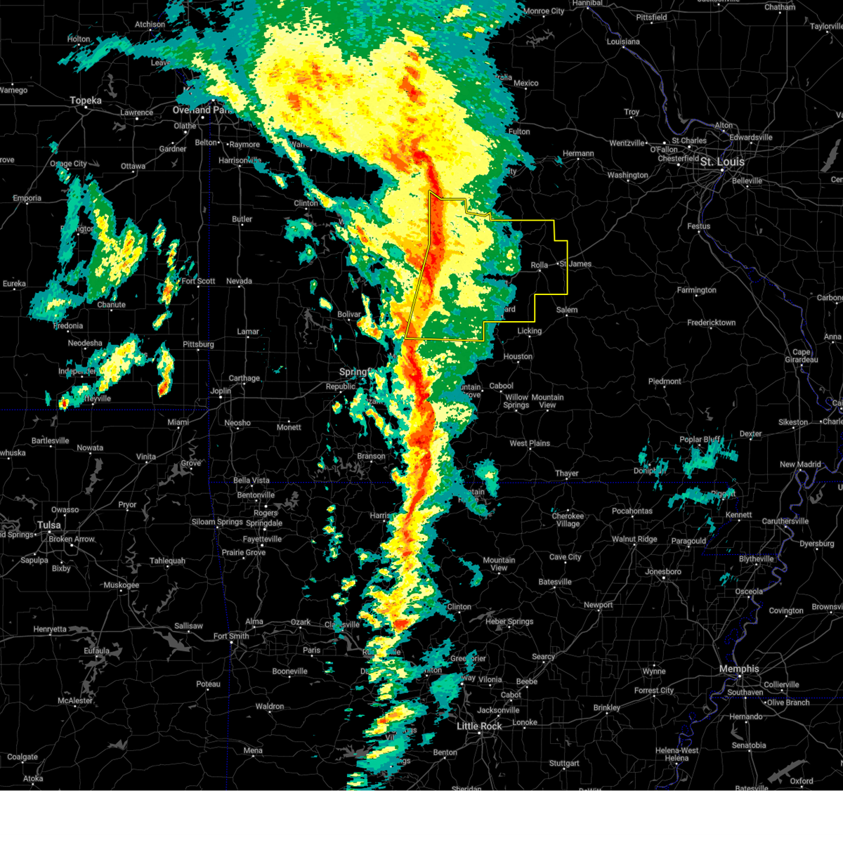
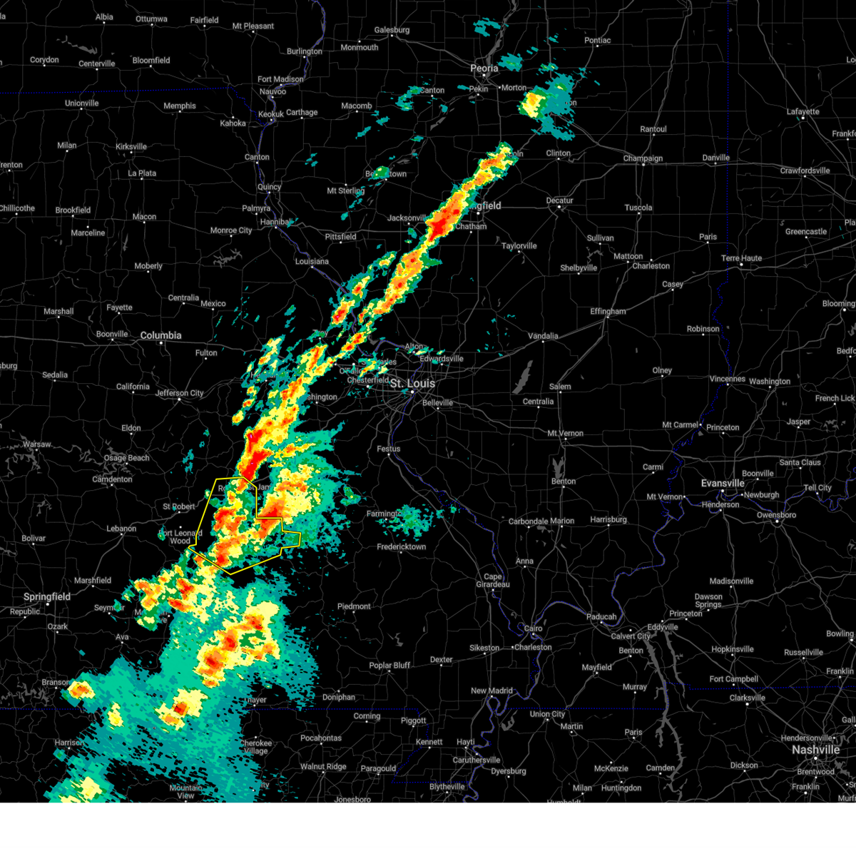
| 3/14/2025 7:59 PM CDT |
 At 758 pm cdt, a confirmed tornado was located near st. james, or near rolla, moving northeast at 70 mph (confirmed tornado. rolla fire confirmed a tornado in rolla, mo 756 pm cdt). Hazards include damaging tornado and tennis ball size hail. Flying debris will be dangerous to those caught without shelter. mobile homes will be damaged or destroyed. damage to roofs, windows, and vehicles will occur. tree damage is likely. locations impacted include, rosati, st. james, and rolla. This includes interstate 44 between mile markers 192 and 200. At 758 pm cdt, a confirmed tornado was located near st. james, or near rolla, moving northeast at 70 mph (confirmed tornado. rolla fire confirmed a tornado in rolla, mo 756 pm cdt). Hazards include damaging tornado and tennis ball size hail. Flying debris will be dangerous to those caught without shelter. mobile homes will be damaged or destroyed. damage to roofs, windows, and vehicles will occur. tree damage is likely. locations impacted include, rosati, st. james, and rolla. This includes interstate 44 between mile markers 192 and 200.
|
| 3/14/2025 7:56 PM CDT |
 Torsgf the national weather service in springfield has issued a * tornado warning for, southeastern maries county in central missouri, northeastern phelps county in east central missouri, * until 815 pm cdt. * at 756 pm cdt, a severe thunderstorm capable of producing a tornado was located over rolla, moving northeast at 70 mph (radar indicated rotation). Hazards include tornado and tennis ball size hail. Flying debris will be dangerous to those caught without shelter. mobile homes will be damaged or destroyed. damage to roofs, windows, and vehicles will occur. Tree damage is likely. Torsgf the national weather service in springfield has issued a * tornado warning for, southeastern maries county in central missouri, northeastern phelps county in east central missouri, * until 815 pm cdt. * at 756 pm cdt, a severe thunderstorm capable of producing a tornado was located over rolla, moving northeast at 70 mph (radar indicated rotation). Hazards include tornado and tennis ball size hail. Flying debris will be dangerous to those caught without shelter. mobile homes will be damaged or destroyed. damage to roofs, windows, and vehicles will occur. Tree damage is likely.
|
| 3/14/2025 7:55 PM CDT |
 Svrsgf the national weather service in springfield has issued a * severe thunderstorm warning for, eastern maries county in central missouri, northern phelps county in east central missouri, * until 845 pm cdt. * at 754 pm cdt, a severe thunderstorm was located near rolla, moving northeast at 75 mph (radar indicated). Hazards include two inch hail and 70 mph wind gusts. People and animals outdoors will be injured. expect hail damage to roofs, siding, windows, and vehicles. expect considerable tree damage. Wind damage is also likely to mobile homes, roofs, and outbuildings. Svrsgf the national weather service in springfield has issued a * severe thunderstorm warning for, eastern maries county in central missouri, northern phelps county in east central missouri, * until 845 pm cdt. * at 754 pm cdt, a severe thunderstorm was located near rolla, moving northeast at 75 mph (radar indicated). Hazards include two inch hail and 70 mph wind gusts. People and animals outdoors will be injured. expect hail damage to roofs, siding, windows, and vehicles. expect considerable tree damage. Wind damage is also likely to mobile homes, roofs, and outbuildings.
|
| 3/14/2025 7:07 PM CDT |
 Svrsgf the national weather service in springfield has issued a * severe thunderstorm warning for, maries county in central missouri, miller county in central missouri, northern pulaski county in central missouri, northern phelps county in east central missouri, southeastern camden county in central missouri, * until 800 pm cdt. * at 706 pm cdt, severe thunderstorms were located along a line extending from near st. martins to near iberia to near richland, moving northeast at 45 mph (radar indicated). Hazards include 70 mph wind gusts and half dollar size hail. Hail damage to vehicles is expected. expect considerable tree damage. Wind damage is also likely to mobile homes, roofs, and outbuildings. Svrsgf the national weather service in springfield has issued a * severe thunderstorm warning for, maries county in central missouri, miller county in central missouri, northern pulaski county in central missouri, northern phelps county in east central missouri, southeastern camden county in central missouri, * until 800 pm cdt. * at 706 pm cdt, severe thunderstorms were located along a line extending from near st. martins to near iberia to near richland, moving northeast at 45 mph (radar indicated). Hazards include 70 mph wind gusts and half dollar size hail. Hail damage to vehicles is expected. expect considerable tree damage. Wind damage is also likely to mobile homes, roofs, and outbuildings.
|
| 11/4/2024 8:10 PM CST |
 At 807 pm cst, severe thunderstorms were located along a line extending from 10 miles northeast of iberia to 6 miles northeast of dixon to 6 miles east of st. robert, moving northeast at 60 mph (trained weather spotters. 60 mph winds were reported near iberia). Hazards include 60 mph wind gusts. Expect damage to roofs, siding, and trees. locations impacted include, rolla, st. james, belle, doolittle, vienna, newburg, brinktown, northwye, jerome, vichy, and rosati. This includes interstate 44 near mile marker 169, and between mile markers 171 and 200. At 807 pm cst, severe thunderstorms were located along a line extending from 10 miles northeast of iberia to 6 miles northeast of dixon to 6 miles east of st. robert, moving northeast at 60 mph (trained weather spotters. 60 mph winds were reported near iberia). Hazards include 60 mph wind gusts. Expect damage to roofs, siding, and trees. locations impacted include, rolla, st. james, belle, doolittle, vienna, newburg, brinktown, northwye, jerome, vichy, and rosati. This includes interstate 44 near mile marker 169, and between mile markers 171 and 200.
|
| 11/4/2024 8:00 PM CST |
 Svrsgf the national weather service in springfield has issued a * severe thunderstorm warning for, maries county in central missouri, phelps county in east central missouri, * until 845 pm cst. * at 800 pm cst, severe thunderstorms were located along a line extending from near iberia to dixon to fort leonard wood, moving northeast at 60 mph (radar indicated). Hazards include 60 mph wind gusts. expect damage to roofs, siding, and trees Svrsgf the national weather service in springfield has issued a * severe thunderstorm warning for, maries county in central missouri, phelps county in east central missouri, * until 845 pm cst. * at 800 pm cst, severe thunderstorms were located along a line extending from near iberia to dixon to fort leonard wood, moving northeast at 60 mph (radar indicated). Hazards include 60 mph wind gusts. expect damage to roofs, siding, and trees
|
| 6/9/2024 3:08 AM CDT |
 The storm which prompted the warning has weakened below severe limits, and no longer poses an immediate threat to life or property. therefore, the warning will be allowed to expire. The storm which prompted the warning has weakened below severe limits, and no longer poses an immediate threat to life or property. therefore, the warning will be allowed to expire.
|
| 6/9/2024 2:46 AM CDT |
 Svrsgf the national weather service in springfield has issued a * severe thunderstorm warning for, northeastern phelps county in east central missouri, * until 315 am cdt. * at 246 am cdt, a severe thunderstorm was located over rolla, moving east at 30 mph (radar indicated). Hazards include ping pong ball size hail and 60 mph wind gusts. People and animals outdoors will be injured. expect hail damage to roofs, siding, windows, and vehicles. Expect wind damage to roofs, siding, and trees. Svrsgf the national weather service in springfield has issued a * severe thunderstorm warning for, northeastern phelps county in east central missouri, * until 315 am cdt. * at 246 am cdt, a severe thunderstorm was located over rolla, moving east at 30 mph (radar indicated). Hazards include ping pong ball size hail and 60 mph wind gusts. People and animals outdoors will be injured. expect hail damage to roofs, siding, windows, and vehicles. Expect wind damage to roofs, siding, and trees.
|
| 5/26/2024 5:43 PM CDT |
 At 542 pm cdt, severe thunderstorms were located along a line extending from 9 miles northwest of cuba to rolla to near richland, moving east at 30 mph (radar indicated). Hazards include 60 mph wind gusts and quarter size hail. Hail damage to vehicles is expected. expect wind damage to roofs, siding, and trees. locations impacted include, rolla, waynesville, st. robert, st. james, richland, dixon, crocker, doolittle, newburg, vichy, northwye, swedeborg, ozark springs, jerome, wet glaize, and rosati. This includes interstate 44 near mile marker 169, between mile markers 171 and 179, and between mile markers 184 and 200. At 542 pm cdt, severe thunderstorms were located along a line extending from 9 miles northwest of cuba to rolla to near richland, moving east at 30 mph (radar indicated). Hazards include 60 mph wind gusts and quarter size hail. Hail damage to vehicles is expected. expect wind damage to roofs, siding, and trees. locations impacted include, rolla, waynesville, st. robert, st. james, richland, dixon, crocker, doolittle, newburg, vichy, northwye, swedeborg, ozark springs, jerome, wet glaize, and rosati. This includes interstate 44 near mile marker 169, between mile markers 171 and 179, and between mile markers 184 and 200.
|
| 5/26/2024 5:43 PM CDT |
 the severe thunderstorm warning has been cancelled and is no longer in effect the severe thunderstorm warning has been cancelled and is no longer in effect
|
| 5/26/2024 5:09 PM CDT |
 Svrsgf the national weather service in springfield has issued a * severe thunderstorm warning for, maries county in central missouri, southeastern miller county in central missouri, north central laclede county in southwestern missouri, northern pulaski county in central missouri, northern phelps county in east central missouri, southeastern camden county in central missouri, * until 615 pm cdt. * at 508 pm cdt, severe thunderstorms were located along a line extending from near belle to near dixon to 10 miles west of richland, moving east at 30 mph (radar indicated). Hazards include golf ball size hail and 60 mph wind gusts. People and animals outdoors will be injured. expect hail damage to roofs, siding, windows, and vehicles. Expect wind damage to roofs, siding, and trees. Svrsgf the national weather service in springfield has issued a * severe thunderstorm warning for, maries county in central missouri, southeastern miller county in central missouri, north central laclede county in southwestern missouri, northern pulaski county in central missouri, northern phelps county in east central missouri, southeastern camden county in central missouri, * until 615 pm cdt. * at 508 pm cdt, severe thunderstorms were located along a line extending from near belle to near dixon to 10 miles west of richland, moving east at 30 mph (radar indicated). Hazards include golf ball size hail and 60 mph wind gusts. People and animals outdoors will be injured. expect hail damage to roofs, siding, windows, and vehicles. Expect wind damage to roofs, siding, and trees.
|
| 5/24/2024 5:22 PM CDT |
 The storm which prompted the warning has weakened below severe limits, and no longer poses an immediate threat to life or property. therefore, the warning will be allowed to expire. a severe thunderstorm watch remains in effect until 1100 pm cdt for south central, central and east central missouri. The storm which prompted the warning has weakened below severe limits, and no longer poses an immediate threat to life or property. therefore, the warning will be allowed to expire. a severe thunderstorm watch remains in effect until 1100 pm cdt for south central, central and east central missouri.
|
| 5/24/2024 4:55 PM CDT |
 At 455 pm cdt, a severe thunderstorm was located over doolittle, or near rolla, moving east at 15 mph (radar indicated). Hazards include golf ball size hail and 60 mph wind gusts. People and animals outdoors will be injured. expect hail damage to roofs, siding, windows, and vehicles. expect wind damage to roofs, siding, and trees. locations impacted include, rolla, st. robert, st. james, dixon, doolittle, newburg, northwye, devil's elbow, jerome, vichy, and rosati. This includes interstate 44 between mile markers 165 and 169, and between mile markers 171 and 200. At 455 pm cdt, a severe thunderstorm was located over doolittle, or near rolla, moving east at 15 mph (radar indicated). Hazards include golf ball size hail and 60 mph wind gusts. People and animals outdoors will be injured. expect hail damage to roofs, siding, windows, and vehicles. expect wind damage to roofs, siding, and trees. locations impacted include, rolla, st. robert, st. james, dixon, doolittle, newburg, northwye, devil's elbow, jerome, vichy, and rosati. This includes interstate 44 between mile markers 165 and 169, and between mile markers 171 and 200.
|
| 5/24/2024 4:42 PM CDT |
 Svrsgf the national weather service in springfield has issued a * severe thunderstorm warning for, southern maries county in central missouri, northeastern pulaski county in central missouri, phelps county in east central missouri, * until 530 pm cdt. * at 441 pm cdt, a severe thunderstorm was located over doolittle, or 9 miles west of rolla, moving east at 15 mph (radar indicated). Hazards include 60 mph wind gusts and quarter size hail. Hail damage to vehicles is expected. Expect wind damage to roofs, siding, and trees. Svrsgf the national weather service in springfield has issued a * severe thunderstorm warning for, southern maries county in central missouri, northeastern pulaski county in central missouri, phelps county in east central missouri, * until 530 pm cdt. * at 441 pm cdt, a severe thunderstorm was located over doolittle, or 9 miles west of rolla, moving east at 15 mph (radar indicated). Hazards include 60 mph wind gusts and quarter size hail. Hail damage to vehicles is expected. Expect wind damage to roofs, siding, and trees.
|
| 5/24/2024 4:20 PM CDT |
 At 419 pm cdt, a severe thunderstorm was located 7 miles northeast of dixon, or 13 miles northwest of rolla, moving east at 25 mph (radar indicated). Hazards include two inch hail and 60 mph wind gusts. People and animals outdoors will be injured. expect hail damage to roofs, siding, windows, and vehicles. expect wind damage to roofs, siding, and trees. locations impacted include, rolla, st. james, dixon, belle, doolittle, vienna, newburg, brinktown, northwye, jerome, vichy, and rosati. This includes interstate 44 between mile markers 171 and 179, and between mile markers 184 and 200. At 419 pm cdt, a severe thunderstorm was located 7 miles northeast of dixon, or 13 miles northwest of rolla, moving east at 25 mph (radar indicated). Hazards include two inch hail and 60 mph wind gusts. People and animals outdoors will be injured. expect hail damage to roofs, siding, windows, and vehicles. expect wind damage to roofs, siding, and trees. locations impacted include, rolla, st. james, dixon, belle, doolittle, vienna, newburg, brinktown, northwye, jerome, vichy, and rosati. This includes interstate 44 between mile markers 171 and 179, and between mile markers 184 and 200.
|
| 5/24/2024 4:20 PM CDT |
 the severe thunderstorm warning has been cancelled and is no longer in effect the severe thunderstorm warning has been cancelled and is no longer in effect
|
| 5/24/2024 4:01 PM CDT |
 Svrsgf the national weather service in springfield has issued a * severe thunderstorm warning for, maries county in central missouri, southeastern miller county in central missouri, northeastern pulaski county in central missouri, northern phelps county in east central missouri, * until 445 pm cdt. * at 401 pm cdt, a severe thunderstorm was located over dixon, or 14 miles northeast of waynesville, moving east at 25 mph (radar indicated). Hazards include two inch hail and 60 mph wind gusts. People and animals outdoors will be injured. expect hail damage to roofs, siding, windows, and vehicles. Expect wind damage to roofs, siding, and trees. Svrsgf the national weather service in springfield has issued a * severe thunderstorm warning for, maries county in central missouri, southeastern miller county in central missouri, northeastern pulaski county in central missouri, northern phelps county in east central missouri, * until 445 pm cdt. * at 401 pm cdt, a severe thunderstorm was located over dixon, or 14 miles northeast of waynesville, moving east at 25 mph (radar indicated). Hazards include two inch hail and 60 mph wind gusts. People and animals outdoors will be injured. expect hail damage to roofs, siding, windows, and vehicles. Expect wind damage to roofs, siding, and trees.
|
| 5/8/2024 5:02 PM CDT |
 the severe thunderstorm warning has been cancelled and is no longer in effect the severe thunderstorm warning has been cancelled and is no longer in effect
|
| 5/8/2024 4:43 PM CDT |
 Svrsgf the national weather service in springfield has issued a * severe thunderstorm warning for, northwestern dent county in south central missouri, northeastern phelps county in east central missouri, * until 530 pm cdt. * at 442 pm cdt, a severe thunderstorm was located near st. james, or 10 miles east of rolla, moving east at 30 mph (radar indicated). Hazards include two inch hail and 60 mph wind gusts. People and animals outdoors will be injured. expect hail damage to roofs, siding, windows, and vehicles. Expect wind damage to roofs, siding, and trees. Svrsgf the national weather service in springfield has issued a * severe thunderstorm warning for, northwestern dent county in south central missouri, northeastern phelps county in east central missouri, * until 530 pm cdt. * at 442 pm cdt, a severe thunderstorm was located near st. james, or 10 miles east of rolla, moving east at 30 mph (radar indicated). Hazards include two inch hail and 60 mph wind gusts. People and animals outdoors will be injured. expect hail damage to roofs, siding, windows, and vehicles. Expect wind damage to roofs, siding, and trees.
|
| 5/8/2024 4:36 PM CDT |
 the severe thunderstorm warning has been cancelled and is no longer in effect the severe thunderstorm warning has been cancelled and is no longer in effect
|
| 5/8/2024 4:36 PM CDT |
 At 435 pm cdt, a severe thunderstorm was located near st. james, or near rolla, moving east at 35 mph. this is a destructive storm for areas east of rolla (emergency management. at 430 pm emergency management reported grapefruit hail near rolla). Hazards include grapefruit size hail and 60 mph wind gusts. People and animals outdoors will be severely injured. expect shattered windows, extensive damage to roofs, siding, and vehicles. locations impacted include, rolla, st. james, bangert, lecoma, sligo, lake spring, and rosati. This includes interstate 44 between mile markers 189 and 200. At 435 pm cdt, a severe thunderstorm was located near st. james, or near rolla, moving east at 35 mph. this is a destructive storm for areas east of rolla (emergency management. at 430 pm emergency management reported grapefruit hail near rolla). Hazards include grapefruit size hail and 60 mph wind gusts. People and animals outdoors will be severely injured. expect shattered windows, extensive damage to roofs, siding, and vehicles. locations impacted include, rolla, st. james, bangert, lecoma, sligo, lake spring, and rosati. This includes interstate 44 between mile markers 189 and 200.
|
| 5/8/2024 4:31 PM CDT |
 At 430 pm cdt, a severe thunderstorm was located near rolla, moving east at 35 mph. this is a destructive storm for locations east of rolla (public. at 425 pm golf ball size hail was reported in rolla). Hazards include three inch hail and 60 mph wind gusts. People and animals outdoors will be severely injured. expect shattered windows, extensive damage to roofs, siding, and vehicles. locations impacted include, rolla, st. james, doolittle, bangert, northwye, lecoma, sligo, lake spring, and rosati. This includes interstate 44 between mile markers 180 and 200. At 430 pm cdt, a severe thunderstorm was located near rolla, moving east at 35 mph. this is a destructive storm for locations east of rolla (public. at 425 pm golf ball size hail was reported in rolla). Hazards include three inch hail and 60 mph wind gusts. People and animals outdoors will be severely injured. expect shattered windows, extensive damage to roofs, siding, and vehicles. locations impacted include, rolla, st. james, doolittle, bangert, northwye, lecoma, sligo, lake spring, and rosati. This includes interstate 44 between mile markers 180 and 200.
|
| 5/8/2024 4:21 PM CDT |
 the severe thunderstorm warning has been cancelled and is no longer in effect the severe thunderstorm warning has been cancelled and is no longer in effect
|
| 5/8/2024 4:21 PM CDT |
 At 420 pm cdt, a severe thunderstorm was located near rolla, moving east at 35 mph. this is a destructive storm for rolla (radar indicated). Hazards include three inch hail and 60 mph wind gusts. People and animals outdoors will be severely injured. expect shattered windows, extensive damage to roofs, siding, and vehicles. locations impacted include, rolla, st. james, doolittle, newburg, bangert, northwye, lecoma, jerome, vichy, sligo, lake spring, and rosati. This includes interstate 44 between mile markers 168 and 169, and between mile markers 171 and 200. At 420 pm cdt, a severe thunderstorm was located near rolla, moving east at 35 mph. this is a destructive storm for rolla (radar indicated). Hazards include three inch hail and 60 mph wind gusts. People and animals outdoors will be severely injured. expect shattered windows, extensive damage to roofs, siding, and vehicles. locations impacted include, rolla, st. james, doolittle, newburg, bangert, northwye, lecoma, jerome, vichy, sligo, lake spring, and rosati. This includes interstate 44 between mile markers 168 and 169, and between mile markers 171 and 200.
|
| 5/8/2024 4:10 PM CDT |
 At 410 pm cdt, a severe thunderstorm was located over doolittle, or 8 miles west of rolla, moving east at 35 mph (radar indicated). Hazards include tennis ball size hail and 60 mph wind gusts. People and animals outdoors will be injured. expect hail damage to roofs, siding, windows, and vehicles. expect wind damage to roofs, siding, and trees. locations impacted include, rolla, st. james, doolittle, newburg, devil's elbow, vichy, lake spring, bangert, northwye, lecoma, jerome, sligo, and rosati. This includes interstate 44 between mile markers 165 and 169, and between mile markers 171 and 200. At 410 pm cdt, a severe thunderstorm was located over doolittle, or 8 miles west of rolla, moving east at 35 mph (radar indicated). Hazards include tennis ball size hail and 60 mph wind gusts. People and animals outdoors will be injured. expect hail damage to roofs, siding, windows, and vehicles. expect wind damage to roofs, siding, and trees. locations impacted include, rolla, st. james, doolittle, newburg, devil's elbow, vichy, lake spring, bangert, northwye, lecoma, jerome, sligo, and rosati. This includes interstate 44 between mile markers 165 and 169, and between mile markers 171 and 200.
|
| 5/8/2024 3:54 PM CDT |
 Svrsgf the national weather service in springfield has issued a * severe thunderstorm warning for, southern maries county in central missouri, northwestern dent county in south central missouri, northeastern pulaski county in central missouri, phelps county in east central missouri, * until 445 pm cdt. * at 354 pm cdt, a severe thunderstorm was located near dixon, or 10 miles northeast of waynesville, moving east at 35 mph (radar indicated). Hazards include golf ball size hail. People and animals outdoors will be injured. Expect damage to roofs, siding, windows, and vehicles. Svrsgf the national weather service in springfield has issued a * severe thunderstorm warning for, southern maries county in central missouri, northwestern dent county in south central missouri, northeastern pulaski county in central missouri, phelps county in east central missouri, * until 445 pm cdt. * at 354 pm cdt, a severe thunderstorm was located near dixon, or 10 miles northeast of waynesville, moving east at 35 mph (radar indicated). Hazards include golf ball size hail. People and animals outdoors will be injured. Expect damage to roofs, siding, windows, and vehicles.
|
| 5/8/2024 11:05 AM CDT |
 The storm which prompted the warning has moved out of the area. therefore, the warning will be allowed to expire. a severe thunderstorm watch remains in effect until 200 pm cdt for central and east central missouri. The storm which prompted the warning has moved out of the area. therefore, the warning will be allowed to expire. a severe thunderstorm watch remains in effect until 200 pm cdt for central and east central missouri.
|
| 5/8/2024 10:49 AM CDT |
 At 1049 am cdt, a severe thunderstorm was located 7 miles north of st. james, or 12 miles west of cuba, moving east at 40 mph (radar indicated. at 1040 am, the vichy asos observed a 65 mph wind gust). Hazards include golf ball size hail and 60 mph wind gusts. People and animals outdoors will be injured. expect hail damage to roofs, siding, windows, and vehicles. expect wind damage to roofs, siding, and trees. locations impacted include, belle, vichy, and rosati. This includes interstate 44 near mile marker 200. At 1049 am cdt, a severe thunderstorm was located 7 miles north of st. james, or 12 miles west of cuba, moving east at 40 mph (radar indicated. at 1040 am, the vichy asos observed a 65 mph wind gust). Hazards include golf ball size hail and 60 mph wind gusts. People and animals outdoors will be injured. expect hail damage to roofs, siding, windows, and vehicles. expect wind damage to roofs, siding, and trees. locations impacted include, belle, vichy, and rosati. This includes interstate 44 near mile marker 200.
|
| 5/8/2024 10:43 AM CDT |
 At 1043 am cdt, a severe thunderstorm was located over belle, or 13 miles southwest of owensville, moving northeast at 40 mph (radar indicated). Hazards include golf ball size hail and 60 mph wind gusts. People and animals outdoors will be injured. expect hail damage to roofs, siding, windows, and vehicles. expect wind damage to roofs, siding, and trees. locations impacted include, belle, vichy, and rosati. This includes interstate 44 near mile marker 200. At 1043 am cdt, a severe thunderstorm was located over belle, or 13 miles southwest of owensville, moving northeast at 40 mph (radar indicated). Hazards include golf ball size hail and 60 mph wind gusts. People and animals outdoors will be injured. expect hail damage to roofs, siding, windows, and vehicles. expect wind damage to roofs, siding, and trees. locations impacted include, belle, vichy, and rosati. This includes interstate 44 near mile marker 200.
|
| 5/8/2024 10:27 AM CDT |
 Svrsgf the national weather service in springfield has issued a * severe thunderstorm warning for, eastern maries county in central missouri, northeastern phelps county in east central missouri, * until 1115 am cdt. * at 1027 am cdt, a severe thunderstorm was located near vienna, or 15 miles north of rolla, moving northeast at 40 mph (radar indicated). Hazards include 60 mph wind gusts and half dollar size hail. Hail damage to vehicles is expected. Expect wind damage to roofs, siding, and trees. Svrsgf the national weather service in springfield has issued a * severe thunderstorm warning for, eastern maries county in central missouri, northeastern phelps county in east central missouri, * until 1115 am cdt. * at 1027 am cdt, a severe thunderstorm was located near vienna, or 15 miles north of rolla, moving northeast at 40 mph (radar indicated). Hazards include 60 mph wind gusts and half dollar size hail. Hail damage to vehicles is expected. Expect wind damage to roofs, siding, and trees.
|
| 5/7/2024 3:43 AM CDT |
 The storms which prompted the warning have moved out of the area. therefore, the warning will be allowed to expire. however, gusty winds are still possible with these thunderstorms. a tornado watch remains in effect until 400 am cdt for southwestern missouri. a tornado watch also remains in effect until 800 am cdt for south central and east central missouri. The storms which prompted the warning have moved out of the area. therefore, the warning will be allowed to expire. however, gusty winds are still possible with these thunderstorms. a tornado watch remains in effect until 400 am cdt for southwestern missouri. a tornado watch also remains in effect until 800 am cdt for south central and east central missouri.
|
| 5/7/2024 3:05 AM CDT |
 Svrsgf the national weather service in springfield has issued a * severe thunderstorm warning for, shannon county in south central missouri, east central douglas county in southwestern missouri, dent county in south central missouri, northern howell county in south central missouri, eastern texas county in south central missouri, northeastern phelps county in east central missouri, * until 345 am cdt. * at 304 am cdt, severe thunderstorms were located along a line extending from near st. james to licking to near cabool, moving northeast at 55 mph (radar indicated). Hazards include 60 mph wind gusts. expect damage to roofs, siding, and trees Svrsgf the national weather service in springfield has issued a * severe thunderstorm warning for, shannon county in south central missouri, east central douglas county in southwestern missouri, dent county in south central missouri, northern howell county in south central missouri, eastern texas county in south central missouri, northeastern phelps county in east central missouri, * until 345 am cdt. * at 304 am cdt, severe thunderstorms were located along a line extending from near st. james to licking to near cabool, moving northeast at 55 mph (radar indicated). Hazards include 60 mph wind gusts. expect damage to roofs, siding, and trees
|
| 5/7/2024 2:16 AM CDT |
 At 215 am cdt, severe thunderstorms were located along a line extending from hartville to 6 miles north of ava to near taneyville, moving east at 45 mph (radar indicated). Hazards include 60 mph wind gusts. Expect damage to roofs, siding, and trees. locations impacted include, rolla, fort leonard wood, west plains, lake taneycomo, bryant creek state park, montauk state park, waynesville, mountain grove, st. robert, licking, ava, mountain view, willow springs, cabool, houston, richland, mansfield, dawson, norwood, and doolittle. This includes interstate 44 between mile markers 144 and 169, and between mile markers 171 and 192. At 215 am cdt, severe thunderstorms were located along a line extending from hartville to 6 miles north of ava to near taneyville, moving east at 45 mph (radar indicated). Hazards include 60 mph wind gusts. Expect damage to roofs, siding, and trees. locations impacted include, rolla, fort leonard wood, west plains, lake taneycomo, bryant creek state park, montauk state park, waynesville, mountain grove, st. robert, licking, ava, mountain view, willow springs, cabool, houston, richland, mansfield, dawson, norwood, and doolittle. This includes interstate 44 between mile markers 144 and 169, and between mile markers 171 and 192.
|
| 5/7/2024 2:12 AM CDT |
 Svrsgf the national weather service in springfield has issued a * severe thunderstorm warning for, northern ozark county in southwestern missouri, northwestern shannon county in south central missouri, wright county in southwestern missouri, douglas county in southwestern missouri, northeastern taney county in southwestern missouri, western dent county in south central missouri, southeastern laclede county in southwestern missouri, howell county in south central missouri, texas county in south central missouri, pulaski county in central missouri, phelps county in east central missouri, * until 315 am cdt. * at 212 am cdt, severe thunderstorms were located along a line extending from hartville to 6 miles north of ava to near taneyville, moving east at 45 mph (radar indicated). Hazards include 60 mph wind gusts. expect damage to roofs, siding, and trees Svrsgf the national weather service in springfield has issued a * severe thunderstorm warning for, northern ozark county in southwestern missouri, northwestern shannon county in south central missouri, wright county in southwestern missouri, douglas county in southwestern missouri, northeastern taney county in southwestern missouri, western dent county in south central missouri, southeastern laclede county in southwestern missouri, howell county in south central missouri, texas county in south central missouri, pulaski county in central missouri, phelps county in east central missouri, * until 315 am cdt. * at 212 am cdt, severe thunderstorms were located along a line extending from hartville to 6 miles north of ava to near taneyville, moving east at 45 mph (radar indicated). Hazards include 60 mph wind gusts. expect damage to roofs, siding, and trees
|
| 4/18/2024 4:56 PM CDT |
 At 456 pm cdt, a severe thunderstorm was located over st. james, or 10 miles northeast of rolla, moving east at 40 mph (law enforcement). Hazards include ping pong ball size hail and 60 mph wind gusts. People and animals outdoors will be injured. expect hail damage to roofs, siding, windows, and vehicles. expect wind damage to roofs, siding, and trees. locations impacted include, rolla, st. james, vichy, northwye, and rosati. This includes interstate 44 between mile markers 185 and 200. At 456 pm cdt, a severe thunderstorm was located over st. james, or 10 miles northeast of rolla, moving east at 40 mph (law enforcement). Hazards include ping pong ball size hail and 60 mph wind gusts. People and animals outdoors will be injured. expect hail damage to roofs, siding, windows, and vehicles. expect wind damage to roofs, siding, and trees. locations impacted include, rolla, st. james, vichy, northwye, and rosati. This includes interstate 44 between mile markers 185 and 200.
|
| 4/18/2024 4:43 PM CDT |
 At 442 pm cdt, a severe thunderstorm was located near rolla, moving east at 35 mph (radar indicated). Hazards include ping pong ball size hail and 60 mph wind gusts. People and animals outdoors will be injured. expect hail damage to roofs, siding, windows, and vehicles. expect wind damage to roofs, siding, and trees. locations impacted include, rolla, st. james, doolittle, newburg, northwye, vichy, and rosati. This includes interstate 44 between mile markers 176 and 179, and between mile markers 184 and 200. At 442 pm cdt, a severe thunderstorm was located near rolla, moving east at 35 mph (radar indicated). Hazards include ping pong ball size hail and 60 mph wind gusts. People and animals outdoors will be injured. expect hail damage to roofs, siding, windows, and vehicles. expect wind damage to roofs, siding, and trees. locations impacted include, rolla, st. james, doolittle, newburg, northwye, vichy, and rosati. This includes interstate 44 between mile markers 176 and 179, and between mile markers 184 and 200.
|
| 4/18/2024 4:43 PM CDT |
 the severe thunderstorm warning has been cancelled and is no longer in effect the severe thunderstorm warning has been cancelled and is no longer in effect
|
| 4/18/2024 4:29 PM CDT |
 Svrsgf the national weather service in springfield has issued a * severe thunderstorm warning for, southeastern maries county in central missouri, northeastern pulaski county in central missouri, northern phelps county in east central missouri, * until 515 pm cdt. * at 429 pm cdt, a severe thunderstorm was located near dixon, or 13 miles west of rolla, moving east at 40 mph (radar indicated). Hazards include 60 mph wind gusts and quarter size hail. Hail damage to vehicles is expected. Expect wind damage to roofs, siding, and trees. Svrsgf the national weather service in springfield has issued a * severe thunderstorm warning for, southeastern maries county in central missouri, northeastern pulaski county in central missouri, northern phelps county in east central missouri, * until 515 pm cdt. * at 429 pm cdt, a severe thunderstorm was located near dixon, or 13 miles west of rolla, moving east at 40 mph (radar indicated). Hazards include 60 mph wind gusts and quarter size hail. Hail damage to vehicles is expected. Expect wind damage to roofs, siding, and trees.
|
| 4/2/2024 12:37 AM CDT |
 The tornadic thunderstorm which prompted the warning has moved out of the warned area. therefore, the warning will be allowed to expire. a tornado watch remains in effect until 300 am cdt for central and east central missouri. The tornadic thunderstorm which prompted the warning has moved out of the warned area. therefore, the warning will be allowed to expire. a tornado watch remains in effect until 300 am cdt for central and east central missouri.
|
| 4/2/2024 12:35 AM CDT |
 The storms which prompted the warning have moved out of the warned area. therefore, the warning will be allowed to expire. a tornado watch remains in effect until 300 am cdt for south central, central and east central missouri. The storms which prompted the warning have moved out of the warned area. therefore, the warning will be allowed to expire. a tornado watch remains in effect until 300 am cdt for south central, central and east central missouri.
|
| 4/2/2024 12:22 AM CDT |
 At 1222 am cdt, a severe thunderstorm capable of producing a tornado was located near st. james, or near rolla, moving northeast at 50 mph (radar indicated rotation). Hazards include tornado and quarter size hail. Flying debris will be dangerous to those caught without shelter. mobile homes will be damaged or destroyed. damage to roofs, windows, and vehicles will occur. tree damage is likely. locations impacted include, rolla, st. james, vichy, and rosati. This includes interstate 44 between mile markers 189 and 200. At 1222 am cdt, a severe thunderstorm capable of producing a tornado was located near st. james, or near rolla, moving northeast at 50 mph (radar indicated rotation). Hazards include tornado and quarter size hail. Flying debris will be dangerous to those caught without shelter. mobile homes will be damaged or destroyed. damage to roofs, windows, and vehicles will occur. tree damage is likely. locations impacted include, rolla, st. james, vichy, and rosati. This includes interstate 44 between mile markers 189 and 200.
|
| 4/2/2024 12:12 AM CDT |
 At 1211 am cdt, severe thunderstorms were located along a line extending from near dixon to 6 miles east of fort leonard wood, moving northeast at 35 mph. these are destructive storms for rolla, vichy, and st. james (radar indicated). Hazards include 80 mph wind gusts and quarter size hail. Flying debris will be dangerous to those caught without shelter. mobile homes will be heavily damaged. expect considerable damage to roofs, windows, and vehicles. extensive tree damage and power outages are likely. locations impacted include, rolla, st. james, belle, doolittle, vienna, newburg, edgar springs, brinktown, lenox, vichy, lake spring, anutt, bangert, northwye, lecoma, jerome, sligo, and rosati. This includes interstate 44 between mile markers 171 and 200. At 1211 am cdt, severe thunderstorms were located along a line extending from near dixon to 6 miles east of fort leonard wood, moving northeast at 35 mph. these are destructive storms for rolla, vichy, and st. james (radar indicated). Hazards include 80 mph wind gusts and quarter size hail. Flying debris will be dangerous to those caught without shelter. mobile homes will be heavily damaged. expect considerable damage to roofs, windows, and vehicles. extensive tree damage and power outages are likely. locations impacted include, rolla, st. james, belle, doolittle, vienna, newburg, edgar springs, brinktown, lenox, vichy, lake spring, anutt, bangert, northwye, lecoma, jerome, sligo, and rosati. This includes interstate 44 between mile markers 171 and 200.
|
| 4/2/2024 12:12 AM CDT |
 the severe thunderstorm warning has been cancelled and is no longer in effect the severe thunderstorm warning has been cancelled and is no longer in effect
|
| 4/2/2024 12:08 AM CDT |
 Torsgf the national weather service in springfield has issued a * tornado warning for, eastern maries county in central missouri, northern phelps county in east central missouri, * until 1245 am cdt. * at 1208 am cdt, a severe thunderstorm capable of producing a tornado was located over newburg, or near rolla, moving east at 50 mph (radar indicated rotation). Hazards include tornado and quarter size hail. Flying debris will be dangerous to those caught without shelter. mobile homes will be damaged or destroyed. damage to roofs, windows, and vehicles will occur. Tree damage is likely. Torsgf the national weather service in springfield has issued a * tornado warning for, eastern maries county in central missouri, northern phelps county in east central missouri, * until 1245 am cdt. * at 1208 am cdt, a severe thunderstorm capable of producing a tornado was located over newburg, or near rolla, moving east at 50 mph (radar indicated rotation). Hazards include tornado and quarter size hail. Flying debris will be dangerous to those caught without shelter. mobile homes will be damaged or destroyed. damage to roofs, windows, and vehicles will occur. Tree damage is likely.
|
| 4/1/2024 11:59 PM CDT |
 Svrsgf the national weather service in springfield has issued a * severe thunderstorm warning for, maries county in central missouri, northwestern dent county in south central missouri, eastern pulaski county in central missouri, phelps county in east central missouri, * until 1245 am cdt. * at 1159 pm cdt, severe thunderstorms were located along a line extending from near dixon to 8 miles southeast of fort leonard wood, moving northeast at 35 mph (radar indicated). Hazards include golf ball size hail and 70 mph wind gusts. People and animals outdoors will be injured. expect hail damage to roofs, siding, windows, and vehicles. expect considerable tree damage. Wind damage is also likely to mobile homes, roofs, and outbuildings. Svrsgf the national weather service in springfield has issued a * severe thunderstorm warning for, maries county in central missouri, northwestern dent county in south central missouri, eastern pulaski county in central missouri, phelps county in east central missouri, * until 1245 am cdt. * at 1159 pm cdt, severe thunderstorms were located along a line extending from near dixon to 8 miles southeast of fort leonard wood, moving northeast at 35 mph (radar indicated). Hazards include golf ball size hail and 70 mph wind gusts. People and animals outdoors will be injured. expect hail damage to roofs, siding, windows, and vehicles. expect considerable tree damage. Wind damage is also likely to mobile homes, roofs, and outbuildings.
|
| 8/2/2023 11:42 PM CDT |
 The severe thunderstorm warning for southern maries, northeastern dent, southeastern miller, northern pulaski and phelps counties will expire at 1145 pm cdt, the storm which prompted the warning has moved out of the area. therefore, the warning will be allowed to expire. however gusty winds are still possible with this thunderstorm. a severe thunderstorm watch remains in effect until 300 am cdt for central, south central and east central missouri. to report severe weather, contact your nearest law enforcement agency. they will relay your report to the national weather service springfield. The severe thunderstorm warning for southern maries, northeastern dent, southeastern miller, northern pulaski and phelps counties will expire at 1145 pm cdt, the storm which prompted the warning has moved out of the area. therefore, the warning will be allowed to expire. however gusty winds are still possible with this thunderstorm. a severe thunderstorm watch remains in effect until 300 am cdt for central, south central and east central missouri. to report severe weather, contact your nearest law enforcement agency. they will relay your report to the national weather service springfield.
|
| 8/2/2023 10:57 PM CDT |
 At 1057 pm cdt, a severe thunderstorm was located near iberia, or 14 miles east of osage beach, moving east at 30 mph (radar indicated). Hazards include 60 mph wind gusts and quarter size hail. Hail damage to vehicles is expected. Expect wind damage to roofs, siding, and trees. At 1057 pm cdt, a severe thunderstorm was located near iberia, or 14 miles east of osage beach, moving east at 30 mph (radar indicated). Hazards include 60 mph wind gusts and quarter size hail. Hail damage to vehicles is expected. Expect wind damage to roofs, siding, and trees.
|
| 8/2/2023 10:44 PM CDT |
 At 1044 pm cdt, a severe thunderstorm was located near iberia, or 16 miles east of osage beach, moving southeast at 30 mph (public). Hazards include 70 mph wind gusts and quarter size hail. Hail damage to vehicles is expected. expect considerable tree damage. wind damage is also likely to mobile homes, roofs, and outbuildings. locations impacted include, rolla, lake of the ozarks, lake of the ozarks state park, salem, osage beach, st. robert, st. james, lake ozark, dixon, belle, crocker, iberia, doolittle, vienna, newburg, st. elizabeth, saint elizabeth, edgar springs, tuscumbia and bagnell. this includes interstate 44 between mile markers 162 and 169, and between mile markers 171 and 200. thunderstorm damage threat, considerable hail threat, radar indicated max hail size, 1. 00 in wind threat, observed max wind gust, 70 mph. At 1044 pm cdt, a severe thunderstorm was located near iberia, or 16 miles east of osage beach, moving southeast at 30 mph (public). Hazards include 70 mph wind gusts and quarter size hail. Hail damage to vehicles is expected. expect considerable tree damage. wind damage is also likely to mobile homes, roofs, and outbuildings. locations impacted include, rolla, lake of the ozarks, lake of the ozarks state park, salem, osage beach, st. robert, st. james, lake ozark, dixon, belle, crocker, iberia, doolittle, vienna, newburg, st. elizabeth, saint elizabeth, edgar springs, tuscumbia and bagnell. this includes interstate 44 between mile markers 162 and 169, and between mile markers 171 and 200. thunderstorm damage threat, considerable hail threat, radar indicated max hail size, 1. 00 in wind threat, observed max wind gust, 70 mph.
|
| 8/2/2023 10:10 PM CDT |
 The severe thunderstorm warning for maries, northwestern dent, miller, northern pulaski, phelps and east central camden counties will expire at 1015 pm cdt, a new severe thunderstorm warning will replace the existing warning at 1015 pm. a severe thunderstorm watch remains in effect until 300 am cdt for central, south central and east central missouri. The severe thunderstorm warning for maries, northwestern dent, miller, northern pulaski, phelps and east central camden counties will expire at 1015 pm cdt, a new severe thunderstorm warning will replace the existing warning at 1015 pm. a severe thunderstorm watch remains in effect until 300 am cdt for central, south central and east central missouri.
|
| 8/2/2023 10:08 PM CDT |
 At 1007 pm cdt, a severe thunderstorm was located over lake ozark, or near osage beach, moving southeast at 30 mph (radar indicated). Hazards include 60 mph wind gusts and quarter size hail. Hail damage to vehicles is expected. Expect wind damage to roofs, siding, and trees. At 1007 pm cdt, a severe thunderstorm was located over lake ozark, or near osage beach, moving southeast at 30 mph (radar indicated). Hazards include 60 mph wind gusts and quarter size hail. Hail damage to vehicles is expected. Expect wind damage to roofs, siding, and trees.
|
| 8/2/2023 9:30 PM CDT |
 At 930 pm cdt, a severe thunderstorm was located near st. james, or near rolla, moving southeast at 35 mph (radar indicated). Hazards include 60 mph wind gusts and quarter size hail. Hail damage to vehicles is expected. Expect wind damage to roofs, siding, and trees. At 930 pm cdt, a severe thunderstorm was located near st. james, or near rolla, moving southeast at 35 mph (radar indicated). Hazards include 60 mph wind gusts and quarter size hail. Hail damage to vehicles is expected. Expect wind damage to roofs, siding, and trees.
|
| 7/24/2023 2:56 AM CDT |
 The severe thunderstorm warning for northeastern phelps county will expire at 300 am cdt, the storm which prompted the warning has weakened below severe limits, and no longer poses an immediate threat to life or property. therefore, the warning will be allowed to expire. however heavy rain and small hail is still possible with this thunderstorm. The severe thunderstorm warning for northeastern phelps county will expire at 300 am cdt, the storm which prompted the warning has weakened below severe limits, and no longer poses an immediate threat to life or property. therefore, the warning will be allowed to expire. however heavy rain and small hail is still possible with this thunderstorm.
|
| 7/24/2023 2:51 AM CDT |
 At 251 am cdt, a severe thunderstorm was located near st. james, or 9 miles west of cuba, moving southeast at 25 mph (radar indicated). Hazards include 60 mph wind gusts and quarter size hail. Hail damage to vehicles is expected. expect wind damage to roofs, siding, and trees. locations impacted include, st. james and rosati. this includes interstate 44 between mile markers 194 and 200. hail threat, radar indicated max hail size, 1. 00 in wind threat, radar indicated max wind gust, 60 mph. At 251 am cdt, a severe thunderstorm was located near st. james, or 9 miles west of cuba, moving southeast at 25 mph (radar indicated). Hazards include 60 mph wind gusts and quarter size hail. Hail damage to vehicles is expected. expect wind damage to roofs, siding, and trees. locations impacted include, st. james and rosati. this includes interstate 44 between mile markers 194 and 200. hail threat, radar indicated max hail size, 1. 00 in wind threat, radar indicated max wind gust, 60 mph.
|
| 7/24/2023 2:41 AM CDT |
 At 241 am cdt, a severe thunderstorm was located near st. james, or 11 miles northeast of rolla, moving southeast at 25 mph (radar indicated). Hazards include 60 mph wind gusts and quarter size hail. Hail damage to vehicles is expected. expect wind damage to roofs, siding, and trees. locations impacted include, st. james and rosati. this includes interstate 44 between mile markers 193 and 200. hail threat, radar indicated max hail size, 1. 00 in wind threat, radar indicated max wind gust, 60 mph. At 241 am cdt, a severe thunderstorm was located near st. james, or 11 miles northeast of rolla, moving southeast at 25 mph (radar indicated). Hazards include 60 mph wind gusts and quarter size hail. Hail damage to vehicles is expected. expect wind damage to roofs, siding, and trees. locations impacted include, st. james and rosati. this includes interstate 44 between mile markers 193 and 200. hail threat, radar indicated max hail size, 1. 00 in wind threat, radar indicated max wind gust, 60 mph.
|
| 7/24/2023 2:22 AM CDT |
 At 222 am cdt, a severe thunderstorm was located near st. james, or 11 miles northeast of rolla, moving southeast at 15 mph (radar indicated). Hazards include 60 mph wind gusts and quarter size hail. Hail damage to vehicles is expected. Expect wind damage to roofs, siding, and trees. At 222 am cdt, a severe thunderstorm was located near st. james, or 11 miles northeast of rolla, moving southeast at 15 mph (radar indicated). Hazards include 60 mph wind gusts and quarter size hail. Hail damage to vehicles is expected. Expect wind damage to roofs, siding, and trees.
|
| 7/18/2023 10:03 AM CDT |
 At 1002 am cdt, a severe thunderstorm was located near cuba, moving east at 55 mph (radar indicated). Hazards include 60 mph wind gusts and quarter size hail. Hail damage to vehicles is expected. expect wind damage to roofs, siding, and trees. locations impacted include, rolla, st. james, doolittle, newburg, northwye, jerome and vichy. this includes interstate 44 between mile markers 174 and 179, and between mile markers 184 and 199. hail threat, radar indicated max hail size, 1. 00 in wind threat, radar indicated max wind gust, 60 mph. At 1002 am cdt, a severe thunderstorm was located near cuba, moving east at 55 mph (radar indicated). Hazards include 60 mph wind gusts and quarter size hail. Hail damage to vehicles is expected. expect wind damage to roofs, siding, and trees. locations impacted include, rolla, st. james, doolittle, newburg, northwye, jerome and vichy. this includes interstate 44 between mile markers 174 and 179, and between mile markers 184 and 199. hail threat, radar indicated max hail size, 1. 00 in wind threat, radar indicated max wind gust, 60 mph.
|
| 7/18/2023 9:48 AM CDT |
 At 948 am cdt, a severe thunderstorm was located 8 miles northwest of st. james, or 10 miles north of rolla, moving east at 55 mph (radar indicated). Hazards include 60 mph wind gusts and quarter size hail. Hail damage to vehicles is expected. expect wind damage to roofs, siding, and trees. locations impacted include, rolla, st. james, dixon, belle, crocker, doolittle, vienna, newburg, brinktown, northwye, jerome and vichy. this includes interstate 44 between mile markers 172 and 179, and between mile markers 184 and 199. hail threat, radar indicated max hail size, 1. 00 in wind threat, radar indicated max wind gust, 60 mph. At 948 am cdt, a severe thunderstorm was located 8 miles northwest of st. james, or 10 miles north of rolla, moving east at 55 mph (radar indicated). Hazards include 60 mph wind gusts and quarter size hail. Hail damage to vehicles is expected. expect wind damage to roofs, siding, and trees. locations impacted include, rolla, st. james, dixon, belle, crocker, doolittle, vienna, newburg, brinktown, northwye, jerome and vichy. this includes interstate 44 between mile markers 172 and 179, and between mile markers 184 and 199. hail threat, radar indicated max hail size, 1. 00 in wind threat, radar indicated max wind gust, 60 mph.
|
| 7/18/2023 9:27 AM CDT |
 At 927 am cdt, a severe thunderstorm was located near vienna, or 22 miles northwest of rolla, moving east at 55 mph (radar indicated). Hazards include 60 mph wind gusts and quarter size hail. Hail damage to vehicles is expected. Expect wind damage to roofs, siding, and trees. At 927 am cdt, a severe thunderstorm was located near vienna, or 22 miles northwest of rolla, moving east at 55 mph (radar indicated). Hazards include 60 mph wind gusts and quarter size hail. Hail damage to vehicles is expected. Expect wind damage to roofs, siding, and trees.
|
| 7/17/2023 2:55 PM CDT |
 At 255 pm cdt, severe thunderstorms were located along a line extending from near richland to near dixon to near st. james, moving east at 25 mph (radar indicated). Hazards include ping pong ball size hail and 60 mph wind gusts. People and animals outdoors will be injured. expect hail damage to roofs, siding, windows, and vehicles. expect wind damage to roofs, siding, and trees. locations impacted include, rolla, northern fort leonard wood, waynesville, st. robert, st. james, richland, dixon, crocker, doolittle, newburg, stoutland, devil`s elbow, vichy, laquey, northwye, swedeborg, ozark springs, jerome and rosati. this includes interstate 44 between mile markers 141 and 169, and between mile markers 171 and 200. hail threat, radar indicated max hail size, 1. 50 in wind threat, radar indicated max wind gust, 60 mph. At 255 pm cdt, severe thunderstorms were located along a line extending from near richland to near dixon to near st. james, moving east at 25 mph (radar indicated). Hazards include ping pong ball size hail and 60 mph wind gusts. People and animals outdoors will be injured. expect hail damage to roofs, siding, windows, and vehicles. expect wind damage to roofs, siding, and trees. locations impacted include, rolla, northern fort leonard wood, waynesville, st. robert, st. james, richland, dixon, crocker, doolittle, newburg, stoutland, devil`s elbow, vichy, laquey, northwye, swedeborg, ozark springs, jerome and rosati. this includes interstate 44 between mile markers 141 and 169, and between mile markers 171 and 200. hail threat, radar indicated max hail size, 1. 50 in wind threat, radar indicated max wind gust, 60 mph.
|
| 7/17/2023 2:40 PM CDT |
 At 240 pm cdt, severe thunderstorms were located along a line extending from near richland to near dixon to 7 miles northwest of st. james, moving southeast at 20 mph (radar indicated). Hazards include 60 mph wind gusts and half dollar size hail. Hail damage to vehicles is expected. Expect wind damage to roofs, siding, and trees. At 240 pm cdt, severe thunderstorms were located along a line extending from near richland to near dixon to 7 miles northwest of st. james, moving southeast at 20 mph (radar indicated). Hazards include 60 mph wind gusts and half dollar size hail. Hail damage to vehicles is expected. Expect wind damage to roofs, siding, and trees.
|
| 4/15/2023 4:29 PM CDT |
 At 429 pm cdt, a severe thunderstorm was located near vienna, or 14 miles northwest of rolla, moving northeast at 45 mph (law enforcement). Hazards include two inch hail and 60 mph wind gusts. People and animals outdoors will be injured. expect hail damage to roofs, siding, windows, and vehicles. expect wind damage to roofs, siding, and trees. locations impacted include, belle, vienna, brinktown and vichy. This includes interstate 44 near mile marker 200. At 429 pm cdt, a severe thunderstorm was located near vienna, or 14 miles northwest of rolla, moving northeast at 45 mph (law enforcement). Hazards include two inch hail and 60 mph wind gusts. People and animals outdoors will be injured. expect hail damage to roofs, siding, windows, and vehicles. expect wind damage to roofs, siding, and trees. locations impacted include, belle, vienna, brinktown and vichy. This includes interstate 44 near mile marker 200.
|
| 4/15/2023 3:59 PM CDT |
 At 358 pm cdt, severe thunderstorms were located along a line extending from 6 miles south of hickory hill to iberia to 8 miles north of lebanon, moving northeast at 40 mph (radar indicated. these storms have a history of producing large hail). Hazards include two inch hail and 60 mph wind gusts. People and animals outdoors will be injured. expect hail damage to roofs, siding, windows, and vehicles. Expect wind damage to roofs, siding, and trees. At 358 pm cdt, severe thunderstorms were located along a line extending from 6 miles south of hickory hill to iberia to 8 miles north of lebanon, moving northeast at 40 mph (radar indicated. these storms have a history of producing large hail). Hazards include two inch hail and 60 mph wind gusts. People and animals outdoors will be injured. expect hail damage to roofs, siding, windows, and vehicles. Expect wind damage to roofs, siding, and trees.
|
| 4/5/2023 7:10 AM CDT |
 At 710 am cdt, a severe thunderstorm was located 7 miles southeast of rolla, moving northeast at 70 mph (radar indicated). Hazards include 60 mph wind gusts and quarter size hail. Hail damage to vehicles is expected. Expect wind damage to roofs, siding, and trees. At 710 am cdt, a severe thunderstorm was located 7 miles southeast of rolla, moving northeast at 70 mph (radar indicated). Hazards include 60 mph wind gusts and quarter size hail. Hail damage to vehicles is expected. Expect wind damage to roofs, siding, and trees.
|
| 2/16/2023 2:01 AM CST |
 At 201 am cst, severe thunderstorms were located along a line extending from near doolittle to 9 miles southwest of salem to 9 miles west of summersville, moving east at 45 mph (radar indicated). Hazards include 60 mph wind gusts and nickel size hail. expect damage to roofs, siding, and trees At 201 am cst, severe thunderstorms were located along a line extending from near doolittle to 9 miles southwest of salem to 9 miles west of summersville, moving east at 45 mph (radar indicated). Hazards include 60 mph wind gusts and nickel size hail. expect damage to roofs, siding, and trees
|
| 11/4/2022 10:19 PM CDT |
 At 1018 pm cdt, severe thunderstorms were located along a line extending from near rolla to 13 miles southeast of newburg to near licking, moving northeast at 50 mph (radar indicated). Hazards include 60 mph wind gusts. Expect damage to roofs, siding, and trees. locations impacted include, rolla, salem, st. james, newburg, lenox, lake spring, anutt, bangert, howes, northwye, lecoma, sligo and rosati. this includes interstate 44 between mile markers 180 and 200. hail threat, radar indicated max hail size, <. 75 in wind threat, radar indicated max wind gust, 60 mph. At 1018 pm cdt, severe thunderstorms were located along a line extending from near rolla to 13 miles southeast of newburg to near licking, moving northeast at 50 mph (radar indicated). Hazards include 60 mph wind gusts. Expect damage to roofs, siding, and trees. locations impacted include, rolla, salem, st. james, newburg, lenox, lake spring, anutt, bangert, howes, northwye, lecoma, sligo and rosati. this includes interstate 44 between mile markers 180 and 200. hail threat, radar indicated max hail size, <. 75 in wind threat, radar indicated max wind gust, 60 mph.
|
| 11/4/2022 9:59 PM CDT |
 At 959 pm cdt, severe thunderstorms were located along a line extending from 6 miles southeast of st. robert to 10 miles northwest of licking to 6 miles west of houston, moving northeast at 55 mph (radar indicated). Hazards include 60 mph wind gusts. expect damage to roofs, siding, and trees At 959 pm cdt, severe thunderstorms were located along a line extending from 6 miles southeast of st. robert to 10 miles northwest of licking to 6 miles west of houston, moving northeast at 55 mph (radar indicated). Hazards include 60 mph wind gusts. expect damage to roofs, siding, and trees
|
| 5/19/2022 3:57 PM CDT |
 The tornado warning for northern phelps county will expire at 400 pm cdt, the storm which prompted the warning has weakened below severe limits, and has exited the warned area. therefore, the warning will be allowed to expire. however gusty winds and heavy rain are still possible with this thunderstorm. a tornado watch remains in effect until 700 pm cdt for east central missouri. to report severe weather, contact your nearest law enforcement agency. they will relay your report to the national weather service springfield. The tornado warning for northern phelps county will expire at 400 pm cdt, the storm which prompted the warning has weakened below severe limits, and has exited the warned area. therefore, the warning will be allowed to expire. however gusty winds and heavy rain are still possible with this thunderstorm. a tornado watch remains in effect until 700 pm cdt for east central missouri. to report severe weather, contact your nearest law enforcement agency. they will relay your report to the national weather service springfield.
|
| 5/19/2022 3:52 PM CDT |
 At 352 pm cdt, a severe squall line capable of producing both tornadoes and extensive straight line wind damage was located 7 miles northeast of doolittle, or 7 miles northwest of rolla, moving northeast at 25 mph (radar indicated rotation). Hazards include tornado and quarter size hail. Flying debris will be dangerous to those caught without shelter. mobile homes will be damaged or destroyed. damage to roofs, windows, and vehicles will occur. tree damage is likely. locations impacted include, rolla, st. James, doolittle, northwye, this includes interstate 44 between mile markers 184 and 195. At 352 pm cdt, a severe squall line capable of producing both tornadoes and extensive straight line wind damage was located 7 miles northeast of doolittle, or 7 miles northwest of rolla, moving northeast at 25 mph (radar indicated rotation). Hazards include tornado and quarter size hail. Flying debris will be dangerous to those caught without shelter. mobile homes will be damaged or destroyed. damage to roofs, windows, and vehicles will occur. tree damage is likely. locations impacted include, rolla, st. James, doolittle, northwye, this includes interstate 44 between mile markers 184 and 195.
|
| 5/19/2022 3:34 PM CDT | Multiple downed and snapped trees along county road 3520 off of highway f south-southeast of st jame in phelps county MO, 5.6 miles NNW of St. James, MO |
| 5/19/2022 3:34 PM CDT |
 At 334 pm cdt, a severe squall line capable of producing both tornadoes and extensive straight line wind damage was located near rolla, moving northeast at 40 mph (radar indicated rotation). Hazards include tornado and quarter size hail. Flying debris will be dangerous to those caught without shelter. mobile homes will be damaged or destroyed. damage to roofs, windows, and vehicles will occur. tree damage is likely. locations impacted include, rolla, st. James, doolittle, newburg, northwye, this includes interstate 44 between mile markers 174 and 195. At 334 pm cdt, a severe squall line capable of producing both tornadoes and extensive straight line wind damage was located near rolla, moving northeast at 40 mph (radar indicated rotation). Hazards include tornado and quarter size hail. Flying debris will be dangerous to those caught without shelter. mobile homes will be damaged or destroyed. damage to roofs, windows, and vehicles will occur. tree damage is likely. locations impacted include, rolla, st. James, doolittle, newburg, northwye, this includes interstate 44 between mile markers 174 and 195.
|
| 5/19/2022 3:33 PM CDT |
 At 333 pm cdt, severe thunderstorms were located along a line extending from 6 miles southeast of st. james to 9 miles east of salem to 17 miles west of bunker to near summersville, moving northeast at 35 mph (radar indicated). Hazards include 70 mph wind gusts and nickel size hail. Expect considerable tree damage. damage is likely to mobile homes, roofs, and outbuildings. locations impacted include, rolla, current river state park, echo bluff state park, montauk state park, ozark national scenic riverways, salem, st. James, licking, doolittle, newburg, bunker, raymondville, edgar springs, lenox, montauk, jadwin, howes mill, lake spring, gladden, eunice, this includes interstate 44 between mile markers 171 and 200. At 333 pm cdt, severe thunderstorms were located along a line extending from 6 miles southeast of st. james to 9 miles east of salem to 17 miles west of bunker to near summersville, moving northeast at 35 mph (radar indicated). Hazards include 70 mph wind gusts and nickel size hail. Expect considerable tree damage. damage is likely to mobile homes, roofs, and outbuildings. locations impacted include, rolla, current river state park, echo bluff state park, montauk state park, ozark national scenic riverways, salem, st. James, licking, doolittle, newburg, bunker, raymondville, edgar springs, lenox, montauk, jadwin, howes mill, lake spring, gladden, eunice, this includes interstate 44 between mile markers 171 and 200.
|
| 5/19/2022 3:09 PM CDT |
 At 309 pm cdt, severe thunderstorms capable of producing both tornadoes and extensive straight line wind damage were located 8 miles south of newburg, or 13 miles northeast of fort leonard wood, moving northeast at 35 mph (radar indicated rotation). Hazards include tornado and quarter size hail. Flying debris will be dangerous to those caught without shelter. mobile homes will be damaged or destroyed. damage to roofs, windows, and vehicles will occur. Tree damage is likely. At 309 pm cdt, severe thunderstorms capable of producing both tornadoes and extensive straight line wind damage were located 8 miles south of newburg, or 13 miles northeast of fort leonard wood, moving northeast at 35 mph (radar indicated rotation). Hazards include tornado and quarter size hail. Flying debris will be dangerous to those caught without shelter. mobile homes will be damaged or destroyed. damage to roofs, windows, and vehicles will occur. Tree damage is likely.
|
| 5/19/2022 3:03 PM CDT |
 At 303 pm cdt, severe thunderstorms were located along a line extending from near newburg to near licking to raymondville to near mountain grove, moving east at 60 mph (radar indicated). Hazards include 70 mph wind gusts and penny size hail. Expect considerable tree damage. Damage is likely to mobile homes, roofs, and outbuildings. At 303 pm cdt, severe thunderstorms were located along a line extending from near newburg to near licking to raymondville to near mountain grove, moving east at 60 mph (radar indicated). Hazards include 70 mph wind gusts and penny size hail. Expect considerable tree damage. Damage is likely to mobile homes, roofs, and outbuildings.
|
| 5/19/2022 10:17 AM CDT | Report of a sign blown into the west-bound lanes on i-44 at the 195 mile marke in phelps county MO, 0.3 miles ESE of St. James, MO |
| 5/19/2022 10:08 AM CDT |
 At 1008 am cdt, severe thunderstorms were located along a line extending from 6 miles northwest of linn to 8 miles southeast of bland to 9 miles north of salem, moving northeast at 50 mph (radar indicated). Hazards include 60 mph wind gusts and quarter size hail. Hail damage to vehicles is expected. expect wind damage to roofs, siding, and trees. locations impacted include, rolla, salem, st. james, belle, doolittle, vienna, newburg, edgar springs, lenox, vichy, lake spring, anutt, bangert, howes, northwye, lecoma, sligo, rosati, this includes interstate 44 between mile markers 175 and 200. hail threat, radar indicated max hail size, 1. 00 in wind threat, radar indicated max wind gust, 60 mph. At 1008 am cdt, severe thunderstorms were located along a line extending from 6 miles northwest of linn to 8 miles southeast of bland to 9 miles north of salem, moving northeast at 50 mph (radar indicated). Hazards include 60 mph wind gusts and quarter size hail. Hail damage to vehicles is expected. expect wind damage to roofs, siding, and trees. locations impacted include, rolla, salem, st. james, belle, doolittle, vienna, newburg, edgar springs, lenox, vichy, lake spring, anutt, bangert, howes, northwye, lecoma, sligo, rosati, this includes interstate 44 between mile markers 175 and 200. hail threat, radar indicated max hail size, 1. 00 in wind threat, radar indicated max wind gust, 60 mph.
|
| 5/19/2022 9:57 AM CDT |
 At 956 am cdt, severe thunderstorms were located along a line extending from near westphalia to 9 miles south of belle to 6 miles northwest of salem, moving east at 55 mph (radar indicated). Hazards include 60 mph wind gusts and quarter size hail. Hail damage to vehicles is expected. expect wind damage to roofs, siding, and trees. locations impacted include, rolla, salem, st. james, belle, doolittle, vienna, newburg, edgar springs, brinktown, lenox, beulah, vichy, lake spring, anutt, bangert, howes, northwye, lecoma, jerome, sligo, this includes interstate 44 between mile markers 166 and 169, and between mile markers 171 and 200. hail threat, radar indicated max hail size, 1. 00 in wind threat, radar indicated max wind gust, 60 mph. At 956 am cdt, severe thunderstorms were located along a line extending from near westphalia to 9 miles south of belle to 6 miles northwest of salem, moving east at 55 mph (radar indicated). Hazards include 60 mph wind gusts and quarter size hail. Hail damage to vehicles is expected. expect wind damage to roofs, siding, and trees. locations impacted include, rolla, salem, st. james, belle, doolittle, vienna, newburg, edgar springs, brinktown, lenox, beulah, vichy, lake spring, anutt, bangert, howes, northwye, lecoma, jerome, sligo, this includes interstate 44 between mile markers 166 and 169, and between mile markers 171 and 200. hail threat, radar indicated max hail size, 1. 00 in wind threat, radar indicated max wind gust, 60 mph.
|
| 5/19/2022 9:39 AM CDT |
 At 939 am cdt, severe thunderstorms were located along a line extending from near hickory hill to 6 miles south of vienna to 9 miles north of licking, moving northeast at 55 mph (radar indicated). Hazards include 60 mph wind gusts and quarter size hail. Hail damage to vehicles is expected. Expect wind damage to roofs, siding, and trees. At 939 am cdt, severe thunderstorms were located along a line extending from near hickory hill to 6 miles south of vienna to 9 miles north of licking, moving northeast at 55 mph (radar indicated). Hazards include 60 mph wind gusts and quarter size hail. Hail damage to vehicles is expected. Expect wind damage to roofs, siding, and trees.
|
| 4/13/2022 11:19 AM CDT |
 At 1118 am cdt, a severe thunderstorm was located 11 miles north of licking, or 15 miles west of salem, moving northeast at 45 mph (radar indicated). Hazards include 60 mph wind gusts. Expect damage to roofs, siding, and trees. locations impacted include, rolla, st. James, edgar springs, lenox, lecoma, lake spring, rosati, anutt, this includes interstate 44 between mile markers 180 and 183, and between mile markers 191 and 200. At 1118 am cdt, a severe thunderstorm was located 11 miles north of licking, or 15 miles west of salem, moving northeast at 45 mph (radar indicated). Hazards include 60 mph wind gusts. Expect damage to roofs, siding, and trees. locations impacted include, rolla, st. James, edgar springs, lenox, lecoma, lake spring, rosati, anutt, this includes interstate 44 between mile markers 180 and 183, and between mile markers 191 and 200.
|
| 4/13/2022 10:50 AM CDT |
 At 1049 am cdt, severe thunderstorms were located along a line extending from near fort leonard wood to 6 miles northwest of cabool, moving northeast at 55 mph (radar indicated). Hazards include 60 mph wind gusts and penny size hail. Expect damage to roofs, siding, and trees. locations impacted include, rolla, fort leonard wood, montauk state park, st. James, licking, houston, edgar springs, lenox, montauk, beulah, bucyrus, hazelton, lake spring, success, anutt, roby, lecoma, prescott, rosati, this includes interstate 44 between mile markers 180 and 183, and between mile markers 191 and 200. At 1049 am cdt, severe thunderstorms were located along a line extending from near fort leonard wood to 6 miles northwest of cabool, moving northeast at 55 mph (radar indicated). Hazards include 60 mph wind gusts and penny size hail. Expect damage to roofs, siding, and trees. locations impacted include, rolla, fort leonard wood, montauk state park, st. James, licking, houston, edgar springs, lenox, montauk, beulah, bucyrus, hazelton, lake spring, success, anutt, roby, lecoma, prescott, rosati, this includes interstate 44 between mile markers 180 and 183, and between mile markers 191 and 200.
|
| 4/13/2022 10:33 AM CDT |
 At 1032 am cdt, severe thunderstorms were located along a line extending from 10 miles southwest of fort leonard wood to near norwood, moving northeast at 60 mph (radar indicated). Hazards include 60 mph wind gusts and penny size hail. expect damage to roofs, siding, and trees At 1032 am cdt, severe thunderstorms were located along a line extending from 10 miles southwest of fort leonard wood to near norwood, moving northeast at 60 mph (radar indicated). Hazards include 60 mph wind gusts and penny size hail. expect damage to roofs, siding, and trees
|
| 4/11/2022 3:24 AM CDT |
 At 323 am cdt, a severe thunderstorm was located 7 miles east of st. robert, or 10 miles northeast of fort leonard wood, moving northeast at 60 mph (radar indicated). Hazards include 60 mph wind gusts and quarter size hail. Hail damage to vehicles is expected. expect wind damage to roofs, siding, and trees. locations impacted include, rolla, st. james, doolittle, newburg, edgar springs, bangert, northwye, devil`s elbow, lecoma, jerome, lake spring, anutt, this includes interstate 44 between mile markers 165 and 169, between mile markers 171 and 174, and between mile markers 176 and 197. hail threat, radar indicated max hail size, 1. 00 in wind threat, radar indicated max wind gust, 60 mph. At 323 am cdt, a severe thunderstorm was located 7 miles east of st. robert, or 10 miles northeast of fort leonard wood, moving northeast at 60 mph (radar indicated). Hazards include 60 mph wind gusts and quarter size hail. Hail damage to vehicles is expected. expect wind damage to roofs, siding, and trees. locations impacted include, rolla, st. james, doolittle, newburg, edgar springs, bangert, northwye, devil`s elbow, lecoma, jerome, lake spring, anutt, this includes interstate 44 between mile markers 165 and 169, between mile markers 171 and 174, and between mile markers 176 and 197. hail threat, radar indicated max hail size, 1. 00 in wind threat, radar indicated max wind gust, 60 mph.
|
| 4/11/2022 3:02 AM CDT |
 At 301 am cdt, a severe thunderstorm was located near fort leonard wood, moving east at 35 mph (radar indicated). Hazards include 60 mph wind gusts and quarter size hail. Hail damage to vehicles is expected. Expect wind damage to roofs, siding, and trees. At 301 am cdt, a severe thunderstorm was located near fort leonard wood, moving east at 35 mph (radar indicated). Hazards include 60 mph wind gusts and quarter size hail. Hail damage to vehicles is expected. Expect wind damage to roofs, siding, and trees.
|
| 8/8/2021 2:04 PM CDT |
 At 202 pm cdt, a severe thunderstorm was located over newburg, or near rolla, moving northeast at 40 mph (radar indicated). Hazards include 60 mph wind gusts and nickel size hail. Expect damage to roofs, siding, and trees. locations impacted include, rolla, st. james, doolittle, newburg, northwye, jerome, rosati, this includes interstate 44 near mile marker 169, and between mile markers 171 and 200. hail threat, radar indicated max hail size, 0. 88 in wind threat, radar indicated max wind gust, 60 mph. At 202 pm cdt, a severe thunderstorm was located over newburg, or near rolla, moving northeast at 40 mph (radar indicated). Hazards include 60 mph wind gusts and nickel size hail. Expect damage to roofs, siding, and trees. locations impacted include, rolla, st. james, doolittle, newburg, northwye, jerome, rosati, this includes interstate 44 near mile marker 169, and between mile markers 171 and 200. hail threat, radar indicated max hail size, 0. 88 in wind threat, radar indicated max wind gust, 60 mph.
|
| 8/8/2021 1:41 PM CDT |
 At 141 pm cdt, a severe thunderstorm was located near st. robert, or 7 miles east of waynesville, moving northeast at 40 mph (radar indicated). Hazards include 60 mph wind gusts and nickel size hail. expect damage to roofs, siding, and trees At 141 pm cdt, a severe thunderstorm was located near st. robert, or 7 miles east of waynesville, moving northeast at 40 mph (radar indicated). Hazards include 60 mph wind gusts and nickel size hail. expect damage to roofs, siding, and trees
|
| 5/27/2021 1:07 PM CDT |
 At 107 pm cdt, severe thunderstorms were located along a line extending from near belle to rolla, moving northeast at 35 mph (radar indicated). Hazards include 60 mph wind gusts. expect damage to roofs, siding, and trees At 107 pm cdt, severe thunderstorms were located along a line extending from near belle to rolla, moving northeast at 35 mph (radar indicated). Hazards include 60 mph wind gusts. expect damage to roofs, siding, and trees
|
| 11/14/2020 8:51 PM CST |
 The severe thunderstorm warning for northern dent, southeastern pulaski and phelps counties will expire at 900 pm cst, the storms which prompted the warning have weakened below severe limits, and no longer pose an immediate threat to life or property. therefore, the warning will be allowed to expire. however gusty winds are still possible with these thunderstorms. a tornado watch remains in effect until midnight cst for south central, central, southwestern and east central missouri. The severe thunderstorm warning for northern dent, southeastern pulaski and phelps counties will expire at 900 pm cst, the storms which prompted the warning have weakened below severe limits, and no longer pose an immediate threat to life or property. therefore, the warning will be allowed to expire. however gusty winds are still possible with these thunderstorms. a tornado watch remains in effect until midnight cst for south central, central, southwestern and east central missouri.
|
| 11/14/2020 8:47 PM CST |
 At 847 pm cst, severe thunderstorms were located along a line extending from near dittmer to near cherryville, moving east at 45 mph (radar indicated). Hazards include 60 mph wind gusts and quarter size hail. Hail damage to vehicles is expected. expect wind damage to roofs, siding, and trees. locations impacted include, rolla, fort leonard wood, salem, st. James, edgar springs, lenox, beulah, howes mill, lake spring, anutt, bangert, boss, howes, northwye, lecoma, stone hill, sligo, rosati, this includes interstate 44 between mile markers 180 and 200. At 847 pm cst, severe thunderstorms were located along a line extending from near dittmer to near cherryville, moving east at 45 mph (radar indicated). Hazards include 60 mph wind gusts and quarter size hail. Hail damage to vehicles is expected. expect wind damage to roofs, siding, and trees. locations impacted include, rolla, fort leonard wood, salem, st. James, edgar springs, lenox, beulah, howes mill, lake spring, anutt, bangert, boss, howes, northwye, lecoma, stone hill, sligo, rosati, this includes interstate 44 between mile markers 180 and 200.
|
| 11/14/2020 8:08 PM CST |
 At 807 pm cst, severe thunderstorms were located along a line extending from near bland to fort leonard wood, moving east at 75 mph (radar indicated). Hazards include 60 mph wind gusts and quarter size hail. Hail damage to vehicles is expected. Expect wind damage to roofs, siding, and trees. At 807 pm cst, severe thunderstorms were located along a line extending from near bland to fort leonard wood, moving east at 75 mph (radar indicated). Hazards include 60 mph wind gusts and quarter size hail. Hail damage to vehicles is expected. Expect wind damage to roofs, siding, and trees.
|
| 8/31/2020 11:53 AM CDT |
 At 1153 am cdt, severe thunderstorms were located along a line extending from 6 miles south of iberia to near crocker to near waynesville to 11 miles south of richland, moving east at 45 mph (radar indicated). Hazards include 60 mph wind gusts and penny size hail. expect damage to roofs, siding, and trees At 1153 am cdt, severe thunderstorms were located along a line extending from 6 miles south of iberia to near crocker to near waynesville to 11 miles south of richland, moving east at 45 mph (radar indicated). Hazards include 60 mph wind gusts and penny size hail. expect damage to roofs, siding, and trees
|
| 8/10/2020 6:00 PM CDT |
 At 559 pm cdt, a severe thunderstorm was located 1 mile east of rolla, moving east at 25 mph (radar indicated). Hazards include 60 mph wind gusts and quarter size hail. Hail damage to vehicles is expected. Expect wind damage to roofs, siding, and trees. At 559 pm cdt, a severe thunderstorm was located 1 mile east of rolla, moving east at 25 mph (radar indicated). Hazards include 60 mph wind gusts and quarter size hail. Hail damage to vehicles is expected. Expect wind damage to roofs, siding, and trees.
|
| 5/4/2020 1:39 PM CDT |
 At 139 pm cdt, severe thunderstorms were located along a line extending from near dixon to near newburg to 13 miles south of doolittle, moving east at 60 mph (radar indicated). Hazards include 60 mph wind gusts. Expect damage to roofs, siding, and trees. locations impacted include, rolla, st. James, doolittle, newburg, bangert, northwye, lecoma, jerome, sligo, lake spring, rosati, this includes interstate 44 between mile markers 171 and 200. At 139 pm cdt, severe thunderstorms were located along a line extending from near dixon to near newburg to 13 miles south of doolittle, moving east at 60 mph (radar indicated). Hazards include 60 mph wind gusts. Expect damage to roofs, siding, and trees. locations impacted include, rolla, st. James, doolittle, newburg, bangert, northwye, lecoma, jerome, sligo, lake spring, rosati, this includes interstate 44 between mile markers 171 and 200.
|
| 5/4/2020 1:21 PM CDT |
 At 120 pm cdt, severe thunderstorms were located along a line extending from near crocker to st. robert to fort leonard wood, moving east at 55 mph (law enforcement. wind damage has been reported east of lebanon on interstate 44). Hazards include 70 mph wind gusts. Expect considerable tree damage. Damage is likely to mobile homes, roofs, and outbuildings. At 120 pm cdt, severe thunderstorms were located along a line extending from near crocker to st. robert to fort leonard wood, moving east at 55 mph (law enforcement. wind damage has been reported east of lebanon on interstate 44). Hazards include 70 mph wind gusts. Expect considerable tree damage. Damage is likely to mobile homes, roofs, and outbuildings.
|
| 3/28/2020 11:28 AM CDT |
 The severe thunderstorm warning for northwestern dent and central phelps counties will expire at 1130 am cdt, the storm which prompted the warning has weakened below severe limits, and has exited the warned area. therefore, the warning will be allowed to expire. to report severe weather, contact your nearest law enforcement agency. they will relay your report to the national weather service springfield. The severe thunderstorm warning for northwestern dent and central phelps counties will expire at 1130 am cdt, the storm which prompted the warning has weakened below severe limits, and has exited the warned area. therefore, the warning will be allowed to expire. to report severe weather, contact your nearest law enforcement agency. they will relay your report to the national weather service springfield.
|
| 3/28/2020 11:04 AM CDT |
 At 1103 am cdt, a severe thunderstorm was located 12 miles southeast of newburg, or 13 miles south of rolla, moving northeast at 60 mph (radar indicated). Hazards include 60 mph wind gusts and quarter size hail. Hail damage to vehicles is expected. expect wind damage to roofs, siding, and trees. locations impacted include, rolla, st. James, edgar springs, lecoma, lake spring, rosati, anutt, lenox, this includes interstate 44 between mile markers 181 and 183, and between mile markers 193 and 200. At 1103 am cdt, a severe thunderstorm was located 12 miles southeast of newburg, or 13 miles south of rolla, moving northeast at 60 mph (radar indicated). Hazards include 60 mph wind gusts and quarter size hail. Hail damage to vehicles is expected. expect wind damage to roofs, siding, and trees. locations impacted include, rolla, st. James, edgar springs, lecoma, lake spring, rosati, anutt, lenox, this includes interstate 44 between mile markers 181 and 183, and between mile markers 193 and 200.
|
| 3/28/2020 10:48 AM CDT |
 At 1048 am cdt, a severe thunderstorm was located 10 miles northwest of licking, or 11 miles southeast of fort leonard wood, moving northeast at 60 mph (radar indicated). Hazards include 60 mph wind gusts and quarter size hail. Hail damage to vehicles is expected. Expect wind damage to roofs, siding, and trees. At 1048 am cdt, a severe thunderstorm was located 10 miles northwest of licking, or 11 miles southeast of fort leonard wood, moving northeast at 60 mph (radar indicated). Hazards include 60 mph wind gusts and quarter size hail. Hail damage to vehicles is expected. Expect wind damage to roofs, siding, and trees.
|
| 1/10/2020 7:39 PM CST |
 The severe thunderstorm warning for maries, eastern pulaski and phelps counties will expire at 745 pm cst, the storms which prompted the warning have weakened below severe limits, and no longer pose an immediate threat to life or property. therefore, the warning will be allowed to expire. a tornado watch remains in effect until 200 am cst for south central missouri. The severe thunderstorm warning for maries, eastern pulaski and phelps counties will expire at 745 pm cst, the storms which prompted the warning have weakened below severe limits, and no longer pose an immediate threat to life or property. therefore, the warning will be allowed to expire. a tornado watch remains in effect until 200 am cst for south central missouri.
|
| 1/10/2020 7:32 PM CST |
 At 732 pm cst, severe thunderstorms were located along a line extending from near dixon to near newburg to 8 miles east of fort leonard wood, moving northeast at 60 mph (radar indicated). Hazards include 60 mph wind gusts and quarter size hail. Hail damage to vehicles is expected. expect wind damage to roofs, siding, and trees. locations impacted include, rolla, fort leonard wood, st. James, dixon, doolittle, vienna, newburg, edgar springs, brinktown, beulah, devil`s elbow, vichy, northwye, jerome, rosati, this includes interstate 44 between mile markers 165 and 169, and between mile markers 171 and 200. At 732 pm cst, severe thunderstorms were located along a line extending from near dixon to near newburg to 8 miles east of fort leonard wood, moving northeast at 60 mph (radar indicated). Hazards include 60 mph wind gusts and quarter size hail. Hail damage to vehicles is expected. expect wind damage to roofs, siding, and trees. locations impacted include, rolla, fort leonard wood, st. James, dixon, doolittle, vienna, newburg, edgar springs, brinktown, beulah, devil`s elbow, vichy, northwye, jerome, rosati, this includes interstate 44 between mile markers 165 and 169, and between mile markers 171 and 200.
|
| 1/10/2020 7:20 PM CST |
 At 720 pm cst, severe thunderstorms were located along a line extending from iberia to near crocker, moving east at 45 mph (radar indicated). Hazards include 60 mph wind gusts and quarter size hail. Hail damage to vehicles is expected. expect wind damage to roofs, siding, and trees. locations impacted include, rolla, fort leonard wood, waynesville, st. robert, st. James, dixon, belle, doolittle, vienna, newburg, edgar springs, brinktown, beulah, devil`s elbow, vichy, northwye, jerome, rosati, this includes interstate 44 between mile markers 153 and 169, and between mile markers 171 and 200. At 720 pm cst, severe thunderstorms were located along a line extending from iberia to near crocker, moving east at 45 mph (radar indicated). Hazards include 60 mph wind gusts and quarter size hail. Hail damage to vehicles is expected. expect wind damage to roofs, siding, and trees. locations impacted include, rolla, fort leonard wood, waynesville, st. robert, st. James, dixon, belle, doolittle, vienna, newburg, edgar springs, brinktown, beulah, devil`s elbow, vichy, northwye, jerome, rosati, this includes interstate 44 between mile markers 153 and 169, and between mile markers 171 and 200.
|
| 1/10/2020 7:01 PM CST |
 At 701 pm cst, severe thunderstorms were located along a line extending from 6 miles north of richland to 10 miles southwest of waynesville, moving northeast at 45 mph (radar indicated). Hazards include 60 mph wind gusts and quarter size hail. Hail damage to vehicles is expected. Expect wind damage to roofs, siding, and trees. At 701 pm cst, severe thunderstorms were located along a line extending from 6 miles north of richland to 10 miles southwest of waynesville, moving northeast at 45 mph (radar indicated). Hazards include 60 mph wind gusts and quarter size hail. Hail damage to vehicles is expected. Expect wind damage to roofs, siding, and trees.
|
| 8/26/2019 2:42 PM CDT |
 At 241 pm cdt, severe thunderstorms were located along a line extending from near bland to near st. james to 8 miles southeast of rolla, moving east at 55 mph (radar indicated). Hazards include 60 mph wind gusts and quarter size hail. Hail damage to vehicles is expected. expect wind damage to roofs, siding, and trees. locations impacted include, rolla, st. James, belle, doolittle, newburg, northwye, jerome, vichy, rosati, this includes interstate 44 near mile marker 169, and between mile markers 171 and 200. At 241 pm cdt, severe thunderstorms were located along a line extending from near bland to near st. james to 8 miles southeast of rolla, moving east at 55 mph (radar indicated). Hazards include 60 mph wind gusts and quarter size hail. Hail damage to vehicles is expected. expect wind damage to roofs, siding, and trees. locations impacted include, rolla, st. James, belle, doolittle, newburg, northwye, jerome, vichy, rosati, this includes interstate 44 near mile marker 169, and between mile markers 171 and 200.
|
| 8/26/2019 2:24 PM CDT |
 At 223 pm cdt, severe thunderstorms were located along a line extending from rich fountain to vienna to near dixon, moving east at 45 mph (radar indicated). Hazards include 60 mph wind gusts and quarter size hail. Hail damage to vehicles is expected. expect wind damage to roofs, siding, and trees. locations impacted include, rolla, st. robert, st. James, dixon, belle, doolittle, vienna, newburg, brinktown, vichy, northwye, jerome, rosati, this includes interstate 44 between mile markers 165 and 169, and between mile markers 171 and 200. At 223 pm cdt, severe thunderstorms were located along a line extending from rich fountain to vienna to near dixon, moving east at 45 mph (radar indicated). Hazards include 60 mph wind gusts and quarter size hail. Hail damage to vehicles is expected. expect wind damage to roofs, siding, and trees. locations impacted include, rolla, st. robert, st. James, dixon, belle, doolittle, vienna, newburg, brinktown, vichy, northwye, jerome, rosati, this includes interstate 44 between mile markers 165 and 169, and between mile markers 171 and 200.
|
| 8/26/2019 2:04 PM CDT |
 At 204 pm cdt, severe thunderstorms were located along a line extending from near st. thomas to 8 miles northeast of iberia to crocker, moving east at 45 mph (radar indicated). Hazards include 60 mph wind gusts and quarter size hail. Hail damage to vehicles is expected. Expect wind damage to roofs, siding, and trees. At 204 pm cdt, severe thunderstorms were located along a line extending from near st. thomas to 8 miles northeast of iberia to crocker, moving east at 45 mph (radar indicated). Hazards include 60 mph wind gusts and quarter size hail. Hail damage to vehicles is expected. Expect wind damage to roofs, siding, and trees.
|
| 8/20/2019 3:35 PM CDT |
 A severe thunderstorm warning remains in effect until 400 pm cdt for northeastern phelps county. at 334 pm cdt, a severe thunderstorm was located near st. james, or 8 miles west of cuba, moving southeast at 15 mph. hazard. 60 mph wind gusts and quarter size hail. source. Radar indicated. A severe thunderstorm warning remains in effect until 400 pm cdt for northeastern phelps county. at 334 pm cdt, a severe thunderstorm was located near st. james, or 8 miles west of cuba, moving southeast at 15 mph. hazard. 60 mph wind gusts and quarter size hail. source. Radar indicated.
|
| 8/20/2019 3:14 PM CDT |
 The national weather service in springfield has issued a * severe thunderstorm warning for. east central maries county in central missouri. northeastern phelps county in east central missouri. until 400 pm cdt. At 314 pm cdt, a severe thunderstorm was located 8 miles north of. The national weather service in springfield has issued a * severe thunderstorm warning for. east central maries county in central missouri. northeastern phelps county in east central missouri. until 400 pm cdt. At 314 pm cdt, a severe thunderstorm was located 8 miles north of.
|
| 8/13/2019 3:56 AM CDT |
 The severe thunderstorm warning for eastern maries, northwestern dent and northern phelps counties will expire at 400 am cdt, the storms which prompted the warning have moved out of the area. therefore, the warning will be allowed to expire. however heavy rain is still possible with these thunderstorms. to report severe weather, contact your nearest law enforcement agency. they will relay your report to the national weather service springfield. The severe thunderstorm warning for eastern maries, northwestern dent and northern phelps counties will expire at 400 am cdt, the storms which prompted the warning have moved out of the area. therefore, the warning will be allowed to expire. however heavy rain is still possible with these thunderstorms. to report severe weather, contact your nearest law enforcement agency. they will relay your report to the national weather service springfield.
|
| 8/13/2019 3:35 AM CDT |
 At 335 am cdt, severe thunderstorms were located along a line extending from near belle to near st. james to near salem, moving east at 40 mph (radar indicated). Hazards include 60 mph wind gusts and quarter size hail. Hail damage to vehicles is expected. expect wind damage to roofs, siding, and trees. locations impacted include, rolla, st. James, belle, doolittle, vienna, vichy, lake spring, anutt, bangert, howes, northwye, lecoma, sligo, rosati, this includes interstate 44 between mile markers 184 and 200. At 335 am cdt, severe thunderstorms were located along a line extending from near belle to near st. james to near salem, moving east at 40 mph (radar indicated). Hazards include 60 mph wind gusts and quarter size hail. Hail damage to vehicles is expected. expect wind damage to roofs, siding, and trees. locations impacted include, rolla, st. James, belle, doolittle, vienna, vichy, lake spring, anutt, bangert, howes, northwye, lecoma, sligo, rosati, this includes interstate 44 between mile markers 184 and 200.
|
| 8/13/2019 3:18 AM CDT |
 At 318 am cdt, severe thunderstorms were located along a line extending from near vienna to near doolittle to 12 miles north of licking, moving northeast at 45 mph (radar indicated). Hazards include 60 mph wind gusts and penny size hail. expect damage to roofs, siding, and trees At 318 am cdt, severe thunderstorms were located along a line extending from near vienna to near doolittle to 12 miles north of licking, moving northeast at 45 mph (radar indicated). Hazards include 60 mph wind gusts and penny size hail. expect damage to roofs, siding, and trees
|
| 7/17/2019 5:46 PM CDT |
 At 546 pm cdt, a severe thunderstorm was located near doolittle, or near rolla, moving east at 15 mph (radar indicated). Hazards include 60 mph wind gusts and penny size hail. Expect damage to roofs, siding, and trees. locations impacted include, rolla, st. James, doolittle, newburg, northwye, jerome, vichy, this includes interstate 44 between mile markers 174 and 179, and between mile markers 184 and 197. At 546 pm cdt, a severe thunderstorm was located near doolittle, or near rolla, moving east at 15 mph (radar indicated). Hazards include 60 mph wind gusts and penny size hail. Expect damage to roofs, siding, and trees. locations impacted include, rolla, st. James, doolittle, newburg, northwye, jerome, vichy, this includes interstate 44 between mile markers 174 and 179, and between mile markers 184 and 197.
|
| 7/17/2019 5:30 PM CDT |
 At 530 pm cdt, a severe thunderstorm was located near doolittle, or 7 miles northwest of rolla, moving east at 20 mph (radar indicated). Hazards include 60 mph wind gusts and penny size hail. expect damage to roofs, siding, and trees At 530 pm cdt, a severe thunderstorm was located near doolittle, or 7 miles northwest of rolla, moving east at 20 mph (radar indicated). Hazards include 60 mph wind gusts and penny size hail. expect damage to roofs, siding, and trees
|
| 6/4/2019 3:58 PM CDT |
 At 358 pm cdt, severe thunderstorms were located along a line extending from 8 miles northeast of iberia to richland, moving east at 30 mph (radar indicated). Hazards include 60 mph wind gusts and half dollar size hail. Hail damage to vehicles is expected. Expect wind damage to roofs, siding, and trees. At 358 pm cdt, severe thunderstorms were located along a line extending from 8 miles northeast of iberia to richland, moving east at 30 mph (radar indicated). Hazards include 60 mph wind gusts and half dollar size hail. Hail damage to vehicles is expected. Expect wind damage to roofs, siding, and trees.
|
| 5/21/2019 4:50 PM CDT |
 At 437 pm cdt, a severe thunderstorm capable of producing a tornado was located near rolla, moving northeast at 65 mph (radar indicated rotation). Hazards include tornado and quarter size hail. Flying debris will be dangerous to those caught without shelter. mobile homes will be damaged or destroyed. damage to roofs, windows, and vehicles will occur. tree damage is likely. locations impacted include, rolla, st. James, doolittle, newburg, northwye, this includes interstate 44 between mile markers 177 and 199. At 437 pm cdt, a severe thunderstorm capable of producing a tornado was located near rolla, moving northeast at 65 mph (radar indicated rotation). Hazards include tornado and quarter size hail. Flying debris will be dangerous to those caught without shelter. mobile homes will be damaged or destroyed. damage to roofs, windows, and vehicles will occur. tree damage is likely. locations impacted include, rolla, st. James, doolittle, newburg, northwye, this includes interstate 44 between mile markers 177 and 199.
|
| 5/21/2019 4:37 PM CDT |
 At 437 pm cdt, a severe thunderstorm capable of producing a tornado was located near rolla, moving northeast at 65 mph (radar indicated rotation). Hazards include tornado and quarter size hail. Flying debris will be dangerous to those caught without shelter. mobile homes will be damaged or destroyed. damage to roofs, windows, and vehicles will occur. tree damage is likely. locations impacted include, rolla, st. James, doolittle, newburg, northwye, this includes interstate 44 between mile markers 177 and 199. At 437 pm cdt, a severe thunderstorm capable of producing a tornado was located near rolla, moving northeast at 65 mph (radar indicated rotation). Hazards include tornado and quarter size hail. Flying debris will be dangerous to those caught without shelter. mobile homes will be damaged or destroyed. damage to roofs, windows, and vehicles will occur. tree damage is likely. locations impacted include, rolla, st. James, doolittle, newburg, northwye, this includes interstate 44 between mile markers 177 and 199.
|
| 5/21/2019 4:29 PM CDT |
 At 429 pm cdt, a confirmed tornado was located 11 miles south of newburg, or 14 miles south of rolla, moving northeast at 50 mph (public confirmed tornado). Hazards include damaging tornado and quarter size hail. Flying debris will be dangerous to those caught without shelter. mobile homes will be damaged or destroyed. damage to roofs, windows, and vehicles will occur. tree damage is likely. locations impacted include, rolla, st. James, doolittle, newburg, edgar springs, northwye, lecoma, rosati, lake spring, this includes interstate 44 between mile markers 177 and 200. At 429 pm cdt, a confirmed tornado was located 11 miles south of newburg, or 14 miles south of rolla, moving northeast at 50 mph (public confirmed tornado). Hazards include damaging tornado and quarter size hail. Flying debris will be dangerous to those caught without shelter. mobile homes will be damaged or destroyed. damage to roofs, windows, and vehicles will occur. tree damage is likely. locations impacted include, rolla, st. James, doolittle, newburg, edgar springs, northwye, lecoma, rosati, lake spring, this includes interstate 44 between mile markers 177 and 200.
|
| 5/21/2019 4:24 PM CDT |
 At 423 pm cdt, a confirmed tornado was located 12 miles north of licking, or 14 miles east of fort leonard wood, moving northeast at 70 mph. public report at 418 pm cdt there was a tornado on the gorund southwest of edgar springs (public confirmed tornado). Hazards include damaging tornado and quarter size hail. Flying debris will be dangerous to those caught without shelter. mobile homes will be damaged or destroyed. damage to roofs, windows, and vehicles will occur. Tree damage is likely. At 423 pm cdt, a confirmed tornado was located 12 miles north of licking, or 14 miles east of fort leonard wood, moving northeast at 70 mph. public report at 418 pm cdt there was a tornado on the gorund southwest of edgar springs (public confirmed tornado). Hazards include damaging tornado and quarter size hail. Flying debris will be dangerous to those caught without shelter. mobile homes will be damaged or destroyed. damage to roofs, windows, and vehicles will occur. Tree damage is likely.
|
| 5/21/2019 4:17 PM CDT |
 At 417 pm cdt, severe thunderstorms were located along a line extending from near dixon to 7 miles northwest of licking, moving northeast at 55 mph (radar indicated). Hazards include 60 mph wind gusts and penny size hail. expect damage to roofs, siding, and trees At 417 pm cdt, severe thunderstorms were located along a line extending from near dixon to 7 miles northwest of licking, moving northeast at 55 mph (radar indicated). Hazards include 60 mph wind gusts and penny size hail. expect damage to roofs, siding, and trees
|
| 5/21/2019 12:22 AM CDT |
 At 1221 am cdt, severe thunderstorms were located along a line extending from near freeburg to near vienna to 10 miles northwest of licking to 15 miles south of fort leonard wood, moving northeast at 30 mph (radar indicated). Hazards include 60 mph wind gusts and penny size hail. Expect damage to roofs, siding, and trees. locations impacted include, rolla, st. James, licking, houston, belle, dawson, doolittle, vienna, newburg, edgar springs, huggins, plato, lenox, beulah, lake spring, success, anutt, bangert, roby, simmons, this includes interstate 44 near mile marker 169, and between mile markers 171 and 200. At 1221 am cdt, severe thunderstorms were located along a line extending from near freeburg to near vienna to 10 miles northwest of licking to 15 miles south of fort leonard wood, moving northeast at 30 mph (radar indicated). Hazards include 60 mph wind gusts and penny size hail. Expect damage to roofs, siding, and trees. locations impacted include, rolla, st. James, licking, houston, belle, dawson, doolittle, vienna, newburg, edgar springs, huggins, plato, lenox, beulah, lake spring, success, anutt, bangert, roby, simmons, this includes interstate 44 near mile marker 169, and between mile markers 171 and 200.
|
| 5/20/2019 11:52 PM CDT |
 The national weather service in springfield has issued a * severe thunderstorm warning for. maries county in central missouri. east central wright county in southwestern missouri. northwestern dent county in south central missouri. Eastern pulaski county in central missouri. The national weather service in springfield has issued a * severe thunderstorm warning for. maries county in central missouri. east central wright county in southwestern missouri. northwestern dent county in south central missouri. Eastern pulaski county in central missouri.
|
| 5/18/2019 6:09 PM CDT |
 At 609 pm cdt, severe thunderstorms were located along a line extending from rolla to 11 miles southwest of bunker to near alton, moving east at 35 mph (trained weather spotters). Hazards include 60 mph wind gusts. Expect damage to roofs, siding, and trees. locations impacted include, rolla, current river state park, ozark national scenic riverways, echo bluff state park, salem, st. James, winona, alton, birch tree, eminence, bunker, howes mill, midridge, gladden, bangert, boss, round spring, turtle, wilderness, couch, this includes interstate 44 between mile markers 186 and 199. At 609 pm cdt, severe thunderstorms were located along a line extending from rolla to 11 miles southwest of bunker to near alton, moving east at 35 mph (trained weather spotters). Hazards include 60 mph wind gusts. Expect damage to roofs, siding, and trees. locations impacted include, rolla, current river state park, ozark national scenic riverways, echo bluff state park, salem, st. James, winona, alton, birch tree, eminence, bunker, howes mill, midridge, gladden, bangert, boss, round spring, turtle, wilderness, couch, this includes interstate 44 between mile markers 186 and 199.
|
| 5/18/2019 5:51 PM CDT |
 At 550 pm cdt, severe thunderstorms were located along a line extending from near newburg to 10 miles northeast of summersville to near thayer, moving east at 35 mph (trained weather spotters). Hazards include 60 mph wind gusts. Expect damage to roofs, siding, and trees. locations impacted include, rolla, current river state park, ozark national scenic riverways, echo bluff state park, grand gulf state park, montauk state park, salem, st. James, thayer, winona, alton, birch tree, doolittle, eminence, summersville, newburg, bunker, koshkonong, edgar springs, montier, this includes interstate 44 between mile markers 179 and 199. At 550 pm cdt, severe thunderstorms were located along a line extending from near newburg to 10 miles northeast of summersville to near thayer, moving east at 35 mph (trained weather spotters). Hazards include 60 mph wind gusts. Expect damage to roofs, siding, and trees. locations impacted include, rolla, current river state park, ozark national scenic riverways, echo bluff state park, grand gulf state park, montauk state park, salem, st. James, thayer, winona, alton, birch tree, doolittle, eminence, summersville, newburg, bunker, koshkonong, edgar springs, montier, this includes interstate 44 between mile markers 179 and 199.
|
| 5/18/2019 5:36 PM CDT |
 At 536 pm cdt, severe thunderstorms were located along a line extending from 6 miles east of st. robert to 7 miles northwest of summersville to 6 miles west of thayer, moving east at 35 mph (trained weather spotters). Hazards include 60 mph wind gusts. Expect damage to roofs, siding, and trees. locations impacted include, rolla, northeastern fort leonard wood, west plains, ozark national scenic riverways, echo bluff state park, current river state park, grand gulf state park, montauk state park, salem, st. robert, st. James, licking, mountain view, thayer, winona, alton, birch tree, doolittle, eminence, summersville, this includes interstate 44 between mile markers 161 and 169, and between mile markers 179 and 199. At 536 pm cdt, severe thunderstorms were located along a line extending from 6 miles east of st. robert to 7 miles northwest of summersville to 6 miles west of thayer, moving east at 35 mph (trained weather spotters). Hazards include 60 mph wind gusts. Expect damage to roofs, siding, and trees. locations impacted include, rolla, northeastern fort leonard wood, west plains, ozark national scenic riverways, echo bluff state park, current river state park, grand gulf state park, montauk state park, salem, st. robert, st. James, licking, mountain view, thayer, winona, alton, birch tree, doolittle, eminence, summersville, this includes interstate 44 between mile markers 161 and 169, and between mile markers 179 and 199.
|
| 5/18/2019 5:15 PM CDT |
 At 515 pm cdt, severe thunderstorms were located along a line extending from near waynesville to 7 miles south of houston to near sturkie, moving east at 35 mph (trained weather spotters). Hazards include 60 mph wind gusts. expect damage to roofs, siding, and trees At 515 pm cdt, severe thunderstorms were located along a line extending from near waynesville to 7 miles south of houston to near sturkie, moving east at 35 mph (trained weather spotters). Hazards include 60 mph wind gusts. expect damage to roofs, siding, and trees
|
| 3/24/2019 4:48 PM CDT | Quarter sized hail reported 0.3 miles WSW of St. James, MO, relayed report from public. |
| 3/24/2019 4:45 PM CDT |
 At 445 pm cdt, a severe thunderstorm was located over st. james, or 7 miles northeast of rolla, moving east at 20 mph (radar indicated). Hazards include 60 mph wind gusts and half dollar size hail. Hail damage to vehicles is expected. Expect wind damage to roofs, siding, and trees. At 445 pm cdt, a severe thunderstorm was located over st. james, or 7 miles northeast of rolla, moving east at 20 mph (radar indicated). Hazards include 60 mph wind gusts and half dollar size hail. Hail damage to vehicles is expected. Expect wind damage to roofs, siding, and trees.
|
| 3/24/2019 4:23 PM CDT |
 At 423 pm cdt, a severe thunderstorm was located near rolla, moving east at 30 mph (radar indicated). Hazards include golf ball size hail. People and animals outdoors will be injured. expect damage to roofs, siding, windows, and vehicles. locations impacted include, rolla, st. James, doolittle, newburg, northwye, rosati, this includes interstate 44 between mile markers 174 and 179, and between mile markers 184 and 200. At 423 pm cdt, a severe thunderstorm was located near rolla, moving east at 30 mph (radar indicated). Hazards include golf ball size hail. People and animals outdoors will be injured. expect damage to roofs, siding, windows, and vehicles. locations impacted include, rolla, st. James, doolittle, newburg, northwye, rosati, this includes interstate 44 between mile markers 174 and 179, and between mile markers 184 and 200.
|
| 3/24/2019 4:09 PM CDT |
 At 409 pm cdt, a severe thunderstorm was located near doolittle, or 9 miles northwest of rolla, moving east at 30 mph (radar indicated). Hazards include half dollar size hail. Damage to vehicles is expected. locations impacted include, rolla, st. James, dixon, doolittle, northwye, rosati, this includes interstate 44 between mile markers 174 and 179, and between mile markers 184 and 200. At 409 pm cdt, a severe thunderstorm was located near doolittle, or 9 miles northwest of rolla, moving east at 30 mph (radar indicated). Hazards include half dollar size hail. Damage to vehicles is expected. locations impacted include, rolla, st. James, dixon, doolittle, northwye, rosati, this includes interstate 44 between mile markers 174 and 179, and between mile markers 184 and 200.
|
| 3/24/2019 3:48 PM CDT |
 At 347 pm cdt, a severe thunderstorm was located over dixon, or 13 miles north of waynesville, moving east at 30 mph. another severe storm is southeast of st james, moving towards the edge of phelps county (radar indicated). Hazards include ping pong ball size hail. People and animals outdoors will be injured. Expect damage to roofs, siding, windows, and vehicles. At 347 pm cdt, a severe thunderstorm was located over dixon, or 13 miles north of waynesville, moving east at 30 mph. another severe storm is southeast of st james, moving towards the edge of phelps county (radar indicated). Hazards include ping pong ball size hail. People and animals outdoors will be injured. Expect damage to roofs, siding, windows, and vehicles.
|
| 12/1/2018 3:08 AM CST |
 The severe thunderstorm warning for maries, dent and northern phelps counties will expire at 315 am cst, the storms which prompted the warning have weakened below severe limits, and have exited the warned area. therefore, the warning will be allowed to expire. however heavy rain is still possible with these thunderstorms. to report severe weather, contact your nearest law enforcement agency. they will relay your report to the national weather service springfield. The severe thunderstorm warning for maries, dent and northern phelps counties will expire at 315 am cst, the storms which prompted the warning have weakened below severe limits, and have exited the warned area. therefore, the warning will be allowed to expire. however heavy rain is still possible with these thunderstorms. to report severe weather, contact your nearest law enforcement agency. they will relay your report to the national weather service springfield.
|
| 12/1/2018 2:49 AM CST |
 At 249 am cst, severe thunderstorms were located along a line extending from 6 miles northwest of vienna to near rolla to near salem, moving northeast at 65 mph (radar indicated). Hazards include 60 mph wind gusts. Expect damage to roofs, siding, and trees. locations impacted include, rolla, salem, st. james, belle, doolittle, vienna, howes mill, vichy, lake spring, bangert, boss, howes, northwye, lecoma, stone hill, sligo, rosati, gladden, this includes interstate 44 between mile markers 184 and 200. A tornado watch remains in effect until 500 am cst for south central missouri. At 249 am cst, severe thunderstorms were located along a line extending from 6 miles northwest of vienna to near rolla to near salem, moving northeast at 65 mph (radar indicated). Hazards include 60 mph wind gusts. Expect damage to roofs, siding, and trees. locations impacted include, rolla, salem, st. james, belle, doolittle, vienna, howes mill, vichy, lake spring, bangert, boss, howes, northwye, lecoma, stone hill, sligo, rosati, gladden, this includes interstate 44 between mile markers 184 and 200. A tornado watch remains in effect until 500 am cst for south central missouri.
|
| 12/1/2018 2:12 AM CST |
 At 212 am cst, severe thunderstorms were located along a line extending from near richland to near summersville, moving northeast at 50 mph (radar indicated). Hazards include 60 mph wind gusts. expect damage to roofs, siding, and trees At 212 am cst, severe thunderstorms were located along a line extending from near richland to near summersville, moving northeast at 50 mph (radar indicated). Hazards include 60 mph wind gusts. expect damage to roofs, siding, and trees
|
| 6/26/2018 5:26 PM CDT |
 The severe thunderstorm warning for northwestern dent, east central laclede, southern pulaski and phelps counties will expire at 530 pm cdt, the storms which prompted the warning have weakened below severe limits, and have exited the warned area. therefore the warning will be allowed to expire. a severe thunderstorm watch remains in effect until 900 pm cdt for south central, central, southwestern and east central missouri. The severe thunderstorm warning for northwestern dent, east central laclede, southern pulaski and phelps counties will expire at 530 pm cdt, the storms which prompted the warning have weakened below severe limits, and have exited the warned area. therefore the warning will be allowed to expire. a severe thunderstorm watch remains in effect until 900 pm cdt for south central, central, southwestern and east central missouri.
|
| 6/26/2018 5:00 PM CDT |
 At 500 pm cdt, severe thunderstorms were located along a line extending from near doolittle to fort leonard wood to 14 miles south of waynesville, moving east at 20 mph (radar indicated). Hazards include 60 mph wind gusts and penny size hail. Expect damage to roofs, siding, and trees. locations impacted include, rolla, fort leonard wood, salem, st. robert, st. James, edgar springs, lenox, beulah, devil`s elbow, lake spring, anutt, bangert, laquey, northwye, lecoma, dry knob, rosati, this includes interstate 44 between mile markers 161 and 168, and between mile markers 180 and 200. At 500 pm cdt, severe thunderstorms were located along a line extending from near doolittle to fort leonard wood to 14 miles south of waynesville, moving east at 20 mph (radar indicated). Hazards include 60 mph wind gusts and penny size hail. Expect damage to roofs, siding, and trees. locations impacted include, rolla, fort leonard wood, salem, st. robert, st. James, edgar springs, lenox, beulah, devil`s elbow, lake spring, anutt, bangert, laquey, northwye, lecoma, dry knob, rosati, this includes interstate 44 between mile markers 161 and 168, and between mile markers 180 and 200.
|
| 6/26/2018 4:41 PM CDT |
 At 441 pm cdt, severe thunderstorms were located along a line extending from 8 miles north of doolittle to near waynesville to near lebanon, moving southeast at 30 mph (radar indicated). Hazards include 60 mph wind gusts and penny size hail. expect damage to roofs, siding, and trees At 441 pm cdt, severe thunderstorms were located along a line extending from 8 miles north of doolittle to near waynesville to near lebanon, moving southeast at 30 mph (radar indicated). Hazards include 60 mph wind gusts and penny size hail. expect damage to roofs, siding, and trees
|
| 6/14/2018 2:57 PM CDT |
 The severe thunderstorm warning for northeastern phelps county will expire at 300 pm cdt, the storm which prompted the warning has weakened below severe limits, and no longer poses an immediate threat to life or property. therefore the warning will be allowed to expire. however small hail and gusty winds are still possible with this thunderstorm. The severe thunderstorm warning for northeastern phelps county will expire at 300 pm cdt, the storm which prompted the warning has weakened below severe limits, and no longer poses an immediate threat to life or property. therefore the warning will be allowed to expire. however small hail and gusty winds are still possible with this thunderstorm.
|
| 6/14/2018 2:52 PM CDT |
 At 252 pm cdt, a severe thunderstorm was located near st. james, or 9 miles east of rolla, moving southeast at 15 mph (radar indicated). Hazards include 60 mph wind gusts and quarter size hail. Hail damage to vehicles is expected. expect wind damage to roofs, siding, and trees. locations impacted include, rolla, st. James, northwye, rosati, this includes interstate 44 between mile markers 184 and 200. At 252 pm cdt, a severe thunderstorm was located near st. james, or 9 miles east of rolla, moving southeast at 15 mph (radar indicated). Hazards include 60 mph wind gusts and quarter size hail. Hail damage to vehicles is expected. expect wind damage to roofs, siding, and trees. locations impacted include, rolla, st. James, northwye, rosati, this includes interstate 44 between mile markers 184 and 200.
|
| 6/14/2018 2:47 PM CDT |
 At 246 pm cdt, a severe thunderstorm was located near st. james, or 8 miles east of rolla, moving southeast at 15 mph (radar indicated). Hazards include 60 mph wind gusts and quarter size hail. Hail damage to vehicles is expected. expect wind damage to roofs, siding, and trees. locations impacted include, rolla, st. James, northwye, rosati, this includes interstate 44 between mile markers 184 and 200. At 246 pm cdt, a severe thunderstorm was located near st. james, or 8 miles east of rolla, moving southeast at 15 mph (radar indicated). Hazards include 60 mph wind gusts and quarter size hail. Hail damage to vehicles is expected. expect wind damage to roofs, siding, and trees. locations impacted include, rolla, st. James, northwye, rosati, this includes interstate 44 between mile markers 184 and 200.
|
| 6/14/2018 2:37 PM CDT |
 At 236 pm cdt, a severe thunderstorm was located near st. james, or near rolla, moving southeast at 15 mph (radar indicated). Hazards include 60 mph wind gusts and quarter size hail. Hail damage to vehicles is expected. Expect wind damage to roofs, siding, and trees. At 236 pm cdt, a severe thunderstorm was located near st. james, or near rolla, moving southeast at 15 mph (radar indicated). Hazards include 60 mph wind gusts and quarter size hail. Hail damage to vehicles is expected. Expect wind damage to roofs, siding, and trees.
|
| 5/20/2018 9:26 PM CDT |
 At 925 pm cdt, severe thunderstorms were located along a line extending from 11 miles south of newburg to 14 miles south of rolla to near salem to near raymondville, moving northeast at 35 mph (radar indicated). Hazards include 60 mph wind gusts. Expect damage to roofs, siding, and trees. locations impacted include, rolla, montauk state park, salem, st. James, edgar springs, lenox, montauk, jadwin, darien, lake spring, anutt, bangert, howes, northwye, lecoma, sligo, rosati, this includes interstate 44 between mile markers 181 and 200. At 925 pm cdt, severe thunderstorms were located along a line extending from 11 miles south of newburg to 14 miles south of rolla to near salem to near raymondville, moving northeast at 35 mph (radar indicated). Hazards include 60 mph wind gusts. Expect damage to roofs, siding, and trees. locations impacted include, rolla, montauk state park, salem, st. James, edgar springs, lenox, montauk, jadwin, darien, lake spring, anutt, bangert, howes, northwye, lecoma, sligo, rosati, this includes interstate 44 between mile markers 181 and 200.
|
| 5/20/2018 9:13 PM CDT |
 At 912 pm cdt, severe thunderstorms were located along a line extending from 9 miles east of fort leonard wood to 7 miles northeast of licking to raymondville, moving northeast at 35 mph (radar indicated). Hazards include 60 mph wind gusts. Expect damage to roofs, siding, and trees. locations impacted include, rolla, montauk state park, salem, st. James, licking, houston, raymondville, edgar springs, lenox, montauk, beulah, darien, lake spring, anutt, bangert, howes, northwye, lecoma, sligo, prescott, this includes interstate 44 between mile markers 180 and 200. At 912 pm cdt, severe thunderstorms were located along a line extending from 9 miles east of fort leonard wood to 7 miles northeast of licking to raymondville, moving northeast at 35 mph (radar indicated). Hazards include 60 mph wind gusts. Expect damage to roofs, siding, and trees. locations impacted include, rolla, montauk state park, salem, st. James, licking, houston, raymondville, edgar springs, lenox, montauk, beulah, darien, lake spring, anutt, bangert, howes, northwye, lecoma, sligo, prescott, this includes interstate 44 between mile markers 180 and 200.
|
| 5/20/2018 8:49 PM CDT |
 At 849 pm cdt, severe thunderstorms were located along a line extending from fort leonard wood to 11 miles west of licking to 6 miles north of houston to 6 miles northeast of cabool, moving northeast at 35 mph (radar indicated). Hazards include 60 mph wind gusts. expect damage to roofs, siding, and trees At 849 pm cdt, severe thunderstorms were located along a line extending from fort leonard wood to 11 miles west of licking to 6 miles north of houston to 6 miles northeast of cabool, moving northeast at 35 mph (radar indicated). Hazards include 60 mph wind gusts. expect damage to roofs, siding, and trees
|
| 5/20/2018 9:30 AM CDT |
 At 929 am cdt, a severe thunderstorm was located near belle, or 15 miles southwest of owensville, moving east at 30 mph (radar indicated). Hazards include 60 mph wind gusts and nickel size hail. Expect damage to roofs, siding, and trees. Locations impacted include, belle, vichy, rosati, this includes interstate 44 near mile marker 200. At 929 am cdt, a severe thunderstorm was located near belle, or 15 miles southwest of owensville, moving east at 30 mph (radar indicated). Hazards include 60 mph wind gusts and nickel size hail. Expect damage to roofs, siding, and trees. Locations impacted include, belle, vichy, rosati, this includes interstate 44 near mile marker 200.
|
| 5/20/2018 9:13 AM CDT |
 At 913 am cdt, a severe thunderstorm was located near vienna, or 14 miles north of rolla, moving east at 30 mph (radar indicated). Hazards include 60 mph wind gusts and quarter size hail. Hail damage to vehicles is expected. Expect wind damage to roofs, siding, and trees. At 913 am cdt, a severe thunderstorm was located near vienna, or 14 miles north of rolla, moving east at 30 mph (radar indicated). Hazards include 60 mph wind gusts and quarter size hail. Hail damage to vehicles is expected. Expect wind damage to roofs, siding, and trees.
|
| 5/19/2018 1:02 PM CDT |
 At 101 pm cdt, severe thunderstorms were located along a line extending from near st. thomas to near dixon, moving northeast at 40 mph (radar indicated). Hazards include 60 mph wind gusts and quarter size hail. Hail damage to vehicles is expected. Expect wind damage to roofs, siding, and trees. At 101 pm cdt, severe thunderstorms were located along a line extending from near st. thomas to near dixon, moving northeast at 40 mph (radar indicated). Hazards include 60 mph wind gusts and quarter size hail. Hail damage to vehicles is expected. Expect wind damage to roofs, siding, and trees.
|
| 5/6/2018 8:16 PM CDT |
 At 816 pm cdt, a severe thunderstorm was located near st. james, or near rolla, moving south at 15 mph (radar indicated). Hazards include 60 mph wind gusts and quarter size hail. Hail damage to vehicles is expected. expect wind damage to roofs, siding, and trees. locations impacted include, rolla, st. James, northwye, rosati, this includes interstate 44 between mile markers 184 and 200. At 816 pm cdt, a severe thunderstorm was located near st. james, or near rolla, moving south at 15 mph (radar indicated). Hazards include 60 mph wind gusts and quarter size hail. Hail damage to vehicles is expected. expect wind damage to roofs, siding, and trees. locations impacted include, rolla, st. James, northwye, rosati, this includes interstate 44 between mile markers 184 and 200.
|
| 5/6/2018 7:47 PM CDT |
 At 747 pm cdt, a severe thunderstorm was located 10 miles northwest of st. james, or 12 miles north of rolla, moving southeast at 25 mph (radar indicated). Hazards include 60 mph wind gusts and quarter size hail. Hail damage to vehicles is expected. Expect wind damage to roofs, siding, and trees. At 747 pm cdt, a severe thunderstorm was located 10 miles northwest of st. james, or 12 miles north of rolla, moving southeast at 25 mph (radar indicated). Hazards include 60 mph wind gusts and quarter size hail. Hail damage to vehicles is expected. Expect wind damage to roofs, siding, and trees.
|
| 4/13/2018 9:05 PM CDT |
 The tornado warning for northeastern phelps county will expire at 915 pm cdt, the storm which prompted the warning has moved out of the area. therefore the warning will be allowed to expire. a tornado watch remains in effect until 100 am cdt for east central missouri. The tornado warning for northeastern phelps county will expire at 915 pm cdt, the storm which prompted the warning has moved out of the area. therefore the warning will be allowed to expire. a tornado watch remains in effect until 100 am cdt for east central missouri.
|
| 4/13/2018 8:48 PM CDT |
 At 848 pm cdt, a severe squall line capable of producing both tornadoes and extensive straight line wind damage was located near rolla, moving northeast at 45 mph (radar indicated rotation). Hazards include tornado and quarter size hail. Flying debris will be dangerous to those caught without shelter. mobile homes will be damaged or destroyed. damage to roofs, windows, and vehicles will occur. tree damage is likely. locations impacted include, rolla, st. James, rosati, this includes interstate 44 between mile markers 189 and 200. At 848 pm cdt, a severe squall line capable of producing both tornadoes and extensive straight line wind damage was located near rolla, moving northeast at 45 mph (radar indicated rotation). Hazards include tornado and quarter size hail. Flying debris will be dangerous to those caught without shelter. mobile homes will be damaged or destroyed. damage to roofs, windows, and vehicles will occur. tree damage is likely. locations impacted include, rolla, st. James, rosati, this includes interstate 44 between mile markers 189 and 200.
|
| 4/13/2018 8:40 PM CDT |
 At 839 pm cdt, severe thunderstorms capable of producing both tornadoes and extensive straight line wind damage were located 8 miles south of rolla, moving northeast at 45 mph (radar indicated rotation). Hazards include tornado and quarter size hail. Flying debris will be dangerous to those caught without shelter. mobile homes will be damaged or destroyed. damage to roofs, windows, and vehicles will occur. Tree damage is likely. At 839 pm cdt, severe thunderstorms capable of producing both tornadoes and extensive straight line wind damage were located 8 miles south of rolla, moving northeast at 45 mph (radar indicated rotation). Hazards include tornado and quarter size hail. Flying debris will be dangerous to those caught without shelter. mobile homes will be damaged or destroyed. damage to roofs, windows, and vehicles will occur. Tree damage is likely.
|
| 4/13/2018 8:26 PM CDT |
 At 826 pm cdt, a severe thunderstorm was located near licking, or 17 miles southeast of fort leonard wood, moving northeast at 30 mph (radar indicated). Hazards include 60 mph wind gusts and quarter size hail. Hail damage to vehicles is expected. Expect wind damage to roofs, siding, and trees. At 826 pm cdt, a severe thunderstorm was located near licking, or 17 miles southeast of fort leonard wood, moving northeast at 30 mph (radar indicated). Hazards include 60 mph wind gusts and quarter size hail. Hail damage to vehicles is expected. Expect wind damage to roofs, siding, and trees.
|
| 4/2/2018 11:06 PM CDT | Ping Pong Ball sized hail reported 0.3 miles ESE of St. James, MO, social media report. |
| 10/9/2017 8:18 PM CDT |
 At 818 pm cdt, a severe thunderstorm was located 10 miles north of licking, or 14 miles west of salem, moving north at 35 mph (radar indicated). Hazards include half dollar size hail. damage to vehicles is expected At 818 pm cdt, a severe thunderstorm was located 10 miles north of licking, or 14 miles west of salem, moving north at 35 mph (radar indicated). Hazards include half dollar size hail. damage to vehicles is expected
|
| 5/27/2017 6:31 PM CDT |
 At 631 pm cdt, several severe thunderstorms were located along a line extending from near vienna to 11 miles northeast of licking, moving east at 40 mph (radar indicated). Hazards include quarter size hail. damage to vehicles is expected At 631 pm cdt, several severe thunderstorms were located along a line extending from near vienna to 11 miles northeast of licking, moving east at 40 mph (radar indicated). Hazards include quarter size hail. damage to vehicles is expected
|
| 5/27/2017 4:25 PM CDT |
 The tornado warning for northeastern dent and east central phelps counties will expire at 430 pm cdt, the storms which prompted the warning have moved out of the area. therefore the warning will be allowed to expire. however gusty winds are still possible with these thunderstorms and a severe thunderstorm warning remains in effect for the area. a tornado watch remains in effect until 700 pm cdt for south central and east central missouri. The tornado warning for northeastern dent and east central phelps counties will expire at 430 pm cdt, the storms which prompted the warning have moved out of the area. therefore the warning will be allowed to expire. however gusty winds are still possible with these thunderstorms and a severe thunderstorm warning remains in effect for the area. a tornado watch remains in effect until 700 pm cdt for south central and east central missouri.
|
| 5/27/2017 4:14 PM CDT |
 At 414 pm cdt, severe thunderstorms capable of producing tornadoes were located along a line extending from 6 miles northwest of cuba to near anthonies mill to 8 miles west of viburnum, moving northeast at 90 mph (radar indicated rotation. this line has a history of producing several tornadoes this afternoon). Hazards include tornado and half dollar size hail. Flying debris will be dangerous to those caught without shelter. mobile homes will be damaged or destroyed. damage to roofs, windows, and vehicles will occur. tree damage is likely. locations impacted include, salem, st. James, bangert, boss, howes, howes mill, stone hill, sligo,. At 414 pm cdt, severe thunderstorms capable of producing tornadoes were located along a line extending from 6 miles northwest of cuba to near anthonies mill to 8 miles west of viburnum, moving northeast at 90 mph (radar indicated rotation. this line has a history of producing several tornadoes this afternoon). Hazards include tornado and half dollar size hail. Flying debris will be dangerous to those caught without shelter. mobile homes will be damaged or destroyed. damage to roofs, windows, and vehicles will occur. tree damage is likely. locations impacted include, salem, st. James, bangert, boss, howes, howes mill, stone hill, sligo,.
|
| 5/27/2017 4:13 PM CDT |
 At 412 pm cdt, severe thunderstorms were located along a line extending from 9 miles south of bland to near cherryville to 7 miles west of bunker to near summersville, moving east at 65 mph (emergency management. this line of storms has a history of producing large hail and damaging wind gusts over the last several hours). Hazards include 70 mph wind gusts and half dollar size hail. Hail damage to vehicles is expected. expect considerable tree damage. wind damage is also likely to mobile homes, roofs, and outbuildings. locations impacted include, rolla, current river state park, montauk state park, salem, st. james, licking, houston, doolittle, eminence, summersville, newburg, bunker, raymondville, edgar springs, lenox, montauk, jadwin, beulah, howes mill, midridge, this includes interstate 44 between mile markers 177 and 200. A tornado watch remains in effect until 700 pm cdt for south central, central and east central missouri. At 412 pm cdt, severe thunderstorms were located along a line extending from 9 miles south of bland to near cherryville to 7 miles west of bunker to near summersville, moving east at 65 mph (emergency management. this line of storms has a history of producing large hail and damaging wind gusts over the last several hours). Hazards include 70 mph wind gusts and half dollar size hail. Hail damage to vehicles is expected. expect considerable tree damage. wind damage is also likely to mobile homes, roofs, and outbuildings. locations impacted include, rolla, current river state park, montauk state park, salem, st. james, licking, houston, doolittle, eminence, summersville, newburg, bunker, raymondville, edgar springs, lenox, montauk, jadwin, beulah, howes mill, midridge, this includes interstate 44 between mile markers 177 and 200. A tornado watch remains in effect until 700 pm cdt for south central, central and east central missouri.
|
| 5/27/2017 3:49 PM CDT |
 At 348 pm cdt, severe thunderstorms capable of producing a tornado were located along a line extending from 8 miles southwest of newburg to 13 miles northwest of salem to near raymondville, moving northeast at 90 mph (radar indicated rotation. this line has a history of producing multiple tornadoes this afternoon). Hazards include tornado and half dollar size hail. Flying debris will be dangerous to those caught without shelter. mobile homes will be damaged or destroyed. damage to roofs, windows, and vehicles will occur. Tree damage is likely. At 348 pm cdt, severe thunderstorms capable of producing a tornado were located along a line extending from 8 miles southwest of newburg to 13 miles northwest of salem to near raymondville, moving northeast at 90 mph (radar indicated rotation. this line has a history of producing multiple tornadoes this afternoon). Hazards include tornado and half dollar size hail. Flying debris will be dangerous to those caught without shelter. mobile homes will be damaged or destroyed. damage to roofs, windows, and vehicles will occur. Tree damage is likely.
|
| 5/27/2017 3:45 PM CDT |
 The national weather service in springfield has issued a * severe thunderstorm warning for. southern maries county in central missouri. shannon county in south central missouri. southeastern wright county in southwestern missouri. Dent county in south central missouri. The national weather service in springfield has issued a * severe thunderstorm warning for. southern maries county in central missouri. shannon county in south central missouri. southeastern wright county in southwestern missouri. Dent county in south central missouri.
|
| 5/19/2017 7:22 PM CDT |
 The severe thunderstorm warning for eastern maries and northeastern phelps counties will expire at 730 pm cdt, the storms which prompted the warning have moved out of the area. therefore the warning will be allowed to expire. a tornado watch remains in effect until 1000 pm cdt for central and east central missouri. to report severe weather, contact your nearest law enforcement agency. they will relay your report to the national weather service springfield. The severe thunderstorm warning for eastern maries and northeastern phelps counties will expire at 730 pm cdt, the storms which prompted the warning have moved out of the area. therefore the warning will be allowed to expire. a tornado watch remains in effect until 1000 pm cdt for central and east central missouri. to report severe weather, contact your nearest law enforcement agency. they will relay your report to the national weather service springfield.
|
| 5/19/2017 7:03 PM CDT |
 At 703 pm cdt, severe thunderstorms were located along a line extending from near belle to near st. james, moving east at 30 mph (radar indicated). Hazards include 60 mph wind gusts and penny size hail. Expect damage to roofs, siding, and trees. locations impacted include, rolla, st. james, belle, vichy, northwye, rosati, this includes interstate 44 between mile markers 184 and 200. A tornado watch remains in effect until 1000 pm cdt for central and east central missouri. At 703 pm cdt, severe thunderstorms were located along a line extending from near belle to near st. james, moving east at 30 mph (radar indicated). Hazards include 60 mph wind gusts and penny size hail. Expect damage to roofs, siding, and trees. locations impacted include, rolla, st. james, belle, vichy, northwye, rosati, this includes interstate 44 between mile markers 184 and 200. A tornado watch remains in effect until 1000 pm cdt for central and east central missouri.
|
| 5/19/2017 6:41 PM CDT |
 At 641 pm cdt, severe thunderstorms were located along a line extending from near freeburg to near doolittle, moving east at 30 mph (radar indicated). Hazards include 60 mph wind gusts. expect damage to roofs, siding, and trees At 641 pm cdt, severe thunderstorms were located along a line extending from near freeburg to near doolittle, moving east at 30 mph (radar indicated). Hazards include 60 mph wind gusts. expect damage to roofs, siding, and trees
|
| 4/4/2017 11:04 PM CDT |
 At 1101 pm cdt, severe thunderstorms were located along a line extending from 12 miles south of bland to 7 miles southeast of st. james to 11 miles southwest of cherryville to 7 miles south of salem, moving northeast at 50 mph (radar indicated). Hazards include 60 mph wind gusts and quarter size hail. Hail damage to vehicles is expected. expect wind damage to roofs, siding, and trees. locations impacted include, rolla, montauk state park, salem, st. James, licking, lenox, montauk, turtle, jadwin, howes mill, darien, vichy, lake spring, gladden, anutt, bangert, boss, howes, northwye, lecoma, this includes interstate 44 between mile markers 184 and 200. At 1101 pm cdt, severe thunderstorms were located along a line extending from 12 miles south of bland to 7 miles southeast of st. james to 11 miles southwest of cherryville to 7 miles south of salem, moving northeast at 50 mph (radar indicated). Hazards include 60 mph wind gusts and quarter size hail. Hail damage to vehicles is expected. expect wind damage to roofs, siding, and trees. locations impacted include, rolla, montauk state park, salem, st. James, licking, lenox, montauk, turtle, jadwin, howes mill, darien, vichy, lake spring, gladden, anutt, bangert, boss, howes, northwye, lecoma, this includes interstate 44 between mile markers 184 and 200.
|
| 4/4/2017 10:46 PM CDT |
 At 1046 pm cdt, severe thunderstorms were located along a line extending from 6 miles north of rolla to 10 miles southwest of st. james to 6 miles west of salem to near licking, moving northeast at 50 mph (radar indicated). Hazards include 60 mph wind gusts and quarter size hail. Hail damage to vehicles is expected. expect wind damage to roofs, siding, and trees. locations impacted include, rolla, montauk state park, salem, st. James, licking, doolittle, newburg, edgar springs, lenox, montauk, jadwin, beulah, howes mill, lake spring, gladden, anutt, bangert, boss, rosati, turtle, this includes interstate 44 between mile markers 173 and 200. At 1046 pm cdt, severe thunderstorms were located along a line extending from 6 miles north of rolla to 10 miles southwest of st. james to 6 miles west of salem to near licking, moving northeast at 50 mph (radar indicated). Hazards include 60 mph wind gusts and quarter size hail. Hail damage to vehicles is expected. expect wind damage to roofs, siding, and trees. locations impacted include, rolla, montauk state park, salem, st. James, licking, doolittle, newburg, edgar springs, lenox, montauk, jadwin, beulah, howes mill, lake spring, gladden, anutt, bangert, boss, rosati, turtle, this includes interstate 44 between mile markers 173 and 200.
|
| 4/4/2017 10:29 PM CDT |
 At 1029 pm cdt, severe thunderstorms were located along a line extending from near dixon to 8 miles east of fort leonard wood to 8 miles northwest of licking to 8 miles northwest of houston, moving northeast at 50 mph (radar indicated). Hazards include 60 mph wind gusts and quarter size hail. Hail damage to vehicles is expected. Expect wind damage to roofs, siding, and trees. At 1029 pm cdt, severe thunderstorms were located along a line extending from near dixon to 8 miles east of fort leonard wood to 8 miles northwest of licking to 8 miles northwest of houston, moving northeast at 50 mph (radar indicated). Hazards include 60 mph wind gusts and quarter size hail. Hail damage to vehicles is expected. Expect wind damage to roofs, siding, and trees.
|
| 3/7/2017 12:07 AM CST |
 The tornado warning for southeastern maries and northeastern phelps counties will expire at 1215 am cst, the storm which prompted the warning has moved out of the area. therefore the warning will be allowed to expire. a tornado watch remains in effect until 300 am cst for central and east central missouri. The tornado warning for southeastern maries and northeastern phelps counties will expire at 1215 am cst, the storm which prompted the warning has moved out of the area. therefore the warning will be allowed to expire. a tornado watch remains in effect until 300 am cst for central and east central missouri.
|
| 3/7/2017 12:05 AM CST |
 At 1205 am cst, severe thunderstorms were located along a line extending from near st. james to 6 miles northwest of salem, moving east at 45 mph (radar indicated). Hazards include 60 mph wind gusts and quarter size hail. Hail damage to vehicles is expected. expect wind damage to roofs, siding, and trees. locations impacted include, rolla, st. james, edgar springs, beulah, rosati, this includes interstate 44 between mile markers 180 and 184, and between mile markers 188 and 200. A tornado watch remains in effect until 300 am cst for south central, central and east central missouri. At 1205 am cst, severe thunderstorms were located along a line extending from near st. james to 6 miles northwest of salem, moving east at 45 mph (radar indicated). Hazards include 60 mph wind gusts and quarter size hail. Hail damage to vehicles is expected. expect wind damage to roofs, siding, and trees. locations impacted include, rolla, st. james, edgar springs, beulah, rosati, this includes interstate 44 between mile markers 180 and 184, and between mile markers 188 and 200. A tornado watch remains in effect until 300 am cst for south central, central and east central missouri.
|
| 3/6/2017 11:51 PM CST |
 At 1150 pm cst, a severe thunderstorm capable of producing a tornado was located near st. james, or near rolla, moving east at 55 mph (radar indicated rotation). Hazards include tornado and quarter size hail. Flying debris will be dangerous to those caught without shelter. mobile homes will be damaged or destroyed. damage to roofs, windows, and vehicles will occur. tree damage is likely. locations impacted include, rolla, st. James, vichy, northwye, rosati, this includes interstate 44 between mile markers 186 and 200. At 1150 pm cst, a severe thunderstorm capable of producing a tornado was located near st. james, or near rolla, moving east at 55 mph (radar indicated rotation). Hazards include tornado and quarter size hail. Flying debris will be dangerous to those caught without shelter. mobile homes will be damaged or destroyed. damage to roofs, windows, and vehicles will occur. tree damage is likely. locations impacted include, rolla, st. James, vichy, northwye, rosati, this includes interstate 44 between mile markers 186 and 200.
|
| 3/6/2017 11:41 PM CST |
 At 1141 pm cst, a severe thunderstorm capable of producing a tornado was located near doolittle, or near rolla, moving east at 55 mph (radar indicated rotation). Hazards include tornado and quarter size hail. Flying debris will be dangerous to those caught without shelter. mobile homes will be damaged or destroyed. damage to roofs, windows, and vehicles will occur. Tree damage is likely. At 1141 pm cst, a severe thunderstorm capable of producing a tornado was located near doolittle, or near rolla, moving east at 55 mph (radar indicated rotation). Hazards include tornado and quarter size hail. Flying debris will be dangerous to those caught without shelter. mobile homes will be damaged or destroyed. damage to roofs, windows, and vehicles will occur. Tree damage is likely.
|
| 3/6/2017 11:39 PM CST |
 At 1138 pm cst, severe thunderstorms were located along a line extending from rich fountain to 6 miles south of newburg, moving east at 55 mph (radar indicated). Hazards include 60 mph wind gusts and quarter size hail. Hail damage to vehicles is expected. expect wind damage to roofs, siding, and trees. locations impacted include, rolla, northern fort leonard wood, waynesville, st. robert, st. james, dixon, belle, crocker, doolittle, vienna, newburg, edgar springs, brinktown, beulah, devil`s elbow, vichy, northwye, swedeborg, ozark springs, jerome, this includes interstate 44 between mile markers 156 and 169, and between mile markers 171 and 200. A tornado watch remains in effect until 300 am cst for south central, central and east central missouri. At 1138 pm cst, severe thunderstorms were located along a line extending from rich fountain to 6 miles south of newburg, moving east at 55 mph (radar indicated). Hazards include 60 mph wind gusts and quarter size hail. Hail damage to vehicles is expected. expect wind damage to roofs, siding, and trees. locations impacted include, rolla, northern fort leonard wood, waynesville, st. robert, st. james, dixon, belle, crocker, doolittle, vienna, newburg, edgar springs, brinktown, beulah, devil`s elbow, vichy, northwye, swedeborg, ozark springs, jerome, this includes interstate 44 between mile markers 156 and 169, and between mile markers 171 and 200. A tornado watch remains in effect until 300 am cst for south central, central and east central missouri.
|
| 3/6/2017 11:18 PM CST |
 At 1118 pm cst, severe thunderstorms were located along a line extending from st. thomas to near waynesville, moving east at 45 mph (radar indicated). Hazards include 60 mph wind gusts and quarter size hail. Hail damage to vehicles is expected. expect wind damage to roofs, siding, and trees. locations impacted include, rolla, northern fort leonard wood, lake of the ozarks state park, waynesville, st. robert, st. james, richland, dixon, belle, crocker, iberia, doolittle, vienna, newburg, st. elizabeth, saint elizabeth, edgar springs, stoutland, brumley, beulah, this includes interstate 44 between mile markers 156 and 169, and between mile markers 171 and 200. A tornado watch remains in effect until 300 am cst for central, south central, southwestern and east central missouri. At 1118 pm cst, severe thunderstorms were located along a line extending from st. thomas to near waynesville, moving east at 45 mph (radar indicated). Hazards include 60 mph wind gusts and quarter size hail. Hail damage to vehicles is expected. expect wind damage to roofs, siding, and trees. locations impacted include, rolla, northern fort leonard wood, lake of the ozarks state park, waynesville, st. robert, st. james, richland, dixon, belle, crocker, iberia, doolittle, vienna, newburg, st. elizabeth, saint elizabeth, edgar springs, stoutland, brumley, beulah, this includes interstate 44 between mile markers 156 and 169, and between mile markers 171 and 200. A tornado watch remains in effect until 300 am cst for central, south central, southwestern and east central missouri.
|
| 3/6/2017 11:12 PM CST |
 At 1112 pm cst, severe thunderstorms were located along a line extending from near st. thomas to near waynesville, moving east at 20 mph (radar indicated). Hazards include 60 mph wind gusts and quarter size hail. Hail damage to vehicles is expected. Expect wind damage to roofs, siding, and trees. At 1112 pm cst, severe thunderstorms were located along a line extending from near st. thomas to near waynesville, moving east at 20 mph (radar indicated). Hazards include 60 mph wind gusts and quarter size hail. Hail damage to vehicles is expected. Expect wind damage to roofs, siding, and trees.
|
| 3/1/2017 1:56 AM CST |
 The severe thunderstorm warning for maries, southeastern miller, north central laclede, pulaski, phelps and southeastern camden counties will expire at 200 am cst, the storms which prompted the warning have moved out of the area. therefore the warning will be allowed to expire. however heavy rain is still possible with these thunderstorms. a tornado watch remains in effect until 400 am cst for south central, central, southwestern and east central missouri. The severe thunderstorm warning for maries, southeastern miller, north central laclede, pulaski, phelps and southeastern camden counties will expire at 200 am cst, the storms which prompted the warning have moved out of the area. therefore the warning will be allowed to expire. however heavy rain is still possible with these thunderstorms. a tornado watch remains in effect until 400 am cst for south central, central, southwestern and east central missouri.
|
| 3/1/2017 1:02 AM CST |
 At 101 am cst, severe thunderstorms were located along a line extending from 6 miles southeast of st. thomas to 8 miles north of lebanon, moving east at 75 mph (radar indicated). Hazards include 60 mph wind gusts and quarter size hail. Hail damage to vehicles is expected. expect wind damage to roofs, siding, and trees. severe thunderstorms will be near, richland around 110 am cst. waynesville, belle and crocker around 120 am cst. northern fort leonard wood and st. robert around 125 am cst. doolittle and newburg around 135 am cst. rolla around 145 am cst. st. james around 150 am cst. other locations impacted by these severe thunderstorms include stoutland, brinktown, northwye, devil`s elbow, swedeborg, ozark springs, jerome, vichy, wet glaize and rosati. this includes interstate 44 between mile markers 143 and 169, and between mile markers 171 and 200. A tornado watch remains in effect until 400 am cst for central, south central, southwestern and east central missouri. At 101 am cst, severe thunderstorms were located along a line extending from 6 miles southeast of st. thomas to 8 miles north of lebanon, moving east at 75 mph (radar indicated). Hazards include 60 mph wind gusts and quarter size hail. Hail damage to vehicles is expected. expect wind damage to roofs, siding, and trees. severe thunderstorms will be near, richland around 110 am cst. waynesville, belle and crocker around 120 am cst. northern fort leonard wood and st. robert around 125 am cst. doolittle and newburg around 135 am cst. rolla around 145 am cst. st. james around 150 am cst. other locations impacted by these severe thunderstorms include stoutland, brinktown, northwye, devil`s elbow, swedeborg, ozark springs, jerome, vichy, wet glaize and rosati. this includes interstate 44 between mile markers 143 and 169, and between mile markers 171 and 200. A tornado watch remains in effect until 400 am cst for central, south central, southwestern and east central missouri.
|
| 7/13/2016 2:55 PM CDT |
 The severe thunderstorm warning for northwestern dent and phelps counties will expire at 300 pm cdt, the storms which prompted the warning have moved out of the area. therefore the warning will be allowed to expire. a severe thunderstorm watch remains in effect until 600 pm cdt for east central missouri. to report severe weather, contact your nearest law enforcement agency. they will relay your report to the national weather service springfield. The severe thunderstorm warning for northwestern dent and phelps counties will expire at 300 pm cdt, the storms which prompted the warning have moved out of the area. therefore the warning will be allowed to expire. a severe thunderstorm watch remains in effect until 600 pm cdt for east central missouri. to report severe weather, contact your nearest law enforcement agency. they will relay your report to the national weather service springfield.
|
| 7/13/2016 2:47 PM CDT |
 At 246 pm cdt, severe thunderstorms were located along a line extending from near cuba to 7 miles south of newburg, moving east at 55 mph (radar indicated). Hazards include 60 mph wind gusts and quarter size hail. Hail damage to vehicles is expected. expect wind damage to roofs, siding, and trees. locations impacted include, rolla, st. James, doolittle, newburg, edgar springs, northwye, beulah, anutt, rosati, lenox, lecoma, jerome, lake spring, this includes interstate 44 near mile marker 169, and between mile markers 171 and 200. At 246 pm cdt, severe thunderstorms were located along a line extending from near cuba to 7 miles south of newburg, moving east at 55 mph (radar indicated). Hazards include 60 mph wind gusts and quarter size hail. Hail damage to vehicles is expected. expect wind damage to roofs, siding, and trees. locations impacted include, rolla, st. James, doolittle, newburg, edgar springs, northwye, beulah, anutt, rosati, lenox, lecoma, jerome, lake spring, this includes interstate 44 near mile marker 169, and between mile markers 171 and 200.
|
| 7/13/2016 2:38 PM CDT |
 At 238 pm cdt, severe thunderstorms were located along a line extending from near st. james to 7 miles east of st. robert, moving east at 55 mph (radar indicated. numerous reports of wind damage have been reported with these storms). Hazards include 60 mph wind gusts and quarter size hail. Hail damage to vehicles is expected. expect wind damage to roofs, siding, and trees. locations impacted include, rolla, fort leonard wood, waynesville, st. robert, st. James, dixon, doolittle, newburg, edgar springs, northwye, beulah, anutt, devil`s elbow, lecoma, lenox, rosati, jerome, vichy, lake spring, this includes interstate 44 between mile markers 154 and 169, and between mile markers 171 and 200. At 238 pm cdt, severe thunderstorms were located along a line extending from near st. james to 7 miles east of st. robert, moving east at 55 mph (radar indicated. numerous reports of wind damage have been reported with these storms). Hazards include 60 mph wind gusts and quarter size hail. Hail damage to vehicles is expected. expect wind damage to roofs, siding, and trees. locations impacted include, rolla, fort leonard wood, waynesville, st. robert, st. James, dixon, doolittle, newburg, edgar springs, northwye, beulah, anutt, devil`s elbow, lecoma, lenox, rosati, jerome, vichy, lake spring, this includes interstate 44 between mile markers 154 and 169, and between mile markers 171 and 200.
|
| 7/13/2016 2:25 PM CDT |
 At 224 pm cdt, severe thunderstorms were located along a line extending from 8 miles south of belle to 6 miles east of st. robert, moving east at 55 mph (radar indicated. wind damage has been reported by these storms near the osage beach and lake of the ozarks area. numerous trees and power lines have been blown down). Hazards include 60 mph wind gusts and quarter size hail. Hail damage to vehicles is expected. expect wind damage to roofs, siding, and trees. locations impacted include, rolla, fort leonard wood, waynesville, st. robert, st. James, richland, dixon, belle, crocker, doolittle, vienna, newburg, edgar springs, lecoma, lenox, ozark springs, jerome, swedeborg, northwye, laquey, this includes interstate 44 between mile markers 144 and 169, and between mile markers 171 and 200. At 224 pm cdt, severe thunderstorms were located along a line extending from 8 miles south of belle to 6 miles east of st. robert, moving east at 55 mph (radar indicated. wind damage has been reported by these storms near the osage beach and lake of the ozarks area. numerous trees and power lines have been blown down). Hazards include 60 mph wind gusts and quarter size hail. Hail damage to vehicles is expected. expect wind damage to roofs, siding, and trees. locations impacted include, rolla, fort leonard wood, waynesville, st. robert, st. James, richland, dixon, belle, crocker, doolittle, vienna, newburg, edgar springs, lecoma, lenox, ozark springs, jerome, swedeborg, northwye, laquey, this includes interstate 44 between mile markers 144 and 169, and between mile markers 171 and 200.
|
| 7/13/2016 1:59 PM CDT |
 At 158 pm cdt, severe thunderstorms were located along a line extending from 10 miles northeast of iberia to near richland, moving east at 55 mph (radar indicated. there are multiple reports of trees and power lines have been reported blown down around the lake of the ozarks area with these storms. some damage to boat docks have been reported). Hazards include 60 mph wind gusts and quarter size hail. Hail damage to vehicles is expected. Expect wind damage to roofs, siding, and trees. At 158 pm cdt, severe thunderstorms were located along a line extending from 10 miles northeast of iberia to near richland, moving east at 55 mph (radar indicated. there are multiple reports of trees and power lines have been reported blown down around the lake of the ozarks area with these storms. some damage to boat docks have been reported). Hazards include 60 mph wind gusts and quarter size hail. Hail damage to vehicles is expected. Expect wind damage to roofs, siding, and trees.
|
| 7/8/2016 2:44 AM CDT |
 At 243 am cdt, a severe thunderstorm was located over st. james, or 9 miles northeast of rolla, moving southeast at 25 mph (radar indicated). Hazards include 60 mph wind gusts and penny size hail. Expect damage to roofs. siding. and trees. locations impacted include, st. James, rosati, this includes interstate 44 between mile markers 192 and 200. At 243 am cdt, a severe thunderstorm was located over st. james, or 9 miles northeast of rolla, moving southeast at 25 mph (radar indicated). Hazards include 60 mph wind gusts and penny size hail. Expect damage to roofs. siding. and trees. locations impacted include, st. James, rosati, this includes interstate 44 between mile markers 192 and 200.
|
| 7/8/2016 2:23 AM CDT |
 At 223 am cdt, a severe thunderstorm was located 9 miles south of belle, or 15 miles north of rolla, moving southeast at 30 mph (radar indicated). Hazards include 60 mph wind gusts and penny size hail. Expect damage to roofs. siding. And trees. At 223 am cdt, a severe thunderstorm was located 9 miles south of belle, or 15 miles north of rolla, moving southeast at 30 mph (radar indicated). Hazards include 60 mph wind gusts and penny size hail. Expect damage to roofs. siding. And trees.
|
| 7/7/2016 7:53 AM CDT |
 At 753 am cdt, severe thunderstorms were located along a line extending from 6 miles southwest of belle to near richland to 8 miles northeast of pleasant hope, moving southeast at 30 mph (radar indicated). Hazards include 60 mph wind gusts. Expect damage to roofs. siding. and trees. locations impacted include, rolla, fort leonard wood, lebanon, bennett spring state park, waynesville, st. robert, st. James, buffalo, richland, dixon, belle, morgan, crocker, conway, doolittle, vienna, newburg, urbana, edgar springs, phillipsburg, this includes interstate 44 between mile markers 110 and 169, and between mile markers 171 and 200. At 753 am cdt, severe thunderstorms were located along a line extending from 6 miles southwest of belle to near richland to 8 miles northeast of pleasant hope, moving southeast at 30 mph (radar indicated). Hazards include 60 mph wind gusts. Expect damage to roofs. siding. and trees. locations impacted include, rolla, fort leonard wood, lebanon, bennett spring state park, waynesville, st. robert, st. James, buffalo, richland, dixon, belle, morgan, crocker, conway, doolittle, vienna, newburg, urbana, edgar springs, phillipsburg, this includes interstate 44 between mile markers 110 and 169, and between mile markers 171 and 200.
|
| 7/7/2016 7:09 AM CDT |
 At 708 am cdt, severe thunderstorms were located along a line extending from near hickory hill to near camdenton to near urbana, moving southeast at 60 mph (law enforcement). Hazards include 60 mph wind gusts. Expect damage to roofs. siding. And trees. At 708 am cdt, severe thunderstorms were located along a line extending from near hickory hill to near camdenton to near urbana, moving southeast at 60 mph (law enforcement). Hazards include 60 mph wind gusts. Expect damage to roofs. siding. And trees.
|
| 5/28/2016 8:39 PM CDT | The severe thunderstorm warning for central phelps county will expire at 845 pm cdt, the severe thunderstorm which prompted the warning has weakened therefore the warning will be allowed to expire. storms this evening have produced locally heavy rain and with additional storms moving into phelps county, flooding will be a possibility. residents in flood prone area should be alert for rising water. |
| 5/28/2016 7:57 PM CDT |
 At 756 pm cdt, a severe thunderstorm was located over doolittle, or near rolla, moving northeast at 35 mph. aditional strong to severe storms were northeast of rolla along the maries county border (radar indicated). Hazards include quarter size hail. damage to vehicles is expected At 756 pm cdt, a severe thunderstorm was located over doolittle, or near rolla, moving northeast at 35 mph. aditional strong to severe storms were northeast of rolla along the maries county border (radar indicated). Hazards include quarter size hail. damage to vehicles is expected
|
| 4/27/2016 7:08 PM CDT |
 The severe thunderstorm warning for east central phelps county will expire at 715 pm cdt, the storm which prompted the warning has moved out of the area. therefore the warning will be allowed to expire. to report severe weather, contact your nearest law enforcement agency. they will relay your report to the national weather service springfield. The severe thunderstorm warning for east central phelps county will expire at 715 pm cdt, the storm which prompted the warning has moved out of the area. therefore the warning will be allowed to expire. to report severe weather, contact your nearest law enforcement agency. they will relay your report to the national weather service springfield.
|
| 4/27/2016 6:48 PM CDT |
 At 647 pm cdt, a severe thunderstorm was located 8 miles southeast of rolla, moving northeast at 30 mph (radar indicated). Hazards include 60 mph wind gusts and quarter size hail. Hail damage to vehicles is expected. expect wind damage to roofs, siding, and trees. locations impacted include, rolla, st. James, rosati, this includes interstate 44 between mile markers 191 and 200. At 647 pm cdt, a severe thunderstorm was located 8 miles southeast of rolla, moving northeast at 30 mph (radar indicated). Hazards include 60 mph wind gusts and quarter size hail. Hail damage to vehicles is expected. expect wind damage to roofs, siding, and trees. locations impacted include, rolla, st. James, rosati, this includes interstate 44 between mile markers 191 and 200.
|
| 4/27/2016 6:26 PM CDT |
 At 625 pm cdt, a severe thunderstorm was located 9 miles southeast of newburg, or 10 miles south of rolla, moving northeast at 45 mph (radar indicated). Hazards include 60 mph wind gusts and quarter size hail. Hail damage to vehicles is expected. Expect wind damage to roofs, siding, and trees. At 625 pm cdt, a severe thunderstorm was located 9 miles southeast of newburg, or 10 miles south of rolla, moving northeast at 45 mph (radar indicated). Hazards include 60 mph wind gusts and quarter size hail. Hail damage to vehicles is expected. Expect wind damage to roofs, siding, and trees.
|
| 8/10/2015 1:41 AM CDT |
 The severe thunderstorm warning for northeastern phelps county will expire at 145 am cdt, the storm which prompted the warning has weakened below severe limits, and no longer pose an immediate threat to life or property. therefore the warning will be allowed to expire. however small. The severe thunderstorm warning for northeastern phelps county will expire at 145 am cdt, the storm which prompted the warning has weakened below severe limits, and no longer pose an immediate threat to life or property. therefore the warning will be allowed to expire. however small.
|
| 8/10/2015 1:17 AM CDT |
 At 117 am cdt, a severe thunderstorm was located near st. james, or near rolla, moving east at 15 mph (radar indicated). Hazards include 60 mph wind gusts and quarter size hail. Hail damage to vehicles is expected. expect wind damage to roofs, siding and trees. locations impacted include, rolla, st. James, doolittle, newburg, northwye, this includes interstate 44 between mile markers 178 and 195. At 117 am cdt, a severe thunderstorm was located near st. james, or near rolla, moving east at 15 mph (radar indicated). Hazards include 60 mph wind gusts and quarter size hail. Hail damage to vehicles is expected. expect wind damage to roofs, siding and trees. locations impacted include, rolla, st. James, doolittle, newburg, northwye, this includes interstate 44 between mile markers 178 and 195.
|
| 8/10/2015 1:03 AM CDT |
 At 103 am cdt, a severe thunderstorm was located over rolla, moving east at 15 mph (radar indicated). Hazards include 60 mph wind gusts and quarter size hail. Hail damage to vehicles is expected. Expect wind damage to roofs, siding and trees. At 103 am cdt, a severe thunderstorm was located over rolla, moving east at 15 mph (radar indicated). Hazards include 60 mph wind gusts and quarter size hail. Hail damage to vehicles is expected. Expect wind damage to roofs, siding and trees.
|
| 7/1/2015 11:57 PM CDT | The severe thunderstorm warning for northern texas, pulaski, phelps, maries, and dent counties will expire at midnight cdt, the line of storms which prompted the warning has weakened below severe limits, and no longer poses an immediate threat to life or property. however, heavy rain is still possible with these thunderstorms. a tornado watch remains in effect until midnight cdt thursday morning for southeast kansas and southern missouri. |
| 7/1/2015 11:28 PM CDT | The tornado warning for northeastern pulaski, phelps, southern maries and northwestern dent counties will expire at 1130 pm cdt, the tornado threat has diminished, therefore the tornado warning has expired. however, a severe thunderstorm warning remains in effect for the area. a tornado watch remains in effect until midnight cdt thursday morning for southeast kansas and southern missouri. |
| 7/1/2015 10:55 PM CDT |
 At 1052 pm cdt, severe thunderstorms were located along a line extending from 6 miles east of vienna to dixon to richland, and moving southeast at 35 mph (radar indicated). Hazards include 70 mph wind gusts and quarter size hail. Hail damage to vehicles is expected. expect considerable tree damage. Wind damage is also likely to mobile homes, roofs and outbuildings. At 1052 pm cdt, severe thunderstorms were located along a line extending from 6 miles east of vienna to dixon to richland, and moving southeast at 35 mph (radar indicated). Hazards include 70 mph wind gusts and quarter size hail. Hail damage to vehicles is expected. expect considerable tree damage. Wind damage is also likely to mobile homes, roofs and outbuildings.
|
| 7/1/2015 10:51 PM CDT |
 At 1050 pm cdt, severe thunderstorms capable of producing a tornado were located along a line extending from 10 miles northeast of dixon to dixon to 7 miles southwest of dixon, and moving southeast at 35 mph (radar indicated rotation). Hazards include tornado and quarter size hail. Flying debris will be dangerous to those caught without shelter. mobile homes will be damaged or destroyed. damage to roofs, windows and vehicles will occur. Tree damage is likely. At 1050 pm cdt, severe thunderstorms capable of producing a tornado were located along a line extending from 10 miles northeast of dixon to dixon to 7 miles southwest of dixon, and moving southeast at 35 mph (radar indicated rotation). Hazards include tornado and quarter size hail. Flying debris will be dangerous to those caught without shelter. mobile homes will be damaged or destroyed. damage to roofs, windows and vehicles will occur. Tree damage is likely.
|
| 7/1/2015 10:23 PM CDT |
 At 1021 pm cdt, severe thunderstorms were located along a line extending from 6 miles southeast of osage beach to 8 miles north of dixon to belle, and moving southeast at 25 mph (radar indicated). Hazards include 60 mph wind gusts and quarter size hail. Hail damage to vehicles is expected. expect wind damage to roofs, siding and trees. locations impacted include, belle, crocker, dixon, doolittle, eldon, iberia, lake ozark, lakeland, newburg, osage beach, rolla, st. james and vienna. this warning also includes lake of the ozarks state park and lake of the ozarks. interstate 44 between mile markers 169 and 199 will also be impacted by severe thunderstorms. A tornado watch remains in effect until midnight cdt thursday morning for southeast kansas and southern missouri. At 1021 pm cdt, severe thunderstorms were located along a line extending from 6 miles southeast of osage beach to 8 miles north of dixon to belle, and moving southeast at 25 mph (radar indicated). Hazards include 60 mph wind gusts and quarter size hail. Hail damage to vehicles is expected. expect wind damage to roofs, siding and trees. locations impacted include, belle, crocker, dixon, doolittle, eldon, iberia, lake ozark, lakeland, newburg, osage beach, rolla, st. james and vienna. this warning also includes lake of the ozarks state park and lake of the ozarks. interstate 44 between mile markers 169 and 199 will also be impacted by severe thunderstorms. A tornado watch remains in effect until midnight cdt thursday morning for southeast kansas and southern missouri.
|
| 7/1/2015 10:02 PM CDT |
 At 958 pm cdt, severe thunderstorms were located along a line extending from lake ozark to 6 miles northeast of iberia to 6 miles northeast of vienna, and moving southeast at 40 mph (radar indicated). Hazards include 60 mph wind gusts and quarter size hail. Hail damage to vehicles is expected. Expect wind damage to roofs, siding and trees. At 958 pm cdt, severe thunderstorms were located along a line extending from lake ozark to 6 miles northeast of iberia to 6 miles northeast of vienna, and moving southeast at 40 mph (radar indicated). Hazards include 60 mph wind gusts and quarter size hail. Hail damage to vehicles is expected. Expect wind damage to roofs, siding and trees.
|
| 6/28/2015 7:26 PM CDT |
 At 725 pm cdt, a severe thunderstorm was located 9 miles north of st. james, and moving southeast at 30 mph (radar indicated). Hazards include 60 mph wind gusts and quarter size hail. Hail damage to vehicles is expected. expect wind damage to roofs, siding and trees. locations impacted include, rosati and st. james. interstate 44 between mile markers 192 and 199 will also be impacted by the severe thunderstorm. A severe thunderstorm watch remains in effect until 100 am cdt monday morning for southeast kansas and southern missouri. At 725 pm cdt, a severe thunderstorm was located 9 miles north of st. james, and moving southeast at 30 mph (radar indicated). Hazards include 60 mph wind gusts and quarter size hail. Hail damage to vehicles is expected. expect wind damage to roofs, siding and trees. locations impacted include, rosati and st. james. interstate 44 between mile markers 192 and 199 will also be impacted by the severe thunderstorm. A severe thunderstorm watch remains in effect until 100 am cdt monday morning for southeast kansas and southern missouri.
|
| 6/28/2015 7:12 PM CDT |
 At 711 pm cdt, a severe thunderstorm was located 8 miles south of belle, and moving southeast at 30 mph (radar indicated). Hazards include 60 mph wind gusts and quarter size hail. Hail damage to vehicles is expected. Expect wind damage to roofs, siding and trees. At 711 pm cdt, a severe thunderstorm was located 8 miles south of belle, and moving southeast at 30 mph (radar indicated). Hazards include 60 mph wind gusts and quarter size hail. Hail damage to vehicles is expected. Expect wind damage to roofs, siding and trees.
|
| 5/17/2015 4:27 AM CDT | The severe thunderstorm warning for pulaski, phelps, southeastern miller and maries counties will expire at 430 am cdt, the line of storms which prompted the warning has weakened below severe limits, and no longer poses an immediate threat to life or property. |
| 5/17/2015 4:10 AM CDT | At 406 am cdt, severe thunderstorms were located along a line extending from 6 miles north of vienna to newburg to 8 miles southeast of fort leonard wood, and moving east at 45 mph (radar indicated). Hazards include 60 mph wind gusts. Expect damage to roofs. siding and trees. locations impacted include, belle, dixon, doolittle, fort leonard wood, newburg, rolla, st. james, st. robert, vienna and waynesville. interstate 44 between mile markers 153 and 199 will also be impacted by severe thunderstorms. a severe thunderstorm watch remains in effect until 700 am cdt sunday morning for southern missouri. 75in. |
| 5/17/2015 3:52 AM CDT | At 349 am cdt, severe thunderstorms were located along a line extending from 3 miles north of st. elizabeth to dixon to 16 miles south of fort leonard wood, and moving east at 45 mph (radar indicated). Hazards include 60 mph wind gusts. Expect damage to roofs. siding and trees. locations impacted include, belle, crocker, dixon, doolittle, fort leonard wood, iberia, newburg, richland, rolla, st. james, st. robert, vienna and waynesville. interstate 44 between mile markers 141 and 199 will also be impacted by severe thunderstorms. 75in. |
| 5/17/2015 3:24 AM CDT | At 323 am cdt, severe thunderstorms were located along a line extending from 5 miles north of eldon to 10 miles northwest of richland to 23 miles southwest of fort leonard wood, and moving east at 45 mph (radar indicated). Hazards include 60 mph wind gusts. Expect damage to roofs. Siding and trees. |
| 4/10/2013 5:25 PM CDT | Quarter sized hail reported 7 miles SSW of St. James, MO |
| 9/6/2012 3:17 PM CDT | A few small limbs down along with pea sized hai in phelps county MO, 6.3 miles NNE of St. James, MO |
| 3/17/2012 7:42 PM CDT | Quarter sized hail reported 0.3 miles WSW of St. James, MO |
| 1/1/0001 12:00 AM | Quarter sized hail reported 0.8 miles SSW of St. James, MO, dime to quarter sized hail reported near state route b/county road 1060 intersection. |
Hail Maps for St. James, MO

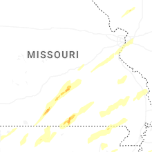


Connect with Interactive Hail Maps