

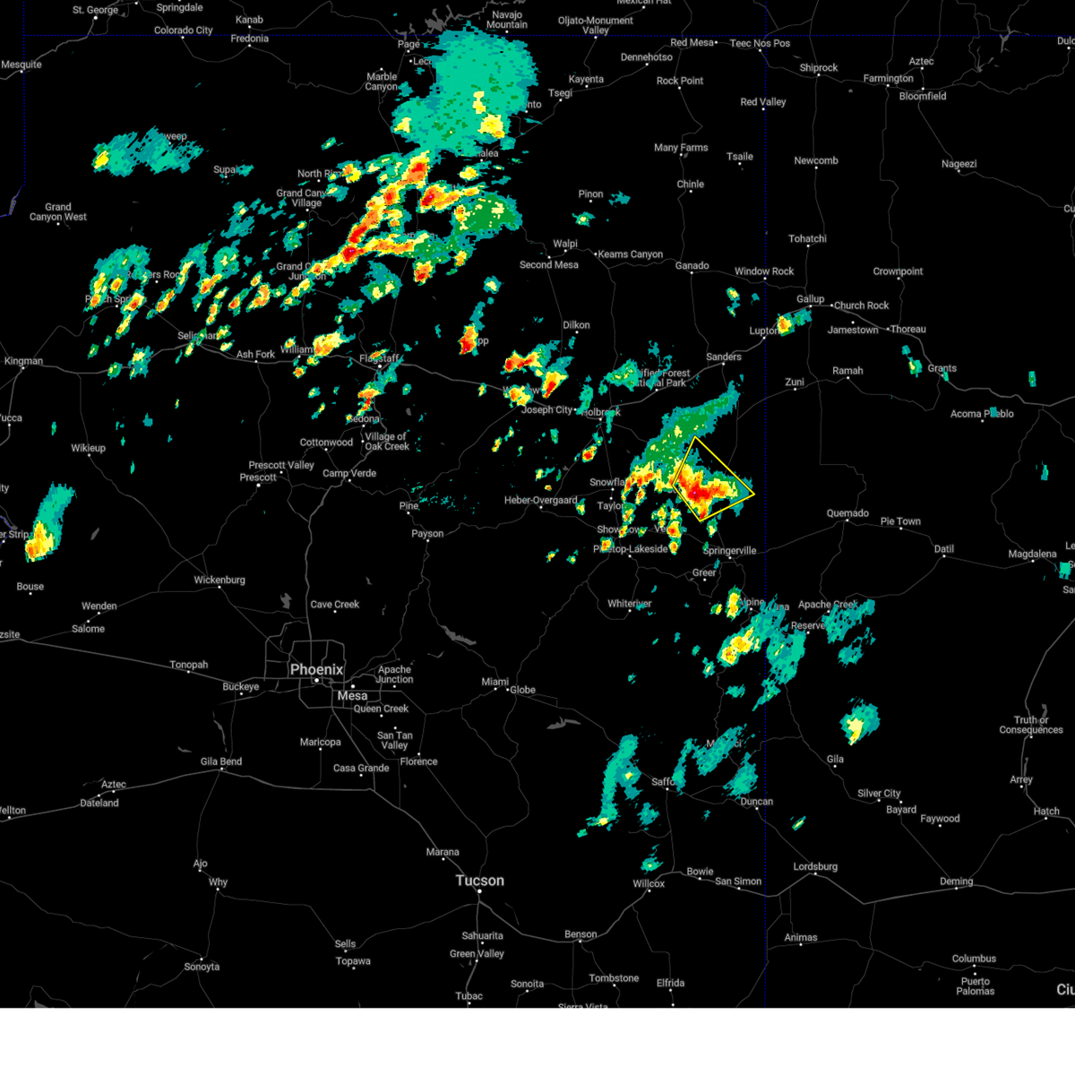
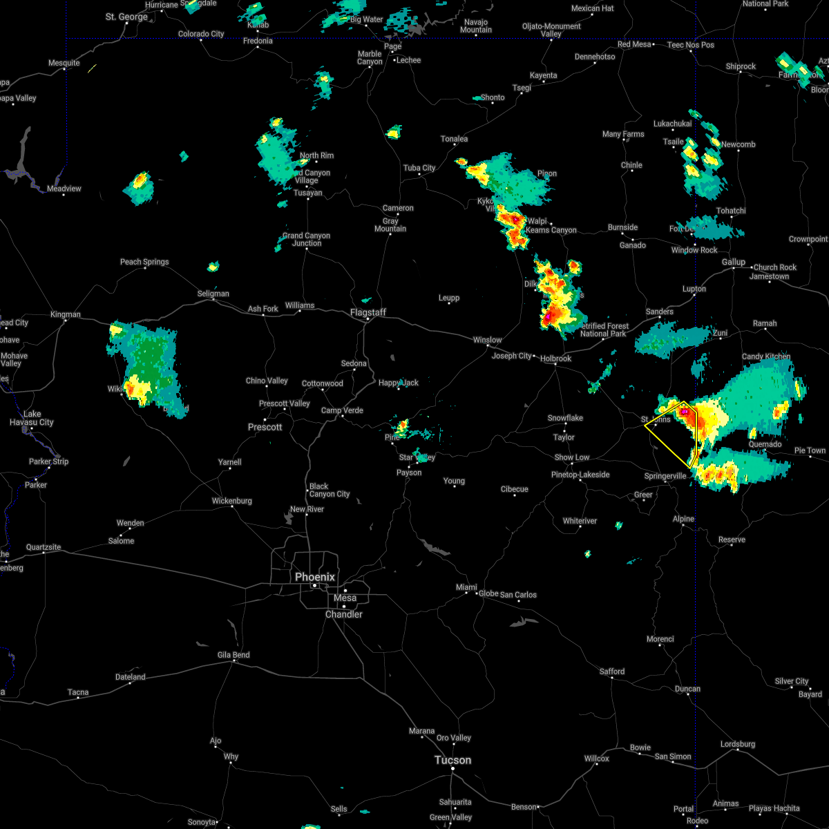
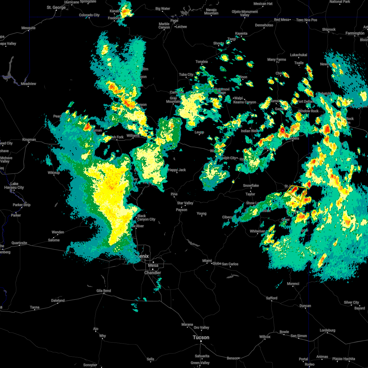
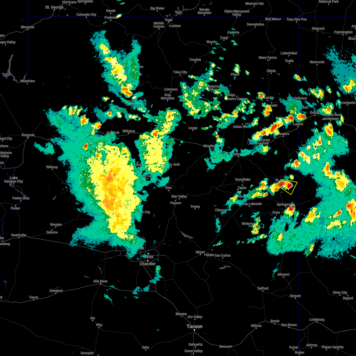
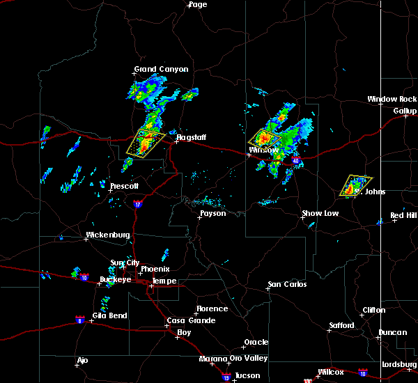
Hail Map for St. Johns, AZ
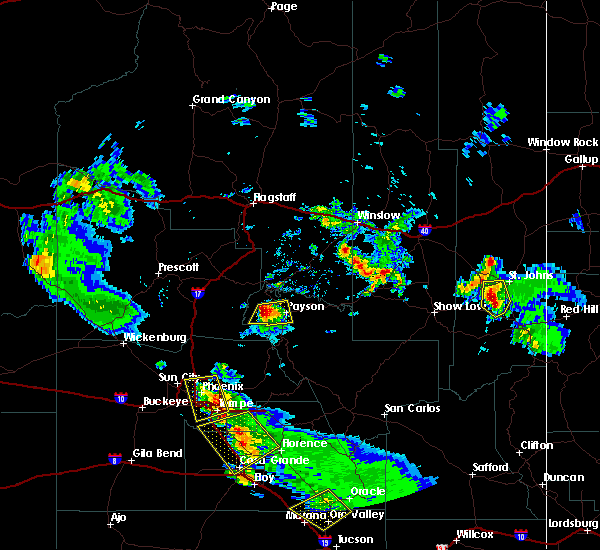
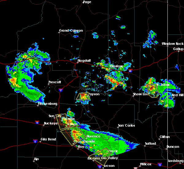
The St. Johns, AZ area has had 0 reports of on-the-ground hail by trained spotters, and has been under severe weather warnings 6 times during the past 12 months. Doppler radar has detected hail at or near St. Johns, AZ on 29 occasions, including 3 occasions during the past year.
| Name: | St. Johns, AZ |
| Where Located: | 41.9 miles ENE of Show Low, AZ |
| Map: | Google Map for St. Johns, AZ |
| Population: | 3480 |
| Housing Units: | 1476 |
| More Info: | Search Google for St. Johns, AZ |
5
The Top Recent Hail Date for St. Johns, AZ is Saturday, July 27, 2024 (2nd out of 29)

Hail and Wind Damage Spotted near St. Johns, AZ
| Date / Time | Report Details |
|---|---|
| 7/24/2024 10:13 PM MST |
 The storm which prompted the warning has weakened below severe limits, and no longer poses an immediate threat to life or property. therefore, the warning will be allowed to expire. however, gusty winds and heavy rain are still possible with this thunderstorm. The storm which prompted the warning has weakened below severe limits, and no longer poses an immediate threat to life or property. therefore, the warning will be allowed to expire. however, gusty winds and heavy rain are still possible with this thunderstorm.
|
| 7/24/2024 10:01 PM MST |
 At 1001 pm mst, a severe thunderstorm was located near estrella mountain park, or near avondale, moving south at 10 mph (radar indicated). Hazards include 60 mph wind gusts and penny size hail. Expect damage to roofs, siding, and trees. Locations impacted include, avondale, phoenix international raceway, and komatke. At 1001 pm mst, a severe thunderstorm was located near estrella mountain park, or near avondale, moving south at 10 mph (radar indicated). Hazards include 60 mph wind gusts and penny size hail. Expect damage to roofs, siding, and trees. Locations impacted include, avondale, phoenix international raceway, and komatke.
|
| 7/24/2024 9:27 PM MST |
 Svrpsr the national weather service in phoenix has issued a * severe thunderstorm warning for, maricopa county in south central arizona, pinal county in southeastern arizona, * until 1015 pm mst. * at 927 pm mst, a severe thunderstorm was located near tolleson, moving south at 15 mph (radar indicated). Hazards include 60 mph wind gusts and penny size hail. expect damage to roofs, siding, and trees Svrpsr the national weather service in phoenix has issued a * severe thunderstorm warning for, maricopa county in south central arizona, pinal county in southeastern arizona, * until 1015 pm mst. * at 927 pm mst, a severe thunderstorm was located near tolleson, moving south at 15 mph (radar indicated). Hazards include 60 mph wind gusts and penny size hail. expect damage to roofs, siding, and trees
|
| 7/24/2024 8:55 PM MST |
 At 855 pm mst, a severe thunderstorm was located near laveen, moving south at 10 mph (radar indicated). Hazards include 70 mph wind gusts and penny size hail. Expect considerable tree damage. damage is likely to mobile homes, roofs, and outbuildings. locations impacted include, phoenix, glendale, avondale, tolleson, youngtown, laveen, cashion, sun city, glendale sports complex, south phoenix, north mountain park, arizona state fairgrounds, south mountain park, phoenix international raceway, and downtown peoria. this includes the following highways, az interstate 10 between mile markers 131 and 147. az interstate 17 between mile markers 195 and 209. Us highway 60 between mile markers 150 and 160. At 855 pm mst, a severe thunderstorm was located near laveen, moving south at 10 mph (radar indicated). Hazards include 70 mph wind gusts and penny size hail. Expect considerable tree damage. damage is likely to mobile homes, roofs, and outbuildings. locations impacted include, phoenix, glendale, avondale, tolleson, youngtown, laveen, cashion, sun city, glendale sports complex, south phoenix, north mountain park, arizona state fairgrounds, south mountain park, phoenix international raceway, and downtown peoria. this includes the following highways, az interstate 10 between mile markers 131 and 147. az interstate 17 between mile markers 195 and 209. Us highway 60 between mile markers 150 and 160.
|
| 7/24/2024 8:52 PM MST |
 Svrpsr the national weather service in phoenix has issued a * severe thunderstorm warning for, maricopa county in south central arizona, * until 930 pm mst. * at 852 pm mst, a severe thunderstorm was located near laveen, moving south at 10 mph (radar indicated). Hazards include 60 mph wind gusts and penny size hail. expect damage to roofs, siding, and trees Svrpsr the national weather service in phoenix has issued a * severe thunderstorm warning for, maricopa county in south central arizona, * until 930 pm mst. * at 852 pm mst, a severe thunderstorm was located near laveen, moving south at 10 mph (radar indicated). Hazards include 60 mph wind gusts and penny size hail. expect damage to roofs, siding, and trees
|
| 7/14/2024 11:02 PM MST |
 Svrpsr the national weather service in phoenix has issued a * severe thunderstorm warning for, maricopa county in south central arizona, pinal county in southeastern arizona, * until 1145 pm mst. * at 1102 pm mst, a severe thunderstorm was located 9 miles southeast of estrella mountain park, or 11 miles southeast of avondale, moving northwest at 5 mph (radar indicated). Hazards include 60 mph wind gusts and penny size hail. expect damage to roofs, siding, and trees Svrpsr the national weather service in phoenix has issued a * severe thunderstorm warning for, maricopa county in south central arizona, pinal county in southeastern arizona, * until 1145 pm mst. * at 1102 pm mst, a severe thunderstorm was located 9 miles southeast of estrella mountain park, or 11 miles southeast of avondale, moving northwest at 5 mph (radar indicated). Hazards include 60 mph wind gusts and penny size hail. expect damage to roofs, siding, and trees
|
| 8/31/2023 9:41 PM MST |
 The severe thunderstorm warning for maricopa and pinal counties will expire at 945 pm mst, the storm which prompted the warning has weakened below severe limits, and no longer poses an immediate threat to life or property. therefore, the warning will be allowed to expire. The severe thunderstorm warning for maricopa and pinal counties will expire at 945 pm mst, the storm which prompted the warning has weakened below severe limits, and no longer poses an immediate threat to life or property. therefore, the warning will be allowed to expire.
|
| 8/31/2023 8:36 PM MST |
 At 835 pm mst, a severe thunderstorm was located over laveen, moving northwest at 5 mph (radar indicated). Hazards include 60 mph wind gusts. expect damage to roofs, siding, and trees At 835 pm mst, a severe thunderstorm was located over laveen, moving northwest at 5 mph (radar indicated). Hazards include 60 mph wind gusts. expect damage to roofs, siding, and trees
|
| 8/10/2023 4:26 PM MST |
 At 425 pm mst, a severe thunderstorm was located near saint johns, or 32 miles northeast of show low, moving northeast at 20 mph (radar indicated). Hazards include 60 mph wind gusts and quarter size hail. Hail damage to vehicles is expected. expect wind damage to roofs, siding, and trees. locations impacted include, st. johns, saint johns, st johns industrial air park, concho, and zion reservoir. this includes the following highways, highway 180 191 between mile markers 371 and 379. highway 191 161 between mile markers 316 and 325. highway 180 between mile markers 346 and 368. state route 61 between mile markers 372 and 381. hail threat, radar indicated max hail size, 1. 00 in wind threat, radar indicated max wind gust, 60 mph. At 425 pm mst, a severe thunderstorm was located near saint johns, or 32 miles northeast of show low, moving northeast at 20 mph (radar indicated). Hazards include 60 mph wind gusts and quarter size hail. Hail damage to vehicles is expected. expect wind damage to roofs, siding, and trees. locations impacted include, st. johns, saint johns, st johns industrial air park, concho, and zion reservoir. this includes the following highways, highway 180 191 between mile markers 371 and 379. highway 191 161 between mile markers 316 and 325. highway 180 between mile markers 346 and 368. state route 61 between mile markers 372 and 381. hail threat, radar indicated max hail size, 1. 00 in wind threat, radar indicated max wind gust, 60 mph.
|
| 8/10/2023 4:12 PM MST |
 At 411 pm mst, a severe thunderstorm was located 7 miles northwest of concho, or 27 miles northeast of show low, moving northeast at 20 mph (radar indicated). Hazards include 60 mph wind gusts and quarter size hail. Hail damage to vehicles is expected. Expect wind damage to roofs, siding, and trees. At 411 pm mst, a severe thunderstorm was located 7 miles northwest of concho, or 27 miles northeast of show low, moving northeast at 20 mph (radar indicated). Hazards include 60 mph wind gusts and quarter size hail. Hail damage to vehicles is expected. Expect wind damage to roofs, siding, and trees.
|
| 10/15/2022 1:39 PM MST |
 At 139 pm mst, severe thunderstorms were located along a line extending from phoenix to near tolleson to 7 miles south of estrella mountain park, moving northwest at 40 mph (radar indicated). Hazards include 60 mph wind gusts. Expect damage to roofs, siding, and trees. locations impacted include, phoenix, glendale, peoria, surprise, avondale, goodyear, buckeye, el mirage, tolleson, youngtown, sun city west, waddell, laveen, cashion and sun city. this includes the following highways, az interstate 10 between mile markers 115 and 152. az interstate 17 between mile markers 195 and 210. az route 51 near mile marker 1. hail threat, radar indicated max hail size, <. 75 in wind threat, radar indicated max wind gust, 60 mph. At 139 pm mst, severe thunderstorms were located along a line extending from phoenix to near tolleson to 7 miles south of estrella mountain park, moving northwest at 40 mph (radar indicated). Hazards include 60 mph wind gusts. Expect damage to roofs, siding, and trees. locations impacted include, phoenix, glendale, peoria, surprise, avondale, goodyear, buckeye, el mirage, tolleson, youngtown, sun city west, waddell, laveen, cashion and sun city. this includes the following highways, az interstate 10 between mile markers 115 and 152. az interstate 17 between mile markers 195 and 210. az route 51 near mile marker 1. hail threat, radar indicated max hail size, <. 75 in wind threat, radar indicated max wind gust, 60 mph.
|
| 10/15/2022 1:27 PM MST |
 At 126 pm mst, severe thunderstorms were located along a line extending from downtown phoenix to near south mountain park to 8 miles east of estrella, moving northwest at 25 mph (radar indicated). Hazards include 60 mph wind gusts. blowing dust with visibility as low as one mile. expect damage to roofs, siding, and trees At 126 pm mst, severe thunderstorms were located along a line extending from downtown phoenix to near south mountain park to 8 miles east of estrella, moving northwest at 25 mph (radar indicated). Hazards include 60 mph wind gusts. blowing dust with visibility as low as one mile. expect damage to roofs, siding, and trees
|
| 9/11/2022 9:03 PM MST |
 At 903 pm mst, a severe thunderstorm was located near tolleson, moving northwest at 20 mph (radar indicated). Hazards include 60 mph wind gusts and penny size hail. expect damage to roofs, siding, and trees At 903 pm mst, a severe thunderstorm was located near tolleson, moving northwest at 20 mph (radar indicated). Hazards include 60 mph wind gusts and penny size hail. expect damage to roofs, siding, and trees
|
| 8/21/2022 6:54 PM MST | The severe thunderstorm warning for maricopa and pinal counties will expire at 700 pm mst, the storms which prompted the warning have weakened below severe limits, and no longer pose an immediate threat to life or property. therefore, the warning will be allowed to expire. however gusty winds and heavy rain are still possible with these thunderstorms. |
| 8/21/2022 6:07 PM MST | At 607 pm mst, severe thunderstorms were located along a line extending from paradise valley to granite reef dam, moving south at 30 mph (radar indicated). Hazards include 60 mph wind gusts. expect damage to roofs, siding, and trees |
| 8/20/2022 9:54 PM MST |
 The severe thunderstorm warning for maricopa and pinal counties will expire at 1000 pm mst, the storms which prompted the warning have weakened below severe limits, and no longer pose an immediate threat to life or property. therefore, the warning will be allowed to expire. however gusty winds and heavy rain are still possible with these thunderstorms. The severe thunderstorm warning for maricopa and pinal counties will expire at 1000 pm mst, the storms which prompted the warning have weakened below severe limits, and no longer pose an immediate threat to life or property. therefore, the warning will be allowed to expire. however gusty winds and heavy rain are still possible with these thunderstorms.
|
| 8/20/2022 9:43 PM MST |
 At 942 pm mst, severe thunderstorms were located along a line extending from painted rock dam to 6 miles south of estrella mountain park to laveen, moving south at 30 mph (radar indicated). Hazards include 60 mph wind gusts. Expect damage to roofs, siding, and trees. locations impacted include, phoenix, chandler, glendale, tempe, avondale, goodyear, buckeye, tolleson, laveen, cashion, litchfield park, palo verde, south phoenix, liberty and arizona state fairgrounds. this includes the following highways, az interstate 10 between mile markers 101 and 153, and between mile markers 157 and 162. az interstate 17 between mile markers 195 and 206. az route 51 between mile markers 1 and 5. hail threat, radar indicated max hail size, <. 75 in wind threat, radar indicated max wind gust, 60 mph. At 942 pm mst, severe thunderstorms were located along a line extending from painted rock dam to 6 miles south of estrella mountain park to laveen, moving south at 30 mph (radar indicated). Hazards include 60 mph wind gusts. Expect damage to roofs, siding, and trees. locations impacted include, phoenix, chandler, glendale, tempe, avondale, goodyear, buckeye, tolleson, laveen, cashion, litchfield park, palo verde, south phoenix, liberty and arizona state fairgrounds. this includes the following highways, az interstate 10 between mile markers 101 and 153, and between mile markers 157 and 162. az interstate 17 between mile markers 195 and 206. az route 51 between mile markers 1 and 5. hail threat, radar indicated max hail size, <. 75 in wind threat, radar indicated max wind gust, 60 mph.
|
| 8/20/2022 9:14 PM MST |
 At 913 pm mst, severe thunderstorms were located along a line extending from 6 miles northwest of buckeye to tolleson to near scottsdale airport, moving south at 15 mph (radar indicated). Hazards include 60 mph wind gusts. expect damage to roofs, siding, and trees At 913 pm mst, severe thunderstorms were located along a line extending from 6 miles northwest of buckeye to tolleson to near scottsdale airport, moving south at 15 mph (radar indicated). Hazards include 60 mph wind gusts. expect damage to roofs, siding, and trees
|
| 8/20/2022 8:56 PM MST |
 At 856 pm mst, a severe thunderstorm was located near white tank mountain park, or 9 miles northwest of goodyear, moving south at 20 mph (radar indicated). Hazards include 60 mph wind gusts. Expect damage to roofs, siding, and trees. locations impacted include, phoenix, glendale, peoria, surprise, avondale, goodyear, buckeye, el mirage, tolleson, youngtown, sun city west, waddell, cashion, sun city and litchfield park. this includes the following highways, az interstate 10 between mile markers 100 and 140. us highway 60 between mile markers 139 and 156. az route 101 between mile markers 2 and 17. hail threat, radar indicated max hail size, <. 75 in wind threat, radar indicated max wind gust, 60 mph. At 856 pm mst, a severe thunderstorm was located near white tank mountain park, or 9 miles northwest of goodyear, moving south at 20 mph (radar indicated). Hazards include 60 mph wind gusts. Expect damage to roofs, siding, and trees. locations impacted include, phoenix, glendale, peoria, surprise, avondale, goodyear, buckeye, el mirage, tolleson, youngtown, sun city west, waddell, cashion, sun city and litchfield park. this includes the following highways, az interstate 10 between mile markers 100 and 140. us highway 60 between mile markers 139 and 156. az route 101 between mile markers 2 and 17. hail threat, radar indicated max hail size, <. 75 in wind threat, radar indicated max wind gust, 60 mph.
|
| 8/20/2022 8:35 PM MST |
 At 835 pm mst, a severe thunderstorm was located near white tank mountain park, or near waddell, moving south at 10 mph (radar indicated). Hazards include 60 mph wind gusts. expect damage to roofs, siding, and trees At 835 pm mst, a severe thunderstorm was located near white tank mountain park, or near waddell, moving south at 10 mph (radar indicated). Hazards include 60 mph wind gusts. expect damage to roofs, siding, and trees
|
| 8/17/2022 3:44 PM MST |
 At 344 pm mst, a severe thunderstorm was located over luke afb, or near waddell, moving south at 10 mph (radar indicated). Hazards include 60 mph wind gusts. Expect damage to roofs, siding, and trees. locations impacted include, glendale, surprise, avondale, goodyear, buckeye, el mirage, tolleson, youngtown, waddell, cashion, sun city, litchfield park, palo verde, perryville and luke afb. this includes the following highways, az interstate 10 between mile markers 112 and 135. us highway 60 between mile markers 143 and 146. az route 101 between mile markers 2 and 6. hail threat, radar indicated max hail size, <. 75 in wind threat, radar indicated max wind gust, 60 mph. At 344 pm mst, a severe thunderstorm was located over luke afb, or near waddell, moving south at 10 mph (radar indicated). Hazards include 60 mph wind gusts. Expect damage to roofs, siding, and trees. locations impacted include, glendale, surprise, avondale, goodyear, buckeye, el mirage, tolleson, youngtown, waddell, cashion, sun city, litchfield park, palo verde, perryville and luke afb. this includes the following highways, az interstate 10 between mile markers 112 and 135. us highway 60 between mile markers 143 and 146. az route 101 between mile markers 2 and 6. hail threat, radar indicated max hail size, <. 75 in wind threat, radar indicated max wind gust, 60 mph.
|
| 8/17/2022 3:31 PM MST |
 At 331 pm mst, a severe thunderstorm was located over luke afb, or over waddell, moving south at 10 mph (radar indicated). Hazards include 60 mph wind gusts. expect damage to roofs, siding, and trees At 331 pm mst, a severe thunderstorm was located over luke afb, or over waddell, moving south at 10 mph (radar indicated). Hazards include 60 mph wind gusts. expect damage to roofs, siding, and trees
|
| 8/14/2022 4:43 PM MST |
 At 442 pm mst, a severe thunderstorm was located near estrella mountain park, or 11 miles southeast of avondale, moving northeast at 10 mph (radar indicated). Hazards include 60 mph wind gusts and quarter size hail. Hail damage to vehicles is expected. Expect wind damage to roofs, siding, and trees. At 442 pm mst, a severe thunderstorm was located near estrella mountain park, or 11 miles southeast of avondale, moving northeast at 10 mph (radar indicated). Hazards include 60 mph wind gusts and quarter size hail. Hail damage to vehicles is expected. Expect wind damage to roofs, siding, and trees.
|
| 8/14/2022 4:28 PM MST |
 At 428 pm mst, a severe thunderstorm was located 9 miles south of estrella mountain ranch, or 14 miles southeast of buckeye, and is nearly stationary (radar indicated). Hazards include 60 mph wind gusts and penny size hail. Expect damage to roofs, siding, and trees. locations impacted include, phoenix, avondale, goodyear, buckeye, tolleson, cashion, estrella, litchfield park, palo verde, perryville, liberty, phoenix international raceway, estrella sailport, sonoran national monument and estrella mountain park. this includes the following highways, az interstate 10 between mile markers 111 and 138. az route 101 between mile markers 2 and 3. az route 238 between mile markers 12 and 39. hail threat, radar indicated max hail size, 0. 75 in wind threat, radar indicated max wind gust, 60 mph. At 428 pm mst, a severe thunderstorm was located 9 miles south of estrella mountain ranch, or 14 miles southeast of buckeye, and is nearly stationary (radar indicated). Hazards include 60 mph wind gusts and penny size hail. Expect damage to roofs, siding, and trees. locations impacted include, phoenix, avondale, goodyear, buckeye, tolleson, cashion, estrella, litchfield park, palo verde, perryville, liberty, phoenix international raceway, estrella sailport, sonoran national monument and estrella mountain park. this includes the following highways, az interstate 10 between mile markers 111 and 138. az route 101 between mile markers 2 and 3. az route 238 between mile markers 12 and 39. hail threat, radar indicated max hail size, 0. 75 in wind threat, radar indicated max wind gust, 60 mph.
|
| 8/14/2022 4:13 PM MST |
 At 413 pm mst, a severe thunderstorm was located 9 miles south of estrella mountain ranch, or 14 miles southeast of buckeye, and is nearly stationary (radar indicated). Hazards include 60 mph wind gusts and penny size hail. expect damage to roofs, siding, and trees At 413 pm mst, a severe thunderstorm was located 9 miles south of estrella mountain ranch, or 14 miles southeast of buckeye, and is nearly stationary (radar indicated). Hazards include 60 mph wind gusts and penny size hail. expect damage to roofs, siding, and trees
|
| 8/12/2022 3:18 PM MST |
 At 318 pm mst, severe thunderstorms were located along a line extending from paradise valley to salt river indian community to downtown mesa, moving west at 35 mph (radar indicated). Hazards include 60 mph wind gusts. expect damage to roofs, siding, and trees At 318 pm mst, severe thunderstorms were located along a line extending from paradise valley to salt river indian community to downtown mesa, moving west at 35 mph (radar indicated). Hazards include 60 mph wind gusts. expect damage to roofs, siding, and trees
|
| 7/30/2022 5:02 PM MST |
 At 501 pm mst, severe thunderstorms were located along a line extending from queen creek to near estrella sailport, moving northwest at 15 mph (radar indicated). Hazards include 60 mph wind gusts. expect damage to roofs, siding, and trees At 501 pm mst, severe thunderstorms were located along a line extending from queen creek to near estrella sailport, moving northwest at 15 mph (radar indicated). Hazards include 60 mph wind gusts. expect damage to roofs, siding, and trees
|
| 7/17/2022 9:31 PM MST |
 At 931 pm mst, severe thunderstorms were located along a line extending from near peoria to luke afb to estrella mountain park, moving northwest at 25 mph (radar indicated). Hazards include 60 mph wind gusts. Expect damage to roofs, siding, and trees. locations impacted include, phoenix, glendale, peoria, surprise, avondale, goodyear, buckeye, el mirage, tolleson, youngtown, sun city west, waddell, laveen, cashion and sun city. this includes the following highways, az interstate 10 between mile markers 117 and 143. az interstate 17 between mile markers 198 and 222. us highway 60 between mile markers 131 and 160. hail threat, radar indicated max hail size, <. 75 in wind threat, radar indicated max wind gust, 60 mph. At 931 pm mst, severe thunderstorms were located along a line extending from near peoria to luke afb to estrella mountain park, moving northwest at 25 mph (radar indicated). Hazards include 60 mph wind gusts. Expect damage to roofs, siding, and trees. locations impacted include, phoenix, glendale, peoria, surprise, avondale, goodyear, buckeye, el mirage, tolleson, youngtown, sun city west, waddell, laveen, cashion and sun city. this includes the following highways, az interstate 10 between mile markers 117 and 143. az interstate 17 between mile markers 198 and 222. us highway 60 between mile markers 131 and 160. hail threat, radar indicated max hail size, <. 75 in wind threat, radar indicated max wind gust, 60 mph.
|
| 7/17/2022 9:16 PM MST |
 At 916 pm mst, severe thunderstorms were located along a line extending from near deer valley airport to near downtown peoria to near tolleson, moving west at 30 mph (radar indicated). Hazards include 60 mph wind gusts. Expect damage to roofs, siding, and trees. locations impacted include, phoenix, chandler, glendale, scottsdale, tempe, peoria, surprise, avondale, goodyear, buckeye, el mirage, paradise valley, tolleson, youngtown and waddell. this includes the following highways, az interstate 10 between mile markers 117 and 161. az interstate 17 between mile markers 195 and 222. az route 51 between mile markers 1 and 15. hail threat, radar indicated max hail size, <. 75 in wind threat, radar indicated max wind gust, 60 mph. At 916 pm mst, severe thunderstorms were located along a line extending from near deer valley airport to near downtown peoria to near tolleson, moving west at 30 mph (radar indicated). Hazards include 60 mph wind gusts. Expect damage to roofs, siding, and trees. locations impacted include, phoenix, chandler, glendale, scottsdale, tempe, peoria, surprise, avondale, goodyear, buckeye, el mirage, paradise valley, tolleson, youngtown and waddell. this includes the following highways, az interstate 10 between mile markers 117 and 161. az interstate 17 between mile markers 195 and 222. az route 51 between mile markers 1 and 15. hail threat, radar indicated max hail size, <. 75 in wind threat, radar indicated max wind gust, 60 mph.
|
| 7/17/2022 8:58 PM MST |
 At 858 pm mst, severe thunderstorms were located along a line extending from desert ridge marketplace to metro center mall to south mountain park, moving west at 30 mph (radar indicated). Hazards include 60 mph wind gusts. expect damage to roofs, siding, and trees At 858 pm mst, severe thunderstorms were located along a line extending from desert ridge marketplace to metro center mall to south mountain park, moving west at 30 mph (radar indicated). Hazards include 60 mph wind gusts. expect damage to roofs, siding, and trees
|
| 7/16/2022 8:02 PM MST |
 At 802 pm mst, severe thunderstorms were located along a line extending from near metro center mall to near laveen to 6 miles southeast of tolleson, moving west at 20 mph (radar indicated). Hazards include 60 mph wind gusts. Expect damage to roofs, siding, and trees. locations impacted include, phoenix, glendale, tolleson, laveen, south mountain park, downtown phoenix, south phoenix, arizona state fairgrounds and downtown glendale. this includes the following highways, az interstate 10 between mile markers 135 and 146. az interstate 17 between mile markers 196 and 207. az route 51 near mile marker 5. hail threat, radar indicated max hail size, <. 75 in wind threat, radar indicated max wind gust, 60 mph. At 802 pm mst, severe thunderstorms were located along a line extending from near metro center mall to near laveen to 6 miles southeast of tolleson, moving west at 20 mph (radar indicated). Hazards include 60 mph wind gusts. Expect damage to roofs, siding, and trees. locations impacted include, phoenix, glendale, tolleson, laveen, south mountain park, downtown phoenix, south phoenix, arizona state fairgrounds and downtown glendale. this includes the following highways, az interstate 10 between mile markers 135 and 146. az interstate 17 between mile markers 196 and 207. az route 51 near mile marker 5. hail threat, radar indicated max hail size, <. 75 in wind threat, radar indicated max wind gust, 60 mph.
|
| 7/16/2022 7:45 PM MST |
 At 744 pm mst, severe thunderstorms were located along a line extending from north mountain park to downtown phoenix to south mountain park, moving west at 20 mph (radar indicated). Hazards include 60 mph wind gusts. expect damage to roofs, siding, and trees At 744 pm mst, severe thunderstorms were located along a line extending from north mountain park to downtown phoenix to south mountain park, moving west at 20 mph (radar indicated). Hazards include 60 mph wind gusts. expect damage to roofs, siding, and trees
|
| 6/26/2022 5:29 PM MST |
 At 528 pm mst, a severe thunderstorm was located over laveen, moving northeast at 5 mph (radar indicated). Hazards include 60 mph wind gusts. Expect damage to roofs, siding, and trees. locations impacted include, phoenix, glendale, scottsdale, tempe, avondale, goodyear, paradise valley, tolleson, laveen, cashion, papago park, piestewa peak park, south phoenix, arizona state fairgrounds and south mountain park. this includes the following highways, az interstate 10 between mile markers 130 and 160. az interstate 17 between mile markers 195 and 207. az route 51 between mile markers 1 and 6. hail threat, radar indicated max hail size, <. 75 in wind threat, radar indicated max wind gust, 60 mph. At 528 pm mst, a severe thunderstorm was located over laveen, moving northeast at 5 mph (radar indicated). Hazards include 60 mph wind gusts. Expect damage to roofs, siding, and trees. locations impacted include, phoenix, glendale, scottsdale, tempe, avondale, goodyear, paradise valley, tolleson, laveen, cashion, papago park, piestewa peak park, south phoenix, arizona state fairgrounds and south mountain park. this includes the following highways, az interstate 10 between mile markers 130 and 160. az interstate 17 between mile markers 195 and 207. az route 51 between mile markers 1 and 6. hail threat, radar indicated max hail size, <. 75 in wind threat, radar indicated max wind gust, 60 mph.
|
| 6/26/2022 4:53 PM MST |
 At 453 pm mst, a severe thunderstorm was located over arizona state fairgrounds, or near laveen, and is nearly stationary (radar indicated). Hazards include 60 mph wind gusts. expect damage to roofs, siding, and trees At 453 pm mst, a severe thunderstorm was located over arizona state fairgrounds, or near laveen, and is nearly stationary (radar indicated). Hazards include 60 mph wind gusts. expect damage to roofs, siding, and trees
|
| 6/23/2022 4:52 PM MST |
 At 451 pm mst, a severe thunderstorm was located over arizona mills mall, or over tempe, moving northeast at 20 mph (radar indicated). Hazards include 60 mph wind gusts. Expect damage to roofs, siding, and trees. locations impacted include, phoenix, glendale, tempe, tolleson, laveen, papago park, arizona mills mall, south phoenix, arizona state fairgrounds, south mountain park, downtown phoenix, arizona state university, sky harbor airport, guadalupe and komatke. this includes the following highways, az interstate 10 between mile markers 135 and 158. az interstate 17 between mile markers 195 and 204. az route 51 between mile markers 1 and 3. hail threat, radar indicated max hail size, <. 75 in wind threat, radar indicated max wind gust, 60 mph. At 451 pm mst, a severe thunderstorm was located over arizona mills mall, or over tempe, moving northeast at 20 mph (radar indicated). Hazards include 60 mph wind gusts. Expect damage to roofs, siding, and trees. locations impacted include, phoenix, glendale, tempe, tolleson, laveen, papago park, arizona mills mall, south phoenix, arizona state fairgrounds, south mountain park, downtown phoenix, arizona state university, sky harbor airport, guadalupe and komatke. this includes the following highways, az interstate 10 between mile markers 135 and 158. az interstate 17 between mile markers 195 and 204. az route 51 between mile markers 1 and 3. hail threat, radar indicated max hail size, <. 75 in wind threat, radar indicated max wind gust, 60 mph.
|
| 6/23/2022 4:33 PM MST |
 At 432 pm mst, a severe thunderstorm was located near south mountain park, or near laveen, moving northeast at 15 mph (radar indicated). Hazards include 60 mph wind gusts. expect damage to roofs, siding, and trees At 432 pm mst, a severe thunderstorm was located near south mountain park, or near laveen, moving northeast at 15 mph (radar indicated). Hazards include 60 mph wind gusts. expect damage to roofs, siding, and trees
|
| 6/23/2022 3:53 PM MST |
 At 353 pm mst, a severe thunderstorm was located over laveen, moving northeast at 15 mph (radar indicated). Hazards include 60 mph wind gusts. expect damage to roofs, siding, and trees At 353 pm mst, a severe thunderstorm was located over laveen, moving northeast at 15 mph (radar indicated). Hazards include 60 mph wind gusts. expect damage to roofs, siding, and trees
|
| 10/5/2021 5:49 PM MST |
 At 549 pm mst, a severe thunderstorm was located near south mountain park, or 7 miles south of laveen, moving east at 30 mph (radar indicated). Hazards include 60 mph wind gusts and half dollar size hail. Hail damage to vehicles is expected. expect wind damage to roofs, siding, and trees. locations impacted include, phoenix, chandler, south mountain park, south phoenix and komatke. this includes the following highways, az interstate 10 between mile markers 159 and 162. az route 202 between mile markers 53 and 55. hail threat, radar indicated max hail size, 1. 25 in wind threat, radar indicated max wind gust, 60 mph. At 549 pm mst, a severe thunderstorm was located near south mountain park, or 7 miles south of laveen, moving east at 30 mph (radar indicated). Hazards include 60 mph wind gusts and half dollar size hail. Hail damage to vehicles is expected. expect wind damage to roofs, siding, and trees. locations impacted include, phoenix, chandler, south mountain park, south phoenix and komatke. this includes the following highways, az interstate 10 between mile markers 159 and 162. az route 202 between mile markers 53 and 55. hail threat, radar indicated max hail size, 1. 25 in wind threat, radar indicated max wind gust, 60 mph.
|
| 10/5/2021 5:38 PM MST |
 At 538 pm mst, a severe thunderstorm was located 7 miles southwest of south mountain park, or 10 miles south of laveen, moving northeast at 30 mph (radar indicated). Hazards include ping pong ball size hail and 60 mph wind gusts. People and animals outdoors will be injured. expect hail damage to roofs, siding, windows, and vehicles. expect wind damage to roofs, siding, and trees. locations impacted include, phoenix, chandler, avondale, sun lakes, south mountain park, south phoenix, firebird lake and komatke. this includes the following highways, az interstate 10 between mile markers 159 and 168. az route 202 between mile markers 53 and 55. Az route 347 between mile markers 184 and 189. At 538 pm mst, a severe thunderstorm was located 7 miles southwest of south mountain park, or 10 miles south of laveen, moving northeast at 30 mph (radar indicated). Hazards include ping pong ball size hail and 60 mph wind gusts. People and animals outdoors will be injured. expect hail damage to roofs, siding, windows, and vehicles. expect wind damage to roofs, siding, and trees. locations impacted include, phoenix, chandler, avondale, sun lakes, south mountain park, south phoenix, firebird lake and komatke. this includes the following highways, az interstate 10 between mile markers 159 and 168. az route 202 between mile markers 53 and 55. Az route 347 between mile markers 184 and 189.
|
| 10/5/2021 5:19 PM MST |
 At 518 pm mst, a severe thunderstorm was located 10 miles south of estrella mountain park, or 16 miles south of avondale, moving east at 35 mph (radar indicated). Hazards include two inch hail and 60 mph wind gusts. People and animals outdoors will be injured. expect hail damage to roofs, siding, windows, and vehicles. Expect wind damage to roofs, siding, and trees. At 518 pm mst, a severe thunderstorm was located 10 miles south of estrella mountain park, or 16 miles south of avondale, moving east at 35 mph (radar indicated). Hazards include two inch hail and 60 mph wind gusts. People and animals outdoors will be injured. expect hail damage to roofs, siding, windows, and vehicles. Expect wind damage to roofs, siding, and trees.
|
| 8/16/2021 11:41 PM MST |
 At 1140 pm mst, severe thunderstorms were located along a line extending from near white tank mountain park to near palo verde to 10 miles northeast of cotton center to near estrella to 11 miles west of chui-chu, moving southwest at 35 mph (radar indicated). Hazards include 70 mph wind gusts and nickel size hail. Expect considerable tree damage. Damage is likely to mobile homes, roofs, and outbuildings. At 1140 pm mst, severe thunderstorms were located along a line extending from near white tank mountain park to near palo verde to 10 miles northeast of cotton center to near estrella to 11 miles west of chui-chu, moving southwest at 35 mph (radar indicated). Hazards include 70 mph wind gusts and nickel size hail. Expect considerable tree damage. Damage is likely to mobile homes, roofs, and outbuildings.
|
| 8/16/2021 11:33 PM MST |
 At 1133 pm mst, severe thunderstorms were located along a line extending from near white tank mountain park to near liberty to 9 miles south of estrella mountain ranch to 7 miles west of estrella sailport to 8 miles northwest of chui-chu, moving southwest at 35 mph (radar indicated). Hazards include 70 mph wind gusts and nickel size hail. Expect considerable tree damage. damage is likely to mobile homes, roofs, and outbuildings. locations impacted include, phoenix, mesa, chandler, glendale, scottsdale, gilbert, tempe, peoria, surprise, avondale, goodyear, buckeye, casa grande, el mirage and paradise valley. this includes the following highways, az interstate 10 between mile markers 117 and 204. az interstate 17 between mile markers 195 and 219. az interstate 8 between mile markers 146 and 178. thunderstorm damage threat, considerable hail threat, radar indicated max hail size, 0. 88 in wind threat, radar indicated max wind gust, 70 mph. At 1133 pm mst, severe thunderstorms were located along a line extending from near white tank mountain park to near liberty to 9 miles south of estrella mountain ranch to 7 miles west of estrella sailport to 8 miles northwest of chui-chu, moving southwest at 35 mph (radar indicated). Hazards include 70 mph wind gusts and nickel size hail. Expect considerable tree damage. damage is likely to mobile homes, roofs, and outbuildings. locations impacted include, phoenix, mesa, chandler, glendale, scottsdale, gilbert, tempe, peoria, surprise, avondale, goodyear, buckeye, casa grande, el mirage and paradise valley. this includes the following highways, az interstate 10 between mile markers 117 and 204. az interstate 17 between mile markers 195 and 219. az interstate 8 between mile markers 146 and 178. thunderstorm damage threat, considerable hail threat, radar indicated max hail size, 0. 88 in wind threat, radar indicated max wind gust, 70 mph.
|
| 8/16/2021 10:54 PM MST |
 At 1054 pm mst, severe thunderstorms were located along a line extending from near deer valley airport to arizona state fairgrounds to south phoenix to 6 miles east of bapchule, moving southwest at 30 mph. these are destructive storms for phoenix metro area (radar indicated). Hazards include 80 mph wind gusts and quarter size hail. Flying debris will be dangerous to those caught without shelter. mobile homes will be heavily damaged. expect considerable damage to roofs, windows, and vehicles. Extensive tree damage and power outages are likely. At 1054 pm mst, severe thunderstorms were located along a line extending from near deer valley airport to arizona state fairgrounds to south phoenix to 6 miles east of bapchule, moving southwest at 30 mph. these are destructive storms for phoenix metro area (radar indicated). Hazards include 80 mph wind gusts and quarter size hail. Flying debris will be dangerous to those caught without shelter. mobile homes will be heavily damaged. expect considerable damage to roofs, windows, and vehicles. Extensive tree damage and power outages are likely.
|
| 8/15/2021 11:44 PM MST |
 At 1143 pm mst, a severe thunderstorm was located over laveen, moving southwest at 5 mph (radar indicated). Hazards include 60 mph wind gusts and penny size hail. expect damage to roofs, siding, and trees At 1143 pm mst, a severe thunderstorm was located over laveen, moving southwest at 5 mph (radar indicated). Hazards include 60 mph wind gusts and penny size hail. expect damage to roofs, siding, and trees
|
| 8/15/2021 5:24 PM MST |
 The severe thunderstorm warning for apache county will expire at 530 pm mst, the storm near st. johns which prompted the warning has weakened below severe limits. therefore, the warning will be allowed to expire. The severe thunderstorm warning for apache county will expire at 530 pm mst, the storm near st. johns which prompted the warning has weakened below severe limits. therefore, the warning will be allowed to expire.
|
| 8/15/2021 5:23 PM MST |
 The severe thunderstorm warning for apache county will expire at 530 pm mst, the storm in the area of st. johns which prompted the warning has weakened below severe limits. therefore, the warning will be allowed to expire. this storm is still be capable of producing heavy rain and cloud-to-ground lightning. The severe thunderstorm warning for apache county will expire at 530 pm mst, the storm in the area of st. johns which prompted the warning has weakened below severe limits. therefore, the warning will be allowed to expire. this storm is still be capable of producing heavy rain and cloud-to-ground lightning.
|
| 8/15/2021 4:49 PM MST |
 At 448 pm mst, a severe thunderstorm was located 16 miles east of st. johns, or 29 miles north of springerville, moving southwest at 15 mph (radar indicated). Hazards include 60 mph wind gusts and quarter size hail. Hail damage to vehicles is expected. Expect wind damage to roofs, siding, and trees. At 448 pm mst, a severe thunderstorm was located 16 miles east of st. johns, or 29 miles north of springerville, moving southwest at 15 mph (radar indicated). Hazards include 60 mph wind gusts and quarter size hail. Hail damage to vehicles is expected. Expect wind damage to roofs, siding, and trees.
|
| 8/13/2021 10:16 PM MST |
 At 1016 pm mst, a severe thunderstorm was located over metro center mall, or near glendale, moving west at 20 mph (radar indicated). Hazards include 60 mph wind gusts and nickel size hail. expect damage to roofs, siding, and trees At 1016 pm mst, a severe thunderstorm was located over metro center mall, or near glendale, moving west at 20 mph (radar indicated). Hazards include 60 mph wind gusts and nickel size hail. expect damage to roofs, siding, and trees
|
| 7/23/2021 6:24 PM MST |
 The severe thunderstorm warning for apache county will expire at 630 pm mst, the storm which prompted the warning in st. johns and the surrounding area has weakened below severe limits, and no longer poses an immediate threat to life or property. therefore, the warning will be allowed to expire. The severe thunderstorm warning for apache county will expire at 630 pm mst, the storm which prompted the warning in st. johns and the surrounding area has weakened below severe limits, and no longer poses an immediate threat to life or property. therefore, the warning will be allowed to expire.
|
| 7/23/2021 5:56 PM MST |
 At 556 pm mst, a severe thunderstorm was located 14 miles east of lyman lake state park, or 21 miles northeast of springerville, moving southeast at 15 mph (radar indicated). Hazards include quarter size hail and wind gusts to 45 mph. damage to vehicles is expected At 556 pm mst, a severe thunderstorm was located 14 miles east of lyman lake state park, or 21 miles northeast of springerville, moving southeast at 15 mph (radar indicated). Hazards include quarter size hail and wind gusts to 45 mph. damage to vehicles is expected
|
| 7/10/2021 8:41 PM MST |
 At 840 pm mst, the leading edge of very strong outflow winds from thunderstorms was located along a line extending from 7 miles west of south mountain park to 11 miles southeast of estrella mountain park to near estrella sailport to 11 miles east of freeman, moving west at 40 mph (radar indicated). Hazards include 70 mph wind gusts and penny size hail. Expect considerable tree damage. damage is likely to mobile homes, roofs, and outbuildings. locations impacted include, phoenix, mesa, chandler, glendale, scottsdale, gilbert, tempe, avondale, goodyear, buckeye, casa grande, apache junction, paradise valley, coolidge and tolleson. this includes the following highways, az interstate 10 between mile markers 121 and 199. az interstate 17 between mile markers 195 and 209. Az interstate 8 between mile markers 135 and 178. At 840 pm mst, the leading edge of very strong outflow winds from thunderstorms was located along a line extending from 7 miles west of south mountain park to 11 miles southeast of estrella mountain park to near estrella sailport to 11 miles east of freeman, moving west at 40 mph (radar indicated). Hazards include 70 mph wind gusts and penny size hail. Expect considerable tree damage. damage is likely to mobile homes, roofs, and outbuildings. locations impacted include, phoenix, mesa, chandler, glendale, scottsdale, gilbert, tempe, avondale, goodyear, buckeye, casa grande, apache junction, paradise valley, coolidge and tolleson. this includes the following highways, az interstate 10 between mile markers 121 and 199. az interstate 17 between mile markers 195 and 209. Az interstate 8 between mile markers 135 and 178.
|
| 7/10/2021 8:16 PM MST |
 At 816 pm mst, severe thunderstorms were located along a line extending from falcon field airport to queen creek to blackwater, moving west at 20 mph (radar indicated). Hazards include 60 mph wind gusts and penny size hail. expect damage to roofs, siding, and trees At 816 pm mst, severe thunderstorms were located along a line extending from falcon field airport to queen creek to blackwater, moving west at 20 mph (radar indicated). Hazards include 60 mph wind gusts and penny size hail. expect damage to roofs, siding, and trees
|
| 7/10/2021 7:45 PM MST |
 At 744 pm mst, severe thunderstorms were located along a line extending from downtown peoria to fiesta mall to near san tan mountain park, moving southwest at 40 mph (radar indicated). Hazards include 70 mph wind gusts and nickel size hail. Expect considerable tree damage. Damage is likely to mobile homes, roofs, and outbuildings. At 744 pm mst, severe thunderstorms were located along a line extending from downtown peoria to fiesta mall to near san tan mountain park, moving southwest at 40 mph (radar indicated). Hazards include 70 mph wind gusts and nickel size hail. Expect considerable tree damage. Damage is likely to mobile homes, roofs, and outbuildings.
|
| 7/9/2021 10:36 PM MST |
 At 1036 pm mst, severe thunderstorms were located along a line extending from 6 miles southwest of chandler fashion center mall to near maricopa to near casa grande, moving west at 55 mph (radar indicated). Hazards include 70 mph wind gusts. Expect considerable tree damage. damage is likely to mobile homes, roofs, and outbuildings. locations impacted include, phoenix, mesa, chandler, gilbert, tempe, casa grande, apache junction, florence, coolidge, gold canyon, sun lakes, east mesa, maricopa, queen creek and south phoenix. this includes the following highways, az interstate 10 between mile markers 154 and 197. az interstate 8 between mile markers 156 and 176. Us highway 60 between mile markers 173 and 207. At 1036 pm mst, severe thunderstorms were located along a line extending from 6 miles southwest of chandler fashion center mall to near maricopa to near casa grande, moving west at 55 mph (radar indicated). Hazards include 70 mph wind gusts. Expect considerable tree damage. damage is likely to mobile homes, roofs, and outbuildings. locations impacted include, phoenix, mesa, chandler, gilbert, tempe, casa grande, apache junction, florence, coolidge, gold canyon, sun lakes, east mesa, maricopa, queen creek and south phoenix. this includes the following highways, az interstate 10 between mile markers 154 and 197. az interstate 8 between mile markers 156 and 176. Us highway 60 between mile markers 173 and 207.
|
| 7/9/2021 10:30 PM MST |
 At 1030 pm mst, severe thunderstorms were located along a line extending from near falcon field airport to near chandler fashion center mall to sun lakes, moving west at 40 mph (radar indicated). Hazards include 70 mph wind gusts. Expect considerable tree damage. Damage is likely to mobile homes, roofs, and outbuildings. At 1030 pm mst, severe thunderstorms were located along a line extending from near falcon field airport to near chandler fashion center mall to sun lakes, moving west at 40 mph (radar indicated). Hazards include 70 mph wind gusts. Expect considerable tree damage. Damage is likely to mobile homes, roofs, and outbuildings.
|
| 7/9/2021 10:06 PM MST |
 At 1006 pm mst, severe thunderstorms were located along a line extending from near apache junction to near san tan valley to near florence, moving west at 55 mph (radar indicated). Hazards include 70 mph wind gusts and nickel size hail. Expect considerable tree damage. Damage is likely to mobile homes, roofs, and outbuildings. At 1006 pm mst, severe thunderstorms were located along a line extending from near apache junction to near san tan valley to near florence, moving west at 55 mph (radar indicated). Hazards include 70 mph wind gusts and nickel size hail. Expect considerable tree damage. Damage is likely to mobile homes, roofs, and outbuildings.
|
| 8/17/2020 7:50 PM MST |
 At 749 pm mst, a severe thunderstorm was located over laveen, moving west at 30 mph (radar indicated). Hazards include 60 mph wind gusts. Expect damage to roofs, siding, and trees. locations impacted include, phoenix, mesa, chandler, glendale, scottsdale, gilbert, tempe, paradise valley, laveen, tempe marketplace, papago park, piestewa peak park, salt river indian community, north mountain park and south phoenix. this includes the following highways, az interstate 10 between mile markers 137 and 164. az interstate 17 between mile markers 195 and 211. Az route 51 between mile markers 1 and 10. At 749 pm mst, a severe thunderstorm was located over laveen, moving west at 30 mph (radar indicated). Hazards include 60 mph wind gusts. Expect damage to roofs, siding, and trees. locations impacted include, phoenix, mesa, chandler, glendale, scottsdale, gilbert, tempe, paradise valley, laveen, tempe marketplace, papago park, piestewa peak park, salt river indian community, north mountain park and south phoenix. this includes the following highways, az interstate 10 between mile markers 137 and 164. az interstate 17 between mile markers 195 and 211. Az route 51 between mile markers 1 and 10.
|
| 8/17/2020 7:40 PM MST |
 At 739 pm mst, severe winds associated with a thunderstorm were located over sky harbor airport, or near laveen, moving west at 30 mph (radar indicated). Hazards include 60 mph wind gusts. expect damage to roofs, siding, and trees At 739 pm mst, severe winds associated with a thunderstorm were located over sky harbor airport, or near laveen, moving west at 30 mph (radar indicated). Hazards include 60 mph wind gusts. expect damage to roofs, siding, and trees
|
| 11/29/2019 3:45 AM MST |
 At 345 am mst, severe thunderstorms were located along a line extending from arrowhead mall to near phoenix international raceway to 10 miles northwest of estrella sailport, moving northeast at 50 mph (radar indicated). Hazards include 60 mph wind gusts. expect damage to roofs, siding, and trees At 345 am mst, severe thunderstorms were located along a line extending from arrowhead mall to near phoenix international raceway to 10 miles northwest of estrella sailport, moving northeast at 50 mph (radar indicated). Hazards include 60 mph wind gusts. expect damage to roofs, siding, and trees
|
| 11/21/2019 3:42 PM MST |
 At 342 pm mst, a severe thunderstorm was located near laveen, moving east at 20 mph (radar indicated). Hazards include quarter size hail. damage to vehicles is expected At 342 pm mst, a severe thunderstorm was located near laveen, moving east at 20 mph (radar indicated). Hazards include quarter size hail. damage to vehicles is expected
|
| 11/21/2019 3:34 PM MST |
 At 333 pm mst, a severe thunderstorm was located over laveen, moving east at 20 mph (radar indicated). Hazards include quarter size hail. Damage to vehicles is expected. locations impacted include, phoenix, glendale, avondale, tolleson, laveen, glendale sports complex, south phoenix, arizona state fairgrounds, south mountain park, phoenix international raceway, downtown phoenix, metro center, camelback ranch and downtown glendale. this includes the following highways, az interstate 10 between mile markers 132 and 146. az interstate 17 between mile markers 196 and 208. Us highway 60 between mile markers 154 and 160. At 333 pm mst, a severe thunderstorm was located over laveen, moving east at 20 mph (radar indicated). Hazards include quarter size hail. Damage to vehicles is expected. locations impacted include, phoenix, glendale, avondale, tolleson, laveen, glendale sports complex, south phoenix, arizona state fairgrounds, south mountain park, phoenix international raceway, downtown phoenix, metro center, camelback ranch and downtown glendale. this includes the following highways, az interstate 10 between mile markers 132 and 146. az interstate 17 between mile markers 196 and 208. Us highway 60 between mile markers 154 and 160.
|
| 11/21/2019 3:01 PM MST |
 At 301 pm mst, a severe thunderstorm was located over avondale, moving east at 20 mph (radar indicated). Hazards include quarter size hail. damage to vehicles is expected At 301 pm mst, a severe thunderstorm was located over avondale, moving east at 20 mph (radar indicated). Hazards include quarter size hail. damage to vehicles is expected
|
| 10/3/2018 4:42 PM MST |
 At 442 pm mst, a severe thunderstorm was located near st. johns, or 32 miles north of springerville, moving northeast at 30 mph (radar indicated). Hazards include 60 mph wind gusts and quarter size hail. Hail damage to vehicles is expected. Expect wind damage to roofs, siding, and trees. At 442 pm mst, a severe thunderstorm was located near st. johns, or 32 miles north of springerville, moving northeast at 30 mph (radar indicated). Hazards include 60 mph wind gusts and quarter size hail. Hail damage to vehicles is expected. Expect wind damage to roofs, siding, and trees.
|
| 8/23/2018 5:54 PM MST |
 At 553 pm mst, a severe thunderstorm was located 7 miles southeast of phoenix international raceway, or 10 miles southwest of laveen, and is nearly stationary (radar indicated). Hazards include 60 mph wind gusts and penny size hail. Expect damage to roofs, siding, and trees. Locations impacted include, phoenix, avondale, goodyear, south mountain park, phoenix international raceway, estrella mountain park and komatke. At 553 pm mst, a severe thunderstorm was located 7 miles southeast of phoenix international raceway, or 10 miles southwest of laveen, and is nearly stationary (radar indicated). Hazards include 60 mph wind gusts and penny size hail. Expect damage to roofs, siding, and trees. Locations impacted include, phoenix, avondale, goodyear, south mountain park, phoenix international raceway, estrella mountain park and komatke.
|
| 8/23/2018 5:30 PM MST |
 At 530 pm mst, a severe thunderstorm was located 7 miles southeast of phoenix international raceway, or 10 miles southwest of laveen, and is nearly stationary (radar indicated). Hazards include 60 mph wind gusts and penny size hail. expect damage to roofs, siding, and trees At 530 pm mst, a severe thunderstorm was located 7 miles southeast of phoenix international raceway, or 10 miles southwest of laveen, and is nearly stationary (radar indicated). Hazards include 60 mph wind gusts and penny size hail. expect damage to roofs, siding, and trees
|
| 8/12/2018 6:23 PM MST |
 At 623 pm mst, a severe thunderstorm was located near concho, or 23 miles northwest of springerville, moving south at 30 mph (radar indicated). Hazards include 60 mph wind gusts and quarter size hail. Hail damage to vehicles is expected. expect wind damage to roofs, siding, and trees. locations impacted include, lyman lake state park and lyman lake. this includes the following highways, highway 191 between mile markers 373 and 384. highway 60 between mile markers 369 and 375. highway 180 between mile markers 358 and 365. State route 61 between mile markers 373 and 381. At 623 pm mst, a severe thunderstorm was located near concho, or 23 miles northwest of springerville, moving south at 30 mph (radar indicated). Hazards include 60 mph wind gusts and quarter size hail. Hail damage to vehicles is expected. expect wind damage to roofs, siding, and trees. locations impacted include, lyman lake state park and lyman lake. this includes the following highways, highway 191 between mile markers 373 and 384. highway 60 between mile markers 369 and 375. highway 180 between mile markers 358 and 365. State route 61 between mile markers 373 and 381.
|
| 8/12/2018 6:14 PM MST |
 At 614 pm mst, a severe thunderstorm was located near st. johns, or 27 miles northwest of springerville, moving south at 20 mph (radar indicated). Hazards include 60 mph wind gusts and half dollar size hail. Hail damage to vehicles is expected. Expect wind damage to roofs, siding, and trees. At 614 pm mst, a severe thunderstorm was located near st. johns, or 27 miles northwest of springerville, moving south at 20 mph (radar indicated). Hazards include 60 mph wind gusts and half dollar size hail. Hail damage to vehicles is expected. Expect wind damage to roofs, siding, and trees.
|
| 8/10/2018 11:21 PM MST |
 At 1121 pm mst, a severe thunderstorm was located over laveen, moving west at 35 mph (radar indicated). Hazards include 60 mph wind gusts. Expect damage to roofs, siding, and trees. locations impacted include, phoenix, glendale, tempe, avondale, goodyear, tolleson, laveen, cashion, litchfield park, glendale sports complex, arizona mills mall, luke afb, south phoenix, arizona state fairgrounds and south mountain park. this includes the following highways, az interstate 10 between mile markers 124 and 159. az interstate 17 between mile markers 195 and 210. Az route 51 between mile markers 1 and 4. At 1121 pm mst, a severe thunderstorm was located over laveen, moving west at 35 mph (radar indicated). Hazards include 60 mph wind gusts. Expect damage to roofs, siding, and trees. locations impacted include, phoenix, glendale, tempe, avondale, goodyear, tolleson, laveen, cashion, litchfield park, glendale sports complex, arizona mills mall, luke afb, south phoenix, arizona state fairgrounds and south mountain park. this includes the following highways, az interstate 10 between mile markers 124 and 159. az interstate 17 between mile markers 195 and 210. Az route 51 between mile markers 1 and 4.
|
| 8/10/2018 11:02 PM MST |
 At 1101 pm mst, severe thunderstorms were located along a line extending from near metro center to near tempe, moving southwest at 25 mph (radar indicated). Hazards include 60 mph wind gusts. expect damage to roofs, siding, and trees At 1101 pm mst, severe thunderstorms were located along a line extending from near metro center to near tempe, moving southwest at 25 mph (radar indicated). Hazards include 60 mph wind gusts. expect damage to roofs, siding, and trees
|
| 8/9/2018 5:49 PM MST |
 At 548 pm mst, a severe thunderstorm was located over st. johns, or 21 miles north of springerville, moving south at 20 mph (radar indicated). Hazards include 60 mph wind gusts and quarter size hail. Hail damage to vehicles is expected. expect wind damage to roofs, siding, and trees. locations impacted include, st. johns. this includes the following highways, highway 180 191 between mile markers 371 and 379. highway 191 161 between mile markers 316 and 326. highway 180 between mile markers 356 and 368. State route 61 between mile markers 379 and 381. At 548 pm mst, a severe thunderstorm was located over st. johns, or 21 miles north of springerville, moving south at 20 mph (radar indicated). Hazards include 60 mph wind gusts and quarter size hail. Hail damage to vehicles is expected. expect wind damage to roofs, siding, and trees. locations impacted include, st. johns. this includes the following highways, highway 180 191 between mile markers 371 and 379. highway 191 161 between mile markers 316 and 326. highway 180 between mile markers 356 and 368. State route 61 between mile markers 379 and 381.
|
| 8/9/2018 5:21 PM MST |
 At 520 pm mst, a severe thunderstorm was located near st. johns, or 30 miles north of springerville, moving south at 20 mph (radar indicated). Hazards include ping pong ball size hail and 60 mph wind gusts. People and animals outdoors will be injured. expect hail damage to roofs, siding, windows, and vehicles. Expect wind damage to roofs, siding, and trees. At 520 pm mst, a severe thunderstorm was located near st. johns, or 30 miles north of springerville, moving south at 20 mph (radar indicated). Hazards include ping pong ball size hail and 60 mph wind gusts. People and animals outdoors will be injured. expect hail damage to roofs, siding, windows, and vehicles. Expect wind damage to roofs, siding, and trees.
|
| 8/2/2018 6:59 PM MST |
 At 659 pm mst, severe thunderstorms were located along a line extending from near palo verde to 7 miles southwest of south mountain park, moving northeast at 15 mph (radar indicated). Hazards include 60 mph wind gusts and penny size hail. Expect damage to roofs, siding, and trees. locations impacted include, avondale, goodyear, buckeye, palo verde, perryville, liberty, phoenix international raceway, estrella mountain park, estrella mountain ranch, hassayampa, rainbow valley, komatke and arlington. this includes the following highways, az interstate 10 between mile markers 111 and 119. Az route 85 between mile markers 140 and 154. At 659 pm mst, severe thunderstorms were located along a line extending from near palo verde to 7 miles southwest of south mountain park, moving northeast at 15 mph (radar indicated). Hazards include 60 mph wind gusts and penny size hail. Expect damage to roofs, siding, and trees. locations impacted include, avondale, goodyear, buckeye, palo verde, perryville, liberty, phoenix international raceway, estrella mountain park, estrella mountain ranch, hassayampa, rainbow valley, komatke and arlington. this includes the following highways, az interstate 10 between mile markers 111 and 119. Az route 85 between mile markers 140 and 154.
|
| 8/2/2018 6:42 PM MST |
 At 642 pm mst, severe thunderstorms were located along a line extending from near painted rock dam to 9 miles southeast of estrella mountain park, moving northeast at 15 mph (radar indicated). Hazards include 60 mph wind gusts and penny size hail. expect damage to roofs, siding, and trees At 642 pm mst, severe thunderstorms were located along a line extending from near painted rock dam to 9 miles southeast of estrella mountain park, moving northeast at 15 mph (radar indicated). Hazards include 60 mph wind gusts and penny size hail. expect damage to roofs, siding, and trees
|
| 7/30/2018 8:15 PM MST |
 At 813 pm mst, severe thunderstorms were located along a line extending from near tonopah to near chandler city hall, moving west at 30 mph. gusts up to 50 mph have been reported at i-10 and 107th and a 49 mph gust at buckeye municipal airport. gusts up to 60 mph are still possible. small hail will also be possible (radar indicated). Hazards include 60 mph wind gusts. Expect damage to roofs, siding, and trees. locations impacted include, phoenix, tempe, avondale, goodyear, buckeye, tolleson, laveen, cashion, litchfield park, palo verde, perryville, luke afb, south phoenix, arizona state fairgrounds and liberty. this includes the following highways, az interstate 10 between mile markers 102 and 153. az interstate 17 between mile markers 195 and 202. Us highway 60 near mile marker 160. At 813 pm mst, severe thunderstorms were located along a line extending from near tonopah to near chandler city hall, moving west at 30 mph. gusts up to 50 mph have been reported at i-10 and 107th and a 49 mph gust at buckeye municipal airport. gusts up to 60 mph are still possible. small hail will also be possible (radar indicated). Hazards include 60 mph wind gusts. Expect damage to roofs, siding, and trees. locations impacted include, phoenix, tempe, avondale, goodyear, buckeye, tolleson, laveen, cashion, litchfield park, palo verde, perryville, luke afb, south phoenix, arizona state fairgrounds and liberty. this includes the following highways, az interstate 10 between mile markers 102 and 153. az interstate 17 between mile markers 195 and 202. Us highway 60 near mile marker 160.
|
| 7/30/2018 7:46 PM MST |
 At 746 pm mst, severe thunderstorms were located along a line extending from 7 miles west of white tank mountain park to near superstition springs mall, moving west at 30 mph (radar indicated). Hazards include 60 mph wind gusts. expect damage to roofs, siding, and trees At 746 pm mst, severe thunderstorms were located along a line extending from 7 miles west of white tank mountain park to near superstition springs mall, moving west at 30 mph (radar indicated). Hazards include 60 mph wind gusts. expect damage to roofs, siding, and trees
|
| 7/9/2018 4:44 PM MST |
 At 443 pm mst, a severe thunderstorm was located near south mountain park, or 7 miles south of laveen, moving west at 10 mph (radar indicated). Hazards include 60 mph wind gusts and penny size hail. expect damage to roofs, siding, and trees At 443 pm mst, a severe thunderstorm was located near south mountain park, or 7 miles south of laveen, moving west at 10 mph (radar indicated). Hazards include 60 mph wind gusts and penny size hail. expect damage to roofs, siding, and trees
|
| 7/16/2017 10:20 PM MST |
 At 1019 pm mst, a severe thunderstorm was located over arizona state fairgrounds, or near phoenix, moving south at 30 mph (radar indicated numerous severe thunderstorms). Hazards include 60 mph wind gusts. expect damage to roofs, siding, and trees At 1019 pm mst, a severe thunderstorm was located over arizona state fairgrounds, or near phoenix, moving south at 30 mph (radar indicated numerous severe thunderstorms). Hazards include 60 mph wind gusts. expect damage to roofs, siding, and trees
|
| 7/29/2016 8:57 PM MST | The severe thunderstorm warning for central maricopa and northwestern pinal counties will expire at 900 pm mst. the storm which prompted the warning has moved out of the area. therefore the warning will be allowed to expire. however heavy rain is still possible with this thunderstorm. to report severe weather. Contact your nearest law enforcement. |
| 7/29/2016 8:46 PM MST |
 At 846 pm mst, doppler radar indicated a severe thunderstorm capable of producing damaging winds in excess of 60 mph. this storm was located 9 miles south of estrella mountain park, or 15 miles south of avondale, moving southwest at 40 mph. penny size hail and heavy rainfall may also accompany the damaging winds. locations impacted include, phoenix, chandler, tempe, avondale, goodyear, tolleson, laveen, sky harbor airport, arizona state university, south mountain park, south phoenix, downtown phoenix, salt river indian community, arizona mills mall, arizona state fairgrounds, tempe marketplace, papago park, guadalupe, rainbow valley and komatke. At 846 pm mst, doppler radar indicated a severe thunderstorm capable of producing damaging winds in excess of 60 mph. this storm was located 9 miles south of estrella mountain park, or 15 miles south of avondale, moving southwest at 40 mph. penny size hail and heavy rainfall may also accompany the damaging winds. locations impacted include, phoenix, chandler, tempe, avondale, goodyear, tolleson, laveen, sky harbor airport, arizona state university, south mountain park, south phoenix, downtown phoenix, salt river indian community, arizona mills mall, arizona state fairgrounds, tempe marketplace, papago park, guadalupe, rainbow valley and komatke.
|
| 7/29/2016 8:29 PM MST |
 At 829 pm mst, doppler radar indicated a severe thunderstorm capable of producing damaging winds in excess of 60 mph. this storm was located near south mountain park, or 7 miles south of laveen, and moving southwest at 40 mph. penny size hail may also accompany the damaging winds. At 829 pm mst, doppler radar indicated a severe thunderstorm capable of producing damaging winds in excess of 60 mph. this storm was located near south mountain park, or 7 miles south of laveen, and moving southwest at 40 mph. penny size hail may also accompany the damaging winds.
|
| 7/29/2016 8:11 PM MST |
 At 810 pm mst, doppler radar indicated a severe thunderstorm capable of producing damaging winds in excess of 60 mph. this storm was located near arizona mills mall, or near tempe, and moving southwest at 30 mph. penny size hail may also accompany the damaging winds. At 810 pm mst, doppler radar indicated a severe thunderstorm capable of producing damaging winds in excess of 60 mph. this storm was located near arizona mills mall, or near tempe, and moving southwest at 30 mph. penny size hail may also accompany the damaging winds.
|
| 7/1/2016 6:31 PM MST |
 At 631 pm mst, doppler radar indicated a line of severe thunderstorms capable of producing damaging winds in excess of 60 mph. these storms were located along a line extending from goodyear to 10 miles northwest of gila bend auxiliary field, and moving southeast at 15 mph. penny size hail may also accompany the damaging winds. At 631 pm mst, doppler radar indicated a line of severe thunderstorms capable of producing damaging winds in excess of 60 mph. these storms were located along a line extending from goodyear to 10 miles northwest of gila bend auxiliary field, and moving southeast at 15 mph. penny size hail may also accompany the damaging winds.
|
| 7/1/2016 4:53 PM MST |
 At 453 pm mst, doppler radar indicated a severe thunderstorm capable of producing damaging winds in excess of 60 mph. this storm was located over glendale sports complex, or near youngtown, moving east at 25 mph. nickel size hail may also accompany the damaging winds. locations impacted include, phoenix, glendale, surprise, avondale, goodyear, buckeye, el mirage, tolleson, youngtown, cashion, sun city, waddell, sun city west, litchfield park, downtown glendale, surprise stadium, luke afb, glendale sports complex, camelback ranch and white tank mountain park. At 453 pm mst, doppler radar indicated a severe thunderstorm capable of producing damaging winds in excess of 60 mph. this storm was located over glendale sports complex, or near youngtown, moving east at 25 mph. nickel size hail may also accompany the damaging winds. locations impacted include, phoenix, glendale, surprise, avondale, goodyear, buckeye, el mirage, tolleson, youngtown, cashion, sun city, waddell, sun city west, litchfield park, downtown glendale, surprise stadium, luke afb, glendale sports complex, camelback ranch and white tank mountain park.
|
| 7/1/2016 4:26 PM MST |
 At 426 pm mst, doppler radar indicated a severe thunderstorm capable of producing damaging winds in excess of 60 mph. this storm was located near white tank mountain park, or near waddell, and moving east at 25 mph. penny size hail may also accompany the damaging winds. At 426 pm mst, doppler radar indicated a severe thunderstorm capable of producing damaging winds in excess of 60 mph. this storm was located near white tank mountain park, or near waddell, and moving east at 25 mph. penny size hail may also accompany the damaging winds.
|
| 1/31/2016 10:27 PM MST |
 At 1027 pm mst, doppler radar indicated a severe thunderstorm capable of producing damaging winds in excess of 60 mph. this storm was located over arizona state fairgrounds, or near phoenix, moving northeast at 50 mph. locations impacted include, phoenix, glendale, scottsdale, fountain hills, paradise valley, tolleson, laveen, sky harbor airport, south phoenix, downtown phoenix, metro center, piestewa peak park, arizona state fairgrounds, north mountain park, desert ridge marketplace, camelback mountain, papago park, scottsdale airport and downtown scottsdale. At 1027 pm mst, doppler radar indicated a severe thunderstorm capable of producing damaging winds in excess of 60 mph. this storm was located over arizona state fairgrounds, or near phoenix, moving northeast at 50 mph. locations impacted include, phoenix, glendale, scottsdale, fountain hills, paradise valley, tolleson, laveen, sky harbor airport, south phoenix, downtown phoenix, metro center, piestewa peak park, arizona state fairgrounds, north mountain park, desert ridge marketplace, camelback mountain, papago park, scottsdale airport and downtown scottsdale.
|
| 1/31/2016 10:17 PM MST |
 At 1017 pm mst, doppler radar indicated a severe thunderstorm capable of producing damaging winds in excess of 60 mph. this storm was located over arizona state fairgrounds, or near laveen, and moving northeast at 55 mph. At 1017 pm mst, doppler radar indicated a severe thunderstorm capable of producing damaging winds in excess of 60 mph. this storm was located over arizona state fairgrounds, or near laveen, and moving northeast at 55 mph.
|
| 10/20/2015 12:09 PM MST |
 At 1208 pm mst, doppler radar indicated a severe thunderstorms still capable of producing quarter size hailstones. there have been several reports of large hail, mainly 3/4 inches in size, in the phoenix west valley in the warned area. locations impacted include, phoenix, glendale, peoria, surprise, avondale, goodyear, buckeye, el mirage, tolleson, youngtown, sun city, laveen, sun city west, cashion, waddell, litchfield park, surprise stadium, sky harbor airport, luke afb and glendale sports complex. At 1208 pm mst, doppler radar indicated a severe thunderstorms still capable of producing quarter size hailstones. there have been several reports of large hail, mainly 3/4 inches in size, in the phoenix west valley in the warned area. locations impacted include, phoenix, glendale, peoria, surprise, avondale, goodyear, buckeye, el mirage, tolleson, youngtown, sun city, laveen, sun city west, cashion, waddell, litchfield park, surprise stadium, sky harbor airport, luke afb and glendale sports complex.
|
| 10/20/2015 11:44 AM MST |
 At 1143 am mst, doppler radar indicated a severe thunderstorm capable of producing quarter size hailstones. this storm was located over avondale, and moving northeast at 15 mph. At 1143 am mst, doppler radar indicated a severe thunderstorm capable of producing quarter size hailstones. this storm was located over avondale, and moving northeast at 15 mph.
|
| 9/14/2015 7:55 PM MST |
 At 753 pm mst, doppler radar indicated a severe thunderstorm capable of producing damaging winds in excess of 60 mph. this storm was located near rio verde, or 10 miles northwest of sugarloaf mountain, moving northeast at 45 mph. the storm had a history of producing damaging winds in excess of 58 mph, but was weakening and moving quickly to the northeast. as such it will be allowed to expire on time at 800 pm. locations impacted include, phoenix, mesa, chandler, glendale, scottsdale, gilbert, tempe, avondale, paradise valley, tolleson, laveen, sky harbor airport, piestewa peak park, arizona state fairgrounds, mesa riverview mall, tempe marketplace, camelback mountain, papago park, downtown scottsdale and arizona state university. At 753 pm mst, doppler radar indicated a severe thunderstorm capable of producing damaging winds in excess of 60 mph. this storm was located near rio verde, or 10 miles northwest of sugarloaf mountain, moving northeast at 45 mph. the storm had a history of producing damaging winds in excess of 58 mph, but was weakening and moving quickly to the northeast. as such it will be allowed to expire on time at 800 pm. locations impacted include, phoenix, mesa, chandler, glendale, scottsdale, gilbert, tempe, avondale, paradise valley, tolleson, laveen, sky harbor airport, piestewa peak park, arizona state fairgrounds, mesa riverview mall, tempe marketplace, camelback mountain, papago park, downtown scottsdale and arizona state university.
|
| 9/14/2015 7:15 PM MST |
 At 714 pm mst, doppler radar indicated a severe thunderstorm capable of producing damaging winds in excess of 60 mph. this storm was located over papago park, or near paradise valley, and moving northeast at 30 mph. At 714 pm mst, doppler radar indicated a severe thunderstorm capable of producing damaging winds in excess of 60 mph. this storm was located over papago park, or near paradise valley, and moving northeast at 30 mph.
|
| 8/30/2015 6:30 PM MST |
 At 630 pm mst, doppler radar indicated a severe thunderstorm capable of producing damaging winds in excess of 60 mph. this storm was located over south phoenix, or near laveen, moving north at 15 mph. locations impacted include, phoenix, laveen, south mountain park, south phoenix and komatke. At 630 pm mst, doppler radar indicated a severe thunderstorm capable of producing damaging winds in excess of 60 mph. this storm was located over south phoenix, or near laveen, moving north at 15 mph. locations impacted include, phoenix, laveen, south mountain park, south phoenix and komatke.
|
| 8/30/2015 6:23 PM MST |
 At 623 pm mst, doppler radar indicated a severe thunderstorm capable of producing damaging winds in excess of 60 mph. this storm was located near south mountain park, or 7 miles south of laveen, and moving southeast at 10 mph. At 623 pm mst, doppler radar indicated a severe thunderstorm capable of producing damaging winds in excess of 60 mph. this storm was located near south mountain park, or 7 miles south of laveen, and moving southeast at 10 mph.
|
| 8/11/2015 9:41 PM MST |
 At 940 pm mst, doppler radar indicated severe thunderstorms with a broad outflow boundary of 40 to 60 mph winds moving across the phoenix area from the south. damaging winds are possible along with torrential rainfall. At 940 pm mst, doppler radar indicated severe thunderstorms with a broad outflow boundary of 40 to 60 mph winds moving across the phoenix area from the south. damaging winds are possible along with torrential rainfall.
|
| 6/23/2015 4:42 PM MST | Sheriffs office reports a powerline down and a roof off a trailor in st. john in apache county AZ, 0.6 miles S of St. Johns, AZ |
| 7/3/2013 3:11 PM MST | Outflow from high based stor in apache county AZ, 0.1 miles NNW of St. Johns, AZ |
| 8/23/2012 4:16 PM MST | St. johns law enforcement also reported trees blown down in tow in apache county AZ, 0.6 miles S of St. Johns, AZ |
| 7/30/2012 5:42 PM MST | A cinder block flew through a wall in a house and poked a hole through the sheet rock inside. another cinder block fell into the metal roo in apache county AZ, 0.1 miles NNW of St. Johns, AZ |
Hail Maps for St. Johns, AZ


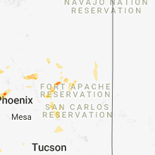


Connect with Interactive Hail Maps