

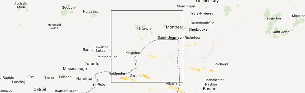
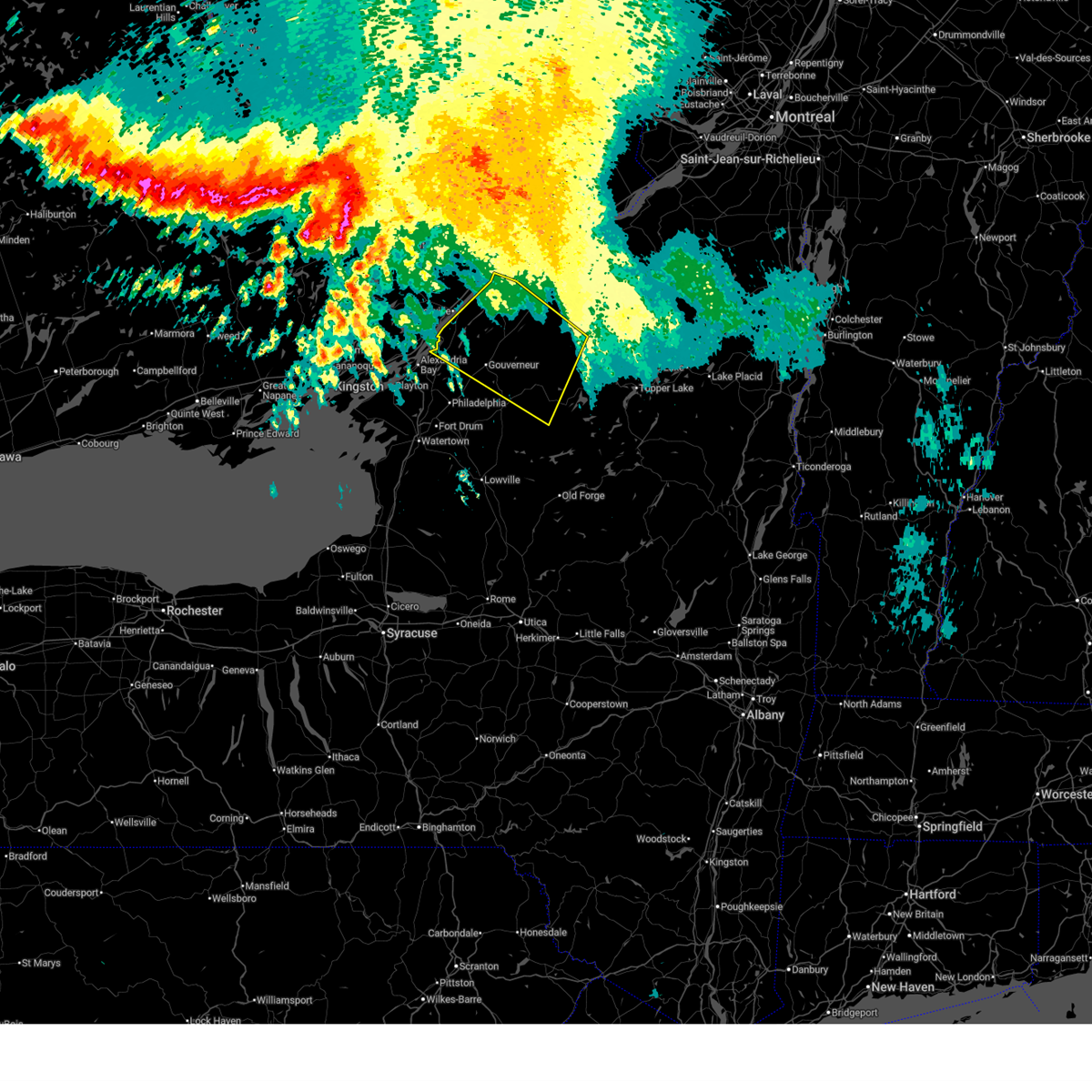
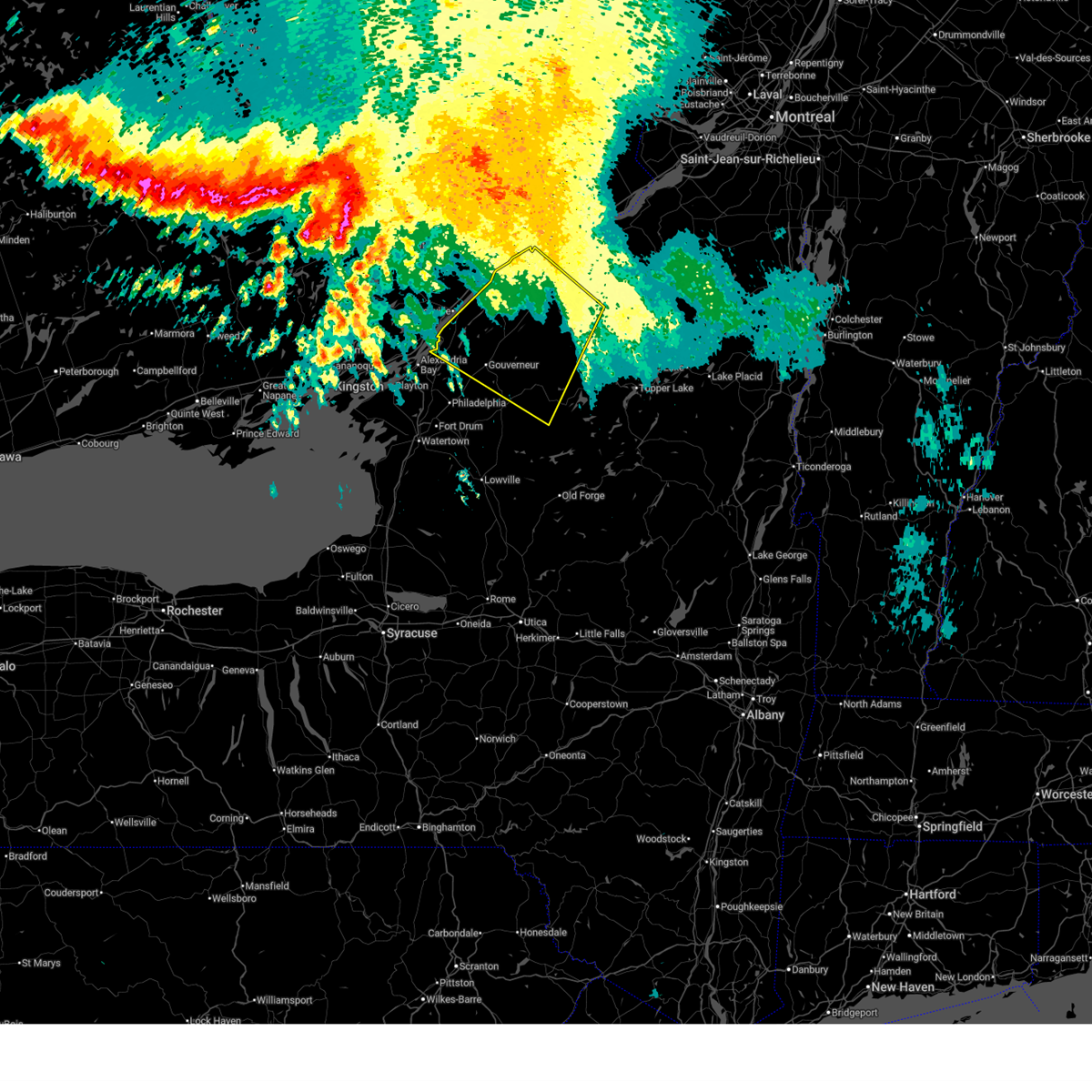
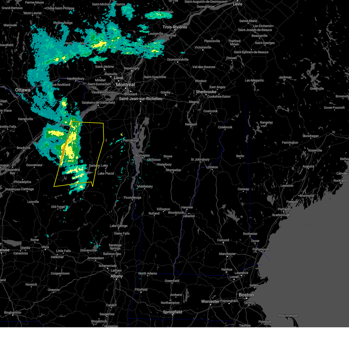
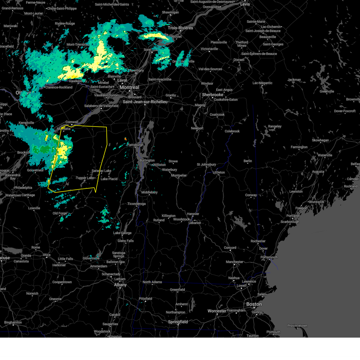
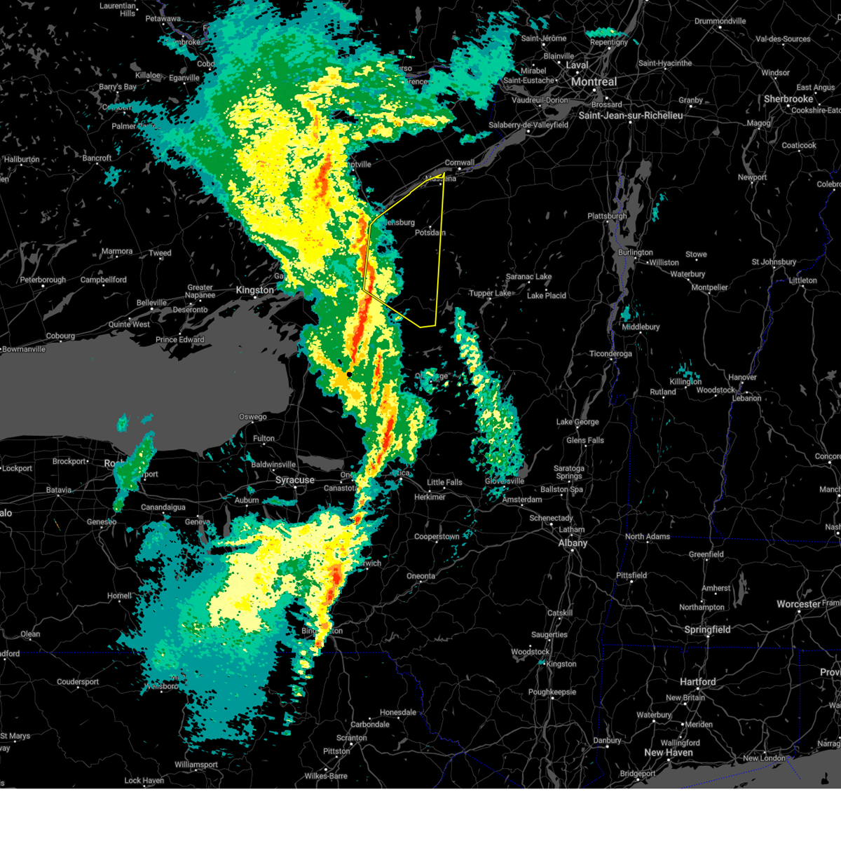
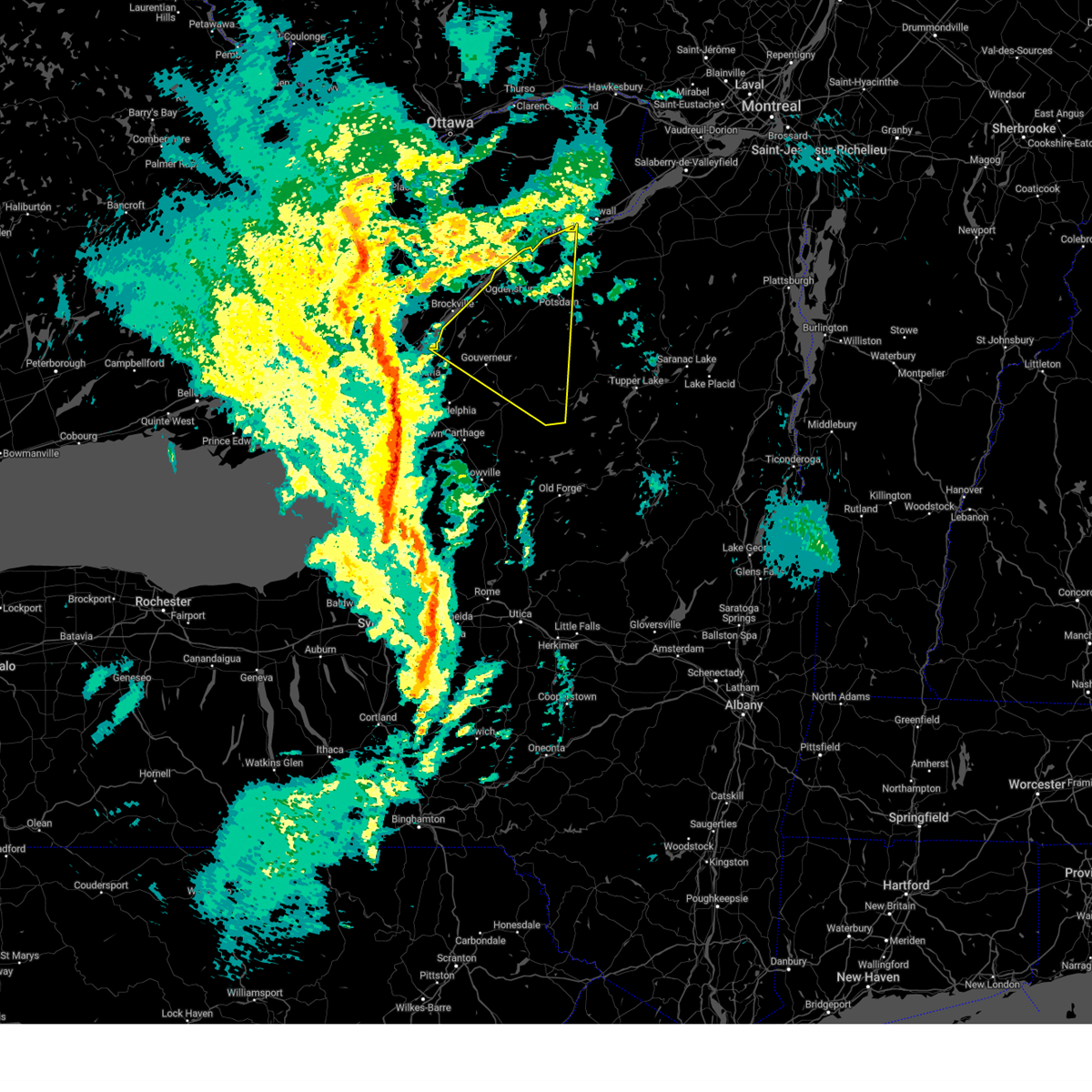
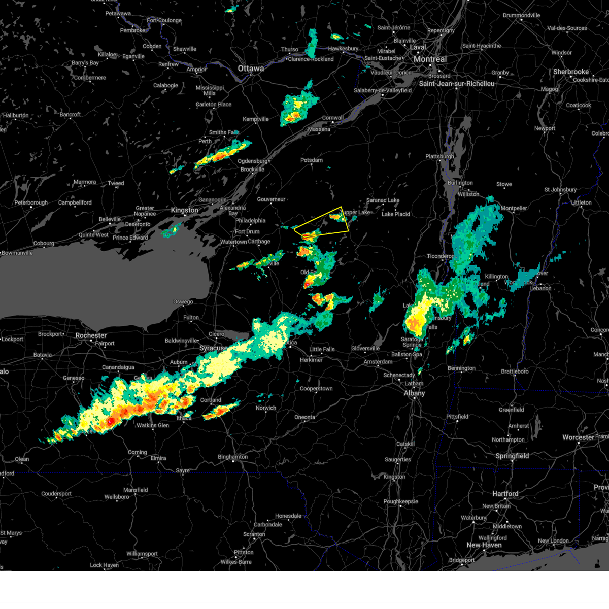
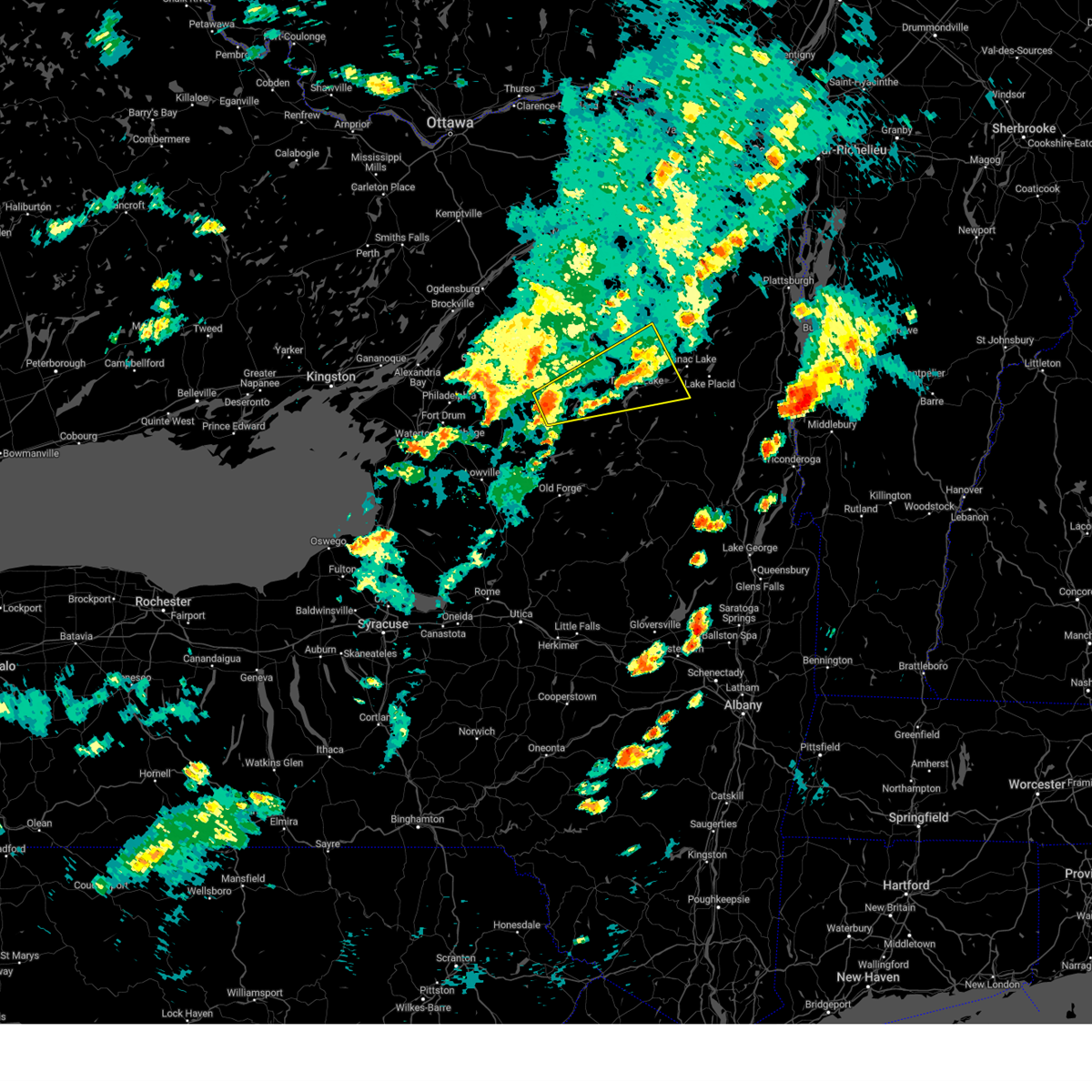
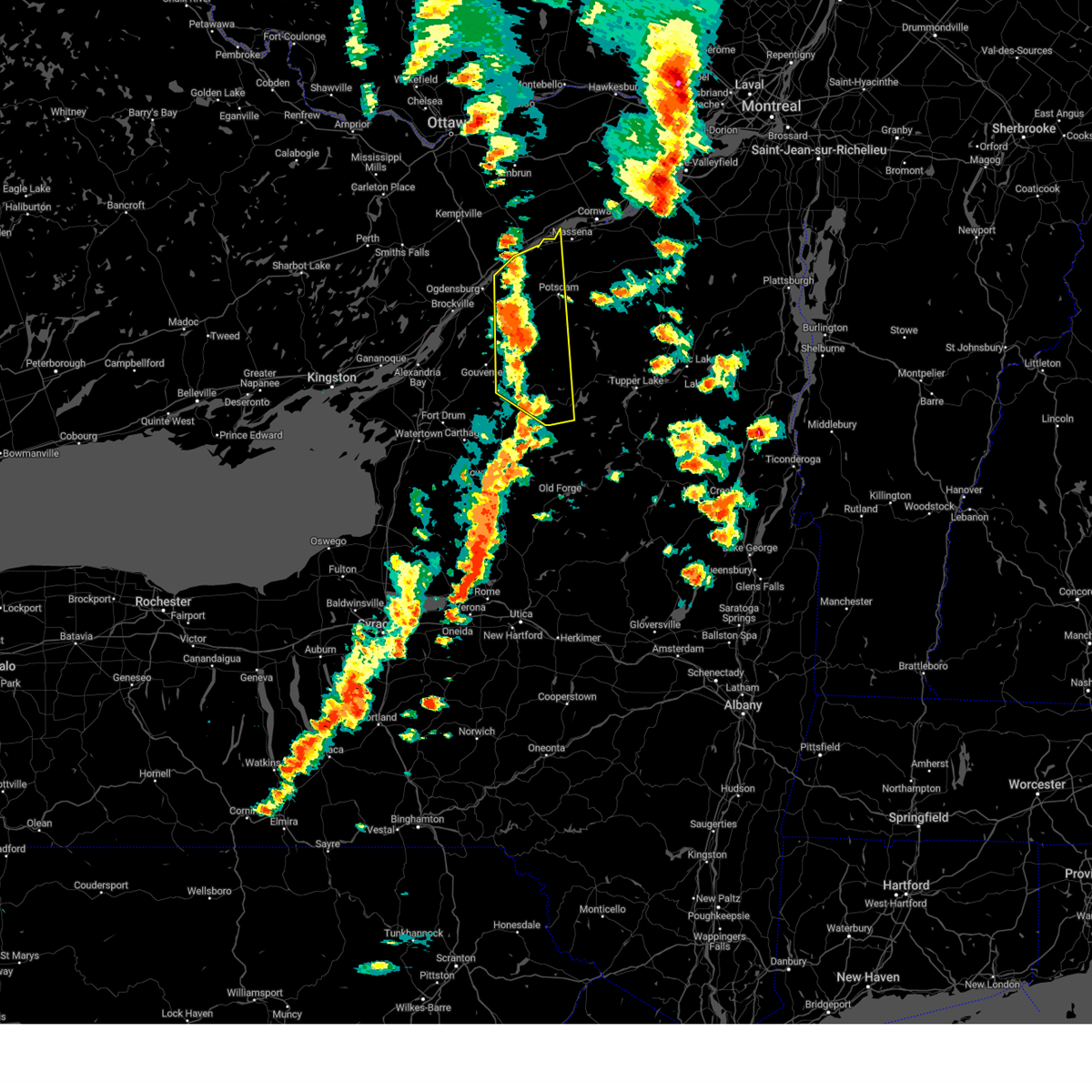
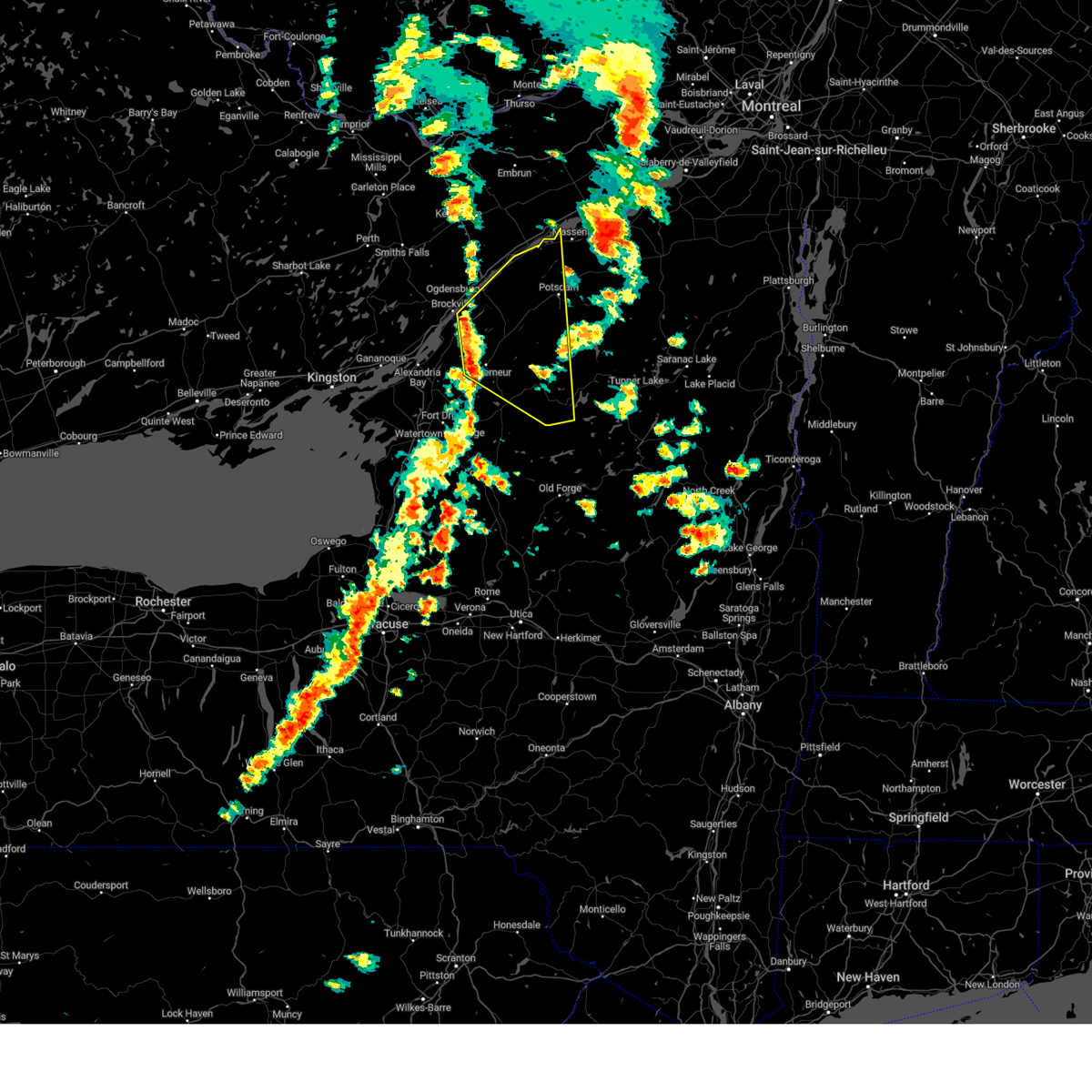
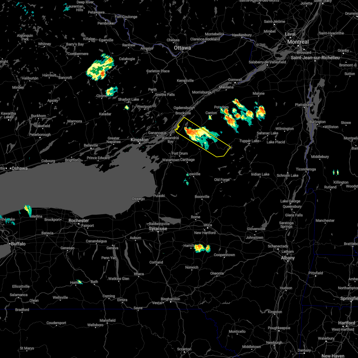
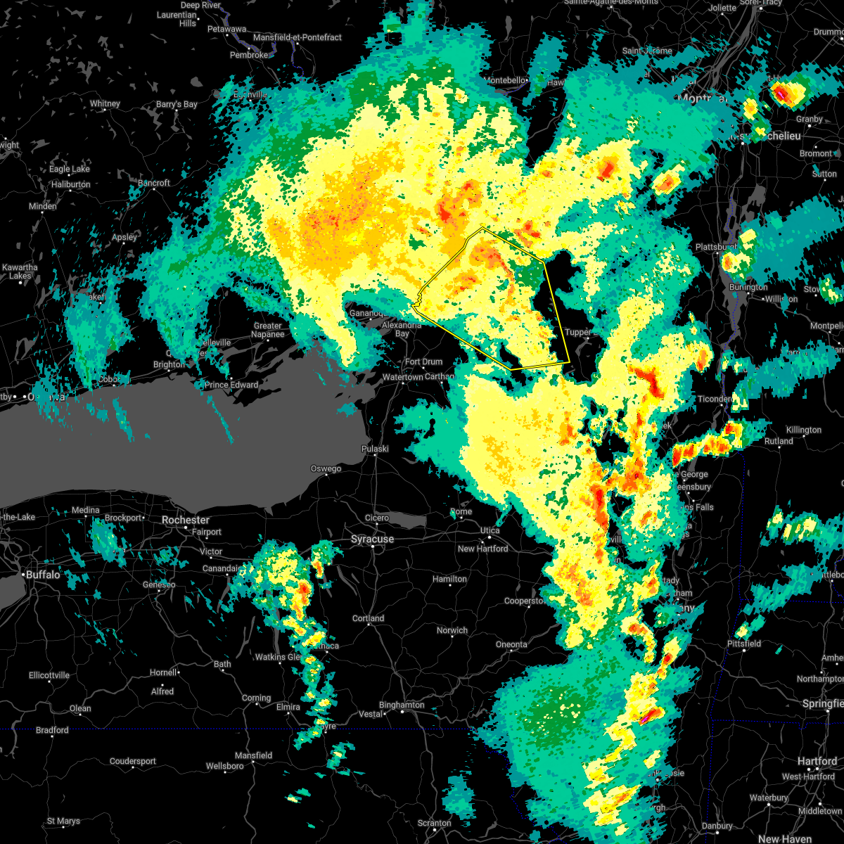
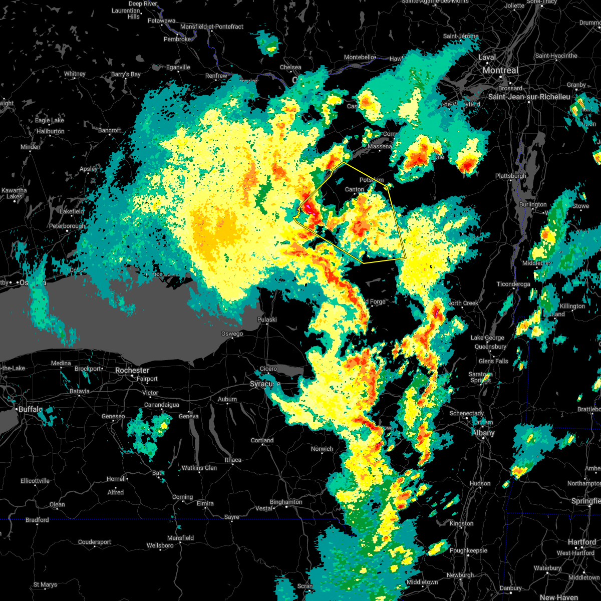
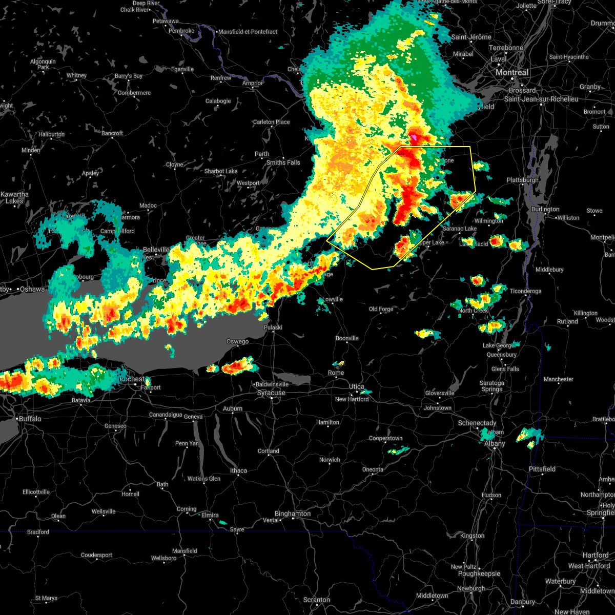
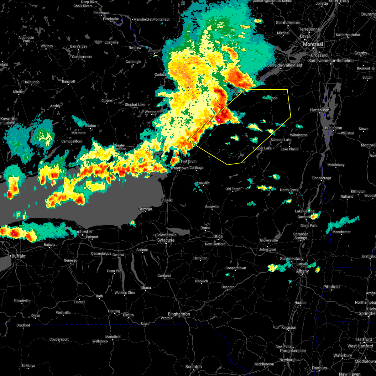
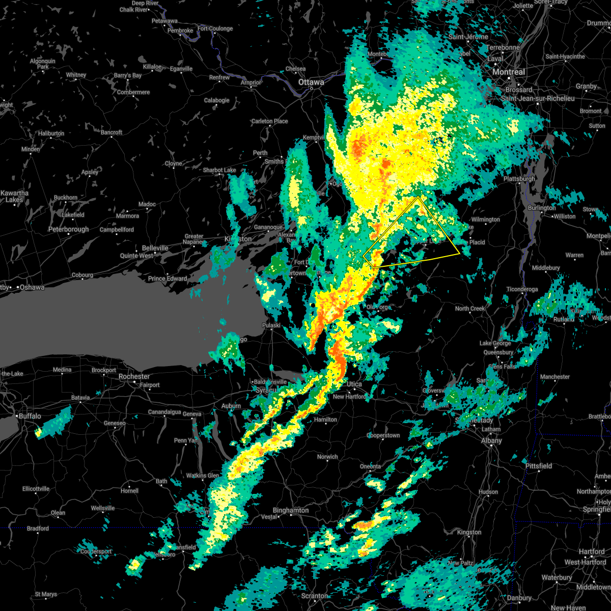
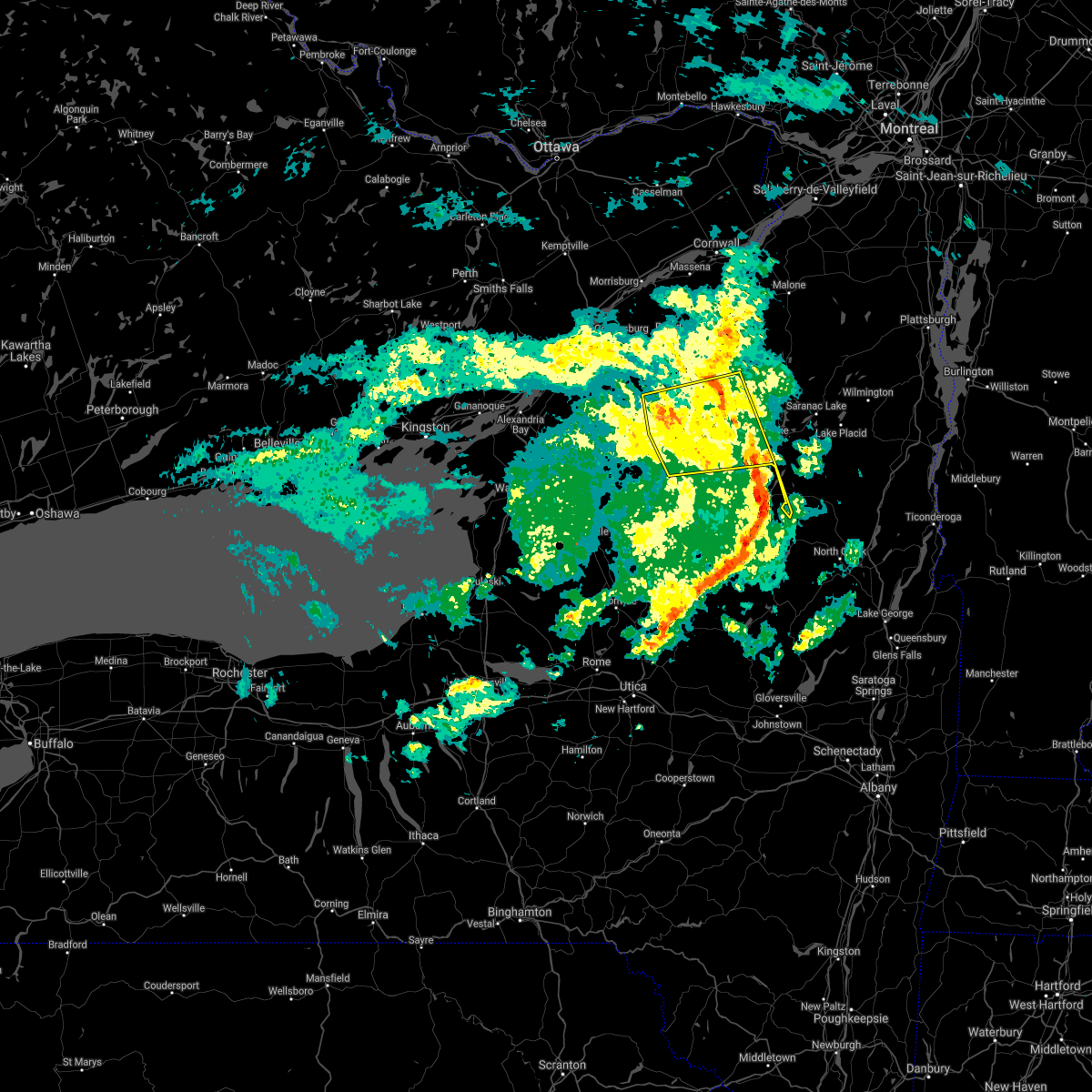
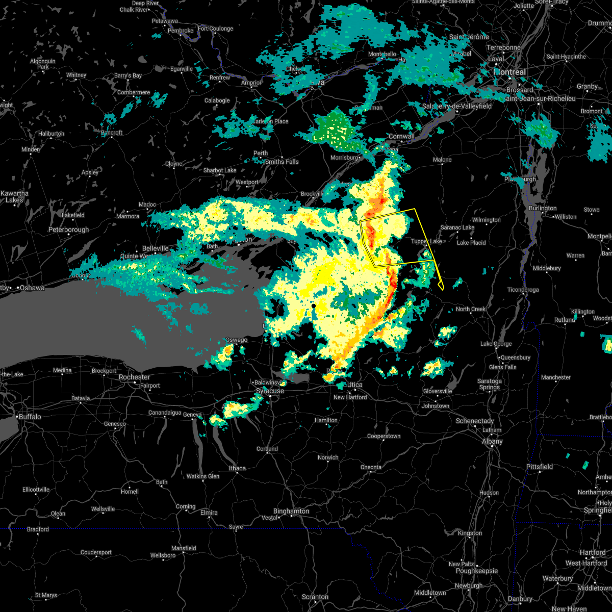
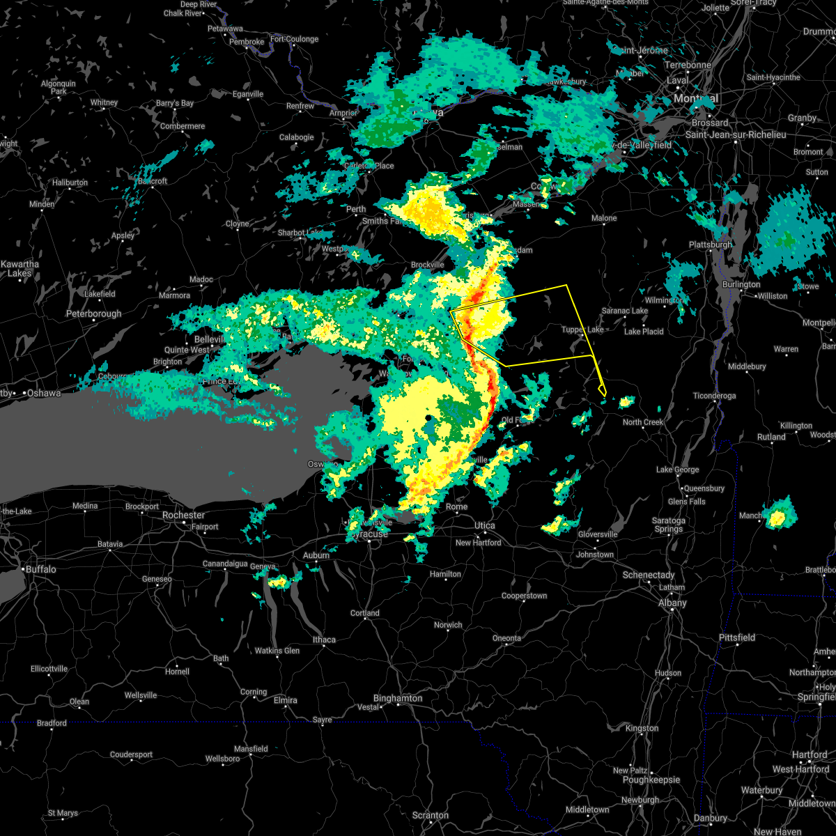
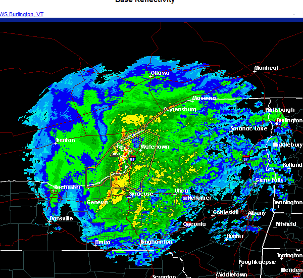
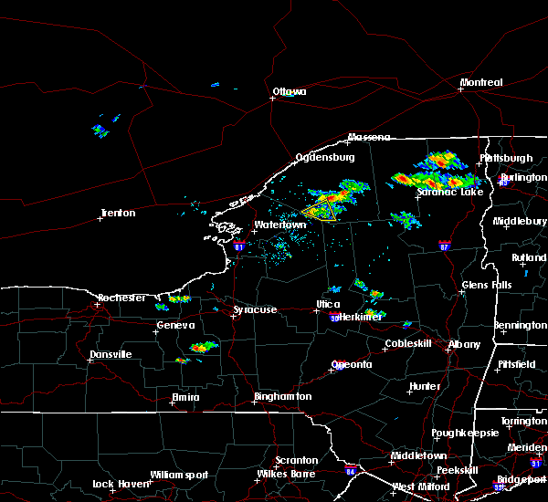
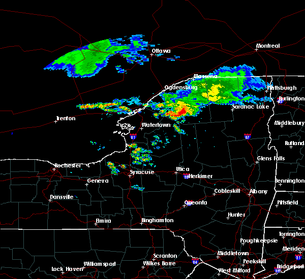
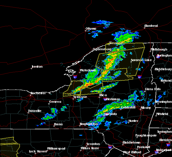
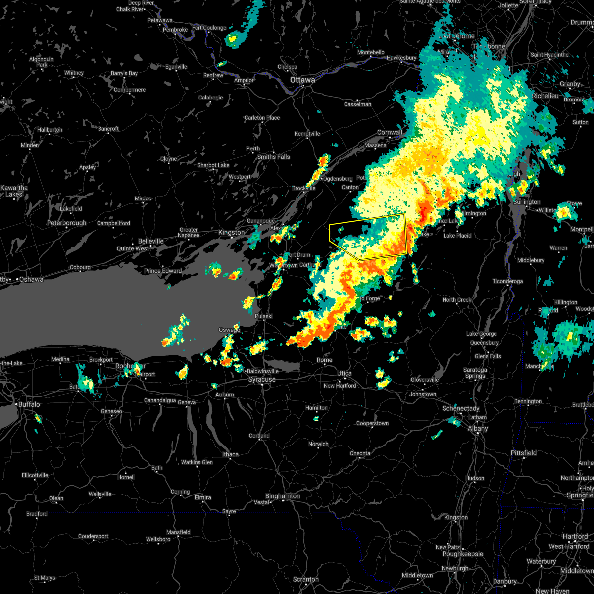
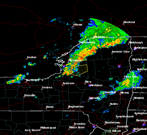
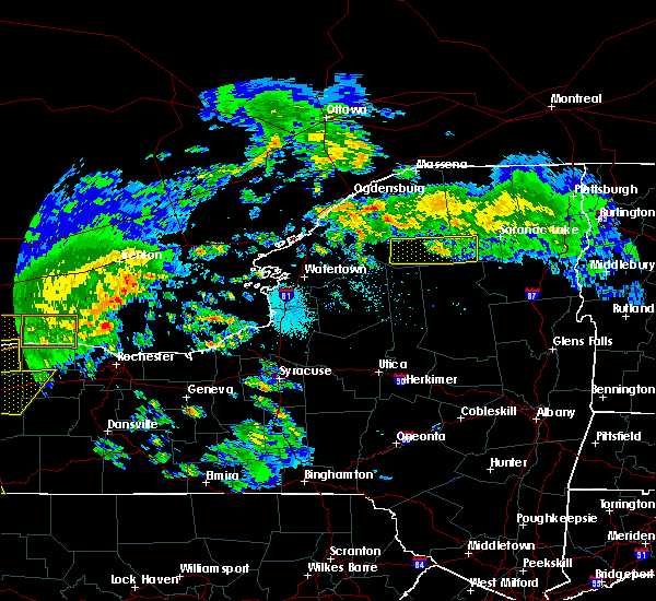
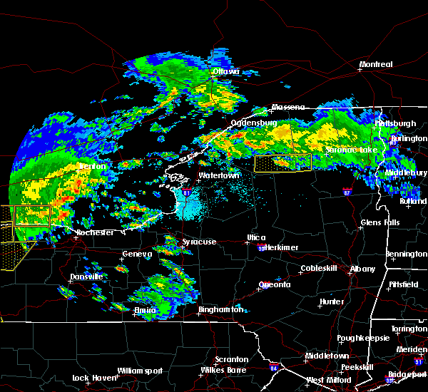
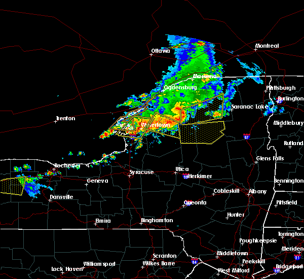
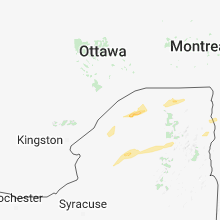
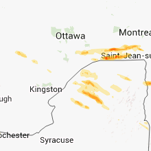
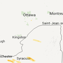
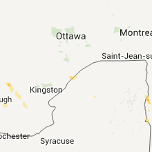
Hail Map for Star Lake, NY
The Star Lake, NY area has had 1 report of on-the-ground hail by trained spotters, and has been under severe weather warnings 7 times during the past 12 months. Doppler radar has detected hail at or near Star Lake, NY on 9 occasions.
| Name: | Star Lake, NY |
| Where Located: | 43.5 miles SSE of Ogdensburg, NY |
| Map: | Google Map for Star Lake, NY |
| Population: | 809 |
| Housing Units: | 528 |
| More Info: | Search Google for Star Lake, NY |
5
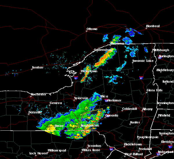
The Top Recent Hail Date for Star Lake, NY is Tuesday, July 26, 2011 (1st out of 9)
Hail and Wind Damage Spotted near Star Lake, NY
| Date / Time | Report Details |
|---|---|
| 6/22/2025 2:26 AM EDT |
 The storms which prompted the warning have weakened below severe limits, and no longer pose an immediate threat to life or property. therefore, the warning will be allowed to expire. however, gusty winds and heavy rain are still possible with these thunderstorms. The storms which prompted the warning have weakened below severe limits, and no longer pose an immediate threat to life or property. therefore, the warning will be allowed to expire. however, gusty winds and heavy rain are still possible with these thunderstorms.
|
| 6/22/2025 2:00 AM EDT |
 At 200 am edt, severe thunderstorms were located along a line extending from near ogdensburg to 6 miles southwest of nelson corner to 78 miles west of cedar island state park, moving southeast at 55 mph (radar indicated). Hazards include 60 mph wind gusts. Expect damage to trees and powerlines. Locations impacted include, richville, gouverneur village, canton village, rensselaer falls, hammond village, heuvelton, hermon village, morristown village, de peyster, pierrepont, russell, hammond, clare, gouverneur, hermon, macomb, rossie, de kalb, fowler, and pitcairn. At 200 am edt, severe thunderstorms were located along a line extending from near ogdensburg to 6 miles southwest of nelson corner to 78 miles west of cedar island state park, moving southeast at 55 mph (radar indicated). Hazards include 60 mph wind gusts. Expect damage to trees and powerlines. Locations impacted include, richville, gouverneur village, canton village, rensselaer falls, hammond village, heuvelton, hermon village, morristown village, de peyster, pierrepont, russell, hammond, clare, gouverneur, hermon, macomb, rossie, de kalb, fowler, and pitcairn.
|
| 6/22/2025 1:26 AM EDT |
 Svrbtv the national weather service in burlington has issued a * severe thunderstorm warning for, st. lawrence county in northern new york, * until 230 am edt. * at 125 am edt, severe thunderstorms were located along a line extending from 39 miles northwest of ogdensburg to 34 miles northwest of cedar island state park, moving southeast at 60 mph (radar indicated). Hazards include 60 mph wind gusts and quarter size hail. Minor hail damage to vehicles is possible. Expect wind damage to trees and powerlines. Svrbtv the national weather service in burlington has issued a * severe thunderstorm warning for, st. lawrence county in northern new york, * until 230 am edt. * at 125 am edt, severe thunderstorms were located along a line extending from 39 miles northwest of ogdensburg to 34 miles northwest of cedar island state park, moving southeast at 60 mph (radar indicated). Hazards include 60 mph wind gusts and quarter size hail. Minor hail damage to vehicles is possible. Expect wind damage to trees and powerlines.
|
| 3/16/2025 6:31 PM EDT |
 At 630 pm edt, severe thunderstorms were located along a line extending from 12 miles north of st. regis to parishville to 9 miles southwest of wanakena, moving east at 40 mph (radar indicated). Hazards include 60 mph wind gusts. Expect damage to trees and powerlines. Locations impacted include, dickinson, paul smiths, bryants mill, conifer, wawbeek, duane center, gabriels, bangor, akwesasne mohawk territory, ironton, bombay, tupper lake, newton falls, adirondack regional airport, childwold, nicholville, piercefield, chasm falls, parishville, and burke. At 630 pm edt, severe thunderstorms were located along a line extending from 12 miles north of st. regis to parishville to 9 miles southwest of wanakena, moving east at 40 mph (radar indicated). Hazards include 60 mph wind gusts. Expect damage to trees and powerlines. Locations impacted include, dickinson, paul smiths, bryants mill, conifer, wawbeek, duane center, gabriels, bangor, akwesasne mohawk territory, ironton, bombay, tupper lake, newton falls, adirondack regional airport, childwold, nicholville, piercefield, chasm falls, parishville, and burke.
|
| 3/16/2025 6:13 PM EDT |
 Svrbtv the national weather service in burlington has issued a * severe thunderstorm warning for, franklin county in northern new york, eastern st. lawrence county in northern new york, western essex county in northern new york, * until 700 pm edt. * at 612 pm edt, severe thunderstorms were located along a line extending from 8 miles north of st. lawrence state park to pierrepont to near lower oswegatchie, moving east at 55 mph (radar indicated). Hazards include 60 mph wind gusts. expect damage to trees and powerlines Svrbtv the national weather service in burlington has issued a * severe thunderstorm warning for, franklin county in northern new york, eastern st. lawrence county in northern new york, western essex county in northern new york, * until 700 pm edt. * at 612 pm edt, severe thunderstorms were located along a line extending from 8 miles north of st. lawrence state park to pierrepont to near lower oswegatchie, moving east at 55 mph (radar indicated). Hazards include 60 mph wind gusts. expect damage to trees and powerlines
|
| 3/16/2025 5:45 PM EDT |
 At 544 pm edt, severe thunderstorms were located along a line extending from heuvelton to 30 miles southwest of pitcairn, moving northeast at 60 mph (radar indicated). Hazards include 60 mph wind gusts. Expect damage to trees and powerlines. Locations impacted include, de peyster, morley, potsdam, massena village, talcville, south edwards, degrasse, pierrepont, west stockholm, west potsdam, newton falls, north gouverneur, west fowler, west pierrepont, east de kalb, aldrich, lisbon, waddington, richville, and russell. At 544 pm edt, severe thunderstorms were located along a line extending from heuvelton to 30 miles southwest of pitcairn, moving northeast at 60 mph (radar indicated). Hazards include 60 mph wind gusts. Expect damage to trees and powerlines. Locations impacted include, de peyster, morley, potsdam, massena village, talcville, south edwards, degrasse, pierrepont, west stockholm, west potsdam, newton falls, north gouverneur, west fowler, west pierrepont, east de kalb, aldrich, lisbon, waddington, richville, and russell.
|
| 3/16/2025 5:17 PM EDT |
 Svrbtv the national weather service in burlington has issued a * severe thunderstorm warning for, st. lawrence county in northern new york, * until 615 pm edt. * at 516 pm edt, severe thunderstorms were located along a line extending from 11 miles southwest of cedar island state park to 61 miles southwest of west fowler, moving northeast at 60 mph (radar indicated). Hazards include 60 mph wind gusts. expect damage to trees and powerlines Svrbtv the national weather service in burlington has issued a * severe thunderstorm warning for, st. lawrence county in northern new york, * until 615 pm edt. * at 516 pm edt, severe thunderstorms were located along a line extending from 11 miles southwest of cedar island state park to 61 miles southwest of west fowler, moving northeast at 60 mph (radar indicated). Hazards include 60 mph wind gusts. expect damage to trees and powerlines
|
| 6/30/2024 5:24 AM EDT |
 Svrbtv the national weather service in burlington has issued a * severe thunderstorm warning for, southeastern st. lawrence county in northern new york, * until 600 am edt. * at 524 am edt, a severe thunderstorm was located near star lake, moving east at 40 mph (radar indicated). Hazards include 60 mph wind gusts and quarter size hail. Minor hail damage to vehicles is possible. Expect wind damage to trees and powerlines. Svrbtv the national weather service in burlington has issued a * severe thunderstorm warning for, southeastern st. lawrence county in northern new york, * until 600 am edt. * at 524 am edt, a severe thunderstorm was located near star lake, moving east at 40 mph (radar indicated). Hazards include 60 mph wind gusts and quarter size hail. Minor hail damage to vehicles is possible. Expect wind damage to trees and powerlines.
|
| 6/23/2024 1:52 PM EDT |
 Svrbtv the national weather service in burlington has issued a * severe thunderstorm warning for, southwestern franklin county in northern new york, southeastern st. lawrence county in northern new york, * until 230 pm edt. * at 152 pm edt, a severe thunderstorm was located over star lake, moving northeast at 50 mph (radar indicated). Hazards include 60 mph wind gusts and penny size hail. expect damage to trees and powerlines Svrbtv the national weather service in burlington has issued a * severe thunderstorm warning for, southwestern franklin county in northern new york, southeastern st. lawrence county in northern new york, * until 230 pm edt. * at 152 pm edt, a severe thunderstorm was located over star lake, moving northeast at 50 mph (radar indicated). Hazards include 60 mph wind gusts and penny size hail. expect damage to trees and powerlines
|
| 7/13/2023 3:14 PM EDT |
 At 314 pm edt, severe thunderstorms were located along a line extending from lisbon to edwards, moving northeast at 40 mph (radar indicated). Hazards include 60 mph wind gusts and quarter size hail. Minor hail damage to vehicles is possible. expect wind damage to trees and powerlines. locations impacted include, potsdam, canton, norfolk, oswegatchie, lisbon, louisville, de kalb, fowler, colton, rensselaer falls, morley, degrasse, norwood, hermon, chipman, heuvelton, waddington, richville, madrid, and star lake. hail threat, radar indicated max hail size, 1. 00 in wind threat, radar indicated max wind gust, 60 mph. At 314 pm edt, severe thunderstorms were located along a line extending from lisbon to edwards, moving northeast at 40 mph (radar indicated). Hazards include 60 mph wind gusts and quarter size hail. Minor hail damage to vehicles is possible. expect wind damage to trees and powerlines. locations impacted include, potsdam, canton, norfolk, oswegatchie, lisbon, louisville, de kalb, fowler, colton, rensselaer falls, morley, degrasse, norwood, hermon, chipman, heuvelton, waddington, richville, madrid, and star lake. hail threat, radar indicated max hail size, 1. 00 in wind threat, radar indicated max wind gust, 60 mph.
|
| 7/13/2023 2:46 PM EDT |
 At 245 pm edt, severe thunderstorms were located along a line extending from near edwardsville to 7 miles southwest of west fowler, moving northeast at 40 mph (radar indicated). Hazards include 60 mph wind gusts and quarter size hail. Minor hail damage to vehicles is possible. Expect wind damage to trees and powerlines. At 245 pm edt, severe thunderstorms were located along a line extending from near edwardsville to 7 miles southwest of west fowler, moving northeast at 40 mph (radar indicated). Hazards include 60 mph wind gusts and quarter size hail. Minor hail damage to vehicles is possible. Expect wind damage to trees and powerlines.
|
| 7/28/2022 3:07 PM EDT |
 The severe thunderstorm warning for st. lawrence county will expire at 315 pm edt, the storms which prompted the warning have weakened below severe limits, and no longer pose an immediate threat to life or property. therefore, the warning will be allowed to expire. however heavy rain is still possible with these thunderstorms. a severe thunderstorm watch remains in effect until 800 pm edt for northern new york. The severe thunderstorm warning for st. lawrence county will expire at 315 pm edt, the storms which prompted the warning have weakened below severe limits, and no longer pose an immediate threat to life or property. therefore, the warning will be allowed to expire. however heavy rain is still possible with these thunderstorms. a severe thunderstorm watch remains in effect until 800 pm edt for northern new york.
|
| 7/28/2022 2:21 PM EDT |
 At 220 pm edt, severe thunderstorms were located along a line extending from west fowler to 14 miles south of pitcairn, moving northeast at 45 mph (radar indicated). Hazards include 60 mph wind gusts and quarter size hail. Minor hail damage to vehicles is possible. Expect wind damage to trees and powerlines. At 220 pm edt, severe thunderstorms were located along a line extending from west fowler to 14 miles south of pitcairn, moving northeast at 45 mph (radar indicated). Hazards include 60 mph wind gusts and quarter size hail. Minor hail damage to vehicles is possible. Expect wind damage to trees and powerlines.
|
| 7/19/2022 6:35 PM EDT |
 At 635 pm edt, a severe thunderstorm was located over gouverneur, moving southeast at 20 mph (radar indicated). Hazards include 60 mph wind gusts and quarter size hail. Minor hail damage to vehicles is possible. expect wind damage to trees and powerlines. locations impacted include, gouverneur, oswegatchie, fowler, edwardsville, richville, hammond, star lake, fine, rossie, pitcairn, edwards, chippewa bay, talcville, south edwards, jacques cartier state park, newton falls, north gouverneur, west fowler, lower oswegatchie and south hammond. hail threat, radar indicated max hail size, 1. 00 in wind threat, radar indicated max wind gust, 60 mph. At 635 pm edt, a severe thunderstorm was located over gouverneur, moving southeast at 20 mph (radar indicated). Hazards include 60 mph wind gusts and quarter size hail. Minor hail damage to vehicles is possible. expect wind damage to trees and powerlines. locations impacted include, gouverneur, oswegatchie, fowler, edwardsville, richville, hammond, star lake, fine, rossie, pitcairn, edwards, chippewa bay, talcville, south edwards, jacques cartier state park, newton falls, north gouverneur, west fowler, lower oswegatchie and south hammond. hail threat, radar indicated max hail size, 1. 00 in wind threat, radar indicated max wind gust, 60 mph.
|
| 7/19/2022 5:52 PM EDT |
 At 551 pm edt, a severe thunderstorm was located over north hammond, moving southeast at 40 mph (radar indicated). Hazards include 60 mph wind gusts and quarter size hail. Minor hail damage to vehicles is possible. Expect wind damage to trees and powerlines. At 551 pm edt, a severe thunderstorm was located over north hammond, moving southeast at 40 mph (radar indicated). Hazards include 60 mph wind gusts and quarter size hail. Minor hail damage to vehicles is possible. Expect wind damage to trees and powerlines.
|
| 6/16/2022 5:30 PM EDT |
 At 528 pm edt, a severe thunderstorm was located near stark, moving east at 55 mph (broadcast media). Hazards include ping pong ball size hail and 60 mph wind gusts. People and animals outdoors will be injured. expect hail damage to roofs, siding, windows, and vehicles. expect wind damage to trees and powerlines. locations impacted include, potsdam, tupper lake, gouverneur, ogdensburg, canton, oswegatchie, lisbon, de kalb, bangor, fowler, parishville, colton, piercefield, morley, degrasse, carry falls reservoir, richville, hammond, cranberry lake and lawrenceville. hail threat, radar indicated max hail size, 1. 50 in wind threat, observed max wind gust, 60 mph. At 528 pm edt, a severe thunderstorm was located near stark, moving east at 55 mph (broadcast media). Hazards include ping pong ball size hail and 60 mph wind gusts. People and animals outdoors will be injured. expect hail damage to roofs, siding, windows, and vehicles. expect wind damage to trees and powerlines. locations impacted include, potsdam, tupper lake, gouverneur, ogdensburg, canton, oswegatchie, lisbon, de kalb, bangor, fowler, parishville, colton, piercefield, morley, degrasse, carry falls reservoir, richville, hammond, cranberry lake and lawrenceville. hail threat, radar indicated max hail size, 1. 50 in wind threat, observed max wind gust, 60 mph.
|
| 6/16/2022 5:12 PM EDT |
 At 511 pm edt, a severe thunderstorm was located over west pierrepont, moving east at 55 mph (broadcast media. trees and power poles down near hammond, new york). Hazards include ping pong ball size hail and 60 mph wind gusts. People and animals outdoors will be injured. expect hail damage to roofs, siding, windows, and vehicles. expect wind damage to trees and powerlines. locations impacted include, potsdam, tupper lake, gouverneur, ogdensburg, canton, oswegatchie, lisbon, de kalb, bangor, fowler, parishville, colton, piercefield, morley, degrasse, carry falls reservoir, richville, hammond, cranberry lake and lawrenceville. hail threat, radar indicated max hail size, 1. 50 in wind threat, observed max wind gust, 60 mph. At 511 pm edt, a severe thunderstorm was located over west pierrepont, moving east at 55 mph (broadcast media. trees and power poles down near hammond, new york). Hazards include ping pong ball size hail and 60 mph wind gusts. People and animals outdoors will be injured. expect hail damage to roofs, siding, windows, and vehicles. expect wind damage to trees and powerlines. locations impacted include, potsdam, tupper lake, gouverneur, ogdensburg, canton, oswegatchie, lisbon, de kalb, bangor, fowler, parishville, colton, piercefield, morley, degrasse, carry falls reservoir, richville, hammond, cranberry lake and lawrenceville. hail threat, radar indicated max hail size, 1. 50 in wind threat, observed max wind gust, 60 mph.
|
| 6/16/2022 4:56 PM EDT |
 At 455 pm edt, a severe thunderstorm was located over richville, moving east at 65 mph (radar indicated). Hazards include ping pong ball size hail and 60 mph wind gusts. People and animals outdoors will be injured. expect hail damage to roofs, siding, windows, and vehicles. expect wind damage to trees and powerlines. locations impacted include, potsdam, tupper lake, gouverneur, ogdensburg, canton, oswegatchie, lisbon, de kalb, bangor, fowler, parishville, colton, piercefield, morley, degrasse, carry falls reservoir, richville, hammond, cranberry lake and lawrenceville. hail threat, radar indicated max hail size, 1. 50 in wind threat, observed max wind gust, 60 mph. At 455 pm edt, a severe thunderstorm was located over richville, moving east at 65 mph (radar indicated). Hazards include ping pong ball size hail and 60 mph wind gusts. People and animals outdoors will be injured. expect hail damage to roofs, siding, windows, and vehicles. expect wind damage to trees and powerlines. locations impacted include, potsdam, tupper lake, gouverneur, ogdensburg, canton, oswegatchie, lisbon, de kalb, bangor, fowler, parishville, colton, piercefield, morley, degrasse, carry falls reservoir, richville, hammond, cranberry lake and lawrenceville. hail threat, radar indicated max hail size, 1. 50 in wind threat, observed max wind gust, 60 mph.
|
| 6/16/2022 4:43 PM EDT |
 At 443 pm edt, a severe thunderstorm was located near hammond, moving east at 50 mph (radar indicated). Hazards include 60 mph wind gusts and quarter size hail. Minor hail damage to vehicles is possible. Expect wind damage to trees and powerlines. At 443 pm edt, a severe thunderstorm was located near hammond, moving east at 50 mph (radar indicated). Hazards include 60 mph wind gusts and quarter size hail. Minor hail damage to vehicles is possible. Expect wind damage to trees and powerlines.
|
| 5/16/2022 4:08 PM EDT |
 The severe thunderstorm warning for st. lawrence county will expire at 415 pm edt, the storms which prompted the warning have weakened below severe limits, and no longer pose an immediate threat to life or property. therefore, the warning will be allowed to expire. however heavy rain is still expected with these thunderstorms. a severe thunderstorm watch remains in effect until 800 pm edt for northern new york. The severe thunderstorm warning for st. lawrence county will expire at 415 pm edt, the storms which prompted the warning have weakened below severe limits, and no longer pose an immediate threat to life or property. therefore, the warning will be allowed to expire. however heavy rain is still expected with these thunderstorms. a severe thunderstorm watch remains in effect until 800 pm edt for northern new york.
|
| 5/16/2022 3:19 PM EDT |
 At 319 pm edt, severe thunderstorms were located along a line extending from 10 miles southwest of cedar island state park to 10 miles southwest of pitcairn to 30 miles south of wanakena, moving northeast at 40 mph (radar indicated). Hazards include 60 mph wind gusts and penny size hail. expect damage to trees and powerlines At 319 pm edt, severe thunderstorms were located along a line extending from 10 miles southwest of cedar island state park to 10 miles southwest of pitcairn to 30 miles south of wanakena, moving northeast at 40 mph (radar indicated). Hazards include 60 mph wind gusts and penny size hail. expect damage to trees and powerlines
|
| 7/20/2021 5:21 PM EDT |
 At 519 pm edt, a line of severe thunderstorms over northern new york was located along a line extending from north burke to near balmat, moving east at 45 mph (law enforcement and public reported numerous trees down in ogdensburg and lisbon in saint lawrence county new york). Hazards include 60 mph wind gusts and quarter size hail. Expect wind damage to trees and powerlines. minor hail damage to vehicles is possible. Locations impacted include, potsdam, gouverneur, canton, massena, norfolk, oswegatchie, moira, bangor, fowler, parishville, fort covington, colton, bombay, bryants mill, degrasse, helena, burke, carry falls reservoir, cranberry lake and brushton. At 519 pm edt, a line of severe thunderstorms over northern new york was located along a line extending from north burke to near balmat, moving east at 45 mph (law enforcement and public reported numerous trees down in ogdensburg and lisbon in saint lawrence county new york). Hazards include 60 mph wind gusts and quarter size hail. Expect wind damage to trees and powerlines. minor hail damage to vehicles is possible. Locations impacted include, potsdam, gouverneur, canton, massena, norfolk, oswegatchie, moira, bangor, fowler, parishville, fort covington, colton, bombay, bryants mill, degrasse, helena, burke, carry falls reservoir, cranberry lake and brushton.
|
| 7/20/2021 4:44 PM EDT |
 At 442 pm edt, a line of severe thunderstorms was located from near st. regis, new york to 18 miles southwest of nelson corner, new york moving east at 40 mph (radar indicated). Hazards include 70 mph wind gusts and quarter size hail. Expect considerable tree damage. wind damage is also likely to mobile homes, roofs, and outbuildings. Minor hail damage to vehicles is possible. At 442 pm edt, a line of severe thunderstorms was located from near st. regis, new york to 18 miles southwest of nelson corner, new york moving east at 40 mph (radar indicated). Hazards include 70 mph wind gusts and quarter size hail. Expect considerable tree damage. wind damage is also likely to mobile homes, roofs, and outbuildings. Minor hail damage to vehicles is possible.
|
| 7/8/2021 7:35 PM EDT |
 At 735 pm edt, a severe thunderstorm was located over wanakena, moving northeast at 35 mph (radar indicated). Hazards include 60 mph wind gusts. expect damage to trees and powerlines At 735 pm edt, a severe thunderstorm was located over wanakena, moving northeast at 35 mph (radar indicated). Hazards include 60 mph wind gusts. expect damage to trees and powerlines
|
| 6/21/2021 2:35 PM EDT |
 At 235 pm edt, a severe thunderstorm was located near pitcairn, moving northeast at 50 mph (radar indicated). Hazards include 70 mph wind gusts and quarter size hail. Minor hail damage to vehicles is possible. expect considerable tree damage. Wind damage is also likely to mobile homes, roofs, and outbuildings. At 235 pm edt, a severe thunderstorm was located near pitcairn, moving northeast at 50 mph (radar indicated). Hazards include 70 mph wind gusts and quarter size hail. Minor hail damage to vehicles is possible. expect considerable tree damage. Wind damage is also likely to mobile homes, roofs, and outbuildings.
|
| 3/26/2021 12:13 PM EDT |
 The severe thunderstorm warning for southwestern franklin, southeastern st. lawrence and western essex counties will expire at 1215 pm edt, the storms which prompted the warning have moved out of the area. therefore, the warning will be allowed to expire. a severe thunderstorm watch remains in effect until 400 pm edt for northern new york. The severe thunderstorm warning for southwestern franklin, southeastern st. lawrence and western essex counties will expire at 1215 pm edt, the storms which prompted the warning have moved out of the area. therefore, the warning will be allowed to expire. a severe thunderstorm watch remains in effect until 400 pm edt for northern new york.
|
| 3/26/2021 11:52 AM EDT |
 At 1151 am edt, severe thunderstorms were located along a line extending from near degrasse to 8 miles south of wanakena to 20 miles southwest of horseshoe lake to 30 miles south of star lake, moving east at 45 mph (radar indicated). Hazards include 60 mph wind gusts. Expect damage to trees and powerlines. Locations impacted include, tupper lake, oswegatchie, piercefield, carry falls reservoir, horseshoe lake, degrasse, cranberry lake, star lake, fine, stark, lower oswegatchie, conifer, wanakena, gale, newton falls, childwold, shurtleff and south russell. At 1151 am edt, severe thunderstorms were located along a line extending from near degrasse to 8 miles south of wanakena to 20 miles southwest of horseshoe lake to 30 miles south of star lake, moving east at 45 mph (radar indicated). Hazards include 60 mph wind gusts. Expect damage to trees and powerlines. Locations impacted include, tupper lake, oswegatchie, piercefield, carry falls reservoir, horseshoe lake, degrasse, cranberry lake, star lake, fine, stark, lower oswegatchie, conifer, wanakena, gale, newton falls, childwold, shurtleff and south russell.
|
| 3/26/2021 11:30 AM EDT |
 At 1129 am edt, severe thunderstorms were located along a line extending from fowler to 10 miles south of aldrich to 21 miles south of star lake to 32 miles southwest of wanakena, moving east at 45 mph (radar indicated). Hazards include 60 mph wind gusts. expect damage to trees and powerlines At 1129 am edt, severe thunderstorms were located along a line extending from fowler to 10 miles south of aldrich to 21 miles south of star lake to 32 miles southwest of wanakena, moving east at 45 mph (radar indicated). Hazards include 60 mph wind gusts. expect damage to trees and powerlines
|
| 11/15/2020 6:57 PM EST |
 The severe thunderstorm warning for northwestern franklin and st. lawrence counties will expire at 700 pm est, the strong showers and embedded thunderstorm which prompted the warning have weakened just below severe limits. therefore, the warning will be allowed to expire. however, wind gusts up to 50 mph are still possible as this line of showers continues to move through eastern st. lawrence and franklin counties. to report severe weather, contact your nearest law enforcement agency. they will relay your report to the national weather service burlington. The severe thunderstorm warning for northwestern franklin and st. lawrence counties will expire at 700 pm est, the strong showers and embedded thunderstorm which prompted the warning have weakened just below severe limits. therefore, the warning will be allowed to expire. however, wind gusts up to 50 mph are still possible as this line of showers continues to move through eastern st. lawrence and franklin counties. to report severe weather, contact your nearest law enforcement agency. they will relay your report to the national weather service burlington.
|
| 11/15/2020 6:41 PM EST |
 At 640 pm est, severe thunderstorms were located along a line extending from near north gouverneur to 7 miles southwest of west fowler to 39 miles southwest of pitcairn, moving northeast at 50 mph (radar indicated). Hazards include 60 mph wind gusts. Expect damage to trees and powerlines. Locations impacted include, potsdam, gouverneur, canton, norfolk, oswegatchie, de kalb, fowler, parishville, colton, morley, degrasse, helena, carry falls reservoir, richville, cranberry lake, madrid, rensselaer falls, norwood, hermon and brasher falls. At 640 pm est, severe thunderstorms were located along a line extending from near north gouverneur to 7 miles southwest of west fowler to 39 miles southwest of pitcairn, moving northeast at 50 mph (radar indicated). Hazards include 60 mph wind gusts. Expect damage to trees and powerlines. Locations impacted include, potsdam, gouverneur, canton, norfolk, oswegatchie, de kalb, fowler, parishville, colton, morley, degrasse, helena, carry falls reservoir, richville, cranberry lake, madrid, rensselaer falls, norwood, hermon and brasher falls.
|
| 11/15/2020 5:50 PM EST |
 At 546 pm est, a line of strong showers and an embedded thunderstorm was located along a line extending from 33 miles southwest of cedar island state park to 43 miles southwest of south hammond to 74 miles southwest of nelson corner, moving northeast at 65 mph. these storms should enter southwest st. lawrence county between 7 and 715 pm (radar indicated). Hazards include 70 mph wind gusts. tree damage is likely and damge to mobile homes, roofs, and outbuildings is possible At 546 pm est, a line of strong showers and an embedded thunderstorm was located along a line extending from 33 miles southwest of cedar island state park to 43 miles southwest of south hammond to 74 miles southwest of nelson corner, moving northeast at 65 mph. these storms should enter southwest st. lawrence county between 7 and 715 pm (radar indicated). Hazards include 70 mph wind gusts. tree damage is likely and damge to mobile homes, roofs, and outbuildings is possible
|
| 7/19/2020 6:37 PM EDT |
 At 637 pm edt, severe thunderstorms were located along a line extending from near brushton to near carry falls reservoir to aldrich, moving east at 55 mph (radar indicated). Hazards include 60 mph wind gusts. Expect damage to trees and powerlines. Locations impacted include, tupper lake, adirondack regional airport, oswegatchie, moira, bangor, parishville, piercefield, bryants mill, wawbeek, degrasse, burke, carry falls reservoir, cranberry lake, brushton, lawrenceville, malone, debar mountain, horseshoe lake, lake ozonia and star lake. At 637 pm edt, severe thunderstorms were located along a line extending from near brushton to near carry falls reservoir to aldrich, moving east at 55 mph (radar indicated). Hazards include 60 mph wind gusts. Expect damage to trees and powerlines. Locations impacted include, tupper lake, adirondack regional airport, oswegatchie, moira, bangor, parishville, piercefield, bryants mill, wawbeek, degrasse, burke, carry falls reservoir, cranberry lake, brushton, lawrenceville, malone, debar mountain, horseshoe lake, lake ozonia and star lake.
|
| 7/19/2020 6:19 PM EDT |
 At 619 pm edt, severe thunderstorms were located along a line extending from near nicholville to near south colton to fine, moving east at 45 mph (radar indicated). Hazards include 60 mph wind gusts. Expect damage to trees and powerlines. Locations impacted include, tupper lake, adirondack regional airport, oswegatchie, moira, bangor, fowler, parishville, colton, piercefield, bryants mill, wawbeek, degrasse, burke, carry falls reservoir, cranberry lake, brushton, lawrenceville, malone, debar mountain and brasher falls. At 619 pm edt, severe thunderstorms were located along a line extending from near nicholville to near south colton to fine, moving east at 45 mph (radar indicated). Hazards include 60 mph wind gusts. Expect damage to trees and powerlines. Locations impacted include, tupper lake, adirondack regional airport, oswegatchie, moira, bangor, fowler, parishville, colton, piercefield, bryants mill, wawbeek, degrasse, burke, carry falls reservoir, cranberry lake, brushton, lawrenceville, malone, debar mountain and brasher falls.
|
| 7/19/2020 6:03 PM EDT |
 At 603 pm edt, severe thunderstorms were located along a line extending from west stockholm to near west pierrepont to near pitcairn, moving northeast at 30 mph (radar indicated). Hazards include 60 mph wind gusts and quarter size hail. Minor hail damage to vehicles is possible. Expect wind damage to trees and powerlines. At 603 pm edt, severe thunderstorms were located along a line extending from west stockholm to near west pierrepont to near pitcairn, moving northeast at 30 mph (radar indicated). Hazards include 60 mph wind gusts and quarter size hail. Minor hail damage to vehicles is possible. Expect wind damage to trees and powerlines.
|
| 7/7/2020 5:26 PM EDT |
 The severe thunderstorm warning for south central st. lawrence county will expire at 530 pm edt, the storm which prompted the warning has weakened below severe limits, and no longer poses an immediate threat to life or property. therefore, the warning will be allowed to expire. however gusty winds and heavy rain are still possible with this thunderstorm. The severe thunderstorm warning for south central st. lawrence county will expire at 530 pm edt, the storm which prompted the warning has weakened below severe limits, and no longer poses an immediate threat to life or property. therefore, the warning will be allowed to expire. however gusty winds and heavy rain are still possible with this thunderstorm.
|
| 7/7/2020 5:16 PM EDT |
 At 516 pm edt, a severe thunderstorm was located near aldrich, moving east at 15 mph (radar indicated). Hazards include 60 mph wind gusts and quarter size hail. Minor hail damage to vehicles is possible. expect wind damage to trees and powerlines. Locations impacted include, oswegatchie, lower oswegatchie and aldrich. At 516 pm edt, a severe thunderstorm was located near aldrich, moving east at 15 mph (radar indicated). Hazards include 60 mph wind gusts and quarter size hail. Minor hail damage to vehicles is possible. expect wind damage to trees and powerlines. Locations impacted include, oswegatchie, lower oswegatchie and aldrich.
|
| 7/7/2020 4:52 PM EDT |
 At 451 pm edt, a severe thunderstorm was located over pitcairn, moving east at 15 mph (radar indicated). Hazards include 60 mph wind gusts and quarter size hail. Minor hail damage to vehicles is possible. Expect wind damage to trees and powerlines. At 451 pm edt, a severe thunderstorm was located over pitcairn, moving east at 15 mph (radar indicated). Hazards include 60 mph wind gusts and quarter size hail. Minor hail damage to vehicles is possible. Expect wind damage to trees and powerlines.
|
| 6/27/2020 6:37 PM EDT | Tree branches down between fine and oswegatchie in st. lawrence county NY, 5.5 miles SSE of Star Lake, NY |
| 6/27/2020 6:35 PM EDT |
 At 634 pm edt, a severe thunderstorm was located over fine, moving east at 35 mph (radar indicated). Hazards include 60 mph wind gusts and penny size hail. expect damage to trees and powerlines At 634 pm edt, a severe thunderstorm was located over fine, moving east at 35 mph (radar indicated). Hazards include 60 mph wind gusts and penny size hail. expect damage to trees and powerlines
|
| 3/20/2020 2:45 PM EDT |
 At 244 pm edt, severe thunderstorms were located along a line extending from higley flow state park to 6 miles south of aldrich, moving northeast at 75 mph (radar indicated). Hazards include 60 mph wind gusts and penny size hail. Expect damage to trees and powerlines. Locations impacted include, tupper lake, adirondack regional airport, saranac lake, lake placid, oswegatchie, saranac, parishville, colton, wilmington, newcomb, piercefield, bryants mill, wawbeek, lyon mountain, clayburg, merrill, carry falls reservoir, cranberry lake, debar mountain and mount marcy. At 244 pm edt, severe thunderstorms were located along a line extending from higley flow state park to 6 miles south of aldrich, moving northeast at 75 mph (radar indicated). Hazards include 60 mph wind gusts and penny size hail. Expect damage to trees and powerlines. Locations impacted include, tupper lake, adirondack regional airport, saranac lake, lake placid, oswegatchie, saranac, parishville, colton, wilmington, newcomb, piercefield, bryants mill, wawbeek, lyon mountain, clayburg, merrill, carry falls reservoir, cranberry lake, debar mountain and mount marcy.
|
| 3/20/2020 2:38 PM EDT | Trees and power lines down in st. lawrence county NY, 0.4 miles SSE of Star Lake, NY |
| 3/20/2020 2:28 PM EDT |
 At 227 pm edt, severe thunderstorms were located along a line extending from near edwards to 19 miles southwest of pitcairn, moving northeast at 75 mph (radar indicated. fort drum reported 64 mph gust associated with this line). Hazards include 60 mph wind gusts and penny size hail. expect damage to trees and powerlines At 227 pm edt, severe thunderstorms were located along a line extending from near edwards to 19 miles southwest of pitcairn, moving northeast at 75 mph (radar indicated. fort drum reported 64 mph gust associated with this line). Hazards include 60 mph wind gusts and penny size hail. expect damage to trees and powerlines
|
| 7/11/2019 8:42 PM EDT |
 The severe thunderstorm warning for southeastern st. lawrence county will expire at 845 pm edt, the storm which prompted the warning has moved out of the area. therefore, the warning will be allowed to expire. however gusty winds and heavy rain are still possible with this thunderstorm. a severe thunderstorm watch remains in effect until midnight edt for northern new york. The severe thunderstorm warning for southeastern st. lawrence county will expire at 845 pm edt, the storm which prompted the warning has moved out of the area. therefore, the warning will be allowed to expire. however gusty winds and heavy rain are still possible with this thunderstorm. a severe thunderstorm watch remains in effect until midnight edt for northern new york.
|
| 7/11/2019 8:19 PM EDT |
 At 818 pm edt, a severe thunderstorm was located over aldrich, moving east at 15 mph (radar indicated. at 801 pm law enforcement reported that a tree was blown down south of south russell). Hazards include 60 mph wind gusts. Expect damage to trees and powerlines. Locations impacted include, oswegatchie, fowler, piercefield, horseshoe lake, degrasse, cranberry lake, star lake, fine, pitcairn, edwards, lower oswegatchie, aldrich, conifer, talcville, wanakena, south edwards, gale, fullerville, newton falls and childwold. At 818 pm edt, a severe thunderstorm was located over aldrich, moving east at 15 mph (radar indicated. at 801 pm law enforcement reported that a tree was blown down south of south russell). Hazards include 60 mph wind gusts. Expect damage to trees and powerlines. Locations impacted include, oswegatchie, fowler, piercefield, horseshoe lake, degrasse, cranberry lake, star lake, fine, pitcairn, edwards, lower oswegatchie, aldrich, conifer, talcville, wanakena, south edwards, gale, fullerville, newton falls and childwold.
|
| 7/11/2019 7:39 PM EDT |
 At 739 pm edt, a severe thunderstorm was located near pitcairn, moving east at 20 mph (radar indicated). Hazards include 60 mph wind gusts and quarter size hail. Minor hail damage to vehicles is possible. Expect wind damage to trees and powerlines. At 739 pm edt, a severe thunderstorm was located near pitcairn, moving east at 20 mph (radar indicated). Hazards include 60 mph wind gusts and quarter size hail. Minor hail damage to vehicles is possible. Expect wind damage to trees and powerlines.
|
| 6/29/2019 8:57 PM EDT |
 The severe thunderstorm warning for southern st. lawrence county will expire at 900 pm edt, the storms which prompted the warning were moving out of the area as well as weakening. therefore, the warning will be allowed to expire. however gusty winds are still possible with these thunderstorms. The severe thunderstorm warning for southern st. lawrence county will expire at 900 pm edt, the storms which prompted the warning were moving out of the area as well as weakening. therefore, the warning will be allowed to expire. however gusty winds are still possible with these thunderstorms.
|
| 6/29/2019 8:25 PM EDT |
 At 825 pm edt, severe thunderstorms were located along a line extending from near rensselaer falls to 7 miles south of nelson corner, moving southeast at 40 mph (radar indicated). Hazards include 60 mph wind gusts and quarter size hail. Minor hail damage to vehicles is possible. expect wind damage to trees and powerlines. Locations impacted include, gouverneur, canton, oswegatchie, de kalb, fowler, degrasse, hermon, carry falls reservoir, richville, star lake, pierrepont, russell, fine, pitcairn, stark, edwards, talcville, south edwards, newton falls and north gouverneur. At 825 pm edt, severe thunderstorms were located along a line extending from near rensselaer falls to 7 miles south of nelson corner, moving southeast at 40 mph (radar indicated). Hazards include 60 mph wind gusts and quarter size hail. Minor hail damage to vehicles is possible. expect wind damage to trees and powerlines. Locations impacted include, gouverneur, canton, oswegatchie, de kalb, fowler, degrasse, hermon, carry falls reservoir, richville, star lake, pierrepont, russell, fine, pitcairn, stark, edwards, talcville, south edwards, newton falls and north gouverneur.
|
| 6/29/2019 8:01 PM EDT |
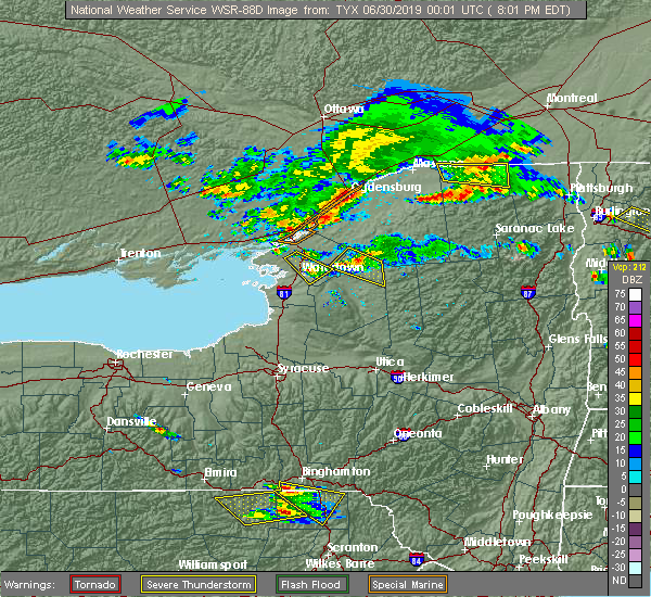 At 801 pm edt, severe thunderstorms were located along a line extending from near ogdensburg to 10 miles west of cedar island state park, moving southeast at 35 mph (radar indicated). Hazards include 60 mph wind gusts and quarter size hail. Minor hail damage to vehicles is possible. Expect wind damage to trees and powerlines. At 801 pm edt, severe thunderstorms were located along a line extending from near ogdensburg to 10 miles west of cedar island state park, moving southeast at 35 mph (radar indicated). Hazards include 60 mph wind gusts and quarter size hail. Minor hail damage to vehicles is possible. Expect wind damage to trees and powerlines.
|
| 5/25/2019 7:10 PM EDT |
 The severe thunderstorm warning for southwestern franklin and southeastern st. lawrence counties will expire at 715 pm edt, the storm which prompted the warning has weakened below severe limits, and no longer poses an immediate threat to life or property. therefore, the warning will be allowed to expire. however gusty winds and heavy rain are still possible with this thunderstorm. The severe thunderstorm warning for southwestern franklin and southeastern st. lawrence counties will expire at 715 pm edt, the storm which prompted the warning has weakened below severe limits, and no longer poses an immediate threat to life or property. therefore, the warning will be allowed to expire. however gusty winds and heavy rain are still possible with this thunderstorm.
|
| 5/25/2019 7:05 PM EDT |
 At 703 pm edt, a severe thunderstorm was located near conifer, moving east at 55 mph (radar indicated. at 6:40 pm, law enforcement reported that trees had been blown down along river road east of newton falls). Hazards include 60 mph wind gusts and quarter size hail. Minor hail damage to vehicles is possible. expect wind damage to trees and powerlines. Locations impacted include, tupper lake, oswegatchie, piercefield, wawbeek, horseshoe lake, cranberry lake, star lake, lower oswegatchie, aldrich, conifer, wanakena, gale, newton falls, childwold, shurtleff and axton landing. At 703 pm edt, a severe thunderstorm was located near conifer, moving east at 55 mph (radar indicated. at 6:40 pm, law enforcement reported that trees had been blown down along river road east of newton falls). Hazards include 60 mph wind gusts and quarter size hail. Minor hail damage to vehicles is possible. expect wind damage to trees and powerlines. Locations impacted include, tupper lake, oswegatchie, piercefield, wawbeek, horseshoe lake, cranberry lake, star lake, lower oswegatchie, aldrich, conifer, wanakena, gale, newton falls, childwold, shurtleff and axton landing.
|
| 5/25/2019 6:48 PM EDT | Several trees reported down along river road near chaumont pond. time estimated by rada in st. lawrence county NY, 5.6 miles SW of Star Lake, NY |
| 5/25/2019 6:41 PM EDT |
 At 640 pm edt, a severe thunderstorm was located over newton falls, moving east at 55 mph (radar indicated). Hazards include 60 mph wind gusts and quarter size hail. Minor hail damage to vehicles is possible. Expect wind damage to trees and powerlines. At 640 pm edt, a severe thunderstorm was located over newton falls, moving east at 55 mph (radar indicated). Hazards include 60 mph wind gusts and quarter size hail. Minor hail damage to vehicles is possible. Expect wind damage to trees and powerlines.
|
| 6/13/2018 8:10 PM EDT |
 The severe thunderstorm warning for southwestern franklin and southeastern st. lawrence counties will expire at 815 pm edt, the storms which prompted the warning have weakened below severe limits, and no longer pose an immediate threat to life or property. therefore, the warning will be allowed to expire. however gusty winds up to 35 mph and brief heavy rainfall are still possible with these thunderstorms. a severe thunderstorm watch remains in effect until 1100 pm edt for northern new york. The severe thunderstorm warning for southwestern franklin and southeastern st. lawrence counties will expire at 815 pm edt, the storms which prompted the warning have weakened below severe limits, and no longer pose an immediate threat to life or property. therefore, the warning will be allowed to expire. however gusty winds up to 35 mph and brief heavy rainfall are still possible with these thunderstorms. a severe thunderstorm watch remains in effect until 1100 pm edt for northern new york.
|
| 6/13/2018 7:55 PM EDT |
 At 754 pm edt, severe thunderstorms were located along a line extending from near lake ozonia to 9 miles southwest of horseshoe lake, moving east at 50 mph (radar indicated). Hazards include 60 mph wind gusts and quarter size hail. Minor hail damage to vehicles is possible. expect wind damage to trees and powerlines. locations impacted include, tupper lake, adirondack regional airport, piercefield, wawbeek, carry falls reservoir, horseshoe lake, cranberry lake, star lake, madawaska, stark, paul smiths, conifer, saranac inn, lake clear, upper saint regis, st. Regis mountain, gale, newton falls, childwold and shurtleff. At 754 pm edt, severe thunderstorms were located along a line extending from near lake ozonia to 9 miles southwest of horseshoe lake, moving east at 50 mph (radar indicated). Hazards include 60 mph wind gusts and quarter size hail. Minor hail damage to vehicles is possible. expect wind damage to trees and powerlines. locations impacted include, tupper lake, adirondack regional airport, piercefield, wawbeek, carry falls reservoir, horseshoe lake, cranberry lake, star lake, madawaska, stark, paul smiths, conifer, saranac inn, lake clear, upper saint regis, st. Regis mountain, gale, newton falls, childwold and shurtleff.
|
| 6/13/2018 7:35 PM EDT |
 At 735 pm edt, severe thunderstorms were located along a line extending from pierrepont to 8 miles southeast of aldrich, moving east at 50 mph (radar indicated). Hazards include 60 mph wind gusts and quarter size hail. Minor hail damage to vehicles is possible. expect wind damage to trees and powerlines. locations impacted include, tupper lake, adirondack regional airport, oswegatchie, colton, piercefield, wawbeek, degrasse, carry falls reservoir, horseshoe lake, cranberry lake, star lake, madawaska, pierrepont, stark, paul smiths, conifer, saranac inn, lake clear, upper saint regis and st. Regis mountain. At 735 pm edt, severe thunderstorms were located along a line extending from pierrepont to 8 miles southeast of aldrich, moving east at 50 mph (radar indicated). Hazards include 60 mph wind gusts and quarter size hail. Minor hail damage to vehicles is possible. expect wind damage to trees and powerlines. locations impacted include, tupper lake, adirondack regional airport, oswegatchie, colton, piercefield, wawbeek, degrasse, carry falls reservoir, horseshoe lake, cranberry lake, star lake, madawaska, pierrepont, stark, paul smiths, conifer, saranac inn, lake clear, upper saint regis and st. Regis mountain.
|
| 6/13/2018 7:19 PM EDT |
 At 718 pm edt, severe thunderstorms were located along a line extending from north russell to 11 miles south of pitcairn, moving east at 50 mph (radar indicated). Hazards include 60 mph wind gusts and quarter size hail. Minor hail damage to vehicles is possible. Expect wind damage to trees and powerlines. At 718 pm edt, severe thunderstorms were located along a line extending from north russell to 11 miles south of pitcairn, moving east at 50 mph (radar indicated). Hazards include 60 mph wind gusts and quarter size hail. Minor hail damage to vehicles is possible. Expect wind damage to trees and powerlines.
|
| 5/4/2018 6:33 PM EDT |
 At 633 pm edt, a severe thunderstorm was located over russell, moving northeast at 70 mph (radar indicated). Hazards include 70 mph wind gusts and quarter size hail. Minor hail damage to vehicles is possible. expect considerable tree damage. wind damage is also likely to mobile homes, roofs, and outbuildings. locations impacted include, potsdam, tupper lake, canton, massena, gouverneur, norfolk, oswegatchie, de kalb, parishville, colton, piercefield, morley, degrasse, massena international airport - richards field, helena, carry falls reservoir, richville, cranberry lake, madrid and lawrenceville. A tornado watch remains in effect until 1000 pm edt for northern new york. At 633 pm edt, a severe thunderstorm was located over russell, moving northeast at 70 mph (radar indicated). Hazards include 70 mph wind gusts and quarter size hail. Minor hail damage to vehicles is possible. expect considerable tree damage. wind damage is also likely to mobile homes, roofs, and outbuildings. locations impacted include, potsdam, tupper lake, canton, massena, gouverneur, norfolk, oswegatchie, de kalb, parishville, colton, piercefield, morley, degrasse, massena international airport - richards field, helena, carry falls reservoir, richville, cranberry lake, madrid and lawrenceville. A tornado watch remains in effect until 1000 pm edt for northern new york.
|
| 5/4/2018 6:17 PM EDT |
 At 617 pm edt, a severe thunderstorm was located near west fowler, moving northeast at 55 mph (radar indicated). Hazards include 60 mph wind gusts and quarter size hail. Minor hail damage to vehicles is possible. Expect wind damage to trees and powerlines. At 617 pm edt, a severe thunderstorm was located near west fowler, moving northeast at 55 mph (radar indicated). Hazards include 60 mph wind gusts and quarter size hail. Minor hail damage to vehicles is possible. Expect wind damage to trees and powerlines.
|
| 5/4/2018 4:59 PM EDT |
 At 459 pm edt, a severe thunderstorm was located over russell, moving northeast at 50 mph (radar indicated). Hazards include 60 mph wind gusts and quarter size hail. Minor hail damage to vehicles is possible. expect wind damage to trees and powerlines. locations impacted include, oswegatchie, piercefield, carry falls reservoir, horseshoe lake, degrasse, cranberry lake, star lake, russell, fine, stark, edwards, lower oswegatchie, aldrich, conifer, wanakena, south edwards, gale, newton falls, childwold and shurtleff. A tornado watch remains in effect until 1000 pm edt for northern new york. At 459 pm edt, a severe thunderstorm was located over russell, moving northeast at 50 mph (radar indicated). Hazards include 60 mph wind gusts and quarter size hail. Minor hail damage to vehicles is possible. expect wind damage to trees and powerlines. locations impacted include, oswegatchie, piercefield, carry falls reservoir, horseshoe lake, degrasse, cranberry lake, star lake, russell, fine, stark, edwards, lower oswegatchie, aldrich, conifer, wanakena, south edwards, gale, newton falls, childwold and shurtleff. A tornado watch remains in effect until 1000 pm edt for northern new york.
|
| 5/4/2018 4:28 PM EDT |
 At 428 pm edt, a severe thunderstorm was located near nelson corner, moving east at 50 mph (radar indicated). Hazards include 60 mph wind gusts and quarter size hail. Minor hail damage to vehicles is possible. Expect wind damage to trees and powerlines. At 428 pm edt, a severe thunderstorm was located near nelson corner, moving east at 50 mph (radar indicated). Hazards include 60 mph wind gusts and quarter size hail. Minor hail damage to vehicles is possible. Expect wind damage to trees and powerlines.
|
| 8/22/2017 3:42 PM EDT |
 At 341 pm edt, severe thunderstorms were located along a line extending from near madawaska to near tupper lake to 7 miles south of wanakena, moving east at 35 mph (radar indicated). Hazards include 60 mph wind gusts and quarter size hail. Minor hail damage to vehicles is possible. Expect wind damage to trees and powerlines. At 341 pm edt, severe thunderstorms were located along a line extending from near madawaska to near tupper lake to 7 miles south of wanakena, moving east at 35 mph (radar indicated). Hazards include 60 mph wind gusts and quarter size hail. Minor hail damage to vehicles is possible. Expect wind damage to trees and powerlines.
|
| 8/22/2017 3:18 PM EDT |
 At 317 pm edt, a severe thunderstorm was located near carry falls reservoir, moving northeast at 55 mph (radar indicated). Hazards include 60 mph wind gusts. Expect damage to trees and powerlines. locations impacted include, tupper lake, adirondack regional airport, oswegatchie, newcomb, piercefield, wawbeek, horseshoe lake, cranberry lake, star lake, fine, pitcairn, paul smiths, conifer, saranac inn, lake clear, upper saint regis, st. regis mountain, gale, newton falls and childwold. A tornado watch remains in effect until 900 pm edt for northern new york. At 317 pm edt, a severe thunderstorm was located near carry falls reservoir, moving northeast at 55 mph (radar indicated). Hazards include 60 mph wind gusts. Expect damage to trees and powerlines. locations impacted include, tupper lake, adirondack regional airport, oswegatchie, newcomb, piercefield, wawbeek, horseshoe lake, cranberry lake, star lake, fine, pitcairn, paul smiths, conifer, saranac inn, lake clear, upper saint regis, st. regis mountain, gale, newton falls and childwold. A tornado watch remains in effect until 900 pm edt for northern new york.
|
| 8/22/2017 2:43 PM EDT |
 At 243 pm edt, a severe thunderstorm was located near pitcairn, moving east at 50 mph (radar indicated). Hazards include 70 mph wind gusts and penny size hail. Expect considerable tree damage. Damage is likely to mobile homes, roofs, and outbuildings. At 243 pm edt, a severe thunderstorm was located near pitcairn, moving east at 50 mph (radar indicated). Hazards include 70 mph wind gusts and penny size hail. Expect considerable tree damage. Damage is likely to mobile homes, roofs, and outbuildings.
|
| 8/4/2017 8:08 PM EDT |
 At 808 pm edt, a severe thunderstorm was located over oswegatchie, moving northeast at 40 mph (radar indicated). Hazards include 60 mph wind gusts and quarter size hail. Minor hail damage to vehicles is possible. Expect wind damage to trees and powerlines. At 808 pm edt, a severe thunderstorm was located over oswegatchie, moving northeast at 40 mph (radar indicated). Hazards include 60 mph wind gusts and quarter size hail. Minor hail damage to vehicles is possible. Expect wind damage to trees and powerlines.
|
| 5/1/2017 7:22 PM EDT |
 At 721 pm edt, severe thunderstorms were located along a line extending from near east de kalb to fine to 7 miles north of soft maple reservoir, moving northeast at 55 mph (radar indicated). Hazards include 60 mph wind gusts. Expect damage to roofs, siding, and trees. Locations impacted include, colton, piercefield, degrasse, carry falls reservoir, horseshoe lake, cranberry lake, lake ozonia, star lake, oswegatchie, pierrepont, parishville, russell, fine, stark, conifer, gale, newton falls, childwold, shurtleff and nicholville. At 721 pm edt, severe thunderstorms were located along a line extending from near east de kalb to fine to 7 miles north of soft maple reservoir, moving northeast at 55 mph (radar indicated). Hazards include 60 mph wind gusts. Expect damage to roofs, siding, and trees. Locations impacted include, colton, piercefield, degrasse, carry falls reservoir, horseshoe lake, cranberry lake, lake ozonia, star lake, oswegatchie, pierrepont, parishville, russell, fine, stark, conifer, gale, newton falls, childwold, shurtleff and nicholville.
|
| 5/1/2017 7:06 PM EDT | Trees and powerlines down in st. lawrence county NY, 8.4 miles SE of Star Lake, NY |
| 5/1/2017 6:51 PM EDT |
 At 651 pm edt, severe thunderstorms were located along a line extending from near antwerp to near carthage to near rector, moving northeast at 50 mph (radar indicated). Hazards include 60 mph wind gusts. expect damage to roofs, siding, and trees At 651 pm edt, severe thunderstorms were located along a line extending from near antwerp to near carthage to near rector, moving northeast at 50 mph (radar indicated). Hazards include 60 mph wind gusts. expect damage to roofs, siding, and trees
|
| 6/20/2016 10:17 PM EDT | Power lines down with 800 customers impacte in st. lawrence county NY, 0.5 miles SW of Star Lake, NY |
| 6/20/2016 10:10 PM EDT |
 At 1009 pm edt, severe thunderstorms were located along a line extending from near degrasse to near star lake, moving east at 60 mph (radar indicated). Hazards include 60 mph wind gusts. Expect damage to roofs. siding. And trees. At 1009 pm edt, severe thunderstorms were located along a line extending from near degrasse to near star lake, moving east at 60 mph (radar indicated). Hazards include 60 mph wind gusts. Expect damage to roofs. siding. And trees.
|
| 8/5/2012 5:06 PM EDT | Numerous trees and wires down in st. lawrence county NY, 8.4 miles SE of Star Lake, NY |
| 1/1/0001 12:00 AM | Quarter sized hail reported 0.5 miles SW of Star Lake, NY, quarter size hail at clifton-fine golf course |
Hail Maps for Star Lake, NY


Connect with Interactive Hail Maps