

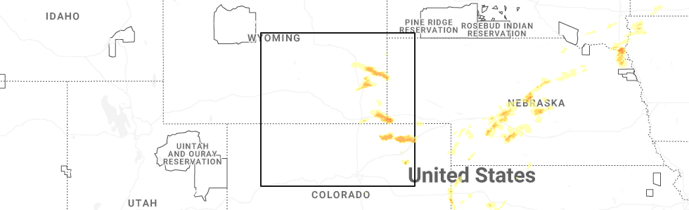
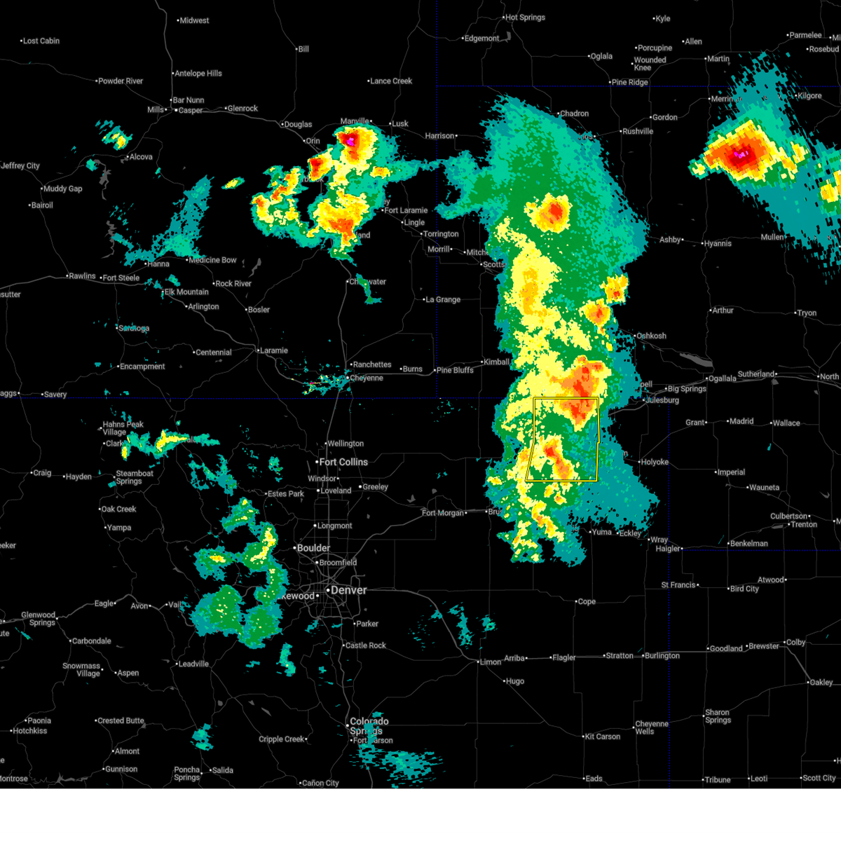
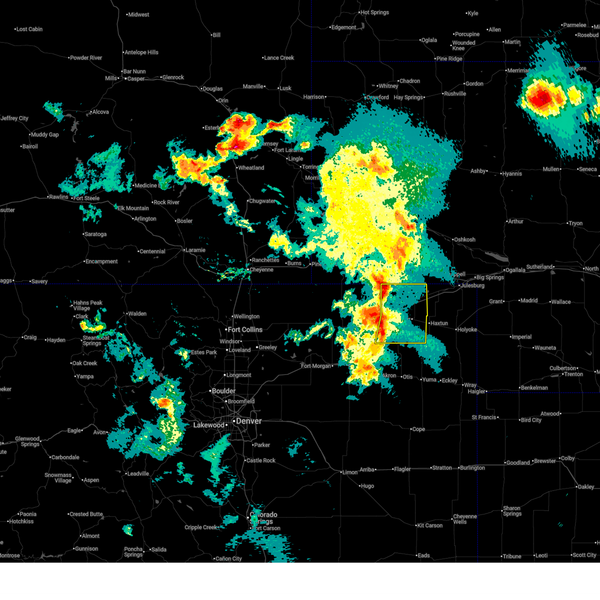
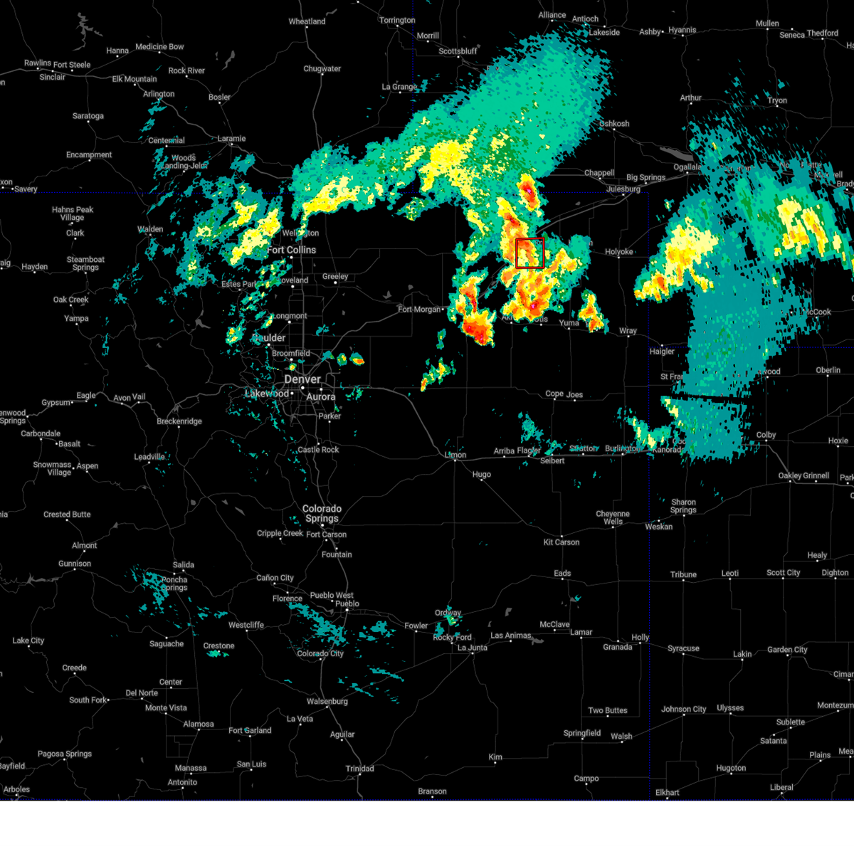
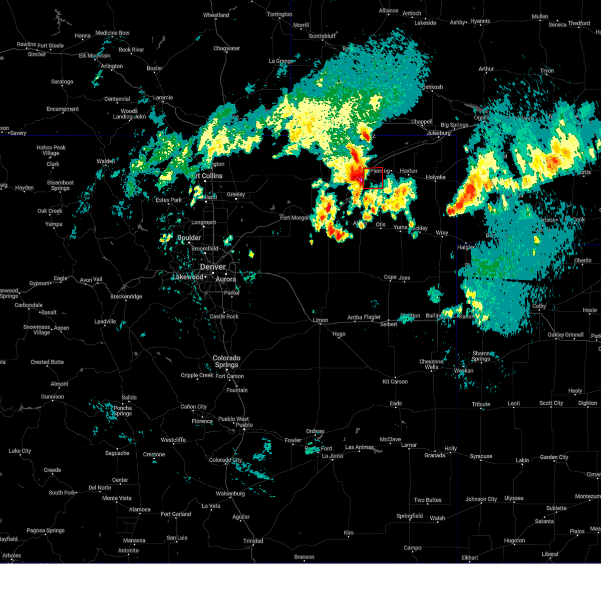
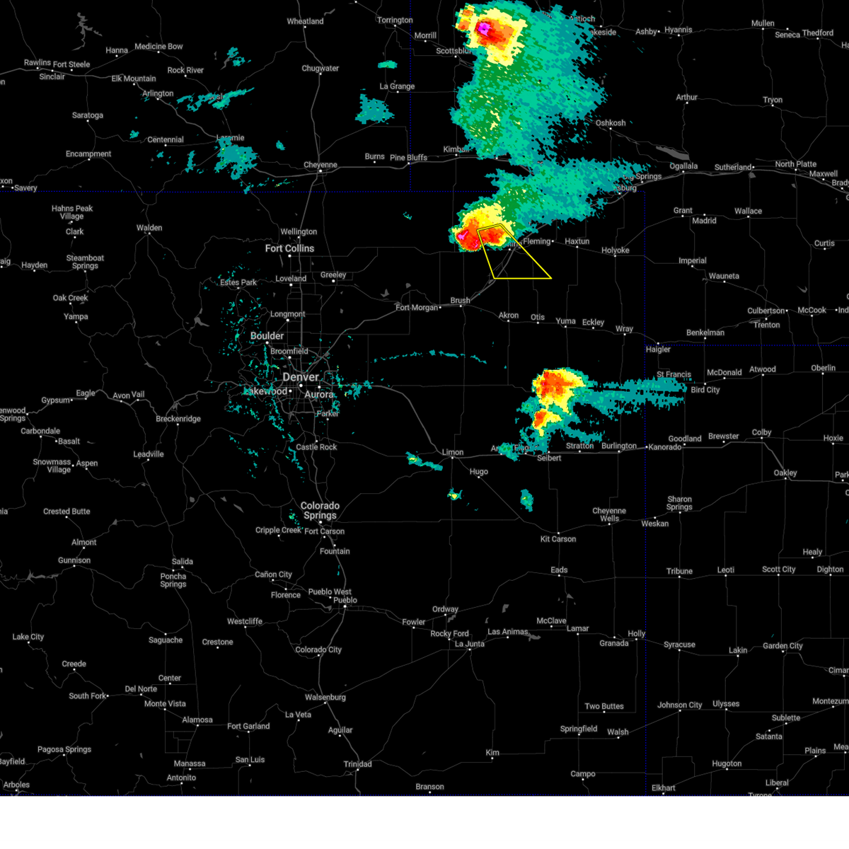
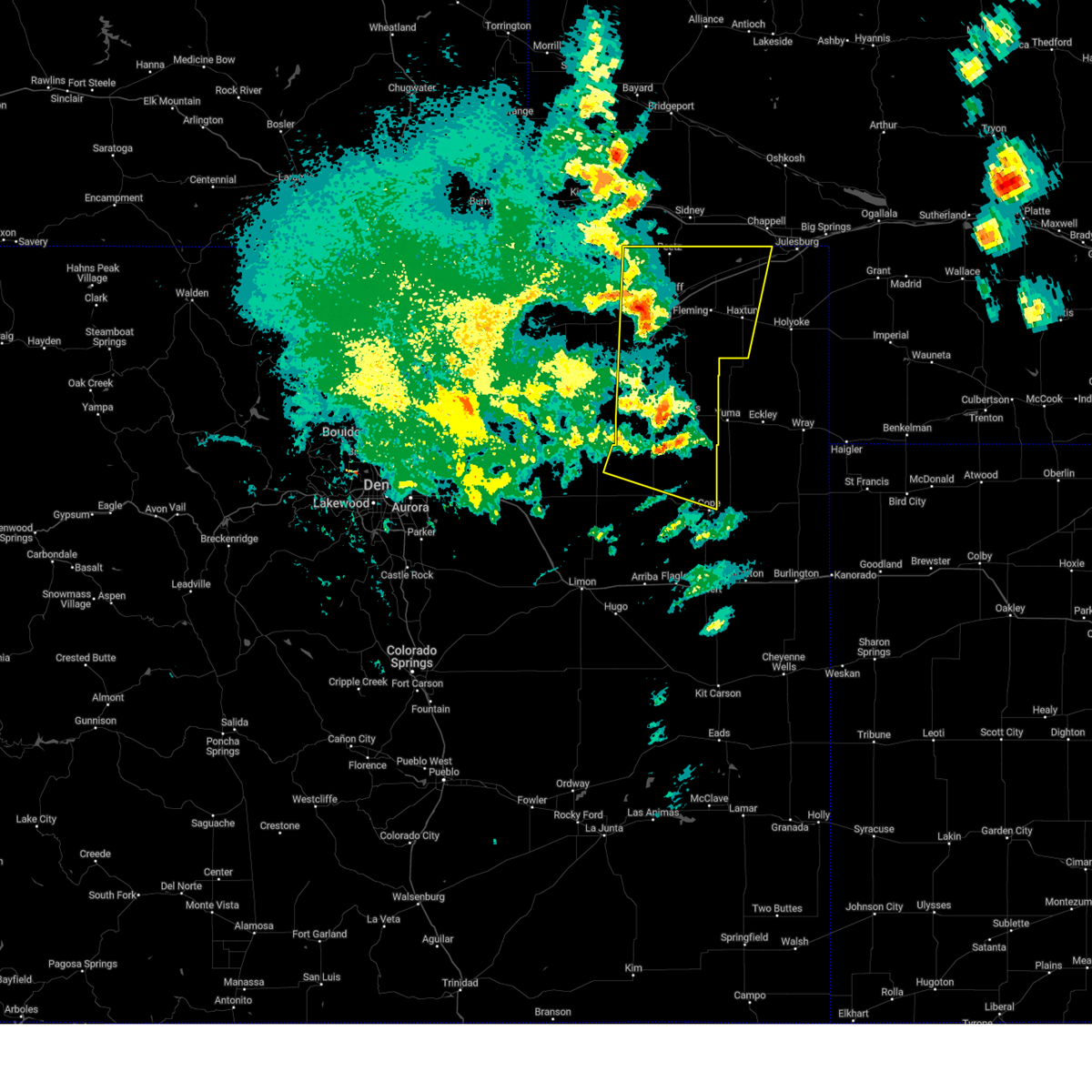
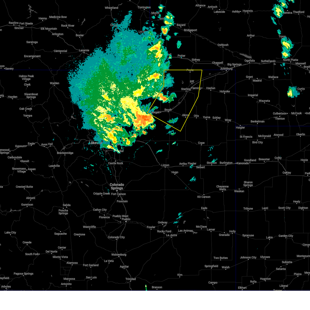
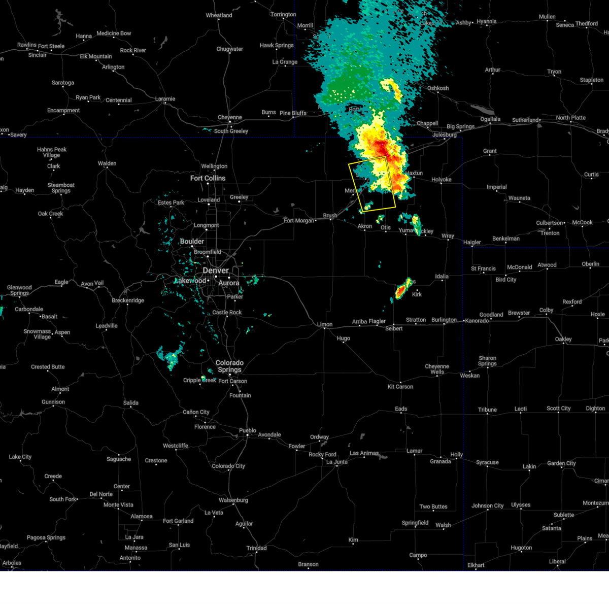
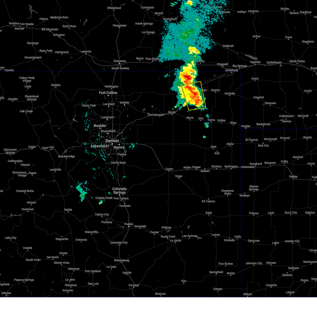
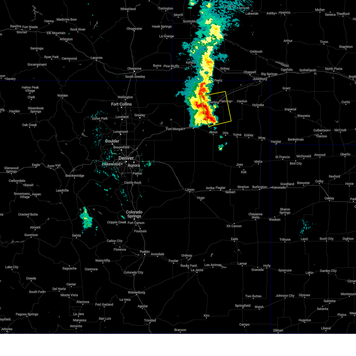
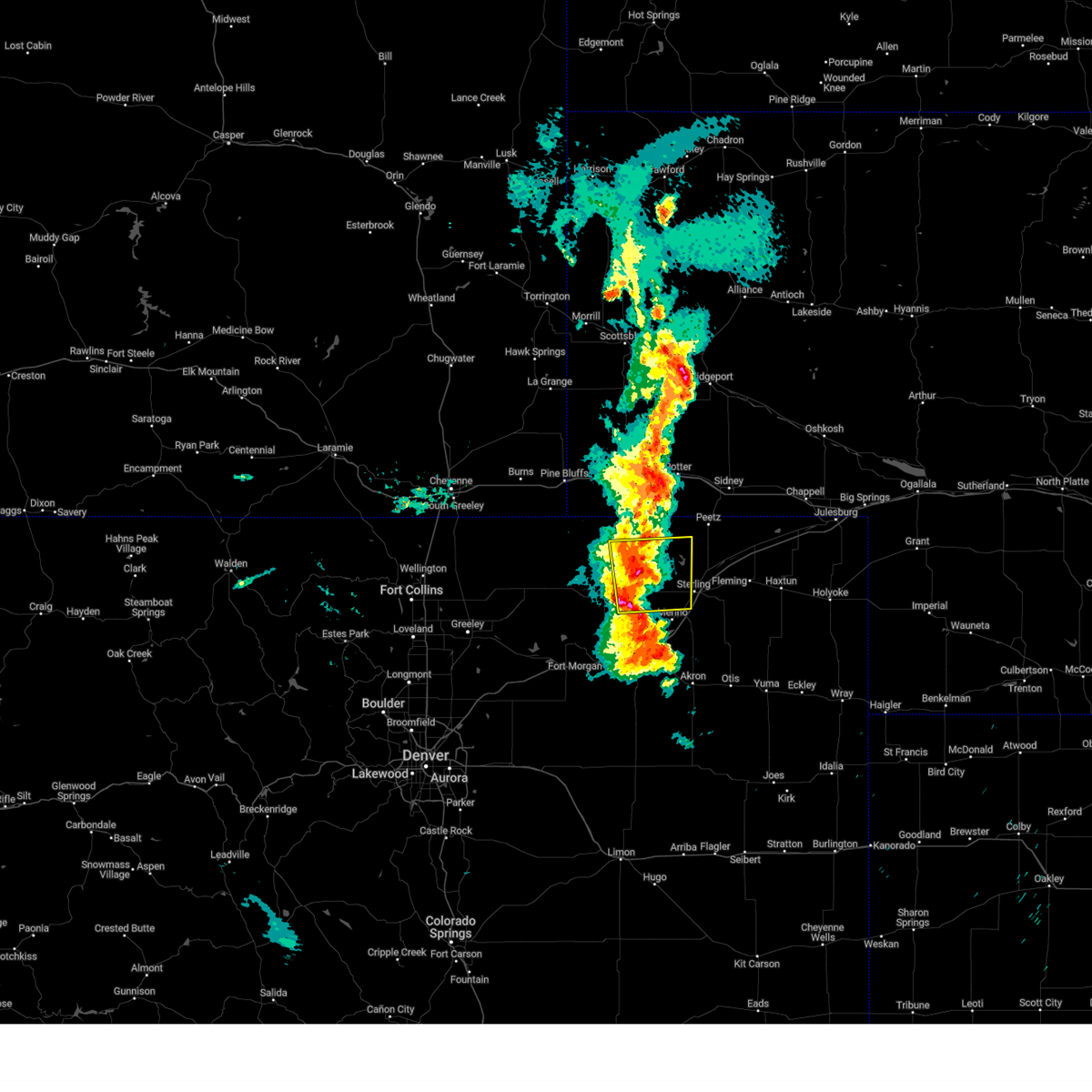
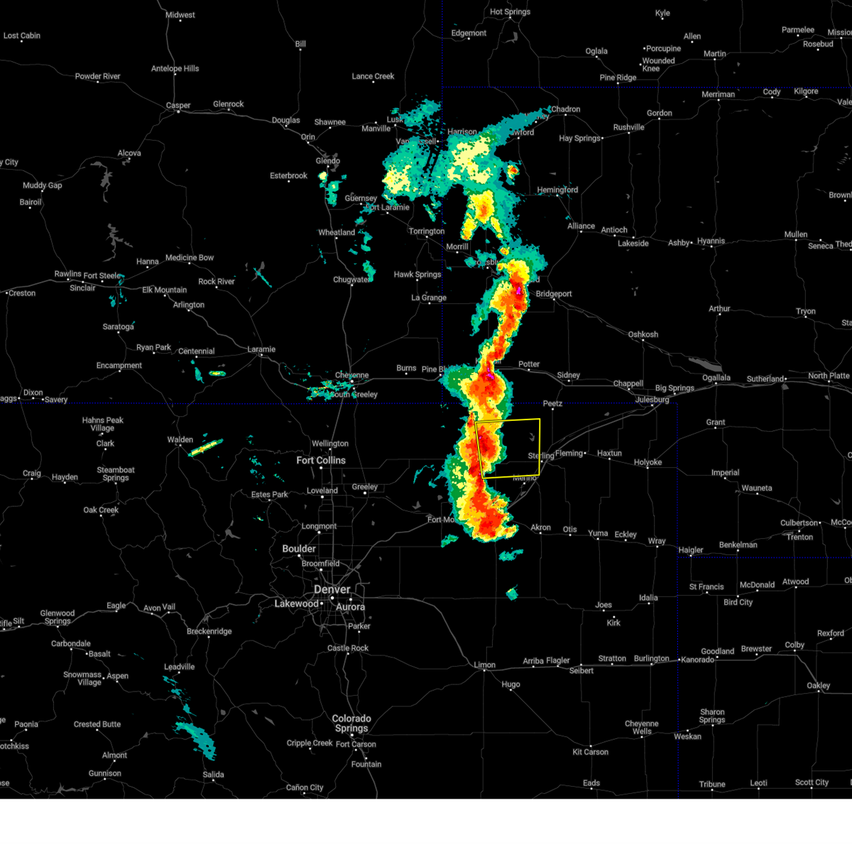
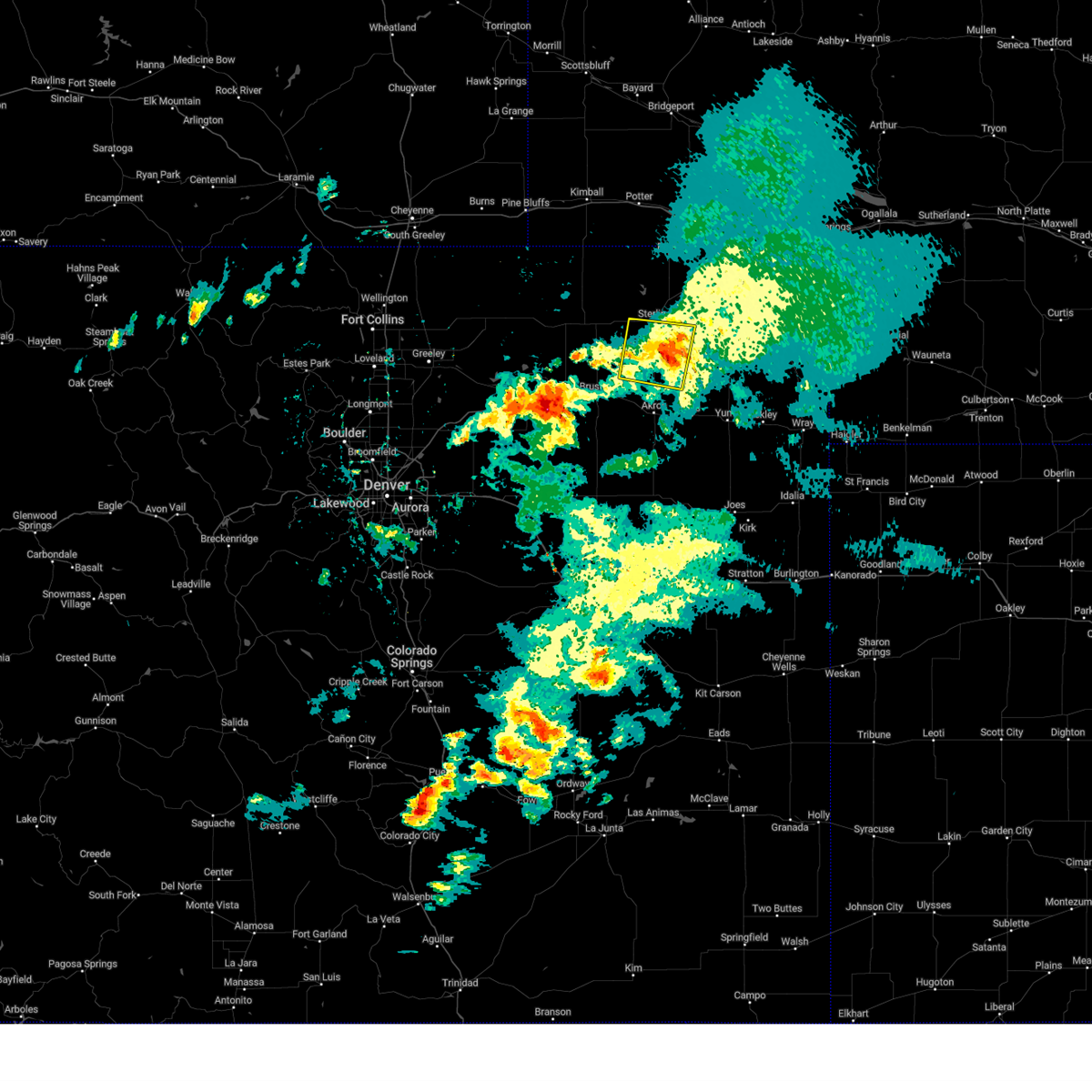
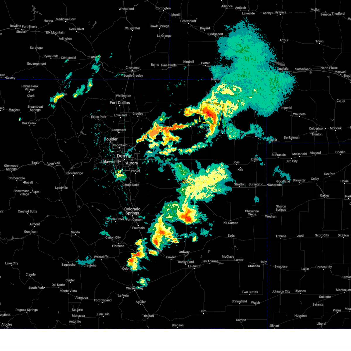
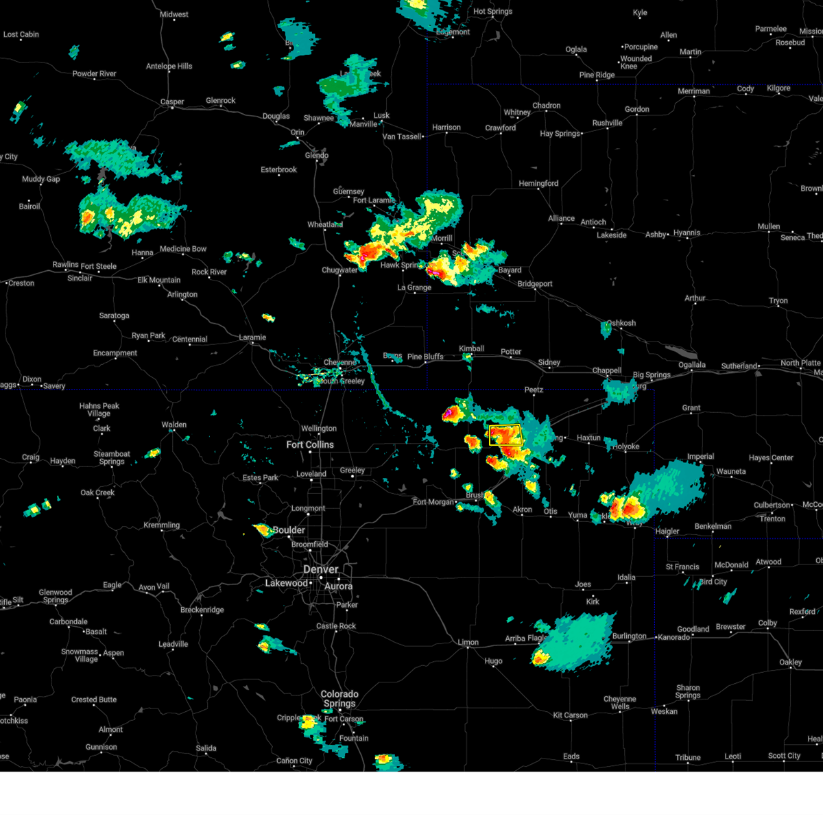
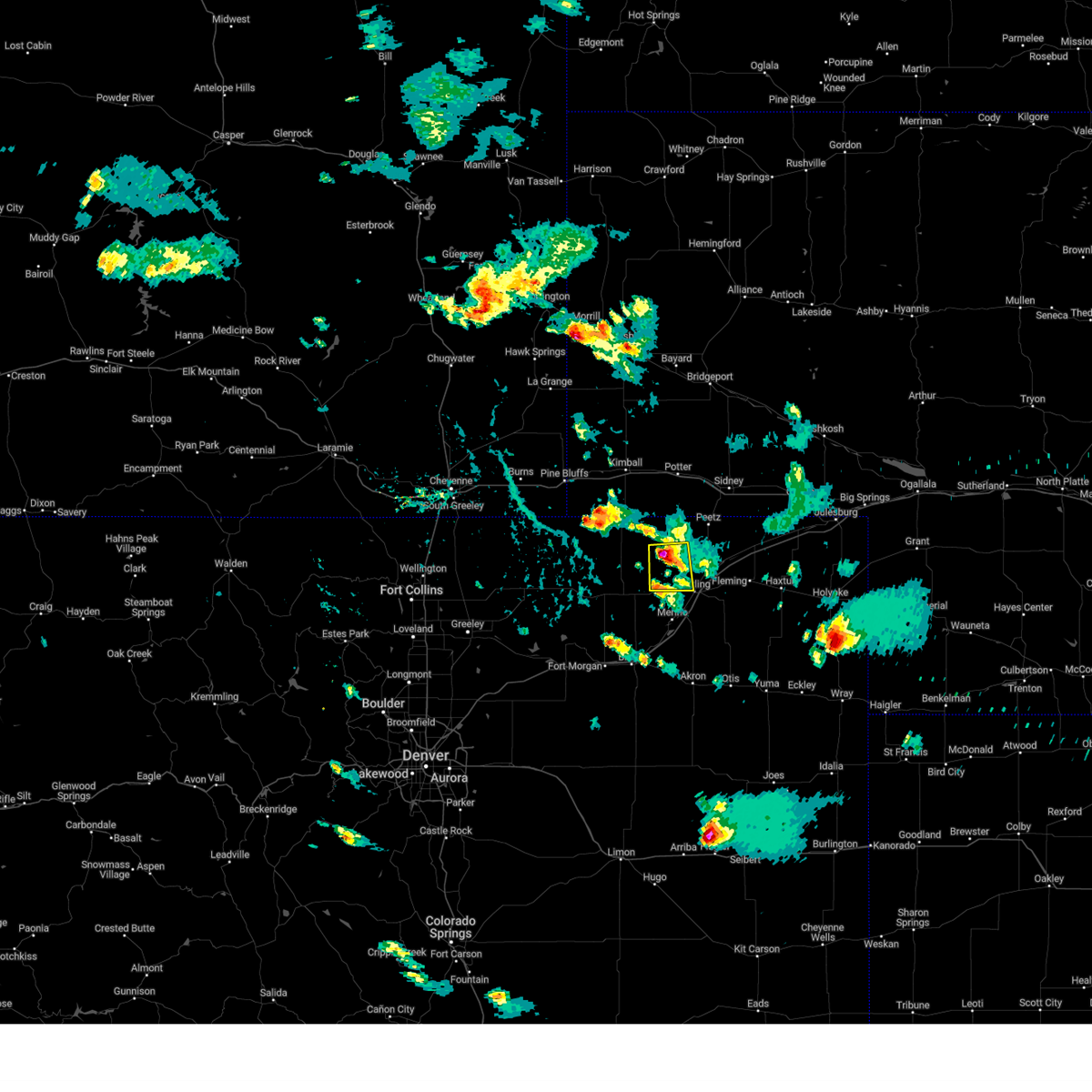
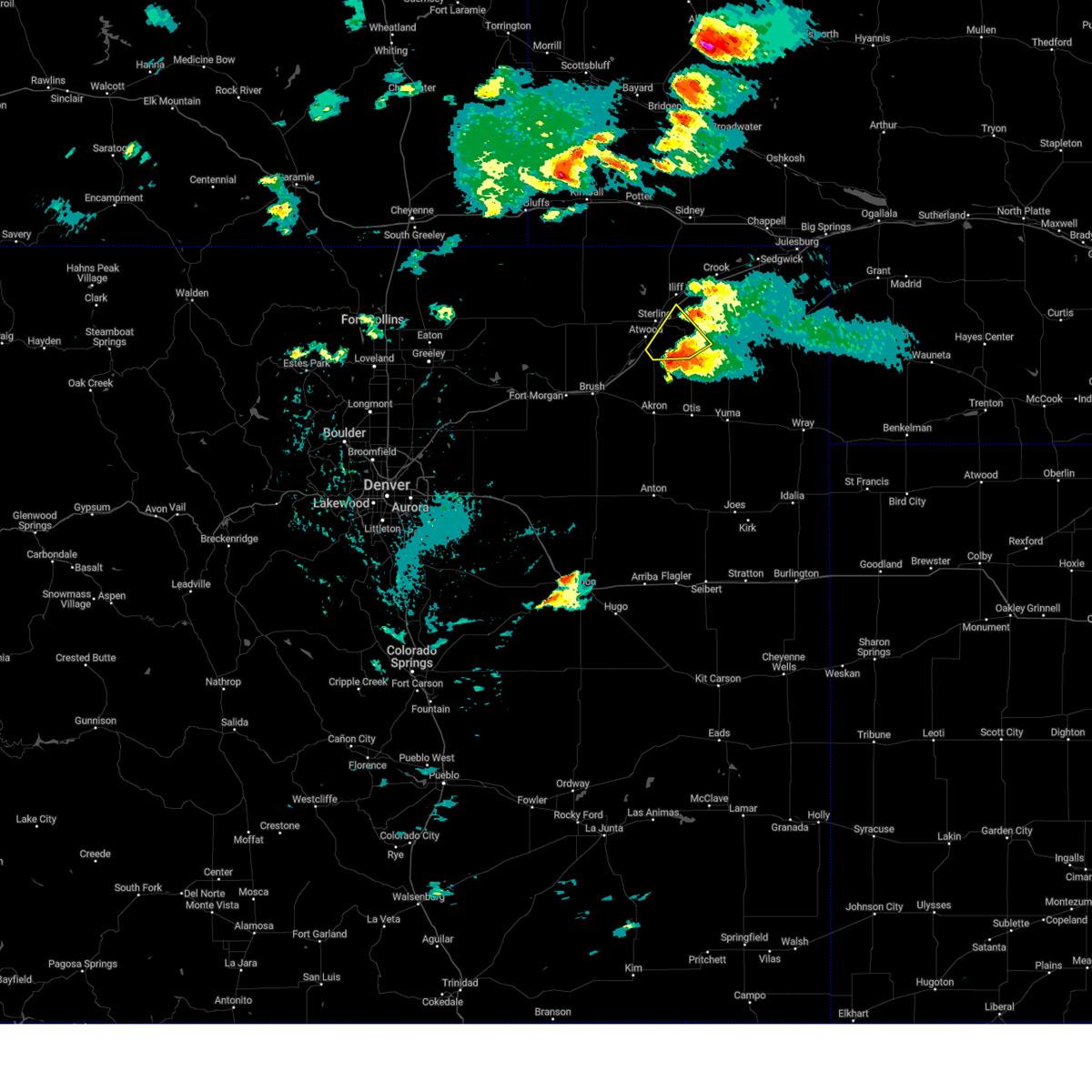
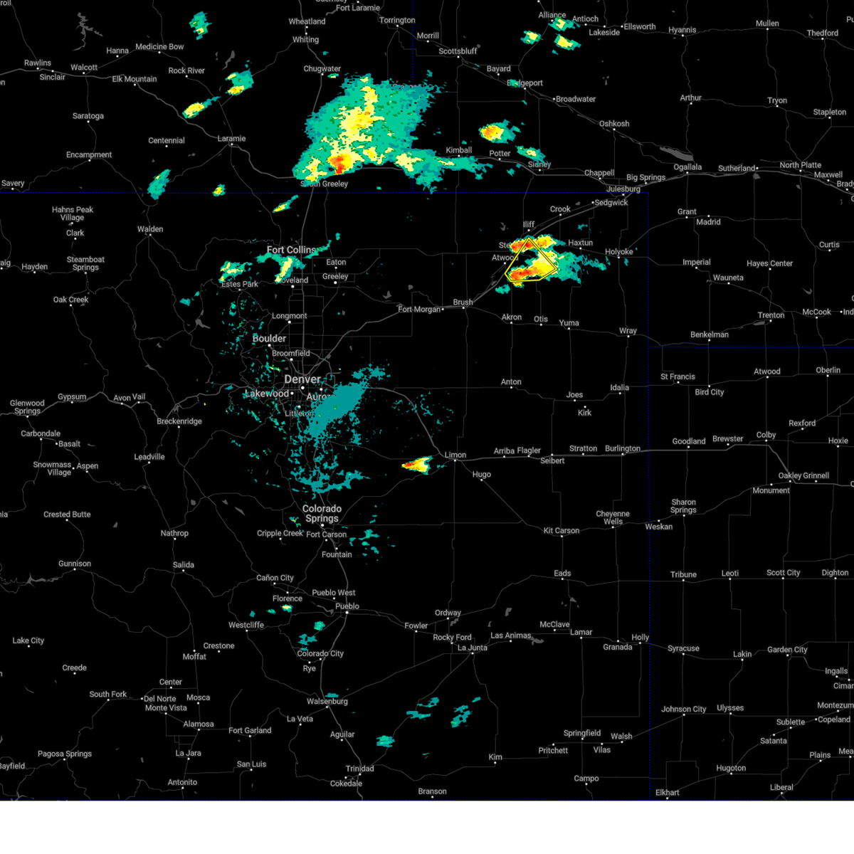
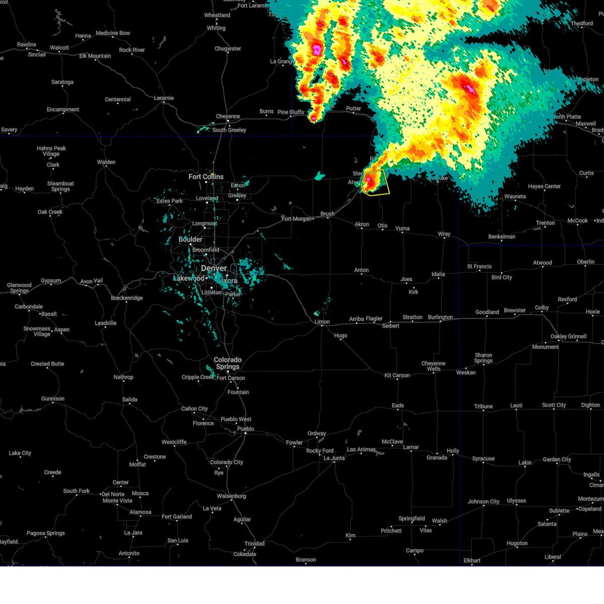
Hail Map for Sterling, CO
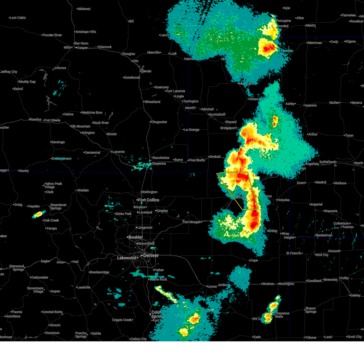
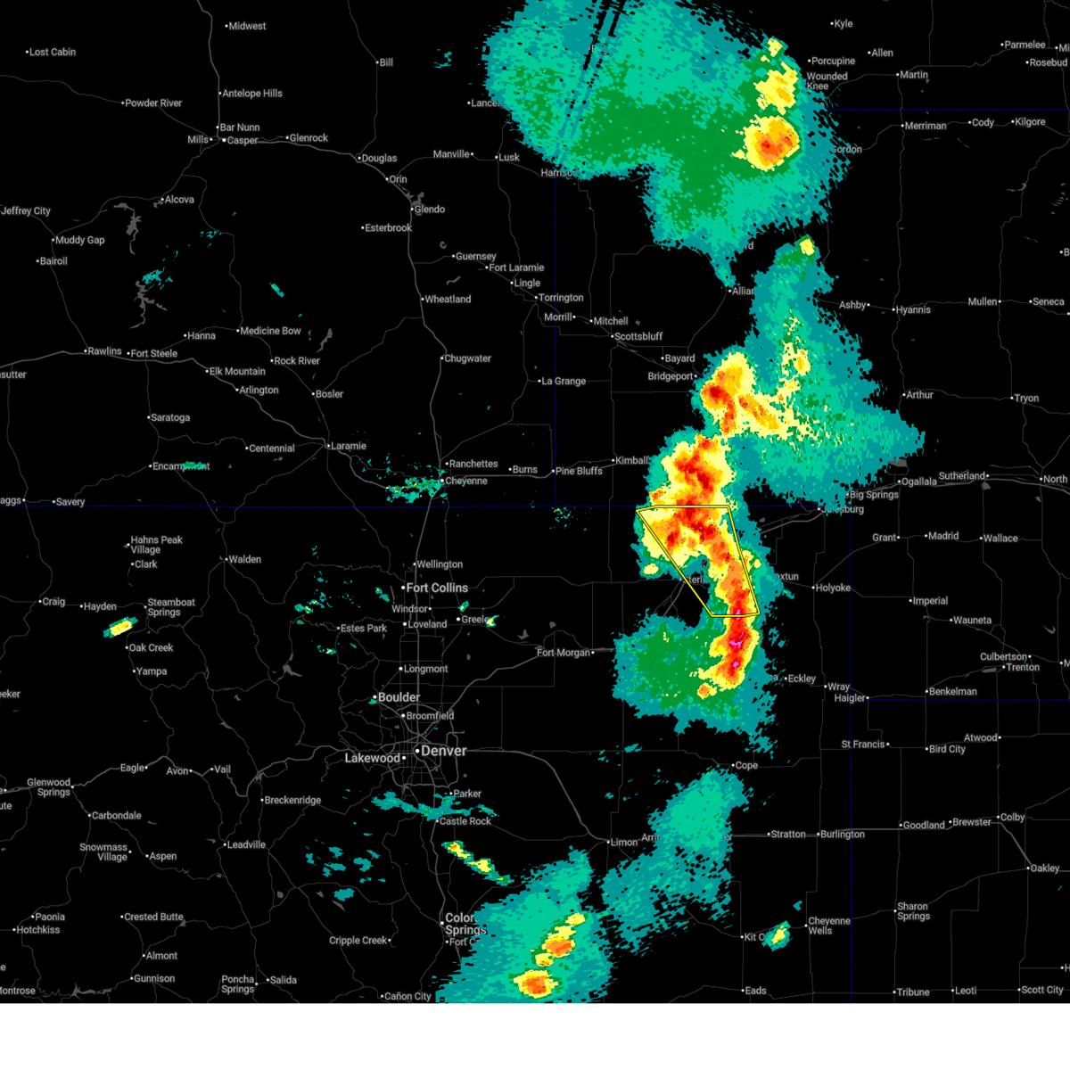
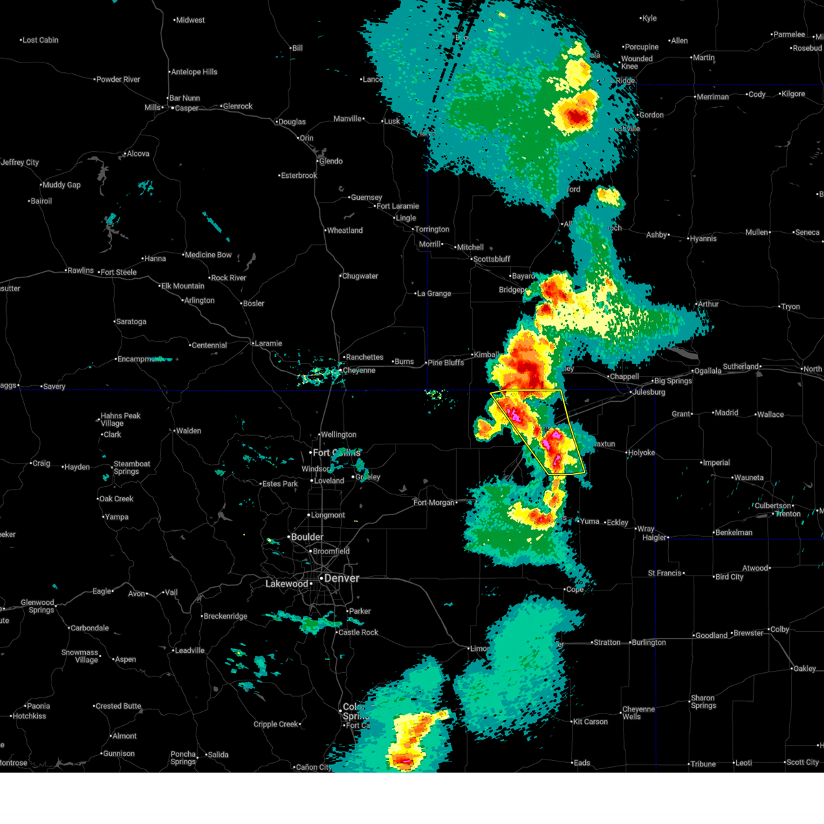
The Sterling, CO area has had 78 reports of on-the-ground hail by trained spotters, and has been under severe weather warnings 37 times during the past 12 months. Doppler radar has detected hail at or near Sterling, CO on 105 occasions, including 13 occasions during the past year.
| Name: | Sterling, CO |
| Where Located: | 43.2 miles NW of Yuma, CO |
| Map: | Google Map for Sterling, CO |
| Population: | 14777 |
| Housing Units: | 5404 |
| More Info: | Search Google for Sterling, CO |
2
The Top Recent Hail Date for Sterling, CO is Monday, June 2, 2025 (8th out of 105)
Hail and Wind Damage Spotted near Sterling, CO
| Date / Time | Report Details |
|---|---|
| 6/13/2025 8:14 PM MDT |
 The storms which prompted the warning have moved out of the area. therefore, the warning will be allowed to expire. a severe thunderstorm watch remains in effect until 1000 pm mdt friday for a portion of northeast colorado. The storms which prompted the warning have moved out of the area. therefore, the warning will be allowed to expire. a severe thunderstorm watch remains in effect until 1000 pm mdt friday for a portion of northeast colorado.
|
| 6/13/2025 8:00 PM MDT |
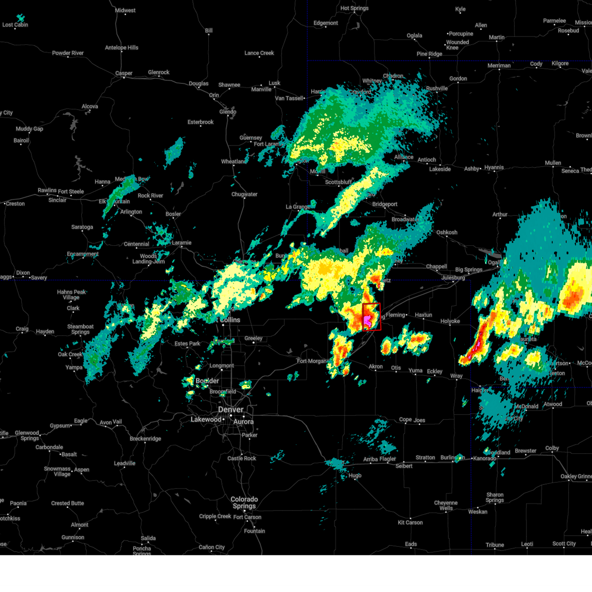
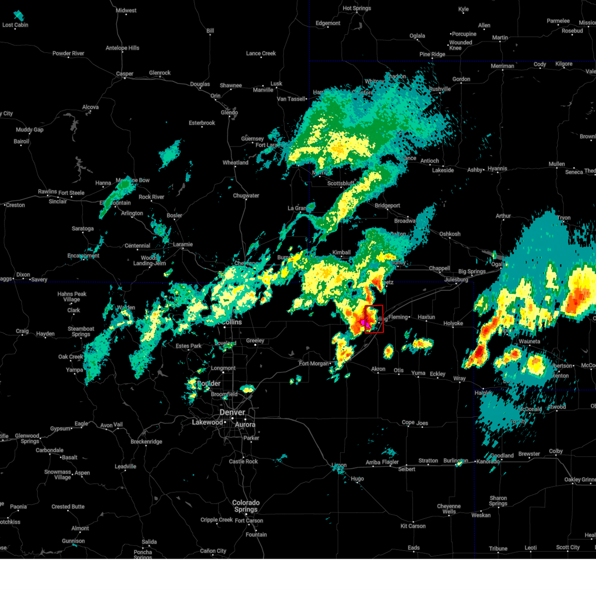
 At 800 pm mdt, severe thunderstorms were located along a line from 8 miles northwest of peetz to 5 miles south of st petersburg, or along a line from 17 miles southwest of sidney to 22 miles southeast of sterling, moving northeast at 20 mph (radar indicated). Hazards include 60 mph wind gusts and quarter size hail. Hail damage to vehicles is expected. expect wind damage to roofs, siding, and trees. Locations impacted include, eastern sterling, fleming, iliff, peetz, proctor, padroni, north sterling reservoir, st petersburg and reiradon hill. At 800 pm mdt, severe thunderstorms were located along a line from 8 miles northwest of peetz to 5 miles south of st petersburg, or along a line from 17 miles southwest of sidney to 22 miles southeast of sterling, moving northeast at 20 mph (radar indicated). Hazards include 60 mph wind gusts and quarter size hail. Hail damage to vehicles is expected. expect wind damage to roofs, siding, and trees. Locations impacted include, eastern sterling, fleming, iliff, peetz, proctor, padroni, north sterling reservoir, st petersburg and reiradon hill.
|
| 6/13/2025 7:40 PM MDT |
 Svrbou the national weather service in denver has issued a * severe thunderstorm warning for, central logan county in northeastern colorado, * until 815 pm mdt. * at 740 pm mdt, severe thunderstorms were located along a line from 11 miles northeast of westplains to 6 miles northeast of burdett, or along a line from 25 miles north of sterling to 20 miles southeast of sterling, moving northeast at 20 mph (radar indicated). Hazards include 60 mph wind gusts and half dollar size hail. Hail damage to vehicles is expected. Expect wind damage to roofs, siding, and trees. Svrbou the national weather service in denver has issued a * severe thunderstorm warning for, central logan county in northeastern colorado, * until 815 pm mdt. * at 740 pm mdt, severe thunderstorms were located along a line from 11 miles northeast of westplains to 6 miles northeast of burdett, or along a line from 25 miles north of sterling to 20 miles southeast of sterling, moving northeast at 20 mph (radar indicated). Hazards include 60 mph wind gusts and half dollar size hail. Hail damage to vehicles is expected. Expect wind damage to roofs, siding, and trees.
|
| 6/12/2025 6:56 PM MDT |
 The storms which prompted the warning have weakened below severe limits, and no longer pose an immediate threat to life or property. therefore, the warning will be allowed to expire. however, small hail and gusty winds are still possible with these thunderstorms. a severe thunderstorm watch remains in effect until 1100 pm mdt thursday for a portion of northeast colorado. The storms which prompted the warning have weakened below severe limits, and no longer pose an immediate threat to life or property. therefore, the warning will be allowed to expire. however, small hail and gusty winds are still possible with these thunderstorms. a severe thunderstorm watch remains in effect until 1100 pm mdt thursday for a portion of northeast colorado.
|
| 6/12/2025 6:22 PM MDT |
 Svrbou the national weather service in denver has issued a * severe thunderstorm warning for, logan county in northeastern colorado, * until 700 pm mdt. * at 622 pm mdt, severe thunderstorms were located along a line from near peetz to atwood, in sterling county, moving east at 10 mph (radar indicated). Hazards include 60 mph wind gusts and quarter size hail. Hail damage to vehicles is expected. Expect wind damage to roofs, siding, and trees. Svrbou the national weather service in denver has issued a * severe thunderstorm warning for, logan county in northeastern colorado, * until 700 pm mdt. * at 622 pm mdt, severe thunderstorms were located along a line from near peetz to atwood, in sterling county, moving east at 10 mph (radar indicated). Hazards include 60 mph wind gusts and quarter size hail. Hail damage to vehicles is expected. Expect wind damage to roofs, siding, and trees.
|
| 6/2/2025 8:27 PM MDT |
 The storm which prompted the warning has weakened below severe limits, and no longer appears capable of producing a tornado. therefore, the warning will be allowed to expire. however, small hail, gusty winds, and heavy rain are still possible with this thunderstorm. The storm which prompted the warning has weakened below severe limits, and no longer appears capable of producing a tornado. therefore, the warning will be allowed to expire. however, small hail, gusty winds, and heavy rain are still possible with this thunderstorm.
|
| 6/2/2025 8:09 PM MDT |
 Torbou the national weather service in denver has issued a * tornado warning for, south central logan county in northeastern colorado, * until 830 pm mdt. * at 809 pm mdt, a severe thunderstorm capable of producing a tornado was located near sterling, moving east at 15 mph (radar indicated rotation). Hazards include tornado and half dollar size hail. Flying debris will be dangerous to those caught without shelter. mobile homes will be damaged or destroyed. damage to roofs, windows and vehicles will occur. Tree damage is likely. Torbou the national weather service in denver has issued a * tornado warning for, south central logan county in northeastern colorado, * until 830 pm mdt. * at 809 pm mdt, a severe thunderstorm capable of producing a tornado was located near sterling, moving east at 15 mph (radar indicated rotation). Hazards include tornado and half dollar size hail. Flying debris will be dangerous to those caught without shelter. mobile homes will be damaged or destroyed. damage to roofs, windows and vehicles will occur. Tree damage is likely.
|
| 6/2/2025 8:06 PM MDT | Mesonet station co035 i-76 sterlin in logan county CO, 1.7 miles WNW of Sterling, CO |
| 6/2/2025 8:00 PM MDT | Ping Pong Ball sized hail reported 0.5 miles SE of Sterling, CO |
| 6/2/2025 7:56 PM MDT |
 At 756 pm mdt, a confirmed tornado was located near sterling, moving east at 15 mph. people in sterling should take cover immediately!!! (weather spotters confirmed tornado). Hazards include damaging tornado and two inch hail. Flying debris will be dangerous to those caught without shelter. mobile homes will be damaged or destroyed. damage to roofs, windows and vehicles will occur. tree damage is likely. Locations impacted include, sterling, logan corners, atwood, north sterling reservoir and padroni. At 756 pm mdt, a confirmed tornado was located near sterling, moving east at 15 mph. people in sterling should take cover immediately!!! (weather spotters confirmed tornado). Hazards include damaging tornado and two inch hail. Flying debris will be dangerous to those caught without shelter. mobile homes will be damaged or destroyed. damage to roofs, windows and vehicles will occur. tree damage is likely. Locations impacted include, sterling, logan corners, atwood, north sterling reservoir and padroni.
|
| 6/2/2025 7:52 PM MDT |
 At 752 pm mdt, a severe thunderstorm capable of producing a tornado was located near sterling, moving east at 15 mph (radar indicated rotation). Hazards include tornado and two inch hail. Flying debris will be dangerous to those caught without shelter. mobile homes will be damaged or destroyed. damage to roofs, windows and vehicles will occur. tree damage is likely. Locations impacted include, sterling, logan corners, atwood, north sterling reservoir and padroni. At 752 pm mdt, a severe thunderstorm capable of producing a tornado was located near sterling, moving east at 15 mph (radar indicated rotation). Hazards include tornado and two inch hail. Flying debris will be dangerous to those caught without shelter. mobile homes will be damaged or destroyed. damage to roofs, windows and vehicles will occur. tree damage is likely. Locations impacted include, sterling, logan corners, atwood, north sterling reservoir and padroni.
|
| 6/2/2025 7:44 PM MDT | Torbou the national weather service in denver has issued a * tornado warning for, southwestern logan county in northeastern colorado, * until 815 pm mdt. * at 744 pm mdt, a severe thunderstorm capable of producing a tornado was located near logan corners, or near sterling, moving east at 15 mph (radar indicated rotation). Hazards include tornado and golf ball size hail. Flying debris will be dangerous to those caught without shelter. mobile homes will be damaged or destroyed. damage to roofs, windows and vehicles will occur. Tree damage is likely. |
| 6/2/2025 7:41 PM MDT | Hen Egg sized hail reported 4.6 miles E of Sterling, CO |
| 5/23/2025 5:43 PM MDT |
 The storm which prompted the warning has moved out of the area. therefore, the warning will be allowed to expire. a severe thunderstorm watch remains in effect until 900 pm mdt friday for a portion of northeast colorado. The storm which prompted the warning has moved out of the area. therefore, the warning will be allowed to expire. a severe thunderstorm watch remains in effect until 900 pm mdt friday for a portion of northeast colorado.
|
| 5/23/2025 5:24 PM MDT |
 At 524 pm mdt, a severe thunderstorm was located near atwood, or near sterling, moving southeast at 25 mph (radar indicated). Hazards include golf ball size hail and 60 mph wind gusts. People and animals outdoors will be injured. expect hail damage to roofs, siding, windows, and vehicles. expect wind damage to roofs, siding, and trees. Locations impacted include, sterling, merino, atwood and logan corners. At 524 pm mdt, a severe thunderstorm was located near atwood, or near sterling, moving southeast at 25 mph (radar indicated). Hazards include golf ball size hail and 60 mph wind gusts. People and animals outdoors will be injured. expect hail damage to roofs, siding, windows, and vehicles. expect wind damage to roofs, siding, and trees. Locations impacted include, sterling, merino, atwood and logan corners.
|
| 5/23/2025 5:09 PM MDT | Tea Cup sized hail reported 13 miles E of Sterling, CO, report from mping: tea cup (3.00 in.). |
| 5/23/2025 5:05 PM MDT | Quarter sized hail reported 13.6 miles E of Sterling, CO, report from mping: quarter (1.00 in.). |
| 5/23/2025 4:56 PM MDT |
 Svrbou the national weather service in denver has issued a * severe thunderstorm warning for, southwestern logan county in northeastern colorado, * until 545 pm mdt. * at 456 pm mdt, a severe thunderstorm was located near logan corners, or 9 miles northwest of sterling, moving southeast at 30 mph (radar indicated). Hazards include golf ball size hail and 60 mph wind gusts. People and animals outdoors will be injured. expect hail damage to roofs, siding, windows, and vehicles. Expect wind damage to roofs, siding, and trees. Svrbou the national weather service in denver has issued a * severe thunderstorm warning for, southwestern logan county in northeastern colorado, * until 545 pm mdt. * at 456 pm mdt, a severe thunderstorm was located near logan corners, or 9 miles northwest of sterling, moving southeast at 30 mph (radar indicated). Hazards include golf ball size hail and 60 mph wind gusts. People and animals outdoors will be injured. expect hail damage to roofs, siding, windows, and vehicles. Expect wind damage to roofs, siding, and trees.
|
| 5/14/2025 6:02 PM MDT |
 The severe thunderstorm warning that was previously in effect has been reissued for eastern washington, eastern logan, sedgwick, and phillips counties and is in effect until 645 pm mdt. please refer to that bulletin for the latest severe weather information. a severe thunderstorm watch remains in effect until 1000 pm mdt for a portion of northeast colorado. The severe thunderstorm warning that was previously in effect has been reissued for eastern washington, eastern logan, sedgwick, and phillips counties and is in effect until 645 pm mdt. please refer to that bulletin for the latest severe weather information. a severe thunderstorm watch remains in effect until 1000 pm mdt for a portion of northeast colorado.
|
| 5/14/2025 5:45 PM MDT |
 At 545 pm mdt, severe thunderstorms were located along a line from 7 miles southeast of sidney municipal airport to 10 miles southeast of elba, or along a line from 8 miles southeast of sidney to 24 miles south of akron, moving east at 40 mph (trained spotters and weather stations reported. at 533 pm, the akron, colorado airport recorded a wind gust to 63 mph. at 515 pm, the sterling, colorado airport reported a wind gusts to 60 mph. reports of high wind damage have been received from around brush, where tree damage occurred). Hazards include 70 mph wind gusts and quarter size hail. Hail damage to vehicles is expected. expect considerable tree damage. wind damage is also likely to mobile homes, roofs, and outbuildings. Locations impacted include, sterling, akron, haxtun, otis, fleming, merino, iliff, peetz, sedgwick, crook, burdett, lone star, st petersburg, atwood, platner, prewitt reservoir, logan corners, padroni, proctor and midway. At 545 pm mdt, severe thunderstorms were located along a line from 7 miles southeast of sidney municipal airport to 10 miles southeast of elba, or along a line from 8 miles southeast of sidney to 24 miles south of akron, moving east at 40 mph (trained spotters and weather stations reported. at 533 pm, the akron, colorado airport recorded a wind gust to 63 mph. at 515 pm, the sterling, colorado airport reported a wind gusts to 60 mph. reports of high wind damage have been received from around brush, where tree damage occurred). Hazards include 70 mph wind gusts and quarter size hail. Hail damage to vehicles is expected. expect considerable tree damage. wind damage is also likely to mobile homes, roofs, and outbuildings. Locations impacted include, sterling, akron, haxtun, otis, fleming, merino, iliff, peetz, sedgwick, crook, burdett, lone star, st petersburg, atwood, platner, prewitt reservoir, logan corners, padroni, proctor and midway.
|
| 5/14/2025 5:32 PM MDT | Awos station k1mw sterling 15 wn in logan county CO, 15.5 miles ESE of Sterling, CO |
| 5/14/2025 5:28 PM MDT |
 The severe thunderstorm warning that was previously in effect has been reissued for logan and washington counties and is in effect until 600 pm mdt. please refer to that bulletin for the latest severe weather information. a severe thunderstorm watch remains in effect until 1000 pm mdt for a portion of northeast colorado. The severe thunderstorm warning that was previously in effect has been reissued for logan and washington counties and is in effect until 600 pm mdt. please refer to that bulletin for the latest severe weather information. a severe thunderstorm watch remains in effect until 1000 pm mdt for a portion of northeast colorado.
|
| 5/14/2025 5:22 PM MDT |
 Svrbou the national weather service in denver has issued a * severe thunderstorm warning for, logan county in northeastern colorado, western phillips county in northeastern colorado, western sedgwick county in northeastern colorado, washington county in northeastern colorado, * until 600 pm mdt. * at 522 pm mdt, severe thunderstorms were located along a line from 8 miles east of peetz to near elba, or along a line from 27 miles northeast of sterling to 19 miles south of akron, moving east at 60 mph (trained spotters reported at 510 pm, powerlines were reported down about 4 miles west of brush. tree damage was reported in brush with 3-4 inch diameter limbs broken. several weather stations reported gusts between 60 and 70 mph). Hazards include 70 mph wind gusts and small hail. Expect considerable tree damage. Damage is likely to mobile homes, roofs, and outbuildings. Svrbou the national weather service in denver has issued a * severe thunderstorm warning for, logan county in northeastern colorado, western phillips county in northeastern colorado, western sedgwick county in northeastern colorado, washington county in northeastern colorado, * until 600 pm mdt. * at 522 pm mdt, severe thunderstorms were located along a line from 8 miles east of peetz to near elba, or along a line from 27 miles northeast of sterling to 19 miles south of akron, moving east at 60 mph (trained spotters reported at 510 pm, powerlines were reported down about 4 miles west of brush. tree damage was reported in brush with 3-4 inch diameter limbs broken. several weather stations reported gusts between 60 and 70 mph). Hazards include 70 mph wind gusts and small hail. Expect considerable tree damage. Damage is likely to mobile homes, roofs, and outbuildings.
|
| 5/14/2025 5:15 PM MDT | Awos station kstk sterlin in logan county CO, 3.6 miles E of Sterling, CO |
| 5/14/2025 5:07 PM MDT |
 At 507 pm mdt, severe thunderstorms were located along a line from near padroni to over gary, or along a line from 14 miles north of sterling to 18 miles southeast of fort morgan, moving southeast at 60 mph (weather station reported. at 455 pm, a 64 mph wind gust was recorded at the fort morgan airport). Hazards include 65 mph wind gusts and small hail. Expect damage to roofs, siding, and trees. Locations impacted include, sterling, fort morgan, akron, brush, wiggins, log lane village, merino, iliff, hillrose, peetz, willard, prewitt reservoir, pawnee pass, logan corners, atwood, snyder, stoneham, midway, north sterling reservoir and antelope springs. At 507 pm mdt, severe thunderstorms were located along a line from near padroni to over gary, or along a line from 14 miles north of sterling to 18 miles southeast of fort morgan, moving southeast at 60 mph (weather station reported. at 455 pm, a 64 mph wind gust was recorded at the fort morgan airport). Hazards include 65 mph wind gusts and small hail. Expect damage to roofs, siding, and trees. Locations impacted include, sterling, fort morgan, akron, brush, wiggins, log lane village, merino, iliff, hillrose, peetz, willard, prewitt reservoir, pawnee pass, logan corners, atwood, snyder, stoneham, midway, north sterling reservoir and antelope springs.
|
| 5/14/2025 4:45 PM MDT |
 Svrbou the national weather service in denver has issued a * severe thunderstorm warning for, logan county in northeastern colorado, morgan county in northeastern colorado, northwestern washington county in northeastern colorado, northeastern weld county in northeastern colorado, * until 530 pm mdt. * at 445 pm mdt, severe thunderstorms were located along a line from 6 miles east of westplains to near adena school, or along a line from 21 miles northwest of sterling to 9 miles south of fort morgan, moving southeast at 60 mph (public reported at 425 pm, a 58 mph wind gust was recorded on highway 34 west of wiggins. fort morgan airport recently reported a gust to 57 mph). Hazards include 60 mph wind gusts and small hail. expect damage to roofs, siding, and trees Svrbou the national weather service in denver has issued a * severe thunderstorm warning for, logan county in northeastern colorado, morgan county in northeastern colorado, northwestern washington county in northeastern colorado, northeastern weld county in northeastern colorado, * until 530 pm mdt. * at 445 pm mdt, severe thunderstorms were located along a line from 6 miles east of westplains to near adena school, or along a line from 21 miles northwest of sterling to 9 miles south of fort morgan, moving southeast at 60 mph (public reported at 425 pm, a 58 mph wind gust was recorded on highway 34 west of wiggins. fort morgan airport recently reported a gust to 57 mph). Hazards include 60 mph wind gusts and small hail. expect damage to roofs, siding, and trees
|
| 9/17/2024 5:45 PM MDT | Mesonet station tt562 north sterlin in logan county CO, 11.8 miles SSE of Sterling, CO |
| 9/17/2024 5:27 PM MDT | Mesonet station co035 i-76 sterlin in logan county CO, 1.7 miles WNW of Sterling, CO |
| 8/23/2024 6:39 PM MDT |
 The storms which prompted the warning have moved out of the area. therefore, the warning will be allowed to expire. The storms which prompted the warning have moved out of the area. therefore, the warning will be allowed to expire.
|
| 8/23/2024 6:16 PM MDT |
 At 616 pm mdt, severe thunderstorms were located along a line extending from 3 miles south of north sterling reservoir to 4 miles west of burdett, or along a line extending from 8 miles northwest of sterling to 15 miles northeast of akron, moving northeast at 30 mph (radar indicated). Hazards include 60 mph wind gusts and nickel size hail. Expect damage to roofs, siding, and trees. Locations impacted include, sterling, iliff, padroni, atwood, burdett, logan corners, and north sterling reservoir. At 616 pm mdt, severe thunderstorms were located along a line extending from 3 miles south of north sterling reservoir to 4 miles west of burdett, or along a line extending from 8 miles northwest of sterling to 15 miles northeast of akron, moving northeast at 30 mph (radar indicated). Hazards include 60 mph wind gusts and nickel size hail. Expect damage to roofs, siding, and trees. Locations impacted include, sterling, iliff, padroni, atwood, burdett, logan corners, and north sterling reservoir.
|
| 8/23/2024 5:54 PM MDT |
 Svrbou the national weather service in denver colorado has issued a * severe thunderstorm warning for, northeastern washington county in northeastern colorado, southwestern logan county in northeastern colorado, * until 645 pm mdt. * at 554 pm mdt, severe thunderstorms were located along a line extending from 3 miles northeast of pawnee pass to 9 miles north of akron, or along a line extending from 12 miles west of sterling to 29 miles northwest of yuma, moving northeast at 30 mph (radar indicated). Hazards include 60 mph wind gusts and quarter size hail. Expect damage to roofs, siding, and trees. Hail damage to vehicles is expected. Svrbou the national weather service in denver colorado has issued a * severe thunderstorm warning for, northeastern washington county in northeastern colorado, southwestern logan county in northeastern colorado, * until 645 pm mdt. * at 554 pm mdt, severe thunderstorms were located along a line extending from 3 miles northeast of pawnee pass to 9 miles north of akron, or along a line extending from 12 miles west of sterling to 29 miles northwest of yuma, moving northeast at 30 mph (radar indicated). Hazards include 60 mph wind gusts and quarter size hail. Expect damage to roofs, siding, and trees. Hail damage to vehicles is expected.
|
| 8/23/2024 5:35 PM MDT |
 At 535 pm mdt, a severe thunderstorm was located 5 miles north of pawnee pass, or 16 miles west of sterling, moving east at 30 mph (radar indicated). Hazards include 60 mph wind gusts and quarter size hail. Expect damage to roofs, siding, and trees. hail damage to vehicles is expected. Locations impacted include, western sterling, stoneham, westplains, atwood, logan corners, north sterling reservoir, pawnee pass, and willard. At 535 pm mdt, a severe thunderstorm was located 5 miles north of pawnee pass, or 16 miles west of sterling, moving east at 30 mph (radar indicated). Hazards include 60 mph wind gusts and quarter size hail. Expect damage to roofs, siding, and trees. hail damage to vehicles is expected. Locations impacted include, western sterling, stoneham, westplains, atwood, logan corners, north sterling reservoir, pawnee pass, and willard.
|
| 8/23/2024 5:31 PM MDT | Awos station k1mw sterling 15 wn in logan county CO, 15.5 miles ESE of Sterling, CO |
| 8/23/2024 5:18 PM MDT |
 Svrbou the national weather service in denver colorado has issued a * severe thunderstorm warning for, northeastern weld county in northeastern colorado, western logan county in northeastern colorado, * until 600 pm mdt. * at 517 pm mdt, a severe thunderstorm was located 6 miles north of stoneham, or 23 miles west of sterling, moving east at 30 mph (radar indicated). Hazards include 70 mph wind gusts and half dollar size hail. Expect considerable tree damage. damage is likely to mobile homes, roofs, and outbuildings. Hail damage to vehicles is expected. Svrbou the national weather service in denver colorado has issued a * severe thunderstorm warning for, northeastern weld county in northeastern colorado, western logan county in northeastern colorado, * until 600 pm mdt. * at 517 pm mdt, a severe thunderstorm was located 6 miles north of stoneham, or 23 miles west of sterling, moving east at 30 mph (radar indicated). Hazards include 70 mph wind gusts and half dollar size hail. Expect considerable tree damage. damage is likely to mobile homes, roofs, and outbuildings. Hail damage to vehicles is expected.
|
| 8/19/2024 6:54 PM MDT |
 The storm which prompted the warning has weakened below severe limits, and has exited the warned area. therefore, the warning will be allowed to expire. a severe thunderstorm watch remains in effect until 900 pm mdt for northeastern colorado. The storm which prompted the warning has weakened below severe limits, and has exited the warned area. therefore, the warning will be allowed to expire. a severe thunderstorm watch remains in effect until 900 pm mdt for northeastern colorado.
|
| 8/19/2024 6:37 PM MDT |
 At 637 pm mdt, a severe thunderstorm was located 5 miles southeast of atwood, or 9 miles south of sterling, moving east at 25 mph (radar indicated). Hazards include 60 mph wind gusts and quarter size hail. Expect damage to roofs, siding, and trees. hail damage to vehicles is expected. Locations impacted include, southern sterling, merino, logan corners, prewitt reservoir, and atwood. At 637 pm mdt, a severe thunderstorm was located 5 miles southeast of atwood, or 9 miles south of sterling, moving east at 25 mph (radar indicated). Hazards include 60 mph wind gusts and quarter size hail. Expect damage to roofs, siding, and trees. hail damage to vehicles is expected. Locations impacted include, southern sterling, merino, logan corners, prewitt reservoir, and atwood.
|
| 8/19/2024 6:18 PM MDT |
 Svrbou the national weather service in denver colorado has issued a * severe thunderstorm warning for, north central washington county in northeastern colorado, southwestern logan county in northeastern colorado, * until 700 pm mdt. * at 618 pm mdt, a severe thunderstorm was located near merino, or 13 miles southwest of sterling, moving east at 25 mph (radar indicated). Hazards include 60 mph wind gusts and quarter size hail. Expect damage to roofs, siding, and trees. Hail damage to vehicles is expected. Svrbou the national weather service in denver colorado has issued a * severe thunderstorm warning for, north central washington county in northeastern colorado, southwestern logan county in northeastern colorado, * until 700 pm mdt. * at 618 pm mdt, a severe thunderstorm was located near merino, or 13 miles southwest of sterling, moving east at 25 mph (radar indicated). Hazards include 60 mph wind gusts and quarter size hail. Expect damage to roofs, siding, and trees. Hail damage to vehicles is expected.
|
| 8/13/2024 6:59 PM MDT |
 Svrbou the national weather service in denver colorado has issued a * severe thunderstorm warning for, eastern logan county in northeastern colorado, * until 745 pm mdt. * at 658 pm mdt, severe thunderstorms were located along a line extending from 3 miles east of peetz to 10 miles northwest of burdett, or along a line extending from 12 miles south of sidney to 11 miles south of sterling, moving east at 20 mph (radar indicated). Hazards include 60 mph wind gusts and quarter size hail. Expect damage to roofs, siding, and trees. Hail damage to vehicles is expected. Svrbou the national weather service in denver colorado has issued a * severe thunderstorm warning for, eastern logan county in northeastern colorado, * until 745 pm mdt. * at 658 pm mdt, severe thunderstorms were located along a line extending from 3 miles east of peetz to 10 miles northwest of burdett, or along a line extending from 12 miles south of sidney to 11 miles south of sterling, moving east at 20 mph (radar indicated). Hazards include 60 mph wind gusts and quarter size hail. Expect damage to roofs, siding, and trees. Hail damage to vehicles is expected.
|
| 8/13/2024 6:34 PM MDT |
 At 634 pm mdt, severe thunderstorms were located along a line extending from 3 miles east of peetz to 6 miles east of prewitt reservoir, or along a line extending from 12 miles south of sidney to 12 miles south of sterling, moving east at 20 mph (radar indicated). Hazards include 60 mph wind gusts and quarter size hail. Expect damage to roofs, siding, and trees. hail damage to vehicles is expected. Locations impacted include, sterling, fleming, merino, iliff, peetz, crook, proctor, padroni, atwood, twin buttes, and north sterling reservoir. At 634 pm mdt, severe thunderstorms were located along a line extending from 3 miles east of peetz to 6 miles east of prewitt reservoir, or along a line extending from 12 miles south of sidney to 12 miles south of sterling, moving east at 20 mph (radar indicated). Hazards include 60 mph wind gusts and quarter size hail. Expect damage to roofs, siding, and trees. hail damage to vehicles is expected. Locations impacted include, sterling, fleming, merino, iliff, peetz, crook, proctor, padroni, atwood, twin buttes, and north sterling reservoir.
|
| 8/13/2024 6:15 PM MDT |
 Svrbou the national weather service in denver colorado has issued a * severe thunderstorm warning for, logan county in northeastern colorado, * until 700 pm mdt. * at 613 pm mdt, a line severe of thunderstorms was located across western logan county, moving northeast at 35 mph (radar indicated). Hazards include 60 mph wind gusts and quarter size hail. Expect damage to roofs, siding, and trees. Hail damage to vehicles is expected. Svrbou the national weather service in denver colorado has issued a * severe thunderstorm warning for, logan county in northeastern colorado, * until 700 pm mdt. * at 613 pm mdt, a line severe of thunderstorms was located across western logan county, moving northeast at 35 mph (radar indicated). Hazards include 60 mph wind gusts and quarter size hail. Expect damage to roofs, siding, and trees. Hail damage to vehicles is expected.
|
| 8/11/2024 2:59 PM MDT |
 At 259 pm mdt, a severe thunderstorm was located 7 miles east of sterling, moving southeast at 35 mph (radar indicated). Hazards include 60 mph wind gusts and half dollar size hail. Expect damage to roofs, siding, and trees. hail damage to vehicles is expected. Locations impacted include, sterling and st petersburg. At 259 pm mdt, a severe thunderstorm was located 7 miles east of sterling, moving southeast at 35 mph (radar indicated). Hazards include 60 mph wind gusts and half dollar size hail. Expect damage to roofs, siding, and trees. hail damage to vehicles is expected. Locations impacted include, sterling and st petersburg.
|
| 8/11/2024 2:58 PM MDT | Mesonet station co035 i-76 sterlin in logan county CO, 1.7 miles WNW of Sterling, CO |
| 8/11/2024 2:41 PM MDT |
 Svrbou the national weather service in denver colorado has issued a * severe thunderstorm warning for, southeastern logan county in northeastern colorado, * until 330 pm mdt. * at 240 pm mdt, a severe thunderstorm was located 4 miles south of north sterling reservoir, or 7 miles north of sterling, moving southeast at 35 mph (radar indicated). Hazards include 60 mph wind gusts and half dollar size hail. Expect damage to roofs, siding, and trees. Hail damage to vehicles is expected. Svrbou the national weather service in denver colorado has issued a * severe thunderstorm warning for, southeastern logan county in northeastern colorado, * until 330 pm mdt. * at 240 pm mdt, a severe thunderstorm was located 4 miles south of north sterling reservoir, or 7 miles north of sterling, moving southeast at 35 mph (radar indicated). Hazards include 60 mph wind gusts and half dollar size hail. Expect damage to roofs, siding, and trees. Hail damage to vehicles is expected.
|
| 7/20/2024 4:24 PM MDT |
 The storm which prompted the warning has weakened below severe limits, and no longer poses an immediate threat to life or property. therefore, the warning will be allowed to expire. however, small hail, gusty winds and heavy rain are still possible with this thunderstorm. The storm which prompted the warning has weakened below severe limits, and no longer poses an immediate threat to life or property. therefore, the warning will be allowed to expire. however, small hail, gusty winds and heavy rain are still possible with this thunderstorm.
|
| 7/20/2024 4:15 PM MDT |
 At 415 pm mdt, a severe thunderstorm was located near logan corners, or 10 miles west of sterling, moving south at 25 mph (radar indicated). Hazards include 60 mph wind gusts and half dollar size hail. Expect damage to roofs, siding, and trees. hail damage to vehicles is expected. Locations impacted include, sterling. At 415 pm mdt, a severe thunderstorm was located near logan corners, or 10 miles west of sterling, moving south at 25 mph (radar indicated). Hazards include 60 mph wind gusts and half dollar size hail. Expect damage to roofs, siding, and trees. hail damage to vehicles is expected. Locations impacted include, sterling.
|
| 7/20/2024 3:56 PM MDT |
 Svrbou the national weather service in denver colorado has issued a * severe thunderstorm warning for, west central logan county in northeastern colorado, * until 430 pm mdt. * at 355 pm mdt, a severe thunderstorm was located 6 miles west of north sterling reservoir, or 16 miles northwest of sterling, moving south at 20 mph (radar indicated). Hazards include ping pong ball size hail and 60 mph wind gusts. Expect damage to roofs, siding, and trees. people and animals outdoors will be injured. Expect hail damage to roofs, siding, windows, and vehicles. Svrbou the national weather service in denver colorado has issued a * severe thunderstorm warning for, west central logan county in northeastern colorado, * until 430 pm mdt. * at 355 pm mdt, a severe thunderstorm was located 6 miles west of north sterling reservoir, or 16 miles northwest of sterling, moving south at 20 mph (radar indicated). Hazards include ping pong ball size hail and 60 mph wind gusts. Expect damage to roofs, siding, and trees. people and animals outdoors will be injured. Expect hail damage to roofs, siding, windows, and vehicles.
|
| 7/17/2024 4:08 PM MDT | The severe thunderstorm which prompted the warning has weakened. moved out of the warned area. therefore, the warning will be allowed to expire. however, small hail is still possible with this thunderstorm. |
| 7/17/2024 3:35 PM MDT | Svrbou the national weather service in denver colorado has issued a * severe thunderstorm warning for, southwestern logan county in northeastern colorado, * until 415 pm mdt. * at 334 pm mdt, a severe thunderstorm was located near pawnee pass, or 13 miles west of sterling, moving southeast at 30 mph (radar indicated). Hazards include quarter size hail. damage to vehicles is expected |
| 7/3/2024 2:04 PM MDT |
 At 204 pm mdt, a severe thunderstorm was located near north sterling reservoir, or 9 miles northwest of sterling, moving northeast at 40 mph (radar indicated). Hazards include golf ball size hail. People and animals outdoors will be injured. expect damage to roofs, siding, windows, and vehicles. Locations impacted include, northern sterling, fleming, iliff, north sterling reservoir, proctor, and padroni. At 204 pm mdt, a severe thunderstorm was located near north sterling reservoir, or 9 miles northwest of sterling, moving northeast at 40 mph (radar indicated). Hazards include golf ball size hail. People and animals outdoors will be injured. expect damage to roofs, siding, windows, and vehicles. Locations impacted include, northern sterling, fleming, iliff, north sterling reservoir, proctor, and padroni.
|
| 7/3/2024 1:51 PM MDT |
 Svrbou the national weather service in denver colorado has issued a * severe thunderstorm warning for, central logan county in northeastern colorado, * until 230 pm mdt. * at 150 pm mdt, a severe thunderstorm was located 5 miles northeast of pawnee pass, or 12 miles west of sterling, moving northeast at 40 mph (radar indicated). Hazards include quarter size hail. damage to vehicles is expected Svrbou the national weather service in denver colorado has issued a * severe thunderstorm warning for, central logan county in northeastern colorado, * until 230 pm mdt. * at 150 pm mdt, a severe thunderstorm was located 5 miles northeast of pawnee pass, or 12 miles west of sterling, moving northeast at 40 mph (radar indicated). Hazards include quarter size hail. damage to vehicles is expected
|
| 6/24/2024 1:40 PM MDT | Awos station k1mw sterling 15 wn in logan county CO, 15.5 miles ESE of Sterling, CO |
| 6/8/2024 3:59 PM MDT |
 The storms which prompted the warning have weakened below severe limits, and no longer pose an immediate threat to life or property. therefore, the warning will be allowed to expire. however, gusty winds to 40 mph are still possible with these thunderstorms. a severe thunderstorm watch remains in effect until 700 pm mdt for northeastern colorado. The storms which prompted the warning have weakened below severe limits, and no longer pose an immediate threat to life or property. therefore, the warning will be allowed to expire. however, gusty winds to 40 mph are still possible with these thunderstorms. a severe thunderstorm watch remains in effect until 700 pm mdt for northeastern colorado.
|
| 6/8/2024 3:24 PM MDT |
 Svrbou the national weather service in denver colorado has issued a * severe thunderstorm warning for, east central weld county in northeastern colorado, northeastern morgan county in northeastern colorado, southwestern logan county in northeastern colorado, * until 400 pm mdt. * at 323 pm mdt, severe thunderstorms were located along a line extending from 6 miles southwest of westplains to 6 miles south of new raymer, or along a line extending from 25 miles northwest of sterling to 18 miles north of fort morgan, moving southeast at 45 mph (radar indicated). Hazards include 70 mph wind gusts. Expect considerable tree damage. Damage is likely to mobile homes, roofs, and outbuildings. Svrbou the national weather service in denver colorado has issued a * severe thunderstorm warning for, east central weld county in northeastern colorado, northeastern morgan county in northeastern colorado, southwestern logan county in northeastern colorado, * until 400 pm mdt. * at 323 pm mdt, severe thunderstorms were located along a line extending from 6 miles southwest of westplains to 6 miles south of new raymer, or along a line extending from 25 miles northwest of sterling to 18 miles north of fort morgan, moving southeast at 45 mph (radar indicated). Hazards include 70 mph wind gusts. Expect considerable tree damage. Damage is likely to mobile homes, roofs, and outbuildings.
|
| 6/7/2024 4:35 PM MDT | Awos station kstk sterlin in logan county CO, 3.6 miles E of Sterling, CO |
| 6/7/2024 4:33 PM MDT | Mesonet station co035 i-76 sterlin in logan county CO, 1.7 miles WNW of Sterling, CO |
| 6/2/2024 4:24 PM MDT |
 The storm which prompted the warning has moved out of the area. therefore, the warning will be allowed to expire. a severe thunderstorm watch remains in effect until 1000 pm mdt for northeastern colorado. The storm which prompted the warning has moved out of the area. therefore, the warning will be allowed to expire. a severe thunderstorm watch remains in effect until 1000 pm mdt for northeastern colorado.
|
| 6/2/2024 4:06 PM MDT |
 At 404 pm mdt, a severe thunderstorm was located 5 miles north of iliff, or 16 miles northeast of sterling, moving east at 30 mph (sterling asos reported a wind gust of 59 mph. radar indicated for hail). Hazards include 60 mph wind gusts and quarter size hail. Expect damage to roofs, siding, and trees. hail damage to vehicles is expected. Locations impacted include, proctor. At 404 pm mdt, a severe thunderstorm was located 5 miles north of iliff, or 16 miles northeast of sterling, moving east at 30 mph (sterling asos reported a wind gust of 59 mph. radar indicated for hail). Hazards include 60 mph wind gusts and quarter size hail. Expect damage to roofs, siding, and trees. hail damage to vehicles is expected. Locations impacted include, proctor.
|
| 6/2/2024 3:55 PM MDT | Awos station kstk sterlin in logan county CO, 3.6 miles E of Sterling, CO |
| 6/2/2024 3:52 PM MDT | Mesonet station co035 i-76 sterlin in logan county CO, 1.7 miles WNW of Sterling, CO |
| 6/2/2024 3:43 PM MDT |
 Svrbou the national weather service in denver colorado has issued a * severe thunderstorm warning for, central logan county in northeastern colorado, * until 430 pm mdt. * at 343 pm mdt, a severe thunderstorm was located 5 miles north of north sterling reservoir, or 16 miles north of sterling, moving east at 30 mph (radar indicated). Hazards include 60 mph wind gusts and quarter size hail. Expect damage to roofs, siding, and trees. hail damage to vehicles is expected. this severe thunderstorm will be near, padroni around 350 pm mdt. Other locations in the path of this severe thunderstorm include proctor. Svrbou the national weather service in denver colorado has issued a * severe thunderstorm warning for, central logan county in northeastern colorado, * until 430 pm mdt. * at 343 pm mdt, a severe thunderstorm was located 5 miles north of north sterling reservoir, or 16 miles north of sterling, moving east at 30 mph (radar indicated). Hazards include 60 mph wind gusts and quarter size hail. Expect damage to roofs, siding, and trees. hail damage to vehicles is expected. this severe thunderstorm will be near, padroni around 350 pm mdt. Other locations in the path of this severe thunderstorm include proctor.
|
| 6/1/2024 6:03 PM MDT | Quarter sized hail reported 0.5 miles SE of Sterling, CO |
| 6/1/2024 6:02 PM MDT |
 The storm which prompted the warning has moved out of the area. therefore, the warning has been allowed to expire. however, small hail and gusty winds are still possible with this thunderstorm. a severe thunderstorm watch remains in effect until 900 pm mdt for northeastern colorado. The storm which prompted the warning has moved out of the area. therefore, the warning has been allowed to expire. however, small hail and gusty winds are still possible with this thunderstorm. a severe thunderstorm watch remains in effect until 900 pm mdt for northeastern colorado.
|
| 6/1/2024 5:46 PM MDT | Golf Ball sized hail reported 1.9 miles SSE of Sterling, CO, also 55 to 60 mph winds. |
| 6/1/2024 5:43 PM MDT |
 Svrbou the national weather service in denver colorado has issued a * severe thunderstorm warning for, north central washington county in northeastern colorado, southeastern logan county in northeastern colorado, * until 630 pm mdt. * at 543 pm mdt, a severe thunderstorm was located over southeastern sterling, moving southeast at 15 mph (radar indicated). Hazards include golf ball size hail and 60 mph wind gusts. Expect damage to roofs, siding, and trees. people and animals outdoors will be injured. expect hail damage to roofs, siding, windows, and vehicles. This severe thunderstorm will remain over mainly rural areas of north central washington and southeastern logan counties, including the following locations, reiradon hill. Svrbou the national weather service in denver colorado has issued a * severe thunderstorm warning for, north central washington county in northeastern colorado, southeastern logan county in northeastern colorado, * until 630 pm mdt. * at 543 pm mdt, a severe thunderstorm was located over southeastern sterling, moving southeast at 15 mph (radar indicated). Hazards include golf ball size hail and 60 mph wind gusts. Expect damage to roofs, siding, and trees. people and animals outdoors will be injured. expect hail damage to roofs, siding, windows, and vehicles. This severe thunderstorm will remain over mainly rural areas of north central washington and southeastern logan counties, including the following locations, reiradon hill.
|
| 6/1/2024 5:33 PM MDT | Half Dollar sized hail reported 2 miles E of Sterling, CO |
| 6/1/2024 5:30 PM MDT | Quarter sized hail reported 0.5 miles SE of Sterling, CO |
| 6/1/2024 5:30 PM MDT | Golf Ball sized hail reported 1 miles ENE of Sterling, CO |
| 6/1/2024 5:27 PM MDT | Quarter sized hail reported 0.5 miles SE of Sterling, CO |
| 6/1/2024 5:18 PM MDT |
 Svrbou the national weather service in denver colorado has issued a * severe thunderstorm warning for, central logan county in northeastern colorado, * until 600 pm mdt. * at 518 pm mdt, a severe thunderstorm was located 4 miles northeast of sterling, moving east at 15 mph (radar indicated). Hazards include half dollar size hail. Damage to vehicles is expected. This severe thunderstorm will remain over mainly rural areas of central logan county, including the following locations, reiradon hill. Svrbou the national weather service in denver colorado has issued a * severe thunderstorm warning for, central logan county in northeastern colorado, * until 600 pm mdt. * at 518 pm mdt, a severe thunderstorm was located 4 miles northeast of sterling, moving east at 15 mph (radar indicated). Hazards include half dollar size hail. Damage to vehicles is expected. This severe thunderstorm will remain over mainly rural areas of central logan county, including the following locations, reiradon hill.
|
| 4/7/2024 10:06 AM MDT | Report from mping: 3-inch tree limbs broken; power poles broke in logan county CO, 1 miles ESE of Sterling, CO |
| 8/8/2023 5:22 PM MDT |
 At 521 pm mdt, a severe thunderstorm was located 5 miles north of sterling, moving east at 25 mph (radar indicated). Hazards include golf ball size hail. People and animals outdoors will be injured. expect damage to roofs, siding, windows, and vehicles. this severe thunderstorm will be near, iliff around 530 pm mdt. other locations in the path of this severe thunderstorm include fleming. thunderstorm damage threat, considerable hail threat, radar indicated max hail size, 1. 75 in wind threat, radar indicated max wind gust, <50 mph. At 521 pm mdt, a severe thunderstorm was located 5 miles north of sterling, moving east at 25 mph (radar indicated). Hazards include golf ball size hail. People and animals outdoors will be injured. expect damage to roofs, siding, windows, and vehicles. this severe thunderstorm will be near, iliff around 530 pm mdt. other locations in the path of this severe thunderstorm include fleming. thunderstorm damage threat, considerable hail threat, radar indicated max hail size, 1. 75 in wind threat, radar indicated max wind gust, <50 mph.
|
| 8/8/2023 5:17 PM MDT | Grapefruit sized hail reported 4.5 miles S of Sterling, CO, l06. |
| 8/8/2023 5:17 PM MDT | Golf Ball sized hail reported 4.5 miles S of Sterling, CO, corrects previous hail report from 4 n sterling. l06. |
| 8/8/2023 3:42 PM MDT |
 The severe thunderstorm warning for south central logan county will expire at 345 pm mdt, the storm which prompted the warning has weakened below severe limits, and has exited the warned area. therefore, the warning will be allowed to expire. however small hail is still possible with this thunderstorm. a severe thunderstorm watch remains in effect until 1000 pm mdt for northeastern colorado. The severe thunderstorm warning for south central logan county will expire at 345 pm mdt, the storm which prompted the warning has weakened below severe limits, and has exited the warned area. therefore, the warning will be allowed to expire. however small hail is still possible with this thunderstorm. a severe thunderstorm watch remains in effect until 1000 pm mdt for northeastern colorado.
|
| 8/8/2023 3:03 PM MDT |
 At 303 pm mdt, a severe thunderstorm was located 8 miles southeast of atwood, or 9 miles south of sterling, moving northeast at 15 mph (radar indicated). Hazards include half dollar size hail. damage to vehicles is expected At 303 pm mdt, a severe thunderstorm was located 8 miles southeast of atwood, or 9 miles south of sterling, moving northeast at 15 mph (radar indicated). Hazards include half dollar size hail. damage to vehicles is expected
|
| 8/3/2023 7:50 PM MDT |
 At 750 pm mdt, a severe thunderstorm was located near atwood, or 9 miles southwest of sterling, moving northeast at 20 mph (radar indicated). Hazards include 60 mph wind gusts and quarter size hail. Expect damage to roofs, siding, and trees. Hail damage to vehicles is expected. At 750 pm mdt, a severe thunderstorm was located near atwood, or 9 miles southwest of sterling, moving northeast at 20 mph (radar indicated). Hazards include 60 mph wind gusts and quarter size hail. Expect damage to roofs, siding, and trees. Hail damage to vehicles is expected.
|
| 8/3/2023 7:39 PM MDT |
 At 739 pm mdt, a severe thunderstorm was located near padroni, or 7 miles north of sterling, moving east at 25 mph (radar indicated). Hazards include 60 mph wind gusts and half dollar size hail. Expect damage to roofs, siding, and trees. hail damage to vehicles is expected. this severe thunderstorm will be near, iliff around 750 pm mdt. other locations in the path of this severe thunderstorm include proctor, fleming and crook. hail threat, radar indicated max hail size, 1. 25 in wind threat, radar indicated max wind gust, 60 mph. At 739 pm mdt, a severe thunderstorm was located near padroni, or 7 miles north of sterling, moving east at 25 mph (radar indicated). Hazards include 60 mph wind gusts and half dollar size hail. Expect damage to roofs, siding, and trees. hail damage to vehicles is expected. this severe thunderstorm will be near, iliff around 750 pm mdt. other locations in the path of this severe thunderstorm include proctor, fleming and crook. hail threat, radar indicated max hail size, 1. 25 in wind threat, radar indicated max wind gust, 60 mph.
|
| 7/30/2023 5:08 PM MDT | Ping Pong Ball sized hail reported 1.8 miles NE of Sterling, CO, picture on social media. |
| 7/30/2023 5:07 PM MDT | Tennis Ball sized hail reported 1 miles ENE of Sterling, CO, golfball to tennis ball size hail. |
| 7/20/2023 10:23 AM MDT |
 At 1022 am mdt, a severe thunderstorm was located near padroni, or 8 miles north of sterling, moving southeast at 25 mph (radar indicated). Hazards include golf ball size hail and 60 mph wind gusts. Expect damage to roofs, siding, and trees. people and animals outdoors will be injured. expect hail damage to roofs, siding, windows, and vehicles. this severe storm will be near, northeastern sterling around 1030 am mdt. other locations in the path of this severe thunderstorm include iliff. thunderstorm damage threat, considerable hail threat, radar indicated max hail size, 1. 75 in wind threat, radar indicated max wind gust, 60 mph. At 1022 am mdt, a severe thunderstorm was located near padroni, or 8 miles north of sterling, moving southeast at 25 mph (radar indicated). Hazards include golf ball size hail and 60 mph wind gusts. Expect damage to roofs, siding, and trees. people and animals outdoors will be injured. expect hail damage to roofs, siding, windows, and vehicles. this severe storm will be near, northeastern sterling around 1030 am mdt. other locations in the path of this severe thunderstorm include iliff. thunderstorm damage threat, considerable hail threat, radar indicated max hail size, 1. 75 in wind threat, radar indicated max wind gust, 60 mph.
|
| 7/20/2023 10:10 AM MDT |
 At 1010 am mdt, a severe thunderstorm was located over north sterling reservoir, or 11 miles northwest of sterling, moving southeast at 25 mph (radar indicated). Hazards include 60 mph wind gusts and half dollar size hail. Expect damage to roofs, siding, and trees. hail damage to vehicles is expected. this severe thunderstorm will be near, padroni around 1020 am mdt. sterling around 1030 am mdt. other locations in the path of this severe thunderstorm include iliff. hail threat, radar indicated max hail size, 1. 25 in wind threat, radar indicated max wind gust, 60 mph. At 1010 am mdt, a severe thunderstorm was located over north sterling reservoir, or 11 miles northwest of sterling, moving southeast at 25 mph (radar indicated). Hazards include 60 mph wind gusts and half dollar size hail. Expect damage to roofs, siding, and trees. hail damage to vehicles is expected. this severe thunderstorm will be near, padroni around 1020 am mdt. sterling around 1030 am mdt. other locations in the path of this severe thunderstorm include iliff. hail threat, radar indicated max hail size, 1. 25 in wind threat, radar indicated max wind gust, 60 mph.
|
| 6/28/2023 10:38 PM MDT |
 The severe thunderstorm warning for central logan county will expire at 1045 pm mdt, the storm which prompted the warning has weakened below severe limits, and has exited the warned area. therefore, the warning will be allowed to expire. a severe thunderstorm watch remains in effect until 300 am mdt for northeastern colorado. The severe thunderstorm warning for central logan county will expire at 1045 pm mdt, the storm which prompted the warning has weakened below severe limits, and has exited the warned area. therefore, the warning will be allowed to expire. a severe thunderstorm watch remains in effect until 300 am mdt for northeastern colorado.
|
| 6/28/2023 10:12 PM MDT | Quarter sized hail reported 1 miles S of Sterling, CO, report from mping: quarter (1.00 in.). |
| 6/28/2023 10:11 PM MDT | Half Dollar sized hail reported 0.5 miles NE of Sterling, CO |
| 6/28/2023 10:08 PM MDT | Quarter sized hail reported 0.5 miles SE of Sterling, CO |
| 6/28/2023 10:07 PM MDT |
 At 1007 pm mdt, a severe thunderstorm was located near sterling, moving north at 15 mph (radar indicated). Hazards include half dollar size hail. damage to vehicles is expected At 1007 pm mdt, a severe thunderstorm was located near sterling, moving north at 15 mph (radar indicated). Hazards include half dollar size hail. damage to vehicles is expected
|
| 6/28/2023 10:03 PM MDT | Quarter sized hail reported 0.5 miles SE of Sterling, CO |
| 6/28/2023 9:04 PM MDT |
 At 904 pm mdt, severe thunderstorms were located along a line extending from 4 miles south of padroni to near fleming, or along a line extending from 6 miles north of sterling to 27 miles west of holyoke, moving southeast at 20 mph (radar indicated). Hazards include ping pong ball size hail. People and animals outdoors will be injured. expect damage to roofs, siding, windows, and vehicles. severe thunderstorms will be near, fleming around 910 pm mdt. st petersburg around 915 pm mdt. hail threat, radar indicated max hail size, 1. 50 in wind threat, radar indicated max wind gust, <50 mph. At 904 pm mdt, severe thunderstorms were located along a line extending from 4 miles south of padroni to near fleming, or along a line extending from 6 miles north of sterling to 27 miles west of holyoke, moving southeast at 20 mph (radar indicated). Hazards include ping pong ball size hail. People and animals outdoors will be injured. expect damage to roofs, siding, windows, and vehicles. severe thunderstorms will be near, fleming around 910 pm mdt. st petersburg around 915 pm mdt. hail threat, radar indicated max hail size, 1. 50 in wind threat, radar indicated max wind gust, <50 mph.
|
| 6/28/2023 8:51 PM MDT |
 At 850 pm mdt, a severe thunderstorm was located 5 miles south of padroni, or 5 miles north of sterling, moving northeast at 20 mph (radar indicated). Hazards include quarter size hail. Damage to vehicles is expected. this severe thunderstorm will be near, padroni around 900 pm mdt. hail threat, radar indicated max hail size, 1. 00 in wind threat, radar indicated max wind gust, <50 mph. At 850 pm mdt, a severe thunderstorm was located 5 miles south of padroni, or 5 miles north of sterling, moving northeast at 20 mph (radar indicated). Hazards include quarter size hail. Damage to vehicles is expected. this severe thunderstorm will be near, padroni around 900 pm mdt. hail threat, radar indicated max hail size, 1. 00 in wind threat, radar indicated max wind gust, <50 mph.
|
| 6/23/2023 10:20 PM MDT |
 At 1020 pm mdt, a severe thunderstorm was located 5 miles southeast of sterling, moving east at 30 mph (radar indicated). Hazards include ping pong ball size hail and 60 mph wind gusts. Expect damage to roofs, siding, and trees. people and animals outdoors will be injured. expect hail damage to roofs, siding, windows, and vehicles. This severe thunderstorm will remain over mainly rural areas of south central logan county, including the following locations, reiradon hill. At 1020 pm mdt, a severe thunderstorm was located 5 miles southeast of sterling, moving east at 30 mph (radar indicated). Hazards include ping pong ball size hail and 60 mph wind gusts. Expect damage to roofs, siding, and trees. people and animals outdoors will be injured. expect hail damage to roofs, siding, windows, and vehicles. This severe thunderstorm will remain over mainly rural areas of south central logan county, including the following locations, reiradon hill.
|
| 6/23/2023 9:57 PM MDT |
 At 956 pm mdt, a severe thunderstorm was located near merino, or 10 miles southwest of sterling, moving east at 30 mph (radar indicated). Hazards include golf ball size hail and 60 mph wind gusts. Expect damage to roofs, siding, and trees. people and animals outdoors will be injured. expect hail damage to roofs, siding, windows, and vehicles. this severe thunderstorm will be near, atwood around 1010 pm mdt. Sterling around 1015 pm mdt. At 956 pm mdt, a severe thunderstorm was located near merino, or 10 miles southwest of sterling, moving east at 30 mph (radar indicated). Hazards include golf ball size hail and 60 mph wind gusts. Expect damage to roofs, siding, and trees. people and animals outdoors will be injured. expect hail damage to roofs, siding, windows, and vehicles. this severe thunderstorm will be near, atwood around 1010 pm mdt. Sterling around 1015 pm mdt.
|
| 6/23/2023 9:27 PM MDT |
 At 927 pm mdt, a severe thunderstorm was located 4 miles southwest of iliff, or 6 miles northeast of sterling, moving east at 40 mph (radar indicated). Hazards include ping pong ball size hail and 60 mph wind gusts. Expect damage to roofs, siding, and trees. people and animals outdoors will be injured. expect hail damage to roofs, siding, windows, and vehicles. this severe thunderstorm will be near, iliff around 930 pm mdt. proctor around 945 pm mdt. Other locations in the path of this severe thunderstorm include fleming and crook. At 927 pm mdt, a severe thunderstorm was located 4 miles southwest of iliff, or 6 miles northeast of sterling, moving east at 40 mph (radar indicated). Hazards include ping pong ball size hail and 60 mph wind gusts. Expect damage to roofs, siding, and trees. people and animals outdoors will be injured. expect hail damage to roofs, siding, windows, and vehicles. this severe thunderstorm will be near, iliff around 930 pm mdt. proctor around 945 pm mdt. Other locations in the path of this severe thunderstorm include fleming and crook.
|
| 6/23/2023 9:13 PM MDT |
 At 912 pm mdt, a severe thunderstorm capable of producing a tornado was located 4 miles south of north sterling reservoir, or 7 miles north of sterling, moving east at 35 mph (radar indicated rotation). Hazards include tornado and hail up to two inches in diameter. Flying debris will be dangerous to those caught without shelter. mobile homes will be damaged or destroyed. damage to roofs, windows, and vehicles will occur. tree damage is likely. this dangerous storm will be near, padroni around 920 pm mdt. Iliff and proctor around 930 pm mdt. At 912 pm mdt, a severe thunderstorm capable of producing a tornado was located 4 miles south of north sterling reservoir, or 7 miles north of sterling, moving east at 35 mph (radar indicated rotation). Hazards include tornado and hail up to two inches in diameter. Flying debris will be dangerous to those caught without shelter. mobile homes will be damaged or destroyed. damage to roofs, windows, and vehicles will occur. tree damage is likely. this dangerous storm will be near, padroni around 920 pm mdt. Iliff and proctor around 930 pm mdt.
|
| 6/21/2023 6:41 PM MDT |
 The tornado warning for southwestern logan county will expire at 645 pm mdt, the storm which prompted the warning has weakened below severe limits, and no longer appears capable of producing a tornado. therefore, the warning will be allowed to expire. however heavy rain is still possible with this thunderstorm. a tornado watch remains in effect until 800 pm mdt for northeastern colorado. The tornado warning for southwestern logan county will expire at 645 pm mdt, the storm which prompted the warning has weakened below severe limits, and no longer appears capable of producing a tornado. therefore, the warning will be allowed to expire. however heavy rain is still possible with this thunderstorm. a tornado watch remains in effect until 800 pm mdt for northeastern colorado.
|
| 6/21/2023 6:23 PM MDT |
 At 623 pm mdt, a severe thunderstorm capable of producing a tornado was located near atwood, or 4 miles southwest of sterling, moving northeast at 10 mph (radar indicated rotation). Hazards include tornado and quarter size hail. Flying debris will be dangerous to those caught without shelter. mobile homes will be damaged or destroyed. damage to roofs, windows, and vehicles will occur. Tree damage is likely. At 623 pm mdt, a severe thunderstorm capable of producing a tornado was located near atwood, or 4 miles southwest of sterling, moving northeast at 10 mph (radar indicated rotation). Hazards include tornado and quarter size hail. Flying debris will be dangerous to those caught without shelter. mobile homes will be damaged or destroyed. damage to roofs, windows, and vehicles will occur. Tree damage is likely.
|
| 6/21/2023 5:54 PM MDT |
 At 553 pm mdt, a severe thunderstorm was located 4 miles north of merino, or 10 miles southwest of sterling, moving east at 10 mph (radar indicated). Hazards include 60 mph wind gusts and quarter size hail. Expect damage to roofs, siding, and trees. hail damage to vehicles is expected. this severe thunderstorm will be near, logan corners around 605 pm mdt. other locations in the path of this severe thunderstorm include sterling and atwood. hail threat, radar indicated max hail size, 1. 00 in wind threat, radar indicated max wind gust, 60 mph. At 553 pm mdt, a severe thunderstorm was located 4 miles north of merino, or 10 miles southwest of sterling, moving east at 10 mph (radar indicated). Hazards include 60 mph wind gusts and quarter size hail. Expect damage to roofs, siding, and trees. hail damage to vehicles is expected. this severe thunderstorm will be near, logan corners around 605 pm mdt. other locations in the path of this severe thunderstorm include sterling and atwood. hail threat, radar indicated max hail size, 1. 00 in wind threat, radar indicated max wind gust, 60 mph.
|
| 6/21/2023 3:53 PM MDT |
 At 353 pm mdt, a severe thunderstorm was located 7 miles north of pawnee pass, or 15 miles northwest of sterling, moving north at 5 mph (radar indicated). Hazards include two inch hail and 60 mph wind gusts. Expect damage to roofs, siding, and trees. people and animals outdoors will be injured. Expect hail damage to roofs, siding, windows, and vehicles. At 353 pm mdt, a severe thunderstorm was located 7 miles north of pawnee pass, or 15 miles northwest of sterling, moving north at 5 mph (radar indicated). Hazards include two inch hail and 60 mph wind gusts. Expect damage to roofs, siding, and trees. people and animals outdoors will be injured. Expect hail damage to roofs, siding, windows, and vehicles.
|
| 6/21/2023 3:32 PM MDT | Half Dollar sized hail reported 6.7 miles E of Sterling, CO |
| 6/21/2023 3:09 PM MDT |
 At 308 pm mdt, a severe thunderstorm was located 8 miles west of north sterling reservoir, or 14 miles northwest of sterling, moving north at 5 mph (trained weather spotters). Hazards include golf ball size hail and 60 mph wind gusts. Expect damage to roofs, siding, and trees. people and animals outdoors will be injured. Expect hail damage to roofs, siding, windows, and vehicles. At 308 pm mdt, a severe thunderstorm was located 8 miles west of north sterling reservoir, or 14 miles northwest of sterling, moving north at 5 mph (trained weather spotters). Hazards include golf ball size hail and 60 mph wind gusts. Expect damage to roofs, siding, and trees. people and animals outdoors will be injured. Expect hail damage to roofs, siding, windows, and vehicles.
|
| 6/21/2023 3:03 PM MDT | Hen Egg sized hail reported 10.2 miles SSE of Sterling, CO |
| 6/21/2023 2:59 PM MDT | Hen Egg sized hail reported 1.9 miles SSE of Sterling, CO |
| 6/21/2023 2:42 PM MDT |
 At 241 pm mdt, a severe thunderstorm was located 6 miles west of north sterling reservoir, or 14 miles northwest of sterling, moving north at 5 mph (radar indicated). Hazards include ping pong ball size hail and 60 mph wind gusts. Expect damage to roofs, siding, and trees. people and animals outdoors will be injured. expect hail damage to roofs, siding, windows, and vehicles. this severe thunderstorm will be near, north sterling reservoir around 250 pm mdt. Other locations in the path of this severe thunderstorm include westplains. At 241 pm mdt, a severe thunderstorm was located 6 miles west of north sterling reservoir, or 14 miles northwest of sterling, moving north at 5 mph (radar indicated). Hazards include ping pong ball size hail and 60 mph wind gusts. Expect damage to roofs, siding, and trees. people and animals outdoors will be injured. expect hail damage to roofs, siding, windows, and vehicles. this severe thunderstorm will be near, north sterling reservoir around 250 pm mdt. Other locations in the path of this severe thunderstorm include westplains.
|
| 6/21/2023 2:08 PM MDT | Golf Ball sized hail reported 11.5 miles S of Sterling, CO |
| 5/26/2023 5:43 PM MDT |
 At 543 pm mdt, severe thunderstorms were located along a line extending from atwood to 7 miles south of woodrow, or along a line extending from 6 miles southwest of sterling to 26 miles south of fort morgan, moving east at 25 mph (radar indicated). Hazards include 60 mph wind gusts and nickel size hail. Expect damage to roofs, siding, and trees. severe thunderstorms will be near, merino and atwood around 550 pm mdt. southern sterling around 555 pm mdt. hail threat, radar indicated max hail size, 0. 88 in wind threat, radar indicated max wind gust, 60 mph. At 543 pm mdt, severe thunderstorms were located along a line extending from atwood to 7 miles south of woodrow, or along a line extending from 6 miles southwest of sterling to 26 miles south of fort morgan, moving east at 25 mph (radar indicated). Hazards include 60 mph wind gusts and nickel size hail. Expect damage to roofs, siding, and trees. severe thunderstorms will be near, merino and atwood around 550 pm mdt. southern sterling around 555 pm mdt. hail threat, radar indicated max hail size, 0. 88 in wind threat, radar indicated max wind gust, 60 mph.
|
| 5/10/2023 6:48 PM MDT |
 At 647 pm mdt, a severe thunderstorm capable of producing a tornado was located over pawnee pass, or 14 miles west of sterling, moving north at 40 mph (radar indicated rotation). Hazards include tornado and ping pong ball size hail. Flying debris will be dangerous to those caught without shelter. mobile homes will be damaged or destroyed. damage to roofs, windows, and vehicles will occur. tree damage is likely. This tornadic thunderstorm will remain over mainly rural areas of northeastern morgan and southwestern logan counties. At 647 pm mdt, a severe thunderstorm capable of producing a tornado was located over pawnee pass, or 14 miles west of sterling, moving north at 40 mph (radar indicated rotation). Hazards include tornado and ping pong ball size hail. Flying debris will be dangerous to those caught without shelter. mobile homes will be damaged or destroyed. damage to roofs, windows, and vehicles will occur. tree damage is likely. This tornadic thunderstorm will remain over mainly rural areas of northeastern morgan and southwestern logan counties.
|
| 5/10/2023 6:33 PM MDT |
 At 633 pm mdt, a severe thunderstorm capable of producing a tornado was located 5 miles south of willard, or 18 miles southwest of sterling, moving north at 40 mph (radar indicated rotation). Hazards include tornado and ping pong ball size hail. Flying debris will be dangerous to those caught without shelter. mobile homes will be damaged or destroyed. damage to roofs, windows, and vehicles will occur. tree damage is likely. this dangerous storm will be near, willard around 640 pm mdt. Pawnee pass and logan corners around 650 pm mdt. At 633 pm mdt, a severe thunderstorm capable of producing a tornado was located 5 miles south of willard, or 18 miles southwest of sterling, moving north at 40 mph (radar indicated rotation). Hazards include tornado and ping pong ball size hail. Flying debris will be dangerous to those caught without shelter. mobile homes will be damaged or destroyed. damage to roofs, windows, and vehicles will occur. tree damage is likely. this dangerous storm will be near, willard around 640 pm mdt. Pawnee pass and logan corners around 650 pm mdt.
|
| 7/12/2022 7:01 PM MDT |
 At 701 pm mdt, a severe thunderstorm was located 4 miles southeast of atwood, or 7 miles south of sterling, moving east at 10 mph (radar indicated). Hazards include half dollar size hail. Damage to vehicles is expected. this severe thunderstorm will remain over mainly rural areas of south central logan county, including the following locations, reiradon hill. hail threat, radar indicated max hail size, 1. 25 in wind threat, radar indicated max wind gust, <50 mph. At 701 pm mdt, a severe thunderstorm was located 4 miles southeast of atwood, or 7 miles south of sterling, moving east at 10 mph (radar indicated). Hazards include half dollar size hail. Damage to vehicles is expected. this severe thunderstorm will remain over mainly rural areas of south central logan county, including the following locations, reiradon hill. hail threat, radar indicated max hail size, 1. 25 in wind threat, radar indicated max wind gust, <50 mph.
|
| 6/12/2022 4:06 PM MDT | Quarter sized hail reported 14.1 miles NNW of Sterling, CO |
| 6/3/2022 5:30 PM MDT | Ping Pong Ball sized hail reported 6.2 miles WNW of Sterling, CO |
| 6/3/2022 5:26 PM MDT |
 At 525 pm mdt, a severe thunderstorm was located 6 miles south of sterling, moving east at 15 mph (radar indicated). Hazards include 60 mph wind gusts and half dollar size hail. Expect damage to roofs, siding, and trees. hail damage to vehicles is expected. this severe thunderstorm will remain over mainly rural areas of south central logan county, including the following locations, reiradon hill. hail threat, radar indicated max hail size, 1. 25 in wind threat, radar indicated max wind gust, 60 mph. At 525 pm mdt, a severe thunderstorm was located 6 miles south of sterling, moving east at 15 mph (radar indicated). Hazards include 60 mph wind gusts and half dollar size hail. Expect damage to roofs, siding, and trees. hail damage to vehicles is expected. this severe thunderstorm will remain over mainly rural areas of south central logan county, including the following locations, reiradon hill. hail threat, radar indicated max hail size, 1. 25 in wind threat, radar indicated max wind gust, 60 mph.
|
| 10/12/2021 5:02 PM MDT | Quarter sized hail reported 0.5 miles SE of Sterling, CO |
| 9/11/2021 7:04 PM MDT |
 At 704 pm mdt, severe thunderstorms were located along a line extending from 9 miles northeast of westplains to near atwood, or along a line extending from 21 miles southeast of kimball to 4 miles southwest of sterling, moving northeast at 35 mph (radar indicated). Hazards include 70 mph wind gusts. Expect considerable tree damage. Damage is likely to mobile homes, roofs, and outbuildings. At 704 pm mdt, severe thunderstorms were located along a line extending from 9 miles northeast of westplains to near atwood, or along a line extending from 21 miles southeast of kimball to 4 miles southwest of sterling, moving northeast at 35 mph (radar indicated). Hazards include 70 mph wind gusts. Expect considerable tree damage. Damage is likely to mobile homes, roofs, and outbuildings.
|
| 9/11/2021 6:55 PM MDT | Awos station kstk sterlin in logan county CO, 3.6 miles E of Sterling, CO |
| 8/14/2021 8:43 PM MDT |
 At 843 pm mdt, a severe thunderstorm was located 4 miles northeast of logan corners, or 7 miles northwest of sterling, moving south at 30 mph (radar indicated). Hazards include golf ball size hail. People and animals outdoors will be injured. expect damage to roofs, siding, windows, and vehicles. this severe thunderstorm will be near, sterling and logan corners around 850 pm mdt. atwood around 900 pm mdt. other locations in the path of this severe thunderstorm include merino and prewitt reservoir. thunderstorm damage threat, considerable hail threat, radar indicated max hail size, 1. 75 in wind threat, radar indicated max wind gust, <50 mph. At 843 pm mdt, a severe thunderstorm was located 4 miles northeast of logan corners, or 7 miles northwest of sterling, moving south at 30 mph (radar indicated). Hazards include golf ball size hail. People and animals outdoors will be injured. expect damage to roofs, siding, windows, and vehicles. this severe thunderstorm will be near, sterling and logan corners around 850 pm mdt. atwood around 900 pm mdt. other locations in the path of this severe thunderstorm include merino and prewitt reservoir. thunderstorm damage threat, considerable hail threat, radar indicated max hail size, 1. 75 in wind threat, radar indicated max wind gust, <50 mph.
|
| 7/9/2021 5:00 PM MDT | Power poles knocked down. time estimate in logan county CO, 11.7 miles WNW of Sterling, CO |
| 7/9/2021 4:52 PM MDT | Corrects previous non-tstm wnd gst report from 2 ese sterling. mesonet station co035 076e125 sterlin in logan county CO, 1.7 miles WNW of Sterling, CO |
| 7/9/2021 4:50 PM MDT | Wind damage from fallen tree on powerlines. other report of broken tree limbs falling and damaging a ca in logan county CO, 1.1 miles SSE of Sterling, CO |
| 7/9/2021 4:45 PM MDT | Trained spotted estimated 70 mph wind gust between sterling and ilif in logan county CO, 7.3 miles SW of Sterling, CO |
| 7/9/2021 4:44 PM MDT |
 At 444 pm mdt, a severe thunderstorm was located 4 miles southwest of iliff, or 7 miles northeast of sterling, moving southeast at 40 mph (radar indicated). Hazards include 60 mph wind gusts and quarter size hail. Expect damage to roofs, siding, and trees. Hail damage to vehicles is expected. At 444 pm mdt, a severe thunderstorm was located 4 miles southwest of iliff, or 7 miles northeast of sterling, moving southeast at 40 mph (radar indicated). Hazards include 60 mph wind gusts and quarter size hail. Expect damage to roofs, siding, and trees. Hail damage to vehicles is expected.
|
| 7/9/2021 4:20 PM MDT |
 At 420 pm mdt, a severe thunderstorm was located 5 miles northwest of north sterling reservoir, or 17 miles northwest of sterling, moving southeast at 40 mph (radar indicated). Hazards include 60 mph wind gusts and quarter size hail. Expect damage to roofs, siding, and trees. hail damage to vehicles is expected. Locations impacted include, sterling, iliff, north sterling reservoir, proctor and padroni. At 420 pm mdt, a severe thunderstorm was located 5 miles northwest of north sterling reservoir, or 17 miles northwest of sterling, moving southeast at 40 mph (radar indicated). Hazards include 60 mph wind gusts and quarter size hail. Expect damage to roofs, siding, and trees. hail damage to vehicles is expected. Locations impacted include, sterling, iliff, north sterling reservoir, proctor and padroni.
|
| 7/9/2021 3:58 PM MDT |
 At 358 pm mdt, a severe thunderstorm was located 5 miles north of westplains, or 21 miles southeast of kimball, moving southeast at 50 mph (radar indicated). Hazards include 60 mph wind gusts and quarter size hail. Expect damage to roofs, siding, and trees. Hail damage to vehicles is expected. At 358 pm mdt, a severe thunderstorm was located 5 miles north of westplains, or 21 miles southeast of kimball, moving southeast at 50 mph (radar indicated). Hazards include 60 mph wind gusts and quarter size hail. Expect damage to roofs, siding, and trees. Hail damage to vehicles is expected.
|
| 6/19/2021 4:42 PM MDT |
 The tornado warning for central logan county will expire at 445 pm mdt, the storm which prompted the warning has weakened below severe limits, and no longer appears capable of producing a tornado. therefore, the warning will be allowed to expire. a severe thunderstorm watch remains in effect until 900 pm mdt for northeastern colorado. The tornado warning for central logan county will expire at 445 pm mdt, the storm which prompted the warning has weakened below severe limits, and no longer appears capable of producing a tornado. therefore, the warning will be allowed to expire. a severe thunderstorm watch remains in effect until 900 pm mdt for northeastern colorado.
|
| 6/19/2021 4:25 PM MDT |
 At 425 pm mdt, a severe thunderstorm capable of producing a tornado was located 4 miles southwest of iliff, or 7 miles northeast of sterling, moving east at 15 mph (radar indicated rotation). Hazards include tornado. Flying debris will be dangerous to those caught without shelter. mobile homes will be damaged or destroyed. damage to roofs, windows, and vehicles will occur. tree damage is likely. Locations impacted include, iliff and proctor. At 425 pm mdt, a severe thunderstorm capable of producing a tornado was located 4 miles southwest of iliff, or 7 miles northeast of sterling, moving east at 15 mph (radar indicated rotation). Hazards include tornado. Flying debris will be dangerous to those caught without shelter. mobile homes will be damaged or destroyed. damage to roofs, windows, and vehicles will occur. tree damage is likely. Locations impacted include, iliff and proctor.
|
| 6/19/2021 4:18 PM MDT | Powerline down north of sterling along county road 34. time estimated by rada in logan county CO, 3.4 miles SSE of Sterling, CO |
| 6/19/2021 4:15 PM MDT |
 At 414 pm mdt, a severe thunderstorm capable of producing a tornado was located 5 miles south of padroni, or 6 miles north of sterling, moving east at 10 mph (radar indicated rotation). Hazards include tornado and half dollar size hail. Flying debris will be dangerous to those caught without shelter. mobile homes will be damaged or destroyed. damage to roofs, windows, and vehicles will occur. Tree damage is likely. At 414 pm mdt, a severe thunderstorm capable of producing a tornado was located 5 miles south of padroni, or 6 miles north of sterling, moving east at 10 mph (radar indicated rotation). Hazards include tornado and half dollar size hail. Flying debris will be dangerous to those caught without shelter. mobile homes will be damaged or destroyed. damage to roofs, windows, and vehicles will occur. Tree damage is likely.
|
| 6/19/2021 4:04 PM MDT |
 At 404 pm mdt, severe thunderstorms were located along a line extending from 5 miles northwest of twin buttes to prewitt reservoir, or along a line extending from 13 miles southeast of sidney to 16 miles southwest of sterling, moving east at 30 mph (radar indicated). Hazards include 60 mph wind gusts and quarter size hail. Expect damage to roofs, siding, and trees. Hail damage to vehicles is expected. At 404 pm mdt, severe thunderstorms were located along a line extending from 5 miles northwest of twin buttes to prewitt reservoir, or along a line extending from 13 miles southeast of sidney to 16 miles southwest of sterling, moving east at 30 mph (radar indicated). Hazards include 60 mph wind gusts and quarter size hail. Expect damage to roofs, siding, and trees. Hail damage to vehicles is expected.
|
| 6/13/2021 9:12 PM MDT | Mesonet station co035 076e125 sterlin in logan county CO, 1.7 miles WNW of Sterling, CO |
| 5/26/2021 4:37 PM MDT |
 At 435 pm mdt, a severe thunderstorm was located 4 miles southwest of peetz, or 18 miles southwest of sidney, moving northeast at 40 mph (radar indicated). Hazards include 60 mph wind gusts and quarter size hail. Expect damage to roofs, siding, and trees. hail damage to vehicles is expected. Locations impacted include, sterling, iliff, peetz, padroni, westplains, logan corners, north sterling reservoir and pawnee pass. At 435 pm mdt, a severe thunderstorm was located 4 miles southwest of peetz, or 18 miles southwest of sidney, moving northeast at 40 mph (radar indicated). Hazards include 60 mph wind gusts and quarter size hail. Expect damage to roofs, siding, and trees. hail damage to vehicles is expected. Locations impacted include, sterling, iliff, peetz, padroni, westplains, logan corners, north sterling reservoir and pawnee pass.
|
| 5/26/2021 4:18 PM MDT |
 At 417 pm mdt, severe thunderstorms were located along a line extending from near north sterling reservoir to 5 miles northeast of stoneham, or along a line extending from 10 miles north of sterling to 30 miles north of fort morgan, moving north at 15 mph (radar indicated). Hazards include golf ball size hail and 60 mph wind gusts. Expect damage to roofs, siding, and trees. people and animals outdoors will be injured. Expect hail damage to roofs, siding, windows, and vehicles. At 417 pm mdt, severe thunderstorms were located along a line extending from near north sterling reservoir to 5 miles northeast of stoneham, or along a line extending from 10 miles north of sterling to 30 miles north of fort morgan, moving north at 15 mph (radar indicated). Hazards include golf ball size hail and 60 mph wind gusts. Expect damage to roofs, siding, and trees. people and animals outdoors will be injured. Expect hail damage to roofs, siding, windows, and vehicles.
|
| 5/23/2021 4:40 PM MDT | Mesonet station i-7 in logan county CO, 1.7 miles WNW of Sterling, CO |
| 5/23/2021 4:10 PM MDT |
 At 409 pm mdt, a confirmed large and extremely dangerous tornado was located 6 miles northeast of sterling, moving northeast at 40 mph. this is a particularly dangerous situation. take cover now! (weather spotters confirmed tornado). Hazards include damaging tornado. You are in a life-threatening situation. flying debris may be deadly to those caught without shelter. mobile homes will be destroyed. Considerable damage to homes, businesses, and vehicles is likely and complete destruction is possible. At 409 pm mdt, a confirmed large and extremely dangerous tornado was located 6 miles northeast of sterling, moving northeast at 40 mph. this is a particularly dangerous situation. take cover now! (weather spotters confirmed tornado). Hazards include damaging tornado. You are in a life-threatening situation. flying debris may be deadly to those caught without shelter. mobile homes will be destroyed. Considerable damage to homes, businesses, and vehicles is likely and complete destruction is possible.
|
| 5/23/2021 4:03 PM MDT |
 At 403 pm mdt, a severe thunderstorm capable of producing a tornado was located 4 miles south of iliff, or 7 miles northeast of sterling, moving north at 45 mph (radar indicated rotation). Hazards include tornado and ping pong ball size hail. Flying debris will be dangerous to those caught without shelter. mobile homes will be damaged or destroyed. damage to roofs, windows, and vehicles will occur. tree damage is likely. Locations impacted include, sterling, iliff and padroni. At 403 pm mdt, a severe thunderstorm capable of producing a tornado was located 4 miles south of iliff, or 7 miles northeast of sterling, moving north at 45 mph (radar indicated rotation). Hazards include tornado and ping pong ball size hail. Flying debris will be dangerous to those caught without shelter. mobile homes will be damaged or destroyed. damage to roofs, windows, and vehicles will occur. tree damage is likely. Locations impacted include, sterling, iliff and padroni.
|
| 5/23/2021 3:58 PM MDT | Quarter sized hail reported 4.5 miles N of Sterling, CO |
| 5/23/2021 3:42 PM MDT |
 At 341 pm mdt, a severe thunderstorm capable of producing a tornado was located 7 miles southeast of atwood, or 10 miles south of sterling, moving north at 45 mph (radar indicated rotation). Hazards include tornado and quarter size hail. Flying debris will be dangerous to those caught without shelter. mobile homes will be damaged or destroyed. damage to roofs, windows, and vehicles will occur. Tree damage is likely. At 341 pm mdt, a severe thunderstorm capable of producing a tornado was located 7 miles southeast of atwood, or 10 miles south of sterling, moving north at 45 mph (radar indicated rotation). Hazards include tornado and quarter size hail. Flying debris will be dangerous to those caught without shelter. mobile homes will be damaged or destroyed. damage to roofs, windows, and vehicles will occur. Tree damage is likely.
|
| 5/22/2021 2:43 PM MDT |
 At 243 pm mdt, a severe thunderstorm capable of producing a tornado was located 8 miles east of sterling, moving northeast at 40 mph (radar indicated rotation). Hazards include tornado. Flying debris will be dangerous to those caught without shelter. mobile homes will be damaged or destroyed. damage to roofs, windows, and vehicles will occur. Tree damage is likely. At 243 pm mdt, a severe thunderstorm capable of producing a tornado was located 8 miles east of sterling, moving northeast at 40 mph (radar indicated rotation). Hazards include tornado. Flying debris will be dangerous to those caught without shelter. mobile homes will be damaged or destroyed. damage to roofs, windows, and vehicles will occur. Tree damage is likely.
|
| 5/22/2021 2:23 PM MDT |
 At 222 pm mdt, a severe thunderstorm was located near merino, or 12 miles southwest of sterling, moving northeast at 40 mph (radar indicated). Hazards include 60 mph wind gusts and quarter size hail. Expect damage to roofs, siding, and trees. hail damage to vehicles is expected. Locations impacted include, sterling, merino, logan corners, prewitt reservoir, atwood and burdett. At 222 pm mdt, a severe thunderstorm was located near merino, or 12 miles southwest of sterling, moving northeast at 40 mph (radar indicated). Hazards include 60 mph wind gusts and quarter size hail. Expect damage to roofs, siding, and trees. hail damage to vehicles is expected. Locations impacted include, sterling, merino, logan corners, prewitt reservoir, atwood and burdett.
|
| 5/22/2021 1:58 PM MDT |
 At 158 pm mdt, a severe thunderstorm was located near midway, or 14 miles northwest of akron, moving northeast at 40 mph (radar indicated). Hazards include 60 mph wind gusts and quarter size hail. Expect damage to roofs, siding, and trees. Hail damage to vehicles is expected. At 158 pm mdt, a severe thunderstorm was located near midway, or 14 miles northwest of akron, moving northeast at 40 mph (radar indicated). Hazards include 60 mph wind gusts and quarter size hail. Expect damage to roofs, siding, and trees. Hail damage to vehicles is expected.
|
| 5/21/2021 7:45 PM MDT | Storm damage reported in logan county CO, 11.9 miles SSE of Sterling, CO |
| 8/6/2020 5:24 PM MDT | K1m in logan county CO, 15.5 miles ESE of Sterling, CO |
| 8/6/2020 5:11 PM MDT |
 The severe thunderstorm warning for southwestern logan county will expire at 515 pm mdt, the storm which prompted the warning is no longer expected to produce large hail or damaging winds. a spotter 15 miles northwest of sterling has reported dime-sized hail, 40 mph wind gusts and over an inch of rainfall from this storm. the warning will be allowed to expire at 515 pm mdt. however, small hail, gusty winds and more heavy rain are possible with this thunderstorm. localized flooding will also be possible. The severe thunderstorm warning for southwestern logan county will expire at 515 pm mdt, the storm which prompted the warning is no longer expected to produce large hail or damaging winds. a spotter 15 miles northwest of sterling has reported dime-sized hail, 40 mph wind gusts and over an inch of rainfall from this storm. the warning will be allowed to expire at 515 pm mdt. however, small hail, gusty winds and more heavy rain are possible with this thunderstorm. localized flooding will also be possible.
|
| 8/6/2020 4:55 PM MDT |
 At 454 pm mdt, a severe thunderstorm was located near pawnee pass, or 13 miles west of sterling, and is nearly stationary (radar indicated). Hazards include ping pong ball size hail and 60 mph wind gusts. Expect damage to roofs, siding, and trees. people and animals outdoors will be injured. expect hail damage to roofs, siding, windows, and vehicles. Locations impacted include, western sterling, logan corners, pawnee pass and willard. At 454 pm mdt, a severe thunderstorm was located near pawnee pass, or 13 miles west of sterling, and is nearly stationary (radar indicated). Hazards include ping pong ball size hail and 60 mph wind gusts. Expect damage to roofs, siding, and trees. people and animals outdoors will be injured. expect hail damage to roofs, siding, windows, and vehicles. Locations impacted include, western sterling, logan corners, pawnee pass and willard.
|
| 8/6/2020 4:25 PM MDT |
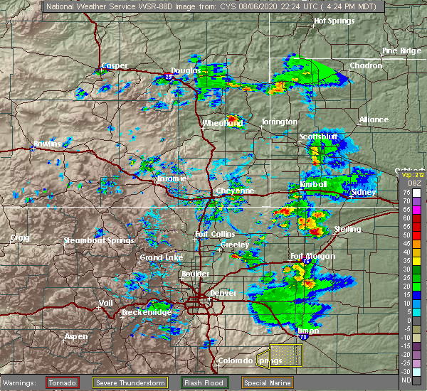 At 424 pm mdt, a severe thunderstorm was located over pawnee pass, or 15 miles west of sterling, and is nearly stationary (radar indicated). Hazards include ping pong ball size hail and 60 mph wind gusts. Expect damage to roofs, siding, and trees. people and animals outdoors will be injured. Expect hail damage to roofs, siding, windows, and vehicles. At 424 pm mdt, a severe thunderstorm was located over pawnee pass, or 15 miles west of sterling, and is nearly stationary (radar indicated). Hazards include ping pong ball size hail and 60 mph wind gusts. Expect damage to roofs, siding, and trees. people and animals outdoors will be injured. Expect hail damage to roofs, siding, windows, and vehicles.
|
| 8/5/2020 5:00 PM MDT |
 At 500 pm mdt, a severe thunderstorm was located near logan corners, or 9 miles west of sterling, moving east at 30 mph (radar indicated). Hazards include 60 mph wind gusts and quarter size hail. Expect damage to roofs, siding, and trees. hail damage to vehicles is expected. Locations impacted include, sterling, merino, iliff, proctor, padroni, westplains, atwood, logan corners, north sterling reservoir, pawnee pass and willard. At 500 pm mdt, a severe thunderstorm was located near logan corners, or 9 miles west of sterling, moving east at 30 mph (radar indicated). Hazards include 60 mph wind gusts and quarter size hail. Expect damage to roofs, siding, and trees. hail damage to vehicles is expected. Locations impacted include, sterling, merino, iliff, proctor, padroni, westplains, atwood, logan corners, north sterling reservoir, pawnee pass and willard.
|
| 8/5/2020 4:30 PM MDT |
 At 430 pm mdt, a severe thunderstorm was located 7 miles northeast of stoneham, or 22 miles west of sterling, moving east at 40 mph (radar indicated). Hazards include 60 mph wind gusts and quarter size hail. Expect damage to roofs, siding, and trees. Hail damage to vehicles is expected. At 430 pm mdt, a severe thunderstorm was located 7 miles northeast of stoneham, or 22 miles west of sterling, moving east at 40 mph (radar indicated). Hazards include 60 mph wind gusts and quarter size hail. Expect damage to roofs, siding, and trees. Hail damage to vehicles is expected.
|
| 7/21/2020 9:44 PM MDT | Quarter sized hail reported 17.2 miles NW of Sterling, CO, l375. |
| 7/21/2020 8:57 PM MDT |
 At 857 pm mdt, a severe thunderstorm was located over atwood, or 6 miles southwest of sterling, moving east at 5 mph (radar indicated). Hazards include 60 mph wind gusts and quarter size hail. Expect damage to roofs, siding, and trees. Hail damage to vehicles is expected. At 857 pm mdt, a severe thunderstorm was located over atwood, or 6 miles southwest of sterling, moving east at 5 mph (radar indicated). Hazards include 60 mph wind gusts and quarter size hail. Expect damage to roofs, siding, and trees. Hail damage to vehicles is expected.
|
| 7/19/2020 6:10 PM MDT | Quarter sized hail reported 6.7 miles SW of Sterling, CO, l06. |
| 7/19/2020 6:02 PM MDT |
 At 601 pm mdt, a severe thunderstorm was located near fleming, or 21 miles east of sterling, moving east at 45 mph (radar indicated). Hazards include two inch hail and 70 mph wind gusts. Expect considerable tree damage. damage is likely to mobile homes, roofs, and outbuildings. people and animals outdoors will be injured. expect hail damage to roofs, siding, windows, and vehicles. Locations impacted include, akron, haxtun, fleming, sedgwick, crook, st petersburg, proctor, platner, marks butte, highland center, twin buttes, burdett, midway and fairfield. At 601 pm mdt, a severe thunderstorm was located near fleming, or 21 miles east of sterling, moving east at 45 mph (radar indicated). Hazards include two inch hail and 70 mph wind gusts. Expect considerable tree damage. damage is likely to mobile homes, roofs, and outbuildings. people and animals outdoors will be injured. expect hail damage to roofs, siding, windows, and vehicles. Locations impacted include, akron, haxtun, fleming, sedgwick, crook, st petersburg, proctor, platner, marks butte, highland center, twin buttes, burdett, midway and fairfield.
|
| 7/19/2020 5:57 PM MDT | Quarter sized hail reported 0.5 miles SE of Sterling, CO, also reported tree limbs down and heavy rain. |
| 7/19/2020 5:55 PM MDT | Storm damage reported in logan county CO, 0.5 miles SE of Sterling, CO |
| 7/19/2020 5:47 PM MDT |
 At 547 pm mdt, a severe thunderstorm was located 4 miles southeast of iliff, or 10 miles northeast of sterling, moving east at 55 mph (radar indicated). Hazards include two inch hail and 60 mph wind gusts. Expect damage to roofs, siding, and trees. people and animals outdoors will be injured. Expect hail damage to roofs, siding, windows, and vehicles. At 547 pm mdt, a severe thunderstorm was located 4 miles southeast of iliff, or 10 miles northeast of sterling, moving east at 55 mph (radar indicated). Hazards include two inch hail and 60 mph wind gusts. Expect damage to roofs, siding, and trees. people and animals outdoors will be injured. Expect hail damage to roofs, siding, windows, and vehicles.
|
| 7/19/2020 5:37 PM MDT | Quarter sized hail reported 5.9 miles SW of Sterling, CO |
| 7/19/2020 5:37 PM MDT | Storm damage reported in logan county CO, 5.9 miles SW of Sterling, CO |
| 7/19/2020 5:31 PM MDT |
 At 531 pm mdt, a severe thunderstorm was located 6 miles east of sterling, moving east at 65 mph (radar indicated). Hazards include 60 mph wind gusts and quarter size hail. Expect damage to roofs, siding, and trees. Hail damage to vehicles is expected. At 531 pm mdt, a severe thunderstorm was located 6 miles east of sterling, moving east at 65 mph (radar indicated). Hazards include 60 mph wind gusts and quarter size hail. Expect damage to roofs, siding, and trees. Hail damage to vehicles is expected.
|
| 7/13/2020 6:53 PM MDT |
 The severe thunderstorm warning for northern washington and logan counties will expire at 700 pm mdt, the storms which prompted the warning have weakened below severe limits, and no longer pose an immediate threat to life or property. therefore, the warning will be allowed to expire. a severe thunderstorm watch remains in effect until 1100 pm mdt for northeastern colorado. The severe thunderstorm warning for northern washington and logan counties will expire at 700 pm mdt, the storms which prompted the warning have weakened below severe limits, and no longer pose an immediate threat to life or property. therefore, the warning will be allowed to expire. a severe thunderstorm watch remains in effect until 1100 pm mdt for northeastern colorado.
|
| 7/13/2020 6:29 PM MDT |
 At 628 pm mdt, severe thunderstorms were located along a line extending from 5 miles southeast of lorenzo to 7 miles west of burdett to 8 miles east of woodrow, or along a line extending from 10 miles south of sidney to 15 miles north of akron to 27 miles southeast of fort morgan, moving east at 60 mph (radar indicated). Hazards include 60 mph wind gusts. Expect damage to roofs, siding, and trees. Locations impacted include, sterling, akron, fleming, merino, iliff, peetz, crook, prewitt reservoir, proctor, padroni, atwood, elba, platner, north sterling reservoir, twin buttes, burdett, logan corners and midway. At 628 pm mdt, severe thunderstorms were located along a line extending from 5 miles southeast of lorenzo to 7 miles west of burdett to 8 miles east of woodrow, or along a line extending from 10 miles south of sidney to 15 miles north of akron to 27 miles southeast of fort morgan, moving east at 60 mph (radar indicated). Hazards include 60 mph wind gusts. Expect damage to roofs, siding, and trees. Locations impacted include, sterling, akron, fleming, merino, iliff, peetz, crook, prewitt reservoir, proctor, padroni, atwood, elba, platner, north sterling reservoir, twin buttes, burdett, logan corners and midway.
|
| 7/13/2020 5:59 PM MDT |
 The national weather service in denver colorado has issued a * severe thunderstorm warning for. eastern morgan county in northeastern colorado. northern washington county in northeastern colorado. logan county in northeastern colorado. Until 700 pm mdt. The national weather service in denver colorado has issued a * severe thunderstorm warning for. eastern morgan county in northeastern colorado. northern washington county in northeastern colorado. logan county in northeastern colorado. Until 700 pm mdt.
|
| 7/13/2020 4:29 PM MDT |
 At 429 pm mdt, a severe thunderstorm was located 7 miles southeast of sterling, moving east at 30 mph (radar indicated). Hazards include 60 mph wind gusts. expect damage to roofs, siding, and trees At 429 pm mdt, a severe thunderstorm was located 7 miles southeast of sterling, moving east at 30 mph (radar indicated). Hazards include 60 mph wind gusts. expect damage to roofs, siding, and trees
|
| 7/13/2020 3:39 PM MDT |
 At 338 pm mdt, severe thunderstorms were located along a line extending from 10 miles northeast of westplains to 6 miles south of stoneham, or along a line extending from 22 miles southwest of sidney to 19 miles northeast of fort morgan, moving east at 35 mph. these storms had earlier produced wind gusts of 60 to 65 mph in the pawnee buttes and grover areas (radar indicated). Hazards include 60 mph wind gusts. Expect damage to roofs, siding, and trees. Locations impacted include, sterling, iliff, peetz, new raymer, stoneham, padroni, westplains, atwood, logan corners, north sterling reservoir, pawnee pass and willard. At 338 pm mdt, severe thunderstorms were located along a line extending from 10 miles northeast of westplains to 6 miles south of stoneham, or along a line extending from 22 miles southwest of sidney to 19 miles northeast of fort morgan, moving east at 35 mph. these storms had earlier produced wind gusts of 60 to 65 mph in the pawnee buttes and grover areas (radar indicated). Hazards include 60 mph wind gusts. Expect damage to roofs, siding, and trees. Locations impacted include, sterling, iliff, peetz, new raymer, stoneham, padroni, westplains, atwood, logan corners, north sterling reservoir, pawnee pass and willard.
|
| 7/13/2020 3:13 PM MDT |
 At 313 pm mdt, severe thunderstorms were located along a line extending from 9 miles northwest of westplains to 5 miles south of new raymer, or along a line extending from 17 miles south of kimball to 19 miles north of fort morgan, moving east at 30 mph (radar indicated). Hazards include 60 mph wind gusts. expect damage to roofs, siding, and trees At 313 pm mdt, severe thunderstorms were located along a line extending from 9 miles northwest of westplains to 5 miles south of new raymer, or along a line extending from 17 miles south of kimball to 19 miles north of fort morgan, moving east at 30 mph (radar indicated). Hazards include 60 mph wind gusts. expect damage to roofs, siding, and trees
|
| 7/9/2020 8:33 PM MDT |
 At 833 pm mdt, a severe thunderstorm was located 6 miles south of westplains, or 19 miles northwest of sterling, moving southeast at 15 mph (radar indicated). Hazards include 60 mph wind gusts and quarter size hail. Expect damage to roofs, siding, and trees. hail damage to vehicles is expected. Locations impacted include, logan corners, north sterling reservoir, westplains and padroni. At 833 pm mdt, a severe thunderstorm was located 6 miles south of westplains, or 19 miles northwest of sterling, moving southeast at 15 mph (radar indicated). Hazards include 60 mph wind gusts and quarter size hail. Expect damage to roofs, siding, and trees. hail damage to vehicles is expected. Locations impacted include, logan corners, north sterling reservoir, westplains and padroni.
|
| 7/9/2020 8:11 PM MDT |
 At 810 pm mdt, a severe thunderstorm was located 6 miles southwest of westplains, or 23 miles northwest of sterling, moving southeast at 30 mph (radar indicated). Hazards include 60 mph wind gusts and half dollar size hail. Expect damage to roofs, siding, and trees. Hail damage to vehicles is expected. At 810 pm mdt, a severe thunderstorm was located 6 miles southwest of westplains, or 23 miles northwest of sterling, moving southeast at 30 mph (radar indicated). Hazards include 60 mph wind gusts and half dollar size hail. Expect damage to roofs, siding, and trees. Hail damage to vehicles is expected.
|
| 7/2/2020 3:11 PM MDT |
 The severe thunderstorm warning for northwestern logan county will expire at 315 pm mdt, the storm which prompted the warning has weakened below severe limits, and has exited the warned area. therefore, the warning will be allowed to expire. however small hail is still possible with this thunderstorm. a severe thunderstorm watch remains in effect until 900 pm mdt for northeastern colorado. The severe thunderstorm warning for northwestern logan county will expire at 315 pm mdt, the storm which prompted the warning has weakened below severe limits, and has exited the warned area. therefore, the warning will be allowed to expire. however small hail is still possible with this thunderstorm. a severe thunderstorm watch remains in effect until 900 pm mdt for northeastern colorado.
|
| 7/2/2020 2:44 PM MDT |
 At 243 pm mdt, a severe thunderstorm was located near sterling, moving north at 30 mph (radar indicated). Hazards include ping pong ball size hail and 60 mph wind gusts. Expect damage to roofs, siding, and trees. people and animals outdoors will be injured. Expect hail damage to roofs, siding, windows, and vehicles. At 243 pm mdt, a severe thunderstorm was located near sterling, moving north at 30 mph (radar indicated). Hazards include ping pong ball size hail and 60 mph wind gusts. Expect damage to roofs, siding, and trees. people and animals outdoors will be injured. Expect hail damage to roofs, siding, windows, and vehicles.
|
| 7/2/2020 2:30 PM MDT |
 At 229 pm mdt, a severe thunderstorm was located 7 miles southeast of sterling, moving northeast at 25 mph (radar indicated). Hazards include ping pong ball size hail and 60 mph wind gusts. Expect damage to roofs, siding, and trees. people and animals outdoors will be injured. Expect hail damage to roofs, siding, windows, and vehicles. At 229 pm mdt, a severe thunderstorm was located 7 miles southeast of sterling, moving northeast at 25 mph (radar indicated). Hazards include ping pong ball size hail and 60 mph wind gusts. Expect damage to roofs, siding, and trees. people and animals outdoors will be injured. Expect hail damage to roofs, siding, windows, and vehicles.
|
| 6/21/2020 6:16 PM MDT |
 At 615 pm mdt, severe thunderstorms were located along a line extending from 3 miles northwest of peetz to near logan corners, or along a line extending from 15 miles southwest of sidney to 6 miles west of sterling, moving east at 20 mph (radar indicated). Hazards include 60 mph wind gusts. expect damage to roofs, siding, and trees At 615 pm mdt, severe thunderstorms were located along a line extending from 3 miles northwest of peetz to near logan corners, or along a line extending from 15 miles southwest of sidney to 6 miles west of sterling, moving east at 20 mph (radar indicated). Hazards include 60 mph wind gusts. expect damage to roofs, siding, and trees
|
| 6/21/2020 5:34 PM MDT | Awos station k1mw mike madi in logan county CO, 15.5 miles ESE of Sterling, CO |
| 6/9/2020 12:43 AM MDT |
 At 1243 am mdt, a severe thunderstorm was located 7 miles northwest of burdett, or 14 miles southeast of sterling, moving north at 45 mph (radar indicated). Hazards include 70 mph wind gusts and quarter size hail. Expect considerable tree damage. damage is likely to mobile homes, roofs, and outbuildings. Hail damage to vehicles is expected. At 1243 am mdt, a severe thunderstorm was located 7 miles northwest of burdett, or 14 miles southeast of sterling, moving north at 45 mph (radar indicated). Hazards include 70 mph wind gusts and quarter size hail. Expect considerable tree damage. damage is likely to mobile homes, roofs, and outbuildings. Hail damage to vehicles is expected.
|
| 6/8/2020 11:30 PM MDT | Awos station kstk sterlin in logan county CO, 3.6 miles E of Sterling, CO |
| 6/8/2020 11:18 PM MDT |
 At 1118 pm mdt, a severe thunderstorm was located near iliff, or 8 miles northeast of sterling, moving north at 30 mph (trained weather spotters). Hazards include quarter size hail. Damage to vehicles is expected. Locations impacted include, northern sterling, iliff, north sterling reservoir and padroni. At 1118 pm mdt, a severe thunderstorm was located near iliff, or 8 miles northeast of sterling, moving north at 30 mph (trained weather spotters). Hazards include quarter size hail. Damage to vehicles is expected. Locations impacted include, northern sterling, iliff, north sterling reservoir and padroni.
|
| 6/8/2020 10:50 PM MDT | Quarter sized hail reported 0.5 miles SE of Sterling, CO |
| 6/8/2020 10:49 PM MDT |
 At 1049 pm mdt, a severe thunderstorm was located 8 miles southeast of atwood, or 11 miles south of sterling, moving north at 30 mph (trained weather spotters). Hazards include quarter size hail. damage to vehicles is expected At 1049 pm mdt, a severe thunderstorm was located 8 miles southeast of atwood, or 11 miles south of sterling, moving north at 30 mph (trained weather spotters). Hazards include quarter size hail. damage to vehicles is expected
|
| 6/6/2020 7:45 PM MDT | Mesonet station tt562 north sterlin in logan county CO, 11.8 miles SSE of Sterling, CO |
| 6/6/2020 7:07 PM MDT |
 The severe thunderstorm warning for northeastern washington, logan, phillips and sedgwick counties will expire at 715 pm mdt, the storms which prompted the warning have weakened below severe limits, and are exiting the warned area. therefore, the warning will be allowed to expire. however gusty winds are still possible with these thunderstorms. a severe thunderstorm watch remains in effect until 800 pm mdt for northeastern colorado. to report severe weather, contact your nearest law enforcement agency. they will relay your report to the national weather service denver colorado. The severe thunderstorm warning for northeastern washington, logan, phillips and sedgwick counties will expire at 715 pm mdt, the storms which prompted the warning have weakened below severe limits, and are exiting the warned area. therefore, the warning will be allowed to expire. however gusty winds are still possible with these thunderstorms. a severe thunderstorm watch remains in effect until 800 pm mdt for northeastern colorado. to report severe weather, contact your nearest law enforcement agency. they will relay your report to the national weather service denver colorado.
|
| 6/6/2020 6:36 PM MDT |
 At 636 pm mdt, severe thunderstorms were located along a line extending from 4 miles northeast of sedgwick to near prewitt reservoir, or along a line extending from 7 miles south of chappell to 15 miles southwest of sterling, moving northeast at 60 mph (radar indicated). Hazards include 70 mph wind gusts. Expect considerable tree damage. Damage is likely to mobile homes, roofs, and outbuildings. At 636 pm mdt, severe thunderstorms were located along a line extending from 4 miles northeast of sedgwick to near prewitt reservoir, or along a line extending from 7 miles south of chappell to 15 miles southwest of sterling, moving northeast at 60 mph (radar indicated). Hazards include 70 mph wind gusts. Expect considerable tree damage. Damage is likely to mobile homes, roofs, and outbuildings.
|
| 6/6/2020 5:58 PM MDT |
 At 557 pm mdt, severe thunderstorms were located along a line extending from 3 miles south of peetz to 8 miles south of lindon, or along a line extending from 17 miles southwest of sidney to 28 miles northeast of limon, moving northeast at 55 mph (radar indicated). Hazards include 70 mph wind gusts. Expect considerable tree damage. Damage is likely to mobile homes, roofs, and outbuildings. At 557 pm mdt, severe thunderstorms were located along a line extending from 3 miles south of peetz to 8 miles south of lindon, or along a line extending from 17 miles southwest of sidney to 28 miles northeast of limon, moving northeast at 55 mph (radar indicated). Hazards include 70 mph wind gusts. Expect considerable tree damage. Damage is likely to mobile homes, roofs, and outbuildings.
|
| 6/6/2020 5:58 PM MDT |
 At 554 pm mdt, severe thunderstorms were located along a line extending from 5 miles southwest of peetz to 10 miles south of lindon, or along a line extending from 19 miles north of sterling to 26 miles northeast of limon, moving northeast at 55 mph (radar indicated). Hazards include 70 mph wind gusts. Expect considerable tree damage. Damage is likely to mobile homes, roofs, and outbuildings. At 554 pm mdt, severe thunderstorms were located along a line extending from 5 miles southwest of peetz to 10 miles south of lindon, or along a line extending from 19 miles north of sterling to 26 miles northeast of limon, moving northeast at 55 mph (radar indicated). Hazards include 70 mph wind gusts. Expect considerable tree damage. Damage is likely to mobile homes, roofs, and outbuildings.
|
| 6/6/2020 5:48 PM MDT |
 At 547 pm mdt, severe thunderstorms were located along a line extending from 4 miles southwest of north sterling reservoir to 6 miles southeast of cottonwood valley, or along a line extending from 9 miles northwest of sterling to 22 miles north of limon, moving northeast at 60 mph (radar indicated). Hazards include 70 mph wind gusts. Expect considerable tree damage. damage is likely to mobile homes, roofs, and outbuildings. Locations impacted include, sterling, fort morgan, akron, brush, log lane village, merino, iliff, hillrose, peetz, prewitt reservoir, shamrock, padroni, atwood, twelve-mile corner, stoneham, westplains, cottonwood valley, lindon, snyder and midway. At 547 pm mdt, severe thunderstorms were located along a line extending from 4 miles southwest of north sterling reservoir to 6 miles southeast of cottonwood valley, or along a line extending from 9 miles northwest of sterling to 22 miles north of limon, moving northeast at 60 mph (radar indicated). Hazards include 70 mph wind gusts. Expect considerable tree damage. damage is likely to mobile homes, roofs, and outbuildings. Locations impacted include, sterling, fort morgan, akron, brush, log lane village, merino, iliff, hillrose, peetz, prewitt reservoir, shamrock, padroni, atwood, twelve-mile corner, stoneham, westplains, cottonwood valley, lindon, snyder and midway.
|
| 6/6/2020 5:44 PM MDT |
 At 543 pm mdt, severe thunderstorms were located along a line extending from 4 miles southwest of north sterling reservoir to 4 miles southeast of cottonwood valley, or along a line extending from 10 miles northwest of sterling to 23 miles north of limon, moving southeast at 60 mph (radar indicated). Hazards include 70 mph wind gusts. Expect considerable tree damage. damage is likely to mobile homes, roofs, and outbuildings. Locations impacted include, sterling, fort morgan, akron, brush, log lane village, merino, iliff, hillrose, peetz, prewitt reservoir, shamrock, padroni, atwood, twelve-mile corner, stoneham, westplains, cottonwood valley, lindon, snyder and midway. At 543 pm mdt, severe thunderstorms were located along a line extending from 4 miles southwest of north sterling reservoir to 4 miles southeast of cottonwood valley, or along a line extending from 10 miles northwest of sterling to 23 miles north of limon, moving southeast at 60 mph (radar indicated). Hazards include 70 mph wind gusts. Expect considerable tree damage. damage is likely to mobile homes, roofs, and outbuildings. Locations impacted include, sterling, fort morgan, akron, brush, log lane village, merino, iliff, hillrose, peetz, prewitt reservoir, shamrock, padroni, atwood, twelve-mile corner, stoneham, westplains, cottonwood valley, lindon, snyder and midway.
|
| 6/6/2020 5:18 PM MDT |
 At 517 pm mdt, severe thunderstorms were located along a line extending from 9 miles south of kimball airport to 5 miles northeast of antelope springs to near leader, or along a line extending from 12 miles south of kimball to 18 miles northeast of fort morgan to 48 miles north of limon, moving northeast at 60 mph (radar indicated). Hazards include 70 mph wind gusts. Expect considerable tree damage. Damage is likely to mobile homes, roofs, and outbuildings. At 517 pm mdt, severe thunderstorms were located along a line extending from 9 miles south of kimball airport to 5 miles northeast of antelope springs to near leader, or along a line extending from 12 miles south of kimball to 18 miles northeast of fort morgan to 48 miles north of limon, moving northeast at 60 mph (radar indicated). Hazards include 70 mph wind gusts. Expect considerable tree damage. Damage is likely to mobile homes, roofs, and outbuildings.
|
| 6/6/2020 3:52 PM MDT | Mesonet station co035 076e125 sterlin in logan county CO, 1.7 miles WNW of Sterling, CO |
| 6/4/2020 3:58 PM MDT | Awos station kstk sterlin in logan county CO, 3.6 miles E of Sterling, CO |
| 5/4/2020 12:10 AM MDT |
 The severe thunderstorm warning for north central washington and southwestern logan counties will expire at 1215 am mdt, the storms which prompted the warning have weakened below severe limits, and no longer poses an immediate threat to life or property. therefore, the warning will be allowed to expire. however, dime size hail and wind gusts to 50 mph along with heavy rain will occur with the thunderstorms. The severe thunderstorm warning for north central washington and southwestern logan counties will expire at 1215 am mdt, the storms which prompted the warning have weakened below severe limits, and no longer poses an immediate threat to life or property. therefore, the warning will be allowed to expire. however, dime size hail and wind gusts to 50 mph along with heavy rain will occur with the thunderstorms.
|
| 5/3/2020 11:48 PM MDT |
 At 1148 pm mdt, a severe thunderstorm was located over prewitt reservoir, or 16 miles southwest of sterling, moving east at 35 mph (radar indicated). Hazards include 60 mph wind gusts and quarter size hail. Expect damage to roofs, siding, and trees. Hail damage to vehicles is expected. At 1148 pm mdt, a severe thunderstorm was located over prewitt reservoir, or 16 miles southwest of sterling, moving east at 35 mph (radar indicated). Hazards include 60 mph wind gusts and quarter size hail. Expect damage to roofs, siding, and trees. Hail damage to vehicles is expected.
|
| 5/3/2020 11:11 PM MDT |
 At 1110 pm mdt, a severe thunderstorm was located 10 miles west of st petersburg, or 10 miles east of sterling, moving east at 35 mph (radar indicated). Hazards include 60 mph wind gusts and quarter size hail. Expect damage to roofs, siding, and trees. Hail damage to vehicles is expected. At 1110 pm mdt, a severe thunderstorm was located 10 miles west of st petersburg, or 10 miles east of sterling, moving east at 35 mph (radar indicated). Hazards include 60 mph wind gusts and quarter size hail. Expect damage to roofs, siding, and trees. Hail damage to vehicles is expected.
|
| 5/3/2020 11:02 PM MDT |
 At 1102 pm mdt, a severe thunderstorm was located near sterling, moving east at 35 mph (radar indicated). Hazards include golf ball size hail and 70 mph wind gusts. Expect considerable tree damage. damage is likely to mobile homes, roofs, and outbuildings. people and animals outdoors will be injured. expect hail damage to roofs, siding, windows, and vehicles. Locations impacted include, sterling, iliff, north sterling reservoir, padroni and atwood. At 1102 pm mdt, a severe thunderstorm was located near sterling, moving east at 35 mph (radar indicated). Hazards include golf ball size hail and 70 mph wind gusts. Expect considerable tree damage. damage is likely to mobile homes, roofs, and outbuildings. people and animals outdoors will be injured. expect hail damage to roofs, siding, windows, and vehicles. Locations impacted include, sterling, iliff, north sterling reservoir, padroni and atwood.
|
| 5/3/2020 10:55 PM MDT | Golf Ball sized hail reported 0.5 miles SE of Sterling, CO |
| 5/3/2020 10:55 PM MDT |
 At 1054 pm mdt, a severe thunderstorm was located near sterling, moving east at 35 mph (radar indicated). Hazards include 60 mph wind gusts and quarter size hail. Expect damage to roofs, siding, and trees. hail damage to vehicles is expected. Locations impacted include, sterling, merino, iliff, padroni, atwood, logan corners and north sterling reservoir. At 1054 pm mdt, a severe thunderstorm was located near sterling, moving east at 35 mph (radar indicated). Hazards include 60 mph wind gusts and quarter size hail. Expect damage to roofs, siding, and trees. hail damage to vehicles is expected. Locations impacted include, sterling, merino, iliff, padroni, atwood, logan corners and north sterling reservoir.
|
| 5/3/2020 10:38 PM MDT |
 At 1037 pm mdt, a severe thunderstorm was located over pawnee pass, or 13 miles west of sterling, moving east at 35 mph (radar indicated). Hazards include 60 mph wind gusts and quarter size hail. Expect damage to roofs, siding, and trees. Hail damage to vehicles is expected. At 1037 pm mdt, a severe thunderstorm was located over pawnee pass, or 13 miles west of sterling, moving east at 35 mph (radar indicated). Hazards include 60 mph wind gusts and quarter size hail. Expect damage to roofs, siding, and trees. Hail damage to vehicles is expected.
|
| 9/11/2019 7:04 PM MDT | Half Dollar sized hail reported 1.5 miles ESE of Sterling, CO |
| 9/11/2019 7:00 PM MDT | Tea Cup sized hail reported 0.5 miles SE of Sterling, CO, hail looked to be around 3.25 inches in diameter in photo. |
| 9/11/2019 7:00 PM MDT | Golf Ball sized hail reported 0.5 miles SE of Sterling, CO |
| 9/11/2019 7:00 PM MDT | Baseball sized hail reported 0.5 miles SE of Sterling, CO, winds in excess of 60 mph. |
| 9/11/2019 6:58 PM MDT | Ping Pong Ball sized hail reported 0.5 miles SE of Sterling, CO |
| 9/11/2019 6:58 PM MDT | Tennis Ball sized hail reported 5.9 miles S of Sterling, CO |
| 9/11/2019 6:57 PM MDT | Baseball sized hail reported 1.1 miles SSE of Sterling, CO |
| 9/11/2019 6:23 PM MDT |
 At 620 pm mdt, a severe thunderstorm was located over new raymer, or 24 miles north of fort morgan, moving east at 50 mph. baseball sized hail was reported at cr jj and cr 14 in morgan county, approximately 18 miles north of fort morgan. this is a very dangerous storm (trained weather spotters). Hazards include baseball size hail. People and animals outdoors will be severely injured. expect shattered windows, extensive damage to roofs, siding, and vehicles. Locations impacted include, sterling, merino, new raymer, keota, antelope springs, stoneham, westplains, atwood, logan corners, north sterling reservoir, pawnee pass and willard. At 620 pm mdt, a severe thunderstorm was located over new raymer, or 24 miles north of fort morgan, moving east at 50 mph. baseball sized hail was reported at cr jj and cr 14 in morgan county, approximately 18 miles north of fort morgan. this is a very dangerous storm (trained weather spotters). Hazards include baseball size hail. People and animals outdoors will be severely injured. expect shattered windows, extensive damage to roofs, siding, and vehicles. Locations impacted include, sterling, merino, new raymer, keota, antelope springs, stoneham, westplains, atwood, logan corners, north sterling reservoir, pawnee pass and willard.
|
| 9/11/2019 6:15 PM MDT |
 At 615 pm mdt, a severe thunderstorm was located 6 miles west of new raymer, or 23 miles north of fort morgan, moving east at 50 mph (radar indicated). Hazards include ping pong ball size hail. People and animals outdoors will be injured. Expect damage to roofs, siding, windows, and vehicles. At 615 pm mdt, a severe thunderstorm was located 6 miles west of new raymer, or 23 miles north of fort morgan, moving east at 50 mph (radar indicated). Hazards include ping pong ball size hail. People and animals outdoors will be injured. Expect damage to roofs, siding, windows, and vehicles.
|
| 9/10/2019 3:44 AM MDT |
 The national weather service in denver colorado has issued a * severe thunderstorm warning for. central logan county in northeastern colorado. until 415 am mdt. At 344 am mdt, a severe thunderstorm was located near sterling, moving northeast at 30 mph. The national weather service in denver colorado has issued a * severe thunderstorm warning for. central logan county in northeastern colorado. until 415 am mdt. At 344 am mdt, a severe thunderstorm was located near sterling, moving northeast at 30 mph.
|
| 9/10/2019 3:25 AM MDT |
 At 325 am mdt, a severe thunderstorm was located over logan corners, or 5 miles west of sterling, moving northeast at 25 mph (radar indicated). Hazards include 60 mph wind gusts and half dollar size hail. Expect damage to roofs, siding, and trees. hail damage to vehicles is expected. Locations impacted include, sterling, logan corners, north sterling reservoir, atwood and pawnee pass. At 325 am mdt, a severe thunderstorm was located over logan corners, or 5 miles west of sterling, moving northeast at 25 mph (radar indicated). Hazards include 60 mph wind gusts and half dollar size hail. Expect damage to roofs, siding, and trees. hail damage to vehicles is expected. Locations impacted include, sterling, logan corners, north sterling reservoir, atwood and pawnee pass.
|
| 9/10/2019 3:11 AM MDT |
 At 311 am mdt, a severe thunderstorm was located near pawnee pass, or 11 miles west of sterling, moving northeast at 25 mph (radar indicated). Hazards include 60 mph wind gusts and half dollar size hail. Expect damage to roofs, siding, and trees. Hail damage to vehicles is expected. At 311 am mdt, a severe thunderstorm was located near pawnee pass, or 11 miles west of sterling, moving northeast at 25 mph (radar indicated). Hazards include 60 mph wind gusts and half dollar size hail. Expect damage to roofs, siding, and trees. Hail damage to vehicles is expected.
|
| 8/16/2019 7:44 PM MDT |
 At 718 pm mdt, a severe thunderstorm was located 7 miles east of antelope springs, or 16 miles northeast of fort morgan, moving east at 40 mph (radar indicated). Hazards include two inch hail. People and animals outdoors will be injured. Expect damage to roofs, siding, windows, and vehicles. At 718 pm mdt, a severe thunderstorm was located 7 miles east of antelope springs, or 16 miles northeast of fort morgan, moving east at 40 mph (radar indicated). Hazards include two inch hail. People and animals outdoors will be injured. Expect damage to roofs, siding, windows, and vehicles.
|
| 8/16/2019 7:41 PM MDT |
 The severe thunderstorm warning for central logan county will expire at 745 pm mdt, the storm which prompted the warning has weakened below severe limits, and no longer poses an immediate threat to life or property. therefore, the warning will be allowed to expire. a severe thunderstorm watch remains in effect until 1000 pm mdt for northeastern colorado. The severe thunderstorm warning for central logan county will expire at 745 pm mdt, the storm which prompted the warning has weakened below severe limits, and no longer poses an immediate threat to life or property. therefore, the warning will be allowed to expire. a severe thunderstorm watch remains in effect until 1000 pm mdt for northeastern colorado.
|
| 8/16/2019 7:18 PM MDT |
 At 718 pm mdt, a severe thunderstorm was located 7 miles east of antelope springs, or 16 miles northeast of fort morgan, moving east at 40 mph (radar indicated). Hazards include two inch hail. People and animals outdoors will be injured. Expect damage to roofs, siding, windows, and vehicles. At 718 pm mdt, a severe thunderstorm was located 7 miles east of antelope springs, or 16 miles northeast of fort morgan, moving east at 40 mph (radar indicated). Hazards include two inch hail. People and animals outdoors will be injured. Expect damage to roofs, siding, windows, and vehicles.
|
| 8/16/2019 7:14 PM MDT | Half Dollar sized hail reported 9.5 miles S of Sterling, CO |
| 8/16/2019 7:09 PM MDT |
 At 708 pm mdt, a severe thunderstorm was located near proctor, or 18 miles northeast of sterling, moving east at 45 mph (trained weather spotters). Hazards include tennis ball size hail. Expect damage to roofs, siding, and trees. people and animals outdoors will be injured. expect hail damage to roofs, siding, windows, and vehicles. Locations impacted include, sterling, fleming, iliff, crook, proctor, padroni, twin buttes, logan corners, north sterling reservoir and pawnee pass. At 708 pm mdt, a severe thunderstorm was located near proctor, or 18 miles northeast of sterling, moving east at 45 mph (trained weather spotters). Hazards include tennis ball size hail. Expect damage to roofs, siding, and trees. people and animals outdoors will be injured. expect hail damage to roofs, siding, windows, and vehicles. Locations impacted include, sterling, fleming, iliff, crook, proctor, padroni, twin buttes, logan corners, north sterling reservoir and pawnee pass.
|
| 8/16/2019 7:00 PM MDT | Tennis Ball sized hail reported 12.2 miles S of Sterling, CO |
| 8/16/2019 6:53 PM MDT |
 At 653 pm mdt, a severe thunderstorm was located 5 miles north of padroni, or 15 miles north of sterling, moving east at 45 mph (radar indicated). Hazards include 60 mph wind gusts and quarter size hail. Expect damage to roofs, siding, and trees. Hail damage to vehicles is expected. At 653 pm mdt, a severe thunderstorm was located 5 miles north of padroni, or 15 miles north of sterling, moving east at 45 mph (radar indicated). Hazards include 60 mph wind gusts and quarter size hail. Expect damage to roofs, siding, and trees. Hail damage to vehicles is expected.
|
| 8/11/2019 4:55 PM MDT |
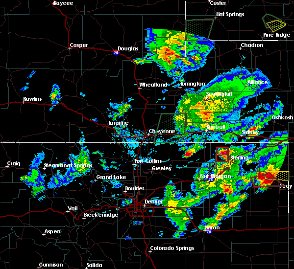 At 455 pm mdt, a severe thunderstorm capable of producing a tornado was located 4 miles west of north sterling reservoir, or 13 miles northwest of sterling, moving north at 25 mph (radar indicated rotation). Hazards include tornado and tennis ball size hail. Flying debris will be dangerous to those caught without shelter. mobile homes will be damaged or destroyed. damage to roofs, windows, and vehicles will occur. tree damage is likely. Locations impacted include, north sterling reservoir. At 455 pm mdt, a severe thunderstorm capable of producing a tornado was located 4 miles west of north sterling reservoir, or 13 miles northwest of sterling, moving north at 25 mph (radar indicated rotation). Hazards include tornado and tennis ball size hail. Flying debris will be dangerous to those caught without shelter. mobile homes will be damaged or destroyed. damage to roofs, windows, and vehicles will occur. tree damage is likely. Locations impacted include, north sterling reservoir.
|
| 8/11/2019 4:43 PM MDT |
 The national weather service in denver colorado has issued a * tornado warning for. northwestern logan county in northeastern colorado. until 515 pm mdt. At 443 pm mdt, a severe thunderstorm capable of producing a tornado was located 6 miles north of logan corners, or 9 miles northwest of. The national weather service in denver colorado has issued a * tornado warning for. northwestern logan county in northeastern colorado. until 515 pm mdt. At 443 pm mdt, a severe thunderstorm capable of producing a tornado was located 6 miles north of logan corners, or 9 miles northwest of.
|
| 8/11/2019 4:41 PM MDT | Tennis Ball sized hail reported 11.5 miles ESE of Sterling, CO |
| 8/11/2019 4:29 PM MDT |
 At 428 pm mdt, a severe thunderstorm was located near logan corners, or 8 miles west of sterling, moving north at 20 mph (radar indicated). Hazards include ping pong ball size hail and 60 mph wind gusts. Expect damage to roofs, siding, and trees. people and animals outdoors will be injured. Expect hail damage to roofs, siding, windows, and vehicles. At 428 pm mdt, a severe thunderstorm was located near logan corners, or 8 miles west of sterling, moving north at 20 mph (radar indicated). Hazards include ping pong ball size hail and 60 mph wind gusts. Expect damage to roofs, siding, and trees. people and animals outdoors will be injured. Expect hail damage to roofs, siding, windows, and vehicles.
|
| 7/6/2019 1:16 AM MDT |
 At 116 am mdt, a severe thunderstorm was located near sterling, moving east at 25 mph (radar indicated). Hazards include 60 mph wind gusts and half dollar size hail. Expect damage to roofs, siding, and trees. hail damage to vehicles is expected. Locations impacted include, sterling, merino, logan corners and atwood. At 116 am mdt, a severe thunderstorm was located near sterling, moving east at 25 mph (radar indicated). Hazards include 60 mph wind gusts and half dollar size hail. Expect damage to roofs, siding, and trees. hail damage to vehicles is expected. Locations impacted include, sterling, merino, logan corners and atwood.
|
| 7/6/2019 12:51 AM MDT |
 At 1251 am mdt, a severe thunderstorm was located near pawnee pass, or 10 miles west of sterling, moving southeast at 25 mph (radar indicated). Hazards include golf ball size hail and 60 mph wind gusts. Expect damage to roofs, siding, and trees. people and animals outdoors will be injured. Expect hail damage to roofs, siding, windows, and vehicles. At 1251 am mdt, a severe thunderstorm was located near pawnee pass, or 10 miles west of sterling, moving southeast at 25 mph (radar indicated). Hazards include golf ball size hail and 60 mph wind gusts. Expect damage to roofs, siding, and trees. people and animals outdoors will be injured. Expect hail damage to roofs, siding, windows, and vehicles.
|
| 5/27/2019 3:59 PM MDT |
 The national weather service in denver colorado has issued a * tornado warning for. central logan county in northeastern colorado. until 430 pm mdt. At 359 pm mdt, a severe thunderstorm capable of producing a tornado was located near padroni, or 10 miles northeast of sterling, moving. The national weather service in denver colorado has issued a * tornado warning for. central logan county in northeastern colorado. until 430 pm mdt. At 359 pm mdt, a severe thunderstorm capable of producing a tornado was located near padroni, or 10 miles northeast of sterling, moving.
|
| 5/27/2019 3:34 PM MDT | Quarter sized hail reported 8.2 miles ESE of Sterling, CO |
| 5/27/2019 3:30 PM MDT |
 At 328 pm mdt, a possible tornado was located 4 miles north of logan corners, or 7 miles northwest of sterling, moving northeast at 45 mph (public confirmed tornado). Hazards include damaging tornado and quarter size hail. Flying debris will be dangerous to those caught without shelter. mobile homes will be damaged or destroyed. damage to roofs, windows, and vehicles will occur. tree damage is likely. this severe thunderstorm has had a history of producing tornadoes. the tornado will be near, north sterling reservoir and padroni around 340 pm mdt. Cliff around 345 pm mdt. At 328 pm mdt, a possible tornado was located 4 miles north of logan corners, or 7 miles northwest of sterling, moving northeast at 45 mph (public confirmed tornado). Hazards include damaging tornado and quarter size hail. Flying debris will be dangerous to those caught without shelter. mobile homes will be damaged or destroyed. damage to roofs, windows, and vehicles will occur. tree damage is likely. this severe thunderstorm has had a history of producing tornadoes. the tornado will be near, north sterling reservoir and padroni around 340 pm mdt. Cliff around 345 pm mdt.
|
| 5/17/2019 4:47 PM MDT |
 At 447 pm mdt, a severe thunderstorm was located 7 miles south of iliff, or 8 miles east of sterling, moving northeast at 35 mph (radar indicated). Hazards include 60 mph wind gusts and half dollar size hail. Expect damage to roofs, siding, and trees. Hail damage to vehicles is expected. At 447 pm mdt, a severe thunderstorm was located 7 miles south of iliff, or 8 miles east of sterling, moving northeast at 35 mph (radar indicated). Hazards include 60 mph wind gusts and half dollar size hail. Expect damage to roofs, siding, and trees. Hail damage to vehicles is expected.
|
| 5/17/2019 4:41 PM MDT | Ping Pong Ball sized hail reported 1 miles S of Sterling, CO |
| 5/17/2019 4:39 PM MDT |
 At 438 pm mdt, a severe thunderstorm was located near sterling, moving north at 60 mph (trained weather spotters). Hazards include golf ball size hail and 60 mph wind gusts. Expect damage to roofs, siding, and trees. people and animals outdoors will be injured. expect hail damage to roofs, siding, windows, and vehicles. Locations impacted include, sterling, peetz, logan corners, north sterling reservoir, padroni and atwood. At 438 pm mdt, a severe thunderstorm was located near sterling, moving north at 60 mph (trained weather spotters). Hazards include golf ball size hail and 60 mph wind gusts. Expect damage to roofs, siding, and trees. people and animals outdoors will be injured. expect hail damage to roofs, siding, windows, and vehicles. Locations impacted include, sterling, peetz, logan corners, north sterling reservoir, padroni and atwood.
|
| 5/17/2019 4:30 PM MDT | Golf Ball sized hail reported 1 miles ESE of Sterling, CO |
| 5/17/2019 4:23 PM MDT |
 At 423 pm mdt, a severe thunderstorm was located over willard, or 13 miles west of sterling, moving northeast at 30 mph (radar indicated). Hazards include 60 mph wind gusts and quarter size hail. Expect damage to roofs, siding, and trees. Hail damage to vehicles is expected. At 423 pm mdt, a severe thunderstorm was located over willard, or 13 miles west of sterling, moving northeast at 30 mph (radar indicated). Hazards include 60 mph wind gusts and quarter size hail. Expect damage to roofs, siding, and trees. Hail damage to vehicles is expected.
|
| 7/28/2018 7:17 PM MDT | Golf Ball sized hail reported 0.5 miles NE of Sterling, CO |
| 7/28/2018 7:13 PM MDT | Storm damage reported in logan county CO, 3.6 miles E of Sterling, CO |
| 7/28/2018 7:13 PM MDT | Ping Pong Ball sized hail reported 0.5 miles SE of Sterling, CO |
| 7/28/2018 7:13 PM MDT | Golf Ball sized hail reported 3.6 miles E of Sterling, CO |
| 7/28/2018 7:13 PM MDT |
 At 712 pm mdt, a severe thunderstorm was located 6 miles east of sterling, moving southeast at 40 mph (radar indicated). Hazards include ping pong ball size hail and 60 mph wind gusts. the storm has a histoy of producing baseball sized hail. Expect damage to roofs, siding, and trees. people and animals outdoors will be injured. Expect hail damage to roofs, siding, windows, and vehicles. At 712 pm mdt, a severe thunderstorm was located 6 miles east of sterling, moving southeast at 40 mph (radar indicated). Hazards include ping pong ball size hail and 60 mph wind gusts. the storm has a histoy of producing baseball sized hail. Expect damage to roofs, siding, and trees. people and animals outdoors will be injured. Expect hail damage to roofs, siding, windows, and vehicles.
|
| 7/28/2018 7:10 PM MDT | Ping Pong Ball sized hail reported 1.8 miles SSW of Sterling, CO, extensive crop damage in the area between sterling and iliff. |
| 7/28/2018 7:08 PM MDT | Half Dollar sized hail reported 4.7 miles ESE of Sterling, CO |
| 7/28/2018 6:54 PM MDT |
 At 654 pm mdt, a severe thunderstorm capable of producing a tornado was located 5 miles north of logan corners, or 6 miles northwest of sterling, moving south at 40 mph (radar indicated rotation). Hazards include tornado and baseball size hail. Flying debris will be dangerous to those caught without shelter. mobile homes will be damaged or destroyed. damage to roofs, windows, and vehicles will occur. Tree damage is likely. At 654 pm mdt, a severe thunderstorm capable of producing a tornado was located 5 miles north of logan corners, or 6 miles northwest of sterling, moving south at 40 mph (radar indicated rotation). Hazards include tornado and baseball size hail. Flying debris will be dangerous to those caught without shelter. mobile homes will be damaged or destroyed. damage to roofs, windows, and vehicles will occur. Tree damage is likely.
|
| 7/28/2018 6:53 PM MDT | Baseball sized hail reported 8.6 miles ESE of Sterling, CO |
| 7/28/2018 6:28 PM MDT |
 At 627 pm mdt, a severe thunderstorm was located 4 miles northeast of westplains, or 19 miles northwest of sterling, moving southeast at 30 mph (radar indicated). Hazards include ping pong ball size hail and 60 mph wind gusts. Expect damage to roofs, siding, and trees. people and animals outdoors will be injured. Expect hail damage to roofs, siding, windows, and vehicles. At 627 pm mdt, a severe thunderstorm was located 4 miles northeast of westplains, or 19 miles northwest of sterling, moving southeast at 30 mph (radar indicated). Hazards include ping pong ball size hail and 60 mph wind gusts. Expect damage to roofs, siding, and trees. people and animals outdoors will be injured. Expect hail damage to roofs, siding, windows, and vehicles.
|
| 7/24/2018 9:15 PM MDT |
 At 912 pm mdt, a severe thunderstorm was located 7 miles east of atwood, or 8 miles southeast of sterling, moving northeast at 25 mph (law enforcement reported damage to roofs in the town of atwood). Hazards include 60 mph wind gusts and half dollar size hail. Expect damage to roofs, siding, and trees. hail damage to vehicles is expected. Locations impacted include, southeastern sterling and atwood. At 912 pm mdt, a severe thunderstorm was located 7 miles east of atwood, or 8 miles southeast of sterling, moving northeast at 25 mph (law enforcement reported damage to roofs in the town of atwood). Hazards include 60 mph wind gusts and half dollar size hail. Expect damage to roofs, siding, and trees. hail damage to vehicles is expected. Locations impacted include, southeastern sterling and atwood.
|
| 7/24/2018 9:10 PM MDT | Storm damage reported in logan county CO, 3.1 miles E of Sterling, CO |
| 7/24/2018 8:41 PM MDT |
 At 840 pm mdt, a severe thunderstorm was located near prewitt reservoir, or 16 miles north of akron, moving northeast at 25 mph (trained weather spotters). Hazards include 60 mph wind gusts and half dollar size hail. Expect damage to roofs, siding, and trees. Hail damage to vehicles is expected. At 840 pm mdt, a severe thunderstorm was located near prewitt reservoir, or 16 miles north of akron, moving northeast at 25 mph (trained weather spotters). Hazards include 60 mph wind gusts and half dollar size hail. Expect damage to roofs, siding, and trees. Hail damage to vehicles is expected.
|
| 7/12/2018 6:39 PM MDT |
 The severe thunderstorm warning for northeastern logan county will expire at 645 pm mdt, the storm which prompted the warning has weakened below severe limits, and no longer poses an immediate threat to life or property. therefore, the warning will be allowed to expire. however, gusty winds and heavy rain are still possible with this thunderstorm. in crook, the thunderstorm produced dime sized hail and heavy rain that caused damage to vegetation and wind gusts that caused power outages. in iliff, the thunderstorm produced pea-sized hail and very heavy rain with localized flooding. The severe thunderstorm warning for northeastern logan county will expire at 645 pm mdt, the storm which prompted the warning has weakened below severe limits, and no longer poses an immediate threat to life or property. therefore, the warning will be allowed to expire. however, gusty winds and heavy rain are still possible with this thunderstorm. in crook, the thunderstorm produced dime sized hail and heavy rain that caused damage to vegetation and wind gusts that caused power outages. in iliff, the thunderstorm produced pea-sized hail and very heavy rain with localized flooding.
|
| 7/12/2018 5:55 PM MDT |
 At 554 pm mdt, a severe thunderstorm was located 4 miles northwest of crook, or 17 miles south of sidney, and is nearly stationary (radar indicated). Hazards include ping pong ball size hail and 60 mph wind gusts. Expect damage to roofs, siding, and trees. people and animals outdoors will be injured. Expect hail damage to roofs, siding, windows, and vehicles. At 554 pm mdt, a severe thunderstorm was located 4 miles northwest of crook, or 17 miles south of sidney, and is nearly stationary (radar indicated). Hazards include ping pong ball size hail and 60 mph wind gusts. Expect damage to roofs, siding, and trees. people and animals outdoors will be injured. Expect hail damage to roofs, siding, windows, and vehicles.
|
| 6/18/2018 9:57 PM MDT |
 At 956 pm mdt, severe thunderstorms were located along a line extending from 4 miles west of merino to 5 miles northeast of midway, or along a line extending from 17 miles southwest of sterling to 11 miles northwest of akron, moving east at 35 mph. this storm has recently produced golfball hail along i-76 in northwest washington county (trained weather spotters). Hazards include 70 mph wind gusts and golf ball size hail. Expect considerable tree damage. damage is likely to mobile homes, roofs, and outbuildings. people and animals outdoors will be injured. expect hail damage to roofs, siding, windows, and vehicles. Locations impacted include, sterling, merino, logan corners, prewitt reservoir, atwood and willard. At 956 pm mdt, severe thunderstorms were located along a line extending from 4 miles west of merino to 5 miles northeast of midway, or along a line extending from 17 miles southwest of sterling to 11 miles northwest of akron, moving east at 35 mph. this storm has recently produced golfball hail along i-76 in northwest washington county (trained weather spotters). Hazards include 70 mph wind gusts and golf ball size hail. Expect considerable tree damage. damage is likely to mobile homes, roofs, and outbuildings. people and animals outdoors will be injured. expect hail damage to roofs, siding, windows, and vehicles. Locations impacted include, sterling, merino, logan corners, prewitt reservoir, atwood and willard.
|
| 6/18/2018 9:42 PM MDT |
 At 941 pm mdt, severe thunderstorms were located along a line extending from 6 miles northeast of antelope springs to hillrose, or along a line extending from 23 miles southwest of sterling to 15 miles east of fort morgan, moving northeast at 35 mph. ping ball size hail breaking windows has been recently reported with this line of thunderstorms in northeast morgan county (trained weather spotters). Hazards include 70 mph wind gusts and ping pong ball size hail. Expect considerable tree damage. damage is likely to mobile homes, roofs, and outbuildings. people and animals outdoors will be injured. Expect hail damage to roofs, siding, windows, and vehicles. At 941 pm mdt, severe thunderstorms were located along a line extending from 6 miles northeast of antelope springs to hillrose, or along a line extending from 23 miles southwest of sterling to 15 miles east of fort morgan, moving northeast at 35 mph. ping ball size hail breaking windows has been recently reported with this line of thunderstorms in northeast morgan county (trained weather spotters). Hazards include 70 mph wind gusts and ping pong ball size hail. Expect considerable tree damage. damage is likely to mobile homes, roofs, and outbuildings. people and animals outdoors will be injured. Expect hail damage to roofs, siding, windows, and vehicles.
|
| 6/5/2018 9:30 PM MDT | Awos station stk... sterlin in logan county CO, 3.6 miles E of Sterling, CO |
| 5/28/2018 7:07 PM MDT |
 At 706 pm mdt, a severe thunderstorm was located 4 miles south of north sterling reservoir, or 5 miles northwest of sterling, moving east at 35 mph (radar indicated). Hazards include 70 mph wind gusts and quarter size hail. Expect considerable tree damage. damage is likely to mobile homes, roofs, and outbuildings. hail damage to vehicles is expected. Locations impacted include, sterling, logan corners, north sterling reservoir and padroni. At 706 pm mdt, a severe thunderstorm was located 4 miles south of north sterling reservoir, or 5 miles northwest of sterling, moving east at 35 mph (radar indicated). Hazards include 70 mph wind gusts and quarter size hail. Expect considerable tree damage. damage is likely to mobile homes, roofs, and outbuildings. hail damage to vehicles is expected. Locations impacted include, sterling, logan corners, north sterling reservoir and padroni.
|
| 5/28/2018 6:52 PM MDT |
 At 651 pm mdt, a severe thunderstorm was located 4 miles northeast of pawnee pass, or 11 miles west of sterling, moving east at 35 mph (radar indicated). Hazards include ping pong ball size hail and 60 mph wind gusts. Expect damage to roofs, siding, and trees. people and animals outdoors will be injured. Expect hail damage to roofs, siding, windows, and vehicles. At 651 pm mdt, a severe thunderstorm was located 4 miles northeast of pawnee pass, or 11 miles west of sterling, moving east at 35 mph (radar indicated). Hazards include ping pong ball size hail and 60 mph wind gusts. Expect damage to roofs, siding, and trees. people and animals outdoors will be injured. Expect hail damage to roofs, siding, windows, and vehicles.
|
| 5/27/2018 6:24 PM MDT |
 The severe thunderstorm warning for logan county will expire at 630 pm mdt, the storms which prompted the warning have moved out of the area. therefore, the warning will be allowed to expire. a severe thunderstorm watch remains in effect until 800 pm mdt for northeastern colorado. The severe thunderstorm warning for logan county will expire at 630 pm mdt, the storms which prompted the warning have moved out of the area. therefore, the warning will be allowed to expire. a severe thunderstorm watch remains in effect until 800 pm mdt for northeastern colorado.
|
| 5/27/2018 5:57 PM MDT |
 At 557 pm mdt, severe thunderstorms were located along a line extending from 9 miles southeast of kimball airport to 6 miles northwest of haxtun, or along a line extending from 11 miles southeast of kimball to 23 miles northwest of holyoke, moving north at 40 mph (radar indicated). Hazards include 70 mph wind gusts and quarter size hail. Expect considerable tree damage. damage is likely to mobile homes, roofs, and outbuildings. hail damage to vehicles is expected. Locations impacted include, sterling, fleming, iliff, peetz, crook, st petersburg, proctor, padroni, westplains, twin buttes and north sterling reservoir. At 557 pm mdt, severe thunderstorms were located along a line extending from 9 miles southeast of kimball airport to 6 miles northwest of haxtun, or along a line extending from 11 miles southeast of kimball to 23 miles northwest of holyoke, moving north at 40 mph (radar indicated). Hazards include 70 mph wind gusts and quarter size hail. Expect considerable tree damage. damage is likely to mobile homes, roofs, and outbuildings. hail damage to vehicles is expected. Locations impacted include, sterling, fleming, iliff, peetz, crook, st petersburg, proctor, padroni, westplains, twin buttes and north sterling reservoir.
|
| 5/27/2018 5:47 PM MDT | Storm damage reported in logan county CO, 11.9 miles SSE of Sterling, CO |
| 5/27/2018 5:38 PM MDT | Quarter sized hail reported 13.9 miles SSE of Sterling, CO |
| 5/27/2018 5:38 PM MDT |
 At 538 pm mdt, severe thunderstorms were located along a line extending from 5 miles northwest of westplains to 4 miles east of st petersburg, or along a line extending from 21 miles south of kimball to 22 miles west of holyoke, moving north at 40 mph (radar indicated). Hazards include 70 mph wind gusts and quarter size hail. Expect considerable tree damage. damage is likely to mobile homes, roofs, and outbuildings. Hail damage to vehicles is expected. At 538 pm mdt, severe thunderstorms were located along a line extending from 5 miles northwest of westplains to 4 miles east of st petersburg, or along a line extending from 21 miles south of kimball to 22 miles west of holyoke, moving north at 40 mph (radar indicated). Hazards include 70 mph wind gusts and quarter size hail. Expect considerable tree damage. damage is likely to mobile homes, roofs, and outbuildings. Hail damage to vehicles is expected.
|
| 5/27/2018 5:35 PM MDT | Awos station stk... sterlin in logan county CO, 3.6 miles E of Sterling, CO |
| 5/27/2018 5:32 PM MDT | Storm damage reported in logan county CO, 5.7 miles E of Sterling, CO |
| 5/15/2018 10:36 PM MDT |
 At 1034 pm mdt, a severe thunderstorm was located 5 miles southeast of sterling, moving northeast at 25 mph (trained weather spotters. hail the size of quarters was reported in sterling at 1030 pm. the most intense part of the storm was passing south and east of the city). Hazards include ping pong ball size hail and 60 mph wind gusts. People and animals outdoors will be injured. expect hail damage to roofs, siding, windows, and vehicles. expect wind damage to roofs, siding, and trees. Locations impacted include, sterling, fleming, iliff and proctor. At 1034 pm mdt, a severe thunderstorm was located 5 miles southeast of sterling, moving northeast at 25 mph (trained weather spotters. hail the size of quarters was reported in sterling at 1030 pm. the most intense part of the storm was passing south and east of the city). Hazards include ping pong ball size hail and 60 mph wind gusts. People and animals outdoors will be injured. expect hail damage to roofs, siding, windows, and vehicles. expect wind damage to roofs, siding, and trees. Locations impacted include, sterling, fleming, iliff and proctor.
|
| 5/15/2018 10:31 PM MDT | Quarter sized hail reported 0.5 miles SE of Sterling, CO |
| 5/15/2018 10:18 PM MDT |
 At 1018 pm mdt, a severe thunderstorm was located near atwood, or 5 miles south of sterling, moving northeast at 25 mph (trained weather spotters). Hazards include golf ball size hail and 60 mph wind gusts. People and animals outdoors will be injured. expect hail damage to roofs, siding, windows, and vehicles. Expect wind damage to roofs, siding, and trees. At 1018 pm mdt, a severe thunderstorm was located near atwood, or 5 miles south of sterling, moving northeast at 25 mph (trained weather spotters). Hazards include golf ball size hail and 60 mph wind gusts. People and animals outdoors will be injured. expect hail damage to roofs, siding, windows, and vehicles. Expect wind damage to roofs, siding, and trees.
|
| 6/7/2017 6:04 PM MDT |
 At 603 pm mdt, a severe thunderstorm was located 5 miles northeast of atwood, or 5 miles south of sterling, moving south at 15 mph (radar indicated). Hazards include 60 mph wind gusts and quarter size hail. Hail damage to vehicles is expected. expect wind damage to roofs, siding, and trees. Locations impacted include, southeastern sterling. At 603 pm mdt, a severe thunderstorm was located 5 miles northeast of atwood, or 5 miles south of sterling, moving south at 15 mph (radar indicated). Hazards include 60 mph wind gusts and quarter size hail. Hail damage to vehicles is expected. expect wind damage to roofs, siding, and trees. Locations impacted include, southeastern sterling.
|
| 6/7/2017 5:31 PM MDT |
 At 530 pm mdt, a severe thunderstorm was located near padroni, or 6 miles north of sterling, moving south at 15 mph (radar indicated). Hazards include ping pong ball size hail and 60 mph wind gusts. People and animals outdoors will be injured. expect hail damage to roofs, siding, windows, and vehicles. Expect wind damage to roofs, siding, and trees. At 530 pm mdt, a severe thunderstorm was located near padroni, or 6 miles north of sterling, moving south at 15 mph (radar indicated). Hazards include ping pong ball size hail and 60 mph wind gusts. People and animals outdoors will be injured. expect hail damage to roofs, siding, windows, and vehicles. Expect wind damage to roofs, siding, and trees.
|
| 6/7/2017 4:09 PM MDT | Quarter sized hail reported 3.1 miles N of Sterling, CO |
| 6/7/2017 4:06 PM MDT |
 At 406 pm mdt, a severe thunderstorm was located over atwood, or 7 miles south of sterling, moving south at 5 mph (radar indicated). Hazards include 60 mph wind gusts and half dollar size hail. Hail damage to vehicles is expected. Expect wind damage to roofs, siding, and trees. At 406 pm mdt, a severe thunderstorm was located over atwood, or 7 miles south of sterling, moving south at 5 mph (radar indicated). Hazards include 60 mph wind gusts and half dollar size hail. Hail damage to vehicles is expected. Expect wind damage to roofs, siding, and trees.
|
| 5/25/2017 7:30 PM MDT |
 At 723 pm mdt, very strong outflow winds produced by a line of thunderstorms was located along a line extending from 8 miles northeast of westplains to near pawnee pass to 3 miles north of snyder, or along a line extending from 21 miles southeast of kimball to 14 miles west of sterling to 13 miles northeast of fort morgan. the leading edge of these outflow winds was moving east at 55 mph (radar indicated). Hazards include 60 mph wind gusts. Expect damage to roofs, siding, and trees. blowing dust could reduce visibilities to less than a few hundred feet in open areas. Drivers of high profile and light weight vehicles could lose control with these strong cross winds. At 723 pm mdt, very strong outflow winds produced by a line of thunderstorms was located along a line extending from 8 miles northeast of westplains to near pawnee pass to 3 miles north of snyder, or along a line extending from 21 miles southeast of kimball to 14 miles west of sterling to 13 miles northeast of fort morgan. the leading edge of these outflow winds was moving east at 55 mph (radar indicated). Hazards include 60 mph wind gusts. Expect damage to roofs, siding, and trees. blowing dust could reduce visibilities to less than a few hundred feet in open areas. Drivers of high profile and light weight vehicles could lose control with these strong cross winds.
|
| 9/4/2016 6:10 PM MDT |
 The severe thunderstorm warning for north central washington, northeastern morgan and southwestern logan counties will expire at 615 pm mdt, the storm which prompted the warning is moving east of the area. therefore the warning will be allowed to expire. however hail, gusty winds and heavy rain are still possible on the eastern edge of this area. a severe thunderstorm watch remains in effect until 1000 pm mdt for northeastern colorado. The severe thunderstorm warning for north central washington, northeastern morgan and southwestern logan counties will expire at 615 pm mdt, the storm which prompted the warning is moving east of the area. therefore the warning will be allowed to expire. however hail, gusty winds and heavy rain are still possible on the eastern edge of this area. a severe thunderstorm watch remains in effect until 1000 pm mdt for northeastern colorado.
|
| 9/4/2016 6:00 PM MDT |
 At 557 pm mdt, a severe thunderstorm was located over atwood, or 8 miles south of sterling, moving east at 25 mph (radar indicated). Hazards include half dollar size hail. damage to vehicles is expected At 557 pm mdt, a severe thunderstorm was located over atwood, or 8 miles south of sterling, moving east at 25 mph (radar indicated). Hazards include half dollar size hail. damage to vehicles is expected
|
| 9/4/2016 5:44 PM MDT |
 At 543 pm mdt, a severe thunderstorm was located 4 miles northwest of merino, or 11 miles southwest of sterling, moving northeast at 20 mph (radar indicated). Hazards include golf ball size hail. People and animals outdoors will be injured. expect damage to roofs, siding, windows, and vehicles. Locations impacted include, sterling, merino, hillrose, atwood, willard, padroni, logan corners and prewitt reservoir. At 543 pm mdt, a severe thunderstorm was located 4 miles northwest of merino, or 11 miles southwest of sterling, moving northeast at 20 mph (radar indicated). Hazards include golf ball size hail. People and animals outdoors will be injured. expect damage to roofs, siding, windows, and vehicles. Locations impacted include, sterling, merino, hillrose, atwood, willard, padroni, logan corners and prewitt reservoir.
|
| 9/4/2016 5:27 PM MDT |
 At 525 pm mdt, a severe thunderstorm was located over hillrose, or 16 miles east of fort morgan, moving east at 35 mph (radar indicated). Hazards include quarter size hail. damage to vehicles is expected At 525 pm mdt, a severe thunderstorm was located over hillrose, or 16 miles east of fort morgan, moving east at 35 mph (radar indicated). Hazards include quarter size hail. damage to vehicles is expected
|
| 7/28/2016 12:33 AM MDT |
 At 1233 am mdt, a severe thunderstorm was located near logan corners, or 5 miles west of sterling, moving southeast at 35 mph (radar indicated). Hazards include 60 mph wind gusts and quarter size hail. Hail damage to vehicles is expected. expect wind damage to roofs, siding, and trees. Locations impacted include, sterling, logan corners, willard, pawnee pass and atwood. At 1233 am mdt, a severe thunderstorm was located near logan corners, or 5 miles west of sterling, moving southeast at 35 mph (radar indicated). Hazards include 60 mph wind gusts and quarter size hail. Hail damage to vehicles is expected. expect wind damage to roofs, siding, and trees. Locations impacted include, sterling, logan corners, willard, pawnee pass and atwood.
|
| 7/27/2016 11:58 PM MDT |
 At 1158 pm mdt, a severe thunderstorm was located 4 miles north of westplains, or 22 miles south of kimball, moving southeast at 35 mph (radar indicated). Hazards include 60 mph wind gusts and quarter size hail. Hail damage to vehicles is expected. Expect wind damage to roofs, siding, and trees. At 1158 pm mdt, a severe thunderstorm was located 4 miles north of westplains, or 22 miles south of kimball, moving southeast at 35 mph (radar indicated). Hazards include 60 mph wind gusts and quarter size hail. Hail damage to vehicles is expected. Expect wind damage to roofs, siding, and trees.
|
| 7/24/2016 6:06 PM MDT |
 At 605 pm mdt, severe thunderstorms were located along a line extending from 5 miles west of fleming to 4 miles west of prewitt reservoir, or along a line extending from 14 miles east of sterling to 21 miles northwest of akron, moving southeast at 25 mph (radar indicated). Hazards include 60 mph wind gusts. Expect damage to roofs. siding. And trees. At 605 pm mdt, severe thunderstorms were located along a line extending from 5 miles west of fleming to 4 miles west of prewitt reservoir, or along a line extending from 14 miles east of sterling to 21 miles northwest of akron, moving southeast at 25 mph (radar indicated). Hazards include 60 mph wind gusts. Expect damage to roofs. siding. And trees.
|
| 7/24/2016 5:53 PM MDT | Storm damage reported in logan county CO, 1.8 miles SSE of Sterling, CO |
| 8/7/2015 6:12 PM MDT | The severe thunderstorm warning for northeastern morgan and southwestern logan counties will expire at 615 pm mdt, the storm which prompted the warning has weakened below severe limits and exited the warned area. therefore the warning will be allowed to expire. a severe thunderstorm watch remains in effect until 1100 pm mdt for northeastern colorado. |
| 8/7/2015 5:33 PM MDT |
 At 533 pm mdt, a severe thunderstorm was located near merino, or 14 miles southwest of sterling, moving northeast at 25 mph (radar indicated). Hazards include two inch hail. People and animals outdoors will be injured. Expect damage to roofs, siding, windows and vehicles. At 533 pm mdt, a severe thunderstorm was located near merino, or 14 miles southwest of sterling, moving northeast at 25 mph (radar indicated). Hazards include two inch hail. People and animals outdoors will be injured. Expect damage to roofs, siding, windows and vehicles.
|
| 7/26/2015 2:42 PM MDT | Ping Pong Ball sized hail reported 1.8 miles SSE of Sterling, CO, reports of cracked windshields on the south side of sterling. |
| 7/26/2015 2:37 PM MDT | Golf Ball sized hail reported 1.8 miles SSE of Sterling, CO |
| 7/26/2015 2:33 PM MDT |
 At 233 pm mdt, a severe thunderstorm was located near sterling, moving northeast at 35 mph (radar indicated). Hazards include quarter size hail. damage to vehicles is expected At 233 pm mdt, a severe thunderstorm was located near sterling, moving northeast at 35 mph (radar indicated). Hazards include quarter size hail. damage to vehicles is expected
|
| 6/30/2015 10:16 PM MDT | Storm damage reported in logan county CO, 18.2 miles ESE of Sterling, CO |
| 6/14/2015 3:36 PM MDT | Golf Ball sized hail reported 1.1 miles NNE of Sterling, CO |
| 5/28/2015 2:44 PM MDT | At 244 pm mdt, a severe thunderstorm was located 7 miles southeast of sterling, moving east at 15 mph (radar indicated). Hazards include ping pong ball size hail and 60 mph wind gusts. People and animals outdoors will be injured. expect hail damage to roofs, siding, windows and vehicles. Expect wind damage to roofs, siding and trees. |
| 5/28/2015 2:36 PM MDT | At 235 pm mdt, a severe thunderstorm was located 5 miles southeast of sterling, moving east at 20 mph (radar indicated). Hazards include ping pong ball size hail and 60 mph wind gusts. People and animals outdoors will be injured. expect hail damage to roofs, siding, windows and vehicles. expect wind damage to roofs, siding and trees. Locations impacted include, sterling, iliff, proctor, atwood and padroni. |
| 5/28/2015 2:28 PM MDT | At 227 pm mdt, a severe thunderstorm was located 4 miles northwest of kiowa, or 32 miles southeast of denver, and is nearly stationary (radar indicated). Hazards include half dollar size hail and 60 mph wind gusts. Hail damage to vehicles is expected. expect wind damage to roofs, siding and trees. Locations impacted include, sterling, iliff, proctor, atwood and padroni. |
| 5/28/2015 2:00 PM MDT | At 159 pm mdt, a severe thunderstorm was located near logan corners, or 9 miles west of sterling, moving east at 20 mph (radar indicated). Hazards include 60 mph wind gusts and half dollar size hail. Hail damage to vehicles is expected. Expect wind damage to roofs, siding and trees. |
| 5/9/2015 3:36 AM MDT | At 335 am mdt, a severe thunderstorm was located near logan corners, or 8 miles southwest of sterling, moving northeast at 35 mph (radar indicated). Hazards include quarter size hail and 70 mph wind gusts. Hail damage to vehicles is expected. expect considerable tree damage. wind damage is also likely to mobile homes, roofs and outbuildings. locations impacted include, sterling, merino, logan corners, atwood, willard and pawnee pass. 1. 00in. |
| 5/9/2015 3:26 AM MDT | At 326 am mdt, a severe thunderstorm was located near willard, or 14 miles southwest of sterling, moving northeast at 35 mph (radar indicated). Hazards include 60 mph wind gusts. Expect damage to roofs. Siding and trees. |
| 4/30/2015 7:12 PM MDT | The severe thunderstorm warning for south central logan county will expire at 715 pm mdt, the storm which prompted the warning has weakened below severe limits, and no longer poses an immediate threat to life or property. therefore the warning will be allowed to expire. |
| 4/30/2015 7:00 PM MDT | At 700 pm mdt, a severe thunderstorm was located 4 miles east of atwood, or 6 miles south of sterling, moving south at 10 mph (radar indicated). Hazards include quarter size hail and 60 mph wind gusts. Hail damage to vehicles is expected. expect wind damage to roofs, siding and trees. locations impacted include, sterling and atwood. 1. 00in. |
| 4/30/2015 6:46 PM MDT | Quarter sized hail reported 2.8 miles SW of Sterling, CO |
| 4/30/2015 6:46 PM MDT | At 645 pm mdt, a severe thunderstorm was located 5 miles southeast of sterling, moving southeast at 15 mph (radar indicated). Hazards include 60 mph wind gusts and quarter size hail. Hail damage to vehicles is expected. Expect wind damage to roofs, siding and trees. |
| 7/11/2014 6:15 PM MDT | Tree damage along with power lines down in and around sterlin in logan county CO, 1.8 miles SSE of Sterling, CO |
| 7/11/2014 5:34 PM MDT | Half Dollar sized hail reported 7.3 miles S of Sterling, CO, sterling reservoir |
| 6/25/2014 6:07 PM MDT | Quarter sized hail reported 1.8 miles SSE of Sterling, CO |
| 6/25/2014 6:04 PM MDT | Half Dollar sized hail reported 1.1 miles SSE of Sterling, CO |
| 6/25/2014 5:54 PM MDT | Half Dollar sized hail reported 0.5 miles SE of Sterling, CO |
| 8/14/2013 8:18 PM MDT | Several large trees blown over in the town of sterling in logan county CO, 1.8 miles SSE of Sterling, CO |
| 8/14/2013 8:15 PM MDT | Storm damage reported in logan county CO, 3 miles SE of Sterling, CO |
| 8/2/2013 6:02 PM MDT | Quarter sized hail reported 7 miles SSW of Sterling, CO |
| 7/7/2013 6:13 PM MDT | Quarter sized hail reported 9.7 miles SW of Sterling, CO |
| 5/27/2013 5:58 PM MDT | Quarter sized hail reported 10.1 miles WNW of Sterling, CO |
| 5/27/2013 5:33 PM MDT | Ping Pong Ball sized hail reported 1.8 miles SSE of Sterling, CO |
| 5/27/2013 5:27 PM MDT | Half Dollar sized hail reported 1.8 miles SSE of Sterling, CO |
| 5/18/2013 4:43 PM MDT | Quarter sized hail reported 2.2 miles SE of Sterling, CO |
| 6/2/2012 4:50 PM MDT | Storm damage reported in logan county CO, 1.8 miles SSE of Sterling, CO |
| 1/1/0001 12:00 AM | Golf Ball sized hail reported 2.8 miles SW of Sterling, CO |
| 1/1/0001 12:00 AM | Hen Egg sized hail reported 16.3 miles NW of Sterling, CO |
| 1/1/0001 12:00 AM | Row of trailers and recreational vehicles blown over in logan county CO, 2.2 miles SE of Sterling, CO |
| 1/1/0001 12:00 AM | Golf Ball sized hail reported 3.1 miles S of Sterling, CO, extensive crop damage |
| 1/1/0001 12:00 AM | Golf Ball sized hail reported 1.8 miles SSE of Sterling, CO, sterling high school |
| 1/1/0001 12:00 AM | Ping Pong Ball sized hail reported 1.8 miles SSE of Sterling, CO |
| 1/1/0001 12:00 AM | Sterling airport in logan county CO, 2.7 miles ESE of Sterling, CO |
| 1/1/0001 12:00 AM | Quarter sized hail reported 1.8 miles SSE of Sterling, CO |
| 1/1/0001 12:00 AM | Logan county fairgrounds in logan county CO, 1.8 miles SSE of Sterling, CO |
| 1/1/0001 12:00 AM | Tea Cup sized hail reported 10.7 miles SE of Sterling, CO, broken windows to vehicle |
| 1/1/0001 12:00 AM | Quarter sized hail reported 11.6 miles SE of Sterling, CO |
| 1/1/0001 12:00 AM | Ping Pong Ball sized hail reported 10.7 miles SE of Sterling, CO |
| 1/1/0001 12:00 AM | Half Dollar sized hail reported 11.1 miles WNW of Sterling, CO |
| 1/1/0001 12:00 AM | Storm damage reported in logan county CO, 1.7 miles S of Sterling, CO |
Hail Maps for Sterling, CO

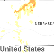
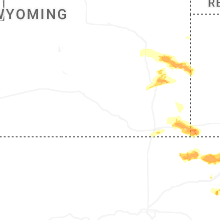
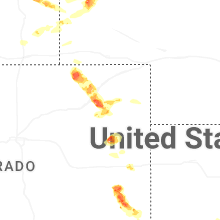
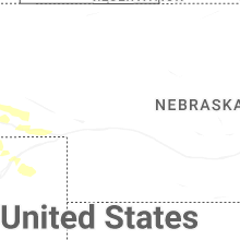
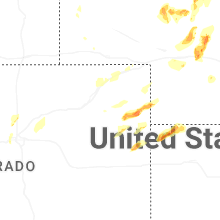


Connect with Interactive Hail Maps