

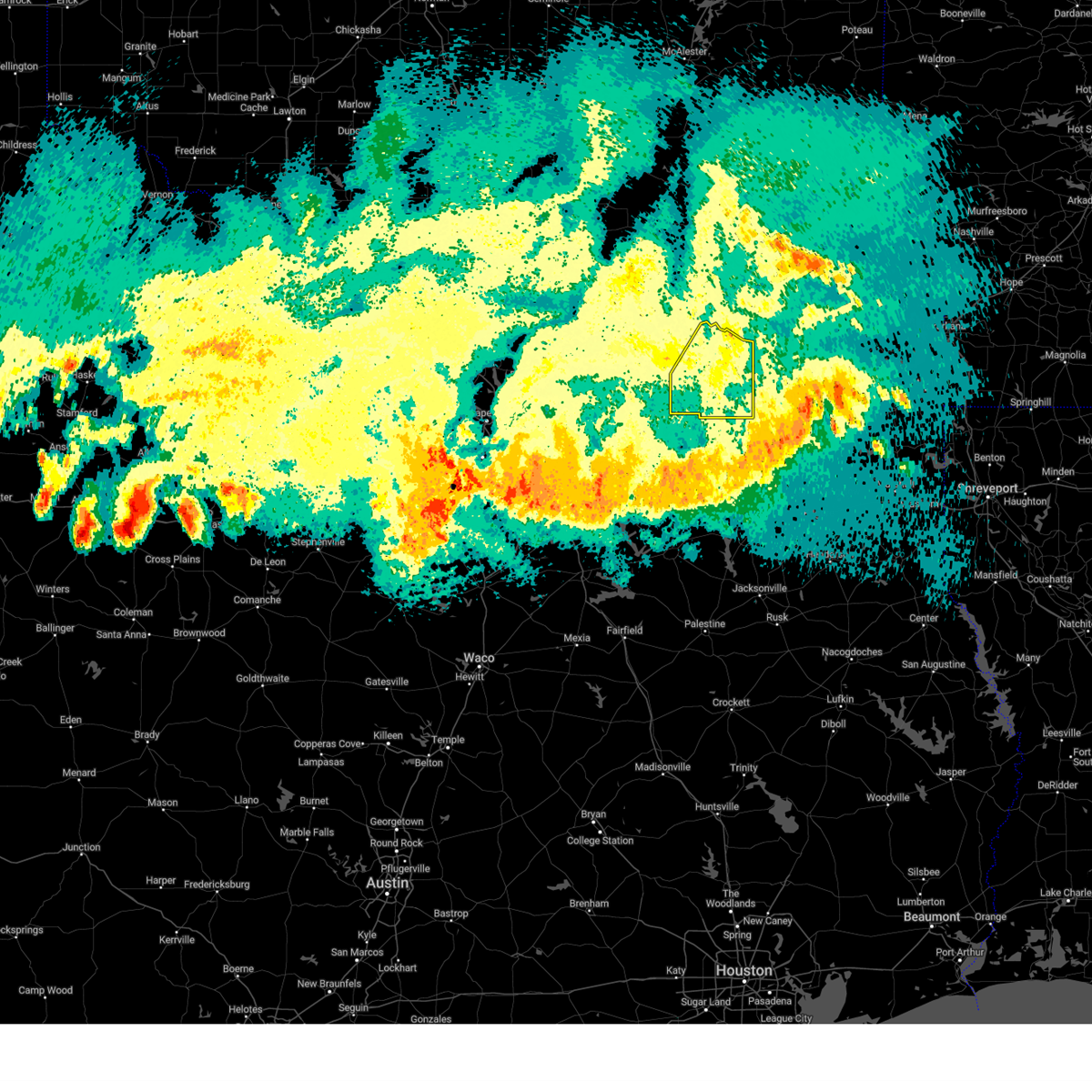
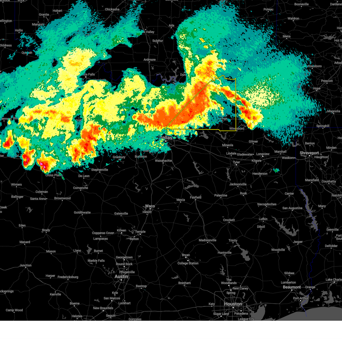
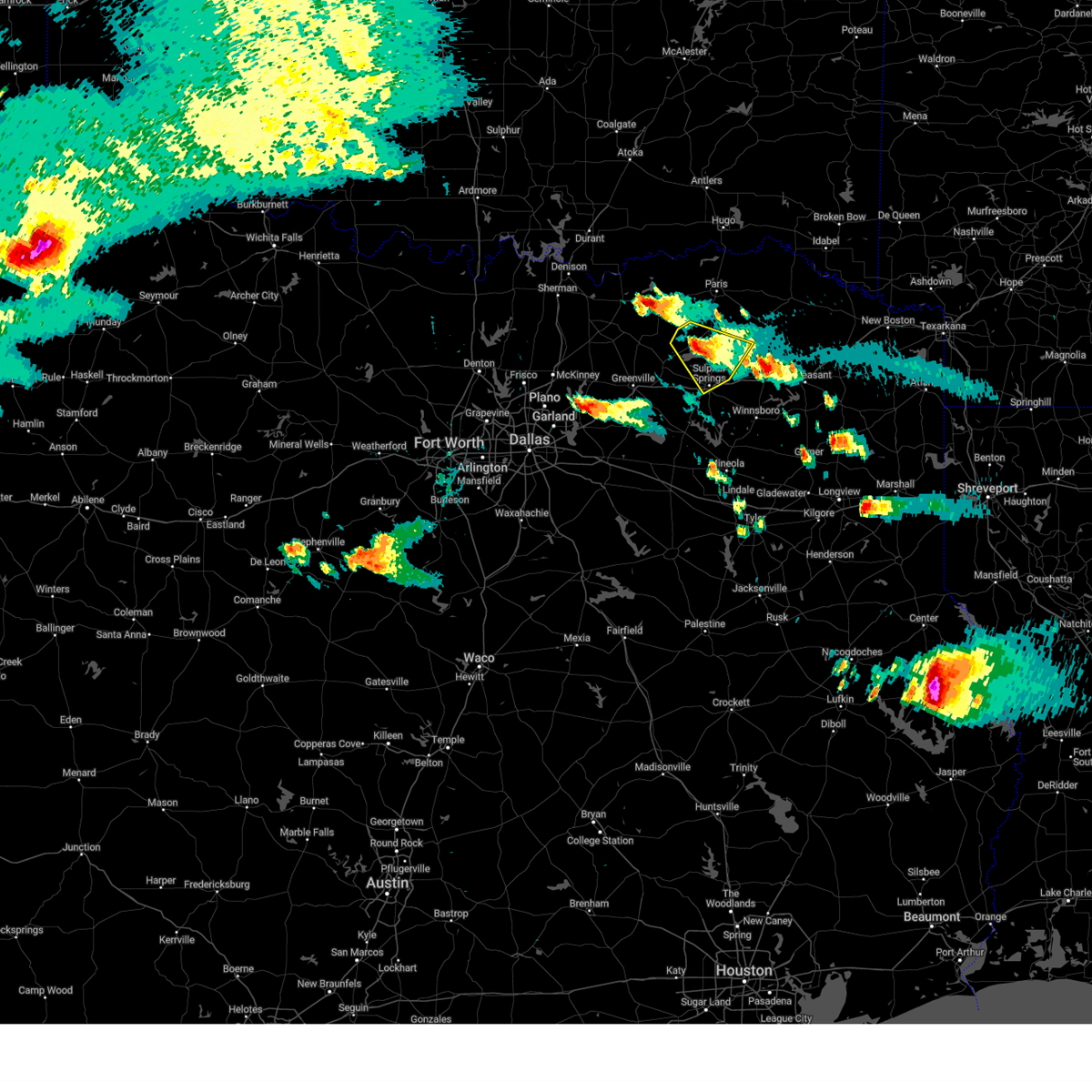
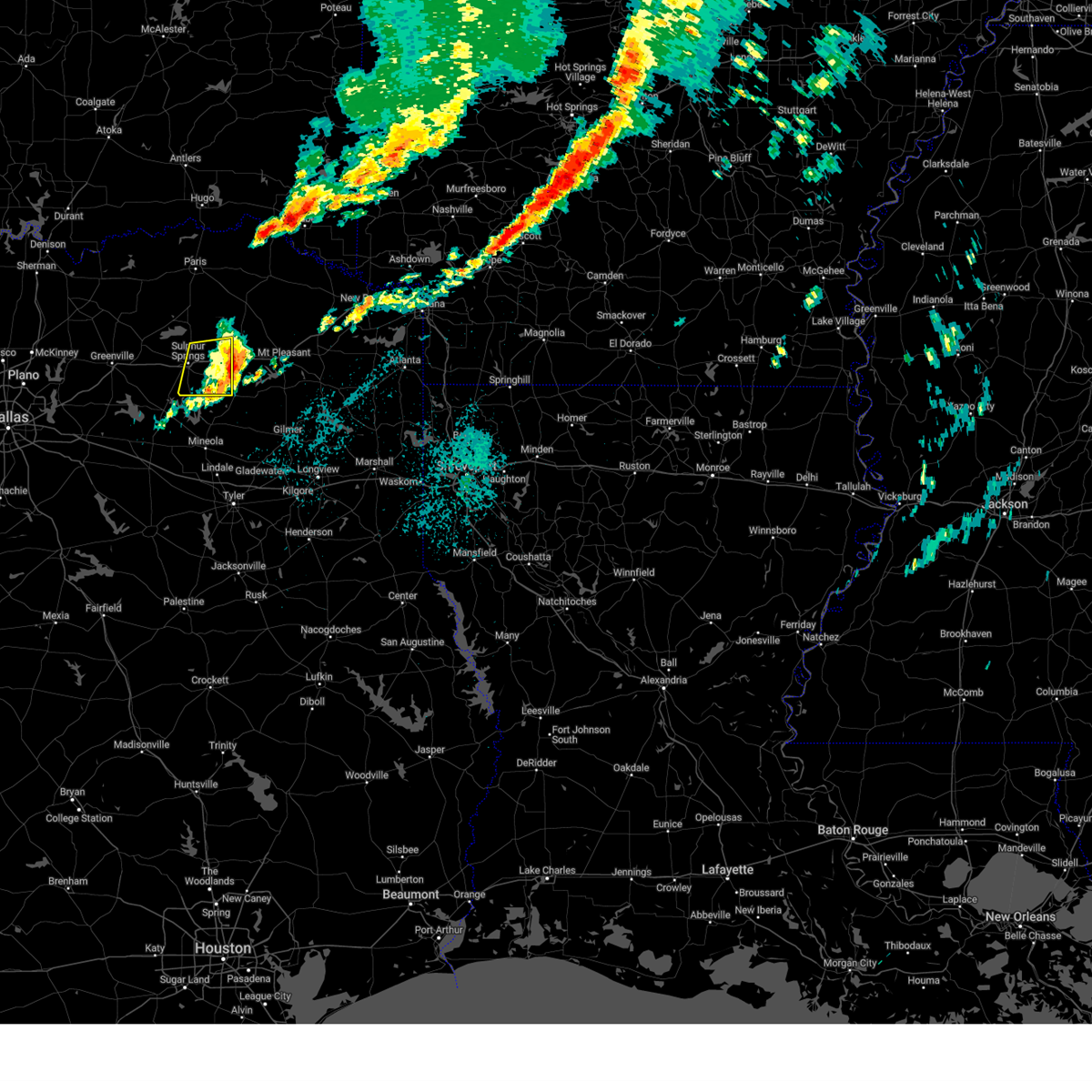
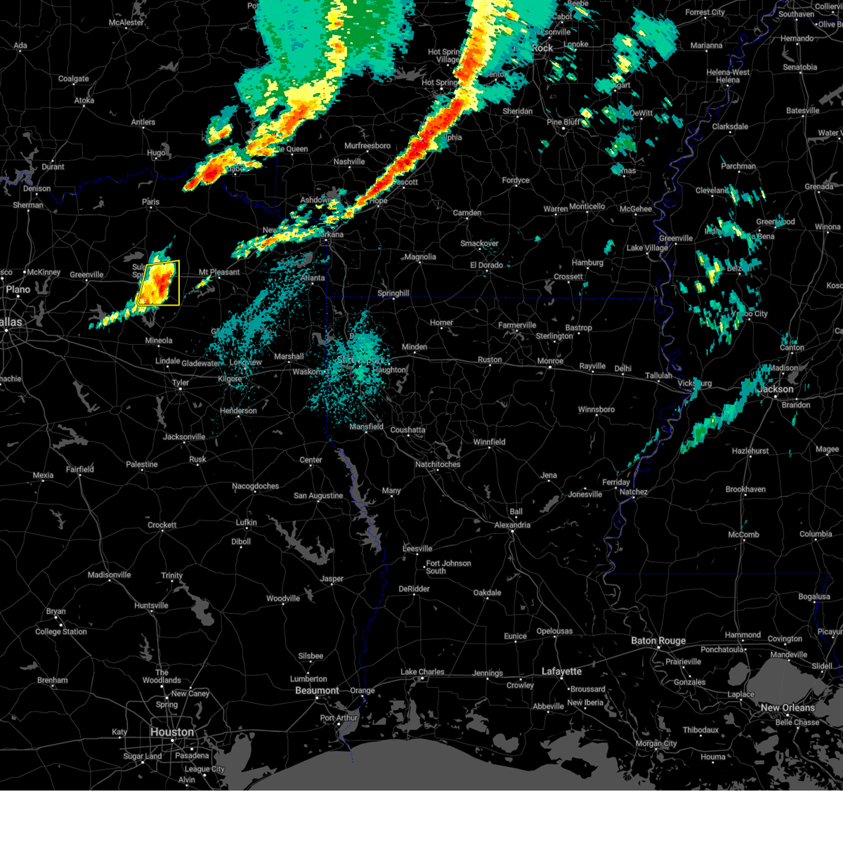
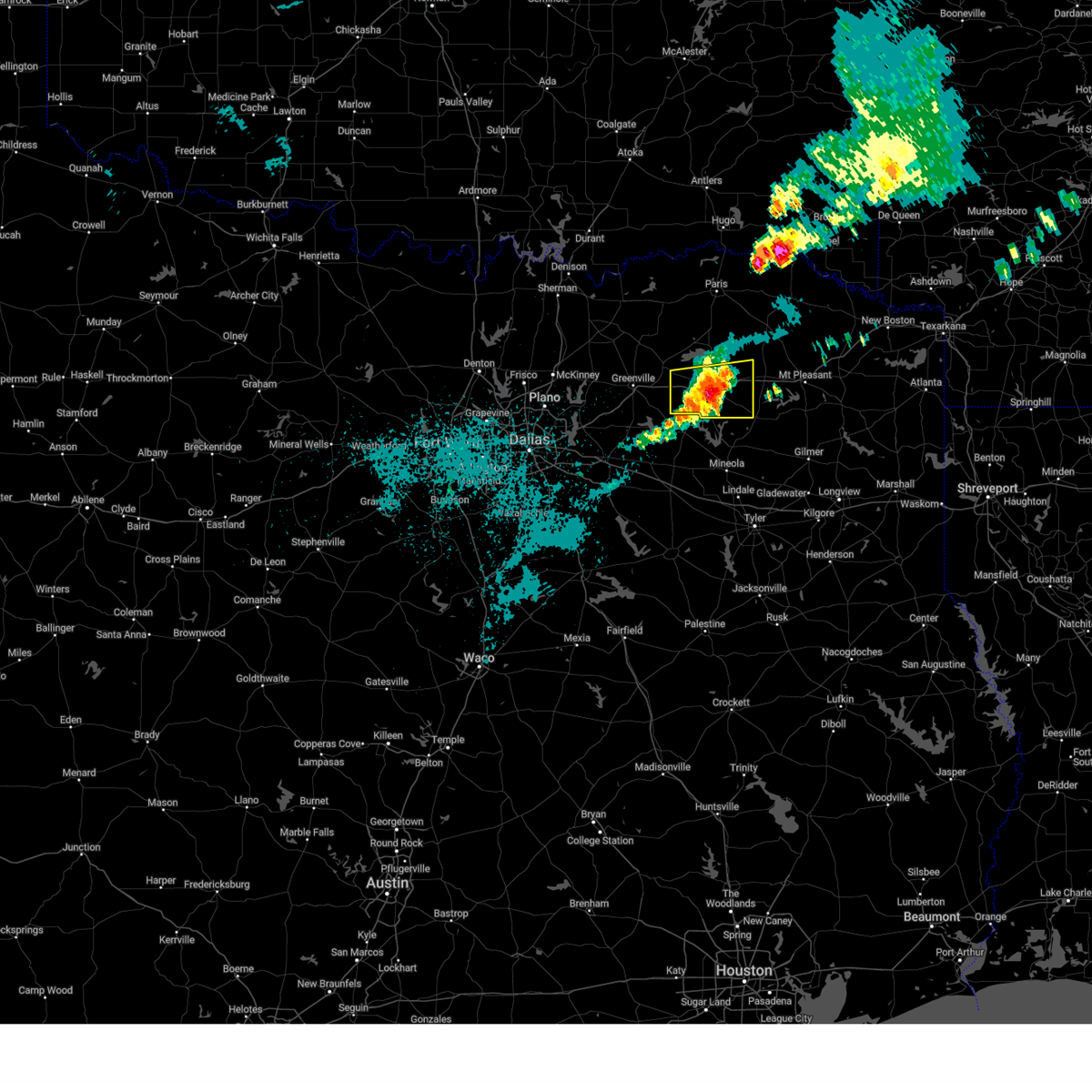
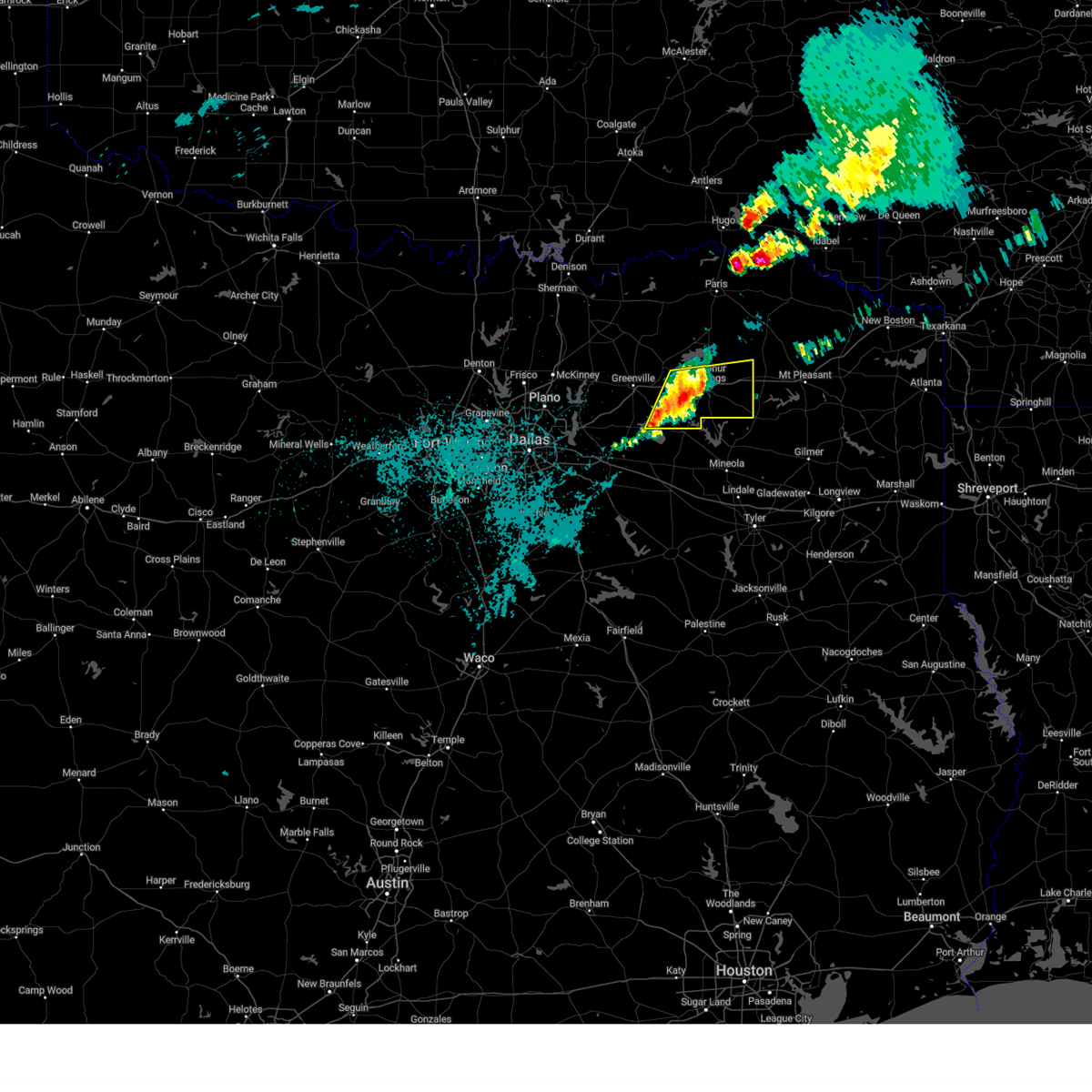
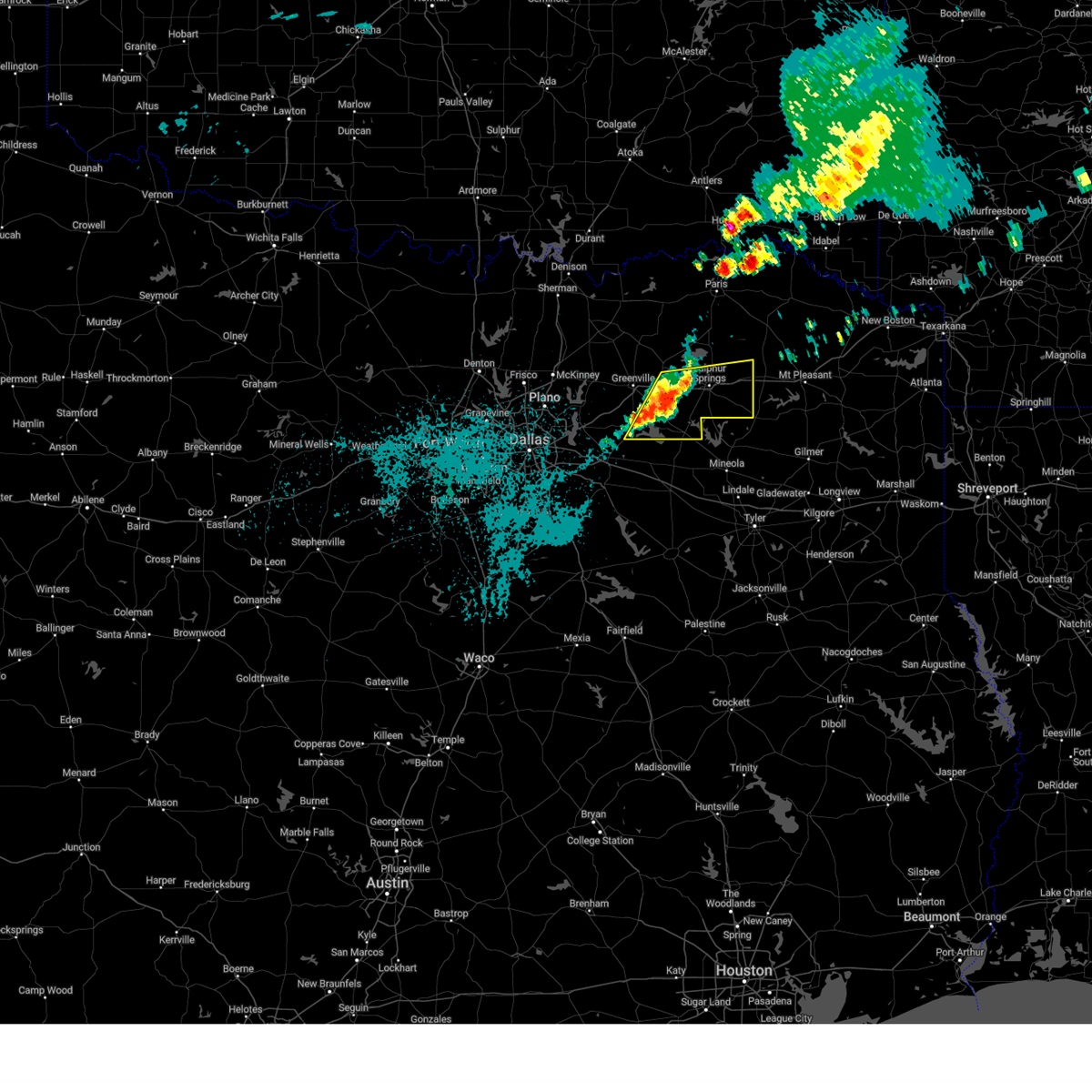
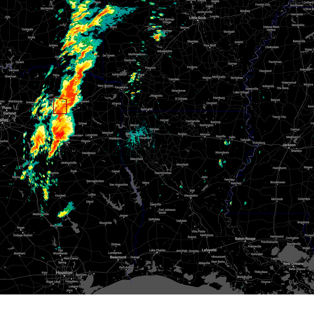
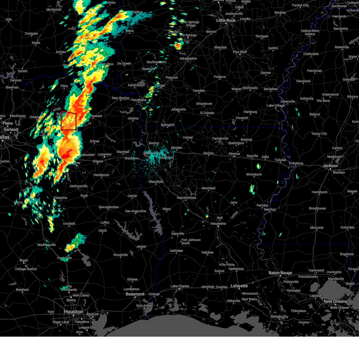
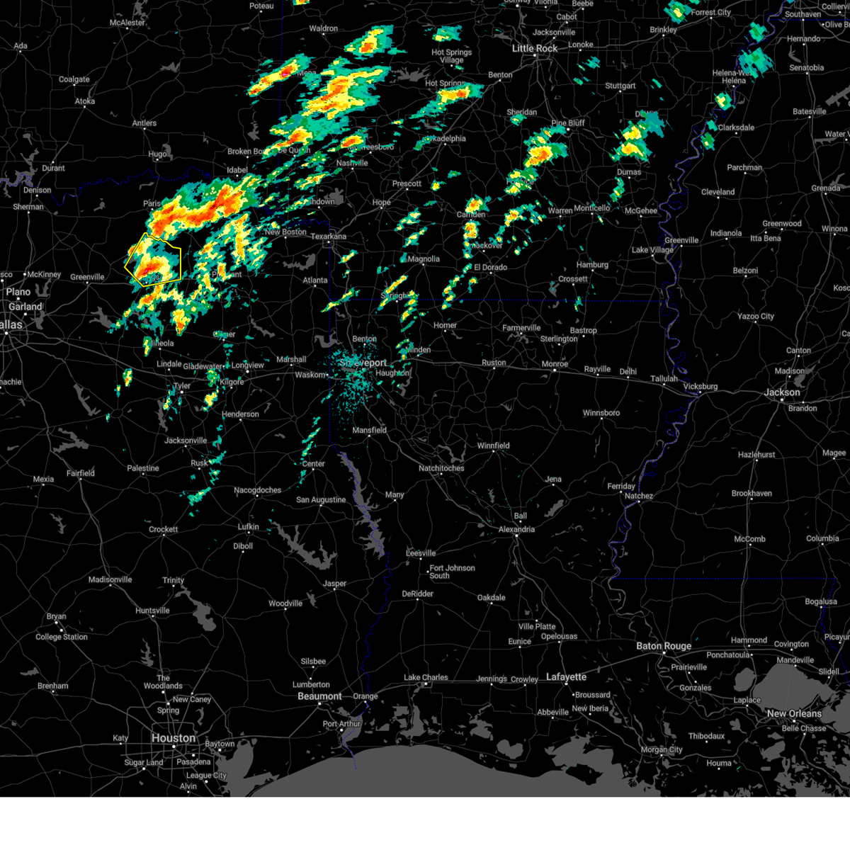
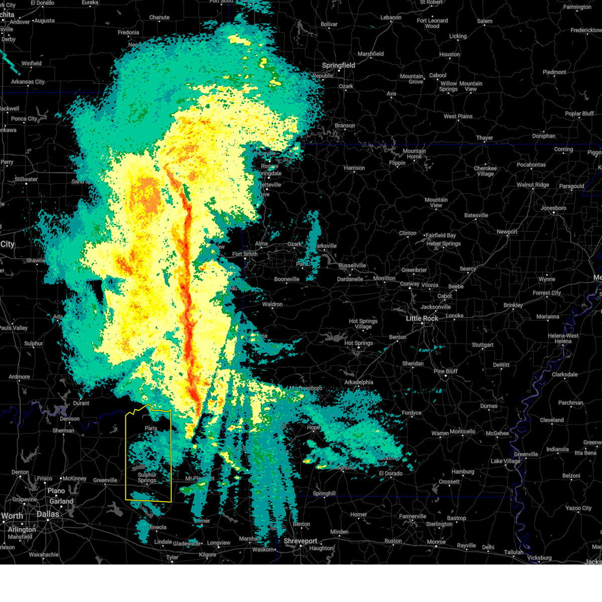
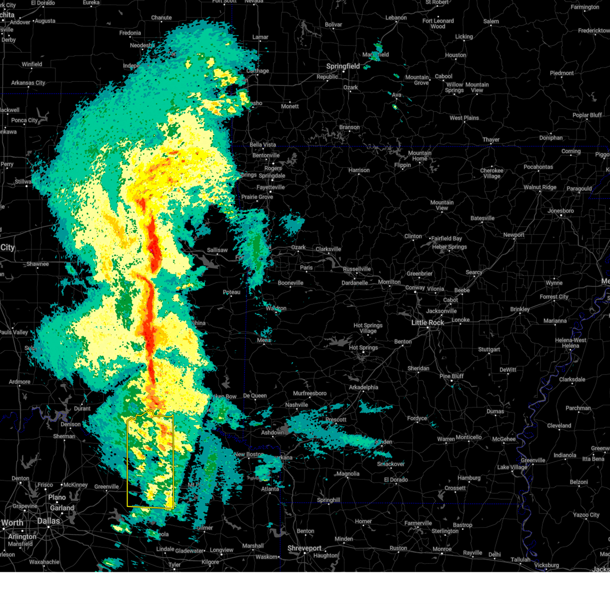
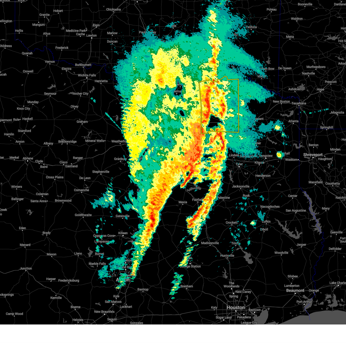
Hail Map for Sulphur Springs, TX
The Sulphur Springs, TX area has had 17 reports of on-the-ground hail by trained spotters, and has been under severe weather warnings 32 times during the past 12 months. Doppler radar has detected hail at or near Sulphur Springs, TX on 89 occasions, including 3 occasions during the past year.
| Name: | Sulphur Springs, TX |
| Where Located: | 73.4 miles ENE of Dallas, TX |
| Map: | Google Map for Sulphur Springs, TX |
| Population: | 15449 |
| Housing Units: | 6654 |
| More Info: | Search Google for Sulphur Springs, TX |
0
The Top Recent Hail Date for Sulphur Springs, TX is Friday, April 4, 2025 (87th out of 89)

Hail and Wind Damage Spotted near Sulphur Springs, TX
| Date / Time | Report Details |
|---|---|
| 6/8/2025 11:45 PM CDT |
 the severe thunderstorm warning has been cancelled and is no longer in effect the severe thunderstorm warning has been cancelled and is no longer in effect
|
| 6/8/2025 11:34 PM CDT |
 the severe thunderstorm warning has been cancelled and is no longer in effect the severe thunderstorm warning has been cancelled and is no longer in effect
|
| 6/8/2025 11:22 PM CDT |
 the severe thunderstorm warning has been cancelled and is no longer in effect the severe thunderstorm warning has been cancelled and is no longer in effect
|
| 6/8/2025 11:22 PM CDT |
 At 1121 pm cdt, severe thunderstorms were located along a line extending from near bogata to near point, moving southeast at 45 mph (radar indicated). Hazards include 70 mph wind gusts. Expect considerable tree damage. damage is likely to mobile homes, roofs, and outbuildings. These severe thunderstorms will impact areas of hopkins, delta and lamar counties, including the following locations, new birthright, ridgeway, glory, pacio, midcity, minter, taylor town, nelta, sun valley, and novice. At 1121 pm cdt, severe thunderstorms were located along a line extending from near bogata to near point, moving southeast at 45 mph (radar indicated). Hazards include 70 mph wind gusts. Expect considerable tree damage. damage is likely to mobile homes, roofs, and outbuildings. These severe thunderstorms will impact areas of hopkins, delta and lamar counties, including the following locations, new birthright, ridgeway, glory, pacio, midcity, minter, taylor town, nelta, sun valley, and novice.
|
| 6/8/2025 10:58 PM CDT | the severe thunderstorm warning has been cancelled and is no longer in effect |
| 6/8/2025 10:58 PM CDT | At 1057 pm cdt, severe thunderstorms were located along a line extending from near paris to near greenville club lake, moving east at 55 mph (radar indicated). Hazards include 70 mph wind gusts and penny size hail. Expect considerable tree damage. damage is likely to mobile homes, roofs, and outbuildings. These severe thunderstorms will impact areas of northern hunt, hopkins, delta and lamar counties, including the following locations, neylandville, new birthright, ridgeway, pacio, midcity, taylor town, sun valley, peerless, dike, and atlas. |
| 6/8/2025 10:54 PM CDT |
 Svrfwd the national weather service in fort worth has issued a * severe thunderstorm warning for, hopkins county in north central texas, central delta county in north central texas, * until midnight cdt. * at 1053 pm cdt, a severe thunderstorm was located over lake sulphur springs, or near sulphur springs, moving southeast at 60 mph. this is a destructive storm for northern and eastern hopkins county and eastern delta county (radar indicated). Hazards include 80 mph wind gusts and penny size hail. Flying debris will be dangerous to those caught without shelter. mobile homes will be heavily damaged. expect considerable damage to roofs, windows, and vehicles. extensive tree damage and power outages are likely. this severe thunderstorm will remain over mainly rural areas of hopkins and central delta counties, including the following locations, martin springs, weaver, tira, new birthright, ridgeway, pine forest, pacio, flora, nelta, and cornersville. This includes interstate 30 between mile markers 110 and 142. Svrfwd the national weather service in fort worth has issued a * severe thunderstorm warning for, hopkins county in north central texas, central delta county in north central texas, * until midnight cdt. * at 1053 pm cdt, a severe thunderstorm was located over lake sulphur springs, or near sulphur springs, moving southeast at 60 mph. this is a destructive storm for northern and eastern hopkins county and eastern delta county (radar indicated). Hazards include 80 mph wind gusts and penny size hail. Flying debris will be dangerous to those caught without shelter. mobile homes will be heavily damaged. expect considerable damage to roofs, windows, and vehicles. extensive tree damage and power outages are likely. this severe thunderstorm will remain over mainly rural areas of hopkins and central delta counties, including the following locations, martin springs, weaver, tira, new birthright, ridgeway, pine forest, pacio, flora, nelta, and cornersville. This includes interstate 30 between mile markers 110 and 142.
|
| 6/8/2025 10:28 PM CDT |
 Svrfwd the national weather service in fort worth has issued a * severe thunderstorm warning for, hunt county in north central texas, hopkins county in north central texas, delta county in north central texas, lamar county in north central texas, southeastern collin county in north central texas, southern fannin county in north central texas, * until 1145 pm cdt. * at 1026 pm cdt, severe thunderstorms were located along a line extending from near dodd city to fairview, moving southeast at 45 mph (radar indicated). Hazards include 70 mph wind gusts and penny size hail. Expect considerable tree damage. damage is likely to mobile homes, roofs, and outbuildings. these severe thunderstorms will affect areas from plano to blue ridge to wolfe city to paris, including the following locations, neylandville, new birthright, ridgeway, pacio, nobility, midcity, direct, forest hill, taylor town, and floyd. This includes interstate 30 between mile markers 82 and 142. Svrfwd the national weather service in fort worth has issued a * severe thunderstorm warning for, hunt county in north central texas, hopkins county in north central texas, delta county in north central texas, lamar county in north central texas, southeastern collin county in north central texas, southern fannin county in north central texas, * until 1145 pm cdt. * at 1026 pm cdt, severe thunderstorms were located along a line extending from near dodd city to fairview, moving southeast at 45 mph (radar indicated). Hazards include 70 mph wind gusts and penny size hail. Expect considerable tree damage. damage is likely to mobile homes, roofs, and outbuildings. these severe thunderstorms will affect areas from plano to blue ridge to wolfe city to paris, including the following locations, neylandville, new birthright, ridgeway, pacio, nobility, midcity, direct, forest hill, taylor town, and floyd. This includes interstate 30 between mile markers 82 and 142.
|
| 6/8/2025 6:54 PM CDT |
 the severe thunderstorm warning has been cancelled and is no longer in effect the severe thunderstorm warning has been cancelled and is no longer in effect
|
| 6/8/2025 6:13 PM CDT | Svrfwd the national weather service in fort worth has issued a * severe thunderstorm warning for, northern hopkins county in north central texas, delta county in north central texas, * until 715 pm cdt. * at 612 pm cdt, a severe thunderstorm was located over big creek lake, or 13 miles northeast of commerce, moving southeast at 20 mph (radar indicated). Hazards include 60 mph wind gusts and quarter size hail. Hail damage to vehicles is expected. expect wind damage to roofs, siding, and trees. this severe thunderstorm will be near, cooper lake, klondike, cooper, and cooper lake state park around 620 pm cdt. other locations impacted by this severe thunderstorm include tira, new birthright, flora, nelta, pacio, peerless, dike, and ben franklin. This includes interstate 30 between mile markers 121 and 129. |
| 5/20/2025 2:41 AM CDT |
 The storm which prompted the warning has moved out of the area. therefore the warning will be allowed to expire. however gusty winds and heavy rain are still possible with this thunderstorm. a severe thunderstorm watch remains in effect until 500 am cdt for north central texas. The storm which prompted the warning has moved out of the area. therefore the warning will be allowed to expire. however gusty winds and heavy rain are still possible with this thunderstorm. a severe thunderstorm watch remains in effect until 500 am cdt for north central texas.
|
| 5/20/2025 2:30 AM CDT |
 At 230 am cdt, a severe thunderstorm was located near como, or 10 miles northwest of winnsboro, moving east at 50 mph (radar indicated). Hazards include 60 mph wind gusts and quarter size hail. Hail damage to vehicles is expected. expect wind damage to roofs, siding, and trees. Locations impacted include, martin springs, weaver, flora, sulphur springs, cornersville, pine forest, como, dike, and lake sulphur springs. At 230 am cdt, a severe thunderstorm was located near como, or 10 miles northwest of winnsboro, moving east at 50 mph (radar indicated). Hazards include 60 mph wind gusts and quarter size hail. Hail damage to vehicles is expected. expect wind damage to roofs, siding, and trees. Locations impacted include, martin springs, weaver, flora, sulphur springs, cornersville, pine forest, como, dike, and lake sulphur springs.
|
| 5/20/2025 2:17 AM CDT |
 At 217 am cdt, a severe thunderstorm was located near sulphur springs, moving east at 45 mph (radar indicated). Hazards include 65 mph wind gusts and quarter size hail. Hail damage to vehicles is expected. expect wind damage to roofs, siding, and trees. Locations impacted include, martin springs, weaver, ridgeway, pine forest, como, cumby, flora, sulphur springs, cornersville, lake sulphur springs, and dike. At 217 am cdt, a severe thunderstorm was located near sulphur springs, moving east at 45 mph (radar indicated). Hazards include 65 mph wind gusts and quarter size hail. Hail damage to vehicles is expected. expect wind damage to roofs, siding, and trees. Locations impacted include, martin springs, weaver, ridgeway, pine forest, como, cumby, flora, sulphur springs, cornersville, lake sulphur springs, and dike.
|
| 5/20/2025 2:17 AM CDT |
 the severe thunderstorm warning has been cancelled and is no longer in effect the severe thunderstorm warning has been cancelled and is no longer in effect
|
| 5/20/2025 2:07 AM CDT |
 At 206 am cdt, a severe thunderstorm was located near cumby, or 9 miles southwest of sulphur springs, moving east at 45 mph (radar indicated). Hazards include 70 mph wind gusts and quarter size hail. Hail damage to vehicles is expected. expect considerable tree damage. wind damage is also likely to mobile homes, roofs, and outbuildings. Locations impacted include, west tawakoni, martin springs, weaver, ridgeway, point, pine forest, como, lone oak, cumby, flora, sulphur springs, cornersville, lake sulphur springs, dike, hermits cove, east tawakoni, lake tawakoni, and lake fork reservoir. At 206 am cdt, a severe thunderstorm was located near cumby, or 9 miles southwest of sulphur springs, moving east at 45 mph (radar indicated). Hazards include 70 mph wind gusts and quarter size hail. Hail damage to vehicles is expected. expect considerable tree damage. wind damage is also likely to mobile homes, roofs, and outbuildings. Locations impacted include, west tawakoni, martin springs, weaver, ridgeway, point, pine forest, como, lone oak, cumby, flora, sulphur springs, cornersville, lake sulphur springs, dike, hermits cove, east tawakoni, lake tawakoni, and lake fork reservoir.
|
| 5/20/2025 2:01 AM CDT |
 Svrfwd the national weather service in fort worth has issued a * severe thunderstorm warning for, southeastern hunt county in north central texas, hopkins county in north central texas, rains county in north central texas, * until 245 am cdt. * at 200 am cdt, a severe thunderstorm was located near cumby, or 13 miles southwest of sulphur springs, moving east at 50 mph (radar indicated). Hazards include 65 mph wind gusts and quarter size hail. Hail damage to vehicles is expected. expect wind damage to roofs, siding, and trees. this severe thunderstorm will remain over mainly rural areas of southeastern hunt, hopkins and rains counties, including the following locations, martin springs, weaver, lone oak, flora, ridgeway, cornersville, pine forest, hermits cove, dike, and flats. This includes interstate 30 between mile markers 103 and 142. Svrfwd the national weather service in fort worth has issued a * severe thunderstorm warning for, southeastern hunt county in north central texas, hopkins county in north central texas, rains county in north central texas, * until 245 am cdt. * at 200 am cdt, a severe thunderstorm was located near cumby, or 13 miles southwest of sulphur springs, moving east at 50 mph (radar indicated). Hazards include 65 mph wind gusts and quarter size hail. Hail damage to vehicles is expected. expect wind damage to roofs, siding, and trees. this severe thunderstorm will remain over mainly rural areas of southeastern hunt, hopkins and rains counties, including the following locations, martin springs, weaver, lone oak, flora, ridgeway, cornersville, pine forest, hermits cove, dike, and flats. This includes interstate 30 between mile markers 103 and 142.
|
| 4/4/2025 4:06 PM CDT |
 The rotation associated with the storm that prompted the tornado warning has weakened, and no longer appears capable of producing a tornado. therefore the tornado warning will be allowed to expire. however small hail and gusty winds are still possible with this thunderstorm. a tornado watch remains in effect until 900 pm cdt for north central texas. The rotation associated with the storm that prompted the tornado warning has weakened, and no longer appears capable of producing a tornado. therefore the tornado warning will be allowed to expire. however small hail and gusty winds are still possible with this thunderstorm. a tornado watch remains in effect until 900 pm cdt for north central texas.
|
| 4/4/2025 3:52 PM CDT |
 Torfwd the national weather service in fort worth has issued a * tornado warning for, southeastern hopkins county in north central texas, * until 415 pm cdt. * at 352 pm cdt, a severe thunderstorm capable of producing a tornado was located 7 miles north of lake fork reservoir, or 14 miles west of winnsboro, moving north at 50 mph (radar indicated rotation). Hazards include tornado and quarter size hail. Flying debris will be dangerous to those caught without shelter. mobile homes will be damaged or destroyed. damage to roofs, windows, and vehicles will occur. tree damage is likely. this dangerous storm will be near, como around 400 pm cdt. other locations impacted by this tornadic thunderstorm include martin springs, weaver, new birthright, cornersville, pine forest, dike, and flora. This includes interstate 30 between mile markers 124 and 141. Torfwd the national weather service in fort worth has issued a * tornado warning for, southeastern hopkins county in north central texas, * until 415 pm cdt. * at 352 pm cdt, a severe thunderstorm capable of producing a tornado was located 7 miles north of lake fork reservoir, or 14 miles west of winnsboro, moving north at 50 mph (radar indicated rotation). Hazards include tornado and quarter size hail. Flying debris will be dangerous to those caught without shelter. mobile homes will be damaged or destroyed. damage to roofs, windows, and vehicles will occur. tree damage is likely. this dangerous storm will be near, como around 400 pm cdt. other locations impacted by this tornadic thunderstorm include martin springs, weaver, new birthright, cornersville, pine forest, dike, and flora. This includes interstate 30 between mile markers 124 and 141.
|
| 4/4/2025 3:49 PM CDT |
 the tornado warning has been cancelled and is no longer in effect the tornado warning has been cancelled and is no longer in effect
|
| 4/4/2025 3:36 PM CDT |
 At 336 pm cdt, a severe thunderstorm capable of producing a tornado was located 9 miles north of como, or 11 miles east of sulphur springs, moving northeast at 40 mph (radar indicated rotation). Hazards include tornado and quarter size hail. Flying debris will be dangerous to those caught without shelter. mobile homes will be damaged or destroyed. damage to roofs, windows, and vehicles will occur. tree damage is likely. Locations impacted include, weaver, flora, and dike. At 336 pm cdt, a severe thunderstorm capable of producing a tornado was located 9 miles north of como, or 11 miles east of sulphur springs, moving northeast at 40 mph (radar indicated rotation). Hazards include tornado and quarter size hail. Flying debris will be dangerous to those caught without shelter. mobile homes will be damaged or destroyed. damage to roofs, windows, and vehicles will occur. tree damage is likely. Locations impacted include, weaver, flora, and dike.
|
| 4/4/2025 3:36 PM CDT |
 the tornado warning has been cancelled and is no longer in effect the tornado warning has been cancelled and is no longer in effect
|
| 4/4/2025 3:16 PM CDT |
 At 316 pm cdt, a severe thunderstorm capable of producing a tornado was located just south of sulphur springs, moving northeast at 35 mph (radar indicated rotation). Hazards include tornado and golf ball size hail. Flying debris will be dangerous to those caught without shelter. mobile homes will be damaged or destroyed. damage to roofs, windows, and vehicles will occur. tree damage is likely. Locations impacted include, martin springs, weaver, flora, sulphur springs, nelta, pine forest, cunningham, como, dike, minter, and lake sulphur springs. At 316 pm cdt, a severe thunderstorm capable of producing a tornado was located just south of sulphur springs, moving northeast at 35 mph (radar indicated rotation). Hazards include tornado and golf ball size hail. Flying debris will be dangerous to those caught without shelter. mobile homes will be damaged or destroyed. damage to roofs, windows, and vehicles will occur. tree damage is likely. Locations impacted include, martin springs, weaver, flora, sulphur springs, nelta, pine forest, cunningham, como, dike, minter, and lake sulphur springs.
|
| 4/4/2025 3:16 PM CDT |
 the tornado warning has been cancelled and is no longer in effect the tornado warning has been cancelled and is no longer in effect
|
| 4/4/2025 3:04 PM CDT | Torfwd the national weather service in fort worth has issued a * tornado warning for, hopkins county in north central texas, northeastern rains county in north central texas, northeastern delta county in north central texas, southeastern lamar county in north central texas, * until 400 pm cdt. * at 304 pm cdt, a severe thunderstorm capable of producing a tornado was located 9 miles northeast of emory, or 11 miles south of sulphur springs, moving northeast at 35 mph (radar indicated rotation). Hazards include tornado and quarter size hail. Flying debris will be dangerous to those caught without shelter. mobile homes will be damaged or destroyed. damage to roofs, windows, and vehicles will occur. tree damage is likely. this tornadic thunderstorm will remain over mainly rural areas of hopkins, northeastern rains, northeastern delta and southeastern lamar counties, including the following locations, martin springs, weaver, flora, nelta, pine forest, cunningham, dike, minter, new birthright, and tira. This includes interstate 30 between mile markers 118 and 142. |
| 4/3/2025 1:38 PM CDT | the severe thunderstorm warning has been cancelled and is no longer in effect |
| 4/3/2025 1:25 PM CDT |
 At 124 pm cdt, a severe thunderstorm was located near cooper lake state park, or 11 miles northeast of sulphur springs, moving northeast at 60 mph (law enforcement. at 111 pm...quarter size hail was reported in brashear with this storm). Hazards include 60 mph wind gusts and quarter size hail. Hail damage to vehicles is expected. expect wind damage to roofs, siding, and trees. Locations impacted include, weaver, tira, new birthright, cooper lake state park, pacio, cooper lake, flora, sulphur springs, nelta, lake sulphur springs, peerless, dike, cooper, and klondike. At 124 pm cdt, a severe thunderstorm was located near cooper lake state park, or 11 miles northeast of sulphur springs, moving northeast at 60 mph (law enforcement. at 111 pm...quarter size hail was reported in brashear with this storm). Hazards include 60 mph wind gusts and quarter size hail. Hail damage to vehicles is expected. expect wind damage to roofs, siding, and trees. Locations impacted include, weaver, tira, new birthright, cooper lake state park, pacio, cooper lake, flora, sulphur springs, nelta, lake sulphur springs, peerless, dike, cooper, and klondike.
|
| 4/3/2025 1:14 PM CDT | Svrfwd the national weather service in fort worth has issued a * severe thunderstorm warning for, hopkins county in north central texas, central delta county in north central texas, * until 215 pm cdt. * at 114 pm cdt, a severe thunderstorm was located near lake sulphur springs, or near sulphur springs, moving northeast at 15 mph (radar indicated). Hazards include 60 mph wind gusts and quarter size hail. Hail damage to vehicles is expected. expect wind damage to roofs, siding, and trees. this severe thunderstorm will be near, lake sulphur springs and sulphur springs around 120 pm cdt. other locations impacted by this severe thunderstorm include martin springs, weaver, tira, new birthright, ridgeway, pacio, flora, nelta, peerless, and dike. This includes interstate 30 between mile markers 110 and 142. |
| 4/3/2025 1:11 PM CDT | Quarter sized hail reported 7.7 miles ENE of Sulphur Springs, TX, quarter size hail reported on cr 1157. |
| 3/4/2025 7:30 AM CST |
 The storms which prompted the warning have moved out of the area. therefore the warning has been allowed to expire. however gusty winds are still possible with these thunderstorms. a tornado watch remains in effect until 1100 am cst for north central texas. The storms which prompted the warning have moved out of the area. therefore the warning has been allowed to expire. however gusty winds are still possible with these thunderstorms. a tornado watch remains in effect until 1100 am cst for north central texas.
|
| 3/4/2025 6:51 AM CST |
 the severe thunderstorm warning has been cancelled and is no longer in effect the severe thunderstorm warning has been cancelled and is no longer in effect
|
| 3/4/2025 6:51 AM CST |
 At 650 am cst, severe thunderstorms were located along a line extending from paris to sulphur springs, moving east at 55 mph (radar indicated). Hazards include 65 mph wind gusts and quarter size hail. Hail damage to vehicles is expected. expect wind damage to roofs, siding, and trees. Locations impacted include, new birthright, ridgeway, pacio, como, midcity, direct, forest hill, cooper lake, taylor town, sun valley, peerless, dike, atlas, weaver, tira, noble, forest chapel, pine forest, broadway junction, and garretts bluff. At 650 am cst, severe thunderstorms were located along a line extending from paris to sulphur springs, moving east at 55 mph (radar indicated). Hazards include 65 mph wind gusts and quarter size hail. Hail damage to vehicles is expected. expect wind damage to roofs, siding, and trees. Locations impacted include, new birthright, ridgeway, pacio, como, midcity, direct, forest hill, cooper lake, taylor town, sun valley, peerless, dike, atlas, weaver, tira, noble, forest chapel, pine forest, broadway junction, and garretts bluff.
|
| 3/4/2025 6:50 AM CST | 61 mph wind gust measured at the kslr awo in hopkins county TX, 1.4 miles SSE of Sulphur Springs, TX |
| 3/4/2025 6:50 AM CST | Major structural damage reported near cr 4759 and cr 4760... including structural damage... tree damage... and downed power line in hopkins county TX, 6.5 miles SSE of Sulphur Springs, TX |
| 3/4/2025 6:31 AM CST |
 At 629 am cst, severe thunderstorms were located along a line extending from near crockett lake to pecan gap to cumby, moving east at 60 mph. several reports of wind damage have been received with this line of storms (emergency management). Hazards include 65 mph wind gusts and quarter size hail. Hail damage to vehicles is expected. expect wind damage to roofs, siding, and trees. These severe thunderstorms will move over most of hunt, hopkins, delta, lamar and eastern fannin counties, including the following locations, neylandville, new birthright, ridgeway, pacio, midcity, direct, forest hill, taylor town, sun valley, and gober. At 629 am cst, severe thunderstorms were located along a line extending from near crockett lake to pecan gap to cumby, moving east at 60 mph. several reports of wind damage have been received with this line of storms (emergency management). Hazards include 65 mph wind gusts and quarter size hail. Hail damage to vehicles is expected. expect wind damage to roofs, siding, and trees. These severe thunderstorms will move over most of hunt, hopkins, delta, lamar and eastern fannin counties, including the following locations, neylandville, new birthright, ridgeway, pacio, midcity, direct, forest hill, taylor town, sun valley, and gober.
|
| 3/4/2025 6:19 AM CST | Svrfwd the national weather service in fort worth has issued a * severe thunderstorm warning for, eastern hunt county in north central texas, hopkins county in north central texas, delta county in north central texas, lamar county in north central texas, eastern fannin county in north central texas, * until 730 am cst. * at 618 am cst, severe thunderstorms were located along a line extending from near dodd city to wolfe city to near greenville, moving east at 60 mph (radar indicated). Hazards include 65 mph wind gusts and quarter size hail. Hail damage to vehicles is expected. expect wind damage to roofs, siding, and trees. other locations impacted by this severe thunderstorm include neylandville, new birthright, ridgeway, pacio, midcity, direct, forest hill, taylor town, sun valley, and gober. This includes interstate 30 between mile markers 95 and 142. |
| 5/24/2024 6:31 PM CDT |
 At 631 pm cdt, a severe thunderstorm was located 8 miles east of cooper lake state park, or 11 miles northeast of sulphur springs, moving northeast at 50 mph (radar indicated). Hazards include 60 mph wind gusts and quarter size hail. Hail damage to vehicles is expected. expect wind damage to roofs, siding, and trees. Locations impacted include, sulphur springs, cooper lake state park, lake sulphur springs, tira, weaver, flora, new birthright, nelta, dike, and martin springs. At 631 pm cdt, a severe thunderstorm was located 8 miles east of cooper lake state park, or 11 miles northeast of sulphur springs, moving northeast at 50 mph (radar indicated). Hazards include 60 mph wind gusts and quarter size hail. Hail damage to vehicles is expected. expect wind damage to roofs, siding, and trees. Locations impacted include, sulphur springs, cooper lake state park, lake sulphur springs, tira, weaver, flora, new birthright, nelta, dike, and martin springs.
|
| 5/24/2024 6:15 PM CDT |
 the severe thunderstorm warning has been cancelled and is no longer in effect the severe thunderstorm warning has been cancelled and is no longer in effect
|
| 5/24/2024 6:15 PM CDT |
 At 615 pm cdt, a severe thunderstorm was located near lake sulphur springs, or near sulphur springs, moving northeast at 45 mph (radar indicated). Hazards include 60 mph wind gusts and quarter size hail. Hail damage to vehicles is expected. expect wind damage to roofs, siding, and trees. Locations impacted include, sulphur springs, cumby, como, cooper lake state park, lake sulphur springs, pine forest, tira, martin springs, weaver, new birthright, ridgeway, flora, nelta, peerless, and dike. At 615 pm cdt, a severe thunderstorm was located near lake sulphur springs, or near sulphur springs, moving northeast at 45 mph (radar indicated). Hazards include 60 mph wind gusts and quarter size hail. Hail damage to vehicles is expected. expect wind damage to roofs, siding, and trees. Locations impacted include, sulphur springs, cumby, como, cooper lake state park, lake sulphur springs, pine forest, tira, martin springs, weaver, new birthright, ridgeway, flora, nelta, peerless, and dike.
|
| 5/24/2024 6:02 PM CDT |
 At 601 pm cdt, a severe thunderstorm was located near campbell, or 9 miles east of greenville, moving northeast at 35 mph (radar indicated). Hazards include quarter size hail. Damage to vehicles is possible. Locations impacted include, greenville, sulphur springs, west tawakoni, emory, east tawakoni, point, cumby, como, campbell, greenville club lake, cooper lake state park, lake sulphur springs, lake tawakoni, lake fork reservoir, lone oak, pine forest, tira, new birthright, ridgeway, and nelta. At 601 pm cdt, a severe thunderstorm was located near campbell, or 9 miles east of greenville, moving northeast at 35 mph (radar indicated). Hazards include quarter size hail. Damage to vehicles is possible. Locations impacted include, greenville, sulphur springs, west tawakoni, emory, east tawakoni, point, cumby, como, campbell, greenville club lake, cooper lake state park, lake sulphur springs, lake tawakoni, lake fork reservoir, lone oak, pine forest, tira, new birthright, ridgeway, and nelta.
|
| 5/24/2024 5:51 PM CDT |
 Svrfwd the national weather service in fort worth has issued a * severe thunderstorm warning for, southern hunt county in north central texas, hopkins county in north central texas, rains county in north central texas, * until 645 pm cdt. * at 550 pm cdt, a severe thunderstorm was located over greenville club lake, or 9 miles southeast of greenville, moving east at 40 mph (radar indicated). Hazards include half dollar size hail. Damage to vehicles is possible. this severe thunderstorm will remain over mainly rural areas of southern hunt, hopkins and rains counties, including the following locations, martin springs, weaver, tira, new birthright, ridgeway, cash, pine forest, lone oak, flora, and flats. This includes interstate 30 between mile markers 85 and 93, and between mile markers 99 and 142. Svrfwd the national weather service in fort worth has issued a * severe thunderstorm warning for, southern hunt county in north central texas, hopkins county in north central texas, rains county in north central texas, * until 645 pm cdt. * at 550 pm cdt, a severe thunderstorm was located over greenville club lake, or 9 miles southeast of greenville, moving east at 40 mph (radar indicated). Hazards include half dollar size hail. Damage to vehicles is possible. this severe thunderstorm will remain over mainly rural areas of southern hunt, hopkins and rains counties, including the following locations, martin springs, weaver, tira, new birthright, ridgeway, cash, pine forest, lone oak, flora, and flats. This includes interstate 30 between mile markers 85 and 93, and between mile markers 99 and 142.
|
| 5/22/2024 8:05 PM CDT | Tea Cup sized hail reported 6.8 miles W of Sulphur Springs, TX, corrects previous hail report from 6 n como. |
| 5/22/2024 8:05 PM CDT | Tennis Ball sized hail reported 6.8 miles W of Sulphur Springs, TX |
| 5/22/2024 8:04 PM CDT | Half Dollar sized hail reported 8.1 miles WSW of Sulphur Springs, TX, report from mping. |
| 5/22/2024 7:57 PM CDT |
 Svrfwd the national weather service in fort worth has issued a * severe thunderstorm warning for, hopkins county in north central texas, delta county in north central texas, lamar county in north central texas, * until 845 pm cdt. * at 757 pm cdt, a severe thunderstorm was located near sulphur springs, moving east at 40 mph. another severe storm was located just south of paris, moving east at 40 mph (radar indicated). Hazards include ping pong ball size hail and 65 mph wind gusts. People and animals outdoors will be injured. expect hail damage to roofs, siding, windows, and vehicles. expect wind damage to roofs, siding, and trees. this severe thunderstorm will remain over mainly rural areas of hopkins, delta and lamar counties, including the following locations, new birthright, glory, pacio, minter, forest hill, petty, taylor town, globe, pecan gap, and nelta. This includes interstate 30 between mile markers 120 and 142. Svrfwd the national weather service in fort worth has issued a * severe thunderstorm warning for, hopkins county in north central texas, delta county in north central texas, lamar county in north central texas, * until 845 pm cdt. * at 757 pm cdt, a severe thunderstorm was located near sulphur springs, moving east at 40 mph. another severe storm was located just south of paris, moving east at 40 mph (radar indicated). Hazards include ping pong ball size hail and 65 mph wind gusts. People and animals outdoors will be injured. expect hail damage to roofs, siding, windows, and vehicles. expect wind damage to roofs, siding, and trees. this severe thunderstorm will remain over mainly rural areas of hopkins, delta and lamar counties, including the following locations, new birthright, glory, pacio, minter, forest hill, petty, taylor town, globe, pecan gap, and nelta. This includes interstate 30 between mile markers 120 and 142.
|
| 5/22/2024 7:54 PM CDT | Ping Pong Ball sized hail reported 0.9 miles N of Sulphur Springs, TX, report from mping. |
| 5/22/2024 7:53 PM CDT | Quarter sized hail reported 0.7 miles SW of Sulphur Springs, TX, report from mping. |
| 5/22/2024 7:51 PM CDT |
 At 751 pm cdt, a severe thunderstorm was located near cooper lake state park, or just north of sulphur springs, moving northeast at 35 mph (radar indicated). Hazards include golf ball size hail and 65 mph wind gusts. People and animals outdoors will be injured. expect hail damage to roofs, siding, windows, and vehicles. expect wind damage to roofs, siding, and trees. Locations impacted include, sulphur springs, cooper, cumby, cooper lake, big creek lake, cooper lake state park, lake sulphur springs, klondike, tira, pecan gap, new birthright, ridgeway, pacio, nelta, peerless, dike, weaver, flora, and ben franklin. At 751 pm cdt, a severe thunderstorm was located near cooper lake state park, or just north of sulphur springs, moving northeast at 35 mph (radar indicated). Hazards include golf ball size hail and 65 mph wind gusts. People and animals outdoors will be injured. expect hail damage to roofs, siding, windows, and vehicles. expect wind damage to roofs, siding, and trees. Locations impacted include, sulphur springs, cooper, cumby, cooper lake, big creek lake, cooper lake state park, lake sulphur springs, klondike, tira, pecan gap, new birthright, ridgeway, pacio, nelta, peerless, dike, weaver, flora, and ben franklin.
|
| 5/22/2024 7:50 PM CDT | Golf Ball sized hail reported 4.1 miles SE of Sulphur Springs, TX |
| 5/22/2024 7:47 PM CDT | Quarter sized hail reported 4.4 miles SE of Sulphur Springs, TX |
| 5/22/2024 7:41 PM CDT |
 At 740 pm cdt, a severe thunderstorm was located near lake sulphur springs, or near sulphur springs, moving east at 35 mph (radar indicated). Hazards include 65 mph wind gusts and half dollar size hail. Hail damage to vehicles is expected. expect wind damage to roofs, siding, and trees. Locations impacted include, sulphur springs, cooper, cumby, cooper lake, big creek lake, cooper lake state park, lake sulphur springs, klondike, tira, pecan gap, new birthright, ridgeway, pacio, nelta, peerless, dike, weaver, flora, and ben franklin. At 740 pm cdt, a severe thunderstorm was located near lake sulphur springs, or near sulphur springs, moving east at 35 mph (radar indicated). Hazards include 65 mph wind gusts and half dollar size hail. Hail damage to vehicles is expected. expect wind damage to roofs, siding, and trees. Locations impacted include, sulphur springs, cooper, cumby, cooper lake, big creek lake, cooper lake state park, lake sulphur springs, klondike, tira, pecan gap, new birthright, ridgeway, pacio, nelta, peerless, dike, weaver, flora, and ben franklin.
|
| 5/22/2024 7:41 PM CDT |
 the severe thunderstorm warning has been cancelled and is no longer in effect the severe thunderstorm warning has been cancelled and is no longer in effect
|
| 5/22/2024 7:19 PM CDT |
 At 719 pm cdt, a severe thunderstorm was located over commerce, moving east at 35 mph (radar indicated). Hazards include 60 mph wind gusts and half dollar size hail. Hail damage to vehicles is expected. expect wind damage to roofs, siding, and trees. This severe thunderstorm will remain over mainly rural areas of northeastern hunt, central hopkins and delta counties, including the following locations, neylandville, weaver, tira, new birthright, ridgeway, pacio, fairlie, flora, ben franklin, and pecan gap. At 719 pm cdt, a severe thunderstorm was located over commerce, moving east at 35 mph (radar indicated). Hazards include 60 mph wind gusts and half dollar size hail. Hail damage to vehicles is expected. expect wind damage to roofs, siding, and trees. This severe thunderstorm will remain over mainly rural areas of northeastern hunt, central hopkins and delta counties, including the following locations, neylandville, weaver, tira, new birthright, ridgeway, pacio, fairlie, flora, ben franklin, and pecan gap.
|
| 5/22/2024 7:06 PM CDT |
 Svrfwd the national weather service in fort worth has issued a * severe thunderstorm warning for, northeastern hunt county in north central texas, central hopkins county in north central texas, delta county in north central texas, * until 800 pm cdt. * at 706 pm cdt, a severe thunderstorm was located near commerce, moving northeast at 35 mph (radar indicated). Hazards include 60 mph wind gusts and half dollar size hail. Hail damage to vehicles is expected. expect wind damage to roofs, siding, and trees. this severe thunderstorm will be near, commerce and campbell around 710 pm cdt. cooper lake around 715 pm cdt. klondike around 720 pm cdt. cooper, big creek lake, and cooper lake state park around 730 pm cdt. other locations impacted by this severe thunderstorm include neylandville, weaver, tira, new birthright, ridgeway, pacio, fairlie, flora, ben franklin, and pecan gap. This includes interstate 30 between mile markers 90 and 142. Svrfwd the national weather service in fort worth has issued a * severe thunderstorm warning for, northeastern hunt county in north central texas, central hopkins county in north central texas, delta county in north central texas, * until 800 pm cdt. * at 706 pm cdt, a severe thunderstorm was located near commerce, moving northeast at 35 mph (radar indicated). Hazards include 60 mph wind gusts and half dollar size hail. Hail damage to vehicles is expected. expect wind damage to roofs, siding, and trees. this severe thunderstorm will be near, commerce and campbell around 710 pm cdt. cooper lake around 715 pm cdt. klondike around 720 pm cdt. cooper, big creek lake, and cooper lake state park around 730 pm cdt. other locations impacted by this severe thunderstorm include neylandville, weaver, tira, new birthright, ridgeway, pacio, fairlie, flora, ben franklin, and pecan gap. This includes interstate 30 between mile markers 90 and 142.
|
| 5/22/2024 5:24 PM CDT |
 The storm which prompted the warning has weakened below severe limits and is exiting the warned area. therefore, the warning will be allowed to expire. a tornado watch remains in effect until 800 pm cdt for north central texas. The storm which prompted the warning has weakened below severe limits and is exiting the warned area. therefore, the warning will be allowed to expire. a tornado watch remains in effect until 800 pm cdt for north central texas.
|
| 5/22/2024 4:35 PM CDT |
 Svrfwd the national weather service in fort worth has issued a * severe thunderstorm warning for, southeastern hunt county in north central texas, hopkins county in north central texas, northern rains county in north central texas, * until 530 pm cdt. * at 435 pm cdt, a severe thunderstorm was located near cumby, or 9 miles south of commerce, moving east at 30 mph (radar indicated). Hazards include 60 mph wind gusts and quarter size hail. Hail damage to vehicles is expected. expect wind damage to roofs, siding, and trees. this severe thunderstorm will remain over mainly rural areas of southeastern hunt, hopkins and northern rains counties, including the following locations, martin springs, weaver, ridgeway, pine forest, lone oak, flora, cornersville, hermits cove, dike, and new birthright. This includes interstate 30 between mile markers 104 and 142. Svrfwd the national weather service in fort worth has issued a * severe thunderstorm warning for, southeastern hunt county in north central texas, hopkins county in north central texas, northern rains county in north central texas, * until 530 pm cdt. * at 435 pm cdt, a severe thunderstorm was located near cumby, or 9 miles south of commerce, moving east at 30 mph (radar indicated). Hazards include 60 mph wind gusts and quarter size hail. Hail damage to vehicles is expected. expect wind damage to roofs, siding, and trees. this severe thunderstorm will remain over mainly rural areas of southeastern hunt, hopkins and northern rains counties, including the following locations, martin springs, weaver, ridgeway, pine forest, lone oak, flora, cornersville, hermits cove, dike, and new birthright. This includes interstate 30 between mile markers 104 and 142.
|
| 5/8/2024 9:33 PM CDT |
 the severe thunderstorm warning has been cancelled and is no longer in effect the severe thunderstorm warning has been cancelled and is no longer in effect
|
| 5/8/2024 9:28 PM CDT |
 Svrfwd the national weather service in fort worth has issued a * severe thunderstorm warning for, southeastern hopkins county in north central texas, * until 1030 pm cdt. * at 926 pm cdt, a severe thunderstorm was located 7 miles southwest of como, or 8 miles south of sulphur springs, moving east at 20 mph (radar indicated). Hazards include golf ball size hail and 60 mph wind gusts. People and animals outdoors will be injured. expect hail damage to roofs, siding, windows, and vehicles. expect wind damage to roofs, siding, and trees. this warning replaces the previous tornado warning for southwest hopkins county. This severe thunderstorm will remain over mainly rural areas of southeastern hopkins county, including the following locations, martin springs and cornersville. Svrfwd the national weather service in fort worth has issued a * severe thunderstorm warning for, southeastern hopkins county in north central texas, * until 1030 pm cdt. * at 926 pm cdt, a severe thunderstorm was located 7 miles southwest of como, or 8 miles south of sulphur springs, moving east at 20 mph (radar indicated). Hazards include golf ball size hail and 60 mph wind gusts. People and animals outdoors will be injured. expect hail damage to roofs, siding, windows, and vehicles. expect wind damage to roofs, siding, and trees. this warning replaces the previous tornado warning for southwest hopkins county. This severe thunderstorm will remain over mainly rural areas of southeastern hopkins county, including the following locations, martin springs and cornersville.
|
| 5/8/2024 9:25 PM CDT | Golf Ball sized hail reported 6.2 miles NE of Sulphur Springs, TX, golf ball hail at highway 19 and cr 1174. |
| 5/8/2024 9:16 PM CDT |
 the severe thunderstorm warning has been cancelled and is no longer in effect the severe thunderstorm warning has been cancelled and is no longer in effect
|
| 5/8/2024 9:16 PM CDT |
 At 915 pm cdt, a severe thunderstorm was located near cumby, or 10 miles southwest of sulphur springs, moving east at 25 mph (radar indicated). Hazards include ping pong ball size hail and 60 mph wind gusts. People and animals outdoors will be injured. expect hail damage to roofs, siding, windows, and vehicles. expect wind damage to roofs, siding, and trees. Locations impacted include, sulphur springs, cumby, lake sulphur springs, and ridgeway. At 915 pm cdt, a severe thunderstorm was located near cumby, or 10 miles southwest of sulphur springs, moving east at 25 mph (radar indicated). Hazards include ping pong ball size hail and 60 mph wind gusts. People and animals outdoors will be injured. expect hail damage to roofs, siding, windows, and vehicles. expect wind damage to roofs, siding, and trees. Locations impacted include, sulphur springs, cumby, lake sulphur springs, and ridgeway.
|
| 5/8/2024 9:01 PM CDT |
 Torfwd the national weather service in fort worth has issued a * tornado warning for, east central hunt county in north central texas, southern hopkins county in north central texas, northern rains county in north central texas, * until 930 pm cdt. * at 901 pm cdt, a severe thunderstorm capable of producing a tornado was located near point, or 14 miles south of commerce, moving east at 45 mph (radar indicated rotation). Hazards include tornado and ping pong ball size hail. Flying debris will be dangerous to those caught without shelter. mobile homes will be damaged or destroyed. damage to roofs, windows, and vehicles will occur. Tree damage is likely. Torfwd the national weather service in fort worth has issued a * tornado warning for, east central hunt county in north central texas, southern hopkins county in north central texas, northern rains county in north central texas, * until 930 pm cdt. * at 901 pm cdt, a severe thunderstorm capable of producing a tornado was located near point, or 14 miles south of commerce, moving east at 45 mph (radar indicated rotation). Hazards include tornado and ping pong ball size hail. Flying debris will be dangerous to those caught without shelter. mobile homes will be damaged or destroyed. damage to roofs, windows, and vehicles will occur. Tree damage is likely.
|
| 5/8/2024 8:39 PM CDT |
 Svrfwd the national weather service in fort worth has issued a * severe thunderstorm warning for, central hunt county in north central texas, southwestern hopkins county in north central texas, northern rains county in north central texas, * until 945 pm cdt. * at 839 pm cdt, a severe thunderstorm was located near greenville, moving east at 25 mph (radar indicated). Hazards include ping pong ball size hail and 60 mph wind gusts. People and animals outdoors will be injured. expect hail damage to roofs, siding, windows, and vehicles. Expect wind damage to roofs, siding, and trees. Svrfwd the national weather service in fort worth has issued a * severe thunderstorm warning for, central hunt county in north central texas, southwestern hopkins county in north central texas, northern rains county in north central texas, * until 945 pm cdt. * at 839 pm cdt, a severe thunderstorm was located near greenville, moving east at 25 mph (radar indicated). Hazards include ping pong ball size hail and 60 mph wind gusts. People and animals outdoors will be injured. expect hail damage to roofs, siding, windows, and vehicles. Expect wind damage to roofs, siding, and trees.
|
| 4/26/2024 5:17 PM CDT |
 the severe thunderstorm warning has been cancelled and is no longer in effect the severe thunderstorm warning has been cancelled and is no longer in effect
|
| 4/26/2024 4:56 PM CDT |
 At 456 pm cdt, a severe thunderstorm was located near como, or 9 miles northwest of winnsboro, moving east at 30 mph (radar indicated). Hazards include 60 mph wind gusts. Expect damage to roofs, siding, and trees. Locations impacted include, sulphur springs, como, lake sulphur springs, pine forest, martin springs, weaver, and cornersville. At 456 pm cdt, a severe thunderstorm was located near como, or 9 miles northwest of winnsboro, moving east at 30 mph (radar indicated). Hazards include 60 mph wind gusts. Expect damage to roofs, siding, and trees. Locations impacted include, sulphur springs, como, lake sulphur springs, pine forest, martin springs, weaver, and cornersville.
|
| 4/26/2024 4:40 PM CDT |
 Svrfwd the national weather service in fort worth has issued a * severe thunderstorm warning for, hopkins county in north central texas, * until 530 pm cdt. * at 439 pm cdt, a severe thunderstorm was located near como, or 10 miles southeast of sulphur springs, moving east at 30 mph (radar indicated). Hazards include 65 mph wind gusts. Expect damage to roofs, siding, and trees. this severe thunderstorm will remain over mainly rural areas of hopkins county, including the following locations, martin springs, weaver, cornersville, and pine forest. This includes interstate 30 between mile markers 112 and 142. Svrfwd the national weather service in fort worth has issued a * severe thunderstorm warning for, hopkins county in north central texas, * until 530 pm cdt. * at 439 pm cdt, a severe thunderstorm was located near como, or 10 miles southeast of sulphur springs, moving east at 30 mph (radar indicated). Hazards include 65 mph wind gusts. Expect damage to roofs, siding, and trees. this severe thunderstorm will remain over mainly rural areas of hopkins county, including the following locations, martin springs, weaver, cornersville, and pine forest. This includes interstate 30 between mile markers 112 and 142.
|
| 3/5/2024 4:39 AM CST |
 At 437 am cst, severe thunderstorms were located along a line extending from near east tawakoni to wills point, moving east at 20 mph (radar indicated). Hazards include quarter size hail. Damage to vehicles is possible. these severe storms will be near, wills point, edgewood, east tawakoni, point, and lake tawakoni around 445 am cst. emory and lake fork reservoir around 500 am cst. fruitvale around 505 am cst. Other locations impacted by these severe thunderstorms include alsa, cash, oakland, myrtle springs, jones, lone oak, pruitt, flats, hermits cove, and dixon. At 437 am cst, severe thunderstorms were located along a line extending from near east tawakoni to wills point, moving east at 20 mph (radar indicated). Hazards include quarter size hail. Damage to vehicles is possible. these severe storms will be near, wills point, edgewood, east tawakoni, point, and lake tawakoni around 445 am cst. emory and lake fork reservoir around 500 am cst. fruitvale around 505 am cst. Other locations impacted by these severe thunderstorms include alsa, cash, oakland, myrtle springs, jones, lone oak, pruitt, flats, hermits cove, and dixon.
|
| 3/5/2024 4:13 AM CST |
 Svrfwd the national weather service in fort worth has issued a * severe thunderstorm warning for, southern hunt county in north central texas, eastern kaufman county in north central texas, van zandt county in north central texas, southwestern hopkins county in north central texas, rains county in north central texas, * until 515 am cst. * at 412 am cst, a cluster of severe thunderstorms were located along a line extending from near hawk cove to 10 miles south of wills point, moving northeast at 15 mph (radar indicated). Hazards include quarter size hail. Damage to vehicles is possible. severe thunderstorms will be near, wills point, west tawakoni, quinlan, lake tawakoni state park, and lake tawakoni around 415 am cst. canton and east tawakoni around 430 am cst. edgewood around 440 am cst. point around 450 am cst. fruitvale around 455 am cst. other locations impacted by these severe thunderstorms include ben wheeler, whitton, ola, alsa, elmo, roddy, jackson, cash, oakland, and jones. this includes the following highways, interstate 20 between mile markers 504 and 542. Interstate 30 between mile markers 82 and 88, and between mile markers 108 and 122. Svrfwd the national weather service in fort worth has issued a * severe thunderstorm warning for, southern hunt county in north central texas, eastern kaufman county in north central texas, van zandt county in north central texas, southwestern hopkins county in north central texas, rains county in north central texas, * until 515 am cst. * at 412 am cst, a cluster of severe thunderstorms were located along a line extending from near hawk cove to 10 miles south of wills point, moving northeast at 15 mph (radar indicated). Hazards include quarter size hail. Damage to vehicles is possible. severe thunderstorms will be near, wills point, west tawakoni, quinlan, lake tawakoni state park, and lake tawakoni around 415 am cst. canton and east tawakoni around 430 am cst. edgewood around 440 am cst. point around 450 am cst. fruitvale around 455 am cst. other locations impacted by these severe thunderstorms include ben wheeler, whitton, ola, alsa, elmo, roddy, jackson, cash, oakland, and jones. this includes the following highways, interstate 20 between mile markers 504 and 542. Interstate 30 between mile markers 82 and 88, and between mile markers 108 and 122.
|
| 10/4/2023 10:10 PM CDT |
 At 1009 pm cdt, severe thunderstorms were located along a line extending from tira to sulphur springs to emory, moving east at 30 mph (radar indicated). Hazards include 65 mph wind gusts and quarter size hail. Hail damage to vehicles is expected. expect wind damage to roofs, siding, and trees. locations impacted include, sulphur springs, emory, como, lake sulphur springs, lake fork reservoir, pine forest, martin springs, weaver, cornersville, dike and flora. hail threat, radar indicated max hail size, 1. 00 in wind threat, radar indicated max wind gust, 65 mph. At 1009 pm cdt, severe thunderstorms were located along a line extending from tira to sulphur springs to emory, moving east at 30 mph (radar indicated). Hazards include 65 mph wind gusts and quarter size hail. Hail damage to vehicles is expected. expect wind damage to roofs, siding, and trees. locations impacted include, sulphur springs, emory, como, lake sulphur springs, lake fork reservoir, pine forest, martin springs, weaver, cornersville, dike and flora. hail threat, radar indicated max hail size, 1. 00 in wind threat, radar indicated max wind gust, 65 mph.
|
| 10/4/2023 9:44 PM CDT |
 At 943 pm cdt, severe thunderstorms were located along a line extending from near cooper lake state park to near sulphur springs to near emory, moving east at 30 mph (radar indicated). Hazards include 60 mph wind gusts and quarter size hail. Hail damage to vehicles is expected. Expect wind damage to roofs, siding, and trees. At 943 pm cdt, severe thunderstorms were located along a line extending from near cooper lake state park to near sulphur springs to near emory, moving east at 30 mph (radar indicated). Hazards include 60 mph wind gusts and quarter size hail. Hail damage to vehicles is expected. Expect wind damage to roofs, siding, and trees.
|
| 10/4/2023 9:29 PM CDT |
 At 929 pm cdt, severe thunderstorms were located along a line extending from near klondike to cumby to quinlan, moving east at 35 mph (radar indicated). Hazards include 65 mph wind gusts and quarter size hail. Hail damage to vehicles is expected. expect wind damage to roofs, siding, and trees. locations impacted include, greenville, sulphur springs, commerce, cooper, west tawakoni, quinlan, emory, east tawakoni, point, cumby, campbell, cooper lake, big creek lake, greenville club lake, cooper lake state park, lake sulphur springs, klondike, lake tawakoni, lone oak and tira. hail threat, radar indicated max hail size, 1. 00 in wind threat, radar indicated max wind gust, 65 mph. At 929 pm cdt, severe thunderstorms were located along a line extending from near klondike to cumby to quinlan, moving east at 35 mph (radar indicated). Hazards include 65 mph wind gusts and quarter size hail. Hail damage to vehicles is expected. expect wind damage to roofs, siding, and trees. locations impacted include, greenville, sulphur springs, commerce, cooper, west tawakoni, quinlan, emory, east tawakoni, point, cumby, campbell, cooper lake, big creek lake, greenville club lake, cooper lake state park, lake sulphur springs, klondike, lake tawakoni, lone oak and tira. hail threat, radar indicated max hail size, 1. 00 in wind threat, radar indicated max wind gust, 65 mph.
|
| 10/4/2023 9:04 PM CDT |
 At 904 pm cdt, severe thunderstorms were located along a line extending from near wolfe city to near greenville city lakes to near caddo mills, moving east at 30 mph (radar indicated). Hazards include 60 mph wind gusts and quarter size hail. Hail damage to vehicles is expected. Expect wind damage to roofs, siding, and trees. At 904 pm cdt, severe thunderstorms were located along a line extending from near wolfe city to near greenville city lakes to near caddo mills, moving east at 30 mph (radar indicated). Hazards include 60 mph wind gusts and quarter size hail. Hail damage to vehicles is expected. Expect wind damage to roofs, siding, and trees.
|
| 9/24/2023 7:57 PM CDT |
 At 757 pm cdt, a severe thunderstorm was located over point, or 18 miles southwest of sulphur springs, moving south at 25 mph (radar indicated). Hazards include 70 mph wind gusts and half dollar size hail. Hail damage to vehicles is expected. expect considerable tree damage. wind damage is also likely to mobile homes, roofs, and outbuildings. locations impacted include, sulphur springs, wills point, grand saline, west tawakoni, edgewood, emory, east tawakoni, point, cumby, fruitvale, greenville club lake, lake tawakoni, lake tawakoni state park, lake sulphur springs, lake fork reservoir, myrtle springs, lone oak, flats, hermits cove, and alsa. thunderstorm damage threat, considerable hail threat, radar indicated max hail size, 1. 25 in wind threat, radar indicated max wind gust, 70 mph. At 757 pm cdt, a severe thunderstorm was located over point, or 18 miles southwest of sulphur springs, moving south at 25 mph (radar indicated). Hazards include 70 mph wind gusts and half dollar size hail. Hail damage to vehicles is expected. expect considerable tree damage. wind damage is also likely to mobile homes, roofs, and outbuildings. locations impacted include, sulphur springs, wills point, grand saline, west tawakoni, edgewood, emory, east tawakoni, point, cumby, fruitvale, greenville club lake, lake tawakoni, lake tawakoni state park, lake sulphur springs, lake fork reservoir, myrtle springs, lone oak, flats, hermits cove, and alsa. thunderstorm damage threat, considerable hail threat, radar indicated max hail size, 1. 25 in wind threat, radar indicated max wind gust, 70 mph.
|
| 9/24/2023 7:29 PM CDT |
 At 729 pm cdt, severe thunderstorms were located along a line extending from near cumby to near greenville, moving southeast at 25 mph (radar indicated). Hazards include 60 mph wind gusts and half dollar size hail. Hail damage to vehicles is expected. Expect wind damage to roofs, siding, and trees. At 729 pm cdt, severe thunderstorms were located along a line extending from near cumby to near greenville, moving southeast at 25 mph (radar indicated). Hazards include 60 mph wind gusts and half dollar size hail. Hail damage to vehicles is expected. Expect wind damage to roofs, siding, and trees.
|
| 7/16/2023 11:57 AM CDT |
 At 1157 am cdt, a severe thunderstorm was located over pattonville, or 9 miles southeast of paris, moving east at 45 mph (radar indicated). Hazards include 60 mph wind gusts and penny size hail. expect damage to roofs, siding, and trees At 1157 am cdt, a severe thunderstorm was located over pattonville, or 9 miles southeast of paris, moving east at 45 mph (radar indicated). Hazards include 60 mph wind gusts and penny size hail. expect damage to roofs, siding, and trees
|
| 6/16/2023 3:34 AM CDT |
 At 333 am cdt, severe thunderstorms were located along a line extending from near pleasant grove to near emory to near fruitvale, moving east at 45 mph (radar indicated). Hazards include 60 mph wind gusts and quarter size hail. Hail damage to vehicles is expected. expect wind damage to roofs, siding, and trees. locations impacted include, sulphur springs, wills point, grand saline, van, edgewood, emory, point, como, fruitvale, lake tawakoni, lake fork reservoir, pine forest, alsa, oakland, jones, hermits cove, martin springs, flats, pruitt and cornersville. hail threat, radar indicated max hail size, 1. 00 in wind threat, radar indicated max wind gust, 60 mph. At 333 am cdt, severe thunderstorms were located along a line extending from near pleasant grove to near emory to near fruitvale, moving east at 45 mph (radar indicated). Hazards include 60 mph wind gusts and quarter size hail. Hail damage to vehicles is expected. expect wind damage to roofs, siding, and trees. locations impacted include, sulphur springs, wills point, grand saline, van, edgewood, emory, point, como, fruitvale, lake tawakoni, lake fork reservoir, pine forest, alsa, oakland, jones, hermits cove, martin springs, flats, pruitt and cornersville. hail threat, radar indicated max hail size, 1. 00 in wind threat, radar indicated max wind gust, 60 mph.
|
| 6/16/2023 3:10 AM CDT |
 At 310 am cdt, severe thunderstorms were located along a line extending from sulphur springs to east tawakoni to wills point, moving southeast at 50 mph (radar indicated). Hazards include 60 mph wind gusts and quarter size hail. Hail damage to vehicles is expected. expect wind damage to roofs, siding, and trees. locations impacted include, greenville, sulphur springs, wills point, grand saline, van, west tawakoni, edgewood, quinlan, emory, east tawakoni, point, cumby, como, campbell, hawk cove, fruitvale, lake tawakoni, greenville club lake, lake tawakoni state park and lake fork reservoir. hail threat, radar indicated max hail size, 1. 00 in wind threat, radar indicated max wind gust, 60 mph. At 310 am cdt, severe thunderstorms were located along a line extending from sulphur springs to east tawakoni to wills point, moving southeast at 50 mph (radar indicated). Hazards include 60 mph wind gusts and quarter size hail. Hail damage to vehicles is expected. expect wind damage to roofs, siding, and trees. locations impacted include, greenville, sulphur springs, wills point, grand saline, van, west tawakoni, edgewood, quinlan, emory, east tawakoni, point, cumby, como, campbell, hawk cove, fruitvale, lake tawakoni, greenville club lake, lake tawakoni state park and lake fork reservoir. hail threat, radar indicated max hail size, 1. 00 in wind threat, radar indicated max wind gust, 60 mph.
|
| 6/16/2023 3:00 AM CDT |
 At 259 am cdt, severe thunderstorms were located along a line extending from near quinlan to lone oak to cumby, moving southeast at 45 mph (radar indicated). Hazards include quarter size hail. damage to vehicles is possible At 259 am cdt, severe thunderstorms were located along a line extending from near quinlan to lone oak to cumby, moving southeast at 45 mph (radar indicated). Hazards include quarter size hail. damage to vehicles is possible
|
| 6/15/2023 11:43 PM CDT |
 At 1142 pm cdt, severe thunderstorms were located along a line extending from 7 miles southwest of hagansport to west tawakoni, moving southeast at 25 mph (radar indicated). Hazards include 70 mph wind gusts and ping pong ball size hail. People and animals outdoors will be injured. expect hail damage to roofs, siding, windows, and vehicles. expect considerable tree damage. wind damage is also likely to mobile homes, roofs, and outbuildings. locations impacted include, greenville, terrell, sulphur springs, wills point, grand saline, west tawakoni, edgewood, quinlan, caddo mills, emory, east tawakoni, point, cumby, como, campbell, hawk cove, fruitvale, lake tawakoni, greenville club lake and new terrell city lake. thunderstorm damage threat, considerable hail threat, radar indicated max hail size, 1. 50 in wind threat, radar indicated max wind gust, 70 mph. At 1142 pm cdt, severe thunderstorms were located along a line extending from 7 miles southwest of hagansport to west tawakoni, moving southeast at 25 mph (radar indicated). Hazards include 70 mph wind gusts and ping pong ball size hail. People and animals outdoors will be injured. expect hail damage to roofs, siding, windows, and vehicles. expect considerable tree damage. wind damage is also likely to mobile homes, roofs, and outbuildings. locations impacted include, greenville, terrell, sulphur springs, wills point, grand saline, west tawakoni, edgewood, quinlan, caddo mills, emory, east tawakoni, point, cumby, como, campbell, hawk cove, fruitvale, lake tawakoni, greenville club lake and new terrell city lake. thunderstorm damage threat, considerable hail threat, radar indicated max hail size, 1. 50 in wind threat, radar indicated max wind gust, 70 mph.
|
| 6/15/2023 11:23 PM CDT |
 At 1122 pm cdt, severe thunderstorms were located along a line extending from 12 miles northeast of cooper lake state park to near quinlan, moving southeast at 30 mph (radar indicated). Hazards include 70 mph wind gusts and ping pong ball size hail. People and animals outdoors will be injured. expect hail damage to roofs, siding, windows, and vehicles. expect considerable tree damage. wind damage is also likely to mobile homes, roofs, and outbuildings. locations impacted include, rowlett, wylie, rockwall, greenville, terrell, sulphur springs, forney, commerce, wills point, royse city, heath, fate, farmersville, grand saline, crandall, cooper, west tawakoni, talty, edgewood and quinlan. thunderstorm damage threat, considerable hail threat, radar indicated max hail size, 1. 50 in wind threat, radar indicated max wind gust, 70 mph. At 1122 pm cdt, severe thunderstorms were located along a line extending from 12 miles northeast of cooper lake state park to near quinlan, moving southeast at 30 mph (radar indicated). Hazards include 70 mph wind gusts and ping pong ball size hail. People and animals outdoors will be injured. expect hail damage to roofs, siding, windows, and vehicles. expect considerable tree damage. wind damage is also likely to mobile homes, roofs, and outbuildings. locations impacted include, rowlett, wylie, rockwall, greenville, terrell, sulphur springs, forney, commerce, wills point, royse city, heath, fate, farmersville, grand saline, crandall, cooper, west tawakoni, talty, edgewood and quinlan. thunderstorm damage threat, considerable hail threat, radar indicated max hail size, 1. 50 in wind threat, radar indicated max wind gust, 70 mph.
|
| 6/15/2023 10:57 PM CDT |
 At 1056 pm cdt, severe thunderstorms were located along a line extending from near roxton to near caddo mills, moving southeast at 25 mph (radar indicated). Hazards include two inch hail and 70 mph wind gusts. People and animals outdoors will be injured. expect hail damage to roofs, siding, windows, and vehicles. expect considerable tree damage. Wind damage is also likely to mobile homes, roofs, and outbuildings. At 1056 pm cdt, severe thunderstorms were located along a line extending from near roxton to near caddo mills, moving southeast at 25 mph (radar indicated). Hazards include two inch hail and 70 mph wind gusts. People and animals outdoors will be injured. expect hail damage to roofs, siding, windows, and vehicles. expect considerable tree damage. Wind damage is also likely to mobile homes, roofs, and outbuildings.
|
| 6/15/2023 10:26 PM CDT |
 At 1025 pm cdt, severe thunderstorms were located along a line extending from 6 miles northwest of roxton to near wolfe city, moving southeast at 30 mph (radar indicated). Hazards include 65 mph wind gusts and quarter size hail. Hail damage to vehicles is expected. Expect wind damage to roofs, siding, and trees. At 1025 pm cdt, severe thunderstorms were located along a line extending from 6 miles northwest of roxton to near wolfe city, moving southeast at 30 mph (radar indicated). Hazards include 65 mph wind gusts and quarter size hail. Hail damage to vehicles is expected. Expect wind damage to roofs, siding, and trees.
|
| 6/13/2023 3:42 PM CDT |
 At 341 pm cdt, a severe thunderstorm was located over cooper lake state park, or 12 miles north of sulphur springs, moving northeast at 50 mph (radar indicated). Hazards include golf ball size hail. People and animals outdoors will be injured. expect damage to roofs, siding, windows, and vehicles. locations impacted include, sulphur springs, cooper, cumby, big creek lake, cooper lake state park, cooper lake, lake sulphur springs, klondike, tira, weaver, new birthright, ridgeway, pacio, flora, nelta, peerless and dike. thunderstorm damage threat, considerable hail threat, radar indicated max hail size, 1. 75 in wind threat, radar indicated max wind gust, <50 mph. At 341 pm cdt, a severe thunderstorm was located over cooper lake state park, or 12 miles north of sulphur springs, moving northeast at 50 mph (radar indicated). Hazards include golf ball size hail. People and animals outdoors will be injured. expect damage to roofs, siding, windows, and vehicles. locations impacted include, sulphur springs, cooper, cumby, big creek lake, cooper lake state park, cooper lake, lake sulphur springs, klondike, tira, weaver, new birthright, ridgeway, pacio, flora, nelta, peerless and dike. thunderstorm damage threat, considerable hail threat, radar indicated max hail size, 1. 75 in wind threat, radar indicated max wind gust, <50 mph.
|
| 6/13/2023 3:23 PM CDT |
 At 322 pm cdt, a severe thunderstorm was located over cumby, or 7 miles southeast of commerce, moving northeast at 50 mph (radar indicated). Hazards include two inch hail. People and animals outdoors will be injured. expect damage to roofs, siding, windows, and vehicles. locations impacted include, sulphur springs, commerce, cooper, cumby, como, campbell, cooper lake, big creek lake, cooper lake state park, lake sulphur springs, klondike, lone oak, pine forest, tira, neylandville, new birthright, ridgeway, pacio, nelta and peerless. thunderstorm damage threat, considerable hail threat, radar indicated max hail size, 2. 00 in wind threat, radar indicated max wind gust, <50 mph. At 322 pm cdt, a severe thunderstorm was located over cumby, or 7 miles southeast of commerce, moving northeast at 50 mph (radar indicated). Hazards include two inch hail. People and animals outdoors will be injured. expect damage to roofs, siding, windows, and vehicles. locations impacted include, sulphur springs, commerce, cooper, cumby, como, campbell, cooper lake, big creek lake, cooper lake state park, lake sulphur springs, klondike, lone oak, pine forest, tira, neylandville, new birthright, ridgeway, pacio, nelta and peerless. thunderstorm damage threat, considerable hail threat, radar indicated max hail size, 2. 00 in wind threat, radar indicated max wind gust, <50 mph.
|
| 6/13/2023 3:01 PM CDT |
 At 300 pm cdt, a severe thunderstorm was located near greenville club lake, or near greenville, moving northeast at 50 mph (radar indicated). Hazards include golf ball size hail. People and animals outdoors will be injured. Expect damage to roofs, siding, windows, and vehicles. At 300 pm cdt, a severe thunderstorm was located near greenville club lake, or near greenville, moving northeast at 50 mph (radar indicated). Hazards include golf ball size hail. People and animals outdoors will be injured. Expect damage to roofs, siding, windows, and vehicles.
|
| 4/2/2023 4:45 PM CDT |
 At 445 pm cdt, a severe thunderstorm was located over farmersville, or 13 miles northeast of wylie, moving northeast at 55 mph (radar indicated). Hazards include 60 mph wind gusts and quarter size hail. Hail damage to vehicles is expected. Expect wind damage to roofs, siding, and trees. At 445 pm cdt, a severe thunderstorm was located over farmersville, or 13 miles northeast of wylie, moving northeast at 55 mph (radar indicated). Hazards include 60 mph wind gusts and quarter size hail. Hail damage to vehicles is expected. Expect wind damage to roofs, siding, and trees.
|
| 3/2/2023 8:42 PM CST |
 The severe thunderstorm warning for southeastern kaufman, van zandt, hopkins and rains counties will expire at 845 pm cst, the storms which prompted the warning have moved out of the area. therefore the warning will be allowed to expire. however gusty winds are still possible. a tornado watch remains in effect until 1000 pm cst for north central texas. remember, a severe thunderstorm warning still remains in effect for southern van zandt county until 930 pm cst. The severe thunderstorm warning for southeastern kaufman, van zandt, hopkins and rains counties will expire at 845 pm cst, the storms which prompted the warning have moved out of the area. therefore the warning will be allowed to expire. however gusty winds are still possible. a tornado watch remains in effect until 1000 pm cst for north central texas. remember, a severe thunderstorm warning still remains in effect for southern van zandt county until 930 pm cst.
|
| 3/2/2023 8:29 PM CST |
 At 828 pm cst, severe thunderstorms were located along a line extending from sulfur bluf to como to canton, moving east at 50 mph (radar indicated). Hazards include 70 mph wind gusts. Expect considerable tree damage. damage is likely to mobile homes, roofs, and outbuildings. locations impacted include, sulphur springs, canton, wills point, grand saline, mabank, van, edgewood, emory, kemp, como, fruitvale, edom, purtis creek state park, lake sulphur springs, cooper lake state park, cooper lake, cedar creek reservoir, lake fork reservoir, redland and myrtle springs. thunderstorm damage threat, considerable hail threat, radar indicated max hail size, <. 75 in wind threat, radar indicated max wind gust, 70 mph. At 828 pm cst, severe thunderstorms were located along a line extending from sulfur bluf to como to canton, moving east at 50 mph (radar indicated). Hazards include 70 mph wind gusts. Expect considerable tree damage. damage is likely to mobile homes, roofs, and outbuildings. locations impacted include, sulphur springs, canton, wills point, grand saline, mabank, van, edgewood, emory, kemp, como, fruitvale, edom, purtis creek state park, lake sulphur springs, cooper lake state park, cooper lake, cedar creek reservoir, lake fork reservoir, redland and myrtle springs. thunderstorm damage threat, considerable hail threat, radar indicated max hail size, <. 75 in wind threat, radar indicated max wind gust, 70 mph.
|
| 3/2/2023 8:04 PM CST |
 At 804 pm cst, severe thunderstorms were located along a line extending from near cooper lake state park to emory to mabank, moving east at 50 mph (radar indicated). Hazards include 70 mph wind gusts. Expect considerable tree damage. damage is likely to mobile homes, roofs, and outbuildings. locations impacted include, sulphur springs, canton, wills point, grand saline, mabank, van, edgewood, emory, kemp, east tawakoni, point, cumby, como, fruitvale, edom, purtis creek state park, lake sulphur springs, cooper lake state park, lake tawakoni and cooper lake. thunderstorm damage threat, considerable hail threat, radar indicated max hail size, <. 75 in wind threat, observed max wind gust, 70 mph. At 804 pm cst, severe thunderstorms were located along a line extending from near cooper lake state park to emory to mabank, moving east at 50 mph (radar indicated). Hazards include 70 mph wind gusts. Expect considerable tree damage. damage is likely to mobile homes, roofs, and outbuildings. locations impacted include, sulphur springs, canton, wills point, grand saline, mabank, van, edgewood, emory, kemp, east tawakoni, point, cumby, como, fruitvale, edom, purtis creek state park, lake sulphur springs, cooper lake state park, lake tawakoni and cooper lake. thunderstorm damage threat, considerable hail threat, radar indicated max hail size, <. 75 in wind threat, observed max wind gust, 70 mph.
|
| 3/2/2023 7:36 PM CST |
 At 735 pm cst, severe thunderstorms were located along a line extending from commerce to lake tawakoni to kemp, moving east at 50 mph (radar indicated). Hazards include 70 mph wind gusts. Expect considerable tree damage. Damage is likely to mobile homes, roofs, and outbuildings. At 735 pm cst, severe thunderstorms were located along a line extending from commerce to lake tawakoni to kemp, moving east at 50 mph (radar indicated). Hazards include 70 mph wind gusts. Expect considerable tree damage. Damage is likely to mobile homes, roofs, and outbuildings.
|
| 12/13/2022 11:52 AM CST |
 At 1151 am cst, severe thunderstorms were located along a line extending from near bagwell to 8 miles northwest of lake fork reservoir, moving east at 40 mph (radar indicated). Hazards include 60 mph wind gusts and quarter size hail. Hail damage to vehicles is expected. expect wind damage to roofs, siding, and trees. locations impacted include, sulphur springs, emory, como, lake sulphur springs, lake fork reservoir, pine forest, martin springs, weaver, flora, nelta, cornersville and dike. hail threat, radar indicated max hail size, 1. 00 in wind threat, radar indicated max wind gust, 60 mph. At 1151 am cst, severe thunderstorms were located along a line extending from near bagwell to 8 miles northwest of lake fork reservoir, moving east at 40 mph (radar indicated). Hazards include 60 mph wind gusts and quarter size hail. Hail damage to vehicles is expected. expect wind damage to roofs, siding, and trees. locations impacted include, sulphur springs, emory, como, lake sulphur springs, lake fork reservoir, pine forest, martin springs, weaver, flora, nelta, cornersville and dike. hail threat, radar indicated max hail size, 1. 00 in wind threat, radar indicated max wind gust, 60 mph.
|
| 12/13/2022 11:24 AM CST |
 At 1124 am cst, severe thunderstorms were located along a line extending from near pattonville to near east tawakoni, moving east at 40 mph (radar indicated). Hazards include 60 mph wind gusts and quarter size hail. Hail damage to vehicles is expected. Expect wind damage to roofs, siding, and trees. At 1124 am cst, severe thunderstorms were located along a line extending from near pattonville to near east tawakoni, moving east at 40 mph (radar indicated). Hazards include 60 mph wind gusts and quarter size hail. Hail damage to vehicles is expected. Expect wind damage to roofs, siding, and trees.
|
| 12/13/2022 10:29 AM CST |
 At 1028 am cst, severe thunderstorms were located along a line extending from near honey grove to greenville club lake, moving east at 55 mph (radar indicated). Hazards include 60 mph wind gusts and half dollar size hail. Hail damage to vehicles is expected. Expect wind damage to roofs, siding, and trees. At 1028 am cst, severe thunderstorms were located along a line extending from near honey grove to greenville club lake, moving east at 55 mph (radar indicated). Hazards include 60 mph wind gusts and half dollar size hail. Hail damage to vehicles is expected. Expect wind damage to roofs, siding, and trees.
|
| 11/4/2022 6:08 PM CDT |
 At 608 pm cdt, severe thunderstorms were located along a line extending from near dodd city to greenville club lake, moving northeast at 50 mph (radar indicated). Hazards include 60 mph wind gusts and quarter size hail. Hail damage to vehicles is expected. Expect wind damage to roofs, siding, and trees. At 608 pm cdt, severe thunderstorms were located along a line extending from near dodd city to greenville club lake, moving northeast at 50 mph (radar indicated). Hazards include 60 mph wind gusts and quarter size hail. Hail damage to vehicles is expected. Expect wind damage to roofs, siding, and trees.
|
| 11/4/2022 5:23 PM CDT |
 At 522 pm cdt, a confirmed large and extremely dangerous tornado was located near sulphur springs, moving northeast at 55 mph. this is a particularly dangerous situation. take cover now! (weather spotters confirmed tornado. a confirmed tornado was spotted heading for sulphur springs). Hazards include damaging tornado. You are in a life-threatening situation. flying debris may be deadly to those caught without shelter. mobile homes will be destroyed. Considerable damage to homes, businesses, and vehicles is likely and complete destruction is possible. At 522 pm cdt, a confirmed large and extremely dangerous tornado was located near sulphur springs, moving northeast at 55 mph. this is a particularly dangerous situation. take cover now! (weather spotters confirmed tornado. a confirmed tornado was spotted heading for sulphur springs). Hazards include damaging tornado. You are in a life-threatening situation. flying debris may be deadly to those caught without shelter. mobile homes will be destroyed. Considerable damage to homes, businesses, and vehicles is likely and complete destruction is possible.
|
| 11/4/2022 5:20 PM CDT |
 At 519 pm cdt, a confirmed large and extremely dangerous tornado was located near cumby, or 8 miles southwest of sulphur springs, moving northeast at 50 mph. this is a particularly dangerous situation. take cover now! (weather spotters confirmed tornado still on ground). Hazards include damaging tornado. You are in a life-threatening situation. flying debris may be deadly to those caught without shelter. mobile homes will be destroyed. considerable damage to homes, businesses, and vehicles is likely and complete destruction is possible. Locations impacted include, sulphur springs, cooper lake state park, lake sulphur springs, cooper lake, martin springs, new birthright, ridgeway and peerless. At 519 pm cdt, a confirmed large and extremely dangerous tornado was located near cumby, or 8 miles southwest of sulphur springs, moving northeast at 50 mph. this is a particularly dangerous situation. take cover now! (weather spotters confirmed tornado still on ground). Hazards include damaging tornado. You are in a life-threatening situation. flying debris may be deadly to those caught without shelter. mobile homes will be destroyed. considerable damage to homes, businesses, and vehicles is likely and complete destruction is possible. Locations impacted include, sulphur springs, cooper lake state park, lake sulphur springs, cooper lake, martin springs, new birthright, ridgeway and peerless.
|
| 11/4/2022 5:07 PM CDT |
 At 506 pm cdt, a confirmed tornado was located over point, or 17 miles southeast of greenville, moving northeast at 55 mph (weather spotters confirmed tornado. trained spotters have reported a tornado in northern rains county). Hazards include damaging tornado and golf ball size hail. Flying debris will be dangerous to those caught without shelter. mobile homes will be damaged or destroyed. damage to roofs, windows, and vehicles will occur. Tree damage is likely. At 506 pm cdt, a confirmed tornado was located over point, or 17 miles southeast of greenville, moving northeast at 55 mph (weather spotters confirmed tornado. trained spotters have reported a tornado in northern rains county). Hazards include damaging tornado and golf ball size hail. Flying debris will be dangerous to those caught without shelter. mobile homes will be damaged or destroyed. damage to roofs, windows, and vehicles will occur. Tree damage is likely.
|
| 5/15/2022 10:33 PM CDT |
 At 1032 pm cdt, severe thunderstorms were located along a line extending from 9 miles northeast of cooper to 6 miles southeast of cooper lake park south sulphur to 7 miles south of sulphur springs, moving southeast at 45 mph (radar indicated). Hazards include 65 mph wind gusts and quarter size hail. Hail damage to vehicles is expected. expect wind damage to roofs, siding, and trees. locations impacted include, sulphur springs, cooper, cumby, como, cooper lake park south sulphur, cooper lake park doctors creek, roxton, tira and pecan gap. hail threat, radar indicated max hail size, 1. 00 in wind threat, radar indicated max wind gust, 65 mph. At 1032 pm cdt, severe thunderstorms were located along a line extending from 9 miles northeast of cooper to 6 miles southeast of cooper lake park south sulphur to 7 miles south of sulphur springs, moving southeast at 45 mph (radar indicated). Hazards include 65 mph wind gusts and quarter size hail. Hail damage to vehicles is expected. expect wind damage to roofs, siding, and trees. locations impacted include, sulphur springs, cooper, cumby, como, cooper lake park south sulphur, cooper lake park doctors creek, roxton, tira and pecan gap. hail threat, radar indicated max hail size, 1. 00 in wind threat, radar indicated max wind gust, 65 mph.
|
| 5/15/2022 9:57 PM CDT |
 At 957 pm cdt, a severe thunderstorm was located 7 miles southeast of honey grove, or 17 miles north of commerce, moving southeast at 45 mph (radar indicated). Hazards include 65 mph wind gusts and quarter size hail. Hail damage to vehicles is expected. Expect wind damage to roofs, siding, and trees. At 957 pm cdt, a severe thunderstorm was located 7 miles southeast of honey grove, or 17 miles north of commerce, moving southeast at 45 mph (radar indicated). Hazards include 65 mph wind gusts and quarter size hail. Hail damage to vehicles is expected. Expect wind damage to roofs, siding, and trees.
|
| 5/5/2022 12:25 PM CDT | Quarter sized hail reported 11.3 miles SE of Sulphur Springs, TX, quarter hail/ fm 71 at cr 4749; near the emblem area. |
| 4/13/2022 12:54 PM CDT |
 At 1254 pm cdt, a severe thunderstorm was located over sulphur springs, moving east at 40 mph (radar indicated). Hazards include 60 mph wind gusts and quarter size hail. Hail damage to vehicles is expected. expect wind damage to roofs, siding, and trees. locations impacted include, sulphur springs, como, cooper lake park south sulphur and tira. hail threat, observed max hail size, 1. 00 in wind threat, radar indicated max wind gust, 60 mph. At 1254 pm cdt, a severe thunderstorm was located over sulphur springs, moving east at 40 mph (radar indicated). Hazards include 60 mph wind gusts and quarter size hail. Hail damage to vehicles is expected. expect wind damage to roofs, siding, and trees. locations impacted include, sulphur springs, como, cooper lake park south sulphur and tira. hail threat, observed max hail size, 1. 00 in wind threat, radar indicated max wind gust, 60 mph.
|
| 4/13/2022 12:41 PM CDT |
 At 1240 pm cdt, a severe thunderstorm was located near cumby, or 7 miles west of sulphur springs, moving east at 35 mph (law enforcement). Hazards include 60 mph wind gusts and quarter size hail. Hail damage to vehicles is expected. expect wind damage to roofs, siding, and trees. locations impacted include, paris, sulphur springs, cooper, blossom, cumby, como, deport, cooper lake park south sulphur, cooper lake park doctors creek, tira and sun valley. hail threat, observed max hail size, 1. 00 in wind threat, radar indicated max wind gust, 60 mph. At 1240 pm cdt, a severe thunderstorm was located near cumby, or 7 miles west of sulphur springs, moving east at 35 mph (law enforcement). Hazards include 60 mph wind gusts and quarter size hail. Hail damage to vehicles is expected. expect wind damage to roofs, siding, and trees. locations impacted include, paris, sulphur springs, cooper, blossom, cumby, como, deport, cooper lake park south sulphur, cooper lake park doctors creek, tira and sun valley. hail threat, observed max hail size, 1. 00 in wind threat, radar indicated max wind gust, 60 mph.
|
| 4/13/2022 12:21 PM CDT |
 At 1220 pm cdt, a severe thunderstorm was located near commerce, moving east at 40 mph (radar indicated). Hazards include 60 mph wind gusts and quarter size hail. Hail damage to vehicles is expected. Expect wind damage to roofs, siding, and trees. At 1220 pm cdt, a severe thunderstorm was located near commerce, moving east at 40 mph (radar indicated). Hazards include 60 mph wind gusts and quarter size hail. Hail damage to vehicles is expected. Expect wind damage to roofs, siding, and trees.
|
| 4/13/2022 12:08 PM CDT |
 At 1207 pm cdt, a severe thunderstorm was located 7 miles south of wolfe city, or 9 miles west of commerce, moving east at 30 mph (trained weather spotters). Hazards include quarter size hail. Damage to vehicles is possible. locations impacted include, greenville, commerce, cooper, wolfe city, campbell, cooper lake park doctors creek, roxton, ladonia, pecan gap and neylandville. hail threat, radar indicated max hail size, 1. 00 in wind threat, radar indicated max wind gust, <50 mph. At 1207 pm cdt, a severe thunderstorm was located 7 miles south of wolfe city, or 9 miles west of commerce, moving east at 30 mph (trained weather spotters). Hazards include quarter size hail. Damage to vehicles is possible. locations impacted include, greenville, commerce, cooper, wolfe city, campbell, cooper lake park doctors creek, roxton, ladonia, pecan gap and neylandville. hail threat, radar indicated max hail size, 1. 00 in wind threat, radar indicated max wind gust, <50 mph.
|
| 4/13/2022 11:45 AM CDT |
 At 1144 am cdt, severe thunderstorms were located from farmersville to leonard, moving east at 30 mph (radar indicated). Hazards include quarter size hail. damage to vehicles is possible At 1144 am cdt, severe thunderstorms were located from farmersville to leonard, moving east at 30 mph (radar indicated). Hazards include quarter size hail. damage to vehicles is possible
|
| 4/12/2022 8:06 PM CDT |
 The severe thunderstorm warning for central van zandt, southern hopkins and rains counties will expire at 815 pm cdt, the storms which prompted the warning have moved out of the area. therefore the warning will be allowed to expire. a tornado watch remains in effect until 1100 pm cdt for north central texas. The severe thunderstorm warning for central van zandt, southern hopkins and rains counties will expire at 815 pm cdt, the storms which prompted the warning have moved out of the area. therefore the warning will be allowed to expire. a tornado watch remains in effect until 1100 pm cdt for north central texas.
|
| 4/12/2022 7:41 PM CDT |
 At 741 pm cdt, severe thunderstorms were located along a line extending from cumby to grand saline to martins mill, moving east at 40 mph (radar indicated). Hazards include 60 mph wind gusts. Expect damage to roofs, siding, and trees. locations impacted include, sulphur springs, canton, grand saline, van, emory, como, fruitvale and edom. hail threat, radar indicated max hail size, <. 75 in wind threat, radar indicated max wind gust, 60 mph. At 741 pm cdt, severe thunderstorms were located along a line extending from cumby to grand saline to martins mill, moving east at 40 mph (radar indicated). Hazards include 60 mph wind gusts. Expect damage to roofs, siding, and trees. locations impacted include, sulphur springs, canton, grand saline, van, emory, como, fruitvale and edom. hail threat, radar indicated max hail size, <. 75 in wind threat, radar indicated max wind gust, 60 mph.
|
| 4/12/2022 7:11 PM CDT |
 At 710 pm cdt, severe thunderstorms were located along a line extending from near hawk cove to near purtis creek state park, moving east at 55 mph (radar indicated). Hazards include 60 mph wind gusts. expect damage to roofs, siding, and trees At 710 pm cdt, severe thunderstorms were located along a line extending from near hawk cove to near purtis creek state park, moving east at 55 mph (radar indicated). Hazards include 60 mph wind gusts. expect damage to roofs, siding, and trees
|
| 4/4/2022 10:39 PM CDT |
 At 1039 pm cdt, a severe thunderstorm was located over cooper lake park doctors creek, or 12 miles north of sulphur springs, moving east at 35 mph (radar indicated). Hazards include 65 mph wind gusts and quarter size hail. Hail damage to vehicles is expected. expect wind damage to roofs, siding, and trees. locations impacted include, sulphur springs, cooper, cumby, deport, cooper lake park south sulphur, cooper lake park doctors creek, tira and pecan gap. hail threat, radar indicated max hail size, 1. 00 in wind threat, radar indicated max wind gust, 65 mph. At 1039 pm cdt, a severe thunderstorm was located over cooper lake park doctors creek, or 12 miles north of sulphur springs, moving east at 35 mph (radar indicated). Hazards include 65 mph wind gusts and quarter size hail. Hail damage to vehicles is expected. expect wind damage to roofs, siding, and trees. locations impacted include, sulphur springs, cooper, cumby, deport, cooper lake park south sulphur, cooper lake park doctors creek, tira and pecan gap. hail threat, radar indicated max hail size, 1. 00 in wind threat, radar indicated max wind gust, 65 mph.
|
| 4/4/2022 10:23 PM CDT |
 At 1022 pm cdt, a severe thunderstorm was located near commerce, moving east at 45 mph (radar indicated). Hazards include 65 mph wind gusts and quarter size hail. Hail damage to vehicles is expected. expect wind damage to roofs, siding, and trees. locations impacted include, sulphur springs, commerce, cooper, cumby, campbell, deport, cooper lake park south sulphur, cooper lake park doctors creek, roxton, ladonia, tira, pecan gap and neylandville. hail threat, radar indicated max hail size, 1. 00 in wind threat, radar indicated max wind gust, 65 mph. At 1022 pm cdt, a severe thunderstorm was located near commerce, moving east at 45 mph (radar indicated). Hazards include 65 mph wind gusts and quarter size hail. Hail damage to vehicles is expected. expect wind damage to roofs, siding, and trees. locations impacted include, sulphur springs, commerce, cooper, cumby, campbell, deport, cooper lake park south sulphur, cooper lake park doctors creek, roxton, ladonia, tira, pecan gap and neylandville. hail threat, radar indicated max hail size, 1. 00 in wind threat, radar indicated max wind gust, 65 mph.
|
| 4/4/2022 10:06 PM CDT |
 At 1005 pm cdt, a severe thunderstorm was located over wolfe city, or 10 miles northwest of commerce, moving east at 40 mph (radar indicated). Hazards include 65 mph wind gusts and half dollar size hail. Hail damage to vehicles is expected. Expect wind damage to roofs, siding, and trees. At 1005 pm cdt, a severe thunderstorm was located over wolfe city, or 10 miles northwest of commerce, moving east at 40 mph (radar indicated). Hazards include 65 mph wind gusts and half dollar size hail. Hail damage to vehicles is expected. Expect wind damage to roofs, siding, and trees.
|
| 10/11/2021 12:10 AM CDT |
 The severe thunderstorm warning for southeastern hunt, northwestern van zandt, hopkins, rains, southeastern lamar and delta counties will expire at 1215 am cdt, the storms which prompted the warning have moved out of the area. therefore the warning will be allowed to expire. a tornado watch remains in effect until 200 am cdt for north central texas. The severe thunderstorm warning for southeastern hunt, northwestern van zandt, hopkins, rains, southeastern lamar and delta counties will expire at 1215 am cdt, the storms which prompted the warning have moved out of the area. therefore the warning will be allowed to expire. a tornado watch remains in effect until 200 am cdt for north central texas.
|
| 10/10/2021 11:28 PM CDT |
 At 1126 pm cdt, severe thunderstorms were located along a line extending from near paris to near wills point, moving east at 40 mph (radar indicated). Hazards include 60 mph wind gusts. expect damage to roofs, siding, and trees At 1126 pm cdt, severe thunderstorms were located along a line extending from near paris to near wills point, moving east at 40 mph (radar indicated). Hazards include 60 mph wind gusts. expect damage to roofs, siding, and trees
|
| 10/10/2021 10:34 PM CDT |
 At 1034 pm cdt, severe thunderstorms were located along a line extending from 11 miles southeast of albany to near greenville to near combine, moving east at 60 mph (radar indicated). Hazards include 60 mph wind gusts and penny size hail. expect damage to roofs, siding, and trees At 1034 pm cdt, severe thunderstorms were located along a line extending from 11 miles southeast of albany to near greenville to near combine, moving east at 60 mph (radar indicated). Hazards include 60 mph wind gusts and penny size hail. expect damage to roofs, siding, and trees
|
| 5/10/2021 11:57 AM CDT |
 The national weather service in fort worth has issued a * severe thunderstorm warning for. hopkins county in north central texas. until 100 pm cdt. At 1156 am cdt, a severe thunderstorm was located 5 miles north- northeast of sulphur springs, moving east-southeast at 30 mph. The national weather service in fort worth has issued a * severe thunderstorm warning for. hopkins county in north central texas. until 100 pm cdt. At 1156 am cdt, a severe thunderstorm was located 5 miles north- northeast of sulphur springs, moving east-southeast at 30 mph.
|
| 5/3/2021 11:28 PM CDT |
 The severe thunderstorm warning for hopkins, rains, southeastern lamar and delta counties will expire at 1130 pm cdt, the storms which prompted the warning have moved out of the area. therefore the warning will be allowed to expire. however gusty winds and heavy rain are still possible with these thunderstorms. a severe thunderstorm watch remains in effect until 300 am cdt for north central texas. The severe thunderstorm warning for hopkins, rains, southeastern lamar and delta counties will expire at 1130 pm cdt, the storms which prompted the warning have moved out of the area. therefore the warning will be allowed to expire. however gusty winds and heavy rain are still possible with these thunderstorms. a severe thunderstorm watch remains in effect until 300 am cdt for north central texas.
|
| 5/3/2021 11:09 PM CDT |
 At 1108 pm cdt, severe thunderstorms were extending along a line from tira to sulphur springs to yantis, moving east at 35 mph. at 1104pm cdt, 87 mph wind gusts were observed at sulphur springs airport. these are very dangerous storms (radar indicated). Hazards include 80 mph wind gusts and quarter size hail. Flying debris will be dangerous to those caught without shelter. mobile homes will be heavily damaged. expect considerable damage to roofs, windows, and vehicles. extensive tree damage and power outages are likely. Locations impacted include, sulphur springs, cooper, emory, cumby, como, deport, cooper lake park south sulphur, cooper lake park doctors creek and tira. At 1108 pm cdt, severe thunderstorms were extending along a line from tira to sulphur springs to yantis, moving east at 35 mph. at 1104pm cdt, 87 mph wind gusts were observed at sulphur springs airport. these are very dangerous storms (radar indicated). Hazards include 80 mph wind gusts and quarter size hail. Flying debris will be dangerous to those caught without shelter. mobile homes will be heavily damaged. expect considerable damage to roofs, windows, and vehicles. extensive tree damage and power outages are likely. Locations impacted include, sulphur springs, cooper, emory, cumby, como, deport, cooper lake park south sulphur, cooper lake park doctors creek and tira.
|
| 5/3/2021 11:05 PM CDT |
 At 1104 pm cdt, a severe thunderstorm was located over sulphur springs, moving northeast at 40 mph (radar indicated). Hazards include 60 mph wind gusts and quarter size hail. Hail damage to vehicles is expected. expect wind damage to roofs, siding, and trees. Locations impacted include, sulphur springs, cooper, emory, cumby, como, deport, cooper lake park south sulphur, cooper lake park doctors creek and tira. At 1104 pm cdt, a severe thunderstorm was located over sulphur springs, moving northeast at 40 mph (radar indicated). Hazards include 60 mph wind gusts and quarter size hail. Hail damage to vehicles is expected. expect wind damage to roofs, siding, and trees. Locations impacted include, sulphur springs, cooper, emory, cumby, como, deport, cooper lake park south sulphur, cooper lake park doctors creek and tira.
|
| 5/3/2021 11:04 PM CDT | Measured at sulphur springs airport awo in hopkins county TX, 1.4 miles SSE of Sulphur Springs, TX |
| 5/3/2021 10:36 PM CDT |
 At 1036 pm cdt, a severe thunderstorm was located near cumby, or 8 miles south of commerce, moving northeast at 40 mph (radar indicated). Hazards include 60 mph wind gusts and quarter size hail. Hail damage to vehicles is expected. Expect wind damage to roofs, siding, and trees. At 1036 pm cdt, a severe thunderstorm was located near cumby, or 8 miles south of commerce, moving northeast at 40 mph (radar indicated). Hazards include 60 mph wind gusts and quarter size hail. Hail damage to vehicles is expected. Expect wind damage to roofs, siding, and trees.
|
| 4/28/2021 9:16 PM CDT |
 At 916 pm cdt, a severe thunderstorm was located near cooper lake park south sulphur, or 5 miles north of sulphur springs, moving northeast at 45 mph (radar indicated). Hazards include 60 mph wind gusts and quarter size hail. Hail damage to vehicles is expected. Expect wind damage to roofs, siding, and trees. At 916 pm cdt, a severe thunderstorm was located near cooper lake park south sulphur, or 5 miles north of sulphur springs, moving northeast at 45 mph (radar indicated). Hazards include 60 mph wind gusts and quarter size hail. Hail damage to vehicles is expected. Expect wind damage to roofs, siding, and trees.
|
| 4/9/2021 10:43 PM CDT |
 At 1043 pm cdt, a cluster of severe thunderstorms was located along a line from near commerce to cooper, moving east at 50 mph (radar indicated). Hazards include 60 mph wind gusts and quarter size hail. Hail damage to vehicles is expected. Expect wind damage to roofs, siding, and trees. At 1043 pm cdt, a cluster of severe thunderstorms was located along a line from near commerce to cooper, moving east at 50 mph (radar indicated). Hazards include 60 mph wind gusts and quarter size hail. Hail damage to vehicles is expected. Expect wind damage to roofs, siding, and trees.
|
| 3/22/2021 10:28 PM CDT |
 At 1027 pm cdt, a severe thunderstorm was located near greenville, moving northeast at 45 mph (radar indicated). Hazards include 60 mph wind gusts and quarter size hail. Hail damage to vehicles is expected. Expect wind damage to roofs, siding, and trees. At 1027 pm cdt, a severe thunderstorm was located near greenville, moving northeast at 45 mph (radar indicated). Hazards include 60 mph wind gusts and quarter size hail. Hail damage to vehicles is expected. Expect wind damage to roofs, siding, and trees.
|
| 3/17/2021 6:50 AM CDT |
 The severe thunderstorm warning for van zandt, hopkins, rains and east central delta counties will expire at 700 am cdt, the storms which prompted the warning are moving out of the area. therefore the warning will be allowed to expire. a severe thunderstorm watch remains in effect until 1000 am cdt for north central texas. The severe thunderstorm warning for van zandt, hopkins, rains and east central delta counties will expire at 700 am cdt, the storms which prompted the warning are moving out of the area. therefore the warning will be allowed to expire. a severe thunderstorm watch remains in effect until 1000 am cdt for north central texas.
|
| 3/17/2021 6:33 AM CDT |
 At 632 am cdt, severe thunderstorms were located along a line extending from near sulphur springs to near van, moving east at 50 mph (radar indicated). Hazards include 60 mph wind gusts and penny size hail. Expect damage to roofs, siding, and trees. Locations impacted include, sulphur springs, canton, grand saline, van, edgewood, emory, como, fruitvale and edom. At 632 am cdt, severe thunderstorms were located along a line extending from near sulphur springs to near van, moving east at 50 mph (radar indicated). Hazards include 60 mph wind gusts and penny size hail. Expect damage to roofs, siding, and trees. Locations impacted include, sulphur springs, canton, grand saline, van, edgewood, emory, como, fruitvale and edom.
|
| 3/17/2021 6:06 AM CDT |
 At 605 am cdt, severe thunderstorms were located along a line extending from greenville to canton, moving northeast at 55 mph (radar indicated). Hazards include 60 mph wind gusts and penny size hail. expect damage to roofs, siding, and trees At 605 am cdt, severe thunderstorms were located along a line extending from greenville to canton, moving northeast at 55 mph (radar indicated). Hazards include 60 mph wind gusts and penny size hail. expect damage to roofs, siding, and trees
|
| 9/27/2020 11:35 PM CDT |
 At 1134 pm cdt, severe thunderstorms were located along a line extending from 7 miles northwest of hagansport to 7 miles north of commerce, moving southeast at 35 mph (radar indicated). Hazards include 60 mph wind gusts and quarter size hail. Hail damage to vehicles is expected. expect wind damage to roofs, siding, and trees. Locations impacted include, sulphur springs, commerce, cooper, wolfe city, cumby, como, campbell, cooper lake park south sulphur, cooper lake park doctors creek, lone oak, tira, pecan gap and neylandville. At 1134 pm cdt, severe thunderstorms were located along a line extending from 7 miles northwest of hagansport to 7 miles north of commerce, moving southeast at 35 mph (radar indicated). Hazards include 60 mph wind gusts and quarter size hail. Hail damage to vehicles is expected. expect wind damage to roofs, siding, and trees. Locations impacted include, sulphur springs, commerce, cooper, wolfe city, cumby, como, campbell, cooper lake park south sulphur, cooper lake park doctors creek, lone oak, tira, pecan gap and neylandville.
|
| 9/27/2020 11:14 PM CDT |
 At 1114 pm cdt, severe thunderstorms were located along a line extending from near deport to 8 miles southwest of honey grove, moving southeast at 35 mph (radar indicated). Hazards include 60 mph wind gusts and quarter size hail. Hail damage to vehicles is expected. Expect wind damage to roofs, siding, and trees. At 1114 pm cdt, severe thunderstorms were located along a line extending from near deport to 8 miles southwest of honey grove, moving southeast at 35 mph (radar indicated). Hazards include 60 mph wind gusts and quarter size hail. Hail damage to vehicles is expected. Expect wind damage to roofs, siding, and trees.
|
| 5/8/2020 4:45 AM CDT |
 At 444 am cdt, severe thunderstorms were located along a line extending from 8 miles northwest of cooper to near leonard to gunter, moving southeast at 35 mph (radar indicated). Hazards include 60 mph wind gusts and quarter size hail. Hail damage to vehicles is expected. expect wind damage to roofs, siding, and trees. Locations impacted include, mckinney, frisco, denton, sherman, greenville, paris, sulphur springs, bonham, commerce, prosper, anna, princeton, celina, pilot point, farmersville, van alstyne, howe, aubrey, leonard and cooper. At 444 am cdt, severe thunderstorms were located along a line extending from 8 miles northwest of cooper to near leonard to gunter, moving southeast at 35 mph (radar indicated). Hazards include 60 mph wind gusts and quarter size hail. Hail damage to vehicles is expected. expect wind damage to roofs, siding, and trees. Locations impacted include, mckinney, frisco, denton, sherman, greenville, paris, sulphur springs, bonham, commerce, prosper, anna, princeton, celina, pilot point, farmersville, van alstyne, howe, aubrey, leonard and cooper.
|
| 5/8/2020 4:08 AM CDT |
 At 407 am cdt, severe thunderstorms were located along a line extending from near blossom to 7 miles north of dodd city to 6 miles west of knollwood to lindsay, moving southeast at 30 mph (radar indicated). Hazards include 60 mph wind gusts and quarter size hail. Hail damage to vehicles is expected. Expect wind damage to roofs, siding, and trees. At 407 am cdt, severe thunderstorms were located along a line extending from near blossom to 7 miles north of dodd city to 6 miles west of knollwood to lindsay, moving southeast at 30 mph (radar indicated). Hazards include 60 mph wind gusts and quarter size hail. Hail damage to vehicles is expected. Expect wind damage to roofs, siding, and trees.
|
| 5/8/2020 3:50 AM CDT |
 At 349 am cdt, severe thunderstorms were located along a line extending from 8 miles west of broken bow to near clarksville to near paris to near ravenna, moving southeast at 50 mph (radar indicated). Hazards include 70 mph wind gusts and quarter size hail. Hail damage to vehicles is expected. expect considerable tree damage. wind damage is also likely to mobile homes, roofs, and outbuildings. Locations impacted include, greenville, paris, sulphur springs, bonham, commerce, leonard, cooper, honey grove, whitewright, blossom, wolfe city, savoy, celeste, ector, campbell, deport, dodd city, bailey, ravenna and bonham state park. At 349 am cdt, severe thunderstorms were located along a line extending from 8 miles west of broken bow to near clarksville to near paris to near ravenna, moving southeast at 50 mph (radar indicated). Hazards include 70 mph wind gusts and quarter size hail. Hail damage to vehicles is expected. expect considerable tree damage. wind damage is also likely to mobile homes, roofs, and outbuildings. Locations impacted include, greenville, paris, sulphur springs, bonham, commerce, leonard, cooper, honey grove, whitewright, blossom, wolfe city, savoy, celeste, ector, campbell, deport, dodd city, bailey, ravenna and bonham state park.
|
| 5/8/2020 3:13 AM CDT |
 At 312 am cdt, severe thunderstorms were located along a line extending from 7 miles southeast of kosoma to 7 miles south of soper to near durant, moving southeast at 65 mph (radar indicated). Hazards include 70 mph wind gusts and quarter size hail. Hail damage to vehicles is expected. expect considerable tree damage. Wind damage is also likely to mobile homes, roofs, and outbuildings. At 312 am cdt, severe thunderstorms were located along a line extending from 7 miles southeast of kosoma to 7 miles south of soper to near durant, moving southeast at 65 mph (radar indicated). Hazards include 70 mph wind gusts and quarter size hail. Hail damage to vehicles is expected. expect considerable tree damage. Wind damage is also likely to mobile homes, roofs, and outbuildings.
|
| 4/28/2020 11:57 PM CDT |
 A severe thunderstorm warning remains in effect until 1215 am cdt for southern hunt. hopkins and rains counties. at 1157 pm cdt, severe thunderstorms were located along a line extending from near purley to sulphur springs to 8 miles south of campbell to near quinlan, moving south at 35 mph. hazard. 60 mph wind gusts and quarter size hail. A severe thunderstorm warning remains in effect until 1215 am cdt for southern hunt. hopkins and rains counties. at 1157 pm cdt, severe thunderstorms were located along a line extending from near purley to sulphur springs to 8 miles south of campbell to near quinlan, moving south at 35 mph. hazard. 60 mph wind gusts and quarter size hail.
|
| 4/28/2020 11:37 PM CDT |
 At 1136 pm cdt, severe thunderstorms were located along a line extending from 6 miles southeast of hagansport to 6 miles southwest of cooper lake park south sulphur to near caddo mills, moving southeast at 30 mph (radar indicated). Hazards include 60 mph wind gusts and quarter size hail. Hail damage to vehicles is expected. expect wind damage to roofs, siding, and trees. Locations impacted include, mckinney, greenville, sulphur springs, commerce, royse city, princeton, farmersville, cooper, lowry crossing, west tawakoni, wolfe city, quinlan, caddo mills, emory, east tawakoni, celeste, cumby, como, campbell and hawk cove. At 1136 pm cdt, severe thunderstorms were located along a line extending from 6 miles southeast of hagansport to 6 miles southwest of cooper lake park south sulphur to near caddo mills, moving southeast at 30 mph (radar indicated). Hazards include 60 mph wind gusts and quarter size hail. Hail damage to vehicles is expected. expect wind damage to roofs, siding, and trees. Locations impacted include, mckinney, greenville, sulphur springs, commerce, royse city, princeton, farmersville, cooper, lowry crossing, west tawakoni, wolfe city, quinlan, caddo mills, emory, east tawakoni, celeste, cumby, como, campbell and hawk cove.
|
| 4/28/2020 11:05 PM CDT |
 At 1105 pm cdt, severe thunderstorms were located along a line extending from near deport to 9 miles south of honey grove to mckinney, moving southeast at 30 mph (radar indicated). Hazards include 60 mph wind gusts and quarter size hail. Hail damage to vehicles is expected. Expect wind damage to roofs, siding, and trees. At 1105 pm cdt, severe thunderstorms were located along a line extending from near deport to 9 miles south of honey grove to mckinney, moving southeast at 30 mph (radar indicated). Hazards include 60 mph wind gusts and quarter size hail. Hail damage to vehicles is expected. Expect wind damage to roofs, siding, and trees.
|
| 10/21/2019 2:11 AM CDT |
 The severe thunderstorm warning for central hopkins county will expire at 215 am cdt, the storm which prompted the warning has moved out of the area. therefore the warning will be allowed to expire. however gusty winds are still possible with this thunderstorm. a tornado watch remains in effect until 1000 am cdt for north central texas. The severe thunderstorm warning for central hopkins county will expire at 215 am cdt, the storm which prompted the warning has moved out of the area. therefore the warning will be allowed to expire. however gusty winds are still possible with this thunderstorm. a tornado watch remains in effect until 1000 am cdt for north central texas.
|
| 10/21/2019 2:05 AM CDT |
 At 205 am cdt, a severe thunderstorm was located over hagansport, moving east at 40 mph (radar indicated). Hazards include 60 mph wind gusts. Expect damage to roofs, siding, and trees. locations impacted include, sulphur springs, cumby and tira. A tornado watch remains in effect until 1000 am cdt for north central texas. At 205 am cdt, a severe thunderstorm was located over hagansport, moving east at 40 mph (radar indicated). Hazards include 60 mph wind gusts. Expect damage to roofs, siding, and trees. locations impacted include, sulphur springs, cumby and tira. A tornado watch remains in effect until 1000 am cdt for north central texas.
|
| 10/21/2019 1:39 AM CDT |
 At 138 am cdt, a severe thunderstorm was located 10 miles north of sulphur springs, moving east at 40 mph (radar indicated). Hazards include 60 mph wind gusts. Expect damage to roofs, siding, and trees. locations impacted include, greenville, sulphur springs, commerce, cooper, caddo mills, cumby, campbell, deport, cooper lake park south sulphur, cooper lake park doctors creek, tira and neylandville. A tornado watch remains in effect until 200 am cdt for north central texas. At 138 am cdt, a severe thunderstorm was located 10 miles north of sulphur springs, moving east at 40 mph (radar indicated). Hazards include 60 mph wind gusts. Expect damage to roofs, siding, and trees. locations impacted include, greenville, sulphur springs, commerce, cooper, caddo mills, cumby, campbell, deport, cooper lake park south sulphur, cooper lake park doctors creek, tira and neylandville. A tornado watch remains in effect until 200 am cdt for north central texas.
|
| 10/21/2019 1:04 AM CDT |
 At 104 am cdt, a line of severe thunderstorms extends from wolfe city to greenville, moving east at 40 mph (radar indicated). Hazards include 65 mph wind gusts. expect damage to roofs, siding, and trees At 104 am cdt, a line of severe thunderstorms extends from wolfe city to greenville, moving east at 40 mph (radar indicated). Hazards include 65 mph wind gusts. expect damage to roofs, siding, and trees
|
| 10/20/2019 11:44 PM CDT |
 At 1143 pm cdt, a severe thunderstorm was located near como, or 10 miles northwest of winnsboro, moving east at 45 mph (radar indicated). Hazards include 60 mph wind gusts. expect damage to roofs, siding, and trees At 1143 pm cdt, a severe thunderstorm was located near como, or 10 miles northwest of winnsboro, moving east at 45 mph (radar indicated). Hazards include 60 mph wind gusts. expect damage to roofs, siding, and trees
|
| 6/19/2019 10:53 PM CDT |
 At 1052 pm cdt, severe thunderstorms were located along a line extending from near como to near emory, moving southeast at 25 mph (radar indicated. sulphur springs airport reported a 61 mph gust at 1035 pm). Hazards include 60 mph wind gusts and quarter size hail. Hail damage to vehicles is expected. expect wind damage to roofs, siding, and trees. locations impacted include, sulphur springs, emory, east tawakoni, cumby, como and point. A tornado watch remains in effect until midnight cdt for north central texas. At 1052 pm cdt, severe thunderstorms were located along a line extending from near como to near emory, moving southeast at 25 mph (radar indicated. sulphur springs airport reported a 61 mph gust at 1035 pm). Hazards include 60 mph wind gusts and quarter size hail. Hail damage to vehicles is expected. expect wind damage to roofs, siding, and trees. locations impacted include, sulphur springs, emory, east tawakoni, cumby, como and point. A tornado watch remains in effect until midnight cdt for north central texas.
|
| 6/19/2019 10:35 PM CDT | Wind gust to 61 mph measured at sulphur springs municipal airport (kslr in hopkins county TX, 1 miles NNW of Sulphur Springs, TX |
| 6/19/2019 10:26 PM CDT |
 At 1026 pm cdt, severe thunderstorms were located along a line extending from near sulphur springs to near east tawakoni, moving east at 35 mph (radar indicated). Hazards include 60 mph wind gusts and quarter size hail. Hail damage to vehicles is expected. Expect wind damage to roofs, siding, and trees. At 1026 pm cdt, severe thunderstorms were located along a line extending from near sulphur springs to near east tawakoni, moving east at 35 mph (radar indicated). Hazards include 60 mph wind gusts and quarter size hail. Hail damage to vehicles is expected. Expect wind damage to roofs, siding, and trees.
|
| 6/19/2019 9:48 PM CDT |
 At 948 pm cdt, a severe thunderstorm was located near como moving southeast at 40 mph (radar indicated). Hazards include 60 mph wind gusts and quarter size hail. Hail damage to vehicles is expected. Expect wind damage to roofs, siding, and trees. At 948 pm cdt, a severe thunderstorm was located near como moving southeast at 40 mph (radar indicated). Hazards include 60 mph wind gusts and quarter size hail. Hail damage to vehicles is expected. Expect wind damage to roofs, siding, and trees.
|
| 6/19/2019 8:52 PM CDT |
 The severe thunderstorm warning for northeastern hopkins county will expire at 900 pm cdt, the storm which prompted the warning has moved out of the area. therefore the warning will be allowed to expire. a tornado watch remains in effect until midnight cdt for north central texas. The severe thunderstorm warning for northeastern hopkins county will expire at 900 pm cdt, the storm which prompted the warning has moved out of the area. therefore the warning will be allowed to expire. a tornado watch remains in effect until midnight cdt for north central texas.
|
| 6/19/2019 8:32 PM CDT | Baseball sized hail reported 5.7 miles W of Sulphur Springs, TX, baseball size hail reported six miles east of sulphur springs. |
| 6/19/2019 8:22 PM CDT |
 At 822 pm cdt, a severe thunderstorm was located 8 miles north of como, or 9 miles east of sulphur springs, moving east at 30 mph (radar indicated). Hazards include golf ball size hail and 60 mph wind gusts. People and animals outdoors will be injured. expect hail damage to roofs, siding, windows, and vehicles. expect wind damage to roofs, siding, and trees. locations impacted include, sulphur springs. A tornado watch remains in effect until midnight cdt for north central texas. At 822 pm cdt, a severe thunderstorm was located 8 miles north of como, or 9 miles east of sulphur springs, moving east at 30 mph (radar indicated). Hazards include golf ball size hail and 60 mph wind gusts. People and animals outdoors will be injured. expect hail damage to roofs, siding, windows, and vehicles. expect wind damage to roofs, siding, and trees. locations impacted include, sulphur springs. A tornado watch remains in effect until midnight cdt for north central texas.
|
| 6/19/2019 8:16 PM CDT | Half Dollar sized hail reported 8.1 miles WSW of Sulphur Springs, TX, mping report of half dollar size hail. |
| 6/19/2019 8:15 PM CDT | Quarter sized hail reported 7.6 miles WSW of Sulphur Springs, TX, quarter size hail reported at fm-1537 and fm-69. |
| 6/19/2019 8:06 PM CDT |
 At 806 pm cdt, a severe thunderstorm was located 2 miles north of sulphur springs, moving east at 30 mph (radar indicated). Hazards include golf ball size hail and 60 mph wind gusts. People and animals outdoors will be injured. expect hail damage to roofs, siding, windows, and vehicles. expect wind damage to roofs, siding, and trees. locations impacted include, sulphur springs, cooper lake park south sulphur and tira. A tornado watch remains in effect until midnight cdt for north central texas. At 806 pm cdt, a severe thunderstorm was located 2 miles north of sulphur springs, moving east at 30 mph (radar indicated). Hazards include golf ball size hail and 60 mph wind gusts. People and animals outdoors will be injured. expect hail damage to roofs, siding, windows, and vehicles. expect wind damage to roofs, siding, and trees. locations impacted include, sulphur springs, cooper lake park south sulphur and tira. A tornado watch remains in effect until midnight cdt for north central texas.
|
| 6/19/2019 7:54 PM CDT |
 At 753 pm cdt, a severe thunderstorm was located 7 miles northwest of sulphur springs, moving east at 30 mph (radar indicated). Hazards include 60 mph wind gusts and quarter size hail. Hail damage to vehicles is expected. Expect wind damage to roofs, siding, and trees. At 753 pm cdt, a severe thunderstorm was located 7 miles northwest of sulphur springs, moving east at 30 mph (radar indicated). Hazards include 60 mph wind gusts and quarter size hail. Hail damage to vehicles is expected. Expect wind damage to roofs, siding, and trees.
|
| 6/19/2019 6:56 PM CDT |
 The tornado warning for southwestern hopkins and northeastern rains counties will expire at 700 pm cdt, the rotation associated with the storm that prompted the tornado warning has weakened, and no longer appears capable of producing a tornado. therefore the tornado warning will be allowed to expire. however small hail and gusty winds are still possible with this thunderstorm. a tornado watch remains in effect until midnight cdt for north central texas. The tornado warning for southwestern hopkins and northeastern rains counties will expire at 700 pm cdt, the rotation associated with the storm that prompted the tornado warning has weakened, and no longer appears capable of producing a tornado. therefore the tornado warning will be allowed to expire. however small hail and gusty winds are still possible with this thunderstorm. a tornado watch remains in effect until midnight cdt for north central texas.
|
| 6/19/2019 6:54 PM CDT |
 The severe thunderstorm warning for southwestern hopkins and northeastern rains counties will expire at 700 pm cdt, the storm which prompted the warning has moved out of the area. therefore the warning will be allowed to expire. a tornado watch remains in effect until midnight cdt for north central texas. The severe thunderstorm warning for southwestern hopkins and northeastern rains counties will expire at 700 pm cdt, the storm which prompted the warning has moved out of the area. therefore the warning will be allowed to expire. a tornado watch remains in effect until midnight cdt for north central texas.
|
| 6/19/2019 6:46 PM CDT |
 At 645 pm cdt, a severe thunderstorm was located 5 miles south of sulphur springs, moving east at 25 mph (trained weather spotters). Hazards include 60 mph wind gusts and quarter size hail. Hail damage to vehicles is expected. expect wind damage to roofs, siding, and trees. locations impacted include, sulphur springs. A tornado watch remains in effect until midnight cdt for north central texas. At 645 pm cdt, a severe thunderstorm was located 5 miles south of sulphur springs, moving east at 25 mph (trained weather spotters). Hazards include 60 mph wind gusts and quarter size hail. Hail damage to vehicles is expected. expect wind damage to roofs, siding, and trees. locations impacted include, sulphur springs. A tornado watch remains in effect until midnight cdt for north central texas.
|
| 6/19/2019 6:43 PM CDT |
 At 641 pm cdt, a severe thunderstorm capable of producing a tornado was located 9 miles south of sulphur springs, or near seymore, moving east-southeast at 25 mph (radar indicated rotation). Hazards include tornado and quarter size hail. Flying debris will be dangerous to those caught without shelter. mobile homes will be damaged or destroyed. damage to roofs, windows, and vehicles will occur. tree damage is likely. Locations impacted include, sulphur springs. At 641 pm cdt, a severe thunderstorm capable of producing a tornado was located 9 miles south of sulphur springs, or near seymore, moving east-southeast at 25 mph (radar indicated rotation). Hazards include tornado and quarter size hail. Flying debris will be dangerous to those caught without shelter. mobile homes will be damaged or destroyed. damage to roofs, windows, and vehicles will occur. tree damage is likely. Locations impacted include, sulphur springs.
|
| 6/19/2019 6:33 PM CDT |
 At 633 pm cdt, a severe thunderstorm was located near sulphur springs, moving east at 30 mph (trained weather spotters). Hazards include 60 mph wind gusts and quarter size hail. Hail damage to vehicles is expected. expect wind damage to roofs, siding, and trees. locations impacted include, sulphur springs, cumby, cooper lake park south sulphur and tira. A tornado watch remains in effect until midnight cdt for north central texas. At 633 pm cdt, a severe thunderstorm was located near sulphur springs, moving east at 30 mph (trained weather spotters). Hazards include 60 mph wind gusts and quarter size hail. Hail damage to vehicles is expected. expect wind damage to roofs, siding, and trees. locations impacted include, sulphur springs, cumby, cooper lake park south sulphur and tira. A tornado watch remains in effect until midnight cdt for north central texas.
|
| 6/19/2019 6:22 PM CDT |
 At 621 pm cdt, a severe thunderstorm was located near cumby, or 10 miles southwest of sulphur springs, moving southeast at 25 mph (trained weather spotters). Hazards include golf ball size hail and 65 mph wind gusts. People and animals outdoors will be injured. expect hail damage to roofs, siding, windows, and vehicles. expect wind damage to roofs, siding, and trees. locations impacted include, sulphur springs, commerce, emory, cumby, campbell, cooper lake park south sulphur, point, lone oak and tira. A tornado watch remains in effect until midnight cdt for north central texas. At 621 pm cdt, a severe thunderstorm was located near cumby, or 10 miles southwest of sulphur springs, moving southeast at 25 mph (trained weather spotters). Hazards include golf ball size hail and 65 mph wind gusts. People and animals outdoors will be injured. expect hail damage to roofs, siding, windows, and vehicles. expect wind damage to roofs, siding, and trees. locations impacted include, sulphur springs, commerce, emory, cumby, campbell, cooper lake park south sulphur, point, lone oak and tira. A tornado watch remains in effect until midnight cdt for north central texas.
|
| 6/19/2019 6:09 PM CDT |
 At 608 pm cdt, a severe thunderstorm capable of producing a tornado was located 4 miles south of cumby, or 11 miles south of commerce, moving east at 30 mph (radar indicated rotation). Hazards include tornado and baseball size hail. Flying debris will be dangerous to those caught without shelter. mobile homes will be damaged or destroyed. damage to roofs, windows, and vehicles will occur. tree damage is likely. This tornadic thunderstorm will remain over mainly rural areas of southwestern hopkins and northeastern rains counties, but miller grove is in the path of this storm. At 608 pm cdt, a severe thunderstorm capable of producing a tornado was located 4 miles south of cumby, or 11 miles south of commerce, moving east at 30 mph (radar indicated rotation). Hazards include tornado and baseball size hail. Flying debris will be dangerous to those caught without shelter. mobile homes will be damaged or destroyed. damage to roofs, windows, and vehicles will occur. tree damage is likely. This tornadic thunderstorm will remain over mainly rural areas of southwestern hopkins and northeastern rains counties, but miller grove is in the path of this storm.
|
| 6/19/2019 5:59 PM CDT |
 The national weather service in fort worth has issued a * severe thunderstorm warning for. eastern hunt county in north central texas. western hopkins county in north central texas. northern rains county in north central texas. Southwestern delta county in north central texas. The national weather service in fort worth has issued a * severe thunderstorm warning for. eastern hunt county in north central texas. western hopkins county in north central texas. northern rains county in north central texas. Southwestern delta county in north central texas.
|
| 5/18/2019 4:52 PM CDT |
 At 451 pm cdt, severe thunderstorms were located along a line extending from near cooper lake park south sulphur to near como, moving northeast at 55 mph (radar indicated). Hazards include 65 mph wind gusts and penny size hail. Expect damage to roofs, siding, and trees. locations impacted include, sulphur springs, como, deport and tira. A tornado watch remains in effect until 500 pm cdt for north central texas. At 451 pm cdt, severe thunderstorms were located along a line extending from near cooper lake park south sulphur to near como, moving northeast at 55 mph (radar indicated). Hazards include 65 mph wind gusts and penny size hail. Expect damage to roofs, siding, and trees. locations impacted include, sulphur springs, como, deport and tira. A tornado watch remains in effect until 500 pm cdt for north central texas.
|
| 5/18/2019 4:34 PM CDT |
 At 433 pm cdt, severe thunderstorms were located along a line extending from near cumby to 9 miles east of emory, moving northeast at 55 mph. these storms have a history of producing wind damage. these are very dangerous storms (trained weather spotters). Hazards include 80 mph wind gusts. Flying debris will be dangerous to those caught without shelter. mobile homes will be heavily damaged. expect considerable damage to roofs, windows, and vehicles. extensive tree damage and power outages are likely. locations impacted include, sulphur springs, como, deport and tira. A tornado watch remains in effect until 500 pm cdt for north central texas. At 433 pm cdt, severe thunderstorms were located along a line extending from near cumby to 9 miles east of emory, moving northeast at 55 mph. these storms have a history of producing wind damage. these are very dangerous storms (trained weather spotters). Hazards include 80 mph wind gusts. Flying debris will be dangerous to those caught without shelter. mobile homes will be heavily damaged. expect considerable damage to roofs, windows, and vehicles. extensive tree damage and power outages are likely. locations impacted include, sulphur springs, como, deport and tira. A tornado watch remains in effect until 500 pm cdt for north central texas.
|
| 5/18/2019 4:24 PM CDT |
 The national weather service in fort worth has issued a * severe thunderstorm warning for. hopkins county in north central texas. southeastern lamar county in north central texas. northeastern delta county in north central texas. Until 530 pm cdt. The national weather service in fort worth has issued a * severe thunderstorm warning for. hopkins county in north central texas. southeastern lamar county in north central texas. northeastern delta county in north central texas. Until 530 pm cdt.
|
| 5/18/2019 3:46 PM CDT | Em reports tree down and blocking the roadway just west of peerless near hwy 7 in hopkins county TX, 10.3 miles SSE of Sulphur Springs, TX |
| 5/18/2019 3:33 PM CDT | Sulphur springs airport gusted to 51 knot in hopkins county TX, 0.2 miles NNE of Sulphur Springs, TX |
| 5/18/2019 3:02 PM CDT |
 At 301 pm cdt, a severe thunderstorm was located near campbell, or near greenville, moving northeast at 35 mph (radar indicated. 62 mph winds were measured at the greenville airport a few minutes ago). Hazards include 65 mph wind gusts and half dollar size hail. Hail damage to vehicles is expected. Expect wind damage to roofs, siding, and trees. At 301 pm cdt, a severe thunderstorm was located near campbell, or near greenville, moving northeast at 35 mph (radar indicated. 62 mph winds were measured at the greenville airport a few minutes ago). Hazards include 65 mph wind gusts and half dollar size hail. Hail damage to vehicles is expected. Expect wind damage to roofs, siding, and trees.
|
| 5/1/2019 9:58 PM CDT |
 At 958 pm cdt, a severe thunderstorm was located near como, or 10 miles northwest of winnsboro, moving north at 35 mph (radar indicated). Hazards include 65 mph wind gusts and quarter size hail. Hail damage to vehicles is expected. expect wind damage to roofs, siding, and trees. Locations impacted include, greenville, sulphur springs, commerce, west tawakoni, east tawakoni, cumby, como, campbell, cooper lake park south sulphur, point, lone oak, tira and neylandville. At 958 pm cdt, a severe thunderstorm was located near como, or 10 miles northwest of winnsboro, moving north at 35 mph (radar indicated). Hazards include 65 mph wind gusts and quarter size hail. Hail damage to vehicles is expected. expect wind damage to roofs, siding, and trees. Locations impacted include, greenville, sulphur springs, commerce, west tawakoni, east tawakoni, cumby, como, campbell, cooper lake park south sulphur, point, lone oak, tira and neylandville.
|
| 5/1/2019 9:15 PM CDT |
 At 914 pm cdt, severe thunderstorms were located along a line extending from near cumby to sulphur springs to 10 miles east of cooper lake park south sulphur, moving east at 25 mph (trained weather spotters reported quarter sized hail near cumby at 909 pm). Hazards include 65 mph wind gusts and quarter size hail. Hail damage to vehicles is expected. expect wind damage to roofs, siding, and trees. Locations impacted include, greenville, sulphur springs, commerce, west tawakoni, east tawakoni, cumby, como, campbell, cooper lake park south sulphur, point, lone oak, tira and neylandville. At 914 pm cdt, severe thunderstorms were located along a line extending from near cumby to sulphur springs to 10 miles east of cooper lake park south sulphur, moving east at 25 mph (trained weather spotters reported quarter sized hail near cumby at 909 pm). Hazards include 65 mph wind gusts and quarter size hail. Hail damage to vehicles is expected. expect wind damage to roofs, siding, and trees. Locations impacted include, greenville, sulphur springs, commerce, west tawakoni, east tawakoni, cumby, como, campbell, cooper lake park south sulphur, point, lone oak, tira and neylandville.
|
| 5/1/2019 9:04 PM CDT |
 At 904 pm cdt, a severe thunderstorm was located near cooper lake park south sulphur, or near sulphur springs, moving northeast at 25 mph (radar indicated). Hazards include 65 mph wind gusts. expect damage to roofs, siding, and trees At 904 pm cdt, a severe thunderstorm was located near cooper lake park south sulphur, or near sulphur springs, moving northeast at 25 mph (radar indicated). Hazards include 65 mph wind gusts. expect damage to roofs, siding, and trees
|
| 4/13/2019 11:16 AM CDT |
 At 1115 am cdt, a severe thunderstorm was located near pleasant grove, or 11 miles west of winnsboro, moving north at 30 mph. this storm produced hail in mineola around 1045 am (radar indicated). Hazards include quarter size hail. damage to vehicles is possible At 1115 am cdt, a severe thunderstorm was located near pleasant grove, or 11 miles west of winnsboro, moving north at 30 mph. this storm produced hail in mineola around 1045 am (radar indicated). Hazards include quarter size hail. damage to vehicles is possible
|
| 4/6/2019 12:17 PM CDT |
 At 1216 pm cdt, a severe thunderstorm was located near sulphur springs, moving east at 45 mph (radar indicated). Hazards include 60 mph wind gusts and quarter size hail. Hail damage to vehicles is expected. expect wind damage to roofs, siding, and trees. locations impacted include, sulphur springs and como. A tornado watch remains in effect until 600 pm cdt for north central texas. At 1216 pm cdt, a severe thunderstorm was located near sulphur springs, moving east at 45 mph (radar indicated). Hazards include 60 mph wind gusts and quarter size hail. Hail damage to vehicles is expected. expect wind damage to roofs, siding, and trees. locations impacted include, sulphur springs and como. A tornado watch remains in effect until 600 pm cdt for north central texas.
|
| 4/6/2019 12:05 PM CDT |
 At 1204 pm cdt, a severe thunderstorm was located 7 miles southeast of cumby, or 11 miles southwest of sulphur springs, moving east at 45 mph (radar indicated). Hazards include 60 mph wind gusts and quarter size hail. Hail damage to vehicles is expected. expect wind damage to roofs, siding, and trees. locations impacted include, sulphur springs, como, point and lone oak. A tornado watch remains in effect until 600 pm cdt for north central texas. At 1204 pm cdt, a severe thunderstorm was located 7 miles southeast of cumby, or 11 miles southwest of sulphur springs, moving east at 45 mph (radar indicated). Hazards include 60 mph wind gusts and quarter size hail. Hail damage to vehicles is expected. expect wind damage to roofs, siding, and trees. locations impacted include, sulphur springs, como, point and lone oak. A tornado watch remains in effect until 600 pm cdt for north central texas.
|
| 4/6/2019 11:47 AM CDT |
 At 1146 am cdt, a severe thunderstorm was located near west tawakoni, or 11 miles southeast of greenville, moving east at 45 mph (radar indicated). Hazards include 60 mph wind gusts and quarter size hail. Hail damage to vehicles is expected. Expect wind damage to roofs, siding, and trees. At 1146 am cdt, a severe thunderstorm was located near west tawakoni, or 11 miles southeast of greenville, moving east at 45 mph (radar indicated). Hazards include 60 mph wind gusts and quarter size hail. Hail damage to vehicles is expected. Expect wind damage to roofs, siding, and trees.
|
| 3/25/2019 12:42 AM CDT |
 At 1240 am cdt, a severe thunderstorm capable of producing a tornado was located about 5 miles southwest of como, or 11 miles southeast of sulphur springs, moving east at 35 mph. the most dangerous rotation is located just east of seymore in far southern hopkins county (radar indicated rotation). Hazards include tornado and baseball size hail. Flying debris will be dangerous to those caught without shelter. mobile homes will be damaged or destroyed. damage to roofs, windows, and vehicles will occur. tree damage is likely. This tornadic thunderstorm will remain over mainly rural areas of southeastern hopkins county. At 1240 am cdt, a severe thunderstorm capable of producing a tornado was located about 5 miles southwest of como, or 11 miles southeast of sulphur springs, moving east at 35 mph. the most dangerous rotation is located just east of seymore in far southern hopkins county (radar indicated rotation). Hazards include tornado and baseball size hail. Flying debris will be dangerous to those caught without shelter. mobile homes will be damaged or destroyed. damage to roofs, windows, and vehicles will occur. tree damage is likely. This tornadic thunderstorm will remain over mainly rural areas of southeastern hopkins county.
|
| 3/25/2019 12:26 AM CDT | Power poles down and 20 inch diameter tree blown down at cr 1100 and fm 3389 west of hwy 19 in hopkins county TX, 7.7 miles ENE of Sulphur Springs, TX |
| 3/25/2019 12:26 AM CDT |
 At 1225 am cdt, a severe thunderstorm capable of producing a tornado was located 7 miles southwest of sulphur springs, moving southeast at 35 mph. the most dangerous part of this storm is headed between seymore and martin springs. golfball sized hail has been reported in sulphur springs (radar indicated rotation). Hazards include tornado and baseball size hail. Flying debris will be dangerous to those caught without shelter. mobile homes will be damaged or destroyed. damage to roofs, windows, and vehicles will occur. tree damage is likely. This dangerous storm will be near, como around 1245 am cdt. At 1225 am cdt, a severe thunderstorm capable of producing a tornado was located 7 miles southwest of sulphur springs, moving southeast at 35 mph. the most dangerous part of this storm is headed between seymore and martin springs. golfball sized hail has been reported in sulphur springs (radar indicated rotation). Hazards include tornado and baseball size hail. Flying debris will be dangerous to those caught without shelter. mobile homes will be damaged or destroyed. damage to roofs, windows, and vehicles will occur. tree damage is likely. This dangerous storm will be near, como around 1245 am cdt.
|
| 3/25/2019 12:24 AM CDT | Golf Ball sized hail reported 1 miles NNW of Sulphur Springs, TX, golf ball size hail |
| 3/25/2019 12:08 AM CDT |
 At 1208 am cdt, a severe thunderstorm capable of producing a tornado was located over cumby, or 10 miles southeast of commerce, moving east at 40 mph (radar indicated rotation). Hazards include tornado and tennis ball size hail. Flying debris will be dangerous to those caught without shelter. mobile homes will be damaged or destroyed. damage to roofs, windows, and vehicles will occur. tree damage is likely. this dangerous storm will be near, sulphur springs around 1220 am cdt. como around 1240 am cdt. This includes interstate 30 between mile markers 110 and 136. At 1208 am cdt, a severe thunderstorm capable of producing a tornado was located over cumby, or 10 miles southeast of commerce, moving east at 40 mph (radar indicated rotation). Hazards include tornado and tennis ball size hail. Flying debris will be dangerous to those caught without shelter. mobile homes will be damaged or destroyed. damage to roofs, windows, and vehicles will occur. tree damage is likely. this dangerous storm will be near, sulphur springs around 1220 am cdt. como around 1240 am cdt. This includes interstate 30 between mile markers 110 and 136.
|
| 3/25/2019 12:00 AM CDT |
 At 1200 am cdt, a severe thunderstorm was located over cumby, or near commerce, moving east at 40 mph (radar indicated). Hazards include ping pong ball size hail and 60 mph wind gusts. People and animals outdoors will be injured. expect hail damage to roofs, siding, windows, and vehicles. Expect wind damage to roofs, siding, and trees. At 1200 am cdt, a severe thunderstorm was located over cumby, or near commerce, moving east at 40 mph (radar indicated). Hazards include ping pong ball size hail and 60 mph wind gusts. People and animals outdoors will be injured. expect hail damage to roofs, siding, windows, and vehicles. Expect wind damage to roofs, siding, and trees.
|
| 3/13/2019 6:38 AM CDT |
 At 637 am cdt, severe thunderstorms were located along a line extending from north of paris to near sulphur springs to canton, moving east at 45 mph (radar indicated). Hazards include 60 mph wind gusts. Expect damage to roofs, siding, and trees. Locations impacted include, paris, sulphur springs, canton, grand saline, van, cooper, blossom, edgewood, emory, como, deport, fruitvale, edom, cooper lake park south sulphur, cooper lake park doctors creek, roxton, tira, toco and sun valley. At 637 am cdt, severe thunderstorms were located along a line extending from north of paris to near sulphur springs to canton, moving east at 45 mph (radar indicated). Hazards include 60 mph wind gusts. Expect damage to roofs, siding, and trees. Locations impacted include, paris, sulphur springs, canton, grand saline, van, cooper, blossom, edgewood, emory, como, deport, fruitvale, edom, cooper lake park south sulphur, cooper lake park doctors creek, roxton, tira, toco and sun valley.
|
| 3/13/2019 6:06 AM CDT |
 At 605 am cdt, severe thunderstorms were located along a line extending from the red river north of honey grove to commerce to kemp, moving east at 45 mph (radar indicated). Hazards include 60 mph wind gusts. expect damage to roofs, siding, and trees At 605 am cdt, severe thunderstorms were located along a line extending from the red river north of honey grove to commerce to kemp, moving east at 45 mph (radar indicated). Hazards include 60 mph wind gusts. expect damage to roofs, siding, and trees
|
| 3/9/2019 8:34 AM CST |
 At 834 am cst, severe thunderstorms were located along a line extending from near sulphur springs to near emory to near wills point, moving east at 50 mph (radar indicated). Hazards include 60 mph wind gusts and quarter size hail. Hail damage to vehicles is expected. expect wind damage to roofs, siding, and trees. Locations impacted include, sulphur springs, kaufman, canton, wills point, edgewood, emory, east tawakoni, fruitvale, cooper lake park south sulphur, lake tawakoni state park, point, oak grove, tira and oak ridge. At 834 am cst, severe thunderstorms were located along a line extending from near sulphur springs to near emory to near wills point, moving east at 50 mph (radar indicated). Hazards include 60 mph wind gusts and quarter size hail. Hail damage to vehicles is expected. expect wind damage to roofs, siding, and trees. Locations impacted include, sulphur springs, kaufman, canton, wills point, edgewood, emory, east tawakoni, fruitvale, cooper lake park south sulphur, lake tawakoni state park, point, oak grove, tira and oak ridge.
|
| 3/9/2019 8:13 AM CST |
 At 812 am cst, severe thunderstorms were located along a line extending from near campbell to near quinlan to near talty, moving east at 50 mph (radar indicated). Hazards include 60 mph wind gusts and quarter size hail. Hail damage to vehicles is expected. expect wind damage to roofs, siding, and trees. Locations impacted include, greenville, terrell, sulphur springs, commerce, kaufman, canton, wills point, crandall, cooper, combine, west tawakoni, talty, edgewood, quinlan, emory, east tawakoni, cumby, campbell, hawk cove and fruitvale. At 812 am cst, severe thunderstorms were located along a line extending from near campbell to near quinlan to near talty, moving east at 50 mph (radar indicated). Hazards include 60 mph wind gusts and quarter size hail. Hail damage to vehicles is expected. expect wind damage to roofs, siding, and trees. Locations impacted include, greenville, terrell, sulphur springs, commerce, kaufman, canton, wills point, crandall, cooper, combine, west tawakoni, talty, edgewood, quinlan, emory, east tawakoni, cumby, campbell, hawk cove and fruitvale.
|
| 3/9/2019 7:57 AM CST |
 At 756 am cst, severe thunderstorms were located along a line extending from near caddo mills to 6 miles southeast of mobile city to near seagoville, moving east at 50 mph (radar indicated). Hazards include 60 mph wind gusts and quarter size hail. Hail damage to vehicles is expected. Expect wind damage to roofs, siding, and trees. At 756 am cst, severe thunderstorms were located along a line extending from near caddo mills to 6 miles southeast of mobile city to near seagoville, moving east at 50 mph (radar indicated). Hazards include 60 mph wind gusts and quarter size hail. Hail damage to vehicles is expected. Expect wind damage to roofs, siding, and trees.
|
| 11/30/2018 11:43 PM CST |
 At 1141 pm cst, a line of severe thunderstorms was located from sulphur springs to wills point, moving east at 45 mph (radar indicated). Hazards include 60 mph wind gusts and quarter size hail. Hail damage to vehicles is expected. Expect wind damage to roofs, siding, and trees. At 1141 pm cst, a line of severe thunderstorms was located from sulphur springs to wills point, moving east at 45 mph (radar indicated). Hazards include 60 mph wind gusts and quarter size hail. Hail damage to vehicles is expected. Expect wind damage to roofs, siding, and trees.
|
| 11/30/2018 11:33 PM CST | Quarter sized hail reported 1.6 miles NNW of Sulphur Springs, TX, reported on the south side of sulphur springs |
| 11/30/2018 11:19 PM CST |
 At 1117 pm cst, severe thunderstorms were located along a line extending from near sulphur springs to near terrell, moving northeast at 35 mph (radar indicated). Hazards include 60 mph wind gusts and quarter size hail. Hail damage to vehicles is expected. expect wind damage to roofs, siding, and trees. locations impacted include, greenville, terrell, sulphur springs, west tawakoni, quinlan, caddo mills, emory, east tawakoni, cumby, como, campbell, hawk cove, cooper lake park south sulphur, lake tawakoni state park, point, lone oak and tira. A tornado watch remains in effect until midnight cst for north central texas. At 1117 pm cst, severe thunderstorms were located along a line extending from near sulphur springs to near terrell, moving northeast at 35 mph (radar indicated). Hazards include 60 mph wind gusts and quarter size hail. Hail damage to vehicles is expected. expect wind damage to roofs, siding, and trees. locations impacted include, greenville, terrell, sulphur springs, west tawakoni, quinlan, caddo mills, emory, east tawakoni, cumby, como, campbell, hawk cove, cooper lake park south sulphur, lake tawakoni state park, point, lone oak and tira. A tornado watch remains in effect until midnight cst for north central texas.
|
| 4/6/2018 5:07 PM CDT |
 At 507 pm cdt, a severe thunderstorm was located 8 miles southeast of cooper lake park south sulphur, or 8 miles northeast of sulphur springs, moving east at 25 mph (radar indicated). Hazards include 60 mph wind gusts and quarter size hail. Hail damage to vehicles is expected. Expect wind damage to roofs, siding, and trees. At 507 pm cdt, a severe thunderstorm was located 8 miles southeast of cooper lake park south sulphur, or 8 miles northeast of sulphur springs, moving east at 25 mph (radar indicated). Hazards include 60 mph wind gusts and quarter size hail. Hail damage to vehicles is expected. Expect wind damage to roofs, siding, and trees.
|
| 3/11/2018 4:34 AM CDT |
 At 433 am cdt, a severe thunderstorm was located 10 miles south of sulphur springs, moving southeast at 35 mph (radar indicated). Hazards include 60 mph wind gusts and quarter size hail. Hail damage to vehicles is expected. expect wind damage to roofs, siding, and trees. Locations impacted include, como. At 433 am cdt, a severe thunderstorm was located 10 miles south of sulphur springs, moving southeast at 35 mph (radar indicated). Hazards include 60 mph wind gusts and quarter size hail. Hail damage to vehicles is expected. expect wind damage to roofs, siding, and trees. Locations impacted include, como.
|
| 3/11/2018 4:05 AM CDT |
 At 404 am cdt, a severe thunderstorm was located near cumby, or 9 miles south of commerce, moving southeast at 35 mph (radar indicated). Hazards include 60 mph wind gusts and quarter size hail. Hail damage to vehicles is expected. Expect wind damage to roofs, siding, and trees. At 404 am cdt, a severe thunderstorm was located near cumby, or 9 miles south of commerce, moving southeast at 35 mph (radar indicated). Hazards include 60 mph wind gusts and quarter size hail. Hail damage to vehicles is expected. Expect wind damage to roofs, siding, and trees.
|
| 7/23/2017 9:38 PM CDT |
 At 938 pm cdt, severe thunderstorms were located along a line extending from 6 miles west of boxelder to near mount vernon to near sulphur springs to near wylie, moving southeast at 45 mph (radar indicated). Hazards include up to 60 mph wind gusts. Expect damage to roofs, siding, and trees. Locations impacted include, mckinney, allen, wylie, greenville, sulphur springs, commerce, royse city, anna, fairview, princeton, celina, lucas, parker, farmersville, van alstyne, cooper, lowry crossing, west tawakoni, wolfe city and quinlan. At 938 pm cdt, severe thunderstorms were located along a line extending from 6 miles west of boxelder to near mount vernon to near sulphur springs to near wylie, moving southeast at 45 mph (radar indicated). Hazards include up to 60 mph wind gusts. Expect damage to roofs, siding, and trees. Locations impacted include, mckinney, allen, wylie, greenville, sulphur springs, commerce, royse city, anna, fairview, princeton, celina, lucas, parker, farmersville, van alstyne, cooper, lowry crossing, west tawakoni, wolfe city and quinlan.
|
| 7/23/2017 8:56 PM CDT |
 At 855 pm cdt, severe thunderstorms were located along a line extending from near manchester to 6 miles west of deport to 7 miles west of cooper to near van alstyne, moving southeast at 40 mph (radar indicated). Hazards include 60 mph wind gusts and half inch to penny size hail. expect damage to roofs, siding, and trees At 855 pm cdt, severe thunderstorms were located along a line extending from near manchester to 6 miles west of deport to 7 miles west of cooper to near van alstyne, moving southeast at 40 mph (radar indicated). Hazards include 60 mph wind gusts and half inch to penny size hail. expect damage to roofs, siding, and trees
|
| 5/11/2017 8:52 PM CDT |
 At 852 pm cdt, a severe thunderstorm was located over como, or 8 miles southeast of sulphur springs, moving east at 40 mph (radar indicated). Hazards include 60 mph wind gusts and quarter size hail. Hail damage to vehicles is expected. expect wind damage to roofs, siding, and trees. Locations impacted include, sulphur springs and como. At 852 pm cdt, a severe thunderstorm was located over como, or 8 miles southeast of sulphur springs, moving east at 40 mph (radar indicated). Hazards include 60 mph wind gusts and quarter size hail. Hail damage to vehicles is expected. expect wind damage to roofs, siding, and trees. Locations impacted include, sulphur springs and como.
|
| 5/11/2017 8:31 PM CDT |
 At 830 pm cdt, a severe thunderstorm was located 7 miles southwest of sulphur springs, moving east at 35 mph (radar indicated). Hazards include 60 mph wind gusts and quarter size hail. Hail damage to vehicles is expected. Expect wind damage to roofs, siding, and trees. At 830 pm cdt, a severe thunderstorm was located 7 miles southwest of sulphur springs, moving east at 35 mph (radar indicated). Hazards include 60 mph wind gusts and quarter size hail. Hail damage to vehicles is expected. Expect wind damage to roofs, siding, and trees.
|
| 5/11/2017 8:30 PM CDT | Several trees down south of sulphur springs near cr 1116 off of hwy 19 in hopkins county TX, 7.4 miles NE of Sulphur Springs, TX |
| 4/29/2017 8:06 PM CDT |
 The tornado warning for central hopkins county will expire at 815 pm cdt, the storm which prompted the warning has moved out of the area. therefore the warning will be allowed to expire. a tornado watch remains in effect until 1000 pm cdt for north central texas. The tornado warning for central hopkins county will expire at 815 pm cdt, the storm which prompted the warning has moved out of the area. therefore the warning will be allowed to expire. a tornado watch remains in effect until 1000 pm cdt for north central texas.
|
| 4/29/2017 7:53 PM CDT | Report of large 50 ft tree downed near sulphur springs at hwy 19 in hopkins county TX, 1 miles NNW of Sulphur Springs, TX |
| 4/29/2017 7:53 PM CDT |
 At 753 pm cdt, a severe thunderstorm capable of producing a tornado was located over sulphur springs, moving north at 30 mph (radar indicated rotation). Hazards include tornado and half dollar size hail. Flying debris will be dangerous to those caught without shelter. mobile homes will be damaged or destroyed. damage to roofs, windows, and vehicles will occur. tree damage is likely. Locations impacted include, sulphur springs, como, cooper lake park south sulphur and tira. At 753 pm cdt, a severe thunderstorm capable of producing a tornado was located over sulphur springs, moving north at 30 mph (radar indicated rotation). Hazards include tornado and half dollar size hail. Flying debris will be dangerous to those caught without shelter. mobile homes will be damaged or destroyed. damage to roofs, windows, and vehicles will occur. tree damage is likely. Locations impacted include, sulphur springs, como, cooper lake park south sulphur and tira.
|
| 4/29/2017 7:20 PM CDT |
 At 719 pm cdt, a severe thunderstorm capable of producing a tornado was located near emory, or 15 miles south of sulphur springs, moving north at 30 mph. this storm has had a history of producing large damaging tornadoes (radar indicated rotation). Hazards include tornado and half dollar size hail. Flying debris will be dangerous to those caught without shelter. mobile homes will be damaged or destroyed. damage to roofs, windows, and vehicles will occur. Tree damage is likely. At 719 pm cdt, a severe thunderstorm capable of producing a tornado was located near emory, or 15 miles south of sulphur springs, moving north at 30 mph. this storm has had a history of producing large damaging tornadoes (radar indicated rotation). Hazards include tornado and half dollar size hail. Flying debris will be dangerous to those caught without shelter. mobile homes will be damaged or destroyed. damage to roofs, windows, and vehicles will occur. Tree damage is likely.
|
| 4/29/2017 4:26 PM CDT |
 At 425 pm cdt, a severe thunderstorm was located over grand saline, or 12 miles northeast of canton, moving north at 25 mph (radar indicated). Hazards include 60 mph wind gusts and quarter size hail. Hail damage to vehicles is expected. Expect wind damage to roofs, siding, and trees. At 425 pm cdt, a severe thunderstorm was located over grand saline, or 12 miles northeast of canton, moving north at 25 mph (radar indicated). Hazards include 60 mph wind gusts and quarter size hail. Hail damage to vehicles is expected. Expect wind damage to roofs, siding, and trees.
|
| 4/10/2017 5:15 PM CDT |
 At 513 pm cdt, a severe thunderstorm was located 7 miles southeast of cumby, or 12 miles southwest of sulphur springs, moving east at 20 mph. another possibly severe thunderstorm was located near sulphur bluff moving east at around 20 mph (radar indicated). Hazards include 60 mph wind gusts and quarter size hail. Hail damage to vehicles is expected. Expect wind damage to roofs, siding, and trees. At 513 pm cdt, a severe thunderstorm was located 7 miles southeast of cumby, or 12 miles southwest of sulphur springs, moving east at 20 mph. another possibly severe thunderstorm was located near sulphur bluff moving east at around 20 mph (radar indicated). Hazards include 60 mph wind gusts and quarter size hail. Hail damage to vehicles is expected. Expect wind damage to roofs, siding, and trees.
|
| 2/27/2017 1:58 PM CST |
 The severe thunderstorm warning for western hopkins county will expire at 200 pm cst. the storm which prompted the warning has weakened below severe limits. Therefore the warning will be allowed to expire. The severe thunderstorm warning for western hopkins county will expire at 200 pm cst. the storm which prompted the warning has weakened below severe limits. Therefore the warning will be allowed to expire.
|
| 2/27/2017 1:45 PM CST |
 At 144 pm cst, a severe thunderstorm was located over cumby, or 8 miles southeast of commerce, moving northeast at 35 mph (radar indicated). Hazards include quarter size hail. Damage to vehicles is possible. Locations impacted include, sulphur springs and cumby. At 144 pm cst, a severe thunderstorm was located over cumby, or 8 miles southeast of commerce, moving northeast at 35 mph (radar indicated). Hazards include quarter size hail. Damage to vehicles is possible. Locations impacted include, sulphur springs and cumby.
|
| 2/27/2017 1:22 PM CST |
 At 122 pm cst, a severe thunderstorm was located near greenville, moving northeast at 35 mph (radar indicated). Hazards include quarter size hail. damage to vehicles is possible At 122 pm cst, a severe thunderstorm was located near greenville, moving northeast at 35 mph (radar indicated). Hazards include quarter size hail. damage to vehicles is possible
|
| 1/15/2017 11:39 PM CST |
 At 1139 pm cst, a severe thunderstorm was located near cumby, or 10 miles southwest of sulphur springs, moving northeast at 40 mph (radar indicated). Hazards include 60 mph wind gusts and penny size hail. Expect damage to roofs, siding, and trees. this severe storm will be near, sulphur springs around 1155 pm cst. Other locations impacted by this severe thunderstorm include point and tira. At 1139 pm cst, a severe thunderstorm was located near cumby, or 10 miles southwest of sulphur springs, moving northeast at 40 mph (radar indicated). Hazards include 60 mph wind gusts and penny size hail. Expect damage to roofs, siding, and trees. this severe storm will be near, sulphur springs around 1155 pm cst. Other locations impacted by this severe thunderstorm include point and tira.
|
| 1/15/2017 11:16 PM CST |
 At 1116 pm cst, a severe thunderstorm was located 8 miles southeast of greenville, moving east at 25 mph (radar indicated). Hazards include 60 mph wind gusts and penny size hail. Expect damage to roofs, siding, and trees. this severe thunderstorm will be near, cumby around 1140 pm cst. sulphur springs around 1210 am cst. como around 1215 am cst. other locations impacted by this severe thunderstorm include lone oak, point and tira. This includes interstate 30 between mile markers 99 and 131. At 1116 pm cst, a severe thunderstorm was located 8 miles southeast of greenville, moving east at 25 mph (radar indicated). Hazards include 60 mph wind gusts and penny size hail. Expect damage to roofs, siding, and trees. this severe thunderstorm will be near, cumby around 1140 pm cst. sulphur springs around 1210 am cst. como around 1215 am cst. other locations impacted by this severe thunderstorm include lone oak, point and tira. This includes interstate 30 between mile markers 99 and 131.
|
| 1/2/2017 7:26 AM CST |
 The severe thunderstorm warning for hopkins county will expire at 730 am cst, the storm which prompted the warning has weakened below severe limits. therefore the warning will be allowed to expire. however gusty winds and heavy rain are still possible with this thunderstorm. The severe thunderstorm warning for hopkins county will expire at 730 am cst, the storm which prompted the warning has weakened below severe limits. therefore the warning will be allowed to expire. however gusty winds and heavy rain are still possible with this thunderstorm.
|
| 1/2/2017 6:53 AM CST |
 At 653 am cst, a severe thunderstorm was located near emory, or 16 miles south of sulphur springs, moving northeast at 45 mph (radar indicated). Hazards include 65 mph wind gusts. Expect damage to roofs, siding, and trees. this severe storm will be near, como around 715 am cst. Other locations impacted by this severe thunderstorm include tira. At 653 am cst, a severe thunderstorm was located near emory, or 16 miles south of sulphur springs, moving northeast at 45 mph (radar indicated). Hazards include 65 mph wind gusts. Expect damage to roofs, siding, and trees. this severe storm will be near, como around 715 am cst. Other locations impacted by this severe thunderstorm include tira.
|
| 1/2/2017 6:34 AM CST |
 At 634 am cst, a severe thunderstorm was located near emory, or 18 miles northeast of wills point, moving northeast at 50 mph (radar indicated). Hazards include 60 mph wind gusts. Expect damage to roofs, siding, and trees. this severe thunderstorm will be near, sulphur springs around 700 am cst. other locations impacted by this severe thunderstorm include tira. This includes interstate 30 between mile markers 110 and 142. At 634 am cst, a severe thunderstorm was located near emory, or 18 miles northeast of wills point, moving northeast at 50 mph (radar indicated). Hazards include 60 mph wind gusts. Expect damage to roofs, siding, and trees. this severe thunderstorm will be near, sulphur springs around 700 am cst. other locations impacted by this severe thunderstorm include tira. This includes interstate 30 between mile markers 110 and 142.
|
| 4/11/2016 5:25 PM CDT |
 At 523 pm cdt, a severe thunderstorm capable of producing a tornado was located 4 miles southwest of como, or 9 miles southeast of sulphur springs, moving east at 35 mph (radar indicated rotation). Hazards include tornado and hen egg size. Flying debris will be dangerous to those caught without shelter. mobile homes will be damaged or destroyed. damage to roofs, windows, and vehicles will occur. tree damage is likely. This tornadic thunderstorm will remain over mainly rural areas of southeastern hopkins county but will impact the communities of pickton, cornersville and como. At 523 pm cdt, a severe thunderstorm capable of producing a tornado was located 4 miles southwest of como, or 9 miles southeast of sulphur springs, moving east at 35 mph (radar indicated rotation). Hazards include tornado and hen egg size. Flying debris will be dangerous to those caught without shelter. mobile homes will be damaged or destroyed. damage to roofs, windows, and vehicles will occur. tree damage is likely. This tornadic thunderstorm will remain over mainly rural areas of southeastern hopkins county but will impact the communities of pickton, cornersville and como.
|
| 4/11/2016 5:22 PM CDT | Quarter sized hail reported 5 miles N of Sulphur Springs, TX, reports of quarter size hail 4 miles s of sulphur springs. |
| 4/11/2016 5:10 PM CDT |
 At 510 pm cdt, a severe thunderstorm capable of producing a tornado was located 9 miles south of sulphur springs, moving east at 45 mph (radar indicated rotation). Hazards include tornado and tennis ball size hail. Flying debris will be dangerous to those caught without shelter. mobile homes will be damaged or destroyed. damage to roofs, windows, and vehicles will occur. tree damage is likely. This dangerous storm will be near, como around 525 pm cdt. At 510 pm cdt, a severe thunderstorm capable of producing a tornado was located 9 miles south of sulphur springs, moving east at 45 mph (radar indicated rotation). Hazards include tornado and tennis ball size hail. Flying debris will be dangerous to those caught without shelter. mobile homes will be damaged or destroyed. damage to roofs, windows, and vehicles will occur. tree damage is likely. This dangerous storm will be near, como around 525 pm cdt.
|
| 4/11/2016 5:07 PM CDT |
 At 506 pm cdt, a severe thunderstorm was located 8 miles southeast of cumby, or 8 miles southwest of sulphur springs, moving east at 40 mph (radar indicated). Hazards include ping pong ball size hail and 60 mph wind gusts. People and animals outdoors will be injured. expect hail damage to roofs, siding, windows, and vehicles. expect wind damage to roofs, siding, and trees. This severe storm will be near, como around 525 pm cdt. At 506 pm cdt, a severe thunderstorm was located 8 miles southeast of cumby, or 8 miles southwest of sulphur springs, moving east at 40 mph (radar indicated). Hazards include ping pong ball size hail and 60 mph wind gusts. People and animals outdoors will be injured. expect hail damage to roofs, siding, windows, and vehicles. expect wind damage to roofs, siding, and trees. This severe storm will be near, como around 525 pm cdt.
|
| 4/11/2016 4:40 PM CDT |
 At 440 pm cdt, a severe thunderstorm was located near campbell, or 8 miles east of greenville, moving east at 40 mph (radar indicated). Hazards include 60 mph wind gusts and half dollar size hail. Hail damage to vehicles is expected. expect wind damage to roofs, siding, and trees. this severe thunderstorm will be near, cumby around 450 pm cdt. sulphur springs around 510 pm cdt. como around 525 pm cdt. other locations impacted by this severe thunderstorm include lone oak, neylandville and point. This includes interstate 30 between mile markers 99 and 142. At 440 pm cdt, a severe thunderstorm was located near campbell, or 8 miles east of greenville, moving east at 40 mph (radar indicated). Hazards include 60 mph wind gusts and half dollar size hail. Hail damage to vehicles is expected. expect wind damage to roofs, siding, and trees. this severe thunderstorm will be near, cumby around 450 pm cdt. sulphur springs around 510 pm cdt. como around 525 pm cdt. other locations impacted by this severe thunderstorm include lone oak, neylandville and point. This includes interstate 30 between mile markers 99 and 142.
|
| 3/24/2016 12:26 AM CDT |
 At 1224 am cdt, a severe thunderstorm was located over como, or 9 miles southeast of sulphur springs, moving east at 55 mph (radar indicated). Hazards include 70 mph wind gusts and quarter size hail. Hail damage to vehicles is expected. expect considerable tree damage. Wind damage is also likely to mobile homes, roofs, and outbuildings. At 1224 am cdt, a severe thunderstorm was located over como, or 9 miles southeast of sulphur springs, moving east at 55 mph (radar indicated). Hazards include 70 mph wind gusts and quarter size hail. Hail damage to vehicles is expected. expect considerable tree damage. Wind damage is also likely to mobile homes, roofs, and outbuildings.
|
| 3/24/2016 12:19 AM CDT |
 At 1217 am cdt, severe thunderstorms were located along a line extending from 11 miles west of deport to near sulphur springs to 6 miles southeast of emory, moving east at 55 mph (radar indicated). Hazards include 70 mph wind gusts and quarter size hail. Hail damage to vehicles is expected. expect considerable tree damage. wind damage is also likely to mobile homes, roofs, and outbuildings. Locations impacted include, sulphur springs, cooper, emory, east tawakoni, cumby, como, deport, cooper lake park south sulphur, cooper lake park doctors creek, point, tira and pecan gap. At 1217 am cdt, severe thunderstorms were located along a line extending from 11 miles west of deport to near sulphur springs to 6 miles southeast of emory, moving east at 55 mph (radar indicated). Hazards include 70 mph wind gusts and quarter size hail. Hail damage to vehicles is expected. expect considerable tree damage. wind damage is also likely to mobile homes, roofs, and outbuildings. Locations impacted include, sulphur springs, cooper, emory, east tawakoni, cumby, como, deport, cooper lake park south sulphur, cooper lake park doctors creek, point, tira and pecan gap.
|
| 3/24/2016 12:00 AM CDT |
 At 1159 pm cdt, severe thunderstorms were located along a line extending from near cooper to near cumby to near edgewood, moving east at 55 mph (radar indicated). Hazards include 60 mph wind gusts and quarter size hail. Hail damage to vehicles is expected. expect wind damage to roofs, siding, and trees. Locations impacted include, sulphur springs, commerce, wills point, cooper, west tawakoni, edgewood, emory, east tawakoni, cumby, como, campbell, deport, fruitvale, lake tawakoni state park, cooper lake park south sulphur, cooper lake park doctors creek, point, lone oak, tira and pecan gap. At 1159 pm cdt, severe thunderstorms were located along a line extending from near cooper to near cumby to near edgewood, moving east at 55 mph (radar indicated). Hazards include 60 mph wind gusts and quarter size hail. Hail damage to vehicles is expected. expect wind damage to roofs, siding, and trees. Locations impacted include, sulphur springs, commerce, wills point, cooper, west tawakoni, edgewood, emory, east tawakoni, cumby, como, campbell, deport, fruitvale, lake tawakoni state park, cooper lake park south sulphur, cooper lake park doctors creek, point, lone oak, tira and pecan gap.
|
| 3/23/2016 11:55 PM CDT |
 At 1154 pm cdt, severe thunderstorms were located along a line extending from near cooper to near cumby to near edgewood, moving east at 55 mph (radar indicated). Hazards include 60 mph wind gusts and quarter size hail. Hail damage to vehicles is expected. Expect wind damage to roofs, siding, and trees. At 1154 pm cdt, severe thunderstorms were located along a line extending from near cooper to near cumby to near edgewood, moving east at 55 mph (radar indicated). Hazards include 60 mph wind gusts and quarter size hail. Hail damage to vehicles is expected. Expect wind damage to roofs, siding, and trees.
|
| 3/17/2016 11:09 AM CDT |
 At 1108 am cdt, a severe thunderstorm was located near sulphur springs, moving east at 30 mph (radar indicated). Hazards include 60 mph wind gusts and quarter size hail. Hail damage to vehicles is expected. Expect wind damage to roofs, siding, and trees. At 1108 am cdt, a severe thunderstorm was located near sulphur springs, moving east at 30 mph (radar indicated). Hazards include 60 mph wind gusts and quarter size hail. Hail damage to vehicles is expected. Expect wind damage to roofs, siding, and trees.
|
| 12/26/2015 4:44 PM CST |
 The national weather service in fort worth has issued a * tornado warning for. eastern hopkins county in central texas. until 515 pm cst * at 444 pm cst. a severe thunderstorm capable of producing a tornado was located near como. Or 7 miles south of sulphur. The national weather service in fort worth has issued a * tornado warning for. eastern hopkins county in central texas. until 515 pm cst * at 444 pm cst. a severe thunderstorm capable of producing a tornado was located near como. Or 7 miles south of sulphur.
|
| 12/26/2015 3:48 PM CST |
 The national weather service in fort worth has issued a * tornado warning for. central hopkins county in central texas. until 415 pm cst * at 347 pm cst. a severe thunderstorm capable of producing a tornado was located 9 miles southwest of como. Or 12 miles south. The national weather service in fort worth has issued a * tornado warning for. central hopkins county in central texas. until 415 pm cst * at 347 pm cst. a severe thunderstorm capable of producing a tornado was located 9 miles southwest of como. Or 12 miles south.
|
| 5/25/2015 5:01 PM CDT | At 500 pm cdt, severe thunderstorms were located along a line extending from 9 miles northeast of cooper lake park doctors creek to como, moving east at 50 mph (radar indicated). Hazards include 60 mph wind gusts and penny size hail. Expect damage to roofs. siding and trees. locations impacted include, sulphur springs, cooper, emory, east tawakoni, cumby, como, cooper lake park south sulphur, cooper lake park doctors creek, point, tira and pecan gap. this includes interstate 30 between mile markers 110 and 142. A tornado watch remains in effect until 1000 pm cdt for north central texas. |
| 5/25/2015 4:52 PM CDT | Estimated gust to 60 mph in sulphur springs in hopkins county TX, 1 miles NNW of Sulphur Springs, TX |
| 5/25/2015 4:43 PM CDT | At 442 pm cdt, severe thunderstorms were located along a line extending from near cooper to 8 miles northeast of emory, moving east at 50 mph (radar indicated). Hazards include 70 mph wind gusts and penny size hail. Expect considerable tree damage. damage is likely to mobile homes, roofs and outbuildings. locations impacted include, greenville, sulphur springs, commerce, cooper, west tawakoni, wolfe city, emory, east tawakoni, cumby, como, campbell, hawk cove, cooper lake park south sulphur, cooper lake park doctors creek, point, ladonia, lone oak, tira, pecan gap and neylandville. this includes interstate 30 between mile markers 96 and 142. A tornado watch remains in effect until 1000 pm cdt for north central texas. |
| 5/25/2015 4:00 PM CDT | At 400 pm cdt, severe thunderstorms were located along a line extending from farmersville to 8 miles north of terrell, moving east at 45 mph (radar indicated). Hazards include 60 mph wind gusts and penny size hail. Expect damage to roofs. Siding and trees. |
| 4/24/2015 7:51 PM CDT | At 751 pm cdt, a severe thunderstorm was located near emory, or 18 miles southwest of sulphur springs, moving east at 40 mph (radar indicated). Hazards include quarter size hail. damage to vehicles is expected |
| 10/2/2014 5:31 PM CDT | At kslr sulphur springs municipal airport awos in hopkins county TX, 1 miles NNW of Sulphur Springs, TX |
| 6/9/2014 7:10 AM CDT | A tree was blown down onto a house. the roof of a barn was also blown of in hopkins county TX, 4.6 miles W of Sulphur Springs, TX |
| 4/3/2014 9:19 PM CDT | Possible tornado near tira/birthright. intersection of hwy 19 and fm 71. multiple homes and businesses damaged. water tower blown over. crews still investigating damage in hopkins county TX, 10.4 miles SSW of Sulphur Springs, TX |
| 4/3/2014 9:14 PM CDT | Metal building damaged in tira in hopkins county TX, 13.1 miles S of Sulphur Springs, TX |
| 12/19/2012 10:23 PM CST | Kslr reported in hopkins county TX, 1 miles NNW of Sulphur Springs, TX |
| 8/12/2012 10:19 PM CDT | Large trees blown down in sulphur springs in hopkins county TX, 1 miles NNW of Sulphur Springs, TX |
| 4/2/2012 2:55 PM CDT | 8 to 10 trees down across various parts of the cit in hopkins county TX, 1 miles NNW of Sulphur Springs, TX |
| 1/1/0001 12:00 AM | Large trees down 4 sw of sulphur springs in hopkins county TX, 4.4 miles NE of Sulphur Springs, TX |
| 1/1/0001 12:00 AM | Power lines down. also reports of a large tree blocking highway 4 sw of sulphur springs. time estimate in hopkins county TX, 3 miles N of Sulphur Springs, TX |
| 4/25/2011 4:55 PM CDT | Several travel trailers blown in hopkins county TX, 1 miles NNW of Sulphur Springs, TX |
| 4/25/2011 4:25 PM CDT | Quarter sized hail reported 1 miles NNW of Sulphur Springs, TX, quarter size hail in sulphur springs. reported by emergency manager. |
| 1/1/0001 12:00 AM | Large tree down on powerlines on reservoir st. in sulphur spring in hopkins county TX, 1 miles NNW of Sulphur Springs, TX |
Hail Maps for Sulphur Springs, TX
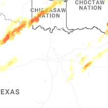
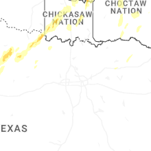


Connect with Interactive Hail Maps